

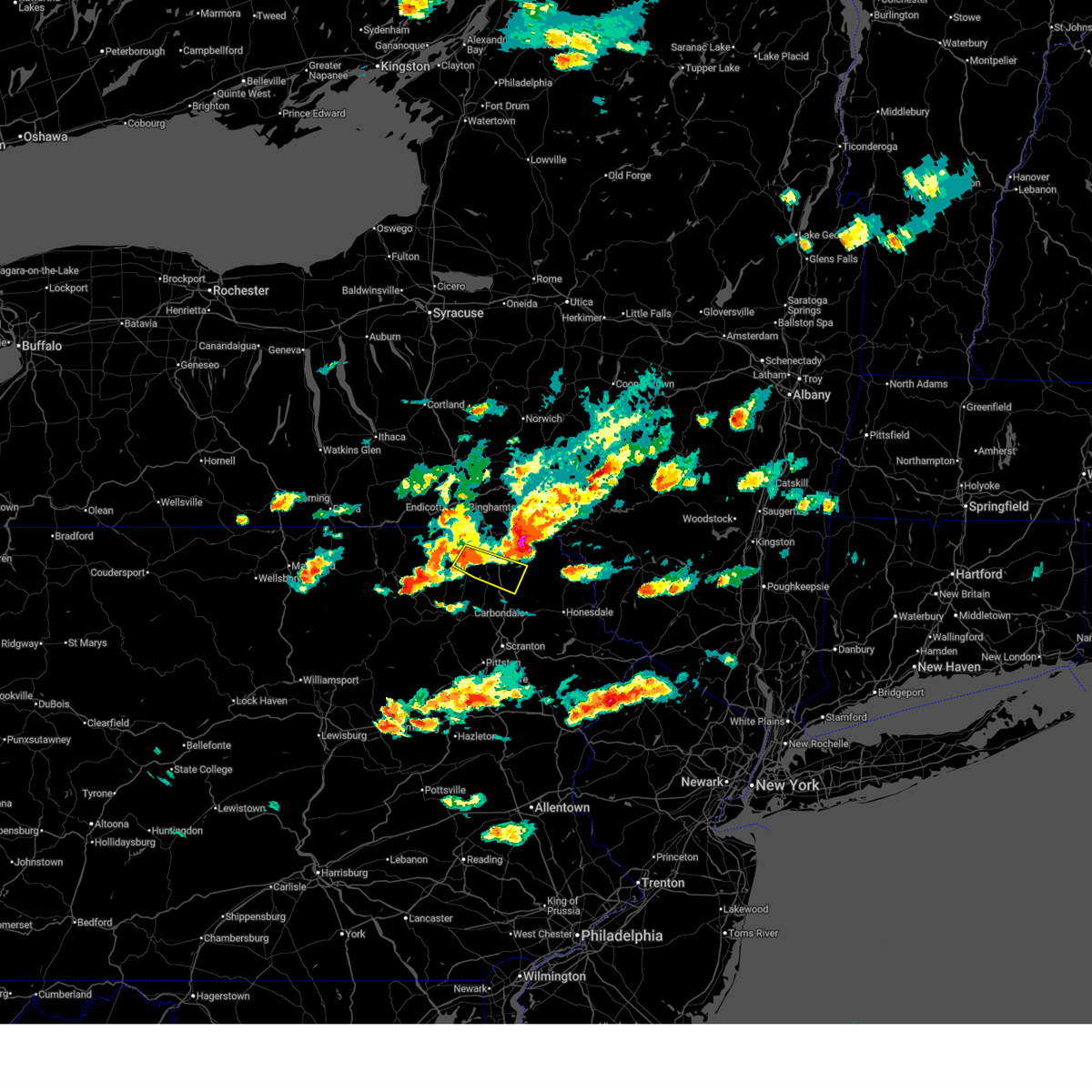
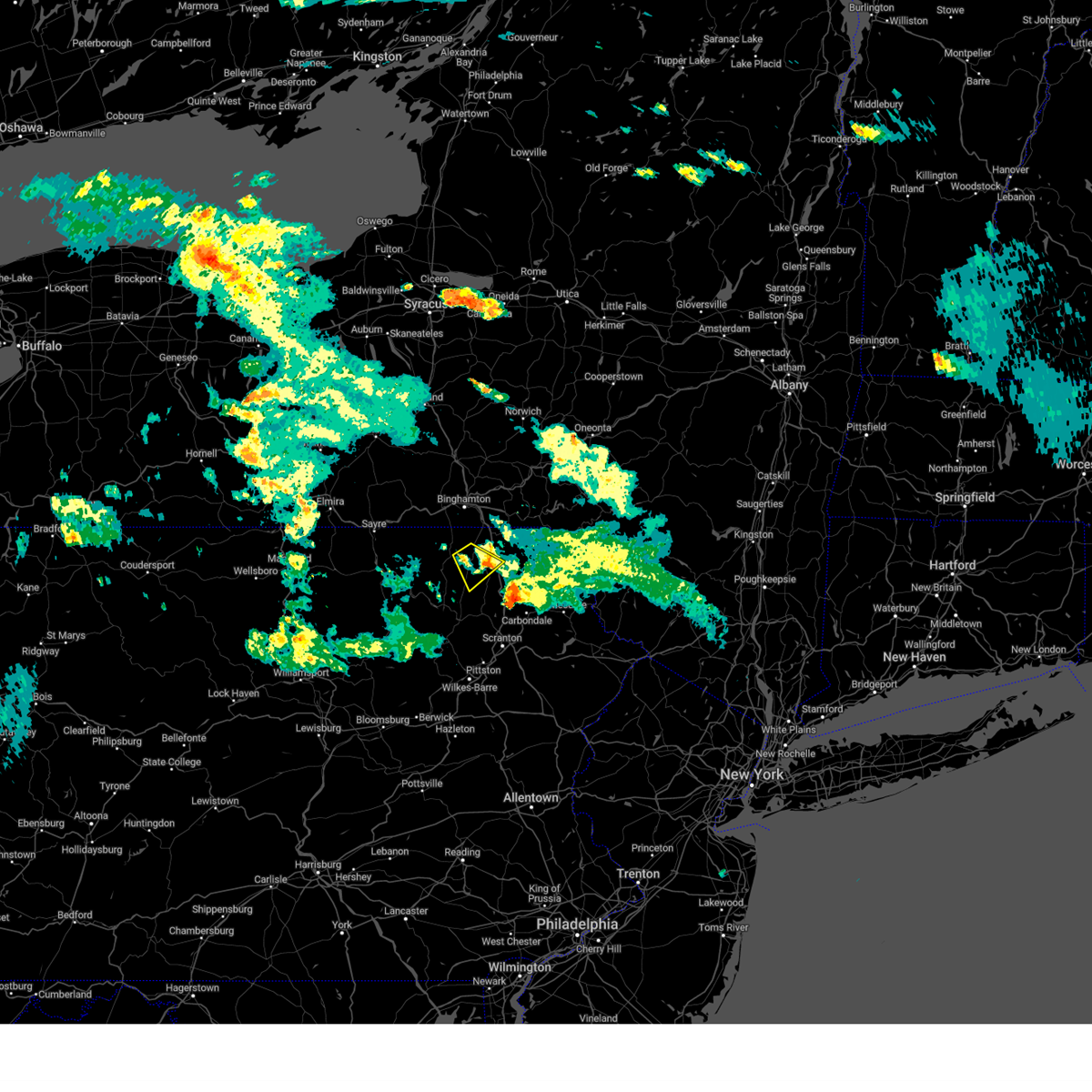
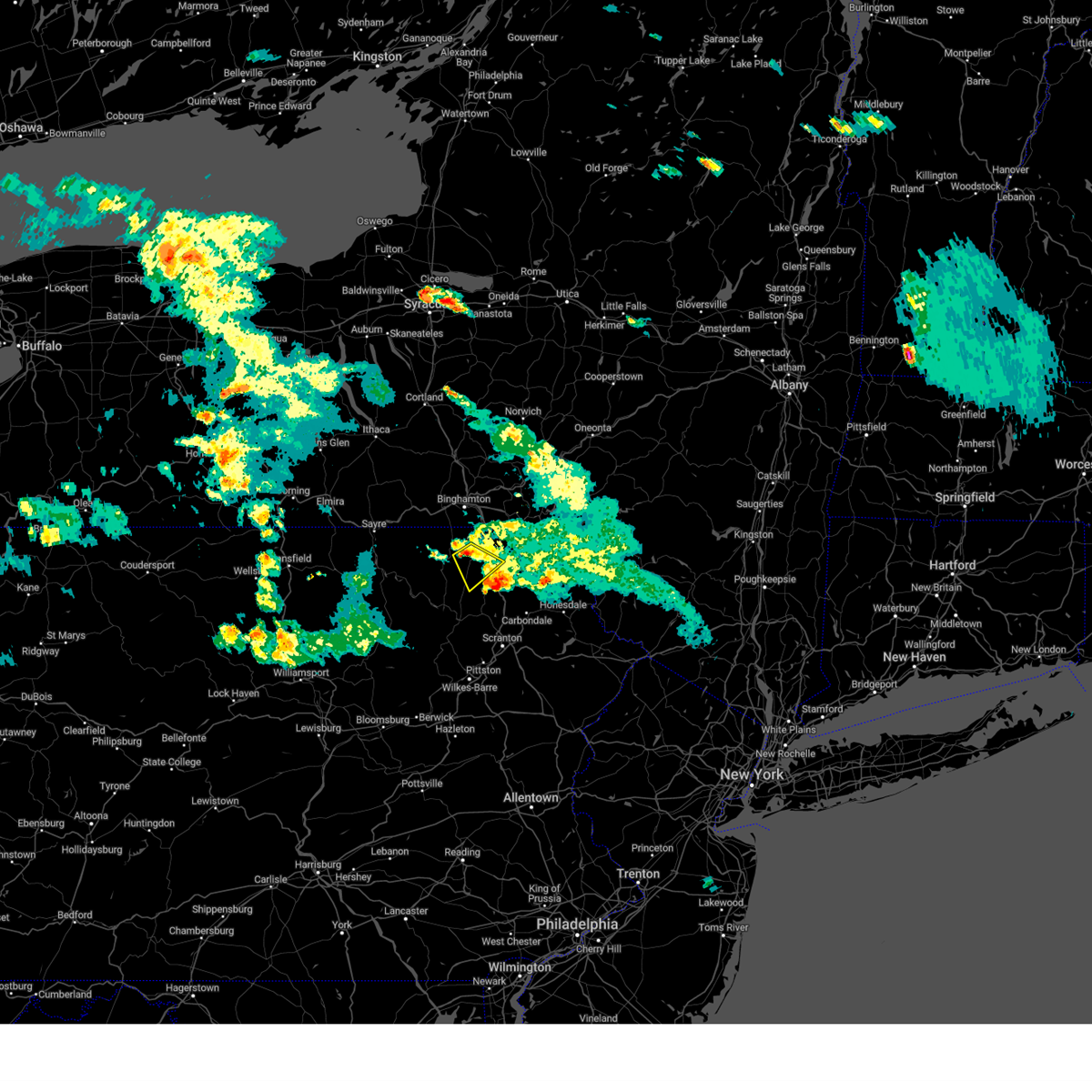
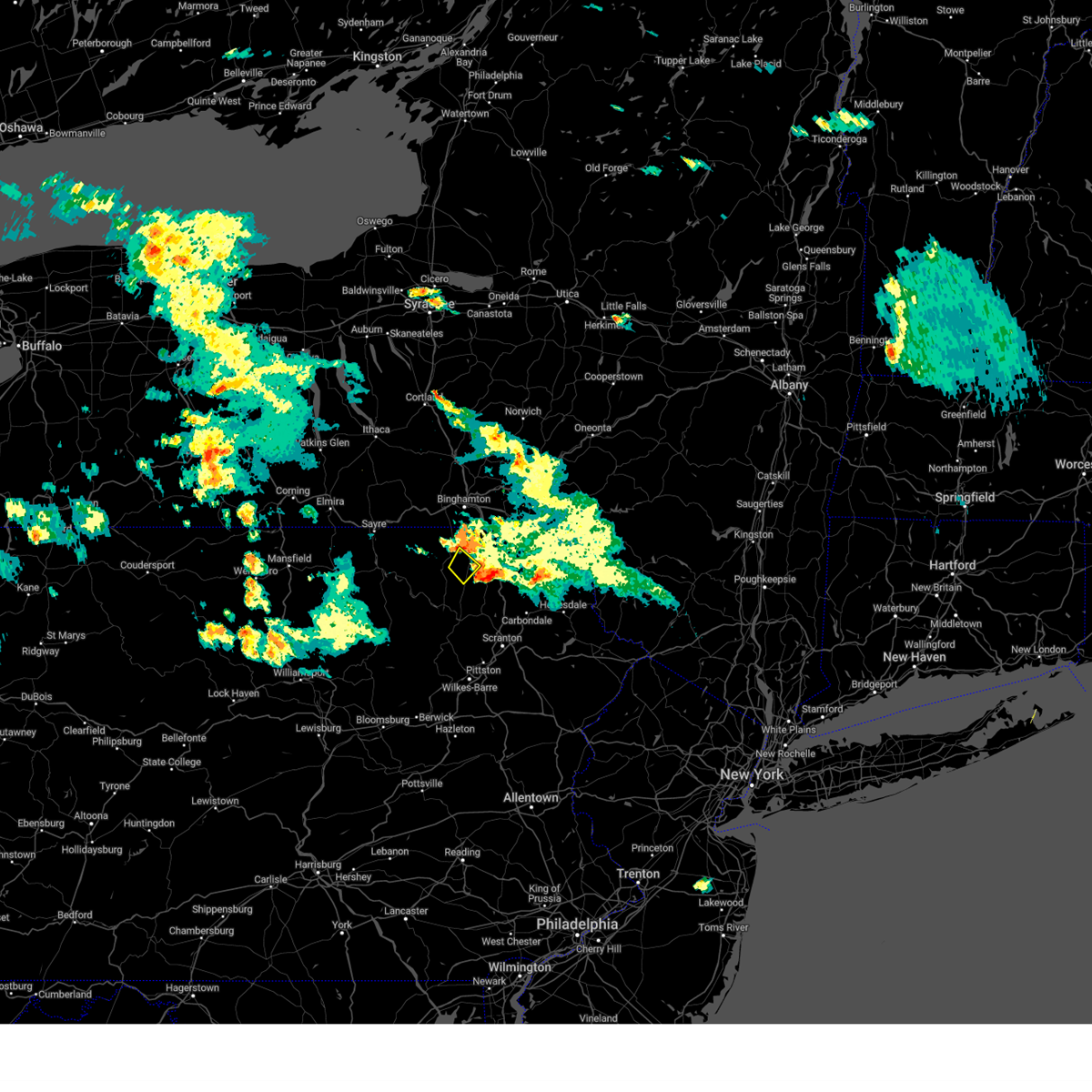
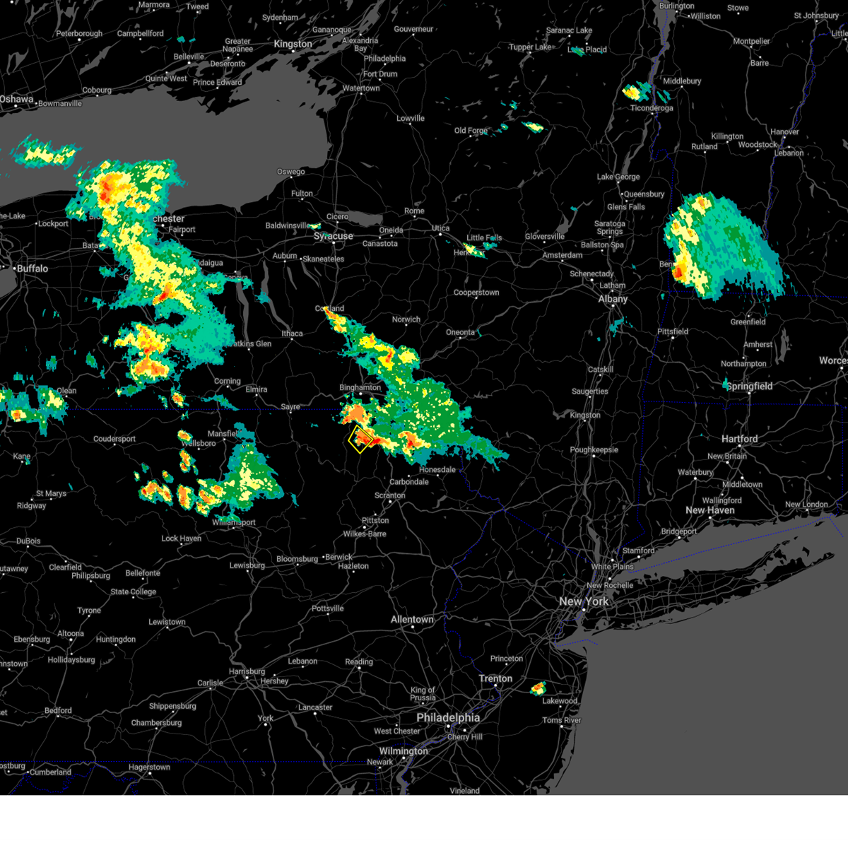
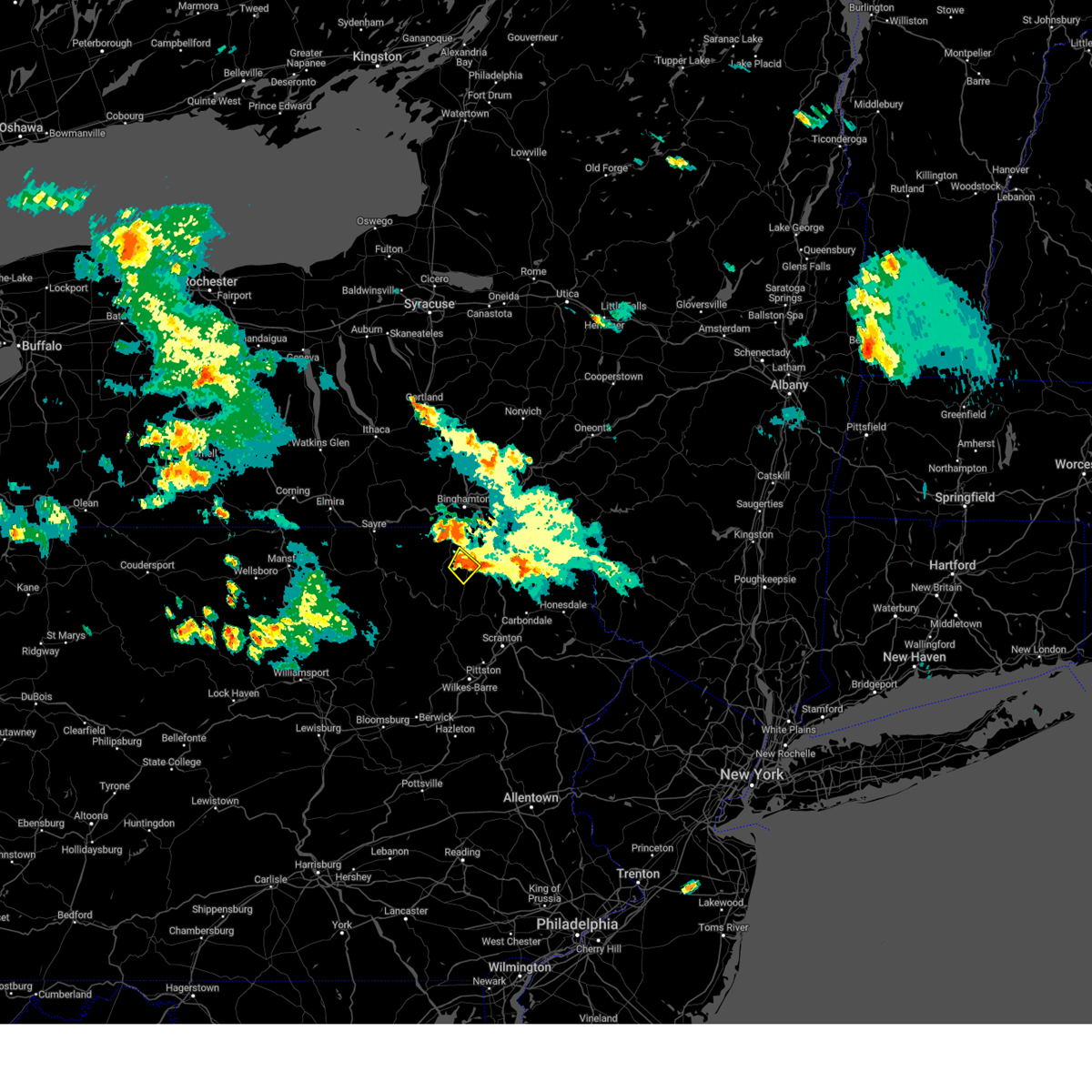
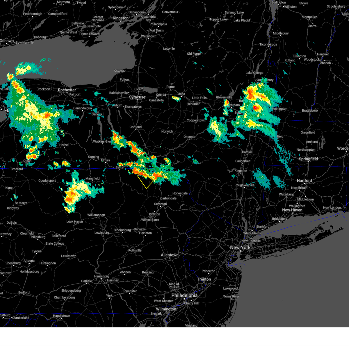
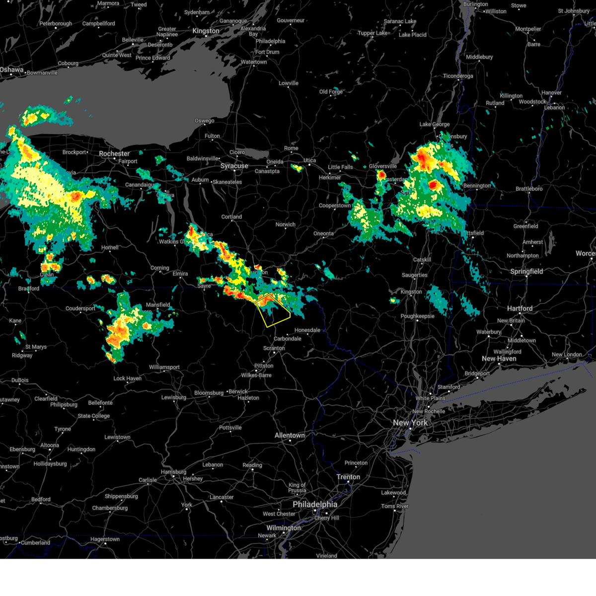
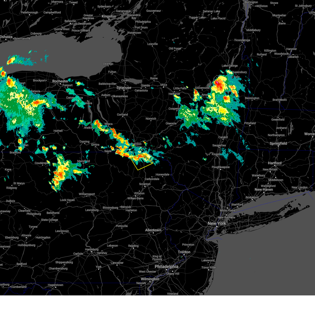
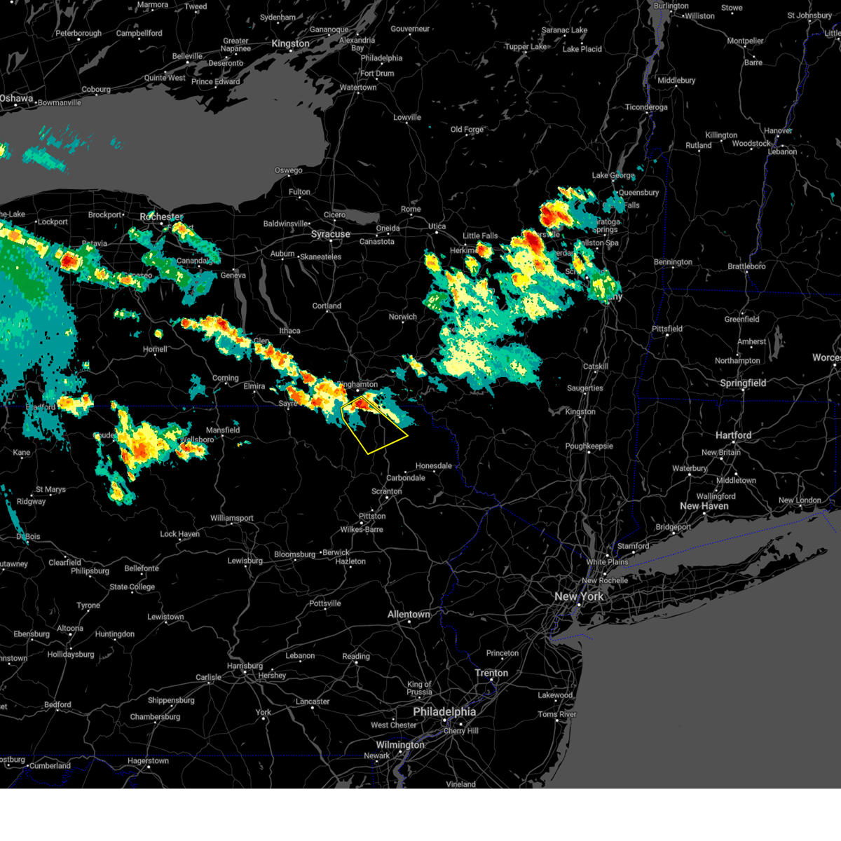
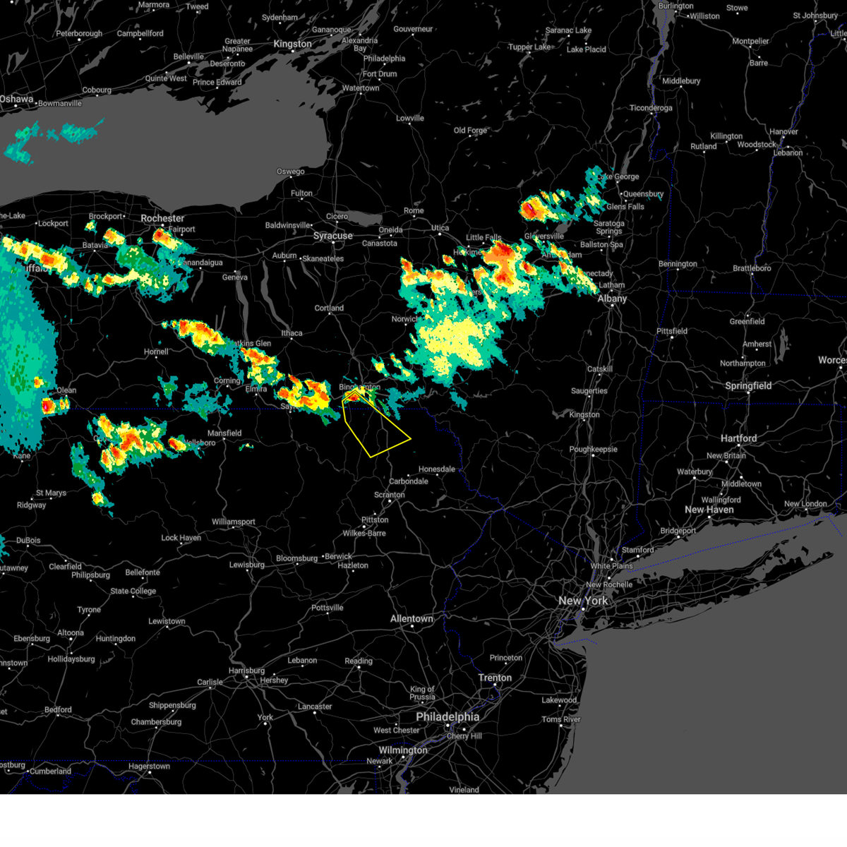
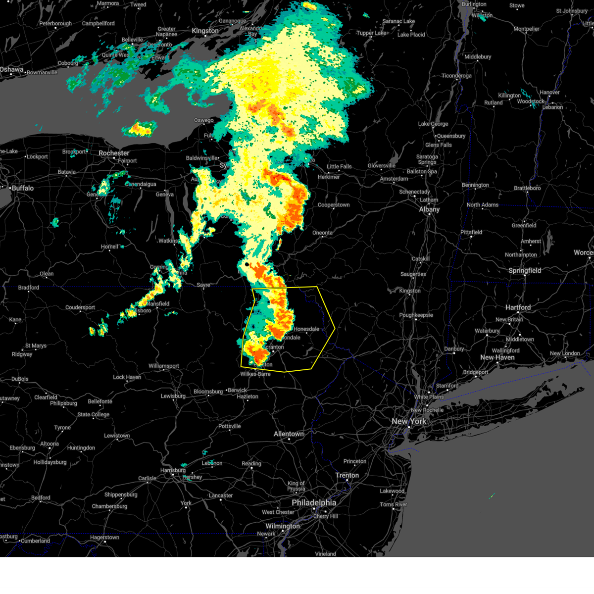
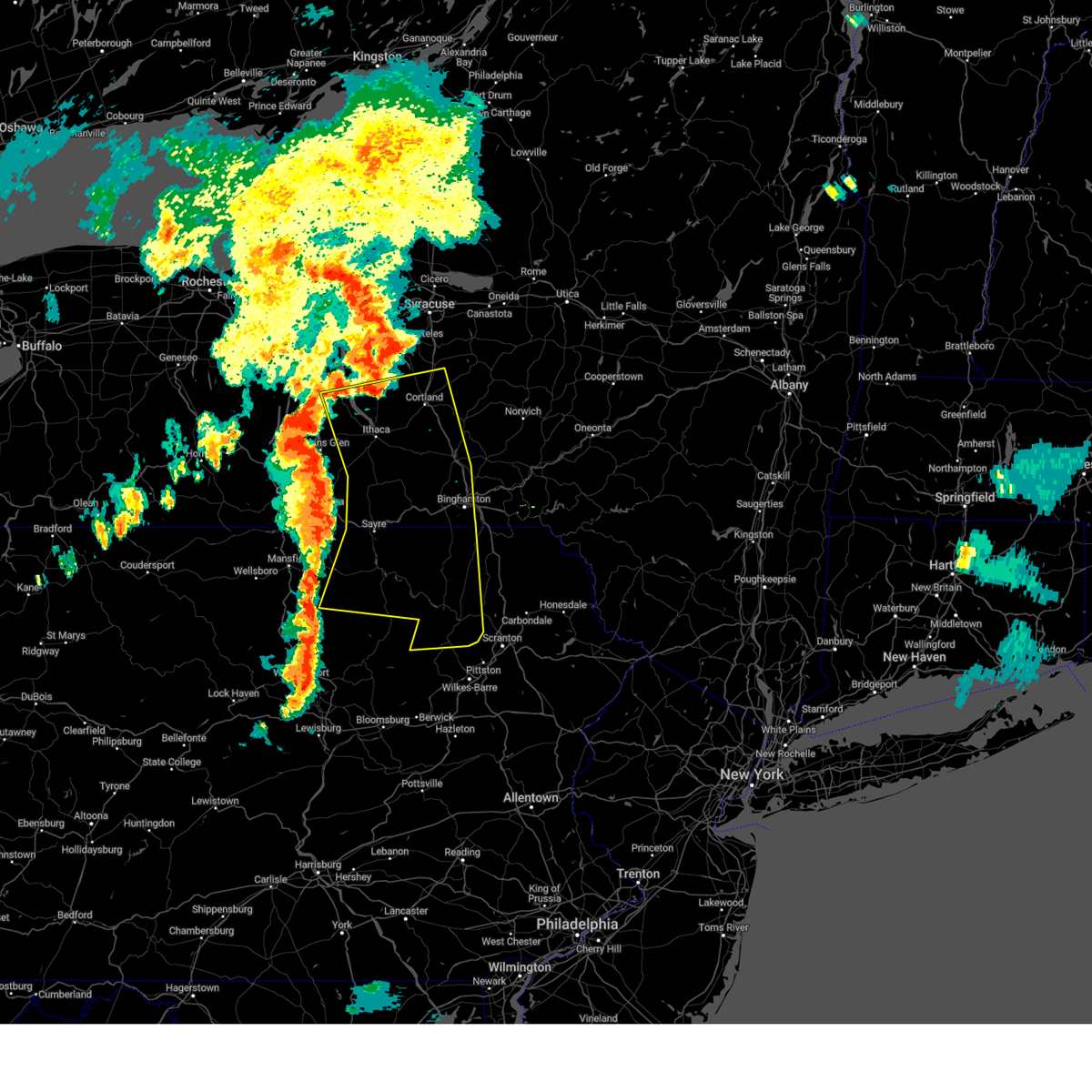
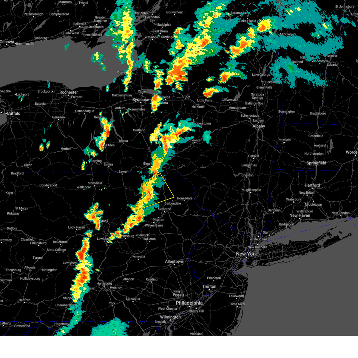
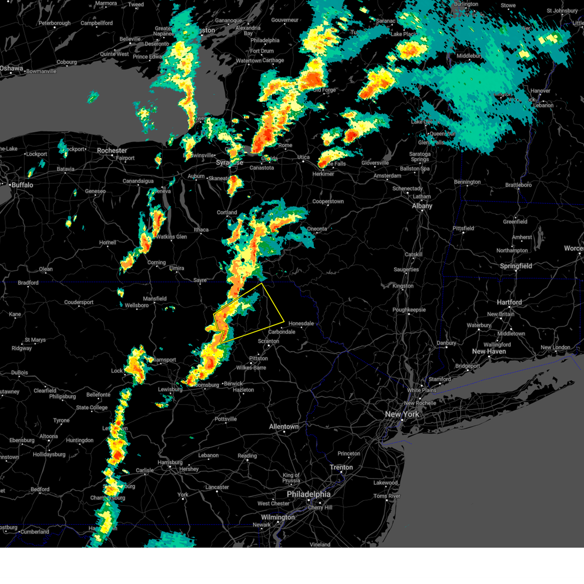
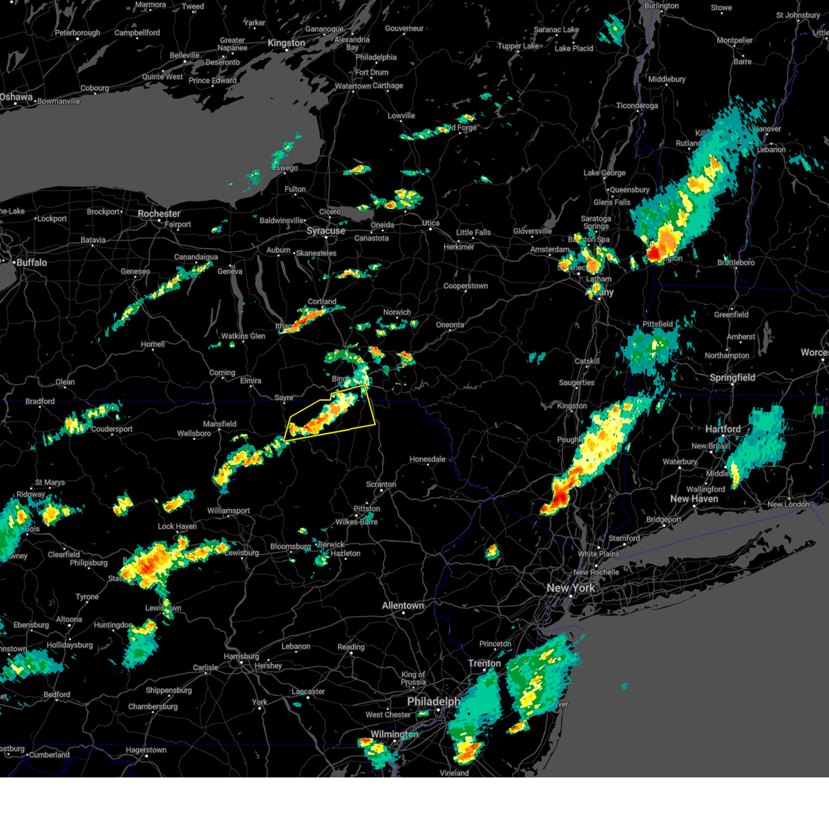
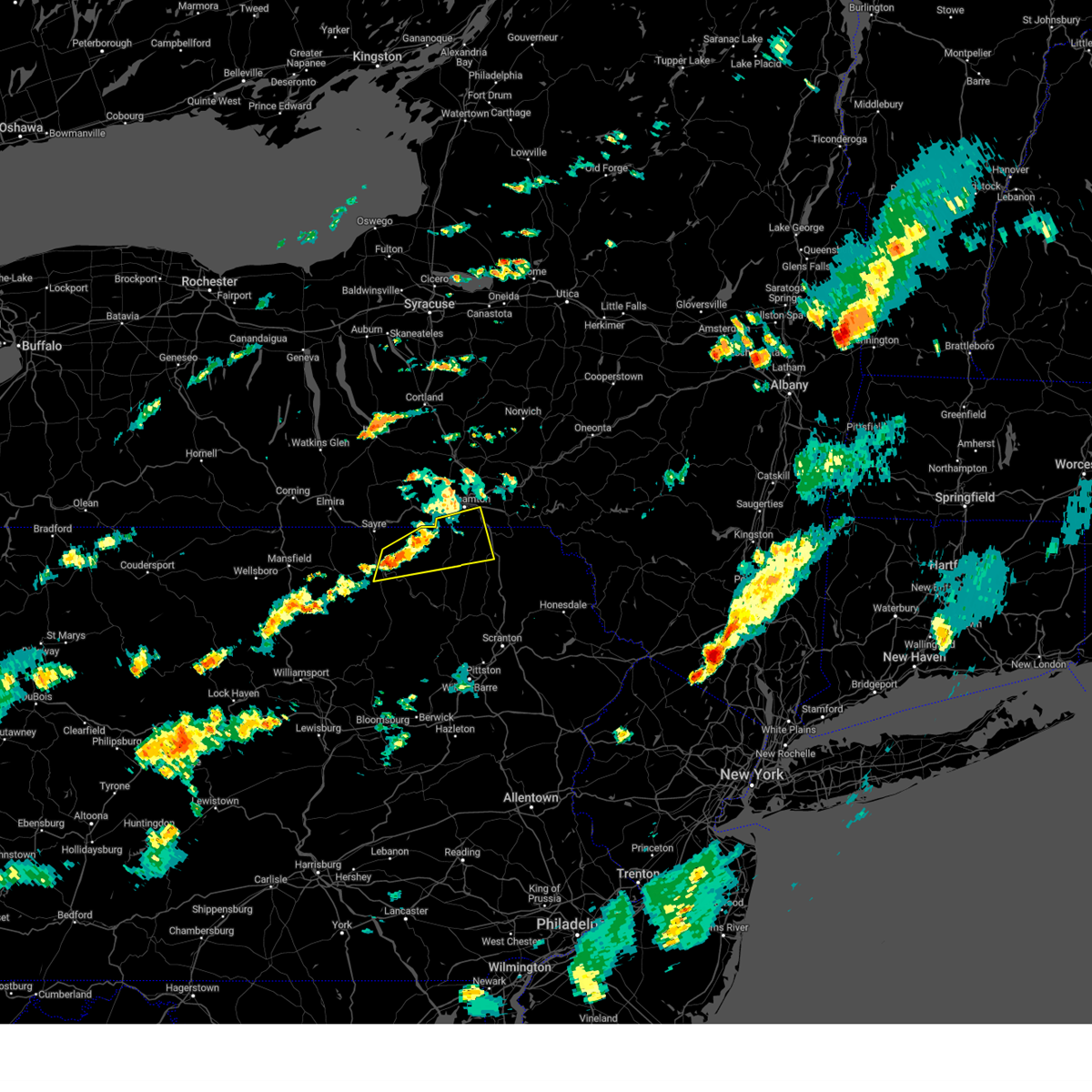
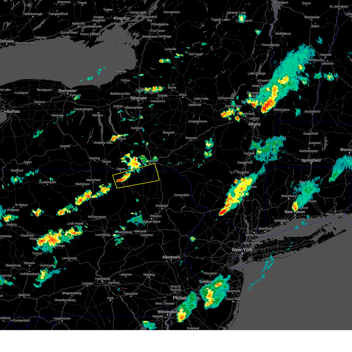
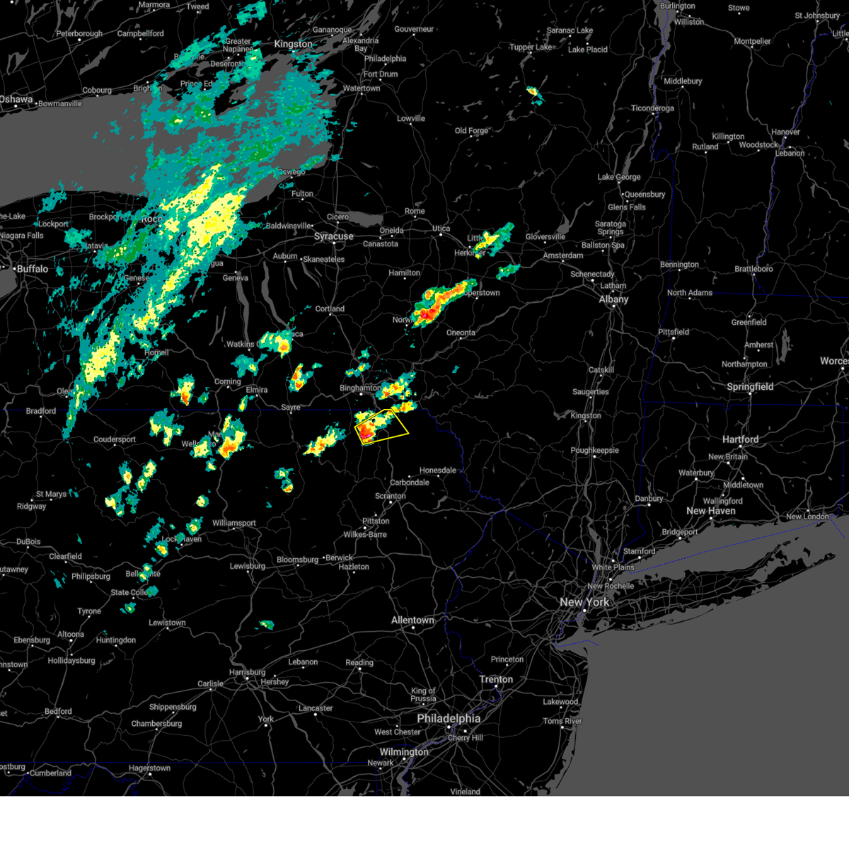
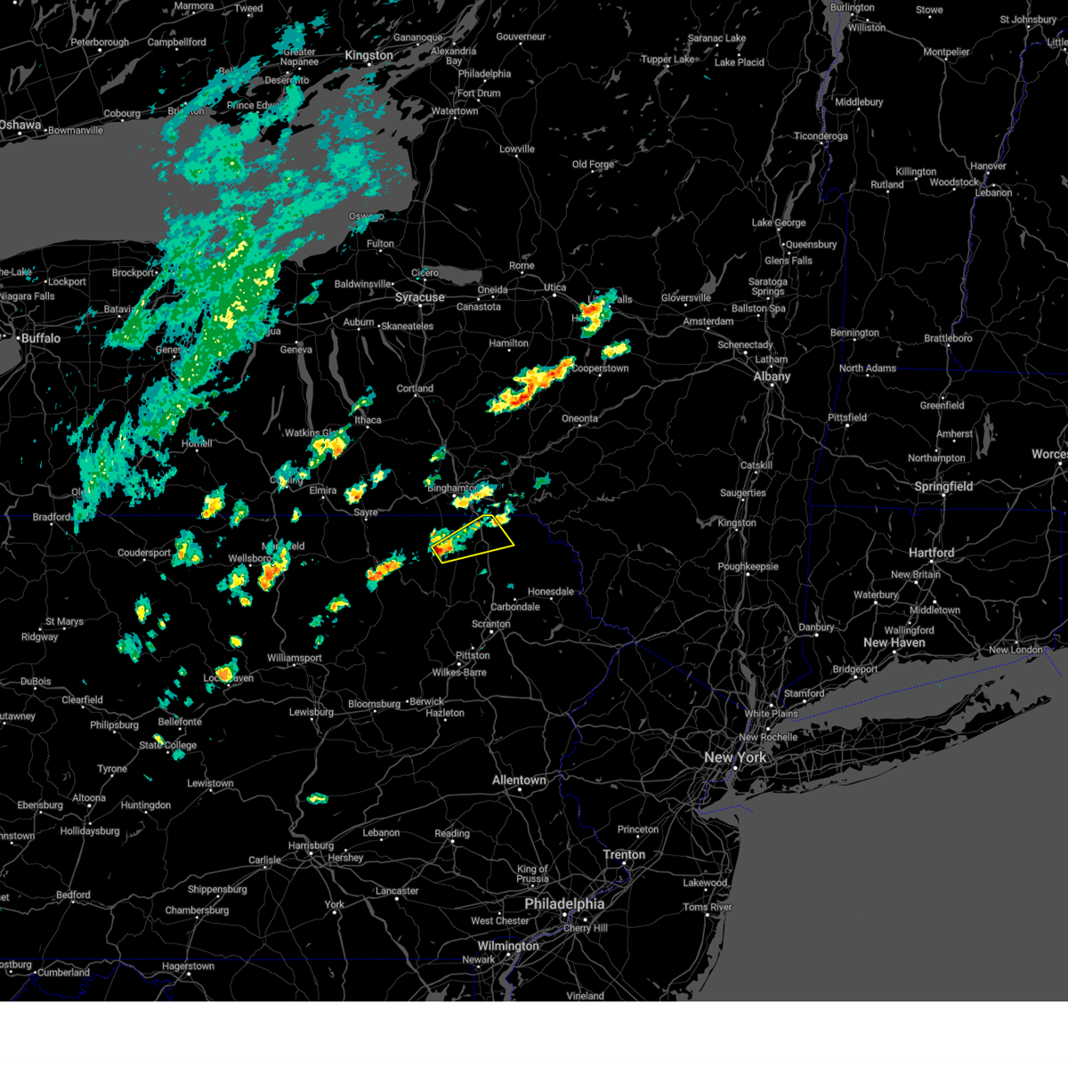
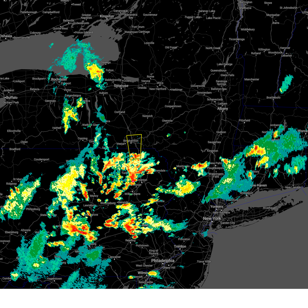
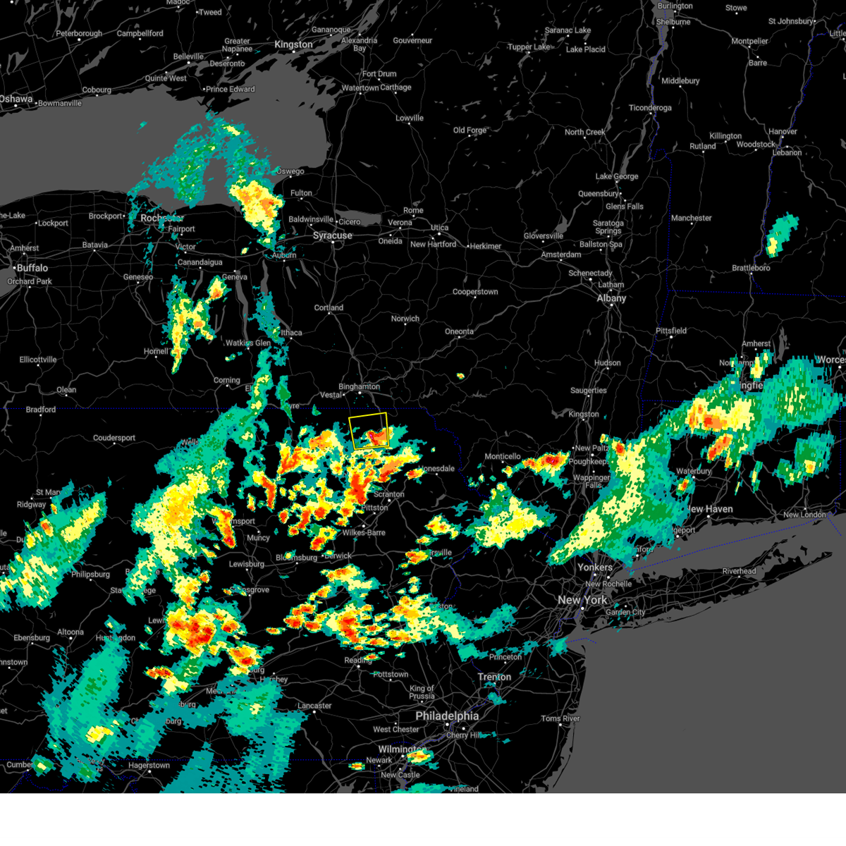
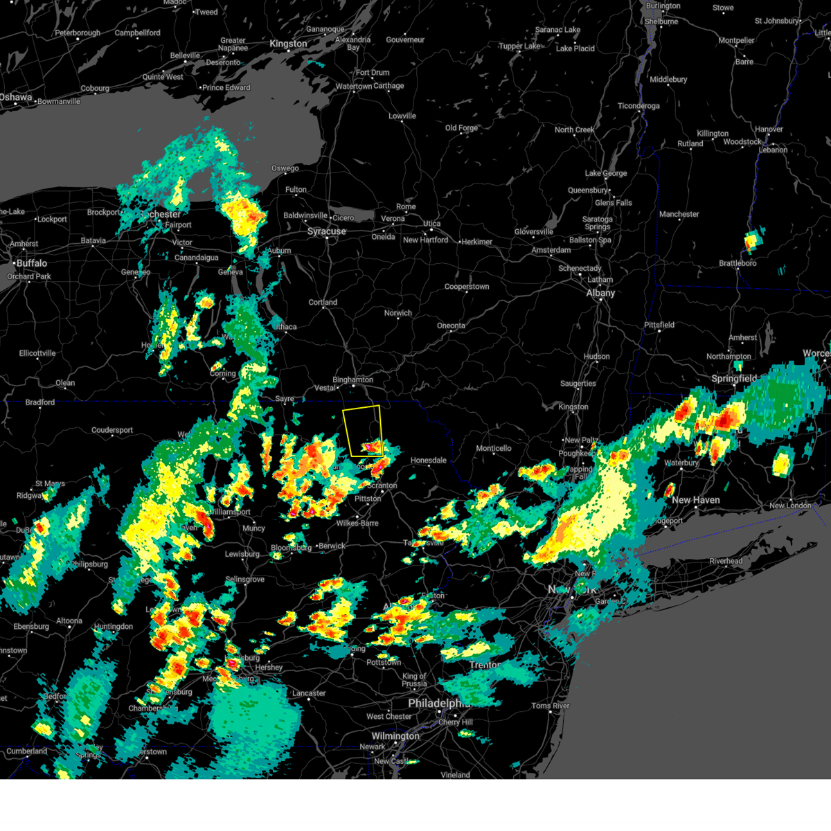
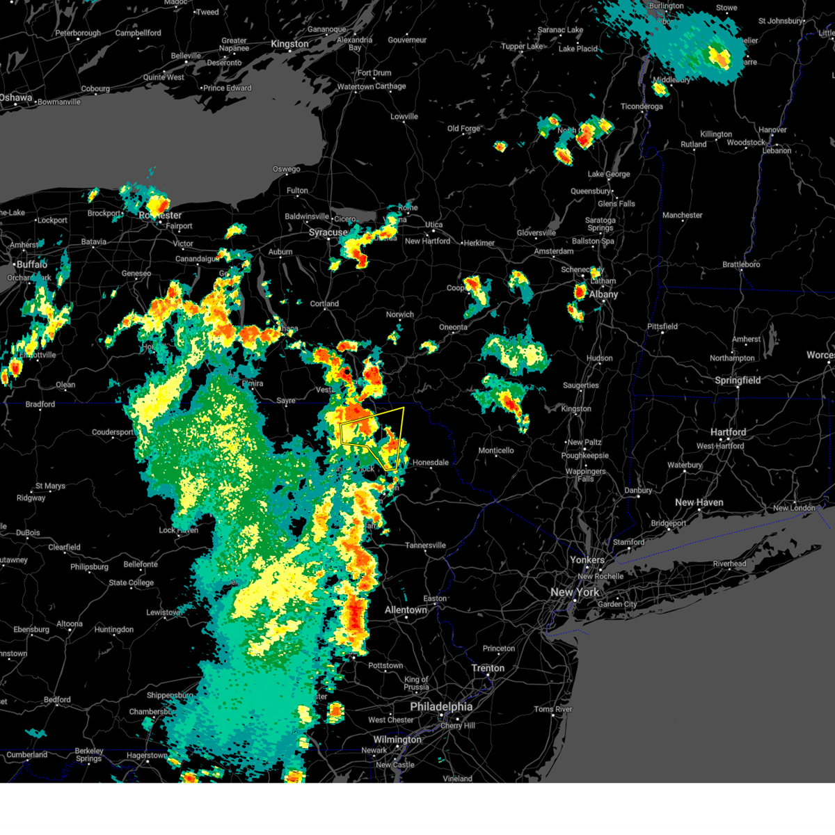
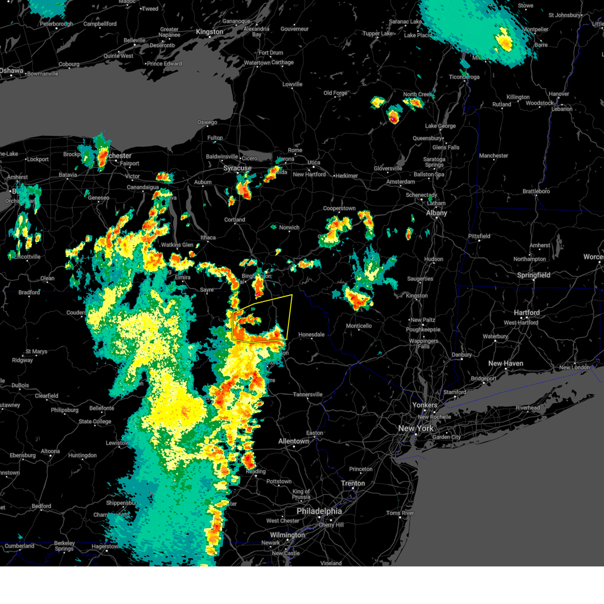
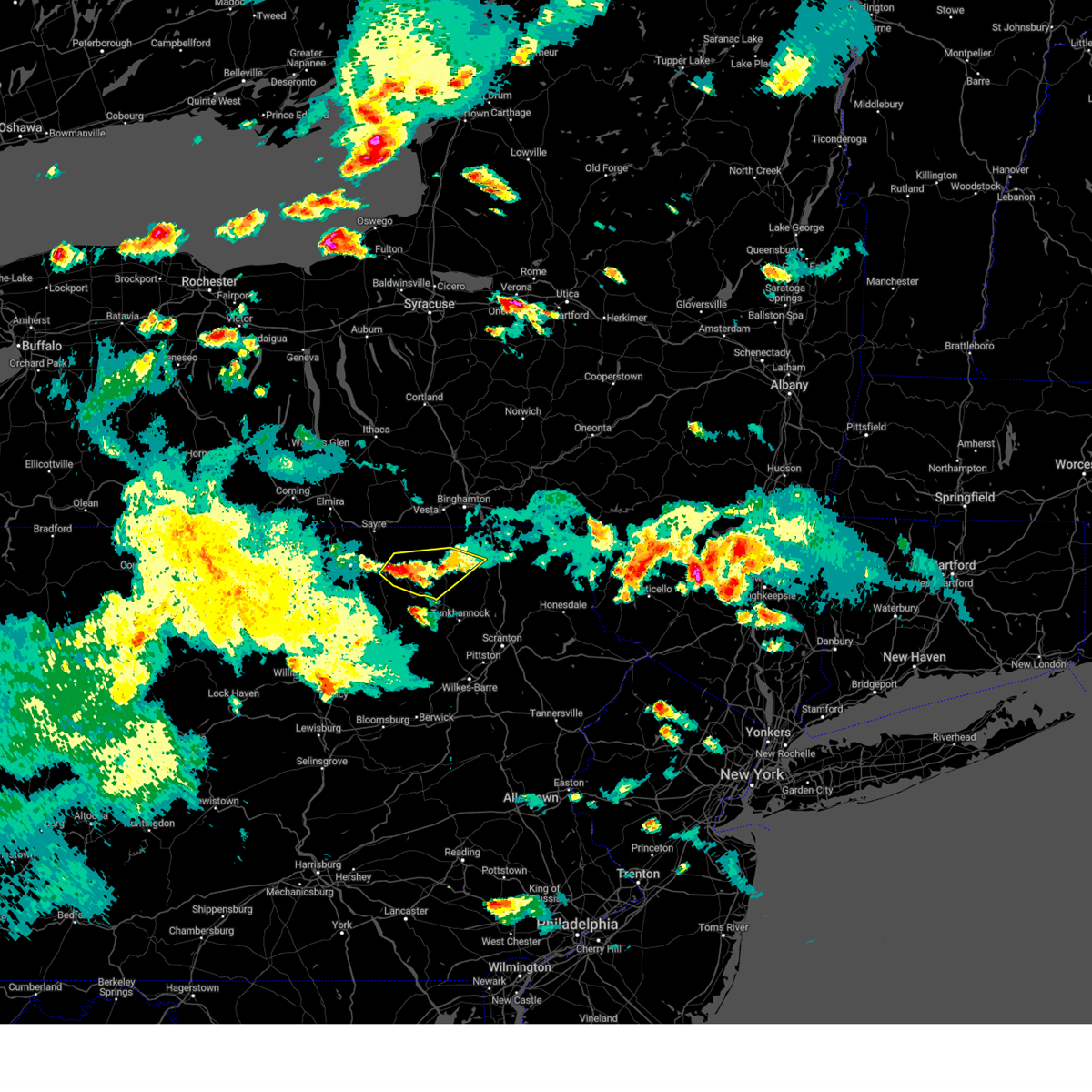
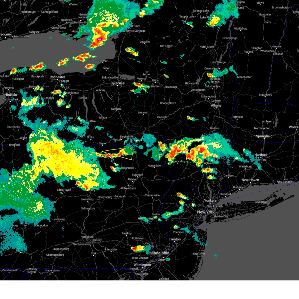
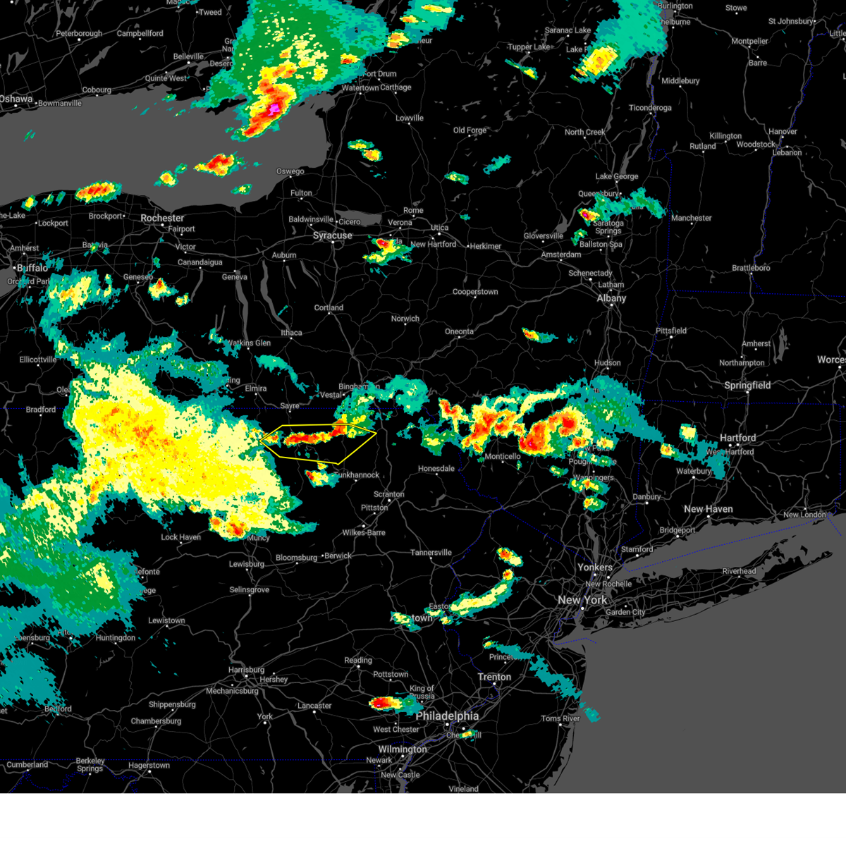
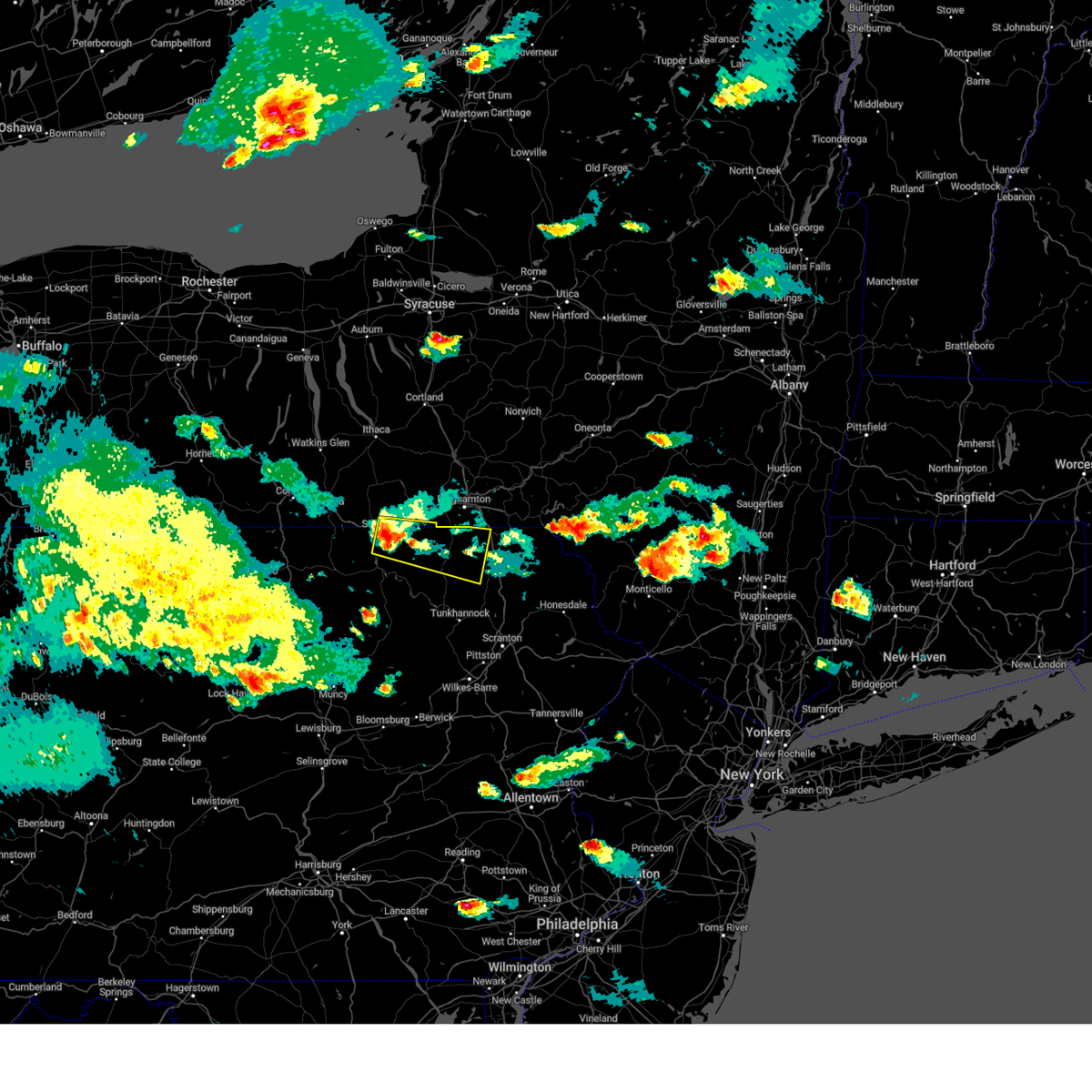
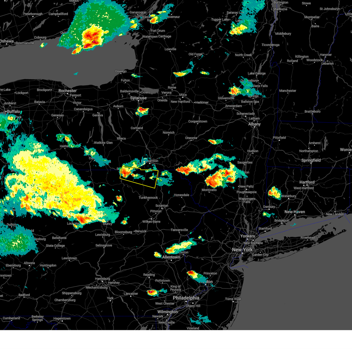
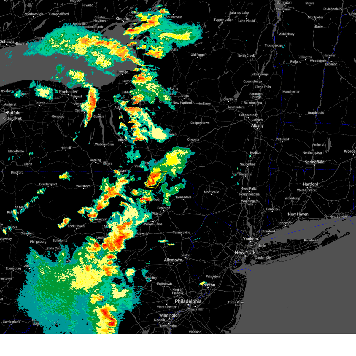
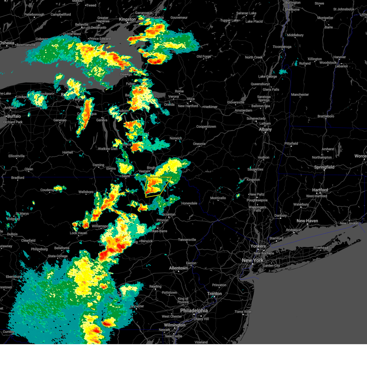
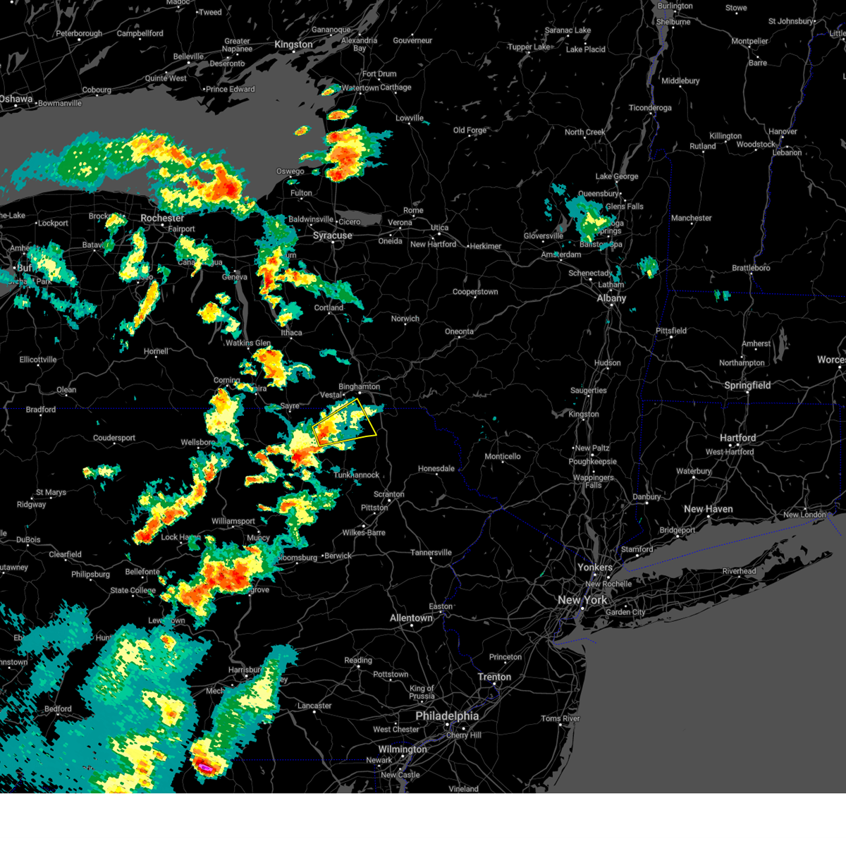
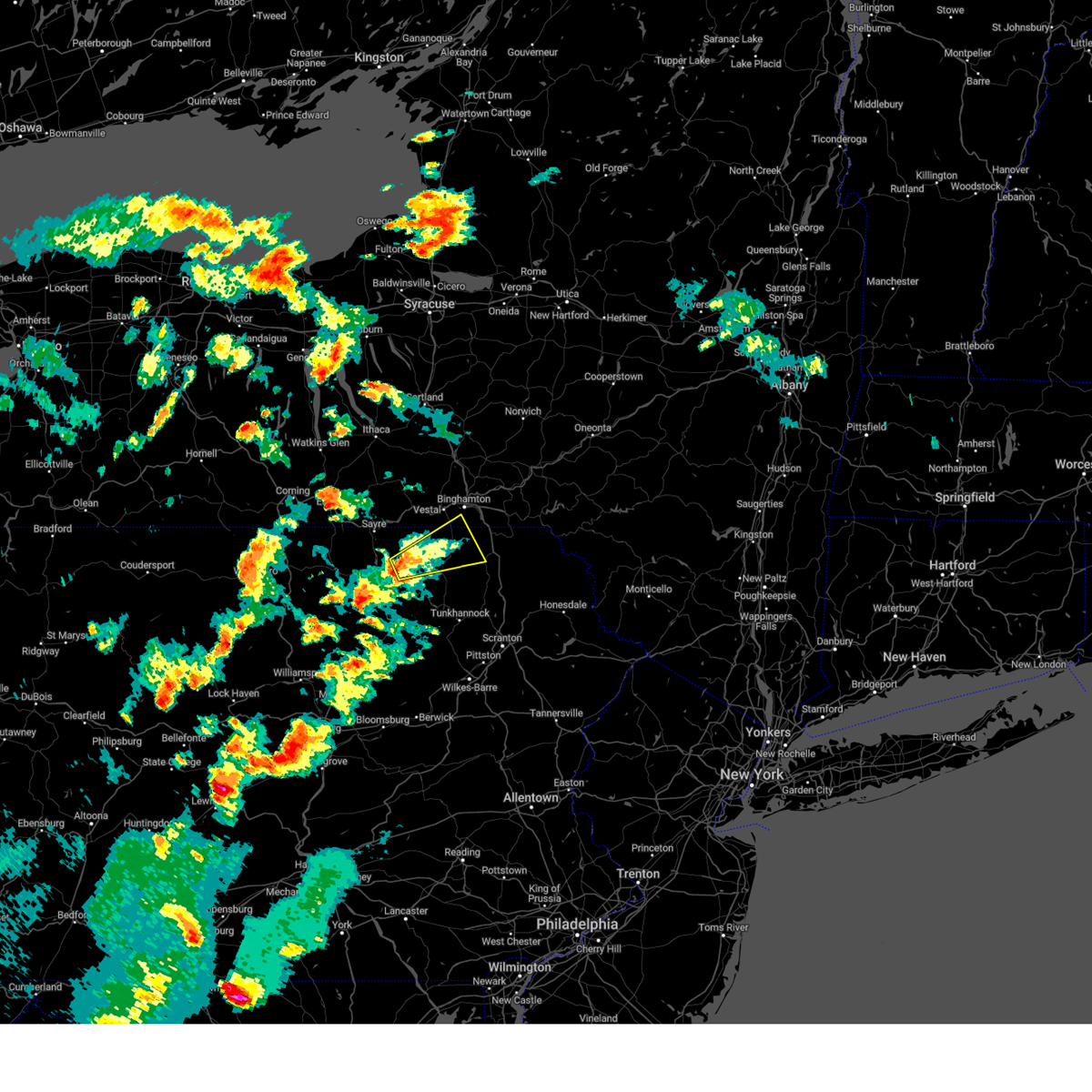
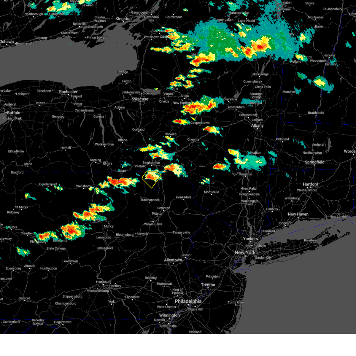
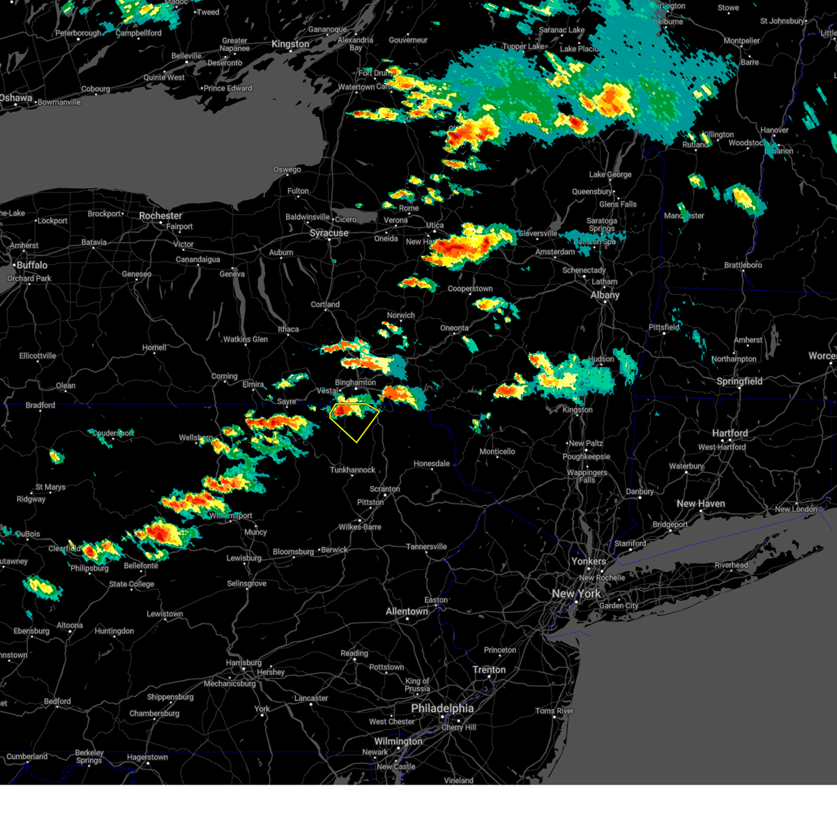
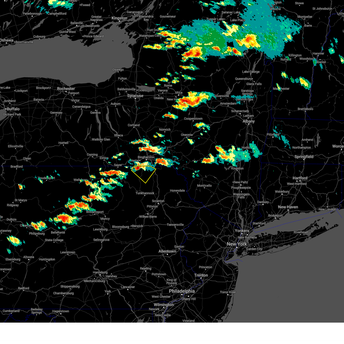
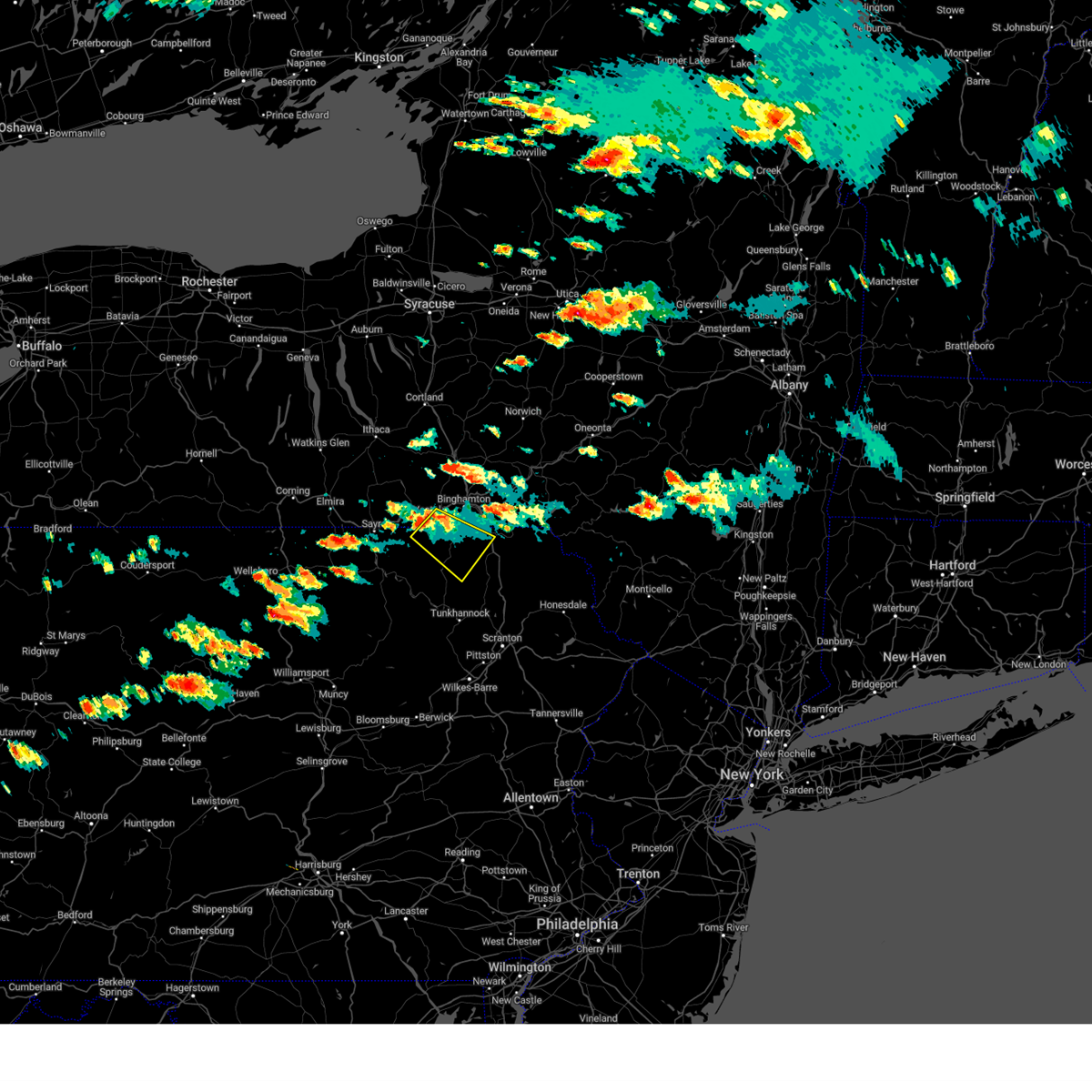
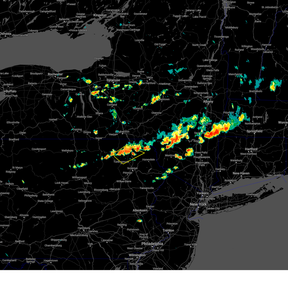
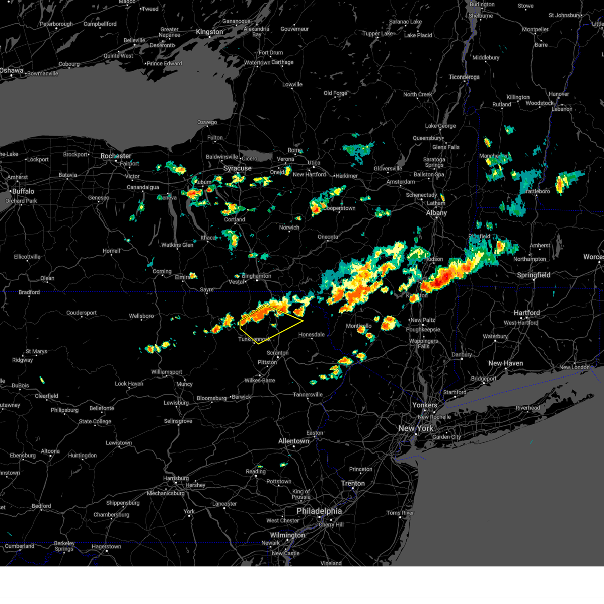
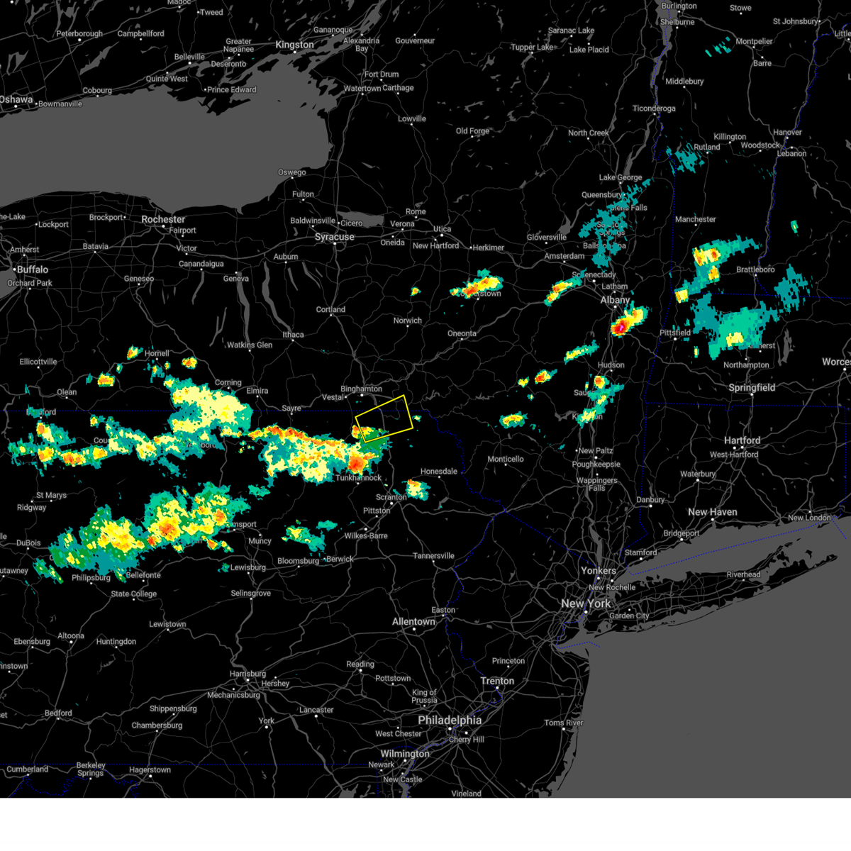
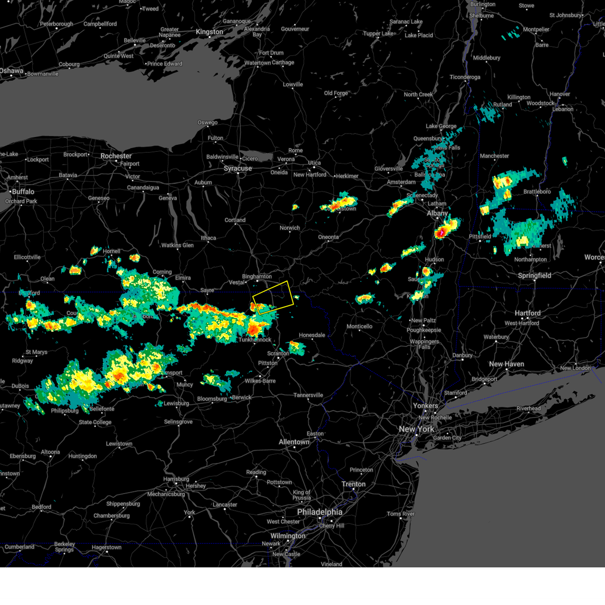
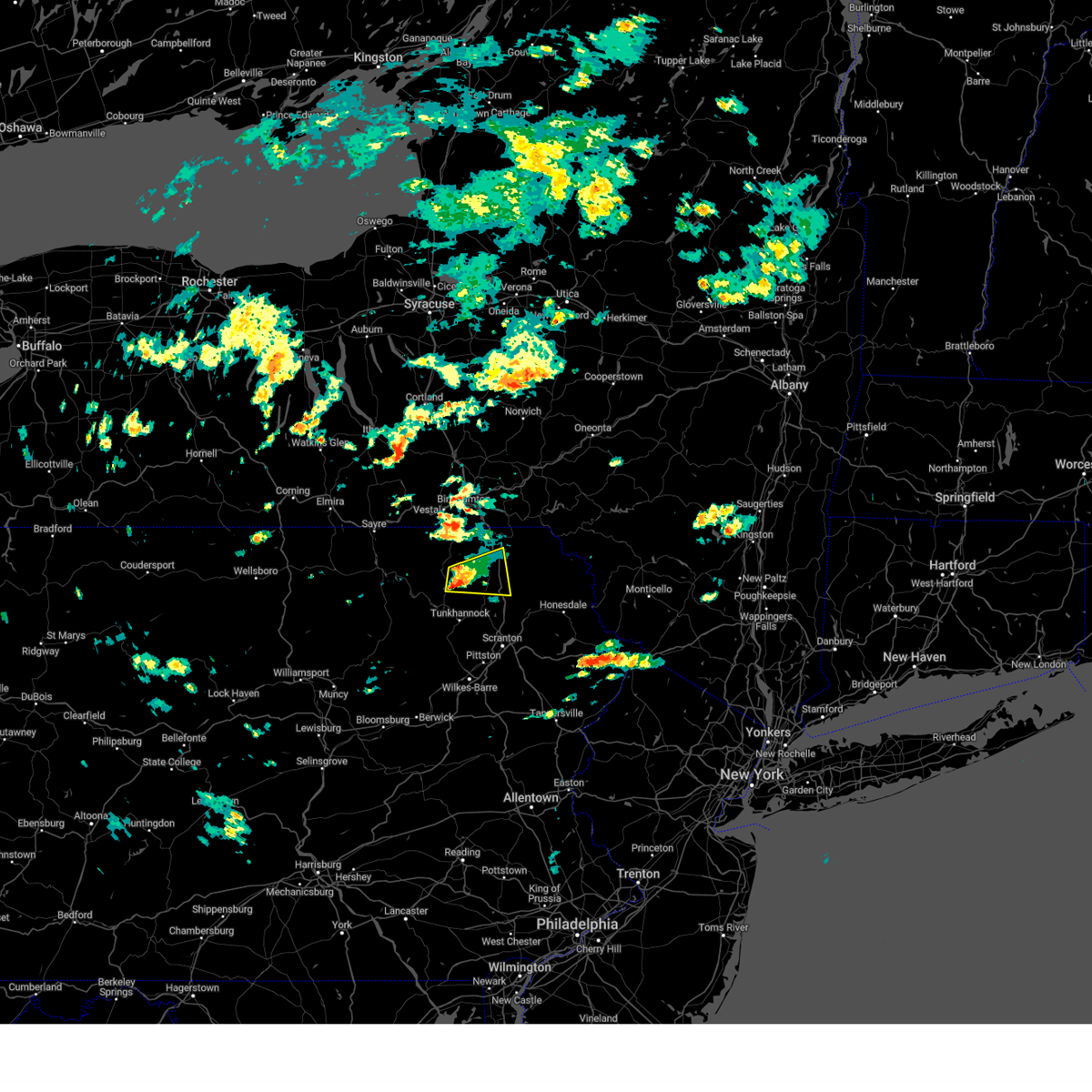
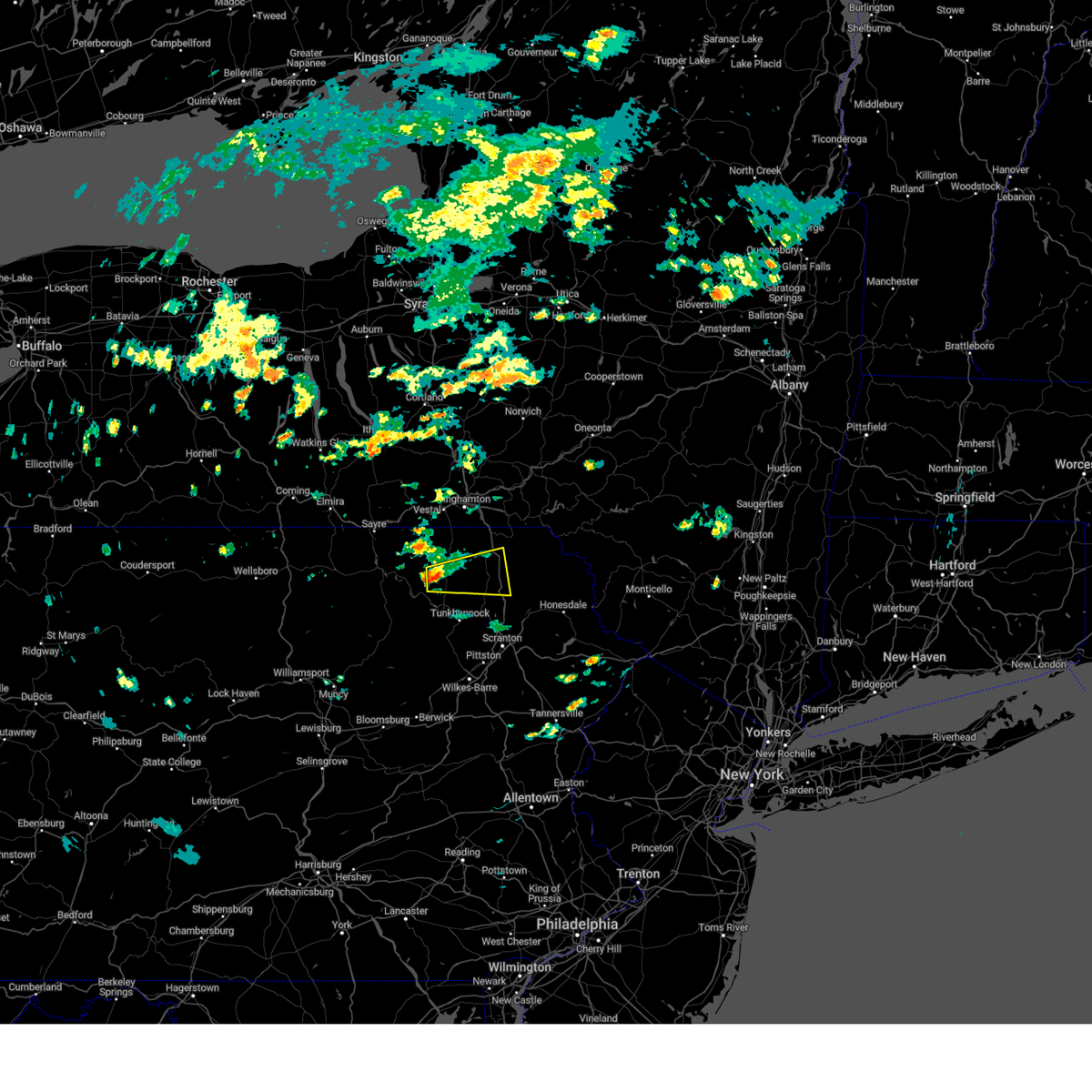
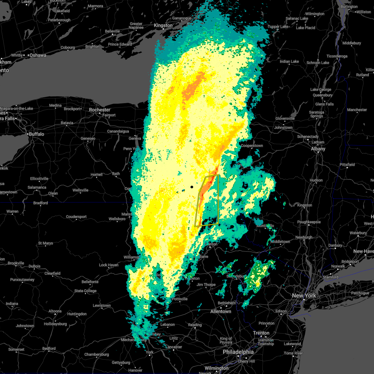
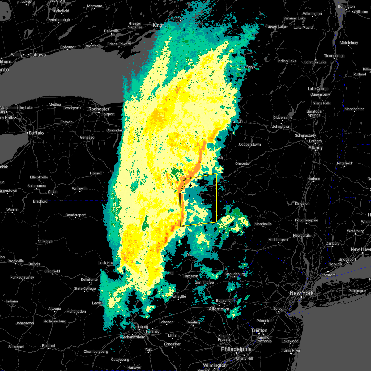
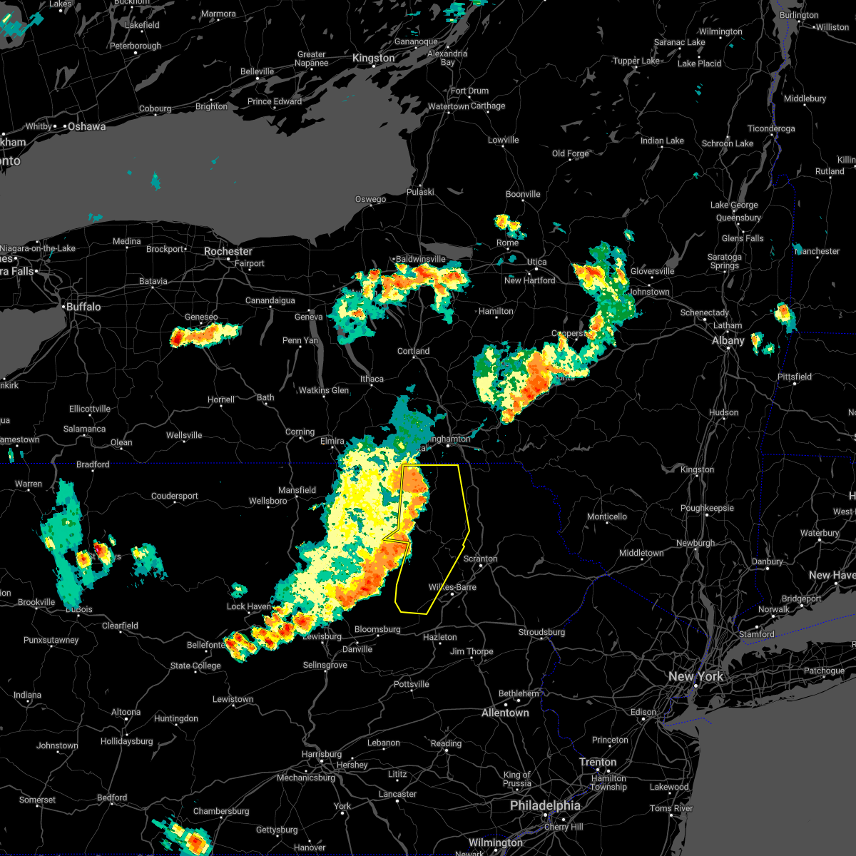
Hail Map for Montrose, PA
The Montrose, PA area has had 9 reports of on-the-ground hail by trained spotters, and has been under severe weather warnings 22 times during the past 12 months. Doppler radar has detected hail at or near Montrose, PA on 31 occasions, including 1 occasion during the past year.
| Name: | Montrose, PA |
| Where Located: | 31.2 miles NNW of Scranton, PA |
| Map: | Google Map for Montrose, PA |
| Population: | 1617 |
| Housing Units: | 857 |
| More Info: | Search Google for Montrose, PA |
0
The Top Recent Hail Date for Montrose, PA is Monday, August 5, 2024 (31st out of 31)

Hail and Wind Damage Spotted near Montrose, PA
| Date / Time | Report Details |
|---|---|
| 7/3/2025 3:36 PM EDT |
 Svrbgm the national weather service in binghamton has issued a * severe thunderstorm warning for, central susquehanna county in northeastern pennsylvania, * until 400 pm edt. * at 336 pm edt, a severe thunderstorm was located over montrose, moving east at 40 mph (radar indicated). Hazards include 60 mph wind gusts and quarter size hail. Hail damage to vehicles is expected. Expect wind damage to roofs, siding, and trees. Svrbgm the national weather service in binghamton has issued a * severe thunderstorm warning for, central susquehanna county in northeastern pennsylvania, * until 400 pm edt. * at 336 pm edt, a severe thunderstorm was located over montrose, moving east at 40 mph (radar indicated). Hazards include 60 mph wind gusts and quarter size hail. Hail damage to vehicles is expected. Expect wind damage to roofs, siding, and trees.
|
| 3/16/2025 5:00 PM EDT |
 Svrbgm the national weather service in binghamton has issued a * severe thunderstorm warning for, southwestern broome county in central new york, south central tioga county in central new york, western susquehanna county in northeastern pennsylvania, eastern bradford county in northeastern pennsylvania, northwestern wyoming county in northeastern pennsylvania, * until 600 pm edt. * at 500 pm edt, severe thunderstorms were located along a line extending from little meadows to 7 miles west of lovelton, moving east at 25 mph (radar indicated). Hazards include 60 mph wind gusts. expect damage to roofs, siding, and trees Svrbgm the national weather service in binghamton has issued a * severe thunderstorm warning for, southwestern broome county in central new york, south central tioga county in central new york, western susquehanna county in northeastern pennsylvania, eastern bradford county in northeastern pennsylvania, northwestern wyoming county in northeastern pennsylvania, * until 600 pm edt. * at 500 pm edt, severe thunderstorms were located along a line extending from little meadows to 7 miles west of lovelton, moving east at 25 mph (radar indicated). Hazards include 60 mph wind gusts. expect damage to roofs, siding, and trees
|
| 8/9/2024 11:00 AM EDT |
 the tornado warning has been cancelled and is no longer in effect the tornado warning has been cancelled and is no longer in effect
|
| 8/9/2024 10:42 AM EDT |
 Torbgm the national weather service in binghamton has issued a * tornado warning for, central susquehanna county in northeastern pennsylvania, * until 1115 am edt. * at 1042 am edt, a severe thunderstorm capable of producing a tornado was located near montrose, moving north at 50 mph (radar indicated rotation). Hazards include tornado. Flying debris will be dangerous to those caught without shelter. mobile homes will be damaged or destroyed. damage to roofs, windows, and vehicles will occur. tree damage is likely. this dangerous storm will be near, montrose around 1045 am edt. Brackney around 1055 am edt. Torbgm the national weather service in binghamton has issued a * tornado warning for, central susquehanna county in northeastern pennsylvania, * until 1115 am edt. * at 1042 am edt, a severe thunderstorm capable of producing a tornado was located near montrose, moving north at 50 mph (radar indicated rotation). Hazards include tornado. Flying debris will be dangerous to those caught without shelter. mobile homes will be damaged or destroyed. damage to roofs, windows, and vehicles will occur. tree damage is likely. this dangerous storm will be near, montrose around 1045 am edt. Brackney around 1055 am edt.
|
| 8/5/2024 6:57 PM EDT |
 The storm which prompted the warning has weakened below severe limits, and has exited the warned area. therefore, the warning will be allowed to expire. however, heavy rain is still possible with this thunderstorm. a severe thunderstorm watch remains in effect until 800 pm edt for northeastern pennsylvania. The storm which prompted the warning has weakened below severe limits, and has exited the warned area. therefore, the warning will be allowed to expire. however, heavy rain is still possible with this thunderstorm. a severe thunderstorm watch remains in effect until 800 pm edt for northeastern pennsylvania.
|
| 8/5/2024 6:36 PM EDT |
 Svrbgm the national weather service in binghamton has issued a * severe thunderstorm warning for, central susquehanna county in northeastern pennsylvania, * until 700 pm edt. * at 636 pm edt, a severe thunderstorm was located over montrose, moving southeast at 25 mph (radar indicated). Hazards include 60 mph wind gusts and penny size hail. expect damage to roofs, siding, and trees Svrbgm the national weather service in binghamton has issued a * severe thunderstorm warning for, central susquehanna county in northeastern pennsylvania, * until 700 pm edt. * at 636 pm edt, a severe thunderstorm was located over montrose, moving southeast at 25 mph (radar indicated). Hazards include 60 mph wind gusts and penny size hail. expect damage to roofs, siding, and trees
|
| 8/5/2024 6:28 PM EDT |
 the severe thunderstorm warning has been cancelled and is no longer in effect the severe thunderstorm warning has been cancelled and is no longer in effect
|
| 8/5/2024 6:16 PM EDT |
 At 615 pm edt, a severe thunderstorm was located near montrose, moving southeast at 15 mph (radar indicated). Hazards include 60 mph wind gusts and quarter size hail. Hail damage to vehicles is expected. expect wind damage to roofs, siding, and trees. Locations impacted include, montrose, dimock, south montrose, and elk lake. At 615 pm edt, a severe thunderstorm was located near montrose, moving southeast at 15 mph (radar indicated). Hazards include 60 mph wind gusts and quarter size hail. Hail damage to vehicles is expected. expect wind damage to roofs, siding, and trees. Locations impacted include, montrose, dimock, south montrose, and elk lake.
|
| 8/5/2024 6:13 PM EDT |
 Svrbgm the national weather service in binghamton has issued a * severe thunderstorm warning for, southwestern susquehanna county in northeastern pennsylvania, * until 715 pm edt. * at 613 pm edt, a severe thunderstorm was located near montrose, moving southeast at 15 mph (radar indicated). Hazards include 60 mph wind gusts and quarter size hail. Hail damage to vehicles is expected. Expect wind damage to roofs, siding, and trees. Svrbgm the national weather service in binghamton has issued a * severe thunderstorm warning for, southwestern susquehanna county in northeastern pennsylvania, * until 715 pm edt. * at 613 pm edt, a severe thunderstorm was located near montrose, moving southeast at 15 mph (radar indicated). Hazards include 60 mph wind gusts and quarter size hail. Hail damage to vehicles is expected. Expect wind damage to roofs, siding, and trees.
|
| 8/5/2024 6:12 PM EDT | Additional reports of downed trees and wire in susquehanna county PA, 0.2 miles NE of Montrose, PA |
| 8/5/2024 6:00 PM EDT | Trees and wires dow in susquehanna county PA, 0.2 miles NE of Montrose, PA |
| 8/5/2024 5:30 PM EDT |
 Svrbgm the national weather service in binghamton has issued a * severe thunderstorm warning for, western susquehanna county in northeastern pennsylvania, * until 630 pm edt. * at 530 pm edt, a severe thunderstorm was located over friendsville, or 10 miles west of montrose, moving southeast at 15 mph (radar indicated). Hazards include 60 mph wind gusts and quarter size hail. Hail damage to vehicles is expected. Expect wind damage to roofs, siding, and trees. Svrbgm the national weather service in binghamton has issued a * severe thunderstorm warning for, western susquehanna county in northeastern pennsylvania, * until 630 pm edt. * at 530 pm edt, a severe thunderstorm was located over friendsville, or 10 miles west of montrose, moving southeast at 15 mph (radar indicated). Hazards include 60 mph wind gusts and quarter size hail. Hail damage to vehicles is expected. Expect wind damage to roofs, siding, and trees.
|
| 8/5/2024 5:26 PM EDT |
 Svrbgm the national weather service in binghamton has issued a * severe thunderstorm warning for, eastern susquehanna county in northeastern pennsylvania, * until 630 pm edt. * at 525 pm edt, a severe thunderstorm was located near new milford, or near montrose, moving southeast at 20 mph (radar indicated). Hazards include 60 mph wind gusts and quarter size hail. Hail damage to vehicles is expected. Expect wind damage to roofs, siding, and trees. Svrbgm the national weather service in binghamton has issued a * severe thunderstorm warning for, eastern susquehanna county in northeastern pennsylvania, * until 630 pm edt. * at 525 pm edt, a severe thunderstorm was located near new milford, or near montrose, moving southeast at 20 mph (radar indicated). Hazards include 60 mph wind gusts and quarter size hail. Hail damage to vehicles is expected. Expect wind damage to roofs, siding, and trees.
|
| 8/5/2024 5:19 PM EDT |
 the severe thunderstorm warning has been cancelled and is no longer in effect the severe thunderstorm warning has been cancelled and is no longer in effect
|
| 8/5/2024 5:19 PM EDT |
 At 519 pm edt, a severe thunderstorm was located over gibson, or 11 miles east of montrose, moving southeast at 30 mph (law enforcement). Hazards include 60 mph wind gusts and quarter size hail. Hail damage to vehicles is expected. expect wind damage to roofs, siding, and trees. Locations impacted include, jackson, montrose, harford, hallstead, new milford, great bend, ararat, hop bottom, gibson, and south montrose. At 519 pm edt, a severe thunderstorm was located over gibson, or 11 miles east of montrose, moving southeast at 30 mph (law enforcement). Hazards include 60 mph wind gusts and quarter size hail. Hail damage to vehicles is expected. expect wind damage to roofs, siding, and trees. Locations impacted include, jackson, montrose, harford, hallstead, new milford, great bend, ararat, hop bottom, gibson, and south montrose.
|
| 8/5/2024 4:52 PM EDT |
 At 452 pm edt, a severe thunderstorm was located near brackney, or near montrose, moving southeast at 30 mph (law enforcement). Hazards include 60 mph wind gusts and quarter size hail. Hail damage to vehicles is expected. expect wind damage to roofs, siding, and trees. Locations impacted include, jackson, montrose, harford, hallstead, new milford, great bend, ararat, hop bottom, gibson, and friendsville. At 452 pm edt, a severe thunderstorm was located near brackney, or near montrose, moving southeast at 30 mph (law enforcement). Hazards include 60 mph wind gusts and quarter size hail. Hail damage to vehicles is expected. expect wind damage to roofs, siding, and trees. Locations impacted include, jackson, montrose, harford, hallstead, new milford, great bend, ararat, hop bottom, gibson, and friendsville.
|
| 8/5/2024 4:34 PM EDT |
 Svrbgm the national weather service in binghamton has issued a * severe thunderstorm warning for, southwestern broome county in central new york, central susquehanna county in northeastern pennsylvania, * until 530 pm edt. * at 434 pm edt, a severe thunderstorm was located over vestal center, or 7 miles southeast of endicott, moving southeast at 30 mph (radar indicated). Hazards include 60 mph wind gusts and penny size hail. expect damage to roofs, siding, and trees Svrbgm the national weather service in binghamton has issued a * severe thunderstorm warning for, southwestern broome county in central new york, central susquehanna county in northeastern pennsylvania, * until 530 pm edt. * at 434 pm edt, a severe thunderstorm was located over vestal center, or 7 miles southeast of endicott, moving southeast at 30 mph (radar indicated). Hazards include 60 mph wind gusts and penny size hail. expect damage to roofs, siding, and trees
|
| 7/15/2024 7:30 PM EDT |
 the severe thunderstorm warning has been cancelled and is no longer in effect the severe thunderstorm warning has been cancelled and is no longer in effect
|
| 7/15/2024 7:30 PM EDT |
 At 730 pm edt, severe thunderstorms were located along a line extending from lanesboro to waymart to near pittston, moving east at 45 mph (radar indicated). Hazards include 70 mph wind gusts and penny size hail. Expect considerable tree damage. damage is likely to mobile homes, roofs, and outbuildings. Locations impacted include, scranton, wilkes-barre, falls, dunmore, kingston, plains, carbondale, old forge, pittston, and archbald. At 730 pm edt, severe thunderstorms were located along a line extending from lanesboro to waymart to near pittston, moving east at 45 mph (radar indicated). Hazards include 70 mph wind gusts and penny size hail. Expect considerable tree damage. damage is likely to mobile homes, roofs, and outbuildings. Locations impacted include, scranton, wilkes-barre, falls, dunmore, kingston, plains, carbondale, old forge, pittston, and archbald.
|
| 7/15/2024 7:11 PM EDT |
 At 711 pm edt, severe thunderstorms were located along a line extending from near hallstead to east benton to near edwardsville, moving east at 50 mph (radar indicated). Hazards include 70 mph wind gusts and penny size hail. Expect considerable tree damage. damage is likely to mobile homes, roofs, and outbuildings. Locations impacted include, scranton, wilkes-barre, falls, muhlenberg, dunmore, kingston, nanticoke, plains, carbondale, and old forge. At 711 pm edt, severe thunderstorms were located along a line extending from near hallstead to east benton to near edwardsville, moving east at 50 mph (radar indicated). Hazards include 70 mph wind gusts and penny size hail. Expect considerable tree damage. damage is likely to mobile homes, roofs, and outbuildings. Locations impacted include, scranton, wilkes-barre, falls, muhlenberg, dunmore, kingston, nanticoke, plains, carbondale, and old forge.
|
| 7/15/2024 6:44 PM EDT | Svrbgm the national weather service in binghamton has issued a * severe thunderstorm warning for, southwestern delaware county in central new york, southwestern sullivan county in central new york, susquehanna county in northeastern pennsylvania, lackawanna county in northeastern pennsylvania, wayne county in northeastern pennsylvania, luzerne county in northeastern pennsylvania, eastern bradford county in northeastern pennsylvania, northwestern pike county in northeastern pennsylvania, wyoming county in northeastern pennsylvania, * until 745 pm edt. * at 644 pm edt, severe thunderstorms were located along a line extending from near windham to mehoopany to near rohrsburg, moving east at 50 mph (radar indicated). Hazards include 70 mph wind gusts and penny size hail. Expect considerable tree damage. Damage is likely to mobile homes, roofs, and outbuildings. |
| 7/15/2024 6:23 PM EDT |
 At 622 pm edt, severe thunderstorms were located along a line extending from montville to near candor to litchfield to overton, moving east at 45 mph (radar indicated). Hazards include 70 mph wind gusts and penny size hail. Expect considerable tree damage. damage is likely to mobile homes, roofs, and outbuildings. Locations impacted include, chemung, binghamton, falls, ithaca, vestal, cortland, johnson city, endicott, barton, and vernon. At 622 pm edt, severe thunderstorms were located along a line extending from montville to near candor to litchfield to overton, moving east at 45 mph (radar indicated). Hazards include 70 mph wind gusts and penny size hail. Expect considerable tree damage. damage is likely to mobile homes, roofs, and outbuildings. Locations impacted include, chemung, binghamton, falls, ithaca, vestal, cortland, johnson city, endicott, barton, and vernon.
|
| 7/15/2024 6:23 PM EDT |
 the severe thunderstorm warning has been cancelled and is no longer in effect the severe thunderstorm warning has been cancelled and is no longer in effect
|
| 7/15/2024 5:53 PM EDT |
 Svrbgm the national weather service in binghamton has issued a * severe thunderstorm warning for, southern seneca county in central new york, schuyler county in central new york, southeastern yates county in central new york, western broome county in central new york, southern cayuga county in central new york, cortland county in central new york, chemung county in central new york, tioga county in central new york, tompkins county in central new york, western susquehanna county in northeastern pennsylvania, bradford county in northeastern pennsylvania, wyoming county in northeastern pennsylvania, * until 645 pm edt. * at 551 pm edt, severe thunderstorms were located along a line extending from near lodi station to near elmira to near shunk, moving east at 50 mph (radar indicated. at 545 pm a 61 mph wind gust was reported at the elmira airport). Hazards include 70 mph wind gusts and penny size hail. Expect considerable tree damage. Damage is likely to mobile homes, roofs, and outbuildings. Svrbgm the national weather service in binghamton has issued a * severe thunderstorm warning for, southern seneca county in central new york, schuyler county in central new york, southeastern yates county in central new york, western broome county in central new york, southern cayuga county in central new york, cortland county in central new york, chemung county in central new york, tioga county in central new york, tompkins county in central new york, western susquehanna county in northeastern pennsylvania, bradford county in northeastern pennsylvania, wyoming county in northeastern pennsylvania, * until 645 pm edt. * at 551 pm edt, severe thunderstorms were located along a line extending from near lodi station to near elmira to near shunk, moving east at 50 mph (radar indicated. at 545 pm a 61 mph wind gust was reported at the elmira airport). Hazards include 70 mph wind gusts and penny size hail. Expect considerable tree damage. Damage is likely to mobile homes, roofs, and outbuildings.
|
| 7/10/2024 7:59 PM EDT |
 the severe thunderstorm warning has been cancelled and is no longer in effect the severe thunderstorm warning has been cancelled and is no longer in effect
|
| 7/10/2024 7:59 PM EDT |
 At 758 pm edt, a severe thunderstorm was located over springville, or 9 miles north of tunkhannock, moving northeast at 40 mph (radar indicated). Hazards include 60 mph wind gusts and penny size hail. Expect damage to roofs, siding, and trees. Locations impacted include, rush, clifford, tunkhannock, springville, montrose, dimock, harford, hallstead, factoryville, and mehoopany. At 758 pm edt, a severe thunderstorm was located over springville, or 9 miles north of tunkhannock, moving northeast at 40 mph (radar indicated). Hazards include 60 mph wind gusts and penny size hail. Expect damage to roofs, siding, and trees. Locations impacted include, rush, clifford, tunkhannock, springville, montrose, dimock, harford, hallstead, factoryville, and mehoopany.
|
| 7/10/2024 7:39 PM EDT |
 Svrbgm the national weather service in binghamton has issued a * severe thunderstorm warning for, susquehanna county in northeastern pennsylvania, northwestern lackawanna county in northeastern pennsylvania, southeastern bradford county in northeastern pennsylvania, wyoming county in northeastern pennsylvania, * until 815 pm edt. * at 737 pm edt, a severe thunderstorm was located over forkston, or 9 miles west of tunkhannock, moving northeast at 40 mph (radar indicated). Hazards include 60 mph wind gusts and penny size hail. expect damage to roofs, siding, and trees Svrbgm the national weather service in binghamton has issued a * severe thunderstorm warning for, susquehanna county in northeastern pennsylvania, northwestern lackawanna county in northeastern pennsylvania, southeastern bradford county in northeastern pennsylvania, wyoming county in northeastern pennsylvania, * until 815 pm edt. * at 737 pm edt, a severe thunderstorm was located over forkston, or 9 miles west of tunkhannock, moving northeast at 40 mph (radar indicated). Hazards include 60 mph wind gusts and penny size hail. expect damage to roofs, siding, and trees
|
| 6/30/2024 10:28 AM EDT |
 At 1027 am edt, severe thunderstorms were located along a line extending from near downsville to starlight to gibson, moving east at 35 mph. the strongest part of the line was near fishs eddy and east branch, including along highway 17 (radar indicated). Hazards include 60 mph wind gusts. Expect damage to roofs, siding, and trees. Locations impacted include, jackson, susquehanna, montrose, harford, hancock, new milford, margaretville, ararat, fleischmanns, and thompson. At 1027 am edt, severe thunderstorms were located along a line extending from near downsville to starlight to gibson, moving east at 35 mph. the strongest part of the line was near fishs eddy and east branch, including along highway 17 (radar indicated). Hazards include 60 mph wind gusts. Expect damage to roofs, siding, and trees. Locations impacted include, jackson, susquehanna, montrose, harford, hancock, new milford, margaretville, ararat, fleischmanns, and thompson.
|
| 6/30/2024 10:19 AM EDT |
 At 1019 am edt, severe thunderstorms were located along a line extending from downsville to hiawatha to near harford, moving east at 35 mph (radar indicated). Hazards include 60 mph wind gusts. Expect damage to roofs, siding, and trees. Locations impacted include, jackson, colchester, susquehanna, susquehanna depot, montrose, harford, hancock, new milford, margaretville, and ararat. At 1019 am edt, severe thunderstorms were located along a line extending from downsville to hiawatha to near harford, moving east at 35 mph (radar indicated). Hazards include 60 mph wind gusts. Expect damage to roofs, siding, and trees. Locations impacted include, jackson, colchester, susquehanna, susquehanna depot, montrose, harford, hancock, new milford, margaretville, and ararat.
|
| 6/30/2024 10:06 AM EDT |
 Svrbgm the national weather service in binghamton has issued a * severe thunderstorm warning for, southern delaware county in central new york, northern susquehanna county in northeastern pennsylvania, northern wayne county in northeastern pennsylvania, * until 1100 am edt. * at 1005 am edt, severe thunderstorms were located along a line extending from near walton to near thompson to montrose, moving east at 35 mph (radar indicated). Hazards include 60 mph wind gusts. expect damage to roofs, siding, and trees Svrbgm the national weather service in binghamton has issued a * severe thunderstorm warning for, southern delaware county in central new york, northern susquehanna county in northeastern pennsylvania, northern wayne county in northeastern pennsylvania, * until 1100 am edt. * at 1005 am edt, severe thunderstorms were located along a line extending from near walton to near thompson to montrose, moving east at 35 mph (radar indicated). Hazards include 60 mph wind gusts. expect damage to roofs, siding, and trees
|
| 6/23/2024 7:09 PM EDT |
 The storm which prompted the warning has weakened below severe limits, and no longer poses an immediate threat to life or property. therefore, the warning will be allowed to expire. however, gusty winds are still possible with this thunderstorm. a severe thunderstorm watch remains in effect until 1000 pm edt for central new york, and northeastern pennsylvania. The storm which prompted the warning has weakened below severe limits, and no longer poses an immediate threat to life or property. therefore, the warning will be allowed to expire. however, gusty winds are still possible with this thunderstorm. a severe thunderstorm watch remains in effect until 1000 pm edt for central new york, and northeastern pennsylvania.
|
| 6/23/2024 6:50 PM EDT |
 At 649 pm edt, a severe thunderstorm was located over rome, or near towanda, moving east at 40 mph (radar indicated). Hazards include 60 mph wind gusts and penny size hail. Expect damage to roofs, siding, and trees. Locations impacted include, binghamton, kirkwood, conklin, towanda, wysox, montrose, orwell, north towanda, new milford, and herrick. At 649 pm edt, a severe thunderstorm was located over rome, or near towanda, moving east at 40 mph (radar indicated). Hazards include 60 mph wind gusts and penny size hail. Expect damage to roofs, siding, and trees. Locations impacted include, binghamton, kirkwood, conklin, towanda, wysox, montrose, orwell, north towanda, new milford, and herrick.
|
| 6/23/2024 6:50 PM EDT |
 the severe thunderstorm warning has been cancelled and is no longer in effect the severe thunderstorm warning has been cancelled and is no longer in effect
|
| 6/23/2024 6:36 PM EDT |
 Svrbgm the national weather service in binghamton has issued a * severe thunderstorm warning for, southwestern broome county in central new york, southeastern tioga county in central new york, northwestern susquehanna county in northeastern pennsylvania, northeastern bradford county in northeastern pennsylvania, * until 715 pm edt. * at 635 pm edt, a severe thunderstorm was located over ulster, or near towanda, moving east at 45 mph (radar indicated). Hazards include 60 mph wind gusts and penny size hail. expect damage to roofs, siding, and trees Svrbgm the national weather service in binghamton has issued a * severe thunderstorm warning for, southwestern broome county in central new york, southeastern tioga county in central new york, northwestern susquehanna county in northeastern pennsylvania, northeastern bradford county in northeastern pennsylvania, * until 715 pm edt. * at 635 pm edt, a severe thunderstorm was located over ulster, or near towanda, moving east at 45 mph (radar indicated). Hazards include 60 mph wind gusts and penny size hail. expect damage to roofs, siding, and trees
|
| 6/22/2024 8:39 PM EDT |
 The storm which prompted the warning has weakened below severe limits, and has exited the warned area. therefore, the warning will be allowed to expire. The storm which prompted the warning has weakened below severe limits, and has exited the warned area. therefore, the warning will be allowed to expire.
|
| 6/22/2024 8:14 PM EDT |
 At 814 pm edt, a severe thunderstorm was located near new milford, or near montrose, moving northeast at 35 mph (radar indicated). Hazards include 60 mph wind gusts. Expect damage to roofs, siding, and trees. Locations impacted include, susquehanna, susquehanna depot, montrose, hallstead, new milford, great bend, lanesboro, thompson, friendsville, and brackney. At 814 pm edt, a severe thunderstorm was located near new milford, or near montrose, moving northeast at 35 mph (radar indicated). Hazards include 60 mph wind gusts. Expect damage to roofs, siding, and trees. Locations impacted include, susquehanna, susquehanna depot, montrose, hallstead, new milford, great bend, lanesboro, thompson, friendsville, and brackney.
|
| 6/22/2024 8:13 PM EDT | Report from mping: 1-inch tree limbs broken; shingles blown of in susquehanna county PA, 1.5 miles WSW of Montrose, PA |
| 6/22/2024 8:10 PM EDT | Tree down on fernheim road. time estimated by rada in susquehanna county PA, 1.5 miles SW of Montrose, PA |
| 6/22/2024 8:07 PM EDT | Tree reported down blocking road on hawk r in susquehanna county PA, 4.5 miles SSW of Montrose, PA |
| 6/22/2024 8:02 PM EDT |
 Svrbgm the national weather service in binghamton has issued a * severe thunderstorm warning for, northern susquehanna county in northeastern pennsylvania, * until 845 pm edt. * at 802 pm edt, a severe thunderstorm was located over montrose, moving northeast at 35 mph (radar indicated). Hazards include 60 mph wind gusts and nickel size hail. expect damage to roofs, siding, and trees Svrbgm the national weather service in binghamton has issued a * severe thunderstorm warning for, northern susquehanna county in northeastern pennsylvania, * until 845 pm edt. * at 802 pm edt, a severe thunderstorm was located over montrose, moving northeast at 35 mph (radar indicated). Hazards include 60 mph wind gusts and nickel size hail. expect damage to roofs, siding, and trees
|
| 4/30/2024 2:28 PM EDT |
 At 227 pm edt, a severe thunderstorm was located near montrose, moving northeast at 35 mph (radar indicated). Hazards include 60 mph wind gusts and quarter size hail. Hail damage to vehicles is expected. expect wind damage to roofs, siding, and trees. Locations impacted include, jackson, susquehanna, susquehanna depot, montrose, hallstead, new milford, great bend, south montrose, lakeview, and salt springs state park. At 227 pm edt, a severe thunderstorm was located near montrose, moving northeast at 35 mph (radar indicated). Hazards include 60 mph wind gusts and quarter size hail. Hail damage to vehicles is expected. expect wind damage to roofs, siding, and trees. Locations impacted include, jackson, susquehanna, susquehanna depot, montrose, hallstead, new milford, great bend, south montrose, lakeview, and salt springs state park.
|
| 4/30/2024 2:25 PM EDT | Quarter sized hail reported 0.2 miles NE of Montrose, PA |
| 4/30/2024 2:25 PM EDT | Tree down. time estimated from rada in susquehanna county PA, 0.2 miles NE of Montrose, PA |
| 4/30/2024 2:13 PM EDT |
 Svrbgm the national weather service in binghamton has issued a * severe thunderstorm warning for, central susquehanna county in northeastern pennsylvania, * until 315 pm edt. * at 213 pm edt, a severe thunderstorm was located near montrose, moving northeast at 35 mph (radar indicated). Hazards include 60 mph wind gusts and quarter size hail. Hail damage to vehicles is expected. Expect wind damage to roofs, siding, and trees. Svrbgm the national weather service in binghamton has issued a * severe thunderstorm warning for, central susquehanna county in northeastern pennsylvania, * until 315 pm edt. * at 213 pm edt, a severe thunderstorm was located near montrose, moving northeast at 35 mph (radar indicated). Hazards include 60 mph wind gusts and quarter size hail. Hail damage to vehicles is expected. Expect wind damage to roofs, siding, and trees.
|
| 4/14/2024 1:31 PM EDT |
 Svrbgm the national weather service in binghamton has issued a * severe thunderstorm warning for, broome county in central new york, southern delaware county in central new york, southeastern tioga county in central new york, southern chenango county in central new york, northwestern sullivan county in central new york, northeastern susquehanna county in northeastern pennsylvania, wayne county in northeastern pennsylvania, * until 230 pm edt. * at 130 pm edt, severe thunderstorms were located along a line extending from near smithville flats to near owego, moving southeast at 65 mph (radar indicated). Hazards include 60 mph wind gusts and quarter size hail. Hail damage to vehicles is expected. Expect wind damage to roofs, siding, and trees. Svrbgm the national weather service in binghamton has issued a * severe thunderstorm warning for, broome county in central new york, southern delaware county in central new york, southeastern tioga county in central new york, southern chenango county in central new york, northwestern sullivan county in central new york, northeastern susquehanna county in northeastern pennsylvania, wayne county in northeastern pennsylvania, * until 230 pm edt. * at 130 pm edt, severe thunderstorms were located along a line extending from near smithville flats to near owego, moving southeast at 65 mph (radar indicated). Hazards include 60 mph wind gusts and quarter size hail. Hail damage to vehicles is expected. Expect wind damage to roofs, siding, and trees.
|
| 9/9/2023 6:27 PM EDT |
 At 627 pm edt, a severe thunderstorm was located near hallstead, or 8 miles north of montrose, moving north at 25 mph (radar indicated). Hazards include 60 mph wind gusts and quarter size hail. Hail damage to vehicles is expected. Expect wind damage to roofs, siding, and trees. At 627 pm edt, a severe thunderstorm was located near hallstead, or 8 miles north of montrose, moving north at 25 mph (radar indicated). Hazards include 60 mph wind gusts and quarter size hail. Hail damage to vehicles is expected. Expect wind damage to roofs, siding, and trees.
|
| 9/9/2023 6:16 PM EDT |
 At 615 pm edt, a severe thunderstorm was located over montrose, moving north at 20 mph (radar indicated). Hazards include 60 mph wind gusts and half dollar size hail. Hail damage to vehicles is expected. expect wind damage to roofs, siding, and trees. locations impacted include, montrose, dimock, harford, hallstead, new milford, south montrose, elk lake, salt springs state park, alford, and wyoanna. hail threat, radar indicated max hail size, 1. 25 in wind threat, radar indicated max wind gust, 60 mph. At 615 pm edt, a severe thunderstorm was located over montrose, moving north at 20 mph (radar indicated). Hazards include 60 mph wind gusts and half dollar size hail. Hail damage to vehicles is expected. expect wind damage to roofs, siding, and trees. locations impacted include, montrose, dimock, harford, hallstead, new milford, south montrose, elk lake, salt springs state park, alford, and wyoanna. hail threat, radar indicated max hail size, 1. 25 in wind threat, radar indicated max wind gust, 60 mph.
|
| 9/9/2023 6:10 PM EDT | Trees down time estimated from rada in susquehanna county PA, 1.9 miles SW of Montrose, PA |
| 9/9/2023 5:55 PM EDT |
 At 555 pm edt, a severe thunderstorm was located near hop bottom, or 7 miles southeast of montrose, moving north at 20 mph (radar indicated). Hazards include 60 mph wind gusts and penny size hail. expect damage to roofs, siding, and trees At 555 pm edt, a severe thunderstorm was located near hop bottom, or 7 miles southeast of montrose, moving north at 20 mph (radar indicated). Hazards include 60 mph wind gusts and penny size hail. expect damage to roofs, siding, and trees
|
| 9/7/2023 5:12 PM EDT |
 At 512 pm edt, a severe thunderstorm was located near montrose, moving northeast at 30 mph (radar indicated). Hazards include 60 mph wind gusts. Expect damage to roofs, siding, and trees. locations impacted include, jackson, clifford, susquehanna, susquehanna depot, montrose, dimock, harford, new milford, ararat, and lanesboro. hail threat, radar indicated max hail size, <. 75 in wind threat, radar indicated max wind gust, 60 mph. At 512 pm edt, a severe thunderstorm was located near montrose, moving northeast at 30 mph (radar indicated). Hazards include 60 mph wind gusts. Expect damage to roofs, siding, and trees. locations impacted include, jackson, clifford, susquehanna, susquehanna depot, montrose, dimock, harford, new milford, ararat, and lanesboro. hail threat, radar indicated max hail size, <. 75 in wind threat, radar indicated max wind gust, 60 mph.
|
| 9/7/2023 5:07 PM EDT | Tree down... blocking travel lan in susquehanna county PA, 6.2 miles SSW of Montrose, PA |
| 9/7/2023 4:59 PM EDT | *** 1 fatal *** corrects previous tstm wnd dmg report from 1 ne montrose. tree down on male with injuries. *updated the report as new information verified that the vict in susquehanna county PA, 1.5 miles SW of Montrose, PA |
| 9/7/2023 4:57 PM EDT | Two trees down... wire across roa in susquehanna county PA, 0.2 miles NE of Montrose, PA |
| 9/7/2023 4:55 PM EDT | Two trees down with wires across roa in susquehanna county PA, 4.5 miles ENE of Montrose, PA |
| 9/7/2023 4:51 PM EDT | Wires dow in susquehanna county PA, 8.6 miles NNE of Montrose, PA |
| 9/7/2023 4:48 PM EDT |
 At 448 pm edt, a severe thunderstorm was located over rush, or 9 miles southwest of montrose, moving northeast at 30 mph (radar indicated). Hazards include 60 mph wind gusts and penny size hail. expect damage to roofs, siding, and trees At 448 pm edt, a severe thunderstorm was located over rush, or 9 miles southwest of montrose, moving northeast at 30 mph (radar indicated). Hazards include 60 mph wind gusts and penny size hail. expect damage to roofs, siding, and trees
|
| 8/12/2023 7:09 PM EDT |
 At 709 pm edt, a severe thunderstorm was located over springville, or 7 miles south of montrose, moving east at 55 mph (radar indicated). Hazards include 60 mph wind gusts and penny size hail. Expect damage to roofs, siding, and trees. locations impacted include, rush, towanda, wysox, montrose, north towanda, herrick, wyalusing, rome, le raysville and brushville. hail threat, radar indicated max hail size, 0. 75 in wind threat, radar indicated max wind gust, 60 mph. At 709 pm edt, a severe thunderstorm was located over springville, or 7 miles south of montrose, moving east at 55 mph (radar indicated). Hazards include 60 mph wind gusts and penny size hail. Expect damage to roofs, siding, and trees. locations impacted include, rush, towanda, wysox, montrose, north towanda, herrick, wyalusing, rome, le raysville and brushville. hail threat, radar indicated max hail size, 0. 75 in wind threat, radar indicated max wind gust, 60 mph.
|
| 8/12/2023 6:51 PM EDT |
 At 651 pm edt, a severe thunderstorm was located near friendsville, or near montrose, moving east at 35 mph (radar indicated). Hazards include 60 mph wind gusts and quarter size hail. Hail damage to vehicles is expected. expect wind damage to roofs, siding, and trees. locations impacted include, rush, montrose, dimock, orwell, rome, le raysville, friendsville, brushville, south montrose and elk lake. hail threat, radar indicated max hail size, 1. 00 in wind threat, radar indicated max wind gust, 60 mph. At 651 pm edt, a severe thunderstorm was located near friendsville, or near montrose, moving east at 35 mph (radar indicated). Hazards include 60 mph wind gusts and quarter size hail. Hail damage to vehicles is expected. expect wind damage to roofs, siding, and trees. locations impacted include, rush, montrose, dimock, orwell, rome, le raysville, friendsville, brushville, south montrose and elk lake. hail threat, radar indicated max hail size, 1. 00 in wind threat, radar indicated max wind gust, 60 mph.
|
| 8/12/2023 6:45 PM EDT |
 At 645 pm edt, a severe thunderstorm was located near wysox, or near towanda, moving east at 55 mph (radar indicated). Hazards include 60 mph wind gusts and quarter size hail. Hail damage to vehicles is expected. Expect wind damage to roofs, siding, and trees. At 645 pm edt, a severe thunderstorm was located near wysox, or near towanda, moving east at 55 mph (radar indicated). Hazards include 60 mph wind gusts and quarter size hail. Hail damage to vehicles is expected. Expect wind damage to roofs, siding, and trees.
|
| 8/12/2023 6:12 PM EDT |
 At 612 pm edt, a severe thunderstorm was located over litchfield, or near athens, moving east at 35 mph (radar indicated). Hazards include 60 mph wind gusts and quarter size hail. Hail damage to vehicles is expected. Expect wind damage to roofs, siding, and trees. At 612 pm edt, a severe thunderstorm was located over litchfield, or near athens, moving east at 35 mph (radar indicated). Hazards include 60 mph wind gusts and quarter size hail. Hail damage to vehicles is expected. Expect wind damage to roofs, siding, and trees.
|
| 8/7/2023 5:19 PM EDT |
 At 519 pm edt, severe thunderstorms were located along a line extending from near great bend to near montrose, moving east at 20 mph (radar indicated). Hazards include 60 mph wind gusts and quarter size hail. Hail damage to vehicles is expected. expect wind damage to roofs, siding, and trees. locations impacted include, montrose, hallstead, new milford, great bend, brackney, south montrose, salt springs state park, hickory grove and wyoanna. hail threat, radar indicated max hail size, 1. 00 in wind threat, radar indicated max wind gust, 60 mph. At 519 pm edt, severe thunderstorms were located along a line extending from near great bend to near montrose, moving east at 20 mph (radar indicated). Hazards include 60 mph wind gusts and quarter size hail. Hail damage to vehicles is expected. expect wind damage to roofs, siding, and trees. locations impacted include, montrose, hallstead, new milford, great bend, brackney, south montrose, salt springs state park, hickory grove and wyoanna. hail threat, radar indicated max hail size, 1. 00 in wind threat, radar indicated max wind gust, 60 mph.
|
| 8/7/2023 5:00 PM EDT | Trees down on roa in susquehanna county PA, 6.2 miles SE of Montrose, PA |
| 8/7/2023 4:58 PM EDT |
 At 458 pm edt, severe thunderstorms were located along a line extending from near great bend to near rush, moving northeast at 25 mph (radar indicated). Hazards include golf ball size hail and 60 mph wind gusts. People and animals outdoors will be injured. expect hail damage to roofs, siding, windows, and vehicles. Expect wind damage to roofs, siding, and trees. At 458 pm edt, severe thunderstorms were located along a line extending from near great bend to near rush, moving northeast at 25 mph (radar indicated). Hazards include golf ball size hail and 60 mph wind gusts. People and animals outdoors will be injured. expect hail damage to roofs, siding, windows, and vehicles. Expect wind damage to roofs, siding, and trees.
|
| 8/7/2023 4:43 PM EDT | At 441 pm edt, a severe thunderstorm was located near le raysville, or 11 miles west of montrose, moving northeast at 25 mph (radar indicated). Hazards include 60 mph wind gusts and penny size hail. Expect damage to roofs, siding, and trees. Locations impacted include, montrose, le raysville, friendsville, brackney, brushville, birchardville, middletown center, salt springs state park and wyoanna. |
| 8/7/2023 4:09 PM EDT |
 At 409 pm edt, a severe thunderstorm was located over herrickville, or 9 miles north of wyalusing, moving northeast at 20 mph (radar indicated). Hazards include 60 mph wind gusts and penny size hail. Expect damage to roofs, siding, and trees. Locations impacted include, montrose, orwell, herrick, le raysville, friendsville, warren center, rushville, brackney, herrickville and brushville. At 409 pm edt, a severe thunderstorm was located over herrickville, or 9 miles north of wyalusing, moving northeast at 20 mph (radar indicated). Hazards include 60 mph wind gusts and penny size hail. Expect damage to roofs, siding, and trees. Locations impacted include, montrose, orwell, herrick, le raysville, friendsville, warren center, rushville, brackney, herrickville and brushville.
|
| 8/7/2023 3:54 PM EDT |
 At 353 pm edt, a severe thunderstorm was located near herrickville, or 7 miles east of towanda, moving northeast at 30 mph (radar indicated). Hazards include 60 mph wind gusts and penny size hail. expect damage to roofs, siding, and trees At 353 pm edt, a severe thunderstorm was located near herrickville, or 7 miles east of towanda, moving northeast at 30 mph (radar indicated). Hazards include 60 mph wind gusts and penny size hail. expect damage to roofs, siding, and trees
|
| 8/4/2023 2:37 PM EDT |
 At 236 pm edt, a severe thunderstorm was located near friendsville, or near montrose, moving southeast at 45 mph (radar indicated). Hazards include golf ball size hail and 60 mph wind gusts. People and animals outdoors will be injured. expect hail damage to roofs, siding, windows, and vehicles. expect wind damage to roofs, siding, and trees. locations impacted include, montrose, hallstead, friendsville, brackney, birchardville, south montrose, salt springs state park and wyoanna. thunderstorm damage threat, considerable hail threat, radar indicated max hail size, 1. 75 in wind threat, radar indicated max wind gust, 60 mph. At 236 pm edt, a severe thunderstorm was located near friendsville, or near montrose, moving southeast at 45 mph (radar indicated). Hazards include golf ball size hail and 60 mph wind gusts. People and animals outdoors will be injured. expect hail damage to roofs, siding, windows, and vehicles. expect wind damage to roofs, siding, and trees. locations impacted include, montrose, hallstead, friendsville, brackney, birchardville, south montrose, salt springs state park and wyoanna. thunderstorm damage threat, considerable hail threat, radar indicated max hail size, 1. 75 in wind threat, radar indicated max wind gust, 60 mph.
|
| 8/4/2023 2:30 PM EDT |
 At 230 pm edt, a severe thunderstorm was located over friendsville, or 9 miles northwest of montrose, moving southeast at 35 mph (radar indicated). Hazards include golf ball size hail and 60 mph wind gusts. People and animals outdoors will be injured. expect hail damage to roofs, siding, windows, and vehicles. expect wind damage to roofs, siding, and trees. locations impacted include, montrose, hallstead, friendsville, brackney, birchardville, south montrose, salt springs state park and wyoanna. thunderstorm damage threat, considerable hail threat, radar indicated max hail size, 1. 75 in wind threat, radar indicated max wind gust, 60 mph. At 230 pm edt, a severe thunderstorm was located over friendsville, or 9 miles northwest of montrose, moving southeast at 35 mph (radar indicated). Hazards include golf ball size hail and 60 mph wind gusts. People and animals outdoors will be injured. expect hail damage to roofs, siding, windows, and vehicles. expect wind damage to roofs, siding, and trees. locations impacted include, montrose, hallstead, friendsville, brackney, birchardville, south montrose, salt springs state park and wyoanna. thunderstorm damage threat, considerable hail threat, radar indicated max hail size, 1. 75 in wind threat, radar indicated max wind gust, 60 mph.
|
| 8/4/2023 2:23 PM EDT |
 At 222 pm edt, a severe thunderstorm was located over friendsville, or 11 miles northwest of montrose, moving southeast at 40 mph (radar indicated). Hazards include golf ball size hail and 60 mph wind gusts. People and animals outdoors will be injured. expect hail damage to roofs, siding, windows, and vehicles. expect wind damage to roofs, siding, and trees. locations impacted include, montrose, hallstead, little meadows, friendsville, warren center, brackney, birchardville, south montrose, elk lake and middletown center. thunderstorm damage threat, considerable hail threat, radar indicated max hail size, 1. 75 in wind threat, radar indicated max wind gust, 60 mph. At 222 pm edt, a severe thunderstorm was located over friendsville, or 11 miles northwest of montrose, moving southeast at 40 mph (radar indicated). Hazards include golf ball size hail and 60 mph wind gusts. People and animals outdoors will be injured. expect hail damage to roofs, siding, windows, and vehicles. expect wind damage to roofs, siding, and trees. locations impacted include, montrose, hallstead, little meadows, friendsville, warren center, brackney, birchardville, south montrose, elk lake and middletown center. thunderstorm damage threat, considerable hail threat, radar indicated max hail size, 1. 75 in wind threat, radar indicated max wind gust, 60 mph.
|
| 8/4/2023 2:13 PM EDT |
 At 213 pm edt, a severe thunderstorm was located over little meadows, or 8 miles south of endicott, moving southeast at 45 mph (radar indicated). Hazards include 60 mph wind gusts and half dollar size hail. Hail damage to vehicles is expected. Expect wind damage to roofs, siding, and trees. At 213 pm edt, a severe thunderstorm was located over little meadows, or 8 miles south of endicott, moving southeast at 45 mph (radar indicated). Hazards include 60 mph wind gusts and half dollar size hail. Hail damage to vehicles is expected. Expect wind damage to roofs, siding, and trees.
|
| 7/27/2023 2:59 PM EDT |
 At 258 pm edt, severe thunderstorms were located along a line extending from harford to near auburn center, moving southeast at 25 mph. the strongest winds will arrive in the hop bottom area shortly (radar indicated). Hazards include 60 mph wind gusts and penny size hail. Expect damage to roofs, siding, and trees. locations impacted include, clifford, springville, montrose, dimock, harford, nicholson, hop bottom, union dale, gibson and pleasant mount. hail threat, radar indicated max hail size, 0. 75 in wind threat, radar indicated max wind gust, 60 mph. At 258 pm edt, severe thunderstorms were located along a line extending from harford to near auburn center, moving southeast at 25 mph. the strongest winds will arrive in the hop bottom area shortly (radar indicated). Hazards include 60 mph wind gusts and penny size hail. Expect damage to roofs, siding, and trees. locations impacted include, clifford, springville, montrose, dimock, harford, nicholson, hop bottom, union dale, gibson and pleasant mount. hail threat, radar indicated max hail size, 0. 75 in wind threat, radar indicated max wind gust, 60 mph.
|
| 7/27/2023 2:52 PM EDT |
 At 252 pm edt, severe thunderstorms were located along a line extending from near harford to near auburn center, moving southeast at 25 mph (radar indicated). Hazards include 60 mph wind gusts. expect damage to roofs, siding, and trees At 252 pm edt, severe thunderstorms were located along a line extending from near harford to near auburn center, moving southeast at 25 mph (radar indicated). Hazards include 60 mph wind gusts. expect damage to roofs, siding, and trees
|
| 7/27/2023 2:20 PM EDT |
 The severe thunderstorm warning for southern broome, southwestern delaware, susquehanna, northwestern wayne and northeastern bradford counties will expire at 230 pm edt, the storms which prompted the warning have weakened below severe limits, and no longer pose an immediate threat to life or property. therefore, the warning will be allowed to expire. a severe thunderstorm watch remains in effect until 800 pm edt for central new york, and northeastern pennsylvania. to report severe weather, contact your nearest law enforcement agency. they will relay your report to the national weather service binghamton. The severe thunderstorm warning for southern broome, southwestern delaware, susquehanna, northwestern wayne and northeastern bradford counties will expire at 230 pm edt, the storms which prompted the warning have weakened below severe limits, and no longer pose an immediate threat to life or property. therefore, the warning will be allowed to expire. a severe thunderstorm watch remains in effect until 800 pm edt for central new york, and northeastern pennsylvania. to report severe weather, contact your nearest law enforcement agency. they will relay your report to the national weather service binghamton.
|
| 7/27/2023 1:35 PM EDT |
 At 134 pm edt, severe thunderstorms were located along a line extending from 6 miles southeast of afton to near north towanda, moving southeast at 25 mph (radar indicated). Hazards include 60 mph wind gusts. expect damage to roofs, siding, and trees At 134 pm edt, severe thunderstorms were located along a line extending from 6 miles southeast of afton to near north towanda, moving southeast at 25 mph (radar indicated). Hazards include 60 mph wind gusts. expect damage to roofs, siding, and trees
|
| 7/24/2023 11:02 AM EDT | Trees and wires down route 1039. time estimated from rada in susquehanna county PA, 2.3 miles WSW of Montrose, PA |
| 7/12/2023 4:02 PM EDT |
 At 402 pm edt, a severe thunderstorm was located near montrose, moving east at 30 mph (radar indicated). Hazards include 60 mph wind gusts and quarter size hail. Hail damage to vehicles is expected. Expect wind damage to roofs, siding, and trees. At 402 pm edt, a severe thunderstorm was located near montrose, moving east at 30 mph (radar indicated). Hazards include 60 mph wind gusts and quarter size hail. Hail damage to vehicles is expected. Expect wind damage to roofs, siding, and trees.
|
| 7/3/2023 2:22 PM EDT |
 At 222 pm edt, a severe thunderstorm was located over springville, or 9 miles south of montrose, moving east at 15 mph (radar indicated). Hazards include 60 mph wind gusts and quarter size hail. Hail damage to vehicles is expected. expect wind damage to roofs, siding, and trees. locations impacted include, springville, montrose, dimock, harford, new milford, hop bottom, gibson, lenoxville, royal and auburn center. hail threat, radar indicated max hail size, 1. 00 in wind threat, radar indicated max wind gust, 60 mph. At 222 pm edt, a severe thunderstorm was located over springville, or 9 miles south of montrose, moving east at 15 mph (radar indicated). Hazards include 60 mph wind gusts and quarter size hail. Hail damage to vehicles is expected. expect wind damage to roofs, siding, and trees. locations impacted include, springville, montrose, dimock, harford, new milford, hop bottom, gibson, lenoxville, royal and auburn center. hail threat, radar indicated max hail size, 1. 00 in wind threat, radar indicated max wind gust, 60 mph.
|
| 7/3/2023 1:57 PM EDT |
 At 156 pm edt, a severe thunderstorm was located near rush, or 10 miles northeast of wyalusing, moving east at 20 mph (radar indicated). Hazards include 60 mph wind gusts and quarter size hail. Minor hail damage is expected. Expect wind damage to roofs, siding, and trees. At 156 pm edt, a severe thunderstorm was located near rush, or 10 miles northeast of wyalusing, moving east at 20 mph (radar indicated). Hazards include 60 mph wind gusts and quarter size hail. Minor hail damage is expected. Expect wind damage to roofs, siding, and trees.
|
| 4/1/2023 4:24 PM EDT |
 At 423 pm edt, severe thunderstorms were located along a line extending from near richford to meshoppen, moving east at 40 mph (radar indicated). Hazards include 60 mph wind gusts and penny size hail. expect damage to roofs, siding, and trees At 423 pm edt, severe thunderstorms were located along a line extending from near richford to meshoppen, moving east at 40 mph (radar indicated). Hazards include 60 mph wind gusts and penny size hail. expect damage to roofs, siding, and trees
|
| 2/21/2023 3:36 PM EST | Trees and wires down on owego street. time estimated from rada in susquehanna county PA, 0.6 miles S of Montrose, PA |
| 2/21/2023 3:31 PM EST |
 At 331 pm est, severe thunderstorms were located along a line extending from near montrose to near harveys lake, moving east at 40 mph (radar indicated). Hazards include 60 mph wind gusts and penny size hail. expect damage to roofs, siding, and trees At 331 pm est, severe thunderstorms were located along a line extending from near montrose to near harveys lake, moving east at 40 mph (radar indicated). Hazards include 60 mph wind gusts and penny size hail. expect damage to roofs, siding, and trees
|
| 11/12/2022 2:50 AM EST |
 At 250 am est, severe thunderstorms were located along a line extending from near sanitaria springs to near hop bottom, moving east at 30 mph (radar indicated). Hazards include 60 mph wind gusts. Expect damage to roofs, siding, and trees. locations impacted include, kirkwood, conklin, jackson, susquehanna, coventry, susquehanna depot, montrose, dimock, harford and hallstead. hail threat, radar indicated max hail size, <. 75 in wind threat, radar indicated max wind gust, 60 mph. At 250 am est, severe thunderstorms were located along a line extending from near sanitaria springs to near hop bottom, moving east at 30 mph (radar indicated). Hazards include 60 mph wind gusts. Expect damage to roofs, siding, and trees. locations impacted include, kirkwood, conklin, jackson, susquehanna, coventry, susquehanna depot, montrose, dimock, harford and hallstead. hail threat, radar indicated max hail size, <. 75 in wind threat, radar indicated max wind gust, 60 mph.
|
| 11/12/2022 2:29 AM EST |
 At 228 am est, severe thunderstorms were located along a line extending from near greater binghamton airport to springville, moving east at 30 mph (radar indicated). Hazards include 60 mph wind gusts. Expect damage to roofs, siding, and trees. locations impacted include, binghamton, vestal, johnson city, endicott, kirkwood, conklin, rush, jackson, susquehanna and coventry. hail threat, radar indicated max hail size, <. 75 in wind threat, radar indicated max wind gust, 60 mph. At 228 am est, severe thunderstorms were located along a line extending from near greater binghamton airport to springville, moving east at 30 mph (radar indicated). Hazards include 60 mph wind gusts. Expect damage to roofs, siding, and trees. locations impacted include, binghamton, vestal, johnson city, endicott, kirkwood, conklin, rush, jackson, susquehanna and coventry. hail threat, radar indicated max hail size, <. 75 in wind threat, radar indicated max wind gust, 60 mph.
|
| 11/12/2022 2:11 AM EST |
 At 211 am est, severe thunderstorms were located along a line extending from near union center to near auburn center, moving east at 30 mph (radar indicated). Hazards include 60 mph wind gusts. expect damage to roofs, siding, and trees At 211 am est, severe thunderstorms were located along a line extending from near union center to near auburn center, moving east at 30 mph (radar indicated). Hazards include 60 mph wind gusts. expect damage to roofs, siding, and trees
|
| 8/30/2022 5:20 PM EDT |
 The severe thunderstorm warning for central susquehanna county will expire at 530 pm edt, the storm which prompted the warning has weakened below severe limits, and has exited the warned area. therefore, the warning will be allowed to expire. however gusty winds and heavy rain are still possible with this thunderstorm. The severe thunderstorm warning for central susquehanna county will expire at 530 pm edt, the storm which prompted the warning has weakened below severe limits, and has exited the warned area. therefore, the warning will be allowed to expire. however gusty winds and heavy rain are still possible with this thunderstorm.
|
| 8/30/2022 5:05 PM EDT |
 At 504 pm edt, a severe thunderstorm was located near montrose, moving northeast at 40 mph (radar indicated). Hazards include 60 mph wind gusts and penny size hail. Expect damage to roofs, siding, and trees. locations impacted include, jackson, montrose, harford, new milford, hop bottom, gibson, lakeview, lakeside and alford. hail threat, radar indicated max hail size, 0. 75 in wind threat, radar indicated max wind gust, 60 mph. At 504 pm edt, a severe thunderstorm was located near montrose, moving northeast at 40 mph (radar indicated). Hazards include 60 mph wind gusts and penny size hail. Expect damage to roofs, siding, and trees. locations impacted include, jackson, montrose, harford, new milford, hop bottom, gibson, lakeview, lakeside and alford. hail threat, radar indicated max hail size, 0. 75 in wind threat, radar indicated max wind gust, 60 mph.
|
| 8/30/2022 4:43 PM EDT |
 At 443 pm edt, a severe thunderstorm was located over lake carey, or near tunkhannock, moving northeast at 40 mph (radar indicated). Hazards include 60 mph wind gusts and penny size hail. expect damage to roofs, siding, and trees At 443 pm edt, a severe thunderstorm was located over lake carey, or near tunkhannock, moving northeast at 40 mph (radar indicated). Hazards include 60 mph wind gusts and penny size hail. expect damage to roofs, siding, and trees
|
| 7/24/2022 5:48 PM EDT |
 At 548 pm edt, severe thunderstorms were located along a line extending from near brackney to near mehoopany to near danville, moving east at 30 mph (radar indicated). Hazards include 60 mph wind gusts. Expect damage to roofs, siding, and trees. severe thunderstorms will be near, tunkhannock, montrose and mehoopany around 555 pm edt. great bend and osterhout around 600 pm edt. falls, hallstead and new milford around 605 pm edt. factoryville, la plume and wallsville around 615 pm edt. waverly, clarks summit and susquehanna around 620 pm edt. scranton, nescopeck and east benton around 625 pm edt. dunmore, dickson city and nuremburg around 630 pm edt. archbald, olyphant and mayfield around 635 pm edt. hail threat, radar indicated max hail size, <. 75 in wind threat, radar indicated max wind gust, 60 mph. At 548 pm edt, severe thunderstorms were located along a line extending from near brackney to near mehoopany to near danville, moving east at 30 mph (radar indicated). Hazards include 60 mph wind gusts. Expect damage to roofs, siding, and trees. severe thunderstorms will be near, tunkhannock, montrose and mehoopany around 555 pm edt. great bend and osterhout around 600 pm edt. falls, hallstead and new milford around 605 pm edt. factoryville, la plume and wallsville around 615 pm edt. waverly, clarks summit and susquehanna around 620 pm edt. scranton, nescopeck and east benton around 625 pm edt. dunmore, dickson city and nuremburg around 630 pm edt. archbald, olyphant and mayfield around 635 pm edt. hail threat, radar indicated max hail size, <. 75 in wind threat, radar indicated max wind gust, 60 mph.
|
| 7/24/2022 5:37 PM EDT |
 At 537 pm edt, severe thunderstorms were located along a line extending from near little meadows to near forkston to near waller, moving east at 35 mph (radar indicated). Hazards include 60 mph wind gusts. Expect damage to roofs, siding, and trees. these severe storms will be near, mehoopany, meshoppen and forkston around 540 pm edt. tunkhannock, brackney and lake carey around 550 pm edt. montrose, muhlenberg and shickshinny around 555 pm edt. falls and pond hill around 600 pm edt. factoryville around 605 pm edt. mountain top around 610 pm edt. hail threat, radar indicated max hail size, <. 75 in wind threat, radar indicated max wind gust, 60 mph. At 537 pm edt, severe thunderstorms were located along a line extending from near little meadows to near forkston to near waller, moving east at 35 mph (radar indicated). Hazards include 60 mph wind gusts. Expect damage to roofs, siding, and trees. these severe storms will be near, mehoopany, meshoppen and forkston around 540 pm edt. tunkhannock, brackney and lake carey around 550 pm edt. montrose, muhlenberg and shickshinny around 555 pm edt. falls and pond hill around 600 pm edt. factoryville around 605 pm edt. mountain top around 610 pm edt. hail threat, radar indicated max hail size, <. 75 in wind threat, radar indicated max wind gust, 60 mph.
|
| 7/24/2022 5:12 PM EDT |
 At 511 pm edt, severe thunderstorms were located along a line extending from sayre to near new albany to near hughesville, moving east at 40 mph (radar indicated). Hazards include 60 mph wind gusts. Expect damage to roofs, siding, and trees. severe thunderstorms will be near, litchfield, new albany and south branch around 515 pm edt. wyalusing around 520 pm edt. windham and sugar run around 525 pm edt. laceyville and lovelton around 530 pm edt. forkston, little meadows and warren center around 535 pm edt. mehoopany, meshoppen and auburn center around 540 pm edt. tunkhannock, springville and friendsville around 545 pm edt. muhlenberg, shickshinny and sweet valley around 550 pm edt. hail threat, radar indicated max hail size, <. 75 in wind threat, radar indicated max wind gust, 60 mph. At 511 pm edt, severe thunderstorms were located along a line extending from sayre to near new albany to near hughesville, moving east at 40 mph (radar indicated). Hazards include 60 mph wind gusts. Expect damage to roofs, siding, and trees. severe thunderstorms will be near, litchfield, new albany and south branch around 515 pm edt. wyalusing around 520 pm edt. windham and sugar run around 525 pm edt. laceyville and lovelton around 530 pm edt. forkston, little meadows and warren center around 535 pm edt. mehoopany, meshoppen and auburn center around 540 pm edt. tunkhannock, springville and friendsville around 545 pm edt. muhlenberg, shickshinny and sweet valley around 550 pm edt. hail threat, radar indicated max hail size, <. 75 in wind threat, radar indicated max wind gust, 60 mph.
|
| 6/1/2022 4:22 PM EDT |
 At 422 pm edt, a severe thunderstorm was located near hallstead, or near montrose, moving southeast at 30 mph (radar indicated). Hazards include 60 mph wind gusts and penny size hail. Expect damage to roofs, siding, and trees. locations impacted include, montrose, hallstead, new milford, great bend, lakeview, salt springs state park and lakeside. hail threat, radar indicated max hail size, 0. 75 in wind threat, radar indicated max wind gust, 60 mph. At 422 pm edt, a severe thunderstorm was located near hallstead, or near montrose, moving southeast at 30 mph (radar indicated). Hazards include 60 mph wind gusts and penny size hail. Expect damage to roofs, siding, and trees. locations impacted include, montrose, hallstead, new milford, great bend, lakeview, salt springs state park and lakeside. hail threat, radar indicated max hail size, 0. 75 in wind threat, radar indicated max wind gust, 60 mph.
|
| 6/1/2022 4:20 PM EDT | Tree on wires blocking one lane intersection of routes 3001 and 300 in susquehanna county PA, 8.8 miles NE of Montrose, PA |
| 6/1/2022 4:15 PM EDT | Trees and wires down in rush townshi in susquehanna county PA, 11.1 miles ENE of Montrose, PA |
| 6/1/2022 4:10 PM EDT |
 At 409 pm edt, a severe thunderstorm was located over brackney, or 8 miles south of binghamton, moving southeast at 30 mph (radar indicated). Hazards include 60 mph wind gusts and quarter size hail. Hail damage to vehicles is expected. Expect wind damage to roofs, siding, and trees. At 409 pm edt, a severe thunderstorm was located over brackney, or 8 miles south of binghamton, moving southeast at 30 mph (radar indicated). Hazards include 60 mph wind gusts and quarter size hail. Hail damage to vehicles is expected. Expect wind damage to roofs, siding, and trees.
|
| 5/16/2022 1:47 PM EDT |
 At 147 pm edt, severe thunderstorms were located along a line extending from hop bottom to near factoryville to near edwardsville, moving northeast at 40 mph (radar indicated). Hazards include 60 mph wind gusts and penny size hail. expect damage to roofs, siding, and trees At 147 pm edt, severe thunderstorms were located along a line extending from hop bottom to near factoryville to near edwardsville, moving northeast at 40 mph (radar indicated). Hazards include 60 mph wind gusts and penny size hail. expect damage to roofs, siding, and trees
|
| 3/31/2022 6:08 PM EDT | Corrects previous tstm wnd dmg report from rush. tree down at devine ridge road and state route 70 in susquehanna county PA, 8.9 miles ENE of Montrose, PA |
| 3/31/2022 5:26 PM EDT |
 At 526 pm edt, severe thunderstorms were located along a line extending from near franklin to near afton to near sherman to gibson, moving northeast at 65 mph (radar indicated). Hazards include 60 mph wind gusts and nickel size hail. Expect damage to roofs, siding, and trees. Locations impacted include, jackson, walton, sanford, colchester, susquehanna, deposit, susquehanna depot, springville, montrose and dimock. At 526 pm edt, severe thunderstorms were located along a line extending from near franklin to near afton to near sherman to gibson, moving northeast at 65 mph (radar indicated). Hazards include 60 mph wind gusts and nickel size hail. Expect damage to roofs, siding, and trees. Locations impacted include, jackson, walton, sanford, colchester, susquehanna, deposit, susquehanna depot, springville, montrose and dimock.
|
| 3/31/2022 5:01 PM EDT | Tree down on prospect street in montros in susquehanna county PA, 0.6 miles S of Montrose, PA |
| 3/31/2022 4:56 PM EDT |
 At 456 pm edt, severe thunderstorms were located along a line extending from windsor to near brackney to near montrose to springville, moving northeast at 60 mph (radar indicated). Hazards include 60 mph wind gusts and nickel size hail. expect damage to roofs, siding, and trees At 456 pm edt, severe thunderstorms were located along a line extending from windsor to near brackney to near montrose to springville, moving northeast at 60 mph (radar indicated). Hazards include 60 mph wind gusts and nickel size hail. expect damage to roofs, siding, and trees
|
| 3/31/2022 4:27 PM EDT |
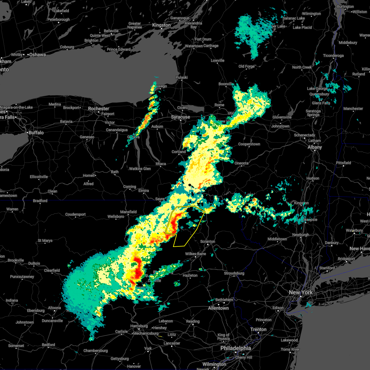 At 427 pm edt, severe thunderstorms were located along a line extending from near brushville to wyalusing to 8 miles northwest of ricketts glen state park, moving northeast at 35 mph (radar indicated). Hazards include 60 mph wind gusts and nickel size hail. expect damage to roofs, siding, and trees At 427 pm edt, severe thunderstorms were located along a line extending from near brushville to wyalusing to 8 miles northwest of ricketts glen state park, moving northeast at 35 mph (radar indicated). Hazards include 60 mph wind gusts and nickel size hail. expect damage to roofs, siding, and trees
|
| 3/31/2022 4:08 PM EDT | Tree down at devine ridge road and state route 70 in susquehanna county PA, 8.9 miles ENE of Montrose, PA |
| 3/7/2022 7:26 PM EST |
 At 726 pm est, severe thunderstorms were located along a line extending from near west end to wallsville, moving east at 70 mph (radar indicated). Hazards include 60 mph wind gusts. Expect damage to roofs, siding, and trees. locations impacted include, scranton, binghamton, wilkes-barre, falls, muhlenberg, kingston, nanticoke, plains, old forge and pittston. hail threat, radar indicated max hail size, <. 75 in wind threat, radar indicated max wind gust, 60 mph. At 726 pm est, severe thunderstorms were located along a line extending from near west end to wallsville, moving east at 70 mph (radar indicated). Hazards include 60 mph wind gusts. Expect damage to roofs, siding, and trees. locations impacted include, scranton, binghamton, wilkes-barre, falls, muhlenberg, kingston, nanticoke, plains, old forge and pittston. hail threat, radar indicated max hail size, <. 75 in wind threat, radar indicated max wind gust, 60 mph.
|
| 3/7/2022 6:53 PM EST |
 At 652 pm est, severe thunderstorms were located along a line extending from near willet to new albany, moving east at 70 mph (radar indicated). Hazards include 60 mph wind gusts. expect damage to roofs, siding, and trees At 652 pm est, severe thunderstorms were located along a line extending from near willet to new albany, moving east at 70 mph (radar indicated). Hazards include 60 mph wind gusts. expect damage to roofs, siding, and trees
|
| 7/27/2021 4:22 PM EDT |
 At 421 pm edt, severe thunderstorms were located along a line extending from hancock to near overton, moving east at 40 mph (law enforcement). Hazards include 60 mph wind gusts. expect damage to roofs, siding, and trees At 421 pm edt, severe thunderstorms were located along a line extending from hancock to near overton, moving east at 40 mph (law enforcement). Hazards include 60 mph wind gusts. expect damage to roofs, siding, and trees
|
| 7/27/2021 4:16 PM EDT | Strong thunderstorm winds knocked down a tree on roadwa in susquehanna county PA, 8.5 miles E of Montrose, PA |
| 7/27/2021 4:16 PM EDT |
 At 416 pm edt, severe thunderstorms were located along a line extending from near sherman to near rushville, moving southeast at 55 mph (law enforcement). Hazards include 60 mph wind gusts. Expect damage to roofs, siding, and trees. Locations impacted include, rush, jackson, clifford, susquehanna, susquehanna depot, springville, montrose, dimock, harford and hancock. At 416 pm edt, severe thunderstorms were located along a line extending from near sherman to near rushville, moving southeast at 55 mph (law enforcement). Hazards include 60 mph wind gusts. Expect damage to roofs, siding, and trees. Locations impacted include, rush, jackson, clifford, susquehanna, susquehanna depot, springville, montrose, dimock, harford and hancock.
|
| 7/27/2021 3:51 PM EDT |
 At 349 pm edt, severe thunderstorms were located along a line extending from near harpursville to near rome, moving southeast at 35 mph (law enforcement). Hazards include 60 mph wind gusts. expect damage to roofs, siding, and trees At 349 pm edt, severe thunderstorms were located along a line extending from near harpursville to near rome, moving southeast at 35 mph (law enforcement). Hazards include 60 mph wind gusts. expect damage to roofs, siding, and trees
|
| 7/20/2021 10:22 PM EDT |
 The severe thunderstorm warning for southeastern broome, southwestern delaware, northern susquehanna and northwestern wayne counties will expire at 1030 pm edt, the storms which prompted the warning have weakened below severe limits, and no longer pose an immediate threat to life or property. therefore, the warning will be allowed to expire. however gusty winds and heavy rain are still possible with these thunderstorms. a severe thunderstorm watch remains in effect until 1100 pm edt for central new york. The severe thunderstorm warning for southeastern broome, southwestern delaware, northern susquehanna and northwestern wayne counties will expire at 1030 pm edt, the storms which prompted the warning have weakened below severe limits, and no longer pose an immediate threat to life or property. therefore, the warning will be allowed to expire. however gusty winds and heavy rain are still possible with these thunderstorms. a severe thunderstorm watch remains in effect until 1100 pm edt for central new york.
|
| 7/20/2021 10:04 PM EDT |
 At 1003 pm edt, severe thunderstorms were located along a line extending from 8 miles southwest of sidney center to sanford to great bend, moving east at 45 mph (radar indicated). Hazards include 60 mph wind gusts. Expect damage to roofs, siding, and trees. Locations impacted include, jackson, susquehanna, deposit, susquehanna depot, montrose, harford, hallstead, hancock, windsor and new milford. At 1003 pm edt, severe thunderstorms were located along a line extending from 8 miles southwest of sidney center to sanford to great bend, moving east at 45 mph (radar indicated). Hazards include 60 mph wind gusts. Expect damage to roofs, siding, and trees. Locations impacted include, jackson, susquehanna, deposit, susquehanna depot, montrose, harford, hallstead, hancock, windsor and new milford.
|
| 7/20/2021 9:28 PM EDT |
 At 927 pm edt, severe thunderstorms were located along a line extending from near chenango bridge to near endwell to near windham, moving east at 45 mph (radar indicated). Hazards include 60 mph wind gusts and quarter size hail. Hail damage to vehicles is expected. Expect wind damage to roofs, siding, and trees. At 927 pm edt, severe thunderstorms were located along a line extending from near chenango bridge to near endwell to near windham, moving east at 45 mph (radar indicated). Hazards include 60 mph wind gusts and quarter size hail. Hail damage to vehicles is expected. Expect wind damage to roofs, siding, and trees.
|
| 7/17/2021 6:39 PM EDT |
 At 639 pm edt, severe thunderstorms were located along a line extending from near little meadows to near montrose, moving northeast at 40 mph (radar indicated). Hazards include 60 mph wind gusts and quarter size hail. Hail damage to vehicles is expected. Expect wind damage to roofs, siding, and trees. At 639 pm edt, severe thunderstorms were located along a line extending from near little meadows to near montrose, moving northeast at 40 mph (radar indicated). Hazards include 60 mph wind gusts and quarter size hail. Hail damage to vehicles is expected. Expect wind damage to roofs, siding, and trees.
|
| 7/17/2021 6:08 PM EDT |
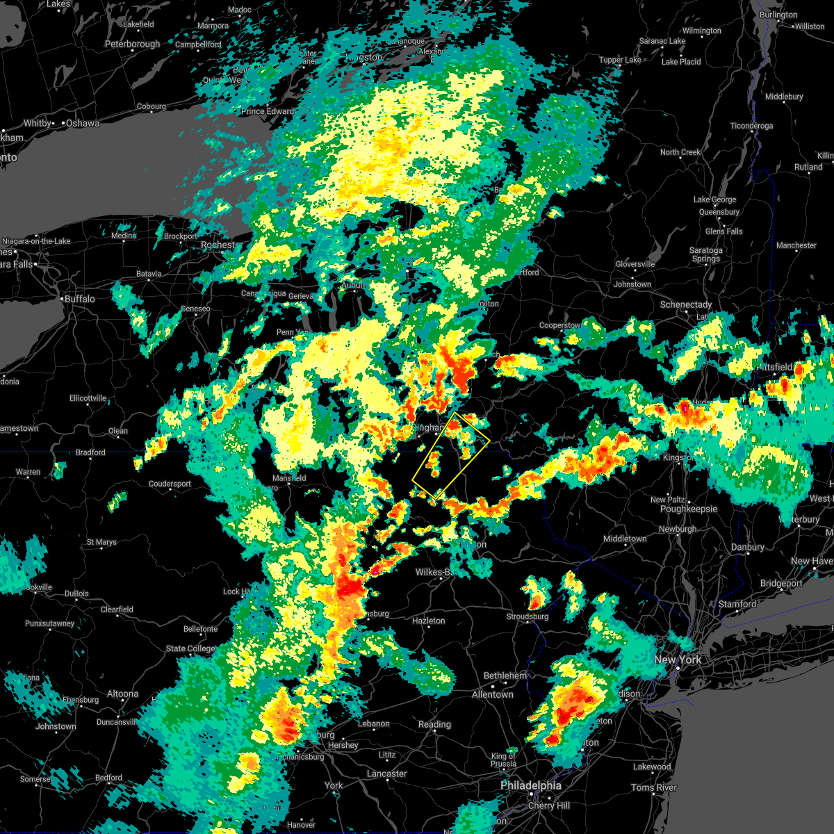 At 608 pm edt, a severe thunderstorm was located over sanitaria springs, or 11 miles northeast of binghamton, moving northeast at 30 mph (radar indicated). Hazards include 60 mph wind gusts and quarter size hail. Hail damage to vehicles is expected. expect wind damage to roofs, siding, and trees. Locations impacted include, binghamton, kirkwood, conklin, montrose, dimock, hallstead, windsor, new milford, great bend and friendsville. At 608 pm edt, a severe thunderstorm was located over sanitaria springs, or 11 miles northeast of binghamton, moving northeast at 30 mph (radar indicated). Hazards include 60 mph wind gusts and quarter size hail. Hail damage to vehicles is expected. expect wind damage to roofs, siding, and trees. Locations impacted include, binghamton, kirkwood, conklin, montrose, dimock, hallstead, windsor, new milford, great bend and friendsville.
|
| 7/17/2021 5:23 PM EDT |
 At 522 pm edt, a severe thunderstorm was located near montrose, moving northeast at 20 mph (radar indicated). Hazards include 60 mph wind gusts and quarter size hail. Hail damage to vehicles is expected. Expect wind damage to roofs, siding, and trees. At 522 pm edt, a severe thunderstorm was located near montrose, moving northeast at 20 mph (radar indicated). Hazards include 60 mph wind gusts and quarter size hail. Hail damage to vehicles is expected. Expect wind damage to roofs, siding, and trees.
|
| 7/17/2021 5:23 PM EDT |
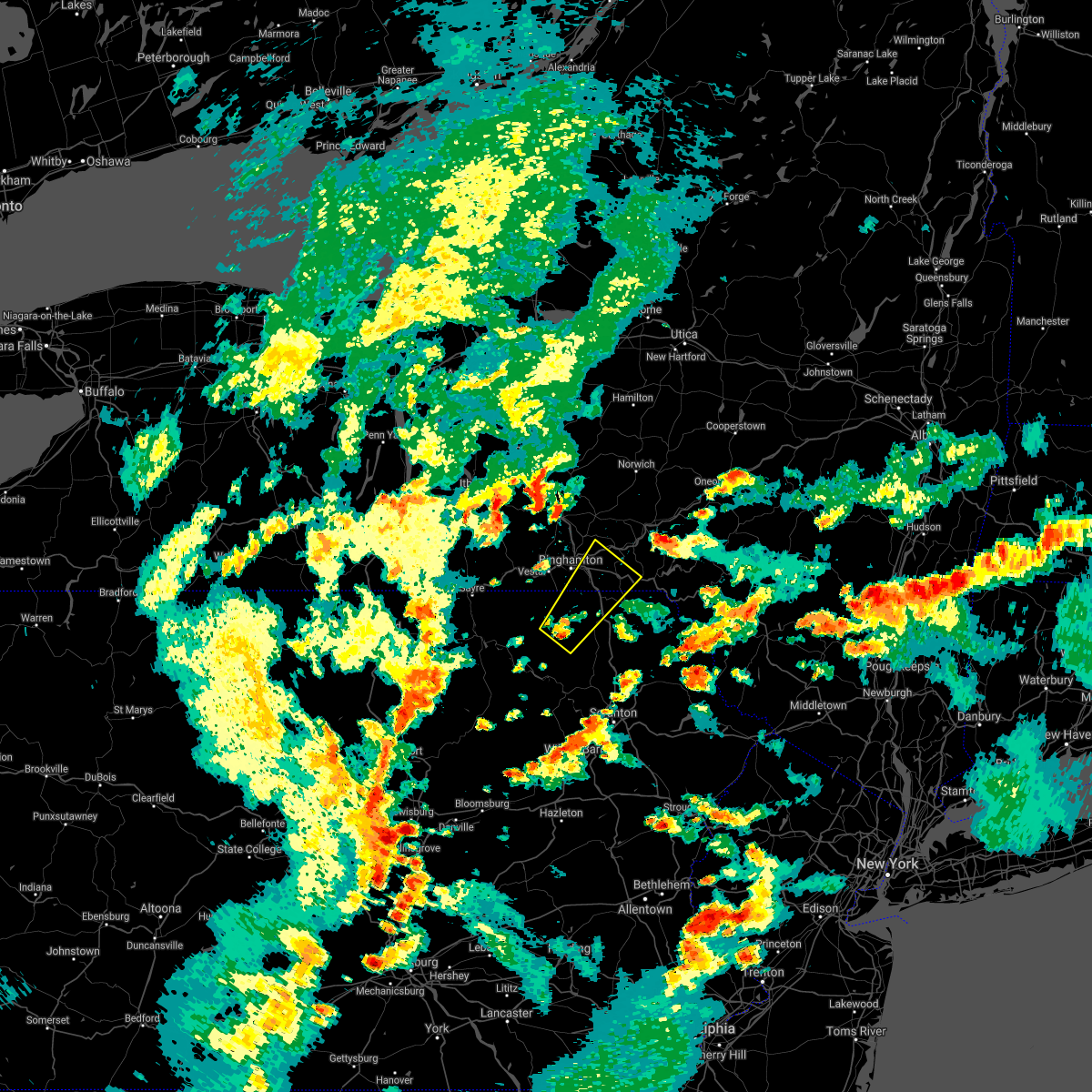 At 522 pm edt, a severe thunderstorm was located near montrose, moving northeast at 20 mph (radar indicated). Hazards include 60 mph wind gusts and quarter size hail. Hail damage to vehicles is expected. Expect wind damage to roofs, siding, and trees. At 522 pm edt, a severe thunderstorm was located near montrose, moving northeast at 20 mph (radar indicated). Hazards include 60 mph wind gusts and quarter size hail. Hail damage to vehicles is expected. Expect wind damage to roofs, siding, and trees.
|
| 7/12/2021 10:59 PM EDT |
 At 1035 pm edt, a severe thunderstorm was located over springville, or 8 miles south of montrose, moving northeast at 45 mph (radar indicated). Hazards include 60 mph wind gusts and quarter size hail. Hail damage to vehicles is expected. Expect wind damage to roofs, siding, and trees. At 1035 pm edt, a severe thunderstorm was located over springville, or 8 miles south of montrose, moving northeast at 45 mph (radar indicated). Hazards include 60 mph wind gusts and quarter size hail. Hail damage to vehicles is expected. Expect wind damage to roofs, siding, and trees.
|
| 7/12/2021 10:35 PM EDT |
 At 1035 pm edt, a severe thunderstorm was located over springville, or 8 miles south of montrose, moving northeast at 45 mph (radar indicated). Hazards include 60 mph wind gusts and quarter size hail. Hail damage to vehicles is expected. Expect wind damage to roofs, siding, and trees. At 1035 pm edt, a severe thunderstorm was located over springville, or 8 miles south of montrose, moving northeast at 45 mph (radar indicated). Hazards include 60 mph wind gusts and quarter size hail. Hail damage to vehicles is expected. Expect wind damage to roofs, siding, and trees.
|
| 7/12/2021 8:59 PM EDT |
 At 858 pm edt, severe thunderstorms were located along a line extending from near le raysville to near overton, moving east at 25 mph (radar indicated). Hazards include 60 mph wind gusts and penny size hail. expect damage to roofs, siding, and trees At 858 pm edt, severe thunderstorms were located along a line extending from near le raysville to near overton, moving east at 25 mph (radar indicated). Hazards include 60 mph wind gusts and penny size hail. expect damage to roofs, siding, and trees
|
| 7/9/2021 5:05 PM EDT |
 At 505 pm edt, severe thunderstorms were located along a line extending from near walton to near lenoxville, moving southeast at 35 mph (radar indicated). Hazards include 60 mph wind gusts. Expect damage to roofs, siding, and trees. Locations impacted include, sidney, jackson, walton, clifford, sanford, colchester, susquehanna, forest city, deposit and susquehanna depot. At 505 pm edt, severe thunderstorms were located along a line extending from near walton to near lenoxville, moving southeast at 35 mph (radar indicated). Hazards include 60 mph wind gusts. Expect damage to roofs, siding, and trees. Locations impacted include, sidney, jackson, walton, clifford, sanford, colchester, susquehanna, forest city, deposit and susquehanna depot.
|
| 7/9/2021 4:46 PM EDT |
 At 446 pm edt, severe thunderstorms were located along a line extending from near sidney to near montrose, moving southeast at 35 mph (radar indicated). Hazards include 60 mph wind gusts. expect damage to roofs, siding, and trees At 446 pm edt, severe thunderstorms were located along a line extending from near sidney to near montrose, moving southeast at 35 mph (radar indicated). Hazards include 60 mph wind gusts. expect damage to roofs, siding, and trees
|
| 7/9/2021 4:26 PM EDT |
 At 426 pm edt, a severe thunderstorm was located near montrose, moving southeast at 40 mph (radar indicated). Hazards include 60 mph wind gusts. Expect damage to roofs, siding, and trees. Locations impacted include, rush, susquehanna, susquehanna depot, springville, montrose, dimock, hallstead, new milford, herrick and great bend. At 426 pm edt, a severe thunderstorm was located near montrose, moving southeast at 40 mph (radar indicated). Hazards include 60 mph wind gusts. Expect damage to roofs, siding, and trees. Locations impacted include, rush, susquehanna, susquehanna depot, springville, montrose, dimock, hallstead, new milford, herrick and great bend.
|
| 7/9/2021 4:14 PM EDT |
 At 414 pm edt, a severe thunderstorm was located near rush, or 7 miles west of montrose, moving southeast at 40 mph (radar indicated). Hazards include 60 mph wind gusts and penny size hail. Expect damage to roofs, siding, and trees. Locations impacted include, rush, susquehanna, susquehanna depot, springville, montrose, dimock, hallstead, orwell, new milford and herrick. At 414 pm edt, a severe thunderstorm was located near rush, or 7 miles west of montrose, moving southeast at 40 mph (radar indicated). Hazards include 60 mph wind gusts and penny size hail. Expect damage to roofs, siding, and trees. Locations impacted include, rush, susquehanna, susquehanna depot, springville, montrose, dimock, hallstead, orwell, new milford and herrick.
|
| 7/9/2021 3:57 PM EDT |
 At 357 pm edt, a severe thunderstorm was located over warren center, or 13 miles south of owego, moving southeast at 40 mph (radar indicated). Hazards include 60 mph wind gusts and penny size hail. expect damage to roofs, siding, and trees At 357 pm edt, a severe thunderstorm was located over warren center, or 13 miles south of owego, moving southeast at 40 mph (radar indicated). Hazards include 60 mph wind gusts and penny size hail. expect damage to roofs, siding, and trees
|
| 7/9/2021 3:57 PM EDT |
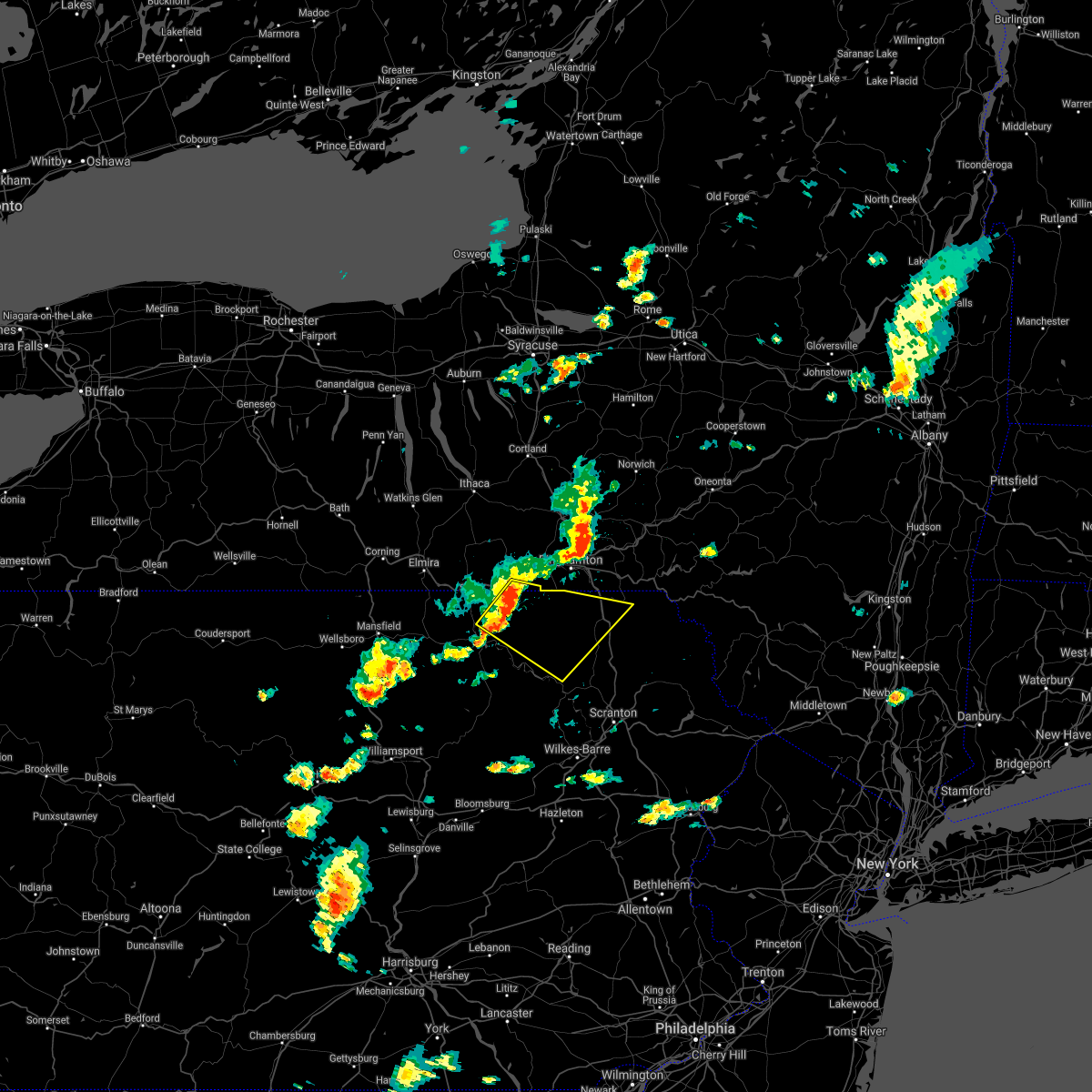 At 357 pm edt, a severe thunderstorm was located over warren center, or 13 miles south of owego, moving southeast at 40 mph (radar indicated). Hazards include 60 mph wind gusts and penny size hail. expect damage to roofs, siding, and trees At 357 pm edt, a severe thunderstorm was located over warren center, or 13 miles south of owego, moving southeast at 40 mph (radar indicated). Hazards include 60 mph wind gusts and penny size hail. expect damage to roofs, siding, and trees
|
| 7/7/2021 10:22 PM EDT |
 The severe thunderstorm warning for western broome, southeastern tioga, western susquehanna, northwestern lackawanna, north central luzerne, northeastern bradford and eastern wyoming counties will expire at 1030 pm edt, the storms which prompted the warning have moved out of the area. therefore, the warning will be allowed to expire. these storms have produced widespread downed trees and wires in bradford and broome counties. allow extra time if you must travel and remember an intersection without lights is a 4 way stop. a severe thunderstorm watch remains in effect until 1100 pm edt for central new york, and northeastern pennsylvania. to report severe weather, contact your nearest law enforcement agency. they will relay your report to the national weather service binghamton. The severe thunderstorm warning for western broome, southeastern tioga, western susquehanna, northwestern lackawanna, north central luzerne, northeastern bradford and eastern wyoming counties will expire at 1030 pm edt, the storms which prompted the warning have moved out of the area. therefore, the warning will be allowed to expire. these storms have produced widespread downed trees and wires in bradford and broome counties. allow extra time if you must travel and remember an intersection without lights is a 4 way stop. a severe thunderstorm watch remains in effect until 1100 pm edt for central new york, and northeastern pennsylvania. to report severe weather, contact your nearest law enforcement agency. they will relay your report to the national weather service binghamton.
|
| 7/7/2021 10:06 PM EDT |
 At 1004 pm edt, severe thunderstorms were located along a line extending from near berkshire to near royal, moving northeast at 45 mph (radar indicated). Hazards include 70 mph wind gusts and quarter size hail. 70 mph gusts with a danergrous microburst near binghamton airport moving northeast toward chenango forks and whitney point. elsewhere with 60 mph gusts, hail damage to vehicles is expected. expect considerable tree damage. Wind damage is also likely to mobile homes,roofs, and outbuildings. At 1004 pm edt, severe thunderstorms were located along a line extending from near berkshire to near royal, moving northeast at 45 mph (radar indicated). Hazards include 70 mph wind gusts and quarter size hail. 70 mph gusts with a danergrous microburst near binghamton airport moving northeast toward chenango forks and whitney point. elsewhere with 60 mph gusts, hail damage to vehicles is expected. expect considerable tree damage. Wind damage is also likely to mobile homes,roofs, and outbuildings.
|
| 7/7/2021 10:00 PM EDT |
 At 958 pm edt, severe thunderstorms were located along a line extending from near brooktondale to near beaumont, moving northeast at 35 mph (law enforcement reports of downed trees and wires. power outages across western broome county). Hazards include 60 to 70 mph wind gusts and quarter size hail. 70 mph gusts will be with a dangerous microburst was near endciott, endwell and west corners moving northeast toward the binghamton airport. elsewhere, 60 mph gusts with hail damage to vehicles is expected. expect considerable tree damage. wind damage is also likely to mobile homes, roofs, and outbuildings. Locations impacted include, binghamton, falls, vestal, johnson city, endicott, vernon, maine, rush, owego and dallas. At 958 pm edt, severe thunderstorms were located along a line extending from near brooktondale to near beaumont, moving northeast at 35 mph (law enforcement reports of downed trees and wires. power outages across western broome county). Hazards include 60 to 70 mph wind gusts and quarter size hail. 70 mph gusts will be with a dangerous microburst was near endciott, endwell and west corners moving northeast toward the binghamton airport. elsewhere, 60 mph gusts with hail damage to vehicles is expected. expect considerable tree damage. wind damage is also likely to mobile homes, roofs, and outbuildings. Locations impacted include, binghamton, falls, vestal, johnson city, endicott, vernon, maine, rush, owego and dallas.
|
| 7/7/2021 9:47 PM EDT | Trees down on cole roa in susquehanna county PA, 5.8 miles SE of Montrose, PA |
| 7/7/2021 9:46 PM EDT |
 At 944 pm edt, severe thunderstorms were located along a line extending from near south danby to near harveys lake, moving northeast at 35 mph (law enforcement). Hazards include 60 to 70 mph wind gusts and quarter size hail. A dangerous microburst is just west of warren and little meadows moving northeast toward apalachin and tioga terrance with the strongest winds of 70 mph. elsewhere with 60 mph winds , hail damage to vehicles is expected. expect considerable tree damage. wind damage is also likely to mobile homes, roofs, and outbuildings. Locations impacted include, binghamton, falls, vestal, johnson city, endicott, barton, vernon, maine, rush and owego. At 944 pm edt, severe thunderstorms were located along a line extending from near south danby to near harveys lake, moving northeast at 35 mph (law enforcement). Hazards include 60 to 70 mph wind gusts and quarter size hail. A dangerous microburst is just west of warren and little meadows moving northeast toward apalachin and tioga terrance with the strongest winds of 70 mph. elsewhere with 60 mph winds , hail damage to vehicles is expected. expect considerable tree damage. wind damage is also likely to mobile homes, roofs, and outbuildings. Locations impacted include, binghamton, falls, vestal, johnson city, endicott, barton, vernon, maine, rush and owego.
|
| 7/7/2021 9:34 PM EDT |
 At 933 pm edt, severe thunderstorms were located along a line extending from near spencer to near harveys lake, moving northeast at 35 mph (law enforcement has reported several areas of trees and wires down). Hazards include 60 to 70 mph wind gusts and quarter size hail. A dangerous microburst is near orwell in bradford county moving northeast toward warren center with the threat of 70 mph winds. hail damage to vehicles is expected. expect considerable tree damage. Wind damage is also likely to mobile homes, roofs, and outbuildings. At 933 pm edt, severe thunderstorms were located along a line extending from near spencer to near harveys lake, moving northeast at 35 mph (law enforcement has reported several areas of trees and wires down). Hazards include 60 to 70 mph wind gusts and quarter size hail. A dangerous microburst is near orwell in bradford county moving northeast toward warren center with the threat of 70 mph winds. hail damage to vehicles is expected. expect considerable tree damage. Wind damage is also likely to mobile homes, roofs, and outbuildings.
|
| 7/7/2021 9:24 PM EDT |
 At 923 pm edt, severe thunderstorms were located along a line extending from van etten to sweet valley, moving northeast at 35 mph (several reports of downed trees and wires). Hazards include 60 mph wind gusts and quarter size hail. Hail damage to vehicles is expected. Expect wind damage to roofs, siding, and trees. At 923 pm edt, severe thunderstorms were located along a line extending from van etten to sweet valley, moving northeast at 35 mph (several reports of downed trees and wires). Hazards include 60 mph wind gusts and quarter size hail. Hail damage to vehicles is expected. Expect wind damage to roofs, siding, and trees.
|
| 7/6/2021 3:42 PM EDT |
 At 342 pm edt, severe thunderstorms were located along a line extending from near sanitaria springs to near susquehanna to near montrose, moving east at 50 mph (radar indicated). Hazards include 60 mph wind gusts and quarter size hail. Hail damage to vehicles is expected. Expect wind damage to roofs, siding, and trees. At 342 pm edt, severe thunderstorms were located along a line extending from near sanitaria springs to near susquehanna to near montrose, moving east at 50 mph (radar indicated). Hazards include 60 mph wind gusts and quarter size hail. Hail damage to vehicles is expected. Expect wind damage to roofs, siding, and trees.
|
| 7/6/2021 3:33 PM EDT |
 At 333 pm edt, severe thunderstorms were located along a line extending from jefferson to near delhi to near new milford, moving east at 60 mph (radar indicated). Hazards include 60 mph wind gusts and quarter size hail. Hail damage to vehicles is expected. expect wind damage to roofs, siding, and trees. Locations impacted include, binghamton, oneonta, kirkwood, conklin, sidney, walton, delhi, davenport, sanford and colchester. At 333 pm edt, severe thunderstorms were located along a line extending from jefferson to near delhi to near new milford, moving east at 60 mph (radar indicated). Hazards include 60 mph wind gusts and quarter size hail. Hail damage to vehicles is expected. expect wind damage to roofs, siding, and trees. Locations impacted include, binghamton, oneonta, kirkwood, conklin, sidney, walton, delhi, davenport, sanford and colchester.
|
| 7/6/2021 3:32 PM EDT | Tree down on silver creek r in susquehanna county PA, 5.4 miles S of Montrose, PA |
| 7/6/2021 3:08 PM EDT |
 At 308 pm edt, severe thunderstorms were located along a line extending from laurens to bainbridge to near warren center, moving east at 60 mph (radar indicated). Hazards include 60 mph wind gusts and quarter size hail. Hail damage to vehicles is expected. Expect wind damage to roofs, siding, and trees. At 308 pm edt, severe thunderstorms were located along a line extending from laurens to bainbridge to near warren center, moving east at 60 mph (radar indicated). Hazards include 60 mph wind gusts and quarter size hail. Hail damage to vehicles is expected. Expect wind damage to roofs, siding, and trees.
|
| 7/2/2021 7:28 PM EDT |
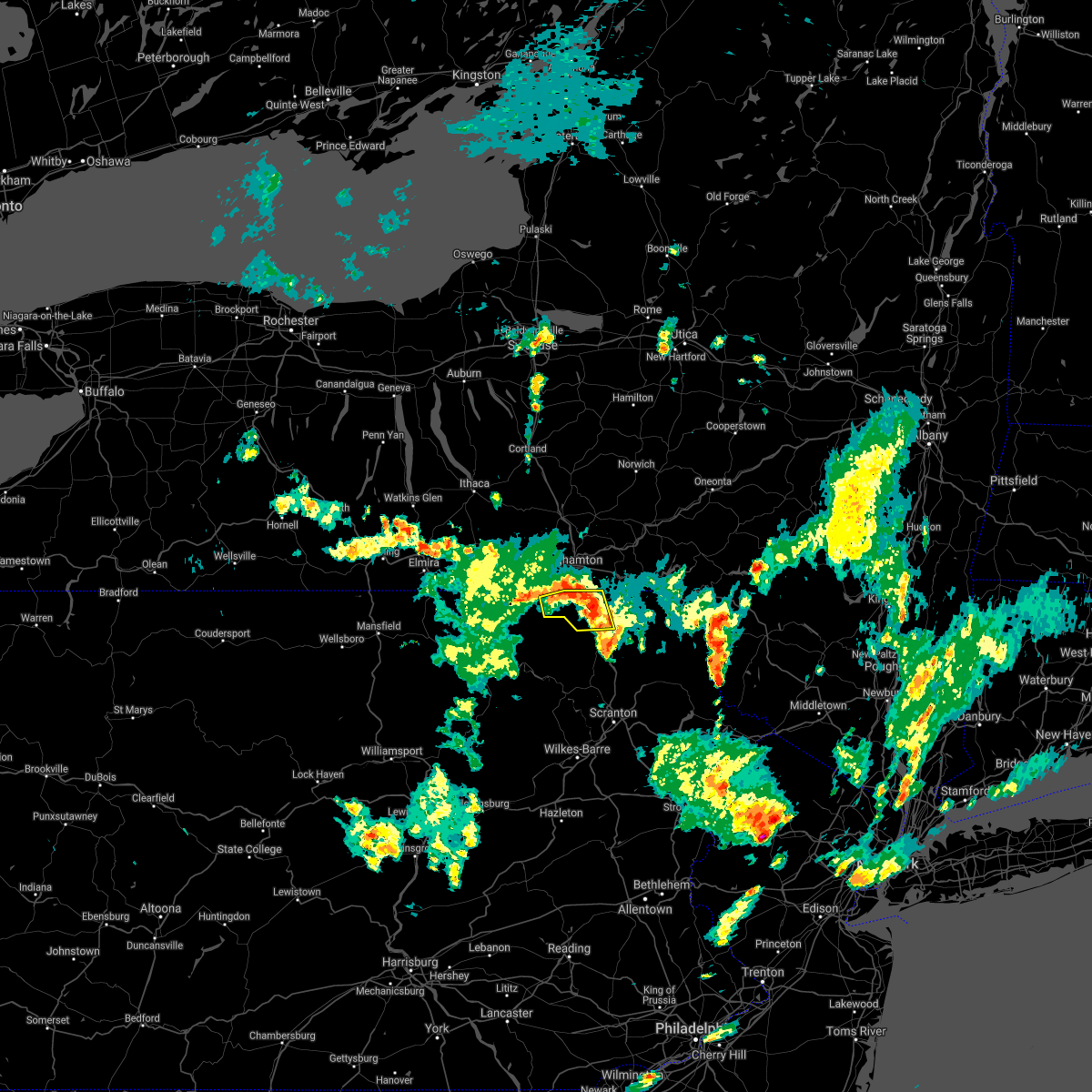 The severe thunderstorm warning for northwestern susquehanna county will expire at 730 pm edt, the storm which prompted the warning has weakened below severe limits, and no longer poses an immediate threat to life or property. therefore, the warning will be allowed to expire. however heavy rain is still possible with this thunderstorm. to report severe weather, contact your nearest law enforcement agency. they will relay your report to the national weather service binghamton. The severe thunderstorm warning for northwestern susquehanna county will expire at 730 pm edt, the storm which prompted the warning has weakened below severe limits, and no longer poses an immediate threat to life or property. therefore, the warning will be allowed to expire. however heavy rain is still possible with this thunderstorm. to report severe weather, contact your nearest law enforcement agency. they will relay your report to the national weather service binghamton.
|
| 7/2/2021 7:18 PM EDT |
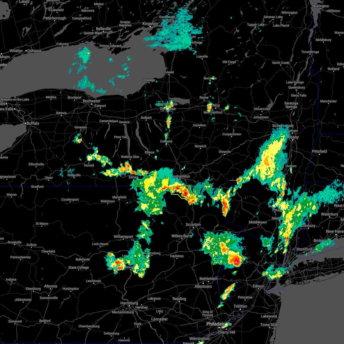 At 718 pm edt, a severe thunderstorm was located near hallstead, or 7 miles northeast of montrose, moving east at 20 mph (radar indicated). Hazards include 60 mph wind gusts and penny size hail. Expect damage to roofs, siding, and trees. Locations impacted include, montrose, hallstead, new milford, great bend, friendsville, brackney, salt springs state park and wyoanna. At 718 pm edt, a severe thunderstorm was located near hallstead, or 7 miles northeast of montrose, moving east at 20 mph (radar indicated). Hazards include 60 mph wind gusts and penny size hail. Expect damage to roofs, siding, and trees. Locations impacted include, montrose, hallstead, new milford, great bend, friendsville, brackney, salt springs state park and wyoanna.
|
| 7/2/2021 7:03 PM EDT |
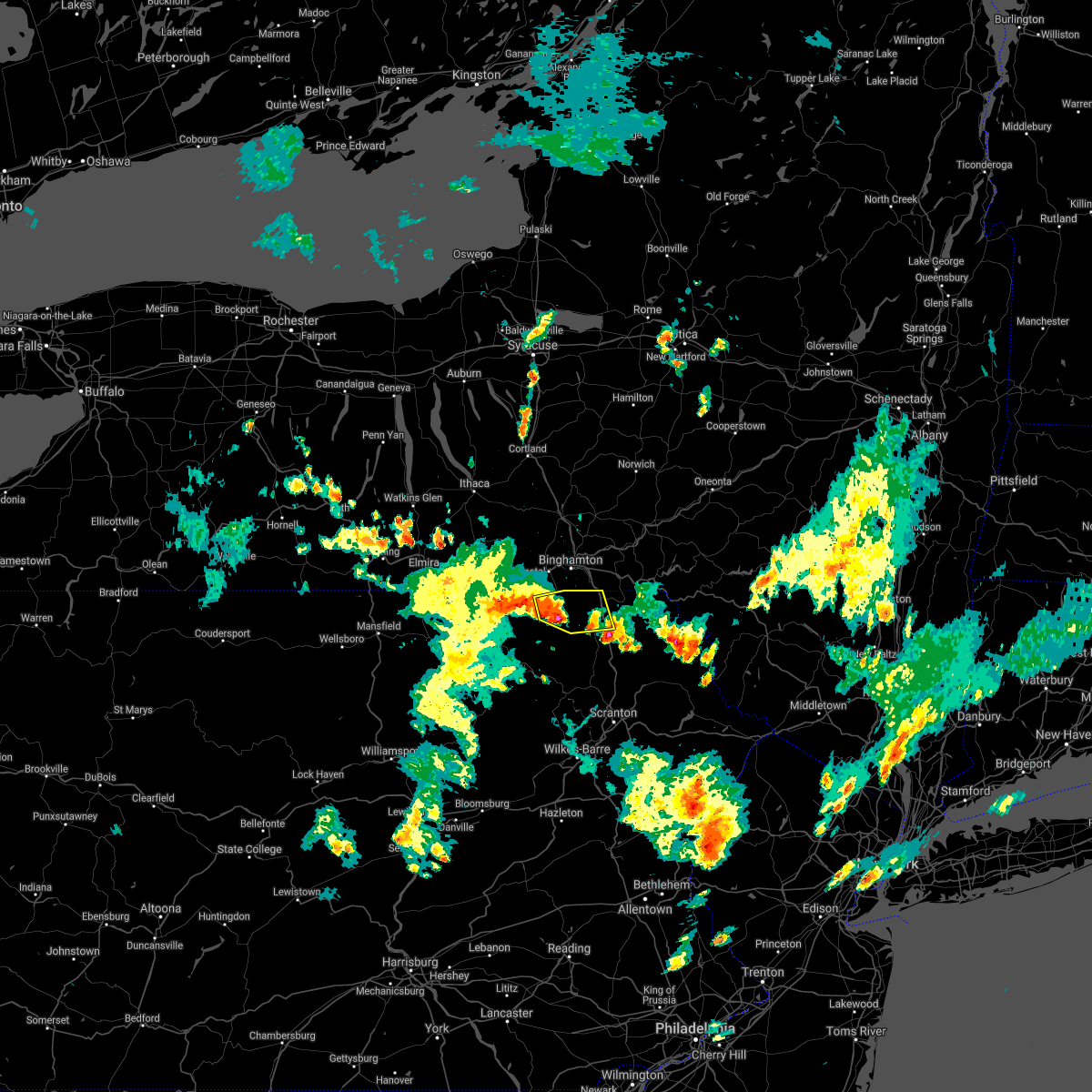 At 703 pm edt, a severe thunderstorm was located near brackney, or near montrose, moving east at 20 mph (radar indicated). Hazards include 60 mph wind gusts and quarter size hail. Hail damage to vehicles is expected. expect wind damage to roofs, siding, and trees. Locations impacted include, montrose, hallstead, new milford, great bend, friendsville, brackney, birchardville, salt springs state park, wyoanna and middletown center. At 703 pm edt, a severe thunderstorm was located near brackney, or near montrose, moving east at 20 mph (radar indicated). Hazards include 60 mph wind gusts and quarter size hail. Hail damage to vehicles is expected. expect wind damage to roofs, siding, and trees. Locations impacted include, montrose, hallstead, new milford, great bend, friendsville, brackney, birchardville, salt springs state park, wyoanna and middletown center.
|
| 7/2/2021 6:46 PM EDT |
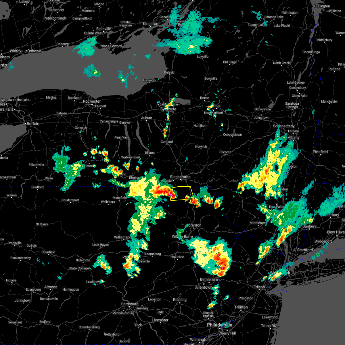 At 646 pm edt, a severe thunderstorm was located over friendsville, or 8 miles northwest of montrose, moving east at 20 mph (radar indicated). Hazards include 60 mph wind gusts and nickel size hail. expect damage to roofs, siding, and trees At 646 pm edt, a severe thunderstorm was located over friendsville, or 8 miles northwest of montrose, moving east at 20 mph (radar indicated). Hazards include 60 mph wind gusts and nickel size hail. expect damage to roofs, siding, and trees
|
| 6/30/2021 5:15 PM EDT |
 At 515 pm edt, severe thunderstorms were located along a line extending from meredith to brackney to near rome to near burlington, moving southeast at 15 mph (radar indicated). Hazards include 60 mph wind gusts and quarter size hail. Hail damage to vehicles is expected. expect wind damage to roofs, siding, and trees. Locations impacted include, binghamton, vestal, johnson city, endicott, kirkwood, conklin, sidney, athens, walton and towanda. At 515 pm edt, severe thunderstorms were located along a line extending from meredith to brackney to near rome to near burlington, moving southeast at 15 mph (radar indicated). Hazards include 60 mph wind gusts and quarter size hail. Hail damage to vehicles is expected. expect wind damage to roofs, siding, and trees. Locations impacted include, binghamton, vestal, johnson city, endicott, kirkwood, conklin, sidney, athens, walton and towanda.
|
| 6/30/2021 4:50 PM EDT |
 At 448 pm edt, severe thunderstorms were located along a line extending from near guilford to near brackney to near litchfield to wetona, moving southeast at 20 mph (radar indicated). Hazards include 60 mph wind gusts and quarter size hail. Hail damage to vehicles is expected. Expect wind damage to roofs, siding, and trees. At 448 pm edt, severe thunderstorms were located along a line extending from near guilford to near brackney to near litchfield to wetona, moving southeast at 20 mph (radar indicated). Hazards include 60 mph wind gusts and quarter size hail. Hail damage to vehicles is expected. Expect wind damage to roofs, siding, and trees.
|
| 6/30/2021 4:33 PM EDT |
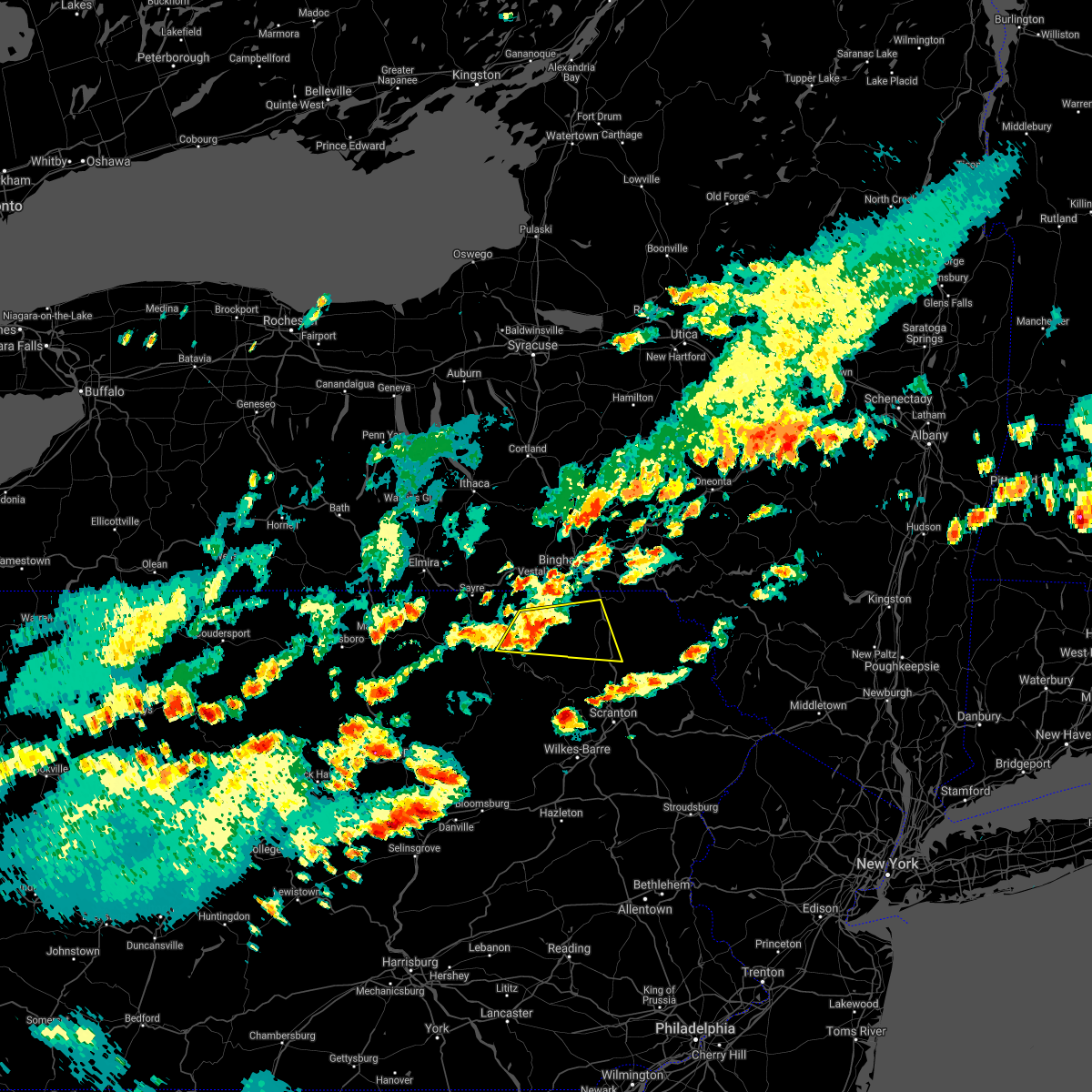 At 432 pm edt, a severe thunderstorm was located over le raysville, or 12 miles northeast of wyalusing, moving east at 30 mph (reports of downed trees and wires in bradford county with this storm). Hazards include 60 mph wind gusts and penny size hail. expect damage to roofs, siding, and trees At 432 pm edt, a severe thunderstorm was located over le raysville, or 12 miles northeast of wyalusing, moving east at 30 mph (reports of downed trees and wires in bradford county with this storm). Hazards include 60 mph wind gusts and penny size hail. expect damage to roofs, siding, and trees
|
| 6/21/2021 6:58 PM EDT |
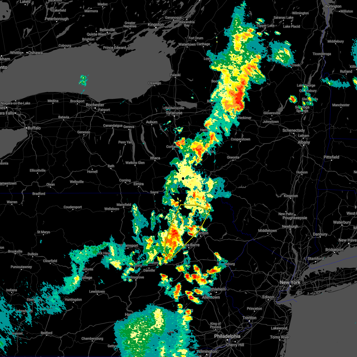 At 658 pm edt, severe thunderstorms were located along a line extending from near new milford to near nicholson to kasson brook to near ricketts glen state park, moving east at 40 mph (radar indicated). Hazards include 60 mph wind gusts and quarter size hail. Hail damage to vehicles is expected. expect wind damage to roofs, siding, and trees. Locations impacted include, falls, muhlenberg, vernon, clarks summit, rush, lehman, dallas, harveys lake, clifford and tunkhannock. At 658 pm edt, severe thunderstorms were located along a line extending from near new milford to near nicholson to kasson brook to near ricketts glen state park, moving east at 40 mph (radar indicated). Hazards include 60 mph wind gusts and quarter size hail. Hail damage to vehicles is expected. expect wind damage to roofs, siding, and trees. Locations impacted include, falls, muhlenberg, vernon, clarks summit, rush, lehman, dallas, harveys lake, clifford and tunkhannock.
|
| 6/21/2021 6:27 PM EDT |
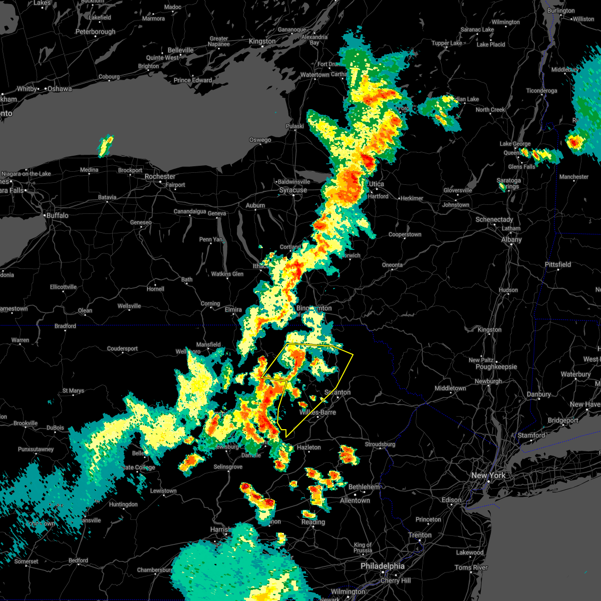 At 627 pm edt, severe thunderstorms were located along a line extending from near le raysville to near laceyville to near lovelton to near muncy valley, moving east at 50 mph (radar indicated). Hazards include 60 mph wind gusts and quarter size hail. Hail damage to vehicles is expected. Expect wind damage to roofs, siding, and trees. At 627 pm edt, severe thunderstorms were located along a line extending from near le raysville to near laceyville to near lovelton to near muncy valley, moving east at 50 mph (radar indicated). Hazards include 60 mph wind gusts and quarter size hail. Hail damage to vehicles is expected. Expect wind damage to roofs, siding, and trees.
|
| 8/27/2020 6:35 PM EDT | Tree dow in susquehanna county PA, 9.6 miles ENE of Montrose, PA |
| 8/27/2020 5:39 PM EDT | Tree down on roa in susquehanna county PA, 6.1 miles S of Montrose, PA |
| 8/27/2020 5:27 PM EDT | Tree down on silver creek road... time estimated from rada in susquehanna county PA, 6.2 miles SSW of Montrose, PA |
| 8/27/2020 5:23 PM EDT | Tree down on road blocking lane. location and time estimated from rada in susquehanna county PA, 5.6 miles SSE of Montrose, PA |
| 8/27/2020 5:23 PM EDT |
 At 522 pm edt, a severe thunderstorm was located near hallstead, or 8 miles northeast of montrose, moving southeast at 55 mph (law enforcement). Hazards include 70 mph wind gusts and quarter size hail. Hail damage to vehicles is expected. expect considerable tree damage. Wind damage is also likely to mobile homes, roofs, and outbuildings. At 522 pm edt, a severe thunderstorm was located near hallstead, or 8 miles northeast of montrose, moving southeast at 55 mph (law enforcement). Hazards include 70 mph wind gusts and quarter size hail. Hail damage to vehicles is expected. expect considerable tree damage. Wind damage is also likely to mobile homes, roofs, and outbuildings.
|
| 7/30/2020 6:14 PM EDT |
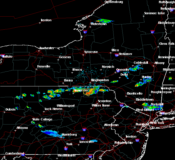 At 614 pm edt, a severe thunderstorm was located near rush, or near montrose, moving east at 20 mph (radar indicated). Hazards include 60 mph wind gusts and quarter size hail. Hail damage to vehicles is expected. Expect wind damage to roofs, siding, and trees. At 614 pm edt, a severe thunderstorm was located near rush, or near montrose, moving east at 20 mph (radar indicated). Hazards include 60 mph wind gusts and quarter size hail. Hail damage to vehicles is expected. Expect wind damage to roofs, siding, and trees.
|
| 7/30/2020 5:57 PM EDT |
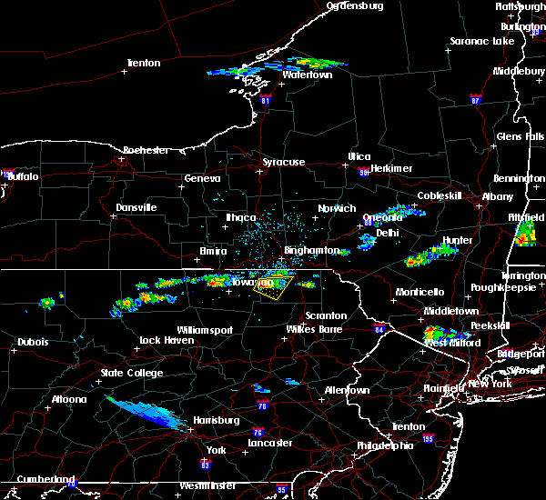 At 557 pm edt, a severe thunderstorm was located near rush, or 8 miles west of montrose, moving east at 30 mph (radar indicated). Hazards include 60 mph wind gusts and quarter size hail. Hail damage to vehicles is expected. expect wind damage to roofs, siding, and trees. Locations impacted include, rush, springville, montrose, dimock, birchardville, south montrose, elk lake, middletown center, salt springs state park and lawton. At 557 pm edt, a severe thunderstorm was located near rush, or 8 miles west of montrose, moving east at 30 mph (radar indicated). Hazards include 60 mph wind gusts and quarter size hail. Hail damage to vehicles is expected. expect wind damage to roofs, siding, and trees. Locations impacted include, rush, springville, montrose, dimock, birchardville, south montrose, elk lake, middletown center, salt springs state park and lawton.
|
| 7/30/2020 5:53 PM EDT |
 At 553 pm edt, a severe thunderstorm was located near rush, or 10 miles west of montrose, moving east at 30 mph (radar indicated). Hazards include 70 mph wind gusts and quarter size hail. Hail damage to vehicles is expected. expect considerable tree damage. wind damage is also likely to mobile homes, roofs, and outbuildings. Locations impacted include, rush, springville, montrose, dimock, le raysville, rushville, birchardville, south montrose, elk lake and middletown center. At 553 pm edt, a severe thunderstorm was located near rush, or 10 miles west of montrose, moving east at 30 mph (radar indicated). Hazards include 70 mph wind gusts and quarter size hail. Hail damage to vehicles is expected. expect considerable tree damage. wind damage is also likely to mobile homes, roofs, and outbuildings. Locations impacted include, rush, springville, montrose, dimock, le raysville, rushville, birchardville, south montrose, elk lake and middletown center.
|
| 7/30/2020 5:44 PM EDT |
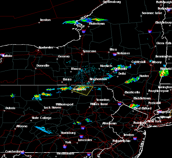 At 543 pm edt, a severe thunderstorm was located over le raysville, or 13 miles north of wyalusing, moving east at 30 mph (radar indicated). Hazards include golf ball size hail and 70 mph wind gusts. People and animals outdoors will be injured. expect hail damage to roofs, siding, windows, and vehicles. expect considerable tree damage. wind damage is also likely to mobile homes, roofs, and outbuildings. Locations impacted include, rush, springville, montrose, dimock, le raysville, friendsville, rushville, herrickville, brushville and south montrose. At 543 pm edt, a severe thunderstorm was located over le raysville, or 13 miles north of wyalusing, moving east at 30 mph (radar indicated). Hazards include golf ball size hail and 70 mph wind gusts. People and animals outdoors will be injured. expect hail damage to roofs, siding, windows, and vehicles. expect considerable tree damage. wind damage is also likely to mobile homes, roofs, and outbuildings. Locations impacted include, rush, springville, montrose, dimock, le raysville, friendsville, rushville, herrickville, brushville and south montrose.
|
| 7/30/2020 5:40 PM EDT |
 At 540 pm edt, a severe thunderstorm was located over le raysville, or 13 miles north of wyalusing, moving east at 30 mph (radar indicated). Hazards include golf ball size hail and 70 mph wind gusts. People and animals outdoors will be injured. expect hail damage to roofs, siding, windows, and vehicles. expect considerable tree damage. wind damage is also likely to mobile homes, roofs, and outbuildings. Locations impacted include, rush, springville, montrose, dimock, herrick, le raysville, friendsville, warren center, rushville and herrickville. At 540 pm edt, a severe thunderstorm was located over le raysville, or 13 miles north of wyalusing, moving east at 30 mph (radar indicated). Hazards include golf ball size hail and 70 mph wind gusts. People and animals outdoors will be injured. expect hail damage to roofs, siding, windows, and vehicles. expect considerable tree damage. wind damage is also likely to mobile homes, roofs, and outbuildings. Locations impacted include, rush, springville, montrose, dimock, herrick, le raysville, friendsville, warren center, rushville and herrickville.
|
| 7/30/2020 5:28 PM EDT |
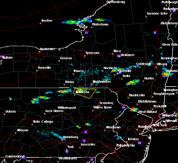 At 528 pm edt, a severe thunderstorm was located over rome, or 9 miles northeast of towanda, moving east at 30 mph (radar indicated). Hazards include golf ball size hail and 70 mph wind gusts. People and animals outdoors will be injured. expect hail damage to roofs, siding, windows, and vehicles. expect considerable tree damage. wind damage is also likely to mobile homes, roofs, and outbuildings. Locations impacted include, rush, springville, montrose, dimock, orwell, windham, herrick, rome, le raysville and friendsville. At 528 pm edt, a severe thunderstorm was located over rome, or 9 miles northeast of towanda, moving east at 30 mph (radar indicated). Hazards include golf ball size hail and 70 mph wind gusts. People and animals outdoors will be injured. expect hail damage to roofs, siding, windows, and vehicles. expect considerable tree damage. wind damage is also likely to mobile homes, roofs, and outbuildings. Locations impacted include, rush, springville, montrose, dimock, orwell, windham, herrick, rome, le raysville and friendsville.
|
| 7/30/2020 5:19 PM EDT |
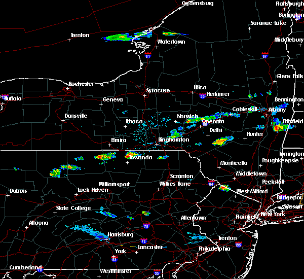 At 519 pm edt, a severe thunderstorm was located near rome, or 7 miles southeast of athens, moving east at 30 mph (radar indicated). Hazards include 60 mph wind gusts and quarter size hail. Hail damage to vehicles is expected. Expect wind damage to roofs, siding, and trees. At 519 pm edt, a severe thunderstorm was located near rome, or 7 miles southeast of athens, moving east at 30 mph (radar indicated). Hazards include 60 mph wind gusts and quarter size hail. Hail damage to vehicles is expected. Expect wind damage to roofs, siding, and trees.
|
| 7/23/2020 4:43 PM EDT |
 At 441 pm edt, severe thunderstorms were located along a line extending from near lanesboro, to thompson, to near gibson, to near harford, to near springville, moving southeast at 25 mph (law enforcement. trees and power lines have been blown down by this line of thunderstorms). Hazards include 60 mph wind gusts and quarter size hail. Hail damage to vehicles is expected. expect wind damage to roofs, siding, and trees. Locations impacted include, clarks summit, rush, jackson, clifford, susquehanna, forest city, susquehanna depot, springville, montrose, and dimock. At 441 pm edt, severe thunderstorms were located along a line extending from near lanesboro, to thompson, to near gibson, to near harford, to near springville, moving southeast at 25 mph (law enforcement. trees and power lines have been blown down by this line of thunderstorms). Hazards include 60 mph wind gusts and quarter size hail. Hail damage to vehicles is expected. expect wind damage to roofs, siding, and trees. Locations impacted include, clarks summit, rush, jackson, clifford, susquehanna, forest city, susquehanna depot, springville, montrose, and dimock.
|
| 7/23/2020 4:31 PM EDT |
 At 428 pm edt, severe thunderstorms were located along a line extending from near windsor, to near susquehanna, to near new milford, to montrose, to near rush, moving southeast at 30 mph (law enforcement. trees and power lines have been blown down by this line of thunderstorms). Hazards include 60 mph wind gusts and quarter size hail. Hail damage to vehicles is expected. expect wind damage to roofs, siding, and trees. Locations impacted include, clarks summit, rush, jackson, clifford, susquehanna, forest city, susquehanna depot, springville, montrose, and dimock. At 428 pm edt, severe thunderstorms were located along a line extending from near windsor, to near susquehanna, to near new milford, to montrose, to near rush, moving southeast at 30 mph (law enforcement. trees and power lines have been blown down by this line of thunderstorms). Hazards include 60 mph wind gusts and quarter size hail. Hail damage to vehicles is expected. expect wind damage to roofs, siding, and trees. Locations impacted include, clarks summit, rush, jackson, clifford, susquehanna, forest city, susquehanna depot, springville, montrose, and dimock.
|
| 7/23/2020 4:15 PM EDT |
 At 414 pm edt, severe thunderstorms were located along a line extending from near windsor, to near hallstead, to near great bend, to near friendsville to near rush, moving southeast at 30 mph (law enforcement. trees and power lines have been blown down by this line of thunderstorms). Hazards include 60 mph wind gusts and half dollar size hail. Hail damage to vehicles is expected. expect wind damage to roofs, siding, and trees. Locations impacted include, kirkwood, conklin, clarks summit, rush, jackson, clifford, susquehanna, forest city, deposit and susquehanna depot. At 414 pm edt, severe thunderstorms were located along a line extending from near windsor, to near hallstead, to near great bend, to near friendsville to near rush, moving southeast at 30 mph (law enforcement. trees and power lines have been blown down by this line of thunderstorms). Hazards include 60 mph wind gusts and half dollar size hail. Hail damage to vehicles is expected. expect wind damage to roofs, siding, and trees. Locations impacted include, kirkwood, conklin, clarks summit, rush, jackson, clifford, susquehanna, forest city, deposit and susquehanna depot.
|
| 7/23/2020 4:14 PM EDT | Trees down near irish hill road and flynn roa in susquehanna county PA, 9.6 miles ESE of Montrose, PA |
| 7/23/2020 3:56 PM EDT |
 At 355 pm edt, severe thunderstorms were located along a line extending from near chenango bridge, to near conklin, to near brackney, to near little meadows, to near le raysville, moving southeast at 30 mph (law enforcement. trees and power lines have been blown down by this line of thunderstorms). Hazards include 60 mph wind gusts and nickel size hail. expect damage to roofs, siding, and trees At 355 pm edt, severe thunderstorms were located along a line extending from near chenango bridge, to near conklin, to near brackney, to near little meadows, to near le raysville, moving southeast at 30 mph (law enforcement. trees and power lines have been blown down by this line of thunderstorms). Hazards include 60 mph wind gusts and nickel size hail. expect damage to roofs, siding, and trees
|
| 6/3/2020 6:42 PM EDT | Trees down and blocking roadways in susquehanna county PA, 6.8 miles NNE of Montrose, PA |
| 6/3/2020 6:37 PM EDT | Power lines blocking the road in susquehanna county PA, 9.6 miles ENE of Montrose, PA |
| 6/3/2020 6:30 PM EDT |
 At 629 pm edt, severe thunderstorms were located along a line extending from gibson to near nicholson, moving southeast at 45 mph (emergency management reported trees and wires down). Hazards include 60 mph wind gusts and quarter size hail. Hail damage to vehicles is expected. expect wind damage to roofs, siding, and trees. Locations impacted include, scranton, dunmore, carbondale, archbald, blakely, dickson city, olyphant, clarks summit, jessup and honesdale. At 629 pm edt, severe thunderstorms were located along a line extending from gibson to near nicholson, moving southeast at 45 mph (emergency management reported trees and wires down). Hazards include 60 mph wind gusts and quarter size hail. Hail damage to vehicles is expected. expect wind damage to roofs, siding, and trees. Locations impacted include, scranton, dunmore, carbondale, archbald, blakely, dickson city, olyphant, clarks summit, jessup and honesdale.
|
| 6/3/2020 6:27 PM EDT | Multiple large trees down. wires across roa in susquehanna county PA, 10.5 miles ENE of Montrose, PA |
| 6/3/2020 6:22 PM EDT | Trees and wires across road on rt 29 in susquehanna county PA, 0.2 miles NE of Montrose, PA |
| 6/3/2020 6:19 PM EDT | Roof blown off a 40 by 100 foot warehouse and dropped in the road. building collapse in susquehanna county PA, 5.8 miles NNE of Montrose, PA |
| 6/3/2020 6:13 PM EDT | Trees and wires dow in susquehanna county PA, 0.2 miles NE of Montrose, PA |
| 6/3/2020 6:04 PM EDT |
 At 604 pm edt, severe thunderstorms were located along a line extending from near friendsville to rushville, moving southeast at 45 mph (radar indicated). Hazards include 60 mph wind gusts and quarter size hail. Hail damage to vehicles is expected. Expect wind damage to roofs, siding, and trees. At 604 pm edt, severe thunderstorms were located along a line extending from near friendsville to rushville, moving southeast at 45 mph (radar indicated). Hazards include 60 mph wind gusts and quarter size hail. Hail damage to vehicles is expected. Expect wind damage to roofs, siding, and trees.
|
| 4/13/2020 3:36 PM EDT |
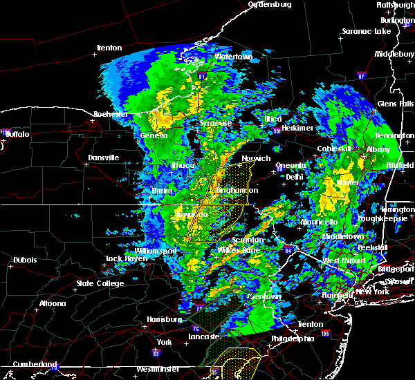 At 336 pm edt, severe thunderstorms were located along a line extending from near friendsville to lovelton, moving east at 50 mph (radar indicated). Hazards include 60 mph wind gusts. Expect damage to roofs, siding, and trees. Locations impacted include, rush, jackson, susquehanna, tunkhannock, susquehanna depot, springville, montrose, dimock, harford and hallstead. At 336 pm edt, severe thunderstorms were located along a line extending from near friendsville to lovelton, moving east at 50 mph (radar indicated). Hazards include 60 mph wind gusts. Expect damage to roofs, siding, and trees. Locations impacted include, rush, jackson, susquehanna, tunkhannock, susquehanna depot, springville, montrose, dimock, harford and hallstead.
|
| 4/13/2020 3:10 PM EDT |
 At 309 pm edt, severe thunderstorms were located along a line extending from milan to near lincoln falls, moving east-northeast at 40 mph (radar indicated). Hazards include 60 mph wind gusts. expect damage to roofs, siding, and trees At 309 pm edt, severe thunderstorms were located along a line extending from milan to near lincoln falls, moving east-northeast at 40 mph (radar indicated). Hazards include 60 mph wind gusts. expect damage to roofs, siding, and trees
|
| 10/31/2019 8:49 PM EDT |
 At 849 pm edt, severe thunderstorms were located along a line extending from near rush to near harveys lake, moving northeast at 50 mph (radar indicated). Hazards include 60 mph wind gusts. Expect damage to roofs, siding, and trees. Locations impacted include, falls, vernon, rush, harveys lake, tunkhannock, springville, montrose, dimock, harford and factoryville. At 849 pm edt, severe thunderstorms were located along a line extending from near rush to near harveys lake, moving northeast at 50 mph (radar indicated). Hazards include 60 mph wind gusts. Expect damage to roofs, siding, and trees. Locations impacted include, falls, vernon, rush, harveys lake, tunkhannock, springville, montrose, dimock, harford and factoryville.
|
| 10/31/2019 8:33 PM EDT |
 At 832 pm edt, severe thunderstorms were located along a line extending from near sugar run to near fairmount spgs, moving northeast at 50 mph (radar indicated). Hazards include 60 mph wind gusts. Expect damage to roofs, siding, and trees. Locations impacted include, falls, vernon, rush, jackson, lehman, harveys lake, susquehanna, tunkhannock, susquehanna depot and springville. At 832 pm edt, severe thunderstorms were located along a line extending from near sugar run to near fairmount spgs, moving northeast at 50 mph (radar indicated). Hazards include 60 mph wind gusts. Expect damage to roofs, siding, and trees. Locations impacted include, falls, vernon, rush, jackson, lehman, harveys lake, susquehanna, tunkhannock, susquehanna depot and springville.
|
| 10/31/2019 8:10 PM EDT |
 At 809 pm edt, severe thunderstorms were located along a line extending from near overton to biggertown, moving northeast at 65 mph (radar indicated). Hazards include 60 mph wind gusts. expect damage to roofs, siding, and trees At 809 pm edt, severe thunderstorms were located along a line extending from near overton to biggertown, moving northeast at 65 mph (radar indicated). Hazards include 60 mph wind gusts. expect damage to roofs, siding, and trees
|
| 8/18/2019 4:34 PM EDT |
 At 433 pm edt, a severe thunderstorm was located over new milford, or 9 miles northeast of montrose, moving east at 50 mph (radar indicated). Hazards include 60 mph wind gusts. expect damage to roofs, siding, and trees At 433 pm edt, a severe thunderstorm was located over new milford, or 9 miles northeast of montrose, moving east at 50 mph (radar indicated). Hazards include 60 mph wind gusts. expect damage to roofs, siding, and trees
|
| 8/17/2019 6:57 PM EDT |
 A severe thunderstorm warning remains in effect until 715 pm edt for susquehanna county. at 656 pm edt, a severe thunderstorm was located near montrose, moving east at 35 mph. hazard. 60 mph wind gusts and quarter size hail. source. Radar indicated. A severe thunderstorm warning remains in effect until 715 pm edt for susquehanna county. at 656 pm edt, a severe thunderstorm was located near montrose, moving east at 35 mph. hazard. 60 mph wind gusts and quarter size hail. source. Radar indicated.
|
| 8/17/2019 6:56 PM EDT | Two power poles snapped with wires down near 263 little elk lake roa in susquehanna county PA, 5.9 miles NNE of Montrose, PA |
| 8/17/2019 6:33 PM EDT |
 At 632 pm edt, a severe thunderstorm was located near le raysville, or 15 miles north of wyalusing, moving east at 35 mph (radar indicated). Hazards include 60 mph wind gusts and quarter size hail. Hail damage to vehicles is expected. Expect wind damage to roofs, siding, and trees. At 632 pm edt, a severe thunderstorm was located near le raysville, or 15 miles north of wyalusing, moving east at 35 mph (radar indicated). Hazards include 60 mph wind gusts and quarter size hail. Hail damage to vehicles is expected. Expect wind damage to roofs, siding, and trees.
|
| 8/15/2019 9:54 PM EDT |
 A severe thunderstorm warning remains in effect until 1015 pm edt for northwestern susquehanna county. at 954 pm edt, a severe thunderstorm was located near friendsville, or near montrose, moving east at 15 mph. hazard. 60 mph wind gusts and quarter size hail. source. Radar indicated. A severe thunderstorm warning remains in effect until 1015 pm edt for northwestern susquehanna county. at 954 pm edt, a severe thunderstorm was located near friendsville, or near montrose, moving east at 15 mph. hazard. 60 mph wind gusts and quarter size hail. source. Radar indicated.
|
| 8/15/2019 9:44 PM EDT |
 At 944 pm edt, a severe thunderstorm was located over friendsville, or 8 miles northwest of montrose, moving east at 15 mph (radar indicated). Hazards include 60 mph wind gusts and penny size hail. Expect damage to roofs, siding, and trees. Locations impacted include, montrose, friendsville, brackney, birchardville, middletown center, salt springs state park and wyoanna. At 944 pm edt, a severe thunderstorm was located over friendsville, or 8 miles northwest of montrose, moving east at 15 mph (radar indicated). Hazards include 60 mph wind gusts and penny size hail. Expect damage to roofs, siding, and trees. Locations impacted include, montrose, friendsville, brackney, birchardville, middletown center, salt springs state park and wyoanna.
|
| 8/15/2019 9:36 PM EDT |
 At 936 pm edt, a severe thunderstorm was located over friendsville, or 10 miles west of montrose, moving east at 15 mph (radar indicated). Hazards include 60 mph wind gusts and penny size hail. Expect damage to roofs, siding, and trees. Locations impacted include, montrose, le raysville, friendsville, brackney, birchardville, middletown center, salt springs state park and wyoanna. At 936 pm edt, a severe thunderstorm was located over friendsville, or 10 miles west of montrose, moving east at 15 mph (radar indicated). Hazards include 60 mph wind gusts and penny size hail. Expect damage to roofs, siding, and trees. Locations impacted include, montrose, le raysville, friendsville, brackney, birchardville, middletown center, salt springs state park and wyoanna.
|
| 8/15/2019 9:22 PM EDT |
 At 922 pm edt, a severe thunderstorm was located near le raysville, or 13 miles west of montrose, moving east at 15 mph (radar indicated). Hazards include 60 mph wind gusts and quarter size hail. Hail damage to vehicles is expected. Expect wind damage to roofs, siding, and trees. At 922 pm edt, a severe thunderstorm was located near le raysville, or 13 miles west of montrose, moving east at 15 mph (radar indicated). Hazards include 60 mph wind gusts and quarter size hail. Hail damage to vehicles is expected. Expect wind damage to roofs, siding, and trees.
|
| 8/8/2019 4:35 PM EDT |
 At 434 pm edt, severe thunderstorms were located along a line extending from stamford to near corbett to montrose, moving east at 50 mph (law enforcement has reported multiple trees and wires down in the area). Hazards include 60 mph wind gusts and penny size hail. Expect damage to roofs, siding, and trees. Locations impacted include, rush, jackson, delhi, colchester, susquehanna, west franklin, deposit, susquehanna depot, springville and montrose. At 434 pm edt, severe thunderstorms were located along a line extending from stamford to near corbett to montrose, moving east at 50 mph (law enforcement has reported multiple trees and wires down in the area). Hazards include 60 mph wind gusts and penny size hail. Expect damage to roofs, siding, and trees. Locations impacted include, rush, jackson, delhi, colchester, susquehanna, west franklin, deposit, susquehanna depot, springville and montrose.
|
| 8/8/2019 4:18 PM EDT | Tree down on wires post pond rd. tree down on jackson/park s in susquehanna county PA, 0.2 miles NE of Montrose, PA |
| 8/8/2019 3:42 PM EDT |
 At 342 pm edt, severe thunderstorms were located along a line extending from bainbridge to near brackney to near le roy, moving east at 45 mph (radar indicated). Hazards include 60 mph wind gusts and penny size hail. expect damage to roofs, siding, and trees At 342 pm edt, severe thunderstorms were located along a line extending from bainbridge to near brackney to near le roy, moving east at 45 mph (radar indicated). Hazards include 60 mph wind gusts and penny size hail. expect damage to roofs, siding, and trees
|
| 8/8/2019 2:56 PM EDT |
 At 255 pm edt, severe thunderstorms were located along a line extending from near candor to tioga center to near wetona, moving east at 60 mph (radar indicated). Hazards include 60 mph wind gusts and penny size hail. expect damage to roofs, siding, and trees At 255 pm edt, severe thunderstorms were located along a line extending from near candor to tioga center to near wetona, moving east at 60 mph (radar indicated). Hazards include 60 mph wind gusts and penny size hail. expect damage to roofs, siding, and trees
|
| 8/8/2019 2:56 PM EDT |
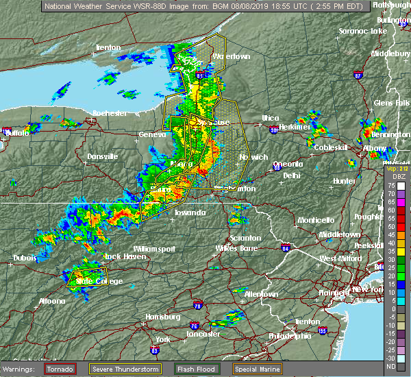 At 255 pm edt, severe thunderstorms were located along a line extending from near candor to tioga center to near wetona, moving east at 60 mph (radar indicated). Hazards include 60 mph wind gusts and penny size hail. expect damage to roofs, siding, and trees At 255 pm edt, severe thunderstorms were located along a line extending from near candor to tioga center to near wetona, moving east at 60 mph (radar indicated). Hazards include 60 mph wind gusts and penny size hail. expect damage to roofs, siding, and trees
|
| 7/16/2019 5:26 PM EDT |
 At 525 pm edt, a severe thunderstorm was located over rome, or near towanda, moving east at 25 mph (radar indicated). Hazards include 60 mph wind gusts and quarter size hail. Hail damage to vehicles is expected. expect wind damage to roofs, siding, and trees. this severe thunderstorm will be near, herrick, herrickville and camptown around 540 pm edt. le raysville, brushville and warren center around 545 pm edt. rushville around 550 pm edt. rush and friendsville around 600 pm edt. Montrose around 625 pm edt. At 525 pm edt, a severe thunderstorm was located over rome, or near towanda, moving east at 25 mph (radar indicated). Hazards include 60 mph wind gusts and quarter size hail. Hail damage to vehicles is expected. expect wind damage to roofs, siding, and trees. this severe thunderstorm will be near, herrick, herrickville and camptown around 540 pm edt. le raysville, brushville and warren center around 545 pm edt. rushville around 550 pm edt. rush and friendsville around 600 pm edt. Montrose around 625 pm edt.
|
| 6/29/2019 8:30 PM EDT |
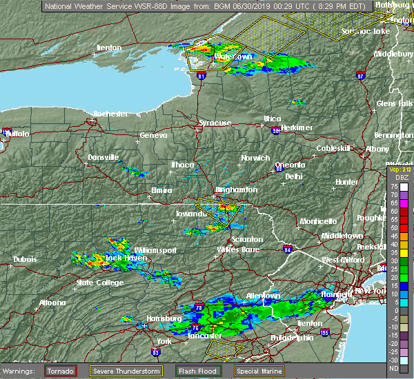 At 755 pm edt, a severe thunderstorm was located over little meadows, or 7 miles south of endicott, moving east at 25 mph (radar indicated). Hazards include quarter size hail. damage to vehicles is expected At 755 pm edt, a severe thunderstorm was located over little meadows, or 7 miles south of endicott, moving east at 25 mph (radar indicated). Hazards include quarter size hail. damage to vehicles is expected
|
| 6/29/2019 8:30 PM EDT |
 At 829 pm edt, a severe thunderstorm was located over hallstead, or 11 miles northeast of montrose, moving east at 30 mph (radar indicated). Hazards include quarter size hail. Damage to vehicles is expected. Locations impacted include, endicott, susquehanna, susquehanna depot, montrose, harford, hallstead, new milford, great bend, lanesboro and little meadows. At 829 pm edt, a severe thunderstorm was located over hallstead, or 11 miles northeast of montrose, moving east at 30 mph (radar indicated). Hazards include quarter size hail. Damage to vehicles is expected. Locations impacted include, endicott, susquehanna, susquehanna depot, montrose, harford, hallstead, new milford, great bend, lanesboro and little meadows.
|
| 6/29/2019 7:55 PM EDT |
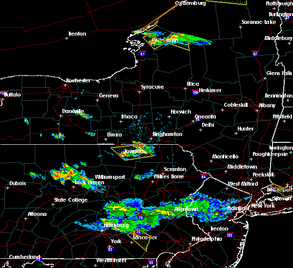 At 755 pm edt, a severe thunderstorm was located over little meadows, or 7 miles south of endicott, moving east at 25 mph (radar indicated). Hazards include quarter size hail. damage to vehicles is expected At 755 pm edt, a severe thunderstorm was located over little meadows, or 7 miles south of endicott, moving east at 25 mph (radar indicated). Hazards include quarter size hail. damage to vehicles is expected
|
| 6/29/2019 3:33 PM EDT |
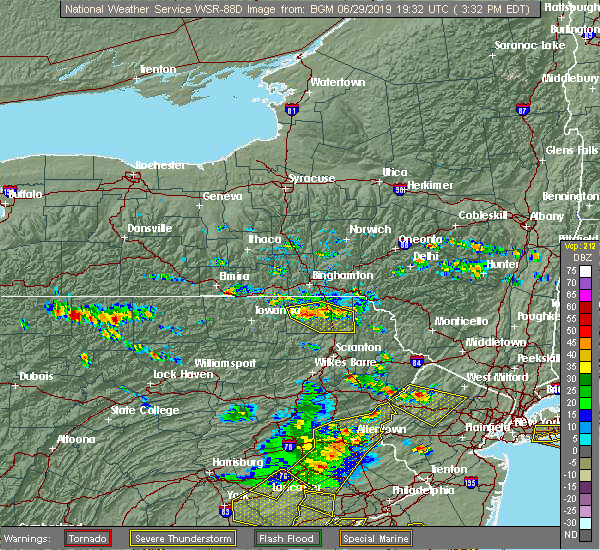 At 333 pm edt, severe thunderstorms were located along a line extending from near thompson to near rush, moving southeast at 20 mph (radar indicated). Hazards include quarter size hail. Damage to vehicles is expected. Locations impacted include, rush, jackson, clifford, forest city, montrose, dimock, harford, new milford, vandling and ararat. At 333 pm edt, severe thunderstorms were located along a line extending from near thompson to near rush, moving southeast at 20 mph (radar indicated). Hazards include quarter size hail. Damage to vehicles is expected. Locations impacted include, rush, jackson, clifford, forest city, montrose, dimock, harford, new milford, vandling and ararat.
|
| 6/29/2019 3:21 PM EDT | Multiple reports of trees down in the area of intersection of warner road and chestnut ridge road. time estimated from rada in susquehanna county PA, 5.9 miles ESE of Montrose, PA |
| 6/29/2019 3:12 PM EDT |
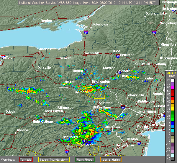 At 312 pm edt, severe thunderstorms were located along a line extending from near brackney to near le raysville, moving southeast at 30 mph (radar indicated). Hazards include quarter size hail. damage to vehicles is expected At 312 pm edt, severe thunderstorms were located along a line extending from near brackney to near le raysville, moving southeast at 30 mph (radar indicated). Hazards include quarter size hail. damage to vehicles is expected
|
| 4/15/2019 1:47 AM EDT |
 At 147 am edt, severe thunderstorms were located along a line extending from near bainbridge to hallstead to near hop bottom, moving east at 50 mph (radar indicated). Hazards include 70 mph wind gusts. Expect considerable tree damage. damage is likely to mobile homes, roofs, and outbuildings. Locations impacted include, kirkwood, conklin, sidney, jackson, guilford, clifford, sanford, susquehanna, forest city and deposit. At 147 am edt, severe thunderstorms were located along a line extending from near bainbridge to hallstead to near hop bottom, moving east at 50 mph (radar indicated). Hazards include 70 mph wind gusts. Expect considerable tree damage. damage is likely to mobile homes, roofs, and outbuildings. Locations impacted include, kirkwood, conklin, sidney, jackson, guilford, clifford, sanford, susquehanna, forest city and deposit.
|
| 4/15/2019 1:27 AM EDT |
 At 127 am edt, severe thunderstorms were located along a line extending from chenango forks to near friendsville to near auburn center, moving east at 45 mph (radar indicated). Hazards include 70 mph wind gusts. Expect considerable tree damage. damage is likely to mobile homes, roofs, and outbuildings. Locations impacted include, binghamton, vestal, johnson city, endicott, kirkwood, conklin, rush, sidney, jackson and guilford. At 127 am edt, severe thunderstorms were located along a line extending from chenango forks to near friendsville to near auburn center, moving east at 45 mph (radar indicated). Hazards include 70 mph wind gusts. Expect considerable tree damage. damage is likely to mobile homes, roofs, and outbuildings. Locations impacted include, binghamton, vestal, johnson city, endicott, kirkwood, conklin, rush, sidney, jackson and guilford.
|
| 4/15/2019 1:10 AM EDT |
 At 110 am edt, severe thunderstorms were located along a line extending from near nanticoke to near le raysville to near new albany, moving east at 45 mph (radar indicated). Hazards include 70 mph wind gusts. Expect considerable tree damage. Damage is likely to mobile homes, roofs, and outbuildings. At 110 am edt, severe thunderstorms were located along a line extending from near nanticoke to near le raysville to near new albany, moving east at 45 mph (radar indicated). Hazards include 70 mph wind gusts. Expect considerable tree damage. Damage is likely to mobile homes, roofs, and outbuildings.
|
| 6/18/2018 4:28 PM EDT | *** 1 inj *** tree down on person on monument street near post office. other trees and wires down in vicinity as wel in susquehanna county PA, 0.2 miles NE of Montrose, PA |
| 5/28/2018 4:13 PM EDT |
 At 412 pm edt, a severe thunderstorm was located over newark valley, or 8 miles northeast of owego, moving southeast at 25 mph (radar indicated). Hazards include ping pong ball size hail and 60 mph wind gusts. People and animals outdoors will be injured. expect hail damage to roofs, siding, windows, and vehicles. expect wind damage to roofs, siding, and trees. this severe thunderstorm will be near, owego around 425 pm edt. union center around 430 pm edt. johnson city, endicott and apalachin around 435 pm edt. vestal around 440 pm edt. tioga terrace around 445 pm edt. little meadows and vestal center around 450 pm edt. warren center around 500 pm edt. Friendsville and brackney around 505 pm edt. At 412 pm edt, a severe thunderstorm was located over newark valley, or 8 miles northeast of owego, moving southeast at 25 mph (radar indicated). Hazards include ping pong ball size hail and 60 mph wind gusts. People and animals outdoors will be injured. expect hail damage to roofs, siding, windows, and vehicles. expect wind damage to roofs, siding, and trees. this severe thunderstorm will be near, owego around 425 pm edt. union center around 430 pm edt. johnson city, endicott and apalachin around 435 pm edt. vestal around 440 pm edt. tioga terrace around 445 pm edt. little meadows and vestal center around 450 pm edt. warren center around 500 pm edt. Friendsville and brackney around 505 pm edt.
|
| 5/15/2018 2:43 PM EDT |
 At 243 pm edt, severe thunderstorms were located along a line extending from sherman to near harford to near lake carey, moving east at 55 mph (radar indicated). Hazards include 60 mph wind gusts and half dollar size hail. Hail damage to vehicles is expected. expect wind damage to roofs, siding, and trees. these severe storms will be near, starlight, hiawatha and sherman around 250 pm edt. thompson around 255 pm edt. union dale around 300 pm edt. pleasant mount around 305 pm edt. forest city around 310 pm edt. equinunk around 315 pm edt. A tornado watch remains in effect until 800 pm edt for central new york, and northeastern pennsylvania. At 243 pm edt, severe thunderstorms were located along a line extending from sherman to near harford to near lake carey, moving east at 55 mph (radar indicated). Hazards include 60 mph wind gusts and half dollar size hail. Hail damage to vehicles is expected. expect wind damage to roofs, siding, and trees. these severe storms will be near, starlight, hiawatha and sherman around 250 pm edt. thompson around 255 pm edt. union dale around 300 pm edt. pleasant mount around 305 pm edt. forest city around 310 pm edt. equinunk around 315 pm edt. A tornado watch remains in effect until 800 pm edt for central new york, and northeastern pennsylvania.
|
| 5/15/2018 2:35 PM EDT | Shed overturne in susquehanna county PA, 2.2 miles N of Montrose, PA |
| 5/15/2018 2:31 PM EDT |
 At 231 pm edt, severe thunderstorms were located along a line extending from near montrose to near springville to near rush, moving east at 45 mph. these are very dangerous storms (radar indicated). Hazards include 80 mph wind gusts and two inch hail. Flying debris will be dangerous to those caught without shelter. mobile homes will be heavily damaged. expect considerable damage to roofs, windows, and vehicles. extensive tree damage and power outages are likely. locations impacted include, rush, jackson, clifford, susquehanna, forest city, susquehanna depot, springville, montrose, dimock and harford. A tornado watch remains in effect until 800 pm edt for central new york, and northeastern pennsylvania. At 231 pm edt, severe thunderstorms were located along a line extending from near montrose to near springville to near rush, moving east at 45 mph. these are very dangerous storms (radar indicated). Hazards include 80 mph wind gusts and two inch hail. Flying debris will be dangerous to those caught without shelter. mobile homes will be heavily damaged. expect considerable damage to roofs, windows, and vehicles. extensive tree damage and power outages are likely. locations impacted include, rush, jackson, clifford, susquehanna, forest city, susquehanna depot, springville, montrose, dimock and harford. A tornado watch remains in effect until 800 pm edt for central new york, and northeastern pennsylvania.
|
| 5/15/2018 2:30 PM EDT | Quarter sized hail reported 5.8 miles NNE of Montrose, PA |
| 5/15/2018 2:21 PM EDT |
 At 209 pm edt, severe thunderstorms were located along a line extending from near warren center to near herrick, moving east at 50 mph (radar indicated). Hazards include 60 mph wind gusts and half dollar size hail. Hail damage to vehicles is expected. Expect wind damage to roofs, siding, and trees. At 209 pm edt, severe thunderstorms were located along a line extending from near warren center to near herrick, moving east at 50 mph (radar indicated). Hazards include 60 mph wind gusts and half dollar size hail. Hail damage to vehicles is expected. Expect wind damage to roofs, siding, and trees.
|
| 5/15/2018 2:10 PM EDT |
 At 209 pm edt, severe thunderstorms were located along a line extending from near warren center to near herrick, moving east at 50 mph (radar indicated). Hazards include 60 mph wind gusts and half dollar size hail. Hail damage to vehicles is expected. Expect wind damage to roofs, siding, and trees. At 209 pm edt, severe thunderstorms were located along a line extending from near warren center to near herrick, moving east at 50 mph (radar indicated). Hazards include 60 mph wind gusts and half dollar size hail. Hail damage to vehicles is expected. Expect wind damage to roofs, siding, and trees.
|
| 5/4/2018 8:08 PM EDT |
 The severe thunderstorm warning for southern susquehanna, northwestern lackawanna, northwestern luzerne, southeastern bradford and wyoming counties will expire at 815 pm edt, the storms which prompted the warning have weakened below severe limits, and have exited the warned area. therefore the warning will be allowed to expire. The severe thunderstorm warning for southern susquehanna, northwestern lackawanna, northwestern luzerne, southeastern bradford and wyoming counties will expire at 815 pm edt, the storms which prompted the warning have weakened below severe limits, and have exited the warned area. therefore the warning will be allowed to expire.
|
| 5/4/2018 7:33 PM EDT |
 At 732 pm edt, severe thunderstorms were located along a line extending from near montrose to near lovelton, moving east at 50 mph (radar indicated). Hazards include 60 mph wind gusts. Expect damage to trees, and power lines. these severe storms will be near, montrose around 740 pm edt. harveys lake, beaumont and evans falls around 750 pm edt. falls around 755 pm edt. Forest city around 805 pm edt. At 732 pm edt, severe thunderstorms were located along a line extending from near montrose to near lovelton, moving east at 50 mph (radar indicated). Hazards include 60 mph wind gusts. Expect damage to trees, and power lines. these severe storms will be near, montrose around 740 pm edt. harveys lake, beaumont and evans falls around 750 pm edt. falls around 755 pm edt. Forest city around 805 pm edt.
|
| 5/4/2018 7:13 PM EDT |
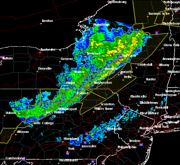 At 712 pm edt, severe thunderstorms were located along a line extending from little meadows to near lincoln falls, moving southeast at 55 mph (radar indicated). Hazards include 60 mph wind gusts. Expect damage to trees, and power lines. severe thunderstorms will be near, little meadows, friendsville and warren center around 720 pm edt. montrose around 730 pm edt. lovelton around 735 pm edt. forkston and kasson brook around 740 pm edt. noxen around 745 pm edt. harveys lake, beaumont and evans falls around 750 pm edt. falls around 755 pm edt. Forest city around 800 pm edt. At 712 pm edt, severe thunderstorms were located along a line extending from little meadows to near lincoln falls, moving southeast at 55 mph (radar indicated). Hazards include 60 mph wind gusts. Expect damage to trees, and power lines. severe thunderstorms will be near, little meadows, friendsville and warren center around 720 pm edt. montrose around 730 pm edt. lovelton around 735 pm edt. forkston and kasson brook around 740 pm edt. noxen around 745 pm edt. harveys lake, beaumont and evans falls around 750 pm edt. falls around 755 pm edt. Forest city around 800 pm edt.
|
| 8/19/2017 8:01 PM EDT |
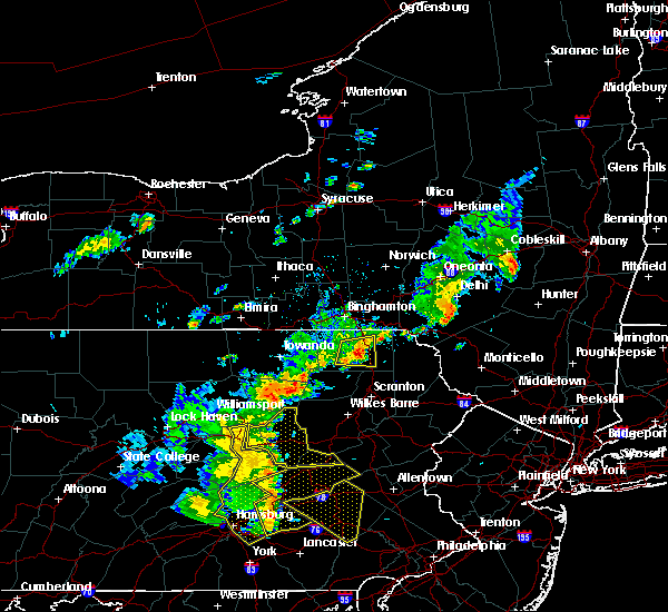 At 801 pm edt, a severe thunderstorm was located near harford, or near montrose, moving east at 20 mph (radar indicated). Hazards include half dollar size hail. Minor damage to vehicles is possible. this severe storm will be near, harford and new milford around 810 pm edt. Gibson around 815 pm edt. At 801 pm edt, a severe thunderstorm was located near harford, or near montrose, moving east at 20 mph (radar indicated). Hazards include half dollar size hail. Minor damage to vehicles is possible. this severe storm will be near, harford and new milford around 810 pm edt. Gibson around 815 pm edt.
|
| 8/19/2017 7:41 PM EDT |
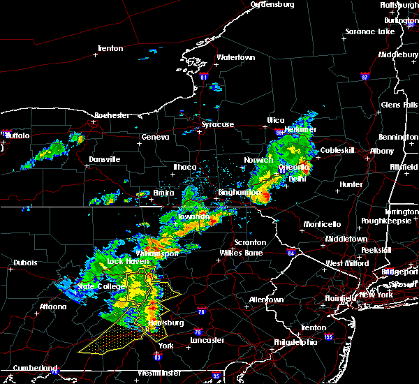 At 741 pm edt, a severe thunderstorm was located near rush, or near montrose, moving east at 20 mph (radar indicated). Hazards include quarter size hail. Minor damage to vehicles is possible. this severe thunderstorm will be near, springville around 745 pm edt. montrose around 755 pm edt. hop bottom around 810 pm edt. Harford, new milford and gibson around 815 pm edt. At 741 pm edt, a severe thunderstorm was located near rush, or near montrose, moving east at 20 mph (radar indicated). Hazards include quarter size hail. Minor damage to vehicles is possible. this severe thunderstorm will be near, springville around 745 pm edt. montrose around 755 pm edt. hop bottom around 810 pm edt. Harford, new milford and gibson around 815 pm edt.
|
| 7/20/2017 4:56 PM EDT | Tree and power lines down across gary rd in susquehanna county PA, 9.6 miles ENE of Montrose, PA |
| 7/20/2017 4:28 PM EDT |
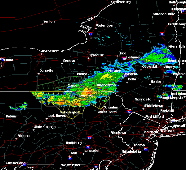 At 428 pm edt, a severe thunderstorm was located near friendsville, or 7 miles west of montrose, moving southeast at 45 mph (radar indicated). Hazards include 60 mph wind gusts. Expect damage to trees, and power lines. this severe thunderstorm will be near, montrose and springville around 440 pm edt. harford and hop bottom around 450 pm edt. nicholson and glenwood around 455 pm edt. Dalton, factoryville and la plume around 500 pm edt. At 428 pm edt, a severe thunderstorm was located near friendsville, or 7 miles west of montrose, moving southeast at 45 mph (radar indicated). Hazards include 60 mph wind gusts. Expect damage to trees, and power lines. this severe thunderstorm will be near, montrose and springville around 440 pm edt. harford and hop bottom around 450 pm edt. nicholson and glenwood around 455 pm edt. Dalton, factoryville and la plume around 500 pm edt.
|
| 7/17/2017 5:20 PM EDT | Trees dow in susquehanna county PA, 0.2 miles NE of Montrose, PA |
| 7/17/2017 4:38 PM EDT |
 At 437 pm edt, a severe thunderstorm was located over montrose, moving east at 25 mph (radar indicated). Hazards include 60 mph wind gusts and quarter size hail. Minor hail damage to vehicles is possible. expect wind to cause damage to trees, and power lines. this severe thunderstorm will be near, great bend around 500 pm edt. harford, hallstead and new milford around 505 pm edt. gibson around 510 pm edt. susquehanna, susquehanna depot and lanesboro around 520 pm edt. Thompson and starrucca around 530 pm edt. At 437 pm edt, a severe thunderstorm was located over montrose, moving east at 25 mph (radar indicated). Hazards include 60 mph wind gusts and quarter size hail. Minor hail damage to vehicles is possible. expect wind to cause damage to trees, and power lines. this severe thunderstorm will be near, great bend around 500 pm edt. harford, hallstead and new milford around 505 pm edt. gibson around 510 pm edt. susquehanna, susquehanna depot and lanesboro around 520 pm edt. Thompson and starrucca around 530 pm edt.
|
| 7/17/2017 1:07 PM EDT |
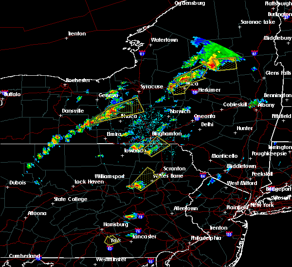 At 106 pm edt, a severe thunderstorm was located over montrose, moving northeast at 15 mph (radar indicated). Hazards include quarter size hail. Minor damage to vehicles is possible. this severe thunderstorm will be near, brackney around 135 pm edt. new milford around 145 pm edt. Kirkwood, conklin and susquehanna depot around 200 pm edt. At 106 pm edt, a severe thunderstorm was located over montrose, moving northeast at 15 mph (radar indicated). Hazards include quarter size hail. Minor damage to vehicles is possible. this severe thunderstorm will be near, brackney around 135 pm edt. new milford around 145 pm edt. Kirkwood, conklin and susquehanna depot around 200 pm edt.
|
| 6/19/2017 12:40 PM EDT |
 At 1239 pm edt, a severe thunderstorm was located over litchfield, or near athens, moving northeast at 45 mph (radar indicated). Hazards include 60 mph wind gusts. Expect damage to trees, and power lines. this severe thunderstorm will be near, windham around 1245 pm edt. lounsberry and tioga center around 1250 pm edt. owego and little meadows around 1255 pm edt. apalachin and tioga terrace around 100 pm edt. vestal and vestal center around 105 pm edt. endicott, endwell and west corners around 110 pm edt. johnson city and nws binghamton around 115 pm edt. Binghamton around 120 pm edt. At 1239 pm edt, a severe thunderstorm was located over litchfield, or near athens, moving northeast at 45 mph (radar indicated). Hazards include 60 mph wind gusts. Expect damage to trees, and power lines. this severe thunderstorm will be near, windham around 1245 pm edt. lounsberry and tioga center around 1250 pm edt. owego and little meadows around 1255 pm edt. apalachin and tioga terrace around 100 pm edt. vestal and vestal center around 105 pm edt. endicott, endwell and west corners around 110 pm edt. johnson city and nws binghamton around 115 pm edt. Binghamton around 120 pm edt.
|
| 6/5/2017 2:36 PM EDT |
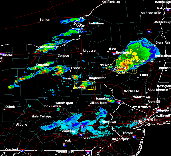 At 235 pm edt, a severe thunderstorm was located over friendsville, or 8 miles northwest of montrose, moving east at 25 mph (radar indicated). Hazards include 60 mph wind gusts and quarter size hail. Hail damage to vehicles is expected. expect wind damage to roofs, siding, and trees. this severe storm will be near, brackney around 245 pm edt. montrose around 255 pm edt. Hallstead and new milford around 300 pm edt. At 235 pm edt, a severe thunderstorm was located over friendsville, or 8 miles northwest of montrose, moving east at 25 mph (radar indicated). Hazards include 60 mph wind gusts and quarter size hail. Hail damage to vehicles is expected. expect wind damage to roofs, siding, and trees. this severe storm will be near, brackney around 245 pm edt. montrose around 255 pm edt. Hallstead and new milford around 300 pm edt.
|
| 6/5/2017 2:02 PM EDT |
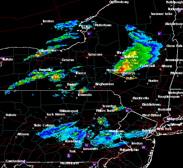 At 202 pm edt, a severe thunderstorm was located over windham, or 11 miles south of owego, moving east at 25 mph (radar indicated). Hazards include 60 mph wind gusts and quarter size hail. Hail damage to vehicles is expected. expect wind damage to roofs, siding, and trees. this severe thunderstorm will be near, le raysville and warren center around 215 pm edt. little meadows and tioga terrace around 220 pm edt. friendsville around 230 pm edt. vestal center around 235 pm edt. brackney around 245 pm edt. montrose around 250 pm edt. Kirkwood, conklin and hallstead around 300 pm edt. At 202 pm edt, a severe thunderstorm was located over windham, or 11 miles south of owego, moving east at 25 mph (radar indicated). Hazards include 60 mph wind gusts and quarter size hail. Hail damage to vehicles is expected. expect wind damage to roofs, siding, and trees. this severe thunderstorm will be near, le raysville and warren center around 215 pm edt. little meadows and tioga terrace around 220 pm edt. friendsville around 230 pm edt. vestal center around 235 pm edt. brackney around 245 pm edt. montrose around 250 pm edt. Kirkwood, conklin and hallstead around 300 pm edt.
|
| 5/31/2017 7:44 PM EDT |
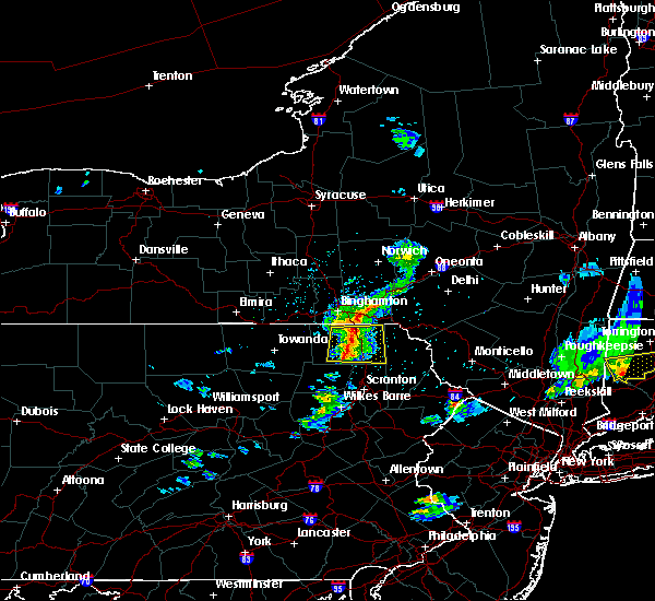 At 743 pm edt, a severe thunderstorm was located near hop bottom, or near montrose, moving east at 45 mph (radar indicated. large tree also reported down across road in auburn township). Hazards include 60 mph wind gusts and quarter size hail. Hail damage to vehicles is expected. expect wind damage to roofs, siding, and trees. Locations impacted include, jackson, clifford, susquehanna, forest city, susquehanna depot, springville, montrose, dimock, harford and hallstead. At 743 pm edt, a severe thunderstorm was located near hop bottom, or near montrose, moving east at 45 mph (radar indicated. large tree also reported down across road in auburn township). Hazards include 60 mph wind gusts and quarter size hail. Hail damage to vehicles is expected. expect wind damage to roofs, siding, and trees. Locations impacted include, jackson, clifford, susquehanna, forest city, susquehanna depot, springville, montrose, dimock, harford and hallstead.
|
| 5/31/2017 7:30 PM EDT | Tree down blocking north road in forest lake township. 911 dispatch fee in susquehanna county PA, 5.4 miles SE of Montrose, PA |
| 5/31/2017 7:19 PM EDT |
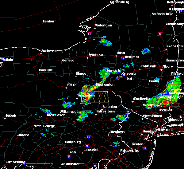 At 719 pm edt, a severe thunderstorm was located over rushville, or 9 miles northeast of wyalusing, moving east at 40 mph (radar indicated). Hazards include 60 mph wind gusts and quarter size hail. Hail damage to vehicles is expected. expect wind damage to roofs, siding, and trees. this severe thunderstorm will be near, rush and auburn center around 725 pm edt. springville around 735 pm edt. montrose around 740 pm edt. hop bottom around 745 pm edt. harford around 750 pm edt. gibson, lenoxville and royal around 755 pm edt. Thompson and union dale around 800 pm edt. At 719 pm edt, a severe thunderstorm was located over rushville, or 9 miles northeast of wyalusing, moving east at 40 mph (radar indicated). Hazards include 60 mph wind gusts and quarter size hail. Hail damage to vehicles is expected. expect wind damage to roofs, siding, and trees. this severe thunderstorm will be near, rush and auburn center around 725 pm edt. springville around 735 pm edt. montrose around 740 pm edt. hop bottom around 745 pm edt. harford around 750 pm edt. gibson, lenoxville and royal around 755 pm edt. Thompson and union dale around 800 pm edt.
|
| 5/1/2017 7:49 PM EDT |
 At 748 pm edt, severe thunderstorms were located along a line extending from near vestal center to near rushville to lovelton to iola, moving east at 40 to 50 mph (radar indicated). Hazards include 60 mph wind gusts and penny size hail. Expect damage to roofs, siding, and trees. severe thunderstorms will be near, rush, noxen and mehoopany around 755 pm edt. springville, meshoppen and evans falls around 800 pm edt. tunkhannock, montrose and osterhout around 805 pm edt. falls, nescopeck and hallstead around 810 pm edt. muhlenberg, factoryville and shickshinny around 815 pm edt. waverly, clarks summit and susquehanna around 820 pm edt. scranton, dunmore and dickson city around 825 pm edt. carbondale, archbald and olyphant around 830 pm edt. A tornado watch remains in effect until 1000 pm edt for central new york, and northeastern pennsylvania. At 748 pm edt, severe thunderstorms were located along a line extending from near vestal center to near rushville to lovelton to iola, moving east at 40 to 50 mph (radar indicated). Hazards include 60 mph wind gusts and penny size hail. Expect damage to roofs, siding, and trees. severe thunderstorms will be near, rush, noxen and mehoopany around 755 pm edt. springville, meshoppen and evans falls around 800 pm edt. tunkhannock, montrose and osterhout around 805 pm edt. falls, nescopeck and hallstead around 810 pm edt. muhlenberg, factoryville and shickshinny around 815 pm edt. waverly, clarks summit and susquehanna around 820 pm edt. scranton, dunmore and dickson city around 825 pm edt. carbondale, archbald and olyphant around 830 pm edt. A tornado watch remains in effect until 1000 pm edt for central new york, and northeastern pennsylvania.
|
| 4/16/2017 5:12 PM EDT |
 At 511 pm edt, severe thunderstorms were located along a line extending from near sherman to near susquehanna to auburn center, moving east at 70 mph (radar indicated). Hazards include 60 mph wind gusts. Expect damage to trees. these severe storms will be near, susquehanna, susquehanna depot and lanesboro around 515 pm edt. hiawatha, starlight and shehawken around 520 pm edt. harford, hop bottom and glenwood around 525 pm edt. Gibson around 530 pm edt. At 511 pm edt, severe thunderstorms were located along a line extending from near sherman to near susquehanna to auburn center, moving east at 70 mph (radar indicated). Hazards include 60 mph wind gusts. Expect damage to trees. these severe storms will be near, susquehanna, susquehanna depot and lanesboro around 515 pm edt. hiawatha, starlight and shehawken around 520 pm edt. harford, hop bottom and glenwood around 525 pm edt. Gibson around 530 pm edt.
|
| 4/16/2017 4:54 PM EDT |
 At 454 pm edt, severe thunderstorms were located along a line extending from near conklin to near friendsville to wysox, moving east at 45 mph (radar indicated). Hazards include 60 mph wind gusts. Expect damage to trees. severe thunderstorms will be near, kirkwood, conklin and rush around 500 pm edt. hallstead, great bend and brushville around 505 pm edt. montrose and rushville around 510 pm edt. susquehanna, susquehanna depot and new milford around 515 pm edt. harford and auburn center around 520 pm edt. springville, starrucca and gibson around 525 pm edt. hiawatha and shehawken around 530 pm edt. Thompson and starlight around 535 pm edt. At 454 pm edt, severe thunderstorms were located along a line extending from near conklin to near friendsville to wysox, moving east at 45 mph (radar indicated). Hazards include 60 mph wind gusts. Expect damage to trees. severe thunderstorms will be near, kirkwood, conklin and rush around 500 pm edt. hallstead, great bend and brushville around 505 pm edt. montrose and rushville around 510 pm edt. susquehanna, susquehanna depot and new milford around 515 pm edt. harford and auburn center around 520 pm edt. springville, starrucca and gibson around 525 pm edt. hiawatha and shehawken around 530 pm edt. Thompson and starlight around 535 pm edt.
|
| 7/25/2016 4:12 PM EDT |
 At 411 pm edt, a severe thunderstorm was located near lanesboro, or 8 miles southwest of deposit, moving east at 60 mph (radar indicated). Hazards include 60 mph wind gusts. Expect damage to roofs. siding. and trees. this severe storm will be near, starrucca around 415 pm edt. deposit, sherman and hiawatha around 420 pm edt. hancock and starlight around 425 pm edt. These storms have downed numerous trees and caused power outages around the binghamton metro area. At 411 pm edt, a severe thunderstorm was located near lanesboro, or 8 miles southwest of deposit, moving east at 60 mph (radar indicated). Hazards include 60 mph wind gusts. Expect damage to roofs. siding. and trees. this severe storm will be near, starrucca around 415 pm edt. deposit, sherman and hiawatha around 420 pm edt. hancock and starlight around 425 pm edt. These storms have downed numerous trees and caused power outages around the binghamton metro area.
|
| 7/25/2016 3:50 PM EDT |
 At 349 pm edt, a severe thunderstorm was located over conklin, or near binghamton, moving east at 55 mph (radar indicated). Hazards include 60 mph wind gusts. Expect damage to roofs. siding. and trees. this severe thunderstorm will be near, hallstead and great bend around 355 pm edt. windsor around 400 pm edt. sanford, susquehanna and susquehanna depot around 405 pm edt. deposit, starrucca and sherman around 410 pm edt. hiawatha and shehawken around 415 pm edt. Hancock and starlight around 420 pm edt. At 349 pm edt, a severe thunderstorm was located over conklin, or near binghamton, moving east at 55 mph (radar indicated). Hazards include 60 mph wind gusts. Expect damage to roofs. siding. and trees. this severe thunderstorm will be near, hallstead and great bend around 355 pm edt. windsor around 400 pm edt. sanford, susquehanna and susquehanna depot around 405 pm edt. deposit, starrucca and sherman around 410 pm edt. hiawatha and shehawken around 415 pm edt. Hancock and starlight around 420 pm edt.
|
| 7/2/2014 11:36 AM EDT | Golf Ball sized hail reported 7.4 miles E of Montrose, PA, widespread hail damage. relayed by wbng tv. |
| 5/16/2014 9:20 AM EDT | Flashing off a house. roof peeled off a barn. trees damage... mostly larger branches... throughout the city. storm survey confirmed microburst. estimated peak winds 70 in susquehanna county PA, 0.2 miles NE of Montrose, PA |
| 10/7/2013 12:03 PM EDT | Multiple trees down in susquehanna county PA, 5.8 miles NNE of Montrose, PA |
| 7/28/2013 11:23 AM EDT | Trees down across sr-706 in susquehanna county PA, 7.7 miles ENE of Montrose, PA |
| 7/26/2012 4:54 PM EDT | Quarter sized hail reported 0.2 miles NE of Montrose, PA |
| 7/26/2012 4:48 PM EDT | Multiple trees...large groups of trees down... trees down on homes and barns. also tops of trees of in susquehanna county PA, 5.8 miles NNE of Montrose, PA |
| 7/26/2012 4:45 PM EDT | Roof blown off a house. building under construction blown dow in susquehanna county PA, 0.2 miles NE of Montrose, PA |
| 7/23/2012 6:42 PM EDT | Quarter sized hail reported 0.2 miles NE of Montrose, PA |
| 8/19/2011 1:33 PM EDT | Ping Pong Ball sized hail reported 6.8 miles NNE of Montrose, PA |
| 8/19/2011 1:28 PM EDT | Ping Pong Ball sized hail reported 6.8 miles NNE of Montrose, PA, time modified based on radar. |
| 1/1/0001 12:00 AM | At routes 167 and 706 in montrose... report of 2 trees down in susquehanna county PA, 0.2 miles NE of Montrose, PA |
| 1/1/0001 12:00 AM | Thunderstorm winds damaged a home and took down some trees on hawley road on the west side of montrose near route 706. the thunderstorm then produced a significant micr in susquehanna county PA, 1.5 miles N of Montrose, PA |
| 1/1/0001 12:00 AM | House damaged... many trees down in susquehanna county PA, 0.2 miles NE of Montrose, PA |
| 1/1/0001 12:00 AM | Quarter sized hail reported 0.2 miles NE of Montrose, PA |
| 1/1/0001 12:00 AM | Quarter sized hail reported 6.8 miles NNE of Montrose, PA |
| 1/1/0001 12:00 AM | Numerous trees down. 30 foot trailer overturned. pole barn destroye in susquehanna county PA, 5.8 miles NNE of Montrose, PA |
Hail Maps for Montrose, PA


Connect with Interactive Hail Maps