

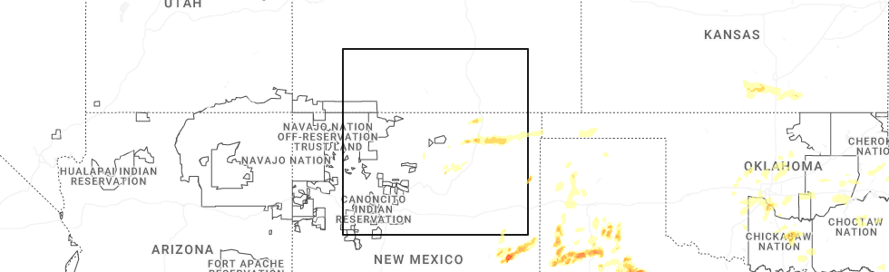
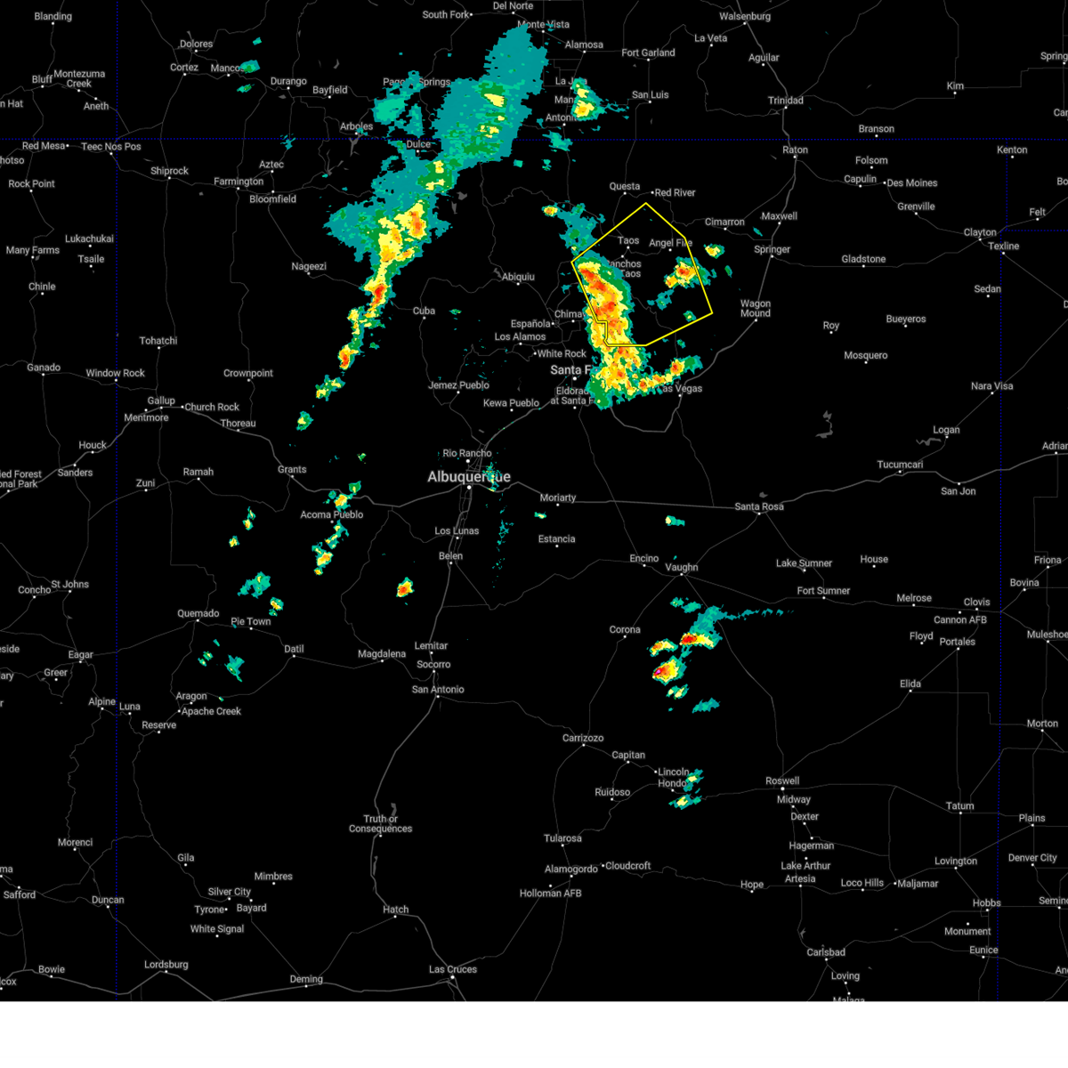
Hail Map for Mora, NM
The Mora, NM area has had 22 reports of on-the-ground hail by trained spotters, and has been under severe weather warnings 10 times during the past 12 months. Doppler radar has detected hail at or near Mora, NM on 48 occasions, including 2 occasions during the past year.
| Name: | Mora, NM |
| Where Located: | 33.6 miles SSE of Taos, NM |
| Map: | Google Map for Mora, NM |
| Population: | 656 |
| Housing Units: | 373 |
| More Info: | Search Google for Mora, NM |
2
The Top Recent Hail Date for Mora, NM is Sunday, May 25, 2025 (10th out of 48)
Hail and Wind Damage Spotted near Mora, NM
| Date / Time | Report Details |
|---|---|
| 5/25/2025 4:20 PM MDT |
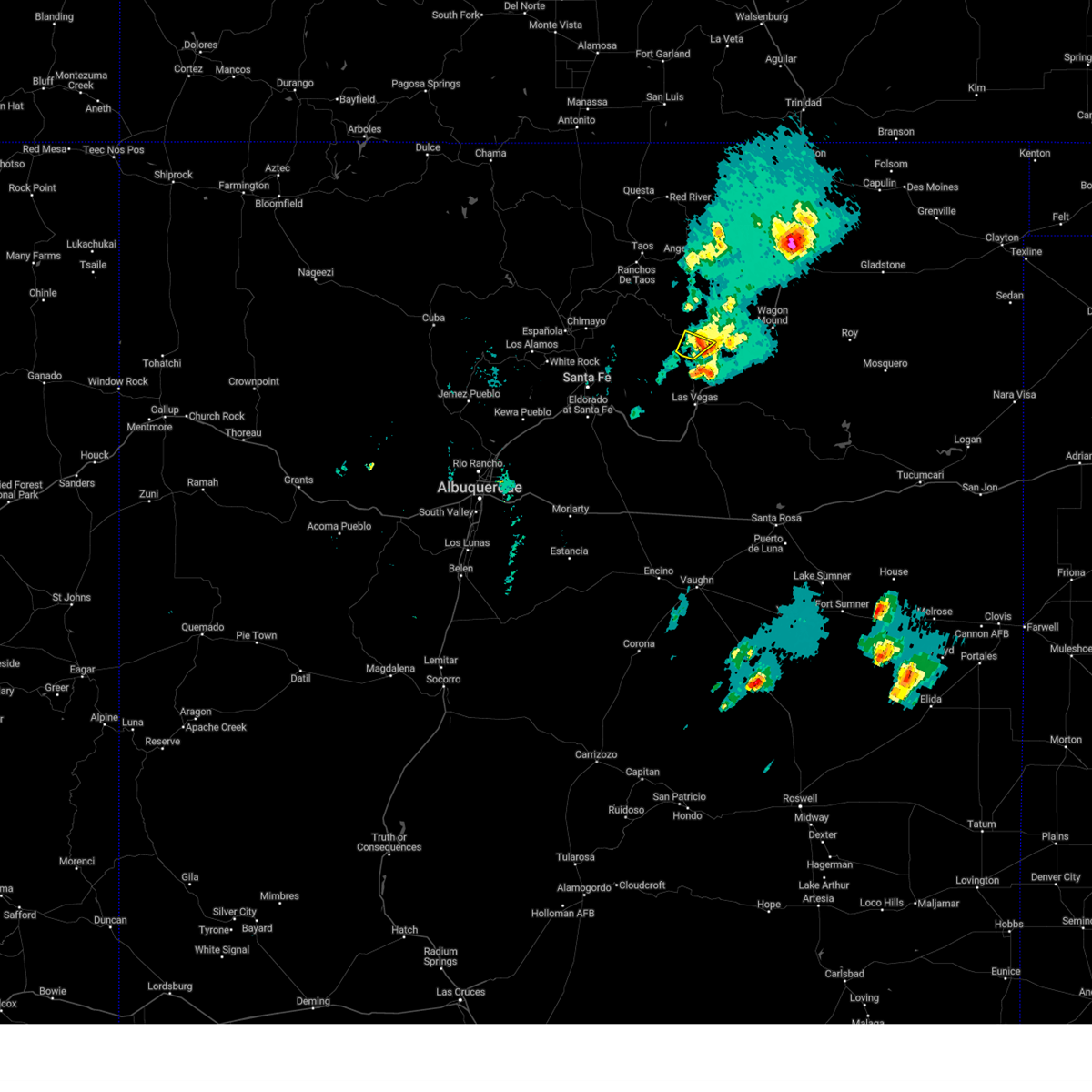 the severe thunderstorm warning has been cancelled and is no longer in effect the severe thunderstorm warning has been cancelled and is no longer in effect
|
| 5/25/2025 4:03 PM MDT | At 403 pm mdt, a severe thunderstorm was located 7 miles northeast of la cueva, or 9 miles east of mora, moving northeast at 25 mph (radar indicated). Hazards include 60 mph wind gusts and small hail. Expect damage to roofs, siding, and trees. locations impacted include, la cueva, golondrinas and south carmen. this includes the following highways, state road 94 between mile markers 11 and 12. State road 518 between mile markers 17 and 27. |
| 5/25/2025 4:03 PM MDT | the severe thunderstorm warning has been cancelled and is no longer in effect |
| 5/25/2025 3:46 PM MDT | Quarter sized hail reported 8.7 miles N of Mora, NM, minor vehicle damage. |
| 5/25/2025 3:38 PM MDT |
 Svrabq the national weather service in albuquerque has issued a * severe thunderstorm warning for, south central mora county in northeastern new mexico, northern san miguel county in northeastern new mexico, * until 430 pm mdt. * at 338 pm mdt, a severe thunderstorm was located near la cueva, or 7 miles southeast of mora, moving northeast at 25 mph (radar indicated). Hazards include 60 mph wind gusts and quarter size hail. Hail damage to vehicles is expected. Expect wind damage to roofs, siding, and trees. Svrabq the national weather service in albuquerque has issued a * severe thunderstorm warning for, south central mora county in northeastern new mexico, northern san miguel county in northeastern new mexico, * until 430 pm mdt. * at 338 pm mdt, a severe thunderstorm was located near la cueva, or 7 miles southeast of mora, moving northeast at 25 mph (radar indicated). Hazards include 60 mph wind gusts and quarter size hail. Hail damage to vehicles is expected. Expect wind damage to roofs, siding, and trees.
|
| 9/17/2024 1:49 PM MDT |
 the severe thunderstorm warning has been cancelled and is no longer in effect the severe thunderstorm warning has been cancelled and is no longer in effect
|
| 9/17/2024 12:53 PM MDT |
 Svrabq the national weather service in albuquerque has issued a * severe thunderstorm warning for, southern taos county in north central new mexico, southeastern rio arriba county in north central new mexico, northwestern mora county in northeastern new mexico, southwestern colfax county in northeastern new mexico, * until 200 pm mdt. * at 1253 pm mdt, severe thunderstorms were located along a line extending from 6 miles north of dixon to cowles, moving northeast at 45 mph (radar indicated). Hazards include 60 mph wind gusts. expect damage to roofs, siding, and trees Svrabq the national weather service in albuquerque has issued a * severe thunderstorm warning for, southern taos county in north central new mexico, southeastern rio arriba county in north central new mexico, northwestern mora county in northeastern new mexico, southwestern colfax county in northeastern new mexico, * until 200 pm mdt. * at 1253 pm mdt, severe thunderstorms were located along a line extending from 6 miles north of dixon to cowles, moving northeast at 45 mph (radar indicated). Hazards include 60 mph wind gusts. expect damage to roofs, siding, and trees
|
| 7/18/2024 2:57 PM MDT |
 The storm which prompted the warning has weakened below severe limits, and no longer poses an immediate threat to life or property. therefore, the warning will be allowed to expire. however, gusty winds and heavy rain are still possible with this thunderstorm. The storm which prompted the warning has weakened below severe limits, and no longer poses an immediate threat to life or property. therefore, the warning will be allowed to expire. however, gusty winds and heavy rain are still possible with this thunderstorm.
|
| 7/18/2024 2:45 PM MDT |
 At 245 pm mdt, a severe thunderstorm was located near mora, moving southwest at 15 mph (radar indicated). Hazards include 60 mph wind gusts and quarter size hail. Hail damage to vehicles is expected. expect wind damage to roofs, siding, and trees. locations impacted include, mora, la cueva, ledoux, morphy lake state park, south carmen, el turquillo, golondrinas, luceros, rainsville, and monte aplanado. this includes the following highways, state road 94 between mile markers 10 and 18. state road 105 near mile marker 8. state road 283 near mile marker 13. state road 434 between mile markers 0 and 10. State road 518 between mile markers 17 and 31. At 245 pm mdt, a severe thunderstorm was located near mora, moving southwest at 15 mph (radar indicated). Hazards include 60 mph wind gusts and quarter size hail. Hail damage to vehicles is expected. expect wind damage to roofs, siding, and trees. locations impacted include, mora, la cueva, ledoux, morphy lake state park, south carmen, el turquillo, golondrinas, luceros, rainsville, and monte aplanado. this includes the following highways, state road 94 between mile markers 10 and 18. state road 105 near mile marker 8. state road 283 near mile marker 13. state road 434 between mile markers 0 and 10. State road 518 between mile markers 17 and 31.
|
| 7/18/2024 2:28 PM MDT |
 At 228 pm mdt, a severe thunderstorm was located near la cueva, or 8 miles east of mora, moving south at 15 mph (radar indicated). Hazards include 60 mph wind gusts and quarter size hail. Hail damage to vehicles is expected. expect wind damage to roofs, siding, and trees. locations impacted include, mora, la cueva, ledoux, morphy lake state park, ojo feliz, south carmen, el turquillo, golondrinas, luceros, and rainsville. this includes the following highways, state road 94 between mile markers 10 and 18. state road 105 near mile marker 8. state road 283 near mile marker 13. state road 434 between mile markers 0 and 12. State road 518 between mile markers 17 and 31. At 228 pm mdt, a severe thunderstorm was located near la cueva, or 8 miles east of mora, moving south at 15 mph (radar indicated). Hazards include 60 mph wind gusts and quarter size hail. Hail damage to vehicles is expected. expect wind damage to roofs, siding, and trees. locations impacted include, mora, la cueva, ledoux, morphy lake state park, ojo feliz, south carmen, el turquillo, golondrinas, luceros, and rainsville. this includes the following highways, state road 94 between mile markers 10 and 18. state road 105 near mile marker 8. state road 283 near mile marker 13. state road 434 between mile markers 0 and 12. State road 518 between mile markers 17 and 31.
|
| 7/18/2024 2:09 PM MDT |
 Svrabq the national weather service in albuquerque has issued a * severe thunderstorm warning for, central mora county in northeastern new mexico, * until 300 pm mdt. * at 209 pm mdt, a severe thunderstorm was located 9 miles northeast of la cueva, or 10 miles northeast of mora, moving south southwest at 15 mph (radar indicated). Hazards include 60 mph wind gusts and quarter size hail. Hail damage to vehicles is expected. Expect wind damage to roofs, siding, and trees. Svrabq the national weather service in albuquerque has issued a * severe thunderstorm warning for, central mora county in northeastern new mexico, * until 300 pm mdt. * at 209 pm mdt, a severe thunderstorm was located 9 miles northeast of la cueva, or 10 miles northeast of mora, moving south southwest at 15 mph (radar indicated). Hazards include 60 mph wind gusts and quarter size hail. Hail damage to vehicles is expected. Expect wind damage to roofs, siding, and trees.
|
| 7/5/2024 2:54 PM MDT | Ping Pong Ball sized hail reported 7 miles W of Mora, NM |
| 7/5/2024 2:52 PM MDT | Golf Ball sized hail reported 7 miles W of Mora, NM |
| 7/5/2024 2:52 PM MDT | Storm damage reported in mora county NM, 7 miles W of Mora, NM |
| 6/14/2024 7:22 PM MDT |
 the severe thunderstorm warning has been cancelled and is no longer in effect the severe thunderstorm warning has been cancelled and is no longer in effect
|
| 6/14/2024 7:14 PM MDT |
 At 713 pm mdt, a severe thunderstorm was located near cowles, or 17 miles southeast of chimayo, moving northeast at 40 mph (radar indicated). Hazards include 60 mph wind gusts. Expect damage to roofs, siding, and trees. locations impacted include, taos, mora, rio chiquito, cleveland, penasco, ranchos de taos, coyote creek state park, morphy lake state park, truchas, and gascon. This includes the following highways, state road 518 between mile markers 23 and 72. At 713 pm mdt, a severe thunderstorm was located near cowles, or 17 miles southeast of chimayo, moving northeast at 40 mph (radar indicated). Hazards include 60 mph wind gusts. Expect damage to roofs, siding, and trees. locations impacted include, taos, mora, rio chiquito, cleveland, penasco, ranchos de taos, coyote creek state park, morphy lake state park, truchas, and gascon. This includes the following highways, state road 518 between mile markers 23 and 72.
|
| 6/14/2024 7:09 PM MDT |
 Svrabq the national weather service in albuquerque has issued a * severe thunderstorm warning for, southeastern taos county in north central new mexico, northwestern san miguel county in northeastern new mexico, southeastern rio arriba county in north central new mexico, northeastern santa fe county in north central new mexico, western mora county in northeastern new mexico, * until 800 pm mdt. * at 707 pm mdt, a severe thunderstorm was located near cowles, or 15 miles northeast of santa fe, moving northeast at 40 mph (radar indicated). Hazards include 60 mph wind gusts. expect damage to roofs, siding, and trees Svrabq the national weather service in albuquerque has issued a * severe thunderstorm warning for, southeastern taos county in north central new mexico, northwestern san miguel county in northeastern new mexico, southeastern rio arriba county in north central new mexico, northeastern santa fe county in north central new mexico, western mora county in northeastern new mexico, * until 800 pm mdt. * at 707 pm mdt, a severe thunderstorm was located near cowles, or 15 miles northeast of santa fe, moving northeast at 40 mph (radar indicated). Hazards include 60 mph wind gusts. expect damage to roofs, siding, and trees
|
| 6/6/2023 4:34 PM MDT | Ping Pong Ball sized hail reported 11.5 miles N of Mora, NM |
| 6/6/2023 4:31 PM MDT | Quarter sized hail reported 8.7 miles N of Mora, NM |
| 7/12/2022 3:57 PM MDT |
 At 357 pm mdt, a severe thunderstorm was located over coyote creek state park, or 15 miles northeast of mora, moving south at 10 mph (radar indicated). Hazards include 60 mph wind gusts and quarter size hail. Hail damage to vehicles is expected. expect wind damage to roofs, siding, and trees. locations impacted include, ocate, coyote creek state park, chacon, cleveland, holman, ojo feliz, guadalupita, el turquillo, luceros and rainsville. this includes the following highways, state road 121 between mile markers 0 and 8. state road 283 near mile marker 13. state road 434 between mile markers 1 and 23. state road 518 between mile markers 32 and 43. hail threat, radar indicated max hail size, 1. 00 in wind threat, radar indicated max wind gust, 60 mph. At 357 pm mdt, a severe thunderstorm was located over coyote creek state park, or 15 miles northeast of mora, moving south at 10 mph (radar indicated). Hazards include 60 mph wind gusts and quarter size hail. Hail damage to vehicles is expected. expect wind damage to roofs, siding, and trees. locations impacted include, ocate, coyote creek state park, chacon, cleveland, holman, ojo feliz, guadalupita, el turquillo, luceros and rainsville. this includes the following highways, state road 121 between mile markers 0 and 8. state road 283 near mile marker 13. state road 434 between mile markers 1 and 23. state road 518 between mile markers 32 and 43. hail threat, radar indicated max hail size, 1. 00 in wind threat, radar indicated max wind gust, 60 mph.
|
| 7/12/2022 3:26 PM MDT |
 At 325 pm mdt, a severe thunderstorm was located near black lake, or 20 miles north of mora, moving south at 15 mph (radar indicated). Hazards include 60 mph wind gusts and quarter size hail. Hail damage to vehicles is expected. Expect wind damage to roofs, siding, and trees. At 325 pm mdt, a severe thunderstorm was located near black lake, or 20 miles north of mora, moving south at 15 mph (radar indicated). Hazards include 60 mph wind gusts and quarter size hail. Hail damage to vehicles is expected. Expect wind damage to roofs, siding, and trees.
|
| 7/10/2021 8:29 PM MDT |
 At 828 pm mdt, a severe thunderstorm was located near coyote creek state park, or 13 miles north of mora, moving south at 25 mph (radar indicated). Hazards include 60 mph wind gusts and quarter size hail. Hail damage to vehicles is expected. Expect wind damage to roofs, siding, and trees. At 828 pm mdt, a severe thunderstorm was located near coyote creek state park, or 13 miles north of mora, moving south at 25 mph (radar indicated). Hazards include 60 mph wind gusts and quarter size hail. Hail damage to vehicles is expected. Expect wind damage to roofs, siding, and trees.
|
| 6/12/2021 3:08 PM MDT |
 At 307 pm mdt, a severe thunderstorm was located over tierra monte, or near mora, moving south at 10 mph (radar indicated). Hazards include 60 mph wind gusts and quarter size hail. Hail damage to vehicles is expected. expect wind damage to roofs, siding, and trees. Locations impacted include, la cueva, tierra monte, ledoux, sapello, south carmen, manuelitas, golondrinas and rainsville. At 307 pm mdt, a severe thunderstorm was located over tierra monte, or near mora, moving south at 10 mph (radar indicated). Hazards include 60 mph wind gusts and quarter size hail. Hail damage to vehicles is expected. expect wind damage to roofs, siding, and trees. Locations impacted include, la cueva, tierra monte, ledoux, sapello, south carmen, manuelitas, golondrinas and rainsville.
|
| 6/12/2021 2:49 PM MDT |
 At 249 pm mdt, a severe thunderstorm was located over ledoux, or near mora, moving south at 10 mph (radar indicated). Hazards include 60 mph wind gusts and half dollar size hail. Hail damage to vehicles is expected. Expect wind damage to roofs, siding, and trees. At 249 pm mdt, a severe thunderstorm was located over ledoux, or near mora, moving south at 10 mph (radar indicated). Hazards include 60 mph wind gusts and half dollar size hail. Hail damage to vehicles is expected. Expect wind damage to roofs, siding, and trees.
|
| 5/30/2021 3:11 PM MDT |
 At 311 pm mdt, a severe thunderstorm was located near holman, or near mora, moving northeast at 10 mph (radar indicated). Hazards include 60 mph wind gusts and quarter size hail. Hail damage to vehicles is expected. Expect wind damage to roofs, siding, and trees. At 311 pm mdt, a severe thunderstorm was located near holman, or near mora, moving northeast at 10 mph (radar indicated). Hazards include 60 mph wind gusts and quarter size hail. Hail damage to vehicles is expected. Expect wind damage to roofs, siding, and trees.
|
| 5/22/2021 4:02 PM MDT |
 At 402 pm mdt, a severe thunderstorm was located over mora, moving north at 40 mph (radar indicated). Hazards include 60 mph wind gusts and quarter size hail. Hail damage to vehicles is expected. Expect wind damage to roofs, siding, and trees. At 402 pm mdt, a severe thunderstorm was located over mora, moving north at 40 mph (radar indicated). Hazards include 60 mph wind gusts and quarter size hail. Hail damage to vehicles is expected. Expect wind damage to roofs, siding, and trees.
|
| 5/22/2021 3:15 PM MDT |
 At 315 pm mdt, a severe thunderstorm was located near coyote creek state park, or 11 miles northeast of mora, moving northeast at 35 mph (radar indicated). Hazards include 60 mph wind gusts and half dollar size hail. Hail damage to vehicles is expected. expect wind damage to roofs, siding, and trees. locations impacted include, mora, angel fire, la cueva, ledoux, cleveland, black lake, tierra monte, ocate, coyote creek state park and morphy lake state park. This includes highway 64 between mile markers 264 and 268. At 315 pm mdt, a severe thunderstorm was located near coyote creek state park, or 11 miles northeast of mora, moving northeast at 35 mph (radar indicated). Hazards include 60 mph wind gusts and half dollar size hail. Hail damage to vehicles is expected. expect wind damage to roofs, siding, and trees. locations impacted include, mora, angel fire, la cueva, ledoux, cleveland, black lake, tierra monte, ocate, coyote creek state park and morphy lake state park. This includes highway 64 between mile markers 264 and 268.
|
| 5/22/2021 2:45 PM MDT | Hen Egg sized hail reported 9.9 miles NNE of Mora, NM |
| 5/22/2021 2:45 PM MDT |
 At 245 pm mdt, a severe thunderstorm was located over tierra monte, or near mora, moving northeast at 35 mph (radar indicated). Hazards include 60 mph wind gusts and quarter size hail. Hail damage to vehicles is expected. Expect wind damage to roofs, siding, and trees. At 245 pm mdt, a severe thunderstorm was located over tierra monte, or near mora, moving northeast at 35 mph (radar indicated). Hazards include 60 mph wind gusts and quarter size hail. Hail damage to vehicles is expected. Expect wind damage to roofs, siding, and trees.
|
| 5/22/2021 2:19 PM MDT |
 At 219 pm mdt, a severe thunderstorm was located 7 miles west of el porvenir, or 17 miles northwest of las vegas, moving northeast at 25 mph (radar indicated). Hazards include 60 mph wind gusts and quarter size hail. Hail damage to vehicles is expected. expect wind damage to roofs, siding, and trees. Locations impacted include, la cueva, tierra monte, el porvenir, ledoux, morphy lake state park, gascon, south carmen, rociada and monte aplanado. At 219 pm mdt, a severe thunderstorm was located 7 miles west of el porvenir, or 17 miles northwest of las vegas, moving northeast at 25 mph (radar indicated). Hazards include 60 mph wind gusts and quarter size hail. Hail damage to vehicles is expected. expect wind damage to roofs, siding, and trees. Locations impacted include, la cueva, tierra monte, el porvenir, ledoux, morphy lake state park, gascon, south carmen, rociada and monte aplanado.
|
| 5/22/2021 1:54 PM MDT |
 At 154 pm mdt, a severe thunderstorm was located near upper colonias, or 20 miles west of las vegas, moving north at 30 mph (radar indicated). Hazards include 60 mph wind gusts and quarter size hail. Hail damage to vehicles is expected. Expect wind damage to roofs, siding, and trees. At 154 pm mdt, a severe thunderstorm was located near upper colonias, or 20 miles west of las vegas, moving north at 30 mph (radar indicated). Hazards include 60 mph wind gusts and quarter size hail. Hail damage to vehicles is expected. Expect wind damage to roofs, siding, and trees.
|
| 5/17/2021 3:44 PM MDT |
 At 344 pm mdt, severe thunderstorms were located along a line extending from near tierra monte to 10 miles south of trujillo, moving northeast at 35 mph (radar indicated). Hazards include 60 mph wind gusts and nickel size hail. expect damage to roofs, siding, and trees At 344 pm mdt, severe thunderstorms were located along a line extending from near tierra monte to 10 miles south of trujillo, moving northeast at 35 mph (radar indicated). Hazards include 60 mph wind gusts and nickel size hail. expect damage to roofs, siding, and trees
|
| 9/4/2020 2:33 PM MDT |
 At 233 pm mdt, a severe thunderstorm was located near la cueva, or near mora, moving southeast at 10 mph (radar indicated). Hazards include 60 mph wind gusts and quarter size hail. Hail damage to vehicles is expected. Expect wind damage to roofs, siding, and trees. At 233 pm mdt, a severe thunderstorm was located near la cueva, or near mora, moving southeast at 10 mph (radar indicated). Hazards include 60 mph wind gusts and quarter size hail. Hail damage to vehicles is expected. Expect wind damage to roofs, siding, and trees.
|
| 8/3/2020 3:56 PM MDT | Hen Egg sized hail reported 6 miles NW of Mora, NM |
| 6/17/2019 2:52 PM MDT |
 The severe thunderstorm warning for northwestern san miguel and south central mora counties will expire at 300 pm mdt, the storm which prompted the warning has weakened below severe limits, and no longer poses an immediate threat to life or property. therefore the warning will be allowed to expire. a severe thunderstorm watch remains in effect until 900 pm mdt for northeastern new mexico. The severe thunderstorm warning for northwestern san miguel and south central mora counties will expire at 300 pm mdt, the storm which prompted the warning has weakened below severe limits, and no longer poses an immediate threat to life or property. therefore the warning will be allowed to expire. a severe thunderstorm watch remains in effect until 900 pm mdt for northeastern new mexico.
|
| 6/17/2019 2:11 PM MDT |
 The severe thunderstorm warning for northwestern san miguel and western mora counties will expire at 215 pm mdt, the storm over mora which prompted the warning has weakened below severe limits, and no longer poses an immediate threat to life or property. therefore that warning will be allowed to expire. however gusty winds and heavy rain are still possible with this thunderstorm. a severe thunderstorm watch remains in effect until 900 pm mdt for northeastern new mexico. remember, a severe thunderstorm warning remains in effect from buena vista to san ignacio until 3 pm mdt. The severe thunderstorm warning for northwestern san miguel and western mora counties will expire at 215 pm mdt, the storm over mora which prompted the warning has weakened below severe limits, and no longer poses an immediate threat to life or property. therefore that warning will be allowed to expire. however gusty winds and heavy rain are still possible with this thunderstorm. a severe thunderstorm watch remains in effect until 900 pm mdt for northeastern new mexico. remember, a severe thunderstorm warning remains in effect from buena vista to san ignacio until 3 pm mdt.
|
| 6/17/2019 2:10 PM MDT | Quarter sized hail reported 8.7 miles N of Mora, NM |
| 6/17/2019 2:07 PM MDT |
 At 207 pm mdt, a severe thunderstorm was located over tierra monte, or 10 miles south of mora, moving southeast at 10 mph (radar indicated). Hazards include 60 mph wind gusts and half dollar size hail. Hail damage to vehicles is expected. Expect wind damage to roofs, siding, and trees. At 207 pm mdt, a severe thunderstorm was located over tierra monte, or 10 miles south of mora, moving southeast at 10 mph (radar indicated). Hazards include 60 mph wind gusts and half dollar size hail. Hail damage to vehicles is expected. Expect wind damage to roofs, siding, and trees.
|
| 6/17/2019 1:42 PM MDT |
 At 142 pm mdt, a severe thunderstorm was located over la cueva, or near mora, moving northeast at 15 mph (radar indicated). Hazards include 60 mph wind gusts and quarter size hail. Hail damage to vehicles is expected. expect wind damage to roofs, siding, and trees. Locations impacted include, mora, la cueva, ledoux, cleveland, tierra monte, morphy lake state park, ojo feliz, south carmen, el turquillo and luceros. At 142 pm mdt, a severe thunderstorm was located over la cueva, or near mora, moving northeast at 15 mph (radar indicated). Hazards include 60 mph wind gusts and quarter size hail. Hail damage to vehicles is expected. expect wind damage to roofs, siding, and trees. Locations impacted include, mora, la cueva, ledoux, cleveland, tierra monte, morphy lake state park, ojo feliz, south carmen, el turquillo and luceros.
|
| 6/17/2019 1:12 PM MDT |
 At 112 pm mdt, a severe thunderstorm was located over ledoux, or near mora, moving northeast at 15 mph (radar indicated). Hazards include 60 mph wind gusts and quarter size hail. Hail damage to vehicles is expected. Expect wind damage to roofs, siding, and trees. At 112 pm mdt, a severe thunderstorm was located over ledoux, or near mora, moving northeast at 15 mph (radar indicated). Hazards include 60 mph wind gusts and quarter size hail. Hail damage to vehicles is expected. Expect wind damage to roofs, siding, and trees.
|
| 6/1/2019 11:49 AM MDT | Half Dollar sized hail reported 13.1 miles SSW of Mora, NM, via twitter |
| 6/1/2019 11:39 AM MDT | Quarter sized hail reported 13.1 miles SSW of Mora, NM |
| 9/9/2018 5:52 PM MDT |
 At 552 pm mdt, severe thunderstorms were located along a line extending from tierra monte to 10 miles northwest of valmora, moving south at 15 mph (radar indicated). Hazards include 60 mph wind gusts and quarter size hail. Hail damage to vehicles is expected. expect wind damage to roofs, siding, and trees. locations impacted include, mora, la cueva, ledoux, sapello, valmora, tierra monte, watrous, south carmen, manuelitas and luceros. This includes interstate 25 between mile markers 362 and 377. At 552 pm mdt, severe thunderstorms were located along a line extending from tierra monte to 10 miles northwest of valmora, moving south at 15 mph (radar indicated). Hazards include 60 mph wind gusts and quarter size hail. Hail damage to vehicles is expected. expect wind damage to roofs, siding, and trees. locations impacted include, mora, la cueva, ledoux, sapello, valmora, tierra monte, watrous, south carmen, manuelitas and luceros. This includes interstate 25 between mile markers 362 and 377.
|
| 9/9/2018 5:39 PM MDT |
 At 539 pm mdt, severe thunderstorms were located along a line extending from ledoux to 10 miles north of valmora, moving south at 15 mph (radar indicated). Hazards include 60 mph wind gusts and quarter size hail. Hail damage to vehicles is expected. Expect wind damage to roofs, siding, and trees. At 539 pm mdt, severe thunderstorms were located along a line extending from ledoux to 10 miles north of valmora, moving south at 15 mph (radar indicated). Hazards include 60 mph wind gusts and quarter size hail. Hail damage to vehicles is expected. Expect wind damage to roofs, siding, and trees.
|
| 8/8/2018 5:31 PM MDT |
 At 531 pm mdt, a severe thunderstorm was located over chacon, or 14 miles north of mora, moving south at 15 mph (radar indicated). Hazards include 60 mph wind gusts and half dollar size hail. Hail damage to vehicles is expected. Expect wind damage to roofs, siding, and trees. At 531 pm mdt, a severe thunderstorm was located over chacon, or 14 miles north of mora, moving south at 15 mph (radar indicated). Hazards include 60 mph wind gusts and half dollar size hail. Hail damage to vehicles is expected. Expect wind damage to roofs, siding, and trees.
|
| 8/1/2018 2:55 PM MDT | Half Dollar sized hail reported 7 miles W of Mora, NM |
| 8/1/2018 2:43 PM MDT |
 At 243 pm mdt, a severe thunderstorm was located near la cueva, or 8 miles east of mora, moving southeast at 10 mph (radar indicated). Hazards include golf ball size hail and 60 mph wind gusts. People and animals outdoors will be injured. expect hail damage to roofs, siding, windows, and vehicles. Expect wind damage to roofs, siding, and trees. At 243 pm mdt, a severe thunderstorm was located near la cueva, or 8 miles east of mora, moving southeast at 10 mph (radar indicated). Hazards include golf ball size hail and 60 mph wind gusts. People and animals outdoors will be injured. expect hail damage to roofs, siding, windows, and vehicles. Expect wind damage to roofs, siding, and trees.
|
| 8/1/2018 2:41 PM MDT |
 At 240 pm mdt, a severe thunderstorm was located near la cueva, or 8 miles east of mora, moving southeast at 10 mph. this is a very dangerous storm (radar indicated). Hazards include 80 mph wind gusts and golf ball size hail. Flying debris will be dangerous to those caught without shelter. mobile homes will be heavily damaged. expect considerable damage to roofs, windows, and vehicles. Extensive tree damage and power outages are likely. At 240 pm mdt, a severe thunderstorm was located near la cueva, or 8 miles east of mora, moving southeast at 10 mph. this is a very dangerous storm (radar indicated). Hazards include 80 mph wind gusts and golf ball size hail. Flying debris will be dangerous to those caught without shelter. mobile homes will be heavily damaged. expect considerable damage to roofs, windows, and vehicles. Extensive tree damage and power outages are likely.
|
| 7/31/2018 8:20 PM MDT | Quarter sized hail reported 10.5 miles NNE of Mora, NM |
| 7/31/2018 5:53 PM MDT |
 At 553 pm mdt, a severe thunderstorm was located over la cueva, or near mora, moving south at 20 mph (radar indicated). Hazards include 60 mph wind gusts and quarter size hail. Hail damage to vehicles is expected. Expect wind damage to roofs, siding, and trees. At 553 pm mdt, a severe thunderstorm was located over la cueva, or near mora, moving south at 20 mph (radar indicated). Hazards include 60 mph wind gusts and quarter size hail. Hail damage to vehicles is expected. Expect wind damage to roofs, siding, and trees.
|
| 7/25/2018 2:55 PM MDT | Quarter sized hail reported 6 miles NW of Mora, NM |
| 7/25/2018 2:55 PM MDT | Storm damage reported in mora county NM, 6 miles NW of Mora, NM |
| 7/25/2018 2:30 PM MDT | Storm damage reported in mora county NM, 13.6 miles WSW of Mora, NM |
| 7/25/2018 2:01 PM MDT | Quarter sized hail reported 12.7 miles SSW of Mora, NM |
| 6/13/2018 4:37 PM MDT | Quarter sized hail reported 13.1 miles SSW of Mora, NM |
| 5/23/2018 6:12 PM MDT |
 At 612 pm mdt, severe thunderstorms were located along a line extending from 10 miles northeast of la cueva to near mora, moving northeast at 10 mph (radar indicated). Hazards include ping pong ball size hail and 60 mph wind gusts. People and animals outdoors will be injured. expect hail damage to roofs, siding, windows, and vehicles. Expect wind damage to roofs, siding, and trees. At 612 pm mdt, severe thunderstorms were located along a line extending from 10 miles northeast of la cueva to near mora, moving northeast at 10 mph (radar indicated). Hazards include ping pong ball size hail and 60 mph wind gusts. People and animals outdoors will be injured. expect hail damage to roofs, siding, windows, and vehicles. Expect wind damage to roofs, siding, and trees.
|
| 5/23/2018 4:29 PM MDT |
 At 428 pm mdt, a severe thunderstorm was located near la cueva, or near mora, moving northeast at 10 mph (radar indicated). Hazards include 60 mph wind gusts and quarter size hail. Hail damage to vehicles is expected. expect wind damage to roofs, siding, and trees. Locations impacted include, mora, la cueva, ocate, ledoux, morphy lake state park, cleveland, ojo feliz, south carmen, el turquillo and luceros. At 428 pm mdt, a severe thunderstorm was located near la cueva, or near mora, moving northeast at 10 mph (radar indicated). Hazards include 60 mph wind gusts and quarter size hail. Hail damage to vehicles is expected. expect wind damage to roofs, siding, and trees. Locations impacted include, mora, la cueva, ocate, ledoux, morphy lake state park, cleveland, ojo feliz, south carmen, el turquillo and luceros.
|
| 5/23/2018 4:10 PM MDT | Golf Ball sized hail reported 2.4 miles W of Mora, NM |
| 5/23/2018 4:10 PM MDT |
 At 410 pm mdt, a severe thunderstorm was located over la cueva, or near mora, moving northeast at 15 mph (radar indicated). Hazards include 60 mph wind gusts and half dollar size hail. Hail damage to vehicles is expected. Expect wind damage to roofs, siding, and trees. At 410 pm mdt, a severe thunderstorm was located over la cueva, or near mora, moving northeast at 15 mph (radar indicated). Hazards include 60 mph wind gusts and half dollar size hail. Hail damage to vehicles is expected. Expect wind damage to roofs, siding, and trees.
|
| 5/22/2018 4:40 PM MDT |
 The national weather service in albuquerque has issued a * severe thunderstorm warning for. north central mora county in northeastern new mexico. southwestern colfax county in northeastern new mexico. until 515 pm mdt. At 439 pm mdt, a severe thunderstorm was located near la cueva, or. The national weather service in albuquerque has issued a * severe thunderstorm warning for. north central mora county in northeastern new mexico. southwestern colfax county in northeastern new mexico. until 515 pm mdt. At 439 pm mdt, a severe thunderstorm was located near la cueva, or.
|
| 5/22/2018 2:48 PM MDT |
 At 247 pm mdt, a severe thunderstorm was located near tierra monte, or 11 miles south of mora, moving north to northeast at 30 mph (radar indicated). Hazards include 60 mph wind gusts and half dollar size hail. Hail damage to vehicles is expected. Expect wind damage to roofs, siding, and trees. At 247 pm mdt, a severe thunderstorm was located near tierra monte, or 11 miles south of mora, moving north to northeast at 30 mph (radar indicated). Hazards include 60 mph wind gusts and half dollar size hail. Hail damage to vehicles is expected. Expect wind damage to roofs, siding, and trees.
|
| 8/28/2017 2:32 PM MDT | Ping Pong Ball sized hail reported 8.4 miles NE of Mora, NM |
| 8/28/2017 1:51 PM MDT |
 At 150 pm mdt, a severe thunderstorm was located near holman, or 8 miles north of mora, moving west at 15 mph (radar indicated). Hazards include 60 mph wind gusts and quarter size hail. Hail damage to vehicles is expected. expect wind damage to roofs, siding, and trees. Locations impacted include, cleveland, holman and monte aplanado. At 150 pm mdt, a severe thunderstorm was located near holman, or 8 miles north of mora, moving west at 15 mph (radar indicated). Hazards include 60 mph wind gusts and quarter size hail. Hail damage to vehicles is expected. expect wind damage to roofs, siding, and trees. Locations impacted include, cleveland, holman and monte aplanado.
|
| 8/28/2017 1:28 PM MDT |
 At 127 pm mdt, a severe thunderstorm was located near chacon, or 9 miles north of mora, moving west at 15 mph (radar indicated). Hazards include 60 mph wind gusts and quarter size hail. Hail damage to vehicles is expected. Expect wind damage to roofs, siding, and trees. At 127 pm mdt, a severe thunderstorm was located near chacon, or 9 miles north of mora, moving west at 15 mph (radar indicated). Hazards include 60 mph wind gusts and quarter size hail. Hail damage to vehicles is expected. Expect wind damage to roofs, siding, and trees.
|
| 6/25/2017 7:09 PM MDT |
 At 658 pm mdt, a severe thunderstorm was located over mora, moving south at 35 mph (radar indicated). Hazards include ping pong ball size hail and 60 mph wind gusts. People and animals outdoors will be injured. expect hail damage to roofs, siding, windows, and vehicles. expect wind damage to roofs, siding, and trees. Locations impacted include, mora, la cueva, ledoux, sapello, cleveland, tierra monte, morphy lake state park, gascon, holman and south carmen. At 658 pm mdt, a severe thunderstorm was located over mora, moving south at 35 mph (radar indicated). Hazards include ping pong ball size hail and 60 mph wind gusts. People and animals outdoors will be injured. expect hail damage to roofs, siding, windows, and vehicles. expect wind damage to roofs, siding, and trees. Locations impacted include, mora, la cueva, ledoux, sapello, cleveland, tierra monte, morphy lake state park, gascon, holman and south carmen.
|
| 6/25/2017 6:59 PM MDT |
 At 658 pm mdt, a severe thunderstorm was located over mora, moving south at 35 mph (radar indicated). Hazards include ping pong ball size hail and 60 mph wind gusts. People and animals outdoors will be injured. expect hail damage to roofs, siding, windows, and vehicles. expect wind damage to roofs, siding, and trees. Locations impacted include, mora, la cueva, ledoux, sapello, cleveland, tierra monte, morphy lake state park, gascon, holman and south carmen. At 658 pm mdt, a severe thunderstorm was located over mora, moving south at 35 mph (radar indicated). Hazards include ping pong ball size hail and 60 mph wind gusts. People and animals outdoors will be injured. expect hail damage to roofs, siding, windows, and vehicles. expect wind damage to roofs, siding, and trees. Locations impacted include, mora, la cueva, ledoux, sapello, cleveland, tierra monte, morphy lake state park, gascon, holman and south carmen.
|
| 6/25/2017 6:26 PM MDT |
 At 626 pm mdt, a severe thunderstorm was located near chacon, or 10 miles north of mora, moving south at 35 mph (radar indicated). Hazards include ping pong ball size hail and 60 mph wind gusts. People and animals outdoors will be injured. expect hail damage to roofs, siding, windows, and vehicles. Expect wind damage to roofs, siding, and trees. At 626 pm mdt, a severe thunderstorm was located near chacon, or 10 miles north of mora, moving south at 35 mph (radar indicated). Hazards include ping pong ball size hail and 60 mph wind gusts. People and animals outdoors will be injured. expect hail damage to roofs, siding, windows, and vehicles. Expect wind damage to roofs, siding, and trees.
|
| 6/20/2017 6:57 PM MDT |
 At 657 pm mdt, severe thunderstorms were located along a line extending from near la cueva to near trujillo, moving southwest at 20 mph (radar indicated). Hazards include 60 mph wind gusts and half dollar size hail. Hail damage to vehicles is expected. Expect wind damage to roofs, siding, and trees. At 657 pm mdt, severe thunderstorms were located along a line extending from near la cueva to near trujillo, moving southwest at 20 mph (radar indicated). Hazards include 60 mph wind gusts and half dollar size hail. Hail damage to vehicles is expected. Expect wind damage to roofs, siding, and trees.
|
| 5/9/2017 1:42 PM MDT |
 At 142 pm mdt, a severe thunderstorm was located near upper colonias, or 19 miles east of santa fe, moving northeast at 30 mph (trained weather spotters). Hazards include 60 mph wind gusts and quarter size hail. Hail damage to vehicles is expected. Expect wind damage to roofs, siding, and trees. At 142 pm mdt, a severe thunderstorm was located near upper colonias, or 19 miles east of santa fe, moving northeast at 30 mph (trained weather spotters). Hazards include 60 mph wind gusts and quarter size hail. Hail damage to vehicles is expected. Expect wind damage to roofs, siding, and trees.
|
| 10/2/2015 5:52 PM MDT |
 At 551 pm mdt, a severe thunderstorm was located over tierra monte, or 10 miles south of mora, moving northeast at 25 mph (radar indicated). Hazards include half dollar size hail and 60 mph wind gusts. Hail damage to vehicles is expected. expect wind damage to roofs, siding and trees. this severe thunderstorm will be near, la cueva around 610 pm mdt. Other locations impacted by this severe thunderstorm include rainsville, luceros, manuelitas, golondrinas, rociada, ojo feliz and south carmen. At 551 pm mdt, a severe thunderstorm was located over tierra monte, or 10 miles south of mora, moving northeast at 25 mph (radar indicated). Hazards include half dollar size hail and 60 mph wind gusts. Hail damage to vehicles is expected. expect wind damage to roofs, siding and trees. this severe thunderstorm will be near, la cueva around 610 pm mdt. Other locations impacted by this severe thunderstorm include rainsville, luceros, manuelitas, golondrinas, rociada, ojo feliz and south carmen.
|
| 8/17/2015 3:13 PM MDT |
 At 312 pm mdt, severe thunderstorms were located along a line extending from 10 miles south of wagon mound to near sapello, moving south at 30 mph (radar indicated). Hazards include ping pong size hail and 60 mph wind gusts. People and animals outdoors will be injured. expect hail damage to roofs, siding, windows and vehicles. Expect wind damage to roofs, siding and trees. At 312 pm mdt, severe thunderstorms were located along a line extending from 10 miles south of wagon mound to near sapello, moving south at 30 mph (radar indicated). Hazards include ping pong size hail and 60 mph wind gusts. People and animals outdoors will be injured. expect hail damage to roofs, siding, windows and vehicles. Expect wind damage to roofs, siding and trees.
|
| 8/17/2015 2:54 PM MDT |
 At 254 pm mdt, severe thunderstorms were located along a line extending from 10 miles north of valmora to near la cueva, moving south at 20 mph (radar indicated). Hazards include golf ball size hail and 60 mph wind gusts. People and animals outdoors will be injured. expect hail damage to roofs, siding, windows and vehicles. expect wind damage to roofs, siding and trees. locations impacted include, wagon mound, valmora, la cueva, sapello, watrous, rainsville, luceros, manuelitas, golondrinas and shoemaker. other locations affected include fort union national monument. This includes interstate 25 between mile markers 359 and 392. At 254 pm mdt, severe thunderstorms were located along a line extending from 10 miles north of valmora to near la cueva, moving south at 20 mph (radar indicated). Hazards include golf ball size hail and 60 mph wind gusts. People and animals outdoors will be injured. expect hail damage to roofs, siding, windows and vehicles. expect wind damage to roofs, siding and trees. locations impacted include, wagon mound, valmora, la cueva, sapello, watrous, rainsville, luceros, manuelitas, golondrinas and shoemaker. other locations affected include fort union national monument. This includes interstate 25 between mile markers 359 and 392.
|
| 8/17/2015 2:47 PM MDT | Quarter sized hail reported 7 miles W of Mora, NM, quarter size hail in rainsville. |
| 8/17/2015 2:33 PM MDT |
 At 233 pm mdt, severe thunderstorms were located along a line extending from 8 miles southeast of ocate to 6 miles northeast of la cueva, moving south at 20 mph (radar indicated). Hazards include ping pong size hail and 60 mph wind gusts. People and animals outdoors will be injured. expect hail damage to roofs, siding, windows and vehicles. Expect wind damage to roofs, siding and trees. At 233 pm mdt, severe thunderstorms were located along a line extending from 8 miles southeast of ocate to 6 miles northeast of la cueva, moving south at 20 mph (radar indicated). Hazards include ping pong size hail and 60 mph wind gusts. People and animals outdoors will be injured. expect hail damage to roofs, siding, windows and vehicles. Expect wind damage to roofs, siding and trees.
|
| 8/15/2015 3:35 PM MDT |
 The severe thunderstorm warning for northwestern mora and southeastern taos counties will expire at 345 pm mdt, the storm which prompted the warning has weakened below severe limits, and no longer pose an immediate threat to life or property. therefore the warning will be allowed to expire. however small. The severe thunderstorm warning for northwestern mora and southeastern taos counties will expire at 345 pm mdt, the storm which prompted the warning has weakened below severe limits, and no longer pose an immediate threat to life or property. therefore the warning will be allowed to expire. however small.
|
| 8/15/2015 3:11 PM MDT |
 At 311 pm mdt, a severe thunderstorm was located over chacon, or 11 miles north of mora, moving southeast at 10 mph (radar indicated). Hazards include quarter size hail and 60 mph wind gusts. Hail damage to vehicles is expected. Expect wind damage to roofs, siding and trees. At 311 pm mdt, a severe thunderstorm was located over chacon, or 11 miles north of mora, moving southeast at 10 mph (radar indicated). Hazards include quarter size hail and 60 mph wind gusts. Hail damage to vehicles is expected. Expect wind damage to roofs, siding and trees.
|
| 7/3/2015 2:40 PM MDT |
 At 240 pm mdt, a severe thunderstorm was located over morphy lake state park, or near mora, moving southwest at 20 mph (radar indicated). Hazards include quarter size hail and 60 mph wind gusts. Hail damage to vehicles is expected. Expect wind damage to roofs, siding and trees. At 240 pm mdt, a severe thunderstorm was located over morphy lake state park, or near mora, moving southwest at 20 mph (radar indicated). Hazards include quarter size hail and 60 mph wind gusts. Hail damage to vehicles is expected. Expect wind damage to roofs, siding and trees.
|
| 6/27/2015 2:40 PM MDT |
 The severe thunderstorm warning for southwestern mora county will expire at 245 pm mdt, the storm which prompted the warning has weakened below severe limits and exited the warned area. therefore the warning will be allowed to expire. however small hail, .gusty winds and heavy rain are still possible with this thunderstorm. this storm may reintensify, watch for additional statements and warnings. The severe thunderstorm warning for southwestern mora county will expire at 245 pm mdt, the storm which prompted the warning has weakened below severe limits and exited the warned area. therefore the warning will be allowed to expire. however small hail, .gusty winds and heavy rain are still possible with this thunderstorm. this storm may reintensify, watch for additional statements and warnings.
|
| 6/27/2015 2:30 PM MDT |
 At 230 pm mdt, a severe thunderstorm was located over mora, moving southwest at 10 mph. another severe storm was located just southwest of monte aplanado (radar indicated). Hazards include 60 mph wind gusts and quarter size hail. Hail damage to vehicles is expected. expect wind damage to roofs, siding and trees. Locations impacted include, mora, ledoux, morphy lake state park, cleveland, south carmen and monte aplanado. At 230 pm mdt, a severe thunderstorm was located over mora, moving southwest at 10 mph. another severe storm was located just southwest of monte aplanado (radar indicated). Hazards include 60 mph wind gusts and quarter size hail. Hail damage to vehicles is expected. expect wind damage to roofs, siding and trees. Locations impacted include, mora, ledoux, morphy lake state park, cleveland, south carmen and monte aplanado.
|
| 6/27/2015 2:12 PM MDT |
 At 212 pm mdt, a severe thunderstorm was located 6 miles east of holman, or 6 miles northeast of mora, moving southwest at 10 mph (radar indicated). Hazards include quarter size hail and 60 mph wind gusts. Hail damage to vehicles is expected. Expect wind damage to roofs, siding and trees. At 212 pm mdt, a severe thunderstorm was located 6 miles east of holman, or 6 miles northeast of mora, moving southwest at 10 mph (radar indicated). Hazards include quarter size hail and 60 mph wind gusts. Hail damage to vehicles is expected. Expect wind damage to roofs, siding and trees.
|
| 5/30/2015 7:00 PM MDT | At 659 pm mdt, a severe thunderstorm was located near la cueva, or 8 miles east of mora, moving south at 15 mph (radar indicated). Hazards include 60 mph wind gusts and quarter size hail. Hail damage to vehicles is expected. expect wind damage to roofs, siding and trees. Locations impacted include, la cueva, rainsville, golondrinas and luceros. |
| 5/30/2015 6:30 PM MDT | At 630 pm mdt, a severe thunderstorm was located 8 miles southeast of coyote creek state park, or 10 miles northeast of mora, moving southwest at 10 mph (radar indicated). Hazards include quarter size hail and 60 mph wind gusts. Hail damage to vehicles is expected. Expect wind damage to roofs, siding and trees. |
| 9/11/2014 5:00 PM MDT | Ping Pong Ball sized hail reported 13.6 miles WSW of Mora, NM |
| 6/8/2014 1:55 PM MDT | Half Dollar sized hail reported 7 miles W of Mora, NM |
| 6/7/2014 4:39 PM MDT | Quarter sized hail reported 6 miles NW of Mora, NM |
| 6/5/2013 2:00 PM MDT | Quarter sized hail reported 10.9 miles NNE of Mora, NM |
Hail Maps for Mora, NM


Connect with Interactive Hail Maps