

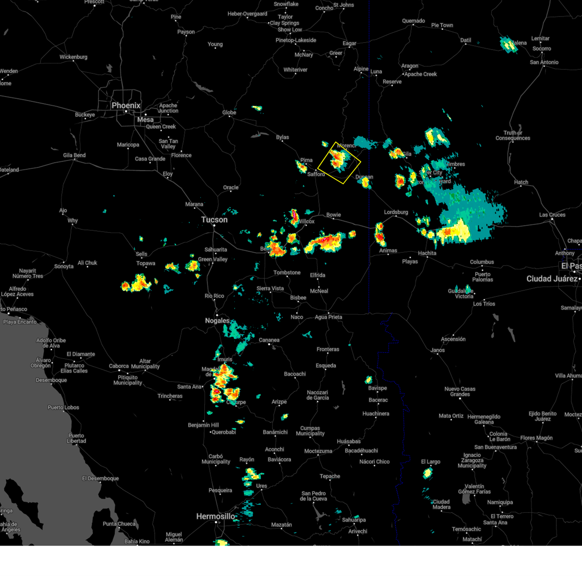
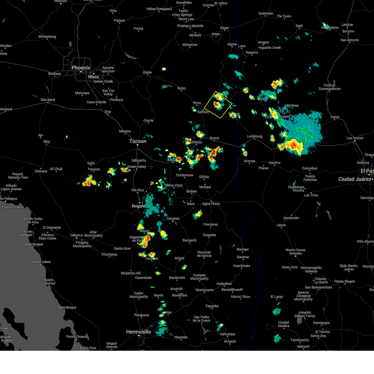
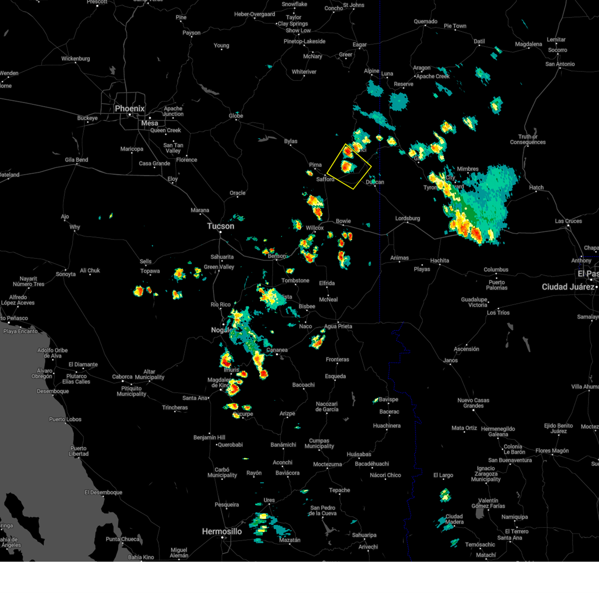
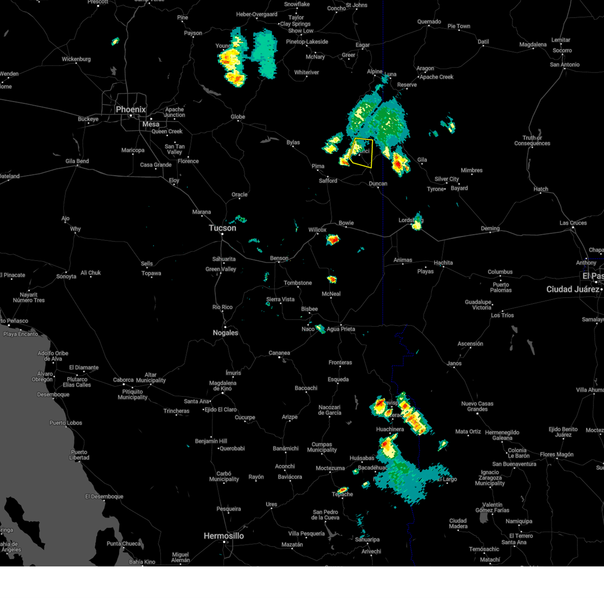
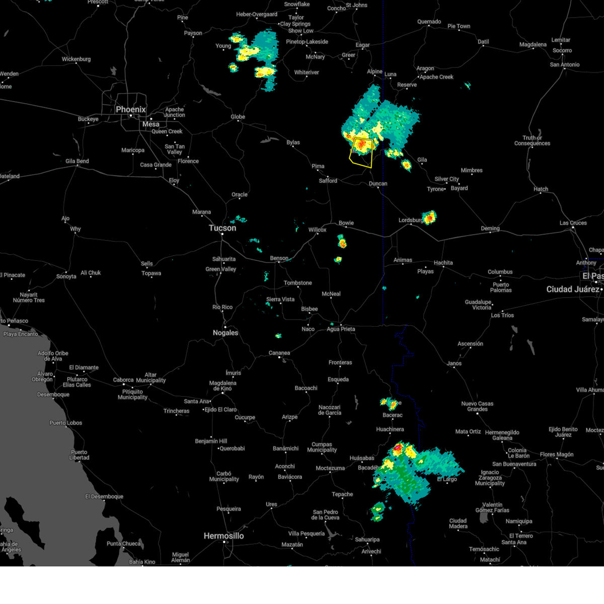
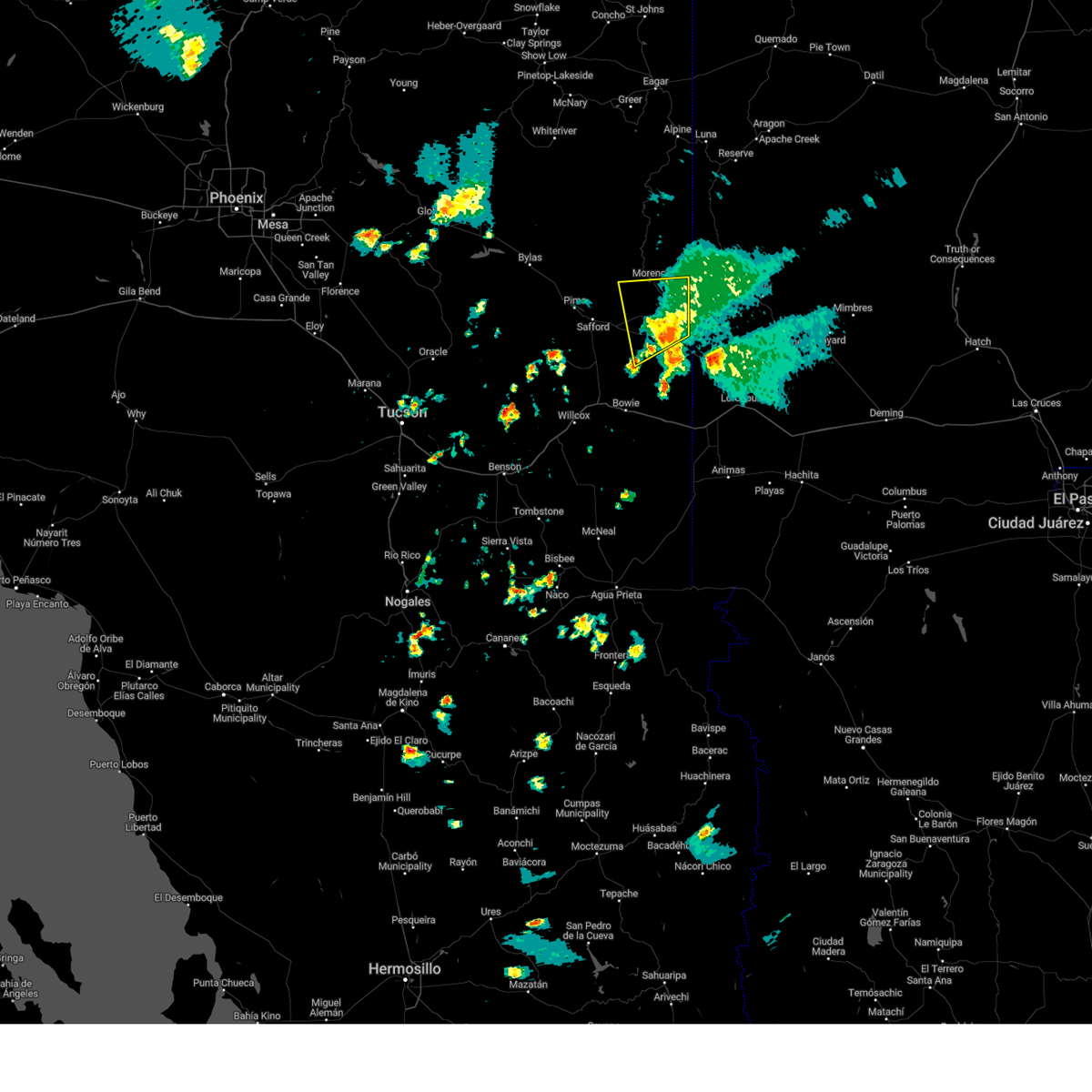
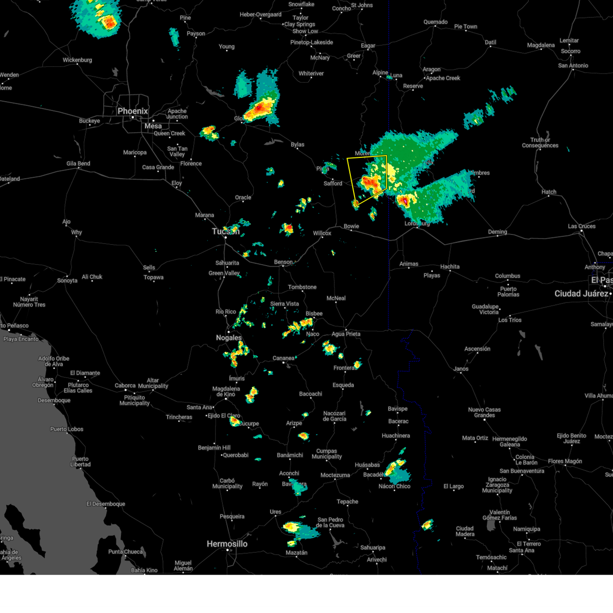
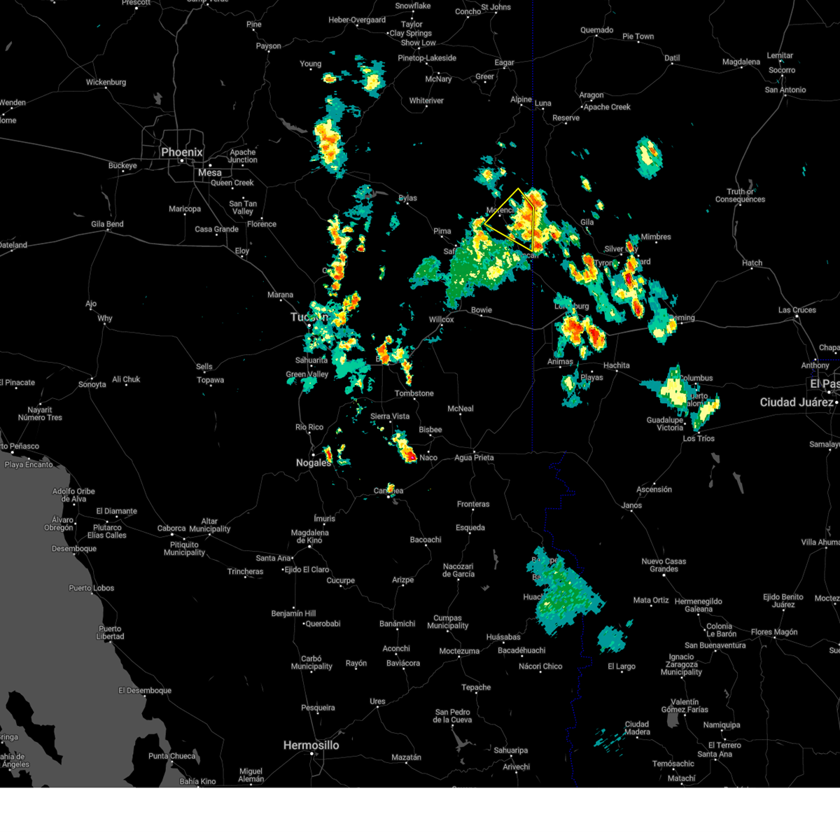
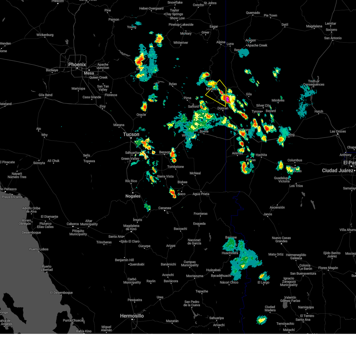
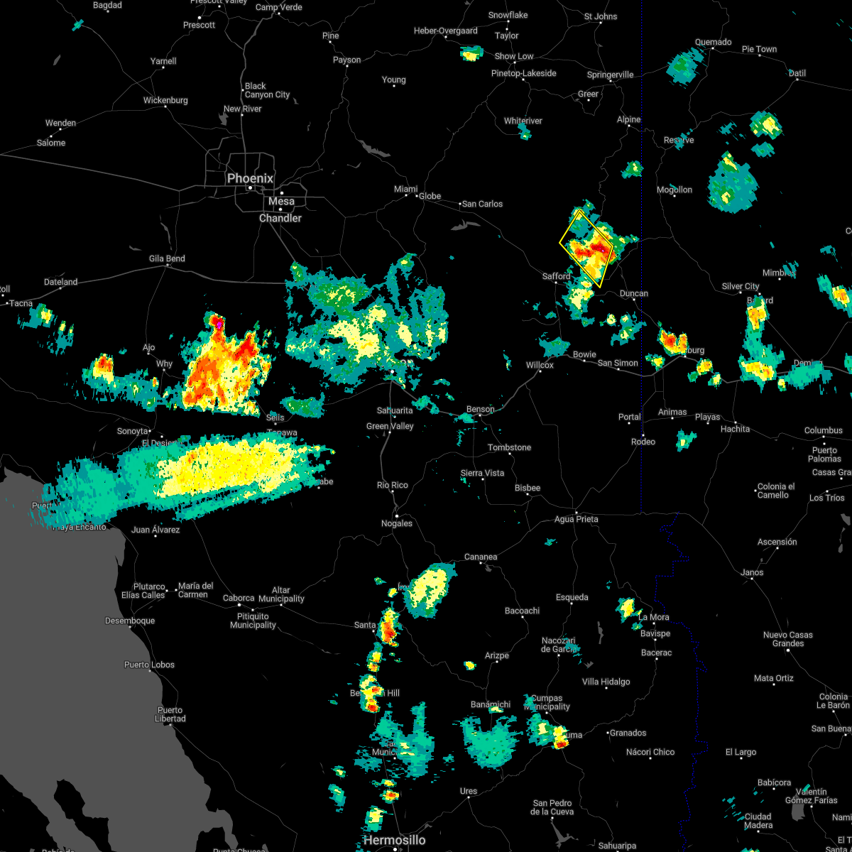
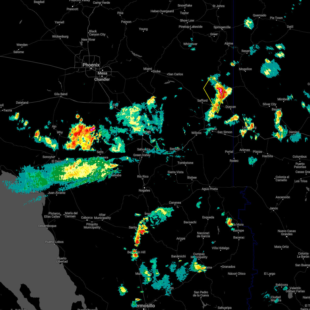
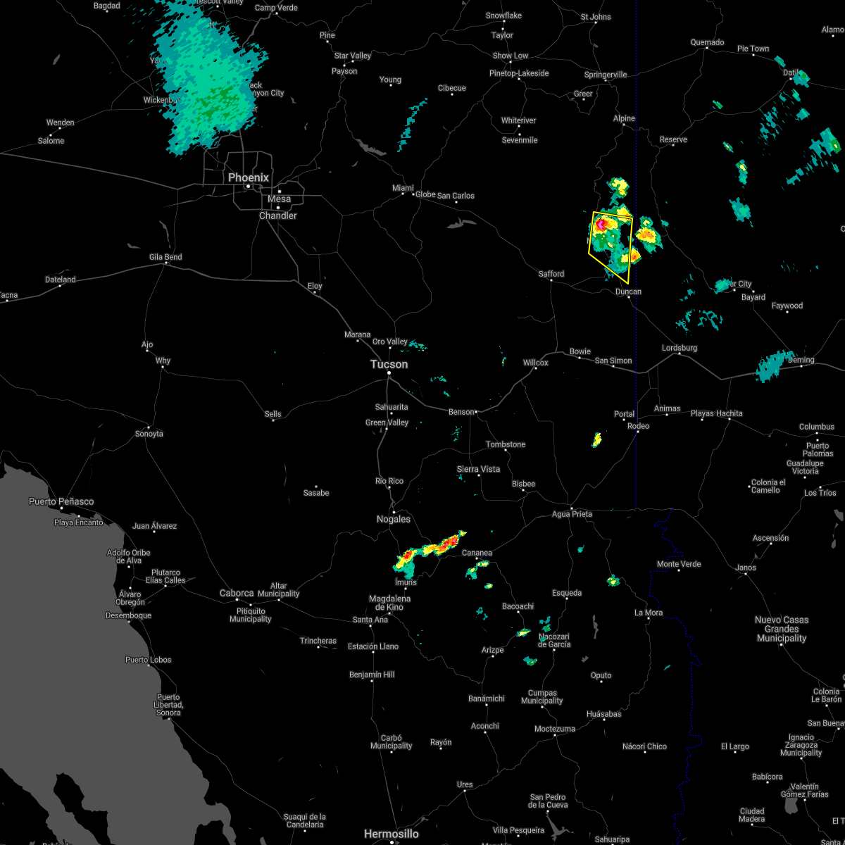
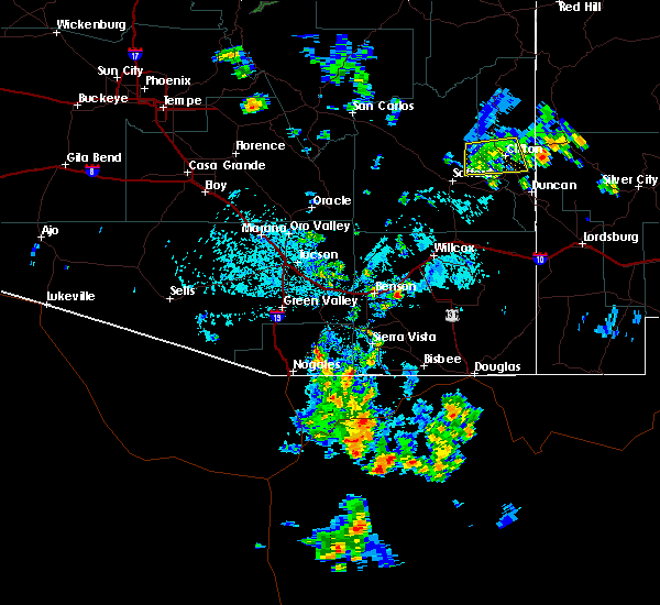
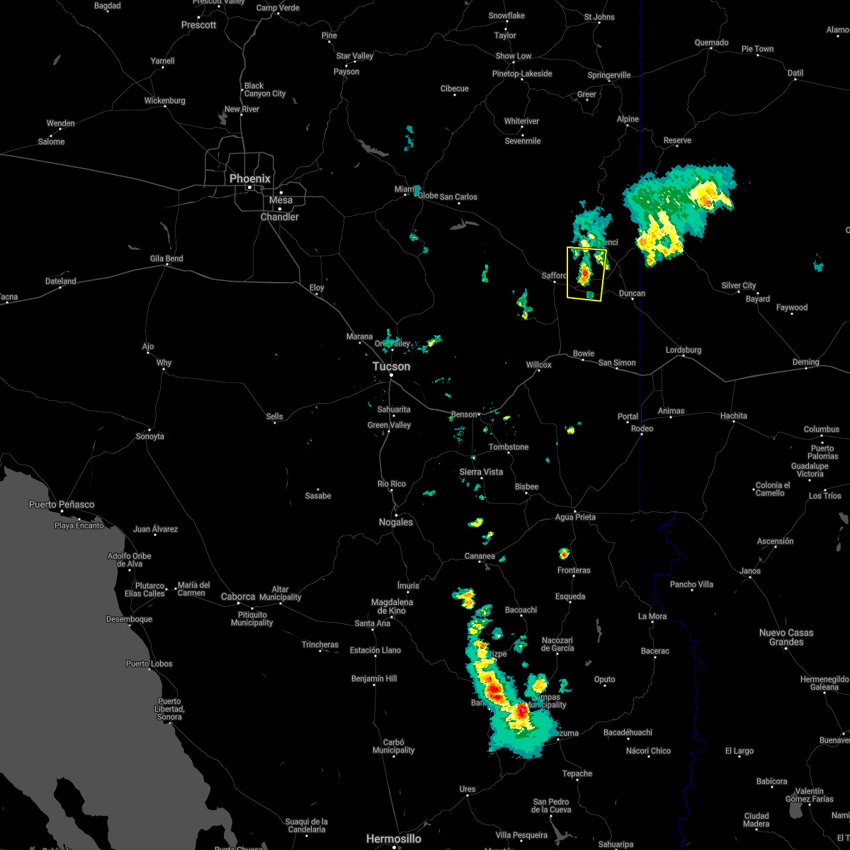
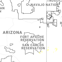
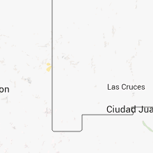
Hail Map for Morenci, AZ
The Morenci, AZ area has had 0 reports of on-the-ground hail by trained spotters, and has been under severe weather warnings 5 times during the past 12 months. Doppler radar has detected hail at or near Morenci, AZ on 21 occasions, including 3 occasions during the past year.
| Name: | Morenci, AZ |
| Where Located: | 64.5 miles WNW of Silver City, NM |
| Map: | Google Map for Morenci, AZ |
| Population: | 1489 |
| Housing Units: | 792 |
| More Info: | Search Google for Morenci, AZ |
1
The Top Recent Hail Date for Morenci, AZ is Thursday, August 8, 2024 (4th out of 21)

Hail and Wind Damage Spotted near Morenci, AZ
| Date / Time | Report Details |
|---|---|
| 7/27/2024 3:45 PM MST |
 The storm which prompted the warning has weakened below severe limits, and no longer poses an immediate threat to life or property. therefore, the warning has been allowed to expire. The storm which prompted the warning has weakened below severe limits, and no longer poses an immediate threat to life or property. therefore, the warning has been allowed to expire.
|
| 7/27/2024 3:19 PM MST |
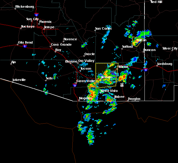
 At 319 pm mst, a severe thunderstorm was located 11 miles northeast of san jose, or 12 miles southwest of clifton, moving southeast at 10 mph (radar indicated). Hazards include 60 mph wind gusts and penny size hail. Expect damage to roofs, siding, and trees. locations impacted include, safford, morenci, san jose, safford regional airport, york, three way, and guthrie. this includes the following highways, route 70 between mile markers 346 and 366. route 75 between mile markers 393 and 398. route 78 between mile markers 155 and 156. Route 191 between mile markers 131 and 160. At 319 pm mst, a severe thunderstorm was located 11 miles northeast of san jose, or 12 miles southwest of clifton, moving southeast at 10 mph (radar indicated). Hazards include 60 mph wind gusts and penny size hail. Expect damage to roofs, siding, and trees. locations impacted include, safford, morenci, san jose, safford regional airport, york, three way, and guthrie. this includes the following highways, route 70 between mile markers 346 and 366. route 75 between mile markers 393 and 398. route 78 between mile markers 155 and 156. Route 191 between mile markers 131 and 160.
|
| 7/27/2024 3:02 PM MST |
 Svrtwc the national weather service in tucson has issued a * severe thunderstorm warning for, east central graham county in southeastern arizona, west central greenlee county in southeastern arizona, * until 345 pm mst. * at 302 pm mst, a severe thunderstorm was located 9 miles northeast of san jose, or 13 miles southwest of clifton, moving southeast at 10 mph (radar indicated). Hazards include 60 mph wind gusts and quarter size hail. Hail damage to vehicles is expected. Expect wind damage to roofs, siding, and trees. Svrtwc the national weather service in tucson has issued a * severe thunderstorm warning for, east central graham county in southeastern arizona, west central greenlee county in southeastern arizona, * until 345 pm mst. * at 302 pm mst, a severe thunderstorm was located 9 miles northeast of san jose, or 13 miles southwest of clifton, moving southeast at 10 mph (radar indicated). Hazards include 60 mph wind gusts and quarter size hail. Hail damage to vehicles is expected. Expect wind damage to roofs, siding, and trees.
|
| 7/16/2024 5:06 PM MST |
 The storm which prompted the warning has weakened below severe limits, and no longer poses an immediate threat to life or property. therefore, the warning will be allowed to expire. The storm which prompted the warning has weakened below severe limits, and no longer poses an immediate threat to life or property. therefore, the warning will be allowed to expire.
|
| 7/16/2024 4:24 PM MST |
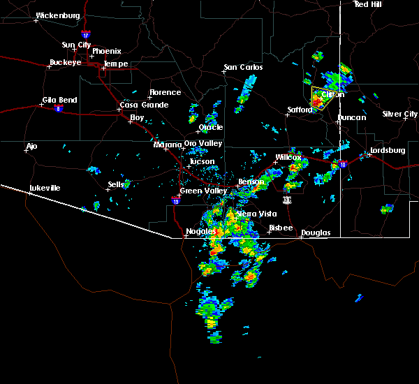
 Svrtwc the national weather service in tucson has issued a * severe thunderstorm warning for, central greenlee county in southeastern arizona, * until 515 pm mst. * at 424 pm mst, a severe thunderstorm was located near morenci, or near clifton, moving south at 15 mph (radar indicated). Hazards include 60 mph wind gusts and nickel size hail. expect damage to roofs, siding, and trees Svrtwc the national weather service in tucson has issued a * severe thunderstorm warning for, central greenlee county in southeastern arizona, * until 515 pm mst. * at 424 pm mst, a severe thunderstorm was located near morenci, or near clifton, moving south at 15 mph (radar indicated). Hazards include 60 mph wind gusts and nickel size hail. expect damage to roofs, siding, and trees
|
| 7/11/2024 3:31 PM MST |
 the severe thunderstorm warning has been cancelled and is no longer in effect the severe thunderstorm warning has been cancelled and is no longer in effect
|
| 7/11/2024 3:12 PM MST |
 At 311 pm mst, a severe thunderstorm was located near duncan, or about 15 miles south of clifton, moving southwest at 10 mph (radar indicated). Hazards include 60 mph wind gusts and penny size hail. Expect damage to roofs, siding, and trees. locations impacted include, clifton, morenci, duncan, and guthrie. this includes the following highways, route 70 between mile markers 355 and 378. route 75 between mile markers 380 and 398. route 78 between mile markers 155 and 170. Route 191 between mile markers 135 and 163. At 311 pm mst, a severe thunderstorm was located near duncan, or about 15 miles south of clifton, moving southwest at 10 mph (radar indicated). Hazards include 60 mph wind gusts and penny size hail. Expect damage to roofs, siding, and trees. locations impacted include, clifton, morenci, duncan, and guthrie. this includes the following highways, route 70 between mile markers 355 and 378. route 75 between mile markers 380 and 398. route 78 between mile markers 155 and 170. Route 191 between mile markers 135 and 163.
|
| 7/11/2024 3:00 PM MST |
 Svrtwc the national weather service in tucson has issued a * severe thunderstorm warning for, southeastern graham county in southeastern arizona, southern greenlee county in southeastern arizona, * until 345 pm mst. * at 259 pm mst, a severe thunderstorm was located near duncan, or 15 miles south of clifton, moving southwest at 10 mph (radar indicated). Hazards include 60 mph wind gusts and penny size hail. expect damage to roofs, siding, and trees Svrtwc the national weather service in tucson has issued a * severe thunderstorm warning for, southeastern graham county in southeastern arizona, southern greenlee county in southeastern arizona, * until 345 pm mst. * at 259 pm mst, a severe thunderstorm was located near duncan, or 15 miles south of clifton, moving southwest at 10 mph (radar indicated). Hazards include 60 mph wind gusts and penny size hail. expect damage to roofs, siding, and trees
|
| 7/9/2024 4:03 PM MST | Mesonet station qgta3 guthri in greenlee county AZ, 12.2 miles N of Morenci, AZ |
| 6/30/2024 5:07 PM MST |
 The storm which prompted the warning has weakened below severe limits, and no longer poses an immediate threat to life or property. therefore, the warning will be allowed to expire. The storm which prompted the warning has weakened below severe limits, and no longer poses an immediate threat to life or property. therefore, the warning will be allowed to expire.
|
| 6/30/2024 4:33 PM MST |
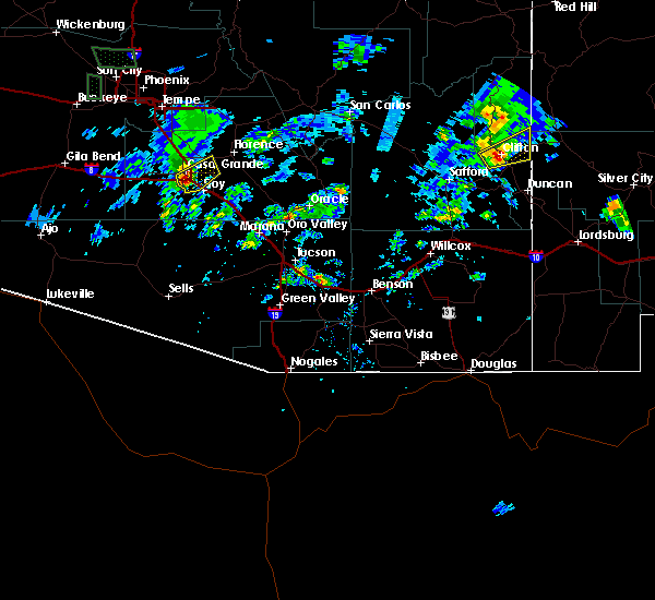
 At 433 pm mst, a severe thunderstorm was located 13 miles southwest of mule creek, moving northwest at 15 mph (radar indicated). Hazards include 70 mph wind gusts and ping pong ball size hail. People and animals outdoors will be injured. expect hail damage to roofs, siding, windows, and vehicles. expect considerable tree damage. wind damage is also likely to mobile homes, roofs, and outbuildings. locations impacted include, clifton, morenci, york, three way, and guthrie. this includes the following highways, route 75 between mile markers 391 and 398. route 78 between mile markers 155 and 174. Route 191 between mile markers 151 and 171. At 433 pm mst, a severe thunderstorm was located 13 miles southwest of mule creek, moving northwest at 15 mph (radar indicated). Hazards include 70 mph wind gusts and ping pong ball size hail. People and animals outdoors will be injured. expect hail damage to roofs, siding, windows, and vehicles. expect considerable tree damage. wind damage is also likely to mobile homes, roofs, and outbuildings. locations impacted include, clifton, morenci, york, three way, and guthrie. this includes the following highways, route 75 between mile markers 391 and 398. route 78 between mile markers 155 and 174. Route 191 between mile markers 151 and 171.
|
| 6/30/2024 4:29 PM MST |
 Svrtwc the national weather service in tucson has issued a * severe thunderstorm warning for, eastern graham county in southeastern arizona, central greenlee county in southeastern arizona, * until 515 pm mst. * at 429 pm mst, a severe thunderstorm was located 13 miles south of mule creek, moving northwest at 20 mph (radar indicated). Hazards include 60 mph wind gusts and quarter size hail. Hail damage to vehicles is expected. Expect wind damage to roofs, siding, and trees. Svrtwc the national weather service in tucson has issued a * severe thunderstorm warning for, eastern graham county in southeastern arizona, central greenlee county in southeastern arizona, * until 515 pm mst. * at 429 pm mst, a severe thunderstorm was located 13 miles south of mule creek, moving northwest at 20 mph (radar indicated). Hazards include 60 mph wind gusts and quarter size hail. Hail damage to vehicles is expected. Expect wind damage to roofs, siding, and trees.
|
| 9/13/2023 2:04 AM MST |
 At 204 am mst, a severe thunderstorm was located 11 miles southeast of clifton, moving east at 35 mph. the storm remains very strong with the primary threat being wind damage (radar indicated). Hazards include 60 mph wind gusts. Expect damage to roofs, siding, and trees. locations impacted include, clifton, morenci, york, three way and guthrie. hail threat, radar indicated max hail size, <. 75 in wind threat, observed max wind gust, 60 mph. At 204 am mst, a severe thunderstorm was located 11 miles southeast of clifton, moving east at 35 mph. the storm remains very strong with the primary threat being wind damage (radar indicated). Hazards include 60 mph wind gusts. Expect damage to roofs, siding, and trees. locations impacted include, clifton, morenci, york, three way and guthrie. hail threat, radar indicated max hail size, <. 75 in wind threat, observed max wind gust, 60 mph.
|
| 9/13/2023 2:03 AM MST | Mesonet station qgta3 guthrie at sometime within 1:03 to 2:03 a in greenlee county AZ, 12.2 miles N of Morenci, AZ |
| 9/13/2023 1:36 AM MST |
 At 135 am mst, a severe thunderstorm was located 7 miles southwest of morenci, or 8 miles southwest of clifton, moving east at 35 mph (radar and observation indicated). Hazards include 60 mph wind gusts. winds of 55 mph have been measured in the safford area. expect damage to roofs, siding, and trees At 135 am mst, a severe thunderstorm was located 7 miles southwest of morenci, or 8 miles southwest of clifton, moving east at 35 mph (radar and observation indicated). Hazards include 60 mph wind gusts. winds of 55 mph have been measured in the safford area. expect damage to roofs, siding, and trees
|
| 7/21/2023 4:20 PM MST | Mesonet station qgta3 guthri in greenlee county AZ, 12.2 miles N of Morenci, AZ |
| 7/24/2022 5:38 PM MST |
 The severe thunderstorm warning for east central graham and west central greenlee counties will expire at 545 pm mst, the storm which prompted the warning has weakened below severe limits, and no longer poses an immediate threat to life or property. therefore, the warning will be allowed to expire. however gusty winds and heavy rain are still possible with this thunderstorm. The severe thunderstorm warning for east central graham and west central greenlee counties will expire at 545 pm mst, the storm which prompted the warning has weakened below severe limits, and no longer poses an immediate threat to life or property. therefore, the warning will be allowed to expire. however gusty winds and heavy rain are still possible with this thunderstorm.
|
| 7/24/2022 5:16 PM MST |
 A severe thunderstorm warning remains in effect until 545 pm mst for east central graham and west central greenlee counties. at 516 pm mst, a severe thunderstorm was located 13 miles west of morenci, or 16 miles northwest of clifton, moving northwest at 25 mph. hazard. 60 mph wind gusts and quarter size hail. A severe thunderstorm warning remains in effect until 545 pm mst for east central graham and west central greenlee counties. at 516 pm mst, a severe thunderstorm was located 13 miles west of morenci, or 16 miles northwest of clifton, moving northwest at 25 mph. hazard. 60 mph wind gusts and quarter size hail.
|
| 7/24/2022 5:03 PM MST | Guthrie raws reported gust of 59 mp in greenlee county AZ, 12.2 miles N of Morenci, AZ |
| 7/24/2022 4:59 PM MST |
 At 458 pm mst, a severe thunderstorm was located near morenci, or near clifton, moving northwest at 25 mph (radar indicated). Hazards include 60 mph wind gusts and quarter size hail. Hail damage to vehicles is expected. Expect wind damage to roofs, siding, and trees. At 458 pm mst, a severe thunderstorm was located near morenci, or near clifton, moving northwest at 25 mph (radar indicated). Hazards include 60 mph wind gusts and quarter size hail. Hail damage to vehicles is expected. Expect wind damage to roofs, siding, and trees.
|
| 9/5/2021 3:26 PM MST |
 The severe thunderstorm warning for central graham and west central greenlee counties will expire at 330 pm mst, a new severe thunderstorm warning has been issued for much of the warned area. to report severe weather, contact your nearest law enforcement agency. they will relay your report to the national weather service tucson. The severe thunderstorm warning for central graham and west central greenlee counties will expire at 330 pm mst, a new severe thunderstorm warning has been issued for much of the warned area. to report severe weather, contact your nearest law enforcement agency. they will relay your report to the national weather service tucson.
|
| 9/5/2021 2:55 PM MST |
 At 255 pm mst, severe thunderstorms were located along a line extending from near morenci to 13 miles north of safford regional airport to 15 miles north of thatcher, moving southeast at 15 mph (radar indicated). Hazards include 60 mph wind gusts and quarter size hail. Hail damage to vehicles is expected. expect wind damage to roofs, siding, and trees. locations impacted include, clifton and morenci. hail threat, radar indicated max hail size, 1. 00 in wind threat, radar indicated max wind gust, 60 mph. At 255 pm mst, severe thunderstorms were located along a line extending from near morenci to 13 miles north of safford regional airport to 15 miles north of thatcher, moving southeast at 15 mph (radar indicated). Hazards include 60 mph wind gusts and quarter size hail. Hail damage to vehicles is expected. expect wind damage to roofs, siding, and trees. locations impacted include, clifton and morenci. hail threat, radar indicated max hail size, 1. 00 in wind threat, radar indicated max wind gust, 60 mph.
|
| 9/5/2021 2:29 PM MST |
 At 228 pm mst, severe thunderstorms were located along a line extending from 7 miles northwest of morenci to 17 miles north of safford regional airport to 19 miles north of thatcher to 25 miles northwest of safford, moving south at 10 mph (radar indicated). Hazards include 60 mph wind gusts and quarter size hail. Hail damage to vehicles is expected. Expect wind damage to roofs, siding, and trees. At 228 pm mst, severe thunderstorms were located along a line extending from 7 miles northwest of morenci to 17 miles north of safford regional airport to 19 miles north of thatcher to 25 miles northwest of safford, moving south at 10 mph (radar indicated). Hazards include 60 mph wind gusts and quarter size hail. Hail damage to vehicles is expected. Expect wind damage to roofs, siding, and trees.
|
| 7/16/2021 2:23 PM MST |
 At 222 pm mst, a severe thunderstorm was located 8 miles north of safford regional airport, or 10 miles northeast of safford, moving south at 20 mph (radar indicated). Hazards include 60 mph wind gusts. Expect damage to roofs, siding, and trees. locations impacted include, safford, clifton, thatcher, solomon, morenci, roper lake state park, safford regional airport, pima, central, fort thomas, three way, swift trail junction and guthrie. this includes the following highways, route 70 between mile markers 300 and 370. route 75 between mile markers 397 and 398. route 78 between mile markers 155 and 156. Route 191 between mile markers 113 and 175. At 222 pm mst, a severe thunderstorm was located 8 miles north of safford regional airport, or 10 miles northeast of safford, moving south at 20 mph (radar indicated). Hazards include 60 mph wind gusts. Expect damage to roofs, siding, and trees. locations impacted include, safford, clifton, thatcher, solomon, morenci, roper lake state park, safford regional airport, pima, central, fort thomas, three way, swift trail junction and guthrie. this includes the following highways, route 70 between mile markers 300 and 370. route 75 between mile markers 397 and 398. route 78 between mile markers 155 and 156. Route 191 between mile markers 113 and 175.
|
| 7/16/2021 2:03 PM MST |
 At 201 pm mst, a group of severe thunderstorms was indicated north of a solomon to safford to fort thomas line. these storms are moving to the moving south at 25 mph (radar indicated). Hazards include 60 mph wind gusts. expect damage to roofs, siding, and trees At 201 pm mst, a group of severe thunderstorms was indicated north of a solomon to safford to fort thomas line. these storms are moving to the moving south at 25 mph (radar indicated). Hazards include 60 mph wind gusts. expect damage to roofs, siding, and trees
|
| 7/11/2021 5:08 PM MST |
 At 507 pm mst, a severe thunderstorm was located 10 miles north of morenci, or 11 miles north of clifton, moving south at 25 mph (radar indicated). Hazards include 60 mph wind gusts and quarter size hail. Hail damage to vehicles is expected. Expect wind damage to roofs, siding, and trees. At 507 pm mst, a severe thunderstorm was located 10 miles north of morenci, or 11 miles north of clifton, moving south at 25 mph (radar indicated). Hazards include 60 mph wind gusts and quarter size hail. Hail damage to vehicles is expected. Expect wind damage to roofs, siding, and trees.
|
| 8/17/2020 6:10 PM MST |
 The severe thunderstorm warning for central graham and west central greenlee counties will expire at 615 pm mst, the storm which prompted the warning has weakened below severe limits, and no longer poses an immediate threat to life or property. therefore, the warning will be allowed to expire. however gusty winds in excess of 45 mph are still possible in the fort thomas and safford areas. The severe thunderstorm warning for central graham and west central greenlee counties will expire at 615 pm mst, the storm which prompted the warning has weakened below severe limits, and no longer poses an immediate threat to life or property. therefore, the warning will be allowed to expire. however gusty winds in excess of 45 mph are still possible in the fort thomas and safford areas.
|
| 8/17/2020 5:29 PM MST |
 At 529 pm mst, a severe thunderstorm was located 7 miles west of morenci, or 9 miles west of clifton, moving southwest at 25 mph (radar indicated). Hazards include 60 mph wind gusts and nickel size hail. expect damage to roofs, siding, and trees At 529 pm mst, a severe thunderstorm was located 7 miles west of morenci, or 9 miles west of clifton, moving southwest at 25 mph (radar indicated). Hazards include 60 mph wind gusts and nickel size hail. expect damage to roofs, siding, and trees
|
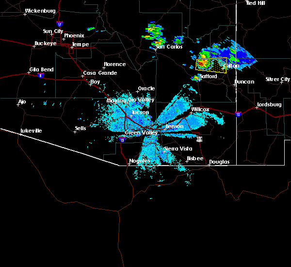
| 8/5/2019 3:25 PM MST |
 The severe thunderstorm warning for east central graham and central greenlee counties will expire at 330 pm mst, the storm which prompted the warning has weakened below severe limits, and no longer poses an immediate threat to life or property. therefore, the warning will be allowed to expire. however heavy rain is still possible with this thunderstorm. The severe thunderstorm warning for east central graham and central greenlee counties will expire at 330 pm mst, the storm which prompted the warning has weakened below severe limits, and no longer poses an immediate threat to life or property. therefore, the warning will be allowed to expire. however heavy rain is still possible with this thunderstorm.
|
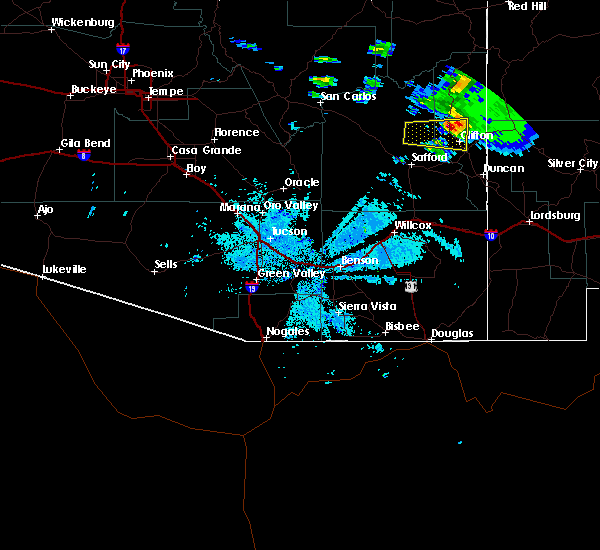
| 8/5/2019 3:05 PM MST |
 At 305 pm mst, a severe thunderstorm was located over the morenci and clifton area, and is nearly stationary (radar indicated). Hazards include 60 mph wind gusts and quarter size hail. Hail damage to vehicles is expected. expect wind damage to roofs, siding, and trees. locations impacted include, clifton, morenci, york, three way and guthrie. this includes the following highways, route 75 between mile markers 395 and 398. route 78 between mile markers 155 and 161. Route 191 between mile markers 151 and 178. At 305 pm mst, a severe thunderstorm was located over the morenci and clifton area, and is nearly stationary (radar indicated). Hazards include 60 mph wind gusts and quarter size hail. Hail damage to vehicles is expected. expect wind damage to roofs, siding, and trees. locations impacted include, clifton, morenci, york, three way and guthrie. this includes the following highways, route 75 between mile markers 395 and 398. route 78 between mile markers 155 and 161. Route 191 between mile markers 151 and 178.
|
| 8/5/2019 2:51 PM MST |
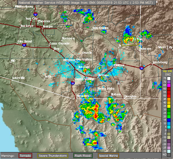 At 250 pm mst, a severe thunderstorm was located over clifton, and is nearly stationary (radar indicated). Hazards include 60 mph wind gusts and quarter size hail. Hail damage to vehicles is expected. Expect wind damage to roofs, siding, and trees. At 250 pm mst, a severe thunderstorm was located over clifton, and is nearly stationary (radar indicated). Hazards include 60 mph wind gusts and quarter size hail. Hail damage to vehicles is expected. Expect wind damage to roofs, siding, and trees.
|
| 9/1/2018 3:10 AM MST |
 The severe thunderstorm warning for central graham and west central greenlee counties will expire at 315 am mst, the storm which prompted the warning has weakened and no longer was producing large hail. therefore, the warning will be allowed to expire. The severe thunderstorm warning for central graham and west central greenlee counties will expire at 315 am mst, the storm which prompted the warning has weakened and no longer was producing large hail. therefore, the warning will be allowed to expire.
|
| 9/1/2018 2:27 AM MST |
 At 227 am mst, a severe thunderstorm was located 18 miles north of safford, moving east at 25 mph (radar indicated). Hazards include 60 mph wind gusts and quarter size hail. Hail damage to vehicles is expected. Expect wind damage to roofs, siding, and trees. At 227 am mst, a severe thunderstorm was located 18 miles north of safford, moving east at 25 mph (radar indicated). Hazards include 60 mph wind gusts and quarter size hail. Hail damage to vehicles is expected. Expect wind damage to roofs, siding, and trees.
|
| 8/6/2018 4:39 PM MST |
 The severe thunderstorm warning for central greenlee county will expire at 445 pm mst, the storm which prompted the warning has weakened below severe limits, and has exited the warned area. therefore, the warning will be allowed to expire. however gusty winds are still possible with this thunderstorm. The severe thunderstorm warning for central greenlee county will expire at 445 pm mst, the storm which prompted the warning has weakened below severe limits, and has exited the warned area. therefore, the warning will be allowed to expire. however gusty winds are still possible with this thunderstorm.
|
| 8/6/2018 3:57 PM MST |
 At 340 pm mst, a severe thunderstorm was located 12 miles east of clifton, moving southwest at 15 mph (radar indicated). Hazards include 60 mph wind gusts and quarter size hail. Hail damage to vehicles is expected. Expect wind damage to roofs, siding, and trees. At 340 pm mst, a severe thunderstorm was located 12 miles east of clifton, moving southwest at 15 mph (radar indicated). Hazards include 60 mph wind gusts and quarter size hail. Hail damage to vehicles is expected. Expect wind damage to roofs, siding, and trees.
|
| 8/6/2018 3:41 PM MST |
 At 340 pm mst, a severe thunderstorm was located 12 miles east of clifton, moving southwest at 15 mph (radar indicated). Hazards include 60 mph wind gusts and quarter size hail. Hail damage to vehicles is expected. Expect wind damage to roofs, siding, and trees. At 340 pm mst, a severe thunderstorm was located 12 miles east of clifton, moving southwest at 15 mph (radar indicated). Hazards include 60 mph wind gusts and quarter size hail. Hail damage to vehicles is expected. Expect wind damage to roofs, siding, and trees.
|
| 7/29/2018 3:52 PM MST |
 The severe thunderstorm warning for central greenlee county will expire at 400 pm mst, the storm which prompted the warning has weakened below severe limits, and no longer poses an immediate threat to life or property. therefore, the warning will be allowed to expire. The severe thunderstorm warning for central greenlee county will expire at 400 pm mst, the storm which prompted the warning has weakened below severe limits, and no longer poses an immediate threat to life or property. therefore, the warning will be allowed to expire.
|
| 7/29/2018 3:33 PM MST |
 At 332 pm mst, a severe thunderstorm was located over morenci, or 26 miles northeast of safford, moving southwest at 15 mph (radar indicated). Hazards include 60 mph wind gusts and quarter size hail. Hail damage to vehicles is expected. expect wind damage to roofs, siding, and trees. locations impacted include, clifton, morenci and guthrie. this includes the following highways, route 75 near mile marker 398. route 78 between mile markers 155 and 157. Route 191 between mile markers 151 and 178. At 332 pm mst, a severe thunderstorm was located over morenci, or 26 miles northeast of safford, moving southwest at 15 mph (radar indicated). Hazards include 60 mph wind gusts and quarter size hail. Hail damage to vehicles is expected. expect wind damage to roofs, siding, and trees. locations impacted include, clifton, morenci and guthrie. this includes the following highways, route 75 near mile marker 398. route 78 between mile markers 155 and 157. Route 191 between mile markers 151 and 178.
|
| 7/29/2018 3:04 PM MST |
 At 303 pm mst, a severe thunderstorm was located near morenci, or 32 miles northeast of safford, moving southwest at 10 mph. strong outflow winds will possibly extend out ahead of precipitation (radar indicated). Hazards include 60 mph wind gusts and quarter size hail. Hail damage to vehicles is expected. Expect wind damage to roofs, siding, and trees. At 303 pm mst, a severe thunderstorm was located near morenci, or 32 miles northeast of safford, moving southwest at 10 mph. strong outflow winds will possibly extend out ahead of precipitation (radar indicated). Hazards include 60 mph wind gusts and quarter size hail. Hail damage to vehicles is expected. Expect wind damage to roofs, siding, and trees.
|
| 7/22/2017 3:28 PM MST |
 The severe thunderstorm warning for eastern graham and central greenlee counties will expire at 330 pm mst. the storm which prompted the warning near clifton has weakened below severe limits, and has exited the warned area to the southwest. therefore, the warning will be allowed to expire. However heavy rain is still possible. The severe thunderstorm warning for eastern graham and central greenlee counties will expire at 330 pm mst. the storm which prompted the warning near clifton has weakened below severe limits, and has exited the warned area to the southwest. therefore, the warning will be allowed to expire. However heavy rain is still possible.
|
| 7/22/2017 3:11 PM MST |
 At 310 pm mst, a severe thunderstorm was located near clifton, or 25 miles east of safford, moving southwest at 5 mph (radar indicated). Hazards include 60 mph wind gusts and penny size hail. Expect damage to roofs, siding, and trees. Locations impacted include, clifton, morenci and guthrie. At 310 pm mst, a severe thunderstorm was located near clifton, or 25 miles east of safford, moving southwest at 5 mph (radar indicated). Hazards include 60 mph wind gusts and penny size hail. Expect damage to roofs, siding, and trees. Locations impacted include, clifton, morenci and guthrie.
|
| 7/22/2017 2:44 PM MST |
 At 243 pm mst, a severe thunderstorm was located near clifton moving northwest at 10 mph (radar indicated). Hazards include 60 mph wind gusts, penny size hail and heavy rain. expect damage to roofs, siding, and trees At 243 pm mst, a severe thunderstorm was located near clifton moving northwest at 10 mph (radar indicated). Hazards include 60 mph wind gusts, penny size hail and heavy rain. expect damage to roofs, siding, and trees
|
| 6/20/2017 5:38 PM MST |
 At 535 pm mst, a severe thunderstorm was located 13 miles southwest of morenci, or 14 miles east of safford, moving north at 20 mph (radar indicated). Hazards include wind gusts to 60 mph and hail to 3/4 of an inch. expect potential damage to roofs, siding, and trees At 535 pm mst, a severe thunderstorm was located 13 miles southwest of morenci, or 14 miles east of safford, moving north at 20 mph (radar indicated). Hazards include wind gusts to 60 mph and hail to 3/4 of an inch. expect potential damage to roofs, siding, and trees
|
| 9/29/2016 3:52 PM MST |
 The severe thunderstorm warning for central greenlee county will expire at 400 pm mst, the storm which prompted the warning near clifton has weakened below severe limits, and no longer poses an immediate threat. therefore the warning will be allowed to expire. however heavy rain is still possible with this thunderstorm. The severe thunderstorm warning for central greenlee county will expire at 400 pm mst, the storm which prompted the warning near clifton has weakened below severe limits, and no longer poses an immediate threat. therefore the warning will be allowed to expire. however heavy rain is still possible with this thunderstorm.
|
| 9/29/2016 3:18 PM MST |
 At 317 pm mst, doppler radar indicated a severe thunderstorm capable of producing quarter size hail and damaging winds in excess of 60 mph. this storm was located near clifton, or 23 miles northeast of safford, and moving north at 20 mph. At 317 pm mst, doppler radar indicated a severe thunderstorm capable of producing quarter size hail and damaging winds in excess of 60 mph. this storm was located near clifton, or 23 miles northeast of safford, and moving north at 20 mph.
|
| 10/6/2015 3:12 PM MST | The severe thunderstorm warning for central greenlee county will expire at 315 pm mst, the storm which prompted the warning has weakened below severe limits, and no longer poses an immediate threat to life or property. therefore the warning will be allowed to expire. however small hail is still possible with this thunderstorm. |
| 10/6/2015 2:58 PM MST |
 At 257 pm mst, doppler radar indicated a severe thunderstorm capable of producing quarter size hail. this storm was located over clifton, moving northeast at 25 mph. locations impacted include, clifton and morenci. At 257 pm mst, doppler radar indicated a severe thunderstorm capable of producing quarter size hail. this storm was located over clifton, moving northeast at 25 mph. locations impacted include, clifton and morenci.
|
| 10/6/2015 2:43 PM MST |
 At 242 pm mst, doppler radar indicated a severe thunderstorm capable of producing quarter size hail. this storm was located near clifton, and moving northeast at 25 mph. At 242 pm mst, doppler radar indicated a severe thunderstorm capable of producing quarter size hail. this storm was located near clifton, and moving northeast at 25 mph.
|
| 7/26/2014 6:03 PM MST | Storm damage reported in greenlee county AZ, 12.2 miles N of Morenci, AZ |
Hail Maps for Morenci, AZ


Connect with Interactive Hail Maps