

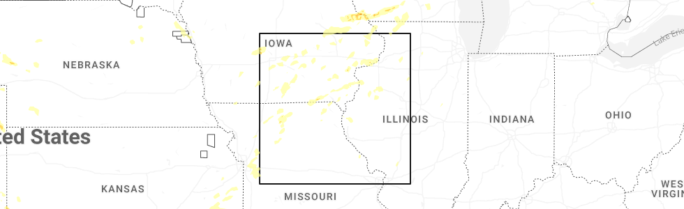
Hail Map for Morning Sun, IA
The Morning Sun, IA area has had 0 reports of on-the-ground hail by trained spotters, and has been under severe weather warnings 36 times during the past 12 months. Doppler radar has detected hail at or near Morning Sun, IA on 62 occasions, including 4 occasions during the past year.
| Name: | Morning Sun, IA |
| Where Located: | 52.5 miles NNE of Kahoka, MO |
| Map: | Google Map for Morning Sun, IA |
| Population: | 836 |
| Housing Units: | 360 |
| More Info: | Search Google for Morning Sun, IA |
0
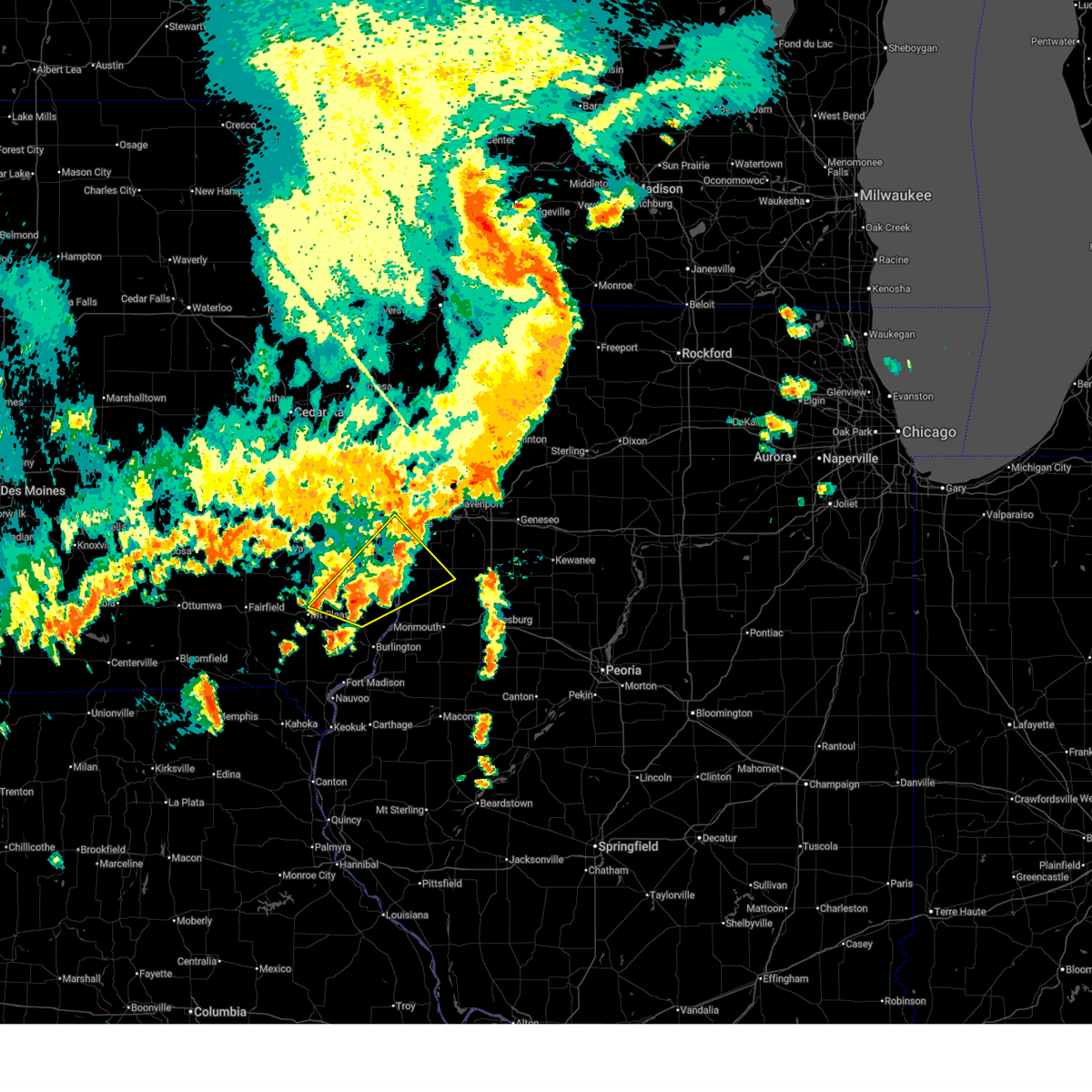
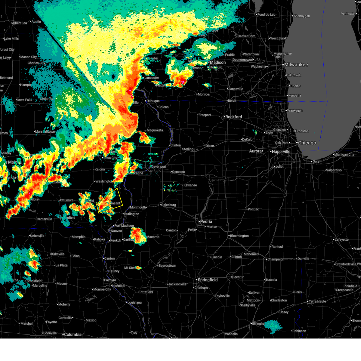
The Top Recent Hail Date for Morning Sun, IA is Friday, July 11, 2025 (37th out of 62)
Hail and Wind Damage Spotted near Morning Sun, IA
| Date / Time | Report Details |
|---|---|
| 7/11/2025 5:49 PM CDT |
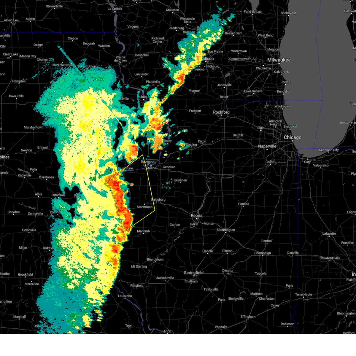
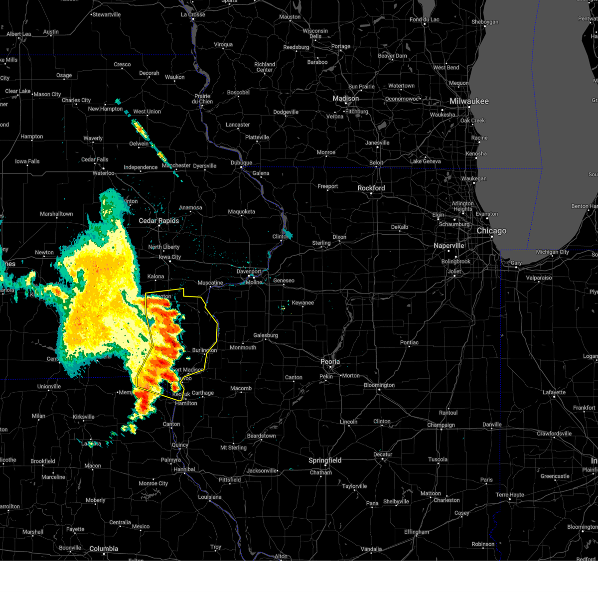
 Svrdvn the national weather service in the quad cities has issued a * severe thunderstorm warning for, northeastern henderson county in west central illinois, southwestern rock island county in northwestern illinois, mercer county in northwestern illinois, northeastern henry county in southeastern iowa, northern des moines county in southeastern iowa, southern louisa county in southeastern iowa, southeastern muscatine county in east central iowa, * until 645 pm cdt. * at 549 pm cdt, a severe thunderstorm was located over garland, or 8 miles south of wapello, moving northeast at 25 mph (radar indicated). Hazards include 60 mph wind gusts and quarter size hail. Hail damage to vehicles is expected. Expect wind damage to roofs, siding, and trees. Svrdvn the national weather service in the quad cities has issued a * severe thunderstorm warning for, northeastern henderson county in west central illinois, southwestern rock island county in northwestern illinois, mercer county in northwestern illinois, northeastern henry county in southeastern iowa, northern des moines county in southeastern iowa, southern louisa county in southeastern iowa, southeastern muscatine county in east central iowa, * until 645 pm cdt. * at 549 pm cdt, a severe thunderstorm was located over garland, or 8 miles south of wapello, moving northeast at 25 mph (radar indicated). Hazards include 60 mph wind gusts and quarter size hail. Hail damage to vehicles is expected. Expect wind damage to roofs, siding, and trees.
|
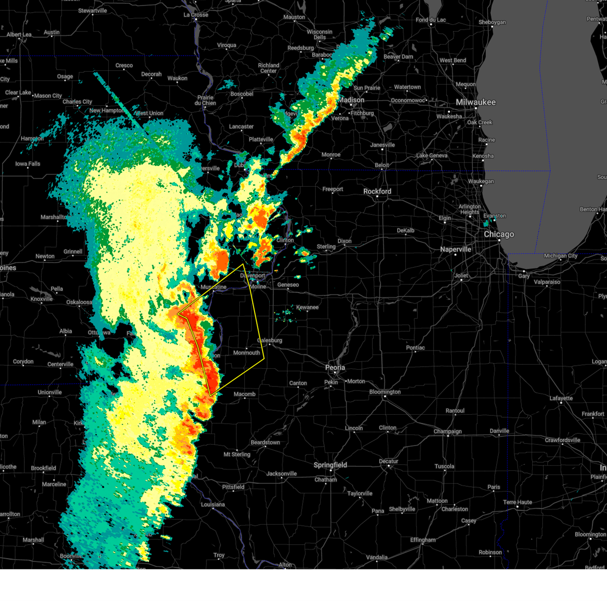
| 7/11/2025 5:03 PM CDT | At 503 pm cdt, a severe thunderstorm was located over pleasant grove, or 11 miles east of mount pleasant, moving northeast at 35 mph (radar indicated). Hazards include 60 mph wind gusts and quarter size hail. Hail damage to vehicles is expected. expect wind damage to roofs, siding, and trees. Locations impacted include, new london, mediapolis, morning sun, big hollow recreation area, pleasant grove, dodgeville, garland, yarmouth, and sperry. |
| 7/11/2025 4:49 PM CDT |
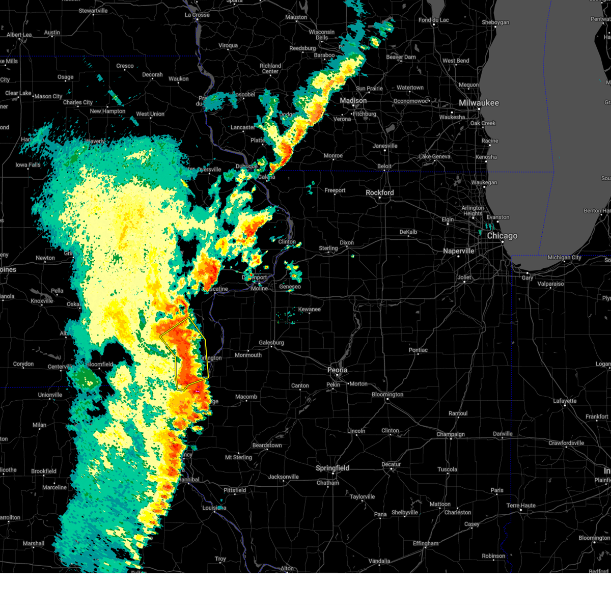
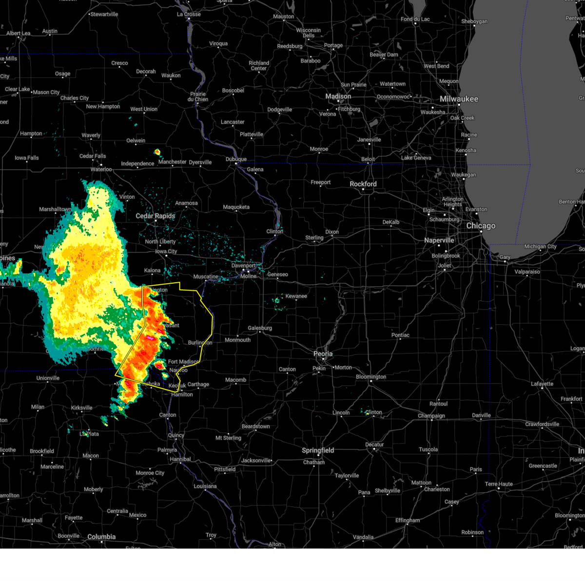
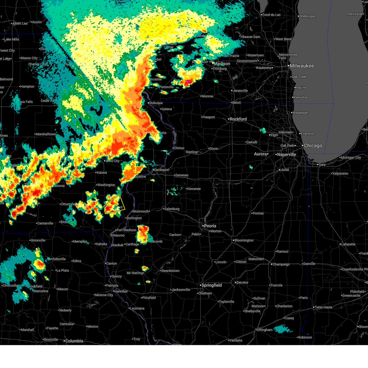 At 449 pm cdt, a severe thunderstorm was located over mount pleasant municipal arpt, or near mount pleasant, moving northeast at 30 mph (radar indicated). Hazards include ping pong ball size hail and 60 mph wind gusts. People and animals outdoors will be injured. expect hail damage to roofs, siding, windows, and vehicles. expect wind damage to roofs, siding, and trees. Locations impacted include, mount pleasant, new london, mediapolis, morning sun, mount union, mount pleasant municipal arpt, sperry, big hollow recreation area, pleasant grove, dodgeville, garland, yarmouth, and marsh. At 449 pm cdt, a severe thunderstorm was located over mount pleasant municipal arpt, or near mount pleasant, moving northeast at 30 mph (radar indicated). Hazards include ping pong ball size hail and 60 mph wind gusts. People and animals outdoors will be injured. expect hail damage to roofs, siding, windows, and vehicles. expect wind damage to roofs, siding, and trees. Locations impacted include, mount pleasant, new london, mediapolis, morning sun, mount union, mount pleasant municipal arpt, sperry, big hollow recreation area, pleasant grove, dodgeville, garland, yarmouth, and marsh.
|
| 7/11/2025 4:39 PM CDT |
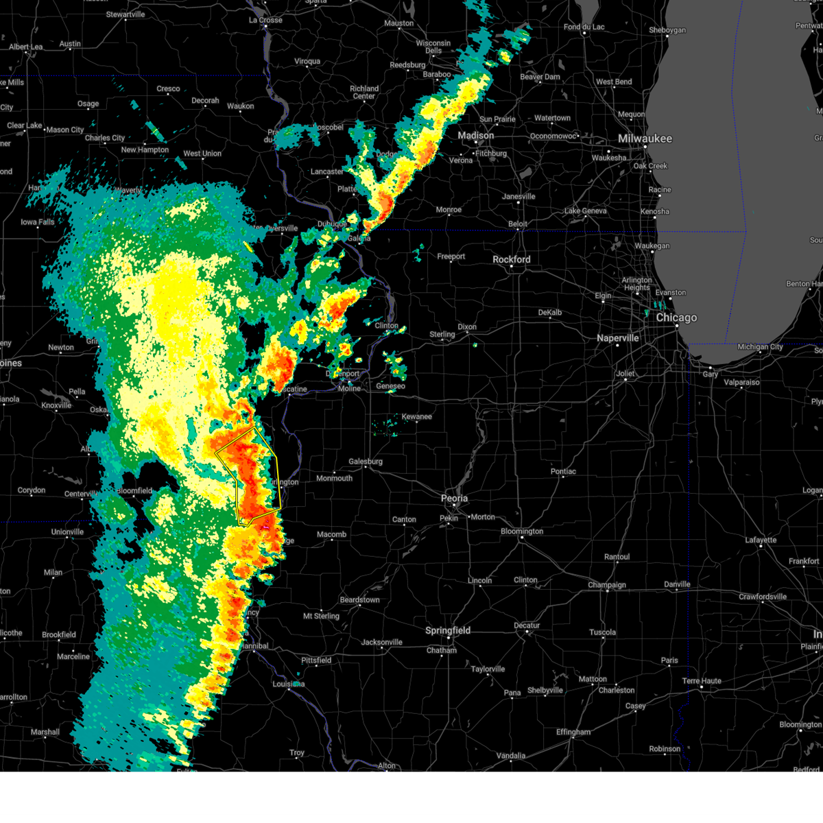
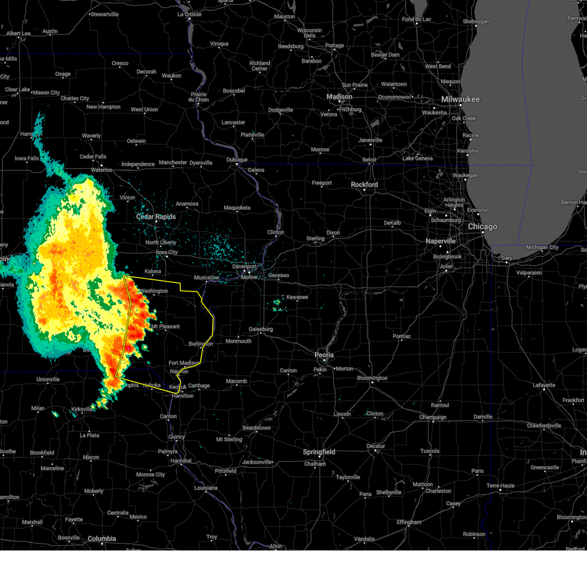
 Svrdvn the national weather service in the quad cities has issued a * severe thunderstorm warning for, central henry county in southeastern iowa, northwestern des moines county in southeastern iowa, south central louisa county in southeastern iowa, * until 545 pm cdt. * at 439 pm cdt, a severe thunderstorm was located over henry county fairgrounds, or near mount pleasant, moving northeast at 20 mph (radar indicated). Hazards include 60 mph wind gusts and half dollar size hail. Hail damage to vehicles is expected. Expect wind damage to roofs, siding, and trees. Svrdvn the national weather service in the quad cities has issued a * severe thunderstorm warning for, central henry county in southeastern iowa, northwestern des moines county in southeastern iowa, south central louisa county in southeastern iowa, * until 545 pm cdt. * at 439 pm cdt, a severe thunderstorm was located over henry county fairgrounds, or near mount pleasant, moving northeast at 20 mph (radar indicated). Hazards include 60 mph wind gusts and half dollar size hail. Hail damage to vehicles is expected. Expect wind damage to roofs, siding, and trees.
|
| 6/3/2025 6:31 PM CDT |
 At 631 pm cdt, severe thunderstorms were located along a line extending from sand springs to northfield to blandinsville, moving northeast at 50 mph (radar indicated). Hazards include 70 mph wind gusts and penny size hail. Expect considerable tree damage. damage is likely to mobile homes, roofs, and outbuildings. locations impacted include, davenport, rock island, burlington, muscatine, monmouth, aledo, wapello, columbus junction, oquawka, west burlington, burgess, walcott, mediapolis, blue grass, buffalo, la harpe, andalusia, roseville, fruitland, and viola. this includes the following highways, interstate 80 in iowa between mile markers 285 and 290. Interstate 280 between mile markers 1 and 11. At 631 pm cdt, severe thunderstorms were located along a line extending from sand springs to northfield to blandinsville, moving northeast at 50 mph (radar indicated). Hazards include 70 mph wind gusts and penny size hail. Expect considerable tree damage. damage is likely to mobile homes, roofs, and outbuildings. locations impacted include, davenport, rock island, burlington, muscatine, monmouth, aledo, wapello, columbus junction, oquawka, west burlington, burgess, walcott, mediapolis, blue grass, buffalo, la harpe, andalusia, roseville, fruitland, and viola. this includes the following highways, interstate 80 in iowa between mile markers 285 and 290. Interstate 280 between mile markers 1 and 11.
|
| 6/3/2025 6:23 PM CDT |
 Svrdvn the national weather service in the quad cities has issued a * severe thunderstorm warning for, northeastern hancock county in west central illinois, henderson county in west central illinois, warren county in west central illinois, southwestern rock island county in northwestern illinois, northwestern mcdonough county in west central illinois, mercer county in northwestern illinois, des moines county in southeastern iowa, louisa county in southeastern iowa, southwestern scott county in east central iowa, eastern muscatine county in east central iowa, east central lee county in southeastern iowa, * until 730 pm cdt. * at 623 pm cdt, severe thunderstorms were located along a line extending from near fredonia to sperry to near fountain green, moving northeast at 45 mph (radar indicated). Hazards include 60 mph wind gusts and penny size hail. expect damage to roofs, siding, and trees Svrdvn the national weather service in the quad cities has issued a * severe thunderstorm warning for, northeastern hancock county in west central illinois, henderson county in west central illinois, warren county in west central illinois, southwestern rock island county in northwestern illinois, northwestern mcdonough county in west central illinois, mercer county in northwestern illinois, des moines county in southeastern iowa, louisa county in southeastern iowa, southwestern scott county in east central iowa, eastern muscatine county in east central iowa, east central lee county in southeastern iowa, * until 730 pm cdt. * at 623 pm cdt, severe thunderstorms were located along a line extending from near fredonia to sperry to near fountain green, moving northeast at 45 mph (radar indicated). Hazards include 60 mph wind gusts and penny size hail. expect damage to roofs, siding, and trees
|
| 6/3/2025 6:11 PM CDT |
 the severe thunderstorm warning has been cancelled and is no longer in effect the severe thunderstorm warning has been cancelled and is no longer in effect
|
| 6/3/2025 6:11 PM CDT |
 At 611 pm cdt, severe thunderstorms were located along a line extending from trenton to near new london to near sawyer, moving northeast at 55 mph (radar indicated). Hazards include 70 mph wind gusts and penny size hail. Expect considerable tree damage. damage is likely to mobile homes, roofs, and outbuildings. Locations impacted include, burlington, fort madison, mount pleasant, west burlington, new london, mediapolis, winfield, west point, danville, morning sun, middletown, westwood, mount union, iowa army ammunition plant, lowell, denmark, henry county fairgrounds, geode state park, welter recreation area, and spring grove. At 611 pm cdt, severe thunderstorms were located along a line extending from trenton to near new london to near sawyer, moving northeast at 55 mph (radar indicated). Hazards include 70 mph wind gusts and penny size hail. Expect considerable tree damage. damage is likely to mobile homes, roofs, and outbuildings. Locations impacted include, burlington, fort madison, mount pleasant, west burlington, new london, mediapolis, winfield, west point, danville, morning sun, middletown, westwood, mount union, iowa army ammunition plant, lowell, denmark, henry county fairgrounds, geode state park, welter recreation area, and spring grove.
|
| 6/3/2025 6:07 PM CDT |
 the severe thunderstorm warning has been cancelled and is no longer in effect the severe thunderstorm warning has been cancelled and is no longer in effect
|
| 6/3/2025 6:07 PM CDT |
 At 607 pm cdt, severe thunderstorms were located along a line extending from trenton to near lowell to sawyer, moving northeast at 55 mph (radar indicated). Hazards include 70 mph wind gusts and penny size hail. Expect considerable tree damage. damage is likely to mobile homes, roofs, and outbuildings. locations impacted include, burlington, fort madison, mount pleasant, west burlington, new london, mediapolis, winfield, west point, danville, morning sun, salem, middletown, lockridge, hillsboro, franklin, st. Paul, rome, westwood, mount union, and pilot grove. At 607 pm cdt, severe thunderstorms were located along a line extending from trenton to near lowell to sawyer, moving northeast at 55 mph (radar indicated). Hazards include 70 mph wind gusts and penny size hail. Expect considerable tree damage. damage is likely to mobile homes, roofs, and outbuildings. locations impacted include, burlington, fort madison, mount pleasant, west burlington, new london, mediapolis, winfield, west point, danville, morning sun, salem, middletown, lockridge, hillsboro, franklin, st. Paul, rome, westwood, mount union, and pilot grove.
|
| 6/3/2025 5:58 PM CDT |
 At 558 pm cdt, severe thunderstorms were located along a line extending from lockridge to houghton to near wilson lake, moving northeast at 55 mph (radar indicated). Hazards include 70 mph wind gusts and penny size hail. Expect considerable tree damage. damage is likely to mobile homes, roofs, and outbuildings. locations impacted include, burlington, fort madison, mount pleasant, west burlington, new london, mediapolis, winfield, west point, danville, donnellson, montrose, morning sun, wayland, salem, middletown, lockridge, hillsboro, franklin, st. Paul, and rome. At 558 pm cdt, severe thunderstorms were located along a line extending from lockridge to houghton to near wilson lake, moving northeast at 55 mph (radar indicated). Hazards include 70 mph wind gusts and penny size hail. Expect considerable tree damage. damage is likely to mobile homes, roofs, and outbuildings. locations impacted include, burlington, fort madison, mount pleasant, west burlington, new london, mediapolis, winfield, west point, danville, donnellson, montrose, morning sun, wayland, salem, middletown, lockridge, hillsboro, franklin, st. Paul, and rome.
|
| 6/3/2025 5:47 PM CDT |
 At 546 pm cdt, severe thunderstorms were located along a line extending from near birmingham to near bonaparte to near argyle, moving northeast at 55 mph (radar indicated). Hazards include 70 mph wind gusts and penny size hail. Expect considerable tree damage. damage is likely to mobile homes, roofs, and outbuildings. Locations impacted include, burlington, fort madison, mount pleasant, kahoka, keosauqua, west burlington, new london, mediapolis, winfield, west point, danville, donnellson, montrose, morning sun, wayland, birmingham, bonaparte, salem, middletown, and stockport. At 546 pm cdt, severe thunderstorms were located along a line extending from near birmingham to near bonaparte to near argyle, moving northeast at 55 mph (radar indicated). Hazards include 70 mph wind gusts and penny size hail. Expect considerable tree damage. damage is likely to mobile homes, roofs, and outbuildings. Locations impacted include, burlington, fort madison, mount pleasant, kahoka, keosauqua, west burlington, new london, mediapolis, winfield, west point, danville, donnellson, montrose, morning sun, wayland, birmingham, bonaparte, salem, middletown, and stockport.
|
| 6/3/2025 5:35 PM CDT |
 the severe thunderstorm warning has been cancelled and is no longer in effect the severe thunderstorm warning has been cancelled and is no longer in effect
|
| 6/3/2025 5:35 PM CDT |
 At 535 pm cdt, severe thunderstorms were located along a line extending from leando to near mount sterling to near luray, moving northeast at 55 mph (radar indicated). Hazards include 70 mph wind gusts and penny size hail. Expect considerable tree damage. damage is likely to mobile homes, roofs, and outbuildings. Locations impacted include, burlington, fort madison, mount pleasant, kahoka, keosauqua, west burlington, new london, mediapolis, winfield, west point, danville, donnellson, montrose, morning sun, wayland, birmingham, bonaparte, salem, middletown, and stockport. At 535 pm cdt, severe thunderstorms were located along a line extending from leando to near mount sterling to near luray, moving northeast at 55 mph (radar indicated). Hazards include 70 mph wind gusts and penny size hail. Expect considerable tree damage. damage is likely to mobile homes, roofs, and outbuildings. Locations impacted include, burlington, fort madison, mount pleasant, kahoka, keosauqua, west burlington, new london, mediapolis, winfield, west point, danville, donnellson, montrose, morning sun, wayland, birmingham, bonaparte, salem, middletown, and stockport.
|
| 6/3/2025 5:25 PM CDT | Svrdvn the national weather service in the quad cities has issued a * severe thunderstorm warning for, henry county in southeastern iowa, des moines county in southeastern iowa, van buren county in southeastern iowa, southwestern louisa county in southeastern iowa, southeastern jefferson county in southeastern iowa, lee county in southeastern iowa, eastern scotland county in northeastern missouri, clark county in northeastern missouri, * until 630 pm cdt. * at 525 pm cdt, severe thunderstorms were located along a line extending from near lebanon to near azen to near south gorin, moving northeast at 55 mph (radar indicated). Hazards include 70 mph wind gusts and penny size hail. Expect considerable tree damage. Damage is likely to mobile homes, roofs, and outbuildings. |
| 4/20/2025 7:37 PM CDT |
 the severe thunderstorm warning has been cancelled and is no longer in effect the severe thunderstorm warning has been cancelled and is no longer in effect
|
| 4/20/2025 7:37 PM CDT |
 At 736 pm cdt, severe thunderstorms were located along a line extending from near cedar bluff to near saulsbury bridge campground to near snively access campground, moving northeast at 40 mph (radar indicated). Hazards include 60 mph wind gusts. Expect damage to roofs, siding, and trees. locations impacted include, sand springs, muscatine county fairgrounds, amber, new era, bennett park, sunbury, bennett, petersville, tipton matthews airport, ardon, cedar county fairgrounds, muscatine municipal airport, loud thunder scout camp, flaming prairie park, atalissa, rochester, fruitland, wilton, conesville, and tipton. This includes interstate 80 in iowa between mile markers 247 and 279. At 736 pm cdt, severe thunderstorms were located along a line extending from near cedar bluff to near saulsbury bridge campground to near snively access campground, moving northeast at 40 mph (radar indicated). Hazards include 60 mph wind gusts. Expect damage to roofs, siding, and trees. locations impacted include, sand springs, muscatine county fairgrounds, amber, new era, bennett park, sunbury, bennett, petersville, tipton matthews airport, ardon, cedar county fairgrounds, muscatine municipal airport, loud thunder scout camp, flaming prairie park, atalissa, rochester, fruitland, wilton, conesville, and tipton. This includes interstate 80 in iowa between mile markers 247 and 279.
|
| 4/20/2025 7:25 PM CDT |
 Svrdvn the national weather service in the quad cities has issued a * severe thunderstorm warning for, southwestern rock island county in northwestern illinois, northwestern mercer county in northwestern illinois, north central des moines county in southeastern iowa, louisa county in southeastern iowa, cedar county in east central iowa, west central scott county in east central iowa, southeastern johnson county in east central iowa, south central jones county in east central iowa, muscatine county in east central iowa, * until 830 pm cdt. * at 724 pm cdt, severe thunderstorms were located along a line extending from near elmira to letts to amber, moving northeast at 40 mph (radar indicated). Hazards include 60 mph wind gusts. expect damage to roofs, siding, and trees Svrdvn the national weather service in the quad cities has issued a * severe thunderstorm warning for, southwestern rock island county in northwestern illinois, northwestern mercer county in northwestern illinois, north central des moines county in southeastern iowa, louisa county in southeastern iowa, cedar county in east central iowa, west central scott county in east central iowa, southeastern johnson county in east central iowa, south central jones county in east central iowa, muscatine county in east central iowa, * until 830 pm cdt. * at 724 pm cdt, severe thunderstorms were located along a line extending from near elmira to letts to amber, moving northeast at 40 mph (radar indicated). Hazards include 60 mph wind gusts. expect damage to roofs, siding, and trees
|
| 3/14/2025 8:40 PM CDT |
 At 840 pm cdt, a severe thunderstorm was located over sutliff, or 7 miles southwest of mechanicsville, moving north at 70 mph (radar indicated). Hazards include 70 mph wind gusts. Expect considerable tree damage. damage is likely to mobile homes, roofs, and outbuildings. locations impacted include, muscatine county fairgrounds, amber, sugar bottom camp ground, ainsworth, johnson county fairgrounds, morning sun, lake macbride state park, hills, tipton matthews airport, waubeek, swedesburg, stone city, wyman, muscatine municipal airport, flaming prairie park, cotter, columbus junction, matsell bridge natural area, lisbon, and bertram. This includes interstate 80 in iowa between mile markers 241 and 274. At 840 pm cdt, a severe thunderstorm was located over sutliff, or 7 miles southwest of mechanicsville, moving north at 70 mph (radar indicated). Hazards include 70 mph wind gusts. Expect considerable tree damage. damage is likely to mobile homes, roofs, and outbuildings. locations impacted include, muscatine county fairgrounds, amber, sugar bottom camp ground, ainsworth, johnson county fairgrounds, morning sun, lake macbride state park, hills, tipton matthews airport, waubeek, swedesburg, stone city, wyman, muscatine municipal airport, flaming prairie park, cotter, columbus junction, matsell bridge natural area, lisbon, and bertram. This includes interstate 80 in iowa between mile markers 241 and 274.
|
| 3/14/2025 8:26 PM CDT |
 At 826 pm cdt, a severe thunderstorm was located near west branch, moving north at 70 mph (radar indicated). Hazards include 70 mph wind gusts. Expect considerable tree damage. damage is likely to mobile homes, roofs, and outbuildings. locations impacted include, cedar bluff, cedar valley, oasis, iowa city, newport, morse, elmira, springdale, cedar valley park, herbert hoover national historic site, buchanan, solon, sutliff, lisbon, mechanicsville, mount vernon, morley, martelle, paralta, viola, anamosa, wapsipinicon state park, olin, stone city, springville, central park and matsell bridge natural area. This includes interstate 80 in iowa between mile markers 241 and 274. At 826 pm cdt, a severe thunderstorm was located near west branch, moving north at 70 mph (radar indicated). Hazards include 70 mph wind gusts. Expect considerable tree damage. damage is likely to mobile homes, roofs, and outbuildings. locations impacted include, cedar bluff, cedar valley, oasis, iowa city, newport, morse, elmira, springdale, cedar valley park, herbert hoover national historic site, buchanan, solon, sutliff, lisbon, mechanicsville, mount vernon, morley, martelle, paralta, viola, anamosa, wapsipinicon state park, olin, stone city, springville, central park and matsell bridge natural area. This includes interstate 80 in iowa between mile markers 241 and 274.
|
| 3/14/2025 8:21 PM CDT | At 821 pm cdt, severe thunderstorms were located along a line extending from near kalona to denmark, moving north at 40 mph (trained weather spotters). Hazards include 70 mph wind gusts. Expect considerable tree damage. damage is likely to mobile homes, roofs, and outbuildings. Locations impacted include, geode state park, olds, haskins, cotter, ainsworth, new london, frytown, wyman, mount union, sharon center, marsh, prairie grove, iowa city, pleasant grove, yarmouth, river junction, cairo, columbus city, gladwin, hills, columbus junction, big hollow recreation area, hills access, virginia grove recreation area, iowa city municipal airport, morning sun, johnson county fairgrounds, louisa county fairgrounds, lone tree, garland, fredonia and amber. |
| 3/14/2025 8:03 PM CDT |
 Svrdvn the national weather service in the quad cities has issued a * severe thunderstorm warning for, northeastern henry county in southeastern iowa, louisa county in southeastern iowa, cedar county in east central iowa, eastern johnson county in east central iowa, eastern washington county in southeastern iowa, southern jones county in east central iowa, muscatine county in east central iowa, southeastern linn county in east central iowa, * until 900 pm cdt. * at 801 pm cdt, a severe thunderstorm was located over wyman, or 8 miles southwest of columbus junction, moving north at 70 mph. a trained spotter reported a wind gust of 77 mph in new london iowa at 748 pm. this is a destructive storm for henry county and washington county (trained weather spotters). Hazards include 80 mph wind gusts. Flying debris will be dangerous to those caught without shelter. mobile homes will be heavily damaged. expect considerable damage to roofs, windows, and vehicles. extensive tree damage and power outages are likely. this severe thunderstorm will be near, haskins, cotter, ainsworth, cairo, wyman, columbus city, crawfordsville, gladwin, fredonia, and columbus junction around 805 pm cdt. conesville around 810 pm cdt. lone tree, river junction, riverside, and nichols around 815 pm cdt. west liberty, iowa city, hills, and hills access around 820 pm cdt. other locations in the path of this severe thunderstorm include oasis, springdale, herbert hoover national historic site, muscatine county fairgrounds, west branch, cedar bluff, cedar valley, newport, morse, elmira, cedar valley park, buchanan, solon, sutliff, lisbon, mechanicsville and mount vernon. This includes interstate 80 in iowa between mile markers 241 and 274. Svrdvn the national weather service in the quad cities has issued a * severe thunderstorm warning for, northeastern henry county in southeastern iowa, louisa county in southeastern iowa, cedar county in east central iowa, eastern johnson county in east central iowa, eastern washington county in southeastern iowa, southern jones county in east central iowa, muscatine county in east central iowa, southeastern linn county in east central iowa, * until 900 pm cdt. * at 801 pm cdt, a severe thunderstorm was located over wyman, or 8 miles southwest of columbus junction, moving north at 70 mph. a trained spotter reported a wind gust of 77 mph in new london iowa at 748 pm. this is a destructive storm for henry county and washington county (trained weather spotters). Hazards include 80 mph wind gusts. Flying debris will be dangerous to those caught without shelter. mobile homes will be heavily damaged. expect considerable damage to roofs, windows, and vehicles. extensive tree damage and power outages are likely. this severe thunderstorm will be near, haskins, cotter, ainsworth, cairo, wyman, columbus city, crawfordsville, gladwin, fredonia, and columbus junction around 805 pm cdt. conesville around 810 pm cdt. lone tree, river junction, riverside, and nichols around 815 pm cdt. west liberty, iowa city, hills, and hills access around 820 pm cdt. other locations in the path of this severe thunderstorm include oasis, springdale, herbert hoover national historic site, muscatine county fairgrounds, west branch, cedar bluff, cedar valley, newport, morse, elmira, cedar valley park, buchanan, solon, sutliff, lisbon, mechanicsville and mount vernon. This includes interstate 80 in iowa between mile markers 241 and 274.
|
| 3/14/2025 7:53 PM CDT |
 At 750 pm cdt, severe thunderstorms were located along a line extending from near brighton to sandusky, moving north at 40 mph. a trained spotter reported a wind gust of 77 mph in new london iowa at 748 pm. these are destructive storms for henry county and washington county (trained weather spotters). Hazards include 80 mph wind gusts. Flying debris will be dangerous to those caught without shelter. mobile homes will be heavily damaged. expect considerable damage to roofs, windows, and vehicles. extensive tree damage and power outages are likely. these severe storms will be near, coppock, washington airport, west point, bluff park, merrimac, westwood, rome, noble, galland, and washington around 755 pm cdt. fort madison municipal arpt, sawyer, swedesburg, and lowell around 800 pm cdt. Other locations in the path of these severe thunderstorms include geode state park, olds, denmark, new london, niota, richmond, ainsworth, crawfordsville, wellman, kalona, camp l-kee-ta, marr park, augusta, amish, danville, winfield, welter recreation area, haskins, frytown, wyman, mount union, sharon center, riverside, middletown, cotter, cosgrove, windham, marsh, prairie grove, iowa city, pleasant grove and yarmouth. At 750 pm cdt, severe thunderstorms were located along a line extending from near brighton to sandusky, moving north at 40 mph. a trained spotter reported a wind gust of 77 mph in new london iowa at 748 pm. these are destructive storms for henry county and washington county (trained weather spotters). Hazards include 80 mph wind gusts. Flying debris will be dangerous to those caught without shelter. mobile homes will be heavily damaged. expect considerable damage to roofs, windows, and vehicles. extensive tree damage and power outages are likely. these severe storms will be near, coppock, washington airport, west point, bluff park, merrimac, westwood, rome, noble, galland, and washington around 755 pm cdt. fort madison municipal arpt, sawyer, swedesburg, and lowell around 800 pm cdt. Other locations in the path of these severe thunderstorms include geode state park, olds, denmark, new london, niota, richmond, ainsworth, crawfordsville, wellman, kalona, camp l-kee-ta, marr park, augusta, amish, danville, winfield, welter recreation area, haskins, frytown, wyman, mount union, sharon center, riverside, middletown, cotter, cosgrove, windham, marsh, prairie grove, iowa city, pleasant grove and yarmouth.
|
| 3/14/2025 7:41 PM CDT |
 Svrdvn the national weather service in the quad cities has issued a * severe thunderstorm warning for, northern hancock county in west central illinois, southwestern henderson county in west central illinois, henry county in southeastern iowa, des moines county in southeastern iowa, louisa county in southeastern iowa, southern johnson county in east central iowa, washington county in southeastern iowa, southeastern iowa county in east central iowa, lee county in southeastern iowa, central clark county in northeastern missouri, * until 830 pm cdt. * at 741 pm cdt, severe thunderstorms were located along a line extending from near brighton to keokuk, moving north at 40 mph (radar indicated). Hazards include 70 mph wind gusts. Expect considerable tree damage. damage is likely to mobile homes, roofs, and outbuildings. severe thunderstorms will be near, new boston, coppock, summitville, west point, bluff park, merrimac, westwood, mooar, rome, and mt hamill around 745 pm cdt. washington, henry county fairgrounds, and washington county fairgrounds around 750 pm cdt. washington airport, noble, mount pleasant municipal arpt, west chester, lowell, and stephenson park around 755 pm cdt. olds, fort madison municipal arpt, sawyer, and swedesburg around 800 pm cdt. Other locations in the path of these severe thunderstorms include geode state park, denmark, new london, niota, richmond, ainsworth, crawfordsville, kalona, camp l-kee-ta, marr park, augusta, amish, danville, winfield, welter recreation area, haskins, frytown, wyman, mount union, sharon center and middletown. Svrdvn the national weather service in the quad cities has issued a * severe thunderstorm warning for, northern hancock county in west central illinois, southwestern henderson county in west central illinois, henry county in southeastern iowa, des moines county in southeastern iowa, louisa county in southeastern iowa, southern johnson county in east central iowa, washington county in southeastern iowa, southeastern iowa county in east central iowa, lee county in southeastern iowa, central clark county in northeastern missouri, * until 830 pm cdt. * at 741 pm cdt, severe thunderstorms were located along a line extending from near brighton to keokuk, moving north at 40 mph (radar indicated). Hazards include 70 mph wind gusts. Expect considerable tree damage. damage is likely to mobile homes, roofs, and outbuildings. severe thunderstorms will be near, new boston, coppock, summitville, west point, bluff park, merrimac, westwood, mooar, rome, and mt hamill around 745 pm cdt. washington, henry county fairgrounds, and washington county fairgrounds around 750 pm cdt. washington airport, noble, mount pleasant municipal arpt, west chester, lowell, and stephenson park around 755 pm cdt. olds, fort madison municipal arpt, sawyer, and swedesburg around 800 pm cdt. Other locations in the path of these severe thunderstorms include geode state park, denmark, new london, niota, richmond, ainsworth, crawfordsville, kalona, camp l-kee-ta, marr park, augusta, amish, danville, winfield, welter recreation area, haskins, frytown, wyman, mount union, sharon center and middletown.
|
| 8/27/2024 8:58 PM CDT |
 At 858 pm cdt, severe thunderstorms were located along a line extending from near elrick junction to near coldbrook, moving northeast at 40 mph (radar indicated). Hazards include 60 mph wind gusts. Expect damage to roofs, siding, and trees. Locations impacted include, monmouth, aledo, wapello, burgess, mediapolis, morning sun, millersburg, new boston, keithsburg, joy, little york, rozetta, seaton, north henderson, oakville, amber, toolesboro, lake warren, mannon, and ogle. At 858 pm cdt, severe thunderstorms were located along a line extending from near elrick junction to near coldbrook, moving northeast at 40 mph (radar indicated). Hazards include 60 mph wind gusts. Expect damage to roofs, siding, and trees. Locations impacted include, monmouth, aledo, wapello, burgess, mediapolis, morning sun, millersburg, new boston, keithsburg, joy, little york, rozetta, seaton, north henderson, oakville, amber, toolesboro, lake warren, mannon, and ogle.
|
| 8/27/2024 8:34 PM CDT |
 Svrdvn the national weather service in the quad cities has issued a * severe thunderstorm warning for, northeastern henderson county in west central illinois, northern warren county in west central illinois, southern mercer county in northwestern illinois, northeastern des moines county in southeastern iowa, southeastern louisa county in southeastern iowa, * until 915 pm cdt. * at 834 pm cdt, severe thunderstorms were located along a line extending from near big hollow recreation area to near raritan, moving northeast at 30 mph (radar indicated). Hazards include 60 mph wind gusts. expect damage to roofs, siding, and trees Svrdvn the national weather service in the quad cities has issued a * severe thunderstorm warning for, northeastern henderson county in west central illinois, northern warren county in west central illinois, southern mercer county in northwestern illinois, northeastern des moines county in southeastern iowa, southeastern louisa county in southeastern iowa, * until 915 pm cdt. * at 834 pm cdt, severe thunderstorms were located along a line extending from near big hollow recreation area to near raritan, moving northeast at 30 mph (radar indicated). Hazards include 60 mph wind gusts. expect damage to roofs, siding, and trees
|
| 7/30/2024 5:30 AM CDT |
 the severe thunderstorm warning has been cancelled and is no longer in effect the severe thunderstorm warning has been cancelled and is no longer in effect
|
| 7/30/2024 5:30 AM CDT |
 At 530 am cdt, severe thunderstorms were located along a line extending from near conesville to near wapello to big hollow recreation area to near sawyer to near montrose, moving east at 45 mph (radar indicated). Hazards include 60 mph wind gusts and nickel size hail. Expect damage to roofs, siding, and trees. these severe storms will be near, burlington, fort madison, keokuk, wapello, west burlington, mediapolis, montrose, grandview, letts, and oakville around 535 am cdt. Kingston and 4th pumping station campground around 540 am cdt. At 530 am cdt, severe thunderstorms were located along a line extending from near conesville to near wapello to big hollow recreation area to near sawyer to near montrose, moving east at 45 mph (radar indicated). Hazards include 60 mph wind gusts and nickel size hail. Expect damage to roofs, siding, and trees. these severe storms will be near, burlington, fort madison, keokuk, wapello, west burlington, mediapolis, montrose, grandview, letts, and oakville around 535 am cdt. Kingston and 4th pumping station campground around 540 am cdt.
|
| 7/30/2024 5:24 AM CDT |
 At 524 am cdt, severe thunderstorms were located along a line extending from gladwin to cairo to pleasant grove to sawyer to near vincennes, moving east at 50 mph (radar indicated). Hazards include 60 mph wind gusts and nickel size hail. Expect damage to roofs, siding, and trees. these severe storms will be near, burlington, fort madison, keokuk, wapello, columbus junction, nauvoo, west burlington, mediapolis, montrose, and morning sun around 530 am cdt. Other locations in the path of these severe thunderstorms include oakville, gulf port, toolesboro, kingston, flaming prairie park and 4th pumping station campground. At 524 am cdt, severe thunderstorms were located along a line extending from gladwin to cairo to pleasant grove to sawyer to near vincennes, moving east at 50 mph (radar indicated). Hazards include 60 mph wind gusts and nickel size hail. Expect damage to roofs, siding, and trees. these severe storms will be near, burlington, fort madison, keokuk, wapello, columbus junction, nauvoo, west burlington, mediapolis, montrose, and morning sun around 530 am cdt. Other locations in the path of these severe thunderstorms include oakville, gulf port, toolesboro, kingston, flaming prairie park and 4th pumping station campground.
|
| 7/30/2024 5:24 AM CDT |
 the severe thunderstorm warning has been cancelled and is no longer in effect the severe thunderstorm warning has been cancelled and is no longer in effect
|
| 7/30/2024 5:13 AM CDT |
 At 513 am cdt, severe thunderstorms were located along a line extending from near washington to olds to mount pleasant municipal arpt to primrose to near peaksville, moving east at 55 mph (radar indicated). Hazards include 60 mph wind gusts and nickel size hail. Expect damage to roofs, siding, and trees. these severe storms will be near, fort madison, new london, winfield, west point, danville, donnellson, ainsworth, crawfordsville, franklin, and st. paul around 520 am cdt. Other locations in the path of these severe thunderstorms include keokuk, columbus junction, nauvoo, montrose, morning sun, columbus city, middletown, denmark, garland, sawyer, burlington, west burlington, mediapolis, iowa army ammunition plant, amber, fredonia, pontoosuc, dodgeville, sperry, beaverdale, wapello, gulf port, kossuth, burlington regional airport, elrick junction, spring grove, northfield, starr's cave park and preserve, oakville, kingston, snively access campground, toolesboro and 4th pumping station campground. At 513 am cdt, severe thunderstorms were located along a line extending from near washington to olds to mount pleasant municipal arpt to primrose to near peaksville, moving east at 55 mph (radar indicated). Hazards include 60 mph wind gusts and nickel size hail. Expect damage to roofs, siding, and trees. these severe storms will be near, fort madison, new london, winfield, west point, danville, donnellson, ainsworth, crawfordsville, franklin, and st. paul around 520 am cdt. Other locations in the path of these severe thunderstorms include keokuk, columbus junction, nauvoo, montrose, morning sun, columbus city, middletown, denmark, garland, sawyer, burlington, west burlington, mediapolis, iowa army ammunition plant, amber, fredonia, pontoosuc, dodgeville, sperry, beaverdale, wapello, gulf port, kossuth, burlington regional airport, elrick junction, spring grove, northfield, starr's cave park and preserve, oakville, kingston, snively access campground, toolesboro and 4th pumping station campground.
|
| 7/30/2024 5:13 AM CDT |
 the severe thunderstorm warning has been cancelled and is no longer in effect the severe thunderstorm warning has been cancelled and is no longer in effect
|
| 7/30/2024 5:03 AM CDT |
 Svrdvn the national weather service in the quad cities has issued a * severe thunderstorm warning for, henry county in southeastern iowa, des moines county in southeastern iowa, van buren county in southeastern iowa, louisa county in southeastern iowa, eastern keokuk county in southeastern iowa, washington county in southeastern iowa, jefferson county in southeastern iowa, lee county in southeastern iowa, northeastern scotland county in northeastern missouri, northern clark county in northeastern missouri, * until 545 am cdt. * at 502 am cdt, severe thunderstorms were located along a line extending from near keota to near washington county fairgrounds to near lockridge to near bentonsport/vernon to azen, moving east at 45 mph (radar indicated). Hazards include 60 mph wind gusts. Expect damage to roofs, siding, and trees. severe thunderstorms will be near, mount pleasant, washington, wayland, bonaparte, salem, olds, hillsboro, rome, westwood, and coppock around 510 am cdt. ainsworth, crawfordsville, croton, battle of athens campground, mt hamill, shimek state forest, mount pleasant municipal arpt, primrose, henry county fairgrounds, and marr park around 515 am cdt. winfield, donnellson, franklin, st. paul, cotter, wyman, pilot grove, revere, haskins, and peaksville around 520 am cdt. other locations in the path of these severe thunderstorms include new london, west point, columbus city, mount union, lowell, cairo, marsh, geode state park, argyle, vincennes, fort madison, columbus junction, danville, morning sun, denmark, new boston, st. Francisville, fredonia, sawyer, pleasant grove, montrose and fort madison municipal arpt. Svrdvn the national weather service in the quad cities has issued a * severe thunderstorm warning for, henry county in southeastern iowa, des moines county in southeastern iowa, van buren county in southeastern iowa, louisa county in southeastern iowa, eastern keokuk county in southeastern iowa, washington county in southeastern iowa, jefferson county in southeastern iowa, lee county in southeastern iowa, northeastern scotland county in northeastern missouri, northern clark county in northeastern missouri, * until 545 am cdt. * at 502 am cdt, severe thunderstorms were located along a line extending from near keota to near washington county fairgrounds to near lockridge to near bentonsport/vernon to azen, moving east at 45 mph (radar indicated). Hazards include 60 mph wind gusts. Expect damage to roofs, siding, and trees. severe thunderstorms will be near, mount pleasant, washington, wayland, bonaparte, salem, olds, hillsboro, rome, westwood, and coppock around 510 am cdt. ainsworth, crawfordsville, croton, battle of athens campground, mt hamill, shimek state forest, mount pleasant municipal arpt, primrose, henry county fairgrounds, and marr park around 515 am cdt. winfield, donnellson, franklin, st. paul, cotter, wyman, pilot grove, revere, haskins, and peaksville around 520 am cdt. other locations in the path of these severe thunderstorms include new london, west point, columbus city, mount union, lowell, cairo, marsh, geode state park, argyle, vincennes, fort madison, columbus junction, danville, morning sun, denmark, new boston, st. Francisville, fredonia, sawyer, pleasant grove, montrose and fort madison municipal arpt.
|
| 7/15/2024 7:26 PM CDT |
 At 726 pm cdt, severe thunderstorms were located along a line extending from near morning sun to near douds, moving south at 45 mph (radar indicated). Hazards include 70 mph wind gusts and penny size hail. Expect considerable tree damage. damage is likely to mobile homes, roofs, and outbuildings. Locations impacted include, fairfield, mount pleasant, wapello, columbus junction, keosauqua, new london, mediapolis, winfield, fruitland, wayland, danville, morning sun, new boston, brighton, ainsworth, grandview, batavia, birmingham, milton, and eliza. At 726 pm cdt, severe thunderstorms were located along a line extending from near morning sun to near douds, moving south at 45 mph (radar indicated). Hazards include 70 mph wind gusts and penny size hail. Expect considerable tree damage. damage is likely to mobile homes, roofs, and outbuildings. Locations impacted include, fairfield, mount pleasant, wapello, columbus junction, keosauqua, new london, mediapolis, winfield, fruitland, wayland, danville, morning sun, new boston, brighton, ainsworth, grandview, batavia, birmingham, milton, and eliza.
|
| 7/15/2024 7:04 PM CDT |
 At 704 pm cdt, severe thunderstorms were located along a line extending from near conesville to near fairfield municipal airport, moving south at 50 mph (radar indicated). Hazards include 70 mph wind gusts and penny size hail. Expect considerable tree damage. damage is likely to mobile homes, roofs, and outbuildings. Locations impacted include, fairfield, mount pleasant, wapello, columbus junction, keosauqua, new london, mediapolis, winfield, fruitland, wayland, danville, morning sun, new boston, brighton, ainsworth, grandview, batavia, birmingham, milton, and eliza. At 704 pm cdt, severe thunderstorms were located along a line extending from near conesville to near fairfield municipal airport, moving south at 50 mph (radar indicated). Hazards include 70 mph wind gusts and penny size hail. Expect considerable tree damage. damage is likely to mobile homes, roofs, and outbuildings. Locations impacted include, fairfield, mount pleasant, wapello, columbus junction, keosauqua, new london, mediapolis, winfield, fruitland, wayland, danville, morning sun, new boston, brighton, ainsworth, grandview, batavia, birmingham, milton, and eliza.
|
| 7/15/2024 6:55 PM CDT |
 Svrdvn the national weather service in the quad cities has issued a * severe thunderstorm warning for, northwestern mercer county in northwestern illinois, henry county in southeastern iowa, northwestern des moines county in southeastern iowa, van buren county in southeastern iowa, louisa county in southeastern iowa, southern washington county in southeastern iowa, southwestern muscatine county in east central iowa, jefferson county in southeastern iowa, * until 745 pm cdt. * at 655 pm cdt, severe thunderstorms were located along a line extending from near river junction to ollie, moving south at 45 mph (radar indicated). Hazards include 70 mph wind gusts and penny size hail. Expect considerable tree damage. Damage is likely to mobile homes, roofs, and outbuildings. Svrdvn the national weather service in the quad cities has issued a * severe thunderstorm warning for, northwestern mercer county in northwestern illinois, henry county in southeastern iowa, northwestern des moines county in southeastern iowa, van buren county in southeastern iowa, louisa county in southeastern iowa, southern washington county in southeastern iowa, southwestern muscatine county in east central iowa, jefferson county in southeastern iowa, * until 745 pm cdt. * at 655 pm cdt, severe thunderstorms were located along a line extending from near river junction to ollie, moving south at 45 mph (radar indicated). Hazards include 70 mph wind gusts and penny size hail. Expect considerable tree damage. Damage is likely to mobile homes, roofs, and outbuildings.
|
| 7/2/2024 6:30 PM CDT |
 Svrdvn the national weather service in the quad cities has issued a * severe thunderstorm warning for, southwestern rock island county in northwestern illinois, western mercer county in northwestern illinois, northern henry county in southeastern iowa, louisa county in southeastern iowa, southeastern washington county in southeastern iowa, southwestern muscatine county in east central iowa, * until 715 pm cdt. * at 630 pm cdt, severe thunderstorms were located along a line extending from near cranston to olds, moving east at 35 mph (radar indicated). Hazards include 60 mph wind gusts. Expect damage to roofs, siding, and trees. severe thunderstorms will be near, muscatine, columbus junction, winfield, fruitland, grandview, columbus city, letts, wyman, fredonia, and cairo around 635 pm cdt. marsh and virginia grove recreation area around 640 pm cdt. wapello and flaming prairie park around 645 pm cdt. morning sun and amber around 650 pm cdt. Other locations in the path of these severe thunderstorms include eliza, snively access campground, new boston, mannon, toolesboro, petersville and elrick junction. Svrdvn the national weather service in the quad cities has issued a * severe thunderstorm warning for, southwestern rock island county in northwestern illinois, western mercer county in northwestern illinois, northern henry county in southeastern iowa, louisa county in southeastern iowa, southeastern washington county in southeastern iowa, southwestern muscatine county in east central iowa, * until 715 pm cdt. * at 630 pm cdt, severe thunderstorms were located along a line extending from near cranston to olds, moving east at 35 mph (radar indicated). Hazards include 60 mph wind gusts. Expect damage to roofs, siding, and trees. severe thunderstorms will be near, muscatine, columbus junction, winfield, fruitland, grandview, columbus city, letts, wyman, fredonia, and cairo around 635 pm cdt. marsh and virginia grove recreation area around 640 pm cdt. wapello and flaming prairie park around 645 pm cdt. morning sun and amber around 650 pm cdt. Other locations in the path of these severe thunderstorms include eliza, snively access campground, new boston, mannon, toolesboro, petersville and elrick junction.
|
| 6/25/2024 8:36 PM CDT |
 Svrdvn the national weather service in the quad cities has issued a * severe thunderstorm warning for, northeastern henderson county in west central illinois, warren county in west central illinois, southern mercer county in northwestern illinois, northern des moines county in southeastern iowa, southeastern louisa county in southeastern iowa, * until 915 pm cdt. * at 835 pm cdt, severe thunderstorms were located along a line extending from sunbeam to kossuth, moving east at 45 mph (radar indicated). Hazards include 60 mph wind gusts. expect damage to roofs, siding, and trees Svrdvn the national weather service in the quad cities has issued a * severe thunderstorm warning for, northeastern henderson county in west central illinois, warren county in west central illinois, southern mercer county in northwestern illinois, northern des moines county in southeastern iowa, southeastern louisa county in southeastern iowa, * until 915 pm cdt. * at 835 pm cdt, severe thunderstorms were located along a line extending from sunbeam to kossuth, moving east at 45 mph (radar indicated). Hazards include 60 mph wind gusts. expect damage to roofs, siding, and trees
|
| 6/13/2024 6:55 PM CDT |
 the severe thunderstorm warning has been cancelled and is no longer in effect the severe thunderstorm warning has been cancelled and is no longer in effect
|
| 6/13/2024 6:55 PM CDT |
 At 654 pm cdt, a severe thunderstorm was located over morning sun, or near wapello, moving southeast at 25 mph (radar indicated). Hazards include 60 mph wind gusts and quarter size hail. Hail damage to vehicles is expected. expect wind damage to roofs, siding, and trees. Locations impacted include, mediapolis, morning sun, oakville, amber, kossuth, 4th pumping station campground, elrick junction, kingston, sperry, big hollow recreation area, pleasant grove, dodgeville, northfield, garland, and yarmouth. At 654 pm cdt, a severe thunderstorm was located over morning sun, or near wapello, moving southeast at 25 mph (radar indicated). Hazards include 60 mph wind gusts and quarter size hail. Hail damage to vehicles is expected. expect wind damage to roofs, siding, and trees. Locations impacted include, mediapolis, morning sun, oakville, amber, kossuth, 4th pumping station campground, elrick junction, kingston, sperry, big hollow recreation area, pleasant grove, dodgeville, northfield, garland, and yarmouth.
|
| 6/13/2024 6:47 PM CDT |
 At 647 pm cdt, a severe thunderstorm was located over virginia grove recreation area, or 8 miles southwest of wapello, moving southeast at 25 mph (radar indicated). Hazards include 60 mph wind gusts and quarter size hail. Hail damage to vehicles is expected. expect wind damage to roofs, siding, and trees. Locations impacted include, wapello, mediapolis, winfield, morning sun, oakville, mount union, amber, kossuth, 4th pumping station campground, elrick junction, kingston, sperry, big hollow recreation area, pleasant grove, dodgeville, cairo, virginia grove recreation area, marsh, northfield, and garland. At 647 pm cdt, a severe thunderstorm was located over virginia grove recreation area, or 8 miles southwest of wapello, moving southeast at 25 mph (radar indicated). Hazards include 60 mph wind gusts and quarter size hail. Hail damage to vehicles is expected. expect wind damage to roofs, siding, and trees. Locations impacted include, wapello, mediapolis, winfield, morning sun, oakville, mount union, amber, kossuth, 4th pumping station campground, elrick junction, kingston, sperry, big hollow recreation area, pleasant grove, dodgeville, cairo, virginia grove recreation area, marsh, northfield, and garland.
|
| 6/13/2024 6:32 PM CDT |
 Svrdvn the national weather service in the quad cities has issued a * severe thunderstorm warning for, northeastern henry county in southeastern iowa, northern des moines county in southeastern iowa, southern louisa county in southeastern iowa, * until 715 pm cdt. * at 632 pm cdt, a severe thunderstorm was located over wyman, or 7 miles southwest of columbus junction, moving southeast at 25 mph (radar indicated). Hazards include 60 mph wind gusts and quarter size hail. Hail damage to vehicles is expected. Expect wind damage to roofs, siding, and trees. Svrdvn the national weather service in the quad cities has issued a * severe thunderstorm warning for, northeastern henry county in southeastern iowa, northern des moines county in southeastern iowa, southern louisa county in southeastern iowa, * until 715 pm cdt. * at 632 pm cdt, a severe thunderstorm was located over wyman, or 7 miles southwest of columbus junction, moving southeast at 25 mph (radar indicated). Hazards include 60 mph wind gusts and quarter size hail. Hail damage to vehicles is expected. Expect wind damage to roofs, siding, and trees.
|
| 6/13/2024 5:31 PM CDT |
 Svrdvn the national weather service in the quad cities has issued a * severe thunderstorm warning for, eastern henry county in southeastern iowa, des moines county in southeastern iowa, southeastern louisa county in southeastern iowa, * until 600 pm cdt. * at 531 pm cdt, a severe thunderstorm was located near mount pleasant municipal arpt, or near mount pleasant, moving east at 35 mph (radar indicated). Hazards include 60 mph wind gusts and quarter size hail. Hail damage to vehicles is expected. Expect wind damage to roofs, siding, and trees. Svrdvn the national weather service in the quad cities has issued a * severe thunderstorm warning for, eastern henry county in southeastern iowa, des moines county in southeastern iowa, southeastern louisa county in southeastern iowa, * until 600 pm cdt. * at 531 pm cdt, a severe thunderstorm was located near mount pleasant municipal arpt, or near mount pleasant, moving east at 35 mph (radar indicated). Hazards include 60 mph wind gusts and quarter size hail. Hail damage to vehicles is expected. Expect wind damage to roofs, siding, and trees.
|
| 5/24/2024 11:04 AM CDT |
 the severe thunderstorm warning has been cancelled and is no longer in effect the severe thunderstorm warning has been cancelled and is no longer in effect
|
| 5/24/2024 10:59 AM CDT |
 At 1058 am cdt, a severe thunderstorm was located over snively access campground, or over wapello, moving northeast at 60 mph (radar indicated). Hazards include quarter size hail. Damage to vehicles is expected. Locations impacted include, muscatine, wapello, mediapolis, fruitland, morning sun, new boston, grandview, eliza, joy, oakville, amber, toolesboro, mannon, elrick junction, petersville, snively access campground, northfield, garland, muscatine municipal airport, and flaming prairie park. At 1058 am cdt, a severe thunderstorm was located over snively access campground, or over wapello, moving northeast at 60 mph (radar indicated). Hazards include quarter size hail. Damage to vehicles is expected. Locations impacted include, muscatine, wapello, mediapolis, fruitland, morning sun, new boston, grandview, eliza, joy, oakville, amber, toolesboro, mannon, elrick junction, petersville, snively access campground, northfield, garland, muscatine municipal airport, and flaming prairie park.
|
| 5/24/2024 10:59 AM CDT |
 the severe thunderstorm warning has been cancelled and is no longer in effect the severe thunderstorm warning has been cancelled and is no longer in effect
|
| 5/24/2024 10:48 AM CDT |
 At 1048 am cdt, a severe thunderstorm was located over yarmouth, or 10 miles southwest of wapello, moving northeast at 70 mph (radar indicated). Hazards include quarter size hail. Damage to vehicles is expected. Locations impacted include, muscatine, wapello, new london, mediapolis, fruitland, morning sun, new boston, grandview, eliza, joy, oakville, amber, toolesboro, mannon, sand springs, pleasant grove, petersville, northfield, muscatine municipal airport, and flaming prairie park. At 1048 am cdt, a severe thunderstorm was located over yarmouth, or 10 miles southwest of wapello, moving northeast at 70 mph (radar indicated). Hazards include quarter size hail. Damage to vehicles is expected. Locations impacted include, muscatine, wapello, new london, mediapolis, fruitland, morning sun, new boston, grandview, eliza, joy, oakville, amber, toolesboro, mannon, sand springs, pleasant grove, petersville, northfield, muscatine municipal airport, and flaming prairie park.
|
| 5/24/2024 10:42 AM CDT |
 Svrdvn the national weather service in the quad cities has issued a * severe thunderstorm warning for, southwestern rock island county in northwestern illinois, western mercer county in northwestern illinois, southeastern henry county in southeastern iowa, northwestern des moines county in southeastern iowa, southeastern louisa county in southeastern iowa, south central muscatine county in east central iowa, * until 1115 am cdt. * at 1042 am cdt, a severe thunderstorm was located near new london, or 8 miles east of mount pleasant, moving northeast at 70 mph (radar indicated). Hazards include quarter size hail. damage to vehicles is expected Svrdvn the national weather service in the quad cities has issued a * severe thunderstorm warning for, southwestern rock island county in northwestern illinois, western mercer county in northwestern illinois, southeastern henry county in southeastern iowa, northwestern des moines county in southeastern iowa, southeastern louisa county in southeastern iowa, south central muscatine county in east central iowa, * until 1115 am cdt. * at 1042 am cdt, a severe thunderstorm was located near new london, or 8 miles east of mount pleasant, moving northeast at 70 mph (radar indicated). Hazards include quarter size hail. damage to vehicles is expected
|
| 5/24/2024 7:50 AM CDT |
 At 750 am cdt, severe thunderstorms were located along a line extending from stanwood to west lake park to oquawka, moving east at 45 mph (radar indicated). Hazards include 70 mph wind gusts and penny size hail. Expect considerable tree damage. damage is likely to mobile homes, roofs, and outbuildings. locations impacted include, davenport, moline, rock island, bettendorf, clinton, muscatine, east moline, monmouth, aledo, tipton, wapello, durant, oquawka, silvis, geneseo, eldridge, dewitt, milan, colona, and camanche. this includes the following highways, interstate 74 in iowa between mile markers 1 and 5. interstate 80 in iowa between mile markers 268 and 306. interstate 80 in illinois between mile markers 1 and 19. interstate 74 in illinois between mile markers 1 and 33. interstate 88 between mile markers 1 and 14. Interstate 280 between mile markers 1 and 18. At 750 am cdt, severe thunderstorms were located along a line extending from stanwood to west lake park to oquawka, moving east at 45 mph (radar indicated). Hazards include 70 mph wind gusts and penny size hail. Expect considerable tree damage. damage is likely to mobile homes, roofs, and outbuildings. locations impacted include, davenport, moline, rock island, bettendorf, clinton, muscatine, east moline, monmouth, aledo, tipton, wapello, durant, oquawka, silvis, geneseo, eldridge, dewitt, milan, colona, and camanche. this includes the following highways, interstate 74 in iowa between mile markers 1 and 5. interstate 80 in iowa between mile markers 268 and 306. interstate 80 in illinois between mile markers 1 and 19. interstate 74 in illinois between mile markers 1 and 33. interstate 88 between mile markers 1 and 14. Interstate 280 between mile markers 1 and 18.
|
| 5/24/2024 7:33 AM CDT |
 the severe thunderstorm warning has been cancelled and is no longer in effect the severe thunderstorm warning has been cancelled and is no longer in effect
|
| 5/24/2024 7:33 AM CDT |
 At 733 am cdt, severe thunderstorms were located along a line extending from oxford junction to near west lake park to near kossuth, moving east at 60 mph (radar indicated). Hazards include 70 mph wind gusts and penny size hail. Expect considerable tree damage. damage is likely to mobile homes, roofs, and outbuildings. locations impacted include, davenport, muscatine, mount pleasant, tipton, west branch, wapello, columbus junction, durant, west liberty, wilton, solon, new london, walcott, mediapolis, blue grass, buffalo, andalusia, winfield, fruitland, and morning sun. this includes the following highways, interstate 80 in iowa between mile markers 252 and 292. Interstate 280 between mile markers 1 and 8. At 733 am cdt, severe thunderstorms were located along a line extending from oxford junction to near west lake park to near kossuth, moving east at 60 mph (radar indicated). Hazards include 70 mph wind gusts and penny size hail. Expect considerable tree damage. damage is likely to mobile homes, roofs, and outbuildings. locations impacted include, davenport, muscatine, mount pleasant, tipton, west branch, wapello, columbus junction, durant, west liberty, wilton, solon, new london, walcott, mediapolis, blue grass, buffalo, andalusia, winfield, fruitland, and morning sun. this includes the following highways, interstate 80 in iowa between mile markers 252 and 292. Interstate 280 between mile markers 1 and 8.
|
| 5/24/2024 7:32 AM CDT |
 Svrdvn the national weather service in the quad cities has issued a * severe thunderstorm warning for, northeastern henderson county in west central illinois, northern warren county in west central illinois, rock island county in northwestern illinois, mercer county in northwestern illinois, southwestern whiteside county in northwestern illinois, western henry county in northwestern illinois, northern des moines county in southeastern iowa, southeastern louisa county in southeastern iowa, cedar county in east central iowa, scott county in east central iowa, eastern muscatine county in east central iowa, southern clinton county in east central iowa, * until 830 am cdt. * at 732 am cdt, severe thunderstorms were located along a line extending from near lisbon to near sweetland center to big hollow recreation area, moving east at 45 mph (radar indicated). Hazards include 70 mph wind gusts and penny size hail. Expect considerable tree damage. Damage is likely to mobile homes, roofs, and outbuildings. Svrdvn the national weather service in the quad cities has issued a * severe thunderstorm warning for, northeastern henderson county in west central illinois, northern warren county in west central illinois, rock island county in northwestern illinois, mercer county in northwestern illinois, southwestern whiteside county in northwestern illinois, western henry county in northwestern illinois, northern des moines county in southeastern iowa, southeastern louisa county in southeastern iowa, cedar county in east central iowa, scott county in east central iowa, eastern muscatine county in east central iowa, southern clinton county in east central iowa, * until 830 am cdt. * at 732 am cdt, severe thunderstorms were located along a line extending from near lisbon to near sweetland center to big hollow recreation area, moving east at 45 mph (radar indicated). Hazards include 70 mph wind gusts and penny size hail. Expect considerable tree damage. Damage is likely to mobile homes, roofs, and outbuildings.
|
| 5/24/2024 7:20 AM CDT |
 the severe thunderstorm warning has been cancelled and is no longer in effect the severe thunderstorm warning has been cancelled and is no longer in effect
|
| 5/24/2024 7:20 AM CDT |
 At 720 am cdt, severe thunderstorms were located along a line extending from near olin to near sweetland center to near mount union, moving east at 60 mph (radar indicated). Hazards include 70 mph wind gusts and penny size hail. Expect considerable tree damage. damage is likely to mobile homes, roofs, and outbuildings. locations impacted include, davenport, iowa city, muscatine, mount pleasant, tipton, west branch, wapello, columbus junction, durant, coralville, north liberty, west liberty, wilton, solon, tiffin, new london, walcott, mediapolis, blue grass, and lone tree. this includes the following highways, interstate 80 in iowa between mile markers 235 and 292. interstate 380 between mile markers 1 and 11. Interstate 280 between mile markers 1 and 8. At 720 am cdt, severe thunderstorms were located along a line extending from near olin to near sweetland center to near mount union, moving east at 60 mph (radar indicated). Hazards include 70 mph wind gusts and penny size hail. Expect considerable tree damage. damage is likely to mobile homes, roofs, and outbuildings. locations impacted include, davenport, iowa city, muscatine, mount pleasant, tipton, west branch, wapello, columbus junction, durant, coralville, north liberty, west liberty, wilton, solon, tiffin, new london, walcott, mediapolis, blue grass, and lone tree. this includes the following highways, interstate 80 in iowa between mile markers 235 and 292. interstate 380 between mile markers 1 and 11. Interstate 280 between mile markers 1 and 8.
|
| 5/24/2024 7:09 AM CDT |
 At 709 am cdt, severe thunderstorms were located along a line extending from near lisbon to near saulsbury bridge campground to mount pleasant, moving east at 60 mph (radar indicated). Hazards include 70 mph wind gusts and penny size hail. Expect considerable tree damage. damage is likely to mobile homes, roofs, and outbuildings. locations impacted include, davenport, iowa city, muscatine, fairfield, mount pleasant, washington, tipton, west branch, wapello, columbus junction, durant, coralville, north liberty, west liberty, wilton, kalona, solon, tiffin, new london, and walcott. this includes the following highways, interstate 80 in iowa between mile markers 231 and 292. interstate 380 between mile markers 1 and 11. Interstate 280 between mile markers 1 and 8. At 709 am cdt, severe thunderstorms were located along a line extending from near lisbon to near saulsbury bridge campground to mount pleasant, moving east at 60 mph (radar indicated). Hazards include 70 mph wind gusts and penny size hail. Expect considerable tree damage. damage is likely to mobile homes, roofs, and outbuildings. locations impacted include, davenport, iowa city, muscatine, fairfield, mount pleasant, washington, tipton, west branch, wapello, columbus junction, durant, coralville, north liberty, west liberty, wilton, kalona, solon, tiffin, new london, and walcott. this includes the following highways, interstate 80 in iowa between mile markers 231 and 292. interstate 380 between mile markers 1 and 11. Interstate 280 between mile markers 1 and 8.
|
| 5/24/2024 7:09 AM CDT |
 the severe thunderstorm warning has been cancelled and is no longer in effect the severe thunderstorm warning has been cancelled and is no longer in effect
|
| 5/24/2024 6:57 AM CDT |
 At 657 am cdt, severe thunderstorms were located along a line extending from palisades-kepler state park to nichols to near glasgow, moving east at 60 mph (radar indicated). Hazards include 70 mph wind gusts and penny size hail. Expect considerable tree damage. damage is likely to mobile homes, roofs, and outbuildings. locations impacted include, davenport, iowa city, muscatine, fairfield, mount pleasant, washington, tipton, west branch, wapello, columbus junction, durant, coralville, north liberty, west liberty, wilton, kalona, solon, tiffin, new london, and walcott. this includes the following highways, interstate 80 in iowa between mile markers 222 and 292. interstate 380 between mile markers 1 and 11. Interstate 280 between mile markers 1 and 8. At 657 am cdt, severe thunderstorms were located along a line extending from palisades-kepler state park to nichols to near glasgow, moving east at 60 mph (radar indicated). Hazards include 70 mph wind gusts and penny size hail. Expect considerable tree damage. damage is likely to mobile homes, roofs, and outbuildings. locations impacted include, davenport, iowa city, muscatine, fairfield, mount pleasant, washington, tipton, west branch, wapello, columbus junction, durant, coralville, north liberty, west liberty, wilton, kalona, solon, tiffin, new london, and walcott. this includes the following highways, interstate 80 in iowa between mile markers 222 and 292. interstate 380 between mile markers 1 and 11. Interstate 280 between mile markers 1 and 8.
|
| 5/24/2024 6:38 AM CDT |
 Svrdvn the national weather service in the quad cities has issued a * severe thunderstorm warning for, southwestern rock island county in northwestern illinois, northwestern mercer county in northwestern illinois, southeastern keokuk county in southeastern iowa, cedar county in east central iowa, washington county in southeastern iowa, muscatine county in east central iowa, jefferson county in southeastern iowa, henry county in southeastern iowa, northwestern des moines county in southeastern iowa, louisa county in southeastern iowa, western scott county in east central iowa, johnson county in east central iowa, southwestern clinton county in east central iowa, eastern iowa county in east central iowa, * until 745 am cdt. * at 638 am cdt, severe thunderstorms were located along a line extending from near walford to near richmond to near libertyville, moving east at 55 mph (radar indicated). Hazards include 70 mph wind gusts and penny size hail. Expect considerable tree damage. Damage is likely to mobile homes, roofs, and outbuildings. Svrdvn the national weather service in the quad cities has issued a * severe thunderstorm warning for, southwestern rock island county in northwestern illinois, northwestern mercer county in northwestern illinois, southeastern keokuk county in southeastern iowa, cedar county in east central iowa, washington county in southeastern iowa, muscatine county in east central iowa, jefferson county in southeastern iowa, henry county in southeastern iowa, northwestern des moines county in southeastern iowa, louisa county in southeastern iowa, western scott county in east central iowa, johnson county in east central iowa, southwestern clinton county in east central iowa, eastern iowa county in east central iowa, * until 745 am cdt. * at 638 am cdt, severe thunderstorms were located along a line extending from near walford to near richmond to near libertyville, moving east at 55 mph (radar indicated). Hazards include 70 mph wind gusts and penny size hail. Expect considerable tree damage. Damage is likely to mobile homes, roofs, and outbuildings.
|
| 5/7/2024 4:32 AM CDT |
 The storms which prompted the warning have moved out of much of the area. therefore, the warning has been allowed to expire. however, a severe thunderstorm warning still remains in effect for portions of cedar, muscatine and louisa counties until 530 am. The storms which prompted the warning have moved out of much of the area. therefore, the warning has been allowed to expire. however, a severe thunderstorm warning still remains in effect for portions of cedar, muscatine and louisa counties until 530 am.
|
| 5/7/2024 4:19 AM CDT |
 the severe thunderstorm warning has been cancelled and is no longer in effect the severe thunderstorm warning has been cancelled and is no longer in effect
|
| 5/7/2024 4:19 AM CDT |
 At 419 am cdt, severe thunderstorms were located along a line extending from solon to near saulsbury bridge campground to near snively access campground, moving northeast at 45 mph (radar indicated). Hazards include 60 mph wind gusts and nickel size hail. Expect damage to roofs, siding, and trees. locations impacted include, iowa city, muscatine, west branch, wapello, columbus junction, coralville, north liberty, west liberty, wilton, lone tree, university heights, fruitland, morning sun, hills, new boston, grandview, conesville, letts, nichols, and atalissa. this includes the following highways, interstate 80 in iowa between mile markers 240 and 270. Interstate 380 near mile marker 2. At 419 am cdt, severe thunderstorms were located along a line extending from solon to near saulsbury bridge campground to near snively access campground, moving northeast at 45 mph (radar indicated). Hazards include 60 mph wind gusts and nickel size hail. Expect damage to roofs, siding, and trees. locations impacted include, iowa city, muscatine, west branch, wapello, columbus junction, coralville, north liberty, west liberty, wilton, lone tree, university heights, fruitland, morning sun, hills, new boston, grandview, conesville, letts, nichols, and atalissa. this includes the following highways, interstate 80 in iowa between mile markers 240 and 270. Interstate 380 near mile marker 2.
|
| 5/7/2024 4:06 AM CDT |
 At 406 am cdt, severe thunderstorms were located along a line extending from north liberty to near conesville to amber, moving north at 50 mph (radar indicated). Hazards include 60 mph wind gusts and nickel size hail. Expect damage to roofs, siding, and trees. locations impacted include, iowa city, muscatine, west branch, wapello, columbus junction, coralville, north liberty, west liberty, wilton, tiffin, lone tree, university heights, riverside, fruitland, morning sun, oxford, hills, new boston, grandview, and conesville. this includes the following highways, interstate 80 in iowa between mile markers 231 and 270. Interstate 380 between mile markers 1 and 2. At 406 am cdt, severe thunderstorms were located along a line extending from north liberty to near conesville to amber, moving north at 50 mph (radar indicated). Hazards include 60 mph wind gusts and nickel size hail. Expect damage to roofs, siding, and trees. locations impacted include, iowa city, muscatine, west branch, wapello, columbus junction, coralville, north liberty, west liberty, wilton, tiffin, lone tree, university heights, riverside, fruitland, morning sun, oxford, hills, new boston, grandview, and conesville. this includes the following highways, interstate 80 in iowa between mile markers 231 and 270. Interstate 380 between mile markers 1 and 2.
|
| 5/7/2024 4:01 AM CDT |
 At 400 am cdt, severe thunderstorms were located along a line extending from hills to near fredonia to big hollow recreation area, moving northeast at 45 mph (radar indicated). Hazards include 60 mph wind gusts and nickel size hail. Expect damage to roofs, siding, and trees. locations impacted include, iowa city, muscatine, west branch, wapello, columbus junction, coralville, north liberty, west liberty, wilton, tiffin, lone tree, university heights, riverside, fruitland, morning sun, oxford, hills, new boston, grandview, and conesville. this includes the following highways, interstate 80 in iowa between mile markers 231 and 270. Interstate 380 between mile markers 1 and 2. At 400 am cdt, severe thunderstorms were located along a line extending from hills to near fredonia to big hollow recreation area, moving northeast at 45 mph (radar indicated). Hazards include 60 mph wind gusts and nickel size hail. Expect damage to roofs, siding, and trees. locations impacted include, iowa city, muscatine, west branch, wapello, columbus junction, coralville, north liberty, west liberty, wilton, tiffin, lone tree, university heights, riverside, fruitland, morning sun, oxford, hills, new boston, grandview, and conesville. this includes the following highways, interstate 80 in iowa between mile markers 231 and 270. Interstate 380 between mile markers 1 and 2.
|
| 5/7/2024 3:51 AM CDT |
 Svrdvn the national weather service in the quad cities has issued a * severe thunderstorm warning for, southwestern rock island county in northwestern illinois, northwestern mercer county in northwestern illinois, northeastern henry county in southeastern iowa, louisa county in southeastern iowa, southwestern cedar county in east central iowa, johnson county in east central iowa, northeastern washington county in southeastern iowa, muscatine county in east central iowa, * until 430 am cdt. * at 351 am cdt, severe thunderstorms were located along a line extending from near sharon center to near cairo to danville, moving northeast at 45 mph (radar indicated). Hazards include 60 mph wind gusts. expect damage to roofs, siding, and trees Svrdvn the national weather service in the quad cities has issued a * severe thunderstorm warning for, southwestern rock island county in northwestern illinois, northwestern mercer county in northwestern illinois, northeastern henry county in southeastern iowa, louisa county in southeastern iowa, southwestern cedar county in east central iowa, johnson county in east central iowa, northeastern washington county in southeastern iowa, muscatine county in east central iowa, * until 430 am cdt. * at 351 am cdt, severe thunderstorms were located along a line extending from near sharon center to near cairo to danville, moving northeast at 45 mph (radar indicated). Hazards include 60 mph wind gusts. expect damage to roofs, siding, and trees
|
| 4/16/2024 5:15 PM CDT |
 At 515 pm cdt, a severe thunderstorm capable of producing a tornado was located over elrick junction, or near wapello, moving northeast at 45 mph (radar indicated rotation). Hazards include tornado and half dollar size hail. Flying debris will be dangerous to those caught without shelter. mobile homes will be damaged or destroyed. damage to roofs, windows, and vehicles will occur. tree damage is likely. This dangerous storm will be near, wapello, new boston, oakville, toolesboro, and snively access campground around 520 pm cdt. At 515 pm cdt, a severe thunderstorm capable of producing a tornado was located over elrick junction, or near wapello, moving northeast at 45 mph (radar indicated rotation). Hazards include tornado and half dollar size hail. Flying debris will be dangerous to those caught without shelter. mobile homes will be damaged or destroyed. damage to roofs, windows, and vehicles will occur. tree damage is likely. This dangerous storm will be near, wapello, new boston, oakville, toolesboro, and snively access campground around 520 pm cdt.
|
| 4/16/2024 5:03 PM CDT |
 At 503 pm cdt, a confirmed tornado was located over yarmouth, or 11 miles south of wapello, moving northeast at 45 mph (radar confirmed tornado). Hazards include damaging tornado and half dollar size hail. Flying debris will be dangerous to those caught without shelter. mobile homes will be damaged or destroyed. damage to roofs, windows, and vehicles will occur. tree damage is likely. this tornado will be near, wapello, mediapolis, morning sun, oakville, toolesboro, amber, kossuth, garland, elrick junction, and northfield around 510 pm cdt. New boston, 4th pumping station campground, and snively access campground around 515 pm cdt. At 503 pm cdt, a confirmed tornado was located over yarmouth, or 11 miles south of wapello, moving northeast at 45 mph (radar confirmed tornado). Hazards include damaging tornado and half dollar size hail. Flying debris will be dangerous to those caught without shelter. mobile homes will be damaged or destroyed. damage to roofs, windows, and vehicles will occur. tree damage is likely. this tornado will be near, wapello, mediapolis, morning sun, oakville, toolesboro, amber, kossuth, garland, elrick junction, and northfield around 510 pm cdt. New boston, 4th pumping station campground, and snively access campground around 515 pm cdt.
|
| 4/16/2024 5:03 PM CDT |
 the tornado warning has been cancelled and is no longer in effect the tornado warning has been cancelled and is no longer in effect
|
| 4/16/2024 5:00 PM CDT |
 At 500 pm cdt, a confirmed tornado was located over yarmouth, or 12 miles east of mount pleasant, moving northeast at 45 mph (radar confirmed tornado). Hazards include damaging tornado and half dollar size hail. Flying debris will be dangerous to those caught without shelter. mobile homes will be damaged or destroyed. damage to roofs, windows, and vehicles will occur. tree damage is likely. this tornado will be near, mediapolis, morning sun, amber, kossuth, garland, dodgeville, elrick junction, marsh, and northfield around 505 pm cdt. wapello, oakville, toolesboro, and snively access campground around 510 pm cdt. New boston and 4th pumping station campground around 515 pm cdt. At 500 pm cdt, a confirmed tornado was located over yarmouth, or 12 miles east of mount pleasant, moving northeast at 45 mph (radar confirmed tornado). Hazards include damaging tornado and half dollar size hail. Flying debris will be dangerous to those caught without shelter. mobile homes will be damaged or destroyed. damage to roofs, windows, and vehicles will occur. tree damage is likely. this tornado will be near, mediapolis, morning sun, amber, kossuth, garland, dodgeville, elrick junction, marsh, and northfield around 505 pm cdt. wapello, oakville, toolesboro, and snively access campground around 510 pm cdt. New boston and 4th pumping station campground around 515 pm cdt.
|
| 4/16/2024 4:55 PM CDT |
 At 455 pm cdt, a confirmed tornado was located near new london, or 9 miles east of mount pleasant, moving northeast at 45 mph (weather spotters confirmed tornado). Hazards include damaging tornado and half dollar size hail. Flying debris will be dangerous to those caught without shelter. mobile homes will be damaged or destroyed. damage to roofs, windows, and vehicles will occur. tree damage is likely. this tornado will be near, mediapolis, morning sun, mount union, garland, dodgeville, pleasant grove, marsh, yarmouth, and big hollow recreation area around 500 pm cdt. wapello, amber, kossuth, elrick junction, and northfield around 505 pm cdt. oakville, toolesboro, and snively access campground around 510 pm cdt. Other locations in the path of this tornadic thunderstorm include new boston. At 455 pm cdt, a confirmed tornado was located near new london, or 9 miles east of mount pleasant, moving northeast at 45 mph (weather spotters confirmed tornado). Hazards include damaging tornado and half dollar size hail. Flying debris will be dangerous to those caught without shelter. mobile homes will be damaged or destroyed. damage to roofs, windows, and vehicles will occur. tree damage is likely. this tornado will be near, mediapolis, morning sun, mount union, garland, dodgeville, pleasant grove, marsh, yarmouth, and big hollow recreation area around 500 pm cdt. wapello, amber, kossuth, elrick junction, and northfield around 505 pm cdt. oakville, toolesboro, and snively access campground around 510 pm cdt. Other locations in the path of this tornadic thunderstorm include new boston.
|
| 4/16/2024 4:51 PM CDT |
 Tordvn the national weather service in the quad cities has issued a * tornado warning for, southeastern henry county in southeastern iowa, northern des moines county in southeastern iowa, southeastern louisa county in southeastern iowa, * until 530 pm cdt. * at 450 pm cdt, a confirmed tornado was located over new london, or near mount pleasant, moving northeast at 45 mph (weather spotters confirmed tornado). Hazards include damaging tornado and half dollar size hail. Flying debris will be dangerous to those caught without shelter. mobile homes will be damaged or destroyed. damage to roofs, windows, and vehicles will occur. tree damage is likely. the tornado will be near, mount union, pleasant grove, yarmouth, and big hollow recreation area around 455 pm cdt. mediapolis, morning sun, garland, dodgeville, and marsh around 500 pm cdt. amber, kossuth, elrick junction, and northfield around 505 pm cdt. wapello and oakville around 510 pm cdt. Other locations in the path of this tornadic thunderstorm include new boston, toolesboro and snively access campground. Tordvn the national weather service in the quad cities has issued a * tornado warning for, southeastern henry county in southeastern iowa, northern des moines county in southeastern iowa, southeastern louisa county in southeastern iowa, * until 530 pm cdt. * at 450 pm cdt, a confirmed tornado was located over new london, or near mount pleasant, moving northeast at 45 mph (weather spotters confirmed tornado). Hazards include damaging tornado and half dollar size hail. Flying debris will be dangerous to those caught without shelter. mobile homes will be damaged or destroyed. damage to roofs, windows, and vehicles will occur. tree damage is likely. the tornado will be near, mount union, pleasant grove, yarmouth, and big hollow recreation area around 455 pm cdt. mediapolis, morning sun, garland, dodgeville, and marsh around 500 pm cdt. amber, kossuth, elrick junction, and northfield around 505 pm cdt. wapello and oakville around 510 pm cdt. Other locations in the path of this tornadic thunderstorm include new boston, toolesboro and snively access campground.
|
| 3/29/2024 9:29 PM CDT |
 The storm which prompted the warning has weakened below severe limits, and no longer poses an immediate threat to life or property. therefore, the warning will be allowed to expire. however, small hail to penny size is still possible with this thunderstorm as it moves over and near wapello. The storm which prompted the warning has weakened below severe limits, and no longer poses an immediate threat to life or property. therefore, the warning will be allowed to expire. however, small hail to penny size is still possible with this thunderstorm as it moves over and near wapello.
|
| 3/29/2024 9:20 PM CDT |
 At 919 pm cdt, a severe thunderstorm was located over flaming prairie park, or 3 miles north of wapello, moving northeast at 50 mph. another strong storm was located near winfield and also moving northeast at 50 mph (radar indicated). Hazards include quarter size hail. Damage to vehicles is expected. Locations impacted include, wapello, winfield, morning sun, grandview, columbus city, olds, mount union, amber, toolesboro, wyman, elrick junction, cairo, virginia grove recreation area, snively access campground, marsh, garland, and flaming prairie park. At 919 pm cdt, a severe thunderstorm was located over flaming prairie park, or 3 miles north of wapello, moving northeast at 50 mph. another strong storm was located near winfield and also moving northeast at 50 mph (radar indicated). Hazards include quarter size hail. Damage to vehicles is expected. Locations impacted include, wapello, winfield, morning sun, grandview, columbus city, olds, mount union, amber, toolesboro, wyman, elrick junction, cairo, virginia grove recreation area, snively access campground, marsh, garland, and flaming prairie park.
|
| 3/29/2024 9:06 PM CDT |
 At 905 pm cdt, a severe thunderstorm was located near cairo, moving northeast at 50 mph. another storm near severe limits was four miles south of wayland also moving northeast at 50 mph (radar indicated). Hazards include quarter size hail. Damage to vehicles is expected. Locations impacted include, wapello, winfield, wayland, morning sun, grandview, columbus city, olds, mount union, amber, toolesboro, wyman, elrick junction, noble, cairo, virginia grove recreation area, swedesburg, snively access campground, marsh, garland, and trenton. At 905 pm cdt, a severe thunderstorm was located near cairo, moving northeast at 50 mph. another storm near severe limits was four miles south of wayland also moving northeast at 50 mph (radar indicated). Hazards include quarter size hail. Damage to vehicles is expected. Locations impacted include, wapello, winfield, wayland, morning sun, grandview, columbus city, olds, mount union, amber, toolesboro, wyman, elrick junction, noble, cairo, virginia grove recreation area, swedesburg, snively access campground, marsh, garland, and trenton.
|
| 3/29/2024 8:50 PM CDT |
 Svrdvn the national weather service in the quad cities has issued a * severe thunderstorm warning for, west central mercer county in northwestern illinois, northern henry county in southeastern iowa, northwestern des moines county in southeastern iowa, louisa county in southeastern iowa, southeastern washington county in southeastern iowa, * until 930 pm cdt. * at 849 pm cdt, a severe thunderstorm was located over swedesburg, or near mount pleasant, moving northeast at 50 mph (radar indicated). Hazards include quarter size hail. damage to vehicles is expected Svrdvn the national weather service in the quad cities has issued a * severe thunderstorm warning for, west central mercer county in northwestern illinois, northern henry county in southeastern iowa, northwestern des moines county in southeastern iowa, louisa county in southeastern iowa, southeastern washington county in southeastern iowa, * until 930 pm cdt. * at 849 pm cdt, a severe thunderstorm was located over swedesburg, or near mount pleasant, moving northeast at 50 mph (radar indicated). Hazards include quarter size hail. damage to vehicles is expected
|
| 3/4/2024 4:14 PM CST |
 At 414 pm cst, a severe thunderstorm was located near yarmouth, or 9 miles east of mount pleasant, moving northeast at 30 mph (radar indicated). Hazards include golf ball size hail and 60 mph wind gusts. People and animals outdoors will be injured. expect hail damage to roofs, siding, windows, and vehicles. expect wind damage to roofs, siding, and trees. Locations impacted include, new london, mediapolis, morning sun, mount union, big hollow recreation area, pleasant grove, dodgeville, garland, and yarmouth. At 414 pm cst, a severe thunderstorm was located near yarmouth, or 9 miles east of mount pleasant, moving northeast at 30 mph (radar indicated). Hazards include golf ball size hail and 60 mph wind gusts. People and animals outdoors will be injured. expect hail damage to roofs, siding, windows, and vehicles. expect wind damage to roofs, siding, and trees. Locations impacted include, new london, mediapolis, morning sun, mount union, big hollow recreation area, pleasant grove, dodgeville, garland, and yarmouth.
|
| 6/29/2023 11:15 AM CDT |
 At 1115 am cdt, a severe thunderstorm was located over flaming prairie park, or 7 miles north of wapello, moving northeast at 50 mph (radar indicated). Hazards include 60 mph wind gusts. Expect damage to roofs, siding, and trees. Locations impacted include, columbus junction, morning sun, columbus city, letts, cotter, wyman, fredonia, cairo, virginia grove recreation area, louisa county fairgrounds and marsh. At 1115 am cdt, a severe thunderstorm was located over flaming prairie park, or 7 miles north of wapello, moving northeast at 50 mph (radar indicated). Hazards include 60 mph wind gusts. Expect damage to roofs, siding, and trees. Locations impacted include, columbus junction, morning sun, columbus city, letts, cotter, wyman, fredonia, cairo, virginia grove recreation area, louisa county fairgrounds and marsh.
|
| 6/29/2023 10:57 AM CDT |
 At 1057 am cdt, a severe thunderstorm was located over coppock, or 11 miles south of washington, moving east at 40 mph (radar indicated). Hazards include 60 mph wind gusts. Expect damage to roofs, siding, and trees. this severe thunderstorm will be near, noble around 1105 am cdt. olds and swedesburg around 1110 am cdt. ainsworth and crawfordsville around 1115 am cdt. Other locations in the path of this severe thunderstorm include winfield, cotter, wyman, columbus city, marsh, columbus junction, fredonia, cairo, louisa county fairgrounds, virginia grove recreation area and letts. At 1057 am cdt, a severe thunderstorm was located over coppock, or 11 miles south of washington, moving east at 40 mph (radar indicated). Hazards include 60 mph wind gusts. Expect damage to roofs, siding, and trees. this severe thunderstorm will be near, noble around 1105 am cdt. olds and swedesburg around 1110 am cdt. ainsworth and crawfordsville around 1115 am cdt. Other locations in the path of this severe thunderstorm include winfield, cotter, wyman, columbus city, marsh, columbus junction, fredonia, cairo, louisa county fairgrounds, virginia grove recreation area and letts.
|
| 6/29/2023 10:40 AM CDT |
 At 1039 am cdt, severe thunderstorms were located along a line extending from near pekin to near fairfield municipal airport to collett, moving northeast at 40 mph (radar indicated). Hazards include 60 mph wind gusts. Expect damage to roofs, siding, and trees. locations impacted include, burlington, fairfield, washington, wapello, columbus junction, west burlington, new london, mediapolis, winfield, wayland, danville, morning sun, brighton, richland, ainsworth, grandview, batavia, columbus city, letts and middletown. hail threat, radar indicated max hail size, <. 75 in wind threat, radar indicated max wind gust, 60 mph. At 1039 am cdt, severe thunderstorms were located along a line extending from near pekin to near fairfield municipal airport to collett, moving northeast at 40 mph (radar indicated). Hazards include 60 mph wind gusts. Expect damage to roofs, siding, and trees. locations impacted include, burlington, fairfield, washington, wapello, columbus junction, west burlington, new london, mediapolis, winfield, wayland, danville, morning sun, brighton, richland, ainsworth, grandview, batavia, columbus city, letts and middletown. hail threat, radar indicated max hail size, <. 75 in wind threat, radar indicated max wind gust, 60 mph.
|
| 6/29/2023 10:33 AM CDT |
 At 1033 am cdt, severe thunderstorms were located along a line extending from near west chester to near ainsworth to near mount pleasant municipal arpt, moving northeast at 35 mph (radar indicated). Hazards include 60 mph wind gusts. Expect damage to roofs, siding, and trees. locations impacted include, burlington, fairfield, washington, wapello, columbus junction, west burlington, new london, mediapolis, winfield, wayland, danville, morning sun, brighton, richland, ainsworth, grandview, batavia, columbus city, letts and salem. hail threat, radar indicated max hail size, <. 75 in wind threat, radar indicated max wind gust, 60 mph. At 1033 am cdt, severe thunderstorms were located along a line extending from near west chester to near ainsworth to near mount pleasant municipal arpt, moving northeast at 35 mph (radar indicated). Hazards include 60 mph wind gusts. Expect damage to roofs, siding, and trees. locations impacted include, burlington, fairfield, washington, wapello, columbus junction, west burlington, new london, mediapolis, winfield, wayland, danville, morning sun, brighton, richland, ainsworth, grandview, batavia, columbus city, letts and salem. hail threat, radar indicated max hail size, <. 75 in wind threat, radar indicated max wind gust, 60 mph.
|
| 6/29/2023 10:20 AM CDT |
 At 1020 am cdt, severe thunderstorms were located along a line extending from near washington county fairgrounds to near noble to salem, moving northeast at 35 mph (radar indicated). Hazards include 60 mph wind gusts. Expect damage to roofs, siding, and trees. locations impacted include, burlington, fairfield, mount pleasant, washington, wapello, columbus junction, west burlington, new london, mediapolis, winfield, wayland, danville, morning sun, brighton, richland, ainsworth, grandview, batavia, columbus city and letts. hail threat, radar indicated max hail size, <. 75 in wind threat, radar indicated max wind gust, 60 mph. At 1020 am cdt, severe thunderstorms were located along a line extending from near washington county fairgrounds to near noble to salem, moving northeast at 35 mph (radar indicated). Hazards include 60 mph wind gusts. Expect damage to roofs, siding, and trees. locations impacted include, burlington, fairfield, mount pleasant, washington, wapello, columbus junction, west burlington, new london, mediapolis, winfield, wayland, danville, morning sun, brighton, richland, ainsworth, grandview, batavia, columbus city and letts. hail threat, radar indicated max hail size, <. 75 in wind threat, radar indicated max wind gust, 60 mph.
|
| 6/29/2023 10:10 AM CDT |
 At 1010 am cdt, severe thunderstorms were located along a line extending from rubio to wayland to near hillsboro, moving northeast at 45 mph (radar indicated). Hazards include 60 mph wind gusts. expect damage to roofs, siding, and trees At 1010 am cdt, severe thunderstorms were located along a line extending from rubio to wayland to near hillsboro, moving northeast at 45 mph (radar indicated). Hazards include 60 mph wind gusts. expect damage to roofs, siding, and trees
|
| 6/4/2023 3:06 PM CDT |
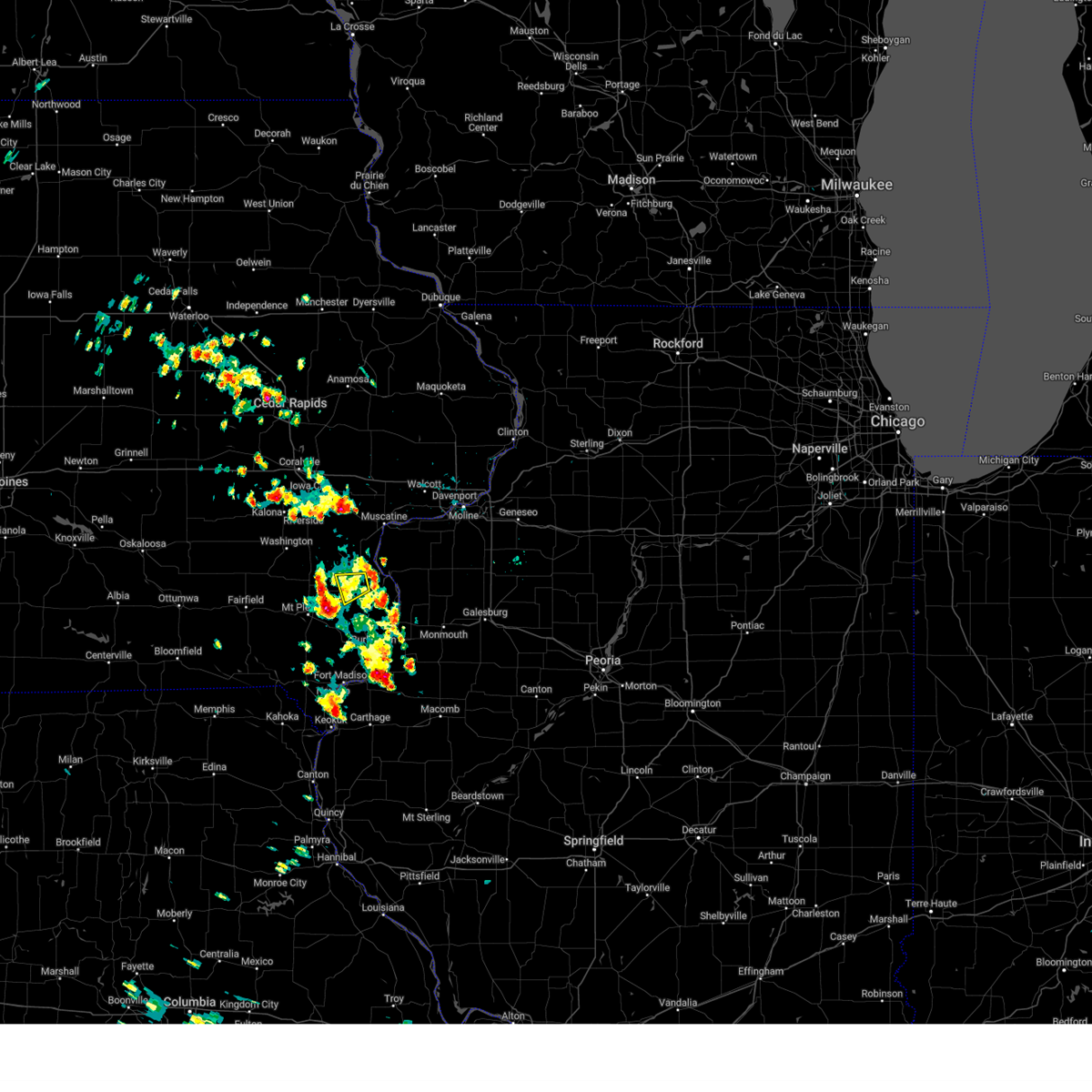 The severe thunderstorm warning for north central des moines and southwestern louisa counties will expire at 315 pm cdt, the storm which prompted the warning has weakened below severe limits, and no longer poses an immediate threat to life or property. therefore, the warning will be allowed to expire. however heavy rain is still possible with this thunderstorm. to report severe weather, contact your nearest law enforcement agency. they will relay your report to the national weather service the quad cities. The severe thunderstorm warning for north central des moines and southwestern louisa counties will expire at 315 pm cdt, the storm which prompted the warning has weakened below severe limits, and no longer poses an immediate threat to life or property. therefore, the warning will be allowed to expire. however heavy rain is still possible with this thunderstorm. to report severe weather, contact your nearest law enforcement agency. they will relay your report to the national weather service the quad cities.
|
| 6/4/2023 2:46 PM CDT |
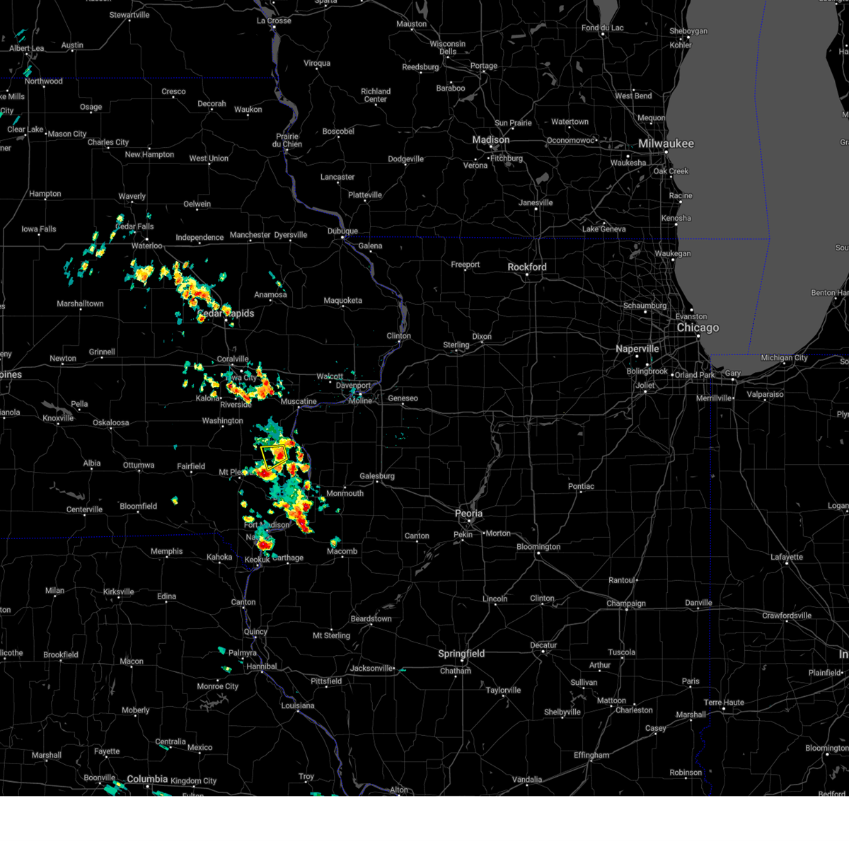 At 246 pm cdt, a severe thunderstorm was located over amber, or near wapello, moving west at 15 mph (radar indicated). Hazards include 60 mph wind gusts and quarter size hail. Hail damage to vehicles is expected. expect wind damage to roofs, siding, and trees. locations impacted include, wapello, morning sun, amber, garland and virginia grove recreation area. hail threat, radar indicated max hail size, 1. 00 in wind threat, radar indicated max wind gust, 60 mph. At 246 pm cdt, a severe thunderstorm was located over amber, or near wapello, moving west at 15 mph (radar indicated). Hazards include 60 mph wind gusts and quarter size hail. Hail damage to vehicles is expected. expect wind damage to roofs, siding, and trees. locations impacted include, wapello, morning sun, amber, garland and virginia grove recreation area. hail threat, radar indicated max hail size, 1. 00 in wind threat, radar indicated max wind gust, 60 mph.
|
| 6/4/2023 2:35 PM CDT |
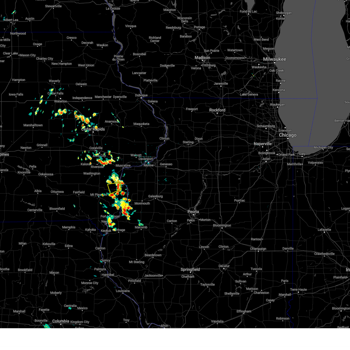 At 234 pm cdt, a severe thunderstorm was located over amber, or near wapello, moving west at 15 mph (radar indicated). Hazards include 60 mph wind gusts and quarter size hail. Hail damage to vehicles is expected. Expect wind damage to roofs, siding, and trees. At 234 pm cdt, a severe thunderstorm was located over amber, or near wapello, moving west at 15 mph (radar indicated). Hazards include 60 mph wind gusts and quarter size hail. Hail damage to vehicles is expected. Expect wind damage to roofs, siding, and trees.
|
| 5/7/2023 7:23 PM CDT |
 At 723 pm cdt, severe thunderstorms were located along a line extending from near coldbrook to near houghton, moving southeast at 35 mph (radar indicated). Hazards include 70 mph wind gusts and half dollar size hail. Hail damage to vehicles is expected. expect considerable tree damage. wind damage is also likely to mobile homes, roofs, and outbuildings. locations impacted include, burlington, monmouth, mount pleasant, oquawka, west burlington, new london, mediapolis, danville, morning sun, kirkwood, keithsburg, little york, middletown, biggsville, gladstone, rozetta, oakville, rome, westwood and mount union. thunderstorm damage threat, considerable hail threat, radar indicated max hail size, 1. 25 in wind threat, radar indicated max wind gust, 70 mph. At 723 pm cdt, severe thunderstorms were located along a line extending from near coldbrook to near houghton, moving southeast at 35 mph (radar indicated). Hazards include 70 mph wind gusts and half dollar size hail. Hail damage to vehicles is expected. expect considerable tree damage. wind damage is also likely to mobile homes, roofs, and outbuildings. locations impacted include, burlington, monmouth, mount pleasant, oquawka, west burlington, new london, mediapolis, danville, morning sun, kirkwood, keithsburg, little york, middletown, biggsville, gladstone, rozetta, oakville, rome, westwood and mount union. thunderstorm damage threat, considerable hail threat, radar indicated max hail size, 1. 25 in wind threat, radar indicated max wind gust, 70 mph.
|
| 5/7/2023 7:10 PM CDT |
 At 710 pm cdt, severe thunderstorms were located along a line extending from eleanor to hillsboro, moving southeast at 35 mph (radar indicated). Hazards include 70 mph wind gusts and half dollar size hail. Hail damage to vehicles is expected. expect considerable tree damage. wind damage is also likely to mobile homes, roofs, and outbuildings. locations impacted include, monmouth, little york, lake warren, monmouth municipal airport, gerlaw, eleanor, ormonde, coldbrook, cameron, lowell, stephenson park, geode state park, danville, middletown, iowa army ammunition plant, augusta, welter recreation area and camp l-kee-ta. thunderstorm damage threat, considerable hail threat, radar indicated max hail size, 1. 25 in wind threat, radar indicated max wind gust, 70 mph. At 710 pm cdt, severe thunderstorms were located along a line extending from eleanor to hillsboro, moving southeast at 35 mph (radar indicated). Hazards include 70 mph wind gusts and half dollar size hail. Hail damage to vehicles is expected. expect considerable tree damage. wind damage is also likely to mobile homes, roofs, and outbuildings. locations impacted include, monmouth, little york, lake warren, monmouth municipal airport, gerlaw, eleanor, ormonde, coldbrook, cameron, lowell, stephenson park, geode state park, danville, middletown, iowa army ammunition plant, augusta, welter recreation area and camp l-kee-ta. thunderstorm damage threat, considerable hail threat, radar indicated max hail size, 1. 25 in wind threat, radar indicated max wind gust, 70 mph.
|
| 5/7/2023 6:52 PM CDT |
 At 652 pm cdt, severe thunderstorms were located along a line extending from bald bluff to near round prairie park, moving southeast at 35 mph (radar indicated). Hazards include 70 mph wind gusts and half dollar size hail. Hail damage to vehicles is expected. expect considerable tree damage. wind damage is also likely to mobile homes, roofs, and outbuildings. severe thunderstorms will be near, rozetta, ogle, bald bluff, big river state forest and delabar state park around 655 pm cdt. little york around 700 pm cdt. eleanor around 705 pm cdt. lake warren, oakland mills, oakland mills park and water works park around 710 pm cdt. other locations in the path of these severe thunderstorms include monmouth, monmouth municipal airport, gerlaw, coldbrook, ormonde, cameron, lowell, stephenson park and geode state park. thunderstorm damage threat, considerable hail threat, radar indicated max hail size, 1. 25 in wind threat, radar indicated max wind gust, 70 mph. At 652 pm cdt, severe thunderstorms were located along a line extending from bald bluff to near round prairie park, moving southeast at 35 mph (radar indicated). Hazards include 70 mph wind gusts and half dollar size hail. Hail damage to vehicles is expected. expect considerable tree damage. wind damage is also likely to mobile homes, roofs, and outbuildings. severe thunderstorms will be near, rozetta, ogle, bald bluff, big river state forest and delabar state park around 655 pm cdt. little york around 700 pm cdt. eleanor around 705 pm cdt. lake warren, oakland mills, oakland mills park and water works park around 710 pm cdt. other locations in the path of these severe thunderstorms include monmouth, monmouth municipal airport, gerlaw, coldbrook, ormonde, cameron, lowell, stephenson park and geode state park. thunderstorm damage threat, considerable hail threat, radar indicated max hail size, 1. 25 in wind threat, radar indicated max wind gust, 70 mph.
|
| 5/7/2023 6:43 PM CDT |
 At 643 pm cdt, severe thunderstorms were located along a line extending from ogle to near beckwith, moving southeast at 35 mph (law enforcement). Hazards include 60 mph wind gusts and quarter size hail. Hail damage to vehicles is expected. expect wind damage to roofs, siding, and trees. these severe storms will be near, keithsburg, seaton, ogle, bald bluff and big river state forest around 650 pm cdt. stockport around 655 pm cdt. other locations in the path of these severe thunderstorms include hillsboro, westwood, mount pleasant, oakland mills, oakland mills park, water works park, salem, henry county fairgrounds and mount pleasant municipal arpt. hail threat, radar indicated max hail size, 1. 00 in wind threat, radar indicated max wind gust, 60 mph. At 643 pm cdt, severe thunderstorms were located along a line extending from ogle to near beckwith, moving southeast at 35 mph (law enforcement). Hazards include 60 mph wind gusts and quarter size hail. Hail damage to vehicles is expected. expect wind damage to roofs, siding, and trees. these severe storms will be near, keithsburg, seaton, ogle, bald bluff and big river state forest around 650 pm cdt. stockport around 655 pm cdt. other locations in the path of these severe thunderstorms include hillsboro, westwood, mount pleasant, oakland mills, oakland mills park, water works park, salem, henry county fairgrounds and mount pleasant municipal arpt. hail threat, radar indicated max hail size, 1. 00 in wind threat, radar indicated max wind gust, 60 mph.
|
| 5/7/2023 6:37 PM CDT |
 At 637 pm cdt, severe thunderstorms were located along a line extending from near joy to near beckwith, moving east at 40 mph (law enforcement). Hazards include ping pong ball size hail and 60 mph wind gusts. People and animals outdoors will be injured. expect hail damage to roofs, siding, windows, and vehicles. expect wind damage to roofs, siding, and trees. these severe storms will be near, seaton and ogle around 645 pm cdt. other locations in the path of these severe thunderstorms include trenton, westwood, water works park, oakland mills park, oakland mills, mount pleasant, henry county fairgrounds, mount pleasant municipal arpt, new london, mount union and pleasant grove. hail threat, radar indicated max hail size, 1. 50 in wind threat, radar indicated max wind gust, 60 mph. At 637 pm cdt, severe thunderstorms were located along a line extending from near joy to near beckwith, moving east at 40 mph (law enforcement). Hazards include ping pong ball size hail and 60 mph wind gusts. People and animals outdoors will be injured. expect hail damage to roofs, siding, windows, and vehicles. expect wind damage to roofs, siding, and trees. these severe storms will be near, seaton and ogle around 645 pm cdt. other locations in the path of these severe thunderstorms include trenton, westwood, water works park, oakland mills park, oakland mills, mount pleasant, henry county fairgrounds, mount pleasant municipal arpt, new london, mount union and pleasant grove. hail threat, radar indicated max hail size, 1. 50 in wind threat, radar indicated max wind gust, 60 mph.
|
| 5/7/2023 6:25 PM CDT |
 At 625 pm cdt, severe thunderstorms were located along a line extending from near new boston to near brookville, moving east at 40 mph (radar indicated). Hazards include 60 mph wind gusts and quarter size hail. Hail damage to vehicles is expected. expect wind damage to roofs, siding, and trees. severe thunderstorms will be near, new boston, keithsburg, oakville, toolesboro and snively access campground around 630 pm cdt. pleasant plain and 4th pumping station campground around 635 pm cdt. ogle, salina and east pleasant plain around 640 pm cdt. seaton, germanville and round prairie park around 645 pm cdt. other locations in the path of these severe thunderstorms include lockridge, mac coon access, glasgow, merrimac, rome, trenton, mount pleasant, westwood, water works park, oakland mills park, oakland mills, henry county fairgrounds and mount pleasant municipal arpt. hail threat, radar indicated max hail size, 1. 00 in wind threat, radar indicated max wind gust, 60 mph. At 625 pm cdt, severe thunderstorms were located along a line extending from near new boston to near brookville, moving east at 40 mph (radar indicated). Hazards include 60 mph wind gusts and quarter size hail. Hail damage to vehicles is expected. expect wind damage to roofs, siding, and trees. severe thunderstorms will be near, new boston, keithsburg, oakville, toolesboro and snively access campground around 630 pm cdt. pleasant plain and 4th pumping station campground around 635 pm cdt. ogle, salina and east pleasant plain around 640 pm cdt. seaton, germanville and round prairie park around 645 pm cdt. other locations in the path of these severe thunderstorms include lockridge, mac coon access, glasgow, merrimac, rome, trenton, mount pleasant, westwood, water works park, oakland mills park, oakland mills, henry county fairgrounds and mount pleasant municipal arpt. hail threat, radar indicated max hail size, 1. 00 in wind threat, radar indicated max wind gust, 60 mph.
|
| 8/29/2022 10:29 AM CDT | At 1029 am cdt, severe thunderstorms were located along a line extending from near illinois city to kossuth, moving east at 40 mph (radar indicated). Hazards include 60 mph wind gusts and penny size hail. Expect damage to roofs, siding, and trees. locations impacted include, muscatine, aledo, wapello, fruitland, morning sun, millersburg, new boston, keithsburg, grandview, reynolds, eliza, joy, seaton, oakville, hamlet, amber, toolesboro, mannon, ogle and aledo mercer county airport. hail threat, radar indicated max hail size, 0. 75 in wind threat, radar indicated max wind gust, 60 mph. |
| 8/29/2022 10:29 AM CDT | At 1029 am cdt, severe thunderstorms were located along a line extending from near illinois city to kossuth, moving east at 40 mph (radar indicated). Hazards include 60 mph wind gusts and penny size hail. Expect damage to roofs, siding, and trees. locations impacted include, muscatine, aledo, wapello, fruitland, morning sun, millersburg, new boston, keithsburg, grandview, reynolds, eliza, joy, seaton, oakville, hamlet, amber, toolesboro, mannon, ogle and aledo mercer county airport. hail threat, radar indicated max hail size, 0. 75 in wind threat, radar indicated max wind gust, 60 mph. |
| 8/29/2022 10:23 AM CDT | At 1023 am cdt, severe thunderstorms were located along a line extending from near muscatine to near garland, moving east at 40 mph (radar indicated). Hazards include 60 mph wind gusts and quarter size hail. Hail damage to vehicles is expected. expect wind damage to roofs, siding, and trees. locations impacted include, muscatine, aledo, wapello, fruitland, morning sun, millersburg, new boston, keithsburg, grandview, reynolds, eliza, joy, seaton, oakville, hamlet, amber, toolesboro, mannon, ogle and sand springs. hail threat, radar indicated max hail size, 1. 00 in wind threat, radar indicated max wind gust, 60 mph. |
| 8/29/2022 10:23 AM CDT | At 1023 am cdt, severe thunderstorms were located along a line extending from near muscatine to near garland, moving east at 40 mph (radar indicated). Hazards include 60 mph wind gusts and quarter size hail. Hail damage to vehicles is expected. expect wind damage to roofs, siding, and trees. locations impacted include, muscatine, aledo, wapello, fruitland, morning sun, millersburg, new boston, keithsburg, grandview, reynolds, eliza, joy, seaton, oakville, hamlet, amber, toolesboro, mannon, ogle and sand springs. hail threat, radar indicated max hail size, 1. 00 in wind threat, radar indicated max wind gust, 60 mph. |
| 8/29/2022 10:13 AM CDT | At 1013 am cdt, severe thunderstorms were located along a line extending from muscatine municipal airport to yarmouth, moving east at 40 mph (radar indicated). Hazards include 60 mph wind gusts and quarter size hail. Hail damage to vehicles is expected. Expect wind damage to roofs, siding, and trees. |
| 8/29/2022 10:13 AM CDT | At 1013 am cdt, severe thunderstorms were located along a line extending from muscatine municipal airport to yarmouth, moving east at 40 mph (radar indicated). Hazards include 60 mph wind gusts and quarter size hail. Hail damage to vehicles is expected. Expect wind damage to roofs, siding, and trees. |
| 8/1/2022 3:16 AM CDT |
 At 316 am cdt, severe thunderstorms were located along a line extending from shale city to seaton to garland, moving east at 45 mph (radar indicated). Hazards include 60 mph wind gusts and penny size hail. expect damage to roofs, siding, and trees At 316 am cdt, severe thunderstorms were located along a line extending from shale city to seaton to garland, moving east at 45 mph (radar indicated). Hazards include 60 mph wind gusts and penny size hail. expect damage to roofs, siding, and trees
|
| 7/11/2022 6:54 AM CDT |
 The severe thunderstorm warning for northeastern henry, louisa, southeastern washington and muscatine counties will expire at 700 am cdt, the storms which prompted the warning have weakened below severe limits, and no longer pose an immediate threat to life or property. therefore, the warning will be allowed to expire. however gusty winds and heavy rain are still possible with these thunderstorms. a severe thunderstorm watch remains in effect until 1100 am cdt for northwestern illinois, and east central iowa. The severe thunderstorm warning for northeastern henry, louisa, southeastern washington and muscatine counties will expire at 700 am cdt, the storms which prompted the warning have weakened below severe limits, and no longer pose an immediate threat to life or property. therefore, the warning will be allowed to expire. however gusty winds and heavy rain are still possible with these thunderstorms. a severe thunderstorm watch remains in effect until 1100 am cdt for northwestern illinois, and east central iowa.
|
| 7/11/2022 6:49 AM CDT |
 At 649 am cdt, severe thunderstorms were located along a line extending from atalissa to virginia grove recreation area, moving east at 50 mph (radar indicated). Hazards include 60 mph wind gusts and quarter size hail. Hail damage to vehicles is expected. expect wind damage to roofs, siding, and trees. locations impacted include, muscatine, wapello, columbus junction, west liberty, wilton, winfield, fruitland, morning sun, ainsworth, grandview, conesville, columbus city, letts, nichols, atalissa, crawfordsville, olds, oakville, cotter and amber. hail threat, radar indicated max hail size, 1. 00 in wind threat, radar indicated max wind gust, 60 mph. At 649 am cdt, severe thunderstorms were located along a line extending from atalissa to virginia grove recreation area, moving east at 50 mph (radar indicated). Hazards include 60 mph wind gusts and quarter size hail. Hail damage to vehicles is expected. expect wind damage to roofs, siding, and trees. locations impacted include, muscatine, wapello, columbus junction, west liberty, wilton, winfield, fruitland, morning sun, ainsworth, grandview, conesville, columbus city, letts, nichols, atalissa, crawfordsville, olds, oakville, cotter and amber. hail threat, radar indicated max hail size, 1. 00 in wind threat, radar indicated max wind gust, 60 mph.
|
| 7/11/2022 6:22 AM CDT |
 At 622 am cdt, severe thunderstorms were located along a line extending from sharon center to coppock, moving east at 25 mph (radar indicated). Hazards include 60 mph wind gusts and quarter size hail. Hail damage to vehicles is expected. Expect wind damage to roofs, siding, and trees. At 622 am cdt, severe thunderstorms were located along a line extending from sharon center to coppock, moving east at 25 mph (radar indicated). Hazards include 60 mph wind gusts and quarter size hail. Hail damage to vehicles is expected. Expect wind damage to roofs, siding, and trees.
|
| 6/15/2022 6:32 PM CDT |
 At 632 pm cdt, a severe thunderstorm was located over olds, or 11 miles north of mount pleasant, moving northeast at 35 mph (radar indicated). Hazards include ping pong ball size hail and 60 mph wind gusts. People and animals outdoors will be injured. expect hail damage to roofs, siding, windows, and vehicles. expect wind damage to roofs, siding, and trees. this severe storm will be near, winfield, wyman and marsh around 640 pm cdt. virginia grove recreation area around 645 pm cdt. other locations in the path of this severe thunderstorm include columbus junction, morning sun, columbus city, fredonia, cairo, louisa county fairgrounds, amber, wapello, grandview, letts, snively access campground, sand springs and flaming prairie park. hail threat, radar indicated max hail size, 1. 50 in wind threat, radar indicated max wind gust, 60 mph. At 632 pm cdt, a severe thunderstorm was located over olds, or 11 miles north of mount pleasant, moving northeast at 35 mph (radar indicated). Hazards include ping pong ball size hail and 60 mph wind gusts. People and animals outdoors will be injured. expect hail damage to roofs, siding, windows, and vehicles. expect wind damage to roofs, siding, and trees. this severe storm will be near, winfield, wyman and marsh around 640 pm cdt. virginia grove recreation area around 645 pm cdt. other locations in the path of this severe thunderstorm include columbus junction, morning sun, columbus city, fredonia, cairo, louisa county fairgrounds, amber, wapello, grandview, letts, snively access campground, sand springs and flaming prairie park. hail threat, radar indicated max hail size, 1. 50 in wind threat, radar indicated max wind gust, 60 mph.
|
| 6/15/2022 6:25 PM CDT |
 At 625 pm cdt, a severe thunderstorm was located over olds, or 10 miles north of mount pleasant, moving northeast at 40 mph (radar indicated). Hazards include ping pong ball size hail and 60 mph wind gusts. People and animals outdoors will be injured. expect hail damage to roofs, siding, windows, and vehicles. expect wind damage to roofs, siding, and trees. this severe thunderstorm will be near, crawfordsville around 630 pm cdt. winfield, mount union and wyman around 635 pm cdt. marsh around 640 pm cdt. columbus junction, columbus city, cairo, louisa county fairgrounds and virginia grove recreation area around 645 pm cdt. other locations in the path of this severe thunderstorm include fredonia, wapello, grandview, letts, sand springs, snively access campground and flaming prairie park. hail threat, radar indicated max hail size, 1. 50 in wind threat, radar indicated max wind gust, 60 mph. At 625 pm cdt, a severe thunderstorm was located over olds, or 10 miles north of mount pleasant, moving northeast at 40 mph (radar indicated). Hazards include ping pong ball size hail and 60 mph wind gusts. People and animals outdoors will be injured. expect hail damage to roofs, siding, windows, and vehicles. expect wind damage to roofs, siding, and trees. this severe thunderstorm will be near, crawfordsville around 630 pm cdt. winfield, mount union and wyman around 635 pm cdt. marsh around 640 pm cdt. columbus junction, columbus city, cairo, louisa county fairgrounds and virginia grove recreation area around 645 pm cdt. other locations in the path of this severe thunderstorm include fredonia, wapello, grandview, letts, sand springs, snively access campground and flaming prairie park. hail threat, radar indicated max hail size, 1. 50 in wind threat, radar indicated max wind gust, 60 mph.
|
| 5/25/2022 7:06 PM CDT |
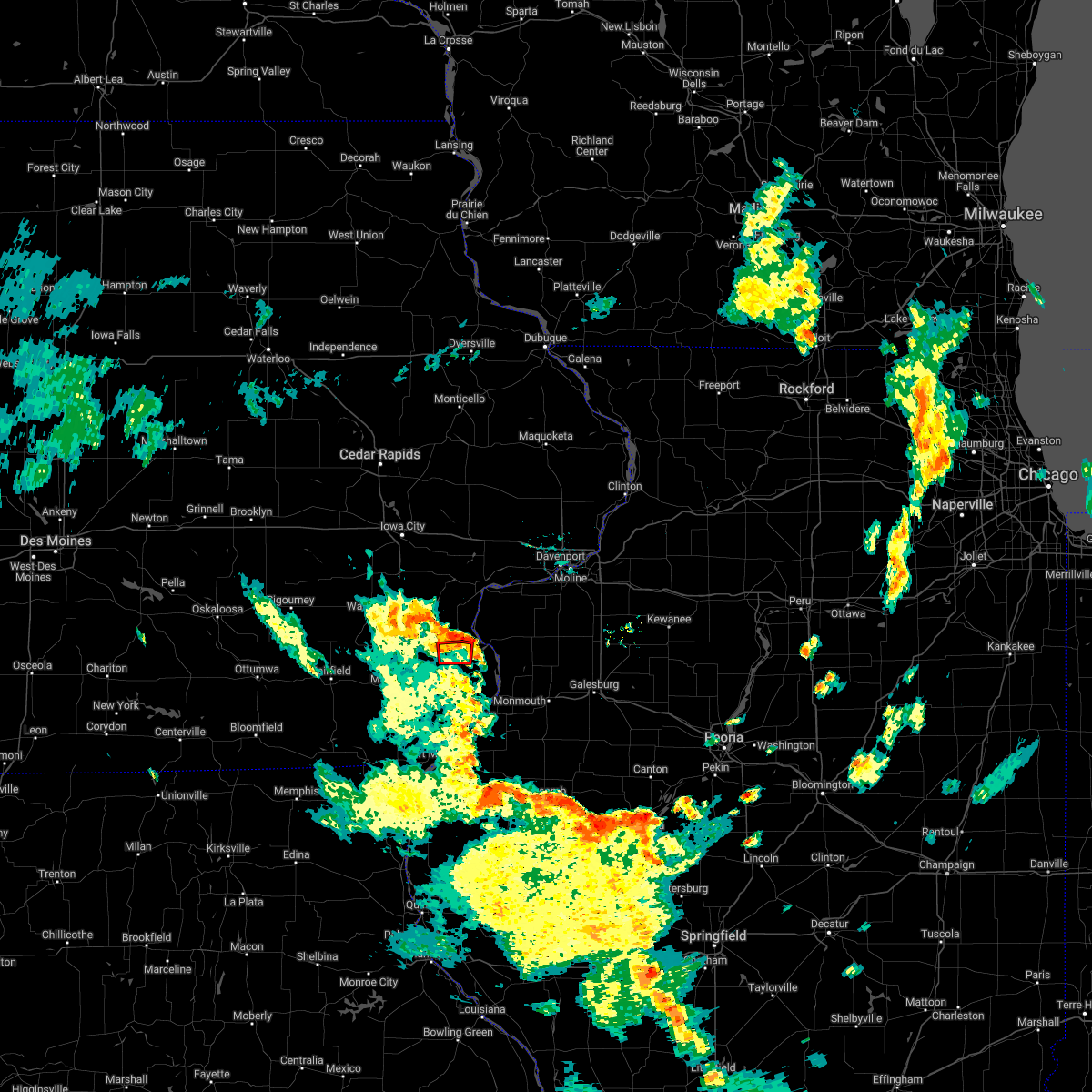 The tornado warning for south central louisa county will expire at 715 pm cdt, the storm which prompted the warning has weakened below severe limits, and no longer appears capable of producing a tornado. therefore, the warning will be allowed to expire. The tornado warning for south central louisa county will expire at 715 pm cdt, the storm which prompted the warning has weakened below severe limits, and no longer appears capable of producing a tornado. therefore, the warning will be allowed to expire.
|
| 5/25/2022 7:00 PM CDT |
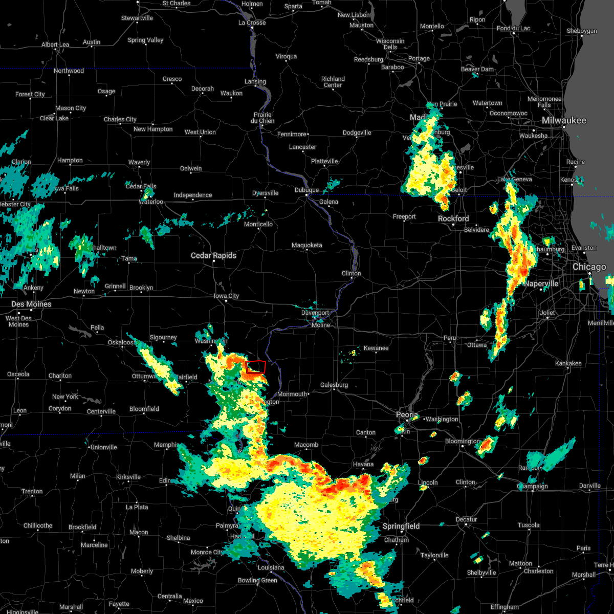 At 659 pm cdt, a severe thunderstorm capable of producing a tornado was located over amber, or near wapello, moving north at 30 mph (radar indicated rotation). Hazards include tornado. Flying debris will be dangerous to those caught without shelter. mobile homes will be damaged or destroyed. damage to roofs, windows, and vehicles will occur. tree damage is likely. This dangerous storm will be near, wapello around 710 pm cdt. At 659 pm cdt, a severe thunderstorm capable of producing a tornado was located over amber, or near wapello, moving north at 30 mph (radar indicated rotation). Hazards include tornado. Flying debris will be dangerous to those caught without shelter. mobile homes will be damaged or destroyed. damage to roofs, windows, and vehicles will occur. tree damage is likely. This dangerous storm will be near, wapello around 710 pm cdt.
|
| 5/25/2022 6:52 PM CDT |
 At 652 pm cdt, a severe thunderstorm capable of producing a tornado was located over garland, or 8 miles south of wapello, moving north at 35 mph (radar indicated rotation). Hazards include tornado. Flying debris will be dangerous to those caught without shelter. mobile homes will be damaged or destroyed. damage to roofs, windows, and vehicles will occur. tree damage is likely. this dangerous storm will be near, morning sun around 655 pm cdt. amber, elrick junction and virginia grove recreation area around 700 pm cdt. Other locations in the path of this tornadic thunderstorm include toolesboro and wapello. At 652 pm cdt, a severe thunderstorm capable of producing a tornado was located over garland, or 8 miles south of wapello, moving north at 35 mph (radar indicated rotation). Hazards include tornado. Flying debris will be dangerous to those caught without shelter. mobile homes will be damaged or destroyed. damage to roofs, windows, and vehicles will occur. tree damage is likely. this dangerous storm will be near, morning sun around 655 pm cdt. amber, elrick junction and virginia grove recreation area around 700 pm cdt. Other locations in the path of this tornadic thunderstorm include toolesboro and wapello.
|
| 5/25/2022 6:40 PM CDT |
 At 640 pm cdt, a severe thunderstorm capable of producing a tornado was located over big hollow recreation area, or 11 miles northwest of burlington, moving north at 35 mph (radar indicated rotation). Hazards include tornado. Flying debris will be dangerous to those caught without shelter. mobile homes will be damaged or destroyed. damage to roofs, windows, and vehicles will occur. tree damage is likely. this dangerous storm will be near, mediapolis, kossuth and yarmouth around 650 pm cdt. garland and northfield around 655 pm cdt. morning sun, marsh and elrick junction around 700 pm cdt. Other locations in the path of this tornadic thunderstorm include amber, virginia grove recreation area and wapello. At 640 pm cdt, a severe thunderstorm capable of producing a tornado was located over big hollow recreation area, or 11 miles northwest of burlington, moving north at 35 mph (radar indicated rotation). Hazards include tornado. Flying debris will be dangerous to those caught without shelter. mobile homes will be damaged or destroyed. damage to roofs, windows, and vehicles will occur. tree damage is likely. this dangerous storm will be near, mediapolis, kossuth and yarmouth around 650 pm cdt. garland and northfield around 655 pm cdt. morning sun, marsh and elrick junction around 700 pm cdt. Other locations in the path of this tornadic thunderstorm include amber, virginia grove recreation area and wapello.
|
| 3/5/2022 8:24 PM CST |
 At 824 pm cst, severe thunderstorms were located along a line extending from near muscatine to near wapello, moving east at 45 mph (radar indicated). Hazards include 60 mph wind gusts. Expect damage to roofs, siding, and trees. locations impacted include, illinois city, fairport, eliza and mannon. hail threat, radar indicated max hail size, <. 75 in wind threat, radar indicated max wind gust, 60 mph. At 824 pm cst, severe thunderstorms were located along a line extending from near muscatine to near wapello, moving east at 45 mph (radar indicated). Hazards include 60 mph wind gusts. Expect damage to roofs, siding, and trees. locations impacted include, illinois city, fairport, eliza and mannon. hail threat, radar indicated max hail size, <. 75 in wind threat, radar indicated max wind gust, 60 mph.
|
| 3/5/2022 8:24 PM CST |
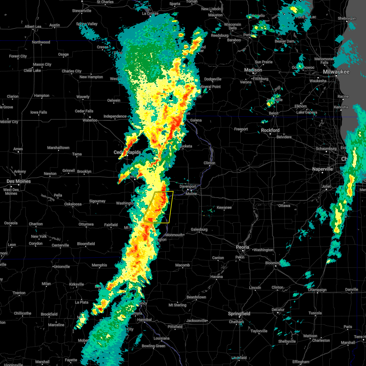 At 824 pm cst, severe thunderstorms were located along a line extending from near muscatine to near wapello, moving east at 45 mph (radar indicated). Hazards include 60 mph wind gusts. Expect damage to roofs, siding, and trees. locations impacted include, illinois city, fairport, eliza and mannon. hail threat, radar indicated max hail size, <. 75 in wind threat, radar indicated max wind gust, 60 mph. At 824 pm cst, severe thunderstorms were located along a line extending from near muscatine to near wapello, moving east at 45 mph (radar indicated). Hazards include 60 mph wind gusts. Expect damage to roofs, siding, and trees. locations impacted include, illinois city, fairport, eliza and mannon. hail threat, radar indicated max hail size, <. 75 in wind threat, radar indicated max wind gust, 60 mph.
|
| 3/5/2022 8:02 PM CST |
 At 802 pm cst, severe thunderstorms were located along a line extending from near conesville to winfield, moving east at 45 mph (radar indicated). Hazards include 60 mph wind gusts. Expect damage to roofs, siding, and trees. severe thunderstorms will be near, conesville, letts and nichols around 805 pm cst. fruitland and morning sun around 815 pm cst. wapello, grandview and amber around 820 pm cst. other locations in the path of these severe thunderstorms include muscatine, fairport, illinois city, toolesboro, new boston, eliza and mannon. hail threat, radar indicated max hail size, <. 75 in wind threat, radar indicated max wind gust, 60 mph. At 802 pm cst, severe thunderstorms were located along a line extending from near conesville to winfield, moving east at 45 mph (radar indicated). Hazards include 60 mph wind gusts. Expect damage to roofs, siding, and trees. severe thunderstorms will be near, conesville, letts and nichols around 805 pm cst. fruitland and morning sun around 815 pm cst. wapello, grandview and amber around 820 pm cst. other locations in the path of these severe thunderstorms include muscatine, fairport, illinois city, toolesboro, new boston, eliza and mannon. hail threat, radar indicated max hail size, <. 75 in wind threat, radar indicated max wind gust, 60 mph.
|
| 12/15/2021 9:40 PM CST |
 The severe thunderstorm warning for louisa, cedar and muscatine counties will expire at 945 pm cst, the storms which prompted the warning have moved out of the warned area. therefore, the warning will be allowed to expire. very strong winds are expected to continue behind the line of showers and thunderstorms. a tornado watch remains in effect until 1100 pm cst for northwestern illinois, and southeastern and east central iowa. The severe thunderstorm warning for louisa, cedar and muscatine counties will expire at 945 pm cst, the storms which prompted the warning have moved out of the warned area. therefore, the warning will be allowed to expire. very strong winds are expected to continue behind the line of showers and thunderstorms. a tornado watch remains in effect until 1100 pm cst for northwestern illinois, and southeastern and east central iowa.
|
| 12/15/2021 9:16 PM CST |
 At 915 pm cst, severe thunderstorms were located along a line extending from wyoming to mediapolis, moving east at 60 mph (trained weather spotters). Hazards include 70 mph wind gusts. Expect considerable tree damage. damage is likely to mobile homes, roofs, and outbuildings. locations impacted include, muscatine, tipton, west branch, wapello, columbus junction, durant, mechanicsville, stanwood, west liberty, wilton, walcott, fruitland, morning sun, lowden, new boston, grandview, conesville, bennett, columbus city and letts. thunderstorm damage threat, considerable hail threat, radar indicated max hail size, <. 75 in wind threat, observed max wind gust, 70 mph. At 915 pm cst, severe thunderstorms were located along a line extending from wyoming to mediapolis, moving east at 60 mph (trained weather spotters). Hazards include 70 mph wind gusts. Expect considerable tree damage. damage is likely to mobile homes, roofs, and outbuildings. locations impacted include, muscatine, tipton, west branch, wapello, columbus junction, durant, mechanicsville, stanwood, west liberty, wilton, walcott, fruitland, morning sun, lowden, new boston, grandview, conesville, bennett, columbus city and letts. thunderstorm damage threat, considerable hail threat, radar indicated max hail size, <. 75 in wind threat, observed max wind gust, 70 mph.
|
| 12/15/2021 8:50 PM CST |
 At 850 pm cst, severe thunderstorms were located along a line extending from near morley to near mount pleasant, moving northeast at 65 mph (trained weather spotters). Hazards include 70 mph wind gusts. Expect considerable tree damage. damage is likely to mobile homes, roofs, and outbuildings. severe thunderstorms will be near, morning sun around 905 pm cst. amber around 910 pm cst. other locations in the path of these severe thunderstorms include oakville, toolesboro and new boston. thunderstorm damage threat, considerable hail threat, radar indicated max hail size, <. 75 in wind threat, observed max wind gust, 70 mph. At 850 pm cst, severe thunderstorms were located along a line extending from near morley to near mount pleasant, moving northeast at 65 mph (trained weather spotters). Hazards include 70 mph wind gusts. Expect considerable tree damage. damage is likely to mobile homes, roofs, and outbuildings. severe thunderstorms will be near, morning sun around 905 pm cst. amber around 910 pm cst. other locations in the path of these severe thunderstorms include oakville, toolesboro and new boston. thunderstorm damage threat, considerable hail threat, radar indicated max hail size, <. 75 in wind threat, observed max wind gust, 70 mph.
|
| 6/19/2021 12:46 AM CDT |
 At 1245 am cdt, a severe thunderstorm was located near mediapolis, or 8 miles northwest of oquawka, moving east at 35 mph (radar indicated). Hazards include 60 mph wind gusts and quarter size hail. Hail damage to vehicles is expected. expect wind damage to roofs, siding, and trees. Locations impacted include, oquawka. At 1245 am cdt, a severe thunderstorm was located near mediapolis, or 8 miles northwest of oquawka, moving east at 35 mph (radar indicated). Hazards include 60 mph wind gusts and quarter size hail. Hail damage to vehicles is expected. expect wind damage to roofs, siding, and trees. Locations impacted include, oquawka.
|
| 6/19/2021 12:38 AM CDT |
 At 1238 am cdt, a severe thunderstorm was located over mediapolis, or 11 miles south of wapello, moving east at 30 mph (radar indicated). Hazards include 60 mph wind gusts and quarter size hail. Hail damage to vehicles is expected. expect wind damage to roofs, siding, and trees. Locations impacted include, oakville and oquawka. At 1238 am cdt, a severe thunderstorm was located over mediapolis, or 11 miles south of wapello, moving east at 30 mph (radar indicated). Hazards include 60 mph wind gusts and quarter size hail. Hail damage to vehicles is expected. expect wind damage to roofs, siding, and trees. Locations impacted include, oakville and oquawka.
|
| 6/19/2021 12:32 AM CDT |
 At 1232 am cdt, a severe thunderstorm was located near morning sun, or 11 miles southwest of wapello, moving east at 30 mph (radar indicated). Hazards include 60 mph wind gusts and quarter size hail. Hail damage to vehicles is expected. expect wind damage to roofs, siding, and trees. this severe storm will be near, mediapolis around 1245 am cdt. Other locations in the path of this severe thunderstorm include oakville and oquawka. At 1232 am cdt, a severe thunderstorm was located near morning sun, or 11 miles southwest of wapello, moving east at 30 mph (radar indicated). Hazards include 60 mph wind gusts and quarter size hail. Hail damage to vehicles is expected. expect wind damage to roofs, siding, and trees. this severe storm will be near, mediapolis around 1245 am cdt. Other locations in the path of this severe thunderstorm include oakville and oquawka.
|
| 6/19/2021 12:27 AM CDT |
 At 1226 am cdt, a severe thunderstorm was located near mount union, or 11 miles northeast of mount pleasant, moving east at 30 mph (radar indicated). Hazards include ping pong ball size hail and 60 mph wind gusts. People and animals outdoors will be injured. expect hail damage to roofs, siding, windows, and vehicles. expect wind damage to roofs, siding, and trees. this severe thunderstorm will be near, morning sun around 1235 am cdt. mediapolis around 1245 am cdt. Other locations in the path of this severe thunderstorm include oakville and oquawka. At 1226 am cdt, a severe thunderstorm was located near mount union, or 11 miles northeast of mount pleasant, moving east at 30 mph (radar indicated). Hazards include ping pong ball size hail and 60 mph wind gusts. People and animals outdoors will be injured. expect hail damage to roofs, siding, windows, and vehicles. expect wind damage to roofs, siding, and trees. this severe thunderstorm will be near, morning sun around 1235 am cdt. mediapolis around 1245 am cdt. Other locations in the path of this severe thunderstorm include oakville and oquawka.
|
| 6/19/2021 12:03 AM CDT |
 At 1203 am cdt, a severe thunderstorm was located over mediapolis, or 11 miles west of oquawka, moving east at 30 mph (radar indicated). Hazards include quarter size hail. Damage to vehicles is expected. Locations impacted include, mediapolis, morning sun, kossuth, dodgeville, elrick junction, northfield, garland and sperry. At 1203 am cdt, a severe thunderstorm was located over mediapolis, or 11 miles west of oquawka, moving east at 30 mph (radar indicated). Hazards include quarter size hail. Damage to vehicles is expected. Locations impacted include, mediapolis, morning sun, kossuth, dodgeville, elrick junction, northfield, garland and sperry.
|
| 6/18/2021 11:56 PM CDT |
 At 1156 pm cdt, a severe thunderstorm was located over mediapolis, or 12 miles south of wapello, moving east at 30 mph (radar indicated). Hazards include quarter size hail. Damage to vehicles is expected. Locations impacted include, mediapolis. At 1156 pm cdt, a severe thunderstorm was located over mediapolis, or 12 miles south of wapello, moving east at 30 mph (radar indicated). Hazards include quarter size hail. Damage to vehicles is expected. Locations impacted include, mediapolis.
|
| 6/18/2021 11:29 PM CDT |
 At 1129 pm cdt, a severe thunderstorm was located near mount union, or 7 miles northeast of mount pleasant, moving east at 30 mph (radar indicated). Hazards include quarter size hail. Damage to vehicles is expected. this severe thunderstorm will be near, mount union around 1135 pm cdt. Other locations in the path of this severe thunderstorm include morning sun and mediapolis. At 1129 pm cdt, a severe thunderstorm was located near mount union, or 7 miles northeast of mount pleasant, moving east at 30 mph (radar indicated). Hazards include quarter size hail. Damage to vehicles is expected. this severe thunderstorm will be near, mount union around 1135 pm cdt. Other locations in the path of this severe thunderstorm include morning sun and mediapolis.
|
| 6/18/2021 10:22 PM CDT |
 At 1021 pm cdt, a severe thunderstorm was located near columbus city, or near columbus junction, moving east at 35 mph (radar indicated). Hazards include ping pong ball size hail. People and animals outdoors will be injured. expect damage to roofs, siding, windows, and vehicles. this severe storm will be near, morning sun around 1035 pm cdt. Other locations in the path of this severe thunderstorm include wapello, grandview, amber, toolesboro, oakville, new boston, keithsburg, mannon, joy, aledo, millersburg and seaton. At 1021 pm cdt, a severe thunderstorm was located near columbus city, or near columbus junction, moving east at 35 mph (radar indicated). Hazards include ping pong ball size hail. People and animals outdoors will be injured. expect damage to roofs, siding, windows, and vehicles. this severe storm will be near, morning sun around 1035 pm cdt. Other locations in the path of this severe thunderstorm include wapello, grandview, amber, toolesboro, oakville, new boston, keithsburg, mannon, joy, aledo, millersburg and seaton.
|
| 6/18/2021 10:17 PM CDT |
 At 1016 pm cdt, a severe thunderstorm was located over wyman, or near columbus junction, moving east at 40 mph (radar indicated). Hazards include ping pong ball size hail. People and animals outdoors will be injured. expect damage to roofs, siding, windows, and vehicles. this severe thunderstorm will be near, columbus junction and columbus city around 1020 pm cdt. wapello, morning sun and grandview around 1035 pm cdt. Other locations in the path of this severe thunderstorm include amber, oakville, toolesboro, new boston, mannon, keithsburg, joy, millersburg and seaton. At 1016 pm cdt, a severe thunderstorm was located over wyman, or near columbus junction, moving east at 40 mph (radar indicated). Hazards include ping pong ball size hail. People and animals outdoors will be injured. expect damage to roofs, siding, windows, and vehicles. this severe thunderstorm will be near, columbus junction and columbus city around 1020 pm cdt. wapello, morning sun and grandview around 1035 pm cdt. Other locations in the path of this severe thunderstorm include amber, oakville, toolesboro, new boston, mannon, keithsburg, joy, millersburg and seaton.
|
| 11/10/2020 1:28 PM CST |
 At 127 pm cst, severe thunderstorms were located along a line extending from near mediapolis to near dallas city, moving northeast at 55 mph (radar indicated). Hazards include 60 mph wind gusts. expect damage to roofs, siding, and trees At 127 pm cst, severe thunderstorms were located along a line extending from near mediapolis to near dallas city, moving northeast at 55 mph (radar indicated). Hazards include 60 mph wind gusts. expect damage to roofs, siding, and trees
|
| 8/10/2020 12:42 PM CDT |
 At 1242 pm cdt, severe thunderstorms were located along a line extending from near lone tree to near lockridge, moving east at 65 mph (trained weather spotters). Hazards include 60 mph wind gusts. expect damage to roofs, siding, and trees At 1242 pm cdt, severe thunderstorms were located along a line extending from near lone tree to near lockridge, moving east at 65 mph (trained weather spotters). Hazards include 60 mph wind gusts. expect damage to roofs, siding, and trees
|
| 7/19/2020 8:40 AM CDT |
 At 839 am cdt, a severe thunderstorm was located over mediapolis, or 9 miles northwest of oquawka, moving east at 45 mph (radar indicated). Hazards include 70 mph wind gusts. Expect considerable tree damage. Damage is likely to mobile homes, roofs, and outbuildings. At 839 am cdt, a severe thunderstorm was located over mediapolis, or 9 miles northwest of oquawka, moving east at 45 mph (radar indicated). Hazards include 70 mph wind gusts. Expect considerable tree damage. Damage is likely to mobile homes, roofs, and outbuildings.
|
| 7/11/2020 6:52 PM CDT |
 At 652 pm cdt, severe thunderstorms were located along a line extending from near wilton to near nichols to near cotter, moving southeast at 50 mph (radar indicated). Hazards include 60 mph wind gusts. Expect damage to roofs, siding, and trees. Locations impacted include, muscatine, aledo, wapello, columbus junction, west liberty, wilton, lone tree, andalusia, riverside, fruitland, morning sun, millersburg, new boston, keithsburg, grandview, reynolds, conesville, eliza, joy and columbus city. At 652 pm cdt, severe thunderstorms were located along a line extending from near wilton to near nichols to near cotter, moving southeast at 50 mph (radar indicated). Hazards include 60 mph wind gusts. Expect damage to roofs, siding, and trees. Locations impacted include, muscatine, aledo, wapello, columbus junction, west liberty, wilton, lone tree, andalusia, riverside, fruitland, morning sun, millersburg, new boston, keithsburg, grandview, reynolds, conesville, eliza, joy and columbus city.
|
| 7/11/2020 6:46 PM CDT |
 At 646 pm cdt, severe thunderstorms were located along a line extending from near atalissa to nichols to 6 miles north of ainsworth, moving southeast at 50 mph (radar indicated). Hazards include 60 mph wind gusts. expect damage to roofs, siding, and trees At 646 pm cdt, severe thunderstorms were located along a line extending from near atalissa to nichols to 6 miles north of ainsworth, moving southeast at 50 mph (radar indicated). Hazards include 60 mph wind gusts. expect damage to roofs, siding, and trees
|
| 7/9/2020 5:28 PM CDT |
 At 528 pm cdt, severe thunderstorms were located along a line extending from near atalissa to near new boston, moving northeast at 35 mph (radar indicated). Hazards include 60 mph wind gusts and quarter size hail. Hail damage to vehicles is expected. expect wind damage to roofs, siding, and trees. locations impacted include, muscatine, wapello, columbus junction, wilton, fruitland, morning sun, millersburg, new boston, grandview, conesville, eliza, joy, letts, atalissa, oakville, toolesboro, illinois city, mannon, fredonia and cranston. This includes interstate 80 in iowa between mile markers 267 and 273. At 528 pm cdt, severe thunderstorms were located along a line extending from near atalissa to near new boston, moving northeast at 35 mph (radar indicated). Hazards include 60 mph wind gusts and quarter size hail. Hail damage to vehicles is expected. expect wind damage to roofs, siding, and trees. locations impacted include, muscatine, wapello, columbus junction, wilton, fruitland, morning sun, millersburg, new boston, grandview, conesville, eliza, joy, letts, atalissa, oakville, toolesboro, illinois city, mannon, fredonia and cranston. This includes interstate 80 in iowa between mile markers 267 and 273.
|
| 7/9/2020 5:08 PM CDT |
 At 508 pm cdt, severe thunderstorms were located along a line extending from near conesville to morning sun, moving northeast at 35 mph (radar indicated). Hazards include 60 mph wind gusts and quarter size hail. Hail damage to vehicles is expected. Expect wind damage to roofs, siding, and trees. At 508 pm cdt, severe thunderstorms were located along a line extending from near conesville to morning sun, moving northeast at 35 mph (radar indicated). Hazards include 60 mph wind gusts and quarter size hail. Hail damage to vehicles is expected. Expect wind damage to roofs, siding, and trees.
|
| 5/14/2020 8:21 PM CDT |
 At 821 pm cdt, severe thunderstorms were located along a line extending from near cotter to near olds, moving east at 30 mph (trained weather spotters. damage to trees has been reported in brighton with these storms). Hazards include 70 mph wind gusts and quarter size hail. Hail damage to vehicles is expected. expect considerable tree damage. wind damage is also likely to mobile homes, roofs, and outbuildings. Locations impacted include, wapello, columbus junction, winfield, wayland, morning sun, grandview, columbus city, crawfordsville, olds, mount union, wyman, fredonia, noble, cairo, virginia grove recreation area, louisa county fairgrounds, swedesburg, marsh, trenton and garland. At 821 pm cdt, severe thunderstorms were located along a line extending from near cotter to near olds, moving east at 30 mph (trained weather spotters. damage to trees has been reported in brighton with these storms). Hazards include 70 mph wind gusts and quarter size hail. Hail damage to vehicles is expected. expect considerable tree damage. wind damage is also likely to mobile homes, roofs, and outbuildings. Locations impacted include, wapello, columbus junction, winfield, wayland, morning sun, grandview, columbus city, crawfordsville, olds, mount union, wyman, fredonia, noble, cairo, virginia grove recreation area, louisa county fairgrounds, swedesburg, marsh, trenton and garland.
|
| 5/14/2020 8:11 PM CDT |
 At 810 pm cdt, severe thunderstorms were located along a line extending from ainsworth to near wayland, moving east at 30 mph (radar indicated). Hazards include 70 mph wind gusts and quarter size hail. Hail damage to vehicles is expected. expect considerable tree damage. wind damage is also likely to mobile homes, roofs, and outbuildings. Damage to trees has been reported in brighton. At 810 pm cdt, severe thunderstorms were located along a line extending from ainsworth to near wayland, moving east at 30 mph (radar indicated). Hazards include 70 mph wind gusts and quarter size hail. Hail damage to vehicles is expected. expect considerable tree damage. wind damage is also likely to mobile homes, roofs, and outbuildings. Damage to trees has been reported in brighton.
|
| 11/26/2019 11:11 PM CST |
 At 1111 pm cst, severe thunderstorms were located along a line extending from columbus junction to near toolesboro to near gladstone, moving northeast at 60 mph (radar indicated). Hazards include 60 mph wind gusts. expect damage to roofs, siding, and trees At 1111 pm cst, severe thunderstorms were located along a line extending from columbus junction to near toolesboro to near gladstone, moving northeast at 60 mph (radar indicated). Hazards include 60 mph wind gusts. expect damage to roofs, siding, and trees
|
| 9/27/2019 6:20 PM CDT |
 The national weather service in the quad cities has issued a * severe thunderstorm warning for. northern henderson county in west central illinois. northwestern warren county in west central illinois. southeastern mercer county in northwestern illinois. Des moines county in southeastern iowa. The national weather service in the quad cities has issued a * severe thunderstorm warning for. northern henderson county in west central illinois. northwestern warren county in west central illinois. southeastern mercer county in northwestern illinois. Des moines county in southeastern iowa.
|
| 8/20/2019 8:07 AM CDT |
 At 807 am cdt, severe thunderstorms were located along a line extending from near illinois city to near joy to near rozetta, moving east at 55 mph (radar indicated). Hazards include 70 mph wind gusts. Expect considerable tree damage. damage is likely to mobile homes, roofs, and outbuildings. locations impacted include, muscatine, monmouth, aledo, wapello, oquawka, milan, burgess, orion, mediapolis, fruitland, viola, morning sun, woodhull, millersburg, matherville, new boston, alpha, sherrard, keithsburg and grandview. This includes interstate 74 in illinois between mile markers 31 and 33. At 807 am cdt, severe thunderstorms were located along a line extending from near illinois city to near joy to near rozetta, moving east at 55 mph (radar indicated). Hazards include 70 mph wind gusts. Expect considerable tree damage. damage is likely to mobile homes, roofs, and outbuildings. locations impacted include, muscatine, monmouth, aledo, wapello, oquawka, milan, burgess, orion, mediapolis, fruitland, viola, morning sun, woodhull, millersburg, matherville, new boston, alpha, sherrard, keithsburg and grandview. This includes interstate 74 in illinois between mile markers 31 and 33.
|
| 8/20/2019 7:53 AM CDT |
 At 752 am cdt, severe thunderstorms were located along a line extending from letts to near mediapolis, moving east at 55 mph (radar indicated). Hazards include 70 mph wind gusts. Expect considerable tree damage. Damage is likely to mobile homes, roofs, and outbuildings. At 752 am cdt, severe thunderstorms were located along a line extending from letts to near mediapolis, moving east at 55 mph (radar indicated). Hazards include 70 mph wind gusts. Expect considerable tree damage. Damage is likely to mobile homes, roofs, and outbuildings.
|
| 8/20/2019 7:38 AM CDT |
 At 737 am cdt, severe thunderstorms were located along a line extending from columbus junction to near new london to near bonaparte, moving east at 60 mph (radar indicated). Hazards include 70 mph wind gusts. Expect considerable tree damage. damage is likely to mobile homes, roofs, and outbuildings. Locations impacted include, burlington, fort madison, mount pleasant, washington, wapello, columbus junction, oquawka, nauvoo, keosauqua, west burlington, new london, mediapolis, winfield, west point, wayland, danville, donnellson, montrose, morning sun and ainsworth. At 737 am cdt, severe thunderstorms were located along a line extending from columbus junction to near new london to near bonaparte, moving east at 60 mph (radar indicated). Hazards include 70 mph wind gusts. Expect considerable tree damage. damage is likely to mobile homes, roofs, and outbuildings. Locations impacted include, burlington, fort madison, mount pleasant, washington, wapello, columbus junction, oquawka, nauvoo, keosauqua, west burlington, new london, mediapolis, winfield, west point, wayland, danville, donnellson, montrose, morning sun and ainsworth.
|
| 8/20/2019 7:08 AM CDT |
 At 707 am cdt, severe thunderstorms were located along a line extending from 6 miles southeast of kinross to near fairfield to near bloomfield, moving east at 60 mph (radar indicated). Hazards include 70 mph wind gusts. Expect considerable tree damage. Damage is likely to mobile homes, roofs, and outbuildings. At 707 am cdt, severe thunderstorms were located along a line extending from 6 miles southeast of kinross to near fairfield to near bloomfield, moving east at 60 mph (radar indicated). Hazards include 70 mph wind gusts. Expect considerable tree damage. Damage is likely to mobile homes, roofs, and outbuildings.
|
| 7/17/2019 3:15 PM CDT |
 At 314 pm cdt, severe thunderstorms were located along a line extending from near mediapolis to 7 miles west of oquawka to middletown, moving east at 30 mph (radar indicated). Hazards include 60 mph wind gusts and penny size hail. Expect damage to roofs, siding, and trees. Locations impacted include, burlington, wapello, oquawka, west burlington, mediapolis, danville, stronghurst, morning sun, biggsville, gladstone, rozetta, oakville, gulf port, toolesboro, kossuth, bald bluff, media, kingston, sperry and big hollow recreation area. At 314 pm cdt, severe thunderstorms were located along a line extending from near mediapolis to 7 miles west of oquawka to middletown, moving east at 30 mph (radar indicated). Hazards include 60 mph wind gusts and penny size hail. Expect damage to roofs, siding, and trees. Locations impacted include, burlington, wapello, oquawka, west burlington, mediapolis, danville, stronghurst, morning sun, biggsville, gladstone, rozetta, oakville, gulf port, toolesboro, kossuth, bald bluff, media, kingston, sperry and big hollow recreation area.
|
| 7/17/2019 2:44 PM CDT |
 At 244 pm cdt, severe thunderstorms were located along a line extending from near winfield to near morning sun to near new london, moving southeast at 30 mph (radar indicated). Hazards include 60 mph wind gusts and quarter size hail. Hail damage to vehicles is expected. Expect wind damage to roofs, siding, and trees. At 244 pm cdt, severe thunderstorms were located along a line extending from near winfield to near morning sun to near new london, moving southeast at 30 mph (radar indicated). Hazards include 60 mph wind gusts and quarter size hail. Hail damage to vehicles is expected. Expect wind damage to roofs, siding, and trees.
|
| 6/30/2019 7:55 PM CDT |
 At 753 pm cdt, outflow boundary with severe winds was located along a line extending from london mills to near colusa to near salem, moving south at 45 mph. thunderstorms behind the outflow boundary will be capable of severe winds to 60 mph (radar indicated). Hazards include 60 mph wind gusts. Expect damage to roofs, siding, and trees. Locations impacted include, burlington, macomb, fort madison, keokuk, fairfield, monmouth, mount pleasant, washington, carthage, kahoka, oquawka, nauvoo, bushnell, west burlington, hamilton, new london, warsaw, mediapolis, colchester and la harpe. At 753 pm cdt, outflow boundary with severe winds was located along a line extending from london mills to near colusa to near salem, moving south at 45 mph. thunderstorms behind the outflow boundary will be capable of severe winds to 60 mph (radar indicated). Hazards include 60 mph wind gusts. Expect damage to roofs, siding, and trees. Locations impacted include, burlington, macomb, fort madison, keokuk, fairfield, monmouth, mount pleasant, washington, carthage, kahoka, oquawka, nauvoo, bushnell, west burlington, hamilton, new london, warsaw, mediapolis, colchester and la harpe.
|
| 6/30/2019 7:45 PM CDT |
 At 744 pm cdt, severe thunderstorms were located along a line extending from abingdon to stronghurst to rome, moving east at 45 mph (radar indicated. a 58 mph wind gust was measured at the burlington airport). Hazards include 60 mph wind gusts. Expect damage to roofs, siding, and trees. Locations impacted include, burlington, macomb, fort madison, keokuk, fairfield, monmouth, mount pleasant, washington, aledo, carthage, kahoka, wapello, columbus junction, oquawka, nauvoo, bushnell, west burlington, hamilton, burgess and new london. At 744 pm cdt, severe thunderstorms were located along a line extending from abingdon to stronghurst to rome, moving east at 45 mph (radar indicated. a 58 mph wind gust was measured at the burlington airport). Hazards include 60 mph wind gusts. Expect damage to roofs, siding, and trees. Locations impacted include, burlington, macomb, fort madison, keokuk, fairfield, monmouth, mount pleasant, washington, aledo, carthage, kahoka, wapello, columbus junction, oquawka, nauvoo, bushnell, west burlington, hamilton, burgess and new london.
|
| 6/30/2019 7:32 PM CDT |
 At 732 pm cdt, severe thunderstorms were located along a line extending from near galesburg to near gladstone to near lockridge, moving south at 45 mph (radar indicated). Hazards include 60 mph wind gusts. expect damage to roofs, siding, and trees At 732 pm cdt, severe thunderstorms were located along a line extending from near galesburg to near gladstone to near lockridge, moving south at 45 mph (radar indicated). Hazards include 60 mph wind gusts. expect damage to roofs, siding, and trees
|
| 6/15/2019 8:20 PM CDT |
 At 820 pm cdt, severe thunderstorms were located along a line extending from fruitland to keithsburg to 6 miles southwest of mediapolis, moving east at 40 mph (radar indicated). Hazards include 60 mph wind gusts. Expect damage to roofs, siding, and trees. Locations impacted include, aledo, wapello, oquawka, burgess, mediapolis, morning sun, millersburg, kirkwood, new boston, keithsburg, eliza, joy, little york, biggsville, gladstone, rozetta, seaton, oakville, shale city and toolesboro. At 820 pm cdt, severe thunderstorms were located along a line extending from fruitland to keithsburg to 6 miles southwest of mediapolis, moving east at 40 mph (radar indicated). Hazards include 60 mph wind gusts. Expect damage to roofs, siding, and trees. Locations impacted include, aledo, wapello, oquawka, burgess, mediapolis, morning sun, millersburg, kirkwood, new boston, keithsburg, eliza, joy, little york, biggsville, gladstone, rozetta, seaton, oakville, shale city and toolesboro.
|
| 6/15/2019 8:07 PM CDT |
 At 806 pm cdt, severe thunderstorms were located along a line extending from near letts to near toolesboro to new london, moving east at 40 mph (radar indicated). Hazards include 60 mph wind gusts. expect damage to roofs, siding, and trees At 806 pm cdt, severe thunderstorms were located along a line extending from near letts to near toolesboro to new london, moving east at 40 mph (radar indicated). Hazards include 60 mph wind gusts. expect damage to roofs, siding, and trees
|
| 6/15/2019 7:48 PM CDT |
 At 747 pm cdt, severe thunderstorms were located along a line extending from near atalissa to near letts to near lockridge, moving east at 45 mph (radar indicated). Hazards include 60 mph wind gusts and quarter size hail. Hail damage to vehicles is expected. expect wind damage to roofs, siding, and trees. Locations impacted include, muscatine, fairfield, washington, wapello, columbus junction, durant, west liberty, wilton, winfield, fruitland, wayland, morning sun, brighton, ainsworth, grandview, conesville, columbus city, letts, nichols and atalissa. At 747 pm cdt, severe thunderstorms were located along a line extending from near atalissa to near letts to near lockridge, moving east at 45 mph (radar indicated). Hazards include 60 mph wind gusts and quarter size hail. Hail damage to vehicles is expected. expect wind damage to roofs, siding, and trees. Locations impacted include, muscatine, fairfield, washington, wapello, columbus junction, durant, west liberty, wilton, winfield, fruitland, wayland, morning sun, brighton, ainsworth, grandview, conesville, columbus city, letts, nichols and atalissa.
|
| 6/15/2019 7:20 PM CDT |
 At 720 pm cdt, severe thunderstorms were located along a line extending from near lone tree to near ainsworth to near abingdon, moving east at 40 mph (radar indicated). Hazards include 60 mph wind gusts and quarter size hail. Hail damage to vehicles is expected. Expect wind damage to roofs, siding, and trees. At 720 pm cdt, severe thunderstorms were located along a line extending from near lone tree to near ainsworth to near abingdon, moving east at 40 mph (radar indicated). Hazards include 60 mph wind gusts and quarter size hail. Hail damage to vehicles is expected. Expect wind damage to roofs, siding, and trees.
|
| 5/28/2019 7:16 PM CDT |
 At 714 pm cdt, severe thunderstorms were located along a line extending from near mediapolis to gulf port to adrian, moving east at 50 mph. this storm is in the burlington area (trained weather spotters report 60 to 65 mph and nickel size hail). Hazards include 60 mph wind gusts and quarter size hail. Hail damage to vehicles is expected. expect wind damage to roofs, siding, and trees. Locations impacted include, burlington, fort madison, monmouth, aledo, oquawka, nauvoo, west burlington, burgess, mediapolis, la harpe, roseville, dallas city, danville, montrose, stronghurst, morning sun, kirkwood, new boston, keithsburg and joy. At 714 pm cdt, severe thunderstorms were located along a line extending from near mediapolis to gulf port to adrian, moving east at 50 mph. this storm is in the burlington area (trained weather spotters report 60 to 65 mph and nickel size hail). Hazards include 60 mph wind gusts and quarter size hail. Hail damage to vehicles is expected. expect wind damage to roofs, siding, and trees. Locations impacted include, burlington, fort madison, monmouth, aledo, oquawka, nauvoo, west burlington, burgess, mediapolis, la harpe, roseville, dallas city, danville, montrose, stronghurst, morning sun, kirkwood, new boston, keithsburg and joy.
|
| 5/28/2019 7:09 PM CDT |
 At 704 pm cdt, severe thunderstorms were located along a line extending from near mount union to near iowa army ammunition plant to montrose, moving east at 45 mph (radar indicated). Hazards include 60 mph wind gusts and quarter size hail. Hail damage to vehicles is expected. expect wind damage to roofs, siding, and trees. Locations impacted include, burlington, fort madison, monmouth, mount pleasant, aledo, wapello, oquawka, nauvoo, west burlington, burgess, new london, mediapolis, la harpe, winfield, roseville, west point, dallas city, danville, montrose and stronghurst. At 704 pm cdt, severe thunderstorms were located along a line extending from near mount union to near iowa army ammunition plant to montrose, moving east at 45 mph (radar indicated). Hazards include 60 mph wind gusts and quarter size hail. Hail damage to vehicles is expected. expect wind damage to roofs, siding, and trees. Locations impacted include, burlington, fort madison, monmouth, mount pleasant, aledo, wapello, oquawka, nauvoo, west burlington, burgess, new london, mediapolis, la harpe, winfield, roseville, west point, dallas city, danville, montrose and stronghurst.
|
| 5/28/2019 7:09 PM CDT |
 At 709 pm cdt, severe thunderstorms were located along a line extending from near morning sun to near iowa army ammunition plant to near adrian, moving east at 50 mph (radar indicated). Hazards include 60 mph wind gusts and quarter size hail. Hail damage to vehicles is expected. expect wind damage to roofs, siding, and trees. Locations impacted include, burlington, fort madison, monmouth, aledo, oquawka, nauvoo, west burlington, burgess, new london, mediapolis, la harpe, roseville, dallas city, danville, montrose, stronghurst, morning sun, kirkwood, new boston and keithsburg. At 709 pm cdt, severe thunderstorms were located along a line extending from near morning sun to near iowa army ammunition plant to near adrian, moving east at 50 mph (radar indicated). Hazards include 60 mph wind gusts and quarter size hail. Hail damage to vehicles is expected. expect wind damage to roofs, siding, and trees. Locations impacted include, burlington, fort madison, monmouth, aledo, oquawka, nauvoo, west burlington, burgess, new london, mediapolis, la harpe, roseville, dallas city, danville, montrose, stronghurst, morning sun, kirkwood, new boston and keithsburg.
|
| 5/28/2019 7:04 PM CDT |
 At 704 pm cdt, severe thunderstorms were located along a line extending from near mount union to near iowa army ammunition plant to montrose, moving east at 45 mph (radar indicated). Hazards include 60 mph wind gusts and quarter size hail. Hail damage to vehicles is expected. expect wind damage to roofs, siding, and trees. Locations impacted include, burlington, fort madison, monmouth, mount pleasant, aledo, wapello, oquawka, nauvoo, west burlington, burgess, new london, mediapolis, la harpe, winfield, roseville, west point, dallas city, danville, montrose and stronghurst. At 704 pm cdt, severe thunderstorms were located along a line extending from near mount union to near iowa army ammunition plant to montrose, moving east at 45 mph (radar indicated). Hazards include 60 mph wind gusts and quarter size hail. Hail damage to vehicles is expected. expect wind damage to roofs, siding, and trees. Locations impacted include, burlington, fort madison, monmouth, mount pleasant, aledo, wapello, oquawka, nauvoo, west burlington, burgess, new london, mediapolis, la harpe, winfield, roseville, west point, dallas city, danville, montrose and stronghurst.
|
| 5/28/2019 6:53 PM CDT |
 At 653 pm cdt, severe thunderstorms were located along a line extending from near olds to near west point to near new boston, moving east at 40 mph (radar indicated). Hazards include 60 mph wind gusts and quarter size hail. Hail damage to vehicles is expected. Expect wind damage to roofs, siding, and trees. At 653 pm cdt, severe thunderstorms were located along a line extending from near olds to near west point to near new boston, moving east at 40 mph (radar indicated). Hazards include 60 mph wind gusts and quarter size hail. Hail damage to vehicles is expected. Expect wind damage to roofs, siding, and trees.
|
| 9/25/2018 2:19 PM CDT |
 At 219 pm cdt, a severe thunderstorm capable of producing a tornado was located near winfield, or 7 miles south of columbus junction, moving east at 40 mph (radar indicated rotation). Hazards include tornado. Flying debris will be dangerous to those caught without shelter. mobile homes will be damaged or destroyed. damage to roofs, windows, and vehicles will occur. tree damage is likely. this dangerous storm will be near, morning sun around 225 pm cdt. wapello and amber around 230 pm cdt. grandview around 235 pm cdt. Other locations impacted by this tornadic thunderstorm include snively access campground, marsh, elrick junction, cairo and virginia grove recreation area. At 219 pm cdt, a severe thunderstorm capable of producing a tornado was located near winfield, or 7 miles south of columbus junction, moving east at 40 mph (radar indicated rotation). Hazards include tornado. Flying debris will be dangerous to those caught without shelter. mobile homes will be damaged or destroyed. damage to roofs, windows, and vehicles will occur. tree damage is likely. this dangerous storm will be near, morning sun around 225 pm cdt. wapello and amber around 230 pm cdt. grandview around 235 pm cdt. Other locations impacted by this tornadic thunderstorm include snively access campground, marsh, elrick junction, cairo and virginia grove recreation area.
|
| 9/25/2018 2:12 PM CDT |
 At 211 pm cdt, a severe thunderstorm capable of producing a tornado was located over winfield, or 10 miles southwest of columbus junction, moving east at 40 mph (radar indicated rotation). Hazards include tornado. Flying debris will be dangerous to those caught without shelter. mobile homes will be damaged or destroyed. damage to roofs, windows, and vehicles will occur. tree damage is likely. this dangerous storm will be near, mount union around 215 pm cdt. columbus city around 220 pm cdt. morning sun around 225 pm cdt. wapello, grandview and amber around 235 pm cdt. Other locations impacted by this tornadic thunderstorm include elrick junction, cairo, fredonia, virginia grove recreation area, louisa county fairgrounds, swedesburg, snively access campground and marsh. At 211 pm cdt, a severe thunderstorm capable of producing a tornado was located over winfield, or 10 miles southwest of columbus junction, moving east at 40 mph (radar indicated rotation). Hazards include tornado. Flying debris will be dangerous to those caught without shelter. mobile homes will be damaged or destroyed. damage to roofs, windows, and vehicles will occur. tree damage is likely. this dangerous storm will be near, mount union around 215 pm cdt. columbus city around 220 pm cdt. morning sun around 225 pm cdt. wapello, grandview and amber around 235 pm cdt. Other locations impacted by this tornadic thunderstorm include elrick junction, cairo, fredonia, virginia grove recreation area, louisa county fairgrounds, swedesburg, snively access campground and marsh.
|
| 8/28/2018 9:11 PM CDT |
 The severe thunderstorm warning for des moines and southeastern louisa counties will expire at 915 pm cdt, the storm which prompted the warning has moved out of the area. therefore, the warning will be allowed to expire. a severe thunderstorm watch remains in effect until 1100 pm cdt for northwestern and west central illinois, and southeastern iowa. The severe thunderstorm warning for des moines and southeastern louisa counties will expire at 915 pm cdt, the storm which prompted the warning has moved out of the area. therefore, the warning will be allowed to expire. a severe thunderstorm watch remains in effect until 1100 pm cdt for northwestern and west central illinois, and southeastern iowa.
|
| 8/28/2018 8:57 PM CDT |
 At 856 pm cdt, a severe thunderstorm was located near oquawka, moving east at 55 mph (radar indicated). Hazards include 60 mph wind gusts. Expect damage to roofs, siding, and trees. Locations impacted include, burlington, oquawka, west burlington, mediapolis, danville, morning sun, middletown, oakville, gulf port, iowa army ammunition plant, kossuth, kingston, sperry, big hollow recreation area, pleasant grove, beaverdale, northfield, camp l-kee-ta, 4th pumping station campground and elrick junction. At 856 pm cdt, a severe thunderstorm was located near oquawka, moving east at 55 mph (radar indicated). Hazards include 60 mph wind gusts. Expect damage to roofs, siding, and trees. Locations impacted include, burlington, oquawka, west burlington, mediapolis, danville, morning sun, middletown, oakville, gulf port, iowa army ammunition plant, kossuth, kingston, sperry, big hollow recreation area, pleasant grove, beaverdale, northfield, camp l-kee-ta, 4th pumping station campground and elrick junction.
|
| 8/28/2018 8:35 PM CDT |
 At 835 pm cdt, a severe thunderstorm was located over new london, or 7 miles southeast of mount pleasant, moving east at 55 mph (radar indicated). Hazards include 60 mph wind gusts. Expect damage to roofs, siding, and trees. Locations impacted include, burlington, mount pleasant, oquawka, west burlington, new london, mediapolis, danville, morning sun, salem, middletown, hillsboro, oakville, rome, westwood, mount union, gulf port, iowa army ammunition plant, lowell, kossuth and henry county fairgrounds. At 835 pm cdt, a severe thunderstorm was located over new london, or 7 miles southeast of mount pleasant, moving east at 55 mph (radar indicated). Hazards include 60 mph wind gusts. Expect damage to roofs, siding, and trees. Locations impacted include, burlington, mount pleasant, oquawka, west burlington, new london, mediapolis, danville, morning sun, salem, middletown, hillsboro, oakville, rome, westwood, mount union, gulf port, iowa army ammunition plant, lowell, kossuth and henry county fairgrounds.
|
| 8/28/2018 8:26 PM CDT |
 The national weather service in the quad cities has issued a * severe thunderstorm warning for. henry county in southeastern iowa. des moines county in southeastern iowa. southeastern louisa county in southeastern iowa. Until 915 pm cdt. The national weather service in the quad cities has issued a * severe thunderstorm warning for. henry county in southeastern iowa. des moines county in southeastern iowa. southeastern louisa county in southeastern iowa. Until 915 pm cdt.
|
| 8/28/2018 6:52 PM CDT |
 The severe thunderstorm warning for western mercer, northern henry, louisa and southeastern washington counties will expire at 700 pm cdt, the storms which prompted the warning have moved out of the area. therefore, the warning will be allowed to expire. however gusty winds and heavy rain are still possible with these thunderstorms. a severe thunderstorm watch remains in effect until 1100 pm cdt for northwestern and west central illinois, and southeastern and east central iowa. The severe thunderstorm warning for western mercer, northern henry, louisa and southeastern washington counties will expire at 700 pm cdt, the storms which prompted the warning have moved out of the area. therefore, the warning will be allowed to expire. however gusty winds and heavy rain are still possible with these thunderstorms. a severe thunderstorm watch remains in effect until 1100 pm cdt for northwestern and west central illinois, and southeastern and east central iowa.
|
| 8/28/2018 6:29 PM CDT |
 At 629 pm cdt, severe thunderstorms were located along a line extending from letts to winfield, moving east at 55 mph (radar indicated). Hazards include 60 mph wind gusts and penny size hail. Expect damage to roofs, siding, and trees. Locations impacted include, washington, wapello, columbus junction, winfield, fruitland, wayland, morning sun, new boston, keithsburg, ainsworth, grandview, eliza, columbus city, letts, crawfordsville, olds, oakville, cotter, toolesboro and wyman. At 629 pm cdt, severe thunderstorms were located along a line extending from letts to winfield, moving east at 55 mph (radar indicated). Hazards include 60 mph wind gusts and penny size hail. Expect damage to roofs, siding, and trees. Locations impacted include, washington, wapello, columbus junction, winfield, fruitland, wayland, morning sun, new boston, keithsburg, ainsworth, grandview, eliza, columbus city, letts, crawfordsville, olds, oakville, cotter, toolesboro and wyman.
|
| 8/28/2018 6:18 PM CDT |
 At 617 pm cdt, a severe thunderstorm was located over cotter, or near columbus junction, moving east at 60 mph (radar indicated). Hazards include 60 mph wind gusts and penny size hail. expect damage to roofs, siding, and trees At 617 pm cdt, a severe thunderstorm was located over cotter, or near columbus junction, moving east at 60 mph (radar indicated). Hazards include 60 mph wind gusts and penny size hail. expect damage to roofs, siding, and trees
|
| 8/10/2017 4:34 PM CDT |
 At 433 pm cdt, a severe thunderstorm was located over columbus city, or near columbus junction, moving southeast at 25 mph (trained weather spotters). Hazards include 60 mph wind gusts and quarter size hail. Hail damage to vehicles is expected. expect wind damage to roofs, siding, and trees. Locations impacted include, wapello, columbus junction, oquawka, mediapolis, morning sun, keithsburg, columbus city, oakville, toolesboro, kossuth, fredonia, 4th pumping station campground, elrick junction, kingston, sperry, cairo, virginia grove recreation area, louisa county fairgrounds, snively access campground and northfield. At 433 pm cdt, a severe thunderstorm was located over columbus city, or near columbus junction, moving southeast at 25 mph (trained weather spotters). Hazards include 60 mph wind gusts and quarter size hail. Hail damage to vehicles is expected. expect wind damage to roofs, siding, and trees. Locations impacted include, wapello, columbus junction, oquawka, mediapolis, morning sun, keithsburg, columbus city, oakville, toolesboro, kossuth, fredonia, 4th pumping station campground, elrick junction, kingston, sperry, cairo, virginia grove recreation area, louisa county fairgrounds, snively access campground and northfield.
|
| 8/10/2017 4:19 PM CDT |
 At 419 pm cdt, a severe thunderstorm was located over columbus city, or over columbus junction, moving southeast at 35 mph (trained weather spotters). Hazards include golf ball size hail and 70 mph wind gusts. People and animals outdoors will be injured. expect hail damage to roofs, siding, windows, and vehicles. expect considerable tree damage. Wind damage is also likely to mobile homes, roofs, and outbuildings. At 419 pm cdt, a severe thunderstorm was located over columbus city, or over columbus junction, moving southeast at 35 mph (trained weather spotters). Hazards include golf ball size hail and 70 mph wind gusts. People and animals outdoors will be injured. expect hail damage to roofs, siding, windows, and vehicles. expect considerable tree damage. Wind damage is also likely to mobile homes, roofs, and outbuildings.
|
| 7/10/2017 4:48 AM CDT |
 At 448 am cdt, severe thunderstorms were located along a line extending from near boden to near morning sun, moving southeast at 50 mph (radar indicated). Hazards include 60 mph wind gusts. expect damage to roofs, siding, and trees At 448 am cdt, severe thunderstorms were located along a line extending from near boden to near morning sun, moving southeast at 50 mph (radar indicated). Hazards include 60 mph wind gusts. expect damage to roofs, siding, and trees
|
| 5/17/2017 7:16 PM CDT |
 At 716 pm cdt, severe thunderstorms were located along a line extending from near nichols to near morning sun, moving northeast at 50 mph (trained weather spotters). Hazards include golf ball size hail and 70 mph wind gusts. People and animals outdoors will be injured. expect hail damage to roofs, siding, windows, and vehicles. expect considerable tree damage. wind damage is also likely to mobile homes, roofs, and outbuildings. locations impacted include, muscatine, wapello, columbus junction, west liberty, wilton, winfield, fruitland, morning sun, new boston, keithsburg, grandview, conesville, eliza, columbus city, letts, nichols, atalissa, oakville, cotter and toolesboro. A tornado watch remains in effect until 1100 pm cdt for northwestern illinois, and southeastern and east central iowa. At 716 pm cdt, severe thunderstorms were located along a line extending from near nichols to near morning sun, moving northeast at 50 mph (trained weather spotters). Hazards include golf ball size hail and 70 mph wind gusts. People and animals outdoors will be injured. expect hail damage to roofs, siding, windows, and vehicles. expect considerable tree damage. wind damage is also likely to mobile homes, roofs, and outbuildings. locations impacted include, muscatine, wapello, columbus junction, west liberty, wilton, winfield, fruitland, morning sun, new boston, keithsburg, grandview, conesville, eliza, columbus city, letts, nichols, atalissa, oakville, cotter and toolesboro. A tornado watch remains in effect until 1100 pm cdt for northwestern illinois, and southeastern and east central iowa.
|
| 5/17/2017 7:07 PM CDT |
 At 707 pm cdt, severe thunderstorms were located along a line extending from near west liberty to near wapello, moving northeast at 65 mph (trained weather spotters). Hazards include 70 mph wind gusts and quarter size hail. Hail damage to vehicles is expected. expect considerable tree damage. wind damage is also likely to mobile homes, roofs, and outbuildings. locations impacted include, muscatine, wapello, columbus junction, west liberty, wilton, winfield, fruitland, wayland, morning sun, new boston, keithsburg, ainsworth, grandview, conesville, eliza, columbus city, letts, nichols, atalissa and crawfordsville. A tornado watch remains in effect until 1100 pm cdt for northwestern illinois, and southeastern and east central iowa. At 707 pm cdt, severe thunderstorms were located along a line extending from near west liberty to near wapello, moving northeast at 65 mph (trained weather spotters). Hazards include 70 mph wind gusts and quarter size hail. Hail damage to vehicles is expected. expect considerable tree damage. wind damage is also likely to mobile homes, roofs, and outbuildings. locations impacted include, muscatine, wapello, columbus junction, west liberty, wilton, winfield, fruitland, wayland, morning sun, new boston, keithsburg, ainsworth, grandview, conesville, eliza, columbus city, letts, nichols, atalissa and crawfordsville. A tornado watch remains in effect until 1100 pm cdt for northwestern illinois, and southeastern and east central iowa.
|
| 5/17/2017 6:55 PM CDT |
 At 655 pm cdt, severe thunderstorms were located along a line extending from lone tree to near winfield, moving northeast at 60 mph (radar indicated). Hazards include 70 mph wind gusts and quarter size hail. Hail damage to vehicles is expected. expect considerable tree damage. wind damage is also likely to mobile homes, roofs, and outbuildings. locations impacted include, muscatine, washington, wapello, columbus junction, west liberty, wilton, winfield, riverside, fruitland, wayland, morning sun, new boston, keithsburg, ainsworth, grandview, conesville, eliza, columbus city, letts and nichols. A tornado watch remains in effect until 1100 pm cdt for northwestern illinois, and southeastern and east central iowa. At 655 pm cdt, severe thunderstorms were located along a line extending from lone tree to near winfield, moving northeast at 60 mph (radar indicated). Hazards include 70 mph wind gusts and quarter size hail. Hail damage to vehicles is expected. expect considerable tree damage. wind damage is also likely to mobile homes, roofs, and outbuildings. locations impacted include, muscatine, washington, wapello, columbus junction, west liberty, wilton, winfield, riverside, fruitland, wayland, morning sun, new boston, keithsburg, ainsworth, grandview, conesville, eliza, columbus city, letts and nichols. A tornado watch remains in effect until 1100 pm cdt for northwestern illinois, and southeastern and east central iowa.
|
| 5/17/2017 6:49 PM CDT |
 At 649 pm cdt, severe thunderstorms were located along a line extending from near lone tree to winfield, moving northeast at 55 mph (radar indicated). Hazards include golf ball size hail and 70 mph wind gusts. People and animals outdoors will be injured. expect hail damage to roofs, siding, windows, and vehicles. expect considerable tree damage. wind damage is also likely to mobile homes, roofs, and outbuildings. locations impacted include, muscatine, washington, wapello, columbus junction, west liberty, wilton, winfield, riverside, fruitland, wayland, morning sun, new boston, keithsburg, ainsworth, grandview, conesville, eliza, columbus city, letts and nichols. A tornado watch remains in effect until 1100 pm cdt for northwestern illinois, and southeastern and east central iowa. At 649 pm cdt, severe thunderstorms were located along a line extending from near lone tree to winfield, moving northeast at 55 mph (radar indicated). Hazards include golf ball size hail and 70 mph wind gusts. People and animals outdoors will be injured. expect hail damage to roofs, siding, windows, and vehicles. expect considerable tree damage. wind damage is also likely to mobile homes, roofs, and outbuildings. locations impacted include, muscatine, washington, wapello, columbus junction, west liberty, wilton, winfield, riverside, fruitland, wayland, morning sun, new boston, keithsburg, ainsworth, grandview, conesville, eliza, columbus city, letts and nichols. A tornado watch remains in effect until 1100 pm cdt for northwestern illinois, and southeastern and east central iowa.
|
| 5/17/2017 6:38 PM CDT |
 At 638 pm cdt, severe thunderstorms were located along a line extending from near iowa city to near crawfordsville, moving northeast at 65 mph (radar indicated). Hazards include 70 mph wind gusts. Expect considerable tree damage. Damage is likely to mobile homes, roofs, and outbuildings. At 638 pm cdt, severe thunderstorms were located along a line extending from near iowa city to near crawfordsville, moving northeast at 65 mph (radar indicated). Hazards include 70 mph wind gusts. Expect considerable tree damage. Damage is likely to mobile homes, roofs, and outbuildings.
|
| 5/17/2017 4:40 PM CDT |
 At 439 pm cdt, a severe thunderstorm capable of producing a tornado was located near wapello, moving northeast at 55 mph (radar indicated rotation). Hazards include tornado and ping pong ball size hail. Flying debris will be dangerous to those caught without shelter. mobile homes will be damaged or destroyed. damage to roofs, windows, and vehicles will occur. tree damage is likely. this dangerous storm will be near, grandview around 445 pm cdt. letts around 450 pm cdt. fruitland around 455 pm cdt. muscatine around 505 pm cdt. durant and wilton around 515 pm cdt. Other locations impacted by this tornadic thunderstorm include cranston, muscatine county fairgrounds, elrick junction, fredonia, midway beach, new era, pleasant prairie, moscow, fairport recreation area and wildcat den state park. At 439 pm cdt, a severe thunderstorm capable of producing a tornado was located near wapello, moving northeast at 55 mph (radar indicated rotation). Hazards include tornado and ping pong ball size hail. Flying debris will be dangerous to those caught without shelter. mobile homes will be damaged or destroyed. damage to roofs, windows, and vehicles will occur. tree damage is likely. this dangerous storm will be near, grandview around 445 pm cdt. letts around 450 pm cdt. fruitland around 455 pm cdt. muscatine around 505 pm cdt. durant and wilton around 515 pm cdt. Other locations impacted by this tornadic thunderstorm include cranston, muscatine county fairgrounds, elrick junction, fredonia, midway beach, new era, pleasant prairie, moscow, fairport recreation area and wildcat den state park.
|
| 5/17/2017 4:31 PM CDT |
 At 429 pm cdt, a severe thunderstorm capable of producing a tornado was located over mount union, or 10 miles northeast of mount pleasant, moving northeast at 45 mph. this storm has produced large hail earlier in the mount pleasant area (radar indicated rotation). Hazards include tornado and golf ball size hail. Flying debris will be dangerous to those caught without shelter. mobile homes will be damaged or destroyed. damage to roofs, windows, and vehicles will occur. tree damage is likely. this dangerous storm will be near, morning sun around 440 pm cdt. amber around 445 pm cdt. Other locations impacted by this tornadic thunderstorm include pleasant grove, cairo, virginia grove recreation area, marsh, garland, yarmouth and elrick junction. At 429 pm cdt, a severe thunderstorm capable of producing a tornado was located over mount union, or 10 miles northeast of mount pleasant, moving northeast at 45 mph. this storm has produced large hail earlier in the mount pleasant area (radar indicated rotation). Hazards include tornado and golf ball size hail. Flying debris will be dangerous to those caught without shelter. mobile homes will be damaged or destroyed. damage to roofs, windows, and vehicles will occur. tree damage is likely. this dangerous storm will be near, morning sun around 440 pm cdt. amber around 445 pm cdt. Other locations impacted by this tornadic thunderstorm include pleasant grove, cairo, virginia grove recreation area, marsh, garland, yarmouth and elrick junction.
|
| 5/17/2017 4:21 PM CDT |
 At 420 pm cdt, a severe thunderstorm capable of producing a tornado was located near mount pleasant, moving northeast at 45 mph (radar indicated rotation). Hazards include tornado and ping pong ball size hail. Flying debris will be dangerous to those caught without shelter. mobile homes will be damaged or destroyed. damage to roofs, windows, and vehicles will occur. tree damage is likely. this dangerous storm will be near, mount union around 430 pm cdt. winfield around 435 pm cdt. morning sun and wyman around 440 pm cdt. Other locations impacted by this tornadic thunderstorm include henry county fairgrounds, water works park, oakland mills, pleasant grove, cairo, oakland mills park, virginia grove recreation area, mount pleasant municipal arpt, marsh and garland. At 420 pm cdt, a severe thunderstorm capable of producing a tornado was located near mount pleasant, moving northeast at 45 mph (radar indicated rotation). Hazards include tornado and ping pong ball size hail. Flying debris will be dangerous to those caught without shelter. mobile homes will be damaged or destroyed. damage to roofs, windows, and vehicles will occur. tree damage is likely. this dangerous storm will be near, mount union around 430 pm cdt. winfield around 435 pm cdt. morning sun and wyman around 440 pm cdt. Other locations impacted by this tornadic thunderstorm include henry county fairgrounds, water works park, oakland mills, pleasant grove, cairo, oakland mills park, virginia grove recreation area, mount pleasant municipal arpt, marsh and garland.
|
| 5/17/2017 4:05 PM CDT |
 At 403 pm cdt, a severe thunderstorm capable of producing a tornado was located near pilot grove, or 11 miles south of mount pleasant, moving northeast at 45 mph (radar indicated rotation). Hazards include tornado and ping pong ball size hail. Flying debris will be dangerous to those caught without shelter. mobile homes will be damaged or destroyed. damage to roofs, windows, and vehicles will occur. tree damage is likely. this dangerous storm will be near, lowell around 410 pm cdt. mount pleasant and new london around 420 pm cdt. mount union around 430 pm cdt. winfield around 435 pm cdt. morning sun and wyman around 440 pm cdt. Other locations impacted by this tornadic thunderstorm include henry county fairgrounds, mt hamill, oakland mills, geode state park, elrick junction, oakland mills park, mount pleasant municipal arpt, houghton, water works park and stephenson park. At 403 pm cdt, a severe thunderstorm capable of producing a tornado was located near pilot grove, or 11 miles south of mount pleasant, moving northeast at 45 mph (radar indicated rotation). Hazards include tornado and ping pong ball size hail. Flying debris will be dangerous to those caught without shelter. mobile homes will be damaged or destroyed. damage to roofs, windows, and vehicles will occur. tree damage is likely. this dangerous storm will be near, lowell around 410 pm cdt. mount pleasant and new london around 420 pm cdt. mount union around 430 pm cdt. winfield around 435 pm cdt. morning sun and wyman around 440 pm cdt. Other locations impacted by this tornadic thunderstorm include henry county fairgrounds, mt hamill, oakland mills, geode state park, elrick junction, oakland mills park, mount pleasant municipal arpt, houghton, water works park and stephenson park.
|
| 5/17/2017 3:55 PM CDT |
 At 354 pm cdt, a severe thunderstorm capable of producing a tornado was located near donnellson, or 16 miles east of keosauqua, moving northeast at 45 mph (radar indicated rotation). Hazards include tornado and ping pong ball size hail. Flying debris will be dangerous to those caught without shelter. mobile homes will be damaged or destroyed. damage to roofs, windows, and vehicles will occur. tree damage is likely. this dangerous storm will be near, st. paul and pilot grove around 405 pm cdt. salem around 410 pm cdt. lowell around 415 pm cdt. mount pleasant and new london around 420 pm cdt. mount union around 435 pm cdt. winfield, morning sun and wyman around 440 pm cdt. amber around 445 pm cdt. Other locations impacted by this tornadic thunderstorm include henry county fairgrounds, charleston, mt hamill, oakland mills, geode state park, elrick junction, oakland mills park, mount pleasant municipal arpt, lee county fairgrounds and shimek state forest. At 354 pm cdt, a severe thunderstorm capable of producing a tornado was located near donnellson, or 16 miles east of keosauqua, moving northeast at 45 mph (radar indicated rotation). Hazards include tornado and ping pong ball size hail. Flying debris will be dangerous to those caught without shelter. mobile homes will be damaged or destroyed. damage to roofs, windows, and vehicles will occur. tree damage is likely. this dangerous storm will be near, st. paul and pilot grove around 405 pm cdt. salem around 410 pm cdt. lowell around 415 pm cdt. mount pleasant and new london around 420 pm cdt. mount union around 435 pm cdt. winfield, morning sun and wyman around 440 pm cdt. amber around 445 pm cdt. Other locations impacted by this tornadic thunderstorm include henry county fairgrounds, charleston, mt hamill, oakland mills, geode state park, elrick junction, oakland mills park, mount pleasant municipal arpt, lee county fairgrounds and shimek state forest.
|
| 3/6/2017 10:19 PM CST |
 At 1019 pm cst, severe thunderstorms were located along a line extending from durant to illinois city to near mediapolis to near keokuk to 7 miles southwest of alexandria, moving east at 50 mph (trained weather spotters. this line of storms has a history of producing damaging winds). Hazards include 70 mph wind gusts. Expect considerable tree damage. damage is likely to mobile homes, roofs, and outbuildings. locations impacted include, burlington, muscatine, fort madison, keokuk, wapello, nauvoo, west burlington, hamilton, wilton, warsaw, mediapolis, fruitland, west point, danville, donnellson, montrose, wayland, middletown, oakville and alexandria. A tornado watch remains in effect until 400 am cst for northwestern and west central illinois, southeastern and east central iowa, and northeastern missouri. At 1019 pm cst, severe thunderstorms were located along a line extending from durant to illinois city to near mediapolis to near keokuk to 7 miles southwest of alexandria, moving east at 50 mph (trained weather spotters. this line of storms has a history of producing damaging winds). Hazards include 70 mph wind gusts. Expect considerable tree damage. damage is likely to mobile homes, roofs, and outbuildings. locations impacted include, burlington, muscatine, fort madison, keokuk, wapello, nauvoo, west burlington, hamilton, wilton, warsaw, mediapolis, fruitland, west point, danville, donnellson, montrose, wayland, middletown, oakville and alexandria. A tornado watch remains in effect until 400 am cst for northwestern and west central illinois, southeastern and east central iowa, and northeastern missouri.
|
| 3/6/2017 9:31 PM CST |
 At 930 pm cst, severe thunderstorms were located along a line extending from near washington to near rome to near rutledge, moving east at 45 mph (this line of storms has a history of producing damaging winds). Hazards include 70 mph wind gusts. Expect considerable tree damage. Damage is likely to mobile homes, roofs, and outbuildings. At 930 pm cst, severe thunderstorms were located along a line extending from near washington to near rome to near rutledge, moving east at 45 mph (this line of storms has a history of producing damaging winds). Hazards include 70 mph wind gusts. Expect considerable tree damage. Damage is likely to mobile homes, roofs, and outbuildings.
|
| 2/28/2017 8:07 PM CST |
 The severe thunderstorm warning for northern des moines and south central louisa counties will expire at 815 pm cst, the storm which prompted the warning has weakened below severe limits, and no longer pose an immediate threat to life or property. therefore the warning will be allowed to expire. however small hail, gusty winds and heavy rain are still possible with this thunderstorm. a tornado watch remains in effect until 1000 pm cst for southeastern iowa. The severe thunderstorm warning for northern des moines and south central louisa counties will expire at 815 pm cst, the storm which prompted the warning has weakened below severe limits, and no longer pose an immediate threat to life or property. therefore the warning will be allowed to expire. however small hail, gusty winds and heavy rain are still possible with this thunderstorm. a tornado watch remains in effect until 1000 pm cst for southeastern iowa.
|
| 2/28/2017 7:57 PM CST |
 At 757 pm cst, a severe thunderstorm was located near mediapolis, or 11 miles northwest of burlington, moving northeast at 45 mph (trained weather spotters). Hazards include 60 mph wind gusts and quarter size hail. Hail damage to vehicles is expected. expect wind damage to roofs, siding, and trees. locations impacted include, mediapolis, morning sun, kossuth, big hollow recreation area, pleasant grove, dodgeville, garland, yarmouth, sperry and prairie grove. A tornado watch remains in effect until 1000 pm cst for southeastern iowa. At 757 pm cst, a severe thunderstorm was located near mediapolis, or 11 miles northwest of burlington, moving northeast at 45 mph (trained weather spotters). Hazards include 60 mph wind gusts and quarter size hail. Hail damage to vehicles is expected. expect wind damage to roofs, siding, and trees. locations impacted include, mediapolis, morning sun, kossuth, big hollow recreation area, pleasant grove, dodgeville, garland, yarmouth, sperry and prairie grove. A tornado watch remains in effect until 1000 pm cst for southeastern iowa.
|
| 2/28/2017 7:48 PM CST |
 At 747 pm cst, a severe thunderstorm was located over danville, or 11 miles east of mount pleasant, moving northeast at 50 mph (trained weather spotters. half dollar size hail was reported in houghton ending at 738 pm). Hazards include 60 mph wind gusts and half dollar size hail. Hail damage to vehicles is expected. expect wind damage to roofs, siding, and trees. locations impacted include, new london, mediapolis, danville, morning sun, mount union, lowell, kossuth, geode state park, sperry, prairie grove, big hollow recreation area, pleasant grove, dodgeville, virginia grove recreation area, marsh, garland, yarmouth and stephenson park. A tornado watch remains in effect until 1000 pm cst for southeastern iowa. At 747 pm cst, a severe thunderstorm was located over danville, or 11 miles east of mount pleasant, moving northeast at 50 mph (trained weather spotters. half dollar size hail was reported in houghton ending at 738 pm). Hazards include 60 mph wind gusts and half dollar size hail. Hail damage to vehicles is expected. expect wind damage to roofs, siding, and trees. locations impacted include, new london, mediapolis, danville, morning sun, mount union, lowell, kossuth, geode state park, sperry, prairie grove, big hollow recreation area, pleasant grove, dodgeville, virginia grove recreation area, marsh, garland, yarmouth and stephenson park. A tornado watch remains in effect until 1000 pm cst for southeastern iowa.
|
| 2/28/2017 7:40 PM CST |
 At 739 pm cst, a severe thunderstorm was located over lowell, or 9 miles southeast of mount pleasant, moving northeast at 45 mph (radar indicated). Hazards include 60 mph wind gusts and half dollar size hail. Hail damage to vehicles is expected. expect wind damage to roofs, siding, and trees. locations impacted include, mount pleasant, west burlington, new london, mediapolis, danville, morning sun, middletown, mount union, lowell, kossuth, henry county fairgrounds, oakland mills, geode state park, sperry, big hollow recreation area, stephenson park, pleasant grove, beaverdale, virginia grove recreation area and oakland mills park. A tornado watch remains in effect until 1000 pm cst for west central illinois, and southeastern iowa. At 739 pm cst, a severe thunderstorm was located over lowell, or 9 miles southeast of mount pleasant, moving northeast at 45 mph (radar indicated). Hazards include 60 mph wind gusts and half dollar size hail. Hail damage to vehicles is expected. expect wind damage to roofs, siding, and trees. locations impacted include, mount pleasant, west burlington, new london, mediapolis, danville, morning sun, middletown, mount union, lowell, kossuth, henry county fairgrounds, oakland mills, geode state park, sperry, big hollow recreation area, stephenson park, pleasant grove, beaverdale, virginia grove recreation area and oakland mills park. A tornado watch remains in effect until 1000 pm cst for west central illinois, and southeastern iowa.
|
| 2/28/2017 7:34 PM CST |
 At 734 pm cst, a severe thunderstorm was located near st. paul, or 10 miles south of mount pleasant, moving northeast at 50 mph. a second severe storm was located southwest of mount pleasant, also moving northeast at 50 mph (radar indicated). Hazards include 60 mph wind gusts and quarter size hail. Hail damage to vehicles is expected. expect wind damage to roofs, siding, and trees. locations impacted include, mount pleasant, west burlington, new london, mediapolis, danville, morning sun, salem, middletown, st. paul, mount union, pilot grove, lowell, kossuth, houghton, henry county fairgrounds, oakland mills, geode state park, sperry, big hollow recreation area and stephenson park. A tornado watch remains in effect until 1000 pm cst for west central illinois, and southeastern iowa. At 734 pm cst, a severe thunderstorm was located near st. paul, or 10 miles south of mount pleasant, moving northeast at 50 mph. a second severe storm was located southwest of mount pleasant, also moving northeast at 50 mph (radar indicated). Hazards include 60 mph wind gusts and quarter size hail. Hail damage to vehicles is expected. expect wind damage to roofs, siding, and trees. locations impacted include, mount pleasant, west burlington, new london, mediapolis, danville, morning sun, salem, middletown, st. paul, mount union, pilot grove, lowell, kossuth, houghton, henry county fairgrounds, oakland mills, geode state park, sperry, big hollow recreation area and stephenson park. A tornado watch remains in effect until 1000 pm cst for west central illinois, and southeastern iowa.
|
| 2/28/2017 7:24 PM CST |
 At 724 pm cst, a severe thunderstorm was located near salem, or 11 miles south of mount pleasant, moving northeast at 50 mph (radar indicated). Hazards include quarter size hail. damage to vehicles is expected At 724 pm cst, a severe thunderstorm was located near salem, or 11 miles south of mount pleasant, moving northeast at 50 mph (radar indicated). Hazards include quarter size hail. damage to vehicles is expected
|
| 7/13/2016 2:45 PM CDT |
 At 244 pm cdt, severe thunderstorms were located along a line extending from near nichols to near letts to near mount union, moving east at 70 mph (this storm has a history of wind damage with downed trees in portions of keokuk and washington counties). Hazards include 70 mph wind gusts. Expect considerable tree damage. Damage is likely to mobile homes, roofs, and outbuildings. At 244 pm cdt, severe thunderstorms were located along a line extending from near nichols to near letts to near mount union, moving east at 70 mph (this storm has a history of wind damage with downed trees in portions of keokuk and washington counties). Hazards include 70 mph wind gusts. Expect considerable tree damage. Damage is likely to mobile homes, roofs, and outbuildings.
|
| 6/22/2016 3:16 AM CDT |
 At 316 am cdt, severe thunderstorms were located along a line extending from near boden to near aledo to wapello, moving southeast at 20 mph (radar indicated). Hazards include 60 mph wind gusts. Expect damage to roofs. siding. and trees. Locations impacted include, aledo, wapello, columbus junction, burgess, fruitland, viola, morning sun, millersburg, matherville, new boston, sherrard, keithsburg, grandview, reynolds, eliza, joy, letts, seaton, oakville and mannon. At 316 am cdt, severe thunderstorms were located along a line extending from near boden to near aledo to wapello, moving southeast at 20 mph (radar indicated). Hazards include 60 mph wind gusts. Expect damage to roofs. siding. and trees. Locations impacted include, aledo, wapello, columbus junction, burgess, fruitland, viola, morning sun, millersburg, matherville, new boston, sherrard, keithsburg, grandview, reynolds, eliza, joy, letts, seaton, oakville and mannon.
|
| 6/22/2016 3:02 AM CDT |
 At 302 am cdt, severe thunderstorms were located along a line extending from near reynolds to joy to wapello, moving southeast at 20 mph (radar indicated). Hazards include 60 mph wind gusts. Expect damage to roofs. siding. And trees. At 302 am cdt, severe thunderstorms were located along a line extending from near reynolds to joy to wapello, moving southeast at 20 mph (radar indicated). Hazards include 60 mph wind gusts. Expect damage to roofs. siding. And trees.
|
| 3/15/2016 6:39 PM CDT |
 The severe thunderstorm warning for northeastern henry, louisa, northwestern des moines and southeastern washington counties will expire at 645 pm cdt, the storm which prompted the warning has moved out of the area. therefore the warning will be allowed to expire. a tornado watch remains in effect until 900 pm cdt for northwestern illinois and southeastern iowa. The severe thunderstorm warning for northeastern henry, louisa, northwestern des moines and southeastern washington counties will expire at 645 pm cdt, the storm which prompted the warning has moved out of the area. therefore the warning will be allowed to expire. a tornado watch remains in effect until 900 pm cdt for northwestern illinois and southeastern iowa.
|
| 3/15/2016 6:13 PM CDT |
 At 612 pm cdt, a severe thunderstorm was located near wyman, or near columbus junction, moving northeast at 45 mph (trained weather spotters). Hazards include 60 mph wind gusts and quarter size hail. Hail damage to vehicles is expected. expect wind damage to roofs, siding, and trees. this severe storm will be near, wapello and grandview around 625 pm cdt. letts around 630 pm cdt. other locations impacted by this severe thunderstorm include marsh, cairo, noble, elrick junction, fredonia, flaming prairie park, yarmouth, garland, virginia grove recreation area and snively access campground. A tornado watch remains in effect until 900 pm cdt for northwestern illinois and southeastern iowa. At 612 pm cdt, a severe thunderstorm was located near wyman, or near columbus junction, moving northeast at 45 mph (trained weather spotters). Hazards include 60 mph wind gusts and quarter size hail. Hail damage to vehicles is expected. expect wind damage to roofs, siding, and trees. this severe storm will be near, wapello and grandview around 625 pm cdt. letts around 630 pm cdt. other locations impacted by this severe thunderstorm include marsh, cairo, noble, elrick junction, fredonia, flaming prairie park, yarmouth, garland, virginia grove recreation area and snively access campground. A tornado watch remains in effect until 900 pm cdt for northwestern illinois and southeastern iowa.
|
| 3/15/2016 5:58 PM CDT |
 At 558 pm cdt, a severe thunderstorm was located near olds, or 8 miles north of mount pleasant, moving northeast at 50 mph (trained weather spotters). Hazards include quarter size hail. damage to vehicles is expected At 558 pm cdt, a severe thunderstorm was located near olds, or 8 miles north of mount pleasant, moving northeast at 50 mph (trained weather spotters). Hazards include quarter size hail. damage to vehicles is expected
|
| 11/11/2015 5:28 PM CST |
 At 527 pm cst, severe thunderstorms were located along a line extending from near mount union to near west burlington to near west point, moving northeast at 60 mph (radar indicated). Hazards include 60 mph wind gusts. Expect damage to roofs. Siding and trees. At 527 pm cst, severe thunderstorms were located along a line extending from near mount union to near west burlington to near west point, moving northeast at 60 mph (radar indicated). Hazards include 60 mph wind gusts. Expect damage to roofs. Siding and trees.
|
| 7/16/2015 5:53 PM CDT |
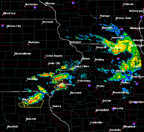 At 553 pm cdt, a severe thunderstorm was located near oakville, or 9 miles southeast of wapello, moving east at 45 mph (radar indicated). Hazards include 60 mph wind gusts and quarter size hail. Hail damage to vehicles is expected. expect wind damage to roofs, siding and trees. Locations impacted include, wapello, morning sun, new boston, oakville, toolesboro, elrick junction, garland and northfield. At 553 pm cdt, a severe thunderstorm was located near oakville, or 9 miles southeast of wapello, moving east at 45 mph (radar indicated). Hazards include 60 mph wind gusts and quarter size hail. Hail damage to vehicles is expected. expect wind damage to roofs, siding and trees. Locations impacted include, wapello, morning sun, new boston, oakville, toolesboro, elrick junction, garland and northfield.
|
| 7/16/2015 5:34 PM CDT |
 At 534 pm cdt, a severe thunderstorm was located near mount union, or 9 miles southwest of wapello, moving east at 30 mph (radar indicated). Hazards include 60 mph wind gusts and quarter size hail. Hail damage to vehicles is expected. Expect wind damage to roofs, siding and trees. At 534 pm cdt, a severe thunderstorm was located near mount union, or 9 miles southwest of wapello, moving east at 30 mph (radar indicated). Hazards include 60 mph wind gusts and quarter size hail. Hail damage to vehicles is expected. Expect wind damage to roofs, siding and trees.
|
| 6/20/2015 7:42 PM CDT |
 At 741 pm cdt, severe thunderstorms were located along a line extending from near toolesboro to gulf port to near dallas city, moving east at 55 mph (trained weather spotters). Hazards include 70 mph wind gusts and penny size hail. Expect considerable tree damage. damage is likely to mobile homes, roofs and outbuildings. locations impacted include, burlington, fort madison, keokuk, wapello, oquawka, nauvoo, west burlington, hamilton, warsaw, mediapolis, west point, dallas city, danville, donnellson, montrose, stronghurst, morning sun, keithsburg, wayland and middletown. A tornado watch remains in effect until 1100 pm cdt for northwestern illinois, southeastern iowa and northeastern missouri. At 741 pm cdt, severe thunderstorms were located along a line extending from near toolesboro to gulf port to near dallas city, moving east at 55 mph (trained weather spotters). Hazards include 70 mph wind gusts and penny size hail. Expect considerable tree damage. damage is likely to mobile homes, roofs and outbuildings. locations impacted include, burlington, fort madison, keokuk, wapello, oquawka, nauvoo, west burlington, hamilton, warsaw, mediapolis, west point, dallas city, danville, donnellson, montrose, stronghurst, morning sun, keithsburg, wayland and middletown. A tornado watch remains in effect until 1100 pm cdt for northwestern illinois, southeastern iowa and northeastern missouri.
|
| 6/20/2015 7:25 PM CDT |
 At 724 pm cdt, severe thunderstorms were located along a line extending from near wyman to near lowell to croton, moving east at 45 mph (trained weather spotters). Hazards include 70 mph wind gusts and penny size hail. Expect considerable tree damage. Damage is likely to mobile homes, roofs and outbuildings. At 724 pm cdt, severe thunderstorms were located along a line extending from near wyman to near lowell to croton, moving east at 45 mph (trained weather spotters). Hazards include 70 mph wind gusts and penny size hail. Expect considerable tree damage. Damage is likely to mobile homes, roofs and outbuildings.
|
| 4/7/2015 10:48 PM CDT | The national weather service in the quad cities has issued a * severe thunderstorm warning for. northwestern des moines county in southeast iowa. henry county in southeast iowa. southern jefferson county in southeast iowa. South central louisa county in southeast iowa. |
Hail Maps for Morning Sun, IA


Connect with Interactive Hail Maps