

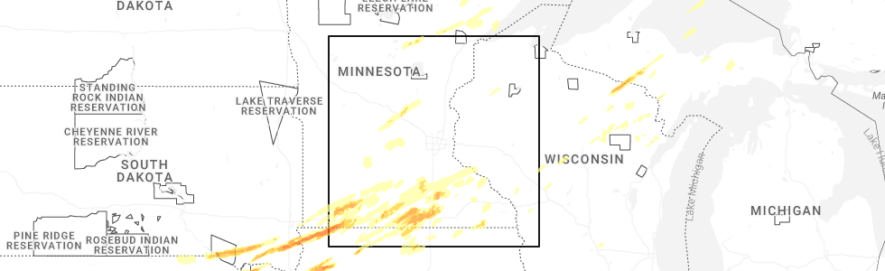
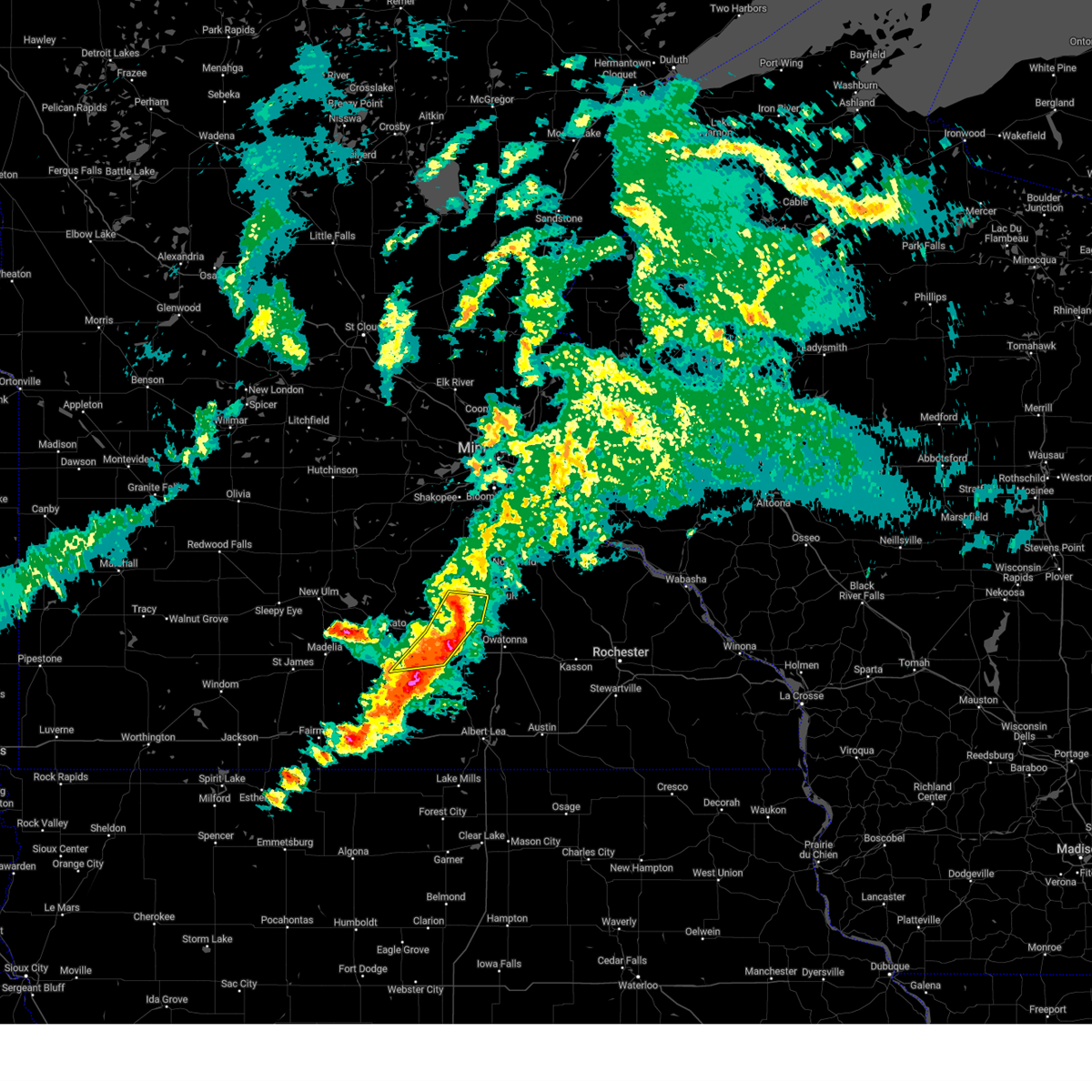
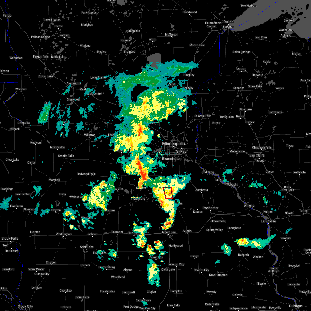
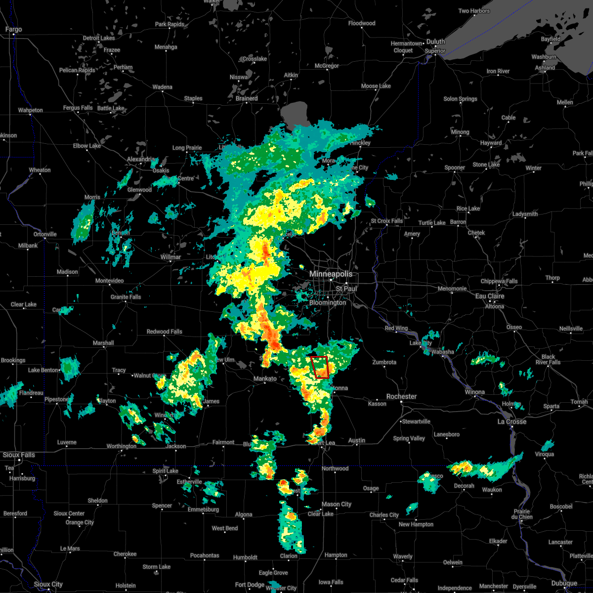
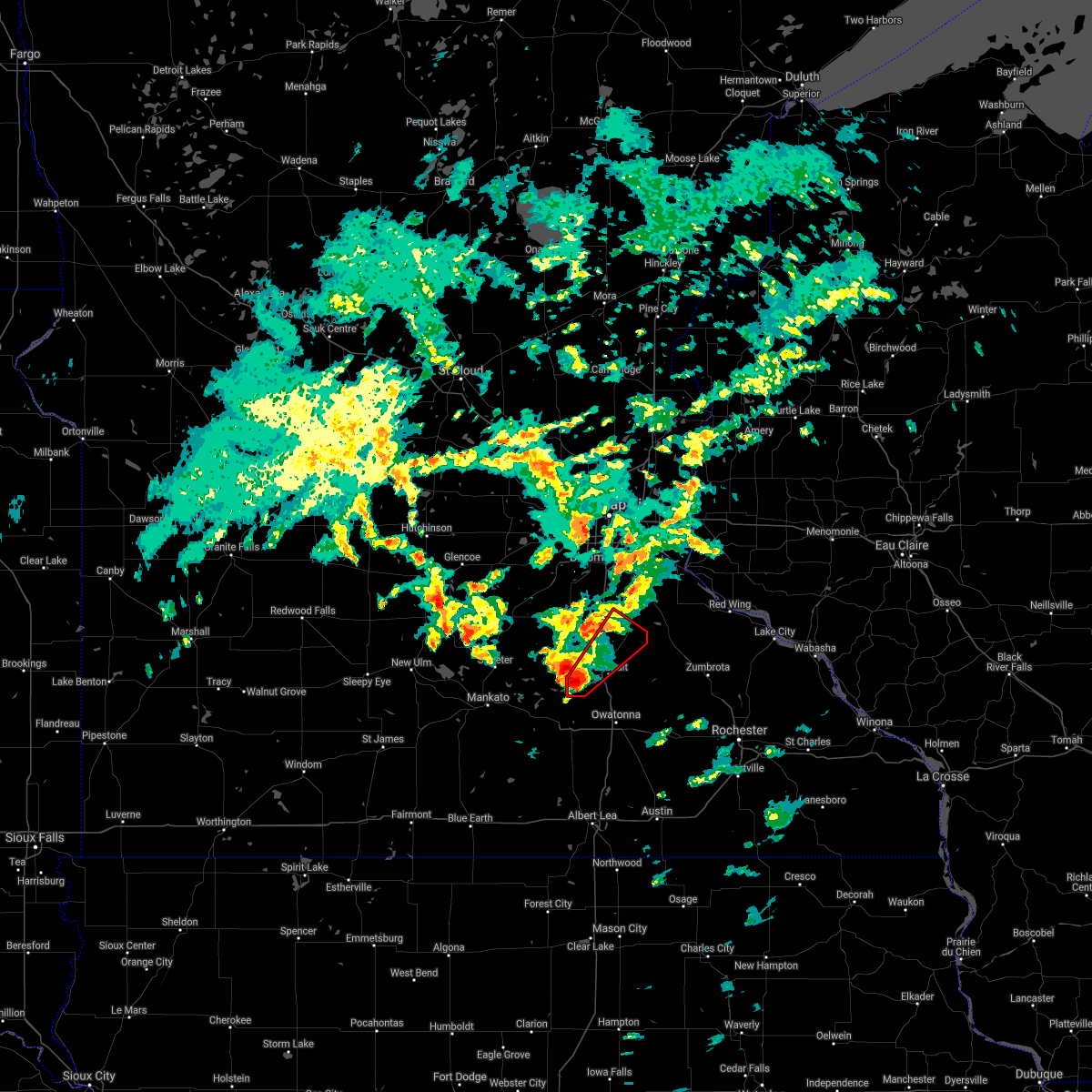
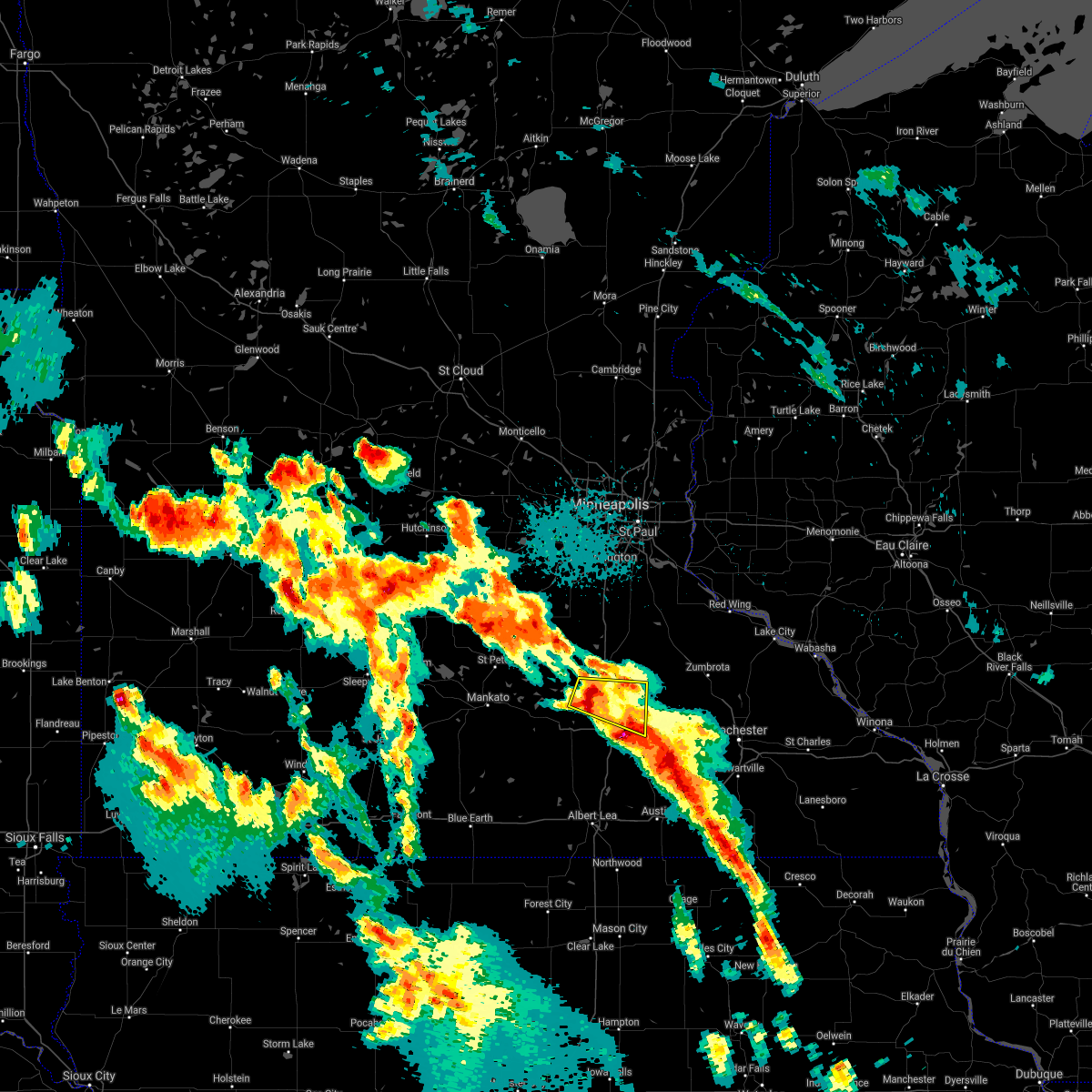
Hail Map for Morristown, MN
The Morristown, MN area has had 10 reports of on-the-ground hail by trained spotters, and has been under severe weather warnings 13 times during the past 12 months. Doppler radar has detected hail at or near Morristown, MN on 56 occasions, including 2 occasions during the past year.
| Name: | Morristown, MN |
| Where Located: | 52.7 miles S of Minneapolis, MN |
| Map: | Google Map for Morristown, MN |
| Population: | 987 |
| Housing Units: | 424 |
| More Info: | Search Google for Morristown, MN |
1
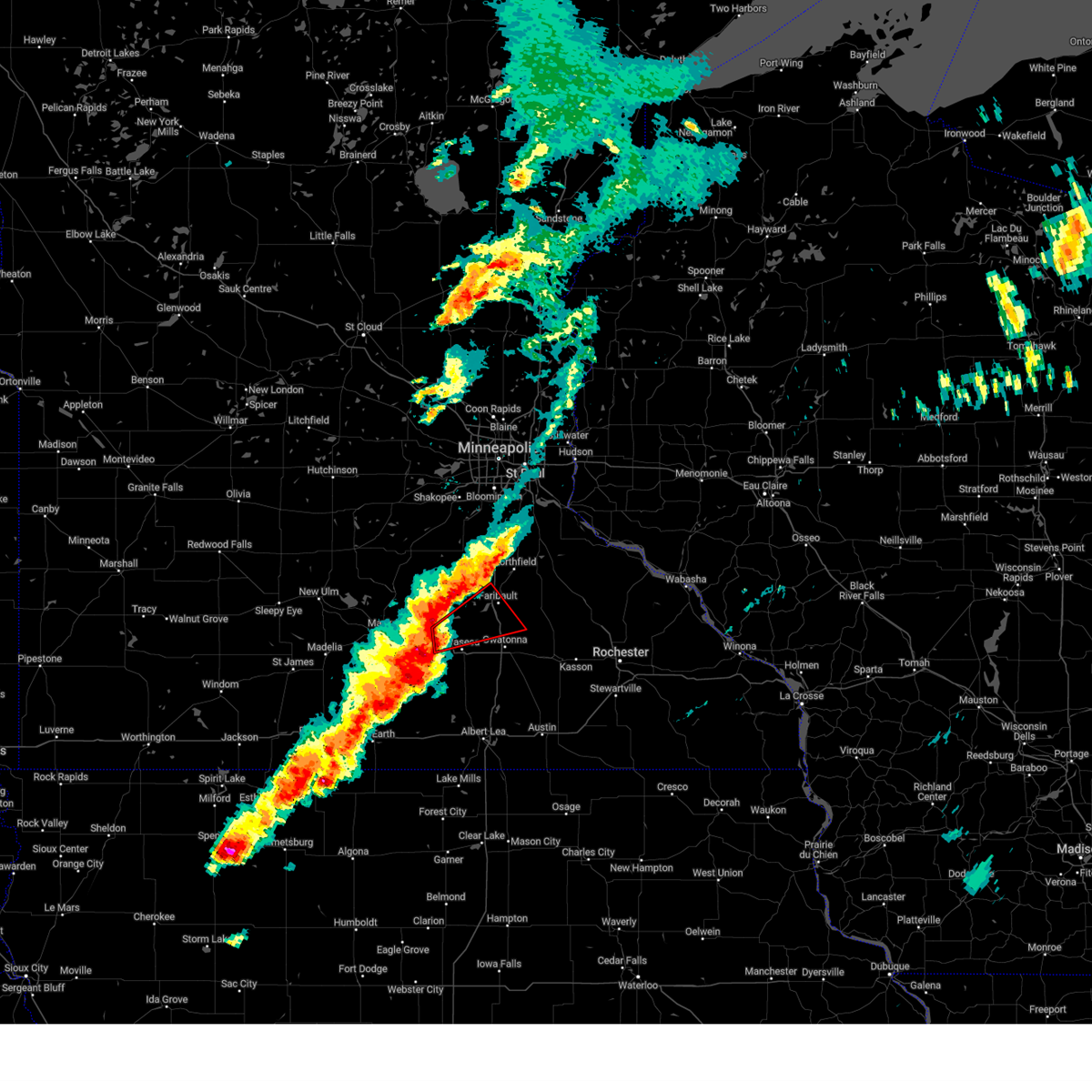
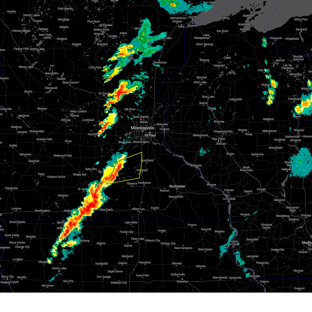
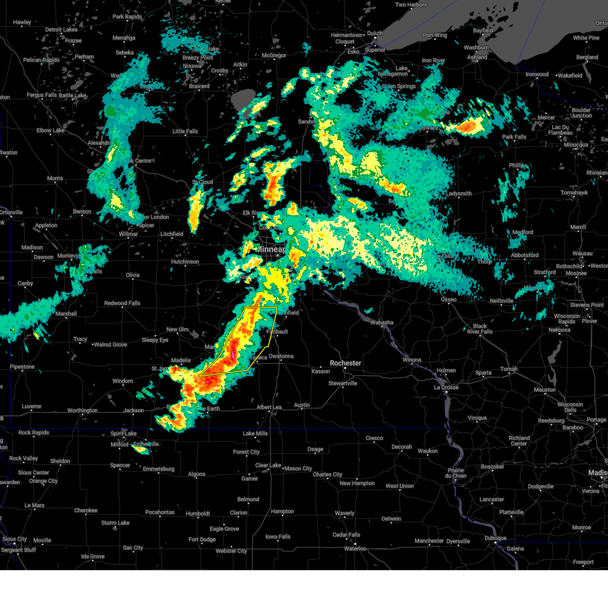
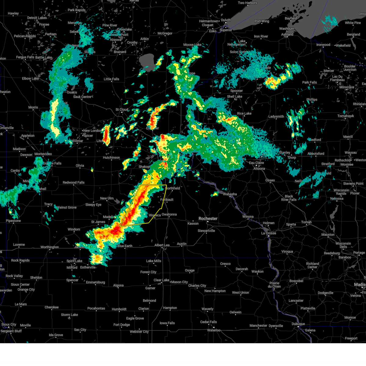
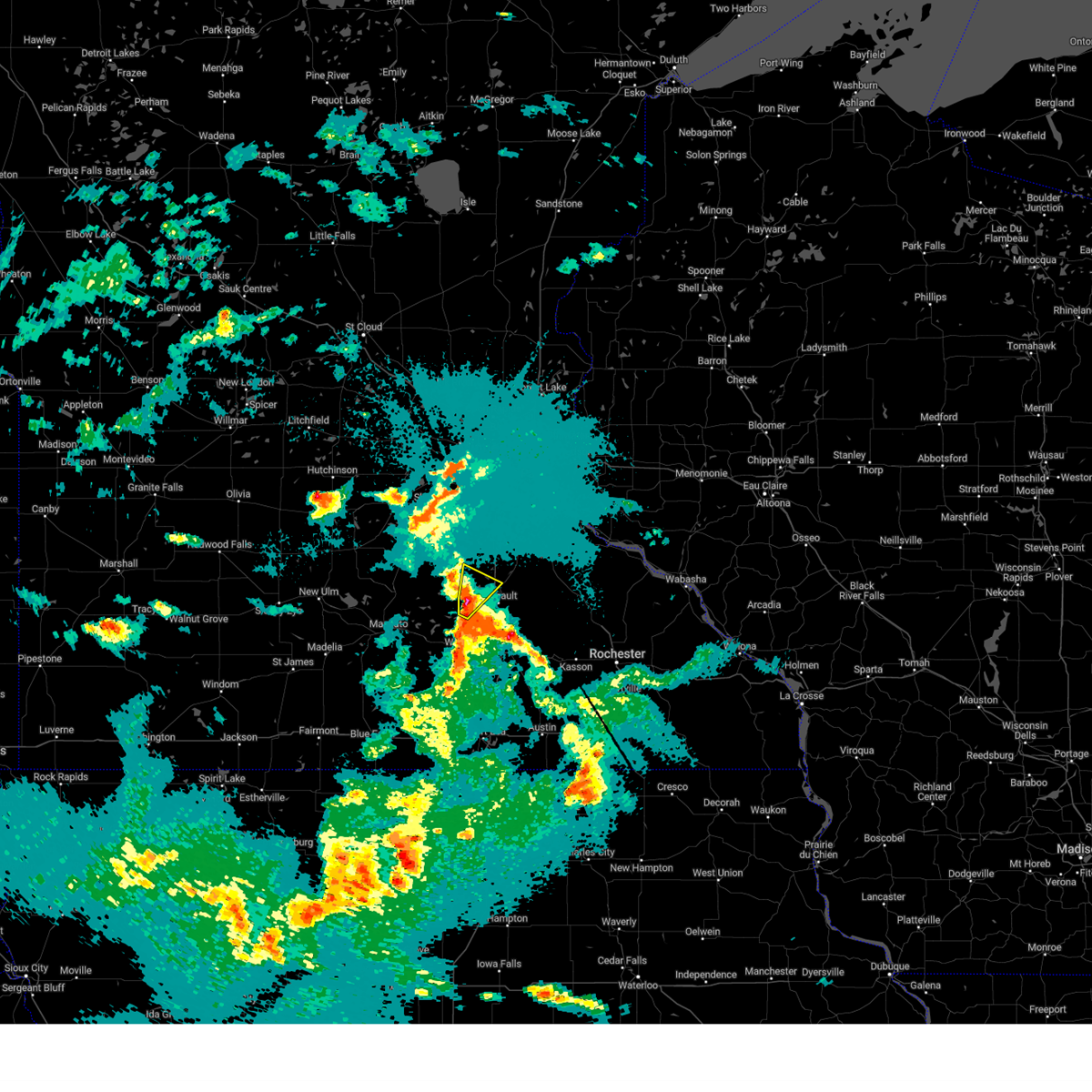
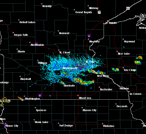
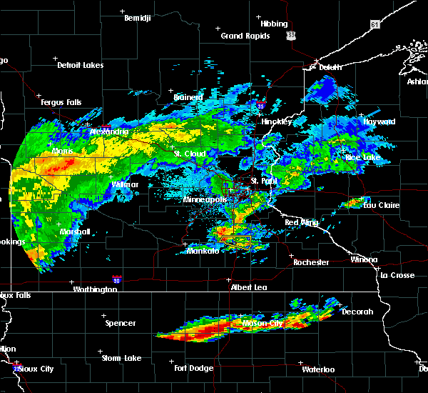
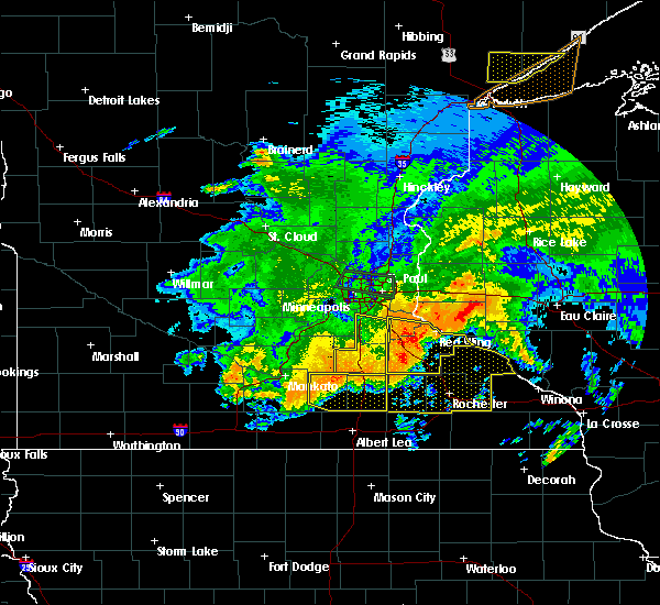
The Top Recent Hail Date for Morristown, MN is Monday, April 28, 2025 (13th out of 56)
Hail and Wind Damage Spotted near Morristown, MN
| Date / Time | Report Details |
|---|---|
| 6/25/2025 4:32 PM CDT | Tormpx the national weather service in the twin cities has issued a * tornado warning for, southern rice county in south central minnesota, * until 500 pm cdt. * at 432 pm cdt, a severe thunderstorm capable of producing a tornado was located over warsaw, or 7 miles southwest of faribault, moving east at 25 mph (radar indicated rotation). Hazards include tornado. Flying debris will be dangerous to those caught without shelter. mobile homes will be damaged or destroyed. damage to roofs, windows and vehicles will occur. Tree damage is likely. |
| 6/16/2025 7:35 PM CDT | Svrmpx the national weather service in the twin cities has issued a * severe thunderstorm warning for, northeastern blue earth county in south central minnesota, southern le sueur county in south central minnesota, southwestern rice county in south central minnesota, northern waseca county in south central minnesota, * until 815 pm cdt. * at 735 pm cdt, a severe thunderstorm was located over eagle lake, or near mankato, moving east at 30 mph (radar indicated). Hazards include half dollar size hail. damage to vehicles is expected |
| 4/28/2025 5:40 PM CDT | Delayed report... time estimated from radar. roof blown off shed near 250th street east of morristow in rice county MN, 2.7 miles W of Morristown, MN |
| 4/28/2025 5:35 PM CDT |
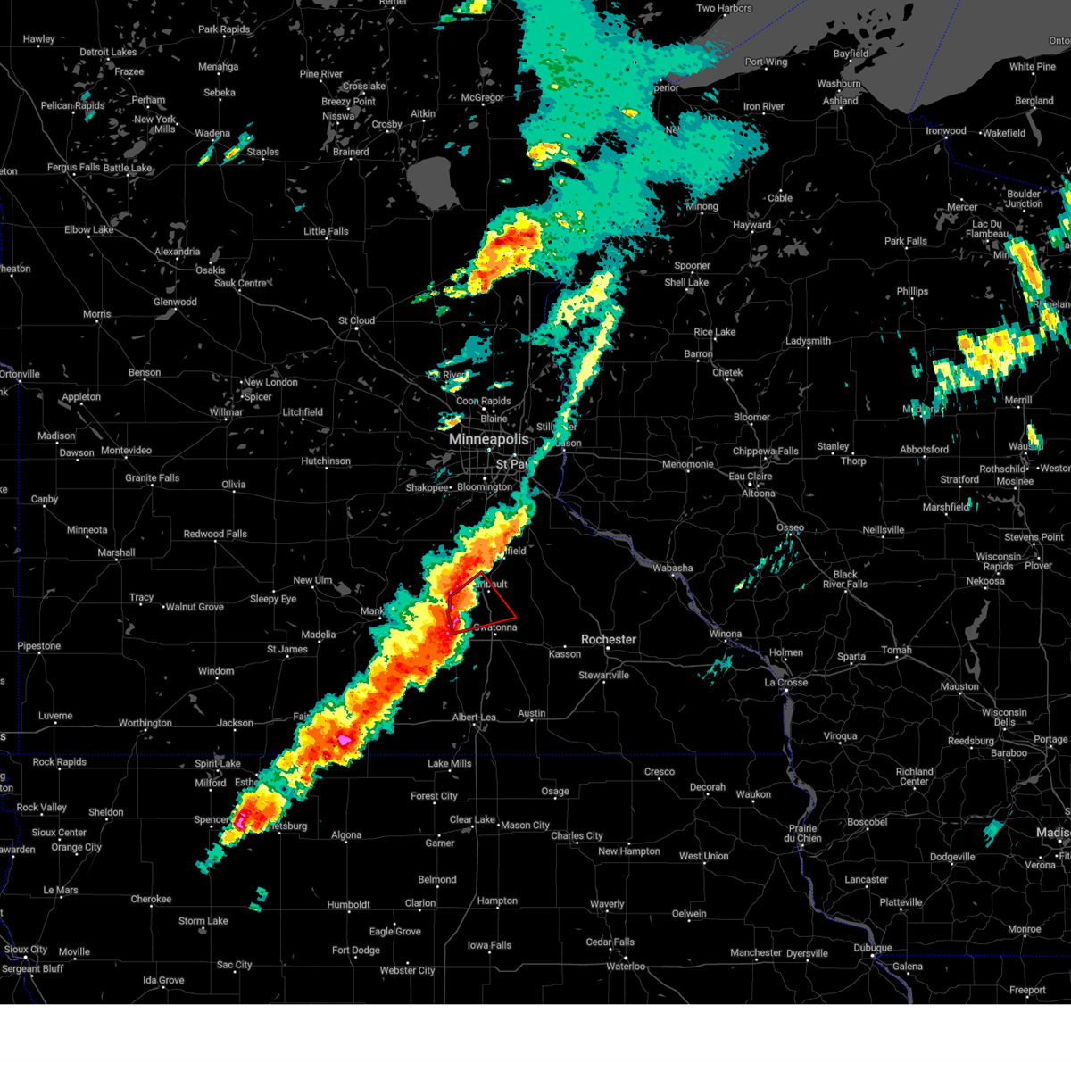 the tornado warning has been cancelled and is no longer in effect the tornado warning has been cancelled and is no longer in effect
|
| 4/28/2025 5:35 PM CDT |
 At 535 pm cdt, a severe thunderstorm capable of producing a tornado was located near warsaw, or 5 miles southwest of faribault, moving northeast at 60 mph (radar indicated rotation). Hazards include tornado and quarter size hail. Flying debris will be dangerous to those caught without shelter. mobile homes will be damaged or destroyed. damage to roofs, windows and vehicles will occur. tree damage is likely. Locations impacted include, faribault, waseca, medford, morristown, warsaw, clinton falls, deerfield, faribault airport and sakatah lake state park. At 535 pm cdt, a severe thunderstorm capable of producing a tornado was located near warsaw, or 5 miles southwest of faribault, moving northeast at 60 mph (radar indicated rotation). Hazards include tornado and quarter size hail. Flying debris will be dangerous to those caught without shelter. mobile homes will be damaged or destroyed. damage to roofs, windows and vehicles will occur. tree damage is likely. Locations impacted include, faribault, waseca, medford, morristown, warsaw, clinton falls, deerfield, faribault airport and sakatah lake state park.
|
| 4/28/2025 5:20 PM CDT |
 Tormpx the national weather service in the twin cities has issued a * tornado warning for, southeastern le sueur county in south central minnesota, southwestern rice county in south central minnesota, northwestern steele county in south central minnesota, northern waseca county in south central minnesota, * until 545 pm cdt. * at 520 pm cdt, a severe thunderstorm capable of producing a tornado was located 5 miles northwest of waseca, or 19 miles west of owatonna, moving northeast at 60 mph (radar indicated rotation). Hazards include tornado and quarter size hail. Flying debris will be dangerous to those caught without shelter. mobile homes will be damaged or destroyed. damage to roofs, windows and vehicles will occur. Tree damage is likely. Tormpx the national weather service in the twin cities has issued a * tornado warning for, southeastern le sueur county in south central minnesota, southwestern rice county in south central minnesota, northwestern steele county in south central minnesota, northern waseca county in south central minnesota, * until 545 pm cdt. * at 520 pm cdt, a severe thunderstorm capable of producing a tornado was located 5 miles northwest of waseca, or 19 miles west of owatonna, moving northeast at 60 mph (radar indicated rotation). Hazards include tornado and quarter size hail. Flying debris will be dangerous to those caught without shelter. mobile homes will be damaged or destroyed. damage to roofs, windows and vehicles will occur. Tree damage is likely.
|
| 4/28/2025 4:38 PM CDT |
 Svrmpx the national weather service in the twin cities has issued a * severe thunderstorm warning for, southeastern scott county in east central minnesota, northeastern blue earth county in south central minnesota, le sueur county in south central minnesota, western rice county in south central minnesota, northern waseca county in south central minnesota, * until 515 pm cdt. * at 438 pm cdt, severe thunderstorms were located along a line from 7 miles north of le center to over eagle lake, or along a line from 24 miles northwest of faribault to over mankato, moving east at 50 mph (radar indicated). Hazards include 60 mph wind gusts and quarter size hail. Hail damage to vehicles is expected. Expect wind damage to roofs, siding, and trees. Svrmpx the national weather service in the twin cities has issued a * severe thunderstorm warning for, southeastern scott county in east central minnesota, northeastern blue earth county in south central minnesota, le sueur county in south central minnesota, western rice county in south central minnesota, northern waseca county in south central minnesota, * until 515 pm cdt. * at 438 pm cdt, severe thunderstorms were located along a line from 7 miles north of le center to over eagle lake, or along a line from 24 miles northwest of faribault to over mankato, moving east at 50 mph (radar indicated). Hazards include 60 mph wind gusts and quarter size hail. Hail damage to vehicles is expected. Expect wind damage to roofs, siding, and trees.
|
| 4/17/2025 5:20 PM CDT |
 The storms which prompted the warning have weakened below severe limits, and have exited the warned area. therefore, the warning will be allowed to expire. however, gusty winds and heavy rain are still possible with these thunderstorms. a severe thunderstorm watch remains in effect until 1000 pm cdt thursday for a portion of south central minnesota. The storms which prompted the warning have weakened below severe limits, and have exited the warned area. therefore, the warning will be allowed to expire. however, gusty winds and heavy rain are still possible with these thunderstorms. a severe thunderstorm watch remains in effect until 1000 pm cdt thursday for a portion of south central minnesota.
|
| 4/17/2025 5:15 PM CDT |
 At 515 pm cdt, severe thunderstorms were located along a line from near elko new market to 6 miles south of waterville, or along a line from 11 miles northwest of northfield to 18 miles southwest of faribault, moving east at 30 mph (radar indicated). Hazards include 60 mph wind gusts and small hail. Expect damage to roofs, siding, and trees. locations impacted include, st. Clair, pemberton, smiths mill, elysian, alma city, kilkenny, janesville, waterville, sakatah lake state park, waseca airport, waseca, morristown, faribault and warsaw. At 515 pm cdt, severe thunderstorms were located along a line from near elko new market to 6 miles south of waterville, or along a line from 11 miles northwest of northfield to 18 miles southwest of faribault, moving east at 30 mph (radar indicated). Hazards include 60 mph wind gusts and small hail. Expect damage to roofs, siding, and trees. locations impacted include, st. Clair, pemberton, smiths mill, elysian, alma city, kilkenny, janesville, waterville, sakatah lake state park, waseca airport, waseca, morristown, faribault and warsaw.
|
| 4/17/2025 4:53 PM CDT |
 At 453 pm cdt, severe thunderstorms were located along a line from near new prague to near st. clair, or along a line from 17 miles northwest of northfield to 10 miles southeast of mankato, moving east at 30 mph (radar indicated). Hazards include 60 mph wind gusts and small hail. Expect damage to roofs, siding, and trees. locations impacted include, vernon center, mankato, good thunder, le center, eagle lake, madison lake, new prague, st. Clair, montgomery, pemberton, elysian, kilkenny, janesville, lonsdale, waterville, webster, waseca, morristown, faribault and warsaw. At 453 pm cdt, severe thunderstorms were located along a line from near new prague to near st. clair, or along a line from 17 miles northwest of northfield to 10 miles southeast of mankato, moving east at 30 mph (radar indicated). Hazards include 60 mph wind gusts and small hail. Expect damage to roofs, siding, and trees. locations impacted include, vernon center, mankato, good thunder, le center, eagle lake, madison lake, new prague, st. Clair, montgomery, pemberton, elysian, kilkenny, janesville, lonsdale, waterville, webster, waseca, morristown, faribault and warsaw.
|
| 4/17/2025 4:33 PM CDT |
 Svrmpx the national weather service in the twin cities has issued a * severe thunderstorm warning for, northeastern blue earth county in south central minnesota, le sueur county in south central minnesota, western rice county in south central minnesota, northern waseca county in south central minnesota, * until 530 pm cdt. * at 433 pm cdt, severe thunderstorms were located along a line from near new prague to 7 miles south of mankato, or along a line from 24 miles northwest of faribault to 7 miles south of mankato, moving east at 30 mph (radar indicated). Hazards include 60 mph wind gusts and small hail. expect damage to roofs, siding, and trees Svrmpx the national weather service in the twin cities has issued a * severe thunderstorm warning for, northeastern blue earth county in south central minnesota, le sueur county in south central minnesota, western rice county in south central minnesota, northern waseca county in south central minnesota, * until 530 pm cdt. * at 433 pm cdt, severe thunderstorms were located along a line from near new prague to 7 miles south of mankato, or along a line from 24 miles northwest of faribault to 7 miles south of mankato, moving east at 30 mph (radar indicated). Hazards include 60 mph wind gusts and small hail. expect damage to roofs, siding, and trees
|
| 7/13/2024 5:52 PM CDT |
 Svrmpx the national weather service in the twin cities has issued a * severe thunderstorm warning for, steele county in south central minnesota, northeastern waseca county in south central minnesota, south central rice county in south central minnesota, * until 630 pm cdt. * at 552 pm cdt, a severe thunderstorm was located near morristown, or 11 miles southwest of faribault, moving southeast at 20 mph (radar indicated). Hazards include quarter size hail. damage to vehicles is expected Svrmpx the national weather service in the twin cities has issued a * severe thunderstorm warning for, steele county in south central minnesota, northeastern waseca county in south central minnesota, south central rice county in south central minnesota, * until 630 pm cdt. * at 552 pm cdt, a severe thunderstorm was located near morristown, or 11 miles southwest of faribault, moving southeast at 20 mph (radar indicated). Hazards include quarter size hail. damage to vehicles is expected
|
| 7/13/2024 5:31 PM CDT |
 At 531 pm cdt, a severe thunderstorm was located near waterville, or 15 miles west of faribault, moving southeast at 15 mph (radar indicated). Hazards include quarter size hail. Damage to vehicles is expected. Locations impacted include, faribault, waterville, morristown, warsaw, kilkenny, and sakatah lake state park. At 531 pm cdt, a severe thunderstorm was located near waterville, or 15 miles west of faribault, moving southeast at 15 mph (radar indicated). Hazards include quarter size hail. Damage to vehicles is expected. Locations impacted include, faribault, waterville, morristown, warsaw, kilkenny, and sakatah lake state park.
|
| 7/13/2024 5:14 PM CDT |
 Svrmpx the national weather service in the twin cities has issued a * severe thunderstorm warning for, southeastern le sueur county in south central minnesota, northeastern waseca county in south central minnesota, southwestern rice county in south central minnesota, * until 600 pm cdt. * at 514 pm cdt, a severe thunderstorm was located 6 miles southeast of le center, or 17 miles west of faribault, moving southeast at 15 mph (radar indicated). Hazards include half dollar size hail. damage to vehicles is expected Svrmpx the national weather service in the twin cities has issued a * severe thunderstorm warning for, southeastern le sueur county in south central minnesota, northeastern waseca county in south central minnesota, southwestern rice county in south central minnesota, * until 600 pm cdt. * at 514 pm cdt, a severe thunderstorm was located 6 miles southeast of le center, or 17 miles west of faribault, moving southeast at 15 mph (radar indicated). Hazards include half dollar size hail. damage to vehicles is expected
|
| 5/21/2024 12:18 AM CDT |
 Svrmpx the national weather service in the twin cities has issued a * severe thunderstorm warning for, southwestern rice county in south central minnesota, * until 1245 am cdt. * at 1217 am cdt, a severe thunderstorm was located near morristown, or 9 miles west of faribault, moving northeast at 25 mph (radar indicated). Hazards include quarter size hail. damage to vehicles is expected Svrmpx the national weather service in the twin cities has issued a * severe thunderstorm warning for, southwestern rice county in south central minnesota, * until 1245 am cdt. * at 1217 am cdt, a severe thunderstorm was located near morristown, or 9 miles west of faribault, moving northeast at 25 mph (radar indicated). Hazards include quarter size hail. damage to vehicles is expected
|
| 8/11/2023 6:31 PM CDT | Half Dollar sized hail reported 4.4 miles S of Morristown, MN, reported via ham in nwschat. |
| 8/11/2023 6:23 PM CDT |
 At 623 pm cdt, severe thunderstorms were located along a line extending from owatonna to near elysian, moving east at 50 mph (radar indicated). Hazards include 60 mph wind gusts and half dollar size hail. Hail damage to vehicles is expected. expect wind damage to roofs, siding, and trees. locations impacted include, owatonna, faribault, waterville, medford, morristown, warsaw, clinton falls, merton, moland, kilkenny, deerfield and owatonna airport. hail threat, radar indicated max hail size, 1. 25 in wind threat, radar indicated max wind gust, 60 mph. At 623 pm cdt, severe thunderstorms were located along a line extending from owatonna to near elysian, moving east at 50 mph (radar indicated). Hazards include 60 mph wind gusts and half dollar size hail. Hail damage to vehicles is expected. expect wind damage to roofs, siding, and trees. locations impacted include, owatonna, faribault, waterville, medford, morristown, warsaw, clinton falls, merton, moland, kilkenny, deerfield and owatonna airport. hail threat, radar indicated max hail size, 1. 25 in wind threat, radar indicated max wind gust, 60 mph.
|
| 8/11/2023 6:16 PM CDT | Golf Ball sized hail reported 0.5 miles NNW of Morristown, MN |
| 8/11/2023 6:03 PM CDT |
 At 603 pm cdt, a severe thunderstorm was located over cleveland, or 14 miles northeast of mankato, moving southeast at 40 mph (radar indicated). Hazards include 60 mph wind gusts and half dollar size hail. Hail damage to vehicles is expected. Expect wind damage to roofs, siding, and trees. At 603 pm cdt, a severe thunderstorm was located over cleveland, or 14 miles northeast of mankato, moving southeast at 40 mph (radar indicated). Hazards include 60 mph wind gusts and half dollar size hail. Hail damage to vehicles is expected. Expect wind damage to roofs, siding, and trees.
|
| 7/10/2023 9:05 PM CDT |
 At 905 pm cdt, severe thunderstorms were located along a line extending from near kenyon to near waterville, moving east at 30 mph (radar indicated). Hazards include 60 mph wind gusts and quarter size hail. Hail damage to vehicles is expected. Expect wind damage to roofs, siding, and trees. At 905 pm cdt, severe thunderstorms were located along a line extending from near kenyon to near waterville, moving east at 30 mph (radar indicated). Hazards include 60 mph wind gusts and quarter size hail. Hail damage to vehicles is expected. Expect wind damage to roofs, siding, and trees.
|
| 6/24/2023 4:42 PM CDT |
 The severe thunderstorm warning for southeastern le sueur and southwestern rice counties will expire at 445 pm cdt, the storm which prompted the warning has weakened below severe limits, and no longer poses an immediate threat to life or property. therefore, the warning will be allowed to expire. The severe thunderstorm warning for southeastern le sueur and southwestern rice counties will expire at 445 pm cdt, the storm which prompted the warning has weakened below severe limits, and no longer poses an immediate threat to life or property. therefore, the warning will be allowed to expire.
|
| 6/24/2023 4:11 PM CDT |
 At 410 pm cdt, a severe thunderstorm was located near waterville, or 12 miles west of faribault, moving northeast at 25 mph (radar indicated). Hazards include 60 mph wind gusts and quarter size hail. Hail damage to vehicles is expected. expect wind damage to roofs, siding, and trees. this severe thunderstorm will remain over mainly rural areas of southeastern le sueur and southwestern rice counties, including the following locations, kilkenny and sakatah lake state park. hail threat, radar indicated max hail size, 1. 00 in wind threat, radar indicated max wind gust, 60 mph. At 410 pm cdt, a severe thunderstorm was located near waterville, or 12 miles west of faribault, moving northeast at 25 mph (radar indicated). Hazards include 60 mph wind gusts and quarter size hail. Hail damage to vehicles is expected. expect wind damage to roofs, siding, and trees. this severe thunderstorm will remain over mainly rural areas of southeastern le sueur and southwestern rice counties, including the following locations, kilkenny and sakatah lake state park. hail threat, radar indicated max hail size, 1. 00 in wind threat, radar indicated max wind gust, 60 mph.
|
| 6/24/2023 3:59 PM CDT |
 At 359 pm cdt, a severe thunderstorm was located over waterville, or 16 miles west of faribault, moving northeast at 25 mph (radar indicated). Hazards include 60 mph wind gusts and quarter size hail. Hail damage to vehicles is expected. expect wind damage to roofs, siding, and trees. This severe thunderstorm will be near, morristown around 410 pm cdt. At 359 pm cdt, a severe thunderstorm was located over waterville, or 16 miles west of faribault, moving northeast at 25 mph (radar indicated). Hazards include 60 mph wind gusts and quarter size hail. Hail damage to vehicles is expected. expect wind damage to roofs, siding, and trees. This severe thunderstorm will be near, morristown around 410 pm cdt.
|
| 8/27/2022 8:18 PM CDT | At 818 pm cdt, a severe thunderstorm was located over lonsdale, or 13 miles west of northfield, moving northeast at 50 mph (radar indicated). Hazards include 60 mph wind gusts. Expect damage to roofs, siding, and trees. this severe storm will be near, webster around 825 pm cdt. other locations in the path of this severe thunderstorm include elko new market, lakeville and farmington. hail threat, radar indicated max hail size, <. 75 in wind threat, radar indicated max wind gust, 60 mph. |
| 8/27/2022 8:07 PM CDT | At 807 pm cdt, a severe thunderstorm was located near montgomery, or 13 miles west of faribault, moving northeast at 55 mph (radar indicated). Hazards include 60 mph wind gusts. Expect damage to roofs, siding, and trees. this severe thunderstorm will be near, lonsdale around 815 pm cdt. webster and elko new market around 825 pm cdt. other locations in the path of this severe thunderstorm include lakeville and farmington. hail threat, radar indicated max hail size, <. 75 in wind threat, radar indicated max wind gust, 60 mph. |
| 7/23/2022 12:14 PM CDT |
 At 1214 pm cdt, severe thunderstorms were located along a line extending from 6 miles northwest of faribault to near morristown to near waseca, moving east at 55 mph (radar indicated). Hazards include 60 mph wind gusts and quarter size hail. Hail damage to vehicles is expected. expect wind damage to roofs, siding, and trees. locations impacted include, faribault, medford, owatonna and nerstrand. hail threat, radar indicated max hail size, 1. 00 in wind threat, radar indicated max wind gust, 60 mph. At 1214 pm cdt, severe thunderstorms were located along a line extending from 6 miles northwest of faribault to near morristown to near waseca, moving east at 55 mph (radar indicated). Hazards include 60 mph wind gusts and quarter size hail. Hail damage to vehicles is expected. expect wind damage to roofs, siding, and trees. locations impacted include, faribault, medford, owatonna and nerstrand. hail threat, radar indicated max hail size, 1. 00 in wind threat, radar indicated max wind gust, 60 mph.
|
| 7/23/2022 11:57 AM CDT |
 At 1157 am cdt, a severe thunderstorm was located over janesville, or 13 miles east of mankato, moving east at 40 mph (radar indicated). Hazards include 60 mph wind gusts and quarter size hail. Hail damage to vehicles is expected. expect wind damage to roofs, siding, and trees. this severe thunderstorm will be near, elysian around 1200 pm cdt. waseca and waterville around 1210 pm cdt. other locations in the path of this severe thunderstorm include owatonna and medford. hail threat, radar indicated max hail size, 1. 00 in wind threat, radar indicated max wind gust, 60 mph. At 1157 am cdt, a severe thunderstorm was located over janesville, or 13 miles east of mankato, moving east at 40 mph (radar indicated). Hazards include 60 mph wind gusts and quarter size hail. Hail damage to vehicles is expected. expect wind damage to roofs, siding, and trees. this severe thunderstorm will be near, elysian around 1200 pm cdt. waseca and waterville around 1210 pm cdt. other locations in the path of this severe thunderstorm include owatonna and medford. hail threat, radar indicated max hail size, 1. 00 in wind threat, radar indicated max wind gust, 60 mph.
|
| 5/11/2022 8:01 PM CDT | Hwy 13 and co rd in rice county MN, 1 miles SSE of Morristown, MN |
| 5/11/2022 7:27 PM CDT |
 At 727 pm cdt, a severe thunderstorm was located near le sueur, or 20 miles north of mankato, moving northeast at 50 mph (radar indicated). Hazards include 70 mph wind gusts and quarter size hail. Hail damage to vehicles is expected. expect considerable tree damage. wind damage is also likely to mobile homes, roofs, and outbuildings. this severe thunderstorm will be near, belle plaine around 745 pm cdt. Other locations in the path of this severe thunderstorm include new prague, jordan, elko new market and lakeville. At 727 pm cdt, a severe thunderstorm was located near le sueur, or 20 miles north of mankato, moving northeast at 50 mph (radar indicated). Hazards include 70 mph wind gusts and quarter size hail. Hail damage to vehicles is expected. expect considerable tree damage. wind damage is also likely to mobile homes, roofs, and outbuildings. this severe thunderstorm will be near, belle plaine around 745 pm cdt. Other locations in the path of this severe thunderstorm include new prague, jordan, elko new market and lakeville.
|
| 5/11/2022 6:22 AM CDT |
 At 622 am cdt, a severe thunderstorm was located near waterville, or 15 miles west of faribault, moving north at 25 mph (radar indicated). Hazards include ping pong ball size hail. People and animals outdoors will be injured. expect damage to roofs, siding, windows, and vehicles. locations impacted include, montgomery. hail threat, radar indicated max hail size, 1. 50 in wind threat, radar indicated max wind gust, <50 mph. At 622 am cdt, a severe thunderstorm was located near waterville, or 15 miles west of faribault, moving north at 25 mph (radar indicated). Hazards include ping pong ball size hail. People and animals outdoors will be injured. expect damage to roofs, siding, windows, and vehicles. locations impacted include, montgomery. hail threat, radar indicated max hail size, 1. 50 in wind threat, radar indicated max wind gust, <50 mph.
|
| 5/11/2022 6:10 AM CDT |
 At 610 am cdt, a severe thunderstorm was located over waterville, or 16 miles west of faribault, moving northeast at 25 mph (radar indicated). Hazards include half dollar size hail. Damage to vehicles is expected. this severe thunderstorm will be near, morristown around 625 am cdt. warsaw around 630 am cdt. other locations in the path of this severe thunderstorm include faribault. hail threat, radar indicated max hail size, 1. 25 in wind threat, radar indicated max wind gust, <50 mph. At 610 am cdt, a severe thunderstorm was located over waterville, or 16 miles west of faribault, moving northeast at 25 mph (radar indicated). Hazards include half dollar size hail. Damage to vehicles is expected. this severe thunderstorm will be near, morristown around 625 am cdt. warsaw around 630 am cdt. other locations in the path of this severe thunderstorm include faribault. hail threat, radar indicated max hail size, 1. 25 in wind threat, radar indicated max wind gust, <50 mph.
|
| 4/12/2022 7:57 PM CDT |
 At 756 pm cdt, severe thunderstorms were located along a line extending from 7 miles northwest of claremont to near kenyon to near faribault, moving northeast at 60 mph (radar indicated). Hazards include 60 mph wind gusts and quarter size hail. Hail damage to vehicles is expected. expect wind damage to roofs, siding, and trees. these severe storms will be near, kenyon and nerstrand around 800 pm cdt. other locations in the path of these severe thunderstorms include dundas, northfield, stanton, wanamingo, cannon falls, zumbrota and goodhue. hail threat, radar indicated max hail size, 1. 00 in wind threat, radar indicated max wind gust, 60 mph. At 756 pm cdt, severe thunderstorms were located along a line extending from 7 miles northwest of claremont to near kenyon to near faribault, moving northeast at 60 mph (radar indicated). Hazards include 60 mph wind gusts and quarter size hail. Hail damage to vehicles is expected. expect wind damage to roofs, siding, and trees. these severe storms will be near, kenyon and nerstrand around 800 pm cdt. other locations in the path of these severe thunderstorms include dundas, northfield, stanton, wanamingo, cannon falls, zumbrota and goodhue. hail threat, radar indicated max hail size, 1. 00 in wind threat, radar indicated max wind gust, 60 mph.
|
| 4/12/2022 7:44 PM CDT |
 At 744 pm cdt, severe thunderstorms were located along a line extending from near owatonna to morristown, moving northeast at 60 mph (radar indicated). Hazards include 60 mph wind gusts and quarter size hail. Hail damage to vehicles is expected. expect wind damage to roofs, siding, and trees. severe thunderstorms will be near, faribault around 755 pm cdt. kenyon around 800 pm cdt. other locations in the path of these severe thunderstorms include dundas, wanamingo, nerstrand, northfield, zumbrota, stanton, cannon falls and goodhue. hail threat, radar indicated max hail size, 1. 00 in wind threat, radar indicated max wind gust, 60 mph. At 744 pm cdt, severe thunderstorms were located along a line extending from near owatonna to morristown, moving northeast at 60 mph (radar indicated). Hazards include 60 mph wind gusts and quarter size hail. Hail damage to vehicles is expected. expect wind damage to roofs, siding, and trees. severe thunderstorms will be near, faribault around 755 pm cdt. kenyon around 800 pm cdt. other locations in the path of these severe thunderstorms include dundas, wanamingo, nerstrand, northfield, zumbrota, stanton, cannon falls and goodhue. hail threat, radar indicated max hail size, 1. 00 in wind threat, radar indicated max wind gust, 60 mph.
|
| 12/15/2021 7:25 PM CST | Storm damage reported in rice county MN, 0.8 miles ESE of Morristown, MN |
| 8/28/2021 7:36 PM CDT |
 The severe thunderstorm warning for le sueur, southeastern sibley, northeastern blue earth, western rice and northeastern nicollet counties will expire at 745 pm cdt, the storms which prompted the warning have weakened. therefore, the warning will be allowed to expire.however gusty winds and heavy rain are still possible with these thunderstorms. a severe thunderstorm watch remains in effect until 1100 pm cdt for south central, central and east central minnesota. The severe thunderstorm warning for le sueur, southeastern sibley, northeastern blue earth, western rice and northeastern nicollet counties will expire at 745 pm cdt, the storms which prompted the warning have weakened. therefore, the warning will be allowed to expire.however gusty winds and heavy rain are still possible with these thunderstorms. a severe thunderstorm watch remains in effect until 1100 pm cdt for south central, central and east central minnesota.
|
| 8/28/2021 7:29 PM CDT |
 At 729 pm cdt, severe thunderstorms were located along a line extending from 5 miles east of henderson to near madison lake, moving northeast at 60 mph (radar indicated). Hazards include 60 mph wind gusts. Expect damage to roofs, siding, and trees. Locations impacted include, montgomery, new prague, waterville, morristown, warsaw and faribault. At 729 pm cdt, severe thunderstorms were located along a line extending from 5 miles east of henderson to near madison lake, moving northeast at 60 mph (radar indicated). Hazards include 60 mph wind gusts. Expect damage to roofs, siding, and trees. Locations impacted include, montgomery, new prague, waterville, morristown, warsaw and faribault.
|
| 8/28/2021 7:13 PM CDT |
 At 713 pm cdt, severe thunderstorms were located along a line extending from 7 miles northwest of st. peter to near mankato, moving northeast at 60 mph (radar indicated). Hazards include 60 mph wind gusts. Expect damage to roofs, siding, and trees. severe thunderstorms will be near, le sueur around 720 pm cdt. madison lake and henderson around 725 pm cdt. elysian and cleveland around 730 pm cdt. Other locations in the path of these severe thunderstorms include montgomery, waterville, new prague, faribault, morristown and warsaw. At 713 pm cdt, severe thunderstorms were located along a line extending from 7 miles northwest of st. peter to near mankato, moving northeast at 60 mph (radar indicated). Hazards include 60 mph wind gusts. Expect damage to roofs, siding, and trees. severe thunderstorms will be near, le sueur around 720 pm cdt. madison lake and henderson around 725 pm cdt. elysian and cleveland around 730 pm cdt. Other locations in the path of these severe thunderstorms include montgomery, waterville, new prague, faribault, morristown and warsaw.
|
| 8/22/2021 8:02 PM CDT |
 At 800 pm cdt, a severe thunderstorm was located over madison lake, or 8 miles east of mankato, moving northeast at 45 mph. law enforcement reported quarter inch hail in downtown mankato at 7:58 pm (law enforcement). Hazards include half dollar size hail. Damage to vehicles is expected. locations impacted include, elysian, waterville and morristown. hail threat, observed max hail size, 1. 25 in wind threat, radar indicated max wind gust, <50 mph. At 800 pm cdt, a severe thunderstorm was located over madison lake, or 8 miles east of mankato, moving northeast at 45 mph. law enforcement reported quarter inch hail in downtown mankato at 7:58 pm (law enforcement). Hazards include half dollar size hail. Damage to vehicles is expected. locations impacted include, elysian, waterville and morristown. hail threat, observed max hail size, 1. 25 in wind threat, radar indicated max wind gust, <50 mph.
|
| 8/22/2021 7:49 PM CDT |
 At 749 pm cdt, a severe thunderstorm was located over mankato, moving northeast at 45 mph (radar indicated). Hazards include half dollar size hail. Damage to vehicles is expected. this severe thunderstorm will be near, eagle lake around 755 pm cdt. madison lake around 800 pm cdt. cleveland around 805 pm cdt. other locations in the path of this severe thunderstorm include elysian and waterville. hail threat, radar indicated max hail size, 1. 25 in wind threat, radar indicated max wind gust, <50 mph. At 749 pm cdt, a severe thunderstorm was located over mankato, moving northeast at 45 mph (radar indicated). Hazards include half dollar size hail. Damage to vehicles is expected. this severe thunderstorm will be near, eagle lake around 755 pm cdt. madison lake around 800 pm cdt. cleveland around 805 pm cdt. other locations in the path of this severe thunderstorm include elysian and waterville. hail threat, radar indicated max hail size, 1. 25 in wind threat, radar indicated max wind gust, <50 mph.
|
| 5/19/2021 7:46 PM CDT |
 At 746 pm cdt, a confirmed tornado was located over warsaw, or near faribault, moving north at 20 mph (law enforcement confirmed tornado). Hazards include damaging tornado. Flying debris will be dangerous to those caught without shelter. mobile homes will be damaged or destroyed. damage to roofs, windows, and vehicles will occur. tree damage is likely. This tornado will be near, faribault around 755 pm cdt. At 746 pm cdt, a confirmed tornado was located over warsaw, or near faribault, moving north at 20 mph (law enforcement confirmed tornado). Hazards include damaging tornado. Flying debris will be dangerous to those caught without shelter. mobile homes will be damaged or destroyed. damage to roofs, windows, and vehicles will occur. tree damage is likely. This tornado will be near, faribault around 755 pm cdt.
|
| 5/19/2021 7:43 PM CDT |
 At 743 pm cdt, a confirmed tornado was located over warsaw, or near faribault, moving north at 20 mph (law enforcement confirmed tornado). Hazards include damaging tornado. Flying debris will be dangerous to those caught without shelter. mobile homes will be damaged or destroyed. damage to roofs, windows, and vehicles will occur. tree damage is likely. This tornado will be near, faribault around 755 pm cdt. At 743 pm cdt, a confirmed tornado was located over warsaw, or near faribault, moving north at 20 mph (law enforcement confirmed tornado). Hazards include damaging tornado. Flying debris will be dangerous to those caught without shelter. mobile homes will be damaged or destroyed. damage to roofs, windows, and vehicles will occur. tree damage is likely. This tornado will be near, faribault around 755 pm cdt.
|
| 5/19/2021 7:39 PM CDT |
 At 739 pm cdt, a severe thunderstorm capable of producing a tornado was located near warsaw, or 6 miles southwest of faribault, moving north at 20 mph (radar indicated rotation). Hazards include tornado. Flying debris will be dangerous to those caught without shelter. mobile homes will be damaged or destroyed. damage to roofs, windows, and vehicles will occur. tree damage is likely. this dangerous storm will be near, warsaw around 750 pm cdt. Faribault around 755 pm cdt. At 739 pm cdt, a severe thunderstorm capable of producing a tornado was located near warsaw, or 6 miles southwest of faribault, moving north at 20 mph (radar indicated rotation). Hazards include tornado. Flying debris will be dangerous to those caught without shelter. mobile homes will be damaged or destroyed. damage to roofs, windows, and vehicles will occur. tree damage is likely. this dangerous storm will be near, warsaw around 750 pm cdt. Faribault around 755 pm cdt.
|
| 3/10/2021 4:47 PM CST |
 At 447 pm cst, a severe thunderstorm capable of producing a tornado was located over warsaw, or 8 miles west of faribault, moving northeast at 55 mph (radar indicated rotation). Hazards include tornado and quarter size hail. Flying debris will be dangerous to those caught without shelter. mobile homes will be damaged or destroyed. damage to roofs, windows, and vehicles will occur. tree damage is likely. this dangerous storm will be near, faribault around 455 pm cst. dundas around 505 pm cst. northfield around 510 pm cst. Other locations impacted by this tornadic thunderstorm include faribault airport and bridgewater. At 447 pm cst, a severe thunderstorm capable of producing a tornado was located over warsaw, or 8 miles west of faribault, moving northeast at 55 mph (radar indicated rotation). Hazards include tornado and quarter size hail. Flying debris will be dangerous to those caught without shelter. mobile homes will be damaged or destroyed. damage to roofs, windows, and vehicles will occur. tree damage is likely. this dangerous storm will be near, faribault around 455 pm cst. dundas around 505 pm cst. northfield around 510 pm cst. Other locations impacted by this tornadic thunderstorm include faribault airport and bridgewater.
|
| 3/10/2021 4:23 PM CST |
 At 423 pm cst, a severe thunderstorm capable of producing a tornado was located near janesville, or 14 miles southeast of mankato, moving northeast at 50 mph (radar indicated rotation). Hazards include tornado. Flying debris will be dangerous to those caught without shelter. mobile homes will be damaged or destroyed. damage to roofs, windows, and vehicles will occur. tree damage is likely. this dangerous storm will be near, elysian around 435 pm cst. waterville around 440 pm cst. morristown around 445 pm cst. warsaw around 450 pm cst. Other locations impacted by this tornadic thunderstorm include kilkenny and alma city. At 423 pm cst, a severe thunderstorm capable of producing a tornado was located near janesville, or 14 miles southeast of mankato, moving northeast at 50 mph (radar indicated rotation). Hazards include tornado. Flying debris will be dangerous to those caught without shelter. mobile homes will be damaged or destroyed. damage to roofs, windows, and vehicles will occur. tree damage is likely. this dangerous storm will be near, elysian around 435 pm cst. waterville around 440 pm cst. morristown around 445 pm cst. warsaw around 450 pm cst. Other locations impacted by this tornadic thunderstorm include kilkenny and alma city.
|
| 9/5/2020 11:57 PM CDT | Half Dollar sized hail reported 4.5 miles NNW of Morristown, MN, corrected time - previous hail report from 4 sse morristown. |
| 9/5/2020 11:53 PM CDT |
 At 1153 pm cdt, a severe thunderstorm was located near warsaw, or 8 miles southwest of faribault, moving southeast at 30 mph (radar indicated). Hazards include quarter size hail. Damage to vehicles is expected. this severe storm will be near, medford around 1205 am cdt. owatonna around 1215 am cdt. Other locations impacted by this severe thunderstorm include clinton falls, merton, deerfield, owatonna airport and moland. At 1153 pm cdt, a severe thunderstorm was located near warsaw, or 8 miles southwest of faribault, moving southeast at 30 mph (radar indicated). Hazards include quarter size hail. Damage to vehicles is expected. this severe storm will be near, medford around 1205 am cdt. owatonna around 1215 am cdt. Other locations impacted by this severe thunderstorm include clinton falls, merton, deerfield, owatonna airport and moland.
|
| 9/5/2020 11:31 PM CDT |
 At 1130 pm cdt, a severe thunderstorm was located near morristown, or 11 miles west of faribault, moving east at 35 mph (radar indicated). Hazards include quarter size hail. Damage to vehicles is expected. this severe thunderstorm will be near, morristown around 1135 pm cdt. warsaw around 1140 pm cdt. faribault around 1145 pm cdt. medford around 1155 pm cdt. owatonna around 1200 am cdt. Other locations impacted by this severe thunderstorm include clinton falls, merton, ruskin, deerfield, owatonna airport, moland and kilkenny. At 1130 pm cdt, a severe thunderstorm was located near morristown, or 11 miles west of faribault, moving east at 35 mph (radar indicated). Hazards include quarter size hail. Damage to vehicles is expected. this severe thunderstorm will be near, morristown around 1135 pm cdt. warsaw around 1140 pm cdt. faribault around 1145 pm cdt. medford around 1155 pm cdt. owatonna around 1200 am cdt. Other locations impacted by this severe thunderstorm include clinton falls, merton, ruskin, deerfield, owatonna airport, moland and kilkenny.
|
| 9/5/2020 11:57 AM CDT | Half Dollar sized hail reported 4.5 miles NNW of Morristown, MN |
| 8/28/2020 5:35 AM CDT |
 At 535 am cdt, a severe thunderstorm was located over waseca, or 17 miles west of owatonna, moving east at 30 mph (radar indicated). Hazards include 60 mph wind gusts and quarter size hail. Hail damage to vehicles is expected. expect wind damage to roofs, siding, and trees. this severe thunderstorm will be near, waseca around 540 am cdt. owatonna and medford around 610 am cdt. Other locations impacted by this severe thunderstorm include clinton falls, waseca airport, merton, ruskin, deerfield, owatonna airport and moland. At 535 am cdt, a severe thunderstorm was located over waseca, or 17 miles west of owatonna, moving east at 30 mph (radar indicated). Hazards include 60 mph wind gusts and quarter size hail. Hail damage to vehicles is expected. expect wind damage to roofs, siding, and trees. this severe thunderstorm will be near, waseca around 540 am cdt. owatonna and medford around 610 am cdt. Other locations impacted by this severe thunderstorm include clinton falls, waseca airport, merton, ruskin, deerfield, owatonna airport and moland.
|
| 9/24/2019 7:03 PM CDT |
 At 703 pm cdt, a severe thunderstorm was located over warsaw, or 7 miles southwest of faribault, moving east at 40 mph (trained weather spotters). Hazards include 60 mph wind gusts. Expect damage to roofs, siding, and trees. this severe thunderstorm will be near, faribault around 710 pm cdt. medford around 715 pm cdt. Nerstrand around 730 pm cdt. At 703 pm cdt, a severe thunderstorm was located over warsaw, or 7 miles southwest of faribault, moving east at 40 mph (trained weather spotters). Hazards include 60 mph wind gusts. Expect damage to roofs, siding, and trees. this severe thunderstorm will be near, faribault around 710 pm cdt. medford around 715 pm cdt. Nerstrand around 730 pm cdt.
|
| 9/2/2019 11:15 PM CDT | Quarter sized hail reported 1.6 miles S of Morristown, MN |
| 9/2/2019 11:11 PM CDT |
 The tornado warning for southeastern le sueur and southwestern rice counties will expire at 1115 pm cdt, the storm which prompted the warning has moved out of the area. therefore, the warning will be allowed to expire. however gusty winds are still possible with this thunderstorm. a severe thunderstorm watch remains in effect until 200 am cdt for south central minnesota. to report severe weather, contact your nearest law enforcement agency. they will relay your report to the national weather service the twin cities. The tornado warning for southeastern le sueur and southwestern rice counties will expire at 1115 pm cdt, the storm which prompted the warning has moved out of the area. therefore, the warning will be allowed to expire. however gusty winds are still possible with this thunderstorm. a severe thunderstorm watch remains in effect until 200 am cdt for south central minnesota. to report severe weather, contact your nearest law enforcement agency. they will relay your report to the national weather service the twin cities.
|
| 9/2/2019 11:01 PM CDT |
 At 1100 pm cdt, a severe thunderstorm capable of producing a tornado was located near waterville, or 14 miles west of faribault, moving southeast at 40 mph (radar indicated rotation). Hazards include tornado. Flying debris will be dangerous to those caught without shelter. mobile homes will be damaged or destroyed. damage to roofs, windows, and vehicles will occur. tree damage is likely. this dangerous storm will be near, morristown and warsaw around 1115 pm cdt. faribault around 1120 pm cdt. Other locations impacted by this tornadic thunderstorm include kilkenny. At 1100 pm cdt, a severe thunderstorm capable of producing a tornado was located near waterville, or 14 miles west of faribault, moving southeast at 40 mph (radar indicated rotation). Hazards include tornado. Flying debris will be dangerous to those caught without shelter. mobile homes will be damaged or destroyed. damage to roofs, windows, and vehicles will occur. tree damage is likely. this dangerous storm will be near, morristown and warsaw around 1115 pm cdt. faribault around 1120 pm cdt. Other locations impacted by this tornadic thunderstorm include kilkenny.
|
| 9/2/2019 10:53 PM CDT |
 At 1053 pm cdt, a severe thunderstorm capable of producing a tornado was located near le center, or 18 miles west of faribault, moving southeast at 40 mph (radar indicated rotation). Hazards include tornado. Flying debris will be dangerous to those caught without shelter. mobile homes will be damaged or destroyed. damage to roofs, windows, and vehicles will occur. tree damage is likely. this dangerous storm will be near, waterville around 1105 pm cdt. faribault, morristown and warsaw around 1115 pm cdt. Other locations impacted by this tornadic thunderstorm include st henry, kilkenny and lake jefferson. At 1053 pm cdt, a severe thunderstorm capable of producing a tornado was located near le center, or 18 miles west of faribault, moving southeast at 40 mph (radar indicated rotation). Hazards include tornado. Flying debris will be dangerous to those caught without shelter. mobile homes will be damaged or destroyed. damage to roofs, windows, and vehicles will occur. tree damage is likely. this dangerous storm will be near, waterville around 1105 pm cdt. faribault, morristown and warsaw around 1115 pm cdt. Other locations impacted by this tornadic thunderstorm include st henry, kilkenny and lake jefferson.
|
| 9/2/2019 10:44 PM CDT |
 At 1044 pm cdt, a severe thunderstorm capable of producing a tornado was located over le center, or 19 miles northeast of mankato, moving east at 55 mph (radar indicated rotation). Hazards include tornado. Flying debris will be dangerous to those caught without shelter. mobile homes will be damaged or destroyed. damage to roofs, windows, and vehicles will occur. tree damage is likely. this dangerous storm will be near, faribault, morristown and warsaw around 1105 pm cdt. other locations impacted by this tornadic thunderstorm include st henry, kilkenny and lake jefferson. This includes interstate 35 between mile markers 55 and 60. At 1044 pm cdt, a severe thunderstorm capable of producing a tornado was located over le center, or 19 miles northeast of mankato, moving east at 55 mph (radar indicated rotation). Hazards include tornado. Flying debris will be dangerous to those caught without shelter. mobile homes will be damaged or destroyed. damage to roofs, windows, and vehicles will occur. tree damage is likely. this dangerous storm will be near, faribault, morristown and warsaw around 1105 pm cdt. other locations impacted by this tornadic thunderstorm include st henry, kilkenny and lake jefferson. This includes interstate 35 between mile markers 55 and 60.
|
| 7/27/2019 12:15 AM CDT |
 At 1215 am cdt, a severe thunderstorm was located near warsaw, or 7 miles west of faribault, moving southeast at 30 mph (radar indicated). Hazards include 60 mph wind gusts and half dollar size hail. Hail damage to vehicles is expected. Expect wind damage to roofs, siding, and trees. At 1215 am cdt, a severe thunderstorm was located near warsaw, or 7 miles west of faribault, moving southeast at 30 mph (radar indicated). Hazards include 60 mph wind gusts and half dollar size hail. Hail damage to vehicles is expected. Expect wind damage to roofs, siding, and trees.
|
| 7/20/2019 10:34 AM CDT |
 At 1033 am cdt, a severe thunderstorm was located near janesville, or 12 miles southeast of mankato, moving east at 55 mph. this storm has a history of producing wind gusts in excess of 60 mph (radar indicated). Hazards include 60 mph wind gusts. expect damage to roofs, siding, and trees At 1033 am cdt, a severe thunderstorm was located near janesville, or 12 miles southeast of mankato, moving east at 55 mph. this storm has a history of producing wind gusts in excess of 60 mph (radar indicated). Hazards include 60 mph wind gusts. expect damage to roofs, siding, and trees
|
| 6/4/2019 5:11 PM CDT |
 At 510 pm cdt, a severe thunderstorm was located near nerstrand, or 11 miles east of faribault, moving southeast at 50 mph (trained weather spotters). Hazards include 70 mph wind gusts and penny size hail. Expect considerable tree damage. Damage is likely to mobile homes, roofs, and outbuildings. At 510 pm cdt, a severe thunderstorm was located near nerstrand, or 11 miles east of faribault, moving southeast at 50 mph (trained weather spotters). Hazards include 70 mph wind gusts and penny size hail. Expect considerable tree damage. Damage is likely to mobile homes, roofs, and outbuildings.
|
| 6/4/2019 4:47 PM CDT |
 At 446 pm cdt, a severe thunderstorm was located over medford, or near faribault, moving east at 55 mph (emergency management). Hazards include 60 mph wind gusts and penny size hail. expect damage to roofs, siding, and trees At 446 pm cdt, a severe thunderstorm was located over medford, or near faribault, moving east at 55 mph (emergency management). Hazards include 60 mph wind gusts and penny size hail. expect damage to roofs, siding, and trees
|
| 6/4/2019 4:40 PM CDT | Measured... time estimated by rada in rice county MN, 3.2 miles ESE of Morristown, MN |
| 9/20/2018 6:52 PM CDT |
 At 651 pm cdt, severe thunderstorms were located along a line extending from near castle rock to near northfield to ruskin to near owatonna to ellendale, moving northeast at 75 mph (law enforcement). Hazards include 70 mph wind gusts. Expect considerable tree damage. damage is likely to mobile homes, roofs, and outbuildings. these severe storms will be near, northfield around 655 pm cdt. nerstrand around 700 pm cdt. other locations impacted by these severe thunderstorms include albert lea airport, lemond, myrtle, bridgewater, owatonna airport, clinton falls, merton, ruskin, faribault airport and manchester. A tornado watch remains in effect until 1100 pm cdt for south central and east central minnesota. At 651 pm cdt, severe thunderstorms were located along a line extending from near castle rock to near northfield to ruskin to near owatonna to ellendale, moving northeast at 75 mph (law enforcement). Hazards include 70 mph wind gusts. Expect considerable tree damage. damage is likely to mobile homes, roofs, and outbuildings. these severe storms will be near, northfield around 655 pm cdt. nerstrand around 700 pm cdt. other locations impacted by these severe thunderstorms include albert lea airport, lemond, myrtle, bridgewater, owatonna airport, clinton falls, merton, ruskin, faribault airport and manchester. A tornado watch remains in effect until 1100 pm cdt for south central and east central minnesota.
|
| 9/20/2018 6:35 PM CDT | Numerous trees down from morristown to watervill in rice county MN, 0.3 miles SW of Morristown, MN |
| 9/20/2018 6:31 PM CDT |
 At 631 pm cdt, a confirmed tornado was located near waterville, or 11 miles west of faribault, moving northeast at 65 mph (radar confirmed tornado). Hazards include damaging tornado. Flying debris will be dangerous to those caught without shelter. mobile homes will be damaged or destroyed. damage to roofs, windows, and vehicles will occur. tree damage is likely. this tornado will be near, warsaw around 635 pm cdt. faribault around 640 pm cdt. northfield, dundas and nerstrand around 650 pm cdt. Other locations impacted by this tornadic thunderstorm include ruskin, faribault airport and bridgewater. At 631 pm cdt, a confirmed tornado was located near waterville, or 11 miles west of faribault, moving northeast at 65 mph (radar confirmed tornado). Hazards include damaging tornado. Flying debris will be dangerous to those caught without shelter. mobile homes will be damaged or destroyed. damage to roofs, windows, and vehicles will occur. tree damage is likely. this tornado will be near, warsaw around 635 pm cdt. faribault around 640 pm cdt. northfield, dundas and nerstrand around 650 pm cdt. Other locations impacted by this tornadic thunderstorm include ruskin, faribault airport and bridgewater.
|
| 9/20/2018 6:26 PM CDT |
 At 626 pm cdt, a severe thunderstorm capable of producing a tornado was located over waterville, or 17 miles west of faribault, moving northeast at 60 mph (radar indicated rotation). Hazards include tornado. Flying debris will be dangerous to those caught without shelter. mobile homes will be damaged or destroyed. damage to roofs, windows, and vehicles will occur. tree damage is likely. this dangerous storm will be near, morristown and warsaw around 635 pm cdt. faribault around 640 pm cdt. dundas around 650 pm cdt. northfield and nerstrand around 655 pm cdt. Other locations impacted by this tornadic thunderstorm include ruskin, faribault airport and bridgewater. At 626 pm cdt, a severe thunderstorm capable of producing a tornado was located over waterville, or 17 miles west of faribault, moving northeast at 60 mph (radar indicated rotation). Hazards include tornado. Flying debris will be dangerous to those caught without shelter. mobile homes will be damaged or destroyed. damage to roofs, windows, and vehicles will occur. tree damage is likely. this dangerous storm will be near, morristown and warsaw around 635 pm cdt. faribault around 640 pm cdt. dundas around 650 pm cdt. northfield and nerstrand around 655 pm cdt. Other locations impacted by this tornadic thunderstorm include ruskin, faribault airport and bridgewater.
|
| 9/20/2018 6:23 PM CDT |
 At 623 pm cdt, severe thunderstorms were located along a line extending from near lake jefferson to near janesville to near waldorf to near wells to near bricelyn, moving northeast at 75 mph (radar indicated). Hazards include 70 mph wind gusts. Expect considerable tree damage. damage is likely to mobile homes, roofs, and outbuildings. severe thunderstorms will be near, waterville and elysian around 630 pm cdt. waseca, montgomery, new richland, morristown and warsaw around 635 pm cdt. faribault and lonsdale around 640 pm cdt. webster, medford and clarks grove around 645 pm cdt. northfield, dundas, ellendale and geneva around 650 pm cdt. owatonna around 655 pm cdt. nerstrand around 700 pm cdt. A tornado watch remains in effect until 1100 pm cdt for south central and east central minnesota. At 623 pm cdt, severe thunderstorms were located along a line extending from near lake jefferson to near janesville to near waldorf to near wells to near bricelyn, moving northeast at 75 mph (radar indicated). Hazards include 70 mph wind gusts. Expect considerable tree damage. damage is likely to mobile homes, roofs, and outbuildings. severe thunderstorms will be near, waterville and elysian around 630 pm cdt. waseca, montgomery, new richland, morristown and warsaw around 635 pm cdt. faribault and lonsdale around 640 pm cdt. webster, medford and clarks grove around 645 pm cdt. northfield, dundas, ellendale and geneva around 650 pm cdt. owatonna around 655 pm cdt. nerstrand around 700 pm cdt. A tornado watch remains in effect until 1100 pm cdt for south central and east central minnesota.
|
| 9/20/2018 6:19 PM CDT |
 At 619 pm cdt, a severe thunderstorm capable of producing a tornado was located over janesville, or 13 miles east of mankato, moving northeast at 65 mph (radar indicated rotation). Hazards include tornado. Flying debris will be dangerous to those caught without shelter. mobile homes will be damaged or destroyed. damage to roofs, windows, and vehicles will occur. tree damage is likely. this dangerous storm will be near, waterville around 625 pm cdt. morristown and warsaw around 635 pm cdt. faribault around 640 pm cdt. northfield, dundas and nerstrand around 650 pm cdt. Other locations impacted by this tornadic thunderstorm include bridgewater, ruskin, faribault airport, kilkenny, smiths mill and greenland. At 619 pm cdt, a severe thunderstorm capable of producing a tornado was located over janesville, or 13 miles east of mankato, moving northeast at 65 mph (radar indicated rotation). Hazards include tornado. Flying debris will be dangerous to those caught without shelter. mobile homes will be damaged or destroyed. damage to roofs, windows, and vehicles will occur. tree damage is likely. this dangerous storm will be near, waterville around 625 pm cdt. morristown and warsaw around 635 pm cdt. faribault around 640 pm cdt. northfield, dundas and nerstrand around 650 pm cdt. Other locations impacted by this tornadic thunderstorm include bridgewater, ruskin, faribault airport, kilkenny, smiths mill and greenland.
|
| 9/17/2018 2:17 PM CDT |
 At 216 pm cdt, severe thunderstorms were located along a line extending from afton state park to near dundas, moving east at 45 mph (law enforcement). Hazards include 60 mph wind gusts. expect damage to roofs, siding, and trees At 216 pm cdt, severe thunderstorms were located along a line extending from afton state park to near dundas, moving east at 45 mph (law enforcement). Hazards include 60 mph wind gusts. expect damage to roofs, siding, and trees
|
| 9/17/2018 1:59 PM CDT | Em reports widespread trees and power lines dow in rice county MN, 0.3 miles SW of Morristown, MN |
| 8/27/2018 5:09 PM CDT |
 The severe thunderstorm warning for northeastern le sueur, eastern sibley, southwestern scott and northwestern rice counties will expire at 515 pm cdt, the storms which prompted the warning have moved out of the area. therefore, the warning will be allowed to expire. a severe thunderstorm watch remains in effect until 1000 pm cdt for south central, central and east central minnesota. to report severe weather, contact your nearest law enforcement agency. they will relay your report to the national weather service the twin cities. The severe thunderstorm warning for northeastern le sueur, eastern sibley, southwestern scott and northwestern rice counties will expire at 515 pm cdt, the storms which prompted the warning have moved out of the area. therefore, the warning will be allowed to expire. a severe thunderstorm watch remains in effect until 1000 pm cdt for south central, central and east central minnesota. to report severe weather, contact your nearest law enforcement agency. they will relay your report to the national weather service the twin cities.
|
| 8/27/2018 5:03 PM CDT |
 At 503 pm cdt, severe thunderstorms were located along a line extending from near jordan to near dundas, moving northeast at 55 mph (radar indicated). Hazards include 60 mph wind gusts and nickel size hail. Expect damage to roofs, siding, and trees. these severe storms will be near, northfield around 510 pm cdt. Other locations impacted by these severe thunderstorms include faribault airport, helena, bridgewater, veseli, heidelberg, new rome and st benedict. At 503 pm cdt, severe thunderstorms were located along a line extending from near jordan to near dundas, moving northeast at 55 mph (radar indicated). Hazards include 60 mph wind gusts and nickel size hail. Expect damage to roofs, siding, and trees. these severe storms will be near, northfield around 510 pm cdt. Other locations impacted by these severe thunderstorms include faribault airport, helena, bridgewater, veseli, heidelberg, new rome and st benedict.
|
| 8/27/2018 4:50 PM CDT |
 At 450 pm cdt, severe thunderstorms were located along a line extending from near st thomas to near faribault airport, moving northeast at 55 mph (radar indicated). Hazards include 60 mph wind gusts and nickel size hail. Expect damage to roofs, siding, and trees. these severe storms will be near, lonsdale around 455 pm cdt. new prague, webster and dundas around 500 pm cdt. northfield around 505 pm cdt. Other locations impacted by these severe thunderstorms include st thomas, rush river, bridgewater, st henry, norseland, faribault airport, kilkenny, helena, veseli and ottawa. At 450 pm cdt, severe thunderstorms were located along a line extending from near st thomas to near faribault airport, moving northeast at 55 mph (radar indicated). Hazards include 60 mph wind gusts and nickel size hail. Expect damage to roofs, siding, and trees. these severe storms will be near, lonsdale around 455 pm cdt. new prague, webster and dundas around 500 pm cdt. northfield around 505 pm cdt. Other locations impacted by these severe thunderstorms include st thomas, rush river, bridgewater, st henry, norseland, faribault airport, kilkenny, helena, veseli and ottawa.
|
| 8/27/2018 4:39 PM CDT |
 At 438 pm cdt, severe thunderstorms were located along a line extending from near ottawa to near kilkenny, moving northeast at 55 mph (radar indicated). Hazards include 70 mph wind gusts and nickel size hail. Expect considerable tree damage. damage is likely to mobile homes, roofs, and outbuildings. these severe storms will be near, faribault, morristown and warsaw around 445 pm cdt. belle plaine and lonsdale around 455 pm cdt. new prague, webster and dundas around 500 pm cdt. northfield around 505 pm cdt. Other locations impacted by these severe thunderstorms include st thomas, rush river, bridgewater, lake jefferson, st henry, norseland, oshawa, faribault airport, kilkenny and helena. At 438 pm cdt, severe thunderstorms were located along a line extending from near ottawa to near kilkenny, moving northeast at 55 mph (radar indicated). Hazards include 70 mph wind gusts and nickel size hail. Expect considerable tree damage. damage is likely to mobile homes, roofs, and outbuildings. these severe storms will be near, faribault, morristown and warsaw around 445 pm cdt. belle plaine and lonsdale around 455 pm cdt. new prague, webster and dundas around 500 pm cdt. northfield around 505 pm cdt. Other locations impacted by these severe thunderstorms include st thomas, rush river, bridgewater, lake jefferson, st henry, norseland, oshawa, faribault airport, kilkenny and helena.
|
| 8/27/2018 4:14 PM CDT |
 At 413 pm cdt, severe thunderstorms were located along a line extending from near judson to st. clair, moving northeast at 55 mph (radar indicated). Hazards include 70 mph wind gusts and nickel size hail. Expect considerable tree damage. damage is likely to mobile homes, roofs, and outbuildings. severe thunderstorms will be near, st. peter, kasota and elysian around 430 pm cdt. waterville and cleveland around 435 pm cdt. le sueur, morristown and warsaw around 440 pm cdt. faribault and henderson around 445 pm cdt. lonsdale around 450 pm cdt. new prague and belle plaine around 455 pm cdt. Northfield, webster and dundas around 500 pm cdt. At 413 pm cdt, severe thunderstorms were located along a line extending from near judson to st. clair, moving northeast at 55 mph (radar indicated). Hazards include 70 mph wind gusts and nickel size hail. Expect considerable tree damage. damage is likely to mobile homes, roofs, and outbuildings. severe thunderstorms will be near, st. peter, kasota and elysian around 430 pm cdt. waterville and cleveland around 435 pm cdt. le sueur, morristown and warsaw around 440 pm cdt. faribault and henderson around 445 pm cdt. lonsdale around 450 pm cdt. new prague and belle plaine around 455 pm cdt. Northfield, webster and dundas around 500 pm cdt.
|
| 9/4/2017 5:44 PM CDT |
 At 543 pm cdt, severe thunderstorms were located along a line extending from near nerstrand to near faribault to near waseca to near alma city, moving southeast at 50 mph (radar indicated). Hazards include 60 mph wind gusts. Expect damage to roofs, siding, and trees. severe thunderstorms will be near, medford around 550 pm cdt. owatonna around 555 pm cdt. new richland around 605 pm cdt. hartland around 610 pm cdt. clarks grove and ellendale around 615 pm cdt. blooming prairie and geneva around 620 pm cdt. Hollandale around 625 pm cdt. At 543 pm cdt, severe thunderstorms were located along a line extending from near nerstrand to near faribault to near waseca to near alma city, moving southeast at 50 mph (radar indicated). Hazards include 60 mph wind gusts. Expect damage to roofs, siding, and trees. severe thunderstorms will be near, medford around 550 pm cdt. owatonna around 555 pm cdt. new richland around 605 pm cdt. hartland around 610 pm cdt. clarks grove and ellendale around 615 pm cdt. blooming prairie and geneva around 620 pm cdt. Hollandale around 625 pm cdt.
|
| 8/1/2017 4:37 PM CDT |
 At 436 pm cdt, a severe thunderstorm was located near warsaw, or near faribault, moving southeast at 25 mph (radar indicated). Hazards include 60 mph wind gusts and quarter size hail. Hail damage to vehicles is expected. expect wind damage to roofs, siding, and trees. this severe thunderstorm will be near, faribault and warsaw around 445 pm cdt. morristown around 450 pm cdt. other locations impacted by this severe thunderstorm include deerfield, ruskin and faribault airport. This includes interstate 35 between mile markers 49 and 61. At 436 pm cdt, a severe thunderstorm was located near warsaw, or near faribault, moving southeast at 25 mph (radar indicated). Hazards include 60 mph wind gusts and quarter size hail. Hail damage to vehicles is expected. expect wind damage to roofs, siding, and trees. this severe thunderstorm will be near, faribault and warsaw around 445 pm cdt. morristown around 450 pm cdt. other locations impacted by this severe thunderstorm include deerfield, ruskin and faribault airport. This includes interstate 35 between mile markers 49 and 61.
|
| 7/19/2017 4:11 PM CDT |
 The severe thunderstorm warning for southeastern le sueur, eastern blue earth, waseca and southwestern rice counties will expire at 415 pm cdt, the storms which prompted the warning have moved out of the area. therefore the warning will be allowed to expire. a severe thunderstorm watch remains in effect until 600 pm cdt for south central minnesota. remember, a severe thunderstorm warning still remains in effect for eastern waseca county. The severe thunderstorm warning for southeastern le sueur, eastern blue earth, waseca and southwestern rice counties will expire at 415 pm cdt, the storms which prompted the warning have moved out of the area. therefore the warning will be allowed to expire. a severe thunderstorm watch remains in effect until 600 pm cdt for south central minnesota. remember, a severe thunderstorm warning still remains in effect for eastern waseca county.
|
| 7/19/2017 3:38 PM CDT |
 At 338 pm cdt, severe thunderstorms were located along a line extending from near kasota to st. clair to near mapleton, moving east at 60 mph (radar indicated). Hazards include 60 mph wind gusts and penny size hail. Expect damage to roofs, siding, and trees. severe thunderstorms will be near, janesville and pemberton around 345 pm cdt. waseca, elysian and waldorf around 355 pm cdt. waterville around 400 pm cdt. new richland around 405 pm cdt. morristown around 410 pm cdt. Other locations impacted by these severe thunderstorms include otisco, alma city, smiths mill and greenland. At 338 pm cdt, severe thunderstorms were located along a line extending from near kasota to st. clair to near mapleton, moving east at 60 mph (radar indicated). Hazards include 60 mph wind gusts and penny size hail. Expect damage to roofs, siding, and trees. severe thunderstorms will be near, janesville and pemberton around 345 pm cdt. waseca, elysian and waldorf around 355 pm cdt. waterville around 400 pm cdt. new richland around 405 pm cdt. morristown around 410 pm cdt. Other locations impacted by these severe thunderstorms include otisco, alma city, smiths mill and greenland.
|
| 7/9/2017 9:56 PM CDT |
 At 956 pm cdt, a severe thunderstorm was located near medford, or near faribault, moving south at 25 mph (radar indicated). Hazards include golf ball size hail and 70 mph wind gusts. People and animals outdoors will be injured. expect hail damage to roofs, siding, windows, and vehicles. expect considerable tree damage. wind damage is also likely to mobile homes, roofs, and outbuildings. locations impacted include, faribault, northfield, dundas, morristown, warsaw, nerstrand, bridgewater, ruskin and faribault airport. A tornado watch remains in effect until 100 am cdt for south central minnesota. At 956 pm cdt, a severe thunderstorm was located near medford, or near faribault, moving south at 25 mph (radar indicated). Hazards include golf ball size hail and 70 mph wind gusts. People and animals outdoors will be injured. expect hail damage to roofs, siding, windows, and vehicles. expect considerable tree damage. wind damage is also likely to mobile homes, roofs, and outbuildings. locations impacted include, faribault, northfield, dundas, morristown, warsaw, nerstrand, bridgewater, ruskin and faribault airport. A tornado watch remains in effect until 100 am cdt for south central minnesota.
|
| 7/9/2017 9:43 PM CDT |
 At 943 pm cdt, a severe thunderstorm was located over faribault, moving south at 25 mph (radar indicated). Hazards include golf ball size hail and 70 mph wind gusts. People and animals outdoors will be injured. expect hail damage to roofs, siding, windows, and vehicles. expect considerable tree damage. wind damage is also likely to mobile homes, roofs, and outbuildings. this severe thunderstorm will remain over mainly rural areas of southwestern dakota and rice counties, including the following locations: bridgewater, ruskin, castle rock and faribault airport. A tornado watch remains in effect until 100 am cdt for south central and east central minnesota. At 943 pm cdt, a severe thunderstorm was located over faribault, moving south at 25 mph (radar indicated). Hazards include golf ball size hail and 70 mph wind gusts. People and animals outdoors will be injured. expect hail damage to roofs, siding, windows, and vehicles. expect considerable tree damage. wind damage is also likely to mobile homes, roofs, and outbuildings. this severe thunderstorm will remain over mainly rural areas of southwestern dakota and rice counties, including the following locations: bridgewater, ruskin, castle rock and faribault airport. A tornado watch remains in effect until 100 am cdt for south central and east central minnesota.
|
| 7/9/2017 9:23 PM CDT |
 At 923 pm cdt, a severe thunderstorm was located near lonsdale, or 9 miles northwest of faribault, moving south at 25 mph (radar indicated). Hazards include 70 mph wind gusts and ping pong ball size hail. People and animals outdoors will be injured. expect hail damage to roofs, siding, windows, and vehicles. expect considerable tree damage. wind damage is also likely to mobile homes, roofs, and outbuildings. this severe thunderstorm will be near, faribault around 945 pm cdt. warsaw around 950 pm cdt. morristown around 955 pm cdt. other locations impacted by this severe thunderstorm include bridgewater, veseli, ruskin and faribault airport. this includes interstate 35 between mile markers 50 and 80. A tornado watch remains in effect until 100 am cdt for south central and east central minnesota. At 923 pm cdt, a severe thunderstorm was located near lonsdale, or 9 miles northwest of faribault, moving south at 25 mph (radar indicated). Hazards include 70 mph wind gusts and ping pong ball size hail. People and animals outdoors will be injured. expect hail damage to roofs, siding, windows, and vehicles. expect considerable tree damage. wind damage is also likely to mobile homes, roofs, and outbuildings. this severe thunderstorm will be near, faribault around 945 pm cdt. warsaw around 950 pm cdt. morristown around 955 pm cdt. other locations impacted by this severe thunderstorm include bridgewater, veseli, ruskin and faribault airport. this includes interstate 35 between mile markers 50 and 80. A tornado watch remains in effect until 100 am cdt for south central and east central minnesota.
|
| 6/22/2017 7:23 AM CDT | Ping Pong Ball sized hail reported 0.4 miles SE of Morristown, MN |
| 6/22/2017 7:23 AM CDT |
 At 723 am cdt, a severe thunderstorm was located over warsaw, or 7 miles southwest of faribault, moving east at 35 mph (radar indicated). Hazards include ping pong ball size hail. People and animals outdoors will be injured. expect damage to roofs, siding, windows, and vehicles. this severe thunderstorm will be near, faribault around 730 am cdt. medford around 740 am cdt. owatonna around 745 am cdt. other locations impacted by this severe thunderstorm include clinton falls, merton, deerfield, ruskin and moland. This includes interstate 35 between mile markers 46 and 56. At 723 am cdt, a severe thunderstorm was located over warsaw, or 7 miles southwest of faribault, moving east at 35 mph (radar indicated). Hazards include ping pong ball size hail. People and animals outdoors will be injured. expect damage to roofs, siding, windows, and vehicles. this severe thunderstorm will be near, faribault around 730 am cdt. medford around 740 am cdt. owatonna around 745 am cdt. other locations impacted by this severe thunderstorm include clinton falls, merton, deerfield, ruskin and moland. This includes interstate 35 between mile markers 46 and 56.
|
| 6/12/2017 1:24 PM CDT |
 At 124 pm cdt, severe thunderstorms were located along a line extending from near waseca airport to near lemond to near new richland, moving northeast at 45 mph (radar indicated). Hazards include 60 mph wind gusts and penny size hail. Expect damage to roofs, siding, and trees. severe thunderstorms will be near, morristown around 135 pm cdt. warsaw around 140 pm cdt. faribault and medford around 145 pm cdt. owatonna around 150 pm cdt. other locations impacted by these severe thunderstorms include clinton falls, waseca airport, lemond, merton, ruskin, deerfield, owatonna airport, hope and moland. this includes the following highways, interstate 35 between mile markers 35 and 55. u. s. Highway 14 between mile markers 158 and 182. At 124 pm cdt, severe thunderstorms were located along a line extending from near waseca airport to near lemond to near new richland, moving northeast at 45 mph (radar indicated). Hazards include 60 mph wind gusts and penny size hail. Expect damage to roofs, siding, and trees. severe thunderstorms will be near, morristown around 135 pm cdt. warsaw around 140 pm cdt. faribault and medford around 145 pm cdt. owatonna around 150 pm cdt. other locations impacted by these severe thunderstorms include clinton falls, waseca airport, lemond, merton, ruskin, deerfield, owatonna airport, hope and moland. this includes the following highways, interstate 35 between mile markers 35 and 55. u. s. Highway 14 between mile markers 158 and 182.
|
| 5/16/2017 5:40 PM CDT | Ping Pong Ball sized hail reported 4.7 miles SSE of Morristown, MN |
| 8/16/2016 6:39 PM CDT |
 At 639 pm cdt, a severe thunderstorm was located near kilkenny, or 9 miles west of faribault, moving east at 15 mph (radar indicated). Hazards include quarter size hail. Damage to vehicles is expected. this severe storm will be near, warsaw around 650 pm cdt. Faribault around 705 pm cdt. At 639 pm cdt, a severe thunderstorm was located near kilkenny, or 9 miles west of faribault, moving east at 15 mph (radar indicated). Hazards include quarter size hail. Damage to vehicles is expected. this severe storm will be near, warsaw around 650 pm cdt. Faribault around 705 pm cdt.
|
| 8/16/2016 6:21 PM CDT |
 At 621 pm cdt, a severe thunderstorm was located over kilkenny, or 14 miles west of faribault, moving east at 15 mph (radar indicated). Hazards include 60 mph wind gusts and half dollar size hail. Hail damage to vehicles is expected. expect wind damage to roofs, siding, and trees. this severe thunderstorm will be near, morristown around 645 pm cdt. warsaw around 655 pm cdt. faribault around 710 pm cdt. Other locations impacted by this severe thunderstorm include kilkenny. At 621 pm cdt, a severe thunderstorm was located over kilkenny, or 14 miles west of faribault, moving east at 15 mph (radar indicated). Hazards include 60 mph wind gusts and half dollar size hail. Hail damage to vehicles is expected. expect wind damage to roofs, siding, and trees. this severe thunderstorm will be near, morristown around 645 pm cdt. warsaw around 655 pm cdt. faribault around 710 pm cdt. Other locations impacted by this severe thunderstorm include kilkenny.
|
| 7/5/2016 8:08 PM CDT |
 At 807 pm cdt, a severe thunderstorm was located near bombay, or 14 miles north of mantorville, moving southeast at 40 mph (public). Hazards include 70 mph wind gusts and quarter size hail. Hail damage to vehicles is expected. expect considerable tree damage. wind damage is also likely to mobile homes, roofs, and outbuildings. This severe thunderstorm will remain over mainly rural areas of south central dakota and southeastern rice counties, including the following locations: randolph and ruskin. At 807 pm cdt, a severe thunderstorm was located near bombay, or 14 miles north of mantorville, moving southeast at 40 mph (public). Hazards include 70 mph wind gusts and quarter size hail. Hail damage to vehicles is expected. expect considerable tree damage. wind damage is also likely to mobile homes, roofs, and outbuildings. This severe thunderstorm will remain over mainly rural areas of south central dakota and southeastern rice counties, including the following locations: randolph and ruskin.
|
| 7/5/2016 7:20 PM CDT |
 At 720 pm cdt, a severe thunderstorm was located over lonsdale, or 13 miles northwest of faribault, moving southeast at 40 mph (public). Hazards include 70 mph wind gusts and quarter size hail. Hail damage to vehicles is expected. expect considerable tree damage. wind damage is also likely to mobile homes, roofs, and outbuildings. this severe thunderstorm will be near, dundas around 735 pm cdt. northfield around 740 pm cdt. nerstrand around 750 pm cdt. other locations impacted by this severe thunderstorm include faribault airport, randolph, lakeville airport, ruskin, bridgewater and castle rock. This includes interstate 35 between mile markers 50 and 88. At 720 pm cdt, a severe thunderstorm was located over lonsdale, or 13 miles northwest of faribault, moving southeast at 40 mph (public). Hazards include 70 mph wind gusts and quarter size hail. Hail damage to vehicles is expected. expect considerable tree damage. wind damage is also likely to mobile homes, roofs, and outbuildings. this severe thunderstorm will be near, dundas around 735 pm cdt. northfield around 740 pm cdt. nerstrand around 750 pm cdt. other locations impacted by this severe thunderstorm include faribault airport, randolph, lakeville airport, ruskin, bridgewater and castle rock. This includes interstate 35 between mile markers 50 and 88.
|
| 6/14/2016 5:36 PM CDT |
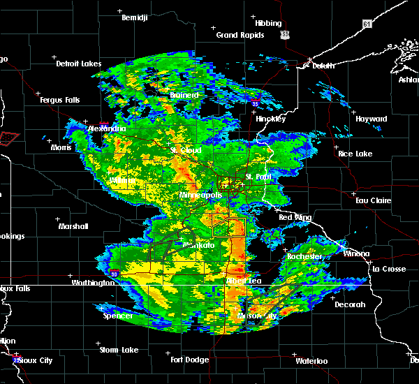 The severe thunderstorm warning for rice county will expire at 545 pm cdt, the storm which prompted the warning has weakened below severe limits, and have exited the warned area. therefore the warning will be allowed to expire. a tornado watch remains in effect until 1000 pm cdt for southeastern minnesota. The severe thunderstorm warning for rice county will expire at 545 pm cdt, the storm which prompted the warning has weakened below severe limits, and have exited the warned area. therefore the warning will be allowed to expire. a tornado watch remains in effect until 1000 pm cdt for southeastern minnesota.
|
| 6/14/2016 5:16 PM CDT |
 At 515 pm cdt, a severe thunderstorm was located over morristown, or 11 miles west of faribault, moving east at 35 mph (radar indicated. at 515 pm...damaging winds were occurring in waterville). Hazards include 70 mph wind gusts. Expect considerable tree damage. damage is likely to mobile homes, roofs, and outbuildings. this severe storm will be near, warsaw around 525 pm cdt. faribault around 530 pm cdt. northfield, dundas and nerstrand around 545 pm cdt. other locations impacted by this severe thunderstorm include faribault airport, ruskin and bridgewater. A tornado watch remains in effect until 1000 pm cdt for southeastern minnesota. At 515 pm cdt, a severe thunderstorm was located over morristown, or 11 miles west of faribault, moving east at 35 mph (radar indicated. at 515 pm...damaging winds were occurring in waterville). Hazards include 70 mph wind gusts. Expect considerable tree damage. damage is likely to mobile homes, roofs, and outbuildings. this severe storm will be near, warsaw around 525 pm cdt. faribault around 530 pm cdt. northfield, dundas and nerstrand around 545 pm cdt. other locations impacted by this severe thunderstorm include faribault airport, ruskin and bridgewater. A tornado watch remains in effect until 1000 pm cdt for southeastern minnesota.
|
| 6/14/2016 4:56 PM CDT |
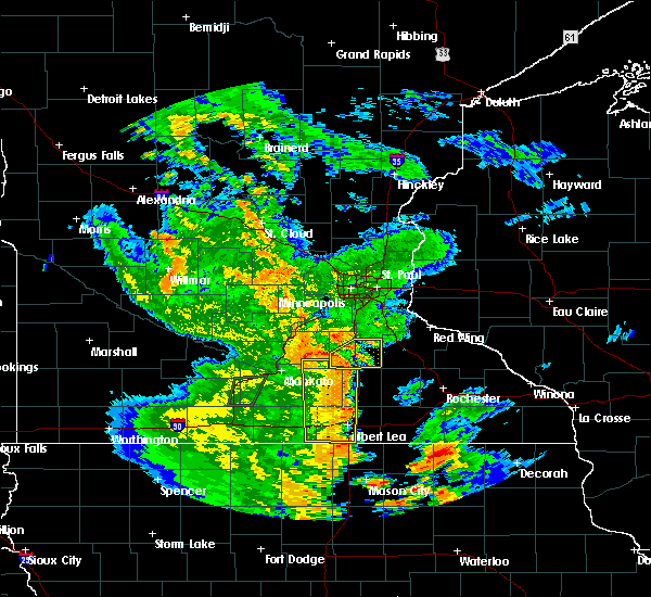 At 456 pm cdt, severe thunderstorms were located along a line extending from near kilkenny to morristown to near waseca, moving northeast at 40 mph (radar indicated). Hazards include 60 mph wind gusts. Expect damage to roofs. siding. and trees. severe thunderstorms will be near, morristown and warsaw around 500 pm cdt. faribault around 510 pm cdt. nerstrand around 530 pm cdt. dundas around 535 pm cdt. northfield around 540 pm cdt. this includes interstate 35 between mile markers 50 and 69. A tornado watch remains in effect until 1000 pm cdt for southeastern minnesota. At 456 pm cdt, severe thunderstorms were located along a line extending from near kilkenny to morristown to near waseca, moving northeast at 40 mph (radar indicated). Hazards include 60 mph wind gusts. Expect damage to roofs. siding. and trees. severe thunderstorms will be near, morristown and warsaw around 500 pm cdt. faribault around 510 pm cdt. nerstrand around 530 pm cdt. dundas around 535 pm cdt. northfield around 540 pm cdt. this includes interstate 35 between mile markers 50 and 69. A tornado watch remains in effect until 1000 pm cdt for southeastern minnesota.
|
| 6/14/2016 10:56 AM CDT |
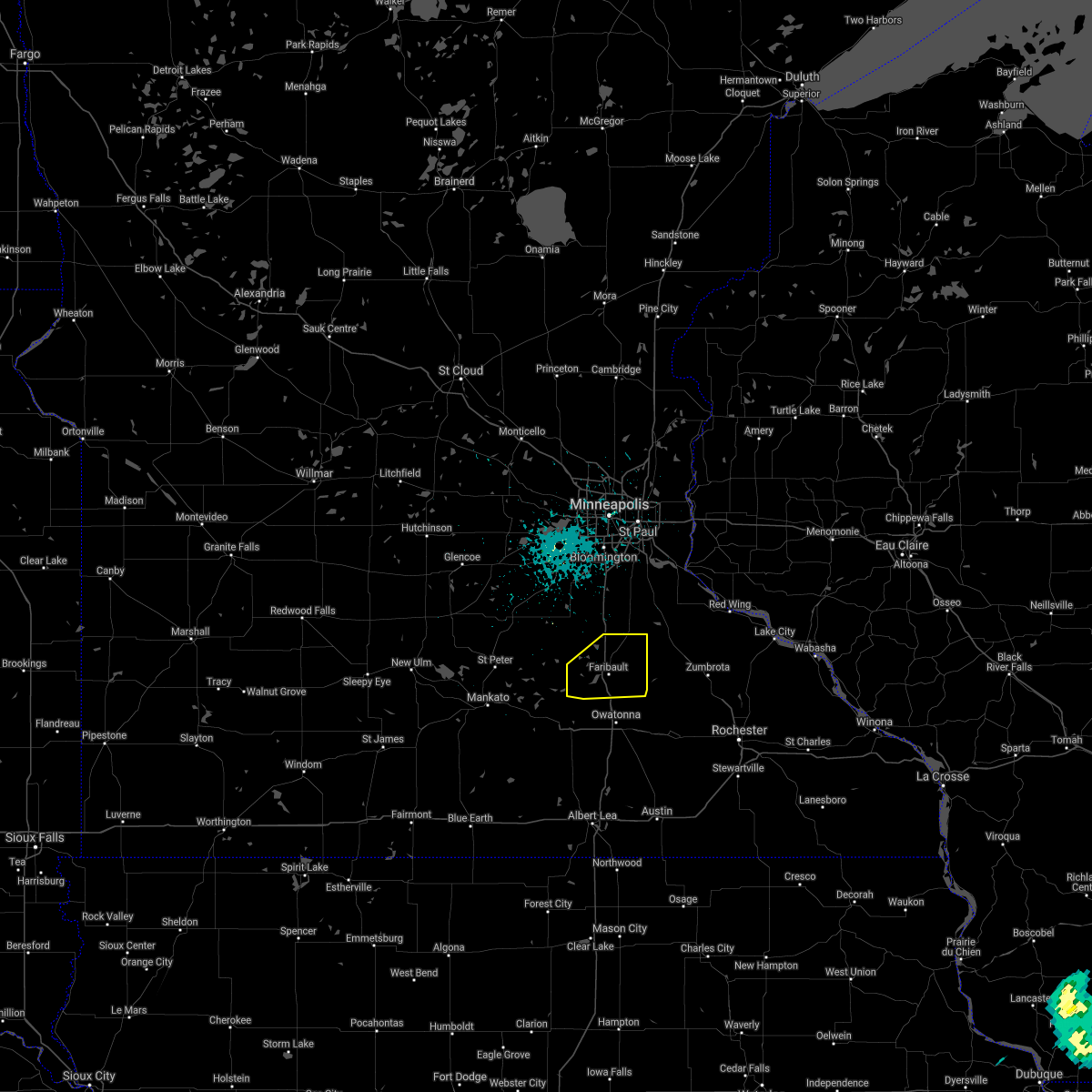 At 456 pm cdt, severe thunderstorms were located along a line extending from near kilkenny to morristown to near waseca, moving northeast at 40 mph (radar indicated). Hazards include 60 mph wind gusts. Expect damage to roofs. siding. and trees. severe thunderstorms will be near, morristown and warsaw around 500 pm cdt. faribault around 510 pm cdt. nerstrand around 530 pm cdt. dundas around 535 pm cdt. northfield around 540 pm cdt. this includes interstate 35 between mile markers 50 and 69. A tornado watch remains in effect until 1000 pm cdt for southeastern minnesota. At 456 pm cdt, severe thunderstorms were located along a line extending from near kilkenny to morristown to near waseca, moving northeast at 40 mph (radar indicated). Hazards include 60 mph wind gusts. Expect damage to roofs. siding. and trees. severe thunderstorms will be near, morristown and warsaw around 500 pm cdt. faribault around 510 pm cdt. nerstrand around 530 pm cdt. dundas around 535 pm cdt. northfield around 540 pm cdt. this includes interstate 35 between mile markers 50 and 69. A tornado watch remains in effect until 1000 pm cdt for southeastern minnesota.
|
| 6/10/2016 4:11 PM CDT |
 At 411 pm cdt, a severe thunderstorm was located over faribault airport, or near faribault, moving east at 40 mph (radar indicated). Hazards include 60 mph wind gusts and penny size hail. Expect damage to roofs. siding. and trees. Locations impacted include, faribault, northfield, cannon falls, zumbrota, kenyon, dundas, stanton, wanamingo, morristown, warsaw, nerstrand and bridgewater. At 411 pm cdt, a severe thunderstorm was located over faribault airport, or near faribault, moving east at 40 mph (radar indicated). Hazards include 60 mph wind gusts and penny size hail. Expect damage to roofs. siding. and trees. Locations impacted include, faribault, northfield, cannon falls, zumbrota, kenyon, dundas, stanton, wanamingo, morristown, warsaw, nerstrand and bridgewater.
|
| 6/10/2016 3:48 PM CDT |
 At 348 pm cdt, a severe thunderstorm was located over kilkenny, or 15 miles west of faribault, moving east at 25 mph (radar indicated). Hazards include 60 mph wind gusts and nickel size hail. Expect damage to roofs. siding. And trees. At 348 pm cdt, a severe thunderstorm was located over kilkenny, or 15 miles west of faribault, moving east at 25 mph (radar indicated). Hazards include 60 mph wind gusts and nickel size hail. Expect damage to roofs. siding. And trees.
|
| 4/24/2016 8:23 PM CDT |
 At 821 pm cdt, a confirmed tornado was located near waseca, or 13 miles west of owatonna, moving northeast at 40 mph (weather spotters confirmed tornado). Hazards include damaging tornado. Flying debris will be dangerous to those caught without shelter. mobile homes will be damaged or destroyed. damage to roofs, windows, and vehicles will occur. tree damage is likely. the tornado will be near, morristown around 835 pm cdt. other locations impacted by this tornadic thunderstorm include waseca airport and deerfield. this includes u. s. Highway 14 between mile markers 157 and 166. At 821 pm cdt, a confirmed tornado was located near waseca, or 13 miles west of owatonna, moving northeast at 40 mph (weather spotters confirmed tornado). Hazards include damaging tornado. Flying debris will be dangerous to those caught without shelter. mobile homes will be damaged or destroyed. damage to roofs, windows, and vehicles will occur. tree damage is likely. the tornado will be near, morristown around 835 pm cdt. other locations impacted by this tornadic thunderstorm include waseca airport and deerfield. this includes u. s. Highway 14 between mile markers 157 and 166.
|
| 7/18/2015 12:55 AM CDT |
 At 1254 am cdt, severe thunderstorms were located along a line extending from grey cloud township to near northfield to near waldorf, moving east at 45 mph (radar indicated). Hazards include 70 mph wind gusts. Expect considerable tree damage. damage is likely to mobile homes, roofs and outbuildings. severe thunderstorms will be near, northfield, cottage grove, st. paul park, stanton and randolph around 100 am cdt. hastings and cannon falls around 105 am cdt. prescott around 110 am cdt. river falls and ellendale around 120 am cdt. goodhue around 125 am cdt. ellsworth around 130 am cdt. blooming prairie around 135 am cdt. stockholm and frontenac around 145 am cdt. Other locations impacted by these severe thunderstorms include lemond, frontenac state park, bixby, afton state park, owatonna airport, hader, clinton falls, bridgewater, st paul park and diamond bluff. At 1254 am cdt, severe thunderstorms were located along a line extending from grey cloud township to near northfield to near waldorf, moving east at 45 mph (radar indicated). Hazards include 70 mph wind gusts. Expect considerable tree damage. damage is likely to mobile homes, roofs and outbuildings. severe thunderstorms will be near, northfield, cottage grove, st. paul park, stanton and randolph around 100 am cdt. hastings and cannon falls around 105 am cdt. prescott around 110 am cdt. river falls and ellendale around 120 am cdt. goodhue around 125 am cdt. ellsworth around 130 am cdt. blooming prairie around 135 am cdt. stockholm and frontenac around 145 am cdt. Other locations impacted by these severe thunderstorms include lemond, frontenac state park, bixby, afton state park, owatonna airport, hader, clinton falls, bridgewater, st paul park and diamond bluff.
|
| 7/18/2015 12:44 AM CDT |
 At 1244 am cdt, severe thunderstorms were located along a line extending from eagan to near webster to waterville, moving east at 50 mph (trained weather spotters). Hazards include 70 mph wind gusts. Expect considerable tree damage. damage is likely to mobile homes, roofs and outbuildings. these severe storms will be near, eagan, apple valley, rosemount and dundas around 1250 am cdt. northfield around 1255 am cdt. faribault, hastings and randolph around 100 am cdt. Other locations impacted by these severe thunderstorms include credit river, ruskin, veseli, coates, hampton, new trier, kilkenny, bridgewater, castle rock and faribault airport. At 1244 am cdt, severe thunderstorms were located along a line extending from eagan to near webster to waterville, moving east at 50 mph (trained weather spotters). Hazards include 70 mph wind gusts. Expect considerable tree damage. damage is likely to mobile homes, roofs and outbuildings. these severe storms will be near, eagan, apple valley, rosemount and dundas around 1250 am cdt. northfield around 1255 am cdt. faribault, hastings and randolph around 100 am cdt. Other locations impacted by these severe thunderstorms include credit river, ruskin, veseli, coates, hampton, new trier, kilkenny, bridgewater, castle rock and faribault airport.
|
| 7/18/2015 12:29 AM CDT |
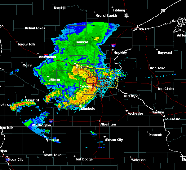 At 1229 am cdt, severe thunderstorms were located along a line extending from flying cloud airport to new prague to near lake jefferson, moving east at 50 mph (radar indicated). Hazards include 60 mph wind gusts. Expect damage to roofs. siding and trees. severe thunderstorms will be near, burnsville, savage, prior lake and lonsdale around 1235 am cdt. bloomington, lakeville, apple valley, webster and elko new market around 1240 am cdt. eagan and rosemount around 1245 am cdt. dundas and morristown around 1250 am cdt. faribault, northfield and warsaw around 1255 am cdt. hastings and randolph around 100 am cdt. other locations impacted by these severe thunderstorms include credit river, ruskin, veseli, coates, hampton, new trier, kilkenny, bridgewater, castle rock and faribault airport. this includes the following highways, interstate 35 between mile markers 50 and 88. u. s. highway 169 between mile markers 113 and 116. u. s. Highway 61 between mile markers 105 and 118. At 1229 am cdt, severe thunderstorms were located along a line extending from flying cloud airport to new prague to near lake jefferson, moving east at 50 mph (radar indicated). Hazards include 60 mph wind gusts. Expect damage to roofs. siding and trees. severe thunderstorms will be near, burnsville, savage, prior lake and lonsdale around 1235 am cdt. bloomington, lakeville, apple valley, webster and elko new market around 1240 am cdt. eagan and rosemount around 1245 am cdt. dundas and morristown around 1250 am cdt. faribault, northfield and warsaw around 1255 am cdt. hastings and randolph around 100 am cdt. other locations impacted by these severe thunderstorms include credit river, ruskin, veseli, coates, hampton, new trier, kilkenny, bridgewater, castle rock and faribault airport. this includes the following highways, interstate 35 between mile markers 50 and 88. u. s. highway 169 between mile markers 113 and 116. u. s. Highway 61 between mile markers 105 and 118.
|
| 6/22/2015 6:31 AM CDT |
 At 631 am cdt, severe thunderstorms were located along a line extending from st thomas to near waldorf to near mansfield, moving east at 70 mph (radar indicated). Hazards include 70 mph wind gusts and quarter size hail. Hail damage to vehicles is expected. expect considerable tree damage. Wind damage is also likely to mobile homes, roofs and outbuildings. At 631 am cdt, severe thunderstorms were located along a line extending from st thomas to near waldorf to near mansfield, moving east at 70 mph (radar indicated). Hazards include 70 mph wind gusts and quarter size hail. Hail damage to vehicles is expected. expect considerable tree damage. Wind damage is also likely to mobile homes, roofs and outbuildings.
|
| 6/22/2015 6:21 AM CDT |
 At 620 am cdt, severe thunderstorms were located along a line extending from near rush river to near mapleton to frost, moving east at 70 mph (radar indicated). Hazards include 70 mph wind gusts and quarter size hail. Hail damage to vehicles is expected. expect considerable tree damage. wind damage is also likely to mobile homes, roofs and outbuildings. locations impacted include, mankato, albert lea, new ulm, north mankato, st. peter, waseca, blue earth, montgomery, lake crystal, le center, eagle lake and wells. This includes interstate 90 between mile markers 108 and 156. At 620 am cdt, severe thunderstorms were located along a line extending from near rush river to near mapleton to frost, moving east at 70 mph (radar indicated). Hazards include 70 mph wind gusts and quarter size hail. Hail damage to vehicles is expected. expect considerable tree damage. wind damage is also likely to mobile homes, roofs and outbuildings. locations impacted include, mankato, albert lea, new ulm, north mankato, st. peter, waseca, blue earth, montgomery, lake crystal, le center, eagle lake and wells. This includes interstate 90 between mile markers 108 and 156.
|
| 6/22/2015 6:00 AM CDT |
 At 559 am cdt, severe thunderstorms were located along a line extending from near lafayette to near lewisville to near east chain, moving east at 70 mph (radar indicated). Hazards include 70 mph wind gusts and quarter size hail. Hail damage to vehicles is expected. expect considerable tree damage. wind damage is also likely to mobile homes, roofs and outbuildings. severe thunderstorms will be near, amboy and vernon center around 605 am cdt. blue earth, elmore and good thunder around 610 am cdt. mapleton and frost around 615 am cdt. minnesota lake and bricelyn around 620 am cdt. pemberton around 625 am cdt. le center, mansfield and waldorf around 630 am cdt. waseca, montgomery, new richland, alden and emmons around 635 am cdt. albert lea and twin lakes around 640 am cdt. other locations impacted by these severe thunderstorms include norseland, klossner, matawan, alma city, kilkenny, brush creek, guckeen, greenland, east chain and lake jefferson. This includes interstate 90 between mile markers 108 and 156. At 559 am cdt, severe thunderstorms were located along a line extending from near lafayette to near lewisville to near east chain, moving east at 70 mph (radar indicated). Hazards include 70 mph wind gusts and quarter size hail. Hail damage to vehicles is expected. expect considerable tree damage. wind damage is also likely to mobile homes, roofs and outbuildings. severe thunderstorms will be near, amboy and vernon center around 605 am cdt. blue earth, elmore and good thunder around 610 am cdt. mapleton and frost around 615 am cdt. minnesota lake and bricelyn around 620 am cdt. pemberton around 625 am cdt. le center, mansfield and waldorf around 630 am cdt. waseca, montgomery, new richland, alden and emmons around 635 am cdt. albert lea and twin lakes around 640 am cdt. other locations impacted by these severe thunderstorms include norseland, klossner, matawan, alma city, kilkenny, brush creek, guckeen, greenland, east chain and lake jefferson. This includes interstate 90 between mile markers 108 and 156.
|
| 5/7/2014 10:57 PM CDT | Quarter sized hail reported 2.4 miles SSE of Morristown, MN |
| 5/2/2012 7:15 PM CDT | Quarter sized hail reported 0.5 miles NNW of Morristown, MN, measured at eoc |
| 1/1/0001 12:00 AM | Quarter sized hail reported 0.5 miles NNW of Morristown, MN |
Hail Maps for Morristown, MN


Connect with Interactive Hail Maps