

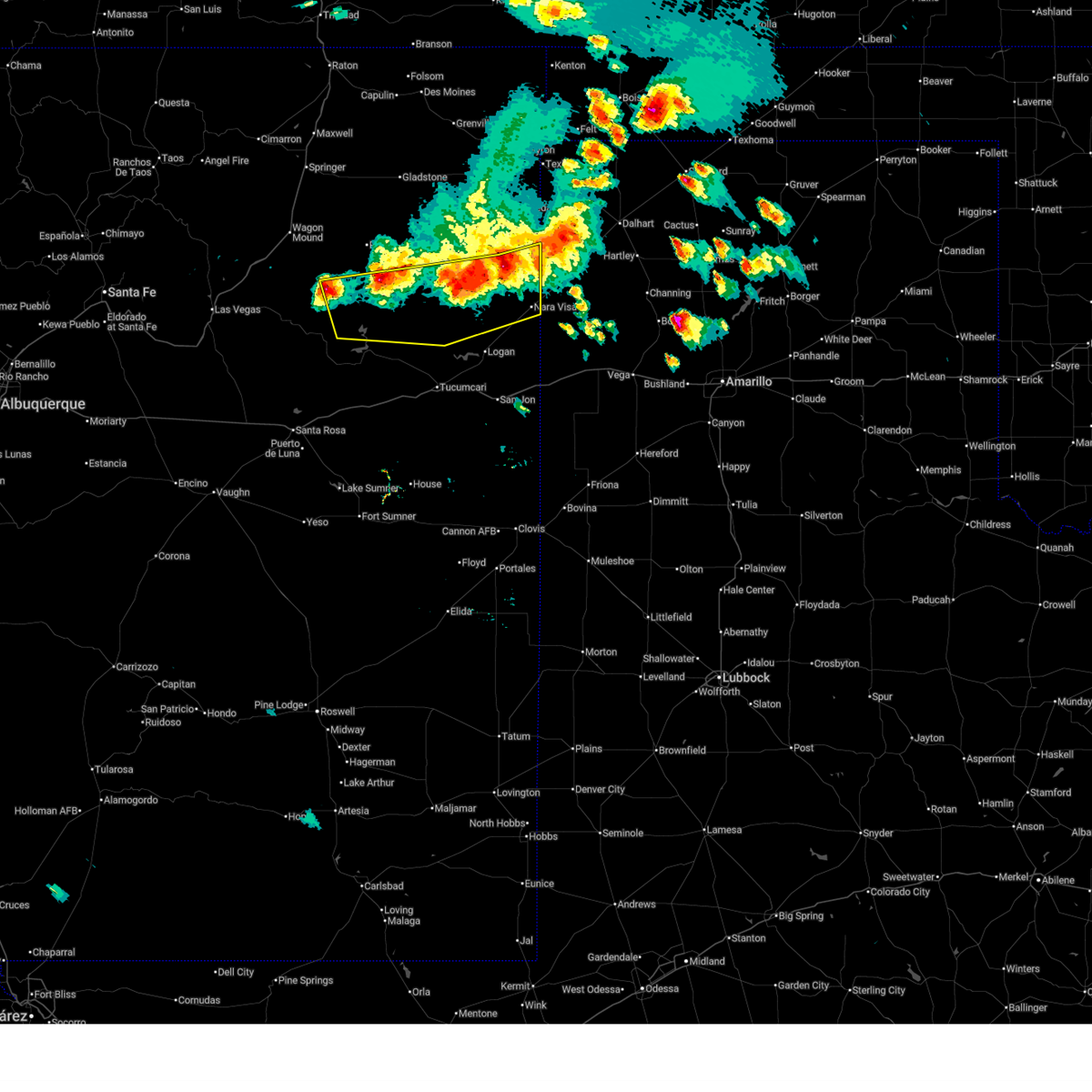
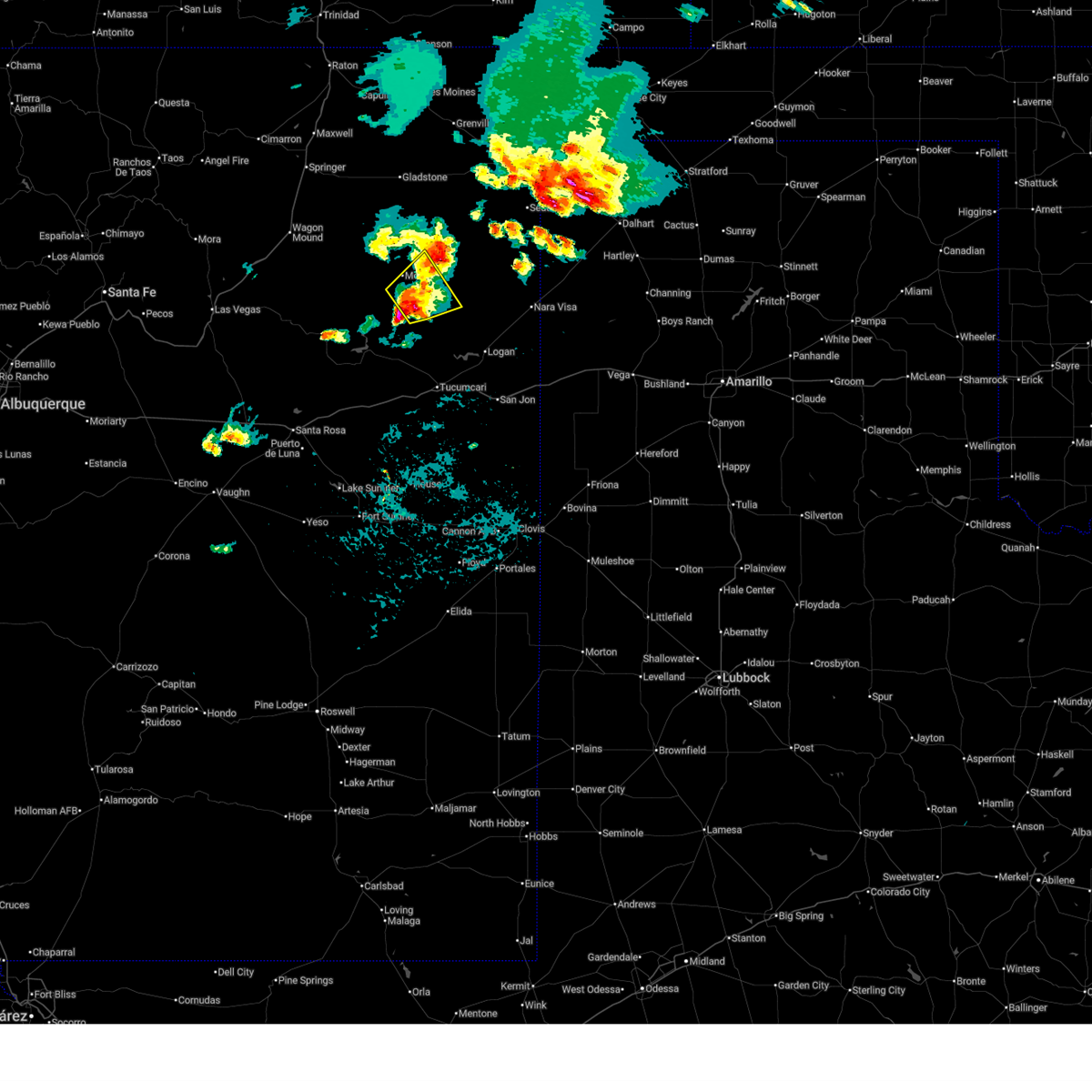
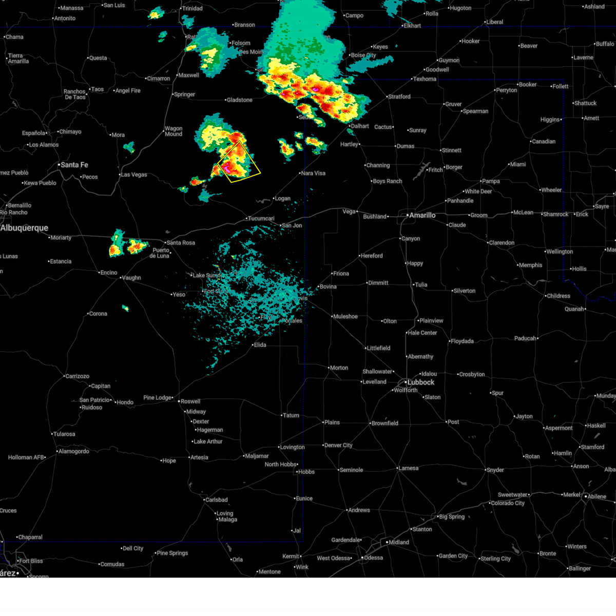
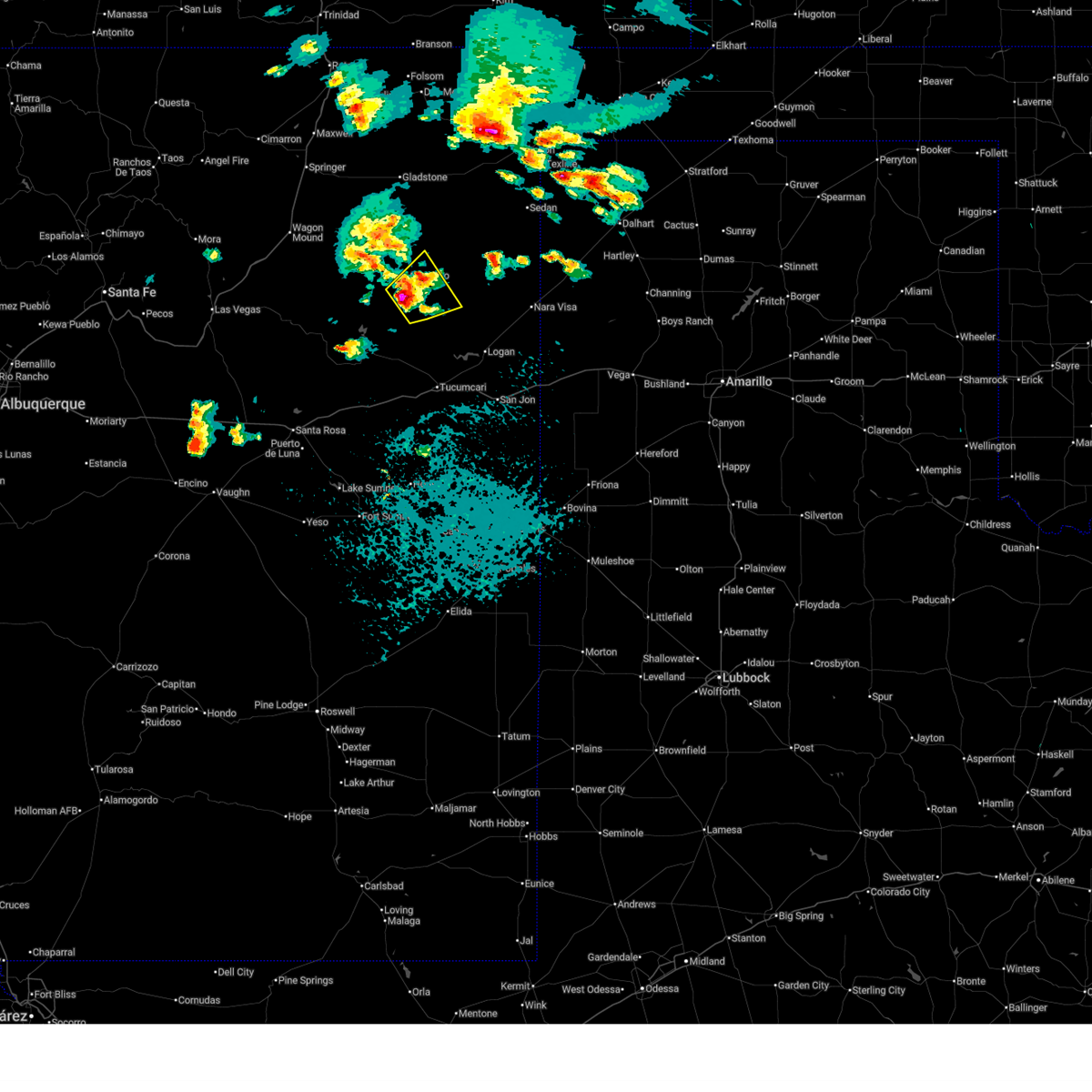
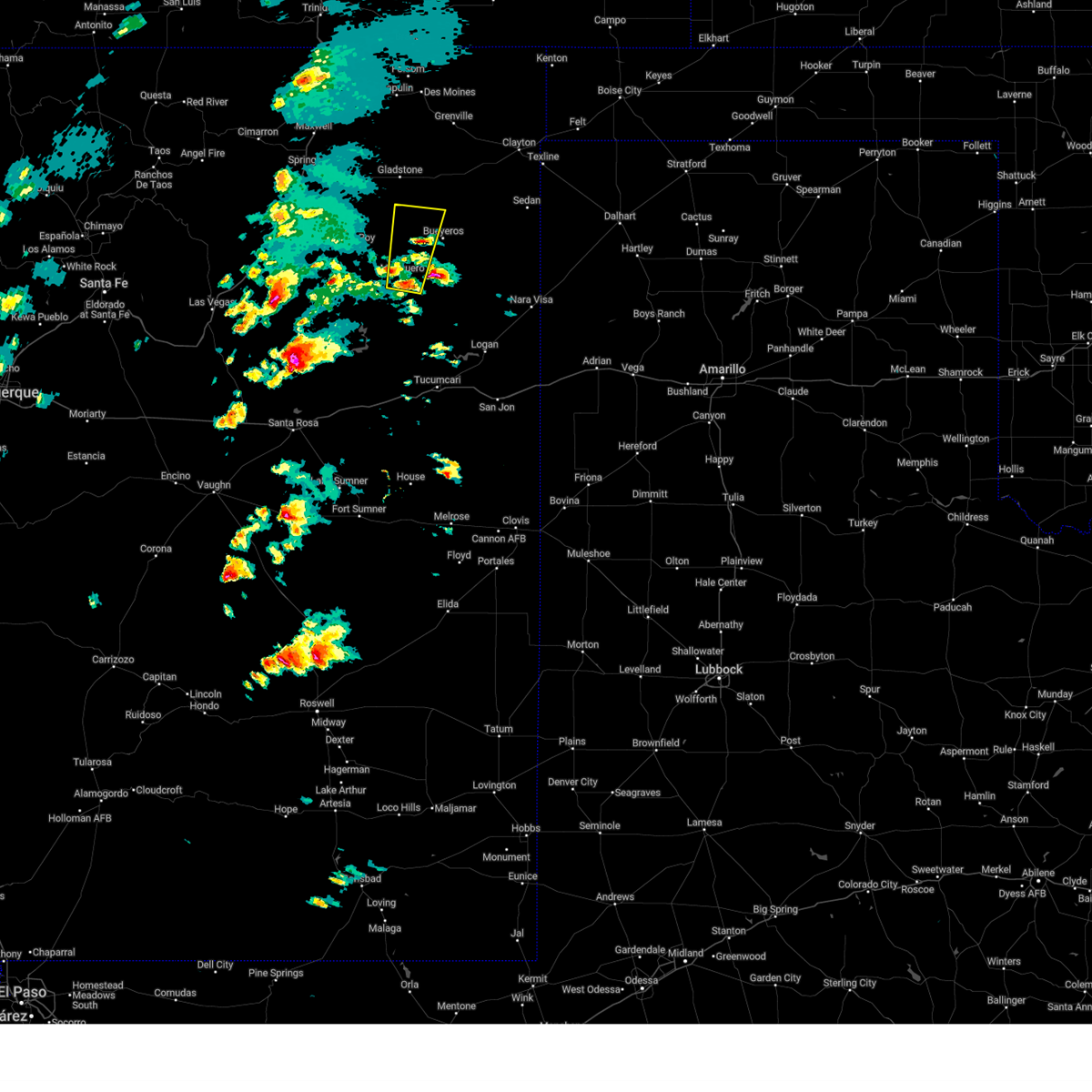
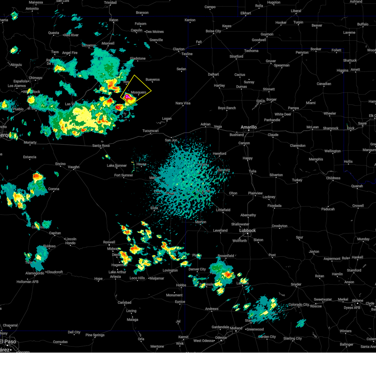
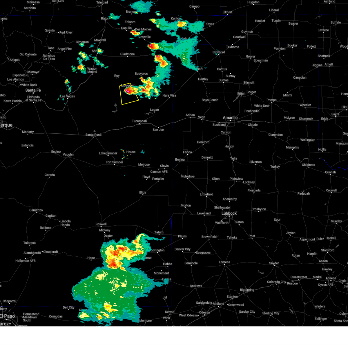
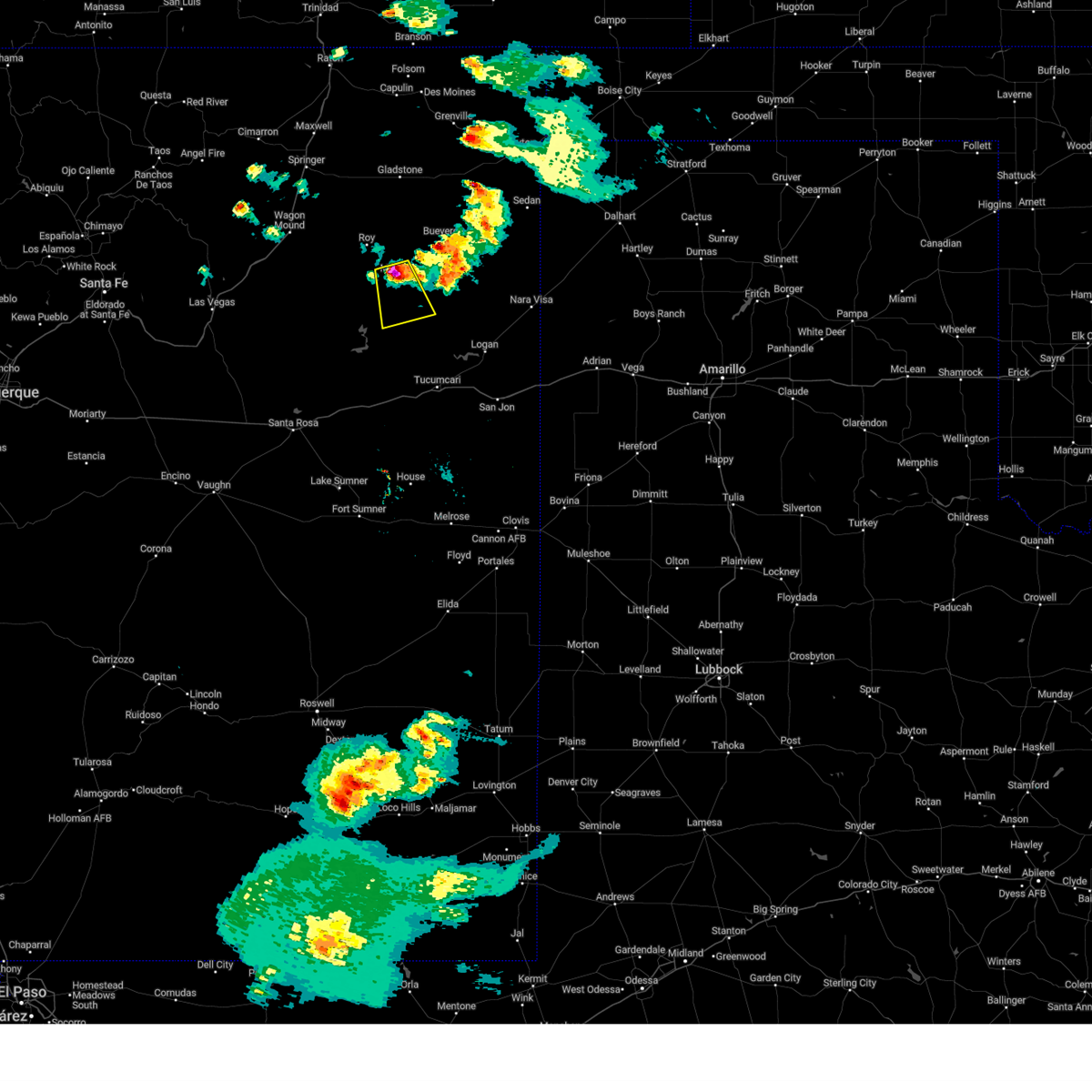
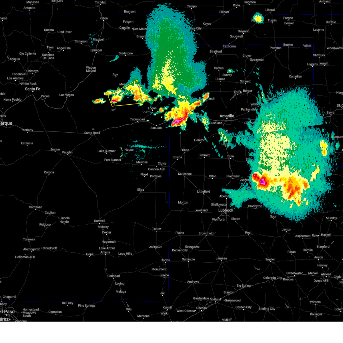
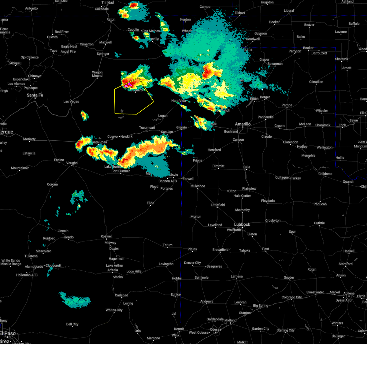
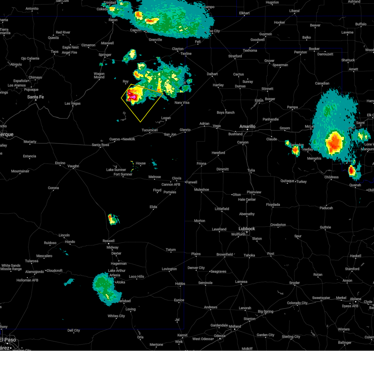
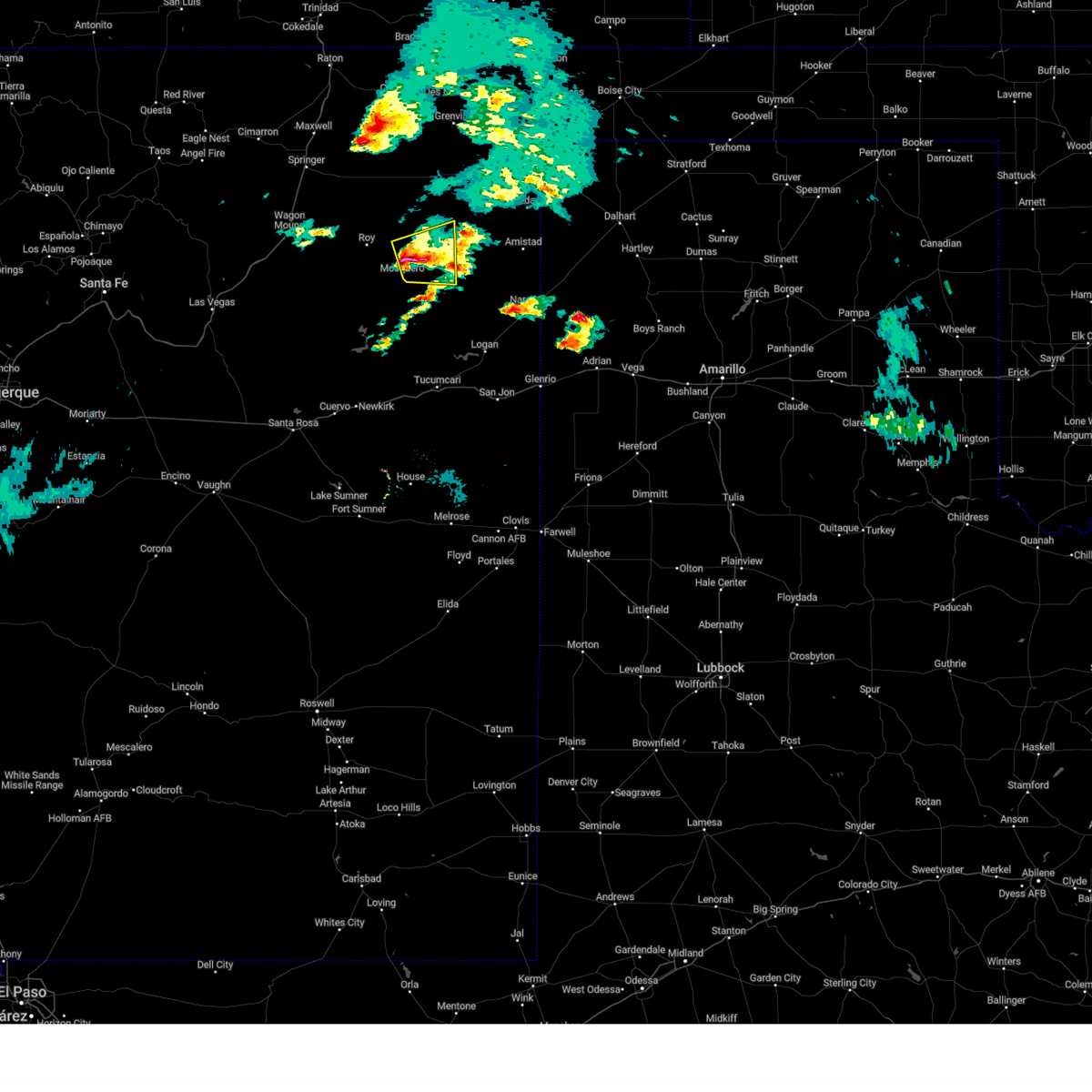
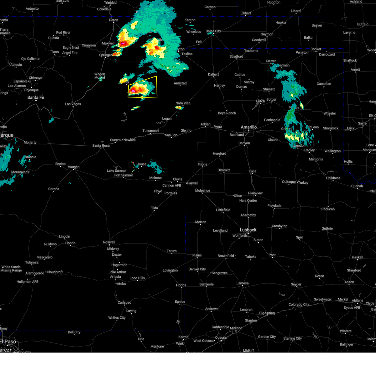
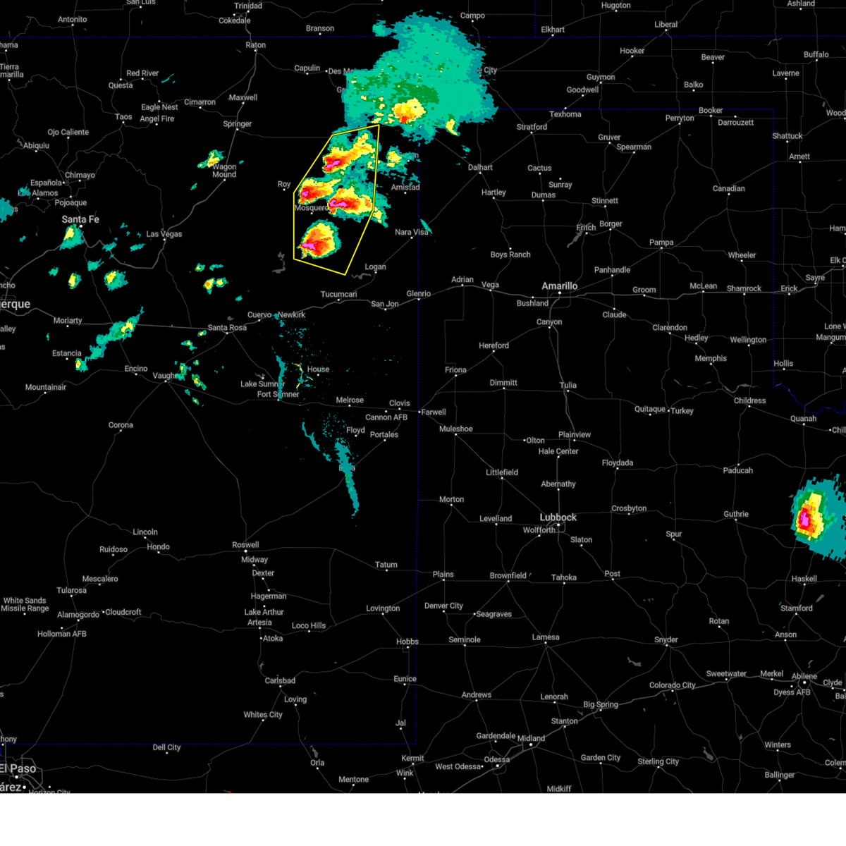
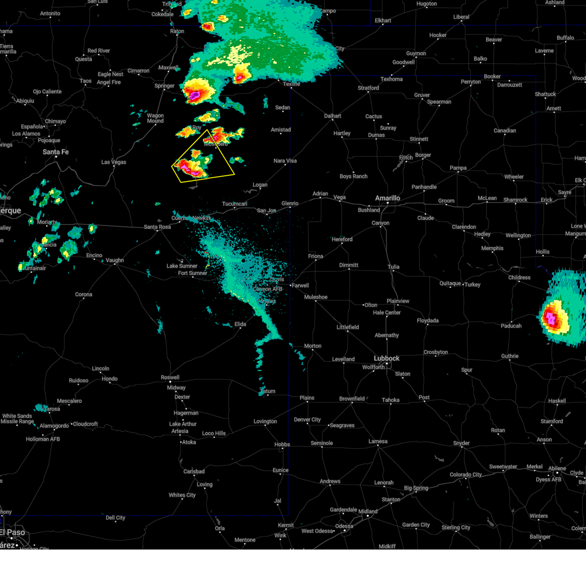
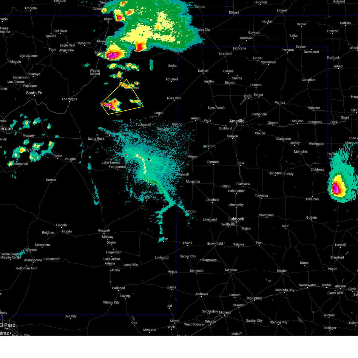
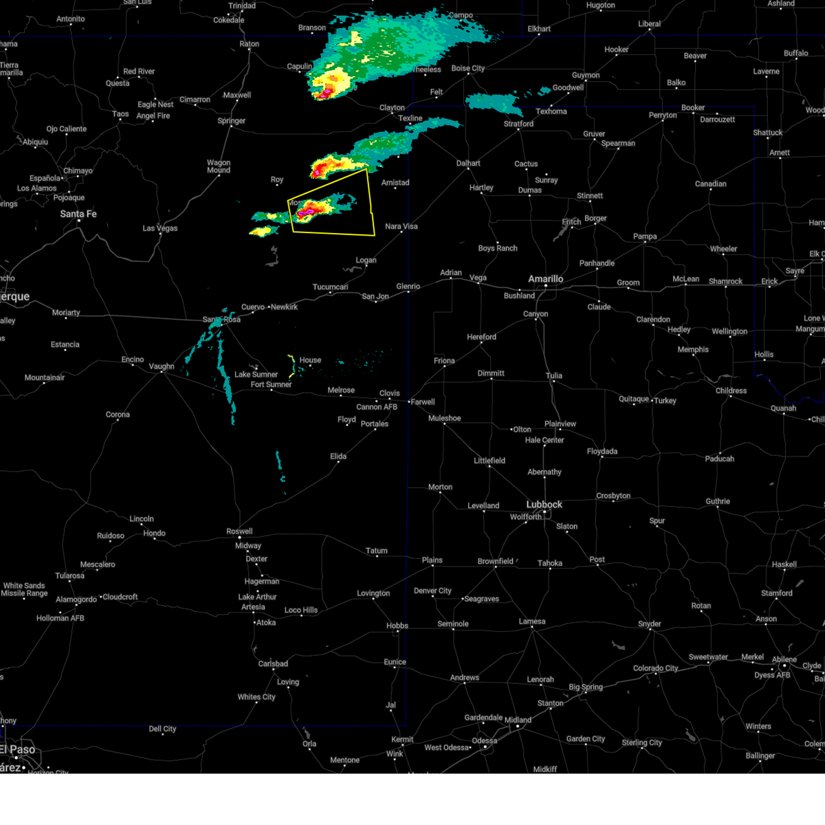
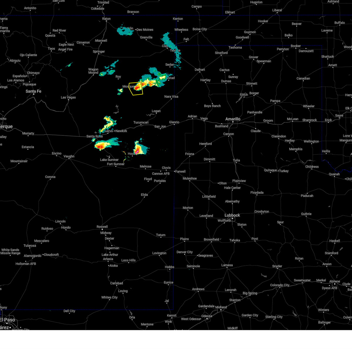
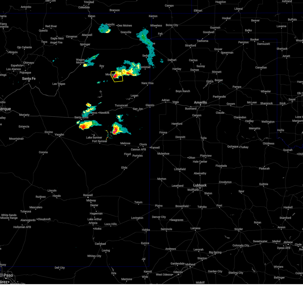
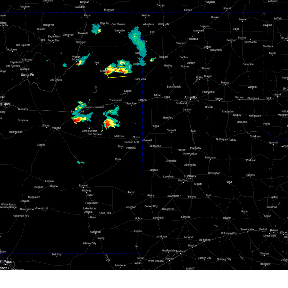
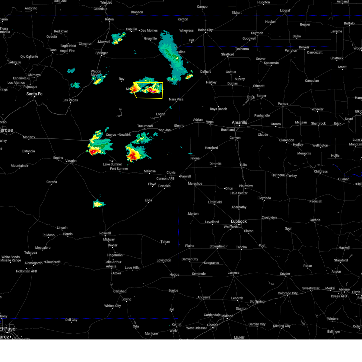
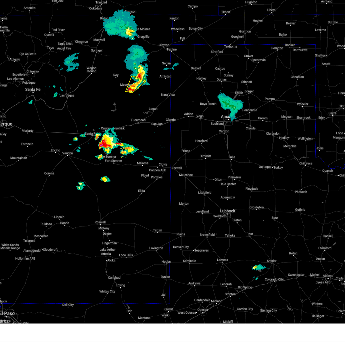
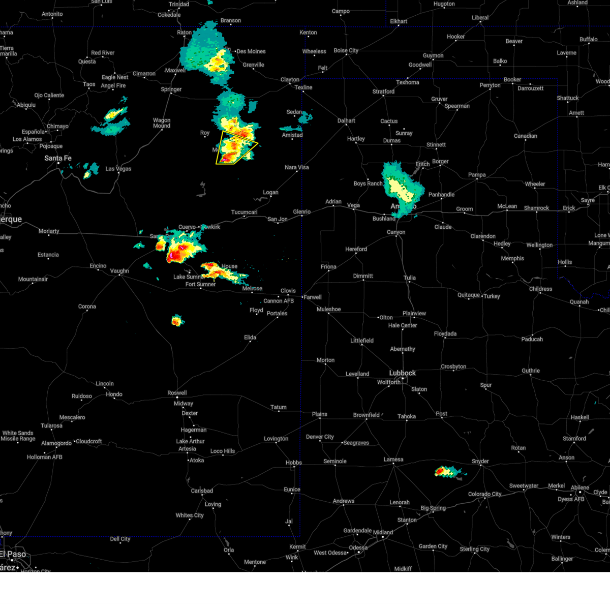
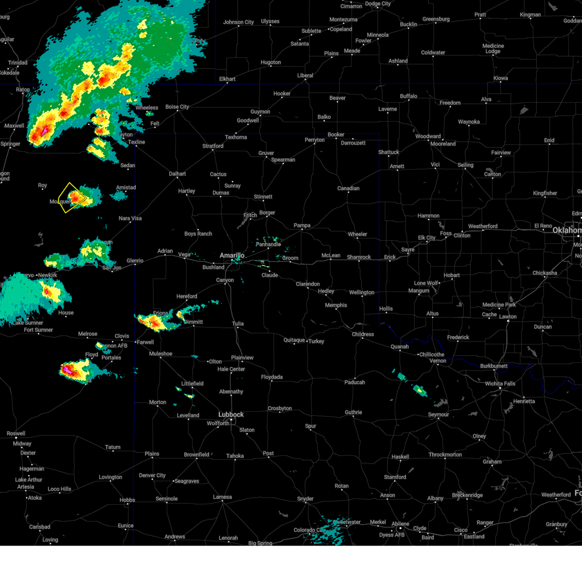
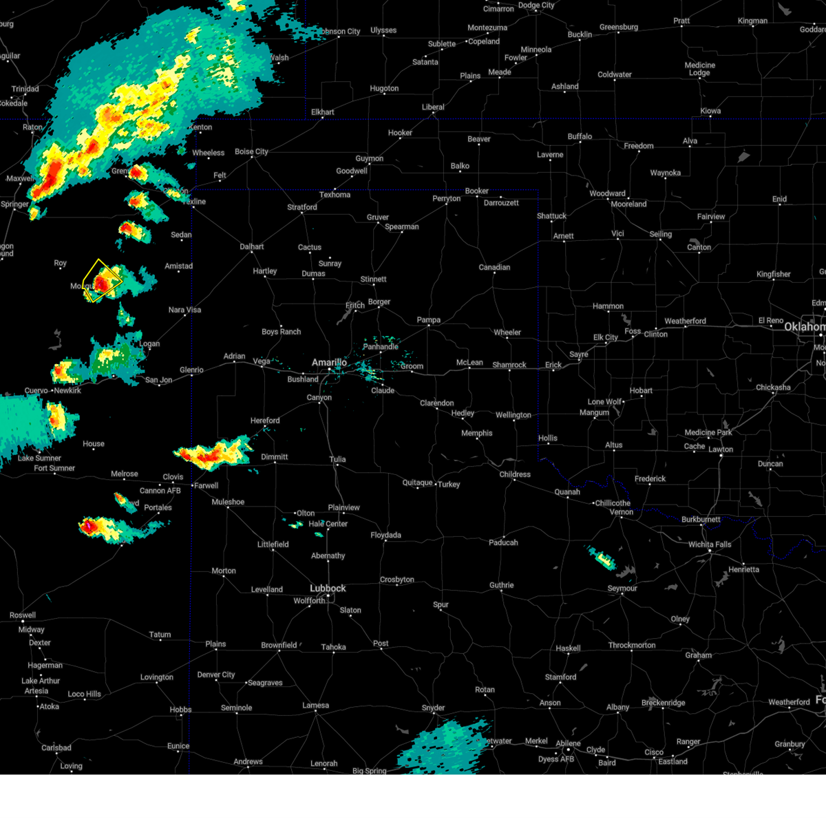
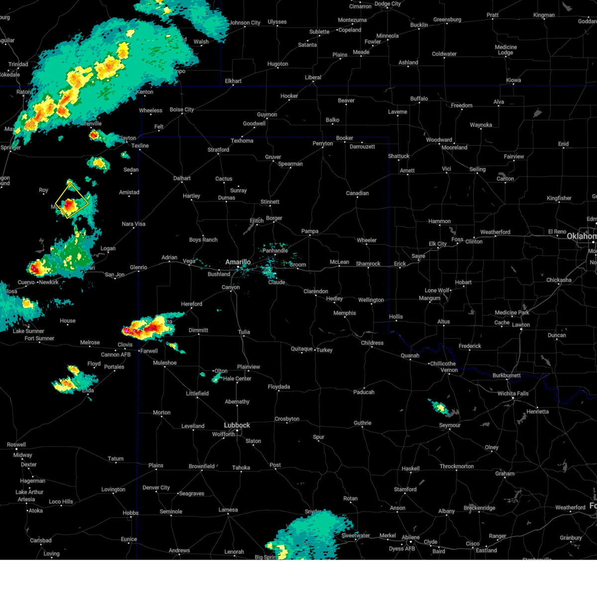
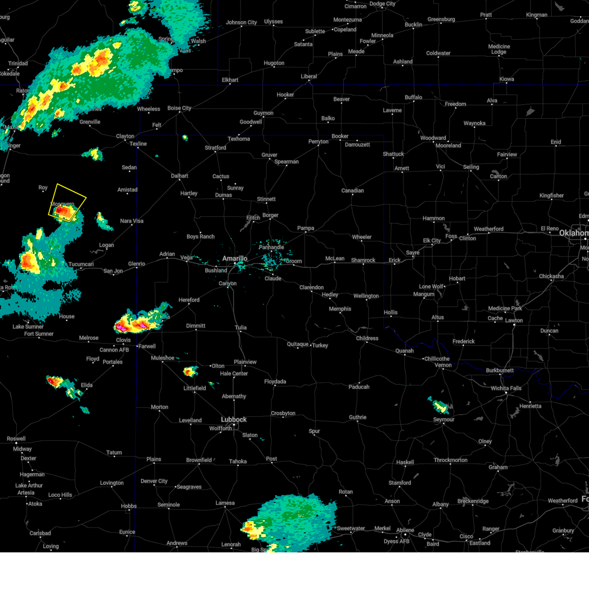
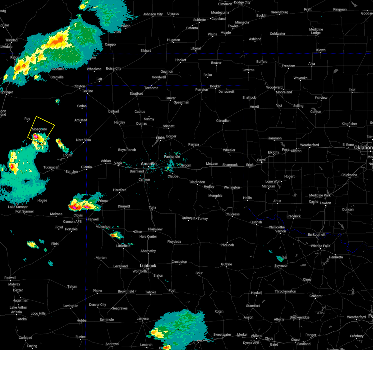
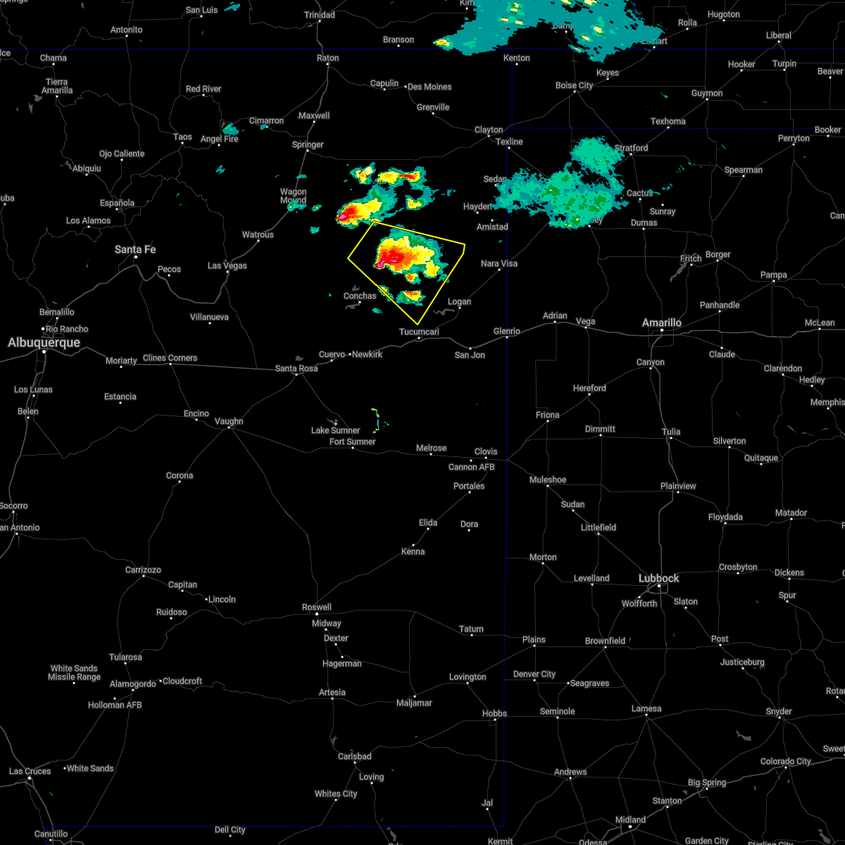
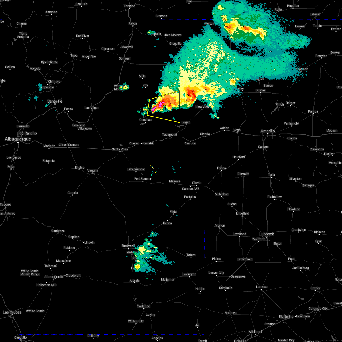
Hail Map for Mosquero, NM
The Mosquero, NM area has had 16 reports of on-the-ground hail by trained spotters, and has been under severe weather warnings 11 times during the past 12 months. Doppler radar has detected hail at or near Mosquero, NM on 52 occasions, including 4 occasions during the past year.
| Name: | Mosquero, NM |
| Where Located: | 43.2 miles NNW of Tucumcari, NM |
| Map: | Google Map for Mosquero, NM |
| Population: | 93 |
| Housing Units: | 74 |
| More Info: | Search Google for Mosquero, NM |
2
The Top Recent Hail Date for Mosquero, NM is Tuesday, September 17, 2024 (17th out of 52)

Hail and Wind Damage Spotted near Mosquero, NM
| Date / Time | Report Details |
|---|---|
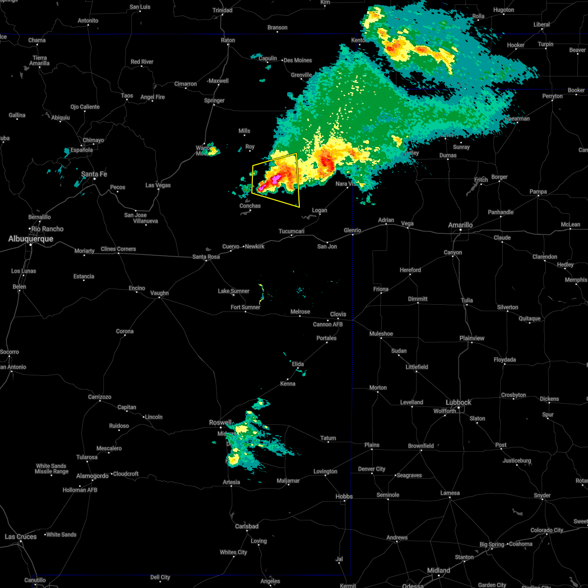
| 7/11/2025 8:25 PM MDT |
 Svrabq the national weather service in albuquerque has issued a * severe thunderstorm warning for, northeastern quay county in east central new mexico, southern harding county in northeastern new mexico, northeastern san miguel county in northeastern new mexico, southeastern union county in northeastern new mexico, * until 915 pm mdt. * at 825 pm mdt, severe thunderstorms were located along a line from 7 miles southeast of amistad to 6 miles east of maes, moving south at 15 mph (radar indicated). Hazards include 60 mph wind gusts and quarter size hail. Hail damage to vehicles is expected. Expect wind damage to roofs, siding, and trees. Svrabq the national weather service in albuquerque has issued a * severe thunderstorm warning for, northeastern quay county in east central new mexico, southern harding county in northeastern new mexico, northeastern san miguel county in northeastern new mexico, southeastern union county in northeastern new mexico, * until 915 pm mdt. * at 825 pm mdt, severe thunderstorms were located along a line from 7 miles southeast of amistad to 6 miles east of maes, moving south at 15 mph (radar indicated). Hazards include 60 mph wind gusts and quarter size hail. Hail damage to vehicles is expected. Expect wind damage to roofs, siding, and trees.
|
| 7/5/2025 6:11 PM MDT |
 The severe thunderstorm warning that was previously in effect has been reissued for harding and san miguel counties and is in effect until 700 pm mdt. please refer to that bulletin for the latest severe weather information. The severe thunderstorm warning that was previously in effect has been reissued for harding and san miguel counties and is in effect until 700 pm mdt. please refer to that bulletin for the latest severe weather information.
|
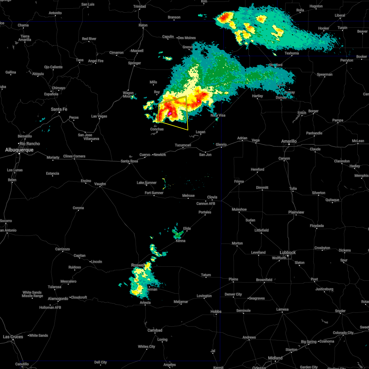
| 7/5/2025 5:51 PM MDT |
 At 551 pm mdt, a severe thunderstorm was located 7 miles southeast of mosquero, moving northeast at 15 mph (radar indicated). Hazards include ping pong ball size hail and 60 mph wind gusts. People and animals outdoors will be injured. expect hail damage to roofs, siding, windows, and vehicles. expect wind damage to roofs, siding, and trees. Locations impacted include, mosquero. At 551 pm mdt, a severe thunderstorm was located 7 miles southeast of mosquero, moving northeast at 15 mph (radar indicated). Hazards include ping pong ball size hail and 60 mph wind gusts. People and animals outdoors will be injured. expect hail damage to roofs, siding, windows, and vehicles. expect wind damage to roofs, siding, and trees. Locations impacted include, mosquero.
|
| 7/5/2025 5:31 PM MDT |
 Svrabq the national weather service in albuquerque has issued a * severe thunderstorm warning for, central harding county in northeastern new mexico, northeastern san miguel county in northeastern new mexico, * until 615 pm mdt. * at 531 pm mdt, a severe thunderstorm was located 8 miles south of mosquero, moving northeast at 15 mph (radar indicated). Hazards include 60 mph wind gusts and half dollar size hail. Hail damage to vehicles is expected. Expect wind damage to roofs, siding, and trees. Svrabq the national weather service in albuquerque has issued a * severe thunderstorm warning for, central harding county in northeastern new mexico, northeastern san miguel county in northeastern new mexico, * until 615 pm mdt. * at 531 pm mdt, a severe thunderstorm was located 8 miles south of mosquero, moving northeast at 15 mph (radar indicated). Hazards include 60 mph wind gusts and half dollar size hail. Hail damage to vehicles is expected. Expect wind damage to roofs, siding, and trees.
|
| 6/8/2025 8:00 PM MDT | the severe thunderstorm warning has been cancelled and is no longer in effect |
| 6/8/2025 7:52 PM MDT | At 752 pm mdt, a severe thunderstorm was located 10 miles southwest of solano, or 14 miles west of mosquero, moving southeast at 25 mph (radar indicated). Hazards include 60 mph wind gusts and quarter size hail. Hail damage to vehicles is expected. expect wind damage to roofs, siding, and trees. Locations impacted include, mosquero and solano. |
| 6/8/2025 7:40 PM MDT | Svrabq the national weather service in albuquerque has issued a * severe thunderstorm warning for, west central harding county in northeastern new mexico, northeastern san miguel county in northeastern new mexico, * until 845 pm mdt. * at 740 pm mdt, a severe thunderstorm was located 11 miles southwest of roy, or 21 miles west of mosquero, moving southeast at 20 mph (radar indicated). Hazards include 60 mph wind gusts and quarter size hail. Hail damage to vehicles is expected. Expect wind damage to roofs, siding, and trees. |
| 9/17/2024 2:42 PM MDT |
 Svrabq the national weather service in albuquerque has issued a * severe thunderstorm warning for, northeastern san miguel county in northeastern new mexico, north central harding county in northeastern new mexico, southwestern union county in northeastern new mexico, * until 330 pm mdt. * at 242 pm mdt, a severe thunderstorm was located over mosquero, moving north at 25 mph (radar indicated). Hazards include 60 mph wind gusts and half dollar size hail. Hail damage to vehicles is expected. Expect wind damage to roofs, siding, and trees. Svrabq the national weather service in albuquerque has issued a * severe thunderstorm warning for, northeastern san miguel county in northeastern new mexico, north central harding county in northeastern new mexico, southwestern union county in northeastern new mexico, * until 330 pm mdt. * at 242 pm mdt, a severe thunderstorm was located over mosquero, moving north at 25 mph (radar indicated). Hazards include 60 mph wind gusts and half dollar size hail. Hail damage to vehicles is expected. Expect wind damage to roofs, siding, and trees.
|
| 7/17/2024 4:45 PM MDT | 3in diameter tree limbs snapped from tree. time estimated from rada in harding county NM, 3.3 miles WSW of Mosquero, NM |
| 7/17/2024 4:25 PM MDT | The storm which prompted the warning has weakened below severe limits, and no longer poses an immediate threat to life or property. therefore, the warning will be allowed to expire. however, small hail is still possible with this thunderstorm. |
| 7/17/2024 3:59 PM MDT |
 At 358 pm mdt, a severe thunderstorm was located near solano, or 11 miles west of mosquero, moving north at 10 mph (radar indicated). Hazards include 70 mph wind gusts and ping pong ball size hail. People and animals outdoors will be injured. expect hail damage to roofs, siding, windows, and vehicles. expect considerable tree damage. wind damage is also likely to mobile homes, roofs, and outbuildings. Locations impacted include, mosquero and solano. At 358 pm mdt, a severe thunderstorm was located near solano, or 11 miles west of mosquero, moving north at 10 mph (radar indicated). Hazards include 70 mph wind gusts and ping pong ball size hail. People and animals outdoors will be injured. expect hail damage to roofs, siding, windows, and vehicles. expect considerable tree damage. wind damage is also likely to mobile homes, roofs, and outbuildings. Locations impacted include, mosquero and solano.
|
| 7/17/2024 3:46 PM MDT | Svrabq the national weather service in albuquerque has issued a * severe thunderstorm warning for, northeastern san miguel county in northeastern new mexico, central harding county in northeastern new mexico, * until 430 pm mdt. * at 345 pm mdt, a severe thunderstorm was located 8 miles southwest of solano, or 9 miles west of mosquero, moving northeast at 10 mph (radar indicated). Hazards include 60 mph wind gusts and quarter size hail. Hail damage to vehicles is expected. Expect wind damage to roofs, siding, and trees. |
| 7/6/2024 12:25 AM MDT |
 The storm which prompted the warning has weakened below severe limits, and no longer poses an immediate threat to life or property. therefore, the warning will be allowed to expire. The storm which prompted the warning has weakened below severe limits, and no longer poses an immediate threat to life or property. therefore, the warning will be allowed to expire.
|
| 7/5/2024 11:51 PM MDT |
 Svrabq the national weather service in albuquerque has issued a * severe thunderstorm warning for, northeastern san miguel county in northeastern new mexico, central harding county in northeastern new mexico, * until 1230 am mdt. * at 1151 pm mdt, a severe thunderstorm was located near mosquero, moving south at 10 mph (radar indicated). Hazards include 60 mph wind gusts and quarter size hail. Hail damage to vehicles is expected. Expect wind damage to roofs, siding, and trees. Svrabq the national weather service in albuquerque has issued a * severe thunderstorm warning for, northeastern san miguel county in northeastern new mexico, central harding county in northeastern new mexico, * until 1230 am mdt. * at 1151 pm mdt, a severe thunderstorm was located near mosquero, moving south at 10 mph (radar indicated). Hazards include 60 mph wind gusts and quarter size hail. Hail damage to vehicles is expected. Expect wind damage to roofs, siding, and trees.
|
| 6/14/2024 3:40 PM MDT |
 Svrabq the national weather service in albuquerque has issued a * severe thunderstorm warning for, northeastern san miguel county in northeastern new mexico, harding county in northeastern new mexico, northeastern quay county in east central new mexico, southern union county in northeastern new mexico, * until 445 pm mdt. * at 340 pm mdt, severe thunderstorms were located along a line extending from 8 miles southeast of chicosa lake state park to 11 miles southwest of nara visa, moving north at 30 mph (radar indicated). Hazards include 60 mph wind gusts and half dollar size hail. Hail damage to vehicles is expected. Expect wind damage to roofs, siding, and trees. Svrabq the national weather service in albuquerque has issued a * severe thunderstorm warning for, northeastern san miguel county in northeastern new mexico, harding county in northeastern new mexico, northeastern quay county in east central new mexico, southern union county in northeastern new mexico, * until 445 pm mdt. * at 340 pm mdt, severe thunderstorms were located along a line extending from 8 miles southeast of chicosa lake state park to 11 miles southwest of nara visa, moving north at 30 mph (radar indicated). Hazards include 60 mph wind gusts and half dollar size hail. Hail damage to vehicles is expected. Expect wind damage to roofs, siding, and trees.
|
| 6/14/2024 3:36 PM MDT |
 At 336 pm mdt, severe thunderstorms were located along a line extending from 8 miles southeast of chicosa lake state park to 11 miles southwest of nara visa, moving northeast at 40 mph (radar indicated). Hazards include 60 mph wind gusts and half dollar size hail. Hail damage to vehicles is expected. expect wind damage to roofs, siding, and trees. Locations impacted include, mosquero, amistad, nara visa, logan, bueyeros, hayden, solano, ute lake state park, sedan, and yates. At 336 pm mdt, severe thunderstorms were located along a line extending from 8 miles southeast of chicosa lake state park to 11 miles southwest of nara visa, moving northeast at 40 mph (radar indicated). Hazards include 60 mph wind gusts and half dollar size hail. Hail damage to vehicles is expected. expect wind damage to roofs, siding, and trees. Locations impacted include, mosquero, amistad, nara visa, logan, bueyeros, hayden, solano, ute lake state park, sedan, and yates.
|
| 6/14/2024 3:27 PM MDT |
 At 327 pm mdt, severe thunderstorms were located along a line extending from 7 miles west of hayden to 9 miles northwest of ute lake state park, moving northeast at 25 mph (radar indicated). Hazards include 60 mph wind gusts and quarter size hail. Hail damage to vehicles is expected. expect wind damage to roofs, siding, and trees. locations impacted include, mosquero, amistad, nara visa, logan, bueyeros, hayden, solano, conchas lake state park, conchas dam, and conchas. This includes state road 104 between mile markers 73 and 95. At 327 pm mdt, severe thunderstorms were located along a line extending from 7 miles west of hayden to 9 miles northwest of ute lake state park, moving northeast at 25 mph (radar indicated). Hazards include 60 mph wind gusts and quarter size hail. Hail damage to vehicles is expected. expect wind damage to roofs, siding, and trees. locations impacted include, mosquero, amistad, nara visa, logan, bueyeros, hayden, solano, conchas lake state park, conchas dam, and conchas. This includes state road 104 between mile markers 73 and 95.
|
| 6/14/2024 3:00 PM MDT |
 Svrabq the national weather service in albuquerque has issued a * severe thunderstorm warning for, northeastern san miguel county in northeastern new mexico, harding county in northeastern new mexico, northeastern quay county in east central new mexico, southern union county in northeastern new mexico, * until 345 pm mdt. * at 300 pm mdt, severe thunderstorms were located along a line extending from 6 miles north of bueyeros to 13 miles north of tucumcari, moving north at 30 mph (radar indicated). Hazards include 60 mph wind gusts and penny size hail. expect damage to roofs, siding, and trees Svrabq the national weather service in albuquerque has issued a * severe thunderstorm warning for, northeastern san miguel county in northeastern new mexico, harding county in northeastern new mexico, northeastern quay county in east central new mexico, southern union county in northeastern new mexico, * until 345 pm mdt. * at 300 pm mdt, severe thunderstorms were located along a line extending from 6 miles north of bueyeros to 13 miles north of tucumcari, moving north at 30 mph (radar indicated). Hazards include 60 mph wind gusts and penny size hail. expect damage to roofs, siding, and trees
|
| 6/14/2024 2:47 PM MDT |
 At 247 pm mdt, severe thunderstorms were located along a line extending from near des moines to 19 miles northwest of ute lake state park, moving northeast at 30 mph (radar indicated). Hazards include 60 mph wind gusts and penny size hail. Expect damage to roofs, siding, and trees. Locations impacted include, clayton, des moines, mosquero, amistad, nara visa, folsom, grenville, bueyeros, hayden, and clayton lake state park. At 247 pm mdt, severe thunderstorms were located along a line extending from near des moines to 19 miles northwest of ute lake state park, moving northeast at 30 mph (radar indicated). Hazards include 60 mph wind gusts and penny size hail. Expect damage to roofs, siding, and trees. Locations impacted include, clayton, des moines, mosquero, amistad, nara visa, folsom, grenville, bueyeros, hayden, and clayton lake state park.
|
| 6/14/2024 1:57 PM MDT |
 Svrabq the national weather service in albuquerque has issued a * severe thunderstorm warning for, northeastern san miguel county in northeastern new mexico, harding county in northeastern new mexico, northeastern quay county in east central new mexico, union county in northeastern new mexico, eastern colfax county in northeastern new mexico, * until 300 pm mdt. * at 156 pm mdt, severe thunderstorms were located along a line extending from near folsom to 9 miles southeast of mosquero, moving east at 30 mph (radar indicated). Hazards include 60 mph wind gusts and quarter size hail. Hail damage to vehicles is expected. Expect wind damage to roofs, siding, and trees. Svrabq the national weather service in albuquerque has issued a * severe thunderstorm warning for, northeastern san miguel county in northeastern new mexico, harding county in northeastern new mexico, northeastern quay county in east central new mexico, union county in northeastern new mexico, eastern colfax county in northeastern new mexico, * until 300 pm mdt. * at 156 pm mdt, severe thunderstorms were located along a line extending from near folsom to 9 miles southeast of mosquero, moving east at 30 mph (radar indicated). Hazards include 60 mph wind gusts and quarter size hail. Hail damage to vehicles is expected. Expect wind damage to roofs, siding, and trees.
|
| 6/7/2024 5:39 PM MDT |
 The storms which prompted the warning have weakened below severe limits, and no longer pose an immediate threat to life or property. therefore, the warning will be allowed to expire. however, small hail and gusty winds are still possible with these thunderstorms. to report severe weather, contact your local law enforcement and the national weather service in albuquerque. The storms which prompted the warning have weakened below severe limits, and no longer pose an immediate threat to life or property. therefore, the warning will be allowed to expire. however, small hail and gusty winds are still possible with these thunderstorms. to report severe weather, contact your local law enforcement and the national weather service in albuquerque.
|
| 6/7/2024 5:06 PM MDT |
 the severe thunderstorm warning has been cancelled and is no longer in effect the severe thunderstorm warning has been cancelled and is no longer in effect
|
| 6/7/2024 5:06 PM MDT |
 At 506 pm mdt, severe thunderstorms were located along a line extending from 7 miles southwest of bueyeros to 14 miles northeast of variadero, moving east at 25 mph (radar indicated). Hazards include 70 mph wind gusts and nickel size hail. Expect considerable tree damage. damage is likely to mobile homes, roofs, and outbuildings. locations impacted include, mosquero, bueyeros, conchas, solano, conchas lake state park, conchas dam, trementina, and bell ranch. This includes state road 104 between mile markers 35 and 39, between mile markers 41 and 47, and between mile markers 75 and 76. At 506 pm mdt, severe thunderstorms were located along a line extending from 7 miles southwest of bueyeros to 14 miles northeast of variadero, moving east at 25 mph (radar indicated). Hazards include 70 mph wind gusts and nickel size hail. Expect considerable tree damage. damage is likely to mobile homes, roofs, and outbuildings. locations impacted include, mosquero, bueyeros, conchas, solano, conchas lake state park, conchas dam, trementina, and bell ranch. This includes state road 104 between mile markers 35 and 39, between mile markers 41 and 47, and between mile markers 75 and 76.
|
| 6/7/2024 4:38 PM MDT |
 Svrabq the national weather service in albuquerque has issued a * severe thunderstorm warning for, northeastern san miguel county in northeastern new mexico, northern harding county in northeastern new mexico, south central union county in northeastern new mexico, southeastern mora county in northeastern new mexico, * until 545 pm mdt. * at 438 pm mdt, severe thunderstorms were located along a line extending from 6 miles east of solano to 8 miles east of trujillo, moving east at 25 mph (radar indicated). Hazards include 70 mph wind gusts and nickel size hail. Expect considerable tree damage. Damage is likely to mobile homes, roofs, and outbuildings. Svrabq the national weather service in albuquerque has issued a * severe thunderstorm warning for, northeastern san miguel county in northeastern new mexico, northern harding county in northeastern new mexico, south central union county in northeastern new mexico, southeastern mora county in northeastern new mexico, * until 545 pm mdt. * at 438 pm mdt, severe thunderstorms were located along a line extending from 6 miles east of solano to 8 miles east of trujillo, moving east at 25 mph (radar indicated). Hazards include 70 mph wind gusts and nickel size hail. Expect considerable tree damage. Damage is likely to mobile homes, roofs, and outbuildings.
|
| 5/30/2024 3:27 AM MDT |
 Svrabq the national weather service in albuquerque has issued a * severe thunderstorm warning for, northeastern san miguel county in northeastern new mexico, south central harding county in northeastern new mexico, * until 430 am mdt. * at 326 am mdt, a severe thunderstorm was located 8 miles north of conchas dam, or 21 miles southwest of mosquero, moving east at 20 mph (radar indicated). Hazards include 60 mph wind gusts and quarter size hail. Hail damage to vehicles is expected. Expect wind damage to roofs, siding, and trees. Svrabq the national weather service in albuquerque has issued a * severe thunderstorm warning for, northeastern san miguel county in northeastern new mexico, south central harding county in northeastern new mexico, * until 430 am mdt. * at 326 am mdt, a severe thunderstorm was located 8 miles north of conchas dam, or 21 miles southwest of mosquero, moving east at 20 mph (radar indicated). Hazards include 60 mph wind gusts and quarter size hail. Hail damage to vehicles is expected. Expect wind damage to roofs, siding, and trees.
|
| 5/30/2024 3:06 AM MDT |
 At 306 am mdt, a severe thunderstorm was located 12 miles north of conchas dam, or 21 miles southwest of mosquero, moving northeast at 25 mph (radar indicated). Hazards include 60 mph wind gusts and half dollar size hail. Hail damage to vehicles is expected. expect wind damage to roofs, siding, and trees. locations impacted include, mosquero, conchas, solano, variadero, conchas lake state park, conchas dam, trementina, and bell ranch. This includes state road 104 between mile markers 36 and 54, and between mile markers 74 and 77. At 306 am mdt, a severe thunderstorm was located 12 miles north of conchas dam, or 21 miles southwest of mosquero, moving northeast at 25 mph (radar indicated). Hazards include 60 mph wind gusts and half dollar size hail. Hail damage to vehicles is expected. expect wind damage to roofs, siding, and trees. locations impacted include, mosquero, conchas, solano, variadero, conchas lake state park, conchas dam, trementina, and bell ranch. This includes state road 104 between mile markers 36 and 54, and between mile markers 74 and 77.
|
| 5/30/2024 2:24 AM MDT |
 Svrabq the national weather service in albuquerque has issued a * severe thunderstorm warning for, northeastern san miguel county in northeastern new mexico, northwestern harding county in northeastern new mexico, * until 330 am mdt. * at 224 am mdt, a severe thunderstorm was located near variadero, or 37 miles north of santa rosa, moving northeast at 20 mph (radar indicated). Hazards include ping pong ball size hail and 60 mph wind gusts. People and animals outdoors will be injured. expect hail damage to roofs, siding, windows, and vehicles. Expect wind damage to roofs, siding, and trees. Svrabq the national weather service in albuquerque has issued a * severe thunderstorm warning for, northeastern san miguel county in northeastern new mexico, northwestern harding county in northeastern new mexico, * until 330 am mdt. * at 224 am mdt, a severe thunderstorm was located near variadero, or 37 miles north of santa rosa, moving northeast at 20 mph (radar indicated). Hazards include ping pong ball size hail and 60 mph wind gusts. People and animals outdoors will be injured. expect hail damage to roofs, siding, windows, and vehicles. Expect wind damage to roofs, siding, and trees.
|
| 5/30/2024 2:02 AM MDT |
 At 202 am mdt, a severe thunderstorm was located 13 miles north of ute lake state park, or 24 miles west of nara visa, moving east at 30 mph (radar indicated). Hazards include 60 mph wind gusts and half dollar size hail. Hail damage to vehicles is expected. expect wind damage to roofs, siding, and trees. locations impacted include, mosquero, amistad, nara visa, logan, hayden, ute lake state park, bell ranch, and rosebud. This includes state road 104 between mile markers 81 and 89. At 202 am mdt, a severe thunderstorm was located 13 miles north of ute lake state park, or 24 miles west of nara visa, moving east at 30 mph (radar indicated). Hazards include 60 mph wind gusts and half dollar size hail. Hail damage to vehicles is expected. expect wind damage to roofs, siding, and trees. locations impacted include, mosquero, amistad, nara visa, logan, hayden, ute lake state park, bell ranch, and rosebud. This includes state road 104 between mile markers 81 and 89.
|
| 5/30/2024 1:28 AM MDT |
 Svrabq the national weather service in albuquerque has issued a * severe thunderstorm warning for, northeastern san miguel county in northeastern new mexico, southeastern harding county in northeastern new mexico, northeastern quay county in east central new mexico, southeastern union county in northeastern new mexico, * until 230 am mdt. * at 127 am mdt, a pair of severe thunderstorms was located in far about 19 miles south of mosquero and just south of rosebud, moving east at 30 mph (radar indicated). Hazards include 60 mph wind gusts and quarter size hail. Hail damage to vehicles is expected. Expect wind damage to roofs, siding, and trees. Svrabq the national weather service in albuquerque has issued a * severe thunderstorm warning for, northeastern san miguel county in northeastern new mexico, southeastern harding county in northeastern new mexico, northeastern quay county in east central new mexico, southeastern union county in northeastern new mexico, * until 230 am mdt. * at 127 am mdt, a pair of severe thunderstorms was located in far about 19 miles south of mosquero and just south of rosebud, moving east at 30 mph (radar indicated). Hazards include 60 mph wind gusts and quarter size hail. Hail damage to vehicles is expected. Expect wind damage to roofs, siding, and trees.
|
| 5/30/2024 12:48 AM MDT |
 At 1247 am mdt, a severe thunderstorm was located near conchas dam, or 22 miles southwest of mosquero, moving east at 30 mph (radar indicated). Hazards include ping pong ball size hail and 60 mph wind gusts. People and animals outdoors will be injured. expect hail damage to roofs, siding, windows, and vehicles. expect wind damage to roofs, siding, and trees. Locations impacted include, mosquero, conchas dam, and bell ranch. At 1247 am mdt, a severe thunderstorm was located near conchas dam, or 22 miles southwest of mosquero, moving east at 30 mph (radar indicated). Hazards include ping pong ball size hail and 60 mph wind gusts. People and animals outdoors will be injured. expect hail damage to roofs, siding, windows, and vehicles. expect wind damage to roofs, siding, and trees. Locations impacted include, mosquero, conchas dam, and bell ranch.
|
| 5/30/2024 12:28 AM MDT |
 Svrabq the national weather service in albuquerque has issued a * severe thunderstorm warning for, northeastern san miguel county in northeastern new mexico, central harding county in northeastern new mexico, * until 130 am mdt. * at 1226 am mdt, a pair of severe thunderstorms were located in central san miguel county near trujillo and also about 8 miles northeast of variadero, moving east at 30 mph (radar indicated). Hazards include 60 mph wind gusts and quarter size hail. Hail damage to vehicles is expected. Expect wind damage to roofs, siding, and trees. Svrabq the national weather service in albuquerque has issued a * severe thunderstorm warning for, northeastern san miguel county in northeastern new mexico, central harding county in northeastern new mexico, * until 130 am mdt. * at 1226 am mdt, a pair of severe thunderstorms were located in central san miguel county near trujillo and also about 8 miles northeast of variadero, moving east at 30 mph (radar indicated). Hazards include 60 mph wind gusts and quarter size hail. Hail damage to vehicles is expected. Expect wind damage to roofs, siding, and trees.
|
| 10/2/2023 7:24 PM MDT |
 At 724 pm mdt, severe thunderstorms were located along a line extending from 7 miles southwest of solano to near cuervo, moving east northeast at 40 mph (radar indicated). Hazards include 60 mph wind gusts and quarter size hail. Hail damage to vehicles is expected. expect wind damage to roofs, siding, and trees. locations impacted include, quay, tucumcari, santa rosa, mosquero, montoya, conchas, conchas lake state park, conchas dam, newkirk, and cuervo. this includes the following highways, interstate 40 between mile markers 276 and 332. state road 104 between mile markers 55 and 105. hail threat, radar indicated max hail size, 1. 00 in wind threat, radar indicated max wind gust, 60 mph. At 724 pm mdt, severe thunderstorms were located along a line extending from 7 miles southwest of solano to near cuervo, moving east northeast at 40 mph (radar indicated). Hazards include 60 mph wind gusts and quarter size hail. Hail damage to vehicles is expected. expect wind damage to roofs, siding, and trees. locations impacted include, quay, tucumcari, santa rosa, mosquero, montoya, conchas, conchas lake state park, conchas dam, newkirk, and cuervo. this includes the following highways, interstate 40 between mile markers 276 and 332. state road 104 between mile markers 55 and 105. hail threat, radar indicated max hail size, 1. 00 in wind threat, radar indicated max wind gust, 60 mph.
|
| 10/2/2023 6:54 PM MDT |
 At 654 pm mdt, severe thunderstorms were located along a line extending from 9 miles east of maes to santa rosa, moving northeast at 45 mph (radar indicated). Hazards include 70 mph wind gusts and quarter size hail. Hail damage to vehicles is expected. expect considerable tree damage. Wind damage is also likely to mobile homes, roofs, and outbuildings. At 654 pm mdt, severe thunderstorms were located along a line extending from 9 miles east of maes to santa rosa, moving northeast at 45 mph (radar indicated). Hazards include 70 mph wind gusts and quarter size hail. Hail damage to vehicles is expected. expect considerable tree damage. Wind damage is also likely to mobile homes, roofs, and outbuildings.
|
| 7/22/2023 5:41 PM MDT |
 The severe thunderstorm warning for north central san miguel and west central harding counties will expire at 545 pm mdt, the storm that prompted the warning has weakened below severe limits, and no longer poses an immediate threat to life or property. therefore, the warning will be allowed to expire. The severe thunderstorm warning for north central san miguel and west central harding counties will expire at 545 pm mdt, the storm that prompted the warning has weakened below severe limits, and no longer poses an immediate threat to life or property. therefore, the warning will be allowed to expire.
|
| 7/22/2023 5:30 PM MDT |
 At 529 pm mdt, a severe thunderstorm was located near roy, or 15 miles northwest of mosquero, moving south at 20 mph (radar indicated). Hazards include 60 mph wind gusts and quarter size hail. Hail damage to vehicles is expected. expect wind damage to roofs, siding, and trees. locations impacted include, roy, mosquero and solano. hail threat, radar indicated max hail size, 1. 00 in wind threat, radar indicated max wind gust, 60 mph. At 529 pm mdt, a severe thunderstorm was located near roy, or 15 miles northwest of mosquero, moving south at 20 mph (radar indicated). Hazards include 60 mph wind gusts and quarter size hail. Hail damage to vehicles is expected. expect wind damage to roofs, siding, and trees. locations impacted include, roy, mosquero and solano. hail threat, radar indicated max hail size, 1. 00 in wind threat, radar indicated max wind gust, 60 mph.
|
| 7/22/2023 5:18 PM MDT |
 At 518 pm mdt, a severe thunderstorm was located over roy, or 18 miles northwest of mosquero, moving south at 20 mph (radar indicated). Hazards include 60 mph wind gusts and half dollar size hail. Hail damage to vehicles is expected. Expect wind damage to roofs, siding, and trees. At 518 pm mdt, a severe thunderstorm was located over roy, or 18 miles northwest of mosquero, moving south at 20 mph (radar indicated). Hazards include 60 mph wind gusts and half dollar size hail. Hail damage to vehicles is expected. Expect wind damage to roofs, siding, and trees.
|
| 7/15/2023 9:02 PM MDT |
 At 902 pm mdt, a severe thunderstorm was located near solano, or near mosquero, moving south at 30 mph (radar indicated). Hazards include tennis ball size hail and 70 mph wind gusts. People and animals outdoors will be injured. expect hail damage to roofs, siding, windows, and vehicles. expect considerable tree damage. wind damage is also likely to mobile homes, roofs, and outbuildings. Locations impacted include, mosquero, solano and bell ranch. At 902 pm mdt, a severe thunderstorm was located near solano, or near mosquero, moving south at 30 mph (radar indicated). Hazards include tennis ball size hail and 70 mph wind gusts. People and animals outdoors will be injured. expect hail damage to roofs, siding, windows, and vehicles. expect considerable tree damage. wind damage is also likely to mobile homes, roofs, and outbuildings. Locations impacted include, mosquero, solano and bell ranch.
|
| 7/15/2023 8:44 PM MDT |
 At 843 pm mdt, a severe thunderstorm was located near roy, or 15 miles northwest of mosquero, moving south at 25 mph. this is a destructive storm for roy and mosquero (radar indicated). Hazards include baseball size hail and 70 mph wind gusts. a tornado warning remains in effect with this storm until 9 pm mdt. People and animals outdoors will be severely injured. Expect shattered windows, extensive damage to roofs, siding, and vehicles. At 843 pm mdt, a severe thunderstorm was located near roy, or 15 miles northwest of mosquero, moving south at 25 mph. this is a destructive storm for roy and mosquero (radar indicated). Hazards include baseball size hail and 70 mph wind gusts. a tornado warning remains in effect with this storm until 9 pm mdt. People and animals outdoors will be severely injured. Expect shattered windows, extensive damage to roofs, siding, and vehicles.
|
| 7/5/2023 7:02 PM MDT |
 At 702 pm mdt, a severe thunderstorm was located near mosquero, moving southeast at 30 mph (trained weather spotters). Hazards include golf ball size hail and 60 mph wind gusts. People and animals outdoors will be injured. expect hail damage to roofs, siding, windows, and vehicles. expect wind damage to roofs, siding, and trees. Locations impacted include, mosquero, solano and bell ranch. At 702 pm mdt, a severe thunderstorm was located near mosquero, moving southeast at 30 mph (trained weather spotters). Hazards include golf ball size hail and 60 mph wind gusts. People and animals outdoors will be injured. expect hail damage to roofs, siding, windows, and vehicles. expect wind damage to roofs, siding, and trees. Locations impacted include, mosquero, solano and bell ranch.
|
| 7/5/2023 6:41 PM MDT |
 At 640 pm mdt, a severe thunderstorm was located near solano, or 12 miles west of mosquero, moving southeast at 30 mph (trained weather spotters). Hazards include golf ball size hail and 60 mph wind gusts. People and animals outdoors will be injured. expect hail damage to roofs, siding, windows, and vehicles. Expect wind damage to roofs, siding, and trees. At 640 pm mdt, a severe thunderstorm was located near solano, or 12 miles west of mosquero, moving southeast at 30 mph (trained weather spotters). Hazards include golf ball size hail and 60 mph wind gusts. People and animals outdoors will be injured. expect hail damage to roofs, siding, windows, and vehicles. Expect wind damage to roofs, siding, and trees.
|
| 7/5/2023 5:50 PM MDT | Baseball sized hail reported 10.1 miles ENE of Mosquero, NM, along state route 39. report via twitter. |
| 7/1/2023 6:20 PM MDT |
 At 620 pm mdt, a severe thunderstorm was located near chicosa lake state park, or 19 miles northwest of mosquero, moving east at 30 mph (radar indicated). Hazards include 60 mph wind gusts and quarter size hail. Hail damage to vehicles is expected. Expect wind damage to roofs, siding, and trees. At 620 pm mdt, a severe thunderstorm was located near chicosa lake state park, or 19 miles northwest of mosquero, moving east at 30 mph (radar indicated). Hazards include 60 mph wind gusts and quarter size hail. Hail damage to vehicles is expected. Expect wind damage to roofs, siding, and trees.
|
| 6/23/2023 2:44 AM MDT |
 At 243 am mdt, a severe thunderstorm was located 7 miles northeast of mosquero, moving east at 15 mph (radar indicated). Hazards include 60 mph wind gusts and quarter size hail. Hail damage to vehicles is expected. expect wind damage to roofs, siding, and trees. Locations impacted include, mosquero and bueyeros. At 243 am mdt, a severe thunderstorm was located 7 miles northeast of mosquero, moving east at 15 mph (radar indicated). Hazards include 60 mph wind gusts and quarter size hail. Hail damage to vehicles is expected. expect wind damage to roofs, siding, and trees. Locations impacted include, mosquero and bueyeros.
|
| 6/23/2023 2:13 AM MDT |
 At 213 am mdt, a severe thunderstorm was located over solano, or near mosquero, moving east at 25 mph (radar indicated). Hazards include golf ball size hail and 60 mph wind gusts. People and animals outdoors will be injured. expect hail damage to roofs, siding, windows, and vehicles. Expect wind damage to roofs, siding, and trees. At 213 am mdt, a severe thunderstorm was located over solano, or near mosquero, moving east at 25 mph (radar indicated). Hazards include golf ball size hail and 60 mph wind gusts. People and animals outdoors will be injured. expect hail damage to roofs, siding, windows, and vehicles. Expect wind damage to roofs, siding, and trees.
|
| 6/22/2023 10:43 PM MDT |
 At 1042 pm mdt, a severe thunderstorm was located near solano, or 8 miles west of mosquero, moving east at 25 mph (radar indicated). Hazards include 60 mph wind gusts and quarter size hail. Hail damage to vehicles is expected. expect wind damage to roofs, siding, and trees. locations impacted include, mosquero and solano. hail threat, radar indicated max hail size, 1. 00 in wind threat, radar indicated max wind gust, 60 mph. At 1042 pm mdt, a severe thunderstorm was located near solano, or 8 miles west of mosquero, moving east at 25 mph (radar indicated). Hazards include 60 mph wind gusts and quarter size hail. Hail damage to vehicles is expected. expect wind damage to roofs, siding, and trees. locations impacted include, mosquero and solano. hail threat, radar indicated max hail size, 1. 00 in wind threat, radar indicated max wind gust, 60 mph.
|
| 6/22/2023 10:11 PM MDT |
 At 1011 pm mdt, a severe thunderstorm was located 15 miles east of maes, or 21 miles west of mosquero, moving east at 25 mph (radar indicated). Hazards include ping pong ball size hail and 60 mph wind gusts. People and animals outdoors will be injured. expect hail damage to roofs, siding, windows, and vehicles. Expect wind damage to roofs, siding, and trees. At 1011 pm mdt, a severe thunderstorm was located 15 miles east of maes, or 21 miles west of mosquero, moving east at 25 mph (radar indicated). Hazards include ping pong ball size hail and 60 mph wind gusts. People and animals outdoors will be injured. expect hail damage to roofs, siding, windows, and vehicles. Expect wind damage to roofs, siding, and trees.
|
| 6/22/2023 8:05 PM MDT | Tennis Ball sized hail reported 7.3 miles WSW of Mosquero, NM |
| 6/22/2023 7:45 PM MDT | Golf Ball sized hail reported 5.9 miles WSW of Mosquero, NM |
| 6/22/2023 7:40 PM MDT |
 At 740 pm mdt, severe thunderstorms were located along a line extending from 16 miles north of bueyeros to 17 miles south of mosquero, moving east at 20 mph (radar indicated). Hazards include quarter to ping pong ball size hail and 60 mph wind gusts. People and animals outdoors will be injured. expect hail damage to roofs, siding, windows, and vehicles. expect wind damage to roofs, siding, and trees. locations impacted include, mosquero, bueyeros and rosebud. hail threat, radar indicated max hail size, 1. 50 in wind threat, radar indicated max wind gust, 60 mph. At 740 pm mdt, severe thunderstorms were located along a line extending from 16 miles north of bueyeros to 17 miles south of mosquero, moving east at 20 mph (radar indicated). Hazards include quarter to ping pong ball size hail and 60 mph wind gusts. People and animals outdoors will be injured. expect hail damage to roofs, siding, windows, and vehicles. expect wind damage to roofs, siding, and trees. locations impacted include, mosquero, bueyeros and rosebud. hail threat, radar indicated max hail size, 1. 50 in wind threat, radar indicated max wind gust, 60 mph.
|
| 6/22/2023 7:17 PM MDT |
 At 717 pm mdt, severe thunderstorms were located along a line extending from 13 miles southeast of gladstone to 15 miles northeast of conchas dam, moving east at 20 mph (radar indicated). Hazards include ping pong ball size hail and 60 mph wind gusts. People and animals outdoors will be injured. expect hail damage to roofs, siding, windows, and vehicles. expect wind damage to roofs, siding, and trees. locations impacted include, mosquero, bueyeros, solano, bell ranch, yates and rosebud. hail threat, radar indicated max hail size, 1. 50 in wind threat, radar indicated max wind gust, 60 mph. At 717 pm mdt, severe thunderstorms were located along a line extending from 13 miles southeast of gladstone to 15 miles northeast of conchas dam, moving east at 20 mph (radar indicated). Hazards include ping pong ball size hail and 60 mph wind gusts. People and animals outdoors will be injured. expect hail damage to roofs, siding, windows, and vehicles. expect wind damage to roofs, siding, and trees. locations impacted include, mosquero, bueyeros, solano, bell ranch, yates and rosebud. hail threat, radar indicated max hail size, 1. 50 in wind threat, radar indicated max wind gust, 60 mph.
|
| 6/22/2023 6:58 PM MDT |
 At 657 pm mdt, severe thunderstorms were located along a line extending from 7 miles southeast of gladstone to 11 miles northeast of conchas dam, moving east at 20 mph (radar indicated). Hazards include golf ball size hail and 60 mph wind gusts. People and animals outdoors will be injured. expect hail damage to roofs, siding, windows, and vehicles. Expect wind damage to roofs, siding, and trees. At 657 pm mdt, severe thunderstorms were located along a line extending from 7 miles southeast of gladstone to 11 miles northeast of conchas dam, moving east at 20 mph (radar indicated). Hazards include golf ball size hail and 60 mph wind gusts. People and animals outdoors will be injured. expect hail damage to roofs, siding, windows, and vehicles. Expect wind damage to roofs, siding, and trees.
|
| 6/22/2023 6:46 PM MDT |
 At 646 pm mdt, a severe thunderstorm was located 7 miles northeast of mosquero, moving east at 15 mph (radar indicated). Hazards include golf ball size hail and 60 mph wind gusts. People and animals outdoors will be injured. expect hail damage to roofs, siding, windows, and vehicles. expect wind damage to roofs, siding, and trees. Locations impacted include, bueyeros. At 646 pm mdt, a severe thunderstorm was located 7 miles northeast of mosquero, moving east at 15 mph (radar indicated). Hazards include golf ball size hail and 60 mph wind gusts. People and animals outdoors will be injured. expect hail damage to roofs, siding, windows, and vehicles. expect wind damage to roofs, siding, and trees. Locations impacted include, bueyeros.
|
| 6/22/2023 6:42 PM MDT |
 At 642 pm mdt, a severe thunderstorm was located 12 miles north of conchas dam, or 18 miles southwest of mosquero, moving east at 20 mph (radar indicated). Hazards include golf ball size hail and 60 mph wind gusts. People and animals outdoors will be injured. expect hail damage to roofs, siding, windows, and vehicles. Expect wind damage to roofs, siding, and trees. At 642 pm mdt, a severe thunderstorm was located 12 miles north of conchas dam, or 18 miles southwest of mosquero, moving east at 20 mph (radar indicated). Hazards include golf ball size hail and 60 mph wind gusts. People and animals outdoors will be injured. expect hail damage to roofs, siding, windows, and vehicles. Expect wind damage to roofs, siding, and trees.
|
| 6/22/2023 6:30 PM MDT | Quarter sized hail reported 8.5 miles S of Mosquero, NM |
| 6/22/2023 6:23 PM MDT |
 At 622 pm mdt, a severe thunderstorm was located 7 miles north of mosquero, moving east at 25 mph (radar indicated). Hazards include golf ball size hail and 60 mph wind gusts. People and animals outdoors will be injured. expect hail damage to roofs, siding, windows, and vehicles. Expect wind damage to roofs, siding, and trees. At 622 pm mdt, a severe thunderstorm was located 7 miles north of mosquero, moving east at 25 mph (radar indicated). Hazards include golf ball size hail and 60 mph wind gusts. People and animals outdoors will be injured. expect hail damage to roofs, siding, windows, and vehicles. Expect wind damage to roofs, siding, and trees.
|
| 6/22/2023 6:20 PM MDT |
 At 620 pm mdt, a severe thunderstorm was located 13 miles north of conchas dam, or 22 miles southwest of mosquero, moving northeast at 25 mph (radar indicated). Hazards include 60 mph wind gusts and quarter size hail. Hail damage to vehicles is expected. expect wind damage to roofs, siding, and trees. locations impacted include, mosquero, solano and bell ranch. hail threat, radar indicated max hail size, 1. 00 in wind threat, radar indicated max wind gust, 60 mph. At 620 pm mdt, a severe thunderstorm was located 13 miles north of conchas dam, or 22 miles southwest of mosquero, moving northeast at 25 mph (radar indicated). Hazards include 60 mph wind gusts and quarter size hail. Hail damage to vehicles is expected. expect wind damage to roofs, siding, and trees. locations impacted include, mosquero, solano and bell ranch. hail threat, radar indicated max hail size, 1. 00 in wind threat, radar indicated max wind gust, 60 mph.
|
| 6/22/2023 5:59 PM MDT |
 At 558 pm mdt, a severe thunderstorm was located 10 miles north of variadero, or 30 miles southwest of mosquero, moving northeast at 25 mph (radar indicated). Hazards include 60 mph wind gusts and quarter size hail. Hail damage to vehicles is expected. Expect wind damage to roofs, siding, and trees. At 558 pm mdt, a severe thunderstorm was located 10 miles north of variadero, or 30 miles southwest of mosquero, moving northeast at 25 mph (radar indicated). Hazards include 60 mph wind gusts and quarter size hail. Hail damage to vehicles is expected. Expect wind damage to roofs, siding, and trees.
|
| 6/12/2023 3:42 PM MDT |
 At 342 pm mdt, a severe thunderstorm was located over mosquero, moving east at 25 mph (radar indicated). Hazards include 60 mph wind gusts and half dollar size hail. Hail damage to vehicles is expected. Expect wind damage to roofs, siding, and trees. At 342 pm mdt, a severe thunderstorm was located over mosquero, moving east at 25 mph (radar indicated). Hazards include 60 mph wind gusts and half dollar size hail. Hail damage to vehicles is expected. Expect wind damage to roofs, siding, and trees.
|
| 6/1/2023 8:11 PM MDT |
 The severe thunderstorm warning for central harding county will expire at 815 pm mdt, the storm which prompted the warning has weakened below severe limits, and no longer poses an immediate threat to life or property. therefore, the warning will be allowed to expire. however heavy rain is still possible with this thunderstorm. The severe thunderstorm warning for central harding county will expire at 815 pm mdt, the storm which prompted the warning has weakened below severe limits, and no longer poses an immediate threat to life or property. therefore, the warning will be allowed to expire. however heavy rain is still possible with this thunderstorm.
|
| 6/1/2023 7:59 PM MDT |
 At 759 pm mdt, a severe thunderstorm was located near mosquero, moving east at 15 mph (radar indicated). Hazards include 60 mph wind gusts and quarter size hail. Hail damage to vehicles is expected. expect wind damage to roofs, siding, and trees. locations impacted include, mosquero. hail threat, radar indicated max hail size, 1. 00 in wind threat, radar indicated max wind gust, 60 mph. At 759 pm mdt, a severe thunderstorm was located near mosquero, moving east at 15 mph (radar indicated). Hazards include 60 mph wind gusts and quarter size hail. Hail damage to vehicles is expected. expect wind damage to roofs, siding, and trees. locations impacted include, mosquero. hail threat, radar indicated max hail size, 1. 00 in wind threat, radar indicated max wind gust, 60 mph.
|
| 6/1/2023 7:51 PM MDT |
 At 751 pm mdt, a severe thunderstorm was located near mosquero, moving east at 15 mph (radar indicated). Hazards include 60 mph wind gusts and quarter size hail. Hail damage to vehicles is expected. expect wind damage to roofs, siding, and trees. locations impacted include, mosquero and rosebud. hail threat, radar indicated max hail size, 1. 00 in wind threat, radar indicated max wind gust, 60 mph. At 751 pm mdt, a severe thunderstorm was located near mosquero, moving east at 15 mph (radar indicated). Hazards include 60 mph wind gusts and quarter size hail. Hail damage to vehicles is expected. expect wind damage to roofs, siding, and trees. locations impacted include, mosquero and rosebud. hail threat, radar indicated max hail size, 1. 00 in wind threat, radar indicated max wind gust, 60 mph.
|
| 6/1/2023 7:37 PM MDT |
 At 737 pm mdt, a severe thunderstorm was located 14 miles southeast of bueyeros, or 21 miles east of mosquero, moving east at 15 mph (radar indicated). Hazards include 60 mph wind gusts and quarter size hail. Hail damage to vehicles is expected. Expect wind damage to roofs, siding, and trees. At 737 pm mdt, a severe thunderstorm was located 14 miles southeast of bueyeros, or 21 miles east of mosquero, moving east at 15 mph (radar indicated). Hazards include 60 mph wind gusts and quarter size hail. Hail damage to vehicles is expected. Expect wind damage to roofs, siding, and trees.
|
| 6/1/2023 5:52 PM MDT |
 At 551 pm mdt, a severe thunderstorm was located near mosquero, moving east at 5 mph (radar indicated). Hazards include 60 mph wind gusts and half dollar size hail. Hail damage to vehicles is expected. expect wind damage to roofs, siding, and trees. locations impacted include, mosquero. hail threat, radar indicated max hail size, 1. 25 in wind threat, radar indicated max wind gust, 60 mph. At 551 pm mdt, a severe thunderstorm was located near mosquero, moving east at 5 mph (radar indicated). Hazards include 60 mph wind gusts and half dollar size hail. Hail damage to vehicles is expected. expect wind damage to roofs, siding, and trees. locations impacted include, mosquero. hail threat, radar indicated max hail size, 1. 25 in wind threat, radar indicated max wind gust, 60 mph.
|
| 6/1/2023 5:34 PM MDT |
 At 534 pm mdt, a severe thunderstorm was located near mosquero, moving north at 10 mph (radar indicated). Hazards include ping pong ball size hail and 60 mph wind gusts. People and animals outdoors will be injured. expect hail damage to roofs, siding, windows, and vehicles. Expect wind damage to roofs, siding, and trees. At 534 pm mdt, a severe thunderstorm was located near mosquero, moving north at 10 mph (radar indicated). Hazards include ping pong ball size hail and 60 mph wind gusts. People and animals outdoors will be injured. expect hail damage to roofs, siding, windows, and vehicles. Expect wind damage to roofs, siding, and trees.
|
| 5/27/2023 3:31 AM MDT |
 At 331 am mdt, severe thunderstorms were located along a line extending from 12 miles northwest of conchas dam to 13 miles north of ute lake state park, moving east at 20 mph (radar indicated). Hazards include ping pong ball size hail and 60 mph wind gusts. People and animals outdoors will be injured. expect hail damage to roofs, siding, windows, and vehicles. Expect wind damage to roofs, siding, and trees. At 331 am mdt, severe thunderstorms were located along a line extending from 12 miles northwest of conchas dam to 13 miles north of ute lake state park, moving east at 20 mph (radar indicated). Hazards include ping pong ball size hail and 60 mph wind gusts. People and animals outdoors will be injured. expect hail damage to roofs, siding, windows, and vehicles. Expect wind damage to roofs, siding, and trees.
|
| 5/27/2023 1:58 AM MDT |
 The severe thunderstorm warning for northeastern san miguel and central harding counties will expire at 200 am mdt, the storm which prompted the warning has weakened below severe limits, and no longer poses an immediate threat to life or property. therefore, the warning will be allowed to expire. however small hail, gusty winds and heavy rain are still possible with this thunderstorm. The severe thunderstorm warning for northeastern san miguel and central harding counties will expire at 200 am mdt, the storm which prompted the warning has weakened below severe limits, and no longer poses an immediate threat to life or property. therefore, the warning will be allowed to expire. however small hail, gusty winds and heavy rain are still possible with this thunderstorm.
|
| 5/27/2023 1:16 AM MDT |
 At 116 am mdt, a severe thunderstorm was located near conchas dam, or 23 miles southwest of mosquero, moving east at 15 mph (radar indicated). Hazards include 60 mph wind gusts and quarter size hail. Hail damage to vehicles is expected. expect wind damage to roofs, siding, and trees. locations impacted include, mosquero, conchas dam, conchas, variadero, conchas lake state park and bell ranch. this includes state road 104 between mile markers 48 and 52, between mile markers 74 and 78, and between mile markers 80 and 81, and near mile marker 88. hail threat, radar indicated max hail size, 1. 00 in wind threat, radar indicated max wind gust, 60 mph. At 116 am mdt, a severe thunderstorm was located near conchas dam, or 23 miles southwest of mosquero, moving east at 15 mph (radar indicated). Hazards include 60 mph wind gusts and quarter size hail. Hail damage to vehicles is expected. expect wind damage to roofs, siding, and trees. locations impacted include, mosquero, conchas dam, conchas, variadero, conchas lake state park and bell ranch. this includes state road 104 between mile markers 48 and 52, between mile markers 74 and 78, and between mile markers 80 and 81, and near mile marker 88. hail threat, radar indicated max hail size, 1. 00 in wind threat, radar indicated max wind gust, 60 mph.
|
| 5/27/2023 12:59 AM MDT |
 At 1258 am mdt, a severe thunderstorm was located 8 miles north of conchas dam, or 21 miles southwest of mosquero, moving east at 15 mph (radar indicated). Hazards include ping pong ball size hail and 60 mph wind gusts. People and animals outdoors will be injured. expect hail damage to roofs, siding, windows, and vehicles. Expect wind damage to roofs, siding, and trees. At 1258 am mdt, a severe thunderstorm was located 8 miles north of conchas dam, or 21 miles southwest of mosquero, moving east at 15 mph (radar indicated). Hazards include ping pong ball size hail and 60 mph wind gusts. People and animals outdoors will be injured. expect hail damage to roofs, siding, windows, and vehicles. Expect wind damage to roofs, siding, and trees.
|
| 5/27/2023 12:45 AM MDT |
 At 1245 am mdt, a severe thunderstorm was located 8 miles north of conchas dam, or 23 miles southwest of mosquero, moving east at 15 mph (radar indicated). Hazards include ping pong ball size hail and 60 mph wind gusts. People and animals outdoors will be injured. expect hail damage to roofs, siding, windows, and vehicles. expect wind damage to roofs, siding, and trees. locations impacted include, mosquero, conchas dam, conchas, variadero, conchas lake state park and bell ranch. this includes state road 104 between mile markers 47 and 57, and between mile markers 70 and 94. hail threat, radar indicated max hail size, 1. 50 in wind threat, radar indicated max wind gust, 60 mph. At 1245 am mdt, a severe thunderstorm was located 8 miles north of conchas dam, or 23 miles southwest of mosquero, moving east at 15 mph (radar indicated). Hazards include ping pong ball size hail and 60 mph wind gusts. People and animals outdoors will be injured. expect hail damage to roofs, siding, windows, and vehicles. expect wind damage to roofs, siding, and trees. locations impacted include, mosquero, conchas dam, conchas, variadero, conchas lake state park and bell ranch. this includes state road 104 between mile markers 47 and 57, and between mile markers 70 and 94. hail threat, radar indicated max hail size, 1. 50 in wind threat, radar indicated max wind gust, 60 mph.
|
| 5/27/2023 12:21 AM MDT |
 At 1221 am mdt, a severe thunderstorm was located 9 miles northwest of conchas dam, or 25 miles southwest of mosquero, moving east at 15 mph (radar indicated). Hazards include 60 mph wind gusts and half dollar size hail. Hail damage to vehicles is expected. Expect wind damage to roofs, siding, and trees. At 1221 am mdt, a severe thunderstorm was located 9 miles northwest of conchas dam, or 25 miles southwest of mosquero, moving east at 15 mph (radar indicated). Hazards include 60 mph wind gusts and half dollar size hail. Hail damage to vehicles is expected. Expect wind damage to roofs, siding, and trees.
|
| 5/26/2023 8:13 PM MDT |
 The severe thunderstorm warning for central harding county will expire at 815 pm mdt, the storm that prompted the warning has weakened below severe limits, and no longer poses an immediate threat to life or property. therefore, the warning will be allowed to expire. however small hail is still possible with this thunderstorm. a tornado watch remains in effect until 1000 pm mdt for northeastern new mexico. The severe thunderstorm warning for central harding county will expire at 815 pm mdt, the storm that prompted the warning has weakened below severe limits, and no longer poses an immediate threat to life or property. therefore, the warning will be allowed to expire. however small hail is still possible with this thunderstorm. a tornado watch remains in effect until 1000 pm mdt for northeastern new mexico.
|
| 5/26/2023 7:48 PM MDT |
 At 746 pm mdt, a severe thunderstorm was located 8 miles northeast of mosquero, moving northeast at 30 mph (radar indicated). Hazards include two inch hail and 60 mph wind gusts. People and animals outdoors will be injured. expect hail damage to roofs, siding, windows, and vehicles. expect wind damage to roofs, siding, and trees. locations impacted include, mosquero and state route 39. thunderstorm damage threat, considerable hail threat, radar indicated max hail size, 2. 00 in wind threat, radar indicated max wind gust, 60 mph. At 746 pm mdt, a severe thunderstorm was located 8 miles northeast of mosquero, moving northeast at 30 mph (radar indicated). Hazards include two inch hail and 60 mph wind gusts. People and animals outdoors will be injured. expect hail damage to roofs, siding, windows, and vehicles. expect wind damage to roofs, siding, and trees. locations impacted include, mosquero and state route 39. thunderstorm damage threat, considerable hail threat, radar indicated max hail size, 2. 00 in wind threat, radar indicated max wind gust, 60 mph.
|
| 5/26/2023 7:26 PM MDT |
 At 725 pm mdt, a severe thunderstorm was located near mosquero, moving northeast at 10 mph (radar indicated). Hazards include ping pong ball size hail and 60 mph wind gusts. People and animals outdoors will be injured. expect hail damage to roofs, siding, windows, and vehicles. Expect wind damage to roofs, siding, and trees. At 725 pm mdt, a severe thunderstorm was located near mosquero, moving northeast at 10 mph (radar indicated). Hazards include ping pong ball size hail and 60 mph wind gusts. People and animals outdoors will be injured. expect hail damage to roofs, siding, windows, and vehicles. Expect wind damage to roofs, siding, and trees.
|
| 5/26/2023 6:46 PM MDT |
 At 645 pm mdt, a severe thunderstorm was located near mosquero, moving northeast at 15 mph (radar indicated). Hazards include 60 mph wind gusts and quarter size hail. Hail damage to vehicles is expected. expect wind damage to roofs, siding, and trees. locations impacted include, mosquero and solano. hail threat, radar indicated max hail size, 1. 00 in wind threat, radar indicated max wind gust, 60 mph. At 645 pm mdt, a severe thunderstorm was located near mosquero, moving northeast at 15 mph (radar indicated). Hazards include 60 mph wind gusts and quarter size hail. Hail damage to vehicles is expected. expect wind damage to roofs, siding, and trees. locations impacted include, mosquero and solano. hail threat, radar indicated max hail size, 1. 00 in wind threat, radar indicated max wind gust, 60 mph.
|
| 5/26/2023 6:29 PM MDT |
 At 628 pm mdt, a severe thunderstorm was located near mosquero, moving northeast at 15 mph (radar indicated). Hazards include ping pong ball size hail and 60 mph wind gusts. People and animals outdoors will be injured. expect hail damage to roofs, siding, windows, and vehicles. Expect wind damage to roofs, siding, and trees. At 628 pm mdt, a severe thunderstorm was located near mosquero, moving northeast at 15 mph (radar indicated). Hazards include ping pong ball size hail and 60 mph wind gusts. People and animals outdoors will be injured. expect hail damage to roofs, siding, windows, and vehicles. Expect wind damage to roofs, siding, and trees.
|
| 5/24/2023 4:34 PM MDT |
 At 434 pm mdt, severe thunderstorms were located along a line extending from 11 miles south of bueyeros to 8 miles northeast of tucumcari, moving northeast at 20 mph (radar indicated). Hazards include 60 mph wind gusts and half dollar size hail. Hail damage to vehicles is expected. Expect wind damage to roofs, siding, and trees. At 434 pm mdt, severe thunderstorms were located along a line extending from 11 miles south of bueyeros to 8 miles northeast of tucumcari, moving northeast at 20 mph (radar indicated). Hazards include 60 mph wind gusts and half dollar size hail. Hail damage to vehicles is expected. Expect wind damage to roofs, siding, and trees.
|
| 6/7/2022 7:03 PM MDT | Baseball sized hail reported 14.9 miles NNW of Mosquero, NM, three double paned plexiglass skylights broken. auto windshields also busted. spotter said they were the largest hailstones he has seen in the last 50 years. |
| 6/7/2022 6:59 PM MDT | Quarter sized hail reported 1.2 miles N of Mosquero, NM, largest hail quarter size. |
| 6/7/2022 6:45 PM MDT |
 At 645 pm mdt, a severe thunderstorm was located 8 miles southeast of mosquero, moving southeast at 30 mph (radar indicated). Hazards include ping pong ball size hail and 60 mph wind gusts. People and animals outdoors will be injured. expect hail damage to roofs, siding, windows, and vehicles. expect wind damage to roofs, siding, and trees. locations impacted include, mosquero and solano. hail threat, radar indicated max hail size, 1. 50 in wind threat, radar indicated max wind gust, 60 mph. At 645 pm mdt, a severe thunderstorm was located 8 miles southeast of mosquero, moving southeast at 30 mph (radar indicated). Hazards include ping pong ball size hail and 60 mph wind gusts. People and animals outdoors will be injured. expect hail damage to roofs, siding, windows, and vehicles. expect wind damage to roofs, siding, and trees. locations impacted include, mosquero and solano. hail threat, radar indicated max hail size, 1. 50 in wind threat, radar indicated max wind gust, 60 mph.
|
| 6/7/2022 6:30 PM MDT | Quarter sized hail reported 0.3 miles SE of Mosquero, NM, nickel to quarter size hail. |
| 6/7/2022 6:21 PM MDT |
 At 620 pm mdt, a severe thunderstorm was located 7 miles south of solano, or 7 miles west of mosquero, moving southeast at 30 mph (radar indicated). Hazards include ping pong ball size hail and 60 mph wind gusts. People and animals outdoors will be injured. expect hail damage to roofs, siding, windows, and vehicles. Expect wind damage to roofs, siding, and trees. At 620 pm mdt, a severe thunderstorm was located 7 miles south of solano, or 7 miles west of mosquero, moving southeast at 30 mph (radar indicated). Hazards include ping pong ball size hail and 60 mph wind gusts. People and animals outdoors will be injured. expect hail damage to roofs, siding, windows, and vehicles. Expect wind damage to roofs, siding, and trees.
|
| 4/27/2022 3:51 PM MDT |
 At 350 pm mdt, a couple of severe thunderstorms were located 10 miles south of mosquero and 5 miles southeast of mosquero, moving northeast at 30 mph (radar indicated). Hazards include 60 mph wind gusts and quarter size hail. Hail damage to vehicles is expected. Expect wind damage to roofs, siding, and trees. At 350 pm mdt, a couple of severe thunderstorms were located 10 miles south of mosquero and 5 miles southeast of mosquero, moving northeast at 30 mph (radar indicated). Hazards include 60 mph wind gusts and quarter size hail. Hail damage to vehicles is expected. Expect wind damage to roofs, siding, and trees.
|
| 5/30/2021 2:42 PM MDT |
 At 241 pm mdt, a severe thunderstorm was located 15 miles north of conchas dam, or 18 miles southwest of mosquero, moving northeast at 25 mph (radar indicated). Hazards include 60 mph wind gusts and quarter size hail. Hail damage to vehicles is expected. Expect wind damage to roofs, siding, and trees. At 241 pm mdt, a severe thunderstorm was located 15 miles north of conchas dam, or 18 miles southwest of mosquero, moving northeast at 25 mph (radar indicated). Hazards include 60 mph wind gusts and quarter size hail. Hail damage to vehicles is expected. Expect wind damage to roofs, siding, and trees.
|
| 5/29/2021 10:43 PM MDT |
 At 1043 pm mdt, a severe thunderstorm was located 8 miles south of mosquero, moving east at 15 mph (radar indicated). Hazards include ping pong ball size hail and 60 mph wind gusts. People and animals outdoors will be injured. expect hail damage to roofs, siding, windows, and vehicles. Expect wind damage to roofs, siding, and trees. At 1043 pm mdt, a severe thunderstorm was located 8 miles south of mosquero, moving east at 15 mph (radar indicated). Hazards include ping pong ball size hail and 60 mph wind gusts. People and animals outdoors will be injured. expect hail damage to roofs, siding, windows, and vehicles. Expect wind damage to roofs, siding, and trees.
|
| 5/29/2021 10:35 PM MDT |
 At 1034 pm mdt, a severe thunderstorm was located 10 miles southeast of mosquero, moving east at 15 mph (radar indicated). Hazards include ping pong ball size hail and 60 mph wind gusts. People and animals outdoors will be injured. expect hail damage to roofs, siding, windows, and vehicles. expect wind damage to roofs, siding, and trees. Locations impacted include, mosquero. At 1034 pm mdt, a severe thunderstorm was located 10 miles southeast of mosquero, moving east at 15 mph (radar indicated). Hazards include ping pong ball size hail and 60 mph wind gusts. People and animals outdoors will be injured. expect hail damage to roofs, siding, windows, and vehicles. expect wind damage to roofs, siding, and trees. Locations impacted include, mosquero.
|
| 5/29/2021 10:26 PM MDT |
 At 1026 pm mdt, a severe thunderstorm was located 9 miles southeast of mosquero, moving east at 15 mph (radar indicated). Hazards include 60 mph wind gusts and quarter size hail. Hail damage to vehicles is expected. expect wind damage to roofs, siding, and trees. Locations impacted include, mosquero. At 1026 pm mdt, a severe thunderstorm was located 9 miles southeast of mosquero, moving east at 15 mph (radar indicated). Hazards include 60 mph wind gusts and quarter size hail. Hail damage to vehicles is expected. expect wind damage to roofs, siding, and trees. Locations impacted include, mosquero.
|
| 5/29/2021 10:06 PM MDT |
 At 1005 pm mdt, a severe thunderstorm was located near mosquero, moving east at 15 mph (radar indicated). Hazards include 60 mph wind gusts and quarter size hail. Hail damage to vehicles is expected. Expect wind damage to roofs, siding, and trees. At 1005 pm mdt, a severe thunderstorm was located near mosquero, moving east at 15 mph (radar indicated). Hazards include 60 mph wind gusts and quarter size hail. Hail damage to vehicles is expected. Expect wind damage to roofs, siding, and trees.
|
| 5/17/2021 4:30 PM MDT |
 At 430 pm mdt, severe thunderstorms were located along a line extending from 17 miles north of conchas dam to 14 miles north of ute lake state park, moving northeast at 40 mph (radar indicated). Hazards include 60 mph wind gusts and quarter size hail. Hail damage to vehicles is expected. Expect wind damage to roofs, siding, and trees. At 430 pm mdt, severe thunderstorms were located along a line extending from 17 miles north of conchas dam to 14 miles north of ute lake state park, moving northeast at 40 mph (radar indicated). Hazards include 60 mph wind gusts and quarter size hail. Hail damage to vehicles is expected. Expect wind damage to roofs, siding, and trees.
|
| 3/13/2021 8:58 AM MST |
 At 845 am mst, a severe thunderstorm was located 12 miles south of mosquero, moving northeast at 45 mph (radar indicated). Hazards include 70 mph wind gusts and penny size hail. Expect considerable tree damage. Damage is likely to mobile homes, roofs, and outbuildings. At 845 am mst, a severe thunderstorm was located 12 miles south of mosquero, moving northeast at 45 mph (radar indicated). Hazards include 70 mph wind gusts and penny size hail. Expect considerable tree damage. Damage is likely to mobile homes, roofs, and outbuildings.
|
| 3/13/2021 8:45 AM MST |
 At 845 am mst, a severe thunderstorm was located 12 miles south of mosquero, moving northeast at 45 mph (radar indicated). Hazards include 70 mph wind gusts and penny size hail. Expect considerable tree damage. Damage is likely to mobile homes, roofs, and outbuildings. At 845 am mst, a severe thunderstorm was located 12 miles south of mosquero, moving northeast at 45 mph (radar indicated). Hazards include 70 mph wind gusts and penny size hail. Expect considerable tree damage. Damage is likely to mobile homes, roofs, and outbuildings.
|
| 8/21/2020 4:43 PM MDT |
 At 443 pm mdt, a severe thunderstorm was located near mosquero, moving south at 30 mph (radar indicated). Hazards include 60 mph wind gusts and half dollar size hail. Hail damage to vehicles is expected. expect wind damage to roofs, siding, and trees. Locations impacted include, mosquero. At 443 pm mdt, a severe thunderstorm was located near mosquero, moving south at 30 mph (radar indicated). Hazards include 60 mph wind gusts and half dollar size hail. Hail damage to vehicles is expected. expect wind damage to roofs, siding, and trees. Locations impacted include, mosquero.
|
| 8/21/2020 4:26 PM MDT |
 At 426 pm mdt, a severe thunderstorm was located 9 miles northeast of mosquero, moving south at 30 mph (radar indicated). Hazards include 60 mph wind gusts and half dollar size hail. Hail damage to vehicles is expected. Expect wind damage to roofs, siding, and trees. At 426 pm mdt, a severe thunderstorm was located 9 miles northeast of mosquero, moving south at 30 mph (radar indicated). Hazards include 60 mph wind gusts and half dollar size hail. Hail damage to vehicles is expected. Expect wind damage to roofs, siding, and trees.
|
| 7/31/2020 8:08 PM MDT |
 At 808 pm mdt, severe thunderstorms were located along a line extending from 10 miles south of bueyeros to 12 miles northeast of conchas dam to 6 miles west of variadero, moving southeast at 50 mph (radar indicated). Hazards include 60 mph wind gusts and quarter size hail. Hail damage to vehicles is expected. Expect wind damage to roofs, siding, and trees. At 808 pm mdt, severe thunderstorms were located along a line extending from 10 miles south of bueyeros to 12 miles northeast of conchas dam to 6 miles west of variadero, moving southeast at 50 mph (radar indicated). Hazards include 60 mph wind gusts and quarter size hail. Hail damage to vehicles is expected. Expect wind damage to roofs, siding, and trees.
|
| 7/11/2020 6:58 PM MDT | Quarter sized hail reported 14.9 miles NNW of Mosquero, NM |
| 5/16/2020 7:45 PM MDT |
 At 745 pm mdt, a severe thunderstorm was located 8 miles west of roy, or 20 miles east of wagon mound, moving south at 15 mph (radar indicated). Hazards include ping pong ball size hail and 60 mph wind gusts. People and animals outdoors will be injured. expect hail damage to roofs, siding, windows, and vehicles. expect wind damage to roofs, siding, and trees. Locations impacted include, roy, mosquero, mills, solano and maes. At 745 pm mdt, a severe thunderstorm was located 8 miles west of roy, or 20 miles east of wagon mound, moving south at 15 mph (radar indicated). Hazards include ping pong ball size hail and 60 mph wind gusts. People and animals outdoors will be injured. expect hail damage to roofs, siding, windows, and vehicles. expect wind damage to roofs, siding, and trees. Locations impacted include, roy, mosquero, mills, solano and maes.
|
| 5/16/2020 7:28 PM MDT |
 At 727 pm mdt, a severe thunderstorm was located 7 miles southwest of mills, or 19 miles east of wagon mound, moving south at 15 mph (radar indicated). Hazards include 60 mph wind gusts and quarter size hail. Hail damage to vehicles is expected. Expect wind damage to roofs, siding, and trees. At 727 pm mdt, a severe thunderstorm was located 7 miles southwest of mills, or 19 miles east of wagon mound, moving south at 15 mph (radar indicated). Hazards include 60 mph wind gusts and quarter size hail. Hail damage to vehicles is expected. Expect wind damage to roofs, siding, and trees.
|
| 7/11/2019 7:09 PM MDT |
 The severe thunderstorm warning for northeastern san miguel and central harding counties will expire at 715 pm mdt, the storm which prompted the warning has weakened below severe limits, and no longer poses an immediate threat to life or property. therefore the warning will be allowed to expire. however small hail, gusty winds and heavy rain are still possible with this thunderstorm. The severe thunderstorm warning for northeastern san miguel and central harding counties will expire at 715 pm mdt, the storm which prompted the warning has weakened below severe limits, and no longer poses an immediate threat to life or property. therefore the warning will be allowed to expire. however small hail, gusty winds and heavy rain are still possible with this thunderstorm.
|
| 7/11/2019 7:02 PM MDT |
 At 702 pm mdt, a severe thunderstorm was located over mosquero, and is nearly stationary (radar indicated). Hazards include 60 mph wind gusts and penny size hail. Expect damage to roofs, siding, and trees. Locations impacted include, mosquero. At 702 pm mdt, a severe thunderstorm was located over mosquero, and is nearly stationary (radar indicated). Hazards include 60 mph wind gusts and penny size hail. Expect damage to roofs, siding, and trees. Locations impacted include, mosquero.
|
| 7/11/2019 6:54 PM MDT |
 At 654 pm mdt, a severe thunderstorm was located over mosquero, and is nearly stationary (radar indicated). Hazards include 60 mph wind gusts and half dollar size hail. Hail damage to vehicles is expected. Expect wind damage to roofs, siding, and trees. At 654 pm mdt, a severe thunderstorm was located over mosquero, and is nearly stationary (radar indicated). Hazards include 60 mph wind gusts and half dollar size hail. Hail damage to vehicles is expected. Expect wind damage to roofs, siding, and trees.
|
| 6/13/2019 5:45 PM MDT | Quarter sized hail reported 16.1 miles WSW of Mosquero, NM |
| 5/26/2019 4:59 PM MDT |
 At 435 pm mdt, a severe thunderstorm was located near mosquero, moving northeast at 40 mph (radar indicated). Hazards include 60 mph wind gusts and half dollar size hail. Hail damage to vehicles is expected. expect wind damage to roofs, siding, and trees. locations impacted include, mosquero and solano. A tornado watch remains in effect until 900 pm mdt for northeastern new mexico. At 435 pm mdt, a severe thunderstorm was located near mosquero, moving northeast at 40 mph (radar indicated). Hazards include 60 mph wind gusts and half dollar size hail. Hail damage to vehicles is expected. expect wind damage to roofs, siding, and trees. locations impacted include, mosquero and solano. A tornado watch remains in effect until 900 pm mdt for northeastern new mexico.
|
| 5/26/2019 4:36 PM MDT |
 At 435 pm mdt, a severe thunderstorm was located near mosquero, moving northeast at 40 mph (radar indicated). Hazards include 60 mph wind gusts and half dollar size hail. Hail damage to vehicles is expected. expect wind damage to roofs, siding, and trees. locations impacted include, mosquero and solano. A tornado watch remains in effect until 900 pm mdt for northeastern new mexico. At 435 pm mdt, a severe thunderstorm was located near mosquero, moving northeast at 40 mph (radar indicated). Hazards include 60 mph wind gusts and half dollar size hail. Hail damage to vehicles is expected. expect wind damage to roofs, siding, and trees. locations impacted include, mosquero and solano. A tornado watch remains in effect until 900 pm mdt for northeastern new mexico.
|
| 5/26/2019 4:26 PM MDT |
 At 425 pm mdt, a severe thunderstorm was located over mosquero, moving northeast at 40 mph (radar indicated). Hazards include 60 mph wind gusts and half dollar size hail. Hail damage to vehicles is expected. Expect wind damage to roofs, siding, and trees. At 425 pm mdt, a severe thunderstorm was located over mosquero, moving northeast at 40 mph (radar indicated). Hazards include 60 mph wind gusts and half dollar size hail. Hail damage to vehicles is expected. Expect wind damage to roofs, siding, and trees.
|
| 8/18/2018 6:26 PM MDT |
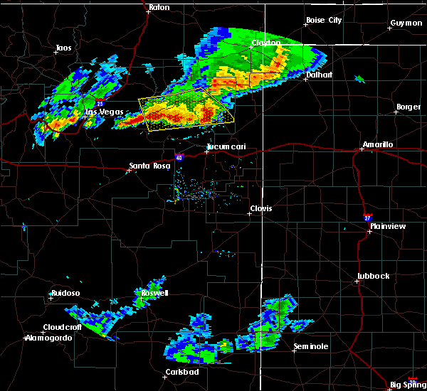 The severe thunderstorm warning for northeastern san miguel, central harding and southeastern mora counties will expire at 630 pm mdt, the storms which prompted the warning have weakened below severe limits, and no longer pose an immediate threat to life or property. therefore the warning will be allowed to expire. however small hail, gusty winds and heavy rain are still possible with these thunderstorms. a severe thunderstorm watch remains in effect until 800 pm mdt for northeastern new mexico. The severe thunderstorm warning for northeastern san miguel, central harding and southeastern mora counties will expire at 630 pm mdt, the storms which prompted the warning have weakened below severe limits, and no longer pose an immediate threat to life or property. therefore the warning will be allowed to expire. however small hail, gusty winds and heavy rain are still possible with these thunderstorms. a severe thunderstorm watch remains in effect until 800 pm mdt for northeastern new mexico.
|
| 8/18/2018 5:31 PM MDT |
 At 531 pm mdt, severe thunderstorms were located along a line extending from 6 miles southwest of bueyeros to near solano to 14 miles southwest of roy, moving south to southeast at 35 mph (radar indicated). Hazards include 60 mph wind gusts and penny size hail. expect damage to roofs, siding, and trees At 531 pm mdt, severe thunderstorms were located along a line extending from 6 miles southwest of bueyeros to near solano to 14 miles southwest of roy, moving south to southeast at 35 mph (radar indicated). Hazards include 60 mph wind gusts and penny size hail. expect damage to roofs, siding, and trees
|
| 8/13/2018 7:51 PM MDT |
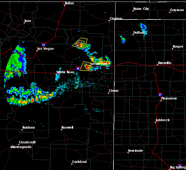 At 751 pm mdt, a severe thunderstorm was located near mosquero, moving southwest at 20 mph (radar indicated). Hazards include ping pong ball size hail and 60 mph wind gusts. People and animals outdoors will be injured. expect hail damage to roofs, siding, windows, and vehicles. Expect wind damage to roofs, siding, and trees. At 751 pm mdt, a severe thunderstorm was located near mosquero, moving southwest at 20 mph (radar indicated). Hazards include ping pong ball size hail and 60 mph wind gusts. People and animals outdoors will be injured. expect hail damage to roofs, siding, windows, and vehicles. Expect wind damage to roofs, siding, and trees.
|
| 8/13/2018 7:34 PM MDT |
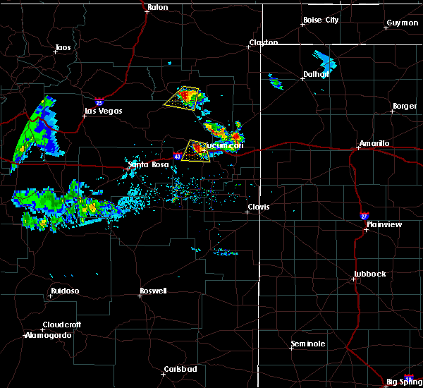 At 734 pm mdt, a severe thunderstorm was located near mosquero, moving southwest at 25 mph (radar indicated). Hazards include 60 mph wind gusts and half dollar size hail. Hail damage to vehicles is expected. Expect wind damage to roofs, siding, and trees. At 734 pm mdt, a severe thunderstorm was located near mosquero, moving southwest at 25 mph (radar indicated). Hazards include 60 mph wind gusts and half dollar size hail. Hail damage to vehicles is expected. Expect wind damage to roofs, siding, and trees.
|
| 8/7/2018 9:51 PM MDT |
 The severe thunderstorm warning for central harding county will expire at 1000 pm mdt, the storm which prompted the warning has moved out of the area. therefore the warning will be allowed to expire. however small hail, gusty winds and heavy rain are still possible with this thunderstorm. The severe thunderstorm warning for central harding county will expire at 1000 pm mdt, the storm which prompted the warning has moved out of the area. therefore the warning will be allowed to expire. however small hail, gusty winds and heavy rain are still possible with this thunderstorm.
|
| 8/7/2018 9:32 PM MDT |
 At 931 pm mdt, a severe thunderstorm was located 10 miles northeast of mosquero, moving southeast at 10 mph (radar indicated). Hazards include ping pong ball size hail and 60 mph wind gusts. People and animals outdoors will be injured. expect hail damage to roofs, siding, windows, and vehicles. expect wind damage to roofs, siding, and trees. Locations impacted include, mosquero. At 931 pm mdt, a severe thunderstorm was located 10 miles northeast of mosquero, moving southeast at 10 mph (radar indicated). Hazards include ping pong ball size hail and 60 mph wind gusts. People and animals outdoors will be injured. expect hail damage to roofs, siding, windows, and vehicles. expect wind damage to roofs, siding, and trees. Locations impacted include, mosquero.
|
| 8/7/2018 9:02 PM MDT |
 At 902 pm mdt, a severe thunderstorm was located 10 miles north of mosquero, moving south at 10 mph (radar indicated). Hazards include 70 mph wind gusts and ping pong ball size hail. People and animals outdoors will be injured. expect hail damage to roofs, siding, windows, and vehicles. expect considerable tree damage. Wind damage is also likely to mobile homes, roofs, and outbuildings. At 902 pm mdt, a severe thunderstorm was located 10 miles north of mosquero, moving south at 10 mph (radar indicated). Hazards include 70 mph wind gusts and ping pong ball size hail. People and animals outdoors will be injured. expect hail damage to roofs, siding, windows, and vehicles. expect considerable tree damage. Wind damage is also likely to mobile homes, roofs, and outbuildings.
|
| 6/9/2018 5:25 PM MDT |
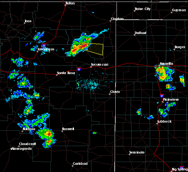 The national weather service in albuquerque has issued a * severe thunderstorm warning for. northeastern san miguel county in northeastern new mexico. southeastern harding county in northeastern new mexico. until 615 pm mdt. At 525 pm mdt, a severe thunderstorm was located 7 miles east of. The national weather service in albuquerque has issued a * severe thunderstorm warning for. northeastern san miguel county in northeastern new mexico. southeastern harding county in northeastern new mexico. until 615 pm mdt. At 525 pm mdt, a severe thunderstorm was located 7 miles east of.
|
| 5/19/2018 5:13 PM MDT |
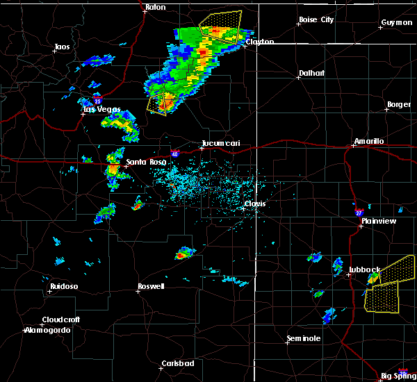 At 513 pm mdt, a severe thunderstorm was located 14 miles southwest of solano, or 14 miles southwest of mosquero, moving southeast at 10 mph (radar indicated). Hazards include 70 mph wind gusts and penny size hail. Expect considerable tree damage. Damage is likely to mobile homes, roofs, and outbuildings. At 513 pm mdt, a severe thunderstorm was located 14 miles southwest of solano, or 14 miles southwest of mosquero, moving southeast at 10 mph (radar indicated). Hazards include 70 mph wind gusts and penny size hail. Expect considerable tree damage. Damage is likely to mobile homes, roofs, and outbuildings.
|
| 8/10/2017 5:12 PM MDT |
 At 512 pm mdt, a severe thunderstorm was located 12 miles northeast of maes, or 23 miles southeast of wagon mound, moving east at 30 mph (radar indicated). Hazards include 60 mph wind gusts and half dollar size hail. Hail damage to vehicles is expected. Expect wind damage to roofs, siding, and trees. At 512 pm mdt, a severe thunderstorm was located 12 miles northeast of maes, or 23 miles southeast of wagon mound, moving east at 30 mph (radar indicated). Hazards include 60 mph wind gusts and half dollar size hail. Hail damage to vehicles is expected. Expect wind damage to roofs, siding, and trees.
|
| 6/20/2017 6:43 PM MDT |
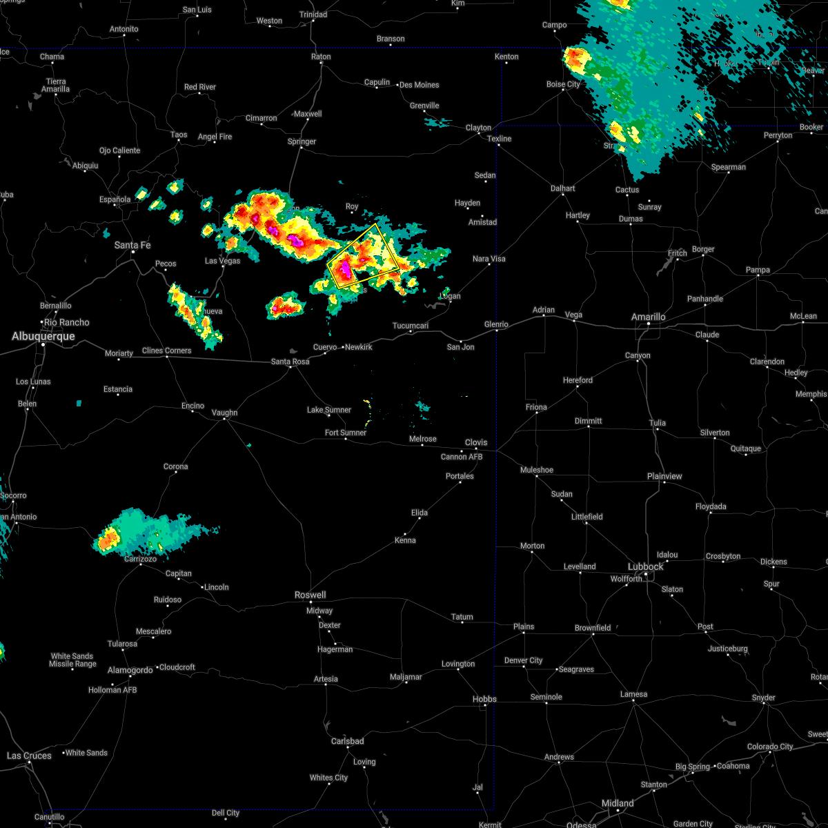 At 643 pm mdt, a severe thunderstorm was located 11 miles north of conchas dam, or 22 miles southwest of mosquero, moving northeast at 20 mph (radar indicated). Hazards include two inch hail and 60 mph wind gusts. People and animals outdoors will be injured. expect hail damage to roofs, siding, windows, and vehicles. Expect wind damage to roofs, siding, and trees. At 643 pm mdt, a severe thunderstorm was located 11 miles north of conchas dam, or 22 miles southwest of mosquero, moving northeast at 20 mph (radar indicated). Hazards include two inch hail and 60 mph wind gusts. People and animals outdoors will be injured. expect hail damage to roofs, siding, windows, and vehicles. Expect wind damage to roofs, siding, and trees.
|
| 6/8/2017 4:26 PM MDT |
 The severe thunderstorm warning for northeastern san miguel and central harding counties will expire at 430 pm mdt, the storm which prompted the warning has weakened below severe limits, and no longer pose an immediate threat to life or property. therefore the warning will be allowed to expire. however small hail and gusty winds are still possible with this thunderstorm. The severe thunderstorm warning for northeastern san miguel and central harding counties will expire at 430 pm mdt, the storm which prompted the warning has weakened below severe limits, and no longer pose an immediate threat to life or property. therefore the warning will be allowed to expire. however small hail and gusty winds are still possible with this thunderstorm.
|
| 6/8/2017 4:13 PM MDT |
 At 411 pm mdt, a strengthening severe thunderstorm was located near solano, or 7 miles west of mosquero, moving south southeast at 25 mph. at 335 pm a spotter near roy observed 60 mph winds with this storm (radar indicated). Hazards include 60 mph wind gusts and half dollar size hail. Hail damage to vehicles is expected. expect wind damage to roofs, siding, and trees. Locations impacted include, mosquero and solano. At 411 pm mdt, a strengthening severe thunderstorm was located near solano, or 7 miles west of mosquero, moving south southeast at 25 mph. at 335 pm a spotter near roy observed 60 mph winds with this storm (radar indicated). Hazards include 60 mph wind gusts and half dollar size hail. Hail damage to vehicles is expected. expect wind damage to roofs, siding, and trees. Locations impacted include, mosquero and solano.
|
| 6/8/2017 3:31 PM MDT |
 At 331 pm mdt, a severe thunderstorm was located over roy, or 18 miles northwest of mosquero, moving south at 25 mph (radar indicated). Hazards include 60 mph wind gusts and quarter size hail. Hail damage to vehicles is expected. Expect wind damage to roofs, siding, and trees. At 331 pm mdt, a severe thunderstorm was located over roy, or 18 miles northwest of mosquero, moving south at 25 mph (radar indicated). Hazards include 60 mph wind gusts and quarter size hail. Hail damage to vehicles is expected. Expect wind damage to roofs, siding, and trees.
|
| 5/22/2017 12:33 AM MDT |
 At 1232 am mdt, a severe thunderstorm was located 13 miles northeast of maes, or 23 miles southeast of wagon mound, moving east at 35 mph (radar indicated). Hazards include 60 mph wind gusts and quarter size hail. Hail damage to vehicles is expected. Expect wind damage to roofs, siding, and trees. At 1232 am mdt, a severe thunderstorm was located 13 miles northeast of maes, or 23 miles southeast of wagon mound, moving east at 35 mph (radar indicated). Hazards include 60 mph wind gusts and quarter size hail. Hail damage to vehicles is expected. Expect wind damage to roofs, siding, and trees.
|
| 5/9/2017 5:30 PM MDT |
 At 529 pm mdt, a severe thunderstorm was located near solano, or 10 miles northwest of mosquero, moving north at 40 mph. other strong to severe thunderstorms were located in the vicinity of mosquero extending north to chicosa lake state park (radar indicated). Hazards include 60 mph wind gusts and quarter size hail. Hail damage to vehicles is expected. Expect wind damage to roofs, siding, and trees. At 529 pm mdt, a severe thunderstorm was located near solano, or 10 miles northwest of mosquero, moving north at 40 mph. other strong to severe thunderstorms were located in the vicinity of mosquero extending north to chicosa lake state park (radar indicated). Hazards include 60 mph wind gusts and quarter size hail. Hail damage to vehicles is expected. Expect wind damage to roofs, siding, and trees.
|
| 9/15/2016 1:43 AM MDT |
 At 143 am mdt, a severe thunderstorm was located over mosquero, moving east at 20 mph (radar indicated). Hazards include 60 mph wind gusts and half dollar size hail. Hail damage to vehicles is expected. Expect wind damage to roofs, siding, and trees. At 143 am mdt, a severe thunderstorm was located over mosquero, moving east at 20 mph (radar indicated). Hazards include 60 mph wind gusts and half dollar size hail. Hail damage to vehicles is expected. Expect wind damage to roofs, siding, and trees.
|
| 7/3/2016 5:50 PM MDT | Quarter sized hail reported 0.6 miles NW of Mosquero, NM, trained spotter reported heavy hail at 1 with strong pre-storm gust front knocking limbs off trees. |
| 7/3/2016 5:50 PM MDT | Trained spotter reported heavy hail at 1 with strong pre-storm gust front knocking limbs off tree in san miguel county NM, 0.6 miles NW of Mosquero, NM |
| 7/3/2016 5:50 PM MDT | Golf Ball sized hail reported 1.8 miles SSW of Mosquero, NM, heavy damage at house due to combo wind and hail. windows busted. power pole broke off at the base. limbs 12 inch diameter broke off tree. hail piled up between 3 to 4 |
| 7/3/2016 5:50 PM MDT | Heavy damage at house due to combo wind and hail. windows busted. power pole broke off at the base. limbs 12 inch diameter broke off tree. hail piled up between 3 to 4 in harding county NM, 1.8 miles SSW of Mosquero, NM |
| 7/3/2016 5:50 PM MDT |
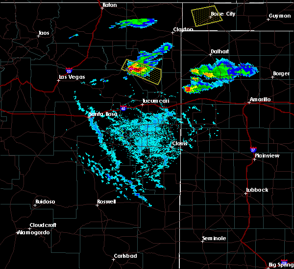 At 549 pm mdt, a severe thunderstorm was located 9 miles east of mosquero, moving southeast at 40 mph (radar indicated). Hazards include golf ball size hail and 60 mph wind gusts. People and animals outdoors will be injured. expect hail damage to roofs, siding, windows, and vehicles. expect wind damage to roofs, siding, and trees. Locations impacted include, mosquero. At 549 pm mdt, a severe thunderstorm was located 9 miles east of mosquero, moving southeast at 40 mph (radar indicated). Hazards include golf ball size hail and 60 mph wind gusts. People and animals outdoors will be injured. expect hail damage to roofs, siding, windows, and vehicles. expect wind damage to roofs, siding, and trees. Locations impacted include, mosquero.
|
| 7/3/2016 5:35 PM MDT |
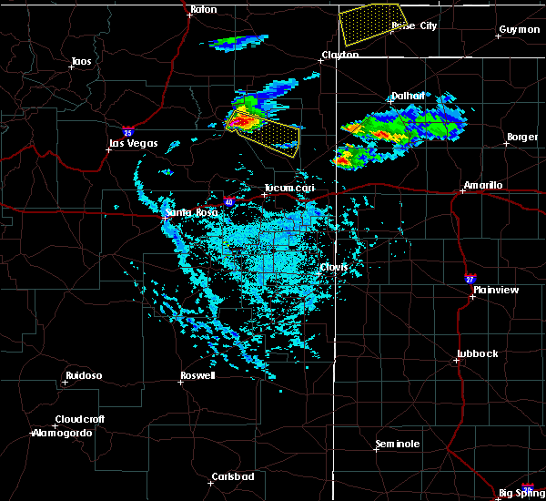 At 535 pm mdt, a severe thunderstorm was located 6 miles east of solano, or 6 miles north of mosquero, moving southeast at 40 mph (radar indicated). Hazards include quarter size hail and 60 mph wind gusts. Hail damage to vehicles is expected. Expect wind damage to roofs, siding, and trees. At 535 pm mdt, a severe thunderstorm was located 6 miles east of solano, or 6 miles north of mosquero, moving southeast at 40 mph (radar indicated). Hazards include quarter size hail and 60 mph wind gusts. Hail damage to vehicles is expected. Expect wind damage to roofs, siding, and trees.
|
| 6/13/2016 4:18 PM MDT |
 At 417 pm mdt, a severe thunderstorm was located near mosquero, moving northeast at 35 mph (radar indicated). Hazards include 60 mph wind gusts and half dollar size hail. Hail damage to vehicles is expected. expect wind damage to roofs, siding, and trees. locations impacted include, mosquero and solano. A tornado watch remains in effect until 900 pm mdt for northeastern new mexico. At 417 pm mdt, a severe thunderstorm was located near mosquero, moving northeast at 35 mph (radar indicated). Hazards include 60 mph wind gusts and half dollar size hail. Hail damage to vehicles is expected. expect wind damage to roofs, siding, and trees. locations impacted include, mosquero and solano. A tornado watch remains in effect until 900 pm mdt for northeastern new mexico.
|
| 6/13/2016 4:04 PM MDT |
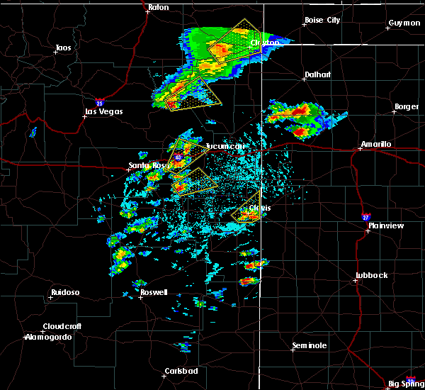 At 404 pm mdt, a severe thunderstorm was located 7 miles southwest of solano, or 9 miles west of mosquero, moving northeast at 35 mph (radar indicated). Hazards include half dollar size hail and 60 mph wind gusts. Hail damage to vehicles is expected. Expect wind damage to roofs, siding, and trees. At 404 pm mdt, a severe thunderstorm was located 7 miles southwest of solano, or 9 miles west of mosquero, moving northeast at 35 mph (radar indicated). Hazards include half dollar size hail and 60 mph wind gusts. Hail damage to vehicles is expected. Expect wind damage to roofs, siding, and trees.
|
| 5/26/2015 9:08 PM MDT | The severe thunderstorm warning for northeastern san miguel and central harding counties will expire at 915 pm mdt, the storm which prompted the warning has weakened below severe limits, and no longer pose an immediate threat to life or property. therefore the warning will be allowed to expire. |
| 5/26/2015 8:45 PM MDT | At 844 pm mdt, a severe thunderstorm was located near mosquero, moving east at 20 mph (radar indicated). Hazards include 60 mph wind gusts and quarter size hail. Hail damage to vehicles is expected. expect wind damage to roofs, siding and trees. Locations impacted include, mosquero and solano. |
| 5/26/2015 8:21 PM MDT | At 821 pm mdt, a severe thunderstorm was located 7 miles southwest of solano, or 12 miles west of mosquero, moving northeast at 20 mph (radar indicated). Hazards include quarter size hail and 60 mph wind gusts. Hail damage to vehicles is expected. Expect wind damage to roofs, siding and trees. |
| 9/29/2014 5:14 PM MDT | Quarter sized hail reported 16.1 miles WNW of Mosquero, NM, quarter sized hail reported 2 miles south of mitchell ranch headquarters. |
| 9/29/2014 4:32 PM MDT | Storm damage reported in harding county NM, 8.3 miles W of Mosquero, NM |
| 9/29/2014 4:24 PM MDT | Quarter sized hail reported 0.9 miles WSW of Mosquero, NM |
| 6/7/2014 5:49 PM MDT | Half Dollar sized hail reported 14.9 miles NNW of Mosquero, NM |
| 6/6/2014 6:10 PM MDT | Golf Ball sized hail reported 1.8 miles SSW of Mosquero, NM |
| 5/21/2012 6:13 PM MDT | Quarter sized hail reported 25.3 miles NNW of Mosquero, NM |
Hail Maps for Mosquero, NM
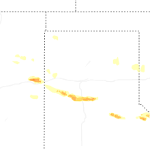
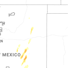


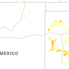


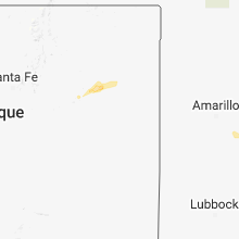


Connect with Interactive Hail Maps