

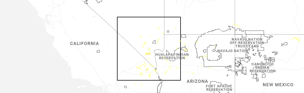
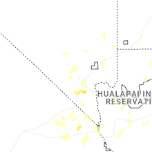
Hail Map for Mount Charleston, NV
The Mount Charleston, NV area has had 0 reports of on-the-ground hail by trained spotters, and has been under severe weather warnings 3 times during the past 12 months. Doppler radar has detected hail at or near Mount Charleston, NV on 19 occasions, including 1 occasion during the past year.
| Name: | Mount Charleston, NV |
| Where Located: | 26.7 miles WNW of Las Vegas, NV |
| Map: | Google Map for Mount Charleston, NV |
| Population: | 357 |
| Housing Units: | 504 |
| More Info: | Search Google for Mount Charleston, NV |
4
The Top Recent Hail Date for Mount Charleston, NV is Tuesday, June 3, 2025 (2nd out of 19)
Hail and Wind Damage Spotted near Mount Charleston, NV
| Date / Time | Report Details |
|---|---|
| 6/3/2025 4:10 PM PDT |
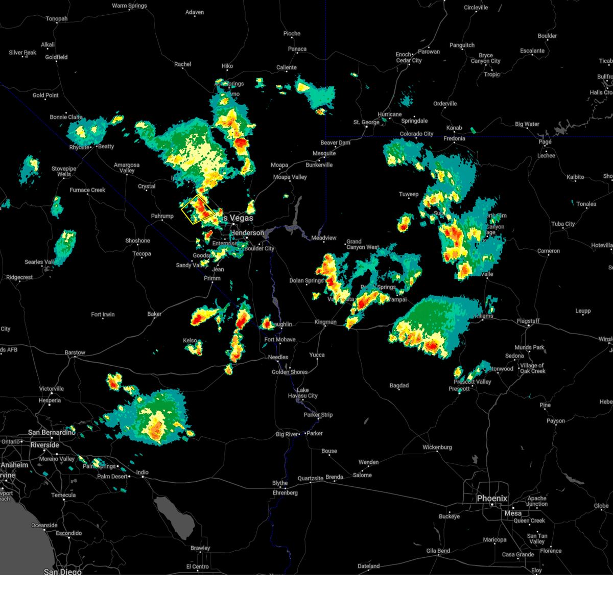 The storm which prompted the warning has weakened, and no longer poses an immediate threat to life or property. therefore, the warning will be allowed to expire. however, small hail is still possible with this thunderstorm. The storm which prompted the warning has weakened, and no longer poses an immediate threat to life or property. therefore, the warning will be allowed to expire. however, small hail is still possible with this thunderstorm.
|
| 6/3/2025 3:59 PM PDT |
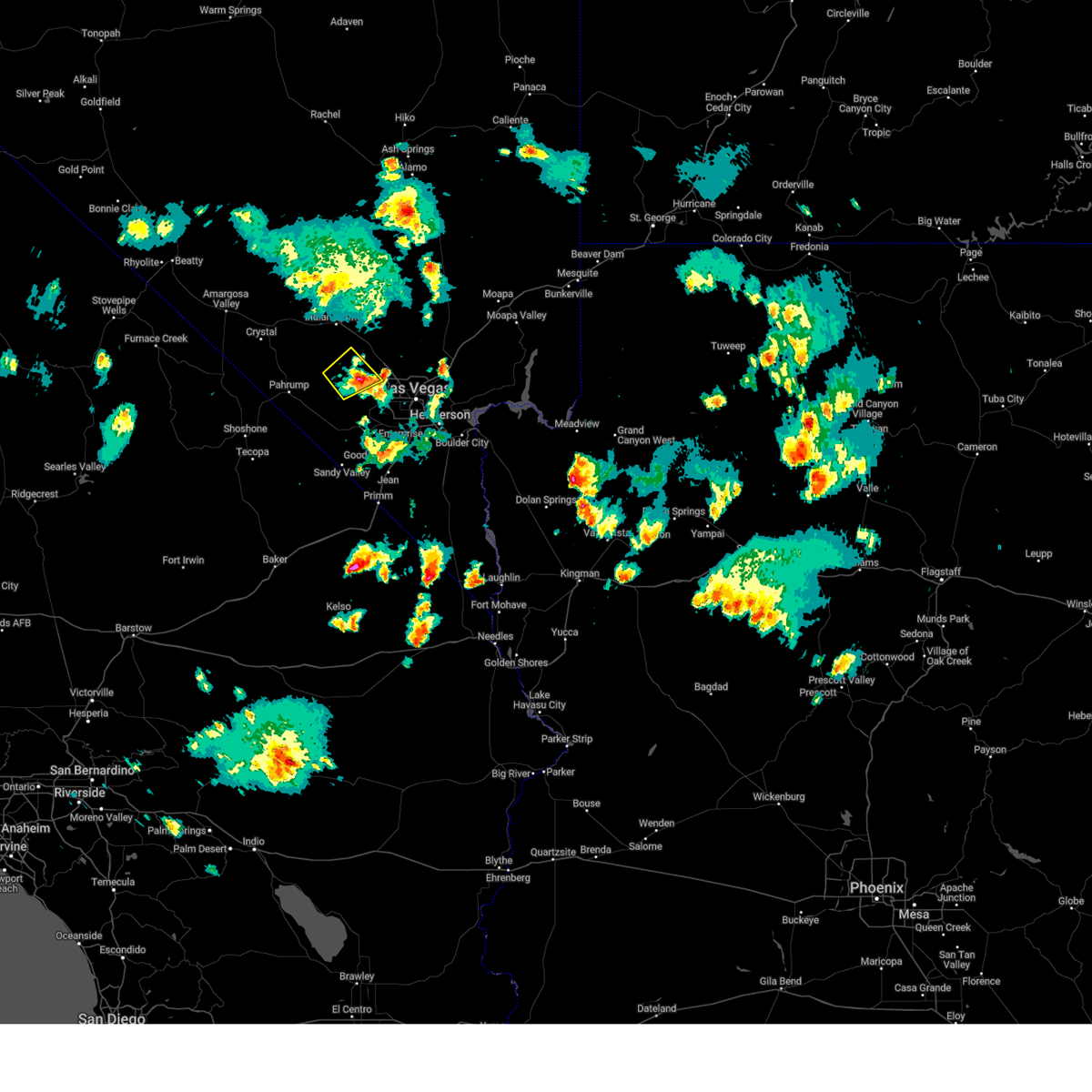 At 358 pm pdt, a severe thunderstorm was located 7 miles east of hilltop campground, or 7 miles east of mt. charleston, moving east at 15 mph (radar indicated). Hazards include quarter size hail. Damage to vehicles is expected. locations impacted include, rainbow canyon, spring mountains, mt. Charleston, mahogany grove campground, mary jane falls campground, kyle canyon campground, dolomite campground, fletcher view campground, mcwilliams campground, and hilltop campground. At 358 pm pdt, a severe thunderstorm was located 7 miles east of hilltop campground, or 7 miles east of mt. charleston, moving east at 15 mph (radar indicated). Hazards include quarter size hail. Damage to vehicles is expected. locations impacted include, rainbow canyon, spring mountains, mt. Charleston, mahogany grove campground, mary jane falls campground, kyle canyon campground, dolomite campground, fletcher view campground, mcwilliams campground, and hilltop campground.
|
| 6/3/2025 3:35 PM PDT |
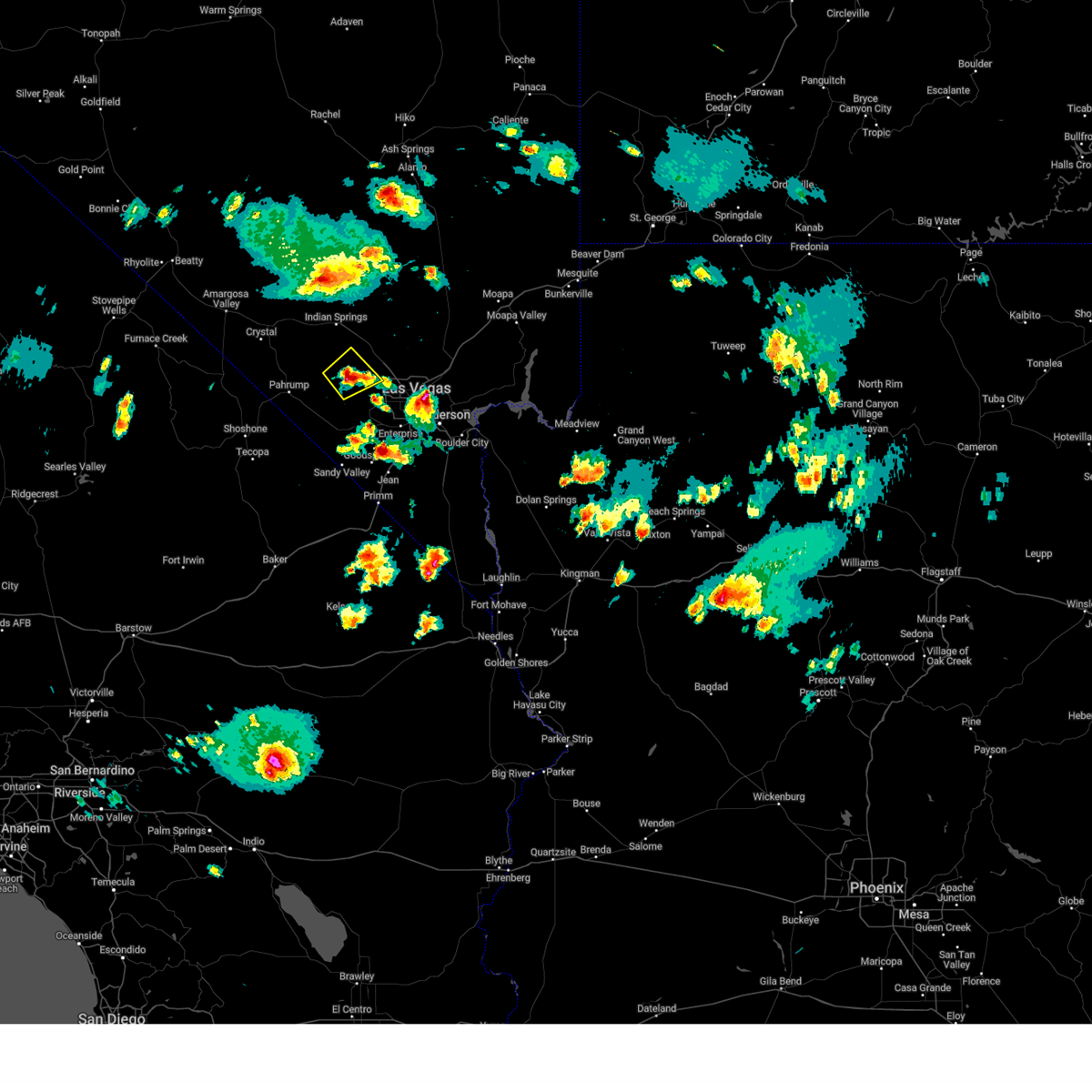 Svrvef the national weather service in las vegas has issued a * severe thunderstorm warning for, west central clark county in southern nevada, * until 415 pm pdt. * at 335 pm pdt, a severe thunderstorm was located over kyle canyon campground, or over mt. charleston, moving east at 15 mph (radar indicated). Hazards include quarter size hail. damage to vehicles is expected Svrvef the national weather service in las vegas has issued a * severe thunderstorm warning for, west central clark county in southern nevada, * until 415 pm pdt. * at 335 pm pdt, a severe thunderstorm was located over kyle canyon campground, or over mt. charleston, moving east at 15 mph (radar indicated). Hazards include quarter size hail. damage to vehicles is expected
|
| 8/11/2023 4:58 PM PDT |
 The severe thunderstorm warning for west central clark and southeastern nye counties will expire at 500 pm pdt, the storm which prompted the warning has weakened below severe limits, and no longer poses an immediate threat to life or property. therefore, the warning will be allowed to expire. however small hail is still possible with some of these thunderstorms. The severe thunderstorm warning for west central clark and southeastern nye counties will expire at 500 pm pdt, the storm which prompted the warning has weakened below severe limits, and no longer poses an immediate threat to life or property. therefore, the warning will be allowed to expire. however small hail is still possible with some of these thunderstorms.
|
| 8/11/2023 4:41 PM PDT |
 At 440 pm pdt, a severe thunderstorm was located near lovell canyon campground, or near rainbow canyon, moving north at 10 mph (radar indicated). Hazards include 60 mph wind gusts and quarter size hail. Hail damage to vehicles is expected. expect wind damage to roofs and trees. locations impacted include, rainbow canyon, spring mountains, mt. charleston, mahogany grove campground, mary jane falls campground, kyle canyon campground, dolomite campground, fletcher view campground, mcwilliams campground, lovell canyon campground and hilltop campground. this includes the following roads, lee canyon road between mile markers 1 and 14. kyle canyon road between mile markers 1 and 9. deer creek road between mile markers 1 and 8. state route 160 in clark county near mile marker 34. hail threat, radar indicated max hail size, 1. 00 in wind threat, radar indicated max wind gust, 60 mph. At 440 pm pdt, a severe thunderstorm was located near lovell canyon campground, or near rainbow canyon, moving north at 10 mph (radar indicated). Hazards include 60 mph wind gusts and quarter size hail. Hail damage to vehicles is expected. expect wind damage to roofs and trees. locations impacted include, rainbow canyon, spring mountains, mt. charleston, mahogany grove campground, mary jane falls campground, kyle canyon campground, dolomite campground, fletcher view campground, mcwilliams campground, lovell canyon campground and hilltop campground. this includes the following roads, lee canyon road between mile markers 1 and 14. kyle canyon road between mile markers 1 and 9. deer creek road between mile markers 1 and 8. state route 160 in clark county near mile marker 34. hail threat, radar indicated max hail size, 1. 00 in wind threat, radar indicated max wind gust, 60 mph.
|
| 8/11/2023 4:11 PM PDT |
 At 410 pm pdt, a severe thunderstorm was located near lovell canyon campground, or 7 miles south of rainbow canyon, moving north at 20 mph (radar indicated). Hazards include 60 mph wind gusts and quarter size hail. Hail damage to vehicles is expected. Expect wind damage to roofs and trees. At 410 pm pdt, a severe thunderstorm was located near lovell canyon campground, or 7 miles south of rainbow canyon, moving north at 20 mph (radar indicated). Hazards include 60 mph wind gusts and quarter size hail. Hail damage to vehicles is expected. Expect wind damage to roofs and trees.
|
| 7/25/2021 10:36 PM PDT |
 The severe thunderstorm warning for north central san bernardino, southeastern inyo, northwestern clark and southern nye counties will expire at 1045 pm pdt, the storms which prompted the warning have weakened below severe limits, and no longer pose an immediate threat to life or property. therefore, the warning will be allowed to expire. however gusty winds are still possible with these thunderstorms. The severe thunderstorm warning for north central san bernardino, southeastern inyo, northwestern clark and southern nye counties will expire at 1045 pm pdt, the storms which prompted the warning have weakened below severe limits, and no longer pose an immediate threat to life or property. therefore, the warning will be allowed to expire. however gusty winds are still possible with these thunderstorms.
|
| 7/25/2021 10:32 PM PDT |
 At 1029 pm pdt, severe thunderstorms were located along a line extending from 15 miles north of texas springs campground to near tecopa to 13 miles northwest of mountain pass, moving west at 45 mph. strongest winds have been north of desert rock where gusts to 50-57 mph were observed (radar indicated). Hazards include 60 mph wind gusts. Expect damage to roofs and trees. locations impacted include, pahrump, beatty, jean, shoshone, furnace creek, primm, mercury, spring mountains, sandy valley, goodsprings, texas springs campground, indian springs, mountain springs, mcwilliams campground, willow creek campground, death valley junction, amargosa valley, mary jane falls campground, dolomite campground and lathrop wells. this includes the following highways, interstate 15 in california near mile marker 186. Interstate 15 in nevada between mile markers 1 and 18. At 1029 pm pdt, severe thunderstorms were located along a line extending from 15 miles north of texas springs campground to near tecopa to 13 miles northwest of mountain pass, moving west at 45 mph. strongest winds have been north of desert rock where gusts to 50-57 mph were observed (radar indicated). Hazards include 60 mph wind gusts. Expect damage to roofs and trees. locations impacted include, pahrump, beatty, jean, shoshone, furnace creek, primm, mercury, spring mountains, sandy valley, goodsprings, texas springs campground, indian springs, mountain springs, mcwilliams campground, willow creek campground, death valley junction, amargosa valley, mary jane falls campground, dolomite campground and lathrop wells. this includes the following highways, interstate 15 in california near mile marker 186. Interstate 15 in nevada between mile markers 1 and 18.
|
| 7/25/2021 9:55 PM PDT |
 The national weather service in las vegas has issued a * severe thunderstorm warning for. north central san bernardino county in southern california. southeastern inyo county in south central california. northwestern clark county in southern nevada. Southern nye county in south central nevada. The national weather service in las vegas has issued a * severe thunderstorm warning for. north central san bernardino county in southern california. southeastern inyo county in south central california. northwestern clark county in southern nevada. Southern nye county in south central nevada.
|
| 7/25/2021 9:55 PM PDT |
 At 951 pm pdt, severe thunderstorms were located along a line extending from near indian springs to 7 miles west of sandy valley to 11 miles north of nipton road mile marker 3, moving west at 45 mph (radar indicated). Hazards include 70 mph wind gusts. Expect considerable tree damage. Damage is likely to mobile homes, roofs, and outbuildings. At 951 pm pdt, severe thunderstorms were located along a line extending from near indian springs to 7 miles west of sandy valley to 11 miles north of nipton road mile marker 3, moving west at 45 mph (radar indicated). Hazards include 70 mph wind gusts. Expect considerable tree damage. Damage is likely to mobile homes, roofs, and outbuildings.
|
| 7/25/2021 9:53 PM PDT |
 The severe thunderstorm warning for western mohave, western clark and southeastern nye counties will expire at 1000 pm pdt/1000 pm mst/, the storms which prompted the warning continue to move southwest through far southern clark county and southern nye county. additional, severe thunderstorm warnings will be issued. gusty winds are still possible with these thunderstorms. The severe thunderstorm warning for western mohave, western clark and southeastern nye counties will expire at 1000 pm pdt/1000 pm mst/, the storms which prompted the warning continue to move southwest through far southern clark county and southern nye county. additional, severe thunderstorm warnings will be issued. gusty winds are still possible with these thunderstorms.
|
| 7/25/2021 9:32 PM PDT |
 At 930 pm pdt/930 pm mst/, severe thunderstorms were located along a line extending from near cottonwood cove campground to near goodsprings to 6 miles west of indian springs, moving south at 35 mph (radar indicated). Hazards include 70 mph wind gusts. Expect considerable tree damage. damage is likely to mobile homes, roofs, and outbuildings. locations impacted include, henderson, pahrump, laughlin, rainbow canyon, mountains edge, blue diamond, southern highlands, jean, mt. charleston, red rock canyon, enterprise, searchlight, primm, spring mountains, mercury, summerlin, spring valley, paradise, kyle canyon campground and fletcher view campground. This includes interstate 15 in nevada between mile markers 1 and 25. At 930 pm pdt/930 pm mst/, severe thunderstorms were located along a line extending from near cottonwood cove campground to near goodsprings to 6 miles west of indian springs, moving south at 35 mph (radar indicated). Hazards include 70 mph wind gusts. Expect considerable tree damage. damage is likely to mobile homes, roofs, and outbuildings. locations impacted include, henderson, pahrump, laughlin, rainbow canyon, mountains edge, blue diamond, southern highlands, jean, mt. charleston, red rock canyon, enterprise, searchlight, primm, spring mountains, mercury, summerlin, spring valley, paradise, kyle canyon campground and fletcher view campground. This includes interstate 15 in nevada between mile markers 1 and 25.
|
| 7/25/2021 8:59 PM PDT |
 At 857 pm pdt/857 pm mst/, severe thunderstorms were located along a line extending from 13 miles north of cottonwood cove campground to spring valley to 15 miles north of indian springs, moving south at 35 mph (radar indicated). Hazards include 70 mph wind gusts. Expect considerable tree damage. Damage is likely to mobile homes, roofs, and outbuildings. At 857 pm pdt/857 pm mst/, severe thunderstorms were located along a line extending from 13 miles north of cottonwood cove campground to spring valley to 15 miles north of indian springs, moving south at 35 mph (radar indicated). Hazards include 70 mph wind gusts. Expect considerable tree damage. Damage is likely to mobile homes, roofs, and outbuildings.
|
| 7/25/2021 8:23 PM PDT |
 At 821 pm pdt/821 pm mst/, severe thunderstorms were located along a line extending from 10 miles north of centennial hills to near hoover dam to near grand canyon ranch, moving southwest at 30 mph (radar indicated). Hazards include 70 mph wind gusts. Expect considerable tree damage. damage is likely to mobile homes, roofs, and outbuildings. locations impacted include, las vegas, henderson, north las vegas, boulder city, rainbow canyon, summerlin, nellis afb, the motor speedway, red rock canyon, green valley, spring mountains, paradise, lone mountain, anthem, mountains edge, the strip, blue diamond, downtown las vegas, east las vegas and sam boyd stadium. This includes interstate 15 in nevada between mile markers 16 and 70. At 821 pm pdt/821 pm mst/, severe thunderstorms were located along a line extending from 10 miles north of centennial hills to near hoover dam to near grand canyon ranch, moving southwest at 30 mph (radar indicated). Hazards include 70 mph wind gusts. Expect considerable tree damage. damage is likely to mobile homes, roofs, and outbuildings. locations impacted include, las vegas, henderson, north las vegas, boulder city, rainbow canyon, summerlin, nellis afb, the motor speedway, red rock canyon, green valley, spring mountains, paradise, lone mountain, anthem, mountains edge, the strip, blue diamond, downtown las vegas, east las vegas and sam boyd stadium. This includes interstate 15 in nevada between mile markers 16 and 70.
|
| 7/25/2021 7:57 PM PDT |
 At 757 pm pdt/757 pm mst/, severe thunderstorms were located along a line extending from 18 miles north of the motor speedway to 7 miles southwest of echo bay campground to meadview, moving south at 20 mph (radar indicated). Hazards include 60 mph wind gusts. expect damage to roofs and trees At 757 pm pdt/757 pm mst/, severe thunderstorms were located along a line extending from 18 miles north of the motor speedway to 7 miles southwest of echo bay campground to meadview, moving south at 20 mph (radar indicated). Hazards include 60 mph wind gusts. expect damage to roofs and trees
|
| 8/11/2018 9:36 PM PDT |
 At 837 pm pdt/837 pm mst/, severe thunderstorms were located along a line extending from the sheep mountains to willow beach, moving southwest at 30 mph (radar indicated). Hazards include 70 mph wind gusts. Expect considerable tree damage. Damage is likely to mobile homes, roofs, and outbuildings. At 837 pm pdt/837 pm mst/, severe thunderstorms were located along a line extending from the sheep mountains to willow beach, moving southwest at 30 mph (radar indicated). Hazards include 70 mph wind gusts. Expect considerable tree damage. Damage is likely to mobile homes, roofs, and outbuildings.
|
| 8/11/2018 9:36 PM PDT |
 The severe thunderstorm warning for west central mohave and northwestern clark counties will expire at 945 pm pdt/945 pm mst/, the storms which prompted the warning have weakened below severe limits, and have exited the warned area. therefore, the warning will be allowed to expire. however gusty winds will linger over the next hour or so. The severe thunderstorm warning for west central mohave and northwestern clark counties will expire at 945 pm pdt/945 pm mst/, the storms which prompted the warning have weakened below severe limits, and have exited the warned area. therefore, the warning will be allowed to expire. however gusty winds will linger over the next hour or so.
|
| 8/11/2018 8:39 PM PDT |
 At 837 pm pdt/837 pm mst/, severe thunderstorms were located along a line extending from the sheep mountains to willow beach, moving southwest at 30 mph (radar indicated). Hazards include 70 mph wind gusts. Expect considerable tree damage. Damage is likely to mobile homes, roofs, and outbuildings. At 837 pm pdt/837 pm mst/, severe thunderstorms were located along a line extending from the sheep mountains to willow beach, moving southwest at 30 mph (radar indicated). Hazards include 70 mph wind gusts. Expect considerable tree damage. Damage is likely to mobile homes, roofs, and outbuildings.
|
| 8/11/2018 8:36 PM PDT |
 At 836 pm pdt/836 pm mst/, wind gusts in excess of 70 mph are being reported in the warned area (radar indicated). Hazards include 70 mph wind gusts. Expect considerable tree damage. damage is likely to mobile homes, roofs, and outbuildings. locations impacted include, las vegas, henderson, north las vegas, boulder city, rainbow canyon, summerlin, nellis afb, red rock canyon, green valley, spring mountains, paradise, lone mountain, anthem, mountains edge, the strip, blue diamond, downtown las vegas, east las vegas, sam boyd stadium and southern highlands. This includes interstate 15 in nevada between mile markers 17 and 25. At 836 pm pdt/836 pm mst/, wind gusts in excess of 70 mph are being reported in the warned area (radar indicated). Hazards include 70 mph wind gusts. Expect considerable tree damage. damage is likely to mobile homes, roofs, and outbuildings. locations impacted include, las vegas, henderson, north las vegas, boulder city, rainbow canyon, summerlin, nellis afb, red rock canyon, green valley, spring mountains, paradise, lone mountain, anthem, mountains edge, the strip, blue diamond, downtown las vegas, east las vegas, sam boyd stadium and southern highlands. This includes interstate 15 in nevada between mile markers 17 and 25.
|
| 8/11/2018 8:07 PM PDT |
 At 806 pm pdt/806 pm mst/, severe thunderstorms were located along a line extending from 20 miles north of aliante to callville bay, moving southwest at 30 mph (radar indicated). Hazards include 60 mph wind gusts. expect damage to roofs and trees At 806 pm pdt/806 pm mst/, severe thunderstorms were located along a line extending from 20 miles north of aliante to callville bay, moving southwest at 30 mph (radar indicated). Hazards include 60 mph wind gusts. expect damage to roofs and trees
|
| 7/19/2018 9:38 PM PDT |
 The severe thunderstorm warning for northwestern clark county will expire at 945 pm pdt, the storm which prompted the warning has weakened below severe limits, and no longer poses an immediate threat to life or property. therefore, the warning will be allowed to expire. however gusty winds and heavy rain are still possible for another hour or two. The severe thunderstorm warning for northwestern clark county will expire at 945 pm pdt, the storm which prompted the warning has weakened below severe limits, and no longer poses an immediate threat to life or property. therefore, the warning will be allowed to expire. however gusty winds and heavy rain are still possible for another hour or two.
|
| 7/19/2018 9:20 PM PDT |
 At 919 pm pdt, severe thunderstorm winds were located over mountains edge, moving southwest at 35 mph. strong winds with gusts over 60 mph have been observed across parts of the las vegas valley, along with sporadic power outages (radar indicated). Hazards include 60 mph wind gusts. Expect damage to roofs and trees. locations impacted include, las vegas, henderson, north las vegas, boulder city, lone mountain, anthem, summerlin, mountains edge, the strip, nellis afb, blue diamond, downtown las vegas, east las vegas, sam boyd stadium, the motor speedway, southern highlands, las vegas bay, aliante, lake las vegas and spring valley. This includes interstate 15 in nevada between mile markers 22 and 25. At 919 pm pdt, severe thunderstorm winds were located over mountains edge, moving southwest at 35 mph. strong winds with gusts over 60 mph have been observed across parts of the las vegas valley, along with sporadic power outages (radar indicated). Hazards include 60 mph wind gusts. Expect damage to roofs and trees. locations impacted include, las vegas, henderson, north las vegas, boulder city, lone mountain, anthem, summerlin, mountains edge, the strip, nellis afb, blue diamond, downtown las vegas, east las vegas, sam boyd stadium, the motor speedway, southern highlands, las vegas bay, aliante, lake las vegas and spring valley. This includes interstate 15 in nevada between mile markers 22 and 25.
|
| 7/19/2018 8:47 PM PDT |
 The national weather service in las vegas has issued a * severe thunderstorm warning for. northwestern clark county in southern nevada. until 945 pm pdt. at 846 pm pdt, severe thunderstorm winds were located over nellis afb, moving southwest at 35 mph. Strong winds in excess of 60 mph. The national weather service in las vegas has issued a * severe thunderstorm warning for. northwestern clark county in southern nevada. until 945 pm pdt. at 846 pm pdt, severe thunderstorm winds were located over nellis afb, moving southwest at 35 mph. Strong winds in excess of 60 mph.
|
| 8/11/2017 1:23 PM PDT |
 The severe thunderstorm warning for northwestern clark county will expire at 130 pm pdt, the storm which prompted the warning has weakened below severe limits, and no longer poses an immediate threat to life or property. therefore the warning will be allowed to expire. The severe thunderstorm warning for northwestern clark county will expire at 130 pm pdt, the storm which prompted the warning has weakened below severe limits, and no longer poses an immediate threat to life or property. therefore the warning will be allowed to expire.
|
| 8/11/2017 1:15 PM PDT |
 At 114 pm pdt, a severe thunderstorm was located 12 miles northwest of centennial hills, moving northeast at 25 mph (radar indicated). Hazards include 60 mph wind gusts and nickel size hail. Expect damage to roofs, siding, and trees. Locations impacted include, gass peak and highway 95 between mile marker 95 and 105. At 114 pm pdt, a severe thunderstorm was located 12 miles northwest of centennial hills, moving northeast at 25 mph (radar indicated). Hazards include 60 mph wind gusts and nickel size hail. Expect damage to roofs, siding, and trees. Locations impacted include, gass peak and highway 95 between mile marker 95 and 105.
|
| 8/11/2017 12:47 PM PDT |
 At 1246 pm pdt, a severe thunderstorm was located near hilltop campground, or near mt. charleston, moving northeast at 20 mph (radar indicated). Hazards include 60 mph wind gusts and quarter size hail. Hail damage to vehicles is expected. Expect wind damage to roofs, siding, and trees. At 1246 pm pdt, a severe thunderstorm was located near hilltop campground, or near mt. charleston, moving northeast at 20 mph (radar indicated). Hazards include 60 mph wind gusts and quarter size hail. Hail damage to vehicles is expected. Expect wind damage to roofs, siding, and trees.
|
| 6/30/2016 1:13 PM PDT |
 At 111 pm pdt, doppler radar continued to indicate a severe thunderstorm capable of producing quarter size hail and damaging winds in excess of 60 mph. this storm was located over red rock canyon, moving northeast at 5 mph. other dangerous storms are located near spring mountain ranch and kyle canyon road also capable of producing quarter sized hail. locations impacted include, blue diamond, red rock canyon, spring mountains, lone mountain, summerlin, mountains edge, enterprise, spring valley, kyle canyon campground, red rock canyon campground, lovell canyon campground, hilltop campground, mountain springs, spring mountain ranch and rocky gap campground. At 111 pm pdt, doppler radar continued to indicate a severe thunderstorm capable of producing quarter size hail and damaging winds in excess of 60 mph. this storm was located over red rock canyon, moving northeast at 5 mph. other dangerous storms are located near spring mountain ranch and kyle canyon road also capable of producing quarter sized hail. locations impacted include, blue diamond, red rock canyon, spring mountains, lone mountain, summerlin, mountains edge, enterprise, spring valley, kyle canyon campground, red rock canyon campground, lovell canyon campground, hilltop campground, mountain springs, spring mountain ranch and rocky gap campground.
|
| 6/30/2016 12:52 PM PDT |
 At 1251 pm pdt, doppler radar indicated a severe thunderstorm capable of producing quarter size hail and damaging winds in excess of 60 mph. this storm was located over red rock canyon, and moving northeast at 5 mph. another severe storm was located over kyle canyon road near mt. charleston. At 1251 pm pdt, doppler radar indicated a severe thunderstorm capable of producing quarter size hail and damaging winds in excess of 60 mph. this storm was located over red rock canyon, and moving northeast at 5 mph. another severe storm was located over kyle canyon road near mt. charleston.
|
| 1/31/2016 5:22 PM PST |
 The severe thunderstorm warning for northwestern clark county will expire at 530 pm pst, the storm over the spring mountains has weakened. therefore the warning will be allowed to expire. wind gusts of 51 mph were observed in indian springs. The severe thunderstorm warning for northwestern clark county will expire at 530 pm pst, the storm over the spring mountains has weakened. therefore the warning will be allowed to expire. wind gusts of 51 mph were observed in indian springs.
|
| 1/31/2016 4:57 PM PST |
 At 455 pm pst, doppler radar indicated a severe thunderstorm capable of producing damaging winds in excess of 60 mph. this storm was located near corn creek visitors center, or 12 miles northeast of mt. charleston, moving northeast at 50 mph. locations impacted include, rainbow canyon, lone mountain, mt. charleston, red rock canyon, spring mountains, centennial hills, summerlin, blue diamond, mcwilliams campground, mary jane falls campground, willow creek campground, kyle canyon campground, red rock canyon campground, lovell canyon campground, hilltop campground, corn creek visitors center, spring mountain ranch, mahogany grove campground and floyd lamb state park. At 455 pm pst, doppler radar indicated a severe thunderstorm capable of producing damaging winds in excess of 60 mph. this storm was located near corn creek visitors center, or 12 miles northeast of mt. charleston, moving northeast at 50 mph. locations impacted include, rainbow canyon, lone mountain, mt. charleston, red rock canyon, spring mountains, centennial hills, summerlin, blue diamond, mcwilliams campground, mary jane falls campground, willow creek campground, kyle canyon campground, red rock canyon campground, lovell canyon campground, hilltop campground, corn creek visitors center, spring mountain ranch, mahogany grove campground and floyd lamb state park.
|
| 1/31/2016 4:43 PM PST |
 At 442 pm pst, doppler radar indicated a severe thunderstorm capable of producing damaging winds in excess of 60 mph. this storm was located over dolomite campground, or near mt. charleston, and moving northeast at 45 mph. At 442 pm pst, doppler radar indicated a severe thunderstorm capable of producing damaging winds in excess of 60 mph. this storm was located over dolomite campground, or near mt. charleston, and moving northeast at 45 mph.
|
| 9/12/2015 2:34 PM PDT |
 At 232 pm pdt, doppler radar continued to indicate a severe thunderstorm capable of producing quarter size hail. this storm was located over mary jane falls campground, or over mt. charleston, moving north at 5 mph. hail of dime size was reported earlier near mary jane falls campground. locations impacted include, rainbow canyon, mt. charleston, spring mountains, mahogany grove campground, mcwilliams campground, mary jane falls campground, kyle canyon campground, fletcher view campground, hilltop campground and dolomite campground. At 232 pm pdt, doppler radar continued to indicate a severe thunderstorm capable of producing quarter size hail. this storm was located over mary jane falls campground, or over mt. charleston, moving north at 5 mph. hail of dime size was reported earlier near mary jane falls campground. locations impacted include, rainbow canyon, mt. charleston, spring mountains, mahogany grove campground, mcwilliams campground, mary jane falls campground, kyle canyon campground, fletcher view campground, hilltop campground and dolomite campground.
|
| 9/12/2015 2:18 PM PDT |
 At 217 pm pdt, doppler radar indicated a severe thunderstorm capable of producing quarter size hail. this storm was located over mary jane falls campground, or over kyle canyon, and moving north at 5 mph. At 217 pm pdt, doppler radar indicated a severe thunderstorm capable of producing quarter size hail. this storm was located over mary jane falls campground, or over kyle canyon, and moving north at 5 mph.
|
Hail Maps for Mount Charleston, NV


Connect with Interactive Hail Maps