

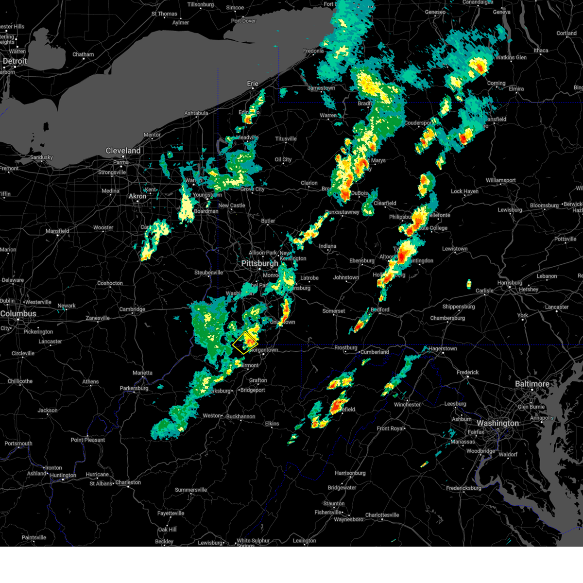
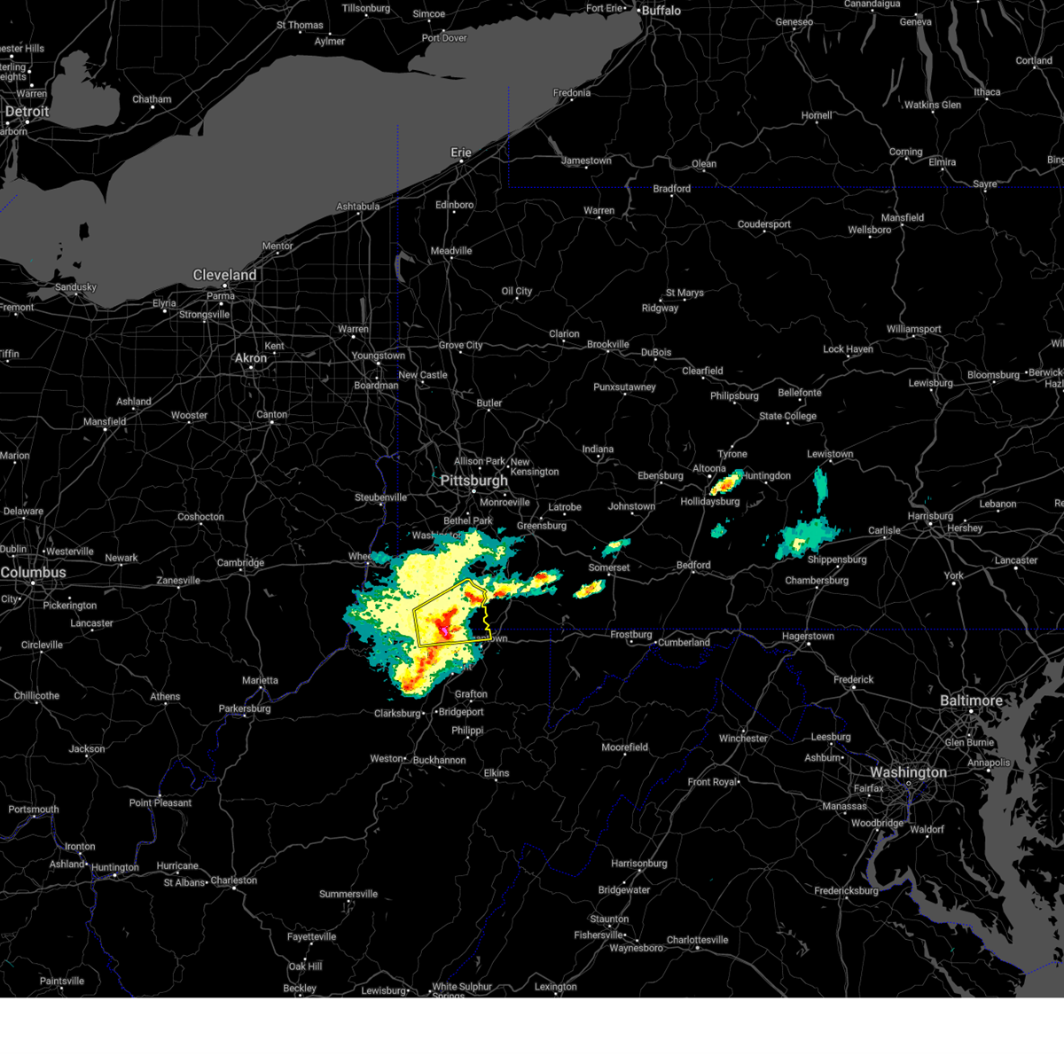
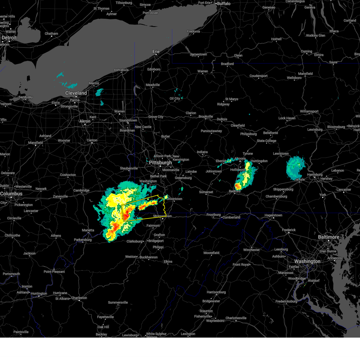
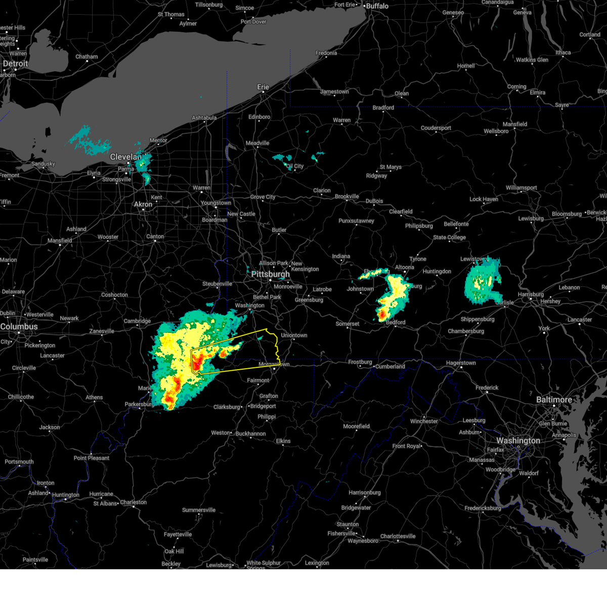
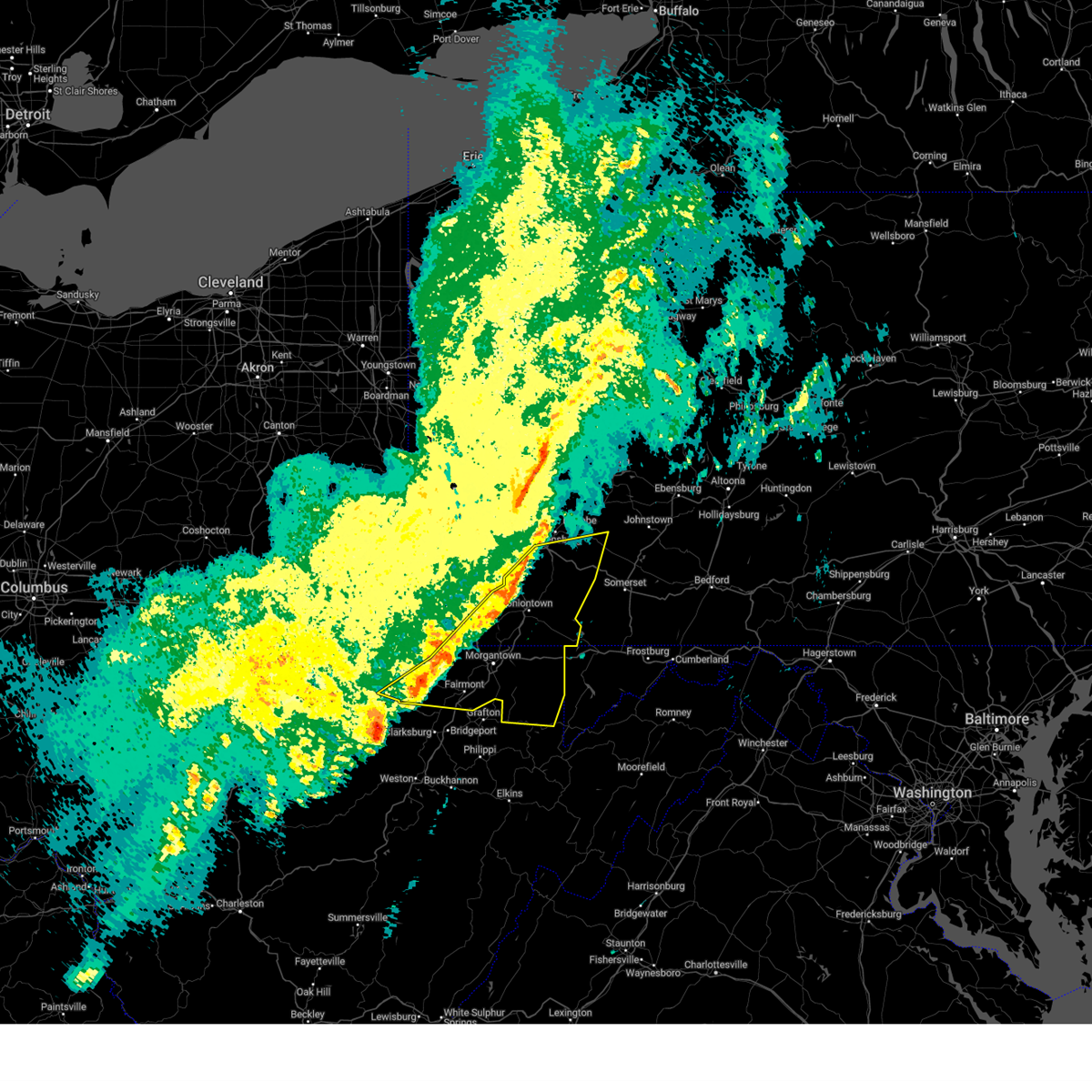
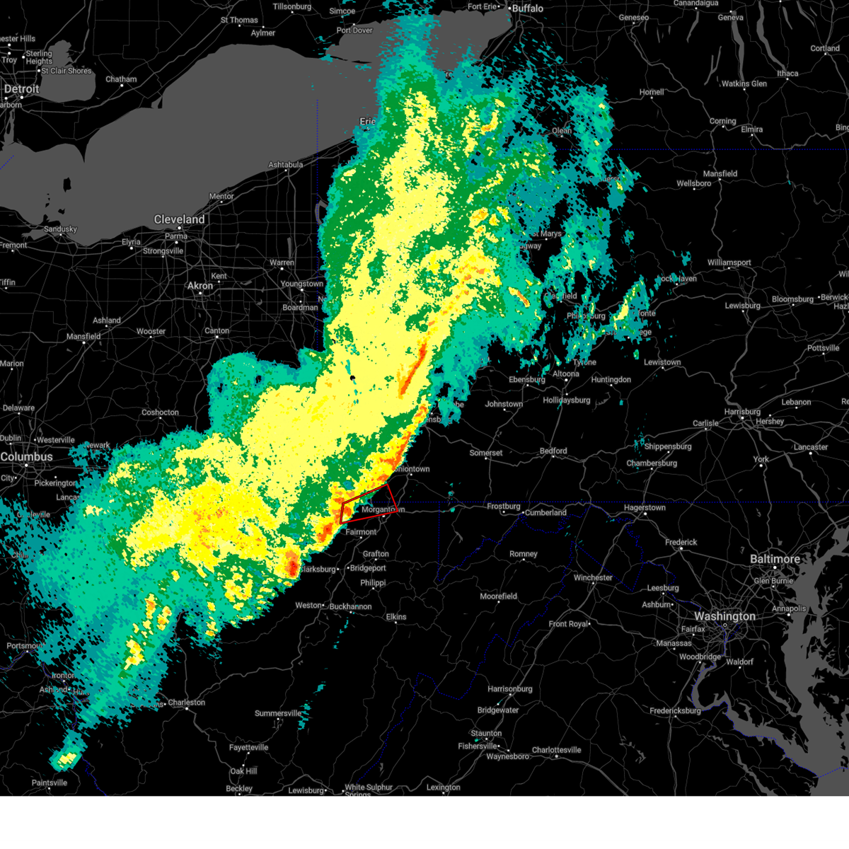
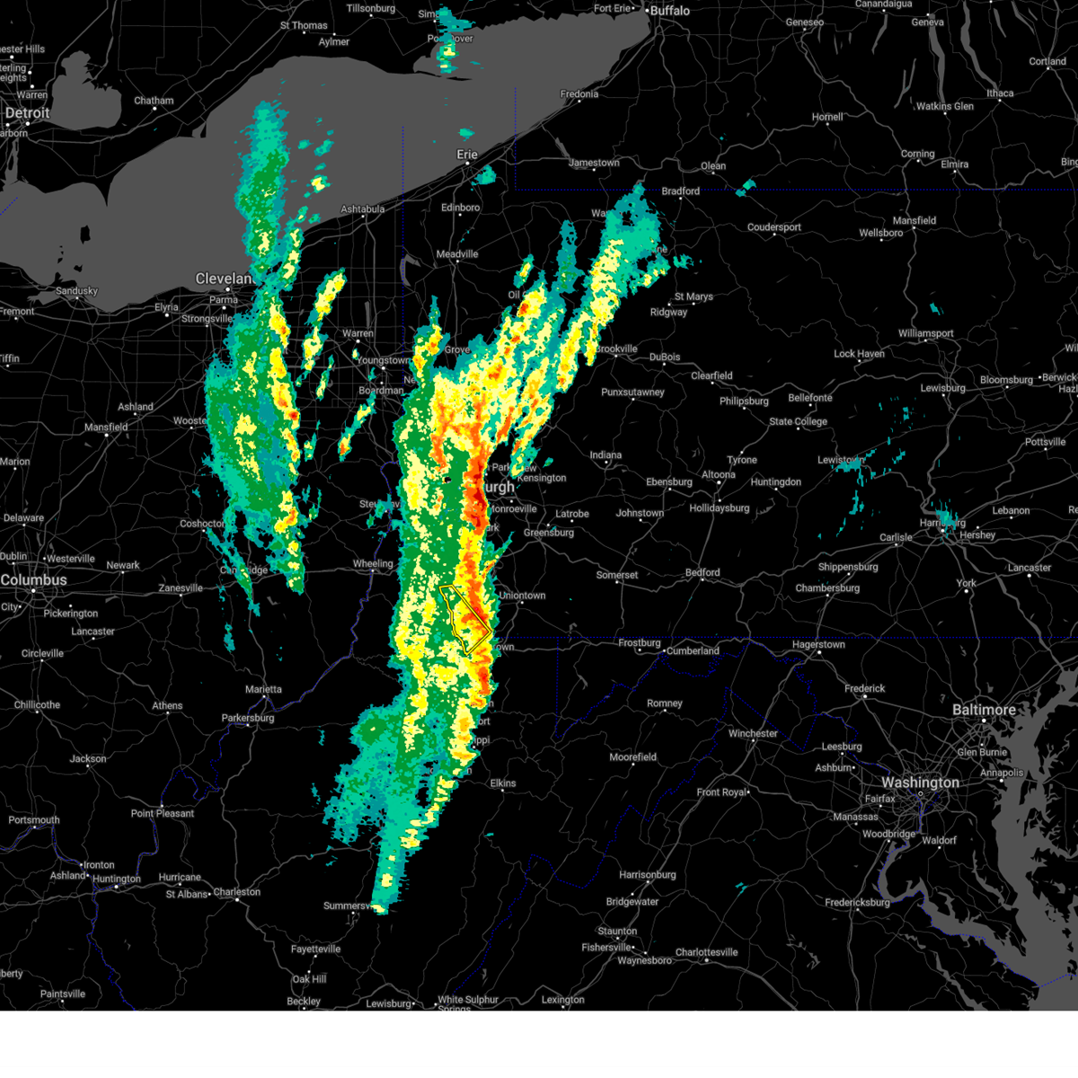
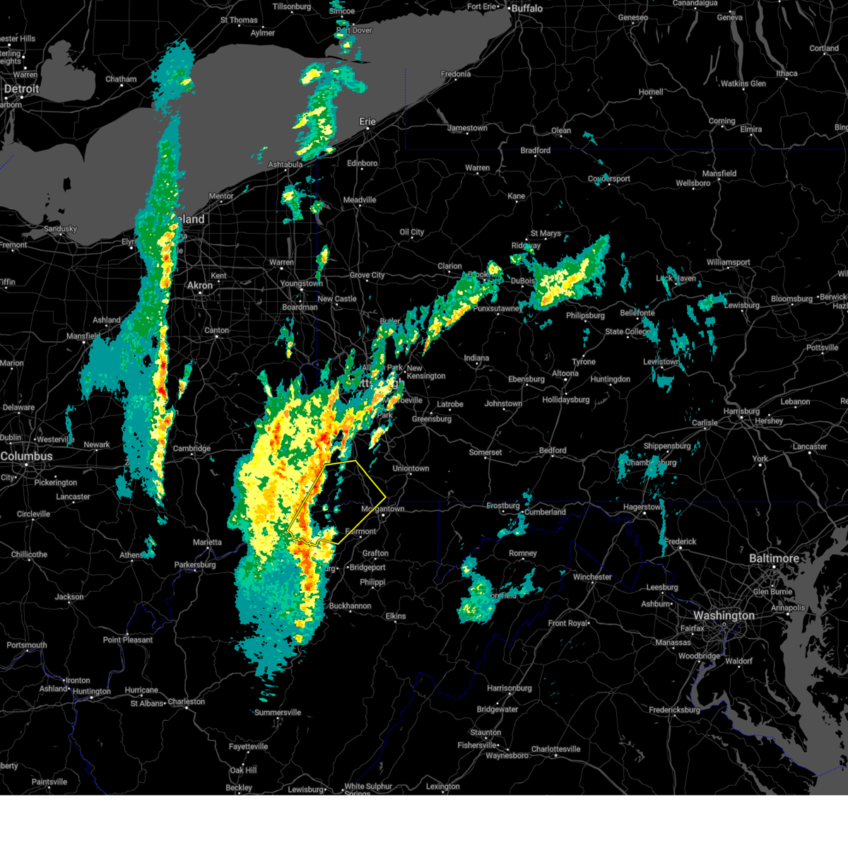
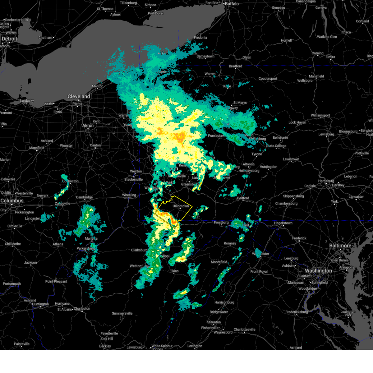
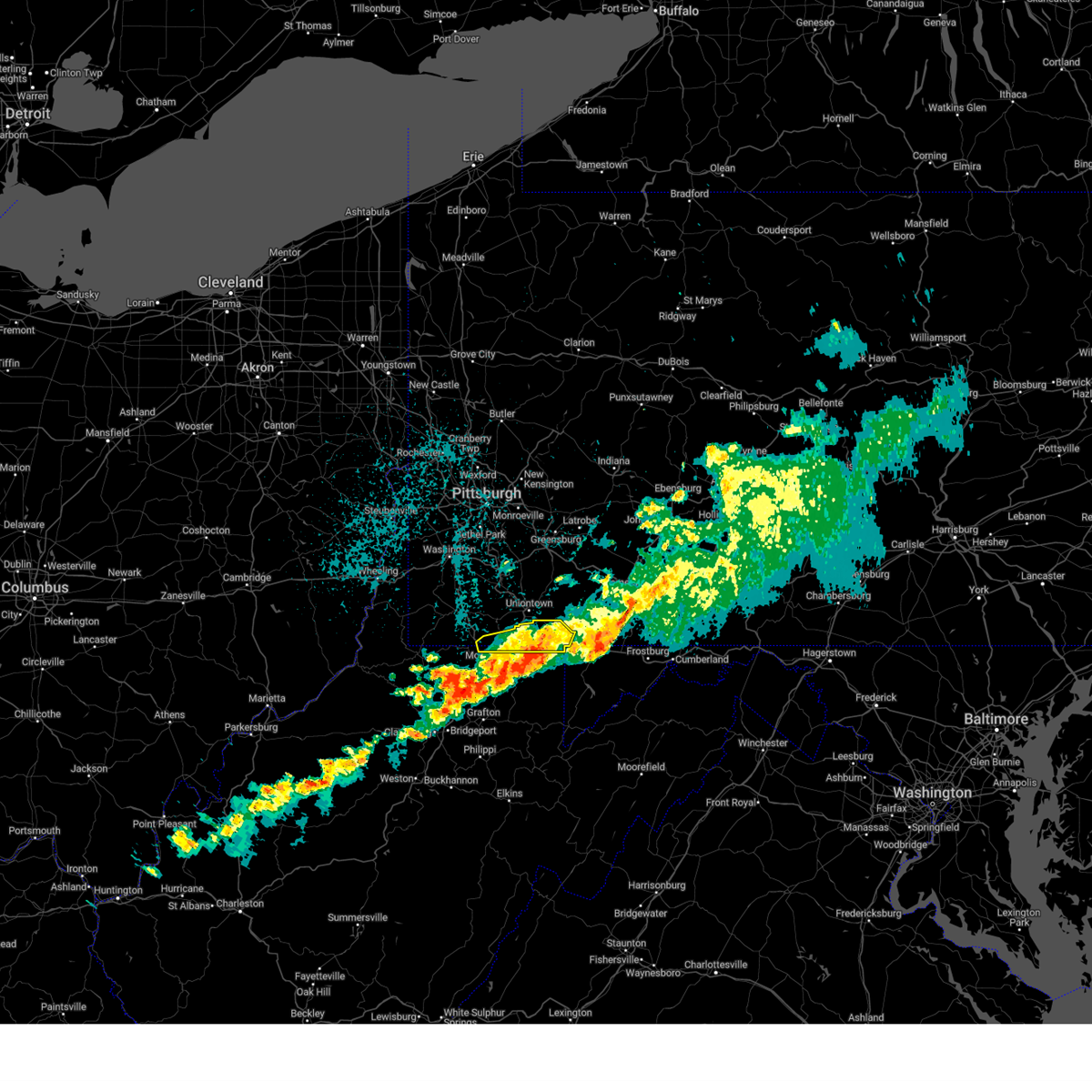
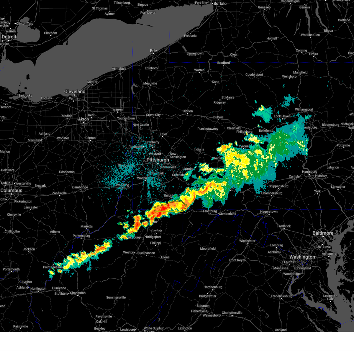
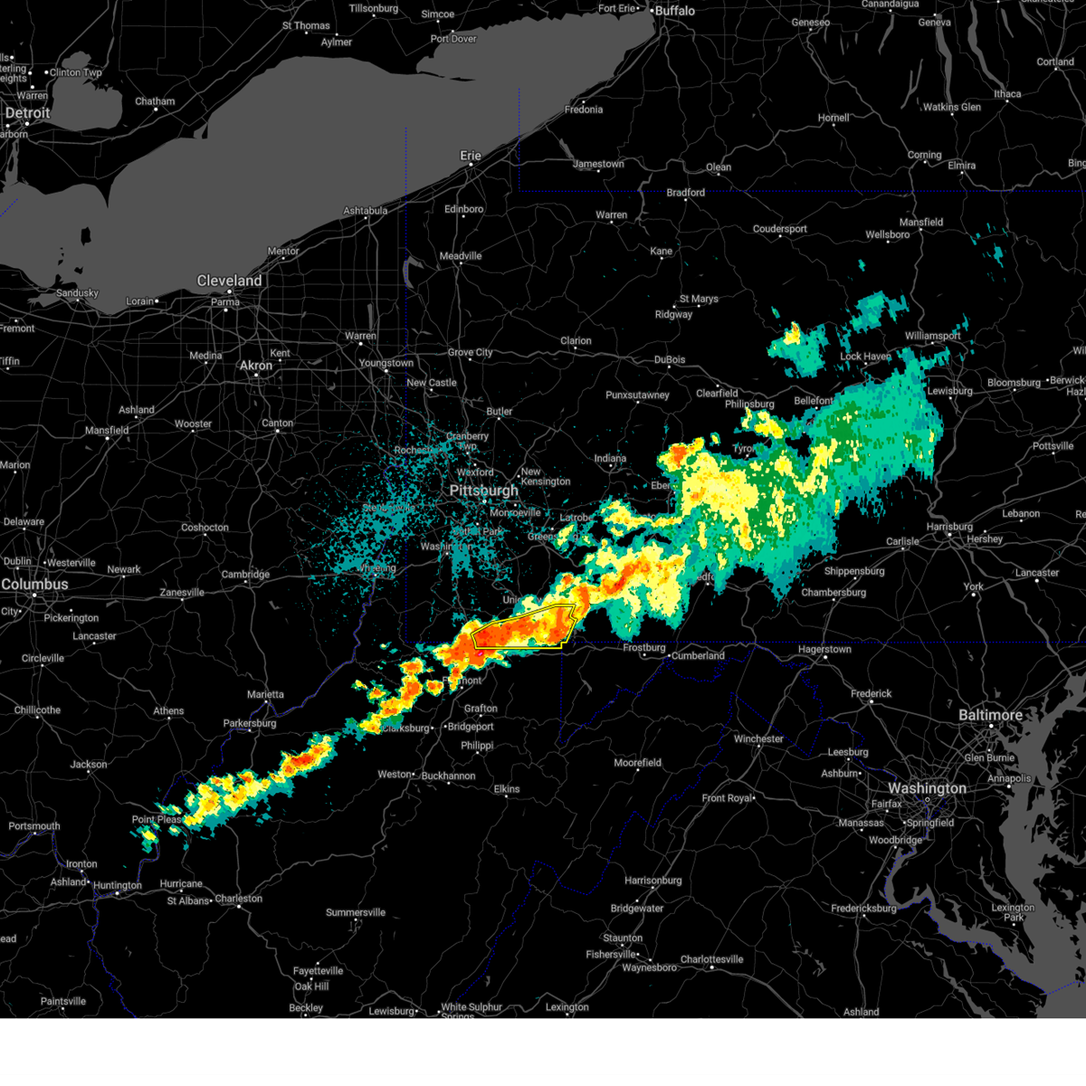
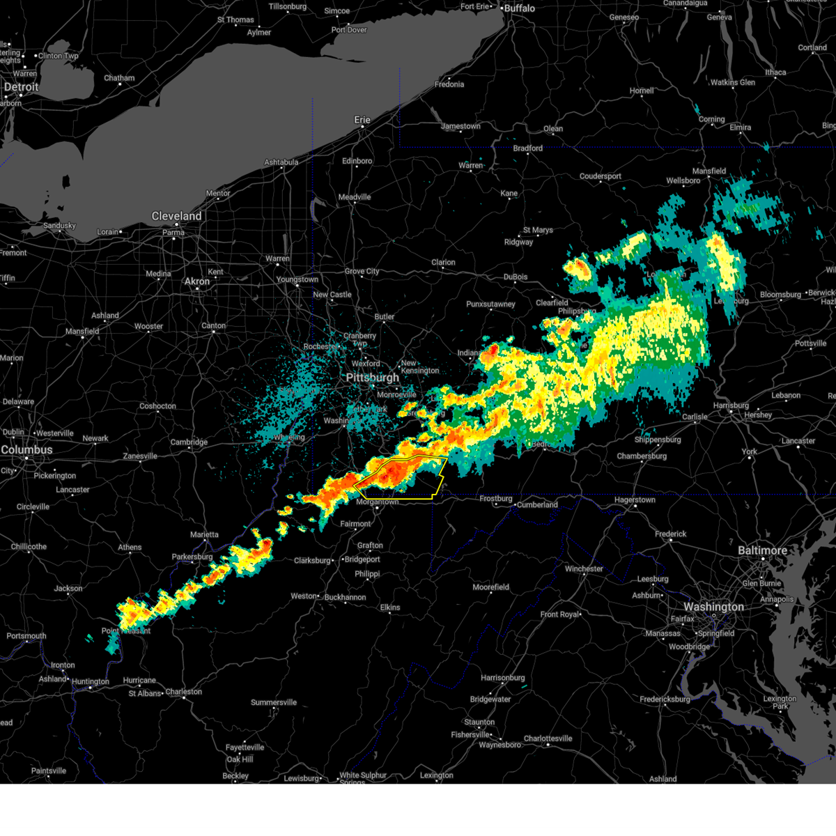
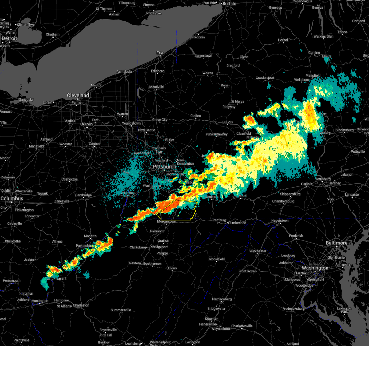
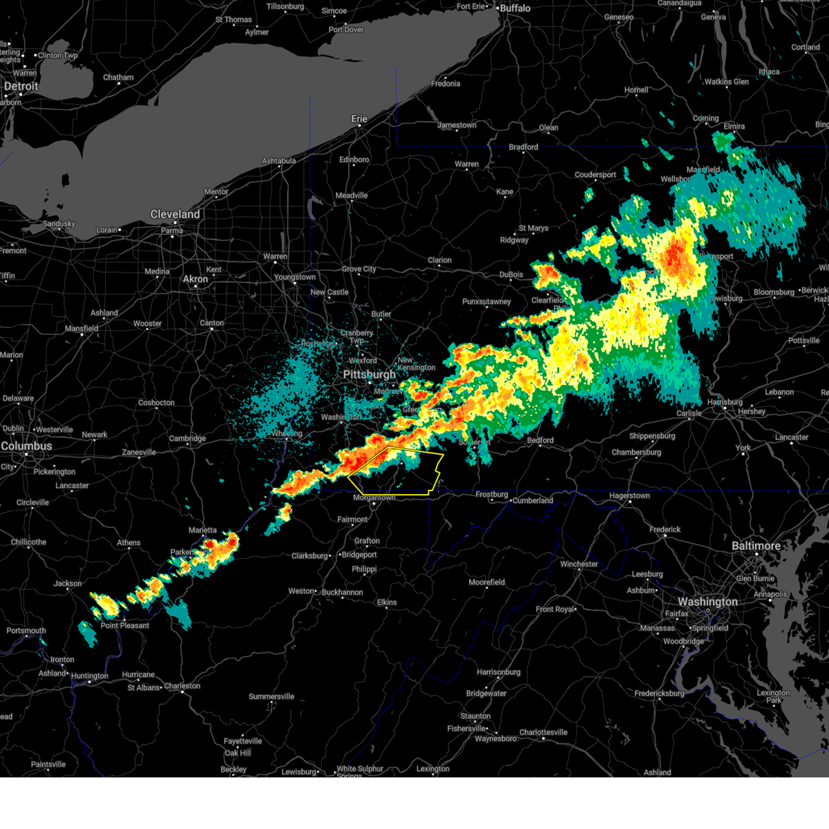
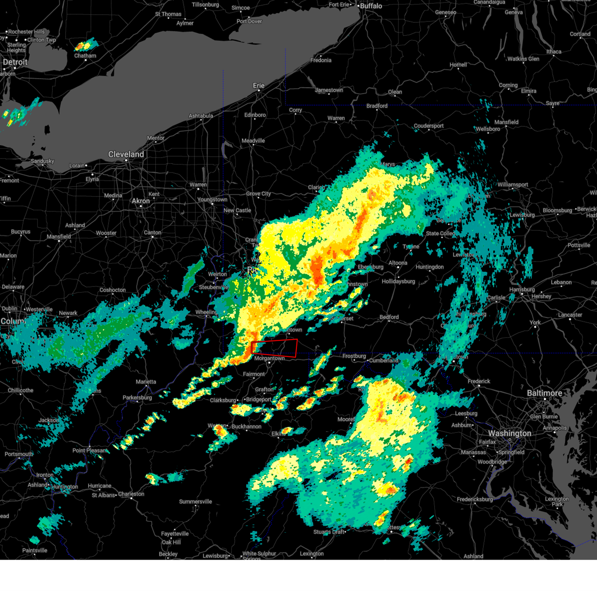
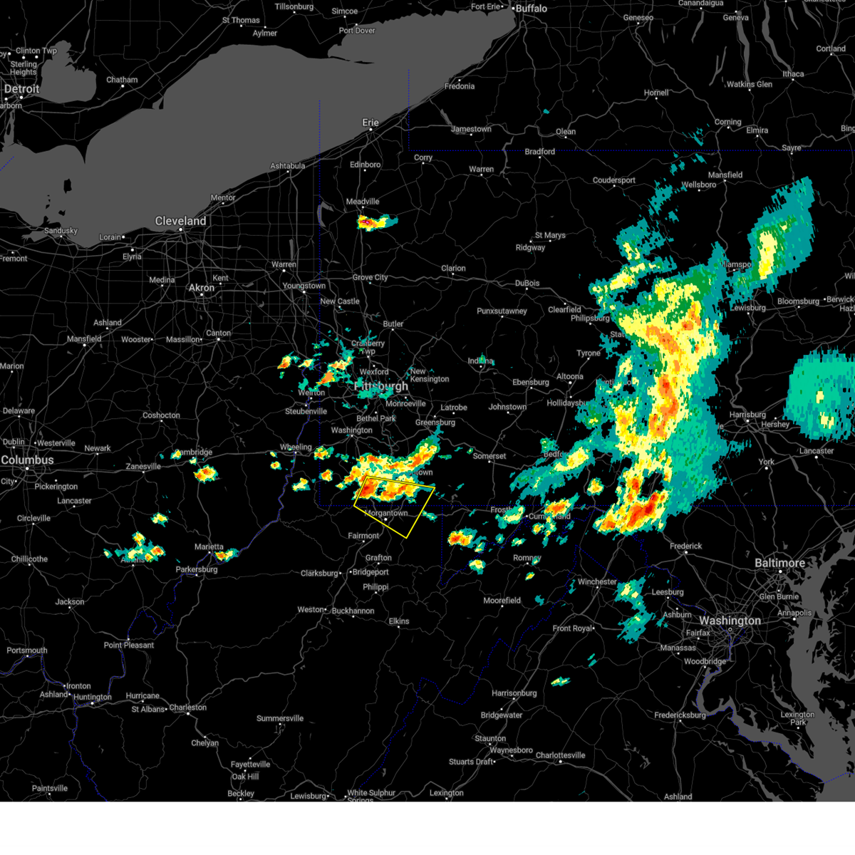
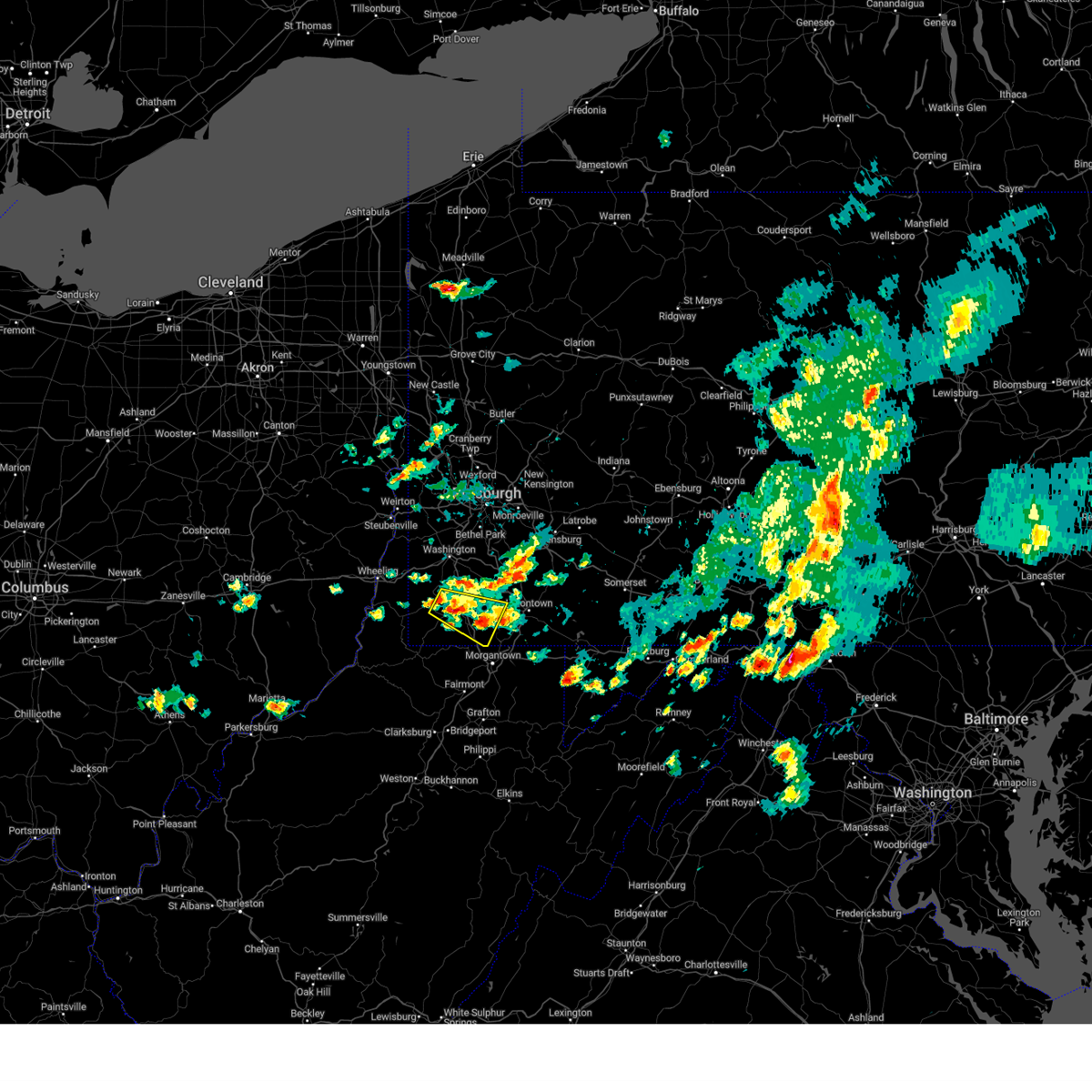
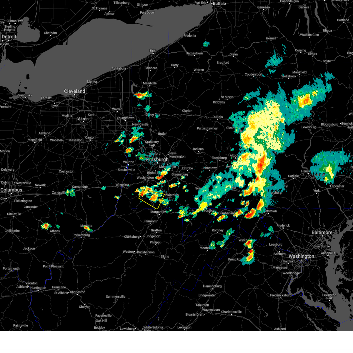
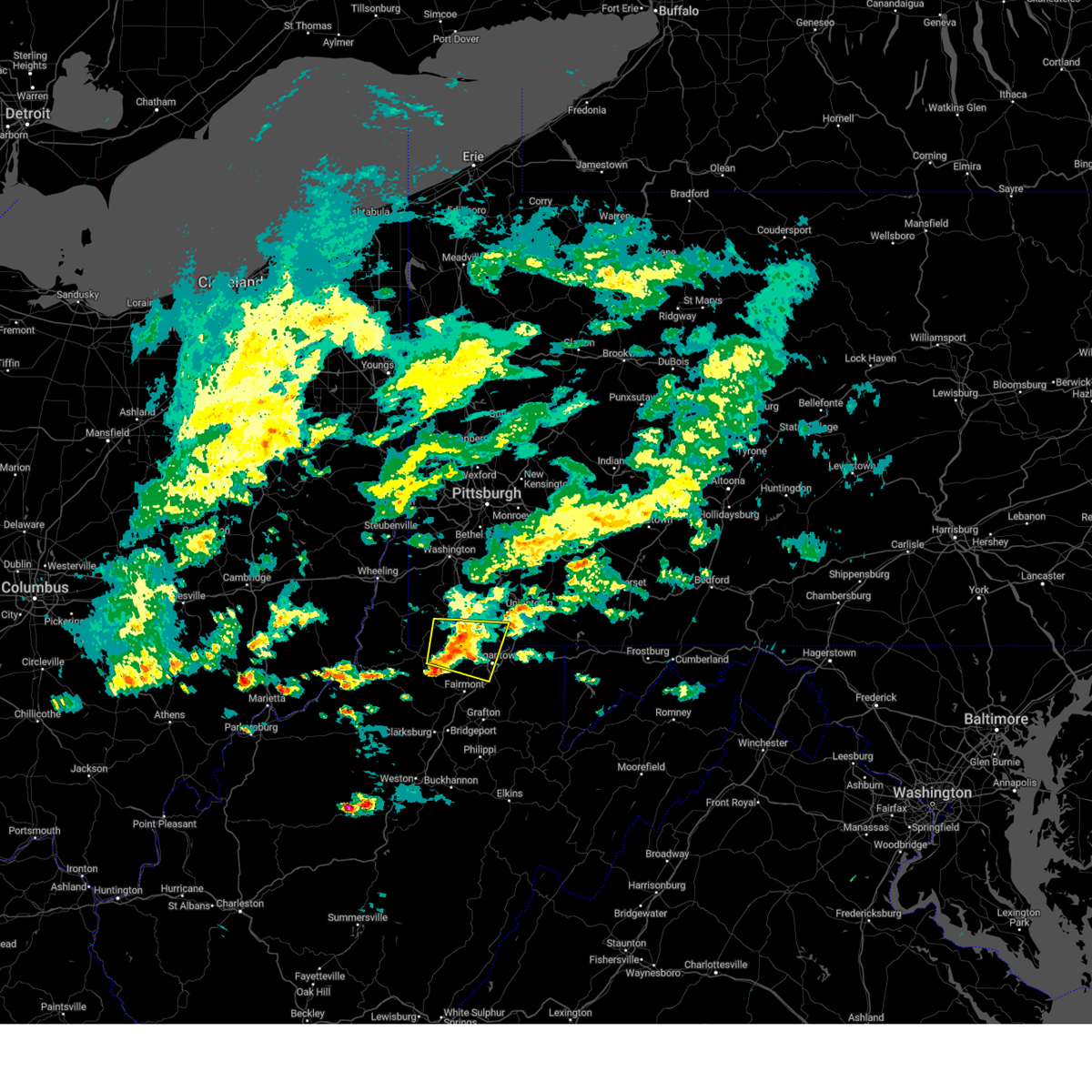
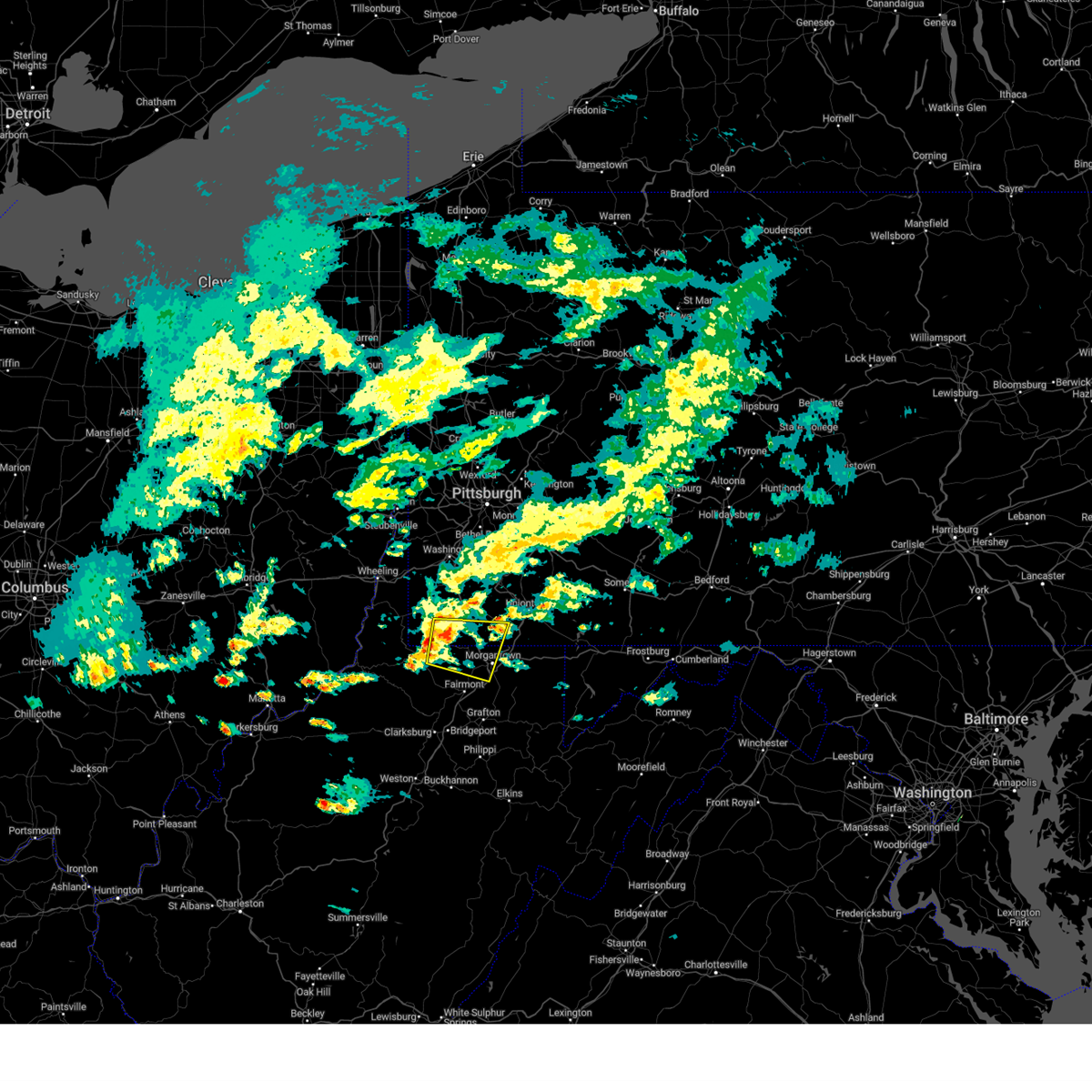
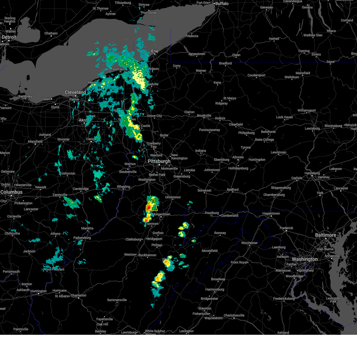
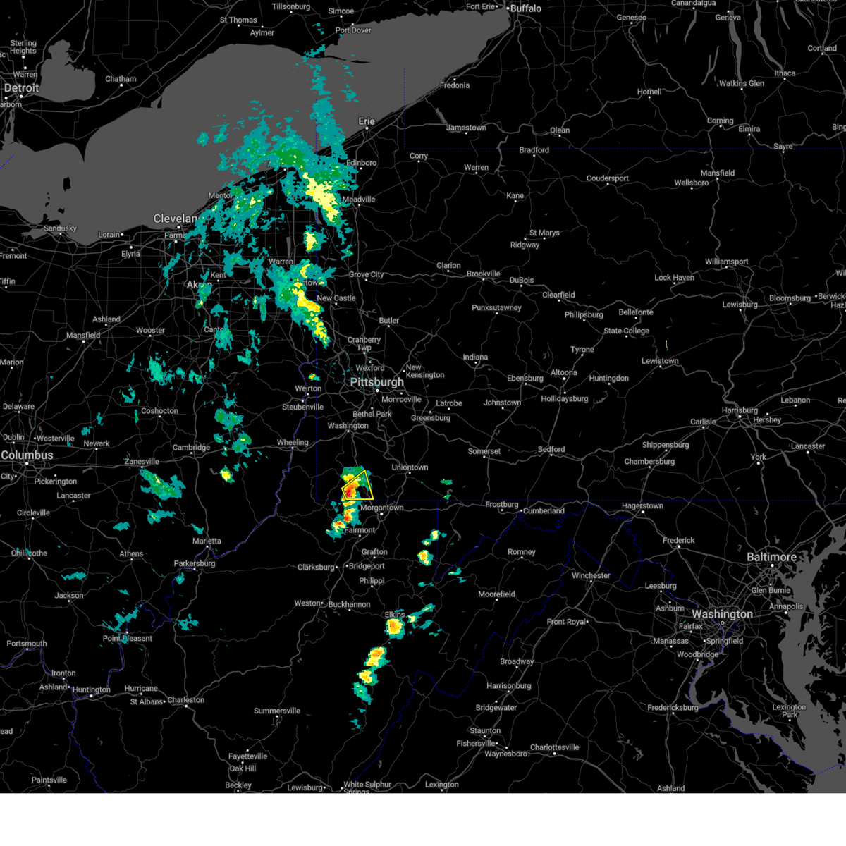
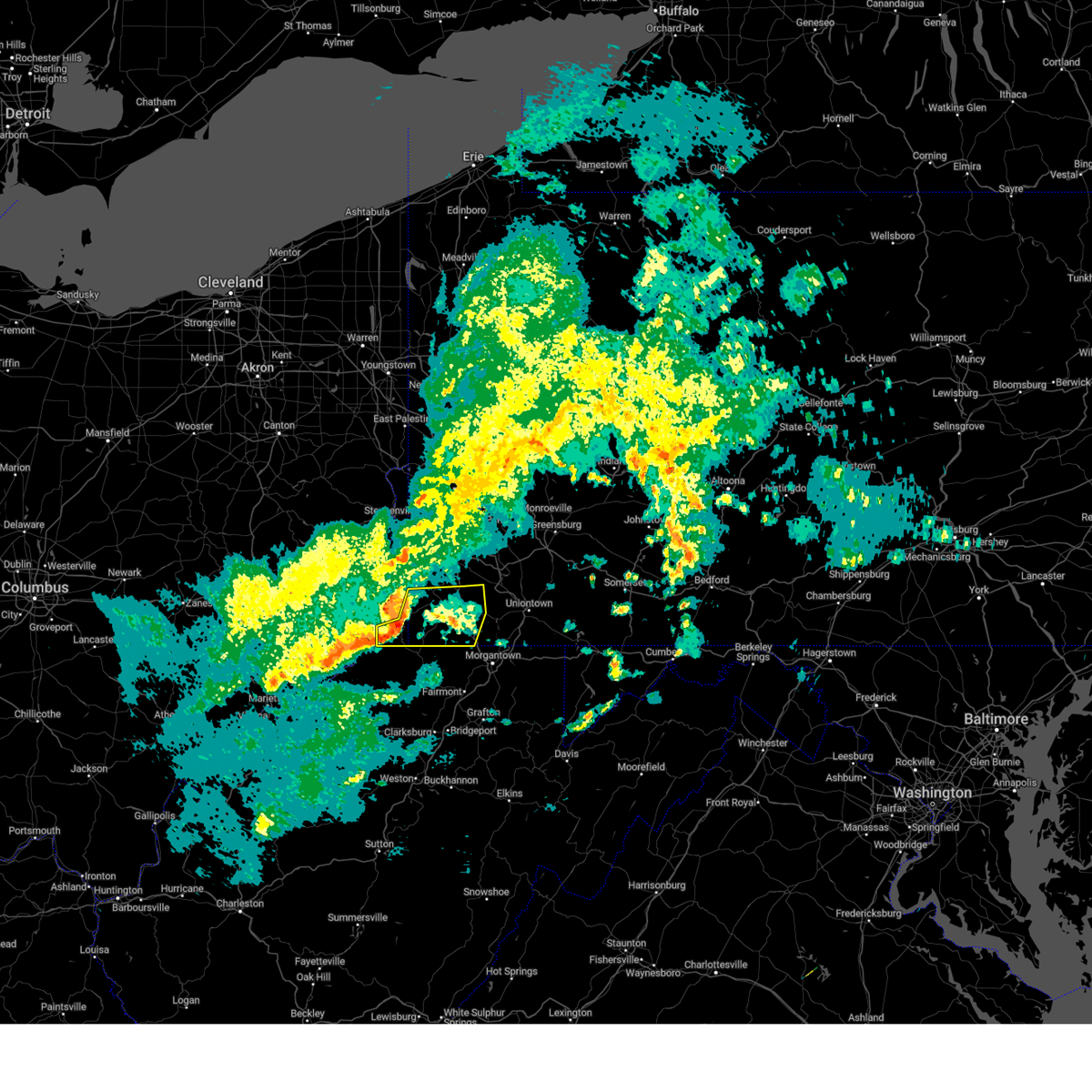
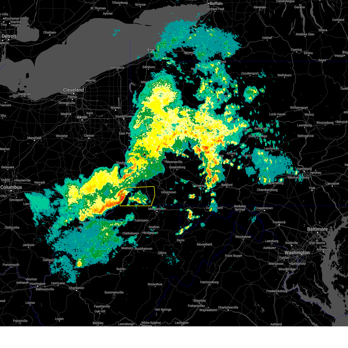
Hail Map for Mount Morris, PA
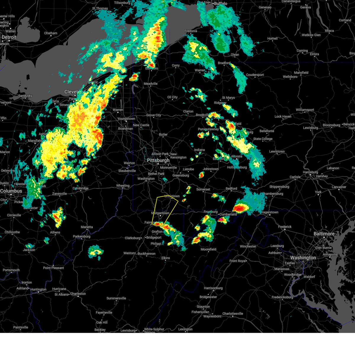
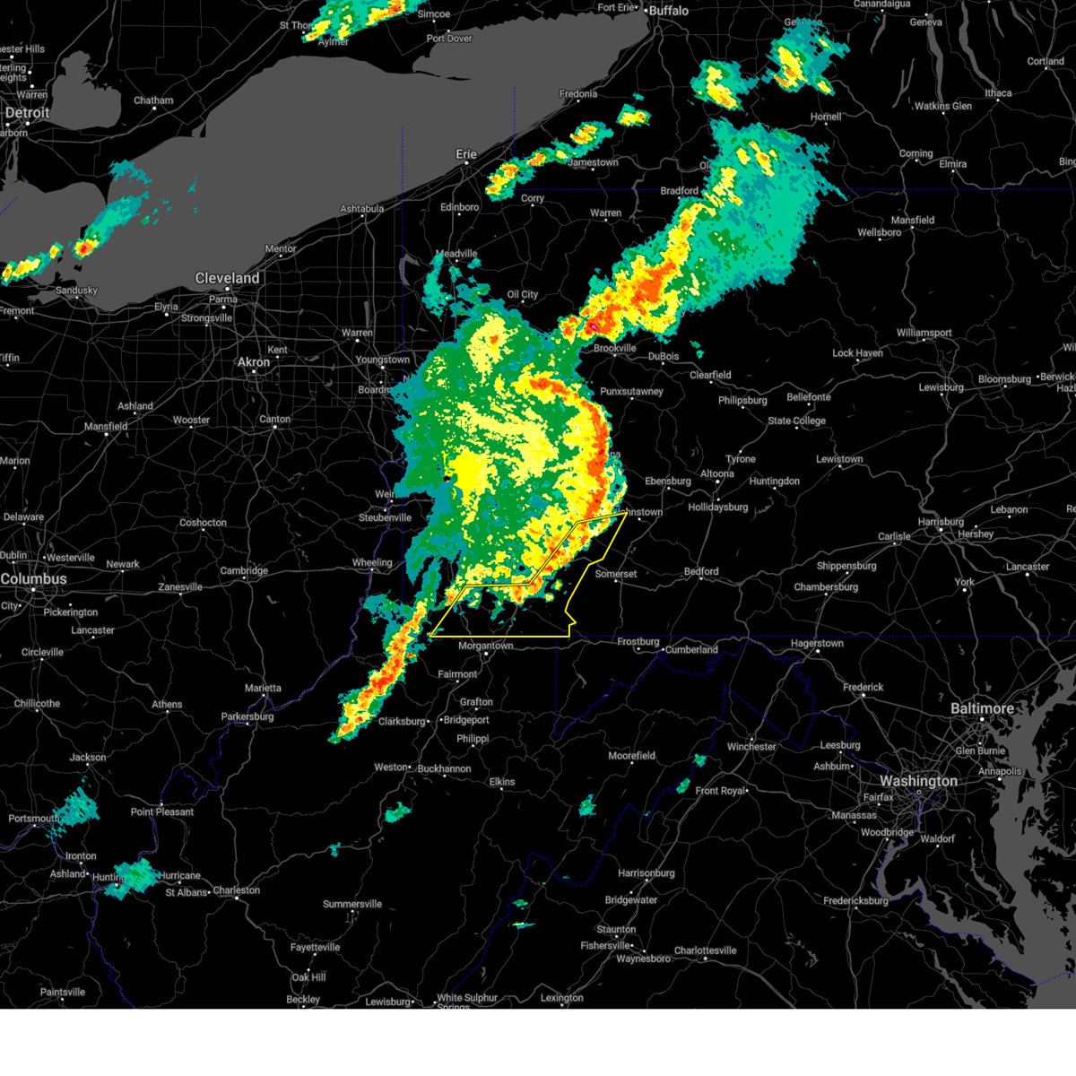
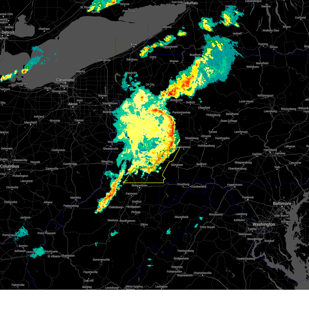
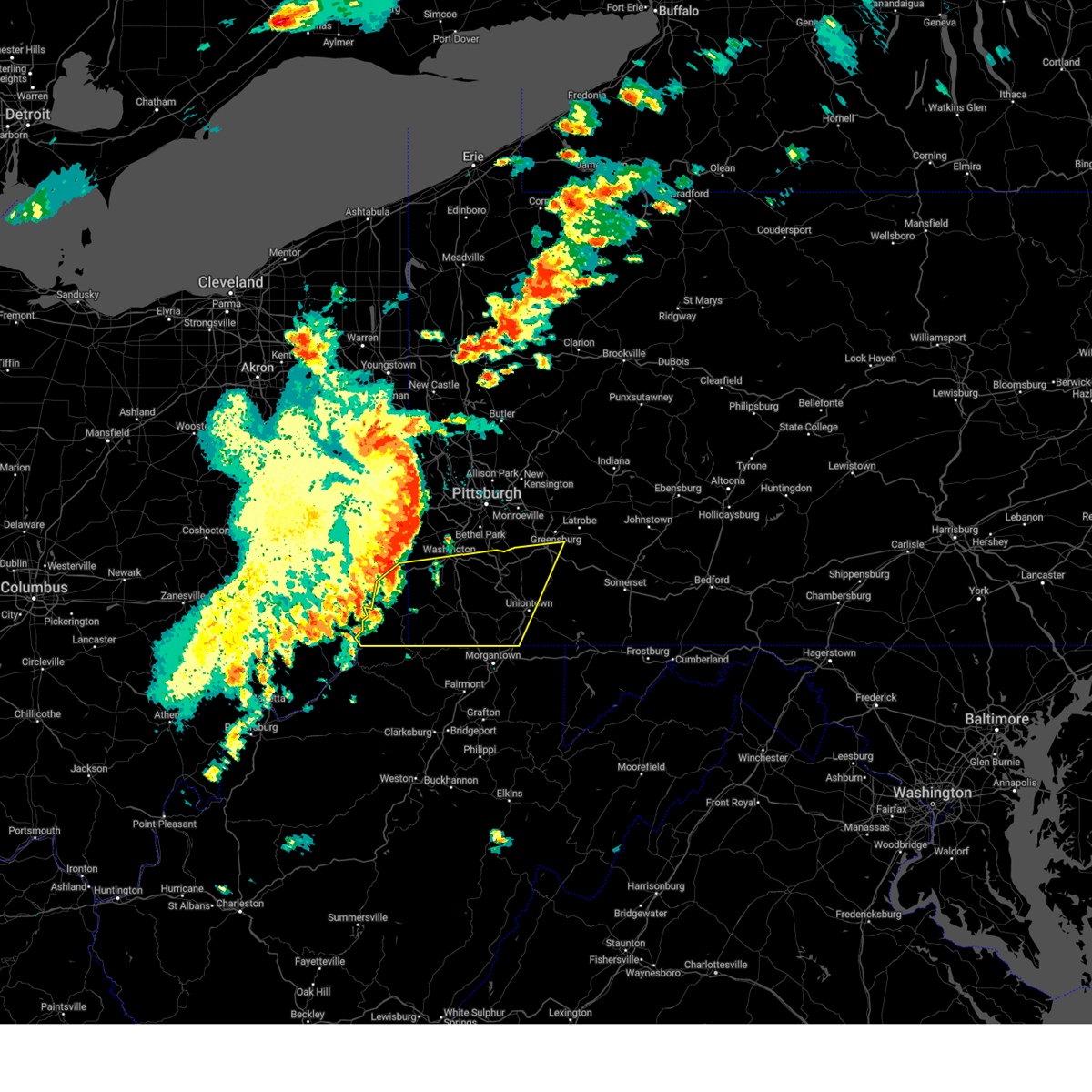
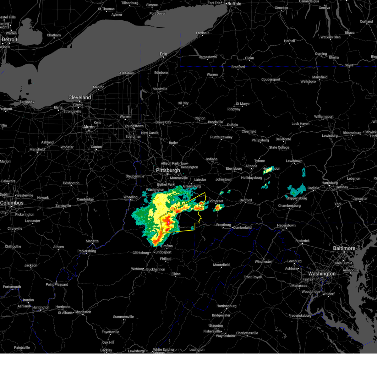
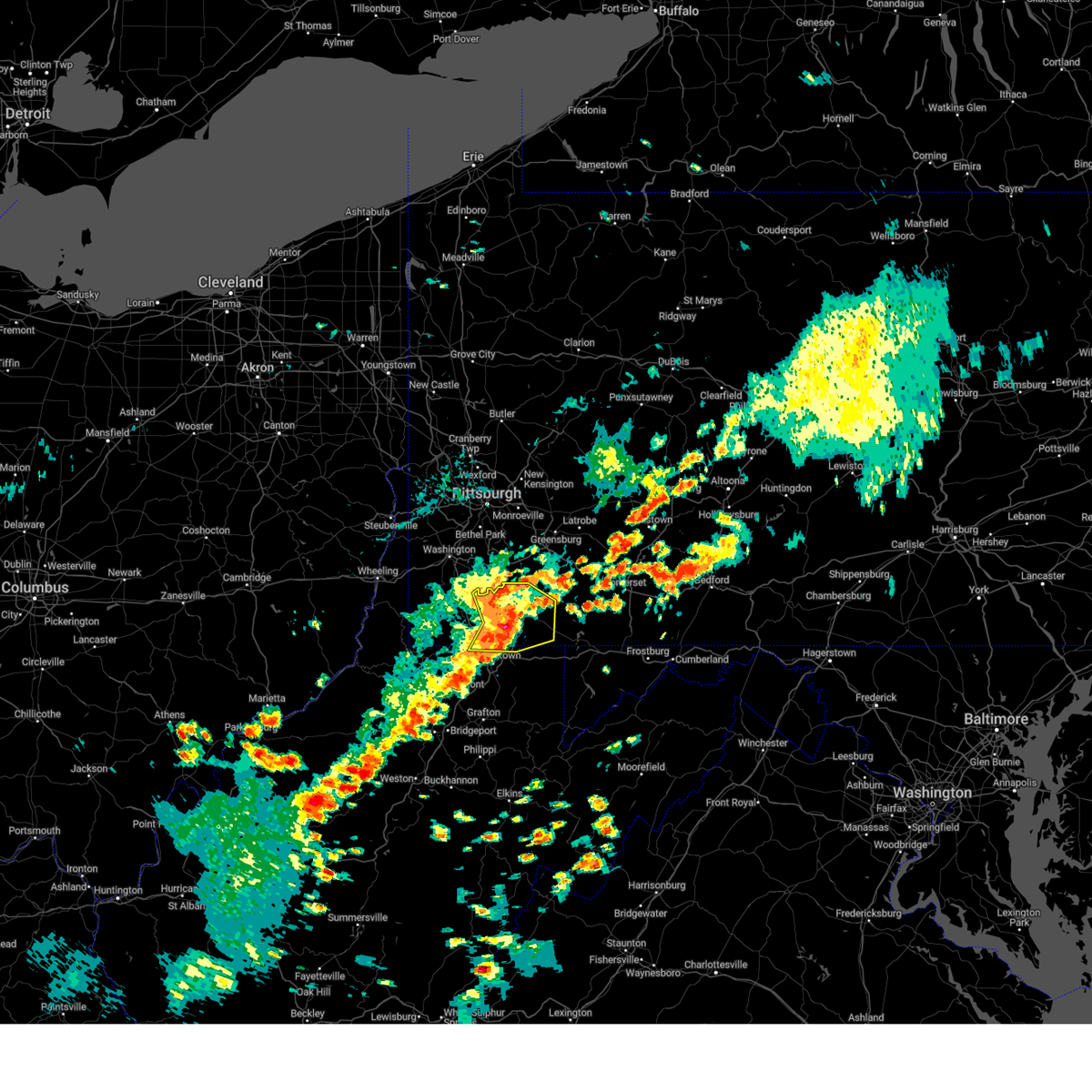
The Mount Morris, PA area has had 0 reports of on-the-ground hail by trained spotters, and has been under severe weather warnings 69 times during the past 12 months. Doppler radar has detected hail at or near Mount Morris, PA on 24 occasions, including 3 occasions during the past year.
| Name: | Mount Morris, PA |
| Where Located: | 49 miles S of Pittsburgh, PA |
| Map: | Google Map for Mount Morris, PA |
| Population: | 737 |
| Housing Units: | 356 |
| More Info: | Search Google for Mount Morris, PA |
5
The Top Recent Hail Date for Mount Morris, PA is Saturday, August 31, 2024 (4th out of 24)

Hail and Wind Damage Spotted near Mount Morris, PA
| Date / Time | Report Details |
|---|---|
| 6/9/2025 7:38 PM EDT |
 The storm which prompted the warning has weakened below severe limits, and no longer poses an immediate threat to life or property. therefore, the warning will be allowed to expire. to report severe weather, contact your nearest law enforcement agency. they will send your report to the national weather service office. a severe thunderstorm watch remains in effect until 1000 pm edt for portions of southwest pennsylvania and northern west virginia. The storm which prompted the warning has weakened below severe limits, and no longer poses an immediate threat to life or property. therefore, the warning will be allowed to expire. to report severe weather, contact your nearest law enforcement agency. they will send your report to the national weather service office. a severe thunderstorm watch remains in effect until 1000 pm edt for portions of southwest pennsylvania and northern west virginia.
|
| 6/9/2025 7:25 PM EDT |
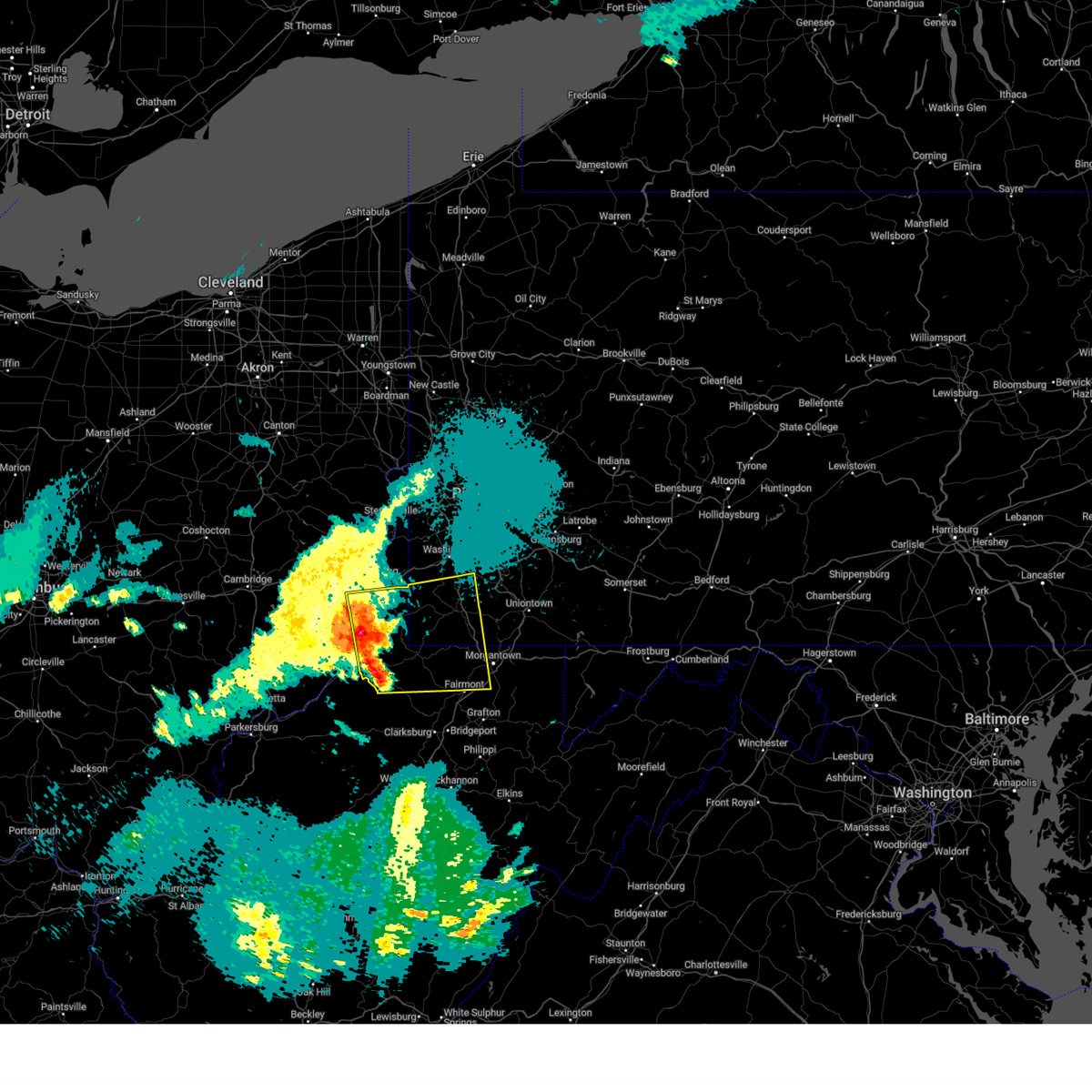
 At 725 pm edt, a severe thunderstorm was located 10 miles south of waynesburg, moving northeast at 30 mph (radar indicated). Hazards include 60 mph wind gusts. Expect damage to roofs, siding, and trees. Locations impacted include, blacksville, spraggs, mount morris, pentress, daybrook, brave, core and wana. At 725 pm edt, a severe thunderstorm was located 10 miles south of waynesburg, moving northeast at 30 mph (radar indicated). Hazards include 60 mph wind gusts. Expect damage to roofs, siding, and trees. Locations impacted include, blacksville, spraggs, mount morris, pentress, daybrook, brave, core and wana.
|
| 6/9/2025 7:16 PM EDT | the severe thunderstorm warning has been cancelled and is no longer in effect |
| 6/9/2025 7:16 PM EDT | At 716 pm edt, a severe thunderstorm was located 9 miles north of fairview, or 13 miles south of waynesburg, moving northeast at 35 mph (radar indicated). Hazards include 60 mph wind gusts. Expect damage to roofs, siding, and trees. Locations impacted include, cassville, blacksville, spraggs, mount morris, daybrook, pentress, brave, wana, core and wadestown. |
| 6/9/2025 7:00 PM EDT |
 Svrpbz the national weather service in pittsburgh has issued a * severe thunderstorm warning for, south central greene county in southwestern pennsylvania, northwestern marion county in northern west virginia, northwestern monongalia county in northern west virginia, east central wetzel county in northern west virginia, * until 745 pm edt. * at 700 pm edt, a severe thunderstorm was located 5 miles northwest of mannington, moving northeast at 30 mph (radar indicated). Hazards include 60 mph wind gusts and small hail. expect damage to roofs, siding, and trees Svrpbz the national weather service in pittsburgh has issued a * severe thunderstorm warning for, south central greene county in southwestern pennsylvania, northwestern marion county in northern west virginia, northwestern monongalia county in northern west virginia, east central wetzel county in northern west virginia, * until 745 pm edt. * at 700 pm edt, a severe thunderstorm was located 5 miles northwest of mannington, moving northeast at 30 mph (radar indicated). Hazards include 60 mph wind gusts and small hail. expect damage to roofs, siding, and trees
|
| 5/17/2025 1:17 AM EDT |
 At 117 am edt, a severe thunderstorm was located near masontown, or 10 miles north of star city, moving east at 50 mph (radar indicated). Hazards include 60 mph wind gusts and small hail. Expect damage to roofs, siding, and trees. Locations impacted include, morgantown, uniontown, connellsville, waynesburg, masontown, brownsville, fredericktown-millsboro, south connellsville, farmington, fairdale, jefferson boro, point marion, fairchance, isabella, dunbar, rogersville, smithfield, deemston, nemacolin and republic. At 117 am edt, a severe thunderstorm was located near masontown, or 10 miles north of star city, moving east at 50 mph (radar indicated). Hazards include 60 mph wind gusts and small hail. Expect damage to roofs, siding, and trees. Locations impacted include, morgantown, uniontown, connellsville, waynesburg, masontown, brownsville, fredericktown-millsboro, south connellsville, farmington, fairdale, jefferson boro, point marion, fairchance, isabella, dunbar, rogersville, smithfield, deemston, nemacolin and republic.
|
| 5/17/2025 1:07 AM EDT | Svrpbz the national weather service in pittsburgh has issued a * severe thunderstorm warning for, fayette county in southwestern pennsylvania, greene county in southwestern pennsylvania, northeastern preston county in northeastern west virginia, northeastern monongalia county in northern west virginia, * until 200 am edt. * at 107 am edt, a severe thunderstorm was located 8 miles north of cassville, or 9 miles southeast of waynesburg, moving east at 50 mph (radar indicated). Hazards include 60 mph wind gusts and small hail. expect damage to roofs, siding, and trees |
| 5/17/2025 1:07 AM EDT | The severe thunderstorm warning that was previously in effect has been reissued for greene and monongalia counties and is in effect until 200 am edt. please refer to that bulletin for the latest severe weather information. to report severe weather, contact your nearest law enforcement agency. they will send your report to the national weather service office. a severe thunderstorm watch remains in effect until 400 am edt saturday for portions of southwest pennsylvania and west virginia. |
| 5/17/2025 12:50 AM EDT |
 the severe thunderstorm warning has been cancelled and is no longer in effect the severe thunderstorm warning has been cancelled and is no longer in effect
|
| 5/17/2025 12:50 AM EDT |
 At 1250 am edt, a severe thunderstorm was located 5 miles north of hundred, or 17 miles north of mannington, moving east at 50 mph (radar indicated). Hazards include 70 mph wind gusts and quarter size hail. Hail damage to vehicles is expected. expect considerable tree damage. wind damage is also likely to mobile homes, roofs, and outbuildings. Locations impacted include, moundsville, bellaire, waynesburg, shadyside, mcmechen, powhatan point, glen dale, jefferson boro, cameron, granville, fairview, hundred, cassville, benwood, rogersville, west finley, grant town, marianna, aleppo and blacksville. At 1250 am edt, a severe thunderstorm was located 5 miles north of hundred, or 17 miles north of mannington, moving east at 50 mph (radar indicated). Hazards include 70 mph wind gusts and quarter size hail. Hail damage to vehicles is expected. expect considerable tree damage. wind damage is also likely to mobile homes, roofs, and outbuildings. Locations impacted include, moundsville, bellaire, waynesburg, shadyside, mcmechen, powhatan point, glen dale, jefferson boro, cameron, granville, fairview, hundred, cassville, benwood, rogersville, west finley, grant town, marianna, aleppo and blacksville.
|
| 5/17/2025 12:32 AM EDT |
 Svrpbz the national weather service in pittsburgh has issued a * severe thunderstorm warning for, southeastern belmont county in east central ohio, northeastern monroe county in east central ohio, greene county in southwestern pennsylvania, southwestern washington county in southwestern pennsylvania, northern marion county in northern west virginia, marshall county in northern west virginia, western monongalia county in northern west virginia, wetzel county in northern west virginia, * until 115 am edt. * at 1232 am edt, a severe thunderstorm was located 9 miles southeast of powhatan point, or 9 miles northeast of new martinsville, moving east at 50 mph (radar indicated). Hazards include 60 mph wind gusts and quarter size hail. Hail damage to vehicles is expected. Expect wind damage to roofs, siding, and trees. Svrpbz the national weather service in pittsburgh has issued a * severe thunderstorm warning for, southeastern belmont county in east central ohio, northeastern monroe county in east central ohio, greene county in southwestern pennsylvania, southwestern washington county in southwestern pennsylvania, northern marion county in northern west virginia, marshall county in northern west virginia, western monongalia county in northern west virginia, wetzel county in northern west virginia, * until 115 am edt. * at 1232 am edt, a severe thunderstorm was located 9 miles southeast of powhatan point, or 9 miles northeast of new martinsville, moving east at 50 mph (radar indicated). Hazards include 60 mph wind gusts and quarter size hail. Hail damage to vehicles is expected. Expect wind damage to roofs, siding, and trees.
|
| 5/1/2025 5:26 PM EDT |
 Svrpbz the national weather service in pittsburgh has issued a * severe thunderstorm warning for, southwestern fayette county in southwestern pennsylvania, southeastern greene county in southwestern pennsylvania, northwestern preston county in northeastern west virginia, east central marion county in northern west virginia, monongalia county in northern west virginia, * until 615 pm edt. * at 526 pm edt, a severe thunderstorm was located 6 miles south of westover, moving north at 35 mph (radar indicated). Hazards include 60 mph wind gusts and quarter size hail. Hail damage to vehicles is expected. Expect wind damage to roofs, siding, and trees. Svrpbz the national weather service in pittsburgh has issued a * severe thunderstorm warning for, southwestern fayette county in southwestern pennsylvania, southeastern greene county in southwestern pennsylvania, northwestern preston county in northeastern west virginia, east central marion county in northern west virginia, monongalia county in northern west virginia, * until 615 pm edt. * at 526 pm edt, a severe thunderstorm was located 6 miles south of westover, moving north at 35 mph (radar indicated). Hazards include 60 mph wind gusts and quarter size hail. Hail damage to vehicles is expected. Expect wind damage to roofs, siding, and trees.
|
| 4/29/2025 6:23 PM EDT |
 The storms which prompted the warning have weakened below severe limits, and have exited the warned area. therefore, the warning will be allowed to expire. however, gusty winds are still possible with these thunderstorms. a severe thunderstorm watch remains in effect until 1000 pm edt for southwestern pennsylvania, and northern and northeastern west virginia. remember, a severe thunderstorm warning still remains in effect for southern fayette county. The storms which prompted the warning have weakened below severe limits, and have exited the warned area. therefore, the warning will be allowed to expire. however, gusty winds are still possible with these thunderstorms. a severe thunderstorm watch remains in effect until 1000 pm edt for southwestern pennsylvania, and northern and northeastern west virginia. remember, a severe thunderstorm warning still remains in effect for southern fayette county.
|
| 4/29/2025 6:16 PM EDT |
 the severe thunderstorm warning has been cancelled and is no longer in effect the severe thunderstorm warning has been cancelled and is no longer in effect
|
| 4/29/2025 6:16 PM EDT |
 At 615 pm edt, severe thunderstorms were located along a line extending from scalp level to near ursina, moving east at 65 mph (radar indicated). Hazards include 60 mph wind gusts. Expect damage to trees and power lines, resulting in some power outages. Locations impacted include, uniontown, masontown, south connellsville, farmington, fairdale, point marion, fairchance, isabella, dunbar, smithfield, bobtown, republic, nemacolin, carmichaels, new salem, markleysburg, greensboro, chalkhill, mount morris, and ohiopyle. At 615 pm edt, severe thunderstorms were located along a line extending from scalp level to near ursina, moving east at 65 mph (radar indicated). Hazards include 60 mph wind gusts. Expect damage to trees and power lines, resulting in some power outages. Locations impacted include, uniontown, masontown, south connellsville, farmington, fairdale, point marion, fairchance, isabella, dunbar, smithfield, bobtown, republic, nemacolin, carmichaels, new salem, markleysburg, greensboro, chalkhill, mount morris, and ohiopyle.
|
| 4/29/2025 6:13 PM EDT | Svrpbz the national weather service in pittsburgh has issued a * severe thunderstorm warning for, southeastern greene county in southwestern pennsylvania, southern fayette county in southwestern pennsylvania, monongalia county in northern west virginia, preston county in northeastern west virginia, marion county in northern west virginia, * until 715 pm edt. * at 612 pm edt, severe thunderstorms were located along a line extending from near fairdale to near lumberport, moving east at 60 mph (radar indicated). Hazards include 60 mph wind gusts. expect damage to trees and power lines, resulting in some power outages |
| 4/29/2025 5:54 PM EDT |
 At 554 pm edt, severe thunderstorms were located along a line extending from ligonier to 8 miles east of point marion, moving east at 65 mph (radar indicated). Hazards include 70 mph wind gusts. Trees snapped and uprooted. power outages can be expected. Locations impacted include, uniontown, connellsville, masontown, south connellsville, farmington, ligonier, fairdale, jefferson boro, point marion, seven springs, fairchance, isabella, dunbar, smithfield, bobtown, republic, nemacolin, carmichaels, rices landing, and youngstown. At 554 pm edt, severe thunderstorms were located along a line extending from ligonier to 8 miles east of point marion, moving east at 65 mph (radar indicated). Hazards include 70 mph wind gusts. Trees snapped and uprooted. power outages can be expected. Locations impacted include, uniontown, connellsville, masontown, south connellsville, farmington, ligonier, fairdale, jefferson boro, point marion, seven springs, fairchance, isabella, dunbar, smithfield, bobtown, republic, nemacolin, carmichaels, rices landing, and youngstown.
|
| 4/29/2025 5:54 PM EDT |
 the severe thunderstorm warning has been cancelled and is no longer in effect the severe thunderstorm warning has been cancelled and is no longer in effect
|
| 4/29/2025 5:29 PM EDT | The storms which prompted the warning have moved out of the area. therefore, the warning will be allowed to expire. however, gusty winds are still possible with these thunderstorms. a severe thunderstorm watch remains in effect until 700 pm edt for northern west virginia. a severe thunderstorm watch also remains in effect until 1000 pm edt for southwestern pennsylvania, and northern west virginia. remember, a severe thunderstorm warning still remains in effect for fayette and westmoreland counties. |
| 4/29/2025 5:24 PM EDT | Svrpbz the national weather service in pittsburgh has issued a * severe thunderstorm warning for, southeastern washington county in southwestern pennsylvania, southern allegheny county in southwestern pennsylvania, southern westmoreland county in southwestern pennsylvania, eastern greene county in southwestern pennsylvania, fayette county in southwestern pennsylvania, * until 630 pm edt. * at 524 pm edt, severe thunderstorms were located along a line extending from near donora to 7 miles east of hundred, moving east at 65 mph (radar indicated). Hazards include 70 mph wind gusts. Trees snapped and uprooted. Power outages can be expected. |
| 4/29/2025 5:12 PM EDT | the severe thunderstorm warning has been cancelled and is no longer in effect |
| 4/29/2025 5:12 PM EDT | At 511 pm edt, severe thunderstorms were located along a line extending from near east washington to 6 miles southeast of cameron, moving east at 55 mph (radar indicated). Hazards include 70 mph wind gusts. Trees snapped and uprooted. power outages can be expected. Locations impacted include, washington, uniontown, waynesburg, monessen, california, donora, mount pleasant, scottdale, monongahela, charleroi, masontown, youngwood, west newton, bentleyville, brownsville, east washington, new stanton, fredericktown-millsboro, perryopolis, and fairdale. |
| 4/29/2025 4:50 PM EDT |
 Svrpbz the national weather service in pittsburgh has issued a * severe thunderstorm warning for, southern washington county in southwestern pennsylvania, southwestern westmoreland county in southwestern pennsylvania, greene county in southwestern pennsylvania, western fayette county in southwestern pennsylvania, ohio county in northern west virginia, marshall county in northern west virginia, * until 530 pm edt. * at 450 pm edt, severe thunderstorms were located along a line extending from near west liberty to 6 miles south of powhatan point, moving east at 55 mph (radar indicated). Hazards include 70 mph wind gusts. Trees snapped and uprooted. Power outages can be expected. Svrpbz the national weather service in pittsburgh has issued a * severe thunderstorm warning for, southern washington county in southwestern pennsylvania, southwestern westmoreland county in southwestern pennsylvania, greene county in southwestern pennsylvania, western fayette county in southwestern pennsylvania, ohio county in northern west virginia, marshall county in northern west virginia, * until 530 pm edt. * at 450 pm edt, severe thunderstorms were located along a line extending from near west liberty to 6 miles south of powhatan point, moving east at 55 mph (radar indicated). Hazards include 70 mph wind gusts. Trees snapped and uprooted. Power outages can be expected.
|
| 4/19/2025 8:23 PM EDT |
 the severe thunderstorm warning has been cancelled and is no longer in effect the severe thunderstorm warning has been cancelled and is no longer in effect
|
| 4/19/2025 8:23 PM EDT |
 Svrpbz the national weather service in pittsburgh has issued a * severe thunderstorm warning for, fayette county in southwestern pennsylvania, southeastern greene county in southwestern pennsylvania, southwestern westmoreland county in southwestern pennsylvania, northern preston county in northeastern west virginia, northeastern monongalia county in northern west virginia, * until 915 pm edt. * at 823 pm edt, a severe thunderstorm was located over point marion, or 8 miles north of star city, moving east at 65 mph (law enforcement reported wind damage in monongalia county). Hazards include 60 mph wind gusts and quarter size hail. Hail damage to vehicles is expected. Expect wind damage to roofs, siding, and trees. Svrpbz the national weather service in pittsburgh has issued a * severe thunderstorm warning for, fayette county in southwestern pennsylvania, southeastern greene county in southwestern pennsylvania, southwestern westmoreland county in southwestern pennsylvania, northern preston county in northeastern west virginia, northeastern monongalia county in northern west virginia, * until 915 pm edt. * at 823 pm edt, a severe thunderstorm was located over point marion, or 8 miles north of star city, moving east at 65 mph (law enforcement reported wind damage in monongalia county). Hazards include 60 mph wind gusts and quarter size hail. Hail damage to vehicles is expected. Expect wind damage to roofs, siding, and trees.
|
| 4/19/2025 8:12 PM EDT |
 the severe thunderstorm warning has been cancelled and is no longer in effect the severe thunderstorm warning has been cancelled and is no longer in effect
|
| 4/19/2025 8:12 PM EDT |
 At 812 pm edt, a severe thunderstorm was located 8 miles south of waynesburg, moving east at 60 mph (law enforcement reported wind damage). Hazards include 65 mph wind gusts and half dollar size hail. Hail damage to vehicles is expected. expect wind damage to roofs, siding, and trees. Locations impacted include, morgantown, waynesburg, star city, jefferson boro, fairdale, point marion, cassville, rogersville, bobtown, nemacolin, carmichaels, rices landing, greensboro, clarksville, blacksville, spraggs, mount morris, pentress, core and brave. At 812 pm edt, a severe thunderstorm was located 8 miles south of waynesburg, moving east at 60 mph (law enforcement reported wind damage). Hazards include 65 mph wind gusts and half dollar size hail. Hail damage to vehicles is expected. expect wind damage to roofs, siding, and trees. Locations impacted include, morgantown, waynesburg, star city, jefferson boro, fairdale, point marion, cassville, rogersville, bobtown, nemacolin, carmichaels, rices landing, greensboro, clarksville, blacksville, spraggs, mount morris, pentress, core and brave.
|
| 4/19/2025 7:59 PM EDT |
 At 759 pm edt, a severe thunderstorm was located near hundred, or 16 miles north of mannington, moving east at 60 mph (radar indicated). Hazards include 60 mph wind gusts and half dollar size hail. Hail damage to vehicles is expected. expect wind damage to roofs, siding, and trees. Locations impacted include, morgantown, waynesburg, star city, jefferson boro, fairdale, point marion, cameron, hundred, cassville, rogersville, deemston, bobtown, nemacolin, carmichaels, rices landing, aleppo, greensboro, clarksville, blacksville and spraggs. At 759 pm edt, a severe thunderstorm was located near hundred, or 16 miles north of mannington, moving east at 60 mph (radar indicated). Hazards include 60 mph wind gusts and half dollar size hail. Hail damage to vehicles is expected. expect wind damage to roofs, siding, and trees. Locations impacted include, morgantown, waynesburg, star city, jefferson boro, fairdale, point marion, cameron, hundred, cassville, rogersville, deemston, bobtown, nemacolin, carmichaels, rices landing, aleppo, greensboro, clarksville, blacksville and spraggs.
|
| 4/19/2025 7:59 PM EDT |
 the severe thunderstorm warning has been cancelled and is no longer in effect the severe thunderstorm warning has been cancelled and is no longer in effect
|
| 4/19/2025 7:52 PM EDT |
 At 752 pm edt, a severe thunderstorm was located 7 miles south of cameron, or 17 miles east of new martinsville, moving east at 60 mph (radar indicated). Hazards include 60 mph wind gusts and half dollar size hail. Hail damage to vehicles is expected. expect wind damage to roofs, siding, and trees. Locations impacted include, morgantown, waynesburg, star city, jefferson boro, fairdale, point marion, cameron, granville, hundred, cassville, rogersville, deemston, bobtown, nemacolin, carmichaels, rices landing, aleppo, greensboro, clarksville and blacksville. At 752 pm edt, a severe thunderstorm was located 7 miles south of cameron, or 17 miles east of new martinsville, moving east at 60 mph (radar indicated). Hazards include 60 mph wind gusts and half dollar size hail. Hail damage to vehicles is expected. expect wind damage to roofs, siding, and trees. Locations impacted include, morgantown, waynesburg, star city, jefferson boro, fairdale, point marion, cameron, granville, hundred, cassville, rogersville, deemston, bobtown, nemacolin, carmichaels, rices landing, aleppo, greensboro, clarksville and blacksville.
|
| 4/19/2025 7:52 PM EDT |
 the severe thunderstorm warning has been cancelled and is no longer in effect the severe thunderstorm warning has been cancelled and is no longer in effect
|
| 4/19/2025 7:39 PM EDT |
 Svrpbz the national weather service in pittsburgh has issued a * severe thunderstorm warning for, northeastern monroe county in east central ohio, greene county in southwestern pennsylvania, northern marion county in northern west virginia, marshall county in northern west virginia, northern monongalia county in northern west virginia, northern wetzel county in northern west virginia, * until 845 pm edt. * at 739 pm edt, a severe thunderstorm was located near new martinsville, moving east at 60 mph (radar indicated). Hazards include 60 mph wind gusts and quarter size hail. Hail damage to vehicles is expected. Expect wind damage to roofs, siding, and trees. Svrpbz the national weather service in pittsburgh has issued a * severe thunderstorm warning for, northeastern monroe county in east central ohio, greene county in southwestern pennsylvania, northern marion county in northern west virginia, marshall county in northern west virginia, northern monongalia county in northern west virginia, northern wetzel county in northern west virginia, * until 845 pm edt. * at 739 pm edt, a severe thunderstorm was located near new martinsville, moving east at 60 mph (radar indicated). Hazards include 60 mph wind gusts and quarter size hail. Hail damage to vehicles is expected. Expect wind damage to roofs, siding, and trees.
|
| 4/3/2025 5:30 AM EDT | The storms which prompted the warning have moved out of part of the area. therefore, the warning has been allowed to expire. a new severe thunderstorm warning has been issued for eastern portions of the area. a severe thunderstorm watch remains in effect until 700 am edt for portions of southwest pennsylvania and northern west virginia. |
| 4/3/2025 5:22 AM EDT | the severe thunderstorm warning has been cancelled and is no longer in effect |
| 4/3/2025 5:22 AM EDT | At 522 am edt, severe thunderstorms were located along a line from over blairsville to near masontown, or along a line from 9 miles southwest of homer city to 10 miles northeast of star city, moving east at 60 mph (radar indicated). Hazards include 60 mph wind gusts. Expect damage to roofs, siding, and trees. Locations impacted include, morgantown, fairmont, uniontown, connellsville, westover, kingwood, star city, terra alta, rowlesburg, mount pleasant, scottdale, masontown, pleasant valley, winfield, south connellsville, farmington, ligonier, barrackville, point marion and monongah. |
| 4/3/2025 5:13 AM EDT | At 513 am edt, severe thunderstorms were located along a line from 7 miles northwest of latrobe to 6 miles north of cassville, or along a line from 7 miles northwest of latrobe to 7 miles northwest of star city, moving east at 60 mph (radar indicated). Hazards include 60 mph wind gusts. Expect damage to roofs, siding, and trees. Locations impacted include, morgantown, fairmont, uniontown, connellsville, westover, kingwood, mannington, star city, terra alta, rowlesburg, mount pleasant, scottdale, masontown, pleasant valley, winfield, south connellsville, farmington, ligonier, barrackville and point marion. |
| 4/3/2025 5:11 AM EDT | The tornado threat has diminished and the tornado warning has been cancelled. however, damaging winds remain likely and a severe thunderstorm warning remains in effect for the area. a severe thunderstorm watch remains in effect until 700 am edt for portions of southwest pennsylvania and northern west virginia. |
| 4/3/2025 5:07 AM EDT |
 At 507 am edt, a severe thunderstorm capable of producing a tornado was located over cassville, or 7 miles west of star city, moving northeast at 60 mph (radar indicated rotation). Hazards include tornado. Flying debris will be dangerous to those caught without shelter. mobile homes will be damaged or destroyed. damage to roofs, windows and vehicles will occur. tree damage is likely. Locations impacted include, morgantown, westover, star city, point marion, granville, fairview, cassville, bobtown, greensboro, mount morris, osage, core, pentress, mccurdyville, daybrook and cheat lake. At 507 am edt, a severe thunderstorm capable of producing a tornado was located over cassville, or 7 miles west of star city, moving northeast at 60 mph (radar indicated rotation). Hazards include tornado. Flying debris will be dangerous to those caught without shelter. mobile homes will be damaged or destroyed. damage to roofs, windows and vehicles will occur. tree damage is likely. Locations impacted include, morgantown, westover, star city, point marion, granville, fairview, cassville, bobtown, greensboro, mount morris, osage, core, pentress, mccurdyville, daybrook and cheat lake.
|
| 4/3/2025 5:02 AM EDT |
 the severe thunderstorm warning has been cancelled and is no longer in effect the severe thunderstorm warning has been cancelled and is no longer in effect
|
| 4/3/2025 5:02 AM EDT |
 At 502 am edt, severe thunderstorms were located along a line from over jeannette to 7 miles north of fairview, or along a line from over jeannette to 12 miles north of mannington, moving east at 60 mph (radar indicated). Hazards include 60 mph wind gusts. Expect damage to roofs, siding, and trees. Locations impacted include, morgantown, fairmont, uniontown, connellsville, westover, kingwood, mannington, star city, terra alta, rowlesburg, california, mount pleasant, scottdale, masontown, pleasant valley, youngwood, brownsville, winfield, new stanton and south connellsville. At 502 am edt, severe thunderstorms were located along a line from over jeannette to 7 miles north of fairview, or along a line from over jeannette to 12 miles north of mannington, moving east at 60 mph (radar indicated). Hazards include 60 mph wind gusts. Expect damage to roofs, siding, and trees. Locations impacted include, morgantown, fairmont, uniontown, connellsville, westover, kingwood, mannington, star city, terra alta, rowlesburg, california, mount pleasant, scottdale, masontown, pleasant valley, youngwood, brownsville, winfield, new stanton and south connellsville.
|
| 4/3/2025 5:01 AM EDT |
 At 501 am edt, a severe thunderstorm capable of producing a tornado was located near fairview, or 11 miles northeast of mannington, moving northeast at 60 mph (radar indicated rotation). Hazards include tornado. Flying debris will be dangerous to those caught without shelter. mobile homes will be damaged or destroyed. damage to roofs, windows and vehicles will occur. tree damage is likely. Locations impacted include, morgantown, westover, star city, point marion, granville, fairview, cassville, bobtown, greensboro, blacksville, mount morris, core, osage, pentress, mccurdyville, daybrook, brave, cheat lake and wana. At 501 am edt, a severe thunderstorm capable of producing a tornado was located near fairview, or 11 miles northeast of mannington, moving northeast at 60 mph (radar indicated rotation). Hazards include tornado. Flying debris will be dangerous to those caught without shelter. mobile homes will be damaged or destroyed. damage to roofs, windows and vehicles will occur. tree damage is likely. Locations impacted include, morgantown, westover, star city, point marion, granville, fairview, cassville, bobtown, greensboro, blacksville, mount morris, core, osage, pentress, mccurdyville, daybrook, brave, cheat lake and wana.
|
| 4/3/2025 5:01 AM EDT |
 the tornado warning has been cancelled and is no longer in effect the tornado warning has been cancelled and is no longer in effect
|
| 4/3/2025 4:58 AM EDT |
 At 458 am edt, a severe thunderstorm capable of producing a tornado was located near fairview, or 9 miles northeast of mannington, moving northeast at 60 mph (radar indicated rotation). Hazards include tornado. Flying debris will be dangerous to those caught without shelter. mobile homes will be damaged or destroyed. damage to roofs, windows and vehicles will occur. tree damage is likely. Locations impacted include, morgantown, westover, mannington, star city, point marion, granville, fairview, cassville, bobtown, greensboro, blacksville, mount morris, pentress, core, mccurdyville, daybrook, georgetown, brave, osage and wana. At 458 am edt, a severe thunderstorm capable of producing a tornado was located near fairview, or 9 miles northeast of mannington, moving northeast at 60 mph (radar indicated rotation). Hazards include tornado. Flying debris will be dangerous to those caught without shelter. mobile homes will be damaged or destroyed. damage to roofs, windows and vehicles will occur. tree damage is likely. Locations impacted include, morgantown, westover, mannington, star city, point marion, granville, fairview, cassville, bobtown, greensboro, blacksville, mount morris, pentress, core, mccurdyville, daybrook, georgetown, brave, osage and wana.
|
| 4/3/2025 4:53 AM EDT | At 453 am edt, severe thunderstorms were located along a line from over white oak to near hundred, or along a line from near mckeesport to 10 miles northwest of mannington, moving east at 60 mph (radar indicated). Hazards include 60 mph wind gusts. Expect damage to roofs, siding, and trees. Locations impacted include, morgantown, fairmont, uniontown, connellsville, waynesburg, westover, kingwood, mannington, star city, terra alta, rowlesburg, monessen, california, donora, mount pleasant, scottdale, charleroi, masontown, pleasant valley and youngwood. |
| 4/3/2025 4:53 AM EDT | the severe thunderstorm warning has been cancelled and is no longer in effect |
| 4/3/2025 4:50 AM EDT | At 450 am edt, a severe thunderstorm capable of producing a tornado was located 6 miles northwest of mannington, moving northeast at 60 mph (radar indicated rotation). Hazards include tornado. Flying debris will be dangerous to those caught without shelter. mobile homes will be damaged or destroyed. damage to roofs, windows and vehicles will occur. tree damage is likely. Locations impacted include, morgantown, westover, mannington, star city, point marion, granville, fairview, cassville, bobtown, greensboro, blacksville, mount morris, daybrook, pentress, mccurdyville, core, brave, georgetown, wana and wadestown. |
| 4/3/2025 4:44 AM EDT | At 444 am edt, severe thunderstorms were located along a line from over jefferson hills to 6 miles northeast of jacksonburg, or along a line from over gastonville to 14 miles northwest of mannington, moving east at 60 mph (radar indicated). Hazards include 60 mph wind gusts. Expect damage to roofs, siding, and trees. Locations impacted include, morgantown, fairmont, uniontown, connellsville, waynesburg, westover, kingwood, mannington, star city, terra alta, rowlesburg, monessen, california, donora, mount pleasant, scottdale, monongahela, charleroi, masontown and pleasant valley. |
| 4/3/2025 4:43 AM EDT | Torpbz the national weather service in pittsburgh has issued a * tornado warning for, southwestern fayette county in southwestern pennsylvania, southeastern greene county in southwestern pennsylvania, northwestern marion county in northern west virginia, northern monongalia county in northern west virginia, southeastern wetzel county in northern west virginia, * until 515 am edt. * at 443 am edt, a severe thunderstorm capable of producing a tornado was located 6 miles east of jacksonburg, or 10 miles west of mannington, moving northeast at 60 mph (radar indicated rotation). Hazards include tornado. Flying debris will be dangerous to those caught without shelter. mobile homes will be damaged or destroyed. damage to roofs, windows and vehicles will occur. Tree damage is likely. |
| 4/3/2025 4:28 AM EDT | Svrpbz the national weather service in pittsburgh has issued a * severe thunderstorm warning for, fayette county in southwestern pennsylvania, greene county in southwestern pennsylvania, southern washington county in southwestern pennsylvania, southwestern westmoreland county in southwestern pennsylvania, preston county in northeastern west virginia, marion county in northern west virginia, marshall county in northern west virginia, monongalia county in northern west virginia, wetzel county in northern west virginia, * until 530 am edt. * at 428 am edt, severe thunderstorms were located along a line from over washington to 10 miles south of new martinsville, moving east at 60 mph (radar indicated). Hazards include 60 mph wind gusts. expect damage to roofs, siding, and trees |
| 3/16/2025 12:39 PM EDT |
 The storm which prompted the warning has moved out of the area. therefore, the warning will be allowed to expire. to report severe weather, contact your nearest law enforcement agency. they will send your report to the national weather service office. a tornado watch remains in effect until 400 pm edt for portions of southwest pennsylvania and northern west virginia. The storm which prompted the warning has moved out of the area. therefore, the warning will be allowed to expire. to report severe weather, contact your nearest law enforcement agency. they will send your report to the national weather service office. a tornado watch remains in effect until 400 pm edt for portions of southwest pennsylvania and northern west virginia.
|
| 3/16/2025 12:35 PM EDT | Power lines down on the ground and on a hous in greene county PA, 2.2 miles SSE of Mount Morris, PA |
| 3/16/2025 12:35 PM EDT |
 the severe thunderstorm warning has been cancelled and is no longer in effect the severe thunderstorm warning has been cancelled and is no longer in effect
|
| 3/16/2025 12:35 PM EDT |
 At 1235 pm edt, a severe thunderstorm was located 8 miles north of fairview, or 13 miles west of star city, moving northeast at 45 mph (radar indicated). Hazards include 60 mph wind gusts. Expect damage to roofs, siding, and trees. Locations impacted include, waynesburg, cassville, bobtown, mount morris and core. At 1235 pm edt, a severe thunderstorm was located 8 miles north of fairview, or 13 miles west of star city, moving northeast at 45 mph (radar indicated). Hazards include 60 mph wind gusts. Expect damage to roofs, siding, and trees. Locations impacted include, waynesburg, cassville, bobtown, mount morris and core.
|
| 3/16/2025 12:30 PM EDT | Skywarn kx2a reports power outage in mount morris pa. time and location estimated by rada in greene county PA, 0.6 miles W of Mount Morris, PA |
| 3/16/2025 12:22 PM EDT |
 At 1222 pm edt, a severe thunderstorm was located 6 miles north of mannington, moving northeast at 45 mph (radar indicated). Hazards include 60 mph wind gusts. Expect damage to roofs, siding, and trees. Locations impacted include, waynesburg, fairview, cassville, rogersville, grant town, bobtown, blacksville, spraggs, mount morris, nineveh, brave, pentress, daybrook, wana, core, mccurdyville and wadestown. At 1222 pm edt, a severe thunderstorm was located 6 miles north of mannington, moving northeast at 45 mph (radar indicated). Hazards include 60 mph wind gusts. Expect damage to roofs, siding, and trees. Locations impacted include, waynesburg, fairview, cassville, rogersville, grant town, bobtown, blacksville, spraggs, mount morris, nineveh, brave, pentress, daybrook, wana, core, mccurdyville and wadestown.
|
| 3/16/2025 12:22 PM EDT |
 the severe thunderstorm warning has been cancelled and is no longer in effect the severe thunderstorm warning has been cancelled and is no longer in effect
|
| 3/16/2025 12:11 PM EDT |
 At 1211 pm edt, a severe thunderstorm was located 6 miles west of mannington, moving northeast at 45 mph (radar indicated). Hazards include 60 mph wind gusts. Expect damage to roofs, siding, and trees. Locations impacted include, waynesburg, mannington, fairview, hundred, cassville, rogersville, grant town, bobtown, farmington, aleppo, blacksville, spraggs, new freeport, mount morris, nineveh, brave, wana, wadestown, daybrook and pentress. At 1211 pm edt, a severe thunderstorm was located 6 miles west of mannington, moving northeast at 45 mph (radar indicated). Hazards include 60 mph wind gusts. Expect damage to roofs, siding, and trees. Locations impacted include, waynesburg, mannington, fairview, hundred, cassville, rogersville, grant town, bobtown, farmington, aleppo, blacksville, spraggs, new freeport, mount morris, nineveh, brave, wana, wadestown, daybrook and pentress.
|
| 3/16/2025 11:56 AM EDT |
 Svrpbz the national weather service in pittsburgh has issued a * severe thunderstorm warning for, greene county in southwestern pennsylvania, western marion county in northern west virginia, marshall county in northern west virginia, northwestern monongalia county in northern west virginia, wetzel county in northern west virginia, * until 1245 pm edt. * at 1156 am edt, a severe thunderstorm was located 9 miles south of jacksonburg, or 16 miles southwest of mannington, moving northeast at 45 mph (radar indicated). Hazards include 60 mph wind gusts and small hail. expect damage to roofs, siding, and trees Svrpbz the national weather service in pittsburgh has issued a * severe thunderstorm warning for, greene county in southwestern pennsylvania, western marion county in northern west virginia, marshall county in northern west virginia, northwestern monongalia county in northern west virginia, wetzel county in northern west virginia, * until 1245 pm edt. * at 1156 am edt, a severe thunderstorm was located 9 miles south of jacksonburg, or 16 miles southwest of mannington, moving northeast at 45 mph (radar indicated). Hazards include 60 mph wind gusts and small hail. expect damage to roofs, siding, and trees
|
| 12/31/2024 2:12 PM EST |
 Svrpbz the national weather service in pittsburgh has issued a * severe thunderstorm warning for, western fayette county in southwestern pennsylvania, eastern greene county in southwestern pennsylvania, northeastern monongalia county in northern west virginia, * until 300 pm est. * at 212 pm est, a severe thunderstorm was located 9 miles south of jefferson boro, or 9 miles southeast of waynesburg, moving northeast at 40 mph (radar indicated). Hazards include 60 mph wind gusts and small hail. expect damage to roofs, siding, and trees Svrpbz the national weather service in pittsburgh has issued a * severe thunderstorm warning for, western fayette county in southwestern pennsylvania, eastern greene county in southwestern pennsylvania, northeastern monongalia county in northern west virginia, * until 300 pm est. * at 212 pm est, a severe thunderstorm was located 9 miles south of jefferson boro, or 9 miles southeast of waynesburg, moving northeast at 40 mph (radar indicated). Hazards include 60 mph wind gusts and small hail. expect damage to roofs, siding, and trees
|
| 10/6/2024 10:59 PM EDT |
 The storms which prompted the warning have weakened below severe limits, and have exited the warned area. therefore, the warning will be allowed to expire. to report severe weather, contact your nearest law enforcement agency. they will send your report to the national weather service office. The storms which prompted the warning have weakened below severe limits, and have exited the warned area. therefore, the warning will be allowed to expire. to report severe weather, contact your nearest law enforcement agency. they will send your report to the national weather service office.
|
| 10/6/2024 10:49 PM EDT |
 At 1049 pm edt, severe thunderstorms were located along a line from 17 miles southeast of seven springs to 11 miles southeast of farmington, or along a line from 30 miles east of connellsville to 21 miles northeast of terra alta, moving east at 55 mph (law enforcement reported). Hazards include 60 mph wind gusts and small hail. Expect damage to roofs, siding, and trees. Locations impacted include, farmington, point marion, fairchance, smithfield, bobtown, markleysburg, greensboro, chalkhill, mount morris, clifton mills and cheat lake. At 1049 pm edt, severe thunderstorms were located along a line from 17 miles southeast of seven springs to 11 miles southeast of farmington, or along a line from 30 miles east of connellsville to 21 miles northeast of terra alta, moving east at 55 mph (law enforcement reported). Hazards include 60 mph wind gusts and small hail. Expect damage to roofs, siding, and trees. Locations impacted include, farmington, point marion, fairchance, smithfield, bobtown, markleysburg, greensboro, chalkhill, mount morris, clifton mills and cheat lake.
|
| 10/6/2024 10:42 PM EDT |
 At 1042 pm edt, severe thunderstorms were located along a line from 12 miles southeast of seven springs to 6 miles southeast of farmington, or along a line from 24 miles southeast of connellsville to 16 miles southeast of uniontown, moving east at 55 mph (law enforcement reported). Hazards include 60 mph wind gusts and small hail. Expect damage to roofs, siding, and trees. Locations impacted include, uniontown, farmington, point marion, fairchance, smithfield, bobtown, markleysburg, greensboro, chalkhill, mount morris, ohiopyle, clifton mills and cheat lake. At 1042 pm edt, severe thunderstorms were located along a line from 12 miles southeast of seven springs to 6 miles southeast of farmington, or along a line from 24 miles southeast of connellsville to 16 miles southeast of uniontown, moving east at 55 mph (law enforcement reported). Hazards include 60 mph wind gusts and small hail. Expect damage to roofs, siding, and trees. Locations impacted include, uniontown, farmington, point marion, fairchance, smithfield, bobtown, markleysburg, greensboro, chalkhill, mount morris, ohiopyle, clifton mills and cheat lake.
|
| 10/6/2024 10:25 PM EDT |
 At 1025 pm edt, severe thunderstorms were located along a line from 8 miles southeast of south connellsville to 9 miles south of uniontown, or along a line from 10 miles southeast of connellsville to 9 miles south of uniontown, moving east at 55 mph (radar indicated). Hazards include 60 mph wind gusts and small hail. Expect damage to roofs, siding, and trees. Locations impacted include, uniontown, masontown, farmington, point marion, fairchance, dunbar, smithfield, nemacolin, bobtown, new salem, markleysburg, greensboro, chalkhill, mount morris, ohiopyle, mill run, clifton mills and cheat lake. At 1025 pm edt, severe thunderstorms were located along a line from 8 miles southeast of south connellsville to 9 miles south of uniontown, or along a line from 10 miles southeast of connellsville to 9 miles south of uniontown, moving east at 55 mph (radar indicated). Hazards include 60 mph wind gusts and small hail. Expect damage to roofs, siding, and trees. Locations impacted include, uniontown, masontown, farmington, point marion, fairchance, dunbar, smithfield, nemacolin, bobtown, new salem, markleysburg, greensboro, chalkhill, mount morris, ohiopyle, mill run, clifton mills and cheat lake.
|
| 10/6/2024 10:18 PM EDT |
 At 1018 pm edt, severe thunderstorms were located along a line from near south connellsville to near masontown, or along a line from 6 miles south of connellsville to 11 miles northeast of star city, moving east at 55 mph (radar indicated). Hazards include 60 mph wind gusts and small hail. Expect damage to roofs, siding, and trees. Locations impacted include, uniontown, masontown, farmington, fairdale, point marion, fairchance, dunbar, smithfield, nemacolin, bobtown, new salem, markleysburg, greensboro, chalkhill, mount morris, ohiopyle, mill run, clifton mills and cheat lake. At 1018 pm edt, severe thunderstorms were located along a line from near south connellsville to near masontown, or along a line from 6 miles south of connellsville to 11 miles northeast of star city, moving east at 55 mph (radar indicated). Hazards include 60 mph wind gusts and small hail. Expect damage to roofs, siding, and trees. Locations impacted include, uniontown, masontown, farmington, fairdale, point marion, fairchance, dunbar, smithfield, nemacolin, bobtown, new salem, markleysburg, greensboro, chalkhill, mount morris, ohiopyle, mill run, clifton mills and cheat lake.
|
| 10/6/2024 10:08 PM EDT |
 Svrpbz the national weather service in pittsburgh has issued a * severe thunderstorm warning for, fayette county in southwestern pennsylvania, southeastern greene county in southwestern pennsylvania, northeastern preston county in northeastern west virginia, northeastern monongalia county in northern west virginia, * until 1100 pm edt. * at 1008 pm edt, severe thunderstorms were located along a line from near uniontown to 7 miles southwest of fairdale, or along a line from near uniontown to 9 miles southeast of waynesburg, moving east at 55 mph (radar indicated). Hazards include 60 mph wind gusts. expect damage to roofs, siding, and trees Svrpbz the national weather service in pittsburgh has issued a * severe thunderstorm warning for, fayette county in southwestern pennsylvania, southeastern greene county in southwestern pennsylvania, northeastern preston county in northeastern west virginia, northeastern monongalia county in northern west virginia, * until 1100 pm edt. * at 1008 pm edt, severe thunderstorms were located along a line from near uniontown to 7 miles southwest of fairdale, or along a line from near uniontown to 9 miles southeast of waynesburg, moving east at 55 mph (radar indicated). Hazards include 60 mph wind gusts. expect damage to roofs, siding, and trees
|
| 8/31/2024 2:29 PM EDT |
 At 229 pm edt, a severe thunderstorm was located near uniontown, moving east at 30 mph (radar indicated). Hazards include 60 mph wind gusts and quarter size hail. Minor hail damage to vehicles is possible. expect wind damage to trees and power lines, resulting in some power outages. Locations impacted include, uniontown, masontown, brownsville, fredericktown-millsboro, farmington, fairdale, jefferson boro, point marion, fairchance, isabella, dunbar, west brownsville, smithfield, deemston, bobtown, republic, nemacolin, carmichaels, rices landing, and new salem. At 229 pm edt, a severe thunderstorm was located near uniontown, moving east at 30 mph (radar indicated). Hazards include 60 mph wind gusts and quarter size hail. Minor hail damage to vehicles is possible. expect wind damage to trees and power lines, resulting in some power outages. Locations impacted include, uniontown, masontown, brownsville, fredericktown-millsboro, farmington, fairdale, jefferson boro, point marion, fairchance, isabella, dunbar, west brownsville, smithfield, deemston, bobtown, republic, nemacolin, carmichaels, rices landing, and new salem.
|
| 8/31/2024 2:29 PM EDT |
 the severe thunderstorm warning has been cancelled and is no longer in effect the severe thunderstorm warning has been cancelled and is no longer in effect
|
| 8/31/2024 2:02 PM EDT |
 Svrpbz the national weather service in pittsburgh has issued a * severe thunderstorm warning for, southeastern washington county in southwestern pennsylvania, eastern greene county in southwestern pennsylvania, southwestern fayette county in southwestern pennsylvania, northeastern monongalia county in northern west virginia, north central preston county in northeastern west virginia, * until 245 pm edt. * at 202 pm edt, a severe thunderstorm was located over jefferson boro, or near waynesburg, moving east at 30 mph (radar indicated). Hazards include 60 mph wind gusts and quarter size hail. Minor hail damage to vehicles is possible. Expect wind damage to trees and power lines, resulting in some power outages. Svrpbz the national weather service in pittsburgh has issued a * severe thunderstorm warning for, southeastern washington county in southwestern pennsylvania, eastern greene county in southwestern pennsylvania, southwestern fayette county in southwestern pennsylvania, northeastern monongalia county in northern west virginia, north central preston county in northeastern west virginia, * until 245 pm edt. * at 202 pm edt, a severe thunderstorm was located over jefferson boro, or near waynesburg, moving east at 30 mph (radar indicated). Hazards include 60 mph wind gusts and quarter size hail. Minor hail damage to vehicles is possible. Expect wind damage to trees and power lines, resulting in some power outages.
|
| 8/29/2024 3:11 PM EDT | The storm which prompted the warning has weakened below severe limits, and no longer poses an immediate threat to life or property. therefore, the warning will be allowed to expire. to report severe weather, contact your nearest law enforcement agency. they will send your report to the national weather service office. |
| 8/29/2024 2:48 PM EDT |
 At 248 pm edt, a severe thunderstorm was located over waynesburg, moving east at 10 mph (radar indicated). Hazards include 60 mph wind gusts and small hail. Expect damage to roofs, siding, and trees. Locations impacted include, waynesburg, rogersville and mount morris. At 248 pm edt, a severe thunderstorm was located over waynesburg, moving east at 10 mph (radar indicated). Hazards include 60 mph wind gusts and small hail. Expect damage to roofs, siding, and trees. Locations impacted include, waynesburg, rogersville and mount morris.
|
| 8/29/2024 2:38 PM EDT |
 Svrpbz the national weather service in pittsburgh has issued a * severe thunderstorm warning for, central greene county in southwestern pennsylvania, * until 315 pm edt. * at 238 pm edt, a severe thunderstorm was located near waynesburg, moving east at 10 mph (radar indicated). Hazards include 60 mph wind gusts and small hail. expect damage to roofs, siding, and trees Svrpbz the national weather service in pittsburgh has issued a * severe thunderstorm warning for, central greene county in southwestern pennsylvania, * until 315 pm edt. * at 238 pm edt, a severe thunderstorm was located near waynesburg, moving east at 10 mph (radar indicated). Hazards include 60 mph wind gusts and small hail. expect damage to roofs, siding, and trees
|
| 6/26/2024 8:39 PM EDT |
 At 839 pm edt, a severe thunderstorm capable of producing a tornado was located near point marion, or 8 miles north of star city, moving east at 45 mph (radar indicated rotation). Hazards include tornado. Flying debris will be dangerous to those caught without shelter. mobile homes will be damaged or destroyed. damage to roofs, windows and vehicles will occur. tree damage is likely. Locations impacted include, point marion, fairchance, smithfield, bobtown, greensboro, chalkhill, mount morris and cheat lake. At 839 pm edt, a severe thunderstorm capable of producing a tornado was located near point marion, or 8 miles north of star city, moving east at 45 mph (radar indicated rotation). Hazards include tornado. Flying debris will be dangerous to those caught without shelter. mobile homes will be damaged or destroyed. damage to roofs, windows and vehicles will occur. tree damage is likely. Locations impacted include, point marion, fairchance, smithfield, bobtown, greensboro, chalkhill, mount morris and cheat lake.
|
| 6/26/2024 8:29 PM EDT |
 Torpbz the national weather service in pittsburgh has issued a * tornado warning for, southwestern fayette county in southwestern pennsylvania, southeastern greene county in southwestern pennsylvania, north central preston county in northeastern west virginia, northeastern monongalia county in northern west virginia, * until 900 pm edt. * at 829 pm edt, a severe thunderstorm capable of producing a tornado was located 8 miles north of cassville, or 10 miles southeast of waynesburg, moving east at 45 mph (radar indicated rotation). Hazards include tornado. Flying debris will be dangerous to those caught without shelter. mobile homes will be damaged or destroyed. damage to roofs, windows and vehicles will occur. Tree damage is likely. Torpbz the national weather service in pittsburgh has issued a * tornado warning for, southwestern fayette county in southwestern pennsylvania, southeastern greene county in southwestern pennsylvania, north central preston county in northeastern west virginia, northeastern monongalia county in northern west virginia, * until 900 pm edt. * at 829 pm edt, a severe thunderstorm capable of producing a tornado was located 8 miles north of cassville, or 10 miles southeast of waynesburg, moving east at 45 mph (radar indicated rotation). Hazards include tornado. Flying debris will be dangerous to those caught without shelter. mobile homes will be damaged or destroyed. damage to roofs, windows and vehicles will occur. Tree damage is likely.
|
| 5/26/2024 7:29 PM EDT |
 Svrpbz the national weather service in pittsburgh has issued a * severe thunderstorm warning for, southeastern washington county in southwestern pennsylvania, southeastern allegheny county in southwestern pennsylvania, westmoreland county in southwestern pennsylvania, eastern greene county in southwestern pennsylvania, fayette county in southwestern pennsylvania, northern monongalia county in northern west virginia, northern preston county in northeastern west virginia, * until 830 pm edt. * at 729 pm edt, severe thunderstorms were located along a line extending from canonsburg to near cassville, moving northeast at 40 mph (radar indicated). Hazards include 60 mph wind gusts. expect damage to trees and power lines, resulting in some power outages Svrpbz the national weather service in pittsburgh has issued a * severe thunderstorm warning for, southeastern washington county in southwestern pennsylvania, southeastern allegheny county in southwestern pennsylvania, westmoreland county in southwestern pennsylvania, eastern greene county in southwestern pennsylvania, fayette county in southwestern pennsylvania, northern monongalia county in northern west virginia, northern preston county in northeastern west virginia, * until 830 pm edt. * at 729 pm edt, severe thunderstorms were located along a line extending from canonsburg to near cassville, moving northeast at 40 mph (radar indicated). Hazards include 60 mph wind gusts. expect damage to trees and power lines, resulting in some power outages
|
| 5/25/2024 7:45 PM EDT |
 The storm which prompted the warning has weakened below severe limits, and no longer poses an immediate threat to life or property. therefore, the warning has been allowed to expire. however, gusty winds and heavy rain are still possible with this thunderstorm. to report severe weather, contact your nearest law enforcement agency. they will relay your report to the national weather service pittsburgh. The storm which prompted the warning has weakened below severe limits, and no longer poses an immediate threat to life or property. therefore, the warning has been allowed to expire. however, gusty winds and heavy rain are still possible with this thunderstorm. to report severe weather, contact your nearest law enforcement agency. they will relay your report to the national weather service pittsburgh.
|
| 5/25/2024 7:26 PM EDT |
 At 725 pm edt, a severe thunderstorm was located over point marion, or 8 miles northeast of morgantown, moving east at 30 mph (radar indicated). Hazards include 60 mph wind gusts and half dollar size hail. Minor hail damage to vehicles is possible. expect wind damage to trees and power lines, resulting in some power outages. Locations impacted include, morgantown, westover, star city, farmington, point marion, granville, cassville, brookhaven, fairchance, smithfield, masontown, bobtown, nemacolin, greensboro, blacksville, mount morris, laurel run, cheat lake, pentress, and osage. At 725 pm edt, a severe thunderstorm was located over point marion, or 8 miles northeast of morgantown, moving east at 30 mph (radar indicated). Hazards include 60 mph wind gusts and half dollar size hail. Minor hail damage to vehicles is possible. expect wind damage to trees and power lines, resulting in some power outages. Locations impacted include, morgantown, westover, star city, farmington, point marion, granville, cassville, brookhaven, fairchance, smithfield, masontown, bobtown, nemacolin, greensboro, blacksville, mount morris, laurel run, cheat lake, pentress, and osage.
|
| 5/25/2024 7:09 PM EDT |
 At 708 pm edt, a severe thunderstorm was located near point marion, or 8 miles north of star city, moving east at 30 mph (radar indicated). Hazards include ping pong ball size hail and 60 mph wind gusts. People and animals outdoors will be injured. expect hail damage to roofs, siding, windows, and vehicles. expect wind damage to trees and power lines, resulting in some power outages. Locations impacted include, morgantown, westover, star city, farmington, fairdale, point marion, granville, cassville, brookhaven, fairchance, smithfield, masontown, bobtown, nemacolin, greensboro, blacksville, chalkhill, mount morris, laurel run, and cheat lake. At 708 pm edt, a severe thunderstorm was located near point marion, or 8 miles north of star city, moving east at 30 mph (radar indicated). Hazards include ping pong ball size hail and 60 mph wind gusts. People and animals outdoors will be injured. expect hail damage to roofs, siding, windows, and vehicles. expect wind damage to trees and power lines, resulting in some power outages. Locations impacted include, morgantown, westover, star city, farmington, fairdale, point marion, granville, cassville, brookhaven, fairchance, smithfield, masontown, bobtown, nemacolin, greensboro, blacksville, chalkhill, mount morris, laurel run, and cheat lake.
|
| 5/25/2024 7:03 PM EDT |
 Svrpbz the national weather service in pittsburgh has issued a * severe thunderstorm warning for, southeastern greene county in southwestern pennsylvania, southwestern fayette county in southwestern pennsylvania, northeastern monongalia county in northern west virginia, northwestern preston county in northeastern west virginia, * until 745 pm edt. * at 703 pm edt, a severe thunderstorm was located 7 miles southwest of fairdale, or 9 miles north of star city, moving east at 30 mph (radar indicated). Hazards include 60 mph wind gusts and quarter size hail. Minor hail damage to vehicles is possible. Expect wind damage to trees and power lines, resulting in some power outages. Svrpbz the national weather service in pittsburgh has issued a * severe thunderstorm warning for, southeastern greene county in southwestern pennsylvania, southwestern fayette county in southwestern pennsylvania, northeastern monongalia county in northern west virginia, northwestern preston county in northeastern west virginia, * until 745 pm edt. * at 703 pm edt, a severe thunderstorm was located 7 miles southwest of fairdale, or 9 miles north of star city, moving east at 30 mph (radar indicated). Hazards include 60 mph wind gusts and quarter size hail. Minor hail damage to vehicles is possible. Expect wind damage to trees and power lines, resulting in some power outages.
|
| 5/25/2024 6:44 PM EDT |
 At 644 pm edt, a severe thunderstorm was located near waynesburg, moving southeast at 30 mph (radar indicated). Hazards include 60 mph wind gusts and quarter size hail. Minor hail damage to vehicles is possible. expect wind damage to trees and power lines, resulting in some power outages. Locations impacted include, waynesburg, masontown, jefferson boro, fairdale, isabella, rogersville, bobtown, nemacolin, carmichaels, rices landing, nineveh, and mount morris. At 644 pm edt, a severe thunderstorm was located near waynesburg, moving southeast at 30 mph (radar indicated). Hazards include 60 mph wind gusts and quarter size hail. Minor hail damage to vehicles is possible. expect wind damage to trees and power lines, resulting in some power outages. Locations impacted include, waynesburg, masontown, jefferson boro, fairdale, isabella, rogersville, bobtown, nemacolin, carmichaels, rices landing, nineveh, and mount morris.
|
| 5/25/2024 6:22 PM EDT |
 Svrpbz the national weather service in pittsburgh has issued a * severe thunderstorm warning for, south central washington county in southwestern pennsylvania, central greene county in southwestern pennsylvania, west central fayette county in southwestern pennsylvania, * until 700 pm edt. * at 621 pm edt, a severe thunderstorm was located near waynesburg, moving southeast at 30 mph (radar indicated). Hazards include 60 mph wind gusts and quarter size hail. Minor hail damage to vehicles is possible. Expect wind damage to trees and power lines, resulting in some power outages. Svrpbz the national weather service in pittsburgh has issued a * severe thunderstorm warning for, south central washington county in southwestern pennsylvania, central greene county in southwestern pennsylvania, west central fayette county in southwestern pennsylvania, * until 700 pm edt. * at 621 pm edt, a severe thunderstorm was located near waynesburg, moving southeast at 30 mph (radar indicated). Hazards include 60 mph wind gusts and quarter size hail. Minor hail damage to vehicles is possible. Expect wind damage to trees and power lines, resulting in some power outages.
|
| 5/9/2024 6:57 PM EDT |
 The storm which prompted the warning has weakened below severe limits, and no longer poses an immediate threat to life or property. therefore, the warning will be allowed to expire. however, gusty winds are still possible with this thunderstorm. to report severe weather, contact your nearest law enforcement agency. they will relay your report to the national weather service pittsburgh. The storm which prompted the warning has weakened below severe limits, and no longer poses an immediate threat to life or property. therefore, the warning will be allowed to expire. however, gusty winds are still possible with this thunderstorm. to report severe weather, contact your nearest law enforcement agency. they will relay your report to the national weather service pittsburgh.
|
| 5/9/2024 6:47 PM EDT |
 the severe thunderstorm warning has been cancelled and is no longer in effect the severe thunderstorm warning has been cancelled and is no longer in effect
|
| 5/9/2024 6:47 PM EDT |
 At 647 pm edt, a severe thunderstorm was located 9 miles northwest of cassville, or 11 miles south of waynesburg, moving east at 50 mph (radar indicated). Hazards include 60 mph wind gusts. Expect damage to trees and power lines, resulting in some power outages. Locations impacted include, morgantown, westover, star city, masontown, point marion, granville, cassville, bobtown, greensboro, blacksville, mount morris, spraggs, booth, everettville, mccurdyville, pentress, crown, osage, wana, and brave. At 647 pm edt, a severe thunderstorm was located 9 miles northwest of cassville, or 11 miles south of waynesburg, moving east at 50 mph (radar indicated). Hazards include 60 mph wind gusts. Expect damage to trees and power lines, resulting in some power outages. Locations impacted include, morgantown, westover, star city, masontown, point marion, granville, cassville, bobtown, greensboro, blacksville, mount morris, spraggs, booth, everettville, mccurdyville, pentress, crown, osage, wana, and brave.
|
| 5/9/2024 6:35 PM EDT |
 At 635 pm edt, a severe thunderstorm was located near hundred, or 15 miles southwest of waynesburg, moving east at 40 mph (radar indicated). Hazards include 60 mph wind gusts. Expect damage to trees and power lines, resulting in some power outages. Locations impacted include, morgantown, westover, star city, masontown, point marion, granville, fairview, hundred, cassville, bobtown, aleppo, greensboro, blacksville, spraggs, mount morris, new freeport, booth, everettville, mccurdyville, and burton. At 635 pm edt, a severe thunderstorm was located near hundred, or 15 miles southwest of waynesburg, moving east at 40 mph (radar indicated). Hazards include 60 mph wind gusts. Expect damage to trees and power lines, resulting in some power outages. Locations impacted include, morgantown, westover, star city, masontown, point marion, granville, fairview, hundred, cassville, bobtown, aleppo, greensboro, blacksville, spraggs, mount morris, new freeport, booth, everettville, mccurdyville, and burton.
|
| 5/9/2024 6:35 PM EDT |
 the severe thunderstorm warning has been cancelled and is no longer in effect the severe thunderstorm warning has been cancelled and is no longer in effect
|
| 5/9/2024 6:17 PM EDT |
 Svrpbz the national weather service in pittsburgh has issued a * severe thunderstorm warning for, southern greene county in southwestern pennsylvania, southwestern fayette county in southwestern pennsylvania, monongalia county in northern west virginia, northeastern wetzel county in northern west virginia, marshall county in northern west virginia, north central marion county in northern west virginia, * until 700 pm edt. * at 617 pm edt, a severe thunderstorm was located near cameron, or 12 miles southeast of moundsville, moving east at 50 mph (radar indicated). Hazards include 60 mph wind gusts and nickel size hail. expect damage to trees and power lines, resulting in some power outages Svrpbz the national weather service in pittsburgh has issued a * severe thunderstorm warning for, southern greene county in southwestern pennsylvania, southwestern fayette county in southwestern pennsylvania, monongalia county in northern west virginia, northeastern wetzel county in northern west virginia, marshall county in northern west virginia, north central marion county in northern west virginia, * until 700 pm edt. * at 617 pm edt, a severe thunderstorm was located near cameron, or 12 miles southeast of moundsville, moving east at 50 mph (radar indicated). Hazards include 60 mph wind gusts and nickel size hail. expect damage to trees and power lines, resulting in some power outages
|
| 5/3/2024 3:50 PM EDT |
 the severe thunderstorm warning has been cancelled and is no longer in effect the severe thunderstorm warning has been cancelled and is no longer in effect
|
| 5/3/2024 3:36 PM EDT |
 At 336 pm edt, a severe thunderstorm was located 8 miles south of waynesburg, moving northeast at 10 mph (radar indicated). Hazards include 60 mph wind gusts. Expect damage to trees and power lines, resulting in some power outages. Locations impacted include, mount morris, spraggs, and brave. At 336 pm edt, a severe thunderstorm was located 8 miles south of waynesburg, moving northeast at 10 mph (radar indicated). Hazards include 60 mph wind gusts. Expect damage to trees and power lines, resulting in some power outages. Locations impacted include, mount morris, spraggs, and brave.
|
| 5/3/2024 3:26 PM EDT |
 Svrpbz the national weather service in pittsburgh has issued a * severe thunderstorm warning for, south central greene county in southwestern pennsylvania, * until 415 pm edt. * at 326 pm edt, a severe thunderstorm was located 8 miles south of waynesburg, moving northeast at 10 mph (radar indicated). Hazards include 60 mph wind gusts. expect damage to trees and power lines, resulting in some power outages Svrpbz the national weather service in pittsburgh has issued a * severe thunderstorm warning for, south central greene county in southwestern pennsylvania, * until 415 pm edt. * at 326 pm edt, a severe thunderstorm was located 8 miles south of waynesburg, moving northeast at 10 mph (radar indicated). Hazards include 60 mph wind gusts. expect damage to trees and power lines, resulting in some power outages
|
| 2/28/2024 8:25 AM EST |
 Svrpbz the national weather service in pittsburgh has issued a * severe thunderstorm warning for, eastern greene county in southwestern pennsylvania, fayette county in southwestern pennsylvania, * until 900 am est. * at 824 am est, a severe thunderstorm was located near fairdale, or 9 miles southeast of waynesburg, moving east at 60 mph (radar indicated). Hazards include 60 mph wind gusts. expect damage to trees and power lines, resulting in some power outages Svrpbz the national weather service in pittsburgh has issued a * severe thunderstorm warning for, eastern greene county in southwestern pennsylvania, fayette county in southwestern pennsylvania, * until 900 am est. * at 824 am est, a severe thunderstorm was located near fairdale, or 9 miles southeast of waynesburg, moving east at 60 mph (radar indicated). Hazards include 60 mph wind gusts. expect damage to trees and power lines, resulting in some power outages
|
| 2/28/2024 8:17 AM EST |
 At 817 am est, a severe thunderstorm was located near jefferson boro, or near waynesburg, moving east at 60 mph (radar indicated). Hazards include 60 mph wind gusts and penny size hail. Expect damage to trees and power lines, resulting in some power outages. Locations impacted include, waynesburg, fredericktown-millsboro, jefferson boro, rogersville, deemston, marianna, rices landing, clarksville, blacksville, mount morris, nineveh, spraggs, and brave. At 817 am est, a severe thunderstorm was located near jefferson boro, or near waynesburg, moving east at 60 mph (radar indicated). Hazards include 60 mph wind gusts and penny size hail. Expect damage to trees and power lines, resulting in some power outages. Locations impacted include, waynesburg, fredericktown-millsboro, jefferson boro, rogersville, deemston, marianna, rices landing, clarksville, blacksville, mount morris, nineveh, spraggs, and brave.
|
| 2/28/2024 8:08 AM EST |
 At 808 am est, a severe thunderstorm was located near waynesburg, moving east at 60 mph (radar indicated). Hazards include 60 mph wind gusts and quarter size hail. Minor hail damage to vehicles is possible. expect wind damage to trees and power lines, resulting in some power outages. Locations impacted include, waynesburg, fredericktown-millsboro, jefferson boro, rogersville, west finley, deemston, marianna, rices landing, aleppo, clarksville, blacksville, mount morris, new freeport, nineveh, spraggs, and brave. At 808 am est, a severe thunderstorm was located near waynesburg, moving east at 60 mph (radar indicated). Hazards include 60 mph wind gusts and quarter size hail. Minor hail damage to vehicles is possible. expect wind damage to trees and power lines, resulting in some power outages. Locations impacted include, waynesburg, fredericktown-millsboro, jefferson boro, rogersville, west finley, deemston, marianna, rices landing, aleppo, clarksville, blacksville, mount morris, new freeport, nineveh, spraggs, and brave.
|
| 2/28/2024 8:03 AM EST |
 At 803 am est, a severe thunderstorm was located 10 miles east of cameron, or 10 miles west of waynesburg, moving east at 60 mph (radar indicated). Hazards include 60 mph wind gusts and quarter size hail. Minor hail damage to vehicles is possible. expect wind damage to trees and power lines, resulting in some power outages. Locations impacted include, waynesburg, fredericktown-millsboro, jefferson boro, cameron, rogersville, west finley, deemston, marianna, rices landing, aleppo, clarksville, blacksville, mount morris, new freeport, nineveh, spraggs, rocklick, lynn camp, glen easton, and brave. At 803 am est, a severe thunderstorm was located 10 miles east of cameron, or 10 miles west of waynesburg, moving east at 60 mph (radar indicated). Hazards include 60 mph wind gusts and quarter size hail. Minor hail damage to vehicles is possible. expect wind damage to trees and power lines, resulting in some power outages. Locations impacted include, waynesburg, fredericktown-millsboro, jefferson boro, cameron, rogersville, west finley, deemston, marianna, rices landing, aleppo, clarksville, blacksville, mount morris, new freeport, nineveh, spraggs, rocklick, lynn camp, glen easton, and brave.
|
| 2/28/2024 7:55 AM EST |
 Svrpbz the national weather service in pittsburgh has issued a * severe thunderstorm warning for, southwestern washington county in southwestern pennsylvania, greene county in southwestern pennsylvania, marshall county in northern west virginia, * until 830 am est. * at 755 am est, a severe thunderstorm was located over cameron, or 11 miles southeast of moundsville, moving east at 60 mph (radar indicated). Hazards include 60 mph wind gusts and quarter size hail. Minor hail damage to vehicles is possible. Expect wind damage to trees and power lines, resulting in some power outages. Svrpbz the national weather service in pittsburgh has issued a * severe thunderstorm warning for, southwestern washington county in southwestern pennsylvania, greene county in southwestern pennsylvania, marshall county in northern west virginia, * until 830 am est. * at 755 am est, a severe thunderstorm was located over cameron, or 11 miles southeast of moundsville, moving east at 60 mph (radar indicated). Hazards include 60 mph wind gusts and quarter size hail. Minor hail damage to vehicles is possible. Expect wind damage to trees and power lines, resulting in some power outages.
|
| 8/25/2023 2:42 AM EDT |
 At 242 am edt, severe thunderstorms were located along a line extending from near uniontown to mannington, moving southeast at 45 mph (radar indicated). Hazards include 60 mph wind gusts and quarter size hail. Minor hail damage to vehicles is possible. Expect wind damage to trees and power lines, resulting in some power outages. At 242 am edt, severe thunderstorms were located along a line extending from near uniontown to mannington, moving southeast at 45 mph (radar indicated). Hazards include 60 mph wind gusts and quarter size hail. Minor hail damage to vehicles is possible. Expect wind damage to trees and power lines, resulting in some power outages.
|
| 8/12/2023 9:36 PM EDT |
 At 936 pm edt, a severe thunderstorm was located near point marion, or near morgantown, moving southeast at 45 mph (radar indicated). Hazards include 60 mph wind gusts and quarter size hail. Minor hail damage to vehicles is possible. expect wind damage to trees and power lines, resulting in some power outages. locations impacted include, morgantown, westover, kingwood, star city, farmington, point marion, granville, brookhaven, cassville, fairchance, smithfield, reedsville, masontown, bobtown, tunnelton, greensboro, brandonville, mount morris, bruceton mills, and valley point. hail threat, radar indicated max hail size, 1. 00 in wind threat, radar indicated max wind gust, 60 mph. At 936 pm edt, a severe thunderstorm was located near point marion, or near morgantown, moving southeast at 45 mph (radar indicated). Hazards include 60 mph wind gusts and quarter size hail. Minor hail damage to vehicles is possible. expect wind damage to trees and power lines, resulting in some power outages. locations impacted include, morgantown, westover, kingwood, star city, farmington, point marion, granville, brookhaven, cassville, fairchance, smithfield, reedsville, masontown, bobtown, tunnelton, greensboro, brandonville, mount morris, bruceton mills, and valley point. hail threat, radar indicated max hail size, 1. 00 in wind threat, radar indicated max wind gust, 60 mph.
|
| 8/12/2023 9:26 PM EDT |
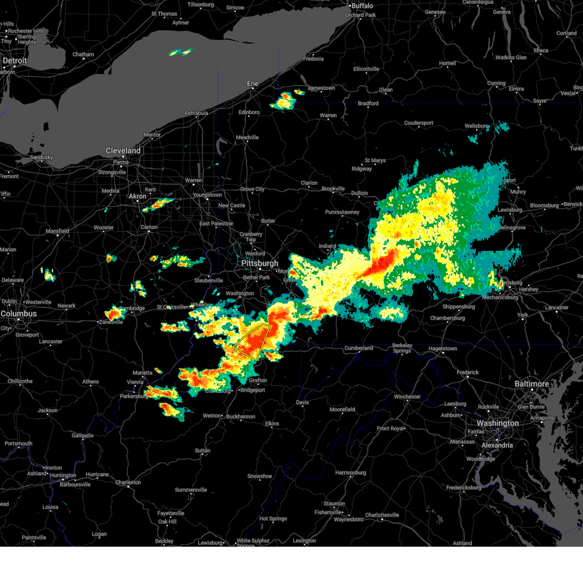 At 926 pm edt, a severe thunderstorm was located near waynesburg, moving east at 25 mph (radar indicated). Hazards include 60 mph wind gusts and quarter size hail. Minor hail damage to vehicles is possible. expect wind damage to trees and power lines, resulting in some power outages. locations impacted include, masontown, fairdale, granville, cassville, bobtown, nemacolin, carmichaels, blacksville, mount morris, pentress, wana, osage, brave, daybrook, georgetown, and core. hail threat, radar indicated max hail size, 1. 00 in wind threat, radar indicated max wind gust, 60 mph. At 926 pm edt, a severe thunderstorm was located near waynesburg, moving east at 25 mph (radar indicated). Hazards include 60 mph wind gusts and quarter size hail. Minor hail damage to vehicles is possible. expect wind damage to trees and power lines, resulting in some power outages. locations impacted include, masontown, fairdale, granville, cassville, bobtown, nemacolin, carmichaels, blacksville, mount morris, pentress, wana, osage, brave, daybrook, georgetown, and core. hail threat, radar indicated max hail size, 1. 00 in wind threat, radar indicated max wind gust, 60 mph.
|
| 8/12/2023 9:26 PM EDT |
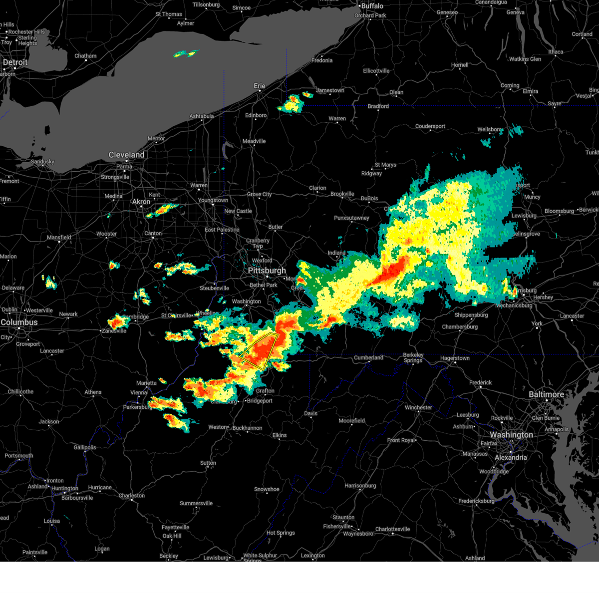 At 926 pm edt, a severe thunderstorm was located near waynesburg, moving east at 25 mph (radar indicated). Hazards include 60 mph wind gusts and quarter size hail. Minor hail damage to vehicles is possible. expect wind damage to trees and power lines, resulting in some power outages. locations impacted include, masontown, fairdale, granville, cassville, bobtown, nemacolin, carmichaels, blacksville, mount morris, pentress, wana, osage, brave, daybrook, georgetown, and core. hail threat, radar indicated max hail size, 1. 00 in wind threat, radar indicated max wind gust, 60 mph. At 926 pm edt, a severe thunderstorm was located near waynesburg, moving east at 25 mph (radar indicated). Hazards include 60 mph wind gusts and quarter size hail. Minor hail damage to vehicles is possible. expect wind damage to trees and power lines, resulting in some power outages. locations impacted include, masontown, fairdale, granville, cassville, bobtown, nemacolin, carmichaels, blacksville, mount morris, pentress, wana, osage, brave, daybrook, georgetown, and core. hail threat, radar indicated max hail size, 1. 00 in wind threat, radar indicated max wind gust, 60 mph.
|
| 8/12/2023 9:18 PM EDT |
 At 918 pm edt, a severe thunderstorm was located 7 miles north of cassville, or 9 miles southeast of waynesburg, moving southeast at 45 mph (radar indicated). Hazards include golf ball size hail and 60 mph wind gusts. People and animals outdoors will be injured. expect hail damage to roofs, siding, windows, and vehicles. Expect wind damage to trees and power lines, resulting in some power outages. At 918 pm edt, a severe thunderstorm was located 7 miles north of cassville, or 9 miles southeast of waynesburg, moving southeast at 45 mph (radar indicated). Hazards include golf ball size hail and 60 mph wind gusts. People and animals outdoors will be injured. expect hail damage to roofs, siding, windows, and vehicles. Expect wind damage to trees and power lines, resulting in some power outages.
|
| 8/12/2023 9:14 PM EDT |
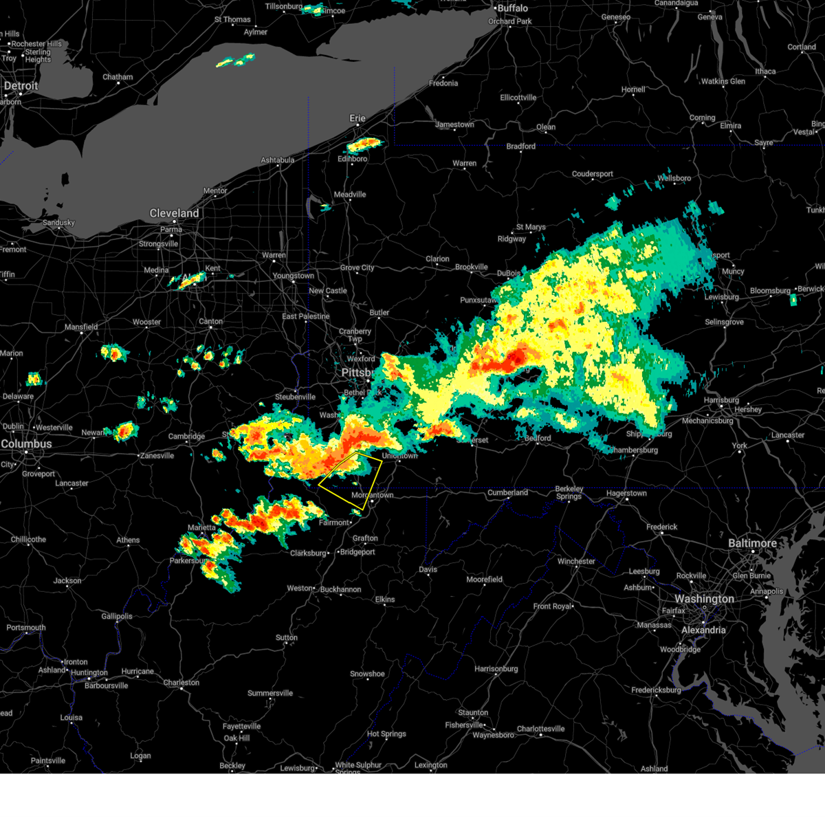 At 914 pm edt, a severe thunderstorm was located near waynesburg, moving east at 25 mph (radar indicated). Hazards include 60 mph wind gusts and quarter size hail. Minor hail damage to vehicles is possible. expect wind damage to trees and power lines, resulting in some power outages. locations impacted include, waynesburg, masontown, fairdale, jefferson boro, granville, cassville, bobtown, nemacolin, carmichaels, blacksville, mount morris, spraggs, pentress, wana, osage, brave, daybrook, georgetown, and core. hail threat, radar indicated max hail size, 1. 00 in wind threat, radar indicated max wind gust, 60 mph. At 914 pm edt, a severe thunderstorm was located near waynesburg, moving east at 25 mph (radar indicated). Hazards include 60 mph wind gusts and quarter size hail. Minor hail damage to vehicles is possible. expect wind damage to trees and power lines, resulting in some power outages. locations impacted include, waynesburg, masontown, fairdale, jefferson boro, granville, cassville, bobtown, nemacolin, carmichaels, blacksville, mount morris, spraggs, pentress, wana, osage, brave, daybrook, georgetown, and core. hail threat, radar indicated max hail size, 1. 00 in wind threat, radar indicated max wind gust, 60 mph.
|
| 8/12/2023 8:56 PM EDT |
 At 856 pm edt, a severe thunderstorm was located 9 miles east of cameron, or 11 miles west of waynesburg, moving east at 25 mph (radar indicated). Hazards include 60 mph wind gusts and nickel size hail. expect damage to trees and power lines, resulting in some power outages At 856 pm edt, a severe thunderstorm was located 9 miles east of cameron, or 11 miles west of waynesburg, moving east at 25 mph (radar indicated). Hazards include 60 mph wind gusts and nickel size hail. expect damage to trees and power lines, resulting in some power outages
|
| 8/12/2023 8:56 PM EDT |
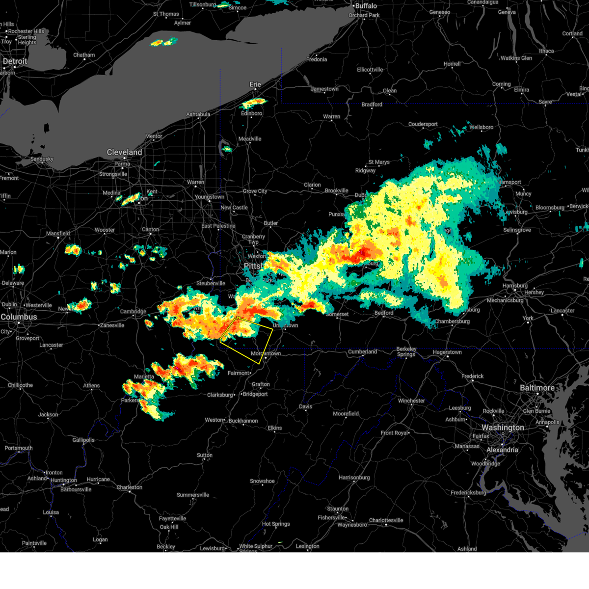 At 856 pm edt, a severe thunderstorm was located 9 miles east of cameron, or 11 miles west of waynesburg, moving east at 25 mph (radar indicated). Hazards include 60 mph wind gusts and nickel size hail. expect damage to trees and power lines, resulting in some power outages At 856 pm edt, a severe thunderstorm was located 9 miles east of cameron, or 11 miles west of waynesburg, moving east at 25 mph (radar indicated). Hazards include 60 mph wind gusts and nickel size hail. expect damage to trees and power lines, resulting in some power outages
|
| 6/3/2023 5:56 PM EDT |
 The severe thunderstorm warning for southeastern greene, southwestern fayette and north central monongalia counties will expire at 600 pm edt, the storm which prompted the warning has weakened below severe limits, and no longer poses an immediate threat to life or property. therefore, the warning will be allowed to expire. The severe thunderstorm warning for southeastern greene, southwestern fayette and north central monongalia counties will expire at 600 pm edt, the storm which prompted the warning has weakened below severe limits, and no longer poses an immediate threat to life or property. therefore, the warning will be allowed to expire.
|
| 6/3/2023 5:56 PM EDT |
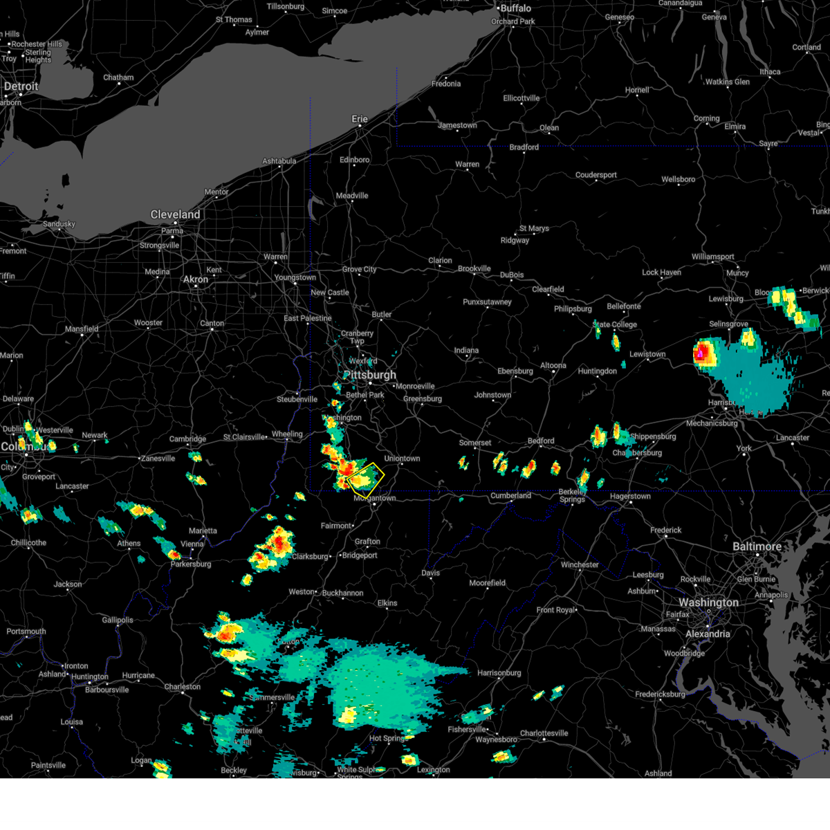 The severe thunderstorm warning for southeastern greene, southwestern fayette and north central monongalia counties will expire at 600 pm edt, the storm which prompted the warning has weakened below severe limits, and no longer poses an immediate threat to life or property. therefore, the warning will be allowed to expire. The severe thunderstorm warning for southeastern greene, southwestern fayette and north central monongalia counties will expire at 600 pm edt, the storm which prompted the warning has weakened below severe limits, and no longer poses an immediate threat to life or property. therefore, the warning will be allowed to expire.
|
| 6/3/2023 5:22 PM EDT |
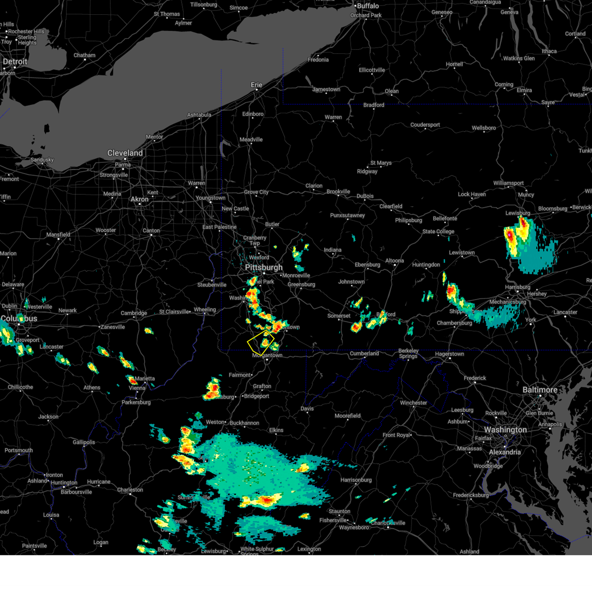 At 522 pm edt, a severe thunderstorm was located near fairdale, or 10 miles east of waynesburg, moving southwest at 20 mph (radar indicated). Hazards include 60 mph wind gusts and quarter size hail. Hail damage to vehicles. Damage to trees and power lines. At 522 pm edt, a severe thunderstorm was located near fairdale, or 10 miles east of waynesburg, moving southwest at 20 mph (radar indicated). Hazards include 60 mph wind gusts and quarter size hail. Hail damage to vehicles. Damage to trees and power lines.
|
| 11/27/2022 2:21 PM EST |
 At 221 pm est, a severe thunderstorm was located over granville, or over star city, moving northeast at 50 mph (radar indicated). Hazards include 60 mph wind gusts. expect damage to trees and power lines, resulting in some power outages At 221 pm est, a severe thunderstorm was located over granville, or over star city, moving northeast at 50 mph (radar indicated). Hazards include 60 mph wind gusts. expect damage to trees and power lines, resulting in some power outages
|
| 9/25/2022 10:09 AM EDT |
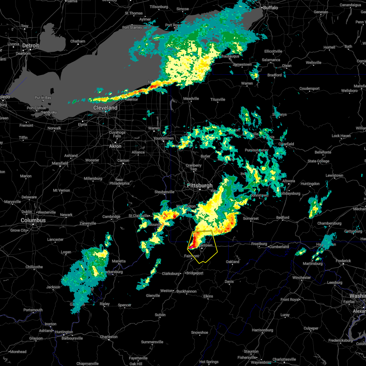 At 1009 am edt, a severe thunderstorm was located over star city, moving east at 55 mph (radar indicated). Hazards include 60 mph wind gusts and quarter size hail. Minor hail damage to vehicles is possible. expect wind damage to trees and power lines, resulting in some power outages. locations impacted include, morgantown, westover, star city, point marion, granville, brookhaven, cassville, fairchance, rivesville, smithfield, reedsville, and masontown. hail threat, radar indicated max hail size, 1. 00 in wind threat, radar indicated max wind gust, 60 mph. At 1009 am edt, a severe thunderstorm was located over star city, moving east at 55 mph (radar indicated). Hazards include 60 mph wind gusts and quarter size hail. Minor hail damage to vehicles is possible. expect wind damage to trees and power lines, resulting in some power outages. locations impacted include, morgantown, westover, star city, point marion, granville, brookhaven, cassville, fairchance, rivesville, smithfield, reedsville, and masontown. hail threat, radar indicated max hail size, 1. 00 in wind threat, radar indicated max wind gust, 60 mph.
|
| 9/25/2022 10:09 AM EDT |
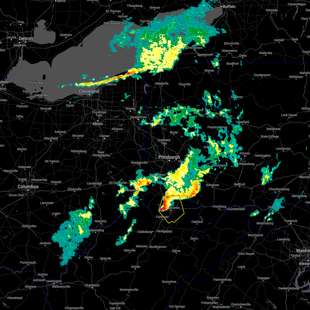 At 1009 am edt, a severe thunderstorm was located over star city, moving east at 55 mph (radar indicated). Hazards include 60 mph wind gusts and quarter size hail. Minor hail damage to vehicles is possible. expect wind damage to trees and power lines, resulting in some power outages. locations impacted include, morgantown, westover, star city, point marion, granville, brookhaven, cassville, fairchance, rivesville, smithfield, reedsville, and masontown. hail threat, radar indicated max hail size, 1. 00 in wind threat, radar indicated max wind gust, 60 mph. At 1009 am edt, a severe thunderstorm was located over star city, moving east at 55 mph (radar indicated). Hazards include 60 mph wind gusts and quarter size hail. Minor hail damage to vehicles is possible. expect wind damage to trees and power lines, resulting in some power outages. locations impacted include, morgantown, westover, star city, point marion, granville, brookhaven, cassville, fairchance, rivesville, smithfield, reedsville, and masontown. hail threat, radar indicated max hail size, 1. 00 in wind threat, radar indicated max wind gust, 60 mph.
|
| 9/25/2022 9:56 AM EDT |
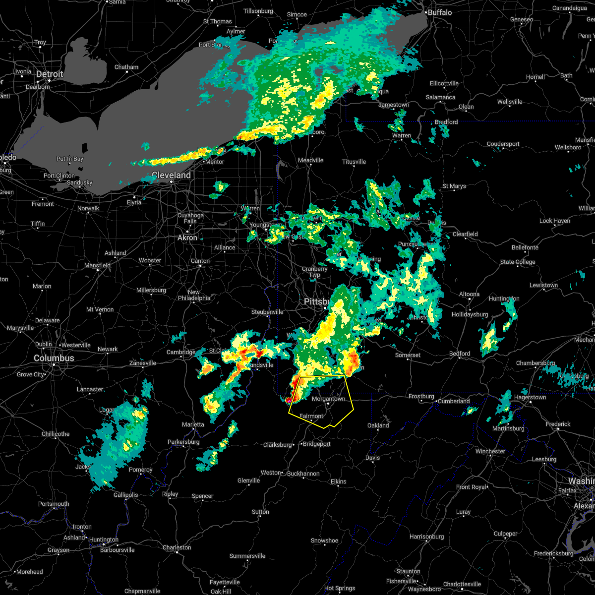 At 956 am edt, a severe thunderstorm was located near fairview, or 12 miles northeast of mannington, moving east at 55 mph (radar indicated). Hazards include 60 mph wind gusts and quarter size hail. Minor hail damage to vehicles is possible. expect wind damage to trees and power lines, resulting in some power outages. locations impacted include, morgantown, fairmont, westover, mannington, star city, pleasant valley, winfield, barrackville, point marion, granville, fairview, and brookhaven. hail threat, radar indicated max hail size, 1. 00 in wind threat, radar indicated max wind gust, 60 mph. At 956 am edt, a severe thunderstorm was located near fairview, or 12 miles northeast of mannington, moving east at 55 mph (radar indicated). Hazards include 60 mph wind gusts and quarter size hail. Minor hail damage to vehicles is possible. expect wind damage to trees and power lines, resulting in some power outages. locations impacted include, morgantown, fairmont, westover, mannington, star city, pleasant valley, winfield, barrackville, point marion, granville, fairview, and brookhaven. hail threat, radar indicated max hail size, 1. 00 in wind threat, radar indicated max wind gust, 60 mph.
|
| 9/25/2022 9:56 AM EDT |
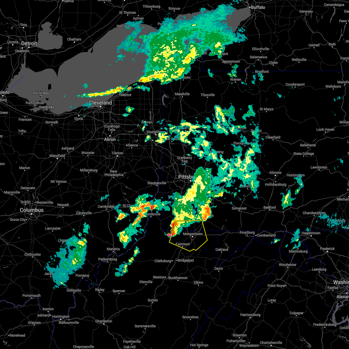 At 956 am edt, a severe thunderstorm was located near fairview, or 12 miles northeast of mannington, moving east at 55 mph (radar indicated). Hazards include 60 mph wind gusts and quarter size hail. Minor hail damage to vehicles is possible. expect wind damage to trees and power lines, resulting in some power outages. locations impacted include, morgantown, fairmont, westover, mannington, star city, pleasant valley, winfield, barrackville, point marion, granville, fairview, and brookhaven. hail threat, radar indicated max hail size, 1. 00 in wind threat, radar indicated max wind gust, 60 mph. At 956 am edt, a severe thunderstorm was located near fairview, or 12 miles northeast of mannington, moving east at 55 mph (radar indicated). Hazards include 60 mph wind gusts and quarter size hail. Minor hail damage to vehicles is possible. expect wind damage to trees and power lines, resulting in some power outages. locations impacted include, morgantown, fairmont, westover, mannington, star city, pleasant valley, winfield, barrackville, point marion, granville, fairview, and brookhaven. hail threat, radar indicated max hail size, 1. 00 in wind threat, radar indicated max wind gust, 60 mph.
|
| 9/25/2022 9:47 AM EDT |
 At 947 am edt, a severe thunderstorm was located near hundred, or 10 miles north of mannington, moving east at 55 mph (radar indicated). Hazards include 60 mph wind gusts and quarter size hail. Minor hail damage to vehicles is possible. expect wind damage to trees and power lines, resulting in some power outages. locations impacted include, morgantown, fairmont, westover, mannington, star city, pleasant valley, winfield, barrackville, point marion, granville, fairview, and hundred. hail threat, radar indicated max hail size, 1. 00 in wind threat, radar indicated max wind gust, 60 mph. At 947 am edt, a severe thunderstorm was located near hundred, or 10 miles north of mannington, moving east at 55 mph (radar indicated). Hazards include 60 mph wind gusts and quarter size hail. Minor hail damage to vehicles is possible. expect wind damage to trees and power lines, resulting in some power outages. locations impacted include, morgantown, fairmont, westover, mannington, star city, pleasant valley, winfield, barrackville, point marion, granville, fairview, and hundred. hail threat, radar indicated max hail size, 1. 00 in wind threat, radar indicated max wind gust, 60 mph.
|
| 9/25/2022 9:47 AM EDT |
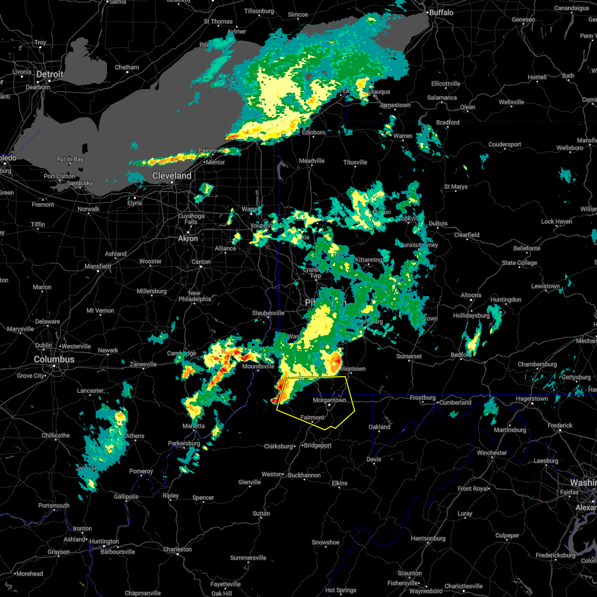 At 947 am edt, a severe thunderstorm was located near hundred, or 10 miles north of mannington, moving east at 55 mph (radar indicated). Hazards include 60 mph wind gusts and quarter size hail. Minor hail damage to vehicles is possible. expect wind damage to trees and power lines, resulting in some power outages. locations impacted include, morgantown, fairmont, westover, mannington, star city, pleasant valley, winfield, barrackville, point marion, granville, fairview, and hundred. hail threat, radar indicated max hail size, 1. 00 in wind threat, radar indicated max wind gust, 60 mph. At 947 am edt, a severe thunderstorm was located near hundred, or 10 miles north of mannington, moving east at 55 mph (radar indicated). Hazards include 60 mph wind gusts and quarter size hail. Minor hail damage to vehicles is possible. expect wind damage to trees and power lines, resulting in some power outages. locations impacted include, morgantown, fairmont, westover, mannington, star city, pleasant valley, winfield, barrackville, point marion, granville, fairview, and hundred. hail threat, radar indicated max hail size, 1. 00 in wind threat, radar indicated max wind gust, 60 mph.
|
| 9/25/2022 9:40 AM EDT |
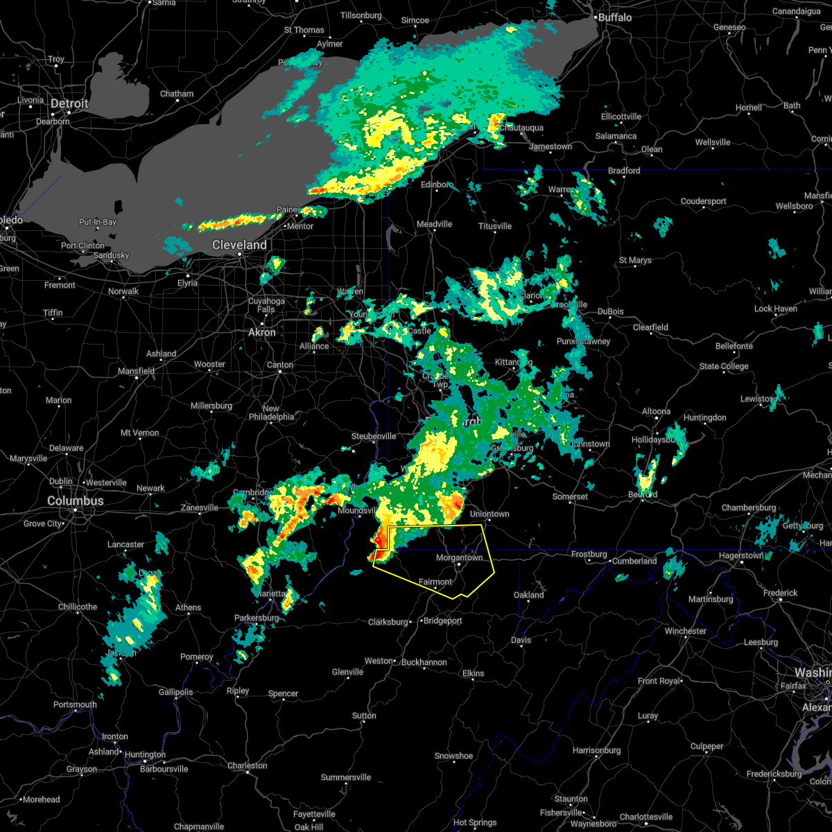 At 940 am edt, a severe thunderstorm was located over hundred, or 13 miles northwest of mannington, moving east at 55 mph (radar indicated). Hazards include 60 mph wind gusts and quarter size hail. Minor hail damage to vehicles is possible. Expect wind damage to trees and power lines, resulting in some power outages. At 940 am edt, a severe thunderstorm was located over hundred, or 13 miles northwest of mannington, moving east at 55 mph (radar indicated). Hazards include 60 mph wind gusts and quarter size hail. Minor hail damage to vehicles is possible. Expect wind damage to trees and power lines, resulting in some power outages.
|
| 8/1/2022 8:00 PM EDT |
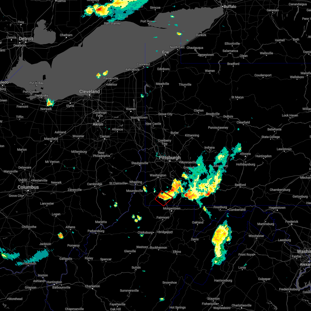 At 800 pm edt, a confirmed tornado was located near waynesburg, moving southeast at 25 mph (radar confirmed tornado). Hazards include damaging tornado and quarter size hail. Flying debris will be dangerous to those caught without shelter. mobile homes will be damaged or destroyed. damage to roofs, windows, and vehicles will occur. tree damage is likely. This tornadic thunderstorm will remain over mainly rural areas of central greene, southwestern fayette and northwestern monongalia counties, including the following locations, spraggs and mount morris. At 800 pm edt, a confirmed tornado was located near waynesburg, moving southeast at 25 mph (radar confirmed tornado). Hazards include damaging tornado and quarter size hail. Flying debris will be dangerous to those caught without shelter. mobile homes will be damaged or destroyed. damage to roofs, windows, and vehicles will occur. tree damage is likely. This tornadic thunderstorm will remain over mainly rural areas of central greene, southwestern fayette and northwestern monongalia counties, including the following locations, spraggs and mount morris.
|
| 8/1/2022 7:44 PM EDT |
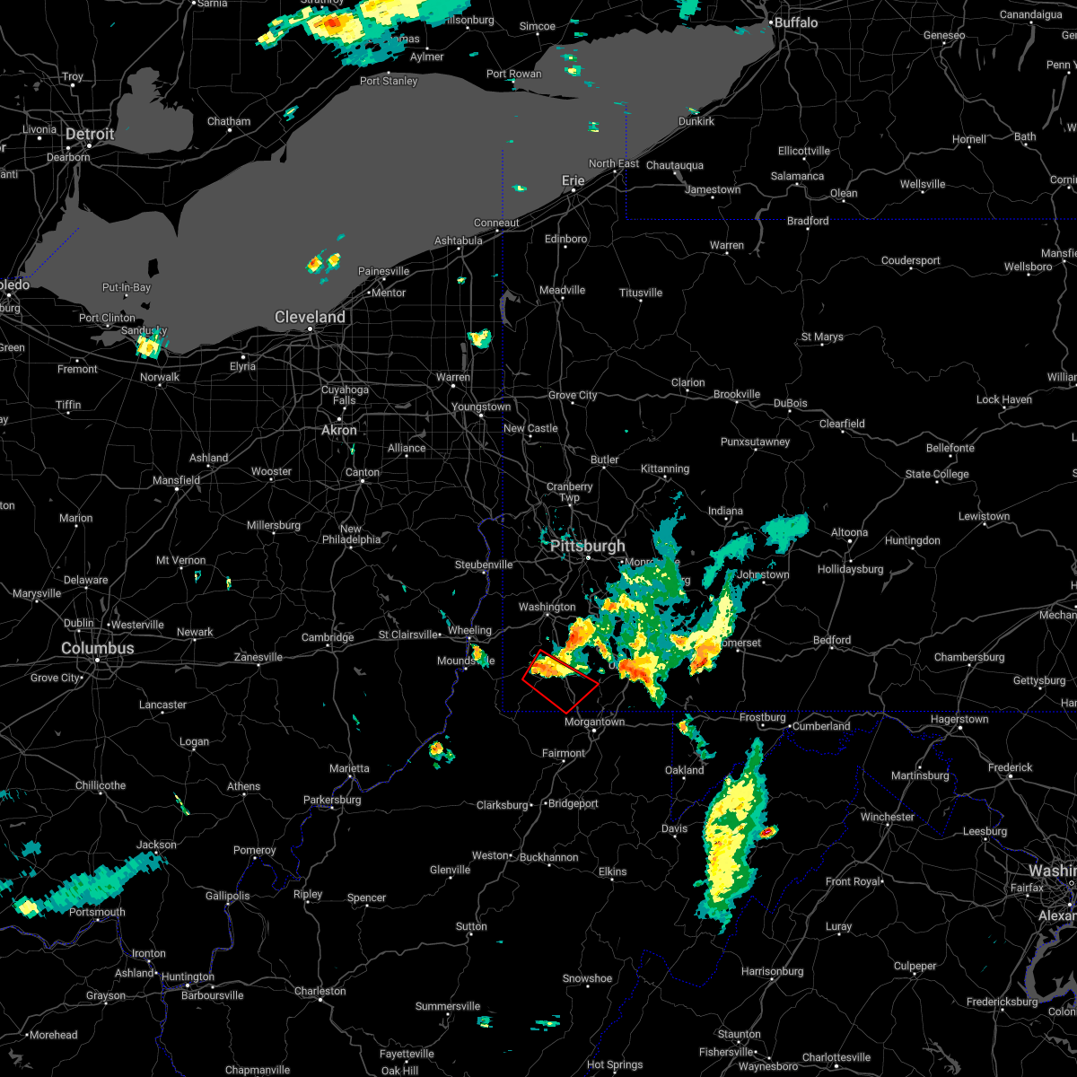 At 743 pm edt, a tornado producing storm was located near waynesburg, moving southeast at 20 mph (radar confirmed tornado). Hazards include damaging tornado and quarter size hail. Flying debris will be dangerous to those caught without shelter. mobile homes will be damaged or destroyed. damage to roofs, windows, and vehicles will occur. tree damage is likely. this tornadic storm will be near, waynesburg around 755 pm edt. Other locations impacted by this tornadic thunderstorm include rogersville, spraggs, nineveh and mount morris. At 743 pm edt, a tornado producing storm was located near waynesburg, moving southeast at 20 mph (radar confirmed tornado). Hazards include damaging tornado and quarter size hail. Flying debris will be dangerous to those caught without shelter. mobile homes will be damaged or destroyed. damage to roofs, windows, and vehicles will occur. tree damage is likely. this tornadic storm will be near, waynesburg around 755 pm edt. Other locations impacted by this tornadic thunderstorm include rogersville, spraggs, nineveh and mount morris.
|
| 7/23/2022 3:38 PM EDT |
 At 338 pm edt, severe thunderstorms were located along a line extending from near cassville to near lumberport, moving southeast at 30 mph (radar indicated). Hazards include 60 mph wind gusts and quarter size hail. Minor hail damage to vehicles is possible. expect wind damage to trees and power lines, resulting in some power outages. locations impacted include, morgantown, fairmont, westover, mannington, star city, pleasant valley, winfield, barrackville, monongah, granville, fairview, and cassville. hail threat, radar indicated max hail size, 1. 00 in wind threat, radar indicated max wind gust, 60 mph. At 338 pm edt, severe thunderstorms were located along a line extending from near cassville to near lumberport, moving southeast at 30 mph (radar indicated). Hazards include 60 mph wind gusts and quarter size hail. Minor hail damage to vehicles is possible. expect wind damage to trees and power lines, resulting in some power outages. locations impacted include, morgantown, fairmont, westover, mannington, star city, pleasant valley, winfield, barrackville, monongah, granville, fairview, and cassville. hail threat, radar indicated max hail size, 1. 00 in wind threat, radar indicated max wind gust, 60 mph.
|
| 7/23/2022 3:30 PM EDT |
 At 330 pm edt, a severe thunderstorm was located near delmont, or 8 miles north of greensburg, moving east at 40 mph (radar indicated). Hazards include 60 mph wind gusts and quarter size hail. Minor hail damage to vehicles is possible. expect wind damage to trees and power lines, resulting in some power outages. locations impacted include, pittsburgh, penn hills, monroeville, greensburg, mckeesport, uniontown, jeannette, connellsville, vandergrift, waynesburg, apollo, and plum. hail threat, radar indicated max hail size, 1. 00 in wind threat, radar indicated max wind gust, 60 mph. At 330 pm edt, a severe thunderstorm was located near delmont, or 8 miles north of greensburg, moving east at 40 mph (radar indicated). Hazards include 60 mph wind gusts and quarter size hail. Minor hail damage to vehicles is possible. expect wind damage to trees and power lines, resulting in some power outages. locations impacted include, pittsburgh, penn hills, monroeville, greensburg, mckeesport, uniontown, jeannette, connellsville, vandergrift, waynesburg, apollo, and plum. hail threat, radar indicated max hail size, 1. 00 in wind threat, radar indicated max wind gust, 60 mph.
|
| 7/23/2022 3:14 PM EDT |
 At 314 pm edt, severe thunderstorms were located along a line extending from 9 miles south of waynesburg to 8 miles north of salem, moving southeast at 40 mph (radar indicated). Hazards include 60 mph wind gusts. expect damage to trees and power lines, resulting in some power outages At 314 pm edt, severe thunderstorms were located along a line extending from 9 miles south of waynesburg to 8 miles north of salem, moving southeast at 40 mph (radar indicated). Hazards include 60 mph wind gusts. expect damage to trees and power lines, resulting in some power outages
|
| 7/23/2022 3:02 PM EDT |
 At 302 pm edt, a severe thunderstorm was located over north braddock, or near mckeesport, moving east at 40 mph (radar indicated). Hazards include 70 mph wind gusts and quarter size hail. Minor hail damage to vehicles is possible. trees snapped and uprooted. Power outages can be expected. At 302 pm edt, a severe thunderstorm was located over north braddock, or near mckeesport, moving east at 40 mph (radar indicated). Hazards include 70 mph wind gusts and quarter size hail. Minor hail damage to vehicles is possible. trees snapped and uprooted. Power outages can be expected.
|
| 6/22/2022 7:22 PM EDT |
 At 722 pm edt, severe thunderstorms were located along a line extending from 8 miles southwest of farmington to 7 miles northeast of hundred, moving southeast at 40 mph (radar indicated). Hazards include 60 mph wind gusts. expect damage to trees and power lines, resulting in some power outages At 722 pm edt, severe thunderstorms were located along a line extending from 8 miles southwest of farmington to 7 miles northeast of hundred, moving southeast at 40 mph (radar indicated). Hazards include 60 mph wind gusts. expect damage to trees and power lines, resulting in some power outages
|
| 6/22/2022 7:16 PM EDT |
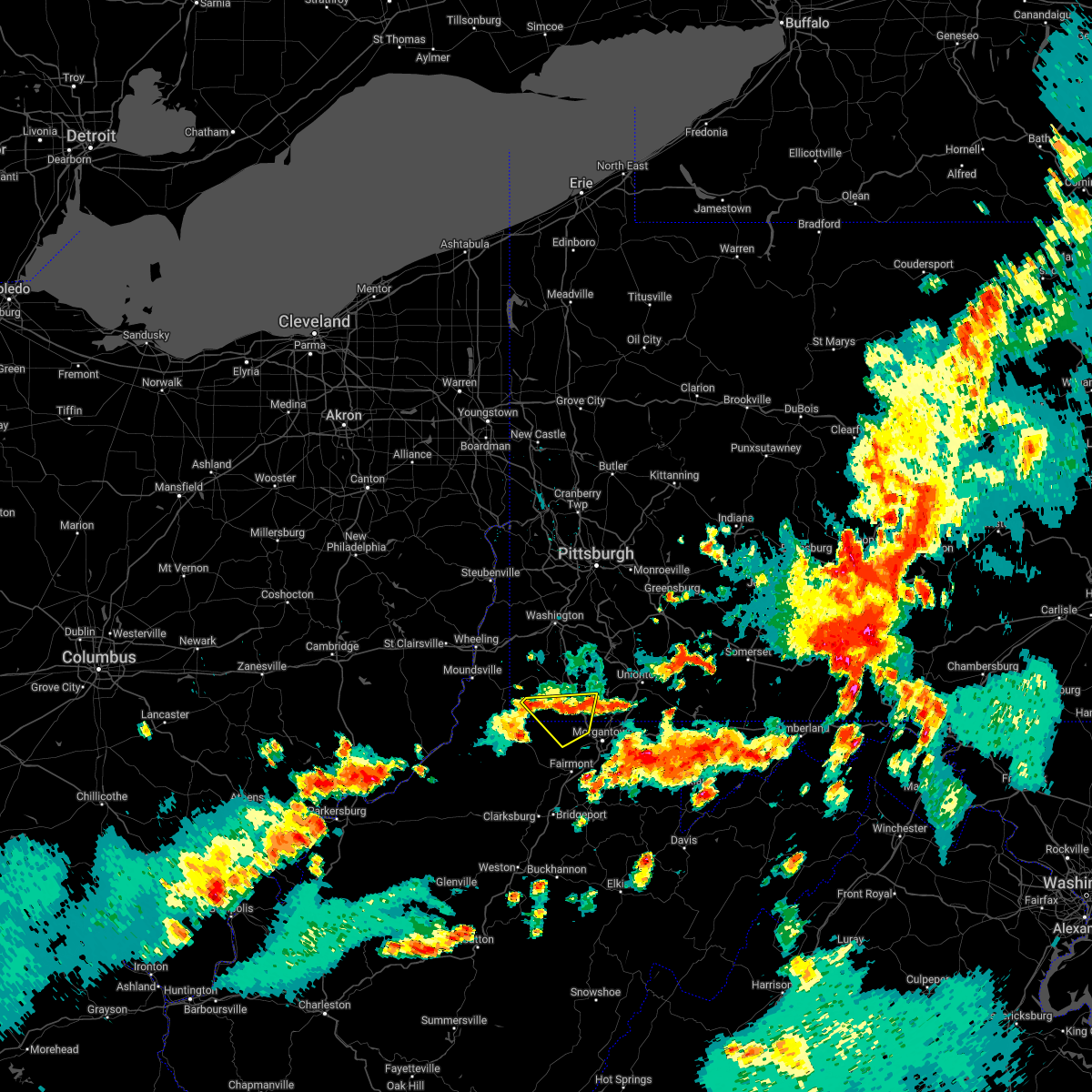 At 716 pm edt, a cluster of severe thunderstorms was centered 8 miles southwest of waynesburg, moving southeast at 30 mph (radar indicated). Hazards include 60 mph wind gusts. Expect damage to trees and power lines, resulting in some power outages. locations impacted include, cassville, blacksville, mount morris, spraggs, wana, brave, mccurdyville, daybrook, pentress, and core. hail threat, radar indicated max hail size, <. 75 in wind threat, radar indicated max wind gust, 60 mph. At 716 pm edt, a cluster of severe thunderstorms was centered 8 miles southwest of waynesburg, moving southeast at 30 mph (radar indicated). Hazards include 60 mph wind gusts. Expect damage to trees and power lines, resulting in some power outages. locations impacted include, cassville, blacksville, mount morris, spraggs, wana, brave, mccurdyville, daybrook, pentress, and core. hail threat, radar indicated max hail size, <. 75 in wind threat, radar indicated max wind gust, 60 mph.
|
| 6/22/2022 7:06 PM EDT |
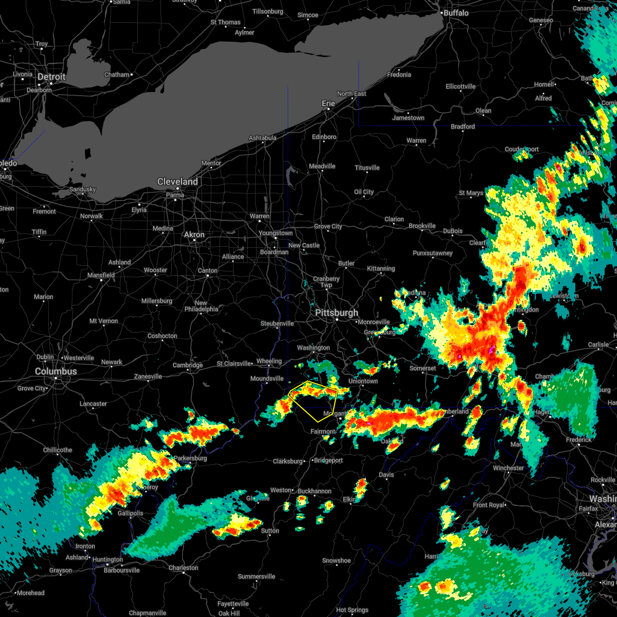 At 706 pm edt, a cluster of severe thunderstorms was centered 10 miles southwest of waynesburg, moving southeast at 30 mph (radar indicated). Hazards include 60 mph wind gusts. Expect damage to trees and power lines, resulting in some power outages. locations impacted include, waynesburg, cassville, rogersville, aleppo, blacksville, mount morris, new freeport, spraggs, mccurdyville, pentress, wana, and brave. hail threat, radar indicated max hail size, <. 75 in wind threat, radar indicated max wind gust, 60 mph. At 706 pm edt, a cluster of severe thunderstorms was centered 10 miles southwest of waynesburg, moving southeast at 30 mph (radar indicated). Hazards include 60 mph wind gusts. Expect damage to trees and power lines, resulting in some power outages. locations impacted include, waynesburg, cassville, rogersville, aleppo, blacksville, mount morris, new freeport, spraggs, mccurdyville, pentress, wana, and brave. hail threat, radar indicated max hail size, <. 75 in wind threat, radar indicated max wind gust, 60 mph.
|
| 6/22/2022 7:00 PM EDT |
 At 700 pm edt, a cluster of severe thunderstorms was centered 8 miles east of cameron, or 12 miles west of waynesburg, moving southeast at 30 mph (radar indicated). Hazards include 60 mph wind gusts. Expect damage to trees and power lines, resulting in some power outages. locations impacted include, waynesburg, cassville, rogersville, aleppo, blacksville, mount morris, new freeport, spraggs, mccurdyville, pentress, wana, and brave. hail threat, radar indicated max hail size, <. 75 in wind threat, radar indicated max wind gust, 60 mph. At 700 pm edt, a cluster of severe thunderstorms was centered 8 miles east of cameron, or 12 miles west of waynesburg, moving southeast at 30 mph (radar indicated). Hazards include 60 mph wind gusts. Expect damage to trees and power lines, resulting in some power outages. locations impacted include, waynesburg, cassville, rogersville, aleppo, blacksville, mount morris, new freeport, spraggs, mccurdyville, pentress, wana, and brave. hail threat, radar indicated max hail size, <. 75 in wind threat, radar indicated max wind gust, 60 mph.
|
| 6/22/2022 6:56 PM EDT |
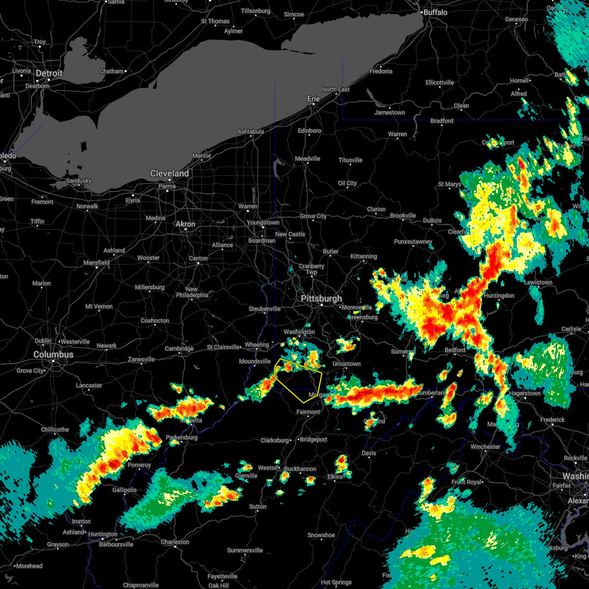 At 656 pm edt, a severe thunderstorm was located 7 miles northeast of cameron, or 13 miles west of waynesburg, moving southeast at 30 mph (radar indicated). Hazards include 60 mph wind gusts. expect damage to trees and power lines, resulting in some power outages At 656 pm edt, a severe thunderstorm was located 7 miles northeast of cameron, or 13 miles west of waynesburg, moving southeast at 30 mph (radar indicated). Hazards include 60 mph wind gusts. expect damage to trees and power lines, resulting in some power outages
|
| 6/16/2022 6:11 PM EDT |
 At 611 pm edt, a severe thunderstorm was located over cameron, or 12 miles southeast of moundsville, moving southeast at 40 mph (radar indicated). Hazards include 60 mph wind gusts and quarter size hail. Minor hail damage to vehicles is possible. Expect wind damage to trees and power lines, resulting in some power outages. At 611 pm edt, a severe thunderstorm was located over cameron, or 12 miles southeast of moundsville, moving southeast at 40 mph (radar indicated). Hazards include 60 mph wind gusts and quarter size hail. Minor hail damage to vehicles is possible. Expect wind damage to trees and power lines, resulting in some power outages.
|
| 6/16/2022 6:11 PM EDT |
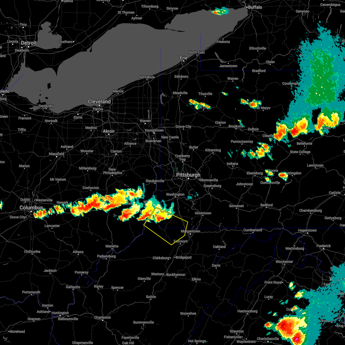 At 611 pm edt, a severe thunderstorm was located over cameron, or 12 miles southeast of moundsville, moving southeast at 40 mph (radar indicated). Hazards include 60 mph wind gusts and quarter size hail. Minor hail damage to vehicles is possible. Expect wind damage to trees and power lines, resulting in some power outages. At 611 pm edt, a severe thunderstorm was located over cameron, or 12 miles southeast of moundsville, moving southeast at 40 mph (radar indicated). Hazards include 60 mph wind gusts and quarter size hail. Minor hail damage to vehicles is possible. Expect wind damage to trees and power lines, resulting in some power outages.
|
| 6/8/2022 10:39 PM EDT |
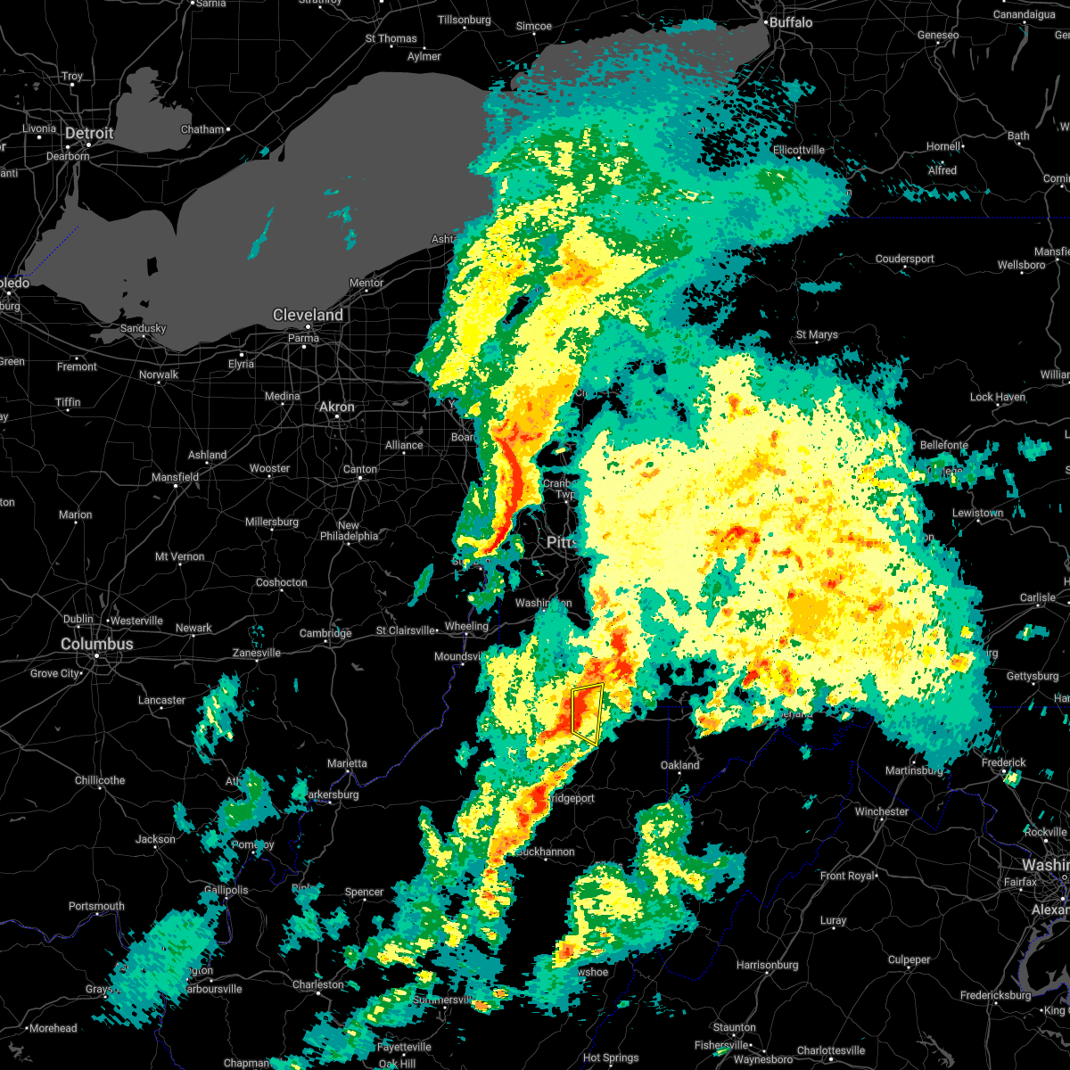 At 1039 pm edt, a severe thunderstorm was located over star city, moving east at 35 mph (radar indicated). Hazards include 60 mph wind gusts. Expect damage to trees and power lines, resulting in some power outages. Locations impacted include, morgantown, westover, star city, point marion, granville, cassville, brookhaven, bobtown, greensboro, mount morris, booth, and osage. At 1039 pm edt, a severe thunderstorm was located over star city, moving east at 35 mph (radar indicated). Hazards include 60 mph wind gusts. Expect damage to trees and power lines, resulting in some power outages. Locations impacted include, morgantown, westover, star city, point marion, granville, cassville, brookhaven, bobtown, greensboro, mount morris, booth, and osage.
|
| 6/8/2022 10:31 PM EDT |
 At 1031 pm edt, a severe thunderstorm was located over cassville, or near star city, moving east at 35 mph (radar indicated). Hazards include 60 mph wind gusts. Expect damage to trees and power lines, resulting in some power outages. Locations impacted include, morgantown, westover, star city, point marion, granville, cassville, brookhaven, bobtown, greensboro, mount morris, booth, and pentress. At 1031 pm edt, a severe thunderstorm was located over cassville, or near star city, moving east at 35 mph (radar indicated). Hazards include 60 mph wind gusts. Expect damage to trees and power lines, resulting in some power outages. Locations impacted include, morgantown, westover, star city, point marion, granville, cassville, brookhaven, bobtown, greensboro, mount morris, booth, and pentress.
|
| 6/8/2022 10:31 PM EDT |
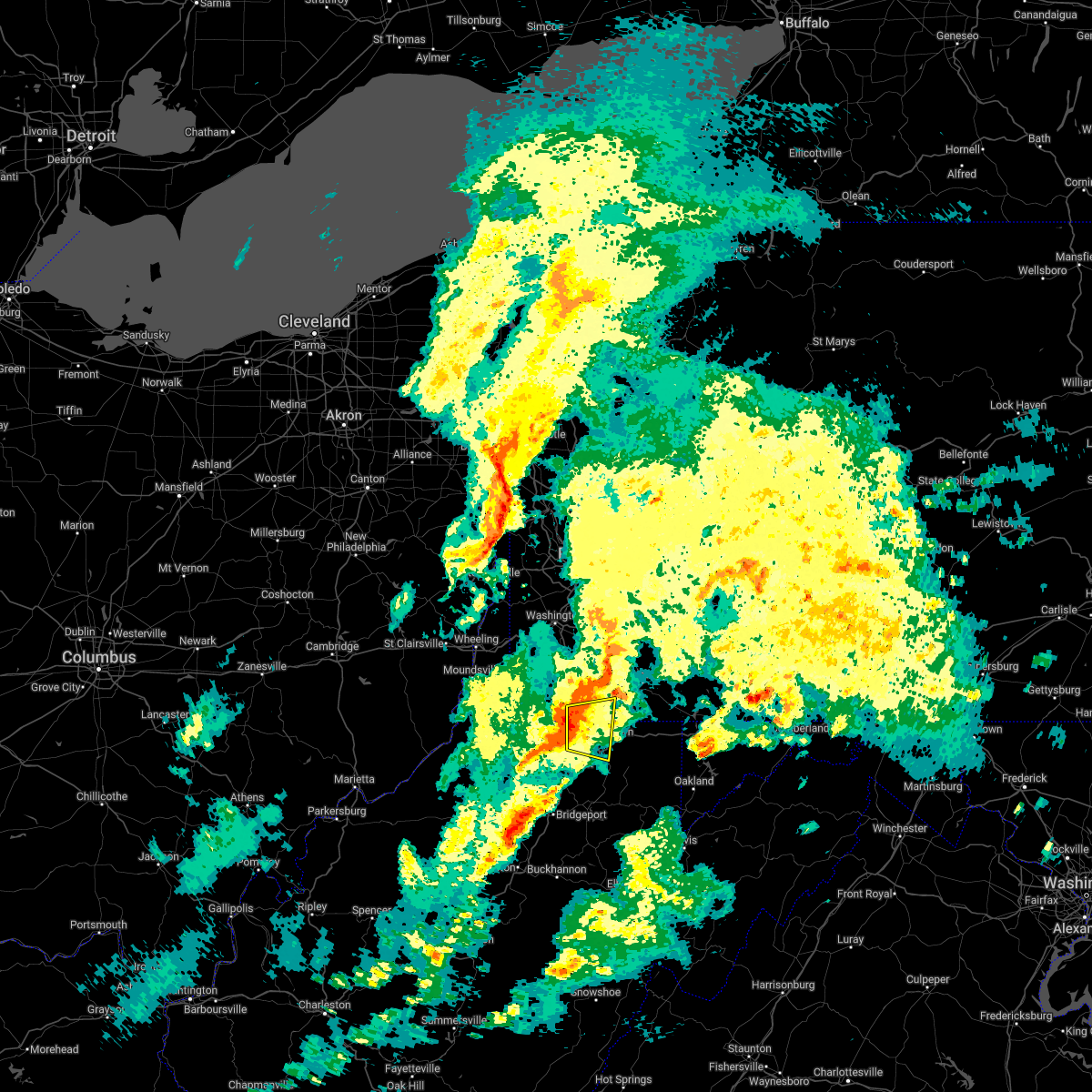 At 1031 pm edt, a severe thunderstorm was located over cassville, or near star city, moving east at 35 mph (radar indicated). Hazards include 60 mph wind gusts. Expect damage to trees and power lines, resulting in some power outages. Locations impacted include, morgantown, westover, star city, point marion, granville, cassville, brookhaven, bobtown, greensboro, mount morris, booth, and pentress. At 1031 pm edt, a severe thunderstorm was located over cassville, or near star city, moving east at 35 mph (radar indicated). Hazards include 60 mph wind gusts. Expect damage to trees and power lines, resulting in some power outages. Locations impacted include, morgantown, westover, star city, point marion, granville, cassville, brookhaven, bobtown, greensboro, mount morris, booth, and pentress.
|
| 6/8/2022 10:16 PM EDT |
 At 1016 pm edt, a severe thunderstorm was located 7 miles north of fairview, or 12 miles north of mannington, moving east at 35 mph (radar indicated). Hazards include 60 mph wind gusts. expect damage to trees and power lines, resulting in some power outages At 1016 pm edt, a severe thunderstorm was located 7 miles north of fairview, or 12 miles north of mannington, moving east at 35 mph (radar indicated). Hazards include 60 mph wind gusts. expect damage to trees and power lines, resulting in some power outages
|
| 6/8/2022 10:16 PM EDT |
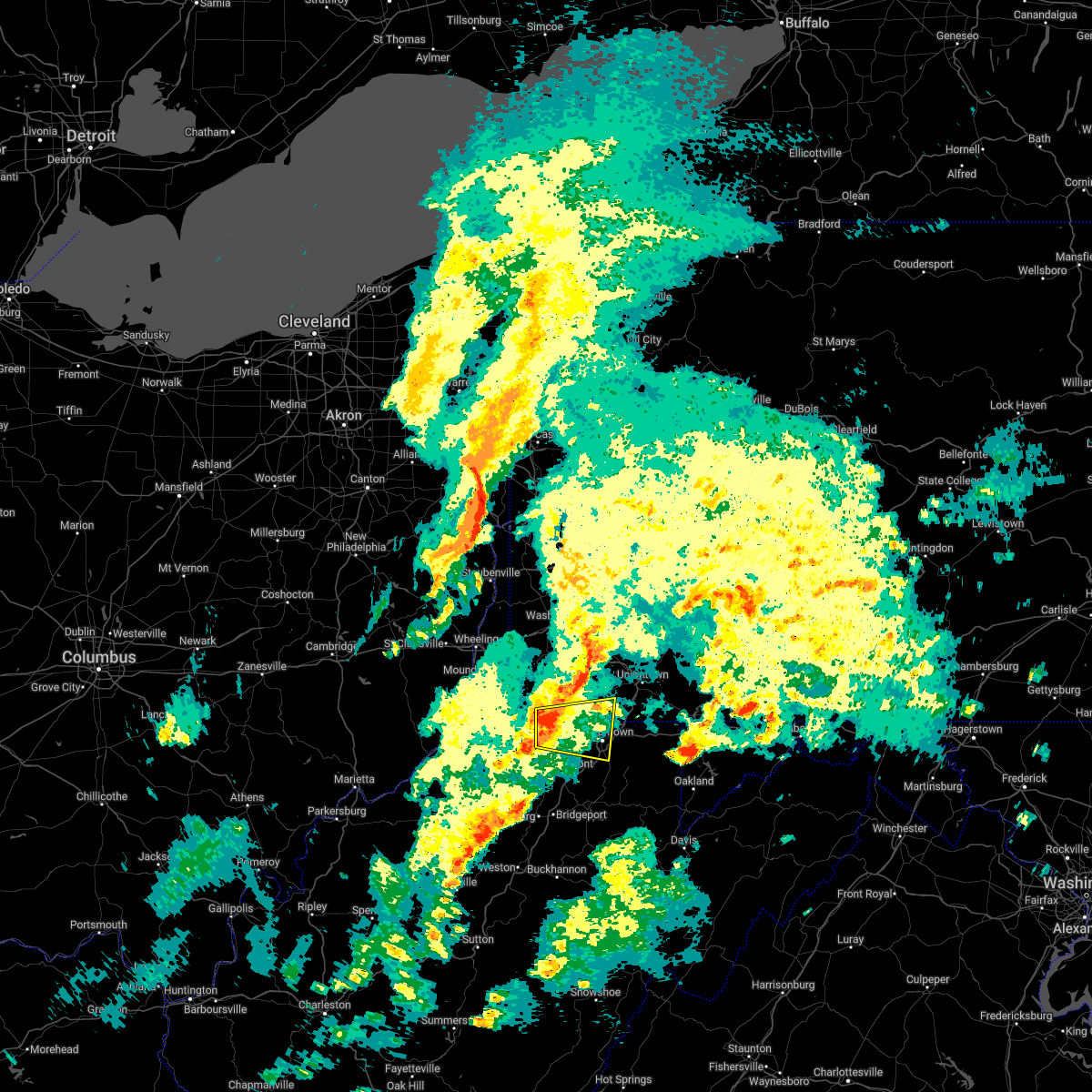 At 1016 pm edt, a severe thunderstorm was located 7 miles north of fairview, or 12 miles north of mannington, moving east at 35 mph (radar indicated). Hazards include 60 mph wind gusts. expect damage to trees and power lines, resulting in some power outages At 1016 pm edt, a severe thunderstorm was located 7 miles north of fairview, or 12 miles north of mannington, moving east at 35 mph (radar indicated). Hazards include 60 mph wind gusts. expect damage to trees and power lines, resulting in some power outages
|
| 5/3/2022 7:56 PM EDT |
 At 756 pm edt, a severe thunderstorm was located near westover, moving east at 50 mph (radar indicated). Hazards include 60 mph wind gusts. expect damage to trees and power lines, resulting in some power outages At 756 pm edt, a severe thunderstorm was located near westover, moving east at 50 mph (radar indicated). Hazards include 60 mph wind gusts. expect damage to trees and power lines, resulting in some power outages
|
| 5/1/2022 8:16 PM EDT |
 At 816 pm edt, a severe thunderstorm was located near point marion, or 10 miles southwest of uniontown, moving northeast at 45 mph (radar indicated). Hazards include 60 mph wind gusts and nickel size hail. Expect damage to trees and power lines, resulting in some power outages. locations impacted include, morgantown, westover, star city, point marion, granville, cassville, brookhaven, rivesville, grant town, bobtown, greensboro, and mount morris. hail threat, radar indicated max hail size, 0. 88 in wind threat, radar indicated max wind gust, 60 mph. At 816 pm edt, a severe thunderstorm was located near point marion, or 10 miles southwest of uniontown, moving northeast at 45 mph (radar indicated). Hazards include 60 mph wind gusts and nickel size hail. Expect damage to trees and power lines, resulting in some power outages. locations impacted include, morgantown, westover, star city, point marion, granville, cassville, brookhaven, rivesville, grant town, bobtown, greensboro, and mount morris. hail threat, radar indicated max hail size, 0. 88 in wind threat, radar indicated max wind gust, 60 mph.
|
| 5/1/2022 8:16 PM EDT |
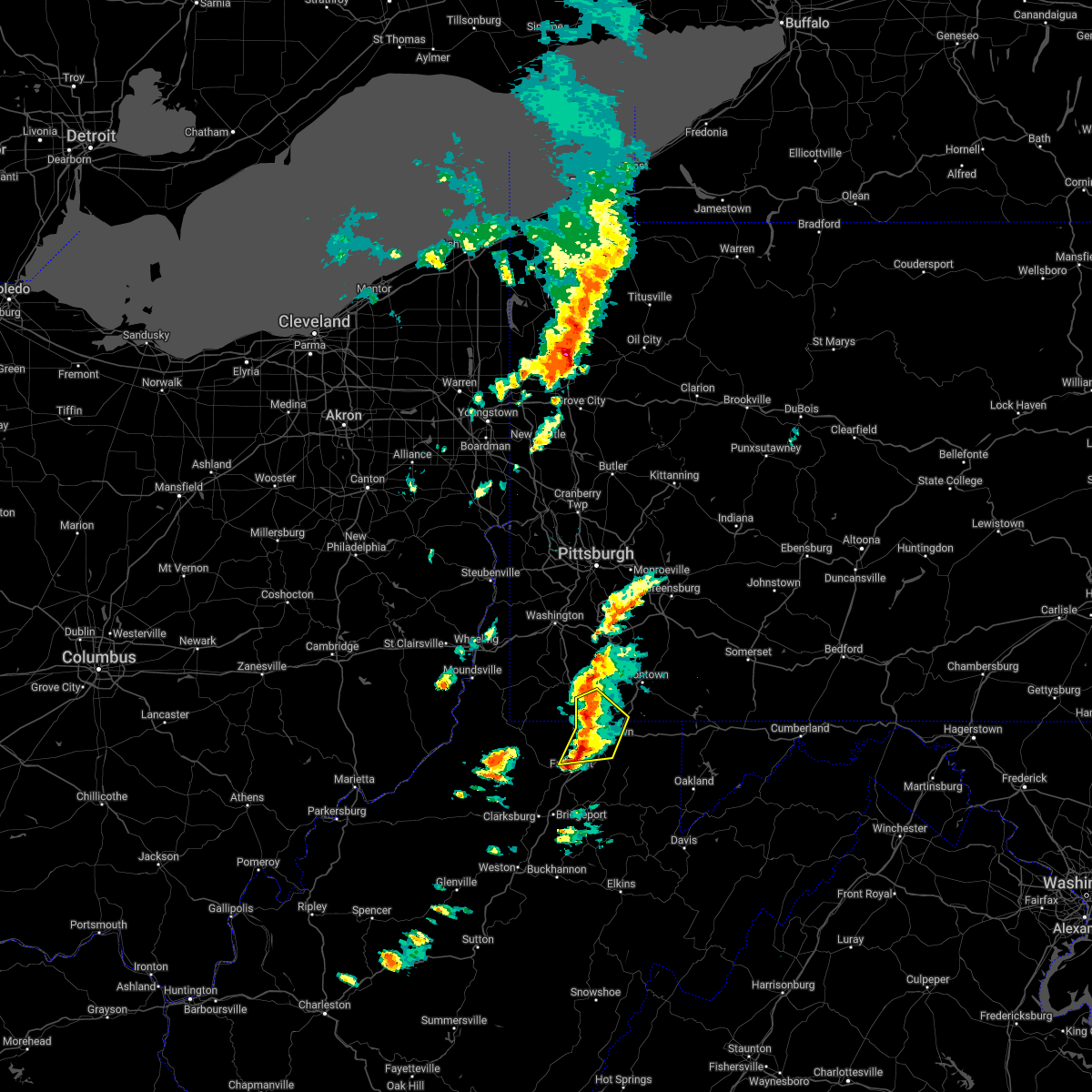 At 816 pm edt, a severe thunderstorm was located near point marion, or 10 miles southwest of uniontown, moving northeast at 45 mph (radar indicated). Hazards include 60 mph wind gusts and nickel size hail. Expect damage to trees and power lines, resulting in some power outages. locations impacted include, morgantown, westover, star city, point marion, granville, cassville, brookhaven, rivesville, grant town, bobtown, greensboro, and mount morris. hail threat, radar indicated max hail size, 0. 88 in wind threat, radar indicated max wind gust, 60 mph. At 816 pm edt, a severe thunderstorm was located near point marion, or 10 miles southwest of uniontown, moving northeast at 45 mph (radar indicated). Hazards include 60 mph wind gusts and nickel size hail. Expect damage to trees and power lines, resulting in some power outages. locations impacted include, morgantown, westover, star city, point marion, granville, cassville, brookhaven, rivesville, grant town, bobtown, greensboro, and mount morris. hail threat, radar indicated max hail size, 0. 88 in wind threat, radar indicated max wind gust, 60 mph.
|
| 5/1/2022 8:15 PM EDT |
 At 815 pm edt, a severe thunderstorm was located over brookhaven, or near morgantown, moving east at 50 mph (radar indicated). Hazards include 60 mph wind gusts and nickel size hail. expect damage to trees and power lines, resulting in some power outages At 815 pm edt, a severe thunderstorm was located over brookhaven, or near morgantown, moving east at 50 mph (radar indicated). Hazards include 60 mph wind gusts and nickel size hail. expect damage to trees and power lines, resulting in some power outages
|
| 5/1/2022 8:00 PM EDT |
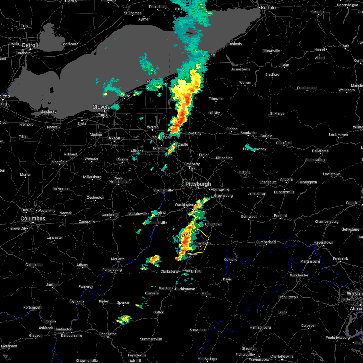 At 759 pm edt, a severe thunderstorm was located over cassville, or near star city, moving northeast at 45 mph (radar indicated). Hazards include 60 mph wind gusts and nickel size hail. Expect damage to trees and power lines, resulting in some power outages. locations impacted include, morgantown, westover, mannington, star city, point marion, granville, fairview, brookhaven, cassville, rivesville, grant town, and bobtown. hail threat, radar indicated max hail size, 0. 88 in wind threat, radar indicated max wind gust, 60 mph. At 759 pm edt, a severe thunderstorm was located over cassville, or near star city, moving northeast at 45 mph (radar indicated). Hazards include 60 mph wind gusts and nickel size hail. Expect damage to trees and power lines, resulting in some power outages. locations impacted include, morgantown, westover, mannington, star city, point marion, granville, fairview, brookhaven, cassville, rivesville, grant town, and bobtown. hail threat, radar indicated max hail size, 0. 88 in wind threat, radar indicated max wind gust, 60 mph.
|
| 5/1/2022 7:42 PM EDT |
 At 740 pm edt, a severe thunderstorm was located near fairview, or near mannington, moving northeast at 45 mph (radar indicated). Hazards include 60 mph wind gusts and nickel size hail. expect damage to trees and power lines, resulting in some power outages At 740 pm edt, a severe thunderstorm was located near fairview, or near mannington, moving northeast at 45 mph (radar indicated). Hazards include 60 mph wind gusts and nickel size hail. expect damage to trees and power lines, resulting in some power outages
|
| 5/1/2022 7:42 PM EDT |
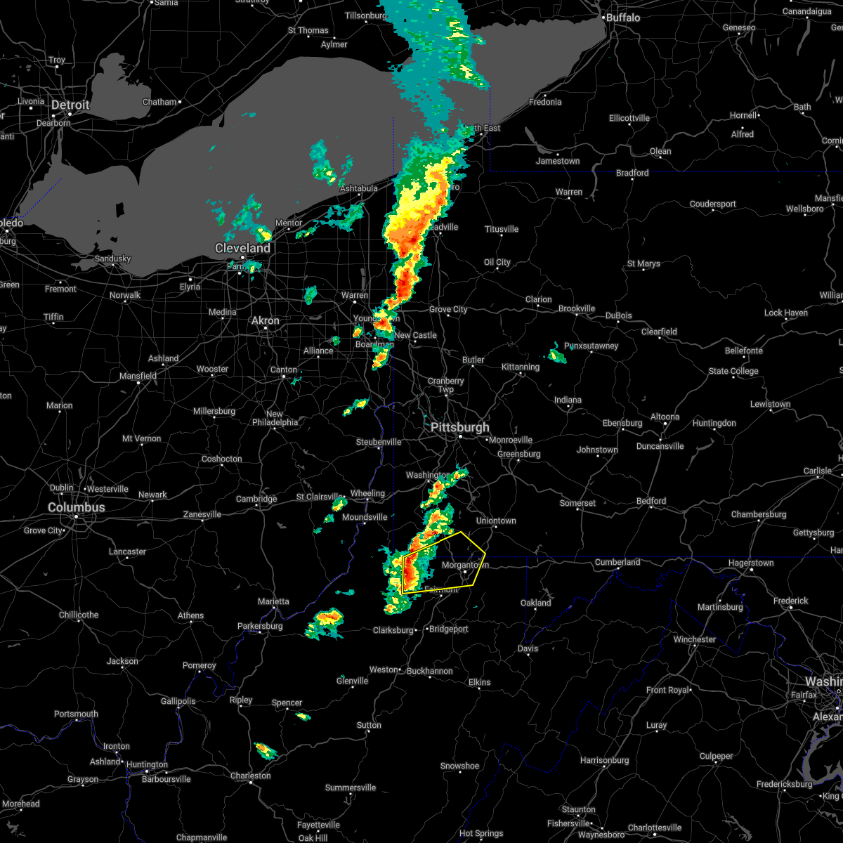 At 740 pm edt, a severe thunderstorm was located near fairview, or near mannington, moving northeast at 45 mph (radar indicated). Hazards include 60 mph wind gusts and nickel size hail. expect damage to trees and power lines, resulting in some power outages At 740 pm edt, a severe thunderstorm was located near fairview, or near mannington, moving northeast at 45 mph (radar indicated). Hazards include 60 mph wind gusts and nickel size hail. expect damage to trees and power lines, resulting in some power outages
|
| 7/29/2021 6:32 PM EDT |
 At 632 pm edt, a severe thunderstorm was located 8 miles northwest of cassville, or 10 miles south of waynesburg, moving southeast at 40 mph (radar). Hazards include wind gusts to 60 mph and half dollar-size hail. Minor hail damage to vehicles is possible. Expect wind damage to trees and power lines, resulting in some power outages. At 632 pm edt, a severe thunderstorm was located 8 miles northwest of cassville, or 10 miles south of waynesburg, moving southeast at 40 mph (radar). Hazards include wind gusts to 60 mph and half dollar-size hail. Minor hail damage to vehicles is possible. Expect wind damage to trees and power lines, resulting in some power outages.
|
| 7/29/2021 6:32 PM EDT |
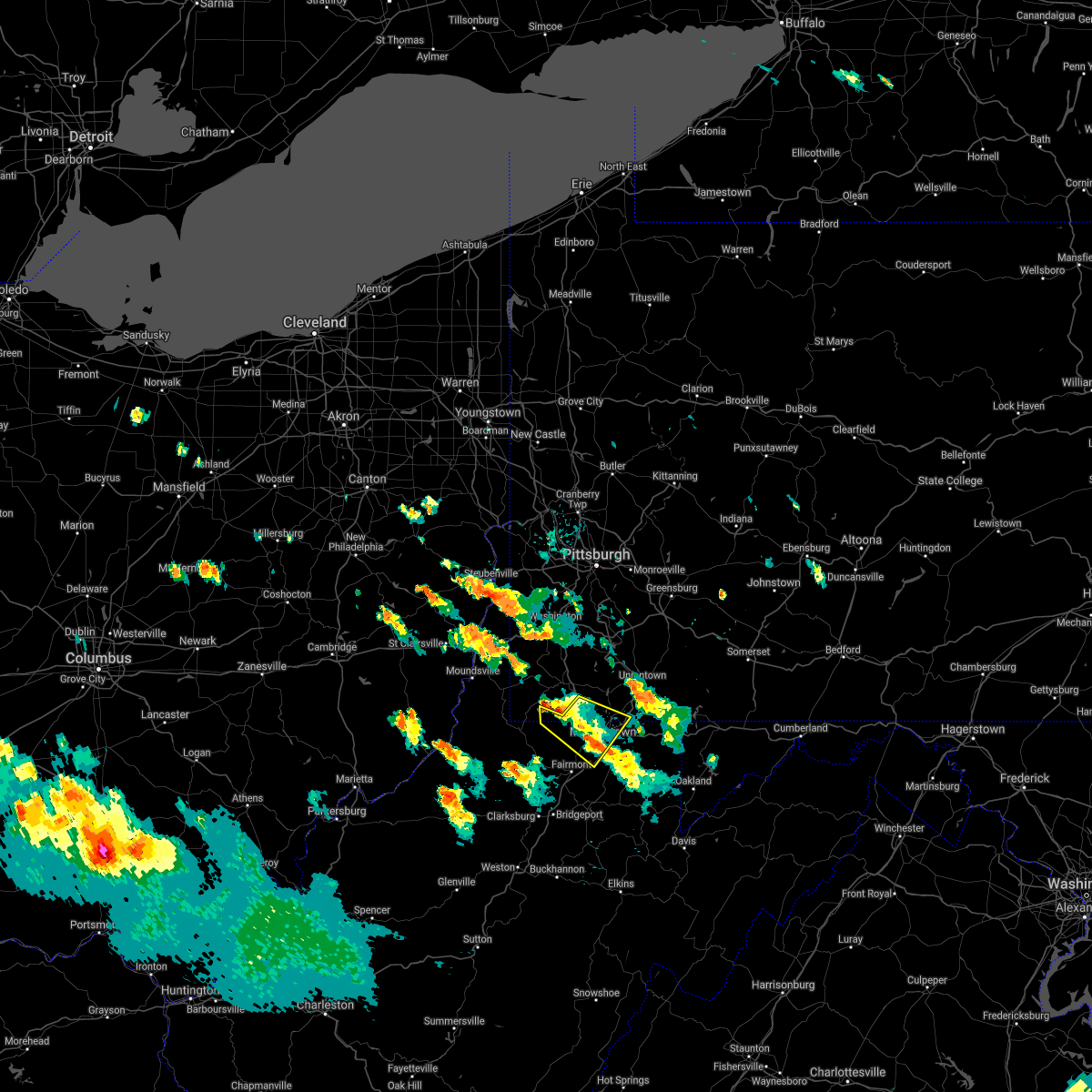 At 632 pm edt, a severe thunderstorm was located 8 miles northwest of cassville, or 10 miles south of waynesburg, moving southeast at 40 mph (radar). Hazards include wind gusts to 60 mph and half dollar-size hail. Minor hail damage to vehicles is possible. Expect wind damage to trees and power lines, resulting in some power outages. At 632 pm edt, a severe thunderstorm was located 8 miles northwest of cassville, or 10 miles south of waynesburg, moving southeast at 40 mph (radar). Hazards include wind gusts to 60 mph and half dollar-size hail. Minor hail damage to vehicles is possible. Expect wind damage to trees and power lines, resulting in some power outages.
|
| 6/21/2021 4:39 PM EDT |
 At 438 pm edt, a severe thunderstorm was located 9 miles west of waynesburg, moving east at 55 mph (radar). Hazards include wind gusts to 60 mph. Expect damage to trees and power lines, resulting in some power outages. Locations impacted include, moundsville, waynesburg, powhatan point, glen dale, rogersville, west finley, clarington, aleppo, blacksville, cameron, new freeport, nineveh, this includes interstate 79 in pennsylvania between mile markers 7 and 17. At 438 pm edt, a severe thunderstorm was located 9 miles west of waynesburg, moving east at 55 mph (radar). Hazards include wind gusts to 60 mph. Expect damage to trees and power lines, resulting in some power outages. Locations impacted include, moundsville, waynesburg, powhatan point, glen dale, rogersville, west finley, clarington, aleppo, blacksville, cameron, new freeport, nineveh, this includes interstate 79 in pennsylvania between mile markers 7 and 17.
|
| 6/21/2021 4:19 PM EDT |
 At 419 pm edt, a severe thunderstorm was located near moundsville, moving east at 45 mph (radar). Hazards include wind gusts to 60 mph. expect damage to trees and power lines, resulting in some power outages At 419 pm edt, a severe thunderstorm was located near moundsville, moving east at 45 mph (radar). Hazards include wind gusts to 60 mph. expect damage to trees and power lines, resulting in some power outages
|
| 6/14/2021 6:27 PM EDT |
 At 627 pm edt, a severe thunderstorm was located over cassville, or near star city, moving southeast at 35 mph (radar). Hazards include wind gusts to 60 mph. expect damage to trees and power lines, resulting in some power outages At 627 pm edt, a severe thunderstorm was located over cassville, or near star city, moving southeast at 35 mph (radar). Hazards include wind gusts to 60 mph. expect damage to trees and power lines, resulting in some power outages
|
| 6/14/2021 6:27 PM EDT |
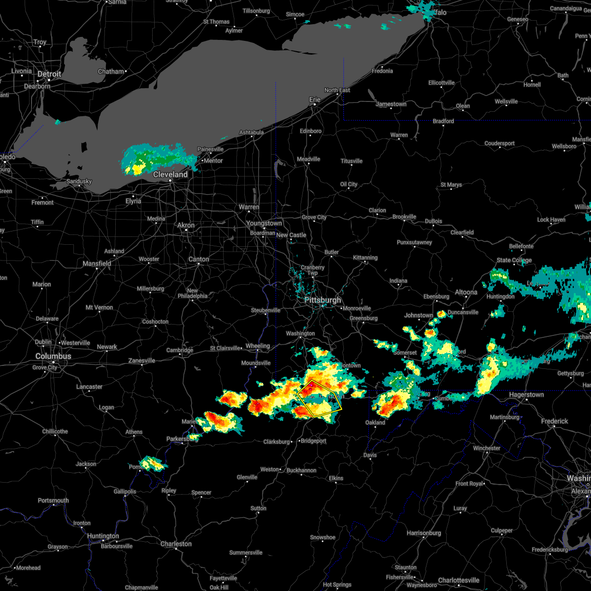 At 627 pm edt, a severe thunderstorm was located over cassville, or near star city, moving southeast at 35 mph (radar). Hazards include wind gusts to 60 mph. expect damage to trees and power lines, resulting in some power outages At 627 pm edt, a severe thunderstorm was located over cassville, or near star city, moving southeast at 35 mph (radar). Hazards include wind gusts to 60 mph. expect damage to trees and power lines, resulting in some power outages
|
| 6/14/2021 6:21 PM EDT |
 At 621 pm edt, a severe thunderstorm was located near cassville, or 7 miles northwest of star city, moving east at 40 mph (radar). Hazards include wind gusts to 60 mph and quarter-size hail. Minor hail damage to vehicles is possible. expect wind damage to trees and power lines, resulting in some power outages. locations impacted include, morgantown, star city, granville, cassville, grant town, bobtown, blacksville, mount morris, spraggs, baxter, mccurdyville, pentress, this includes the following highways, interstate 79 in pennsylvania between mile markers 0 and 12. Interstate 79 in west virginia between mile markers 154 and 160. At 621 pm edt, a severe thunderstorm was located near cassville, or 7 miles northwest of star city, moving east at 40 mph (radar). Hazards include wind gusts to 60 mph and quarter-size hail. Minor hail damage to vehicles is possible. expect wind damage to trees and power lines, resulting in some power outages. locations impacted include, morgantown, star city, granville, cassville, grant town, bobtown, blacksville, mount morris, spraggs, baxter, mccurdyville, pentress, this includes the following highways, interstate 79 in pennsylvania between mile markers 0 and 12. Interstate 79 in west virginia between mile markers 154 and 160.
|
| 6/14/2021 6:21 PM EDT |
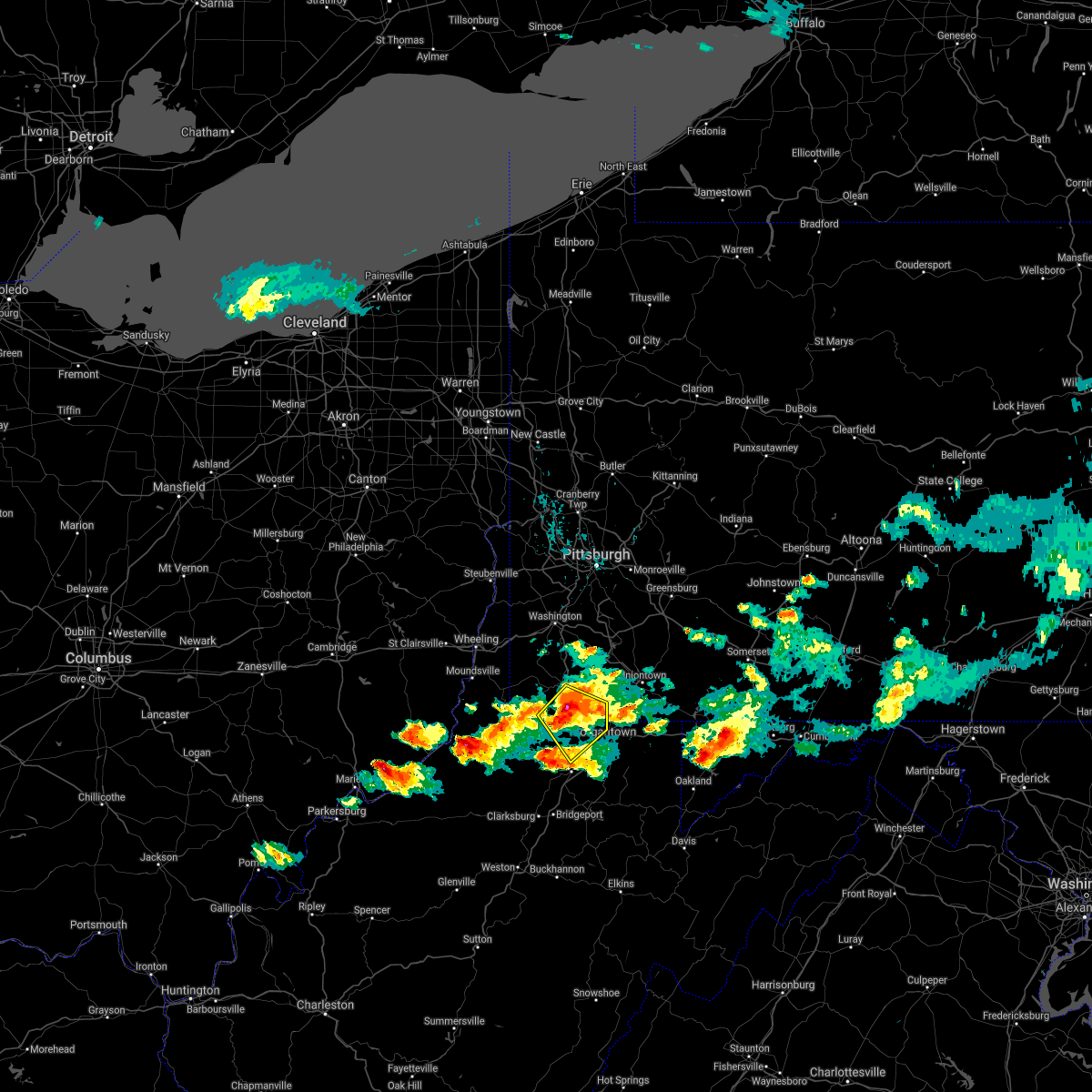 At 621 pm edt, a severe thunderstorm was located near cassville, or 7 miles northwest of star city, moving east at 40 mph (radar). Hazards include wind gusts to 60 mph and quarter-size hail. Minor hail damage to vehicles is possible. expect wind damage to trees and power lines, resulting in some power outages. locations impacted include, morgantown, star city, granville, cassville, grant town, bobtown, blacksville, mount morris, spraggs, baxter, mccurdyville, pentress, this includes the following highways, interstate 79 in pennsylvania between mile markers 0 and 12. Interstate 79 in west virginia between mile markers 154 and 160. At 621 pm edt, a severe thunderstorm was located near cassville, or 7 miles northwest of star city, moving east at 40 mph (radar). Hazards include wind gusts to 60 mph and quarter-size hail. Minor hail damage to vehicles is possible. expect wind damage to trees and power lines, resulting in some power outages. locations impacted include, morgantown, star city, granville, cassville, grant town, bobtown, blacksville, mount morris, spraggs, baxter, mccurdyville, pentress, this includes the following highways, interstate 79 in pennsylvania between mile markers 0 and 12. Interstate 79 in west virginia between mile markers 154 and 160.
|
| 6/14/2021 6:02 PM EDT |
 At 601 pm edt, a severe thunderstorm was located 9 miles southwest of waynesburg, moving east southeast at 35 mph (radar). Hazards include wind gusts to 60 mph. expect damage to trees and power lines, resulting in some power outages At 601 pm edt, a severe thunderstorm was located 9 miles southwest of waynesburg, moving east southeast at 35 mph (radar). Hazards include wind gusts to 60 mph. expect damage to trees and power lines, resulting in some power outages
|
| 6/14/2021 6:02 PM EDT |
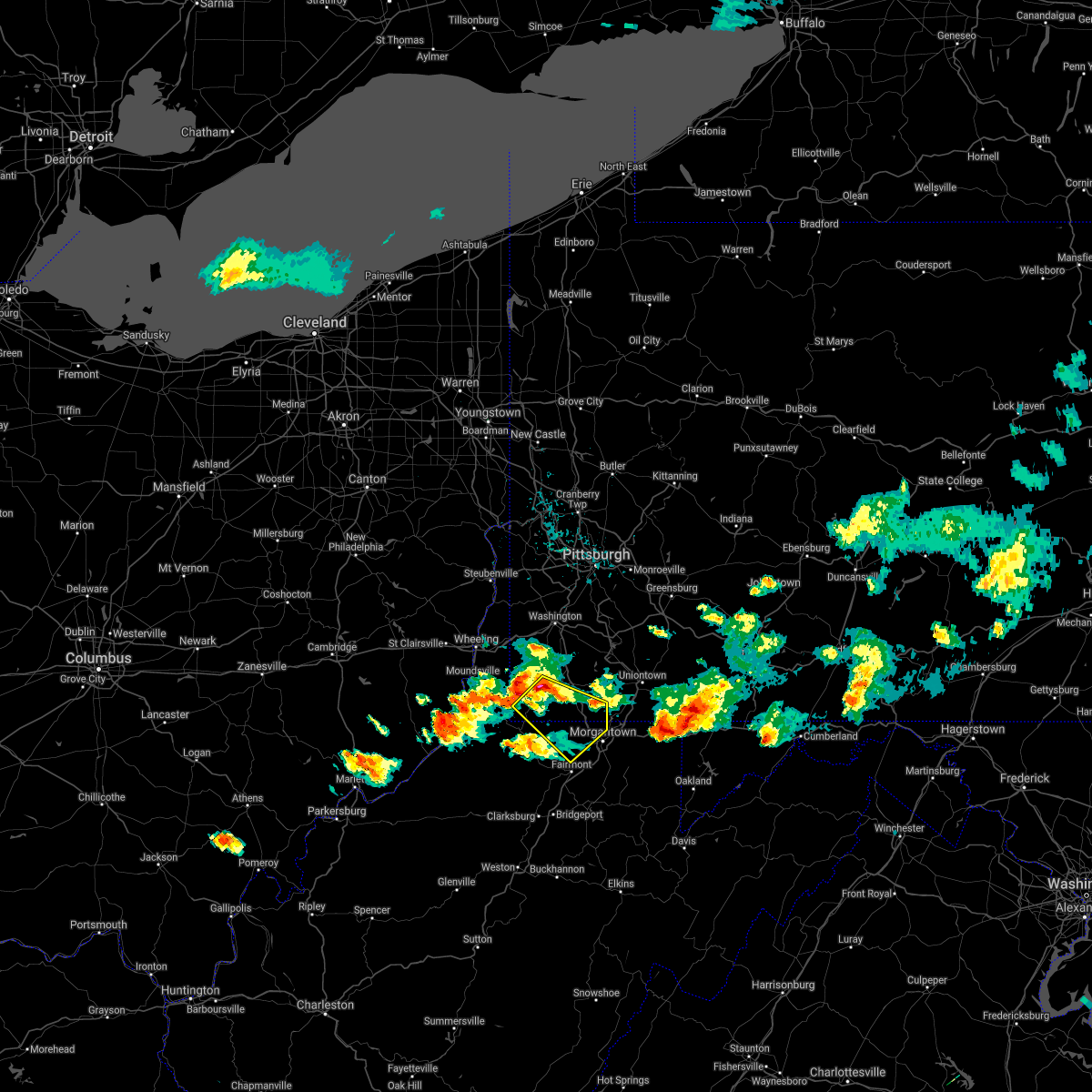 At 601 pm edt, a severe thunderstorm was located 9 miles southwest of waynesburg, moving east southeast at 35 mph (radar). Hazards include wind gusts to 60 mph. expect damage to trees and power lines, resulting in some power outages At 601 pm edt, a severe thunderstorm was located 9 miles southwest of waynesburg, moving east southeast at 35 mph (radar). Hazards include wind gusts to 60 mph. expect damage to trees and power lines, resulting in some power outages
|
| 6/13/2021 2:29 PM EDT |
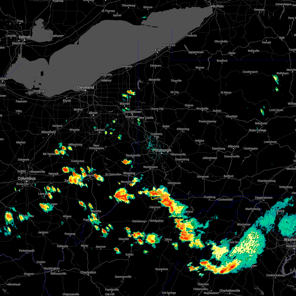 At 228 pm edt, a severe thunderstorm was located near cassville, or 9 miles northwest of star city, moving southeast at 20 mph (radar). Hazards include wind gusts to 60 mph. Expect damage to trees and power lines, resulting in some power outages. locations impacted include, blacksville, mount morris, spraggs, daybrook, pentress, core, this includes the following highways, interstate 79 in pennsylvania between mile markers 0 and 4. Interstate 79 in west virginia between mile markers 159 and 160. At 228 pm edt, a severe thunderstorm was located near cassville, or 9 miles northwest of star city, moving southeast at 20 mph (radar). Hazards include wind gusts to 60 mph. Expect damage to trees and power lines, resulting in some power outages. locations impacted include, blacksville, mount morris, spraggs, daybrook, pentress, core, this includes the following highways, interstate 79 in pennsylvania between mile markers 0 and 4. Interstate 79 in west virginia between mile markers 159 and 160.
|
| 6/13/2021 2:08 PM EDT |
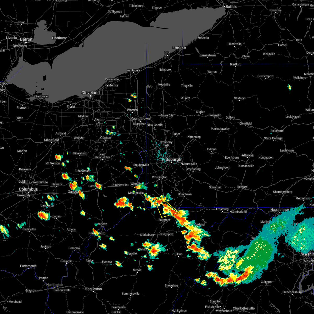 At 208 pm edt, a severe thunderstorm was located 7 miles south of waynesburg, moving southeast at 20 mph (radar). Hazards include wind gusts to 60 mph and quarter-size hail. Minor hail damage to vehicles is possible. Expect wind damage to trees and power lines, resulting in some power outages. At 208 pm edt, a severe thunderstorm was located 7 miles south of waynesburg, moving southeast at 20 mph (radar). Hazards include wind gusts to 60 mph and quarter-size hail. Minor hail damage to vehicles is possible. Expect wind damage to trees and power lines, resulting in some power outages.
|
| 6/13/2021 1:37 PM EDT |
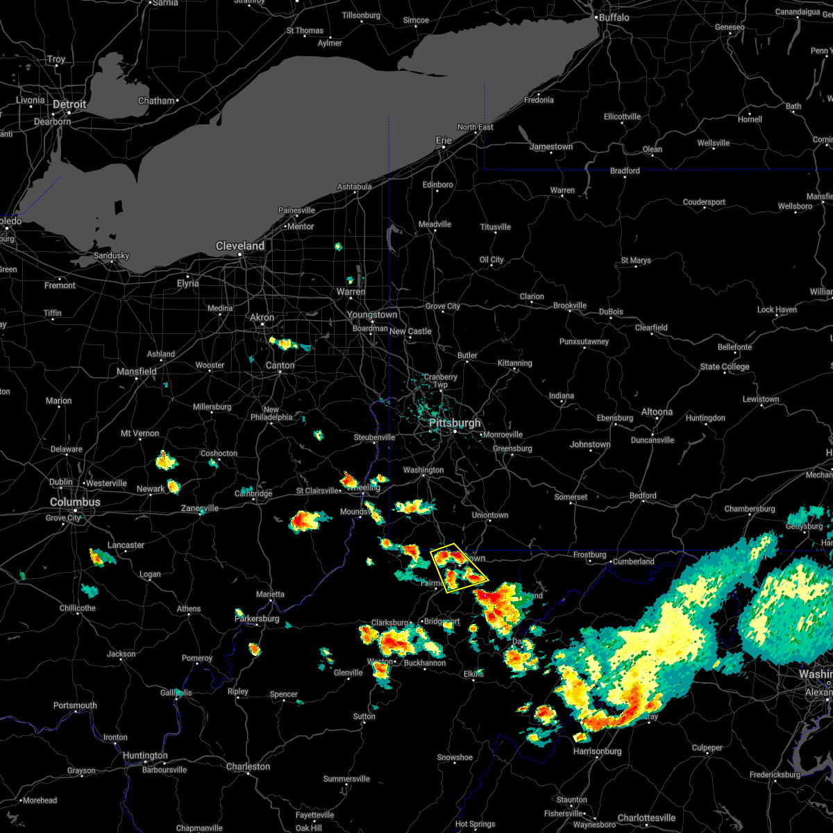 At 136 pm edt, a severe thunderstorm was located over cassville, or near star city, moving southeast at 25 mph (radar). Hazards include wind gusts to 60 mph and quarter-size hail. Minor hail damage to vehicles is possible. Expect wind damage to trees and power lines, resulting in some power outages. At 136 pm edt, a severe thunderstorm was located over cassville, or near star city, moving southeast at 25 mph (radar). Hazards include wind gusts to 60 mph and quarter-size hail. Minor hail damage to vehicles is possible. Expect wind damage to trees and power lines, resulting in some power outages.
|
| 6/13/2021 1:37 PM EDT |
 The national weather service in pittsburgh has issued a * severe thunderstorm warning for. southern greene county in southwestern pennsylvania. eastern monongalia county in northern west virginia. west central preston county in northeastern west virginia. East central marion county in northern west virginia. The national weather service in pittsburgh has issued a * severe thunderstorm warning for. southern greene county in southwestern pennsylvania. eastern monongalia county in northern west virginia. west central preston county in northeastern west virginia. East central marion county in northern west virginia.
|
| 11/15/2020 3:16 PM EST |
 At 315 pm est, severe thunderstorms were located along a line extending from near masontown to near bridgeport, moving east at 55 mph (radar). Hazards include wind gusts to 60 mph. expect damage to trees and power lines, resulting in some power outages At 315 pm est, severe thunderstorms were located along a line extending from near masontown to near bridgeport, moving east at 55 mph (radar). Hazards include wind gusts to 60 mph. expect damage to trees and power lines, resulting in some power outages
|
| 8/27/2020 8:42 PM EDT |
 At 842 pm edt, severe thunderstorms were located along a line extending from 6 miles south of jefferson boro to near farmington, moving south at 25 mph (radar). Hazards include wind gusts to 60 mph. expect damage to trees and power lines, resulting in some power outages At 842 pm edt, severe thunderstorms were located along a line extending from 6 miles south of jefferson boro to near farmington, moving south at 25 mph (radar). Hazards include wind gusts to 60 mph. expect damage to trees and power lines, resulting in some power outages
|
| 8/27/2020 8:24 PM EDT |
 At 824 pm edt, severe thunderstorms were located along a line extending from near meyersdale to near ursina to fairdale to near waynesburg, moving southeast at 30 mph (radar). Hazards include wind gusts to 60 mph. Expect damage to trees and power lines, resulting in some power outages. locations impacted include, morgantown, uniontown, waynesburg, westover, star city, bittinger, masontown, farmington, fairdale, jefferson boro, point marion, granville, this includes the following highways, interstate 68 in maryland between mile markers 1 and 30. interstate 68 in west virginia between mile markers 4 and 32. interstate 79 in pennsylvania between mile markers 0 and 20. Interstate 79 in west virginia between mile markers 152 and 160. At 824 pm edt, severe thunderstorms were located along a line extending from near meyersdale to near ursina to fairdale to near waynesburg, moving southeast at 30 mph (radar). Hazards include wind gusts to 60 mph. Expect damage to trees and power lines, resulting in some power outages. locations impacted include, morgantown, uniontown, waynesburg, westover, star city, bittinger, masontown, farmington, fairdale, jefferson boro, point marion, granville, this includes the following highways, interstate 68 in maryland between mile markers 1 and 30. interstate 68 in west virginia between mile markers 4 and 32. interstate 79 in pennsylvania between mile markers 0 and 20. Interstate 79 in west virginia between mile markers 152 and 160.
|
| 8/27/2020 8:13 PM EDT |
 At 813 pm edt, severe thunderstorms were located along a line extending from near new centerville to near ursina to near fredericktown-millsboro to 11 miles northeast of cameron, moving southeast at 30 mph (radar). Hazards include wind gusts to 60 mph. Expect damage to trees and power lines, resulting in some power outages. locations impacted include, morgantown, uniontown, connellsville, waynesburg, westover, star city, valley grove, bittinger, california, masontown, bentleyville, brownsville, this includes the following highways, interstate 68 in maryland between mile markers 1 and 30. interstate 68 in west virginia between mile markers 4 and 32. interstate 70 in west virginia between mile markers 11 and 14. interstate 70 in pennsylvania between mile markers 0 and 2, and between mile markers 37 and 39. interstate 79 in pennsylvania between mile markers 0 and 28. Interstate 79 in west virginia between mile markers 152 and 160. At 813 pm edt, severe thunderstorms were located along a line extending from near new centerville to near ursina to near fredericktown-millsboro to 11 miles northeast of cameron, moving southeast at 30 mph (radar). Hazards include wind gusts to 60 mph. Expect damage to trees and power lines, resulting in some power outages. locations impacted include, morgantown, uniontown, connellsville, waynesburg, westover, star city, valley grove, bittinger, california, masontown, bentleyville, brownsville, this includes the following highways, interstate 68 in maryland between mile markers 1 and 30. interstate 68 in west virginia between mile markers 4 and 32. interstate 70 in west virginia between mile markers 11 and 14. interstate 70 in pennsylvania between mile markers 0 and 2, and between mile markers 37 and 39. interstate 79 in pennsylvania between mile markers 0 and 28. Interstate 79 in west virginia between mile markers 152 and 160.
|
| 8/27/2020 7:40 PM EDT |
 At 739 pm edt, severe thunderstorms were located along a line extending from 6 miles northeast of seven springs to near connellsville to near east washington to near west liberty, moving southeast at 30 mph (radar). Hazards include wind gusts to 60 mph. expect damage to trees and power lines, resulting in some power outages At 739 pm edt, severe thunderstorms were located along a line extending from 6 miles northeast of seven springs to near connellsville to near east washington to near west liberty, moving southeast at 30 mph (radar). Hazards include wind gusts to 60 mph. expect damage to trees and power lines, resulting in some power outages
|
| 8/25/2020 4:32 PM EDT |
 At 431 pm edt, a severe thunderstorm was located near westover, moving southeast at 40 mph (radar). Hazards include wind gusts to 60 mph and quarter-size hail. Minor hail damage to vehicles is possible. expect wind damage to trees and power lines, resulting in some power outages. locations impacted include, morgantown, fairmont, westover, kingwood, mannington, star city, terra alta, rowlesburg, pleasant valley, winfield, barrackville, point marion, this includes the following highways, interstate 68 in west virginia between mile markers 1 and 31. interstate 79 in pennsylvania between mile markers 0 and 6. Interstate 79 in west virginia between mile markers 130 and 160. At 431 pm edt, a severe thunderstorm was located near westover, moving southeast at 40 mph (radar). Hazards include wind gusts to 60 mph and quarter-size hail. Minor hail damage to vehicles is possible. expect wind damage to trees and power lines, resulting in some power outages. locations impacted include, morgantown, fairmont, westover, kingwood, mannington, star city, terra alta, rowlesburg, pleasant valley, winfield, barrackville, point marion, this includes the following highways, interstate 68 in west virginia between mile markers 1 and 31. interstate 79 in pennsylvania between mile markers 0 and 6. Interstate 79 in west virginia between mile markers 130 and 160.
|
| 8/25/2020 4:20 PM EDT |
 At 420 pm edt, a severe thunderstorm was located near cassville, or 10 miles north of fairmont, moving southeast at 40 mph (radar). Hazards include wind gusts to 60 mph and quarter-size hail. Minor hail damage to vehicles is possible. Expect wind damage to trees and power lines, resulting in some power outages. At 420 pm edt, a severe thunderstorm was located near cassville, or 10 miles north of fairmont, moving southeast at 40 mph (radar). Hazards include wind gusts to 60 mph and quarter-size hail. Minor hail damage to vehicles is possible. Expect wind damage to trees and power lines, resulting in some power outages.
|
| 8/25/2020 4:18 PM EDT |
 At 418 pm edt, a severe thunderstorm was located near cameron, or 13 miles southeast of moundsville, moving southeast at 25 mph (radar). Hazards include wind gusts to 60 mph and quarter-size hail. Minor hail damage to vehicles is possible. expect wind damage to trees and power lines, resulting in some power outages. Locations impacted include, new martinsville, waynesburg, woodsfield, mannington, paden city, powhatan point, fairdale, pine grove, hundred, jacksonburg, rogersville, sardis, this includes interstate 79 in pennsylvania between mile markers 3 and 13. At 418 pm edt, a severe thunderstorm was located near cameron, or 13 miles southeast of moundsville, moving southeast at 25 mph (radar). Hazards include wind gusts to 60 mph and quarter-size hail. Minor hail damage to vehicles is possible. expect wind damage to trees and power lines, resulting in some power outages. Locations impacted include, new martinsville, waynesburg, woodsfield, mannington, paden city, powhatan point, fairdale, pine grove, hundred, jacksonburg, rogersville, sardis, this includes interstate 79 in pennsylvania between mile markers 3 and 13.
|
| 8/25/2020 4:12 PM EDT |
 At 412 pm edt, a severe thunderstorm was located near cameron, or 11 miles southeast of moundsville, moving southeast at 25 mph (radar). Hazards include wind gusts to 60 mph and quarter-size hail. Minor hail damage to vehicles is possible. expect wind damage to trees and power lines, resulting in some power outages. locations impacted include, wheeling, moundsville, martins ferry, new martinsville, st. clairsville, bellaire, waynesburg, bethlehem, woodsfield, mannington, triadelphia, shadyside, this includes the following highways, interstate 70 in ohio between mile markers 217 and 225. interstate 70 in west virginia between mile markers 0 and 10. Interstate 79 in pennsylvania between mile markers 3 and 18. At 412 pm edt, a severe thunderstorm was located near cameron, or 11 miles southeast of moundsville, moving southeast at 25 mph (radar). Hazards include wind gusts to 60 mph and quarter-size hail. Minor hail damage to vehicles is possible. expect wind damage to trees and power lines, resulting in some power outages. locations impacted include, wheeling, moundsville, martins ferry, new martinsville, st. clairsville, bellaire, waynesburg, bethlehem, woodsfield, mannington, triadelphia, shadyside, this includes the following highways, interstate 70 in ohio between mile markers 217 and 225. interstate 70 in west virginia between mile markers 0 and 10. Interstate 79 in pennsylvania between mile markers 3 and 18.
|
| 8/25/2020 4:12 PM EDT |
 At 338 pm edt, a severe thunderstorm was located near powhatan point, or near moundsville, moving southeast at 25 mph (radar). Hazards include wind gusts to 60 mph and quarter-size hail. Minor hail damage to vehicles is possible. Expect wind damage to trees and power lines, resulting in some power outages. At 338 pm edt, a severe thunderstorm was located near powhatan point, or near moundsville, moving southeast at 25 mph (radar). Hazards include wind gusts to 60 mph and quarter-size hail. Minor hail damage to vehicles is possible. Expect wind damage to trees and power lines, resulting in some power outages.
|
| 8/25/2020 3:39 PM EDT |
 At 338 pm edt, a severe thunderstorm was located near powhatan point, or near moundsville, moving southeast at 25 mph (radar). Hazards include wind gusts to 60 mph and quarter-size hail. Minor hail damage to vehicles is possible. Expect wind damage to trees and power lines, resulting in some power outages. At 338 pm edt, a severe thunderstorm was located near powhatan point, or near moundsville, moving southeast at 25 mph (radar). Hazards include wind gusts to 60 mph and quarter-size hail. Minor hail damage to vehicles is possible. Expect wind damage to trees and power lines, resulting in some power outages.
|
| 7/27/2020 9:23 PM EDT |
 The severe thunderstorm warning for southeastern greene, southwestern fayette and monongalia counties will expire at 930 pm edt, the storm which prompted the warning has weakened and the warning will be allowed to expire. heavy rain is still occurring with this storm. The severe thunderstorm warning for southeastern greene, southwestern fayette and monongalia counties will expire at 930 pm edt, the storm which prompted the warning has weakened and the warning will be allowed to expire. heavy rain is still occurring with this storm.
|
| 7/27/2020 9:06 PM EDT |
 At 906 pm edt, a severe thunderstorm was located near cassville, or 11 miles west of star city, moving east at 25 mph (radar). Hazards include wind gusts to 60 mph. Expect damage to trees and power lines, resulting in some power outages. locations impacted include, morgantown, westover, star city, point marion, granville, cassville, brookhaven, smithfield, bobtown, greensboro, blacksville, mount morris, this includes the following highways, interstate 68 in west virginia between mile markers 1 and 14. interstate 79 in pennsylvania between mile markers 0 and 4. Interstate 79 in west virginia between mile markers 148 and 160. At 906 pm edt, a severe thunderstorm was located near cassville, or 11 miles west of star city, moving east at 25 mph (radar). Hazards include wind gusts to 60 mph. Expect damage to trees and power lines, resulting in some power outages. locations impacted include, morgantown, westover, star city, point marion, granville, cassville, brookhaven, smithfield, bobtown, greensboro, blacksville, mount morris, this includes the following highways, interstate 68 in west virginia between mile markers 1 and 14. interstate 79 in pennsylvania between mile markers 0 and 4. Interstate 79 in west virginia between mile markers 148 and 160.
|
| 7/27/2020 8:58 PM EDT |
 At 858 pm edt, a severe thunderstorm was located 8 miles west of cassville, or 12 miles northeast of mannington, moving east at 35 mph (radar). Hazards include wind gusts to 60 mph. expect damage to trees and power lines, resulting in some power outages At 858 pm edt, a severe thunderstorm was located 8 miles west of cassville, or 12 miles northeast of mannington, moving east at 35 mph (radar). Hazards include wind gusts to 60 mph. expect damage to trees and power lines, resulting in some power outages
|
| 7/10/2020 5:33 PM EDT |
 At 533 pm edt, severe thunderstorms were located along a line extending from near cassville to near westover to near winfield, moving east at 35 mph (radar). Hazards include wind gusts to 60 mph. expect damage to trees and power lines, resulting in some power outages At 533 pm edt, severe thunderstorms were located along a line extending from near cassville to near westover to near winfield, moving east at 35 mph (radar). Hazards include wind gusts to 60 mph. expect damage to trees and power lines, resulting in some power outages
|
| 8/20/2019 10:50 PM EDT |
 At 1049 pm edt, a severe thunderstorm was located near cassville, or 8 miles northwest of star city, moving northeast at 45 mph (radar). Hazards include wind gusts to 60 mph. Expect damage to trees and power lines, resulting in some power outages. locations impacted include, morgantown, fairmont, westover, kingwood, mannington, star city, pleasant valley, winfield, barrackville, point marion, monongah, granville, this includes the following highways, interstate 68 in west virginia between mile markers 1 and 15. interstate 79 in pennsylvania between mile markers 0 and 3. Interstate 79 in west virginia between mile markers 130 and 160. At 1049 pm edt, a severe thunderstorm was located near cassville, or 8 miles northwest of star city, moving northeast at 45 mph (radar). Hazards include wind gusts to 60 mph. Expect damage to trees and power lines, resulting in some power outages. locations impacted include, morgantown, fairmont, westover, kingwood, mannington, star city, pleasant valley, winfield, barrackville, point marion, monongah, granville, this includes the following highways, interstate 68 in west virginia between mile markers 1 and 15. interstate 79 in pennsylvania between mile markers 0 and 3. Interstate 79 in west virginia between mile markers 130 and 160.
|
| 8/20/2019 10:50 PM EDT |
 A severe thunderstorm warning remains in effect until 1100 pm edt for southeastern greene. southwestern fayette. monongalia. northwestern preston and marion counties. at 1049 pm edt, a severe thunderstorm was located near cassville, or 8 miles northwest of star city, moving northeast at 45 mph. hazard. Wind gusts to 60 mph. A severe thunderstorm warning remains in effect until 1100 pm edt for southeastern greene. southwestern fayette. monongalia. northwestern preston and marion counties. at 1049 pm edt, a severe thunderstorm was located near cassville, or 8 miles northwest of star city, moving northeast at 45 mph. hazard. Wind gusts to 60 mph.
|
| 8/20/2019 10:39 PM EDT |
 At 1039 pm edt, a severe thunderstorm was located 8 miles northeast of mannington, moving northeast at 45 mph (radar). Hazards include wind gusts to 60 mph. Expect damage to trees and power lines, resulting in some power outages. locations impacted include, morgantown, fairmont, westover, kingwood, mannington, star city, pleasant valley, winfield, barrackville, point marion, monongah, granville, this includes the following highways, interstate 68 in west virginia between mile markers 1 and 15. interstate 79 in pennsylvania between mile markers 0 and 3. Interstate 79 in west virginia between mile markers 130 and 160. At 1039 pm edt, a severe thunderstorm was located 8 miles northeast of mannington, moving northeast at 45 mph (radar). Hazards include wind gusts to 60 mph. Expect damage to trees and power lines, resulting in some power outages. locations impacted include, morgantown, fairmont, westover, kingwood, mannington, star city, pleasant valley, winfield, barrackville, point marion, monongah, granville, this includes the following highways, interstate 68 in west virginia between mile markers 1 and 15. interstate 79 in pennsylvania between mile markers 0 and 3. Interstate 79 in west virginia between mile markers 130 and 160.
|
| 8/20/2019 10:18 PM EDT |
 The national weather service in pittsburgh has issued a * severe thunderstorm warning for. southeastern greene county in southwestern pennsylvania. southwestern fayette county in southwestern pennsylvania. monongalia county in northern west virginia. Eastern wetzel county in northern west virginia. The national weather service in pittsburgh has issued a * severe thunderstorm warning for. southeastern greene county in southwestern pennsylvania. southwestern fayette county in southwestern pennsylvania. monongalia county in northern west virginia. Eastern wetzel county in northern west virginia.
|
| 5/29/2019 12:53 PM EDT |
 At 1253 pm edt, a severe thunderstorm was located over star city, moving east at 45 mph (radar). Hazards include ping pong ball-size hail and wind gusts to 60 mph. People and animals outdoors will be injured. expect hail damage to roofs, siding, windows, and vehicles. expect wind damage to trees and power lines, resulting in some power outages. locations impacted include, morgantown, westover, star city, point marion, granville, cassville, brookhaven, mount morris, laurel run, osage, cheat lake, core, this includes the following highways, interstate 68 in west virginia between mile markers 3 and 22. interstate 79 in pennsylvania between mile markers 0 and 1. Interstate 79 in west virginia between mile markers 151 and 160. At 1253 pm edt, a severe thunderstorm was located over star city, moving east at 45 mph (radar). Hazards include ping pong ball-size hail and wind gusts to 60 mph. People and animals outdoors will be injured. expect hail damage to roofs, siding, windows, and vehicles. expect wind damage to trees and power lines, resulting in some power outages. locations impacted include, morgantown, westover, star city, point marion, granville, cassville, brookhaven, mount morris, laurel run, osage, cheat lake, core, this includes the following highways, interstate 68 in west virginia between mile markers 3 and 22. interstate 79 in pennsylvania between mile markers 0 and 1. Interstate 79 in west virginia between mile markers 151 and 160.
|
| 5/29/2019 12:53 PM EDT |
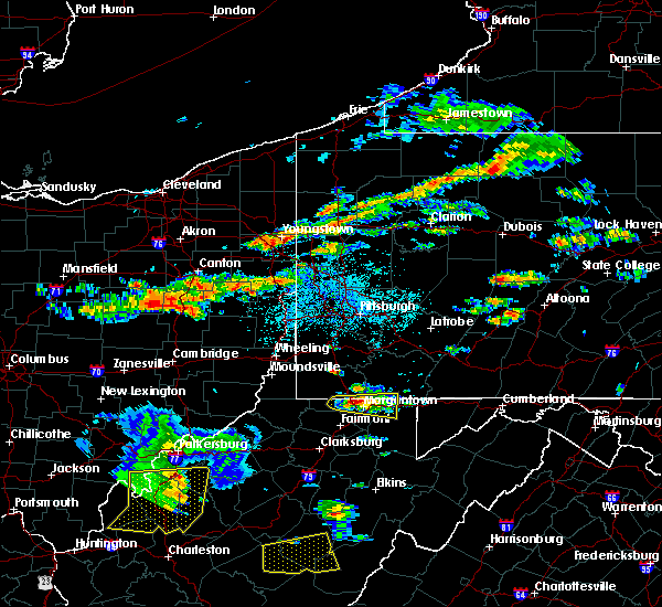 At 1253 pm edt, a severe thunderstorm was located over star city, moving east at 45 mph (radar). Hazards include ping pong ball-size hail and wind gusts to 60 mph. People and animals outdoors will be injured. expect hail damage to roofs, siding, windows, and vehicles. expect wind damage to trees and power lines, resulting in some power outages. locations impacted include, morgantown, westover, star city, point marion, granville, cassville, brookhaven, mount morris, laurel run, osage, cheat lake, core, this includes the following highways, interstate 68 in west virginia between mile markers 3 and 22. interstate 79 in pennsylvania between mile markers 0 and 1. Interstate 79 in west virginia between mile markers 151 and 160. At 1253 pm edt, a severe thunderstorm was located over star city, moving east at 45 mph (radar). Hazards include ping pong ball-size hail and wind gusts to 60 mph. People and animals outdoors will be injured. expect hail damage to roofs, siding, windows, and vehicles. expect wind damage to trees and power lines, resulting in some power outages. locations impacted include, morgantown, westover, star city, point marion, granville, cassville, brookhaven, mount morris, laurel run, osage, cheat lake, core, this includes the following highways, interstate 68 in west virginia between mile markers 3 and 22. interstate 79 in pennsylvania between mile markers 0 and 1. Interstate 79 in west virginia between mile markers 151 and 160.
|
| 5/29/2019 12:39 PM EDT |
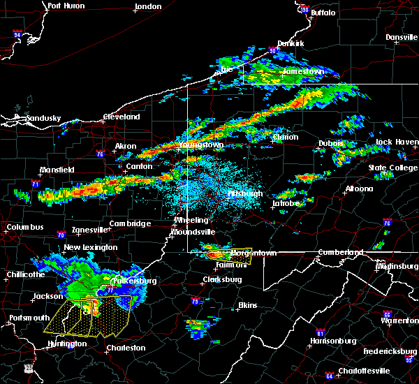 At 1239 pm edt, a severe thunderstorm was located near cassville, or 10 miles west of star city, moving east at 45 mph (radar). Hazards include wind gusts to 60 mph and quarter-size hail. Minor hail damage to vehicles is possible. Expect wind damage to trees and power lines, resulting in some power outages. At 1239 pm edt, a severe thunderstorm was located near cassville, or 10 miles west of star city, moving east at 45 mph (radar). Hazards include wind gusts to 60 mph and quarter-size hail. Minor hail damage to vehicles is possible. Expect wind damage to trees and power lines, resulting in some power outages.
|
| 5/18/2019 1:45 AM EDT |
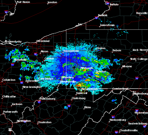 At 145 am edt, a severe thunderstorm was located near fairdale, or 7 miles southeast of waynesburg, moving southeast at 30 mph (radar). Hazards include wind gusts to 60 mph and quarter-size hail. Minor hail damage to vehicles is possible. Expect wind damage to trees and power lines, resulting in some power outages. At 145 am edt, a severe thunderstorm was located near fairdale, or 7 miles southeast of waynesburg, moving southeast at 30 mph (radar). Hazards include wind gusts to 60 mph and quarter-size hail. Minor hail damage to vehicles is possible. Expect wind damage to trees and power lines, resulting in some power outages.
|
| 7/31/2018 3:11 PM EDT |
 The severe thunderstorm warning for southeastern washington, southwestern westmoreland, eastern greene and northwestern fayette counties will expire at 315 pm edt, the storm that prompted the warning has weakened. no severe reports have been received and the warning will be allowed to expire. The severe thunderstorm warning for southeastern washington, southwestern westmoreland, eastern greene and northwestern fayette counties will expire at 315 pm edt, the storm that prompted the warning has weakened. no severe reports have been received and the warning will be allowed to expire.
|
| 7/31/2018 3:02 PM EDT |
 At 248 pm edt, a severe thunderstorm was located over jefferson boro, or near waynesburg, moving northeast at 25 mph (radar). Hazards include wind gusts to 60 mph. Expect damage to trees and power lines, resulting in some power outages. locations impacted include, waynesburg, monessen, california, charleroi, bentleyville, brownsville, fredericktown-millsboro, perryopolis, fairdale, jefferson boro, north belle vernon, wickerham manor-fisher, this includes the following highways, interstate 70 in pennsylvania between mile markers 27 and 41. Interstate 79 in pennsylvania between mile markers 3 and 25. At 248 pm edt, a severe thunderstorm was located over jefferson boro, or near waynesburg, moving northeast at 25 mph (radar). Hazards include wind gusts to 60 mph. Expect damage to trees and power lines, resulting in some power outages. locations impacted include, waynesburg, monessen, california, charleroi, bentleyville, brownsville, fredericktown-millsboro, perryopolis, fairdale, jefferson boro, north belle vernon, wickerham manor-fisher, this includes the following highways, interstate 70 in pennsylvania between mile markers 27 and 41. Interstate 79 in pennsylvania between mile markers 3 and 25.
|
| 7/31/2018 2:48 PM EDT |
 At 248 pm edt, a severe thunderstorm was located over jefferson boro, or near waynesburg, moving northeast at 25 mph (radar). Hazards include wind gusts to 60 mph. Expect damage to trees and power lines, resulting in some power outages. locations impacted include, waynesburg, monessen, california, charleroi, bentleyville, brownsville, fredericktown-millsboro, perryopolis, fairdale, jefferson boro, north belle vernon, wickerham manor-fisher, this includes the following highways, interstate 70 in pennsylvania between mile markers 27 and 41. Interstate 79 in pennsylvania between mile markers 3 and 25. At 248 pm edt, a severe thunderstorm was located over jefferson boro, or near waynesburg, moving northeast at 25 mph (radar). Hazards include wind gusts to 60 mph. Expect damage to trees and power lines, resulting in some power outages. locations impacted include, waynesburg, monessen, california, charleroi, bentleyville, brownsville, fredericktown-millsboro, perryopolis, fairdale, jefferson boro, north belle vernon, wickerham manor-fisher, this includes the following highways, interstate 70 in pennsylvania between mile markers 27 and 41. Interstate 79 in pennsylvania between mile markers 3 and 25.
|
| 7/31/2018 2:34 PM EDT |
 At 233 pm edt, a severe thunderstorm was located near waynesburg, moving northeast at 25 mph (radar). Hazards include wind gusts to 60 mph and quarter-size hail. Minor hail damage to vehicles is possible. Expect wind damage to trees and power lines, resulting in some power outages. At 233 pm edt, a severe thunderstorm was located near waynesburg, moving northeast at 25 mph (radar). Hazards include wind gusts to 60 mph and quarter-size hail. Minor hail damage to vehicles is possible. Expect wind damage to trees and power lines, resulting in some power outages.
|
| 7/15/2018 2:39 PM EDT |
 The severe thunderstorm warning for southeastern greene county will expire at 245 pm edt, the storm that prompted the warning has weakened below severe limits and has exited the warned area. therefore, the warning will be allowed to expire. however heavy rain is still possible with this thunderstorm. The severe thunderstorm warning for southeastern greene county will expire at 245 pm edt, the storm that prompted the warning has weakened below severe limits and has exited the warned area. therefore, the warning will be allowed to expire. however heavy rain is still possible with this thunderstorm.
|
| 7/15/2018 2:32 PM EDT |
 At 231 pm edt, a severe thunderstorm was located 7 miles northwest of cassville, or 10 miles south of waynesburg, moving southeast at 10 mph (radar). Hazards include wind gusts to 60 mph and quarter-size hail. Minor hail damage to vehicles is possible. expect wind damage to trees and power lines, resulting in some power outages. Locations impacted include, nemacolin, bobtown, greensboro, mount morris, spraggs, this includes interstate 79 in pennsylvania between mile markers 0 and 8. At 231 pm edt, a severe thunderstorm was located 7 miles northwest of cassville, or 10 miles south of waynesburg, moving southeast at 10 mph (radar). Hazards include wind gusts to 60 mph and quarter-size hail. Minor hail damage to vehicles is possible. expect wind damage to trees and power lines, resulting in some power outages. Locations impacted include, nemacolin, bobtown, greensboro, mount morris, spraggs, this includes interstate 79 in pennsylvania between mile markers 0 and 8.
|
| 7/15/2018 2:11 PM EDT |
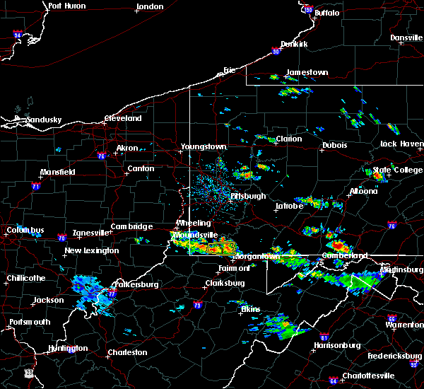 At 211 pm edt, a severe thunderstorm was located near waynesburg, moving east at 15 mph (radar). Hazards include wind gusts to 60 mph and quarter-size hail. Minor hail damage to vehicles is possible. expect wind damage to trees and power lines, resulting in some power outages. Locations impacted include, fairdale, nemacolin, bobtown, greensboro, mount morris, spraggs, this includes interstate 79 in pennsylvania between mile markers 0 and 12. At 211 pm edt, a severe thunderstorm was located near waynesburg, moving east at 15 mph (radar). Hazards include wind gusts to 60 mph and quarter-size hail. Minor hail damage to vehicles is possible. expect wind damage to trees and power lines, resulting in some power outages. Locations impacted include, fairdale, nemacolin, bobtown, greensboro, mount morris, spraggs, this includes interstate 79 in pennsylvania between mile markers 0 and 12.
|
| 7/15/2018 1:53 PM EDT |
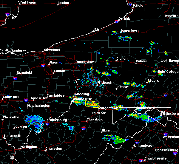 At 153 pm edt, a severe thunderstorm was located 7 miles southwest of waynesburg, moving east at 15 mph (radar). Hazards include wind gusts to 60 mph and quarter-size hail. Minor hail damage to vehicles is possible. Expect wind damage to trees and power lines, resulting in some power outages. At 153 pm edt, a severe thunderstorm was located 7 miles southwest of waynesburg, moving east at 15 mph (radar). Hazards include wind gusts to 60 mph and quarter-size hail. Minor hail damage to vehicles is possible. Expect wind damage to trees and power lines, resulting in some power outages.
|
| 8/22/2017 4:43 PM EDT |
 At 442 pm edt, a severe thunderstorm capable of producing a tornado was located near cassville, or near star city, moving east at 40 mph. recent live social media video from the mount morris area showed extremely strong winds in the area (radar indicated rotation). Hazards include tornado. Flying debris will be dangerous to those caught without shelter. mobile homes will be damaged or destroyed. damage to roofs, windows, and vehicles will occur. tree damage is likely. this dangerous storm will be near, point marion around 455 pm edt. other locations impacted by this tornadic thunderstorm include mount morris, bobtown and cheat lake. this includes the following highways, interstate 79 in pennsylvania between mile markers 0 and 2. interstate 79 in west virginia between mile markers 158 and 160. Please report severe weather by calling 412-262-1988, posting to the nws pittsburgh facebook page, or using twitter @nwspittsburgh. At 442 pm edt, a severe thunderstorm capable of producing a tornado was located near cassville, or near star city, moving east at 40 mph. recent live social media video from the mount morris area showed extremely strong winds in the area (radar indicated rotation). Hazards include tornado. Flying debris will be dangerous to those caught without shelter. mobile homes will be damaged or destroyed. damage to roofs, windows, and vehicles will occur. tree damage is likely. this dangerous storm will be near, point marion around 455 pm edt. other locations impacted by this tornadic thunderstorm include mount morris, bobtown and cheat lake. this includes the following highways, interstate 79 in pennsylvania between mile markers 0 and 2. interstate 79 in west virginia between mile markers 158 and 160. Please report severe weather by calling 412-262-1988, posting to the nws pittsburgh facebook page, or using twitter @nwspittsburgh.
|
| 8/22/2017 4:35 PM EDT | A tree down on big shannon run road in greene county PA, 2.5 miles ESE of Mount Morris, PA |
| 8/22/2017 4:30 PM EDT |
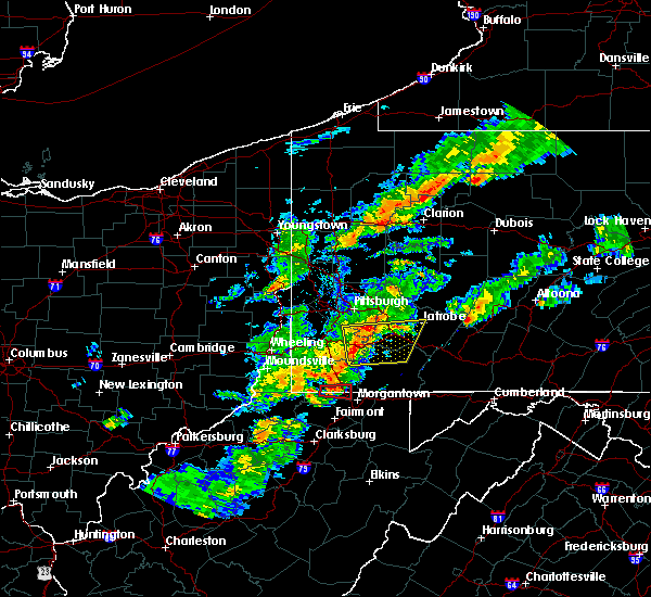 At 430 pm edt, a severe thunderstorm capable of producing a tornado was located near blacksville, right along the pennsylvania and west virginia border, or 10 miles west of star city, moving east at 40 mph. this storm will remain north of morgantown (radar indicated rotation). Hazards include tornado and half dollar-size hail. Flying debris will be dangerous to those caught without shelter. mobile homes will be damaged or destroyed. damage to roofs, windows, and vehicles will occur. tree damage is likely. this dangerous storm will be near, cassville around 435 pm edt. other locations impacted by this tornadic thunderstorm include blacksville, mount morris, pentress, core, brave and osage. this includes the following highways, interstate 79 in pennsylvania between mile markers 0 and 4. Interstate 79 in west virginia between mile markers 156 and 160. At 430 pm edt, a severe thunderstorm capable of producing a tornado was located near blacksville, right along the pennsylvania and west virginia border, or 10 miles west of star city, moving east at 40 mph. this storm will remain north of morgantown (radar indicated rotation). Hazards include tornado and half dollar-size hail. Flying debris will be dangerous to those caught without shelter. mobile homes will be damaged or destroyed. damage to roofs, windows, and vehicles will occur. tree damage is likely. this dangerous storm will be near, cassville around 435 pm edt. other locations impacted by this tornadic thunderstorm include blacksville, mount morris, pentress, core, brave and osage. this includes the following highways, interstate 79 in pennsylvania between mile markers 0 and 4. Interstate 79 in west virginia between mile markers 156 and 160.
|
| 8/22/2017 4:16 PM EDT |
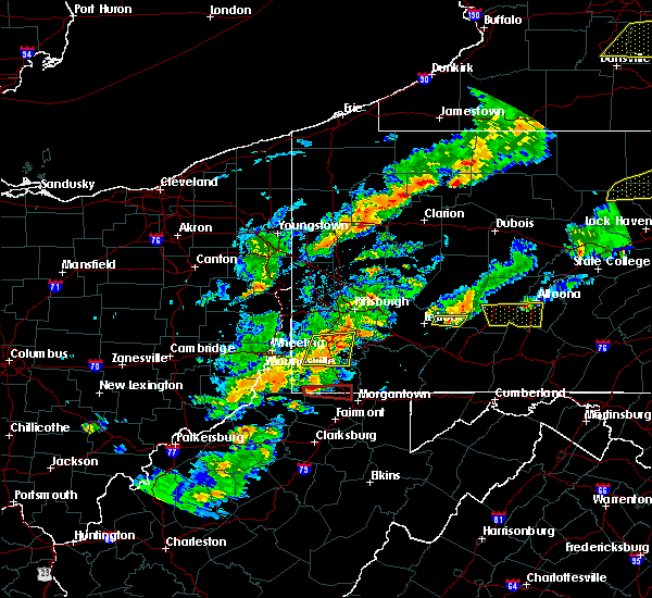 At 416 pm edt, a severe thunderstorm capable of producing a tornado was located 7 miles east of hundred, or 12 miles north of mannington, moving east at 40 mph (radar indicated rotation). Hazards include tornado and half dollar size hail. Flying debris will be dangerous to those caught without shelter. mobile homes will be damaged or destroyed. damage to roofs, windows, and vehicles will occur. tree damage is likely. this dangerous storm will be near, cassville around 435 pm edt. other locations impacted by this tornadic thunderstorm include blacksville, mount morris, wana, brave, pentress, core and osage. this includes the following highways, interstate 79 in pennsylvania between mile markers 0 and 4. interstate 79 in west virginia between mile markers 156 and 160. Please report severe weather by calling 412-262-1988, posting to the nws pittsburgh facebook page, or using twitter @nwspittsburgh. At 416 pm edt, a severe thunderstorm capable of producing a tornado was located 7 miles east of hundred, or 12 miles north of mannington, moving east at 40 mph (radar indicated rotation). Hazards include tornado and half dollar size hail. Flying debris will be dangerous to those caught without shelter. mobile homes will be damaged or destroyed. damage to roofs, windows, and vehicles will occur. tree damage is likely. this dangerous storm will be near, cassville around 435 pm edt. other locations impacted by this tornadic thunderstorm include blacksville, mount morris, wana, brave, pentress, core and osage. this includes the following highways, interstate 79 in pennsylvania between mile markers 0 and 4. interstate 79 in west virginia between mile markers 156 and 160. Please report severe weather by calling 412-262-1988, posting to the nws pittsburgh facebook page, or using twitter @nwspittsburgh.
|
| 8/4/2017 6:40 PM EDT |
 The severe thunderstorm warning for southeastern greene, southwestern fayette and north central monongalia counties will expire at 645 pm edt, the storm that prompted the warning has weakened; therefore, the warning will be allowed to expire. a severe thunderstorm watch remains in effect until 900 pm edt for southwestern pennsylvania, and northern west virginia. The severe thunderstorm warning for southeastern greene, southwestern fayette and north central monongalia counties will expire at 645 pm edt, the storm that prompted the warning has weakened; therefore, the warning will be allowed to expire. a severe thunderstorm watch remains in effect until 900 pm edt for southwestern pennsylvania, and northern west virginia.
|
| 8/4/2017 6:40 PM EDT |
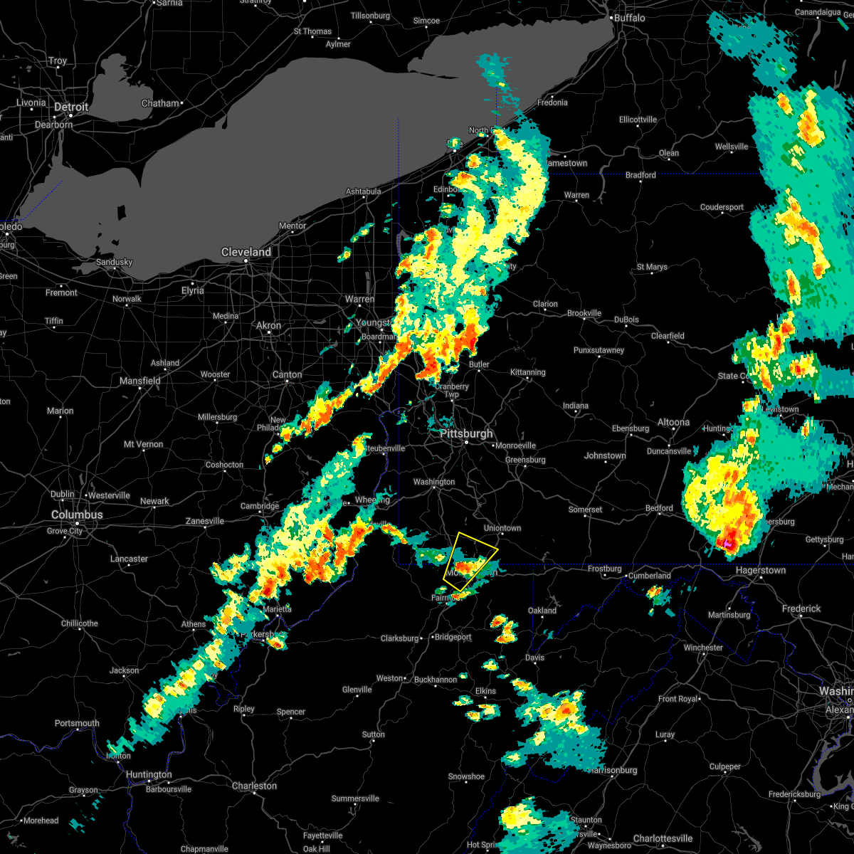 The severe thunderstorm warning for southeastern greene, southwestern fayette and north central monongalia counties will expire at 645 pm edt, the storm that prompted the warning has weakened; therefore, the warning will be allowed to expire. a severe thunderstorm watch remains in effect until 900 pm edt for southwestern pennsylvania, and northern west virginia. The severe thunderstorm warning for southeastern greene, southwestern fayette and north central monongalia counties will expire at 645 pm edt, the storm that prompted the warning has weakened; therefore, the warning will be allowed to expire. a severe thunderstorm watch remains in effect until 900 pm edt for southwestern pennsylvania, and northern west virginia.
|
| 8/4/2017 6:26 PM EDT |
 At 626 pm edt, a severe thunderstorm was located over cassville, or near star city, moving northeast at 35 mph (radar). Hazards include 60 mph wind gusts and quarter-size hail. Minor hail damage to vehicles is possible. expect wind damage to trees and power lines, resulting in some power outages. locations impacted include, morgantown, westover, star city, masontown, fairdale, point marion, granville, cassville, fairchance, smithfield, bobtown, nemacolin, this includes the following highways, interstate 79 in pennsylvania between mile markers 0 and 7. Interstate 79 in west virginia between mile markers 151 and 160. At 626 pm edt, a severe thunderstorm was located over cassville, or near star city, moving northeast at 35 mph (radar). Hazards include 60 mph wind gusts and quarter-size hail. Minor hail damage to vehicles is possible. expect wind damage to trees and power lines, resulting in some power outages. locations impacted include, morgantown, westover, star city, masontown, fairdale, point marion, granville, cassville, fairchance, smithfield, bobtown, nemacolin, this includes the following highways, interstate 79 in pennsylvania between mile markers 0 and 7. Interstate 79 in west virginia between mile markers 151 and 160.
|
| 8/4/2017 6:19 PM EDT |
 At 618 pm edt, a severe thunderstorm was located near cassville, or 7 miles north of fairmont, moving northeast at 35 mph (radar). Hazards include 60 mph wind gusts and quarter-size hail. Minor hail damage to vehicles is possible. Expect wind damage to trees and power lines, resulting in some power outages. At 618 pm edt, a severe thunderstorm was located near cassville, or 7 miles north of fairmont, moving northeast at 35 mph (radar). Hazards include 60 mph wind gusts and quarter-size hail. Minor hail damage to vehicles is possible. Expect wind damage to trees and power lines, resulting in some power outages.
|
| 8/4/2017 6:19 PM EDT |
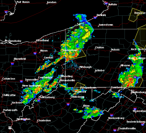 At 618 pm edt, a severe thunderstorm was located near cassville, or 7 miles north of fairmont, moving northeast at 35 mph (radar). Hazards include 60 mph wind gusts and quarter-size hail. Minor hail damage to vehicles is possible. Expect wind damage to trees and power lines, resulting in some power outages. At 618 pm edt, a severe thunderstorm was located near cassville, or 7 miles north of fairmont, moving northeast at 35 mph (radar). Hazards include 60 mph wind gusts and quarter-size hail. Minor hail damage to vehicles is possible. Expect wind damage to trees and power lines, resulting in some power outages.
|
| 6/23/2017 5:29 PM EDT |
 At 528 pm edt, severe thunderstorms were located along a line extending from near waynesburg to near cassville to mannington, moving east at 50 mph (radar). Hazards include 60 mph wind gusts. expect damage to trees and power lines, resulting in some power outages At 528 pm edt, severe thunderstorms were located along a line extending from near waynesburg to near cassville to mannington, moving east at 50 mph (radar). Hazards include 60 mph wind gusts. expect damage to trees and power lines, resulting in some power outages
|
| 6/23/2017 5:08 PM EDT |
 At 507 pm edt, severe thunderstorms were located along a line extending from near cameron to near hundred to jacksonburg, moving east at 55 mph (radar). Hazards include 60 mph wind gusts. Expect damage to trees and power lines, resulting in some power outages. locations impacted include, morgantown, fairmont, waynesburg, westover, mannington, star city, masontown, pleasant valley, winfield, fredericktown-millsboro, fairdale, jefferson boro, this includes the following highways, interstate 68 in west virginia near mile marker 1. interstate 79 in pennsylvania between mile markers 0 and 19. Interstate 79 in west virginia between mile markers 130 and 160. At 507 pm edt, severe thunderstorms were located along a line extending from near cameron to near hundred to jacksonburg, moving east at 55 mph (radar). Hazards include 60 mph wind gusts. Expect damage to trees and power lines, resulting in some power outages. locations impacted include, morgantown, fairmont, waynesburg, westover, mannington, star city, masontown, pleasant valley, winfield, fredericktown-millsboro, fairdale, jefferson boro, this includes the following highways, interstate 68 in west virginia near mile marker 1. interstate 79 in pennsylvania between mile markers 0 and 19. Interstate 79 in west virginia between mile markers 130 and 160.
|
| 6/23/2017 4:57 PM EDT |
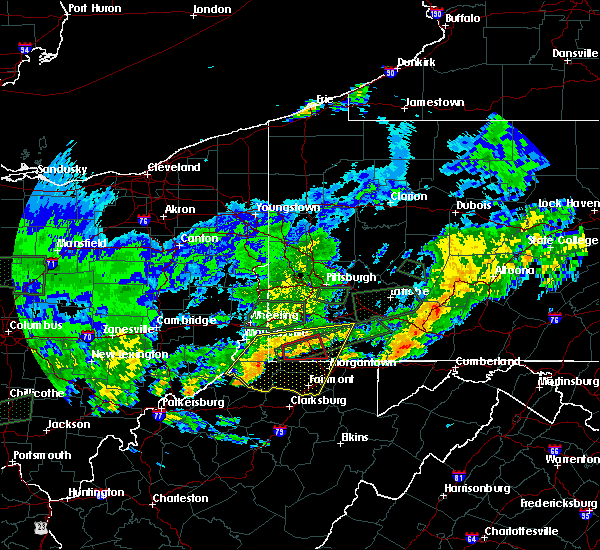 At 457 pm edt, a severe thunderstorm capable of producing a tornado was located 9 miles southwest of waynesburg, moving east at 30 mph (weather spotters reported a funnel cloud). Hazards include tornado. Flying debris will be dangerous to those caught without shelter. mobile homes will be damaged or destroyed. damage to roofs, windows, and vehicles will occur. tree damage is likely. this dangerous storm will be near, waynesburg around 515 pm edt. other locations impacted by this tornadic thunderstorm include rogersville, spraggs, bobtown, mount morris and brave. This includes interstate 79 in pennsylvania between mile markers 2 and 16. At 457 pm edt, a severe thunderstorm capable of producing a tornado was located 9 miles southwest of waynesburg, moving east at 30 mph (weather spotters reported a funnel cloud). Hazards include tornado. Flying debris will be dangerous to those caught without shelter. mobile homes will be damaged or destroyed. damage to roofs, windows, and vehicles will occur. tree damage is likely. this dangerous storm will be near, waynesburg around 515 pm edt. other locations impacted by this tornadic thunderstorm include rogersville, spraggs, bobtown, mount morris and brave. This includes interstate 79 in pennsylvania between mile markers 2 and 16.
|
| 6/23/2017 4:46 PM EDT |
 At 446 pm edt, severe thunderstorms were located along a line extending from near cameron to middlebourne, moving east at 45 mph (radar). Hazards include 60 mph wind gusts. expect damage to trees and power lines, resulting in some power outages At 446 pm edt, severe thunderstorms were located along a line extending from near cameron to middlebourne, moving east at 45 mph (radar). Hazards include 60 mph wind gusts. expect damage to trees and power lines, resulting in some power outages
|
| 6/23/2017 4:40 PM EDT |
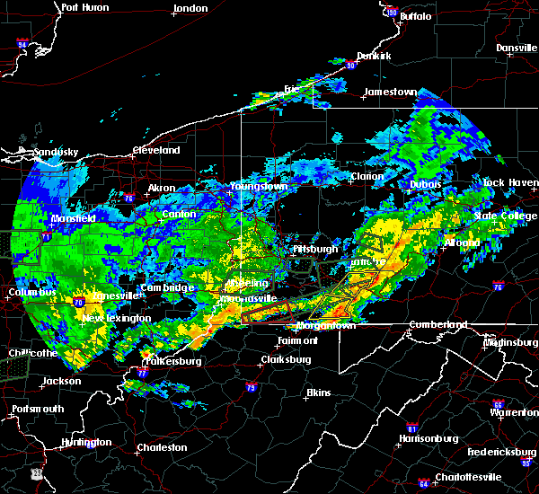 At 439 pm edt, a severe thunderstorm capable of producing a tornado was located near hundred, or 16 miles north of mannington, moving east at 45 mph (radar indicated rotation). Hazards include tornado. Flying debris will be dangerous to those caught without shelter. mobile homes will be damaged or destroyed. damage to roofs, windows, and vehicles will occur. tree damage is likely. this dangerous storm will be near, waynesburg around 505 pm edt. jefferson boro around 510 pm edt. other locations impacted by this tornadic thunderstorm include bobtown, aleppo, rogersville, spraggs, new freeport, mount morris and brave. this includes interstate 79 in pennsylvania between mile markers 2 and 16. Please report severe weather by calling 412-262-1988, posting to the nws pittsburgh facebook page, or using twitter @nwspittsburgh. At 439 pm edt, a severe thunderstorm capable of producing a tornado was located near hundred, or 16 miles north of mannington, moving east at 45 mph (radar indicated rotation). Hazards include tornado. Flying debris will be dangerous to those caught without shelter. mobile homes will be damaged or destroyed. damage to roofs, windows, and vehicles will occur. tree damage is likely. this dangerous storm will be near, waynesburg around 505 pm edt. jefferson boro around 510 pm edt. other locations impacted by this tornadic thunderstorm include bobtown, aleppo, rogersville, spraggs, new freeport, mount morris and brave. this includes interstate 79 in pennsylvania between mile markers 2 and 16. Please report severe weather by calling 412-262-1988, posting to the nws pittsburgh facebook page, or using twitter @nwspittsburgh.
|
| 5/1/2017 3:19 PM EDT |
 At 319 pm edt, severe thunderstorms were located along a line extending from white oak to near pleasant valley, moving east at 30 mph (radar). Hazards include 60 mph wind gusts. Expect damage to trees and power lines, resulting in some power outages. locations impacted include, morgantown, uniontown, connellsville, westover, star city, monessen, california, donora, mount pleasant, scottdale, charleroi, masontown, this includes the following highways, interstate 68 in west virginia between mile markers 1 and 14. interstate 70 in pennsylvania between mile markers 39 and 57. pennsylvania turnpike between mile markers 70 and 85. interstate 79 in pennsylvania between mile markers 0 and 2. interstate 79 in west virginia between mile markers 148 and 160. A tornado watch remains in effect until 700 pm edt for southwestern pennsylvania, and northern and northeastern west virginia. At 319 pm edt, severe thunderstorms were located along a line extending from white oak to near pleasant valley, moving east at 30 mph (radar). Hazards include 60 mph wind gusts. Expect damage to trees and power lines, resulting in some power outages. locations impacted include, morgantown, uniontown, connellsville, westover, star city, monessen, california, donora, mount pleasant, scottdale, charleroi, masontown, this includes the following highways, interstate 68 in west virginia between mile markers 1 and 14. interstate 70 in pennsylvania between mile markers 39 and 57. pennsylvania turnpike between mile markers 70 and 85. interstate 79 in pennsylvania between mile markers 0 and 2. interstate 79 in west virginia between mile markers 148 and 160. A tornado watch remains in effect until 700 pm edt for southwestern pennsylvania, and northern and northeastern west virginia.
|
| 5/1/2017 3:16 PM EDT |
 At 319 pm edt, severe thunderstorms were located along a line extending from white oak to near pleasant valley, moving east at 30 mph (radar). Hazards include 60 mph wind gusts. Expect damage to trees and power lines, resulting in some power outages. locations impacted include, morgantown, uniontown, connellsville, westover, star city, monessen, california, donora, mount pleasant, scottdale, charleroi, masontown, this includes the following highways, interstate 68 in west virginia between mile markers 1 and 14. interstate 70 in pennsylvania between mile markers 39 and 57. pennsylvania turnpike between mile markers 70 and 85. interstate 79 in pennsylvania between mile markers 0 and 2. interstate 79 in west virginia between mile markers 148 and 160. A tornado watch remains in effect until 700 pm edt for southwestern pennsylvania, and northern and northeastern west virginia. At 319 pm edt, severe thunderstorms were located along a line extending from white oak to near pleasant valley, moving east at 30 mph (radar). Hazards include 60 mph wind gusts. Expect damage to trees and power lines, resulting in some power outages. locations impacted include, morgantown, uniontown, connellsville, westover, star city, monessen, california, donora, mount pleasant, scottdale, charleroi, masontown, this includes the following highways, interstate 68 in west virginia between mile markers 1 and 14. interstate 70 in pennsylvania between mile markers 39 and 57. pennsylvania turnpike between mile markers 70 and 85. interstate 79 in pennsylvania between mile markers 0 and 2. interstate 79 in west virginia between mile markers 148 and 160. A tornado watch remains in effect until 700 pm edt for southwestern pennsylvania, and northern and northeastern west virginia.
|
| 5/1/2017 2:54 PM EDT |
 At 254 pm edt, severe thunderstorms were located along a line extending from castle shannon to near lumberport, moving east at 35 mph (radar). Hazards include 60 mph wind gusts. expect damage to trees and power lines, resulting in some power outages At 254 pm edt, severe thunderstorms were located along a line extending from castle shannon to near lumberport, moving east at 35 mph (radar). Hazards include 60 mph wind gusts. expect damage to trees and power lines, resulting in some power outages
|
| 5/1/2017 2:54 PM EDT |
 The national weather service in pittsburgh has issued a * severe thunderstorm warning for. southeastern washington county in southwestern pennsylvania. southeastern allegheny county in southwestern pennsylvania. southwestern westmoreland county in southwestern pennsylvania. Eastern greene county in southwestern pennsylvania. The national weather service in pittsburgh has issued a * severe thunderstorm warning for. southeastern washington county in southwestern pennsylvania. southeastern allegheny county in southwestern pennsylvania. southwestern westmoreland county in southwestern pennsylvania. Eastern greene county in southwestern pennsylvania.
|
| 5/1/2017 2:41 PM EDT |
 At 241 pm edt, severe thunderstorms were located along a line extending from near mcdonald to 10 miles southwest of waynesburg, moving northeast at 55 mph (radar). Hazards include 70 mph wind gusts. Trees snapped and uprooted. power outages can be expected. locations impacted include, bethel park, morgantown, mcmurray, mckeesport, washington, canonsburg, waynesburg, star city, gastonville, west mifflin, baldwin, upper st. clair, this includes the following highways, interstate 70 in pennsylvania between mile markers 17 and 40. interstate 79 in pennsylvania between mile markers 0 and 21. interstate 79 in west virginia between mile markers 154 and 160. A tornado watch remains in effect until 700 pm edt for southwestern pennsylvania, and northern west virginia. At 241 pm edt, severe thunderstorms were located along a line extending from near mcdonald to 10 miles southwest of waynesburg, moving northeast at 55 mph (radar). Hazards include 70 mph wind gusts. Trees snapped and uprooted. power outages can be expected. locations impacted include, bethel park, morgantown, mcmurray, mckeesport, washington, canonsburg, waynesburg, star city, gastonville, west mifflin, baldwin, upper st. clair, this includes the following highways, interstate 70 in pennsylvania between mile markers 17 and 40. interstate 79 in pennsylvania between mile markers 0 and 21. interstate 79 in west virginia between mile markers 154 and 160. A tornado watch remains in effect until 700 pm edt for southwestern pennsylvania, and northern west virginia.
|
| 5/1/2017 2:36 PM EDT |
 At 236 pm edt, severe thunderstorms were located along a line extending from near cecil-bishop to 7 miles northeast of hundred, moving northeast at 55 mph (radar). Hazards include 70 mph wind gusts. Trees snapped and uprooted. power outages can be expected. locations impacted include, bethel park, morgantown, mcmurray, mckeesport, washington, canonsburg, waynesburg, star city, gastonville, west mifflin, baldwin, upper st. clair, this includes the following highways, interstate 70 in pennsylvania between mile markers 11 and 40. interstate 79 in pennsylvania between mile markers 0 and 21. interstate 79 in west virginia between mile markers 154 and 160. A tornado watch remains in effect until 700 pm edt for southwestern pennsylvania, and northern west virginia. At 236 pm edt, severe thunderstorms were located along a line extending from near cecil-bishop to 7 miles northeast of hundred, moving northeast at 55 mph (radar). Hazards include 70 mph wind gusts. Trees snapped and uprooted. power outages can be expected. locations impacted include, bethel park, morgantown, mcmurray, mckeesport, washington, canonsburg, waynesburg, star city, gastonville, west mifflin, baldwin, upper st. clair, this includes the following highways, interstate 70 in pennsylvania between mile markers 11 and 40. interstate 79 in pennsylvania between mile markers 0 and 21. interstate 79 in west virginia between mile markers 154 and 160. A tornado watch remains in effect until 700 pm edt for southwestern pennsylvania, and northern west virginia.
|
| 5/1/2017 2:27 PM EDT |
 At 226 pm edt, severe thunderstorms were located along a line extending from near avella to near hundred, moving northeast at 55 mph (radar). Hazards include 70 mph wind gusts. Trees snapped and uprooted. power outages can be expected. locations impacted include, bethel park, morgantown, mcmurray, mckeesport, washington, canonsburg, waynesburg, star city, gastonville, west mifflin, baldwin, upper st. clair, this includes the following highways, interstate 70 in pennsylvania between mile markers 3 and 40. interstate 79 in pennsylvania between mile markers 0 and 21. interstate 79 in west virginia between mile markers 154 and 160. A tornado watch remains in effect until 700 pm edt for southwestern pennsylvania, and northern west virginia. At 226 pm edt, severe thunderstorms were located along a line extending from near avella to near hundred, moving northeast at 55 mph (radar). Hazards include 70 mph wind gusts. Trees snapped and uprooted. power outages can be expected. locations impacted include, bethel park, morgantown, mcmurray, mckeesport, washington, canonsburg, waynesburg, star city, gastonville, west mifflin, baldwin, upper st. clair, this includes the following highways, interstate 70 in pennsylvania between mile markers 3 and 40. interstate 79 in pennsylvania between mile markers 0 and 21. interstate 79 in west virginia between mile markers 154 and 160. A tornado watch remains in effect until 700 pm edt for southwestern pennsylvania, and northern west virginia.
|
| 5/1/2017 2:11 PM EDT |
 At 210 pm edt, severe thunderstorms were located along a line extending from near west liberty to near pine grove, moving northeast at 55 mph (radar). Hazards include 70 mph wind gusts. Trees snapped and uprooted. Power outages can be expected. At 210 pm edt, severe thunderstorms were located along a line extending from near west liberty to near pine grove, moving northeast at 55 mph (radar). Hazards include 70 mph wind gusts. Trees snapped and uprooted. Power outages can be expected.
|
| 3/1/2017 10:50 AM EST |
 At 1049 am est, severe thunderstorms were located along a line extending from 6 miles west of connellsville to 7 miles southwest of cassville, moving east at 50 mph (radar). Hazards include 60 mph wind gusts. Expect damage to trees and power lines, resulting in some power outages. locations impacted include, morgantown, uniontown, connellsville, westover, star city, california, scottdale, masontown, brownsville, south connellsville, perryopolis, fairdale, this includes the following highways, interstate 68 in west virginia between mile markers 3 and 11. interstate 79 in pennsylvania between mile markers 0 and 7. Interstate 79 in west virginia between mile markers 150 and 160. At 1049 am est, severe thunderstorms were located along a line extending from 6 miles west of connellsville to 7 miles southwest of cassville, moving east at 50 mph (radar). Hazards include 60 mph wind gusts. Expect damage to trees and power lines, resulting in some power outages. locations impacted include, morgantown, uniontown, connellsville, westover, star city, california, scottdale, masontown, brownsville, south connellsville, perryopolis, fairdale, this includes the following highways, interstate 68 in west virginia between mile markers 3 and 11. interstate 79 in pennsylvania between mile markers 0 and 7. Interstate 79 in west virginia between mile markers 150 and 160.
|
| 3/1/2017 10:40 AM EST |
 At 1039 am est, severe thunderstorms were located along a line extending from near brownsville to near mannington, moving east at 70 mph (radar). Hazards include 60 mph wind gusts. a brief tornado may be possible with individual cells embedded in the line. Expect damage to trees and power lines, resulting in some power outages. locations impacted include, morgantown, uniontown, connellsville, waynesburg, westover, star city, california, scottdale, masontown, brownsville, fredericktown-millsboro, south connellsville, this includes the following highways, interstate 68 in west virginia between mile markers 3 and 11. interstate 79 in pennsylvania between mile markers 0 and 21. Interstate 79 in west virginia between mile markers 150 and 160. At 1039 am est, severe thunderstorms were located along a line extending from near brownsville to near mannington, moving east at 70 mph (radar). Hazards include 60 mph wind gusts. a brief tornado may be possible with individual cells embedded in the line. Expect damage to trees and power lines, resulting in some power outages. locations impacted include, morgantown, uniontown, connellsville, waynesburg, westover, star city, california, scottdale, masontown, brownsville, fredericktown-millsboro, south connellsville, this includes the following highways, interstate 68 in west virginia between mile markers 3 and 11. interstate 79 in pennsylvania between mile markers 0 and 21. Interstate 79 in west virginia between mile markers 150 and 160.
|
| 3/1/2017 10:17 AM EST |
 At 1015 am est, severe thunderstorms were located along a line extending from 7 miles north of waynesburg to near pine grove, moving east at 50 mph (radar). Hazards include 60 mph wind gusts. a brief tornado may be possible with individual cells embedded in the line. expect damage to trees and power lines, resulting in some power outages At 1015 am est, severe thunderstorms were located along a line extending from 7 miles north of waynesburg to near pine grove, moving east at 50 mph (radar). Hazards include 60 mph wind gusts. a brief tornado may be possible with individual cells embedded in the line. expect damage to trees and power lines, resulting in some power outages
|
| 6/16/2016 4:43 PM EDT |
 At 442 pm edt, severe thunderstorms were located along a line extending from near perryopolis to cassville to near salem, moving east at 45 mph (radar indicated). Hazards include 60 mph wind gusts and quarter size hail. Hail damage to vehicles is expected. Expect wind damage to trees and power lines, resulting in some power outages. At 442 pm edt, severe thunderstorms were located along a line extending from near perryopolis to cassville to near salem, moving east at 45 mph (radar indicated). Hazards include 60 mph wind gusts and quarter size hail. Hail damage to vehicles is expected. Expect wind damage to trees and power lines, resulting in some power outages.
|
| 6/16/2016 11:42 AM EDT |
 At 1141 am edt, a severe thunderstorm was located 7 miles east of hundred, or 13 miles north of mannington, moving southeast at 25 mph (radar indicated). Hazards include quarter size hail. damage to vehicles is expected At 1141 am edt, a severe thunderstorm was located 7 miles east of hundred, or 13 miles north of mannington, moving southeast at 25 mph (radar indicated). Hazards include quarter size hail. damage to vehicles is expected
|
| 7/9/2015 1:44 PM EDT |
 At 143 pm edt, severe thunderstorms were located along a line extending from 6 miles west of fredericktown-millsboro to near fairdale to monongah to near salem, moving east at 45 mph (radar indicated). Hazards include 60 mph wind gusts. expect damage to trees and some power outages At 143 pm edt, severe thunderstorms were located along a line extending from 6 miles west of fredericktown-millsboro to near fairdale to monongah to near salem, moving east at 45 mph (radar indicated). Hazards include 60 mph wind gusts. expect damage to trees and some power outages
|
| 7/9/2015 1:40 PM EDT |
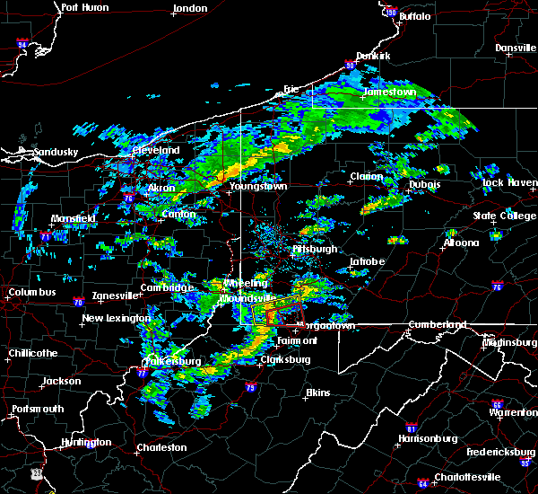 At 139 pm edt, a severe thunderstorm capable of producing a tornado was located 7 miles south of waynesburg, moving east at 40 mph (radar indicated rotation). Hazards include tornado. Flying debris will be dangerous to those caught without shelter. mobile homes will be damaged or destroyed. damage to roofs, windows and vehicles will occur. tree damage is likely. Locations impacted include, masontown, fairdale, point marion, nemacolin, bobtown, carmichaels, greensboro, blacksville, mount morris, spraggs, pentress and cheat lake. At 139 pm edt, a severe thunderstorm capable of producing a tornado was located 7 miles south of waynesburg, moving east at 40 mph (radar indicated rotation). Hazards include tornado. Flying debris will be dangerous to those caught without shelter. mobile homes will be damaged or destroyed. damage to roofs, windows and vehicles will occur. tree damage is likely. Locations impacted include, masontown, fairdale, point marion, nemacolin, bobtown, carmichaels, greensboro, blacksville, mount morris, spraggs, pentress and cheat lake.
|
| 7/9/2015 1:31 PM EDT |
 At 130 pm edt, a severe thunderstorm was located 7 miles southwest of waynesburg, moving east at 40 mph (radar indicated). Hazards include 60 mph wind gusts. Expect damage to trees and some power outages locations impacted include, waynesburg, masontown, brownsville, fredericktown-millsboro, jefferson boro, fairdale, point marion, isabella, rogersville, nemacolin, bobtown, carmichaels, rices landing, greensboro, clarksville, centerville, blacksville, mount morris, spraggs and pentress. A tornado watch remains in effect until 900 pm edt for southwestern pennsylvania and northern west virginia. At 130 pm edt, a severe thunderstorm was located 7 miles southwest of waynesburg, moving east at 40 mph (radar indicated). Hazards include 60 mph wind gusts. Expect damage to trees and some power outages locations impacted include, waynesburg, masontown, brownsville, fredericktown-millsboro, jefferson boro, fairdale, point marion, isabella, rogersville, nemacolin, bobtown, carmichaels, rices landing, greensboro, clarksville, centerville, blacksville, mount morris, spraggs and pentress. A tornado watch remains in effect until 900 pm edt for southwestern pennsylvania and northern west virginia.
|
| 7/9/2015 1:31 PM EDT |
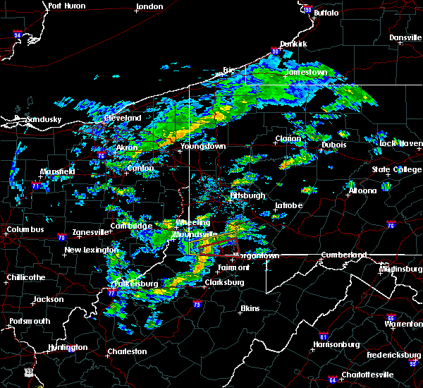 At 130 pm edt, a severe thunderstorm was located 7 miles southwest of waynesburg, moving east at 40 mph (radar indicated). Hazards include 60 mph wind gusts. Expect damage to trees and some power outages locations impacted include, waynesburg, masontown, brownsville, fredericktown-millsboro, jefferson boro, fairdale, point marion, isabella, rogersville, nemacolin, bobtown, carmichaels, rices landing, greensboro, clarksville, centerville, blacksville, mount morris, spraggs and pentress. A tornado watch remains in effect until 900 pm edt for southwestern pennsylvania and northern west virginia. At 130 pm edt, a severe thunderstorm was located 7 miles southwest of waynesburg, moving east at 40 mph (radar indicated). Hazards include 60 mph wind gusts. Expect damage to trees and some power outages locations impacted include, waynesburg, masontown, brownsville, fredericktown-millsboro, jefferson boro, fairdale, point marion, isabella, rogersville, nemacolin, bobtown, carmichaels, rices landing, greensboro, clarksville, centerville, blacksville, mount morris, spraggs and pentress. A tornado watch remains in effect until 900 pm edt for southwestern pennsylvania and northern west virginia.
|
| 7/9/2015 1:27 PM EDT |
 At 127 pm edt, a severe thunderstorm capable of producing a tornado was located 10 miles northeast of hundred, or 10 miles southwest of waynesburg, moving east at 40 mph (radar indicated rotation). Hazards include tornado. Flying debris will be dangerous to those caught without shelter. mobile homes will be damaged or destroyed. damage to roofs, windows and vehicles will occur. tree damage is likely. This tornadic thunderstorm will remain over mainly rural areas of southwestern fayette, southeastern greene and northeastern monongalia counties, including the following locations, mount morris, pentress, spraggs, nemacolin, brave, blacksville, carmichaels, bobtown, greensboro and cheat lake. At 127 pm edt, a severe thunderstorm capable of producing a tornado was located 10 miles northeast of hundred, or 10 miles southwest of waynesburg, moving east at 40 mph (radar indicated rotation). Hazards include tornado. Flying debris will be dangerous to those caught without shelter. mobile homes will be damaged or destroyed. damage to roofs, windows and vehicles will occur. tree damage is likely. This tornadic thunderstorm will remain over mainly rural areas of southwestern fayette, southeastern greene and northeastern monongalia counties, including the following locations, mount morris, pentress, spraggs, nemacolin, brave, blacksville, carmichaels, bobtown, greensboro and cheat lake.
|
| 7/9/2015 1:25 PM EDT |
 At 124 pm edt, a severe thunderstorm was located 9 miles northeast of hundred, or 11 miles southwest of waynesburg, moving east at 40 mph (radar indicated). Hazards include 60 mph wind gusts. expect damage to trees and some power outages locations impacted include, waynesburg, masontown, brownsville, fredericktown-millsboro, jefferson boro, fairdale, point marion, isabella, rogersville, nemacolin, bobtown, carmichaels, rices landing, aleppo, greensboro, clarksville, centerville, blacksville, mount morris and new freeport At 124 pm edt, a severe thunderstorm was located 9 miles northeast of hundred, or 11 miles southwest of waynesburg, moving east at 40 mph (radar indicated). Hazards include 60 mph wind gusts. expect damage to trees and some power outages locations impacted include, waynesburg, masontown, brownsville, fredericktown-millsboro, jefferson boro, fairdale, point marion, isabella, rogersville, nemacolin, bobtown, carmichaels, rices landing, aleppo, greensboro, clarksville, centerville, blacksville, mount morris and new freeport
|
| 7/9/2015 1:25 PM EDT |
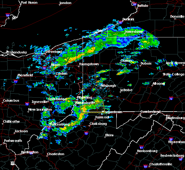 At 124 pm edt, a severe thunderstorm was located 9 miles northeast of hundred, or 11 miles southwest of waynesburg, moving east at 40 mph (radar indicated). Hazards include 60 mph wind gusts. expect damage to trees and some power outages locations impacted include, waynesburg, masontown, brownsville, fredericktown-millsboro, jefferson boro, fairdale, point marion, isabella, rogersville, nemacolin, bobtown, carmichaels, rices landing, aleppo, greensboro, clarksville, centerville, blacksville, mount morris and new freeport At 124 pm edt, a severe thunderstorm was located 9 miles northeast of hundred, or 11 miles southwest of waynesburg, moving east at 40 mph (radar indicated). Hazards include 60 mph wind gusts. expect damage to trees and some power outages locations impacted include, waynesburg, masontown, brownsville, fredericktown-millsboro, jefferson boro, fairdale, point marion, isabella, rogersville, nemacolin, bobtown, carmichaels, rices landing, aleppo, greensboro, clarksville, centerville, blacksville, mount morris and new freeport
|
| 7/9/2015 1:12 PM EDT |
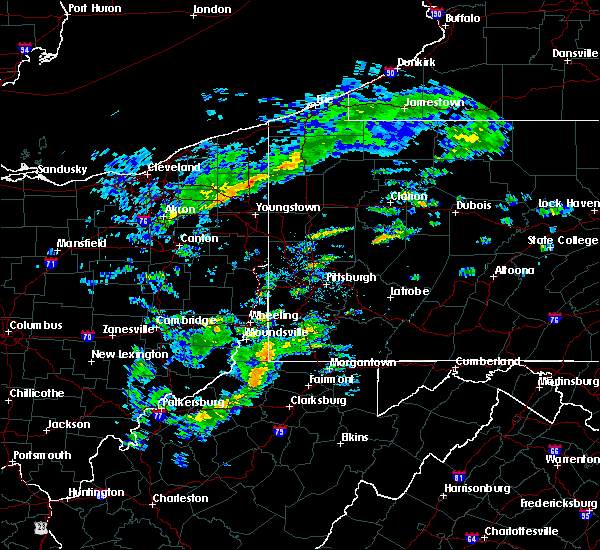 At 112 pm edt, a severe thunderstorm was located near hundred, or 17 miles northwest of mannington, moving east at 40 mph (radar indicated). Hazards include 60 mph wind gusts. expect damage to trees and some power outages At 112 pm edt, a severe thunderstorm was located near hundred, or 17 miles northwest of mannington, moving east at 40 mph (radar indicated). Hazards include 60 mph wind gusts. expect damage to trees and some power outages
|
| 4/9/2015 5:59 PM EDT | A tornado warning remains in effect until 615 pm edt for southwestern fayette. southeastern greene and northeastern monongalia counties. at 558 pm edt. a severe thunderstorm capable of producing a tornado was located near mount morris. moving east at 35 mph. hazard. Tornado and quarter size hail. |
| 4/9/2015 5:59 PM EDT | A tornado warning remains in effect until 615 pm edt for southwestern fayette. southeastern greene and northeastern monongalia counties. at 558 pm edt. a severe thunderstorm capable of producing a tornado was located near mount morris. moving east at 35 mph. hazard. Tornado and quarter size hail. |
| 4/9/2015 5:46 PM EDT | The national weather service in pittsburgh has issued a * tornado warning for. southwestern fayette county in southwestern pennsylvania. southeastern greene county in southwestern pennsylvania. northeastern monongalia county in northern west virginia. Until 615 pm edt. |
| 4/9/2015 5:46 PM EDT | The national weather service in pittsburgh has issued a * tornado warning for. southwestern fayette county in southwestern pennsylvania. southeastern greene county in southwestern pennsylvania. northeastern monongalia county in northern west virginia. Until 615 pm edt. |
Hail Maps for Mount Morris, PA
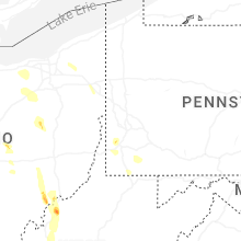


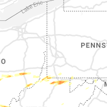


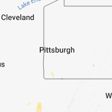


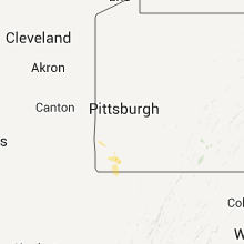
Connect with Interactive Hail Maps