

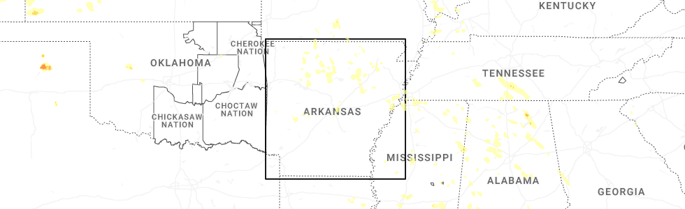
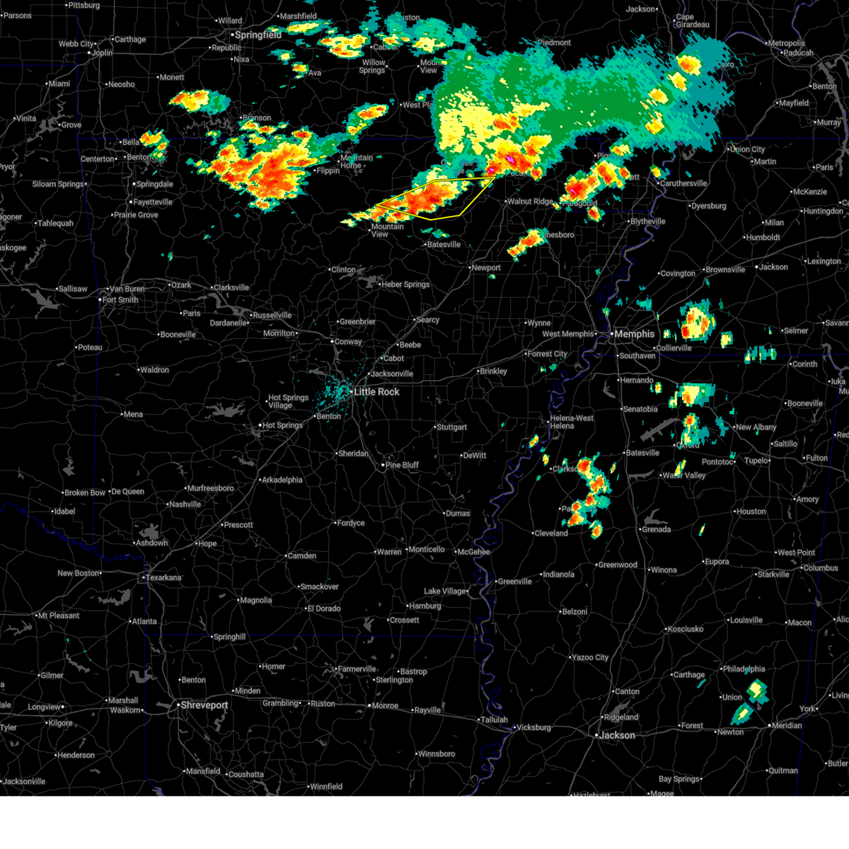
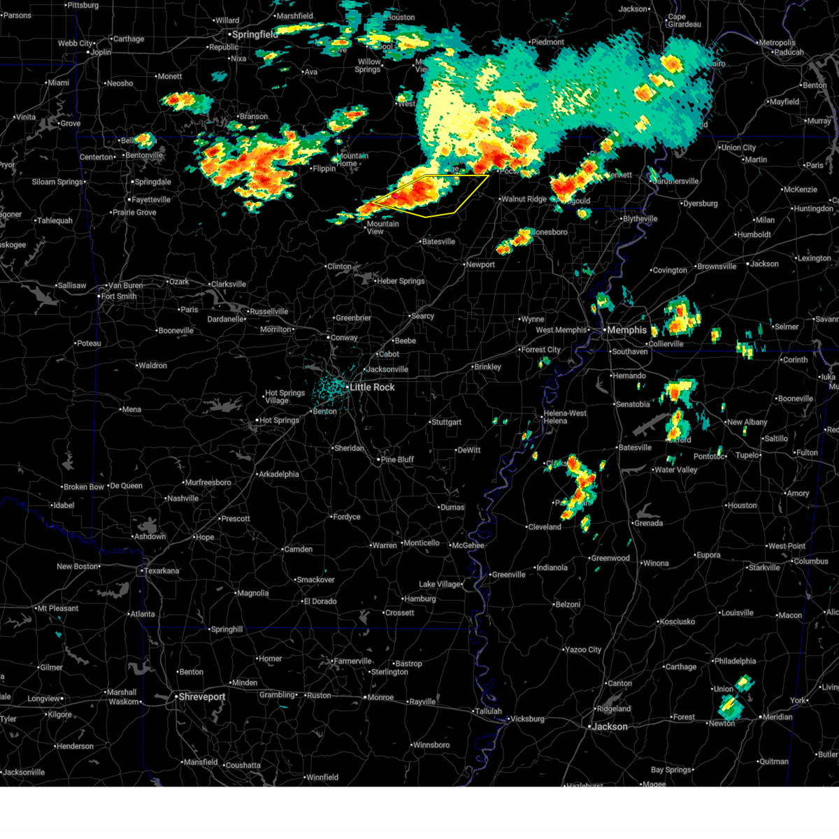
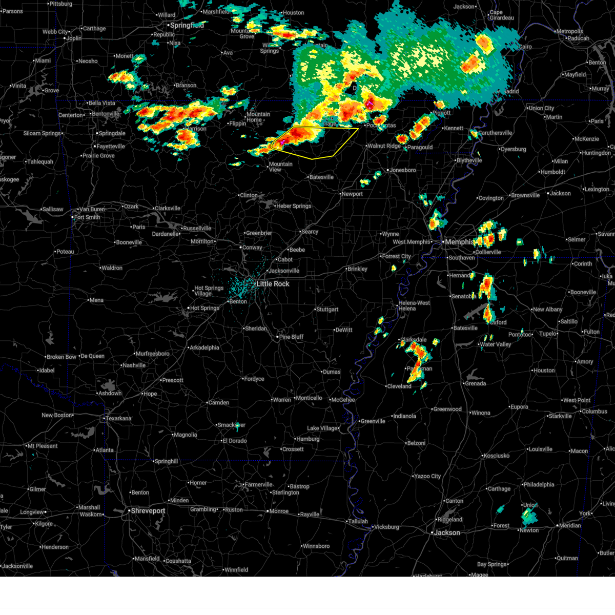
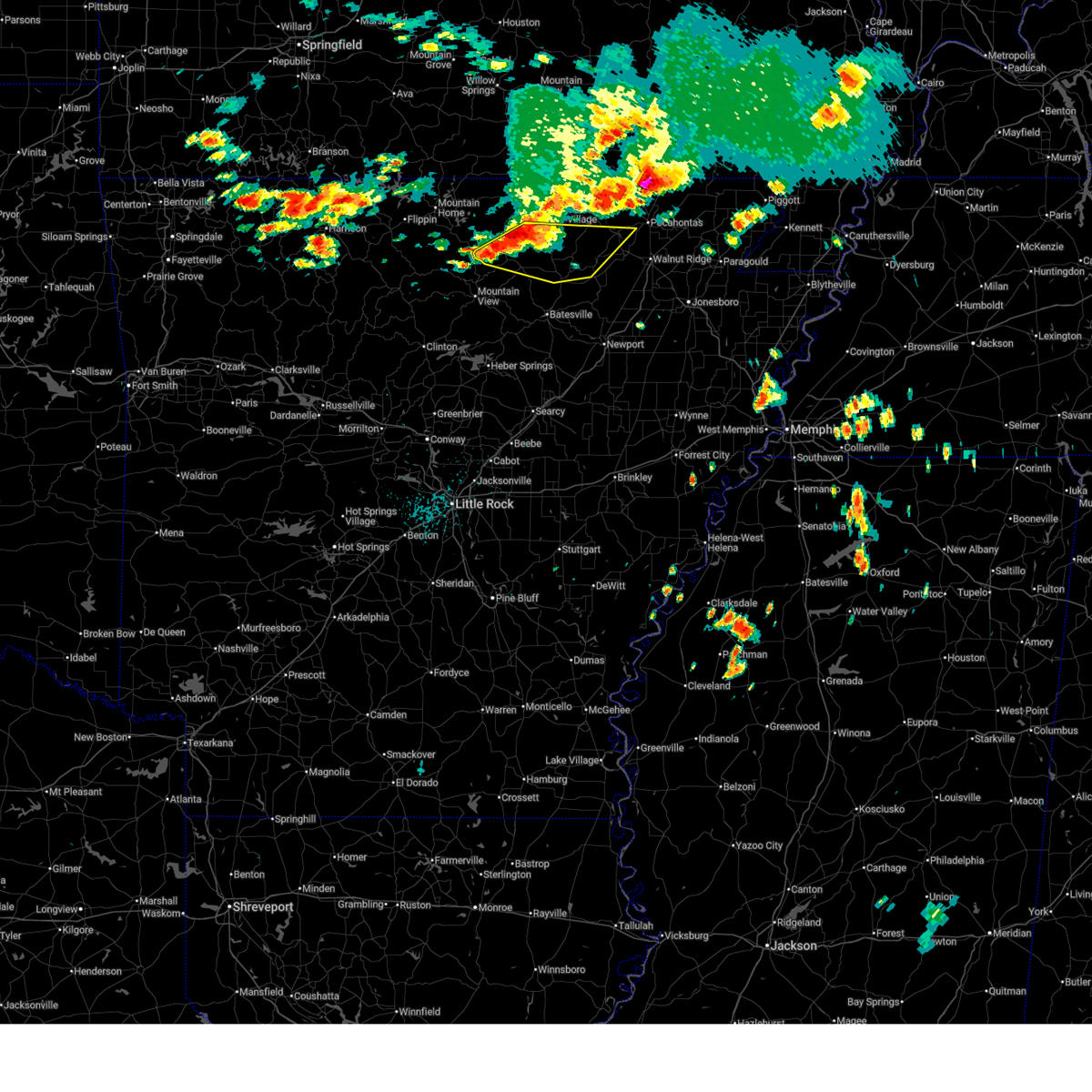
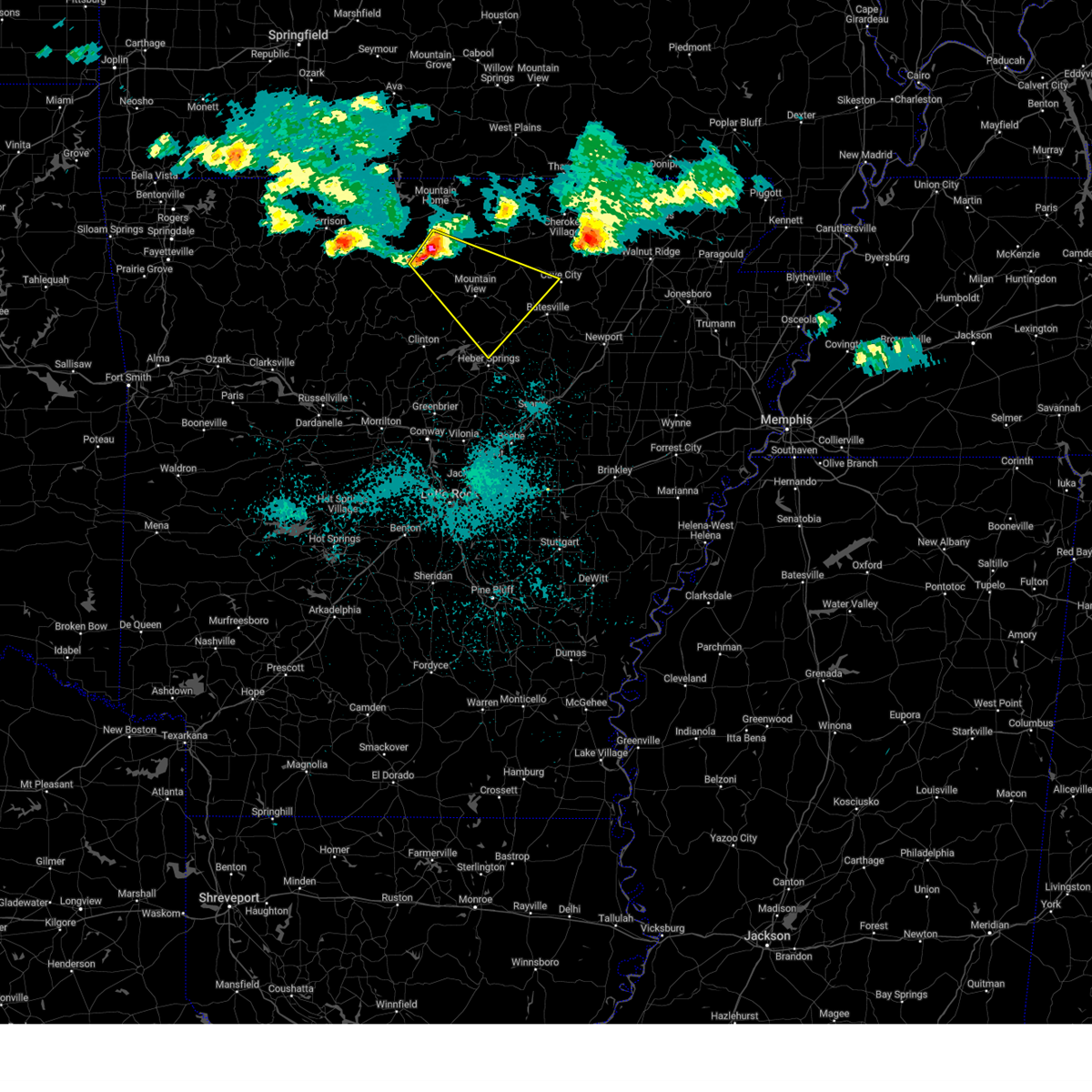
Hail Map for Mount Pleasant, AR
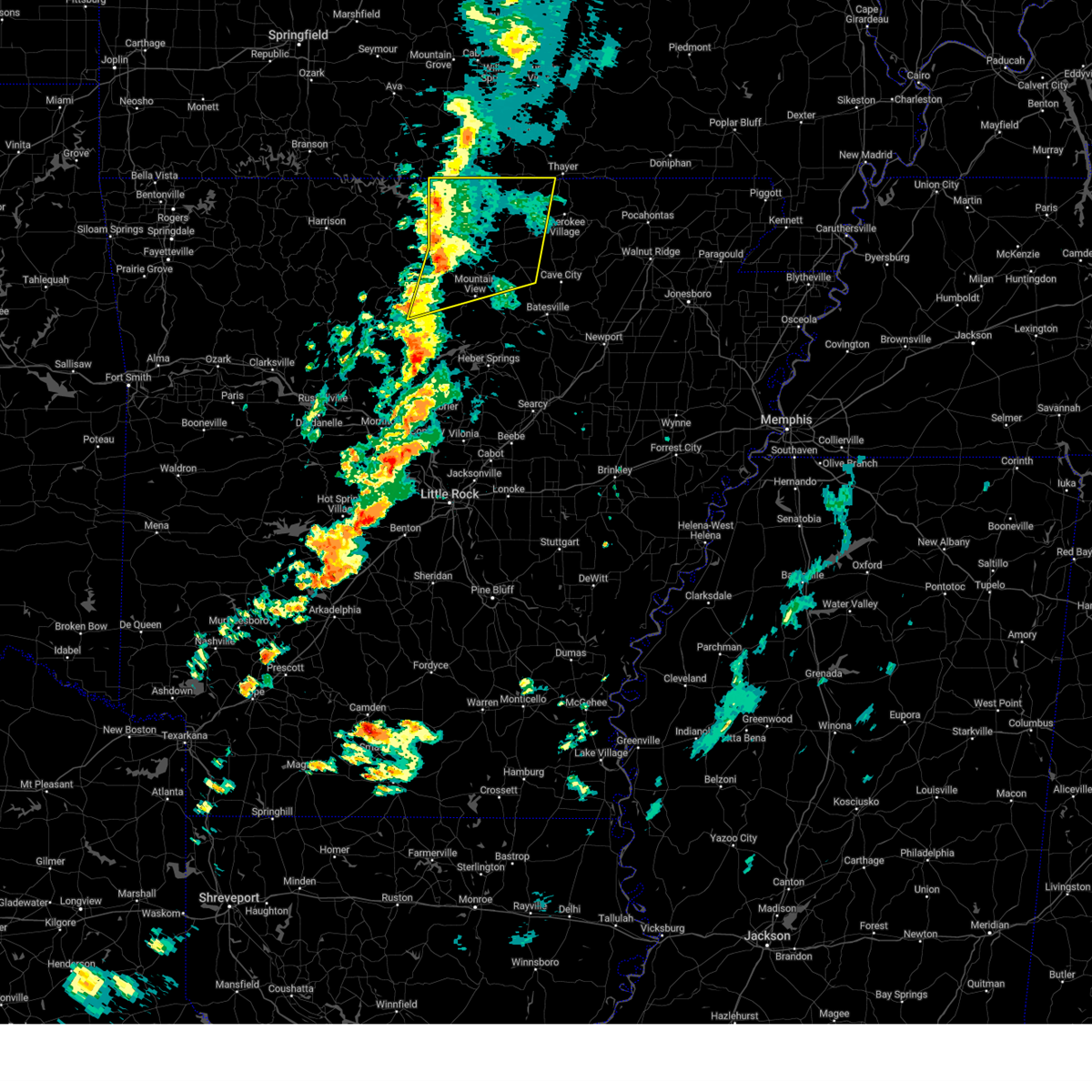
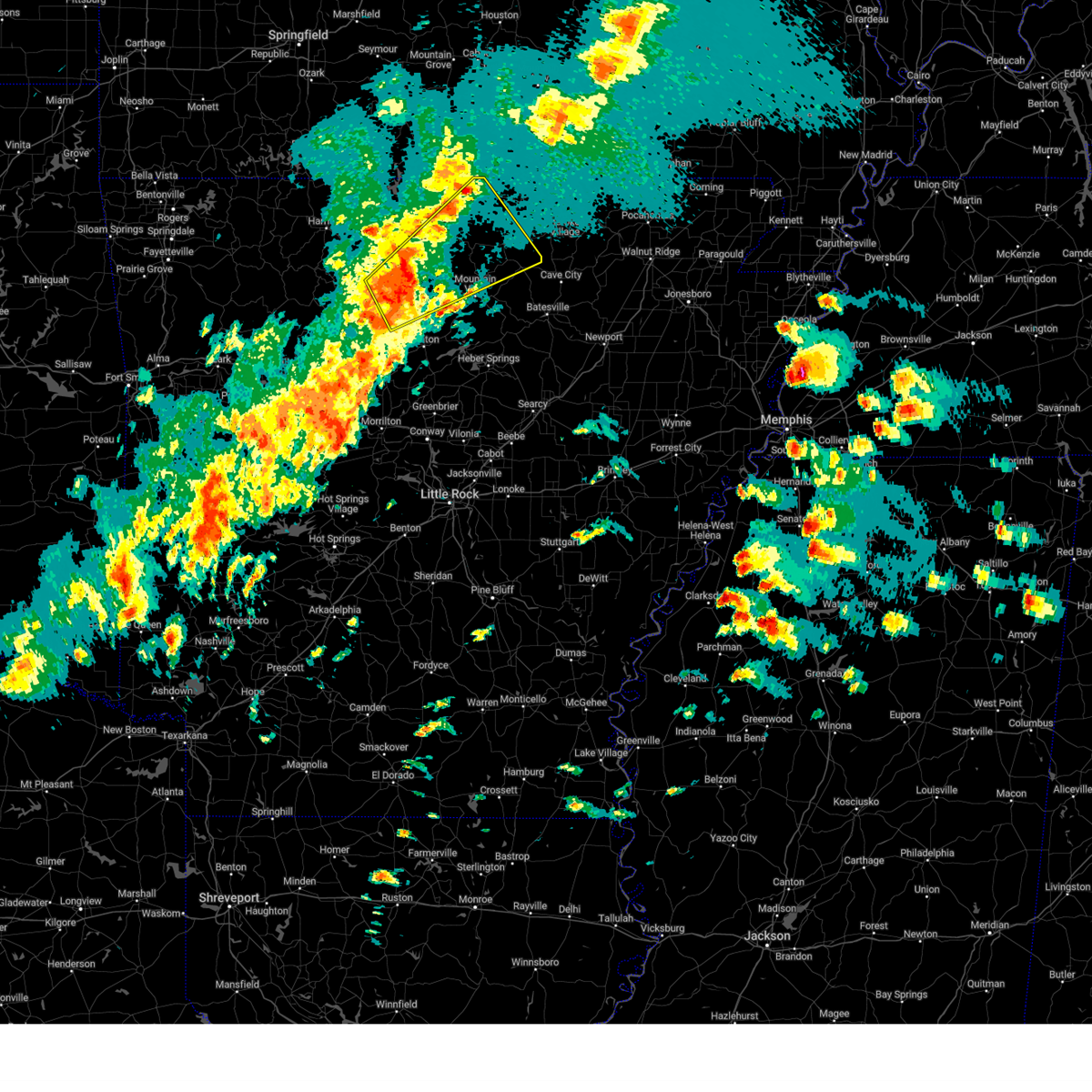
The Mount Pleasant, AR area has had 2 reports of on-the-ground hail by trained spotters, and has been under severe weather warnings 17 times during the past 12 months. Doppler radar has detected hail at or near Mount Pleasant, AR on 75 occasions, including 4 occasions during the past year.
| Name: | Mount Pleasant, AR |
| Where Located: | 89.3 miles NNE of Little Rock, AR |
| Map: | Google Map for Mount Pleasant, AR |
| Population: | 414 |
| Housing Units: | 208 |
| More Info: | Search Google for Mount Pleasant, AR |
1
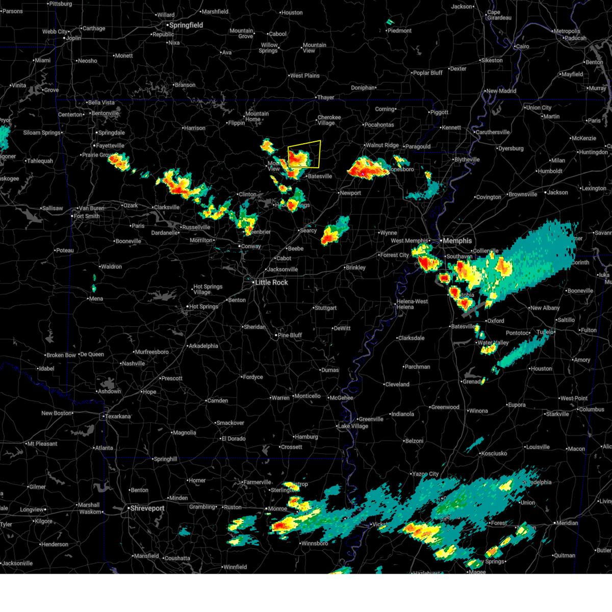
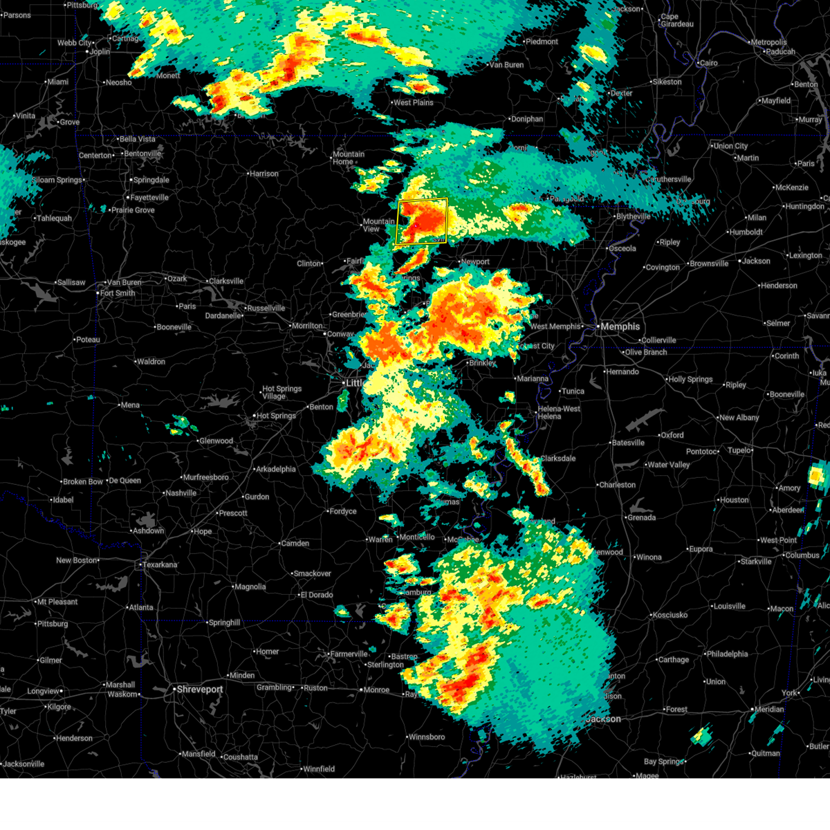
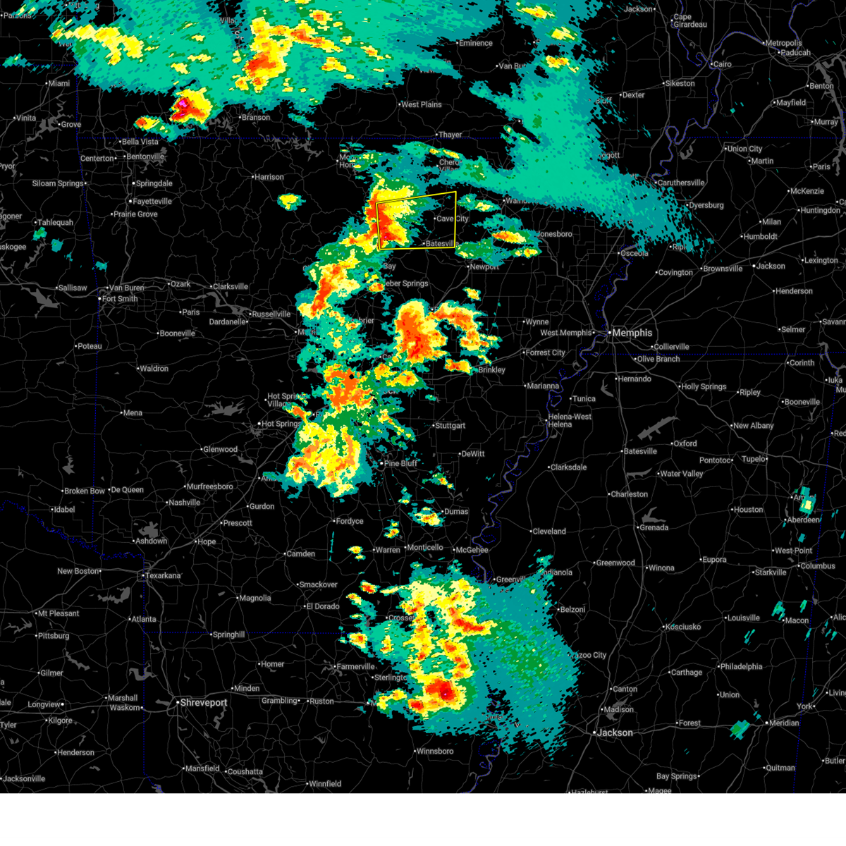
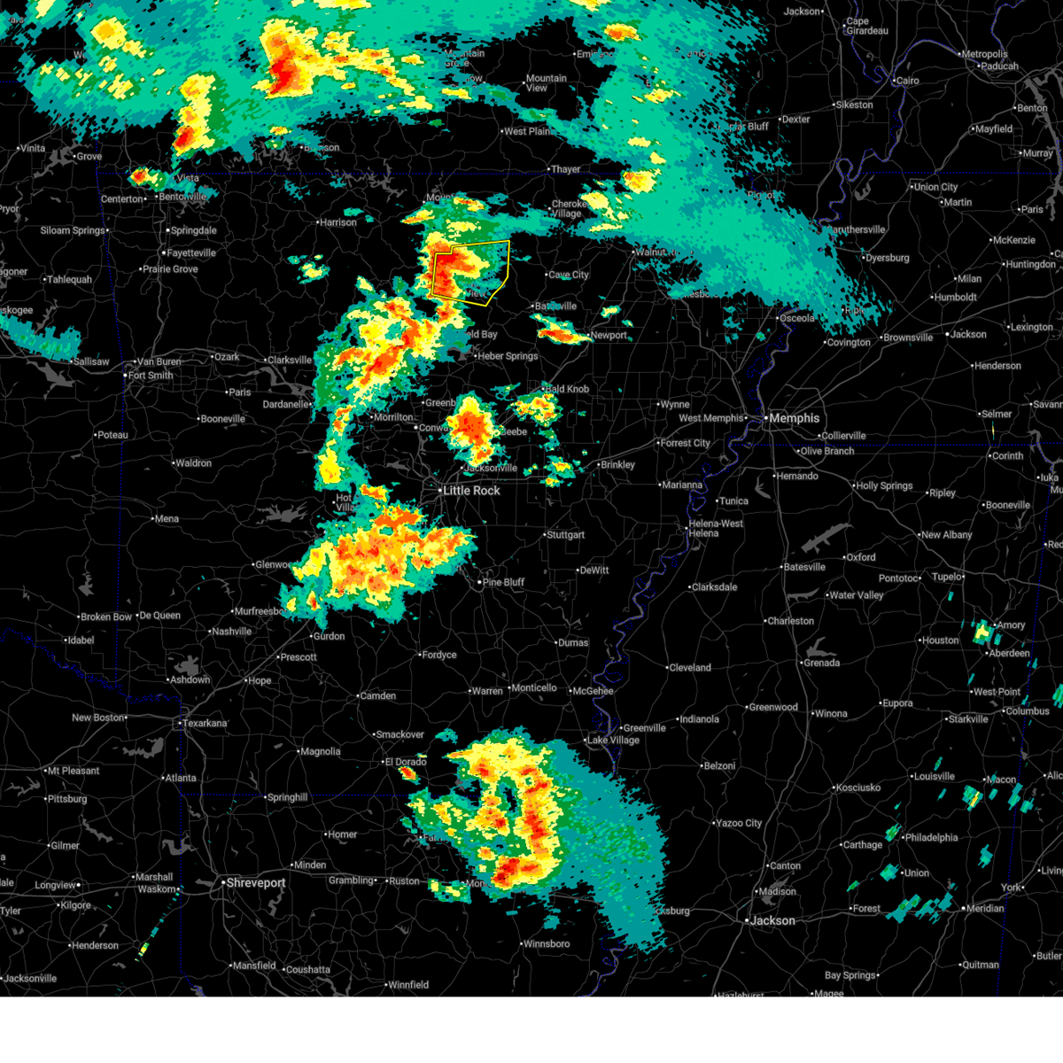
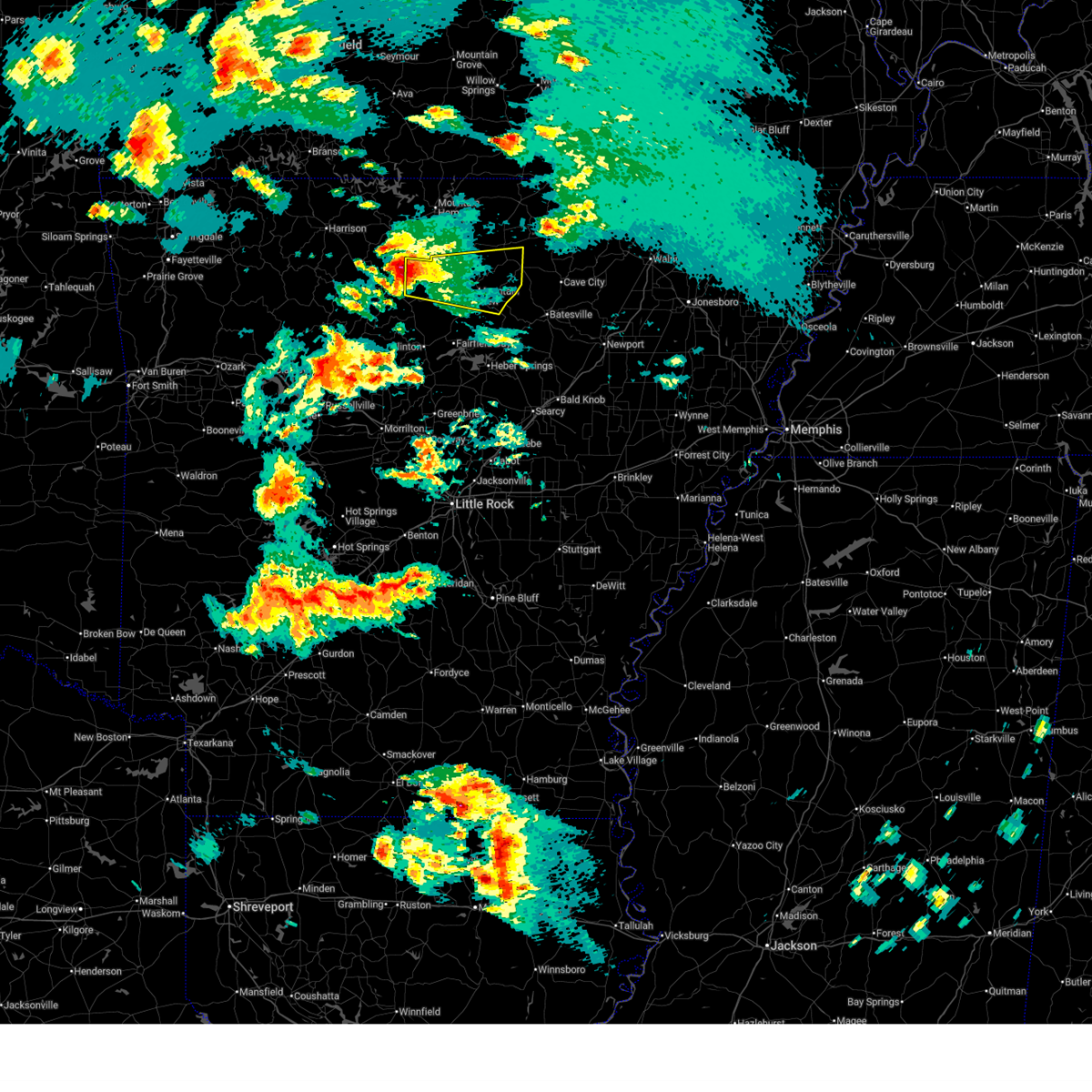
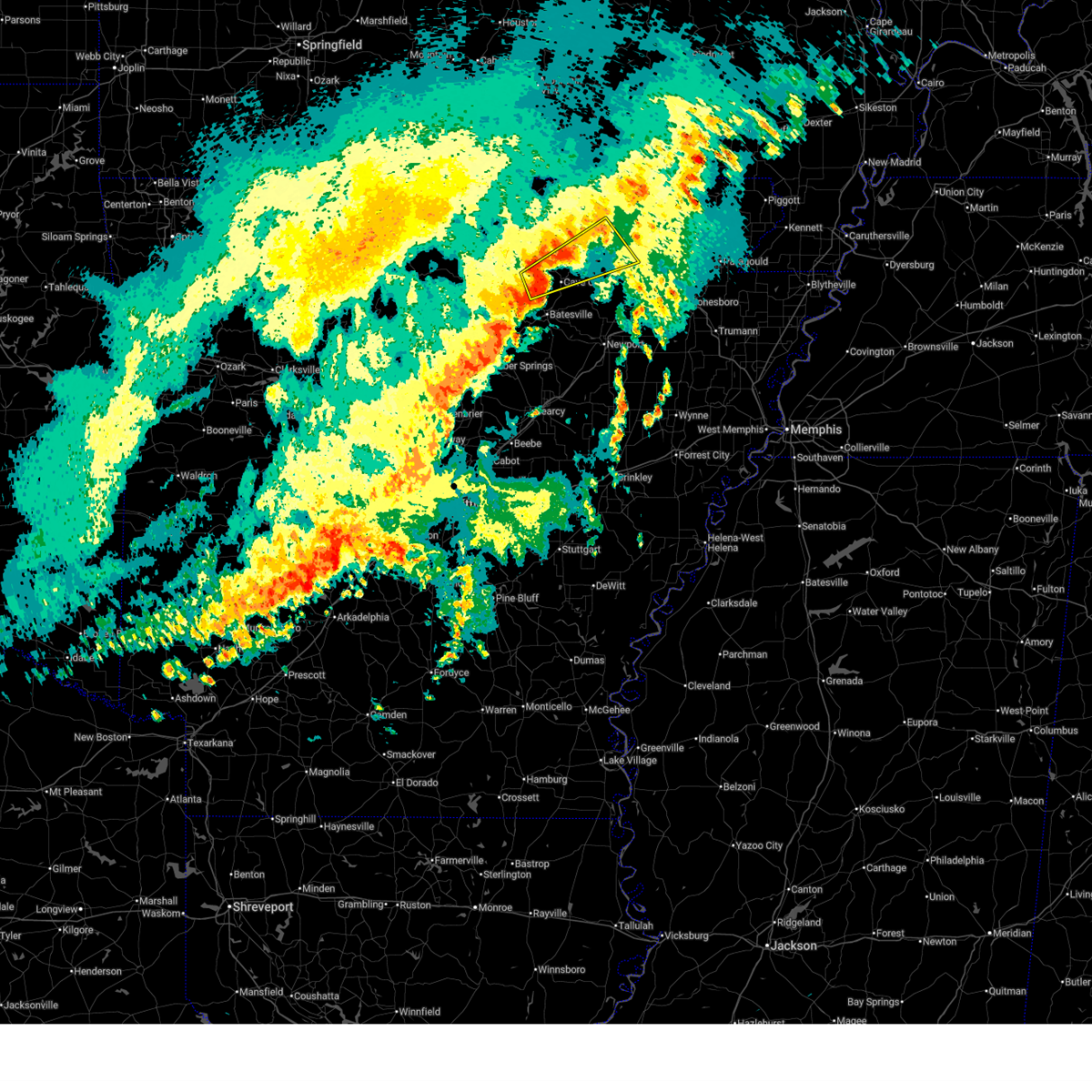
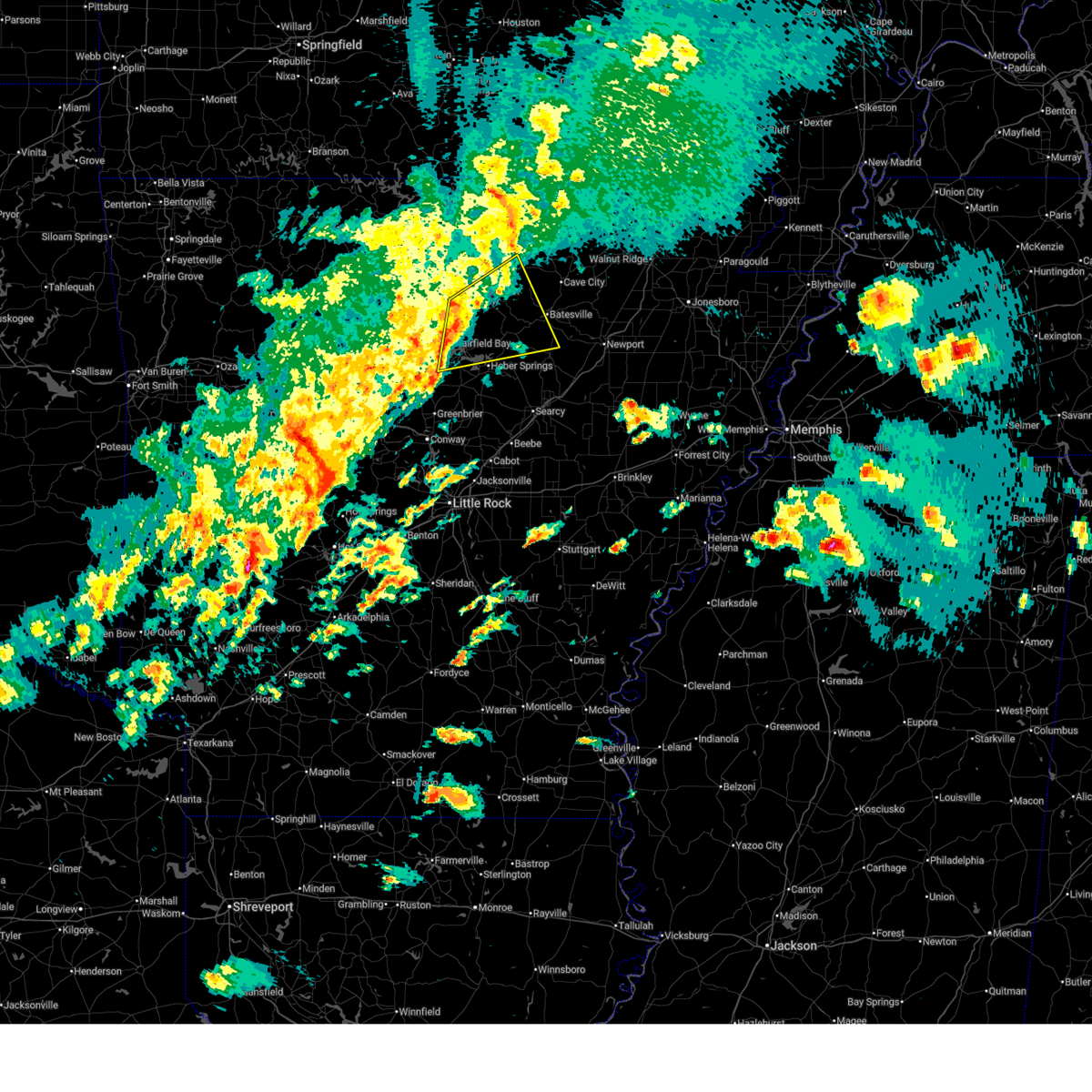
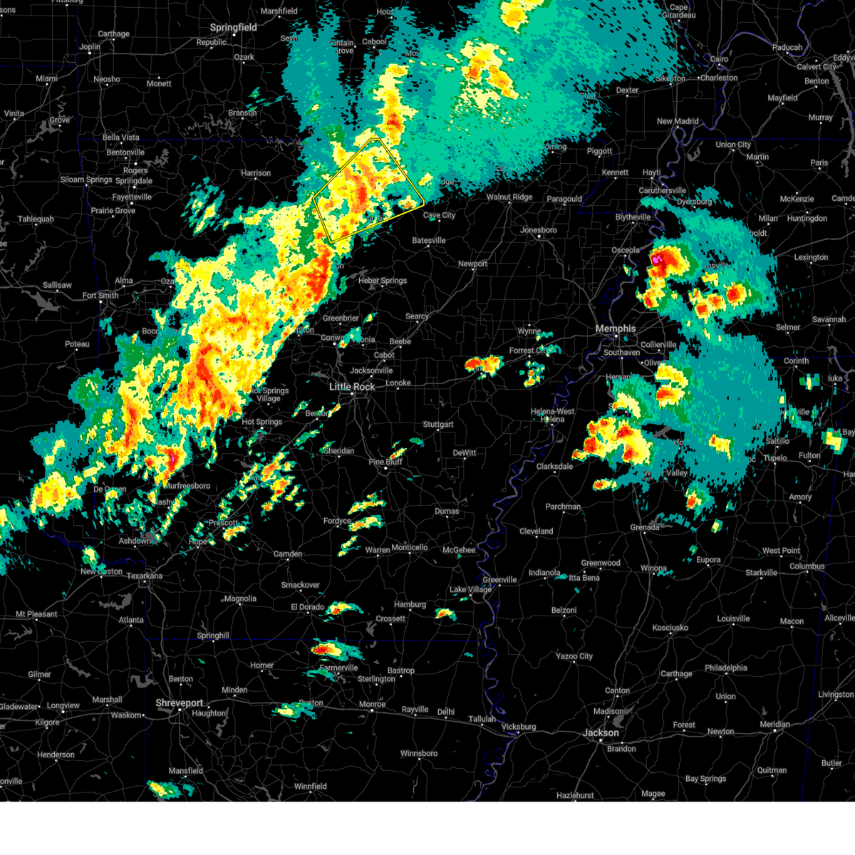
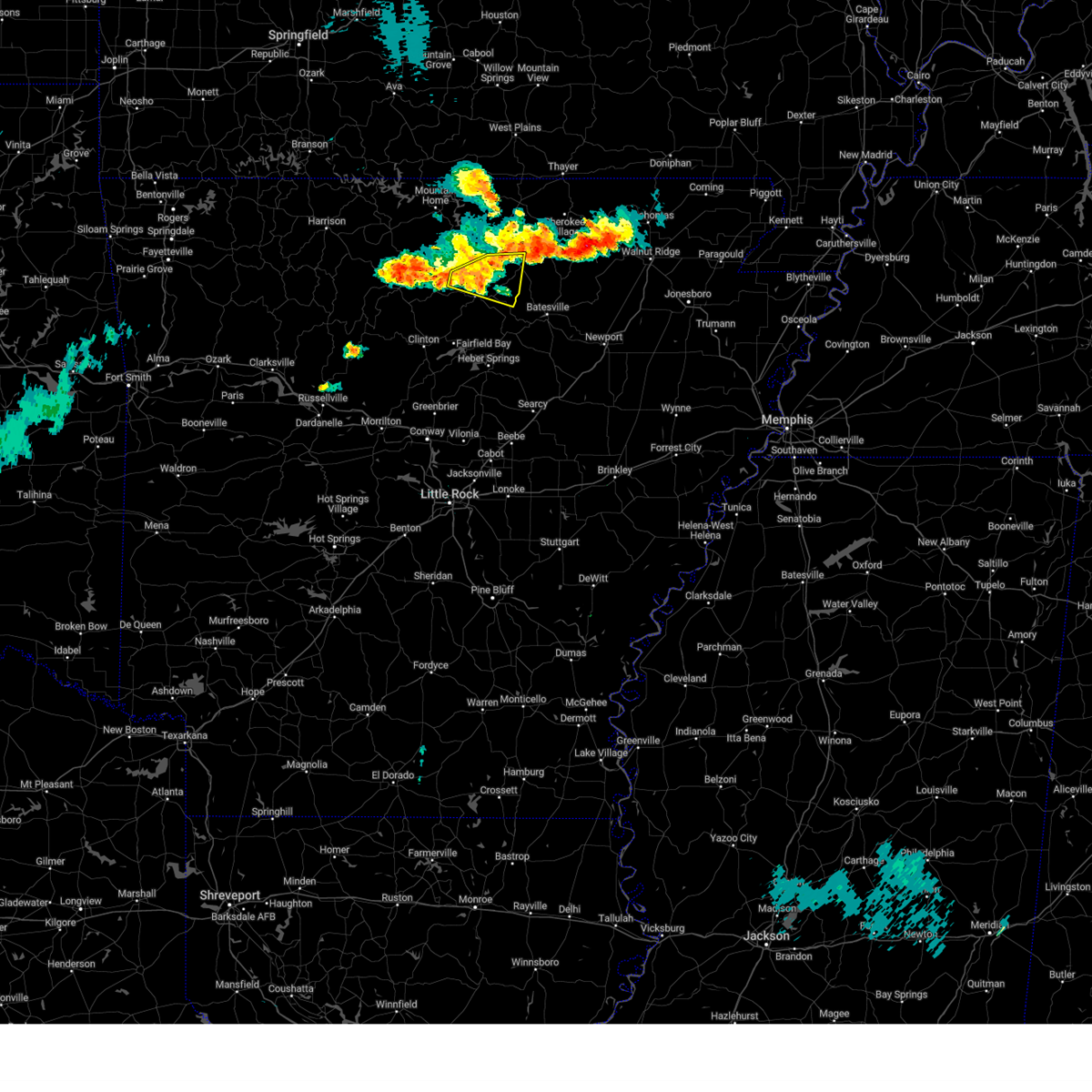
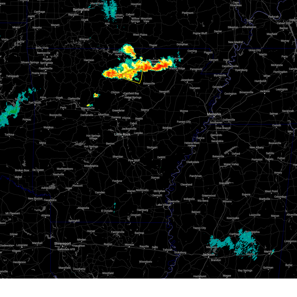
The Top Recent Hail Date for Mount Pleasant, AR is Monday, June 1, 2026 (5th out of 75)
Hail and Wind Damage Spotted near Mount Pleasant, AR
| Date / Time | Report Details |
|---|---|
| 6/13/2026 4:19 PM CDT |
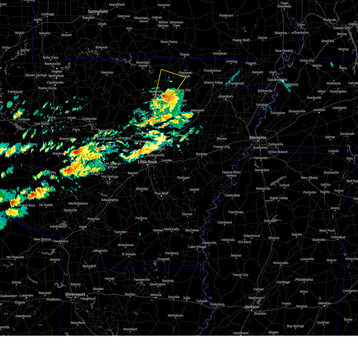
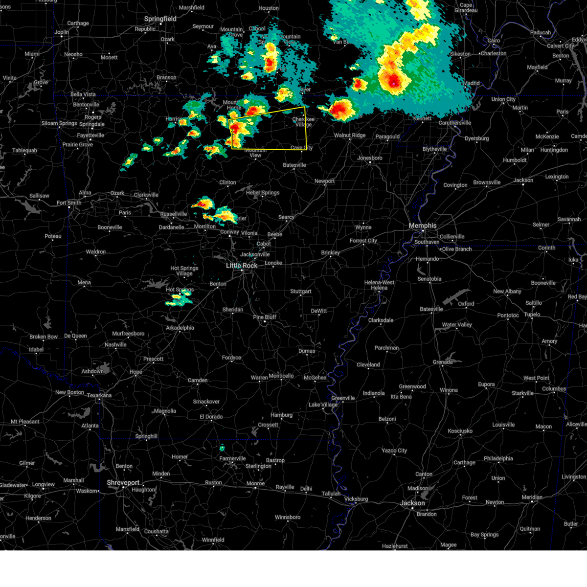
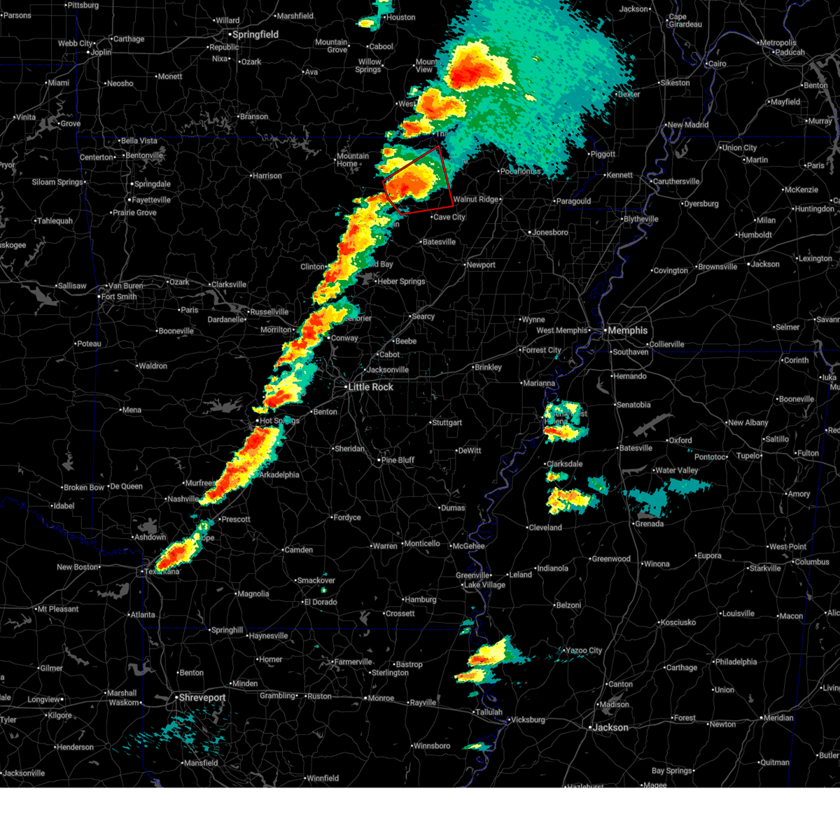
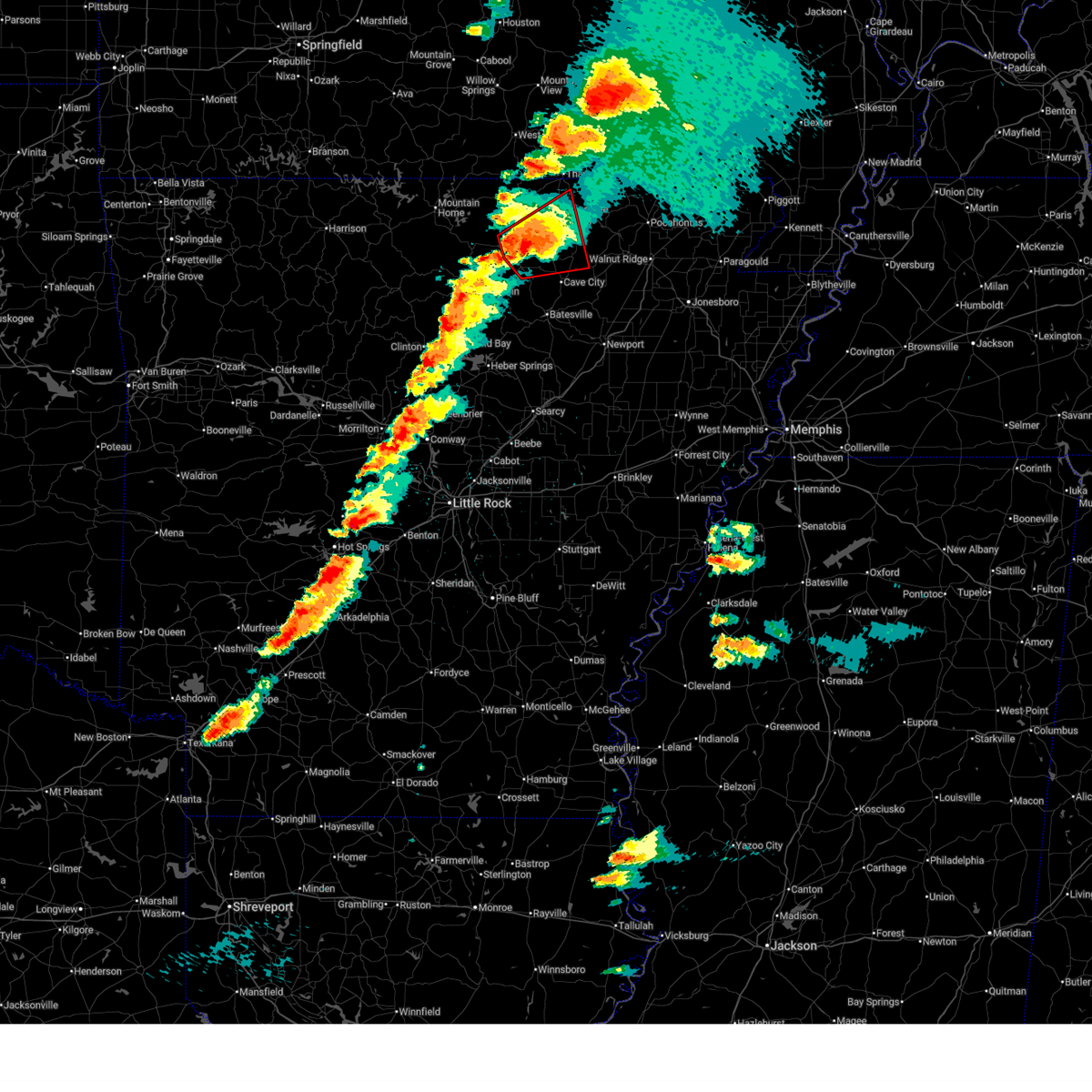
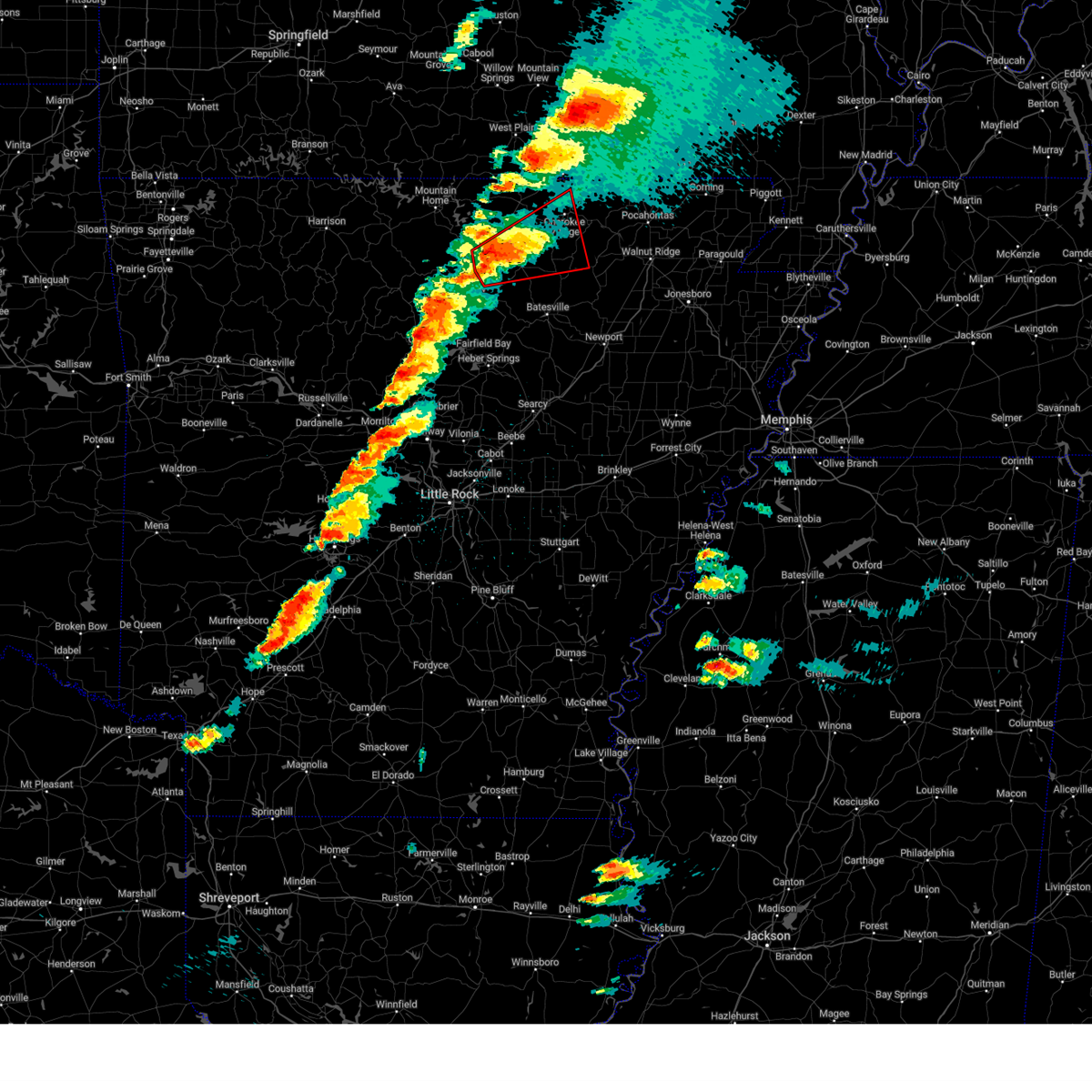
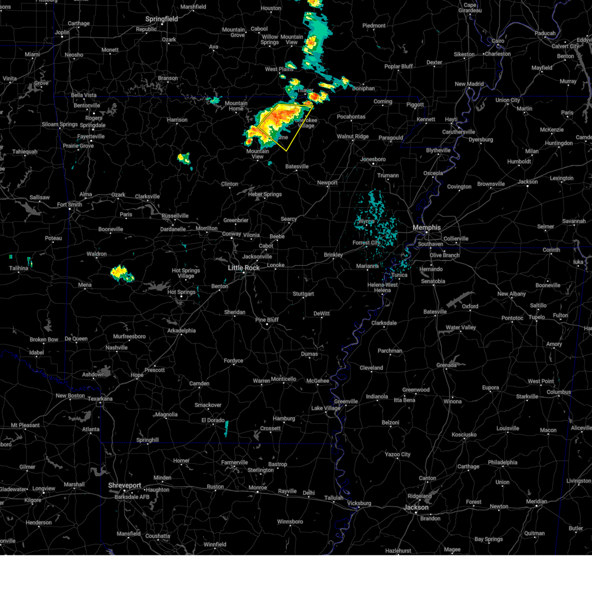
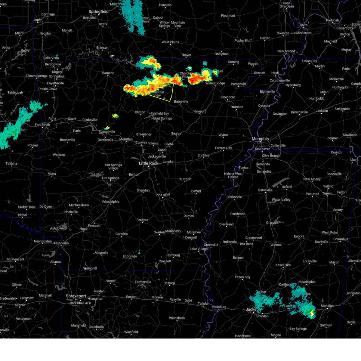
 Svrlzk the national weather service in little rock has issued a * severe thunderstorm warning for, stone county in north central arkansas, northwestern independence county in north central arkansas, southern izard county in north central arkansas, northeastern van buren county in north central arkansas, northern cleburne county in north central arkansas, southwestern sharp county in north central arkansas, * until 445 pm cdt. * at 419 pm cdt, a severe thunderstorm was located over mountain view, moving east at 40 mph (radar indicated). Hazards include 60 mph wind gusts and quarter size hail. Hail damage to vehicles is expected. Expect wind damage to roofs, siding, and trees. Svrlzk the national weather service in little rock has issued a * severe thunderstorm warning for, stone county in north central arkansas, northwestern independence county in north central arkansas, southern izard county in north central arkansas, northeastern van buren county in north central arkansas, northern cleburne county in north central arkansas, southwestern sharp county in north central arkansas, * until 445 pm cdt. * at 419 pm cdt, a severe thunderstorm was located over mountain view, moving east at 40 mph (radar indicated). Hazards include 60 mph wind gusts and quarter size hail. Hail damage to vehicles is expected. Expect wind damage to roofs, siding, and trees.
|
| 6/13/2026 3:04 PM CDT |
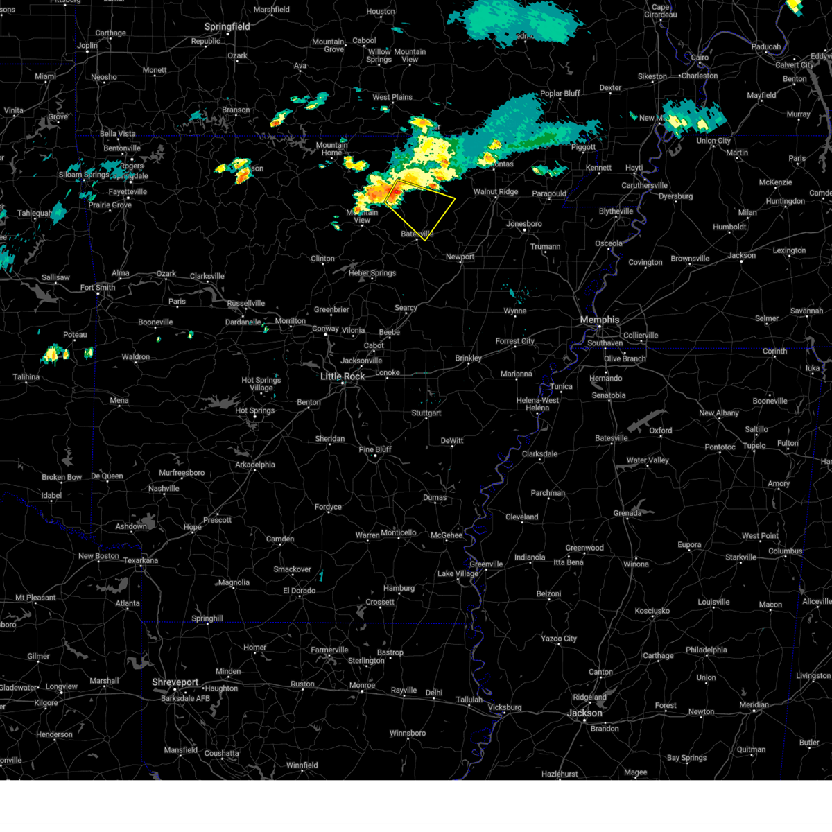
 At 304 pm cdt, severe thunderstorms were located along a line extending from near lynn to near cave city to near cushman, moving east at 30 mph (radar indicated). Hazards include 60 mph wind gusts and quarter size hail. Hail damage to vehicles is expected. expect wind damage to roofs, siding, and trees. Locations impacted include, batesville, walnut ridge, hoxie, black rock, lake charles state park, cave city, tuckerman, newark, swifton, college city, cushman, portia, mount pleasant, strawberry, lynn, sidney, moorefield, alicia, minturn, croker,. At 304 pm cdt, severe thunderstorms were located along a line extending from near lynn to near cave city to near cushman, moving east at 30 mph (radar indicated). Hazards include 60 mph wind gusts and quarter size hail. Hail damage to vehicles is expected. expect wind damage to roofs, siding, and trees. Locations impacted include, batesville, walnut ridge, hoxie, black rock, lake charles state park, cave city, tuckerman, newark, swifton, college city, cushman, portia, mount pleasant, strawberry, lynn, sidney, moorefield, alicia, minturn, croker,.
|
| 6/13/2026 2:44 PM CDT |
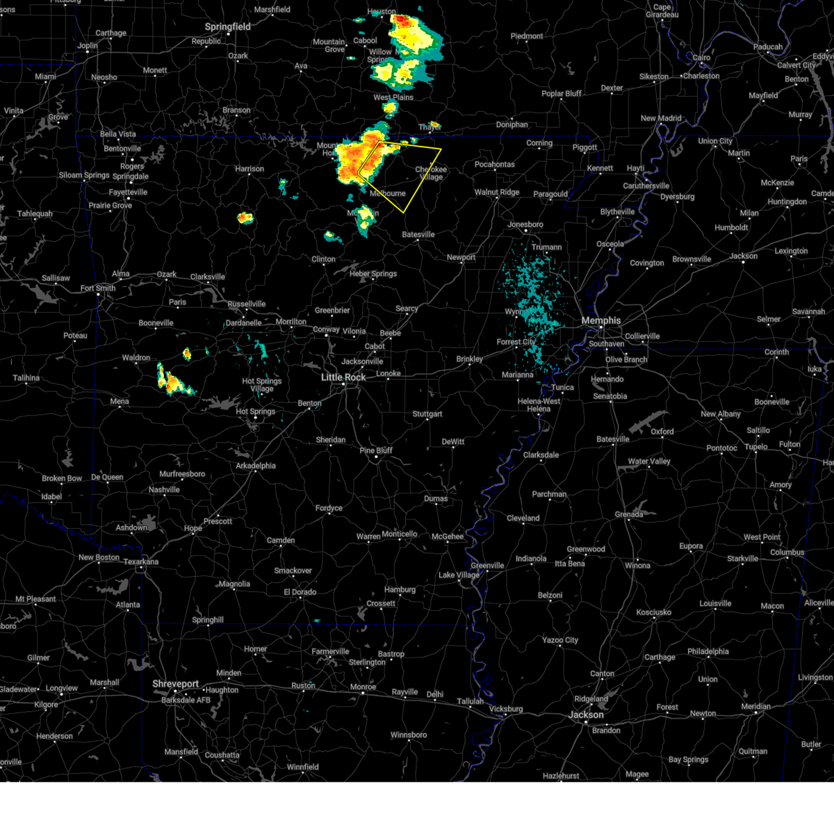
 Svrlzk the national weather service in little rock has issued a * severe thunderstorm warning for, east central stone county in north central arkansas, northern independence county in north central arkansas, southeastern randolph county in eastern arkansas, southeastern izard county in north central arkansas, northeastern jackson county in eastern arkansas, lawrence county in eastern arkansas, southern sharp county in north central arkansas, * until 345 pm cdt. * at 244 pm cdt, severe thunderstorms were located along a line extending from 9 miles northeast of cave city to sidney to near gid, moving east at 30 mph (radar indicated). Hazards include 60 mph wind gusts and quarter size hail. Hail damage to vehicles is expected. Expect wind damage to roofs, siding, and trees. Svrlzk the national weather service in little rock has issued a * severe thunderstorm warning for, east central stone county in north central arkansas, northern independence county in north central arkansas, southeastern randolph county in eastern arkansas, southeastern izard county in north central arkansas, northeastern jackson county in eastern arkansas, lawrence county in eastern arkansas, southern sharp county in north central arkansas, * until 345 pm cdt. * at 244 pm cdt, severe thunderstorms were located along a line extending from 9 miles northeast of cave city to sidney to near gid, moving east at 30 mph (radar indicated). Hazards include 60 mph wind gusts and quarter size hail. Hail damage to vehicles is expected. Expect wind damage to roofs, siding, and trees.
|
| 6/13/2026 2:34 PM CDT |
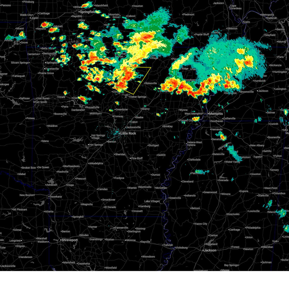
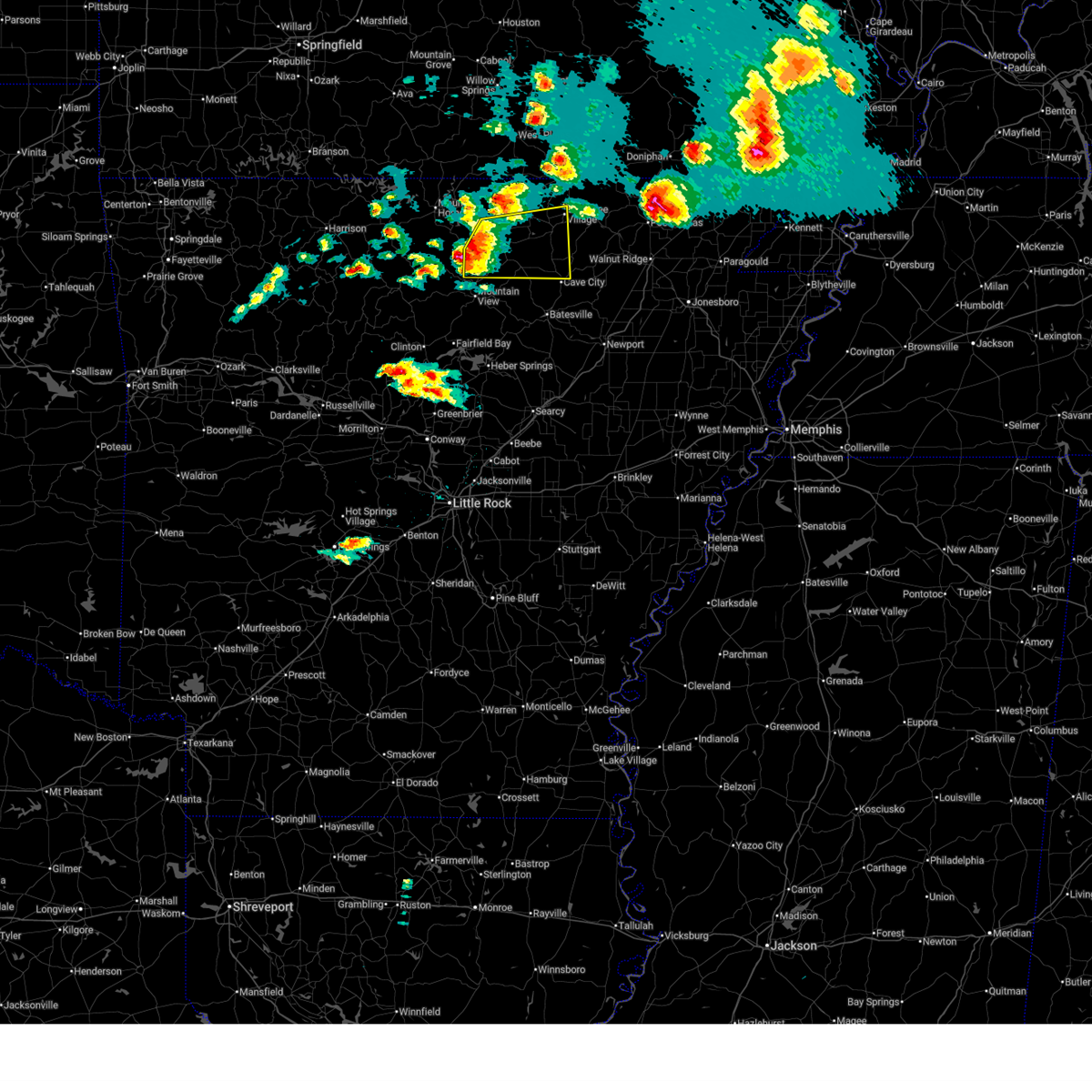
 At 233 pm cdt, severe thunderstorms were located along a line extending from 7 miles northeast of sidney to near mount pleasant, moving east at 35 mph (radar indicated). Hazards include 60 mph wind gusts and half dollar size hail. Hail damage to vehicles is expected. expect wind damage to roofs, siding, and trees. Locations impacted include, melbourne, cave city, imboden, sidney, stella, annieville, lacrosse, evening shade, smithville, center, maxville, zion, boswell, calamine, sage, poughkeepsie, nelsonville, sitka, sharum,. At 233 pm cdt, severe thunderstorms were located along a line extending from 7 miles northeast of sidney to near mount pleasant, moving east at 35 mph (radar indicated). Hazards include 60 mph wind gusts and half dollar size hail. Hail damage to vehicles is expected. expect wind damage to roofs, siding, and trees. Locations impacted include, melbourne, cave city, imboden, sidney, stella, annieville, lacrosse, evening shade, smithville, center, maxville, zion, boswell, calamine, sage, poughkeepsie, nelsonville, sitka, sharum,.
|
| 6/13/2026 2:25 PM CDT |
 At 224 pm cdt, severe thunderstorms were located along a line extending from near myron to lacrosse, moving east at 30 mph (radar indicated). Hazards include 60 mph wind gusts and quarter size hail. Hail damage to vehicles is expected. expect wind damage to roofs, siding, and trees. Locations impacted include, melbourne, ash flat, cave city, imboden, franklin, sidney, stella, myron, annieville, lacrosse, evening shade, smithville, center, maxville, zion, boswell, calamine, sage, poughkeepsie, larkin,. At 224 pm cdt, severe thunderstorms were located along a line extending from near myron to lacrosse, moving east at 30 mph (radar indicated). Hazards include 60 mph wind gusts and quarter size hail. Hail damage to vehicles is expected. expect wind damage to roofs, siding, and trees. Locations impacted include, melbourne, ash flat, cave city, imboden, franklin, sidney, stella, myron, annieville, lacrosse, evening shade, smithville, center, maxville, zion, boswell, calamine, sage, poughkeepsie, larkin,.
|
| 6/13/2026 2:07 PM CDT |
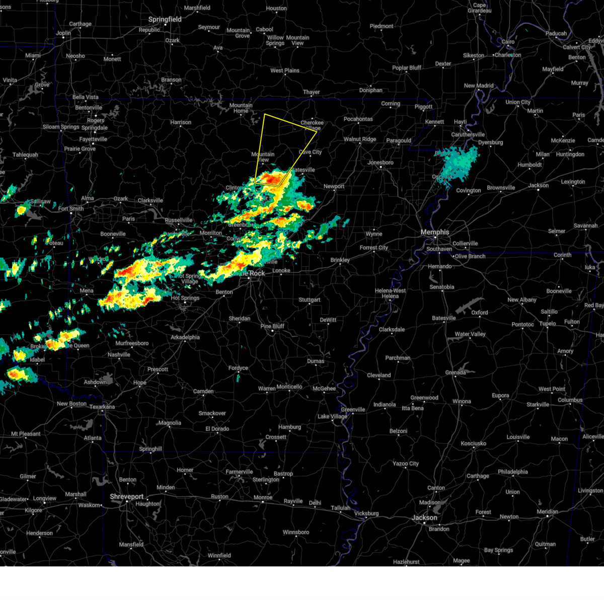
 At 207 pm cdt, severe thunderstorms were located along a line extending from franklin to near melbourne, moving east at 25 mph (radar indicated). Hazards include ping pong ball size hail and 60 mph wind gusts. People and animals outdoors will be injured. expect hail damage to roofs, siding, windows, and vehicles. expect wind damage to roofs, siding, and trees. Locations impacted include, melbourne, ash flat, horseshoe bend, cave city, highland in sharp county, imboden, oxford, ravenden, franklin, sidney, ballard, annieville, stella, myron, lacrosse, evening shade, smithville, zion, calamine, violet hill,. At 207 pm cdt, severe thunderstorms were located along a line extending from franklin to near melbourne, moving east at 25 mph (radar indicated). Hazards include ping pong ball size hail and 60 mph wind gusts. People and animals outdoors will be injured. expect hail damage to roofs, siding, windows, and vehicles. expect wind damage to roofs, siding, and trees. Locations impacted include, melbourne, ash flat, horseshoe bend, cave city, highland in sharp county, imboden, oxford, ravenden, franklin, sidney, ballard, annieville, stella, myron, lacrosse, evening shade, smithville, zion, calamine, violet hill,.
|
| 6/13/2026 1:58 PM CDT |
 Svrlzk the national weather service in little rock has issued a * severe thunderstorm warning for, south central randolph county in eastern arkansas, northern izard county in north central arkansas, southeastern fulton county in north central arkansas, northwestern lawrence county in eastern arkansas, sharp county in north central arkansas, * until 245 pm cdt. * at 158 pm cdt, severe thunderstorms were located along a line extending from near franklin to near oxford to gorby, moving east at 30 mph (radar indicated). Hazards include 60 mph wind gusts and half dollar size hail. Hail damage to vehicles is expected. Expect wind damage to roofs, siding, and trees. Svrlzk the national weather service in little rock has issued a * severe thunderstorm warning for, south central randolph county in eastern arkansas, northern izard county in north central arkansas, southeastern fulton county in north central arkansas, northwestern lawrence county in eastern arkansas, sharp county in north central arkansas, * until 245 pm cdt. * at 158 pm cdt, severe thunderstorms were located along a line extending from near franklin to near oxford to gorby, moving east at 30 mph (radar indicated). Hazards include 60 mph wind gusts and half dollar size hail. Hail damage to vehicles is expected. Expect wind damage to roofs, siding, and trees.
|
| 6/1/2026 7:33 PM CDT |
 Svrlzk the national weather service in little rock has issued a * severe thunderstorm warning for, northwestern independence county in north central arkansas, southeastern izard county in north central arkansas, southwestern sharp county in north central arkansas, * until 815 pm cdt. * at 732 pm cdt, a severe thunderstorm was located over mount pleasant, or 9 miles southeast of melbourne, moving east at 10 mph (radar indicated). Hazards include 60 mph wind gusts and quarter size hail. Hail damage to vehicles is expected. Expect wind damage to roofs, siding, and trees. Svrlzk the national weather service in little rock has issued a * severe thunderstorm warning for, northwestern independence county in north central arkansas, southeastern izard county in north central arkansas, southwestern sharp county in north central arkansas, * until 815 pm cdt. * at 732 pm cdt, a severe thunderstorm was located over mount pleasant, or 9 miles southeast of melbourne, moving east at 10 mph (radar indicated). Hazards include 60 mph wind gusts and quarter size hail. Hail damage to vehicles is expected. Expect wind damage to roofs, siding, and trees.
|
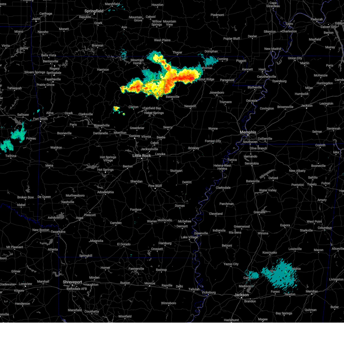
| 4/28/2026 2:34 PM CDT |
 At 234 pm cdt, a severe thunderstorm was located near batesville, moving east at 40 mph (radar indicated). Hazards include golf ball size hail and 60 mph wind gusts. People and animals outdoors will be injured. expect hail damage to roofs, siding, windows, and vehicles. expect wind damage to roofs, siding, and trees. Locations impacted include, batesville, cave city, cushman, mount pleasant, sidney, moorefield, stella, sulphur rock, bethesda, aetna, maxville, charlotte, calamine, gainesboro, pfeiffer, sandtown, desha,. At 234 pm cdt, a severe thunderstorm was located near batesville, moving east at 40 mph (radar indicated). Hazards include golf ball size hail and 60 mph wind gusts. People and animals outdoors will be injured. expect hail damage to roofs, siding, windows, and vehicles. expect wind damage to roofs, siding, and trees. Locations impacted include, batesville, cave city, cushman, mount pleasant, sidney, moorefield, stella, sulphur rock, bethesda, aetna, maxville, charlotte, calamine, gainesboro, pfeiffer, sandtown, desha,.
|
| 4/28/2026 2:08 PM CDT |
 Svrlzk the national weather service in little rock has issued a * severe thunderstorm warning for, southeastern stone county in north central arkansas, northwestern independence county in north central arkansas, southeastern izard county in north central arkansas, southwestern sharp county in north central arkansas, * until 300 pm cdt. * at 208 pm cdt, a severe thunderstorm was located 7 miles southwest of croker, or 9 miles southeast of mountain view, moving east at 45 mph (radar indicated). Hazards include 60 mph wind gusts and quarter size hail. Hail damage to vehicles is expected. Expect wind damage to roofs, siding, and trees. Svrlzk the national weather service in little rock has issued a * severe thunderstorm warning for, southeastern stone county in north central arkansas, northwestern independence county in north central arkansas, southeastern izard county in north central arkansas, southwestern sharp county in north central arkansas, * until 300 pm cdt. * at 208 pm cdt, a severe thunderstorm was located 7 miles southwest of croker, or 9 miles southeast of mountain view, moving east at 45 mph (radar indicated). Hazards include 60 mph wind gusts and quarter size hail. Hail damage to vehicles is expected. Expect wind damage to roofs, siding, and trees.
|
| 4/28/2026 1:44 PM CDT |
 At 144 pm cdt, a severe thunderstorm was located near blanchard springs campground, or 10 miles northwest of mountain view, moving east at 35 mph (radar indicated). Hazards include ping pong ball size hail and 60 mph wind gusts. People and animals outdoors will be injured. expect hail damage to roofs, siding, windows, and vehicles. expect wind damage to roofs, siding, and trees. Locations impacted include, mountain view, melbourne, brandenberg, croker, lone star, gorby, gid, herpel, lunenburg, lacrosse, blanchard springs campground, guion, allison, hanover, mt olive in izard county, larkin, timbo, gunner pool campground, barkshed campground, newnata,. At 144 pm cdt, a severe thunderstorm was located near blanchard springs campground, or 10 miles northwest of mountain view, moving east at 35 mph (radar indicated). Hazards include ping pong ball size hail and 60 mph wind gusts. People and animals outdoors will be injured. expect hail damage to roofs, siding, windows, and vehicles. expect wind damage to roofs, siding, and trees. Locations impacted include, mountain view, melbourne, brandenberg, croker, lone star, gorby, gid, herpel, lunenburg, lacrosse, blanchard springs campground, guion, allison, hanover, mt olive in izard county, larkin, timbo, gunner pool campground, barkshed campground, newnata,.
|
| 4/28/2026 1:21 PM CDT |
 Svrlzk the national weather service in little rock has issued a * severe thunderstorm warning for, stone county in north central arkansas, northeastern searcy county in north central arkansas, southwestern izard county in north central arkansas, southeastern baxter county in north central arkansas, * until 215 pm cdt. * at 121 pm cdt, a severe thunderstorm was located near thola, or 10 miles northeast of marshall, moving east at 35 mph (radar indicated). Hazards include ping pong ball size hail and 60 mph wind gusts. People and animals outdoors will be injured. expect hail damage to roofs, siding, windows, and vehicles. Expect wind damage to roofs, siding, and trees. Svrlzk the national weather service in little rock has issued a * severe thunderstorm warning for, stone county in north central arkansas, northeastern searcy county in north central arkansas, southwestern izard county in north central arkansas, southeastern baxter county in north central arkansas, * until 215 pm cdt. * at 121 pm cdt, a severe thunderstorm was located near thola, or 10 miles northeast of marshall, moving east at 35 mph (radar indicated). Hazards include ping pong ball size hail and 60 mph wind gusts. People and animals outdoors will be injured. expect hail damage to roofs, siding, windows, and vehicles. Expect wind damage to roofs, siding, and trees.
|
| 3/15/2026 5:14 PM CDT |
 At 513 pm cdt, severe thunderstorms were located along a line extending from near stella to cushman to 6 miles north of concord, moving east at 55 mph (radar indicated). Hazards include 60 mph wind gusts and penny size hail. Expect damage to roofs, siding, and trees. Locations impacted include, batesville, mountain view, melbourne, cave city, greers ferry, cushman, mount pleasant, concord, magness, sidney, moorefield, salado, lone star, gid, herpel, lunenburg, brandenberg, croker, southside in independence count, stella,. At 513 pm cdt, severe thunderstorms were located along a line extending from near stella to cushman to 6 miles north of concord, moving east at 55 mph (radar indicated). Hazards include 60 mph wind gusts and penny size hail. Expect damage to roofs, siding, and trees. Locations impacted include, batesville, mountain view, melbourne, cave city, greers ferry, cushman, mount pleasant, concord, magness, sidney, moorefield, salado, lone star, gid, herpel, lunenburg, brandenberg, croker, southside in independence count, stella,.
|
| 3/15/2026 5:14 PM CDT |
 the severe thunderstorm warning has been cancelled and is no longer in effect the severe thunderstorm warning has been cancelled and is no longer in effect
|
| 3/15/2026 4:43 PM CDT |
 Svrlzk the national weather service in little rock has issued a * severe thunderstorm warning for, stone county in north central arkansas, western independence county in north central arkansas, southern izard county in north central arkansas, east central van buren county in north central arkansas, northern cleburne county in north central arkansas, southwestern sharp county in north central arkansas, * until 530 pm cdt. * at 442 pm cdt, severe thunderstorms were located along a line extending from near mountain view to 9 miles north of fairfield bay to near shirley, moving east at 55 mph (radar indicated). Hazards include 60 mph wind gusts and penny size hail. expect damage to roofs, siding, and trees Svrlzk the national weather service in little rock has issued a * severe thunderstorm warning for, stone county in north central arkansas, western independence county in north central arkansas, southern izard county in north central arkansas, east central van buren county in north central arkansas, northern cleburne county in north central arkansas, southwestern sharp county in north central arkansas, * until 530 pm cdt. * at 442 pm cdt, severe thunderstorms were located along a line extending from near mountain view to 9 miles north of fairfield bay to near shirley, moving east at 55 mph (radar indicated). Hazards include 60 mph wind gusts and penny size hail. expect damage to roofs, siding, and trees
|
| 3/7/2026 7:53 AM CST |
 the severe thunderstorm warning has been cancelled and is no longer in effect the severe thunderstorm warning has been cancelled and is no longer in effect
|
| 3/7/2026 7:28 AM CST |
 Svrlzk the national weather service in little rock has issued a * severe thunderstorm warning for, northwestern independence county in north central arkansas, south central randolph county in eastern arkansas, southeastern izard county in north central arkansas, northwestern lawrence county in eastern arkansas, southern sharp county in north central arkansas, * until 815 am cst. * at 728 am cst, a severe thunderstorm was located over sidney, or 12 miles southeast of melbourne, moving east at 50 mph (radar indicated). Hazards include 60 mph wind gusts. expect damage to roofs, siding, and trees Svrlzk the national weather service in little rock has issued a * severe thunderstorm warning for, northwestern independence county in north central arkansas, south central randolph county in eastern arkansas, southeastern izard county in north central arkansas, northwestern lawrence county in eastern arkansas, southern sharp county in north central arkansas, * until 815 am cst. * at 728 am cst, a severe thunderstorm was located over sidney, or 12 miles southeast of melbourne, moving east at 50 mph (radar indicated). Hazards include 60 mph wind gusts. expect damage to roofs, siding, and trees
|
| 6/7/2025 8:19 AM CDT |
 At 819 am cdt, severe thunderstorms were located along a line extending from 9 miles north of greers ferry to near guy to near oppelo, moving east at 50 mph (radar indicated). Hazards include 60 mph wind gusts and quarter size hail. Hail damage to vehicles is expected. expect wind damage to roofs, siding, and trees. Locations impacted include, rushing, wilburn, hill creek, twin groves, pearson, narrows marina, shirley, choctow recreation area, lone star, woodrow, dam site marina, luber, guion, bethlehem, wonderview, guy, greers ferry, enders, higden, plumerville,. At 819 am cdt, severe thunderstorms were located along a line extending from 9 miles north of greers ferry to near guy to near oppelo, moving east at 50 mph (radar indicated). Hazards include 60 mph wind gusts and quarter size hail. Hail damage to vehicles is expected. expect wind damage to roofs, siding, and trees. Locations impacted include, rushing, wilburn, hill creek, twin groves, pearson, narrows marina, shirley, choctow recreation area, lone star, woodrow, dam site marina, luber, guion, bethlehem, wonderview, guy, greers ferry, enders, higden, plumerville,.
|
| 6/7/2025 7:57 AM CDT |
 Svrlzk the national weather service in little rock has issued a * severe thunderstorm warning for, stone county in north central arkansas, western independence county in north central arkansas, southern izard county in north central arkansas, northeastern perry county in central arkansas, van buren county in north central arkansas, cleburne county in north central arkansas, conway county in central arkansas, faulkner county in central arkansas, southwestern sharp county in north central arkansas, * until 845 am cdt. * at 757 am cdt, severe thunderstorms were located along a line extending from 7 miles east of thola to near cleveland to near carden bottoms, moving east at 45 mph (radar indicated). Hazards include 60 mph wind gusts and quarter size hail. Hail damage to vehicles is expected. Expect wind damage to roofs, siding, and trees. Svrlzk the national weather service in little rock has issued a * severe thunderstorm warning for, stone county in north central arkansas, western independence county in north central arkansas, southern izard county in north central arkansas, northeastern perry county in central arkansas, van buren county in north central arkansas, cleburne county in north central arkansas, conway county in central arkansas, faulkner county in central arkansas, southwestern sharp county in north central arkansas, * until 845 am cdt. * at 757 am cdt, severe thunderstorms were located along a line extending from 7 miles east of thola to near cleveland to near carden bottoms, moving east at 45 mph (radar indicated). Hazards include 60 mph wind gusts and quarter size hail. Hail damage to vehicles is expected. Expect wind damage to roofs, siding, and trees.
|
| 5/21/2025 11:21 PM CDT |
 At 1120 pm cdt, a severe thunderstorm was located 8 miles west of blanchard springs campground, or 15 miles northwest of mountain view, moving southeast at 45 mph (radar indicated). Hazards include quarter size hail. Damage to vehicles is expected. Locations impacted include, hanover, parma, turkey creek, mt olive in izard county, brownsville, pleasant grove, timbo, brandenberg, croker, gunner pool campground, barkshed campground, lone star, sandtown, woodrow, newnata, prim, gid, herpel, marcella, luber,. At 1120 pm cdt, a severe thunderstorm was located 8 miles west of blanchard springs campground, or 15 miles northwest of mountain view, moving southeast at 45 mph (radar indicated). Hazards include quarter size hail. Damage to vehicles is expected. Locations impacted include, hanover, parma, turkey creek, mt olive in izard county, brownsville, pleasant grove, timbo, brandenberg, croker, gunner pool campground, barkshed campground, lone star, sandtown, woodrow, newnata, prim, gid, herpel, marcella, luber,.
|
| 5/21/2025 11:21 PM CDT |
 the severe thunderstorm warning has been cancelled and is no longer in effect the severe thunderstorm warning has been cancelled and is no longer in effect
|
| 5/21/2025 11:09 PM CDT |
 Svrlzk the national weather service in little rock has issued a * severe thunderstorm warning for, stone county in north central arkansas, northwestern independence county in north central arkansas, northeastern searcy county in north central arkansas, southern izard county in north central arkansas, southeastern marion county in north central arkansas, north central cleburne county in north central arkansas, southeastern baxter county in north central arkansas, southwestern sharp county in north central arkansas, * until midnight cdt. * at 1109 pm cdt, a severe thunderstorm was located near advance, or 17 miles northeast of marshall, moving southeast at 45 mph (radar indicated). Hazards include quarter size hail. damage to vehicles is expected Svrlzk the national weather service in little rock has issued a * severe thunderstorm warning for, stone county in north central arkansas, northwestern independence county in north central arkansas, northeastern searcy county in north central arkansas, southern izard county in north central arkansas, southeastern marion county in north central arkansas, north central cleburne county in north central arkansas, southeastern baxter county in north central arkansas, southwestern sharp county in north central arkansas, * until midnight cdt. * at 1109 pm cdt, a severe thunderstorm was located near advance, or 17 miles northeast of marshall, moving southeast at 45 mph (radar indicated). Hazards include quarter size hail. damage to vehicles is expected
|
| 5/16/2025 5:13 AM CDT |
 Svrlzk the national weather service in little rock has issued a * severe thunderstorm warning for, northwestern randolph county in eastern arkansas, northeastern izard county in north central arkansas, eastern fulton county in north central arkansas, northwestern lawrence county in eastern arkansas, central sharp county in north central arkansas, * until 600 am cdt. * at 513 am cdt, a severe thunderstorm was located near lacrosse, or near melbourne, moving northeast at 45 mph (radar indicated). Hazards include quarter size hail. damage to vehicles is expected Svrlzk the national weather service in little rock has issued a * severe thunderstorm warning for, northwestern randolph county in eastern arkansas, northeastern izard county in north central arkansas, eastern fulton county in north central arkansas, northwestern lawrence county in eastern arkansas, central sharp county in north central arkansas, * until 600 am cdt. * at 513 am cdt, a severe thunderstorm was located near lacrosse, or near melbourne, moving northeast at 45 mph (radar indicated). Hazards include quarter size hail. damage to vehicles is expected
|
| 5/16/2025 4:42 AM CDT |
 Svrlzk the national weather service in little rock has issued a * severe thunderstorm warning for, central stone county in north central arkansas, izard county in north central arkansas, west central sharp county in north central arkansas, * until 515 am cdt. * at 442 am cdt, a severe thunderstorm was located near blanchard springs campground, or near mountain view, moving northeast at 40 mph (radar indicated). Hazards include 60 mph wind gusts and quarter size hail. Hail damage to vehicles is expected. Expect wind damage to roofs, siding, and trees. Svrlzk the national weather service in little rock has issued a * severe thunderstorm warning for, central stone county in north central arkansas, izard county in north central arkansas, west central sharp county in north central arkansas, * until 515 am cdt. * at 442 am cdt, a severe thunderstorm was located near blanchard springs campground, or near mountain view, moving northeast at 40 mph (radar indicated). Hazards include 60 mph wind gusts and quarter size hail. Hail damage to vehicles is expected. Expect wind damage to roofs, siding, and trees.
|
| 4/20/2025 6:16 PM CDT |
 Svrlzk the national weather service in little rock has issued a * severe thunderstorm warning for, east central stone county in north central arkansas, northern independence county in north central arkansas, northwestern randolph county in eastern arkansas, izard county in north central arkansas, fulton county in north central arkansas, northwestern lawrence county in eastern arkansas, sharp county in north central arkansas, * until 700 pm cdt. * at 615 pm cdt, severe thunderstorms were located along a line extending from sturkie to near oxford to near mountain view, moving northeast at 55 mph (radar indicated). Hazards include 60 mph wind gusts and penny size hail. expect damage to roofs, siding, and trees Svrlzk the national weather service in little rock has issued a * severe thunderstorm warning for, east central stone county in north central arkansas, northern independence county in north central arkansas, northwestern randolph county in eastern arkansas, izard county in north central arkansas, fulton county in north central arkansas, northwestern lawrence county in eastern arkansas, sharp county in north central arkansas, * until 700 pm cdt. * at 615 pm cdt, severe thunderstorms were located along a line extending from sturkie to near oxford to near mountain view, moving northeast at 55 mph (radar indicated). Hazards include 60 mph wind gusts and penny size hail. expect damage to roofs, siding, and trees
|
| 4/20/2025 5:44 PM CDT |
 Svrlzk the national weather service in little rock has issued a * severe thunderstorm warning for, northern stone county in north central arkansas, northwestern independence county in north central arkansas, southeastern searcy county in north central arkansas, izard county in north central arkansas, southeastern marion county in north central arkansas, north central van buren county in north central arkansas, baxter county in north central arkansas, fulton county in north central arkansas, west central sharp county in north central arkansas, * until 630 pm cdt. * at 544 pm cdt, severe thunderstorms were located along a line extending from near bakersfield to herron to near old lexington, moving northeast at 50 mph (radar indicated). Hazards include 60 mph wind gusts and penny size hail. expect damage to roofs, siding, and trees Svrlzk the national weather service in little rock has issued a * severe thunderstorm warning for, northern stone county in north central arkansas, northwestern independence county in north central arkansas, southeastern searcy county in north central arkansas, izard county in north central arkansas, southeastern marion county in north central arkansas, north central van buren county in north central arkansas, baxter county in north central arkansas, fulton county in north central arkansas, west central sharp county in north central arkansas, * until 630 pm cdt. * at 544 pm cdt, severe thunderstorms were located along a line extending from near bakersfield to herron to near old lexington, moving northeast at 50 mph (radar indicated). Hazards include 60 mph wind gusts and penny size hail. expect damage to roofs, siding, and trees
|
| 4/4/2025 7:16 PM CDT |
 At 714 pm cdt, a severe thunderstorm was located near sidney, or 14 miles north of batesville, moving northeast at 40 mph. a tornado is also possible with this storm, with a tornado warning also in effect (radar indicated). Hazards include 60 mph wind gusts and quarter size hail. Hail damage to vehicles is expected. expect wind damage to roofs, siding, and trees. Locations impacted include, aetna, maxville, center, zion, calamine, mount pleasant, cave city, highland in sharp county, poughkeepsie, sidney, myron, ballard, nelsonville, ash flat, sitka, evening shade, sandtown, cherokee village, hardy, cushman,. At 714 pm cdt, a severe thunderstorm was located near sidney, or 14 miles north of batesville, moving northeast at 40 mph. a tornado is also possible with this storm, with a tornado warning also in effect (radar indicated). Hazards include 60 mph wind gusts and quarter size hail. Hail damage to vehicles is expected. expect wind damage to roofs, siding, and trees. Locations impacted include, aetna, maxville, center, zion, calamine, mount pleasant, cave city, highland in sharp county, poughkeepsie, sidney, myron, ballard, nelsonville, ash flat, sitka, evening shade, sandtown, cherokee village, hardy, cushman,.
|
| 4/4/2025 7:16 PM CDT |
 the severe thunderstorm warning has been cancelled and is no longer in effect the severe thunderstorm warning has been cancelled and is no longer in effect
|
| 4/4/2025 7:07 PM CDT |
 the tornado warning has been cancelled and is no longer in effect the tornado warning has been cancelled and is no longer in effect
|
| 4/4/2025 7:07 PM CDT |
 At 707 pm cdt, a severe thunderstorm capable of producing a tornado was located near cushman, or 9 miles northwest of batesville, moving northeast at 35 mph (radar indicated rotation). Hazards include tornado and golf ball size hail. Flying debris will be dangerous to those caught without shelter. mobile homes will be damaged or destroyed. damage to roofs, windows, and vehicles will occur. tree damage is likely. Locations impacted include, aetna, maxville, center, mount pleasant, cave city, poughkeepsie, sidney, lafferty, evening shade, sandtown, cushman, pfeiffer, ash flat, batesville,. At 707 pm cdt, a severe thunderstorm capable of producing a tornado was located near cushman, or 9 miles northwest of batesville, moving northeast at 35 mph (radar indicated rotation). Hazards include tornado and golf ball size hail. Flying debris will be dangerous to those caught without shelter. mobile homes will be damaged or destroyed. damage to roofs, windows, and vehicles will occur. tree damage is likely. Locations impacted include, aetna, maxville, center, mount pleasant, cave city, poughkeepsie, sidney, lafferty, evening shade, sandtown, cushman, pfeiffer, ash flat, batesville,.
|
| 4/4/2025 6:49 PM CDT |
 Torlzk the national weather service in little rock has issued a * tornado warning for, southeastern stone county in north central arkansas, northwestern independence county in north central arkansas, southeastern izard county in north central arkansas, southwestern sharp county in north central arkansas, * until 730 pm cdt. * at 649 pm cdt, a severe thunderstorm capable of producing a tornado was located near croker, or 12 miles east of mountain view, moving northeast at 55 mph (radar indicated rotation). Hazards include tornado. Flying debris will be dangerous to those caught without shelter. mobile homes will be damaged or destroyed. damage to roofs, windows, and vehicles will occur. Tree damage is likely. Torlzk the national weather service in little rock has issued a * tornado warning for, southeastern stone county in north central arkansas, northwestern independence county in north central arkansas, southeastern izard county in north central arkansas, southwestern sharp county in north central arkansas, * until 730 pm cdt. * at 649 pm cdt, a severe thunderstorm capable of producing a tornado was located near croker, or 12 miles east of mountain view, moving northeast at 55 mph (radar indicated rotation). Hazards include tornado. Flying debris will be dangerous to those caught without shelter. mobile homes will be damaged or destroyed. damage to roofs, windows, and vehicles will occur. Tree damage is likely.
|
| 4/4/2025 6:47 PM CDT |
 At 647 pm cdt, a severe thunderstorm was located near croker, or 10 miles east of mountain view, moving northeast at 50 mph (radar indicated). Hazards include golf ball size hail and 60 mph wind gusts. People and animals outdoors will be injured. expect hail damage to roofs, siding, windows, and vehicles. expect wind damage to roofs, siding, and trees. Locations impacted include, zion, calamine, cave city, ballard, nelsonville, pleasant grove, ash flat, sitka, croker, evening shade, sandtown, aetna, maxville, center, gid, marcella, guion, mount pleasant, stella, ben,. At 647 pm cdt, a severe thunderstorm was located near croker, or 10 miles east of mountain view, moving northeast at 50 mph (radar indicated). Hazards include golf ball size hail and 60 mph wind gusts. People and animals outdoors will be injured. expect hail damage to roofs, siding, windows, and vehicles. expect wind damage to roofs, siding, and trees. Locations impacted include, zion, calamine, cave city, ballard, nelsonville, pleasant grove, ash flat, sitka, croker, evening shade, sandtown, aetna, maxville, center, gid, marcella, guion, mount pleasant, stella, ben,.
|
| 4/4/2025 6:43 PM CDT |
 Svrlzk the national weather service in little rock has issued a * severe thunderstorm warning for, southeastern stone county in north central arkansas, northwestern independence county in north central arkansas, southeastern izard county in north central arkansas, sharp county in north central arkansas, * until 730 pm cdt. * at 643 pm cdt, a severe thunderstorm was located 7 miles southwest of croker, or 9 miles southeast of mountain view, moving northeast at 50 mph (radar indicated). Hazards include 60 mph wind gusts and quarter size hail. Hail damage to vehicles is expected. Expect wind damage to roofs, siding, and trees. Svrlzk the national weather service in little rock has issued a * severe thunderstorm warning for, southeastern stone county in north central arkansas, northwestern independence county in north central arkansas, southeastern izard county in north central arkansas, sharp county in north central arkansas, * until 730 pm cdt. * at 643 pm cdt, a severe thunderstorm was located 7 miles southwest of croker, or 9 miles southeast of mountain view, moving northeast at 50 mph (radar indicated). Hazards include 60 mph wind gusts and quarter size hail. Hail damage to vehicles is expected. Expect wind damage to roofs, siding, and trees.
|
| 4/4/2025 5:02 AM CDT |
 the severe thunderstorm warning has been cancelled and is no longer in effect the severe thunderstorm warning has been cancelled and is no longer in effect
|
| 4/4/2025 4:56 AM CDT |
 the severe thunderstorm warning has been cancelled and is no longer in effect the severe thunderstorm warning has been cancelled and is no longer in effect
|
| 4/4/2025 4:56 AM CDT |
 At 456 am cdt, a severe thunderstorm was located near croker, or 9 miles south of melbourne, moving northeast at 60 mph (radar indicated). Hazards include 60 mph wind gusts and quarter size hail. Hail damage to vehicles is expected. expect wind damage to roofs, siding, and trees. Locations impacted include, franklin, mt olive in izard county, zion, violet hill, union, melbourne, larkin, pleasant grove, brandenberg, croker, horseshoe bend, evening shade, lone star, wideman, oxford, gid, herpel, marcella, boswell, guion,. At 456 am cdt, a severe thunderstorm was located near croker, or 9 miles south of melbourne, moving northeast at 60 mph (radar indicated). Hazards include 60 mph wind gusts and quarter size hail. Hail damage to vehicles is expected. expect wind damage to roofs, siding, and trees. Locations impacted include, franklin, mt olive in izard county, zion, violet hill, union, melbourne, larkin, pleasant grove, brandenberg, croker, horseshoe bend, evening shade, lone star, wideman, oxford, gid, herpel, marcella, boswell, guion,.
|
| 4/4/2025 4:44 AM CDT |
 At 444 am cdt, a severe thunderstorm was located 10 miles northwest of concord, or 10 miles southeast of mountain view, moving northeast at 50 mph (radar indicated). Hazards include ping pong ball size hail. People and animals outdoors will be injured. expect damage to roofs, siding, windows, and vehicles. Locations impacted include, franklin, mt olive in izard county, violet hill, melbourne, larkin, pleasant grove, horseshoe bend, evening shade, calico rock, lone star, wideman, wild cherry, gid, herpel, luber, boswell, guion, mount pleasant, lunenburg, dolph,. At 444 am cdt, a severe thunderstorm was located 10 miles northwest of concord, or 10 miles southeast of mountain view, moving northeast at 50 mph (radar indicated). Hazards include ping pong ball size hail. People and animals outdoors will be injured. expect damage to roofs, siding, windows, and vehicles. Locations impacted include, franklin, mt olive in izard county, violet hill, melbourne, larkin, pleasant grove, horseshoe bend, evening shade, calico rock, lone star, wideman, wild cherry, gid, herpel, luber, boswell, guion, mount pleasant, lunenburg, dolph,.
|
| 4/4/2025 4:39 AM CDT |
 Svrlzk the national weather service in little rock has issued a * severe thunderstorm warning for, eastern stone county in north central arkansas, northwestern independence county in north central arkansas, izard county in north central arkansas, northwestern cleburne county in north central arkansas, southwestern fulton county in north central arkansas, southwestern sharp county in north central arkansas, * until 530 am cdt. * at 439 am cdt, a severe thunderstorm was located 10 miles west of concord, or 11 miles south of mountain view, moving northeast at 50 mph (radar indicated). Hazards include quarter size hail. damage to vehicles is expected Svrlzk the national weather service in little rock has issued a * severe thunderstorm warning for, eastern stone county in north central arkansas, northwestern independence county in north central arkansas, izard county in north central arkansas, northwestern cleburne county in north central arkansas, southwestern fulton county in north central arkansas, southwestern sharp county in north central arkansas, * until 530 am cdt. * at 439 am cdt, a severe thunderstorm was located 10 miles west of concord, or 11 miles south of mountain view, moving northeast at 50 mph (radar indicated). Hazards include quarter size hail. damage to vehicles is expected
|
| 4/2/2025 4:55 PM CDT |
 Svrlzk the national weather service in little rock has issued a * severe thunderstorm warning for, southeastern stone county in north central arkansas, independence county in north central arkansas, eastern izard county in north central arkansas, central jackson county in eastern arkansas, northeastern cleburne county in north central arkansas, western lawrence county in eastern arkansas, sharp county in north central arkansas, * until 545 pm cdt. * at 455 pm cdt, severe thunderstorms were located along a line extending from near lunenburg to near croker to near concord, moving east at 45 mph (radar indicated). Hazards include 60 mph wind gusts. expect damage to roofs, siding, and trees Svrlzk the national weather service in little rock has issued a * severe thunderstorm warning for, southeastern stone county in north central arkansas, independence county in north central arkansas, eastern izard county in north central arkansas, central jackson county in eastern arkansas, northeastern cleburne county in north central arkansas, western lawrence county in eastern arkansas, sharp county in north central arkansas, * until 545 pm cdt. * at 455 pm cdt, severe thunderstorms were located along a line extending from near lunenburg to near croker to near concord, moving east at 45 mph (radar indicated). Hazards include 60 mph wind gusts. expect damage to roofs, siding, and trees
|
| 4/2/2025 4:31 PM CDT |
 the severe thunderstorm warning has been cancelled and is no longer in effect the severe thunderstorm warning has been cancelled and is no longer in effect
|
| 4/2/2025 4:31 PM CDT |
 At 430 pm cdt, severe thunderstorms were located along a line extending from 6 miles southwest of mountain view to 8 miles northeast of fairfield bay to higden, moving northeast at 55 mph (radar indicated). Hazards include 60 mph wind gusts and quarter size hail. Hail damage to vehicles is expected. expect wind damage to roofs, siding, and trees. Locations impacted include, rushing, desha, ida, brownsville, locust grove, melbourne, huff, pleasant grove, narrows marina, shirley, lone star, woodrow, dam site marina, gid, herpel, luber, guion, hill creek recreation area, sugar loaf recreation area, lunenburg,. At 430 pm cdt, severe thunderstorms were located along a line extending from 6 miles southwest of mountain view to 8 miles northeast of fairfield bay to higden, moving northeast at 55 mph (radar indicated). Hazards include 60 mph wind gusts and quarter size hail. Hail damage to vehicles is expected. expect wind damage to roofs, siding, and trees. Locations impacted include, rushing, desha, ida, brownsville, locust grove, melbourne, huff, pleasant grove, narrows marina, shirley, lone star, woodrow, dam site marina, gid, herpel, luber, guion, hill creek recreation area, sugar loaf recreation area, lunenburg,.
|
| 4/2/2025 4:08 PM CDT |
 Svrlzk the national weather service in little rock has issued a * severe thunderstorm warning for, stone county in north central arkansas, western independence county in north central arkansas, southeastern izard county in north central arkansas, eastern van buren county in north central arkansas, cleburne county in north central arkansas, northeastern conway county in central arkansas, * until 500 pm cdt. * at 408 pm cdt, a severe thunderstorm was located over clinton, moving northeast at 60 mph (radar indicated). Hazards include 60 mph wind gusts and quarter size hail. Hail damage to vehicles is expected. Expect wind damage to roofs, siding, and trees. Svrlzk the national weather service in little rock has issued a * severe thunderstorm warning for, stone county in north central arkansas, western independence county in north central arkansas, southeastern izard county in north central arkansas, eastern van buren county in north central arkansas, cleburne county in north central arkansas, northeastern conway county in central arkansas, * until 500 pm cdt. * at 408 pm cdt, a severe thunderstorm was located over clinton, moving northeast at 60 mph (radar indicated). Hazards include 60 mph wind gusts and quarter size hail. Hail damage to vehicles is expected. Expect wind damage to roofs, siding, and trees.
|
| 4/2/2025 4:05 PM CDT |
 the severe thunderstorm warning has been cancelled and is no longer in effect the severe thunderstorm warning has been cancelled and is no longer in effect
|
| 4/2/2025 3:57 PM CDT |
 the severe thunderstorm warning has been cancelled and is no longer in effect the severe thunderstorm warning has been cancelled and is no longer in effect
|
| 4/2/2025 3:57 PM CDT |
 At 357 pm cdt, a severe thunderstorm was located 7 miles south of advance, or 17 miles northeast of marshall, moving northeast at 65 mph (radar indicated). Hazards include 60 mph wind gusts and quarter size hail. Hail damage to vehicles is expected. expect wind damage to roofs, siding, and trees. Locations impacted include, franklin, mt olive in izard county, violet hill, ott, melbourne, larkin, timbo, briarcliff, gunner pool campground, salesville, calico rock, lone star, wideman, viola, herron, wild cherry, byron, rodney, advance, boswell,. At 357 pm cdt, a severe thunderstorm was located 7 miles south of advance, or 17 miles northeast of marshall, moving northeast at 65 mph (radar indicated). Hazards include 60 mph wind gusts and quarter size hail. Hail damage to vehicles is expected. expect wind damage to roofs, siding, and trees. Locations impacted include, franklin, mt olive in izard county, violet hill, ott, melbourne, larkin, timbo, briarcliff, gunner pool campground, salesville, calico rock, lone star, wideman, viola, herron, wild cherry, byron, rodney, advance, boswell,.
|
| 4/2/2025 3:44 PM CDT |
 Svrlzk the national weather service in little rock has issued a * severe thunderstorm warning for, northwestern stone county in north central arkansas, searcy county in north central arkansas, izard county in north central arkansas, southeastern marion county in north central arkansas, north central van buren county in north central arkansas, baxter county in north central arkansas, western fulton county in north central arkansas, * until 430 pm cdt. * at 344 pm cdt, a severe thunderstorm was located near marshall, moving northeast at 65 mph (radar indicated). Hazards include 60 mph wind gusts and quarter size hail. Hail damage to vehicles is expected. Expect wind damage to roofs, siding, and trees. Svrlzk the national weather service in little rock has issued a * severe thunderstorm warning for, northwestern stone county in north central arkansas, searcy county in north central arkansas, izard county in north central arkansas, southeastern marion county in north central arkansas, north central van buren county in north central arkansas, baxter county in north central arkansas, western fulton county in north central arkansas, * until 430 pm cdt. * at 344 pm cdt, a severe thunderstorm was located near marshall, moving northeast at 65 mph (radar indicated). Hazards include 60 mph wind gusts and quarter size hail. Hail damage to vehicles is expected. Expect wind damage to roofs, siding, and trees.
|
| 3/30/2025 6:08 PM CDT |
 The storms which prompted the warning have moved out of the area. therefore, the warning will be allowed to expire. a tornado watch remains in effect until 1100 pm cdt for north central arkansas. remember, a severe thunderstorm warning still remains in effect for sharp county until 645 pm cdt. The storms which prompted the warning have moved out of the area. therefore, the warning will be allowed to expire. a tornado watch remains in effect until 1100 pm cdt for north central arkansas. remember, a severe thunderstorm warning still remains in effect for sharp county until 645 pm cdt.
|
| 3/30/2025 5:59 PM CDT | Half Dollar sized hail reported 0.5 miles ESE of Mount Pleasant, AR |
| 3/30/2025 5:56 PM CDT |
 Svrlzk the national weather service in little rock has issued a * severe thunderstorm warning for, northeastern independence county in north central arkansas, south central randolph county in eastern arkansas, eastern izard county in north central arkansas, northeastern jackson county in eastern arkansas, western lawrence county in eastern arkansas, southern sharp county in north central arkansas, * until 645 pm cdt. * at 556 pm cdt, a severe thunderstorm was located over stella, or 7 miles southeast of melbourne, moving east at 40 mph (radar indicated). Hazards include 60 mph wind gusts and quarter size hail. Hail damage to vehicles is expected. Expect wind damage to roofs, siding, and trees. Svrlzk the national weather service in little rock has issued a * severe thunderstorm warning for, northeastern independence county in north central arkansas, south central randolph county in eastern arkansas, eastern izard county in north central arkansas, northeastern jackson county in eastern arkansas, western lawrence county in eastern arkansas, southern sharp county in north central arkansas, * until 645 pm cdt. * at 556 pm cdt, a severe thunderstorm was located over stella, or 7 miles southeast of melbourne, moving east at 40 mph (radar indicated). Hazards include 60 mph wind gusts and quarter size hail. Hail damage to vehicles is expected. Expect wind damage to roofs, siding, and trees.
|
| 3/30/2025 5:53 PM CDT |
 the severe thunderstorm warning has been cancelled and is no longer in effect the severe thunderstorm warning has been cancelled and is no longer in effect
|
| 3/30/2025 5:53 PM CDT |
 At 552 pm cdt, severe thunderstorms were located along a line extending from wideman to lone star, moving east at 55 mph (radar indicated). Hazards include ping pong ball size hail and 60 mph wind gusts. People and animals outdoors will be injured. expect hail damage to roofs, siding, windows, and vehicles. expect wind damage to roofs, siding, and trees. Locations impacted include, franklin, zion, violet hill, melbourne, larkin, ballard, ash flat, horseshoe bend, evening shade, lone star, oxford, maxville, center, gid, stella, lunenburg, sage, sidney, myron, wiseman,. At 552 pm cdt, severe thunderstorms were located along a line extending from wideman to lone star, moving east at 55 mph (radar indicated). Hazards include ping pong ball size hail and 60 mph wind gusts. People and animals outdoors will be injured. expect hail damage to roofs, siding, windows, and vehicles. expect wind damage to roofs, siding, and trees. Locations impacted include, franklin, zion, violet hill, melbourne, larkin, ballard, ash flat, horseshoe bend, evening shade, lone star, oxford, maxville, center, gid, stella, lunenburg, sage, sidney, myron, wiseman,.
|
| 3/30/2025 5:37 PM CDT |
 At 537 pm cdt, severe thunderstorms were located along a line extending from near wideman to near brandenberg, moving east at 50 mph (radar indicated). Hazards include 60 mph wind gusts and quarter size hail. Hail damage to vehicles is expected. expect wind damage to roofs, siding, and trees. Locations impacted include, heart, franklin, mt olive in izard county, zion, agnos, violet hill, kittle, union, melbourne, larkin, ballard, cherokee village, brandenberg, ash flat, horseshoe bend, evening shade, calico rock, lone star, wideman, gorby,. At 537 pm cdt, severe thunderstorms were located along a line extending from near wideman to near brandenberg, moving east at 50 mph (radar indicated). Hazards include 60 mph wind gusts and quarter size hail. Hail damage to vehicles is expected. expect wind damage to roofs, siding, and trees. Locations impacted include, heart, franklin, mt olive in izard county, zion, agnos, violet hill, kittle, union, melbourne, larkin, ballard, cherokee village, brandenberg, ash flat, horseshoe bend, evening shade, calico rock, lone star, wideman, gorby,.
|
| 3/30/2025 5:37 PM CDT |
 the severe thunderstorm warning has been cancelled and is no longer in effect the severe thunderstorm warning has been cancelled and is no longer in effect
|
| 3/30/2025 5:22 PM CDT |
 Svrlzk the national weather service in little rock has issued a * severe thunderstorm warning for, northwestern stone county in north central arkansas, izard county in north central arkansas, southeastern baxter county in north central arkansas, southern fulton county in north central arkansas, southwestern sharp county in north central arkansas, * until 615 pm cdt. * at 522 pm cdt, a severe thunderstorm was located near yellville, moving east at 55 mph (radar indicated). Hazards include 60 mph wind gusts and quarter size hail. Hail damage to vehicles is expected. Expect wind damage to roofs, siding, and trees. Svrlzk the national weather service in little rock has issued a * severe thunderstorm warning for, northwestern stone county in north central arkansas, izard county in north central arkansas, southeastern baxter county in north central arkansas, southern fulton county in north central arkansas, southwestern sharp county in north central arkansas, * until 615 pm cdt. * at 522 pm cdt, a severe thunderstorm was located near yellville, moving east at 55 mph (radar indicated). Hazards include 60 mph wind gusts and quarter size hail. Hail damage to vehicles is expected. Expect wind damage to roofs, siding, and trees.
|
| 3/14/2025 10:24 PM CDT |
 Torlzk the national weather service in little rock has issued a * tornado warning for, southeastern stone county in north central arkansas, northwestern independence county in north central arkansas, southeastern izard county in north central arkansas, southwestern sharp county in north central arkansas, * until 1115 pm cdt. * at 1024 pm cdt, a severe thunderstorm capable of producing a tornado was located near concord, or 15 miles west of batesville, moving northeast at 50 mph (radar indicated rotation). Hazards include tornado and quarter size hail. Flying debris will be dangerous to those caught without shelter. mobile homes will be damaged or destroyed. damage to roofs, windows, and vehicles will occur. Tree damage is likely. Torlzk the national weather service in little rock has issued a * tornado warning for, southeastern stone county in north central arkansas, northwestern independence county in north central arkansas, southeastern izard county in north central arkansas, southwestern sharp county in north central arkansas, * until 1115 pm cdt. * at 1024 pm cdt, a severe thunderstorm capable of producing a tornado was located near concord, or 15 miles west of batesville, moving northeast at 50 mph (radar indicated rotation). Hazards include tornado and quarter size hail. Flying debris will be dangerous to those caught without shelter. mobile homes will be damaged or destroyed. damage to roofs, windows, and vehicles will occur. Tree damage is likely.
|
| 3/14/2025 10:23 PM CDT |
 Torlzk the national weather service in little rock has issued a * tornado warning for, northwestern independence county in north central arkansas, southeastern izard county in north central arkansas, southwestern sharp county in north central arkansas, * until 1100 pm cdt. * at 1023 pm cdt, a severe thunderstorm capable of producing a tornado was located over cushman, or 10 miles northwest of batesville, moving northeast at 50 mph (radar indicated rotation). Hazards include tornado. Flying debris will be dangerous to those caught without shelter. mobile homes will be damaged or destroyed. damage to roofs, windows, and vehicles will occur. Tree damage is likely. Torlzk the national weather service in little rock has issued a * tornado warning for, northwestern independence county in north central arkansas, southeastern izard county in north central arkansas, southwestern sharp county in north central arkansas, * until 1100 pm cdt. * at 1023 pm cdt, a severe thunderstorm capable of producing a tornado was located over cushman, or 10 miles northwest of batesville, moving northeast at 50 mph (radar indicated rotation). Hazards include tornado. Flying debris will be dangerous to those caught without shelter. mobile homes will be damaged or destroyed. damage to roofs, windows, and vehicles will occur. Tree damage is likely.
|
| 3/14/2025 9:48 PM CDT |
 At 948 pm cdt, a confirmed large and extremely dangerous tornado was located near franklin, or 7 miles northeast of melbourne, moving northeast at 55 mph. this is a particularly dangerous situation. take cover now! (radar confirmed tornado). Hazards include damaging tornado. You are in a life-threatening situation. flying debris may be deadly to those caught without shelter. mobile homes will be destroyed. considerable damage to homes, businesses, and vehicles is likely and complete destruction is possible. Locations impacted include, franklin, zion, agnos, violet hill, kittle, melbourne, larkin, saddle, ballard, nelsonville, cherokee village, ash flat, sitka, horseshoe bend, evening shade, oxford, center, morriston, glencoe, stella,. At 948 pm cdt, a confirmed large and extremely dangerous tornado was located near franklin, or 7 miles northeast of melbourne, moving northeast at 55 mph. this is a particularly dangerous situation. take cover now! (radar confirmed tornado). Hazards include damaging tornado. You are in a life-threatening situation. flying debris may be deadly to those caught without shelter. mobile homes will be destroyed. considerable damage to homes, businesses, and vehicles is likely and complete destruction is possible. Locations impacted include, franklin, zion, agnos, violet hill, kittle, melbourne, larkin, saddle, ballard, nelsonville, cherokee village, ash flat, sitka, horseshoe bend, evening shade, oxford, center, morriston, glencoe, stella,.
|
| 3/14/2025 9:48 PM CDT |
 the tornado warning has been cancelled and is no longer in effect the tornado warning has been cancelled and is no longer in effect
|
| 3/14/2025 9:33 PM CDT |
 Torlzk the national weather service in little rock has issued a * tornado warning for, northeastern stone county in north central arkansas, izard county in north central arkansas, southeastern fulton county in north central arkansas, central sharp county in north central arkansas, * until 1015 pm cdt. * at 933 pm cdt, a confirmed large and extremely dangerous tornado was located near lone star, or 7 miles west of melbourne, moving northeast at 55 mph. this is a particularly dangerous situation. take cover now! (radar confirmed tornado). Hazards include damaging tornado. You are in a life-threatening situation. flying debris may be deadly to those caught without shelter. mobile homes will be destroyed. Considerable damage to homes, businesses, and vehicles is likely and complete destruction is possible. Torlzk the national weather service in little rock has issued a * tornado warning for, northeastern stone county in north central arkansas, izard county in north central arkansas, southeastern fulton county in north central arkansas, central sharp county in north central arkansas, * until 1015 pm cdt. * at 933 pm cdt, a confirmed large and extremely dangerous tornado was located near lone star, or 7 miles west of melbourne, moving northeast at 55 mph. this is a particularly dangerous situation. take cover now! (radar confirmed tornado). Hazards include damaging tornado. You are in a life-threatening situation. flying debris may be deadly to those caught without shelter. mobile homes will be destroyed. Considerable damage to homes, businesses, and vehicles is likely and complete destruction is possible.
|
| 9/22/2024 6:57 PM CDT |
 At 657 pm cdt, a severe thunderstorm was located over sidney, or 13 miles east of melbourne, moving southeast at 35 mph (radar indicated). Hazards include golf ball size hail and 60 mph wind gusts. People and animals outdoors will be injured. expect hail damage to roofs, siding, windows, and vehicles. expect wind damage to roofs, siding, and trees. Locations impacted include, cave city, mount pleasant, sidney, moorefield, stella, evening shade, aetna, maxville, zion, calamine, poughkeepsie, sage, pfeiffer, nelsonville, sandtown, gainesboro,. At 657 pm cdt, a severe thunderstorm was located over sidney, or 13 miles east of melbourne, moving southeast at 35 mph (radar indicated). Hazards include golf ball size hail and 60 mph wind gusts. People and animals outdoors will be injured. expect hail damage to roofs, siding, windows, and vehicles. expect wind damage to roofs, siding, and trees. Locations impacted include, cave city, mount pleasant, sidney, moorefield, stella, evening shade, aetna, maxville, zion, calamine, poughkeepsie, sage, pfeiffer, nelsonville, sandtown, gainesboro,.
|
| 9/22/2024 6:42 PM CDT |
 Svrlzk the national weather service in little rock has issued a * severe thunderstorm warning for, north central independence county in north central arkansas, eastern izard county in north central arkansas, western lawrence county in eastern arkansas, southern sharp county in north central arkansas, * until 715 pm cdt. * at 642 pm cdt, a severe thunderstorm was located over lacrosse, or near melbourne, moving southeast at 40 mph (radar indicated). Hazards include 60 mph wind gusts and quarter size hail. Hail damage to vehicles is expected. Expect wind damage to roofs, siding, and trees. Svrlzk the national weather service in little rock has issued a * severe thunderstorm warning for, north central independence county in north central arkansas, eastern izard county in north central arkansas, western lawrence county in eastern arkansas, southern sharp county in north central arkansas, * until 715 pm cdt. * at 642 pm cdt, a severe thunderstorm was located over lacrosse, or near melbourne, moving southeast at 40 mph (radar indicated). Hazards include 60 mph wind gusts and quarter size hail. Hail damage to vehicles is expected. Expect wind damage to roofs, siding, and trees.
|
| 9/20/2024 5:49 PM CDT |
 At 548 pm cdt, a severe thunderstorm was located over horseshoe bend, or 8 miles west of ash flat, moving southeast at 40 mph (radar indicated). Hazards include 60 mph wind gusts. Expect damage to roofs, siding, and trees. Locations impacted include, cherokee village, melbourne, salem in fulton county, ash flat, horseshoe bend, highland in sharp county, oxford, mount pleasant, franklin, ballard, bexar, wideman, byron, stella, myron, lacrosse, agnos, heart, zion, violet hill,. At 548 pm cdt, a severe thunderstorm was located over horseshoe bend, or 8 miles west of ash flat, moving southeast at 40 mph (radar indicated). Hazards include 60 mph wind gusts. Expect damage to roofs, siding, and trees. Locations impacted include, cherokee village, melbourne, salem in fulton county, ash flat, horseshoe bend, highland in sharp county, oxford, mount pleasant, franklin, ballard, bexar, wideman, byron, stella, myron, lacrosse, agnos, heart, zion, violet hill,.
|
| 9/20/2024 5:19 PM CDT |
 Svrlzk the national weather service in little rock has issued a * severe thunderstorm warning for, northeastern izard county in north central arkansas, fulton county in north central arkansas, northwestern sharp county in north central arkansas, * until 600 pm cdt. * at 518 pm cdt, a severe thunderstorm was located over bexar, or 11 miles southwest of salem in fulton county, moving southeast at 30 mph (radar indicated). Hazards include 60 mph wind gusts. expect damage to roofs, siding, and trees Svrlzk the national weather service in little rock has issued a * severe thunderstorm warning for, northeastern izard county in north central arkansas, fulton county in north central arkansas, northwestern sharp county in north central arkansas, * until 600 pm cdt. * at 518 pm cdt, a severe thunderstorm was located over bexar, or 11 miles southwest of salem in fulton county, moving southeast at 30 mph (radar indicated). Hazards include 60 mph wind gusts. expect damage to roofs, siding, and trees
|
| 7/16/2024 7:50 PM CDT |
 The storm which prompted the warning has weakened below severe limits, and no longer poses an immediate threat to life or property. therefore, the warning will be allowed to expire. however gusty winds are still possible with this thunderstorm. The storm which prompted the warning has weakened below severe limits, and no longer poses an immediate threat to life or property. therefore, the warning will be allowed to expire. however gusty winds are still possible with this thunderstorm.
|
| 7/16/2024 7:23 PM CDT |
 the severe thunderstorm warning has been cancelled and is no longer in effect the severe thunderstorm warning has been cancelled and is no longer in effect
|
| 7/16/2024 7:23 PM CDT |
 At 722 pm cdt, a severe thunderstorm was located over brandenberg, or 8 miles north of mountain view, moving east at 30 mph (radar indicated). Hazards include 60 mph wind gusts and quarter size hail. Hail damage to vehicles is expected. expect wind damage to roofs, siding, and trees. Locations impacted include, mountain view, melbourne, brandenberg, croker, lone star, gid, herpel, lunenburg, lacrosse, blanchard springs campground, guion, allison, mt olive in izard county, gunner pool campground, fifty-six, boswell, optimus, sage, twin creek, lafferty,. At 722 pm cdt, a severe thunderstorm was located over brandenberg, or 8 miles north of mountain view, moving east at 30 mph (radar indicated). Hazards include 60 mph wind gusts and quarter size hail. Hail damage to vehicles is expected. expect wind damage to roofs, siding, and trees. Locations impacted include, mountain view, melbourne, brandenberg, croker, lone star, gid, herpel, lunenburg, lacrosse, blanchard springs campground, guion, allison, mt olive in izard county, gunner pool campground, fifty-six, boswell, optimus, sage, twin creek, lafferty,.
|
| 7/16/2024 7:07 PM CDT |
 Svrlzk the national weather service in little rock has issued a * severe thunderstorm warning for, central stone county in north central arkansas, southern izard county in north central arkansas, southeastern baxter county in north central arkansas, * until 800 pm cdt. * at 707 pm cdt, a severe thunderstorm was located over blanchard springs campground, or 10 miles northwest of mountain view, moving east at 30 mph (radar indicated). Hazards include 60 mph wind gusts and quarter size hail. Hail damage to vehicles is expected. Expect wind damage to roofs, siding, and trees. Svrlzk the national weather service in little rock has issued a * severe thunderstorm warning for, central stone county in north central arkansas, southern izard county in north central arkansas, southeastern baxter county in north central arkansas, * until 800 pm cdt. * at 707 pm cdt, a severe thunderstorm was located over blanchard springs campground, or 10 miles northwest of mountain view, moving east at 30 mph (radar indicated). Hazards include 60 mph wind gusts and quarter size hail. Hail damage to vehicles is expected. Expect wind damage to roofs, siding, and trees.
|
| 5/7/2024 5:13 AM CDT |
 the severe thunderstorm warning has been cancelled and is no longer in effect the severe thunderstorm warning has been cancelled and is no longer in effect
|
| 5/7/2024 5:00 AM CDT |
 the severe thunderstorm warning has been cancelled and is no longer in effect the severe thunderstorm warning has been cancelled and is no longer in effect
|
| 5/7/2024 5:00 AM CDT |
 At 459 am cdt, severe thunderstorms were located along a line extending from 8 miles northeast of old lexington to near shirley to bethlehem, moving east at 45 mph (radar indicated). Hazards include 60 mph wind gusts. Expect damage to roofs, siding, and trees. Locations impacted include, heber springs, mountain view, clinton, fairfield bay, melbourne, greenbrier, greers ferry, wooster, quitman, guy, rose bud, cushman, damascus, enola, twin groves, shirley, concord, mount vernon, higden, bethlehem,. At 459 am cdt, severe thunderstorms were located along a line extending from 8 miles northeast of old lexington to near shirley to bethlehem, moving east at 45 mph (radar indicated). Hazards include 60 mph wind gusts. Expect damage to roofs, siding, and trees. Locations impacted include, heber springs, mountain view, clinton, fairfield bay, melbourne, greenbrier, greers ferry, wooster, quitman, guy, rose bud, cushman, damascus, enola, twin groves, shirley, concord, mount vernon, higden, bethlehem,.
|
| 5/7/2024 4:42 AM CDT |
 Svrlzk the national weather service in little rock has issued a * severe thunderstorm warning for, stone county in north central arkansas, western independence county in north central arkansas, southeastern searcy county in north central arkansas, southern izard county in north central arkansas, van buren county in north central arkansas, cleburne county in north central arkansas, conway county in central arkansas, northern faulkner county in central arkansas, west central white county in central arkansas, * until 530 am cdt. * at 442 am cdt, severe thunderstorms were located along a line extending from near elba to near clinton to happy bend, moving east at 45 mph (radar indicated). Hazards include 60 mph wind gusts and penny size hail. expect damage to roofs, siding, and trees Svrlzk the national weather service in little rock has issued a * severe thunderstorm warning for, stone county in north central arkansas, western independence county in north central arkansas, southeastern searcy county in north central arkansas, southern izard county in north central arkansas, van buren county in north central arkansas, cleburne county in north central arkansas, conway county in central arkansas, northern faulkner county in central arkansas, west central white county in central arkansas, * until 530 am cdt. * at 442 am cdt, severe thunderstorms were located along a line extending from near elba to near clinton to happy bend, moving east at 45 mph (radar indicated). Hazards include 60 mph wind gusts and penny size hail. expect damage to roofs, siding, and trees
|
| 4/18/2024 10:45 PM CDT |
 At 1044 pm cdt, severe thunderstorms were located along a line extending from near mount pleasant to 5 miles east of mountain view, moving southeast at 30 mph (radar indicated). Hazards include 60 mph wind gusts and nickel size hail. Expect damage to roofs, siding, and trees. Locations impacted include, cushman, mount pleasant, croker, bethesda, guion, pleasant grove, marcella, lafferty, sandtown, saint james,. At 1044 pm cdt, severe thunderstorms were located along a line extending from near mount pleasant to 5 miles east of mountain view, moving southeast at 30 mph (radar indicated). Hazards include 60 mph wind gusts and nickel size hail. Expect damage to roofs, siding, and trees. Locations impacted include, cushman, mount pleasant, croker, bethesda, guion, pleasant grove, marcella, lafferty, sandtown, saint james,.
|
| 4/18/2024 10:22 PM CDT |
 Svrlzk the national weather service in little rock has issued a * severe thunderstorm warning for, east central stone county in north central arkansas, northwestern independence county in north central arkansas, southern izard county in north central arkansas, * until 1115 pm cdt. * at 1022 pm cdt, severe thunderstorms were located along a line extending from near melbourne to 5 miles northeast of mountain view, moving southeast at 30 mph (radar indicated). Hazards include 60 mph wind gusts and nickel size hail. expect damage to roofs, siding, and trees Svrlzk the national weather service in little rock has issued a * severe thunderstorm warning for, east central stone county in north central arkansas, northwestern independence county in north central arkansas, southern izard county in north central arkansas, * until 1115 pm cdt. * at 1022 pm cdt, severe thunderstorms were located along a line extending from near melbourne to 5 miles northeast of mountain view, moving southeast at 30 mph (radar indicated). Hazards include 60 mph wind gusts and nickel size hail. expect damage to roofs, siding, and trees
|
| 6/25/2023 4:41 PM CDT |
 At 440 pm cdt, a severe thunderstorm was located near mount pleasant, or 9 miles north of batesville, moving east at 45 mph. this is a destructive storm for cave city (radar indicated). Hazards include baseball size hail and 70 mph wind gusts. People and animals outdoors will be severely injured. Expect shattered windows, extensive damage to roofs, siding, and vehicles. At 440 pm cdt, a severe thunderstorm was located near mount pleasant, or 9 miles north of batesville, moving east at 45 mph. this is a destructive storm for cave city (radar indicated). Hazards include baseball size hail and 70 mph wind gusts. People and animals outdoors will be severely injured. Expect shattered windows, extensive damage to roofs, siding, and vehicles.
|
| 6/25/2023 4:33 PM CDT |
 At 432 pm cdt, a severe thunderstorm was located over croker, or 12 miles south of melbourne, moving east at 50 mph. this is a destructive storm for cushman and mt. pleasant (radar indicated). Hazards include baseball size hail and 70 mph wind gusts. People and animals outdoors will be severely injured. expect shattered windows, extensive damage to roofs, siding, and vehicles. locations impacted include, batesville, mountain view, cushman, mount pleasant, sidney, croker, stella, southside in independence count, bethesda, guion, hanover, turkey creek, marcella, luber, desha, lafferty, sandtown, saint james, locust grove, thunderstorm damage threat, destructive hail threat, radar indicated max hail size, 2. 75 in wind threat, radar indicated max wind gust, 70 mph. At 432 pm cdt, a severe thunderstorm was located over croker, or 12 miles south of melbourne, moving east at 50 mph. this is a destructive storm for cushman and mt. pleasant (radar indicated). Hazards include baseball size hail and 70 mph wind gusts. People and animals outdoors will be severely injured. expect shattered windows, extensive damage to roofs, siding, and vehicles. locations impacted include, batesville, mountain view, cushman, mount pleasant, sidney, croker, stella, southside in independence count, bethesda, guion, hanover, turkey creek, marcella, luber, desha, lafferty, sandtown, saint james, locust grove, thunderstorm damage threat, destructive hail threat, radar indicated max hail size, 2. 75 in wind threat, radar indicated max wind gust, 70 mph.
|
| 6/25/2023 4:21 PM CDT |
 At 421 pm cdt, a severe thunderstorm was located near herpel, or near mountain view, moving east at 40 mph. this is a destructive storm for cushman and saint james (radar indicated). Hazards include baseball size hail and 70 mph wind gusts. People and animals outdoors will be severely injured. expect shattered windows, extensive damage to roofs, siding, and vehicles. locations impacted include, batesville, mountain view, melbourne, cushman, mount pleasant, sidney, croker, gid, herpel, stella, lunenburg, southside in independence count, bethesda, guion, hanover, turkey creek, zion, desha, sandtown, marcella, thunderstorm damage threat, destructive hail threat, radar indicated max hail size, 2. 75 in wind threat, radar indicated max wind gust, 70 mph. At 421 pm cdt, a severe thunderstorm was located near herpel, or near mountain view, moving east at 40 mph. this is a destructive storm for cushman and saint james (radar indicated). Hazards include baseball size hail and 70 mph wind gusts. People and animals outdoors will be severely injured. expect shattered windows, extensive damage to roofs, siding, and vehicles. locations impacted include, batesville, mountain view, melbourne, cushman, mount pleasant, sidney, croker, gid, herpel, stella, lunenburg, southside in independence count, bethesda, guion, hanover, turkey creek, zion, desha, sandtown, marcella, thunderstorm damage threat, destructive hail threat, radar indicated max hail size, 2. 75 in wind threat, radar indicated max wind gust, 70 mph.
|
| 6/25/2023 4:08 PM CDT |
 At 407 pm cdt, a severe thunderstorm was located near mountain view, moving east at 40 mph. this is a destructive storm for mountain view and allison (radar indicated). Hazards include softball size hail and 70 mph wind gusts. People and animals outdoors will be severely injured. expect shattered windows, extensive damage to roofs, siding, and vehicles. locations impacted include, batesville, mountain view, melbourne, horseshoe bend, cushman, mount pleasant, franklin, sidney, brandenberg, croker, lone star, gid, herpel, stella, lunenburg, lacrosse, blanchard springs campground, southside in independence count, bethesda, guion, thunderstorm damage threat, destructive hail threat, radar indicated max hail size, 4. 00 in wind threat, radar indicated max wind gust, 70 mph. At 407 pm cdt, a severe thunderstorm was located near mountain view, moving east at 40 mph. this is a destructive storm for mountain view and allison (radar indicated). Hazards include softball size hail and 70 mph wind gusts. People and animals outdoors will be severely injured. expect shattered windows, extensive damage to roofs, siding, and vehicles. locations impacted include, batesville, mountain view, melbourne, horseshoe bend, cushman, mount pleasant, franklin, sidney, brandenberg, croker, lone star, gid, herpel, stella, lunenburg, lacrosse, blanchard springs campground, southside in independence count, bethesda, guion, thunderstorm damage threat, destructive hail threat, radar indicated max hail size, 4. 00 in wind threat, radar indicated max wind gust, 70 mph.
|
| 6/25/2023 4:04 PM CDT |
 At 403 pm cdt, a severe thunderstorm was located near mountain view, moving east at 35 mph. this is a destructive storm for mountain view and allison (radar indicated). Hazards include baseball size hail and 70 mph wind gusts. People and animals outdoors will be severely injured. Expect shattered windows, extensive damage to roofs, siding, and vehicles. At 403 pm cdt, a severe thunderstorm was located near mountain view, moving east at 35 mph. this is a destructive storm for mountain view and allison (radar indicated). Hazards include baseball size hail and 70 mph wind gusts. People and animals outdoors will be severely injured. Expect shattered windows, extensive damage to roofs, siding, and vehicles.
|
| 6/14/2023 8:59 PM CDT |
 At 859 pm cdt, a severe thunderstorm was located near lacrosse, or 8 miles east of melbourne, moving east at 35 mph (radar indicated). Hazards include 60 mph wind gusts and quarter size hail. Hail damage to vehicles is expected. Expect wind damage to roofs, siding, and trees. At 859 pm cdt, a severe thunderstorm was located near lacrosse, or 8 miles east of melbourne, moving east at 35 mph (radar indicated). Hazards include 60 mph wind gusts and quarter size hail. Hail damage to vehicles is expected. Expect wind damage to roofs, siding, and trees.
|
| 6/14/2023 8:53 PM CDT |
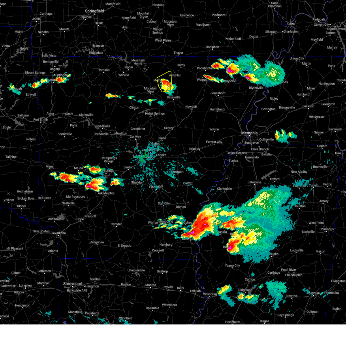 At 853 pm cdt, a severe thunderstorm was located near lacrosse, or near melbourne, moving east at 35 mph (radar indicated). Hazards include 60 mph wind gusts and quarter size hail. Hail damage to vehicles is expected. expect wind damage to roofs, siding, and trees. locations impacted include, melbourne, horseshoe bend, oxford, mount pleasant, franklin, gid, stella, lunenburg, myron, lacrosse, zion, violet hill, sage, larkin, lafferty, brockwell, hail threat, radar indicated max hail size, 1. 00 in wind threat, radar indicated max wind gust, 60 mph. At 853 pm cdt, a severe thunderstorm was located near lacrosse, or near melbourne, moving east at 35 mph (radar indicated). Hazards include 60 mph wind gusts and quarter size hail. Hail damage to vehicles is expected. expect wind damage to roofs, siding, and trees. locations impacted include, melbourne, horseshoe bend, oxford, mount pleasant, franklin, gid, stella, lunenburg, myron, lacrosse, zion, violet hill, sage, larkin, lafferty, brockwell, hail threat, radar indicated max hail size, 1. 00 in wind threat, radar indicated max wind gust, 60 mph.
|
| 6/14/2023 8:39 PM CDT |
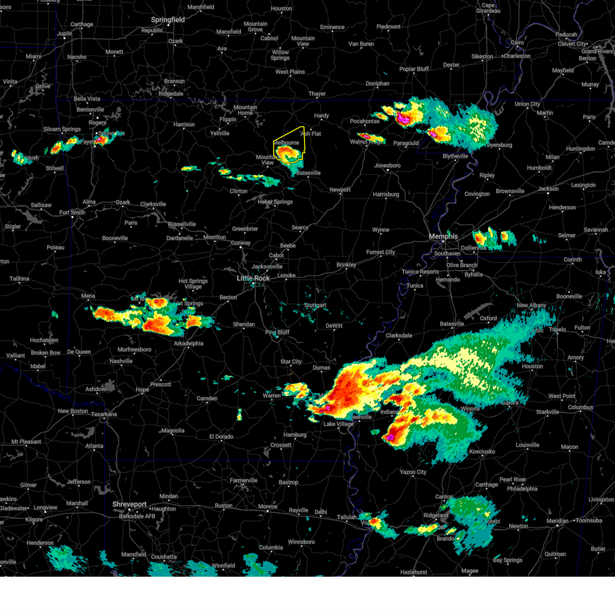 At 839 pm cdt, a severe thunderstorm was located over melbourne, moving east at 35 mph (radar indicated). Hazards include 60 mph wind gusts and quarter size hail. Hail damage to vehicles is expected. expect wind damage to roofs, siding, and trees. locations impacted include, melbourne, horseshoe bend, oxford, mount pleasant, franklin, gid, stella, lunenburg, myron, brandenberg, lacrosse, lone star, guion, zion, violet hill, sage, larkin, lafferty, brockwell, hail threat, radar indicated max hail size, 1. 00 in wind threat, radar indicated max wind gust, 60 mph. At 839 pm cdt, a severe thunderstorm was located over melbourne, moving east at 35 mph (radar indicated). Hazards include 60 mph wind gusts and quarter size hail. Hail damage to vehicles is expected. expect wind damage to roofs, siding, and trees. locations impacted include, melbourne, horseshoe bend, oxford, mount pleasant, franklin, gid, stella, lunenburg, myron, brandenberg, lacrosse, lone star, guion, zion, violet hill, sage, larkin, lafferty, brockwell, hail threat, radar indicated max hail size, 1. 00 in wind threat, radar indicated max wind gust, 60 mph.
|
| 6/14/2023 8:27 PM CDT |
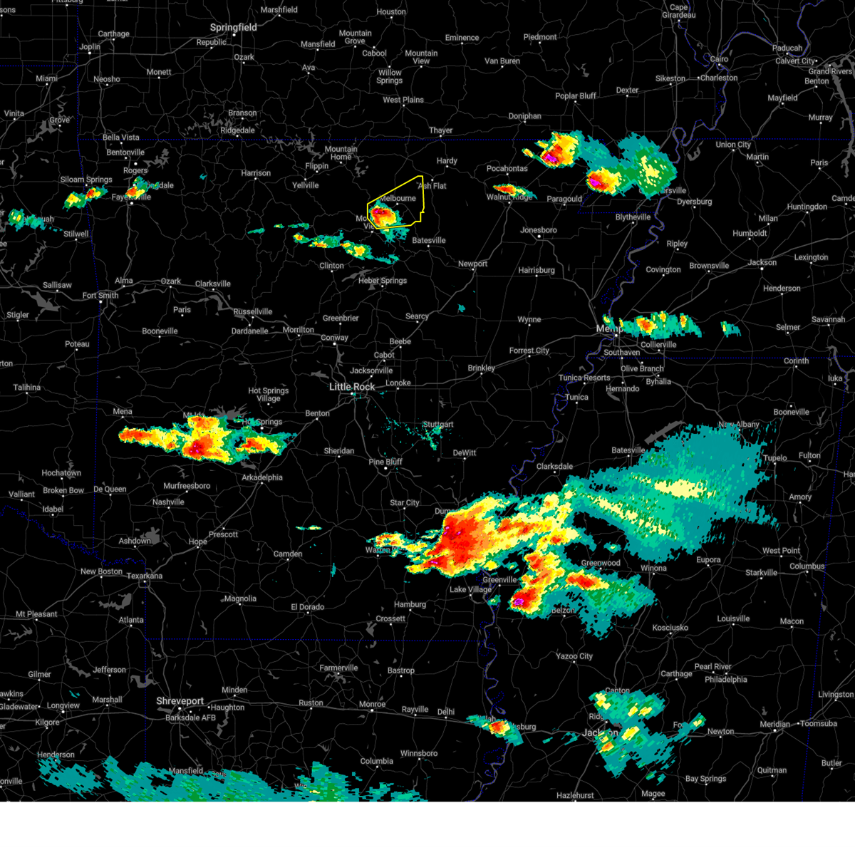 At 827 pm cdt, a severe thunderstorm was located over brandenberg, or 8 miles southwest of melbourne, moving northeast at 30 mph (radar indicated). Hazards include two inch hail and 60 mph wind gusts. People and animals outdoors will be injured. expect hail damage to roofs, siding, windows, and vehicles. Expect wind damage to roofs, siding, and trees. At 827 pm cdt, a severe thunderstorm was located over brandenberg, or 8 miles southwest of melbourne, moving northeast at 30 mph (radar indicated). Hazards include two inch hail and 60 mph wind gusts. People and animals outdoors will be injured. expect hail damage to roofs, siding, windows, and vehicles. Expect wind damage to roofs, siding, and trees.
|
| 6/14/2023 8:13 PM CDT |
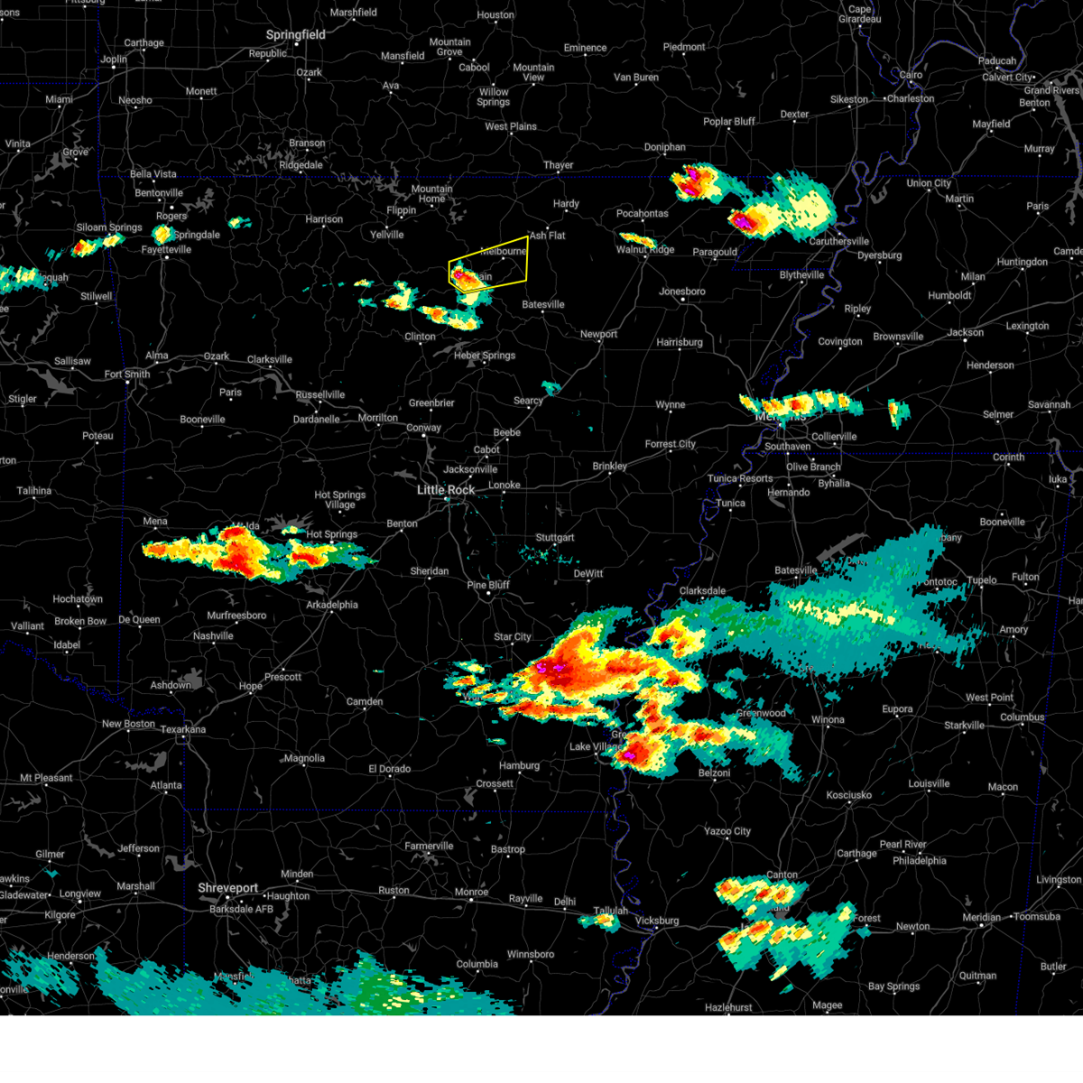 At 813 pm cdt, a severe thunderstorm was located over blanchard springs campground, or 7 miles northwest of mountain view, moving northeast at 25 mph (radar indicated). Hazards include 60 mph wind gusts and quarter size hail. Hail damage to vehicles is expected. expect wind damage to roofs, siding, and trees. locations impacted include, mountain view, melbourne, mount pleasant, franklin, brandenberg, lone star, gid, herpel, stella, lunenburg, lacrosse, blanchard springs campground, guion, allison, mt olive in izard county, zion, violet hill, larkin, gunner pool campground, barkshed campground, hail threat, radar indicated max hail size, 1. 00 in wind threat, radar indicated max wind gust, 60 mph. At 813 pm cdt, a severe thunderstorm was located over blanchard springs campground, or 7 miles northwest of mountain view, moving northeast at 25 mph (radar indicated). Hazards include 60 mph wind gusts and quarter size hail. Hail damage to vehicles is expected. expect wind damage to roofs, siding, and trees. locations impacted include, mountain view, melbourne, mount pleasant, franklin, brandenberg, lone star, gid, herpel, stella, lunenburg, lacrosse, blanchard springs campground, guion, allison, mt olive in izard county, zion, violet hill, larkin, gunner pool campground, barkshed campground, hail threat, radar indicated max hail size, 1. 00 in wind threat, radar indicated max wind gust, 60 mph.
|
| 6/14/2023 7:59 PM CDT |
 At 759 pm cdt, a severe thunderstorm was located near blanchard springs campground, or 7 miles northwest of mountain view, moving east at 40 mph (radar indicated). Hazards include 60 mph wind gusts and quarter size hail. Hail damage to vehicles is expected. Expect wind damage to roofs, siding, and trees. At 759 pm cdt, a severe thunderstorm was located near blanchard springs campground, or 7 miles northwest of mountain view, moving east at 40 mph (radar indicated). Hazards include 60 mph wind gusts and quarter size hail. Hail damage to vehicles is expected. Expect wind damage to roofs, siding, and trees.
|
| 6/11/2023 6:08 PM CDT |
 At 608 pm cdt, a severe thunderstorm was located near herpel, or 8 miles northeast of mountain view, moving southeast at 45 mph (radar indicated). Hazards include 60 mph wind gusts and quarter size hail. Hail damage to vehicles is expected. expect wind damage to roofs, siding, and trees. locations impacted include, melbourne, calico rock, cushman, mount pleasant, pineville, sidney, gid, stella, lunenburg, brandenberg, croker, lacrosse, lone star, gorby, guion, mt olive in izard county, zion, boswell, sage, twin creek, hail threat, radar indicated max hail size, 1. 00 in wind threat, radar indicated max wind gust, 60 mph. At 608 pm cdt, a severe thunderstorm was located near herpel, or 8 miles northeast of mountain view, moving southeast at 45 mph (radar indicated). Hazards include 60 mph wind gusts and quarter size hail. Hail damage to vehicles is expected. expect wind damage to roofs, siding, and trees. locations impacted include, melbourne, calico rock, cushman, mount pleasant, pineville, sidney, gid, stella, lunenburg, brandenberg, croker, lacrosse, lone star, gorby, guion, mt olive in izard county, zion, boswell, sage, twin creek, hail threat, radar indicated max hail size, 1. 00 in wind threat, radar indicated max wind gust, 60 mph.
|
| 6/11/2023 5:46 PM CDT |
 At 546 pm cdt, a severe thunderstorm was located near culp, or 13 miles north of mountain view, moving east at 70 mph (radar indicated). Hazards include 60 mph wind gusts and quarter size hail. Hail damage to vehicles is expected. Expect wind damage to roofs, siding, and trees. At 546 pm cdt, a severe thunderstorm was located near culp, or 13 miles north of mountain view, moving east at 70 mph (radar indicated). Hazards include 60 mph wind gusts and quarter size hail. Hail damage to vehicles is expected. Expect wind damage to roofs, siding, and trees.
|
| 4/15/2023 5:48 PM CDT |
 At 547 pm cdt, a severe thunderstorm was located near croker, or 12 miles west of batesville, moving east at 50 mph (radar indicated). Hazards include ping pong ball size hail and 60 mph wind gusts. People and animals outdoors will be injured. expect hail damage to roofs, siding, windows, and vehicles. expect wind damage to roofs, siding, and trees. locations impacted include, batesville, mountain view, cushman, mount pleasant, concord, salado, croker, gid, herpel, southside in independence count, stella, lunenburg, bethesda, guion, allison, ben, almond, hanover, desha, locust grove, hail threat, radar indicated max hail size, 1. 50 in wind threat, radar indicated max wind gust, 60 mph. At 547 pm cdt, a severe thunderstorm was located near croker, or 12 miles west of batesville, moving east at 50 mph (radar indicated). Hazards include ping pong ball size hail and 60 mph wind gusts. People and animals outdoors will be injured. expect hail damage to roofs, siding, windows, and vehicles. expect wind damage to roofs, siding, and trees. locations impacted include, batesville, mountain view, cushman, mount pleasant, concord, salado, croker, gid, herpel, southside in independence count, stella, lunenburg, bethesda, guion, allison, ben, almond, hanover, desha, locust grove, hail threat, radar indicated max hail size, 1. 50 in wind threat, radar indicated max wind gust, 60 mph.
|
| 4/15/2023 5:37 PM CDT |
 At 537 pm cdt, a severe thunderstorm was located 8 miles southeast of mountain view, moving east at 35 mph (radar indicated). Hazards include golf ball size hail and 60 mph wind gusts. People and animals outdoors will be injured. expect hail damage to roofs, siding, windows, and vehicles. expect wind damage to roofs, siding, and trees. locations impacted include, batesville, mountain view, melbourne, greers ferry, cushman, mount pleasant, concord, brandenberg, croker, lone star, gid, herpel, southside in independence count, stella, lunenburg, lacrosse, salado, bethesda, guion, allison, thunderstorm damage threat, considerable hail threat, radar indicated max hail size, 1. 75 in wind threat, radar indicated max wind gust, 60 mph. At 537 pm cdt, a severe thunderstorm was located 8 miles southeast of mountain view, moving east at 35 mph (radar indicated). Hazards include golf ball size hail and 60 mph wind gusts. People and animals outdoors will be injured. expect hail damage to roofs, siding, windows, and vehicles. expect wind damage to roofs, siding, and trees. locations impacted include, batesville, mountain view, melbourne, greers ferry, cushman, mount pleasant, concord, brandenberg, croker, lone star, gid, herpel, southside in independence count, stella, lunenburg, lacrosse, salado, bethesda, guion, allison, thunderstorm damage threat, considerable hail threat, radar indicated max hail size, 1. 75 in wind threat, radar indicated max wind gust, 60 mph.
|
| 4/15/2023 5:20 PM CDT |
 At 520 pm cdt, a severe thunderstorm was located 9 miles northeast of shirley, or 9 miles southwest of mountain view, moving east at 50 mph (radar indicated). Hazards include ping pong ball size hail and 60 mph wind gusts. People and animals outdoors will be injured. expect hail damage to roofs, siding, windows, and vehicles. Expect wind damage to roofs, siding, and trees. At 520 pm cdt, a severe thunderstorm was located 9 miles northeast of shirley, or 9 miles southwest of mountain view, moving east at 50 mph (radar indicated). Hazards include ping pong ball size hail and 60 mph wind gusts. People and animals outdoors will be injured. expect hail damage to roofs, siding, windows, and vehicles. Expect wind damage to roofs, siding, and trees.
|
| 4/5/2023 3:36 AM CDT |
 The severe thunderstorm warning for northeastern izard, southeastern fulton and southern sharp counties will expire at 345 am cdt, the storm which prompted the warning has moved out of the area. therefore, the warning will be allowed to expire. however small hail is still possible with this thunderstorm. a tornado watch remains in effect until 900 am cdt for north central arkansas. remember, a severe thunderstorm warning still remains in effect for central sharp county until 415 am cdt. The severe thunderstorm warning for northeastern izard, southeastern fulton and southern sharp counties will expire at 345 am cdt, the storm which prompted the warning has moved out of the area. therefore, the warning will be allowed to expire. however small hail is still possible with this thunderstorm. a tornado watch remains in effect until 900 am cdt for north central arkansas. remember, a severe thunderstorm warning still remains in effect for central sharp county until 415 am cdt.
|
| 4/5/2023 3:21 AM CDT |
 At 321 am cdt, a severe thunderstorm was located near sidney, or 11 miles south of ash flat, moving northeast at 50 mph (radar indicated). Hazards include 60 mph wind gusts and quarter size hail. Hail damage to vehicles is expected. expect wind damage to roofs, siding, and trees. locations impacted include, cherokee village, melbourne, ash flat, horseshoe bend, highland in sharp county, mount pleasant, franklin, sidney, ballard, stella, myron, lacrosse, evening shade, agnos, center, maxville, zion, calamine, poughkeepsie, sage, hail threat, radar indicated max hail size, 1. 00 in wind threat, radar indicated max wind gust, 60 mph. At 321 am cdt, a severe thunderstorm was located near sidney, or 11 miles south of ash flat, moving northeast at 50 mph (radar indicated). Hazards include 60 mph wind gusts and quarter size hail. Hail damage to vehicles is expected. expect wind damage to roofs, siding, and trees. locations impacted include, cherokee village, melbourne, ash flat, horseshoe bend, highland in sharp county, mount pleasant, franklin, sidney, ballard, stella, myron, lacrosse, evening shade, agnos, center, maxville, zion, calamine, poughkeepsie, sage, hail threat, radar indicated max hail size, 1. 00 in wind threat, radar indicated max wind gust, 60 mph.
|
| 4/5/2023 3:12 AM CDT |
 At 311 am cdt, a severe thunderstorm was located near herpel, or 8 miles northeast of mountain view, moving northeast at 60 mph (radar indicated). Hazards include 60 mph wind gusts and quarter size hail. Hail damage to vehicles is expected. Expect wind damage to roofs, siding, and trees. At 311 am cdt, a severe thunderstorm was located near herpel, or 8 miles northeast of mountain view, moving northeast at 60 mph (radar indicated). Hazards include 60 mph wind gusts and quarter size hail. Hail damage to vehicles is expected. Expect wind damage to roofs, siding, and trees.
|
| 4/5/2023 2:54 AM CDT |
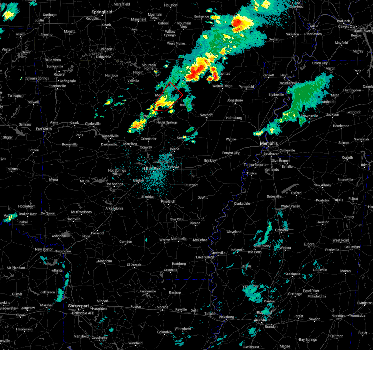 At 253 am cdt, a severe thunderstorm capable of producing a tornado was located 9 miles southwest of mountain view, moving northeast at 40 mph (radar indicated rotation). Hazards include tornado. Flying debris will be dangerous to those caught without shelter. mobile homes will be damaged or destroyed. damage to roofs, windows, and vehicles will occur. Tree damage is likely. At 253 am cdt, a severe thunderstorm capable of producing a tornado was located 9 miles southwest of mountain view, moving northeast at 40 mph (radar indicated rotation). Hazards include tornado. Flying debris will be dangerous to those caught without shelter. mobile homes will be damaged or destroyed. damage to roofs, windows, and vehicles will occur. Tree damage is likely.
|
| 4/5/2023 2:22 AM CDT |
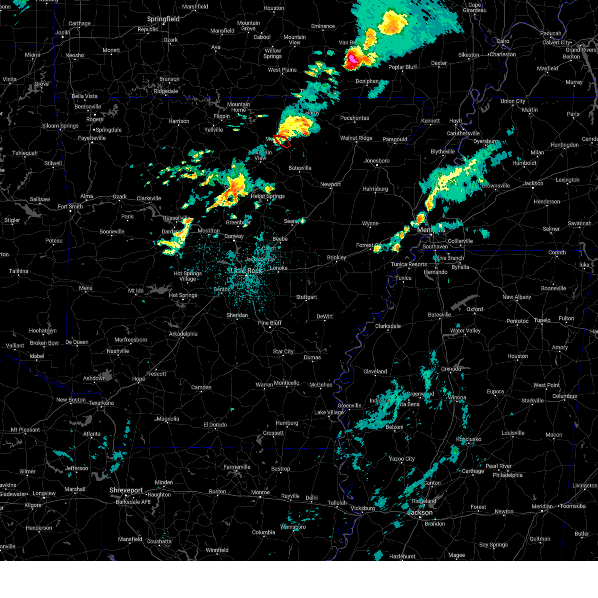 At 222 am cdt, a severe thunderstorm capable of producing a tornado was located over lacrosse, or near melbourne, moving northeast at 45 mph (radar indicated rotation). Hazards include tornado and quarter size hail. Flying debris will be dangerous to those caught without shelter. mobile homes will be damaged or destroyed. damage to roofs, windows, and vehicles will occur. tree damage is likely. Locations impacted include, melbourne, stella, lacrosse, sage, larkin,. At 222 am cdt, a severe thunderstorm capable of producing a tornado was located over lacrosse, or near melbourne, moving northeast at 45 mph (radar indicated rotation). Hazards include tornado and quarter size hail. Flying debris will be dangerous to those caught without shelter. mobile homes will be damaged or destroyed. damage to roofs, windows, and vehicles will occur. tree damage is likely. Locations impacted include, melbourne, stella, lacrosse, sage, larkin,.
|
| 4/5/2023 2:17 AM CDT |
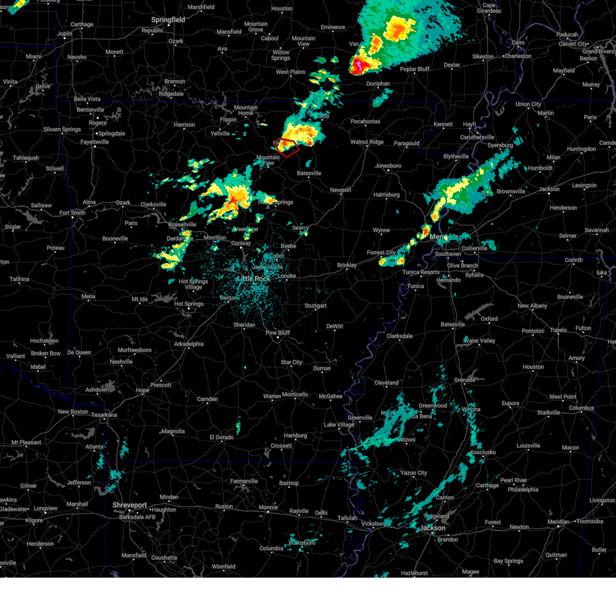 At 217 am cdt, a severe thunderstorm capable of producing a tornado was located over melbourne, moving northeast at 55 mph (radar indicated rotation). Hazards include tornado and quarter size hail. Flying debris will be dangerous to those caught without shelter. mobile homes will be damaged or destroyed. damage to roofs, windows, and vehicles will occur. tree damage is likely. Locations impacted include, melbourne, stella, lacrosse, lunenburg, gid, sage, larkin,. At 217 am cdt, a severe thunderstorm capable of producing a tornado was located over melbourne, moving northeast at 55 mph (radar indicated rotation). Hazards include tornado and quarter size hail. Flying debris will be dangerous to those caught without shelter. mobile homes will be damaged or destroyed. damage to roofs, windows, and vehicles will occur. tree damage is likely. Locations impacted include, melbourne, stella, lacrosse, lunenburg, gid, sage, larkin,.
|
| 4/5/2023 2:12 AM CDT |
 At 211 am cdt, a severe thunderstorm capable of producing a tornado was located over lone star, or near melbourne, moving northeast at 50 mph (radar indicated rotation). Hazards include tornado and quarter size hail. Flying debris will be dangerous to those caught without shelter. mobile homes will be damaged or destroyed. damage to roofs, windows, and vehicles will occur. Tree damage is likely. At 211 am cdt, a severe thunderstorm capable of producing a tornado was located over lone star, or near melbourne, moving northeast at 50 mph (radar indicated rotation). Hazards include tornado and quarter size hail. Flying debris will be dangerous to those caught without shelter. mobile homes will be damaged or destroyed. damage to roofs, windows, and vehicles will occur. Tree damage is likely.
|
| 4/5/2023 2:11 AM CDT |
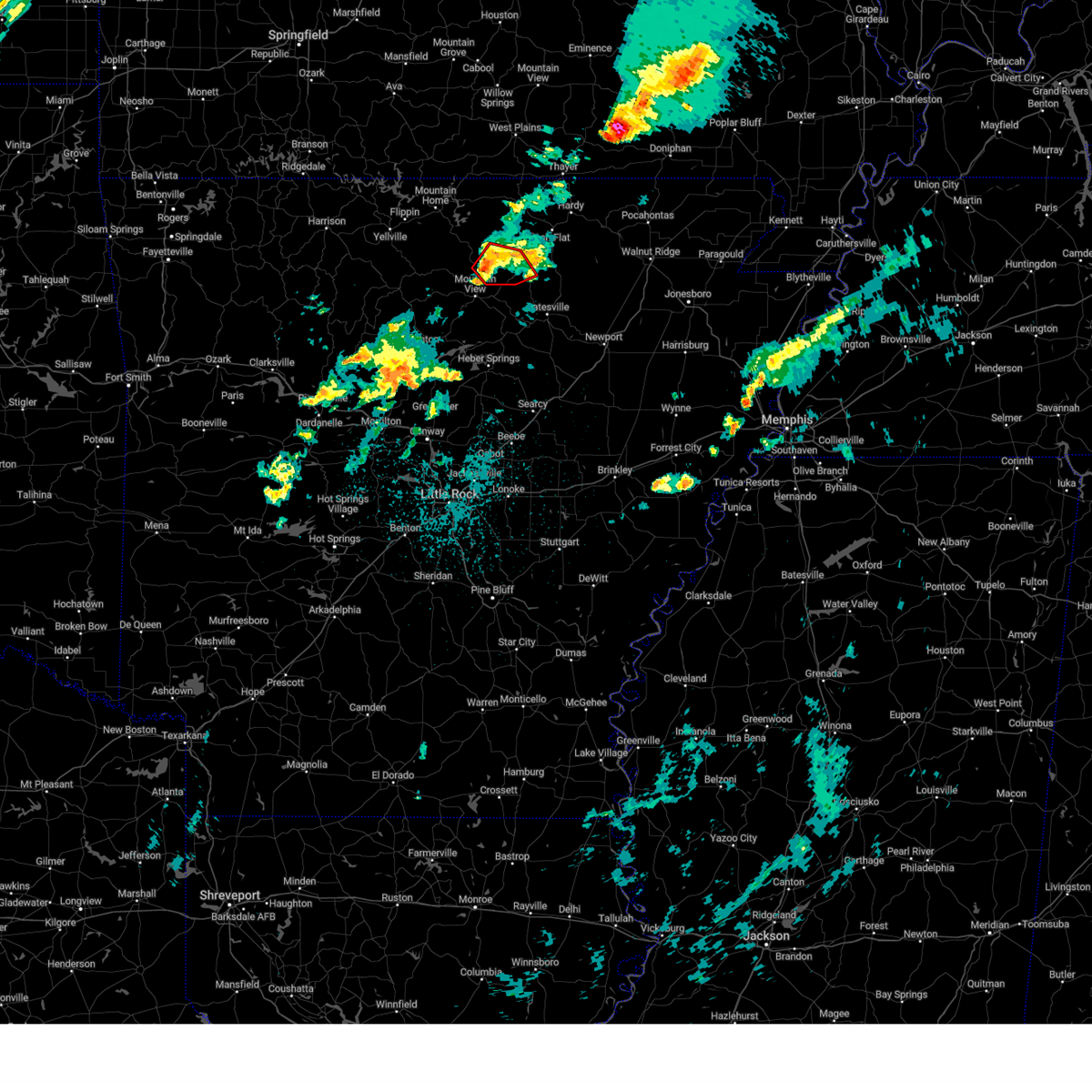 At 211 am cdt, a severe thunderstorm capable of producing a tornado was located over lone star, or near melbourne, moving northeast at 55 mph (radar indicated rotation). Hazards include tornado. Flying debris will be dangerous to those caught without shelter. mobile homes will be damaged or destroyed. damage to roofs, windows, and vehicles will occur. tree damage is likely. Locations impacted include, melbourne, mount pleasant, gid, stella, lunenburg, brandenberg, lacrosse, lone star, guion, mt olive in izard county, boswell, sage, twin creek, sylamore shooting range, optimus, larkin,. At 211 am cdt, a severe thunderstorm capable of producing a tornado was located over lone star, or near melbourne, moving northeast at 55 mph (radar indicated rotation). Hazards include tornado. Flying debris will be dangerous to those caught without shelter. mobile homes will be damaged or destroyed. damage to roofs, windows, and vehicles will occur. tree damage is likely. Locations impacted include, melbourne, mount pleasant, gid, stella, lunenburg, brandenberg, lacrosse, lone star, guion, mt olive in izard county, boswell, sage, twin creek, sylamore shooting range, optimus, larkin,.
|
| 4/5/2023 1:50 AM CDT |
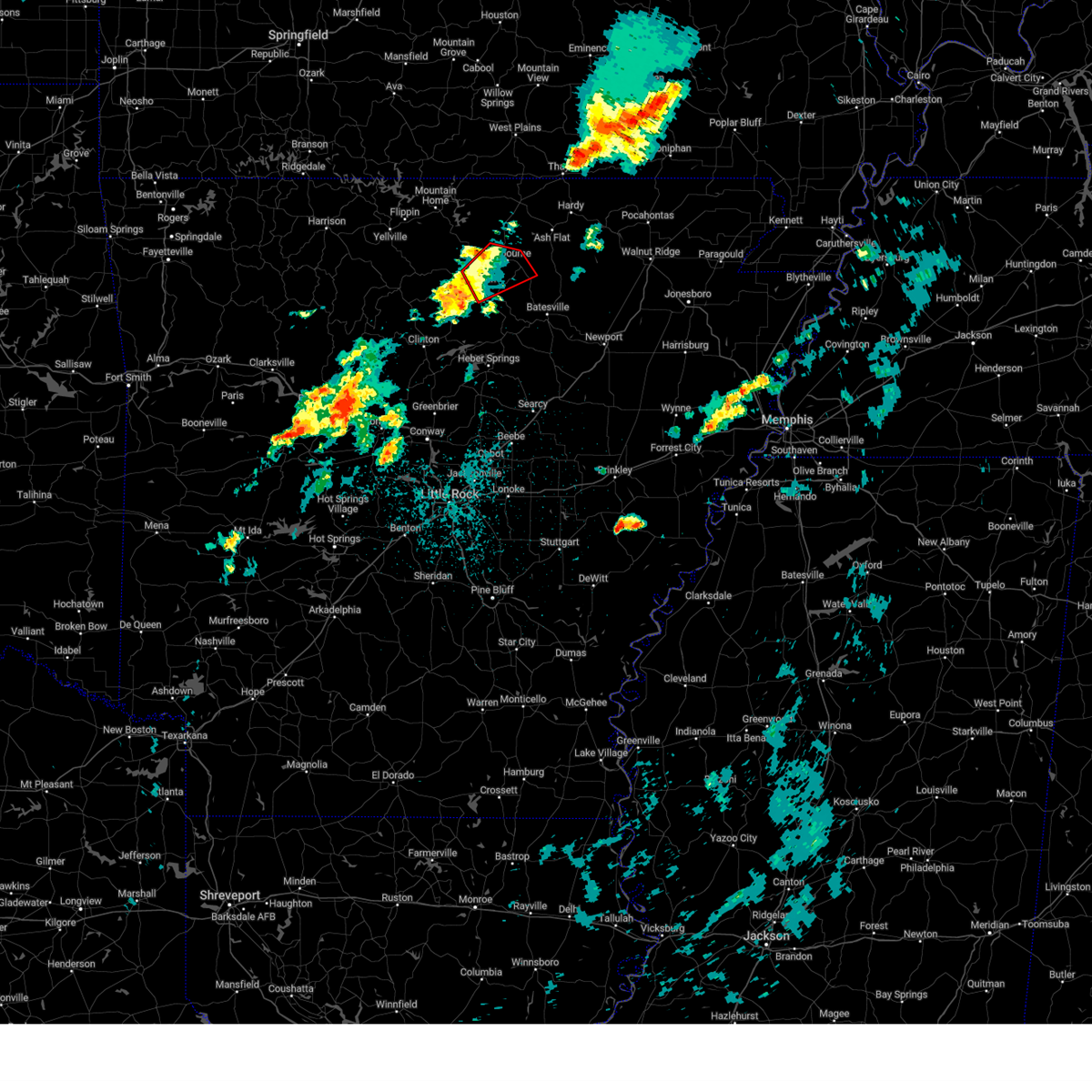 At 150 am cdt, a severe thunderstorm capable of producing a tornado was located 8 miles southwest of mountain view, moving northeast at 45 mph (radar indicated rotation). Hazards include tornado. Flying debris will be dangerous to those caught without shelter. mobile homes will be damaged or destroyed. damage to roofs, windows, and vehicles will occur. Tree damage is likely. At 150 am cdt, a severe thunderstorm capable of producing a tornado was located 8 miles southwest of mountain view, moving northeast at 45 mph (radar indicated rotation). Hazards include tornado. Flying debris will be dangerous to those caught without shelter. mobile homes will be damaged or destroyed. damage to roofs, windows, and vehicles will occur. Tree damage is likely.
|
| 2/16/2023 3:35 AM CST |
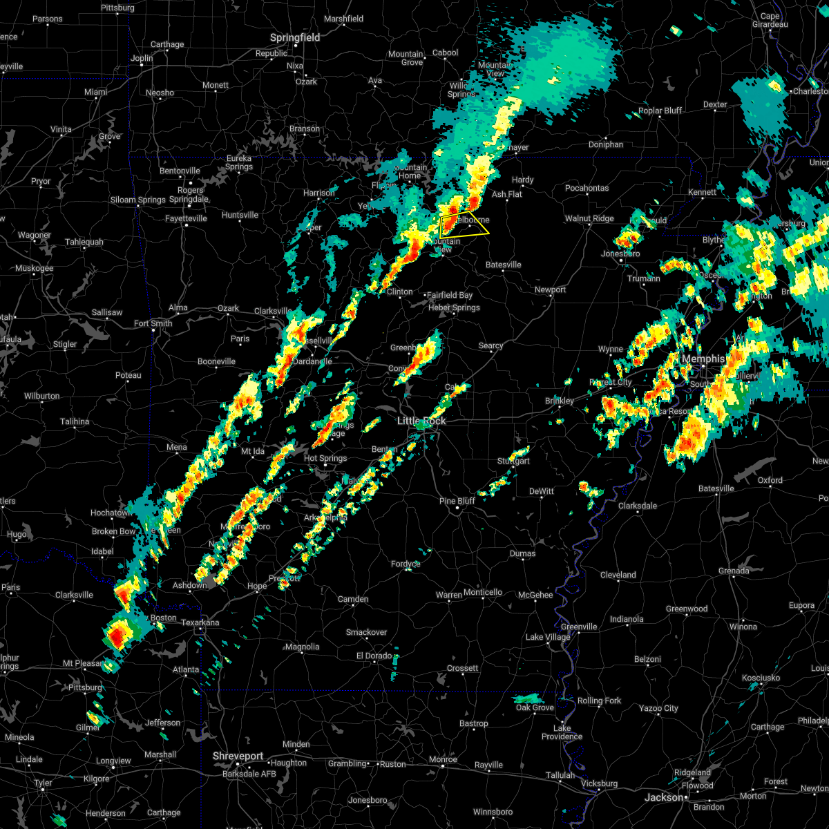 At 334 am cst, a severe thunderstorm was located 8 miles west of blanchard springs campground, or 14 miles northwest of mountain view, moving east at 45 mph (radar indicated). Hazards include 60 mph wind gusts and half dollar size hail. Hail damage to vehicles is expected. expect wind damage to roofs, siding, and trees. locations impacted include, melbourne, stella, lunenburg, lone star, gorby, lacrosse, brandenberg, mt olive in izard county, boswell, optimus, sage, sylamore bike trail, sylamore shooting range, brockwell, larkin, hail threat, radar indicated max hail size, 1. 25 in wind threat, radar indicated max wind gust, 60 mph. At 334 am cst, a severe thunderstorm was located 8 miles west of blanchard springs campground, or 14 miles northwest of mountain view, moving east at 45 mph (radar indicated). Hazards include 60 mph wind gusts and half dollar size hail. Hail damage to vehicles is expected. expect wind damage to roofs, siding, and trees. locations impacted include, melbourne, stella, lunenburg, lone star, gorby, lacrosse, brandenberg, mt olive in izard county, boswell, optimus, sage, sylamore bike trail, sylamore shooting range, brockwell, larkin, hail threat, radar indicated max hail size, 1. 25 in wind threat, radar indicated max wind gust, 60 mph.
|
| 2/16/2023 3:21 AM CST |
 At 321 am cst, a severe thunderstorm was located near thola, or 9 miles east of marshall, moving east at 45 mph (radar indicated). Hazards include 60 mph wind gusts and half dollar size hail. Hail damage to vehicles is expected. Expect wind damage to roofs, siding, and trees. At 321 am cst, a severe thunderstorm was located near thola, or 9 miles east of marshall, moving east at 45 mph (radar indicated). Hazards include 60 mph wind gusts and half dollar size hail. Hail damage to vehicles is expected. Expect wind damage to roofs, siding, and trees.
|
| 11/4/2022 11:02 PM CDT |
 At 1102 pm cdt, severe thunderstorms were located along a line extending from near mountain view to near heber springs to near pickles gap, moving east at 65 mph (radar indicated). Hazards include 60 mph wind gusts. expect damage to roofs, siding, and trees At 1102 pm cdt, severe thunderstorms were located along a line extending from near mountain view to near heber springs to near pickles gap, moving east at 65 mph (radar indicated). Hazards include 60 mph wind gusts. expect damage to roofs, siding, and trees
|
| 10/12/2022 11:02 AM CDT |
 At 1102 am cdt, a severe thunderstorm was located near sidney, or 11 miles north of batesville, moving east at 45 mph (radar indicated). Hazards include quarter size hail. damage to vehicles is expected At 1102 am cdt, a severe thunderstorm was located near sidney, or 11 miles north of batesville, moving east at 45 mph (radar indicated). Hazards include quarter size hail. damage to vehicles is expected
|
| 8/29/2022 8:04 PM CDT |
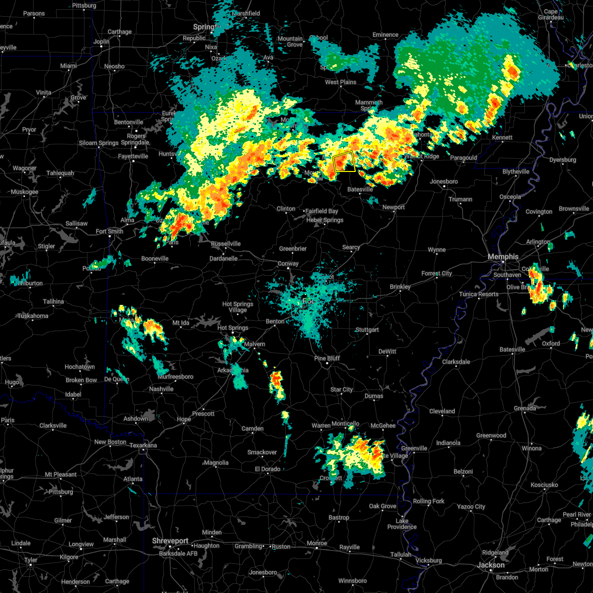 At 803 pm cdt, a severe thunderstorm was located over melbourne, moving east at 10 mph (radar indicated). Hazards include 60 mph wind gusts. expect damage to roofs, siding, and trees At 803 pm cdt, a severe thunderstorm was located over melbourne, moving east at 10 mph (radar indicated). Hazards include 60 mph wind gusts. expect damage to roofs, siding, and trees
|
| 7/17/2022 10:12 PM CDT |
 At 1012 pm cdt, severe thunderstorms were located along a line extending from ash flat to near sidney to near croker, moving east at 35 mph (radar indicated). Hazards include 60 mph wind gusts and penny size hail. expect damage to roofs, siding, and trees At 1012 pm cdt, severe thunderstorms were located along a line extending from ash flat to near sidney to near croker, moving east at 35 mph (radar indicated). Hazards include 60 mph wind gusts and penny size hail. expect damage to roofs, siding, and trees
|
| 5/21/2022 5:44 PM CDT |
 At 544 pm cdt, severe thunderstorms were located along a line extending from near thayer to 8 miles southeast of highland in sharp county to near cave city, moving east at 45 mph (radar indicated). Hazards include 70 mph wind gusts and quarter size hail. Hail damage to vehicles is expected. expect considerable tree damage. Wind damage is also likely to mobile homes, roofs, and outbuildings. At 544 pm cdt, severe thunderstorms were located along a line extending from near thayer to 8 miles southeast of highland in sharp county to near cave city, moving east at 45 mph (radar indicated). Hazards include 70 mph wind gusts and quarter size hail. Hail damage to vehicles is expected. expect considerable tree damage. Wind damage is also likely to mobile homes, roofs, and outbuildings.
|
| 5/21/2022 5:33 PM CDT |
 At 532 pm cdt, severe thunderstorms were located along a line extending from 6 miles west of mammoth spring to 6 miles south of ash flat to near cushman, moving east at 55 mph (radar indicated). Hazards include 70 mph wind gusts and quarter size hail. Hail damage to vehicles is expected. expect considerable tree damage. wind damage is also likely to mobile homes, roofs, and outbuildings. locations impacted include, batesville, cherokee village, mountain view, melbourne, salem in fulton county, ash flat, horseshoe bend, cave city, highland in sharp county, mammoth spring, hardy, oxford, cushman, mount pleasant, viola, franklin, sidney, ballard, flint springs, sturkie, thunderstorm damage threat, considerable hail threat, radar indicated max hail size, 1. 00 in wind threat, radar indicated max wind gust, 70 mph. At 532 pm cdt, severe thunderstorms were located along a line extending from 6 miles west of mammoth spring to 6 miles south of ash flat to near cushman, moving east at 55 mph (radar indicated). Hazards include 70 mph wind gusts and quarter size hail. Hail damage to vehicles is expected. expect considerable tree damage. wind damage is also likely to mobile homes, roofs, and outbuildings. locations impacted include, batesville, cherokee village, mountain view, melbourne, salem in fulton county, ash flat, horseshoe bend, cave city, highland in sharp county, mammoth spring, hardy, oxford, cushman, mount pleasant, viola, franklin, sidney, ballard, flint springs, sturkie, thunderstorm damage threat, considerable hail threat, radar indicated max hail size, 1. 00 in wind threat, radar indicated max wind gust, 70 mph.
|
| 5/21/2022 5:09 PM CDT |
 At 508 pm cdt, a severe thunderstorm was located near mountain view, moving east at 40 mph (radar indicated). Hazards include 60 mph wind gusts and quarter size hail. Hail damage to vehicles is expected. Expect wind damage to roofs, siding, and trees. At 508 pm cdt, a severe thunderstorm was located near mountain view, moving east at 40 mph (radar indicated). Hazards include 60 mph wind gusts and quarter size hail. Hail damage to vehicles is expected. Expect wind damage to roofs, siding, and trees.
|
| 5/15/2022 3:55 PM CDT |
 At 354 pm cdt, severe thunderstorms were located along a line extending from mount pleasant to near magness to near bald knob to near vilonia, moving southeast at 40 mph (trained weather spotters). Hazards include 60 mph wind gusts and quarter size hail. Hail damage to vehicles is expected. expect wind damage to roofs, siding, and trees. locations impacted include, batesville, vilonia, newark, pangburn, rose bud, mount pleasant, pleasant plains, enola, oil trough, magness, sidney, mount vernon, moorefield, salado, crosby, gravel hill, steprock, southside in independence count, stella, holland, hail threat, radar indicated max hail size, 1. 00 in wind threat, observed max wind gust, 60 mph. At 354 pm cdt, severe thunderstorms were located along a line extending from mount pleasant to near magness to near bald knob to near vilonia, moving southeast at 40 mph (trained weather spotters). Hazards include 60 mph wind gusts and quarter size hail. Hail damage to vehicles is expected. expect wind damage to roofs, siding, and trees. locations impacted include, batesville, vilonia, newark, pangburn, rose bud, mount pleasant, pleasant plains, enola, oil trough, magness, sidney, mount vernon, moorefield, salado, crosby, gravel hill, steprock, southside in independence count, stella, holland, hail threat, radar indicated max hail size, 1. 00 in wind threat, observed max wind gust, 60 mph.
|
| 5/15/2022 3:45 PM CDT |
 At 345 pm cdt, severe thunderstorms were located along a line extending from near mount pleasant to near moorefield to near oil trough to searcy, moving southeast at 40 mph (radar indicated). Hazards include 60 mph wind gusts and quarter size hail. Hail damage to vehicles is expected. Expect wind damage to roofs, siding, and trees. At 345 pm cdt, severe thunderstorms were located along a line extending from near mount pleasant to near moorefield to near oil trough to searcy, moving southeast at 40 mph (radar indicated). Hazards include 60 mph wind gusts and quarter size hail. Hail damage to vehicles is expected. Expect wind damage to roofs, siding, and trees.
|
| 5/15/2022 3:29 PM CDT |
 At 328 pm cdt, severe thunderstorms were located along a line extending from pineville to near gid to 7 miles northeast of heber springs to near springfield, moving east at 35 mph (trained weather spotters have reported numerous trees down from damaging winds. wind damage is likely!). Hazards include 60 mph wind gusts and quarter size hail. Hail damage to vehicles is expected. Expect wind damage to roofs, siding, and trees. At 328 pm cdt, severe thunderstorms were located along a line extending from pineville to near gid to 7 miles northeast of heber springs to near springfield, moving east at 35 mph (trained weather spotters have reported numerous trees down from damaging winds. wind damage is likely!). Hazards include 60 mph wind gusts and quarter size hail. Hail damage to vehicles is expected. Expect wind damage to roofs, siding, and trees.
|
| 4/21/2022 12:34 AM CDT |
 At 1234 am cdt, severe thunderstorms were located along a line extending from 6 miles northeast of cave city to near sidney to near mount pleasant, moving southeast at 35 mph (radar indicated). Hazards include 60 mph wind gusts and quarter size hail. Hail damage to vehicles is expected. expect wind damage to roofs, siding, and trees. locations impacted include, batesville, cave city, cushman, mount pleasant, sidney, moorefield, gid, stella, evening shade, aetna, maxville, center, charlotte, gainesboro, calamine, poughkeepsie, pfeiffer, nelsonville, lafferty, sandtown, hail threat, radar indicated max hail size, 1. 00 in wind threat, radar indicated max wind gust, 60 mph. At 1234 am cdt, severe thunderstorms were located along a line extending from 6 miles northeast of cave city to near sidney to near mount pleasant, moving southeast at 35 mph (radar indicated). Hazards include 60 mph wind gusts and quarter size hail. Hail damage to vehicles is expected. expect wind damage to roofs, siding, and trees. locations impacted include, batesville, cave city, cushman, mount pleasant, sidney, moorefield, gid, stella, evening shade, aetna, maxville, center, charlotte, gainesboro, calamine, poughkeepsie, pfeiffer, nelsonville, lafferty, sandtown, hail threat, radar indicated max hail size, 1. 00 in wind threat, radar indicated max wind gust, 60 mph.
|
| 4/21/2022 12:06 AM CDT |
 At 1206 am cdt, severe thunderstorms were located along a line extending from myron to near lacrosse to melbourne, moving southeast at 30 mph (radar indicated). Hazards include 60 mph wind gusts and quarter size hail. Hail damage to vehicles is expected. Expect wind damage to roofs, siding, and trees. At 1206 am cdt, severe thunderstorms were located along a line extending from myron to near lacrosse to melbourne, moving southeast at 30 mph (radar indicated). Hazards include 60 mph wind gusts and quarter size hail. Hail damage to vehicles is expected. Expect wind damage to roofs, siding, and trees.
|
| 4/13/2022 12:43 PM CDT | The severe thunderstorm warning for stone, northwestern randolph, izard, northeastern van buren, northwestern cleburne, eastern fulton and central sharp counties will expire at 1245 pm cdt, the storm which prompted the warning has weakened below severe limits, and no longer poses an immediate threat to life or property. therefore, the warning will be allowed to expire. however heavy rain is still possible with this thunderstorm. a tornado watch remains in effect until 500 pm cdt for eastern and north central arkansas. |
| 4/13/2022 12:07 PM CDT |
 At 1206 pm cdt, a severe thunderstorm was located over oxford, or 8 miles north of melbourne, moving northeast at 65 mph (radar indicated). Hazards include 60 mph wind gusts and penny size hail. expect damage to roofs, siding, and trees At 1206 pm cdt, a severe thunderstorm was located over oxford, or 8 miles north of melbourne, moving northeast at 65 mph (radar indicated). Hazards include 60 mph wind gusts and penny size hail. expect damage to roofs, siding, and trees
|
| 4/6/2022 1:33 AM CDT |
 At 133 am cdt, a severe thunderstorm was located over cushman, or 12 miles northwest of batesville, moving east at 45 mph (radar indicated). Hazards include 60 mph wind gusts and quarter size hail. Hail damage to vehicles is expected. Expect wind damage to roofs, siding, and trees. At 133 am cdt, a severe thunderstorm was located over cushman, or 12 miles northwest of batesville, moving east at 45 mph (radar indicated). Hazards include 60 mph wind gusts and quarter size hail. Hail damage to vehicles is expected. Expect wind damage to roofs, siding, and trees.
|
| 3/6/2022 10:58 PM CST |
 The severe thunderstorm warning for stone, izard and southeastern baxter counties will expire at 1100 pm cst, the storms which prompted the warning have weakened below severe limits, and no longer pose an immediate threat to life or property. therefore, the warning will be allowed to expire. however gusty winds are still possible with these thunderstorms. a tornado watch remains in effect until 200 am cst for north central arkansas. The severe thunderstorm warning for stone, izard and southeastern baxter counties will expire at 1100 pm cst, the storms which prompted the warning have weakened below severe limits, and no longer pose an immediate threat to life or property. therefore, the warning will be allowed to expire. however gusty winds are still possible with these thunderstorms. a tornado watch remains in effect until 200 am cst for north central arkansas.
|
| 3/6/2022 10:48 PM CST |
 At 1047 pm cst, severe thunderstorms were located along a line extending from near culp to 6 miles southwest of blanchard springs campground to 6 miles northeast of old lexington, moving northeast at 55 mph (radar indicated). Hazards include 60 mph wind gusts. Expect damage to roofs, siding, and trees. locations impacted include, mountain view, melbourne, calico rock, oxford, mount pleasant, pineville, franklin, lone star, wideman, gid, herpel, lunenburg, culp, blanchard springs campground, brandenberg, croker, gorby, stella, old lexington, lacrosse, hail threat, radar indicated max hail size, <. 75 in wind threat, radar indicated max wind gust, 60 mph. At 1047 pm cst, severe thunderstorms were located along a line extending from near culp to 6 miles southwest of blanchard springs campground to 6 miles northeast of old lexington, moving northeast at 55 mph (radar indicated). Hazards include 60 mph wind gusts. Expect damage to roofs, siding, and trees. locations impacted include, mountain view, melbourne, calico rock, oxford, mount pleasant, pineville, franklin, lone star, wideman, gid, herpel, lunenburg, culp, blanchard springs campground, brandenberg, croker, gorby, stella, old lexington, lacrosse, hail threat, radar indicated max hail size, <. 75 in wind threat, radar indicated max wind gust, 60 mph.
|
| 3/6/2022 10:31 PM CST |
 At 1031 pm cst, severe thunderstorms were located along a line extending from 8 miles southwest of culp to 7 miles west of mountain view to old lexington, moving east at 60 mph (radar indicated). Hazards include 60 mph wind gusts. expect damage to roofs, siding, and trees At 1031 pm cst, severe thunderstorms were located along a line extending from 8 miles southwest of culp to 7 miles west of mountain view to old lexington, moving east at 60 mph (radar indicated). Hazards include 60 mph wind gusts. expect damage to roofs, siding, and trees
|
| 3/6/2022 7:23 PM CST |
 At 723 pm cst, a severe thunderstorm capable of producing a tornado was located near lacrosse, or near melbourne, moving northeast at 40 mph (radar indicated rotation). Hazards include tornado and golf ball size hail. Flying debris will be dangerous to those caught without shelter. mobile homes will be damaged or destroyed. damage to roofs, windows, and vehicles will occur. Tree damage is likely. At 723 pm cst, a severe thunderstorm capable of producing a tornado was located near lacrosse, or near melbourne, moving northeast at 40 mph (radar indicated rotation). Hazards include tornado and golf ball size hail. Flying debris will be dangerous to those caught without shelter. mobile homes will be damaged or destroyed. damage to roofs, windows, and vehicles will occur. Tree damage is likely.
|
| 3/6/2022 7:12 PM CST |
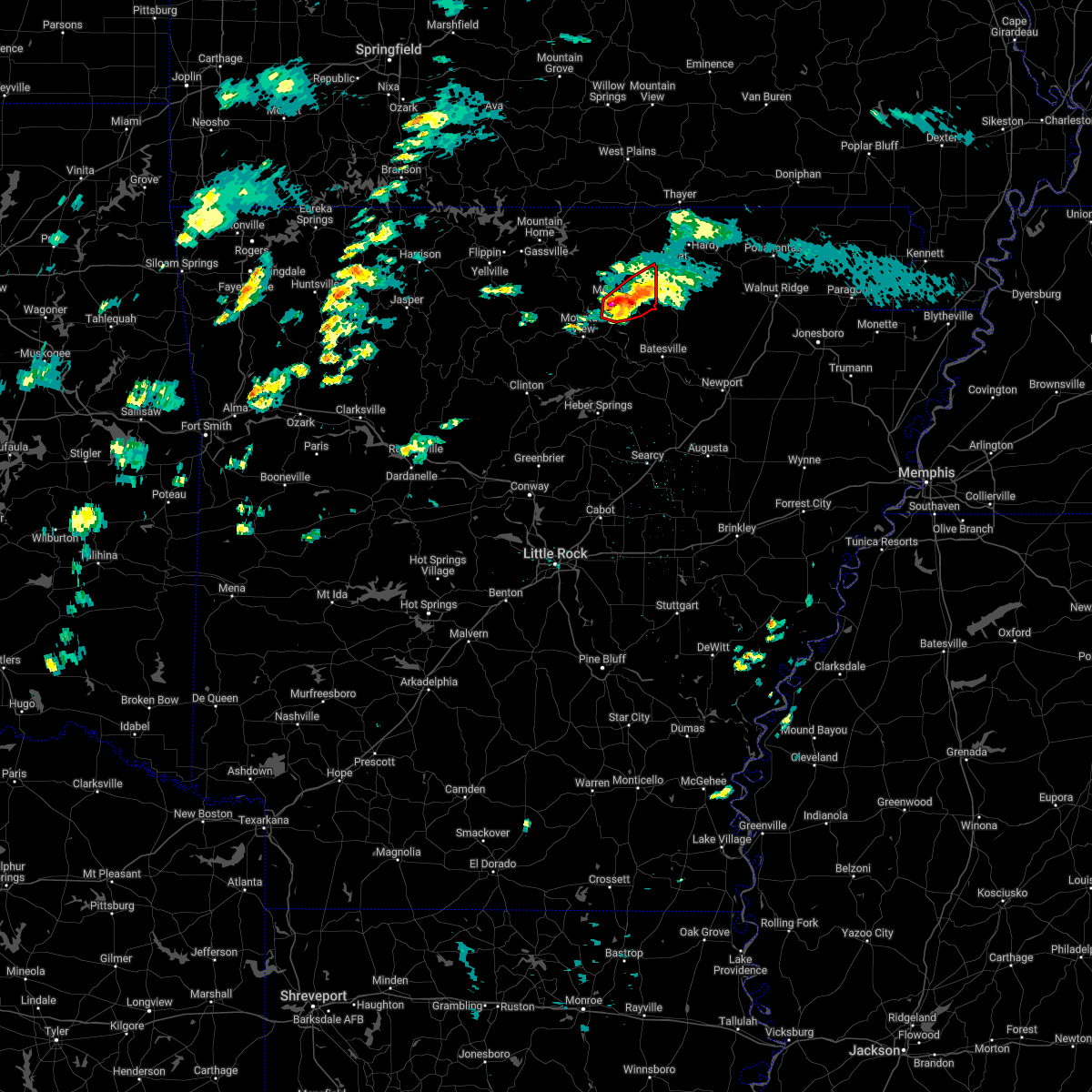 At 711 pm cst, a severe thunderstorm capable of producing a tornado was located over lunenburg, or 4 miles south of melbourne, moving northeast at 40 mph (radar indicated rotation). Hazards include tornado and golf ball size hail. Flying debris will be dangerous to those caught without shelter. mobile homes will be damaged or destroyed. damage to roofs, windows, and vehicles will occur. tree damage is likely. Locations impacted include, melbourne, horseshoe bend, franklin, myron, gid, stella, lacrosse, lunenburg, lone star, zion, sage, larkin,. At 711 pm cst, a severe thunderstorm capable of producing a tornado was located over lunenburg, or 4 miles south of melbourne, moving northeast at 40 mph (radar indicated rotation). Hazards include tornado and golf ball size hail. Flying debris will be dangerous to those caught without shelter. mobile homes will be damaged or destroyed. damage to roofs, windows, and vehicles will occur. tree damage is likely. Locations impacted include, melbourne, horseshoe bend, franklin, myron, gid, stella, lacrosse, lunenburg, lone star, zion, sage, larkin,.
|
| 3/6/2022 6:54 PM CST |
 At 653 pm cst, a severe thunderstorm capable of producing a tornado was located over mountain view, moving northeast at 45 mph (radar indicated rotation). Hazards include tornado and golf ball size hail. Flying debris will be dangerous to those caught without shelter. mobile homes will be damaged or destroyed. damage to roofs, windows, and vehicles will occur. tree damage is likely. Locations impacted include, mountain view, melbourne, horseshoe bend, oxford, mount pleasant, franklin, brandenberg, lone star, gid, herpel, stella, lunenburg, myron, lacrosse, blanchard springs campground, guion, allison, mt olive in izard county, zion, violet hill,. At 653 pm cst, a severe thunderstorm capable of producing a tornado was located over mountain view, moving northeast at 45 mph (radar indicated rotation). Hazards include tornado and golf ball size hail. Flying debris will be dangerous to those caught without shelter. mobile homes will be damaged or destroyed. damage to roofs, windows, and vehicles will occur. tree damage is likely. Locations impacted include, mountain view, melbourne, horseshoe bend, oxford, mount pleasant, franklin, brandenberg, lone star, gid, herpel, stella, lunenburg, myron, lacrosse, blanchard springs campground, guion, allison, mt olive in izard county, zion, violet hill,.
|
| 3/6/2022 6:44 PM CST |
 At 644 pm cst, a severe thunderstorm capable of producing a tornado was located 3 miles west of mountain view, moving northeast at 40 mph (radar indicated rotation). Hazards include tornado and golf ball size hail. Flying debris will be dangerous to those caught without shelter. mobile homes will be damaged or destroyed. damage to roofs, windows, and vehicles will occur. tree damage is likely. Locations impacted include, mountain view, melbourne, horseshoe bend, calico rock, oxford, mount pleasant, pineville, franklin, brandenberg, lone star, wideman, gorby, gid, herpel, stella, lunenburg, myron, lacrosse, blanchard springs campground, guion,. At 644 pm cst, a severe thunderstorm capable of producing a tornado was located 3 miles west of mountain view, moving northeast at 40 mph (radar indicated rotation). Hazards include tornado and golf ball size hail. Flying debris will be dangerous to those caught without shelter. mobile homes will be damaged or destroyed. damage to roofs, windows, and vehicles will occur. tree damage is likely. Locations impacted include, mountain view, melbourne, horseshoe bend, calico rock, oxford, mount pleasant, pineville, franklin, brandenberg, lone star, wideman, gorby, gid, herpel, stella, lunenburg, myron, lacrosse, blanchard springs campground, guion,.
|
| 3/6/2022 6:27 PM CST |
 At 626 pm cst, a severe thunderstorm capable of producing a tornado was located near elba, or 13 miles southeast of marshall, moving northeast at 55 mph (radar indicated rotation). Hazards include tornado and golf ball size hail. Flying debris will be dangerous to those caught without shelter. mobile homes will be damaged or destroyed. damage to roofs, windows, and vehicles will occur. Tree damage is likely. At 626 pm cst, a severe thunderstorm capable of producing a tornado was located near elba, or 13 miles southeast of marshall, moving northeast at 55 mph (radar indicated rotation). Hazards include tornado and golf ball size hail. Flying debris will be dangerous to those caught without shelter. mobile homes will be damaged or destroyed. damage to roofs, windows, and vehicles will occur. Tree damage is likely.
|
| 2/22/2022 2:31 AM CST |
 At 230 am cst, severe thunderstorms were located along a line extending from wideman to near mountain view, moving east at 45 mph (radar indicated). Hazards include 60 mph wind gusts and quarter size hail. Hail damage to vehicles is expected. expect wind damage to roofs, siding, and trees. locations impacted include, mountain view, melbourne, horseshoe bend, calico rock, oxford, pineville, franklin, brandenberg, croker, lone star, wideman, gorby, gid, herpel, lunenburg, culp, lacrosse, blanchard springs campground, stella, guion, hail threat, radar indicated max hail size, 1. 00 in wind threat, radar indicated max wind gust, 60 mph. At 230 am cst, severe thunderstorms were located along a line extending from wideman to near mountain view, moving east at 45 mph (radar indicated). Hazards include 60 mph wind gusts and quarter size hail. Hail damage to vehicles is expected. expect wind damage to roofs, siding, and trees. locations impacted include, mountain view, melbourne, horseshoe bend, calico rock, oxford, pineville, franklin, brandenberg, croker, lone star, wideman, gorby, gid, herpel, lunenburg, culp, lacrosse, blanchard springs campground, stella, guion, hail threat, radar indicated max hail size, 1. 00 in wind threat, radar indicated max wind gust, 60 mph.
|
| 2/22/2022 2:16 AM CST |
 At 215 am cst, severe thunderstorms were located along a line extending from culp to 6 miles east of thola, moving northeast at 55 mph (radar indicated). Hazards include 60 mph wind gusts and quarter size hail. Hail damage to vehicles is expected. expect wind damage to roofs, siding, and trees. locations impacted include, mountain view, melbourne, horseshoe bend, calico rock, oxford, pineville, franklin, lone star, wideman, gid, herpel, lunenburg, culp, blanchard springs campground, thola, brandenberg, croker, gorby, elba, lacrosse, hail threat, radar indicated max hail size, 1. 00 in wind threat, radar indicated max wind gust, 60 mph. At 215 am cst, severe thunderstorms were located along a line extending from culp to 6 miles east of thola, moving northeast at 55 mph (radar indicated). Hazards include 60 mph wind gusts and quarter size hail. Hail damage to vehicles is expected. expect wind damage to roofs, siding, and trees. locations impacted include, mountain view, melbourne, horseshoe bend, calico rock, oxford, pineville, franklin, lone star, wideman, gid, herpel, lunenburg, culp, blanchard springs campground, thola, brandenberg, croker, gorby, elba, lacrosse, hail threat, radar indicated max hail size, 1. 00 in wind threat, radar indicated max wind gust, 60 mph.
|
| 2/22/2022 2:01 AM CST |
 At 200 am cst, severe thunderstorms were located along a line extending from 8 miles north of thola to near rocky hill, moving east at 50 mph (radar indicated). Hazards include 60 mph wind gusts and quarter size hail. Hail damage to vehicles is expected. Expect wind damage to roofs, siding, and trees. At 200 am cst, severe thunderstorms were located along a line extending from 8 miles north of thola to near rocky hill, moving east at 50 mph (radar indicated). Hazards include 60 mph wind gusts and quarter size hail. Hail damage to vehicles is expected. Expect wind damage to roofs, siding, and trees.
|
| 6/11/2021 10:19 PM CDT |
 At 1018 pm cdt, severe thunderstorms were located along a line extending from near myron to near gid to near mountain view, moving southeast at 30 mph (radar indicated). Hazards include 60 mph wind gusts and penny size hail. Expect damage to roofs, siding, and trees. Locations impacted include, mountain view, melbourne, horseshoe bend, cave city, oxford, cushman, mount pleasant, franklin, sidney, brandenberg, croker, lone star, gid, herpel, stella, lunenburg, myron, lacrosse, evening shade, guion,. At 1018 pm cdt, severe thunderstorms were located along a line extending from near myron to near gid to near mountain view, moving southeast at 30 mph (radar indicated). Hazards include 60 mph wind gusts and penny size hail. Expect damage to roofs, siding, and trees. Locations impacted include, mountain view, melbourne, horseshoe bend, cave city, oxford, cushman, mount pleasant, franklin, sidney, brandenberg, croker, lone star, gid, herpel, stella, lunenburg, myron, lacrosse, evening shade, guion,.
|
| 6/11/2021 9:59 PM CDT |
 At 959 pm cdt, severe thunderstorms were located along a line extending from horseshoe bend to wideman to near culp, moving southeast at 30 mph (radar indicated). Hazards include 60 mph wind gusts and nickel size hail. expect damage to roofs, siding, and trees At 959 pm cdt, severe thunderstorms were located along a line extending from horseshoe bend to wideman to near culp, moving southeast at 30 mph (radar indicated). Hazards include 60 mph wind gusts and nickel size hail. expect damage to roofs, siding, and trees
|
| 4/9/2021 3:17 PM CDT |
 At 317 pm cdt, a severe thunderstorm was located over lacrosse, or near melbourne, moving northeast at 40 mph (radar indicated). Hazards include 60 mph wind gusts and half dollar size hail. Hail damage to vehicles is expected. Expect wind damage to roofs, siding, and trees. At 317 pm cdt, a severe thunderstorm was located over lacrosse, or near melbourne, moving northeast at 40 mph (radar indicated). Hazards include 60 mph wind gusts and half dollar size hail. Hail damage to vehicles is expected. Expect wind damage to roofs, siding, and trees.
|
| 11/15/2020 12:25 AM CST |
 At 1225 am cst, a severe thunderstorm was located over mount pleasant, or 10 miles southeast of melbourne, moving east at 55 mph (radar indicated). Hazards include 60 mph wind gusts and penny size hail. expect damage to roofs, siding, and trees At 1225 am cst, a severe thunderstorm was located over mount pleasant, or 10 miles southeast of melbourne, moving east at 55 mph (radar indicated). Hazards include 60 mph wind gusts and penny size hail. expect damage to roofs, siding, and trees
|
| 11/15/2020 12:08 AM CST |
 At 1208 am cst, a severe thunderstorm was located near mountain view, moving east at 60 mph (radar indicated). Hazards include 70 mph wind gusts and nickel size hail. Expect considerable tree damage. damage is likely to mobile homes, roofs, and outbuildings. Locations impacted include, mountain view, melbourne, cushman, mount pleasant, brandenberg, croker, lone star, gid, herpel, stella, lunenburg, blanchard springs campground, bethesda, guion, allison, hanover, turkey creek, mt olive in izard county, gunner pool campground, newnata,. At 1208 am cst, a severe thunderstorm was located near mountain view, moving east at 60 mph (radar indicated). Hazards include 70 mph wind gusts and nickel size hail. Expect considerable tree damage. damage is likely to mobile homes, roofs, and outbuildings. Locations impacted include, mountain view, melbourne, cushman, mount pleasant, brandenberg, croker, lone star, gid, herpel, stella, lunenburg, blanchard springs campground, bethesda, guion, allison, hanover, turkey creek, mt olive in izard county, gunner pool campground, newnata,.
|
| 11/15/2020 12:00 AM CST |
 At 1200 am cst, a severe thunderstorm was located near thola, or 11 miles west of mountain view, moving east at 60 mph (radar indicated). Hazards include 70 mph wind gusts and nickel size hail. Expect considerable tree damage. damage is likely to mobile homes, roofs, and outbuildings. Locations impacted include, mountain view, melbourne, cushman, mount pleasant, thola, brandenberg, croker, lone star, gid, herpel, elba, stella, lunenburg, elberta, blanchard springs campground, bethesda, guion, allison, alco, hanover,. At 1200 am cst, a severe thunderstorm was located near thola, or 11 miles west of mountain view, moving east at 60 mph (radar indicated). Hazards include 70 mph wind gusts and nickel size hail. Expect considerable tree damage. damage is likely to mobile homes, roofs, and outbuildings. Locations impacted include, mountain view, melbourne, cushman, mount pleasant, thola, brandenberg, croker, lone star, gid, herpel, elba, stella, lunenburg, elberta, blanchard springs campground, bethesda, guion, allison, alco, hanover,.
|
| 11/14/2020 11:57 PM CST |
 The national weather service in little rock has issued a * severe thunderstorm warning for. stone county in north central arkansas. northwestern independence county in north central arkansas. southern izard county in north central arkansas. East central searcy county in north central arkansas. The national weather service in little rock has issued a * severe thunderstorm warning for. stone county in north central arkansas. northwestern independence county in north central arkansas. southern izard county in north central arkansas. East central searcy county in north central arkansas.
|
| 11/14/2020 11:43 PM CST |
 At 1137 pm cst, a severe thunderstorm capable of producing a tornado was located over lone star, or 6 miles southwest of melbourne, moving east at 45 mph (radar indicated rotation). Hazards include tornado. Flying debris will be dangerous to those caught without shelter. mobile homes will be damaged or destroyed. damage to roofs, windows, and vehicles will occur. Tree damage is likely. At 1137 pm cst, a severe thunderstorm capable of producing a tornado was located over lone star, or 6 miles southwest of melbourne, moving east at 45 mph (radar indicated rotation). Hazards include tornado. Flying debris will be dangerous to those caught without shelter. mobile homes will be damaged or destroyed. damage to roofs, windows, and vehicles will occur. Tree damage is likely.
|
| 11/14/2020 11:37 PM CST |
 At 1137 pm cst, a severe thunderstorm capable of producing a tornado was located over lone star, or 6 miles southwest of melbourne, moving east at 45 mph (radar indicated rotation). Hazards include tornado. Flying debris will be dangerous to those caught without shelter. mobile homes will be damaged or destroyed. damage to roofs, windows, and vehicles will occur. Tree damage is likely. At 1137 pm cst, a severe thunderstorm capable of producing a tornado was located over lone star, or 6 miles southwest of melbourne, moving east at 45 mph (radar indicated rotation). Hazards include tornado. Flying debris will be dangerous to those caught without shelter. mobile homes will be damaged or destroyed. damage to roofs, windows, and vehicles will occur. Tree damage is likely.
|
| 11/14/2020 11:32 PM CST |
 At 1132 pm cst, a severe thunderstorm was located over brandenberg, or 8 miles southwest of melbourne, moving east at 45 mph (radar indicated). Hazards include 60 mph wind gusts and penny size hail. expect damage to roofs, siding, and trees At 1132 pm cst, a severe thunderstorm was located over brandenberg, or 8 miles southwest of melbourne, moving east at 45 mph (radar indicated). Hazards include 60 mph wind gusts and penny size hail. expect damage to roofs, siding, and trees
|
| 7/1/2020 12:28 PM CDT |
 At 1228 pm cdt, severe thunderstorms were located along a line extending from bexar to near harrison, moving south at 35 mph (radar indicated). Hazards include 60 mph wind gusts and quarter size hail. Hail damage to vehicles is expected. Expect wind damage to roofs, siding, and trees. At 1228 pm cdt, severe thunderstorms were located along a line extending from bexar to near harrison, moving south at 35 mph (radar indicated). Hazards include 60 mph wind gusts and quarter size hail. Hail damage to vehicles is expected. Expect wind damage to roofs, siding, and trees.
|
| 5/4/2020 1:51 PM CDT |
 At 151 pm cdt, severe thunderstorms were located along a line extending from 11 miles northeast of cave city to near mount pleasant, moving east at 55 mph (radar indicated). Hazards include 60 mph wind gusts and quarter size hail. Hail damage to vehicles is expected. expect wind damage to roofs, siding, and trees. Locations impacted include, walnut ridge, black rock, lake charles state park, cave city, college city, cushman, portia, mount pleasant, strawberry, lynn, sidney, annieville, gid, stella, evening shade, smithville, powhatan, aetna, calamine, nelsonville,. At 151 pm cdt, severe thunderstorms were located along a line extending from 11 miles northeast of cave city to near mount pleasant, moving east at 55 mph (radar indicated). Hazards include 60 mph wind gusts and quarter size hail. Hail damage to vehicles is expected. expect wind damage to roofs, siding, and trees. Locations impacted include, walnut ridge, black rock, lake charles state park, cave city, college city, cushman, portia, mount pleasant, strawberry, lynn, sidney, annieville, gid, stella, evening shade, smithville, powhatan, aetna, calamine, nelsonville,.
|
| 5/4/2020 1:43 PM CDT |
 At 143 pm cdt, severe thunderstorms were located along a line extending from 10 miles southeast of ash flat to near croker, moving east at 55 mph (radar indicated). Hazards include 60 mph wind gusts and quarter size hail. Hail damage to vehicles is expected. Expect wind damage to roofs, siding, and trees. At 143 pm cdt, severe thunderstorms were located along a line extending from 10 miles southeast of ash flat to near croker, moving east at 55 mph (radar indicated). Hazards include 60 mph wind gusts and quarter size hail. Hail damage to vehicles is expected. Expect wind damage to roofs, siding, and trees.
|
| 5/4/2020 1:30 PM CDT |
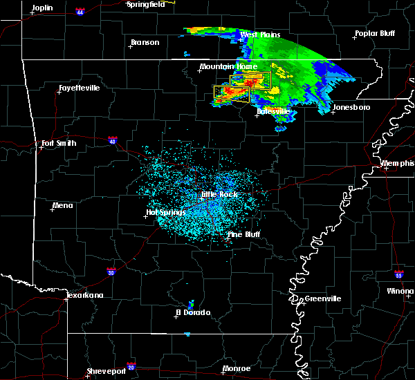 At 130 pm cdt, a severe thunderstorm was located near melbourne, moving east at 45 mph (radar indicated). Hazards include 60 mph wind gusts and quarter size hail. Hail damage to vehicles is expected. expect wind damage to roofs, siding, and trees. Locations impacted include, melbourne, mount pleasant, franklin, gid, stella, lunenburg, lacrosse, lone star, gorby, zion, boswell, violet hill, sage, larkin, brockwell, mt olive in izard county,. At 130 pm cdt, a severe thunderstorm was located near melbourne, moving east at 45 mph (radar indicated). Hazards include 60 mph wind gusts and quarter size hail. Hail damage to vehicles is expected. expect wind damage to roofs, siding, and trees. Locations impacted include, melbourne, mount pleasant, franklin, gid, stella, lunenburg, lacrosse, lone star, gorby, zion, boswell, violet hill, sage, larkin, brockwell, mt olive in izard county,.
|
| 5/4/2020 1:21 PM CDT |
 At 121 pm cdt, a severe thunderstorm was located over gorby, or 10 miles west of melbourne, moving east at 45 mph (radar indicated). Hazards include 60 mph wind gusts and quarter size hail. Hail damage to vehicles is expected. expect wind damage to roofs, siding, and trees. Locations impacted include, melbourne, calico rock, mount pleasant, pineville, franklin, gid, stella, lunenburg, lacrosse, lone star, gorby, mt olive in izard county, zion, boswell, optimus, sage, larkin, sylamore shooting range, brockwell,. At 121 pm cdt, a severe thunderstorm was located over gorby, or 10 miles west of melbourne, moving east at 45 mph (radar indicated). Hazards include 60 mph wind gusts and quarter size hail. Hail damage to vehicles is expected. expect wind damage to roofs, siding, and trees. Locations impacted include, melbourne, calico rock, mount pleasant, pineville, franklin, gid, stella, lunenburg, lacrosse, lone star, gorby, mt olive in izard county, zion, boswell, optimus, sage, larkin, sylamore shooting range, brockwell,.
|
| 5/4/2020 1:11 PM CDT |
 At 111 pm cdt, a severe thunderstorm was located over culp, or 15 miles northwest of mountain view, moving east at 45 mph (radar indicated). Hazards include 60 mph wind gusts and quarter size hail. Hail damage to vehicles is expected. Expect wind damage to roofs, siding, and trees. At 111 pm cdt, a severe thunderstorm was located over culp, or 15 miles northwest of mountain view, moving east at 45 mph (radar indicated). Hazards include 60 mph wind gusts and quarter size hail. Hail damage to vehicles is expected. Expect wind damage to roofs, siding, and trees.
|
| 5/3/2020 1:24 PM CDT |
 At 123 pm cdt, a severe thunderstorm was located near sidney, or 15 miles south of ash flat, moving east at 55 mph (radar indicated). Hazards include 60 mph wind gusts and quarter size hail. Hail damage to vehicles is expected. expect wind damage to roofs, siding, and trees. Locations impacted include, melbourne, cave city, cushman, mount pleasant, sidney, stella, gid, evening shade, maxville, zion, sage, lafferty, sandtown,. At 123 pm cdt, a severe thunderstorm was located near sidney, or 15 miles south of ash flat, moving east at 55 mph (radar indicated). Hazards include 60 mph wind gusts and quarter size hail. Hail damage to vehicles is expected. expect wind damage to roofs, siding, and trees. Locations impacted include, melbourne, cave city, cushman, mount pleasant, sidney, stella, gid, evening shade, maxville, zion, sage, lafferty, sandtown,.
|
| 5/3/2020 1:01 PM CDT |
 At 100 pm cdt, a severe thunderstorm was located over lone star, or near melbourne, moving east at 45 mph (radar indicated). Hazards include 60 mph wind gusts and half dollar size hail. Hail damage to vehicles is expected. expect wind damage to roofs, siding, and trees. Locations impacted include, batesville, melbourne, cave city, calico rock, cushman, mount pleasant, pineville, sidney, brandenberg, croker, lone star, gorby, gid, herpel, stella, lunenburg, lacrosse, blanchard springs campground, evening shade, bethesda,. At 100 pm cdt, a severe thunderstorm was located over lone star, or near melbourne, moving east at 45 mph (radar indicated). Hazards include 60 mph wind gusts and half dollar size hail. Hail damage to vehicles is expected. expect wind damage to roofs, siding, and trees. Locations impacted include, batesville, melbourne, cave city, calico rock, cushman, mount pleasant, pineville, sidney, brandenberg, croker, lone star, gorby, gid, herpel, stella, lunenburg, lacrosse, blanchard springs campground, evening shade, bethesda,.
|
| 5/3/2020 12:43 PM CDT |
 At 1242 pm cdt, a severe thunderstorm was located over culp, or 15 miles north of mountain view, moving east at 50 mph (radar indicated). Hazards include ping pong ball size hail and 60 mph wind gusts. People and animals outdoors will be injured. expect hail damage to roofs, siding, windows, and vehicles. Expect wind damage to roofs, siding, and trees. At 1242 pm cdt, a severe thunderstorm was located over culp, or 15 miles north of mountain view, moving east at 50 mph (radar indicated). Hazards include ping pong ball size hail and 60 mph wind gusts. People and animals outdoors will be injured. expect hail damage to roofs, siding, windows, and vehicles. Expect wind damage to roofs, siding, and trees.
|
| 3/19/2020 9:46 PM CDT |
 At 945 pm cdt, a severe thunderstorm capable of producing a tornado was located over gid, or near melbourne, moving northeast at 35 mph (radar indicated rotation). Hazards include tornado and quarter size hail. Flying debris will be dangerous to those caught without shelter. mobile homes will be damaged or destroyed. damage to roofs, windows, and vehicles will occur. tree damage is likely. Locations impacted include, melbourne, cave city, mount pleasant, sidney, gid, stella, lunenburg, evening shade, guion, maxville, zion, sage, lafferty,. At 945 pm cdt, a severe thunderstorm capable of producing a tornado was located over gid, or near melbourne, moving northeast at 35 mph (radar indicated rotation). Hazards include tornado and quarter size hail. Flying debris will be dangerous to those caught without shelter. mobile homes will be damaged or destroyed. damage to roofs, windows, and vehicles will occur. tree damage is likely. Locations impacted include, melbourne, cave city, mount pleasant, sidney, gid, stella, lunenburg, evening shade, guion, maxville, zion, sage, lafferty,.
|
| 3/19/2020 9:30 PM CDT |
 At 929 pm cdt, a severe thunderstorm was located 7 miles south of herpel, or 8 miles southeast of mountain view, moving northeast at 50 mph (radar indicated). Hazards include 60 mph wind gusts and quarter size hail. Hail damage to vehicles is expected. Expect wind damage to roofs, siding, and trees. At 929 pm cdt, a severe thunderstorm was located 7 miles south of herpel, or 8 miles southeast of mountain view, moving northeast at 50 mph (radar indicated). Hazards include 60 mph wind gusts and quarter size hail. Hail damage to vehicles is expected. Expect wind damage to roofs, siding, and trees.
|
| 3/19/2020 9:29 PM CDT |
 At 928 pm cdt, a severe thunderstorm capable of producing a tornado was located over herpel, or near mountain view, moving east at 45 mph (radar indicated rotation). Hazards include tornado. Flying debris will be dangerous to those caught without shelter. mobile homes will be damaged or destroyed. damage to roofs, windows, and vehicles will occur. Tree damage is likely. At 928 pm cdt, a severe thunderstorm capable of producing a tornado was located over herpel, or near mountain view, moving east at 45 mph (radar indicated rotation). Hazards include tornado. Flying debris will be dangerous to those caught without shelter. mobile homes will be damaged or destroyed. damage to roofs, windows, and vehicles will occur. Tree damage is likely.
|
| 3/12/2020 7:33 PM CDT |
 At 733 pm cdt, severe thunderstorms were located along a line extending from near croker to sidney to 8 miles west of annieville, moving east at 45 mph (radar indicated). Hazards include 60 mph wind gusts and quarter size hail. Hail damage to vehicles is expected. expect wind damage to roofs, siding, and trees. Locations impacted include, batesville, walnut ridge, mountain view, black rock, lake charles state park, cave city, imboden, college city, cushman, portia, mount pleasant, strawberry, lynn, sidney, annieville, croker, gid, herpel, stella, evening shade,. At 733 pm cdt, severe thunderstorms were located along a line extending from near croker to sidney to 8 miles west of annieville, moving east at 45 mph (radar indicated). Hazards include 60 mph wind gusts and quarter size hail. Hail damage to vehicles is expected. expect wind damage to roofs, siding, and trees. Locations impacted include, batesville, walnut ridge, mountain view, black rock, lake charles state park, cave city, imboden, college city, cushman, portia, mount pleasant, strawberry, lynn, sidney, annieville, croker, gid, herpel, stella, evening shade,.
|
| 3/12/2020 7:18 PM CDT |
 At 718 pm cdt, severe thunderstorms were located along a line extending from near mountain view to lunenburg to near sidney, moving east at 35 mph (radar indicated). Hazards include 60 mph wind gusts and quarter size hail. Hail damage to vehicles is expected. Expect wind damage to roofs, siding, and trees. At 718 pm cdt, severe thunderstorms were located along a line extending from near mountain view to lunenburg to near sidney, moving east at 35 mph (radar indicated). Hazards include 60 mph wind gusts and quarter size hail. Hail damage to vehicles is expected. Expect wind damage to roofs, siding, and trees.
|
| 3/12/2020 5:16 PM CDT |
 At 516 pm cdt, a severe thunderstorm was located 7 miles north of cave city, or 12 miles southeast of ash flat, moving southeast at 60 mph (radar indicated). Hazards include ping pong ball size hail and 60 mph wind gusts. People and animals outdoors will be injured. expect hail damage to roofs, siding, windows, and vehicles. expect wind damage to roofs, siding, and trees. Locations impacted include, batesville, cherokee village, melbourne, salem in fulton county, ash flat, horseshoe bend, cave city, calico rock, highland in sharp county, hardy, oxford, cushman, mount pleasant, pineville, franklin, sidney, ballard, bexar, lone star, wideman,. At 516 pm cdt, a severe thunderstorm was located 7 miles north of cave city, or 12 miles southeast of ash flat, moving southeast at 60 mph (radar indicated). Hazards include ping pong ball size hail and 60 mph wind gusts. People and animals outdoors will be injured. expect hail damage to roofs, siding, windows, and vehicles. expect wind damage to roofs, siding, and trees. Locations impacted include, batesville, cherokee village, melbourne, salem in fulton county, ash flat, horseshoe bend, cave city, calico rock, highland in sharp county, hardy, oxford, cushman, mount pleasant, pineville, franklin, sidney, ballard, bexar, lone star, wideman,.
|
| 3/12/2020 5:03 PM CDT |
 At 503 pm cdt, a severe thunderstorm was located over myron, or 7 miles southwest of ash flat, moving southeast at 60 mph (radar indicated). Hazards include ping pong ball size hail and 60 mph wind gusts. People and animals outdoors will be injured. expect hail damage to roofs, siding, windows, and vehicles. expect wind damage to roofs, siding, and trees. Locations impacted include, batesville, cherokee village, melbourne, salem in fulton county, ash flat, horseshoe bend, cave city, calico rock, highland in sharp county, hardy, oxford, cushman, mount pleasant, viola, pineville, franklin, sidney, ballard, bexar, flint springs,. At 503 pm cdt, a severe thunderstorm was located over myron, or 7 miles southwest of ash flat, moving southeast at 60 mph (radar indicated). Hazards include ping pong ball size hail and 60 mph wind gusts. People and animals outdoors will be injured. expect hail damage to roofs, siding, windows, and vehicles. expect wind damage to roofs, siding, and trees. Locations impacted include, batesville, cherokee village, melbourne, salem in fulton county, ash flat, horseshoe bend, cave city, calico rock, highland in sharp county, hardy, oxford, cushman, mount pleasant, viola, pineville, franklin, sidney, ballard, bexar, flint springs,.
|
| 3/12/2020 4:52 PM CDT |
 At 452 pm cdt, a severe thunderstorm was located near oxford, or 9 miles southwest of salem in fulton county, moving southeast at 60 mph (radar indicated). Hazards include ping pong ball size hail and 60 mph wind gusts. People and animals outdoors will be injured. expect hail damage to roofs, siding, windows, and vehicles. expect wind damage to roofs, siding, and trees. Locations impacted include, batesville, cherokee village, melbourne, salem in fulton county, ash flat, horseshoe bend, cave city, calico rock, highland in sharp county, hardy, oxford, cushman, mount pleasant, viola, pineville, franklin, sidney, ballard, bexar, flint springs,. At 452 pm cdt, a severe thunderstorm was located near oxford, or 9 miles southwest of salem in fulton county, moving southeast at 60 mph (radar indicated). Hazards include ping pong ball size hail and 60 mph wind gusts. People and animals outdoors will be injured. expect hail damage to roofs, siding, windows, and vehicles. expect wind damage to roofs, siding, and trees. Locations impacted include, batesville, cherokee village, melbourne, salem in fulton county, ash flat, horseshoe bend, cave city, calico rock, highland in sharp county, hardy, oxford, cushman, mount pleasant, viola, pineville, franklin, sidney, ballard, bexar, flint springs,.
|
| 3/12/2020 4:46 PM CDT |
 At 445 pm cdt, a severe thunderstorm was located over bexar, or 11 miles west of salem in fulton county, moving southeast at 60 mph (radar indicated). Hazards include 60 mph wind gusts and quarter size hail. Hail damage to vehicles is expected. Expect wind damage to roofs, siding, and trees. At 445 pm cdt, a severe thunderstorm was located over bexar, or 11 miles west of salem in fulton county, moving southeast at 60 mph (radar indicated). Hazards include 60 mph wind gusts and quarter size hail. Hail damage to vehicles is expected. Expect wind damage to roofs, siding, and trees.
|
| 2/24/2020 1:38 PM CST |
 At 137 pm cst, a severe thunderstorm was located over gid, or near melbourne. another developing storm was located just southeast of mountain view. the storms were moving east at 30 mph (radar indicated). Hazards include 60 mph wind gusts and quarter size hail. Hail damage to vehicles is expected. expect wind damage to roofs, siding, and trees. Locations impacted include, mountain view, melbourne, horseshoe bend, cushman, mount pleasant, franklin, gid, herpel, stella, lunenburg, brandenberg, croker, lacrosse, lone star, guion, hanover, zion, violet hill, sage, larkin,. At 137 pm cst, a severe thunderstorm was located over gid, or near melbourne. another developing storm was located just southeast of mountain view. the storms were moving east at 30 mph (radar indicated). Hazards include 60 mph wind gusts and quarter size hail. Hail damage to vehicles is expected. expect wind damage to roofs, siding, and trees. Locations impacted include, mountain view, melbourne, horseshoe bend, cushman, mount pleasant, franklin, gid, herpel, stella, lunenburg, brandenberg, croker, lacrosse, lone star, guion, hanover, zion, violet hill, sage, larkin,.
|
| 2/24/2020 1:25 PM CST |
 At 124 pm cst, a severe thunderstorm was located over herpel, or 7 miles northeast of mountain view, moving east at 30 mph (radar indicated). Hazards include 60 mph wind gusts and quarter size hail. Hail damage to vehicles is expected. expect wind damage to roofs, siding, and trees. Locations impacted include, mountain view, melbourne, horseshoe bend, cushman, mount pleasant, franklin, brandenberg, croker, lone star, gid, herpel, stella, lunenburg, lacrosse, guion, allison, hanover, mt olive in izard county, zion, violet hill,. At 124 pm cst, a severe thunderstorm was located over herpel, or 7 miles northeast of mountain view, moving east at 30 mph (radar indicated). Hazards include 60 mph wind gusts and quarter size hail. Hail damage to vehicles is expected. expect wind damage to roofs, siding, and trees. Locations impacted include, mountain view, melbourne, horseshoe bend, cushman, mount pleasant, franklin, brandenberg, croker, lone star, gid, herpel, stella, lunenburg, lacrosse, guion, allison, hanover, mt olive in izard county, zion, violet hill,.
|
| 2/24/2020 1:13 PM CST |
 At 112 pm cst, a severe thunderstorm was located over mountain view, moving east at 25 mph (radar indicated). Hazards include 60 mph wind gusts and quarter size hail. Hail damage to vehicles is expected. Expect wind damage to roofs, siding, and trees. At 112 pm cst, a severe thunderstorm was located over mountain view, moving east at 25 mph (radar indicated). Hazards include 60 mph wind gusts and quarter size hail. Hail damage to vehicles is expected. Expect wind damage to roofs, siding, and trees.
|
| 1/10/2020 10:29 PM CST |
 At 1029 pm cst, severe thunderstorms were located along a line extending from near sturkie to near oxford to herpel to near fairfield bay, moving east at 45 mph (radar indicated). Hazards include 60 mph wind gusts. expect damage to roofs, siding, and trees At 1029 pm cst, severe thunderstorms were located along a line extending from near sturkie to near oxford to herpel to near fairfield bay, moving east at 45 mph (radar indicated). Hazards include 60 mph wind gusts. expect damage to roofs, siding, and trees
|
| 1/10/2020 10:05 PM CST |
 At 1003 pm cst, severe thunderstorms were located along a line extending from near gamaliel to 10 miles west of mountain view to 5 miles southwest of clinton, moving northeast at 40 mph (radar indicated). Hazards include 60 mph wind gusts. Expect damage to roofs, siding, and trees. Locations impacted include, mountain home, mountain view, clinton, fairfield bay, melbourne, salem in fulton county, horseshoe bend, calico rock, greers ferry, oxford, norfork, salesville, viola, shirley, pineville, briarcliff, franklin, higden, arkawana, bexar,. At 1003 pm cst, severe thunderstorms were located along a line extending from near gamaliel to 10 miles west of mountain view to 5 miles southwest of clinton, moving northeast at 40 mph (radar indicated). Hazards include 60 mph wind gusts. Expect damage to roofs, siding, and trees. Locations impacted include, mountain home, mountain view, clinton, fairfield bay, melbourne, salem in fulton county, horseshoe bend, calico rock, greers ferry, oxford, norfork, salesville, viola, shirley, pineville, briarcliff, franklin, higden, arkawana, bexar,.
|
| 1/10/2020 9:44 PM CST |
 At 944 pm cst, severe thunderstorms were located along a line extending from near ozark regional airport to 8 miles northwest of thola to near elba to near cleveland, moving east at 45 mph (radar indicated). Hazards include 60 mph wind gusts. expect damage to roofs, siding, and trees At 944 pm cst, severe thunderstorms were located along a line extending from near ozark regional airport to 8 miles northwest of thola to near elba to near cleveland, moving east at 45 mph (radar indicated). Hazards include 60 mph wind gusts. expect damage to roofs, siding, and trees
|
| 9/25/2019 4:18 PM CDT |
 At 418 pm cdt, severe thunderstorms were located along a line extending from 7 miles southeast of highland in sharp county to near sidney to near mount pleasant, moving east at 20 mph (radar indicated). Hazards include 60 mph wind gusts and quarter size hail. Hail damage to vehicles is expected. expect wind damage to roofs, siding, and trees. Locations impacted include, black rock, cave city, mount pleasant, strawberry, lynn, sidney, gid, stella, annieville, evening shade, smithville, aetna, maxville, calamine, poughkeepsie, sage, eaton, nelsonville, driftwood, sandtown,. At 418 pm cdt, severe thunderstorms were located along a line extending from 7 miles southeast of highland in sharp county to near sidney to near mount pleasant, moving east at 20 mph (radar indicated). Hazards include 60 mph wind gusts and quarter size hail. Hail damage to vehicles is expected. expect wind damage to roofs, siding, and trees. Locations impacted include, black rock, cave city, mount pleasant, strawberry, lynn, sidney, gid, stella, annieville, evening shade, smithville, aetna, maxville, calamine, poughkeepsie, sage, eaton, nelsonville, driftwood, sandtown,.
|
| 9/25/2019 3:59 PM CDT |
 At 359 pm cdt, severe thunderstorms were located along a line extending from near highland in sharp county to near stella to mount pleasant, moving east at 20 mph (radar indicated). Hazards include 60 mph wind gusts and quarter size hail. Hail damage to vehicles is expected. Expect wind damage to roofs, siding, and trees. At 359 pm cdt, severe thunderstorms were located along a line extending from near highland in sharp county to near stella to mount pleasant, moving east at 20 mph (radar indicated). Hazards include 60 mph wind gusts and quarter size hail. Hail damage to vehicles is expected. Expect wind damage to roofs, siding, and trees.
|
| 9/25/2019 3:38 PM CDT |
 At 338 pm cdt, a severe thunderstorm was located near myron, or 7 miles southwest of ash flat, moving east at 10 mph (radar indicated). Hazards include 60 mph wind gusts and quarter size hail. Hail damage to vehicles is expected. expect wind damage to roofs, siding, and trees. Locations impacted include, melbourne, ash flat, horseshoe bend, franklin, sidney, stella, lunenburg, myron, lacrosse, gid, evening shade, maxville, zion, sage,. At 338 pm cdt, a severe thunderstorm was located near myron, or 7 miles southwest of ash flat, moving east at 10 mph (radar indicated). Hazards include 60 mph wind gusts and quarter size hail. Hail damage to vehicles is expected. expect wind damage to roofs, siding, and trees. Locations impacted include, melbourne, ash flat, horseshoe bend, franklin, sidney, stella, lunenburg, myron, lacrosse, gid, evening shade, maxville, zion, sage,.
|
| 9/25/2019 3:21 PM CDT |
 The national weather service in little rock has issued a * severe thunderstorm warning for. northeastern izard county in north central arkansas. southwestern sharp county in north central arkansas. until 400 pm cdt. At 321 pm cdt, a severe thunderstorm was located over lacrosse, or. The national weather service in little rock has issued a * severe thunderstorm warning for. northeastern izard county in north central arkansas. southwestern sharp county in north central arkansas. until 400 pm cdt. At 321 pm cdt, a severe thunderstorm was located over lacrosse, or.
|
| 8/27/2019 2:22 AM CDT |
 At 221 am cdt, severe thunderstorms were located along a line extending from near walcott to 6 miles southeast of strawberry to near cushman, moving southeast at 45 mph (radar indicated). Hazards include 60 mph wind gusts. Expect damage to roofs, siding, and trees. Locations impacted include, batesville, newport, walnut ridge, hoxie, melbourne, ash flat, black rock, lake charles state park, horseshoe bend, cave city, tuckerman, diaz, newark, highland in sharp county, swifton, imboden, oxford, college city, cushman, portia, this includes us highway 67 between mile markers 81 and 101, and between mile markers 109 and 121. At 221 am cdt, severe thunderstorms were located along a line extending from near walcott to 6 miles southeast of strawberry to near cushman, moving southeast at 45 mph (radar indicated). Hazards include 60 mph wind gusts. Expect damage to roofs, siding, and trees. Locations impacted include, batesville, newport, walnut ridge, hoxie, melbourne, ash flat, black rock, lake charles state park, horseshoe bend, cave city, tuckerman, diaz, newark, highland in sharp county, swifton, imboden, oxford, college city, cushman, portia, this includes us highway 67 between mile markers 81 and 101, and between mile markers 109 and 121.
|
| 8/27/2019 1:55 AM CDT |
 At 155 am cdt, severe thunderstorms were located along a line extending from near pocahontas to 8 miles north of cave city to lacrosse, moving southeast at 50 mph (radar indicated). Hazards include 60 mph wind gusts. expect damage to roofs, siding, and trees At 155 am cdt, severe thunderstorms were located along a line extending from near pocahontas to 8 miles north of cave city to lacrosse, moving southeast at 50 mph (radar indicated). Hazards include 60 mph wind gusts. expect damage to roofs, siding, and trees
|
| 8/19/2019 4:20 PM CDT |
 At 419 pm cdt, a severe thunderstorm was located over lunenburg, or over melbourne, moving southwest at 10 mph (radar indicated). Hazards include 60 mph wind gusts and quarter size hail. Hail damage to vehicles is expected. Expect wind damage to roofs, siding, and trees. At 419 pm cdt, a severe thunderstorm was located over lunenburg, or over melbourne, moving southwest at 10 mph (radar indicated). Hazards include 60 mph wind gusts and quarter size hail. Hail damage to vehicles is expected. Expect wind damage to roofs, siding, and trees.
|
| 5/29/2019 5:50 AM CDT |
 At 550 am cdt, severe thunderstorms were located along a line extending from near cave city to 7 miles north of pangburn, moving east at 45 mph (radar indicated). Hazards include 60 mph wind gusts and nickel size hail. Expect damage to roofs, siding, and trees. Locations impacted include, batesville, heber springs, fairfield bay, cave city, greers ferry, quitman, pangburn, cushman, mount pleasant, damascus, pleasant plains, shirley, concord, magness, sidney, moorefield, higden, salado, whipple, sugar loaf recreation area,. At 550 am cdt, severe thunderstorms were located along a line extending from near cave city to 7 miles north of pangburn, moving east at 45 mph (radar indicated). Hazards include 60 mph wind gusts and nickel size hail. Expect damage to roofs, siding, and trees. Locations impacted include, batesville, heber springs, fairfield bay, cave city, greers ferry, quitman, pangburn, cushman, mount pleasant, damascus, pleasant plains, shirley, concord, magness, sidney, moorefield, higden, salado, whipple, sugar loaf recreation area,.
|
| 5/29/2019 5:28 AM CDT |
 At 528 am cdt, severe thunderstorms were located along a line extending from near croker to heber springs, moving east at 45 mph (radar indicated). Hazards include 60 mph wind gusts and nickel size hail. Expect damage to roofs, siding, and trees. Locations impacted include, batesville, heber springs, mountain view, fairfield bay, melbourne, cave city, greers ferry, quitman, pangburn, cushman, mount pleasant, damascus, pleasant plains, shirley, concord, magness, sidney, moorefield, higden, salado,. At 528 am cdt, severe thunderstorms were located along a line extending from near croker to heber springs, moving east at 45 mph (radar indicated). Hazards include 60 mph wind gusts and nickel size hail. Expect damage to roofs, siding, and trees. Locations impacted include, batesville, heber springs, mountain view, fairfield bay, melbourne, cave city, greers ferry, quitman, pangburn, cushman, mount pleasant, damascus, pleasant plains, shirley, concord, magness, sidney, moorefield, higden, salado,.
|
| 5/29/2019 5:13 AM CDT |
 At 513 am cdt, severe thunderstorms were located along a line extending from herpel to near choctaw, moving east at 45 mph (radar indicated). Hazards include 60 mph wind gusts and nickel size hail. expect damage to roofs, siding, and trees At 513 am cdt, severe thunderstorms were located along a line extending from herpel to near choctaw, moving east at 45 mph (radar indicated). Hazards include 60 mph wind gusts and nickel size hail. expect damage to roofs, siding, and trees
|
| 5/29/2019 5:01 AM CDT |
 At 501 am cdt, severe thunderstorms were located along a line extending from near calico rock to near fairfield bay, moving northeast at 50 mph (radar indicated). Hazards include 60 mph wind gusts and nickel size hail. Expect damage to roofs, siding, and trees. Locations impacted include, mountain view, clinton, fairfield bay, melbourne, horseshoe bend, calico rock, greers ferry, oxford, shirley, concord, pineville, franklin, higden, lone star, wideman, herron, gid, herpel, sugar loaf recreation area, lunenburg,. At 501 am cdt, severe thunderstorms were located along a line extending from near calico rock to near fairfield bay, moving northeast at 50 mph (radar indicated). Hazards include 60 mph wind gusts and nickel size hail. Expect damage to roofs, siding, and trees. Locations impacted include, mountain view, clinton, fairfield bay, melbourne, horseshoe bend, calico rock, greers ferry, oxford, shirley, concord, pineville, franklin, higden, lone star, wideman, herron, gid, herpel, sugar loaf recreation area, lunenburg,.
|
| 5/29/2019 4:38 AM CDT |
 At 437 am cdt, severe thunderstorms were located along a line extending from near advance to clinton, moving northeast at 55 mph (radar indicated). Hazards include 60 mph wind gusts and nickel size hail. expect damage to roofs, siding, and trees At 437 am cdt, severe thunderstorms were located along a line extending from near advance to clinton, moving northeast at 55 mph (radar indicated). Hazards include 60 mph wind gusts and nickel size hail. expect damage to roofs, siding, and trees
|
| 2/7/2019 7:01 AM CST |
 At 701 am cst, severe thunderstorms were located along a line extending from near elberta to near old lexington to near whipple, moving northeast at 55 mph (radar indicated). Hazards include 60 mph wind gusts and penny size hail. expect damage to roofs, siding, and trees At 701 am cst, severe thunderstorms were located along a line extending from near elberta to near old lexington to near whipple, moving northeast at 55 mph (radar indicated). Hazards include 60 mph wind gusts and penny size hail. expect damage to roofs, siding, and trees
|
| 12/1/2018 1:26 AM CST |
 At 126 am cst, severe thunderstorms were located along a line extending from near bakersfield to near bexar to brandenberg to 8 miles north of greers ferry, moving east at 55 mph (radar indicated). Hazards include 60 mph wind gusts. expect damage to roofs, siding, and trees At 126 am cst, severe thunderstorms were located along a line extending from near bakersfield to near bexar to brandenberg to 8 miles north of greers ferry, moving east at 55 mph (radar indicated). Hazards include 60 mph wind gusts. expect damage to roofs, siding, and trees
|
| 8/19/2018 10:26 PM CDT |
 The severe thunderstorm warning for north central independence, eastern izard and southwestern sharp counties will expire at 1030 pm cdt, the storm which prompted the warning has weakened below severe limits, and no longer poses an immediate threat to life or property. therefore, the warning will be allowed to expire. however gusty winds and heavy rain are still possible with this thunderstorm. a tornado watch remains in effect until 1100 pm cdt for north central arkansas. The severe thunderstorm warning for north central independence, eastern izard and southwestern sharp counties will expire at 1030 pm cdt, the storm which prompted the warning has weakened below severe limits, and no longer poses an immediate threat to life or property. therefore, the warning will be allowed to expire. however gusty winds and heavy rain are still possible with this thunderstorm. a tornado watch remains in effect until 1100 pm cdt for north central arkansas.
|
| 8/19/2018 10:06 PM CDT |
 At 1006 pm cdt, a severe thunderstorm was located near stella, or 8 miles east of melbourne, moving northeast at 30 mph (radar indicated). Hazards include 60 mph wind gusts. Expect damage to roofs, siding, and trees. Locations impacted include, melbourne, horseshoe bend, cave city, mount pleasant, franklin, sidney, ballard, gid, stella, lunenburg, myron, lacrosse, evening shade, maxville, zion, calamine, violet hill, poughkeepsie, sage, larkin, a tornado watch remains in effect until 1100 pm cdt for north central arkansas. At 1006 pm cdt, a severe thunderstorm was located near stella, or 8 miles east of melbourne, moving northeast at 30 mph (radar indicated). Hazards include 60 mph wind gusts. Expect damage to roofs, siding, and trees. Locations impacted include, melbourne, horseshoe bend, cave city, mount pleasant, franklin, sidney, ballard, gid, stella, lunenburg, myron, lacrosse, evening shade, maxville, zion, calamine, violet hill, poughkeepsie, sage, larkin, a tornado watch remains in effect until 1100 pm cdt for north central arkansas.
|
| 8/19/2018 9:41 PM CDT |
 At 941 pm cdt, a severe thunderstorm was located over lunenburg, or near melbourne, moving northeast at 35 mph (radar indicated). Hazards include 60 mph wind gusts. expect damage to roofs, siding, and trees At 941 pm cdt, a severe thunderstorm was located over lunenburg, or near melbourne, moving northeast at 35 mph (radar indicated). Hazards include 60 mph wind gusts. expect damage to roofs, siding, and trees
|
| 7/20/2018 9:10 AM CDT |
 At 904 am cdt, a severe thunderstorm was located near mount pleasant, or 11 miles southeast of melbourne, moving southeast at 45 mph (radar indicated). Hazards include 60 mph wind gusts and penny size hail. Expect damage to roofs, siding, and trees. Locations impacted include, batesville, mountain view, melbourne, cave city, cushman, mount pleasant, concord, sidney, moorefield, salado, croker, lone star, gid, herpel, southside in independence count, stella, lunenburg, lacrosse, bethesda, guion,. At 904 am cdt, a severe thunderstorm was located near mount pleasant, or 11 miles southeast of melbourne, moving southeast at 45 mph (radar indicated). Hazards include 60 mph wind gusts and penny size hail. Expect damage to roofs, siding, and trees. Locations impacted include, batesville, mountain view, melbourne, cave city, cushman, mount pleasant, concord, sidney, moorefield, salado, croker, lone star, gid, herpel, southside in independence count, stella, lunenburg, lacrosse, bethesda, guion,.
|
| 7/20/2018 9:05 AM CDT |
 At 904 am cdt, a severe thunderstorm was located near mount pleasant, or 11 miles southeast of melbourne, moving southeast at 45 mph (radar indicated). Hazards include 60 mph wind gusts and penny size hail. Expect damage to roofs, siding, and trees. Locations impacted include, batesville, mountain view, melbourne, cave city, cushman, mount pleasant, concord, sidney, moorefield, salado, croker, lone star, gid, herpel, southside in independence count, stella, lunenburg, lacrosse, bethesda, guion,. At 904 am cdt, a severe thunderstorm was located near mount pleasant, or 11 miles southeast of melbourne, moving southeast at 45 mph (radar indicated). Hazards include 60 mph wind gusts and penny size hail. Expect damage to roofs, siding, and trees. Locations impacted include, batesville, mountain view, melbourne, cave city, cushman, mount pleasant, concord, sidney, moorefield, salado, croker, lone star, gid, herpel, southside in independence count, stella, lunenburg, lacrosse, bethesda, guion,.
|
| 7/20/2018 8:56 AM CDT | Storm damage reported in izard county AR, 1.6 miles SSE of Mount Pleasant, AR |
| 7/20/2018 8:56 AM CDT | Storm damage reported in izard county AR, 1.6 miles SSE of Mount Pleasant, AR |
| 7/20/2018 8:54 AM CDT | Storm damage reported in izard county AR, 3.3 miles E of Mount Pleasant, AR |
| 7/20/2018 8:54 AM CDT | Storm damage reported in izard county AR, 3.3 miles E of Mount Pleasant, AR |
| 7/20/2018 8:52 AM CDT |
 At 852 am cdt, a severe thunderstorm was located over lunenburg, or near melbourne, moving southeast at 45 mph (radar indicated). Hazards include 60 mph wind gusts and quarter size hail. Hail damage to vehicles is expected. expect wind damage to roofs, siding, and trees. Locations impacted include, batesville, mountain view, melbourne, cave city, cushman, mount pleasant, concord, sidney, moorefield, salado, brandenberg, croker, lone star, gid, herpel, southside in independence count, stella, lunenburg, lacrosse, blanchard springs campground,. At 852 am cdt, a severe thunderstorm was located over lunenburg, or near melbourne, moving southeast at 45 mph (radar indicated). Hazards include 60 mph wind gusts and quarter size hail. Hail damage to vehicles is expected. expect wind damage to roofs, siding, and trees. Locations impacted include, batesville, mountain view, melbourne, cave city, cushman, mount pleasant, concord, sidney, moorefield, salado, brandenberg, croker, lone star, gid, herpel, southside in independence count, stella, lunenburg, lacrosse, blanchard springs campground,.
|
| 7/20/2018 8:37 AM CDT |
 At 837 am cdt, a severe thunderstorm was located over gorby, or 10 miles west of melbourne, moving southeast at 45 mph (radar indicated). Hazards include 60 mph wind gusts and half dollar size hail. Hail damage to vehicles is expected. Expect wind damage to roofs, siding, and trees. At 837 am cdt, a severe thunderstorm was located over gorby, or 10 miles west of melbourne, moving southeast at 45 mph (radar indicated). Hazards include 60 mph wind gusts and half dollar size hail. Hail damage to vehicles is expected. Expect wind damage to roofs, siding, and trees.
|
| 7/19/2018 9:19 PM CDT |
 A severe thunderstorm warning remains in effect until 930 pm cdt for southeastern stone. northwestern independence. eastern izard. northern cleburne and southwestern sharp counties. At 918 pm cdt, severe thunderstorms were located along a line extending from myron to stella to near croker to 8 miles northeast of greers ferry, moving southeast at 45 mph. A severe thunderstorm warning remains in effect until 930 pm cdt for southeastern stone. northwestern independence. eastern izard. northern cleburne and southwestern sharp counties. At 918 pm cdt, severe thunderstorms were located along a line extending from myron to stella to near croker to 8 miles northeast of greers ferry, moving southeast at 45 mph.
|
| 7/19/2018 9:03 PM CDT |
 At 903 pm cdt, severe thunderstorms were located along a line extending from salem in fulton county to near melbourne to near brandenberg to near mountain view, moving southeast at 45 mph (radar indicated). Hazards include 60 mph wind gusts. Expect damage to roofs, siding, and trees. Locations impacted include, batesville, cherokee village, mountain view, melbourne, salem in fulton county, ash flat, horseshoe bend, cave city, highland in sharp county, hardy, oxford, cushman, mount pleasant, concord, franklin, sidney, ballard, lone star, gid, herpel,. At 903 pm cdt, severe thunderstorms were located along a line extending from salem in fulton county to near melbourne to near brandenberg to near mountain view, moving southeast at 45 mph (radar indicated). Hazards include 60 mph wind gusts. Expect damage to roofs, siding, and trees. Locations impacted include, batesville, cherokee village, mountain view, melbourne, salem in fulton county, ash flat, horseshoe bend, cave city, highland in sharp county, hardy, oxford, cushman, mount pleasant, concord, franklin, sidney, ballard, lone star, gid, herpel,.
|
| 7/19/2018 8:49 PM CDT |
 At 849 pm cdt, severe thunderstorms were located along a line extending from near flint springs to near pineville to 6 miles southwest of blanchard springs campground, moving southeast at 50 mph (radar indicated). Hazards include 60 mph wind gusts. expect damage to roofs, siding, and trees At 849 pm cdt, severe thunderstorms were located along a line extending from near flint springs to near pineville to 6 miles southwest of blanchard springs campground, moving southeast at 50 mph (radar indicated). Hazards include 60 mph wind gusts. expect damage to roofs, siding, and trees
|
| 6/14/2018 6:36 PM CDT |
 At 635 pm cdt, a severe thunderstorm was located over sidney, or 14 miles north of batesville, moving southeast at 15 mph (radar indicated). Hazards include 60 mph wind gusts and quarter size hail. Hail damage to vehicles is expected. Expect wind damage to roofs, siding, and trees. At 635 pm cdt, a severe thunderstorm was located over sidney, or 14 miles north of batesville, moving southeast at 15 mph (radar indicated). Hazards include 60 mph wind gusts and quarter size hail. Hail damage to vehicles is expected. Expect wind damage to roofs, siding, and trees.
|
| 6/1/2018 1:20 AM CDT |
 At 119 am cdt, a severe thunderstorm was located over melbourne, moving southeast at 25 mph (radar indicated). Hazards include 60 mph wind gusts and quarter size hail. Hail damage to vehicles is expected. expect wind damage to roofs, siding, and trees. Locations impacted include, melbourne, cushman, mount pleasant, sidney, gid, stella, lunenburg, lacrosse, evening shade, zion, sage, lafferty, brockwell, larkin,. At 119 am cdt, a severe thunderstorm was located over melbourne, moving southeast at 25 mph (radar indicated). Hazards include 60 mph wind gusts and quarter size hail. Hail damage to vehicles is expected. expect wind damage to roofs, siding, and trees. Locations impacted include, melbourne, cushman, mount pleasant, sidney, gid, stella, lunenburg, lacrosse, evening shade, zion, sage, lafferty, brockwell, larkin,.
|
| 6/1/2018 1:06 AM CDT |
 At 105 am cdt, a severe thunderstorm was located near gorby, or 7 miles northwest of melbourne, moving southeast at 25 mph (radar indicated). Hazards include 60 mph wind gusts and quarter size hail. Hail damage to vehicles is expected. Expect wind damage to roofs, siding, and trees. At 105 am cdt, a severe thunderstorm was located near gorby, or 7 miles northwest of melbourne, moving southeast at 25 mph (radar indicated). Hazards include 60 mph wind gusts and quarter size hail. Hail damage to vehicles is expected. Expect wind damage to roofs, siding, and trees.
|
| 5/31/2018 10:57 PM CDT |
 At 1042 pm cdt, severe thunderstorms were located along a line extending from near salem in fulton county to near bexar, moving southeast at 40 mph (radar indicated). Hazards include 60 mph wind gusts and quarter size hail. Hail damage to vehicles is expected. Expect wind damage to roofs, siding, and trees. At 1042 pm cdt, severe thunderstorms were located along a line extending from near salem in fulton county to near bexar, moving southeast at 40 mph (radar indicated). Hazards include 60 mph wind gusts and quarter size hail. Hail damage to vehicles is expected. Expect wind damage to roofs, siding, and trees.
|
| 5/31/2018 10:43 PM CDT |
 At 1042 pm cdt, severe thunderstorms were located along a line extending from near salem in fulton county to near bexar, moving southeast at 40 mph (radar indicated). Hazards include 60 mph wind gusts and quarter size hail. Hail damage to vehicles is expected. Expect wind damage to roofs, siding, and trees. At 1042 pm cdt, severe thunderstorms were located along a line extending from near salem in fulton county to near bexar, moving southeast at 40 mph (radar indicated). Hazards include 60 mph wind gusts and quarter size hail. Hail damage to vehicles is expected. Expect wind damage to roofs, siding, and trees.
|
| 5/20/2018 4:06 PM CDT |
 At 405 pm cdt, a severe thunderstorm was located near cushman, or near batesville, moving northeast at 15 mph (radar indicated). Hazards include 60 mph wind gusts and quarter size hail. Hail damage to vehicles is expected. expect wind damage to roofs, siding, and trees. Locations impacted include, batesville, cushman, mount pleasant, sandtown, lafferty, pfeiffer,. At 405 pm cdt, a severe thunderstorm was located near cushman, or near batesville, moving northeast at 15 mph (radar indicated). Hazards include 60 mph wind gusts and quarter size hail. Hail damage to vehicles is expected. expect wind damage to roofs, siding, and trees. Locations impacted include, batesville, cushman, mount pleasant, sandtown, lafferty, pfeiffer,.
|
| 5/20/2018 3:53 PM CDT |
 At 353 pm cdt, a severe thunderstorm was located over cushman, or 8 miles northwest of batesville, moving northeast at 15 mph (radar indicated). Hazards include 60 mph wind gusts and quarter size hail. Hail damage to vehicles is expected. Expect wind damage to roofs, siding, and trees. At 353 pm cdt, a severe thunderstorm was located over cushman, or 8 miles northwest of batesville, moving northeast at 15 mph (radar indicated). Hazards include 60 mph wind gusts and quarter size hail. Hail damage to vehicles is expected. Expect wind damage to roofs, siding, and trees.
|
| 4/13/2018 9:32 PM CDT |
 At 932 pm cdt, severe thunderstorms were located along a line extending from near salem in fulton county to near brandenberg to near fairfield bay to fairbanks, moving east at 40 mph (radar indicated). Hazards include 60 mph wind gusts and penny size hail. expect damage to roofs, siding, and trees At 932 pm cdt, severe thunderstorms were located along a line extending from near salem in fulton county to near brandenberg to near fairfield bay to fairbanks, moving east at 40 mph (radar indicated). Hazards include 60 mph wind gusts and penny size hail. expect damage to roofs, siding, and trees
|
| 4/3/2018 4:07 PM CDT |
 At 407 pm cdt, a severe thunderstorm capable of producing a tornado was located near sidney, or 10 miles east of melbourne, moving east at 65 mph (radar indicated rotation). Hazards include tornado and two inch hail. Flying debris will be dangerous to those caught without shelter. mobile homes will be damaged or destroyed. damage to roofs, windows, and vehicles will occur. tree damage is likely. Locations impacted include, melbourne, mount pleasant, gid, croker, stella, lacrosse, lunenburg, guion, zion, lafferty, sage, larkin,. At 407 pm cdt, a severe thunderstorm capable of producing a tornado was located near sidney, or 10 miles east of melbourne, moving east at 65 mph (radar indicated rotation). Hazards include tornado and two inch hail. Flying debris will be dangerous to those caught without shelter. mobile homes will be damaged or destroyed. damage to roofs, windows, and vehicles will occur. tree damage is likely. Locations impacted include, melbourne, mount pleasant, gid, croker, stella, lacrosse, lunenburg, guion, zion, lafferty, sage, larkin,.
|
| 4/3/2018 4:06 PM CDT |
 At 405 pm cdt, a severe thunderstorm was located over stella, or near melbourne, moving east at 55 mph. large hail was recently reported in melbourne. while not imminent, this storm has a history of rotation, and may produce a tornado with little advanced warning (radar indicated). Hazards include golf ball size hail and 60 mph wind gusts. People and animals outdoors will be injured. expect hail damage to roofs, siding, windows, and vehicles. Expect wind damage to roofs, siding, and trees. At 405 pm cdt, a severe thunderstorm was located over stella, or near melbourne, moving east at 55 mph. large hail was recently reported in melbourne. while not imminent, this storm has a history of rotation, and may produce a tornado with little advanced warning (radar indicated). Hazards include golf ball size hail and 60 mph wind gusts. People and animals outdoors will be injured. expect hail damage to roofs, siding, windows, and vehicles. Expect wind damage to roofs, siding, and trees.
|
| 4/3/2018 3:57 PM CDT |
 At 357 pm cdt, a severe thunderstorm capable of producing a tornado was located over lunenburg, or over melbourne, moving east at 65 mph (radar indicated rotation). Hazards include tornado and two inch hail. Flying debris will be dangerous to those caught without shelter. mobile homes will be damaged or destroyed. damage to roofs, windows, and vehicles will occur. tree damage is likely. Locations impacted include, melbourne, calico rock, oxford, mount pleasant, franklin, brandenberg, croker, lone star, gorby, gid, herpel, stella, lunenburg, lacrosse, blanchard springs campground, guion, allison, mt olive in izard county, zion, violet hill,. At 357 pm cdt, a severe thunderstorm capable of producing a tornado was located over lunenburg, or over melbourne, moving east at 65 mph (radar indicated rotation). Hazards include tornado and two inch hail. Flying debris will be dangerous to those caught without shelter. mobile homes will be damaged or destroyed. damage to roofs, windows, and vehicles will occur. tree damage is likely. Locations impacted include, melbourne, calico rock, oxford, mount pleasant, franklin, brandenberg, croker, lone star, gorby, gid, herpel, stella, lunenburg, lacrosse, blanchard springs campground, guion, allison, mt olive in izard county, zion, violet hill,.
|
| 4/3/2018 3:40 PM CDT |
 The national weather service in little rock has issued a * tornado warning for. central stone county in north central arkansas. izard county in north central arkansas. southeastern baxter county in north central arkansas. Until 415 pm cdt. The national weather service in little rock has issued a * tornado warning for. central stone county in north central arkansas. izard county in north central arkansas. southeastern baxter county in north central arkansas. Until 415 pm cdt.
|
| 2/24/2018 3:21 PM CST |
 At 321 pm cst, severe thunderstorms were located along a line extending from near salem in fulton county to near melbourne to near brandenberg to 8 miles northeast of old lexington, moving east at 30 mph (radar indicated). Hazards include 60 mph wind gusts. Expect damage to roofs, siding, and trees. Locations impacted include, cherokee village, mountain view, melbourne, salem in fulton county, ash flat, horseshoe bend, cave city, highland in sharp county, mammoth spring, hardy, oxford, cushman, mount pleasant, franklin, sidney, ballard, lone star, wideman, gid, herpel, a tornado watch remains in effect until 600 pm cst for north central arkansas. At 321 pm cst, severe thunderstorms were located along a line extending from near salem in fulton county to near melbourne to near brandenberg to 8 miles northeast of old lexington, moving east at 30 mph (radar indicated). Hazards include 60 mph wind gusts. Expect damage to roofs, siding, and trees. Locations impacted include, cherokee village, mountain view, melbourne, salem in fulton county, ash flat, horseshoe bend, cave city, highland in sharp county, mammoth spring, hardy, oxford, cushman, mount pleasant, franklin, sidney, ballard, lone star, wideman, gid, herpel, a tornado watch remains in effect until 600 pm cst for north central arkansas.
|
| 2/24/2018 2:56 PM CST |
 At 256 pm cst, severe thunderstorms were located along a line extending from near rodney to near culp to 6 miles east of thola to elba, moving northeast at 65 mph (radar indicated). Hazards include 60 mph wind gusts. expect damage to roofs, siding, and trees At 256 pm cst, severe thunderstorms were located along a line extending from near rodney to near culp to 6 miles east of thola to elba, moving northeast at 65 mph (radar indicated). Hazards include 60 mph wind gusts. expect damage to roofs, siding, and trees
|
| 2/24/2018 2:45 PM CST |
 At 245 pm cst, severe thunderstorms were located along a line extending from herron to 7 miles south of advance to near thola, moving northeast at 35 mph (radar indicated). Hazards include 60 mph wind gusts. Expect damage to roofs, siding, and trees. Locations impacted include, mountain view, melbourne, horseshoe bend, calico rock, oxford, norfork, salesville, pineville, franklin, bexar, lone star, wideman, herron, byron, rodney, gid, herpel, advance, cartney, lunenburg, a tornado watch remains in effect until 600 pm cst for north central arkansas. At 245 pm cst, severe thunderstorms were located along a line extending from herron to 7 miles south of advance to near thola, moving northeast at 35 mph (radar indicated). Hazards include 60 mph wind gusts. Expect damage to roofs, siding, and trees. Locations impacted include, mountain view, melbourne, horseshoe bend, calico rock, oxford, norfork, salesville, pineville, franklin, bexar, lone star, wideman, herron, byron, rodney, gid, herpel, advance, cartney, lunenburg, a tornado watch remains in effect until 600 pm cst for north central arkansas.
|
| 2/24/2018 2:28 PM CST |
 At 228 pm cst, severe thunderstorms were located along a line extending from near lion hill to near rush to near evening star to near marshall, moving east at 65 mph (radar indicated). Hazards include 60 mph wind gusts. Expect damage to roofs, siding, and trees. Locations impacted include, mountain view, melbourne, marshall, horseshoe bend, calico rock, oxford, norfork, salesville, pineville, briarcliff, franklin, bexar, marsena, evening star, lone star, wideman, herron, maumee, byron, rodney, a tornado watch remains in effect until 600 pm cst for north central arkansas. At 228 pm cst, severe thunderstorms were located along a line extending from near lion hill to near rush to near evening star to near marshall, moving east at 65 mph (radar indicated). Hazards include 60 mph wind gusts. Expect damage to roofs, siding, and trees. Locations impacted include, mountain view, melbourne, marshall, horseshoe bend, calico rock, oxford, norfork, salesville, pineville, briarcliff, franklin, bexar, marsena, evening star, lone star, wideman, herron, maumee, byron, rodney, a tornado watch remains in effect until 600 pm cst for north central arkansas.
|
| 2/24/2018 2:16 PM CST |
 At 216 pm cst, severe thunderstorms were located along a line extending from near crawford to near maumee to near duff to near eula, moving east at 65 mph (radar indicated). Hazards include 60 mph wind gusts. expect damage to roofs, siding, and trees At 216 pm cst, severe thunderstorms were located along a line extending from near crawford to near maumee to near duff to near eula, moving east at 65 mph (radar indicated). Hazards include 60 mph wind gusts. expect damage to roofs, siding, and trees
|
| 6/23/2017 2:48 PM CDT |
 At 247 pm cdt, a severe thunderstorm was located near brandenberg, or 7 miles north of mountain view, moving southeast at 45 mph (radar indicated). Hazards include 60 mph wind gusts and half dollar size hail. Hail damage to vehicles is expected. expect wind damage to roofs, siding, and trees. Locations impacted include, batesville, mountain view, melbourne, ash flat, horseshoe bend, cave city, calico rock, highland in sharp county, oxford, cushman, mount pleasant, pineville, franklin, sidney, moorefield, ballard, lone star, wideman, gid, herpel,. At 247 pm cdt, a severe thunderstorm was located near brandenberg, or 7 miles north of mountain view, moving southeast at 45 mph (radar indicated). Hazards include 60 mph wind gusts and half dollar size hail. Hail damage to vehicles is expected. expect wind damage to roofs, siding, and trees. Locations impacted include, batesville, mountain view, melbourne, ash flat, horseshoe bend, cave city, calico rock, highland in sharp county, oxford, cushman, mount pleasant, pineville, franklin, sidney, moorefield, ballard, lone star, wideman, gid, herpel,.
|
| 6/23/2017 2:41 PM CDT |
 At 240 pm cdt, a severe thunderstorm was located over gorby, or 10 miles west of melbourne, moving southeast at 55 mph (radar indicated). Hazards include 60 mph wind gusts and penny size hail. expect damage to roofs, siding, and trees At 240 pm cdt, a severe thunderstorm was located over gorby, or 10 miles west of melbourne, moving southeast at 55 mph (radar indicated). Hazards include 60 mph wind gusts and penny size hail. expect damage to roofs, siding, and trees
|
| 5/19/2017 5:36 PM CDT |
 The severe thunderstorm warning for southeastern stone, northwestern independence, southeastern izard and southwestern sharp counties will expire at 545 pm cdt, the storm which prompted the warning has weakened below severe limits, and no longer poses an immediate threat to life or property. therefore, the warning will be allowed to expire. however small hail, gusty winds and heavy rain are still possible with this thunderstorm. The severe thunderstorm warning for southeastern stone, northwestern independence, southeastern izard and southwestern sharp counties will expire at 545 pm cdt, the storm which prompted the warning has weakened below severe limits, and no longer poses an immediate threat to life or property. therefore, the warning will be allowed to expire. however small hail, gusty winds and heavy rain are still possible with this thunderstorm.
|
| 5/19/2017 5:20 PM CDT |
 At 520 pm cdt, a severe thunderstorm was located near batesville, moving north at 30 mph (radar indicated). Hazards include 60 mph wind gusts and quarter size hail. Hail damage to vehicles is expected. expect wind damage to roofs, siding, and trees. Locations impacted include, batesville, cave city, cushman, mount pleasant, sidney, moorefield, gid, southside in independence count, stella, lunenburg, croker, bethesda, guion, maxville, marcella, desha, pfeiffer, locust grove, lafferty, sandtown,. At 520 pm cdt, a severe thunderstorm was located near batesville, moving north at 30 mph (radar indicated). Hazards include 60 mph wind gusts and quarter size hail. Hail damage to vehicles is expected. expect wind damage to roofs, siding, and trees. Locations impacted include, batesville, cave city, cushman, mount pleasant, sidney, moorefield, gid, southside in independence count, stella, lunenburg, croker, bethesda, guion, maxville, marcella, desha, pfeiffer, locust grove, lafferty, sandtown,.
|
| 5/19/2017 5:07 PM CDT |
 At 507 pm cdt, a severe thunderstorm was located near concord, or 10 miles southwest of batesville, moving north at 30 mph (radar indicated). Hazards include golf ball size hail and 60 mph wind gusts. People and animals outdoors will be injured. expect hail damage to roofs, siding, windows, and vehicles. Expect wind damage to roofs, siding, and trees. At 507 pm cdt, a severe thunderstorm was located near concord, or 10 miles southwest of batesville, moving north at 30 mph (radar indicated). Hazards include golf ball size hail and 60 mph wind gusts. People and animals outdoors will be injured. expect hail damage to roofs, siding, windows, and vehicles. Expect wind damage to roofs, siding, and trees.
|
| 5/11/2017 4:38 PM CDT |
 At 438 pm cdt, a severe thunderstorm was located over melbourne, moving east at 30 mph (radar indicated). Hazards include 60 mph wind gusts and quarter size hail. Hail damage to vehicles is expected. Expect wind damage to roofs, siding, and trees. At 438 pm cdt, a severe thunderstorm was located over melbourne, moving east at 30 mph (radar indicated). Hazards include 60 mph wind gusts and quarter size hail. Hail damage to vehicles is expected. Expect wind damage to roofs, siding, and trees.
|
| 4/26/2017 11:51 AM CDT |
 At 1150 am cdt, a severe thunderstorm was located over stella, or near melbourne, moving northeast at 50 mph (radar indicated). Hazards include 60 mph wind gusts and quarter size hail. Hail damage to vehicles is expected. Expect wind damage to roofs, siding, and trees. At 1150 am cdt, a severe thunderstorm was located over stella, or near melbourne, moving northeast at 50 mph (radar indicated). Hazards include 60 mph wind gusts and quarter size hail. Hail damage to vehicles is expected. Expect wind damage to roofs, siding, and trees.
|
| 4/21/2017 10:06 PM CDT |
 At 1006 pm cdt, a severe thunderstorm was located over stella, or near melbourne, moving east at 40 mph (radar indicated). Hazards include quarter size hail. damage to vehicles is expected At 1006 pm cdt, a severe thunderstorm was located over stella, or near melbourne, moving east at 40 mph (radar indicated). Hazards include quarter size hail. damage to vehicles is expected
|
| 4/5/2017 12:08 AM CDT |
 At 1208 am cdt, a severe thunderstorm was located near brandenberg, or near mountain view, moving northeast at 35 mph (radar indicated). Hazards include 60 mph wind gusts and quarter size hail. Hail damage to vehicles is expected. expect wind damage to roofs, siding, and trees. Locations impacted include, cherokee village, mountain view, melbourne, salem in fulton county, ash flat, horseshoe bend, calico rock, highland in sharp county, oxford, mount pleasant, pineville, franklin, sidney, ballard, bexar, lone star, wideman, byron, gid, herpel,. At 1208 am cdt, a severe thunderstorm was located near brandenberg, or near mountain view, moving northeast at 35 mph (radar indicated). Hazards include 60 mph wind gusts and quarter size hail. Hail damage to vehicles is expected. expect wind damage to roofs, siding, and trees. Locations impacted include, cherokee village, mountain view, melbourne, salem in fulton county, ash flat, horseshoe bend, calico rock, highland in sharp county, oxford, mount pleasant, pineville, franklin, sidney, ballard, bexar, lone star, wideman, byron, gid, herpel,.
|
| 4/4/2017 11:55 PM CDT |
 At 1154 pm cdt, a severe thunderstorm was located over blanchard springs campground, or near mountain view, moving northeast at 45 mph (radar indicated). Hazards include 60 mph wind gusts and quarter size hail. Hail damage to vehicles is expected. Expect wind damage to roofs, siding, and trees. At 1154 pm cdt, a severe thunderstorm was located over blanchard springs campground, or near mountain view, moving northeast at 45 mph (radar indicated). Hazards include 60 mph wind gusts and quarter size hail. Hail damage to vehicles is expected. Expect wind damage to roofs, siding, and trees.
|
| 3/30/2017 12:04 AM CDT |
 At 1204 am cdt, a severe thunderstorm was located over lacrosse, or near melbourne, moving northeast at 50 mph (radar indicated). Hazards include 60 mph wind gusts and quarter size hail. Hail damage to vehicles is expected. Expect wind damage to roofs, siding, and trees. At 1204 am cdt, a severe thunderstorm was located over lacrosse, or near melbourne, moving northeast at 50 mph (radar indicated). Hazards include 60 mph wind gusts and quarter size hail. Hail damage to vehicles is expected. Expect wind damage to roofs, siding, and trees.
|
| 3/7/2017 2:19 AM CST |
 At 219 am cst, severe thunderstorms were located along a line extending from 11 miles southeast of ash flat to near cushman to 9 miles south of mountain view, moving southeast at 40 mph (radar indicated). Hazards include 60 mph wind gusts and penny size hail. Expect damage to roofs, siding, and trees. Locations impacted include, batesville, cherokee village, mountain view, fairfield bay, melbourne, ash flat, horseshoe bend, cave city, highland in sharp county, cushman, mount pleasant, shirley, concord, franklin, sidney, moorefield, rocky hill, lone star, gid, herpel, a tornado watch remains in effect until 500 am cst for north central arkansas. At 219 am cst, severe thunderstorms were located along a line extending from 11 miles southeast of ash flat to near cushman to 9 miles south of mountain view, moving southeast at 40 mph (radar indicated). Hazards include 60 mph wind gusts and penny size hail. Expect damage to roofs, siding, and trees. Locations impacted include, batesville, cherokee village, mountain view, fairfield bay, melbourne, ash flat, horseshoe bend, cave city, highland in sharp county, cushman, mount pleasant, shirley, concord, franklin, sidney, moorefield, rocky hill, lone star, gid, herpel, a tornado watch remains in effect until 500 am cst for north central arkansas.
|
| 3/7/2017 1:44 AM CST |
 At 143 am cst, severe thunderstorms were located along a line extending from near oxford to near blanchard springs campground to near elberta, moving east at 45 mph (radar indicated). Hazards include 60 mph wind gusts and nickel size hail. expect damage to roofs, siding, and trees At 143 am cst, severe thunderstorms were located along a line extending from near oxford to near blanchard springs campground to near elberta, moving east at 45 mph (radar indicated). Hazards include 60 mph wind gusts and nickel size hail. expect damage to roofs, siding, and trees
|
| 3/1/2017 2:58 AM CST |
 At 256 am cst, a line of severe thunderstorms were located along a line extending from horseshoe bend to near heber springs, moving east at 65 mph (emergency management). Hazards include 70 mph wind gusts and nickel size hail. Expect considerable tree damage. damage is likely to mobile homes, roofs, and outbuildings. Locations impacted include, batesville, heber springs, cherokee village, melbourne, ash flat, horseshoe bend, cave city, newark, highland in sharp county, greers ferry, hardy, quitman, guy, oxford, pangburn, rose bud, cushman, mount pleasant, pleasant plains, twin groves, a tornado watch remains in effect until 600 am cst for central, eastern and north central arkansas. At 256 am cst, a line of severe thunderstorms were located along a line extending from horseshoe bend to near heber springs, moving east at 65 mph (emergency management). Hazards include 70 mph wind gusts and nickel size hail. Expect considerable tree damage. damage is likely to mobile homes, roofs, and outbuildings. Locations impacted include, batesville, heber springs, cherokee village, melbourne, ash flat, horseshoe bend, cave city, newark, highland in sharp county, greers ferry, hardy, quitman, guy, oxford, pangburn, rose bud, cushman, mount pleasant, pleasant plains, twin groves, a tornado watch remains in effect until 600 am cst for central, eastern and north central arkansas.
|
| 3/1/2017 2:47 AM CST |
 At 246 am cst, severe thunderstorms were located along a line extending from oxford to near heber springs, moving east at 65 mph (emergency management). Hazards include 70 mph wind gusts and nickel size hail. Expect considerable tree damage. damage is likely to mobile homes, roofs, and outbuildings. Locations impacted include, batesville, heber springs, cherokee village, mountain view, clinton, fairfield bay, melbourne, ash flat, horseshoe bend, cave city, calico rock, newark, highland in sharp county, greers ferry, hardy, quitman, guy, oxford, pangburn, rose bud, a tornado watch remains in effect until 600 am cst for central, eastern and north central arkansas. At 246 am cst, severe thunderstorms were located along a line extending from oxford to near heber springs, moving east at 65 mph (emergency management). Hazards include 70 mph wind gusts and nickel size hail. Expect considerable tree damage. damage is likely to mobile homes, roofs, and outbuildings. Locations impacted include, batesville, heber springs, cherokee village, mountain view, clinton, fairfield bay, melbourne, ash flat, horseshoe bend, cave city, calico rock, newark, highland in sharp county, greers ferry, hardy, quitman, guy, oxford, pangburn, rose bud, a tornado watch remains in effect until 600 am cst for central, eastern and north central arkansas.
|
| 3/1/2017 2:27 AM CST |
 At 227 am cst, severe thunderstorms were located along a line extending from herron to near whipple, moving east at 65 mph (radar indicated). Hazards include 70 mph wind gusts and nickel size hail. Expect considerable tree damage. Damage is likely to mobile homes, roofs, and outbuildings. At 227 am cst, severe thunderstorms were located along a line extending from herron to near whipple, moving east at 65 mph (radar indicated). Hazards include 70 mph wind gusts and nickel size hail. Expect considerable tree damage. Damage is likely to mobile homes, roofs, and outbuildings.
|
| 7/22/2016 6:58 PM CDT |
 At 657 pm cdt, a severe thunderstorm was located over lacrosse, or near melbourne, moving southwest at 5 mph (radar indicated). Hazards include 60 mph wind gusts and nickel size hail. Expect damage to roofs. siding. And trees. At 657 pm cdt, a severe thunderstorm was located over lacrosse, or near melbourne, moving southwest at 5 mph (radar indicated). Hazards include 60 mph wind gusts and nickel size hail. Expect damage to roofs. siding. And trees.
|
| 6/12/2016 4:56 PM CDT |
 At 455 pm cdt, a severe thunderstorm was located over lacrosse, or near melbourne, and was moving northeast at 5 mph (radar indicated). Hazards include 60 mph wind gusts and nickel size hail. Expect damage to roofs. siding. And trees. At 455 pm cdt, a severe thunderstorm was located over lacrosse, or near melbourne, and was moving northeast at 5 mph (radar indicated). Hazards include 60 mph wind gusts and nickel size hail. Expect damage to roofs. siding. And trees.
|
| 5/12/2016 6:21 AM CDT |
 At 621 am cdt, a severe thunderstorm was located near lacrosse, or 7 miles east of melbourne, moving east at 25 mph (radar indicated). Hazards include 60 mph wind gusts and quarter size hail. Hail damage to vehicles is expected. expect wind damage to roofs, siding, and trees. Locations impacted include, cherokee village, melbourne, ash flat, horseshoe bend, highland in sharp co, franklin, sidney, ballard, lacrosse, myron, stella, evening shade, poughkeepsie, sage, larkin, center, violet hill, zion,. At 621 am cdt, a severe thunderstorm was located near lacrosse, or 7 miles east of melbourne, moving east at 25 mph (radar indicated). Hazards include 60 mph wind gusts and quarter size hail. Hail damage to vehicles is expected. expect wind damage to roofs, siding, and trees. Locations impacted include, cherokee village, melbourne, ash flat, horseshoe bend, highland in sharp co, franklin, sidney, ballard, lacrosse, myron, stella, evening shade, poughkeepsie, sage, larkin, center, violet hill, zion,.
|
| 5/12/2016 6:10 AM CDT |
 At 609 am cdt, a severe thunderstorm was located over lacrosse, or near melbourne, moving northeast at 30 mph (radar indicated). Hazards include 60 mph wind gusts and quarter size hail. Hail damage to vehicles is expected. Expect wind damage to roofs, siding, and trees. At 609 am cdt, a severe thunderstorm was located over lacrosse, or near melbourne, moving northeast at 30 mph (radar indicated). Hazards include 60 mph wind gusts and quarter size hail. Hail damage to vehicles is expected. Expect wind damage to roofs, siding, and trees.
|
| 5/9/2016 11:14 PM CDT |
 At 1114 pm cdt, a severe thunderstorm was located over lunenburg, or near melbourne, moving northeast at 40 mph (radar indicated). Hazards include 60 mph wind gusts and quarter size hail. Hail damage to vehicles is expected. expect wind damage to roofs, siding, and trees. Locations impacted include, melbourne, horseshoe bend, mount pleasant, franklin, sidney, lone star, lacrosse, gid, brandenberg, lunenburg, myron, stella, evening shade, guion, lafferty, sage, maxville, larkin, violet hill, zion, a tornado watch remains in effect until 200 am cdt for north central arkansas. At 1114 pm cdt, a severe thunderstorm was located over lunenburg, or near melbourne, moving northeast at 40 mph (radar indicated). Hazards include 60 mph wind gusts and quarter size hail. Hail damage to vehicles is expected. expect wind damage to roofs, siding, and trees. Locations impacted include, melbourne, horseshoe bend, mount pleasant, franklin, sidney, lone star, lacrosse, gid, brandenberg, lunenburg, myron, stella, evening shade, guion, lafferty, sage, maxville, larkin, violet hill, zion, a tornado watch remains in effect until 200 am cdt for north central arkansas.
|
| 5/9/2016 10:56 PM CDT |
 At 1056 pm cdt, a severe thunderstorm was located over mountain view, moving northeast at 40 mph (radar indicated). Hazards include 60 mph wind gusts and quarter size hail. Hail damage to vehicles is expected. Expect wind damage to roofs, siding, and trees. At 1056 pm cdt, a severe thunderstorm was located over mountain view, moving northeast at 40 mph (radar indicated). Hazards include 60 mph wind gusts and quarter size hail. Hail damage to vehicles is expected. Expect wind damage to roofs, siding, and trees.
|
| 5/9/2016 10:16 PM CDT |
 At 1015 pm cdt, a severe thunderstorm was located over sidney, or 11 miles east of melbourne, moving northeast at 35 mph (radar indicated). Hazards include 60 mph wind gusts and quarter size hail. Hail damage to vehicles is expected. expect wind damage to roofs, siding, and trees. Locations impacted include, melbourne, cave city, mount pleasant, sidney, stella, evening shade, maxville, sage, a tornado watch remains in effect until 200 am cdt for north central arkansas. At 1015 pm cdt, a severe thunderstorm was located over sidney, or 11 miles east of melbourne, moving northeast at 35 mph (radar indicated). Hazards include 60 mph wind gusts and quarter size hail. Hail damage to vehicles is expected. expect wind damage to roofs, siding, and trees. Locations impacted include, melbourne, cave city, mount pleasant, sidney, stella, evening shade, maxville, sage, a tornado watch remains in effect until 200 am cdt for north central arkansas.
|
| 5/9/2016 9:45 PM CDT |
 At 945 pm cdt, a severe thunderstorm was located over gid, or 8 miles south of melbourne, moving east at 25 mph (radar indicated). Hazards include 60 mph wind gusts and quarter size hail. Hail damage to vehicles is expected. Expect wind damage to roofs, siding, and trees. At 945 pm cdt, a severe thunderstorm was located over gid, or 8 miles south of melbourne, moving east at 25 mph (radar indicated). Hazards include 60 mph wind gusts and quarter size hail. Hail damage to vehicles is expected. Expect wind damage to roofs, siding, and trees.
|
| 12/23/2015 9:05 AM CST | At 905 am cst, severe thunderstorms were located along a line extending from 7 miles south of mammoth spring to near batesville to 6 miles west of pangburn, moving northeast at 45 mph (radar indicated). Hazards include 60 mph wind gusts. Expect damage to roofs. siding. and trees. locations impacted include, batesville, cherokee village, ash flat, horseshoe bend, cave city, highland in sharp county, mammoth spring, hardy, pangburn, mount pleasant, pleasant plains, concord, magness, sidney, moorefield, ballard, mammoth spring state park, southside in independence county, myron and salado. A tornado watch remains in effect until 100 pm cst for northeastern arkansas. |
| 12/23/2015 8:37 AM CST | At 837 am cst, severe thunderstorms were located along a line extending from near byron to 10 miles west of concord to woolly hollow state park, moving northeast at 50 mph (radar indicated). Hazards include 60 mph wind gusts. Expect damage to roofs. siding. And trees. |
| 12/23/2015 8:10 AM CST | At 810 am cst, severe thunderstorms were located along a line extending from near evening star to springfield, moving northeast at 80 mph (radar indicated). Hazards include 60 mph wind gusts. Expect damage to roofs. siding. And trees. |
| 7/8/2015 7:12 PM CDT |
 At 711 pm cdt, a severe thunderstorm was located over mount pleasant, or 10 miles southeast of melbourne, moving northeast at 45 mph (radar indicated). Hazards include 60 mph wind gusts. Expect damage to roofs. Siding and trees. At 711 pm cdt, a severe thunderstorm was located over mount pleasant, or 10 miles southeast of melbourne, moving northeast at 45 mph (radar indicated). Hazards include 60 mph wind gusts. Expect damage to roofs. Siding and trees.
|
| 6/26/2015 1:32 PM CDT |
 At 130 pm cdt, a severe thunderstorm was located near oxford, and moving east at 25 mph (radar indicated). Hazards include 60 mph wind gusts and quarter size hail. Hail damage to vehicles is expected. Expect wind damage to roofs, siding and trees. At 130 pm cdt, a severe thunderstorm was located near oxford, and moving east at 25 mph (radar indicated). Hazards include 60 mph wind gusts and quarter size hail. Hail damage to vehicles is expected. Expect wind damage to roofs, siding and trees.
|
| 5/25/2015 10:13 PM CDT | At 1011 pm cdt, severe thunderstorms were located along a line extending from gamaliel landing to ott to byron to oxford to lacrosse to cushman, and moving northeast at 40 mph (radar indicated). Hazards include 60 mph wind gusts and penny size hail. Expect damage to roofs. Siding and trees. |
| 5/25/2015 9:51 PM CDT | At 950 pm cdt, severe thunderstorms were located along a line extending from mountain home to norfork dam to pineville to brandenberg to herpel to 10 miles west of concord, and moving northeast at 40 mph (radar indicated). Hazards include 60 mph wind gusts and penny size hail. Expect damage to roofs. Siding and trees. |
| 5/24/2015 6:03 PM CDT | At 601 pm cdt, severe thunderstorms were located along a line extending from morriston to sidney to cave city to oil trough, and moving north at 45 mph (radar indicated). Hazards include 60 mph wind gusts. Expect damage to roofs. Siding and trees. |
| 5/24/2015 5:37 PM CDT | At 536 pm cdt, severe thunderstorms were located along a line extending from lone star to 7 miles southwest of cushman to 7 miles northwest of pleasant plains to bald knob, and moving northeast at 50 mph (radar indicated). Hazards include 60 mph wind gusts. Expect damage to roofs. Siding and trees. |
| 4/3/2015 2:22 AM CDT | The national weather service in little rock has issued a * severe thunderstorm warning for. central baxter county in north central arkansas. southwestern fulton county in north central arkansas. northern izard county in north central arkansas. Until 300 am cdt. |
| 4/3/2015 2:05 AM CDT | A severe thunderstorm warning remains in effect for northern izard and southwestern fulton counties until 230 am cdt. at 202 am cdt. a severe thunderstorm was located near pineville. and moving east at 40 mph. hazard. 60 mph wind gusts and half dollar size hail. source. Radar indicated. |
| 4/3/2015 1:48 AM CDT | The national weather service in little rock has issued a * severe thunderstorm warning for. central baxter county in north central arkansas. southwestern fulton county in north central arkansas. northern izard county in north central arkansas. Until 230 am cdt. |
| 4/1/2015 8:00 PM CDT | A severe thunderstorm warning remains in effect for west central sharp and east central izard counties until 815 pm cdt. at 758 pm cdt. a severe thunderstorm was located near lacrosse. and moving northeast at 20 mph. hazard. 60 mph wind gusts and quarter size hail. source. Radar indicated. |
| 4/1/2015 7:44 PM CDT | The national weather service in little rock has issued a * severe thunderstorm warning for. east central izard county in north central arkansas. west central sharp county in north central arkansas. until 815 pm cdt * at 742 pm cdt. a severe thunderstorm was located near stella. And. |
| 1/1/0001 12:00 AM | Quarter sized hail reported 0.5 miles ESE of Mount Pleasant, AR |
Hail Maps for Mount Pleasant, AR
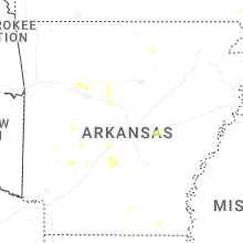
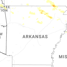
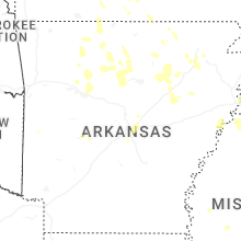

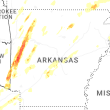


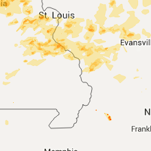


Connect with Interactive Hail Maps