

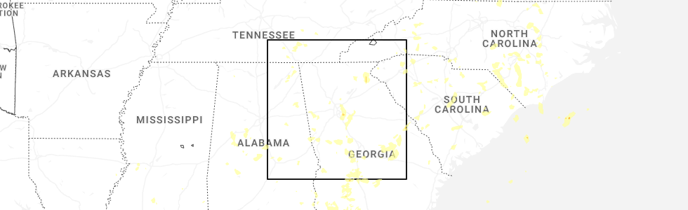
Hail Map for Mount Zion, GA
The Mount Zion, GA area has had 0 reports of on-the-ground hail by trained spotters, and has been under severe weather warnings 34 times during the past 12 months. Doppler radar has detected hail at or near Mount Zion, GA on 39 occasions, including 3 occasions during the past year.
| Name: | Mount Zion, GA |
| Where Located: | 46.3 miles W of Atlanta, GA |
| Map: | Google Map for Mount Zion, GA |
| Population: | 1696 |
| Housing Units: | 615 |
| More Info: | Search Google for Mount Zion, GA |
2
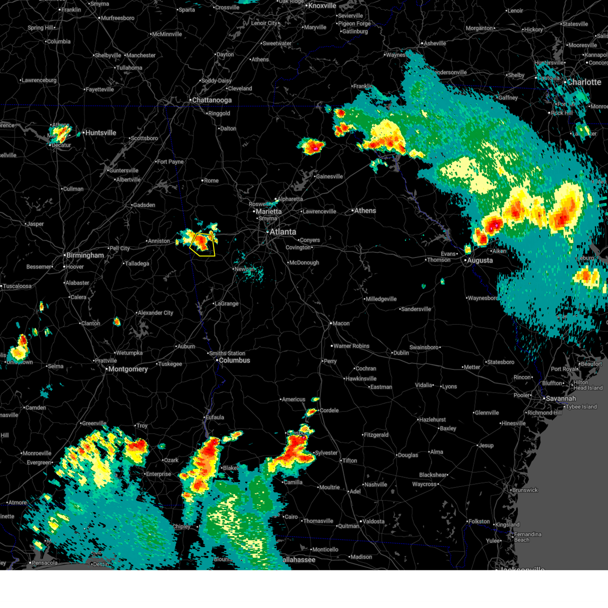
The Top Recent Hail Date for Mount Zion, GA is Wednesday, June 25, 2025 (8th out of 39)
Hail and Wind Damage Spotted near Mount Zion, GA
| Date / Time | Report Details |
|---|---|
| 6/25/2025 9:10 PM EDT |
 the severe thunderstorm warning has been cancelled and is no longer in effect the severe thunderstorm warning has been cancelled and is no longer in effect
|
| 6/25/2025 8:55 PM EDT |
 The storm which prompted the warning has moved out of the area. therefore, the warning will be allowed to expire. however, small hail and gusty winds are still possible with this thunderstorm. The storm which prompted the warning has moved out of the area. therefore, the warning will be allowed to expire. however, small hail and gusty winds are still possible with this thunderstorm.
|
| 6/25/2025 8:54 PM EDT |
 Svrffc the national weather service in peachtree city has issued a * severe thunderstorm warning for, southeastern haralson county in northwestern georgia, southwestern carroll county in northwestern georgia, * until 930 pm edt. * at 854 pm edt, a severe thunderstorm was located over bowdon junction, or 8 miles northwest of carrollton, moving south at 10 mph (radar indicated). Hazards include 60 mph wind gusts and quarter size hail. Hail damage to vehicles is expected. Expect wind damage to roofs, siding, and trees. Svrffc the national weather service in peachtree city has issued a * severe thunderstorm warning for, southeastern haralson county in northwestern georgia, southwestern carroll county in northwestern georgia, * until 930 pm edt. * at 854 pm edt, a severe thunderstorm was located over bowdon junction, or 8 miles northwest of carrollton, moving south at 10 mph (radar indicated). Hazards include 60 mph wind gusts and quarter size hail. Hail damage to vehicles is expected. Expect wind damage to roofs, siding, and trees.
|
| 6/25/2025 8:12 PM EDT | Svrffc the national weather service in peachtree city has issued a * severe thunderstorm warning for, southwestern haralson county in northwestern georgia, west central carroll county in northwestern georgia, * until 900 pm edt. * at 812 pm edt, a severe thunderstorm was located over waco, or near buchanan, moving southwest at 5 mph (radar indicated). Hazards include 60 mph wind gusts and quarter size hail. Hail damage to vehicles is expected. Expect wind damage to roofs, siding, and trees. |
| 6/7/2025 5:28 PM EDT |
 The storms which prompted the warning have moved out of the area. therefore, the warning will be allowed to expire. however, gusty winds are still possible with these thunderstorms. a severe thunderstorm watch remains in effect until 900 pm edt for north central, northwestern and west central georgia. remember, a severe thunderstorm warning still remains in effect for northeast heard, southeast carroll, western douglas, and southeast paulding counties. The storms which prompted the warning have moved out of the area. therefore, the warning will be allowed to expire. however, gusty winds are still possible with these thunderstorms. a severe thunderstorm watch remains in effect until 900 pm edt for north central, northwestern and west central georgia. remember, a severe thunderstorm warning still remains in effect for northeast heard, southeast carroll, western douglas, and southeast paulding counties.
|
| 6/7/2025 5:21 PM EDT |
 the severe thunderstorm warning has been cancelled and is no longer in effect the severe thunderstorm warning has been cancelled and is no longer in effect
|
| 6/7/2025 5:21 PM EDT |
 At 521 pm edt, severe thunderstorms were located along a line extending from dallas to near carrollton, moving east at 55 mph (radar indicated). Hazards include 70 mph wind gusts. Expect considerable tree damage. damage is likely to mobile homes, roofs, and outbuildings. Locations impacted include, douglasville, carrollton, dallas, villa rica, powder springs, temple, hiram, bowdon, mount zion, whitesburg, roopville, brownsville, bill arp, seaton lake, fairplay, clem, abilene, lake val-do-mar, winston, and john tanner state park. At 521 pm edt, severe thunderstorms were located along a line extending from dallas to near carrollton, moving east at 55 mph (radar indicated). Hazards include 70 mph wind gusts. Expect considerable tree damage. damage is likely to mobile homes, roofs, and outbuildings. Locations impacted include, douglasville, carrollton, dallas, villa rica, powder springs, temple, hiram, bowdon, mount zion, whitesburg, roopville, brownsville, bill arp, seaton lake, fairplay, clem, abilene, lake val-do-mar, winston, and john tanner state park.
|
| 6/7/2025 4:46 PM EDT |
 Svrffc the national weather service in peachtree city has issued a * severe thunderstorm warning for, southern paulding county in northwestern georgia, haralson county in northwestern georgia, carroll county in northwestern georgia, west central cobb county in north central georgia, douglas county in north central georgia, southwestern polk county in northwestern georgia, * until 530 pm edt. * at 446 pm edt, severe thunderstorms were located along a line extending from near mars hills to camp sequoyah, moving east at 55 mph (radar indicated). Hazards include 70 mph wind gusts. Expect considerable tree damage. Damage is likely to mobile homes, roofs, and outbuildings. Svrffc the national weather service in peachtree city has issued a * severe thunderstorm warning for, southern paulding county in northwestern georgia, haralson county in northwestern georgia, carroll county in northwestern georgia, west central cobb county in north central georgia, douglas county in north central georgia, southwestern polk county in northwestern georgia, * until 530 pm edt. * at 446 pm edt, severe thunderstorms were located along a line extending from near mars hills to camp sequoyah, moving east at 55 mph (radar indicated). Hazards include 70 mph wind gusts. Expect considerable tree damage. Damage is likely to mobile homes, roofs, and outbuildings.
|
| 5/27/2025 2:17 PM EDT |
 At 216 pm edt, severe thunderstorms were located along a line extending from i 20 welcome center to near graham to near big springs to near dickert, moving east at 45 mph (radar indicated). Hazards include 60 mph wind gusts and penny size hail. Expect damage to roofs, siding, and trees. Locations impacted include, lagrange, carrollton, franklin, villa rica, bremen, temple, tallapoosa, bowdon, mount zion, whitesburg, waco, ephesus, centralhatchee, roopville, corinth, plant yates, seaton lake, fairplay, clem, and abilene. At 216 pm edt, severe thunderstorms were located along a line extending from i 20 welcome center to near graham to near big springs to near dickert, moving east at 45 mph (radar indicated). Hazards include 60 mph wind gusts and penny size hail. Expect damage to roofs, siding, and trees. Locations impacted include, lagrange, carrollton, franklin, villa rica, bremen, temple, tallapoosa, bowdon, mount zion, whitesburg, waco, ephesus, centralhatchee, roopville, corinth, plant yates, seaton lake, fairplay, clem, and abilene.
|
| 5/27/2025 2:06 PM EDT |
 Svrffc the national weather service in peachtree city has issued a * severe thunderstorm warning for, southern haralson county in northwestern georgia, carroll county in northwestern georgia, southwestern douglas county in north central georgia, heard county in west central georgia, northwestern troup county in west central georgia, western coweta county in west central georgia, * until 245 pm edt. * at 205 pm edt, severe thunderstorms were located along a line extending from near edwardsville to near morrison cross roads to near tennant to motley, moving east at 45 mph (radar indicated). Hazards include 60 mph wind gusts and penny size hail. expect damage to roofs, siding, and trees Svrffc the national weather service in peachtree city has issued a * severe thunderstorm warning for, southern haralson county in northwestern georgia, carroll county in northwestern georgia, southwestern douglas county in north central georgia, heard county in west central georgia, northwestern troup county in west central georgia, western coweta county in west central georgia, * until 245 pm edt. * at 205 pm edt, severe thunderstorms were located along a line extending from near edwardsville to near morrison cross roads to near tennant to motley, moving east at 45 mph (radar indicated). Hazards include 60 mph wind gusts and penny size hail. expect damage to roofs, siding, and trees
|
| 5/21/2025 2:08 AM EDT |
 The storm which prompted the warning has weakened below severe limits, and has exited the warned area. therefore, the warning will be allowed to expire. however, gusty winds and heavy rain are still possible with this thunderstorm. The storm which prompted the warning has weakened below severe limits, and has exited the warned area. therefore, the warning will be allowed to expire. however, gusty winds and heavy rain are still possible with this thunderstorm.
|
| 5/21/2025 1:54 AM EDT |
 At 153 am edt, a severe thunderstorm was located near carrollton, moving east at 30 mph (radar indicated). Hazards include 60 mph wind gusts and quarter size hail. Hail damage to vehicles is expected. expect wind damage to roofs, siding, and trees. Locations impacted include, carrollton, mount zion, whitesburg, clem, john tanner state park, and seaton lake. At 153 am edt, a severe thunderstorm was located near carrollton, moving east at 30 mph (radar indicated). Hazards include 60 mph wind gusts and quarter size hail. Hail damage to vehicles is expected. expect wind damage to roofs, siding, and trees. Locations impacted include, carrollton, mount zion, whitesburg, clem, john tanner state park, and seaton lake.
|
| 5/21/2025 1:37 AM EDT |
 the severe thunderstorm warning has been cancelled and is no longer in effect the severe thunderstorm warning has been cancelled and is no longer in effect
|
| 5/21/2025 1:36 AM EDT |
 Svrffc the national weather service in peachtree city has issued a * severe thunderstorm warning for, southern carroll county in northwestern georgia, * until 215 am edt. * at 136 am edt, a severe thunderstorm was located over bowdon, or 10 miles west of carrollton, moving east at 30 mph (radar indicated). Hazards include 60 mph wind gusts and quarter size hail. Hail damage to vehicles is expected. Expect wind damage to roofs, siding, and trees. Svrffc the national weather service in peachtree city has issued a * severe thunderstorm warning for, southern carroll county in northwestern georgia, * until 215 am edt. * at 136 am edt, a severe thunderstorm was located over bowdon, or 10 miles west of carrollton, moving east at 30 mph (radar indicated). Hazards include 60 mph wind gusts and quarter size hail. Hail damage to vehicles is expected. Expect wind damage to roofs, siding, and trees.
|
| 5/21/2025 1:10 AM EDT |
 Svrffc the national weather service in peachtree city has issued a * severe thunderstorm warning for, southern haralson county in northwestern georgia, northwestern carroll county in northwestern georgia, * until 200 am edt. * at 110 am edt, severe thunderstorms were located along a line extending from tallapoosa to i 20 welcome center to chalafinnee, moving east at 25 mph (radar indicated). Hazards include 60 mph wind gusts and quarter size hail. Hail damage to vehicles is expected. Expect wind damage to roofs, siding, and trees. Svrffc the national weather service in peachtree city has issued a * severe thunderstorm warning for, southern haralson county in northwestern georgia, northwestern carroll county in northwestern georgia, * until 200 am edt. * at 110 am edt, severe thunderstorms were located along a line extending from tallapoosa to i 20 welcome center to chalafinnee, moving east at 25 mph (radar indicated). Hazards include 60 mph wind gusts and quarter size hail. Hail damage to vehicles is expected. Expect wind damage to roofs, siding, and trees.
|
| 5/2/2025 9:39 PM EDT |
 The storms which prompted the warning have weakened below severe limits, and no longer pose an immediate threat to life or property. therefore, the warning will be allowed to expire. a severe thunderstorm watch remains in effect until 200 am edt for north central, northwestern and west central georgia. The storms which prompted the warning have weakened below severe limits, and no longer pose an immediate threat to life or property. therefore, the warning will be allowed to expire. a severe thunderstorm watch remains in effect until 200 am edt for north central, northwestern and west central georgia.
|
| 5/2/2025 9:22 PM EDT |
 the severe thunderstorm warning has been cancelled and is no longer in effect the severe thunderstorm warning has been cancelled and is no longer in effect
|
| 5/2/2025 9:22 PM EDT |
 At 921 pm edt, severe thunderstorms were located along a line extending from near winston to near glenn, moving southeast at 30 mph (radar indicated). Hazards include 60 mph wind gusts and penny size hail. Expect damage to roofs, siding, and trees. Locations impacted include, carrollton, franklin, villa rica, temple, bowdon, mount zion, whitesburg, ephesus, centralhatchee, roopville, seaton lake, fairplay, clem, abilene, john tanner state park, glenn, blackjack mountain, hannah, tyus, and roosterville. At 921 pm edt, severe thunderstorms were located along a line extending from near winston to near glenn, moving southeast at 30 mph (radar indicated). Hazards include 60 mph wind gusts and penny size hail. Expect damage to roofs, siding, and trees. Locations impacted include, carrollton, franklin, villa rica, temple, bowdon, mount zion, whitesburg, ephesus, centralhatchee, roopville, seaton lake, fairplay, clem, abilene, john tanner state park, glenn, blackjack mountain, hannah, tyus, and roosterville.
|
| 5/2/2025 8:56 PM EDT |
 Svrffc the national weather service in peachtree city has issued a * severe thunderstorm warning for, eastern haralson county in northwestern georgia, carroll county in northwestern georgia, southwestern douglas county in north central georgia, heard county in west central georgia, * until 945 pm edt. * at 856 pm edt, severe thunderstorms were located along a line extending from near temple to near napoleon, moving southeast at 30 mph (radar indicated). Hazards include 60 mph wind gusts and quarter size hail. Hail damage to vehicles is expected. Expect wind damage to roofs, siding, and trees. Svrffc the national weather service in peachtree city has issued a * severe thunderstorm warning for, eastern haralson county in northwestern georgia, carroll county in northwestern georgia, southwestern douglas county in north central georgia, heard county in west central georgia, * until 945 pm edt. * at 856 pm edt, severe thunderstorms were located along a line extending from near temple to near napoleon, moving southeast at 30 mph (radar indicated). Hazards include 60 mph wind gusts and quarter size hail. Hail damage to vehicles is expected. Expect wind damage to roofs, siding, and trees.
|
| 4/10/2025 8:33 PM EDT |
 Svrffc the national weather service in peachtree city has issued a * severe thunderstorm warning for, southern paulding county in northwestern georgia, haralson county in northwestern georgia, eastern carroll county in northwestern georgia, southwestern cobb county in north central georgia, douglas county in north central georgia, north central coweta county in west central georgia, southwestern fulton county in north central georgia, southeastern polk county in northwestern georgia, * until 915 pm edt. * at 831 pm edt, a severe thunderstorm was located near eubank lake, or near buchanan, moving southeast at 50 mph (radar indicated). Hazards include 60 mph wind gusts and quarter size hail. Hail damage to vehicles is expected. Expect wind damage to roofs, siding, and trees. Svrffc the national weather service in peachtree city has issued a * severe thunderstorm warning for, southern paulding county in northwestern georgia, haralson county in northwestern georgia, eastern carroll county in northwestern georgia, southwestern cobb county in north central georgia, douglas county in north central georgia, north central coweta county in west central georgia, southwestern fulton county in north central georgia, southeastern polk county in northwestern georgia, * until 915 pm edt. * at 831 pm edt, a severe thunderstorm was located near eubank lake, or near buchanan, moving southeast at 50 mph (radar indicated). Hazards include 60 mph wind gusts and quarter size hail. Hail damage to vehicles is expected. Expect wind damage to roofs, siding, and trees.
|
| 3/16/2025 12:13 AM EDT |
 At 1212 am edt, severe thunderstorms were located along a line extending from cedartown to near tallapoosa to near bowdon, moving east at 50 mph (radar indicated). Hazards include 60 mph wind gusts and penny size hail. Expect damage to roofs, siding, and trees. Locations impacted include, burnt hickory ridge, carrollton, aragon, mount zion, euharlee, abilene, draketown, lake val-do-mar, cedartown, john tanner state park, bremen, braswell, dallas, taylorsville, rockmart, tallapoosa, cassville, fish creek, eubank lake, and bowdon junction. At 1212 am edt, severe thunderstorms were located along a line extending from cedartown to near tallapoosa to near bowdon, moving east at 50 mph (radar indicated). Hazards include 60 mph wind gusts and penny size hail. Expect damage to roofs, siding, and trees. Locations impacted include, burnt hickory ridge, carrollton, aragon, mount zion, euharlee, abilene, draketown, lake val-do-mar, cedartown, john tanner state park, bremen, braswell, dallas, taylorsville, rockmart, tallapoosa, cassville, fish creek, eubank lake, and bowdon junction.
|
| 3/15/2025 11:58 PM EDT |
 Svrffc the national weather service in peachtree city has issued a * severe thunderstorm warning for, paulding county in northwestern georgia, haralson county in northwestern georgia, carroll county in northwestern georgia, northwestern douglas county in north central georgia, southeastern floyd county in northwestern georgia, polk county in northwestern georgia, southwestern bartow county in northwestern georgia, * until 1230 am edt. * at 1157 pm edt, severe thunderstorms were located along a line extending from near esom hill to abernathy to micaville, moving northeast at 50 mph (radar indicated). Hazards include 60 mph wind gusts and penny size hail. expect damage to roofs, siding, and trees Svrffc the national weather service in peachtree city has issued a * severe thunderstorm warning for, paulding county in northwestern georgia, haralson county in northwestern georgia, carroll county in northwestern georgia, northwestern douglas county in north central georgia, southeastern floyd county in northwestern georgia, polk county in northwestern georgia, southwestern bartow county in northwestern georgia, * until 1230 am edt. * at 1157 pm edt, severe thunderstorms were located along a line extending from near esom hill to abernathy to micaville, moving northeast at 50 mph (radar indicated). Hazards include 60 mph wind gusts and penny size hail. expect damage to roofs, siding, and trees
|
| 3/15/2025 11:24 PM EDT |
 At 1123 pm edt, severe thunderstorms were located along a line extending from near lindale to john tanner state park, moving northeast at 55 mph (radar indicated). Hazards include 60 mph wind gusts. Expect damage to roofs, siding, and trees. Locations impacted include, ranger, carrollton, brownsville, aragon, bill arp, fairplay, cross roads, abilene, draketown, winston, lake val-do-mar, new hope, funkhouser, rockmart, cassville, bowdon junction, acworth, emerson, van wert, and buchanan. At 1123 pm edt, severe thunderstorms were located along a line extending from near lindale to john tanner state park, moving northeast at 55 mph (radar indicated). Hazards include 60 mph wind gusts. Expect damage to roofs, siding, and trees. Locations impacted include, ranger, carrollton, brownsville, aragon, bill arp, fairplay, cross roads, abilene, draketown, winston, lake val-do-mar, new hope, funkhouser, rockmart, cassville, bowdon junction, acworth, emerson, van wert, and buchanan.
|
| 3/15/2025 11:24 PM EDT |
 the severe thunderstorm warning has been cancelled and is no longer in effect the severe thunderstorm warning has been cancelled and is no longer in effect
|
| 3/15/2025 10:55 PM EDT |
 Svrffc the national weather service in peachtree city has issued a * severe thunderstorm warning for, paulding county in northwestern georgia, haralson county in northwestern georgia, carroll county in northwestern georgia, northwestern cobb county in north central georgia, douglas county in north central georgia, southeastern floyd county in northwestern georgia, northern heard county in west central georgia, northwestern coweta county in west central georgia, southwestern fulton county in north central georgia, southeastern gordon county in northwestern georgia, polk county in northwestern georgia, bartow county in northwestern georgia, * until midnight edt. * at 1054 pm edt, severe thunderstorms were located along a line extending from esom hill to corinth, moving northeast at 70 mph (radar indicated). Hazards include 60 mph wind gusts. expect damage to roofs, siding, and trees Svrffc the national weather service in peachtree city has issued a * severe thunderstorm warning for, paulding county in northwestern georgia, haralson county in northwestern georgia, carroll county in northwestern georgia, northwestern cobb county in north central georgia, douglas county in north central georgia, southeastern floyd county in northwestern georgia, northern heard county in west central georgia, northwestern coweta county in west central georgia, southwestern fulton county in north central georgia, southeastern gordon county in northwestern georgia, polk county in northwestern georgia, bartow county in northwestern georgia, * until midnight edt. * at 1054 pm edt, severe thunderstorms were located along a line extending from esom hill to corinth, moving northeast at 70 mph (radar indicated). Hazards include 60 mph wind gusts. expect damage to roofs, siding, and trees
|
| 3/5/2025 1:01 AM EST |
 The storms which prompted the warning have moved out of the area. therefore, the warning has been allowed to expire. a severe thunderstorm watch remains in effect until 400 am est for northwestern and west central georgia. remember, a severe thunderstorm warning still remains in effect for eastern carroll, heard, and troup counties. The storms which prompted the warning have moved out of the area. therefore, the warning has been allowed to expire. a severe thunderstorm watch remains in effect until 400 am est for northwestern and west central georgia. remember, a severe thunderstorm warning still remains in effect for eastern carroll, heard, and troup counties.
|
| 3/5/2025 12:52 AM EST |
 At 1251 am est, severe thunderstorms were located along a line extending from fish creek to near carrollton to glenn, moving east at 45 mph (radar indicated). Hazards include 60 mph wind gusts. Expect damage to roofs, siding, and trees. Locations impacted include, lagrange, carrollton, franklin, villa rica, west point, mount zion, centralhatchee, roopville, cannonville, clem, abilene, piedmont heights, john tanner state park, hillcrest, wares crossroads, glenn, bowdon junction, tyus, state line park, and abbottsford. At 1251 am est, severe thunderstorms were located along a line extending from fish creek to near carrollton to glenn, moving east at 45 mph (radar indicated). Hazards include 60 mph wind gusts. Expect damage to roofs, siding, and trees. Locations impacted include, lagrange, carrollton, franklin, villa rica, west point, mount zion, centralhatchee, roopville, cannonville, clem, abilene, piedmont heights, john tanner state park, hillcrest, wares crossroads, glenn, bowdon junction, tyus, state line park, and abbottsford.
|
| 3/5/2025 12:14 AM EST |
 Svrffc the national weather service in peachtree city has issued a * severe thunderstorm warning for, carroll county in northwestern georgia, heard county in west central georgia, western troup county in west central georgia, * until 100 am est. * at 1213 am est, severe thunderstorms were located along a line extending from near abernathy to tennant to near west chambers, moving northeast at 45 mph (radar indicated). Hazards include 60 mph wind gusts. expect damage to roofs, siding, and trees Svrffc the national weather service in peachtree city has issued a * severe thunderstorm warning for, carroll county in northwestern georgia, heard county in west central georgia, western troup county in west central georgia, * until 100 am est. * at 1213 am est, severe thunderstorms were located along a line extending from near abernathy to tennant to near west chambers, moving northeast at 45 mph (radar indicated). Hazards include 60 mph wind gusts. expect damage to roofs, siding, and trees
|
| 3/5/2025 12:11 AM EST |
 Svrffc the national weather service in peachtree city has issued a * severe thunderstorm warning for, paulding county in northwestern georgia, haralson county in northwestern georgia, northern carroll county in northwestern georgia, northwestern douglas county in north central georgia, southern murray county in northwestern georgia, floyd county in northwestern georgia, gordon county in northwestern georgia, polk county in northwestern georgia, chattooga county in northwestern georgia, bartow county in northwestern georgia, * until 100 am est. * at 1211 am est, severe thunderstorms were located along a line extending from trion to near fruithurst, moving east at 50 mph (radar indicated). Hazards include 60 mph wind gusts. expect damage to roofs, siding, and trees Svrffc the national weather service in peachtree city has issued a * severe thunderstorm warning for, paulding county in northwestern georgia, haralson county in northwestern georgia, northern carroll county in northwestern georgia, northwestern douglas county in north central georgia, southern murray county in northwestern georgia, floyd county in northwestern georgia, gordon county in northwestern georgia, polk county in northwestern georgia, chattooga county in northwestern georgia, bartow county in northwestern georgia, * until 100 am est. * at 1211 am est, severe thunderstorms were located along a line extending from trion to near fruithurst, moving east at 50 mph (radar indicated). Hazards include 60 mph wind gusts. expect damage to roofs, siding, and trees
|
| 2/16/2025 3:21 AM EST |
 Svrffc the national weather service in peachtree city has issued a * severe thunderstorm warning for, paulding county in northwestern georgia, haralson county in northwestern georgia, carroll county in northwestern georgia, western douglas county in north central georgia, northwestern heard county in west central georgia, southern polk county in northwestern georgia, * until 400 am est. * at 320 am est, severe thunderstorms were located along a line extending from borden springs to near chalafinnee to near chandler springs, moving east at 70 mph (radar indicated). Hazards include 60 mph wind gusts. expect damage to roofs, siding, and trees Svrffc the national weather service in peachtree city has issued a * severe thunderstorm warning for, paulding county in northwestern georgia, haralson county in northwestern georgia, carroll county in northwestern georgia, western douglas county in north central georgia, northwestern heard county in west central georgia, southern polk county in northwestern georgia, * until 400 am est. * at 320 am est, severe thunderstorms were located along a line extending from borden springs to near chalafinnee to near chandler springs, moving east at 70 mph (radar indicated). Hazards include 60 mph wind gusts. expect damage to roofs, siding, and trees
|
| 8/18/2024 5:34 PM EDT |
 Svrffc the national weather service in peachtree city has issued a * severe thunderstorm warning for, southeastern haralson county in northwestern georgia, central carroll county in northwestern georgia, southwestern douglas county in north central georgia, * until 615 pm edt. * at 534 pm edt, a severe thunderstorm was located over bowdon junction, or 7 miles northwest of carrollton, moving southeast at 15 mph (radar indicated). Hazards include 60 mph wind gusts and penny size hail. expect damage to roofs, siding, and trees Svrffc the national weather service in peachtree city has issued a * severe thunderstorm warning for, southeastern haralson county in northwestern georgia, central carroll county in northwestern georgia, southwestern douglas county in north central georgia, * until 615 pm edt. * at 534 pm edt, a severe thunderstorm was located over bowdon junction, or 7 miles northwest of carrollton, moving southeast at 15 mph (radar indicated). Hazards include 60 mph wind gusts and penny size hail. expect damage to roofs, siding, and trees
|
| 8/17/2024 7:33 PM EDT |
 Svrffc the national weather service in peachtree city has issued a * severe thunderstorm warning for, carroll county in northwestern georgia, southwestern douglas county in north central georgia, northern heard county in west central georgia, northern coweta county in west central georgia, southwestern fulton county in north central georgia, * until 815 pm edt. * at 732 pm edt, a severe thunderstorm was located over bowdon, or 12 miles west of carrollton, moving east at 45 mph (radar indicated). Hazards include 60 mph wind gusts and quarter size hail. Hail damage to vehicles is expected. Expect wind damage to roofs, siding, and trees. Svrffc the national weather service in peachtree city has issued a * severe thunderstorm warning for, carroll county in northwestern georgia, southwestern douglas county in north central georgia, northern heard county in west central georgia, northern coweta county in west central georgia, southwestern fulton county in north central georgia, * until 815 pm edt. * at 732 pm edt, a severe thunderstorm was located over bowdon, or 12 miles west of carrollton, moving east at 45 mph (radar indicated). Hazards include 60 mph wind gusts and quarter size hail. Hail damage to vehicles is expected. Expect wind damage to roofs, siding, and trees.
|
| 7/29/2024 7:56 PM EDT |
 Svrffc the national weather service in peachtree city has issued a * severe thunderstorm warning for, southeastern paulding county in northwestern georgia, southeastern haralson county in northwestern georgia, central carroll county in northwestern georgia, southwestern cobb county in north central georgia, douglas county in north central georgia, southwestern fulton county in north central georgia, * until 830 pm edt. * at 756 pm edt, severe thunderstorms were located along a line extending from near lost mountain park to lake val-do-mar to waco, moving southeast at 25 mph (radar indicated). Hazards include 60 mph wind gusts and quarter size hail. Hail damage to vehicles is expected. Expect wind damage to roofs, siding, and trees. Svrffc the national weather service in peachtree city has issued a * severe thunderstorm warning for, southeastern paulding county in northwestern georgia, southeastern haralson county in northwestern georgia, central carroll county in northwestern georgia, southwestern cobb county in north central georgia, douglas county in north central georgia, southwestern fulton county in north central georgia, * until 830 pm edt. * at 756 pm edt, severe thunderstorms were located along a line extending from near lost mountain park to lake val-do-mar to waco, moving southeast at 25 mph (radar indicated). Hazards include 60 mph wind gusts and quarter size hail. Hail damage to vehicles is expected. Expect wind damage to roofs, siding, and trees.
|
| 7/29/2024 7:48 PM EDT |
 Svrffc the national weather service in peachtree city has issued a * severe thunderstorm warning for, southwestern haralson county in northwestern georgia, southwestern carroll county in northwestern georgia, * until 815 pm edt. * at 748 pm edt, a severe thunderstorm was located near tallapoosa, or 10 miles southwest of buchanan, moving southeast at 35 mph (radar indicated). Hazards include 60 mph wind gusts and quarter size hail. Hail damage to vehicles is expected. Expect wind damage to roofs, siding, and trees. Svrffc the national weather service in peachtree city has issued a * severe thunderstorm warning for, southwestern haralson county in northwestern georgia, southwestern carroll county in northwestern georgia, * until 815 pm edt. * at 748 pm edt, a severe thunderstorm was located near tallapoosa, or 10 miles southwest of buchanan, moving southeast at 35 mph (radar indicated). Hazards include 60 mph wind gusts and quarter size hail. Hail damage to vehicles is expected. Expect wind damage to roofs, siding, and trees.
|
| 5/27/2024 7:51 AM EDT |
 At 751 am edt, severe thunderstorms were located along a line extending from near trickem to near temple to near dallas, moving east at 30 mph (radar indicated). Hazards include 60 mph wind gusts and penny size hail. Expect damage to roofs, siding, and trees. Locations impacted include, marietta, carrollton, dallas, buchanan, kennesaw, villa rica, powder springs, bremen, temple, hiram, tallapoosa, bowdon, mount zion, waco, braswell, yorkville, burnt hickory ridge, lost mountain park, brownsville, and cross roads. At 751 am edt, severe thunderstorms were located along a line extending from near trickem to near temple to near dallas, moving east at 30 mph (radar indicated). Hazards include 60 mph wind gusts and penny size hail. Expect damage to roofs, siding, and trees. Locations impacted include, marietta, carrollton, dallas, buchanan, kennesaw, villa rica, powder springs, bremen, temple, hiram, tallapoosa, bowdon, mount zion, waco, braswell, yorkville, burnt hickory ridge, lost mountain park, brownsville, and cross roads.
|
| 5/27/2024 7:51 AM EDT |
 the severe thunderstorm warning has been cancelled and is no longer in effect the severe thunderstorm warning has been cancelled and is no longer in effect
|
| 5/27/2024 7:49 AM EDT |
 Svrffc the national weather service in peachtree city has issued a * severe thunderstorm warning for, northern fayette county in north central georgia, carroll county in northwestern georgia, douglas county in north central georgia, heard county in west central georgia, coweta county in west central georgia, southwestern fulton county in north central georgia, * until 830 am edt. * at 749 am edt, severe thunderstorms were located along a line extending from near douglasville to near carrollton to corinth, moving southeast at 40 mph (radar indicated). Hazards include 60 mph wind gusts and penny size hail. expect damage to roofs, siding, and trees Svrffc the national weather service in peachtree city has issued a * severe thunderstorm warning for, northern fayette county in north central georgia, carroll county in northwestern georgia, douglas county in north central georgia, heard county in west central georgia, coweta county in west central georgia, southwestern fulton county in north central georgia, * until 830 am edt. * at 749 am edt, severe thunderstorms were located along a line extending from near douglasville to near carrollton to corinth, moving southeast at 40 mph (radar indicated). Hazards include 60 mph wind gusts and penny size hail. expect damage to roofs, siding, and trees
|
| 5/27/2024 7:18 AM EDT |
 Svrffc the national weather service in peachtree city has issued a * severe thunderstorm warning for, paulding county in northwestern georgia, haralson county in northwestern georgia, central carroll county in northwestern georgia, west central cobb county in north central georgia, northwestern douglas county in north central georgia, central polk county in northwestern georgia, * until 800 am edt. * at 718 am edt, severe thunderstorms were located along a line extending from dearmanville to near tallapoosa to fish creek, moving east at 30 mph (radar indicated). Hazards include 60 mph wind gusts and penny size hail. expect damage to roofs, siding, and trees Svrffc the national weather service in peachtree city has issued a * severe thunderstorm warning for, paulding county in northwestern georgia, haralson county in northwestern georgia, central carroll county in northwestern georgia, west central cobb county in north central georgia, northwestern douglas county in north central georgia, central polk county in northwestern georgia, * until 800 am edt. * at 718 am edt, severe thunderstorms were located along a line extending from dearmanville to near tallapoosa to fish creek, moving east at 30 mph (radar indicated). Hazards include 60 mph wind gusts and penny size hail. expect damage to roofs, siding, and trees
|
| 3/15/2024 9:50 AM EDT |
 The storms which prompted the warning have moved out of the area. therefore, the warning will be allowed to expire. The storms which prompted the warning have moved out of the area. therefore, the warning will be allowed to expire.
|
| 3/15/2024 9:40 AM EDT |
 At 939 am edt, severe thunderstorms were located along a line extending from near aragon to trickem, moving east at 40 mph (radar indicated). Hazards include 60 mph wind gusts. Expect damage to roofs, siding, and trees. Locations impacted include, rome, cedartown, buchanan, bremen, rockmart, tallapoosa, bowdon, mount zion, aragon, waco, fish creek, antioch, seney, felton, and lindale. At 939 am edt, severe thunderstorms were located along a line extending from near aragon to trickem, moving east at 40 mph (radar indicated). Hazards include 60 mph wind gusts. Expect damage to roofs, siding, and trees. Locations impacted include, rome, cedartown, buchanan, bremen, rockmart, tallapoosa, bowdon, mount zion, aragon, waco, fish creek, antioch, seney, felton, and lindale.
|
| 3/15/2024 9:12 AM EDT |
 Svrffc the national weather service in peachtree city has issued a * severe thunderstorm warning for, haralson county in northwestern georgia, west central carroll county in northwestern georgia, southeastern floyd county in northwestern georgia, polk county in northwestern georgia, * until 1000 am edt. * at 912 am edt, severe thunderstorms were located along a line extending from near etna to near dearmanville, moving east at 40 mph (radar indicated). Hazards include 60 mph wind gusts. expect damage to roofs, siding, and trees Svrffc the national weather service in peachtree city has issued a * severe thunderstorm warning for, haralson county in northwestern georgia, west central carroll county in northwestern georgia, southeastern floyd county in northwestern georgia, polk county in northwestern georgia, * until 1000 am edt. * at 912 am edt, severe thunderstorms were located along a line extending from near etna to near dearmanville, moving east at 40 mph (radar indicated). Hazards include 60 mph wind gusts. expect damage to roofs, siding, and trees
|
| 8/12/2023 5:43 PM EDT |
 At 542 pm edt, a severe thunderstorm was located near i 20 welcome center, or 12 miles west of carrollton, moving southeast at 15 mph (radar indicated). Hazards include 60 mph wind gusts. expect damage to roofs, siding, and trees At 542 pm edt, a severe thunderstorm was located near i 20 welcome center, or 12 miles west of carrollton, moving southeast at 15 mph (radar indicated). Hazards include 60 mph wind gusts. expect damage to roofs, siding, and trees
|
| 8/9/2023 9:05 PM EDT |
 The severe thunderstorm warning for south central haralson, southwestern carroll and northwestern heard counties will expire at 915 pm edt, the storm which prompted the warning has weakened below severe limits, and no longer poses an immediate threat to life or property. therefore, the warning will be allowed to expire. however, gusty winds and heavy rain are still possible with this thunderstorm. a severe thunderstorm watch remains in effect until midnight edt for northwestern and west central georgia. The severe thunderstorm warning for south central haralson, southwestern carroll and northwestern heard counties will expire at 915 pm edt, the storm which prompted the warning has weakened below severe limits, and no longer poses an immediate threat to life or property. therefore, the warning will be allowed to expire. however, gusty winds and heavy rain are still possible with this thunderstorm. a severe thunderstorm watch remains in effect until midnight edt for northwestern and west central georgia.
|
| 8/9/2023 8:28 PM EDT |
 At 827 pm edt, a severe thunderstorm was located over newell, or 9 miles north of wedowee, moving northeast at 30 mph (radar indicated). Hazards include 60 mph wind gusts and quarter size hail. Hail damage to vehicles is expected. Expect wind damage to roofs, siding, and trees. At 827 pm edt, a severe thunderstorm was located over newell, or 9 miles north of wedowee, moving northeast at 30 mph (radar indicated). Hazards include 60 mph wind gusts and quarter size hail. Hail damage to vehicles is expected. Expect wind damage to roofs, siding, and trees.
|
| 8/7/2023 4:58 PM EDT |
 At 458 pm edt, a severe thunderstorm was located over abernathy, or 7 miles east of heflin, moving east at 35 mph (radar indicated). Hazards include 70 mph wind gusts. Expect considerable tree damage. Damage is likely to mobile homes, roofs, and outbuildings. At 458 pm edt, a severe thunderstorm was located over abernathy, or 7 miles east of heflin, moving east at 35 mph (radar indicated). Hazards include 70 mph wind gusts. Expect considerable tree damage. Damage is likely to mobile homes, roofs, and outbuildings.
|
| 8/6/2023 6:09 PM EDT |
 At 608 pm edt, severe thunderstorms were located along a line extending from felton to clem to near rock stand, moving east at 30 mph (radar indicated). Hazards include 60 mph wind gusts and penny size hail. Expect damage to roofs, siding, and trees. locations impacted include, carrollton, cedartown, buchanan, bremen, temple, tallapoosa, bowdon, mount zion, waco, etna, esom hill, bowdon junction, antioch, clem, abilene, felton, john tanner state park, and eubank lake. hail threat, radar indicated max hail size, 0. 75 in wind threat, radar indicated max wind gust, 60 mph. At 608 pm edt, severe thunderstorms were located along a line extending from felton to clem to near rock stand, moving east at 30 mph (radar indicated). Hazards include 60 mph wind gusts and penny size hail. Expect damage to roofs, siding, and trees. locations impacted include, carrollton, cedartown, buchanan, bremen, temple, tallapoosa, bowdon, mount zion, waco, etna, esom hill, bowdon junction, antioch, clem, abilene, felton, john tanner state park, and eubank lake. hail threat, radar indicated max hail size, 0. 75 in wind threat, radar indicated max wind gust, 60 mph.
|
| 8/6/2023 5:32 PM EDT |
 At 532 pm edt, severe thunderstorms were located along a line extending from near borden springs to near bowdon to cragford, moving east at 30 mph (radar indicated). Hazards include 60 mph wind gusts and penny size hail. expect damage to roofs, siding, and trees At 532 pm edt, severe thunderstorms were located along a line extending from near borden springs to near bowdon to cragford, moving east at 30 mph (radar indicated). Hazards include 60 mph wind gusts and penny size hail. expect damage to roofs, siding, and trees
|
| 8/3/2023 4:59 PM EDT |
 At 458 pm edt, a severe thunderstorm was located over carrollton, moving east at 40 mph (radar indicated). Hazards include 60 mph wind gusts. Expect damage to roofs, siding, and trees. locations impacted include, carrollton, villa rica, bremen, temple, bowdon, mount zion, whitesburg, ephesus, roopville, bowdon junction, hannah, tyus, roosterville, seaton lake, fairplay, clem, frolona, abilene, john tanner state park, and lowell. hail threat, radar indicated max hail size, <. 75 in wind threat, radar indicated max wind gust, 60 mph. At 458 pm edt, a severe thunderstorm was located over carrollton, moving east at 40 mph (radar indicated). Hazards include 60 mph wind gusts. Expect damage to roofs, siding, and trees. locations impacted include, carrollton, villa rica, bremen, temple, bowdon, mount zion, whitesburg, ephesus, roopville, bowdon junction, hannah, tyus, roosterville, seaton lake, fairplay, clem, frolona, abilene, john tanner state park, and lowell. hail threat, radar indicated max hail size, <. 75 in wind threat, radar indicated max wind gust, 60 mph.
|
| 8/3/2023 4:33 PM EDT |
 At 433 pm edt, a severe thunderstorm was located over i 20 welcome center, or 11 miles east of heflin, moving southeast at 25 mph (radar indicated). Hazards include 60 mph wind gusts. expect damage to roofs, siding, and trees At 433 pm edt, a severe thunderstorm was located over i 20 welcome center, or 11 miles east of heflin, moving southeast at 25 mph (radar indicated). Hazards include 60 mph wind gusts. expect damage to roofs, siding, and trees
|
| 7/2/2023 5:17 PM EDT |
 At 515 pm edt, a severe thunderstorm was located near trickem, or 12 miles southeast of heflin, moving east at 20 mph (radar indicated). Hazards include 60 mph wind gusts and quarter size hail. Hail damage to vehicles is expected. Expect wind damage to roofs, siding, and trees. At 515 pm edt, a severe thunderstorm was located near trickem, or 12 miles southeast of heflin, moving east at 20 mph (radar indicated). Hazards include 60 mph wind gusts and quarter size hail. Hail damage to vehicles is expected. Expect wind damage to roofs, siding, and trees.
|
| 6/30/2023 2:35 PM EDT |
 At 234 pm edt, severe thunderstorms were located along a line extending from mount zion to lowell to dunaway gardens, moving south at 25 mph (radar indicated). Hazards include 60 mph wind gusts and quarter size hail. Hail damage to vehicles is expected. Expect wind damage to roofs, siding, and trees. At 234 pm edt, severe thunderstorms were located along a line extending from mount zion to lowell to dunaway gardens, moving south at 25 mph (radar indicated). Hazards include 60 mph wind gusts and quarter size hail. Hail damage to vehicles is expected. Expect wind damage to roofs, siding, and trees.
|
| 6/30/2023 2:15 PM EDT |
 At 214 pm edt, severe thunderstorms were located along a line extending from near bremen to near abilene to hannah, moving south at 15 mph (radar indicated). Hazards include 60 mph wind gusts and quarter size hail. Hail damage to vehicles is expected. Expect wind damage to roofs, siding, and trees. At 214 pm edt, severe thunderstorms were located along a line extending from near bremen to near abilene to hannah, moving south at 15 mph (radar indicated). Hazards include 60 mph wind gusts and quarter size hail. Hail damage to vehicles is expected. Expect wind damage to roofs, siding, and trees.
|
| 6/30/2023 2:04 PM EDT |
 At 204 pm edt, a severe thunderstorm was located over temple, or 8 miles southeast of buchanan, moving south at 15 mph (radar indicated). Hazards include 60 mph wind gusts and quarter size hail. Hail damage to vehicles is expected. expect wind damage to roofs, siding, and trees. locations impacted include, carrollton, buchanan, villa rica, bremen, temple, mount zion, waco, abilene, treasure lake, bowdon junction and fairplay. hail threat, radar indicated max hail size, 1. 00 in wind threat, radar indicated max wind gust, 60 mph. At 204 pm edt, a severe thunderstorm was located over temple, or 8 miles southeast of buchanan, moving south at 15 mph (radar indicated). Hazards include 60 mph wind gusts and quarter size hail. Hail damage to vehicles is expected. expect wind damage to roofs, siding, and trees. locations impacted include, carrollton, buchanan, villa rica, bremen, temple, mount zion, waco, abilene, treasure lake, bowdon junction and fairplay. hail threat, radar indicated max hail size, 1. 00 in wind threat, radar indicated max wind gust, 60 mph.
|
| 6/30/2023 1:42 PM EDT |
 At 142 pm edt, a severe thunderstorm was located over draketown, or near buchanan, moving south at 15 mph (radar indicated). Hazards include 60 mph wind gusts and quarter size hail. Hail damage to vehicles is expected. Expect wind damage to roofs, siding, and trees. At 142 pm edt, a severe thunderstorm was located over draketown, or near buchanan, moving south at 15 mph (radar indicated). Hazards include 60 mph wind gusts and quarter size hail. Hail damage to vehicles is expected. Expect wind damage to roofs, siding, and trees.
|
| 6/25/2023 6:57 PM EDT |
 At 657 pm edt, a severe thunderstorm was located over carrollton, moving southeast at 10 mph (radar indicated). Hazards include 60 mph wind gusts. expect damage to roofs, siding, and trees At 657 pm edt, a severe thunderstorm was located over carrollton, moving southeast at 10 mph (radar indicated). Hazards include 60 mph wind gusts. expect damage to roofs, siding, and trees
|
| 6/25/2023 6:21 PM EDT |
 At 621 pm edt, a severe thunderstorm was located near waco, or near buchanan, moving southeast at 50 mph (radar indicated). Hazards include 60 mph wind gusts and penny size hail. expect damage to roofs, siding, and trees At 621 pm edt, a severe thunderstorm was located near waco, or near buchanan, moving southeast at 50 mph (radar indicated). Hazards include 60 mph wind gusts and penny size hail. expect damage to roofs, siding, and trees
|
| 6/25/2023 5:48 PM EDT |
 At 548 pm edt, a severe thunderstorm was located over borden springs, or 8 miles east of piedmont, moving east at 25 mph (radar indicated). Hazards include 60 mph wind gusts and penny size hail. expect damage to roofs, siding, and trees At 548 pm edt, a severe thunderstorm was located over borden springs, or 8 miles east of piedmont, moving east at 25 mph (radar indicated). Hazards include 60 mph wind gusts and penny size hail. expect damage to roofs, siding, and trees
|
| 6/25/2023 5:31 PM EDT |
 At 531 pm edt, a severe thunderstorm was located over tallapoosa, or 9 miles southwest of buchanan, moving east at 20 mph (radar indicated). Hazards include 60 mph wind gusts and penny size hail. expect damage to roofs, siding, and trees At 531 pm edt, a severe thunderstorm was located over tallapoosa, or 9 miles southwest of buchanan, moving east at 20 mph (radar indicated). Hazards include 60 mph wind gusts and penny size hail. expect damage to roofs, siding, and trees
|
| 6/14/2023 1:21 PM EDT |
 At 120 pm edt, a severe thunderstorm was located near carrollton, moving east at 35 mph (radar indicated). Hazards include 60 mph wind gusts and quarter size hail. Hail damage to vehicles is expected. expect wind damage to roofs, siding, and trees. locations impacted include, carrollton, villa rica, bremen, temple, mount zion, byers crossroads, abilene, john tanner state park, treasure lake, bowdon junction and seaton lake. hail threat, radar indicated max hail size, 1. 00 in wind threat, radar indicated max wind gust, 60 mph. At 120 pm edt, a severe thunderstorm was located near carrollton, moving east at 35 mph (radar indicated). Hazards include 60 mph wind gusts and quarter size hail. Hail damage to vehicles is expected. expect wind damage to roofs, siding, and trees. locations impacted include, carrollton, villa rica, bremen, temple, mount zion, byers crossroads, abilene, john tanner state park, treasure lake, bowdon junction and seaton lake. hail threat, radar indicated max hail size, 1. 00 in wind threat, radar indicated max wind gust, 60 mph.
|
| 6/14/2023 1:02 PM EDT |
 At 102 pm edt, a severe thunderstorm was located over waco, or 8 miles south of buchanan, moving east at 40 mph (radar indicated). Hazards include 60 mph wind gusts and quarter size hail. Hail damage to vehicles is expected. Expect wind damage to roofs, siding, and trees. At 102 pm edt, a severe thunderstorm was located over waco, or 8 miles south of buchanan, moving east at 40 mph (radar indicated). Hazards include 60 mph wind gusts and quarter size hail. Hail damage to vehicles is expected. Expect wind damage to roofs, siding, and trees.
|
| 5/16/2023 5:06 PM EDT |
 The severe thunderstorm warning for southwestern paulding, eastern haralson and north central carroll counties will expire at 515 pm edt, the storm which prompted the warning has weakened below severe limits, and no longer poses an immediate threat to life or property. therefore, the warning will be allowed to expire. however gusty winds and heavy rain are still possible with this thunderstorm. The severe thunderstorm warning for southwestern paulding, eastern haralson and north central carroll counties will expire at 515 pm edt, the storm which prompted the warning has weakened below severe limits, and no longer poses an immediate threat to life or property. therefore, the warning will be allowed to expire. however gusty winds and heavy rain are still possible with this thunderstorm.
|
| 5/16/2023 5:00 PM EDT |
 At 459 pm edt, a severe thunderstorm was located near buchanan, moving east at 10 mph (radar indicated). Hazards include 60 mph wind gusts and quarter size hail. Hail damage to vehicles is expected. expect wind damage to roofs, siding, and trees. locations impacted include, bremen, temple, mount zion, waco, abilene, draketown, eubank lake and bowdon junction. hail threat, radar indicated max hail size, 1. 00 in wind threat, radar indicated max wind gust, 60 mph. At 459 pm edt, a severe thunderstorm was located near buchanan, moving east at 10 mph (radar indicated). Hazards include 60 mph wind gusts and quarter size hail. Hail damage to vehicles is expected. expect wind damage to roofs, siding, and trees. locations impacted include, bremen, temple, mount zion, waco, abilene, draketown, eubank lake and bowdon junction. hail threat, radar indicated max hail size, 1. 00 in wind threat, radar indicated max wind gust, 60 mph.
|
| 5/16/2023 4:45 PM EDT |
 At 445 pm edt, a severe thunderstorm was located near buchanan, moving east at 10 mph (radar indicated). Hazards include 60 mph wind gusts and quarter size hail. Hail damage to vehicles is expected. Expect wind damage to roofs, siding, and trees. At 445 pm edt, a severe thunderstorm was located near buchanan, moving east at 10 mph (radar indicated). Hazards include 60 mph wind gusts and quarter size hail. Hail damage to vehicles is expected. Expect wind damage to roofs, siding, and trees.
|
| 3/3/2023 4:06 PM EST |
 At 406 pm est, severe thunderstorms were located along a line extending from bremen to near ofelia, moving east at 50 mph (radar indicated). Hazards include 60 mph wind gusts. expect damage to roofs, siding, and trees At 406 pm est, severe thunderstorms were located along a line extending from bremen to near ofelia, moving east at 50 mph (radar indicated). Hazards include 60 mph wind gusts. expect damage to roofs, siding, and trees
|
| 1/12/2023 2:44 PM EST |
 At 244 pm est, severe thunderstorms were located along a line extending from near i 20 welcome center to ranburne to near newell, moving east at 55 mph (radar indicated). Hazards include 60 mph wind gusts. expect damage to roofs, siding, and trees At 244 pm est, severe thunderstorms were located along a line extending from near i 20 welcome center to ranburne to near newell, moving east at 55 mph (radar indicated). Hazards include 60 mph wind gusts. expect damage to roofs, siding, and trees
|
| 1/3/2023 4:28 PM EST |
 At 425 pm est, severe thunderstorms were located along a line extending from near liberty hill to r.l. harris dam, moving east at 35 mph (radar indicated). Hazards include 60 mph wind gusts. expect damage to roofs, siding, and trees At 425 pm est, severe thunderstorms were located along a line extending from near liberty hill to r.l. harris dam, moving east at 35 mph (radar indicated). Hazards include 60 mph wind gusts. expect damage to roofs, siding, and trees
|
| 11/30/2022 3:28 AM EST |
 At 328 am est, severe thunderstorms were located along a line extending from near buchanan to mount zion to near graham, moving east at 65 mph (radar indicated). Hazards include 60 mph wind gusts. expect damage to roofs, siding, and trees At 328 am est, severe thunderstorms were located along a line extending from near buchanan to mount zion to near graham, moving east at 65 mph (radar indicated). Hazards include 60 mph wind gusts. expect damage to roofs, siding, and trees
|
| 7/21/2022 11:43 AM EDT |
 At 1143 am edt, severe thunderstorms were located along a line extending from near abilene to near treasure lake to winston to brownsville, moving southeast at 15 mph (radar indicated). Hazards include 60 mph wind gusts and penny size hail. Expect damage to roofs, siding, and trees. locations impacted include, douglasville, carrollton, villa rica, bremen, temple, mount zion, bowdon junction, hannah, bill arp, chapel hill, fairplay, abilene, winston, lake val-do-mar and treasure lake. hail threat, radar indicated max hail size, 0. 75 in wind threat, radar indicated max wind gust, 60 mph. At 1143 am edt, severe thunderstorms were located along a line extending from near abilene to near treasure lake to winston to brownsville, moving southeast at 15 mph (radar indicated). Hazards include 60 mph wind gusts and penny size hail. Expect damage to roofs, siding, and trees. locations impacted include, douglasville, carrollton, villa rica, bremen, temple, mount zion, bowdon junction, hannah, bill arp, chapel hill, fairplay, abilene, winston, lake val-do-mar and treasure lake. hail threat, radar indicated max hail size, 0. 75 in wind threat, radar indicated max wind gust, 60 mph.
|
| 7/21/2022 11:25 AM EDT |
 At 1125 am edt, severe thunderstorms were located along a line extending from bremen to near temple to lake val-do-mar to near hiram, moving southeast at 15 mph (radar indicated). Hazards include 60 mph wind gusts and penny size hail. expect damage to roofs, siding, and trees At 1125 am edt, severe thunderstorms were located along a line extending from bremen to near temple to lake val-do-mar to near hiram, moving southeast at 15 mph (radar indicated). Hazards include 60 mph wind gusts and penny size hail. expect damage to roofs, siding, and trees
|
| 6/15/2022 9:45 PM EDT |
 At 945 pm edt, a severe thunderstorm was located over buchanan, moving northwest at 20 mph (radar indicated). Hazards include 60 mph wind gusts and penny size hail. expect damage to roofs, siding, and trees At 945 pm edt, a severe thunderstorm was located over buchanan, moving northwest at 20 mph (radar indicated). Hazards include 60 mph wind gusts and penny size hail. expect damage to roofs, siding, and trees
|
| 6/15/2022 9:32 PM EDT |
 At 932 pm edt, severe thunderstorms were located along a line extending from braswell to near mount zion, moving northwest at 10 mph (radar indicated). Hazards include 60 mph wind gusts and quarter size hail. Hail damage to vehicles is expected. expect wind damage to roofs, siding, and trees. locations impacted include, dallas, buchanan, bremen, temple, rockmart, tallapoosa, mount zion, waco, braswell, yorkville, eubank lake, bowdon junction, van wert, draketown and john tanner state park. hail threat, radar indicated max hail size, 1. 00 in wind threat, radar indicated max wind gust, 60 mph. At 932 pm edt, severe thunderstorms were located along a line extending from braswell to near mount zion, moving northwest at 10 mph (radar indicated). Hazards include 60 mph wind gusts and quarter size hail. Hail damage to vehicles is expected. expect wind damage to roofs, siding, and trees. locations impacted include, dallas, buchanan, bremen, temple, rockmart, tallapoosa, mount zion, waco, braswell, yorkville, eubank lake, bowdon junction, van wert, draketown and john tanner state park. hail threat, radar indicated max hail size, 1. 00 in wind threat, radar indicated max wind gust, 60 mph.
|
| 6/15/2022 9:01 PM EDT |
 At 901 pm edt, severe thunderstorms were located along a line extending from near braswell to john tanner state park, moving northwest at 10 mph (radar indicated). Hazards include 60 mph wind gusts and quarter size hail. Hail damage to vehicles is expected. Expect wind damage to roofs, siding, and trees. At 901 pm edt, severe thunderstorms were located along a line extending from near braswell to john tanner state park, moving northwest at 10 mph (radar indicated). Hazards include 60 mph wind gusts and quarter size hail. Hail damage to vehicles is expected. Expect wind damage to roofs, siding, and trees.
|
| 12/29/2021 11:51 PM EST |
 The severe thunderstorm warning for southern paulding, central haralson, central cobb, northern carroll and douglas counties will expire at midnight est, the storms which prompted the warning have weakened below severe limits, and no longer pose an immediate threat to life or property. therefore, the warning will be allowed to expire. however lightning and very heavy rain are still possible with these thunderstorms. a tornado watch remains in effect until 500 am est for north central and northwestern georgia. The severe thunderstorm warning for southern paulding, central haralson, central cobb, northern carroll and douglas counties will expire at midnight est, the storms which prompted the warning have weakened below severe limits, and no longer pose an immediate threat to life or property. therefore, the warning will be allowed to expire. however lightning and very heavy rain are still possible with these thunderstorms. a tornado watch remains in effect until 500 am est for north central and northwestern georgia.
|
| 12/29/2021 11:31 PM EST |
 At 1131 pm est, severe thunderstorms were located along a line extending from near due west to near draketown to near i 20 welcome center, moving south at 25 mph (radar indicated). Hazards include 60 mph wind gusts. Expect damage to roofs, siding, and trees. locations impacted include, marietta, douglasville, dallas, buchanan, smyrna, villa rica, powder springs, austell, bremen, temple, hiram, tallapoosa, mount zion, waco, lithia springs, fair oaks, mount bethel, lost mountain park, vinings and brownsville. hail threat, radar indicated max hail size, <. 75 in wind threat, radar indicated max wind gust, 60 mph. At 1131 pm est, severe thunderstorms were located along a line extending from near due west to near draketown to near i 20 welcome center, moving south at 25 mph (radar indicated). Hazards include 60 mph wind gusts. Expect damage to roofs, siding, and trees. locations impacted include, marietta, douglasville, dallas, buchanan, smyrna, villa rica, powder springs, austell, bremen, temple, hiram, tallapoosa, mount zion, waco, lithia springs, fair oaks, mount bethel, lost mountain park, vinings and brownsville. hail threat, radar indicated max hail size, <. 75 in wind threat, radar indicated max wind gust, 60 mph.
|
| 12/29/2021 11:12 PM EST |
 At 1112 pm est, severe thunderstorms were located along a line extending from near braswell to yorkville to near eubank lake to near tallapoosa, moving east at 50 mph (radar indicated). Hazards include 60 mph wind gusts. expect damage to roofs, siding, and trees At 1112 pm est, severe thunderstorms were located along a line extending from near braswell to yorkville to near eubank lake to near tallapoosa, moving east at 50 mph (radar indicated). Hazards include 60 mph wind gusts. expect damage to roofs, siding, and trees
|
| 8/25/2021 7:16 PM EDT |
 At 716 pm edt, a severe thunderstorm was located over hannah, or 9 miles east of carrollton, moving southwest at 15 mph (radar indicated). Hazards include 60 mph wind gusts and penny size hail. Expect damage to roofs, siding, and trees. locations impacted include, carrollton, villa rica, mount zion, whitesburg, plant yates, byers crossroads, hannah, powers crossroads, seaton lake, fairplay, handy, clem, abilene, john tanner state park, lowell and treasure lake. hail threat, radar indicated max hail size, 0. 75 in wind threat, radar indicated max wind gust, 60 mph. At 716 pm edt, a severe thunderstorm was located over hannah, or 9 miles east of carrollton, moving southwest at 15 mph (radar indicated). Hazards include 60 mph wind gusts and penny size hail. Expect damage to roofs, siding, and trees. locations impacted include, carrollton, villa rica, mount zion, whitesburg, plant yates, byers crossroads, hannah, powers crossroads, seaton lake, fairplay, handy, clem, abilene, john tanner state park, lowell and treasure lake. hail threat, radar indicated max hail size, 0. 75 in wind threat, radar indicated max wind gust, 60 mph.
|
| 8/25/2021 7:02 PM EDT |
 At 702 pm edt, a severe thunderstorm was located over fairplay, or 11 miles southwest of douglasville, moving southwest at 15 mph (radar indicated). Hazards include 60 mph wind gusts and quarter size hail. Hail damage to vehicles is expected. Expect wind damage to roofs, siding, and trees. At 702 pm edt, a severe thunderstorm was located over fairplay, or 11 miles southwest of douglasville, moving southwest at 15 mph (radar indicated). Hazards include 60 mph wind gusts and quarter size hail. Hail damage to vehicles is expected. Expect wind damage to roofs, siding, and trees.
|
| 5/4/2021 2:57 PM EDT |
 The national weather service in peachtree city has issued a * severe thunderstorm warning for. paulding county in northwestern georgia. southwestern cherokee county in north central georgia. haralson county in northwestern georgia. Cobb county in north central georgia. The national weather service in peachtree city has issued a * severe thunderstorm warning for. paulding county in northwestern georgia. southwestern cherokee county in north central georgia. haralson county in northwestern georgia. Cobb county in north central georgia.
|
| 5/4/2021 2:31 PM EDT |
 At 216 pm edt, severe thunderstorms were located along a line extending from near coloma to near heflin, moving east at 50 mph (radar indicated). Hazards include 60 mph wind gusts. expect damage to roofs, siding, and trees At 216 pm edt, severe thunderstorms were located along a line extending from near coloma to near heflin, moving east at 50 mph (radar indicated). Hazards include 60 mph wind gusts. expect damage to roofs, siding, and trees
|
| 5/4/2021 2:16 PM EDT |
 At 216 pm edt, severe thunderstorms were located along a line extending from near coloma to near heflin, moving east at 50 mph (radar indicated). Hazards include 60 mph wind gusts. expect damage to roofs, siding, and trees At 216 pm edt, severe thunderstorms were located along a line extending from near coloma to near heflin, moving east at 50 mph (radar indicated). Hazards include 60 mph wind gusts. expect damage to roofs, siding, and trees
|
| 4/24/2021 7:23 PM EDT |
 At 723 pm edt, a severe thunderstorm was located over i 20 welcome center, or 12 miles east of heflin, moving east at 35 mph (radar indicated). Hazards include 60 mph wind gusts and quarter size hail. Hail damage to vehicles is expected. Expect wind damage to roofs, siding, and trees. At 723 pm edt, a severe thunderstorm was located over i 20 welcome center, or 12 miles east of heflin, moving east at 35 mph (radar indicated). Hazards include 60 mph wind gusts and quarter size hail. Hail damage to vehicles is expected. Expect wind damage to roofs, siding, and trees.
|
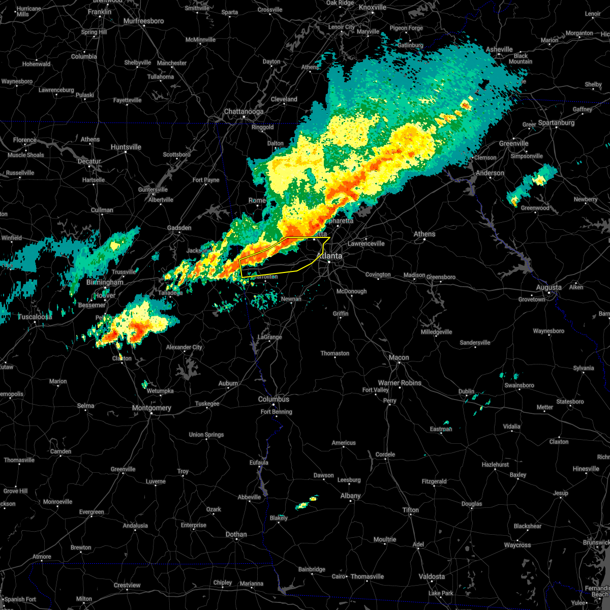
| 7/25/2020 4:38 PM EDT |
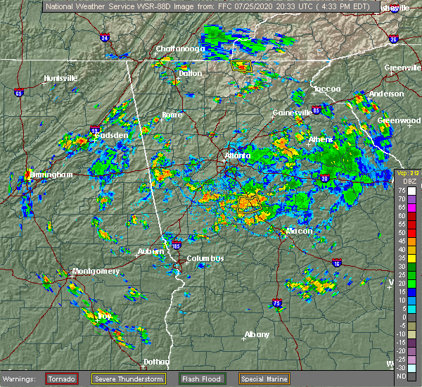 At 438 pm edt, a severe thunderstorm was located near john tanner state park, or near carrollton, and is nearly stationary (radar indicated). Hazards include 60 mph wind gusts and quarter size hail. Hail damage to vehicles is expected. Expect wind damage to roofs, siding, and trees. At 438 pm edt, a severe thunderstorm was located near john tanner state park, or near carrollton, and is nearly stationary (radar indicated). Hazards include 60 mph wind gusts and quarter size hail. Hail damage to vehicles is expected. Expect wind damage to roofs, siding, and trees.
|
| 4/13/2020 1:42 AM EDT |
 At 142 am edt, a severe thunderstorm was located near john tanner state park, or near carrollton, moving east at 60 mph (radar indicated). Hazards include 60 mph wind gusts. expect damage to roofs, siding, and trees At 142 am edt, a severe thunderstorm was located near john tanner state park, or near carrollton, moving east at 60 mph (radar indicated). Hazards include 60 mph wind gusts. expect damage to roofs, siding, and trees
|
| 1/11/2020 4:34 PM EST |
 At 434 pm est, severe thunderstorms were located along a line extending from near adairsville to near taylorsville to bremen, moving northeast at 60 mph (radar indicated). Hazards include 60 mph wind gusts. expect damage to roofs, siding, and trees At 434 pm est, severe thunderstorms were located along a line extending from near adairsville to near taylorsville to bremen, moving northeast at 60 mph (radar indicated). Hazards include 60 mph wind gusts. expect damage to roofs, siding, and trees
|
| 1/11/2020 4:25 PM EST |
 At 425 pm est, severe thunderstorms were located along a line extending from near kingston to rockmart to near waco, moving northeast at 60 mph (radar indicated). Hazards include 60 mph wind gusts. expect damage to roofs, siding, and trees At 425 pm est, severe thunderstorms were located along a line extending from near kingston to rockmart to near waco, moving northeast at 60 mph (radar indicated). Hazards include 60 mph wind gusts. expect damage to roofs, siding, and trees
|
| 1/11/2020 4:16 PM EST |
 At 415 pm est, severe thunderstorms were located along a line extending from near ranburne to near napoleon to near sparkling springs, moving east at 45 mph (radar indicated). Hazards include 60 mph wind gusts. expect damage to roofs, siding, and trees At 415 pm est, severe thunderstorms were located along a line extending from near ranburne to near napoleon to near sparkling springs, moving east at 45 mph (radar indicated). Hazards include 60 mph wind gusts. expect damage to roofs, siding, and trees
|
| 1/11/2020 3:53 PM EST |
 At 352 pm est, severe thunderstorms were located along a line extending from near etna to near edwardsville to delta, moving northeast at 60 mph (radar indicated). Hazards include 60 mph wind gusts. expect damage to roofs, siding, and trees At 352 pm est, severe thunderstorms were located along a line extending from near etna to near edwardsville to delta, moving northeast at 60 mph (radar indicated). Hazards include 60 mph wind gusts. expect damage to roofs, siding, and trees
|
| 9/10/2019 7:30 PM EDT |
 At 730 pm edt, a severe thunderstorm was located over clem, or near carrollton, moving west at 10 mph (radar indicated). Hazards include 60 mph wind gusts and quarter size hail. Hail damage to vehicles is expected. Expect wind damage to roofs, siding, and trees. At 730 pm edt, a severe thunderstorm was located over clem, or near carrollton, moving west at 10 mph (radar indicated). Hazards include 60 mph wind gusts and quarter size hail. Hail damage to vehicles is expected. Expect wind damage to roofs, siding, and trees.
|
| 6/24/2019 6:28 PM EDT |
 At 628 pm edt, a severe thunderstorm was located over carrollton, moving east at 30 mph (radar indicated). Hazards include 60 mph wind gusts and quarter size hail. Hail damage to vehicles is expected. expect wind damage to roofs, siding, and trees. Locations impacted include, carrollton, villa rica, temple, bowdon, mount zion, whitesburg, roopville, plant yates, byers crossroads, bowdon junction, hannah, tyus, seaton lake, fairplay, clem, abilene, winston, lake val-do-mar, john tanner state park and lowell. At 628 pm edt, a severe thunderstorm was located over carrollton, moving east at 30 mph (radar indicated). Hazards include 60 mph wind gusts and quarter size hail. Hail damage to vehicles is expected. expect wind damage to roofs, siding, and trees. Locations impacted include, carrollton, villa rica, temple, bowdon, mount zion, whitesburg, roopville, plant yates, byers crossroads, bowdon junction, hannah, tyus, seaton lake, fairplay, clem, abilene, winston, lake val-do-mar, john tanner state park and lowell.
|
| 6/24/2019 5:58 PM EDT |
 The national weather service in peachtree city has issued a * severe thunderstorm warning for. southern haralson county in northwestern georgia. carroll county in northwestern georgia. southwestern douglas county in north central georgia. Northwestern coweta county in west central georgia. The national weather service in peachtree city has issued a * severe thunderstorm warning for. southern haralson county in northwestern georgia. carroll county in northwestern georgia. southwestern douglas county in north central georgia. Northwestern coweta county in west central georgia.
|
| 5/9/2019 3:52 PM EDT |
 At 316 pm edt, severe thunderstorms were located along a line extending from forney to near sweetwater lake to mount cheaha, moving east at 40 mph (radar indicated). Hazards include 60 mph wind gusts. expect damage to roofs, siding, and trees At 316 pm edt, severe thunderstorms were located along a line extending from forney to near sweetwater lake to mount cheaha, moving east at 40 mph (radar indicated). Hazards include 60 mph wind gusts. expect damage to roofs, siding, and trees
|
| 5/9/2019 3:16 PM EDT |
 The national weather service in peachtree city has issued a * severe thunderstorm warning for. haralson county in northwestern georgia. southwestern carroll county in northwestern georgia. southern floyd county in northwestern georgia. Polk county in northwestern georgia. The national weather service in peachtree city has issued a * severe thunderstorm warning for. haralson county in northwestern georgia. southwestern carroll county in northwestern georgia. southern floyd county in northwestern georgia. Polk county in northwestern georgia.
|
| 7/21/2018 5:44 PM EDT |
 At 544 pm edt, a severe thunderstorm was located near i 20 welcome center, or 14 miles east of heflin, moving east at 35 mph (radar indicated). Hazards include 60 mph wind gusts and half dollar size hail. Hail damage to vehicles is expected. Expect wind damage to roofs, siding, and trees. At 544 pm edt, a severe thunderstorm was located near i 20 welcome center, or 14 miles east of heflin, moving east at 35 mph (radar indicated). Hazards include 60 mph wind gusts and half dollar size hail. Hail damage to vehicles is expected. Expect wind damage to roofs, siding, and trees.
|
| 7/6/2018 6:53 PM EDT |
 The severe thunderstorm warning for southern carroll county will expire at 700 pm edt, the storm which prompted the warning in carroll county has weakened below severe limits, and no longer poses an immediate threat to life or property. therefore, the warning will be allowed to expire. gusty winds and heavy rain are still possible with this thunderstorm through 7:30 pm. to report severe weather, contact your nearest law enforcement agency. they will relay your report to the national weather service peachtree city. The severe thunderstorm warning for southern carroll county will expire at 700 pm edt, the storm which prompted the warning in carroll county has weakened below severe limits, and no longer poses an immediate threat to life or property. therefore, the warning will be allowed to expire. gusty winds and heavy rain are still possible with this thunderstorm through 7:30 pm. to report severe weather, contact your nearest law enforcement agency. they will relay your report to the national weather service peachtree city.
|
| 7/6/2018 6:18 PM EDT |
 At 618 pm edt, a severe thunderstorm was located near seaton lake, or near carrollton, moving southwest at 15 mph (radar indicated). Hazards include 60 mph wind gusts and quarter size hail. Hail damage to vehicles is expected. Expect wind damage to roofs, siding, and trees. At 618 pm edt, a severe thunderstorm was located near seaton lake, or near carrollton, moving southwest at 15 mph (radar indicated). Hazards include 60 mph wind gusts and quarter size hail. Hail damage to vehicles is expected. Expect wind damage to roofs, siding, and trees.
|
| 3/19/2018 11:15 PM EDT |
 At 1114 pm edt, a severe thunderstorm was located near carrollton, moving east at 65 mph (radar indicated). Hazards include golf ball size hail and 70 mph wind gusts. People and animals outdoors will be injured. expect hail damage to roofs, siding, windows, and vehicles. expect considerable tree damage. Wind damage is also likely to mobile homes, roofs, and outbuildings. At 1114 pm edt, a severe thunderstorm was located near carrollton, moving east at 65 mph (radar indicated). Hazards include golf ball size hail and 70 mph wind gusts. People and animals outdoors will be injured. expect hail damage to roofs, siding, windows, and vehicles. expect considerable tree damage. Wind damage is also likely to mobile homes, roofs, and outbuildings.
|
| 3/19/2018 10:32 PM EDT |
 At 1032 pm edt, a severe thunderstorm was located over tallapoosa, or near buchanan, moving east at 45 mph (radar indicated). Hazards include 60 mph wind gusts and quarter size hail. Hail damage to vehicles is expected. Expect wind damage to roofs, siding, and trees. At 1032 pm edt, a severe thunderstorm was located over tallapoosa, or near buchanan, moving east at 45 mph (radar indicated). Hazards include 60 mph wind gusts and quarter size hail. Hail damage to vehicles is expected. Expect wind damage to roofs, siding, and trees.
|
| 2/7/2018 7:40 AM EST |
 At 740 am est, a severe thunderstorm capable of producing a tornado was located near tallapoosa, or 8 miles southwest of buchanan, moving northeast at 40 mph (radar indicated rotation). Hazards include tornado. Flying debris will be dangerous to those caught without shelter. mobile homes will be damaged or destroyed. damage to roofs, windows, and vehicles will occur. Tree damage is likely. At 740 am est, a severe thunderstorm capable of producing a tornado was located near tallapoosa, or 8 miles southwest of buchanan, moving northeast at 40 mph (radar indicated rotation). Hazards include tornado. Flying debris will be dangerous to those caught without shelter. mobile homes will be damaged or destroyed. damage to roofs, windows, and vehicles will occur. Tree damage is likely.
|
| 6/15/2017 5:50 PM EDT |
 At 549 pm edt, severe thunderstorms were located along a line extending from near powder springs to near treasure lake to graham, moving southeast at 35 mph (radar indicated). Hazards include 60 mph wind gusts. expect damage to roofs, siding, and trees At 549 pm edt, severe thunderstorms were located along a line extending from near powder springs to near treasure lake to graham, moving southeast at 35 mph (radar indicated). Hazards include 60 mph wind gusts. expect damage to roofs, siding, and trees
|
| 5/28/2017 5:24 AM EDT |
 At 524 am edt, severe thunderstorms were located along a line extending from draketown to near ranburne to micaville, moving east at 50 mph (radar indicated). Hazards include 60 mph wind gusts. expect damage to roofs, siding, and trees At 524 am edt, severe thunderstorms were located along a line extending from draketown to near ranburne to micaville, moving east at 50 mph (radar indicated). Hazards include 60 mph wind gusts. expect damage to roofs, siding, and trees
|
| 4/5/2017 5:46 PM EDT |
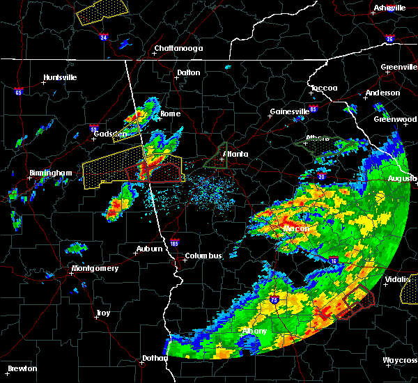 At 546 pm edt, a severe thunderstorm capable of producing a tornado was located over ranburne, or 14 miles southeast of heflin, moving east at 35 mph (radar indicated rotation). Hazards include tornado and hail up to two inches in diameter. Flying debris will be dangerous to those caught without shelter. mobile homes will be damaged or destroyed. damage to roofs, windows, and vehicles will occur. Tree damage is likely. At 546 pm edt, a severe thunderstorm capable of producing a tornado was located over ranburne, or 14 miles southeast of heflin, moving east at 35 mph (radar indicated rotation). Hazards include tornado and hail up to two inches in diameter. Flying debris will be dangerous to those caught without shelter. mobile homes will be damaged or destroyed. damage to roofs, windows, and vehicles will occur. Tree damage is likely.
|
| 4/5/2017 5:38 PM EDT |
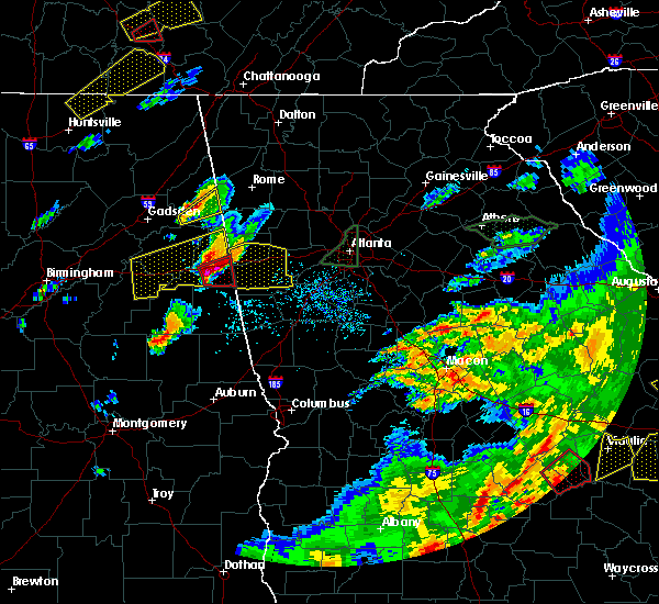 At 537 pm edt, a severe thunderstorm was located over trickem, or 11 miles southeast of heflin, moving east at 45 mph (radar indicated). Hazards include two inch hail and 60 mph wind gusts. People and animals outdoors will be injured. expect hail damage to roofs, siding, windows, and vehicles. Expect wind damage to roofs, siding, and trees. At 537 pm edt, a severe thunderstorm was located over trickem, or 11 miles southeast of heflin, moving east at 45 mph (radar indicated). Hazards include two inch hail and 60 mph wind gusts. People and animals outdoors will be injured. expect hail damage to roofs, siding, windows, and vehicles. Expect wind damage to roofs, siding, and trees.
|
| 4/5/2017 3:45 PM EDT |
 At 345 pm edt, a severe thunderstorm was located over ranburne, or 14 miles west of carrollton, moving east at 25 mph (radar indicated). Hazards include 60 mph wind gusts and penny size hail. expect damage to roofs, siding, and trees At 345 pm edt, a severe thunderstorm was located over ranburne, or 14 miles west of carrollton, moving east at 25 mph (radar indicated). Hazards include 60 mph wind gusts and penny size hail. expect damage to roofs, siding, and trees
|
| 4/5/2017 10:32 AM EDT |
 At 1032 am edt, severe thunderstorms were located along a line extending from felton to near mount zion, moving northeast at 55 mph (radar indicated). Hazards include 60 mph wind gusts and quarter size hail. Hail damage to vehicles is expected. Expect wind damage to roofs, siding, and trees. At 1032 am edt, severe thunderstorms were located along a line extending from felton to near mount zion, moving northeast at 55 mph (radar indicated). Hazards include 60 mph wind gusts and quarter size hail. Hail damage to vehicles is expected. Expect wind damage to roofs, siding, and trees.
|
| 4/5/2017 7:31 AM EDT |
 At 731 am edt, severe thunderstorms were located along a line extending from micaville to r.l. harris dam, moving northeast at 50 mph (radar indicated). Hazards include ping pong ball size hail and 60 mph wind gusts. People and animals outdoors will be injured. expect hail damage to roofs, siding, windows, and vehicles. Expect wind damage to roofs, siding, and trees. At 731 am edt, severe thunderstorms were located along a line extending from micaville to r.l. harris dam, moving northeast at 50 mph (radar indicated). Hazards include ping pong ball size hail and 60 mph wind gusts. People and animals outdoors will be injured. expect hail damage to roofs, siding, windows, and vehicles. Expect wind damage to roofs, siding, and trees.
|
| 3/21/2017 8:40 PM EDT |
 At 838 pm edt, severe thunderstorms were located extending from near milton to sandy plains to near eubank lake to near piedmont, moving southeast at 40 mph (radar indicated, plus multiple reports of downed trees and powerlines due to the very strong winds). Hazards include 60 mph wind gusts and penny size hail. expect damage to roofs, siding, and trees At 838 pm edt, severe thunderstorms were located extending from near milton to sandy plains to near eubank lake to near piedmont, moving southeast at 40 mph (radar indicated, plus multiple reports of downed trees and powerlines due to the very strong winds). Hazards include 60 mph wind gusts and penny size hail. expect damage to roofs, siding, and trees
|
| 3/1/2017 6:50 PM EST |
 At 650 pm est, severe thunderstorms were located extending from hiram to villa rica to near john tanner state park, moving east at 55 mph (radar indicated). Hazards include 60 mph wind gusts and quarter size hail. Hail damage to vehicles is expected. expect wind damage to roofs, siding, and trees. Locations impacted include, douglasville, carrollton, dallas, villa rica, temple, hiram, mount zion, brownsville, abilene, winston, lake val-do-mar, treasure lake and new georgia. At 650 pm est, severe thunderstorms were located extending from hiram to villa rica to near john tanner state park, moving east at 55 mph (radar indicated). Hazards include 60 mph wind gusts and quarter size hail. Hail damage to vehicles is expected. expect wind damage to roofs, siding, and trees. Locations impacted include, douglasville, carrollton, dallas, villa rica, temple, hiram, mount zion, brownsville, abilene, winston, lake val-do-mar, treasure lake and new georgia.
|
| 3/1/2017 6:20 PM EST |
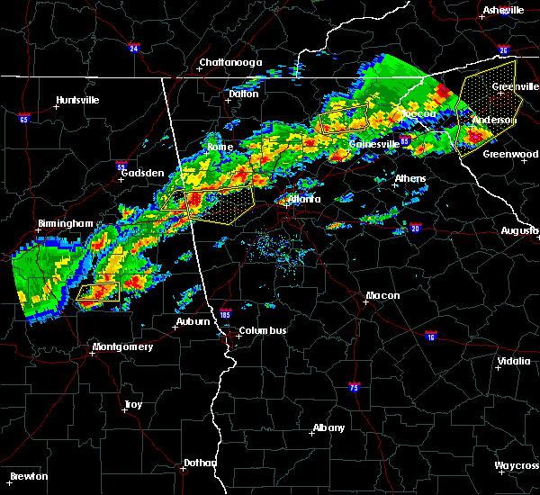 At 617 pm est, severe thunderstorms were located extending from 7 miles west of buchanan to edwardsville alabama, moving east at 55 mph (radar indicated). Hazards include 60 mph wind gusts and quarter size hail. Hail damage to vehicles is expected. Expect wind damage to roofs, siding, and trees. At 617 pm est, severe thunderstorms were located extending from 7 miles west of buchanan to edwardsville alabama, moving east at 55 mph (radar indicated). Hazards include 60 mph wind gusts and quarter size hail. Hail damage to vehicles is expected. Expect wind damage to roofs, siding, and trees.
|
| 1/22/2017 4:10 PM EST |
 At 410 pm est, severe thunderstorms were located extending from abilene to lowell to near centralhatchee, moving northeast at 45 mph (radar indicated). Hazards include 60 mph wind gusts and penny size hail. Expect damage to roofs, siding, and trees. locations impacted include, newnan, carrollton, franklin, mount zion, whitesburg, centralhatchee, east newnan, plant yates, byers crossroads, bowdon junction, arnco-sargent, powers crossroads, seaton lake, handy, dunaway gardens, clem, abilene, lowell, plant wansley and treasure lake. A tornado watch remains in effect until 800 pm est for north central, northwestern and west central georgia. At 410 pm est, severe thunderstorms were located extending from abilene to lowell to near centralhatchee, moving northeast at 45 mph (radar indicated). Hazards include 60 mph wind gusts and penny size hail. Expect damage to roofs, siding, and trees. locations impacted include, newnan, carrollton, franklin, mount zion, whitesburg, centralhatchee, east newnan, plant yates, byers crossroads, bowdon junction, arnco-sargent, powers crossroads, seaton lake, handy, dunaway gardens, clem, abilene, lowell, plant wansley and treasure lake. A tornado watch remains in effect until 800 pm est for north central, northwestern and west central georgia.
|
| 1/22/2017 3:46 PM EST |
 At 346 pm est, severe thunderstorms were located extending from ephesus to near standing rock, moving northeast at 65 mph (radar indicated). Hazards include 60 mph wind gusts and quarter size hail. Hail damage to vehicles is expected. Expect wind damage to roofs, siding, and trees. At 346 pm est, severe thunderstorms were located extending from ephesus to near standing rock, moving northeast at 65 mph (radar indicated). Hazards include 60 mph wind gusts and quarter size hail. Hail damage to vehicles is expected. Expect wind damage to roofs, siding, and trees.
|
| 11/30/2016 12:52 PM EST |
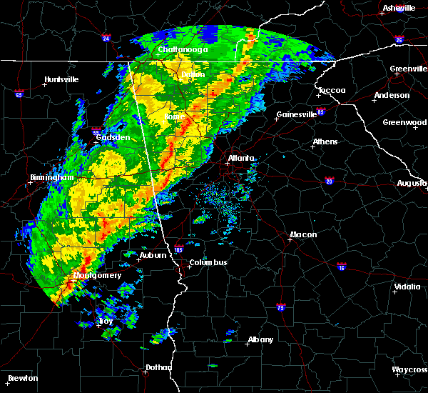 At 1252 pm est, a tornado producing storm was located over bowdon junction, or 8 miles northwest of carrollton, moving northeast at 45 mph (radar confirmed tornado). Hazards include damaging tornado. Flying debris will be dangerous to those caught without shelter. mobile homes will be damaged or destroyed. damage to roofs, windows, and vehicles will occur. Tree damage is likely. At 1252 pm est, a tornado producing storm was located over bowdon junction, or 8 miles northwest of carrollton, moving northeast at 45 mph (radar confirmed tornado). Hazards include damaging tornado. Flying debris will be dangerous to those caught without shelter. mobile homes will be damaged or destroyed. damage to roofs, windows, and vehicles will occur. Tree damage is likely.
|
| 7/6/2016 6:18 PM EDT |
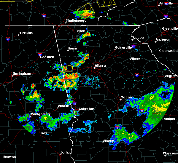 At 618 pm edt, a severe thunderstorm was located over tallapoosa, or near buchanan, moving east at 20 mph (radar indicated). Hazards include 60 mph wind gusts and penny size hail. Expect damage to roofs. siding. and trees. Other locations in the warning include but are not limited to buchanan, bremen, tallapoosa, mount zion, waco and draketown. At 618 pm edt, a severe thunderstorm was located over tallapoosa, or near buchanan, moving east at 20 mph (radar indicated). Hazards include 60 mph wind gusts and penny size hail. Expect damage to roofs. siding. and trees. Other locations in the warning include but are not limited to buchanan, bremen, tallapoosa, mount zion, waco and draketown.
|
| 6/17/2016 3:33 PM EDT |
 At 332 pm edt, severe thunderstorms were located along a line extending from near mars hills to near buchanan, moving southeast at 35 mph (radar indicated). Hazards include 60 mph wind gusts and quarter size hail. Hail damage to vehicles is expected. expect wind damage to roofs, siding, and trees. Other locations in the warning include but are not limited to carrollton, buchanan, bremen, tallapoosa, bowdon, mount zion, waco, john tanner state park and bowdon junction. At 332 pm edt, severe thunderstorms were located along a line extending from near mars hills to near buchanan, moving southeast at 35 mph (radar indicated). Hazards include 60 mph wind gusts and quarter size hail. Hail damage to vehicles is expected. expect wind damage to roofs, siding, and trees. Other locations in the warning include but are not limited to carrollton, buchanan, bremen, tallapoosa, bowdon, mount zion, waco, john tanner state park and bowdon junction.
|
| 6/1/2016 4:06 PM EDT |
 At 405 pm edt, a severe thunderstorm was located near carrollton, moving northeast at 30 mph (radar indicated). Hazards include 60 mph wind gusts and quarter size hail. Hail damage to vehicles is expected. expect wind damage to roofs, siding, and trees. Other locations in the warning include but are not limited to carrollton, villa rica, temple, mount zion, byers crossroads, clem, john tanner state park, treasure lake, seaton lake, bowdon junction and abilene. At 405 pm edt, a severe thunderstorm was located near carrollton, moving northeast at 30 mph (radar indicated). Hazards include 60 mph wind gusts and quarter size hail. Hail damage to vehicles is expected. expect wind damage to roofs, siding, and trees. Other locations in the warning include but are not limited to carrollton, villa rica, temple, mount zion, byers crossroads, clem, john tanner state park, treasure lake, seaton lake, bowdon junction and abilene.
|
| 6/1/2016 3:54 PM EDT |
 At 354 pm edt, a severe thunderstorm was located over carrollton, moving east at 35 mph (radar indicated). Hazards include 60 mph wind gusts and quarter size hail. Hail damage to vehicles is expected. expect wind damage to roofs, siding, and trees. Other locations in the warning include but are not limited to douglasville, carrollton, villa rica, bremen, temple, mount zion, lithia springs, sweetwater creek state park, fairplay, treasure lake, winston, bowdon junction, abilene, chapel hill, byers crossroads, lake val-do- mar, clem, john tanner state park, bill arp and seaton lake. At 354 pm edt, a severe thunderstorm was located over carrollton, moving east at 35 mph (radar indicated). Hazards include 60 mph wind gusts and quarter size hail. Hail damage to vehicles is expected. expect wind damage to roofs, siding, and trees. Other locations in the warning include but are not limited to douglasville, carrollton, villa rica, bremen, temple, mount zion, lithia springs, sweetwater creek state park, fairplay, treasure lake, winston, bowdon junction, abilene, chapel hill, byers crossroads, lake val-do- mar, clem, john tanner state park, bill arp and seaton lake.
|
| 6/18/2015 3:48 PM EDT | At 348 pm edt, severe thunderstorms were located along a line extending from near carrollton to near ranburne, moving east at 10 mph (radar indicated). Hazards include 60 mph wind gusts and quarter size hail. Hail damage to vehicles is expected. expect wind damage to roofs, siding and trees. Other locations in the warning include but are not limited to carrollton, bowdon, mount zion, clem, john tanner state park, bowdon junction and abilene. |
| 5/31/2015 5:09 PM EDT | At 509 pm edt, severe thunderstorms were located along a line extending from 7 miles north of villa rica to waco, moving north at 10 mph (radar indicated). Hazards include 60 mph wind gusts and quarter size hail. Hail damage to vehicles is expected. expect wind damage to roofs, siding and trees. Other locations in the warning include but are not limited to dallas, buchanan, villa rica, bremen, temple, hiram, mount zion, waco, braswell, yorkville, bowdon junction, new georgia, eubank lake, felton and draketown. |
Hail Maps for Mount Zion, GA


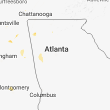


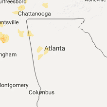


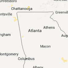


Connect with Interactive Hail Maps