

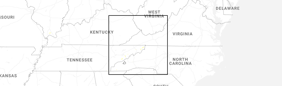
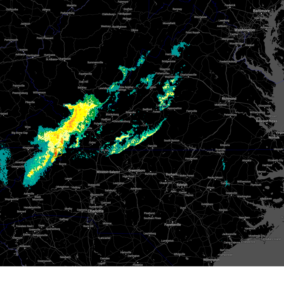
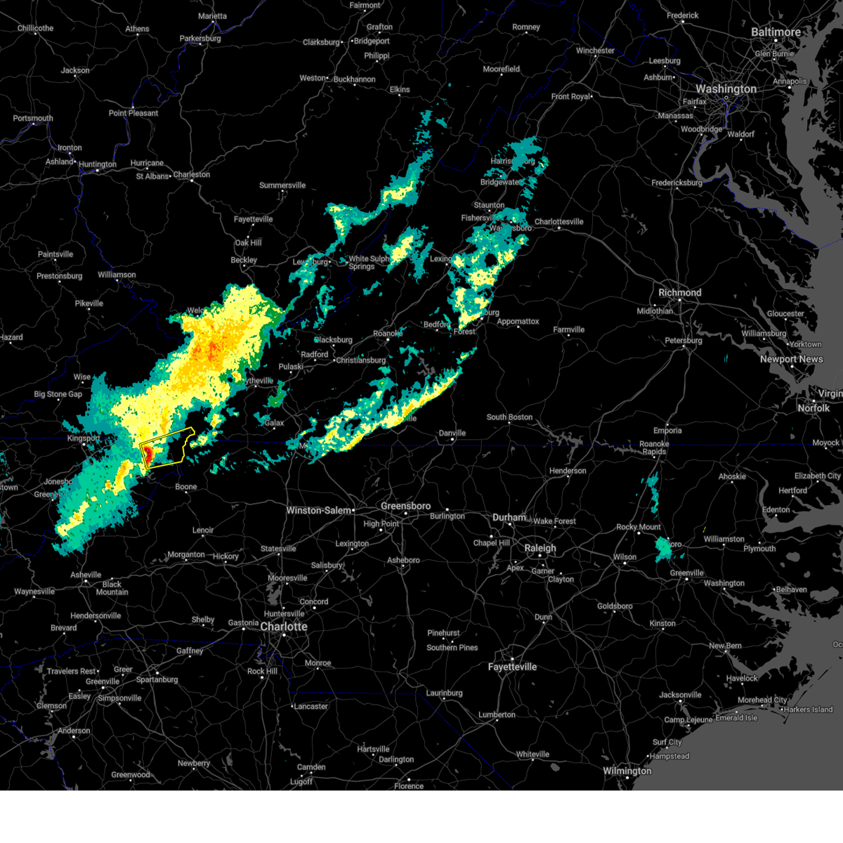
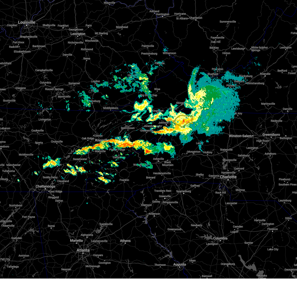
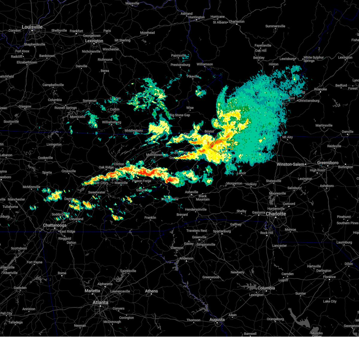
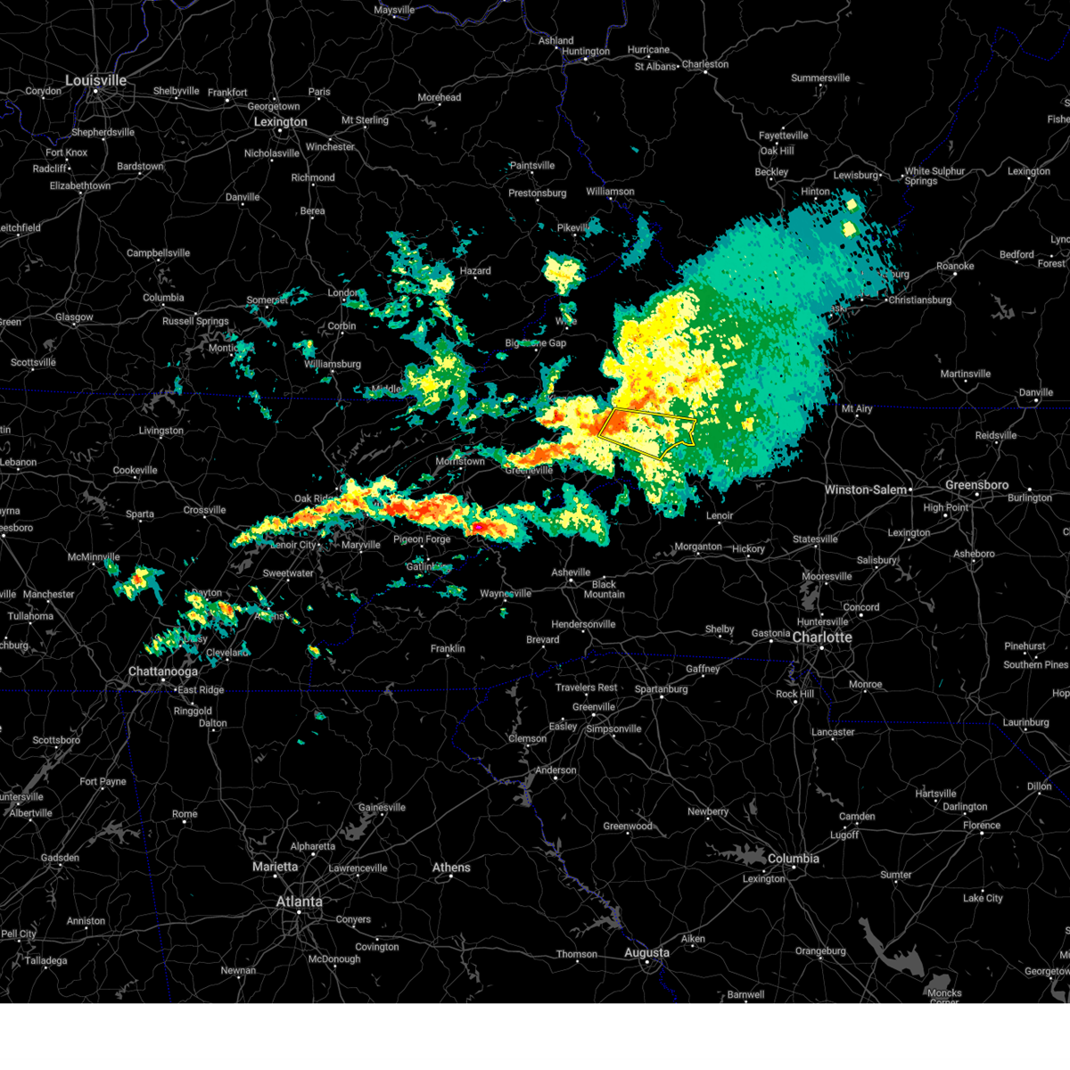
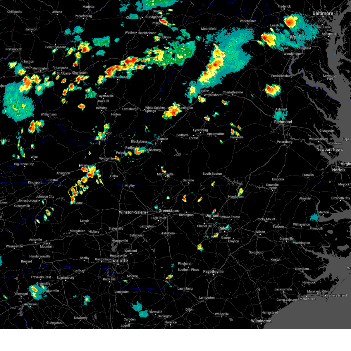
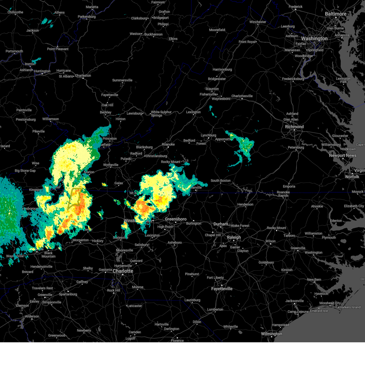
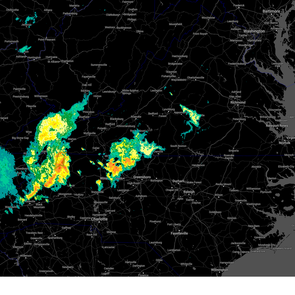
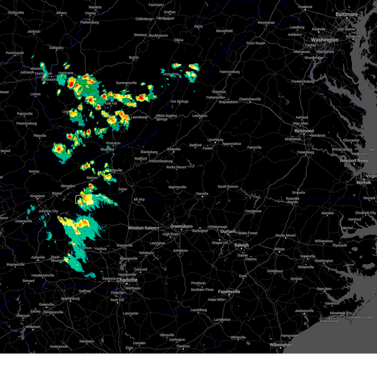
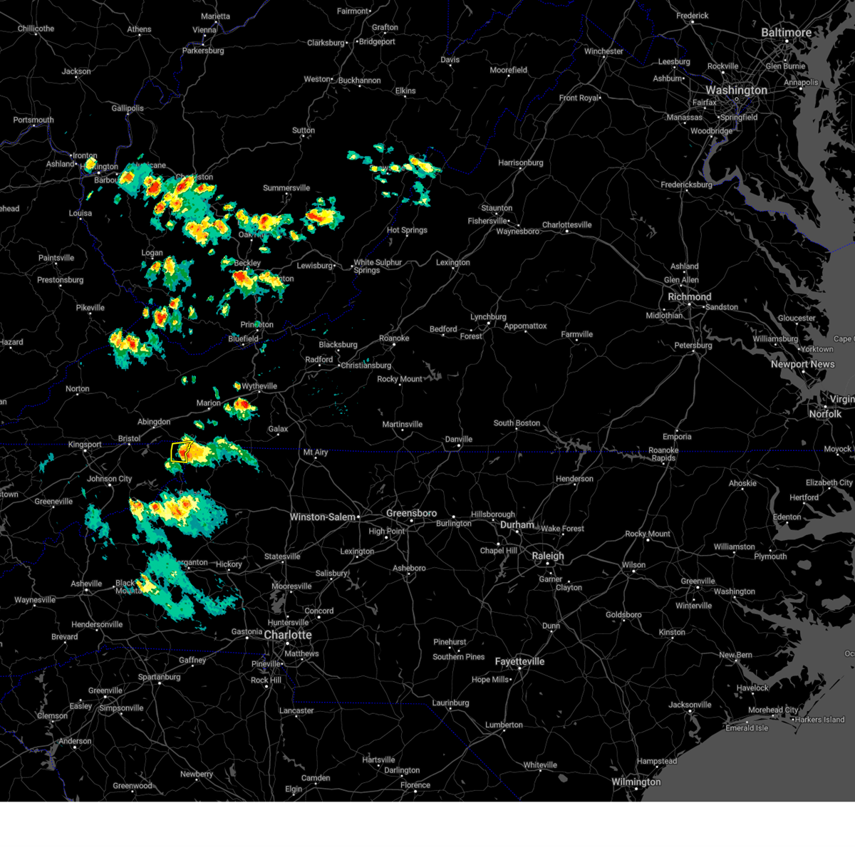
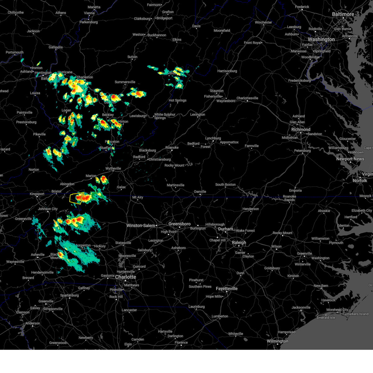
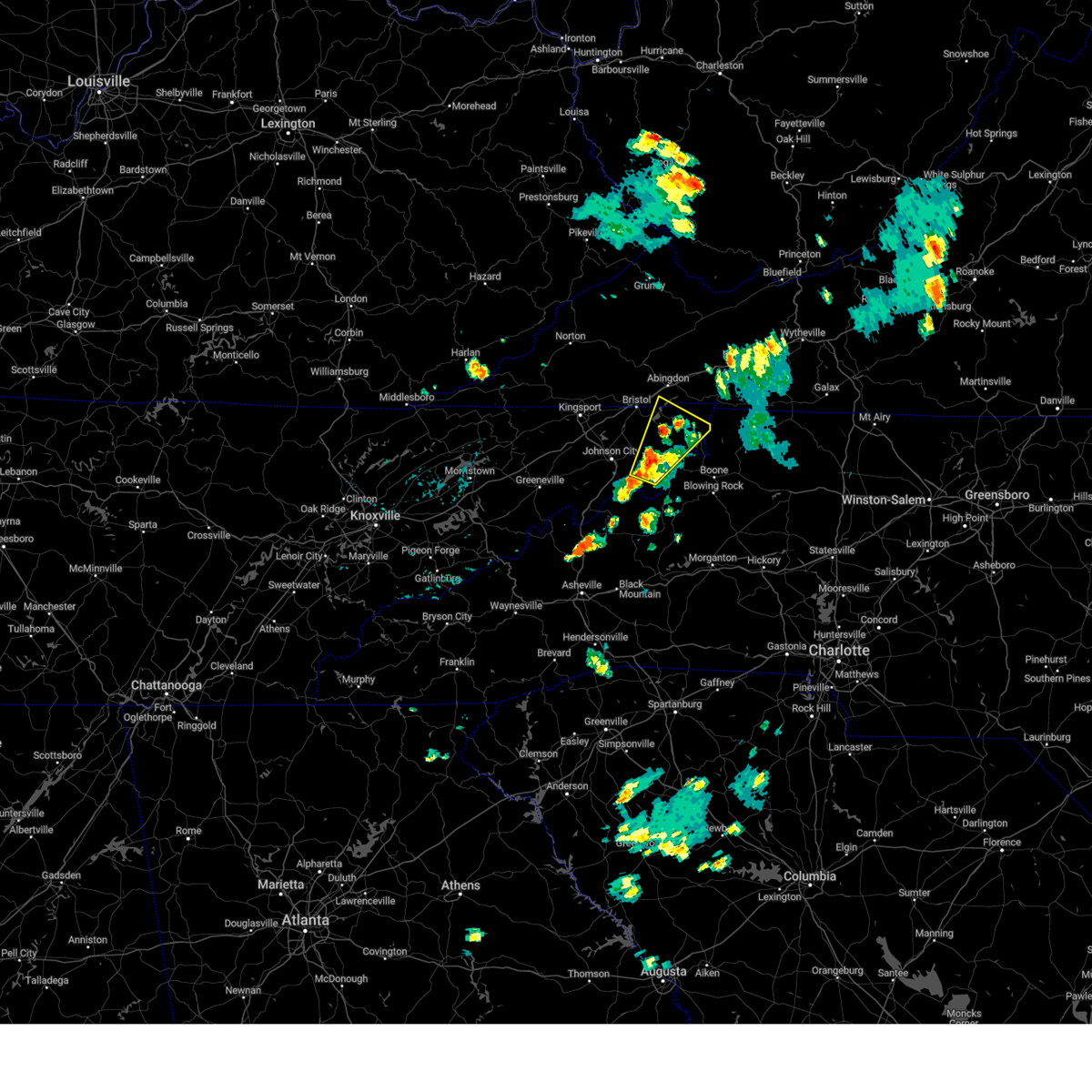
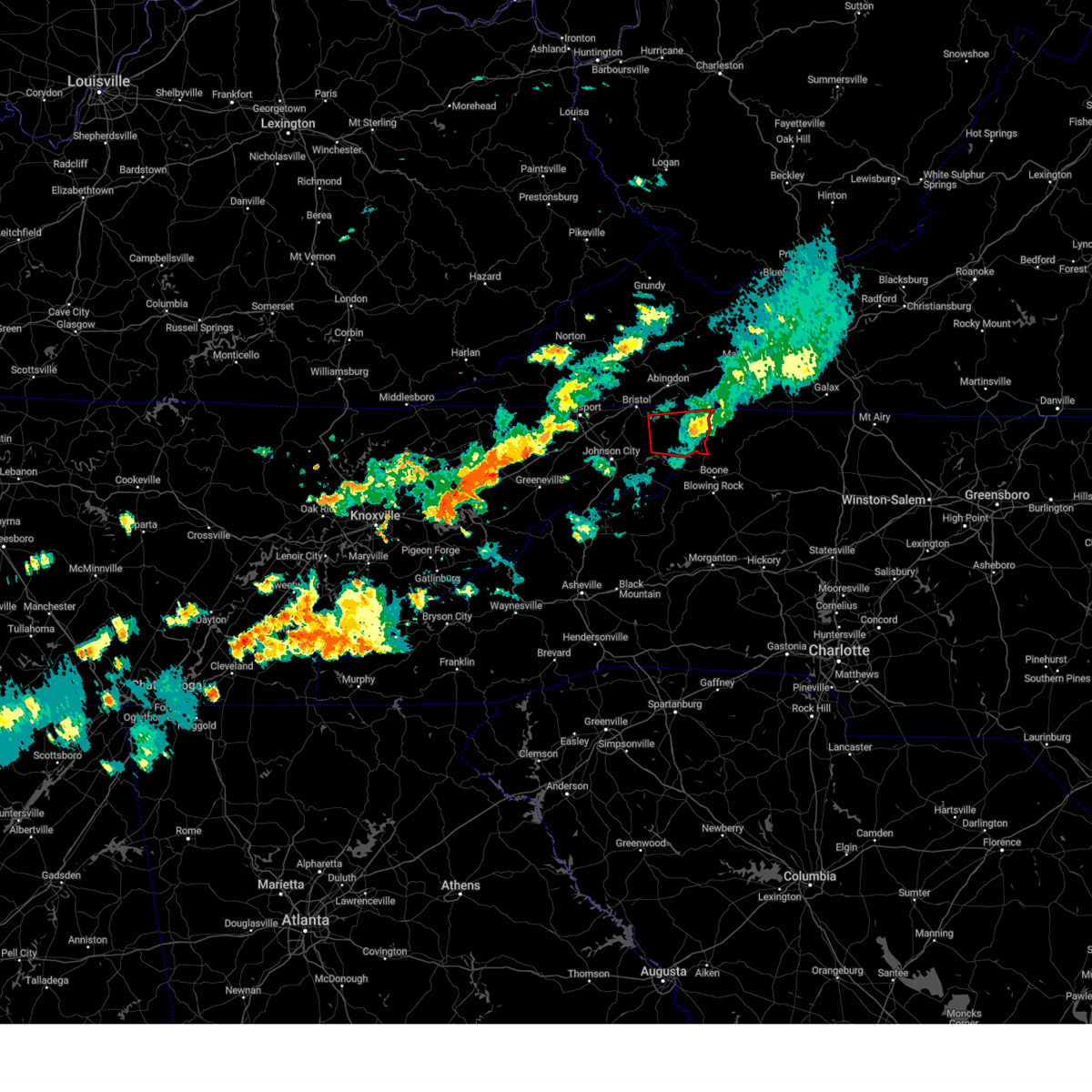
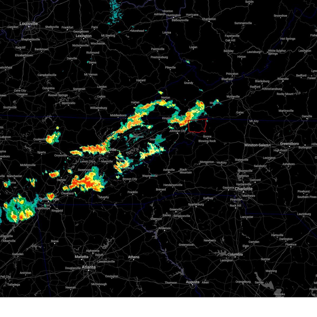
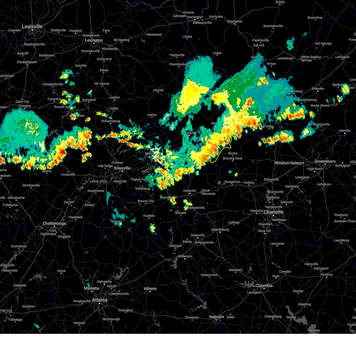
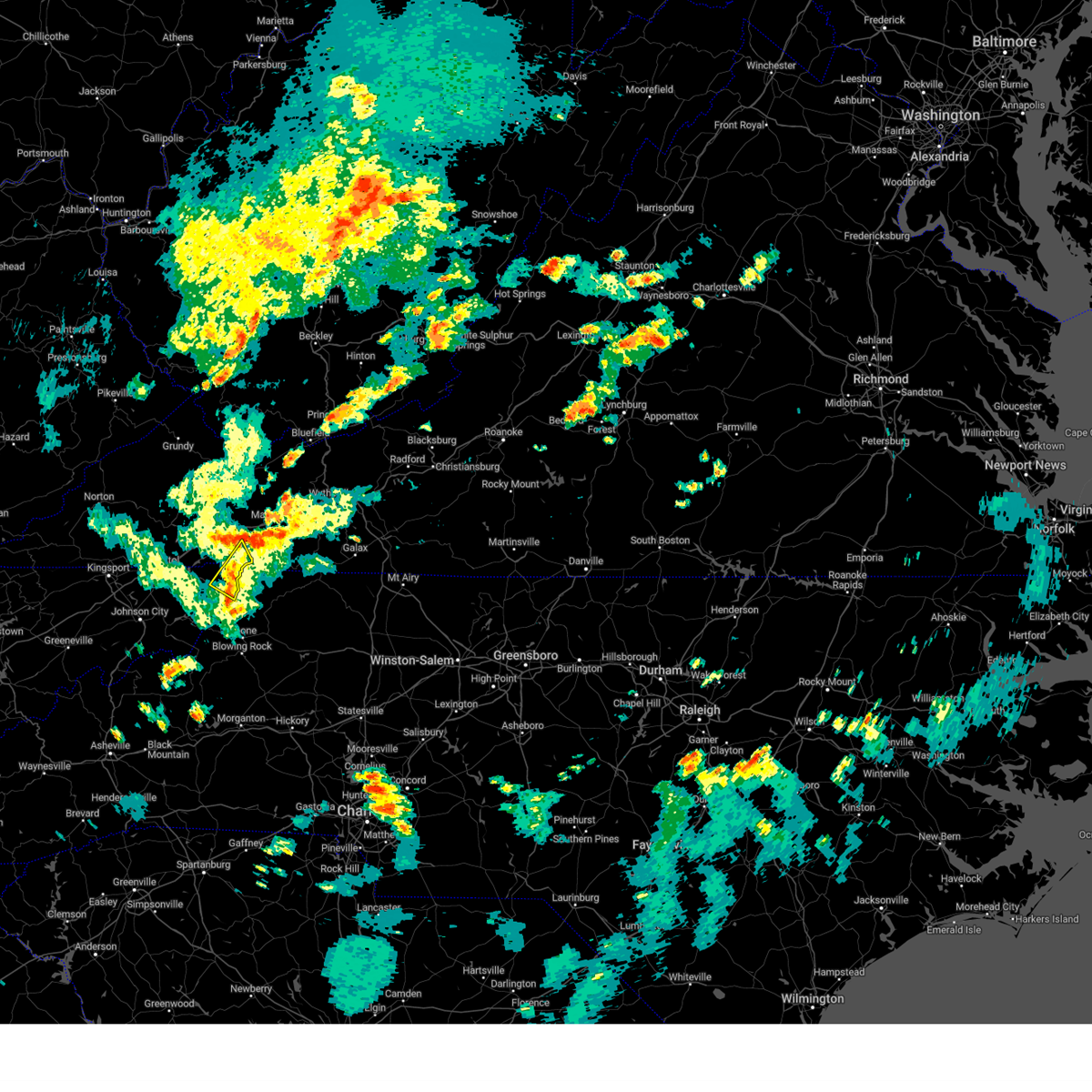
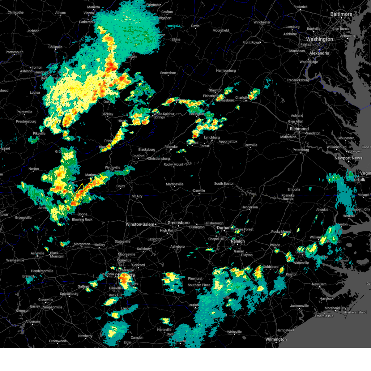
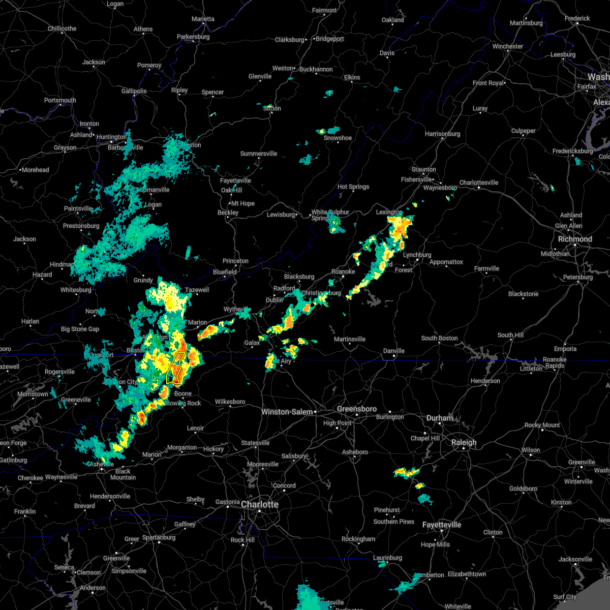
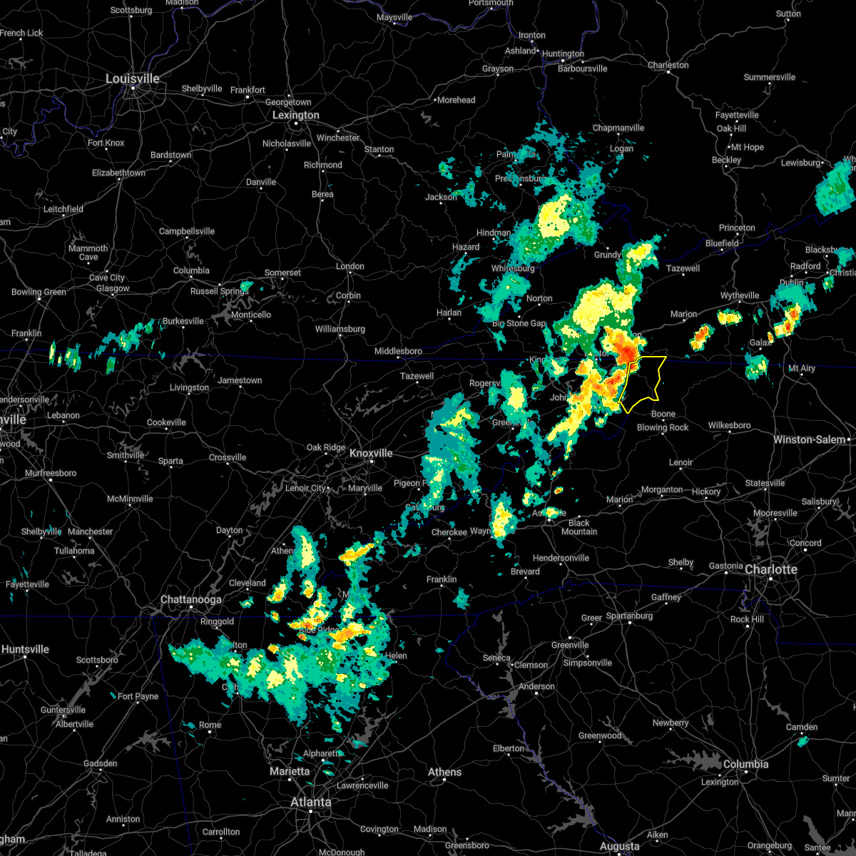
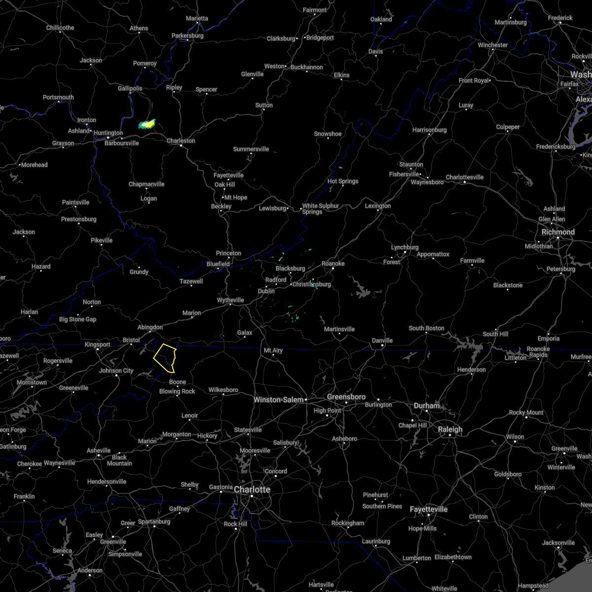
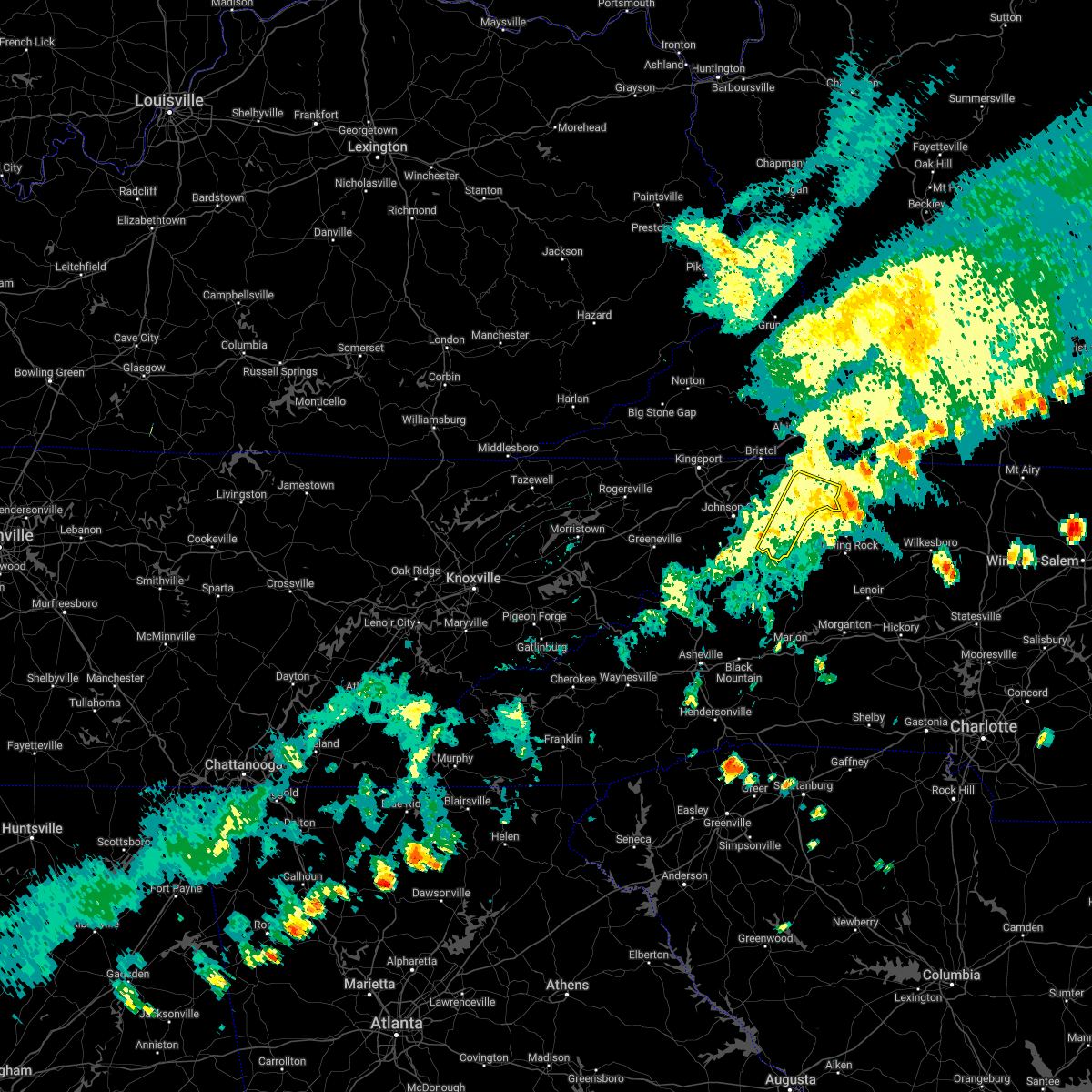
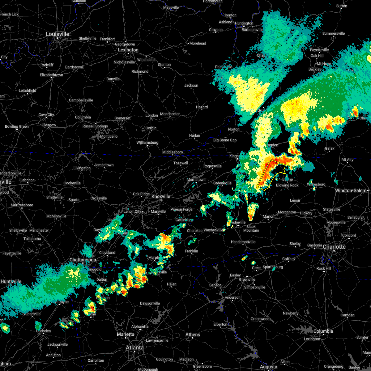
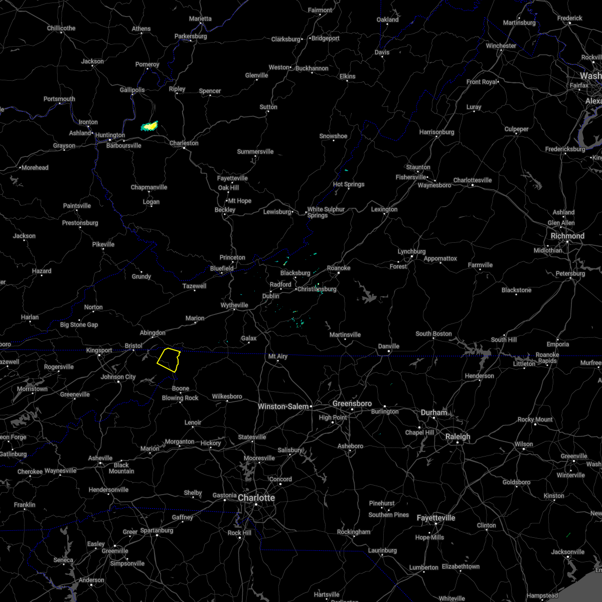
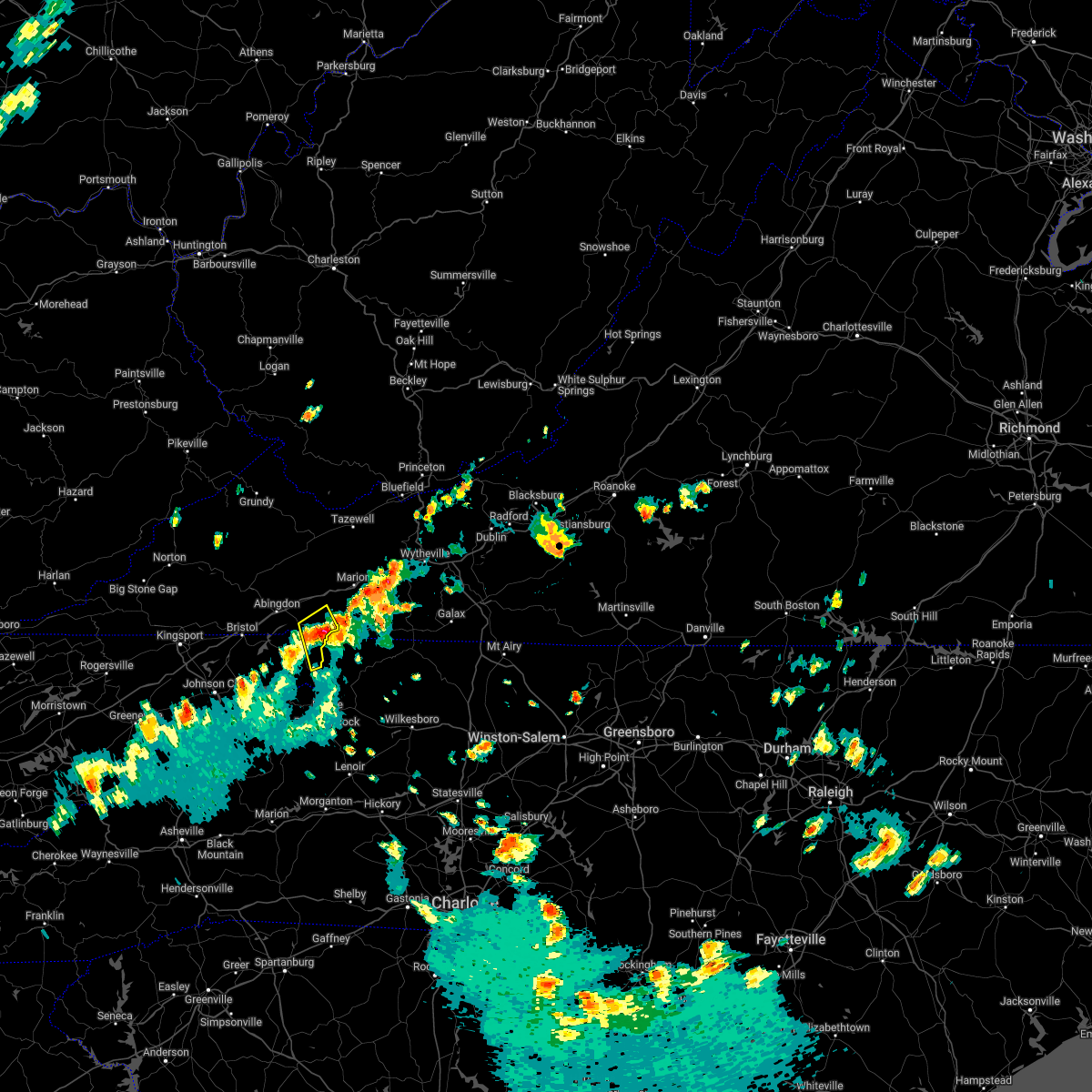
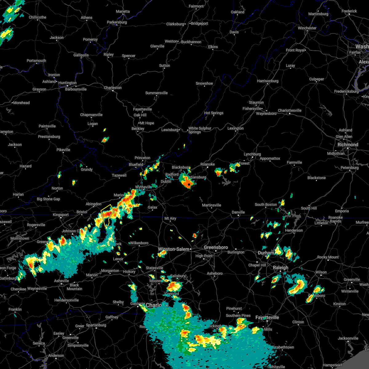
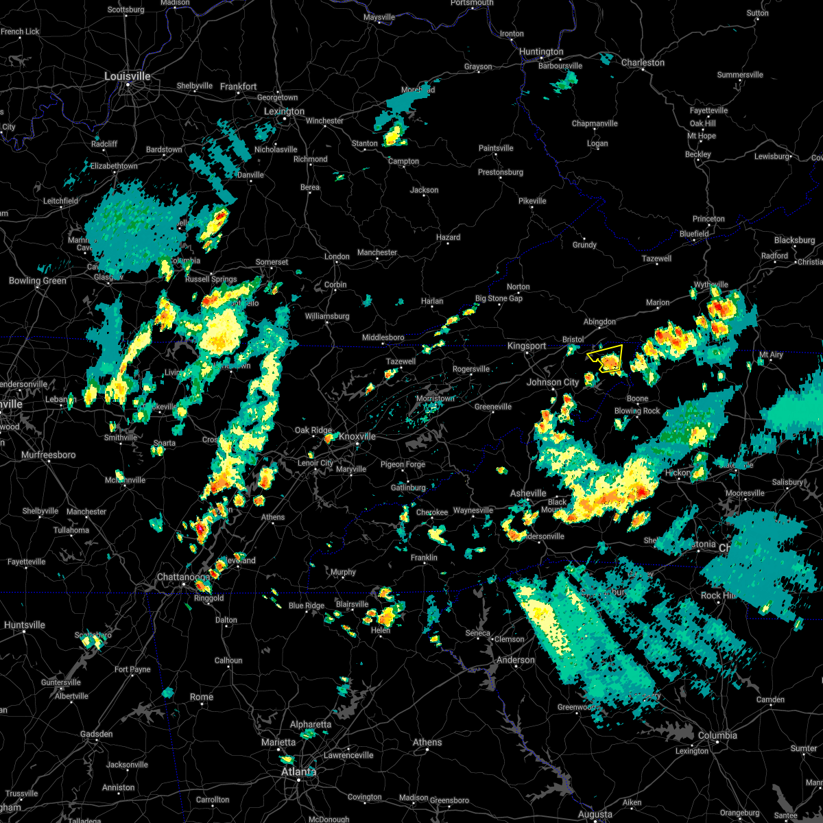
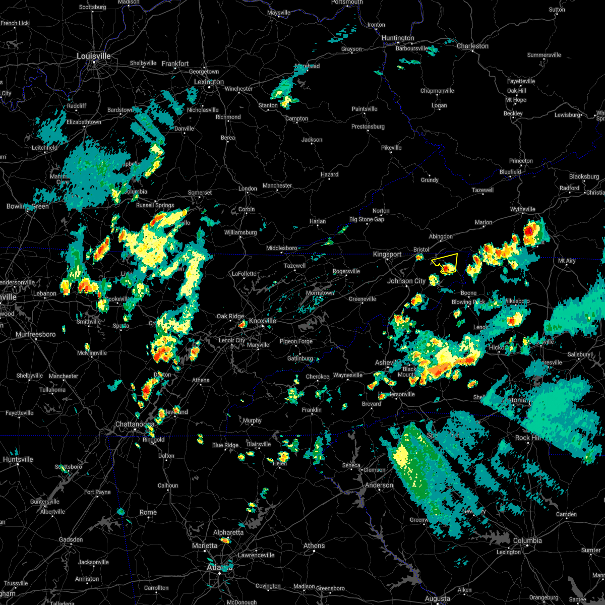
Hail Map for Mountain City, TN
The Mountain City, TN area has had 1 report of on-the-ground hail by trained spotters, and has been under severe weather warnings 16 times during the past 12 months. Doppler radar has detected hail at or near Mountain City, TN on 22 occasions, including 3 occasions during the past year.
| Name: | Mountain City, TN |
| Where Located: | 24.8 miles ESE of Bristol, TN |
| Map: | Google Map for Mountain City, TN |
| Population: | 2531 |
| Housing Units: | 1282 |
| More Info: | Search Google for Mountain City, TN |
1
The Top Recent Hail Date for Mountain City, TN is Tuesday, June 24, 2025 (3rd out of 22)
Hail and Wind Damage Spotted near Mountain City, TN
| Date / Time | Report Details |
|---|---|
| 5/2/2025 8:15 PM EDT |
 The severe thunderstorm which prompted the warning has weakened. therefore, the warning will be allowed to expire. however, gusty winds and heavy rain are still possible with this thunderstorm. The severe thunderstorm which prompted the warning has weakened. therefore, the warning will be allowed to expire. however, gusty winds and heavy rain are still possible with this thunderstorm.
|
| 5/2/2025 7:35 PM EDT |
 Svrmrx the national weather service in morristown has issued a * severe thunderstorm warning for, johnson county in east tennessee, southeastern washington county in southwestern virginia, * until 815 pm edt. * at 735 pm edt, a severe thunderstorm was located near mountain city, moving northeast at 25 mph (radar indicated). Hazards include 60 mph wind gusts and quarter size hail. Hail damage to vehicles is expected. Expect wind damage to roofs, siding, and trees. Svrmrx the national weather service in morristown has issued a * severe thunderstorm warning for, johnson county in east tennessee, southeastern washington county in southwestern virginia, * until 815 pm edt. * at 735 pm edt, a severe thunderstorm was located near mountain city, moving northeast at 25 mph (radar indicated). Hazards include 60 mph wind gusts and quarter size hail. Hail damage to vehicles is expected. Expect wind damage to roofs, siding, and trees.
|
| 3/31/2025 7:00 AM EDT |
 The storm which prompted the warning has weakened below severe limits, and has exited the warned area. therefore, the warning has been allowed to expire. The storm which prompted the warning has weakened below severe limits, and has exited the warned area. therefore, the warning has been allowed to expire.
|
| 3/31/2025 6:48 AM EDT |
 the severe thunderstorm warning has been cancelled and is no longer in effect the severe thunderstorm warning has been cancelled and is no longer in effect
|
| 3/31/2025 6:48 AM EDT |
 At 647 am edt, a severe thunderstorm was located over mountain city, moving east at 40 mph (radar indicated). Hazards include 60 mph wind gusts and penny size hail. Expect damage to roofs, siding, and trees. Locations impacted include, mountain city and laurel bloomery. At 647 am edt, a severe thunderstorm was located over mountain city, moving east at 40 mph (radar indicated). Hazards include 60 mph wind gusts and penny size hail. Expect damage to roofs, siding, and trees. Locations impacted include, mountain city and laurel bloomery.
|
| 3/31/2025 6:34 AM EDT |
 Svrmrx the national weather service in morristown has issued a * severe thunderstorm warning for, northeastern sullivan county in east tennessee, johnson county in east tennessee, northeastern carter county in east tennessee, southeastern washington county in southwestern virginia, * until 700 am edt. * at 634 am edt, a severe thunderstorm was located 8 miles west of mountain city, moving east at 45 mph (radar indicated). Hazards include 60 mph wind gusts and penny size hail. expect damage to roofs, siding, and trees Svrmrx the national weather service in morristown has issued a * severe thunderstorm warning for, northeastern sullivan county in east tennessee, johnson county in east tennessee, northeastern carter county in east tennessee, southeastern washington county in southwestern virginia, * until 700 am edt. * at 634 am edt, a severe thunderstorm was located 8 miles west of mountain city, moving east at 45 mph (radar indicated). Hazards include 60 mph wind gusts and penny size hail. expect damage to roofs, siding, and trees
|
| 2/6/2025 10:39 PM EST |
 the severe thunderstorm warning has been cancelled and is no longer in effect the severe thunderstorm warning has been cancelled and is no longer in effect
|
| 2/6/2025 10:31 PM EST |
 the severe thunderstorm warning has been cancelled and is no longer in effect the severe thunderstorm warning has been cancelled and is no longer in effect
|
| 2/6/2025 10:31 PM EST |
 At 1031 pm est, a severe thunderstorm was located 11 miles northeast of hampton, or 12 miles east of elizabethton, moving east at 55 mph (radar indicated). Hazards include 60 mph wind gusts. Expect damage to roofs, siding, and trees. Locations impacted include, elizabethton, mountain city, trade, hunter, doeville, neva, and sadie. At 1031 pm est, a severe thunderstorm was located 11 miles northeast of hampton, or 12 miles east of elizabethton, moving east at 55 mph (radar indicated). Hazards include 60 mph wind gusts. Expect damage to roofs, siding, and trees. Locations impacted include, elizabethton, mountain city, trade, hunter, doeville, neva, and sadie.
|
| 2/6/2025 10:15 PM EST |
 Svrmrx the national weather service in morristown has issued a * severe thunderstorm warning for, southeastern sullivan county in east tennessee, northeastern washington county in east tennessee, johnson county in east tennessee, northern carter county in east tennessee, * until 1100 pm est. * at 1014 pm est, a severe thunderstorm was located near elizabethton, moving east at 60 mph (radar indicated). Hazards include 60 mph wind gusts. expect damage to roofs, siding, and trees Svrmrx the national weather service in morristown has issued a * severe thunderstorm warning for, southeastern sullivan county in east tennessee, northeastern washington county in east tennessee, johnson county in east tennessee, northern carter county in east tennessee, * until 1100 pm est. * at 1014 pm est, a severe thunderstorm was located near elizabethton, moving east at 60 mph (radar indicated). Hazards include 60 mph wind gusts. expect damage to roofs, siding, and trees
|
| 8/29/2024 6:07 PM EDT |
 At 607 pm edt, a severe thunderstorm was located near mountain city, and is nearly stationary (radar indicated). Hazards include 60 mph wind gusts. Expect damage to roofs, siding, and trees. Locations impacted include, mountain city. At 607 pm edt, a severe thunderstorm was located near mountain city, and is nearly stationary (radar indicated). Hazards include 60 mph wind gusts. Expect damage to roofs, siding, and trees. Locations impacted include, mountain city.
|
| 8/29/2024 5:42 PM EDT |
 Svrmrx the national weather service in morristown has issued a * severe thunderstorm warning for, east central johnson county in east tennessee, * until 615 pm edt. * at 542 pm edt, a severe thunderstorm was located near mountain city, and is nearly stationary (radar indicated). Hazards include 60 mph wind gusts. expect damage to roofs, siding, and trees Svrmrx the national weather service in morristown has issued a * severe thunderstorm warning for, east central johnson county in east tennessee, * until 615 pm edt. * at 542 pm edt, a severe thunderstorm was located near mountain city, and is nearly stationary (radar indicated). Hazards include 60 mph wind gusts. expect damage to roofs, siding, and trees
|
| 8/16/2024 7:27 PM EDT |
 The storm which prompted the warning has moved out of the area. therefore, the warning will be allowed to expire. however, gusty winds and localized flooding are still possible with this thunderstorm. The storm which prompted the warning has moved out of the area. therefore, the warning will be allowed to expire. however, gusty winds and localized flooding are still possible with this thunderstorm.
|
| 8/16/2024 7:21 PM EDT | Tree down on little laurel road. time estimated from rada in ashe county NC, 8.6 miles W of Mountain City, TN |
| 8/16/2024 7:19 PM EDT |
 At 719 pm edt, a severe thunderstorm was located over ashland, moving east at 35 mph (radar indicated). Hazards include 60 mph wind gusts. Expect damage to roofs, siding, and trees. Locations impacted include, mountain city, trade, neva, and laurel bloomery. At 719 pm edt, a severe thunderstorm was located over ashland, moving east at 35 mph (radar indicated). Hazards include 60 mph wind gusts. Expect damage to roofs, siding, and trees. Locations impacted include, mountain city, trade, neva, and laurel bloomery.
|
| 8/16/2024 7:19 PM EDT |
 the severe thunderstorm warning has been cancelled and is no longer in effect the severe thunderstorm warning has been cancelled and is no longer in effect
|
| 8/16/2024 6:34 PM EDT | Svrmrx the national weather service in morristown has issued a * severe thunderstorm warning for, northeastern sullivan county in east tennessee, johnson county in east tennessee, northeastern carter county in east tennessee, * until 730 pm edt. * at 633 pm edt, a severe thunderstorm was located near bristol tn, moving east at 35 mph (radar indicated. there have been observations of wind gusts near 60 mph with wind damage). Hazards include 60 mph wind gusts and penny size hail. expect damage to roofs, siding, and trees |
| 4/16/2024 4:57 PM EDT | Culvert backed up causing flooding along flatwoods school roa in ashe county NC, 9 miles SW of Mountain City, TN |
| 4/16/2024 2:56 PM EDT |
 the severe thunderstorm warning has been cancelled and is no longer in effect the severe thunderstorm warning has been cancelled and is no longer in effect
|
| 4/16/2024 2:43 PM EDT |
 At 243 pm edt, a severe thunderstorm was located near mountain city, moving east at 10 mph (radar indicated). Hazards include 60 mph wind gusts and quarter size hail. Hail damage to vehicles is expected. expect wind damage to roofs, siding, and trees. Locations impacted include, mountain city and laurel bloomery. At 243 pm edt, a severe thunderstorm was located near mountain city, moving east at 10 mph (radar indicated). Hazards include 60 mph wind gusts and quarter size hail. Hail damage to vehicles is expected. expect wind damage to roofs, siding, and trees. Locations impacted include, mountain city and laurel bloomery.
|
| 4/16/2024 2:27 PM EDT |
 Svrmrx the national weather service in morristown has issued a * severe thunderstorm warning for, northeastern johnson county in east tennessee, * until 315 pm edt. * at 227 pm edt, a severe thunderstorm was located near mountain city, moving east at 10 mph (radar indicated). Hazards include 60 mph wind gusts and quarter size hail. Hail damage to vehicles is expected. Expect wind damage to roofs, siding, and trees. Svrmrx the national weather service in morristown has issued a * severe thunderstorm warning for, northeastern johnson county in east tennessee, * until 315 pm edt. * at 227 pm edt, a severe thunderstorm was located near mountain city, moving east at 10 mph (radar indicated). Hazards include 60 mph wind gusts and quarter size hail. Hail damage to vehicles is expected. Expect wind damage to roofs, siding, and trees.
|
| 9/7/2023 4:15 PM EDT |
 At 415 pm edt, a severe thunderstorm was located near hampton, or 9 miles east of elizabethton, moving northeast at 15 mph (radar indicated). Hazards include 60 mph wind gusts and quarter size hail. Hail damage to vehicles is expected. Expect wind damage to roofs, siding, and trees. At 415 pm edt, a severe thunderstorm was located near hampton, or 9 miles east of elizabethton, moving northeast at 15 mph (radar indicated). Hazards include 60 mph wind gusts and quarter size hail. Hail damage to vehicles is expected. Expect wind damage to roofs, siding, and trees.
|
| 8/14/2023 11:42 PM EDT |
 The tornado warning for east central sullivan, johnson and northeastern carter counties will expire at 1145 pm edt, the storm which prompted the warning has moved out of the area. therefore, the warning will be allowed to expire. however, gusty winds and heavy rain are still possible with this thunderstorm. a severe thunderstorm watch remains in effect until 300 am edt for east tennessee. remember, a severe thunderstorm warning still remains in effect to the east in north carolina!. The tornado warning for east central sullivan, johnson and northeastern carter counties will expire at 1145 pm edt, the storm which prompted the warning has moved out of the area. therefore, the warning will be allowed to expire. however, gusty winds and heavy rain are still possible with this thunderstorm. a severe thunderstorm watch remains in effect until 300 am edt for east tennessee. remember, a severe thunderstorm warning still remains in effect to the east in north carolina!.
|
| 8/14/2023 11:07 PM EDT |
 At 1107 pm edt, a severe thunderstorm capable of producing a tornado was located 11 miles southeast of bristol tn, moving east at 25 mph (radar indicated rotation). Hazards include tornado. Flying debris will be dangerous to those caught without shelter. mobile homes will be damaged or destroyed. damage to roofs, windows, and vehicles will occur. tree damage is likely. this dangerous storm will be near, mountain city around 1125 pm edt. Other locations impacted by this tornadic thunderstorm include trade, south holston dam, doeville, neva, laurel bloomery, sadie, and shady valley. At 1107 pm edt, a severe thunderstorm capable of producing a tornado was located 11 miles southeast of bristol tn, moving east at 25 mph (radar indicated rotation). Hazards include tornado. Flying debris will be dangerous to those caught without shelter. mobile homes will be damaged or destroyed. damage to roofs, windows, and vehicles will occur. tree damage is likely. this dangerous storm will be near, mountain city around 1125 pm edt. Other locations impacted by this tornadic thunderstorm include trade, south holston dam, doeville, neva, laurel bloomery, sadie, and shady valley.
|
| 8/14/2023 10:42 PM EDT |
 At 1042 pm edt, a severe thunderstorm capable of producing a tornado was located 7 miles south of bristol tn, moving east at 25 mph (radar indicated rotation). Hazards include tornado. Flying debris will be dangerous to those caught without shelter. mobile homes will be damaged or destroyed. damage to roofs, windows, and vehicles will occur. tree damage is likely. this dangerous storm will be near, mountain city around 1125 pm edt. Other locations impacted by this tornadic thunderstorm include trade, south holston dam, hunter, morril`s cave, bluff city, doeville, neva, laurel bloomery, sadie, and shady valley. At 1042 pm edt, a severe thunderstorm capable of producing a tornado was located 7 miles south of bristol tn, moving east at 25 mph (radar indicated rotation). Hazards include tornado. Flying debris will be dangerous to those caught without shelter. mobile homes will be damaged or destroyed. damage to roofs, windows, and vehicles will occur. tree damage is likely. this dangerous storm will be near, mountain city around 1125 pm edt. Other locations impacted by this tornadic thunderstorm include trade, south holston dam, hunter, morril`s cave, bluff city, doeville, neva, laurel bloomery, sadie, and shady valley.
|
| 7/29/2023 6:02 PM EDT |
 At 602 pm edt, a severe thunderstorm was located near bakersville, or 11 miles west of newland, moving southeast at 35 mph (radar indicated). Hazards include 60 mph wind gusts and quarter size hail. Hail damage to vehicles is expected. expect wind damage to roofs, siding, and trees. locations impacted include, mountain city, trade, roane mountain state park, neva, hampton creek cove state park, elk mills and roan mountain. hail threat, radar indicated max hail size, 1. 00 in wind threat, radar indicated max wind gust, 60 mph. At 602 pm edt, a severe thunderstorm was located near bakersville, or 11 miles west of newland, moving southeast at 35 mph (radar indicated). Hazards include 60 mph wind gusts and quarter size hail. Hail damage to vehicles is expected. expect wind damage to roofs, siding, and trees. locations impacted include, mountain city, trade, roane mountain state park, neva, hampton creek cove state park, elk mills and roan mountain. hail threat, radar indicated max hail size, 1. 00 in wind threat, radar indicated max wind gust, 60 mph.
|
| 7/29/2023 5:36 PM EDT |
 At 534 pm edt, a severe thunderstorm was located 8 miles north of mountain city, moving southeast at 35 mph (radar indicated). Hazards include 60 mph wind gusts and quarter size hail. Hail damage to vehicles is expected. expect wind damage to roofs, siding, and trees. locations impacted include, bristol tn, abingdon, mountain city, bluff city, glade spring, damascus, morril`s cave, laurel bloomery, shady valley and south holston dam. this includes interstate 81 in virginia between mile markers 18 and 21, and between mile markers 23 and 33. hail threat, radar indicated max hail size, 1. 00 in wind threat, radar indicated max wind gust, 60 mph. At 534 pm edt, a severe thunderstorm was located 8 miles north of mountain city, moving southeast at 35 mph (radar indicated). Hazards include 60 mph wind gusts and quarter size hail. Hail damage to vehicles is expected. expect wind damage to roofs, siding, and trees. locations impacted include, bristol tn, abingdon, mountain city, bluff city, glade spring, damascus, morril`s cave, laurel bloomery, shady valley and south holston dam. this includes interstate 81 in virginia between mile markers 18 and 21, and between mile markers 23 and 33. hail threat, radar indicated max hail size, 1. 00 in wind threat, radar indicated max wind gust, 60 mph.
|
| 7/29/2023 5:33 PM EDT |
 At 533 pm edt, a severe thunderstorm was located over pine crest, or near elizabethton, moving southeast at 35 mph (radar indicated). Hazards include 60 mph wind gusts and quarter size hail. Hail damage to vehicles is expected. Expect wind damage to roofs, siding, and trees. At 533 pm edt, a severe thunderstorm was located over pine crest, or near elizabethton, moving southeast at 35 mph (radar indicated). Hazards include 60 mph wind gusts and quarter size hail. Hail damage to vehicles is expected. Expect wind damage to roofs, siding, and trees.
|
| 7/29/2023 5:17 PM EDT |
 At 515 pm edt, a severe thunderstorm was located near lebanon, moving east at 20 mph (radar indicated). Hazards include 60 mph wind gusts and quarter size hail. Hail damage to vehicles is expected. expect wind damage to roofs, siding, and trees. locations impacted include, johnson city, kingsport, bristol tn, bristol va, abingdon, lebanon, mountain city, gate city, weber city and spurgeon. this includes the following highways, interstate 26 in tennessee between mile markers 1 and 17. interstate 81 in tennessee between mile markers 40 and 75. interstate 81 in virginia between mile markers 1 and 34. hail threat, radar indicated max hail size, 1. 00 in wind threat, radar indicated max wind gust, 60 mph. At 515 pm edt, a severe thunderstorm was located near lebanon, moving east at 20 mph (radar indicated). Hazards include 60 mph wind gusts and quarter size hail. Hail damage to vehicles is expected. expect wind damage to roofs, siding, and trees. locations impacted include, johnson city, kingsport, bristol tn, bristol va, abingdon, lebanon, mountain city, gate city, weber city and spurgeon. this includes the following highways, interstate 26 in tennessee between mile markers 1 and 17. interstate 81 in tennessee between mile markers 40 and 75. interstate 81 in virginia between mile markers 1 and 34. hail threat, radar indicated max hail size, 1. 00 in wind threat, radar indicated max wind gust, 60 mph.
|
| 7/29/2023 4:53 PM EDT |
 At 452 pm edt, a severe thunderstorm was located near lebanon, moving east at 20 mph (radar indicated). Hazards include 60 mph wind gusts and quarter size hail. Hail damage to vehicles is expected. Expect wind damage to roofs, siding, and trees. At 452 pm edt, a severe thunderstorm was located near lebanon, moving east at 20 mph (radar indicated). Hazards include 60 mph wind gusts and quarter size hail. Hail damage to vehicles is expected. Expect wind damage to roofs, siding, and trees.
|
| 7/15/2023 4:36 PM EDT |
 The severe thunderstorm warning for northeastern johnson and southeastern washington counties will expire at 445 pm edt, the storm which prompted the warning has weakened below severe limits, and no longer poses an immediate threat to life or property. therefore, the warning will be allowed to expire. however gusty winds and heavy rain which could cause localized flooding are still possible with this thunderstorm. The severe thunderstorm warning for northeastern johnson and southeastern washington counties will expire at 445 pm edt, the storm which prompted the warning has weakened below severe limits, and no longer poses an immediate threat to life or property. therefore, the warning will be allowed to expire. however gusty winds and heavy rain which could cause localized flooding are still possible with this thunderstorm.
|
| 7/15/2023 4:09 PM EDT |
 At 408 pm edt, a severe thunderstorm was located near mountain city, moving northeast at 15 mph (radar indicated). Hazards include 60 mph wind gusts. Expect damage to roofs, siding, and trees. locations impacted include, mountain city, laurel bloomery and konnarock. hail threat, radar indicated max hail size, <. 75 in wind threat, radar indicated max wind gust, 60 mph. At 408 pm edt, a severe thunderstorm was located near mountain city, moving northeast at 15 mph (radar indicated). Hazards include 60 mph wind gusts. Expect damage to roofs, siding, and trees. locations impacted include, mountain city, laurel bloomery and konnarock. hail threat, radar indicated max hail size, <. 75 in wind threat, radar indicated max wind gust, 60 mph.
|
| 7/15/2023 3:56 PM EDT |
 At 356 pm edt, a severe thunderstorm was located near mountain city, moving northeast at 10 mph (radar indicated). Hazards include 60 mph wind gusts. expect damage to roofs, siding, and trees At 356 pm edt, a severe thunderstorm was located near mountain city, moving northeast at 10 mph (radar indicated). Hazards include 60 mph wind gusts. expect damage to roofs, siding, and trees
|
| 7/1/2023 7:20 AM EDT |
 At 719 am edt, a severe thunderstorm was located 12 miles west of mountain city, moving southeast at 35 mph (radar indicated). Hazards include 60 mph wind gusts and penny size hail. Expect damage to roofs, siding, and trees. locations impacted include, mountain city, trade, hunter, doeville, neva, sadie, elk mills and shady valley. hail threat, radar indicated max hail size, 0. 75 in wind threat, radar indicated max wind gust, 60 mph. At 719 am edt, a severe thunderstorm was located 12 miles west of mountain city, moving southeast at 35 mph (radar indicated). Hazards include 60 mph wind gusts and penny size hail. Expect damage to roofs, siding, and trees. locations impacted include, mountain city, trade, hunter, doeville, neva, sadie, elk mills and shady valley. hail threat, radar indicated max hail size, 0. 75 in wind threat, radar indicated max wind gust, 60 mph.
|
| 7/1/2023 7:07 AM EDT |
 At 706 am edt, a severe thunderstorm was located 9 miles southeast of bristol tn, moving southeast at 35 mph (radar indicated). Hazards include 60 mph wind gusts and quarter size hail. Hail damage to vehicles is expected. expect wind damage to roofs, siding, and trees. locations impacted include, bristol tn, bristol va, mountain city, walnut hill, bluff city, hunter, morril`s cave, neva, sadie and elk mills. this includes the following highways, interstate 81 in tennessee between mile markers 70 and 75. interstate 81 in virginia between mile markers 1 and 14. hail threat, radar indicated max hail size, 1. 00 in wind threat, radar indicated max wind gust, 60 mph. At 706 am edt, a severe thunderstorm was located 9 miles southeast of bristol tn, moving southeast at 35 mph (radar indicated). Hazards include 60 mph wind gusts and quarter size hail. Hail damage to vehicles is expected. expect wind damage to roofs, siding, and trees. locations impacted include, bristol tn, bristol va, mountain city, walnut hill, bluff city, hunter, morril`s cave, neva, sadie and elk mills. this includes the following highways, interstate 81 in tennessee between mile markers 70 and 75. interstate 81 in virginia between mile markers 1 and 14. hail threat, radar indicated max hail size, 1. 00 in wind threat, radar indicated max wind gust, 60 mph.
|
| 7/1/2023 6:27 AM EDT |
 At 626 am edt, a severe thunderstorm was located 12 miles northwest of walnut hill, or 13 miles northwest of bristol va, moving southeast at 35 mph (radar indicated). Hazards include 60 mph wind gusts and quarter size hail. Hail damage to vehicles is expected. Expect wind damage to roofs, siding, and trees. At 626 am edt, a severe thunderstorm was located 12 miles northwest of walnut hill, or 13 miles northwest of bristol va, moving southeast at 35 mph (radar indicated). Hazards include 60 mph wind gusts and quarter size hail. Hail damage to vehicles is expected. Expect wind damage to roofs, siding, and trees.
|
| 5/16/2023 6:56 PM EDT |
 The severe thunderstorm warning for northeastern sullivan, northern johnson and eastern washington counties and the eastern city of bristol will expire at 700 pm edt, the storm which prompted the warning has moved out of the area. therefore, the warning will be allowed to expire. a severe thunderstorm watch remains in effect until 800 pm edt for east tennessee, and southwestern virginia. a severe thunderstorm watch also remains in effect until 1000 pm edt for east tennessee. to report severe weather, contact your nearest law enforcement agency. they will relay your report to the national weather service morristown. The severe thunderstorm warning for northeastern sullivan, northern johnson and eastern washington counties and the eastern city of bristol will expire at 700 pm edt, the storm which prompted the warning has moved out of the area. therefore, the warning will be allowed to expire. a severe thunderstorm watch remains in effect until 800 pm edt for east tennessee, and southwestern virginia. a severe thunderstorm watch also remains in effect until 1000 pm edt for east tennessee. to report severe weather, contact your nearest law enforcement agency. they will relay your report to the national weather service morristown.
|
| 5/16/2023 6:35 PM EDT | Multiple trees dow in johnson county TN, 8 miles ESE of Mountain City, TN |
| 5/16/2023 6:34 PM EDT |
 At 634 pm edt, a severe thunderstorm was located 9 miles southeast of abingdon, moving east at 50 mph (radar indicated). Hazards include 60 mph wind gusts. Expect damage to roofs, siding, and trees. locations impacted include, bristol tn, bristol va, abingdon, mountain city, glade spring, damascus, laurel bloomery, emory-meadow view, shady valley and south holston dam. This includes interstate 81 in virginia between mile markers 9 and 34. At 634 pm edt, a severe thunderstorm was located 9 miles southeast of abingdon, moving east at 50 mph (radar indicated). Hazards include 60 mph wind gusts. Expect damage to roofs, siding, and trees. locations impacted include, bristol tn, bristol va, abingdon, mountain city, glade spring, damascus, laurel bloomery, emory-meadow view, shady valley and south holston dam. This includes interstate 81 in virginia between mile markers 9 and 34.
|
| 5/16/2023 6:03 PM EDT |
 At 603 pm edt, a severe thunderstorm was located 8 miles northwest of bristol va, moving east at 55 mph (radar indicated). Hazards include 60 mph wind gusts. expect damage to roofs, siding, and trees At 603 pm edt, a severe thunderstorm was located 8 miles northwest of bristol va, moving east at 55 mph (radar indicated). Hazards include 60 mph wind gusts. expect damage to roofs, siding, and trees
|
| 3/25/2023 5:42 AM EDT |
 At 541 am edt, severe thunderstorms were located along a line extending from near chilhowie to elk park, moving east at 65 mph (radar indicated). Hazards include 60 mph wind gusts. Expect damage to roofs, siding, and trees. locations impacted include, mountain city, glade spring, damascus, trade, neva, laurel bloomery, emory-meadow view, elk mills, shady valley and konnarock. this includes interstate 81 in virginia between mile markers 22 and 33. hail threat, radar indicated max hail size, <. 75 in wind threat, radar indicated max wind gust, 60 mph. At 541 am edt, severe thunderstorms were located along a line extending from near chilhowie to elk park, moving east at 65 mph (radar indicated). Hazards include 60 mph wind gusts. Expect damage to roofs, siding, and trees. locations impacted include, mountain city, glade spring, damascus, trade, neva, laurel bloomery, emory-meadow view, elk mills, shady valley and konnarock. this includes interstate 81 in virginia between mile markers 22 and 33. hail threat, radar indicated max hail size, <. 75 in wind threat, radar indicated max wind gust, 60 mph.
|
| 3/25/2023 5:30 AM EDT | County dispatch reported a tree down along highway 67w. time estimated by rada in johnson county TN, 7.5 miles ENE of Mountain City, TN |
| 3/25/2023 5:15 AM EDT |
 At 515 am edt, severe thunderstorms were located along a line extending from bristol va to 7 miles south of banner hill, moving east at 65 mph (radar indicated). Hazards include 60 mph wind gusts. expect damage to roofs, siding, and trees At 515 am edt, severe thunderstorms were located along a line extending from bristol va to 7 miles south of banner hill, moving east at 65 mph (radar indicated). Hazards include 60 mph wind gusts. expect damage to roofs, siding, and trees
|
| 1/12/2023 2:57 PM EST |
 The severe thunderstorm warning for northeastern sullivan, johnson, eastern carter and southeastern washington counties will expire at 300 pm est, the storms which prompted the warning have moved out of the area. therefore, the warning will be allowed to expire. however gusty winds are still possible with these thunderstorms. The severe thunderstorm warning for northeastern sullivan, johnson, eastern carter and southeastern washington counties will expire at 300 pm est, the storms which prompted the warning have moved out of the area. therefore, the warning will be allowed to expire. however gusty winds are still possible with these thunderstorms.
|
| 1/12/2023 2:42 PM EST |
 At 242 pm est, severe thunderstorms were located along a line extending from 6 miles east of bristol va to 6 miles west of peoria to near elk park, moving east at 55 mph (radar indicated). Hazards include 60 mph wind gusts. Expect damage to roofs, siding, and trees. locations impacted include, abingdon, mountain city, glade spring, damascus, doeville, neva, laurel bloomery, emory-meadow view, harr and elk mills. This includes interstate 81 in virginia between mile markers 12 and 33. At 242 pm est, severe thunderstorms were located along a line extending from 6 miles east of bristol va to 6 miles west of peoria to near elk park, moving east at 55 mph (radar indicated). Hazards include 60 mph wind gusts. Expect damage to roofs, siding, and trees. locations impacted include, abingdon, mountain city, glade spring, damascus, doeville, neva, laurel bloomery, emory-meadow view, harr and elk mills. This includes interstate 81 in virginia between mile markers 12 and 33.
|
| 1/12/2023 2:24 PM EST |
 At 224 pm est, severe thunderstorms were located along a line extending from walnut hill to near hampton to 8 miles northwest of bakersville, moving east at 55 mph (radar indicated). Hazards include 70 mph wind gusts. Expect considerable tree damage. damage is likely to mobile homes, roofs, and outbuildings. locations impacted include, johnson city, bristol tn, bristol va, elizabethton, abingdon, mountain city, central, pine crest, walnut hill and hampton. this includes the following highways, interstate 26 in tennessee between mile markers 25 and 28. interstate 81 in tennessee between mile markers 68 and 75. Interstate 81 in virginia between mile markers 1 and 33. At 224 pm est, severe thunderstorms were located along a line extending from walnut hill to near hampton to 8 miles northwest of bakersville, moving east at 55 mph (radar indicated). Hazards include 70 mph wind gusts. Expect considerable tree damage. damage is likely to mobile homes, roofs, and outbuildings. locations impacted include, johnson city, bristol tn, bristol va, elizabethton, abingdon, mountain city, central, pine crest, walnut hill and hampton. this includes the following highways, interstate 26 in tennessee between mile markers 25 and 28. interstate 81 in tennessee between mile markers 68 and 75. Interstate 81 in virginia between mile markers 1 and 33.
|
| 1/12/2023 2:07 PM EST |
 At 207 pm est, severe thunderstorms were located along a line extending from colonial heights to near erwin to 6 miles southwest of banner hill, moving east at 55 mph (radar indicated). Hazards include 70 mph wind gusts. Expect considerable tree damage. Damage is likely to mobile homes, roofs, and outbuildings. At 207 pm est, severe thunderstorms were located along a line extending from colonial heights to near erwin to 6 miles southwest of banner hill, moving east at 55 mph (radar indicated). Hazards include 70 mph wind gusts. Expect considerable tree damage. Damage is likely to mobile homes, roofs, and outbuildings.
|
| 8/15/2022 12:33 AM EDT |
 At 1233 am edt, a severe thunderstorm was located 10 miles southeast of bristol tn, moving southeast at 20 mph (radar indicated). Hazards include 60 mph wind gusts and penny size hail. Expect damage to roofs, siding, and trees. locations impacted include, bristol tn, bristol va, mountain city, walnut hill, bluff city, hunter, morril`s cave, blountville, sadie and elk mills. this includes the following highways, interstate 81 in tennessee between mile markers 68 and 75. interstate 81 in virginia between mile markers 1 and 7. hail threat, radar indicated max hail size, 0. 75 in wind threat, radar indicated max wind gust, 60 mph. At 1233 am edt, a severe thunderstorm was located 10 miles southeast of bristol tn, moving southeast at 20 mph (radar indicated). Hazards include 60 mph wind gusts and penny size hail. Expect damage to roofs, siding, and trees. locations impacted include, bristol tn, bristol va, mountain city, walnut hill, bluff city, hunter, morril`s cave, blountville, sadie and elk mills. this includes the following highways, interstate 81 in tennessee between mile markers 68 and 75. interstate 81 in virginia between mile markers 1 and 7. hail threat, radar indicated max hail size, 0. 75 in wind threat, radar indicated max wind gust, 60 mph.
|
| 8/15/2022 12:13 AM EDT |
 At 1212 am edt, a severe thunderstorm was located over bristol tn, moving southeast at 20 mph (radar indicated). Hazards include 60 mph wind gusts and penny size hail. expect damage to roofs, siding, and trees At 1212 am edt, a severe thunderstorm was located over bristol tn, moving southeast at 20 mph (radar indicated). Hazards include 60 mph wind gusts and penny size hail. expect damage to roofs, siding, and trees
|
| 7/18/2022 6:41 PM EDT |
 At 641 pm edt, severe thunderstorms were located along a line extending from near whitetop to near mountain city to reese, moving east at 25 mph (radar indicated). Hazards include 60 mph wind gusts. Expect damage to roofs, siding, and trees. locations impacted include, mountain city, trade and laurel bloomery. hail threat, radar indicated max hail size, <. 75 in wind threat, radar indicated max wind gust, 60 mph. At 641 pm edt, severe thunderstorms were located along a line extending from near whitetop to near mountain city to reese, moving east at 25 mph (radar indicated). Hazards include 60 mph wind gusts. Expect damage to roofs, siding, and trees. locations impacted include, mountain city, trade and laurel bloomery. hail threat, radar indicated max hail size, <. 75 in wind threat, radar indicated max wind gust, 60 mph.
|
| 7/18/2022 6:40 PM EDT | A few trees dow in johnson county TN, 1.8 miles SSW of Mountain City, TN |
| 7/18/2022 6:08 PM EDT |
 At 608 pm edt, severe thunderstorms were located along a line extending from 7 miles southeast of abingdon to near mountain city to 7 miles west of peoria, moving northeast at 25 mph (radar indicated). Hazards include 60 mph wind gusts. expect damage to roofs, siding, and trees At 608 pm edt, severe thunderstorms were located along a line extending from 7 miles southeast of abingdon to near mountain city to 7 miles west of peoria, moving northeast at 25 mph (radar indicated). Hazards include 60 mph wind gusts. expect damage to roofs, siding, and trees
|
| 6/17/2022 4:21 PM EDT |
 The severe thunderstorm warning for central johnson county will expire at 430 pm edt, the storm which prompted the warning has weakened below severe limits, and has exited the warned area. therefore, the warning will be allowed to expire. however gusty winds are still possible with this thunderstorm. a severe thunderstorm watch remains in effect until 500 pm edt for east tennessee. The severe thunderstorm warning for central johnson county will expire at 430 pm edt, the storm which prompted the warning has weakened below severe limits, and has exited the warned area. therefore, the warning will be allowed to expire. however gusty winds are still possible with this thunderstorm. a severe thunderstorm watch remains in effect until 500 pm edt for east tennessee.
|
| 6/17/2022 4:20 PM EDT |
 The severe thunderstorm warning for johnson and eastern carter counties will expire at 430 pm edt, the storm which prompted the warning has weakened below severe limits, and has exited the warned area. therefore, the warning will be allowed to expire. however gusty winds are still possible with this thunderstorm. a severe thunderstorm watch remains in effect until 500 pm edt for east tennessee. The severe thunderstorm warning for johnson and eastern carter counties will expire at 430 pm edt, the storm which prompted the warning has weakened below severe limits, and has exited the warned area. therefore, the warning will be allowed to expire. however gusty winds are still possible with this thunderstorm. a severe thunderstorm watch remains in effect until 500 pm edt for east tennessee.
|
| 6/17/2022 4:15 PM EDT | Multiple trees dow in johnson county TN, 2.2 miles SE of Mountain City, TN |
| 6/17/2022 3:57 PM EDT |
 At 357 pm edt, a severe thunderstorm was located 9 miles northeast of elizabethton, moving east at 35 mph (radar indicated). Hazards include 60 mph wind gusts and quarter size hail. Hail damage to vehicles is expected. Expect wind damage to roofs, siding, and trees. At 357 pm edt, a severe thunderstorm was located 9 miles northeast of elizabethton, moving east at 35 mph (radar indicated). Hazards include 60 mph wind gusts and quarter size hail. Hail damage to vehicles is expected. Expect wind damage to roofs, siding, and trees.
|
| 6/17/2022 3:57 PM EDT |
 At 357 pm edt, a severe thunderstorm was located over mountain city, moving southeast at 25 mph (radar indicated). Hazards include 60 mph wind gusts and quarter size hail. Hail damage to vehicles is expected. Expect wind damage to roofs, siding, and trees. At 357 pm edt, a severe thunderstorm was located over mountain city, moving southeast at 25 mph (radar indicated). Hazards include 60 mph wind gusts and quarter size hail. Hail damage to vehicles is expected. Expect wind damage to roofs, siding, and trees.
|
| 6/17/2022 3:49 PM EDT |
 At 347 pm edt, a severe thunderstorm was located 12 miles southeast of bristol tn, moving southeast at 40 mph (radar indicated). Hazards include 60 mph wind gusts and half dollar size hail. Hail damage to vehicles is expected. expect wind damage to roofs, siding, and trees. locations impacted include, mountain city, trade, south holston dam, hunter, morril`s cave, doeville, neva, sadie, elk mills and shady valley. hail threat, radar indicated max hail size, 1. 25 in wind threat, radar indicated max wind gust, 60 mph. At 347 pm edt, a severe thunderstorm was located 12 miles southeast of bristol tn, moving southeast at 40 mph (radar indicated). Hazards include 60 mph wind gusts and half dollar size hail. Hail damage to vehicles is expected. expect wind damage to roofs, siding, and trees. locations impacted include, mountain city, trade, south holston dam, hunter, morril`s cave, doeville, neva, sadie, elk mills and shady valley. hail threat, radar indicated max hail size, 1. 25 in wind threat, radar indicated max wind gust, 60 mph.
|
| 6/17/2022 3:30 PM EDT | Several trees dow in johnson county TN, 2.8 miles ESE of Mountain City, TN |
| 6/17/2022 3:25 PM EDT |
 At 324 pm edt, a severe thunderstorm was located over walnut hill, or over bristol tn, moving southeast at 45 mph (radar indicated). Hazards include 60 mph wind gusts and quarter size hail. Hail damage to vehicles is expected. Expect wind damage to roofs, siding, and trees. At 324 pm edt, a severe thunderstorm was located over walnut hill, or over bristol tn, moving southeast at 45 mph (radar indicated). Hazards include 60 mph wind gusts and quarter size hail. Hail damage to vehicles is expected. Expect wind damage to roofs, siding, and trees.
|
| 6/17/2022 3:21 PM EDT |
 At 321 pm edt, a severe thunderstorm was located near mountain city, moving southeast at 45 mph (radar indicated). Hazards include 60 mph wind gusts and quarter size hail. Hail damage to vehicles is expected. Expect wind damage to roofs, siding, and trees. At 321 pm edt, a severe thunderstorm was located near mountain city, moving southeast at 45 mph (radar indicated). Hazards include 60 mph wind gusts and quarter size hail. Hail damage to vehicles is expected. Expect wind damage to roofs, siding, and trees.
|
| 5/21/2022 3:58 PM EDT |
 At 358 pm edt, a severe thunderstorm was located over mount rogers summit, or near whitetop, moving northeast at 35 mph (radar indicated). Hazards include 60 mph wind gusts and quarter size hail. Hail damage to vehicles is expected. Expect wind damage to roofs, siding, and trees. At 358 pm edt, a severe thunderstorm was located over mount rogers summit, or near whitetop, moving northeast at 35 mph (radar indicated). Hazards include 60 mph wind gusts and quarter size hail. Hail damage to vehicles is expected. Expect wind damage to roofs, siding, and trees.
|
| 5/6/2022 6:58 PM EDT |
 At 658 pm edt, severe thunderstorms were located along a line extending from abingdon to near mountain city to lovill, moving northeast at 50 mph (radar indicated). Hazards include 60 mph wind gusts. Expect damage to roofs, siding, and trees. locations impacted include, bristol tn, mountain city, damascus, trade, neva, laurel bloomery, harr, shady valley and konnarock. hail threat, radar indicated max hail size, <. 75 in wind threat, observed max wind gust, 60 mph. At 658 pm edt, severe thunderstorms were located along a line extending from abingdon to near mountain city to lovill, moving northeast at 50 mph (radar indicated). Hazards include 60 mph wind gusts. Expect damage to roofs, siding, and trees. locations impacted include, bristol tn, mountain city, damascus, trade, neva, laurel bloomery, harr, shady valley and konnarock. hail threat, radar indicated max hail size, <. 75 in wind threat, observed max wind gust, 60 mph.
|
| 5/6/2022 6:29 PM EDT |
 At 628 pm edt, severe thunderstorms were located along a line extending from near walnut hill to near elizabethton to near bakersville, moving northeast at 50 mph. this storm has a history of producing damaging winds (radar indicated). Hazards include 60 mph wind gusts and penny size hail. expect damage to roofs, siding, and trees At 628 pm edt, severe thunderstorms were located along a line extending from near walnut hill to near elizabethton to near bakersville, moving northeast at 50 mph. this storm has a history of producing damaging winds (radar indicated). Hazards include 60 mph wind gusts and penny size hail. expect damage to roofs, siding, and trees
|
| 8/14/2021 6:16 PM EDT |
 At 615 pm edt, a severe thunderstorm was located 7 miles west of mountain city, moving north at 5 mph (radar indicated). Hazards include 60 mph wind gusts. Expect damage to roofs, siding, and trees. locations impacted include, mountain city and shady valley. hail threat, radar indicated max hail size, <. 75 in wind threat, radar indicated max wind gust, 60 mph. At 615 pm edt, a severe thunderstorm was located 7 miles west of mountain city, moving north at 5 mph (radar indicated). Hazards include 60 mph wind gusts. Expect damage to roofs, siding, and trees. locations impacted include, mountain city and shady valley. hail threat, radar indicated max hail size, <. 75 in wind threat, radar indicated max wind gust, 60 mph.
|
| 8/14/2021 5:57 PM EDT |
 The national weather service in morristown has issued a * severe thunderstorm warning for. east central sullivan county in east tennessee. northwestern johnson county in east tennessee. until 630 pm edt. At 557 pm edt, a severe thunderstorm was located near mountain. The national weather service in morristown has issued a * severe thunderstorm warning for. east central sullivan county in east tennessee. northwestern johnson county in east tennessee. until 630 pm edt. At 557 pm edt, a severe thunderstorm was located near mountain.
|
| 3/27/2021 1:43 PM EDT |
 The severe thunderstorm warning for eastern sullivan, johnson, carter, eastern russell and washington counties and the eastern city of bristol will expire at 145 pm edt, the storms which prompted the warning have moved out of the area. therefore, the warning will be allowed to expire. The severe thunderstorm warning for eastern sullivan, johnson, carter, eastern russell and washington counties and the eastern city of bristol will expire at 145 pm edt, the storms which prompted the warning have moved out of the area. therefore, the warning will be allowed to expire.
|
| 3/27/2021 1:25 PM EDT |
 At 125 pm edt, severe thunderstorms were located along a line extending from near davenport to near elk park, moving east at 35 mph (radar indicated). Hazards include 60 mph wind gusts and penny size hail. Expect damage to roofs, siding, and trees. locations impacted include, bristol tn, bristol va, elizabethton, abingdon, lebanon, mountain city, hampton, glade spring, honaker and damascus. This includes interstate 81 in virginia between mile markers 6 and 34. At 125 pm edt, severe thunderstorms were located along a line extending from near davenport to near elk park, moving east at 35 mph (radar indicated). Hazards include 60 mph wind gusts and penny size hail. Expect damage to roofs, siding, and trees. locations impacted include, bristol tn, bristol va, elizabethton, abingdon, lebanon, mountain city, hampton, glade spring, honaker and damascus. This includes interstate 81 in virginia between mile markers 6 and 34.
|
| 3/27/2021 1:01 PM EDT |
 At 101 pm edt, severe thunderstorms were located along a line extending from near trammel to 6 miles east of erwin, moving east at 35 mph (radar indicated). Hazards include 60 mph wind gusts and penny size hail. expect damage to roofs, siding, and trees At 101 pm edt, severe thunderstorms were located along a line extending from near trammel to 6 miles east of erwin, moving east at 35 mph (radar indicated). Hazards include 60 mph wind gusts and penny size hail. expect damage to roofs, siding, and trees
|
| 3/27/2021 1:01 PM EDT |
 The national weather service in morristown has issued a * severe thunderstorm warning for. sullivan county in east tennessee. northeastern washington county in east tennessee. northeastern unicoi county in east tennessee. Johnson county in east tennessee. The national weather service in morristown has issued a * severe thunderstorm warning for. sullivan county in east tennessee. northeastern washington county in east tennessee. northeastern unicoi county in east tennessee. Johnson county in east tennessee.
|
| 3/27/2021 11:52 AM EDT |
 At 1152 am edt, a severe thunderstorm was located 9 miles northeast of elizabethton, moving northeast at 50 mph (radar indicated). Hazards include quarter size hail. Damage to vehicles is expected. Locations impacted include, elizabethton, mountain city, south holston dam, hunter, morril`s cave, doeville, neva, laurel bloomery, sadie and shady valley. At 1152 am edt, a severe thunderstorm was located 9 miles northeast of elizabethton, moving northeast at 50 mph (radar indicated). Hazards include quarter size hail. Damage to vehicles is expected. Locations impacted include, elizabethton, mountain city, south holston dam, hunter, morril`s cave, doeville, neva, laurel bloomery, sadie and shady valley.
|
| 3/27/2021 11:32 AM EDT |
 At 1132 am edt, a severe thunderstorm was located over johnson city, moving northeast at 50 mph (radar indicated). Hazards include ping pong ball size hail. People and animals outdoors will be injured. Expect damage to roofs, siding, windows, and vehicles. At 1132 am edt, a severe thunderstorm was located over johnson city, moving northeast at 50 mph (radar indicated). Hazards include ping pong ball size hail. People and animals outdoors will be injured. Expect damage to roofs, siding, windows, and vehicles.
|
| 3/29/2020 7:35 AM EDT |
 The severe thunderstorm warning for eastern sullivan, johnson, carter and washington counties and the city of bristol will expire at 745 am edt, the storms which prompted the warning have weakened below severe limits, and no longer pose an immediate threat to life or property. therefore, the warning will be allowed to expire. however gusty winds are still possible with these thunderstorms. The severe thunderstorm warning for eastern sullivan, johnson, carter and washington counties and the city of bristol will expire at 745 am edt, the storms which prompted the warning have weakened below severe limits, and no longer pose an immediate threat to life or property. therefore, the warning will be allowed to expire. however gusty winds are still possible with these thunderstorms.
|
| 3/29/2020 7:26 AM EDT |
 At 726 am edt, severe thunderstorms were located along a line extending from 6 miles west of abingdon to 10 miles east of bristol tn to near hampton, moving east at 70 mph (radar indicated). Hazards include 60 mph wind gusts. Expect damage to roofs, siding, and trees. locations impacted include, bristol tn, bristol va, elizabethton, abingdon, mountain city, walnut hill, hampton, bluff city, glade spring and damascus. this includes the following highways, interstate 81 in tennessee between mile markers 73 and 75. Interstate 81 in virginia between mile markers 1 and 34. At 726 am edt, severe thunderstorms were located along a line extending from 6 miles west of abingdon to 10 miles east of bristol tn to near hampton, moving east at 70 mph (radar indicated). Hazards include 60 mph wind gusts. Expect damage to roofs, siding, and trees. locations impacted include, bristol tn, bristol va, elizabethton, abingdon, mountain city, walnut hill, hampton, bluff city, glade spring and damascus. this includes the following highways, interstate 81 in tennessee between mile markers 73 and 75. Interstate 81 in virginia between mile markers 1 and 34.
|
| 3/29/2020 7:06 AM EDT |
 At 705 am edt, severe thunderstorms were located along a line extending from near weber city to oak grove to near erwin, moving east at 75 mph (radar indicated). Hazards include 60 mph wind gusts. expect damage to roofs, siding, and trees At 705 am edt, severe thunderstorms were located along a line extending from near weber city to oak grove to near erwin, moving east at 75 mph (radar indicated). Hazards include 60 mph wind gusts. expect damage to roofs, siding, and trees
|
| 1/11/2020 7:51 PM EST |
 The severe thunderstorm warning for northeastern sullivan, johnson, eastern carter, eastern russell and washington counties and the east central city of bristol will expire at 800 pm est, the storms which prompted the warning have moved out of the warned area. therefore, the warning will be allowed to expire. The severe thunderstorm warning for northeastern sullivan, johnson, eastern carter, eastern russell and washington counties and the east central city of bristol will expire at 800 pm est, the storms which prompted the warning have moved out of the warned area. therefore, the warning will be allowed to expire.
|
| 1/11/2020 7:16 PM EST |
 At 715 pm est, severe thunderstorms were located along a line extending from near cleveland va to near elk park, moving east at 65 mph (radar indicated). Hazards include 70 mph wind gusts. Expect considerable tree damage. Damage is likely to mobile homes, roofs, and outbuildings. At 715 pm est, severe thunderstorms were located along a line extending from near cleveland va to near elk park, moving east at 65 mph (radar indicated). Hazards include 70 mph wind gusts. Expect considerable tree damage. Damage is likely to mobile homes, roofs, and outbuildings.
|
| 8/13/2019 2:09 PM EDT |
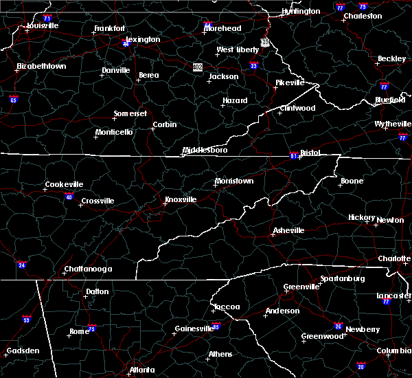 A severe thunderstorm warning remains in effect until 245 pm edt for johnson and northeastern carter counties. at 209 pm edt, a severe thunderstorm was located over mountain city, moving southeast at 25 mph. hazard. 60 mph wind gusts and quarter size hail. source. Radar indicated. A severe thunderstorm warning remains in effect until 245 pm edt for johnson and northeastern carter counties. at 209 pm edt, a severe thunderstorm was located over mountain city, moving southeast at 25 mph. hazard. 60 mph wind gusts and quarter size hail. source. Radar indicated.
|
| 8/13/2019 2:07 PM EDT |
 At 206 pm edt, a severe thunderstorm was located near mountain city, moving southeast at 25 mph (radar indicated). Hazards include 60 mph wind gusts and quarter size hail. Hail damage to vehicles is expected. expect wind damage to roofs, siding, and trees. Locations impacted include, bristol tn, bristol va, mountain city, shady valley, neva and laurel bloomery. At 206 pm edt, a severe thunderstorm was located near mountain city, moving southeast at 25 mph (radar indicated). Hazards include 60 mph wind gusts and quarter size hail. Hail damage to vehicles is expected. expect wind damage to roofs, siding, and trees. Locations impacted include, bristol tn, bristol va, mountain city, shady valley, neva and laurel bloomery.
|
| 8/13/2019 1:43 PM EDT |
 At 143 pm edt, a severe thunderstorm was located near bristol va, moving southeast at 25 mph (radar indicated). Hazards include 60 mph wind gusts and quarter size hail. Hail damage to vehicles is expected. Expect wind damage to roofs, siding, and trees. At 143 pm edt, a severe thunderstorm was located near bristol va, moving southeast at 25 mph (radar indicated). Hazards include 60 mph wind gusts and quarter size hail. Hail damage to vehicles is expected. Expect wind damage to roofs, siding, and trees.
|
| 8/1/2019 10:08 PM EDT |
 The severe thunderstorm warning for northeastern johnson county will expire at 1015 pm edt, the storm which prompted the warning has weakened below severe limits, and no longer poses an immediate threat to life or property. therefore, the warning will be allowed to expire. however heavy rain is still possible with this thunderstorm with localized flooding possible. The severe thunderstorm warning for northeastern johnson county will expire at 1015 pm edt, the storm which prompted the warning has weakened below severe limits, and no longer poses an immediate threat to life or property. therefore, the warning will be allowed to expire. however heavy rain is still possible with this thunderstorm with localized flooding possible.
|
| 8/1/2019 9:49 PM EDT |
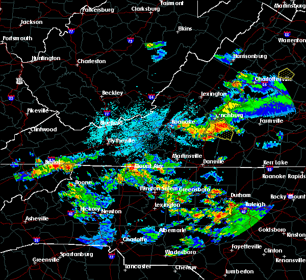 At 949 pm edt, a severe thunderstorm was located near mountain city, and is nearly stationary (radar indicated). Hazards include 60 mph wind gusts and quarter size hail. Hail damage to vehicles is expected. expect wind damage to roofs, siding, and trees. Locations impacted include, mountain city and laurel bloomery. At 949 pm edt, a severe thunderstorm was located near mountain city, and is nearly stationary (radar indicated). Hazards include 60 mph wind gusts and quarter size hail. Hail damage to vehicles is expected. expect wind damage to roofs, siding, and trees. Locations impacted include, mountain city and laurel bloomery.
|
| 8/1/2019 9:34 PM EDT |
 At 933 pm edt, a severe thunderstorm was located near flatwood, or 7 miles northeast of mountain city, and is nearly stationary (radar indicated). Hazards include 60 mph wind gusts and quarter size hail. Hail damage to vehicles is expected. Expect wind damage to roofs, siding, and trees. At 933 pm edt, a severe thunderstorm was located near flatwood, or 7 miles northeast of mountain city, and is nearly stationary (radar indicated). Hazards include 60 mph wind gusts and quarter size hail. Hail damage to vehicles is expected. Expect wind damage to roofs, siding, and trees.
|
| 6/22/2019 1:53 AM EDT |
 At 152 am edt, severe thunderstorms were located along a line extending from near lebanon to near ashland, moving east at 45 mph (radar indicated). Hazards include 60 mph wind gusts. Expect damage to roofs, siding, and trees. Locations impacted include, abingdon, lebanon, mountain city, cleveland va, glade spring, honaker, damascus, laurel bloomery, emory-meadow view, rosedale, shady valley, lindell, holston, harr and konnarock. At 152 am edt, severe thunderstorms were located along a line extending from near lebanon to near ashland, moving east at 45 mph (radar indicated). Hazards include 60 mph wind gusts. Expect damage to roofs, siding, and trees. Locations impacted include, abingdon, lebanon, mountain city, cleveland va, glade spring, honaker, damascus, laurel bloomery, emory-meadow view, rosedale, shady valley, lindell, holston, harr and konnarock.
|
| 6/22/2019 1:38 AM EDT |
 At 137 am edt, severe thunderstorms were located along a line extending from 6 miles southwest of cleveland va to near reese, moving northeast at 45 mph (radar indicated). Hazards include 60 mph wind gusts. Expect damage to roofs, siding, and trees. Locations impacted include, bristol tn, bristol va, abingdon, lebanon, mountain city, cleveland va, walnut hill, glade spring, honaker, damascus, laurel bloomery, emory-meadow view, rosedale, shady valley, south holston dam, collingwood, doeville, hansonville, konnarock and neva. At 137 am edt, severe thunderstorms were located along a line extending from 6 miles southwest of cleveland va to near reese, moving northeast at 45 mph (radar indicated). Hazards include 60 mph wind gusts. Expect damage to roofs, siding, and trees. Locations impacted include, bristol tn, bristol va, abingdon, lebanon, mountain city, cleveland va, walnut hill, glade spring, honaker, damascus, laurel bloomery, emory-meadow view, rosedale, shady valley, south holston dam, collingwood, doeville, hansonville, konnarock and neva.
|
| 6/22/2019 1:08 AM EDT |
 At 108 am edt, severe thunderstorms were located along a line extending from 11 miles northeast of gate city to near erwin, moving east at 50 mph (radar indicated). Hazards include 60 mph wind gusts. expect damage to roofs, siding, and trees At 108 am edt, severe thunderstorms were located along a line extending from 11 miles northeast of gate city to near erwin, moving east at 50 mph (radar indicated). Hazards include 60 mph wind gusts. expect damage to roofs, siding, and trees
|
| 11/6/2018 6:43 AM EST |
 At 642 am est, severe thunderstorms were located along a line extending from 9 miles southeast of bristol tn to 9 miles north of bakersville, moving east at 40 mph (radar indicated). Hazards include 60 mph wind gusts. expect damage to roofs, siding, and trees At 642 am est, severe thunderstorms were located along a line extending from 9 miles southeast of bristol tn to 9 miles north of bakersville, moving east at 40 mph (radar indicated). Hazards include 60 mph wind gusts. expect damage to roofs, siding, and trees
|
| 9/9/2018 7:12 PM EDT |
 At 712 pm edt, severe thunderstorms were located along a line extending from 12 miles north of surgoinsville to near oak grove, moving northeast at 40 mph (radar indicated). Hazards include 60 mph wind gusts and penny size hail. expect damage to roofs, siding, and trees At 712 pm edt, severe thunderstorms were located along a line extending from 12 miles north of surgoinsville to near oak grove, moving northeast at 40 mph (radar indicated). Hazards include 60 mph wind gusts and penny size hail. expect damage to roofs, siding, and trees
|
| 8/8/2018 3:05 PM EDT | Several trees dow in johnson county TN, 0.5 miles SE of Mountain City, TN |
| 8/8/2018 2:52 PM EDT |
 At 252 pm edt, a severe thunderstorm was located near mountain city, moving east at 30 mph (radar indicated). Hazards include 60 mph wind gusts and penny size hail. expect damage to roofs, siding, and trees At 252 pm edt, a severe thunderstorm was located near mountain city, moving east at 30 mph (radar indicated). Hazards include 60 mph wind gusts and penny size hail. expect damage to roofs, siding, and trees
|
| 7/20/2018 11:36 PM EDT | Several trees down around the community of butler... tennesse in johnson county TN, 4.9 miles NE of Mountain City, TN |
| 7/20/2018 11:30 PM EDT |
 At 1129 pm edt, severe thunderstorms were located along a line extending from near mountain city to reese to banner elk to near bakersville, moving southeast at 40 mph (radar indicated). Hazards include 60 mph wind gusts and penny size hail. Expect damage to roofs, siding, and trees. Locations impacted include, mountain city, damascus, roane mountain state park, doeville, laurel bloomery, neva, hampton creek cove state park, elk mills, konnarock, roan mountain and emory-meadow view. At 1129 pm edt, severe thunderstorms were located along a line extending from near mountain city to reese to banner elk to near bakersville, moving southeast at 40 mph (radar indicated). Hazards include 60 mph wind gusts and penny size hail. Expect damage to roofs, siding, and trees. Locations impacted include, mountain city, damascus, roane mountain state park, doeville, laurel bloomery, neva, hampton creek cove state park, elk mills, konnarock, roan mountain and emory-meadow view.
|
| 7/20/2018 10:48 PM EDT |
 At 1047 pm edt, severe thunderstorms were located along a line extending from 7 miles northwest of bristol va to near walnut hill to central to 6 miles west of erwin, moving southeast at 40 mph (radar indicated). Hazards include 60 mph wind gusts and penny size hail. expect damage to roofs, siding, and trees At 1047 pm edt, severe thunderstorms were located along a line extending from 7 miles northwest of bristol va to near walnut hill to central to 6 miles west of erwin, moving southeast at 40 mph (radar indicated). Hazards include 60 mph wind gusts and penny size hail. expect damage to roofs, siding, and trees
|
| 7/20/2018 10:48 PM EDT |
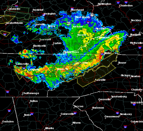 At 1047 pm edt, severe thunderstorms were located along a line extending from 7 miles northwest of bristol va to near walnut hill to central to 6 miles west of erwin, moving southeast at 40 mph (radar indicated). Hazards include 60 mph wind gusts and penny size hail. expect damage to roofs, siding, and trees At 1047 pm edt, severe thunderstorms were located along a line extending from 7 miles northwest of bristol va to near walnut hill to central to 6 miles west of erwin, moving southeast at 40 mph (radar indicated). Hazards include 60 mph wind gusts and penny size hail. expect damage to roofs, siding, and trees
|
| 6/25/2018 4:13 PM EDT |
 At 413 pm edt, severe thunderstorms were located along a line extending from near marion to 9 miles west of mountain city, moving southeast at 35 mph (radar indicated). Hazards include 60 mph wind gusts and penny size hail. Expect damage to roofs, siding, and trees. Locations impacted include, abingdon, mountain city, glade spring, damascus, south holston dam, laurel bloomery, emory-meadow view, harr, shady valley and konnarock. At 413 pm edt, severe thunderstorms were located along a line extending from near marion to 9 miles west of mountain city, moving southeast at 35 mph (radar indicated). Hazards include 60 mph wind gusts and penny size hail. Expect damage to roofs, siding, and trees. Locations impacted include, abingdon, mountain city, glade spring, damascus, south holston dam, laurel bloomery, emory-meadow view, harr, shady valley and konnarock.
|
| 6/25/2018 3:53 PM EDT |
 At 353 pm edt, severe thunderstorms were located along a line extending from near richlands to near bristol tn, moving east at 30 mph (radar indicated). Hazards include 60 mph wind gusts and penny size hail. expect damage to roofs, siding, and trees At 353 pm edt, severe thunderstorms were located along a line extending from near richlands to near bristol tn, moving east at 30 mph (radar indicated). Hazards include 60 mph wind gusts and penny size hail. expect damage to roofs, siding, and trees
|
| 5/10/2018 7:23 PM EDT |
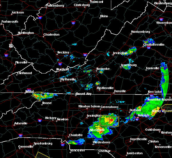 A severe thunderstorm warning remains in effect until 745 pm edt for northern johnson county. at 722 pm edt, a severe thunderstorm was located over mountain city, moving southeast at 20 mph. hazard. 60 mph wind gusts and quarter size hail. source. Radar indicated. A severe thunderstorm warning remains in effect until 745 pm edt for northern johnson county. at 722 pm edt, a severe thunderstorm was located over mountain city, moving southeast at 20 mph. hazard. 60 mph wind gusts and quarter size hail. source. Radar indicated.
|
| 5/10/2018 7:12 PM EDT |
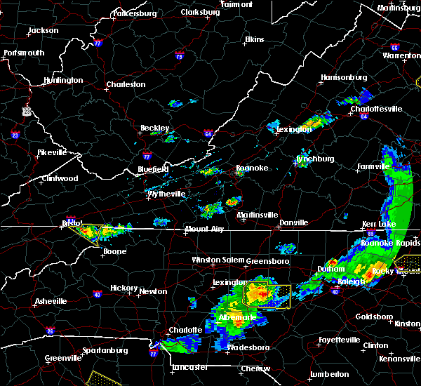 At 712 pm edt, a severe thunderstorm was located near mountain city, moving southeast at 30 mph (radar indicated). Hazards include 60 mph wind gusts and quarter size hail. Hail damage to vehicles is expected. expect wind damage to roofs, siding, and trees. Locations impacted include, mountain city, harr, laurel bloomery and shady valley. At 712 pm edt, a severe thunderstorm was located near mountain city, moving southeast at 30 mph (radar indicated). Hazards include 60 mph wind gusts and quarter size hail. Hail damage to vehicles is expected. expect wind damage to roofs, siding, and trees. Locations impacted include, mountain city, harr, laurel bloomery and shady valley.
|
| 5/10/2018 6:48 PM EDT |
 At 648 pm edt, a severe thunderstorm was located near abingdon, moving southeast at 30 mph (radar indicated). Hazards include 60 mph wind gusts and quarter size hail. Hail damage to vehicles is expected. Expect wind damage to roofs, siding, and trees. At 648 pm edt, a severe thunderstorm was located near abingdon, moving southeast at 30 mph (radar indicated). Hazards include 60 mph wind gusts and quarter size hail. Hail damage to vehicles is expected. Expect wind damage to roofs, siding, and trees.
|
| 5/10/2018 6:48 PM EDT |
 The national weather service in morristown has issued a * severe thunderstorm warning for. northeastern sullivan county in east tennessee. northern johnson county in east tennessee. the northeastern city of bristol in southwestern virginia. Southeastern washington county in southwestern virginia. The national weather service in morristown has issued a * severe thunderstorm warning for. northeastern sullivan county in east tennessee. northern johnson county in east tennessee. the northeastern city of bristol in southwestern virginia. Southeastern washington county in southwestern virginia.
|
| 3/17/2018 10:12 PM EDT |
 At 1011 pm edt, a severe thunderstorm was located over hampton, or near elizabethton, moving east at 45 mph (radar indicated). Hazards include 60 mph wind gusts and quarter size hail. Hail damage to vehicles is expected. expect wind damage to roofs, siding, and trees. Locations impacted include, johnson city, elizabethton, mountain city, jonesborough, central, midway, pine crest, hampton, unicoi, bluff city, watauga, leesburg, roane mountain state park, hampton creek cove state park, limestone cove, trade, doeville, milligan college, avondale and hunter. At 1011 pm edt, a severe thunderstorm was located over hampton, or near elizabethton, moving east at 45 mph (radar indicated). Hazards include 60 mph wind gusts and quarter size hail. Hail damage to vehicles is expected. expect wind damage to roofs, siding, and trees. Locations impacted include, johnson city, elizabethton, mountain city, jonesborough, central, midway, pine crest, hampton, unicoi, bluff city, watauga, leesburg, roane mountain state park, hampton creek cove state park, limestone cove, trade, doeville, milligan college, avondale and hunter.
|
| 3/17/2018 9:51 PM EDT |
 At 950 pm edt, a severe thunderstorm was located near oak grove, or near johnson city, moving east at 50 mph (radar indicated). Hazards include 60 mph wind gusts and quarter size hail. Hail damage to vehicles is expected. Expect wind damage to roofs, siding, and trees. At 950 pm edt, a severe thunderstorm was located near oak grove, or near johnson city, moving east at 50 mph (radar indicated). Hazards include 60 mph wind gusts and quarter size hail. Hail damage to vehicles is expected. Expect wind damage to roofs, siding, and trees.
|
| 3/17/2018 8:41 PM EDT |
 At 841 pm edt, a severe thunderstorm was located over johnson city, moving east at 40 mph (radar indicated). Hazards include 60 mph wind gusts and quarter size hail. Hail damage to vehicles is expected. Expect wind damage to roofs, siding, and trees. At 841 pm edt, a severe thunderstorm was located over johnson city, moving east at 40 mph (radar indicated). Hazards include 60 mph wind gusts and quarter size hail. Hail damage to vehicles is expected. Expect wind damage to roofs, siding, and trees.
|
| 11/18/2017 10:16 PM EST |
 At 1016 pm est, severe thunderstorms were located along a line extending from near bristol va to near bristol tn to midway, moving east at 60 mph (radar indicated). Hazards include 60 mph wind gusts. expect damage to roofs, siding, and trees At 1016 pm est, severe thunderstorms were located along a line extending from near bristol va to near bristol tn to midway, moving east at 60 mph (radar indicated). Hazards include 60 mph wind gusts. expect damage to roofs, siding, and trees
|
| 5/24/2017 1:39 PM EDT |
 At 139 pm edt, severe thunderstorms were located along a line extending from 6 miles north of surgoinsville to 10 miles west of gray to 8 miles west of jonesborough to 11 miles southeast of tusculum, moving northeast at 45 mph (radar indicated). Hazards include 60 mph wind gusts. expect damage to roofs, siding, and trees At 139 pm edt, severe thunderstorms were located along a line extending from 6 miles north of surgoinsville to 10 miles west of gray to 8 miles west of jonesborough to 11 miles southeast of tusculum, moving northeast at 45 mph (radar indicated). Hazards include 60 mph wind gusts. expect damage to roofs, siding, and trees
|
| 5/20/2017 2:53 PM EDT |
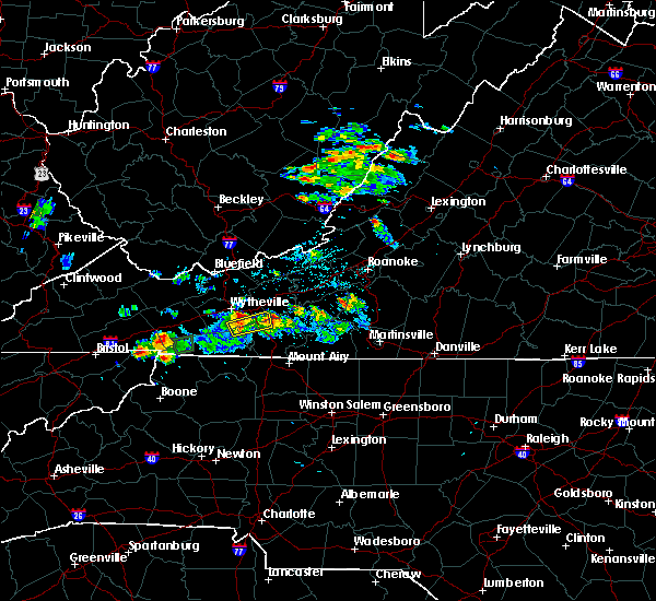 At 253 pm edt, a severe thunderstorm was located 8 miles north of mountain city, and is nearly stationary (radar indicated). Hazards include 60 mph wind gusts and quarter size hail. Hail damage to vehicles is expected. Expect wind damage to roofs, siding, and trees. At 253 pm edt, a severe thunderstorm was located 8 miles north of mountain city, and is nearly stationary (radar indicated). Hazards include 60 mph wind gusts and quarter size hail. Hail damage to vehicles is expected. Expect wind damage to roofs, siding, and trees.
|
| 5/12/2017 2:35 PM EDT |
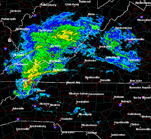 At 234 pm edt, a severe thunderstorm capable of producing a tornado was located 8 miles west of mountain city, moving east at 25 mph. spotter report of 1 inch hail has already been reported with this storm (radar indicated rotation). Hazards include tornado and quarter size hail. Flying debris will be dangerous to those caught without shelter. mobile homes will be damaged or destroyed. damage to roofs, windows, and vehicles will occur. tree damage is likely. this dangerous storm will be near, mountain city around 245 pm edt. Other locations impacted by this tornadic thunderstorm include shady valley and laurel bloomery. At 234 pm edt, a severe thunderstorm capable of producing a tornado was located 8 miles west of mountain city, moving east at 25 mph. spotter report of 1 inch hail has already been reported with this storm (radar indicated rotation). Hazards include tornado and quarter size hail. Flying debris will be dangerous to those caught without shelter. mobile homes will be damaged or destroyed. damage to roofs, windows, and vehicles will occur. tree damage is likely. this dangerous storm will be near, mountain city around 245 pm edt. Other locations impacted by this tornadic thunderstorm include shady valley and laurel bloomery.
|
| 5/12/2017 2:31 PM EDT | Reports of trees down...a storage shed blown from its foundation...and metal roof peeled off of a doublewide structure. time estimated by rada in johnson county TN, 8 miles ESE of Mountain City, TN |
| 5/12/2017 2:20 PM EDT |
 At 220 pm edt, a severe thunderstorm capable of producing a tornado was located 9 miles southeast of bristol tn, moving east at 25 mph (radar indicated rotation). Hazards include tornado and quarter size hail. Flying debris will be dangerous to those caught without shelter. mobile homes will be damaged or destroyed. damage to roofs, windows, and vehicles will occur. tree damage is likely. this dangerous storm will be near, mountain city around 245 pm edt. Other locations impacted by this tornadic thunderstorm include south holston dam, harr, sadie, shady valley and laurel bloomery. At 220 pm edt, a severe thunderstorm capable of producing a tornado was located 9 miles southeast of bristol tn, moving east at 25 mph (radar indicated rotation). Hazards include tornado and quarter size hail. Flying debris will be dangerous to those caught without shelter. mobile homes will be damaged or destroyed. damage to roofs, windows, and vehicles will occur. tree damage is likely. this dangerous storm will be near, mountain city around 245 pm edt. Other locations impacted by this tornadic thunderstorm include south holston dam, harr, sadie, shady valley and laurel bloomery.
|
| 3/1/2017 1:41 PM EST |
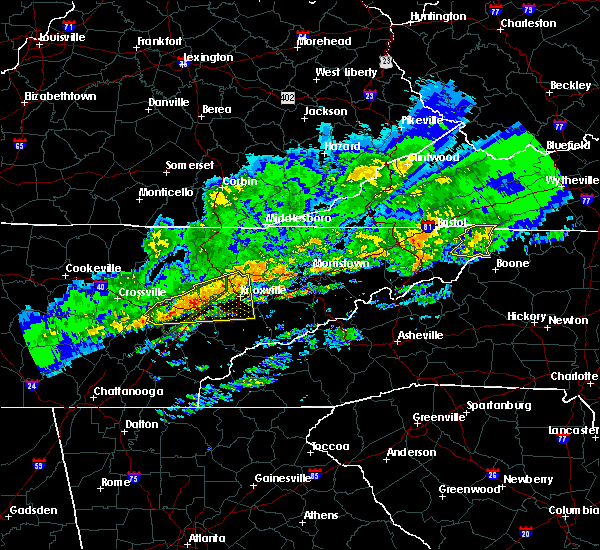 At 141 pm est, a severe thunderstorm was located near mountain city, moving east at 55 mph (radar indicated). Hazards include 60 mph wind gusts and penny size hail. Expect damage to roofs, siding, and trees. Locations impacted include, mountain city, trade, doeville, neva, shady valley and laurel bloomery. At 141 pm est, a severe thunderstorm was located near mountain city, moving east at 55 mph (radar indicated). Hazards include 60 mph wind gusts and penny size hail. Expect damage to roofs, siding, and trees. Locations impacted include, mountain city, trade, doeville, neva, shady valley and laurel bloomery.
|
| 3/1/2017 1:25 PM EST |
 At 125 pm est, a severe thunderstorm was located 7 miles northeast of elizabethton, moving east at 55 mph (radar indicated). Hazards include 60 mph wind gusts and nickel size hail. Expect damage to roofs, siding, and trees. Locations impacted include, bristol tn, elizabethton, mountain city, bluff city, hunter, morril`s cave, neva, laurel bloomery, sadie, shady valley, trade, south holston dam and doeville. At 125 pm est, a severe thunderstorm was located 7 miles northeast of elizabethton, moving east at 55 mph (radar indicated). Hazards include 60 mph wind gusts and nickel size hail. Expect damage to roofs, siding, and trees. Locations impacted include, bristol tn, elizabethton, mountain city, bluff city, hunter, morril`s cave, neva, laurel bloomery, sadie, shady valley, trade, south holston dam and doeville.
|
| 3/1/2017 1:06 PM EST |
 At 105 pm est, a severe thunderstorm was located over gray, or 8 miles northwest of johnson city, moving east at 55 mph (radar indicated). Hazards include 60 mph wind gusts and nickel size hail. expect damage to roofs, siding, and trees At 105 pm est, a severe thunderstorm was located over gray, or 8 miles northwest of johnson city, moving east at 55 mph (radar indicated). Hazards include 60 mph wind gusts and nickel size hail. expect damage to roofs, siding, and trees
|
| 3/1/2017 12:21 PM EST |
 At 1220 pm est, severe thunderstorms were located along a line extending from chilhowie to near bristol tn, moving east at 55 mph (radar indicated). Hazards include 60 mph wind gusts and penny size hail. expect damage to roofs, siding, and trees At 1220 pm est, severe thunderstorms were located along a line extending from chilhowie to near bristol tn, moving east at 55 mph (radar indicated). Hazards include 60 mph wind gusts and penny size hail. expect damage to roofs, siding, and trees
|
| 11/30/2016 7:28 AM EST |
 At 728 am est, severe thunderstorms were located along a line extending from 6 miles west of allison gap to 6 miles south of abingdon to 11 miles west of mountain city, moving east at 60 mph (radar indicated). Hazards include 60 mph wind gusts. Expect damage to roofs. siding. and trees. Locations impacted include, abingdon, mountain city, glade spring, damascus, harr, sadie, laurel bloomery, doeville, rosedale, lindell, emory-meadow view, neva and shady valley. At 728 am est, severe thunderstorms were located along a line extending from 6 miles west of allison gap to 6 miles south of abingdon to 11 miles west of mountain city, moving east at 60 mph (radar indicated). Hazards include 60 mph wind gusts. Expect damage to roofs. siding. and trees. Locations impacted include, abingdon, mountain city, glade spring, damascus, harr, sadie, laurel bloomery, doeville, rosedale, lindell, emory-meadow view, neva and shady valley.
|
| 11/30/2016 7:02 AM EST |
 At 701 am est, severe thunderstorms were located along a line extending from 9 miles southwest of cleveland va to 6 miles west of walnut hill to near midway, moving east at 55 mph (radar indicated). Hazards include 60 mph wind gusts. Expect damage to roofs. siding. and trees. Locations impacted include, johnson city, kingsport, bristol tn, bristol va, elizabethton, abingdon, lebanon, mountain city, jonesborough, cleveland va, central, walnut hill, oak grove, spurgeon, hampton, gray, pine crest, midway, colonial heights and bluff city. At 701 am est, severe thunderstorms were located along a line extending from 9 miles southwest of cleveland va to 6 miles west of walnut hill to near midway, moving east at 55 mph (radar indicated). Hazards include 60 mph wind gusts. Expect damage to roofs. siding. and trees. Locations impacted include, johnson city, kingsport, bristol tn, bristol va, elizabethton, abingdon, lebanon, mountain city, jonesborough, cleveland va, central, walnut hill, oak grove, spurgeon, hampton, gray, pine crest, midway, colonial heights and bluff city.
|
| 11/30/2016 6:47 AM EST |
 At 646 am est, severe thunderstorms were located along a line extending from 11 miles southeast of norton to near kingsport to near tusculum, moving east at 50 mph (radar indicated). Hazards include 60 mph wind gusts. Expect damage to roofs. siding. And trees. At 646 am est, severe thunderstorms were located along a line extending from 11 miles southeast of norton to near kingsport to near tusculum, moving east at 50 mph (radar indicated). Hazards include 60 mph wind gusts. Expect damage to roofs. siding. And trees.
|
| 11/30/2016 5:17 AM EST |
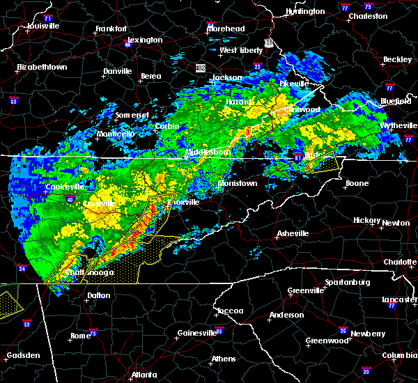 At 517 am est, a severe thunderstorm was located 9 miles southeast of bristol tn, moving east at 45 mph (radar indicated). Hazards include 60 mph wind gusts and penny size hail. Expect damage to roofs. siding. and trees. Locations impacted include, mountain city, sadie, harr, south holston dam and shady valley. At 517 am est, a severe thunderstorm was located 9 miles southeast of bristol tn, moving east at 45 mph (radar indicated). Hazards include 60 mph wind gusts and penny size hail. Expect damage to roofs. siding. and trees. Locations impacted include, mountain city, sadie, harr, south holston dam and shady valley.
|
| 11/30/2016 5:09 AM EST |
 At 509 am est, a severe thunderstorm was located near bristol tn, moving east at 50 mph (radar indicated). Hazards include 60 mph wind gusts and penny size hail. Expect damage to roofs. siding. and trees. Locations impacted include, bristol tn, bristol va, elizabethton, abingdon, mountain city, walnut hill, bluff city, damascus, watauga, hunter, hilander park, sadie, harr, south holston dam, laurel bloomery, doeville, emory-meadow view, morril`s cave, neva and shady valley. At 509 am est, a severe thunderstorm was located near bristol tn, moving east at 50 mph (radar indicated). Hazards include 60 mph wind gusts and penny size hail. Expect damage to roofs. siding. and trees. Locations impacted include, bristol tn, bristol va, elizabethton, abingdon, mountain city, walnut hill, bluff city, damascus, watauga, hunter, hilander park, sadie, harr, south holston dam, laurel bloomery, doeville, emory-meadow view, morril`s cave, neva and shady valley.
|
| 11/30/2016 4:51 AM EST |
 At 451 am est, a severe thunderstorm was located over oak grove, or near johnson city, moving east at 50 mph (radar indicated). Hazards include 60 mph wind gusts and quarter size hail. Hail damage to vehicles is expected. Expect wind damage to roofs, siding, and trees. At 451 am est, a severe thunderstorm was located over oak grove, or near johnson city, moving east at 50 mph (radar indicated). Hazards include 60 mph wind gusts and quarter size hail. Hail damage to vehicles is expected. Expect wind damage to roofs, siding, and trees.
|
| 8/14/2016 5:26 PM EDT |
 The severe thunderstorm warning for northeastern johnson and southeastern washington counties will expire at 530 pm edt, the storm which prompted the warning has weakened below severe limits, and has exited the warned area. therefore, the warning will be allowed to expire. The severe thunderstorm warning for northeastern johnson and southeastern washington counties will expire at 530 pm edt, the storm which prompted the warning has weakened below severe limits, and has exited the warned area. therefore, the warning will be allowed to expire.
|
| 8/14/2016 5:09 PM EDT |
 At 509 pm edt, a severe thunderstorm was located near mountain city, moving northeast at 20 mph (radar indicated). Hazards include 60 mph wind gusts. Expect damage to roofs. siding. and trees. Locations impacted include, mountain city, damascus, konnarock and laurel bloomery. At 509 pm edt, a severe thunderstorm was located near mountain city, moving northeast at 20 mph (radar indicated). Hazards include 60 mph wind gusts. Expect damage to roofs. siding. and trees. Locations impacted include, mountain city, damascus, konnarock and laurel bloomery.
|
| 8/14/2016 5:09 PM EDT |
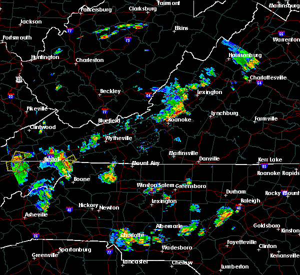 At 509 pm edt, a severe thunderstorm was located near mountain city, moving northeast at 20 mph (radar indicated). Hazards include 60 mph wind gusts. Expect damage to roofs. siding. and trees. Locations impacted include, mountain city, damascus, konnarock and laurel bloomery. At 509 pm edt, a severe thunderstorm was located near mountain city, moving northeast at 20 mph (radar indicated). Hazards include 60 mph wind gusts. Expect damage to roofs. siding. and trees. Locations impacted include, mountain city, damascus, konnarock and laurel bloomery.
|
| 8/14/2016 4:48 PM EDT |
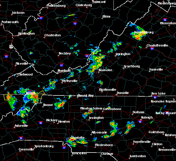 At 448 pm edt, a severe thunderstorm was located near mountain city, moving northeast at 20 mph (radar indicated). Hazards include 60 mph wind gusts and quarter size hail. Hail damage to vehicles is expected. Expect wind damage to roofs, siding, and trees. At 448 pm edt, a severe thunderstorm was located near mountain city, moving northeast at 20 mph (radar indicated). Hazards include 60 mph wind gusts and quarter size hail. Hail damage to vehicles is expected. Expect wind damage to roofs, siding, and trees.
|
| 7/8/2016 6:34 PM EDT |
 At 634 pm edt, severe thunderstorms were located along a line extending from 11 miles west of mountain city to near hampton to banner hill to 9 miles southeast of tusculum, moving east at 60 mph (radar indicated). Hazards include 70 mph wind gusts. Expect considerable tree damage. damage is likely to mobile homes, roofs, and outbuildings. locations impacted include, johnson city, elizabethton, erwin, mountain city, central, hampton, banner hill, pine crest, unicoi, watauga, hunter, sadie, laurel bloomery, doeville, roan mountain, milligan college, hampton creek cove s. p,. limestone cove, elk mills and roane mountain s. P At 634 pm edt, severe thunderstorms were located along a line extending from 11 miles west of mountain city to near hampton to banner hill to 9 miles southeast of tusculum, moving east at 60 mph (radar indicated). Hazards include 70 mph wind gusts. Expect considerable tree damage. damage is likely to mobile homes, roofs, and outbuildings. locations impacted include, johnson city, elizabethton, erwin, mountain city, central, hampton, banner hill, pine crest, unicoi, watauga, hunter, sadie, laurel bloomery, doeville, roan mountain, milligan college, hampton creek cove s. p,. limestone cove, elk mills and roane mountain s. P
|
| 7/8/2016 6:14 PM EDT |
 At 614 pm edt, severe thunderstorms were located along a line extending from near walnut hill to near oak grove to near tusculum to near greeneville, moving east at 55 mph (radar indicated). Hazards include 60 mph wind gusts. Expect damage to roofs. siding. And trees. At 614 pm edt, severe thunderstorms were located along a line extending from near walnut hill to near oak grove to near tusculum to near greeneville, moving east at 55 mph (radar indicated). Hazards include 60 mph wind gusts. Expect damage to roofs. siding. And trees.
|
| 7/6/2016 8:31 PM EDT |
 At 830 pm edt, severe thunderstorms were located along a line extending from near bristol va to near hampton to near burnsville, moving east at 55 mph (radar indicated). Hazards include 60 mph wind gusts and penny size hail. Expect damage to roofs. siding. And trees. At 830 pm edt, severe thunderstorms were located along a line extending from near bristol va to near hampton to near burnsville, moving east at 55 mph (radar indicated). Hazards include 60 mph wind gusts and penny size hail. Expect damage to roofs. siding. And trees.
|
| 7/4/2016 9:38 PM EDT |
 The severe thunderstorm warning for northeastern johnson and eastern washington counties will expire at 945 pm edt, the storms which prompted the warning have moved out of the area. therefore the warning will be allowed to expire. The severe thunderstorm warning for northeastern johnson and eastern washington counties will expire at 945 pm edt, the storms which prompted the warning have moved out of the area. therefore the warning will be allowed to expire.
|
| 7/4/2016 9:24 PM EDT |
 At 924 pm edt, severe thunderstorms were located along a line extending from saltville to 7 miles north of mountain city, moving east at 45 mph (radar indicated). Hazards include 60 mph wind gusts and penny size hail. Expect damage to roofs. siding. and trees. Locations impacted include, mountain city, glade spring, damascus, konnarock, emory-meadow view and laurel bloomery. At 924 pm edt, severe thunderstorms were located along a line extending from saltville to 7 miles north of mountain city, moving east at 45 mph (radar indicated). Hazards include 60 mph wind gusts and penny size hail. Expect damage to roofs. siding. and trees. Locations impacted include, mountain city, glade spring, damascus, konnarock, emory-meadow view and laurel bloomery.
|
| 7/4/2016 9:07 PM EDT |
 At 907 pm edt, severe thunderstorms were located along a line extending from 7 miles north of abingdon to 10 miles southeast of bristol va, moving east at 45 mph (radar indicated). Hazards include 60 mph wind gusts and penny size hail. Expect damage to roofs. siding. And trees. At 907 pm edt, severe thunderstorms were located along a line extending from 7 miles north of abingdon to 10 miles southeast of bristol va, moving east at 45 mph (radar indicated). Hazards include 60 mph wind gusts and penny size hail. Expect damage to roofs. siding. And trees.
|
| 6/23/2016 10:00 PM EDT |
 At 1000 pm edt, a severe thunderstorm was located near mountain city, moving southeast at 25 mph (radar indicated). Hazards include 60 mph wind gusts and quarter size hail. Hail damage to vehicles is expected. expect wind damage to roofs, siding, and trees. Locations impacted include, bristol tn, bristol va, abingdon, mountain city, walnut hill, glade spring, damascus, trade, sadie, south holston dam, elk mills, shady valley, hunter, benhams, harr, hilander park, laurel bloomery, doeville, holston and konnarock. At 1000 pm edt, a severe thunderstorm was located near mountain city, moving southeast at 25 mph (radar indicated). Hazards include 60 mph wind gusts and quarter size hail. Hail damage to vehicles is expected. expect wind damage to roofs, siding, and trees. Locations impacted include, bristol tn, bristol va, abingdon, mountain city, walnut hill, glade spring, damascus, trade, sadie, south holston dam, elk mills, shady valley, hunter, benhams, harr, hilander park, laurel bloomery, doeville, holston and konnarock.
|
| 6/23/2016 9:22 PM EDT |
 At 921 pm edt, a severe thunderstorm was located near bristol va, moving southeast at 30 mph (radar indicated). Hazards include 60 mph wind gusts and quarter size hail. Hail damage to vehicles is expected. Expect wind damage to roofs, siding, and trees. At 921 pm edt, a severe thunderstorm was located near bristol va, moving southeast at 30 mph (radar indicated). Hazards include 60 mph wind gusts and quarter size hail. Hail damage to vehicles is expected. Expect wind damage to roofs, siding, and trees.
|
| 6/22/2016 3:34 PM EDT |
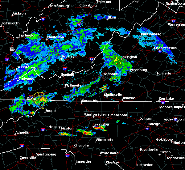 At 334 pm edt, a severe thunderstorm was located 9 miles northwest of flatwood, or 9 miles west of whitetop, moving southeast at 25 mph (radar indicated). Hazards include 60 mph wind gusts and penny size hail. Expect damage to roofs. siding. and trees. Locations impacted include, mountain city, damascus, harr, laurel bloomery, shady valley and trade. At 334 pm edt, a severe thunderstorm was located 9 miles northwest of flatwood, or 9 miles west of whitetop, moving southeast at 25 mph (radar indicated). Hazards include 60 mph wind gusts and penny size hail. Expect damage to roofs. siding. and trees. Locations impacted include, mountain city, damascus, harr, laurel bloomery, shady valley and trade.
|
| 6/22/2016 3:23 PM EDT |
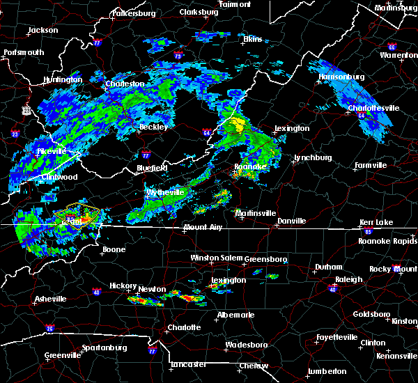 At 322 pm edt, a severe thunderstorm was located near abingdon, moving southeast at 25 mph (radar indicated). Hazards include 60 mph wind gusts and quarter size hail. Hail damage to vehicles is expected. Expect wind damage to roofs, siding, and trees. At 322 pm edt, a severe thunderstorm was located near abingdon, moving southeast at 25 mph (radar indicated). Hazards include 60 mph wind gusts and quarter size hail. Hail damage to vehicles is expected. Expect wind damage to roofs, siding, and trees.
|
| 6/17/2016 12:38 AM EDT |
 At 1237 am edt, a severe thunderstorm was located over mountain city, moving southeast at 30 mph (radar indicated). Hazards include 60 mph wind gusts and penny size hail. Expect damage to roofs. siding. and trees. Locations impacted include, mountain city, trade, harr, neva, laurel bloomery and shady valley. At 1237 am edt, a severe thunderstorm was located over mountain city, moving southeast at 30 mph (radar indicated). Hazards include 60 mph wind gusts and penny size hail. Expect damage to roofs. siding. and trees. Locations impacted include, mountain city, trade, harr, neva, laurel bloomery and shady valley.
|
| 6/17/2016 12:26 AM EDT |
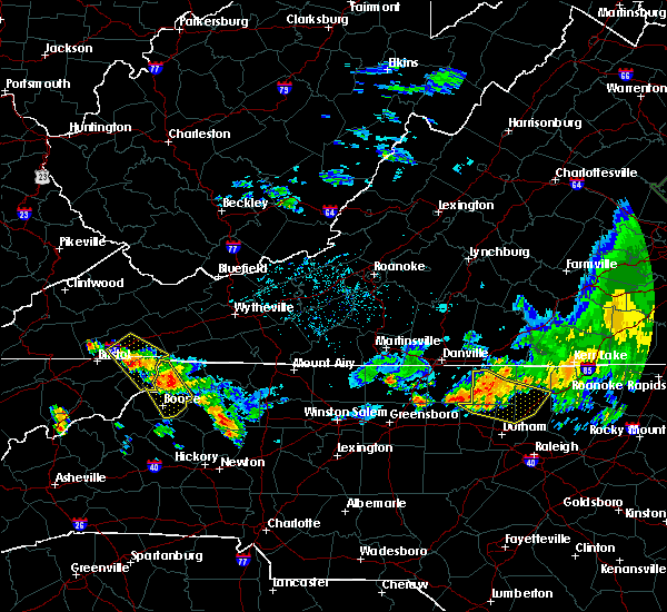 At 1225 am edt, a severe thunderstorm was located 7 miles northwest of mountain city, moving southeast at 30 mph (radar indicated). Hazards include 60 mph wind gusts and penny size hail. Expect damage to roofs. siding. and trees. Locations impacted include, abingdon, mountain city, damascus, trade, hilander park, harr, laurel bloomery, neva, shady valley and emory-meadow view. At 1225 am edt, a severe thunderstorm was located 7 miles northwest of mountain city, moving southeast at 30 mph (radar indicated). Hazards include 60 mph wind gusts and penny size hail. Expect damage to roofs. siding. and trees. Locations impacted include, abingdon, mountain city, damascus, trade, hilander park, harr, laurel bloomery, neva, shady valley and emory-meadow view.
|
| 6/17/2016 12:15 AM EDT | Several trees dow in johnson county TN, 0.5 miles SE of Mountain City, TN |
| 6/17/2016 12:14 AM EDT |
 At 1214 am edt, a severe thunderstorm was located near mountain city, moving southeast at 30 mph (radar indicated). Hazards include 60 mph wind gusts and quarter size hail. Hail damage to vehicles is expected. expect wind damage to roofs, siding, and trees. Locations impacted include, abingdon, mountain city, damascus, trade, hilander park, harr, laurel bloomery, neva, shady valley and emory-meadow view. At 1214 am edt, a severe thunderstorm was located near mountain city, moving southeast at 30 mph (radar indicated). Hazards include 60 mph wind gusts and quarter size hail. Hail damage to vehicles is expected. expect wind damage to roofs, siding, and trees. Locations impacted include, abingdon, mountain city, damascus, trade, hilander park, harr, laurel bloomery, neva, shady valley and emory-meadow view.
|
| 6/17/2016 12:14 AM EDT |
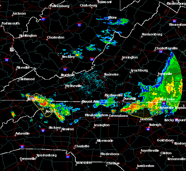 At 1214 am edt, a severe thunderstorm was located near mountain city, moving southeast at 30 mph (radar indicated). Hazards include 60 mph wind gusts and quarter size hail. Hail damage to vehicles is expected. expect wind damage to roofs, siding, and trees. Locations impacted include, abingdon, mountain city, damascus, trade, hilander park, harr, laurel bloomery, neva, shady valley and emory-meadow view. At 1214 am edt, a severe thunderstorm was located near mountain city, moving southeast at 30 mph (radar indicated). Hazards include 60 mph wind gusts and quarter size hail. Hail damage to vehicles is expected. expect wind damage to roofs, siding, and trees. Locations impacted include, abingdon, mountain city, damascus, trade, hilander park, harr, laurel bloomery, neva, shady valley and emory-meadow view.
|
| 6/16/2016 11:59 PM EDT |
 At 1158 pm edt, a severe thunderstorm was located 8 miles southeast of abingdon, moving southeast at 30 mph (radar indicated). Hazards include 60 mph wind gusts and quarter size hail. Hail damage to vehicles is expected. Expect wind damage to roofs, siding, and trees. At 1158 pm edt, a severe thunderstorm was located 8 miles southeast of abingdon, moving southeast at 30 mph (radar indicated). Hazards include 60 mph wind gusts and quarter size hail. Hail damage to vehicles is expected. Expect wind damage to roofs, siding, and trees.
|
| 6/16/2016 11:59 PM EDT |
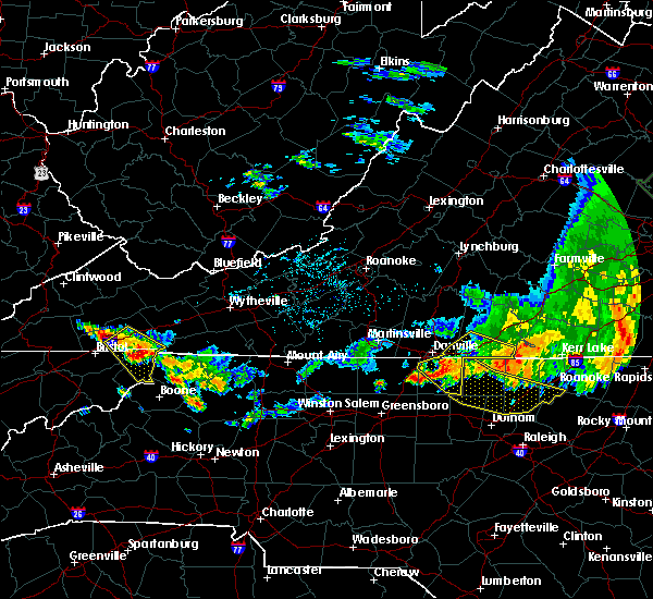 At 1158 pm edt, a severe thunderstorm was located 8 miles southeast of abingdon, moving southeast at 30 mph (radar indicated). Hazards include 60 mph wind gusts and quarter size hail. Hail damage to vehicles is expected. Expect wind damage to roofs, siding, and trees. At 1158 pm edt, a severe thunderstorm was located 8 miles southeast of abingdon, moving southeast at 30 mph (radar indicated). Hazards include 60 mph wind gusts and quarter size hail. Hail damage to vehicles is expected. Expect wind damage to roofs, siding, and trees.
|
| 5/2/2016 6:50 PM EDT | Quarter sized hail reported 7.6 miles WSW of Mountain City, TN, quarter size hail near the tn state line |
| 4/27/2016 8:16 PM EDT |
 At 816 pm edt, a severe thunderstorm was located near mountain city, moving northeast at 20 mph (radar indicated). Hazards include 60 mph wind gusts and penny size hail. Expect damage to roofs. siding. and trees. Locations impacted include, mountain city, trade, laurel bloomery and neva. At 816 pm edt, a severe thunderstorm was located near mountain city, moving northeast at 20 mph (radar indicated). Hazards include 60 mph wind gusts and penny size hail. Expect damage to roofs. siding. and trees. Locations impacted include, mountain city, trade, laurel bloomery and neva.
|
| 4/27/2016 8:06 PM EDT |
 At 806 pm edt, a severe thunderstorm was located 7 miles southwest of mountain city, moving northeast at 20 mph (radar indicated). Hazards include 60 mph wind gusts and penny size hail. Expect damage to roofs. siding. And trees. At 806 pm edt, a severe thunderstorm was located 7 miles southwest of mountain city, moving northeast at 20 mph (radar indicated). Hazards include 60 mph wind gusts and penny size hail. Expect damage to roofs. siding. And trees.
|
| 7/13/2015 7:06 PM EDT |
 At 706 pm edt, severe thunderstorms were located along a line extending from 67 miles east of abingdon to 7 miles south of mountain city, moving east at 65 mph (radar indicated). Hazards include 60 mph wind gusts and quarter size hail. Hail damage to vehicles is expected. expect wind damage to roofs, siding and trees. Locations impacted include, mountain city, elk mills, neva, hunter, trade, doeville, laurel bloomery and roan mountain. At 706 pm edt, severe thunderstorms were located along a line extending from 67 miles east of abingdon to 7 miles south of mountain city, moving east at 65 mph (radar indicated). Hazards include 60 mph wind gusts and quarter size hail. Hail damage to vehicles is expected. expect wind damage to roofs, siding and trees. Locations impacted include, mountain city, elk mills, neva, hunter, trade, doeville, laurel bloomery and roan mountain.
|
| 7/13/2015 6:55 PM EDT |
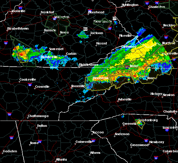 At 654 pm edt, severe thunderstorms were located along a line extending from 57 miles east of abingdon to 9 miles southwest of mountain city, moving southeast at 40 mph (radar indicated). Hazards include 60 mph wind gusts and quarter size hail. Hail damage to vehicles is expected. expect wind damage to roofs, siding and trees. Locations impacted include, mountain city, shady valley, elk mills, neva, hunter, trade, south holston dam, sadie, doeville, laurel bloomery and roan mountain. At 654 pm edt, severe thunderstorms were located along a line extending from 57 miles east of abingdon to 9 miles southwest of mountain city, moving southeast at 40 mph (radar indicated). Hazards include 60 mph wind gusts and quarter size hail. Hail damage to vehicles is expected. expect wind damage to roofs, siding and trees. Locations impacted include, mountain city, shady valley, elk mills, neva, hunter, trade, south holston dam, sadie, doeville, laurel bloomery and roan mountain.
|
| 7/13/2015 6:41 PM EDT |
 At 641 pm edt, severe thunderstorms were located along a line extending from 46 miles northeast of mountain city to 7 miles southeast of bristol, moving east at 65 mph (radar indicated). Hazards include 60 mph wind gusts and quarter size hail. Hail damage to vehicles is expected. expect wind damage to roofs, siding and trees. Locations impacted include, mountain city, bristol tn, bristol, neva, trade, sadie, laurel bloomery, shady valley, elk mills, south holston dam, harr, doeville, hunter and roan mountain. At 641 pm edt, severe thunderstorms were located along a line extending from 46 miles northeast of mountain city to 7 miles southeast of bristol, moving east at 65 mph (radar indicated). Hazards include 60 mph wind gusts and quarter size hail. Hail damage to vehicles is expected. expect wind damage to roofs, siding and trees. Locations impacted include, mountain city, bristol tn, bristol, neva, trade, sadie, laurel bloomery, shady valley, elk mills, south holston dam, harr, doeville, hunter and roan mountain.
|
| 7/13/2015 6:24 PM EDT |
 The national weather service in morristown has issued a * severe thunderstorm warning for. eastern carter county in east tennessee. eastern sullivan county in east tennessee. johnson county in east tennessee. Until 715 pm edt. The national weather service in morristown has issued a * severe thunderstorm warning for. eastern carter county in east tennessee. eastern sullivan county in east tennessee. johnson county in east tennessee. Until 715 pm edt.
|
| 6/8/2015 7:01 PM EDT | At 700 pm edt, severe thunderstorms were located along a line extending from adwolf to near mountain city, moving east at 30 mph (radar indicated). Hazards include 60 mph wind gusts and nickel size hail. Expect damage to roofs. siding and trees. Locations impacted include, mountain city, damascus, konnarock and laurel bloomery. |
| 6/8/2015 7:01 PM EDT | At 700 pm edt, severe thunderstorms were located along a line extending from adwolf to near mountain city, moving east at 30 mph (radar indicated). Hazards include 60 mph wind gusts and nickel size hail. Expect damage to roofs. siding and trees. Locations impacted include, mountain city, damascus, konnarock and laurel bloomery. |
| 6/8/2015 6:44 PM EDT | At 643 pm edt, severe thunderstorms were located along a line extending from chilhowie to 6 miles west of mountain city, moving east at 30 mph (radar indicated). Hazards include 60 mph wind gusts and nickel size hail. Expect damage to roofs. Siding and trees. |
| 6/8/2015 6:44 PM EDT | At 643 pm edt, severe thunderstorms were located along a line extending from chilhowie to 6 miles west of mountain city, moving east at 30 mph (radar indicated). Hazards include 60 mph wind gusts and nickel size hail. Expect damage to roofs. Siding and trees. |
| 6/8/2015 6:31 PM EDT | At 631 pm edt, a severe thunderstorm was located 9 miles southeast of bristol va, moving east at 35 mph (radar indicated). Hazards include 60 mph wind gusts and nickel size hail. Expect damage to roofs. siding and trees. Locations impacted include, bristol tn, bristol va, mountain city, damascus, harr, sadie, south holston dam, laurel bloomery, neva, shady valley and hunter. |
| 6/8/2015 6:31 PM EDT | At 631 pm edt, a severe thunderstorm was located 9 miles southeast of bristol va, moving east at 35 mph (radar indicated). Hazards include 60 mph wind gusts and nickel size hail. Expect damage to roofs. siding and trees. Locations impacted include, bristol tn, bristol va, mountain city, damascus, harr, sadie, south holston dam, laurel bloomery, neva, shady valley and hunter. |
| 6/8/2015 6:02 PM EDT | At 601 pm edt, a severe thunderstorm was located near walnut hill, or 9 miles west of bristol tn, moving east at 35 mph (radar indicated). Hazards include 60 mph wind gusts and nickel size hail. Expect damage to roofs. Siding and trees. |
| 6/8/2015 6:02 PM EDT | At 601 pm edt, a severe thunderstorm was located near walnut hill, or 9 miles west of bristol tn, moving east at 35 mph (radar indicated). Hazards include 60 mph wind gusts and nickel size hail. Expect damage to roofs. Siding and trees. |
| 5/11/2015 5:37 PM EDT | At 536 pm edt, a severe thunderstorm was located 7 miles northwest of mountain city, moving northeast at 20 mph (radar indicated). Hazards include 60 mph wind gusts and quarter size hail. Hail damage to vehicles is expected. expect wind damage to roofs, siding and trees. locations impacted include, mountain city, shady valley, elk mills, neva, trade, sadie, doeville and laurel bloomery. 1. 00in. |
| 5/11/2015 5:20 PM EDT | Few trees dow in johnson county TN, 6.4 miles NE of Mountain City, TN |
| 5/11/2015 5:15 PM EDT | At 514 pm edt, a severe thunderstorm was located 11 miles northeast of hampton, or 12 miles southwest of mountain city, moving northeast at 25 mph (radar indicated). Hazards include 60 mph wind gusts and quarter size hail. Hail damage to vehicles is expected. Expect wind damage to roofs, siding and trees. |
| 4/19/2015 11:33 PM EDT | At 1132 pm edt, severe thunderstorms were located along a line extending from 11 miles northeast of cleveland to 9 miles north of abingdon to 8 miles north of mountain city, moving northeast at 55 mph (radar indicated). Hazards include 60 mph wind gusts. Expect damage to roofs. siding and trees. locations impacted include, abingdon, lebanon, mountain city, bristol tn, bristol va, bristol, cleveland, walnut hill, bluff city, glade spring, honaker, st. paul, damascus, lindell, hansonville, laurel bloomery, holston, castlewood, collingwood and rosedale. 75in. |
| 4/19/2015 11:33 PM EDT | At 1132 pm edt, severe thunderstorms were located along a line extending from 11 miles northeast of cleveland to 9 miles north of abingdon to 8 miles north of mountain city, moving northeast at 55 mph (radar indicated). Hazards include 60 mph wind gusts. Expect damage to roofs. siding and trees. locations impacted include, abingdon, lebanon, mountain city, bristol tn, bristol va, bristol, cleveland, walnut hill, bluff city, glade spring, honaker, st. paul, damascus, lindell, hansonville, laurel bloomery, holston, castlewood, collingwood and rosedale. 75in. |
| 4/19/2015 11:11 PM EDT | At 1110 pm edt, severe thunderstorms were located along a line extending from 8 miles west of cleveland to 9 miles northwest of bristol va to near bristol, moving northeast at 55 mph (radar indicated). Hazards include 60 mph wind gusts. Expect damage to roofs. Siding and trees. |
| 4/19/2015 11:11 PM EDT | At 1110 pm edt, severe thunderstorms were located along a line extending from 8 miles west of cleveland to 9 miles northwest of bristol va to near bristol, moving northeast at 55 mph (radar indicated). Hazards include 60 mph wind gusts. Expect damage to roofs. Siding and trees. |
| 4/9/2015 7:25 PM EDT | A severe thunderstorm warning remains in effect until 745 pm edt for southern johnson and southeastern carter counties. at 725 pm edt. a severe thunderstorm was located 7 miles southeast of hampton. or 12 miles southeast of elizabethton. moving northeast at 30 mph. hazard. Quarter size hail and 60 mph wind gusts. |
| 4/9/2015 6:57 PM EDT | The national weather service in morristown has issued a * severe thunderstorm warning for. southern johnson county in eastern tennessee. southeastern carter county in eastern tennessee. until 745 pm edt * at 656 pm edt. A severe thunderstorm was located 8 miles east of. |
| 7/8/2014 5:15 PM EDT | A few trees down near mountain cit in johnson county TN, 0.5 miles SE of Mountain City, TN |
| 5/22/2013 6:40 PM EDT | A few trees down around the mountain city are in johnson county TN, 0.5 miles SE of Mountain City, TN |
| 1/1/0001 12:00 AM | Three trees down in mountain cit in johnson county TN, 0.5 miles SE of Mountain City, TN |
| 1/1/0001 12:00 AM | Several trees dow in johnson county TN, 0.5 miles SE of Mountain City, TN |
| 1/1/0001 12:00 AM | Trees down in the butler area reported by hwy dept and tdo in johnson county TN, 9.7 miles NE of Mountain City, TN |
Hail Maps for Mountain City, TN
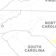


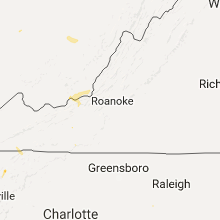

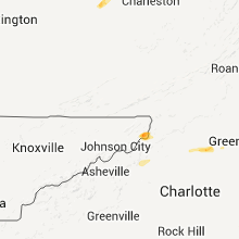


Connect with Interactive Hail Maps