

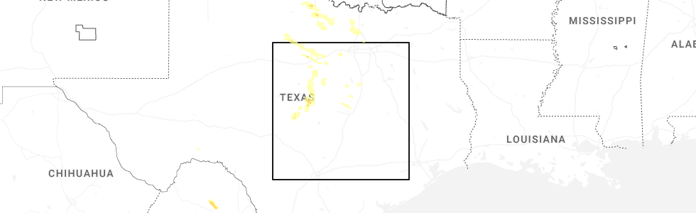
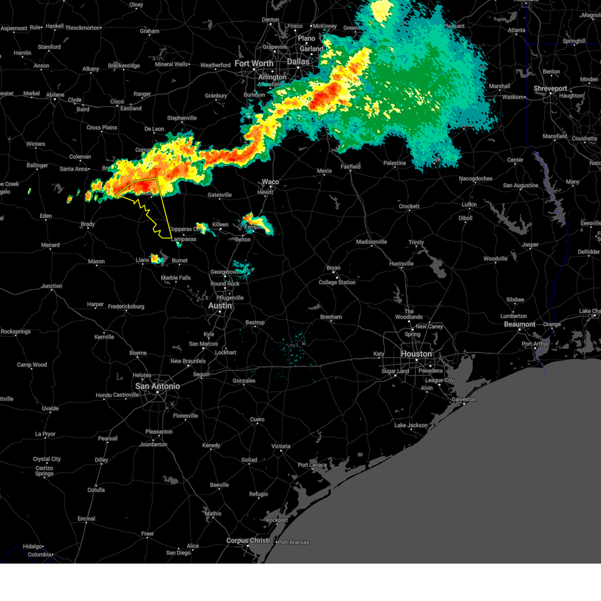
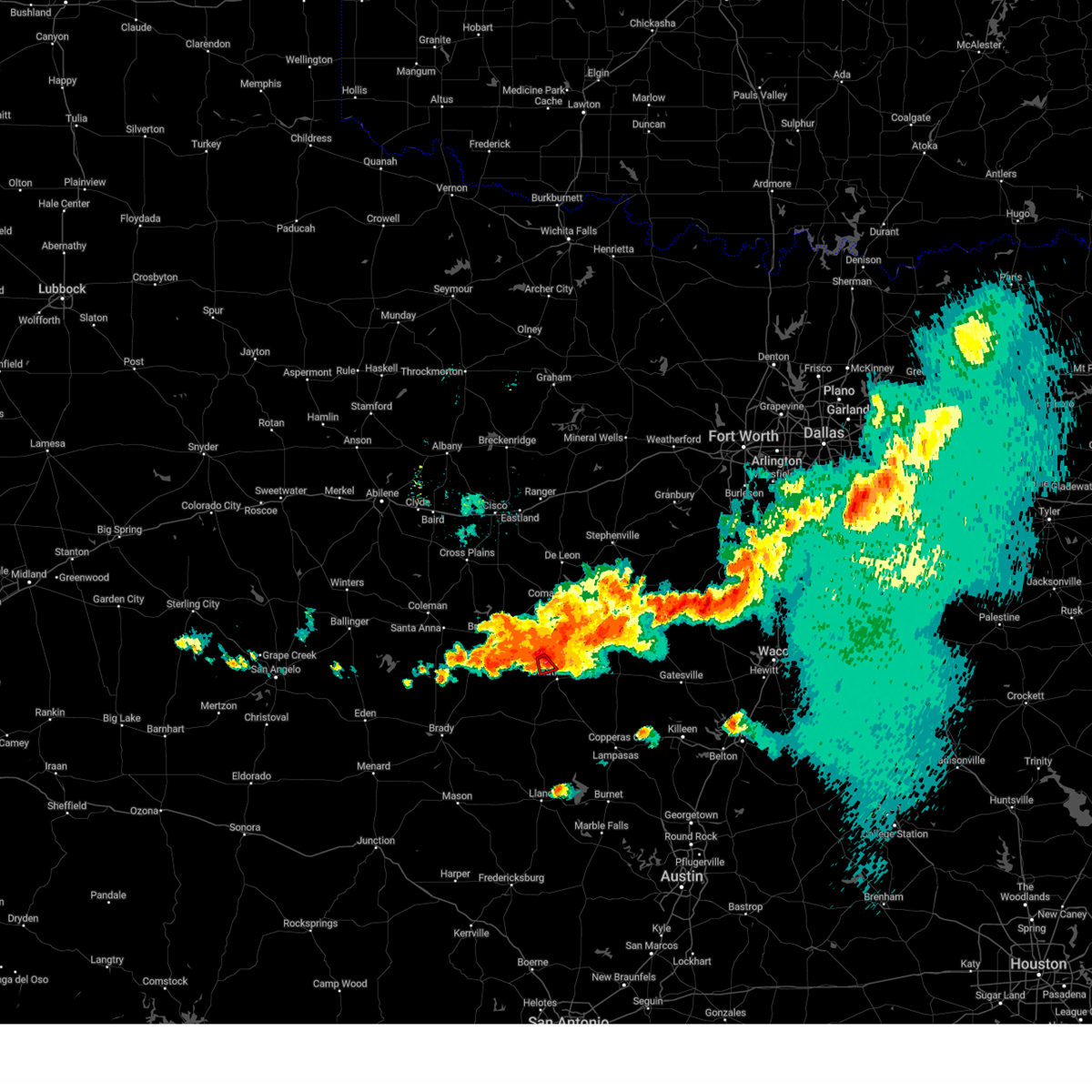
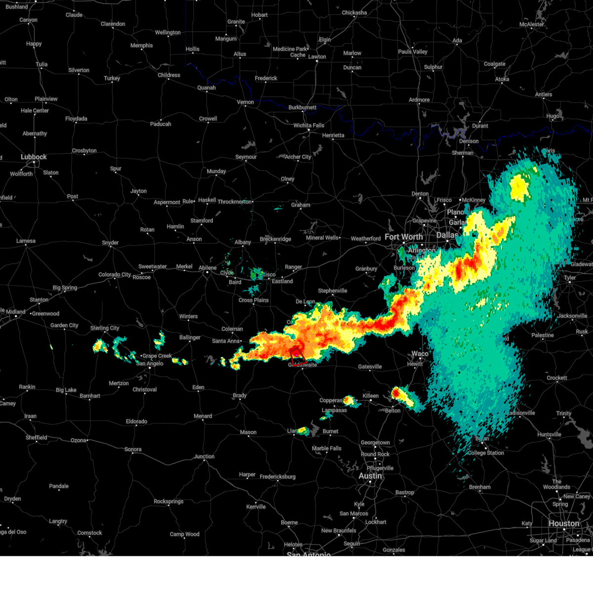
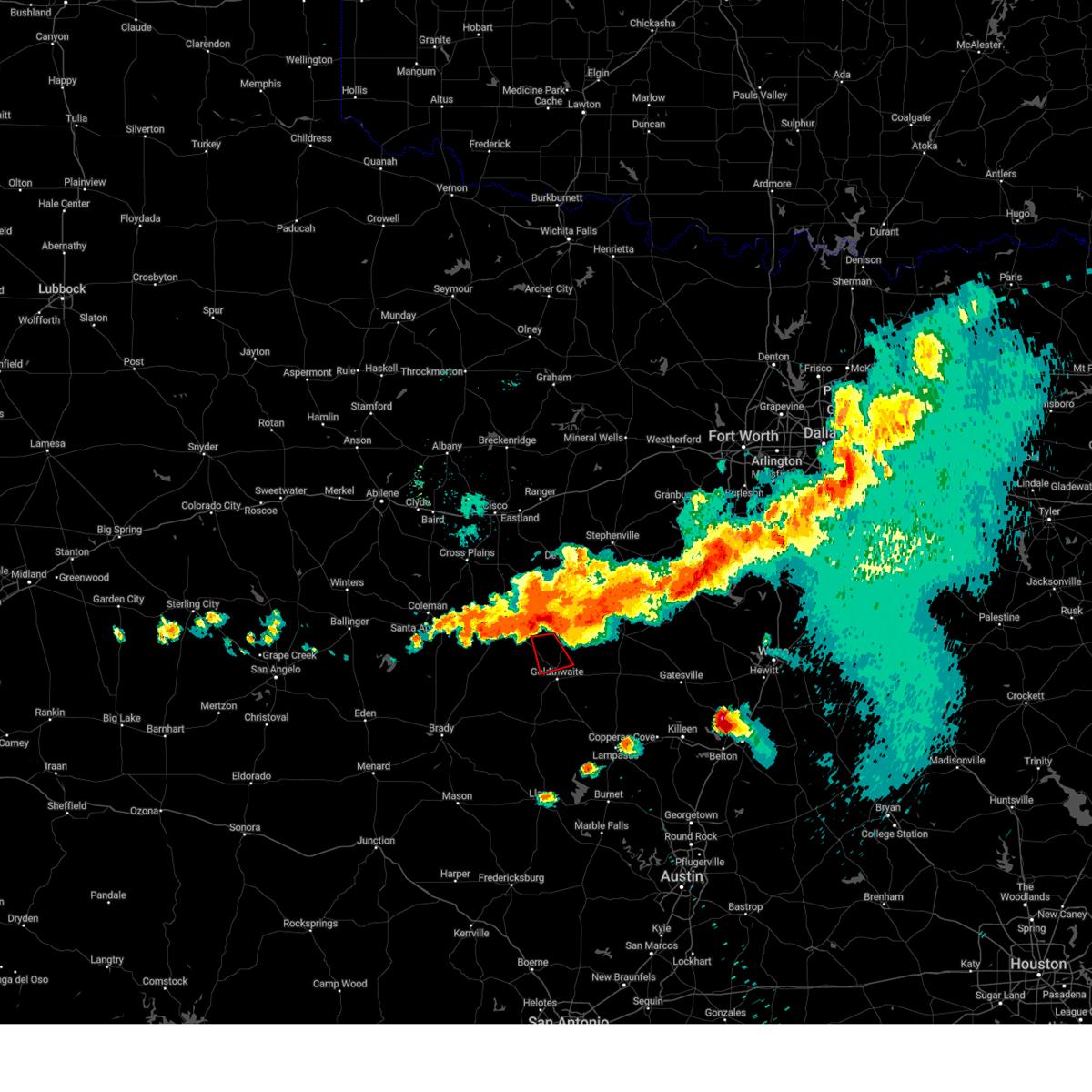
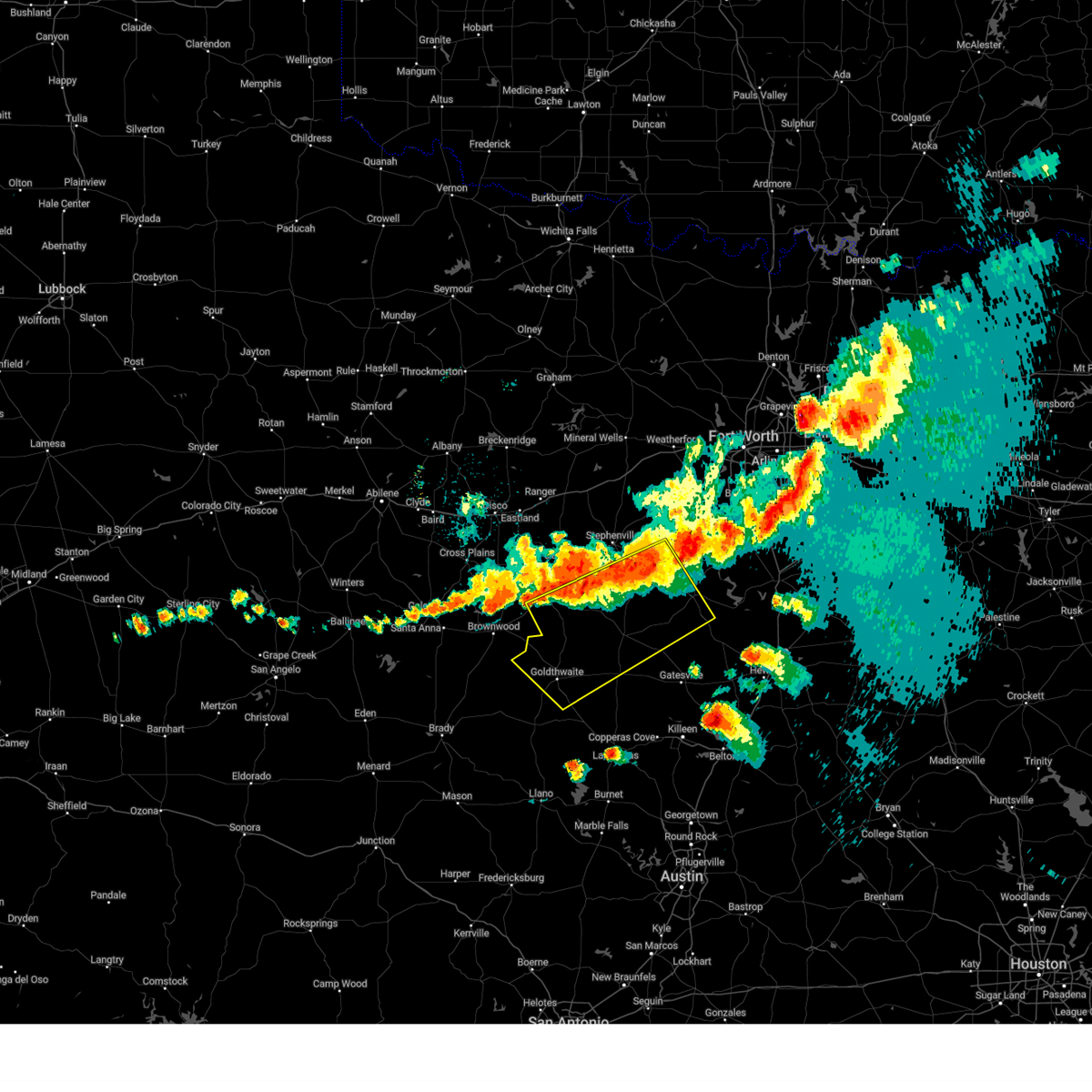
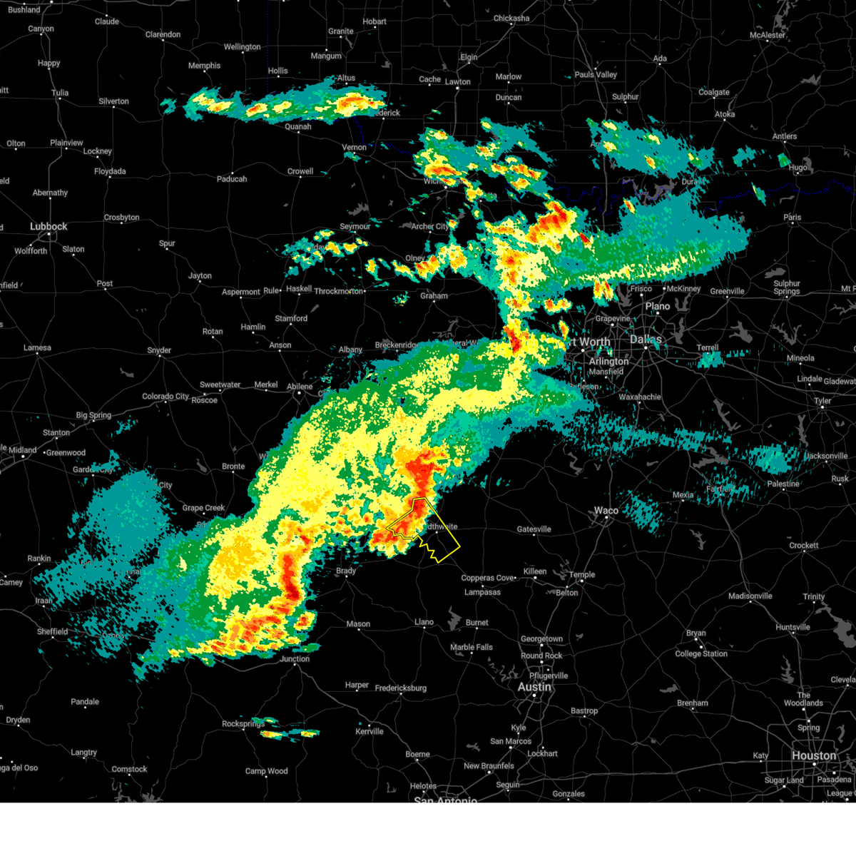
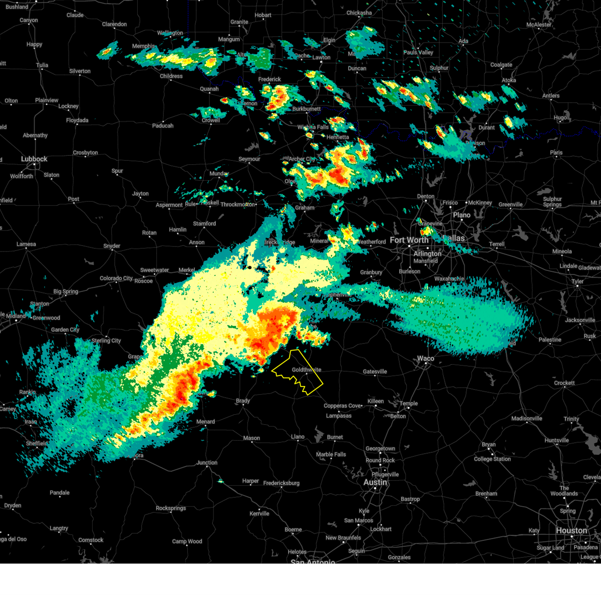
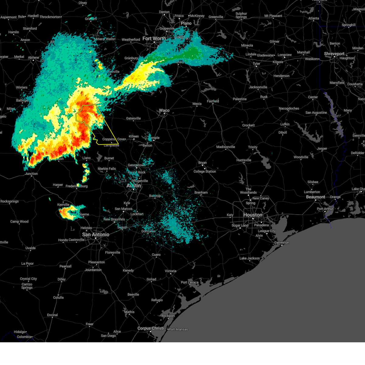
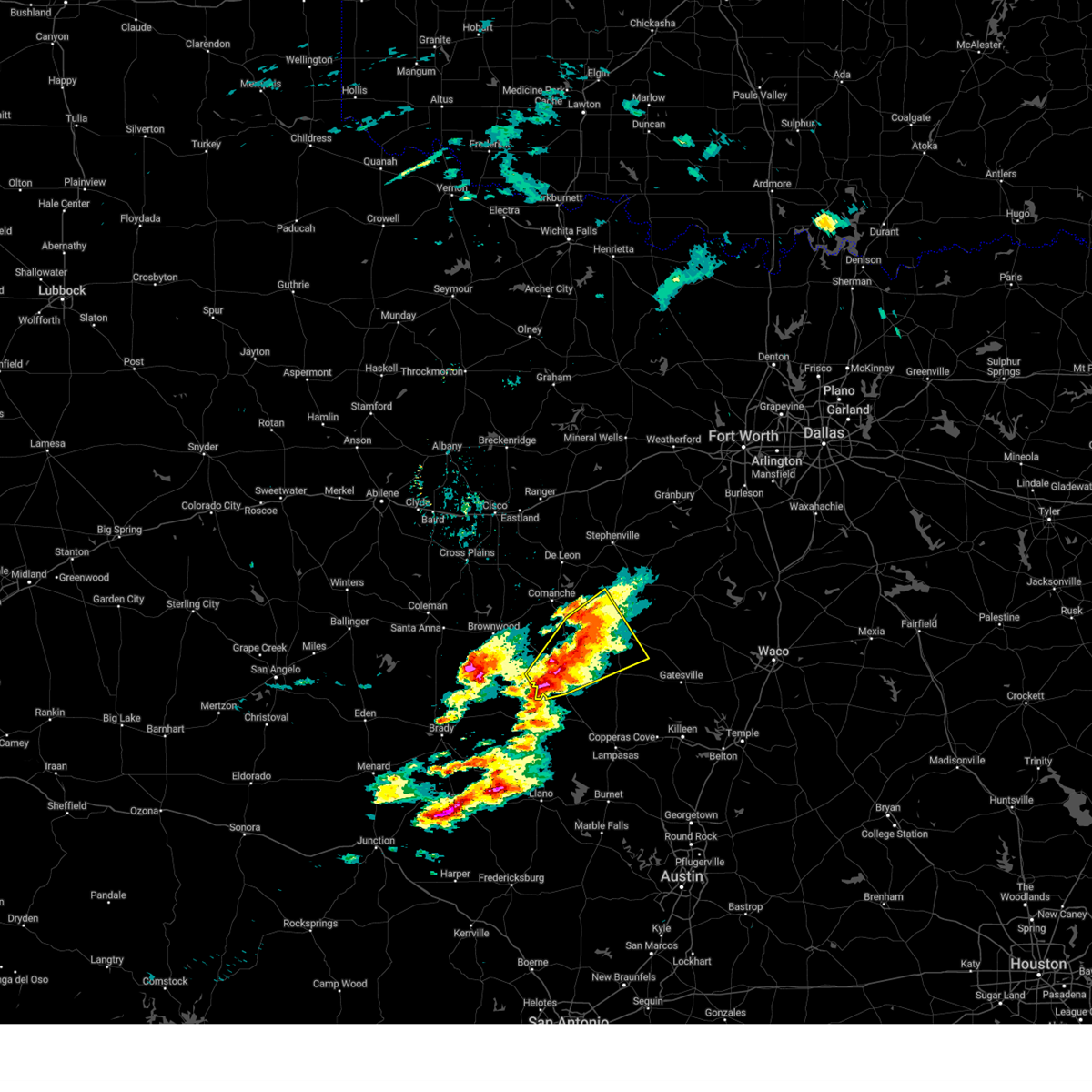
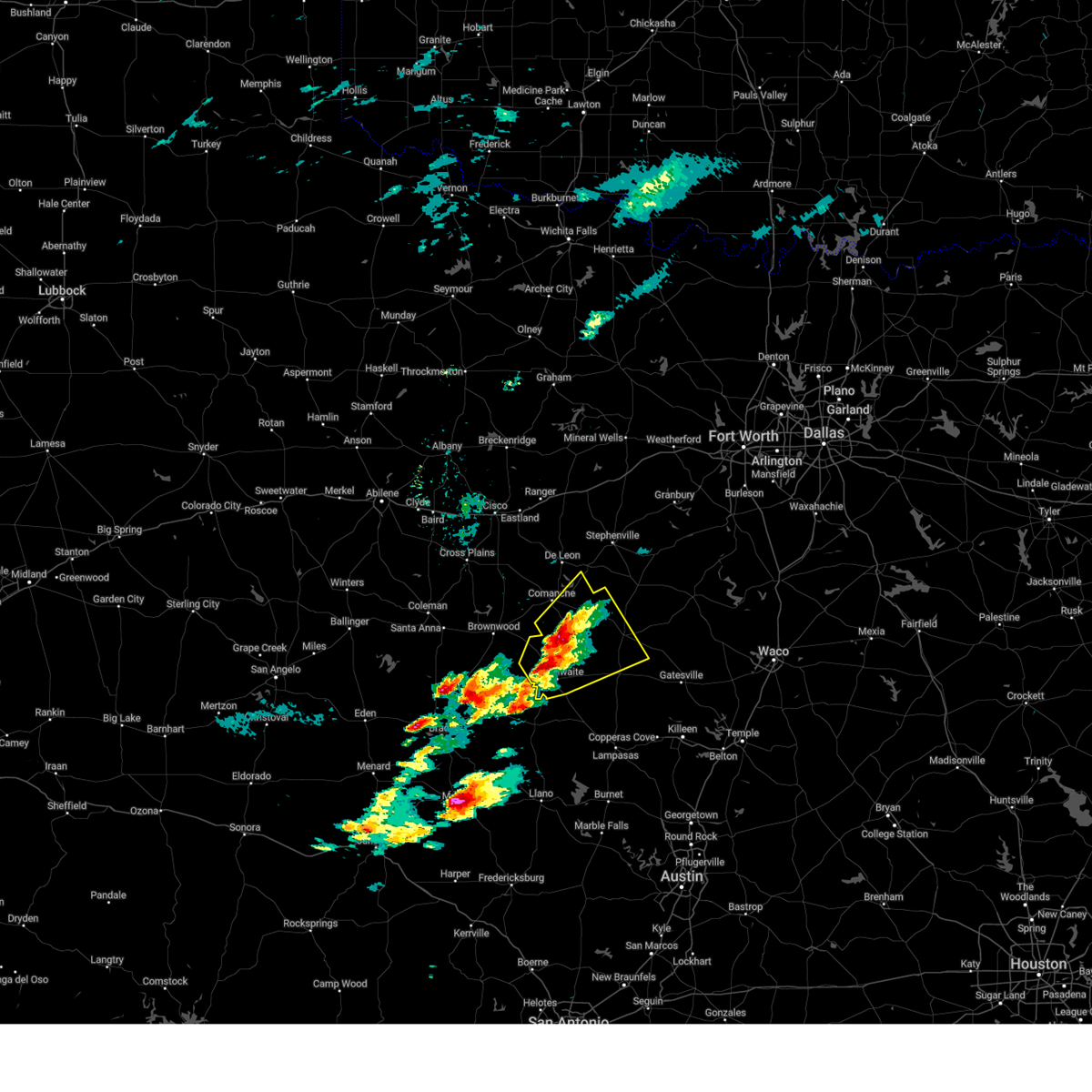
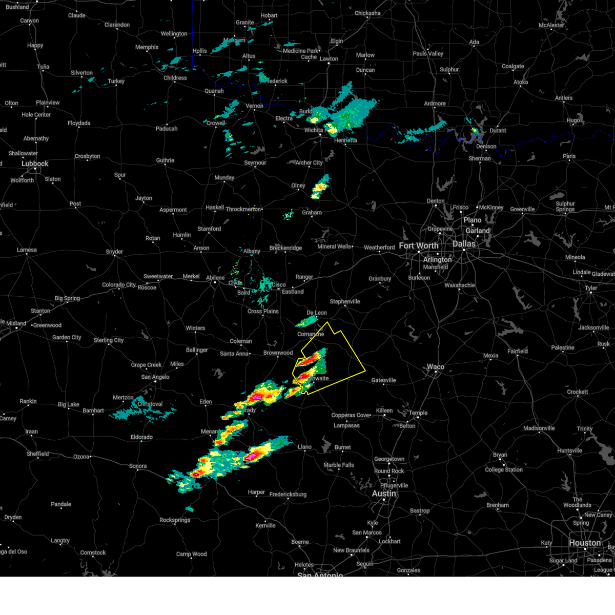
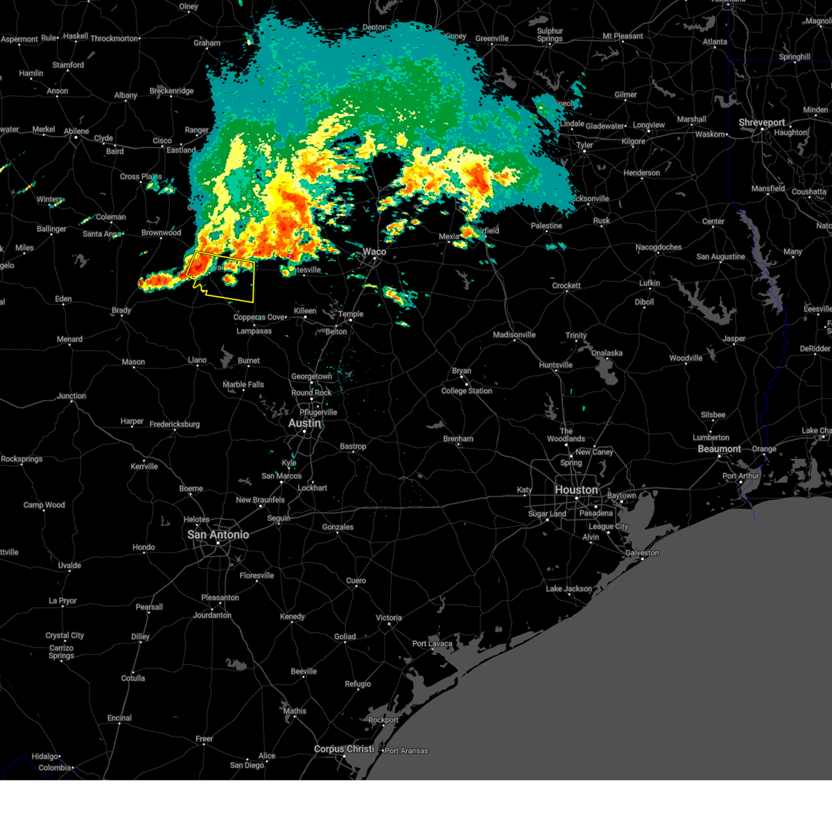
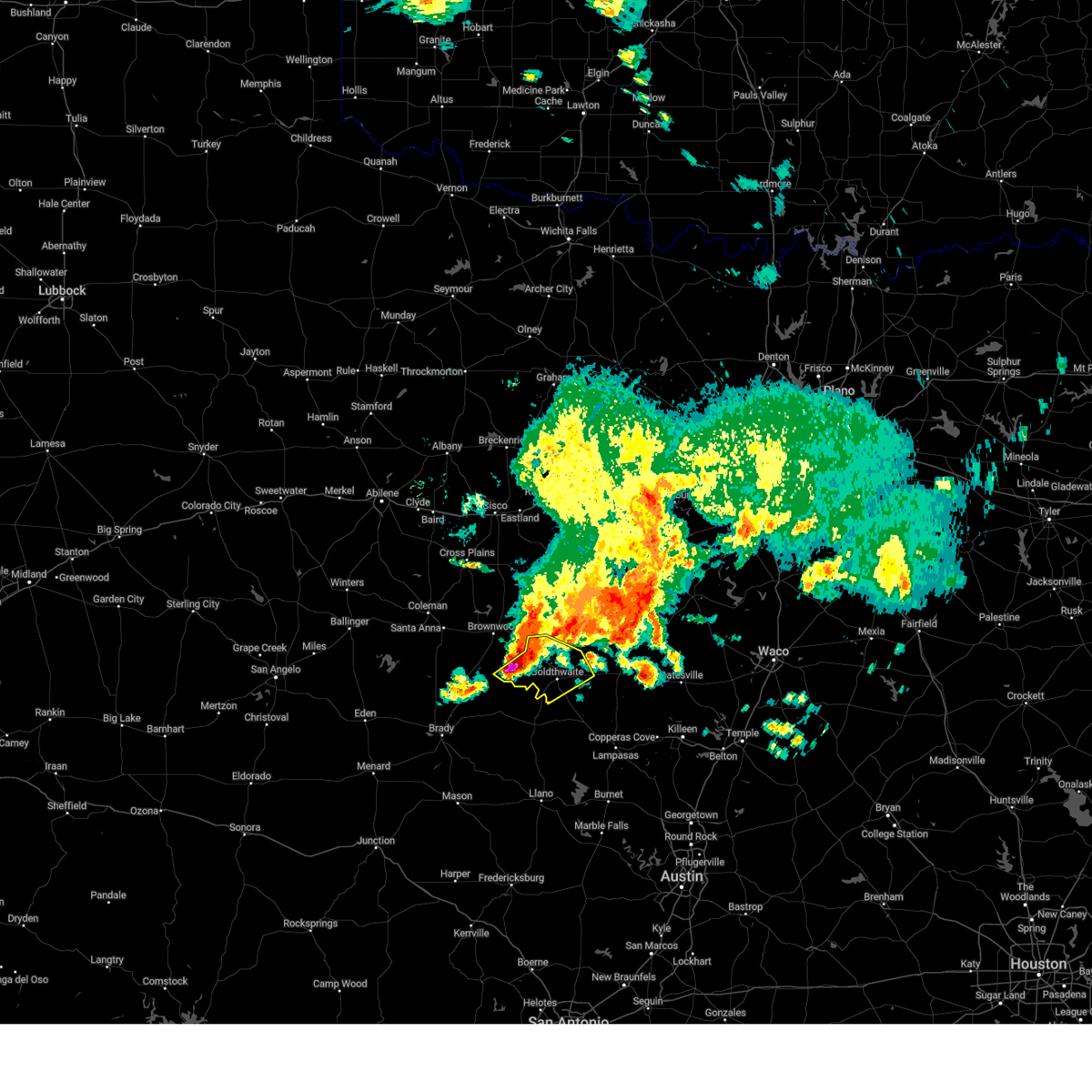
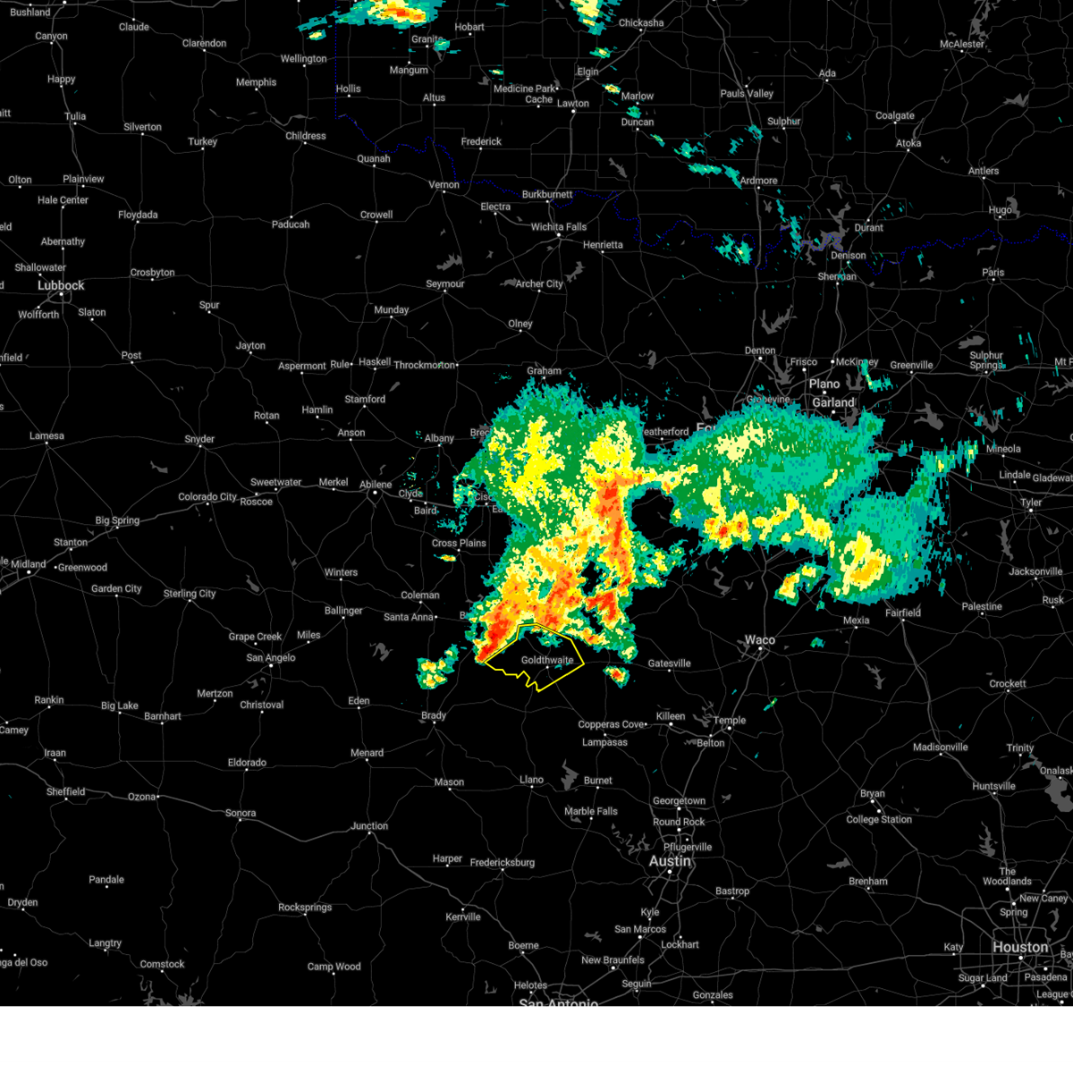
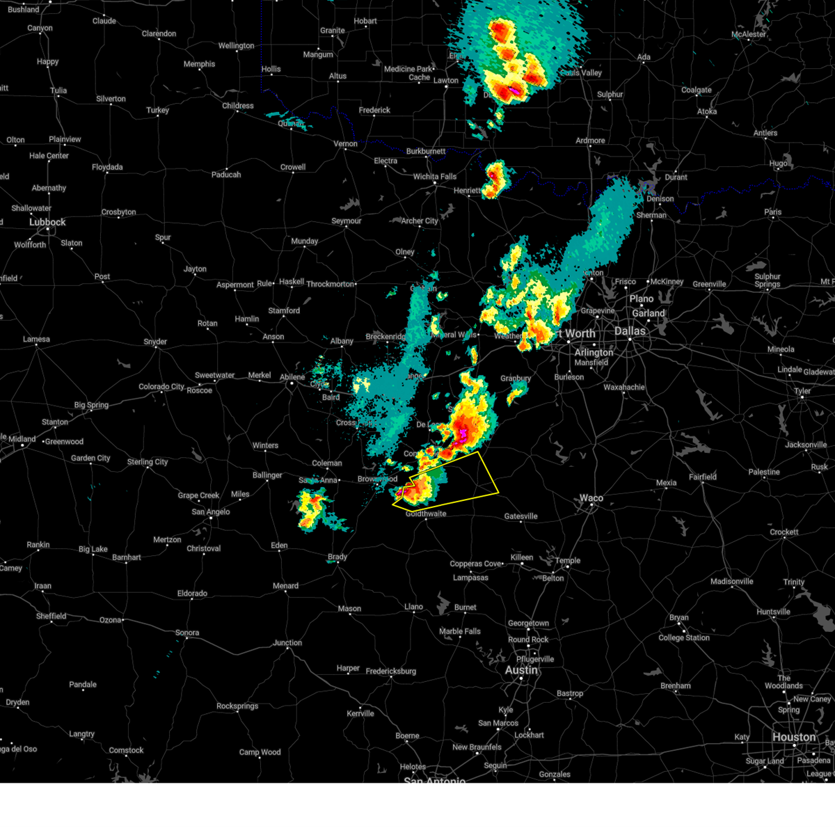
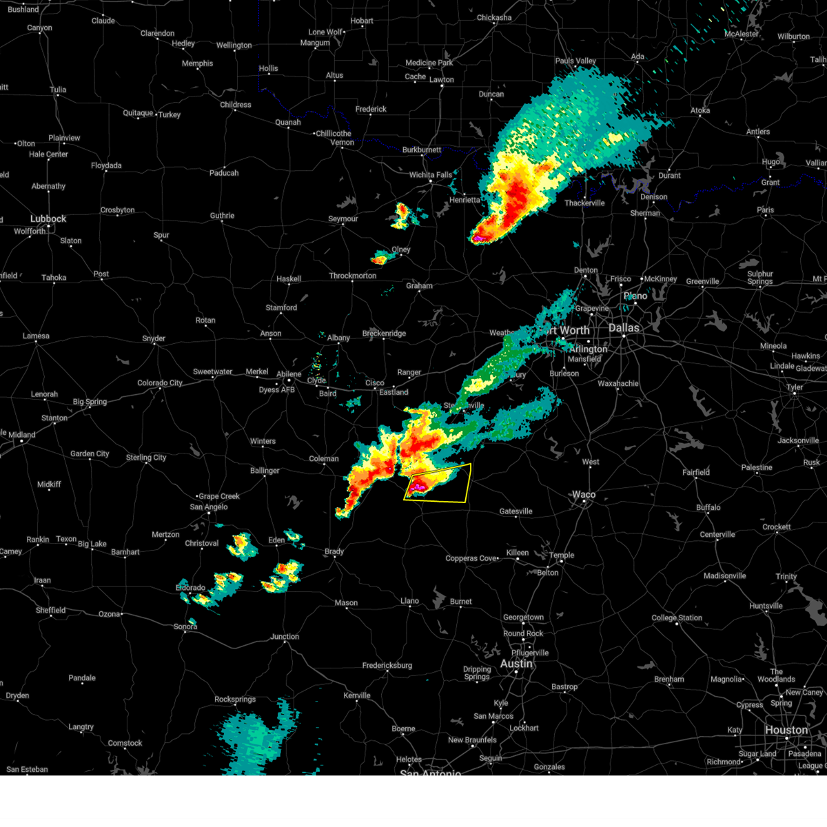
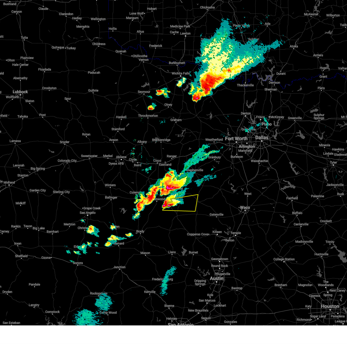
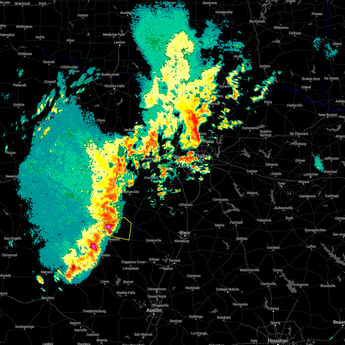
Hail Map for Mullin, TX
The Mullin, TX area has had 14 reports of on-the-ground hail by trained spotters, and has been under severe weather warnings 26 times during the past 12 months. Doppler radar has detected hail at or near Mullin, TX on 90 occasions, including 7 occasions during the past year.
| Name: | Mullin, TX |
| Where Located: | 63.3 miles WNW of Killeen, TX |
| Map: | Google Map for Mullin, TX |
| Population: | 179 |
| Housing Units: | 89 |
| More Info: | Search Google for Mullin, TX |
1
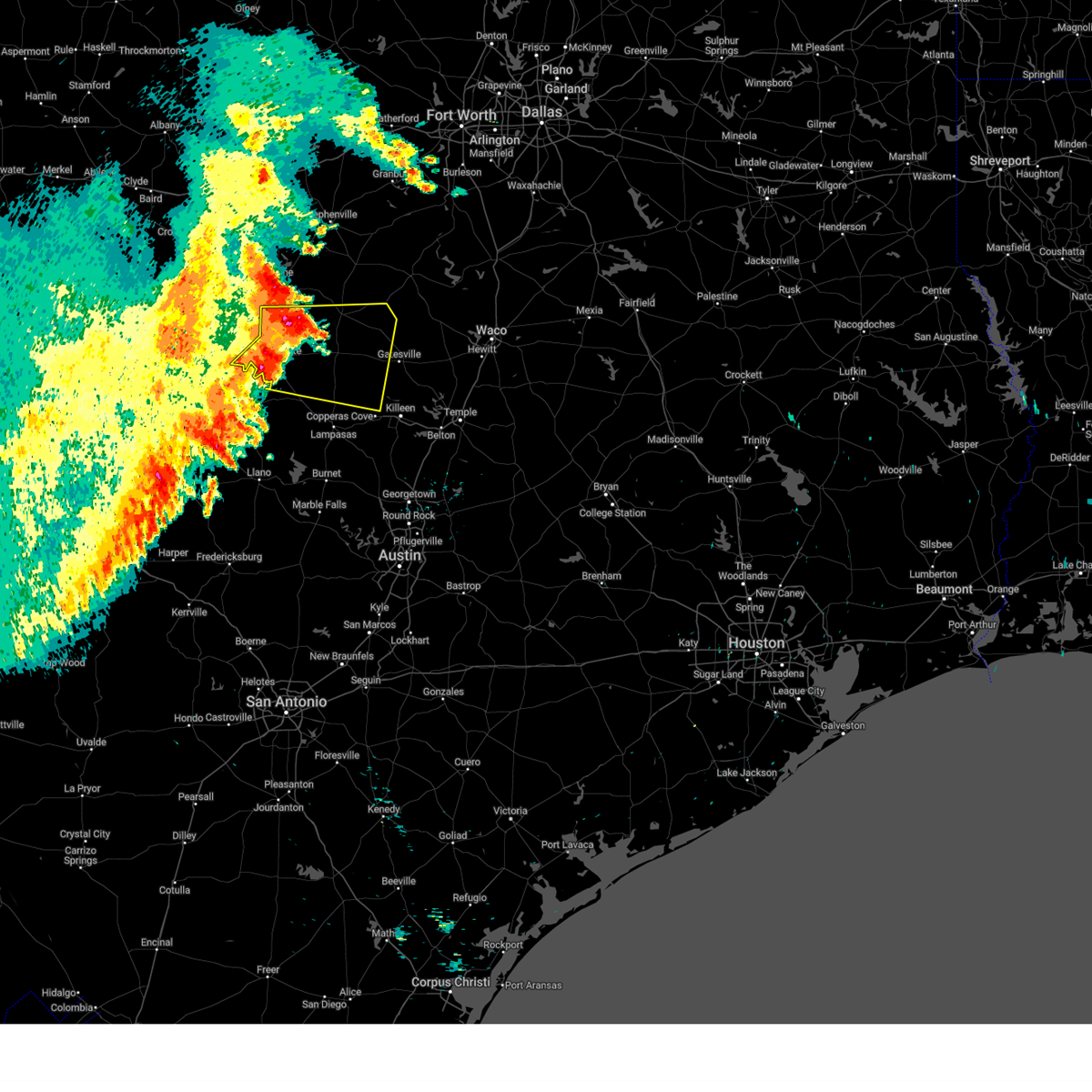
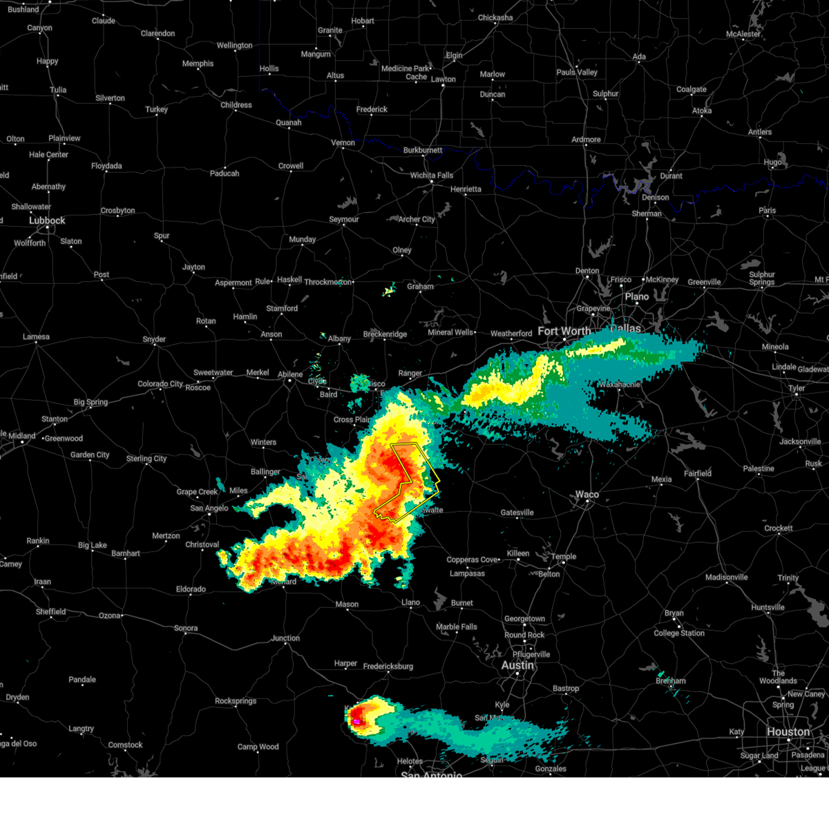
The Top Recent Hail Date for Mullin, TX is Tuesday, June 3, 2025 (32nd out of 90)
Hail and Wind Damage Spotted near Mullin, TX
| Date / Time | Report Details |
|---|---|
| 6/10/2025 7:47 AM CDT |
 Svrfwd the national weather service in fort worth has issued a * severe thunderstorm warning for, hamilton county in central texas, western coryell county in central texas, central lampasas county in central texas, mills county in central texas, south central comanche county in central texas, * until 830 am cdt. * at 746 am cdt, a severe thunderstorm was located 13 miles south of gustine, or 16 miles west of hamilton, moving east at 50 mph (radar indicated). Hazards include 60 mph wind gusts and quarter size hail. Hail damage to vehicles is expected. expect wind damage to roofs, siding, and trees. this severe thunderstorm will be near, hamilton around 800 am cdt. Other locations impacted by this severe thunderstorm include pancake, shive, moline, izoro, bozar, adamsville, whiteway, levita, center city, and south purmela. Svrfwd the national weather service in fort worth has issued a * severe thunderstorm warning for, hamilton county in central texas, western coryell county in central texas, central lampasas county in central texas, mills county in central texas, south central comanche county in central texas, * until 830 am cdt. * at 746 am cdt, a severe thunderstorm was located 13 miles south of gustine, or 16 miles west of hamilton, moving east at 50 mph (radar indicated). Hazards include 60 mph wind gusts and quarter size hail. Hail damage to vehicles is expected. expect wind damage to roofs, siding, and trees. this severe thunderstorm will be near, hamilton around 800 am cdt. Other locations impacted by this severe thunderstorm include pancake, shive, moline, izoro, bozar, adamsville, whiteway, levita, center city, and south purmela.
|
| 6/9/2025 3:14 AM CDT |
 The storms which prompted the warning have weakened below severe limits. therefore the warning will be allowed to expire. however gusty winds and heavy rain are still possible with these thunderstorms. a severe thunderstorm watch remains in effect until 400 am cdt for central texas. a severe thunderstorm watch also remains in effect until 700 am cdt for central texas. The storms which prompted the warning have weakened below severe limits. therefore the warning will be allowed to expire. however gusty winds and heavy rain are still possible with these thunderstorms. a severe thunderstorm watch remains in effect until 400 am cdt for central texas. a severe thunderstorm watch also remains in effect until 700 am cdt for central texas.
|
| 6/9/2025 2:32 AM CDT |
 Svrfwd the national weather service in fort worth has issued a * severe thunderstorm warning for, southwestern hamilton county in central texas, mills county in central texas, southwestern comanche county in central texas, * until 315 am cdt. * at 232 am cdt, severe thunderstorms were located along a line extending from near early to near rochelle, moving southeast at 55 mph (radar indicated). Hazards include 65 mph wind gusts and quarter size hail. Hail damage to vehicles is expected. Expect wind damage to roofs, siding, and trees. Svrfwd the national weather service in fort worth has issued a * severe thunderstorm warning for, southwestern hamilton county in central texas, mills county in central texas, southwestern comanche county in central texas, * until 315 am cdt. * at 232 am cdt, severe thunderstorms were located along a line extending from near early to near rochelle, moving southeast at 55 mph (radar indicated). Hazards include 65 mph wind gusts and quarter size hail. Hail damage to vehicles is expected. Expect wind damage to roofs, siding, and trees.
|
| 6/4/2025 12:40 AM CDT |
 Svrfwd the national weather service in fort worth has issued a * severe thunderstorm warning for, southwestern lampasas county in central texas, mills county in central texas, * until 200 am cdt. * at 1240 am cdt, severe thunderstorms were located along a line extending from near goldthwaite to near elm grove, moving south at 30 mph (radar indicated). Hazards include 60 mph wind gusts and quarter size hail. Hail damage to vehicles is expected. Expect wind damage to roofs, siding, and trees. Svrfwd the national weather service in fort worth has issued a * severe thunderstorm warning for, southwestern lampasas county in central texas, mills county in central texas, * until 200 am cdt. * at 1240 am cdt, severe thunderstorms were located along a line extending from near goldthwaite to near elm grove, moving south at 30 mph (radar indicated). Hazards include 60 mph wind gusts and quarter size hail. Hail damage to vehicles is expected. Expect wind damage to roofs, siding, and trees.
|
| 6/4/2025 12:34 AM CDT |
 At 1234 am cdt, a severe thunderstorm capable of producing a tornado was located near mullin, or 21 miles southeast of early, moving southeast at 20 mph (radar indicated rotation). Hazards include tornado and quarter size hail. Flying debris will be dangerous to those caught without shelter. mobile homes will be damaged or destroyed. damage to roofs, windows, and vehicles will occur. tree damage is likely. Locations impacted include, bozar and mullin. At 1234 am cdt, a severe thunderstorm capable of producing a tornado was located near mullin, or 21 miles southeast of early, moving southeast at 20 mph (radar indicated rotation). Hazards include tornado and quarter size hail. Flying debris will be dangerous to those caught without shelter. mobile homes will be damaged or destroyed. damage to roofs, windows, and vehicles will occur. tree damage is likely. Locations impacted include, bozar and mullin.
|
| 6/4/2025 12:21 AM CDT |
 At 1220 am cdt, a severe thunderstorm capable of producing a tornado was located near villa, or 5 miles northwest of mullin, moving southeast at 15 mph (radar indicated rotation). Hazards include tornado and quarter size hail. Flying debris will be dangerous to those caught without shelter. mobile homes will be damaged or destroyed. damage to roofs, windows, and vehicles will occur. tree damage is likely. Locations impacted include, bozar and mullin. At 1220 am cdt, a severe thunderstorm capable of producing a tornado was located near villa, or 5 miles northwest of mullin, moving southeast at 15 mph (radar indicated rotation). Hazards include tornado and quarter size hail. Flying debris will be dangerous to those caught without shelter. mobile homes will be damaged or destroyed. damage to roofs, windows, and vehicles will occur. tree damage is likely. Locations impacted include, bozar and mullin.
|
| 6/4/2025 12:04 AM CDT |
 the severe thunderstorm warning has been cancelled and is no longer in effect the severe thunderstorm warning has been cancelled and is no longer in effect
|
| 6/4/2025 12:04 AM CDT |
 At 1204 am cdt, severe thunderstorms were located along a line extending from meridian to near zephyr, moving southeast at 30 mph (radar indicated). Hazards include 60 mph wind gusts and quarter size hail. Hail damage to vehicles is expected. expect wind damage to roofs, siding, and trees. Locations impacted include, shive, goldthwaite, meridian state park, olin, bozar, whiteway, iredell, center city, energy, star, democrat, hamilton, gentrys mill, carlton, gustine, lamkin, mullin, cranfills gap, clifton, and priddy. At 1204 am cdt, severe thunderstorms were located along a line extending from meridian to near zephyr, moving southeast at 30 mph (radar indicated). Hazards include 60 mph wind gusts and quarter size hail. Hail damage to vehicles is expected. expect wind damage to roofs, siding, and trees. Locations impacted include, shive, goldthwaite, meridian state park, olin, bozar, whiteway, iredell, center city, energy, star, democrat, hamilton, gentrys mill, carlton, gustine, lamkin, mullin, cranfills gap, clifton, and priddy.
|
| 6/4/2025 12:01 AM CDT |
 Torfwd the national weather service in fort worth has issued a * tornado warning for, north central mills county in central texas, * until 1245 am cdt. * at 1201 am cdt, a severe thunderstorm capable of producing a tornado was located just north of democrat, or 13 miles south of comanche, moving south at 20 mph (radar indicated rotation). Hazards include tornado and quarter size hail. Flying debris will be dangerous to those caught without shelter. mobile homes will be damaged or destroyed. damage to roofs, windows, and vehicles will occur. Tree damage is likely. Torfwd the national weather service in fort worth has issued a * tornado warning for, north central mills county in central texas, * until 1245 am cdt. * at 1201 am cdt, a severe thunderstorm capable of producing a tornado was located just north of democrat, or 13 miles south of comanche, moving south at 20 mph (radar indicated rotation). Hazards include tornado and quarter size hail. Flying debris will be dangerous to those caught without shelter. mobile homes will be damaged or destroyed. damage to roofs, windows, and vehicles will occur. Tree damage is likely.
|
| 6/3/2025 11:28 PM CDT |
 Svrfwd the national weather service in fort worth has issued a * severe thunderstorm warning for, southwestern somervell county in north central texas, hamilton county in central texas, southeastern erath county in north central texas, western bosque county in central texas, mills county in central texas, southern comanche county in central texas, * until 1245 am cdt. * at 1128 pm cdt, severe thunderstorms were located along a line extending from iredell to near early, moving southeast at 20 mph (radar indicated). Hazards include 60 mph wind gusts and quarter size hail. Hail damage to vehicles is expected. Expect wind damage to roofs, siding, and trees. Svrfwd the national weather service in fort worth has issued a * severe thunderstorm warning for, southwestern somervell county in north central texas, hamilton county in central texas, southeastern erath county in north central texas, western bosque county in central texas, mills county in central texas, southern comanche county in central texas, * until 1245 am cdt. * at 1128 pm cdt, severe thunderstorms were located along a line extending from iredell to near early, moving southeast at 20 mph (radar indicated). Hazards include 60 mph wind gusts and quarter size hail. Hail damage to vehicles is expected. Expect wind damage to roofs, siding, and trees.
|
| 5/30/2025 12:12 AM CDT |
 the severe thunderstorm warning has been cancelled and is no longer in effect the severe thunderstorm warning has been cancelled and is no longer in effect
|
| 5/29/2025 11:30 PM CDT |
 Svrfwd the national weather service in fort worth has issued a * severe thunderstorm warning for, mills county in central texas, * until 1230 am cdt. * at 1129 pm cdt, a severe thunderstorm was located over camp bowie, or near brownwood, moving southeast at 30 mph (radar indicated). Hazards include 60 mph wind gusts and quarter size hail. Hail damage to vehicles is expected. expect wind damage to roofs, siding, and trees. This severe thunderstorm will remain over mainly rural areas of mills county, including the following locations, regency, bozar, ridge, and democrat. Svrfwd the national weather service in fort worth has issued a * severe thunderstorm warning for, mills county in central texas, * until 1230 am cdt. * at 1129 pm cdt, a severe thunderstorm was located over camp bowie, or near brownwood, moving southeast at 30 mph (radar indicated). Hazards include 60 mph wind gusts and quarter size hail. Hail damage to vehicles is expected. expect wind damage to roofs, siding, and trees. This severe thunderstorm will remain over mainly rural areas of mills county, including the following locations, regency, bozar, ridge, and democrat.
|
| 5/22/2025 11:29 PM CDT |
 Svrfwd the national weather service in fort worth has issued a * severe thunderstorm warning for, lampasas county in central texas, mills county in central texas, * until 1230 am cdt. * at 1129 pm cdt, severe thunderstorms were located along a line extending from 12 miles northeast of mullin to near chappel to near valley spring, moving southeast at 25 mph (radar indicated). Hazards include 60 mph wind gusts and quarter size hail. Hail damage to vehicles is expected. expect wind damage to roofs, siding, and trees. severe thunderstorms will be near, goldthwaite around 1135 pm cdt. colorado bend state park around 1145 pm cdt. Other locations impacted by these severe thunderstorms include moline, center city, democrat, lometa, bozar, priddy, nix, caradan, ridge, and regency. Svrfwd the national weather service in fort worth has issued a * severe thunderstorm warning for, lampasas county in central texas, mills county in central texas, * until 1230 am cdt. * at 1129 pm cdt, severe thunderstorms were located along a line extending from 12 miles northeast of mullin to near chappel to near valley spring, moving southeast at 25 mph (radar indicated). Hazards include 60 mph wind gusts and quarter size hail. Hail damage to vehicles is expected. expect wind damage to roofs, siding, and trees. severe thunderstorms will be near, goldthwaite around 1135 pm cdt. colorado bend state park around 1145 pm cdt. Other locations impacted by these severe thunderstorms include moline, center city, democrat, lometa, bozar, priddy, nix, caradan, ridge, and regency.
|
| 5/22/2025 10:56 PM CDT |
 At 1055 pm cdt, a severe thunderstorm was located near blanket, or 10 miles east of early, moving south at 45 mph (radar indicated). Hazards include 65 mph wind gusts and quarter size hail. Hail damage to vehicles is expected. expect wind damage to roofs, siding, and trees. this severe storm will be near, mullin around 1110 pm cdt. Other locations impacted by this severe thunderstorm include regency, newburg, democrat, priddy, sidney, ridge, and bozar. At 1055 pm cdt, a severe thunderstorm was located near blanket, or 10 miles east of early, moving south at 45 mph (radar indicated). Hazards include 65 mph wind gusts and quarter size hail. Hail damage to vehicles is expected. expect wind damage to roofs, siding, and trees. this severe storm will be near, mullin around 1110 pm cdt. Other locations impacted by this severe thunderstorm include regency, newburg, democrat, priddy, sidney, ridge, and bozar.
|
| 5/22/2025 10:27 PM CDT |
 Svrfwd the national weather service in fort worth has issued a * severe thunderstorm warning for, northwestern mills county in central texas, western comanche county in central texas, * until 1130 pm cdt. * at 1027 pm cdt, a severe thunderstorm was located 7 miles east of may, or 12 miles west of comanche, moving south at 30 mph (radar indicated). Hazards include 70 mph wind gusts and quarter size hail. Hail damage to vehicles is expected. expect considerable tree damage. wind damage is also likely to mobile homes, roofs, and outbuildings. this severe thunderstorm will be near, mullin around 1115 pm cdt. Other locations impacted by this severe thunderstorm include regency, newburg, democrat, beattie, priddy, sipe springs, sidney, duster, ridge, and van dyke. Svrfwd the national weather service in fort worth has issued a * severe thunderstorm warning for, northwestern mills county in central texas, western comanche county in central texas, * until 1130 pm cdt. * at 1027 pm cdt, a severe thunderstorm was located 7 miles east of may, or 12 miles west of comanche, moving south at 30 mph (radar indicated). Hazards include 70 mph wind gusts and quarter size hail. Hail damage to vehicles is expected. expect considerable tree damage. wind damage is also likely to mobile homes, roofs, and outbuildings. this severe thunderstorm will be near, mullin around 1115 pm cdt. Other locations impacted by this severe thunderstorm include regency, newburg, democrat, beattie, priddy, sipe springs, sidney, duster, ridge, and van dyke.
|
| 5/17/2025 3:40 PM CDT |
 Svrfwd the national weather service in fort worth has issued a * severe thunderstorm warning for, southwestern hamilton county in central texas, mills county in central texas, * until 445 pm cdt. * at 340 pm cdt, a severe thunderstorm was located over goldthwaite, or 19 miles northeast of san saba, moving northeast at 25 mph (radar indicated). Hazards include 60 mph wind gusts and half dollar size hail. Hail damage to vehicles is expected. expect wind damage to roofs, siding, and trees. this severe thunderstorm will be near, goldthwaite around 345 pm cdt. Other locations impacted by this severe thunderstorm include shive, center city, star, pottsville, bozar, priddy, pecan wells, indian gap, and caradan. Svrfwd the national weather service in fort worth has issued a * severe thunderstorm warning for, southwestern hamilton county in central texas, mills county in central texas, * until 445 pm cdt. * at 340 pm cdt, a severe thunderstorm was located over goldthwaite, or 19 miles northeast of san saba, moving northeast at 25 mph (radar indicated). Hazards include 60 mph wind gusts and half dollar size hail. Hail damage to vehicles is expected. expect wind damage to roofs, siding, and trees. this severe thunderstorm will be near, goldthwaite around 345 pm cdt. Other locations impacted by this severe thunderstorm include shive, center city, star, pottsville, bozar, priddy, pecan wells, indian gap, and caradan.
|
| 5/17/2025 3:33 PM CDT |
 At 332 pm cdt, a severe thunderstorm was located over goldthwaite, or 18 miles north of san saba, moving northeast at 25 mph (radar indicated). Hazards include 60 mph wind gusts and half dollar size hail. Hail damage to vehicles is expected. expect wind damage to roofs, siding, and trees. Locations impacted include, goldthwaite, center city, mullin, star, bozar, priddy, pecan wells, indian gap, and caradan. At 332 pm cdt, a severe thunderstorm was located over goldthwaite, or 18 miles north of san saba, moving northeast at 25 mph (radar indicated). Hazards include 60 mph wind gusts and half dollar size hail. Hail damage to vehicles is expected. expect wind damage to roofs, siding, and trees. Locations impacted include, goldthwaite, center city, mullin, star, bozar, priddy, pecan wells, indian gap, and caradan.
|
| 5/17/2025 3:33 PM CDT |
 the severe thunderstorm warning has been cancelled and is no longer in effect the severe thunderstorm warning has been cancelled and is no longer in effect
|
| 5/17/2025 3:21 PM CDT |
 At 320 pm cdt, severe thunderstorms were located along a line extending from 8 miles east of gustine to 10 miles northeast of skeeterville, moving northeast at 25 mph (radar indicated). Hazards include 60 mph wind gusts and quarter size hail. Hail damage to vehicles is expected. expect wind damage to roofs, siding, and trees. Locations impacted include, shive, lamkin, goldthwaite, mullin, bozar, priddy, aleman, indian gap, newburg, center city, energy, star, pottsville, hamilton, gentrys mill, pecan wells, gustine, caradan, and ireland. At 320 pm cdt, severe thunderstorms were located along a line extending from 8 miles east of gustine to 10 miles northeast of skeeterville, moving northeast at 25 mph (radar indicated). Hazards include 60 mph wind gusts and quarter size hail. Hail damage to vehicles is expected. expect wind damage to roofs, siding, and trees. Locations impacted include, shive, lamkin, goldthwaite, mullin, bozar, priddy, aleman, indian gap, newburg, center city, energy, star, pottsville, hamilton, gentrys mill, pecan wells, gustine, caradan, and ireland.
|
| 5/17/2025 2:58 PM CDT |
 At 257 pm cdt, a severe thunderstorm was located 12 miles northeast of mullin, or 15 miles south of comanche, moving northeast at 20 mph (radar indicated). Hazards include golf ball size hail and 60 mph wind gusts. People and animals outdoors will be injured. expect hail damage to roofs, siding, windows, and vehicles. expect wind damage to roofs, siding, and trees. This severe thunderstorm will remain over mainly rural areas of southwestern hamilton, mills and southeastern comanche counties, including the following locations, shive, lamkin, proctor, hasse, bozar, priddy, aleman, indian gap, newburg, and center city. At 257 pm cdt, a severe thunderstorm was located 12 miles northeast of mullin, or 15 miles south of comanche, moving northeast at 20 mph (radar indicated). Hazards include golf ball size hail and 60 mph wind gusts. People and animals outdoors will be injured. expect hail damage to roofs, siding, windows, and vehicles. expect wind damage to roofs, siding, and trees. This severe thunderstorm will remain over mainly rural areas of southwestern hamilton, mills and southeastern comanche counties, including the following locations, shive, lamkin, proctor, hasse, bozar, priddy, aleman, indian gap, newburg, and center city.
|
| 5/17/2025 2:42 PM CDT |
 Svrfwd the national weather service in fort worth has issued a * severe thunderstorm warning for, southwestern hamilton county in central texas, mills county in central texas, southeastern comanche county in central texas, * until 345 pm cdt. * at 241 pm cdt, a severe thunderstorm was located near mullin, or 21 miles northeast of algerita, moving northeast at 25 mph (radar indicated). Hazards include 60 mph wind gusts and half dollar size hail. Hail damage to vehicles is expected. expect wind damage to roofs, siding, and trees. this severe thunderstorm will be near, mullin around 245 pm cdt. Other locations impacted by this severe thunderstorm include shive, lamkin, proctor, hasse, bozar, priddy, aleman, indian gap, newburg, and center city. Svrfwd the national weather service in fort worth has issued a * severe thunderstorm warning for, southwestern hamilton county in central texas, mills county in central texas, southeastern comanche county in central texas, * until 345 pm cdt. * at 241 pm cdt, a severe thunderstorm was located near mullin, or 21 miles northeast of algerita, moving northeast at 25 mph (radar indicated). Hazards include 60 mph wind gusts and half dollar size hail. Hail damage to vehicles is expected. expect wind damage to roofs, siding, and trees. this severe thunderstorm will be near, mullin around 245 pm cdt. Other locations impacted by this severe thunderstorm include shive, lamkin, proctor, hasse, bozar, priddy, aleman, indian gap, newburg, and center city.
|
| 4/30/2025 1:50 PM CDT | Quarter sized hail reported 7.9 miles S of Mullin, TX, 1.00 inch 1s of democrat. |
| 4/24/2025 12:58 PM CDT |
 Svrfwd the national weather service in fort worth has issued a * severe thunderstorm warning for, southwestern hamilton county in central texas, northwestern lampasas county in central texas, central mills county in central texas, * until 200 pm cdt. * at 1258 pm cdt, a severe thunderstorm was located near mullin, or 18 miles north of san saba, moving east at 25 mph (radar indicated). Hazards include 60 mph wind gusts and quarter size hail. Hail damage to vehicles is expected. expect wind damage to roofs, siding, and trees. this severe thunderstorm will be near, goldthwaite around 105 pm cdt. Other locations impacted by this severe thunderstorm include bozar, moline, center city, star, and caradan. Svrfwd the national weather service in fort worth has issued a * severe thunderstorm warning for, southwestern hamilton county in central texas, northwestern lampasas county in central texas, central mills county in central texas, * until 200 pm cdt. * at 1258 pm cdt, a severe thunderstorm was located near mullin, or 18 miles north of san saba, moving east at 25 mph (radar indicated). Hazards include 60 mph wind gusts and quarter size hail. Hail damage to vehicles is expected. expect wind damage to roofs, siding, and trees. this severe thunderstorm will be near, goldthwaite around 105 pm cdt. Other locations impacted by this severe thunderstorm include bozar, moline, center city, star, and caradan.
|
| 4/24/2025 12:31 PM CDT |
 At 1230 pm cdt, a severe thunderstorm was located 9 miles west of mullin, or 16 miles southeast of brownwood, moving east at 25 mph (radar indicated). Hazards include golf ball size hail and 60 mph wind gusts. People and animals outdoors will be injured. expect hail damage to roofs, siding, windows, and vehicles. expect wind damage to roofs, siding, and trees. this severe storm will be near, mullin around 1245 pm cdt. goldthwaite around 100 pm cdt. Other locations impacted by this severe thunderstorm include regency, center city, democrat, bozar, caradan, ridge, star, and pecan wells. At 1230 pm cdt, a severe thunderstorm was located 9 miles west of mullin, or 16 miles southeast of brownwood, moving east at 25 mph (radar indicated). Hazards include golf ball size hail and 60 mph wind gusts. People and animals outdoors will be injured. expect hail damage to roofs, siding, windows, and vehicles. expect wind damage to roofs, siding, and trees. this severe storm will be near, mullin around 1245 pm cdt. goldthwaite around 100 pm cdt. Other locations impacted by this severe thunderstorm include regency, center city, democrat, bozar, caradan, ridge, star, and pecan wells.
|
| 4/24/2025 12:12 PM CDT |
 Svrfwd the national weather service in fort worth has issued a * severe thunderstorm warning for, mills county in central texas, * until 100 pm cdt. * at 1211 pm cdt, a severe thunderstorm was located 8 miles southeast of camp bowie, or 12 miles southeast of brownwood, moving east at 25 mph (radar indicated). Hazards include 60 mph wind gusts and half dollar size hail. Hail damage to vehicles is expected. expect wind damage to roofs, siding, and trees. this severe thunderstorm will be near, goldthwaite around 1250 pm cdt. Other locations impacted by this severe thunderstorm include regency, center city, democrat, bozar, caradan, ridge, star, and pecan wells. Svrfwd the national weather service in fort worth has issued a * severe thunderstorm warning for, mills county in central texas, * until 100 pm cdt. * at 1211 pm cdt, a severe thunderstorm was located 8 miles southeast of camp bowie, or 12 miles southeast of brownwood, moving east at 25 mph (radar indicated). Hazards include 60 mph wind gusts and half dollar size hail. Hail damage to vehicles is expected. expect wind damage to roofs, siding, and trees. this severe thunderstorm will be near, goldthwaite around 1250 pm cdt. Other locations impacted by this severe thunderstorm include regency, center city, democrat, bozar, caradan, ridge, star, and pecan wells.
|
| 3/29/2025 9:46 PM CDT |
 Svrfwd the national weather service in fort worth has issued a * severe thunderstorm warning for, central hamilton county in central texas, northern mills county in central texas, southeastern comanche county in central texas, * until 1045 pm cdt. * at 946 pm cdt, a severe thunderstorm was located near zephyr, or 15 miles southeast of early, moving east at 40 mph (radar indicated). Hazards include 60 mph wind gusts and quarter size hail. Hail damage to vehicles is expected. expect wind damage to roofs, siding, and trees. This severe thunderstorm will remain over mainly rural areas of central hamilton, northern mills and southeastern comanche counties, including the following locations, shive, lamkin, olin, priddy, whiteway, aleman, indian gap, newburg, energy, and democrat. Svrfwd the national weather service in fort worth has issued a * severe thunderstorm warning for, central hamilton county in central texas, northern mills county in central texas, southeastern comanche county in central texas, * until 1045 pm cdt. * at 946 pm cdt, a severe thunderstorm was located near zephyr, or 15 miles southeast of early, moving east at 40 mph (radar indicated). Hazards include 60 mph wind gusts and quarter size hail. Hail damage to vehicles is expected. expect wind damage to roofs, siding, and trees. This severe thunderstorm will remain over mainly rural areas of central hamilton, northern mills and southeastern comanche counties, including the following locations, shive, lamkin, olin, priddy, whiteway, aleman, indian gap, newburg, energy, and democrat.
|
| 3/4/2025 4:38 AM CST |
 Svrfwd the national weather service in fort worth has issued a * severe thunderstorm warning for, southwestern hamilton county in central texas, western coryell county in central texas, lampasas county in central texas, mills county in central texas, * until 545 am cst. * at 438 am cst, severe thunderstorms were located along a line extending from 8 miles southwest of mullin to near cherokee, moving east at 50 mph (radar indicated). Hazards include 60 mph wind gusts and quarter size hail. Hail damage to vehicles is expected. expect wind damage to roofs, siding, and trees. severe thunderstorms will be near, goldthwaite around 445 am cst. bend around 450 am cst. colorado bend state park around 455 am cst. lampasas and evant around 515 am cst. copperas cove and kempner around 530 am cst. Other locations impacted by these severe thunderstorms include regency, shive, moline, izoro, rumley, bozar, purmela, adamsville, whiteway, and aleman. Svrfwd the national weather service in fort worth has issued a * severe thunderstorm warning for, southwestern hamilton county in central texas, western coryell county in central texas, lampasas county in central texas, mills county in central texas, * until 545 am cst. * at 438 am cst, severe thunderstorms were located along a line extending from 8 miles southwest of mullin to near cherokee, moving east at 50 mph (radar indicated). Hazards include 60 mph wind gusts and quarter size hail. Hail damage to vehicles is expected. expect wind damage to roofs, siding, and trees. severe thunderstorms will be near, goldthwaite around 445 am cst. bend around 450 am cst. colorado bend state park around 455 am cst. lampasas and evant around 515 am cst. copperas cove and kempner around 530 am cst. Other locations impacted by these severe thunderstorms include regency, shive, moline, izoro, rumley, bozar, purmela, adamsville, whiteway, and aleman.
|
| 6/2/2024 5:18 PM CDT |
 Svrfwd the national weather service in fort worth has issued a * severe thunderstorm warning for, southeastern mills county in central texas, * until 600 pm cdt. * at 518 pm cdt, a severe thunderstorm was located near goldthwaite, or 15 miles northeast of san saba, moving northeast at 15 mph (radar indicated). Hazards include ping pong ball size hail and 60 mph wind gusts. People and animals outdoors will be injured. expect hail damage to roofs, siding, windows, and vehicles. expect wind damage to roofs, siding, and trees. this severe thunderstorm will be near, goldthwaite around 525 pm cdt. Other locations impacted by this severe thunderstorm include bozar, center city, star, caradan, moline, and pecan wells. Svrfwd the national weather service in fort worth has issued a * severe thunderstorm warning for, southeastern mills county in central texas, * until 600 pm cdt. * at 518 pm cdt, a severe thunderstorm was located near goldthwaite, or 15 miles northeast of san saba, moving northeast at 15 mph (radar indicated). Hazards include ping pong ball size hail and 60 mph wind gusts. People and animals outdoors will be injured. expect hail damage to roofs, siding, windows, and vehicles. expect wind damage to roofs, siding, and trees. this severe thunderstorm will be near, goldthwaite around 525 pm cdt. Other locations impacted by this severe thunderstorm include bozar, center city, star, caradan, moline, and pecan wells.
|
| 5/31/2024 2:18 AM CDT |
 Svrfwd the national weather service in fort worth has issued a * severe thunderstorm warning for, hamilton county in central texas, southern erath county in north central texas, northwestern coryell county in central texas, central lampasas county in central texas, northwestern bosque county in central texas, mills county in central texas, southeastern comanche county in central texas, * until 300 am cdt. * at 218 am cdt, severe thunderstorms were located along a line extending from near stephenville to near goldthwaite to near mercury, moving southeast at 35 mph (radar indicated). Hazards include 60 mph wind gusts and nickel size hail. Expect damage to roofs, siding, and trees. severe thunderstorms will be near, goldthwaite around 225 am cdt. hico around 240 am cdt. hamilton around 245 am cdt. Other locations impacted by these severe thunderstorms include shive, alexander, moline, clairette, izoro, olin, harbin, bozar, adamsville, and whiteway. Svrfwd the national weather service in fort worth has issued a * severe thunderstorm warning for, hamilton county in central texas, southern erath county in north central texas, northwestern coryell county in central texas, central lampasas county in central texas, northwestern bosque county in central texas, mills county in central texas, southeastern comanche county in central texas, * until 300 am cdt. * at 218 am cdt, severe thunderstorms were located along a line extending from near stephenville to near goldthwaite to near mercury, moving southeast at 35 mph (radar indicated). Hazards include 60 mph wind gusts and nickel size hail. Expect damage to roofs, siding, and trees. severe thunderstorms will be near, goldthwaite around 225 am cdt. hico around 240 am cdt. hamilton around 245 am cdt. Other locations impacted by these severe thunderstorms include shive, alexander, moline, clairette, izoro, olin, harbin, bozar, adamsville, and whiteway.
|
| 5/22/2024 4:40 PM CDT |
 At 439 pm cdt, a severe thunderstorm was located 11 miles northeast of goldthwaite, or 20 miles southwest of hamilton, moving east at 35 mph (radar indicated). Hazards include 60 mph wind gusts and quarter size hail. Hail damage to vehicles is expected. expect wind damage to roofs, siding, and trees. This severe thunderstorm will remain over mainly rural areas of southwestern hamilton and mills counties, including the following locations, regency, shive, center city, star, democrat, pottsville, bozar, priddy, pecan wells, and indian gap. At 439 pm cdt, a severe thunderstorm was located 11 miles northeast of goldthwaite, or 20 miles southwest of hamilton, moving east at 35 mph (radar indicated). Hazards include 60 mph wind gusts and quarter size hail. Hail damage to vehicles is expected. expect wind damage to roofs, siding, and trees. This severe thunderstorm will remain over mainly rural areas of southwestern hamilton and mills counties, including the following locations, regency, shive, center city, star, democrat, pottsville, bozar, priddy, pecan wells, and indian gap.
|
| 5/22/2024 4:40 PM CDT |
 the severe thunderstorm warning has been cancelled and is no longer in effect the severe thunderstorm warning has been cancelled and is no longer in effect
|
| 5/22/2024 4:25 PM CDT | Ping Pong Ball sized hail reported 0.5 miles SW of Mullin, TX, report from mping: ping pong ball (1.50 in.). |
| 5/22/2024 4:00 PM CDT |
 Svrfwd the national weather service in fort worth has issued a * severe thunderstorm warning for, southwestern hamilton county in central texas, mills county in central texas, southeastern comanche county in central texas, * until 500 pm cdt. * at 359 pm cdt, a severe thunderstorm was located 8 miles west of mullin, or 17 miles southeast of brownwood, moving east at 40 mph (radar indicated). Hazards include 60 mph wind gusts and quarter size hail. Hail damage to vehicles is expected. expect wind damage to roofs, siding, and trees. this severe thunderstorm will be near, mullin around 405 pm cdt. hamilton around 455 pm cdt. Other locations impacted by this severe thunderstorm include regency, shive, bozar, priddy, indian gap, center city, energy, star, democrat, and pottsville. Svrfwd the national weather service in fort worth has issued a * severe thunderstorm warning for, southwestern hamilton county in central texas, mills county in central texas, southeastern comanche county in central texas, * until 500 pm cdt. * at 359 pm cdt, a severe thunderstorm was located 8 miles west of mullin, or 17 miles southeast of brownwood, moving east at 40 mph (radar indicated). Hazards include 60 mph wind gusts and quarter size hail. Hail damage to vehicles is expected. expect wind damage to roofs, siding, and trees. this severe thunderstorm will be near, mullin around 405 pm cdt. hamilton around 455 pm cdt. Other locations impacted by this severe thunderstorm include regency, shive, bozar, priddy, indian gap, center city, energy, star, democrat, and pottsville.
|
| 5/21/2024 9:29 PM CDT |
 At 928 pm cdt, a severe thunderstorm was located near mullin, or 23 miles south of comanche, moving southeast at 30 mph (radar indicated). Hazards include ping pong ball size hail and 60 mph wind gusts. People and animals outdoors will be injured. expect hail damage to roofs, siding, windows, and vehicles. expect wind damage to roofs, siding, and trees. This severe thunderstorm will remain over mainly rural areas of mills county, including the following locations, center city, star, democrat, bozar, priddy, caradan, moline, and pecan wells. At 928 pm cdt, a severe thunderstorm was located near mullin, or 23 miles south of comanche, moving southeast at 30 mph (radar indicated). Hazards include ping pong ball size hail and 60 mph wind gusts. People and animals outdoors will be injured. expect hail damage to roofs, siding, windows, and vehicles. expect wind damage to roofs, siding, and trees. This severe thunderstorm will remain over mainly rural areas of mills county, including the following locations, center city, star, democrat, bozar, priddy, caradan, moline, and pecan wells.
|
| 5/21/2024 8:54 PM CDT |
 Svrfwd the national weather service in fort worth has issued a * severe thunderstorm warning for, mills county in central texas, * until 1000 pm cdt. * at 853 pm cdt, a severe thunderstorm was located near camp bowie, or 8 miles southeast of brownwood, moving southeast at 35 mph (radar indicated). Hazards include ping pong ball size hail and 60 mph wind gusts. People and animals outdoors will be injured. expect hail damage to roofs, siding, windows, and vehicles. expect wind damage to roofs, siding, and trees. this severe thunderstorm will be near, mullin around 910 pm cdt. goldthwaite around 925 pm cdt. Other locations impacted by this severe thunderstorm include center city, star, democrat, bozar, priddy, caradan, ridge, moline, and pecan wells. Svrfwd the national weather service in fort worth has issued a * severe thunderstorm warning for, mills county in central texas, * until 1000 pm cdt. * at 853 pm cdt, a severe thunderstorm was located near camp bowie, or 8 miles southeast of brownwood, moving southeast at 35 mph (radar indicated). Hazards include ping pong ball size hail and 60 mph wind gusts. People and animals outdoors will be injured. expect hail damage to roofs, siding, windows, and vehicles. expect wind damage to roofs, siding, and trees. this severe thunderstorm will be near, mullin around 910 pm cdt. goldthwaite around 925 pm cdt. Other locations impacted by this severe thunderstorm include center city, star, democrat, bozar, priddy, caradan, ridge, moline, and pecan wells.
|
| 5/16/2024 12:18 PM CDT |
 At 1218 pm cdt, severe thunderstorms were located along a line extending from 8 miles northeast of mullin to goldthwaite to 6 miles east of san saba, moving east at 40 mph (radar indicated). Hazards include 60 mph wind gusts and quarter size hail. Hail damage to vehicles is expected. expect wind damage to roofs, siding, and trees. Locations impacted include, goldthwaite, mullin, lometa, moline, center city, star, bozar, pecan wells, and caradan. At 1218 pm cdt, severe thunderstorms were located along a line extending from 8 miles northeast of mullin to goldthwaite to 6 miles east of san saba, moving east at 40 mph (radar indicated). Hazards include 60 mph wind gusts and quarter size hail. Hail damage to vehicles is expected. expect wind damage to roofs, siding, and trees. Locations impacted include, goldthwaite, mullin, lometa, moline, center city, star, bozar, pecan wells, and caradan.
|
| 5/16/2024 11:59 AM CDT |
 At 1158 am cdt, severe thunderstorms were located along a line extending from near mullin to 8 miles west of goldthwaite to near algerita, moving east at 35 mph (radar indicated). Hazards include 60 mph wind gusts and quarter size hail. Hail damage to vehicles is expected. expect wind damage to roofs, siding, and trees. Locations impacted include, goldthwaite, mullin, lometa, ridge, democrat, moline, bozar, priddy, indian gap, center city, star, pottsville, pecan wells, caradan, and regency. At 1158 am cdt, severe thunderstorms were located along a line extending from near mullin to 8 miles west of goldthwaite to near algerita, moving east at 35 mph (radar indicated). Hazards include 60 mph wind gusts and quarter size hail. Hail damage to vehicles is expected. expect wind damage to roofs, siding, and trees. Locations impacted include, goldthwaite, mullin, lometa, ridge, democrat, moline, bozar, priddy, indian gap, center city, star, pottsville, pecan wells, caradan, and regency.
|
| 5/16/2024 11:59 AM CDT |
 the severe thunderstorm warning has been cancelled and is no longer in effect the severe thunderstorm warning has been cancelled and is no longer in effect
|
| 5/16/2024 11:29 AM CDT |
 Svrfwd the national weather service in fort worth has issued a * severe thunderstorm warning for, southwestern hamilton county in central texas, northwestern lampasas county in central texas, mills county in central texas, southern comanche county in central texas, * until 1230 pm cdt. * at 1128 am cdt, severe thunderstorms were located along a line extending from near lake brownwood state park to near elm grove to rochelle, moving east at 40 mph (radar indicated). Hazards include 60 mph wind gusts and quarter size hail. Hail damage to vehicles is expected. Expect wind damage to roofs, siding, and trees. Svrfwd the national weather service in fort worth has issued a * severe thunderstorm warning for, southwestern hamilton county in central texas, northwestern lampasas county in central texas, mills county in central texas, southern comanche county in central texas, * until 1230 pm cdt. * at 1128 am cdt, severe thunderstorms were located along a line extending from near lake brownwood state park to near elm grove to rochelle, moving east at 40 mph (radar indicated). Hazards include 60 mph wind gusts and quarter size hail. Hail damage to vehicles is expected. Expect wind damage to roofs, siding, and trees.
|
| 5/11/2024 5:57 PM CDT |
 The storm which prompted the warning has moved out of the area. therefore the warning will be allowed to expire. however hail is still possible with this thunderstorm. remember, a severe thunderstorm warning still remains in effect for portions of mills, lampasas, coryell, and hamilton counties. The storm which prompted the warning has moved out of the area. therefore the warning will be allowed to expire. however hail is still possible with this thunderstorm. remember, a severe thunderstorm warning still remains in effect for portions of mills, lampasas, coryell, and hamilton counties.
|
| 5/11/2024 5:24 PM CDT |
 At 524 pm cdt, a severe thunderstorm was located 8 miles south of zephyr, or 14 miles southeast of brownwood, moving east at 45 mph (radar indicated). Hazards include half dollar size hail. Damage to vehicles is possible. this severe storm will be near, mullin around 530 pm cdt. goldthwaite around 540 pm cdt. Other locations impacted by this severe thunderstorm include regency, center city, democrat, bozar, priddy, caradan, and ridge. At 524 pm cdt, a severe thunderstorm was located 8 miles south of zephyr, or 14 miles southeast of brownwood, moving east at 45 mph (radar indicated). Hazards include half dollar size hail. Damage to vehicles is possible. this severe storm will be near, mullin around 530 pm cdt. goldthwaite around 540 pm cdt. Other locations impacted by this severe thunderstorm include regency, center city, democrat, bozar, priddy, caradan, and ridge.
|
| 5/11/2024 5:03 PM CDT |
 Svrfwd the national weather service in fort worth has issued a * severe thunderstorm warning for, mills county in central texas, * until 600 pm cdt. * at 502 pm cdt, a severe thunderstorm was located over brookesmith, or 12 miles southwest of brownwood, moving east at 45 mph (radar indicated). Hazards include ping pong ball size hail. People and animals outdoors will be injured. expect damage to roofs, siding, windows, and vehicles. this severe thunderstorm will be near, mullin around 535 pm cdt. goldthwaite around 545 pm cdt. Other locations impacted by this severe thunderstorm include regency, center city, democrat, bozar, priddy, caradan, and ridge. Svrfwd the national weather service in fort worth has issued a * severe thunderstorm warning for, mills county in central texas, * until 600 pm cdt. * at 502 pm cdt, a severe thunderstorm was located over brookesmith, or 12 miles southwest of brownwood, moving east at 45 mph (radar indicated). Hazards include ping pong ball size hail. People and animals outdoors will be injured. expect damage to roofs, siding, windows, and vehicles. this severe thunderstorm will be near, mullin around 535 pm cdt. goldthwaite around 545 pm cdt. Other locations impacted by this severe thunderstorm include regency, center city, democrat, bozar, priddy, caradan, and ridge.
|
| 4/18/2024 5:39 PM CDT |
 At 539 pm cdt, a severe thunderstorm was located 8 miles east of goldthwaite, or 25 miles southwest of hamilton, moving southeast at 15 mph (radar indicated). Hazards include two inch hail and 65 mph wind gusts. People and animals outdoors will be injured. expect hail damage to roofs, siding, windows, and vehicles. expect wind damage to roofs, siding, and trees. This severe thunderstorm will remain over mainly rural areas of southwestern hamilton and mills counties, including the following locations, regency, center city, star, bozar, caradan, ridge, moline, and pecan wells. At 539 pm cdt, a severe thunderstorm was located 8 miles east of goldthwaite, or 25 miles southwest of hamilton, moving southeast at 15 mph (radar indicated). Hazards include two inch hail and 65 mph wind gusts. People and animals outdoors will be injured. expect hail damage to roofs, siding, windows, and vehicles. expect wind damage to roofs, siding, and trees. This severe thunderstorm will remain over mainly rural areas of southwestern hamilton and mills counties, including the following locations, regency, center city, star, bozar, caradan, ridge, moline, and pecan wells.
|
| 4/18/2024 5:23 PM CDT | Ping Pong Ball sized hail reported 7 miles NNE of Mullin, TX, relayed image of multiple half dollar hail stones and a ping pong sized hail stone. time estimated via radar. |
| 4/18/2024 5:21 PM CDT |
 At 520 pm cdt, a severe thunderstorm was located 10 miles southwest of mullin, moving east at 15 mph (radar indicated). Hazards include two inch hail and 65 mph wind gusts. People and animals outdoors will be injured. expect hail damage to roofs, siding, windows, and vehicles. expect wind damage to roofs, siding, and trees. this severe storm will be near, goldthwaite around 535 pm cdt. Other locations impacted by this severe thunderstorm include regency, center city, star, bozar, caradan, ridge, moline, and pecan wells. At 520 pm cdt, a severe thunderstorm was located 10 miles southwest of mullin, moving east at 15 mph (radar indicated). Hazards include two inch hail and 65 mph wind gusts. People and animals outdoors will be injured. expect hail damage to roofs, siding, windows, and vehicles. expect wind damage to roofs, siding, and trees. this severe storm will be near, goldthwaite around 535 pm cdt. Other locations impacted by this severe thunderstorm include regency, center city, star, bozar, caradan, ridge, moline, and pecan wells.
|
| 4/18/2024 5:10 PM CDT |
 Svrfwd the national weather service in fort worth has issued a * severe thunderstorm warning for, southwestern hamilton county in central texas, mills county in central texas, * until 600 pm cdt. * at 509 pm cdt, a severe thunderstorm was located 9 miles southwest of mullin, or 16 miles north of algerita, moving east at 20 mph (radar indicated). Hazards include 60 mph wind gusts and half dollar size hail. Hail damage to vehicles is expected. expect wind damage to roofs, siding, and trees. this severe thunderstorm will be near, goldthwaite around 525 pm cdt. Other locations impacted by this severe thunderstorm include regency, center city, star, bozar, caradan, ridge, moline, and pecan wells. Svrfwd the national weather service in fort worth has issued a * severe thunderstorm warning for, southwestern hamilton county in central texas, mills county in central texas, * until 600 pm cdt. * at 509 pm cdt, a severe thunderstorm was located 9 miles southwest of mullin, or 16 miles north of algerita, moving east at 20 mph (radar indicated). Hazards include 60 mph wind gusts and half dollar size hail. Hail damage to vehicles is expected. expect wind damage to roofs, siding, and trees. this severe thunderstorm will be near, goldthwaite around 525 pm cdt. Other locations impacted by this severe thunderstorm include regency, center city, star, bozar, caradan, ridge, moline, and pecan wells.
|
| 3/15/2024 10:35 AM CDT |
 The storm which prompted the warning has weakened below severe limits. therefore the warning will be allowed to expire. however small hail is still possible with this thunderstorm. The storm which prompted the warning has weakened below severe limits. therefore the warning will be allowed to expire. however small hail is still possible with this thunderstorm.
|
| 3/15/2024 10:14 AM CDT |
 At 1013 am cdt, a severe thunderstorm was located near goldthwaite, or 18 miles north of san saba, moving northeast at 35 mph (radar indicated). Hazards include quarter size hail. Damage to vehicles is possible. this severe storm will be near, goldthwaite around 1020 am cdt. Other locations impacted by this severe thunderstorm include regency, center city, star, democrat, bozar, priddy, caradan, ridge, and pecan wells. At 1013 am cdt, a severe thunderstorm was located near goldthwaite, or 18 miles north of san saba, moving northeast at 35 mph (radar indicated). Hazards include quarter size hail. Damage to vehicles is possible. this severe storm will be near, goldthwaite around 1020 am cdt. Other locations impacted by this severe thunderstorm include regency, center city, star, democrat, bozar, priddy, caradan, ridge, and pecan wells.
|
| 3/15/2024 9:49 AM CDT |
 Svrfwd the national weather service in fort worth has issued a * severe thunderstorm warning for, mills county in central texas, * until 1045 am cdt. * at 948 am cdt, a severe thunderstorm was located near skeeterville, or 8 miles northeast of richland springs, moving northeast at 35 mph (radar indicated). Hazards include quarter size hail. Damage to vehicles is possible. this severe thunderstorm will be near, mullin around 1015 am cdt. goldthwaite around 1020 am cdt. Other locations impacted by this severe thunderstorm include regency, center city, star, democrat, bozar, priddy, caradan, ridge, and pecan wells. Svrfwd the national weather service in fort worth has issued a * severe thunderstorm warning for, mills county in central texas, * until 1045 am cdt. * at 948 am cdt, a severe thunderstorm was located near skeeterville, or 8 miles northeast of richland springs, moving northeast at 35 mph (radar indicated). Hazards include quarter size hail. Damage to vehicles is possible. this severe thunderstorm will be near, mullin around 1015 am cdt. goldthwaite around 1020 am cdt. Other locations impacted by this severe thunderstorm include regency, center city, star, democrat, bozar, priddy, caradan, ridge, and pecan wells.
|
| 6/23/2023 11:21 PM CDT |
 The severe thunderstorm warning for western hamilton, northwestern lampasas, mills and southeastern comanche counties will expire at 1130 pm cdt, the storm which prompted the warning has weakened below severe limits. therefore the warning will be allowed to expire. however gusty winds and heavy rain are still possible with this thunderstorm. The severe thunderstorm warning for western hamilton, northwestern lampasas, mills and southeastern comanche counties will expire at 1130 pm cdt, the storm which prompted the warning has weakened below severe limits. therefore the warning will be allowed to expire. however gusty winds and heavy rain are still possible with this thunderstorm.
|
| 6/23/2023 11:04 PM CDT |
 At 1104 pm cdt, a severe thunderstorm was located 10 miles northeast of mullin, or 18 miles south of comanche, moving east at 35 mph (radar indicated). Hazards include quarter size hail. Damage to vehicles is possible. locations impacted include, goldthwaite, gustine, mullin, lometa, ridge, democrat, lamkin, moline, bozar, priddy, us-190 near the san saba- lampasas county line, indian gap, newburg, center city, energy, star, pottsville, gentrys mill, pecan wells and caradan. hail threat, radar indicated max hail size, 1. 00 in wind threat, radar indicated max wind gust, <50 mph. At 1104 pm cdt, a severe thunderstorm was located 10 miles northeast of mullin, or 18 miles south of comanche, moving east at 35 mph (radar indicated). Hazards include quarter size hail. Damage to vehicles is possible. locations impacted include, goldthwaite, gustine, mullin, lometa, ridge, democrat, lamkin, moline, bozar, priddy, us-190 near the san saba- lampasas county line, indian gap, newburg, center city, energy, star, pottsville, gentrys mill, pecan wells and caradan. hail threat, radar indicated max hail size, 1. 00 in wind threat, radar indicated max wind gust, <50 mph.
|
| 6/23/2023 10:47 PM CDT |
 At 1047 pm cdt, a severe thunderstorm was located near goldthwaite, or 17 miles north of san saba, moving east at 40 mph (radar indicated). Hazards include quarter size hail. damage to vehicles is possible At 1047 pm cdt, a severe thunderstorm was located near goldthwaite, or 17 miles north of san saba, moving east at 40 mph (radar indicated). Hazards include quarter size hail. damage to vehicles is possible
|
| 6/17/2023 10:59 PM CDT |
 At 1058 pm cdt, a severe thunderstorm was located over goldthwaite, or 20 miles northeast of san saba, moving southeast at 25 mph (radar indicated). Hazards include ping pong ball size hail and 65 mph wind gusts. People and animals outdoors will be injured. expect hail damage to roofs, siding, windows, and vehicles. Expect wind damage to roofs, siding, and trees. At 1058 pm cdt, a severe thunderstorm was located over goldthwaite, or 20 miles northeast of san saba, moving southeast at 25 mph (radar indicated). Hazards include ping pong ball size hail and 65 mph wind gusts. People and animals outdoors will be injured. expect hail damage to roofs, siding, windows, and vehicles. Expect wind damage to roofs, siding, and trees.
|
| 6/17/2023 10:46 PM CDT | Baseball sized hail reported 0.5 miles SW of Mullin, TX, emailed photo. |
| 6/17/2023 10:42 PM CDT |
 At 1042 pm cdt, a severe thunderstorm capable of producing a tornado was located 7 miles southwest of mullin, or 17 miles northeast of algerita, moving southeast at 20 mph (radar indicated rotation). Hazards include tornado and golf ball size hail. Flying debris will be dangerous to those caught without shelter. mobile homes will be damaged or destroyed. damage to roofs, windows, and vehicles will occur. tree damage is likely. this dangerous storm will be near, goldthwaite around 1105 pm cdt. Other locations impacted by this tornadic thunderstorm include bozar, center city and ridge. At 1042 pm cdt, a severe thunderstorm capable of producing a tornado was located 7 miles southwest of mullin, or 17 miles northeast of algerita, moving southeast at 20 mph (radar indicated rotation). Hazards include tornado and golf ball size hail. Flying debris will be dangerous to those caught without shelter. mobile homes will be damaged or destroyed. damage to roofs, windows, and vehicles will occur. tree damage is likely. this dangerous storm will be near, goldthwaite around 1105 pm cdt. Other locations impacted by this tornadic thunderstorm include bozar, center city and ridge.
|
| 6/17/2023 10:26 PM CDT |
 At 1026 pm cdt, a severe thunderstorm was located near mullin, moving southeast at 25 mph (radar indicated). Hazards include two inch hail and 70 mph wind gusts. People and animals outdoors will be injured. expect hail damage to roofs, siding, windows, and vehicles. expect considerable tree damage. wind damage is also likely to mobile homes, roofs, and outbuildings. locations impacted include, goldthwaite, mullin, ridge, democrat, regency, center city, star, bozar, priddy, caradan, moline and pecan wells. thunderstorm damage threat, considerable hail threat, radar indicated max hail size, 2. 00 in wind threat, radar indicated max wind gust, 70 mph. At 1026 pm cdt, a severe thunderstorm was located near mullin, moving southeast at 25 mph (radar indicated). Hazards include two inch hail and 70 mph wind gusts. People and animals outdoors will be injured. expect hail damage to roofs, siding, windows, and vehicles. expect considerable tree damage. wind damage is also likely to mobile homes, roofs, and outbuildings. locations impacted include, goldthwaite, mullin, ridge, democrat, regency, center city, star, bozar, priddy, caradan, moline and pecan wells. thunderstorm damage threat, considerable hail threat, radar indicated max hail size, 2. 00 in wind threat, radar indicated max wind gust, 70 mph.
|
| 6/17/2023 10:21 PM CDT |
 At 1020 pm cdt, a severe thunderstorm capable of producing a tornado was located 9 miles west of mullin, moving southeast at 30 mph (radar indicated rotation). Hazards include tornado. Flying debris will be dangerous to those caught without shelter. mobile homes will be damaged or destroyed. damage to roofs, windows, and vehicles will occur. tree damage is likely. this dangerous storm will be near, mullin around 1035 pm cdt. goldthwaite around 1050 pm cdt. Other locations impacted by this tornadic thunderstorm include bozar, regency, center city and ridge. At 1020 pm cdt, a severe thunderstorm capable of producing a tornado was located 9 miles west of mullin, moving southeast at 30 mph (radar indicated rotation). Hazards include tornado. Flying debris will be dangerous to those caught without shelter. mobile homes will be damaged or destroyed. damage to roofs, windows, and vehicles will occur. tree damage is likely. this dangerous storm will be near, mullin around 1035 pm cdt. goldthwaite around 1050 pm cdt. Other locations impacted by this tornadic thunderstorm include bozar, regency, center city and ridge.
|
| 6/17/2023 10:11 PM CDT |
 At 1011 pm cdt, a severe thunderstorm was located near zephyr, moving southeast at 30 mph (radar indicated). Hazards include golf ball size hail and 65 mph wind gusts. People and animals outdoors will be injured. expect damage to roofs, siding, windows, and vehicles. locations impacted include, goldthwaite, mullin, ridge, democrat, regency, center city, star, bozar, priddy, caradan, moline and pecan wells. thunderstorm damage threat, considerable hail threat, radar indicated max hail size, 1. 75 in wind threat, radar indicated max wind gust, 65 mph. At 1011 pm cdt, a severe thunderstorm was located near zephyr, moving southeast at 30 mph (radar indicated). Hazards include golf ball size hail and 65 mph wind gusts. People and animals outdoors will be injured. expect damage to roofs, siding, windows, and vehicles. locations impacted include, goldthwaite, mullin, ridge, democrat, regency, center city, star, bozar, priddy, caradan, moline and pecan wells. thunderstorm damage threat, considerable hail threat, radar indicated max hail size, 1. 75 in wind threat, radar indicated max wind gust, 65 mph.
|
| 6/17/2023 10:05 PM CDT |
 At 1004 pm cdt, a severe thunderstorm was located near zephyr, moving east at 30 mph (radar indicated). Hazards include 60 mph wind gusts and quarter size hail. Hail damage to vehicles is expected. Expect wind damage to roofs, siding, and trees. At 1004 pm cdt, a severe thunderstorm was located near zephyr, moving east at 30 mph (radar indicated). Hazards include 60 mph wind gusts and quarter size hail. Hail damage to vehicles is expected. Expect wind damage to roofs, siding, and trees.
|
| 6/12/2023 9:15 PM CDT |
 At 915 pm cdt, a severe thunderstorm was located near goldthwaite, or 23 miles north of san saba, moving southeast at 25 mph (radar indicated). Hazards include 60 mph wind gusts and half dollar size hail. Hail damage to vehicles is expected. expect wind damage to roofs, siding, and trees. locations impacted include, goldthwaite, mullin, democrat, center city, star, bozar, priddy, caradan and pecan wells. hail threat, radar indicated max hail size, 1. 25 in wind threat, radar indicated max wind gust, 60 mph. At 915 pm cdt, a severe thunderstorm was located near goldthwaite, or 23 miles north of san saba, moving southeast at 25 mph (radar indicated). Hazards include 60 mph wind gusts and half dollar size hail. Hail damage to vehicles is expected. expect wind damage to roofs, siding, and trees. locations impacted include, goldthwaite, mullin, democrat, center city, star, bozar, priddy, caradan and pecan wells. hail threat, radar indicated max hail size, 1. 25 in wind threat, radar indicated max wind gust, 60 mph.
|
| 6/12/2023 9:02 PM CDT |
 At 902 pm cdt, a severe thunderstorm was located near mullin, or 22 miles south of comanche, moving east at 25 mph (radar indicated). Hazards include 60 mph wind gusts and quarter size hail. Hail damage to vehicles is expected. expect wind damage to roofs, siding, and trees. locations impacted include, goldthwaite, mullin, democrat, center city, star, pottsville, bozar, priddy, pecan wells, indian gap and caradan. hail threat, radar indicated max hail size, 1. 00 in wind threat, radar indicated max wind gust, 60 mph. At 902 pm cdt, a severe thunderstorm was located near mullin, or 22 miles south of comanche, moving east at 25 mph (radar indicated). Hazards include 60 mph wind gusts and quarter size hail. Hail damage to vehicles is expected. expect wind damage to roofs, siding, and trees. locations impacted include, goldthwaite, mullin, democrat, center city, star, pottsville, bozar, priddy, pecan wells, indian gap and caradan. hail threat, radar indicated max hail size, 1. 00 in wind threat, radar indicated max wind gust, 60 mph.
|
| 6/12/2023 8:59 PM CDT |
 At 859 pm cdt, a severe thunderstorm was located over mullin, or 19 miles southeast of early, moving east at 25 mph (radar indicated). Hazards include 60 mph wind gusts and quarter size hail. Hail damage to vehicles is expected. expect wind damage to roofs, siding, and trees. locations impacted include, goldthwaite, mullin, democrat, center city, star, pottsville, bozar, priddy, pecan wells, indian gap and caradan. hail threat, radar indicated max hail size, 1. 00 in wind threat, radar indicated max wind gust, 60 mph. At 859 pm cdt, a severe thunderstorm was located over mullin, or 19 miles southeast of early, moving east at 25 mph (radar indicated). Hazards include 60 mph wind gusts and quarter size hail. Hail damage to vehicles is expected. expect wind damage to roofs, siding, and trees. locations impacted include, goldthwaite, mullin, democrat, center city, star, pottsville, bozar, priddy, pecan wells, indian gap and caradan. hail threat, radar indicated max hail size, 1. 00 in wind threat, radar indicated max wind gust, 60 mph.
|
| 6/12/2023 8:52 PM CDT |
 At 852 pm cdt, a severe thunderstorm was located near mullin, or 18 miles southeast of early, moving east at 30 mph (radar indicated). Hazards include quarter size hail. Damage to vehicles is possible. locations impacted include, goldthwaite, mullin, democrat, center city, star, pottsville, bozar, priddy, pecan wells, indian gap and caradan. hail threat, radar indicated max hail size, 1. 00 in wind threat, radar indicated max wind gust, <50 mph. At 852 pm cdt, a severe thunderstorm was located near mullin, or 18 miles southeast of early, moving east at 30 mph (radar indicated). Hazards include quarter size hail. Damage to vehicles is possible. locations impacted include, goldthwaite, mullin, democrat, center city, star, pottsville, bozar, priddy, pecan wells, indian gap and caradan. hail threat, radar indicated max hail size, 1. 00 in wind threat, radar indicated max wind gust, <50 mph.
|
| 6/12/2023 8:47 PM CDT |
 At 846 pm cdt, a severe thunderstorm was located near mullin, or 16 miles southeast of early, moving east at 30 mph (radar indicated). Hazards include half dollar size hail. Damage to vehicles is possible. locations impacted include, goldthwaite, mullin, ridge, democrat, shive, bozar, priddy, indian gap, center city, star, pottsville, pecan wells, caradan and energy. hail threat, radar indicated max hail size, 1. 25 in wind threat, radar indicated max wind gust, <50 mph. At 846 pm cdt, a severe thunderstorm was located near mullin, or 16 miles southeast of early, moving east at 30 mph (radar indicated). Hazards include half dollar size hail. Damage to vehicles is possible. locations impacted include, goldthwaite, mullin, ridge, democrat, shive, bozar, priddy, indian gap, center city, star, pottsville, pecan wells, caradan and energy. hail threat, radar indicated max hail size, 1. 25 in wind threat, radar indicated max wind gust, <50 mph.
|
| 6/12/2023 8:35 PM CDT |
 At 835 pm cdt, a severe thunderstorm was located near zephyr, or 11 miles southeast of early, moving east at 30 mph (radar indicated). Hazards include golf ball size hail and 60 mph wind gusts. People and animals outdoors will be injured. expect hail damage to roofs, siding, windows, and vehicles. Expect wind damage to roofs, siding, and trees. At 835 pm cdt, a severe thunderstorm was located near zephyr, or 11 miles southeast of early, moving east at 30 mph (radar indicated). Hazards include golf ball size hail and 60 mph wind gusts. People and animals outdoors will be injured. expect hail damage to roofs, siding, windows, and vehicles. Expect wind damage to roofs, siding, and trees.
|
| 5/5/2023 5:24 PM CDT |
 At 523 pm cdt, a severe thunderstorm was located near mullin, or 21 miles north of san saba, moving north at 15 mph (radar indicated). Hazards include 65 mph wind gusts and half dollar size hail. Hail damage to vehicles is expected. Expect wind damage to roofs, siding, and trees. At 523 pm cdt, a severe thunderstorm was located near mullin, or 21 miles north of san saba, moving north at 15 mph (radar indicated). Hazards include 65 mph wind gusts and half dollar size hail. Hail damage to vehicles is expected. Expect wind damage to roofs, siding, and trees.
|
| 5/4/2023 8:44 PM CDT |
 At 843 pm cdt, a severe thunderstorm was located near goldthwaite, or 22 miles north of san saba, moving east at 45 mph (radar indicated). Hazards include ping pong ball size hail and 60 mph wind gusts. People and animals outdoors will be injured. expect hail damage to roofs, siding, windows, and vehicles. Expect wind damage to roofs, siding, and trees. At 843 pm cdt, a severe thunderstorm was located near goldthwaite, or 22 miles north of san saba, moving east at 45 mph (radar indicated). Hazards include ping pong ball size hail and 60 mph wind gusts. People and animals outdoors will be injured. expect hail damage to roofs, siding, windows, and vehicles. Expect wind damage to roofs, siding, and trees.
|
| 5/4/2023 8:00 PM CDT |
 At 800 pm cdt, a severe thunderstorm was located near camp bowie, or 11 miles southeast of brownwood, moving east at 45 mph (radar indicated). Hazards include ping pong ball size hail and 60 mph wind gusts. People and animals outdoors will be injured. expect hail damage to roofs, siding, windows, and vehicles. Expect wind damage to roofs, siding, and trees. At 800 pm cdt, a severe thunderstorm was located near camp bowie, or 11 miles southeast of brownwood, moving east at 45 mph (radar indicated). Hazards include ping pong ball size hail and 60 mph wind gusts. People and animals outdoors will be injured. expect hail damage to roofs, siding, windows, and vehicles. Expect wind damage to roofs, siding, and trees.
|
| 5/4/2023 7:38 PM CDT | Hen Egg sized hail reported 6.5 miles S of Mullin, TX, 2 inch hail 3s democrat. |
| 5/4/2023 7:38 PM CDT |
 At 738 pm cdt, a severe thunderstorm was located 9 miles northeast of mullin, or 17 miles south of comanche, moving east at 45 mph (radar indicated). Hazards include two inch hail and 60 mph wind gusts. People and animals outdoors will be injured. expect hail damage to roofs, siding, windows, and vehicles. expect wind damage to roofs, siding, and trees. locations impacted include, mullin, democrat, shive, energy, pottsville, priddy, gentrys mill, pecan wells, indian gap and caradan. thunderstorm damage threat, considerable hail threat, radar indicated max hail size, 2. 00 in wind threat, radar indicated max wind gust, 60 mph. At 738 pm cdt, a severe thunderstorm was located 9 miles northeast of mullin, or 17 miles south of comanche, moving east at 45 mph (radar indicated). Hazards include two inch hail and 60 mph wind gusts. People and animals outdoors will be injured. expect hail damage to roofs, siding, windows, and vehicles. expect wind damage to roofs, siding, and trees. locations impacted include, mullin, democrat, shive, energy, pottsville, priddy, gentrys mill, pecan wells, indian gap and caradan. thunderstorm damage threat, considerable hail threat, radar indicated max hail size, 2. 00 in wind threat, radar indicated max wind gust, 60 mph.
|
| 5/4/2023 7:28 PM CDT | Quarter sized hail reported 9.3 miles SSE of Mullin, TX, quarter size hail between zephyr and democrat. |
| 5/4/2023 7:22 PM CDT |
 At 722 pm cdt, a severe thunderstorm was located near zephyr, or 14 miles southeast of early, moving east at 50 mph (radar indicated). Hazards include golf ball size hail and 60 mph wind gusts. People and animals outdoors will be injured. expect hail damage to roofs, siding, windows, and vehicles. Expect wind damage to roofs, siding, and trees. At 722 pm cdt, a severe thunderstorm was located near zephyr, or 14 miles southeast of early, moving east at 50 mph (radar indicated). Hazards include golf ball size hail and 60 mph wind gusts. People and animals outdoors will be injured. expect hail damage to roofs, siding, windows, and vehicles. Expect wind damage to roofs, siding, and trees.
|
| 4/26/2023 5:31 PM CDT |
 At 530 pm cdt, a severe thunderstorm was located 8 miles south of camp bowie, or 12 miles south of brownwood, moving east at 20 mph (radar indicated). Hazards include baseball size hail and 65 mph wind gusts. People and animals outdoors will be severely injured. expect shattered windows, extensive damage to roofs, siding, and vehicles. this severe thunderstorm will be near, mullin around 610 pm cdt. Goldthwaite around 630 pm cdt. At 530 pm cdt, a severe thunderstorm was located 8 miles south of camp bowie, or 12 miles south of brownwood, moving east at 20 mph (radar indicated). Hazards include baseball size hail and 65 mph wind gusts. People and animals outdoors will be severely injured. expect shattered windows, extensive damage to roofs, siding, and vehicles. this severe thunderstorm will be near, mullin around 610 pm cdt. Goldthwaite around 630 pm cdt.
|
| 3/2/2023 6:36 PM CST |
 The severe thunderstorm warning for mills county will expire at 645 pm cst, the storms which prompted the warning have moved out of the area. therefore the warning will be allowed to expire. a tornado watch remains in effect until 1000 pm cst for central texas. The severe thunderstorm warning for mills county will expire at 645 pm cst, the storms which prompted the warning have moved out of the area. therefore the warning will be allowed to expire. a tornado watch remains in effect until 1000 pm cst for central texas.
|
| 3/2/2023 5:45 PM CST |
 At 543 pm cst, severe thunderstorms were located along a line extending from priddy to 10 miles southwest of goldthwaite, moving east at 45 mph (radar indicated). Hazards include 60 mph wind gusts and penny size hail. expect damage to roofs, siding, and trees At 543 pm cst, severe thunderstorms were located along a line extending from priddy to 10 miles southwest of goldthwaite, moving east at 45 mph (radar indicated). Hazards include 60 mph wind gusts and penny size hail. expect damage to roofs, siding, and trees
|
| 7/14/2022 1:57 PM CDT |
 At 157 pm cdt, a severe thunderstorm was located 7 miles southwest of gustine, or 11 miles southeast of comanche, moving southwest at 25 mph (radar indicated). Hazards include 60 mph wind gusts and quarter size hail. Hail damage to vehicles is expected. Expect wind damage to roofs, siding, and trees. At 157 pm cdt, a severe thunderstorm was located 7 miles southwest of gustine, or 11 miles southeast of comanche, moving southwest at 25 mph (radar indicated). Hazards include 60 mph wind gusts and quarter size hail. Hail damage to vehicles is expected. Expect wind damage to roofs, siding, and trees.
|
| 5/24/2022 7:07 PM CDT |
 At 707 pm cdt, a severe thunderstorm was located 10 miles southwest of goldthwaite, or 13 miles northeast of algerita, moving east at 35 mph (radar indicated). Hazards include 60 mph wind gusts and half dollar size hail. Hail damage to vehicles is expected. expect wind damage to roofs, siding, and trees. this severe thunderstorm will be near, goldthwaite around 725 pm cdt. hail threat, radar indicated max hail size, 1. 25 in wind threat, radar indicated max wind gust, 60 mph. At 707 pm cdt, a severe thunderstorm was located 10 miles southwest of goldthwaite, or 13 miles northeast of algerita, moving east at 35 mph (radar indicated). Hazards include 60 mph wind gusts and half dollar size hail. Hail damage to vehicles is expected. expect wind damage to roofs, siding, and trees. this severe thunderstorm will be near, goldthwaite around 725 pm cdt. hail threat, radar indicated max hail size, 1. 25 in wind threat, radar indicated max wind gust, 60 mph.
|
| 5/24/2022 6:54 PM CDT |
 At 653 pm cdt, a severe thunderstorm was located 10 miles northeast of mullin, or 14 miles south of comanche, moving east at 20 mph (radar indicated). Hazards include ping pong ball size hail and 60 mph wind gusts. People and animals outdoors will be injured. expect hail damage to roofs, siding, windows, and vehicles. Expect wind damage to roofs, siding, and trees. At 653 pm cdt, a severe thunderstorm was located 10 miles northeast of mullin, or 14 miles south of comanche, moving east at 20 mph (radar indicated). Hazards include ping pong ball size hail and 60 mph wind gusts. People and animals outdoors will be injured. expect hail damage to roofs, siding, windows, and vehicles. Expect wind damage to roofs, siding, and trees.
|
| 5/24/2022 6:47 PM CDT |
 At 644 pm cdt, a severe thunderstorm was located 8 miles east of zephyr, or 15 miles south of comanche, moving east at 15 mph (radar indicated). Hazards include golf ball size hail and 60 mph wind gusts. People and animals outdoors will be injured. expect hail damage to roofs, siding, windows, and vehicles. expect wind damage to roofs, siding, and trees. priddy is in the path of this severe thunderstorm, which will otherwise remain over mainly rural areas of northern mills county. thunderstorm damage threat, considerable hail threat, radar indicated max hail size, 1. 75 in wind threat, radar indicated max wind gust, 60 mph. At 644 pm cdt, a severe thunderstorm was located 8 miles east of zephyr, or 15 miles south of comanche, moving east at 15 mph (radar indicated). Hazards include golf ball size hail and 60 mph wind gusts. People and animals outdoors will be injured. expect hail damage to roofs, siding, windows, and vehicles. expect wind damage to roofs, siding, and trees. priddy is in the path of this severe thunderstorm, which will otherwise remain over mainly rural areas of northern mills county. thunderstorm damage threat, considerable hail threat, radar indicated max hail size, 1. 75 in wind threat, radar indicated max wind gust, 60 mph.
|
| 5/24/2022 6:16 PM CDT |
 At 615 pm cdt, a severe thunderstorm was located near zephyr, or 14 miles southeast of early, moving east at 35 mph. this is a destructive storm for northern mills county (trained weather spotters). Hazards include baseball size hail and 70 mph wind gusts. People and animals outdoors will be severely injured. expect shattered windows, extensive damage to roofs, siding, and vehicles. This severe storm will be near, mullin around 625 pm cdt. At 615 pm cdt, a severe thunderstorm was located near zephyr, or 14 miles southeast of early, moving east at 35 mph. this is a destructive storm for northern mills county (trained weather spotters). Hazards include baseball size hail and 70 mph wind gusts. People and animals outdoors will be severely injured. expect shattered windows, extensive damage to roofs, siding, and vehicles. This severe storm will be near, mullin around 625 pm cdt.
|
| 5/24/2022 5:49 PM CDT |
 At 549 pm cdt, a severe thunderstorm was located near camp bowie, or near brownwood, moving east at 35 mph. this is a destructive storm for mullin and northern mills county (radar indicated). Hazards include baseball size hail and 60 mph wind gusts. People and animals outdoors will be severely injured. expect shattered windows, extensive damage to roofs, siding, and vehicles. this severe thunderstorm will be near, mullin around 625 pm cdt. thunderstorm damage threat, destructive hail threat, radar indicated max hail size, 2. 75 in wind threat, radar indicated max wind gust, 60 mph. At 549 pm cdt, a severe thunderstorm was located near camp bowie, or near brownwood, moving east at 35 mph. this is a destructive storm for mullin and northern mills county (radar indicated). Hazards include baseball size hail and 60 mph wind gusts. People and animals outdoors will be severely injured. expect shattered windows, extensive damage to roofs, siding, and vehicles. this severe thunderstorm will be near, mullin around 625 pm cdt. thunderstorm damage threat, destructive hail threat, radar indicated max hail size, 2. 75 in wind threat, radar indicated max wind gust, 60 mph.
|
| 5/1/2022 11:58 PM CDT |
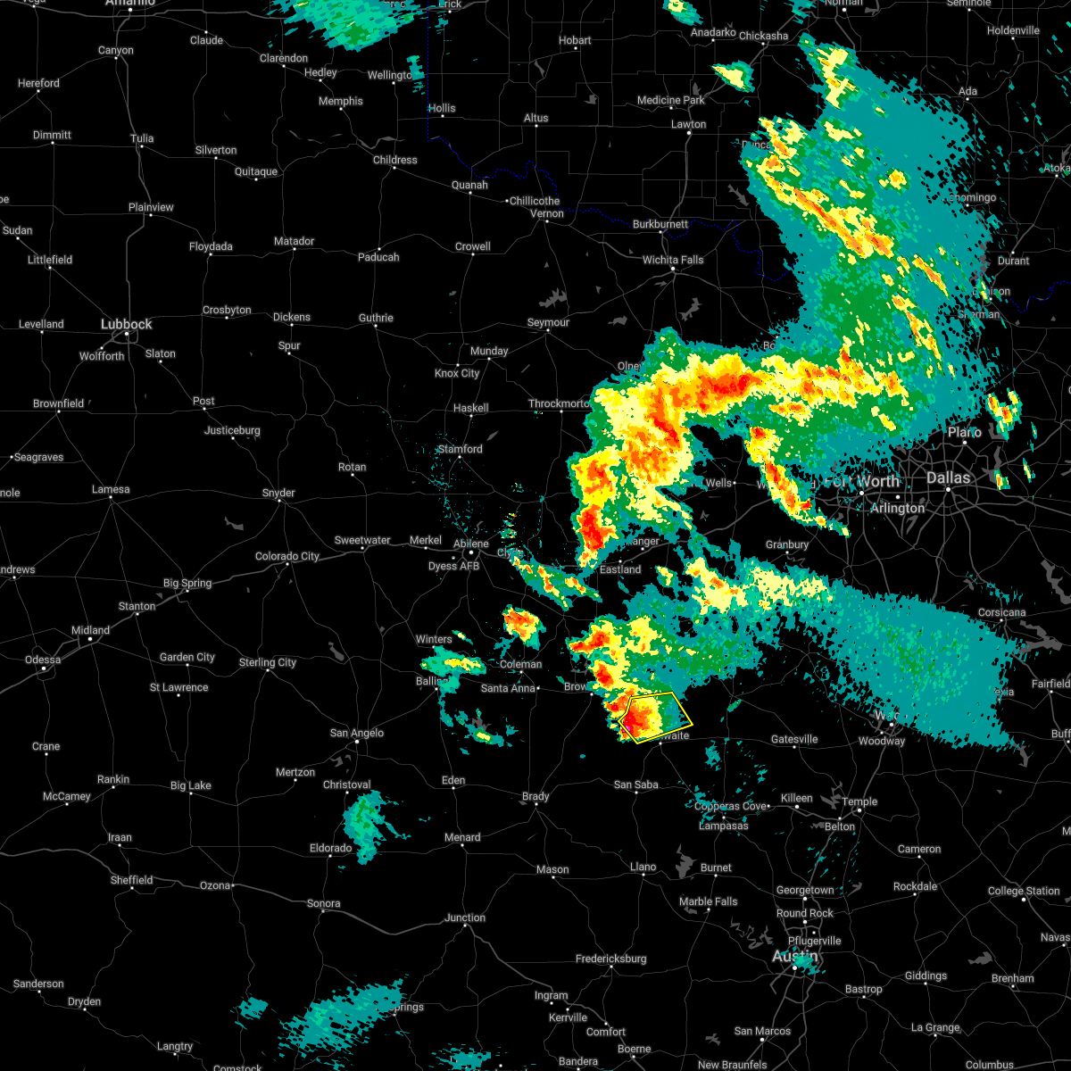 At 1158 pm cdt, a severe thunderstorm was located near mullin, or 17 miles southeast of early, moving northeast at 20 mph (radar indicated). Hazards include golf ball size hail. People and animals outdoors will be injured. expect damage to roofs, siding, windows, and vehicles. locations impacted include, mullin. thunderstorm damage threat, considerable hail threat, radar indicated max hail size, 1. 75 in wind threat, radar indicated max wind gust, <50 mph. At 1158 pm cdt, a severe thunderstorm was located near mullin, or 17 miles southeast of early, moving northeast at 20 mph (radar indicated). Hazards include golf ball size hail. People and animals outdoors will be injured. expect damage to roofs, siding, windows, and vehicles. locations impacted include, mullin. thunderstorm damage threat, considerable hail threat, radar indicated max hail size, 1. 75 in wind threat, radar indicated max wind gust, <50 mph.
|
| 5/1/2022 11:29 PM CDT |
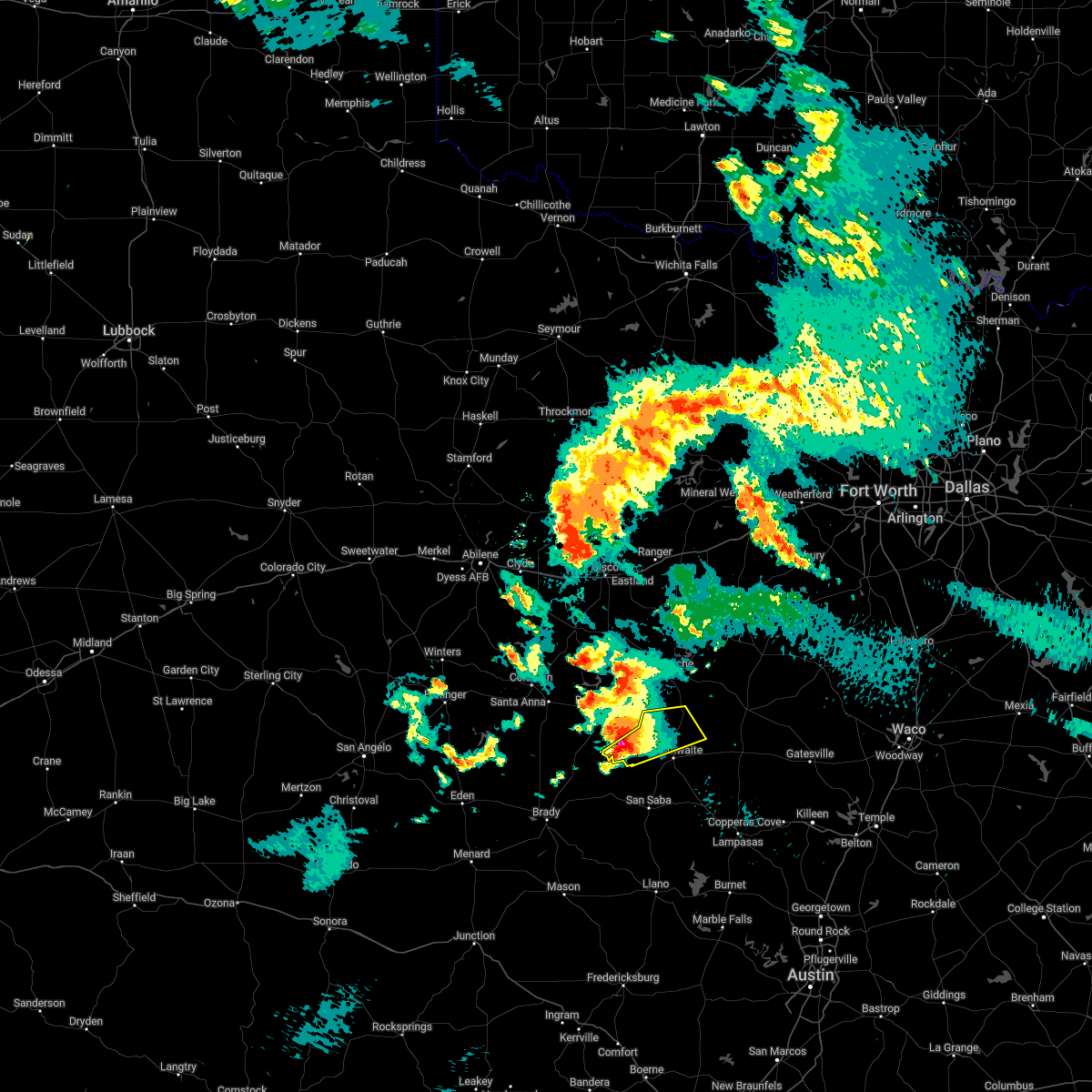 At 1128 pm cdt, a severe thunderstorm was located 11 miles southeast of camp bowie, or 15 miles southeast of brownwood, moving northeast at 20 mph (radar indicated). Hazards include golf ball size hail. People and animals outdoors will be injured. Expect damage to roofs, siding, windows, and vehicles. At 1128 pm cdt, a severe thunderstorm was located 11 miles southeast of camp bowie, or 15 miles southeast of brownwood, moving northeast at 20 mph (radar indicated). Hazards include golf ball size hail. People and animals outdoors will be injured. Expect damage to roofs, siding, windows, and vehicles.
|
| 5/1/2022 11:19 PM CDT |
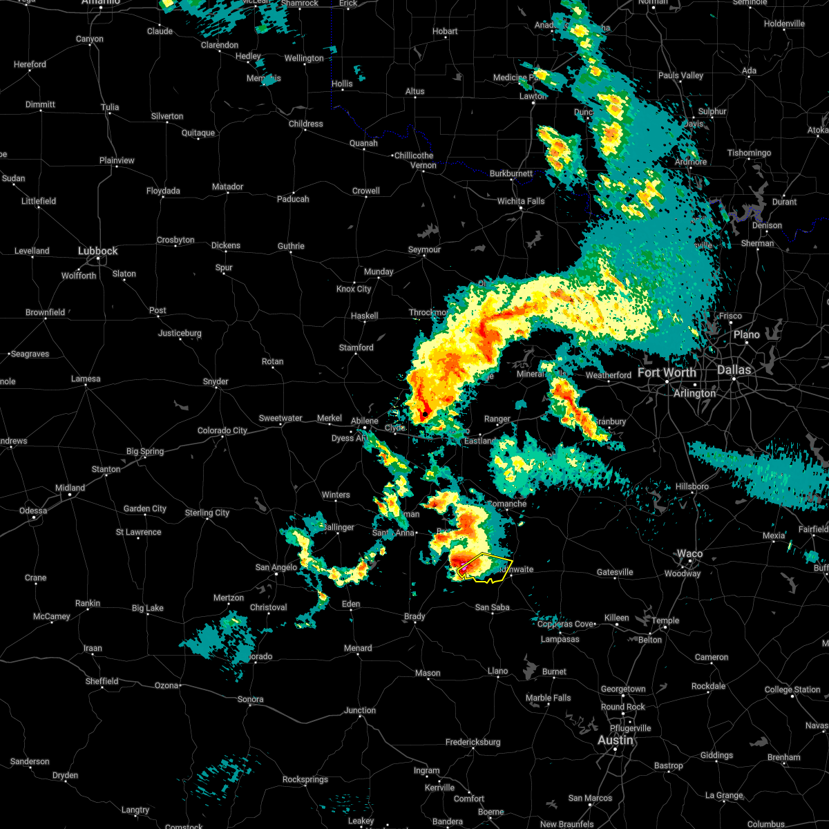 At 1119 pm cdt, a severe thunderstorm was located 9 miles south of camp bowie, or 13 miles south of brownwood, moving east at 15 mph (radar indicated). Hazards include golf ball size hail and 60 mph wind gusts. People and animals outdoors will be injured. expect hail damage to roofs, siding, windows, and vehicles. expect wind damage to roofs, siding, and trees. locations impacted include, mullin. thunderstorm damage threat, considerable hail threat, radar indicated max hail size, 1. 75 in wind threat, radar indicated max wind gust, 60 mph. At 1119 pm cdt, a severe thunderstorm was located 9 miles south of camp bowie, or 13 miles south of brownwood, moving east at 15 mph (radar indicated). Hazards include golf ball size hail and 60 mph wind gusts. People and animals outdoors will be injured. expect hail damage to roofs, siding, windows, and vehicles. expect wind damage to roofs, siding, and trees. locations impacted include, mullin. thunderstorm damage threat, considerable hail threat, radar indicated max hail size, 1. 75 in wind threat, radar indicated max wind gust, 60 mph.
|
| 5/1/2022 10:37 PM CDT |
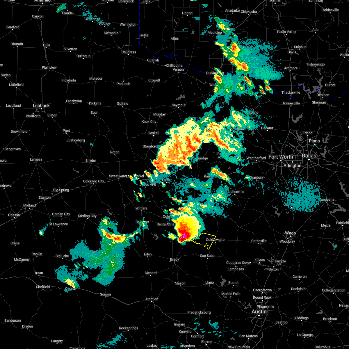 At 1037 pm cdt, a severe thunderstorm was located over brookesmith, or 13 miles southwest of brownwood, moving southeast at 35 mph (radar indicated). Hazards include golf ball size hail and 60 mph wind gusts. People and animals outdoors will be injured. expect hail damage to roofs, siding, windows, and vehicles. Expect wind damage to roofs, siding, and trees. At 1037 pm cdt, a severe thunderstorm was located over brookesmith, or 13 miles southwest of brownwood, moving southeast at 35 mph (radar indicated). Hazards include golf ball size hail and 60 mph wind gusts. People and animals outdoors will be injured. expect hail damage to roofs, siding, windows, and vehicles. Expect wind damage to roofs, siding, and trees.
|
| 4/12/2022 3:57 PM CDT |
 At 355 pm cdt, severe thunderstorms were located over goldthwaite and 4 miles south of pottsville, both moving east at 25 mph (radar indicated). Hazards include 60 mph wind gusts and quarter size hail. Hail damage to vehicles is expected. expect wind damage to roofs, siding, and trees. locations impacted include, hamilton, goldthwaite, evant, center city, star, pottsville, castor, and mullin. hail threat, radar indicated max hail size, 1. 00 in wind threat, radar indicated max wind gust, 60 mph. At 355 pm cdt, severe thunderstorms were located over goldthwaite and 4 miles south of pottsville, both moving east at 25 mph (radar indicated). Hazards include 60 mph wind gusts and quarter size hail. Hail damage to vehicles is expected. expect wind damage to roofs, siding, and trees. locations impacted include, hamilton, goldthwaite, evant, center city, star, pottsville, castor, and mullin. hail threat, radar indicated max hail size, 1. 00 in wind threat, radar indicated max wind gust, 60 mph.
|
| 4/12/2022 3:41 PM CDT |
 At 340 pm cdt, a severe thunderstorm was located 7 miles west of goldthwaite, moving east at 35 mph (radar indicated). Hazards include 60 mph wind gusts and quarter size hail. Hail damage to vehicles is expected. Expect wind damage to roofs, siding, and trees. At 340 pm cdt, a severe thunderstorm was located 7 miles west of goldthwaite, moving east at 35 mph (radar indicated). Hazards include 60 mph wind gusts and quarter size hail. Hail damage to vehicles is expected. Expect wind damage to roofs, siding, and trees.
|
| 10/10/2021 8:23 PM CDT |
 At 822 pm cdt, severe thunderstorms were located along a line extending from 6 miles southeast of gordon to 7 miles north of gustine to near skeeterville, moving east at 45 mph (radar indicated). Hazards include 60 mph wind gusts and quarter size hail. Hail damage to vehicles is expected. Expect wind damage to roofs, siding, and trees. At 822 pm cdt, severe thunderstorms were located along a line extending from 6 miles southeast of gordon to 7 miles north of gustine to near skeeterville, moving east at 45 mph (radar indicated). Hazards include 60 mph wind gusts and quarter size hail. Hail damage to vehicles is expected. Expect wind damage to roofs, siding, and trees.
|
| 5/9/2021 8:41 PM CDT |
 The severe thunderstorm warning for mills county will expire at 845 pm cdt, the storm which prompted the warning has weakened below severe limits. therefore the warning will be allowed to expire. however penny sized hail, gusty winds to 40 mph and heavy rain are still possible with this thunderstorm. a severe thunderstorm watch remains in effect until 1000 pm cdt for central texas. to report severe weather, contact your nearest law enforcement agency. they will relay your report to the national weather service fort worth. The severe thunderstorm warning for mills county will expire at 845 pm cdt, the storm which prompted the warning has weakened below severe limits. therefore the warning will be allowed to expire. however penny sized hail, gusty winds to 40 mph and heavy rain are still possible with this thunderstorm. a severe thunderstorm watch remains in effect until 1000 pm cdt for central texas. to report severe weather, contact your nearest law enforcement agency. they will relay your report to the national weather service fort worth.
|
| 5/9/2021 8:30 PM CDT | Ping Pong Ball sized hail reported 0.5 miles SW of Mullin, TX, mills county sheriff reported ping pong ball hail in mullin. |
| 5/9/2021 8:17 PM CDT |
 At 814 pm cdt, a severe thunderstorm was located near mullin, or 22 miles southeast of early, moving northeast at 30 mph (radar indicated. ping pong ball size hail was reported in richland springs around 725 p.m). Hazards include golf ball size hail and 60 mph wind gusts. People and animals outdoors will be injured. expect hail and wind damage to trees, roofs, siding, windows, and vehicles. Locations impacted include, bozar, goldthwaite, star and mullin. At 814 pm cdt, a severe thunderstorm was located near mullin, or 22 miles southeast of early, moving northeast at 30 mph (radar indicated. ping pong ball size hail was reported in richland springs around 725 p.m). Hazards include golf ball size hail and 60 mph wind gusts. People and animals outdoors will be injured. expect hail and wind damage to trees, roofs, siding, windows, and vehicles. Locations impacted include, bozar, goldthwaite, star and mullin.
|
| 5/9/2021 7:40 PM CDT |
 At 738 pm cdt, a severe thunderstorm was located 7 miles north of algerita, moving northeast at 45 mph (radar indicated). Hazards include golf ball size hail and 60 mph wind gusts. People and animals outdoors will be injured. expect hail damage to roofs, siding, windows, and vehicles. Expect wind damage to roofs, siding, and trees. At 738 pm cdt, a severe thunderstorm was located 7 miles north of algerita, moving northeast at 45 mph (radar indicated). Hazards include golf ball size hail and 60 mph wind gusts. People and animals outdoors will be injured. expect hail damage to roofs, siding, windows, and vehicles. Expect wind damage to roofs, siding, and trees.
|
| 4/28/2021 10:51 PM CDT |
 At 1051 pm cdt, a severe thunderstorm was located near mullin, or 25 miles south of comanche, moving east at 30 mph (radar indicated). Hazards include 60 mph wind gusts and quarter size hail. Hail damage to vehicles is expected. expect wind damage to roofs, siding, and trees. locations impacted include, goldthwaite and mullin. A tornado watch remains in effect until 200 am cdt for central texas. At 1051 pm cdt, a severe thunderstorm was located near mullin, or 25 miles south of comanche, moving east at 30 mph (radar indicated). Hazards include 60 mph wind gusts and quarter size hail. Hail damage to vehicles is expected. expect wind damage to roofs, siding, and trees. locations impacted include, goldthwaite and mullin. A tornado watch remains in effect until 200 am cdt for central texas.
|
| 4/28/2021 10:31 PM CDT |
 At 1031 pm cdt, a severe thunderstorm was located near mullin, or 20 miles southeast of early, moving east at 35 mph (radar indicated). Hazards include 60 mph wind gusts and half dollar size hail. Hail damage to vehicles is expected. expect wind damage to roofs, siding, and trees. locations impacted include, goldthwaite and mullin. A tornado watch remains in effect until 200 am cdt for central texas. At 1031 pm cdt, a severe thunderstorm was located near mullin, or 20 miles southeast of early, moving east at 35 mph (radar indicated). Hazards include 60 mph wind gusts and half dollar size hail. Hail damage to vehicles is expected. expect wind damage to roofs, siding, and trees. locations impacted include, goldthwaite and mullin. A tornado watch remains in effect until 200 am cdt for central texas.
|
| 4/28/2021 10:07 PM CDT |
 At 1007 pm cdt, a severe thunderstorm was located 5 miles northeast of elm grove, or 15 miles north of richland springs, moving east at 35 mph (radar indicated). Hazards include 60 mph wind gusts and half dollar size hail. Hail damage to vehicles is expected. Expect wind damage to roofs, siding, and trees. At 1007 pm cdt, a severe thunderstorm was located 5 miles northeast of elm grove, or 15 miles north of richland springs, moving east at 35 mph (radar indicated). Hazards include 60 mph wind gusts and half dollar size hail. Hail damage to vehicles is expected. Expect wind damage to roofs, siding, and trees.
|
| 3/24/2021 11:09 PM CDT |
 At 1107 pm cdt, a severe thunderstorm was located 7 miles west of goldthwaite moving east at 30 mph (radar indicated). Hazards include 60 mph wind gusts and quarter size hail. Hail damage to vehicles is expected. Expect wind damage to roofs, siding, and trees. At 1107 pm cdt, a severe thunderstorm was located 7 miles west of goldthwaite moving east at 30 mph (radar indicated). Hazards include 60 mph wind gusts and quarter size hail. Hail damage to vehicles is expected. Expect wind damage to roofs, siding, and trees.
|
| 3/24/2021 5:17 PM CDT |
 At 517 pm cdt, a severe thunderstorm was located over goldthwaite, or 17 miles north of san saba, moving east at 25 mph (radar indicated). Hazards include two inch hail and 60 mph wind gusts. People and animals outdoors will be injured. expect hail damage to roofs, siding, windows, and vehicles. expect wind damage to roofs, siding, and trees. locations impacted include, goldthwaite and mullin. A tornado watch remains in effect until 1000 pm cdt for central texas. At 517 pm cdt, a severe thunderstorm was located over goldthwaite, or 17 miles north of san saba, moving east at 25 mph (radar indicated). Hazards include two inch hail and 60 mph wind gusts. People and animals outdoors will be injured. expect hail damage to roofs, siding, windows, and vehicles. expect wind damage to roofs, siding, and trees. locations impacted include, goldthwaite and mullin. A tornado watch remains in effect until 1000 pm cdt for central texas.
|
| 3/24/2021 5:02 PM CDT |
 At 502 pm cdt, a severe thunderstorm was located 8 miles southwest of goldthwaite, or 13 miles north of san saba, moving east at 30 mph (radar indicated). Hazards include ping pong ball size hail and 60 mph wind gusts. People and animals outdoors will be injured. expect hail damage to roofs, siding, windows, and vehicles. expect wind damage to roofs, siding, and trees. locations impacted include, goldthwaite and mullin. A tornado watch remains in effect until 1000 pm cdt for central texas. At 502 pm cdt, a severe thunderstorm was located 8 miles southwest of goldthwaite, or 13 miles north of san saba, moving east at 30 mph (radar indicated). Hazards include ping pong ball size hail and 60 mph wind gusts. People and animals outdoors will be injured. expect hail damage to roofs, siding, windows, and vehicles. expect wind damage to roofs, siding, and trees. locations impacted include, goldthwaite and mullin. A tornado watch remains in effect until 1000 pm cdt for central texas.
|
| 3/24/2021 4:41 PM CDT |
 At 441 pm cdt, a severe thunderstorm was located near skeeterville, or near richland springs, moving east at 25 mph (radar indicated). Hazards include golf ball size hail and 60 mph wind gusts. People and animals outdoors will be injured. expect hail damage to roofs, siding, windows, and vehicles. Expect wind damage to roofs, siding, and trees. At 441 pm cdt, a severe thunderstorm was located near skeeterville, or near richland springs, moving east at 25 mph (radar indicated). Hazards include golf ball size hail and 60 mph wind gusts. People and animals outdoors will be injured. expect hail damage to roofs, siding, windows, and vehicles. Expect wind damage to roofs, siding, and trees.
|
| 3/17/2021 2:50 AM CDT |
 At 249 am cdt, severe thunderstorms were located along a line extending from cisco to zephyr, moving northeast at 55 mph (radar indicated. 63 mph winds were measured in brownwood). Hazards include 65 mph wind gusts and half dollar size hail. Hail damage to vehicles is expected. expect wind damage to roofs, siding, and trees. Locations impacted include, stephenville, comanche, eastland, cisco, dublin, hamilton, ranger, de leon, hico, gorman, rising star, gustine, mullin, huckabay, carbon and i-20 near the callahan-eastland county line. At 249 am cdt, severe thunderstorms were located along a line extending from cisco to zephyr, moving northeast at 55 mph (radar indicated. 63 mph winds were measured in brownwood). Hazards include 65 mph wind gusts and half dollar size hail. Hail damage to vehicles is expected. expect wind damage to roofs, siding, and trees. Locations impacted include, stephenville, comanche, eastland, cisco, dublin, hamilton, ranger, de leon, hico, gorman, rising star, gustine, mullin, huckabay, carbon and i-20 near the callahan-eastland county line.
|
| 3/17/2021 2:26 AM CDT |
 At 224 am cdt, severe thunderstorms were located along a line extending from near cross plains to brookesmith, moving northeast at 55 mph (radar indicated). Hazards include 60 mph wind gusts and quarter size hail. Hail damage to vehicles is expected. Expect wind damage to roofs, siding, and trees. At 224 am cdt, severe thunderstorms were located along a line extending from near cross plains to brookesmith, moving northeast at 55 mph (radar indicated). Hazards include 60 mph wind gusts and quarter size hail. Hail damage to vehicles is expected. Expect wind damage to roofs, siding, and trees.
|
| 4/29/2020 3:34 AM CDT |
 At 334 am cdt, severe thunderstorms were located along a line extending from near evant to near mullin, moving south at 30 mph (radar indicated). Hazards include 60 mph wind gusts and quarter size hail. Hail damage to vehicles is expected. Expect wind damage to roofs, siding, and trees. At 334 am cdt, severe thunderstorms were located along a line extending from near evant to near mullin, moving south at 30 mph (radar indicated). Hazards include 60 mph wind gusts and quarter size hail. Hail damage to vehicles is expected. Expect wind damage to roofs, siding, and trees.
|
| 6/19/2019 8:55 PM CDT |
 At 855 pm cdt, a severe thunderstorm was located near mullin, or 24 miles north of san saba, moving northeast at 30 mph (radar indicated). Hazards include 60 mph wind gusts and quarter size hail. Hail damage to vehicles is expected. Expect wind damage to roofs, siding, and trees. At 855 pm cdt, a severe thunderstorm was located near mullin, or 24 miles north of san saba, moving northeast at 30 mph (radar indicated). Hazards include 60 mph wind gusts and quarter size hail. Hail damage to vehicles is expected. Expect wind damage to roofs, siding, and trees.
|
| 6/16/2019 11:46 PM CDT |
 At 1146 pm cdt, a severe thunderstorm was located over zephyr, or 10 miles southeast of early, moving southeast at 20 mph (radar indicated). Hazards include 60 mph wind gusts and half dollar size hail. Hail damage to vehicles is expected. expect wind damage to roofs, siding, and trees. this severe thunderstorm will be near, mullin around 1215 am cdt. Goldthwaite around 1240 am cdt. At 1146 pm cdt, a severe thunderstorm was located over zephyr, or 10 miles southeast of early, moving southeast at 20 mph (radar indicated). Hazards include 60 mph wind gusts and half dollar size hail. Hail damage to vehicles is expected. expect wind damage to roofs, siding, and trees. this severe thunderstorm will be near, mullin around 1215 am cdt. Goldthwaite around 1240 am cdt.
|
| 5/8/2019 9:57 AM CDT |
 The severe thunderstorm warning for mills county will expire at 1000 am cdt, the storm which prompted the warning has weakened below severe limits. therefore the warning will be allowed to expire. however small hail, gusty winds and heavy rain are still possible with this thunderstorm. a severe thunderstorm watch remains in effect until 100 pm cdt for central texas. The severe thunderstorm warning for mills county will expire at 1000 am cdt, the storm which prompted the warning has weakened below severe limits. therefore the warning will be allowed to expire. however small hail, gusty winds and heavy rain are still possible with this thunderstorm. a severe thunderstorm watch remains in effect until 100 pm cdt for central texas.
|
| 5/8/2019 9:40 AM CDT |
 At 940 am cdt, a severe thunderstorm was located 8 miles east of skeeterville, or 11 miles northeast of richland springs, moving northeast at 35 mph (radar indicated). Hazards include 60 mph wind gusts and quarter size hail. Hail damage to vehicles is expected. expect wind damage to roofs, siding, and trees. Locations impacted include, goldthwaite and mullin. At 940 am cdt, a severe thunderstorm was located 8 miles east of skeeterville, or 11 miles northeast of richland springs, moving northeast at 35 mph (radar indicated). Hazards include 60 mph wind gusts and quarter size hail. Hail damage to vehicles is expected. expect wind damage to roofs, siding, and trees. Locations impacted include, goldthwaite and mullin.
|
| 5/8/2019 9:05 AM CDT |
 At 904 am cdt, a severe thunderstorm was located near elm grove, or 12 miles north of richland springs, moving northeast at 30 mph (radar indicated). Hazards include 60 mph wind gusts and quarter size hail. Hail damage to vehicles is expected. Expect wind damage to roofs, siding, and trees. At 904 am cdt, a severe thunderstorm was located near elm grove, or 12 miles north of richland springs, moving northeast at 30 mph (radar indicated). Hazards include 60 mph wind gusts and quarter size hail. Hail damage to vehicles is expected. Expect wind damage to roofs, siding, and trees.
|
| 5/2/2019 2:18 PM CDT |
 At 218 pm cdt, a severe thunderstorm was located 7 miles northeast of goldthwaite, or 24 miles south of comanche, moving east at 20 mph (radar indicated). Hazards include quarter size hail. damage to vehicles is possible At 218 pm cdt, a severe thunderstorm was located 7 miles northeast of goldthwaite, or 24 miles south of comanche, moving east at 20 mph (radar indicated). Hazards include quarter size hail. damage to vehicles is possible
|
| 4/24/2019 1:26 AM CDT |
 At 126 am cdt, a severe thunderstorm was located near zephyr, or 13 miles southeast of early, moving east at 25 mph (radar indicated). Hazards include 60 mph wind gusts. expect damage to roofs, siding, and trees At 126 am cdt, a severe thunderstorm was located near zephyr, or 13 miles southeast of early, moving east at 25 mph (radar indicated). Hazards include 60 mph wind gusts. expect damage to roofs, siding, and trees
|
| 4/17/2019 10:09 PM CDT |
 At 1009 pm cdt, a severe thunderstorm was located near san saba, moving east at 45 mph (radar indicated). Hazards include 60 mph wind gusts and quarter size hail. Hail damage to vehicles is expected. Expect wind damage to roofs, siding, and trees. At 1009 pm cdt, a severe thunderstorm was located near san saba, moving east at 45 mph (radar indicated). Hazards include 60 mph wind gusts and quarter size hail. Hail damage to vehicles is expected. Expect wind damage to roofs, siding, and trees.
|
| 4/17/2019 9:10 PM CDT |
 At 909 pm cdt, a severe thunderstorm was just north of goldthwaite, moving east at 40 mph (radar indicated). Hazards include ping pong ball size hail and 60 mph wind gusts. People and animals outdoors will be injured. expect hail damage to roofs, siding, windows, and vehicles. expect wind damage to roofs, siding, and trees. Locations impacted include, goldthwaite and mullin. At 909 pm cdt, a severe thunderstorm was just north of goldthwaite, moving east at 40 mph (radar indicated). Hazards include ping pong ball size hail and 60 mph wind gusts. People and animals outdoors will be injured. expect hail damage to roofs, siding, windows, and vehicles. expect wind damage to roofs, siding, and trees. Locations impacted include, goldthwaite and mullin.
|
| 4/17/2019 9:04 PM CDT |
 At 903 pm cdt, a severe thunderstorm was located near dublin, moving northeast at 40 mph (radar indicated). Hazards include 60 mph wind gusts and half dollar size hail. Hail damage to vehicles is expected. expect wind damage to roofs, siding, and trees. Locations impacted include, comanche, de leon, gorman, gustine and mullin. At 903 pm cdt, a severe thunderstorm was located near dublin, moving northeast at 40 mph (radar indicated). Hazards include 60 mph wind gusts and half dollar size hail. Hail damage to vehicles is expected. expect wind damage to roofs, siding, and trees. Locations impacted include, comanche, de leon, gorman, gustine and mullin.
|
| 4/17/2019 8:41 PM CDT |
 At 841 pm cdt, a severe thunderstorm was located near goldthwaite, or 18 miles north of san saba, moving east at 40 mph (radar indicated). Hazards include ping pong ball size hail and 60 mph wind gusts. People and animals outdoors will be injured. expect hail damage to roofs, siding, windows, and vehicles. Expect wind damage to roofs, siding, and trees. At 841 pm cdt, a severe thunderstorm was located near goldthwaite, or 18 miles north of san saba, moving east at 40 mph (radar indicated). Hazards include ping pong ball size hail and 60 mph wind gusts. People and animals outdoors will be injured. expect hail damage to roofs, siding, windows, and vehicles. Expect wind damage to roofs, siding, and trees.
|
| 4/17/2019 8:19 PM CDT |
 At 817 pm cdt, a cluster of severe thunderstorms was located from a rising star to comanche to regency line, moving northeast at 40 mph (radar indicated). Hazards include 60 mph wind gusts and half dollar size hail. Hail damage to vehicles is expected. Expect wind damage to roofs, siding, and trees. At 817 pm cdt, a cluster of severe thunderstorms was located from a rising star to comanche to regency line, moving northeast at 40 mph (radar indicated). Hazards include 60 mph wind gusts and half dollar size hail. Hail damage to vehicles is expected. Expect wind damage to roofs, siding, and trees.
|
| 4/17/2019 8:11 PM CDT |
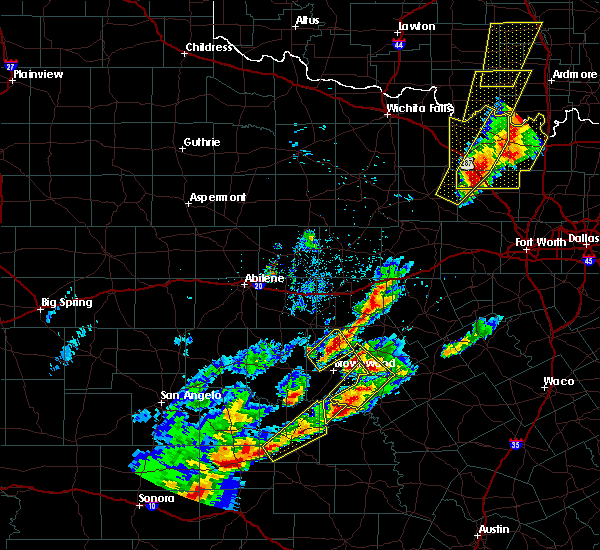 At 810 pm cdt, a severe thunderstorm was located 9 miles southwest of mullin, or 17 miles northeast of richland springs, moving northeast at 40 mph. another strong to possibly severe storm was located just to the northeast of brownwood and will move into southwestern comanche county shortly (radar indicated). Hazards include ping pong ball size hail and 60 mph wind gusts. People and animals outdoors will be injured. expect hail damage to roofs, siding, windows, and vehicles. expect wind damage to roofs, siding, and trees. Locations impacted include, mullin and sidney. At 810 pm cdt, a severe thunderstorm was located 9 miles southwest of mullin, or 17 miles northeast of richland springs, moving northeast at 40 mph. another strong to possibly severe storm was located just to the northeast of brownwood and will move into southwestern comanche county shortly (radar indicated). Hazards include ping pong ball size hail and 60 mph wind gusts. People and animals outdoors will be injured. expect hail damage to roofs, siding, windows, and vehicles. expect wind damage to roofs, siding, and trees. Locations impacted include, mullin and sidney.
|
| 4/17/2019 7:32 PM CDT |
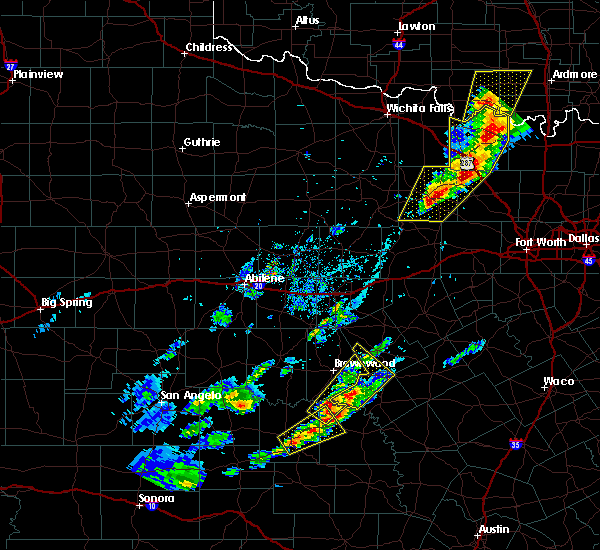 At 730 pm cdt, a severe thunderstorm was located near elm grove, or 9 miles north of richland springs, moving northeast at 50 mph. this thunderstorm has a history of producing golf ball size hail near brady, texas (radar indicated). Hazards include ping pong ball size hail and 60 mph wind gusts. People and animals outdoors will be injured. expect hail damage to roofs, siding, windows, and vehicles. Expect wind damage to roofs, siding, and trees. At 730 pm cdt, a severe thunderstorm was located near elm grove, or 9 miles north of richland springs, moving northeast at 50 mph. this thunderstorm has a history of producing golf ball size hail near brady, texas (radar indicated). Hazards include ping pong ball size hail and 60 mph wind gusts. People and animals outdoors will be injured. expect hail damage to roofs, siding, windows, and vehicles. Expect wind damage to roofs, siding, and trees.
|
| 5/25/2018 8:51 PM CDT |
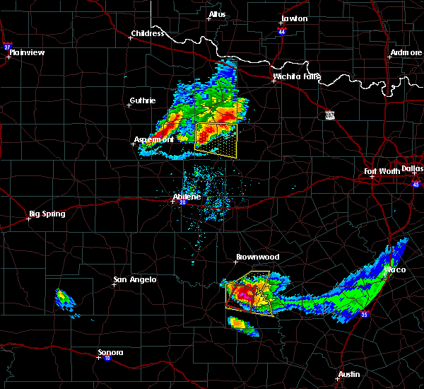 The severe thunderstorm warning for west central mills county will expire at 900 pm cdt, the storm which prompted the warning has moved out of the area. therefore the warning will be allowed to expire. to report severe weather, contact your nearest law enforcement agency. they will relay your report to the national weather service fort worth. The severe thunderstorm warning for west central mills county will expire at 900 pm cdt, the storm which prompted the warning has moved out of the area. therefore the warning will be allowed to expire. to report severe weather, contact your nearest law enforcement agency. they will relay your report to the national weather service fort worth.
|
| 5/25/2018 8:36 PM CDT |
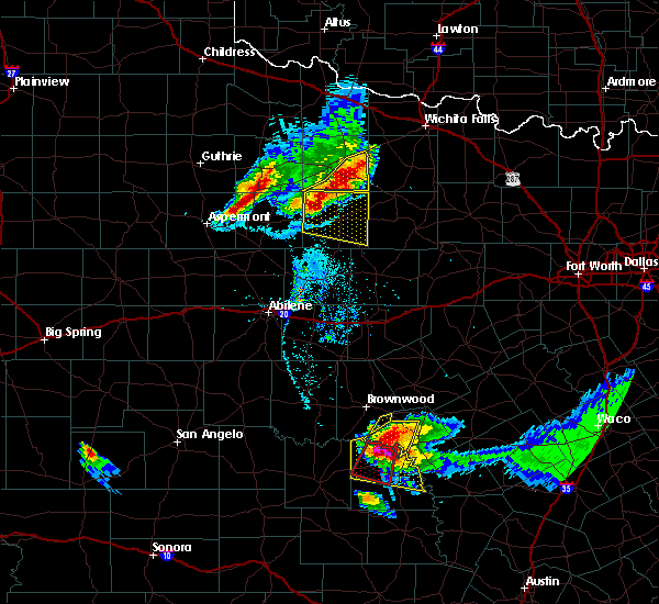 At 836 pm cdt, a severe thunderstorm was located near skeeterville, or 10 miles north of richland springs, moving southwest at 40 mph (radar indicated). Hazards include two inch hail and 60 mph wind gusts. People and animals outdoors will be injured. expect hail damage to roofs, siding, windows, and vehicles. expect wind damage to roofs, siding, and trees. Locations impacted include, mullin. At 836 pm cdt, a severe thunderstorm was located near skeeterville, or 10 miles north of richland springs, moving southwest at 40 mph (radar indicated). Hazards include two inch hail and 60 mph wind gusts. People and animals outdoors will be injured. expect hail damage to roofs, siding, windows, and vehicles. expect wind damage to roofs, siding, and trees. Locations impacted include, mullin.
|
| 5/25/2018 8:08 PM CDT |
 At 806 pm cdt, a severe thunderstorm was located over zephyr, or 10 miles southeast of early, moving south at 25 mph (trained weather spotters). Hazards include tennis ball size hail and 60 mph wind gusts. People and animals outdoors will be injured. expect hail damage to roofs, siding, windows, and vehicles. Expect wind damage to roofs, siding, and trees. At 806 pm cdt, a severe thunderstorm was located over zephyr, or 10 miles southeast of early, moving south at 25 mph (trained weather spotters). Hazards include tennis ball size hail and 60 mph wind gusts. People and animals outdoors will be injured. expect hail damage to roofs, siding, windows, and vehicles. Expect wind damage to roofs, siding, and trees.
|
| 5/3/2018 9:32 AM CDT |
 At 932 am cdt, a severe thunderstorm was located over mullin, or 20 miles southeast of early, moving east at 35 mph (radar indicated). Hazards include 65 mph wind gusts and half dollar size hail. Hail damage to vehicles is expected. expect wind damage to roofs, siding, and trees. Locations impacted include, comanche, de leon, goldthwaite, gustine and mullin. At 932 am cdt, a severe thunderstorm was located over mullin, or 20 miles southeast of early, moving east at 35 mph (radar indicated). Hazards include 65 mph wind gusts and half dollar size hail. Hail damage to vehicles is expected. expect wind damage to roofs, siding, and trees. Locations impacted include, comanche, de leon, goldthwaite, gustine and mullin.
|
| 5/3/2018 8:47 AM CDT |
 At 846 am cdt, a severe thunderstorm was located over camp bowie, or near early, moving east at 40 mph (radar indicated). Hazards include 65 mph wind gusts and half dollar size hail. Hail damage to vehicles is expected. Expect wind damage to roofs, siding, and trees. At 846 am cdt, a severe thunderstorm was located over camp bowie, or near early, moving east at 40 mph (radar indicated). Hazards include 65 mph wind gusts and half dollar size hail. Hail damage to vehicles is expected. Expect wind damage to roofs, siding, and trees.
|
| 5/19/2017 9:46 PM CDT |
 At 946 pm cdt, a severe thunderstorm was located near goldthwaite, or 17 miles north of san saba, moving east at 10 mph (radar indicated). Hazards include 65 mph wind gusts and half dollar size hail. Hail damage to vehicles is expected. Expect wind damage to roofs, siding, and trees. At 946 pm cdt, a severe thunderstorm was located near goldthwaite, or 17 miles north of san saba, moving east at 10 mph (radar indicated). Hazards include 65 mph wind gusts and half dollar size hail. Hail damage to vehicles is expected. Expect wind damage to roofs, siding, and trees.
|
| 5/19/2017 8:53 PM CDT |
 At 850 pm cdt, a severe thunderstorm was located 5 miles southeast of indian creek in far western mills county, moving southeast at 20 mph (radar indicated). Hazards include golf ball size hail and 65 mph wind gusts. People and animals outdoors will be injured. expect hail damage to roofs, siding, windows, and vehicles. damaging winds will precede the hail. although the hail core will primarily affect areas near the colorado river, the strong winds will affect much of mills county. A tornado watch remains in effect until 11 pm. At 850 pm cdt, a severe thunderstorm was located 5 miles southeast of indian creek in far western mills county, moving southeast at 20 mph (radar indicated). Hazards include golf ball size hail and 65 mph wind gusts. People and animals outdoors will be injured. expect hail damage to roofs, siding, windows, and vehicles. damaging winds will precede the hail. although the hail core will primarily affect areas near the colorado river, the strong winds will affect much of mills county. A tornado watch remains in effect until 11 pm.
|
| 5/19/2017 8:25 PM CDT |
 At 822 pm cdt, a severe thunderstorm was located between brownwood and indian creek in brown county, moving east at 20 mph (radar indicated). Hazards include golf ball size hail and 60 mph wind gusts. People and animals outdoors will be injured. expect hail damage to roofs, siding, windows, and vehicles. expect wind damage to roofs, siding, and trees. this severe thunderstorm will be near, mullin around 920 pm cdt. goldthwaite around 940 pm cdt. A tornado watch remains in effect until 11 pm. At 822 pm cdt, a severe thunderstorm was located between brownwood and indian creek in brown county, moving east at 20 mph (radar indicated). Hazards include golf ball size hail and 60 mph wind gusts. People and animals outdoors will be injured. expect hail damage to roofs, siding, windows, and vehicles. expect wind damage to roofs, siding, and trees. this severe thunderstorm will be near, mullin around 920 pm cdt. goldthwaite around 940 pm cdt. A tornado watch remains in effect until 11 pm.
|
| 5/18/2017 10:25 PM CDT |
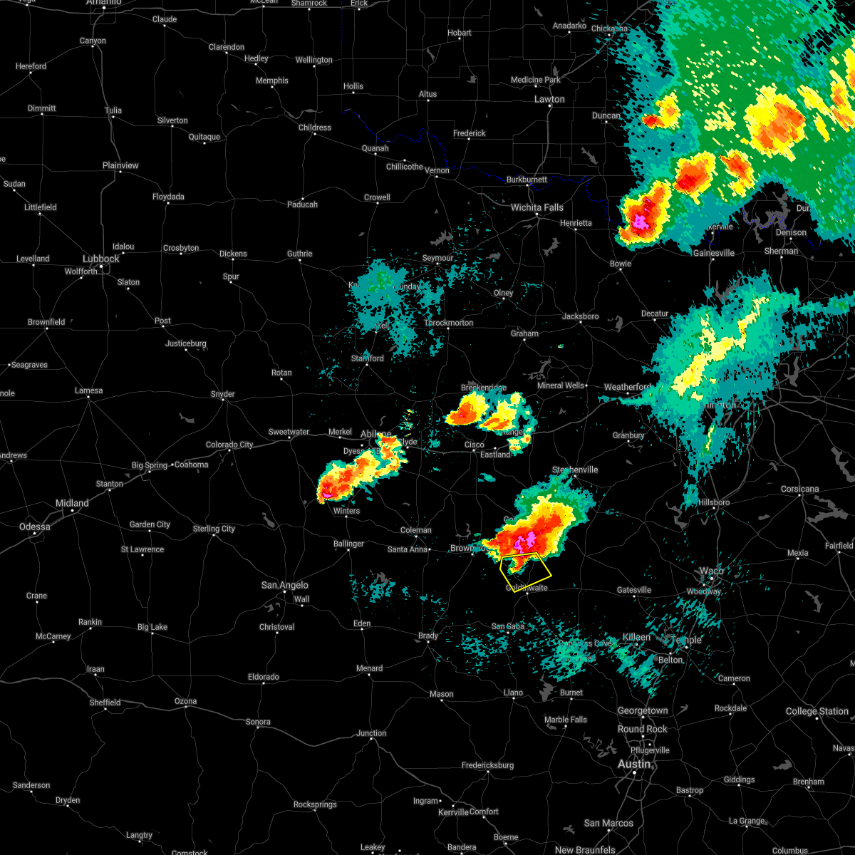 At 1025 pm cdt, a severe thunderstorm was located 9 miles northeast of mullin, or 15 miles south of comanche, moving southeast at 25 mph (radar indicated). Hazards include 65 mph wind gusts and half dollar size hail. Hail damage to vehicles is expected. expect wind damage to roofs, siding, and trees. locations impacted include, mullin. A tornado watch remains in effect until midnight cdt for central texas. At 1025 pm cdt, a severe thunderstorm was located 9 miles northeast of mullin, or 15 miles south of comanche, moving southeast at 25 mph (radar indicated). Hazards include 65 mph wind gusts and half dollar size hail. Hail damage to vehicles is expected. expect wind damage to roofs, siding, and trees. locations impacted include, mullin. A tornado watch remains in effect until midnight cdt for central texas.
|
| 5/18/2017 9:57 PM CDT |
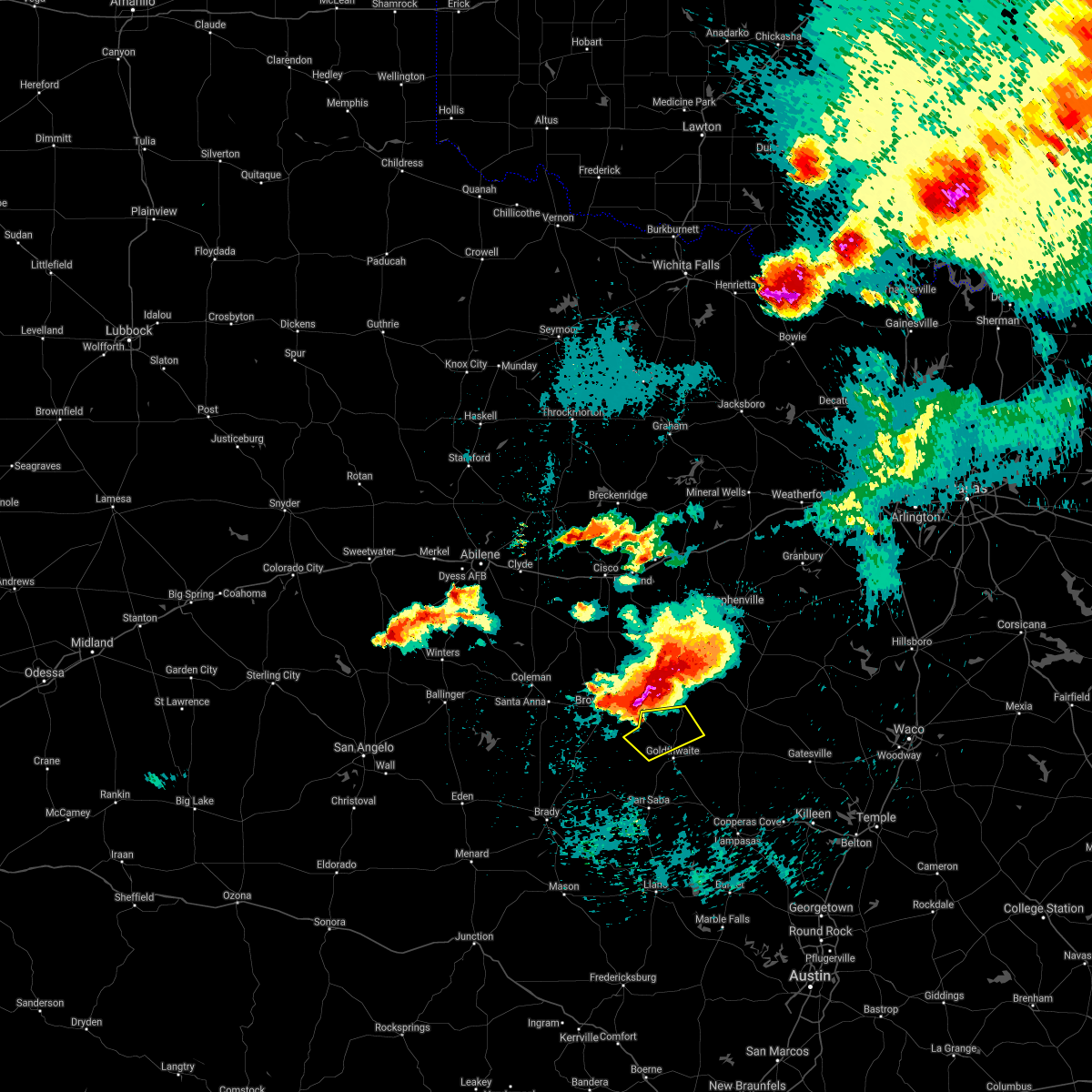 At 956 pm cdt, a severe thunderstorm was located over zephyr, or 9 miles east of early, moving southeast at 15 mph (radar indicated). Hazards include ping pong ball size hail and 65 mph wind gusts. People and animals outdoors will be injured. expect hail damage to roofs, siding, windows, and vehicles. Expect wind damage to roofs, siding, and trees. At 956 pm cdt, a severe thunderstorm was located over zephyr, or 9 miles east of early, moving southeast at 15 mph (radar indicated). Hazards include ping pong ball size hail and 65 mph wind gusts. People and animals outdoors will be injured. expect hail damage to roofs, siding, windows, and vehicles. Expect wind damage to roofs, siding, and trees.
|
| 5/10/2016 6:10 PM CDT |
 At 608 pm cdt, severe thunderstorms were located along a line extending from 12 miles northwest of evant to mullin, moving east at 15 mph (radar indicated. spotters have reported large hail and damaging winds near pottsville). Hazards include hen egg size hail and 65 mph wind gusts. People and animals outdoors will be injured. expect hail damage to roofs, siding, windows, and vehicles. expect wind damage to roofs, siding, and trees. Locations impacted include, hamilton, goldthwaite, evant and mullin. At 608 pm cdt, severe thunderstorms were located along a line extending from 12 miles northwest of evant to mullin, moving east at 15 mph (radar indicated. spotters have reported large hail and damaging winds near pottsville). Hazards include hen egg size hail and 65 mph wind gusts. People and animals outdoors will be injured. expect hail damage to roofs, siding, windows, and vehicles. expect wind damage to roofs, siding, and trees. Locations impacted include, hamilton, goldthwaite, evant and mullin.
|
| 5/10/2016 5:40 PM CDT |
 At 539 pm cdt, a severe thunderstorm was located just south of priddy , or 20 miles southeast of comanche, moving northeast at 20 mph (radar indicated). Hazards include hen egg size hail and 65 mph wind gusts. People and animals outdoors will be injured. expect hail damage to roofs, siding, windows, and vehicles. Expect wind damage to roofs, siding, and trees. At 539 pm cdt, a severe thunderstorm was located just south of priddy , or 20 miles southeast of comanche, moving northeast at 20 mph (radar indicated). Hazards include hen egg size hail and 65 mph wind gusts. People and animals outdoors will be injured. expect hail damage to roofs, siding, windows, and vehicles. Expect wind damage to roofs, siding, and trees.
|
| 5/10/2016 5:04 PM CDT | Hen Egg sized hail reported 10 miles WSW of Mullin, TX, near intersection of texas state highway 16 and county road 134/262. |
| 5/10/2016 4:59 PM CDT |
 At 458 pm cdt, a severe thunderstorm was located over comanche, moving northeast at 25 mph. this storm produced a 62 mph wind gust at comanche over the last few minutes (radar indicated). Hazards include hen egg size hail and 65 mph wind gusts. People and animals outdoors will be injured. expect hail damage to roofs, siding, windows, and vehicles. expect wind damage to roofs, siding, and trees. Locations impacted include, comanche, de leon, gustine and mullin. At 458 pm cdt, a severe thunderstorm was located over comanche, moving northeast at 25 mph. this storm produced a 62 mph wind gust at comanche over the last few minutes (radar indicated). Hazards include hen egg size hail and 65 mph wind gusts. People and animals outdoors will be injured. expect hail damage to roofs, siding, windows, and vehicles. expect wind damage to roofs, siding, and trees. Locations impacted include, comanche, de leon, gustine and mullin.
|
| 5/10/2016 4:52 PM CDT |
 At 451 pm cdt, a severe thunderstorm was located 10 miles northeast of mullin, or 20 miles south of comanche, moving east at 25 mph (radar indicated). Hazards include tennis ball size hail and 60 mph wind gusts. People and animals outdoors will be injured. expect hail damage to roofs, siding, windows, and vehicles. expect wind damage to roofs, siding, and trees. this severe thunderstorm will be near, priddy around 500 pm cdt. indian gap around 505 pm cdt. Hamilton around 545 pm cdt. At 451 pm cdt, a severe thunderstorm was located 10 miles northeast of mullin, or 20 miles south of comanche, moving east at 25 mph (radar indicated). Hazards include tennis ball size hail and 60 mph wind gusts. People and animals outdoors will be injured. expect hail damage to roofs, siding, windows, and vehicles. expect wind damage to roofs, siding, and trees. this severe thunderstorm will be near, priddy around 500 pm cdt. indian gap around 505 pm cdt. Hamilton around 545 pm cdt.
|
| 5/10/2016 4:35 PM CDT |
 At 434 pm cdt, two severe thunderstorms were located near blanket and also 7 miles north of mullin, moving northeast at 25 mph (radar indicated). Hazards include hen egg size hail and 60 mph wind gusts. People and animals outdoors will be injured. expect hail damage to roofs, siding, windows, and vehicles. expect wind damage to roofs, siding, and trees. Locations impacted include, comanche, de leon, gustine and mullin. At 434 pm cdt, two severe thunderstorms were located near blanket and also 7 miles north of mullin, moving northeast at 25 mph (radar indicated). Hazards include hen egg size hail and 60 mph wind gusts. People and animals outdoors will be injured. expect hail damage to roofs, siding, windows, and vehicles. expect wind damage to roofs, siding, and trees. Locations impacted include, comanche, de leon, gustine and mullin.
|
| 5/10/2016 4:25 PM CDT |
 At 425 pm cdt, a severe thunderstorm was located near mullin, or 15 miles east of early, moving northeast at 10 mph (radar indicated). Hazards include 60 mph wind gusts and half dollar size hail. Hail damage to vehicles is expected. expect wind damage to roofs, siding, and trees. This severe thunderstorm will remain over mainly rural areas of comanche and northwestern mills counties. At 425 pm cdt, a severe thunderstorm was located near mullin, or 15 miles east of early, moving northeast at 10 mph (radar indicated). Hazards include 60 mph wind gusts and half dollar size hail. Hail damage to vehicles is expected. expect wind damage to roofs, siding, and trees. This severe thunderstorm will remain over mainly rural areas of comanche and northwestern mills counties.
|
| 4/26/2016 11:07 PM CDT |
 At 1105 pm cdt, a cluster of severe thunderstorms was located from near priddy to goldthwaite to san saba, moving east at 40 mph (radar indicated). Hazards include 65 mph wind gusts. Expect damage to roofs. siding. and trees. locations impacted include, goldthwaite, mullin, lometa and us-190 near the san saba- lampasses county line. A tornado watch remains in effect until midnight cdt for central texas. At 1105 pm cdt, a cluster of severe thunderstorms was located from near priddy to goldthwaite to san saba, moving east at 40 mph (radar indicated). Hazards include 65 mph wind gusts. Expect damage to roofs. siding. and trees. locations impacted include, goldthwaite, mullin, lometa and us-190 near the san saba- lampasses county line. A tornado watch remains in effect until midnight cdt for central texas.
|
| 4/26/2016 10:51 PM CDT |
 At 1051 pm cdt, a cluster of severe thunderstorms was located over goldthwaite, or 20 miles northeast of san saba, moving east at 40 mph (radar indicated). Hazards include 65 mph wind gusts. Expect damage to roofs. siding. And trees. At 1051 pm cdt, a cluster of severe thunderstorms was located over goldthwaite, or 20 miles northeast of san saba, moving east at 40 mph (radar indicated). Hazards include 65 mph wind gusts. Expect damage to roofs. siding. And trees.
|
| 3/8/2016 9:49 PM CST |
 At 948 pm cst, severe thunderstorms were located along a line extending from near goldthwaite to 14 miles southwest of evant to 7 miles north of tow, moving north at 30 mph (radar indicated). Hazards include 60 mph wind gusts and half dollar size hail. Hail damage to vehicles is expected. expect wind damage to roofs, siding, and trees. Locations impacted include, goldthwaite, mullin and lometa. At 948 pm cst, severe thunderstorms were located along a line extending from near goldthwaite to 14 miles southwest of evant to 7 miles north of tow, moving north at 30 mph (radar indicated). Hazards include 60 mph wind gusts and half dollar size hail. Hail damage to vehicles is expected. expect wind damage to roofs, siding, and trees. Locations impacted include, goldthwaite, mullin and lometa.
|
| 3/8/2016 9:08 PM CST |
 At 908 pm cst, severe thunderstorms were located along a line extending from 10 miles southwest of goldthwaite to 7 miles north of bend to near baby head, moving northeast at 30 mph (radar indicated). Hazards include 60 mph wind gusts and half dollar size hail. Hail damage to vehicles is expected. Expect wind damage to roofs, siding, and trees. At 908 pm cst, severe thunderstorms were located along a line extending from 10 miles southwest of goldthwaite to 7 miles north of bend to near baby head, moving northeast at 30 mph (radar indicated). Hazards include 60 mph wind gusts and half dollar size hail. Hail damage to vehicles is expected. Expect wind damage to roofs, siding, and trees.
|
| 5/28/2015 10:35 PM CDT | At 1035 pm cdt, a severe thunderstorm was located near goldthwaite, or 16 miles north of san saba, moving east at 50 mph (radar indicated). Hazards include 60 mph wind gusts and penny size hail. Expect damage to roofs. Siding and trees. |
| 5/10/2015 2:55 PM CDT | At 254 pm cdt, a severe thunderstorm was located 8 miles south of goldthwaite, or 11 miles northeast of san saba, moving northeast at 35 mph (radar indicated). Hazards include 60 mph wind gusts and half dollar size hail. Hail damage to vehicles is expected. Expect wind damage to roofs, siding and trees. |
| 5/10/2015 2:36 PM CDT | At 235 pm cdt, a severe thunderstorm was located over mullin, or 22 miles southeast of early, moving east at 30 mph (radar indicated). Hazards include 60 mph wind gusts and half dollar size hail. Hail damage to vehicles is expected. expect wind damage to roofs, siding and trees. locations impacted include, goldthwaite, mullin and the intersection of ranch road 765 and ranch road 45. a tornado watch remains in effect until 900 pm cdt for central texas. 1. 25in. |
| 5/10/2015 2:13 PM CDT | At 212 pm cdt, a severe thunderstorm was located 8 miles southwest of mullin, or 18 miles southeast of brownwood, moving east at 45 mph. this is a very dangerous storm (radar indicated). Hazards include baseball size hail and 60 mph wind gusts. People and animals outdoors will be severely injured. expect shattered windows, extensive damage to roofs, siding and vehicles. locations impacted include, goldthwaite, mullin and the intersection of ranch road 765 and ranch road 45. a tornado watch remains in effect until 900 pm cdt for central texas. 2. 75in. |
| 5/10/2015 2:06 PM CDT | At 205 pm cdt, a severe thunderstorm was located 8 miles northeast of skeeterville, or 13 miles north of richland springs, moving northeast at 30 mph (radar indicated). Hazards include ping pong ball size hail and 60 mph wind gusts. People and animals outdoors will be injured. expect hail damage to roofs, siding, windows and vehicles. Expect wind damage to roofs, siding and trees. |
| 5/8/2015 12:51 AM CDT | The severe thunderstorm warning for northeastern mills county will expire at 100 am cdt, the storm which prompted the warning has weakened below severe limits, and no longer poses an immediate threat to life or property. therefore the warning will be allowed to expire. however heavy rain is still possible with this thunderstorm. |
| 5/8/2015 12:08 AM CDT | At 1208 am cdt, a severe thunderstorm was located near zephyr, or 13 miles east of early, moving southeast at 25 mph (radar indicated). Hazards include golf ball size hail and 60 mph wind gusts. People and animals outdoors will be injured. expect hail damage to roofs, siding, windows and vehicles. Expect wind damage to roofs, siding and trees. |
| 5/7/2015 10:44 PM CDT | At 1043 pm cdt, a severe thunderstorm was located 8 miles south of comanche, moving southeast at 15 mph (radar indicated). Hazards include golf ball size hail and 60 mph wind gusts. People and animals outdoors will be injured. expect hail damage to roofs, siding, windows and vehicles. Expect wind damage to roofs, siding and trees. |
| 4/18/2015 5:49 PM CDT | At 548 pm cdt, severe thunderstorms were located along a line extending from gustine to 8 miles northeast of san saba, moving east at 30 mph (radar indicated). Hazards include 60 mph wind gusts and quarter size hail. Expect wind damage to roofs. Siding and trees. |
| 3/25/2015 9:06 PM CDT | A severe thunderstorm warning remains in effect until 930 pm cdt for central mills county. at 905 pm cdt. doppler radar indicated a severe thunderstorm capable of producing large damaging hail up to golf ball size and damaging winds in excess of 60 mph. this storm was located near goldthwaite. or 16 miles north of san saba. Moving east at 30 mph. |
| 3/25/2015 8:49 PM CDT | The national weather service in fort worth has issued a * severe thunderstorm warning for. central mills county in north central texas. until 930 pm cdt * at 847 pm cdt. Doppler radar indicated a severe thunderstorm capable of producing quarter size hail and damaging winds in excess. |
| 5/20/2013 9:42 PM CDT | Golf Ball sized hail reported 11.7 miles SW of Mullin, TX, golfball sized hail reported in and west of priddy. |
| 5/20/2013 7:25 PM CDT | A barn was blown over fm-218 east of priddy. probably associated with a tornad in mills county TX, 12.6 miles SW of Mullin, TX |
| 5/15/2013 6:32 PM CDT | Golf Ball sized hail reported 11.7 miles SW of Mullin, TX |
| 5/5/2012 8:14 PM CDT | Quarter sized hail reported 5.3 miles SE of Mullin, TX, quarter hail and high winds between mullin and zephyr. |
| 1/1/0001 12:00 AM | Quarter sized hail reported 0.5 miles NNE of Mullin, TX, some quarter size hail was reported in the mullin area |
| 1/1/0001 12:00 AM | Golf Ball sized hail reported 8.5 miles S of Mullin, TX |
| 1/1/0001 12:00 AM | Several windows blown out of houses...minor roof damage and several large trees were blocking road in mills county TX, 11.7 miles SW of Mullin, TX |
| 1/1/0001 12:00 AM | Golf Ball sized hail reported 11.7 miles SW of Mullin, TX |
| 1/1/0001 12:00 AM | 2 large trees were blown down and had to be removed after blocking fm 573 near mulli in mills county TX, 0.5 miles NNE of Mullin, TX |
Hail Maps for Mullin, TX
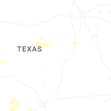

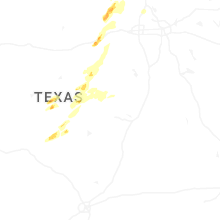

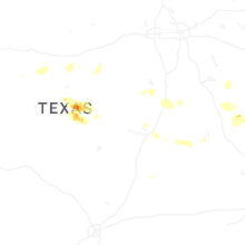
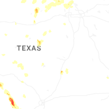
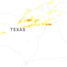


Connect with Interactive Hail Maps