

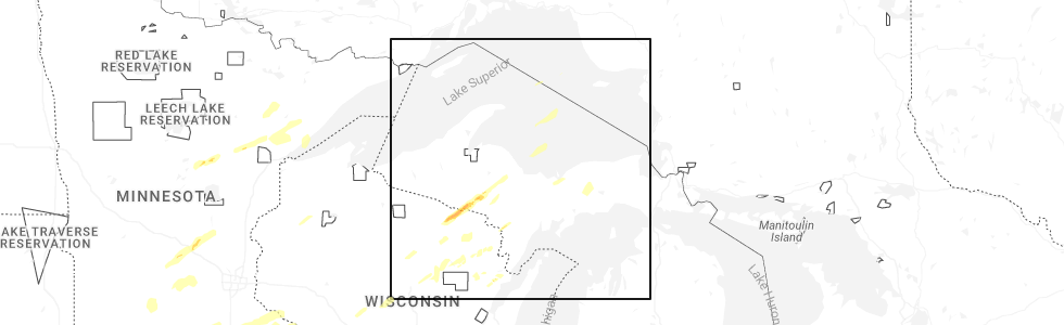
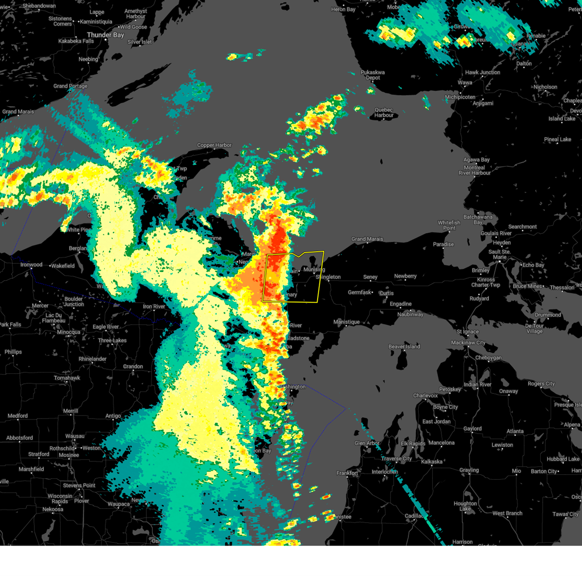
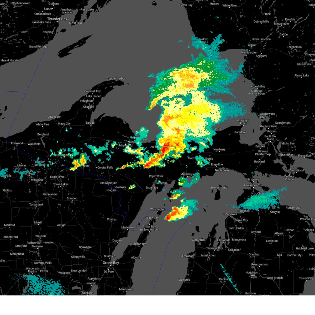
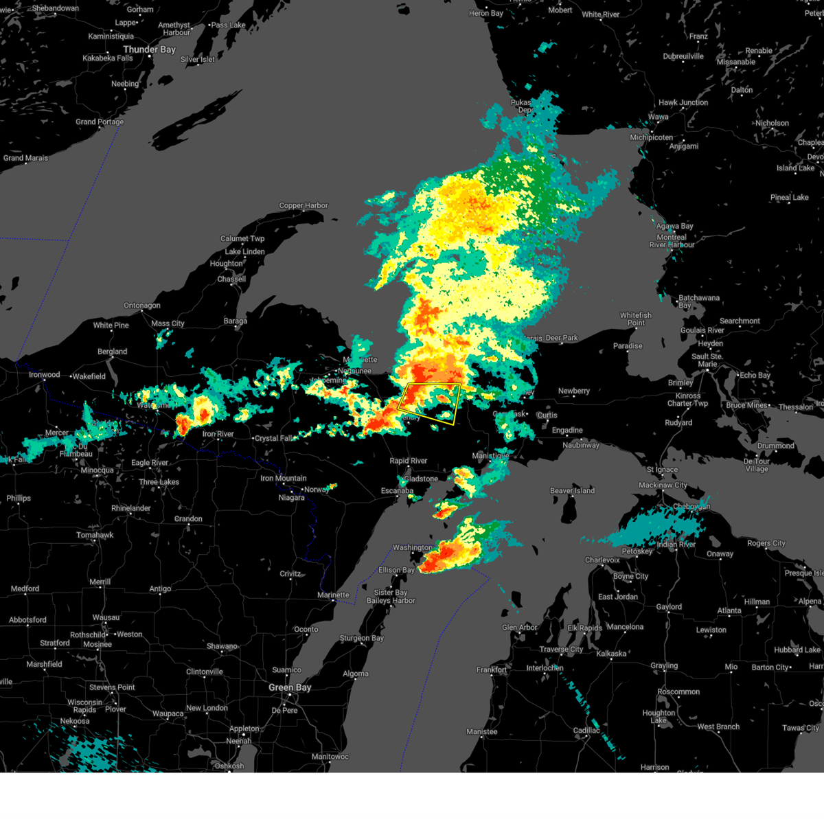
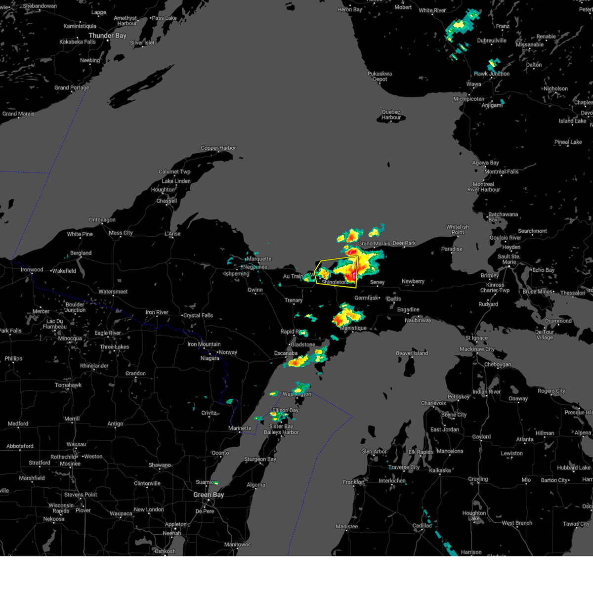
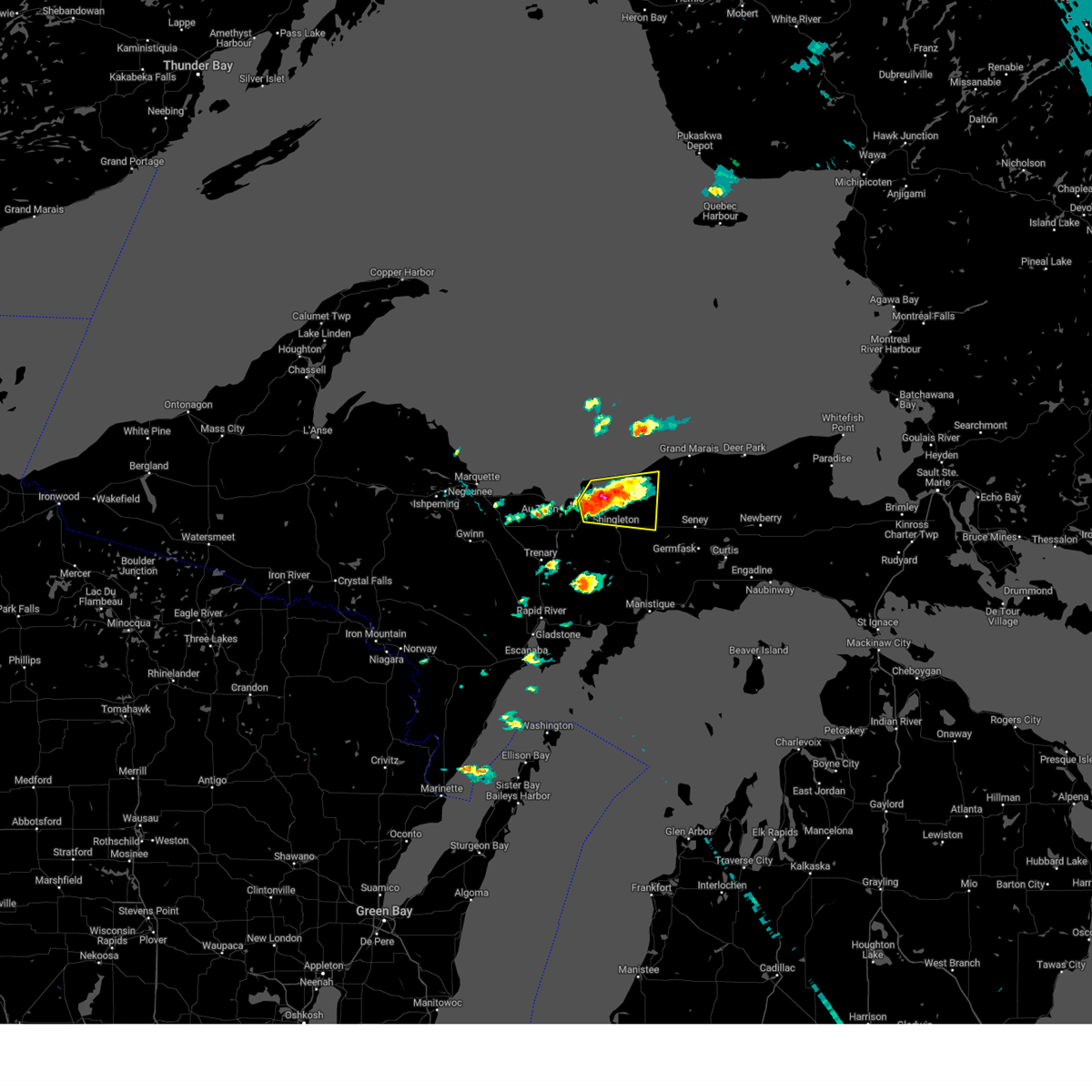
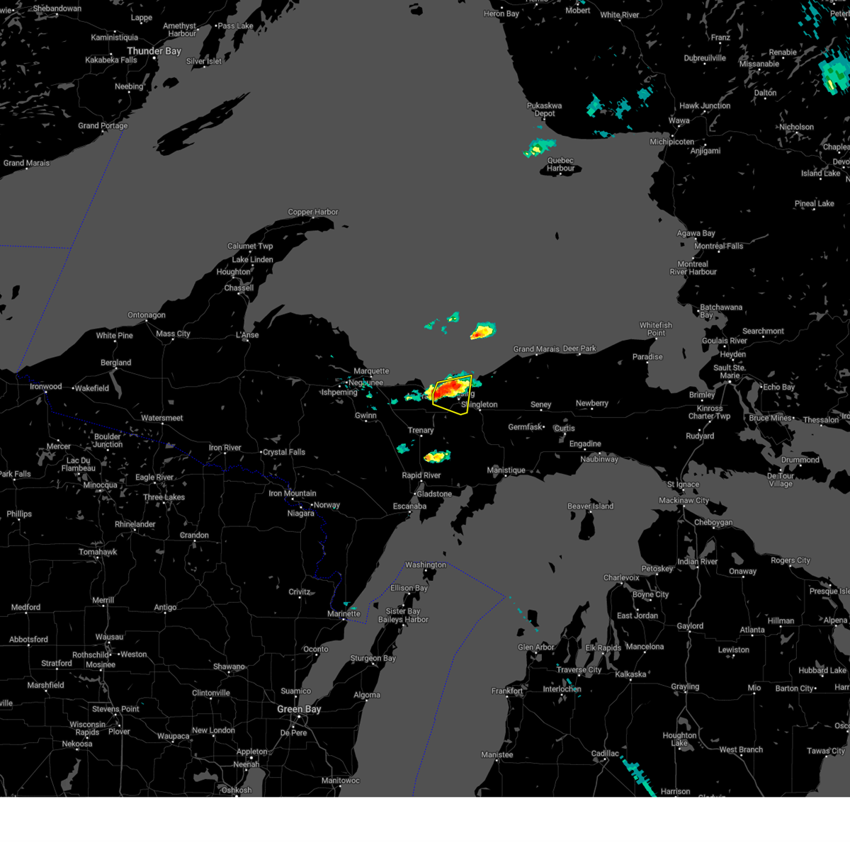
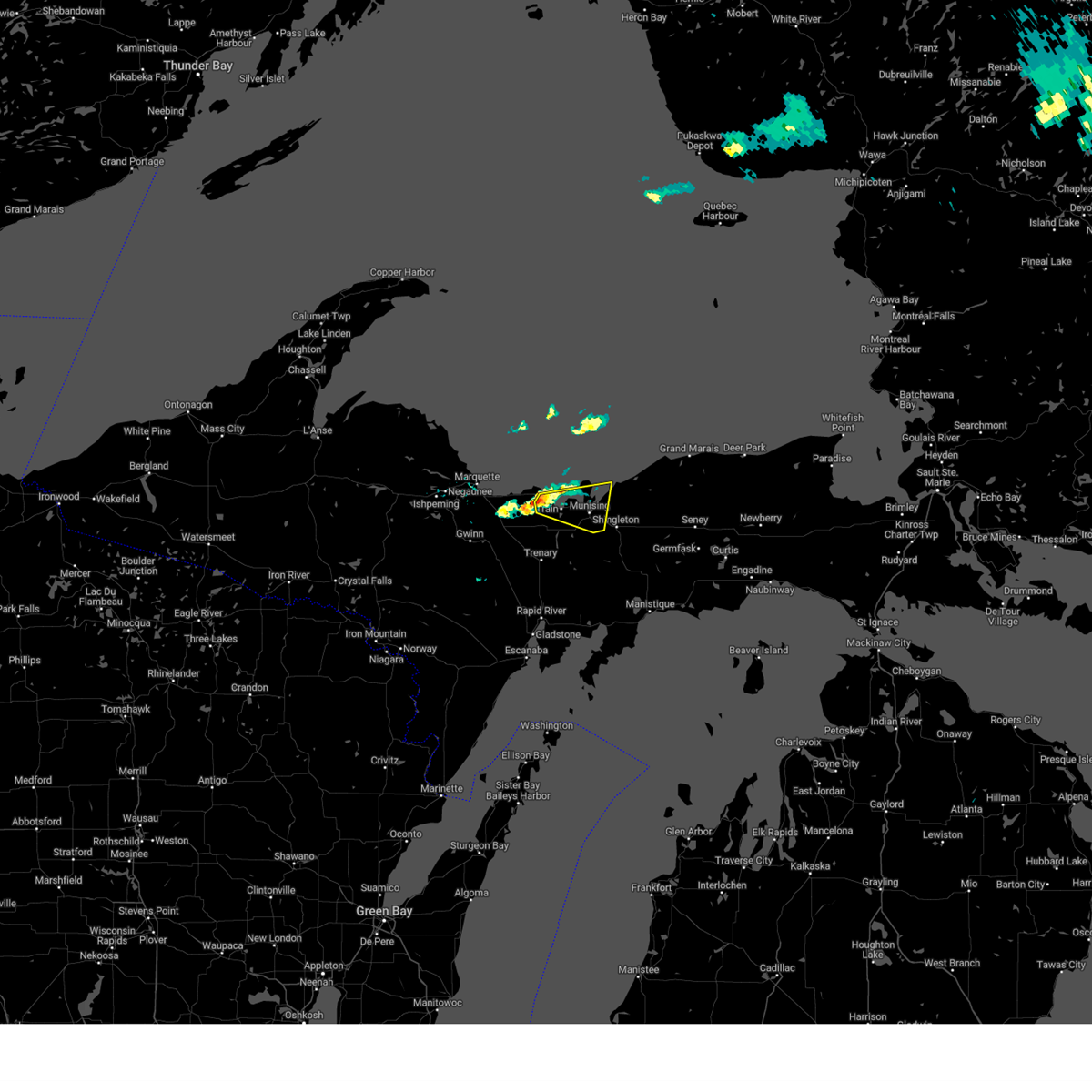
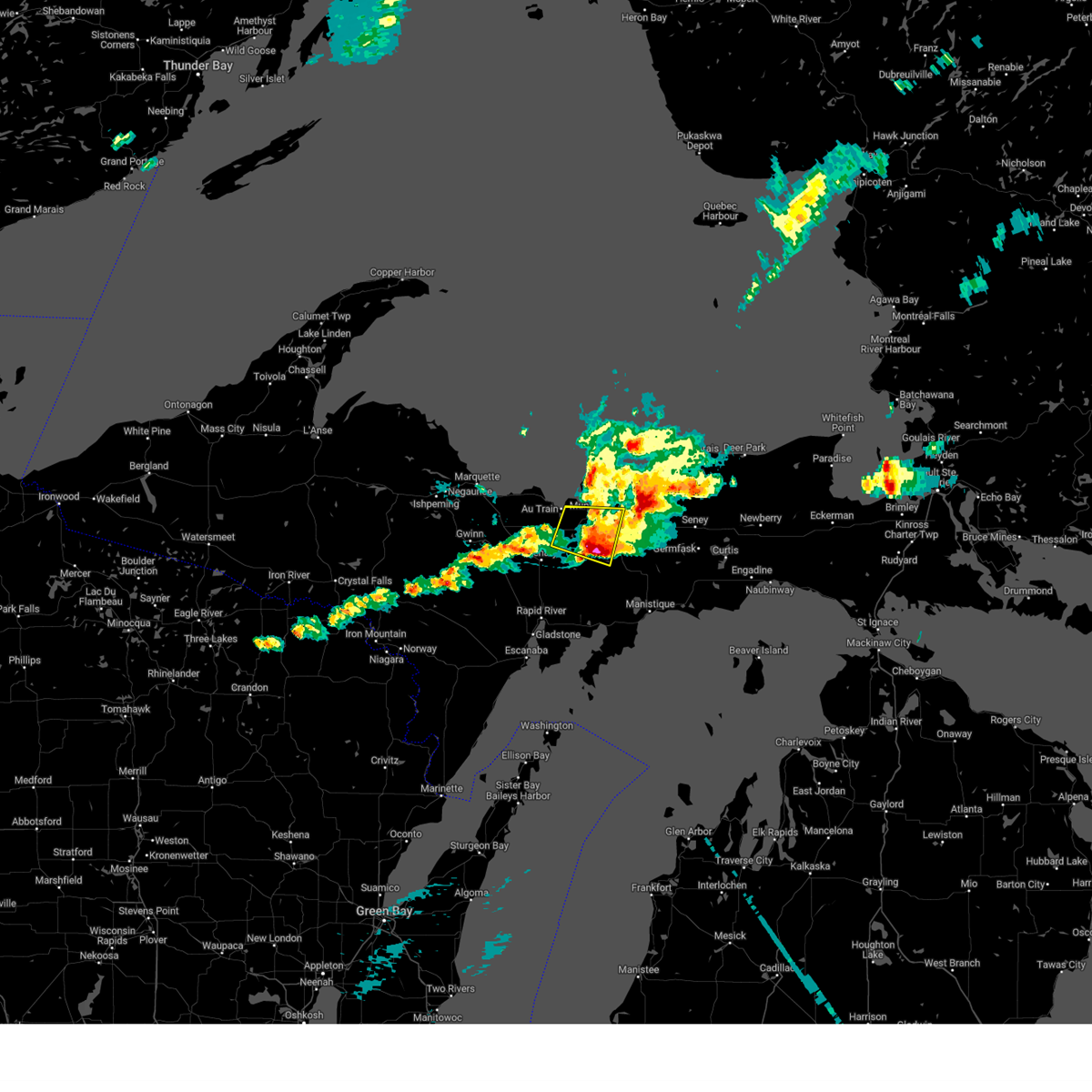
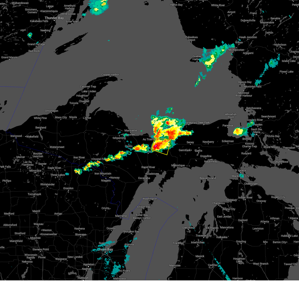
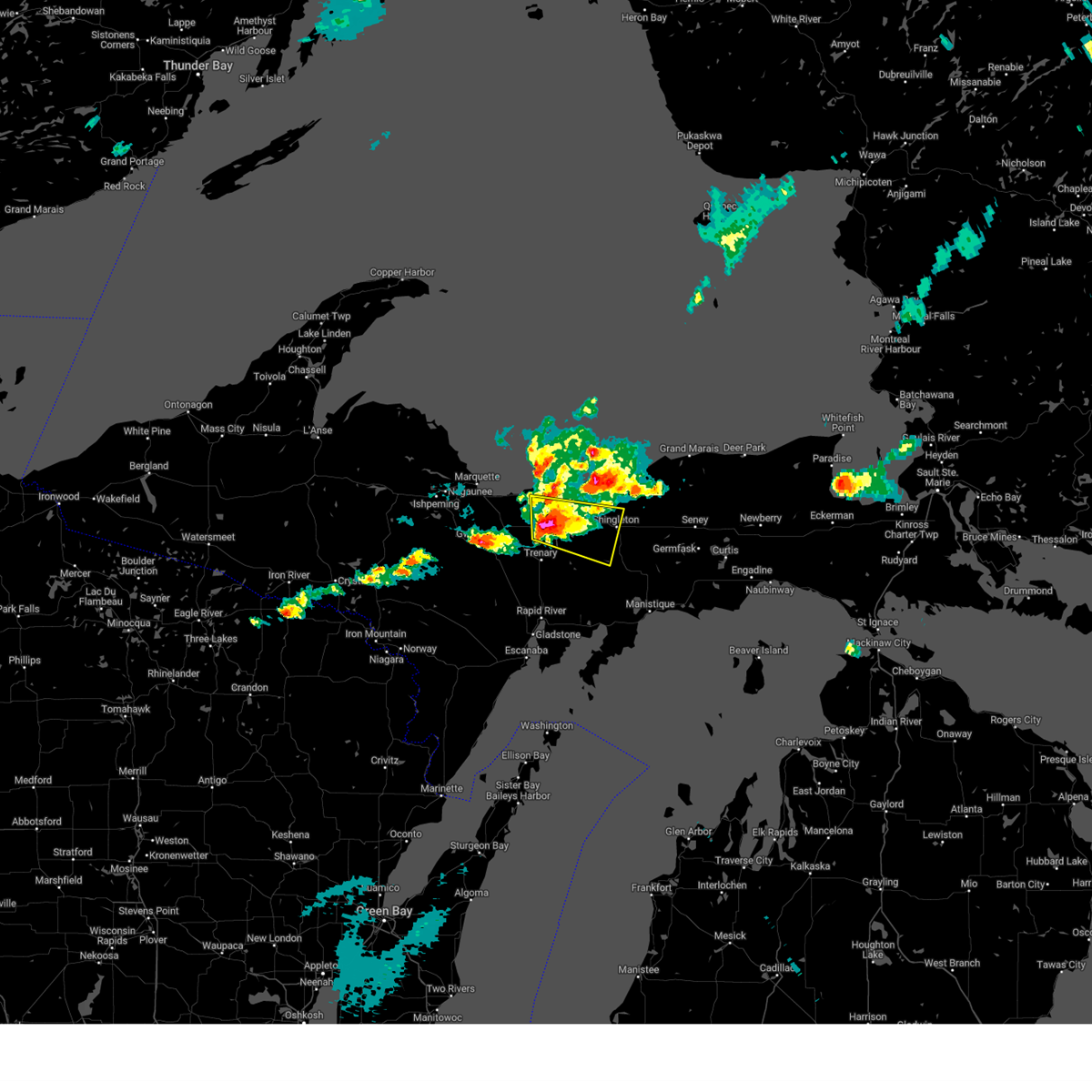
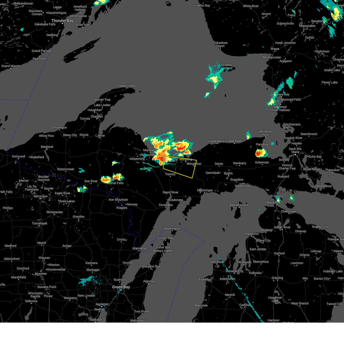
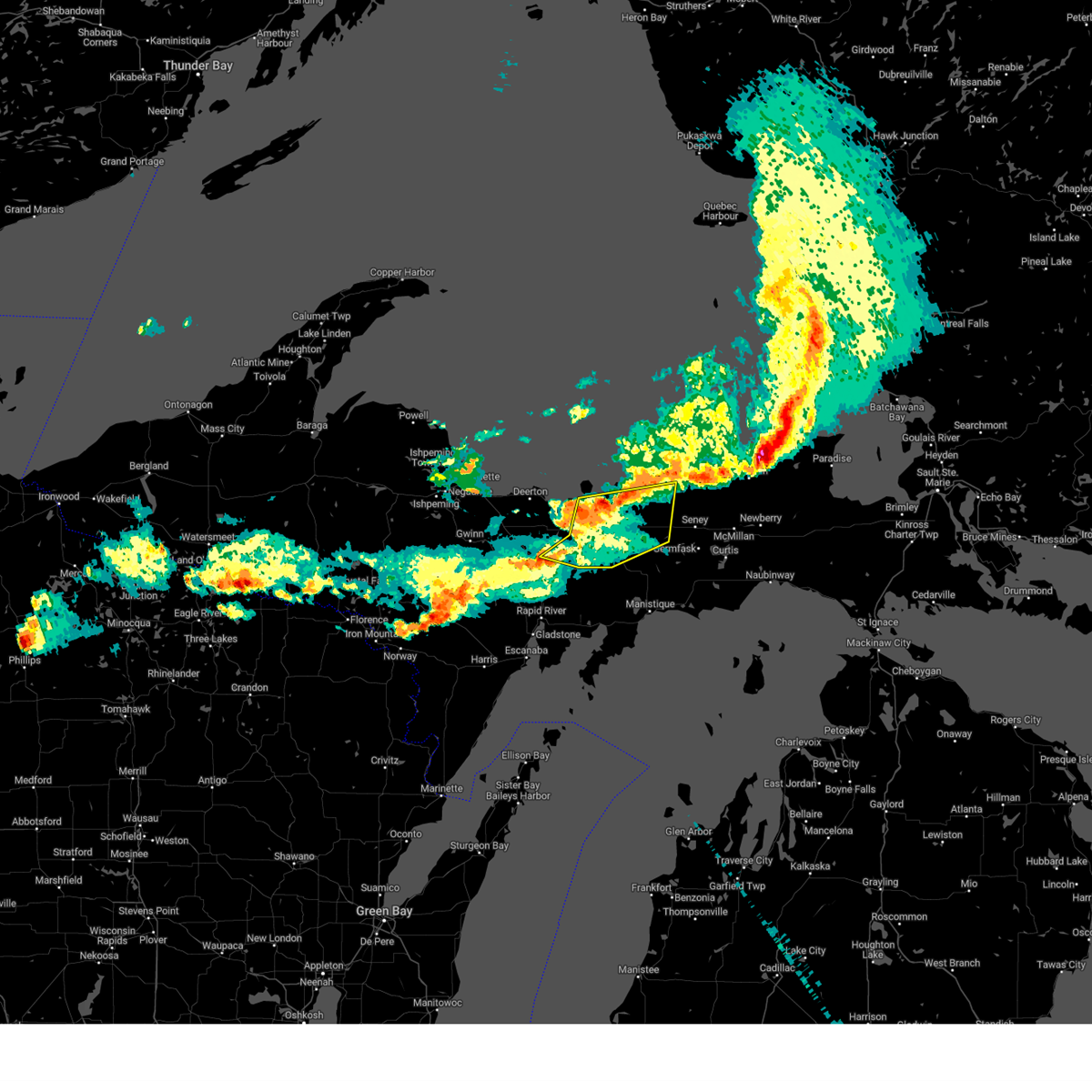
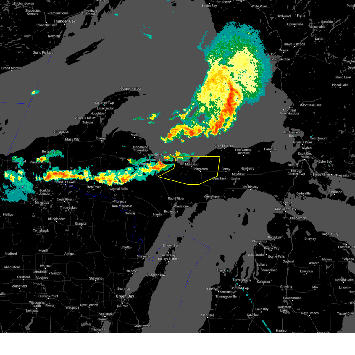
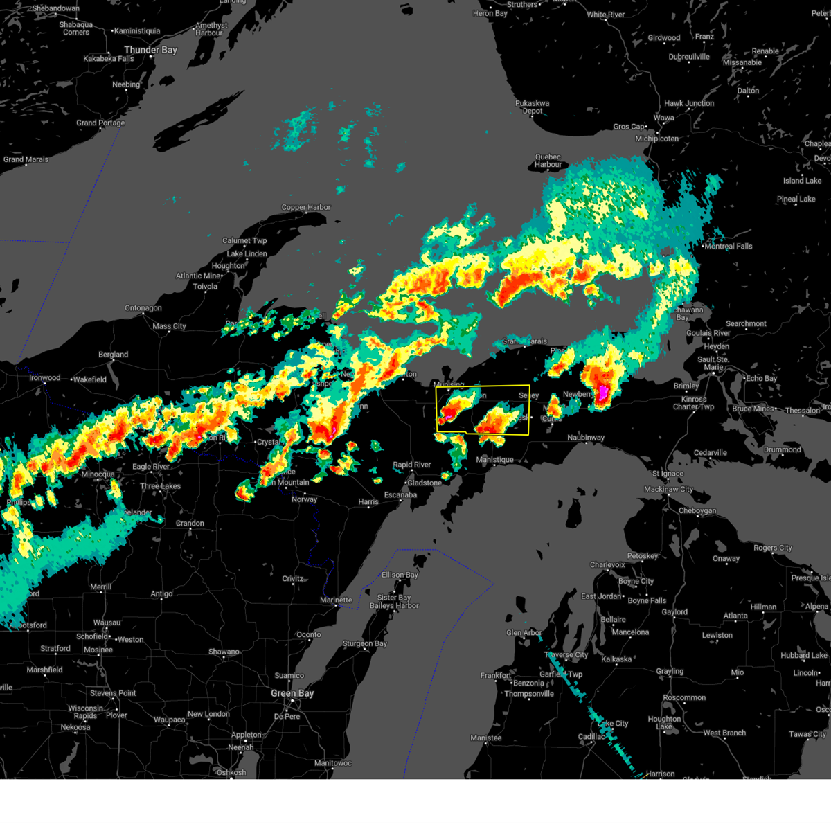
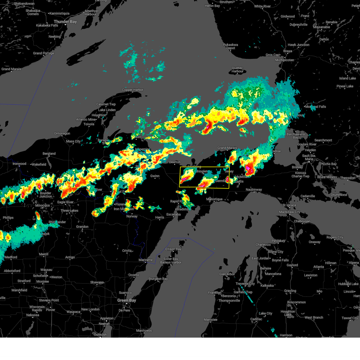
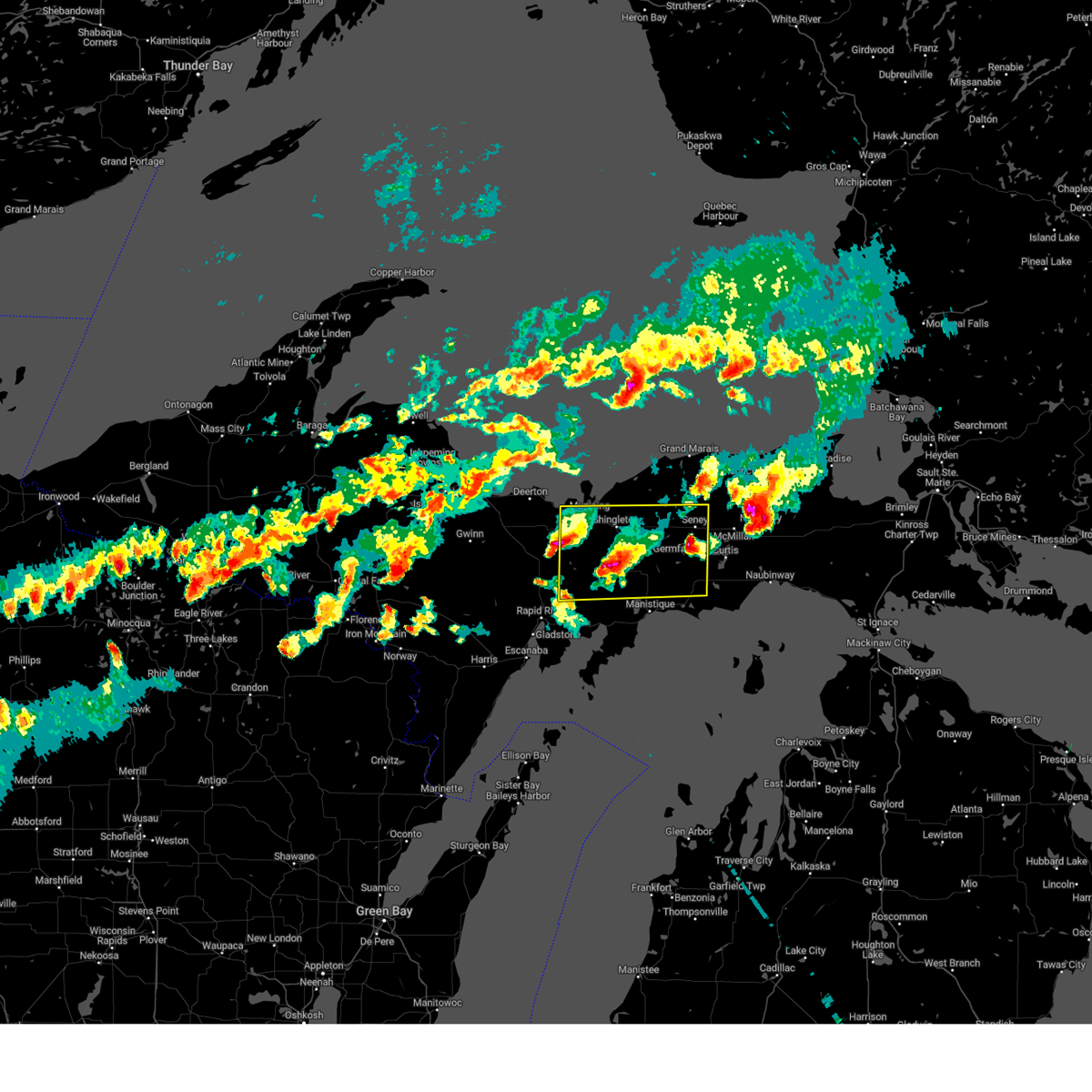
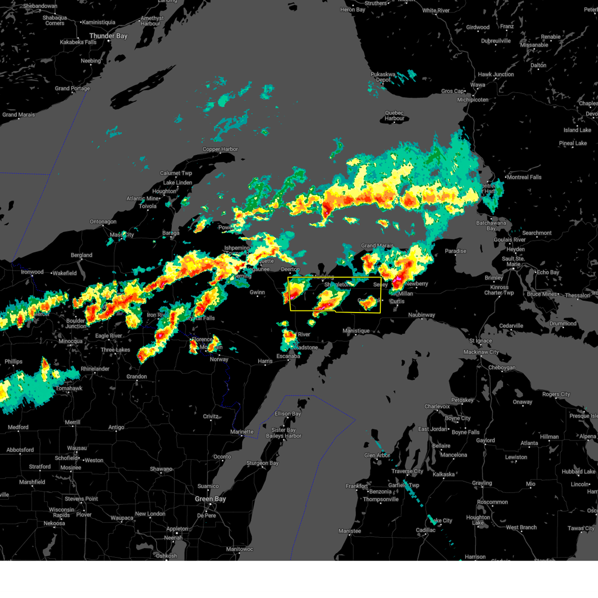
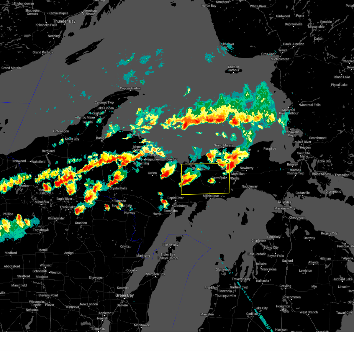
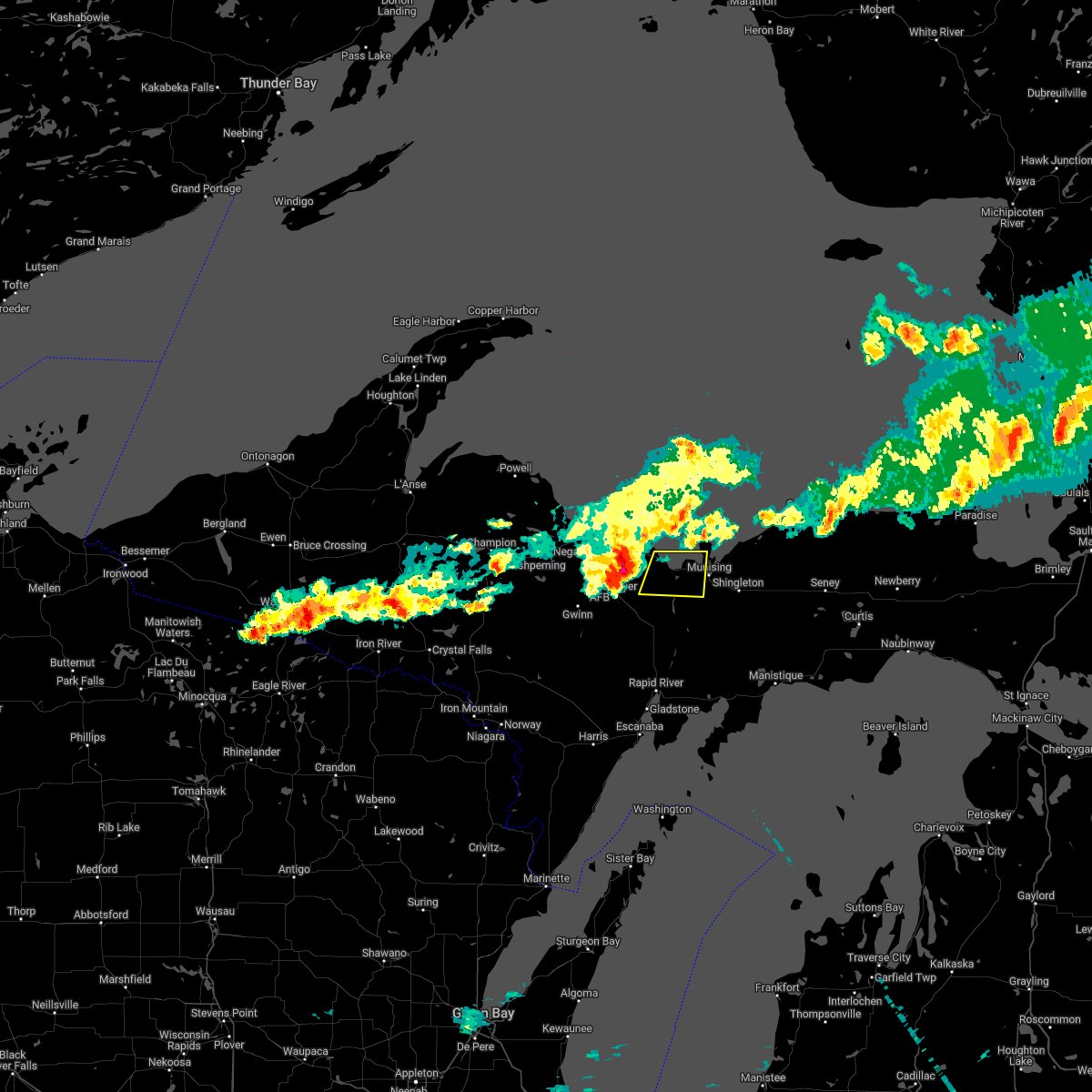
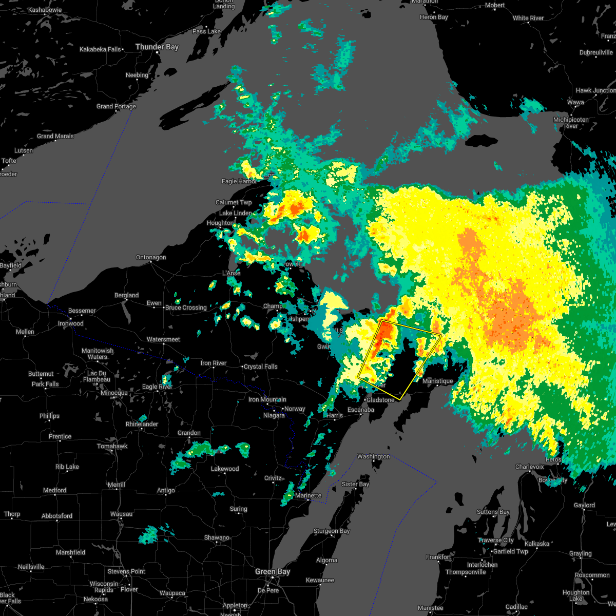
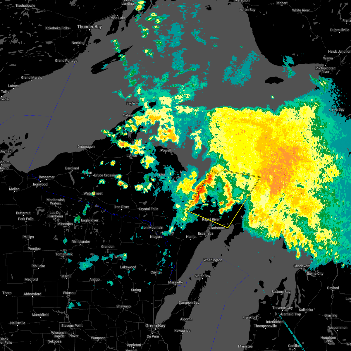
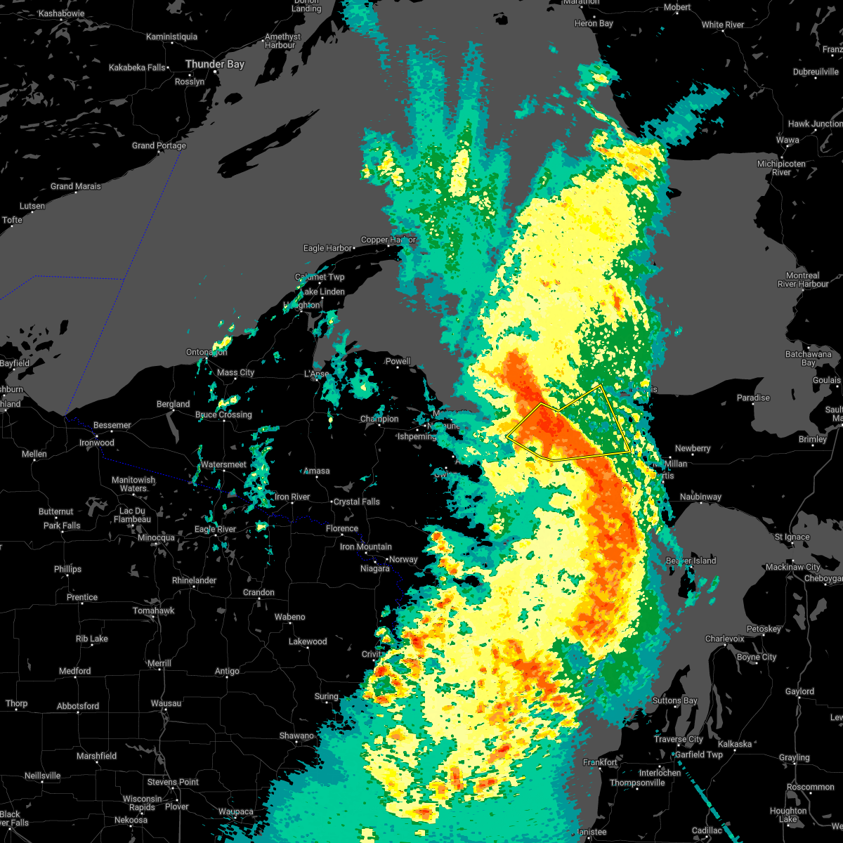
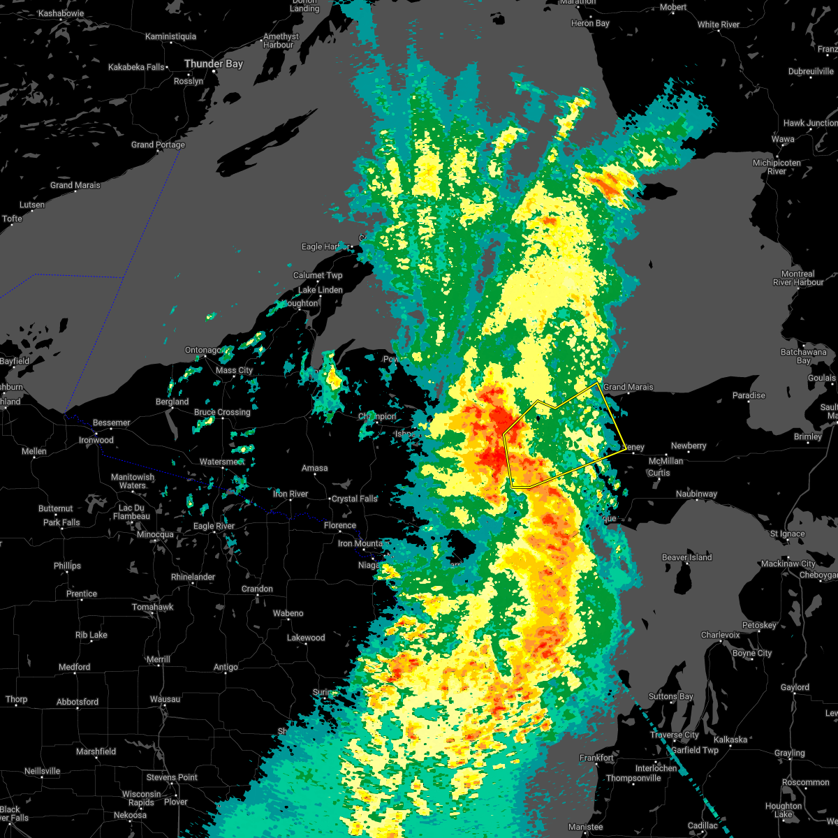
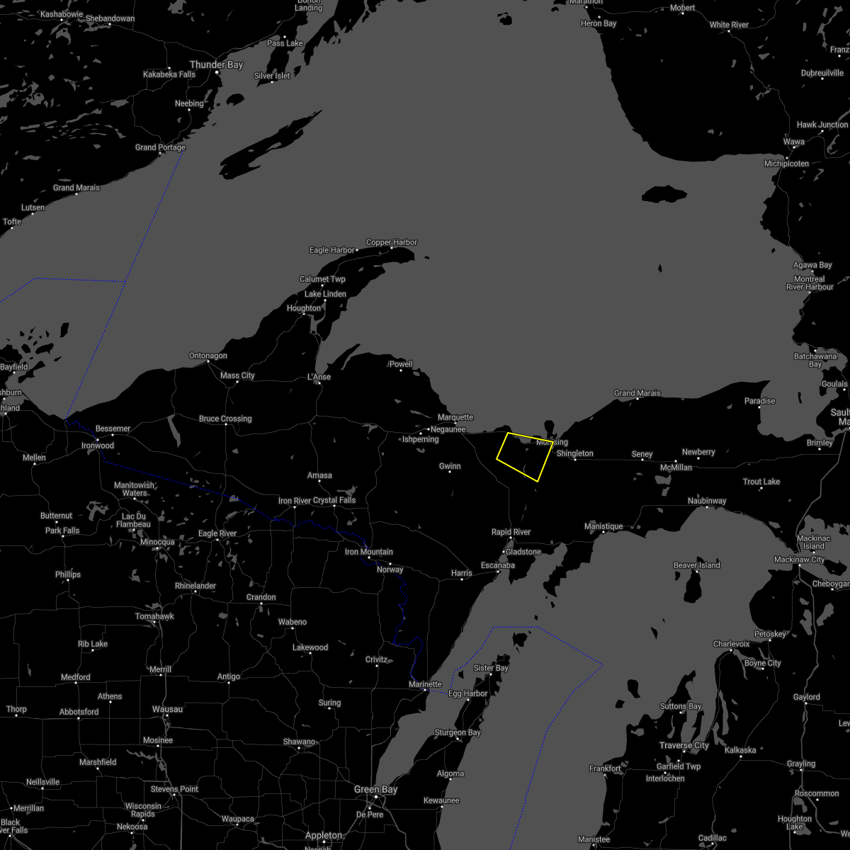
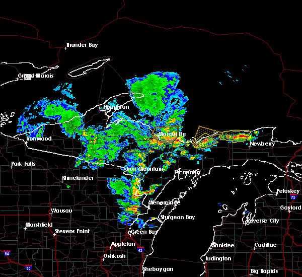
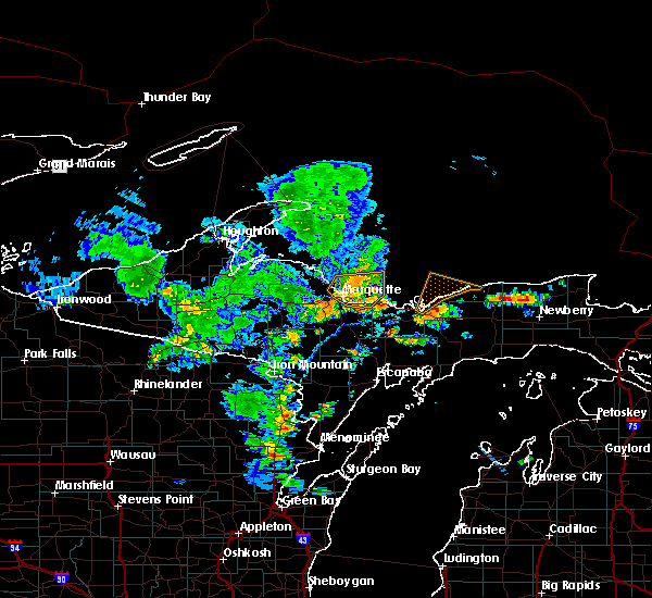
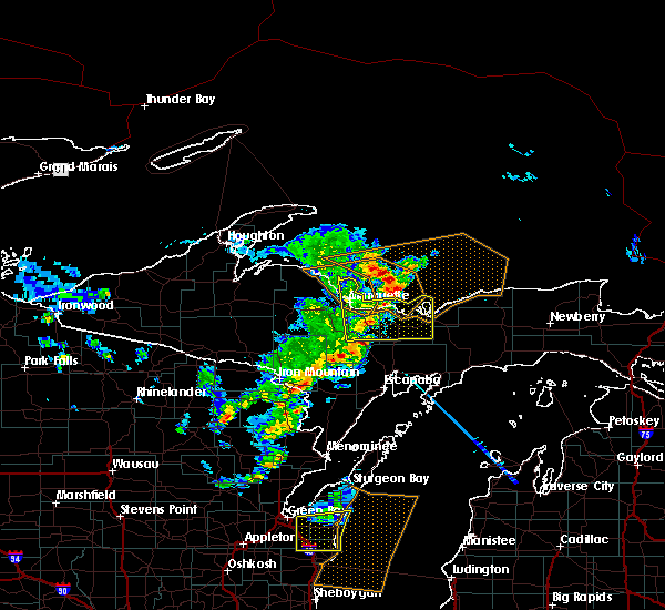
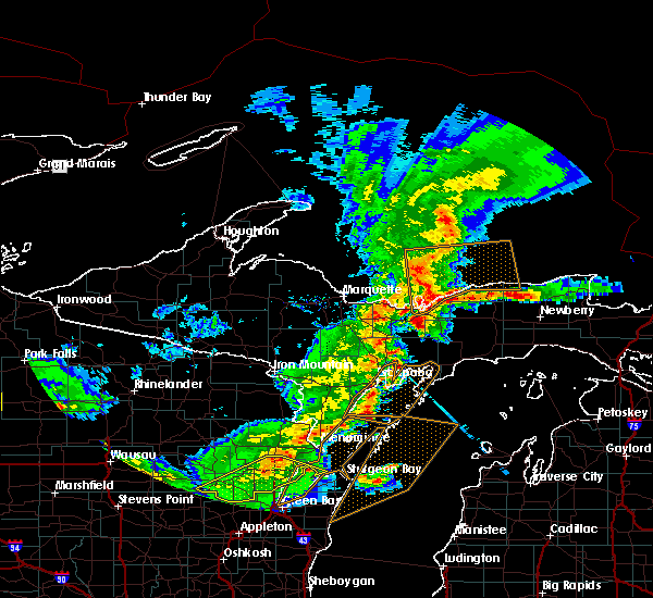
Hail Map for Munising, MI
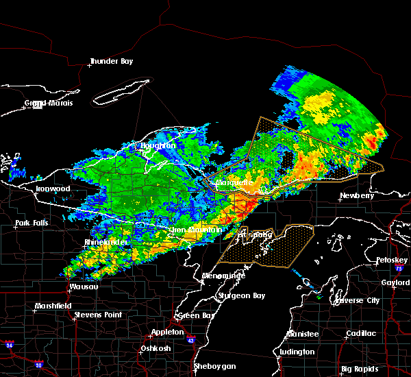
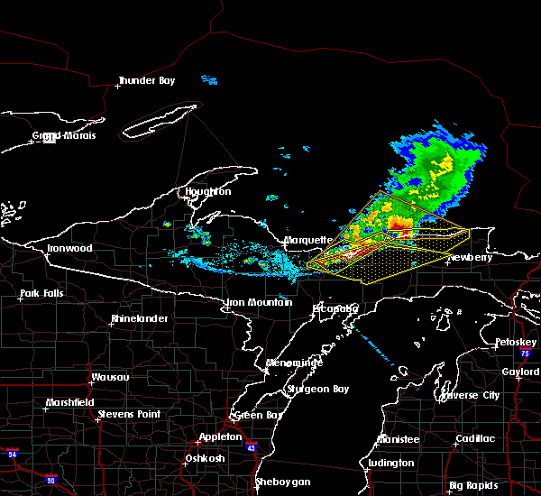
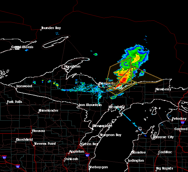
The Munising, MI area has had 10 reports of on-the-ground hail by trained spotters, and has been under severe weather warnings 6 times during the past 12 months. Doppler radar has detected hail at or near Munising, MI on 23 occasions, including 1 occasion during the past year.
| Name: | Munising, MI |
| Where Located: | 38.4 miles ESE of Marquette, MI |
| Map: | Google Map for Munising, MI |
| Population: | 2355 |
| Housing Units: | 1252 |
| More Info: | Search Google for Munising, MI |
2
The Top Recent Hail Date for Munising, MI is Monday, April 28, 2025 (3rd out of 23)
Hail and Wind Damage Spotted near Munising, MI
| Date / Time | Report Details |
|---|---|
| 8/27/2024 3:59 AM EDT |
 the severe thunderstorm warning has been cancelled and is no longer in effect the severe thunderstorm warning has been cancelled and is no longer in effect
|
| 8/27/2024 3:42 AM EDT |
 Svrmqt the national weather service in marquette has issued a * severe thunderstorm warning for, northwestern schoolcraft county in east central upper michigan, central alger county in north central upper michigan, * until 430 am edt. * at 342 am edt, severe thunderstorms were located along a line extending from near grand island to 9 miles east of trenary, moving east at 30 mph (radar indicated). Hazards include 60 mph wind gusts and penny size hail. expect damage to roofs, siding, and trees Svrmqt the national weather service in marquette has issued a * severe thunderstorm warning for, northwestern schoolcraft county in east central upper michigan, central alger county in north central upper michigan, * until 430 am edt. * at 342 am edt, severe thunderstorms were located along a line extending from near grand island to 9 miles east of trenary, moving east at 30 mph (radar indicated). Hazards include 60 mph wind gusts and penny size hail. expect damage to roofs, siding, and trees
|
| 8/27/2024 3:33 AM EDT |
 At 333 am edt, severe thunderstorms were located along a line extending from 7 miles northeast of deerton to trenary, moving east at 30 mph (radar indicated). Hazards include 60 mph wind gusts and quarter size hail. Hail damage to vehicles is expected. expect wind damage to roofs, siding, and trees. Locations impacted include, munising, grand island, miners castle, pictured rocks national lakeshore, au train, chatham, deerton, trenary, laughing whitefish falls, christmas, forest lake, and sundell. At 333 am edt, severe thunderstorms were located along a line extending from 7 miles northeast of deerton to trenary, moving east at 30 mph (radar indicated). Hazards include 60 mph wind gusts and quarter size hail. Hail damage to vehicles is expected. expect wind damage to roofs, siding, and trees. Locations impacted include, munising, grand island, miners castle, pictured rocks national lakeshore, au train, chatham, deerton, trenary, laughing whitefish falls, christmas, forest lake, and sundell.
|
| 8/27/2024 3:12 AM EDT |
 Svrmqt the national weather service in marquette has issued a * severe thunderstorm warning for, east central marquette county in north central upper michigan, west central schoolcraft county in east central upper michigan, southwestern alger county in north central upper michigan, * until 345 am edt. * at 311 am edt, severe thunderstorms were located along a line extending from near shot point to 6 miles north of rock, moving east at 30 mph (radar indicated). Hazards include 60 mph wind gusts and quarter size hail. Hail damage to vehicles is expected. Expect wind damage to roofs, siding, and trees. Svrmqt the national weather service in marquette has issued a * severe thunderstorm warning for, east central marquette county in north central upper michigan, west central schoolcraft county in east central upper michigan, southwestern alger county in north central upper michigan, * until 345 am edt. * at 311 am edt, severe thunderstorms were located along a line extending from near shot point to 6 miles north of rock, moving east at 30 mph (radar indicated). Hazards include 60 mph wind gusts and quarter size hail. Hail damage to vehicles is expected. Expect wind damage to roofs, siding, and trees.
|
| 7/15/2024 8:01 PM EDT |
 At 800 pm edt, a severe thunderstorm was located 8 miles south of munising, moving east at 35 mph (radar indicated). Hazards include 60 mph wind gusts. Expect damage to roofs, siding, and trees. Locations impacted include, munising, forest lake, and wetmore. At 800 pm edt, a severe thunderstorm was located 8 miles south of munising, moving east at 35 mph (radar indicated). Hazards include 60 mph wind gusts. Expect damage to roofs, siding, and trees. Locations impacted include, munising, forest lake, and wetmore.
|
| 7/15/2024 7:46 PM EDT |
 Svrmqt the national weather service in marquette has issued a * severe thunderstorm warning for, west central schoolcraft county in east central upper michigan, southwestern alger county in north central upper michigan, * until 815 pm edt. * at 745 pm edt, a severe thunderstorm was located over chatham, or 13 miles southwest of munising, moving east at 35 mph (radar indicated). Hazards include 60 mph wind gusts. expect damage to roofs, siding, and trees Svrmqt the national weather service in marquette has issued a * severe thunderstorm warning for, west central schoolcraft county in east central upper michigan, southwestern alger county in north central upper michigan, * until 815 pm edt. * at 745 pm edt, a severe thunderstorm was located over chatham, or 13 miles southwest of munising, moving east at 35 mph (radar indicated). Hazards include 60 mph wind gusts. expect damage to roofs, siding, and trees
|
| 6/29/2024 2:36 PM EDT |
 the severe thunderstorm warning has been cancelled and is no longer in effect the severe thunderstorm warning has been cancelled and is no longer in effect
|
| 6/29/2024 2:11 PM EDT |
 Svrmqt the national weather service in marquette has issued a * severe thunderstorm warning for, north central schoolcraft county in east central upper michigan, central alger county in north central upper michigan, * until 300 pm edt. * at 211 pm edt, a severe thunderstorm was located over miners castle, moving east at 25 mph (radar indicated). Hazards include 60 mph wind gusts and quarter size hail. Hail damage to vehicles is expected. Expect wind damage to roofs, siding, and trees. Svrmqt the national weather service in marquette has issued a * severe thunderstorm warning for, north central schoolcraft county in east central upper michigan, central alger county in north central upper michigan, * until 300 pm edt. * at 211 pm edt, a severe thunderstorm was located over miners castle, moving east at 25 mph (radar indicated). Hazards include 60 mph wind gusts and quarter size hail. Hail damage to vehicles is expected. Expect wind damage to roofs, siding, and trees.
|
| 6/29/2024 2:01 PM EDT |
 At 201 pm edt, a severe thunderstorm was located over au train, or 9 miles west of munising, moving east at 25 mph (radar indicated). Hazards include quarter size hail. Damage to vehicles is expected. Locations impacted include, munising, grand island, miners castle, au train, christmas, and wetmore. At 201 pm edt, a severe thunderstorm was located over au train, or 9 miles west of munising, moving east at 25 mph (radar indicated). Hazards include quarter size hail. Damage to vehicles is expected. Locations impacted include, munising, grand island, miners castle, au train, christmas, and wetmore.
|
| 6/29/2024 1:46 PM EDT |
 Svrmqt the national weather service in marquette has issued a * severe thunderstorm warning for, west central alger county in north central upper michigan, * until 215 pm edt. * at 146 pm edt, a severe thunderstorm was located near au train, or 12 miles west of munising, moving east at 30 mph (radar indicated). Hazards include quarter size hail. damage to vehicles is expected Svrmqt the national weather service in marquette has issued a * severe thunderstorm warning for, west central alger county in north central upper michigan, * until 215 pm edt. * at 146 pm edt, a severe thunderstorm was located near au train, or 12 miles west of munising, moving east at 30 mph (radar indicated). Hazards include quarter size hail. damage to vehicles is expected
|
| 6/13/2024 1:45 PM EDT |
 The storm which prompted the warning has moved out of the area. therefore, the warning will be allowed to expire. remember, a severe thunderstorm warning still remains in effect for southwestern alger county until 215 pm edt!. The storm which prompted the warning has moved out of the area. therefore, the warning will be allowed to expire. remember, a severe thunderstorm warning still remains in effect for southwestern alger county until 215 pm edt!.
|
| 6/13/2024 1:41 PM EDT | Golf Ball sized hail reported 13.8 miles N of Munising, MI, estimated golf ball size hail along national forest road 13 on the alger and schoolcraft county line. |
| 6/13/2024 1:41 PM EDT | Hen Egg sized hail reported 13.1 miles N of Munising, MI, observer sent photo of hailstone with ruler about 30-45 minutes after they fell so some melting occurred. time estimated by radar. |
| 6/13/2024 1:36 PM EDT |
 At 135 pm edt, a severe thunderstorm was located near munising, moving east at 45 mph (radar indicated). Hazards include two inch hail and 60 mph wind gusts. People and animals outdoors will be injured. expect hail damage to roofs, siding, windows, and vehicles. expect wind damage to roofs, siding, and trees. Locations impacted include, munising, shingleton, forest lake, wetmore, van meer, and christmas. At 135 pm edt, a severe thunderstorm was located near munising, moving east at 45 mph (radar indicated). Hazards include two inch hail and 60 mph wind gusts. People and animals outdoors will be injured. expect hail damage to roofs, siding, windows, and vehicles. expect wind damage to roofs, siding, and trees. Locations impacted include, munising, shingleton, forest lake, wetmore, van meer, and christmas.
|
| 6/13/2024 1:30 PM EDT | Quarter sized hail reported 12.2 miles NNE of Munising, MI, between dime and quarter-sized hail reported with 0.59 inch of rain. time of the report estimated from radar. reported received via facebook. |
| 6/13/2024 1:25 PM EDT | Dispatch reports a downed power line that was smoking along hayward rd. near sixteen mile lake in alger count in alger county MI, 10.6 miles NE of Munising, MI |
| 6/13/2024 1:25 PM EDT |
 At 124 pm edt, a severe thunderstorm was located near au train, or 9 miles west of munising, moving east at 45 mph (radar indicated). Hazards include golf ball size hail and 60 mph wind gusts. People and animals outdoors will be injured. expect hail damage to roofs, siding, windows, and vehicles. expect wind damage to roofs, siding, and trees. Locations impacted include, munising, au train, chatham, shingleton, christmas, forest lake, wetmore, eben junction, and van meer. At 124 pm edt, a severe thunderstorm was located near au train, or 9 miles west of munising, moving east at 45 mph (radar indicated). Hazards include golf ball size hail and 60 mph wind gusts. People and animals outdoors will be injured. expect hail damage to roofs, siding, windows, and vehicles. expect wind damage to roofs, siding, and trees. Locations impacted include, munising, au train, chatham, shingleton, christmas, forest lake, wetmore, eben junction, and van meer.
|
| 6/13/2024 1:11 PM EDT |
 Svrmqt the national weather service in marquette has issued a * severe thunderstorm warning for, west central schoolcraft county in east central upper michigan, southwestern alger county in north central upper michigan, * until 145 pm edt. * at 110 pm edt, a severe thunderstorm was located near deerton, or 18 miles southeast of marquette, moving east at 45 mph (radar indicated). Hazards include quarter size hail. damage to vehicles is expected Svrmqt the national weather service in marquette has issued a * severe thunderstorm warning for, west central schoolcraft county in east central upper michigan, southwestern alger county in north central upper michigan, * until 145 pm edt. * at 110 pm edt, a severe thunderstorm was located near deerton, or 18 miles southeast of marquette, moving east at 45 mph (radar indicated). Hazards include quarter size hail. damage to vehicles is expected
|
| 8/25/2023 4:34 PM EDT |
 At 434 pm edt, severe thunderstorms were located along a line extending from 6 miles southeast of chapel lake to near shingleton to 8 miles northeast of trenary, moving east at 45 mph (radar indicated). Hazards include 60 mph wind gusts and penny size hail. Expect damage to roofs, siding, and trees. locations impacted include, munising, miners castle, grand island, pictured rocks national lakeshore, shingleton, steuben, m-28 between shingleton and seney, christmas, cusino lake, wetmore, melstrand, and van meer. hail threat, radar indicated max hail size, 0. 75 in wind threat, radar indicated max wind gust, 60 mph. At 434 pm edt, severe thunderstorms were located along a line extending from 6 miles southeast of chapel lake to near shingleton to 8 miles northeast of trenary, moving east at 45 mph (radar indicated). Hazards include 60 mph wind gusts and penny size hail. Expect damage to roofs, siding, and trees. locations impacted include, munising, miners castle, grand island, pictured rocks national lakeshore, shingleton, steuben, m-28 between shingleton and seney, christmas, cusino lake, wetmore, melstrand, and van meer. hail threat, radar indicated max hail size, 0. 75 in wind threat, radar indicated max wind gust, 60 mph.
|
| 8/25/2023 4:10 PM EDT |
 At 410 pm edt, severe thunderstorms were located along a line extending from near au train to near chatham to 7 miles northwest of trenary, moving east at 45 mph (radar indicated). Hazards include 60 mph wind gusts and penny size hail. expect damage to roofs, siding, and trees At 410 pm edt, severe thunderstorms were located along a line extending from near au train to near chatham to 7 miles northwest of trenary, moving east at 45 mph (radar indicated). Hazards include 60 mph wind gusts and penny size hail. expect damage to roofs, siding, and trees
|
| 7/10/2023 8:08 PM EDT | Dozens of trees snapped and uproote in schoolcraft county MI, 16.6 miles N of Munising, MI |
| 7/10/2023 8:05 PM EDT |
 At 804 pm edt, a severe thunderstorm was located 7 miles southwest of shingleton, or 9 miles south of munising, moving east at 40 mph (radar indicated). Hazards include quarter size hail. Damage to vehicles is expected. locations impacted include, munising, pictured rocks national lakeshore, seney, shingleton, steuben, m-28 between shingleton and seney, wetmore and van meer. hail threat, radar indicated max hail size, 1. 00 in wind threat, radar indicated max wind gust, <50 mph. At 804 pm edt, a severe thunderstorm was located 7 miles southwest of shingleton, or 9 miles south of munising, moving east at 40 mph (radar indicated). Hazards include quarter size hail. Damage to vehicles is expected. locations impacted include, munising, pictured rocks national lakeshore, seney, shingleton, steuben, m-28 between shingleton and seney, wetmore and van meer. hail threat, radar indicated max hail size, 1. 00 in wind threat, radar indicated max wind gust, <50 mph.
|
| 7/10/2023 7:52 PM EDT |
 At 752 pm edt, a severe thunderstorm was located 8 miles southeast of chatham, or 11 miles southwest of munising, moving east at 40 mph (radar indicated). Hazards include quarter size hail. Damage to vehicles is expected. locations impacted include, munising, pictured rocks national lakeshore, au train, chatham, seney, shingleton, steuben, m-28 between shingleton and seney, christmas, forest lake, wetmore and van meer. hail threat, radar indicated max hail size, 1. 00 in wind threat, radar indicated max wind gust, <50 mph. At 752 pm edt, a severe thunderstorm was located 8 miles southeast of chatham, or 11 miles southwest of munising, moving east at 40 mph (radar indicated). Hazards include quarter size hail. Damage to vehicles is expected. locations impacted include, munising, pictured rocks national lakeshore, au train, chatham, seney, shingleton, steuben, m-28 between shingleton and seney, christmas, forest lake, wetmore and van meer. hail threat, radar indicated max hail size, 1. 00 in wind threat, radar indicated max wind gust, <50 mph.
|
| 7/10/2023 7:50 PM EDT |
 At 750 pm edt, a severe thunderstorm was located over steuben, or 17 miles northwest of manistique, moving east at 35 mph (radar indicated). Hazards include quarter size hail. Damage to vehicles is expected. locations impacted include, munising, pictured rocks national lakeshore, au train, germfask, seney, m-94 between steuben and manistique, blaney park, shingleton, steuben, m-28 between shingleton and seney, christmas and chicago lake. hail threat, radar indicated max hail size, 1. 00 in wind threat, radar indicated max wind gust, <50 mph. At 750 pm edt, a severe thunderstorm was located over steuben, or 17 miles northwest of manistique, moving east at 35 mph (radar indicated). Hazards include quarter size hail. Damage to vehicles is expected. locations impacted include, munising, pictured rocks national lakeshore, au train, germfask, seney, m-94 between steuben and manistique, blaney park, shingleton, steuben, m-28 between shingleton and seney, christmas and chicago lake. hail threat, radar indicated max hail size, 1. 00 in wind threat, radar indicated max wind gust, <50 mph.
|
| 7/10/2023 7:40 PM EDT |
 At 740 pm edt, a severe thunderstorm was located near chatham, or 17 miles southwest of munising, moving east at 40 mph (radar indicated). Hazards include quarter size hail. damage to vehicles is expected At 740 pm edt, a severe thunderstorm was located near chatham, or 17 miles southwest of munising, moving east at 40 mph (radar indicated). Hazards include quarter size hail. damage to vehicles is expected
|
| 7/10/2023 7:28 PM EDT |
 At 728 pm edt, a severe thunderstorm was located 12 miles west of steuben, or 13 miles south of munising, moving east at 40 mph (radar indicated). Hazards include quarter size hail. damage to vehicles is expected At 728 pm edt, a severe thunderstorm was located 12 miles west of steuben, or 13 miles south of munising, moving east at 40 mph (radar indicated). Hazards include quarter size hail. damage to vehicles is expected
|
| 6/30/2022 10:19 PM EDT |
 At 1018 pm edt, a severe thunderstorm was located near munising, moving east at 55 mph (radar indicated). Hazards include 60 mph wind gusts. Expect damage to roofs, siding, and trees. locations impacted include, munising. pictured rocks national lakeshore. hail threat, radar indicated max hail size, <. 75 in wind threat, radar indicated max wind gust, 60 mph. At 1018 pm edt, a severe thunderstorm was located near munising, moving east at 55 mph (radar indicated). Hazards include 60 mph wind gusts. Expect damage to roofs, siding, and trees. locations impacted include, munising. pictured rocks national lakeshore. hail threat, radar indicated max hail size, <. 75 in wind threat, radar indicated max wind gust, 60 mph.
|
| 6/30/2022 10:10 PM EDT |
 At 1009 pm edt, a severe thunderstorm was located near au train, or near munising, moving east at 55 mph (radar indicated). Hazards include 60 mph wind gusts. Expect damage to roofs, siding, and trees. this severe thunderstorm will be near, munising around 1020 pm edt. pictured rocks national lakeshore around ${dateutil. format(${pc. time}, ${timeformat. clock}, ${pc. timezone})}. shingleton around 1025 pm edt. hail threat, radar indicated max hail size, <. 75 in wind threat, radar indicated max wind gust, 60 mph. At 1009 pm edt, a severe thunderstorm was located near au train, or near munising, moving east at 55 mph (radar indicated). Hazards include 60 mph wind gusts. Expect damage to roofs, siding, and trees. this severe thunderstorm will be near, munising around 1020 pm edt. pictured rocks national lakeshore around ${dateutil. format(${pc. time}, ${timeformat. clock}, ${pc. timezone})}. shingleton around 1025 pm edt. hail threat, radar indicated max hail size, <. 75 in wind threat, radar indicated max wind gust, 60 mph.
|
| 6/30/2022 9:52 PM EDT |
 At 952 pm edt, a severe thunderstorm was located near deerton, or 16 miles west of munising, moving east at 55 mph (radar indicated). Hazards include 60 mph wind gusts. Expect damage to roofs, siding, and trees. this severe thunderstorm will be near, chatham around 955 pm edt. au train around 1000 pm edt. grand island around 1010 pm edt. other locations in the path of this severe thunderstorm include munising. hail threat, radar indicated max hail size, <. 75 in wind threat, observed max wind gust, 60 mph. At 952 pm edt, a severe thunderstorm was located near deerton, or 16 miles west of munising, moving east at 55 mph (radar indicated). Hazards include 60 mph wind gusts. Expect damage to roofs, siding, and trees. this severe thunderstorm will be near, chatham around 955 pm edt. au train around 1000 pm edt. grand island around 1010 pm edt. other locations in the path of this severe thunderstorm include munising. hail threat, radar indicated max hail size, <. 75 in wind threat, observed max wind gust, 60 mph.
|
| 6/30/2022 4:02 AM EDT |
 At 402 am edt, severe thunderstorms were located along a line extending from 8 miles south of munising to 11 miles southeast of u.s. 41 between trenary and rapid river, moving east at 45 mph (radar indicated). Hazards include 60 mph wind gusts. Expect damage to roofs, siding, and trees. locations impacted include, shingleton, steuben, isabella, chicago lake, round lake, wetmore and nahma junction. hail threat, radar indicated max hail size, <. 75 in wind threat, radar indicated max wind gust, 60 mph. At 402 am edt, severe thunderstorms were located along a line extending from 8 miles south of munising to 11 miles southeast of u.s. 41 between trenary and rapid river, moving east at 45 mph (radar indicated). Hazards include 60 mph wind gusts. Expect damage to roofs, siding, and trees. locations impacted include, shingleton, steuben, isabella, chicago lake, round lake, wetmore and nahma junction. hail threat, radar indicated max hail size, <. 75 in wind threat, radar indicated max wind gust, 60 mph.
|
| 6/30/2022 3:55 AM EDT |
 At 354 am edt, severe thunderstorms were located along a line extending from 6 miles east of chatham to near u.s. 41 between trenary and rapid river, moving east at 45 mph (radar indicated). Hazards include 60 mph wind gusts. Expect damage to roofs, siding, and trees. locations impacted include, munising, au train, shingleton, steuben, trenary, u. s. 41 between trenary and rapid river, isabella, forest lake, chicago lake, maplewood, round lake and wetmore. hail threat, radar indicated max hail size, <. 75 in wind threat, radar indicated max wind gust, 60 mph. At 354 am edt, severe thunderstorms were located along a line extending from 6 miles east of chatham to near u.s. 41 between trenary and rapid river, moving east at 45 mph (radar indicated). Hazards include 60 mph wind gusts. Expect damage to roofs, siding, and trees. locations impacted include, munising, au train, shingleton, steuben, trenary, u. s. 41 between trenary and rapid river, isabella, forest lake, chicago lake, maplewood, round lake and wetmore. hail threat, radar indicated max hail size, <. 75 in wind threat, radar indicated max wind gust, 60 mph.
|
| 6/30/2022 3:45 AM EDT |
 At 344 am edt, severe thunderstorms were located along a line extending from chatham to near rock, moving east at 50 mph (radar indicated). Hazards include 60 mph wind gusts. Expect damage to roofs, siding, and trees. locations impacted include, munising, grand island, miners castle, chapel lake, au train, chatham, shingleton, trenary, rock, steuben, u. s. 41 between trenary and rapid river and m-28 between shingleton and seney. hail threat, radar indicated max hail size, <. 75 in wind threat, radar indicated max wind gust, 60 mph. At 344 am edt, severe thunderstorms were located along a line extending from chatham to near rock, moving east at 50 mph (radar indicated). Hazards include 60 mph wind gusts. Expect damage to roofs, siding, and trees. locations impacted include, munising, grand island, miners castle, chapel lake, au train, chatham, shingleton, trenary, rock, steuben, u. s. 41 between trenary and rapid river and m-28 between shingleton and seney. hail threat, radar indicated max hail size, <. 75 in wind threat, radar indicated max wind gust, 60 mph.
|
| 6/30/2022 3:36 AM EDT |
 At 335 am edt, severe thunderstorms were located along a line extending from 7 miles northeast of deerton to 8 miles northeast of watson, moving east at 35 mph (radar indicated). Hazards include 60 mph wind gusts. expect damage to roofs, siding, and trees At 335 am edt, severe thunderstorms were located along a line extending from 7 miles northeast of deerton to 8 miles northeast of watson, moving east at 35 mph (radar indicated). Hazards include 60 mph wind gusts. expect damage to roofs, siding, and trees
|
| 6/15/2022 9:40 PM EDT |
 The severe thunderstorm warning for northwestern schoolcraft and central alger counties will expire at 945 pm edt, the storm which prompted the warning has moved out of the area. therefore, the warning will be allowed to expire. a tornado watch remains in effect until 100 am edt for north central upper and east central upper michigan. The severe thunderstorm warning for northwestern schoolcraft and central alger counties will expire at 945 pm edt, the storm which prompted the warning has moved out of the area. therefore, the warning will be allowed to expire. a tornado watch remains in effect until 100 am edt for north central upper and east central upper michigan.
|
| 6/15/2022 9:16 PM EDT |
 At 916 pm edt, a severe thunderstorm was located near miners castle, moving northeast at 40 mph (radar indicated). Hazards include 60 mph wind gusts and quarter size hail. Hail damage to vehicles is expected. expect wind damage to roofs, siding, and trees. this severe storm will be near, pictured rocks national lakeshore around ${dateutil. format(${pc. time}, ${timeformat. clock}, ${pc. timezone})}. miners castle around 920 pm edt. other locations in the path of this severe thunderstorm include chapel lake. hail threat, radar indicated max hail size, 1. 00 in wind threat, radar indicated max wind gust, 60 mph. At 916 pm edt, a severe thunderstorm was located near miners castle, moving northeast at 40 mph (radar indicated). Hazards include 60 mph wind gusts and quarter size hail. Hail damage to vehicles is expected. expect wind damage to roofs, siding, and trees. this severe storm will be near, pictured rocks national lakeshore around ${dateutil. format(${pc. time}, ${timeformat. clock}, ${pc. timezone})}. miners castle around 920 pm edt. other locations in the path of this severe thunderstorm include chapel lake. hail threat, radar indicated max hail size, 1. 00 in wind threat, radar indicated max wind gust, 60 mph.
|
| 6/15/2022 9:03 PM EDT |
 At 903 pm edt, a severe thunderstorm was located near chatham, or 8 miles southwest of munising, moving northeast at 55 mph (radar indicated). Hazards include 60 mph wind gusts and quarter size hail. Hail damage to vehicles is expected. expect wind damage to roofs, siding, and trees. this severe thunderstorm will be near, munising around 915 pm edt. pictured rocks national lakeshore miners castle and shingleton around 920 pm edt. other locations in the path of this severe thunderstorm include chapel lake. hail threat, radar indicated max hail size, 1. 00 in wind threat, radar indicated max wind gust, 60 mph. At 903 pm edt, a severe thunderstorm was located near chatham, or 8 miles southwest of munising, moving northeast at 55 mph (radar indicated). Hazards include 60 mph wind gusts and quarter size hail. Hail damage to vehicles is expected. expect wind damage to roofs, siding, and trees. this severe thunderstorm will be near, munising around 915 pm edt. pictured rocks national lakeshore miners castle and shingleton around 920 pm edt. other locations in the path of this severe thunderstorm include chapel lake. hail threat, radar indicated max hail size, 1. 00 in wind threat, radar indicated max wind gust, 60 mph.
|
| 8/10/2021 6:35 PM EDT |
 The severe thunderstorm warning for southwestern alger county will expire at 645 pm edt, the storm which prompted the warning has weakened below severe limits, and no longer poses an immediate threat to life or property. therefore, the warning will be allowed to expire. however heavy rain is still possible with this thunderstorm. The severe thunderstorm warning for southwestern alger county will expire at 645 pm edt, the storm which prompted the warning has weakened below severe limits, and no longer poses an immediate threat to life or property. therefore, the warning will be allowed to expire. however heavy rain is still possible with this thunderstorm.
|
| 8/10/2021 6:08 PM EDT |
 At 608 pm edt, a severe thunderstorm was located near chatham, or 17 miles west of munising, moving southeast at 35 mph (public). Hazards include 60 mph wind gusts and quarter size hail. Hail damage to vehicles is expected. expect wind damage to roofs, siding, and trees. locations impacted include, chatham and au train. hail threat, radar indicated max hail size, 1. 00 in wind threat, radar indicated max wind gust, 60 mph. At 608 pm edt, a severe thunderstorm was located near chatham, or 17 miles west of munising, moving southeast at 35 mph (public). Hazards include 60 mph wind gusts and quarter size hail. Hail damage to vehicles is expected. expect wind damage to roofs, siding, and trees. locations impacted include, chatham and au train. hail threat, radar indicated max hail size, 1. 00 in wind threat, radar indicated max wind gust, 60 mph.
|
| 8/10/2021 5:54 PM EDT |
 At 554 pm edt, a severe thunderstorm was located near shot point, or 13 miles southeast of marquette, moving southeast at 35 mph (public). Hazards include 60 mph wind gusts and quarter size hail. Hail damage to vehicles is expected. expect wind damage to roofs, siding, and trees. this severe thunderstorm will be near, deerton around 600 pm edt. other locations in the path of this severe thunderstorm include chatham and au train. hail threat, radar indicated max hail size, 1. 00 in wind threat, radar indicated max wind gust, 60 mph. At 554 pm edt, a severe thunderstorm was located near shot point, or 13 miles southeast of marquette, moving southeast at 35 mph (public). Hazards include 60 mph wind gusts and quarter size hail. Hail damage to vehicles is expected. expect wind damage to roofs, siding, and trees. this severe thunderstorm will be near, deerton around 600 pm edt. other locations in the path of this severe thunderstorm include chatham and au train. hail threat, radar indicated max hail size, 1. 00 in wind threat, radar indicated max wind gust, 60 mph.
|
| 9/26/2020 10:41 PM EDT |
 At 1023 pm edt, a severe thunderstorm was located over miners castle, moving northeast at 55 mph (radar indicated). Hazards include quarter size hail. damage to vehicles is expected At 1023 pm edt, a severe thunderstorm was located over miners castle, moving northeast at 55 mph (radar indicated). Hazards include quarter size hail. damage to vehicles is expected
|
| 9/26/2020 10:24 PM EDT | Quarter sized hail reported 1.1 miles NE of Munising, MI, public report via facebook image. time confirmed with radar. |
| 9/26/2020 10:23 PM EDT |
 At 1023 pm edt, a severe thunderstorm was located over miners castle, moving northeast at 55 mph (radar indicated). Hazards include quarter size hail. damage to vehicles is expected At 1023 pm edt, a severe thunderstorm was located over miners castle, moving northeast at 55 mph (radar indicated). Hazards include quarter size hail. damage to vehicles is expected
|
| 8/10/2020 11:21 AM EDT |
 At 1055 am edt, a severe thunderstorm was located near au train, or near munising, moving east at 40 mph (radar indicated). Hazards include quarter size hail. damage to vehicles is expected At 1055 am edt, a severe thunderstorm was located near au train, or near munising, moving east at 40 mph (radar indicated). Hazards include quarter size hail. damage to vehicles is expected
|
| 8/10/2020 10:55 AM EDT |
 At 1055 am edt, a severe thunderstorm was located near au train, or near munising, moving east at 40 mph (radar indicated). Hazards include quarter size hail. damage to vehicles is expected At 1055 am edt, a severe thunderstorm was located near au train, or near munising, moving east at 40 mph (radar indicated). Hazards include quarter size hail. damage to vehicles is expected
|
| 7/6/2020 3:58 PM EDT |
 At 357 pm edt, a severe thunderstorm was located near chapel lake, moving northeast at 10 mph (radar indicated). Hazards include 60 mph wind gusts and nickel size hail. Expect damage to roofs, siding, and trees. Locations impacted include, munising, miners castle, chapel lake, beaver lake, melstrand, grand portal point and van meer. At 357 pm edt, a severe thunderstorm was located near chapel lake, moving northeast at 10 mph (radar indicated). Hazards include 60 mph wind gusts and nickel size hail. Expect damage to roofs, siding, and trees. Locations impacted include, munising, miners castle, chapel lake, beaver lake, melstrand, grand portal point and van meer.
|
| 7/6/2020 3:46 PM EDT |
 At 345 pm edt, a severe thunderstorm was located near miners castle, moving northeast at 10 mph (radar indicated). Hazards include 60 mph wind gusts and quarter size hail. Hail damage to vehicles is expected. Expect wind damage to roofs, siding, and trees. At 345 pm edt, a severe thunderstorm was located near miners castle, moving northeast at 10 mph (radar indicated). Hazards include 60 mph wind gusts and quarter size hail. Hail damage to vehicles is expected. Expect wind damage to roofs, siding, and trees.
|
| 8/27/2019 3:55 PM EDT |
 At 355 pm edt, severe thunderstorms were located along a line extending from shot point to 10 miles east of k i sawyer, moving east at 40 mph (radar indicated). Hazards include 60 mph wind gusts. Expect damage to roofs, siding, and trees. Locations impacted include, munising, grand island, au train, chatham, deerton, skandia, shot point, laughing whitefish falls, christmas, forest lake, sundell and kiva. At 355 pm edt, severe thunderstorms were located along a line extending from shot point to 10 miles east of k i sawyer, moving east at 40 mph (radar indicated). Hazards include 60 mph wind gusts. Expect damage to roofs, siding, and trees. Locations impacted include, munising, grand island, au train, chatham, deerton, skandia, shot point, laughing whitefish falls, christmas, forest lake, sundell and kiva.
|
| 8/27/2019 3:42 PM EDT |
 At 340 pm edt, severe thunderstorms were located along a line extending from 8 miles northeast of little presque isle to near k i sawyer, moving east at 45 mph (radar indicated). Hazards include 60 mph wind gusts and penny size hail. expect damage to roofs, siding, and trees At 340 pm edt, severe thunderstorms were located along a line extending from 8 miles northeast of little presque isle to near k i sawyer, moving east at 45 mph (radar indicated). Hazards include 60 mph wind gusts and penny size hail. expect damage to roofs, siding, and trees
|
| 8/5/2019 4:38 PM EDT |
 At 438 pm edt, a severe thunderstorm was located 8 miles south of munising, moving northeast at 25 mph (radar indicated). Hazards include 60 mph wind gusts and quarter size hail. Hail damage to vehicles is expected. Expect wind damage to roofs, siding, and trees. At 438 pm edt, a severe thunderstorm was located 8 miles south of munising, moving northeast at 25 mph (radar indicated). Hazards include 60 mph wind gusts and quarter size hail. Hail damage to vehicles is expected. Expect wind damage to roofs, siding, and trees.
|
| 9/22/2017 2:55 PM EDT |
 At 255 pm edt, severe thunderstorms were located along a line extending from miners castle to 7 miles south of munising to 9 miles east of trenary to 6 miles northwest of rapid river, moving east at 30 mph (radar indicated). Hazards include 60 mph wind gusts and quarter size hail. Hail damage to vehicles is expected. expect wind damage to roofs, siding, and trees. locations impacted include, munising, miners castle, grand island, shingleton, steuben, trenary, u. s. 41 between trenary and rapid river, isabella, christmas, forest lake, chicago lake and cusino lake. At 255 pm edt, severe thunderstorms were located along a line extending from miners castle to 7 miles south of munising to 9 miles east of trenary to 6 miles northwest of rapid river, moving east at 30 mph (radar indicated). Hazards include 60 mph wind gusts and quarter size hail. Hail damage to vehicles is expected. expect wind damage to roofs, siding, and trees. locations impacted include, munising, miners castle, grand island, shingleton, steuben, trenary, u. s. 41 between trenary and rapid river, isabella, christmas, forest lake, chicago lake and cusino lake.
|
| 9/22/2017 2:45 PM EDT |
 At 244 pm edt, severe thunderstorms were located along a line extending from near munising to near trenary to near u.s. 41 between trenary and rapid river, moving southeast at 40 mph (radar indicated). Hazards include 60 mph wind gusts and penny size hail. expect damage to roofs, siding, and trees At 244 pm edt, severe thunderstorms were located along a line extending from near munising to near trenary to near u.s. 41 between trenary and rapid river, moving southeast at 40 mph (radar indicated). Hazards include 60 mph wind gusts and penny size hail. expect damage to roofs, siding, and trees
|
| 8/1/2017 4:51 PM EDT |
 At 450 pm edt, a severe thunderstorm was located over au train, or 10 miles southwest of grand island, moving east at 5 mph (radar indicated). Hazards include 60 mph wind gusts and quarter size hail. Hail damage to vehicles is expected. expect wind damage to roofs, siding, and trees. Locations impacted include, munising, grand island, au train and christmas. At 450 pm edt, a severe thunderstorm was located over au train, or 10 miles southwest of grand island, moving east at 5 mph (radar indicated). Hazards include 60 mph wind gusts and quarter size hail. Hail damage to vehicles is expected. expect wind damage to roofs, siding, and trees. Locations impacted include, munising, grand island, au train and christmas.
|
| 8/1/2017 4:33 PM EDT |
 At 432 pm edt, a severe thunderstorm was located near au train, or 10 miles southwest of grand island, moving east at 10 mph (radar indicated). Hazards include 60 mph wind gusts and quarter size hail. Hail damage to vehicles is expected. Expect wind damage to roofs, siding, and trees. At 432 pm edt, a severe thunderstorm was located near au train, or 10 miles southwest of grand island, moving east at 10 mph (radar indicated). Hazards include 60 mph wind gusts and quarter size hail. Hail damage to vehicles is expected. Expect wind damage to roofs, siding, and trees.
|
| 6/15/2017 7:20 PM EDT |
 At 720 pm edt, severe thunderstorms were located along a line extending from 9 miles north of seney to 10 miles south of munising, moving southeast at 25 mph (radar indicated). Hazards include 60 mph wind gusts and half dollar size hail. Hail damage to vehicles is expected. expect wind damage to roofs, siding, and trees. Locations impacted include, munising, chatham, seney, shingleton, steuben, m-28 between shingleton and seney, forest lake, cusino lake, wetmore, melstrand, snyder lake and van meer. At 720 pm edt, severe thunderstorms were located along a line extending from 9 miles north of seney to 10 miles south of munising, moving southeast at 25 mph (radar indicated). Hazards include 60 mph wind gusts and half dollar size hail. Hail damage to vehicles is expected. expect wind damage to roofs, siding, and trees. Locations impacted include, munising, chatham, seney, shingleton, steuben, m-28 between shingleton and seney, forest lake, cusino lake, wetmore, melstrand, snyder lake and van meer.
|
| 6/15/2017 6:51 PM EDT | Golf Ball sized hail reported 1 miles W of Munising, MI, golfball sized hail reported at pictured rocks golf course. |
| 6/15/2017 6:51 PM EDT |
 At 651 pm edt, severe thunderstorms were located along a line extending from 10 miles southwest of grand sable dunes to chatham, moving southeast at 25 mph (public). Hazards include golf ball size hail and 60 mph wind gusts. People and animals outdoors will be injured. expect hail damage to roofs, siding, windows, and vehicles. expect wind damage to roofs, siding, and trees. Locations impacted include, munising, miners castle, chapel lake, grand island, au train, chatham, seney, shingleton, steuben, m-28 between shingleton and seney, christmas, forest lake, sundell, cusino lake, beaver lake, wetmore, melstrand, eben junction, snyder lake and van meer. At 651 pm edt, severe thunderstorms were located along a line extending from 10 miles southwest of grand sable dunes to chatham, moving southeast at 25 mph (public). Hazards include golf ball size hail and 60 mph wind gusts. People and animals outdoors will be injured. expect hail damage to roofs, siding, windows, and vehicles. expect wind damage to roofs, siding, and trees. Locations impacted include, munising, miners castle, chapel lake, grand island, au train, chatham, seney, shingleton, steuben, m-28 between shingleton and seney, christmas, forest lake, sundell, cusino lake, beaver lake, wetmore, melstrand, eben junction, snyder lake and van meer.
|
| 6/15/2017 6:39 PM EDT |
 At 639 pm edt, severe thunderstorms were located along a line extending from 8 miles east of chapel lake to near chatham, moving southeast at 30 mph (public). Hazards include ping pong ball size hail and 60 mph wind gusts. People and animals outdoors will be injured. expect hail damage to roofs, siding, windows, and vehicles. Expect wind damage to roofs, siding, and trees. At 639 pm edt, severe thunderstorms were located along a line extending from 8 miles east of chapel lake to near chatham, moving southeast at 30 mph (public). Hazards include ping pong ball size hail and 60 mph wind gusts. People and animals outdoors will be injured. expect hail damage to roofs, siding, windows, and vehicles. Expect wind damage to roofs, siding, and trees.
|
| 6/15/2017 6:38 PM EDT | Quarter sized hail reported 0.5 miles W of Munising, MI, marble to quarter size hail fell for 11 minutes. |
| 6/15/2017 6:27 PM EDT | Ping Pong Ball sized hail reported 3.6 miles ESE of Munising, MI, public report of up of 1.5 inch diameter hail. hail fell for approximately 10 minutes. |
| 6/15/2017 6:18 PM EDT |
 At 617 pm edt, severe thunderstorms were located along a line extending from near chapel lake to munising, moving southeast at 20 mph (radar indicated). Hazards include 60 mph wind gusts and quarter size hail. Hail damage to vehicles is expected. expect wind damage to roofs, siding, and trees. Locations impacted include, munising, grand island, miners castle, chapel lake, au train, chatham, christmas, forest lake, beaver lake, grand portal point, wetmore, melstrand, eben junction and kingston lake. At 617 pm edt, severe thunderstorms were located along a line extending from near chapel lake to munising, moving southeast at 20 mph (radar indicated). Hazards include 60 mph wind gusts and quarter size hail. Hail damage to vehicles is expected. expect wind damage to roofs, siding, and trees. Locations impacted include, munising, grand island, miners castle, chapel lake, au train, chatham, christmas, forest lake, beaver lake, grand portal point, wetmore, melstrand, eben junction and kingston lake.
|
| 6/15/2017 5:55 PM EDT |
 At 554 pm edt, severe thunderstorms were located along a line extending from 9 miles north of grand island to near au train, moving southeast at 25 mph (radar indicated). Hazards include 60 mph wind gusts and quarter size hail. Hail damage to vehicles is expected. Expect wind damage to roofs, siding, and trees. At 554 pm edt, severe thunderstorms were located along a line extending from 9 miles north of grand island to near au train, moving southeast at 25 mph (radar indicated). Hazards include 60 mph wind gusts and quarter size hail. Hail damage to vehicles is expected. Expect wind damage to roofs, siding, and trees.
|
| 6/11/2017 10:46 PM EDT | Tree down blocking road. source is delta county sheriff. time is estimated from rada in delta county MI, 20 miles N of Munising, MI |
| 4/10/2017 3:52 AM EDT |
 At 350 am edt, severe thunderstorms were located along a line extending from near deerton to trenary, moving northeast at 55 mph (radar indicated). Hazards include 60 mph wind gusts and quarter size hail. Hail damage to vehicles is expected. expect wind damage to roofs, siding, and trees. Locations impacted include, munising, grand island, au train, chatham, deerton, trenary, shot point, laughing whitefish falls, christmas, forest lake, sundell, kiva, diffin, eben junction and traunik. At 350 am edt, severe thunderstorms were located along a line extending from near deerton to trenary, moving northeast at 55 mph (radar indicated). Hazards include 60 mph wind gusts and quarter size hail. Hail damage to vehicles is expected. expect wind damage to roofs, siding, and trees. Locations impacted include, munising, grand island, au train, chatham, deerton, trenary, shot point, laughing whitefish falls, christmas, forest lake, sundell, kiva, diffin, eben junction and traunik.
|
| 4/10/2017 3:29 AM EDT |
 At 329 am edt, severe thunderstorms were located along a line extending from k. i. sawyer airport to 8 miles north of rock, moving northeast at 55 mph (radar indicated). Hazards include 60 mph wind gusts and quarter size hail. Hail damage to vehicles is expected. expect wind damage to roofs, siding, and trees. locations impacted include, munising, grand island, watson, au train, chatham, deerton, trenary, k. i. sawyer airport, rock, k i sawyer, harvey, gwinn, u. s. 41 between trenary and rapid river, sands, skandia, christmas, forest lake, chicago lake, the 553 and 480 crossroads and little lake. At 329 am edt, severe thunderstorms were located along a line extending from k. i. sawyer airport to 8 miles north of rock, moving northeast at 55 mph (radar indicated). Hazards include 60 mph wind gusts and quarter size hail. Hail damage to vehicles is expected. expect wind damage to roofs, siding, and trees. locations impacted include, munising, grand island, watson, au train, chatham, deerton, trenary, k. i. sawyer airport, rock, k i sawyer, harvey, gwinn, u. s. 41 between trenary and rapid river, sands, skandia, christmas, forest lake, chicago lake, the 553 and 480 crossroads and little lake.
|
| 4/10/2017 3:14 AM EDT |
 At 313 am edt, severe thunderstorms were located along a line extending from 11 miles west of gwinn to 8 miles northeast of foster city, moving northeast at 60 mph (radar indicated). Hazards include 60 mph wind gusts and quarter size hail. Hail damage to vehicles is expected. Expect wind damage to roofs, siding, and trees. At 313 am edt, severe thunderstorms were located along a line extending from 11 miles west of gwinn to 8 miles northeast of foster city, moving northeast at 60 mph (radar indicated). Hazards include 60 mph wind gusts and quarter size hail. Hail damage to vehicles is expected. Expect wind damage to roofs, siding, and trees.
|
| 7/31/2013 3:50 PM EDT | Quarter sized hail reported 10.4 miles WSW of Munising, MI |
| 9/3/2012 3:15 PM EDT | 8 inch and 10 inch diamter tree down at a hotel. tree of unknown size down on m-28. power out in the area. hail hitting truck...but size unknown due to poor visibilit in alger county MI, 3.4 miles NW of Munising, MI |
| 9/3/2012 3:06 PM EDT | Several trees down. estimated to be 5 to 6 inches in diameter. time estimated from rada in alger county MI, 9.9 miles WNW of Munising, MI |
| 7/5/2012 5:35 AM EDT | Two 10 to 12 inch diameter trees down and tents blown over at a campground. time estimated from rada in alger county MI, 8.7 miles NNE of Munising, MI |
| 1/1/0001 12:00 AM | Golf Ball sized hail reported 10.7 miles WNW of Munising, MI, time was radar estimated. other hail observed was between 3/4 inch and 1 inch. |
| 1/1/0001 12:00 AM | Delayed report. 12 inch diameter tree snapped. time estimated by rada in alger county MI, 15.9 miles N of Munising, MI |
| 1/1/0001 12:00 AM | Half Dollar sized hail reported 7.2 miles W of Munising, MI, hail was between quarter size and half dollar size. |
Hail Maps for Munising, MI


Connect with Interactive Hail Maps