

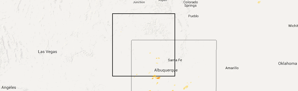
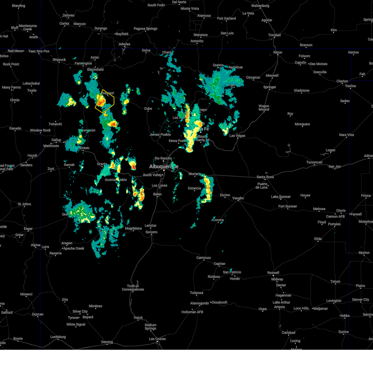
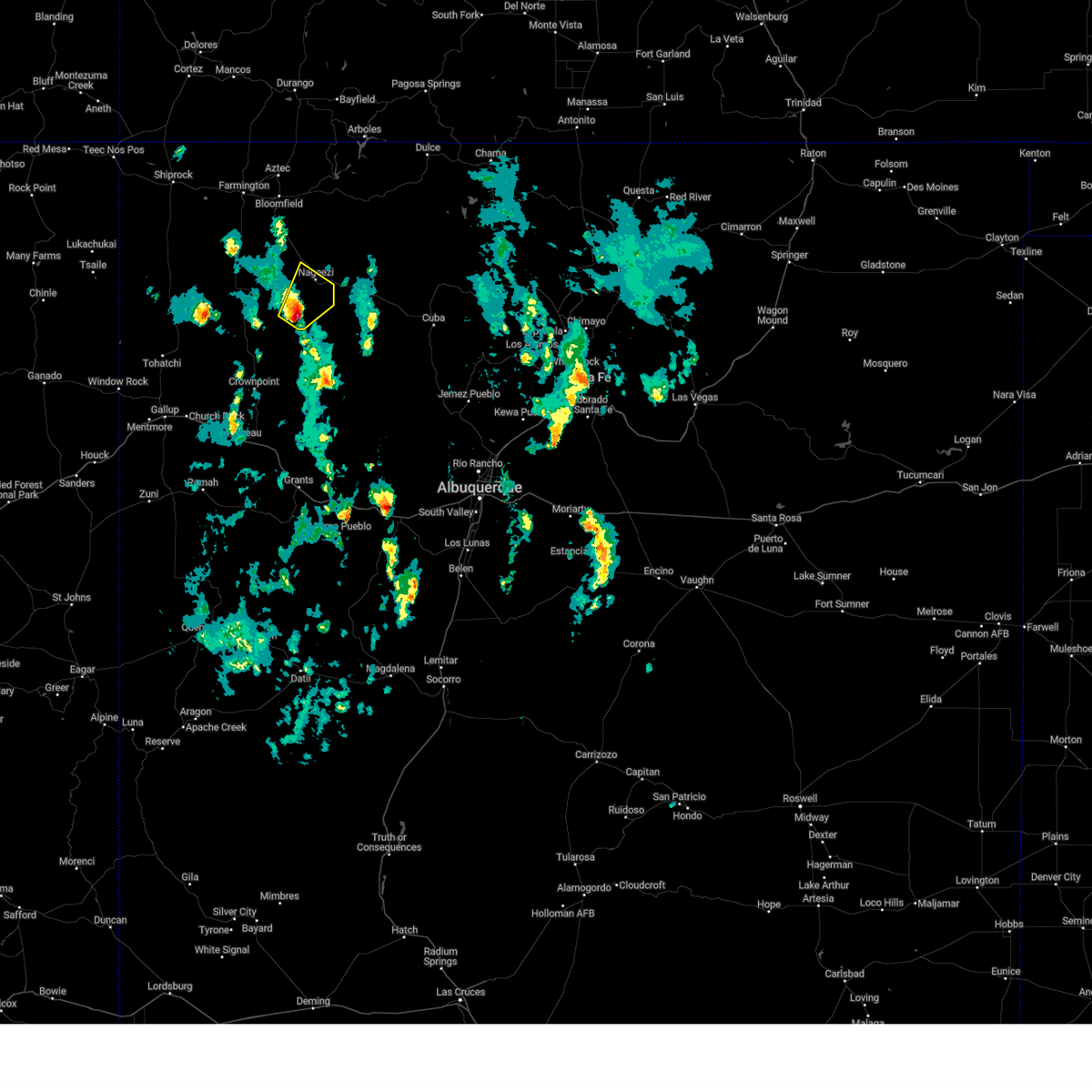
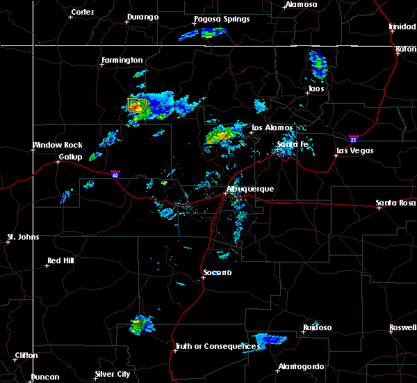
Hail Map for Nageezi, NM
The Nageezi, NM area has had 0 reports of on-the-ground hail by trained spotters, and has been under severe weather warnings 2 times during the past 12 months. Doppler radar has detected hail at or near Nageezi, NM on 5 occasions.
| Name: | Nageezi, NM |
| Where Located: | 41.6 miles SE of Farmington, NM |
| Map: | Google Map for Nageezi, NM |
| Population: | 286 |
| Housing Units: | 94 |
| More Info: | Search Google for Nageezi, NM |
5
The Top Recent Hail Date for Nageezi, NM is Saturday, July 11, 2015 (1st out of 5)
Hail and Wind Damage Spotted near Nageezi, NM
| Date / Time | Report Details |
|---|---|
| 5/5/2025 11:34 AM MDT |
 the severe thunderstorm warning has been cancelled and is no longer in effect the severe thunderstorm warning has been cancelled and is no longer in effect
|
| 5/5/2025 11:21 AM MDT |
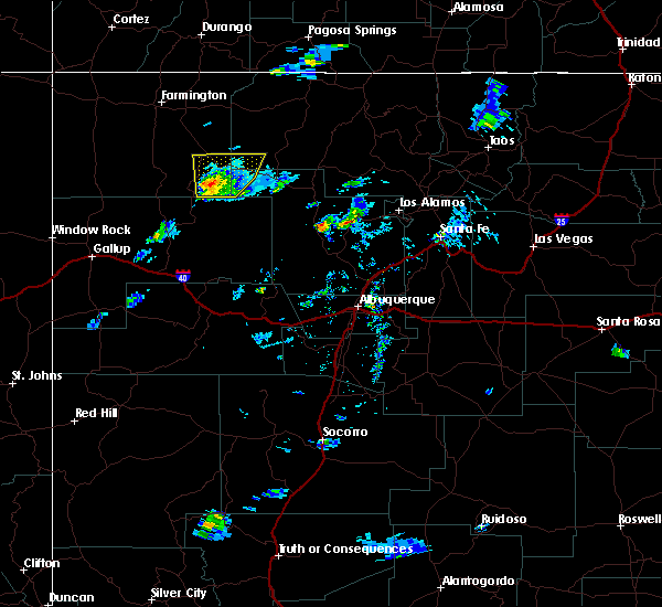
 Svrabq the national weather service in albuquerque has issued a * severe thunderstorm warning for, southeastern san juan county in northwestern new mexico, * until noon mdt. * at 1121 am mdt, a severe thunderstorm was located 6 miles east of chaco canyon, or 32 miles northeast of crownpoint, moving northeast at 20 mph (radar indicated). Hazards include 60 mph wind gusts and half dollar size hail. Hail damage to vehicles is expected. Expect wind damage to roofs, siding, and trees. Svrabq the national weather service in albuquerque has issued a * severe thunderstorm warning for, southeastern san juan county in northwestern new mexico, * until noon mdt. * at 1121 am mdt, a severe thunderstorm was located 6 miles east of chaco canyon, or 32 miles northeast of crownpoint, moving northeast at 20 mph (radar indicated). Hazards include 60 mph wind gusts and half dollar size hail. Hail damage to vehicles is expected. Expect wind damage to roofs, siding, and trees.
|
| 6/19/2022 2:06 PM MDT |
 The severe thunderstorm warning for west central rio arriba and southeastern san juan counties will expire at 215 pm mdt, the storm which prompted the warning has weakened below severe limits, and no longer poses an immediate threat to life or property. therefore, the warning will be allowed to expire. however gusty winds and heavy rain are still possible with this thunderstorm. The severe thunderstorm warning for west central rio arriba and southeastern san juan counties will expire at 215 pm mdt, the storm which prompted the warning has weakened below severe limits, and no longer poses an immediate threat to life or property. therefore, the warning will be allowed to expire. however gusty winds and heavy rain are still possible with this thunderstorm.
|
| 6/19/2022 1:44 PM MDT |
 At 143 pm mdt, a severe thunderstorm was located over el huerfano trading post, or 25 miles south of bloomfield, moving northeast at 30 mph (radar indicated). Hazards include 60 mph wind gusts and half dollar size hail. Hail damage to vehicles is expected. expect wind damage to roofs, siding, and trees. locations impacted include, blanco trading post, el huerfano trading post and nageezi. this includes highway 550 between mile markers 117 and 148. hail threat, radar indicated max hail size, 1. 25 in wind threat, radar indicated max wind gust, 60 mph. At 143 pm mdt, a severe thunderstorm was located over el huerfano trading post, or 25 miles south of bloomfield, moving northeast at 30 mph (radar indicated). Hazards include 60 mph wind gusts and half dollar size hail. Hail damage to vehicles is expected. expect wind damage to roofs, siding, and trees. locations impacted include, blanco trading post, el huerfano trading post and nageezi. this includes highway 550 between mile markers 117 and 148. hail threat, radar indicated max hail size, 1. 25 in wind threat, radar indicated max wind gust, 60 mph.
|
| 6/19/2022 1:25 PM MDT |
 At 125 pm mdt, a severe thunderstorm was located 11 miles southwest of el huerfano trading post, or 29 miles south of bloomfield, moving northeast at 30 mph (radar indicated). Hazards include 60 mph wind gusts and quarter size hail. Hail damage to vehicles is expected. Expect wind damage to roofs, siding, and trees. At 125 pm mdt, a severe thunderstorm was located 11 miles southwest of el huerfano trading post, or 29 miles south of bloomfield, moving northeast at 30 mph (radar indicated). Hazards include 60 mph wind gusts and quarter size hail. Hail damage to vehicles is expected. Expect wind damage to roofs, siding, and trees.
|
| 9/12/2016 1:15 PM MDT |
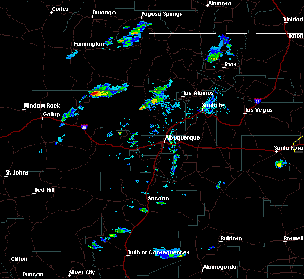
 At 114 pm mdt, severe thunderstorms were located along a line extending from 6 miles east of cedar hill to 11 miles north of counselor, moving northeast at 35 mph (radar indicated). Hazards include 60 mph wind gusts and penny size hail. Expect damage to roofs. siding. and trees. Locations impacted include, bloomfield, aztec, navajo dam, turley, navajo lake state park, nageezi, blanco trading post and archuleta. At 114 pm mdt, severe thunderstorms were located along a line extending from 6 miles east of cedar hill to 11 miles north of counselor, moving northeast at 35 mph (radar indicated). Hazards include 60 mph wind gusts and penny size hail. Expect damage to roofs. siding. and trees. Locations impacted include, bloomfield, aztec, navajo dam, turley, navajo lake state park, nageezi, blanco trading post and archuleta.
|
| 9/12/2016 12:42 PM MDT |
 At 1241 pm mdt, severe thunderstorms were located along a line extending from farmington to near chaco canyon, moving northeast at 35 mph (radar indicated). Hazards include 60 mph wind gusts and quarter size hail. Hail damage to vehicles is expected. Expect wind damage to roofs, siding, and trees. At 1241 pm mdt, severe thunderstorms were located along a line extending from farmington to near chaco canyon, moving northeast at 35 mph (radar indicated). Hazards include 60 mph wind gusts and quarter size hail. Hail damage to vehicles is expected. Expect wind damage to roofs, siding, and trees.
|
| 10/19/2015 6:43 PM MDT | The severe thunderstorm warning for southeastern san juan county will expire at 645 pm mdt, the storm which prompted the warning has weakened below severe limits and exited the warned area. therefore the warning will be allowed to expire. however small hail and gusty winds are still possible with this thunderstorm. |
| 10/19/2015 6:23 PM MDT |
 At 622 pm mdt, a severe thunderstorm was located 7 miles south of nageezi, or 38 miles northeast of crownpoint, moving north at 20 mph (radar indicated). Hazards include 60 mph wind gusts and quarter size hail. Hail damage to vehicles is expected. expect wind damage to roofs, siding and trees. Locations impacted include, nageezi. At 622 pm mdt, a severe thunderstorm was located 7 miles south of nageezi, or 38 miles northeast of crownpoint, moving north at 20 mph (radar indicated). Hazards include 60 mph wind gusts and quarter size hail. Hail damage to vehicles is expected. expect wind damage to roofs, siding and trees. Locations impacted include, nageezi.
|
| 10/19/2015 6:06 PM MDT |
 At 605 pm mdt, a severe thunderstorm was located 8 miles east of chaco canyon, or 33 miles northeast of crownpoint, moving north at 20 mph (radar indicated). Hazards include 60 mph wind gusts and quarter size hail. Hail damage to vehicles is expected. expect wind damage to roofs, siding and trees. Locations impacted include, counselor and nageezi. At 605 pm mdt, a severe thunderstorm was located 8 miles east of chaco canyon, or 33 miles northeast of crownpoint, moving north at 20 mph (radar indicated). Hazards include 60 mph wind gusts and quarter size hail. Hail damage to vehicles is expected. expect wind damage to roofs, siding and trees. Locations impacted include, counselor and nageezi.
|
| 10/19/2015 5:38 PM MDT |
 At 538 pm mdt, a severe thunderstorm was located 9 miles west of pueblo pintado, or 24 miles northeast of crownpoint, moving north at 20 mph (radar indicated). Hazards include ping pong size hail and 60 mph wind gusts. People and animals outdoors will be injured. expect hail damage to roofs, siding, windows and vehicles. Expect wind damage to roofs, siding and trees. At 538 pm mdt, a severe thunderstorm was located 9 miles west of pueblo pintado, or 24 miles northeast of crownpoint, moving north at 20 mph (radar indicated). Hazards include ping pong size hail and 60 mph wind gusts. People and animals outdoors will be injured. expect hail damage to roofs, siding, windows and vehicles. Expect wind damage to roofs, siding and trees.
|
Hail Maps for Nageezi, NM


Connect with Interactive Hail Maps