

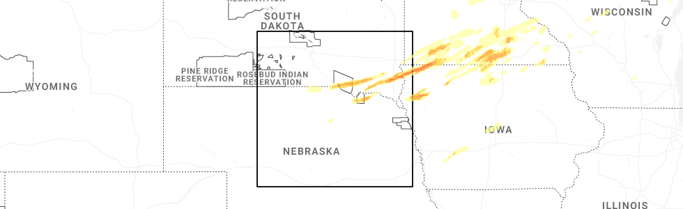
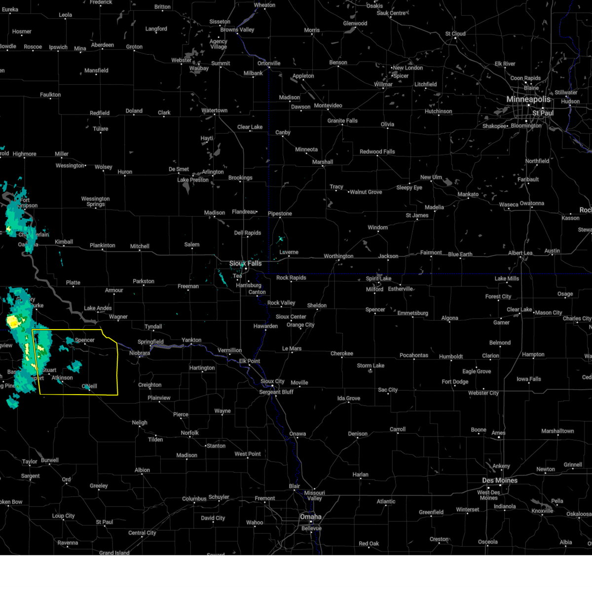
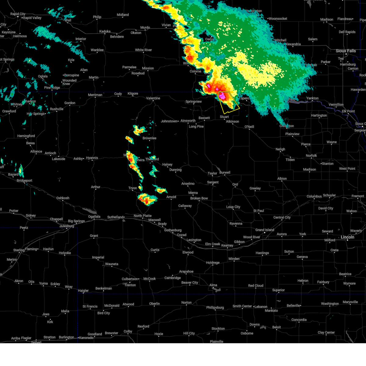
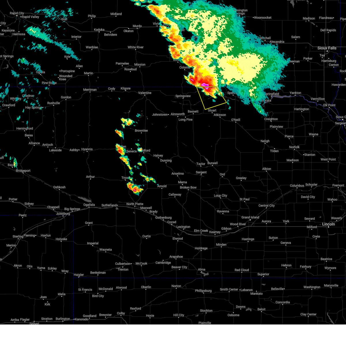
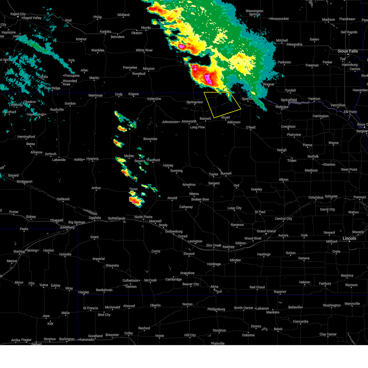
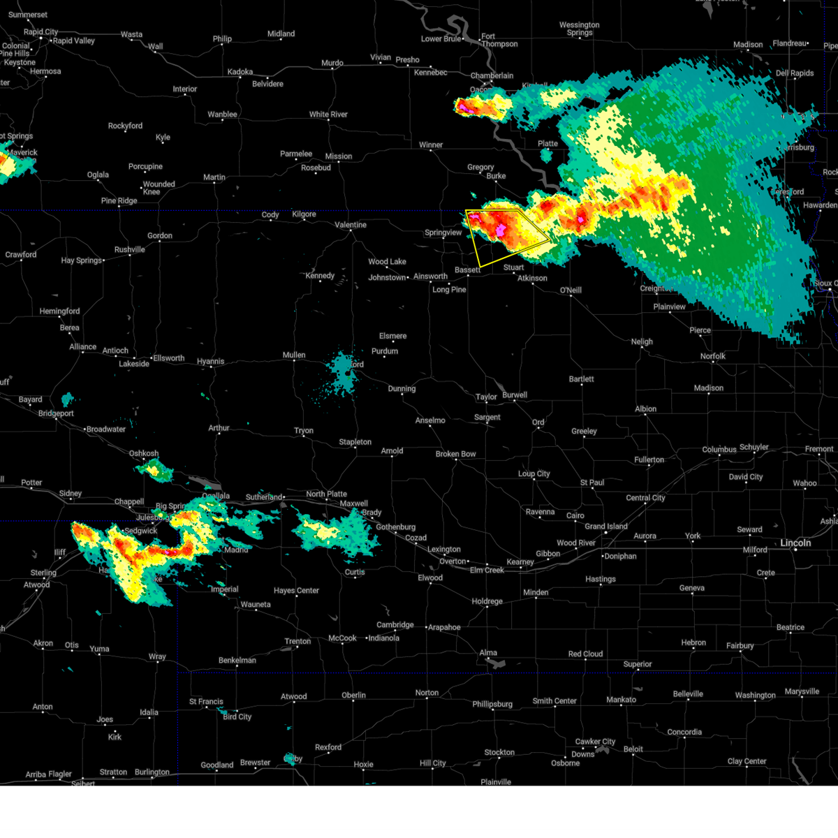
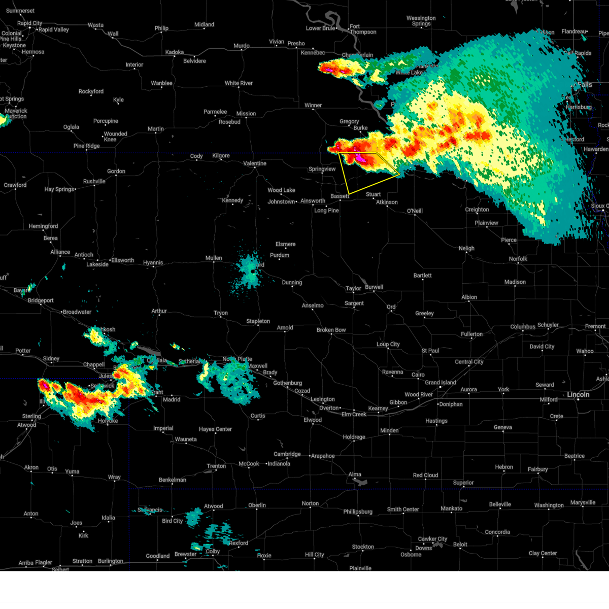
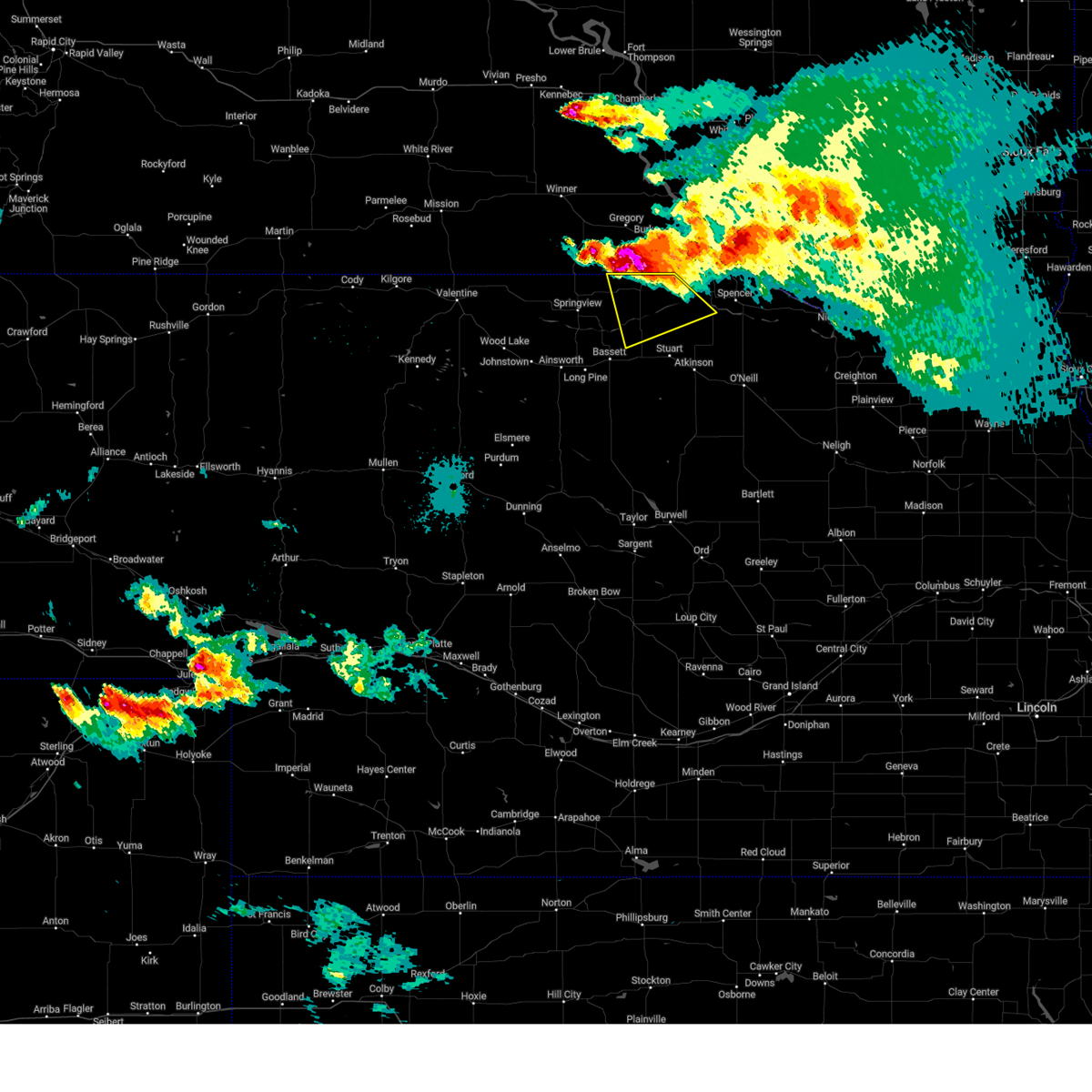
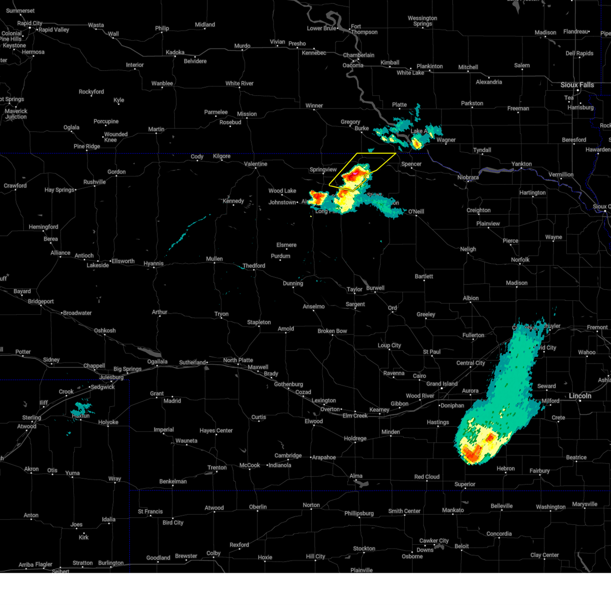
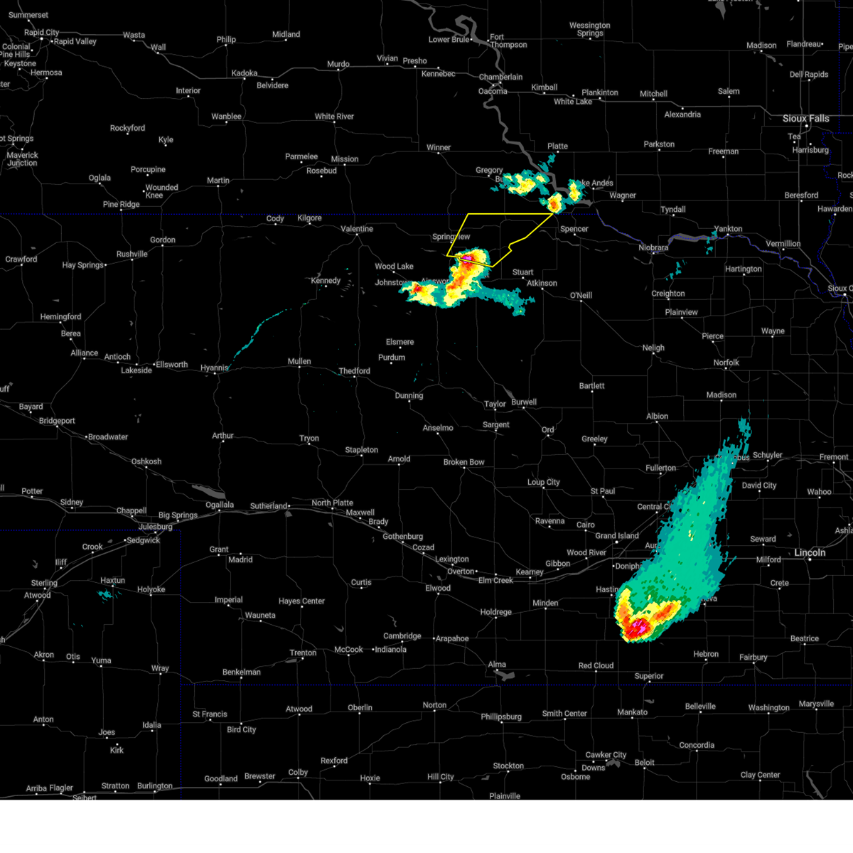
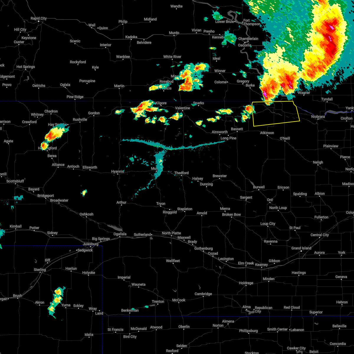
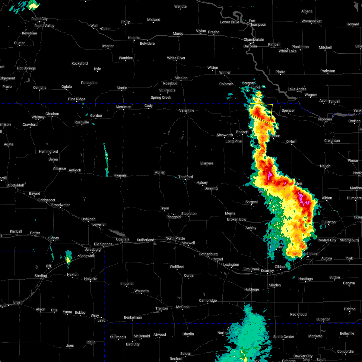
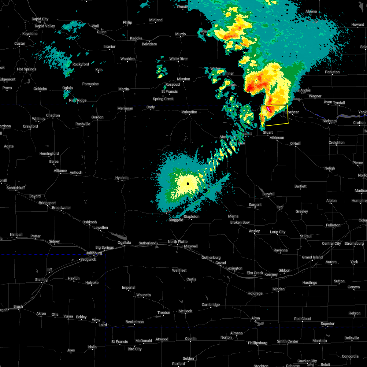
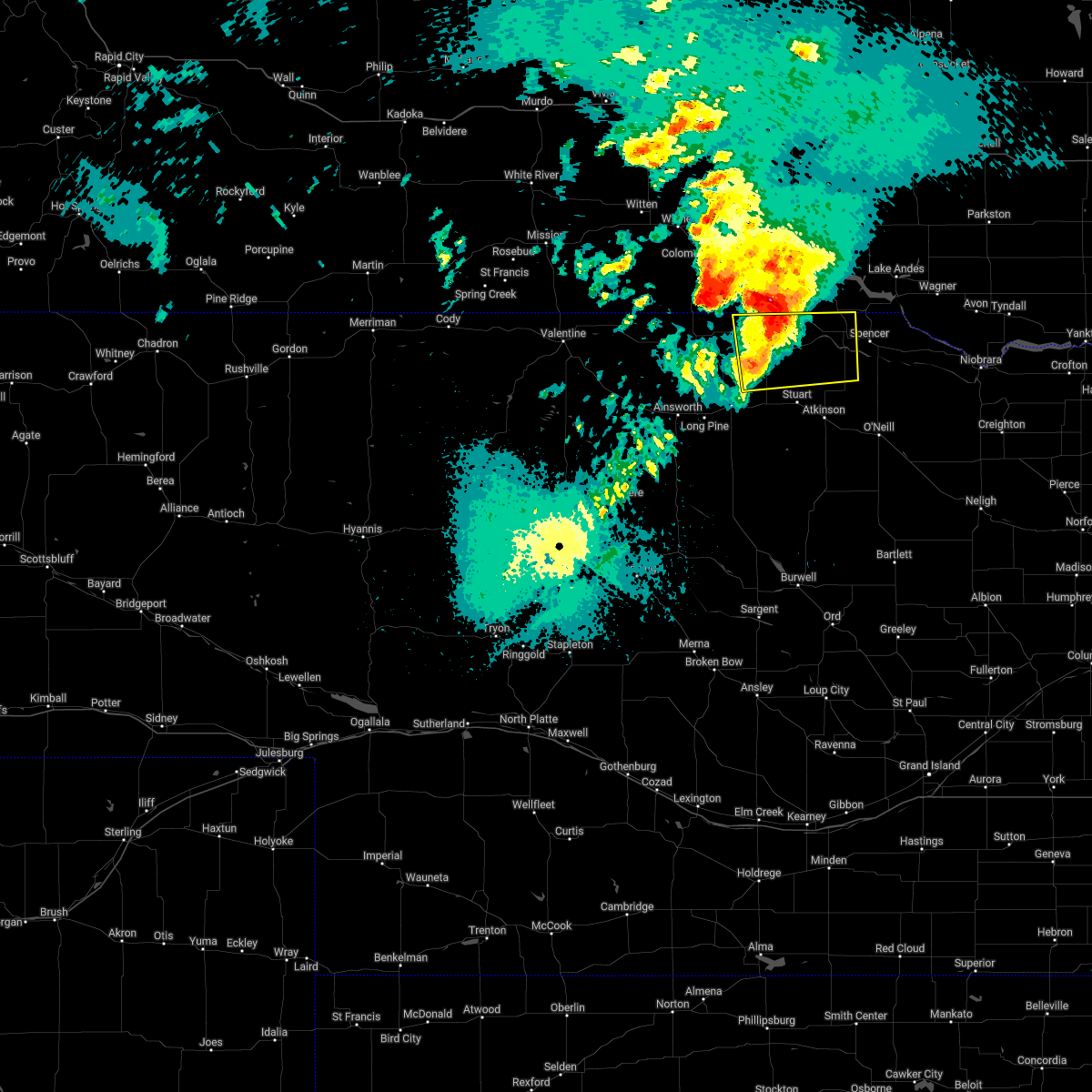
Hail Map for Naper, NE
The Naper, NE area has had 6 reports of on-the-ground hail by trained spotters, and has been under severe weather warnings 13 times during the past 12 months. Doppler radar has detected hail at or near Naper, NE on 60 occasions, including 6 occasions during the past year.
| Name: | Naper, NE |
| Where Located: | 41.7 miles NNW of Oneill, NE |
| Map: | Google Map for Naper, NE |
| Population: | 84 |
| Housing Units: | 66 |
| More Info: | Search Google for Naper, NE |
2
The Top Recent Hail Date for Naper, NE is Monday, April 28, 2025 (24th out of 60)
Hail and Wind Damage Spotted near Naper, NE
| Date / Time | Report Details |
|---|---|
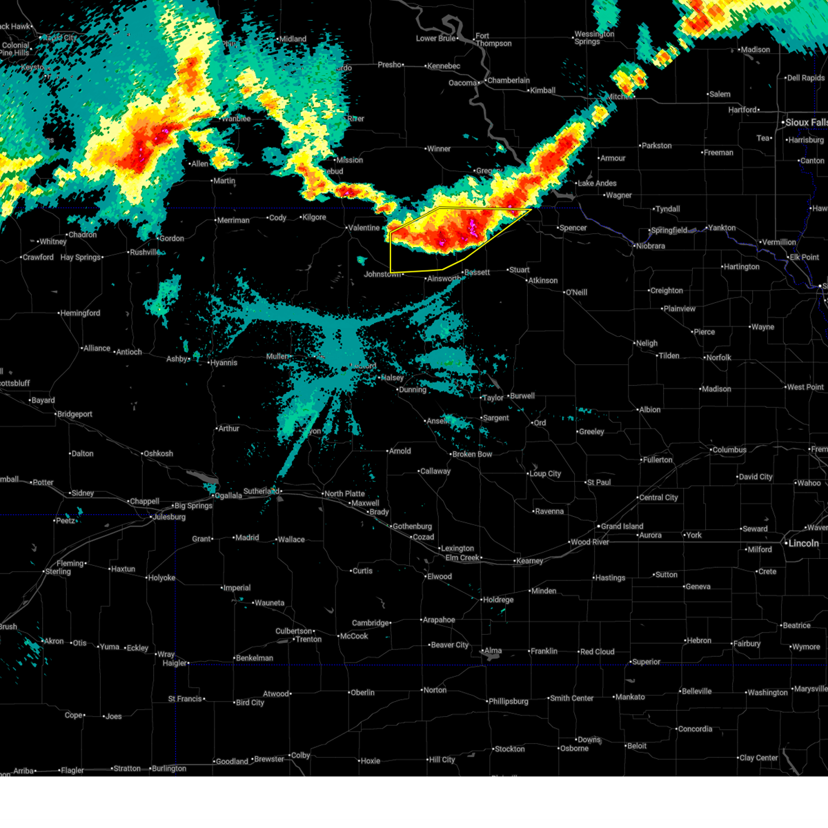
| 6/28/2025 11:23 PM CDT |
 At 1122 pm cdt, severe thunderstorms were located along a line extending from near naper to 15 miles east of springview to 10 miles southeast of norden, moving east at 55 mph (radar indicated). Hazards include 60 mph wind gusts and quarter size hail. Hail damage to vehicles is expected. expect wind damage to roofs, siding, and trees. locations impacted include, springview, naper, norden, burton, nets peak, bobcat state wildlife management area, meadville, north river trail, keller park state recreation area, thomas creek state wildlife management area, mariaville, pine glen state wildlife refuge, antelope peak, mills, and brocksburg. this includes the following highways, highway 183 between mile markers 198 and 225. highway 20 between mile markers 226 and 228. Highway 12 between mile markers 29 and 104. At 1122 pm cdt, severe thunderstorms were located along a line extending from near naper to 15 miles east of springview to 10 miles southeast of norden, moving east at 55 mph (radar indicated). Hazards include 60 mph wind gusts and quarter size hail. Hail damage to vehicles is expected. expect wind damage to roofs, siding, and trees. locations impacted include, springview, naper, norden, burton, nets peak, bobcat state wildlife management area, meadville, north river trail, keller park state recreation area, thomas creek state wildlife management area, mariaville, pine glen state wildlife refuge, antelope peak, mills, and brocksburg. this includes the following highways, highway 183 between mile markers 198 and 225. highway 20 between mile markers 226 and 228. Highway 12 between mile markers 29 and 104.
|
| 6/28/2025 11:23 PM CDT |
 the severe thunderstorm warning has been cancelled and is no longer in effect the severe thunderstorm warning has been cancelled and is no longer in effect
|
| 6/28/2025 10:55 PM CDT |
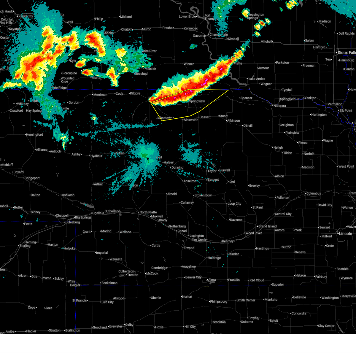 Svrlbf the national weather service in north platte has issued a * severe thunderstorm warning for, east central cherry county in north central nebraska, northwestern rock county in north central nebraska, northern brown county in north central nebraska, keya paha county in north central nebraska, northwestern boyd county in north central nebraska, * until 1145 pm cdt. * at 1055 pm cdt, severe thunderstorms were located along a line extending from near st. charles to 11 miles southwest of norden, moving east at 25 mph (radar indicated). Hazards include 60 mph wind gusts and quarter size hail. Hail damage to vehicles is expected. Expect wind damage to roofs, siding, and trees. Svrlbf the national weather service in north platte has issued a * severe thunderstorm warning for, east central cherry county in north central nebraska, northwestern rock county in north central nebraska, northern brown county in north central nebraska, keya paha county in north central nebraska, northwestern boyd county in north central nebraska, * until 1145 pm cdt. * at 1055 pm cdt, severe thunderstorms were located along a line extending from near st. charles to 11 miles southwest of norden, moving east at 25 mph (radar indicated). Hazards include 60 mph wind gusts and quarter size hail. Hail damage to vehicles is expected. Expect wind damage to roofs, siding, and trees.
|
| 4/21/2025 4:43 PM CDT |
 Svrlbf the national weather service in north platte has issued a * severe thunderstorm warning for, northeastern rock county in north central nebraska, northern holt county in north central nebraska, northeastern keya paha county in north central nebraska, boyd county in north central nebraska, * until 545 pm cdt. * at 442 pm cdt, a severe thunderstorm was located 11 miles north of newport, or 17 miles northeast of bassett, moving east at 40 mph (radar indicated). Hazards include 60 mph wind gusts. expect damage to roofs, siding, and trees Svrlbf the national weather service in north platte has issued a * severe thunderstorm warning for, northeastern rock county in north central nebraska, northern holt county in north central nebraska, northeastern keya paha county in north central nebraska, boyd county in north central nebraska, * until 545 pm cdt. * at 442 pm cdt, a severe thunderstorm was located 11 miles north of newport, or 17 miles northeast of bassett, moving east at 40 mph (radar indicated). Hazards include 60 mph wind gusts. expect damage to roofs, siding, and trees
|
| 8/18/2024 5:32 AM CDT |
 the severe thunderstorm warning has been cancelled and is no longer in effect the severe thunderstorm warning has been cancelled and is no longer in effect
|
| 8/18/2024 5:32 AM CDT |
 At 532 am cdt, a severe thunderstorm was located near naper, or 21 miles west of spencer, moving southeast at 35 mph (radar indicated). Hazards include two inch hail and 60 mph wind gusts. People and animals outdoors will be injured. expect hail damage to roofs, siding, windows, and vehicles. expect wind damage to roofs, siding, and trees. locations impacted include, naper and dustin. This includes highway 12 between mile markers 87 and 104, and near mile marker 107. At 532 am cdt, a severe thunderstorm was located near naper, or 21 miles west of spencer, moving southeast at 35 mph (radar indicated). Hazards include two inch hail and 60 mph wind gusts. People and animals outdoors will be injured. expect hail damage to roofs, siding, windows, and vehicles. expect wind damage to roofs, siding, and trees. locations impacted include, naper and dustin. This includes highway 12 between mile markers 87 and 104, and near mile marker 107.
|
| 8/18/2024 5:12 AM CDT |
 At 512 am cdt, a severe thunderstorm was located 11 miles southwest of herrick, or 23 miles northeast of springview, moving southeast at 30 mph (radar indicated). Hazards include two inch hail and 70 mph wind gusts. People and animals outdoors will be injured. expect hail damage to roofs, siding, windows, and vehicles. expect considerable tree damage. wind damage is also likely to mobile homes, roofs, and outbuildings. locations impacted include, naper, dustin, mills, brocksburg, and mariaville. This includes highway 12 between mile markers 76 and 104. At 512 am cdt, a severe thunderstorm was located 11 miles southwest of herrick, or 23 miles northeast of springview, moving southeast at 30 mph (radar indicated). Hazards include two inch hail and 70 mph wind gusts. People and animals outdoors will be injured. expect hail damage to roofs, siding, windows, and vehicles. expect considerable tree damage. wind damage is also likely to mobile homes, roofs, and outbuildings. locations impacted include, naper, dustin, mills, brocksburg, and mariaville. This includes highway 12 between mile markers 76 and 104.
|
| 8/18/2024 4:48 AM CDT |
 Svrlbf the national weather service in north platte has issued a * severe thunderstorm warning for, northeastern rock county in north central nebraska, northwestern holt county in north central nebraska, eastern keya paha county in north central nebraska, western boyd county in north central nebraska, * until 545 am cdt. * at 447 am cdt, a severe thunderstorm was located near dallas, or 23 miles southeast of winner, moving southeast at 30 mph (radar indicated). Hazards include two inch hail and 70 mph wind gusts. People and animals outdoors will be injured. expect hail damage to roofs, siding, windows, and vehicles. expect considerable tree damage. Wind damage is also likely to mobile homes, roofs, and outbuildings. Svrlbf the national weather service in north platte has issued a * severe thunderstorm warning for, northeastern rock county in north central nebraska, northwestern holt county in north central nebraska, eastern keya paha county in north central nebraska, western boyd county in north central nebraska, * until 545 am cdt. * at 447 am cdt, a severe thunderstorm was located near dallas, or 23 miles southeast of winner, moving southeast at 30 mph (radar indicated). Hazards include two inch hail and 70 mph wind gusts. People and animals outdoors will be injured. expect hail damage to roofs, siding, windows, and vehicles. expect considerable tree damage. Wind damage is also likely to mobile homes, roofs, and outbuildings.
|
| 7/14/2024 3:46 AM CDT |
 The storms which prompted the warning have weakened below severe limits, and have exited the warned area. therefore, the warning has been allowed to expire. however, gusty winds are still possible with these thunderstorms. a severe thunderstorm watch remains in effect until 800 am cdt for north central nebraska. The storms which prompted the warning have weakened below severe limits, and have exited the warned area. therefore, the warning has been allowed to expire. however, gusty winds are still possible with these thunderstorms. a severe thunderstorm watch remains in effect until 800 am cdt for north central nebraska.
|
| 7/14/2024 3:35 AM CDT |
 At 334 am cdt, severe thunderstorms were located along a line extending from 6 miles south of verdel to 6 miles south of o'neill to 13 miles west of amelia, moving southeast at 70 mph. other strong to severe thunderstorms were located over western boyd and northwestern holt county. these storms are capable of producing penny sized hail and 60 mph wind gusts (radar indicated). Hazards include 60 mph wind gusts and penny size hail. Expect damage to roofs, siding, and trees. locations impacted include, o'neill, spencer, atkinson, stuart, butte, chambers, lynch, page, newport, naper, gross, amelia, inman, bristow, emmet, dustin, anoka, monowi, hull lake state wildlife management area, and mariaville. this includes the following highways, highway 20 between mile markers 270 and 328. highway 281 between mile markers 164 and 223. Highway 12 between mile markers 80 and 144. At 334 am cdt, severe thunderstorms were located along a line extending from 6 miles south of verdel to 6 miles south of o'neill to 13 miles west of amelia, moving southeast at 70 mph. other strong to severe thunderstorms were located over western boyd and northwestern holt county. these storms are capable of producing penny sized hail and 60 mph wind gusts (radar indicated). Hazards include 60 mph wind gusts and penny size hail. Expect damage to roofs, siding, and trees. locations impacted include, o'neill, spencer, atkinson, stuart, butte, chambers, lynch, page, newport, naper, gross, amelia, inman, bristow, emmet, dustin, anoka, monowi, hull lake state wildlife management area, and mariaville. this includes the following highways, highway 20 between mile markers 270 and 328. highway 281 between mile markers 164 and 223. Highway 12 between mile markers 80 and 144.
|
| 7/14/2024 3:35 AM CDT |
 the severe thunderstorm warning has been cancelled and is no longer in effect the severe thunderstorm warning has been cancelled and is no longer in effect
|
| 7/14/2024 3:18 AM CDT |
 At 316 am cdt, severe thunderstorms were located along a line extending from near gross to near stuart to 9 miles southeast of long pine, moving southeast at 70 mph. thunderstorms behind the line were entering western boyd and northwestern holt counties and these storms may contain hail up to penny size along with the potential for wind gusts to 60 mph (radar indicated). Hazards include 60 mph wind gusts and penny size hail. Expect damage to roofs, siding, and trees. locations impacted include, o'neill, ainsworth, bassett, spencer, atkinson, stuart, butte, long pine, chambers, lynch, page, newport, naper, gross, amelia, inman, bristow, emmet, dustin, and anoka. this includes the following highways, highway 183 between mile markers 160 and 204. highway 20 between mile markers 242 and 328. highway 281 between mile markers 164 and 223. Highway 12 between mile markers 69 and 144. At 316 am cdt, severe thunderstorms were located along a line extending from near gross to near stuart to 9 miles southeast of long pine, moving southeast at 70 mph. thunderstorms behind the line were entering western boyd and northwestern holt counties and these storms may contain hail up to penny size along with the potential for wind gusts to 60 mph (radar indicated). Hazards include 60 mph wind gusts and penny size hail. Expect damage to roofs, siding, and trees. locations impacted include, o'neill, ainsworth, bassett, spencer, atkinson, stuart, butte, long pine, chambers, lynch, page, newport, naper, gross, amelia, inman, bristow, emmet, dustin, and anoka. this includes the following highways, highway 183 between mile markers 160 and 204. highway 20 between mile markers 242 and 328. highway 281 between mile markers 164 and 223. Highway 12 between mile markers 69 and 144.
|
| 7/14/2024 2:59 AM CDT |
 Svrlbf the national weather service in north platte has issued a * severe thunderstorm warning for, rock county in north central nebraska, northern brown county in north central nebraska, holt county in north central nebraska, eastern keya paha county in north central nebraska, boyd county in north central nebraska, * until 345 am cdt. * at 258 am cdt, severe thunderstorms were located along a line extending from near bonesteel to 11 miles northwest of newport to near johnstown, moving southeast at 60 mph (radar indicated). Hazards include 60 mph wind gusts. expect damage to roofs, siding, and trees Svrlbf the national weather service in north platte has issued a * severe thunderstorm warning for, rock county in north central nebraska, northern brown county in north central nebraska, holt county in north central nebraska, eastern keya paha county in north central nebraska, boyd county in north central nebraska, * until 345 am cdt. * at 258 am cdt, severe thunderstorms were located along a line extending from near bonesteel to 11 miles northwest of newport to near johnstown, moving southeast at 60 mph (radar indicated). Hazards include 60 mph wind gusts. expect damage to roofs, siding, and trees
|
| 5/14/2024 9:12 PM CDT |
 The storms which prompted the warning have weakened below severe limits, and no longer pose an immediate threat to life or property. therefore, the warning will be allowed to expire. however, small hail and gusty winds are still possible with these thunderstorms. to report severe weather, contact your nearest law enforcement agency. they will relay your report to the national weather service north platte. The storms which prompted the warning have weakened below severe limits, and no longer pose an immediate threat to life or property. therefore, the warning will be allowed to expire. however, small hail and gusty winds are still possible with these thunderstorms. to report severe weather, contact your nearest law enforcement agency. they will relay your report to the national weather service north platte.
|
| 5/14/2024 8:43 PM CDT |
 At 843 pm cdt, severe thunderstorms were located along a line extending from 6 miles west of naper to near newport to near rose, moving east at 35 mph (radar indicated). Hazards include ping pong ball size hail and 60 mph wind gusts. People and animals outdoors will be injured. expect hail damage to roofs, siding, windows, and vehicles. expect wind damage to roofs, siding, and trees. locations impacted include, atkinson, stuart, butte, newport, naper, rose, dustin, anoka, sybrant, twin lakes state wildlife management area, hull lake state wildlife management area, duff, mariaville, pony lake, brocksburg, and parshall bridge state wildlife management area. this includes the following highways, highway 183 between mile markers 149 and 168. highway 20 between mile markers 268 and 295. Highway 12 between mile markers 81 and 117. At 843 pm cdt, severe thunderstorms were located along a line extending from 6 miles west of naper to near newport to near rose, moving east at 35 mph (radar indicated). Hazards include ping pong ball size hail and 60 mph wind gusts. People and animals outdoors will be injured. expect hail damage to roofs, siding, windows, and vehicles. expect wind damage to roofs, siding, and trees. locations impacted include, atkinson, stuart, butte, newport, naper, rose, dustin, anoka, sybrant, twin lakes state wildlife management area, hull lake state wildlife management area, duff, mariaville, pony lake, brocksburg, and parshall bridge state wildlife management area. this includes the following highways, highway 183 between mile markers 149 and 168. highway 20 between mile markers 268 and 295. Highway 12 between mile markers 81 and 117.
|
| 5/14/2024 8:26 PM CDT |
 Svrlbf the national weather service in north platte has issued a * severe thunderstorm warning for, rock county in north central nebraska, southeastern brown county in north central nebraska, western holt county in north central nebraska, eastern keya paha county in north central nebraska, western boyd county in north central nebraska, * until 915 pm cdt. * at 825 pm cdt, severe thunderstorms were located along a line extending from 13 miles west of naper to 6 miles southwest of newport to 10 miles northwest of rose, moving east at 30 mph (radar indicated. at 815 pm cdt, quarter size hail was reported 6 miles northeast of bassett). Hazards include ping pong ball size hail and 60 mph wind gusts. People and animals outdoors will be injured. expect hail damage to roofs, siding, windows, and vehicles. Expect wind damage to roofs, siding, and trees. Svrlbf the national weather service in north platte has issued a * severe thunderstorm warning for, rock county in north central nebraska, southeastern brown county in north central nebraska, western holt county in north central nebraska, eastern keya paha county in north central nebraska, western boyd county in north central nebraska, * until 915 pm cdt. * at 825 pm cdt, severe thunderstorms were located along a line extending from 13 miles west of naper to 6 miles southwest of newport to 10 miles northwest of rose, moving east at 30 mph (radar indicated. at 815 pm cdt, quarter size hail was reported 6 miles northeast of bassett). Hazards include ping pong ball size hail and 60 mph wind gusts. People and animals outdoors will be injured. expect hail damage to roofs, siding, windows, and vehicles. Expect wind damage to roofs, siding, and trees.
|
| 7/18/2023 10:52 PM CDT |
 At 1052 pm cdt, a severe thunderstorm was located 10 miles southwest of naper, or 23 miles northeast of bassett, moving south at 30 mph (radar indicated). Hazards include ping pong ball size hail and 60 mph wind gusts. People and animals outdoors will be injured. expect hail damage to roofs, siding, windows, and vehicles. expect wind damage to roofs, siding, and trees. locations impacted include, naper, dustin, nets peak, mills, brocksburg and mariaville. this includes highway 12 between mile markers 68 and 104. hail threat, radar indicated max hail size, 1. 50 in wind threat, radar indicated max wind gust, 60 mph. At 1052 pm cdt, a severe thunderstorm was located 10 miles southwest of naper, or 23 miles northeast of bassett, moving south at 30 mph (radar indicated). Hazards include ping pong ball size hail and 60 mph wind gusts. People and animals outdoors will be injured. expect hail damage to roofs, siding, windows, and vehicles. expect wind damage to roofs, siding, and trees. locations impacted include, naper, dustin, nets peak, mills, brocksburg and mariaville. this includes highway 12 between mile markers 68 and 104. hail threat, radar indicated max hail size, 1. 50 in wind threat, radar indicated max wind gust, 60 mph.
|
| 7/18/2023 10:38 PM CDT |
 At 1038 pm cdt, a severe thunderstorm was located 9 miles west of naper, or 24 miles east of springview, moving southeast at 45 mph (radar indicated). Hazards include ping pong ball size hail and 60 mph wind gusts. People and animals outdoors will be injured. expect hail damage to roofs, siding, windows, and vehicles. expect wind damage to roofs, siding, and trees. locations impacted include, naper, dustin, nets peak, mills, brocksburg and mariaville. this includes highway 12 between mile markers 68 and 104. hail threat, radar indicated max hail size, 1. 50 in wind threat, radar indicated max wind gust, 60 mph. At 1038 pm cdt, a severe thunderstorm was located 9 miles west of naper, or 24 miles east of springview, moving southeast at 45 mph (radar indicated). Hazards include ping pong ball size hail and 60 mph wind gusts. People and animals outdoors will be injured. expect hail damage to roofs, siding, windows, and vehicles. expect wind damage to roofs, siding, and trees. locations impacted include, naper, dustin, nets peak, mills, brocksburg and mariaville. this includes highway 12 between mile markers 68 and 104. hail threat, radar indicated max hail size, 1. 50 in wind threat, radar indicated max wind gust, 60 mph.
|
| 7/18/2023 10:23 PM CDT |
 At 1023 pm cdt, a severe thunderstorm was located 10 miles southwest of burke, or 23 miles northeast of springview, moving southeast at 35 mph (radar indicated). Hazards include ping pong ball size hail and 60 mph wind gusts. People and animals outdoors will be injured. expect hail damage to roofs, siding, windows, and vehicles. Expect wind damage to roofs, siding, and trees. At 1023 pm cdt, a severe thunderstorm was located 10 miles southwest of burke, or 23 miles northeast of springview, moving southeast at 35 mph (radar indicated). Hazards include ping pong ball size hail and 60 mph wind gusts. People and animals outdoors will be injured. expect hail damage to roofs, siding, windows, and vehicles. Expect wind damage to roofs, siding, and trees.
|
| 7/12/2023 3:21 AM CDT |
 At 321 am cdt, severe thunderstorms were located along a line extending from 6 miles northwest of butte to 12 miles north of rose, moving east at 60 mph (radar indicated). Hazards include 60 mph wind gusts. expect damage to roofs, siding, and trees At 321 am cdt, severe thunderstorms were located along a line extending from 6 miles northwest of butte to 12 miles north of rose, moving east at 60 mph (radar indicated). Hazards include 60 mph wind gusts. expect damage to roofs, siding, and trees
|
| 7/12/2023 3:10 AM CDT |
 At 308 am cdt, severe thunderstorms were located along a line extending from 12 miles west of naper to 6 miles southeast of ainsworth, moving east at 60 mph (radar indicated). Hazards include 70 mph wind gusts. Expect considerable tree damage. damage is likely to mobile homes, roofs, and outbuildings. locations impacted include, ainsworth, bassett, springview, long pine, newport, naper, johnstown, dustin, burton, mariaville, pine glen state wildlife refuge, antelope peak, mills and brocksburg. this includes the following highways, highway 183 between mile markers 170 and 225. highway 20 between mile markers 230 and 270. highway 12 between mile markers 36 and 108. thunderstorm damage threat, considerable hail threat, radar indicated max hail size, <. 75 in wind threat, radar indicated max wind gust, 70 mph. At 308 am cdt, severe thunderstorms were located along a line extending from 12 miles west of naper to 6 miles southeast of ainsworth, moving east at 60 mph (radar indicated). Hazards include 70 mph wind gusts. Expect considerable tree damage. damage is likely to mobile homes, roofs, and outbuildings. locations impacted include, ainsworth, bassett, springview, long pine, newport, naper, johnstown, dustin, burton, mariaville, pine glen state wildlife refuge, antelope peak, mills and brocksburg. this includes the following highways, highway 183 between mile markers 170 and 225. highway 20 between mile markers 230 and 270. highway 12 between mile markers 36 and 108. thunderstorm damage threat, considerable hail threat, radar indicated max hail size, <. 75 in wind threat, radar indicated max wind gust, 70 mph.
|
| 7/12/2023 2:46 AM CDT |
 At 245 am cdt, severe thunderstorms were located along a line extending from near wewela to 9 miles southwest of johnstown, moving east at 60 mph (radar indicated). Hazards include 70 mph wind gusts. Expect considerable tree damage. Damage is likely to mobile homes, roofs, and outbuildings. At 245 am cdt, severe thunderstorms were located along a line extending from near wewela to 9 miles southwest of johnstown, moving east at 60 mph (radar indicated). Hazards include 70 mph wind gusts. Expect considerable tree damage. Damage is likely to mobile homes, roofs, and outbuildings.
|
| 6/24/2023 1:58 AM CDT |
 The severe thunderstorm warning for northern rock, northeastern brown, northwestern holt, eastern keya paha and western boyd counties will expire at 200 am cdt, the storms which prompted the warning have weakened below severe limits, and no longer pose an immediate threat to life or property. therefore, the warning will be allowed to expire. however gusty winds are still possible with these thunderstorms. a severe thunderstorm watch remains in effect until 600 am cdt for north central nebraska. to report severe weather, contact your nearest law enforcement agency. they will relay your report to the national weather service north platte. The severe thunderstorm warning for northern rock, northeastern brown, northwestern holt, eastern keya paha and western boyd counties will expire at 200 am cdt, the storms which prompted the warning have weakened below severe limits, and no longer pose an immediate threat to life or property. therefore, the warning will be allowed to expire. however gusty winds are still possible with these thunderstorms. a severe thunderstorm watch remains in effect until 600 am cdt for north central nebraska. to report severe weather, contact your nearest law enforcement agency. they will relay your report to the national weather service north platte.
|
| 6/24/2023 1:43 AM CDT |
 At 143 am cdt, severe thunderstorms were located along a line extending from 14 miles southwest of herrick to 6 miles southeast of long pine, moving east at 50 mph (radar indicated). Hazards include 60 mph wind gusts and nickel size hail. Expect damage to roofs, siding, and trees. locations impacted include, ainsworth, bassett, springview, atkinson, stuart, butte, long pine, newport, naper, dustin, burton, anoka, nets peak, hull lake state wildlife management area, keller park state recreation area, thomas creek state wildlife management area, mariaville, pine glen state wildlife refuge, mills and brocksburg. this includes the following highways, highway 183 between mile markers 173 and 127. highway 20 between mile markers 237 and 293. highway 281 near mile marker 223. highway 12 between mile markers 51 and 120. hail threat, radar indicated max hail size, 0. 88 in wind threat, radar indicated max wind gust, 60 mph. At 143 am cdt, severe thunderstorms were located along a line extending from 14 miles southwest of herrick to 6 miles southeast of long pine, moving east at 50 mph (radar indicated). Hazards include 60 mph wind gusts and nickel size hail. Expect damage to roofs, siding, and trees. locations impacted include, ainsworth, bassett, springview, atkinson, stuart, butte, long pine, newport, naper, dustin, burton, anoka, nets peak, hull lake state wildlife management area, keller park state recreation area, thomas creek state wildlife management area, mariaville, pine glen state wildlife refuge, mills and brocksburg. this includes the following highways, highway 183 between mile markers 173 and 127. highway 20 between mile markers 237 and 293. highway 281 near mile marker 223. highway 12 between mile markers 51 and 120. hail threat, radar indicated max hail size, 0. 88 in wind threat, radar indicated max wind gust, 60 mph.
|
| 6/24/2023 1:12 AM CDT |
 At 111 am cdt, severe thunderstorms were located along a line extending from 11 miles east of wewela to near long pine, moving east at 45 mph (radar indicated). Hazards include 60 mph wind gusts and quarter size hail. Hail damage to vehicles is expected. Expect wind damage to roofs, siding, and trees. At 111 am cdt, severe thunderstorms were located along a line extending from 11 miles east of wewela to near long pine, moving east at 45 mph (radar indicated). Hazards include 60 mph wind gusts and quarter size hail. Hail damage to vehicles is expected. Expect wind damage to roofs, siding, and trees.
|
| 5/6/2023 9:05 PM CDT |
 The severe thunderstorm warning for northern rock, eastern keya paha and western boyd counties will expire at 915 pm cdt, the storm which prompted the warning has weakened below severe limits, and no longer poses an immediate threat to life or property. therefore, the warning will be allowed to expire. The severe thunderstorm warning for northern rock, eastern keya paha and western boyd counties will expire at 915 pm cdt, the storm which prompted the warning has weakened below severe limits, and no longer poses an immediate threat to life or property. therefore, the warning will be allowed to expire.
|
| 5/6/2023 8:36 PM CDT |
 At 836 pm cdt, a severe thunderstorm was located 16 miles southwest of naper, or 18 miles east of springview, moving northeast at 45 mph (radar indicated). Hazards include 60 mph wind gusts and quarter size hail. Hail damage to vehicles is expected. expect wind damage to roofs, siding, and trees. locations impacted include, naper, mills, brocksburg and mariaville. this includes highway 12 between mile markers 73 and 104. hail threat, radar indicated max hail size, 1. 00 in wind threat, radar indicated max wind gust, 60 mph. At 836 pm cdt, a severe thunderstorm was located 16 miles southwest of naper, or 18 miles east of springview, moving northeast at 45 mph (radar indicated). Hazards include 60 mph wind gusts and quarter size hail. Hail damage to vehicles is expected. expect wind damage to roofs, siding, and trees. locations impacted include, naper, mills, brocksburg and mariaville. this includes highway 12 between mile markers 73 and 104. hail threat, radar indicated max hail size, 1. 00 in wind threat, radar indicated max wind gust, 60 mph.
|
| 5/6/2023 8:24 PM CDT |
 At 823 pm cdt, a severe thunderstorm was located 11 miles north of bassett, moving northeast at 45 mph (radar indicated). Hazards include 60 mph wind gusts and quarter size hail. Hail damage to vehicles is expected. Expect wind damage to roofs, siding, and trees. At 823 pm cdt, a severe thunderstorm was located 11 miles north of bassett, moving northeast at 45 mph (radar indicated). Hazards include 60 mph wind gusts and quarter size hail. Hail damage to vehicles is expected. Expect wind damage to roofs, siding, and trees.
|
| 7/5/2022 3:00 PM CDT |
 At 300 pm cdt, a severe thunderstorm was located near gross, or near spencer, moving east at 45 mph (radar indicated). Hazards include 60 mph wind gusts and quarter size hail. Hail damage to vehicles is expected. expect wind damage to roofs, siding, and trees. locations impacted include, spencer, butte, lynch, naper, gross, bristow, dustin, anoka, redbird state wildlife management area, hull lake state wildlife management area, spencer dam, parshall bridge state wildlife management area and anncar. this includes the following highways, highway 281 between mile markers 202 and 223. highway 12 between mile markers 87 and 139. hail threat, radar indicated max hail size, 1. 00 in wind threat, radar indicated max wind gust, 60 mph. At 300 pm cdt, a severe thunderstorm was located near gross, or near spencer, moving east at 45 mph (radar indicated). Hazards include 60 mph wind gusts and quarter size hail. Hail damage to vehicles is expected. expect wind damage to roofs, siding, and trees. locations impacted include, spencer, butte, lynch, naper, gross, bristow, dustin, anoka, redbird state wildlife management area, hull lake state wildlife management area, spencer dam, parshall bridge state wildlife management area and anncar. this includes the following highways, highway 281 between mile markers 202 and 223. highway 12 between mile markers 87 and 139. hail threat, radar indicated max hail size, 1. 00 in wind threat, radar indicated max wind gust, 60 mph.
|
| 7/5/2022 2:35 PM CDT |
 At 233 pm cdt, severe thunderstorms were located along a line extending from near lynch to 8 miles north of stuart, moving south at 65 mph (public). Hazards include 60 mph wind gusts. Expect damage to roofs, siding, and trees. locations impacted include, spencer, butte, lynch, naper, gross, bristow, dustin, anoka, redbird state wildlife management area, hull lake state wildlife management area, spencer dam, parshall bridge state wildlife management area and anncar. this includes the following highways, highway 281 between mile markers 202 and 223. highway 12 between mile markers 87 and 139. hail threat, radar indicated max hail size, <. 75 in wind threat, observed max wind gust, 60 mph. At 233 pm cdt, severe thunderstorms were located along a line extending from near lynch to 8 miles north of stuart, moving south at 65 mph (public). Hazards include 60 mph wind gusts. Expect damage to roofs, siding, and trees. locations impacted include, spencer, butte, lynch, naper, gross, bristow, dustin, anoka, redbird state wildlife management area, hull lake state wildlife management area, spencer dam, parshall bridge state wildlife management area and anncar. this includes the following highways, highway 281 between mile markers 202 and 223. highway 12 between mile markers 87 and 139. hail threat, radar indicated max hail size, <. 75 in wind threat, observed max wind gust, 60 mph.
|
| 7/5/2022 2:25 PM CDT |
 At 224 pm cdt, severe thunderstorms were located along a line extending from near gross to 9 miles southwest of naper, moving south at 40 mph (trained weather spotters). Hazards include 60 mph wind gusts. expect damage to roofs, siding, and trees At 224 pm cdt, severe thunderstorms were located along a line extending from near gross to 9 miles southwest of naper, moving south at 40 mph (trained weather spotters). Hazards include 60 mph wind gusts. expect damage to roofs, siding, and trees
|
| 5/30/2022 10:39 AM CDT |
 The severe thunderstorm warning for eastern keya paha and boyd counties will expire at 1045 am cdt, the storm which prompted the warning has weakened below severe limits, and no longer poses an immediate threat to life or property. therefore, the warning will be allowed to expire. The severe thunderstorm warning for eastern keya paha and boyd counties will expire at 1045 am cdt, the storm which prompted the warning has weakened below severe limits, and no longer poses an immediate threat to life or property. therefore, the warning will be allowed to expire.
|
| 5/30/2022 10:29 AM CDT |
 At 1028 am cdt, a severe thunderstorm was located 10 miles southwest of naper, or 24 miles northeast of bassett, moving north at 50 mph (radar indicated). Hazards include 60 mph wind gusts. Expect damage to roofs, siding, and trees. locations impacted include, spencer, butte, lynch, naper, gross, bristow, anoka, monowi, hull lake state wildlife management area, mills, brocksburg, spencer dam and parshall bridge state wildlife management area. this includes the following highways, highway 281 between mile markers 209 and 223. highway 12 between mile markers 69 and 144. hail threat, radar indicated max hail size, <. 75 in wind threat, radar indicated max wind gust, 60 mph. At 1028 am cdt, a severe thunderstorm was located 10 miles southwest of naper, or 24 miles northeast of bassett, moving north at 50 mph (radar indicated). Hazards include 60 mph wind gusts. Expect damage to roofs, siding, and trees. locations impacted include, spencer, butte, lynch, naper, gross, bristow, anoka, monowi, hull lake state wildlife management area, mills, brocksburg, spencer dam and parshall bridge state wildlife management area. this includes the following highways, highway 281 between mile markers 209 and 223. highway 12 between mile markers 69 and 144. hail threat, radar indicated max hail size, <. 75 in wind threat, radar indicated max wind gust, 60 mph.
|
| 5/30/2022 9:43 AM CDT |
 At 943 am cdt, a severe thunderstorm was located 12 miles northeast of rose, or 18 miles south of bassett, moving northeast at 45 mph (radar indicated). Hazards include 60 mph wind gusts and quarter size hail. Hail damage to vehicles is expected. expect wind damage to roofs, siding, and trees. locations impacted include, bassett, spencer, atkinson, stuart, butte, lynch, newport, naper, gross, bristow, emmet, dustin, anoka, monowi, twin lakes state wildlife management area, hull lake state wildlife management area, duff, mariaville, mills and brocksburg. this includes the following highways, highway 183 between mile markers 155 and 182. highway 20 between mile markers 252 and 303. highway 281 between mile markers 188 and 223. highway 12 between mile markers 69 and 144. hail threat, radar indicated max hail size, 1. 00 in wind threat, radar indicated max wind gust, 60 mph. At 943 am cdt, a severe thunderstorm was located 12 miles northeast of rose, or 18 miles south of bassett, moving northeast at 45 mph (radar indicated). Hazards include 60 mph wind gusts and quarter size hail. Hail damage to vehicles is expected. expect wind damage to roofs, siding, and trees. locations impacted include, bassett, spencer, atkinson, stuart, butte, lynch, newport, naper, gross, bristow, emmet, dustin, anoka, monowi, twin lakes state wildlife management area, hull lake state wildlife management area, duff, mariaville, mills and brocksburg. this includes the following highways, highway 183 between mile markers 155 and 182. highway 20 between mile markers 252 and 303. highway 281 between mile markers 188 and 223. highway 12 between mile markers 69 and 144. hail threat, radar indicated max hail size, 1. 00 in wind threat, radar indicated max wind gust, 60 mph.
|
| 5/30/2022 9:31 AM CDT |
 At 931 am cdt, a severe thunderstorm was located over rose, or 24 miles northeast of brewster, moving northeast at 45 mph (radar indicated). Hazards include 60 mph wind gusts and quarter size hail. Hail damage to vehicles is expected. Expect wind damage to roofs, siding, and trees. At 931 am cdt, a severe thunderstorm was located over rose, or 24 miles northeast of brewster, moving northeast at 45 mph (radar indicated). Hazards include 60 mph wind gusts and quarter size hail. Hail damage to vehicles is expected. Expect wind damage to roofs, siding, and trees.
|
| 5/29/2022 11:56 PM CDT |
 At 1155 pm cdt, severe thunderstorms were located along a line extending from 8 miles north of bonesteel to 9 miles southwest of spencer to 8 miles northeast of amelia, moving northeast at 55 mph (radar indicated). Hazards include two inch hail and 60 mph wind gusts. People and animals outdoors will be injured. expect hail damage to roofs, siding, windows, and vehicles. expect wind damage to roofs, siding, and trees. locations impacted include, o`neill, spencer, o`neill, atkinson, stuart, ewing, butte, chambers, lynch, page, naper, gross, amelia, inman, bristow, emmet, dustin, anoka, monowi and hull lake state wildlife management area. this includes the following highways, highway 20 between mile markers 277 and 328. highway 281 between mile markers 151 and 223. highway 12 between mile markers 89 and 144. thunderstorm damage threat, considerable hail threat, radar indicated max hail size, 2. 00 in wind threat, radar indicated max wind gust, 60 mph. At 1155 pm cdt, severe thunderstorms were located along a line extending from 8 miles north of bonesteel to 9 miles southwest of spencer to 8 miles northeast of amelia, moving northeast at 55 mph (radar indicated). Hazards include two inch hail and 60 mph wind gusts. People and animals outdoors will be injured. expect hail damage to roofs, siding, windows, and vehicles. expect wind damage to roofs, siding, and trees. locations impacted include, o`neill, spencer, o`neill, atkinson, stuart, ewing, butte, chambers, lynch, page, naper, gross, amelia, inman, bristow, emmet, dustin, anoka, monowi and hull lake state wildlife management area. this includes the following highways, highway 20 between mile markers 277 and 328. highway 281 between mile markers 151 and 223. highway 12 between mile markers 89 and 144. thunderstorm damage threat, considerable hail threat, radar indicated max hail size, 2. 00 in wind threat, radar indicated max wind gust, 60 mph.
|
| 5/29/2022 11:37 PM CDT |
 The severe thunderstorm warning for northeastern rock, northwestern holt, eastern keya paha and western boyd counties will expire at 1145 pm cdt, the storms which prompted the warning remain severe and have moved out of the area. therefore, this warning will be allowed to expire and a new warning has been issued. a tornado watch remains in effect until 200 am cdt for north central nebraska. The severe thunderstorm warning for northeastern rock, northwestern holt, eastern keya paha and western boyd counties will expire at 1145 pm cdt, the storms which prompted the warning remain severe and have moved out of the area. therefore, this warning will be allowed to expire and a new warning has been issued. a tornado watch remains in effect until 200 am cdt for north central nebraska.
|
| 5/29/2022 11:37 PM CDT |
 At 1136 pm cdt, severe thunderstorms were located along a line extending from near naper to near atkinson to 8 miles southwest of amelia, moving northeast at 55 mph (radar indicated). Hazards include golf ball size hail and 70 mph wind gusts. People and animals outdoors will be injured. expect hail damage to roofs, siding, windows, and vehicles. expect considerable tree damage. Wind damage is also likely to mobile homes, roofs, and outbuildings. At 1136 pm cdt, severe thunderstorms were located along a line extending from near naper to near atkinson to 8 miles southwest of amelia, moving northeast at 55 mph (radar indicated). Hazards include golf ball size hail and 70 mph wind gusts. People and animals outdoors will be injured. expect hail damage to roofs, siding, windows, and vehicles. expect considerable tree damage. Wind damage is also likely to mobile homes, roofs, and outbuildings.
|
| 5/29/2022 11:18 PM CDT |
 At 1118 pm cdt, severe thunderstorms were located along a line extending from 7 miles east of wewela to 14 miles southwest of naper to stuart, moving northeast at 55 mph (radar indicated). Hazards include two inch hail and 70 mph wind gusts. People and animals outdoors will be injured. expect hail damage to roofs, siding, windows, and vehicles. expect considerable tree damage. Wind damage is also likely to mobile homes, roofs, and outbuildings. At 1118 pm cdt, severe thunderstorms were located along a line extending from 7 miles east of wewela to 14 miles southwest of naper to stuart, moving northeast at 55 mph (radar indicated). Hazards include two inch hail and 70 mph wind gusts. People and animals outdoors will be injured. expect hail damage to roofs, siding, windows, and vehicles. expect considerable tree damage. Wind damage is also likely to mobile homes, roofs, and outbuildings.
|
| 5/12/2022 3:15 PM CDT | Estimated 60 mph winds with half inch hai in boyd county NE, 5.3 miles E of Naper, NE |
| 5/12/2022 3:15 PM CDT |
 At 314 pm cdt, a severe thunderstorm was located 8 miles west of naper, or 26 miles east of springview, moving north at 55 mph (radar indicated). Hazards include golf ball size hail and 60 mph wind gusts. People and animals outdoors will be injured. expect hail damage to roofs, siding, windows, and vehicles. expect wind damage to roofs, siding, and trees. locations impacted include, naper, dustin and brocksburg. this includes highway 12 between mile markers 78 and 104. thunderstorm damage threat, considerable hail threat, radar indicated max hail size, 1. 75 in wind threat, radar indicated max wind gust, 60 mph. At 314 pm cdt, a severe thunderstorm was located 8 miles west of naper, or 26 miles east of springview, moving north at 55 mph (radar indicated). Hazards include golf ball size hail and 60 mph wind gusts. People and animals outdoors will be injured. expect hail damage to roofs, siding, windows, and vehicles. expect wind damage to roofs, siding, and trees. locations impacted include, naper, dustin and brocksburg. this includes highway 12 between mile markers 78 and 104. thunderstorm damage threat, considerable hail threat, radar indicated max hail size, 1. 75 in wind threat, radar indicated max wind gust, 60 mph.
|
| 5/12/2022 3:02 PM CDT |
 At 301 pm cdt, a severe thunderstorm was located 11 miles north of newport, or 17 miles northeast of bassett, moving north at 55 mph (radar indicated). Hazards include ping pong ball size hail and 60 mph wind gusts. People and animals outdoors will be injured. expect hail damage to roofs, siding, windows, and vehicles. Expect wind damage to roofs, siding, and trees. At 301 pm cdt, a severe thunderstorm was located 11 miles north of newport, or 17 miles northeast of bassett, moving north at 55 mph (radar indicated). Hazards include ping pong ball size hail and 60 mph wind gusts. People and animals outdoors will be injured. expect hail damage to roofs, siding, windows, and vehicles. Expect wind damage to roofs, siding, and trees.
|
| 5/9/2022 3:58 AM CDT |
 At 358 am cdt, a severe thunderstorm was located over naper, or 21 miles west of spencer, moving east at 30 mph (radar indicated). Hazards include ping pong ball size hail and 60 mph wind gusts. People and animals outdoors will be injured. expect hail damage to roofs, siding, windows, and vehicles. expect wind damage to roofs, siding, and trees. locations impacted include, butte, naper, dustin, anoka, parshall bridge state wildlife management area and hull lake state wildlife management area. this includes highway 12 between mile markers 87 and 118. hail threat, radar indicated max hail size, 1. 50 in wind threat, radar indicated max wind gust, 60 mph. At 358 am cdt, a severe thunderstorm was located over naper, or 21 miles west of spencer, moving east at 30 mph (radar indicated). Hazards include ping pong ball size hail and 60 mph wind gusts. People and animals outdoors will be injured. expect hail damage to roofs, siding, windows, and vehicles. expect wind damage to roofs, siding, and trees. locations impacted include, butte, naper, dustin, anoka, parshall bridge state wildlife management area and hull lake state wildlife management area. this includes highway 12 between mile markers 87 and 118. hail threat, radar indicated max hail size, 1. 50 in wind threat, radar indicated max wind gust, 60 mph.
|
| 5/9/2022 3:45 AM CDT |
 At 345 am cdt, a severe thunderstorm was located near naper, or 27 miles west of spencer, moving northeast at 55 mph (radar indicated). Hazards include 70 mph wind gusts and quarter size hail. Hail damage to vehicles is expected. expect considerable tree damage. wind damage is also likely to mobile homes, roofs, and outbuildings. locations impacted include, butte, naper, dustin, anoka, nets peak, mariaville, mills, brocksburg, parshall bridge state wildlife management area and hull lake state wildlife management area. this includes highway 12 between mile markers 69 and 119. thunderstorm damage threat, considerable hail threat, radar indicated max hail size, 1. 00 in wind threat, radar indicated max wind gust, 70 mph. At 345 am cdt, a severe thunderstorm was located near naper, or 27 miles west of spencer, moving northeast at 55 mph (radar indicated). Hazards include 70 mph wind gusts and quarter size hail. Hail damage to vehicles is expected. expect considerable tree damage. wind damage is also likely to mobile homes, roofs, and outbuildings. locations impacted include, butte, naper, dustin, anoka, nets peak, mariaville, mills, brocksburg, parshall bridge state wildlife management area and hull lake state wildlife management area. this includes highway 12 between mile markers 69 and 119. thunderstorm damage threat, considerable hail threat, radar indicated max hail size, 1. 00 in wind threat, radar indicated max wind gust, 70 mph.
|
| 5/9/2022 3:25 AM CDT |
 At 325 am cdt, a severe thunderstorm was located 11 miles east of springview, moving northeast at 50 mph (radar indicated). Hazards include 70 mph wind gusts and quarter size hail. Hail damage to vehicles is expected. expect considerable tree damage. Wind damage is also likely to mobile homes, roofs, and outbuildings. At 325 am cdt, a severe thunderstorm was located 11 miles east of springview, moving northeast at 50 mph (radar indicated). Hazards include 70 mph wind gusts and quarter size hail. Hail damage to vehicles is expected. expect considerable tree damage. Wind damage is also likely to mobile homes, roofs, and outbuildings.
|
| 6/23/2021 10:10 PM CDT |
 At 1010 pm cdt, a severe thunderstorm was located 11 miles north of stuart, or 22 miles west of spencer, moving east at 30 mph (radar indicated). Hazards include two inch hail and 70 mph wind gusts. People and animals outdoors will be injured. expect hail damage to roofs, siding, windows, and vehicles. expect considerable tree damage. wind damage is also likely to mobile homes, roofs, and outbuildings. locations impacted include, atkinson, stuart, butte, newport, naper, emmet, dustin, anoka, hull lake state wildlife management area, mariaville, mills, brocksburg and parshall bridge state wildlife management area. this includes the following highways, highway 20 between mile markers 263 and 298. Highway 12 between mile markers 68 and 118. At 1010 pm cdt, a severe thunderstorm was located 11 miles north of stuart, or 22 miles west of spencer, moving east at 30 mph (radar indicated). Hazards include two inch hail and 70 mph wind gusts. People and animals outdoors will be injured. expect hail damage to roofs, siding, windows, and vehicles. expect considerable tree damage. wind damage is also likely to mobile homes, roofs, and outbuildings. locations impacted include, atkinson, stuart, butte, newport, naper, emmet, dustin, anoka, hull lake state wildlife management area, mariaville, mills, brocksburg and parshall bridge state wildlife management area. this includes the following highways, highway 20 between mile markers 263 and 298. Highway 12 between mile markers 68 and 118.
|
| 6/23/2021 9:47 PM CDT |
 At 947 pm cdt, a severe thunderstorm was located 10 miles north of newport, or 15 miles northeast of bassett, moving east at 30 mph (radar indicated). Hazards include two inch hail and 60 mph wind gusts. People and animals outdoors will be injured. expect hail damage to roofs, siding, windows, and vehicles. Expect wind damage to roofs, siding, and trees. At 947 pm cdt, a severe thunderstorm was located 10 miles north of newport, or 15 miles northeast of bassett, moving east at 30 mph (radar indicated). Hazards include two inch hail and 60 mph wind gusts. People and animals outdoors will be injured. expect hail damage to roofs, siding, windows, and vehicles. Expect wind damage to roofs, siding, and trees.
|
| 6/23/2021 6:05 PM CDT |
 At 604 pm cdt, a severe thunderstorm was located 12 miles southwest of naper, or 22 miles east of springview, moving east at 40 mph (radar indicated). Hazards include 60 mph wind gusts and quarter size hail. Hail damage to vehicles is expected. Expect wind damage to roofs, siding, and trees. At 604 pm cdt, a severe thunderstorm was located 12 miles southwest of naper, or 22 miles east of springview, moving east at 40 mph (radar indicated). Hazards include 60 mph wind gusts and quarter size hail. Hail damage to vehicles is expected. Expect wind damage to roofs, siding, and trees.
|
| 8/8/2020 11:40 PM CDT |
 At 1140 pm cdt, severe thunderstorms were located along a line extending from 9 miles southwest of naper to near stuart, moving northeast at 40 mph (radar indicated). Hazards include 60 mph wind gusts and penny size hail. Expect damage to roofs, siding, and trees. locations impacted include, atkinson, stuart, newport, naper, dustin and mariaville. this includes the following highways, highway 20 between mile markers 262 and 288. Highway 12 between mile markers 90 and 104, and near mile marker 107. At 1140 pm cdt, severe thunderstorms were located along a line extending from 9 miles southwest of naper to near stuart, moving northeast at 40 mph (radar indicated). Hazards include 60 mph wind gusts and penny size hail. Expect damage to roofs, siding, and trees. locations impacted include, atkinson, stuart, newport, naper, dustin and mariaville. this includes the following highways, highway 20 between mile markers 262 and 288. Highway 12 between mile markers 90 and 104, and near mile marker 107.
|
| 8/8/2020 11:25 PM CDT |
 At 1125 pm cdt, a severe thunderstorm was located over bassett, moving east at 35 mph (radar indicated). Hazards include 60 mph wind gusts. expect damage to roofs, siding, and trees At 1125 pm cdt, a severe thunderstorm was located over bassett, moving east at 35 mph (radar indicated). Hazards include 60 mph wind gusts. expect damage to roofs, siding, and trees
|
| 7/7/2020 1:28 AM CDT |
 At 128 am cdt, severe thunderstorms were located along a line extending from 8 miles northeast of butte to 8 miles northeast of springview, moving southeast at 45 mph (radar indicated). Hazards include 70 mph wind gusts and penny size hail. Expect considerable tree damage. damage is likely to mobile homes, roofs, and outbuildings. locations impacted include, spencer, springview, butte, lynch, naper, gross, bristow, burton, anoka, monowi, nets peak, meadville, hull lake state wildlife management area, thomas creek state wildlife management area, mills, brocksburg, spencer dam, parshall bridge state wildlife management area and anncar. this includes the following highways, highway 183 between mile markers 208 and 225. highway 281 between mile markers 208 and 223. Highway 12 between mile markers 34 and 144. At 128 am cdt, severe thunderstorms were located along a line extending from 8 miles northeast of butte to 8 miles northeast of springview, moving southeast at 45 mph (radar indicated). Hazards include 70 mph wind gusts and penny size hail. Expect considerable tree damage. damage is likely to mobile homes, roofs, and outbuildings. locations impacted include, spencer, springview, butte, lynch, naper, gross, bristow, burton, anoka, monowi, nets peak, meadville, hull lake state wildlife management area, thomas creek state wildlife management area, mills, brocksburg, spencer dam, parshall bridge state wildlife management area and anncar. this includes the following highways, highway 183 between mile markers 208 and 225. highway 281 between mile markers 208 and 223. Highway 12 between mile markers 34 and 144.
|
| 7/7/2020 12:47 AM CDT |
 At 1246 am cdt, severe thunderstorms were located along a line extending from 7 miles northeast of burke to near keyapaha, moving southeast at 50 mph (radar indicated). Hazards include 70 mph wind gusts. Expect considerable tree damage. Damage is likely to mobile homes, roofs, and outbuildings. At 1246 am cdt, severe thunderstorms were located along a line extending from 7 miles northeast of burke to near keyapaha, moving southeast at 50 mph (radar indicated). Hazards include 70 mph wind gusts. Expect considerable tree damage. Damage is likely to mobile homes, roofs, and outbuildings.
|
| 6/8/2020 8:17 PM CDT |
 At 817 pm cdt, a severe thunderstorm was located 7 miles southwest of naper, or 24 miles west of spencer, moving northeast at 25 mph (radar indicated). Hazards include golf ball size hail and 60 mph wind gusts. People and animals outdoors will be injured. expect hail damage to roofs, siding, windows, and vehicles. expect wind damage to roofs, siding, and trees. locations impacted include, naper and dustin. This includes highway 12 between mile markers 84 and 108. At 817 pm cdt, a severe thunderstorm was located 7 miles southwest of naper, or 24 miles west of spencer, moving northeast at 25 mph (radar indicated). Hazards include golf ball size hail and 60 mph wind gusts. People and animals outdoors will be injured. expect hail damage to roofs, siding, windows, and vehicles. expect wind damage to roofs, siding, and trees. locations impacted include, naper and dustin. This includes highway 12 between mile markers 84 and 108.
|
| 6/8/2020 8:04 PM CDT |
 At 804 pm cdt, a severe thunderstorm was located 11 miles southwest of naper, or 23 miles northeast of bassett, moving northeast at 35 mph (radar indicated). Hazards include golf ball size hail and 60 mph wind gusts. People and animals outdoors will be injured. expect hail damage to roofs, siding, windows, and vehicles. Expect wind damage to roofs, siding, and trees. At 804 pm cdt, a severe thunderstorm was located 11 miles southwest of naper, or 23 miles northeast of bassett, moving northeast at 35 mph (radar indicated). Hazards include golf ball size hail and 60 mph wind gusts. People and animals outdoors will be injured. expect hail damage to roofs, siding, windows, and vehicles. Expect wind damage to roofs, siding, and trees.
|
| 5/24/2020 1:11 AM CDT |
 At 110 am cdt, severe thunderstorms were located along a line extending from near naper to near stuart to 6 miles southwest of amelia, moving east at 35 mph (radar indicated). Hazards include 60 mph wind gusts and quarter size hail. Hail damage to vehicles is expected. expect wind damage to roofs, siding, and trees. locations impacted include, o`neill, spencer, o`neill, atkinson, stuart, butte, chambers, page, naper, gross, amelia, inman, bristow, emmet, dustin, anoka, hull lake, opportunity, mills and brocksburg. this includes the following highways, highway 20 between mile markers 275 and 324. highway 281 between mile markers 159 and 223. Highway 12 between mile markers 77 and 134. At 110 am cdt, severe thunderstorms were located along a line extending from near naper to near stuart to 6 miles southwest of amelia, moving east at 35 mph (radar indicated). Hazards include 60 mph wind gusts and quarter size hail. Hail damage to vehicles is expected. expect wind damage to roofs, siding, and trees. locations impacted include, o`neill, spencer, o`neill, atkinson, stuart, butte, chambers, page, naper, gross, amelia, inman, bristow, emmet, dustin, anoka, hull lake, opportunity, mills and brocksburg. this includes the following highways, highway 20 between mile markers 275 and 324. highway 281 between mile markers 159 and 223. Highway 12 between mile markers 77 and 134.
|
| 5/24/2020 12:55 AM CDT |
 At 1255 am cdt, severe thunderstorms were located along a line extending from 12 miles southwest of herrick to newport to 14 miles southwest of amelia, moving east at 35 mph (radar indicated). Hazards include 60 mph wind gusts and quarter size hail. Hail damage to vehicles is expected. Expect wind damage to roofs, siding, and trees. At 1255 am cdt, severe thunderstorms were located along a line extending from 12 miles southwest of herrick to newport to 14 miles southwest of amelia, moving east at 35 mph (radar indicated). Hazards include 60 mph wind gusts and quarter size hail. Hail damage to vehicles is expected. Expect wind damage to roofs, siding, and trees.
|
| 8/9/2019 8:55 PM CDT |
 The severe thunderstorm warning for northeastern rock, northwestern holt, east central keya paha and western boyd counties will expire at 900 pm cdt, the storms which prompted the warning have moved out of the area. therefore, the warning will be allowed to expire. however small hail is still possible with these thunderstorms. a severe thunderstorm watch remains in effect until 100 am cdt for north central nebraska. remember, a severe thunderstorm warning still remains in effect for central and southeastern holt county until 945 pm cdt. The severe thunderstorm warning for northeastern rock, northwestern holt, east central keya paha and western boyd counties will expire at 900 pm cdt, the storms which prompted the warning have moved out of the area. therefore, the warning will be allowed to expire. however small hail is still possible with these thunderstorms. a severe thunderstorm watch remains in effect until 100 am cdt for north central nebraska. remember, a severe thunderstorm warning still remains in effect for central and southeastern holt county until 945 pm cdt.
|
| 8/9/2019 8:25 PM CDT |
 The tornado warning for northwestern holt, east central keya paha and northwestern boyd counties will expire at 830 pm cdt, the storm which prompted the warning has weakened below severe limits, and no longer appears capable of producing a tornado. therefore, the warning will be allowed to expire. however small hail, gusty winds and heavy rain are still possible with this thunderstorm. a severe thunderstorm watch remains in effect until 100 am cdt for north central nebraska. remember, a severe thunderstorm warning still remains in effect. The tornado warning for northwestern holt, east central keya paha and northwestern boyd counties will expire at 830 pm cdt, the storm which prompted the warning has weakened below severe limits, and no longer appears capable of producing a tornado. therefore, the warning will be allowed to expire. however small hail, gusty winds and heavy rain are still possible with this thunderstorm. a severe thunderstorm watch remains in effect until 100 am cdt for north central nebraska. remember, a severe thunderstorm warning still remains in effect.
|
| 8/9/2019 8:21 PM CDT |
 At 821 pm cdt, severe thunderstorms were located along a line extending from 7 miles west of butte to 10 miles southwest of naper, moving southeast at 25 mph (radar indicated). Hazards include ping pong ball size hail and 60 mph wind gusts. People and animals outdoors will be injured. expect hail damage to roofs, siding, windows, and vehicles. Expect wind damage to roofs, siding, and trees. At 821 pm cdt, severe thunderstorms were located along a line extending from 7 miles west of butte to 10 miles southwest of naper, moving southeast at 25 mph (radar indicated). Hazards include ping pong ball size hail and 60 mph wind gusts. People and animals outdoors will be injured. expect hail damage to roofs, siding, windows, and vehicles. Expect wind damage to roofs, siding, and trees.
|
| 8/9/2019 7:56 PM CDT |
 At 756 pm cdt, a severe thunderstorm capable of producing a tornado was located near naper, or 22 miles west of spencer, moving southeast at 30 mph (radar indicated rotation). Hazards include tornado and quarter size hail. Flying debris will be dangerous to those caught without shelter. mobile homes will be damaged or destroyed. damage to roofs, windows, and vehicles will occur. tree damage is likely. this tornadic thunderstorm will remain over mainly rural areas of northwestern holt, east central keya paha and northwestern boyd counties, including the following locations, dustin. This includes highway 12 between mile markers 83 and 99, and near mile marker 101. At 756 pm cdt, a severe thunderstorm capable of producing a tornado was located near naper, or 22 miles west of spencer, moving southeast at 30 mph (radar indicated rotation). Hazards include tornado and quarter size hail. Flying debris will be dangerous to those caught without shelter. mobile homes will be damaged or destroyed. damage to roofs, windows, and vehicles will occur. tree damage is likely. this tornadic thunderstorm will remain over mainly rural areas of northwestern holt, east central keya paha and northwestern boyd counties, including the following locations, dustin. This includes highway 12 between mile markers 83 and 99, and near mile marker 101.
|
| 8/9/2019 7:23 PM CDT |
 At 722 pm cdt, a severe thunderstorm capable of producing a tornado was located 9 miles southwest of burke, or 25 miles northeast of springview, moving southeast at 30 mph (radar indicated rotation). Hazards include tornado and quarter size hail. Flying debris will be dangerous to those caught without shelter. mobile homes will be damaged or destroyed. damage to roofs, windows, and vehicles will occur. tree damage is likely. this dangerous storm will be near, naper around 755 pm cdt. other locations impacted by this tornadic thunderstorm include nets peak, mills, brocksburg and dustin. This includes highway 12 between mile markers 72 and 103. At 722 pm cdt, a severe thunderstorm capable of producing a tornado was located 9 miles southwest of burke, or 25 miles northeast of springview, moving southeast at 30 mph (radar indicated rotation). Hazards include tornado and quarter size hail. Flying debris will be dangerous to those caught without shelter. mobile homes will be damaged or destroyed. damage to roofs, windows, and vehicles will occur. tree damage is likely. this dangerous storm will be near, naper around 755 pm cdt. other locations impacted by this tornadic thunderstorm include nets peak, mills, brocksburg and dustin. This includes highway 12 between mile markers 72 and 103.
|
| 8/6/2019 11:34 PM CDT |
 At 1134 pm cdt, a severe thunderstorm was located 7 miles northwest of o`neill, moving southeast at 40 mph (radar indicated). Hazards include golf ball size hail and 70 mph wind gusts. People and animals outdoors will be injured. expect hail damage to roofs, siding, windows, and vehicles. expect considerable tree damage. wind damage is also likely to mobile homes, roofs, and outbuildings. this severe storm will be near, o`neill around 1140 pm cdt. other locations impacted by this severe thunderstorm include opportunity, dustin, midway, emmet, scottville, inman and anncar. this includes the following highways, highway 20 between mile markers 276 and 328. highway 281 between mile markers 174 and 206. Highway 12 between mile markers 82 and 99. At 1134 pm cdt, a severe thunderstorm was located 7 miles northwest of o`neill, moving southeast at 40 mph (radar indicated). Hazards include golf ball size hail and 70 mph wind gusts. People and animals outdoors will be injured. expect hail damage to roofs, siding, windows, and vehicles. expect considerable tree damage. wind damage is also likely to mobile homes, roofs, and outbuildings. this severe storm will be near, o`neill around 1140 pm cdt. other locations impacted by this severe thunderstorm include opportunity, dustin, midway, emmet, scottville, inman and anncar. this includes the following highways, highway 20 between mile markers 276 and 328. highway 281 between mile markers 174 and 206. Highway 12 between mile markers 82 and 99.
|
| 8/6/2019 11:25 PM CDT |
 At 1124 pm cdt, severe thunderstorms were located along a line extending from 11 miles south of lynch to 14 miles south of spencer to near stuart, moving south at 40 mph (radar indicated). Hazards include golf ball size hail and 70 mph wind gusts. People and animals outdoors will be injured. expect hail damage to roofs, siding, windows, and vehicles. expect considerable tree damage. wind damage is also likely to mobile homes, roofs, and outbuildings. these severe storms will be near, atkinson around 1140 pm cdt. o`neill and page around 1145 pm cdt. other locations impacted by these severe thunderstorms include bristow, dustin, emmet, scottville, inman, redbird state wildlife management area, hull lake state wildlife management area, opportunity, spencer dam and midway. this includes the following highways, highway 20 between mile markers 276 and 328. highway 281 between mile markers 174 and 223. Highway 12 between mile markers 82 and 131. At 1124 pm cdt, severe thunderstorms were located along a line extending from 11 miles south of lynch to 14 miles south of spencer to near stuart, moving south at 40 mph (radar indicated). Hazards include golf ball size hail and 70 mph wind gusts. People and animals outdoors will be injured. expect hail damage to roofs, siding, windows, and vehicles. expect considerable tree damage. wind damage is also likely to mobile homes, roofs, and outbuildings. these severe storms will be near, atkinson around 1140 pm cdt. o`neill and page around 1145 pm cdt. other locations impacted by these severe thunderstorms include bristow, dustin, emmet, scottville, inman, redbird state wildlife management area, hull lake state wildlife management area, opportunity, spencer dam and midway. this includes the following highways, highway 20 between mile markers 276 and 328. highway 281 between mile markers 174 and 223. Highway 12 between mile markers 82 and 131.
|
| 8/6/2019 11:05 PM CDT |
 At 1104 pm cdt, severe thunderstorms were located along a line extending from lynch to near spencer to 8 miles south of naper, moving south at 40 mph (radar indicated). Hazards include golf ball size hail and 70 mph wind gusts. People and animals outdoors will be injured. expect hail damage to roofs, siding, windows, and vehicles. expect considerable tree damage. wind damage is also likely to mobile homes, roofs, and outbuildings. severe thunderstorms will be near, lynch around 1110 pm cdt. stuart around 1130 pm cdt. atkinson around 1135 pm cdt. o`neill and page around 1145 pm cdt. other locations impacted by these severe thunderstorms include bristow, dustin, emmet, scottville, inman, redbird state wildlife management area, hull lake state wildlife management area, opportunity, spencer dam and midway. this includes the following highways, highway 20 between mile markers 276 and 328. highway 281 between mile markers 174 and 223. Highway 12 between mile markers 82 and 131. At 1104 pm cdt, severe thunderstorms were located along a line extending from lynch to near spencer to 8 miles south of naper, moving south at 40 mph (radar indicated). Hazards include golf ball size hail and 70 mph wind gusts. People and animals outdoors will be injured. expect hail damage to roofs, siding, windows, and vehicles. expect considerable tree damage. wind damage is also likely to mobile homes, roofs, and outbuildings. severe thunderstorms will be near, lynch around 1110 pm cdt. stuart around 1130 pm cdt. atkinson around 1135 pm cdt. o`neill and page around 1145 pm cdt. other locations impacted by these severe thunderstorms include bristow, dustin, emmet, scottville, inman, redbird state wildlife management area, hull lake state wildlife management area, opportunity, spencer dam and midway. this includes the following highways, highway 20 between mile markers 276 and 328. highway 281 between mile markers 174 and 223. Highway 12 between mile markers 82 and 131.
|
| 8/6/2019 10:46 PM CDT |
 At 1046 pm cdt, a severe thunderstorm was located over naper, or 22 miles west of spencer, moving south at 85 mph (radar indicated). Hazards include golf ball size hail and 70 mph wind gusts. People and animals outdoors will be injured. expect hail damage to roofs, siding, windows, and vehicles. expect considerable tree damage. Wind damage is also likely to mobile homes, roofs, and outbuildings. At 1046 pm cdt, a severe thunderstorm was located over naper, or 22 miles west of spencer, moving south at 85 mph (radar indicated). Hazards include golf ball size hail and 70 mph wind gusts. People and animals outdoors will be injured. expect hail damage to roofs, siding, windows, and vehicles. expect considerable tree damage. Wind damage is also likely to mobile homes, roofs, and outbuildings.
|
| 6/1/2018 7:18 PM CDT |
 At 717 pm cdt, severe thunderstorms were located along a line extending from near bonesteel to near stuart to 8 miles southeast of rose, moving southeast at 10 mph (radar indicated). Hazards include ping pong ball size hail and 60 mph wind gusts. People and animals outdoors will be injured. expect hail damage to roofs, siding, windows, and vehicles. expect wind damage to roofs, siding, and trees. locations impacted include, atkinson, stuart, butte, newport, naper, amelia, dustin, anoka, sybrant, carson lake, hull lake state wildlife management area, sunfish lake, pony lake and parshall bridge state wildlife management area. this includes the following highways, highway 183 between mile markers 140 and 146. highway 20 between mile markers 270 and 298. highway 281 near mile marker 223. highway 12 between mile markers 83 and 115. A tornado watch remains in effect until 1100 pm cdt for north central nebraska. At 717 pm cdt, severe thunderstorms were located along a line extending from near bonesteel to near stuart to 8 miles southeast of rose, moving southeast at 10 mph (radar indicated). Hazards include ping pong ball size hail and 60 mph wind gusts. People and animals outdoors will be injured. expect hail damage to roofs, siding, windows, and vehicles. expect wind damage to roofs, siding, and trees. locations impacted include, atkinson, stuart, butte, newport, naper, amelia, dustin, anoka, sybrant, carson lake, hull lake state wildlife management area, sunfish lake, pony lake and parshall bridge state wildlife management area. this includes the following highways, highway 183 between mile markers 140 and 146. highway 20 between mile markers 270 and 298. highway 281 near mile marker 223. highway 12 between mile markers 83 and 115. A tornado watch remains in effect until 1100 pm cdt for north central nebraska.
|
| 6/1/2018 6:53 PM CDT |
 At 653 pm cdt, severe thunderstorms were located along a line extending from naper to near stuart to 10 miles south of rose, moving northeast at 30 mph (radar indicated). Hazards include ping pong ball size hail and 60 mph wind gusts. People and animals outdoors will be injured. expect hail damage to roofs, siding, windows, and vehicles. Expect wind damage to roofs, siding, and trees. At 653 pm cdt, severe thunderstorms were located along a line extending from naper to near stuart to 10 miles south of rose, moving northeast at 30 mph (radar indicated). Hazards include ping pong ball size hail and 60 mph wind gusts. People and animals outdoors will be injured. expect hail damage to roofs, siding, windows, and vehicles. Expect wind damage to roofs, siding, and trees.
|
| 6/1/2018 6:47 PM CDT |
 At 647 pm cdt, severe thunderstorms were located along a line extending from 6 miles west of naper to near stuart to near rose, moving northeast at 30 mph (public). Hazards include ping pong ball size hail and 60 mph wind gusts. People and animals outdoors will be injured. expect hail damage to roofs, siding, windows, and vehicles. expect wind damage to roofs, siding, and trees. locations impacted include, bassett, atkinson, stuart, butte, long pine, newport, naper, dustin, burton, anoka, nets peak, sybrant, duff, mariaville, pony lake, mills and brocksburg. this includes the following highways, highway 183 between mile markers 155 and 182. highway 20 between mile markers 250 and 295. highway 12 between mile markers 55 and 110. A tornado watch remains in effect until 1100 pm cdt for north central nebraska. At 647 pm cdt, severe thunderstorms were located along a line extending from 6 miles west of naper to near stuart to near rose, moving northeast at 30 mph (public). Hazards include ping pong ball size hail and 60 mph wind gusts. People and animals outdoors will be injured. expect hail damage to roofs, siding, windows, and vehicles. expect wind damage to roofs, siding, and trees. locations impacted include, bassett, atkinson, stuart, butte, long pine, newport, naper, dustin, burton, anoka, nets peak, sybrant, duff, mariaville, pony lake, mills and brocksburg. this includes the following highways, highway 183 between mile markers 155 and 182. highway 20 between mile markers 250 and 295. highway 12 between mile markers 55 and 110. A tornado watch remains in effect until 1100 pm cdt for north central nebraska.
|
| 6/1/2018 6:25 PM CDT |
 At 624 pm cdt, severe thunderstorms were located along a line extending from 14 miles southwest of herrick to near newport to 8 miles west of rose, moving northeast at 35 mph (radar indicated). Hazards include 60 mph wind gusts and half dollar size hail. Hail damage to vehicles is expected. expect wind damage to roofs, siding, and trees. locations impacted include, bassett, atkinson, stuart, butte, long pine, newport, naper, dustin, burton, anoka, nets peak, sybrant, duff, mariaville, pony lake, mills and brocksburg. this includes the following highways, highway 183 between mile markers 155 and 182. highway 20 between mile markers 250 and 295. highway 12 between mile markers 55 and 110. A tornado watch remains in effect until 1100 pm cdt for north central nebraska. At 624 pm cdt, severe thunderstorms were located along a line extending from 14 miles southwest of herrick to near newport to 8 miles west of rose, moving northeast at 35 mph (radar indicated). Hazards include 60 mph wind gusts and half dollar size hail. Hail damage to vehicles is expected. expect wind damage to roofs, siding, and trees. locations impacted include, bassett, atkinson, stuart, butte, long pine, newport, naper, dustin, burton, anoka, nets peak, sybrant, duff, mariaville, pony lake, mills and brocksburg. this includes the following highways, highway 183 between mile markers 155 and 182. highway 20 between mile markers 250 and 295. highway 12 between mile markers 55 and 110. A tornado watch remains in effect until 1100 pm cdt for north central nebraska.
|
| 6/1/2018 6:07 PM CDT |
 At 606 pm cdt, severe thunderstorms were located along a line extending from 6 miles east of wewela to 10 miles west of rose, moving northeast at 50 mph (radar indicated). Hazards include tennis ball size hail and 60 mph wind gusts. People and animals outdoors will be injured. expect hail damage to roofs, siding, windows, and vehicles. Expect wind damage to roofs, siding, and trees. At 606 pm cdt, severe thunderstorms were located along a line extending from 6 miles east of wewela to 10 miles west of rose, moving northeast at 50 mph (radar indicated). Hazards include tennis ball size hail and 60 mph wind gusts. People and animals outdoors will be injured. expect hail damage to roofs, siding, windows, and vehicles. Expect wind damage to roofs, siding, and trees.
|
| 9/19/2017 9:05 PM CDT |
 At 905 pm cdt, a severe thunderstorm was located 16 miles southwest of herrick, or 18 miles northeast of springview, moving northeast at 35 mph (radar indicated). Hazards include 60 mph wind gusts and quarter size hail. Hail damage to vehicles is expected. expect wind damage to roofs, siding, and trees. locations impacted include, naper, nets peak, mills and brocksburg. This includes highway 12 between mile markers 64 and 96. At 905 pm cdt, a severe thunderstorm was located 16 miles southwest of herrick, or 18 miles northeast of springview, moving northeast at 35 mph (radar indicated). Hazards include 60 mph wind gusts and quarter size hail. Hail damage to vehicles is expected. expect wind damage to roofs, siding, and trees. locations impacted include, naper, nets peak, mills and brocksburg. This includes highway 12 between mile markers 64 and 96.
|
| 9/19/2017 8:59 PM CDT |
 At 859 pm cdt, a severe thunderstorm was located 14 miles east of wewela, or 15 miles northeast of springview, moving northeast at 40 mph (radar indicated). Hazards include two inch hail and 60 mph wind gusts. People and animals outdoors will be injured. expect hail damage to roofs, siding, windows, and vehicles. Expect wind damage to roofs, siding, and trees. At 859 pm cdt, a severe thunderstorm was located 14 miles east of wewela, or 15 miles northeast of springview, moving northeast at 40 mph (radar indicated). Hazards include two inch hail and 60 mph wind gusts. People and animals outdoors will be injured. expect hail damage to roofs, siding, windows, and vehicles. Expect wind damage to roofs, siding, and trees.
|
| 8/12/2017 6:16 PM CDT |
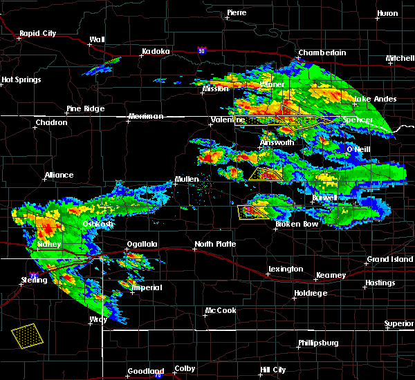 At 616 pm cdt, a severe thunderstorm was located 14 miles southwest of burke, or 19 miles northeast of springview, moving southeast at 35 mph (radar indicated). Hazards include ping pong ball size hail and 60 mph wind gusts. People and animals outdoors will be injured. expect hail damage to roofs, siding, windows, and vehicles. Expect wind damage to roofs, siding, and trees. At 616 pm cdt, a severe thunderstorm was located 14 miles southwest of burke, or 19 miles northeast of springview, moving southeast at 35 mph (radar indicated). Hazards include ping pong ball size hail and 60 mph wind gusts. People and animals outdoors will be injured. expect hail damage to roofs, siding, windows, and vehicles. Expect wind damage to roofs, siding, and trees.
|
| 6/13/2017 4:55 PM CDT |
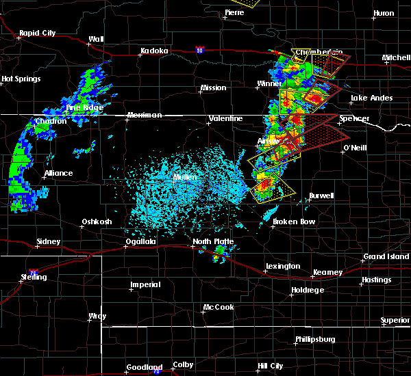 At 454 pm cdt, a severe thunderstorm capable of producing a tornado was located 9 miles southwest of naper, or 24 miles northeast of bassett, moving northeast at 30 mph (radar indicated rotation). Hazards include tornado and quarter size hail. Flying debris will be dangerous to those caught without shelter. mobile homes will be damaged or destroyed. damage to roofs, windows, and vehicles will occur. tree damage is likely. this dangerous storm will be near, naper around 515 pm cdt. other locations impacted by this tornadic thunderstorm include mills, brocksburg, mariaville, dustin and anoka. this includes the following highways, highway 281 near mile marker 223. Highway 12 between mile markers 67 and 107. At 454 pm cdt, a severe thunderstorm capable of producing a tornado was located 9 miles southwest of naper, or 24 miles northeast of bassett, moving northeast at 30 mph (radar indicated rotation). Hazards include tornado and quarter size hail. Flying debris will be dangerous to those caught without shelter. mobile homes will be damaged or destroyed. damage to roofs, windows, and vehicles will occur. tree damage is likely. this dangerous storm will be near, naper around 515 pm cdt. other locations impacted by this tornadic thunderstorm include mills, brocksburg, mariaville, dustin and anoka. this includes the following highways, highway 281 near mile marker 223. Highway 12 between mile markers 67 and 107.
|
| 6/13/2017 4:45 PM CDT |
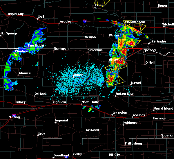 At 444 pm cdt, a severe thunderstorm capable of producing a tornado was located 15 miles southwest of naper, or 19 miles northeast of bassett, moving northeast at 30 mph (radar indicated rotation). Hazards include tornado and quarter size hail. Flying debris will be dangerous to those caught without shelter. mobile homes will be damaged or destroyed. damage to roofs, windows, and vehicles will occur. tree damage is likely. this dangerous storm will be near, naper around 515 pm cdt. Other locations impacted by this tornadic thunderstorm include mills, brocksburg, mariaville, dustin and anoka. At 444 pm cdt, a severe thunderstorm capable of producing a tornado was located 15 miles southwest of naper, or 19 miles northeast of bassett, moving northeast at 30 mph (radar indicated rotation). Hazards include tornado and quarter size hail. Flying debris will be dangerous to those caught without shelter. mobile homes will be damaged or destroyed. damage to roofs, windows, and vehicles will occur. tree damage is likely. this dangerous storm will be near, naper around 515 pm cdt. Other locations impacted by this tornadic thunderstorm include mills, brocksburg, mariaville, dustin and anoka.
|
| 6/13/2017 4:32 PM CDT |
 At 431 pm cdt, a severe thunderstorm capable of producing a tornado was located near naper, or 25 miles west of spencer, moving northeast at 35 mph (radar indicated rotation). Hazards include tornado and tennis ball size hail. Flying debris will be dangerous to those caught without shelter. mobile homes will be damaged or destroyed. damage to roofs, windows, and vehicles will occur. tree damage is likely. This dangerous storm will be near, naper around 440 pm cdt. At 431 pm cdt, a severe thunderstorm capable of producing a tornado was located near naper, or 25 miles west of spencer, moving northeast at 35 mph (radar indicated rotation). Hazards include tornado and tennis ball size hail. Flying debris will be dangerous to those caught without shelter. mobile homes will be damaged or destroyed. damage to roofs, windows, and vehicles will occur. tree damage is likely. This dangerous storm will be near, naper around 440 pm cdt.
|
| 6/13/2017 4:28 PM CDT |
 At 428 pm cdt, a severe thunderstorm was located near naper, or 26 miles west of spencer, moving northeast at 50 mph (radar indicated). Hazards include tennis ball size hail and 60 mph wind gusts. People and animals outdoors will be injured. expect hail damage to roofs, siding, windows, and vehicles. Expect wind damage to roofs, siding, and trees. At 428 pm cdt, a severe thunderstorm was located near naper, or 26 miles west of spencer, moving northeast at 50 mph (radar indicated). Hazards include tennis ball size hail and 60 mph wind gusts. People and animals outdoors will be injured. expect hail damage to roofs, siding, windows, and vehicles. Expect wind damage to roofs, siding, and trees.
|
| 6/13/2017 4:17 PM CDT | Ping Pong Ball sized hail reported 12.9 miles ENE of Naper, NE, hail latest approximately 10 minutes |
| 8/18/2016 9:27 PM CDT |
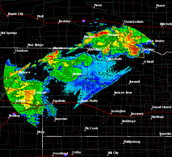 At 926 pm cdt, a severe thunderstorm was located near butte, or 11 miles west of spencer, moving east at 25 mph (radar indicated). Hazards include 60 mph wind gusts and quarter size hail. Hail damage to vehicles is expected. expect wind damage to roofs, siding, and trees. locations impacted include, spencer, butte, naper, dustin, anoka, parshall bridge state wildlife management area, hull lake state wildlife management area, spencer dam, midway and anncar. this includes the following highways, highway 281 between mile markers 199 and 223. Highway 12 between mile markers 90 and 118. At 926 pm cdt, a severe thunderstorm was located near butte, or 11 miles west of spencer, moving east at 25 mph (radar indicated). Hazards include 60 mph wind gusts and quarter size hail. Hail damage to vehicles is expected. expect wind damage to roofs, siding, and trees. locations impacted include, spencer, butte, naper, dustin, anoka, parshall bridge state wildlife management area, hull lake state wildlife management area, spencer dam, midway and anncar. this includes the following highways, highway 281 between mile markers 199 and 223. Highway 12 between mile markers 90 and 118.
|
| 8/18/2016 9:14 PM CDT |
 At 914 pm cdt, a severe thunderstorm was located 10 miles south of naper, or 16 miles west of spencer, moving east at 25 mph (radar indicated). Hazards include 60 mph wind gusts and half dollar size hail. Hail damage to vehicles is expected. Expect wind damage to roofs, siding, and trees. At 914 pm cdt, a severe thunderstorm was located 10 miles south of naper, or 16 miles west of spencer, moving east at 25 mph (radar indicated). Hazards include 60 mph wind gusts and half dollar size hail. Hail damage to vehicles is expected. Expect wind damage to roofs, siding, and trees.
|
| 7/6/2016 8:56 PM CDT | The severe thunderstorm warning for northern holt and boyd counties will expire at 900 pm cdt, the storms which prompted the warning have moved out of the area. therefore the warning will be allowed to expire. however gusty winds are still possible with these thunderstorms. a severe thunderstorm watch remains in effect until 1000 pm cdt for north central nebraska. |
| 7/6/2016 8:40 PM CDT |
 At 839 pm cdt, severe thunderstorms were located along a line extending from 6 miles south of bonesteel to near spencer to 9 miles northeast of atkinson to near stuart, moving east at 45 mph (radar indicated). Hazards include 70 mph wind gusts. Expect considerable tree damage. damage is likely to mobile homes, roofs, and outbuildings. locations impacted include, spencer, atkinson, stuart, butte, lynch, naper, gross, bristow, emmet, dustin, anoka, scottville, anncar, redbird state wildlife management area, parshall bridge state wildlife management area, hull lake state wildlife management area, spencer dam, midway and opportunity. this includes the following highways, highway 20 between mile markers 276 and 301. Highway 281 between mile markers 188 and 223. At 839 pm cdt, severe thunderstorms were located along a line extending from 6 miles south of bonesteel to near spencer to 9 miles northeast of atkinson to near stuart, moving east at 45 mph (radar indicated). Hazards include 70 mph wind gusts. Expect considerable tree damage. damage is likely to mobile homes, roofs, and outbuildings. locations impacted include, spencer, atkinson, stuart, butte, lynch, naper, gross, bristow, emmet, dustin, anoka, scottville, anncar, redbird state wildlife management area, parshall bridge state wildlife management area, hull lake state wildlife management area, spencer dam, midway and opportunity. this includes the following highways, highway 20 between mile markers 276 and 301. Highway 281 between mile markers 188 and 223.
|
| 7/6/2016 8:16 PM CDT |
 At 816 pm cdt, severe thunderstorms were located along a line extending from 7 miles northwest of naper to 12 miles southwest of butte to stuart to 9 miles southwest of newport, moving east at 45 mph (radar indicated). Hazards include 70 mph wind gusts. Expect considerable tree damage. damage is likely to mobile homes, roofs, and outbuildings. locations impacted include, spencer, atkinson, stuart, butte, lynch, newport, naper, gross, bristow, emmet, dustin, anoka, scottville, anncar, redbird state wildlife management area, parshall bridge state wildlife management area, hull lake state wildlife management area, brocksburg, mariaville and mills. this includes the following highways, highway 20 between mile markers 264 and 301. highway 281 between mile markers 188 and 223. A tornado watch remains in effect until 1000 pm cdt for north central nebraska. At 816 pm cdt, severe thunderstorms were located along a line extending from 7 miles northwest of naper to 12 miles southwest of butte to stuart to 9 miles southwest of newport, moving east at 45 mph (radar indicated). Hazards include 70 mph wind gusts. Expect considerable tree damage. damage is likely to mobile homes, roofs, and outbuildings. locations impacted include, spencer, atkinson, stuart, butte, lynch, newport, naper, gross, bristow, emmet, dustin, anoka, scottville, anncar, redbird state wildlife management area, parshall bridge state wildlife management area, hull lake state wildlife management area, brocksburg, mariaville and mills. this includes the following highways, highway 20 between mile markers 264 and 301. highway 281 between mile markers 188 and 223. A tornado watch remains in effect until 1000 pm cdt for north central nebraska.
|
| 7/6/2016 8:00 PM CDT |
 At 759 pm cdt, severe thunderstorms were located along a line extending from 15 miles southwest of burke to 12 miles northwest of stuart to near newport to 7 miles southeast of long pine, moving east at 45 mph (radar indicated). Hazards include 70 mph wind gusts. Expect considerable tree damage. Damage is likely to mobile homes, roofs, and outbuildings. At 759 pm cdt, severe thunderstorms were located along a line extending from 15 miles southwest of burke to 12 miles northwest of stuart to near newport to 7 miles southeast of long pine, moving east at 45 mph (radar indicated). Hazards include 70 mph wind gusts. Expect considerable tree damage. Damage is likely to mobile homes, roofs, and outbuildings.
|
| 6/29/2016 10:40 PM CDT | The severe thunderstorm warning for eastern blaine, garfield, eastern keya paha, western holt, loup, brown, western boyd and rock counties will expire at 1045 pm cdt, the storms which prompted the warning have moved out of the area. therefore the warning will be allowed to expire. a severe thunderstorm watch remains in effect until 300 am cdt for north central nebraska. |
| 6/29/2016 10:21 PM CDT |
 At 1020 pm cdt, severe thunderstorms were located along a line extending from 7 miles southwest of naper to rose to 7 miles northwest of brewster, moving southeast at 35 mph (radar indicated). Hazards include 60 mph wind gusts. Expect damage to roofs. siding. and trees. locations impacted include, ainsworth, burwell, bassett, spencer, taylor, brewster, atkinson, stuart, butte, long pine, newport, naper, amelia, calamus reservoir state recreation area, rose, emmet, dustin, anoka, kent diversion dam state wildlife management area and anncar. this includes the following highways, highway 183 between mile markers 124 and 204. highway 20 between mile markers 238 and 301. Highway 281 between mile markers 214 and 223. At 1020 pm cdt, severe thunderstorms were located along a line extending from 7 miles southwest of naper to rose to 7 miles northwest of brewster, moving southeast at 35 mph (radar indicated). Hazards include 60 mph wind gusts. Expect damage to roofs. siding. and trees. locations impacted include, ainsworth, burwell, bassett, spencer, taylor, brewster, atkinson, stuart, butte, long pine, newport, naper, amelia, calamus reservoir state recreation area, rose, emmet, dustin, anoka, kent diversion dam state wildlife management area and anncar. this includes the following highways, highway 183 between mile markers 124 and 204. highway 20 between mile markers 238 and 301. Highway 281 between mile markers 214 and 223.
|
| 6/29/2016 10:05 PM CDT |
 At 1004 pm cdt, severe thunderstorms were located along a line extending from 10 miles west of naper to 7 miles northwest of rose to 8 miles southeast of elsmere, moving southeast at 45 mph (radar indicated). Hazards include 60 mph wind gusts. Expect damage to roofs. siding. And trees. At 1004 pm cdt, severe thunderstorms were located along a line extending from 10 miles west of naper to 7 miles northwest of rose to 8 miles southeast of elsmere, moving southeast at 45 mph (radar indicated). Hazards include 60 mph wind gusts. Expect damage to roofs. siding. And trees.
|
| 6/17/2016 10:57 PM CDT | The severe thunderstorm warning for northeastern holt and boyd counties will expire at 1100 pm cdt, the storms which prompted the warning have weakened below severe limits, and no longer pose an immediate threat to life or property. therefore the warning will be allowed to expire. however small hail, gusty winds and heavy rain are still possible with these thunderstorms. to report severe weather, contact your nearest law enforcement agency. they will relay your report to the national weather service north platte. |
| 6/17/2016 10:51 PM CDT |
 At 1051 pm cdt, severe thunderstorms were located along a line extending from 11 miles north of stuart to near o`neill, moving southwest at 60 mph (radar indicated). Hazards include 60 mph wind gusts and penny size hail. Expect damage to roofs. siding. and trees. these severe thunderstorms will remain over mainly rural areas of northeastern holt and boyd counties, including the following locations: dustin, scottville, anoka, monowi, anncar, redbird state wildlife management area, parshall bridge state wildlife management area, hull lake state wildlife management area, spencer dam and midway. this includes the following highways, highway 20 between mile markers 305 and 313, and between mile markers 326 and 328. Highway 281 between mile markers 182 and 223. At 1051 pm cdt, severe thunderstorms were located along a line extending from 11 miles north of stuart to near o`neill, moving southwest at 60 mph (radar indicated). Hazards include 60 mph wind gusts and penny size hail. Expect damage to roofs. siding. and trees. these severe thunderstorms will remain over mainly rural areas of northeastern holt and boyd counties, including the following locations: dustin, scottville, anoka, monowi, anncar, redbird state wildlife management area, parshall bridge state wildlife management area, hull lake state wildlife management area, spencer dam and midway. this includes the following highways, highway 20 between mile markers 305 and 313, and between mile markers 326 and 328. Highway 281 between mile markers 182 and 223.
|
| 6/17/2016 10:32 PM CDT |
 At 1031 pm cdt, severe thunderstorms were located along a line extending from 8 miles northwest of gross to 9 miles southwest of niobrara, moving southwest at 45 mph (radar indicated). Hazards include 70 mph wind gusts and penny size hail. Expect considerable tree damage. damage is likely to mobile homes, roofs, and outbuildings. severe thunderstorms will be near, spencer and butte around 1035 pm cdt. o`neill and oneill around 1050 pm cdt. Other locations impacted by these severe thunderstorms include dustin, scottville, anoka, monowi, anncar, redbird state wildlife management area, parshall bridge state wildlife management area, hull lake state wildlife management area, spencer dam and midway. At 1031 pm cdt, severe thunderstorms were located along a line extending from 8 miles northwest of gross to 9 miles southwest of niobrara, moving southwest at 45 mph (radar indicated). Hazards include 70 mph wind gusts and penny size hail. Expect considerable tree damage. damage is likely to mobile homes, roofs, and outbuildings. severe thunderstorms will be near, spencer and butte around 1035 pm cdt. o`neill and oneill around 1050 pm cdt. Other locations impacted by these severe thunderstorms include dustin, scottville, anoka, monowi, anncar, redbird state wildlife management area, parshall bridge state wildlife management area, hull lake state wildlife management area, spencer dam and midway.
|
| 5/25/2016 7:05 PM CDT | Quarter sized hail reported 4.2 miles NW of Naper, NE, hail up to quarter size |
| 5/25/2016 6:55 PM CDT |
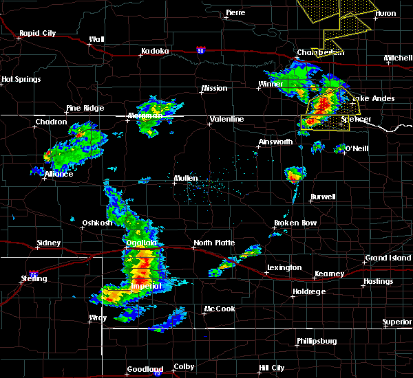 At 655 pm cdt, a severe thunderstorm was located near naper, or 21 miles west of spencer, moving east at 20 mph (radar indicated). Hazards include 60 mph wind gusts and quarter size hail. Hail damage to vehicles is expected. Expect wind damage to roofs, siding, and trees. At 655 pm cdt, a severe thunderstorm was located near naper, or 21 miles west of spencer, moving east at 20 mph (radar indicated). Hazards include 60 mph wind gusts and quarter size hail. Hail damage to vehicles is expected. Expect wind damage to roofs, siding, and trees.
|
| 7/26/2015 9:10 PM CDT |
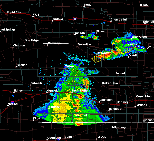 The severe thunderstorm warning for northeastern rock, northwestern holt and boyd counties will expire at 915 pm cdt, the storms which prompted the warning have weakened below severe limits, and no longer pose an immediate threat to life or property. therefore the warning will be allowed to expire. to report severe weather, contact your nearest law enforcement agency. they will relay your report to the national weather service north platte. The severe thunderstorm warning for northeastern rock, northwestern holt and boyd counties will expire at 915 pm cdt, the storms which prompted the warning have weakened below severe limits, and no longer pose an immediate threat to life or property. therefore the warning will be allowed to expire. to report severe weather, contact your nearest law enforcement agency. they will relay your report to the national weather service north platte.
|
| 7/26/2015 8:49 PM CDT |
 At 848 pm cdt, severe thunderstorms were located along a line extending from near naper to 13 miles west of butte to 9 miles north of newport, moving east at 20 mph (radar indicated). Hazards include 60 mph wind gusts and quarter size hail. Hail damage to vehicles is expected. expect wind damage to roofs, siding and trees. these severe storms will be near, naper around 905 pm cdt. butte around 915 pm cdt. Other locations impacted by these severe thunderstorms include hull lake state wildlife management area, parshall bridge state wildlife management area, dustin, spencer dam, anoka, midway, anncar and bristow. At 848 pm cdt, severe thunderstorms were located along a line extending from near naper to 13 miles west of butte to 9 miles north of newport, moving east at 20 mph (radar indicated). Hazards include 60 mph wind gusts and quarter size hail. Hail damage to vehicles is expected. expect wind damage to roofs, siding and trees. these severe storms will be near, naper around 905 pm cdt. butte around 915 pm cdt. Other locations impacted by these severe thunderstorms include hull lake state wildlife management area, parshall bridge state wildlife management area, dustin, spencer dam, anoka, midway, anncar and bristow.
|
| 7/26/2015 8:35 PM CDT |
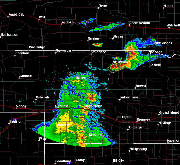 At 835 pm cdt, severe thunderstorms were located along a line extending from near naper to 14 miles west of butte to 9 miles north of newport, moving east at 40 mph (radar indicated). Hazards include 60 mph wind gusts and quarter size hail. Hail damage to vehicles is expected. expect wind damage to roofs, siding and trees. severe thunderstorms will be near, naper around 845 pm cdt. butte around 855 pm cdt. spencer around 905 pm cdt. gross and lynch around 915 pm cdt. Other locations impacted by these severe thunderstorms include hull lake state wildlife management area, parshall bridge state wildlife management area, brocksburg, dustin, mariaville, spencer dam, anoka, midway, anncar and bristow. At 835 pm cdt, severe thunderstorms were located along a line extending from near naper to 14 miles west of butte to 9 miles north of newport, moving east at 40 mph (radar indicated). Hazards include 60 mph wind gusts and quarter size hail. Hail damage to vehicles is expected. expect wind damage to roofs, siding and trees. severe thunderstorms will be near, naper around 845 pm cdt. butte around 855 pm cdt. spencer around 905 pm cdt. gross and lynch around 915 pm cdt. Other locations impacted by these severe thunderstorms include hull lake state wildlife management area, parshall bridge state wildlife management area, brocksburg, dustin, mariaville, spencer dam, anoka, midway, anncar and bristow.
|
| 6/20/2015 3:09 AM CDT |
 The severe thunderstorm warning for northern rock, keya paha, northern holt, northeastern brown and boyd counties will expire at 215 am mdt, the storms which prompted the warning have weakened below severe limits, and no longer pose an immediate threat to life or property. however, gusty winds are still possible with these thunderstorms. The severe thunderstorm warning for northern rock, keya paha, northern holt, northeastern brown and boyd counties will expire at 215 am mdt, the storms which prompted the warning have weakened below severe limits, and no longer pose an immediate threat to life or property. however, gusty winds are still possible with these thunderstorms.
|
| 6/20/2015 2:53 AM CDT |
 At 251 am cdt, a severe thunderstorm was located 9 miles southeast of mills, and moving east at 45 mph (radar indicated). Hazards include 60 mph wind gusts. Expect damage to roofs. siding and trees. locations impacted include, spencer, oneill, stuart, naper, atkinson, butte, anoka, bristow, gross, lynch, emmet, monowi, dustin, hull lake state wildlife management area, parshall bridge state wildlife management area, anncar, spencer dam, midway, scottville and redbird state wildlife management area. this includes highway 20 between mile markers 237 and 309. This includes highway 183 between mile markers 175 and 225. At 251 am cdt, a severe thunderstorm was located 9 miles southeast of mills, and moving east at 45 mph (radar indicated). Hazards include 60 mph wind gusts. Expect damage to roofs. siding and trees. locations impacted include, spencer, oneill, stuart, naper, atkinson, butte, anoka, bristow, gross, lynch, emmet, monowi, dustin, hull lake state wildlife management area, parshall bridge state wildlife management area, anncar, spencer dam, midway, scottville and redbird state wildlife management area. this includes highway 20 between mile markers 237 and 309. This includes highway 183 between mile markers 175 and 225.
|
| 6/20/2015 2:40 AM CDT |
 At 239 am cdt, a severe thunderstorm was located 7 miles southwest of mills, and moving east at 45 mph (radar indicated). Hazards include 60 mph wind gusts. Expect damage to roofs. siding and trees. locations impacted include, spencer, oneill, mills, newport, stuart, naper, atkinson, butte, anoka, bristow, gross, lynch, emmet, monowi, brocksburg, mariaville, dustin, hull lake state wildlife management area, parshall bridge state wildlife management area and anncar. this includes highway 20 between mile markers 237 and 309. This includes highway 183 between mile markers 175 and 225. At 239 am cdt, a severe thunderstorm was located 7 miles southwest of mills, and moving east at 45 mph (radar indicated). Hazards include 60 mph wind gusts. Expect damage to roofs. siding and trees. locations impacted include, spencer, oneill, mills, newport, stuart, naper, atkinson, butte, anoka, bristow, gross, lynch, emmet, monowi, brocksburg, mariaville, dustin, hull lake state wildlife management area, parshall bridge state wildlife management area and anncar. this includes highway 20 between mile markers 237 and 309. This includes highway 183 between mile markers 175 and 225.
|
| 6/20/2015 2:10 AM CDT |
 At 209 am cdt, a severe thunderstorm was located 8 miles west of springview, and moving east at 45 mph (radar indicated). Hazards include 60 mph wind gusts. Expect damage to roofs. Siding and trees. At 209 am cdt, a severe thunderstorm was located 8 miles west of springview, and moving east at 45 mph (radar indicated). Hazards include 60 mph wind gusts. Expect damage to roofs. Siding and trees.
|
| 6/16/2014 8:00 PM CDT | Quarter sized hail reported 0.3 miles NE of Naper, NE |
| 6/16/2014 7:39 PM CDT | Quarter sized hail reported 6.3 miles E of Naper, NE, mostly smaller size hail...but a few stones to the size of quarters. |
| 8/1/2013 2:05 PM CDT | Quarter sized hail reported 6 miles W of Naper, NE |
| 1/1/0001 12:00 AM | Storm damage reported in boyd county NE, 0.3 miles NE of Naper, NE |
| 1/1/0001 12:00 AM | Quarter sized hail reported 0.9 miles WNW of Naper, NE |
Hail Maps for Naper, NE
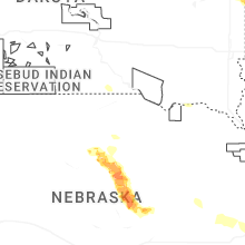
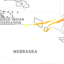


Connect with Interactive Hail Maps