

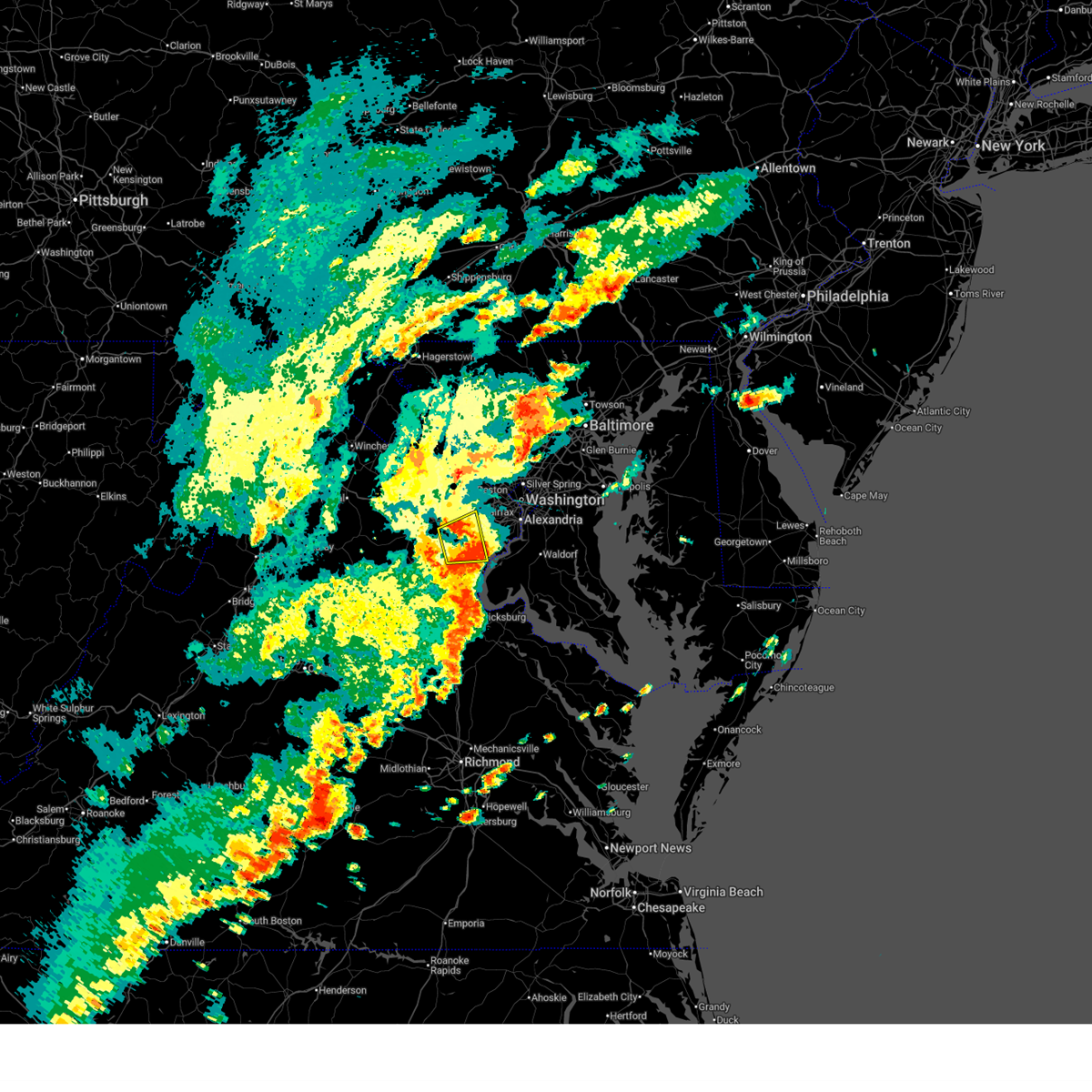
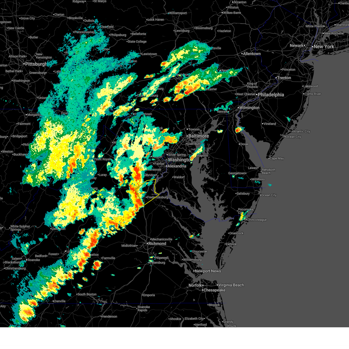
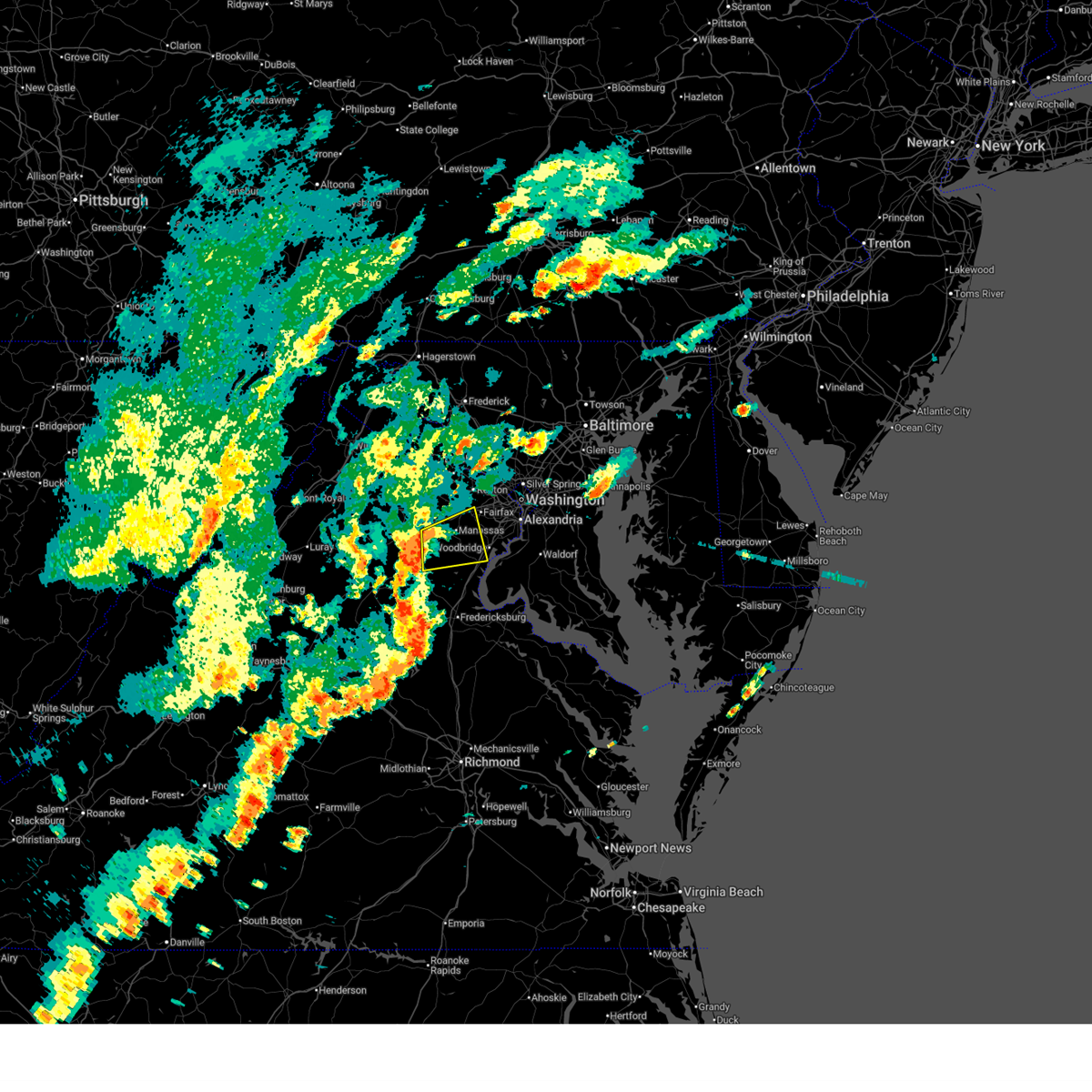
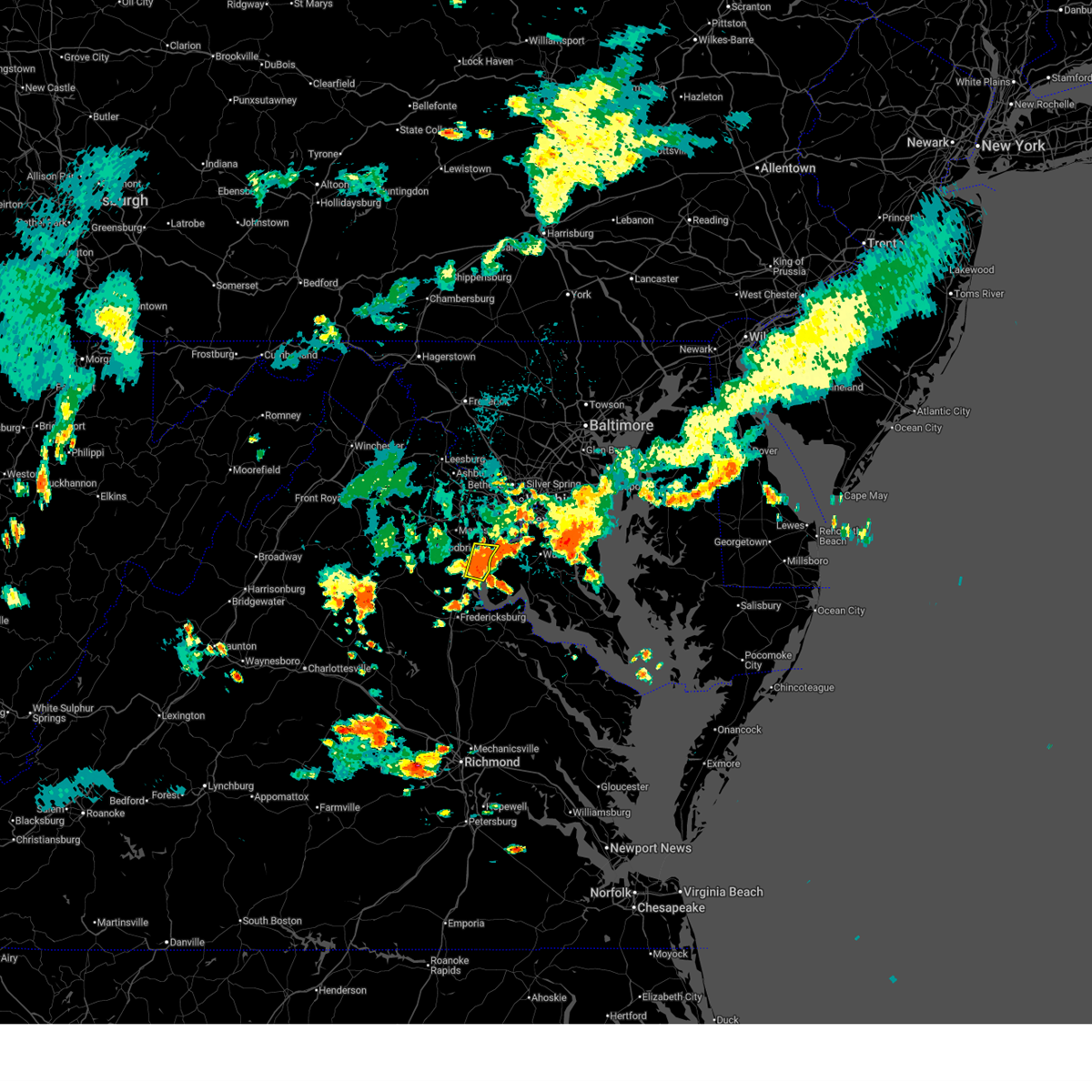
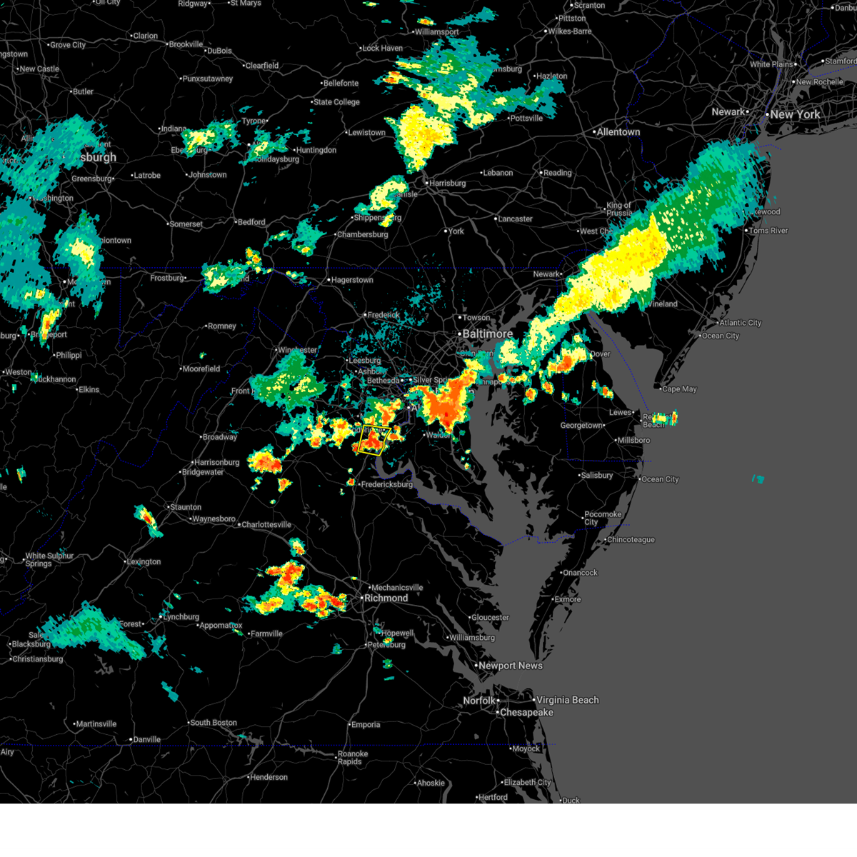
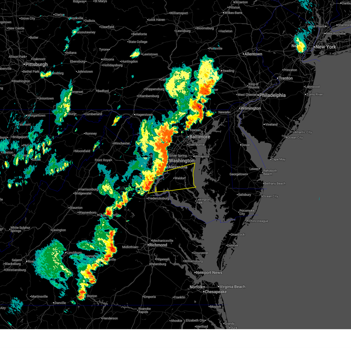
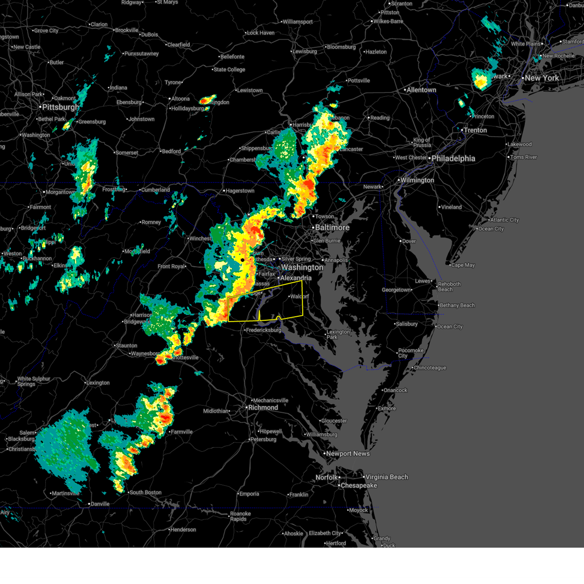
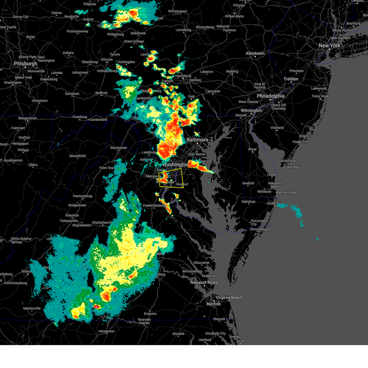
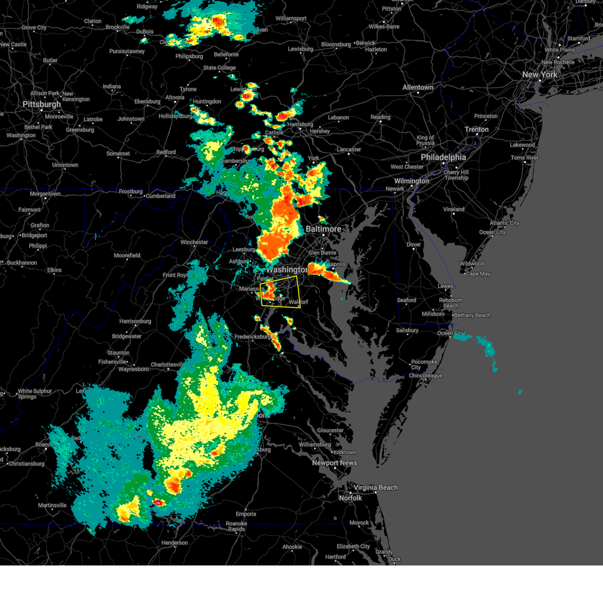
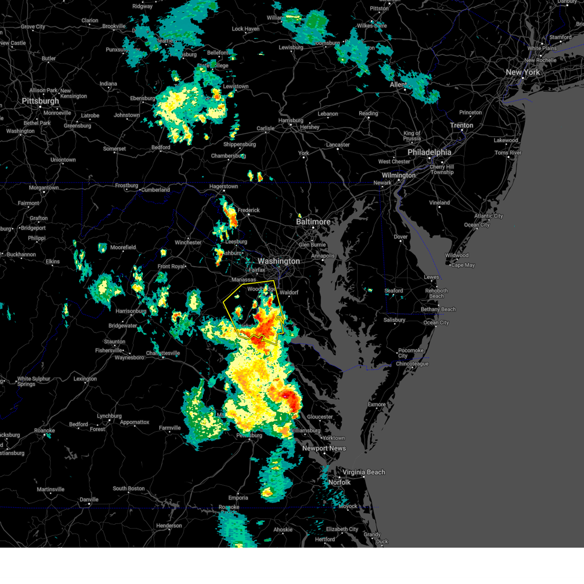
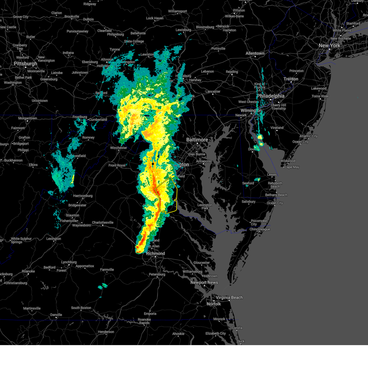
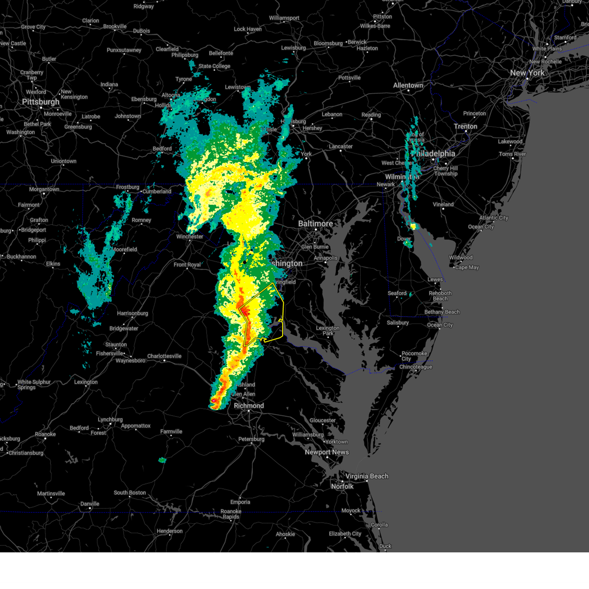
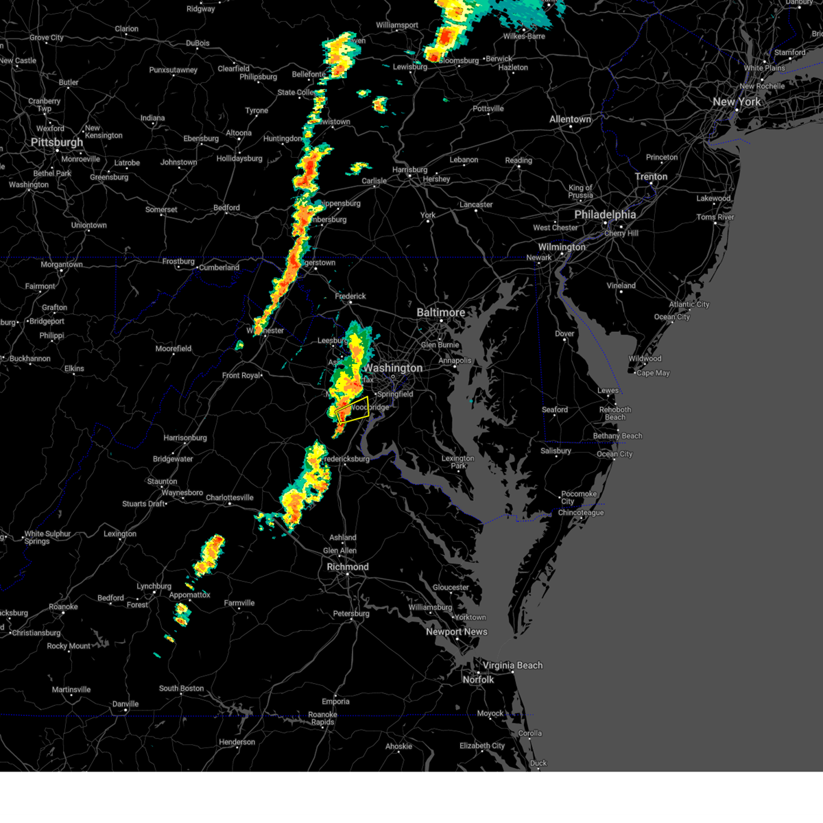
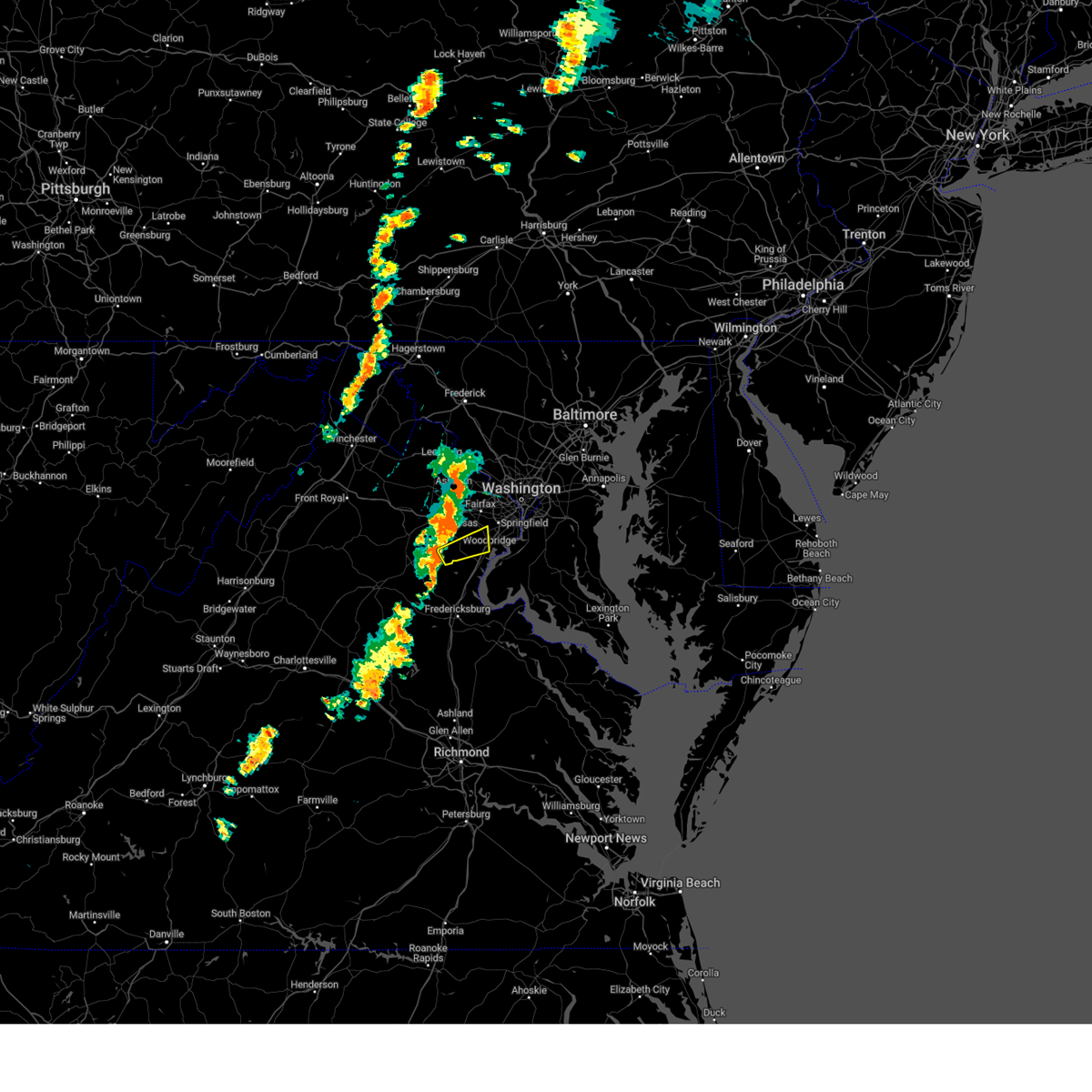
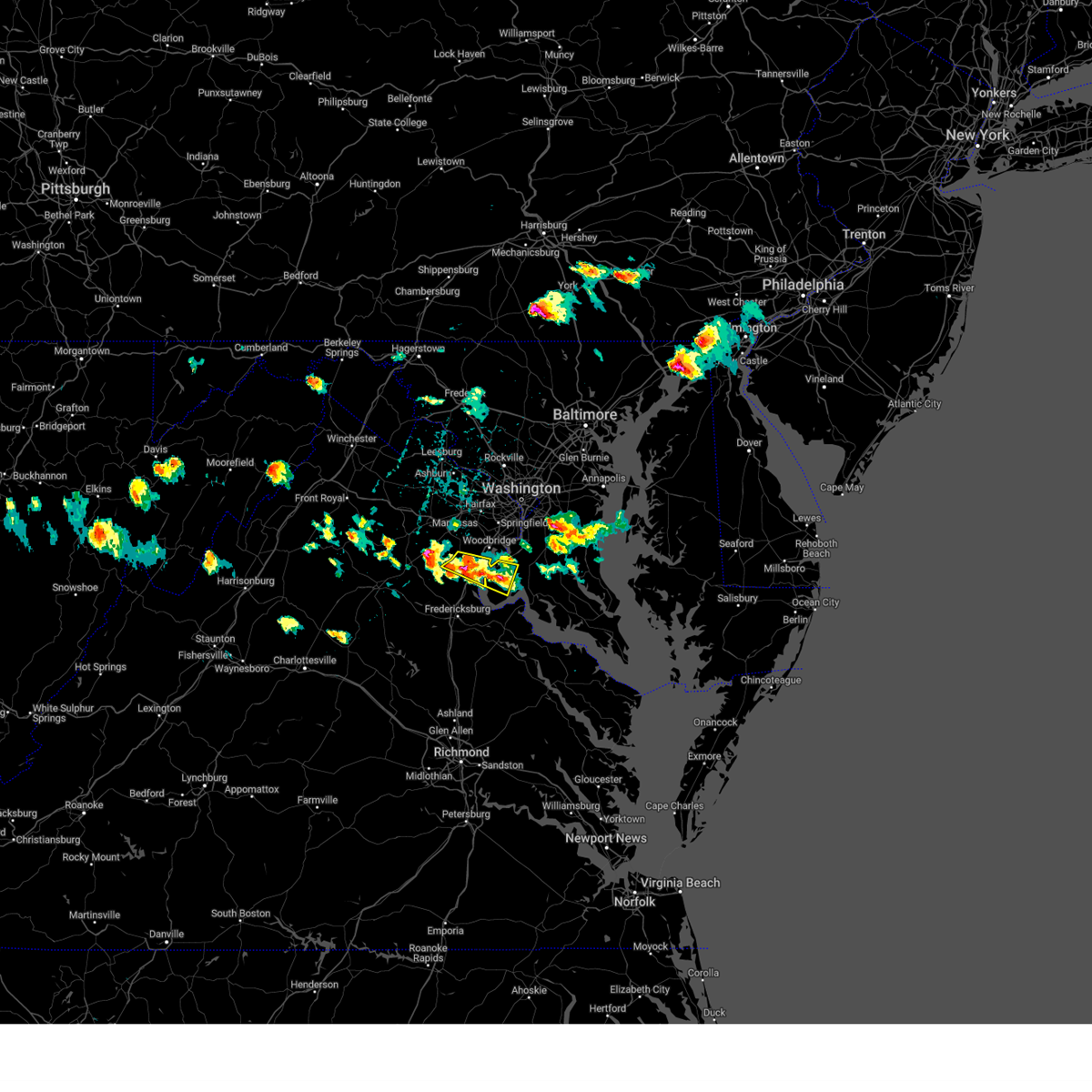
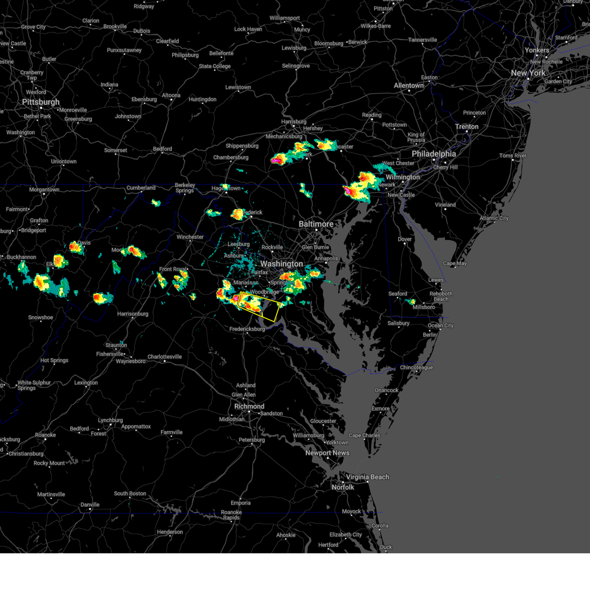
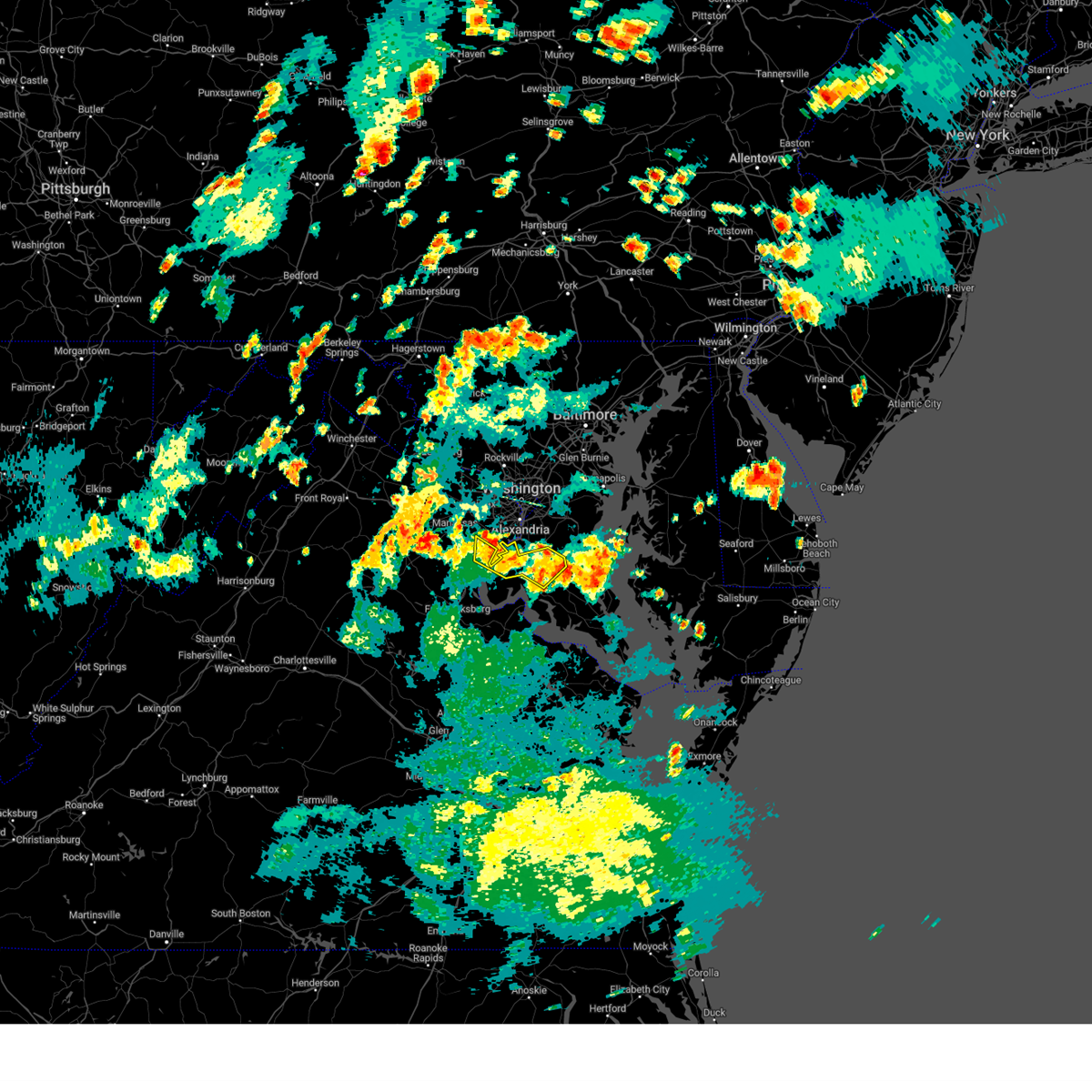
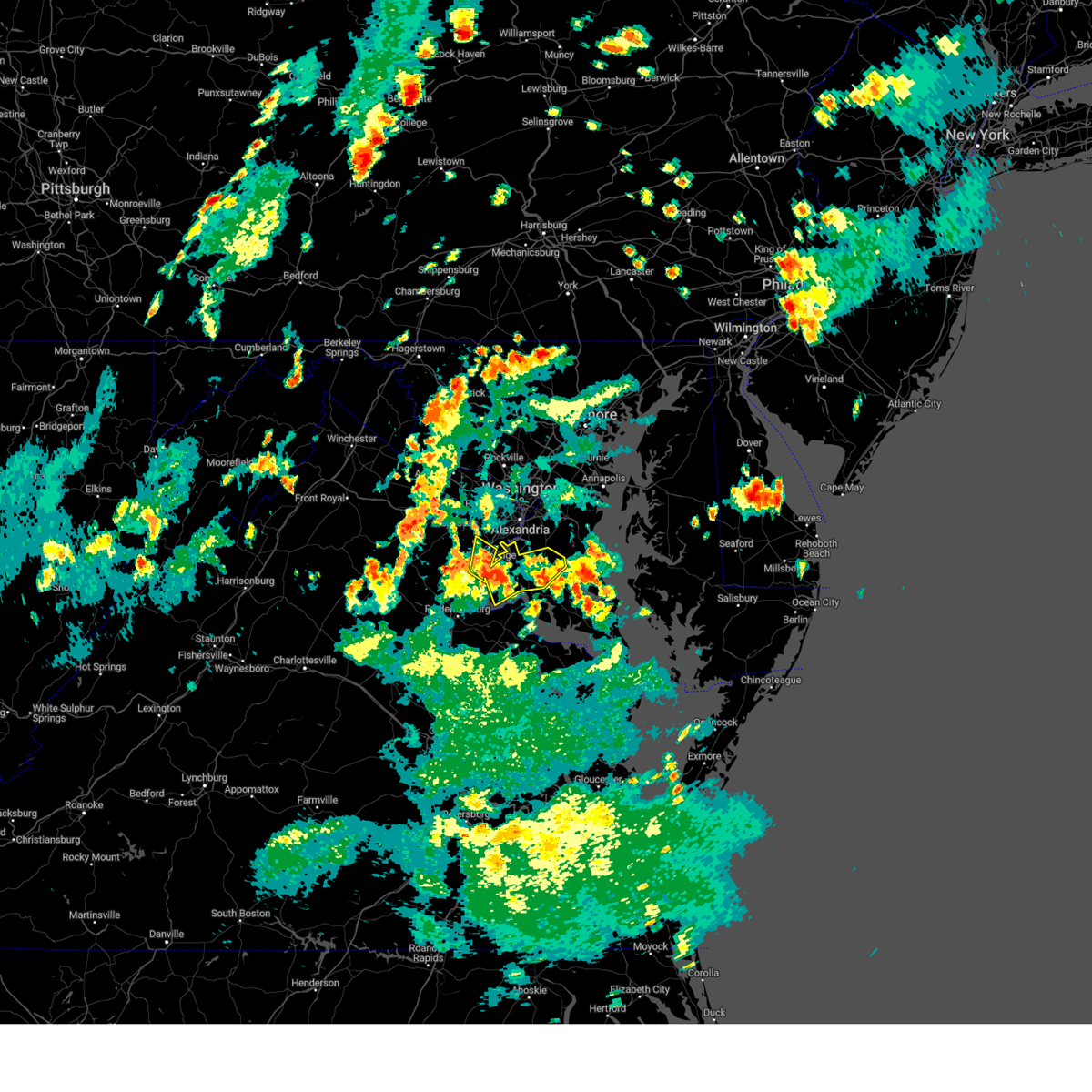
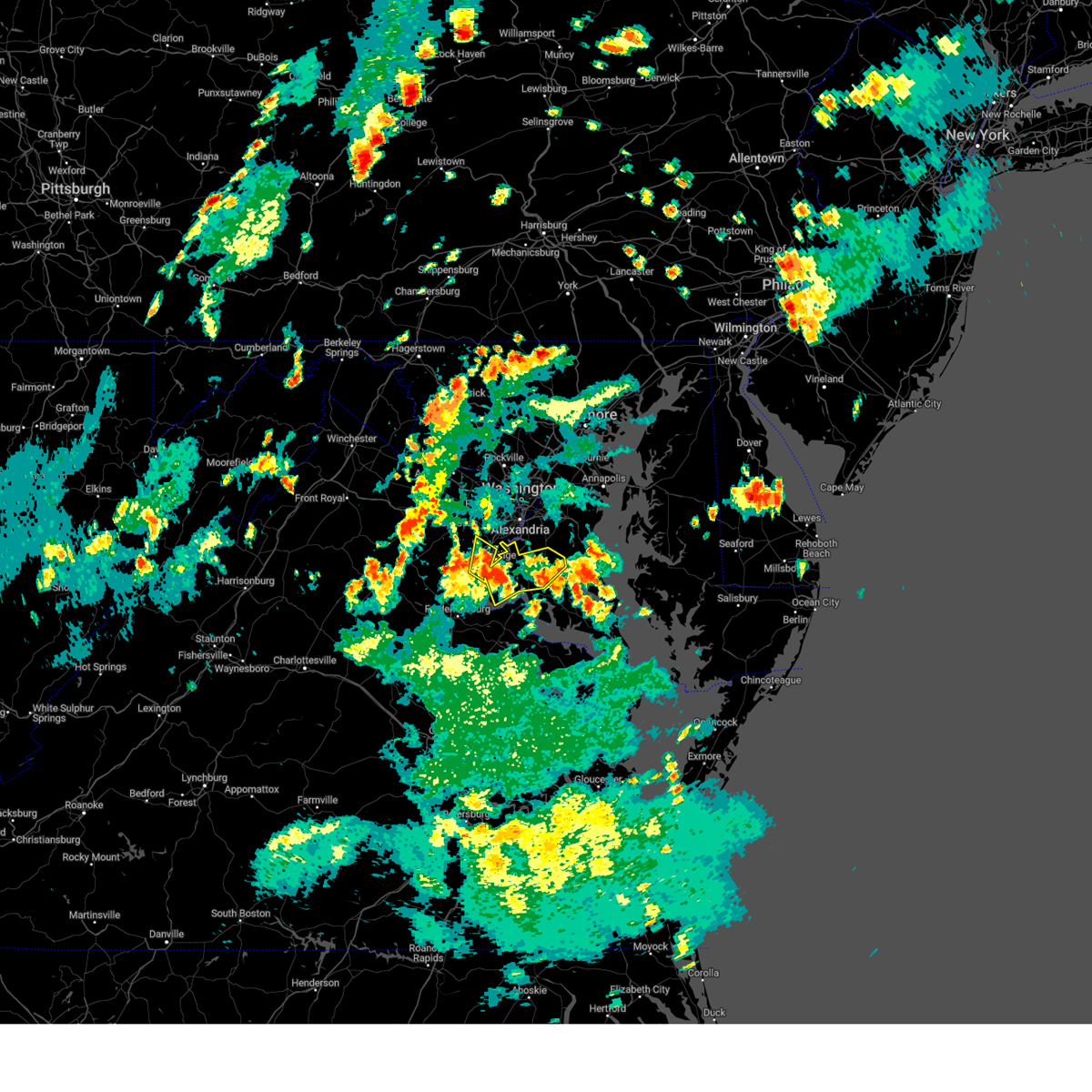
Hail Map for Neabsco, VA
The Neabsco, VA area has had 0 reports of on-the-ground hail by trained spotters, and has been under severe weather warnings 25 times during the past 12 months. Doppler radar has detected hail at or near Neabsco, VA on 58 occasions, including 3 occasions during the past year.
| Name: | Neabsco, VA |
| Where Located: | 59.5 miles SW of Baltimore, MD |
| Map: | Google Map for Neabsco, VA |
| Population: | 12068 |
| Housing Units: | 4114 |
| More Info: | Search Google for Neabsco, VA |
0
The Top Recent Hail Date for Neabsco, VA is Thursday, June 26, 2025 (31st out of 58)

Hail and Wind Damage Spotted near Neabsco, VA
| Date / Time | Report Details |
|---|---|
| 7/9/2025 6:01 PM EDT |
 The storms which prompted the warning have weakened below severe limits, and no longer pose an immediate threat to life or property. therefore, the warning has been allowed to expire. however, gusty winds are still possible with these thunderstorms. a severe thunderstorm watch remains in effect until 1000 pm edt for northern and central virginia. The storms which prompted the warning have weakened below severe limits, and no longer pose an immediate threat to life or property. therefore, the warning has been allowed to expire. however, gusty winds are still possible with these thunderstorms. a severe thunderstorm watch remains in effect until 1000 pm edt for northern and central virginia.
|
| 7/9/2025 6:00 PM EDT |
 The storm which prompted the warning has weakened below severe limits, and no longer poses an immediate threat to life or property. therefore, the warning has been allowed to expire. however, gusty winds are still possible with this thunderstorm. a severe thunderstorm watch remains in effect until 1000 pm edt for northern virginia. The storm which prompted the warning has weakened below severe limits, and no longer poses an immediate threat to life or property. therefore, the warning has been allowed to expire. however, gusty winds are still possible with this thunderstorm. a severe thunderstorm watch remains in effect until 1000 pm edt for northern virginia.
|
| 7/9/2025 5:32 PM EDT | the severe thunderstorm warning has been cancelled and is no longer in effect |
| 7/9/2025 5:32 PM EDT | At 532 pm edt, a severe thunderstorm was located near linton hall, or 9 miles west of dale city, moving east at 25 mph (radar indicated). Hazards include 70 mph wind gusts. Damaging winds will cause some trees and large branches to fall. this could injure those outdoors, as well as damage homes and vehicles. roadways may become blocked by downed trees. localized power outages are possible. unsecured light objects may become projectiles. Locations impacted include, centreville, dale city, lake ridge, linton hall, montclair, bull run, manassas, sudley, cherry hill, manassas park, fairfax station, independent hill, nokesville, clifton, and aden. |
| 7/9/2025 5:25 PM EDT |
 Svrlwx the national weather service in sterling virginia has issued a * severe thunderstorm warning for, stafford county in northern virginia, west central king george county in central virginia, the city of fredericksburg in central virginia, southern fauquier county in northern virginia, eastern culpeper county in northern virginia, southeastern prince william county in northern virginia, northeastern spotsylvania county in central virginia, * until 600 pm edt. * at 525 pm edt, severe thunderstorms were located along a line extending from 9 miles northwest of fredericksburg to spotsylvania, moving northeast at 30 mph (radar indicated). Hazards include 60 mph wind gusts. Damaging winds will cause some trees and large branches to fall. this could injure those outdoors, as well as damage homes and vehicles. roadways may become blocked by downed trees. localized power outages are possible. Unsecured light objects may become projectiles. Svrlwx the national weather service in sterling virginia has issued a * severe thunderstorm warning for, stafford county in northern virginia, west central king george county in central virginia, the city of fredericksburg in central virginia, southern fauquier county in northern virginia, eastern culpeper county in northern virginia, southeastern prince william county in northern virginia, northeastern spotsylvania county in central virginia, * until 600 pm edt. * at 525 pm edt, severe thunderstorms were located along a line extending from 9 miles northwest of fredericksburg to spotsylvania, moving northeast at 30 mph (radar indicated). Hazards include 60 mph wind gusts. Damaging winds will cause some trees and large branches to fall. this could injure those outdoors, as well as damage homes and vehicles. roadways may become blocked by downed trees. localized power outages are possible. Unsecured light objects may become projectiles.
|
| 7/9/2025 5:14 PM EDT |
 Svrlwx the national weather service in sterling virginia has issued a * severe thunderstorm warning for, north central stafford county in northern virginia, southwestern fairfax county in northern virginia, southeastern fauquier county in northern virginia, the city of manassas park in northern virginia, prince william county in northern virginia, the city of manassas in northern virginia, * until 600 pm edt. * at 514 pm edt, a severe thunderstorm was located 8 miles northeast of bealeton, or 8 miles southeast of warrenton, moving east at 25 mph (radar indicated). Hazards include 60 mph wind gusts. Damaging winds will cause some trees and large branches to fall. this could injure those outdoors, as well as damage homes and vehicles. roadways may become blocked by downed trees. localized power outages are possible. Unsecured light objects may become projectiles. Svrlwx the national weather service in sterling virginia has issued a * severe thunderstorm warning for, north central stafford county in northern virginia, southwestern fairfax county in northern virginia, southeastern fauquier county in northern virginia, the city of manassas park in northern virginia, prince william county in northern virginia, the city of manassas in northern virginia, * until 600 pm edt. * at 514 pm edt, a severe thunderstorm was located 8 miles northeast of bealeton, or 8 miles southeast of warrenton, moving east at 25 mph (radar indicated). Hazards include 60 mph wind gusts. Damaging winds will cause some trees and large branches to fall. this could injure those outdoors, as well as damage homes and vehicles. roadways may become blocked by downed trees. localized power outages are possible. Unsecured light objects may become projectiles.
|
| 6/26/2025 10:22 PM EDT |
 At 1022 pm edt, a severe thunderstorm was located over montclair, or near dale city, and is nearly stationary (radar indicated). Hazards include 60 mph wind gusts. Damaging winds will cause some trees and large branches to fall. this could injure those outdoors, as well as damage homes and vehicles. roadways may become blocked by downed trees. localized power outages are possible. unsecured light objects may become projectiles. Locations impacted include, dale city, woodbridge, quantico, lake ridge, montclair, lorton, triangle, dumfries, cherry hill, and mason neck. At 1022 pm edt, a severe thunderstorm was located over montclair, or near dale city, and is nearly stationary (radar indicated). Hazards include 60 mph wind gusts. Damaging winds will cause some trees and large branches to fall. this could injure those outdoors, as well as damage homes and vehicles. roadways may become blocked by downed trees. localized power outages are possible. unsecured light objects may become projectiles. Locations impacted include, dale city, woodbridge, quantico, lake ridge, montclair, lorton, triangle, dumfries, cherry hill, and mason neck.
|
| 6/26/2025 10:05 PM EDT |
 Svrlwx the national weather service in sterling virginia has issued a * severe thunderstorm warning for, northeastern stafford county in northern virginia, southern fairfax county in northern virginia, southeastern prince william county in northern virginia, * until 1045 pm edt. * at 1005 pm edt, a severe thunderstorm was located over dumfries, or near quantico, and is nearly stationary (radar indicated). Hazards include 60 mph wind gusts. Damaging winds will cause some trees and large branches to fall. this could injure those outdoors, as well as damage homes and vehicles. roadways may become blocked by downed trees. localized power outages are possible. Unsecured light objects may become projectiles. Svrlwx the national weather service in sterling virginia has issued a * severe thunderstorm warning for, northeastern stafford county in northern virginia, southern fairfax county in northern virginia, southeastern prince william county in northern virginia, * until 1045 pm edt. * at 1005 pm edt, a severe thunderstorm was located over dumfries, or near quantico, and is nearly stationary (radar indicated). Hazards include 60 mph wind gusts. Damaging winds will cause some trees and large branches to fall. this could injure those outdoors, as well as damage homes and vehicles. roadways may become blocked by downed trees. localized power outages are possible. Unsecured light objects may become projectiles.
|
| 6/19/2025 4:27 PM EDT |
 Svrlwx the national weather service in sterling virginia has issued a * severe thunderstorm warning for, southeastern anne arundel county in central maryland, northwestern st. marys county in southern maryland, calvert county in southern maryland, southern prince georges county in central maryland, charles county in southern maryland, east central stafford county in northern virginia, southeastern fairfax county in northern virginia, southeastern prince william county in northern virginia, * until 530 pm edt. * at 426 pm edt, a severe thunderstorm was located over quantico, moving east at 50 mph (emergency management). Hazards include 60 mph wind gusts. Damaging winds will cause some trees and large branches to fall. this could injure those outdoors, as well as damage homes and vehicles. roadways may become blocked by downed trees. localized power outages are possible. Unsecured light objects may become projectiles. Svrlwx the national weather service in sterling virginia has issued a * severe thunderstorm warning for, southeastern anne arundel county in central maryland, northwestern st. marys county in southern maryland, calvert county in southern maryland, southern prince georges county in central maryland, charles county in southern maryland, east central stafford county in northern virginia, southeastern fairfax county in northern virginia, southeastern prince william county in northern virginia, * until 530 pm edt. * at 426 pm edt, a severe thunderstorm was located over quantico, moving east at 50 mph (emergency management). Hazards include 60 mph wind gusts. Damaging winds will cause some trees and large branches to fall. this could injure those outdoors, as well as damage homes and vehicles. roadways may become blocked by downed trees. localized power outages are possible. Unsecured light objects may become projectiles.
|
| 6/19/2025 4:05 PM EDT |
 Svrlwx the national weather service in sterling virginia has issued a * severe thunderstorm warning for, northwestern st. marys county in southern maryland, southern prince georges county in central maryland, charles county in southern maryland, stafford county in northern virginia, northeastern king george county in central virginia, southeastern fairfax county in northern virginia, southeastern fauquier county in northern virginia, eastern culpeper county in northern virginia, southeastern prince william county in northern virginia, * until 430 pm edt. * at 405 pm edt, a severe thunderstorm was located 10 miles northwest of stafford, moving east at 55 mph (radar indicated). Hazards include 60 mph wind gusts. Damaging winds will cause some trees and large branches to fall. this could injure those outdoors, as well as damage homes and vehicles. roadways may become blocked by downed trees. localized power outages are possible. Unsecured light objects may become projectiles. Svrlwx the national weather service in sterling virginia has issued a * severe thunderstorm warning for, northwestern st. marys county in southern maryland, southern prince georges county in central maryland, charles county in southern maryland, stafford county in northern virginia, northeastern king george county in central virginia, southeastern fairfax county in northern virginia, southeastern fauquier county in northern virginia, eastern culpeper county in northern virginia, southeastern prince william county in northern virginia, * until 430 pm edt. * at 405 pm edt, a severe thunderstorm was located 10 miles northwest of stafford, moving east at 55 mph (radar indicated). Hazards include 60 mph wind gusts. Damaging winds will cause some trees and large branches to fall. this could injure those outdoors, as well as damage homes and vehicles. roadways may become blocked by downed trees. localized power outages are possible. Unsecured light objects may become projectiles.
|
| 5/16/2025 5:26 PM EDT |
 the severe thunderstorm warning has been cancelled and is no longer in effect the severe thunderstorm warning has been cancelled and is no longer in effect
|
| 5/16/2025 5:26 PM EDT |
 At 526 pm edt, a severe thunderstorm was located over newington, or over springfield, moving east at 40 mph (radar indicated). Hazards include 60 mph wind gusts and quarter size hail. Damaging winds will cause some trees and large branches to fall. this could injure those outdoors, as well as damage homes and vehicles. roadways may become blocked by downed trees. localized power outages are possible. unsecured light objects may become projectiles. Locations impacted include, suitland-silver hill, the mall, ravensworth, newington, fort washington, groveton, marlow heights, mount vernon, alexandria, mason neck, i395 and i495 interchange, arlington, fort belvoir, hayfield, burke, tantallon, lake barcroft, us capitol, lake ridge, and forest heights. At 526 pm edt, a severe thunderstorm was located over newington, or over springfield, moving east at 40 mph (radar indicated). Hazards include 60 mph wind gusts and quarter size hail. Damaging winds will cause some trees and large branches to fall. this could injure those outdoors, as well as damage homes and vehicles. roadways may become blocked by downed trees. localized power outages are possible. unsecured light objects may become projectiles. Locations impacted include, suitland-silver hill, the mall, ravensworth, newington, fort washington, groveton, marlow heights, mount vernon, alexandria, mason neck, i395 and i495 interchange, arlington, fort belvoir, hayfield, burke, tantallon, lake barcroft, us capitol, lake ridge, and forest heights.
|
| 5/16/2025 5:10 PM EDT |
 Svrlwx the national weather service in sterling virginia has issued a * severe thunderstorm warning for, the southeastern district of columbia, southwestern prince georges county in central maryland, north central charles county in southern maryland, the southeastern city of fairfax in northern virginia, southern arlington county in northern virginia, southern fairfax county in northern virginia, the city of manassas park in northern virginia, east central prince william county in northern virginia, the northeastern city of manassas in northern virginia, the city of alexandria in northern virginia, * until 545 pm edt. * at 510 pm edt, a severe thunderstorm was located near lake ridge, or near dale city, moving east at 40 mph (radar indicated). Hazards include 60 mph wind gusts and quarter size hail. Damaging winds will cause some trees and large branches to fall. this could injure those outdoors, as well as damage homes and vehicles. roadways may become blocked by downed trees. localized power outages are possible. Unsecured light objects may become projectiles. Svrlwx the national weather service in sterling virginia has issued a * severe thunderstorm warning for, the southeastern district of columbia, southwestern prince georges county in central maryland, north central charles county in southern maryland, the southeastern city of fairfax in northern virginia, southern arlington county in northern virginia, southern fairfax county in northern virginia, the city of manassas park in northern virginia, east central prince william county in northern virginia, the northeastern city of manassas in northern virginia, the city of alexandria in northern virginia, * until 545 pm edt. * at 510 pm edt, a severe thunderstorm was located near lake ridge, or near dale city, moving east at 40 mph (radar indicated). Hazards include 60 mph wind gusts and quarter size hail. Damaging winds will cause some trees and large branches to fall. this could injure those outdoors, as well as damage homes and vehicles. roadways may become blocked by downed trees. localized power outages are possible. Unsecured light objects may become projectiles.
|
| 5/5/2025 7:01 PM EDT |
 At 700 pm edt, severe thunderstorms were located along a line extending from 11 miles southeast of bealeton to near dale city to near woodbridge, moving northwest at 25 mph (radar indicated). Hazards include 60 mph wind gusts. Damaging winds will cause some trees and large branches to fall. this could injure those outdoors, as well as damage homes and vehicles. roadways may become blocked by downed trees. localized power outages are possible. unsecured light objects may become projectiles. Locations impacted include, potomac beach, montclair, lorton, dale city, nanjemoy creek, newington, groveton, dahlgren, heflin, mount vernon, pisgah, mason neck, ruby, somerville, fort belvoir, hayfield, potomac heights, marbury, lake ridge, and bryans road. At 700 pm edt, severe thunderstorms were located along a line extending from 11 miles southeast of bealeton to near dale city to near woodbridge, moving northwest at 25 mph (radar indicated). Hazards include 60 mph wind gusts. Damaging winds will cause some trees and large branches to fall. this could injure those outdoors, as well as damage homes and vehicles. roadways may become blocked by downed trees. localized power outages are possible. unsecured light objects may become projectiles. Locations impacted include, potomac beach, montclair, lorton, dale city, nanjemoy creek, newington, groveton, dahlgren, heflin, mount vernon, pisgah, mason neck, ruby, somerville, fort belvoir, hayfield, potomac heights, marbury, lake ridge, and bryans road.
|
| 5/5/2025 7:01 PM EDT |
 the severe thunderstorm warning has been cancelled and is no longer in effect the severe thunderstorm warning has been cancelled and is no longer in effect
|
| 5/5/2025 6:58 PM EDT |
 Svrlwx the national weather service in sterling virginia has issued a * severe thunderstorm warning for, northwestern stafford county in northern virginia, southeastern loudoun county in northern virginia, the city of fairfax in northern virginia, western fairfax county in northern virginia, fauquier county in northern virginia, the city of manassas park in northern virginia, prince william county in northern virginia, the city of manassas in northern virginia, * until 745 pm edt. * at 658 pm edt, severe thunderstorms were located along a line extending from woodbridge to near dale city to 6 miles southeast of bealeton, moving northwest at 25 mph (radar indicated). Hazards include 60 mph wind gusts and quarter size hail. Damaging winds will cause some trees and large branches to fall. this could injure those outdoors, as well as damage homes and vehicles. roadways may become blocked by downed trees. localized power outages are possible. Unsecured light objects may become projectiles. Svrlwx the national weather service in sterling virginia has issued a * severe thunderstorm warning for, northwestern stafford county in northern virginia, southeastern loudoun county in northern virginia, the city of fairfax in northern virginia, western fairfax county in northern virginia, fauquier county in northern virginia, the city of manassas park in northern virginia, prince william county in northern virginia, the city of manassas in northern virginia, * until 745 pm edt. * at 658 pm edt, severe thunderstorms were located along a line extending from woodbridge to near dale city to 6 miles southeast of bealeton, moving northwest at 25 mph (radar indicated). Hazards include 60 mph wind gusts and quarter size hail. Damaging winds will cause some trees and large branches to fall. this could injure those outdoors, as well as damage homes and vehicles. roadways may become blocked by downed trees. localized power outages are possible. Unsecured light objects may become projectiles.
|
| 5/5/2025 6:27 PM EDT |
 Svrlwx the national weather service in sterling virginia has issued a * severe thunderstorm warning for, western prince georges county in central maryland, northwestern charles county in southern maryland, stafford county in northern virginia, king george county in central virginia, the city of fredericksburg in central virginia, southeastern fairfax county in northern virginia, southeastern fauquier county in northern virginia, southeastern prince william county in northern virginia, the southern city of manassas in northern virginia, northeastern spotsylvania county in central virginia, * until 715 pm edt. * at 627 pm edt, severe thunderstorms were located along a line extending from fredericksburg to near quantico to near port tobacco river, moving northwest at 25 mph (radar indicated). Hazards include 60 mph wind gusts and quarter size hail. Damaging winds will cause some trees and large branches to fall. this could injure those outdoors, as well as damage homes and vehicles. roadways may become blocked by downed trees. localized power outages are possible. Unsecured light objects may become projectiles. Svrlwx the national weather service in sterling virginia has issued a * severe thunderstorm warning for, western prince georges county in central maryland, northwestern charles county in southern maryland, stafford county in northern virginia, king george county in central virginia, the city of fredericksburg in central virginia, southeastern fairfax county in northern virginia, southeastern fauquier county in northern virginia, southeastern prince william county in northern virginia, the southern city of manassas in northern virginia, northeastern spotsylvania county in central virginia, * until 715 pm edt. * at 627 pm edt, severe thunderstorms were located along a line extending from fredericksburg to near quantico to near port tobacco river, moving northwest at 25 mph (radar indicated). Hazards include 60 mph wind gusts and quarter size hail. Damaging winds will cause some trees and large branches to fall. this could injure those outdoors, as well as damage homes and vehicles. roadways may become blocked by downed trees. localized power outages are possible. Unsecured light objects may become projectiles.
|
| 3/5/2025 12:49 PM EST |
 the severe thunderstorm warning has been cancelled and is no longer in effect the severe thunderstorm warning has been cancelled and is no longer in effect
|
| 3/5/2025 12:49 PM EST |
 At 1249 pm est, a severe thunderstorm was located over woodbridge, moving northeast at 55 mph (radar indicated). Hazards include 60 mph wind gusts. Damaging winds will cause some trees and large branches to fall. this could injure those outdoors, as well as damage homes and vehicles. roadways may become blocked by downed trees. localized power outages are possible. unsecured light objects may become projectiles. Locations impacted include, quantico, woodbridge, dumfries, lake ridge, cherry hill, montclair, occoquan, triangle, dale city, mason neck, and lorton. At 1249 pm est, a severe thunderstorm was located over woodbridge, moving northeast at 55 mph (radar indicated). Hazards include 60 mph wind gusts. Damaging winds will cause some trees and large branches to fall. this could injure those outdoors, as well as damage homes and vehicles. roadways may become blocked by downed trees. localized power outages are possible. unsecured light objects may become projectiles. Locations impacted include, quantico, woodbridge, dumfries, lake ridge, cherry hill, montclair, occoquan, triangle, dale city, mason neck, and lorton.
|
| 3/5/2025 12:36 PM EST |
 the severe thunderstorm warning has been cancelled and is no longer in effect the severe thunderstorm warning has been cancelled and is no longer in effect
|
| 3/5/2025 12:36 PM EST |
 At 1236 pm est, a severe thunderstorm was located near triangle, or 7 miles north of stafford, moving northeast at 55 mph (radar indicated). Hazards include 60 mph wind gusts. Damaging winds will cause some trees and large branches to fall. this could injure those outdoors, as well as damage homes and vehicles. roadways may become blocked by downed trees. localized power outages are possible. unsecured light objects may become projectiles. Locations impacted include, lake ridge, montclair, roseville, triangle, dale city, independent hill, garrisonville, quantico, ramoth, woodbridge, dumfries, cherry hill, aquia, occoquan, ruby, mason neck, and lorton. At 1236 pm est, a severe thunderstorm was located near triangle, or 7 miles north of stafford, moving northeast at 55 mph (radar indicated). Hazards include 60 mph wind gusts. Damaging winds will cause some trees and large branches to fall. this could injure those outdoors, as well as damage homes and vehicles. roadways may become blocked by downed trees. localized power outages are possible. unsecured light objects may become projectiles. Locations impacted include, lake ridge, montclair, roseville, triangle, dale city, independent hill, garrisonville, quantico, ramoth, woodbridge, dumfries, cherry hill, aquia, occoquan, ruby, mason neck, and lorton.
|
| 3/5/2025 12:26 PM EST |
 Svrlwx the national weather service in sterling virginia has issued a * severe thunderstorm warning for, northern stafford county in northern virginia, southeastern fauquier county in northern virginia, southeastern prince william county in northern virginia, * until 100 pm est. * at 1226 pm est, a severe thunderstorm was located 8 miles west of stafford, moving northeast at 55 mph (radar indicated). Hazards include 60 mph wind gusts. Damaging winds will cause some trees and large branches to fall. this could injure those outdoors, as well as damage homes and vehicles. roadways may become blocked by downed trees. localized power outages are possible. Unsecured light objects may become projectiles. Svrlwx the national weather service in sterling virginia has issued a * severe thunderstorm warning for, northern stafford county in northern virginia, southeastern fauquier county in northern virginia, southeastern prince william county in northern virginia, * until 100 pm est. * at 1226 pm est, a severe thunderstorm was located 8 miles west of stafford, moving northeast at 55 mph (radar indicated). Hazards include 60 mph wind gusts. Damaging winds will cause some trees and large branches to fall. this could injure those outdoors, as well as damage homes and vehicles. roadways may become blocked by downed trees. localized power outages are possible. Unsecured light objects may become projectiles.
|
| 12/31/2024 5:17 PM EST |
 At 516 pm est, severe thunderstorms were located along a line extending from near triangle to near quantico to 7 miles northwest of port royal, moving northeast at 45 mph (trained weather spotters reported quarter size hail in garrisonville). Hazards include 60 mph wind gusts and quarter size hail. Damaging winds will cause some trees and large branches to fall. this could injure those outdoors, as well as damage homes and vehicles. roadways may become blocked by downed trees. localized power outages are possible. unsecured light objects may become projectiles. Locations impacted include, dale city, springfield, groveton, fort belvoir, king george, woodbridge, dahlgren, quantico, fairview beach, potomac creek, nanjemoy creek, aquia creek, port tobacco river, lake ridge, montclair, lorton, franconia, newington, triangle, and dumfries. At 516 pm est, severe thunderstorms were located along a line extending from near triangle to near quantico to 7 miles northwest of port royal, moving northeast at 45 mph (trained weather spotters reported quarter size hail in garrisonville). Hazards include 60 mph wind gusts and quarter size hail. Damaging winds will cause some trees and large branches to fall. this could injure those outdoors, as well as damage homes and vehicles. roadways may become blocked by downed trees. localized power outages are possible. unsecured light objects may become projectiles. Locations impacted include, dale city, springfield, groveton, fort belvoir, king george, woodbridge, dahlgren, quantico, fairview beach, potomac creek, nanjemoy creek, aquia creek, port tobacco river, lake ridge, montclair, lorton, franconia, newington, triangle, and dumfries.
|
| 12/31/2024 5:17 PM EST |
 the severe thunderstorm warning has been cancelled and is no longer in effect the severe thunderstorm warning has been cancelled and is no longer in effect
|
| 12/31/2024 5:07 PM EST |
 Svrlwx the national weather service in sterling virginia has issued a * severe thunderstorm warning for, western prince georges county in central maryland, northwestern charles county in southern maryland, stafford county in northern virginia, king george county in central virginia, the eastern city of fredericksburg in central virginia, southeastern fairfax county in northern virginia, southeastern prince william county in northern virginia, east central spotsylvania county in central virginia, * until 530 pm est. * at 507 pm est, severe thunderstorms were located along a line extending from 9 miles west of triangle to stafford to near massaponax, moving northeast at 45 mph (radar indicated). Hazards include 60 mph wind gusts. Damaging winds will cause some trees and large branches to fall. this could injure those outdoors, as well as damage homes and vehicles. roadways may become blocked by downed trees. localized power outages are possible. Unsecured light objects may become projectiles. Svrlwx the national weather service in sterling virginia has issued a * severe thunderstorm warning for, western prince georges county in central maryland, northwestern charles county in southern maryland, stafford county in northern virginia, king george county in central virginia, the eastern city of fredericksburg in central virginia, southeastern fairfax county in northern virginia, southeastern prince william county in northern virginia, east central spotsylvania county in central virginia, * until 530 pm est. * at 507 pm est, severe thunderstorms were located along a line extending from 9 miles west of triangle to stafford to near massaponax, moving northeast at 45 mph (radar indicated). Hazards include 60 mph wind gusts. Damaging winds will cause some trees and large branches to fall. this could injure those outdoors, as well as damage homes and vehicles. roadways may become blocked by downed trees. localized power outages are possible. Unsecured light objects may become projectiles.
|
| 7/10/2024 7:11 PM EDT |
 At 711 pm edt, severe thunderstorms were located along a line extending from 6 miles southeast of linton hall to near dale city to 6 miles west of montclair, moving east at 25 mph (radar indicated). Hazards include 60 mph wind gusts. Damaging winds will cause some trees and large branches to fall. this could injure those outdoors, as well as damage homes and vehicles. roadways may become blocked by downed trees. localized power outages are possible. unsecured light objects may become projectiles. Locations impacted include, dale city, woodbridge, lake ridge, burke, montclair, independent hill, and occoquan. At 711 pm edt, severe thunderstorms were located along a line extending from 6 miles southeast of linton hall to near dale city to 6 miles west of montclair, moving east at 25 mph (radar indicated). Hazards include 60 mph wind gusts. Damaging winds will cause some trees and large branches to fall. this could injure those outdoors, as well as damage homes and vehicles. roadways may become blocked by downed trees. localized power outages are possible. unsecured light objects may become projectiles. Locations impacted include, dale city, woodbridge, lake ridge, burke, montclair, independent hill, and occoquan.
|
| 7/10/2024 6:56 PM EDT |
 Svrlwx the national weather service in sterling virginia has issued a * severe thunderstorm warning for, south central fairfax county in northern virginia, southeastern prince william county in northern virginia, * until 730 pm edt. * at 656 pm edt, severe thunderstorms were located along a line extending from near linton hall to 10 miles west of dale city to 11 miles west of montclair, moving east at 35 mph (radar indicated). Hazards include 60 mph wind gusts. Damaging winds will cause some trees and large branches to fall. this could injure those outdoors, as well as damage homes and vehicles. roadways may become blocked by downed trees. localized power outages are possible. Unsecured light objects may become projectiles. Svrlwx the national weather service in sterling virginia has issued a * severe thunderstorm warning for, south central fairfax county in northern virginia, southeastern prince william county in northern virginia, * until 730 pm edt. * at 656 pm edt, severe thunderstorms were located along a line extending from near linton hall to 10 miles west of dale city to 11 miles west of montclair, moving east at 35 mph (radar indicated). Hazards include 60 mph wind gusts. Damaging winds will cause some trees and large branches to fall. this could injure those outdoors, as well as damage homes and vehicles. roadways may become blocked by downed trees. localized power outages are possible. Unsecured light objects may become projectiles.
|
| 6/26/2024 9:50 PM EDT |
 At 950 pm edt, a severe thunderstorm was located over groveton, moving east at 40 mph (radar indicated). Hazards include 60 mph wind gusts. Damaging winds will cause some trees and large branches to fall. this could injure those outdoors, as well as damage homes and vehicles. roadways may become blocked by downed trees. localized power outages are possible. unsecured light objects may become projectiles. Locations impacted include, alexandria, waldorf, dale city, annandale, clinton, springfield, fort washington, fort hunt, groveton, huntington, fort belvoir, woodbridge, national harbor, lincolnia, montclair, camp springs, lorton, franconia, oxon hill, and hybla valley. At 950 pm edt, a severe thunderstorm was located over groveton, moving east at 40 mph (radar indicated). Hazards include 60 mph wind gusts. Damaging winds will cause some trees and large branches to fall. this could injure those outdoors, as well as damage homes and vehicles. roadways may become blocked by downed trees. localized power outages are possible. unsecured light objects may become projectiles. Locations impacted include, alexandria, waldorf, dale city, annandale, clinton, springfield, fort washington, fort hunt, groveton, huntington, fort belvoir, woodbridge, national harbor, lincolnia, montclair, camp springs, lorton, franconia, oxon hill, and hybla valley.
|
| 6/26/2024 9:39 PM EDT |
 The storms which prompted the warning have weakened below severe limits, and no longer pose an immediate threat to life or property. therefore, the warning will be allowed to expire. however, gusty winds and heavy rain are still possible with these thunderstorms. a severe thunderstorm watch remains in effect until midnight edt for southern maryland, and northern, central and northwestern virginia. The storms which prompted the warning have weakened below severe limits, and no longer pose an immediate threat to life or property. therefore, the warning will be allowed to expire. however, gusty winds and heavy rain are still possible with these thunderstorms. a severe thunderstorm watch remains in effect until midnight edt for southern maryland, and northern, central and northwestern virginia.
|
| 6/26/2024 9:36 PM EDT |
 Svrlwx the national weather service in sterling virginia has issued a * severe thunderstorm warning for, southwestern prince georges county in central maryland, northwestern charles county in southern maryland, southeastern fairfax county in northern virginia, southeastern prince william county in northern virginia, the southern city of alexandria in northern virginia, * until 1000 pm edt. * at 936 pm edt, a severe thunderstorm was located over burke, or near springfield, moving east at 40 mph (radar indicated). Hazards include 60 mph wind gusts. Damaging winds will cause some trees and large branches to fall. this could injure those outdoors, as well as damage homes and vehicles. roadways may become blocked by downed trees. localized power outages are possible. Unsecured light objects may become projectiles. Svrlwx the national weather service in sterling virginia has issued a * severe thunderstorm warning for, southwestern prince georges county in central maryland, northwestern charles county in southern maryland, southeastern fairfax county in northern virginia, southeastern prince william county in northern virginia, the southern city of alexandria in northern virginia, * until 1000 pm edt. * at 936 pm edt, a severe thunderstorm was located over burke, or near springfield, moving east at 40 mph (radar indicated). Hazards include 60 mph wind gusts. Damaging winds will cause some trees and large branches to fall. this could injure those outdoors, as well as damage homes and vehicles. roadways may become blocked by downed trees. localized power outages are possible. Unsecured light objects may become projectiles.
|
| 5/26/2024 10:18 PM EDT |
 the severe thunderstorm warning has been cancelled and is no longer in effect the severe thunderstorm warning has been cancelled and is no longer in effect
|
| 5/26/2024 9:50 PM EDT |
 Svrlwx the national weather service in sterling virginia has issued a * severe thunderstorm warning for, stafford county in northern virginia, south central loudoun county in northern virginia, king george county in central virginia, northeastern orange county in central virginia, the city of fredericksburg in central virginia, southwestern fairfax county in northern virginia, fauquier county in northern virginia, northeastern culpeper county in northern virginia, the city of manassas park in northern virginia, prince william county in northern virginia, the city of manassas in northern virginia, eastern spotsylvania county in central virginia, * until 1045 pm edt. * at 950 pm edt, severe thunderstorms were located along a line extending from 10 miles south of hume to 11 miles southeast of culpeper to near montpelier, moving northeast at 30 mph (radar indicated). Hazards include 60 mph wind gusts and quarter size hail. Damaging winds will cause some trees and large branches to fall. this could injure those outdoors, as well as damage homes and vehicles. roadways may become blocked by downed trees. localized power outages are possible. Unsecured light objects may become projectiles. Svrlwx the national weather service in sterling virginia has issued a * severe thunderstorm warning for, stafford county in northern virginia, south central loudoun county in northern virginia, king george county in central virginia, northeastern orange county in central virginia, the city of fredericksburg in central virginia, southwestern fairfax county in northern virginia, fauquier county in northern virginia, northeastern culpeper county in northern virginia, the city of manassas park in northern virginia, prince william county in northern virginia, the city of manassas in northern virginia, eastern spotsylvania county in central virginia, * until 1045 pm edt. * at 950 pm edt, severe thunderstorms were located along a line extending from 10 miles south of hume to 11 miles southeast of culpeper to near montpelier, moving northeast at 30 mph (radar indicated). Hazards include 60 mph wind gusts and quarter size hail. Damaging winds will cause some trees and large branches to fall. this could injure those outdoors, as well as damage homes and vehicles. roadways may become blocked by downed trees. localized power outages are possible. Unsecured light objects may become projectiles.
|
| 4/15/2024 3:59 PM EDT |
 the severe thunderstorm warning has been cancelled and is no longer in effect the severe thunderstorm warning has been cancelled and is no longer in effect
|
| 4/15/2024 3:59 PM EDT |
 At 359 pm edt, a severe thunderstorm was located over dumfries, or near quantico, moving east at 30 mph (radar indicated). Hazards include 60 mph wind gusts and quarter size hail. Damaging winds will cause some trees and large branches to fall. this could injure those outdoors, as well as damage homes and vehicles. roadways may become blocked by downed trees. localized power outages are possible. unsecured light objects may become projectiles. Locations impacted include, quantico, montclair, triangle, dumfries, cherry hill, independent hill, marbury, ironsides, ripley, rison, nanjemoy, pisgah, and welcome. At 359 pm edt, a severe thunderstorm was located over dumfries, or near quantico, moving east at 30 mph (radar indicated). Hazards include 60 mph wind gusts and quarter size hail. Damaging winds will cause some trees and large branches to fall. this could injure those outdoors, as well as damage homes and vehicles. roadways may become blocked by downed trees. localized power outages are possible. unsecured light objects may become projectiles. Locations impacted include, quantico, montclair, triangle, dumfries, cherry hill, independent hill, marbury, ironsides, ripley, rison, nanjemoy, pisgah, and welcome.
|
| 4/15/2024 3:42 PM EDT |
 Svrlwx the national weather service in sterling virginia has issued a * severe thunderstorm warning for, northwestern charles county in southern maryland, northeastern stafford county in northern virginia, southeastern fairfax county in northern virginia, southeastern fauquier county in northern virginia, southeastern prince william county in northern virginia, * until 430 pm edt. * at 342 pm edt, a severe thunderstorm was located 9 miles west of montclair, or 10 miles west of dale city, moving east at 35 mph (radar indicated). Hazards include quarter size hail. some hail damage to agriculture is expected Svrlwx the national weather service in sterling virginia has issued a * severe thunderstorm warning for, northwestern charles county in southern maryland, northeastern stafford county in northern virginia, southeastern fairfax county in northern virginia, southeastern fauquier county in northern virginia, southeastern prince william county in northern virginia, * until 430 pm edt. * at 342 pm edt, a severe thunderstorm was located 9 miles west of montclair, or 10 miles west of dale city, moving east at 35 mph (radar indicated). Hazards include quarter size hail. some hail damage to agriculture is expected
|
| 9/9/2023 4:56 PM EDT |
 At 456 pm edt, a severe thunderstorm was located near la plata, moving northeast at 20 mph (radar indicated). Hazards include 60 mph wind gusts. Damaging winds will cause some trees and large branches to fall. this could injure those outdoors, as well as damage homes and vehicles. roadways may become blocked by downed trees. localized power outages are possible. unsecured light objects may become projectiles. locations impacted include, waldorf, dale city, la plata, fort belvoir, woodbridge, lake ridge, montclair, lorton, dumfries, saint charles, cherry hill, bryans road, hughesville, mason neck, potomac heights, occoquan, bryantown, pomfret, port tobacco village, and pisgah. hail threat, radar indicated max hail size, <. 75 in wind threat, radar indicated max wind gust, 60 mph. At 456 pm edt, a severe thunderstorm was located near la plata, moving northeast at 20 mph (radar indicated). Hazards include 60 mph wind gusts. Damaging winds will cause some trees and large branches to fall. this could injure those outdoors, as well as damage homes and vehicles. roadways may become blocked by downed trees. localized power outages are possible. unsecured light objects may become projectiles. locations impacted include, waldorf, dale city, la plata, fort belvoir, woodbridge, lake ridge, montclair, lorton, dumfries, saint charles, cherry hill, bryans road, hughesville, mason neck, potomac heights, occoquan, bryantown, pomfret, port tobacco village, and pisgah. hail threat, radar indicated max hail size, <. 75 in wind threat, radar indicated max wind gust, 60 mph.
|
| 9/9/2023 4:39 PM EDT |
 At 439 pm edt, a severe thunderstorm was located 7 miles northwest of port tobacco river, moving northeast at 20 mph (radar indicated). Hazards include 60 mph wind gusts. Damaging winds will cause some trees and large branches to fall. this could injure those outdoors, as well as damage homes and vehicles. roadways may become blocked by downed trees. localized power outages are possible. Unsecured light objects may become projectiles. At 439 pm edt, a severe thunderstorm was located 7 miles northwest of port tobacco river, moving northeast at 20 mph (radar indicated). Hazards include 60 mph wind gusts. Damaging winds will cause some trees and large branches to fall. this could injure those outdoors, as well as damage homes and vehicles. roadways may become blocked by downed trees. localized power outages are possible. Unsecured light objects may become projectiles.
|
| 8/14/2023 4:10 PM EDT |
 At 409 pm edt, a severe thunderstorm was located 7 miles east of quantico, moving northeast at 20 mph (radar indicated). Hazards include 60 mph wind gusts. Damaging winds will cause some trees and large branches to fall. this could injure those outdoors, as well as damage homes and vehicles. roadways may become blocked by downed trees. localized power outages are possible. unsecured light objects may become projectiles. locations impacted include, waldorf, dale city, la plata, fort belvoir, woodbridge, quantico, port tobacco river, lake ridge, montclair, lorton, triangle, dumfries, saint charles, cherry hill, mount vernon, accokeek, independent hill, bryans road, mason neck, and potomac heights. hail threat, radar indicated max hail size, <. 75 in wind threat, radar indicated max wind gust, 60 mph. At 409 pm edt, a severe thunderstorm was located 7 miles east of quantico, moving northeast at 20 mph (radar indicated). Hazards include 60 mph wind gusts. Damaging winds will cause some trees and large branches to fall. this could injure those outdoors, as well as damage homes and vehicles. roadways may become blocked by downed trees. localized power outages are possible. unsecured light objects may become projectiles. locations impacted include, waldorf, dale city, la plata, fort belvoir, woodbridge, quantico, port tobacco river, lake ridge, montclair, lorton, triangle, dumfries, saint charles, cherry hill, mount vernon, accokeek, independent hill, bryans road, mason neck, and potomac heights. hail threat, radar indicated max hail size, <. 75 in wind threat, radar indicated max wind gust, 60 mph.
|
| 8/14/2023 4:02 PM EDT |
 At 402 pm edt, a severe thunderstorm was located near quantico, moving northeast at 20 mph (radar indicated). Hazards include 60 mph wind gusts. Damaging winds will cause some trees and large branches to fall. this could injure those outdoors, as well as damage homes and vehicles. roadways may become blocked by downed trees. localized power outages are possible. Unsecured light objects may become projectiles. At 402 pm edt, a severe thunderstorm was located near quantico, moving northeast at 20 mph (radar indicated). Hazards include 60 mph wind gusts. Damaging winds will cause some trees and large branches to fall. this could injure those outdoors, as well as damage homes and vehicles. roadways may become blocked by downed trees. localized power outages are possible. Unsecured light objects may become projectiles.
|
| 8/7/2023 6:37 PM EDT |
 The severe thunderstorm warning for the southeastern district of columbia, south central anne arundel, northwestern calvert, prince georges, charles, southeastern fairfax, and southeastern prince william counties and the southeastern city of alexandria will expire at 645 pm edt, the storms which prompted the warning have weakened below severe limits, and no longer pose an immediate threat to life or property. therefore, the warning will be allowed to expire. however gusty winds are still possible with these thunderstorms. a tornado watch remains in effect until 900 pm edt for district of columbia, central and southern maryland, and northern virginia. The severe thunderstorm warning for the southeastern district of columbia, south central anne arundel, northwestern calvert, prince georges, charles, southeastern fairfax, and southeastern prince william counties and the southeastern city of alexandria will expire at 645 pm edt, the storms which prompted the warning have weakened below severe limits, and no longer pose an immediate threat to life or property. therefore, the warning will be allowed to expire. however gusty winds are still possible with these thunderstorms. a tornado watch remains in effect until 900 pm edt for district of columbia, central and southern maryland, and northern virginia.
|
| 8/7/2023 6:24 PM EDT |
 At 624 pm edt, severe thunderstorms were located along a line extending from crofton to near la plata, moving east at 45 mph (radar indicated). Hazards include 60 mph wind gusts. Damaging winds will cause some trees and large branches to fall. this could injure those outdoors, as well as damage homes and vehicles. roadways may become blocked by downed trees. localized power outages are possible. unsecured light objects may become projectiles. locations impacted include, alexandria, waldorf, bowie, clinton, fort washington, fort hunt, groveton, forestville, largo, coral hills, la plata, fort belvoir, shady side, woodbridge, national harbor, upper marlboro, fedex field, rhode river, port tobacco river and andrews air force base. hail threat, radar indicated max hail size, <. 75 in wind threat, radar indicated max wind gust, 60 mph. At 624 pm edt, severe thunderstorms were located along a line extending from crofton to near la plata, moving east at 45 mph (radar indicated). Hazards include 60 mph wind gusts. Damaging winds will cause some trees and large branches to fall. this could injure those outdoors, as well as damage homes and vehicles. roadways may become blocked by downed trees. localized power outages are possible. unsecured light objects may become projectiles. locations impacted include, alexandria, waldorf, bowie, clinton, fort washington, fort hunt, groveton, forestville, largo, coral hills, la plata, fort belvoir, shady side, woodbridge, national harbor, upper marlboro, fedex field, rhode river, port tobacco river and andrews air force base. hail threat, radar indicated max hail size, <. 75 in wind threat, radar indicated max wind gust, 60 mph.
|
| 8/7/2023 6:11 PM EDT |
 At 610 pm edt, severe thunderstorms were located along a line extending from lanham-seabrook to near quantico, moving east at 45 mph (radar indicated). Hazards include 60 mph wind gusts. Damaging winds will cause some trees and large branches to fall. this could injure those outdoors, as well as damage homes and vehicles. roadways may become blocked by downed trees. localized power outages are possible. unsecured light objects may become projectiles. locations impacted include, arlington, alexandria, waldorf, dale city, bethesda, bowie, annandale, clinton, springfield, college park, fort washington, greenbelt, fairfax, langley park, fort hunt, vienna, groveton, forestville, falls church and huntington. hail threat, radar indicated max hail size, <. 75 in wind threat, radar indicated max wind gust, 60 mph. At 610 pm edt, severe thunderstorms were located along a line extending from lanham-seabrook to near quantico, moving east at 45 mph (radar indicated). Hazards include 60 mph wind gusts. Damaging winds will cause some trees and large branches to fall. this could injure those outdoors, as well as damage homes and vehicles. roadways may become blocked by downed trees. localized power outages are possible. unsecured light objects may become projectiles. locations impacted include, arlington, alexandria, waldorf, dale city, bethesda, bowie, annandale, clinton, springfield, college park, fort washington, greenbelt, fairfax, langley park, fort hunt, vienna, groveton, forestville, falls church and huntington. hail threat, radar indicated max hail size, <. 75 in wind threat, radar indicated max wind gust, 60 mph.
|
| 8/7/2023 5:43 PM EDT |
 At 543 pm edt, severe thunderstorms were located along a line extending from i66 and i495 interchange to 12 miles west of stafford, moving east at 50 mph (radar indicated). Hazards include 60 mph wind gusts. Damaging winds will cause some trees and large branches to fall. this could injure those outdoors, as well as damage homes and vehicles. roadways may become blocked by downed trees. localized power outages are possible. Unsecured light objects may become projectiles. At 543 pm edt, severe thunderstorms were located along a line extending from i66 and i495 interchange to 12 miles west of stafford, moving east at 50 mph (radar indicated). Hazards include 60 mph wind gusts. Damaging winds will cause some trees and large branches to fall. this could injure those outdoors, as well as damage homes and vehicles. roadways may become blocked by downed trees. localized power outages are possible. Unsecured light objects may become projectiles.
|
| 7/29/2023 5:39 PM EDT |
 At 539 pm edt, severe thunderstorms were located along a line extending from near upper marlboro to near clinton to 7 miles west of saint charles, moving east at 40 mph (radar indicated). Hazards include 70 mph wind gusts and quarter size hail. Damaging winds will cause some trees and large branches to fall. this could injure those outdoors, as well as damage homes and vehicles. roadways may become blocked by downed trees. localized power outages are possible. Unsecured light objects may become projectiles. At 539 pm edt, severe thunderstorms were located along a line extending from near upper marlboro to near clinton to 7 miles west of saint charles, moving east at 40 mph (radar indicated). Hazards include 70 mph wind gusts and quarter size hail. Damaging winds will cause some trees and large branches to fall. this could injure those outdoors, as well as damage homes and vehicles. roadways may become blocked by downed trees. localized power outages are possible. Unsecured light objects may become projectiles.
|
| 7/29/2023 5:24 PM EDT |
 At 524 pm edt, severe thunderstorms were located along a line extending from friendly to near fort hunt to lorton to near montclair, moving southeast at 30 mph (radar indicated). Hazards include 60 mph wind gusts and nickel size hail. Damaging winds will cause some trees and large branches to fall. this could injure those outdoors, as well as damage homes and vehicles. roadways may become blocked by downed trees. localized power outages are possible. unsecured light objects may become projectiles. locations impacted include, arlington, alexandria, waldorf, dale city, clinton, springfield, fort washington, fort hunt, groveton, huntington, la plata, fort belvoir, woodbridge, national harbor, andrews air force base, lake ridge, burke, lincolnia, montclair and camp springs. hail threat, radar indicated max hail size, 0. 88 in wind threat, radar indicated max wind gust, 60 mph. At 524 pm edt, severe thunderstorms were located along a line extending from friendly to near fort hunt to lorton to near montclair, moving southeast at 30 mph (radar indicated). Hazards include 60 mph wind gusts and nickel size hail. Damaging winds will cause some trees and large branches to fall. this could injure those outdoors, as well as damage homes and vehicles. roadways may become blocked by downed trees. localized power outages are possible. unsecured light objects may become projectiles. locations impacted include, arlington, alexandria, waldorf, dale city, clinton, springfield, fort washington, fort hunt, groveton, huntington, la plata, fort belvoir, woodbridge, national harbor, andrews air force base, lake ridge, burke, lincolnia, montclair and camp springs. hail threat, radar indicated max hail size, 0. 88 in wind threat, radar indicated max wind gust, 60 mph.
|
| 7/29/2023 5:00 PM EDT |
 At 500 pm edt, severe thunderstorms were located along a line extending from lake barcroft to burke to 6 miles south of centreville to 7 miles south of linton hall, moving southeast at 30 mph (radar indicated). Hazards include 60 mph wind gusts. Damaging winds will cause some trees and large branches to fall. this could injure those outdoors, as well as damage homes and vehicles. roadways may become blocked by downed trees. localized power outages are possible. Unsecured light objects may become projectiles. At 500 pm edt, severe thunderstorms were located along a line extending from lake barcroft to burke to 6 miles south of centreville to 7 miles south of linton hall, moving southeast at 30 mph (radar indicated). Hazards include 60 mph wind gusts. Damaging winds will cause some trees and large branches to fall. this could injure those outdoors, as well as damage homes and vehicles. roadways may become blocked by downed trees. localized power outages are possible. Unsecured light objects may become projectiles.
|
| 7/28/2023 9:34 PM EDT |
 At 934 pm edt, a severe thunderstorm was located near fort hunt, moving east at 15 mph (radar indicated). Hazards include 60 mph wind gusts. Damaging winds will cause some trees and large branches to fall. this could injure those outdoors, as well as damage homes and vehicles. roadways may become blocked by downed trees. localized power outages are possible. unsecured light objects may become projectiles. locations impacted include, waldorf, fort washington, fort hunt, groveton, fort belvoir, woodbridge, national harbor, lake ridge, lorton, franconia, hybla valley, newington, saint charles, mount vernon, accokeek, bryans road, hayfield, mason neck, potomac heights and occoquan. hail threat, radar indicated max hail size, <. 75 in wind threat, radar indicated max wind gust, 60 mph. At 934 pm edt, a severe thunderstorm was located near fort hunt, moving east at 15 mph (radar indicated). Hazards include 60 mph wind gusts. Damaging winds will cause some trees and large branches to fall. this could injure those outdoors, as well as damage homes and vehicles. roadways may become blocked by downed trees. localized power outages are possible. unsecured light objects may become projectiles. locations impacted include, waldorf, fort washington, fort hunt, groveton, fort belvoir, woodbridge, national harbor, lake ridge, lorton, franconia, hybla valley, newington, saint charles, mount vernon, accokeek, bryans road, hayfield, mason neck, potomac heights and occoquan. hail threat, radar indicated max hail size, <. 75 in wind threat, radar indicated max wind gust, 60 mph.
|
| 7/28/2023 9:12 PM EDT |
 At 912 pm edt, a severe thunderstorm was located over woodbridge, moving east at 20 mph (radar indicated). Hazards include 60 mph wind gusts. Damaging winds will cause some trees and large branches to fall. this could injure those outdoors, as well as damage homes and vehicles. roadways may become blocked by downed trees. localized power outages are possible. Unsecured light objects may become projectiles. At 912 pm edt, a severe thunderstorm was located over woodbridge, moving east at 20 mph (radar indicated). Hazards include 60 mph wind gusts. Damaging winds will cause some trees and large branches to fall. this could injure those outdoors, as well as damage homes and vehicles. roadways may become blocked by downed trees. localized power outages are possible. Unsecured light objects may become projectiles.
|
| 7/25/2023 7:46 PM EDT |
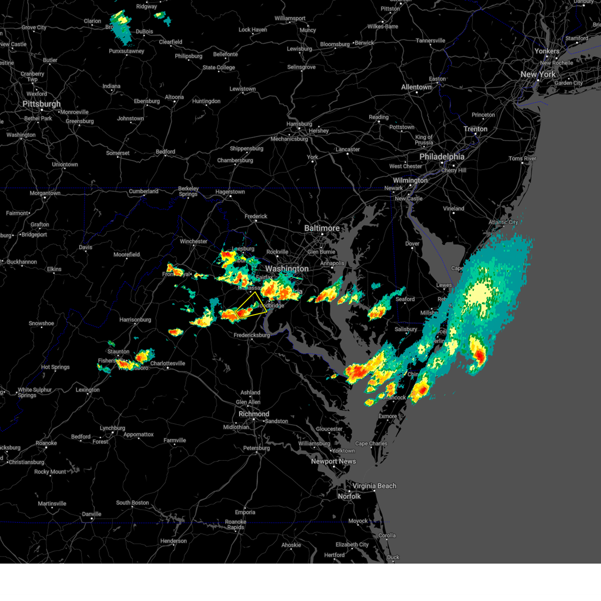 At 746 pm edt, a severe thunderstorm was located 11 miles east of bealeton, or 13 miles northwest of stafford, moving northeast at 20 mph (radar indicated). Hazards include 60 mph wind gusts and quarter size hail. Damaging winds will cause some trees and large branches to fall. this could injure those outdoors, as well as damage homes and vehicles. roadways may become blocked by downed trees. localized power outages are possible. Unsecured light objects may become projectiles. At 746 pm edt, a severe thunderstorm was located 11 miles east of bealeton, or 13 miles northwest of stafford, moving northeast at 20 mph (radar indicated). Hazards include 60 mph wind gusts and quarter size hail. Damaging winds will cause some trees and large branches to fall. this could injure those outdoors, as well as damage homes and vehicles. roadways may become blocked by downed trees. localized power outages are possible. Unsecured light objects may become projectiles.
|
| 7/14/2023 7:02 PM EDT |
 At 701 pm edt, severe thunderstorms were located along a line extending from near clinton to 6 miles south of fort hunt to near quantico, moving southeast at 25 mph (radar indicated). Hazards include 60 mph wind gusts and quarter size hail. Damaging winds will cause some trees and large branches to fall. this could injure those outdoors, as well as damage homes and vehicles. roadways may become blocked by downed trees. localized power outages are possible. unsecured light objects may become projectiles. locations impacted include, waldorf, clinton, fort washington, fort hunt, la plata, fort belvoir, woodbridge, quantico, montclair, camp springs, oxon hill, rosaryville, friendly, marlton, triangle, dumfries, saint charles, cherry hill, mount vernon and accokeek. hail threat, radar indicated max hail size, 1. 00 in wind threat, radar indicated max wind gust, 60 mph. At 701 pm edt, severe thunderstorms were located along a line extending from near clinton to 6 miles south of fort hunt to near quantico, moving southeast at 25 mph (radar indicated). Hazards include 60 mph wind gusts and quarter size hail. Damaging winds will cause some trees and large branches to fall. this could injure those outdoors, as well as damage homes and vehicles. roadways may become blocked by downed trees. localized power outages are possible. unsecured light objects may become projectiles. locations impacted include, waldorf, clinton, fort washington, fort hunt, la plata, fort belvoir, woodbridge, quantico, montclair, camp springs, oxon hill, rosaryville, friendly, marlton, triangle, dumfries, saint charles, cherry hill, mount vernon and accokeek. hail threat, radar indicated max hail size, 1. 00 in wind threat, radar indicated max wind gust, 60 mph.
|
| 7/14/2023 7:02 PM EDT |
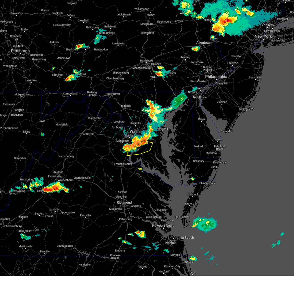 At 701 pm edt, severe thunderstorms were located along a line extending from near clinton to 6 miles south of fort hunt to near quantico, moving southeast at 25 mph (radar indicated). Hazards include 60 mph wind gusts and quarter size hail. Damaging winds will cause some trees and large branches to fall. this could injure those outdoors, as well as damage homes and vehicles. roadways may become blocked by downed trees. localized power outages are possible. unsecured light objects may become projectiles. locations impacted include, waldorf, clinton, fort washington, fort hunt, la plata, fort belvoir, woodbridge, quantico, montclair, camp springs, oxon hill, rosaryville, friendly, marlton, triangle, dumfries, saint charles, cherry hill, mount vernon and accokeek. hail threat, radar indicated max hail size, 1. 00 in wind threat, radar indicated max wind gust, 60 mph. At 701 pm edt, severe thunderstorms were located along a line extending from near clinton to 6 miles south of fort hunt to near quantico, moving southeast at 25 mph (radar indicated). Hazards include 60 mph wind gusts and quarter size hail. Damaging winds will cause some trees and large branches to fall. this could injure those outdoors, as well as damage homes and vehicles. roadways may become blocked by downed trees. localized power outages are possible. unsecured light objects may become projectiles. locations impacted include, waldorf, clinton, fort washington, fort hunt, la plata, fort belvoir, woodbridge, quantico, montclair, camp springs, oxon hill, rosaryville, friendly, marlton, triangle, dumfries, saint charles, cherry hill, mount vernon and accokeek. hail threat, radar indicated max hail size, 1. 00 in wind threat, radar indicated max wind gust, 60 mph.
|
| 7/14/2023 6:37 PM EDT |
 At 637 pm edt, severe thunderstorms were located along a line extending from national harbor to near groveton to near lake ridge, moving southeast at 20 mph (radar indicated). Hazards include 60 mph wind gusts and quarter size hail. Damaging winds will cause some trees and large branches to fall. this could injure those outdoors, as well as damage homes and vehicles. roadways may become blocked by downed trees. localized power outages are possible. Unsecured light objects may become projectiles. At 637 pm edt, severe thunderstorms were located along a line extending from national harbor to near groveton to near lake ridge, moving southeast at 20 mph (radar indicated). Hazards include 60 mph wind gusts and quarter size hail. Damaging winds will cause some trees and large branches to fall. this could injure those outdoors, as well as damage homes and vehicles. roadways may become blocked by downed trees. localized power outages are possible. Unsecured light objects may become projectiles.
|
| 7/3/2023 5:24 PM EDT |
 At 523 pm edt, a severe thunderstorm was located over woodbridge, moving east at 30 mph (radar indicated). Hazards include 60 mph wind gusts. Damaging winds will cause some trees and large branches to fall. this could injure those outdoors, as well as damage homes and vehicles. roadways may become blocked by downed trees. localized power outages are possible. Unsecured light objects may become projectiles. At 523 pm edt, a severe thunderstorm was located over woodbridge, moving east at 30 mph (radar indicated). Hazards include 60 mph wind gusts. Damaging winds will cause some trees and large branches to fall. this could injure those outdoors, as well as damage homes and vehicles. roadways may become blocked by downed trees. localized power outages are possible. Unsecured light objects may become projectiles.
|
| 6/16/2023 5:57 PM EDT |
 The severe thunderstorm warning for southeastern fairfax and east central prince william counties will expire at 600 pm edt, the storms which prompted the warning have moved out of the area. therefore, the warning will be allowed to expire. a severe thunderstorm watch remains in effect until 900 pm edt for northern virginia. to report severe weather, contact your nearest law enforcement agency. they will relay your report to the national weather service sterling virginia. The severe thunderstorm warning for southeastern fairfax and east central prince william counties will expire at 600 pm edt, the storms which prompted the warning have moved out of the area. therefore, the warning will be allowed to expire. a severe thunderstorm watch remains in effect until 900 pm edt for northern virginia. to report severe weather, contact your nearest law enforcement agency. they will relay your report to the national weather service sterling virginia.
|
| 6/16/2023 5:55 PM EDT |
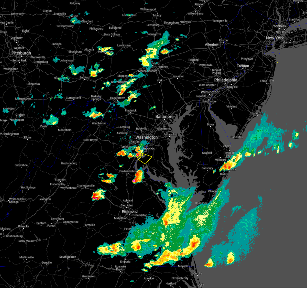 At 555 pm edt, a severe thunderstorm was located over woodbridge, moving southeast at 20 mph (radar indicated). Hazards include 60 mph wind gusts and quarter size hail. Damaging winds will cause some trees and large branches to fall. this could injure those outdoors, as well as damage homes and vehicles. roadways may become blocked by downed trees. localized power outages are possible. Unsecured light objects may become projectiles. At 555 pm edt, a severe thunderstorm was located over woodbridge, moving southeast at 20 mph (radar indicated). Hazards include 60 mph wind gusts and quarter size hail. Damaging winds will cause some trees and large branches to fall. this could injure those outdoors, as well as damage homes and vehicles. roadways may become blocked by downed trees. localized power outages are possible. Unsecured light objects may become projectiles.
|
| 6/16/2023 5:34 PM EDT |
 At 533 pm edt, severe thunderstorms were located along a line extending from near burke to near dale city, moving southeast at 20 mph (radar indicated. up to nickel size hail was reported near clifton). Hazards include 60 mph wind gusts and quarter size hail. Damaging winds will cause some trees and large branches to fall. this could injure those outdoors, as well as damage homes and vehicles. roadways may become blocked by downed trees. localized power outages are possible. unsecured light objects may become projectiles. locations impacted include, dale city, fort belvoir, woodbridge, lake ridge, burke, montclair, lorton, newington, west springfield, cherry hill, fairfax station, independent hill, mason neck, occoquan and clifton. hail threat, radar indicated max hail size, 1. 00 in wind threat, radar indicated max wind gust, 60 mph. At 533 pm edt, severe thunderstorms were located along a line extending from near burke to near dale city, moving southeast at 20 mph (radar indicated. up to nickel size hail was reported near clifton). Hazards include 60 mph wind gusts and quarter size hail. Damaging winds will cause some trees and large branches to fall. this could injure those outdoors, as well as damage homes and vehicles. roadways may become blocked by downed trees. localized power outages are possible. unsecured light objects may become projectiles. locations impacted include, dale city, fort belvoir, woodbridge, lake ridge, burke, montclair, lorton, newington, west springfield, cherry hill, fairfax station, independent hill, mason neck, occoquan and clifton. hail threat, radar indicated max hail size, 1. 00 in wind threat, radar indicated max wind gust, 60 mph.
|
| 6/16/2023 5:18 PM EDT |
 At 518 pm edt, a severe thunderstorm was located over centreville, moving southeast at 20 mph (radar indicated). Hazards include 60 mph wind gusts and quarter size hail. Damaging winds will cause some trees and large branches to fall. this could injure those outdoors, as well as damage homes and vehicles. roadways may become blocked by downed trees. localized power outages are possible. Unsecured light objects may become projectiles. At 518 pm edt, a severe thunderstorm was located over centreville, moving southeast at 20 mph (radar indicated). Hazards include 60 mph wind gusts and quarter size hail. Damaging winds will cause some trees and large branches to fall. this could injure those outdoors, as well as damage homes and vehicles. roadways may become blocked by downed trees. localized power outages are possible. Unsecured light objects may become projectiles.
|
| 9/12/2022 5:10 PM EDT |
 The severe thunderstorm warning for northwestern charles and southeastern prince william counties will expire at 515 pm edt, the storm which prompted the warning has weakened below severe limits, and has exited the warned area. therefore, the warning will be allowed to expire. The severe thunderstorm warning for northwestern charles and southeastern prince william counties will expire at 515 pm edt, the storm which prompted the warning has weakened below severe limits, and has exited the warned area. therefore, the warning will be allowed to expire.
|
| 9/12/2022 5:10 PM EDT |
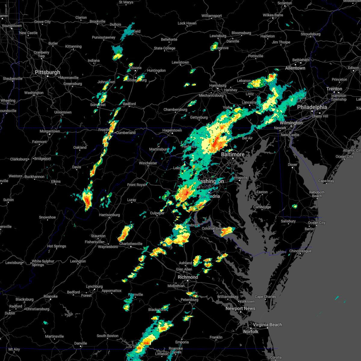 The severe thunderstorm warning for northwestern charles and southeastern prince william counties will expire at 515 pm edt, the storm which prompted the warning has weakened below severe limits, and has exited the warned area. therefore, the warning will be allowed to expire. The severe thunderstorm warning for northwestern charles and southeastern prince william counties will expire at 515 pm edt, the storm which prompted the warning has weakened below severe limits, and has exited the warned area. therefore, the warning will be allowed to expire.
|
| 9/12/2022 5:10 PM EDT |
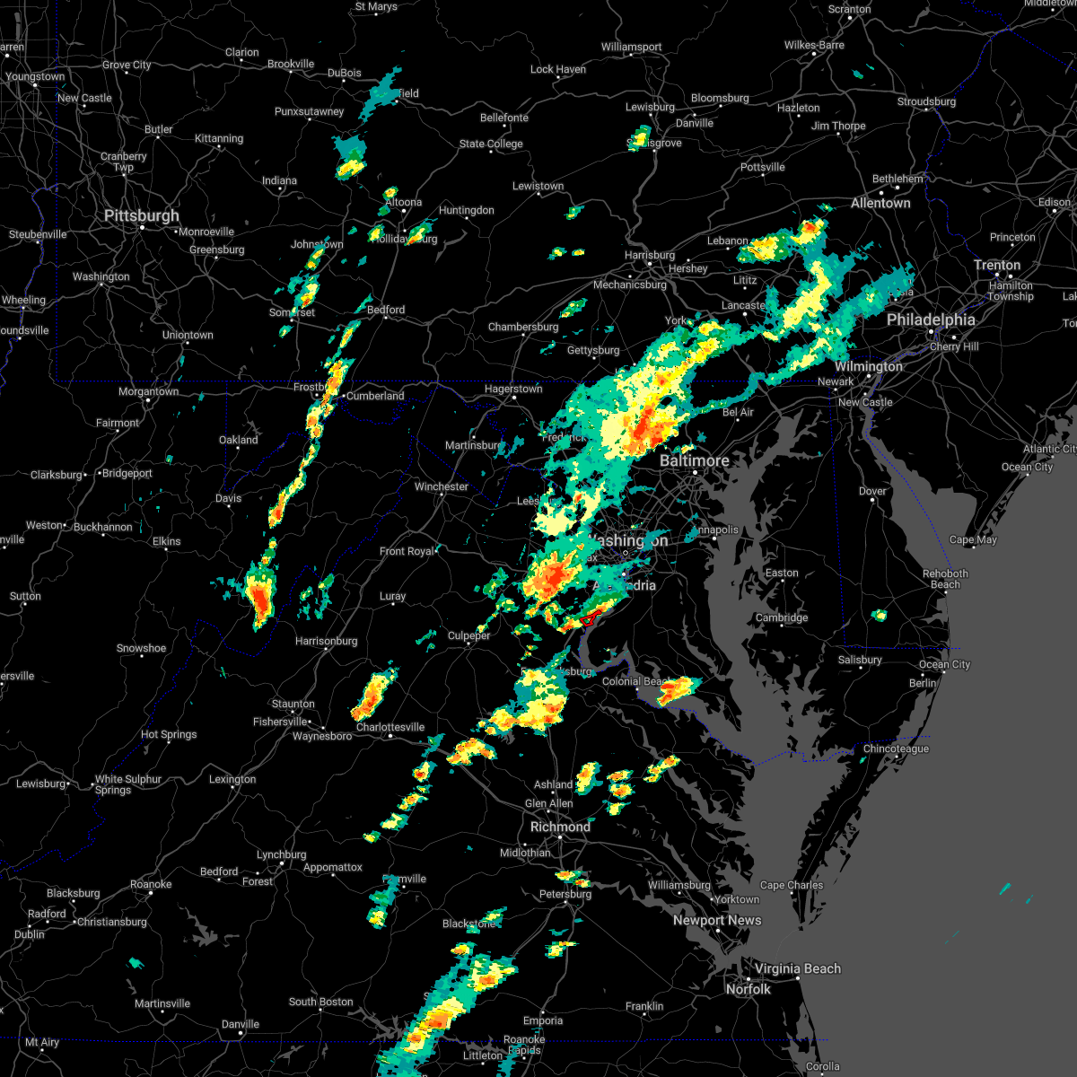 The tornado warning for southeastern fairfax and eastern prince william counties will expire at 515 pm edt, the storm which prompted the warning has weakened below severe limits, and has exited the warned area. therefore, the warning will be allowed to expire. The tornado warning for southeastern fairfax and eastern prince william counties will expire at 515 pm edt, the storm which prompted the warning has weakened below severe limits, and has exited the warned area. therefore, the warning will be allowed to expire.
|
| 9/12/2022 5:07 PM EDT |
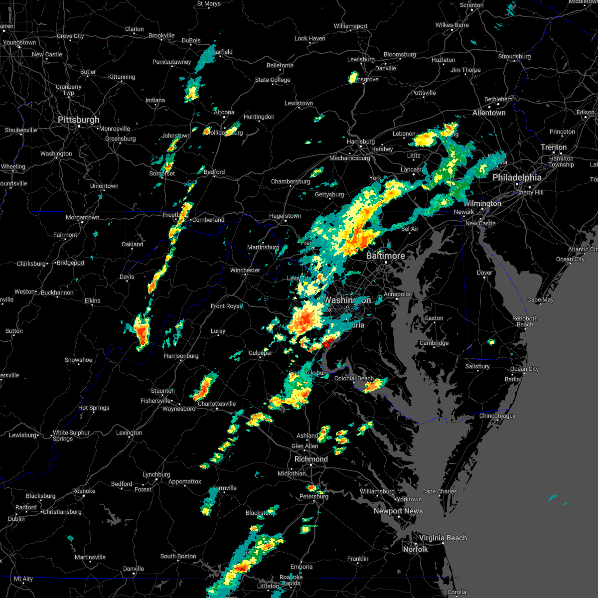 At 507 pm edt, a severe thunderstorm capable of producing a tornado was located near dumfries, or near woodbridge, moving east at 15 mph (radar indicated rotation). Hazards include tornado. For those in the direct path of a tornado touchdown, flying debris will be dangerous to those caught without shelter. damage to roofs, siding, and windows may occur. mobile homes may be damaged or destroyed. tree damage is likely. Locations impacted include, cherry hill and mason neck. At 507 pm edt, a severe thunderstorm capable of producing a tornado was located near dumfries, or near woodbridge, moving east at 15 mph (radar indicated rotation). Hazards include tornado. For those in the direct path of a tornado touchdown, flying debris will be dangerous to those caught without shelter. damage to roofs, siding, and windows may occur. mobile homes may be damaged or destroyed. tree damage is likely. Locations impacted include, cherry hill and mason neck.
|
| 9/12/2022 5:00 PM EDT |
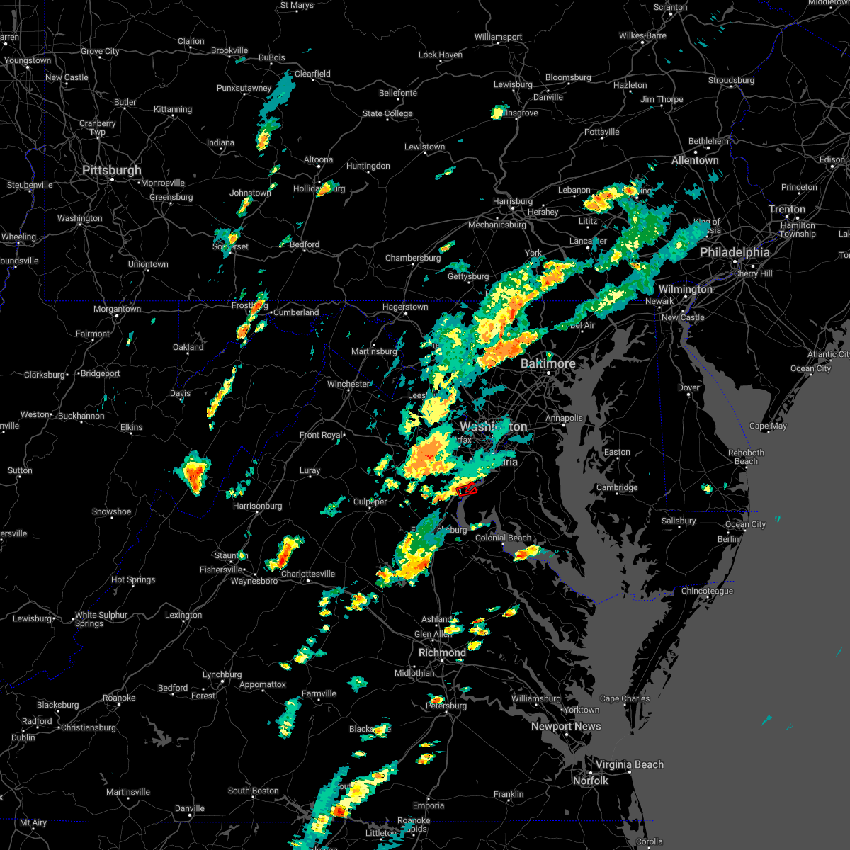 At 500 pm edt, a severe thunderstorm capable of producing a tornado was located over dumfries, or near quantico, moving northeast at 15 mph (radar indicated rotation). Hazards include tornado. For those in the direct path of a tornado touchdown, flying debris will be dangerous to those caught without shelter. damage to roofs, siding, and windows may occur. mobile homes may be damaged or destroyed. tree damage is likely. Locations impacted include, dumfries, cherry hill and mason neck. At 500 pm edt, a severe thunderstorm capable of producing a tornado was located over dumfries, or near quantico, moving northeast at 15 mph (radar indicated rotation). Hazards include tornado. For those in the direct path of a tornado touchdown, flying debris will be dangerous to those caught without shelter. damage to roofs, siding, and windows may occur. mobile homes may be damaged or destroyed. tree damage is likely. Locations impacted include, dumfries, cherry hill and mason neck.
|
| 9/12/2022 5:00 PM EDT |
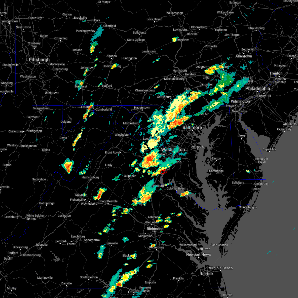 At 500 pm edt, a severe thunderstorm capable of producing a tornado was located over dumfries, or near quantico, moving northeast at 15 mph (radar indicated rotation). Hazards include tornado. For those in the direct path of a tornado touchdown, flying debris will be dangerous to those caught without shelter. damage to roofs, siding, and windows may occur. mobile homes may be damaged or destroyed. tree damage is likely. Locations impacted include, dumfries, cherry hill and mason neck. At 500 pm edt, a severe thunderstorm capable of producing a tornado was located over dumfries, or near quantico, moving northeast at 15 mph (radar indicated rotation). Hazards include tornado. For those in the direct path of a tornado touchdown, flying debris will be dangerous to those caught without shelter. damage to roofs, siding, and windows may occur. mobile homes may be damaged or destroyed. tree damage is likely. Locations impacted include, dumfries, cherry hill and mason neck.
|
| 9/12/2022 4:54 PM EDT |
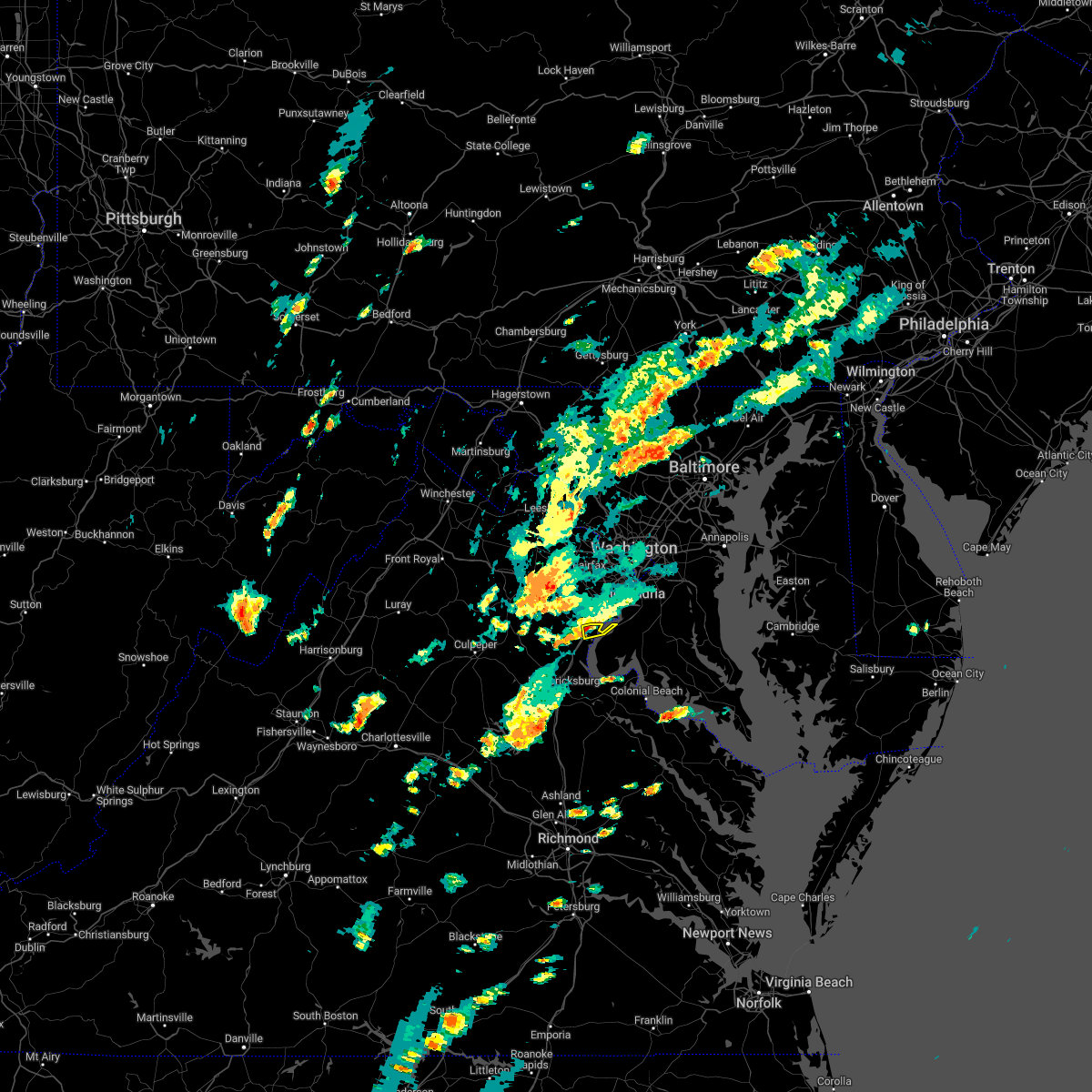 At 454 pm edt, a severe thunderstorm was located over quantico, moving east at 15 mph (radar indicated). Hazards include 60 mph wind gusts. Damaging winds will cause some trees and large branches to fall. this could injure those outdoors, as well as damage homes and vehicles. roadways may become blocked by downed trees. localized power outages are possible. unsecured light objects may become projectiles. Locations impacted include, montclair, triangle, dumfries, cherry hill and potomac heights. At 454 pm edt, a severe thunderstorm was located over quantico, moving east at 15 mph (radar indicated). Hazards include 60 mph wind gusts. Damaging winds will cause some trees and large branches to fall. this could injure those outdoors, as well as damage homes and vehicles. roadways may become blocked by downed trees. localized power outages are possible. unsecured light objects may become projectiles. Locations impacted include, montclair, triangle, dumfries, cherry hill and potomac heights.
|
| 9/12/2022 4:54 PM EDT |
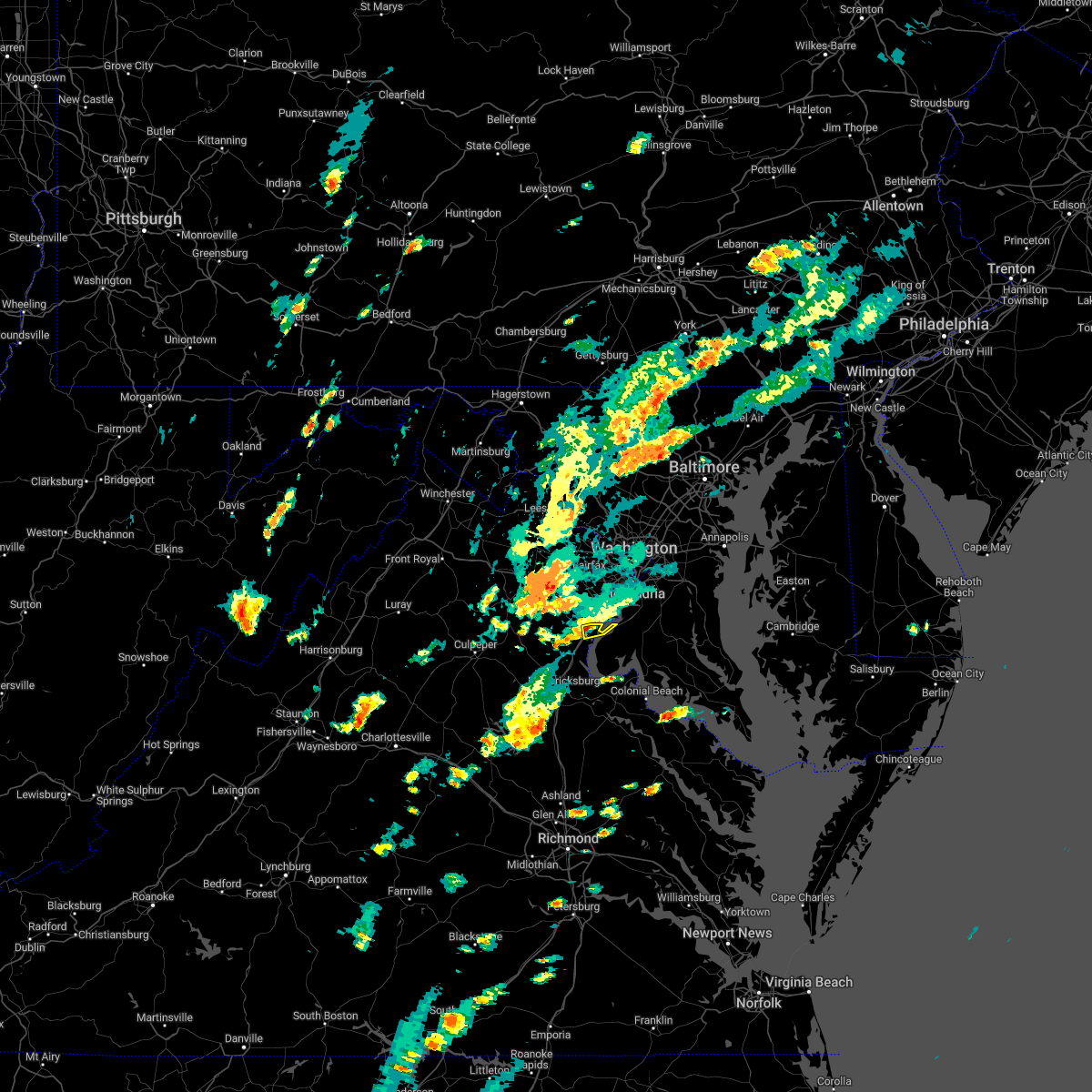 At 454 pm edt, a severe thunderstorm was located over quantico, moving east at 15 mph (radar indicated). Hazards include 60 mph wind gusts. Damaging winds will cause some trees and large branches to fall. this could injure those outdoors, as well as damage homes and vehicles. roadways may become blocked by downed trees. localized power outages are possible. unsecured light objects may become projectiles. Locations impacted include, montclair, triangle, dumfries, cherry hill and potomac heights. At 454 pm edt, a severe thunderstorm was located over quantico, moving east at 15 mph (radar indicated). Hazards include 60 mph wind gusts. Damaging winds will cause some trees and large branches to fall. this could injure those outdoors, as well as damage homes and vehicles. roadways may become blocked by downed trees. localized power outages are possible. unsecured light objects may become projectiles. Locations impacted include, montclair, triangle, dumfries, cherry hill and potomac heights.
|
| 9/12/2022 4:52 PM EDT |
 At 451 pm edt, a severe thunderstorm capable of producing a tornado was located over dumfries, or near quantico, moving east at 15 mph (radar indicated rotation). Hazards include tornado. For those in the direct path of a tornado touchdown, flying debris will be dangerous to those caught without shelter. damage to roofs, siding, and windows may occur. mobile homes may be damaged or destroyed. tree damage is likely. This tornadic thunderstorm will remain over mainly rural areas of northwestern charles, southeastern fairfax and southeastern prince william counties, including the following locations, cherry hill and mason neck. At 451 pm edt, a severe thunderstorm capable of producing a tornado was located over dumfries, or near quantico, moving east at 15 mph (radar indicated rotation). Hazards include tornado. For those in the direct path of a tornado touchdown, flying debris will be dangerous to those caught without shelter. damage to roofs, siding, and windows may occur. mobile homes may be damaged or destroyed. tree damage is likely. This tornadic thunderstorm will remain over mainly rural areas of northwestern charles, southeastern fairfax and southeastern prince william counties, including the following locations, cherry hill and mason neck.
|
| 9/12/2022 4:52 PM EDT |
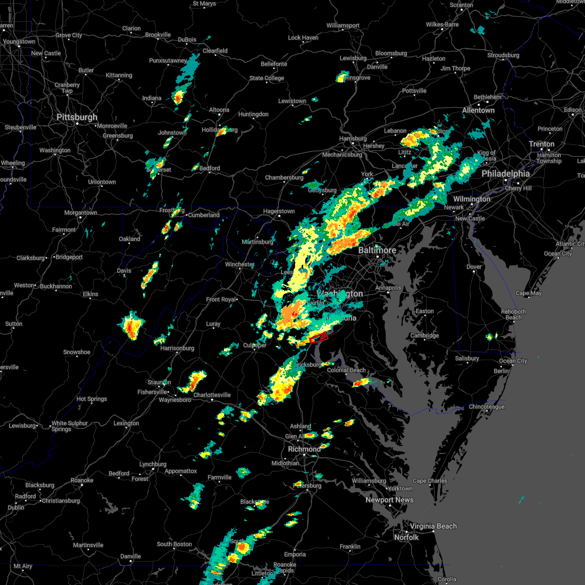 At 451 pm edt, a severe thunderstorm capable of producing a tornado was located over dumfries, or near quantico, moving east at 15 mph (radar indicated rotation). Hazards include tornado. For those in the direct path of a tornado touchdown, flying debris will be dangerous to those caught without shelter. damage to roofs, siding, and windows may occur. mobile homes may be damaged or destroyed. tree damage is likely. This tornadic thunderstorm will remain over mainly rural areas of northwestern charles, southeastern fairfax and southeastern prince william counties, including the following locations, cherry hill and mason neck. At 451 pm edt, a severe thunderstorm capable of producing a tornado was located over dumfries, or near quantico, moving east at 15 mph (radar indicated rotation). Hazards include tornado. For those in the direct path of a tornado touchdown, flying debris will be dangerous to those caught without shelter. damage to roofs, siding, and windows may occur. mobile homes may be damaged or destroyed. tree damage is likely. This tornadic thunderstorm will remain over mainly rural areas of northwestern charles, southeastern fairfax and southeastern prince william counties, including the following locations, cherry hill and mason neck.
|
| 9/12/2022 4:28 PM EDT |
 At 428 pm edt, a severe thunderstorm was located near triangle, or 7 miles west of quantico, moving east at 15 mph (radar indicated). Hazards include 60 mph wind gusts. Damaging winds will cause some trees and large branches to fall. this could injure those outdoors, as well as damage homes and vehicles. roadways may become blocked by downed trees. localized power outages are possible. Unsecured light objects may become projectiles. At 428 pm edt, a severe thunderstorm was located near triangle, or 7 miles west of quantico, moving east at 15 mph (radar indicated). Hazards include 60 mph wind gusts. Damaging winds will cause some trees and large branches to fall. this could injure those outdoors, as well as damage homes and vehicles. roadways may become blocked by downed trees. localized power outages are possible. Unsecured light objects may become projectiles.
|
| 9/12/2022 4:28 PM EDT |
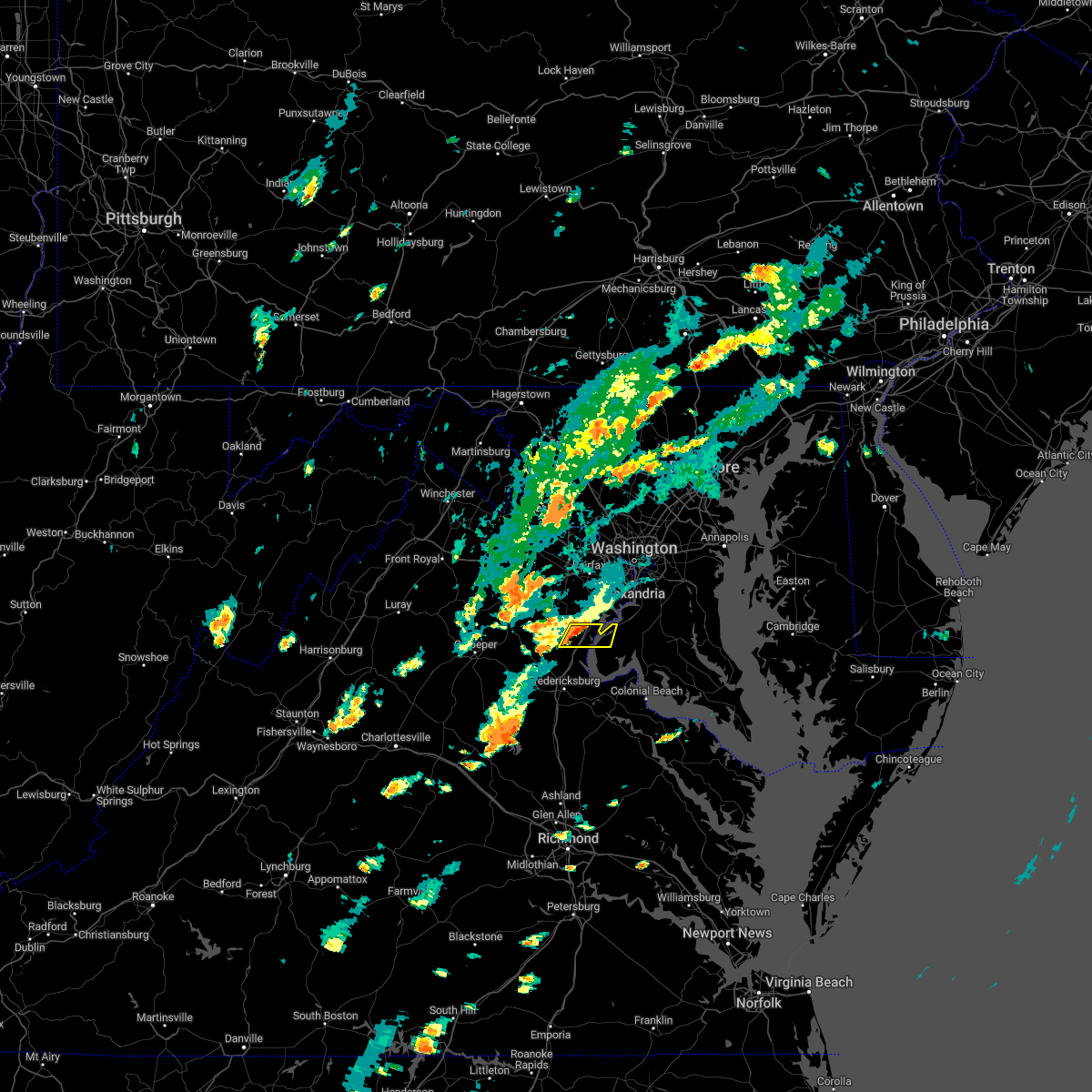 At 428 pm edt, a severe thunderstorm was located near triangle, or 7 miles west of quantico, moving east at 15 mph (radar indicated). Hazards include 60 mph wind gusts. Damaging winds will cause some trees and large branches to fall. this could injure those outdoors, as well as damage homes and vehicles. roadways may become blocked by downed trees. localized power outages are possible. Unsecured light objects may become projectiles. At 428 pm edt, a severe thunderstorm was located near triangle, or 7 miles west of quantico, moving east at 15 mph (radar indicated). Hazards include 60 mph wind gusts. Damaging winds will cause some trees and large branches to fall. this could injure those outdoors, as well as damage homes and vehicles. roadways may become blocked by downed trees. localized power outages are possible. Unsecured light objects may become projectiles.
|
| 8/30/2022 4:36 PM EDT |
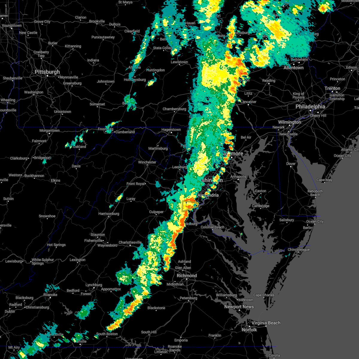 The severe thunderstorm warning for north central stafford and southeastern prince william counties will expire at 445 pm edt, the storm which prompted the warning has weakened below severe limits, and no longer poses an immediate threat to life or property. therefore, the warning will be allowed to expire. The severe thunderstorm warning for north central stafford and southeastern prince william counties will expire at 445 pm edt, the storm which prompted the warning has weakened below severe limits, and no longer poses an immediate threat to life or property. therefore, the warning will be allowed to expire.
|
| 8/30/2022 4:29 PM EDT |
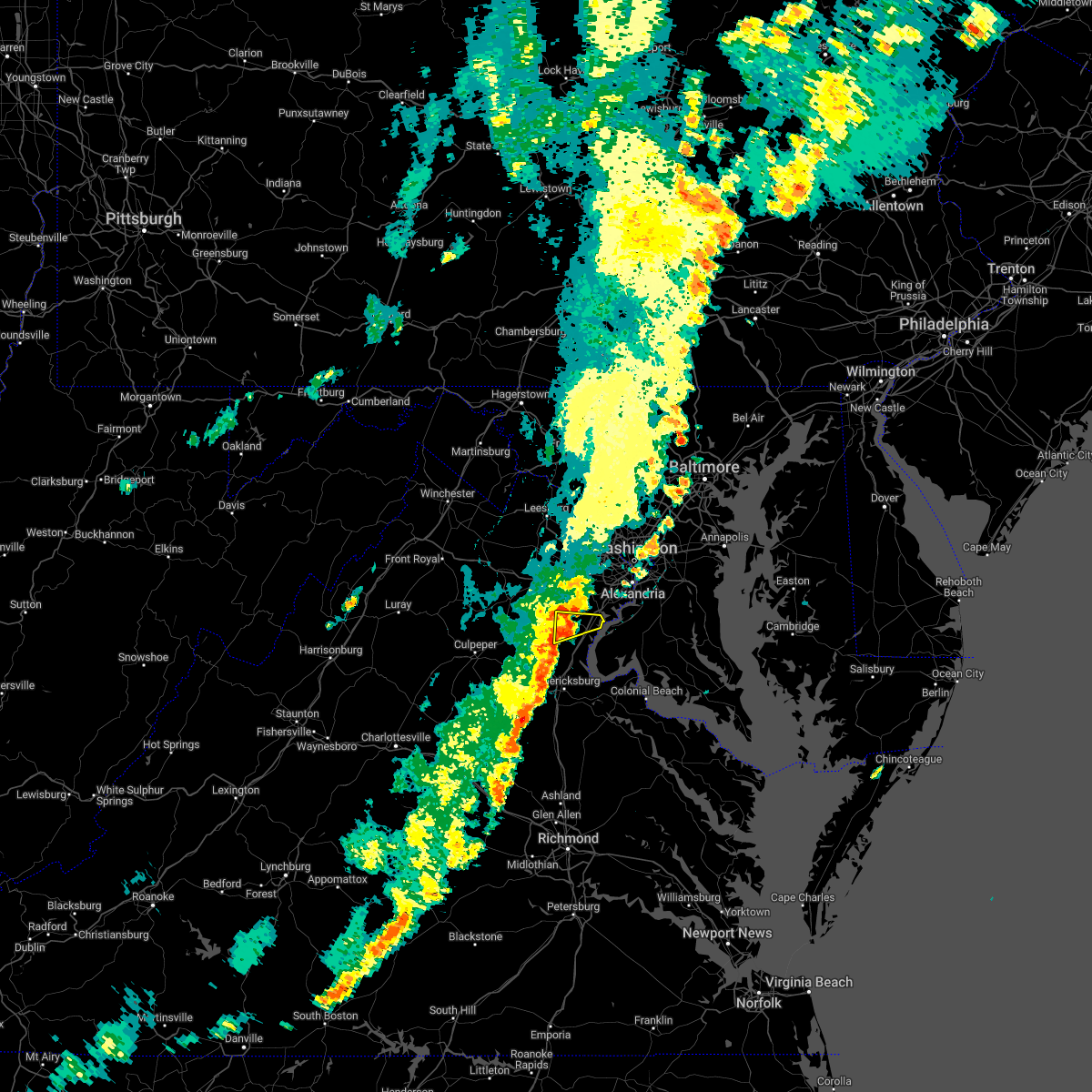 At 428 pm edt, a severe thunderstorm was located near dumfries, or near dale city, moving east at 35 mph (radar indicated). Hazards include 60 mph wind gusts. Damaging winds will cause some trees and large branches to fall. this could injure those outdoors, as well as damage homes and vehicles. roadways may become blocked by downed trees. localized power outages are possible. unsecured light objects may become projectiles. locations impacted include, dale city, woodbridge, montclair, dumfries, cherry hill and independent hill. hail threat, radar indicated max hail size, <. 75 in wind threat, radar indicated max wind gust, 60 mph. At 428 pm edt, a severe thunderstorm was located near dumfries, or near dale city, moving east at 35 mph (radar indicated). Hazards include 60 mph wind gusts. Damaging winds will cause some trees and large branches to fall. this could injure those outdoors, as well as damage homes and vehicles. roadways may become blocked by downed trees. localized power outages are possible. unsecured light objects may become projectiles. locations impacted include, dale city, woodbridge, montclair, dumfries, cherry hill and independent hill. hail threat, radar indicated max hail size, <. 75 in wind threat, radar indicated max wind gust, 60 mph.
|
| 8/30/2022 4:06 PM EDT |
 At 406 pm edt, a severe thunderstorm was located 7 miles east of bealeton, or 12 miles southeast of warrenton, moving east at 35 mph (radar indicated). Hazards include 60 mph wind gusts. Damaging winds will cause some trees and large branches to fall. this could injure those outdoors, as well as damage homes and vehicles. roadways may become blocked by downed trees. localized power outages are possible. Unsecured light objects may become projectiles. At 406 pm edt, a severe thunderstorm was located 7 miles east of bealeton, or 12 miles southeast of warrenton, moving east at 35 mph (radar indicated). Hazards include 60 mph wind gusts. Damaging winds will cause some trees and large branches to fall. this could injure those outdoors, as well as damage homes and vehicles. roadways may become blocked by downed trees. localized power outages are possible. Unsecured light objects may become projectiles.
|
| 8/10/2022 5:06 PM EDT |
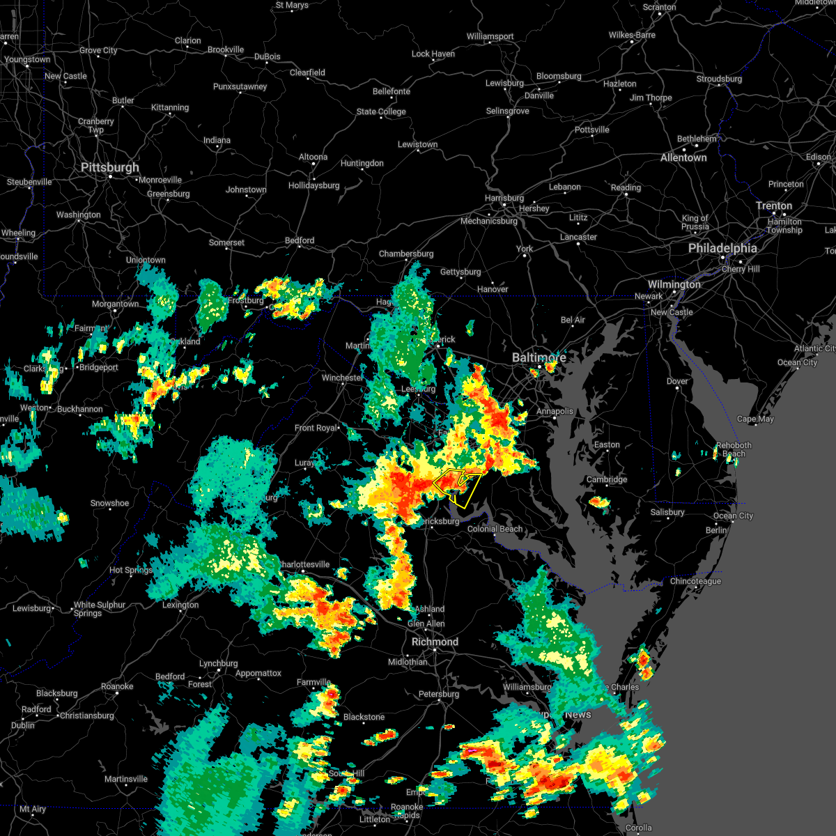 At 506 pm edt, a severe thunderstorm was located over quantico, and is drifting east (radar indicated). Hazards include 60 mph wind gusts. Damaging winds will cause some trees and large branches to fall. this could injure those outdoors, as well as damage homes and vehicles. roadways may become blocked by downed trees. localized power outages are possible. unsecured light objects may become projectiles. locations impacted include, dale city, woodbridge, quantico, montclair, triangle, dumfries, cherry hill, independent hill, bryans road, potomac heights, marbury, ironsides, rison, nanjemoy and pisgah. hail threat, radar indicated max hail size, <. 75 in wind threat, radar indicated max wind gust, 60 mph. At 506 pm edt, a severe thunderstorm was located over quantico, and is drifting east (radar indicated). Hazards include 60 mph wind gusts. Damaging winds will cause some trees and large branches to fall. this could injure those outdoors, as well as damage homes and vehicles. roadways may become blocked by downed trees. localized power outages are possible. unsecured light objects may become projectiles. locations impacted include, dale city, woodbridge, quantico, montclair, triangle, dumfries, cherry hill, independent hill, bryans road, potomac heights, marbury, ironsides, rison, nanjemoy and pisgah. hail threat, radar indicated max hail size, <. 75 in wind threat, radar indicated max wind gust, 60 mph.
|
| 8/10/2022 4:52 PM EDT |
 At 452 pm edt, a severe thunderstorm was located over dumfries, or near quantico, and is nearly stationary (radar indicated). Hazards include 60 mph wind gusts. Damaging winds will cause some trees and large branches to fall. this could injure those outdoors, as well as damage homes and vehicles. roadways may become blocked by downed trees. localized power outages are possible. Unsecured light objects may become projectiles. At 452 pm edt, a severe thunderstorm was located over dumfries, or near quantico, and is nearly stationary (radar indicated). Hazards include 60 mph wind gusts. Damaging winds will cause some trees and large branches to fall. this could injure those outdoors, as well as damage homes and vehicles. roadways may become blocked by downed trees. localized power outages are possible. Unsecured light objects may become projectiles.
|
| 8/10/2022 4:52 PM EDT |
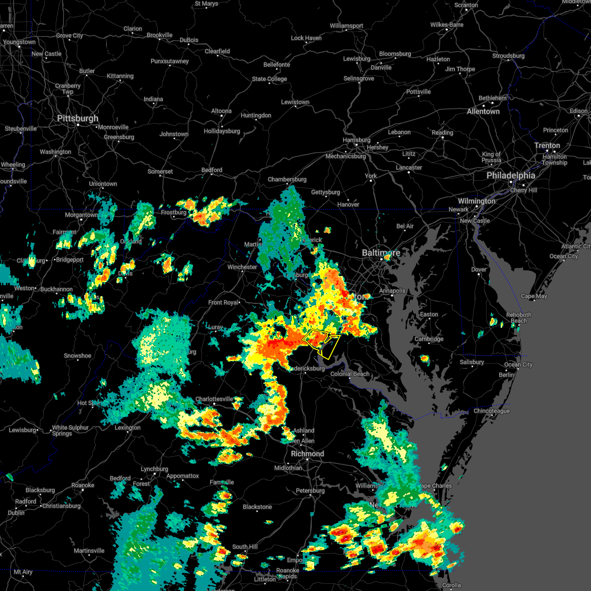 At 452 pm edt, a severe thunderstorm was located over dumfries, or near quantico, and is nearly stationary (radar indicated). Hazards include 60 mph wind gusts. Damaging winds will cause some trees and large branches to fall. this could injure those outdoors, as well as damage homes and vehicles. roadways may become blocked by downed trees. localized power outages are possible. Unsecured light objects may become projectiles. At 452 pm edt, a severe thunderstorm was located over dumfries, or near quantico, and is nearly stationary (radar indicated). Hazards include 60 mph wind gusts. Damaging winds will cause some trees and large branches to fall. this could injure those outdoors, as well as damage homes and vehicles. roadways may become blocked by downed trees. localized power outages are possible. Unsecured light objects may become projectiles.
|
| 8/4/2022 7:56 PM EDT |
 The severe thunderstorm warning for south central fairfax and east central prince william counties will expire at 800 pm edt, the storm which prompted the warning has weakened below severe limits, and no longer poses an immediate threat to life or property. therefore, the warning will be allowed to expire. The severe thunderstorm warning for south central fairfax and east central prince william counties will expire at 800 pm edt, the storm which prompted the warning has weakened below severe limits, and no longer poses an immediate threat to life or property. therefore, the warning will be allowed to expire.
|
| 8/4/2022 7:46 PM EDT |
 At 746 pm edt, a severe thunderstorm was located over lorton, or over woodbridge, moving northeast at 25 mph (radar indicated). Hazards include 60 mph wind gusts. Damaging winds will cause some trees and large branches to fall. this could injure those outdoors, as well as damage homes and vehicles. roadways may become blocked by downed trees. localized power outages are possible. unsecured light objects may become projectiles. locations impacted include, dale city, fort belvoir, woodbridge, lake ridge, burke, lorton, newington, mason neck and occoquan. hail threat, radar indicated max hail size, <. 75 in wind threat, radar indicated max wind gust, 60 mph. At 746 pm edt, a severe thunderstorm was located over lorton, or over woodbridge, moving northeast at 25 mph (radar indicated). Hazards include 60 mph wind gusts. Damaging winds will cause some trees and large branches to fall. this could injure those outdoors, as well as damage homes and vehicles. roadways may become blocked by downed trees. localized power outages are possible. unsecured light objects may become projectiles. locations impacted include, dale city, fort belvoir, woodbridge, lake ridge, burke, lorton, newington, mason neck and occoquan. hail threat, radar indicated max hail size, <. 75 in wind threat, radar indicated max wind gust, 60 mph.
|
| 8/4/2022 7:24 PM EDT |
 At 724 pm edt, a severe thunderstorm was located over montclair, or near dale city, moving northeast at 25 mph (radar indicated). Hazards include 60 mph wind gusts and quarter size hail. Damaging winds will cause some trees and large branches to fall. this could injure those outdoors, as well as damage homes and vehicles. roadways may become blocked by downed trees. localized power outages are possible. Unsecured light objects may become projectiles. At 724 pm edt, a severe thunderstorm was located over montclair, or near dale city, moving northeast at 25 mph (radar indicated). Hazards include 60 mph wind gusts and quarter size hail. Damaging winds will cause some trees and large branches to fall. this could injure those outdoors, as well as damage homes and vehicles. roadways may become blocked by downed trees. localized power outages are possible. Unsecured light objects may become projectiles.
|
| 7/25/2022 4:09 PM EDT |
 At 409 pm edt, severe thunderstorms were located along a line extending from dale city to 7 miles northwest of stafford, moving southeast at 20 mph (radar indicated). Hazards include 60 mph wind gusts and quarter size hail. Damaging winds will cause some trees and large branches to fall. this could injure those outdoors, as well as damage homes and vehicles. roadways may become blocked by downed trees. localized power outages are possible. unsecured light objects may become projectiles. locations impacted include, quantico, montclair, triangle, dumfries, cherry hill, independent hill, widewater, aquia and garrisonville. hail threat, radar indicated max hail size, 1. 00 in wind threat, radar indicated max wind gust, 60 mph. At 409 pm edt, severe thunderstorms were located along a line extending from dale city to 7 miles northwest of stafford, moving southeast at 20 mph (radar indicated). Hazards include 60 mph wind gusts and quarter size hail. Damaging winds will cause some trees and large branches to fall. this could injure those outdoors, as well as damage homes and vehicles. roadways may become blocked by downed trees. localized power outages are possible. unsecured light objects may become projectiles. locations impacted include, quantico, montclair, triangle, dumfries, cherry hill, independent hill, widewater, aquia and garrisonville. hail threat, radar indicated max hail size, 1. 00 in wind threat, radar indicated max wind gust, 60 mph.
|
| 7/25/2022 3:50 PM EDT |
 At 350 pm edt, severe thunderstorms were located along a line extending from near bull run to 9 miles east of bealeton, moving southeast at 25 mph (radar indicated). Hazards include 60 mph wind gusts and quarter size hail. Damaging winds will cause some trees and large branches to fall. this could injure those outdoors, as well as damage homes and vehicles. roadways may become blocked by downed trees. localized power outages are possible. Unsecured light objects may become projectiles. At 350 pm edt, severe thunderstorms were located along a line extending from near bull run to 9 miles east of bealeton, moving southeast at 25 mph (radar indicated). Hazards include 60 mph wind gusts and quarter size hail. Damaging winds will cause some trees and large branches to fall. this could injure those outdoors, as well as damage homes and vehicles. roadways may become blocked by downed trees. localized power outages are possible. Unsecured light objects may become projectiles.
|
| 7/14/2022 4:22 PM EDT |
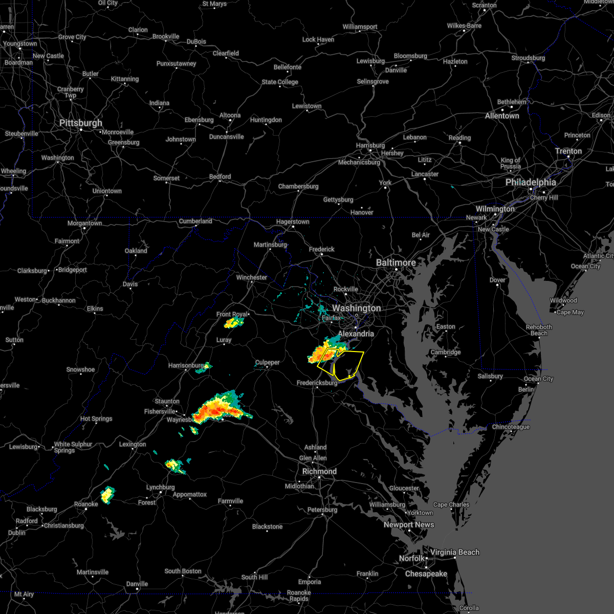 At 421 pm edt, a severe thunderstorm was located over dumfries, or near quantico, moving east at 25 mph (radar indicated). Hazards include 60 mph wind gusts. Damaging winds will cause some trees and large branches to fall. this could injure those outdoors, as well as damage homes and vehicles. roadways may become blocked by downed trees. localized power outages are possible. unsecured light objects may become projectiles. locations impacted include, waldorf, dale city, la plata, quantico, nanjemoy creek, montclair, triangle, dumfries, cherry hill, bryans road, potomac heights, pomfret, port tobacco village, garrisonville, ironsides, pisgah, marbury, widewater, port tobacco and ripley. hail threat, radar indicated max hail size, <. 75 in wind threat, radar indicated max wind gust, 60 mph. At 421 pm edt, a severe thunderstorm was located over dumfries, or near quantico, moving east at 25 mph (radar indicated). Hazards include 60 mph wind gusts. Damaging winds will cause some trees and large branches to fall. this could injure those outdoors, as well as damage homes and vehicles. roadways may become blocked by downed trees. localized power outages are possible. unsecured light objects may become projectiles. locations impacted include, waldorf, dale city, la plata, quantico, nanjemoy creek, montclair, triangle, dumfries, cherry hill, bryans road, potomac heights, pomfret, port tobacco village, garrisonville, ironsides, pisgah, marbury, widewater, port tobacco and ripley. hail threat, radar indicated max hail size, <. 75 in wind threat, radar indicated max wind gust, 60 mph.
|
| 7/14/2022 4:19 PM EDT |
 At 419 pm edt, a severe thunderstorm was located over dumfries, or near quantico, moving east at 25 mph (radar indicated). Hazards include 60 mph wind gusts. Damaging winds will cause some trees and large branches to fall. this could injure those outdoors, as well as damage homes and vehicles. roadways may become blocked by downed trees. localized power outages are possible. Unsecured light objects may become projectiles. At 419 pm edt, a severe thunderstorm was located over dumfries, or near quantico, moving east at 25 mph (radar indicated). Hazards include 60 mph wind gusts. Damaging winds will cause some trees and large branches to fall. this could injure those outdoors, as well as damage homes and vehicles. roadways may become blocked by downed trees. localized power outages are possible. Unsecured light objects may become projectiles.
|
| 7/12/2022 8:18 PM EDT |
 At 818 pm edt, a severe thunderstorm was located 7 miles east of quantico, moving southeast at 40 mph (radar indicated). Hazards include 60 mph wind gusts and quarter size hail. Damaging winds will cause some trees and large branches to fall. this could injure those outdoors, as well as damage homes and vehicles. roadways may become blocked by downed trees. localized power outages are possible. unsecured light objects may become projectiles. locations impacted include, quantico, triangle, dumfries and cherry hill. hail threat, radar indicated max hail size, 1. 00 in wind threat, radar indicated max wind gust, 60 mph. At 818 pm edt, a severe thunderstorm was located 7 miles east of quantico, moving southeast at 40 mph (radar indicated). Hazards include 60 mph wind gusts and quarter size hail. Damaging winds will cause some trees and large branches to fall. this could injure those outdoors, as well as damage homes and vehicles. roadways may become blocked by downed trees. localized power outages are possible. unsecured light objects may become projectiles. locations impacted include, quantico, triangle, dumfries and cherry hill. hail threat, radar indicated max hail size, 1. 00 in wind threat, radar indicated max wind gust, 60 mph.
|
| 7/12/2022 8:08 PM EDT |
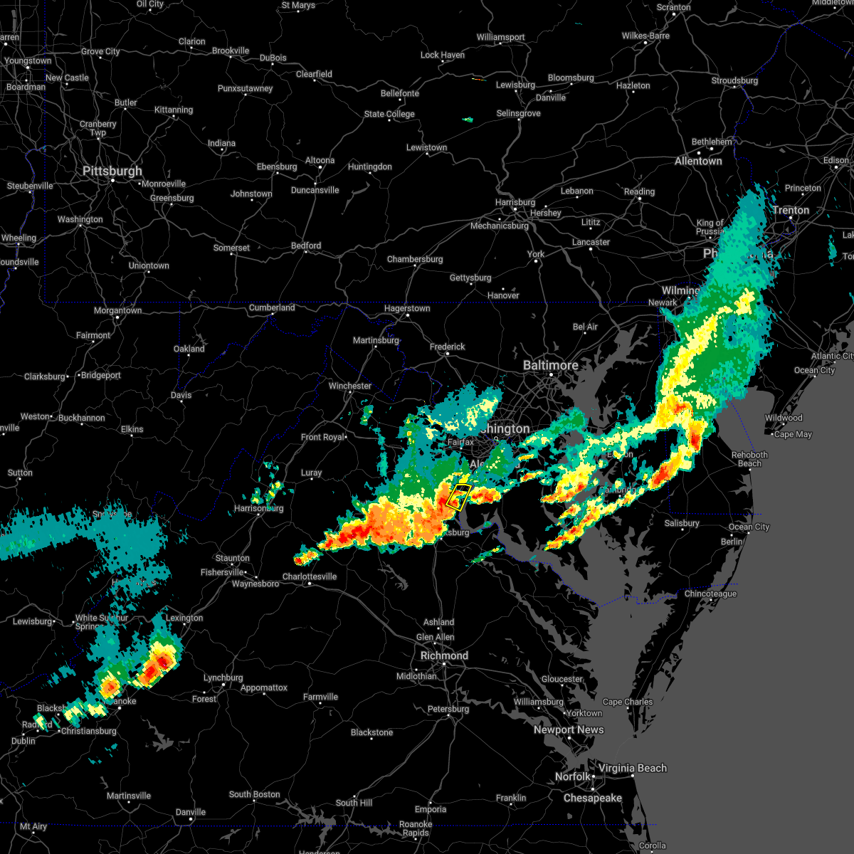 At 808 pm edt, a severe thunderstorm was located near quantico, moving southeast at 40 mph (radar indicated). Hazards include 60 mph wind gusts and quarter size hail. Damaging winds will cause some trees and large branches to fall. this could injure those outdoors, as well as damage homes and vehicles. roadways may become blocked by downed trees. localized power outages are possible. unsecured light objects may become projectiles. locations impacted include, dale city, quantico, montclair, triangle, dumfries and cherry hill. hail threat, radar indicated max hail size, 1. 00 in wind threat, radar indicated max wind gust, 60 mph. At 808 pm edt, a severe thunderstorm was located near quantico, moving southeast at 40 mph (radar indicated). Hazards include 60 mph wind gusts and quarter size hail. Damaging winds will cause some trees and large branches to fall. this could injure those outdoors, as well as damage homes and vehicles. roadways may become blocked by downed trees. localized power outages are possible. unsecured light objects may become projectiles. locations impacted include, dale city, quantico, montclair, triangle, dumfries and cherry hill. hail threat, radar indicated max hail size, 1. 00 in wind threat, radar indicated max wind gust, 60 mph.
|
| 7/12/2022 8:00 PM EDT |
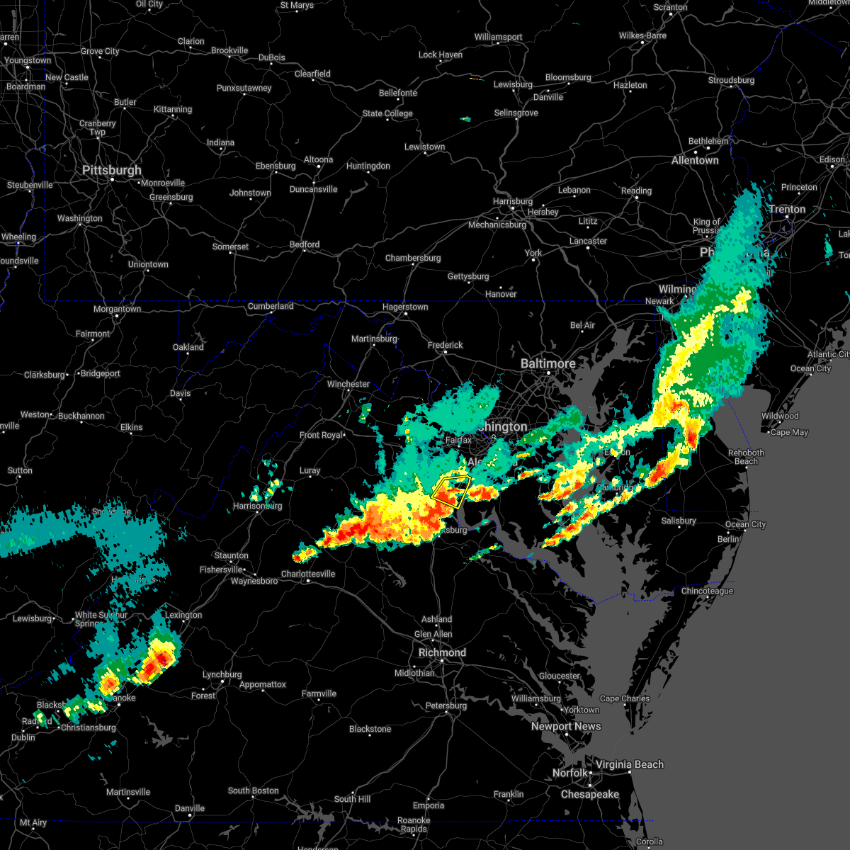 At 759 pm edt, a severe thunderstorm was located over montclair, or near dale city, moving southeast at 40 mph (radar indicated). Hazards include 60 mph wind gusts and quarter size hail. Damaging winds will cause some trees and large branches to fall. this could injure those outdoors, as well as damage homes and vehicles. roadways may become blocked by downed trees. localized power outages are possible. unsecured light objects may become projectiles. locations impacted include, dale city, woodbridge, quantico, lake ridge, montclair, triangle, dumfries, cherry hill and independent hill. hail threat, radar indicated max hail size, 1. 00 in wind threat, radar indicated max wind gust, 60 mph. At 759 pm edt, a severe thunderstorm was located over montclair, or near dale city, moving southeast at 40 mph (radar indicated). Hazards include 60 mph wind gusts and quarter size hail. Damaging winds will cause some trees and large branches to fall. this could injure those outdoors, as well as damage homes and vehicles. roadways may become blocked by downed trees. localized power outages are possible. unsecured light objects may become projectiles. locations impacted include, dale city, woodbridge, quantico, lake ridge, montclair, triangle, dumfries, cherry hill and independent hill. hail threat, radar indicated max hail size, 1. 00 in wind threat, radar indicated max wind gust, 60 mph.
|
| 7/12/2022 7:57 PM EDT |
 At 757 pm edt, a severe thunderstorm was located over montclair, or near dale city, moving southeast at 40 mph (radar indicated). Hazards include 60 mph wind gusts and quarter size hail. Damaging winds will cause some trees and large branches to fall. this could injure those outdoors, as well as damage homes and vehicles. roadways may become blocked by downed trees. localized power outages are possible. unsecured light objects may become projectiles. locations impacted include, dale city, woodbridge, quantico, lake ridge, montclair, triangle, dumfries, cherry hill, independent hill and mason neck. hail threat, radar indicated max hail size, 1. 00 in wind threat, radar indicated max wind gust, 60 mph. At 757 pm edt, a severe thunderstorm was located over montclair, or near dale city, moving southeast at 40 mph (radar indicated). Hazards include 60 mph wind gusts and quarter size hail. Damaging winds will cause some trees and large branches to fall. this could injure those outdoors, as well as damage homes and vehicles. roadways may become blocked by downed trees. localized power outages are possible. unsecured light objects may become projectiles. locations impacted include, dale city, woodbridge, quantico, lake ridge, montclair, triangle, dumfries, cherry hill, independent hill and mason neck. hail threat, radar indicated max hail size, 1. 00 in wind threat, radar indicated max wind gust, 60 mph.
|
| 7/12/2022 7:40 PM EDT |
 At 740 pm edt, a severe thunderstorm was located near linton hall, or 12 miles west of dale city, moving southeast at 40 mph (radar indicated). Hazards include 60 mph wind gusts and quarter size hail. Damaging winds will cause some trees and large branches to fall. this could injure those outdoors, as well as damage homes and vehicles. roadways may become blocked by downed trees. localized power outages are possible. Unsecured light objects may become projectiles. At 740 pm edt, a severe thunderstorm was located near linton hall, or 12 miles west of dale city, moving southeast at 40 mph (radar indicated). Hazards include 60 mph wind gusts and quarter size hail. Damaging winds will cause some trees and large branches to fall. this could injure those outdoors, as well as damage homes and vehicles. roadways may become blocked by downed trees. localized power outages are possible. Unsecured light objects may become projectiles.
|
| 7/12/2022 5:52 PM EDT |
 At 552 pm edt, severe thunderstorms were located along a line extending from rockville to 7 miles west of dale city, moving east at 30 mph (radar indicated). Hazards include 60 mph wind gusts and quarter size hail. Damaging winds will cause some trees and large branches to fall. this could injure those outdoors, as well as damage homes and vehicles. roadways may become blocked by downed trees. localized power outages are possible. unsecured light objects may become projectiles. locations impacted include, arlington, alexandria, dale city, rockville, bethesda, annandale, springfield, college park, fort washington, greenbelt, fairfax, langley park, beltsville, fort hunt, vienna, groveton, falls church, huntington, coral hills and bladensburg. hail threat, radar indicated max hail size, 1. 00 in wind threat, radar indicated max wind gust, 60 mph. At 552 pm edt, severe thunderstorms were located along a line extending from rockville to 7 miles west of dale city, moving east at 30 mph (radar indicated). Hazards include 60 mph wind gusts and quarter size hail. Damaging winds will cause some trees and large branches to fall. this could injure those outdoors, as well as damage homes and vehicles. roadways may become blocked by downed trees. localized power outages are possible. unsecured light objects may become projectiles. locations impacted include, arlington, alexandria, dale city, rockville, bethesda, annandale, springfield, college park, fort washington, greenbelt, fairfax, langley park, beltsville, fort hunt, vienna, groveton, falls church, huntington, coral hills and bladensburg. hail threat, radar indicated max hail size, 1. 00 in wind threat, radar indicated max wind gust, 60 mph.
|
| 7/12/2022 5:38 PM EDT |
 At 537 pm edt, severe thunderstorms were located along a line extending from near north potomac to near linton hall, moving east at 30 mph (radar indicated). Hazards include 60 mph wind gusts and quarter size hail. Damaging winds will cause some trees and large branches to fall. this could injure those outdoors, as well as damage homes and vehicles. roadways may become blocked by downed trees. localized power outages are possible. Unsecured light objects may become projectiles. At 537 pm edt, severe thunderstorms were located along a line extending from near north potomac to near linton hall, moving east at 30 mph (radar indicated). Hazards include 60 mph wind gusts and quarter size hail. Damaging winds will cause some trees and large branches to fall. this could injure those outdoors, as well as damage homes and vehicles. roadways may become blocked by downed trees. localized power outages are possible. Unsecured light objects may become projectiles.
|
| 7/7/2022 12:50 AM EDT |
 At 1250 am edt, a severe thunderstorm was located near quantico, moving southeast at 20 mph (radar indicated). Hazards include 60 mph wind gusts. Damaging winds will cause some trees and large branches to fall. this could injure those outdoors, as well as damage homes and vehicles. roadways may become blocked by downed trees. localized power outages are possible. unsecured light objects may become projectiles. locations impacted include, waldorf, dale city, la plata, woodbridge, quantico, port tobacco river, lake ridge, montclair, triangle, dumfries, saint charles, cherry hill, bryans road, potomac heights, pomfret, port tobacco village, marbury, port tobacco, ironsides and ripley. hail threat, radar indicated max hail size, <. 75 in wind threat, radar indicated max wind gust, 60 mph. At 1250 am edt, a severe thunderstorm was located near quantico, moving southeast at 20 mph (radar indicated). Hazards include 60 mph wind gusts. Damaging winds will cause some trees and large branches to fall. this could injure those outdoors, as well as damage homes and vehicles. roadways may become blocked by downed trees. localized power outages are possible. unsecured light objects may become projectiles. locations impacted include, waldorf, dale city, la plata, woodbridge, quantico, port tobacco river, lake ridge, montclair, triangle, dumfries, saint charles, cherry hill, bryans road, potomac heights, pomfret, port tobacco village, marbury, port tobacco, ironsides and ripley. hail threat, radar indicated max hail size, <. 75 in wind threat, radar indicated max wind gust, 60 mph.
|
| 7/7/2022 12:43 AM EDT |
 At 1242 am edt, a severe thunderstorm was located near dumfries, or near woodbridge, moving southeast at 20 mph (radar indicated). Hazards include 60 mph wind gusts. Damaging winds will cause some trees and large branches to fall. this could injure those outdoors, as well as damage homes and vehicles. roadways may become blocked by downed trees. localized power outages are possible. unsecured light objects may become projectiles. locations impacted include, waldorf, dale city, la plata, woodbridge, quantico, port tobacco river, nanjemoy creek, lake ridge, montclair, triangle, dumfries, saint charles, cherry hill, independent hill, bryans road, mason neck, potomac heights, pomfret, port tobacco village and ironsides. hail threat, radar indicated max hail size, <. 75 in wind threat, radar indicated max wind gust, 60 mph. At 1242 am edt, a severe thunderstorm was located near dumfries, or near woodbridge, moving southeast at 20 mph (radar indicated). Hazards include 60 mph wind gusts. Damaging winds will cause some trees and large branches to fall. this could injure those outdoors, as well as damage homes and vehicles. roadways may become blocked by downed trees. localized power outages are possible. unsecured light objects may become projectiles. locations impacted include, waldorf, dale city, la plata, woodbridge, quantico, port tobacco river, nanjemoy creek, lake ridge, montclair, triangle, dumfries, saint charles, cherry hill, independent hill, bryans road, mason neck, potomac heights, pomfret, port tobacco village and ironsides. hail threat, radar indicated max hail size, <. 75 in wind threat, radar indicated max wind gust, 60 mph.
|
| 7/7/2022 12:43 AM EDT |
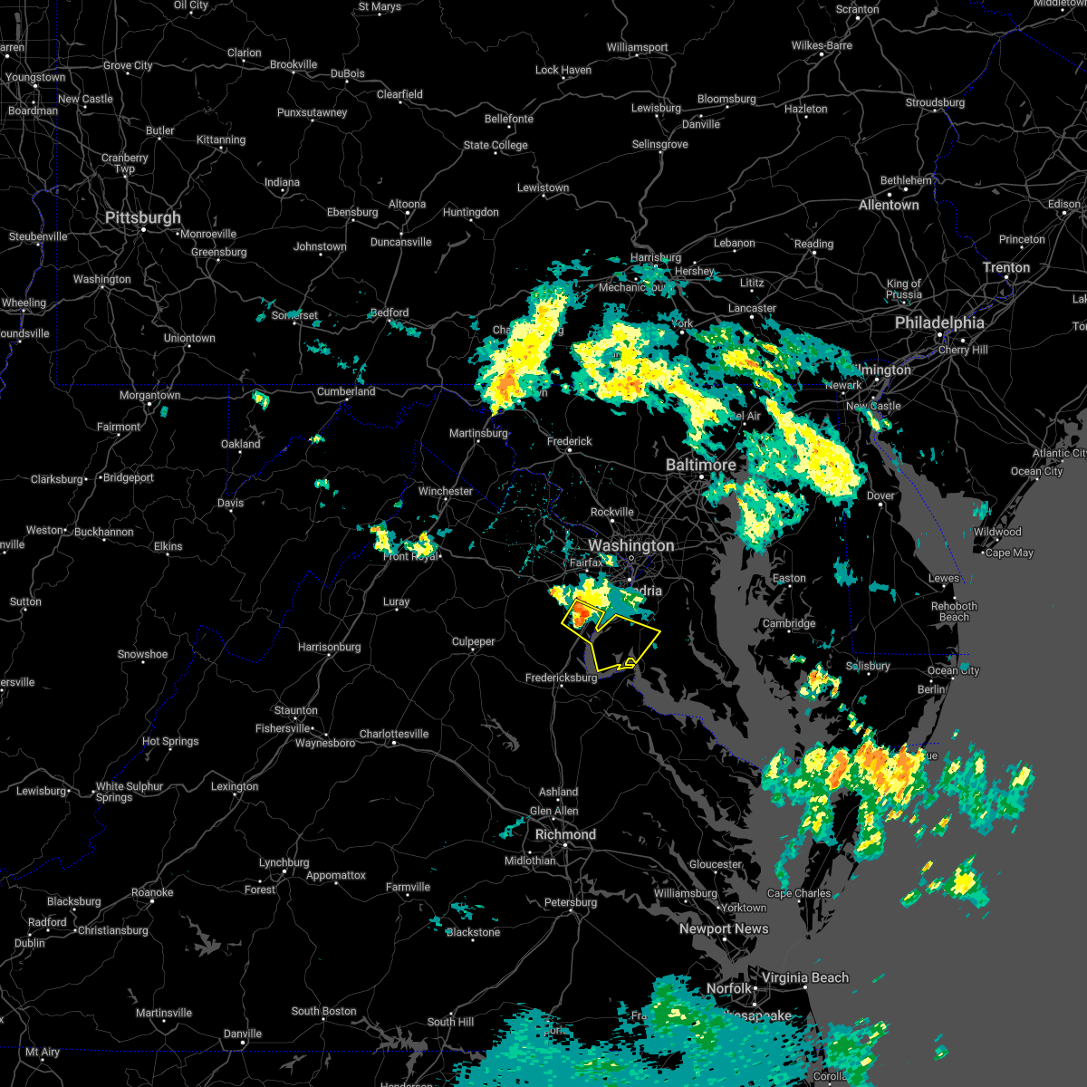 At 1242 am edt, a severe thunderstorm was located near dumfries, or near woodbridge, moving southeast at 20 mph (radar indicated). Hazards include 60 mph wind gusts. Damaging winds will cause some trees and large branches to fall. this could injure those outdoors, as well as damage homes and vehicles. roadways may become blocked by downed trees. localized power outages are possible. unsecured light objects may become projectiles. locations impacted include, waldorf, dale city, la plata, woodbridge, quantico, port tobacco river, nanjemoy creek, lake ridge, montclair, triangle, dumfries, saint charles, cherry hill, independent hill, bryans road, mason neck, potomac heights, pomfret, port tobacco village and ironsides. hail threat, radar indicated max hail size, <. 75 in wind threat, radar indicated max wind gust, 60 mph. At 1242 am edt, a severe thunderstorm was located near dumfries, or near woodbridge, moving southeast at 20 mph (radar indicated). Hazards include 60 mph wind gusts. Damaging winds will cause some trees and large branches to fall. this could injure those outdoors, as well as damage homes and vehicles. roadways may become blocked by downed trees. localized power outages are possible. unsecured light objects may become projectiles. locations impacted include, waldorf, dale city, la plata, woodbridge, quantico, port tobacco river, nanjemoy creek, lake ridge, montclair, triangle, dumfries, saint charles, cherry hill, independent hill, bryans road, mason neck, potomac heights, pomfret, port tobacco village and ironsides. hail threat, radar indicated max hail size, <. 75 in wind threat, radar indicated max wind gust, 60 mph.
|
| 7/7/2022 12:25 AM EDT |
 At 1225 am edt, a severe thunderstorm was located over dale city, moving southeast at 20 mph (radar indicated). Hazards include 60 mph wind gusts. Damaging winds will cause some trees and large branches to fall. this could injure those outdoors, as well as damage homes and vehicles. roadways may become blocked by downed trees. localized power outages are possible. Unsecured light objects may become projectiles. At 1225 am edt, a severe thunderstorm was located over dale city, moving southeast at 20 mph (radar indicated). Hazards include 60 mph wind gusts. Damaging winds will cause some trees and large branches to fall. this could injure those outdoors, as well as damage homes and vehicles. roadways may become blocked by downed trees. localized power outages are possible. Unsecured light objects may become projectiles.
|
| 7/7/2022 12:25 AM EDT |
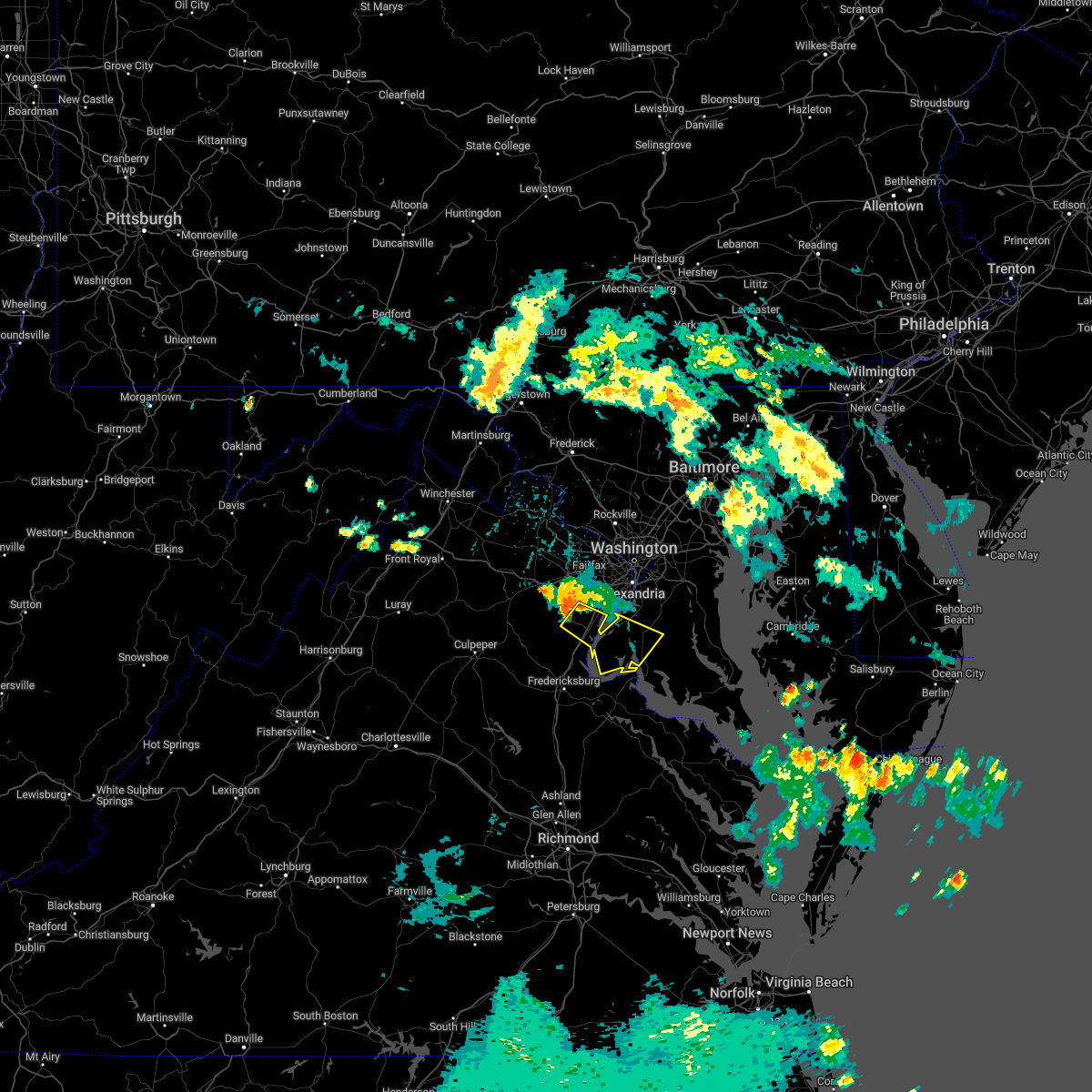 At 1225 am edt, a severe thunderstorm was located over dale city, moving southeast at 20 mph (radar indicated). Hazards include 60 mph wind gusts. Damaging winds will cause some trees and large branches to fall. this could injure those outdoors, as well as damage homes and vehicles. roadways may become blocked by downed trees. localized power outages are possible. Unsecured light objects may become projectiles. At 1225 am edt, a severe thunderstorm was located over dale city, moving southeast at 20 mph (radar indicated). Hazards include 60 mph wind gusts. Damaging winds will cause some trees and large branches to fall. this could injure those outdoors, as well as damage homes and vehicles. roadways may become blocked by downed trees. localized power outages are possible. Unsecured light objects may become projectiles.
|
| 6/22/2022 1:58 PM EDT |
 At 158 pm edt, severe thunderstorms were located along a line extending from woodbridge to 10 miles northwest of stafford, moving south at 40 mph (radar indicated). Hazards include 60 mph wind gusts. Damaging winds will cause some trees and large branches to fall. this could injure those outdoors, as well as damage homes and vehicles. roadways may become blocked by downed trees. localized power outages are possible. Unsecured light objects may become projectiles. At 158 pm edt, severe thunderstorms were located along a line extending from woodbridge to 10 miles northwest of stafford, moving south at 40 mph (radar indicated). Hazards include 60 mph wind gusts. Damaging winds will cause some trees and large branches to fall. this could injure those outdoors, as well as damage homes and vehicles. roadways may become blocked by downed trees. localized power outages are possible. Unsecured light objects may become projectiles.
|
| 6/13/2022 9:02 PM EDT |
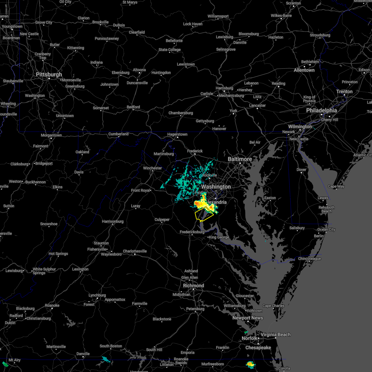 The national weather service in sterling virginia has issued a * severe thunderstorm warning for. northwestern charles county in southern maryland. south central fairfax county in northern virginia. southeastern prince william county in northern virginia. Until 945 pm edt. The national weather service in sterling virginia has issued a * severe thunderstorm warning for. northwestern charles county in southern maryland. south central fairfax county in northern virginia. southeastern prince william county in northern virginia. Until 945 pm edt.
|
| 6/8/2022 6:21 PM EDT |
 The severe thunderstorm warning for northern stafford, southwestern fairfax, southeastern fauquier, and southern prince william counties and the city of manassas will expire at 630 pm edt, the storm which prompted the warning has moved out of the area. therefore, the warning will be allowed to expire. however heavy rain is still possible with this thunderstorm. The severe thunderstorm warning for northern stafford, southwestern fairfax, southeastern fauquier, and southern prince william counties and the city of manassas will expire at 630 pm edt, the storm which prompted the warning has moved out of the area. therefore, the warning will be allowed to expire. however heavy rain is still possible with this thunderstorm.
|
| 6/8/2022 6:13 PM EDT |
 At 612 pm edt, a severe thunderstorm was located over quantico, moving east at 15 mph (radar indicated). Hazards include 60 mph wind gusts and quarter size hail. Damaging winds will cause some trees and large branches to fall. this could injure those outdoors, as well as damage homes and vehicles. roadways may become blocked by downed trees. localized power outages are possible. Unsecured light objects may become projectiles. At 612 pm edt, a severe thunderstorm was located over quantico, moving east at 15 mph (radar indicated). Hazards include 60 mph wind gusts and quarter size hail. Damaging winds will cause some trees and large branches to fall. this could injure those outdoors, as well as damage homes and vehicles. roadways may become blocked by downed trees. localized power outages are possible. Unsecured light objects may become projectiles.
|
| 6/8/2022 6:11 PM EDT |
 At 611 pm edt, a severe thunderstorm was located 9 miles east of bealeton, or 13 miles northwest of stafford, moving northeast at 10 mph (radar indicated). Hazards include 60 mph wind gusts and quarter size hail. Damaging winds will cause some trees and large branches to fall. this could injure those outdoors, as well as damage homes and vehicles. roadways may become blocked by downed trees. localized power outages are possible. unsecured light objects may become projectiles. locations impacted include, dale city, quantico, lake ridge, linton hall, montclair, bull run, triangle, dumfries, manassas, sudley, cherry hill, independent hill, nokesville, catlett, calverton, roseville, garrisonville, ramoth, heflin and morrisville. hail threat, radar indicated max hail size, 1. 00 in wind threat, radar indicated max wind gust, 60 mph. At 611 pm edt, a severe thunderstorm was located 9 miles east of bealeton, or 13 miles northwest of stafford, moving northeast at 10 mph (radar indicated). Hazards include 60 mph wind gusts and quarter size hail. Damaging winds will cause some trees and large branches to fall. this could injure those outdoors, as well as damage homes and vehicles. roadways may become blocked by downed trees. localized power outages are possible. unsecured light objects may become projectiles. locations impacted include, dale city, quantico, lake ridge, linton hall, montclair, bull run, triangle, dumfries, manassas, sudley, cherry hill, independent hill, nokesville, catlett, calverton, roseville, garrisonville, ramoth, heflin and morrisville. hail threat, radar indicated max hail size, 1. 00 in wind threat, radar indicated max wind gust, 60 mph.
|
| 6/8/2022 5:52 PM EDT |
 At 552 pm edt, a severe thunderstorm was located 9 miles southeast of bealeton, or 13 miles northwest of stafford, moving northeast at 10 mph (radar indicated). Hazards include 60 mph wind gusts and quarter size hail. Damaging winds will cause some trees and large branches to fall. this could injure those outdoors, as well as damage homes and vehicles. roadways may become blocked by downed trees. localized power outages are possible. Unsecured light objects may become projectiles. At 552 pm edt, a severe thunderstorm was located 9 miles southeast of bealeton, or 13 miles northwest of stafford, moving northeast at 10 mph (radar indicated). Hazards include 60 mph wind gusts and quarter size hail. Damaging winds will cause some trees and large branches to fall. this could injure those outdoors, as well as damage homes and vehicles. roadways may become blocked by downed trees. localized power outages are possible. Unsecured light objects may become projectiles.
|
| 5/27/2022 12:05 PM EDT |
 At 1205 pm edt, severe thunderstorms were located along a line extending from near woodbridge to near quantico to near nanjemoy creek, moving northeast at 40 mph (radar indicated). Hazards include 60 mph wind gusts. Damaging winds will cause some trees and large branches to fall. this could injure those outdoors, as well as damage homes and vehicles. roadways may become blocked by downed trees. localized power outages are possible. unsecured light objects may become projectiles. locations impacted include, waldorf, dale city, clinton, fort washington, fort hunt, la plata, fort belvoir, woodbridge, port tobacco river, lake ridge, montclair, lorton, hybla valley, newington, friendly, dumfries, saint charles, cherry hill, mount vernon and accokeek. hail threat, radar indicated max hail size, <. 75 in wind threat, radar indicated max wind gust, 60 mph. At 1205 pm edt, severe thunderstorms were located along a line extending from near woodbridge to near quantico to near nanjemoy creek, moving northeast at 40 mph (radar indicated). Hazards include 60 mph wind gusts. Damaging winds will cause some trees and large branches to fall. this could injure those outdoors, as well as damage homes and vehicles. roadways may become blocked by downed trees. localized power outages are possible. unsecured light objects may become projectiles. locations impacted include, waldorf, dale city, clinton, fort washington, fort hunt, la plata, fort belvoir, woodbridge, port tobacco river, lake ridge, montclair, lorton, hybla valley, newington, friendly, dumfries, saint charles, cherry hill, mount vernon and accokeek. hail threat, radar indicated max hail size, <. 75 in wind threat, radar indicated max wind gust, 60 mph.
|
| 5/27/2022 11:43 AM EDT |
 At 1142 am edt, severe thunderstorms were located along a line extending from near montclair to near stafford to near fredericksburg, moving east at 35 mph (radar indicated). Hazards include 60 mph wind gusts. Damaging winds will cause some trees and large branches to fall. this could injure those outdoors, as well as damage homes and vehicles. roadways may become blocked by downed trees. localized power outages are possible. Unsecured light objects may become projectiles. At 1142 am edt, severe thunderstorms were located along a line extending from near montclair to near stafford to near fredericksburg, moving east at 35 mph (radar indicated). Hazards include 60 mph wind gusts. Damaging winds will cause some trees and large branches to fall. this could injure those outdoors, as well as damage homes and vehicles. roadways may become blocked by downed trees. localized power outages are possible. Unsecured light objects may become projectiles.
|
| 5/22/2022 7:43 PM EDT |
 At 742 pm edt, severe thunderstorms were located along a line extending from randallstown to near fredericksburg, moving east at 30 mph (radar indicated). Hazards include 60 mph wind gusts. Damaging winds will cause some trees and large branches to fall. this could injure those outdoors, as well as damage homes and vehicles. roadways may become blocked by downed trees. localized power outages are possible. unsecured light objects may become projectiles. locations impacted include, arlington, alexandria, stafford, columbia, germantown, dale city, rockville, bethesda, gaithersburg, reston, annandale, olney, springfield, college park, fredericksburg, fort washington, greenbelt, fairfax, langley park and beltsville. hail threat, radar indicated max hail size, <. 75 in wind threat, observed max wind gust, 60 mph. At 742 pm edt, severe thunderstorms were located along a line extending from randallstown to near fredericksburg, moving east at 30 mph (radar indicated). Hazards include 60 mph wind gusts. Damaging winds will cause some trees and large branches to fall. this could injure those outdoors, as well as damage homes and vehicles. roadways may become blocked by downed trees. localized power outages are possible. unsecured light objects may become projectiles. locations impacted include, arlington, alexandria, stafford, columbia, germantown, dale city, rockville, bethesda, gaithersburg, reston, annandale, olney, springfield, college park, fredericksburg, fort washington, greenbelt, fairfax, langley park and beltsville. hail threat, radar indicated max hail size, <. 75 in wind threat, observed max wind gust, 60 mph.
|
| 5/22/2022 7:20 PM EDT |
 At 720 pm edt, severe thunderstorms were located along a line extending from near sykesville to near spotsylvania, moving east at 35 mph (radar indicated). Hazards include 60 mph wind gusts. Damaging winds will cause some trees and large branches to fall. this could injure those outdoors, as well as damage homes and vehicles. roadways may become blocked by downed trees. localized power outages are possible. unsecured light objects may become projectiles. locations impacted include, arlington, alexandria, stafford, columbia, germantown, centreville, dale city, rockville, bethesda, gaithersburg, reston, annandale, olney, springfield, college park, fredericksburg, south riding, fort washington, herndon and greenbelt. hail threat, radar indicated max hail size, <. 75 in wind threat, observed max wind gust, 60 mph. At 720 pm edt, severe thunderstorms were located along a line extending from near sykesville to near spotsylvania, moving east at 35 mph (radar indicated). Hazards include 60 mph wind gusts. Damaging winds will cause some trees and large branches to fall. this could injure those outdoors, as well as damage homes and vehicles. roadways may become blocked by downed trees. localized power outages are possible. unsecured light objects may become projectiles. locations impacted include, arlington, alexandria, stafford, columbia, germantown, centreville, dale city, rockville, bethesda, gaithersburg, reston, annandale, olney, springfield, college park, fredericksburg, south riding, fort washington, herndon and greenbelt. hail threat, radar indicated max hail size, <. 75 in wind threat, observed max wind gust, 60 mph.
|
| 5/22/2022 7:04 PM EDT |
 At 703 pm edt, severe thunderstorms were located along a line extending from near damascus to 13 miles north of mineral, moving east at 30 mph (measured gust to 58 mph at dulles airport). Hazards include 60 mph wind gusts. Damaging winds will cause some trees and large branches to fall. this could injure those outdoors, as well as damage homes and vehicles. roadways may become blocked by downed trees. localized power outages are possible. Unsecured light objects may become projectiles. At 703 pm edt, severe thunderstorms were located along a line extending from near damascus to 13 miles north of mineral, moving east at 30 mph (measured gust to 58 mph at dulles airport). Hazards include 60 mph wind gusts. Damaging winds will cause some trees and large branches to fall. this could injure those outdoors, as well as damage homes and vehicles. roadways may become blocked by downed trees. localized power outages are possible. Unsecured light objects may become projectiles.
|
| 5/16/2022 4:32 PM EDT |
 At 432 pm edt, a severe thunderstorm was located over newington, or over springfield, moving east at 40 mph (radar indicated). Hazards include 70 mph wind gusts and half dollar size hail. Damaging winds will cause some trees and large branches to fall. this could injure those outdoors, as well as damage homes and vehicles. roadways may become blocked by downed trees. localized power outages are possible. unsecured light objects may become projectiles. locations impacted include, arlington, alexandria, waldorf, dale city, annandale, clinton, springfield, fort washington, fairfax, fort hunt, groveton, falls church, huntington, coral hills, mantua, fort belvoir, woodbridge, national harbor, nationals park and reagan national airport. thunderstorm damage threat, considerable hail threat, radar indicated max hail size, 1. 25 in wind threat, radar indicated max wind gust, 70 mph. At 432 pm edt, a severe thunderstorm was located over newington, or over springfield, moving east at 40 mph (radar indicated). Hazards include 70 mph wind gusts and half dollar size hail. Damaging winds will cause some trees and large branches to fall. this could injure those outdoors, as well as damage homes and vehicles. roadways may become blocked by downed trees. localized power outages are possible. unsecured light objects may become projectiles. locations impacted include, arlington, alexandria, waldorf, dale city, annandale, clinton, springfield, fort washington, fairfax, fort hunt, groveton, falls church, huntington, coral hills, mantua, fort belvoir, woodbridge, national harbor, nationals park and reagan national airport. thunderstorm damage threat, considerable hail threat, radar indicated max hail size, 1. 25 in wind threat, radar indicated max wind gust, 70 mph.
|
| 5/16/2022 4:28 PM EDT |
 At 426 pm edt, a severe thunderstorm was located over burke, or near springfield, moving east at 40 mph (radar indicated). Hazards include 70 mph wind gusts and half dollar size hail. Damaging winds will cause some trees and large branches to fall. this could injure those outdoors, as well as damage homes and vehicles. roadways may become blocked by downed trees. localized power outages are possible. unsecured light objects may become projectiles. accokeek and fort washington in maryland are at highest risk. locations impacted include, arlington, alexandria, centreville, waldorf, dale city, annandale, clinton, springfield, fort washington, fairfax, fort hunt, vienna, groveton, falls church, huntington, coral hills, mantua, fort belvoir, woodbridge and national harbor. thunderstorm damage threat, considerable hail threat, radar indicated max hail size, 1. 25 in wind threat, radar indicated max wind gust, 70 mph. At 426 pm edt, a severe thunderstorm was located over burke, or near springfield, moving east at 40 mph (radar indicated). Hazards include 70 mph wind gusts and half dollar size hail. Damaging winds will cause some trees and large branches to fall. this could injure those outdoors, as well as damage homes and vehicles. roadways may become blocked by downed trees. localized power outages are possible. unsecured light objects may become projectiles. accokeek and fort washington in maryland are at highest risk. locations impacted include, arlington, alexandria, centreville, waldorf, dale city, annandale, clinton, springfield, fort washington, fairfax, fort hunt, vienna, groveton, falls church, huntington, coral hills, mantua, fort belvoir, woodbridge and national harbor. thunderstorm damage threat, considerable hail threat, radar indicated max hail size, 1. 25 in wind threat, radar indicated max wind gust, 70 mph.
|
| 5/16/2022 4:18 PM EDT |
 At 418 pm edt, a severe thunderstorm was located near bull run, or near centreville, moving east at 35 mph (radar indicated). Hazards include 70 mph wind gusts and quarter size hail. Damaging winds will cause some trees and large branches to fall. this could injure those outdoors, as well as damage homes and vehicles. roadways may become blocked by downed trees. localized power outages are possible. unsecured light objects may become projectiles. locations impacted include, centreville, dale city, fairfax, lake ridge, linton hall, oakton, chantilly, montclair, bull run, manassas, sudley, manassas park, fairfax station, independent hill, nokesville, clifton and aden. thunderstorm damage threat, considerable hail threat, radar indicated max hail size, 1. 00 in wind threat, radar indicated max wind gust, 70 mph. At 418 pm edt, a severe thunderstorm was located near bull run, or near centreville, moving east at 35 mph (radar indicated). Hazards include 70 mph wind gusts and quarter size hail. Damaging winds will cause some trees and large branches to fall. this could injure those outdoors, as well as damage homes and vehicles. roadways may become blocked by downed trees. localized power outages are possible. unsecured light objects may become projectiles. locations impacted include, centreville, dale city, fairfax, lake ridge, linton hall, oakton, chantilly, montclair, bull run, manassas, sudley, manassas park, fairfax station, independent hill, nokesville, clifton and aden. thunderstorm damage threat, considerable hail threat, radar indicated max hail size, 1. 00 in wind threat, radar indicated max wind gust, 70 mph.
|
| 5/16/2022 4:07 PM EDT |
 At 407 pm edt, a severe thunderstorm was located over bull run, or 8 miles southwest of centreville, moving east at 40 mph (radar indicated). Hazards include 70 mph wind gusts and half dollar size hail. Damaging winds will cause some trees and large branches to fall. this could injure those outdoors, as well as damage homes and vehicles. roadways may become blocked by downed trees. localized power outages are possible. Unsecured light objects may become projectiles. At 407 pm edt, a severe thunderstorm was located over bull run, or 8 miles southwest of centreville, moving east at 40 mph (radar indicated). Hazards include 70 mph wind gusts and half dollar size hail. Damaging winds will cause some trees and large branches to fall. this could injure those outdoors, as well as damage homes and vehicles. roadways may become blocked by downed trees. localized power outages are possible. Unsecured light objects may become projectiles.
|
| 5/16/2022 4:03 PM EDT |
 At 403 pm edt, a severe thunderstorm was located over linton hall, or 10 miles southwest of centreville, moving east at 35 mph (radar indicated). Hazards include 70 mph wind gusts and quarter size hail. Damaging winds will cause some trees and large branches to fall. this could injure those outdoors, as well as damage homes and vehicles. roadways may become blocked by downed trees. localized power outages are possible. unsecured light objects may become projectiles. locations impacted include, centreville, dale city, fairfax, lake ridge, linton hall, oakton, chantilly, montclair, bull run, haymarket, manassas, sudley, manassas park, fairfax station, gainesville, new baltimore, independent hill, nokesville, catlett and clifton. thunderstorm damage threat, considerable hail threat, radar indicated max hail size, 1. 00 in wind threat, radar indicated max wind gust, 70 mph. At 403 pm edt, a severe thunderstorm was located over linton hall, or 10 miles southwest of centreville, moving east at 35 mph (radar indicated). Hazards include 70 mph wind gusts and quarter size hail. Damaging winds will cause some trees and large branches to fall. this could injure those outdoors, as well as damage homes and vehicles. roadways may become blocked by downed trees. localized power outages are possible. unsecured light objects may become projectiles. locations impacted include, centreville, dale city, fairfax, lake ridge, linton hall, oakton, chantilly, montclair, bull run, haymarket, manassas, sudley, manassas park, fairfax station, gainesville, new baltimore, independent hill, nokesville, catlett and clifton. thunderstorm damage threat, considerable hail threat, radar indicated max hail size, 1. 00 in wind threat, radar indicated max wind gust, 70 mph.
|
| 5/16/2022 4:00 PM EDT |
 At 359 pm edt, a severe thunderstorm was located near linton hall, or 8 miles east of warrenton, moving east at 35 mph (radar indicated). Hazards include 60 mph wind gusts and quarter size hail. Damaging winds will cause some trees and large branches to fall. this could injure those outdoors, as well as damage homes and vehicles. roadways may become blocked by downed trees. localized power outages are possible. unsecured light objects may become projectiles. locations impacted include, centreville, dale city, fairfax, lake ridge, linton hall, oakton, chantilly, montclair, bull run, haymarket, manassas, sudley, manassas park, fairfax station, gainesville, new baltimore, independent hill, nokesville, catlett and clifton. hail threat, radar indicated max hail size, 1. 00 in wind threat, radar indicated max wind gust, 60 mph. At 359 pm edt, a severe thunderstorm was located near linton hall, or 8 miles east of warrenton, moving east at 35 mph (radar indicated). Hazards include 60 mph wind gusts and quarter size hail. Damaging winds will cause some trees and large branches to fall. this could injure those outdoors, as well as damage homes and vehicles. roadways may become blocked by downed trees. localized power outages are possible. unsecured light objects may become projectiles. locations impacted include, centreville, dale city, fairfax, lake ridge, linton hall, oakton, chantilly, montclair, bull run, haymarket, manassas, sudley, manassas park, fairfax station, gainesville, new baltimore, independent hill, nokesville, catlett and clifton. hail threat, radar indicated max hail size, 1. 00 in wind threat, radar indicated max wind gust, 60 mph.
|
| 5/16/2022 3:49 PM EDT |
 At 349 pm edt, a severe thunderstorm was located near warrenton, moving east at 35 mph (radar indicated). Hazards include 60 mph wind gusts and quarter size hail. Damaging winds will cause some trees and large branches to fall. this could injure those outdoors, as well as damage homes and vehicles. roadways may become blocked by downed trees. localized power outages are possible. Unsecured light objects may become projectiles. At 349 pm edt, a severe thunderstorm was located near warrenton, moving east at 35 mph (radar indicated). Hazards include 60 mph wind gusts and quarter size hail. Damaging winds will cause some trees and large branches to fall. this could injure those outdoors, as well as damage homes and vehicles. roadways may become blocked by downed trees. localized power outages are possible. Unsecured light objects may become projectiles.
|
| 8/27/2021 9:35 PM EDT |
 At 935 pm edt, severe thunderstorms were located along a line extending from near woodbridge to 8 miles west of montclair, moving east at 20 mph (radar indicated). Hazards include 60 mph wind gusts and quarter size hail. Damaging winds will cause some trees and large branches to fall. this could injure those outdoors, as well as damage homes and vehicles. roadways may become blocked by downed trees. localized power outages are possible. Unsecured light objects may become projectiles. At 935 pm edt, severe thunderstorms were located along a line extending from near woodbridge to 8 miles west of montclair, moving east at 20 mph (radar indicated). Hazards include 60 mph wind gusts and quarter size hail. Damaging winds will cause some trees and large branches to fall. this could injure those outdoors, as well as damage homes and vehicles. roadways may become blocked by downed trees. localized power outages are possible. Unsecured light objects may become projectiles.
|
| 8/27/2021 5:54 PM EDT |
 The severe thunderstorm warning for southwestern prince georges, northwestern charles and east central prince william counties will expire at 600 pm edt, the storm which prompted the warning has weakened below severe limits, and has exited the warned area. therefore, the warning will be allowed to expire. however heavy rain is still possible with this thunderstorm. The severe thunderstorm warning for southwestern prince georges, northwestern charles and east central prince william counties will expire at 600 pm edt, the storm which prompted the warning has weakened below severe limits, and has exited the warned area. therefore, the warning will be allowed to expire. however heavy rain is still possible with this thunderstorm.
|
| 8/27/2021 5:35 PM EDT |
 At 534 pm edt, a severe thunderstorm was located over woodbridge, moving east at 15 mph (radar indicated). Hazards include 60 mph wind gusts. Damaging winds will cause some trees and large branches to fall. this could injure those outdoors, as well as damage homes and vehicles. roadways may become blocked by downed trees. localized power outages are possible. unsecured light objects may become projectiles. locations impacted include, waldorf, clinton, fort washington, fort hunt, la plata, fort belvoir, woodbridge, andrews air force base, camp springs, oxon hill, rosaryville, friendly, marlton, saint charles, cherry hill, mount vernon, accokeek, bryans road, brandywine and mason neck. hail threat, radar indicated max hail size, <. 75 in wind threat, radar indicated max wind gust, 60 mph. At 534 pm edt, a severe thunderstorm was located over woodbridge, moving east at 15 mph (radar indicated). Hazards include 60 mph wind gusts. Damaging winds will cause some trees and large branches to fall. this could injure those outdoors, as well as damage homes and vehicles. roadways may become blocked by downed trees. localized power outages are possible. unsecured light objects may become projectiles. locations impacted include, waldorf, clinton, fort washington, fort hunt, la plata, fort belvoir, woodbridge, andrews air force base, camp springs, oxon hill, rosaryville, friendly, marlton, saint charles, cherry hill, mount vernon, accokeek, bryans road, brandywine and mason neck. hail threat, radar indicated max hail size, <. 75 in wind threat, radar indicated max wind gust, 60 mph.
|
| 8/27/2021 5:35 PM EDT |
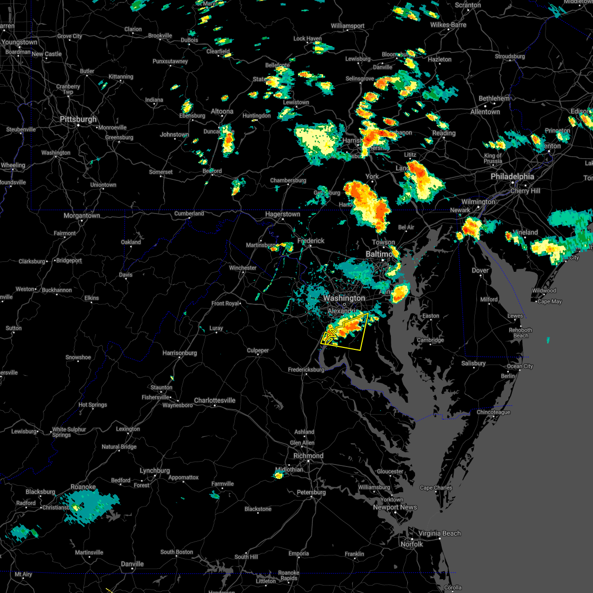 At 534 pm edt, a severe thunderstorm was located over woodbridge, moving east at 15 mph (radar indicated). Hazards include 60 mph wind gusts. Damaging winds will cause some trees and large branches to fall. this could injure those outdoors, as well as damage homes and vehicles. roadways may become blocked by downed trees. localized power outages are possible. unsecured light objects may become projectiles. locations impacted include, waldorf, clinton, fort washington, fort hunt, la plata, fort belvoir, woodbridge, andrews air force base, camp springs, oxon hill, rosaryville, friendly, marlton, saint charles, cherry hill, mount vernon, accokeek, bryans road, brandywine and mason neck. hail threat, radar indicated max hail size, <. 75 in wind threat, radar indicated max wind gust, 60 mph. At 534 pm edt, a severe thunderstorm was located over woodbridge, moving east at 15 mph (radar indicated). Hazards include 60 mph wind gusts. Damaging winds will cause some trees and large branches to fall. this could injure those outdoors, as well as damage homes and vehicles. roadways may become blocked by downed trees. localized power outages are possible. unsecured light objects may become projectiles. locations impacted include, waldorf, clinton, fort washington, fort hunt, la plata, fort belvoir, woodbridge, andrews air force base, camp springs, oxon hill, rosaryville, friendly, marlton, saint charles, cherry hill, mount vernon, accokeek, bryans road, brandywine and mason neck. hail threat, radar indicated max hail size, <. 75 in wind threat, radar indicated max wind gust, 60 mph.
|
| 8/27/2021 5:21 PM EDT |
 At 520 pm edt, a severe thunderstorm was located over woodbridge, moving east at 20 mph (radar indicated). Hazards include 60 mph wind gusts. Damaging winds will cause some trees and large branches to fall. this could injure those outdoors, as well as damage homes and vehicles. roadways may become blocked by downed trees. localized power outages are possible. Unsecured light objects may become projectiles. At 520 pm edt, a severe thunderstorm was located over woodbridge, moving east at 20 mph (radar indicated). Hazards include 60 mph wind gusts. Damaging winds will cause some trees and large branches to fall. this could injure those outdoors, as well as damage homes and vehicles. roadways may become blocked by downed trees. localized power outages are possible. Unsecured light objects may become projectiles.
|
| 8/13/2021 6:35 PM EDT |
 The severe thunderstorm warning for southwestern prince georges, northwestern charles, east central stafford, southeastern fairfax and southeastern prince william counties will expire at 645 pm edt, the storms which prompted the warning have weakened below severe limits, and have exited the warned area. therefore, the warning will be allowed to expire. a severe thunderstorm watch remains in effect until 800 pm edt for southern and central maryland, and northern virginia. The severe thunderstorm warning for southwestern prince georges, northwestern charles, east central stafford, southeastern fairfax and southeastern prince william counties will expire at 645 pm edt, the storms which prompted the warning have weakened below severe limits, and have exited the warned area. therefore, the warning will be allowed to expire. a severe thunderstorm watch remains in effect until 800 pm edt for southern and central maryland, and northern virginia.
|
| 8/13/2021 6:19 PM EDT |
 At 619 pm edt, severe thunderstorms were located along a line extending from huntington to near fort hunt to near nanjemoy creek, moving east at 20 mph (radar indicated). Hazards include 60 mph wind gusts. Damaging winds will cause some trees and large branches to fall. this could injure those outdoors, as well as damage homes and vehicles. roadways may become blocked by downed trees. localized power outages are possible. unsecured light objects may become projectiles. locations impacted include, waldorf, clinton, springfield, fort washington, fort hunt, groveton, forestville, la plata, fort belvoir, woodbridge, national harbor, quantico, aquia creek, port tobacco river, andrews air force base, camp springs, lorton, franconia, oxon hill and hybla valley. hail threat, radar indicated max hail size, <. 75 in wind threat, radar indicated max wind gust, 60 mph. At 619 pm edt, severe thunderstorms were located along a line extending from huntington to near fort hunt to near nanjemoy creek, moving east at 20 mph (radar indicated). Hazards include 60 mph wind gusts. Damaging winds will cause some trees and large branches to fall. this could injure those outdoors, as well as damage homes and vehicles. roadways may become blocked by downed trees. localized power outages are possible. unsecured light objects may become projectiles. locations impacted include, waldorf, clinton, springfield, fort washington, fort hunt, groveton, forestville, la plata, fort belvoir, woodbridge, national harbor, quantico, aquia creek, port tobacco river, andrews air force base, camp springs, lorton, franconia, oxon hill and hybla valley. hail threat, radar indicated max hail size, <. 75 in wind threat, radar indicated max wind gust, 60 mph.
|
| 8/13/2021 5:56 PM EDT |
 At 554 pm edt, severe thunderstorms were located along a line extending from near american university to lincolnia to aquia creek, moving east at 20 mph (radar indicated). Hazards include 60 mph wind gusts and quarter size hail. Damaging winds will cause some trees and large branches to fall. this could injure those outdoors, as well as damage homes and vehicles. roadways may become blocked by downed trees. localized power outages are possible. Unsecured light objects may become projectiles. At 554 pm edt, severe thunderstorms were located along a line extending from near american university to lincolnia to aquia creek, moving east at 20 mph (radar indicated). Hazards include 60 mph wind gusts and quarter size hail. Damaging winds will cause some trees and large branches to fall. this could injure those outdoors, as well as damage homes and vehicles. roadways may become blocked by downed trees. localized power outages are possible. Unsecured light objects may become projectiles.
|
| 8/11/2021 5:04 PM EDT |
 At 503 pm edt, a severe thunderstorm was located over triangle, or near quantico, moving east at 10 mph (radar indicated). Hazards include 60 mph wind gusts. Damaging winds will cause some trees and large branches to fall. this could injure those outdoors, as well as damage homes and vehicles. roadways may become blocked by downed trees. localized power outages are possible. unsecured light objects may become projectiles. locations impacted include, dale city, woodbridge, quantico, lake ridge, montclair, triangle, dumfries, cherry hill, independent hill and occoquan. hail threat, radar indicated max hail size, <. 75 in wind threat, radar indicated max wind gust, 60 mph. At 503 pm edt, a severe thunderstorm was located over triangle, or near quantico, moving east at 10 mph (radar indicated). Hazards include 60 mph wind gusts. Damaging winds will cause some trees and large branches to fall. this could injure those outdoors, as well as damage homes and vehicles. roadways may become blocked by downed trees. localized power outages are possible. unsecured light objects may become projectiles. locations impacted include, dale city, woodbridge, quantico, lake ridge, montclair, triangle, dumfries, cherry hill, independent hill and occoquan. hail threat, radar indicated max hail size, <. 75 in wind threat, radar indicated max wind gust, 60 mph.
|
| 8/11/2021 4:38 PM EDT |
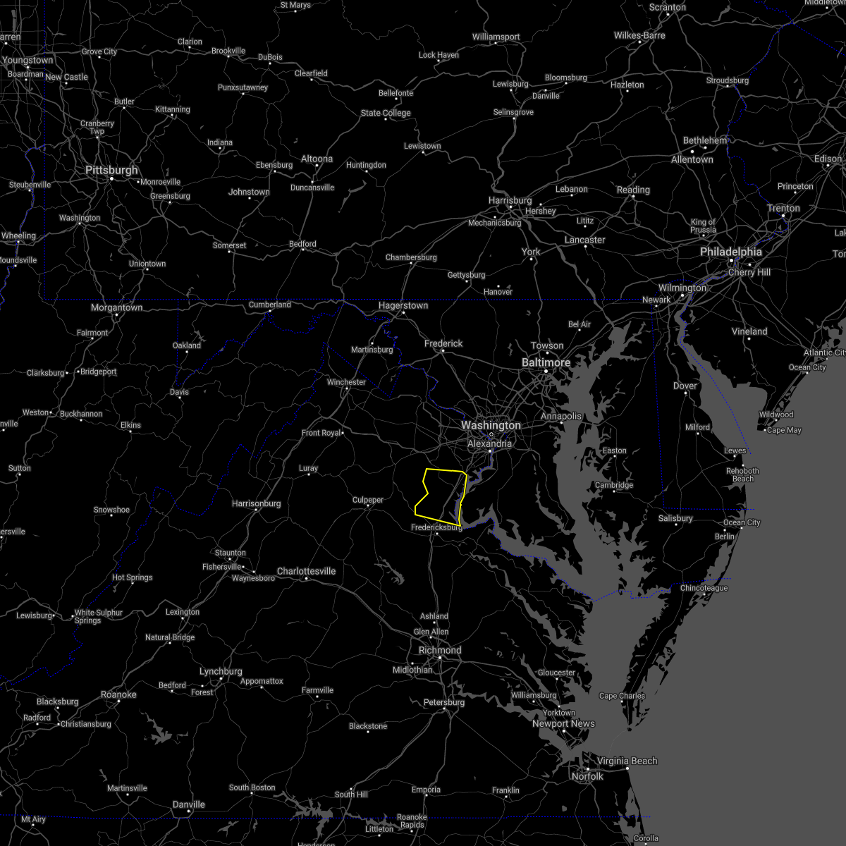 At 438 pm edt, severe thunderstorms were located along a line extending from 6 miles west of dale city to 12 miles northwest of fredericksburg, moving east at 15 mph (radar indicated). Hazards include 60 mph wind gusts. Damaging winds will cause some trees and large branches to fall. this could injure those outdoors, as well as damage homes and vehicles. roadways may become blocked by downed trees. localized power outages are possible. Unsecured light objects may become projectiles. At 438 pm edt, severe thunderstorms were located along a line extending from 6 miles west of dale city to 12 miles northwest of fredericksburg, moving east at 15 mph (radar indicated). Hazards include 60 mph wind gusts. Damaging winds will cause some trees and large branches to fall. this could injure those outdoors, as well as damage homes and vehicles. roadways may become blocked by downed trees. localized power outages are possible. Unsecured light objects may become projectiles.
|
| 7/26/2021 8:41 PM EDT |
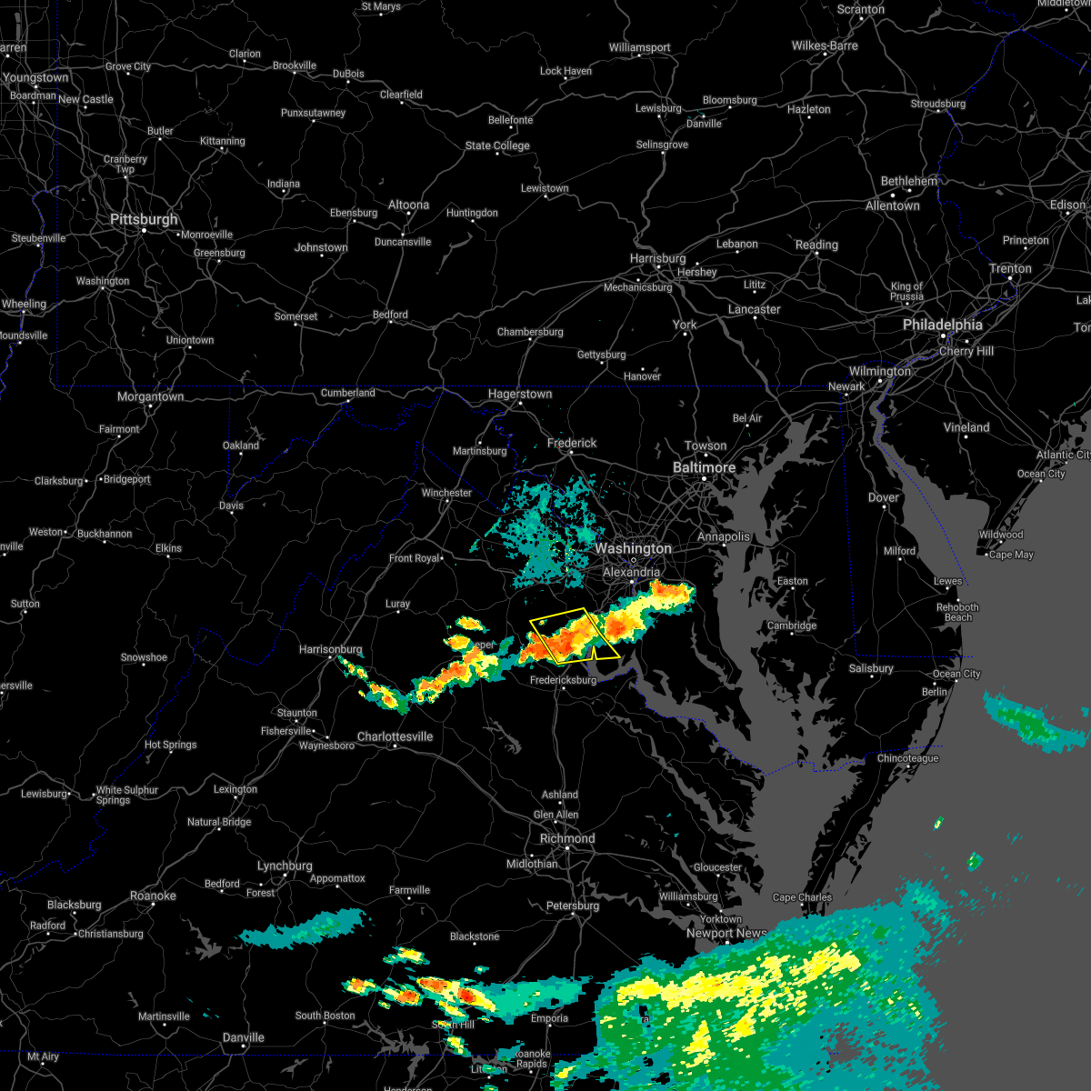 The severe thunderstorm warning for west central charles, northern stafford, southeastern fauquier and southeastern prince william counties will expire at 845 pm edt, the storms which prompted the warning have weakened below severe limits, and no longer pose an immediate threat to life or property. therefore, the warning will be allowed to expire. however gusty winds are still possible with these thunderstorms. The severe thunderstorm warning for west central charles, northern stafford, southeastern fauquier and southeastern prince william counties will expire at 845 pm edt, the storms which prompted the warning have weakened below severe limits, and no longer pose an immediate threat to life or property. therefore, the warning will be allowed to expire. however gusty winds are still possible with these thunderstorms.
|
| 7/26/2021 8:21 PM EDT |
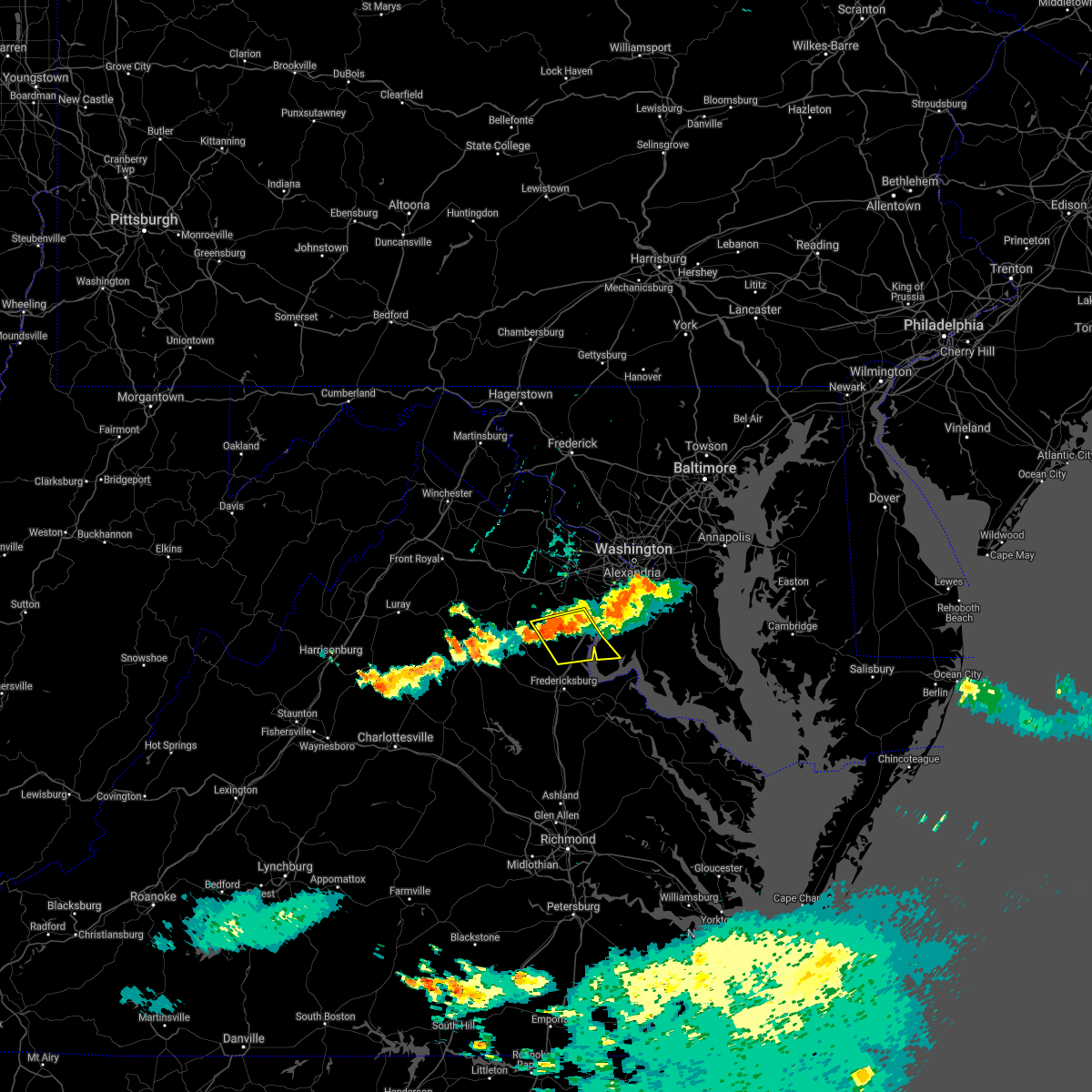 At 820 pm edt, severe thunderstorms were located along a line extending from near woodbridge to 11 miles east of bealeton, moving southeast at 25 mph (radar indicated). Hazards include 60 mph wind gusts. Damaging winds will cause some trees and large branches to fall. this could injure those outdoors, as well as damage homes and vehicles. roadways may become blocked by downed trees. localized power outages are possible. unsecured light objects may become projectiles. Locations impacted include, dale city, quantico, lake ridge, montclair, triangle, dumfries, cherry hill, independent hill, widewater, roseville, garrisonville, arkendale, nanjemoy, aquia, ruby, bristersburg and ramoth. At 820 pm edt, severe thunderstorms were located along a line extending from near woodbridge to 11 miles east of bealeton, moving southeast at 25 mph (radar indicated). Hazards include 60 mph wind gusts. Damaging winds will cause some trees and large branches to fall. this could injure those outdoors, as well as damage homes and vehicles. roadways may become blocked by downed trees. localized power outages are possible. unsecured light objects may become projectiles. Locations impacted include, dale city, quantico, lake ridge, montclair, triangle, dumfries, cherry hill, independent hill, widewater, roseville, garrisonville, arkendale, nanjemoy, aquia, ruby, bristersburg and ramoth.
|
| 7/26/2021 8:01 PM EDT |
 At 801 pm edt, severe thunderstorms were located along a line extending from lake ridge to 8 miles south of linton hall, moving southeast at 25 mph (radar indicated). Hazards include 60 mph wind gusts. Damaging winds will cause some trees and large branches to fall. this could injure those outdoors, as well as damage homes and vehicles. roadways may become blocked by downed trees. localized power outages are possible. Unsecured light objects may become projectiles. At 801 pm edt, severe thunderstorms were located along a line extending from lake ridge to 8 miles south of linton hall, moving southeast at 25 mph (radar indicated). Hazards include 60 mph wind gusts. Damaging winds will cause some trees and large branches to fall. this could injure those outdoors, as well as damage homes and vehicles. roadways may become blocked by downed trees. localized power outages are possible. Unsecured light objects may become projectiles.
|
| 7/8/2021 1:31 PM EDT |
 At 131 pm edt, a severe thunderstorm was located over lake ridge, or near woodbridge, moving north at 20 mph (radar indicated). Hazards include 60 mph wind gusts and quarter size hail. Damaging winds will cause some trees and large branches to fall. this could injure those outdoors, as well as damage homes and vehicles. roadways may become blocked by downed trees. localized power outages are possible. unsecured light objects may become projectiles. Locations impacted include, dale city, springfield, fort belvoir, woodbridge, lake ridge, burke, montclair, lorton, franconia, newington, west springfield, fairfax station, hayfield, mason neck and occoquan. At 131 pm edt, a severe thunderstorm was located over lake ridge, or near woodbridge, moving north at 20 mph (radar indicated). Hazards include 60 mph wind gusts and quarter size hail. Damaging winds will cause some trees and large branches to fall. this could injure those outdoors, as well as damage homes and vehicles. roadways may become blocked by downed trees. localized power outages are possible. unsecured light objects may become projectiles. Locations impacted include, dale city, springfield, fort belvoir, woodbridge, lake ridge, burke, montclair, lorton, franconia, newington, west springfield, fairfax station, hayfield, mason neck and occoquan.
|
| 7/8/2021 1:03 PM EDT |
 At 103 pm edt, a severe thunderstorm was located over montclair, or near dale city, moving north at 20 mph (radar indicated). Hazards include 60 mph wind gusts and quarter size hail. Damaging winds will cause some trees and large branches to fall. this could injure those outdoors, as well as damage homes and vehicles. roadways may become blocked by downed trees. localized power outages are possible. Unsecured light objects may become projectiles. At 103 pm edt, a severe thunderstorm was located over montclair, or near dale city, moving north at 20 mph (radar indicated). Hazards include 60 mph wind gusts and quarter size hail. Damaging winds will cause some trees and large branches to fall. this could injure those outdoors, as well as damage homes and vehicles. roadways may become blocked by downed trees. localized power outages are possible. Unsecured light objects may become projectiles.
|
| 7/1/2021 2:43 PM EDT |
 At 242 pm edt, severe thunderstorms were located along a line extending from near chantilly to near burke to 6 miles west of dale city, moving east at 35 mph (radar indicated). Hazards include 60 mph wind gusts and quarter size hail. Damaging winds will cause some trees and large branches to fall. this could injure those outdoors, as well as damage homes and vehicles. roadways may become blocked by downed trees. localized power outages are possible. Unsecured light objects may become projectiles. At 242 pm edt, severe thunderstorms were located along a line extending from near chantilly to near burke to 6 miles west of dale city, moving east at 35 mph (radar indicated). Hazards include 60 mph wind gusts and quarter size hail. Damaging winds will cause some trees and large branches to fall. this could injure those outdoors, as well as damage homes and vehicles. roadways may become blocked by downed trees. localized power outages are possible. Unsecured light objects may become projectiles.
|
| 6/4/2021 1:04 PM EDT |
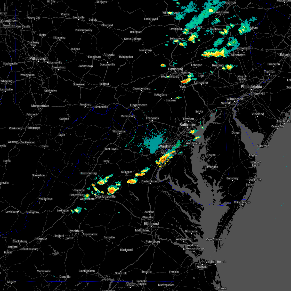 At 104 pm edt, a severe thunderstorm was located over lorton, or near woodbridge, moving southeast at 15 mph (radar indicated). Hazards include 65 mph wind gusts and quarter size hail. Damaging winds will cause some trees and large branches to fall. this could injure those outdoors, as well as damage homes and vehicles. roadways may become blocked by downed trees. localized power outages are possible. unsecured light objects may become projectiles. Locations impacted include, fort hunt, groveton, fort belvoir, woodbridge, lorton, hybla valley, mount vernon, hayfield and mason neck. At 104 pm edt, a severe thunderstorm was located over lorton, or near woodbridge, moving southeast at 15 mph (radar indicated). Hazards include 65 mph wind gusts and quarter size hail. Damaging winds will cause some trees and large branches to fall. this could injure those outdoors, as well as damage homes and vehicles. roadways may become blocked by downed trees. localized power outages are possible. unsecured light objects may become projectiles. Locations impacted include, fort hunt, groveton, fort belvoir, woodbridge, lorton, hybla valley, mount vernon, hayfield and mason neck.
|
| 6/4/2021 12:52 PM EDT |
 At 1252 pm edt, a severe thunderstorm was located over lorton, or near woodbridge, moving east at 15 mph (radar indicated). Hazards include 65 mph wind gusts and quarter size hail. Damaging winds will cause some trees and large branches to fall. this could injure those outdoors, as well as damage homes and vehicles. roadways may become blocked by downed trees. localized power outages are possible. unsecured light objects may become projectiles. Locations impacted include, dale city, springfield, fort hunt, groveton, fort belvoir, woodbridge, lake ridge, burke, lorton, franconia, hybla valley, newington, west springfield, cherry hill, mount vernon, hayfield, mason neck and occoquan. At 1252 pm edt, a severe thunderstorm was located over lorton, or near woodbridge, moving east at 15 mph (radar indicated). Hazards include 65 mph wind gusts and quarter size hail. Damaging winds will cause some trees and large branches to fall. this could injure those outdoors, as well as damage homes and vehicles. roadways may become blocked by downed trees. localized power outages are possible. unsecured light objects may become projectiles. Locations impacted include, dale city, springfield, fort hunt, groveton, fort belvoir, woodbridge, lake ridge, burke, lorton, franconia, hybla valley, newington, west springfield, cherry hill, mount vernon, hayfield, mason neck and occoquan.
|
| 6/4/2021 12:44 PM EDT |
 At 1244 pm edt, a severe thunderstorm was located near lake ridge, or near woodbridge, moving southeast at 15 mph (radar indicated). Hazards include 60 mph wind gusts and quarter size hail. Damaging winds will cause some trees and large branches to fall. this could injure those outdoors, as well as damage homes and vehicles. roadways may become blocked by downed trees. localized power outages are possible. unsecured light objects may become projectiles. Locations impacted include, dale city, springfield, fort hunt, groveton, fort belvoir, woodbridge, lake ridge, burke, montclair, lorton, franconia, hybla valley, newington, west springfield, cherry hill, mount vernon, fairfax station, hayfield, mason neck and occoquan. At 1244 pm edt, a severe thunderstorm was located near lake ridge, or near woodbridge, moving southeast at 15 mph (radar indicated). Hazards include 60 mph wind gusts and quarter size hail. Damaging winds will cause some trees and large branches to fall. this could injure those outdoors, as well as damage homes and vehicles. roadways may become blocked by downed trees. localized power outages are possible. unsecured light objects may become projectiles. Locations impacted include, dale city, springfield, fort hunt, groveton, fort belvoir, woodbridge, lake ridge, burke, montclair, lorton, franconia, hybla valley, newington, west springfield, cherry hill, mount vernon, fairfax station, hayfield, mason neck and occoquan.
|
| 6/4/2021 12:33 PM EDT |
 At 1233 pm edt, a severe thunderstorm was located near lake ridge, or near dale city, moving southeast at 15 mph (radar indicated). Hazards include 60 mph wind gusts. Damaging winds will cause some trees and large branches to fall. this could injure those outdoors, as well as damage homes and vehicles. roadways may become blocked by downed trees. localized power outages are possible. Unsecured light objects may become projectiles. At 1233 pm edt, a severe thunderstorm was located near lake ridge, or near dale city, moving southeast at 15 mph (radar indicated). Hazards include 60 mph wind gusts. Damaging winds will cause some trees and large branches to fall. this could injure those outdoors, as well as damage homes and vehicles. roadways may become blocked by downed trees. localized power outages are possible. Unsecured light objects may become projectiles.
|
| 5/28/2021 6:33 PM EDT |
 At 632 pm edt, severe thunderstorms were located along a line extending from lorton to near saint charles, moving northeast at 40 mph (radar indicated). Hazards include 60 mph wind gusts. Damaging winds will cause some trees and large branches to fall. this could injure those outdoors, as well as damage homes and vehicles. roadways may become blocked by downed trees. localized power outages are possible. unsecured light objects may become projectiles. Locations impacted include, waldorf, clinton, springfield, fort washington, fort hunt, groveton, fort belvoir, woodbridge, lorton, franconia, oxon hill, hybla valley, newington, rosaryville, friendly, marlton, saint charles, i395 and i495 interchange, mount vernon and accokeek. At 632 pm edt, severe thunderstorms were located along a line extending from lorton to near saint charles, moving northeast at 40 mph (radar indicated). Hazards include 60 mph wind gusts. Damaging winds will cause some trees and large branches to fall. this could injure those outdoors, as well as damage homes and vehicles. roadways may become blocked by downed trees. localized power outages are possible. unsecured light objects may become projectiles. Locations impacted include, waldorf, clinton, springfield, fort washington, fort hunt, groveton, fort belvoir, woodbridge, lorton, franconia, oxon hill, hybla valley, newington, rosaryville, friendly, marlton, saint charles, i395 and i495 interchange, mount vernon and accokeek.
|
| 5/28/2021 6:15 PM EDT |
 The national weather service in sterling virginia has issued a * severe thunderstorm warning for. southwestern prince georges county in central maryland. northwestern charles county in southern maryland. southeastern fairfax county in northern virginia. Southeastern prince william county in northern virginia. The national weather service in sterling virginia has issued a * severe thunderstorm warning for. southwestern prince georges county in central maryland. northwestern charles county in southern maryland. southeastern fairfax county in northern virginia. Southeastern prince william county in northern virginia.
|
| 5/26/2021 9:26 PM EDT |
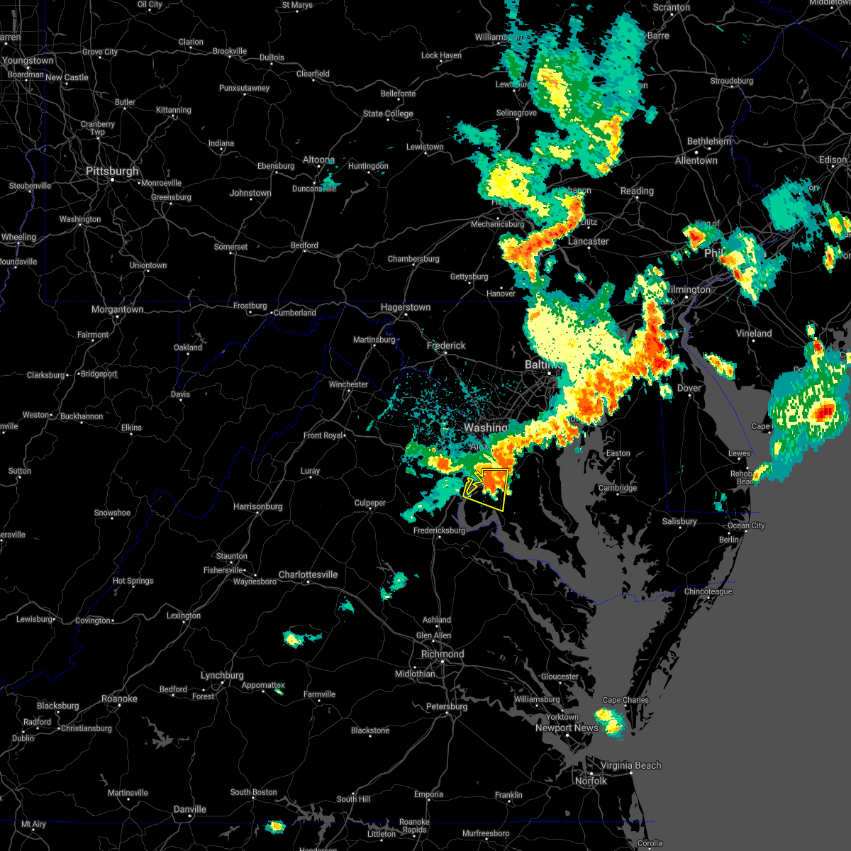 At 926 pm edt, a severe thunderstorm located near fort hunt, moving east at 35 mph (observed wind). Hazards include 70 mph wind gusts. Damaging winds will cause some trees and large branches to fall. this could injure those outdoors, as well as damage homes and vehicles. roadways may become blocked by downed trees. localized power outages are possible. unsecured light objects may become projectiles. Locations impacted include, waldorf, clinton, fort washington, la plata, fort belvoir, woodbridge, saint charles, cherry hill, mount vernon, accokeek, bryans road, mason neck, potomac heights, pomfret, port tobacco village, marbury, port tobacco, ripley, rison and bel alton. At 926 pm edt, a severe thunderstorm located near fort hunt, moving east at 35 mph (observed wind). Hazards include 70 mph wind gusts. Damaging winds will cause some trees and large branches to fall. this could injure those outdoors, as well as damage homes and vehicles. roadways may become blocked by downed trees. localized power outages are possible. unsecured light objects may become projectiles. Locations impacted include, waldorf, clinton, fort washington, la plata, fort belvoir, woodbridge, saint charles, cherry hill, mount vernon, accokeek, bryans road, mason neck, potomac heights, pomfret, port tobacco village, marbury, port tobacco, ripley, rison and bel alton.
|
| 5/26/2021 9:21 PM EDT |
 At 921 pm edt, a severe thunderstorm was located near fort belvoir, moving east at 35 mph. this is a very dangerous storm (observed wind). Hazards include 80 mph wind gusts. Expect considerable damage to trees and power lines. your life is at significant risk if outdoors. in addition to some trees falling into homes, wind damage is possible to roofs, sheds, open garages, and mobile homes. Locations impacted include, waldorf, clinton, fort washington, la plata, fort belvoir, woodbridge, saint charles, cherry hill, mount vernon, accokeek, bryans road, mason neck, potomac heights, pomfret, port tobacco village, marbury, port tobacco, ripley, rison and bel alton. At 921 pm edt, a severe thunderstorm was located near fort belvoir, moving east at 35 mph. this is a very dangerous storm (observed wind). Hazards include 80 mph wind gusts. Expect considerable damage to trees and power lines. your life is at significant risk if outdoors. in addition to some trees falling into homes, wind damage is possible to roofs, sheds, open garages, and mobile homes. Locations impacted include, waldorf, clinton, fort washington, la plata, fort belvoir, woodbridge, saint charles, cherry hill, mount vernon, accokeek, bryans road, mason neck, potomac heights, pomfret, port tobacco village, marbury, port tobacco, ripley, rison and bel alton.
|
| 5/26/2021 9:09 PM EDT |
 At 909 pm edt, a severe thunderstorm was located over woodbridge, moving east at 35 mph (radar indicated). Hazards include 70 mph wind gusts. Damaging winds will cause some trees and large branches to fall. this could injure those outdoors, as well as damage homes and vehicles. roadways may become blocked by downed trees. localized power outages are possible. unsecured light objects may become projectiles. Locations impacted include, waldorf, dale city, clinton, fort washington, fort hunt, la plata, fort belvoir, woodbridge, lake ridge, montclair, lorton, newington, triangle, dumfries, saint charles, cherry hill, mount vernon, accokeek, independent hill and bryans road. At 909 pm edt, a severe thunderstorm was located over woodbridge, moving east at 35 mph (radar indicated). Hazards include 70 mph wind gusts. Damaging winds will cause some trees and large branches to fall. this could injure those outdoors, as well as damage homes and vehicles. roadways may become blocked by downed trees. localized power outages are possible. unsecured light objects may become projectiles. Locations impacted include, waldorf, dale city, clinton, fort washington, fort hunt, la plata, fort belvoir, woodbridge, lake ridge, montclair, lorton, newington, triangle, dumfries, saint charles, cherry hill, mount vernon, accokeek, independent hill and bryans road.
|
| 5/26/2021 9:02 PM EDT |
 At 902 pm edt, a severe thunderstorm was located over dale city, moving east at 35 mph (radar indicated). Hazards include 70 mph wind gusts. Damaging winds will cause some trees and large branches to fall. this could injure those outdoors, as well as damage homes and vehicles. roadways may become blocked by downed trees. localized power outages are possible. unsecured light objects may become projectiles. Locations impacted include, waldorf, dale city, clinton, fort washington, fort hunt, la plata, fort belvoir, woodbridge, lake ridge, montclair, lorton, newington, triangle, dumfries, saint charles, cherry hill, mount vernon, accokeek, independent hill and bryans road. At 902 pm edt, a severe thunderstorm was located over dale city, moving east at 35 mph (radar indicated). Hazards include 70 mph wind gusts. Damaging winds will cause some trees and large branches to fall. this could injure those outdoors, as well as damage homes and vehicles. roadways may become blocked by downed trees. localized power outages are possible. unsecured light objects may become projectiles. Locations impacted include, waldorf, dale city, clinton, fort washington, fort hunt, la plata, fort belvoir, woodbridge, lake ridge, montclair, lorton, newington, triangle, dumfries, saint charles, cherry hill, mount vernon, accokeek, independent hill and bryans road.
|
| 5/26/2021 8:53 PM EDT |
 At 853 pm edt, a severe thunderstorm was located near dale city, moving east at 35 mph (radar indicated). Hazards include 60 mph wind gusts. Damaging winds will cause some trees and large branches to fall. this could injure those outdoors, as well as damage homes and vehicles. roadways may become blocked by downed trees. localized power outages are possible. Unsecured light objects may become projectiles. At 853 pm edt, a severe thunderstorm was located near dale city, moving east at 35 mph (radar indicated). Hazards include 60 mph wind gusts. Damaging winds will cause some trees and large branches to fall. this could injure those outdoors, as well as damage homes and vehicles. roadways may become blocked by downed trees. localized power outages are possible. Unsecured light objects may become projectiles.
|
| 5/26/2021 5:33 PM EDT |
 At 532 pm edt, a severe thunderstorm was located over woodbridge, moving east at 30 mph (radar indicated). Hazards include 60 mph wind gusts. Damaging winds will cause some trees and large branches to fall. this could injure those outdoors, as well as damage homes and vehicles. roadways may become blocked by downed trees. localized power outages are possible. unsecured light objects may become projectiles. Locations impacted include, dale city, springfield, fort washington, fort hunt, groveton, fort belvoir, woodbridge, lake ridge, burke, montclair, lorton, franconia, hybla valley, newington, triangle, dumfries, west springfield, cherry hill, mount vernon and independent hill. At 532 pm edt, a severe thunderstorm was located over woodbridge, moving east at 30 mph (radar indicated). Hazards include 60 mph wind gusts. Damaging winds will cause some trees and large branches to fall. this could injure those outdoors, as well as damage homes and vehicles. roadways may become blocked by downed trees. localized power outages are possible. unsecured light objects may become projectiles. Locations impacted include, dale city, springfield, fort washington, fort hunt, groveton, fort belvoir, woodbridge, lake ridge, burke, montclair, lorton, franconia, hybla valley, newington, triangle, dumfries, west springfield, cherry hill, mount vernon and independent hill.
|
| 5/26/2021 5:22 PM EDT |
 At 522 pm edt, a severe thunderstorm was located over dale city, moving east at 30 mph (radar indicated). Hazards include 60 mph wind gusts. Damaging winds will cause some trees and large branches to fall. this could injure those outdoors, as well as damage homes and vehicles. roadways may become blocked by downed trees. localized power outages are possible. Unsecured light objects may become projectiles. At 522 pm edt, a severe thunderstorm was located over dale city, moving east at 30 mph (radar indicated). Hazards include 60 mph wind gusts. Damaging winds will cause some trees and large branches to fall. this could injure those outdoors, as well as damage homes and vehicles. roadways may become blocked by downed trees. localized power outages are possible. Unsecured light objects may become projectiles.
|
| 5/26/2021 5:04 PM EDT |
 At 504 pm edt, severe thunderstorms were located along a line extending from arlington to burke to near lake ridge, moving east at 25 mph (radar indicated). Hazards include 60 mph wind gusts. Damaging winds will cause some trees and large branches to fall. this could injure those outdoors, as well as damage homes and vehicles. roadways may become blocked by downed trees. localized power outages are possible. unsecured light objects may become projectiles. Locations impacted include, arlington, alexandria, dale city, annandale, springfield, fort hunt, groveton, huntington, mantua, fort belvoir, woodbridge, reagan national airport, crystal city, lake ridge, burke, lincolnia, lorton, franconia, hybla valley and newington. At 504 pm edt, severe thunderstorms were located along a line extending from arlington to burke to near lake ridge, moving east at 25 mph (radar indicated). Hazards include 60 mph wind gusts. Damaging winds will cause some trees and large branches to fall. this could injure those outdoors, as well as damage homes and vehicles. roadways may become blocked by downed trees. localized power outages are possible. unsecured light objects may become projectiles. Locations impacted include, arlington, alexandria, dale city, annandale, springfield, fort hunt, groveton, huntington, mantua, fort belvoir, woodbridge, reagan national airport, crystal city, lake ridge, burke, lincolnia, lorton, franconia, hybla valley and newington.
|
| 5/26/2021 4:57 PM EDT |
 At 457 pm edt, severe thunderstorms with a history of producing large hail and damaging winds were located along a line extending from lake barcroft to near burke to near dale city, moving east at 25 mph (radar indicated). Hazards include 60 mph wind gusts and quarter size hail. Damaging winds will cause some trees and large branches to fall. this could injure those outdoors, as well as damage homes and vehicles. roadways may become blocked by downed trees. localized power outages are possible. unsecured light objects may become projectiles. Locations impacted include, arlington, alexandria, dale city, annandale, springfield, fairfax, fort hunt, groveton, falls church, huntington, mantua, fort belvoir, pimmit hills, woodbridge, reagan national airport, crystal city, lake ridge, burke, lincolnia and montclair. At 457 pm edt, severe thunderstorms with a history of producing large hail and damaging winds were located along a line extending from lake barcroft to near burke to near dale city, moving east at 25 mph (radar indicated). Hazards include 60 mph wind gusts and quarter size hail. Damaging winds will cause some trees and large branches to fall. this could injure those outdoors, as well as damage homes and vehicles. roadways may become blocked by downed trees. localized power outages are possible. unsecured light objects may become projectiles. Locations impacted include, arlington, alexandria, dale city, annandale, springfield, fairfax, fort hunt, groveton, falls church, huntington, mantua, fort belvoir, pimmit hills, woodbridge, reagan national airport, crystal city, lake ridge, burke, lincolnia and montclair.
|
| 5/26/2021 4:35 PM EDT |
 At 434 pm edt, severe thunderstorms were located along a line extending from fairfax to near bull run to near linton hall, moving east at 25 mph (radar indicated and observations. these storms have a history of producing damaging wind gusts and large hail). Hazards include 70 mph wind gusts and half dollar size hail. Damaging winds will cause some trees and large branches to fall. this could injure those outdoors, as well as damage homes and vehicles. roadways may become blocked by downed trees. localized power outages are possible. Unsecured light objects may become projectiles. At 434 pm edt, severe thunderstorms were located along a line extending from fairfax to near bull run to near linton hall, moving east at 25 mph (radar indicated and observations. these storms have a history of producing damaging wind gusts and large hail). Hazards include 70 mph wind gusts and half dollar size hail. Damaging winds will cause some trees and large branches to fall. this could injure those outdoors, as well as damage homes and vehicles. roadways may become blocked by downed trees. localized power outages are possible. Unsecured light objects may become projectiles.
|
| 5/5/2021 2:40 PM EDT |
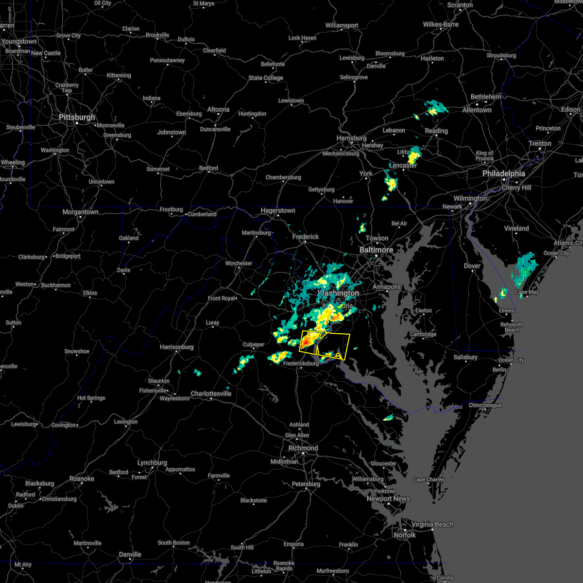 At 240 pm edt, a severe thunderstorm was located near triangle, or near quantico, moving east at 25 mph (radar indicated). Hazards include 60 mph wind gusts and quarter size hail. Damaging winds will cause some trees and large branches to fall. this could injure those outdoors, as well as damage homes and vehicles. roadways may become blocked by downed trees. localized power outages are possible. Unsecured light objects may become projectiles. At 240 pm edt, a severe thunderstorm was located near triangle, or near quantico, moving east at 25 mph (radar indicated). Hazards include 60 mph wind gusts and quarter size hail. Damaging winds will cause some trees and large branches to fall. this could injure those outdoors, as well as damage homes and vehicles. roadways may become blocked by downed trees. localized power outages are possible. Unsecured light objects may become projectiles.
|
| 5/4/2021 5:13 PM EDT |
 The severe thunderstorm warning for arlington, southeastern fairfax, and southeastern prince william counties, the city of fairfax, the city of falls church and the city of alexandria will expire at 515 pm edt, the storms which prompted the warning have moved out of the area. therefore, the warning will be allowed to expire. however heavy rain is still possible with these thunderstorms. a severe thunderstorm watch remains in effect until 800 pm edt for district of columbia, southern and central maryland, and northern virginia. The severe thunderstorm warning for arlington, southeastern fairfax, and southeastern prince william counties, the city of fairfax, the city of falls church and the city of alexandria will expire at 515 pm edt, the storms which prompted the warning have moved out of the area. therefore, the warning will be allowed to expire. however heavy rain is still possible with these thunderstorms. a severe thunderstorm watch remains in effect until 800 pm edt for district of columbia, southern and central maryland, and northern virginia.
|
| 5/4/2021 4:50 PM EDT |
 At 450 pm edt, severe thunderstorms were located along a line extending from tysons corner to near burke to montclair, moving east at 35 mph (radar indicated). Hazards include 60 mph wind gusts. Damaging winds will cause some trees and large branches to fall. this could injure those outdoors, as well as damage homes and vehicles. roadways may become blocked by downed trees. localized power outages are possible. unsecured light objects may become projectiles. Locations impacted include, arlington, alexandria, dale city, annandale, springfield, fort washington, fairfax, fort hunt, vienna, groveton, falls church, huntington, mantua, fort belvoir, pimmit hills, woodbridge, national harbor, reagan national airport, crystal city and rosslyn. At 450 pm edt, severe thunderstorms were located along a line extending from tysons corner to near burke to montclair, moving east at 35 mph (radar indicated). Hazards include 60 mph wind gusts. Damaging winds will cause some trees and large branches to fall. this could injure those outdoors, as well as damage homes and vehicles. roadways may become blocked by downed trees. localized power outages are possible. unsecured light objects may become projectiles. Locations impacted include, arlington, alexandria, dale city, annandale, springfield, fort washington, fairfax, fort hunt, vienna, groveton, falls church, huntington, mantua, fort belvoir, pimmit hills, woodbridge, national harbor, reagan national airport, crystal city and rosslyn.
|
| 5/4/2021 4:26 PM EDT |
 At 426 pm edt, severe thunderstorms were located along a line extending from chantilly to near bull run to 10 miles west of montclair, moving east at 35 mph (radar indicated). Hazards include 60 mph wind gusts. Damaging winds will cause some trees and large branches to fall. this could injure those outdoors, as well as damage homes and vehicles. roadways may become blocked by downed trees. localized power outages are possible. Unsecured light objects may become projectiles. At 426 pm edt, severe thunderstorms were located along a line extending from chantilly to near bull run to 10 miles west of montclair, moving east at 35 mph (radar indicated). Hazards include 60 mph wind gusts. Damaging winds will cause some trees and large branches to fall. this could injure those outdoors, as well as damage homes and vehicles. roadways may become blocked by downed trees. localized power outages are possible. Unsecured light objects may become projectiles.
|
| 4/30/2021 5:13 PM EDT |
 The severe thunderstorm warning for the district of columbia, south central howard, southeastern montgomery, prince georges, west central anne arundel, northwestern charles, fairfax, eastern fauquier, central prince william, and arlington counties, the city of falls church, the city of manassas park, the city of manassas, the city of fairfax and the city of alexandria will expire at 515 pm edt, the showers which prompted the warning have moved out of the area. therefore, the warning will be allowed to expire. however, high winds are still possible with these showers. remember, a severe thunderstorm warning still remains in effect for portions of southern maryland until 545 pm edt. The severe thunderstorm warning for the district of columbia, south central howard, southeastern montgomery, prince georges, west central anne arundel, northwestern charles, fairfax, eastern fauquier, central prince william, and arlington counties, the city of falls church, the city of manassas park, the city of manassas, the city of fairfax and the city of alexandria will expire at 515 pm edt, the showers which prompted the warning have moved out of the area. therefore, the warning will be allowed to expire. however, high winds are still possible with these showers. remember, a severe thunderstorm warning still remains in effect for portions of southern maryland until 545 pm edt.
|
| 4/30/2021 4:50 PM EDT |
 At 449 pm edt, a gust front associated with a line of strong showers were located along a line extending from near fairland to lake barcroft to near linton hall, moving east at 70 mph (radar indicated). Hazards include 70 mph wind gusts. Damaging winds will cause some trees and large branches to fall. this could injure those outdoors, as well as damage homes and vehicles. roadways may become blocked by downed trees. localized power outages are possible. unsecured light objects may become projectiles. locations impacted include, arlington, alexandria, centreville, waldorf, dale city, rockville, bethesda, bowie, severn, annandale, clinton, olney, springfield, college park, crofton, fort washington, greenbelt, fairfax, langley park and beltsville. People attending the fema greenbelt metro mass vaccination site should seek safe shelter immediately!. At 449 pm edt, a gust front associated with a line of strong showers were located along a line extending from near fairland to lake barcroft to near linton hall, moving east at 70 mph (radar indicated). Hazards include 70 mph wind gusts. Damaging winds will cause some trees and large branches to fall. this could injure those outdoors, as well as damage homes and vehicles. roadways may become blocked by downed trees. localized power outages are possible. unsecured light objects may become projectiles. locations impacted include, arlington, alexandria, centreville, waldorf, dale city, rockville, bethesda, bowie, severn, annandale, clinton, olney, springfield, college park, crofton, fort washington, greenbelt, fairfax, langley park and beltsville. People attending the fema greenbelt metro mass vaccination site should seek safe shelter immediately!.
|
| 4/30/2021 4:39 PM EDT |
 At 438 pm edt, severe thunderstorms were located along a line extending from montgomery village to near chantilly to warrenton, moving east at 65 mph (radar indicated). Hazards include 60 mph wind gusts. Damaging winds will cause some trees and large branches to fall. this could injure those outdoors, as well as damage homes and vehicles. roadways may become blocked by downed trees. localized power outages are possible. Unsecured light objects may become projectiles. At 438 pm edt, severe thunderstorms were located along a line extending from montgomery village to near chantilly to warrenton, moving east at 65 mph (radar indicated). Hazards include 60 mph wind gusts. Damaging winds will cause some trees and large branches to fall. this could injure those outdoors, as well as damage homes and vehicles. roadways may become blocked by downed trees. localized power outages are possible. Unsecured light objects may become projectiles.
|
| 4/30/2021 4:39 PM EDT |
 The national weather service in sterling virginia has issued a * severe thunderstorm warning for. the district of columbia. south central howard county in central maryland. southern montgomery county in central maryland. Prince georges county in central maryland. The national weather service in sterling virginia has issued a * severe thunderstorm warning for. the district of columbia. south central howard county in central maryland. southern montgomery county in central maryland. Prince georges county in central maryland.
|
| 12/24/2020 4:12 PM EST |
 The severe thunderstorm warning for northwestern charles, eastern stafford, south central fairfax and southeastern prince william counties and the extreme southeastern city of manassas park will expire at 415 pm est, the shower which prompted the warning has weakened below severe limits, and no longer poses an immediate threat to life or property. therefore, the warning will be allowed to expire. however gusty winds are still possible with this shower. The severe thunderstorm warning for northwestern charles, eastern stafford, south central fairfax and southeastern prince william counties and the extreme southeastern city of manassas park will expire at 415 pm est, the shower which prompted the warning has weakened below severe limits, and no longer poses an immediate threat to life or property. therefore, the warning will be allowed to expire. however gusty winds are still possible with this shower.
|
| 12/24/2020 3:53 PM EST |
 At 353 pm est, a severe thunderstorm was located near stafford, moving northeast at 55 mph (radar indicated). Hazards include 60 mph wind gusts. Damaging winds will cause some trees and large branches to fall. this could injure those outdoors, as well as damage homes and vehicles. roadways may become blocked by downed trees. localized power outages are possible. unsecured light objects may become projectiles. Locations impacted include, stafford, dale city, fort belvoir, woodbridge, quantico, aquia creek, lake ridge, burke, montclair, lorton, newington, triangle, dumfries, cherry hill, manassas park, fairfax station, independent hill, bryans road, falmouth and mason neck. At 353 pm est, a severe thunderstorm was located near stafford, moving northeast at 55 mph (radar indicated). Hazards include 60 mph wind gusts. Damaging winds will cause some trees and large branches to fall. this could injure those outdoors, as well as damage homes and vehicles. roadways may become blocked by downed trees. localized power outages are possible. unsecured light objects may become projectiles. Locations impacted include, stafford, dale city, fort belvoir, woodbridge, quantico, aquia creek, lake ridge, burke, montclair, lorton, newington, triangle, dumfries, cherry hill, manassas park, fairfax station, independent hill, bryans road, falmouth and mason neck.
|
| 12/24/2020 3:36 PM EST |
 At 335 pm est, a severe thunderstorm was located near fredericksburg, moving northeast at 55 mph (radar indicated). Hazards include 60 mph wind gusts. Damaging winds will cause some trees and large branches to fall. this could injure those outdoors, as well as damage homes and vehicles. roadways may become blocked by downed trees. localized power outages are possible. Unsecured light objects may become projectiles. At 335 pm est, a severe thunderstorm was located near fredericksburg, moving northeast at 55 mph (radar indicated). Hazards include 60 mph wind gusts. Damaging winds will cause some trees and large branches to fall. this could injure those outdoors, as well as damage homes and vehicles. roadways may become blocked by downed trees. localized power outages are possible. Unsecured light objects may become projectiles.
|
| 11/15/2020 8:06 PM EST |
 The severe thunderstorm warning for the southeastern district of columbia, south central anne arundel, prince georges, northwestern charles, southeastern fairfax, and southeastern prince william counties and the southeastern city of alexandria will expire at 815 pm est, the storms which prompted the warning have moved out of the area. therefore, the warning will be allowed to expire. a severe thunderstorm watch remains in effect until 1100 pm est for district of columbia, central and southern maryland, and northern virginia. The severe thunderstorm warning for the southeastern district of columbia, south central anne arundel, prince georges, northwestern charles, southeastern fairfax, and southeastern prince william counties and the southeastern city of alexandria will expire at 815 pm est, the storms which prompted the warning have moved out of the area. therefore, the warning will be allowed to expire. a severe thunderstorm watch remains in effect until 1100 pm est for district of columbia, central and southern maryland, and northern virginia.
|
| 11/15/2020 7:53 PM EST |
 At 753 pm est, severe thunderstorms were located along a line extending from woodmore to national harbor to 6 miles west of dale city, moving east at 40 mph (radar indicated). Hazards include 60 mph wind gusts. Damaging winds will cause some trees and large branches to fall. this could injure those outdoors, as well as damage homes and vehicles. roadways may become blocked by downed trees. localized power outages are possible. unsecured light objects may become projectiles. Locations impacted include, alexandria, waldorf, dale city, bowie, clinton, springfield, fort washington, greenbelt, fort hunt, groveton, forestville, huntington, largo, coral hills, bladensburg, fort belvoir, woodbridge, national harbor, upper marlboro and fedex field. At 753 pm est, severe thunderstorms were located along a line extending from woodmore to national harbor to 6 miles west of dale city, moving east at 40 mph (radar indicated). Hazards include 60 mph wind gusts. Damaging winds will cause some trees and large branches to fall. this could injure those outdoors, as well as damage homes and vehicles. roadways may become blocked by downed trees. localized power outages are possible. unsecured light objects may become projectiles. Locations impacted include, alexandria, waldorf, dale city, bowie, clinton, springfield, fort washington, greenbelt, fort hunt, groveton, forestville, huntington, largo, coral hills, bladensburg, fort belvoir, woodbridge, national harbor, upper marlboro and fedex field.
|
| 11/15/2020 7:28 PM EST |
 At 727 pm est, severe thunderstorms were located along a line extending from arlington to near burke to 10 miles east of bealeton, moving east at 35 mph (radar indicated). Hazards include 60 mph wind gusts. Damaging winds will cause some trees and large branches to fall. this could injure those outdoors, as well as damage homes and vehicles. roadways may become blocked by downed trees. localized power outages are possible. Unsecured light objects may become projectiles. At 727 pm est, severe thunderstorms were located along a line extending from arlington to near burke to 10 miles east of bealeton, moving east at 35 mph (radar indicated). Hazards include 60 mph wind gusts. Damaging winds will cause some trees and large branches to fall. this could injure those outdoors, as well as damage homes and vehicles. roadways may become blocked by downed trees. localized power outages are possible. Unsecured light objects may become projectiles.
|
| 9/3/2020 7:10 PM EDT |
 The severe thunderstorm warning for southern fairfax, and central prince william counties, the city of manassas park and the city of manassas will expire at 715 pm edt, the storm which prompted the warning has weakened below severe limits, and has exited the warned area. therefore, the warning will be allowed to expire. a tornado watch remains in effect until 1000 pm edt for district of columbia, southern and central maryland, and northern virginia. to report severe weather, contact your nearest law enforcement agency. they will relay your report to the national weather service sterling virginia. The severe thunderstorm warning for southern fairfax, and central prince william counties, the city of manassas park and the city of manassas will expire at 715 pm edt, the storm which prompted the warning has weakened below severe limits, and has exited the warned area. therefore, the warning will be allowed to expire. a tornado watch remains in effect until 1000 pm edt for district of columbia, southern and central maryland, and northern virginia. to report severe weather, contact your nearest law enforcement agency. they will relay your report to the national weather service sterling virginia.
|
| 9/3/2020 6:56 PM EDT |
 At 655 pm edt, a severe thunderstorm was located over lake ridge, or near dale city, moving east at 30 mph. a second severe thunderstorm was located near independent hill (radar indicated). Hazards include 60 mph wind gusts. Damaging winds will cause some trees and large branches to fall. this could injure those outdoors, as well as damage homes and vehicles. roadways may become blocked by downed trees. localized power outages are possible. unsecured light objects may become projectiles. Locations impacted include, dale city, springfield, fort hunt, groveton, huntington, fort belvoir, woodbridge, lake ridge, burke, linton hall, lincolnia, montclair, lorton, franconia, hybla valley, bull run, newington, i395 and i495 interchange and manassas. At 655 pm edt, a severe thunderstorm was located over lake ridge, or near dale city, moving east at 30 mph. a second severe thunderstorm was located near independent hill (radar indicated). Hazards include 60 mph wind gusts. Damaging winds will cause some trees and large branches to fall. this could injure those outdoors, as well as damage homes and vehicles. roadways may become blocked by downed trees. localized power outages are possible. unsecured light objects may become projectiles. Locations impacted include, dale city, springfield, fort hunt, groveton, huntington, fort belvoir, woodbridge, lake ridge, burke, linton hall, lincolnia, montclair, lorton, franconia, hybla valley, bull run, newington, i395 and i495 interchange and manassas.
|
| 9/3/2020 6:25 PM EDT |
 At 624 pm edt, a severe thunderstorm was located near linton hall, or 10 miles southwest of centreville, moving east at 50 mph (radar indicated). Hazards include 60 mph wind gusts. Damaging winds will cause some trees and large branches to fall. this could injure those outdoors, as well as damage homes and vehicles. roadways may become blocked by downed trees. localized power outages are possible. Unsecured light objects may become projectiles. At 624 pm edt, a severe thunderstorm was located near linton hall, or 10 miles southwest of centreville, moving east at 50 mph (radar indicated). Hazards include 60 mph wind gusts. Damaging winds will cause some trees and large branches to fall. this could injure those outdoors, as well as damage homes and vehicles. roadways may become blocked by downed trees. localized power outages are possible. Unsecured light objects may become projectiles.
|
| 8/25/2020 7:55 PM EDT |
 The severe thunderstorm warning for northwestern stafford, southeastern fauquier and southeastern prince william counties will expire at 800 pm edt, the storms which prompted the warning have moved out of the area. therefore, the warning will be allowed to expire. a severe thunderstorm watch remains in effect until 1100 pm edt for northern virginia. to report severe weather, contact your nearest law enforcement agency. they will relay your report to the national weather service sterling virginia. The severe thunderstorm warning for northwestern stafford, southeastern fauquier and southeastern prince william counties will expire at 800 pm edt, the storms which prompted the warning have moved out of the area. therefore, the warning will be allowed to expire. a severe thunderstorm watch remains in effect until 1100 pm edt for northern virginia. to report severe weather, contact your nearest law enforcement agency. they will relay your report to the national weather service sterling virginia.
|
| 8/25/2020 7:39 PM EDT |
 At 738 pm edt, severe thunderstorms were located along a line extending from lake ridge to near bealeton to near culpeper, moving southeast at 25 mph (radar indicated). Hazards include 60 mph wind gusts. Damaging winds will cause some trees and large branches to fall. this could injure those outdoors, as well as damage homes and vehicles. roadways may become blocked by downed trees. localized power outages are possible. unsecured light objects may become projectiles. Locations impacted include, dale city, woodbridge, lake ridge, montclair, dumfries, cherry hill, independent hill and occoquan. At 738 pm edt, severe thunderstorms were located along a line extending from lake ridge to near bealeton to near culpeper, moving southeast at 25 mph (radar indicated). Hazards include 60 mph wind gusts. Damaging winds will cause some trees and large branches to fall. this could injure those outdoors, as well as damage homes and vehicles. roadways may become blocked by downed trees. localized power outages are possible. unsecured light objects may become projectiles. Locations impacted include, dale city, woodbridge, lake ridge, montclair, dumfries, cherry hill, independent hill and occoquan.
|
| 8/25/2020 7:36 PM EDT |
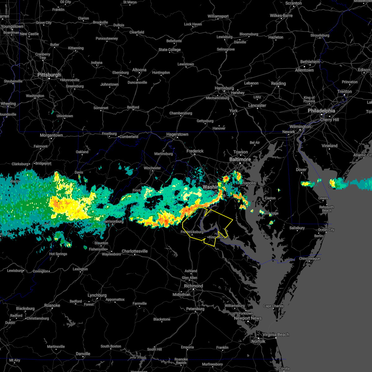 At 735 pm edt, severe thunderstorms were located along a line extending from near lake ridge to near dumfries to 8 miles west of stafford, moving east at 45 mph (radar indicated). Hazards include 60 mph wind gusts. Damaging winds will cause some trees and large branches to fall. this could injure those outdoors, as well as damage homes and vehicles. roadways may become blocked by downed trees. localized power outages are possible. Unsecured light objects may become projectiles. At 735 pm edt, severe thunderstorms were located along a line extending from near lake ridge to near dumfries to 8 miles west of stafford, moving east at 45 mph (radar indicated). Hazards include 60 mph wind gusts. Damaging winds will cause some trees and large branches to fall. this could injure those outdoors, as well as damage homes and vehicles. roadways may become blocked by downed trees. localized power outages are possible. Unsecured light objects may become projectiles.
|
| 8/25/2020 7:30 PM EDT |
 At 730 pm edt, severe thunderstorms were located along a line extending from near lake ridge to near bealeton to 7 miles northwest of culpeper, moving southeast at 25 mph (radar indicated). Hazards include 60 mph wind gusts. Damaging winds will cause some trees and large branches to fall. this could injure those outdoors, as well as damage homes and vehicles. roadways may become blocked by downed trees. localized power outages are possible. unsecured light objects may become projectiles. Locations impacted include, dale city, culpeper, woodbridge, lake ridge, linton hall, montclair, dumfries, bealeton, manassas, cherry hill, independent hill, mason neck, nokesville, occoquan, opal, remington, catlett, calverton, midland and elkwood. At 730 pm edt, severe thunderstorms were located along a line extending from near lake ridge to near bealeton to 7 miles northwest of culpeper, moving southeast at 25 mph (radar indicated). Hazards include 60 mph wind gusts. Damaging winds will cause some trees and large branches to fall. this could injure those outdoors, as well as damage homes and vehicles. roadways may become blocked by downed trees. localized power outages are possible. unsecured light objects may become projectiles. Locations impacted include, dale city, culpeper, woodbridge, lake ridge, linton hall, montclair, dumfries, bealeton, manassas, cherry hill, independent hill, mason neck, nokesville, occoquan, opal, remington, catlett, calverton, midland and elkwood.
|
| 8/25/2020 7:22 PM EDT |
 At 722 pm edt, severe thunderstorms were located along a line extending from near lake ridge to near bealeton to 8 miles northwest of culpeper, moving southeast at 25 mph (radar indicated). Hazards include 60 mph wind gusts. Damaging winds will cause some trees and large branches to fall. this could injure those outdoors, as well as damage homes and vehicles. roadways may become blocked by downed trees. localized power outages are possible. unsecured light objects may become projectiles. Locations impacted include, dale city, culpeper, warrenton, woodbridge, lake ridge, linton hall, montclair, bull run, dumfries, bealeton, manassas, sudley, cherry hill, manassas park, gainesville, new baltimore, independent hill, mason neck, nokesville and occoquan. At 722 pm edt, severe thunderstorms were located along a line extending from near lake ridge to near bealeton to 8 miles northwest of culpeper, moving southeast at 25 mph (radar indicated). Hazards include 60 mph wind gusts. Damaging winds will cause some trees and large branches to fall. this could injure those outdoors, as well as damage homes and vehicles. roadways may become blocked by downed trees. localized power outages are possible. unsecured light objects may become projectiles. Locations impacted include, dale city, culpeper, warrenton, woodbridge, lake ridge, linton hall, montclair, bull run, dumfries, bealeton, manassas, sudley, cherry hill, manassas park, gainesville, new baltimore, independent hill, mason neck, nokesville and occoquan.
|
| 8/25/2020 7:08 PM EDT |
 At 708 pm edt, severe thunderstorms were located along a line extending from centreville to near warrenton to near sperryville, moving southeast at 25 mph (radar indicated). Hazards include 60 mph wind gusts. Damaging winds will cause some trees and large branches to fall. this could injure those outdoors, as well as damage homes and vehicles. roadways may become blocked by downed trees. localized power outages are possible. Unsecured light objects may become projectiles. At 708 pm edt, severe thunderstorms were located along a line extending from centreville to near warrenton to near sperryville, moving southeast at 25 mph (radar indicated). Hazards include 60 mph wind gusts. Damaging winds will cause some trees and large branches to fall. this could injure those outdoors, as well as damage homes and vehicles. roadways may become blocked by downed trees. localized power outages are possible. Unsecured light objects may become projectiles.
|
| 8/24/2020 3:38 PM EDT |
 At 338 pm edt, a severe thunderstorm was located near linton hall, or 9 miles west of dale city, moving east at 20 mph (radar indicated). Hazards include 60 mph wind gusts and quarter size hail. Damaging winds will cause some trees and large branches to fall. this could injure those outdoors, as well as damage homes and vehicles. roadways may become blocked by downed trees. localized power outages are possible. unsecured light objects may become projectiles. Locations impacted include, dale city, springfield, fort hunt, groveton, fort belvoir, woodbridge, lake ridge, burke, linton hall, montclair, lorton, franconia, hybla valley, bull run, newington, dumfries, manassas, west springfield, sudley and cherry hill. At 338 pm edt, a severe thunderstorm was located near linton hall, or 9 miles west of dale city, moving east at 20 mph (radar indicated). Hazards include 60 mph wind gusts and quarter size hail. Damaging winds will cause some trees and large branches to fall. this could injure those outdoors, as well as damage homes and vehicles. roadways may become blocked by downed trees. localized power outages are possible. unsecured light objects may become projectiles. Locations impacted include, dale city, springfield, fort hunt, groveton, fort belvoir, woodbridge, lake ridge, burke, linton hall, montclair, lorton, franconia, hybla valley, bull run, newington, dumfries, manassas, west springfield, sudley and cherry hill.
|
| 8/24/2020 3:29 PM EDT |
 At 327 pm edt, a severe thunderstorm was located near linton hall, or 12 miles east of warrenton, moving east at 20 mph (radar indicated). Hazards include 60 mph wind gusts and quarter size hail. Damaging winds will cause some trees and large branches to fall. this could injure those outdoors, as well as damage homes and vehicles. roadways may become blocked by downed trees. localized power outages are possible. Unsecured light objects may become projectiles. At 327 pm edt, a severe thunderstorm was located near linton hall, or 12 miles east of warrenton, moving east at 20 mph (radar indicated). Hazards include 60 mph wind gusts and quarter size hail. Damaging winds will cause some trees and large branches to fall. this could injure those outdoors, as well as damage homes and vehicles. roadways may become blocked by downed trees. localized power outages are possible. Unsecured light objects may become projectiles.
|
| 8/3/2020 4:03 PM EDT |
 At 403 pm edt, severe thunderstorms were located along a line extending from 10 miles northwest of fredericksburg to near triangle to near la plata, moving north at 25 mph (radar indicated). Hazards include 60 mph wind gusts. Damaging winds will cause some trees and large branches to fall. this could injure those outdoors, as well as damage homes and vehicles. roadways may become blocked by downed trees. localized power outages are possible. unsecured light objects may become projectiles. Locations impacted include, stafford, waldorf, dale city, clinton, springfield, fort washington, fort hunt, groveton, la plata, fort belvoir, woodbridge, national harbor, upper marlboro, quantico, andrews air force base, lake ridge, montclair, camp springs, lorton and franconia. At 403 pm edt, severe thunderstorms were located along a line extending from 10 miles northwest of fredericksburg to near triangle to near la plata, moving north at 25 mph (radar indicated). Hazards include 60 mph wind gusts. Damaging winds will cause some trees and large branches to fall. this could injure those outdoors, as well as damage homes and vehicles. roadways may become blocked by downed trees. localized power outages are possible. unsecured light objects may become projectiles. Locations impacted include, stafford, waldorf, dale city, clinton, springfield, fort washington, fort hunt, groveton, la plata, fort belvoir, woodbridge, national harbor, upper marlboro, quantico, andrews air force base, lake ridge, montclair, camp springs, lorton and franconia.
|
| 8/3/2020 3:39 PM EDT |
 At 337 pm edt, severe thunderstorms were located along a line extending from near spotsylvania to near aquia creek to near popes creek, moving north at 25 mph (radar indicated). Hazards include scattered damagin wind gusts up to 60 mph. Damaging winds will cause some trees and large branches to fall. this could injure those outdoors, as well as damage homes and vehicles. roadways may become blocked by downed trees. localized power outages are possible. Unsecured light objects may become projectiles. At 337 pm edt, severe thunderstorms were located along a line extending from near spotsylvania to near aquia creek to near popes creek, moving north at 25 mph (radar indicated). Hazards include scattered damagin wind gusts up to 60 mph. Damaging winds will cause some trees and large branches to fall. this could injure those outdoors, as well as damage homes and vehicles. roadways may become blocked by downed trees. localized power outages are possible. Unsecured light objects may become projectiles.
|
| 7/30/2020 7:26 PM EDT |
 At 724 pm edt, severe thunderstorms were located along a line extending from near burke to 6 miles southeast of woodbridge to 6 miles east of popes creek, moving northeast at 35 mph. this storm has a history of knocking down numerous trees in king george county (radar indicated). Hazards include 60 mph wind gusts. Damaging winds will cause some trees and large branches to fall. this could injure those outdoors, as well as damage homes and vehicles. roadways may become blocked by downed trees. localized power outages are possible. unsecured light objects may become projectiles. Locations impacted include, arlington, alexandria, waldorf, dale city, annandale, clinton, springfield, fort washington, fairfax, fort hunt, groveton, falls church, huntington, la plata, mantua, fort belvoir, pimmit hills, woodbridge, national harbor and quantico. At 724 pm edt, severe thunderstorms were located along a line extending from near burke to 6 miles southeast of woodbridge to 6 miles east of popes creek, moving northeast at 35 mph. this storm has a history of knocking down numerous trees in king george county (radar indicated). Hazards include 60 mph wind gusts. Damaging winds will cause some trees and large branches to fall. this could injure those outdoors, as well as damage homes and vehicles. roadways may become blocked by downed trees. localized power outages are possible. unsecured light objects may become projectiles. Locations impacted include, arlington, alexandria, waldorf, dale city, annandale, clinton, springfield, fort washington, fairfax, fort hunt, groveton, falls church, huntington, la plata, mantua, fort belvoir, pimmit hills, woodbridge, national harbor and quantico.
|
| 7/30/2020 7:17 PM EDT |
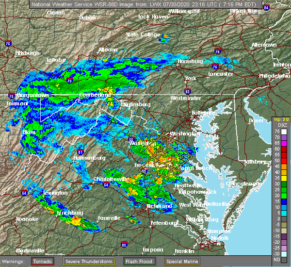 At 717 pm edt, severe thunderstorms were located along a line extending from triangle to near port tobacco river to near colonial beach, moving northeast at 35 mph (radar indicated). Hazards include 60 mph wind gusts. Damaging winds will cause some trees and large branches to fall. this could injure those outdoors, as well as damage homes and vehicles. roadways may become blocked by downed trees. localized power outages are possible. unsecured light objects may become projectiles. Locations impacted include, la plata, dahlgren, quantico, nanjemoy creek, popes creek, port tobacco river, cherry hill, port tobacco village, issue, tompkinsville, ironsides, bel alton, swan point, pisgah, faulkner, berthaville, marbury, widewater, port tobacco and ripley. At 717 pm edt, severe thunderstorms were located along a line extending from triangle to near port tobacco river to near colonial beach, moving northeast at 35 mph (radar indicated). Hazards include 60 mph wind gusts. Damaging winds will cause some trees and large branches to fall. this could injure those outdoors, as well as damage homes and vehicles. roadways may become blocked by downed trees. localized power outages are possible. unsecured light objects may become projectiles. Locations impacted include, la plata, dahlgren, quantico, nanjemoy creek, popes creek, port tobacco river, cherry hill, port tobacco village, issue, tompkinsville, ironsides, bel alton, swan point, pisgah, faulkner, berthaville, marbury, widewater, port tobacco and ripley.
|
| 7/30/2020 7:14 PM EDT |
 At 714 pm edt, severe thunderstorms were located along a line extending from 6 miles northwest of lake ridge to quantico to near dahlgren, moving northeast at 35 mph (radar indicated). Hazards include 60 mph wind gusts. Damaging winds will cause some trees and large branches to fall. this could injure those outdoors, as well as damage homes and vehicles. roadways may become blocked by downed trees. localized power outages are possible. Unsecured light objects may become projectiles. At 714 pm edt, severe thunderstorms were located along a line extending from 6 miles northwest of lake ridge to quantico to near dahlgren, moving northeast at 35 mph (radar indicated). Hazards include 60 mph wind gusts. Damaging winds will cause some trees and large branches to fall. this could injure those outdoors, as well as damage homes and vehicles. roadways may become blocked by downed trees. localized power outages are possible. Unsecured light objects may become projectiles.
|
| 7/23/2020 8:46 PM EDT |
 At 845 pm edt, a severe thunderstorm was located over friendly, or over fort washington, and is nearly stationary (radar indicated). Hazards include isolated damaging wind gusts of up to 60 mph. Damaging winds will cause some trees and large branches to fall. this could injure those outdoors, as well as damage homes and vehicles. roadways may become blocked by downed trees. localized power outages are possible. Unsecured light objects may become projectiles. At 845 pm edt, a severe thunderstorm was located over friendly, or over fort washington, and is nearly stationary (radar indicated). Hazards include isolated damaging wind gusts of up to 60 mph. Damaging winds will cause some trees and large branches to fall. this could injure those outdoors, as well as damage homes and vehicles. roadways may become blocked by downed trees. localized power outages are possible. Unsecured light objects may become projectiles.
|
| 7/23/2020 8:46 PM EDT |
 The national weather service in sterling virginia has issued a * severe thunderstorm warning for. the southeastern district of columbia. west central prince georges county in central maryland. arlington county in northern virginia. The southern city of falls church in northern virginia. The national weather service in sterling virginia has issued a * severe thunderstorm warning for. the southeastern district of columbia. west central prince georges county in central maryland. arlington county in northern virginia. The southern city of falls church in northern virginia.
|
| 7/23/2020 8:46 PM EDT |
 At 845 pm edt, a severe thunderstorm was located over friendly, or over fort washington, and is nearly stationary (radar indicated). Hazards include isolated damaging wind gusts of up to 60 mph. Damaging winds will cause some trees and large branches to fall. this could injure those outdoors, as well as damage homes and vehicles. roadways may become blocked by downed trees. localized power outages are possible. Unsecured light objects may become projectiles. At 845 pm edt, a severe thunderstorm was located over friendly, or over fort washington, and is nearly stationary (radar indicated). Hazards include isolated damaging wind gusts of up to 60 mph. Damaging winds will cause some trees and large branches to fall. this could injure those outdoors, as well as damage homes and vehicles. roadways may become blocked by downed trees. localized power outages are possible. Unsecured light objects may become projectiles.
|
| 7/22/2020 3:57 PM EDT |
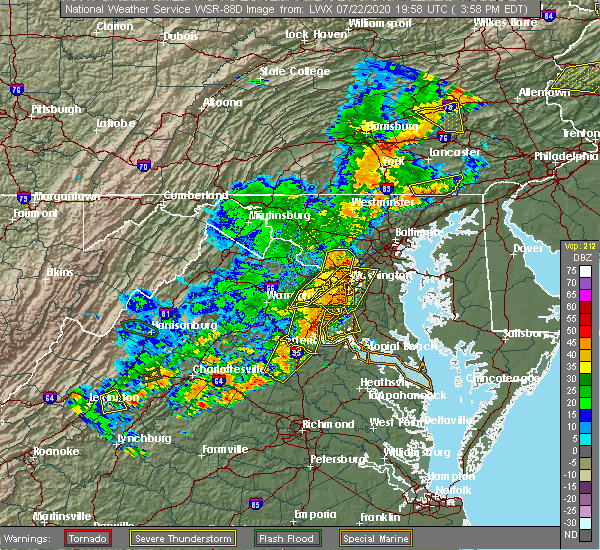 At 357 pm edt, severe thunderstorms were located along a line extending from lake ridge to triangle to near aquia creek, moving east at 20 mph (observed wind damage and doppler radar). Hazards include damaging wind gusts up to 70 mph and isolated hail up to quarter size. Damaging winds will cause some trees and large branches to fall. this could injure those outdoors, as well as damage homes and vehicles. roadways may become blocked by downed trees. localized power outages are possible. unsecured light objects may become projectiles. Locations impacted include, stafford, dale city, fredericksburg, woodbridge, aquia creek, lake ridge, montclair, triangle, dumfries, cherry hill, independent hill, falmouth, stones corner, roseville, garrisonville, ramoth, white oak, ruby, leeland and widewater. At 357 pm edt, severe thunderstorms were located along a line extending from lake ridge to triangle to near aquia creek, moving east at 20 mph (observed wind damage and doppler radar). Hazards include damaging wind gusts up to 70 mph and isolated hail up to quarter size. Damaging winds will cause some trees and large branches to fall. this could injure those outdoors, as well as damage homes and vehicles. roadways may become blocked by downed trees. localized power outages are possible. unsecured light objects may become projectiles. Locations impacted include, stafford, dale city, fredericksburg, woodbridge, aquia creek, lake ridge, montclair, triangle, dumfries, cherry hill, independent hill, falmouth, stones corner, roseville, garrisonville, ramoth, white oak, ruby, leeland and widewater.
|
| 7/22/2020 3:50 PM EDT |
 At 350 pm edt, severe thunderstorms were located along a line extending from near lake ridge to near triangle to near fredericksburg, moving east at 35 mph (radar indicated). Hazards include 70 mph wind gusts and quarter size hail. Damaging winds will cause some trees and large branches to fall. this could injure those outdoors, as well as damage homes and vehicles. roadways may become blocked by downed trees. localized power outages are possible. unsecured light objects may become projectiles. Locations impacted include, stafford, dale city, fredericksburg, woodbridge, aquia creek, lake ridge, montclair, triangle, dumfries, manassas, cherry hill, independent hill, falmouth, stones corner, roseville, garrisonville, ramoth, heflin, white oak and ruby. At 350 pm edt, severe thunderstorms were located along a line extending from near lake ridge to near triangle to near fredericksburg, moving east at 35 mph (radar indicated). Hazards include 70 mph wind gusts and quarter size hail. Damaging winds will cause some trees and large branches to fall. this could injure those outdoors, as well as damage homes and vehicles. roadways may become blocked by downed trees. localized power outages are possible. unsecured light objects may become projectiles. Locations impacted include, stafford, dale city, fredericksburg, woodbridge, aquia creek, lake ridge, montclair, triangle, dumfries, manassas, cherry hill, independent hill, falmouth, stones corner, roseville, garrisonville, ramoth, heflin, white oak and ruby.
|
| 7/22/2020 3:16 PM EDT |
 At 316 pm edt, severe thunderstorms were located along a line extending from near warrenton to near bealeton to 14 miles east of orange, moving east at 20 mph (radar indicated). Hazards include 60 mph wind gusts and quarter size hail. Damaging winds will cause some trees and large branches to fall. this could injure those outdoors, as well as damage homes and vehicles. roadways may become blocked by downed trees. localized power outages are possible. Unsecured light objects may become projectiles. At 316 pm edt, severe thunderstorms were located along a line extending from near warrenton to near bealeton to 14 miles east of orange, moving east at 20 mph (radar indicated). Hazards include 60 mph wind gusts and quarter size hail. Damaging winds will cause some trees and large branches to fall. this could injure those outdoors, as well as damage homes and vehicles. roadways may become blocked by downed trees. localized power outages are possible. Unsecured light objects may become projectiles.
|
| 7/5/2020 4:39 PM EDT |
 At 438 pm edt, severe thunderstorms were located along a line extending from 8 miles south of linton hall to quantico, moving northeast at 10 mph (radar indicated). Hazards include 60 mph wind gusts and quarter size hail. Damaging winds will cause some trees and large branches to fall. this could injure those outdoors, as well as damage homes and vehicles. roadways may become blocked by downed trees. localized power outages are possible. Unsecured light objects may become projectiles. At 438 pm edt, severe thunderstorms were located along a line extending from 8 miles south of linton hall to quantico, moving northeast at 10 mph (radar indicated). Hazards include 60 mph wind gusts and quarter size hail. Damaging winds will cause some trees and large branches to fall. this could injure those outdoors, as well as damage homes and vehicles. roadways may become blocked by downed trees. localized power outages are possible. Unsecured light objects may become projectiles.
|
| 6/25/2020 8:56 PM EDT |
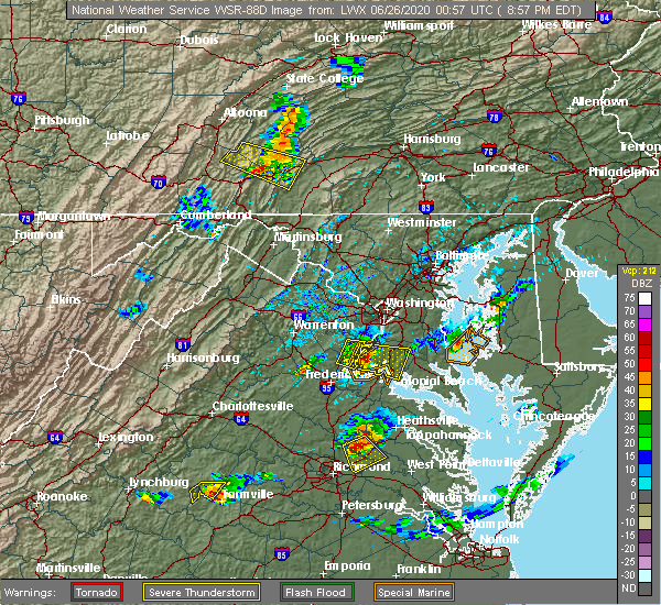 The severe thunderstorm warning for northeastern stafford and southeastern prince william counties will expire at 900 pm edt, the storm which prompted the warning has moved out of the area. therefore, the warning will be allowed to expire. The severe thunderstorm warning for northeastern stafford and southeastern prince william counties will expire at 900 pm edt, the storm which prompted the warning has moved out of the area. therefore, the warning will be allowed to expire.
|
| 6/25/2020 8:45 PM EDT |
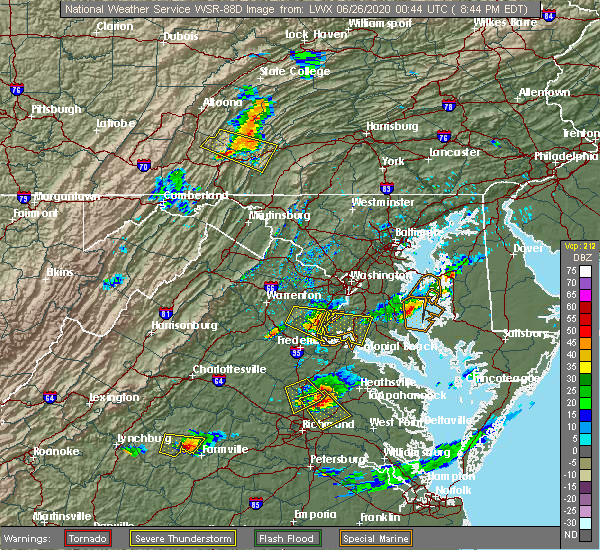 At 844 pm edt, a severe thunderstorm was located over quantico, moving east at 30 mph (radar indicated). Hazards include 60 mph wind gusts and quarter size hail. Damaging winds will cause some trees and large branches to fall. this could injure those outdoors, as well as damage homes and vehicles. roadways may become blocked by downed trees. localized power outages are possible. unsecured light objects may become projectiles. Locations impacted include, dale city, woodbridge, quantico, montclair, triangle, dumfries, cherry hill, independent hill, mason neck, widewater, garrisonville, arkendale and aquia. At 844 pm edt, a severe thunderstorm was located over quantico, moving east at 30 mph (radar indicated). Hazards include 60 mph wind gusts and quarter size hail. Damaging winds will cause some trees and large branches to fall. this could injure those outdoors, as well as damage homes and vehicles. roadways may become blocked by downed trees. localized power outages are possible. unsecured light objects may become projectiles. Locations impacted include, dale city, woodbridge, quantico, montclair, triangle, dumfries, cherry hill, independent hill, mason neck, widewater, garrisonville, arkendale and aquia.
|
| 6/25/2020 8:40 PM EDT |
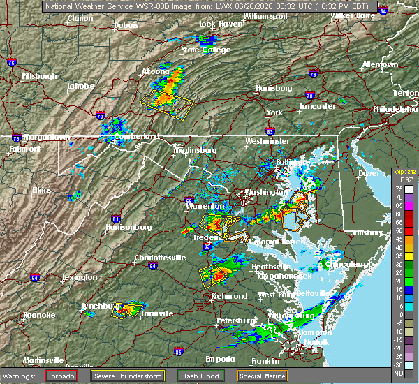 At 839 pm edt, a severe thunderstorm was located over triangle, or over quantico, moving east at 30 mph (radar indicated). Hazards include 60 mph wind gusts and quarter size hail. Damaging winds will cause some trees and large branches to fall. this could injure those outdoors, as well as damage homes and vehicles. roadways may become blocked by downed trees. localized power outages are possible. Unsecured light objects may become projectiles. At 839 pm edt, a severe thunderstorm was located over triangle, or over quantico, moving east at 30 mph (radar indicated). Hazards include 60 mph wind gusts and quarter size hail. Damaging winds will cause some trees and large branches to fall. this could injure those outdoors, as well as damage homes and vehicles. roadways may become blocked by downed trees. localized power outages are possible. Unsecured light objects may become projectiles.
|
| 6/25/2020 8:17 PM EDT |
 At 817 pm edt, a severe thunderstorm was located 8 miles west of montclair, or 9 miles southwest of dale city, moving east at 35 mph (radar indicated). Hazards include 60 mph wind gusts and quarter size hail. Damaging winds will cause some trees and large branches to fall. this could injure those outdoors, as well as damage homes and vehicles. roadways may become blocked by downed trees. localized power outages are possible. Unsecured light objects may become projectiles. At 817 pm edt, a severe thunderstorm was located 8 miles west of montclair, or 9 miles southwest of dale city, moving east at 35 mph (radar indicated). Hazards include 60 mph wind gusts and quarter size hail. Damaging winds will cause some trees and large branches to fall. this could injure those outdoors, as well as damage homes and vehicles. roadways may become blocked by downed trees. localized power outages are possible. Unsecured light objects may become projectiles.
|
| 4/13/2020 12:35 PM EDT |
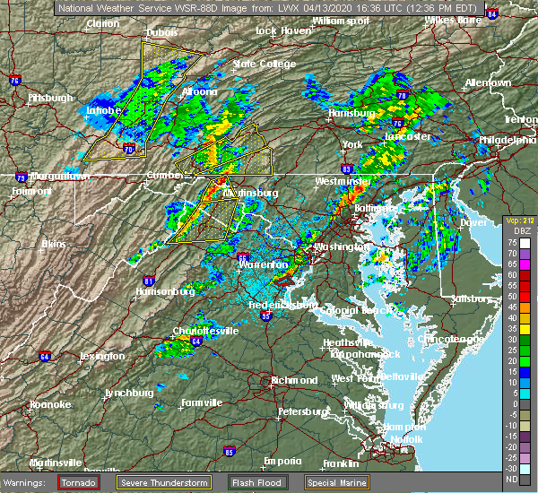 The tornado warning for southeastern prince william county will expire at 1245 pm edt, the storm which prompted the warning has weakened below severe limits, and has exited the warned area. therefore, the warning will be allowed to expire. a tornado watch remains in effect until 600 pm edt for northern virginia. to report severe weather, contact your nearest law enforcement agency. they will relay your report to the national weather service sterling virginia. The tornado warning for southeastern prince william county will expire at 1245 pm edt, the storm which prompted the warning has weakened below severe limits, and has exited the warned area. therefore, the warning will be allowed to expire. a tornado watch remains in effect until 600 pm edt for northern virginia. to report severe weather, contact your nearest law enforcement agency. they will relay your report to the national weather service sterling virginia.
|
| 4/13/2020 12:32 PM EDT |
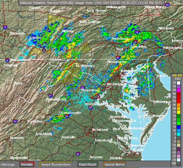 At 1232 pm edt, a severe thunderstorm capable of producing a tornado was located over montclair, or over dale city, moving northeast at 40 mph (radar indicated rotation). Hazards include tornado. For those in the direct path of a tornado touchdown, flying debris will be dangerous to those caught without shelter. damage to roofs, siding, and windows may occur. mobile homes may be damaged or destroyed. tree damage is likely. this dangerous storm will be near, lake ridge around 1240 pm edt. Other locations impacted by this tornadic thunderstorm include independent hill and cherry hill. At 1232 pm edt, a severe thunderstorm capable of producing a tornado was located over montclair, or over dale city, moving northeast at 40 mph (radar indicated rotation). Hazards include tornado. For those in the direct path of a tornado touchdown, flying debris will be dangerous to those caught without shelter. damage to roofs, siding, and windows may occur. mobile homes may be damaged or destroyed. tree damage is likely. this dangerous storm will be near, lake ridge around 1240 pm edt. Other locations impacted by this tornadic thunderstorm include independent hill and cherry hill.
|
| 4/13/2020 12:22 PM EDT |
 At 1222 pm edt, a severe thunderstorm capable of producing a tornado was located 7 miles southwest of montclair, or 8 miles southwest of dale city, moving northeast at 35 mph (radar indicated rotation). Hazards include tornado. For those in the direct path of a tornado touchdown, flying debris will be dangerous to those caught without shelter. damage to roofs, siding, and windows may occur. mobile homes may be damaged or destroyed. tree damage is likely. this dangerous storm will be near, montclair, triangle and dumfries around 1235 pm edt. dale city around 1240 pm edt. lake ridge around 1245 pm edt. Other locations impacted by this tornadic thunderstorm include cherry hill and independent hill. At 1222 pm edt, a severe thunderstorm capable of producing a tornado was located 7 miles southwest of montclair, or 8 miles southwest of dale city, moving northeast at 35 mph (radar indicated rotation). Hazards include tornado. For those in the direct path of a tornado touchdown, flying debris will be dangerous to those caught without shelter. damage to roofs, siding, and windows may occur. mobile homes may be damaged or destroyed. tree damage is likely. this dangerous storm will be near, montclair, triangle and dumfries around 1235 pm edt. dale city around 1240 pm edt. lake ridge around 1245 pm edt. Other locations impacted by this tornadic thunderstorm include cherry hill and independent hill.
|
| 4/13/2020 12:14 PM EDT |
 At 1213 pm edt, a severe thunderstorm capable of producing a tornado was located 9 miles northwest of stafford, moving east at 40 mph (radar indicated rotation). Hazards include tornado. For those in the direct path of a tornado touchdown, flying debris will be dangerous to those caught without shelter. damage to roofs, siding, and windows may occur. mobile homes may be damaged or destroyed. tree damage is likely. this dangerous storm will be near, dale city, quantico, montclair, triangle and dumfries around 1235 pm edt. lake ridge around 1240 pm edt. Other locations impacted by this tornadic thunderstorm include cherry hill, ruby and independent hill. At 1213 pm edt, a severe thunderstorm capable of producing a tornado was located 9 miles northwest of stafford, moving east at 40 mph (radar indicated rotation). Hazards include tornado. For those in the direct path of a tornado touchdown, flying debris will be dangerous to those caught without shelter. damage to roofs, siding, and windows may occur. mobile homes may be damaged or destroyed. tree damage is likely. this dangerous storm will be near, dale city, quantico, montclair, triangle and dumfries around 1235 pm edt. lake ridge around 1240 pm edt. Other locations impacted by this tornadic thunderstorm include cherry hill, ruby and independent hill.
|
| 2/7/2020 8:12 AM EST |
 At 812 am est, a severe thunderstorm was located over lorton, or over woodbridge, moving northeast at 55 mph (radar indicated). Hazards include 60 mph wind gusts. Damaging winds will cause some trees and large branches to fall. this could injure those outdoors, as well as damage homes and vehicles. roadways may become blocked by downed trees. localized power outages are possible. unsecured light objects may become projectiles. Locations impacted include, dale city, fort washington, fort hunt, fort belvoir, woodbridge, lake ridge, montclair, lorton, cherry hill, mount vernon, accokeek and mason neck. At 812 am est, a severe thunderstorm was located over lorton, or over woodbridge, moving northeast at 55 mph (radar indicated). Hazards include 60 mph wind gusts. Damaging winds will cause some trees and large branches to fall. this could injure those outdoors, as well as damage homes and vehicles. roadways may become blocked by downed trees. localized power outages are possible. unsecured light objects may become projectiles. Locations impacted include, dale city, fort washington, fort hunt, fort belvoir, woodbridge, lake ridge, montclair, lorton, cherry hill, mount vernon, accokeek and mason neck.
|
| 2/7/2020 8:00 AM EST |
 At 800 am est, a severe thunderstorm was located near montclair, or near dale city, moving northeast at 55 mph (radar indicated). Hazards include 60 mph wind gusts. Damaging winds will cause some trees and large branches to fall. this could injure those outdoors, as well as damage homes and vehicles. roadways may become blocked by downed trees. localized power outages are possible. Unsecured light objects may become projectiles. At 800 am est, a severe thunderstorm was located near montclair, or near dale city, moving northeast at 55 mph (radar indicated). Hazards include 60 mph wind gusts. Damaging winds will cause some trees and large branches to fall. this could injure those outdoors, as well as damage homes and vehicles. roadways may become blocked by downed trees. localized power outages are possible. Unsecured light objects may become projectiles.
|
| 10/31/2019 9:55 PM EDT |
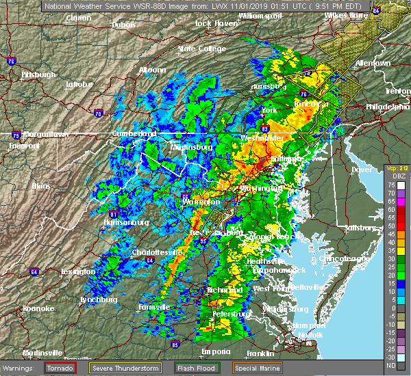 The severe thunderstorm warning for central stafford and southeastern prince william counties and the north central city of fredericksburg will expire at 1000 pm edt, the storm which prompted the warning has weakened below severe limits, and has exited the warned area. therefore, the warning will be allowed to expire. a tornado watch remains in effect until midnight edt for northern and central virginia. The severe thunderstorm warning for central stafford and southeastern prince william counties and the north central city of fredericksburg will expire at 1000 pm edt, the storm which prompted the warning has weakened below severe limits, and has exited the warned area. therefore, the warning will be allowed to expire. a tornado watch remains in effect until midnight edt for northern and central virginia.
|
| 10/31/2019 9:24 PM EDT |
 At 923 pm edt, a severe thunderstorm was located over stafford, moving northeast at 60 mph (emergency management has reported numerous trees down in spotsylvania county associated with this storm). Hazards include 60 mph wind gusts. Damaging winds will cause some trees and large branches to fall. this could injure those outdoors, as well as damage homes and vehicles. roadways may become blocked by downed trees. localized power outages are possible. Unsecured light objects may become projectiles. At 923 pm edt, a severe thunderstorm was located over stafford, moving northeast at 60 mph (emergency management has reported numerous trees down in spotsylvania county associated with this storm). Hazards include 60 mph wind gusts. Damaging winds will cause some trees and large branches to fall. this could injure those outdoors, as well as damage homes and vehicles. roadways may become blocked by downed trees. localized power outages are possible. Unsecured light objects may become projectiles.
|
| 9/11/2019 5:46 PM EDT |
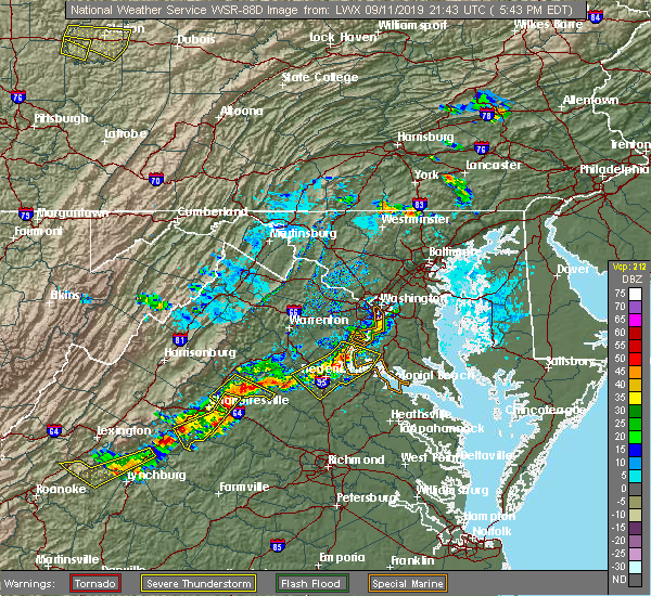 At 545 pm edt, severe thunderstorms were located along a line extending from triangle to near aquia creek to 8 miles west of fredericksburg, moving east at 20 mph (radar indicated). Hazards include 60 mph wind gusts. Damaging winds will cause some trees and large branches to fall. this could injure those outdoors, as well as damage homes and vehicles. roadways may become blocked by downed trees. localized power outages are possible. unsecured light objects may become projectiles. Locations impacted include, stafford, fredericksburg, quantico, fairview beach, potomac creek, nanjemoy creek, aquia creek, montclair, triangle, dumfries, massaponax, spotsylvania, cherry hill, falmouth, passapatanzy, stones corner, roseville, garrisonville, ironsides and ramoth. At 545 pm edt, severe thunderstorms were located along a line extending from triangle to near aquia creek to 8 miles west of fredericksburg, moving east at 20 mph (radar indicated). Hazards include 60 mph wind gusts. Damaging winds will cause some trees and large branches to fall. this could injure those outdoors, as well as damage homes and vehicles. roadways may become blocked by downed trees. localized power outages are possible. unsecured light objects may become projectiles. Locations impacted include, stafford, fredericksburg, quantico, fairview beach, potomac creek, nanjemoy creek, aquia creek, montclair, triangle, dumfries, massaponax, spotsylvania, cherry hill, falmouth, passapatanzy, stones corner, roseville, garrisonville, ironsides and ramoth.
|
| 9/11/2019 5:46 PM EDT |
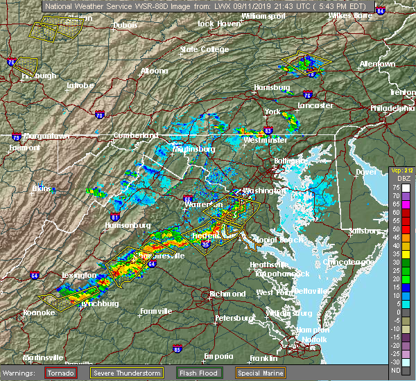 At 545 pm edt, severe thunderstorms were located along a line extending from triangle to near aquia creek to 8 miles west of fredericksburg, moving east at 20 mph (radar indicated). Hazards include 60 mph wind gusts. Damaging winds will cause some trees and large branches to fall. this could injure those outdoors, as well as damage homes and vehicles. roadways may become blocked by downed trees. localized power outages are possible. unsecured light objects may become projectiles. Locations impacted include, stafford, fredericksburg, quantico, fairview beach, potomac creek, nanjemoy creek, aquia creek, montclair, triangle, dumfries, massaponax, spotsylvania, cherry hill, falmouth, passapatanzy, stones corner, roseville, garrisonville, ironsides and ramoth. At 545 pm edt, severe thunderstorms were located along a line extending from triangle to near aquia creek to 8 miles west of fredericksburg, moving east at 20 mph (radar indicated). Hazards include 60 mph wind gusts. Damaging winds will cause some trees and large branches to fall. this could injure those outdoors, as well as damage homes and vehicles. roadways may become blocked by downed trees. localized power outages are possible. unsecured light objects may become projectiles. Locations impacted include, stafford, fredericksburg, quantico, fairview beach, potomac creek, nanjemoy creek, aquia creek, montclair, triangle, dumfries, massaponax, spotsylvania, cherry hill, falmouth, passapatanzy, stones corner, roseville, garrisonville, ironsides and ramoth.
|
| 9/11/2019 5:25 PM EDT |
 At 524 pm edt, severe thunderstorms were located along a line extending from ballston to lorton to near montclair, moving southeast at 25 mph (radar indicated). Hazards include 60 mph wind gusts and quarter size hail. Damaging winds will cause some trees and large branches to fall. this could injure those outdoors, as well as damage homes and vehicles. roadways may become blocked by downed trees. localized power outages are possible. unsecured light objects may become projectiles. Locations impacted include, arlington, alexandria, waldorf, dale city, annandale, clinton, springfield, fort washington, fairfax, fort hunt, vienna, groveton, forestville, falls church, huntington, mantua, fort belvoir, pimmit hills, woodbridge and national harbor. At 524 pm edt, severe thunderstorms were located along a line extending from ballston to lorton to near montclair, moving southeast at 25 mph (radar indicated). Hazards include 60 mph wind gusts and quarter size hail. Damaging winds will cause some trees and large branches to fall. this could injure those outdoors, as well as damage homes and vehicles. roadways may become blocked by downed trees. localized power outages are possible. unsecured light objects may become projectiles. Locations impacted include, arlington, alexandria, waldorf, dale city, annandale, clinton, springfield, fort washington, fairfax, fort hunt, vienna, groveton, forestville, falls church, huntington, mantua, fort belvoir, pimmit hills, woodbridge and national harbor.
|
| 9/11/2019 5:22 PM EDT |
 At 522 pm edt, severe thunderstorms were located along a line extending from near montclair to 6 miles northwest of stafford to 13 miles south of bealeton, moving east at 20 mph (radar indicated). Hazards include 60 mph wind gusts and quarter size hail. Damaging winds will cause some trees and large branches to fall. this could injure those outdoors, as well as damage homes and vehicles. roadways may become blocked by downed trees. localized power outages are possible. Unsecured light objects may become projectiles. At 522 pm edt, severe thunderstorms were located along a line extending from near montclair to 6 miles northwest of stafford to 13 miles south of bealeton, moving east at 20 mph (radar indicated). Hazards include 60 mph wind gusts and quarter size hail. Damaging winds will cause some trees and large branches to fall. this could injure those outdoors, as well as damage homes and vehicles. roadways may become blocked by downed trees. localized power outages are possible. Unsecured light objects may become projectiles.
|
| 9/11/2019 4:57 PM EDT |
 At 457 pm edt, severe thunderstorms were located along a line extending from near great falls to fairfax to near bull run, moving east at 25 mph (radar indicated). Hazards include 60 mph wind gusts and quarter size hail. Damaging winds will cause some trees and large branches to fall. this could injure those outdoors, as well as damage homes and vehicles. roadways may become blocked by downed trees. localized power outages are possible. Unsecured light objects may become projectiles. At 457 pm edt, severe thunderstorms were located along a line extending from near great falls to fairfax to near bull run, moving east at 25 mph (radar indicated). Hazards include 60 mph wind gusts and quarter size hail. Damaging winds will cause some trees and large branches to fall. this could injure those outdoors, as well as damage homes and vehicles. roadways may become blocked by downed trees. localized power outages are possible. Unsecured light objects may become projectiles.
|
| 9/11/2019 4:57 PM EDT |
 The national weather service in sterling virginia has issued a * severe thunderstorm warning for. the district of columbia. southeastern montgomery county in central maryland. central prince georges county in central maryland. Northwestern charles county in southern maryland. The national weather service in sterling virginia has issued a * severe thunderstorm warning for. the district of columbia. southeastern montgomery county in central maryland. central prince georges county in central maryland. Northwestern charles county in southern maryland.
|
| 9/11/2019 4:57 PM EDT |
 At 457 pm edt, severe thunderstorms were located along a line extending from near great falls to fairfax to near bull run, moving east at 25 mph (radar indicated). Hazards include 60 mph wind gusts and quarter size hail. Damaging winds will cause some trees and large branches to fall. this could injure those outdoors, as well as damage homes and vehicles. roadways may become blocked by downed trees. localized power outages are possible. Unsecured light objects may become projectiles. At 457 pm edt, severe thunderstorms were located along a line extending from near great falls to fairfax to near bull run, moving east at 25 mph (radar indicated). Hazards include 60 mph wind gusts and quarter size hail. Damaging winds will cause some trees and large branches to fall. this could injure those outdoors, as well as damage homes and vehicles. roadways may become blocked by downed trees. localized power outages are possible. Unsecured light objects may become projectiles.
|
| 9/2/2019 6:28 PM EDT |
 The severe thunderstorm warning for southeastern prince william county will expire at 630 pm edt, the storm which prompted the warning has moved out of the area. therefore, the warning will be allowed to expire. remember, a severe thunderstorm warning still remains in effect for eastern prince william county 715 pm edt. The severe thunderstorm warning for southeastern prince william county will expire at 630 pm edt, the storm which prompted the warning has moved out of the area. therefore, the warning will be allowed to expire. remember, a severe thunderstorm warning still remains in effect for eastern prince william county 715 pm edt.
|
| 9/2/2019 6:26 PM EDT |
 At 626 pm edt, a severe thunderstorm was located over dumfries, or near quantico, moving southeast at 15 mph (radar indicated). Hazards include 60 mph wind gusts and quarter size hail. Damaging winds will cause some trees and large branches to fall. this could injure those outdoors, as well as damage homes and vehicles. roadways may become blocked by downed trees. localized power outages are possible. Unsecured light objects may become projectiles. At 626 pm edt, a severe thunderstorm was located over dumfries, or near quantico, moving southeast at 15 mph (radar indicated). Hazards include 60 mph wind gusts and quarter size hail. Damaging winds will cause some trees and large branches to fall. this could injure those outdoors, as well as damage homes and vehicles. roadways may become blocked by downed trees. localized power outages are possible. Unsecured light objects may become projectiles.
|
| 9/2/2019 6:26 PM EDT |
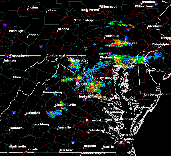 At 626 pm edt, a severe thunderstorm was located over dumfries, or near quantico, moving southeast at 15 mph (radar indicated). Hazards include 60 mph wind gusts and quarter size hail. Damaging winds will cause some trees and large branches to fall. this could injure those outdoors, as well as damage homes and vehicles. roadways may become blocked by downed trees. localized power outages are possible. Unsecured light objects may become projectiles. At 626 pm edt, a severe thunderstorm was located over dumfries, or near quantico, moving southeast at 15 mph (radar indicated). Hazards include 60 mph wind gusts and quarter size hail. Damaging winds will cause some trees and large branches to fall. this could injure those outdoors, as well as damage homes and vehicles. roadways may become blocked by downed trees. localized power outages are possible. Unsecured light objects may become projectiles.
|
| 9/2/2019 5:52 PM EDT |
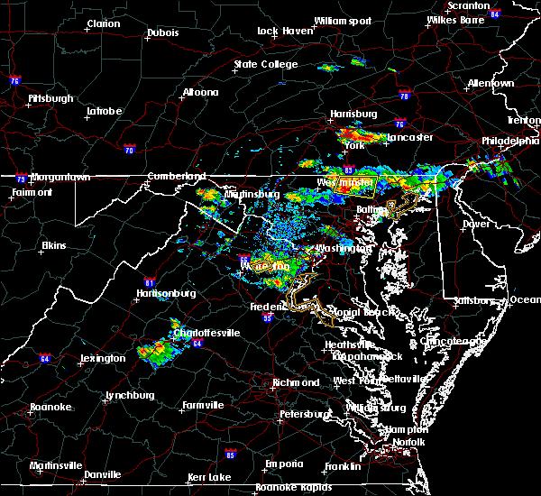 At 552 pm edt, a severe thunderstorm was located near montclair, or near dale city, moving east at 15 mph (radar indicated). Hazards include 60 mph wind gusts and quarter size hail. Damaging winds will cause some trees and large branches to fall. this could injure those outdoors, as well as damage homes and vehicles. roadways may become blocked by downed trees. localized power outages are possible. Unsecured light objects may become projectiles. At 552 pm edt, a severe thunderstorm was located near montclair, or near dale city, moving east at 15 mph (radar indicated). Hazards include 60 mph wind gusts and quarter size hail. Damaging winds will cause some trees and large branches to fall. this could injure those outdoors, as well as damage homes and vehicles. roadways may become blocked by downed trees. localized power outages are possible. Unsecured light objects may become projectiles.
|
| 8/20/2019 6:57 PM EDT |
 The severe thunderstorm warning for southeastern fairfax and southeastern prince william counties will expire at 700 pm edt, the storm which prompted the warning has weakened below severe limits, and no longer poses an immediate threat to life or property. therefore, the warning will be allowed to expire. a severe thunderstorm watch remains in effect until 900 pm edt for southern and central maryland, and northern virginia. The severe thunderstorm warning for southeastern fairfax and southeastern prince william counties will expire at 700 pm edt, the storm which prompted the warning has weakened below severe limits, and no longer poses an immediate threat to life or property. therefore, the warning will be allowed to expire. a severe thunderstorm watch remains in effect until 900 pm edt for southern and central maryland, and northern virginia.
|
| 8/20/2019 6:45 PM EDT |
 At 645 pm edt, a severe thunderstorm was located over woodbridge, moving east at 10 mph (radar indicated). Hazards include 60 mph wind gusts and quarter size hail. Damaging winds will cause some trees and large branches to fall. this could injure those outdoors, as well as damage homes and vehicles. roadways may become blocked by downed trees. localized power outages are possible. unsecured light objects may become projectiles. Locations impacted include, dale city, fort belvoir, woodbridge, lake ridge, montclair, lorton, newington, cherry hill, mount vernon, independent hill, mason neck and occoquan. At 645 pm edt, a severe thunderstorm was located over woodbridge, moving east at 10 mph (radar indicated). Hazards include 60 mph wind gusts and quarter size hail. Damaging winds will cause some trees and large branches to fall. this could injure those outdoors, as well as damage homes and vehicles. roadways may become blocked by downed trees. localized power outages are possible. unsecured light objects may become projectiles. Locations impacted include, dale city, fort belvoir, woodbridge, lake ridge, montclair, lorton, newington, cherry hill, mount vernon, independent hill, mason neck and occoquan.
|
| 8/20/2019 6:12 PM EDT |
 The national weather service in sterling virginia has issued a * severe thunderstorm warning for. southeastern fairfax county in northern virginia. southeastern prince william county in northern virginia. until 700 pm edt. At 611 pm edt, a severe thunderstorm was located near lake ridge,. The national weather service in sterling virginia has issued a * severe thunderstorm warning for. southeastern fairfax county in northern virginia. southeastern prince william county in northern virginia. until 700 pm edt. At 611 pm edt, a severe thunderstorm was located near lake ridge,.
|
| 7/22/2019 8:23 PM EDT |
 The severe thunderstorm warning for southwestern prince georges, northwestern charles, southern fairfax, and east central prince william counties, the city of manassas park and the southeastern city of manassas will expire at 830 pm edt, the storms which prompted the warning have moved out of the area. therefore, the warning will be allowed to expire. a severe thunderstorm watch remains in effect until 1000 pm edt for southern and central maryland, and northern virginia. The severe thunderstorm warning for southwestern prince georges, northwestern charles, southern fairfax, and east central prince william counties, the city of manassas park and the southeastern city of manassas will expire at 830 pm edt, the storms which prompted the warning have moved out of the area. therefore, the warning will be allowed to expire. a severe thunderstorm watch remains in effect until 1000 pm edt for southern and central maryland, and northern virginia.
|
| 7/22/2019 8:11 PM EDT |
 At 811 pm edt, severe thunderstorms were located along a line extending from 6 miles northwest of dale city to near fort belvoir to near la plata, moving northeast at 45 mph (radar indicated. this storm has a history of producing wind damage with numerous downed trees reported). Hazards include 60 mph wind gusts. Damaging winds will cause some trees and large branches to fall. this could injure those outdoors, as well as damage homes and vehicles. roadways may become blocked by downed trees. localized power outages are possible. unsecured light objects may become projectiles. Locations impacted include, centreville, waldorf, dale city, springfield, fairfax, fort hunt, groveton, la plata, fort belvoir, woodbridge, lake ridge, burke, lorton, franconia, newington, saint charles, manassas, west springfield, manassas park and mount vernon. At 811 pm edt, severe thunderstorms were located along a line extending from 6 miles northwest of dale city to near fort belvoir to near la plata, moving northeast at 45 mph (radar indicated. this storm has a history of producing wind damage with numerous downed trees reported). Hazards include 60 mph wind gusts. Damaging winds will cause some trees and large branches to fall. this could injure those outdoors, as well as damage homes and vehicles. roadways may become blocked by downed trees. localized power outages are possible. unsecured light objects may become projectiles. Locations impacted include, centreville, waldorf, dale city, springfield, fairfax, fort hunt, groveton, la plata, fort belvoir, woodbridge, lake ridge, burke, lorton, franconia, newington, saint charles, manassas, west springfield, manassas park and mount vernon.
|
| 7/22/2019 8:05 PM EDT |
 At 805 pm edt, severe thunderstorms were located along a line extending from 7 miles southeast of bull run to 6 miles northeast of quantico to near port tobacco river, moving northeast at 45 mph (radar indicated. this storm has a history of producing wind damage with numerous downed trees reported in spotsylvania, orange, albemarle, and nelson counties). Hazards include 60 mph wind gusts. Damaging winds will cause some trees and large branches to fall. this could injure those outdoors, as well as damage homes and vehicles. roadways may become blocked by downed trees. localized power outages are possible. unsecured light objects may become projectiles. Locations impacted include, centreville, waldorf, dale city, springfield, fairfax, fort hunt, groveton, la plata, fort belvoir, woodbridge, lake ridge, burke, montclair, lorton, franconia, newington, dumfries, saint charles, manassas and west springfield. At 805 pm edt, severe thunderstorms were located along a line extending from 7 miles southeast of bull run to 6 miles northeast of quantico to near port tobacco river, moving northeast at 45 mph (radar indicated. this storm has a history of producing wind damage with numerous downed trees reported in spotsylvania, orange, albemarle, and nelson counties). Hazards include 60 mph wind gusts. Damaging winds will cause some trees and large branches to fall. this could injure those outdoors, as well as damage homes and vehicles. roadways may become blocked by downed trees. localized power outages are possible. unsecured light objects may become projectiles. Locations impacted include, centreville, waldorf, dale city, springfield, fairfax, fort hunt, groveton, la plata, fort belvoir, woodbridge, lake ridge, burke, montclair, lorton, franconia, newington, dumfries, saint charles, manassas and west springfield.
|
| 7/22/2019 8:05 PM EDT |
 At 756 pm edt, severe thunderstorms were located along a line extending from 7 miles south of linton hall to quantico to near nanjemoy creek, moving northeast at 45 mph (radar indicated. this storm has a history of producing wind damage with numerous downed trees reported in spotsylvania, orange, albemarle, and nelson counties). Hazards include 60 mph wind gusts. Damaging winds will cause some trees and large branches to fall. this could injure those outdoors, as well as damage homes and vehicles. roadways may become blocked by downed trees. localized power outages are possible. unsecured light objects may become projectiles. Locations impacted include, centreville, waldorf, dale city, springfield, fairfax, fort hunt, groveton, la plata, fort belvoir, woodbridge, quantico, nanjemoy creek, port tobacco river, lake ridge, burke, montclair, lorton, franconia, newington and triangle. At 756 pm edt, severe thunderstorms were located along a line extending from 7 miles south of linton hall to quantico to near nanjemoy creek, moving northeast at 45 mph (radar indicated. this storm has a history of producing wind damage with numerous downed trees reported in spotsylvania, orange, albemarle, and nelson counties). Hazards include 60 mph wind gusts. Damaging winds will cause some trees and large branches to fall. this could injure those outdoors, as well as damage homes and vehicles. roadways may become blocked by downed trees. localized power outages are possible. unsecured light objects may become projectiles. Locations impacted include, centreville, waldorf, dale city, springfield, fairfax, fort hunt, groveton, la plata, fort belvoir, woodbridge, quantico, nanjemoy creek, port tobacco river, lake ridge, burke, montclair, lorton, franconia, newington and triangle.
|
| 7/22/2019 7:57 PM EDT |
 At 756 pm edt, severe thunderstorms were located along a line extending from 7 miles south of linton hall to quantico to near nanjemoy creek, moving northeast at 45 mph (radar indicated. this storm has a history of producing wind damage with numerous downed trees reported in spotsylvania, orange, albemarle, and nelson counties). Hazards include 60 mph wind gusts. Damaging winds will cause some trees and large branches to fall. this could injure those outdoors, as well as damage homes and vehicles. roadways may become blocked by downed trees. localized power outages are possible. unsecured light objects may become projectiles. Locations impacted include, centreville, waldorf, dale city, springfield, fairfax, fort hunt, groveton, la plata, fort belvoir, woodbridge, quantico, nanjemoy creek, port tobacco river, lake ridge, burke, montclair, lorton, franconia, newington and triangle. At 756 pm edt, severe thunderstorms were located along a line extending from 7 miles south of linton hall to quantico to near nanjemoy creek, moving northeast at 45 mph (radar indicated. this storm has a history of producing wind damage with numerous downed trees reported in spotsylvania, orange, albemarle, and nelson counties). Hazards include 60 mph wind gusts. Damaging winds will cause some trees and large branches to fall. this could injure those outdoors, as well as damage homes and vehicles. roadways may become blocked by downed trees. localized power outages are possible. unsecured light objects may become projectiles. Locations impacted include, centreville, waldorf, dale city, springfield, fairfax, fort hunt, groveton, la plata, fort belvoir, woodbridge, quantico, nanjemoy creek, port tobacco river, lake ridge, burke, montclair, lorton, franconia, newington and triangle.
|
| 7/22/2019 7:43 PM EDT |
 At 743 pm edt, severe thunderstorms were located along a line extending from 6 miles east of bealeton to near stafford to near potomac creek, moving northeast at 45 mph (radar indicated. this storm has a history of producing wind damage with numerous downed trees reported in orange, albemarle, and nelson counties). Hazards include 60 mph wind gusts. Damaging winds will cause some trees and large branches to fall. this could injure those outdoors, as well as damage homes and vehicles. roadways may become blocked by downed trees. localized power outages are possible. Unsecured light objects may become projectiles. At 743 pm edt, severe thunderstorms were located along a line extending from 6 miles east of bealeton to near stafford to near potomac creek, moving northeast at 45 mph (radar indicated. this storm has a history of producing wind damage with numerous downed trees reported in orange, albemarle, and nelson counties). Hazards include 60 mph wind gusts. Damaging winds will cause some trees and large branches to fall. this could injure those outdoors, as well as damage homes and vehicles. roadways may become blocked by downed trees. localized power outages are possible. Unsecured light objects may become projectiles.
|
| 7/17/2019 5:08 PM EDT |
 At 508 pm edt, severe thunderstorms were located along a line extending from near lake ridge to near stafford, moving northeast at 35 mph (radar indicated). Hazards include 60 mph wind gusts. Damaging winds will cause some trees and large branches to fall. this could injure those outdoors, as well as damage homes and vehicles. roadways may become blocked by downed trees. localized power outages are possible. Unsecured light objects may become projectiles. At 508 pm edt, severe thunderstorms were located along a line extending from near lake ridge to near stafford, moving northeast at 35 mph (radar indicated). Hazards include 60 mph wind gusts. Damaging winds will cause some trees and large branches to fall. this could injure those outdoors, as well as damage homes and vehicles. roadways may become blocked by downed trees. localized power outages are possible. Unsecured light objects may become projectiles.
|
| 7/2/2019 6:54 PM EDT |
 At 653 pm edt, a severe thunderstorm was located over woodbridge, moving southeast at 25 mph (radar indicated). Hazards include 60 mph wind gusts. Damaging winds will cause some trees and large branches to fall. this could injure those outdoors, as well as damage homes and vehicles. roadways may become blocked by downed trees. localized power outages are possible. unsecured light objects may become projectiles. Locations impacted include, dale city, fort belvoir, woodbridge, lake ridge, lorton, newington, mount vernon, mason neck and occoquan. At 653 pm edt, a severe thunderstorm was located over woodbridge, moving southeast at 25 mph (radar indicated). Hazards include 60 mph wind gusts. Damaging winds will cause some trees and large branches to fall. this could injure those outdoors, as well as damage homes and vehicles. roadways may become blocked by downed trees. localized power outages are possible. unsecured light objects may become projectiles. Locations impacted include, dale city, fort belvoir, woodbridge, lake ridge, lorton, newington, mount vernon, mason neck and occoquan.
|
| 7/2/2019 6:31 PM EDT |
 At 631 pm edt, a severe thunderstorm was located near lake ridge, or near dale city, moving southeast at 25 mph (radar indicated). Hazards include 60 mph wind gusts. Damaging winds will cause some trees and large branches to fall. this could injure those outdoors, as well as damage homes and vehicles. roadways may become blocked by downed trees. localized power outages are possible. Unsecured light objects may become projectiles. At 631 pm edt, a severe thunderstorm was located near lake ridge, or near dale city, moving southeast at 25 mph (radar indicated). Hazards include 60 mph wind gusts. Damaging winds will cause some trees and large branches to fall. this could injure those outdoors, as well as damage homes and vehicles. roadways may become blocked by downed trees. localized power outages are possible. Unsecured light objects may become projectiles.
|
| 6/29/2019 5:22 PM EDT |
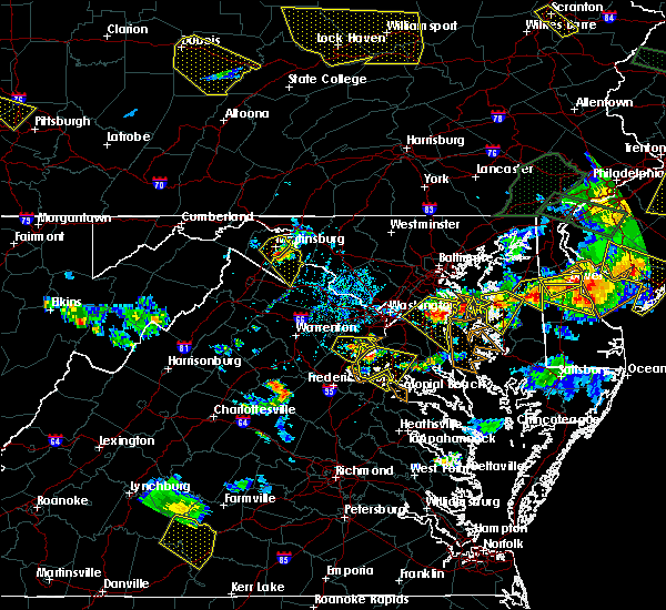 The severe thunderstorm warning for southeastern fairfax and southeastern prince william counties will expire at 530 pm edt, the storm which prompted the warning has moved out of the area. therefore, the warning will be allowed to expire. a severe thunderstorm watch remains in effect until 700 pm edt for northern virginia. to report severe weather, contact your nearest law enforcement agency. they will relay your report to the national weather service sterling virginia. The severe thunderstorm warning for southeastern fairfax and southeastern prince william counties will expire at 530 pm edt, the storm which prompted the warning has moved out of the area. therefore, the warning will be allowed to expire. a severe thunderstorm watch remains in effect until 700 pm edt for northern virginia. to report severe weather, contact your nearest law enforcement agency. they will relay your report to the national weather service sterling virginia.
|
| 6/29/2019 5:09 PM EDT |
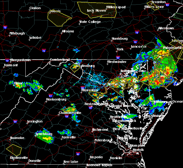 A severe thunderstorm warning remains in effect until 530 pm edt for southeastern fairfax and southeastern prince william counties. at 509 pm edt, a severe thunderstorm was located near dumfries, or near woodbridge, moving southeast at 20 mph. hazard. 60 mph wind gusts and quarter size hail. source. Radar indicated. A severe thunderstorm warning remains in effect until 530 pm edt for southeastern fairfax and southeastern prince william counties. at 509 pm edt, a severe thunderstorm was located near dumfries, or near woodbridge, moving southeast at 20 mph. hazard. 60 mph wind gusts and quarter size hail. source. Radar indicated.
|
| 6/29/2019 4:45 PM EDT |
 At 445 pm edt, a severe thunderstorm was located near dale city, moving southeast at 20 mph (radar indicated). Hazards include 60 mph wind gusts and quarter size hail. Damaging winds will cause some trees and large branches to fall. this could injure those outdoors, as well as damage homes and vehicles. roadways may become blocked by downed trees. localized power outages are possible. Unsecured light objects may become projectiles. At 445 pm edt, a severe thunderstorm was located near dale city, moving southeast at 20 mph (radar indicated). Hazards include 60 mph wind gusts and quarter size hail. Damaging winds will cause some trees and large branches to fall. this could injure those outdoors, as well as damage homes and vehicles. roadways may become blocked by downed trees. localized power outages are possible. Unsecured light objects may become projectiles.
|
| 6/27/2019 6:58 PM EDT |
 The severe thunderstorm warning for northern stafford, southern fairfax, and southeastern prince william counties, the city of fairfax, the city of manassas park and the northeastern city of manassas will expire at 700 pm edt, the storms which prompted the warning have weakened below severe limits, and no longer pose an immediate threat to life or property. therefore, the warning will be allowed to expire. however small hail and gusty winds are still possible with these thunderstorms. The severe thunderstorm warning for northern stafford, southern fairfax, and southeastern prince william counties, the city of fairfax, the city of manassas park and the northeastern city of manassas will expire at 700 pm edt, the storms which prompted the warning have weakened below severe limits, and no longer pose an immediate threat to life or property. therefore, the warning will be allowed to expire. however small hail and gusty winds are still possible with these thunderstorms.
|
| 6/27/2019 6:51 PM EDT |
 At 651 pm edt, severe thunderstorms were located along a line extending from chantilly to near lake ridge to lorton, moving south at 10 mph (radar indicated). Hazards include 60 mph wind gusts and quarter size hail. Damaging winds will cause some trees and large branches to fall. this could injure those outdoors, as well as damage homes and vehicles. roadways may become blocked by downed trees. localized power outages are possible. unsecured light objects may become projectiles. Locations impacted include, centreville, dale city, reston, springfield, fairfax, fort belvoir, woodbridge, lake ridge, burke, oakton, chantilly, montclair, lorton, franconia, newington, triangle, dumfries, manassas, west springfield and sudley. At 651 pm edt, severe thunderstorms were located along a line extending from chantilly to near lake ridge to lorton, moving south at 10 mph (radar indicated). Hazards include 60 mph wind gusts and quarter size hail. Damaging winds will cause some trees and large branches to fall. this could injure those outdoors, as well as damage homes and vehicles. roadways may become blocked by downed trees. localized power outages are possible. unsecured light objects may become projectiles. Locations impacted include, centreville, dale city, reston, springfield, fairfax, fort belvoir, woodbridge, lake ridge, burke, oakton, chantilly, montclair, lorton, franconia, newington, triangle, dumfries, manassas, west springfield and sudley.
|
| 6/27/2019 6:40 PM EDT |
 At 640 pm edt, severe thunderstorms were located along a line extending from chantilly to near lake ridge to lorton, moving south at 10 mph (radar indicated). Hazards include 60 mph wind gusts and quarter size hail. Damaging winds will cause some trees and large branches to fall. this could injure those outdoors, as well as damage homes and vehicles. roadways may become blocked by downed trees. localized power outages are possible. unsecured light objects may become projectiles. Locations impacted include, centreville, dale city, reston, springfield, south riding, herndon, fairfax, groveton, fort belvoir, woodbridge, dulles international airport, lake ridge, burke, linton hall, oakton, chantilly, lincolnia, montclair, lorton and franconia. At 640 pm edt, severe thunderstorms were located along a line extending from chantilly to near lake ridge to lorton, moving south at 10 mph (radar indicated). Hazards include 60 mph wind gusts and quarter size hail. Damaging winds will cause some trees and large branches to fall. this could injure those outdoors, as well as damage homes and vehicles. roadways may become blocked by downed trees. localized power outages are possible. unsecured light objects may become projectiles. Locations impacted include, centreville, dale city, reston, springfield, south riding, herndon, fairfax, groveton, fort belvoir, woodbridge, dulles international airport, lake ridge, burke, linton hall, oakton, chantilly, lincolnia, montclair, lorton and franconia.
|
| 6/27/2019 6:15 PM EDT |
 At 615 pm edt, severe thunderstorms were located along a line extending from dulles international airport to near burke to newington, moving south at 10 mph (radar indicated). Hazards include 60 mph wind gusts and quarter size hail. Damaging winds will cause some trees and large branches to fall. this could injure those outdoors, as well as damage homes and vehicles. roadways may become blocked by downed trees. localized power outages are possible. Unsecured light objects may become projectiles. At 615 pm edt, severe thunderstorms were located along a line extending from dulles international airport to near burke to newington, moving south at 10 mph (radar indicated). Hazards include 60 mph wind gusts and quarter size hail. Damaging winds will cause some trees and large branches to fall. this could injure those outdoors, as well as damage homes and vehicles. roadways may become blocked by downed trees. localized power outages are possible. Unsecured light objects may become projectiles.
|
| 6/27/2019 5:36 PM EDT |
 At 536 pm edt, a developing severe thunderstorm was located over fairfax, and is drifting south (radar indicated). Hazards include 60 mph wind gusts. Damaging winds will cause some trees and large branches to fall. this could injure those outdoors, as well as damage homes and vehicles. roadways may become blocked by downed trees. localized power outages are possible. Unsecured light objects may become projectiles. At 536 pm edt, a developing severe thunderstorm was located over fairfax, and is drifting south (radar indicated). Hazards include 60 mph wind gusts. Damaging winds will cause some trees and large branches to fall. this could injure those outdoors, as well as damage homes and vehicles. roadways may become blocked by downed trees. localized power outages are possible. Unsecured light objects may become projectiles.
|
| 6/13/2019 5:04 PM EDT |
 At 504 pm edt, a severe thunderstorm was located near montclair, or near dale city, moving east at 35 mph (radar indicated). Hazards include 60 mph wind gusts. Damaging winds will cause some trees and large branches to fall. this could injure those outdoors, as well as damage homes and vehicles. roadways may become blocked by downed trees. localized power outages are possible. Unsecured light objects may become projectiles. At 504 pm edt, a severe thunderstorm was located near montclair, or near dale city, moving east at 35 mph (radar indicated). Hazards include 60 mph wind gusts. Damaging winds will cause some trees and large branches to fall. this could injure those outdoors, as well as damage homes and vehicles. roadways may become blocked by downed trees. localized power outages are possible. Unsecured light objects may become projectiles.
|
| 6/2/2019 6:37 PM EDT |
 The severe thunderstorm warning for northwestern charles, east central stafford and southeastern prince william counties will expire at 645 pm edt, the storm which prompted the warning has weakened below severe limits, and has exited the warned area. therefore, the warning will be allowed to expire. a severe thunderstorm watch remains in effect until 800 pm edt for southern and central maryland, and northern virginia. to report severe weather, contact your nearest law enforcement agency. they will relay your report to the national weather service sterling virginia. The severe thunderstorm warning for northwestern charles, east central stafford and southeastern prince william counties will expire at 645 pm edt, the storm which prompted the warning has weakened below severe limits, and has exited the warned area. therefore, the warning will be allowed to expire. a severe thunderstorm watch remains in effect until 800 pm edt for southern and central maryland, and northern virginia. to report severe weather, contact your nearest law enforcement agency. they will relay your report to the national weather service sterling virginia.
|
| 6/2/2019 6:37 PM EDT |
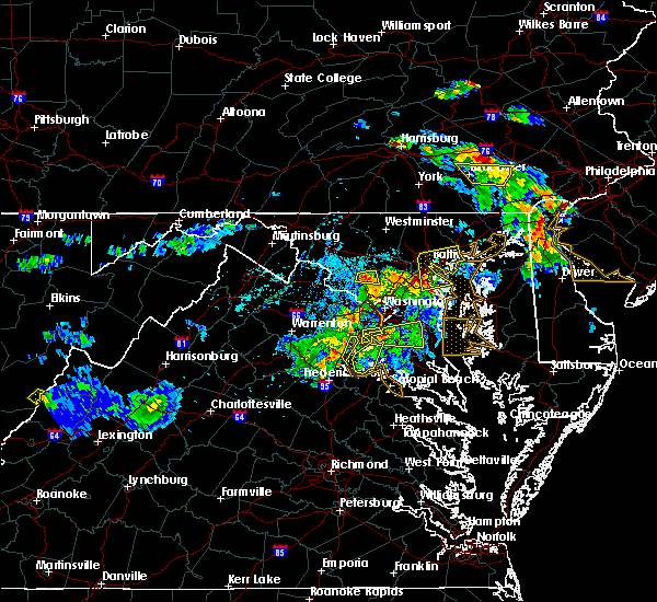 The severe thunderstorm warning for northwestern charles, east central stafford and southeastern prince william counties will expire at 645 pm edt, the storm which prompted the warning has weakened below severe limits, and has exited the warned area. therefore, the warning will be allowed to expire. a severe thunderstorm watch remains in effect until 800 pm edt for southern and central maryland, and northern virginia. to report severe weather, contact your nearest law enforcement agency. they will relay your report to the national weather service sterling virginia. The severe thunderstorm warning for northwestern charles, east central stafford and southeastern prince william counties will expire at 645 pm edt, the storm which prompted the warning has weakened below severe limits, and has exited the warned area. therefore, the warning will be allowed to expire. a severe thunderstorm watch remains in effect until 800 pm edt for southern and central maryland, and northern virginia. to report severe weather, contact your nearest law enforcement agency. they will relay your report to the national weather service sterling virginia.
|
| 6/2/2019 6:22 PM EDT |
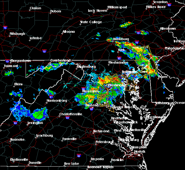 At 622 pm edt, a severe thunderstorm was located near dumfries, or near quantico, moving east at 20 mph (radar indicated). Hazards include ping pong ball size hail and 60 mph wind gusts. Damaging winds will cause some trees and large branches to fall. this could injure those outdoors, as well as damage homes and vehicles. roadways may become blocked by downed trees. localized power outages are possible. unsecured light objects may become projectiles. Locations impacted include, dale city, woodbridge, quantico, lake ridge, montclair, triangle, dumfries, cherry hill, bryans road, potomac heights, pomfret, marbury, ironsides, ripley, rison, nanjemoy, pisgah and welcome. At 622 pm edt, a severe thunderstorm was located near dumfries, or near quantico, moving east at 20 mph (radar indicated). Hazards include ping pong ball size hail and 60 mph wind gusts. Damaging winds will cause some trees and large branches to fall. this could injure those outdoors, as well as damage homes and vehicles. roadways may become blocked by downed trees. localized power outages are possible. unsecured light objects may become projectiles. Locations impacted include, dale city, woodbridge, quantico, lake ridge, montclair, triangle, dumfries, cherry hill, bryans road, potomac heights, pomfret, marbury, ironsides, ripley, rison, nanjemoy, pisgah and welcome.
|
| 6/2/2019 5:58 PM EDT |
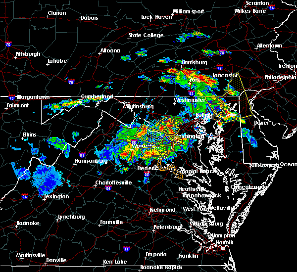 At 558 pm edt, a severe thunderstorm was located near lake ridge, or near dale city, moving east at 30 mph (radar indicated). Hazards include ping pong ball size hail and 60 mph wind gusts. Damaging winds will cause some trees and large branches to fall. this could injure those outdoors, as well as damage homes and vehicles. roadways may become blocked by downed trees. localized power outages are possible. unsecured light objects may become projectiles. Locations impacted include, dale city, woodbridge, lake ridge, montclair, independent hill, nokesville, occoquan and aden. At 558 pm edt, a severe thunderstorm was located near lake ridge, or near dale city, moving east at 30 mph (radar indicated). Hazards include ping pong ball size hail and 60 mph wind gusts. Damaging winds will cause some trees and large branches to fall. this could injure those outdoors, as well as damage homes and vehicles. roadways may become blocked by downed trees. localized power outages are possible. unsecured light objects may become projectiles. Locations impacted include, dale city, woodbridge, lake ridge, montclair, independent hill, nokesville, occoquan and aden.
|
| 6/2/2019 5:57 PM EDT |
 At 557 pm edt, a severe thunderstorm was located near montclair, or near dale city, moving east at 20 mph (radar indicated). Hazards include ping pong ball size hail and 60 mph wind gusts. Damaging winds will cause some trees and large branches to fall. this could injure those outdoors, as well as damage homes and vehicles. roadways may become blocked by downed trees. localized power outages are possible. Unsecured light objects may become projectiles. At 557 pm edt, a severe thunderstorm was located near montclair, or near dale city, moving east at 20 mph (radar indicated). Hazards include ping pong ball size hail and 60 mph wind gusts. Damaging winds will cause some trees and large branches to fall. this could injure those outdoors, as well as damage homes and vehicles. roadways may become blocked by downed trees. localized power outages are possible. Unsecured light objects may become projectiles.
|
| 6/2/2019 5:48 PM EDT |
 At 548 pm edt, a severe thunderstorm was located near bull run, or 7 miles northwest of dale city, moving east at 30 mph (radar indicated). Hazards include 60 mph wind gusts and half dollar size hail. Damaging winds will cause some trees and large branches to fall. this could injure those outdoors, as well as damage homes and vehicles. roadways may become blocked by downed trees. localized power outages are possible. unsecured light objects may become projectiles. Locations impacted include, dale city, springfield, fort belvoir, woodbridge, lake ridge, burke, linton hall, lincolnia, montclair, lorton, franconia, bull run, newington, i395 and i495 interchange, manassas, west springfield, manassas park, fairfax station, independent hill and north springfield. At 548 pm edt, a severe thunderstorm was located near bull run, or 7 miles northwest of dale city, moving east at 30 mph (radar indicated). Hazards include 60 mph wind gusts and half dollar size hail. Damaging winds will cause some trees and large branches to fall. this could injure those outdoors, as well as damage homes and vehicles. roadways may become blocked by downed trees. localized power outages are possible. unsecured light objects may become projectiles. Locations impacted include, dale city, springfield, fort belvoir, woodbridge, lake ridge, burke, linton hall, lincolnia, montclair, lorton, franconia, bull run, newington, i395 and i495 interchange, manassas, west springfield, manassas park, fairfax station, independent hill and north springfield.
|
| 6/2/2019 5:37 PM EDT |
 At 536 pm edt, a severe thunderstorm was located near linton hall, or 9 miles southwest of centreville, moving east at 30 mph (radar indicated). Hazards include half dollar size hail. some hail damage to agriculture is expected At 536 pm edt, a severe thunderstorm was located near linton hall, or 9 miles southwest of centreville, moving east at 30 mph (radar indicated). Hazards include half dollar size hail. some hail damage to agriculture is expected
|
| 5/30/2019 4:03 PM EDT |
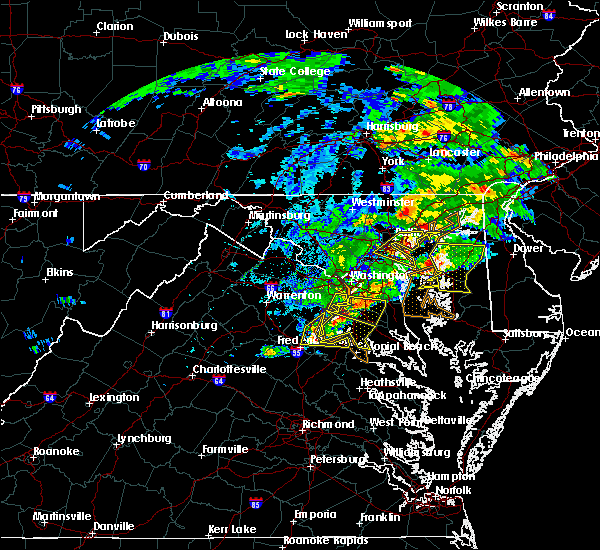 At 403 pm edt, a severe thunderstorm was located over aquia creek, moving east at 40 mph (radar indicated). Hazards include 60 mph wind gusts. Damaging winds will cause some trees and large branches to fall. this could injure those outdoors, as well as damage homes and vehicles. roadways may become blocked by downed trees. localized power outages are possible. Unsecured light objects may become projectiles. At 403 pm edt, a severe thunderstorm was located over aquia creek, moving east at 40 mph (radar indicated). Hazards include 60 mph wind gusts. Damaging winds will cause some trees and large branches to fall. this could injure those outdoors, as well as damage homes and vehicles. roadways may become blocked by downed trees. localized power outages are possible. Unsecured light objects may become projectiles.
|
| 5/23/2019 4:12 PM EDT |
 The severe thunderstorm warning for the district of columbia, south central anne arundel, southeastern montgomery, northwestern calvert, prince georges, northern charles, southeastern arlington, southeastern fairfax, and southeastern prince william counties and the city of alexandria will expire at 415 pm edt, the storms which prompted the warning have moved out of the immediate dc area. therefore, the warning will be allowed to expire. a severe thunderstorm watch remains in effect until 800 pm edt for district of columbia, central and southern maryland, and northern virginia. remember, a severe thunderstorm warning still remains in effect for portions of prince georges, charles, anne arundel, and calvert counties until 500 pm edt. The severe thunderstorm warning for the district of columbia, south central anne arundel, southeastern montgomery, northwestern calvert, prince georges, northern charles, southeastern arlington, southeastern fairfax, and southeastern prince william counties and the city of alexandria will expire at 415 pm edt, the storms which prompted the warning have moved out of the immediate dc area. therefore, the warning will be allowed to expire. a severe thunderstorm watch remains in effect until 800 pm edt for district of columbia, central and southern maryland, and northern virginia. remember, a severe thunderstorm warning still remains in effect for portions of prince georges, charles, anne arundel, and calvert counties until 500 pm edt.
|
| 5/23/2019 4:00 PM EDT |
 At 359 pm edt, severe thunderstorms were located along a line extending from lanham-seabrook to camp springs to montclair, moving east at 50 mph. these are very dangerous storms (radar indicated. at 347 pm edt, a wind gust to 68 mph was reported at reagan national airport). Hazards include 80 mph wind gusts and quarter size hail. Expect considerable damage to trees and power lines. your life is at significant risk if outdoors. in addition to some trees falling into homes, wind damage is possible to roofs, sheds, open garages, and mobile homes. Locations impacted include, arlington, alexandria, waldorf, dale city, bowie, clinton, springfield, fort washington, langley park, fort hunt, groveton, forestville, huntington, largo, coral hills, bladensburg, la plata, fort belvoir, shady side and chesapeake beach. At 359 pm edt, severe thunderstorms were located along a line extending from lanham-seabrook to camp springs to montclair, moving east at 50 mph. these are very dangerous storms (radar indicated. at 347 pm edt, a wind gust to 68 mph was reported at reagan national airport). Hazards include 80 mph wind gusts and quarter size hail. Expect considerable damage to trees and power lines. your life is at significant risk if outdoors. in addition to some trees falling into homes, wind damage is possible to roofs, sheds, open garages, and mobile homes. Locations impacted include, arlington, alexandria, waldorf, dale city, bowie, clinton, springfield, fort washington, langley park, fort hunt, groveton, forestville, huntington, largo, coral hills, bladensburg, la plata, fort belvoir, shady side and chesapeake beach.
|
| 5/23/2019 3:55 PM EDT |
 At 354 pm edt, severe thunderstorms were located along a line extending from near montclair to near orange, moving east at 45 mph (radar indicated). Hazards include 70 mph wind gusts and quarter size hail. Damaging winds will cause some trees and large branches to fall. this could injure those outdoors, as well as damage homes and vehicles. roadways may become blocked by downed trees. localized power outages are possible. Unsecured light objects may become projectiles. At 354 pm edt, severe thunderstorms were located along a line extending from near montclair to near orange, moving east at 45 mph (radar indicated). Hazards include 70 mph wind gusts and quarter size hail. Damaging winds will cause some trees and large branches to fall. this could injure those outdoors, as well as damage homes and vehicles. roadways may become blocked by downed trees. localized power outages are possible. Unsecured light objects may become projectiles.
|
| 5/23/2019 3:52 PM EDT |
 At 350 pm edt, severe thunderstorms were located along a line extending from college park to alexandria to near montclair, moving east at 45 mph. these are very dangerous storms (automated weather station. reagan national airport recorded a wind gust to 68 mph). Hazards include 80 mph wind gusts and quarter size hail. Expect considerable damage to trees and power lines. your life is at significant risk if outdoors. in addition to some trees falling into homes, wind damage is possible to roofs, sheds, open garages, and mobile homes. Locations impacted include, arlington, alexandria, waldorf, dale city, bethesda, bowie, annandale, clinton, springfield, college park, fort washington, langley park, fort hunt, groveton, forestville, falls church, huntington, largo, coral hills and bladensburg. At 350 pm edt, severe thunderstorms were located along a line extending from college park to alexandria to near montclair, moving east at 45 mph. these are very dangerous storms (automated weather station. reagan national airport recorded a wind gust to 68 mph). Hazards include 80 mph wind gusts and quarter size hail. Expect considerable damage to trees and power lines. your life is at significant risk if outdoors. in addition to some trees falling into homes, wind damage is possible to roofs, sheds, open garages, and mobile homes. Locations impacted include, arlington, alexandria, waldorf, dale city, bethesda, bowie, annandale, clinton, springfield, college park, fort washington, langley park, fort hunt, groveton, forestville, falls church, huntington, largo, coral hills and bladensburg.
|
| 5/23/2019 3:50 PM EDT |
 At 350 pm edt, severe thunderstorms were located along a line extending from college park to alexandria to near montclair, moving east at 45 mph (radar indicated but similar storms have had a history of wind damage this afternoon). Hazards include 70 mph wind gusts and quarter size hail. Damaging winds will cause some trees and large branches to fall. this could injure those outdoors, as well as damage homes and vehicles. roadways may become blocked by downed trees. localized power outages are possible. unsecured light objects may become projectiles. Locations impacted include, arlington, alexandria, waldorf, dale city, bethesda, bowie, annandale, clinton, springfield, college park, fort washington, langley park, fort hunt, groveton, forestville, falls church, huntington, largo, coral hills and bladensburg. At 350 pm edt, severe thunderstorms were located along a line extending from college park to alexandria to near montclair, moving east at 45 mph (radar indicated but similar storms have had a history of wind damage this afternoon). Hazards include 70 mph wind gusts and quarter size hail. Damaging winds will cause some trees and large branches to fall. this could injure those outdoors, as well as damage homes and vehicles. roadways may become blocked by downed trees. localized power outages are possible. unsecured light objects may become projectiles. Locations impacted include, arlington, alexandria, waldorf, dale city, bethesda, bowie, annandale, clinton, springfield, college park, fort washington, langley park, fort hunt, groveton, forestville, falls church, huntington, largo, coral hills and bladensburg.
|
| 5/23/2019 3:36 PM EDT |
 At 336 pm edt, severe thunderstorms were located along a line extending from chevy chase to mantua to 9 miles south of linton hall, moving east at 45 mph (radar indicated). Hazards include 60 mph wind gusts. Damaging winds will cause some trees and large branches to fall. this could injure those outdoors, as well as damage homes and vehicles. roadways may become blocked by downed trees. localized power outages are possible. Unsecured light objects may become projectiles. At 336 pm edt, severe thunderstorms were located along a line extending from chevy chase to mantua to 9 miles south of linton hall, moving east at 45 mph (radar indicated). Hazards include 60 mph wind gusts. Damaging winds will cause some trees and large branches to fall. this could injure those outdoors, as well as damage homes and vehicles. roadways may become blocked by downed trees. localized power outages are possible. Unsecured light objects may become projectiles.
|
| 5/18/2019 6:49 PM EDT |
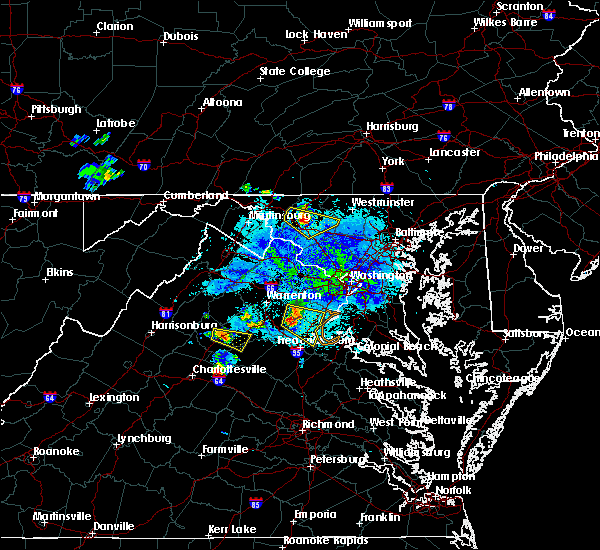 At 631 pm edt, a severe thunderstorm was located 8 miles east of bealeton, or 12 miles southeast of warrenton, moving southeast at 25 mph (radar indicated). Hazards include 60 mph wind gusts and quarter size hail. Damaging winds will cause some trees and large branches to fall. this could injure those outdoors, as well as damage homes and vehicles. roadways may become blocked by downed trees. localized power outages are possible. Unsecured light objects may become projectiles. At 631 pm edt, a severe thunderstorm was located 8 miles east of bealeton, or 12 miles southeast of warrenton, moving southeast at 25 mph (radar indicated). Hazards include 60 mph wind gusts and quarter size hail. Damaging winds will cause some trees and large branches to fall. this could injure those outdoors, as well as damage homes and vehicles. roadways may become blocked by downed trees. localized power outages are possible. Unsecured light objects may become projectiles.
|
| 5/18/2019 6:31 PM EDT |
 At 631 pm edt, a severe thunderstorm was located 8 miles east of bealeton, or 12 miles southeast of warrenton, moving southeast at 25 mph (radar indicated). Hazards include 60 mph wind gusts and quarter size hail. Damaging winds will cause some trees and large branches to fall. this could injure those outdoors, as well as damage homes and vehicles. roadways may become blocked by downed trees. localized power outages are possible. Unsecured light objects may become projectiles. At 631 pm edt, a severe thunderstorm was located 8 miles east of bealeton, or 12 miles southeast of warrenton, moving southeast at 25 mph (radar indicated). Hazards include 60 mph wind gusts and quarter size hail. Damaging winds will cause some trees and large branches to fall. this could injure those outdoors, as well as damage homes and vehicles. roadways may become blocked by downed trees. localized power outages are possible. Unsecured light objects may become projectiles.
|
| 4/26/2019 2:56 PM EDT |
 At 256 pm edt, a severe thunderstorm was located near woodbridge, moving northeast at 50 mph (radar indicated. quantico marine base gusted to 61 mph). Hazards include 70 mph wind gusts. Damaging winds will cause some trees and large branches to fall. this could injure those outdoors, as well as damage homes and vehicles. roadways may become blocked by downed trees. localized power outages are possible. Unsecured light objects may become projectiles. At 256 pm edt, a severe thunderstorm was located near woodbridge, moving northeast at 50 mph (radar indicated. quantico marine base gusted to 61 mph). Hazards include 70 mph wind gusts. Damaging winds will cause some trees and large branches to fall. this could injure those outdoors, as well as damage homes and vehicles. roadways may become blocked by downed trees. localized power outages are possible. Unsecured light objects may become projectiles.
|
| 4/15/2019 1:18 AM EDT |
 At 117 am edt, a severe thunderstorm was located near fort belvoir, moving northeast at 60 mph (radar indicated). Hazards include 60 mph wind gusts. Damaging winds will cause some trees and large branches to fall. this could injure those outdoors, as well as damage homes and vehicles. roadways may become blocked by downed trees. localized power outages are possible. Unsecured light objects may become projectiles. At 117 am edt, a severe thunderstorm was located near fort belvoir, moving northeast at 60 mph (radar indicated). Hazards include 60 mph wind gusts. Damaging winds will cause some trees and large branches to fall. this could injure those outdoors, as well as damage homes and vehicles. roadways may become blocked by downed trees. localized power outages are possible. Unsecured light objects may become projectiles.
|
| 3/22/2019 4:46 PM EDT |
 At 445 pm edt, a severe thunderstorm with a history of producing 60 mph wind gusts and wind damage was located near dunkirk, or 9 miles west of chesapeake beach, moving east at 40 mph (trained weather spotters, emergency management and measured wind gusts). Hazards include 60 mph wind gusts. Damaging winds will cause some trees and large branches to fall. this could injure those outdoors, as well as damage homes and vehicles. roadways may become blocked by downed trees. localized power outages are possible. unsecured light objects may become projectiles. Locations impacted include, waldorf, dale city, lexington park, chesapeake ranch estates, la plata, mayo, shady side, chesapeake beach, deale, leonardtown, prince frederick, piney point, quantico, tall timbers, saint inigoes creek, hallowing point, saint leonard creek, town creek, sheridan point and saint clements bay. At 445 pm edt, a severe thunderstorm with a history of producing 60 mph wind gusts and wind damage was located near dunkirk, or 9 miles west of chesapeake beach, moving east at 40 mph (trained weather spotters, emergency management and measured wind gusts). Hazards include 60 mph wind gusts. Damaging winds will cause some trees and large branches to fall. this could injure those outdoors, as well as damage homes and vehicles. roadways may become blocked by downed trees. localized power outages are possible. unsecured light objects may become projectiles. Locations impacted include, waldorf, dale city, lexington park, chesapeake ranch estates, la plata, mayo, shady side, chesapeake beach, deale, leonardtown, prince frederick, piney point, quantico, tall timbers, saint inigoes creek, hallowing point, saint leonard creek, town creek, sheridan point and saint clements bay.
|
| 3/22/2019 4:21 PM EDT |
 At 421 pm edt, a severe thunderstorm was located over fort washington, moving southeast at 40 mph (emergency management, spotters and measured wind gusts). Hazards include 60 mph wind gusts. Damaging winds will cause some trees and large branches to fall. this could injure those outdoors, as well as damage homes and vehicles. roadways may become blocked by downed trees. localized power outages are possible. Unsecured light objects may become projectiles. At 421 pm edt, a severe thunderstorm was located over fort washington, moving southeast at 40 mph (emergency management, spotters and measured wind gusts). Hazards include 60 mph wind gusts. Damaging winds will cause some trees and large branches to fall. this could injure those outdoors, as well as damage homes and vehicles. roadways may become blocked by downed trees. localized power outages are possible. Unsecured light objects may become projectiles.
|
| 3/22/2019 4:15 PM EDT |
 At 415 pm edt, a severe thunderstorm with a history of producing 60 mph wind gusts and covering the ground in hail was located over national harbor, moving east at 50 mph (radar indicated, measured gusts and spotter reports). Hazards include 60 mph wind gusts and small hail. Damaging winds will cause some trees and large branches to fall. this could injure those outdoors, as well as damage homes and vehicles. roadways may become blocked by downed trees. localized power outages are possible. unsecured light objects may become projectiles. Locations impacted include, arlington, alexandria, waldorf, dale city, bethesda, bowie, annandale, clinton, springfield, college park, fort washington, greenbelt, langley park, beltsville, fort hunt, groveton, forestville, falls church, huntington and largo. At 415 pm edt, a severe thunderstorm with a history of producing 60 mph wind gusts and covering the ground in hail was located over national harbor, moving east at 50 mph (radar indicated, measured gusts and spotter reports). Hazards include 60 mph wind gusts and small hail. Damaging winds will cause some trees and large branches to fall. this could injure those outdoors, as well as damage homes and vehicles. roadways may become blocked by downed trees. localized power outages are possible. unsecured light objects may become projectiles. Locations impacted include, arlington, alexandria, waldorf, dale city, bethesda, bowie, annandale, clinton, springfield, college park, fort washington, greenbelt, langley park, beltsville, fort hunt, groveton, forestville, falls church, huntington and largo.
|
| 3/22/2019 4:03 PM EDT |
 At 403 pm edt, a severe thunderstorm was located over annandale, moving southeast at 50 mph (radar indicated). Hazards include 60 mph wind gusts. this storm has a history of producing 50 to 60 mph wind gusts. hail was also covering the ground in leesburg and the dulles toll road. Damaging winds will cause some trees and large branches to fall. this could injure those outdoors, as well as damage homes and vehicles. roadways may become blocked by downed trees. localized power outages are possible. unsecured light objects may become projectiles. Locations impacted include, arlington, alexandria, waldorf, dale city, bethesda, bowie, annandale, clinton, springfield, college park, fort washington, greenbelt, langley park, beltsville, fort hunt, groveton, forestville, falls church, huntington and largo. At 403 pm edt, a severe thunderstorm was located over annandale, moving southeast at 50 mph (radar indicated). Hazards include 60 mph wind gusts. this storm has a history of producing 50 to 60 mph wind gusts. hail was also covering the ground in leesburg and the dulles toll road. Damaging winds will cause some trees and large branches to fall. this could injure those outdoors, as well as damage homes and vehicles. roadways may become blocked by downed trees. localized power outages are possible. unsecured light objects may become projectiles. Locations impacted include, arlington, alexandria, waldorf, dale city, bethesda, bowie, annandale, clinton, springfield, college park, fort washington, greenbelt, langley park, beltsville, fort hunt, groveton, forestville, falls church, huntington and largo.
|
| 3/22/2019 3:52 PM EDT |
 At 351 pm edt, a severe thunderstorm was located near oakton, or near reston, moving southeast at 50 mph (radar indicated). Hazards include 60 mph wind gusts. wind gusts over 50 mph were reported in winchester, leesburg and at dulles airport. Damaging winds will cause some trees and large branches to fall. this could injure those outdoors, as well as damage homes and vehicles. roadways may become blocked by downed trees. localized power outages are possible. Unsecured light objects may become projectiles. At 351 pm edt, a severe thunderstorm was located near oakton, or near reston, moving southeast at 50 mph (radar indicated). Hazards include 60 mph wind gusts. wind gusts over 50 mph were reported in winchester, leesburg and at dulles airport. Damaging winds will cause some trees and large branches to fall. this could injure those outdoors, as well as damage homes and vehicles. roadways may become blocked by downed trees. localized power outages are possible. Unsecured light objects may become projectiles.
|
| 12/21/2018 4:15 PM EST |
 At 415 pm est, severe thunderstorms were located along a line extending from oatlands to 6 miles southeast of linton hall, moving north at 45 mph (radar indicated). Hazards include 60 mph wind gusts. Damaging winds will cause some trees and large branches to fall. this could injure those outdoors, as well as damage homes and vehicles. roadways may become blocked by downed trees. localized power outages are possible. unsecured light objects may become projectiles. Locations impacted include, alexandria, centreville, dale city, reston, annandale, springfield, south riding, herndon, fairfax, fort hunt, vienna, groveton, falls church, broadlands, lansdowne, lowes island, brambleton, mantua, fort belvoir and pimmit hills. At 415 pm est, severe thunderstorms were located along a line extending from oatlands to 6 miles southeast of linton hall, moving north at 45 mph (radar indicated). Hazards include 60 mph wind gusts. Damaging winds will cause some trees and large branches to fall. this could injure those outdoors, as well as damage homes and vehicles. roadways may become blocked by downed trees. localized power outages are possible. unsecured light objects may become projectiles. Locations impacted include, alexandria, centreville, dale city, reston, annandale, springfield, south riding, herndon, fairfax, fort hunt, vienna, groveton, falls church, broadlands, lansdowne, lowes island, brambleton, mantua, fort belvoir and pimmit hills.
|
| 12/21/2018 4:00 PM EST |
 At 400 pm est, severe thunderstorms were located along a line extending from near the plains to 10 miles west of montclair, moving north at 45 mph (radar indicated). Hazards include 60 mph wind gusts. Damaging winds will cause some trees and large branches to fall. this could injure those outdoors, as well as damage homes and vehicles. roadways may become blocked by downed trees. localized power outages are possible. Unsecured light objects may become projectiles. At 400 pm est, severe thunderstorms were located along a line extending from near the plains to 10 miles west of montclair, moving north at 45 mph (radar indicated). Hazards include 60 mph wind gusts. Damaging winds will cause some trees and large branches to fall. this could injure those outdoors, as well as damage homes and vehicles. roadways may become blocked by downed trees. localized power outages are possible. Unsecured light objects may become projectiles.
|
| 8/13/2018 4:02 PM EDT |
 At 401 pm edt, severe thunderstorms were located along a line extending from near linton hall to near dale city, moving east at 20 mph (trained weather spotters reported quarter size hail near independent hill). Hazards include 60 mph wind gusts and quarter size hail. Damaging winds will cause some trees and large branches to fall. this could injure those outdoors, as well as damage homes and vehicles. roadways may become blocked by downed trees. localized power outages are possible. unsecured light objects may become projectiles. Locations impacted include, centreville, dale city, woodbridge, lake ridge, burke, linton hall, montclair, lorton, bull run, haymarket, manassas, sudley, manassas park, fairfax station, gainesville, independent hill, nokesville, occoquan and clifton. At 401 pm edt, severe thunderstorms were located along a line extending from near linton hall to near dale city, moving east at 20 mph (trained weather spotters reported quarter size hail near independent hill). Hazards include 60 mph wind gusts and quarter size hail. Damaging winds will cause some trees and large branches to fall. this could injure those outdoors, as well as damage homes and vehicles. roadways may become blocked by downed trees. localized power outages are possible. unsecured light objects may become projectiles. Locations impacted include, centreville, dale city, woodbridge, lake ridge, burke, linton hall, montclair, lorton, bull run, haymarket, manassas, sudley, manassas park, fairfax station, gainesville, independent hill, nokesville, occoquan and clifton.
|
| 8/13/2018 3:46 PM EDT |
 At 345 pm edt, severe thunderstorms were located along a line extending from near haymarket to 6 miles west of dale city, moving east at 15 mph (radar indicated). Hazards include 60 mph wind gusts. Damaging winds will cause some trees and large branches to fall. this could injure those outdoors, as well as damage homes and vehicles. roadways may become blocked by downed trees. localized power outages are possible. Unsecured light objects may become projectiles. At 345 pm edt, severe thunderstorms were located along a line extending from near haymarket to 6 miles west of dale city, moving east at 15 mph (radar indicated). Hazards include 60 mph wind gusts. Damaging winds will cause some trees and large branches to fall. this could injure those outdoors, as well as damage homes and vehicles. roadways may become blocked by downed trees. localized power outages are possible. Unsecured light objects may become projectiles.
|
| 8/2/2018 1:55 PM EDT |
 At 154 pm edt, a severe thunderstorm was located over dumfries, or near dale city, moving northeast at 25 mph (radar indicated). Hazards include 60 mph wind gusts. Damaging winds will cause some trees and large branches to fall. this could injure those outdoors, as well as damage homes and vehicles. roadways may become blocked by downed trees. localized power outages are possible. Unsecured light objects may become projectiles. At 154 pm edt, a severe thunderstorm was located over dumfries, or near dale city, moving northeast at 25 mph (radar indicated). Hazards include 60 mph wind gusts. Damaging winds will cause some trees and large branches to fall. this could injure those outdoors, as well as damage homes and vehicles. roadways may become blocked by downed trees. localized power outages are possible. Unsecured light objects may become projectiles.
|
| 5/22/2018 5:04 PM EDT |
 At 504 pm edt, a severe thunderstorm was located over fort belvoir, moving southeast at 30 mph (radar indicated). Hazards include 60 mph wind gusts. Damaging winds will cause some trees and large branches to fall. this could injure those outdoors, as well as damage homes and vehicles. roadways may become blocked by downed trees. localized power outages are possible. unsecured light objects may become projectiles. Locations impacted include, dale city, springfield, fort washington, fort hunt, groveton, fort belvoir, woodbridge, lake ridge, burke, lincolnia, lorton, franconia, hybla valley, newington, i395 and i495 interchange, west springfield, mount vernon, fairfax station, north springfield and hayfield. At 504 pm edt, a severe thunderstorm was located over fort belvoir, moving southeast at 30 mph (radar indicated). Hazards include 60 mph wind gusts. Damaging winds will cause some trees and large branches to fall. this could injure those outdoors, as well as damage homes and vehicles. roadways may become blocked by downed trees. localized power outages are possible. unsecured light objects may become projectiles. Locations impacted include, dale city, springfield, fort washington, fort hunt, groveton, fort belvoir, woodbridge, lake ridge, burke, lincolnia, lorton, franconia, hybla valley, newington, i395 and i495 interchange, west springfield, mount vernon, fairfax station, north springfield and hayfield.
|
| 5/22/2018 4:48 PM EDT |
 At 448 pm edt, a severe thunderstorm was located over burke, or near springfield, moving southeast at 30 mph (radar indicated). Hazards include 60 mph wind gusts. Damaging winds will cause some trees and large branches to fall. this could injure those outdoors, as well as damage homes and vehicles. roadways may become blocked by downed trees. localized power outages are possible. Unsecured light objects may become projectiles. At 448 pm edt, a severe thunderstorm was located over burke, or near springfield, moving southeast at 30 mph (radar indicated). Hazards include 60 mph wind gusts. Damaging winds will cause some trees and large branches to fall. this could injure those outdoors, as well as damage homes and vehicles. roadways may become blocked by downed trees. localized power outages are possible. Unsecured light objects may become projectiles.
|
| 5/14/2018 7:00 PM EDT |
 At 659 pm edt, severe thunderstorms were located along a line extending from near olney to national harbor to near quantico, moving southeast at 35 mph (radar indicated). Hazards include 70 mph wind gusts and quarter size hail. Damaging winds will cause some trees and large branches to fall. this could injure those outdoors, as well as damage homes and vehicles. roadways may become blocked by downed trees. localized power outages are possible. Unsecured light objects may become projectiles. At 659 pm edt, severe thunderstorms were located along a line extending from near olney to national harbor to near quantico, moving southeast at 35 mph (radar indicated). Hazards include 70 mph wind gusts and quarter size hail. Damaging winds will cause some trees and large branches to fall. this could injure those outdoors, as well as damage homes and vehicles. roadways may become blocked by downed trees. localized power outages are possible. Unsecured light objects may become projectiles.
|
| 5/14/2018 7:00 PM EDT |
 The national weather service in sterling virginia has issued a * severe thunderstorm warning for. the district of columbia. southeastern montgomery county in central maryland. northwestern prince georges county in central maryland. Northwestern charles county in southern maryland. The national weather service in sterling virginia has issued a * severe thunderstorm warning for. the district of columbia. southeastern montgomery county in central maryland. northwestern prince georges county in central maryland. Northwestern charles county in southern maryland.
|
| 5/14/2018 6:46 PM EDT |
 At 646 pm edt, severe thunderstorms were located along a line extending from bethesda to newington to 11 miles east of bealeton, moving southeast at 35 mph (radar indicated). Hazards include 70 mph wind gusts and quarter size hail. Damaging winds will cause some trees and large branches to fall. this could injure those outdoors, as well as damage homes and vehicles. roadways may become blocked by downed trees. localized power outages are possible. unsecured light objects may become projectiles. Locations impacted include, arlington, alexandria, germantown, centreville, dale city, rockville, bethesda, gaithersburg, reston, annandale, springfield, college park, south riding, fort washington, herndon, greenbelt, fairfax, langley park, fort hunt and vienna. At 646 pm edt, severe thunderstorms were located along a line extending from bethesda to newington to 11 miles east of bealeton, moving southeast at 35 mph (radar indicated). Hazards include 70 mph wind gusts and quarter size hail. Damaging winds will cause some trees and large branches to fall. this could injure those outdoors, as well as damage homes and vehicles. roadways may become blocked by downed trees. localized power outages are possible. unsecured light objects may become projectiles. Locations impacted include, arlington, alexandria, germantown, centreville, dale city, rockville, bethesda, gaithersburg, reston, annandale, springfield, college park, south riding, fort washington, herndon, greenbelt, fairfax, langley park, fort hunt and vienna.
|
| 5/14/2018 6:07 PM EDT |
 At 607 pm edt, severe thunderstorms were located along a line extending from near poolesville to arcola to 6 miles west of warrenton, moving southeast at 35 mph (radar indicated). Hazards include golf ball size hail and 70 mph wind gusts. Expect wind damage to trees and power lines. hail is large enough to dent and damage vehicles. Some hail damage to roofs, siding, and windows is possible. At 607 pm edt, severe thunderstorms were located along a line extending from near poolesville to arcola to 6 miles west of warrenton, moving southeast at 35 mph (radar indicated). Hazards include golf ball size hail and 70 mph wind gusts. Expect wind damage to trees and power lines. hail is large enough to dent and damage vehicles. Some hail damage to roofs, siding, and windows is possible.
|
| 8/21/2017 3:20 PM EDT |
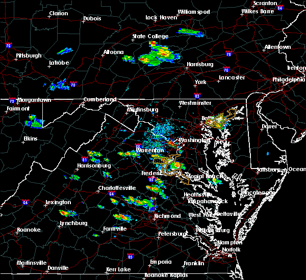 The severe thunderstorm warning for north central stafford and southeastern prince william counties will expire at 330 pm edt, the storm which prompted the warning has weakened below severe limits, and no longer pose an immediate threat to life or property. therefore the warning will be allowed to expire. The severe thunderstorm warning for north central stafford and southeastern prince william counties will expire at 330 pm edt, the storm which prompted the warning has weakened below severe limits, and no longer pose an immediate threat to life or property. therefore the warning will be allowed to expire.
|
| 8/21/2017 2:52 PM EDT |
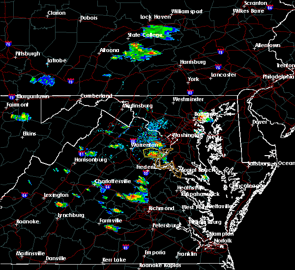 At 252 pm edt, a severe thunderstorm was located near montclair, or near dale city, moving southeast at 10 mph (radar indicated). Hazards include 60 mph wind gusts and quarter size hail. Damaging winds will cause some trees and large branches to fall. this could injure those outdoors, as well as damage homes and vehicles. roadways may become blocked by downed trees. localized power outages are possible. unsecured light objects may become projectiles. Locations impacted include, dale city, montclair, triangle, dumfries, cherry hill and independent hill. At 252 pm edt, a severe thunderstorm was located near montclair, or near dale city, moving southeast at 10 mph (radar indicated). Hazards include 60 mph wind gusts and quarter size hail. Damaging winds will cause some trees and large branches to fall. this could injure those outdoors, as well as damage homes and vehicles. roadways may become blocked by downed trees. localized power outages are possible. unsecured light objects may become projectiles. Locations impacted include, dale city, montclair, triangle, dumfries, cherry hill and independent hill.
|
| 8/21/2017 2:37 PM EDT |
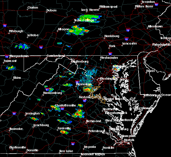 At 237 pm edt, a severe thunderstorm was located 8 miles west of dale city, moving east at 10 mph (radar indicated). Hazards include 60 mph wind gusts and quarter size hail. Damaging winds will cause some trees and large branches to fall. this could injure those outdoors, as well as damage homes and vehicles. roadways may become blocked by downed trees. localized power outages are possible. Unsecured light objects may become projectiles. At 237 pm edt, a severe thunderstorm was located 8 miles west of dale city, moving east at 10 mph (radar indicated). Hazards include 60 mph wind gusts and quarter size hail. Damaging winds will cause some trees and large branches to fall. this could injure those outdoors, as well as damage homes and vehicles. roadways may become blocked by downed trees. localized power outages are possible. Unsecured light objects may become projectiles.
|
| 8/11/2017 8:38 PM EDT |
 The severe thunderstorm warning for southwestern prince georges, northwestern charles, southeastern fairfax and east central prince william counties will expire at 845 pm edt, the storm which prompted the warning has weakened below severe limits, and no longer pose an immediate threat to life or property. therefore the warning will be allowed to expire. however gusty winds and heavy rain are still possible with this thunderstorm. The severe thunderstorm warning for southwestern prince georges, northwestern charles, southeastern fairfax and east central prince william counties will expire at 845 pm edt, the storm which prompted the warning has weakened below severe limits, and no longer pose an immediate threat to life or property. therefore the warning will be allowed to expire. however gusty winds and heavy rain are still possible with this thunderstorm.
|
| 8/11/2017 7:40 PM EDT |
 At 739 pm edt, a severe thunderstorm was located over lake ridge, or near woodbridge, moving east at 20 mph (radar indicated). Hazards include 60 mph wind gusts and quarter size hail. Damaging winds will cause some trees and large branches to fall. this could injure those outdoors, as well as damage homes and vehicles. roadways may become blocked by downed trees. localized power outages are possible. Unsecured light objects may become projectiles. At 739 pm edt, a severe thunderstorm was located over lake ridge, or near woodbridge, moving east at 20 mph (radar indicated). Hazards include 60 mph wind gusts and quarter size hail. Damaging winds will cause some trees and large branches to fall. this could injure those outdoors, as well as damage homes and vehicles. roadways may become blocked by downed trees. localized power outages are possible. Unsecured light objects may become projectiles.
|
| 8/11/2017 7:25 PM EDT |
 At 724 pm edt, a severe thunderstorm was located over lake ridge, or near dale city, moving east at 30 mph (radar indicated). Hazards include 60 mph wind gusts and quarter size hail. Damaging winds will cause some trees and large branches to fall. this could injure those outdoors, as well as damage homes and vehicles. roadways may become blocked by downed trees. localized power outages are possible. unsecured light objects may become projectiles. Locations impacted include, centreville, dale city, fairfax, lake ridge, burke, oakton, montclair, bull run, manassas, sudley, manassas park, fairfax station, independent hill and clifton. At 724 pm edt, a severe thunderstorm was located over lake ridge, or near dale city, moving east at 30 mph (radar indicated). Hazards include 60 mph wind gusts and quarter size hail. Damaging winds will cause some trees and large branches to fall. this could injure those outdoors, as well as damage homes and vehicles. roadways may become blocked by downed trees. localized power outages are possible. unsecured light objects may become projectiles. Locations impacted include, centreville, dale city, fairfax, lake ridge, burke, oakton, montclair, bull run, manassas, sudley, manassas park, fairfax station, independent hill and clifton.
|
| 8/11/2017 7:13 PM EDT |
 At 713 pm edt, a severe thunderstorm was located near dale city, moving east at 30 mph (radar indicated). Hazards include 60 mph wind gusts and quarter size hail. Damaging winds will cause some trees and large branches to fall. this could injure those outdoors, as well as damage homes and vehicles. roadways may become blocked by downed trees. localized power outages are possible. unsecured light objects may become projectiles. Locations impacted include, centreville, dale city, fairfax, lake ridge, burke, linton hall, oakton, montclair, bull run, manassas, sudley, manassas park, fairfax station, independent hill, nokesville, clifton and aden. At 713 pm edt, a severe thunderstorm was located near dale city, moving east at 30 mph (radar indicated). Hazards include 60 mph wind gusts and quarter size hail. Damaging winds will cause some trees and large branches to fall. this could injure those outdoors, as well as damage homes and vehicles. roadways may become blocked by downed trees. localized power outages are possible. unsecured light objects may become projectiles. Locations impacted include, centreville, dale city, fairfax, lake ridge, burke, linton hall, oakton, montclair, bull run, manassas, sudley, manassas park, fairfax station, independent hill, nokesville, clifton and aden.
|
| 8/11/2017 7:00 PM EDT |
 At 659 pm edt, a severe thunderstorm was located near linton hall, or 11 miles west of dale city, moving east at 25 mph (radar indicated). Hazards include 60 mph wind gusts and quarter size hail. Damaging winds will cause some trees and large branches to fall. this could injure those outdoors, as well as damage homes and vehicles. roadways may become blocked by downed trees. localized power outages are possible. Unsecured light objects may become projectiles. At 659 pm edt, a severe thunderstorm was located near linton hall, or 11 miles west of dale city, moving east at 25 mph (radar indicated). Hazards include 60 mph wind gusts and quarter size hail. Damaging winds will cause some trees and large branches to fall. this could injure those outdoors, as well as damage homes and vehicles. roadways may become blocked by downed trees. localized power outages are possible. Unsecured light objects may become projectiles.
|
| 5/25/2017 5:23 PM EDT |
 At 522 pm edt, a severe thunderstorm was located over dumfries, or near quantico, moving northeast at 15 mph (radar indicated). Hazards include 60 mph wind gusts and quarter size hail. Damaging winds will cause some trees and large branches to fall. this could injure those outdoors, as well as damage homes and vehicles. roadways may become blocked by downed trees. localized power outages are possible. unsecured light objects may become projectiles. Locations impacted include, fort belvoir, woodbridge, lake ridge, lorton, cherry hill, accokeek, bryans road, mason neck, potomac heights, occoquan, marbury, rison, nanjemoy and pisgah. At 522 pm edt, a severe thunderstorm was located over dumfries, or near quantico, moving northeast at 15 mph (radar indicated). Hazards include 60 mph wind gusts and quarter size hail. Damaging winds will cause some trees and large branches to fall. this could injure those outdoors, as well as damage homes and vehicles. roadways may become blocked by downed trees. localized power outages are possible. unsecured light objects may become projectiles. Locations impacted include, fort belvoir, woodbridge, lake ridge, lorton, cherry hill, accokeek, bryans road, mason neck, potomac heights, occoquan, marbury, rison, nanjemoy and pisgah.
|
| 5/25/2017 5:23 PM EDT |
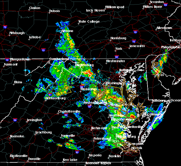 At 522 pm edt, a severe thunderstorm was located over dumfries, or near quantico, moving northeast at 15 mph (radar indicated). Hazards include 60 mph wind gusts and quarter size hail. Damaging winds will cause some trees and large branches to fall. this could injure those outdoors, as well as damage homes and vehicles. roadways may become blocked by downed trees. localized power outages are possible. unsecured light objects may become projectiles. Locations impacted include, fort belvoir, woodbridge, lake ridge, lorton, cherry hill, accokeek, bryans road, mason neck, potomac heights, occoquan, marbury, rison, nanjemoy and pisgah. At 522 pm edt, a severe thunderstorm was located over dumfries, or near quantico, moving northeast at 15 mph (radar indicated). Hazards include 60 mph wind gusts and quarter size hail. Damaging winds will cause some trees and large branches to fall. this could injure those outdoors, as well as damage homes and vehicles. roadways may become blocked by downed trees. localized power outages are possible. unsecured light objects may become projectiles. Locations impacted include, fort belvoir, woodbridge, lake ridge, lorton, cherry hill, accokeek, bryans road, mason neck, potomac heights, occoquan, marbury, rison, nanjemoy and pisgah.
|
| 5/25/2017 5:15 PM EDT |
 At 515 pm edt, a severe thunderstorm was located over triangle, or over quantico, moving northeast at 15 mph (radar indicated). Hazards include 60 mph wind gusts and quarter size hail. Damaging winds will cause some trees and large branches to fall. this could injure those outdoors, as well as damage homes and vehicles. roadways may become blocked by downed trees. localized power outages are possible. unsecured light objects may become projectiles. Locations impacted include, dale city, fort belvoir, woodbridge, quantico, lake ridge, montclair, lorton, triangle, dumfries, cherry hill, accokeek, bryans road, mason neck, potomac heights, occoquan, marbury, rison, nanjemoy and pisgah. At 515 pm edt, a severe thunderstorm was located over triangle, or over quantico, moving northeast at 15 mph (radar indicated). Hazards include 60 mph wind gusts and quarter size hail. Damaging winds will cause some trees and large branches to fall. this could injure those outdoors, as well as damage homes and vehicles. roadways may become blocked by downed trees. localized power outages are possible. unsecured light objects may become projectiles. Locations impacted include, dale city, fort belvoir, woodbridge, quantico, lake ridge, montclair, lorton, triangle, dumfries, cherry hill, accokeek, bryans road, mason neck, potomac heights, occoquan, marbury, rison, nanjemoy and pisgah.
|
| 5/25/2017 4:55 PM EDT |
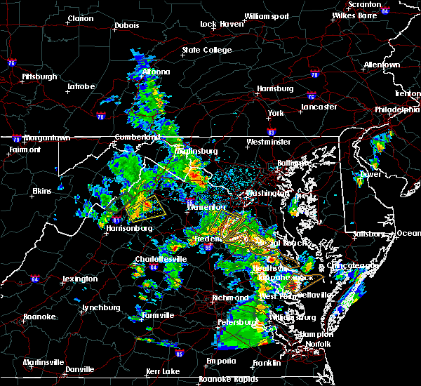 At 455 pm edt, a severe thunderstorm was located near quantico, moving northeast at 15 mph (radar indicated). Hazards include 60 mph wind gusts and quarter size hail. Damaging winds will cause some trees and large branches to fall. this could injure those outdoors, as well as damage homes and vehicles. roadways may become blocked by downed trees. localized power outages are possible. Unsecured light objects may become projectiles. At 455 pm edt, a severe thunderstorm was located near quantico, moving northeast at 15 mph (radar indicated). Hazards include 60 mph wind gusts and quarter size hail. Damaging winds will cause some trees and large branches to fall. this could injure those outdoors, as well as damage homes and vehicles. roadways may become blocked by downed trees. localized power outages are possible. Unsecured light objects may become projectiles.
|
| 5/18/2017 8:34 PM EDT |
 At 834 pm edt, severe thunderstorms were located along a line extending from near newington to 7 miles west of montclair, moving east at 20 mph (trained weather spotters). Hazards include 60 mph wind gusts. Damaging winds will cause some trees and large branches to fall. this could injure those outdoors, as well as damage homes and vehicles. roadways may become blocked by downed trees. localized power outages are possible. unsecured light objects may become projectiles. Locations impacted include, dale city, fort belvoir, woodbridge, quantico, lake ridge, burke, montclair, lorton, newington, triangle, dumfries, cherry hill, fairfax station, independent hill, mason neck, occoquan and aden. At 834 pm edt, severe thunderstorms were located along a line extending from near newington to 7 miles west of montclair, moving east at 20 mph (trained weather spotters). Hazards include 60 mph wind gusts. Damaging winds will cause some trees and large branches to fall. this could injure those outdoors, as well as damage homes and vehicles. roadways may become blocked by downed trees. localized power outages are possible. unsecured light objects may become projectiles. Locations impacted include, dale city, fort belvoir, woodbridge, quantico, lake ridge, burke, montclair, lorton, newington, triangle, dumfries, cherry hill, fairfax station, independent hill, mason neck, occoquan and aden.
|
| 5/18/2017 8:18 PM EDT |
 At 818 pm edt, severe thunderstorms were located along a line extending from near centreville to 7 miles south of linton hall, moving southeast at 15 mph (trained weather spotters). Hazards include 60 mph wind gusts and quarter size hail. Damaging winds will cause some trees and large branches to fall. this could injure those outdoors, as well as damage homes and vehicles. roadways may become blocked by downed trees. localized power outages are possible. unsecured light objects may become projectiles. Locations impacted include, centreville, dale city, fort belvoir, woodbridge, quantico, lake ridge, burke, linton hall, montclair, lorton, bull run, newington, triangle, dumfries, manassas, sudley, cherry hill, manassas park, fairfax station and independent hill. At 818 pm edt, severe thunderstorms were located along a line extending from near centreville to 7 miles south of linton hall, moving southeast at 15 mph (trained weather spotters). Hazards include 60 mph wind gusts and quarter size hail. Damaging winds will cause some trees and large branches to fall. this could injure those outdoors, as well as damage homes and vehicles. roadways may become blocked by downed trees. localized power outages are possible. unsecured light objects may become projectiles. Locations impacted include, centreville, dale city, fort belvoir, woodbridge, quantico, lake ridge, burke, linton hall, montclair, lorton, bull run, newington, triangle, dumfries, manassas, sudley, cherry hill, manassas park, fairfax station and independent hill.
|
| 5/18/2017 7:57 PM EDT |
 At 757 pm edt, severe thunderstorms were located along a line extending from near centreville to near linton hall, moving southeast at 25 mph (trained weather spotters). Hazards include 70 mph wind gusts and quarter size hail. Damaging winds will cause some trees and large branches to fall. this could injure those outdoors, as well as damage homes and vehicles. roadways may become blocked by downed trees. localized power outages are possible. Unsecured light objects may become projectiles. At 757 pm edt, severe thunderstorms were located along a line extending from near centreville to near linton hall, moving southeast at 25 mph (trained weather spotters). Hazards include 70 mph wind gusts and quarter size hail. Damaging winds will cause some trees and large branches to fall. this could injure those outdoors, as well as damage homes and vehicles. roadways may become blocked by downed trees. localized power outages are possible. Unsecured light objects may become projectiles.
|
| 5/5/2017 8:38 AM EDT |
 At 837 am edt, severe thunderstorms were located along a line extending from tysons corner to golden beach, moving north at 60 mph (radar indicated). Hazards include 70 mph wind gusts. Damaging winds will cause some trees and large branches to fall. this could injure those outdoors, as well as damage homes and vehicles. roadways may become blocked by downed trees. localized power outages are possible. unsecured light objects may become projectiles. Locations impacted include, waldorf, dale city, annandale, clinton, springfield, fort washington, fort hunt, groveton, la plata, fort belvoir, woodbridge, popes creek, port tobacco river, lake ridge, burke, lincolnia, montclair, lorton, franconia and hybla valley. At 837 am edt, severe thunderstorms were located along a line extending from tysons corner to golden beach, moving north at 60 mph (radar indicated). Hazards include 70 mph wind gusts. Damaging winds will cause some trees and large branches to fall. this could injure those outdoors, as well as damage homes and vehicles. roadways may become blocked by downed trees. localized power outages are possible. unsecured light objects may become projectiles. Locations impacted include, waldorf, dale city, annandale, clinton, springfield, fort washington, fort hunt, groveton, la plata, fort belvoir, woodbridge, popes creek, port tobacco river, lake ridge, burke, lincolnia, montclair, lorton, franconia and hybla valley.
|
| 5/5/2017 8:22 AM EDT |
 At 821 am edt, severe thunderstorms were located along a line extending from near lake ridge to near wicomico river, moving northeast at 50 mph (observed wind of 70 mph at dahlgren at 8:20am). Hazards include 70 mph wind gusts. Damaging winds will cause some trees and large branches to fall. this could injure those outdoors, as well as damage homes and vehicles. roadways may become blocked by downed trees. localized power outages are possible. unsecured light objects may become projectiles. Locations impacted include, waldorf, dale city, annandale, clinton, springfield, fort washington, fort hunt, groveton, la plata, fort belvoir, woodbridge, popes creek, port tobacco river, lake ridge, burke, lincolnia, montclair, lorton, franconia and hybla valley. At 821 am edt, severe thunderstorms were located along a line extending from near lake ridge to near wicomico river, moving northeast at 50 mph (observed wind of 70 mph at dahlgren at 8:20am). Hazards include 70 mph wind gusts. Damaging winds will cause some trees and large branches to fall. this could injure those outdoors, as well as damage homes and vehicles. roadways may become blocked by downed trees. localized power outages are possible. unsecured light objects may become projectiles. Locations impacted include, waldorf, dale city, annandale, clinton, springfield, fort washington, fort hunt, groveton, la plata, fort belvoir, woodbridge, popes creek, port tobacco river, lake ridge, burke, lincolnia, montclair, lorton, franconia and hybla valley.
|
| 5/5/2017 8:10 AM EDT |
 At 809 am edt, severe thunderstorms were located along a line extending from lake ridge to near colonial beach, moving northeast at 60 mph (radar indicated). Hazards include 60 mph wind gusts. Damaging winds will cause some trees and large branches to fall. this could injure those outdoors, as well as damage homes and vehicles. roadways may become blocked by downed trees. localized power outages are possible. unsecured light objects may become projectiles. Locations impacted include, waldorf, dale city, annandale, clinton, springfield, fort washington, fort hunt, groveton, la plata, fort belvoir, woodbridge, dahlgren, quantico, nanjemoy creek, popes creek, port tobacco river, lake ridge, burke, lincolnia and montclair. At 809 am edt, severe thunderstorms were located along a line extending from lake ridge to near colonial beach, moving northeast at 60 mph (radar indicated). Hazards include 60 mph wind gusts. Damaging winds will cause some trees and large branches to fall. this could injure those outdoors, as well as damage homes and vehicles. roadways may become blocked by downed trees. localized power outages are possible. unsecured light objects may become projectiles. Locations impacted include, waldorf, dale city, annandale, clinton, springfield, fort washington, fort hunt, groveton, la plata, fort belvoir, woodbridge, dahlgren, quantico, nanjemoy creek, popes creek, port tobacco river, lake ridge, burke, lincolnia and montclair.
|
| 5/5/2017 7:49 AM EDT |
 At 749 am edt, severe thunderstorms were located along a line extending from near stafford to 6 miles southeast of fort a.p. hill, moving north at 60 mph (radar indicated). Hazards include 60 mph wind gusts. Damaging winds will cause some trees and large branches to fall. this could injure those outdoors, as well as damage homes and vehicles. roadways may become blocked by downed trees. localized power outages are possible. Unsecured light objects may become projectiles. At 749 am edt, severe thunderstorms were located along a line extending from near stafford to 6 miles southeast of fort a.p. hill, moving north at 60 mph (radar indicated). Hazards include 60 mph wind gusts. Damaging winds will cause some trees and large branches to fall. this could injure those outdoors, as well as damage homes and vehicles. roadways may become blocked by downed trees. localized power outages are possible. Unsecured light objects may become projectiles.
|
| 4/6/2017 1:16 PM EDT |
 At 115 pm edt, severe thunderstorms were located along a line extending from near haymarket to near linton hall to near dale city to quantico, moving northeast at 50 mph (radar indicated). Hazards include 60 mph wind gusts and quarter size hail. Damaging winds will cause some trees and large branches to fall. this could injure those outdoors, as well as damage homes and vehicles. roadways may become blocked by downed trees. localized power outages are possible. unsecured light objects may become projectiles. Locations impacted include, dale city, lake ridge, linton hall, montclair, bull run, triangle, dumfries, haymarket, manassas, sudley, cherry hill, manassas park, gainesville, independent hill, nokesville and catharpin. At 115 pm edt, severe thunderstorms were located along a line extending from near haymarket to near linton hall to near dale city to quantico, moving northeast at 50 mph (radar indicated). Hazards include 60 mph wind gusts and quarter size hail. Damaging winds will cause some trees and large branches to fall. this could injure those outdoors, as well as damage homes and vehicles. roadways may become blocked by downed trees. localized power outages are possible. unsecured light objects may become projectiles. Locations impacted include, dale city, lake ridge, linton hall, montclair, bull run, triangle, dumfries, haymarket, manassas, sudley, cherry hill, manassas park, gainesville, independent hill, nokesville and catharpin.
|
| 4/6/2017 1:12 PM EDT |
 At 111 pm edt, severe thunderstorms were located along a line extending from near warrenton to 6 miles west of dale city to triangle, moving northeast at 50 mph (radar indicated). Hazards include 60 mph wind gusts and quarter size hail. Damaging winds will cause some trees and large branches to fall. this could injure those outdoors, as well as damage homes and vehicles. roadways may become blocked by downed trees. localized power outages are possible. Unsecured light objects may become projectiles. At 111 pm edt, severe thunderstorms were located along a line extending from near warrenton to 6 miles west of dale city to triangle, moving northeast at 50 mph (radar indicated). Hazards include 60 mph wind gusts and quarter size hail. Damaging winds will cause some trees and large branches to fall. this could injure those outdoors, as well as damage homes and vehicles. roadways may become blocked by downed trees. localized power outages are possible. Unsecured light objects may become projectiles.
|
| 4/6/2017 12:58 PM EDT |
 At 1257 pm edt, severe thunderstorms were located along a line extending from 6 miles south of warrenton to near bealeton to 15 miles northwest of fredericksburg to near stafford, moving northeast at 55 mph (radar indicated). Hazards include 60 mph wind gusts and quarter size hail. Damaging winds will cause some trees and large branches to fall. this could injure those outdoors, as well as damage homes and vehicles. roadways may become blocked by downed trees. localized power outages are possible. unsecured light objects may become projectiles. weakened. Locations impacted include, stafford, dale city, warrenton, lake ridge, linton hall, montclair, bull run, triangle, dumfries, bealeton, haymarket, manassas, sudley, cherry hill, manassas park, gainesville, new baltimore, independent hill, falmouth and nokesville. At 1257 pm edt, severe thunderstorms were located along a line extending from 6 miles south of warrenton to near bealeton to 15 miles northwest of fredericksburg to near stafford, moving northeast at 55 mph (radar indicated). Hazards include 60 mph wind gusts and quarter size hail. Damaging winds will cause some trees and large branches to fall. this could injure those outdoors, as well as damage homes and vehicles. roadways may become blocked by downed trees. localized power outages are possible. unsecured light objects may become projectiles. weakened. Locations impacted include, stafford, dale city, warrenton, lake ridge, linton hall, montclair, bull run, triangle, dumfries, bealeton, haymarket, manassas, sudley, cherry hill, manassas park, gainesville, new baltimore, independent hill, falmouth and nokesville.
|
| 4/6/2017 12:43 PM EDT |
 At 1243 pm edt, severe thunderstorms were located along a line extending from near culpeper to 14 miles south of bealeton to near spotsylvania, moving northeast at 50 mph (radar indicated). Hazards include 60 mph wind gusts and quarter size hail. Damaging winds will cause some trees and large branches to fall. this could injure those outdoors, as well as damage homes and vehicles. roadways may become blocked by downed trees. localized power outages are possible. Unsecured light objects may become projectiles. At 1243 pm edt, severe thunderstorms were located along a line extending from near culpeper to 14 miles south of bealeton to near spotsylvania, moving northeast at 50 mph (radar indicated). Hazards include 60 mph wind gusts and quarter size hail. Damaging winds will cause some trees and large branches to fall. this could injure those outdoors, as well as damage homes and vehicles. roadways may become blocked by downed trees. localized power outages are possible. Unsecured light objects may become projectiles.
|
| 3/1/2017 1:36 PM EST |
 At 135 pm est, severe thunderstorms were located along a line extending from near montclair to near aquia creek to 6 miles northwest of ladysmith, moving east at 70 mph (radar indicated). Hazards include 70 mph wind gusts. Damaging winds will cause some trees and large branches to fall. this could injure those outdoors, as well as damage homes and vehicles. roadways may become blocked by downed trees. localized power outages are possible. Unsecured light objects may become projectiles. At 135 pm est, severe thunderstorms were located along a line extending from near montclair to near aquia creek to 6 miles northwest of ladysmith, moving east at 70 mph (radar indicated). Hazards include 70 mph wind gusts. Damaging winds will cause some trees and large branches to fall. this could injure those outdoors, as well as damage homes and vehicles. roadways may become blocked by downed trees. localized power outages are possible. Unsecured light objects may become projectiles.
|
| 3/1/2017 1:28 PM EST |
 At 128 pm est, severe thunderstorms were located along a line extending from north potomac to near lake ridge to 11 miles west of spotsylvania, moving east at 55 mph (radar indicated). Hazards include 60 mph wind gusts. Damaging winds will cause some trees and large branches to fall. this could injure those outdoors, as well as damage homes and vehicles. roadways may become blocked by downed trees. localized power outages are possible. unsecured light objects may become projectiles. Locations impacted include, arlington, alexandria, stafford, centreville, waldorf, dale city, rockville, bethesda, reston, bowie, annandale, clinton, springfield, college park, fredericksburg, fort washington, herndon, greenbelt, fairfax and langley park. At 128 pm est, severe thunderstorms were located along a line extending from north potomac to near lake ridge to 11 miles west of spotsylvania, moving east at 55 mph (radar indicated). Hazards include 60 mph wind gusts. Damaging winds will cause some trees and large branches to fall. this could injure those outdoors, as well as damage homes and vehicles. roadways may become blocked by downed trees. localized power outages are possible. unsecured light objects may become projectiles. Locations impacted include, arlington, alexandria, stafford, centreville, waldorf, dale city, rockville, bethesda, reston, bowie, annandale, clinton, springfield, college park, fredericksburg, fort washington, herndon, greenbelt, fairfax and langley park.
|
| 3/1/2017 1:05 PM EST |
 At 104 pm est, severe thunderstorms were located along a line extending from broadlands to near haymarket to 9 miles east of orange, moving east at 50 mph (radar indicated). Hazards include 60 mph wind gusts. Damaging winds will cause some trees and large branches to fall. this could injure those outdoors, as well as damage homes and vehicles. roadways may become blocked by downed trees. localized power outages are possible. Unsecured light objects may become projectiles. At 104 pm est, severe thunderstorms were located along a line extending from broadlands to near haymarket to 9 miles east of orange, moving east at 50 mph (radar indicated). Hazards include 60 mph wind gusts. Damaging winds will cause some trees and large branches to fall. this could injure those outdoors, as well as damage homes and vehicles. roadways may become blocked by downed trees. localized power outages are possible. Unsecured light objects may become projectiles.
|
| 2/25/2017 2:57 PM EST |
 At 256 pm est, a severe thunderstorm was located over fort belvoir, moving northeast at 50 mph (radar indicated). Hazards include golf ball size hail and 70 mph wind gusts. Expect wind damage to trees and power lines. hail is large enough to dent and damage vehicles. some hail damage to roofs, siding, and windows is possible. Locations impacted include, waldorf, dale city, clinton, fort washington, fort hunt, groveton, forestville, coral hills, fort belvoir, woodbridge, national harbor, quantico, andrews air force base, montclair, camp springs, lorton, oxon hill, hybla valley, walker mill and rosaryville. At 256 pm est, a severe thunderstorm was located over fort belvoir, moving northeast at 50 mph (radar indicated). Hazards include golf ball size hail and 70 mph wind gusts. Expect wind damage to trees and power lines. hail is large enough to dent and damage vehicles. some hail damage to roofs, siding, and windows is possible. Locations impacted include, waldorf, dale city, clinton, fort washington, fort hunt, groveton, forestville, coral hills, fort belvoir, woodbridge, national harbor, quantico, andrews air force base, montclair, camp springs, lorton, oxon hill, hybla valley, walker mill and rosaryville.
|
| 2/25/2017 2:47 PM EST |
 At 246 pm est, a severe thunderstorm was located over woodbridge, moving northeast at 50 mph (radar indicated). Hazards include golf ball size hail and 70 mph wind gusts. Expect wind damage to trees and power lines. hail is large enough to dent and damage vehicles. some hail damage to roofs, siding, and windows is possible. Locations impacted include, waldorf, dale city, clinton, fort washington, fort hunt, groveton, forestville, coral hills, fort belvoir, woodbridge, national harbor, quantico, andrews air force base, montclair, camp springs, lorton, oxon hill, hybla valley, walker mill and rosaryville. At 246 pm est, a severe thunderstorm was located over woodbridge, moving northeast at 50 mph (radar indicated). Hazards include golf ball size hail and 70 mph wind gusts. Expect wind damage to trees and power lines. hail is large enough to dent and damage vehicles. some hail damage to roofs, siding, and windows is possible. Locations impacted include, waldorf, dale city, clinton, fort washington, fort hunt, groveton, forestville, coral hills, fort belvoir, woodbridge, national harbor, quantico, andrews air force base, montclair, camp springs, lorton, oxon hill, hybla valley, walker mill and rosaryville.
|
| 2/25/2017 2:35 PM EST |
 At 234 pm est, a severe thunderstorm was located 7 miles west of dumfries, or 8 miles southwest of dale city, moving northeast at 50 mph (radar indicated). Hazards include 60 mph wind gusts and half dollar size hail. Damaging winds will cause some trees and large branches to fall. this could injure those outdoors, as well as damage homes and vehicles. roadways may become blocked by downed trees. localized power outages are possible. Unsecured light objects may become projectiles. At 234 pm est, a severe thunderstorm was located 7 miles west of dumfries, or 8 miles southwest of dale city, moving northeast at 50 mph (radar indicated). Hazards include 60 mph wind gusts and half dollar size hail. Damaging winds will cause some trees and large branches to fall. this could injure those outdoors, as well as damage homes and vehicles. roadways may become blocked by downed trees. localized power outages are possible. Unsecured light objects may become projectiles.
|
| 9/7/2016 7:08 PM EDT |
 The severe thunderstorm warning for northwestern charles, western prince georges, southeastern fairfax and east central prince william counties will expire at 715 pm edt, the storm which prompted the warning has weakened below severe limits, and no longer pose an immediate threat to life or property. therefore the warning will be allowed to expire. however heavy rain is still possible with this thunderstorm. The severe thunderstorm warning for northwestern charles, western prince georges, southeastern fairfax and east central prince william counties will expire at 715 pm edt, the storm which prompted the warning has weakened below severe limits, and no longer pose an immediate threat to life or property. therefore the warning will be allowed to expire. however heavy rain is still possible with this thunderstorm.
|
| 9/7/2016 6:59 PM EDT |
 At 659 pm edt, a severe thunderstorm was located over lorton, or over woodbridge, moving southeast at 30 mph (radar indicated). Hazards include 60 mph wind gusts and quarter size hail. Damaging winds will cause some trees and large branches to fall. this could injure those outdoors, as well as damage homes and vehicles. roadways may become blocked by downed trees. localized power outages are possible. unsecured light objects may become projectiles. Locations impacted include, dale city, fort washington, fort belvoir, woodbridge, lake ridge, lorton, newington, mount vernon, accokeek, bryans road, mason neck, potomac heights, occoquan, marbury, rison and pisgah. At 659 pm edt, a severe thunderstorm was located over lorton, or over woodbridge, moving southeast at 30 mph (radar indicated). Hazards include 60 mph wind gusts and quarter size hail. Damaging winds will cause some trees and large branches to fall. this could injure those outdoors, as well as damage homes and vehicles. roadways may become blocked by downed trees. localized power outages are possible. unsecured light objects may become projectiles. Locations impacted include, dale city, fort washington, fort belvoir, woodbridge, lake ridge, lorton, newington, mount vernon, accokeek, bryans road, mason neck, potomac heights, occoquan, marbury, rison and pisgah.
|
| 9/7/2016 6:44 PM EDT |
 At 643 pm edt, a severe thunderstorm was located near burke, or near woodbridge, moving east at 30 mph (radar indicated). Hazards include 60 mph wind gusts and quarter size hail. Damaging winds will cause some trees and large branches to fall. this could injure those outdoors, as well as damage homes and vehicles. roadways may become blocked by downed trees. localized power outages are possible. Unsecured light objects may become projectiles. At 643 pm edt, a severe thunderstorm was located near burke, or near woodbridge, moving east at 30 mph (radar indicated). Hazards include 60 mph wind gusts and quarter size hail. Damaging winds will cause some trees and large branches to fall. this could injure those outdoors, as well as damage homes and vehicles. roadways may become blocked by downed trees. localized power outages are possible. Unsecured light objects may become projectiles.
|
| 8/17/2016 9:17 PM EDT |
 At 917 pm edt, a severe thunderstorm was located over quantico, moving east at 25 mph (radar indicated). Hazards include 60 mph wind gusts. Damaging winds will cause some trees and large branches to fall. this could injure those outdoors, as well as damage homes and vehicles. roadways may become blocked by downed trees. localized power outages are possible. Unsecured light objects may become projectiles. At 917 pm edt, a severe thunderstorm was located over quantico, moving east at 25 mph (radar indicated). Hazards include 60 mph wind gusts. Damaging winds will cause some trees and large branches to fall. this could injure those outdoors, as well as damage homes and vehicles. roadways may become blocked by downed trees. localized power outages are possible. Unsecured light objects may become projectiles.
|
| 8/15/2016 7:49 PM EDT |
 At 749 pm edt, severe thunderstorms were located along a line extending from 6 miles south of linton hall to 7 miles west of montclair to near quantico, moving northeast at 40 mph (radar indicated). Hazards include 60 mph wind gusts and quarter size hail. Damaging winds will cause some trees and large branches to fall. this could injure those outdoors, as well as damage homes and vehicles. roadways may become blocked by downed trees. localized power outages are possible. unsecured light objects may become projectiles. Locations impacted include, dale city, woodbridge, quantico, lake ridge, montclair, triangle, dumfries, cherry hill, independent hill, nokesville and aden. At 749 pm edt, severe thunderstorms were located along a line extending from 6 miles south of linton hall to 7 miles west of montclair to near quantico, moving northeast at 40 mph (radar indicated). Hazards include 60 mph wind gusts and quarter size hail. Damaging winds will cause some trees and large branches to fall. this could injure those outdoors, as well as damage homes and vehicles. roadways may become blocked by downed trees. localized power outages are possible. unsecured light objects may become projectiles. Locations impacted include, dale city, woodbridge, quantico, lake ridge, montclair, triangle, dumfries, cherry hill, independent hill, nokesville and aden.
|
| 8/15/2016 7:37 PM EDT |
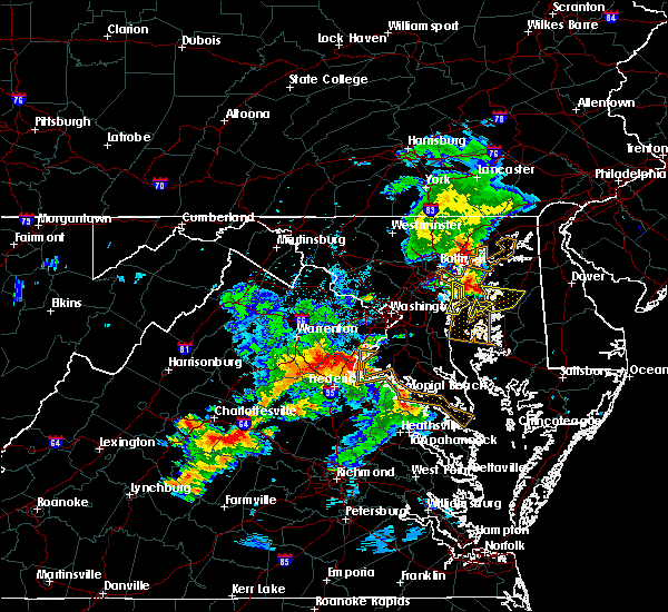 At 736 pm edt, severe thunderstorms were located along a line extending from 6 miles east of bealeton to 12 miles west of stafford to aquia creek, moving northeast at 20 mph (radar indicated). Hazards include 60 mph wind gusts and quarter size hail. Damaging winds will cause some trees and large branches to fall. this could injure those outdoors, as well as damage homes and vehicles. roadways may become blocked by downed trees. localized power outages are possible. Unsecured light objects may become projectiles. At 736 pm edt, severe thunderstorms were located along a line extending from 6 miles east of bealeton to 12 miles west of stafford to aquia creek, moving northeast at 20 mph (radar indicated). Hazards include 60 mph wind gusts and quarter size hail. Damaging winds will cause some trees and large branches to fall. this could injure those outdoors, as well as damage homes and vehicles. roadways may become blocked by downed trees. localized power outages are possible. Unsecured light objects may become projectiles.
|
| 7/18/2016 4:05 PM EDT |
 At 404 pm edt, severe thunderstorms were located along a line extending from 7 miles southeast of linton hall to 6 miles west of montclair to 7 miles west of stafford, moving east at 45 mph (radar indicated). Hazards include 60 mph wind gusts. Damaging winds will cause some trees and large branches to fall. this could injure those outdoors, as well as damage homes and vehicles. roadways may become blocked by downed trees. localized power outages are possible. Unsecured light objects may become projectiles. At 404 pm edt, severe thunderstorms were located along a line extending from 7 miles southeast of linton hall to 6 miles west of montclair to 7 miles west of stafford, moving east at 45 mph (radar indicated). Hazards include 60 mph wind gusts. Damaging winds will cause some trees and large branches to fall. this could injure those outdoors, as well as damage homes and vehicles. roadways may become blocked by downed trees. localized power outages are possible. Unsecured light objects may become projectiles.
|
| 7/18/2016 4:05 PM EDT |
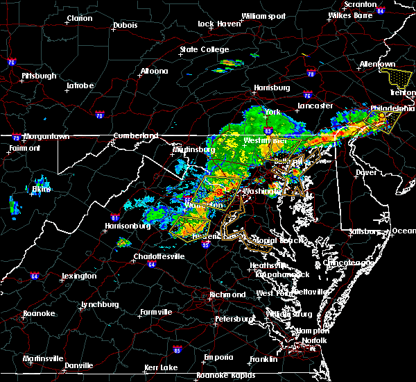 At 404 pm edt, severe thunderstorms were located along a line extending from 7 miles southeast of linton hall to 6 miles west of montclair to 7 miles west of stafford, moving east at 45 mph (radar indicated). Hazards include 60 mph wind gusts. Damaging winds will cause some trees and large branches to fall. this could injure those outdoors, as well as damage homes and vehicles. roadways may become blocked by downed trees. localized power outages are possible. Unsecured light objects may become projectiles. At 404 pm edt, severe thunderstorms were located along a line extending from 7 miles southeast of linton hall to 6 miles west of montclair to 7 miles west of stafford, moving east at 45 mph (radar indicated). Hazards include 60 mph wind gusts. Damaging winds will cause some trees and large branches to fall. this could injure those outdoors, as well as damage homes and vehicles. roadways may become blocked by downed trees. localized power outages are possible. Unsecured light objects may become projectiles.
|
| 7/16/2016 6:07 PM EDT |
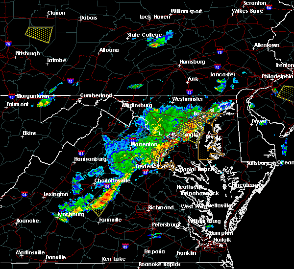 At 606 pm edt, a severe thunderstorm was located near woodbridge, moving east at 25 mph (radar indicated). Hazards include 60 mph wind gusts. Damaging winds will cause some trees and large branches to fall. this could injure those outdoors, as well as damage homes and vehicles. roadways may become blocked by downed trees. localized power outages are possible. Unsecured light objects may become projectiles. At 606 pm edt, a severe thunderstorm was located near woodbridge, moving east at 25 mph (radar indicated). Hazards include 60 mph wind gusts. Damaging winds will cause some trees and large branches to fall. this could injure those outdoors, as well as damage homes and vehicles. roadways may become blocked by downed trees. localized power outages are possible. Unsecured light objects may become projectiles.
|
| 7/16/2016 6:02 PM EDT |
 At 602 pm edt, a severe thunderstorm was located near quantico, moving east at 15 mph (radar indicated). Hazards include 60 mph wind gusts and quarter size hail. Damaging winds will cause some trees and large branches to fall. this could injure those outdoors, as well as damage homes and vehicles. roadways may become blocked by downed trees. localized power outages are possible. unsecured light objects may become projectiles. Locations impacted include, dale city, woodbridge, lake ridge, montclair, triangle, dumfries, cherry hill, independent hill, occoquan and widewater. At 602 pm edt, a severe thunderstorm was located near quantico, moving east at 15 mph (radar indicated). Hazards include 60 mph wind gusts and quarter size hail. Damaging winds will cause some trees and large branches to fall. this could injure those outdoors, as well as damage homes and vehicles. roadways may become blocked by downed trees. localized power outages are possible. unsecured light objects may become projectiles. Locations impacted include, dale city, woodbridge, lake ridge, montclair, triangle, dumfries, cherry hill, independent hill, occoquan and widewater.
|
| 7/16/2016 5:38 PM EDT |
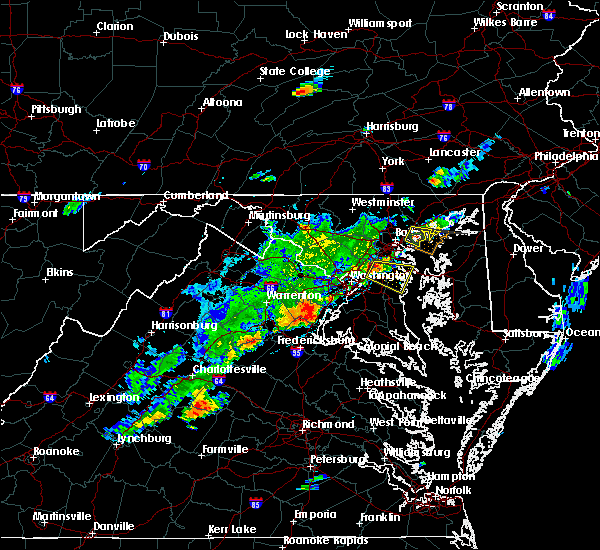 At 538 pm edt, a severe thunderstorm was located over montclair, or near dale city, moving east at 15 mph (radar indicated). Hazards include 60 mph wind gusts and quarter size hail. Damaging winds will cause some trees and large branches to fall. this could injure those outdoors, as well as damage homes and vehicles. roadways may become blocked by downed trees. localized power outages are possible. Unsecured light objects may become projectiles. At 538 pm edt, a severe thunderstorm was located over montclair, or near dale city, moving east at 15 mph (radar indicated). Hazards include 60 mph wind gusts and quarter size hail. Damaging winds will cause some trees and large branches to fall. this could injure those outdoors, as well as damage homes and vehicles. roadways may become blocked by downed trees. localized power outages are possible. Unsecured light objects may become projectiles.
|
| 6/28/2016 9:23 PM EDT |
 The severe thunderstorm warning for south central fairfax, southeastern prince william, north central stafford and southeastern fauquier counties will expire at 930 pm edt, a severe thunderstorm watch remains in effect until midnight edt for northern virginia. remember, a severe thunderstorm warning still remains in effect for prince william, stafford and fauquier counties until 1015 pm edt. The severe thunderstorm warning for south central fairfax, southeastern prince william, north central stafford and southeastern fauquier counties will expire at 930 pm edt, a severe thunderstorm watch remains in effect until midnight edt for northern virginia. remember, a severe thunderstorm warning still remains in effect for prince william, stafford and fauquier counties until 1015 pm edt.
|
| 6/28/2016 9:08 PM EDT |
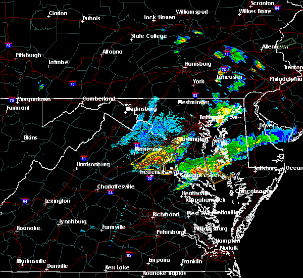 At 908 pm edt, severe thunderstorms were located along a line extending from near burke to 7 miles southeast of bealeton, moving east at 35 mph (radar indicated). Hazards include 60 mph wind gusts and quarter size hail. Damaging winds will cause some trees and large branches to fall. this could injure those outdoors, as well as damage homes and vehicles. roadways may become blocked by downed trees. localized power outages are possible. Unsecured light objects may become projectiles. At 908 pm edt, severe thunderstorms were located along a line extending from near burke to 7 miles southeast of bealeton, moving east at 35 mph (radar indicated). Hazards include 60 mph wind gusts and quarter size hail. Damaging winds will cause some trees and large branches to fall. this could injure those outdoors, as well as damage homes and vehicles. roadways may become blocked by downed trees. localized power outages are possible. Unsecured light objects may become projectiles.
|
| 6/28/2016 8:53 PM EDT |
 At 853 pm edt, a severe thunderstorm was located 8 miles west of montclair, or 9 miles southwest of dale city, moving northeast at 10 mph (radar indicated). Hazards include 60 mph wind gusts and quarter size hail. Damaging winds will cause some trees and large branches to fall. this could injure those outdoors, as well as damage homes and vehicles. roadways may become blocked by downed trees. localized power outages are possible. Unsecured light objects may become projectiles. At 853 pm edt, a severe thunderstorm was located 8 miles west of montclair, or 9 miles southwest of dale city, moving northeast at 10 mph (radar indicated). Hazards include 60 mph wind gusts and quarter size hail. Damaging winds will cause some trees and large branches to fall. this could injure those outdoors, as well as damage homes and vehicles. roadways may become blocked by downed trees. localized power outages are possible. Unsecured light objects may become projectiles.
|
| 6/28/2016 7:13 PM EDT |
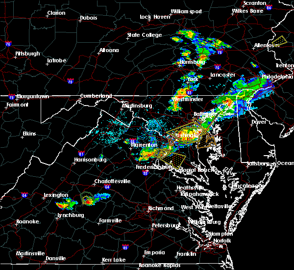 At 713 pm edt, a severe thunderstorm was located near quantico, moving southeast at 20 mph (radar indicated). Hazards include 60 mph wind gusts and quarter size hail. Damaging winds will cause some trees and large branches to fall. this could injure those outdoors, as well as damage homes and vehicles. roadways may become blocked by downed trees. localized power outages are possible. unsecured light objects may become projectiles. Locations impacted include, la plata, woodbridge, port tobacco river, cherry hill, bryans road, potomac heights, pomfret, port tobacco village, bel alton, port tobacco, pisgah, welcome, ironsides, ripley, marbury and rison. At 713 pm edt, a severe thunderstorm was located near quantico, moving southeast at 20 mph (radar indicated). Hazards include 60 mph wind gusts and quarter size hail. Damaging winds will cause some trees and large branches to fall. this could injure those outdoors, as well as damage homes and vehicles. roadways may become blocked by downed trees. localized power outages are possible. unsecured light objects may become projectiles. Locations impacted include, la plata, woodbridge, port tobacco river, cherry hill, bryans road, potomac heights, pomfret, port tobacco village, bel alton, port tobacco, pisgah, welcome, ironsides, ripley, marbury and rison.
|
| 6/28/2016 6:52 PM EDT |
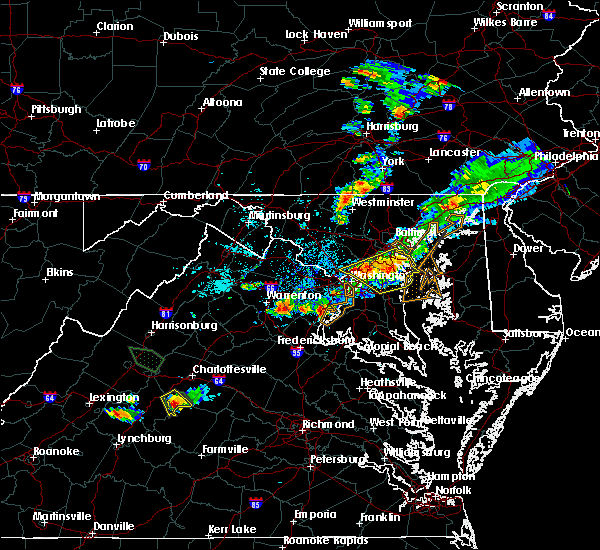 At 652 pm edt, a severe thunderstorm was located over woodbridge, moving southeast at 25 mph (radar indicated). Hazards include 60 mph wind gusts and quarter size hail. Damaging winds will cause some trees and large branches to fall. this could injure those outdoors, as well as damage homes and vehicles. roadways may become blocked by downed trees. localized power outages are possible. Unsecured light objects may become projectiles. At 652 pm edt, a severe thunderstorm was located over woodbridge, moving southeast at 25 mph (radar indicated). Hazards include 60 mph wind gusts and quarter size hail. Damaging winds will cause some trees and large branches to fall. this could injure those outdoors, as well as damage homes and vehicles. roadways may become blocked by downed trees. localized power outages are possible. Unsecured light objects may become projectiles.
|
| 6/21/2016 4:07 PM EDT |
 The severe thunderstorm warning for southern fairfax, and southeastern prince william counties, the city of manassas, the southern city of alexandria, the city of manassas park and the city of fairfax will expire at 415 pm edt, the storm which prompted the warning has moved out of the area. therefore the warning will be allowed to expire. a severe thunderstorm watch remains in effect until 900 pm edt for northern virginia. to report severe weather, contact your nearest law enforcement agency. they will relay your report to the national weather service sterling virginia. The severe thunderstorm warning for southern fairfax, and southeastern prince william counties, the city of manassas, the southern city of alexandria, the city of manassas park and the city of fairfax will expire at 415 pm edt, the storm which prompted the warning has moved out of the area. therefore the warning will be allowed to expire. a severe thunderstorm watch remains in effect until 900 pm edt for northern virginia. to report severe weather, contact your nearest law enforcement agency. they will relay your report to the national weather service sterling virginia.
|
| 6/21/2016 3:45 PM EDT |
 At 345 pm edt, a severe thunderstorm was located over fairfax, moving southeast at 30 mph (radar indicated). Hazards include 60 mph wind gusts. Damaging winds will cause some trees and large branches to fall. this could injure those outdoors, as well as damage homes and vehicles. roadways may become blocked by downed trees. localized power outages are possible. unsecured light objects may become projectiles. Locations impacted include, alexandria, centreville, dale city, annandale, springfield, fairfax, fort hunt, vienna, groveton, huntington, mantua, fort belvoir, woodbridge, quantico, lake ridge, burke, oakton, lincolnia, montclair and lorton. At 345 pm edt, a severe thunderstorm was located over fairfax, moving southeast at 30 mph (radar indicated). Hazards include 60 mph wind gusts. Damaging winds will cause some trees and large branches to fall. this could injure those outdoors, as well as damage homes and vehicles. roadways may become blocked by downed trees. localized power outages are possible. unsecured light objects may become projectiles. Locations impacted include, alexandria, centreville, dale city, annandale, springfield, fairfax, fort hunt, vienna, groveton, huntington, mantua, fort belvoir, woodbridge, quantico, lake ridge, burke, oakton, lincolnia, montclair and lorton.
|
| 6/21/2016 3:38 PM EDT |
 At 336 pm edt, a severe thunderstorm was located over centreville, moving southeast at 30 mph (radar indicated). Hazards include 75 mph wind gusts and half dollar size hail. This is a particularly dangerous situation. residents in and near centreville should move to safe shelter indoors away from windows immediately. damaging winds will cause some trees and large branches to fall. this could injure those outdoors, as well as damage homes and vehicles. roadways may become blocked by downed trees. localized power outages are possible. unsecured light objects may become projectiles. Locations impacted include, alexandria, centreville, dale city, reston, annandale, springfield, south riding, fairfax, fort hunt, vienna, groveton, huntington, mantua, fort belvoir, woodbridge, quantico, dulles international airport, lake ridge, burke and oakton. At 336 pm edt, a severe thunderstorm was located over centreville, moving southeast at 30 mph (radar indicated). Hazards include 75 mph wind gusts and half dollar size hail. This is a particularly dangerous situation. residents in and near centreville should move to safe shelter indoors away from windows immediately. damaging winds will cause some trees and large branches to fall. this could injure those outdoors, as well as damage homes and vehicles. roadways may become blocked by downed trees. localized power outages are possible. unsecured light objects may become projectiles. Locations impacted include, alexandria, centreville, dale city, reston, annandale, springfield, south riding, fairfax, fort hunt, vienna, groveton, huntington, mantua, fort belvoir, woodbridge, quantico, dulles international airport, lake ridge, burke and oakton.
|
| 6/21/2016 3:33 PM EDT |
 At 332 pm edt, a severe thunderstorm was located over chantilly, or over centreville, moving southeast at 30 mph (radar indicated. golf ball size hail has been reported 1 mile south of dulles airport at 330 pm). Hazards include golf ball size hail and 70 mph wind gusts. Expect wind damage to trees and power lines. hail is large enough to dent and damage vehicles. some hail damage to roofs, siding, and windows is possible. Locations impacted include, alexandria, centreville, dale city, reston, annandale, springfield, south riding, fairfax, fort hunt, vienna, groveton, huntington, mantua, fort belvoir, woodbridge, quantico, dulles international airport, lake ridge, burke and oakton. At 332 pm edt, a severe thunderstorm was located over chantilly, or over centreville, moving southeast at 30 mph (radar indicated. golf ball size hail has been reported 1 mile south of dulles airport at 330 pm). Hazards include golf ball size hail and 70 mph wind gusts. Expect wind damage to trees and power lines. hail is large enough to dent and damage vehicles. some hail damage to roofs, siding, and windows is possible. Locations impacted include, alexandria, centreville, dale city, reston, annandale, springfield, south riding, fairfax, fort hunt, vienna, groveton, huntington, mantua, fort belvoir, woodbridge, quantico, dulles international airport, lake ridge, burke and oakton.
|
| 6/21/2016 3:27 PM EDT |
 At 327 pm edt, a severe thunderstorm was located over chantilly, or over south riding, moving southeast at 30 mph (radar indicated). Hazards include 70 mph wind gusts and quarter size hail. Damaging winds will cause some trees and large branches to fall. this could injure those outdoors, as well as damage homes and vehicles. roadways may become blocked by downed trees. localized power outages are possible. Unsecured light objects may become projectiles. At 327 pm edt, a severe thunderstorm was located over chantilly, or over south riding, moving southeast at 30 mph (radar indicated). Hazards include 70 mph wind gusts and quarter size hail. Damaging winds will cause some trees and large branches to fall. this could injure those outdoors, as well as damage homes and vehicles. roadways may become blocked by downed trees. localized power outages are possible. Unsecured light objects may become projectiles.
|
| 6/16/2016 8:20 PM EDT |
 At 820 pm edt, severe thunderstorms were located along a line extending from leesburg to near haymarket to near warrenton, moving east at 35 mph (radar indicated). Hazards include 60 mph wind gusts. Damaging winds will cause some trees and large branches to fall. this could injure those outdoors, as well as damage homes and vehicles. roadways may become blocked by downed trees. localized power outages are possible. Unsecured light objects may become projectiles. At 820 pm edt, severe thunderstorms were located along a line extending from leesburg to near haymarket to near warrenton, moving east at 35 mph (radar indicated). Hazards include 60 mph wind gusts. Damaging winds will cause some trees and large branches to fall. this could injure those outdoors, as well as damage homes and vehicles. roadways may become blocked by downed trees. localized power outages are possible. Unsecured light objects may become projectiles.
|
| 6/16/2016 7:15 PM EDT |
 At 715 pm edt, a severe thunderstorm was located over bull run, or near centreville, moving southeast at 30 mph (radar indicated). Hazards include 60 mph wind gusts and half dollar size hail. Damaging winds will cause some trees and large branches to fall. this could injure those outdoors, as well as damage homes and vehicles. roadways may become blocked by downed trees. localized power outages are possible. Unsecured light objects may become projectiles. At 715 pm edt, a severe thunderstorm was located over bull run, or near centreville, moving southeast at 30 mph (radar indicated). Hazards include 60 mph wind gusts and half dollar size hail. Damaging winds will cause some trees and large branches to fall. this could injure those outdoors, as well as damage homes and vehicles. roadways may become blocked by downed trees. localized power outages are possible. Unsecured light objects may become projectiles.
|
| 5/14/2016 7:31 PM EDT |
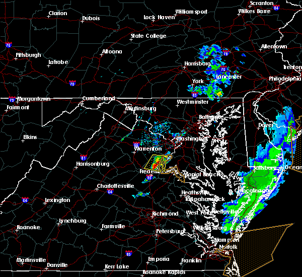 At 729 pm edt, a severe thunderstorm was located near triangle, or near quantico, moving east at 30 mph (radar indicated). Hazards include 60 mph wind gusts and quarter size hail. Damaging winds will cause some trees and large branches to fall. this could injure those outdoors, as well as damage homes and vehicles. roadways may become blocked by downed trees. localized power outages are possible. unsecured light objects may become projectiles. Locations impacted include, stafford, dale city, woodbridge, quantico, aquia creek, montclair, triangle, dumfries, cherry hill, independent hill, mason neck, brooke, garrisonville, ruby, aquia, roseville, arkendale, ramoth, nanjemoy and widewater. At 729 pm edt, a severe thunderstorm was located near triangle, or near quantico, moving east at 30 mph (radar indicated). Hazards include 60 mph wind gusts and quarter size hail. Damaging winds will cause some trees and large branches to fall. this could injure those outdoors, as well as damage homes and vehicles. roadways may become blocked by downed trees. localized power outages are possible. unsecured light objects may become projectiles. Locations impacted include, stafford, dale city, woodbridge, quantico, aquia creek, montclair, triangle, dumfries, cherry hill, independent hill, mason neck, brooke, garrisonville, ruby, aquia, roseville, arkendale, ramoth, nanjemoy and widewater.
|
| 5/14/2016 7:18 PM EDT |
 At 718 pm edt, a severe thunderstorm was located 10 miles southwest of montclair, or 10 miles northwest of stafford, moving east at 30 mph (radar indicated). Hazards include 60 mph wind gusts and quarter size hail. Damaging winds will cause some trees and large branches to fall. this could injure those outdoors, as well as damage homes and vehicles. roadways may become blocked by downed trees. localized power outages are possible. unsecured light objects may become projectiles. Locations impacted include, stafford, dale city, woodbridge, quantico, aquia creek, montclair, triangle, dumfries, cherry hill, independent hill, mason neck, catlett, calverton, storck, bristersburg, sumerduck, heflin, somerville, aquia and roseville. At 718 pm edt, a severe thunderstorm was located 10 miles southwest of montclair, or 10 miles northwest of stafford, moving east at 30 mph (radar indicated). Hazards include 60 mph wind gusts and quarter size hail. Damaging winds will cause some trees and large branches to fall. this could injure those outdoors, as well as damage homes and vehicles. roadways may become blocked by downed trees. localized power outages are possible. unsecured light objects may become projectiles. Locations impacted include, stafford, dale city, woodbridge, quantico, aquia creek, montclair, triangle, dumfries, cherry hill, independent hill, mason neck, catlett, calverton, storck, bristersburg, sumerduck, heflin, somerville, aquia and roseville.
|
| 5/14/2016 6:55 PM EDT |
 At 654 pm edt, a severe thunderstorm was located over bealeton, or 10 miles south of warrenton, moving east at 30 mph (radar indicated). Hazards include 60 mph wind gusts and quarter size hail. Damaging winds will cause some trees and large branches to fall. this could injure those outdoors, as well as damage homes and vehicles. roadways may become blocked by downed trees. localized power outages are possible. Unsecured light objects may become projectiles. At 654 pm edt, a severe thunderstorm was located over bealeton, or 10 miles south of warrenton, moving east at 30 mph (radar indicated). Hazards include 60 mph wind gusts and quarter size hail. Damaging winds will cause some trees and large branches to fall. this could injure those outdoors, as well as damage homes and vehicles. roadways may become blocked by downed trees. localized power outages are possible. Unsecured light objects may become projectiles.
|
| 5/2/2016 6:40 PM EDT |
 At 638 pm edt, a severe thunderstorm was located over lorton, or near woodbridge, moving east at 25 mph (trained weather spotters have reported two inch hail in independent hill at 6:24 pm). Hazards include two inch hail and 60 mph wind gusts. People and animals outdoors will be injured. expect hail damage to roofs, siding, windows, and vehicles. expect wind damage to roofs, siding, and trees. This severe thunderstorm will remain over mainly rural areas of northern charles, southwestern prince georges, southeastern fairfax, and southeastern prince william counties and the southeastern city of alexandria, including the following locations: west springfield, potomac heights, occoquan, cheltenham, mount vernon, brandywine, tantallon, northwood, jefferson manor and pomfret. At 638 pm edt, a severe thunderstorm was located over lorton, or near woodbridge, moving east at 25 mph (trained weather spotters have reported two inch hail in independent hill at 6:24 pm). Hazards include two inch hail and 60 mph wind gusts. People and animals outdoors will be injured. expect hail damage to roofs, siding, windows, and vehicles. expect wind damage to roofs, siding, and trees. This severe thunderstorm will remain over mainly rural areas of northern charles, southwestern prince georges, southeastern fairfax, and southeastern prince william counties and the southeastern city of alexandria, including the following locations: west springfield, potomac heights, occoquan, cheltenham, mount vernon, brandywine, tantallon, northwood, jefferson manor and pomfret.
|
| 5/2/2016 6:27 PM EDT |
 At 626 pm edt, a severe thunderstorm was located over lorton, or near fort belvoir, moving east at 35 mph (radar indicated). Hazards include golf ball size hail and 60 mph wind gusts. Expect hail and wind damage to roofs, siding, windows, and vehicles. This severe thunderstorm will remain over mainly rural areas of northern charles, southwestern prince georges, southeastern fairfax, and southeastern prince william counties and the southeastern city of alexandria, including the following locations: west springfield, potomac heights, occoquan, cheltenham, mount vernon, brandywine, tantallon, northwood, clifton and jefferson manor. At 626 pm edt, a severe thunderstorm was located over lorton, or near fort belvoir, moving east at 35 mph (radar indicated). Hazards include golf ball size hail and 60 mph wind gusts. Expect hail and wind damage to roofs, siding, windows, and vehicles. This severe thunderstorm will remain over mainly rural areas of northern charles, southwestern prince georges, southeastern fairfax, and southeastern prince william counties and the southeastern city of alexandria, including the following locations: west springfield, potomac heights, occoquan, cheltenham, mount vernon, brandywine, tantallon, northwood, clifton and jefferson manor.
|
| 2/24/2016 5:53 PM EST |
 At 551 pm est, radar indicated a line of severe thunderstorms producing damaging winds in excess of 60 mph. a national weather service employee reported tree damage near chantilly. these storms were located along a line extending from near montgomery village to arlington to near fort belvoir, moving northeast at 55 mph. locations impacted include, arlington, rockville, gaithersburg, college park, greenbelt, vienna, falls church, bladensburg, la plata, springfield, pimmit hills, gallaudet university, nationals park, clinton, coral hills, woodbridge, olney, bethesda, largo and fedex field. a tornado watch remains in effect until 1100 pm est for central district of columbia, southern maryland and northern virginia. At 551 pm est, radar indicated a line of severe thunderstorms producing damaging winds in excess of 60 mph. a national weather service employee reported tree damage near chantilly. these storms were located along a line extending from near montgomery village to arlington to near fort belvoir, moving northeast at 55 mph. locations impacted include, arlington, rockville, gaithersburg, college park, greenbelt, vienna, falls church, bladensburg, la plata, springfield, pimmit hills, gallaudet university, nationals park, clinton, coral hills, woodbridge, olney, bethesda, largo and fedex field. a tornado watch remains in effect until 1100 pm est for central district of columbia, southern maryland and northern virginia.
|
| 2/24/2016 5:34 PM EST |
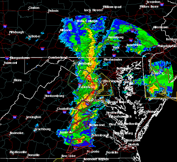 At 533 pm est, doppler radar indicated a line of severe thunderstorms capable of producing tornadoes. these dangerous storms were located along a line extending from dumfries to near fredericksburg, moving northeast at 45 mph. locations impacted include, stafford, fredericksburg, dale city, woodbridge, aquia creek, dumfries, montclair, triangle, falmouth, brooke, garrisonville, stones corner, brookfield, spring valley, hartwood, holly corner, aquia, roseville, arkendale and leeland. At 533 pm est, doppler radar indicated a line of severe thunderstorms capable of producing tornadoes. these dangerous storms were located along a line extending from dumfries to near fredericksburg, moving northeast at 45 mph. locations impacted include, stafford, fredericksburg, dale city, woodbridge, aquia creek, dumfries, montclair, triangle, falmouth, brooke, garrisonville, stones corner, brookfield, spring valley, hartwood, holly corner, aquia, roseville, arkendale and leeland.
|
| 2/24/2016 5:29 PM EST |
 At 529 pm est, doppler radar indicated a line of severe thunderstorms capable of producing damaging winds in excess of 60 mph. these storms were located along a line extending from broadlands to near dale city to near stafford, and moving northeast at 55 mph. At 529 pm est, doppler radar indicated a line of severe thunderstorms capable of producing damaging winds in excess of 60 mph. these storms were located along a line extending from broadlands to near dale city to near stafford, and moving northeast at 55 mph.
|
| 2/24/2016 5:13 PM EST |
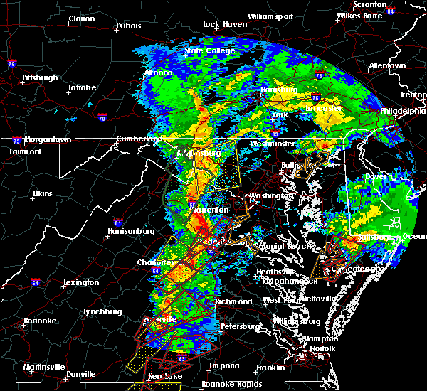 At 512 pm est, doppler radar indicated a severe thunderstorm capable of producing a tornado. this dangerous storm was located near fredericksburg, and moving northeast at 55 mph. At 512 pm est, doppler radar indicated a severe thunderstorm capable of producing a tornado. this dangerous storm was located near fredericksburg, and moving northeast at 55 mph.
|
| 8/4/2015 9:11 PM EDT |
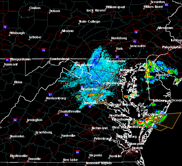 At 911 pm edt, doppler radar indicated a line of severe thunderstorms capable of producing damaging winds in excess of 60 mph. these storms were extending from 8 miles west of dale city to 10 miles west of montclair, moving east at 15 mph. locations impacted include, dale city, woodbridge, dumfries, triangle, montclair, independent hill and cherry hill. At 911 pm edt, doppler radar indicated a line of severe thunderstorms capable of producing damaging winds in excess of 60 mph. these storms were extending from 8 miles west of dale city to 10 miles west of montclair, moving east at 15 mph. locations impacted include, dale city, woodbridge, dumfries, triangle, montclair, independent hill and cherry hill.
|
| 8/4/2015 8:54 PM EDT |
 At 853 pm edt, doppler radar indicated a line of severe thunderstorms capable of producing damaging winds in excess of 60 mph. these storms were located along a line extending from 7 miles west of dale city to 10 miles west of montclair, moving east at 20 mph. locations impacted include, dale city, woodbridge, dumfries, triangle, montclair, aden, independent hill and cherry hill. At 853 pm edt, doppler radar indicated a line of severe thunderstorms capable of producing damaging winds in excess of 60 mph. these storms were located along a line extending from 7 miles west of dale city to 10 miles west of montclair, moving east at 20 mph. locations impacted include, dale city, woodbridge, dumfries, triangle, montclair, aden, independent hill and cherry hill.
|
| 8/4/2015 8:35 PM EDT |
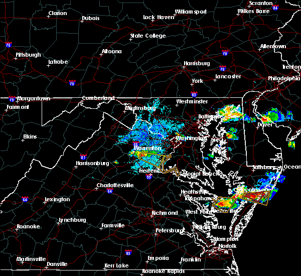 At 835 pm edt, doppler radar indicated a line of severe thunderstorms capable of producing quarter size hail and damaging winds in excess of 60 mph. these storms were located along a line extending from near linton hall to near bealeton, and moving east at 20 mph. At 835 pm edt, doppler radar indicated a line of severe thunderstorms capable of producing quarter size hail and damaging winds in excess of 60 mph. these storms were located along a line extending from near linton hall to near bealeton, and moving east at 20 mph.
|
| 7/1/2015 12:32 AM EDT |
 At 1232 am edt, doppler radar indicated a severe thunderstorm capable of producing quarter size hail and damaging winds in excess of 60 mph. this storm was located near woodbridge, moving northeast at 30 mph. locations impacted include, springfield, groveton, woodbridge, fort belvoir, dale city, annandale, dumfries, montclair, triangle, franconia, i395 and i495 interchange, newington, lorton, hybla valley, saint charles, occoquan, pisgah, mount vernon, aquia and arkendale. At 1232 am edt, doppler radar indicated a severe thunderstorm capable of producing quarter size hail and damaging winds in excess of 60 mph. this storm was located near woodbridge, moving northeast at 30 mph. locations impacted include, springfield, groveton, woodbridge, fort belvoir, dale city, annandale, dumfries, montclair, triangle, franconia, i395 and i495 interchange, newington, lorton, hybla valley, saint charles, occoquan, pisgah, mount vernon, aquia and arkendale.
|
| 7/1/2015 12:11 AM EDT |
 At 1211 am edt, doppler radar indicated a severe thunderstorm capable of producing quarter size hail and damaging winds in excess of 60 mph. this storm was located over triangle, or 7 miles north of aquia creek, and moving northeast at 30 mph. At 1211 am edt, doppler radar indicated a severe thunderstorm capable of producing quarter size hail and damaging winds in excess of 60 mph. this storm was located over triangle, or 7 miles north of aquia creek, and moving northeast at 30 mph.
|
| 6/27/2015 3:32 PM EDT |
 At 332 pm edt, doppler radar indicated a severe thunderstorm capable of producing damaging winds in excess of 60 mph. this storm was located over fort belvoir, moving northeast at 15 mph. locations impacted include, fort belvoir, woodbridge, dale city, franconia, newington and mason neck. At 332 pm edt, doppler radar indicated a severe thunderstorm capable of producing damaging winds in excess of 60 mph. this storm was located over fort belvoir, moving northeast at 15 mph. locations impacted include, fort belvoir, woodbridge, dale city, franconia, newington and mason neck.
|
| 6/27/2015 3:14 PM EDT |
 At 313 pm edt, doppler radar indicated a severe thunderstorm capable of producing damaging winds in excess of 60 mph. this storm was located over woodbridge, and moving northeast at 15 mph. At 313 pm edt, doppler radar indicated a severe thunderstorm capable of producing damaging winds in excess of 60 mph. this storm was located over woodbridge, and moving northeast at 15 mph.
|
| 6/25/2015 9:55 PM EDT |
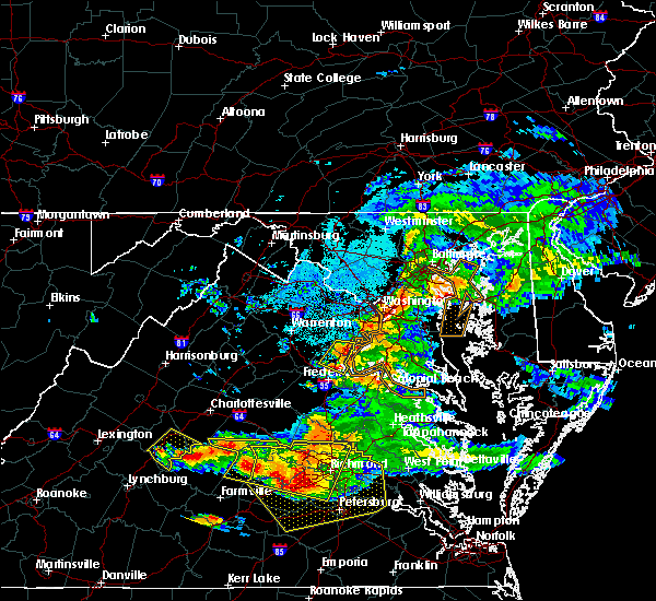 The severe thunderstorm warning for central stafford and southeastern prince william counties will expire at 1000 pm edt, the storm which prompted the warning has weakened below severe limits, and no longer poses an immediate threat to life or property. therefore the warning will be allowed to expire. The severe thunderstorm warning for central stafford and southeastern prince william counties will expire at 1000 pm edt, the storm which prompted the warning has weakened below severe limits, and no longer poses an immediate threat to life or property. therefore the warning will be allowed to expire.
|
| 6/25/2015 9:45 PM EDT |
 At 944 pm edt, doppler radar indicated a severe thunderstorm capable of producing quarter size hail and damaging winds in excess of 60 mph. this storm was located over stafford, moving east at 25 mph. locations impacted include, stafford, aquia creek, dale city, dumfries, montclair, triangle, brooke, garrisonville, aquia, roseville, arkendale, widewater, ramoth and cherry hill. At 944 pm edt, doppler radar indicated a severe thunderstorm capable of producing quarter size hail and damaging winds in excess of 60 mph. this storm was located over stafford, moving east at 25 mph. locations impacted include, stafford, aquia creek, dale city, dumfries, montclair, triangle, brooke, garrisonville, aquia, roseville, arkendale, widewater, ramoth and cherry hill.
|
| 6/25/2015 9:32 PM EDT |
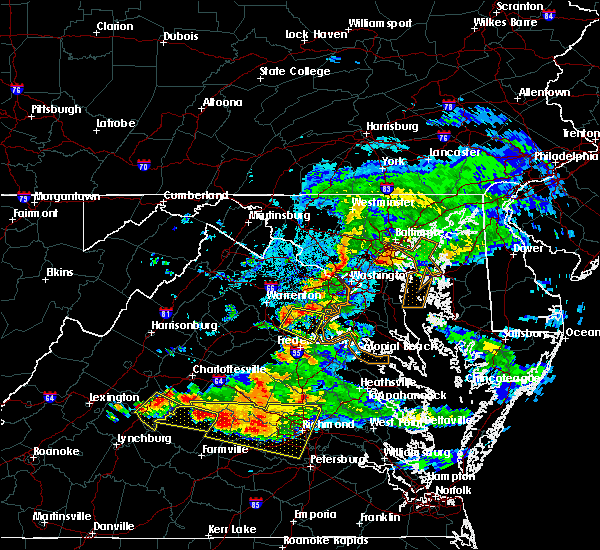 At 931 pm edt, doppler radar indicated a severe thunderstorm capable of producing quarter size hail and damaging winds in excess of 60 mph. this storm was located 10 miles west of montclair, or 11 miles southwest of dale city, moving east at 25 mph. in addition, at 930 pm quarter size hail was reported in stafford. locations impacted include, stafford, aquia creek, dale city, dumfries, montclair, triangle, brooke, garrisonville, aden, ruby, heflin, somerville, aquia, roseville, arkendale, widewater, independent hill, ramoth and cherry hill. At 931 pm edt, doppler radar indicated a severe thunderstorm capable of producing quarter size hail and damaging winds in excess of 60 mph. this storm was located 10 miles west of montclair, or 11 miles southwest of dale city, moving east at 25 mph. in addition, at 930 pm quarter size hail was reported in stafford. locations impacted include, stafford, aquia creek, dale city, dumfries, montclair, triangle, brooke, garrisonville, aden, ruby, heflin, somerville, aquia, roseville, arkendale, widewater, independent hill, ramoth and cherry hill.
|
| 6/25/2015 9:18 PM EDT |
 At 917 pm edt, doppler radar indicated a severe thunderstorm capable of producing quarter size hail and damaging winds in excess of 60 mph. this storm was located 7 miles east of bealeton, or 12 miles southeast of warrenton, and moving east at 25 mph. At 917 pm edt, doppler radar indicated a severe thunderstorm capable of producing quarter size hail and damaging winds in excess of 60 mph. this storm was located 7 miles east of bealeton, or 12 miles southeast of warrenton, and moving east at 25 mph.
|
| 6/23/2015 8:00 PM EDT |
 At 800 pm edt, doppler radar indicated a line of severe thunderstorms capable of producing quarter size hail and damaging winds in excess of 60 mph. these storms were located along a line extending from 6 miles south of tilghman island to 8 miles west of stafford, and moving southeast at 30 mph. At 800 pm edt, doppler radar indicated a line of severe thunderstorms capable of producing quarter size hail and damaging winds in excess of 60 mph. these storms were located along a line extending from 6 miles south of tilghman island to 8 miles west of stafford, and moving southeast at 30 mph.
|
| 6/23/2015 7:41 PM EDT |
 At 740 pm edt, doppler radar indicated a line of severe thunderstorms capable of producing quarter size hail and damaging winds in excess of 60 mph. these storms were located along a line extending from near rhode river to 10 miles east of bealeton, moving southeast at 40 mph. locations impacted include, arlington, stafford, bowie, fairfax, falls church, bladensburg, la plata, chesapeake beach, upper marlboro, springfield, mantua, gallaudet university, nationals park, clinton, coral hills, woodbridge, largo, fedex field, rhode river and forestville. At 740 pm edt, doppler radar indicated a line of severe thunderstorms capable of producing quarter size hail and damaging winds in excess of 60 mph. these storms were located along a line extending from near rhode river to 10 miles east of bealeton, moving southeast at 40 mph. locations impacted include, arlington, stafford, bowie, fairfax, falls church, bladensburg, la plata, chesapeake beach, upper marlboro, springfield, mantua, gallaudet university, nationals park, clinton, coral hills, woodbridge, largo, fedex field, rhode river and forestville.
|
| 6/23/2015 7:14 PM EDT |
 At 714 pm edt, doppler radar indicated a line of severe thunderstorms capable of producing quarter size hail and damaging winds in excess of 60 mph. these storms were located along a line extending from near grasonville to 9 miles south of linton hall, and moving southeast at 35 mph. At 714 pm edt, doppler radar indicated a line of severe thunderstorms capable of producing quarter size hail and damaging winds in excess of 60 mph. these storms were located along a line extending from near grasonville to 9 miles south of linton hall, and moving southeast at 35 mph.
|
| 6/20/2015 8:06 PM EDT |
 At 805 pm edt, doppler radar indicated a line of severe thunderstorms capable of producing damaging winds in excess of 60 mph. these storms were located along a line extending from near north potomac to springfield to aquia creek, moving east at 45 mph. locations impacted include, fairfax, vienna, falls church, springfield, reston, pimmit hills, mantua, annandale, american legion bridge, woodbridge, fort belvoir, mclean, aquia creek, groveton, dale city, dumfries, montclair, tysons corner, merrifield and triangle. At 805 pm edt, doppler radar indicated a line of severe thunderstorms capable of producing damaging winds in excess of 60 mph. these storms were located along a line extending from near north potomac to springfield to aquia creek, moving east at 45 mph. locations impacted include, fairfax, vienna, falls church, springfield, reston, pimmit hills, mantua, annandale, american legion bridge, woodbridge, fort belvoir, mclean, aquia creek, groveton, dale city, dumfries, montclair, tysons corner, merrifield and triangle.
|
| 6/20/2015 7:48 PM EDT |
 At 748 pm edt, doppler radar indicated a line of severe thunderstorms capable of producing damaging winds in excess of 60 mph. these storms were located along a line extending from broadlands to near bull run to 6 miles northwest of fredericksburg, and moving east at 25 mph. At 748 pm edt, doppler radar indicated a line of severe thunderstorms capable of producing damaging winds in excess of 60 mph. these storms were located along a line extending from broadlands to near bull run to 6 miles northwest of fredericksburg, and moving east at 25 mph.
|
| 6/20/2015 6:11 PM EDT |
 At 611 pm edt, doppler radar indicated a severe thunderstorm capable of producing damaging winds in excess of 60 mph. this storm was located over woodbridge, and moving northeast at 20 mph. At 611 pm edt, doppler radar indicated a severe thunderstorm capable of producing damaging winds in excess of 60 mph. this storm was located over woodbridge, and moving northeast at 20 mph.
|
| 4/20/2015 7:59 PM EDT | At 758 pm edt, doppler radar indicated a line of severe thunderstorms capable of producing half dollar size hail and destructive winds in excess of 70 mph. these storms were located along a line extending from pimmit hills to the i395 and i495 to 6 miles east of woodbridge to near triangle, moving northeast at 45 mph. locations impacted include, arlington, college park, falls church, bladensburg, forestville in prince georges county, mantua, the i395 and i495, gallaudet university, nationals park, clinton, coral hills, the i66 and i495, langley park, annandale, crystal city, huntington in fairfax county, fort belvoir, rfk stadium, howard university and springfield in fairfax county. a tornado watch remains in effect until 1000 pm edt for central district of columbia, southern maryland and northern virginia. |
| 4/20/2015 7:59 PM EDT | At 758 pm edt, doppler radar indicated a line of severe thunderstorms capable of producing half dollar size hail and destructive winds in excess of 70 mph. these storms were located along a line extending from pimmit hills to the i395 and i495 to 6 miles east of woodbridge to near triangle, moving northeast at 45 mph. locations impacted include, arlington, college park, falls church, bladensburg, forestville in prince georges county, mantua, the i395 and i495, gallaudet university, nationals park, clinton, coral hills, the i66 and i495, langley park, annandale, crystal city, huntington in fairfax county, fort belvoir, rfk stadium, howard university and springfield in fairfax county. a tornado watch remains in effect until 1000 pm edt for central district of columbia, southern maryland and northern virginia. |
| 4/20/2015 7:59 PM EDT | At 758 pm edt, doppler radar indicated a line of severe thunderstorms capable of producing half dollar size hail and destructive winds in excess of 70 mph. these storms were located along a line extending from pimmit hills to the i395 and i495 to 6 miles east of woodbridge to near triangle, moving northeast at 45 mph. locations impacted include, arlington, college park, falls church, bladensburg, forestville in prince georges county, mantua, the i395 and i495, gallaudet university, nationals park, clinton, coral hills, the i66 and i495, langley park, annandale, crystal city, huntington in fairfax county, fort belvoir, rfk stadium, howard university and springfield in fairfax county. a tornado watch remains in effect until 1000 pm edt for central district of columbia, southern maryland and northern virginia. |
| 4/20/2015 7:42 PM EDT | At 742 pm edt, doppler radar indicated a line of severe thunderstorms capable of producing quarter size hail and damaging winds in excess of 60 mph. these storms were located along a line extending from near fairfax to near triangle, and moving northeast at 45 mph. |
| 4/20/2015 7:42 PM EDT | At 742 pm edt, doppler radar indicated a line of severe thunderstorms capable of producing quarter size hail and damaging winds in excess of 60 mph. these storms were located along a line extending from near fairfax to near triangle, and moving northeast at 45 mph. |
| 4/20/2015 7:42 PM EDT | At 742 pm edt, doppler radar indicated a line of severe thunderstorms capable of producing quarter size hail and damaging winds in excess of 60 mph. these storms were located along a line extending from near fairfax to near triangle, and moving northeast at 45 mph. |
Hail Maps for Neabsco, VA
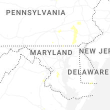
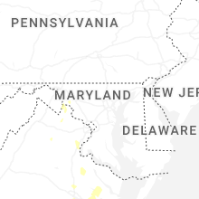
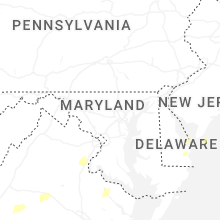


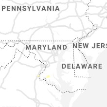


Connect with Interactive Hail Maps