

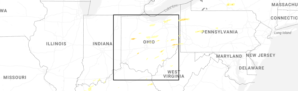
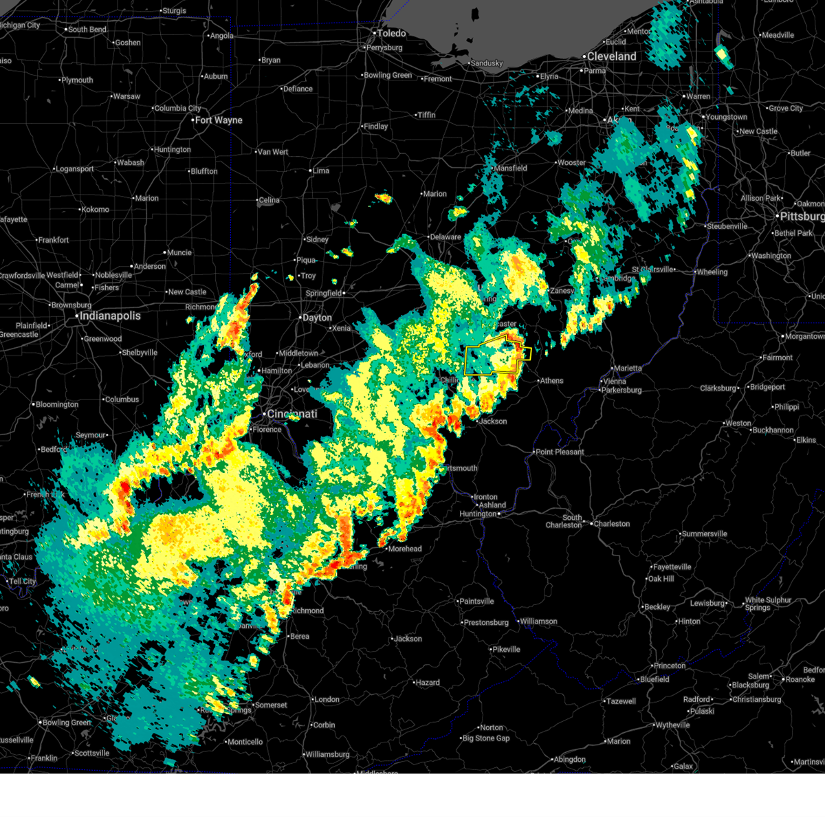
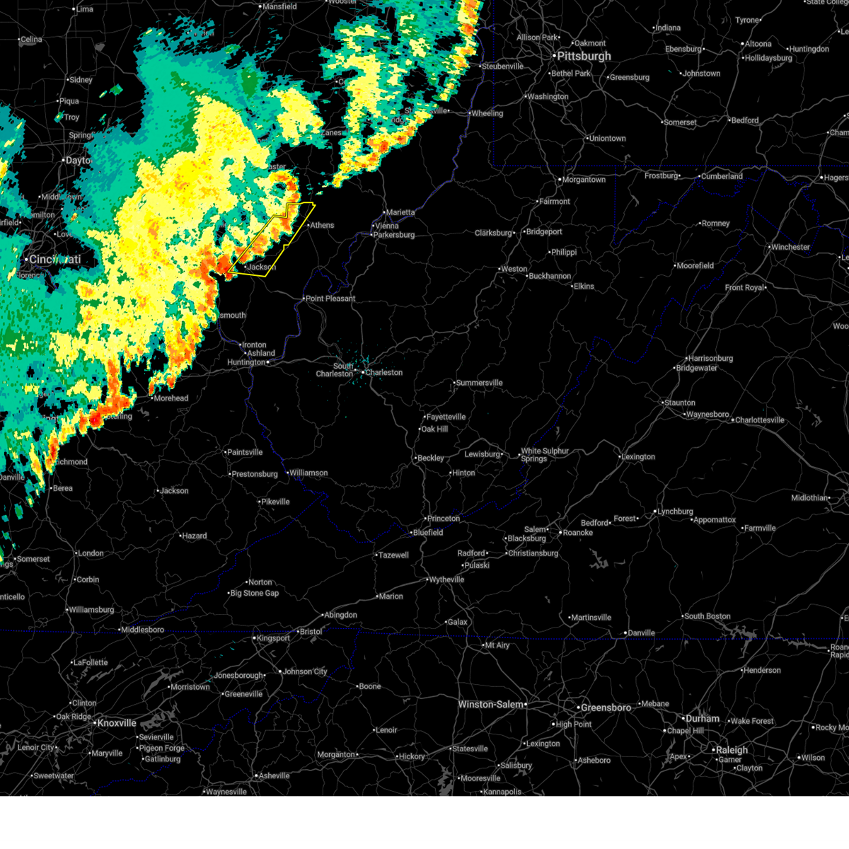
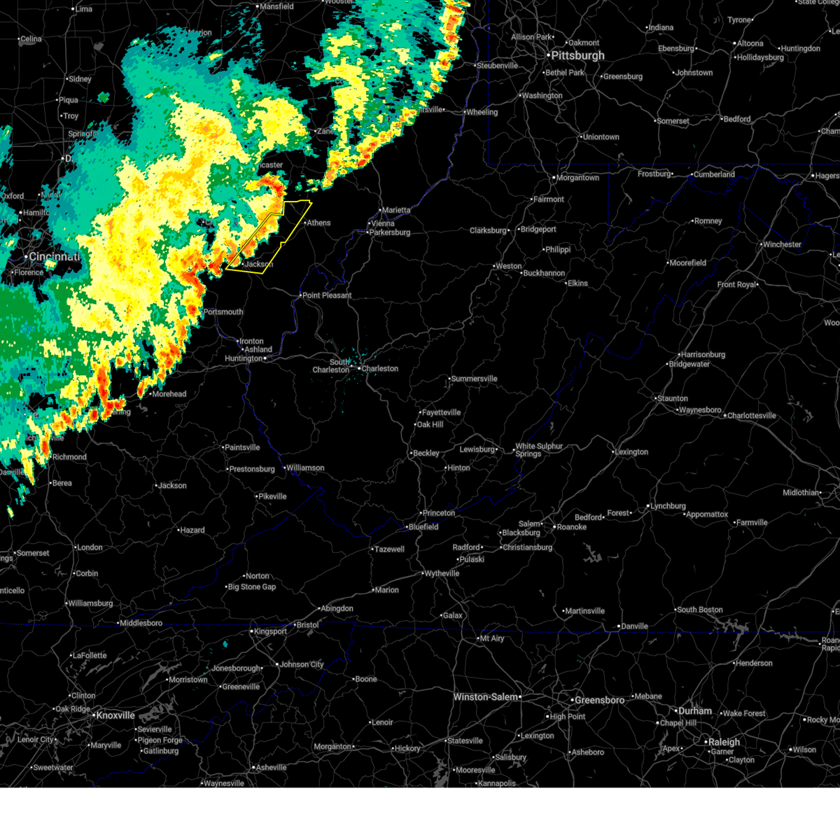
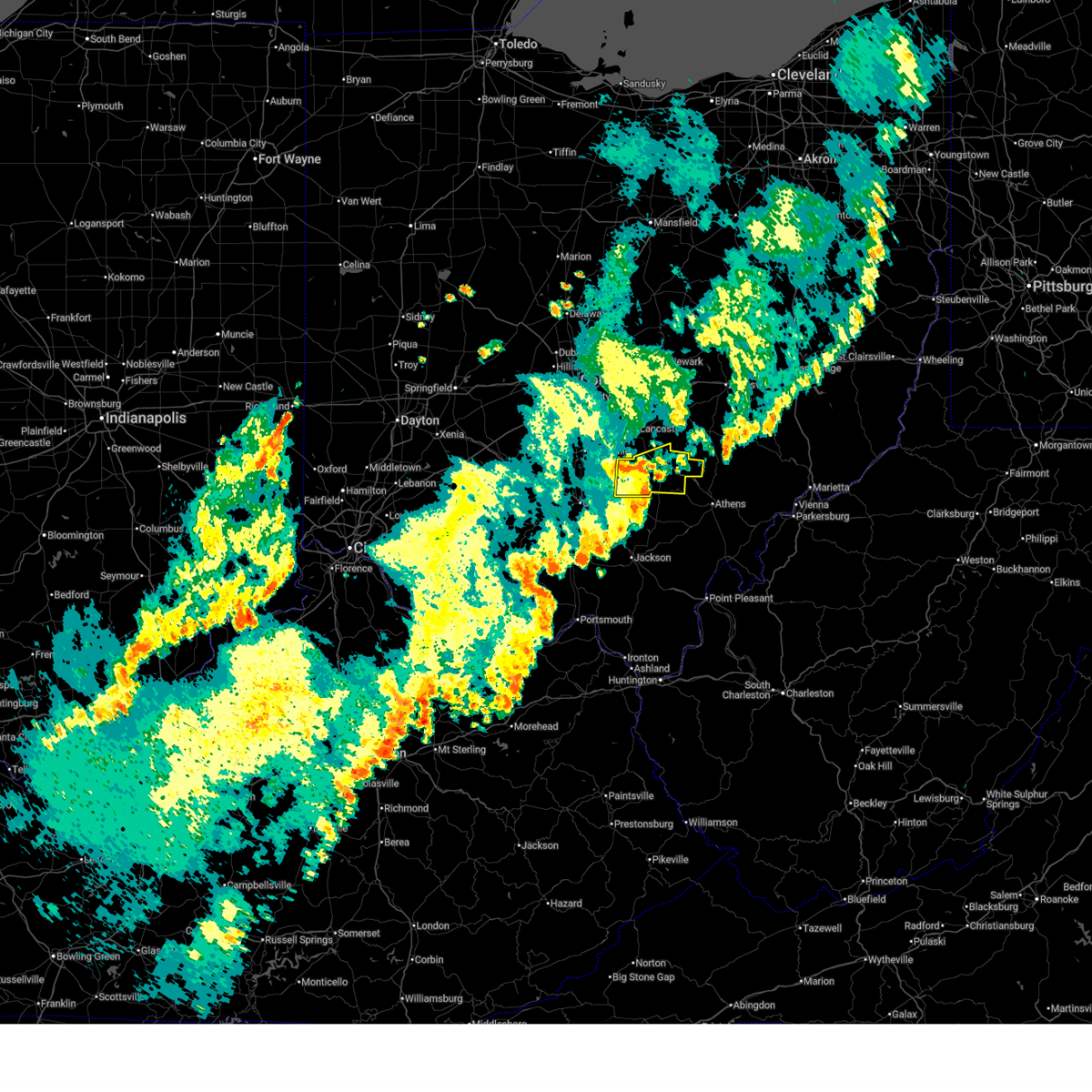
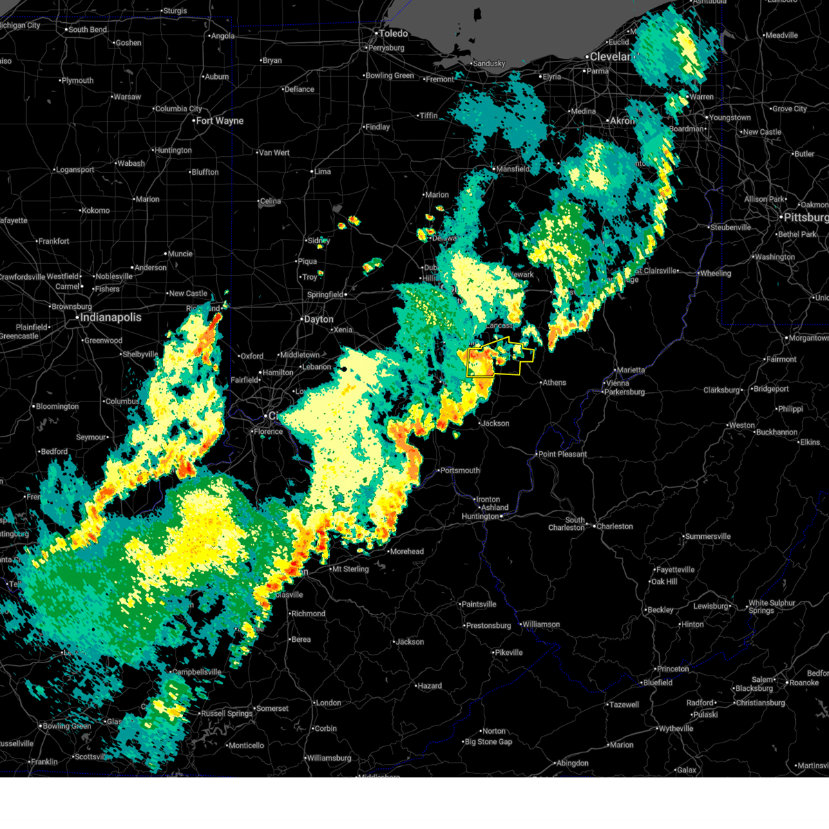
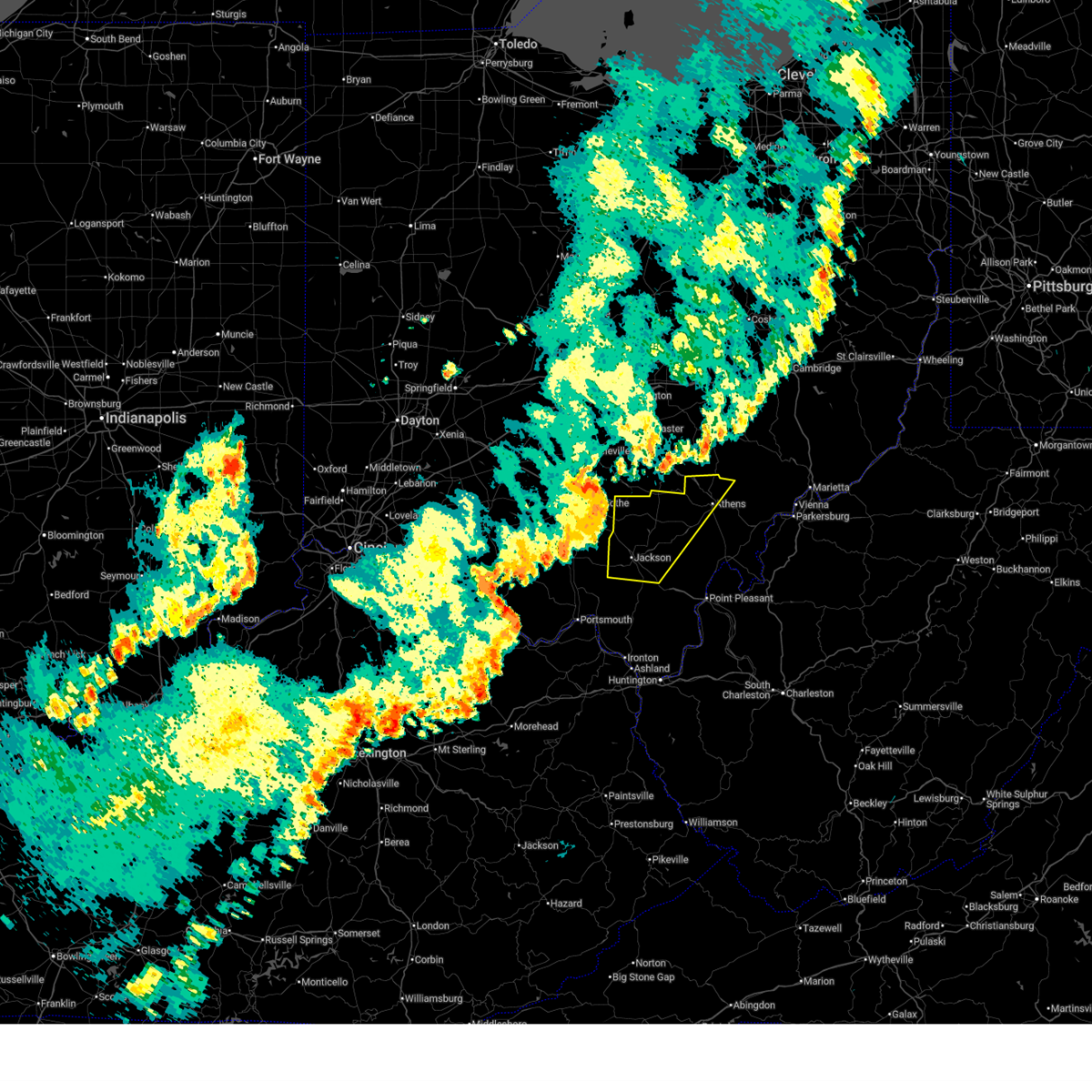
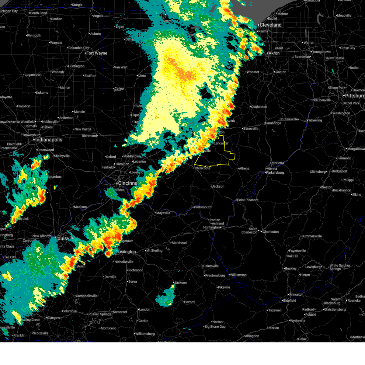
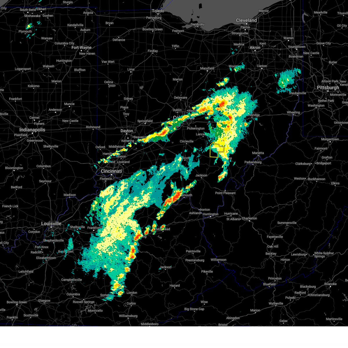
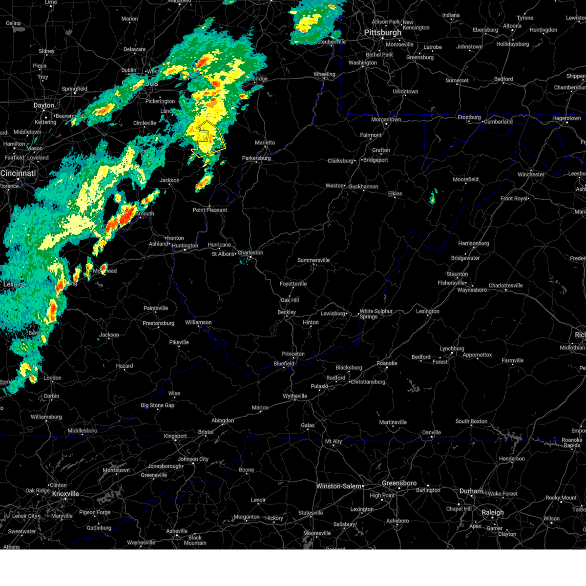
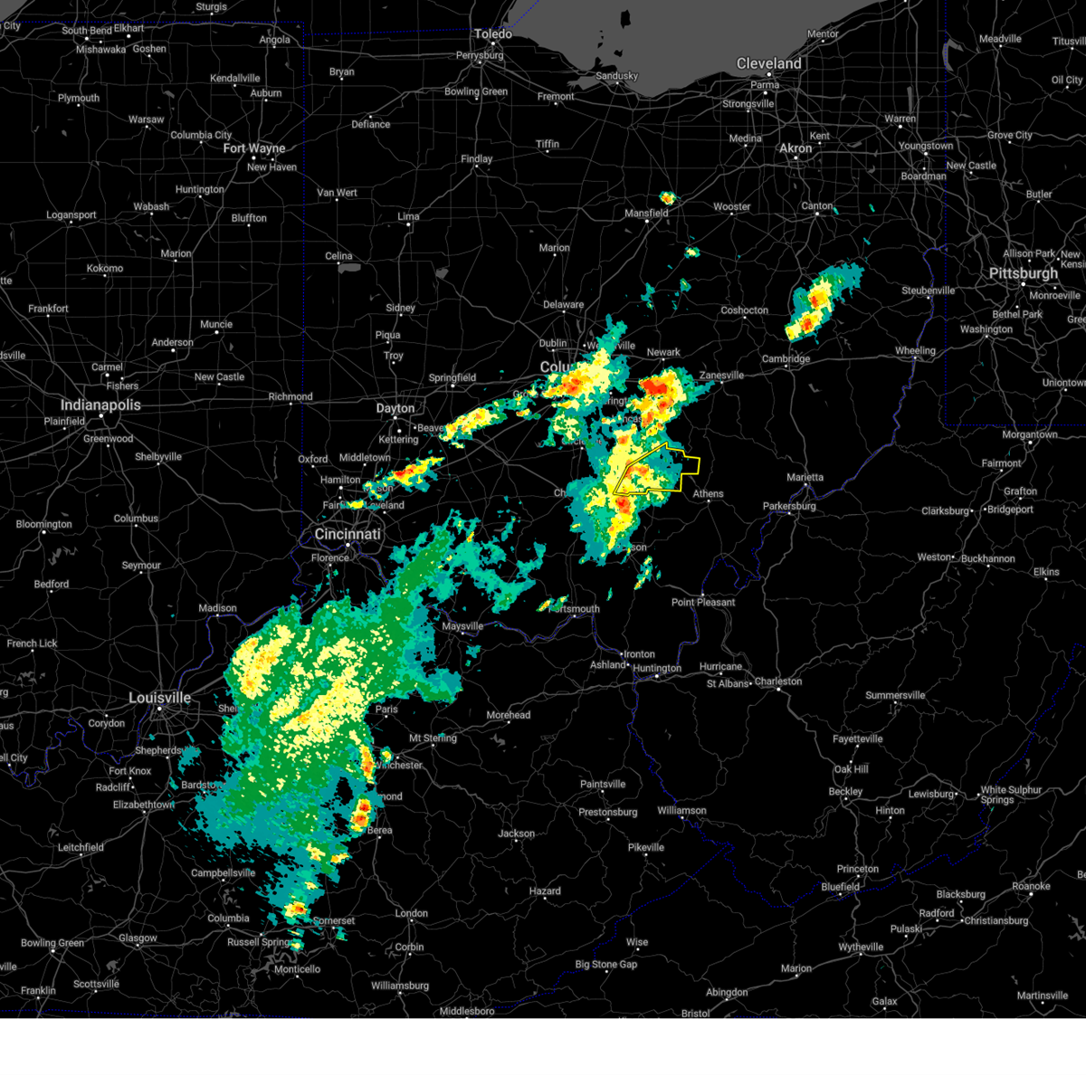
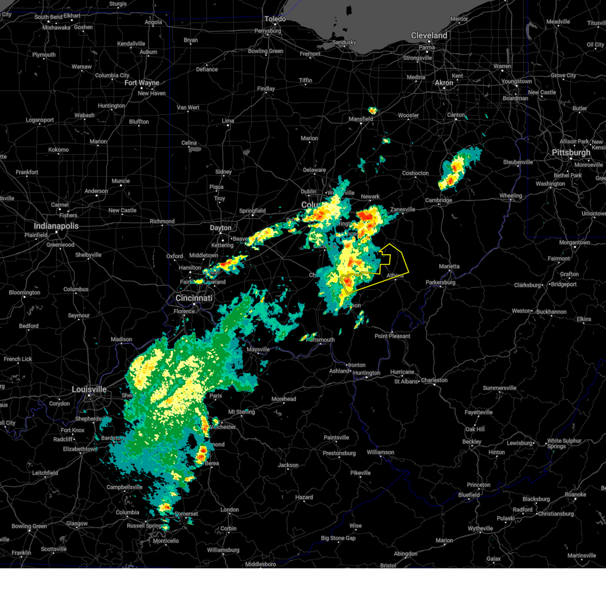
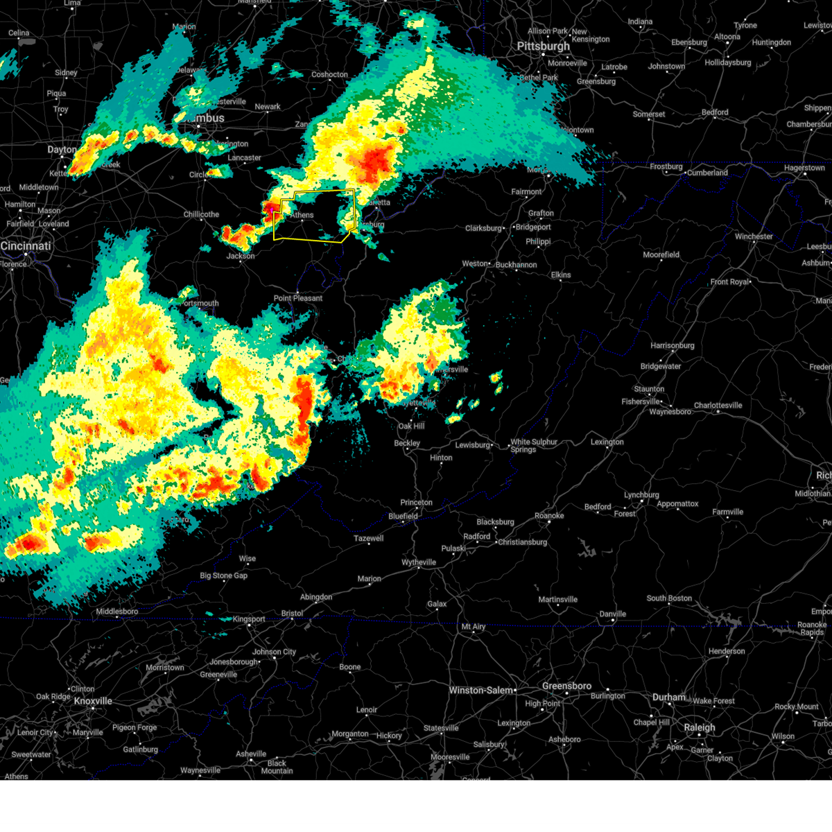
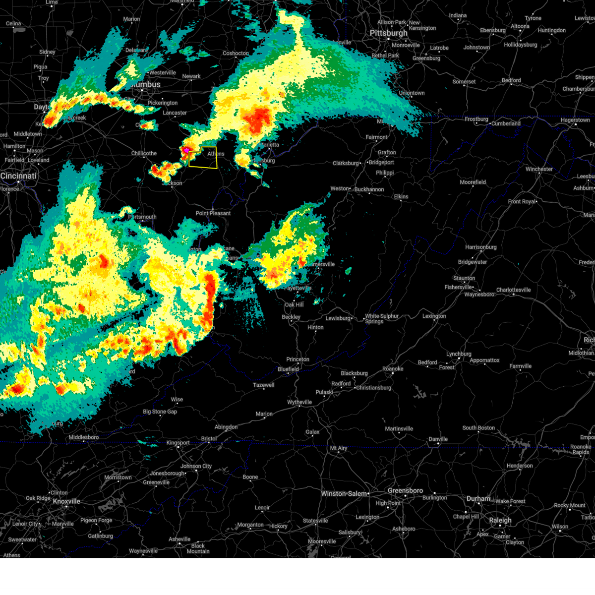
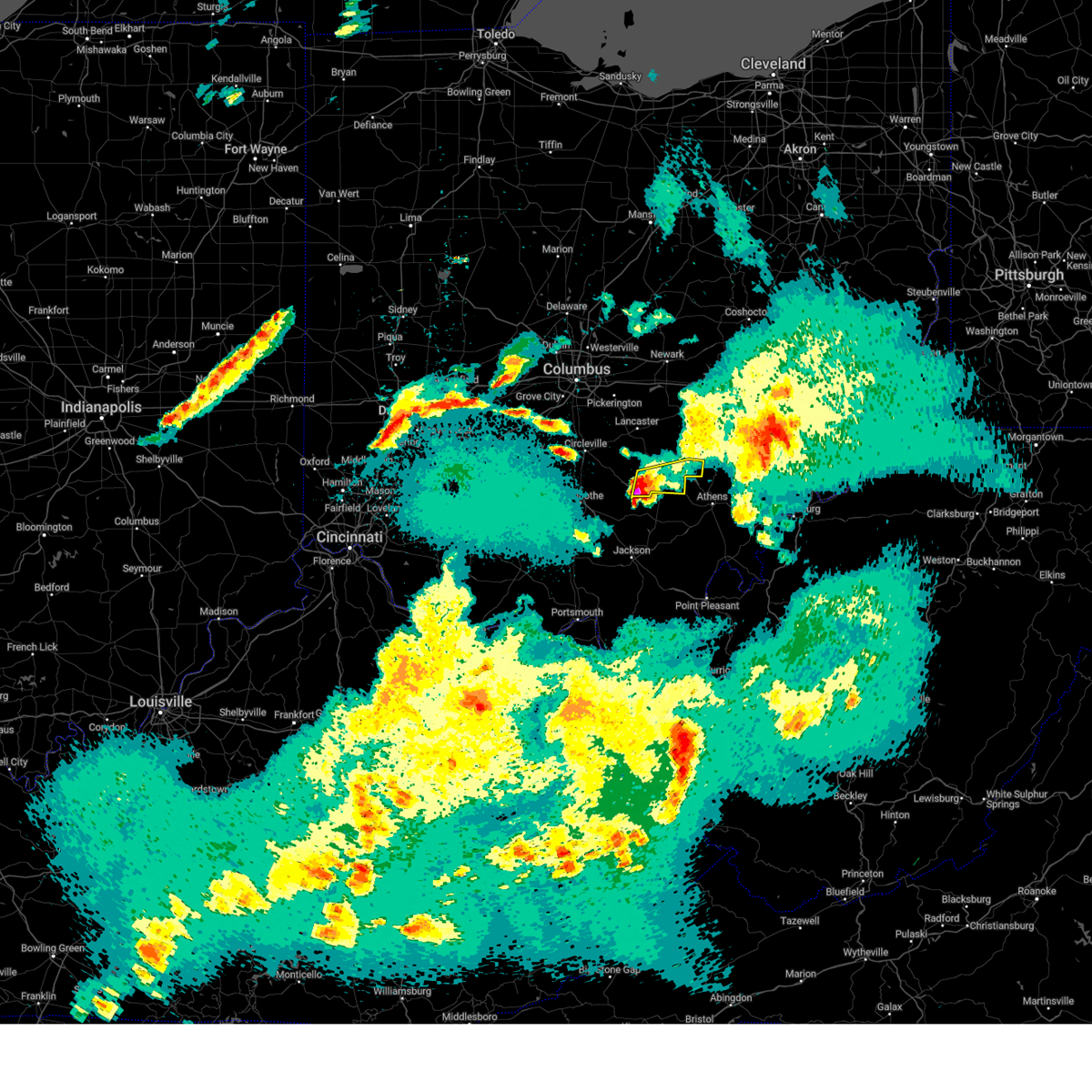
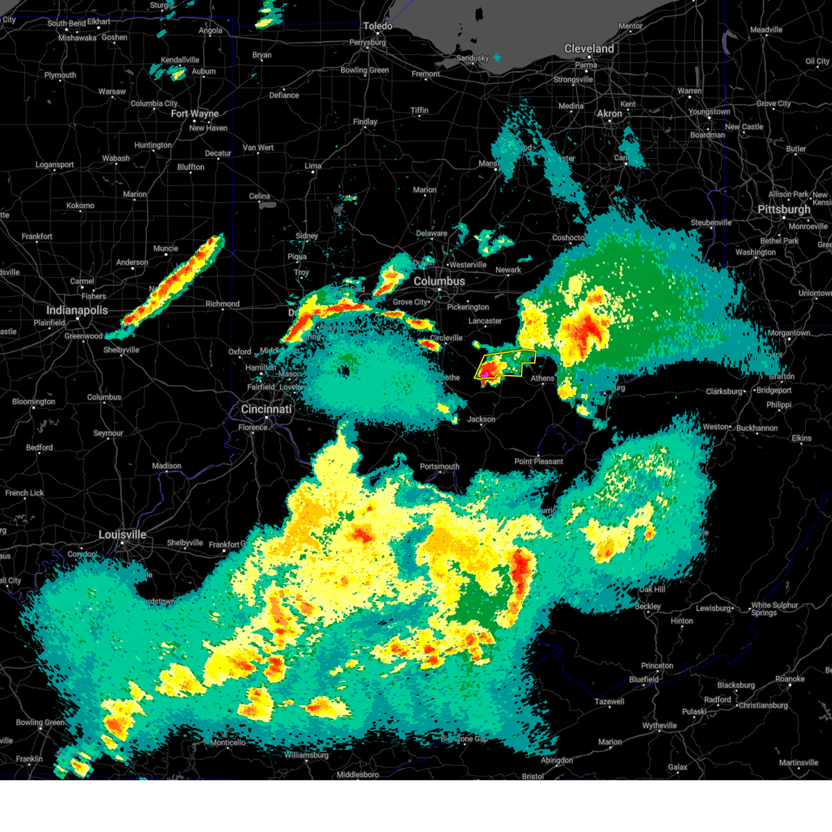
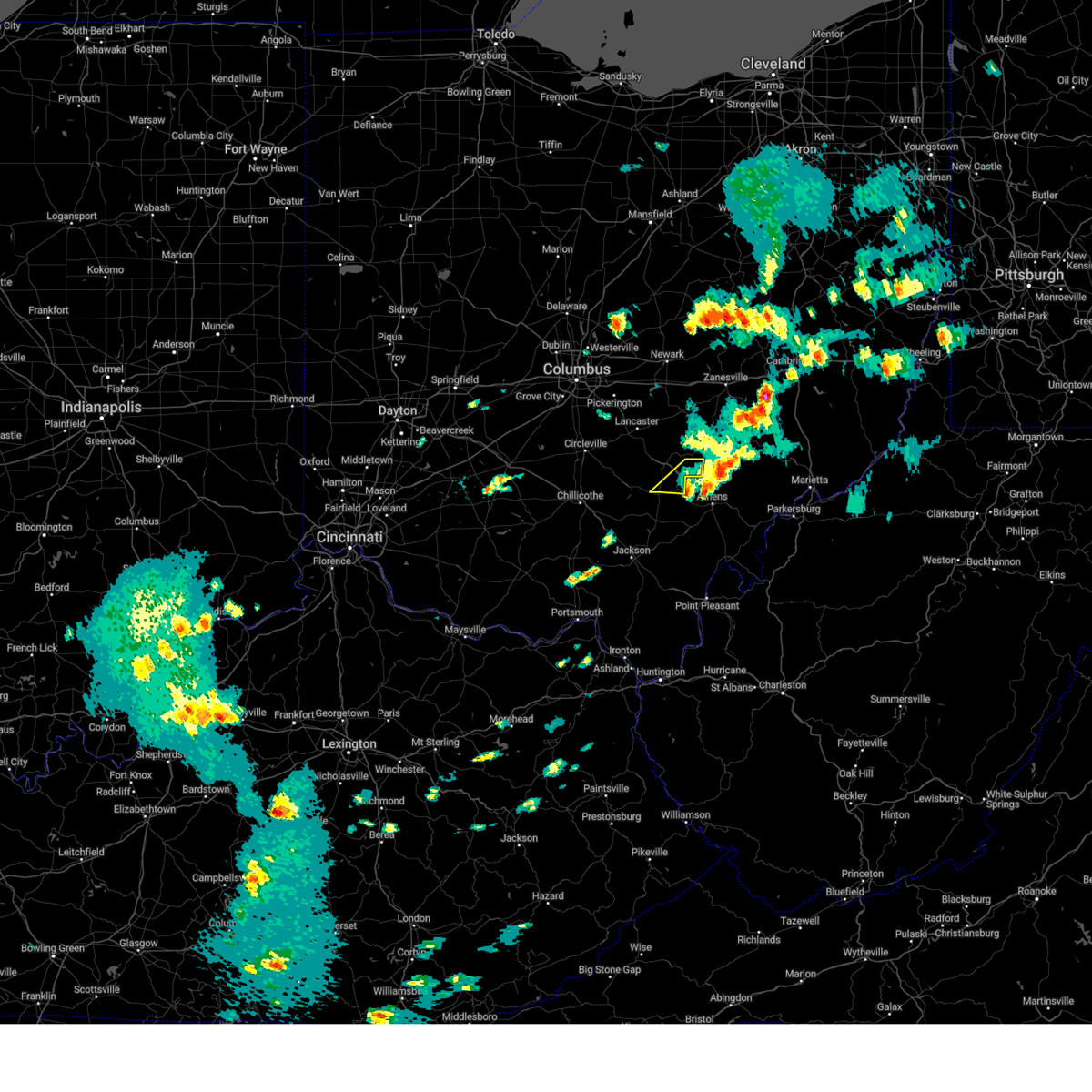
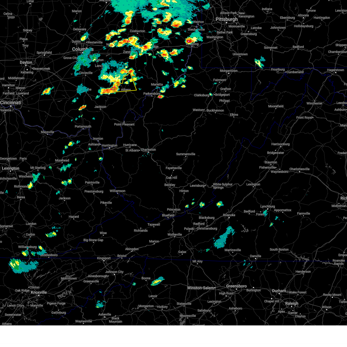
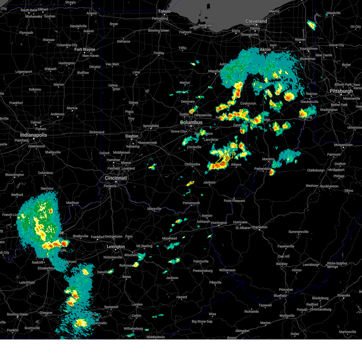
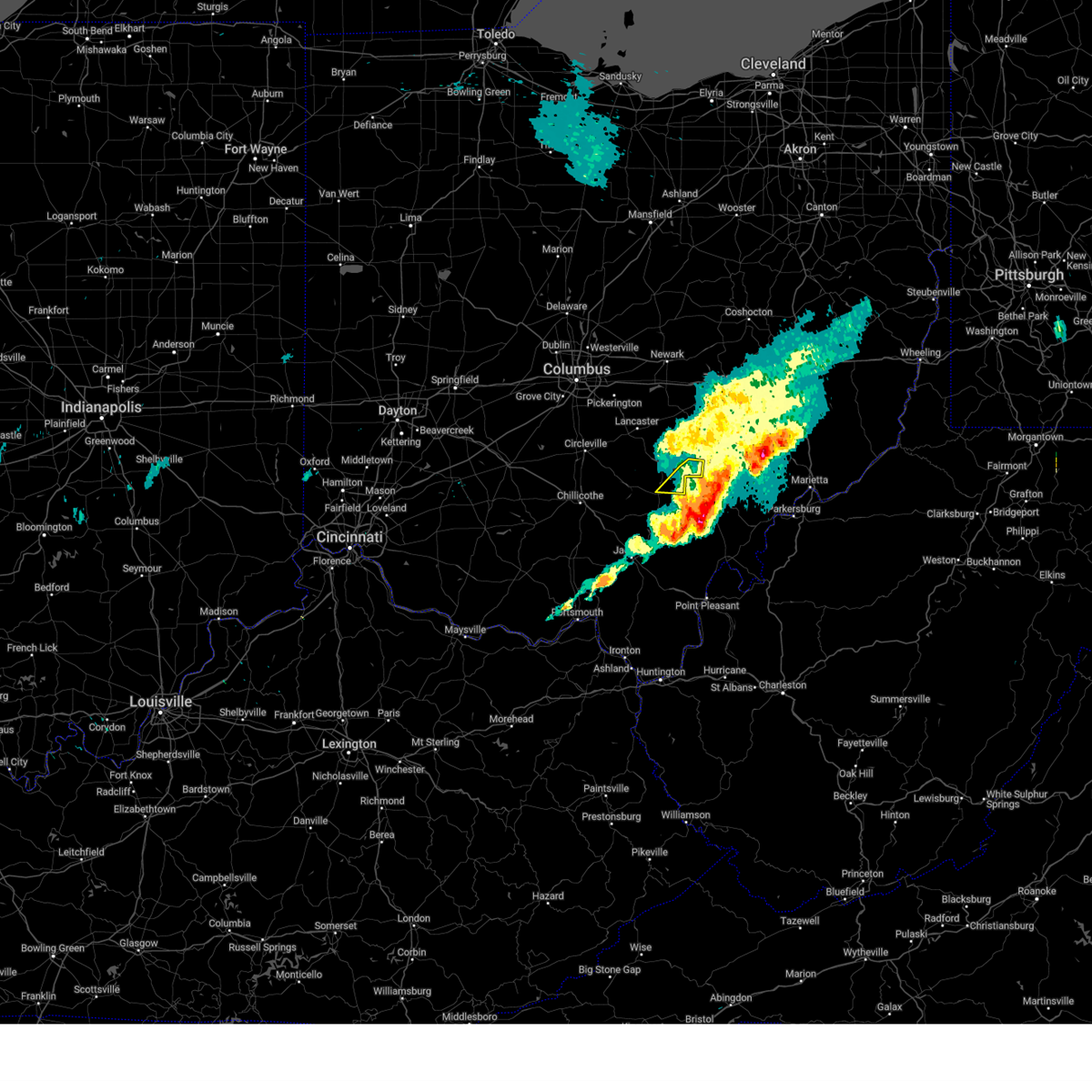
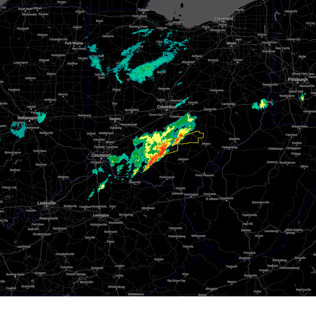
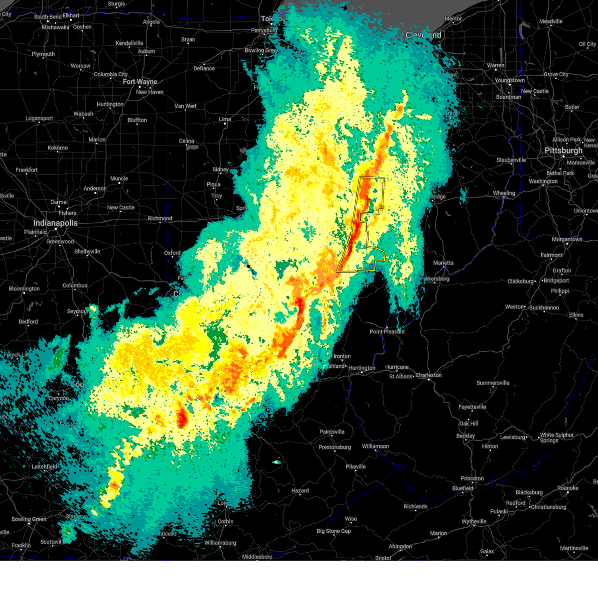
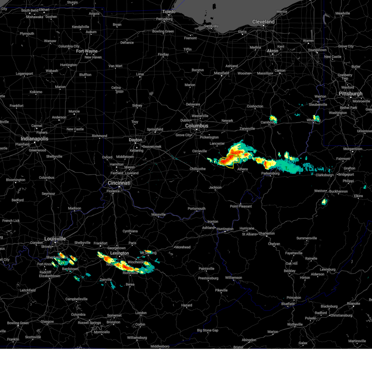
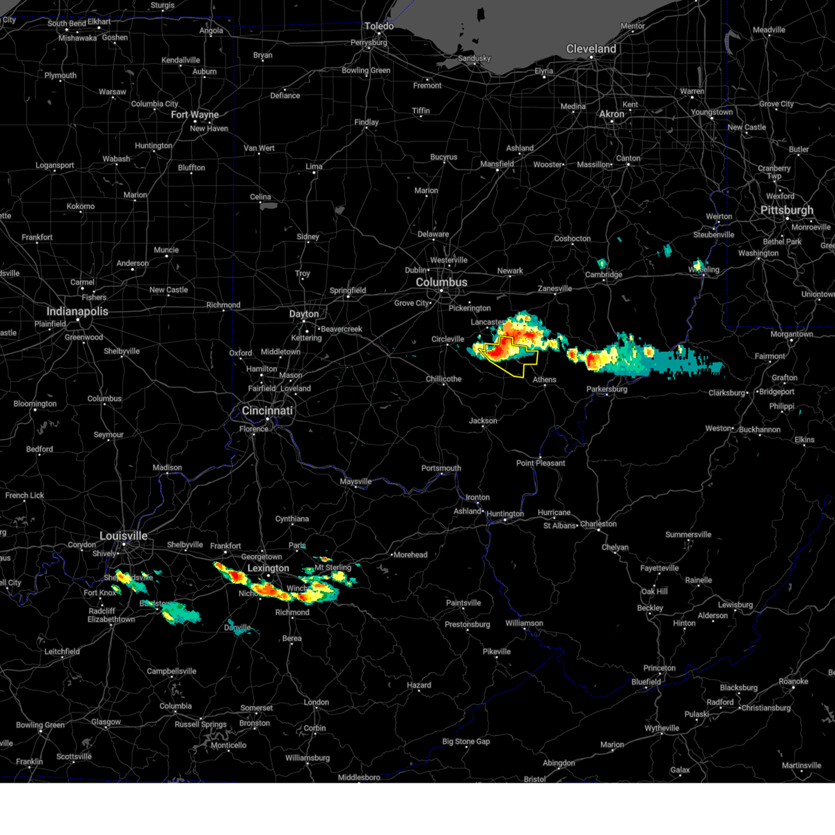
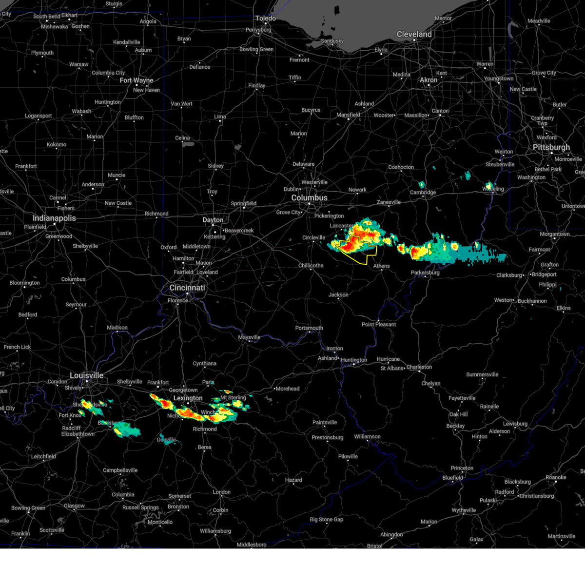
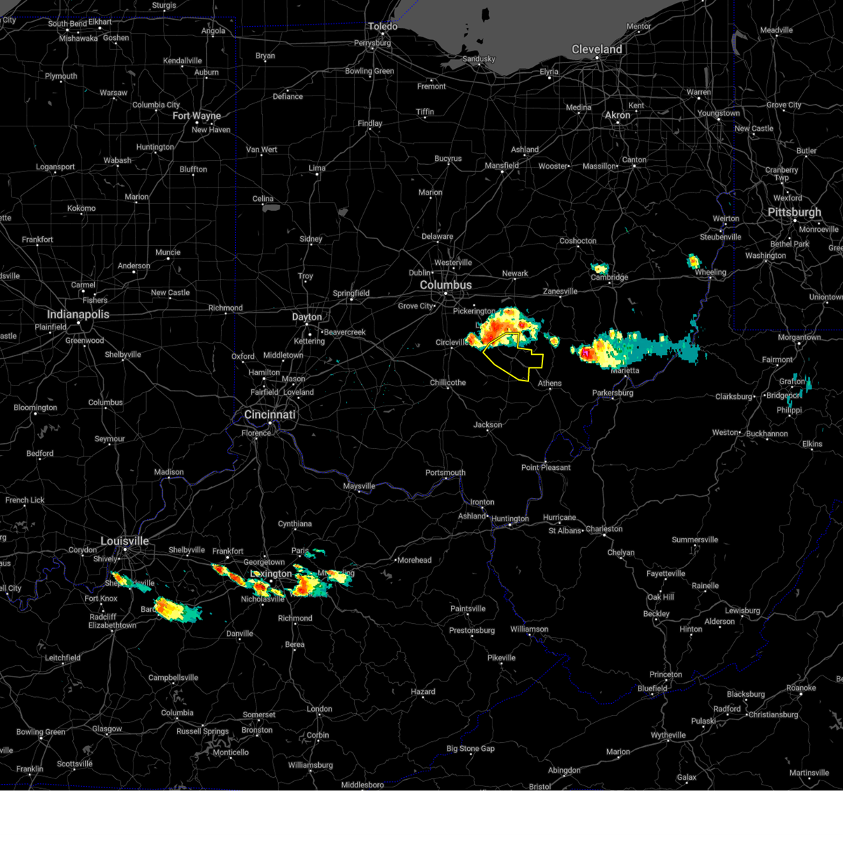
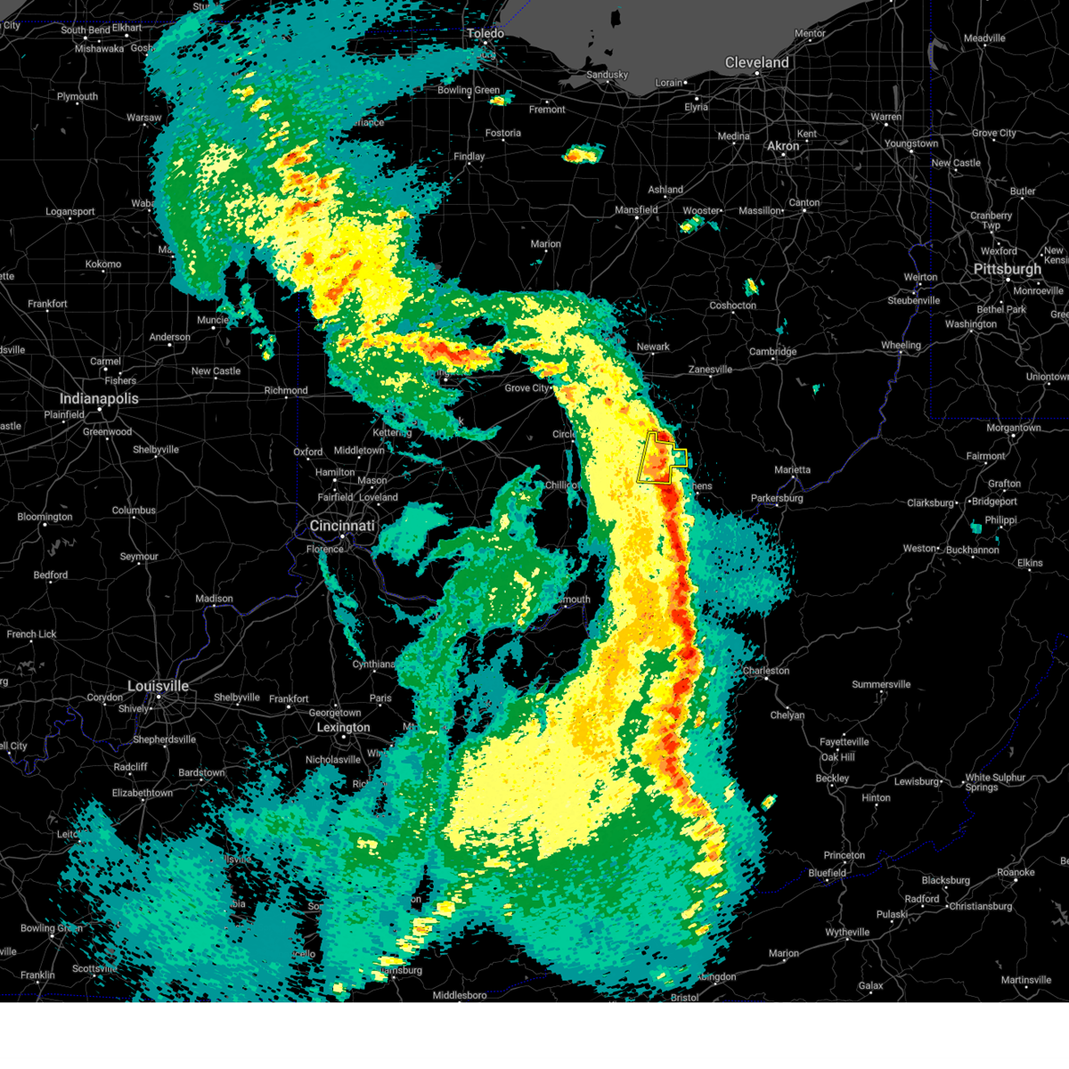
Hail Map for Nelsonville, OH
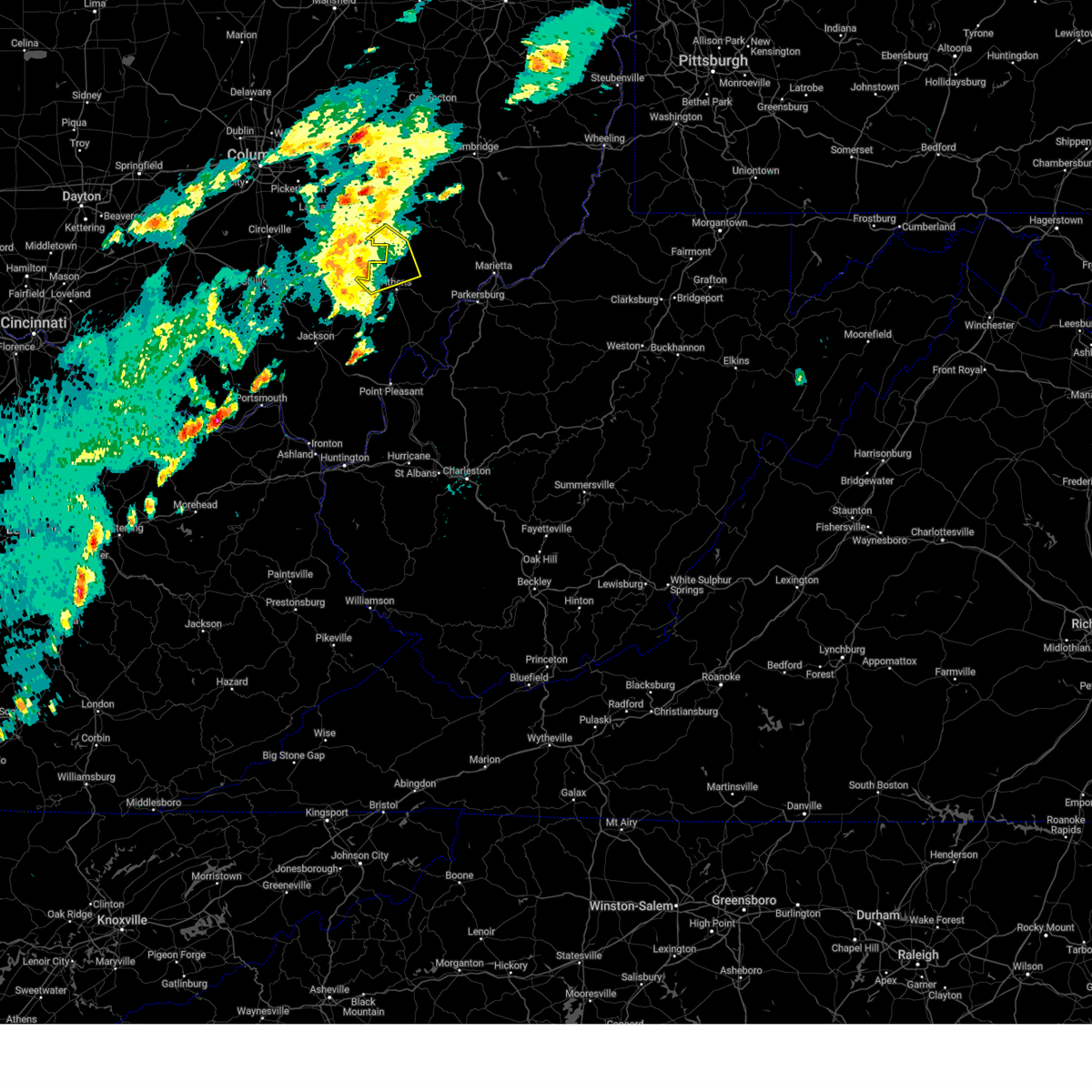
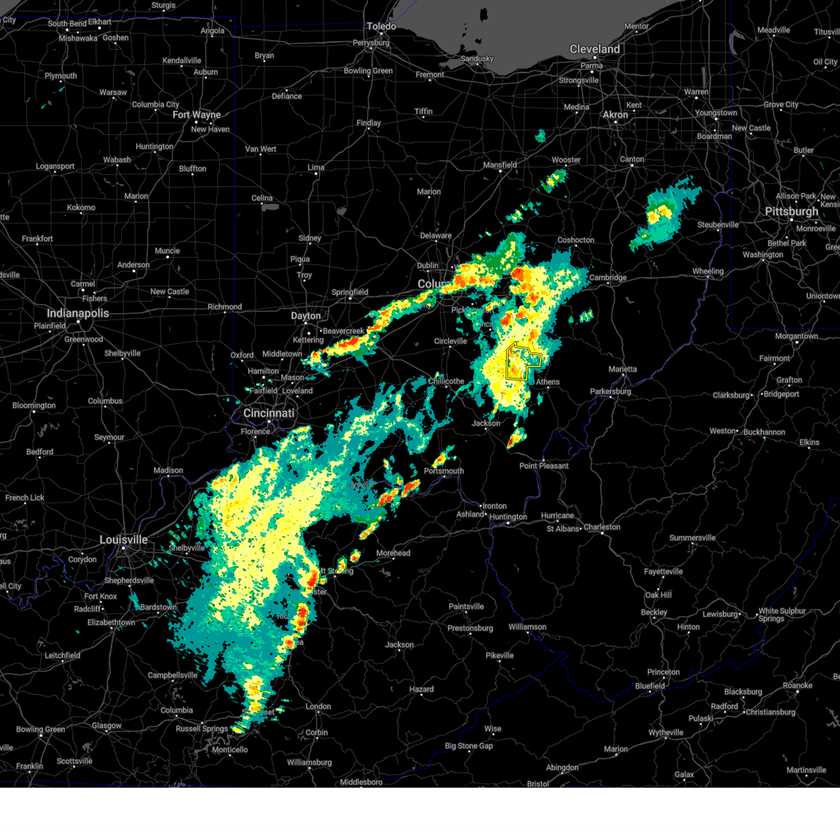
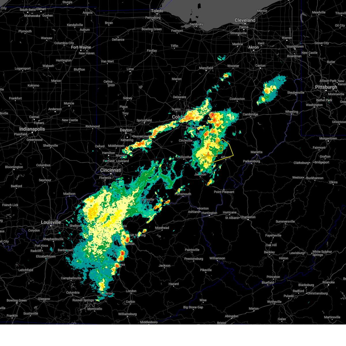
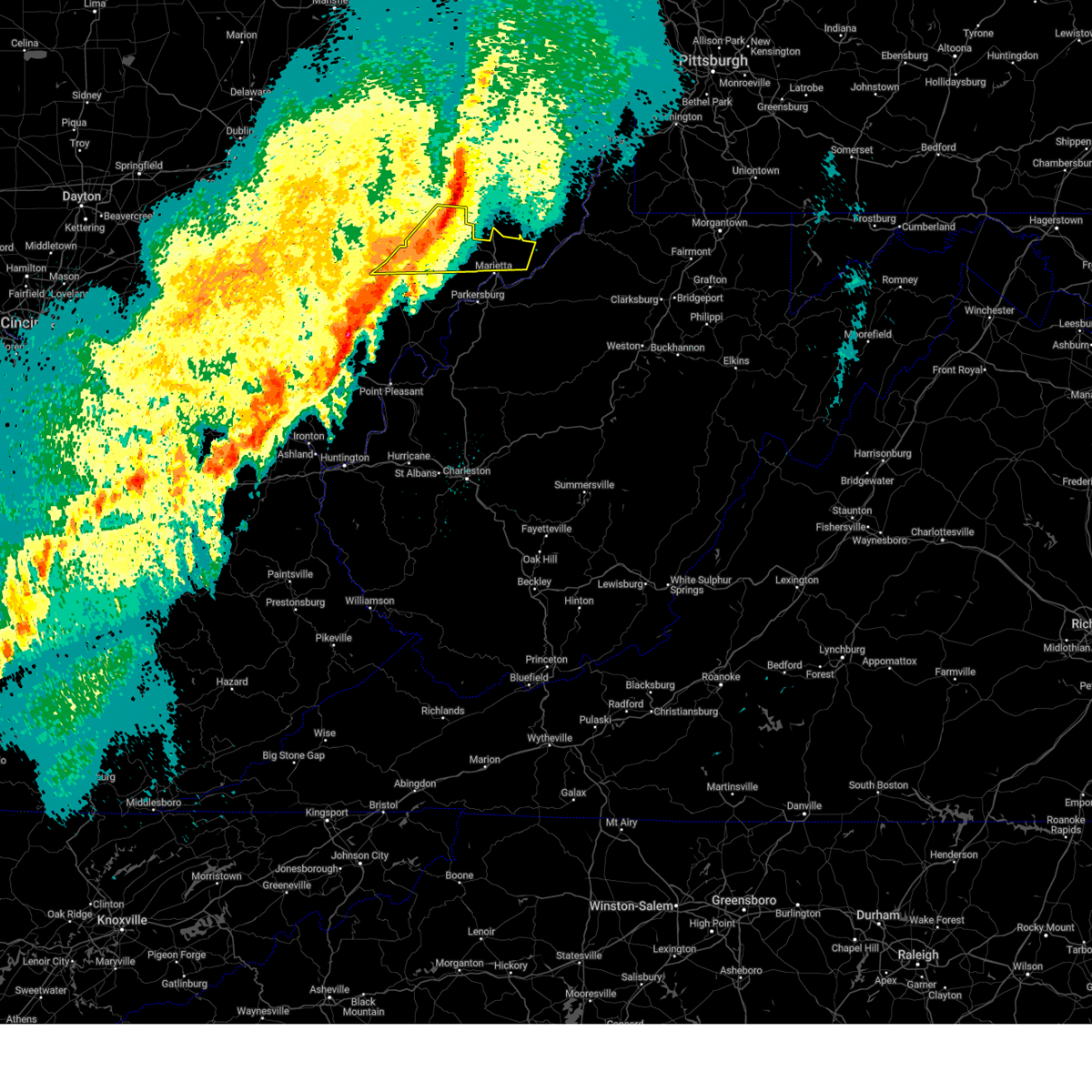
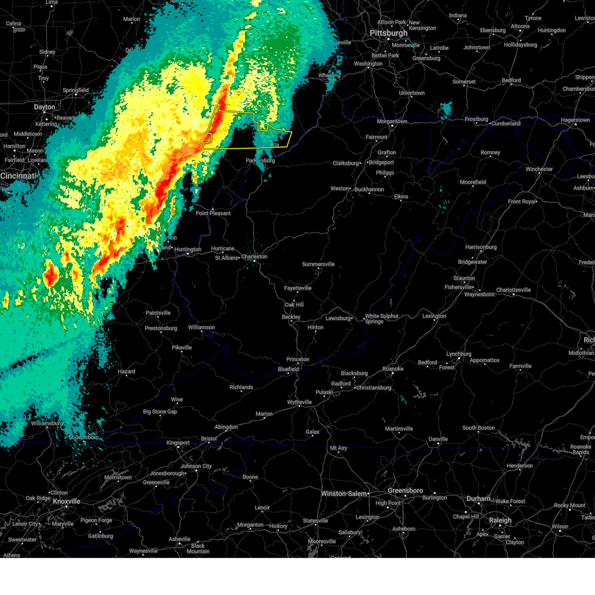
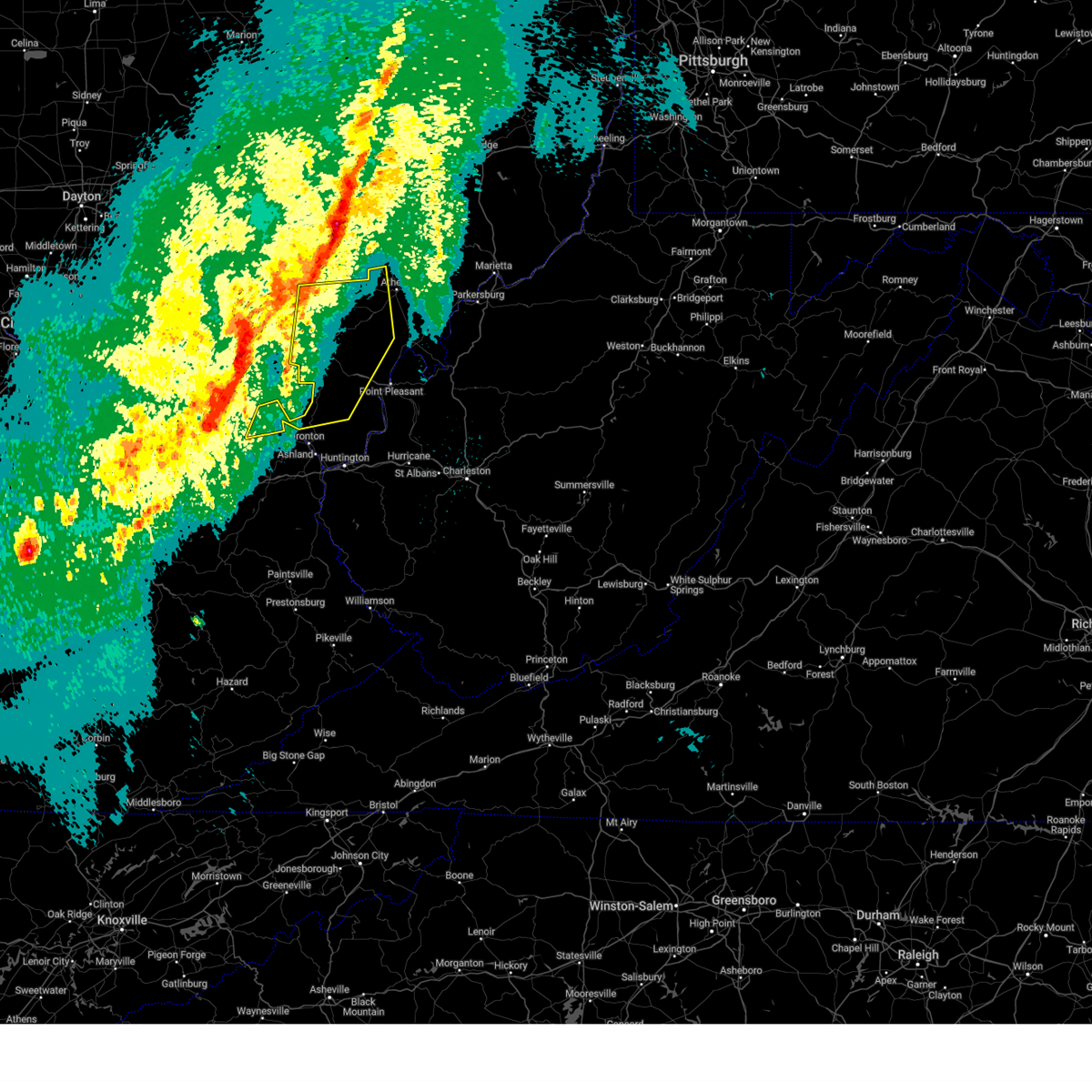
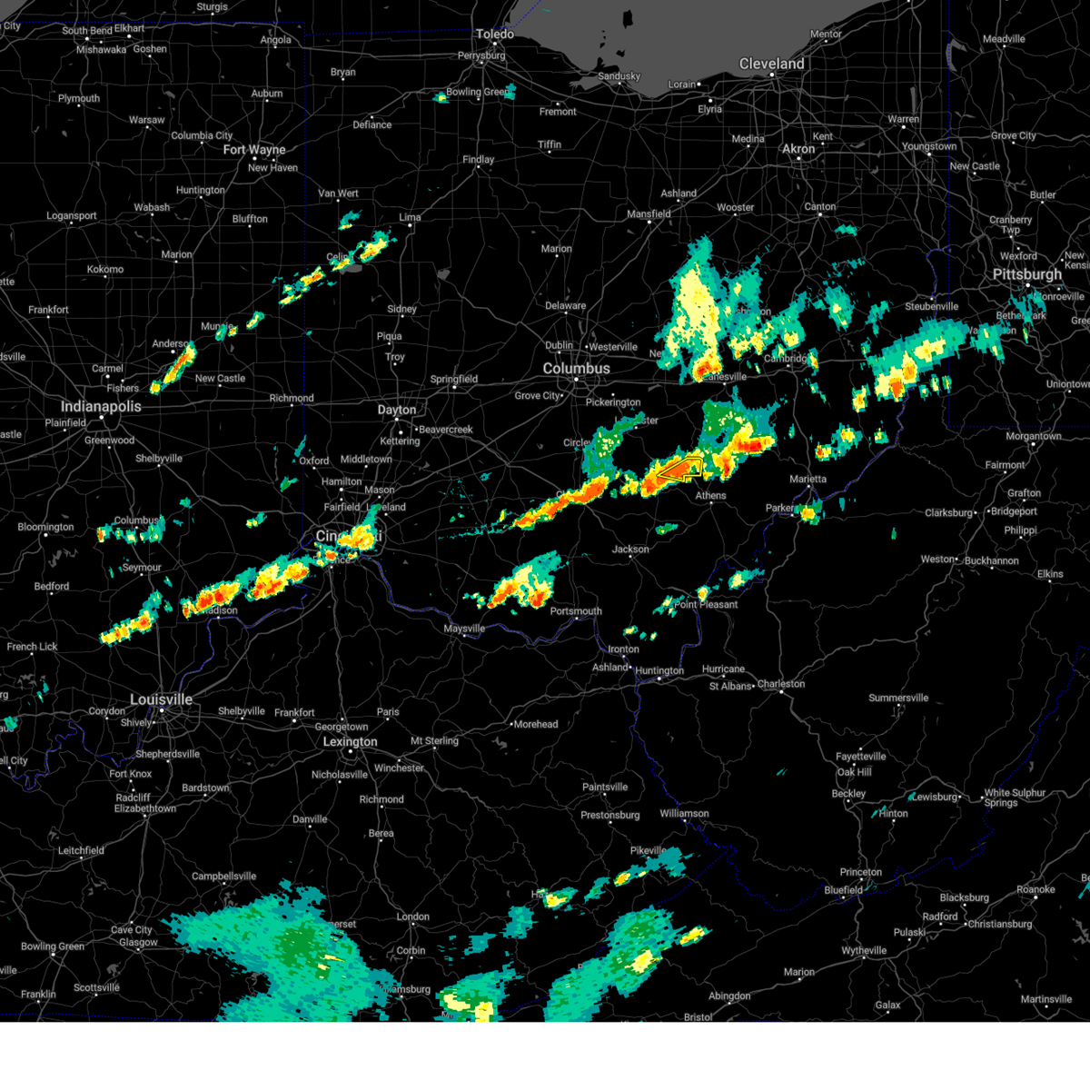
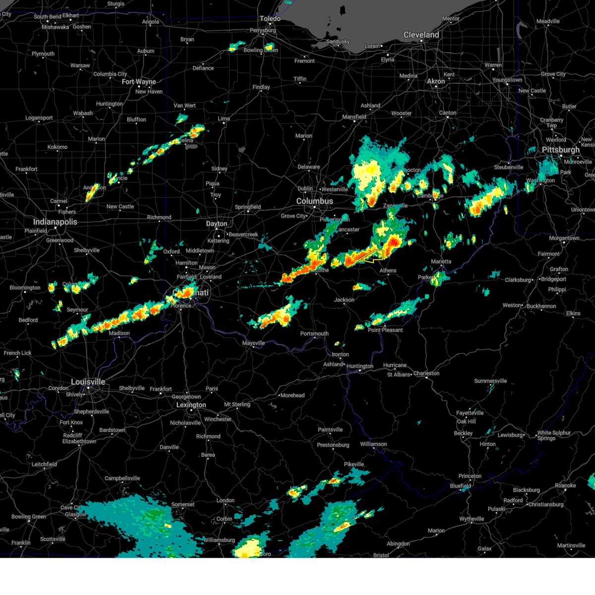
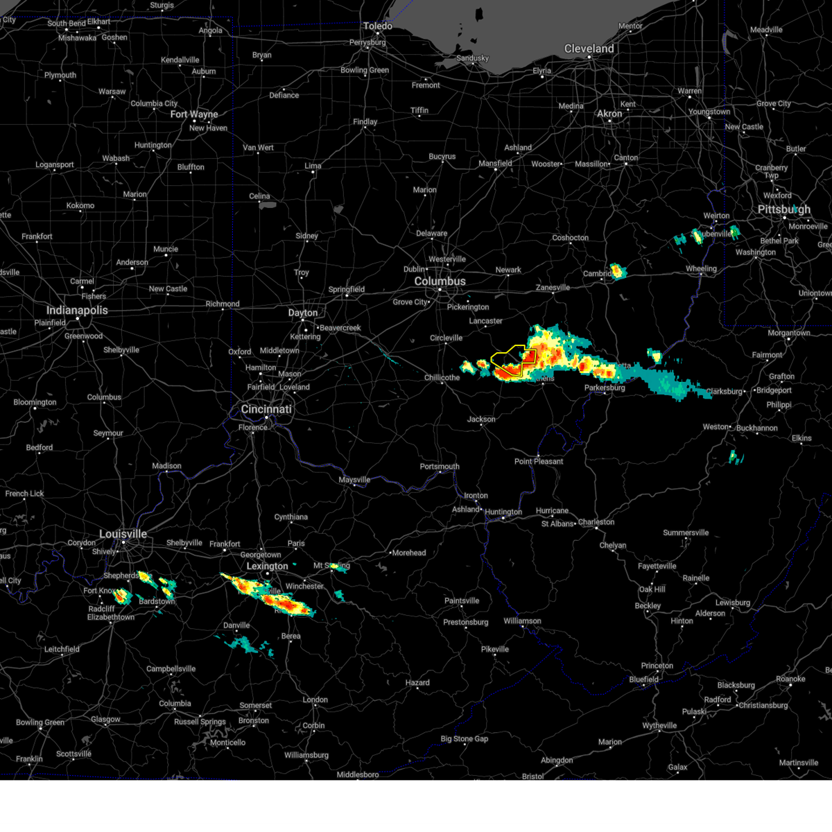
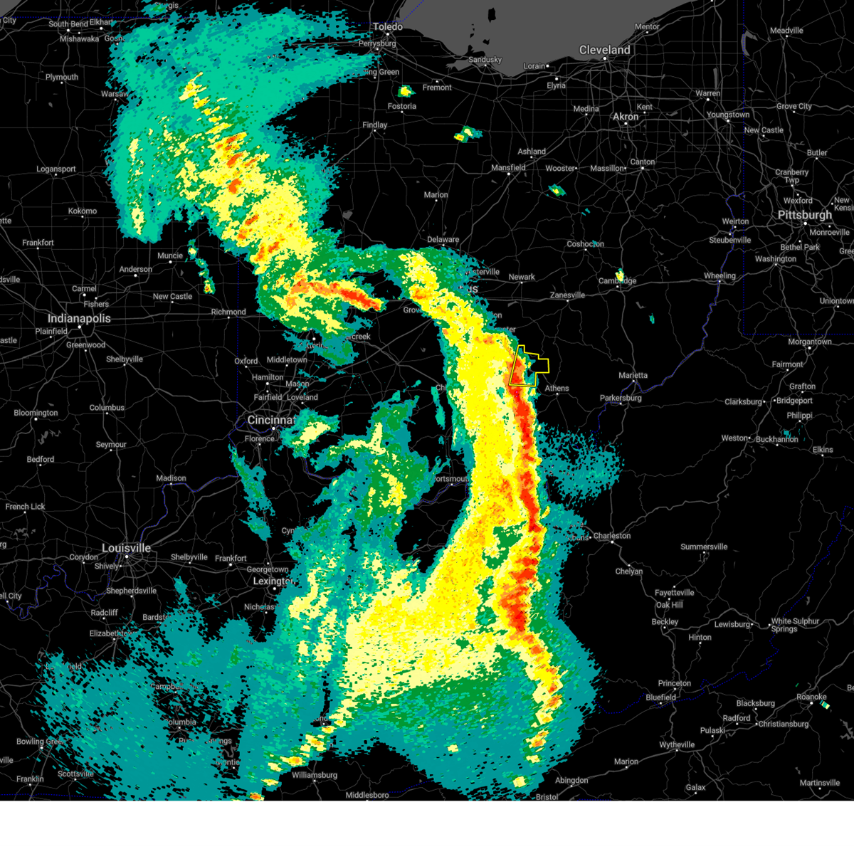
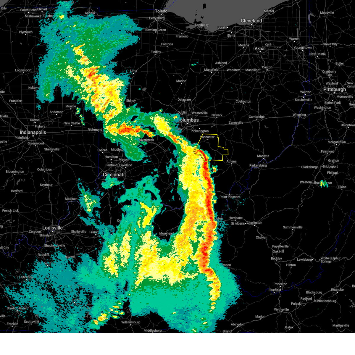
The Nelsonville, OH area has had 4 reports of on-the-ground hail by trained spotters, and has been under severe weather warnings 76 times during the past 12 months. Doppler radar has detected hail at or near Nelsonville, OH on 44 occasions, including 6 occasions during the past year.
| Name: | Nelsonville, OH |
| Where Located: | 55.1 miles SE of Columbus, OH |
| Map: | Google Map for Nelsonville, OH |
| Population: | 5392 |
| Housing Units: | 2257 |
| More Info: | Search Google for Nelsonville, OH |
2
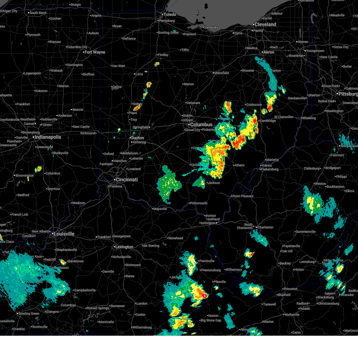
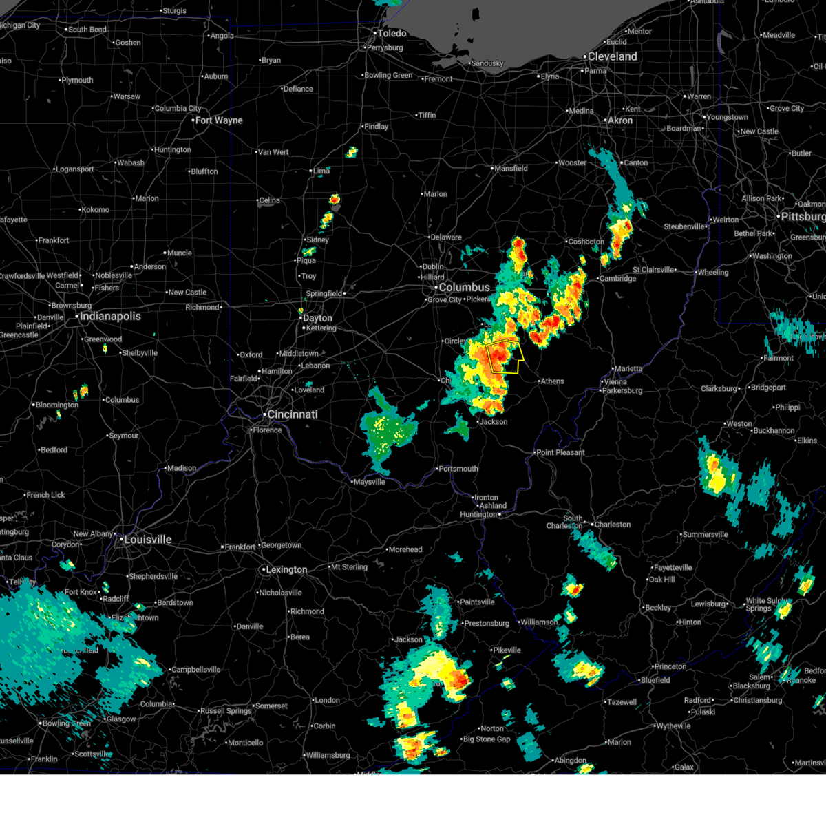
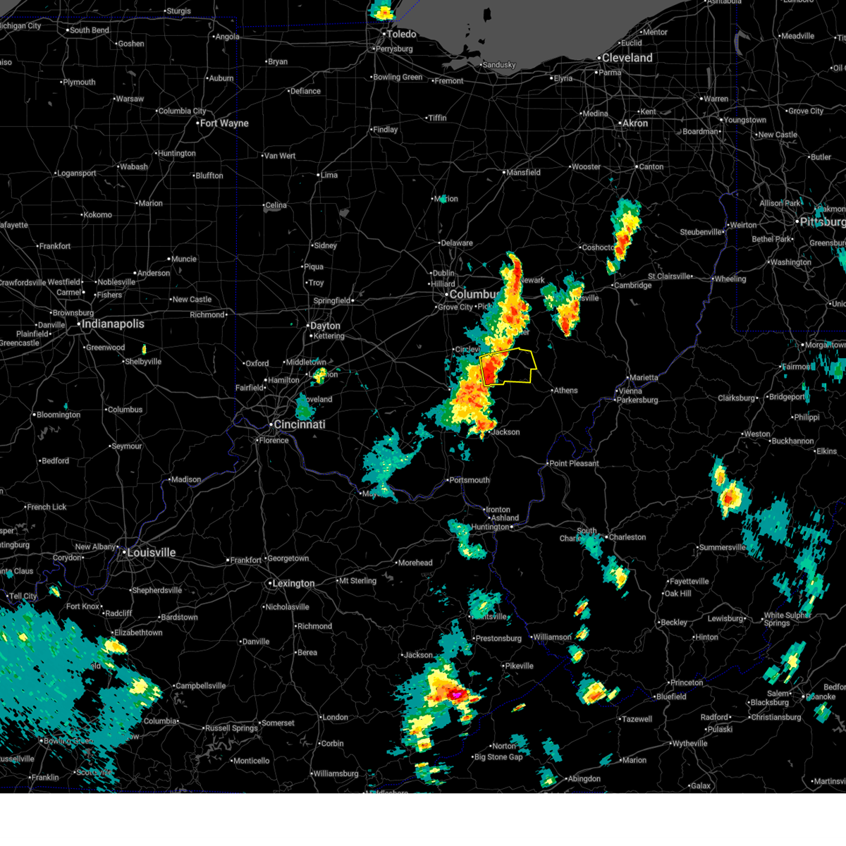
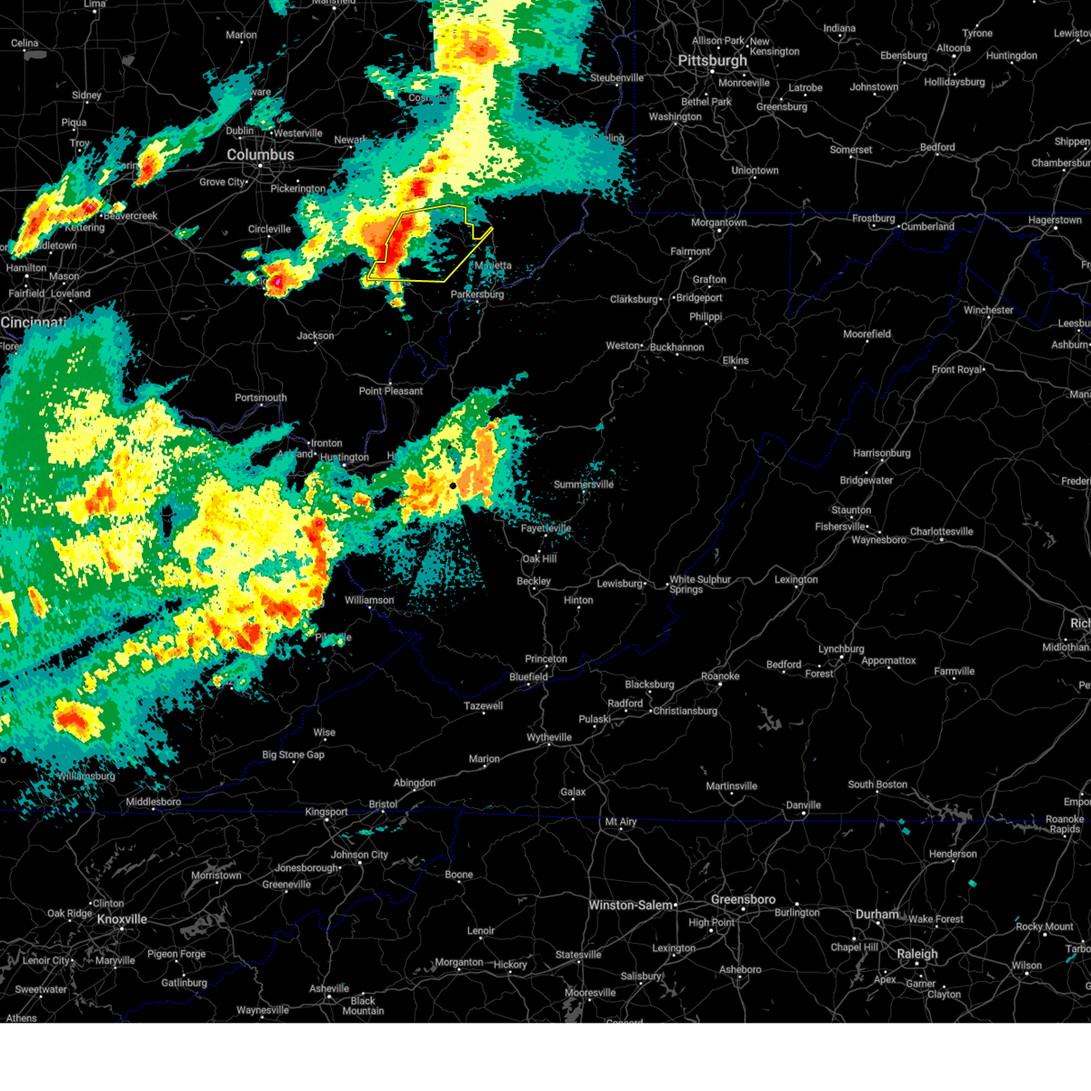
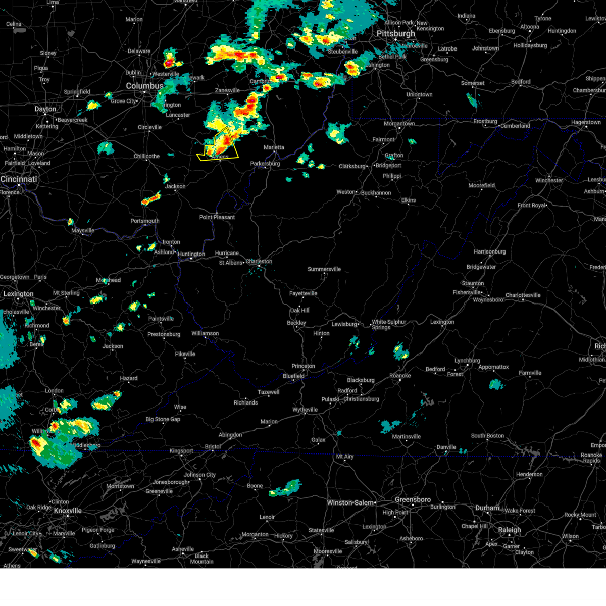
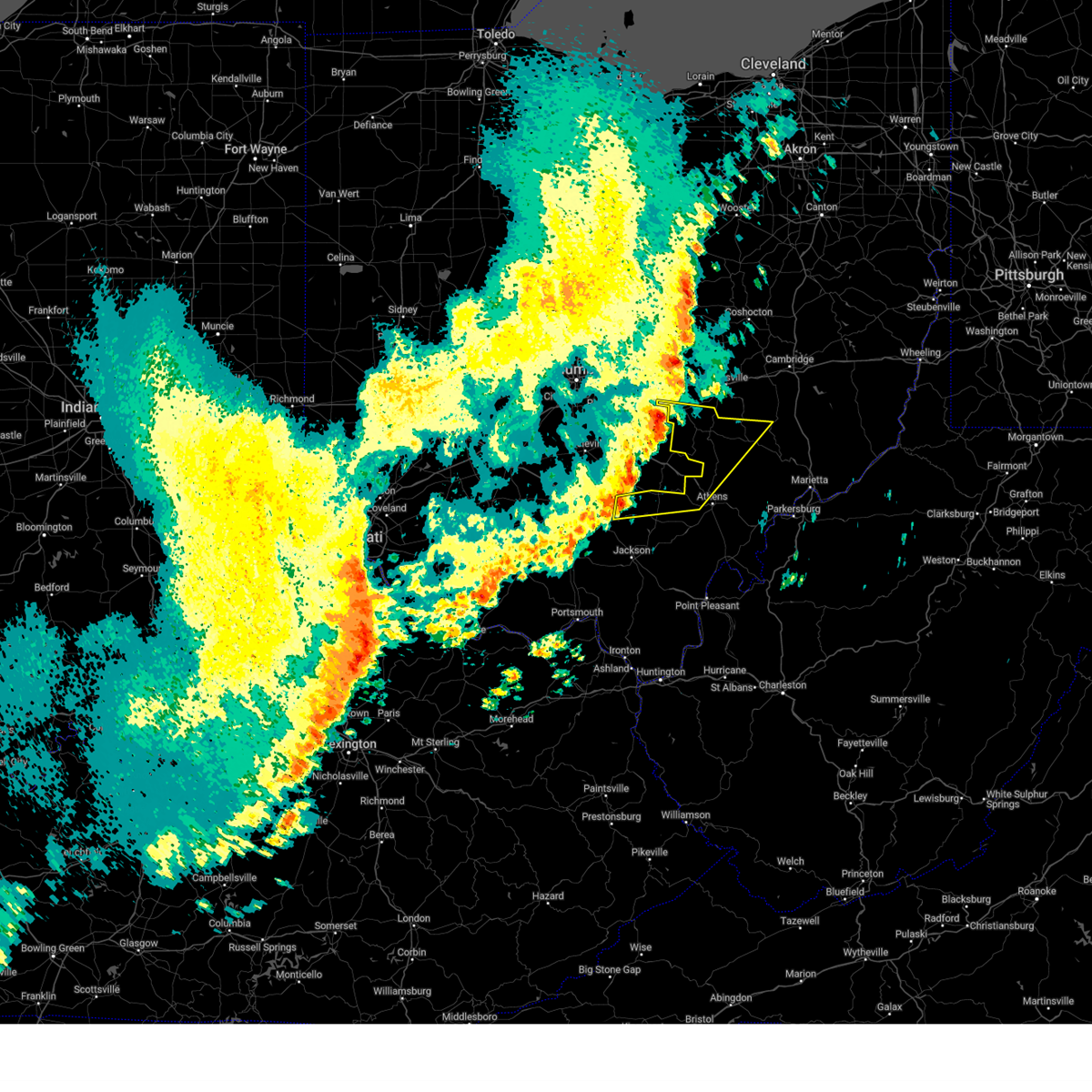
The Top Recent Hail Date for Nelsonville, OH is Friday, May 2, 2025 (4th out of 44)
Hail and Wind Damage Spotted near Nelsonville, OH
| Date / Time | Report Details |
|---|---|
| 7/1/2025 9:41 AM EDT | Tree... powerlines and utility poles down on burr oak blvd. boulevard was closed. time estimated from rada in athens county OH, 0.7 miles S of Nelsonville, OH |
| 7/1/2025 9:35 AM EDT | Line down on carbondale road. time estimated from rada in athens county OH, 5.8 miles NE of Nelsonville, OH |
| 6/27/2025 7:51 PM EDT |
 The storm which prompted the warning has weakened below severe limits and no longer poses an immediate threat to life or property. therefore, the warning will be allowed to expire. however, gusty winds are still possible with this thunderstorm. please report previous wind damage or hail to the national weather service by going to our website at weather.gov/iln and submitting your report via social media. The storm which prompted the warning has weakened below severe limits and no longer poses an immediate threat to life or property. therefore, the warning will be allowed to expire. however, gusty winds are still possible with this thunderstorm. please report previous wind damage or hail to the national weather service by going to our website at weather.gov/iln and submitting your report via social media.
|
| 6/27/2025 7:42 PM EDT |
 At 742 pm edt, a severe thunderstorm was located near hocking hills state park, moving east at 20 mph (radar indicated). Hazards include 60 mph wind gusts. Expect damage to trees and power lines. Locations impacted include, logan, nelsonville, starr, ilesboro, enterprise, union furnace, lake logan state park, haydenville, and carbon hill. At 742 pm edt, a severe thunderstorm was located near hocking hills state park, moving east at 20 mph (radar indicated). Hazards include 60 mph wind gusts. Expect damage to trees and power lines. Locations impacted include, logan, nelsonville, starr, ilesboro, enterprise, union furnace, lake logan state park, haydenville, and carbon hill.
|
| 6/27/2025 7:22 PM EDT |
 Svriln the national weather service in wilmington has issued a * severe thunderstorm warning for, hocking county in central ohio, * until 800 pm edt. * at 721 pm edt, a severe thunderstorm was located near hocking hills state park, moving east at 20 mph (radar indicated). Hazards include 60 mph wind gusts. expect damage to trees and power lines Svriln the national weather service in wilmington has issued a * severe thunderstorm warning for, hocking county in central ohio, * until 800 pm edt. * at 721 pm edt, a severe thunderstorm was located near hocking hills state park, moving east at 20 mph (radar indicated). Hazards include 60 mph wind gusts. expect damage to trees and power lines
|
| 6/18/2025 10:46 PM EDT |
 the severe thunderstorm warning has been cancelled and is no longer in effect the severe thunderstorm warning has been cancelled and is no longer in effect
|
| 6/18/2025 10:46 PM EDT |
 The storms which prompted the warning have weakened below severe limits, and no longer pose an immediate threat to life or property. therefore, the warning has been allowed to expire. however, gusty winds are still possible with these thunderstorms. a severe thunderstorm watch remains in effect until 300 am edt for southeastern ohio. to report severe weather, contact your nearest law enforcement agency. they will relay your report to the national weather service charleston west virginia. The storms which prompted the warning have weakened below severe limits, and no longer pose an immediate threat to life or property. therefore, the warning has been allowed to expire. however, gusty winds are still possible with these thunderstorms. a severe thunderstorm watch remains in effect until 300 am edt for southeastern ohio. to report severe weather, contact your nearest law enforcement agency. they will relay your report to the national weather service charleston west virginia.
|
| 6/18/2025 10:38 PM EDT |
 the severe thunderstorm warning has been cancelled and is no longer in effect the severe thunderstorm warning has been cancelled and is no longer in effect
|
| 6/18/2025 10:38 PM EDT |
 At 1038 pm edt, severe thunderstorms were located along a line extending from near nelsonville to near wellston, moving east at 40 mph (radar indicated). Hazards include 60 mph wind gusts. Expect damage to roofs, siding, and trees. Locations impacted include, jackson, wellston, nelsonville, mcarthur, lake hope state park, chauncey, hamden, buchtel, jacksonville, coalton, zaleski, creola, radcliffe, byer, and the plains. At 1038 pm edt, severe thunderstorms were located along a line extending from near nelsonville to near wellston, moving east at 40 mph (radar indicated). Hazards include 60 mph wind gusts. Expect damage to roofs, siding, and trees. Locations impacted include, jackson, wellston, nelsonville, mcarthur, lake hope state park, chauncey, hamden, buchtel, jacksonville, coalton, zaleski, creola, radcliffe, byer, and the plains.
|
| 6/18/2025 10:23 PM EDT |
 At 1023 pm edt, a severe thunderstorm was located near hocking hills state park, moving northeast at 55 mph (radar indicated). Hazards include 60 mph wind gusts. Expect damage to trees and power lines. Locations impacted include, logan, nelsonville, hocking hills state park, starr, laurelville, murray city, ilesboro, gibisonville, lake logan state park, haydenville, south bloomingville, enterprise, union furnace, rockbridge, oreville, and carbon hill. At 1023 pm edt, a severe thunderstorm was located near hocking hills state park, moving northeast at 55 mph (radar indicated). Hazards include 60 mph wind gusts. Expect damage to trees and power lines. Locations impacted include, logan, nelsonville, hocking hills state park, starr, laurelville, murray city, ilesboro, gibisonville, lake logan state park, haydenville, south bloomingville, enterprise, union furnace, rockbridge, oreville, and carbon hill.
|
| 6/18/2025 10:23 PM EDT |
 the severe thunderstorm warning has been cancelled and is no longer in effect the severe thunderstorm warning has been cancelled and is no longer in effect
|
| 6/18/2025 10:08 PM EDT |
 Svriln the national weather service in wilmington has issued a * severe thunderstorm warning for, hocking county in central ohio, southeastern pickaway county in central ohio, * until 1100 pm edt. * at 1008 pm edt, a severe thunderstorm was located 10 miles southeast of kingston, moving northeast at 50 mph (radar indicated). Hazards include 60 mph wind gusts. expect damage to trees and power lines Svriln the national weather service in wilmington has issued a * severe thunderstorm warning for, hocking county in central ohio, southeastern pickaway county in central ohio, * until 1100 pm edt. * at 1008 pm edt, a severe thunderstorm was located 10 miles southeast of kingston, moving northeast at 50 mph (radar indicated). Hazards include 60 mph wind gusts. expect damage to trees and power lines
|
| 6/18/2025 10:05 PM EDT |
 Svrrlx the national weather service in charleston west virginia has issued a * severe thunderstorm warning for, northwestern meigs county in southeastern ohio, north central gallia county in southeastern ohio, jackson county in southeastern ohio, vinton county in southeastern ohio, western athens county in southeastern ohio, * until 1045 pm edt. * at 1005 pm edt, severe thunderstorms were located along a line extending from 10 miles southwest of hocking hills state park to piketon, moving east at 45 mph (radar indicated). Hazards include 60 mph wind gusts. expect damage to roofs, siding, and trees Svrrlx the national weather service in charleston west virginia has issued a * severe thunderstorm warning for, northwestern meigs county in southeastern ohio, north central gallia county in southeastern ohio, jackson county in southeastern ohio, vinton county in southeastern ohio, western athens county in southeastern ohio, * until 1045 pm edt. * at 1005 pm edt, severe thunderstorms were located along a line extending from 10 miles southwest of hocking hills state park to piketon, moving east at 45 mph (radar indicated). Hazards include 60 mph wind gusts. expect damage to roofs, siding, and trees
|
| 6/18/2025 9:32 PM EDT | the severe thunderstorm warning has been cancelled and is no longer in effect |
| 6/18/2025 9:17 PM EDT | At 917 pm edt, severe thunderstorms were located along a line extending from near south zanesville to near hocking hills state park, moving east at 50 mph (radar indicated). Hazards include 60 mph wind gusts. Expect damage to trees and power lines. Locations impacted include, lancaster, logan, nelsonville, bremen, hocking hills state park, hide-a-way hills, starr, laurelville, murray city, sugar grove, adelphi, rushville, tarlton, west rushville, ilesboro, haydenville, south bloomingville, clearport, north berne, and union furnace. |
| 6/18/2025 8:55 PM EDT |
 Svriln the national weather service in wilmington has issued a * severe thunderstorm warning for, southern fairfield county in central ohio, hocking county in central ohio, southeastern pickaway county in central ohio, northeastern ross county in south central ohio, * until 945 pm edt. * at 854 pm edt, severe thunderstorms were located along a line extending from near pleasantville to near kingston, moving east at 50 mph (at lancaster airport a 56 mph wind gust occurred). Hazards include 60 mph wind gusts. expect damage to trees and power lines Svriln the national weather service in wilmington has issued a * severe thunderstorm warning for, southern fairfield county in central ohio, hocking county in central ohio, southeastern pickaway county in central ohio, northeastern ross county in south central ohio, * until 945 pm edt. * at 854 pm edt, severe thunderstorms were located along a line extending from near pleasantville to near kingston, moving east at 50 mph (at lancaster airport a 56 mph wind gust occurred). Hazards include 60 mph wind gusts. expect damage to trees and power lines
|
| 6/9/2025 2:35 PM EDT |
 The storm which prompted the warning has weakened below severe limits and is exiting the warned area. therefore, the warning will be allowed to expire. please report previous wind damage or hail to the national weather service by going to our website at weather.gov/iln and submitting your report via social media. The storm which prompted the warning has weakened below severe limits and is exiting the warned area. therefore, the warning will be allowed to expire. please report previous wind damage or hail to the national weather service by going to our website at weather.gov/iln and submitting your report via social media.
|
| 6/9/2025 2:35 PM EDT |
 The storm which prompted the warning has weakened below severe limits, and no longer poses an immediate threat to life or property. therefore, the warning will be allowed to expire. however, gusty winds and heavy rain are still possible with this thunderstorm. The storm which prompted the warning has weakened below severe limits, and no longer poses an immediate threat to life or property. therefore, the warning will be allowed to expire. however, gusty winds and heavy rain are still possible with this thunderstorm.
|
| 6/9/2025 2:27 PM EDT | Tree down along carbon hill buchtel road. time estimated from rada in hocking county OH, 2.8 miles S of Nelsonville, OH |
| 6/9/2025 2:19 PM EDT |
 At 219 pm edt, a severe thunderstorm was located near nelsonville, moving northeast at 40 mph (radar indicated). Hazards include 60 mph wind gusts and quarter size hail. Hail damage to vehicles is expected. expect wind damage to roofs, siding, and trees. Locations impacted include, nelsonville, glouster, shawnee, chauncey, new straitsville, corning, buchtel, jacksonville, trimble, hemlock, amesville, rendville, burr oak state park, and the plains. At 219 pm edt, a severe thunderstorm was located near nelsonville, moving northeast at 40 mph (radar indicated). Hazards include 60 mph wind gusts and quarter size hail. Hail damage to vehicles is expected. expect wind damage to roofs, siding, and trees. Locations impacted include, nelsonville, glouster, shawnee, chauncey, new straitsville, corning, buchtel, jacksonville, trimble, hemlock, amesville, rendville, burr oak state park, and the plains.
|
| 6/9/2025 2:17 PM EDT |
 At 217 pm edt, a severe thunderstorm was located near nelsonville, moving northeast at 45 mph (radar indicated). Hazards include 60 mph wind gusts. Expect damage to trees and power lines. Locations impacted include, logan, nelsonville, starr, murray city, ilesboro, union furnace, haydenville, oreville, and carbon hill. At 217 pm edt, a severe thunderstorm was located near nelsonville, moving northeast at 45 mph (radar indicated). Hazards include 60 mph wind gusts. Expect damage to trees and power lines. Locations impacted include, logan, nelsonville, starr, murray city, ilesboro, union furnace, haydenville, oreville, and carbon hill.
|
| 6/9/2025 2:08 PM EDT |
 At 208 pm edt, a severe thunderstorm was located near hocking hills state park, or near lake hope state park, moving northeast at 40 mph (radar indicated). Hazards include 60 mph wind gusts and quarter size hail. Hail damage to vehicles is expected. expect wind damage to roofs, siding, and trees. Locations impacted include, nelsonville, glouster, shawnee, lake hope state park, chauncey, new straitsville, corning, buchtel, jacksonville, trimble, zaleski, hemlock, amesville, rendville, creola, burr oak state park, and the plains. At 208 pm edt, a severe thunderstorm was located near hocking hills state park, or near lake hope state park, moving northeast at 40 mph (radar indicated). Hazards include 60 mph wind gusts and quarter size hail. Hail damage to vehicles is expected. expect wind damage to roofs, siding, and trees. Locations impacted include, nelsonville, glouster, shawnee, lake hope state park, chauncey, new straitsville, corning, buchtel, jacksonville, trimble, zaleski, hemlock, amesville, rendville, creola, burr oak state park, and the plains.
|
| 6/9/2025 2:06 PM EDT |
 At 206 pm edt, a severe thunderstorm was located near hocking hills state park, moving northeast at 45 mph (radar indicated). Hazards include 60 mph wind gusts. Expect damage to trees and power lines. Locations impacted include, logan, nelsonville, hocking hills state park, starr, murray city, ilesboro, gibisonville, lake logan state park, haydenville, enterprise, union furnace, oreville, and carbon hill. At 206 pm edt, a severe thunderstorm was located near hocking hills state park, moving northeast at 45 mph (radar indicated). Hazards include 60 mph wind gusts. Expect damage to trees and power lines. Locations impacted include, logan, nelsonville, hocking hills state park, starr, murray city, ilesboro, gibisonville, lake logan state park, haydenville, enterprise, union furnace, oreville, and carbon hill.
|
| 6/9/2025 1:56 PM EDT |
 Svriln the national weather service in wilmington has issued a * severe thunderstorm warning for, hocking county in central ohio, * until 245 pm edt. * at 156 pm edt, a severe thunderstorm was located 7 miles southwest of hocking hills state park, moving northeast at 45 mph (radar indicated). Hazards include 60 mph wind gusts. expect damage to trees and power lines Svriln the national weather service in wilmington has issued a * severe thunderstorm warning for, hocking county in central ohio, * until 245 pm edt. * at 156 pm edt, a severe thunderstorm was located 7 miles southwest of hocking hills state park, moving northeast at 45 mph (radar indicated). Hazards include 60 mph wind gusts. expect damage to trees and power lines
|
| 6/9/2025 1:55 PM EDT |
 Svrrlx the national weather service in charleston west virginia has issued a * severe thunderstorm warning for, southeastern perry county in southeastern ohio, southwestern morgan county in southeastern ohio, northern vinton county in southeastern ohio, northwestern athens county in southeastern ohio, * until 245 pm edt. * at 154 pm edt, a severe thunderstorm was located 8 miles southwest of hocking hills state park, or 9 miles northwest of mcarthur, moving northeast at 50 mph (radar indicated). Hazards include 60 mph wind gusts and quarter size hail. Hail damage to vehicles is expected. Expect wind damage to roofs, siding, and trees. Svrrlx the national weather service in charleston west virginia has issued a * severe thunderstorm warning for, southeastern perry county in southeastern ohio, southwestern morgan county in southeastern ohio, northern vinton county in southeastern ohio, northwestern athens county in southeastern ohio, * until 245 pm edt. * at 154 pm edt, a severe thunderstorm was located 8 miles southwest of hocking hills state park, or 9 miles northwest of mcarthur, moving northeast at 50 mph (radar indicated). Hazards include 60 mph wind gusts and quarter size hail. Hail damage to vehicles is expected. Expect wind damage to roofs, siding, and trees.
|
| 5/17/2025 12:12 AM EDT | The storm which prompted the warning has moved out of the area. therefore, the warning will be allowed to expire. a tornado watch remains in effect until 300 am edt for central ohio. please report previous wind damage or hail to the national weather service by going to our website at weather.gov/iln and submitting your report via social media. |
| 5/17/2025 12:04 AM EDT | Tree down at w. franklin st. and madison st. time reported corroborated with rada in athens county OH, 1.8 miles ESE of Nelsonville, OH |
| 5/17/2025 12:01 AM EDT |
 Svrrlx the national weather service in charleston west virginia has issued a * severe thunderstorm warning for, southwestern washington county in southeastern ohio, southwestern morgan county in southeastern ohio, northeastern vinton county in southeastern ohio, athens county in southeastern ohio, * until 1230 am edt. * at 1201 am edt, a severe thunderstorm was located near nelsonville, moving east at 50 mph (radar indicated). Hazards include 60 mph wind gusts and half dollar size hail. Hail damage to vehicles is expected. Expect wind damage to roofs, siding, and trees. Svrrlx the national weather service in charleston west virginia has issued a * severe thunderstorm warning for, southwestern washington county in southeastern ohio, southwestern morgan county in southeastern ohio, northeastern vinton county in southeastern ohio, athens county in southeastern ohio, * until 1230 am edt. * at 1201 am edt, a severe thunderstorm was located near nelsonville, moving east at 50 mph (radar indicated). Hazards include 60 mph wind gusts and half dollar size hail. Hail damage to vehicles is expected. Expect wind damage to roofs, siding, and trees.
|
| 5/16/2025 11:57 PM EDT | Tree down on myers st in nelsonville. time estimated by rada in athens county OH, 1.8 miles NE of Nelsonville, OH |
| 5/16/2025 11:56 PM EDT | At 1156 pm edt, a severe thunderstorm was located near nelsonville, moving east at 60 mph (radar indicated). Hazards include ping pong ball size hail and 60 mph wind gusts. People and animals outdoors will be injured. expect hail damage to roofs, siding, windows, and vehicles. expect wind damage to trees and power lines. Locations impacted include, starr, murray city, ilesboro, union furnace, haydenville, carbon hill, and nelsonville. |
| 5/16/2025 11:54 PM EDT |
 At 1154 pm edt, a severe thunderstorm was located over lake hope state park, moving east at 55 mph (radar indicated). Hazards include 60 mph wind gusts and half dollar size hail. Hail damage to vehicles is expected. expect wind damage to roofs, siding, and trees. Locations impacted include, athens, lake hope state park, chauncey, zaleski, and the plains. At 1154 pm edt, a severe thunderstorm was located over lake hope state park, moving east at 55 mph (radar indicated). Hazards include 60 mph wind gusts and half dollar size hail. Hail damage to vehicles is expected. expect wind damage to roofs, siding, and trees. Locations impacted include, athens, lake hope state park, chauncey, zaleski, and the plains.
|
| 5/16/2025 11:45 PM EDT |
 At 1145 pm edt, a severe thunderstorm was located over hocking hills state park, moving east at 50 mph (radar indicated). Hazards include ping pong ball size hail and 60 mph wind gusts. People and animals outdoors will be injured. expect hail damage to roofs, siding, windows, and vehicles. expect wind damage to trees and power lines. Locations impacted include, south bloomingville, hocking hills state park, starr, gibisonville, ilesboro, murray city, union furnace, haydenville, carbon hill, logan, and nelsonville. At 1145 pm edt, a severe thunderstorm was located over hocking hills state park, moving east at 50 mph (radar indicated). Hazards include ping pong ball size hail and 60 mph wind gusts. People and animals outdoors will be injured. expect hail damage to roofs, siding, windows, and vehicles. expect wind damage to trees and power lines. Locations impacted include, south bloomingville, hocking hills state park, starr, gibisonville, ilesboro, murray city, union furnace, haydenville, carbon hill, logan, and nelsonville.
|
| 5/16/2025 11:41 PM EDT |
 At 1141 pm edt, a severe thunderstorm was located over hocking hills state park, moving east at 60 mph (radar indicated). Hazards include 60 mph wind gusts and half dollar size hail. Minor hail damage to vehicles is possible. expect wind damage to trees and power lines. Locations impacted include, south bloomingville, hocking hills state park, logan, starr, gibisonville, ilesboro, murray city, union furnace, haydenville, lake logan state park, carbon hill, and nelsonville. At 1141 pm edt, a severe thunderstorm was located over hocking hills state park, moving east at 60 mph (radar indicated). Hazards include 60 mph wind gusts and half dollar size hail. Minor hail damage to vehicles is possible. expect wind damage to trees and power lines. Locations impacted include, south bloomingville, hocking hills state park, logan, starr, gibisonville, ilesboro, murray city, union furnace, haydenville, lake logan state park, carbon hill, and nelsonville.
|
| 5/16/2025 11:32 PM EDT | Svrrlx the national weather service in charleston west virginia has issued a * severe thunderstorm warning for, northern vinton county in southeastern ohio, southwestern athens county in southeastern ohio, * until midnight edt. * at 1132 pm edt, a severe thunderstorm was located 10 miles southwest of hocking hills state park, or 14 miles northwest of mcarthur, moving east at 55 mph (radar indicated). Hazards include 60 mph wind gusts and half dollar size hail. Hail damage to vehicles is expected. Expect wind damage to roofs, siding, and trees. |
| 5/16/2025 11:31 PM EDT | Tree down on buchtel rd in nelsonvill in athens county OH, 1.3 miles ESE of Nelsonville, OH |
| 5/16/2025 11:30 PM EDT | Tree down. time estimated by rada in athens county OH, 1.3 miles ESE of Nelsonville, OH |
| 5/16/2025 11:30 PM EDT |
 At 1129 pm edt, severe thunderstorms were located along a line extending from mcconnelsville to near glouster, moving east at 60 mph (radar indicated). Hazards include 60 mph wind gusts and half dollar size hail. Hail damage to vehicles is expected. expect wind damage to roofs, siding, and trees. Locations impacted include, nelsonville, glouster, mcconnelsville, beverly, chesterhill, chauncey, malta, corning, buchtel, stockport, jacksonville, trimble, bristol, hemlock, amesville, rendville, burr oak state park, hackney, eagleport, and bartlett. At 1129 pm edt, severe thunderstorms were located along a line extending from mcconnelsville to near glouster, moving east at 60 mph (radar indicated). Hazards include 60 mph wind gusts and half dollar size hail. Hail damage to vehicles is expected. expect wind damage to roofs, siding, and trees. Locations impacted include, nelsonville, glouster, mcconnelsville, beverly, chesterhill, chauncey, malta, corning, buchtel, stockport, jacksonville, trimble, bristol, hemlock, amesville, rendville, burr oak state park, hackney, eagleport, and bartlett.
|
| 5/16/2025 11:29 PM EDT | Svriln the national weather service in wilmington has issued a * severe thunderstorm warning for, hocking county in central ohio, * until 1215 am edt. * at 1129 pm edt, a severe thunderstorm was located 9 miles southeast of kingston, moving east at 60 mph (radar indicated). Hazards include 60 mph wind gusts and quarter size hail. Minor hail damage to vehicles is possible. Expect wind damage to trees and power lines. |
| 5/16/2025 11:23 PM EDT | Tree down on power lines on burr oak blvd in nelsonvill in athens county OH, 0.9 miles SW of Nelsonville, OH |
| 5/16/2025 11:20 PM EDT | The severe thunderstorm which prompted the warning has moved out of the warned area. therefore, the warning will be allowed to expire. a tornado watch remains in effect until 300 am edt for central ohio. please report previous wind damage or hail to the national weather service by going to our website at weather.gov/iln and submitting your report via social media. |
| 5/16/2025 11:18 PM EDT | Tree on powerlines and on fire with sparking. time estimated from rada in athens county OH, 1.3 miles ESE of Nelsonville, OH |
| 5/16/2025 11:14 PM EDT | Svrrlx the national weather service in charleston west virginia has issued a * severe thunderstorm warning for, southeastern perry county in southeastern ohio, northwestern washington county in southeastern ohio, morgan county in southeastern ohio, northern athens county in southeastern ohio, * until 1145 pm edt. * at 1113 pm edt, severe thunderstorms were located along a line extending from near shawnee to 6 miles north of lake hope state park, moving east at 60 mph (radar indicated). Hazards include 60 mph wind gusts and half dollar size hail. Hail damage to vehicles is expected. Expect wind damage to roofs, siding, and trees. |
| 5/16/2025 11:12 PM EDT | At 1112 pm edt, a severe thunderstorm was located near shawnee, moving east at 55 mph (radar indicated). Hazards include 60 mph wind gusts and quarter size hail. Minor hail damage to vehicles is possible. expect wind damage to trees and power lines. Locations impacted include, starr, ilesboro, hideaway hills, haydenville, lake logan state park, logan, enterprise, murray city, union furnace, rockbridge, hide-a-way hills, oreville, carbon hill, and nelsonville. |
| 5/16/2025 11:12 PM EDT | the severe thunderstorm warning has been cancelled and is no longer in effect |
| 5/16/2025 11:05 PM EDT | the severe thunderstorm warning has been cancelled and is no longer in effect |
| 5/16/2025 11:05 PM EDT | At 1105 pm edt, a severe thunderstorm was located over logan, moving east at 50 mph (radar indicated). Hazards include 60 mph wind gusts and quarter size hail. Minor hail damage to vehicles is possible. expect wind damage to trees and power lines. Locations impacted include, hocking hills state park, buena vista in hocking county, starr, gibisonville, ilesboro, hideaway hills, haydenville, lake logan state park, south bloomingville, logan, bremen, north berne, enterprise, murray city, union furnace, sugar grove, rockbridge, hide-a-way hills, oreville, and carbon hill. |
| 5/16/2025 11:02 PM EDT | At 1102 pm edt, severe thunderstorms were located along a line extending from near logan to 11 miles southwest of hocking hills state park, moving east at 55 mph (radar indicated). Hazards include 60 mph wind gusts and half dollar size hail. Hail damage to vehicles is expected. expect wind damage to roofs, siding, and trees. Locations impacted include, nelsonville, glouster, lake hope state park, new straitsville, buchtel, jacksonville, trimble, zaleski, hemlock, creola, eagle mills, burr oak state park, and allensville. |
| 5/16/2025 10:52 PM EDT | Svrrlx the national weather service in charleston west virginia has issued a * severe thunderstorm warning for, southeastern perry county in southeastern ohio, west central morgan county in southeastern ohio, northern vinton county in southeastern ohio, northwestern athens county in southeastern ohio, * until 1115 pm edt. * at 1051 pm edt, severe thunderstorms were located along a line extending from 9 miles south of lancaster to chillicothe, moving east at 50 mph (radar indicated). Hazards include 60 mph wind gusts and half dollar size hail. Hail damage to vehicles is expected. Expect wind damage to roofs, siding, and trees. |
| 5/16/2025 10:47 PM EDT | At 1046 pm edt, a severe thunderstorm was located 7 miles southwest of hide-a-way hills, moving east at 55 mph (radar indicated). Hazards include 60 mph wind gusts and quarter size hail. Minor hail damage to vehicles is possible. expect wind damage to trees and power lines. Locations impacted include, fairfield county airport, hocking hills state park, us route 22 at state route 159, starr, ilesboro, mooresville, haydenville, laurelville, south bloomingville, clearport, bremen, north berne, pleasantville, murray city, union furnace, adelphi, hide-a-way hills, oreville, carbon hill, and west rushville. |
| 5/16/2025 10:47 PM EDT | the severe thunderstorm warning has been cancelled and is no longer in effect |
| 5/16/2025 10:25 PM EDT | Svriln the national weather service in wilmington has issued a * severe thunderstorm warning for, southeastern franklin county in central ohio, fairfield county in central ohio, hocking county in central ohio, eastern pickaway county in central ohio, northeastern ross county in south central ohio, * until 1130 pm edt. * at 1025 pm edt, a severe thunderstorm was located over logan elm village, moving east at 55 mph (radar indicated). Hazards include 60 mph wind gusts and quarter size hail. Minor hail damage to vehicles is possible. Expect wind damage to trees and power lines. |
| 5/2/2025 4:26 PM EDT |
 The storm which prompted the warning has weakened below severe limits, and no longer poses an immediate threat to life or property. therefore, the warning will be allowed to expire. however, gusty winds and heavy rain are still possible with this thunderstorm. The storm which prompted the warning has weakened below severe limits, and no longer poses an immediate threat to life or property. therefore, the warning will be allowed to expire. however, gusty winds and heavy rain are still possible with this thunderstorm.
|
| 5/2/2025 4:21 PM EDT |
 The storm which prompted the warning is moving out of the area. therefore, the warning will be allowed to expire. please report previous wind damage or hail to the national weather service by going to our website at weather.gov/iln and submitting your report via social media. The storm which prompted the warning is moving out of the area. therefore, the warning will be allowed to expire. please report previous wind damage or hail to the national weather service by going to our website at weather.gov/iln and submitting your report via social media.
|
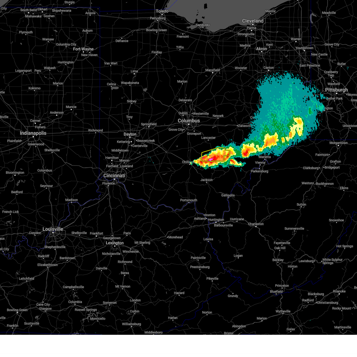
| 5/2/2025 4:16 PM EDT | At 416 pm edt, a severe thunderstorm was located over glouster, moving northeast at 50 mph (radar indicated). Hazards include 60 mph wind gusts and quarter size hail. Hail damage to vehicles is expected. expect wind damage to roofs, siding, and trees. Locations impacted include, athens, nelsonville, glouster, chauncey, corning, buchtel, jacksonville, trimble, amesville, burr oak state park, and the plains. |
| 5/2/2025 4:08 PM EDT | Corrects previous tstm wnd dmg report from 1 wsw nelsonville. tree down at 16825 riverside dr... nelsonville... o in athens county OH, 1.6 miles E of Nelsonville, OH |
| 5/2/2025 4:01 PM EDT |
 Svrrlx the national weather service in charleston west virginia has issued a * severe thunderstorm warning for, southeastern perry county in southeastern ohio, southwestern morgan county in southeastern ohio, northeastern vinton county in southeastern ohio, northwestern athens county in southeastern ohio, * until 430 pm edt. * at 401 pm edt, a severe thunderstorm was located near lake hope state park, moving northeast at 45 mph (radar indicated). Hazards include 60 mph wind gusts and quarter size hail. Hail damage to vehicles is expected. Expect wind damage to roofs, siding, and trees. Svrrlx the national weather service in charleston west virginia has issued a * severe thunderstorm warning for, southeastern perry county in southeastern ohio, southwestern morgan county in southeastern ohio, northeastern vinton county in southeastern ohio, northwestern athens county in southeastern ohio, * until 430 pm edt. * at 401 pm edt, a severe thunderstorm was located near lake hope state park, moving northeast at 45 mph (radar indicated). Hazards include 60 mph wind gusts and quarter size hail. Hail damage to vehicles is expected. Expect wind damage to roofs, siding, and trees.
|
| 5/2/2025 4:01 PM EDT |
 Svriln the national weather service in wilmington has issued a * severe thunderstorm warning for, southeastern hocking county in central ohio, * until 430 pm edt. * at 401 pm edt, a severe thunderstorm was located near lake hope state park, moving northeast at 40 mph (radar indicated). Hazards include 60 mph wind gusts and quarter size hail. Minor hail damage to vehicles is possible. Expect wind damage to trees and power lines. Svriln the national weather service in wilmington has issued a * severe thunderstorm warning for, southeastern hocking county in central ohio, * until 430 pm edt. * at 401 pm edt, a severe thunderstorm was located near lake hope state park, moving northeast at 40 mph (radar indicated). Hazards include 60 mph wind gusts and quarter size hail. Minor hail damage to vehicles is possible. Expect wind damage to trees and power lines.
|
| 5/2/2025 1:06 PM EDT | Tree down at 16825 riverside dr... nelsonville... o in athens county OH, 1.6 miles E of Nelsonville, OH |
| 4/29/2025 9:20 PM EDT | Downed tree and lines off happy hollow roa in athens county OH, 0.5 miles W of Nelsonville, OH |
| 4/19/2025 6:44 PM EDT |
 The storm which prompted the warning has moved out of the area. therefore, the warning will be allowed to expire. please report previous wind damage or hail to the national weather service by going to our website at weather.gov/iln and submitting your report via social media. The storm which prompted the warning has moved out of the area. therefore, the warning will be allowed to expire. please report previous wind damage or hail to the national weather service by going to our website at weather.gov/iln and submitting your report via social media.
|
| 4/19/2025 6:31 PM EDT |
 At 630 pm edt, a severe thunderstorm was located near lake hope state park, moving east at 60 mph (radar indicated). Hazards include 60 mph wind gusts and quarter size hail. Minor hail damage to vehicles is possible. expect wind damage to trees and power lines. Locations impacted include, murray city, union furnace, haydenville, carbon hill, starr, and nelsonville. At 630 pm edt, a severe thunderstorm was located near lake hope state park, moving east at 60 mph (radar indicated). Hazards include 60 mph wind gusts and quarter size hail. Minor hail damage to vehicles is possible. expect wind damage to trees and power lines. Locations impacted include, murray city, union furnace, haydenville, carbon hill, starr, and nelsonville.
|
| 4/19/2025 6:26 PM EDT |
 At 626 pm edt, severe thunderstorms were located along a line extending from 6 miles southeast of logan to 9 miles west of jackson, moving east at 55 mph (radar indicated). Hazards include 60 mph wind gusts and penny size hail. Expect damage to roofs, siding, and trees. Locations impacted include, wellston, lake hope state park, chauncey, creola, buchtel, radcliffe, zaleski, coalton, jackson, nelsonville, allensville, trimble, byer, glouster, jacksonville, mcarthur, the plains, and hamden. At 626 pm edt, severe thunderstorms were located along a line extending from 6 miles southeast of logan to 9 miles west of jackson, moving east at 55 mph (radar indicated). Hazards include 60 mph wind gusts and penny size hail. Expect damage to roofs, siding, and trees. Locations impacted include, wellston, lake hope state park, chauncey, creola, buchtel, radcliffe, zaleski, coalton, jackson, nelsonville, allensville, trimble, byer, glouster, jacksonville, mcarthur, the plains, and hamden.
|
| 4/19/2025 6:17 PM EDT |
 the severe thunderstorm warning has been cancelled and is no longer in effect the severe thunderstorm warning has been cancelled and is no longer in effect
|
| 4/19/2025 6:17 PM EDT |
 At 616 pm edt, a severe thunderstorm was located near hocking hills state park, moving east at 60 mph (radar indicated). Hazards include 60 mph wind gusts and quarter size hail. Minor hail damage to vehicles is possible. expect wind damage to trees and power lines. Locations impacted include, south bloomingville, hocking hills state park, logan, starr, ilesboro, murray city, union furnace, haydenville, oreville, carbon hill, and nelsonville. At 616 pm edt, a severe thunderstorm was located near hocking hills state park, moving east at 60 mph (radar indicated). Hazards include 60 mph wind gusts and quarter size hail. Minor hail damage to vehicles is possible. expect wind damage to trees and power lines. Locations impacted include, south bloomingville, hocking hills state park, logan, starr, ilesboro, murray city, union furnace, haydenville, oreville, carbon hill, and nelsonville.
|
| 4/19/2025 5:59 PM EDT |
 Svrrlx the national weather service in charleston west virginia has issued a * severe thunderstorm warning for, jackson county in southeastern ohio, vinton county in southeastern ohio, western athens county in southeastern ohio, * until 645 pm edt. * at 559 pm edt, severe thunderstorms were located along a line extending from 6 miles east of chillicothe to near peebles, moving east at 55 mph (radar indicated). Hazards include 60 mph wind gusts and quarter size hail. Hail damage to vehicles is expected. Expect wind damage to roofs, siding, and trees. Svrrlx the national weather service in charleston west virginia has issued a * severe thunderstorm warning for, jackson county in southeastern ohio, vinton county in southeastern ohio, western athens county in southeastern ohio, * until 645 pm edt. * at 559 pm edt, severe thunderstorms were located along a line extending from 6 miles east of chillicothe to near peebles, moving east at 55 mph (radar indicated). Hazards include 60 mph wind gusts and quarter size hail. Hail damage to vehicles is expected. Expect wind damage to roofs, siding, and trees.
|
| 4/19/2025 5:49 PM EDT |
 Svriln the national weather service in wilmington has issued a * severe thunderstorm warning for, hocking county in central ohio, north central pike county in south central ohio, southern ross county in south central ohio, * until 645 pm edt. * at 548 pm edt, a severe thunderstorm was located near north folk village, moving east at 60 mph (radar indicated). Hazards include 60 mph wind gusts and quarter size hail. Minor hail damage to vehicles is possible. Expect wind damage to trees and power lines. Svriln the national weather service in wilmington has issued a * severe thunderstorm warning for, hocking county in central ohio, north central pike county in south central ohio, southern ross county in south central ohio, * until 645 pm edt. * at 548 pm edt, a severe thunderstorm was located near north folk village, moving east at 60 mph (radar indicated). Hazards include 60 mph wind gusts and quarter size hail. Minor hail damage to vehicles is possible. Expect wind damage to trees and power lines.
|
| 4/3/2025 3:14 AM EDT |
 At 314 am edt, severe thunderstorms were located along a line extending from 8 miles west of caldwell to near chesterhill, moving east at 60 mph (radar indicated). Hazards include 60 mph wind gusts. Expect damage to roofs, siding, and trees. Locations impacted include, lower salem, stockport, buchtel, burr oak state park, mcconnelsville, hackney, beverly, malta, chesterhill, lowell, macksburg, bristol, trimble, glouster, jacksonville, devola, and marietta. At 314 am edt, severe thunderstorms were located along a line extending from 8 miles west of caldwell to near chesterhill, moving east at 60 mph (radar indicated). Hazards include 60 mph wind gusts. Expect damage to roofs, siding, and trees. Locations impacted include, lower salem, stockport, buchtel, burr oak state park, mcconnelsville, hackney, beverly, malta, chesterhill, lowell, macksburg, bristol, trimble, glouster, jacksonville, devola, and marietta.
|
| 4/3/2025 3:14 AM EDT |
 the severe thunderstorm warning has been cancelled and is no longer in effect the severe thunderstorm warning has been cancelled and is no longer in effect
|
| 4/3/2025 3:09 AM EDT |
 Svrrlx the national weather service in charleston west virginia has issued a * severe thunderstorm warning for, meigs county in southeastern ohio, northern gallia county in southeastern ohio, southern washington county in southeastern ohio, southeastern jackson county in southeastern ohio, southeastern vinton county in southeastern ohio, athens county in southeastern ohio, northwestern lawrence county in southeastern ohio, southwestern pleasants county in northwestern west virginia, northwestern mason county in western west virginia, western wirt county in northwestern west virginia, northern jackson county in northwestern west virginia, wood county in northwestern west virginia, * until 345 am edt. * at 308 am edt, severe thunderstorms were located along a line extending from near nelsonville to near oak hill, moving east at 90 mph (radar indicated). Hazards include 70 mph wind gusts. Expect considerable tree damage. Damage is likely to mobile homes, roofs, and outbuildings. Svrrlx the national weather service in charleston west virginia has issued a * severe thunderstorm warning for, meigs county in southeastern ohio, northern gallia county in southeastern ohio, southern washington county in southeastern ohio, southeastern jackson county in southeastern ohio, southeastern vinton county in southeastern ohio, athens county in southeastern ohio, northwestern lawrence county in southeastern ohio, southwestern pleasants county in northwestern west virginia, northwestern mason county in western west virginia, western wirt county in northwestern west virginia, northern jackson county in northwestern west virginia, wood county in northwestern west virginia, * until 345 am edt. * at 308 am edt, severe thunderstorms were located along a line extending from near nelsonville to near oak hill, moving east at 90 mph (radar indicated). Hazards include 70 mph wind gusts. Expect considerable tree damage. Damage is likely to mobile homes, roofs, and outbuildings.
|
| 4/3/2025 2:55 AM EDT |
 Svrrlx the national weather service in charleston west virginia has issued a * severe thunderstorm warning for, southeastern perry county in southeastern ohio, northern washington county in southeastern ohio, morgan county in southeastern ohio, northern athens county in southeastern ohio, * until 330 am edt. * at 254 am edt, severe thunderstorms were located along a line extending from 8 miles south of south zanesville to buchtel, moving east at 60 mph (radar indicated). Hazards include 60 mph wind gusts. expect damage to roofs, siding, and trees Svrrlx the national weather service in charleston west virginia has issued a * severe thunderstorm warning for, southeastern perry county in southeastern ohio, northern washington county in southeastern ohio, morgan county in southeastern ohio, northern athens county in southeastern ohio, * until 330 am edt. * at 254 am edt, severe thunderstorms were located along a line extending from 8 miles south of south zanesville to buchtel, moving east at 60 mph (radar indicated). Hazards include 60 mph wind gusts. expect damage to roofs, siding, and trees
|
| 4/3/2025 2:50 AM EDT | At 250 am edt, a severe thunderstorm was located over logan, moving east at 30 mph (radar indicated). Hazards include 60 mph wind gusts. Expect damage to trees and power lines. Locations impacted include, hocking hills state park, starr, gibisonville, ilesboro, hideaway hills, haydenville, lake logan state park, south bloomingville, logan, enterprise, murray city, union furnace, rockbridge, hide-a-way hills, oreville, carbon hill, and nelsonville. |
| 4/3/2025 2:50 AM EDT | the severe thunderstorm warning has been cancelled and is no longer in effect |
| 4/3/2025 2:32 AM EDT |
 Svrrlx the national weather service in charleston west virginia has issued a * severe thunderstorm warning for, northwestern greenup county in northeastern kentucky, northwestern meigs county in southeastern ohio, central gallia county in southeastern ohio, jackson county in southeastern ohio, vinton county in southeastern ohio, southwestern athens county in southeastern ohio, northern lawrence county in southeastern ohio, * until 315 am edt. * at 232 am edt, severe thunderstorms were located along a line extending from near bainbridge to 7 miles west of lucasville to near vanceburg, moving east at 65 mph (radar indicated). Hazards include 60 mph wind gusts and penny size hail. expect damage to roofs, siding, and trees Svrrlx the national weather service in charleston west virginia has issued a * severe thunderstorm warning for, northwestern greenup county in northeastern kentucky, northwestern meigs county in southeastern ohio, central gallia county in southeastern ohio, jackson county in southeastern ohio, vinton county in southeastern ohio, southwestern athens county in southeastern ohio, northern lawrence county in southeastern ohio, * until 315 am edt. * at 232 am edt, severe thunderstorms were located along a line extending from near bainbridge to 7 miles west of lucasville to near vanceburg, moving east at 65 mph (radar indicated). Hazards include 60 mph wind gusts and penny size hail. expect damage to roofs, siding, and trees
|
| 4/3/2025 2:32 AM EDT |
 At 231 am edt, a severe thunderstorm was located over bremen, moving northeast at 65 mph (radar indicated). Hazards include 60 mph wind gusts. Expect damage to trees and power lines. locations impacted include, hanover, hocking hills state park, millersport, starr, purity, brownsville, ilesboro, new straitsville, haydenville, utica, harbor hills, south bloomingville, bremen, thornport, hebron, north berne, pleasantville, murray city, union furnace, and hide-a-way hills. This includes i-70 in ohio between mile markers 127 and 142, and near mile marker 144. At 231 am edt, a severe thunderstorm was located over bremen, moving northeast at 65 mph (radar indicated). Hazards include 60 mph wind gusts. Expect damage to trees and power lines. locations impacted include, hanover, hocking hills state park, millersport, starr, purity, brownsville, ilesboro, new straitsville, haydenville, utica, harbor hills, south bloomingville, bremen, thornport, hebron, north berne, pleasantville, murray city, union furnace, and hide-a-way hills. This includes i-70 in ohio between mile markers 127 and 142, and near mile marker 144.
|
| 4/3/2025 2:16 AM EDT | Svrrlx the national weather service in charleston west virginia has issued a * severe thunderstorm warning for, perry county in southeastern ohio, western morgan county in southeastern ohio, northwestern vinton county in southeastern ohio, northwestern athens county in southeastern ohio, * until 300 am edt. * at 215 am edt, severe thunderstorms were located along a line extending from beechwood trails to 8 miles west of lancaster to 6 miles south of kingston, moving east at 75 mph (radar indicated). Hazards include 60 mph wind gusts. expect damage to roofs, siding, and trees |
| 4/3/2025 2:02 AM EDT | Svriln the national weather service in wilmington has issued a * severe thunderstorm warning for, fairfield county in central ohio, hocking county in central ohio, licking county in central ohio, * until 300 am edt. * at 202 am edt, a severe thunderstorm was located over canal winchester, moving northeast at 75 mph (radar indicated). Hazards include 60 mph wind gusts. expect damage to trees and power lines |
| 4/2/2025 11:41 AM EDT |
 Svrrlx the national weather service in charleston west virginia has issued a * severe thunderstorm warning for, southeastern perry county in southeastern ohio, morgan county in southeastern ohio, northwestern athens county in southeastern ohio, * until 1215 pm edt. * at 1141 am edt, a severe thunderstorm was located near shawnee, moving northeast at 70 mph (radar indicated). Hazards include 60 mph wind gusts and half dollar size hail. Hail damage to vehicles is expected. Expect wind damage to roofs, siding, and trees. Svrrlx the national weather service in charleston west virginia has issued a * severe thunderstorm warning for, southeastern perry county in southeastern ohio, morgan county in southeastern ohio, northwestern athens county in southeastern ohio, * until 1215 pm edt. * at 1141 am edt, a severe thunderstorm was located near shawnee, moving northeast at 70 mph (radar indicated). Hazards include 60 mph wind gusts and half dollar size hail. Hail damage to vehicles is expected. Expect wind damage to roofs, siding, and trees.
|
| 3/30/2025 11:45 PM EDT |
 The storms which prompted the warning have weakened below severe limits, and have exited the warned area. therefore, the warning has been allowed to expire. however, gusty winds are still possible with these thunderstorms. a severe thunderstorm watch remains in effect until 300 am edt for southeastern ohio. to report severe weather, contact your nearest law enforcement agency. they will relay your report to the national weather service charleston west virginia. The storms which prompted the warning have weakened below severe limits, and have exited the warned area. therefore, the warning has been allowed to expire. however, gusty winds are still possible with these thunderstorms. a severe thunderstorm watch remains in effect until 300 am edt for southeastern ohio. to report severe weather, contact your nearest law enforcement agency. they will relay your report to the national weather service charleston west virginia.
|
| 3/30/2025 11:27 PM EDT | At 1127 pm edt, severe thunderstorms were located along a line extending from near south zanesville to nelsonville, moving east at 45 mph (radar indicated). Hazards include 60 mph wind gusts and penny size hail. Expect damage to roofs, siding, and trees. Locations impacted include, lake hope state park, chauncey, creola, buchtel, shawnee, new straitsville, burr oak state park, mcconnelsville, rendville, new lexington, malta, eagleport, nelsonville, allensville, trimble, hemlock, glouster, jacksonville, crooksville, and the plains. |
| 3/30/2025 11:25 PM EDT | The storms which prompted the warning have weakened below severe limits and no longer pose an immediate threat to life or property. therefore, the warning will be allowed to expire. however, gusty winds are still possible with these thunderstorms. a tornado watch remains in effect until 100 am edt for central ohio. please report previous wind damage or hail to the national weather service by going to our website at weather.gov/iln and submitting your report via social media. |
| 3/30/2025 11:16 PM EDT |
 At 1115 pm edt, severe thunderstorms were located along a line extending from 6 miles west of shawnee to near lake hope state park, moving east at 115 mph (radar indicated). Hazards include 60 mph wind gusts and penny size hail. Expect damage to trees and power lines. Locations impacted include, logan, starr, ilesboro, murray city, union furnace, haydenville, oreville, carbon hill, and nelsonville. At 1115 pm edt, severe thunderstorms were located along a line extending from 6 miles west of shawnee to near lake hope state park, moving east at 115 mph (radar indicated). Hazards include 60 mph wind gusts and penny size hail. Expect damage to trees and power lines. Locations impacted include, logan, starr, ilesboro, murray city, union furnace, haydenville, oreville, carbon hill, and nelsonville.
|
| 3/30/2025 11:16 PM EDT |
 the severe thunderstorm warning has been cancelled and is no longer in effect the severe thunderstorm warning has been cancelled and is no longer in effect
|
| 3/30/2025 11:04 PM EDT | At 1103 pm edt, severe thunderstorms were located along a line extending from 8 miles south of lancaster to 9 miles southwest of hocking hills state park, moving east at 50 mph (radar indicated). Hazards include 60 mph wind gusts and penny size hail. Expect damage to trees and power lines. Locations impacted include, hocking hills state park, starr, gibisonville, ilesboro, hideaway hills, haydenville, lake logan state park, south bloomingville, logan, bremen, enterprise, murray city, union furnace, sugar grove, rockbridge, hide-a-way hills, oreville, carbon hill, and nelsonville. |
| 3/30/2025 10:53 PM EDT |
 Svrrlx the national weather service in charleston west virginia has issued a * severe thunderstorm warning for, perry county in southeastern ohio, western morgan county in southeastern ohio, northern vinton county in southeastern ohio, northwestern athens county in southeastern ohio, * until 1145 pm edt. * at 1052 pm edt, severe thunderstorms were located along a line extending from near bremen to 10 miles southwest of hocking hills state park, moving east at 45 mph (radar indicated). Hazards include 60 mph wind gusts and penny size hail. expect damage to roofs, siding, and trees Svrrlx the national weather service in charleston west virginia has issued a * severe thunderstorm warning for, perry county in southeastern ohio, western morgan county in southeastern ohio, northern vinton county in southeastern ohio, northwestern athens county in southeastern ohio, * until 1145 pm edt. * at 1052 pm edt, severe thunderstorms were located along a line extending from near bremen to 10 miles southwest of hocking hills state park, moving east at 45 mph (radar indicated). Hazards include 60 mph wind gusts and penny size hail. expect damage to roofs, siding, and trees
|
| 3/30/2025 10:46 PM EDT | Svriln the national weather service in wilmington has issued a * severe thunderstorm warning for, southeastern fairfield county in central ohio, hocking county in central ohio, * until 1130 pm edt. * at 1045 pm edt, severe thunderstorms were located along a line extending from near circleville to 6 miles east of chillicothe, moving east at 40 mph (radar indicated). Hazards include 60 mph wind gusts and penny size hail. expect damage to trees and power lines |
| 7/17/2024 5:12 PM EDT |
 The storm which prompted the warning has weakened below severe limits and no longer poses an immediate threat to life or property. therefore, the warning will be allowed to expire. however, gusty winds are still possible with this thunderstorm. please report previous wind damage or hail to the national weather service by going to our website at weather.gov/iln and submitting your report via social media. The storm which prompted the warning has weakened below severe limits and no longer poses an immediate threat to life or property. therefore, the warning will be allowed to expire. however, gusty winds are still possible with this thunderstorm. please report previous wind damage or hail to the national weather service by going to our website at weather.gov/iln and submitting your report via social media.
|
| 7/17/2024 5:00 PM EDT |
 At 500 pm edt, a severe thunderstorm was located over glouster, moving east at 30 mph (radar indicated). Hazards include 60 mph wind gusts. Expect damage to trees and power lines. Locations impacted include, nelsonville, murray city, union furnace, haydenville, and carbon hill. At 500 pm edt, a severe thunderstorm was located over glouster, moving east at 30 mph (radar indicated). Hazards include 60 mph wind gusts. Expect damage to trees and power lines. Locations impacted include, nelsonville, murray city, union furnace, haydenville, and carbon hill.
|
| 7/17/2024 4:43 PM EDT | Svriln the national weather service in wilmington has issued a * severe thunderstorm warning for, northeastern hocking county in central ohio, * until 515 pm edt. * at 443 pm edt, a severe thunderstorm was located near nelsonville, moving east at 30 mph (radar indicated). Hazards include 60 mph wind gusts. expect damage to trees and power lines |
| 6/14/2024 7:13 PM EDT |
 The storms which prompted the warning have weakened below severe limits, and no longer pose an immediate threat to life or property. therefore, the warning will be allowed to expire. however, 40 to 50 mph wind gusts are still possible with these thunderstorms. a severe thunderstorm watch remains in effect until 900 pm edt for southeastern ohio. The storms which prompted the warning have weakened below severe limits, and no longer pose an immediate threat to life or property. therefore, the warning will be allowed to expire. however, 40 to 50 mph wind gusts are still possible with these thunderstorms. a severe thunderstorm watch remains in effect until 900 pm edt for southeastern ohio.
|
| 6/14/2024 7:01 PM EDT |
 At 701 pm edt, severe thunderstorms were located along a line extending from buchtel to lake hope state park, moving southeast at 35 mph (radar indicated). Hazards include 60 mph wind gusts. Expect damage to roofs, siding, and trees. Locations impacted include, athens, albany, lake hope state park, chauncey, buchtel, and the plains. At 701 pm edt, severe thunderstorms were located along a line extending from buchtel to lake hope state park, moving southeast at 35 mph (radar indicated). Hazards include 60 mph wind gusts. Expect damage to roofs, siding, and trees. Locations impacted include, athens, albany, lake hope state park, chauncey, buchtel, and the plains.
|
| 6/14/2024 6:55 PM EDT |
 The storm which prompted the warning is moving out of the warned area. therefore, the warning will be allowed to expire. please report previous wind damage or hail to the national weather service by going to our website at weather.gov/iln and submitting your report via social media. The storm which prompted the warning is moving out of the warned area. therefore, the warning will be allowed to expire. please report previous wind damage or hail to the national weather service by going to our website at weather.gov/iln and submitting your report via social media.
|
| 6/14/2024 6:46 PM EDT |
 Svrrlx the national weather service in charleston west virginia has issued a * severe thunderstorm warning for, northeastern vinton county in southeastern ohio, western athens county in southeastern ohio, * until 715 pm edt. * at 646 pm edt, severe thunderstorms were located along a line extending from near nelsonville to near hocking hills state park, moving southeast at 35 mph (radar indicated). Hazards include 60 mph wind gusts. expect damage to roofs, siding, and trees Svrrlx the national weather service in charleston west virginia has issued a * severe thunderstorm warning for, northeastern vinton county in southeastern ohio, western athens county in southeastern ohio, * until 715 pm edt. * at 646 pm edt, severe thunderstorms were located along a line extending from near nelsonville to near hocking hills state park, moving southeast at 35 mph (radar indicated). Hazards include 60 mph wind gusts. expect damage to roofs, siding, and trees
|
| 6/14/2024 6:41 PM EDT |
 At 640 pm edt, a severe thunderstorm was located near logan, moving southeast at 30 mph (radar indicated). Hazards include 60 mph wind gusts. Expect damage to trees and power lines. Locations impacted include, logan, nelsonville, starr, murray city, ilesboro, union furnace, lake logan state park, haydenville, oreville, and carbon hill. At 640 pm edt, a severe thunderstorm was located near logan, moving southeast at 30 mph (radar indicated). Hazards include 60 mph wind gusts. Expect damage to trees and power lines. Locations impacted include, logan, nelsonville, starr, murray city, ilesboro, union furnace, lake logan state park, haydenville, oreville, and carbon hill.
|
| 6/14/2024 6:29 PM EDT |
 At 628 pm edt, a severe thunderstorm was located 3 miles northwest of logan, moving southeast at 30 mph (radar indicated). Hazards include 60 mph wind gusts. Expect damage to trees and power lines. Locations impacted include, logan, nelsonville, hide-a-way hills, starr, murray city, ilesboro, gibisonville, hideaway hills, lake logan state park, haydenville, enterprise, union furnace, rockbridge, oreville, and carbon hill. At 628 pm edt, a severe thunderstorm was located 3 miles northwest of logan, moving southeast at 30 mph (radar indicated). Hazards include 60 mph wind gusts. Expect damage to trees and power lines. Locations impacted include, logan, nelsonville, hide-a-way hills, starr, murray city, ilesboro, gibisonville, hideaway hills, lake logan state park, haydenville, enterprise, union furnace, rockbridge, oreville, and carbon hill.
|
| 6/14/2024 6:29 PM EDT |
 the severe thunderstorm warning has been cancelled and is no longer in effect the severe thunderstorm warning has been cancelled and is no longer in effect
|
| 6/14/2024 6:14 PM EDT |
 Svriln the national weather service in wilmington has issued a * severe thunderstorm warning for, southeastern fairfield county in central ohio, hocking county in central ohio, * until 700 pm edt. * at 614 pm edt, a severe thunderstorm was located near lancaster, moving southeast at 30 mph (radar indicated). Hazards include 60 mph wind gusts. expect damage to trees and power lines Svriln the national weather service in wilmington has issued a * severe thunderstorm warning for, southeastern fairfield county in central ohio, hocking county in central ohio, * until 700 pm edt. * at 614 pm edt, a severe thunderstorm was located near lancaster, moving southeast at 30 mph (radar indicated). Hazards include 60 mph wind gusts. expect damage to trees and power lines
|
| 5/26/2024 4:24 PM EDT |
 The storms which prompted the warning have moved out of the area. therefore, the warning will be allowed to expire. a severe thunderstorm watch remains in effect until 800 pm edt for southeastern ohio, and western west virginia. a severe thunderstorm watch also remains in effect until 900 pm edt for southeastern ohio. The storms which prompted the warning have moved out of the area. therefore, the warning will be allowed to expire. a severe thunderstorm watch remains in effect until 800 pm edt for southeastern ohio, and western west virginia. a severe thunderstorm watch also remains in effect until 900 pm edt for southeastern ohio.
|
| 5/26/2024 4:13 PM EDT |
 The storms which prompted the warning have weakened below severe limits and no longer pose an immediate threat to life or property. therefore, the warning will be allowed to expire. however, gusty winds are still possible with these thunderstorms. a severe thunderstorm watch remains in effect until 800 pm edt for central ohio. please report previous wind damage or hail to the national weather service by going to our website at weather.gov/iln and submitting your report via social media. The storms which prompted the warning have weakened below severe limits and no longer pose an immediate threat to life or property. therefore, the warning will be allowed to expire. however, gusty winds are still possible with these thunderstorms. a severe thunderstorm watch remains in effect until 800 pm edt for central ohio. please report previous wind damage or hail to the national weather service by going to our website at weather.gov/iln and submitting your report via social media.
|
| 5/26/2024 4:06 PM EDT |
 At 405 pm edt, severe thunderstorms were located along a line extending from near bremen to 6 miles southwest of albany to 10 miles south of gallipolis, moving east at 40 mph (radar indicated). Hazards include 60 mph wind gusts and quarter size hail. Hail damage to vehicles is expected. expect wind damage to roofs, siding, and trees. Locations impacted include, athens, nelsonville, new lexington, pomeroy, glouster, mcarthur, albany, shawnee, rutland, lake hope state park, mason, middleport, chauncey, junction city, new straitsville, corning, buchtel, jacksonville, trimble, and zaleski. At 405 pm edt, severe thunderstorms were located along a line extending from near bremen to 6 miles southwest of albany to 10 miles south of gallipolis, moving east at 40 mph (radar indicated). Hazards include 60 mph wind gusts and quarter size hail. Hail damage to vehicles is expected. expect wind damage to roofs, siding, and trees. Locations impacted include, athens, nelsonville, new lexington, pomeroy, glouster, mcarthur, albany, shawnee, rutland, lake hope state park, mason, middleport, chauncey, junction city, new straitsville, corning, buchtel, jacksonville, trimble, and zaleski.
|
| 5/26/2024 4:05 PM EDT |
 the severe thunderstorm warning has been cancelled and is no longer in effect the severe thunderstorm warning has been cancelled and is no longer in effect
|
| 5/26/2024 4:05 PM EDT |
 At 404 pm edt, severe thunderstorms were located along a line extending from near logan to near albany, moving northeast at 45 mph (radar indicated). Hazards include 60 mph wind gusts. Expect damage to trees and power lines. Locations impacted include, logan, nelsonville, starr, ilesboro, union furnace, lake logan state park, haydenville, oreville, and carbon hill. At 404 pm edt, severe thunderstorms were located along a line extending from near logan to near albany, moving northeast at 45 mph (radar indicated). Hazards include 60 mph wind gusts. Expect damage to trees and power lines. Locations impacted include, logan, nelsonville, starr, ilesboro, union furnace, lake logan state park, haydenville, oreville, and carbon hill.
|
| 5/26/2024 3:55 PM EDT |
 At 355 pm edt, severe thunderstorms were located along a line extending from groveport to near hide-a-way hills to near mcarthur, moving northeast at 50 mph (radar indicated). Hazards include 60 mph wind gusts. Expect damage to trees and power lines. Locations impacted include, lancaster, logan, nelsonville, bremen, hocking hills state park, hide-a-way hills, starr, amanda, sugar grove, rushville, west rushville, fairfield county airport, us route 22 at state route 159, ilesboro, haydenville, clearport, north berne, union furnace, oreville, and carbon hill. At 355 pm edt, severe thunderstorms were located along a line extending from groveport to near hide-a-way hills to near mcarthur, moving northeast at 50 mph (radar indicated). Hazards include 60 mph wind gusts. Expect damage to trees and power lines. Locations impacted include, lancaster, logan, nelsonville, bremen, hocking hills state park, hide-a-way hills, starr, amanda, sugar grove, rushville, west rushville, fairfield county airport, us route 22 at state route 159, ilesboro, haydenville, clearport, north berne, union furnace, oreville, and carbon hill.
|
| 5/26/2024 3:55 PM EDT |
 the severe thunderstorm warning has been cancelled and is no longer in effect the severe thunderstorm warning has been cancelled and is no longer in effect
|
| 5/26/2024 3:44 PM EDT |
 the severe thunderstorm warning has been cancelled and is no longer in effect the severe thunderstorm warning has been cancelled and is no longer in effect
|
| 5/26/2024 3:44 PM EDT |
 At 344 pm edt, severe thunderstorms were located along a line extending from near ashville to 10 miles northwest of hocking hills state park to near mcarthur, moving northeast at 50 mph (radar indicated). Hazards include 60 mph wind gusts. Expect damage to trees and power lines. Locations impacted include, lancaster, logan, nelsonville, bremen, hocking hills state park, hide-a-way hills, starr, amanda, stoutsville, laurelville, sugar grove, rushville, tarlton, west rushville, fairfield county airport, us route 22 at state route 159, ilesboro, haydenville, south bloomingville, and clearport. At 344 pm edt, severe thunderstorms were located along a line extending from near ashville to 10 miles northwest of hocking hills state park to near mcarthur, moving northeast at 50 mph (radar indicated). Hazards include 60 mph wind gusts. Expect damage to trees and power lines. Locations impacted include, lancaster, logan, nelsonville, bremen, hocking hills state park, hide-a-way hills, starr, amanda, stoutsville, laurelville, sugar grove, rushville, tarlton, west rushville, fairfield county airport, us route 22 at state route 159, ilesboro, haydenville, south bloomingville, and clearport.
|
| 5/26/2024 3:19 PM EDT |
 Svrrlx the national weather service in charleston west virginia has issued a * severe thunderstorm warning for, northwestern meigs county in southeastern ohio, southern perry county in southeastern ohio, northeastern gallia county in southeastern ohio, northeastern jackson county in southeastern ohio, vinton county in southeastern ohio, athens county in southeastern ohio, northwestern mason county in western west virginia, * until 430 pm edt. * at 319 pm edt, a severe thunderstorm was located over pike lake, or 11 miles west of waverly, moving east at 45 mph (radar indicated). Hazards include 60 mph wind gusts and quarter size hail. Hail damage to vehicles is expected. Expect wind damage to roofs, siding, and trees. Svrrlx the national weather service in charleston west virginia has issued a * severe thunderstorm warning for, northwestern meigs county in southeastern ohio, southern perry county in southeastern ohio, northeastern gallia county in southeastern ohio, northeastern jackson county in southeastern ohio, vinton county in southeastern ohio, athens county in southeastern ohio, northwestern mason county in western west virginia, * until 430 pm edt. * at 319 pm edt, a severe thunderstorm was located over pike lake, or 11 miles west of waverly, moving east at 45 mph (radar indicated). Hazards include 60 mph wind gusts and quarter size hail. Hail damage to vehicles is expected. Expect wind damage to roofs, siding, and trees.
|
| 5/26/2024 3:13 PM EDT |
 Svriln the national weather service in wilmington has issued a * severe thunderstorm warning for, southern fairfield county in central ohio, hocking county in central ohio, southeastern pickaway county in central ohio, eastern ross county in south central ohio, * until 415 pm edt. * at 313 pm edt, severe thunderstorms were located along a line extending from 6 miles south of new holland to 7 miles southeast of chillicothe to near clarktown, moving northeast at 50 mph (radar indicated). Hazards include 60 mph wind gusts. expect damage to trees and power lines Svriln the national weather service in wilmington has issued a * severe thunderstorm warning for, southern fairfield county in central ohio, hocking county in central ohio, southeastern pickaway county in central ohio, eastern ross county in south central ohio, * until 415 pm edt. * at 313 pm edt, severe thunderstorms were located along a line extending from 6 miles south of new holland to 7 miles southeast of chillicothe to near clarktown, moving northeast at 50 mph (radar indicated). Hazards include 60 mph wind gusts. expect damage to trees and power lines
|
| 4/17/2024 8:20 PM EDT |
 Svrrlx the national weather service in charleston west virginia has issued a * severe thunderstorm warning for, northwestern meigs county in southeastern ohio, southwestern washington county in southeastern ohio, northern jackson county in southeastern ohio, vinton county in southeastern ohio, athens county in southeastern ohio, * until 845 pm edt. * at 819 pm edt, severe thunderstorms were located along a line extending from 7 miles southwest of chesterhill to 12 miles southwest of hocking hills state park, moving southeast at 20 mph (radar indicated). Hazards include 60 mph wind gusts and quarter size hail. Hail damage to vehicles is expected. Expect wind damage to roofs, siding, and trees. Svrrlx the national weather service in charleston west virginia has issued a * severe thunderstorm warning for, northwestern meigs county in southeastern ohio, southwestern washington county in southeastern ohio, northern jackson county in southeastern ohio, vinton county in southeastern ohio, athens county in southeastern ohio, * until 845 pm edt. * at 819 pm edt, severe thunderstorms were located along a line extending from 7 miles southwest of chesterhill to 12 miles southwest of hocking hills state park, moving southeast at 20 mph (radar indicated). Hazards include 60 mph wind gusts and quarter size hail. Hail damage to vehicles is expected. Expect wind damage to roofs, siding, and trees.
|
| 4/17/2024 8:07 PM EDT |
 At 806 pm edt, severe thunderstorms were located along a line extending from nelsonville to 6 miles southwest of hocking hills state park, moving southeast at 30 mph (radar indicated). Hazards include 60 mph wind gusts and quarter size hail. Hail damage to vehicles is expected. expect wind damage to roofs, siding, and trees. Locations impacted include, athens, nelsonville, mcarthur, lake hope state park, chauncey, buchtel, zaleski, amesville, creola, eagle mills, and the plains. At 806 pm edt, severe thunderstorms were located along a line extending from nelsonville to 6 miles southwest of hocking hills state park, moving southeast at 30 mph (radar indicated). Hazards include 60 mph wind gusts and quarter size hail. Hail damage to vehicles is expected. expect wind damage to roofs, siding, and trees. Locations impacted include, athens, nelsonville, mcarthur, lake hope state park, chauncey, buchtel, zaleski, amesville, creola, eagle mills, and the plains.
|
| 4/17/2024 8:05 PM EDT |
 At 805 pm edt, a severe thunderstorm was located near hocking hills state park, moving east at 35 mph (radar indicated). Hazards include 60 mph wind gusts and quarter size hail. Minor hail damage to vehicles is possible. expect wind damage to trees and power lines. Locations impacted include, logan, nelsonville, hocking hills state park, starr, laurelville, murray city, ilesboro, gibisonville, lake logan state park, haydenville, south bloomingville, enterprise, union furnace, oreville, and carbon hill. At 805 pm edt, a severe thunderstorm was located near hocking hills state park, moving east at 35 mph (radar indicated). Hazards include 60 mph wind gusts and quarter size hail. Minor hail damage to vehicles is possible. expect wind damage to trees and power lines. Locations impacted include, logan, nelsonville, hocking hills state park, starr, laurelville, murray city, ilesboro, gibisonville, lake logan state park, haydenville, south bloomingville, enterprise, union furnace, oreville, and carbon hill.
|
| 4/17/2024 8:05 PM EDT |
 the severe thunderstorm warning has been cancelled and is no longer in effect the severe thunderstorm warning has been cancelled and is no longer in effect
|
| 4/17/2024 8:03 PM EDT |
 The storm which prompted the warning has weakened below severe limits, and no longer poses an immediate threat to life or property. therefore, the warning has been allowed to expire. however, small hail, gusty winds and heavy rain are still possible with this thunderstorm. a tornado watch remains in effect until midnight edt for southeastern ohio. to report severe weather, contact your nearest law enforcement agency. they will relay your report to the national weather service charleston west virginia. The storm which prompted the warning has weakened below severe limits, and no longer poses an immediate threat to life or property. therefore, the warning has been allowed to expire. however, small hail, gusty winds and heavy rain are still possible with this thunderstorm. a tornado watch remains in effect until midnight edt for southeastern ohio. to report severe weather, contact your nearest law enforcement agency. they will relay your report to the national weather service charleston west virginia.
|
| 4/17/2024 7:53 PM EDT |
 Svrrlx the national weather service in charleston west virginia has issued a * severe thunderstorm warning for, northern vinton county in southeastern ohio, northwestern athens county in southeastern ohio, * until 815 pm edt. * at 751 pm edt, severe thunderstorms were located along a line extending from near logan to 9 miles southwest of hocking hills state park, moving southeast at 25 mph (radar indicated). Hazards include 60 mph wind gusts and half dollar size hail. Hail damage to vehicles is expected. Expect wind damage to roofs, siding, and trees. Svrrlx the national weather service in charleston west virginia has issued a * severe thunderstorm warning for, northern vinton county in southeastern ohio, northwestern athens county in southeastern ohio, * until 815 pm edt. * at 751 pm edt, severe thunderstorms were located along a line extending from near logan to 9 miles southwest of hocking hills state park, moving southeast at 25 mph (radar indicated). Hazards include 60 mph wind gusts and half dollar size hail. Hail damage to vehicles is expected. Expect wind damage to roofs, siding, and trees.
|
| 4/17/2024 7:46 PM EDT |
 the severe thunderstorm warning has been cancelled and is no longer in effect the severe thunderstorm warning has been cancelled and is no longer in effect
|
| 4/17/2024 7:46 PM EDT |
 At 746 pm edt, a severe thunderstorm was located over glouster, moving east at 35 mph (radar indicated). Hazards include 60 mph wind gusts and quarter size hail. Hail damage to vehicles is expected. expect wind damage to roofs, siding, and trees. Locations impacted include, glouster, shawnee, chesterhill, new straitsville, corning, buchtel, stockport, jacksonville, trimble, hemlock, amesville, rendville, and burr oak state park. At 746 pm edt, a severe thunderstorm was located over glouster, moving east at 35 mph (radar indicated). Hazards include 60 mph wind gusts and quarter size hail. Hail damage to vehicles is expected. expect wind damage to roofs, siding, and trees. Locations impacted include, glouster, shawnee, chesterhill, new straitsville, corning, buchtel, stockport, jacksonville, trimble, hemlock, amesville, rendville, and burr oak state park.
|
| 4/17/2024 7:46 PM EDT |
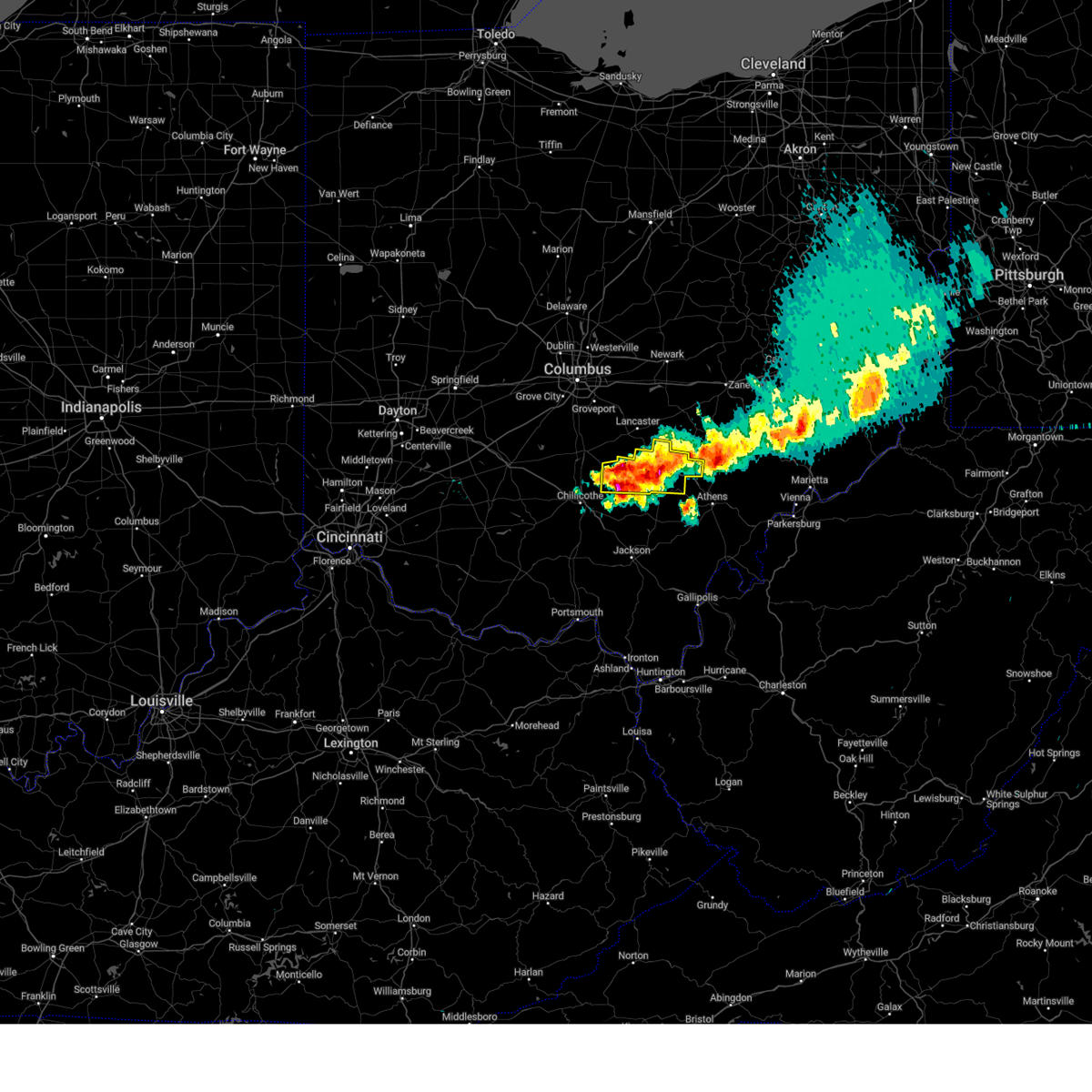 At 746 pm edt, a severe thunderstorm was located near hocking hills state park, moving east at 45 mph (radar indicated). Hazards include 60 mph wind gusts and quarter size hail. Minor hail damage to vehicles is possible. expect wind damage to trees and power lines. Locations impacted include, logan, nelsonville, hocking hills state park, hide-a-way hills, starr, laurelville, murray city, adelphi, ilesboro, gibisonville, hideaway hills, lake logan state park, haydenville, whisler, south bloomingville, enterprise, union furnace, rockbridge, and hallsville. At 746 pm edt, a severe thunderstorm was located near hocking hills state park, moving east at 45 mph (radar indicated). Hazards include 60 mph wind gusts and quarter size hail. Minor hail damage to vehicles is possible. expect wind damage to trees and power lines. Locations impacted include, logan, nelsonville, hocking hills state park, hide-a-way hills, starr, laurelville, murray city, adelphi, ilesboro, gibisonville, hideaway hills, lake logan state park, haydenville, whisler, south bloomingville, enterprise, union furnace, rockbridge, and hallsville.
|
| 4/17/2024 7:28 PM EDT |
 Svrrlx the national weather service in charleston west virginia has issued a * severe thunderstorm warning for, southeastern perry county in southeastern ohio, southwestern morgan county in southeastern ohio, northern athens county in southeastern ohio, * until 800 pm edt. * at 727 pm edt, a severe thunderstorm was located near shawnee, moving east at 35 mph (radar indicated). Hazards include 60 mph wind gusts and quarter size hail. Hail damage to vehicles is expected. Expect wind damage to roofs, siding, and trees. Svrrlx the national weather service in charleston west virginia has issued a * severe thunderstorm warning for, southeastern perry county in southeastern ohio, southwestern morgan county in southeastern ohio, northern athens county in southeastern ohio, * until 800 pm edt. * at 727 pm edt, a severe thunderstorm was located near shawnee, moving east at 35 mph (radar indicated). Hazards include 60 mph wind gusts and quarter size hail. Hail damage to vehicles is expected. Expect wind damage to roofs, siding, and trees.
|
| 4/17/2024 7:25 PM EDT |
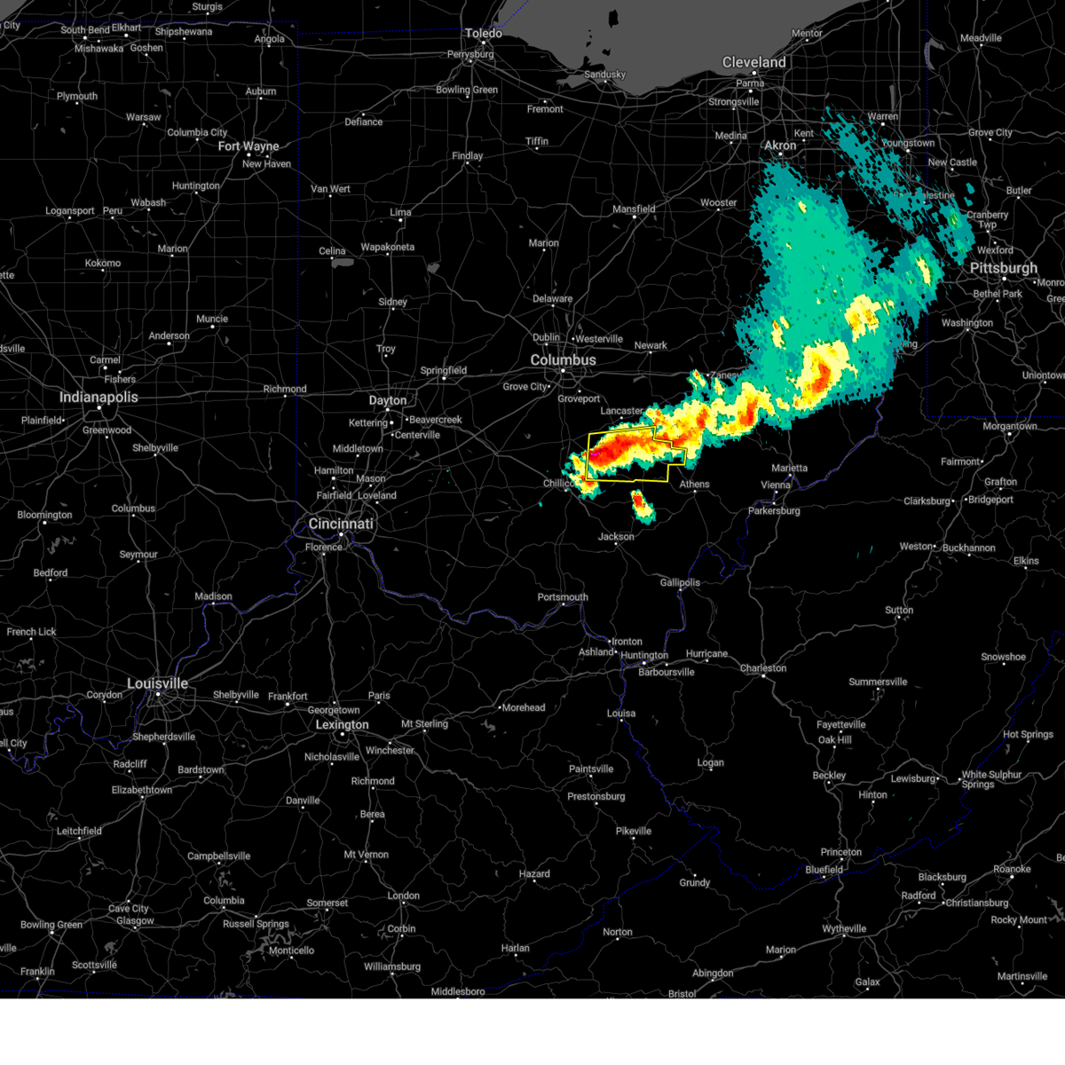 Svriln the national weather service in wilmington has issued a * severe thunderstorm warning for, southern fairfield county in central ohio, hocking county in central ohio, southeastern pickaway county in central ohio, northeastern ross county in south central ohio, * until 830 pm edt. * at 723 pm edt, a severe thunderstorm was located 10 miles northeast of kingston, moving east at 35 mph (radar indicated). Hazards include 60 mph wind gusts and quarter size hail. Minor hail damage to vehicles is possible. Expect wind damage to trees and power lines. Svriln the national weather service in wilmington has issued a * severe thunderstorm warning for, southern fairfield county in central ohio, hocking county in central ohio, southeastern pickaway county in central ohio, northeastern ross county in south central ohio, * until 830 pm edt. * at 723 pm edt, a severe thunderstorm was located 10 miles northeast of kingston, moving east at 35 mph (radar indicated). Hazards include 60 mph wind gusts and quarter size hail. Minor hail damage to vehicles is possible. Expect wind damage to trees and power lines.
|
| 3/14/2024 11:16 PM EDT |
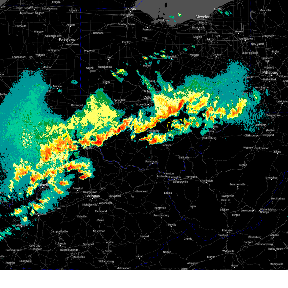 the severe thunderstorm warning has been cancelled and is no longer in effect the severe thunderstorm warning has been cancelled and is no longer in effect
|
| 3/14/2024 10:54 PM EDT |
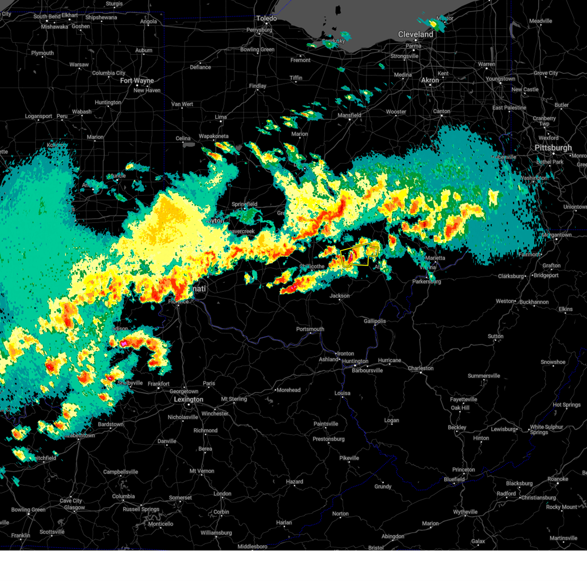 Svriln the national weather service in wilmington has issued a * severe thunderstorm warning for, central hocking county in central ohio, * until 1145 pm edt. * at 1053 pm edt, a severe thunderstorm was located near hocking hills state park, moving east at 70 mph (radar indicated). Hazards include 60 mph wind gusts and quarter size hail. Minor hail damage to vehicles is possible. Expect wind damage to trees and power lines. Svriln the national weather service in wilmington has issued a * severe thunderstorm warning for, central hocking county in central ohio, * until 1145 pm edt. * at 1053 pm edt, a severe thunderstorm was located near hocking hills state park, moving east at 70 mph (radar indicated). Hazards include 60 mph wind gusts and quarter size hail. Minor hail damage to vehicles is possible. Expect wind damage to trees and power lines.
|
| 3/3/2023 7:17 PM EST |
 At 715 pm est, a severe thunderstorm was located over tuppers plains, or near coolville, moving east at 60 mph (radar indicated). Hazards include 60 mph wind gusts. Expect damage to roofs, siding, and trees. locations impacted include, athens, nelsonville, gallipolis, glouster, rio grande, albany, rutland, chauncey, buchtel, jacksonville, trimble, vinton, wilkesville, adamsville, dyesville, salem center, harrisonville, gage, dexter and carpenter. hail threat, radar indicated max hail size, <. 75 in wind threat, radar indicated max wind gust, 60 mph. At 715 pm est, a severe thunderstorm was located over tuppers plains, or near coolville, moving east at 60 mph (radar indicated). Hazards include 60 mph wind gusts. Expect damage to roofs, siding, and trees. locations impacted include, athens, nelsonville, gallipolis, glouster, rio grande, albany, rutland, chauncey, buchtel, jacksonville, trimble, vinton, wilkesville, adamsville, dyesville, salem center, harrisonville, gage, dexter and carpenter. hail threat, radar indicated max hail size, <. 75 in wind threat, radar indicated max wind gust, 60 mph.
|
| 3/3/2023 6:58 PM EST |
 At 657 pm est, a line of severe thunderstorms was located 8 miles west of rutland, moving east at 60 mph (radar indicated). Hazards include 60 mph wind gusts. expect damage to roofs, siding, and trees At 657 pm est, a line of severe thunderstorms was located 8 miles west of rutland, moving east at 60 mph (radar indicated). Hazards include 60 mph wind gusts. expect damage to roofs, siding, and trees
|
| 3/3/2023 5:20 PM EST |
 At 517 pm est, a severe thunderstorm was located 10 miles west of rutland, moving east at 60 mph (radar indicated). Hazards include 60 mph wind gusts. Expect damage to roofs, siding, and trees. locations impacted include, athens, jackson, wellston, nelsonville, gallipolis, glouster, mcarthur, oak hill, rio grande, albany, rutland, lake hope state park, chauncey, hamden, buchtel, jacksonville, trimble, zaleski, vinton and wilkesville. hail threat, radar indicated max hail size, <. 75 in wind threat, radar indicated max wind gust, 60 mph. At 517 pm est, a severe thunderstorm was located 10 miles west of rutland, moving east at 60 mph (radar indicated). Hazards include 60 mph wind gusts. Expect damage to roofs, siding, and trees. locations impacted include, athens, jackson, wellston, nelsonville, gallipolis, glouster, mcarthur, oak hill, rio grande, albany, rutland, lake hope state park, chauncey, hamden, buchtel, jacksonville, trimble, zaleski, vinton and wilkesville. hail threat, radar indicated max hail size, <. 75 in wind threat, radar indicated max wind gust, 60 mph.
|
| 3/3/2023 4:57 PM EST |
 At 455 pm est, a severe thunderstorm was located over jackson, moving east at 65 mph (radar indicated). Hazards include 60 mph wind gusts. expect damage to roofs, siding, and trees At 455 pm est, a severe thunderstorm was located over jackson, moving east at 65 mph (radar indicated). Hazards include 60 mph wind gusts. expect damage to roofs, siding, and trees
|
| 8/21/2022 3:50 PM EDT |
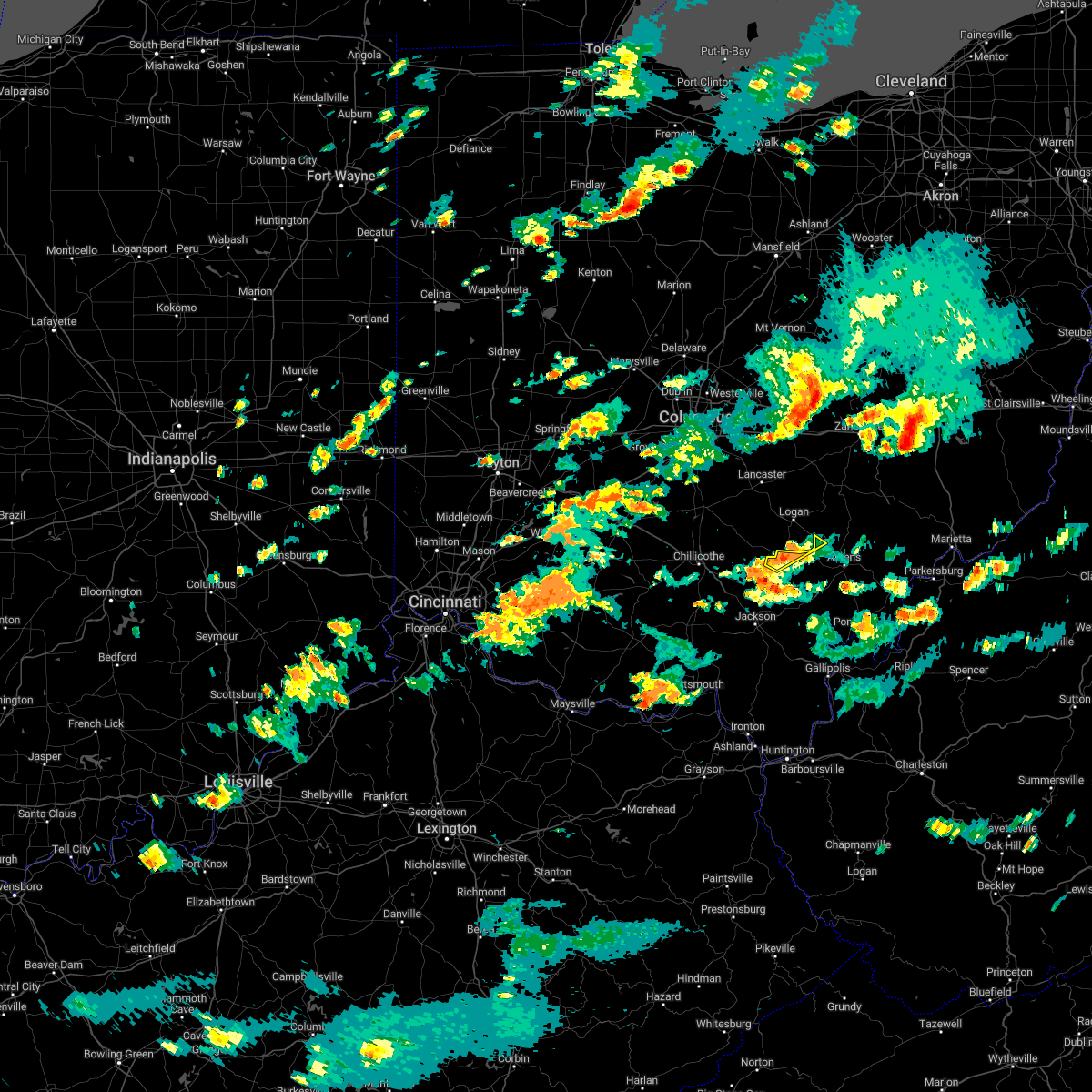 The severe thunderstorm warning for north central vinton and west central athens counties will expire at 400 pm edt, the storm which prompted the warning has weakened below severe limits, and no longer poses an immediate threat to life or property. therefore, the warning will be allowed to expire. however gusty winds are still possible with this thunderstorm. The severe thunderstorm warning for north central vinton and west central athens counties will expire at 400 pm edt, the storm which prompted the warning has weakened below severe limits, and no longer poses an immediate threat to life or property. therefore, the warning will be allowed to expire. however gusty winds are still possible with this thunderstorm.
|
| 8/21/2022 3:34 PM EDT |
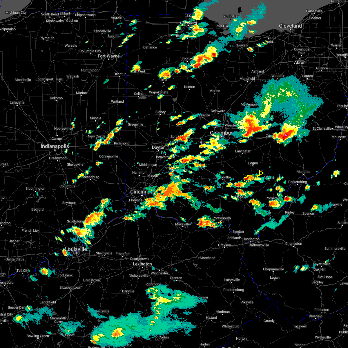 At 333 pm edt, a severe thunderstorm was located near hocking hills state park, or 7 miles north of mcarthur, moving northeast at 15 mph (radar indicated). Hazards include 60 mph wind gusts and quarter size hail. Hail damage to vehicles is expected. expect wind damage to roofs, siding, and trees. this severe thunderstorm will remain over mainly rural areas of north central vinton and west central athens counties. hail threat, radar indicated max hail size, 1. 00 in wind threat, radar indicated max wind gust, 60 mph. At 333 pm edt, a severe thunderstorm was located near hocking hills state park, or 7 miles north of mcarthur, moving northeast at 15 mph (radar indicated). Hazards include 60 mph wind gusts and quarter size hail. Hail damage to vehicles is expected. expect wind damage to roofs, siding, and trees. this severe thunderstorm will remain over mainly rural areas of north central vinton and west central athens counties. hail threat, radar indicated max hail size, 1. 00 in wind threat, radar indicated max wind gust, 60 mph.
|
| 7/23/2022 1:47 PM EDT |
 At 146 pm edt, a severe thunderstorm was located over albany, moving east at 35 mph (radar indicated). Hazards include 60 mph wind gusts and nickel size hail. expect damage to roofs, siding, and trees At 146 pm edt, a severe thunderstorm was located over albany, moving east at 35 mph (radar indicated). Hazards include 60 mph wind gusts and nickel size hail. expect damage to roofs, siding, and trees
|
| 6/22/2022 6:38 PM EDT |
 At 638 pm edt, a severe thunderstorm was located near athens, moving southeast at 15 mph (radar indicated). Hazards include 60 mph wind gusts and quarter size hail. Hail damage to vehicles is expected. expect wind damage to roofs, siding, and trees. locations impacted include, athens, nelsonville, chauncey, buchtel, amesville and the plains. hail threat, radar indicated max hail size, 1. 00 in wind threat, radar indicated max wind gust, 60 mph. At 638 pm edt, a severe thunderstorm was located near athens, moving southeast at 15 mph (radar indicated). Hazards include 60 mph wind gusts and quarter size hail. Hail damage to vehicles is expected. expect wind damage to roofs, siding, and trees. locations impacted include, athens, nelsonville, chauncey, buchtel, amesville and the plains. hail threat, radar indicated max hail size, 1. 00 in wind threat, radar indicated max wind gust, 60 mph.
|
| 6/22/2022 6:09 PM EDT |
 At 609 pm edt, a severe thunderstorm was located over nelsonville, moving southeast at 15 mph (radar indicated). Hazards include 60 mph wind gusts and quarter size hail. Hail damage to vehicles is expected. Expect wind damage to roofs, siding, and trees. At 609 pm edt, a severe thunderstorm was located over nelsonville, moving southeast at 15 mph (radar indicated). Hazards include 60 mph wind gusts and quarter size hail. Hail damage to vehicles is expected. Expect wind damage to roofs, siding, and trees.
|
| 6/13/2022 9:28 PM EDT | Trees dow in athens county OH, 1.8 miles ESE of Nelsonville, OH |
| 6/13/2022 8:28 PM EDT | One small tree reported down on minkers run road. time estimated by rada in athens county OH, 1.3 miles ENE of Nelsonville, OH |
| 6/13/2022 8:25 PM EDT | Several trees dow in athens county OH, 1.3 miles ESE of Nelsonville, OH |
| 6/13/2022 8:23 PM EDT | Corrects previous tstm wnd dmg report from nelsonville. several trees dow in athens county OH, 1.3 miles ESE of Nelsonville, OH |
| 6/8/2022 7:55 PM EDT |
 The tornado warning for southeastern hocking county will expire at 800 pm edt, the storm which prompted the warning has moved out of the area. therefore, the warning will be allowed to expire. a tornado watch remains in effect until 1000 pm edt for central ohio. please report previous tornadoes, wind damage or hail to the national weather service by going to our website at weather.gov/iln and submitting your report via social media. remember, a severe thunderstorm warning still remains in effect for portions of southwest hocking county until 815 pm edt. The tornado warning for southeastern hocking county will expire at 800 pm edt, the storm which prompted the warning has moved out of the area. therefore, the warning will be allowed to expire. a tornado watch remains in effect until 1000 pm edt for central ohio. please report previous tornadoes, wind damage or hail to the national weather service by going to our website at weather.gov/iln and submitting your report via social media. remember, a severe thunderstorm warning still remains in effect for portions of southwest hocking county until 815 pm edt.
|
| 6/8/2022 7:49 PM EDT |
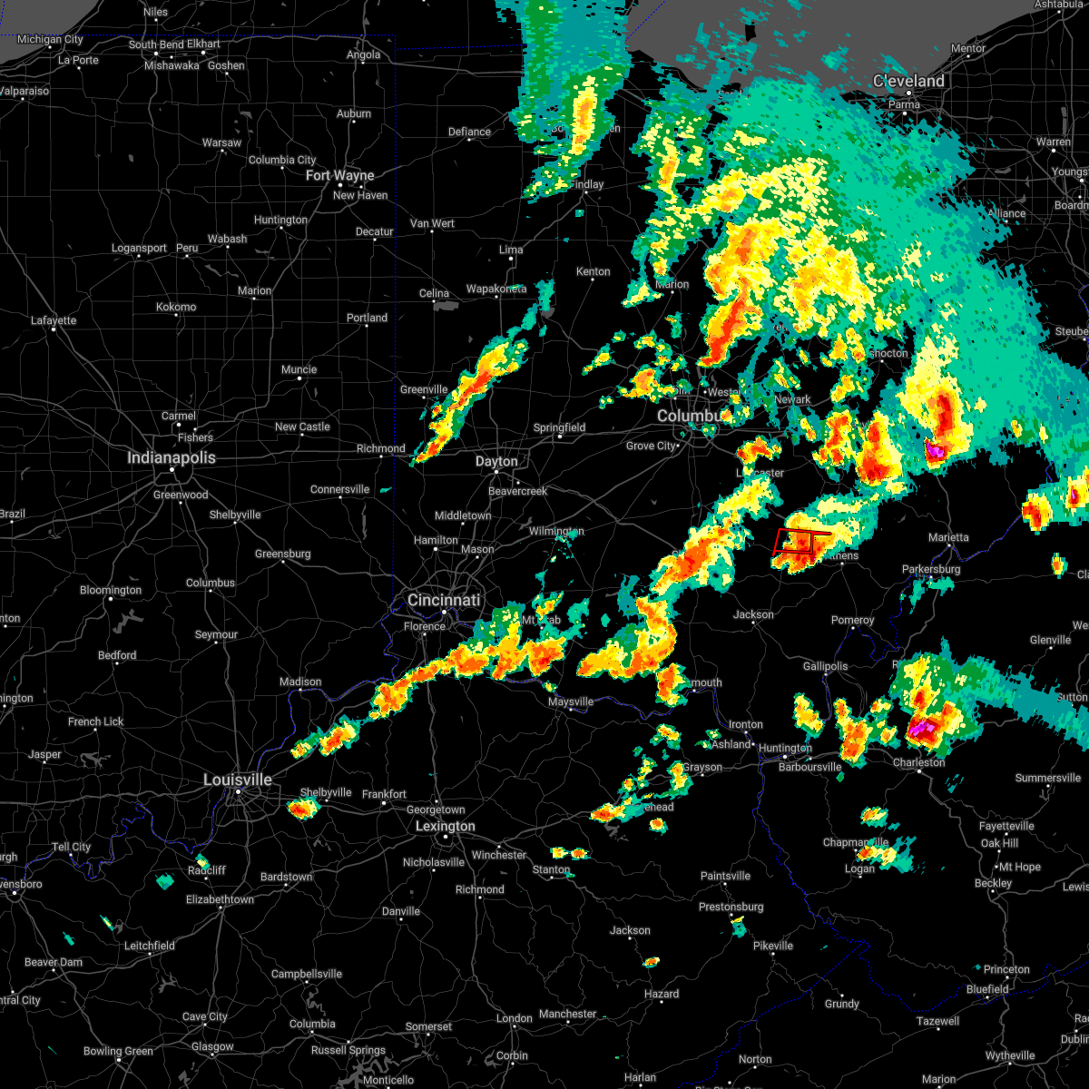 At 749 pm edt, a severe thunderstorm capable of producing a tornado was located near lake hope state park, moving east at 40 mph. this storm previously produced a tornado and may generate another tornado at any time (radar indicated rotation). Hazards include tornado. Flying debris will be dangerous to those caught without shelter. mobile homes will be damaged or destroyed. damage to roofs, windows, and vehicles will occur. tree damage is likely. Locations impacted include, nelsonville, starr, ilesboro, union furnace and haydenville. At 749 pm edt, a severe thunderstorm capable of producing a tornado was located near lake hope state park, moving east at 40 mph. this storm previously produced a tornado and may generate another tornado at any time (radar indicated rotation). Hazards include tornado. Flying debris will be dangerous to those caught without shelter. mobile homes will be damaged or destroyed. damage to roofs, windows, and vehicles will occur. tree damage is likely. Locations impacted include, nelsonville, starr, ilesboro, union furnace and haydenville.
|
| 6/8/2022 7:42 PM EDT |
 At 742 pm edt, a severe thunderstorm capable of producing a tornado was located over lake hope state park, moving east at 50 mph (radar indicated rotation). Hazards include tornado. Flying debris will be dangerous to those caught without shelter. mobile homes will be damaged or destroyed. damage to roofs, windows, and vehicles will occur. tree damage is likely. this dangerous storm will be near, nelsonville and nelsonville around 750 pm edt. buchtel around 755 pm edt. Other locations impacted by this tornadic thunderstorm include buchtel. At 742 pm edt, a severe thunderstorm capable of producing a tornado was located over lake hope state park, moving east at 50 mph (radar indicated rotation). Hazards include tornado. Flying debris will be dangerous to those caught without shelter. mobile homes will be damaged or destroyed. damage to roofs, windows, and vehicles will occur. tree damage is likely. this dangerous storm will be near, nelsonville and nelsonville around 750 pm edt. buchtel around 755 pm edt. Other locations impacted by this tornadic thunderstorm include buchtel.
|
| 6/8/2022 7:42 PM EDT |
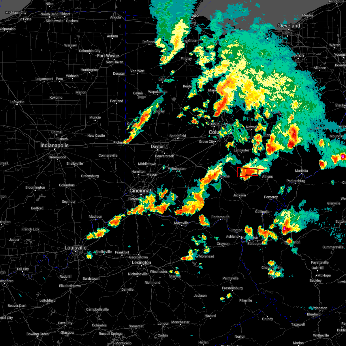 At 742 pm edt, a severe thunderstorm capable of producing a tornado was located near lake hope state park, moving east at 40 mph. this storm previously produced a tornado and may generate another tornado at any time (radar indicated rotation). Hazards include tornado. Flying debris will be dangerous to those caught without shelter. mobile homes will be damaged or destroyed. damage to roofs, windows, and vehicles will occur. tree damage is likely. Locations impacted include, nelsonville, hocking hills state park, starr, south bloomingville, ilesboro, union furnace and haydenville. At 742 pm edt, a severe thunderstorm capable of producing a tornado was located near lake hope state park, moving east at 40 mph. this storm previously produced a tornado and may generate another tornado at any time (radar indicated rotation). Hazards include tornado. Flying debris will be dangerous to those caught without shelter. mobile homes will be damaged or destroyed. damage to roofs, windows, and vehicles will occur. tree damage is likely. Locations impacted include, nelsonville, hocking hills state park, starr, south bloomingville, ilesboro, union furnace and haydenville.
|
| 6/8/2022 7:31 PM EDT |
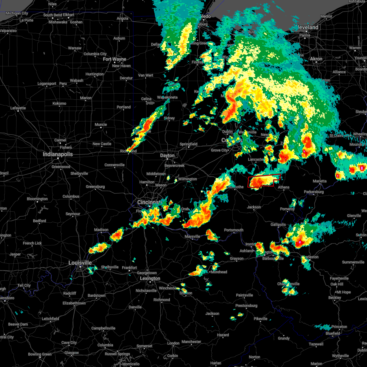 At 730 pm edt, a confirmed large and extremely dangerous tornado was located in thunderstorms over hocking hills state park, moving east at 40 mph. this is a particularly dangerous situation. take cover now! (radar confirmed tornado. radar shows tornado debris in the air). Hazards include damaging tornado. You are in a life-threatening situation. flying debris may be deadly to those caught without shelter. mobile homes will be destroyed. considerable damage to homes, businesses, and vehicles is likely and complete destruction is possible. Locations impacted include, logan, nelsonville, hocking hills state park, starr, laurelville, murray city, south bloomingville, gibisonville, ilesboro, union furnace, haydenville and carbon hill. At 730 pm edt, a confirmed large and extremely dangerous tornado was located in thunderstorms over hocking hills state park, moving east at 40 mph. this is a particularly dangerous situation. take cover now! (radar confirmed tornado. radar shows tornado debris in the air). Hazards include damaging tornado. You are in a life-threatening situation. flying debris may be deadly to those caught without shelter. mobile homes will be destroyed. considerable damage to homes, businesses, and vehicles is likely and complete destruction is possible. Locations impacted include, logan, nelsonville, hocking hills state park, starr, laurelville, murray city, south bloomingville, gibisonville, ilesboro, union furnace, haydenville and carbon hill.
|
| 6/8/2022 7:25 PM EDT |
 At 725 pm edt, a severe thunderstorm capable of producing a tornado was located near hocking hills state park, or 11 miles northwest of mcarthur, moving east at 50 mph (radar indicated rotation). Hazards include tornado. Flying debris will be dangerous to those caught without shelter. mobile homes will be damaged or destroyed. damage to roofs, windows, and vehicles will occur. tree damage is likely. this dangerous storm will be near, lake hope state park around 745 pm edt. nelsonville around 750 pm edt. nelsonville and buchtel around 755 pm edt. Other locations impacted by this tornadic thunderstorm include buchtel. At 725 pm edt, a severe thunderstorm capable of producing a tornado was located near hocking hills state park, or 11 miles northwest of mcarthur, moving east at 50 mph (radar indicated rotation). Hazards include tornado. Flying debris will be dangerous to those caught without shelter. mobile homes will be damaged or destroyed. damage to roofs, windows, and vehicles will occur. tree damage is likely. this dangerous storm will be near, lake hope state park around 745 pm edt. nelsonville around 750 pm edt. nelsonville and buchtel around 755 pm edt. Other locations impacted by this tornadic thunderstorm include buchtel.
|
| 6/8/2022 7:24 PM EDT |
 At 724 pm edt, a confirmed large and extremely dangerous tornado was located in thunderstorms near hocking hills state park, moving east at 30 mph. this is a particularly dangerous situation. take cover now! (radar confirmed tornado. radar shows tornado debris in the air). Hazards include damaging tornado. You are in a life-threatening situation. flying debris may be deadly to those caught without shelter. mobile homes will be destroyed. considerable damage to homes, businesses, and vehicles is likely and complete destruction is possible. Locations impacted include, logan, nelsonville, hocking hills state park, starr, laurelville, murray city, south bloomingville, gibisonville, ilesboro, union furnace, haydenville and carbon hill. At 724 pm edt, a confirmed large and extremely dangerous tornado was located in thunderstorms near hocking hills state park, moving east at 30 mph. this is a particularly dangerous situation. take cover now! (radar confirmed tornado. radar shows tornado debris in the air). Hazards include damaging tornado. You are in a life-threatening situation. flying debris may be deadly to those caught without shelter. mobile homes will be destroyed. considerable damage to homes, businesses, and vehicles is likely and complete destruction is possible. Locations impacted include, logan, nelsonville, hocking hills state park, starr, laurelville, murray city, south bloomingville, gibisonville, ilesboro, union furnace, haydenville and carbon hill.
|
| 6/8/2022 7:20 PM EDT |
 At 720 pm edt, a severe thunderstorm was located 9 miles southwest of hocking hills state park, or 14 miles northwest of mcarthur, moving east at 50 mph (radar indicated). Hazards include 70 mph wind gusts and penny size hail. Expect considerable tree damage. Damage is likely to mobile homes, roofs, and outbuildings. At 720 pm edt, a severe thunderstorm was located 9 miles southwest of hocking hills state park, or 14 miles northwest of mcarthur, moving east at 50 mph (radar indicated). Hazards include 70 mph wind gusts and penny size hail. Expect considerable tree damage. Damage is likely to mobile homes, roofs, and outbuildings.
|
| 6/8/2022 7:12 PM EDT |
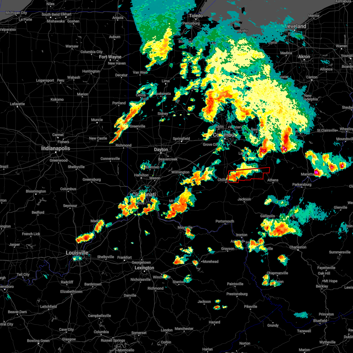 At 711 pm edt, a severe thunderstorm capable of producing a tornado was located 8 miles southeast of kingston, moving east at 40 mph (radar indicated rotation). Hazards include tornado. Flying debris will be dangerous to those caught without shelter. mobile homes will be damaged or destroyed. damage to roofs, windows, and vehicles will occur. Tree damage is likely. At 711 pm edt, a severe thunderstorm capable of producing a tornado was located 8 miles southeast of kingston, moving east at 40 mph (radar indicated rotation). Hazards include tornado. Flying debris will be dangerous to those caught without shelter. mobile homes will be damaged or destroyed. damage to roofs, windows, and vehicles will occur. Tree damage is likely.
|
| 5/3/2022 5:45 PM EDT |
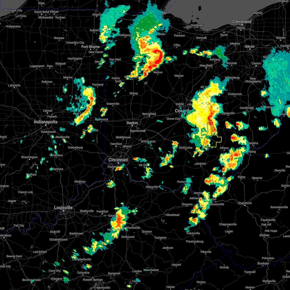 At 545 pm edt, a severe thunderstorm was located near shawnee, moving east at 40 mph (radar indicated). Hazards include 60 mph wind gusts. Expect damage to trees and power lines. locations impacted include, logan, nelsonville, bremen, hocking hills state park, hide-a-way hills, starr, murray city, rushville, west rushville, ilesboro, haydenville, lake logan state park, enterprise, union furnace, oreville and carbon hill. hail threat, radar indicated max hail size, <. 75 in wind threat, radar indicated max wind gust, 60 mph. At 545 pm edt, a severe thunderstorm was located near shawnee, moving east at 40 mph (radar indicated). Hazards include 60 mph wind gusts. Expect damage to trees and power lines. locations impacted include, logan, nelsonville, bremen, hocking hills state park, hide-a-way hills, starr, murray city, rushville, west rushville, ilesboro, haydenville, lake logan state park, enterprise, union furnace, oreville and carbon hill. hail threat, radar indicated max hail size, <. 75 in wind threat, radar indicated max wind gust, 60 mph.
|
| 5/3/2022 5:32 PM EDT |
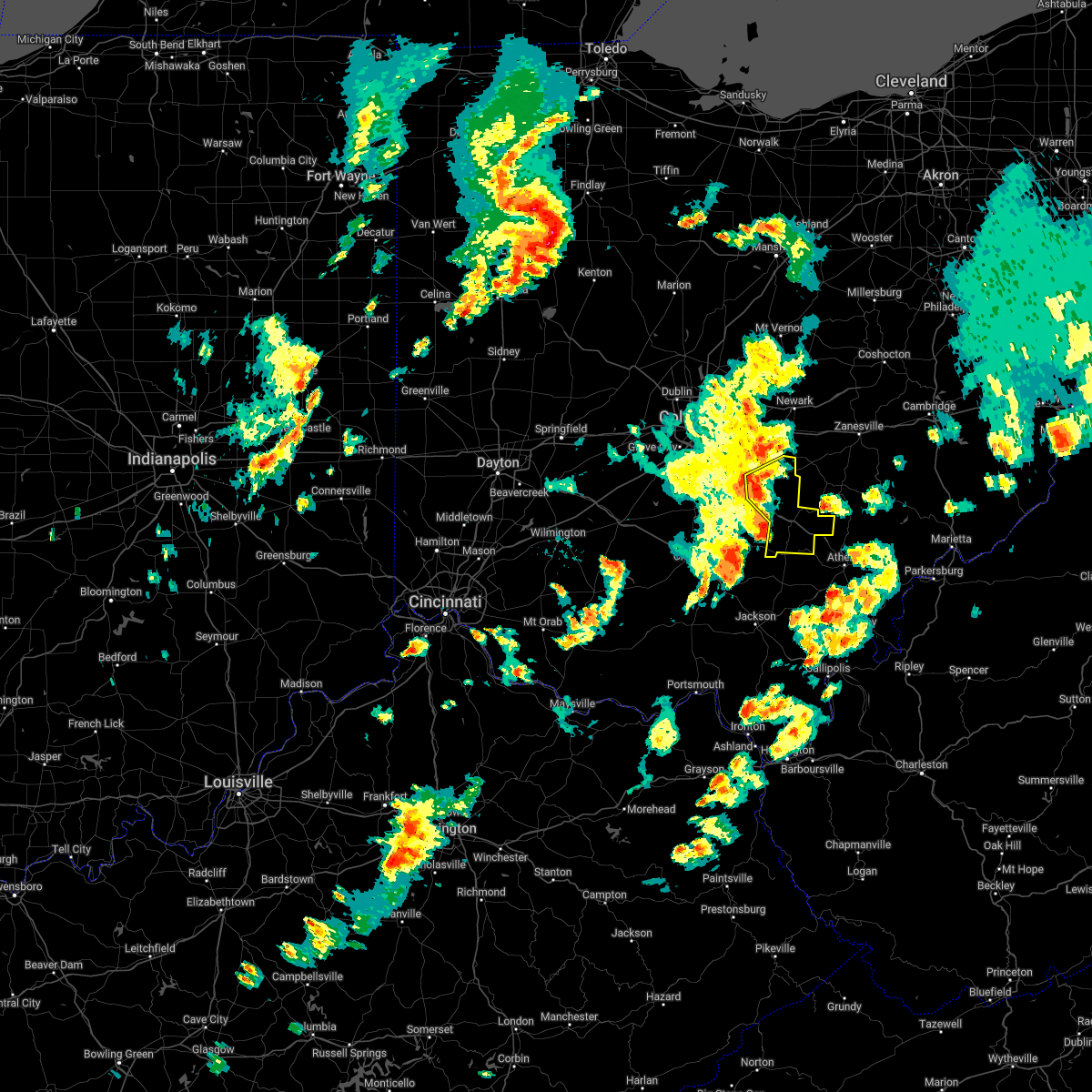 At 532 pm edt, a severe thunderstorm was located near hide-a-way hills, moving northeast at 45 mph (radar indicated). Hazards include 60 mph wind gusts. Expect damage to trees and power lines. locations impacted include, lancaster, logan, nelsonville, bremen, pleasantville, hocking hills state park, hide-a-way hills, starr, murray city, sugar grove, rushville, west rushville, fairfield county airport, ilesboro, haydenville, north berne, union furnace, oreville and carbon hill. hail threat, radar indicated max hail size, <. 75 in wind threat, radar indicated max wind gust, 60 mph. At 532 pm edt, a severe thunderstorm was located near hide-a-way hills, moving northeast at 45 mph (radar indicated). Hazards include 60 mph wind gusts. Expect damage to trees and power lines. locations impacted include, lancaster, logan, nelsonville, bremen, pleasantville, hocking hills state park, hide-a-way hills, starr, murray city, sugar grove, rushville, west rushville, fairfield county airport, ilesboro, haydenville, north berne, union furnace, oreville and carbon hill. hail threat, radar indicated max hail size, <. 75 in wind threat, radar indicated max wind gust, 60 mph.
|
| 5/3/2022 5:24 PM EDT |
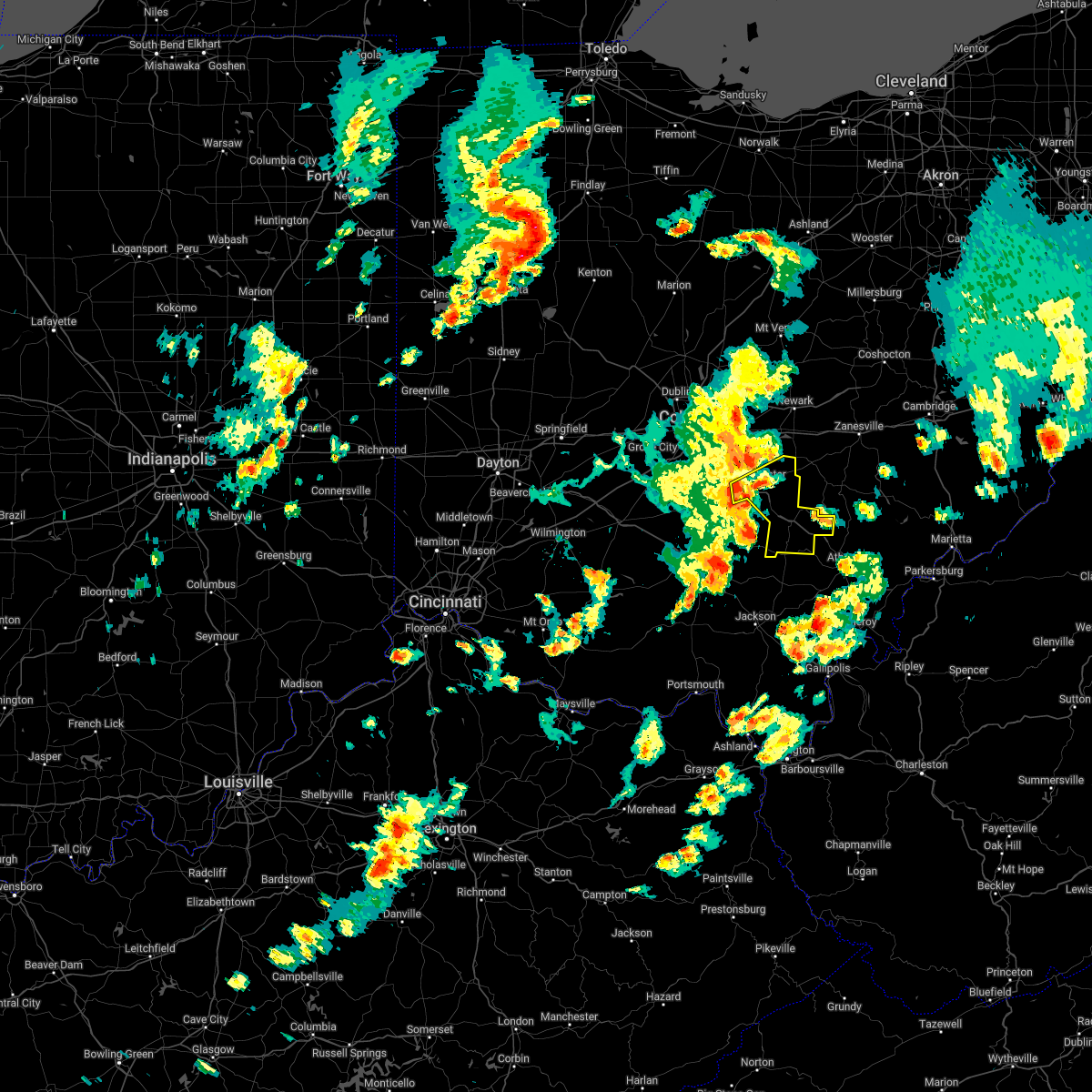 At 523 pm edt, a severe thunderstorm was located near hocking hills state park, moving east at 40 mph (radar indicated). Hazards include 60 mph wind gusts and penny size hail. expect damage to trees and power lines At 523 pm edt, a severe thunderstorm was located near hocking hills state park, moving east at 40 mph (radar indicated). Hazards include 60 mph wind gusts and penny size hail. expect damage to trees and power lines
|
| 3/23/2022 6:28 PM EDT |
 At 628 pm edt, a severe thunderstorm was located over wellston, moving northeast at 70 mph (radar indicated). Hazards include 60 mph wind gusts and quarter size hail. Hail damage to vehicles is expected. Expect wind damage to roofs, siding, and trees. At 628 pm edt, a severe thunderstorm was located over wellston, moving northeast at 70 mph (radar indicated). Hazards include 60 mph wind gusts and quarter size hail. Hail damage to vehicles is expected. Expect wind damage to roofs, siding, and trees.
|
| 3/23/2022 5:55 PM EDT |
 At 554 pm edt, a severe thunderstorm capable of producing a tornado was located over buchtel, or near nelsonville, moving northeast at 55 mph (radar indicated rotation). Hazards include tornado. Flying debris will be dangerous to those caught without shelter. mobile homes will be damaged or destroyed. damage to roofs, windows, and vehicles will occur. tree damage is likely. this dangerous storm will be near, glouster around 600 pm edt. mcconnelsville around 620 pm edt. Other locations impacted by this tornadic thunderstorm include eagleport, chauncey, buchtel, bristol, trimble, burr oak state park, rendville, jacksonville, malta and the plains. At 554 pm edt, a severe thunderstorm capable of producing a tornado was located over buchtel, or near nelsonville, moving northeast at 55 mph (radar indicated rotation). Hazards include tornado. Flying debris will be dangerous to those caught without shelter. mobile homes will be damaged or destroyed. damage to roofs, windows, and vehicles will occur. tree damage is likely. this dangerous storm will be near, glouster around 600 pm edt. mcconnelsville around 620 pm edt. Other locations impacted by this tornadic thunderstorm include eagleport, chauncey, buchtel, bristol, trimble, burr oak state park, rendville, jacksonville, malta and the plains.
|
| 3/23/2022 3:09 PM EDT |
 At 308 pm edt, a severe thunderstorm was located near lake hope state park, moving northeast at 55 mph (radar indicated). Hazards include 60 mph wind gusts and quarter size hail. Hail damage to vehicles is expected. expect wind damage to roofs, siding, and trees. Locations impacted include, athens, nelsonville, glouster, albany, chauncey, buchtel, jacksonville, trimble, stroud run state park and the plains. At 308 pm edt, a severe thunderstorm was located near lake hope state park, moving northeast at 55 mph (radar indicated). Hazards include 60 mph wind gusts and quarter size hail. Hail damage to vehicles is expected. expect wind damage to roofs, siding, and trees. Locations impacted include, athens, nelsonville, glouster, albany, chauncey, buchtel, jacksonville, trimble, stroud run state park and the plains.
|
| 3/23/2022 2:56 PM EDT |
 At 255 pm edt, a severe thunderstorm was located over mcarthur, moving northeast at 55 mph (radar indicated). Hazards include 60 mph wind gusts and quarter size hail. Hail damage to vehicles is expected. expect wind damage to roofs, siding, and trees. Locations impacted include, athens, nelsonville, glouster, mcarthur, albany, lake hope state park, chauncey, buchtel, jacksonville, trimble, zaleski, creola, stroud run state park and the plains. At 255 pm edt, a severe thunderstorm was located over mcarthur, moving northeast at 55 mph (radar indicated). Hazards include 60 mph wind gusts and quarter size hail. Hail damage to vehicles is expected. expect wind damage to roofs, siding, and trees. Locations impacted include, athens, nelsonville, glouster, mcarthur, albany, lake hope state park, chauncey, buchtel, jacksonville, trimble, zaleski, creola, stroud run state park and the plains.
|
| 3/23/2022 2:43 PM EDT |
 At 242 pm edt, a severe thunderstorm was located near wellston, moving northeast at 55 mph (radar indicated). Hazards include 60 mph wind gusts and quarter size hail. Hail damage to vehicles is expected. Expect wind damage to roofs, siding, and trees. At 242 pm edt, a severe thunderstorm was located near wellston, moving northeast at 55 mph (radar indicated). Hazards include 60 mph wind gusts and quarter size hail. Hail damage to vehicles is expected. Expect wind damage to roofs, siding, and trees.
|
| 7/29/2021 4:54 PM EDT |
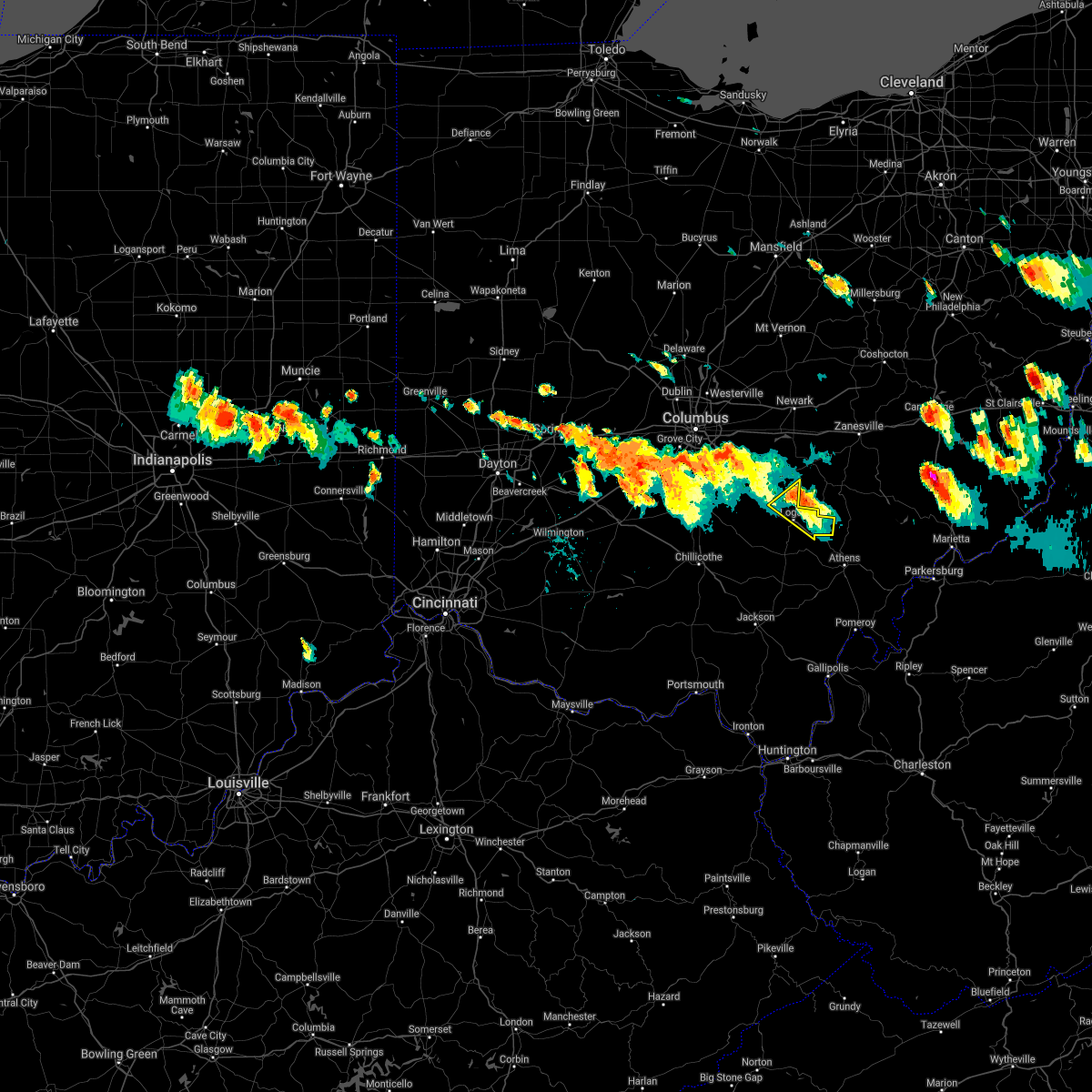 At 454 pm edt, a severe thunderstorm was located near hide-a-way hills, moving southeast at 25 mph (radar indicated). Hazards include 60 mph wind gusts and quarter size hail. Minor hail damage to vehicles is possible. expect wind damage to trees and power lines. Locations impacted include, logan, nelsonville, hide-a-way hills, murray city, enterprise, hideaway hills, haydenville, oreville, carbon hill and rockbridge. At 454 pm edt, a severe thunderstorm was located near hide-a-way hills, moving southeast at 25 mph (radar indicated). Hazards include 60 mph wind gusts and quarter size hail. Minor hail damage to vehicles is possible. expect wind damage to trees and power lines. Locations impacted include, logan, nelsonville, hide-a-way hills, murray city, enterprise, hideaway hills, haydenville, oreville, carbon hill and rockbridge.
|
| 7/29/2021 4:24 PM EDT |
 At 424 pm edt, a severe thunderstorm was located over lancaster, moving southeast at 25 mph (radar indicated). Hazards include 60 mph wind gusts and quarter size hail. Minor hail damage to vehicles is possible. Expect wind damage to trees and power lines. At 424 pm edt, a severe thunderstorm was located over lancaster, moving southeast at 25 mph (radar indicated). Hazards include 60 mph wind gusts and quarter size hail. Minor hail damage to vehicles is possible. Expect wind damage to trees and power lines.
|
| 11/15/2020 1:18 PM EST |
 At 117 pm est, severe thunderstorms were located along a line extending from near farmerstown to near chesterhill to 6 miles southwest of rio grande, moving east at 50 mph (radar indicated. at severe wind gust of 58 mph was recorded at the ohio university airport with this line of storms). Hazards include 60 mph wind gusts. Expect damage to roofs, siding, and trees. Locations impacted include, athens, marietta, belpre, jackson, wellston, glouster, mcconnelsville, beverly, albany, coolville, rutland, chesterhill, tuppers plains, washington, crooksville, chester, chauncey, malta, corning and lowell. At 117 pm est, severe thunderstorms were located along a line extending from near farmerstown to near chesterhill to 6 miles southwest of rio grande, moving east at 50 mph (radar indicated. at severe wind gust of 58 mph was recorded at the ohio university airport with this line of storms). Hazards include 60 mph wind gusts. Expect damage to roofs, siding, and trees. Locations impacted include, athens, marietta, belpre, jackson, wellston, glouster, mcconnelsville, beverly, albany, coolville, rutland, chesterhill, tuppers plains, washington, crooksville, chester, chauncey, malta, corning and lowell.
|
| 11/15/2020 1:13 PM EST |
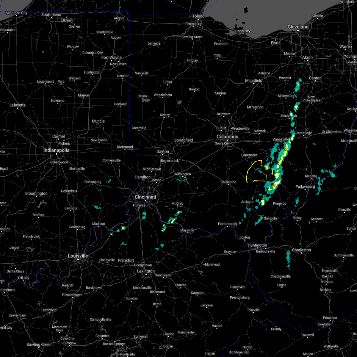 The severe thunderstorm warning for southeastern fairfield and hocking counties will expire at 115 pm est, the storms which prompted the warning have moved out of the area. therefore, the warning will be allowed to expire. however gusty winds are still possible with these thunderstorms. a severe thunderstorm watch remains in effect until 400 pm est for central ohio. please report previous wind damage or hail to the national weather service by going to our website at weather.gov/iln and submitting your report via social media. The severe thunderstorm warning for southeastern fairfield and hocking counties will expire at 115 pm est, the storms which prompted the warning have moved out of the area. therefore, the warning will be allowed to expire. however gusty winds are still possible with these thunderstorms. a severe thunderstorm watch remains in effect until 400 pm est for central ohio. please report previous wind damage or hail to the national weather service by going to our website at weather.gov/iln and submitting your report via social media.
|
| 11/15/2020 1:02 PM EST |
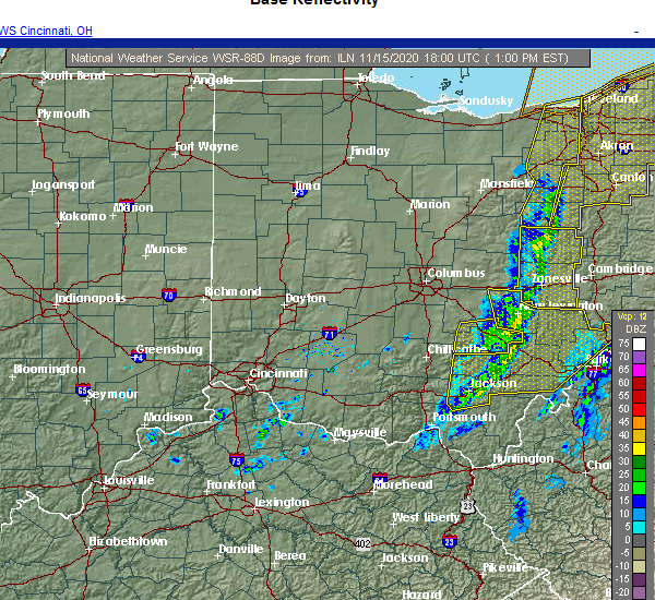 At 102 pm est, severe thunderstorms were located along a line extending from near south zanesville to near shawnee, moving northeast at 65 mph (radar indicated). Hazards include 60 mph wind gusts. Expect damage to trees and power lines. Locations impacted include, logan, nelsonville, hocking hills state park, hide-a-way hills, starr, murray city, gibisonville, ilesboro, hideaway hills, haydenville, lake logan state park, south bloomingville, enterprise, union furnace, rockbridge, oreville and carbon hill. At 102 pm est, severe thunderstorms were located along a line extending from near south zanesville to near shawnee, moving northeast at 65 mph (radar indicated). Hazards include 60 mph wind gusts. Expect damage to trees and power lines. Locations impacted include, logan, nelsonville, hocking hills state park, hide-a-way hills, starr, murray city, gibisonville, ilesboro, hideaway hills, haydenville, lake logan state park, south bloomingville, enterprise, union furnace, rockbridge, oreville and carbon hill.
|
| 11/15/2020 12:51 PM EST |
 At 1249 pm est, severe thunderstorms were located along a line extending from near danville to near logan to clarktown, moving east at 50 mph (radar indicated). Hazards include 60 mph wind gusts. Expect damage to roofs, siding, and trees. Locations impacted include, athens, marietta, belpre, jackson, wellston, nelsonville, new lexington, glouster, mcconnelsville, mcarthur, somerset, beverly, albany, shawnee, coolville, rutland, chesterhill, perry state forest, lake hope state park and tuppers plains. At 1249 pm est, severe thunderstorms were located along a line extending from near danville to near logan to clarktown, moving east at 50 mph (radar indicated). Hazards include 60 mph wind gusts. Expect damage to roofs, siding, and trees. Locations impacted include, athens, marietta, belpre, jackson, wellston, nelsonville, new lexington, glouster, mcconnelsville, mcarthur, somerset, beverly, albany, shawnee, coolville, rutland, chesterhill, perry state forest, lake hope state park and tuppers plains.
|
| 11/15/2020 12:49 PM EST |
 At 1248 pm est, severe thunderstorms were located along a line extending from near somerset to near logan, moving northeast at 65 mph (radar indicated). Hazards include 60 mph wind gusts. Expect damage to trees and power lines. Locations impacted include, logan, nelsonville, hocking hills state park, hide-a-way hills, starr, laurelville, murray city, sugar grove, buena vista in hocking county, gibisonville, ilesboro, hideaway hills, haydenville, lake logan state park, south bloomingville, clearport, enterprise, union furnace, rockbridge and oreville. At 1248 pm est, severe thunderstorms were located along a line extending from near somerset to near logan, moving northeast at 65 mph (radar indicated). Hazards include 60 mph wind gusts. Expect damage to trees and power lines. Locations impacted include, logan, nelsonville, hocking hills state park, hide-a-way hills, starr, laurelville, murray city, sugar grove, buena vista in hocking county, gibisonville, ilesboro, hideaway hills, haydenville, lake logan state park, south bloomingville, clearport, enterprise, union furnace, rockbridge and oreville.
|
| 11/15/2020 12:29 PM EST |
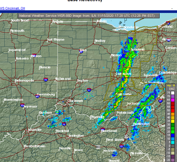 At 1229 pm est, severe thunderstorms were located along a line extending from 6 miles southwest of lancaster to 8 miles east of kingston, moving northeast at 65 mph (radar indicated). Hazards include 60 mph wind gusts. expect damage to trees and power lines At 1229 pm est, severe thunderstorms were located along a line extending from 6 miles southwest of lancaster to 8 miles east of kingston, moving northeast at 65 mph (radar indicated). Hazards include 60 mph wind gusts. expect damage to trees and power lines
|
| 11/15/2020 12:25 PM EST |
 At 1224 pm est, severe thunderstorms were located along a line extending from chesterville to 10 miles northeast of kingston to 10 miles southeast of peebles, moving east at 50 mph. sporadic severe wind gusts are likely with this line of thunderstorms (radar indicated). Hazards include 60 mph wind gusts. expect damage to roofs, siding, and trees At 1224 pm est, severe thunderstorms were located along a line extending from chesterville to 10 miles northeast of kingston to 10 miles southeast of peebles, moving east at 50 mph. sporadic severe wind gusts are likely with this line of thunderstorms (radar indicated). Hazards include 60 mph wind gusts. expect damage to roofs, siding, and trees
|
| 8/25/2020 4:53 PM EDT |
 The severe thunderstorm warning for western athens and northeastern vinton counties will expire at 500 pm edt, the storm which prompted the warning has moved out of the area. therefore, the warning will be allowed to expire. a severe thunderstorm watch remains in effect until 1100 pm edt for southeastern ohio. The severe thunderstorm warning for western athens and northeastern vinton counties will expire at 500 pm edt, the storm which prompted the warning has moved out of the area. therefore, the warning will be allowed to expire. a severe thunderstorm watch remains in effect until 1100 pm edt for southeastern ohio.
|
| 8/25/2020 4:27 PM EDT |
 At 427 pm edt, a severe thunderstorm was located near nelsonville, moving southeast at 25 mph (radar indicated). Hazards include 60 mph wind gusts and penny size hail. expect damage to roofs, siding, and trees At 427 pm edt, a severe thunderstorm was located near nelsonville, moving southeast at 25 mph (radar indicated). Hazards include 60 mph wind gusts and penny size hail. expect damage to roofs, siding, and trees
|
| 8/25/2020 4:27 PM EDT |
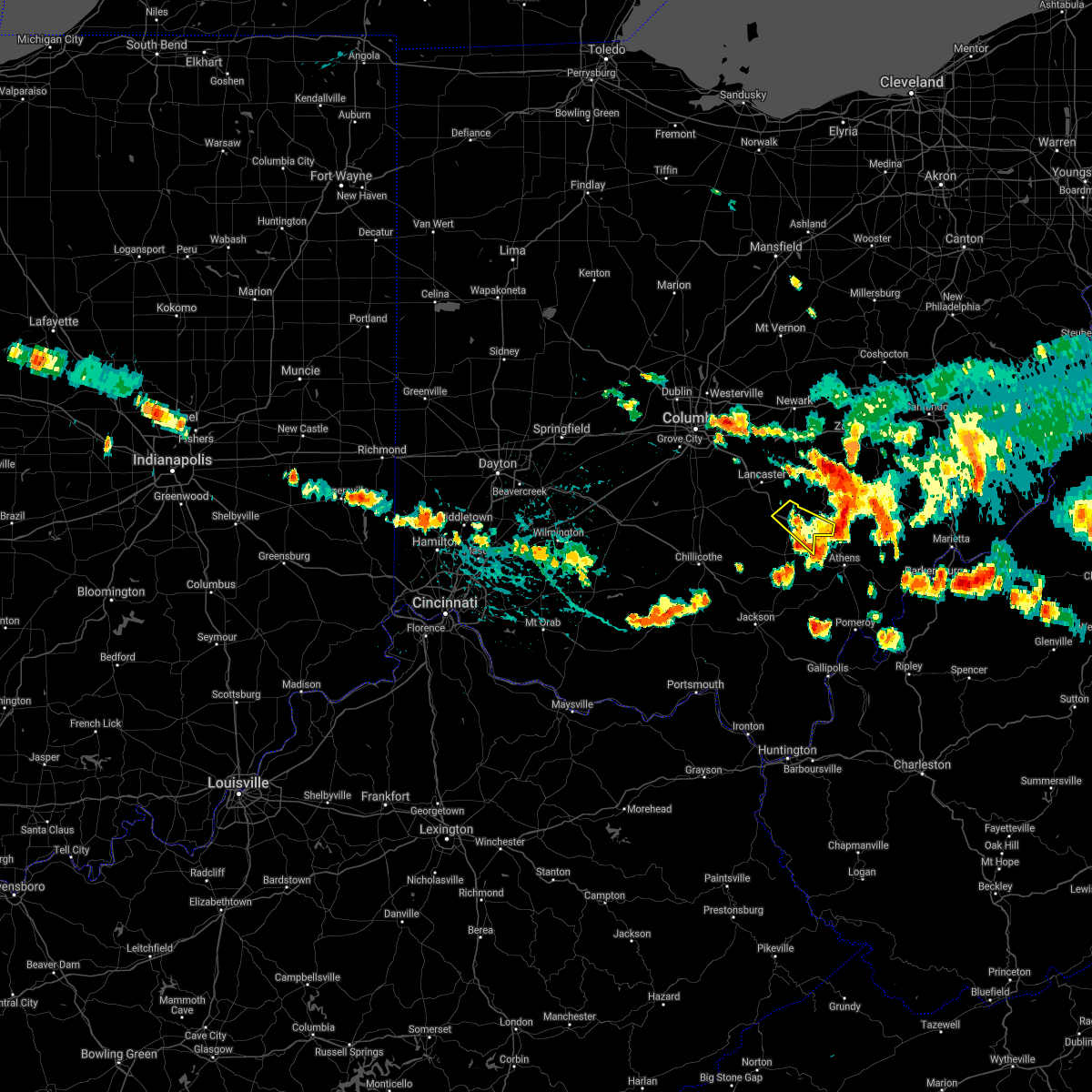 The severe thunderstorm warning for eastern hocking county will expire at 430 pm edt, the storm which prompted the warning has weakened below severe limits, and has exited the warned area. therefore, the warning will be allowed to expire. a severe thunderstorm watch remains in effect until 1100 pm edt for central ohio. please report previous wind damage or hail to the national weather service by going to our website at weather.gov/iln and submitting your report via social media. The severe thunderstorm warning for eastern hocking county will expire at 430 pm edt, the storm which prompted the warning has weakened below severe limits, and has exited the warned area. therefore, the warning will be allowed to expire. a severe thunderstorm watch remains in effect until 1100 pm edt for central ohio. please report previous wind damage or hail to the national weather service by going to our website at weather.gov/iln and submitting your report via social media.
|
| 8/25/2020 4:14 PM EDT |
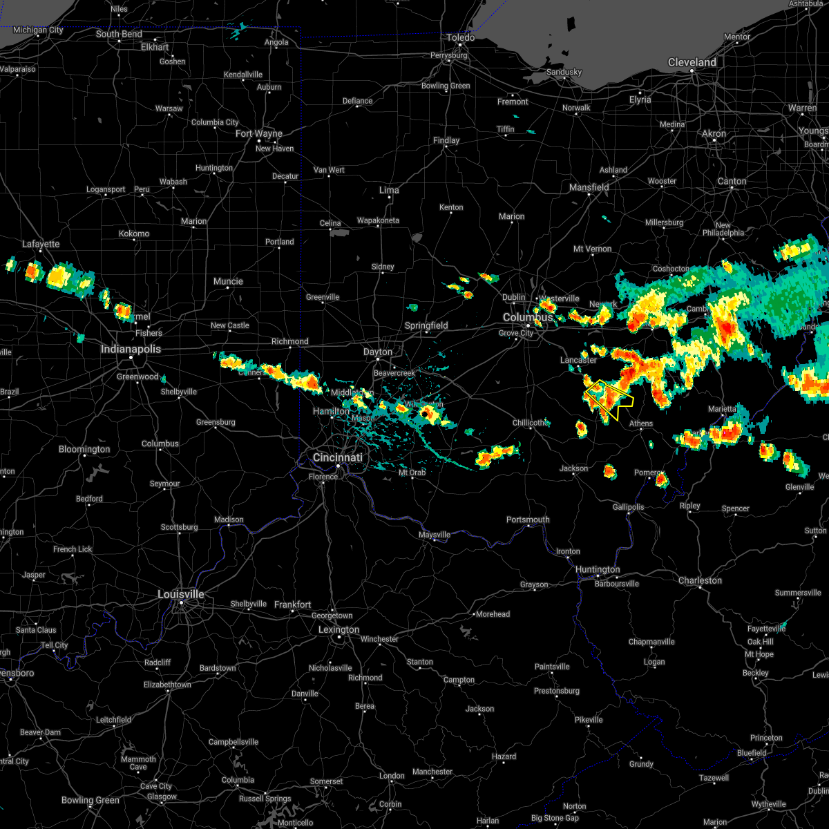 At 413 pm edt, a severe thunderstorm was located near logan, moving southeast at 35 mph (radar indicated). Hazards include 60 mph wind gusts and penny size hail. Expect damage to trees and power lines. Locations impacted include, logan, nelsonville, murray city, enterprise, union furnace, haydenville, lake logan state park and carbon hill. At 413 pm edt, a severe thunderstorm was located near logan, moving southeast at 35 mph (radar indicated). Hazards include 60 mph wind gusts and penny size hail. Expect damage to trees and power lines. Locations impacted include, logan, nelsonville, murray city, enterprise, union furnace, haydenville, lake logan state park and carbon hill.
|
| 8/25/2020 4:04 PM EDT |
 At 403 pm edt, a severe thunderstorm was located over logan, moving southeast at 25 mph. a second storm was located near sugar grove also moving southeast (radar indicated). Hazards include 60 mph wind gusts and quarter size hail. Minor hail damage to vehicles is possible. expect wind damage to trees and power lines. Locations impacted include, logan, nelsonville, hide-a-way hills, murray city, sugar grove, enterprise, union furnace, rockbridge, haydenville, lake logan state park and carbon hill. At 403 pm edt, a severe thunderstorm was located over logan, moving southeast at 25 mph. a second storm was located near sugar grove also moving southeast (radar indicated). Hazards include 60 mph wind gusts and quarter size hail. Minor hail damage to vehicles is possible. expect wind damage to trees and power lines. Locations impacted include, logan, nelsonville, hide-a-way hills, murray city, sugar grove, enterprise, union furnace, rockbridge, haydenville, lake logan state park and carbon hill.
|
| 8/25/2020 3:49 PM EDT |
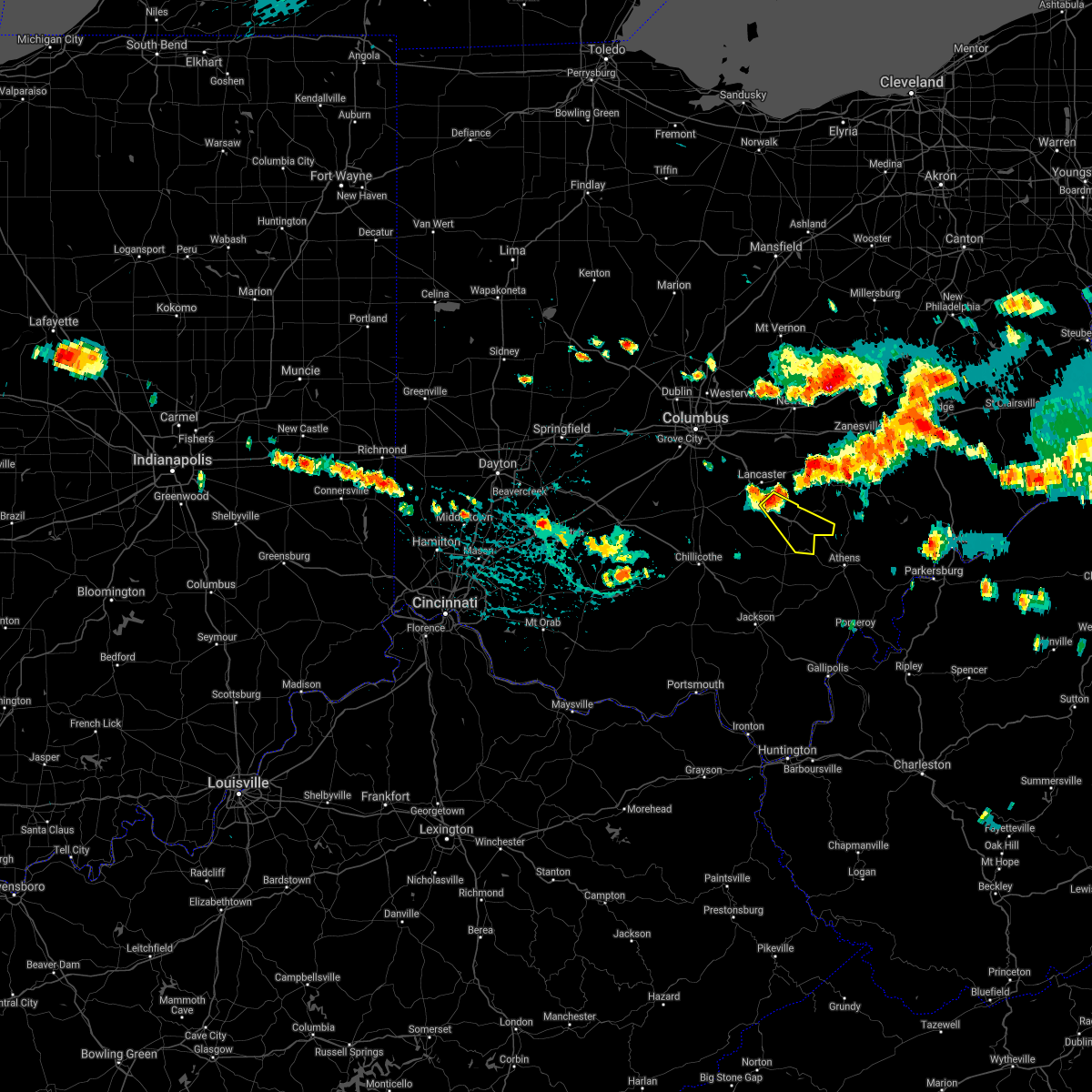 At 349 pm edt, a severe thunderstorm was located near hide-a-way hills, moving southeast at 25 mph (radar indicated). Hazards include 60 mph wind gusts and quarter size hail. Minor hail damage to vehicles is possible. Expect wind damage to trees and power lines. At 349 pm edt, a severe thunderstorm was located near hide-a-way hills, moving southeast at 25 mph (radar indicated). Hazards include 60 mph wind gusts and quarter size hail. Minor hail damage to vehicles is possible. Expect wind damage to trees and power lines.
|
| 7/10/2020 3:31 PM EDT |
 At 331 pm edt, a severe thunderstorm was located near buchtel, or near glouster, moving east at 30 mph (radar indicated). Hazards include 60 mph wind gusts. Expect damage to trees and power lines. Locations impacted include, logan, nelsonville, starr, murray city, union furnace, haydenville, oreville and carbon hill. At 331 pm edt, a severe thunderstorm was located near buchtel, or near glouster, moving east at 30 mph (radar indicated). Hazards include 60 mph wind gusts. Expect damage to trees and power lines. Locations impacted include, logan, nelsonville, starr, murray city, union furnace, haydenville, oreville and carbon hill.
|
| 7/10/2020 3:07 PM EDT |
 At 306 pm edt, a severe thunderstorm was located near logan, moving northeast at 15 mph (radar indicated). Hazards include 60 mph wind gusts. expect damage to trees and power lines At 306 pm edt, a severe thunderstorm was located near logan, moving northeast at 15 mph (radar indicated). Hazards include 60 mph wind gusts. expect damage to trees and power lines
|
| 6/10/2020 7:51 PM EDT |
 At 750 pm edt, severe thunderstorms were located along a line extending from near perry state forest to near logan, moving northeast at 30 mph (radar indicated). Hazards include 60 mph wind gusts. Expect damage to trees and power lines. Locations impacted include, logan, nelsonville, hide-a-way hills, starr, murray city, enterprise, union furnace, hideaway hills, haydenville, lake logan state park, oreville and carbon hill. At 750 pm edt, severe thunderstorms were located along a line extending from near perry state forest to near logan, moving northeast at 30 mph (radar indicated). Hazards include 60 mph wind gusts. Expect damage to trees and power lines. Locations impacted include, logan, nelsonville, hide-a-way hills, starr, murray city, enterprise, union furnace, hideaway hills, haydenville, lake logan state park, oreville and carbon hill.
|
| 6/10/2020 7:35 PM EDT |
 At 733 pm edt, severe thunderstorms were located along a line extending from near north zanesville to near nelsonville to 7 miles southwest of albany, moving northeast at 60 mph (radar indicated). Hazards include 60 mph wind gusts. Expect damage to roofs, siding, and trees. Locations impacted include, athens, jackson, wellston, nelsonville, new lexington, glouster, mcarthur, shawnee, chesterhill, lake hope state park, perry state forest, crooksville, chauncey, hamden, junction city, new straitsville, corning, buchtel, jacksonville and coalton. At 733 pm edt, severe thunderstorms were located along a line extending from near north zanesville to near nelsonville to 7 miles southwest of albany, moving northeast at 60 mph (radar indicated). Hazards include 60 mph wind gusts. Expect damage to roofs, siding, and trees. Locations impacted include, athens, jackson, wellston, nelsonville, new lexington, glouster, mcarthur, shawnee, chesterhill, lake hope state park, perry state forest, crooksville, chauncey, hamden, junction city, new straitsville, corning, buchtel, jacksonville and coalton.
|
| 6/10/2020 7:22 PM EDT |
 At 722 pm edt, severe thunderstorms were located along a line extending from hide-a-way hills to 6 miles southwest of hocking hills state park, moving northeast at 30 mph (radar indicated). Hazards include 60 mph wind gusts. expect damage to trees and power lines At 722 pm edt, severe thunderstorms were located along a line extending from hide-a-way hills to 6 miles southwest of hocking hills state park, moving northeast at 30 mph (radar indicated). Hazards include 60 mph wind gusts. expect damage to trees and power lines
|
| 6/10/2020 7:15 PM EDT |
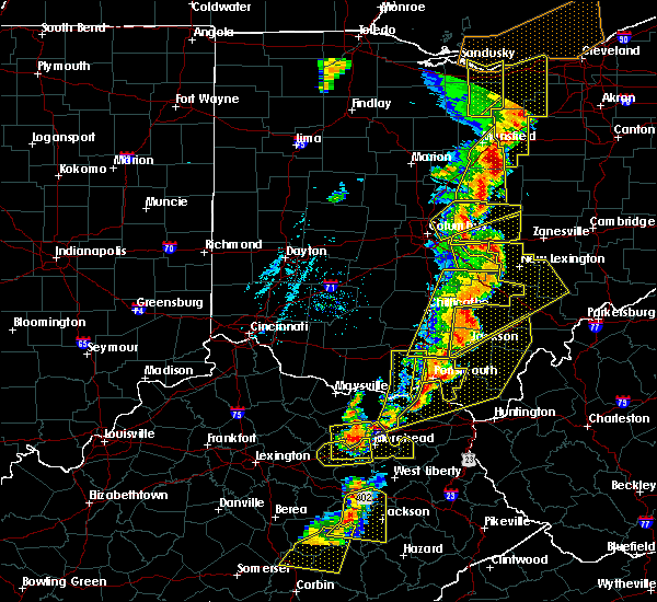 At 714 pm edt, severe thunderstorms were located along a line extending from near thornport to near bremen to 6 miles northwest of wellston, moving northeast at 30 mph (radar indicated). Hazards include 60 mph wind gusts. Expect damage to trees and power lines. Locations impacted include, logan, nelsonville, piketon, hocking hills state park, hide-a-way hills, starr, amanda, londonderry, laurelville, murray city, beaver, sugar grove, adelphi, tarlton, us route 22 at state route 159, ilesboro, haydenville, omega, givens and south bloomingville. At 714 pm edt, severe thunderstorms were located along a line extending from near thornport to near bremen to 6 miles northwest of wellston, moving northeast at 30 mph (radar indicated). Hazards include 60 mph wind gusts. Expect damage to trees and power lines. Locations impacted include, logan, nelsonville, piketon, hocking hills state park, hide-a-way hills, starr, amanda, londonderry, laurelville, murray city, beaver, sugar grove, adelphi, tarlton, us route 22 at state route 159, ilesboro, haydenville, omega, givens and south bloomingville.
|
| 6/10/2020 7:06 PM EDT |
 At 706 pm edt, severe thunderstorms were located along a line extending from pleasantville to near shawnee to 9 miles northwest of wellston, moving east at 60 mph (trained weather spotters). Hazards include 70 mph wind gusts. Expect considerable tree damage. damage is likely to mobile homes, roofs, and outbuildings. Locations impacted include, chillicothe, logan, waverly, nelsonville, piketon, kingston, hide-a-way hills, hocking hills state park, starr, amanda, londonderry, stoutsville, laurelville, murray city, beaver, sugar grove, adelphi, tarlton, east ringgold and us route 22 at state route 159. At 706 pm edt, severe thunderstorms were located along a line extending from pleasantville to near shawnee to 9 miles northwest of wellston, moving east at 60 mph (trained weather spotters). Hazards include 70 mph wind gusts. Expect considerable tree damage. damage is likely to mobile homes, roofs, and outbuildings. Locations impacted include, chillicothe, logan, waverly, nelsonville, piketon, kingston, hide-a-way hills, hocking hills state park, starr, amanda, londonderry, stoutsville, laurelville, murray city, beaver, sugar grove, adelphi, tarlton, east ringgold and us route 22 at state route 159.
|
| 6/10/2020 6:52 PM EDT |
 At 651 pm edt, severe thunderstorms were located along a line extending from 7 miles south of canal winchester to 8 miles north of hocking hills state park to near waverly, moving east at 60 mph (radar indicated). Hazards include 70 mph wind gusts. Expect considerable tree damage. damage is likely to mobile homes, roofs, and outbuildings. Locations impacted include, chillicothe, circleville, logan, waverly, nelsonville, piketon, south bloomfield, kingston, hide-a-way hills, logan elm village, hocking hills state park, pike lake, north folk village, starr, fox, amanda, londonderry, stoutsville, laurelville and murray city. At 651 pm edt, severe thunderstorms were located along a line extending from 7 miles south of canal winchester to 8 miles north of hocking hills state park to near waverly, moving east at 60 mph (radar indicated). Hazards include 70 mph wind gusts. Expect considerable tree damage. damage is likely to mobile homes, roofs, and outbuildings. Locations impacted include, chillicothe, circleville, logan, waverly, nelsonville, piketon, south bloomfield, kingston, hide-a-way hills, logan elm village, hocking hills state park, pike lake, north folk village, starr, fox, amanda, londonderry, stoutsville, laurelville and murray city.
|
| 6/10/2020 6:44 PM EDT |
 At 643 pm edt, severe thunderstorms were located along a line extending from 9 miles southwest of lancaster to near piketon to 6 miles east of rome, moving northeast at 60 mph (radar indicated). Hazards include 60 mph wind gusts. expect damage to roofs, siding, and trees At 643 pm edt, severe thunderstorms were located along a line extending from 9 miles southwest of lancaster to near piketon to 6 miles east of rome, moving northeast at 60 mph (radar indicated). Hazards include 60 mph wind gusts. expect damage to roofs, siding, and trees
|
| 6/10/2020 6:35 PM EDT |
 At 635 pm edt, severe thunderstorms were located along a line extending from near south bloomfield to near kingston to 6 miles south of kincaid springs, moving east at 60 mph (radar indicated). Hazards include 70 mph wind gusts. Expect considerable tree damage. Damage is likely to mobile homes, roofs, and outbuildings. At 635 pm edt, severe thunderstorms were located along a line extending from near south bloomfield to near kingston to 6 miles south of kincaid springs, moving east at 60 mph (radar indicated). Hazards include 70 mph wind gusts. Expect considerable tree damage. Damage is likely to mobile homes, roofs, and outbuildings.
|
| 4/8/2020 3:38 AM EDT |
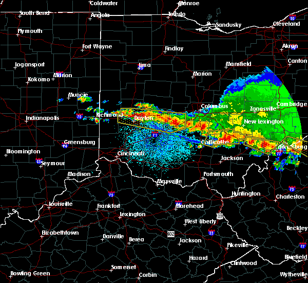 At 337 am edt, a severe thunderstorm was located 7 miles northeast of kingston, moving east at 60 mph (radar indicated). Hazards include 60 mph wind gusts and quarter size hail. Minor hail damage to vehicles is possible. expect wind damage to trees and power lines. Locations impacted include, logan, nelsonville, hocking hills state park, hide-a-way hills, starr, laurelville, murray city, buena vista in hocking county, gibisonville, ilesboro, haydenville, lake logan state park, south bloomingville, enterprise, union furnace, rockbridge, oreville and carbon hill. At 337 am edt, a severe thunderstorm was located 7 miles northeast of kingston, moving east at 60 mph (radar indicated). Hazards include 60 mph wind gusts and quarter size hail. Minor hail damage to vehicles is possible. expect wind damage to trees and power lines. Locations impacted include, logan, nelsonville, hocking hills state park, hide-a-way hills, starr, laurelville, murray city, buena vista in hocking county, gibisonville, ilesboro, haydenville, lake logan state park, south bloomingville, enterprise, union furnace, rockbridge, oreville and carbon hill.
|
| 4/8/2020 3:27 AM EDT |
 At 327 am edt, a severe thunderstorm was located near williamsport, moving southeast at 55 mph (radar indicated). Hazards include 60 mph wind gusts and quarter size hail. Minor hail damage to vehicles is possible. Expect wind damage to trees and power lines. At 327 am edt, a severe thunderstorm was located near williamsport, moving southeast at 55 mph (radar indicated). Hazards include 60 mph wind gusts and quarter size hail. Minor hail damage to vehicles is possible. Expect wind damage to trees and power lines.
|
| 9/29/2019 8:15 PM EDT | Numerous trees down reported throughout starr township. time estimated from rada in hocking county OH, 7.1 miles E of Nelsonville, OH |
| 6/24/2019 3:59 PM EDT |
 At 358 pm edt, severe thunderstorms were located along a line extending from near logan to near nelsonville to near mcarthur, moving northeast at 50 mph (radar indicated). Hazards include 60 mph wind gusts. expect damage to roofs, siding, and trees At 358 pm edt, severe thunderstorms were located along a line extending from near logan to near nelsonville to near mcarthur, moving northeast at 50 mph (radar indicated). Hazards include 60 mph wind gusts. expect damage to roofs, siding, and trees
|
| 6/24/2019 3:59 PM EDT |
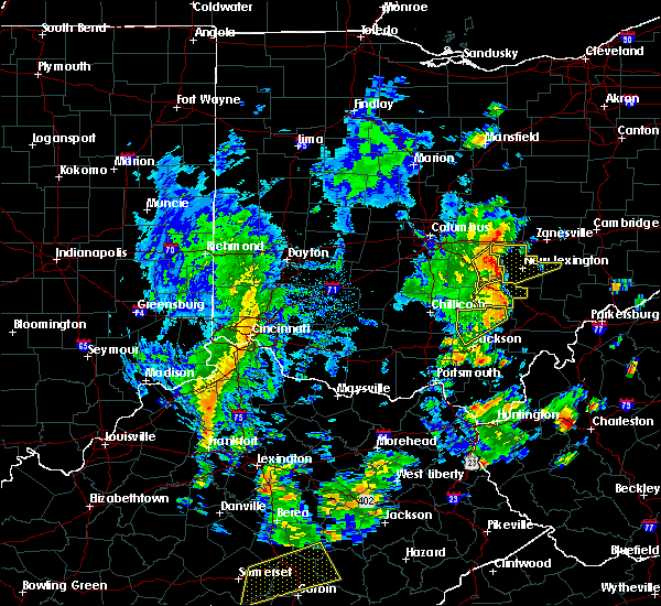 At 358 pm edt, a severe thunderstorm was located near logan, moving northeast at 45 mph (radar indicated). Hazards include 60 mph wind gusts. Expect damage to trees and power lines. Locations impacted include, logan, nelsonville, starr, murray city, enterprise, union furnace, haydenville, lake logan state park, oreville and carbon hill. At 358 pm edt, a severe thunderstorm was located near logan, moving northeast at 45 mph (radar indicated). Hazards include 60 mph wind gusts. Expect damage to trees and power lines. Locations impacted include, logan, nelsonville, starr, murray city, enterprise, union furnace, haydenville, lake logan state park, oreville and carbon hill.
|
| 6/24/2019 3:49 PM EDT |
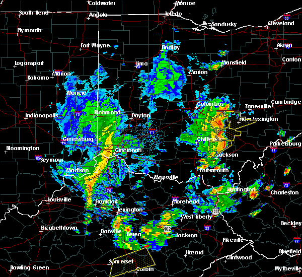 At 339 pm edt, a severe thunderstorm was located 5 miles southwest of hocking hills state park, moving northeast at 45 mph (radar indicated). Hazards include 60 mph wind gusts. Expect damage to trees and power lines. Locations impacted include, hocking hills state park, logan, nelsonville, starr, murray city, gibisonville, ilesboro, haydenville, lake logan state park, south bloomingville, enterprise, union furnace, rockbridge, oreville and carbon hill. At 339 pm edt, a severe thunderstorm was located 5 miles southwest of hocking hills state park, moving northeast at 45 mph (radar indicated). Hazards include 60 mph wind gusts. Expect damage to trees and power lines. Locations impacted include, hocking hills state park, logan, nelsonville, starr, murray city, gibisonville, ilesboro, haydenville, lake logan state park, south bloomingville, enterprise, union furnace, rockbridge, oreville and carbon hill.
|
| 6/24/2019 3:39 PM EDT |
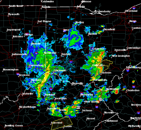 At 339 pm edt, a severe thunderstorm was located 5 miles southwest of hocking hills state park, moving northeast at 45 mph (radar indicated). Hazards include 60 mph wind gusts. Expect damage to trees and power lines. Locations impacted include, hocking hills state park, logan, nelsonville, starr, murray city, gibisonville, ilesboro, haydenville, lake logan state park, south bloomingville, enterprise, union furnace, rockbridge, oreville and carbon hill. At 339 pm edt, a severe thunderstorm was located 5 miles southwest of hocking hills state park, moving northeast at 45 mph (radar indicated). Hazards include 60 mph wind gusts. Expect damage to trees and power lines. Locations impacted include, hocking hills state park, logan, nelsonville, starr, murray city, gibisonville, ilesboro, haydenville, lake logan state park, south bloomingville, enterprise, union furnace, rockbridge, oreville and carbon hill.
|
| 6/24/2019 3:28 PM EDT |
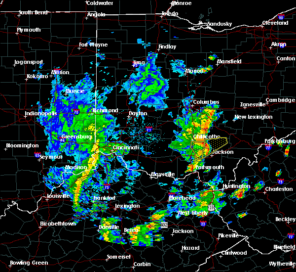 At 328 pm edt, a severe thunderstorm was located near londonderry, moving northeast at 45 mph (radar indicated). Hazards include 60 mph wind gusts. expect damage to trees and power lines At 328 pm edt, a severe thunderstorm was located near londonderry, moving northeast at 45 mph (radar indicated). Hazards include 60 mph wind gusts. expect damage to trees and power lines
|
| 6/17/2019 10:39 PM EDT |
 At 1038 pm edt, severe thunderstorms were located along a line extending from near lancaster to near hocking hills state park to near mcarthur, moving east at 40 mph (radar indicated). Hazards include 60 mph wind gusts. Expect damage to roofs, siding, and trees. Locations impacted include, athens, nelsonville, glouster, mcarthur, albany, shawnee, lake hope state park, chauncey, new straitsville, buchtel, jacksonville, trimble, zaleski, hemlock, creola, allensville and the plains. At 1038 pm edt, severe thunderstorms were located along a line extending from near lancaster to near hocking hills state park to near mcarthur, moving east at 40 mph (radar indicated). Hazards include 60 mph wind gusts. Expect damage to roofs, siding, and trees. Locations impacted include, athens, nelsonville, glouster, mcarthur, albany, shawnee, lake hope state park, chauncey, new straitsville, buchtel, jacksonville, trimble, zaleski, hemlock, creola, allensville and the plains.
|
| 6/17/2019 10:09 PM EDT |
 At 1009 pm edt, severe thunderstorms were located along a line extending from near circleville to 9 miles southeast of kingston to 8 miles southeast of chillicothe, moving east at 40 mph (radar indicated). Hazards include 60 mph wind gusts. expect damage to roofs, siding, and trees At 1009 pm edt, severe thunderstorms were located along a line extending from near circleville to 9 miles southeast of kingston to 8 miles southeast of chillicothe, moving east at 40 mph (radar indicated). Hazards include 60 mph wind gusts. expect damage to roofs, siding, and trees
|
| 5/28/2019 1:44 AM EDT |
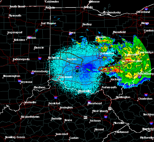 At 144 am edt, a severe thunderstorm capable of producing a tornado was located over hocking hills state park, moving east at 40 mph (radar indicated rotation). Hazards include tornado. Flying debris will be dangerous to those caught without shelter. mobile homes will be damaged or destroyed. damage to roofs, windows, and vehicles will occur. Tree damage is likely. At 144 am edt, a severe thunderstorm capable of producing a tornado was located over hocking hills state park, moving east at 40 mph (radar indicated rotation). Hazards include tornado. Flying debris will be dangerous to those caught without shelter. mobile homes will be damaged or destroyed. damage to roofs, windows, and vehicles will occur. Tree damage is likely.
|
| 5/28/2019 1:42 AM EDT |
 At 142 am edt, a severe thunderstorm capable of producing a tornado was located near lake hope state park, moving southeast at 40 mph (radar indicated rotation). Hazards include tornado and quarter size hail. Flying debris will be dangerous to those caught without shelter. mobile homes will be damaged or destroyed. damage to roofs, windows, and vehicles will occur. tree damage is likely. this dangerous storm will be near, nelsonville and buchtel around 150 am edt. athens and albany around 200 am edt. Other locations impacted by this tornadic thunderstorm include chauncey, creola, harrisonville, stroud run state park, zaleski, amesville, carpenter and the plains. At 142 am edt, a severe thunderstorm capable of producing a tornado was located near lake hope state park, moving southeast at 40 mph (radar indicated rotation). Hazards include tornado and quarter size hail. Flying debris will be dangerous to those caught without shelter. mobile homes will be damaged or destroyed. damage to roofs, windows, and vehicles will occur. tree damage is likely. this dangerous storm will be near, nelsonville and buchtel around 150 am edt. athens and albany around 200 am edt. Other locations impacted by this tornadic thunderstorm include chauncey, creola, harrisonville, stroud run state park, zaleski, amesville, carpenter and the plains.
|
| 5/26/2019 3:08 PM EDT |
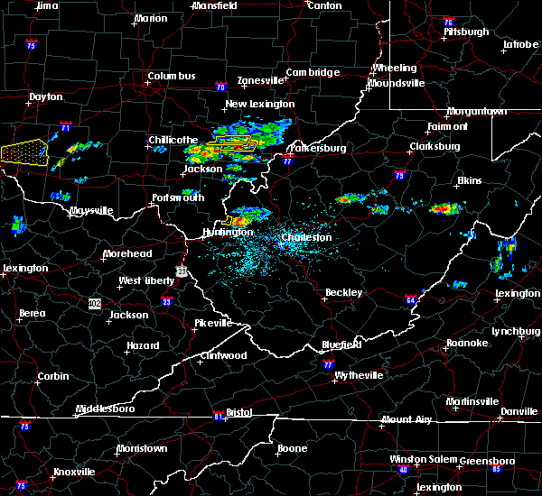 The severe thunderstorm warning for west central athens and northeastern vinton counties will expire at 315 pm edt, the storm which prompted the warning has moved out of the area. therefore, the warning will be allowed to expire. a severe thunderstorm watch remains in effect until 900 pm edt for southeastern ohio. The severe thunderstorm warning for west central athens and northeastern vinton counties will expire at 315 pm edt, the storm which prompted the warning has moved out of the area. therefore, the warning will be allowed to expire. a severe thunderstorm watch remains in effect until 900 pm edt for southeastern ohio.
|
| 5/26/2019 2:46 PM EDT |
 At 245 pm edt, a severe thunderstorm was located near nelsonville, moving east at 35 mph (radar indicated). Hazards include 60 mph wind gusts and half dollar size hail. Hail damage to vehicles is expected. expect wind damage to roofs, siding, and trees. Locations impacted include, chauncey, amesville and the plains. At 245 pm edt, a severe thunderstorm was located near nelsonville, moving east at 35 mph (radar indicated). Hazards include 60 mph wind gusts and half dollar size hail. Hail damage to vehicles is expected. expect wind damage to roofs, siding, and trees. Locations impacted include, chauncey, amesville and the plains.
|
| 5/26/2019 2:40 PM EDT |
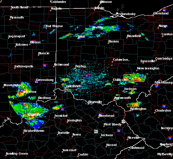 The severe thunderstorm warning for hocking county will expire at 245 pm edt, the storm which prompted the warning has weakened below severe limits, and has exited the warned area. therefore, the warning will be allowed to expire. a severe thunderstorm watch remains in effect until 900 pm edt for central ohio. please report previous wind damage or hail to the national weather service by going to our website at weather.gov/iln and submitting your report via social media. The severe thunderstorm warning for hocking county will expire at 245 pm edt, the storm which prompted the warning has weakened below severe limits, and has exited the warned area. therefore, the warning will be allowed to expire. a severe thunderstorm watch remains in effect until 900 pm edt for central ohio. please report previous wind damage or hail to the national weather service by going to our website at weather.gov/iln and submitting your report via social media.
|
| 5/26/2019 2:29 PM EDT |
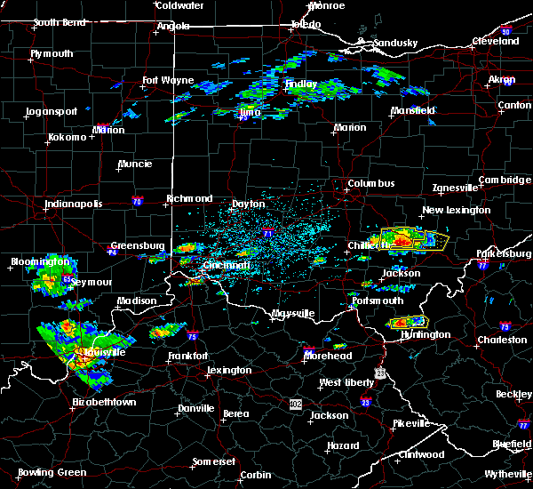 At 228 pm edt, a severe thunderstorm was located near hocking hills state park, moving east at 20 mph (radar indicated). Hazards include 60 mph wind gusts and half dollar size hail. Minor hail damage to vehicles is possible. expect wind damage to trees and power lines. Locations impacted include, logan, nelsonville, hocking hills state park, starr, murray city, gibisonville, ilesboro, haydenville, lake logan state park, south bloomingville, enterprise, union furnace, rockbridge, oreville and carbon hill. At 228 pm edt, a severe thunderstorm was located near hocking hills state park, moving east at 20 mph (radar indicated). Hazards include 60 mph wind gusts and half dollar size hail. Minor hail damage to vehicles is possible. expect wind damage to trees and power lines. Locations impacted include, logan, nelsonville, hocking hills state park, starr, murray city, gibisonville, ilesboro, haydenville, lake logan state park, south bloomingville, enterprise, union furnace, rockbridge, oreville and carbon hill.
|
| 5/26/2019 2:19 PM EDT |
 At 218 pm edt, a severe thunderstorm was located over hocking hills state park, or 10 miles southwest of logan, moving east at 25 mph (radar indicated). Hazards include two inch hail and 60 mph wind gusts. People and animals outdoors will be injured. expect hail damage to roofs, siding, windows, and vehicles. Expect wind damage to roofs, siding, and trees. At 218 pm edt, a severe thunderstorm was located over hocking hills state park, or 10 miles southwest of logan, moving east at 25 mph (radar indicated). Hazards include two inch hail and 60 mph wind gusts. People and animals outdoors will be injured. expect hail damage to roofs, siding, windows, and vehicles. Expect wind damage to roofs, siding, and trees.
|
| 5/26/2019 2:18 PM EDT |
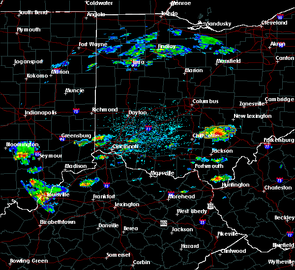 At 218 pm edt, a severe thunderstorm was located over hocking hills state park, moving east at 20 mph (radar indicated). Hazards include tennis ball size hail and 60 mph wind gusts. People and animals outdoors will be injured. expect hail damage to roofs, siding, windows, and vehicles. expect wind damage to trees and power lines. Locations impacted include, logan, nelsonville, hocking hills state park, starr, laurelville, murray city, buena vista in hocking county, gibisonville, ilesboro, haydenville, lake logan state park, south bloomingville, enterprise, union furnace, rockbridge, oreville and carbon hill. At 218 pm edt, a severe thunderstorm was located over hocking hills state park, moving east at 20 mph (radar indicated). Hazards include tennis ball size hail and 60 mph wind gusts. People and animals outdoors will be injured. expect hail damage to roofs, siding, windows, and vehicles. expect wind damage to trees and power lines. Locations impacted include, logan, nelsonville, hocking hills state park, starr, laurelville, murray city, buena vista in hocking county, gibisonville, ilesboro, haydenville, lake logan state park, south bloomingville, enterprise, union furnace, rockbridge, oreville and carbon hill.
|
| 5/26/2019 2:10 PM EDT |
 At 210 pm edt, a severe thunderstorm was located near hocking hills state park, moving east at 20 mph (radar indicated). Hazards include two inch hail and 60 mph wind gusts. People and animals outdoors will be injured. expect hail damage to roofs, siding, windows, and vehicles. expect wind damage to trees and power lines. Locations impacted include, logan, nelsonville, hocking hills state park, starr, laurelville, murray city, buena vista in hocking county, gibisonville, ilesboro, haydenville, lake logan state park, south bloomingville, enterprise, union furnace, rockbridge, oreville and carbon hill. At 210 pm edt, a severe thunderstorm was located near hocking hills state park, moving east at 20 mph (radar indicated). Hazards include two inch hail and 60 mph wind gusts. People and animals outdoors will be injured. expect hail damage to roofs, siding, windows, and vehicles. expect wind damage to trees and power lines. Locations impacted include, logan, nelsonville, hocking hills state park, starr, laurelville, murray city, buena vista in hocking county, gibisonville, ilesboro, haydenville, lake logan state park, south bloomingville, enterprise, union furnace, rockbridge, oreville and carbon hill.
|
| 5/26/2019 2:00 PM EDT |
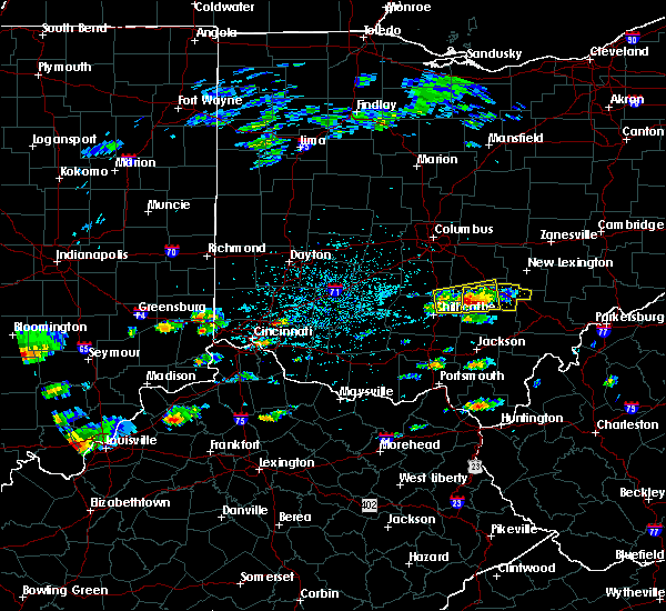 At 200 pm edt, a severe thunderstorm was located 8 miles west of hocking hills state park, moving east at 20 mph (radar indicated). Hazards include two inch hail and 60 mph wind gusts. People and animals outdoors will be injured. expect hail damage to roofs, siding, windows, and vehicles. Expect wind damage to trees and power lines. At 200 pm edt, a severe thunderstorm was located 8 miles west of hocking hills state park, moving east at 20 mph (radar indicated). Hazards include two inch hail and 60 mph wind gusts. People and animals outdoors will be injured. expect hail damage to roofs, siding, windows, and vehicles. Expect wind damage to trees and power lines.
|
| 4/14/2019 5:37 PM EDT |
 At 537 pm edt, a severe thunderstorm was located near athens, moving northeast at 70 mph (radar indicated). Hazards include 60 mph wind gusts. expect damage to roofs, siding, and trees At 537 pm edt, a severe thunderstorm was located near athens, moving northeast at 70 mph (radar indicated). Hazards include 60 mph wind gusts. expect damage to roofs, siding, and trees
|
| 4/14/2019 5:01 PM EDT |
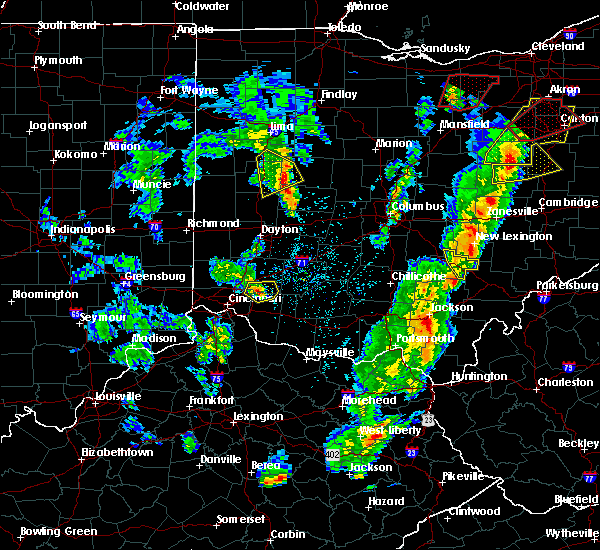 At 501 pm edt, a severe thunderstorm was located near shawnee, moving northeast at 40 mph (radar indicated). Hazards include 60 mph wind gusts and penny size hail. Expect damage to trees and power lines. locations impacted include, logan, nelsonville, hide-a-way hills, murray city, union furnace, hideaway hills, haydenville, oreville and carbon hill. A tornado watch remains in effect until 900 pm edt for central ohio. At 501 pm edt, a severe thunderstorm was located near shawnee, moving northeast at 40 mph (radar indicated). Hazards include 60 mph wind gusts and penny size hail. Expect damage to trees and power lines. locations impacted include, logan, nelsonville, hide-a-way hills, murray city, union furnace, hideaway hills, haydenville, oreville and carbon hill. A tornado watch remains in effect until 900 pm edt for central ohio.
|
| 4/14/2019 4:39 PM EDT |
 At 438 pm edt, a severe thunderstorm was located near hide-a-way hills, moving northeast at 50 mph (radar indicated). Hazards include 60 mph wind gusts and penny size hail. Expect damage to trees and power lines. locations impacted include, lancaster, logan, nelsonville, bremen, hide-a-way hills, murray city, sugar grove, rushville, west rushville, hideaway hills, haydenville, north berne, enterprise, union furnace, rockbridge, oreville and carbon hill. A tornado watch remains in effect until 900 pm edt for central ohio. At 438 pm edt, a severe thunderstorm was located near hide-a-way hills, moving northeast at 50 mph (radar indicated). Hazards include 60 mph wind gusts and penny size hail. Expect damage to trees and power lines. locations impacted include, lancaster, logan, nelsonville, bremen, hide-a-way hills, murray city, sugar grove, rushville, west rushville, hideaway hills, haydenville, north berne, enterprise, union furnace, rockbridge, oreville and carbon hill. A tornado watch remains in effect until 900 pm edt for central ohio.
|
| 4/14/2019 4:27 PM EDT |
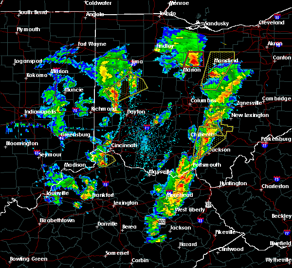 At 426 pm edt, a severe thunderstorm was located 8 miles northwest of hocking hills state park, moving northeast at 45 mph (radar indicated). Hazards include 60 mph wind gusts and penny size hail. expect damage to trees and power lines At 426 pm edt, a severe thunderstorm was located 8 miles northwest of hocking hills state park, moving northeast at 45 mph (radar indicated). Hazards include 60 mph wind gusts and penny size hail. expect damage to trees and power lines
|
| 3/14/2019 10:38 PM EDT |
 At 1038 pm edt, a severe thunderstorm capable of producing a tornado was located near logan, moving east at 45 mph (radar indicated rotation). Hazards include tornado. Flying debris will be dangerous to those caught without shelter. mobile homes will be damaged or destroyed. damage to roofs, windows, and vehicles will occur. tree damage is likely. Locations impacted include, logan, nelsonville, murray city, union furnace, haydenville and carbon hill. At 1038 pm edt, a severe thunderstorm capable of producing a tornado was located near logan, moving east at 45 mph (radar indicated rotation). Hazards include tornado. Flying debris will be dangerous to those caught without shelter. mobile homes will be damaged or destroyed. damage to roofs, windows, and vehicles will occur. tree damage is likely. Locations impacted include, logan, nelsonville, murray city, union furnace, haydenville and carbon hill.
|
| 3/14/2019 10:34 PM EDT |
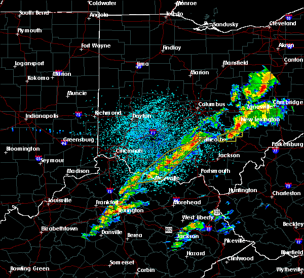 At 1034 pm edt, a severe thunderstorm capable of producing a tornado was located near logan, moving east at 40 mph (radar indicated rotation). Hazards include tornado. Flying debris will be dangerous to those caught without shelter. mobile homes will be damaged or destroyed. damage to roofs, windows, and vehicles will occur. Tree damage is likely. At 1034 pm edt, a severe thunderstorm capable of producing a tornado was located near logan, moving east at 40 mph (radar indicated rotation). Hazards include tornado. Flying debris will be dangerous to those caught without shelter. mobile homes will be damaged or destroyed. damage to roofs, windows, and vehicles will occur. Tree damage is likely.
|
| 3/14/2019 10:28 PM EDT |
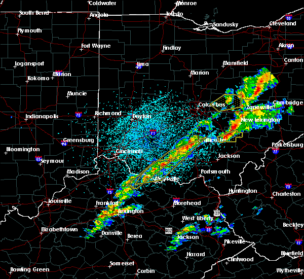 At 1028 pm edt, a severe thunderstorm was located over hocking hills state park, moving northeast at 50 mph (radar indicated). Hazards include 60 mph wind gusts. expect damage to trees and power lines At 1028 pm edt, a severe thunderstorm was located over hocking hills state park, moving northeast at 50 mph (radar indicated). Hazards include 60 mph wind gusts. expect damage to trees and power lines
|
| 3/14/2019 9:12 PM EDT |
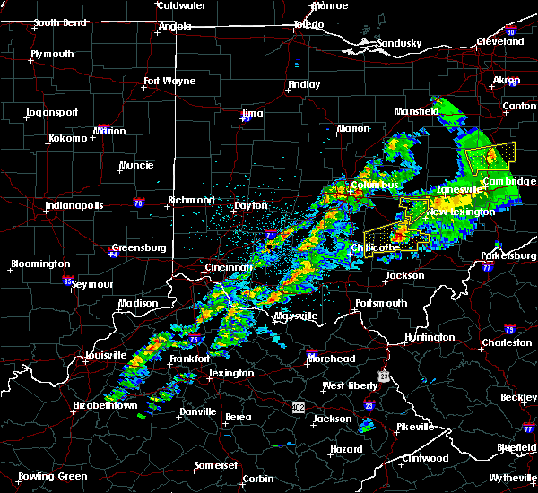 At 912 pm edt, a severe thunderstorm was located near logan, moving northeast at 60 mph (radar indicated). Hazards include 60 mph wind gusts. Expect damage to trees and power lines. Locations impacted include, logan, nelsonville, hide-a-way hills, murray city, sugar grove, gibisonville, ilesboro, hideaway hills, haydenville, lake logan state park, enterprise, union furnace, rockbridge, oreville and carbon hill. At 912 pm edt, a severe thunderstorm was located near logan, moving northeast at 60 mph (radar indicated). Hazards include 60 mph wind gusts. Expect damage to trees and power lines. Locations impacted include, logan, nelsonville, hide-a-way hills, murray city, sugar grove, gibisonville, ilesboro, hideaway hills, haydenville, lake logan state park, enterprise, union furnace, rockbridge, oreville and carbon hill.
|
| 3/14/2019 8:54 PM EDT |
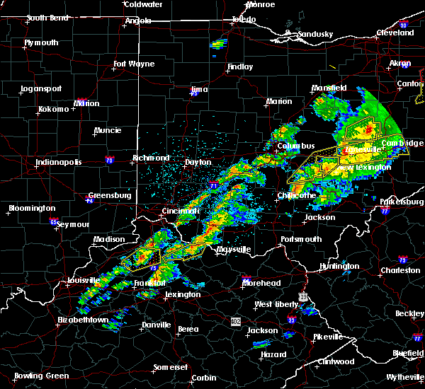 At 854 pm edt, a severe thunderstorm was located 8 miles west of hocking hills state park, moving east at 60 mph (radar indicated). Hazards include 60 mph wind gusts. expect damage to trees and power lines At 854 pm edt, a severe thunderstorm was located 8 miles west of hocking hills state park, moving east at 60 mph (radar indicated). Hazards include 60 mph wind gusts. expect damage to trees and power lines
|
| 10/28/2018 6:41 PM EDT | Multiple trees blown down. one fell on a house and multiple fell onto kimberly road... knocking down power lines. also received report that a trampoline went airborn in athens county OH, 1.4 miles N of Nelsonville, OH |
| 6/17/2018 3:56 PM EDT |
 At 355 pm edt, a severe thunderstorm was located over buchtel, or near nelsonville, moving south at 10 mph (radar indicated). Hazards include 60 mph wind gusts and quarter size hail. Hail damage to vehicles is expected. Expect wind damage to roofs, siding, and trees. At 355 pm edt, a severe thunderstorm was located over buchtel, or near nelsonville, moving south at 10 mph (radar indicated). Hazards include 60 mph wind gusts and quarter size hail. Hail damage to vehicles is expected. Expect wind damage to roofs, siding, and trees.
|
| 6/16/2018 8:53 PM EDT |
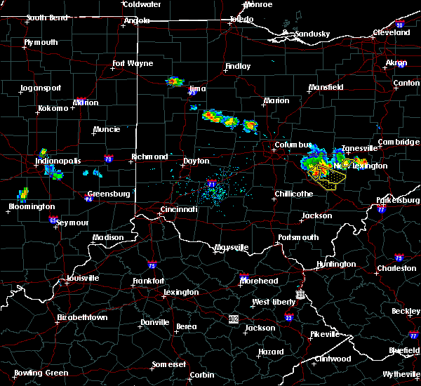 At 852 pm edt, a severe thunderstorm was located near hide-a-way hills, moving southeast at 35 mph (radar indicated). Hazards include 60 mph wind gusts. expect damage to trees and power lines At 852 pm edt, a severe thunderstorm was located near hide-a-way hills, moving southeast at 35 mph (radar indicated). Hazards include 60 mph wind gusts. expect damage to trees and power lines
|
| 5/30/2018 5:40 PM EDT | A few trees dow in athens county OH, 1.3 miles ESE of Nelsonville, OH |
| 5/14/2018 2:38 PM EDT |
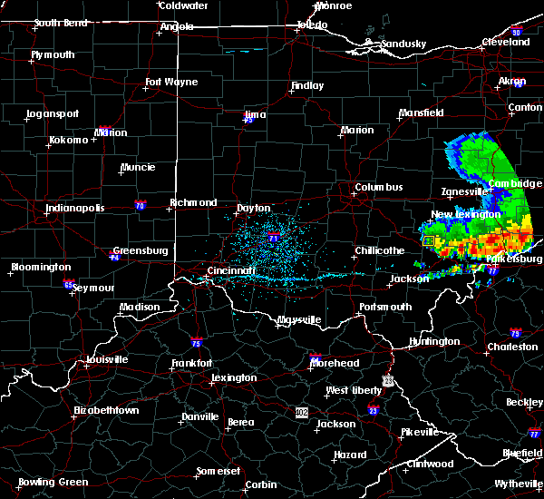 The severe thunderstorm warning for east central hocking county will expire at 245 pm edt, the storms which prompted the warning have weakened below severe limits, and have exited the warned area. therefore, the warning will be allowed to expire. please report previous wind damage or hail to the national weather service by going to our website at weather.gov/iln and submitting your report via social media. The severe thunderstorm warning for east central hocking county will expire at 245 pm edt, the storms which prompted the warning have weakened below severe limits, and have exited the warned area. therefore, the warning will be allowed to expire. please report previous wind damage or hail to the national weather service by going to our website at weather.gov/iln and submitting your report via social media.
|
| 5/14/2018 2:29 PM EDT |
 At 229 pm edt, severe thunderstorms were located along a line extending from near glouster to near logan, moving east at 25 mph (law enforcement reported numerous trees down around lancaster, oh). Hazards include 60 mph wind gusts and penny size hail. Expect damage to trees and power lines. Locations impacted include, nelsonville, murray city, haydenville, oreville and carbon hill. At 229 pm edt, severe thunderstorms were located along a line extending from near glouster to near logan, moving east at 25 mph (law enforcement reported numerous trees down around lancaster, oh). Hazards include 60 mph wind gusts and penny size hail. Expect damage to trees and power lines. Locations impacted include, nelsonville, murray city, haydenville, oreville and carbon hill.
|
| 5/14/2018 2:25 PM EDT |
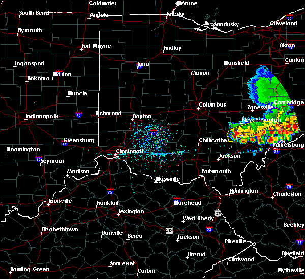 At 225 pm edt, severe thunderstorms were located along a line extending from near shawnee to near logan, moving east at 25 mph (law enforcement reported numerous trees down around lancaster, oh). Hazards include 60 mph wind gusts and penny size hail. Expect damage to trees and power lines. Locations impacted include, logan, nelsonville, starr, murray city, union furnace, haydenville, oreville and carbon hill. At 225 pm edt, severe thunderstorms were located along a line extending from near shawnee to near logan, moving east at 25 mph (law enforcement reported numerous trees down around lancaster, oh). Hazards include 60 mph wind gusts and penny size hail. Expect damage to trees and power lines. Locations impacted include, logan, nelsonville, starr, murray city, union furnace, haydenville, oreville and carbon hill.
|
| 5/14/2018 2:19 PM EDT |
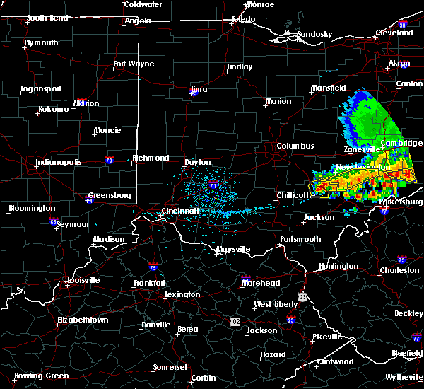 At 217 pm edt, severe thunderstorms were located along a line extending from near shawnee to near hocking hills state park, moving east at 25 mph (law enforcement reported numerous trees down around lancaster, oh). Hazards include 60 mph wind gusts and nickel size hail. Expect damage to trees and power lines. Locations impacted include, logan, nelsonville, starr, murray city, enterprise, ilesboro, union furnace, haydenville, lake logan state park, oreville and carbon hill. At 217 pm edt, severe thunderstorms were located along a line extending from near shawnee to near hocking hills state park, moving east at 25 mph (law enforcement reported numerous trees down around lancaster, oh). Hazards include 60 mph wind gusts and nickel size hail. Expect damage to trees and power lines. Locations impacted include, logan, nelsonville, starr, murray city, enterprise, ilesboro, union furnace, haydenville, lake logan state park, oreville and carbon hill.
|
| 5/14/2018 2:12 PM EDT |
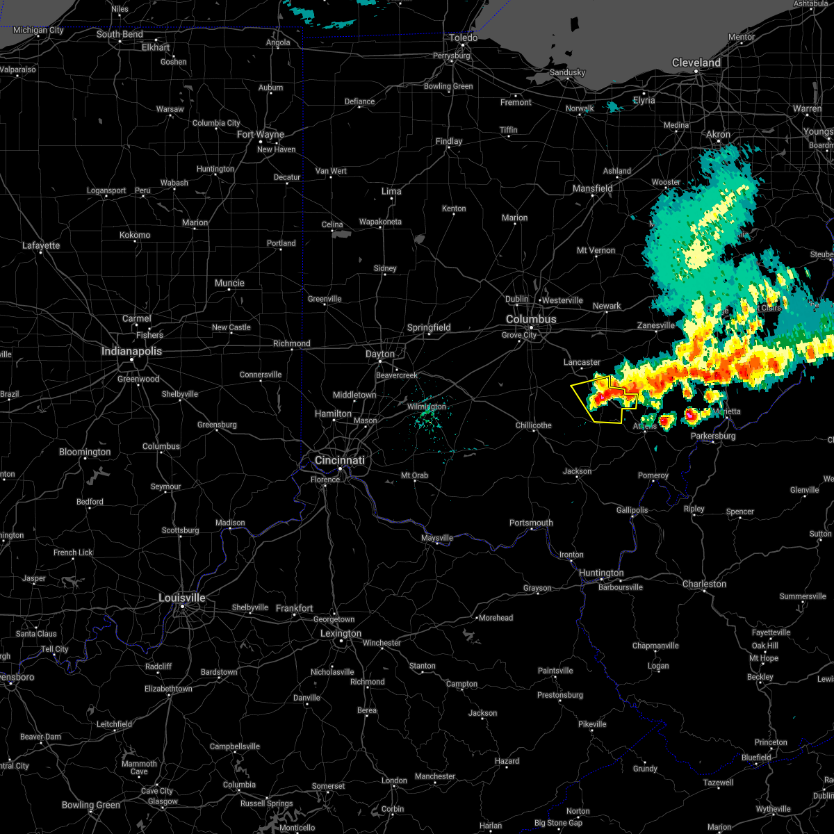 The severe thunderstorm warning for southeastern fairfield and hocking counties will expire at 215 pm edt, the storms which prompted the warning have moved out of the area. therefore, the warning will be allowed to expire. please report previous wind damage or hail to the national weather service by going to our website at weather.gov/iln and submitting your report via social media. remember, a severe thunderstorm warning 40 still remains in effect for hocking county. The severe thunderstorm warning for southeastern fairfield and hocking counties will expire at 215 pm edt, the storms which prompted the warning have moved out of the area. therefore, the warning will be allowed to expire. please report previous wind damage or hail to the national weather service by going to our website at weather.gov/iln and submitting your report via social media. remember, a severe thunderstorm warning 40 still remains in effect for hocking county.
|
| 5/14/2018 2:10 PM EDT |
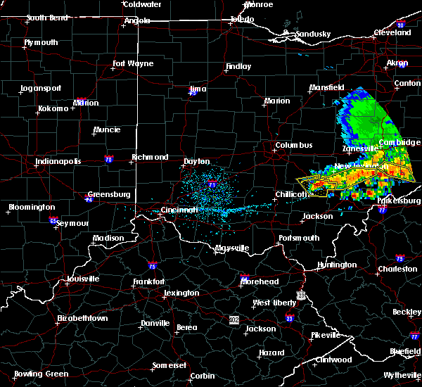 At 209 pm edt, severe thunderstorms were located along a line extending from near shawnee to 6 miles north of hocking hills state park, moving east at 25 mph (radar indicated). Hazards include 60 mph wind gusts and quarter size hail. Minor hail damage to vehicles is possible. Expect wind damage to trees and power lines. At 209 pm edt, severe thunderstorms were located along a line extending from near shawnee to 6 miles north of hocking hills state park, moving east at 25 mph (radar indicated). Hazards include 60 mph wind gusts and quarter size hail. Minor hail damage to vehicles is possible. Expect wind damage to trees and power lines.
|
| 5/14/2018 1:57 PM EDT |
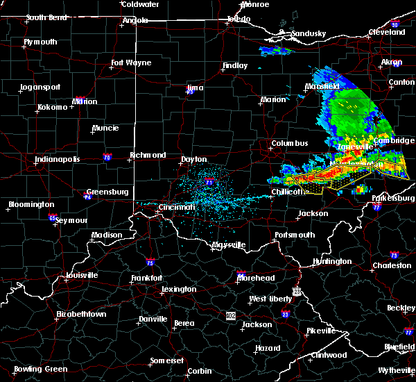 At 157 pm edt, severe thunderstorms were located along a line extending from near shawnee to 6 miles northwest of nelsonville to near logan, moving southeast at 25 mph (radar indicated). Hazards include 60 mph wind gusts and quarter size hail. Minor hail damage to vehicles is possible. expect wind damage to trees and power lines. Locations impacted include, logan, nelsonville, hocking hills state park, hide-a-way hills, starr, murray city, sugar grove, gibisonville, ilesboro, haydenville, lake logan state park, enterprise, union furnace, rockbridge, oreville and carbon hill. At 157 pm edt, severe thunderstorms were located along a line extending from near shawnee to 6 miles northwest of nelsonville to near logan, moving southeast at 25 mph (radar indicated). Hazards include 60 mph wind gusts and quarter size hail. Minor hail damage to vehicles is possible. expect wind damage to trees and power lines. Locations impacted include, logan, nelsonville, hocking hills state park, hide-a-way hills, starr, murray city, sugar grove, gibisonville, ilesboro, haydenville, lake logan state park, enterprise, union furnace, rockbridge, oreville and carbon hill.
|
| 5/14/2018 1:47 PM EDT |
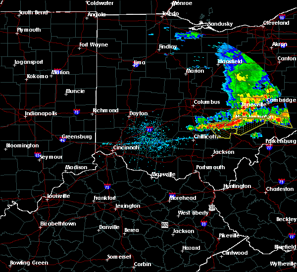 At 146 pm edt, severe thunderstorms were located along a line extending from shawnee to near logan to 8 miles southwest of hide-a-way hills, moving southeast at 25 mph (radar indicated). Hazards include 60 mph wind gusts and quarter size hail. Minor hail damage to vehicles is possible. expect wind damage to trees and power lines. Locations impacted include, logan, nelsonville, hocking hills state park, hide-a-way hills, starr, murray city, sugar grove, gibisonville, ilesboro, hideaway hills, haydenville, lake logan state park, clearport, enterprise, union furnace, rockbridge, oreville and carbon hill. At 146 pm edt, severe thunderstorms were located along a line extending from shawnee to near logan to 8 miles southwest of hide-a-way hills, moving southeast at 25 mph (radar indicated). Hazards include 60 mph wind gusts and quarter size hail. Minor hail damage to vehicles is possible. expect wind damage to trees and power lines. Locations impacted include, logan, nelsonville, hocking hills state park, hide-a-way hills, starr, murray city, sugar grove, gibisonville, ilesboro, hideaway hills, haydenville, lake logan state park, clearport, enterprise, union furnace, rockbridge, oreville and carbon hill.
|
| 5/14/2018 1:43 PM EDT |
 At 142 pm edt, severe thunderstorms were located along a line extending from 8 miles east of perry state forest to near logan, moving east at 30 mph (radar indicated). Hazards include 60 mph wind gusts and quarter size hail. Hail damage to vehicles is expected. Expect wind damage to roofs, siding, and trees. At 142 pm edt, severe thunderstorms were located along a line extending from 8 miles east of perry state forest to near logan, moving east at 30 mph (radar indicated). Hazards include 60 mph wind gusts and quarter size hail. Hail damage to vehicles is expected. Expect wind damage to roofs, siding, and trees.
|
| 5/14/2018 1:35 PM EDT |
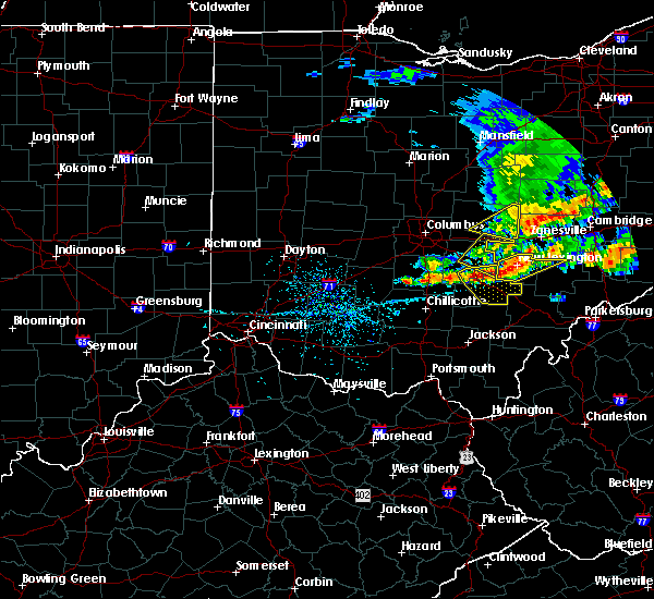 At 135 pm edt, severe thunderstorms were located along a line extending from 6 miles west of shawnee to near logan to 9 miles south of lancaster, moving southeast at 25 mph (radar indicated). Hazards include 60 mph wind gusts and quarter size hail. Minor hail damage to vehicles is possible. expect wind damage to trees and power lines. Locations impacted include, lancaster, logan, nelsonville, bremen, hocking hills state park, hide-a-way hills, starr, murray city, sugar grove, gibisonville, ilesboro, hideaway hills, haydenville, lake logan state park, clearport, north berne, enterprise, union furnace, rockbridge and oreville. At 135 pm edt, severe thunderstorms were located along a line extending from 6 miles west of shawnee to near logan to 9 miles south of lancaster, moving southeast at 25 mph (radar indicated). Hazards include 60 mph wind gusts and quarter size hail. Minor hail damage to vehicles is possible. expect wind damage to trees and power lines. Locations impacted include, lancaster, logan, nelsonville, bremen, hocking hills state park, hide-a-way hills, starr, murray city, sugar grove, gibisonville, ilesboro, hideaway hills, haydenville, lake logan state park, clearport, north berne, enterprise, union furnace, rockbridge and oreville.
|
| 5/14/2018 1:23 PM EDT |
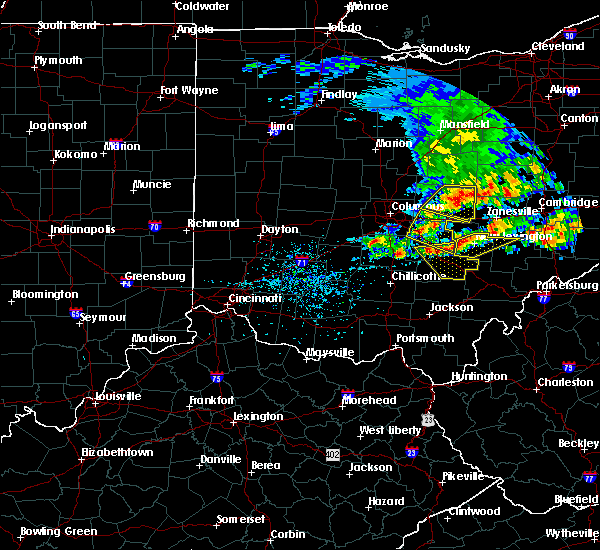 At 123 pm edt, severe thunderstorms were located along a line extending from near bremen to near hide-a-way hills to 9 miles southwest of lancaster, moving southeast at 25 mph (radar indicated). Hazards include 60 mph wind gusts and quarter size hail. Minor hail damage to vehicles is possible. Expect wind damage to trees and power lines. At 123 pm edt, severe thunderstorms were located along a line extending from near bremen to near hide-a-way hills to 9 miles southwest of lancaster, moving southeast at 25 mph (radar indicated). Hazards include 60 mph wind gusts and quarter size hail. Minor hail damage to vehicles is possible. Expect wind damage to trees and power lines.
|
| 5/4/2018 6:55 PM EDT |
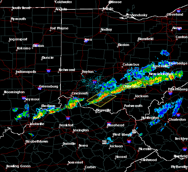 The severe thunderstorm warning for hocking, southeastern pickaway and northeastern ross counties will expire at 700 pm edt, the storm which prompted the warning has weakened below severe limits, and no longer poses an immediate threat to life or property. therefore, the warning will be allowed to expire. please report previous wind damage or hail to the national weather service by going to our website at weather.gov/iln and submitting your report via social media. The severe thunderstorm warning for hocking, southeastern pickaway and northeastern ross counties will expire at 700 pm edt, the storm which prompted the warning has weakened below severe limits, and no longer poses an immediate threat to life or property. therefore, the warning will be allowed to expire. please report previous wind damage or hail to the national weather service by going to our website at weather.gov/iln and submitting your report via social media.
|
| 5/4/2018 6:44 PM EDT |
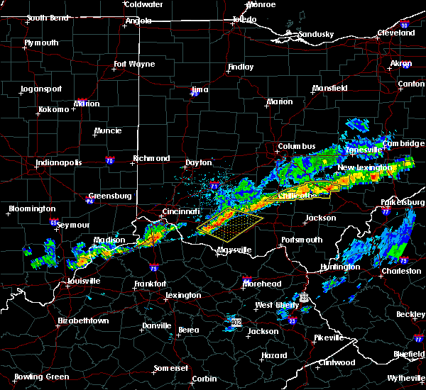 At 644 pm edt, a severe thunderstorm was located over hocking hills state park, moving east at 55 mph (radar indicated). Hazards include 60 mph wind gusts. Expect damage to trees and power lines. Locations impacted include, chillicothe, logan, nelsonville, kingston, hocking hills state park, starr, laurelville, murray city, adelphi, gibisonville, ilesboro, haydenville, lake logan state park, whisler, south bloomingville, enterprise, union furnace, rockbridge, hallsville and oreville. At 644 pm edt, a severe thunderstorm was located over hocking hills state park, moving east at 55 mph (radar indicated). Hazards include 60 mph wind gusts. Expect damage to trees and power lines. Locations impacted include, chillicothe, logan, nelsonville, kingston, hocking hills state park, starr, laurelville, murray city, adelphi, gibisonville, ilesboro, haydenville, lake logan state park, whisler, south bloomingville, enterprise, union furnace, rockbridge, hallsville and oreville.
|
| 5/4/2018 6:22 PM EDT |
 At 622 pm edt, a severe thunderstorm was located near kingston, moving east at 55 mph (radar indicated). Hazards include 60 mph wind gusts. expect damage to trees and power lines At 622 pm edt, a severe thunderstorm was located near kingston, moving east at 55 mph (radar indicated). Hazards include 60 mph wind gusts. expect damage to trees and power lines
|
| 7/22/2017 4:36 PM EDT |
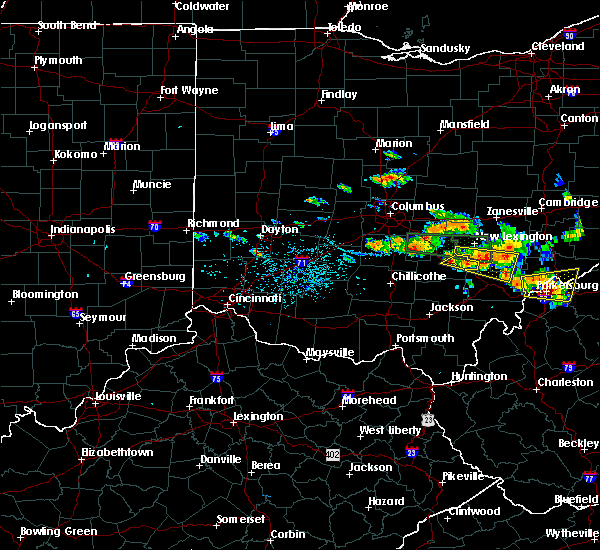 At 436 pm edt, a severe thunderstorm was located near nelsonville, moving east at 35 mph (radar indicated). Hazards include 60 mph wind gusts. Expect damage to trees and power lines. Locations impacted include, logan, nelsonville, murray city, lake logan state park, haydenville, oreville and carbon hill. At 436 pm edt, a severe thunderstorm was located near nelsonville, moving east at 35 mph (radar indicated). Hazards include 60 mph wind gusts. Expect damage to trees and power lines. Locations impacted include, logan, nelsonville, murray city, lake logan state park, haydenville, oreville and carbon hill.
|
| 7/22/2017 4:24 PM EDT |
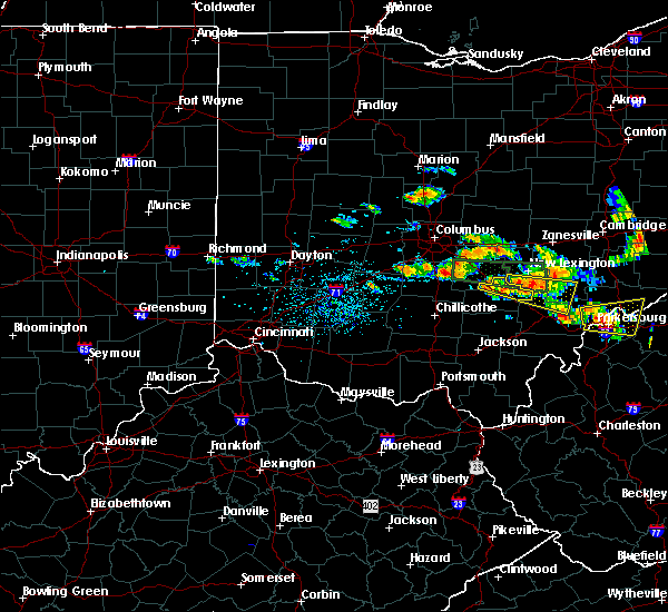 At 424 pm edt, a severe thunderstorm was located over logan, moving east at 30 mph (radar indicated). Hazards include 60 mph wind gusts and penny size hail. Expect damage to trees and power lines. Locations impacted include, logan, nelsonville, hide-a-way hills, murray city, enterprise, hideaway hills, rockbridge, lake logan state park, haydenville, oreville and carbon hill. At 424 pm edt, a severe thunderstorm was located over logan, moving east at 30 mph (radar indicated). Hazards include 60 mph wind gusts and penny size hail. Expect damage to trees and power lines. Locations impacted include, logan, nelsonville, hide-a-way hills, murray city, enterprise, hideaway hills, rockbridge, lake logan state park, haydenville, oreville and carbon hill.
|
| 7/22/2017 4:24 PM EDT |
 At 424 pm edt, a severe thunderstorm was located over shawnee, moving east at 35 mph (radar indicated). Hazards include 60 mph wind gusts and quarter size hail. Hail damage to vehicles is expected. Expect wind damage to roofs, siding, and trees. At 424 pm edt, a severe thunderstorm was located over shawnee, moving east at 35 mph (radar indicated). Hazards include 60 mph wind gusts and quarter size hail. Hail damage to vehicles is expected. Expect wind damage to roofs, siding, and trees.
|
| 7/22/2017 4:10 PM EDT |
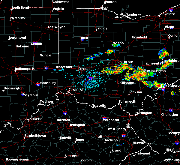 At 410 pm edt, a severe thunderstorm was located over hide-a-way hills, moving east at 40 mph (radar indicated). Hazards include 60 mph wind gusts and penny size hail. Expect damage to trees and power lines. Locations impacted include, lancaster, logan, nelsonville, bremen, hide-a-way hills, murray city, sugar grove, hideaway hills, lake logan state park, haydenville, north berne, enterprise, rockbridge, oreville, carbon hill and clearport. At 410 pm edt, a severe thunderstorm was located over hide-a-way hills, moving east at 40 mph (radar indicated). Hazards include 60 mph wind gusts and penny size hail. Expect damage to trees and power lines. Locations impacted include, lancaster, logan, nelsonville, bremen, hide-a-way hills, murray city, sugar grove, hideaway hills, lake logan state park, haydenville, north berne, enterprise, rockbridge, oreville, carbon hill and clearport.
|
| 7/22/2017 3:55 PM EDT |
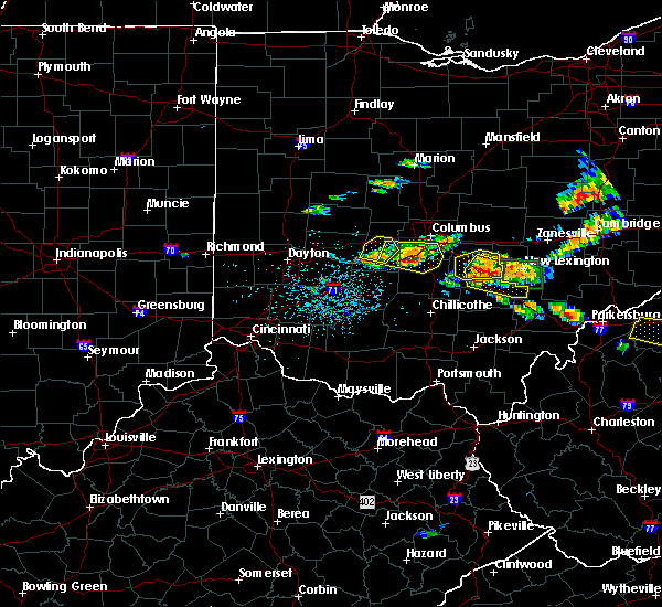 At 354 pm edt, a severe thunderstorm was located near hide-a-way hills, moving east at 35 mph (radar indicated). Hazards include 60 mph wind gusts and penny size hail. expect damage to trees and power lines At 354 pm edt, a severe thunderstorm was located near hide-a-way hills, moving east at 35 mph (radar indicated). Hazards include 60 mph wind gusts and penny size hail. expect damage to trees and power lines
|
| 7/13/2017 3:44 PM EDT |
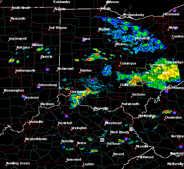 At 344 pm edt, a severe thunderstorm was located near hocking hills state park, moving east at 35 mph (radar indicated). Hazards include 60 mph wind gusts. Expect damage to trees and power lines. Locations impacted include, logan, nelsonville, hocking hills state park, starr, murray city, gibisonville, ilesboro, lake logan state park, haydenville, south bloomingville, enterprise, union furnace and carbon hill. At 344 pm edt, a severe thunderstorm was located near hocking hills state park, moving east at 35 mph (radar indicated). Hazards include 60 mph wind gusts. Expect damage to trees and power lines. Locations impacted include, logan, nelsonville, hocking hills state park, starr, murray city, gibisonville, ilesboro, lake logan state park, haydenville, south bloomingville, enterprise, union furnace and carbon hill.
|
| 7/13/2017 3:29 PM EDT |
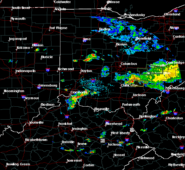 At 329 pm edt, a severe thunderstorm was located 7 miles northwest of hocking hills state park, moving east at 35 mph (radar indicated). Hazards include 60 mph wind gusts. expect damage to trees and power lines At 329 pm edt, a severe thunderstorm was located 7 miles northwest of hocking hills state park, moving east at 35 mph (radar indicated). Hazards include 60 mph wind gusts. expect damage to trees and power lines
|
| 7/10/2017 6:18 PM EDT |
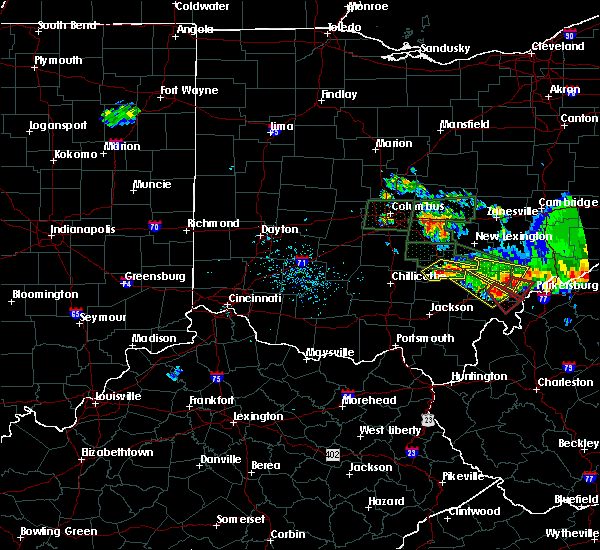 At 618 pm edt, a severe thunderstorm was located near hocking hills state park, moving east at 30 mph (radar indicated). Hazards include 60 mph wind gusts and quarter size hail. Minor hail damage to vehicles is possible. expect wind damage to trees and power lines. Locations impacted include, logan, nelsonville, hocking hills state park, starr, south bloomingville, gibisonville, ilesboro, union furnace, lake logan state park, haydenville and carbon hill. At 618 pm edt, a severe thunderstorm was located near hocking hills state park, moving east at 30 mph (radar indicated). Hazards include 60 mph wind gusts and quarter size hail. Minor hail damage to vehicles is possible. expect wind damage to trees and power lines. Locations impacted include, logan, nelsonville, hocking hills state park, starr, south bloomingville, gibisonville, ilesboro, union furnace, lake logan state park, haydenville and carbon hill.
|
| 7/10/2017 6:16 PM EDT |
 At 616 pm edt, a severe thunderstorm was located 7 miles northwest of tuppers plains, or 7 miles west of coolville, moving southeast at 45 mph (radar indicated). Hazards include 70 mph wind gusts and ping pong ball size hail. People and animals outdoors will be injured. expect hail damage to roofs, siding, windows, and vehicles. expect considerable tree damage. wind damage is also likely to mobile homes, roofs, and outbuildings. locations impacted include, athens, albany, nelsonville, chauncey, darwin, stroud run state park and the plains. At 616 pm edt, a severe thunderstorm was located 7 miles northwest of tuppers plains, or 7 miles west of coolville, moving southeast at 45 mph (radar indicated). Hazards include 70 mph wind gusts and ping pong ball size hail. People and animals outdoors will be injured. expect hail damage to roofs, siding, windows, and vehicles. expect considerable tree damage. wind damage is also likely to mobile homes, roofs, and outbuildings. locations impacted include, athens, albany, nelsonville, chauncey, darwin, stroud run state park and the plains.
|
| 7/10/2017 6:09 PM EDT |
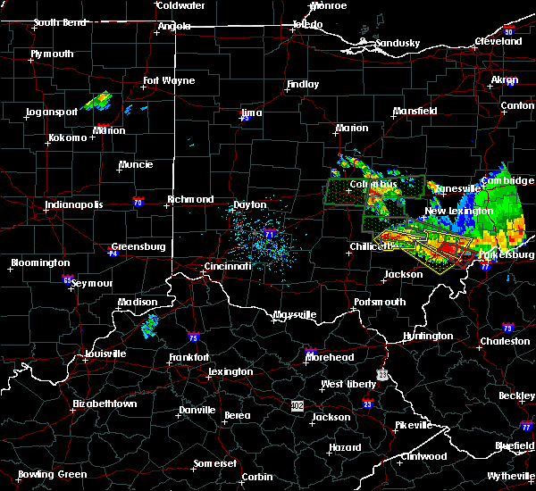 At 609 pm edt, a severe thunderstorm was located near hocking hills state park, moving east at 30 mph (radar indicated). Hazards include 60 mph wind gusts and quarter size hail. Minor hail damage to vehicles is possible. Expect wind damage to trees and power lines. At 609 pm edt, a severe thunderstorm was located near hocking hills state park, moving east at 30 mph (radar indicated). Hazards include 60 mph wind gusts and quarter size hail. Minor hail damage to vehicles is possible. Expect wind damage to trees and power lines.
|
| 7/10/2017 5:57 PM EDT |
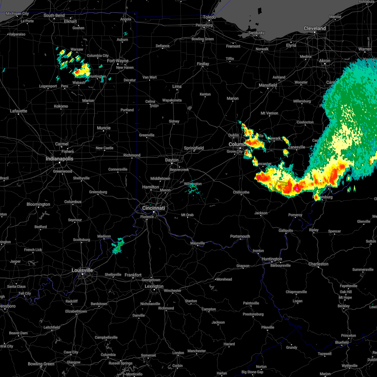 The severe thunderstorm warning for southeastern hocking county will expire at 600 pm edt, the storm which prompted the warning has moved out of the area. therefore, the warning will be allowed to expire. however small hail, gusty winds and heavy rain are still possible with this thunderstorm. please report previous wind damage or hail to the national weather service by going to our website at weather.gov/iln and submitting your report via social media. The severe thunderstorm warning for southeastern hocking county will expire at 600 pm edt, the storm which prompted the warning has moved out of the area. therefore, the warning will be allowed to expire. however small hail, gusty winds and heavy rain are still possible with this thunderstorm. please report previous wind damage or hail to the national weather service by going to our website at weather.gov/iln and submitting your report via social media.
|
| 7/10/2017 5:55 PM EDT |
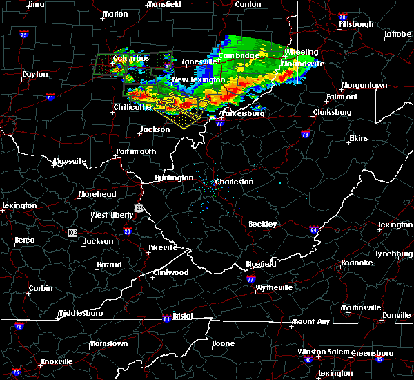 At 554 pm edt, a severe thunderstorm was located near chesterhill, moving east at 35 mph (radar indicated. this storm is also exhibiting radar indicated rotation). Hazards include 70 mph wind gusts and ping pong ball size hail. People and animals outdoors will be injured. expect hail damage to roofs, siding, windows, and vehicles. expect considerable tree damage. wind damage is also likely to mobile homes, roofs, and outbuildings. locations impacted include, athens, nelsonville, glouster, chesterhill, chauncey, buchtel, jacksonville, murray city, trimble, amesville, stroud run state park, burr oak state park and bartlett. At 554 pm edt, a severe thunderstorm was located near chesterhill, moving east at 35 mph (radar indicated. this storm is also exhibiting radar indicated rotation). Hazards include 70 mph wind gusts and ping pong ball size hail. People and animals outdoors will be injured. expect hail damage to roofs, siding, windows, and vehicles. expect considerable tree damage. wind damage is also likely to mobile homes, roofs, and outbuildings. locations impacted include, athens, nelsonville, glouster, chesterhill, chauncey, buchtel, jacksonville, murray city, trimble, amesville, stroud run state park, burr oak state park and bartlett.
|
| 7/10/2017 5:49 PM EDT |
 At 548 pm edt, a severe thunderstorm was located near nelsonville, moving southeast at 40 mph (radar indicated). Hazards include 60 mph wind gusts and quarter size hail. Hail damage to vehicles is expected. Expect wind damage to roofs, siding, and trees. At 548 pm edt, a severe thunderstorm was located near nelsonville, moving southeast at 40 mph (radar indicated). Hazards include 60 mph wind gusts and quarter size hail. Hail damage to vehicles is expected. Expect wind damage to roofs, siding, and trees.
|
| 7/10/2017 5:45 PM EDT |
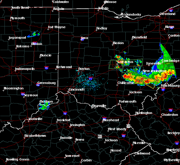 At 545 pm edt, a severe thunderstorm was located near nelsonville, moving east at 30 mph (radar indicated). Hazards include 60 mph wind gusts and quarter size hail. Minor hail damage to vehicles is possible. Expect wind damage to trees and power lines. At 545 pm edt, a severe thunderstorm was located near nelsonville, moving east at 30 mph (radar indicated). Hazards include 60 mph wind gusts and quarter size hail. Minor hail damage to vehicles is possible. Expect wind damage to trees and power lines.
|
| 7/10/2017 5:32 PM EDT |
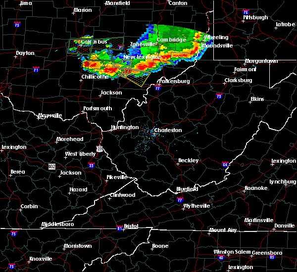 At 531 pm edt, a severe thunderstorm was located over glouster, moving southeast at 35 mph (radar indicated. this storm also exihibits radar based rotation). Hazards include 60 mph wind gusts and half dollar size hail. Hail damage to vehicles is expected. Expect wind damage to roofs, siding, and trees. At 531 pm edt, a severe thunderstorm was located over glouster, moving southeast at 35 mph (radar indicated. this storm also exihibits radar based rotation). Hazards include 60 mph wind gusts and half dollar size hail. Hail damage to vehicles is expected. Expect wind damage to roofs, siding, and trees.
|
| 7/10/2017 5:09 PM EDT |
 At 508 pm edt, a severe thunderstorm was located over shawnee, moving east at 30 mph (radar indicated. this storm is also exhibiting radar based rotation). Hazards include ping pong ball size hail and 60 mph wind gusts. People and animals outdoors will be injured. expect hail damage to roofs, siding, windows, and vehicles. expect wind damage to roofs, siding, and trees. locations impacted include, nelsonville, new lexington, shawnee, new straitsville, corning, buchtel, murray city, hemlock and rendville. At 508 pm edt, a severe thunderstorm was located over shawnee, moving east at 30 mph (radar indicated. this storm is also exhibiting radar based rotation). Hazards include ping pong ball size hail and 60 mph wind gusts. People and animals outdoors will be injured. expect hail damage to roofs, siding, windows, and vehicles. expect wind damage to roofs, siding, and trees. locations impacted include, nelsonville, new lexington, shawnee, new straitsville, corning, buchtel, murray city, hemlock and rendville.
|
| 7/10/2017 4:45 PM EDT |
 At 444 pm edt, a severe thunderstorm was located over hide-a-way hills, or 8 miles north of logan, moving east at 30 mph (radar indicated. this storm is also exhibiting radar based rotation). Hazards include 60 mph wind gusts and quarter size hail. Hail damage to vehicles is expected. Expect wind damage to roofs, siding, and trees. At 444 pm edt, a severe thunderstorm was located over hide-a-way hills, or 8 miles north of logan, moving east at 30 mph (radar indicated. this storm is also exhibiting radar based rotation). Hazards include 60 mph wind gusts and quarter size hail. Hail damage to vehicles is expected. Expect wind damage to roofs, siding, and trees.
|
| 7/7/2017 3:37 PM EDT |
 The severe thunderstorm warning for northwestern washington, morgan, northern athens and northeastern vinton counties will expire at 345 pm edt, the storms which prompted the warning have weakened below severe limits, and have exited the warned area. therefore the warning will be allowed to expire. however gusty winds and heavy rain are still possible with these thunderstorms. a severe thunderstorm watch remains in effect until 900 pm edt for southeastern ohio. The severe thunderstorm warning for northwestern washington, morgan, northern athens and northeastern vinton counties will expire at 345 pm edt, the storms which prompted the warning have weakened below severe limits, and have exited the warned area. therefore the warning will be allowed to expire. however gusty winds and heavy rain are still possible with these thunderstorms. a severe thunderstorm watch remains in effect until 900 pm edt for southeastern ohio.
|
| 7/7/2017 2:58 PM EDT |
 At 257 pm edt, severe thunderstorms were located along a line extending from 7 miles west of caldwell to near chesterhill to near logan, moving southeast at 35 mph (radar indicated). Hazards include 60 mph wind gusts. expect damage to roofs, siding, and trees At 257 pm edt, severe thunderstorms were located along a line extending from 7 miles west of caldwell to near chesterhill to near logan, moving southeast at 35 mph (radar indicated). Hazards include 60 mph wind gusts. expect damage to roofs, siding, and trees
|
| 7/7/2017 2:49 PM EDT |
 At 249 pm edt, severe thunderstorms were located along a line extending from near mcconnelsville to near glouster to near nelsonville, moving southeast at 35 mph (radar indicated). Hazards include 60 mph wind gusts. Expect damage to roofs, siding, and trees. locations impacted include, athens, nelsonville, glouster, mcconnelsville, shawnee, chesterhill, chauncey, new straitsville, malta, corning, buchtel, stockport, jacksonville, murray city, trimble, bristol, hemlock, amesville, rendville and burr oak state park. At 249 pm edt, severe thunderstorms were located along a line extending from near mcconnelsville to near glouster to near nelsonville, moving southeast at 35 mph (radar indicated). Hazards include 60 mph wind gusts. Expect damage to roofs, siding, and trees. locations impacted include, athens, nelsonville, glouster, mcconnelsville, shawnee, chesterhill, chauncey, new straitsville, malta, corning, buchtel, stockport, jacksonville, murray city, trimble, bristol, hemlock, amesville, rendville and burr oak state park.
|
| 7/7/2017 2:35 PM EDT |
 At 234 pm edt, severe thunderstorms were located along a line extending from 7 miles south of south zanesville to near new lexington to near logan, moving southeast at 45 mph (radar indicated). Hazards include 60 mph wind gusts. expect damage to roofs, siding, and trees At 234 pm edt, severe thunderstorms were located along a line extending from 7 miles south of south zanesville to near new lexington to near logan, moving southeast at 45 mph (radar indicated). Hazards include 60 mph wind gusts. expect damage to roofs, siding, and trees
|
| 6/23/2017 3:09 PM EDT | Tree down on carbon hill r in hocking county OH, 2.8 miles SSE of Nelsonville, OH |
| 5/19/2017 7:04 PM EDT |
 At 703 pm edt, severe thunderstorms were located along a line extending from 6 miles west of new concord to near mcarthur, moving east at 35 mph (radar indicated). Hazards include 60 mph wind gusts and quarter size hail. Hail damage to vehicles is expected. expect wind damage to roofs, siding, and trees. locations impacted include, nelsonville, new lexington, glouster, mcconnelsville, somerset, shawnee, perry state forest, crooksville, chauncey, junction city, new straitsville, malta, corning, buchtel, jacksonville, murray city, trimble, glenford, hemlock and rendville. At 703 pm edt, severe thunderstorms were located along a line extending from 6 miles west of new concord to near mcarthur, moving east at 35 mph (radar indicated). Hazards include 60 mph wind gusts and quarter size hail. Hail damage to vehicles is expected. expect wind damage to roofs, siding, and trees. locations impacted include, nelsonville, new lexington, glouster, mcconnelsville, somerset, shawnee, perry state forest, crooksville, chauncey, junction city, new straitsville, malta, corning, buchtel, jacksonville, murray city, trimble, glenford, hemlock and rendville.
|
| 5/19/2017 6:54 PM EDT |
 The severe thunderstorm warning for eastern hocking county will expire at 700 pm edt, the storm which prompted the warning has weakened below severe limits, and no longer poses an immediate threat to life or property. therefore, the warning will be allowed to expire. a severe thunderstorm watch remains in effect until 1100 pm edt for central ohio. please report previous wind damage or hail to the national weather service by going to our website at weather.gov/iln and submitting your report via social media. The severe thunderstorm warning for eastern hocking county will expire at 700 pm edt, the storm which prompted the warning has weakened below severe limits, and no longer poses an immediate threat to life or property. therefore, the warning will be allowed to expire. a severe thunderstorm watch remains in effect until 1100 pm edt for central ohio. please report previous wind damage or hail to the national weather service by going to our website at weather.gov/iln and submitting your report via social media.
|
| 5/19/2017 6:51 PM EDT |
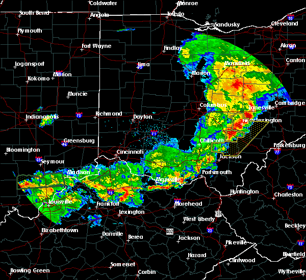 At 650 pm edt, a severe thunderstorm was located over logan, moving east at 35 mph (radar indicated). Hazards include 60 mph wind gusts. Expect damage to roofs, siding, and trees. Locations impacted include, logan, nelsonville, starr, murray city, enterprise, ilesboro, union furnace, lake logan state park, haydenville, oreville and carbon hill. At 650 pm edt, a severe thunderstorm was located over logan, moving east at 35 mph (radar indicated). Hazards include 60 mph wind gusts. Expect damage to roofs, siding, and trees. Locations impacted include, logan, nelsonville, starr, murray city, enterprise, ilesboro, union furnace, lake logan state park, haydenville, oreville and carbon hill.
|
| 5/19/2017 6:48 PM EDT |
 At 647 pm edt, severe thunderstorms were located along a line extending from near north zanesville to 13 miles northwest of wellston, moving east at 35 mph (radar indicated). Hazards include 60 mph wind gusts and quarter size hail. Hail damage to vehicles is expected. expect wind damage to roofs, siding, and trees. locations impacted include, athens, wellston, nelsonville, new lexington, glouster, mcconnelsville, mcarthur, somerset, albany, shawnee, lake hope state park, perry state forest, crooksville, chauncey, hamden, junction city, new straitsville, malta, corning and buchtel. At 647 pm edt, severe thunderstorms were located along a line extending from near north zanesville to 13 miles northwest of wellston, moving east at 35 mph (radar indicated). Hazards include 60 mph wind gusts and quarter size hail. Hail damage to vehicles is expected. expect wind damage to roofs, siding, and trees. locations impacted include, athens, wellston, nelsonville, new lexington, glouster, mcconnelsville, mcarthur, somerset, albany, shawnee, lake hope state park, perry state forest, crooksville, chauncey, hamden, junction city, new straitsville, malta, corning and buchtel.
|
| 5/19/2017 6:45 PM EDT |
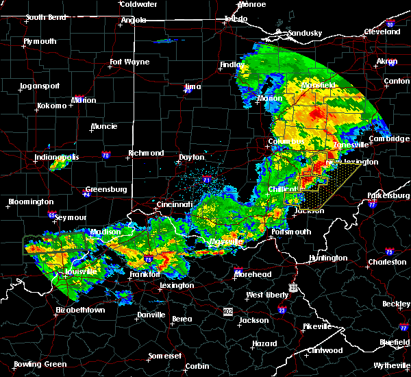 At 644 pm edt, a severe thunderstorm was located near logan, moving east at 35 mph (radar indicated). Hazards include 60 mph wind gusts. expect damage to roofs, siding, and trees At 644 pm edt, a severe thunderstorm was located near logan, moving east at 35 mph (radar indicated). Hazards include 60 mph wind gusts. expect damage to roofs, siding, and trees
|
| 5/19/2017 6:19 PM EDT |
 At 618 pm edt, severe thunderstorms were located along a line extending from near thornport to 6 miles northwest of waverly, moving east at 35 mph (radar indicated). Hazards include 60 mph wind gusts and quarter size hail. Hail damage to vehicles is expected. Expect wind damage to roofs, siding, and trees. At 618 pm edt, severe thunderstorms were located along a line extending from near thornport to 6 miles northwest of waverly, moving east at 35 mph (radar indicated). Hazards include 60 mph wind gusts and quarter size hail. Hail damage to vehicles is expected. Expect wind damage to roofs, siding, and trees.
|
| 4/16/2017 5:51 PM EDT |
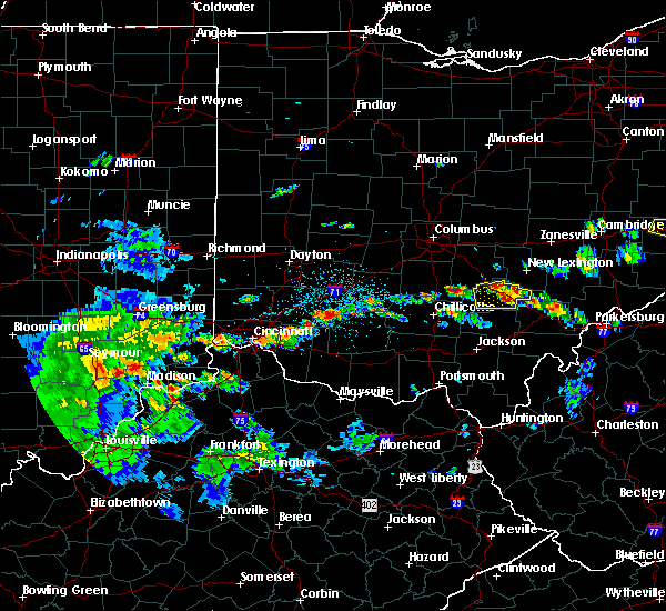 At 551 pm edt, a severe thunderstorm was located over logan, moving east at 20 mph (radar indicated). Hazards include 60 mph wind gusts and quarter size hail. Hail damage to vehicles is expected. expect wind damage to roofs, siding, and trees. Locations impacted include, logan, nelsonville, hocking hills state park, murray city, gibisonville, ilesboro, lake logan state park, haydenville, south bloomingville, enterprise, union furnace, rockbridge, oreville and carbon hill. At 551 pm edt, a severe thunderstorm was located over logan, moving east at 20 mph (radar indicated). Hazards include 60 mph wind gusts and quarter size hail. Hail damage to vehicles is expected. expect wind damage to roofs, siding, and trees. Locations impacted include, logan, nelsonville, hocking hills state park, murray city, gibisonville, ilesboro, lake logan state park, haydenville, south bloomingville, enterprise, union furnace, rockbridge, oreville and carbon hill.
|
| 4/16/2017 5:28 PM EDT |
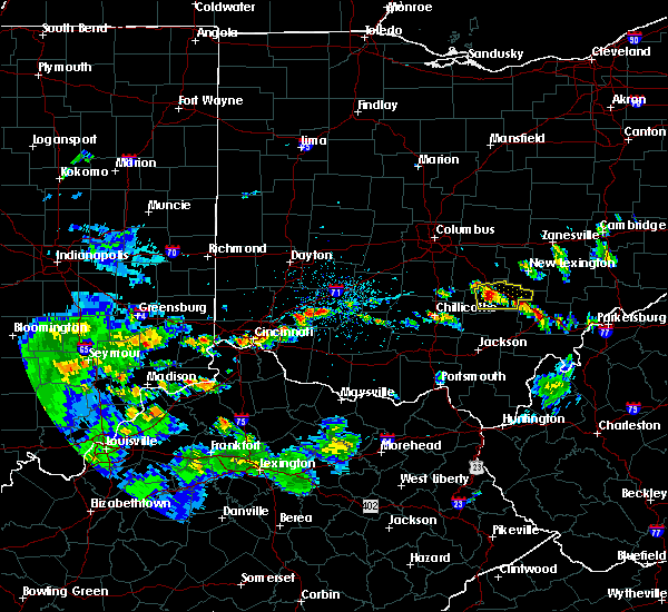 At 528 pm edt, a severe thunderstorm was located near hocking hills state park, moving east at 20 mph (radar indicated). Hazards include 60 mph wind gusts and quarter size hail. Hail damage to vehicles is expected. Expect wind damage to roofs, siding, and trees. At 528 pm edt, a severe thunderstorm was located near hocking hills state park, moving east at 20 mph (radar indicated). Hazards include 60 mph wind gusts and quarter size hail. Hail damage to vehicles is expected. Expect wind damage to roofs, siding, and trees.
|
| 3/1/2017 3:57 AM EST |
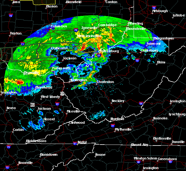 At 357 am est, a severe thunderstorm was located near athens, moving east at 60 mph (radar indicated). Hazards include 70 mph wind gusts. Expect considerable tree damage. damage is likely to mobile homes, roofs, and outbuildings. Locations impacted include, athens, chesterhill, nelsonville, chauncey, buchtel, stockport, jacksonville, trimble, amesville, stroud run state park, bartlett and the plains. At 357 am est, a severe thunderstorm was located near athens, moving east at 60 mph (radar indicated). Hazards include 70 mph wind gusts. Expect considerable tree damage. damage is likely to mobile homes, roofs, and outbuildings. Locations impacted include, athens, chesterhill, nelsonville, chauncey, buchtel, stockport, jacksonville, trimble, amesville, stroud run state park, bartlett and the plains.
|
| 3/1/2017 3:48 AM EST |
 At 347 am est, a severe thunderstorm was located over lake hope state park, moving east at 60 mph (radar indicated). Hazards include 70 mph wind gusts. Expect considerable tree damage. Damage is likely to mobile homes, roofs, and outbuildings. At 347 am est, a severe thunderstorm was located over lake hope state park, moving east at 60 mph (radar indicated). Hazards include 70 mph wind gusts. Expect considerable tree damage. Damage is likely to mobile homes, roofs, and outbuildings.
|
| 3/1/2017 3:34 AM EST |
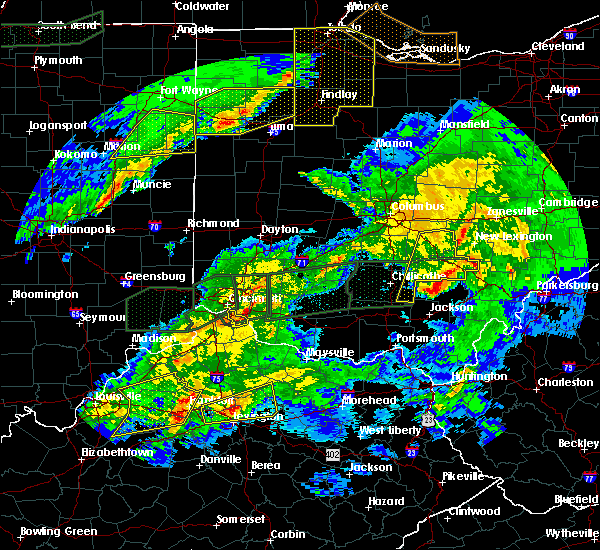 At 333 am est, severe thunderstorms were located along a line extending from near somerset to near mcarthur, moving northeast at 65 mph (radar indicated). Hazards include 60 mph wind gusts. Expect damage to roofs, siding, and trees. locations impacted include, logan, nelsonville, bremen, hocking hills state park, hide-a-way hills, starr, murray city, rushville, gibisonville, ilesboro, hideaway hills, lake logan state park, haydenville, south bloomingville, enterprise, union furnace, rockbridge, oreville and carbon hill. A tornado watch remains in effect until 700 am est for central ohio. At 333 am est, severe thunderstorms were located along a line extending from near somerset to near mcarthur, moving northeast at 65 mph (radar indicated). Hazards include 60 mph wind gusts. Expect damage to roofs, siding, and trees. locations impacted include, logan, nelsonville, bremen, hocking hills state park, hide-a-way hills, starr, murray city, rushville, gibisonville, ilesboro, hideaway hills, lake logan state park, haydenville, south bloomingville, enterprise, union furnace, rockbridge, oreville and carbon hill. A tornado watch remains in effect until 700 am est for central ohio.
|
| 3/1/2017 3:20 AM EST |
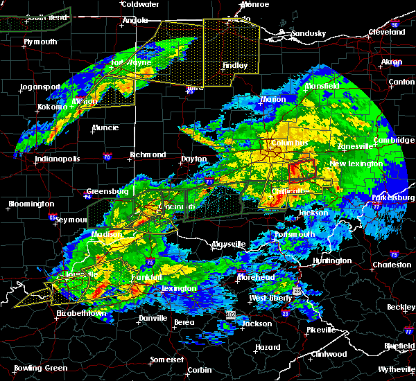 At 320 am est, severe thunderstorms were located along a line extending from near lancaster to 11 miles northwest of wellston, moving east at 55 mph (radar indicated). Hazards include 60 mph wind gusts. Expect damage to roofs, siding, and trees. locations impacted include, lancaster, logan, nelsonville, bremen, pleasantville, hocking hills state park, hide-a-way hills, starr, amanda, londonderry, thurston, laurelville, carroll, murray city, sugar grove, adelphi, rushville, tarlton, west rushville and fairfield county airport. A tornado watch remains in effect until 700 am est for central and southwestern ohio. At 320 am est, severe thunderstorms were located along a line extending from near lancaster to 11 miles northwest of wellston, moving east at 55 mph (radar indicated). Hazards include 60 mph wind gusts. Expect damage to roofs, siding, and trees. locations impacted include, lancaster, logan, nelsonville, bremen, pleasantville, hocking hills state park, hide-a-way hills, starr, amanda, londonderry, thurston, laurelville, carroll, murray city, sugar grove, adelphi, rushville, tarlton, west rushville and fairfield county airport. A tornado watch remains in effect until 700 am est for central and southwestern ohio.
|
| 3/1/2017 3:04 AM EST |
 At 304 am est, severe thunderstorms were located along a line extending from near ashville to 6 miles northeast of pike lake, moving east at 50 mph (radar indicated). Hazards include 60 mph wind gusts and penny size hail. expect damage to roofs, siding, and trees At 304 am est, severe thunderstorms were located along a line extending from near ashville to 6 miles northeast of pike lake, moving east at 50 mph (radar indicated). Hazards include 60 mph wind gusts and penny size hail. expect damage to roofs, siding, and trees
|
| 7/18/2016 9:16 AM EDT |
 At 915 am edt, a severe thunderstorm was located near lake hope state park, moving southeast at 35 mph (radar indicated). Hazards include 60 mph wind gusts and nickel size hail. Expect damage to roofs. siding. and trees. Locations impacted include, logan, nelsonville, hocking hills state park, starr, ilesboro, lake logan state park, haydenville and union furnace. At 915 am edt, a severe thunderstorm was located near lake hope state park, moving southeast at 35 mph (radar indicated). Hazards include 60 mph wind gusts and nickel size hail. Expect damage to roofs. siding. and trees. Locations impacted include, logan, nelsonville, hocking hills state park, starr, ilesboro, lake logan state park, haydenville and union furnace.
|
| 7/18/2016 9:03 AM EDT |
 At 903 am edt, a severe thunderstorm was located near logan, moving southeast at 35 mph (radar indicated). Hazards include 60 mph wind gusts and nickel size hail. Expect damage to roofs. siding. And trees. At 903 am edt, a severe thunderstorm was located near logan, moving southeast at 35 mph (radar indicated). Hazards include 60 mph wind gusts and nickel size hail. Expect damage to roofs. siding. And trees.
|
| 7/15/2016 5:25 PM EDT |
 At 524 pm edt, a severe thunderstorm was located near mcarthur, moving east at 25 mph (radar indicated). Hazards include 60 mph wind gusts and quarter size hail. Hail damage to vehicles is expected. Expect wind damage to roofs, siding, and trees. At 524 pm edt, a severe thunderstorm was located near mcarthur, moving east at 25 mph (radar indicated). Hazards include 60 mph wind gusts and quarter size hail. Hail damage to vehicles is expected. Expect wind damage to roofs, siding, and trees.
|
| 4/28/2016 5:28 PM EDT |
 At 528 pm edt, a severe thunderstorm was located near glouster, moving east at 35 mph (radar indicated). Hazards include 60 mph wind gusts and half dollar size hail. Hail damage to vehicles is expected. Expect wind damage to roofs, siding, and trees. At 528 pm edt, a severe thunderstorm was located near glouster, moving east at 35 mph (radar indicated). Hazards include 60 mph wind gusts and half dollar size hail. Hail damage to vehicles is expected. Expect wind damage to roofs, siding, and trees.
|
| 4/28/2016 5:23 PM EDT |
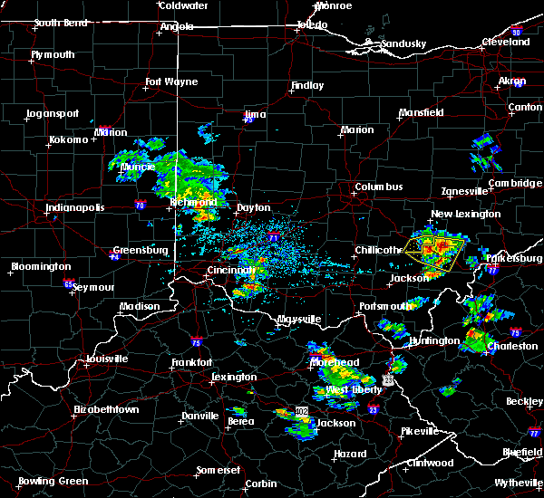 The severe thunderstorm warning for southeastern hocking county will expire at 530 pm edt, the storm which prompted the warning is moving out of the area. therefore the warning will be allowed to expire. please report previous wind damage or hail to the national weather service by going to our website at weather.gov/iln and submitting your report via social media. The severe thunderstorm warning for southeastern hocking county will expire at 530 pm edt, the storm which prompted the warning is moving out of the area. therefore the warning will be allowed to expire. please report previous wind damage or hail to the national weather service by going to our website at weather.gov/iln and submitting your report via social media.
|
| 4/28/2016 5:20 PM EDT | Quarter sized hail reported 1.7 miles WSW of Nelsonville, OH, coating the ground |
| 4/28/2016 5:18 PM EDT | Quarter sized hail reported 1.3 miles ESE of Nelsonville, OH, reported by 911 center in athens - dime to quarter sized in nelsonville |
| 4/28/2016 5:16 PM EDT |
 At 516 pm edt, a severe thunderstorm was located over buchtel, or over nelsonville, moving east at 25 mph (radar indicated). Hazards include 60 mph wind gusts and quarter size hail. Hail damage to vehicles is expected. expect wind damage to roofs, siding, and trees. Locations impacted include, athens, nelsonville, glouster, chesterhill, lake hope state park, chauncey, buchtel, jacksonville, murray city, trimble, amesville, stroud run state park, burr oak state park and the plains. At 516 pm edt, a severe thunderstorm was located over buchtel, or over nelsonville, moving east at 25 mph (radar indicated). Hazards include 60 mph wind gusts and quarter size hail. Hail damage to vehicles is expected. expect wind damage to roofs, siding, and trees. Locations impacted include, athens, nelsonville, glouster, chesterhill, lake hope state park, chauncey, buchtel, jacksonville, murray city, trimble, amesville, stroud run state park, burr oak state park and the plains.
|
| 4/28/2016 5:15 PM EDT |
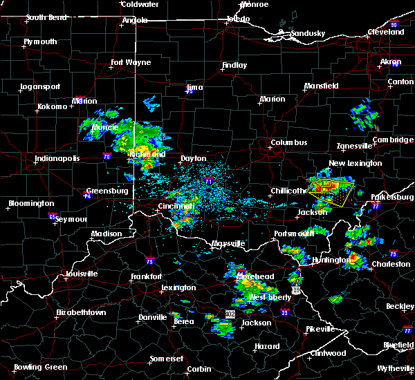 At 514 pm edt, a severe thunderstorm was located near lake hope state park, moving east at 35 mph (radar indicated). Hazards include 60 mph wind gusts and quarter size hail. Hail damage to vehicles is expected. expect wind damage to roofs, siding, and trees. Locations impacted include, logan, nelsonville, starr, murray city, ilesboro, haydenville, union furnace and carbon hill. At 514 pm edt, a severe thunderstorm was located near lake hope state park, moving east at 35 mph (radar indicated). Hazards include 60 mph wind gusts and quarter size hail. Hail damage to vehicles is expected. expect wind damage to roofs, siding, and trees. Locations impacted include, logan, nelsonville, starr, murray city, ilesboro, haydenville, union furnace and carbon hill.
|
| 4/28/2016 5:02 PM EDT |
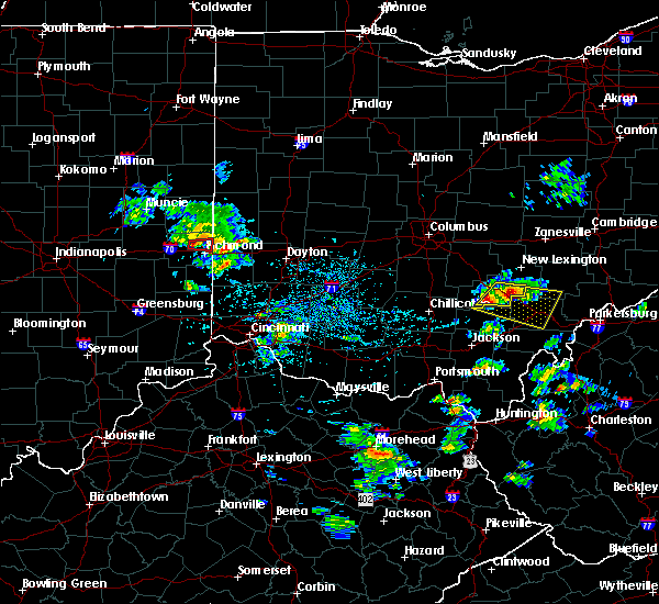 At 502 pm edt, a severe thunderstorm was located near nelsonville, moving east at 30 mph (radar indicated). Hazards include 60 mph wind gusts and quarter size hail. Hail damage to vehicles is expected. expect wind damage to roofs, siding, and trees. Locations impacted include, logan, nelsonville, hocking hills state park, starr, murray city, ilesboro, haydenville, union furnace and carbon hill. At 502 pm edt, a severe thunderstorm was located near nelsonville, moving east at 30 mph (radar indicated). Hazards include 60 mph wind gusts and quarter size hail. Hail damage to vehicles is expected. expect wind damage to roofs, siding, and trees. Locations impacted include, logan, nelsonville, hocking hills state park, starr, murray city, ilesboro, haydenville, union furnace and carbon hill.
|
| 4/28/2016 4:57 PM EDT |
 At 456 pm edt, a severe thunderstorm was located near nelsonville, moving east at 40 mph (radar indicated). Hazards include 60 mph wind gusts and quarter size hail. Hail damage to vehicles is expected. Expect wind damage to roofs, siding, and trees. At 456 pm edt, a severe thunderstorm was located near nelsonville, moving east at 40 mph (radar indicated). Hazards include 60 mph wind gusts and quarter size hail. Hail damage to vehicles is expected. Expect wind damage to roofs, siding, and trees.
|
| 4/28/2016 4:53 PM EDT |
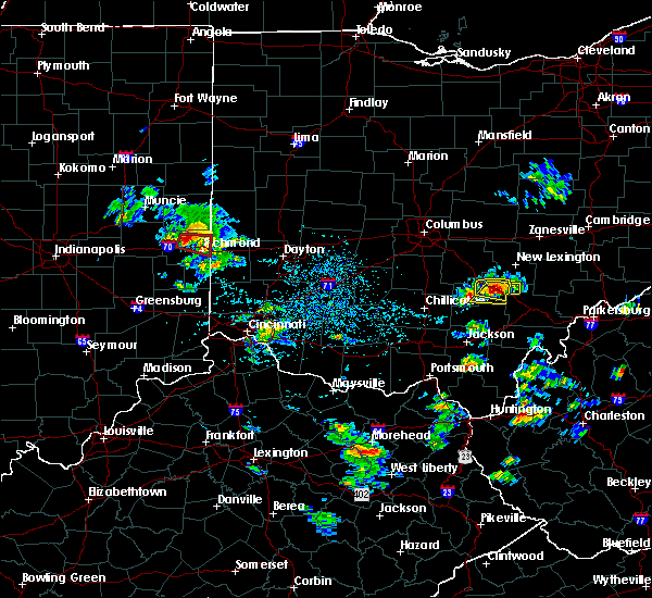 At 453 pm edt, a severe thunderstorm was located over logan, moving east at 30 mph (radar indicated). Hazards include 60 mph wind gusts and half dollar size hail. Hail damage to vehicles is expected. Expect wind damage to roofs, siding, and trees. At 453 pm edt, a severe thunderstorm was located over logan, moving east at 30 mph (radar indicated). Hazards include 60 mph wind gusts and half dollar size hail. Hail damage to vehicles is expected. Expect wind damage to roofs, siding, and trees.
|
| 8/10/2015 6:35 PM EDT |
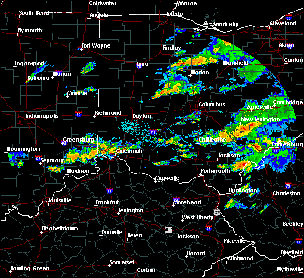 At 635 pm edt, radar indicated a severe thunderstorm located near glouster, moving southeast at 45 mph. storm hazards include, winds to 60 mph, locations impacted include, logan, nelsonville, murray city, haydenville, union furnace, oreville and carbon hill. At 635 pm edt, radar indicated a severe thunderstorm located near glouster, moving southeast at 45 mph. storm hazards include, winds to 60 mph, locations impacted include, logan, nelsonville, murray city, haydenville, union furnace, oreville and carbon hill.
|
| 8/10/2015 6:23 PM EDT |
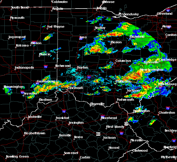 At 622 pm edt, radar indicated a severe thunderstorm located over nelsonville, moving southeast at 45 mph. storm hazards include, winds to 60 mph, locations impacted include, logan, nelsonville, starr, murray city, enterprise, ilesboro, lake logan state park, gibisonville, haydenville, union furnace, oreville and carbon hill. At 622 pm edt, radar indicated a severe thunderstorm located over nelsonville, moving southeast at 45 mph. storm hazards include, winds to 60 mph, locations impacted include, logan, nelsonville, starr, murray city, enterprise, ilesboro, lake logan state park, gibisonville, haydenville, union furnace, oreville and carbon hill.
|
| 8/10/2015 6:12 PM EDT |
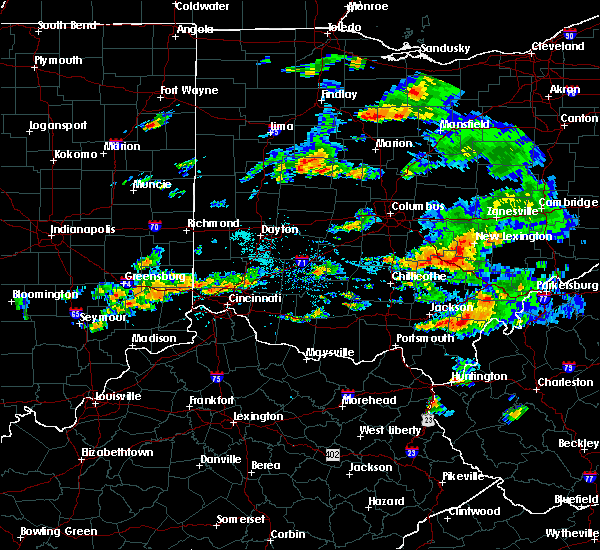 At 611 pm edt, radar indicated a severe thunderstorm located over logan, moving southeast at 45 mph. storm hazards include, winds to 60 mph,. At 611 pm edt, radar indicated a severe thunderstorm located over logan, moving southeast at 45 mph. storm hazards include, winds to 60 mph,.
|
| 7/14/2015 3:53 PM EDT |
 At 351 pm edt, doppler radar indicated a line of severe thunderstorms capable of producing destructive winds in excess of 70 mph. these storms were located along a line extending from near nelsonville to near hocking hills state park, moving southeast at 35 mph. these severe storms will be near, nelsonville and nelsonville around 355 pm edt. buchtel around 400 pm edt. lake hope state park around 405 pm edt. athens around 410 pm edt. albany around 415 pm edt. other locations impacted by these severe thunderstorms include creola, stroud run state park, coalton, chauncey, trimble, zaleski, eagle mills, hamden, amesville and jacksonville. At 351 pm edt, doppler radar indicated a line of severe thunderstorms capable of producing destructive winds in excess of 70 mph. these storms were located along a line extending from near nelsonville to near hocking hills state park, moving southeast at 35 mph. these severe storms will be near, nelsonville and nelsonville around 355 pm edt. buchtel around 400 pm edt. lake hope state park around 405 pm edt. athens around 410 pm edt. albany around 415 pm edt. other locations impacted by these severe thunderstorms include creola, stroud run state park, coalton, chauncey, trimble, zaleski, eagle mills, hamden, amesville and jacksonville.
|
| 7/14/2015 3:31 PM EDT |
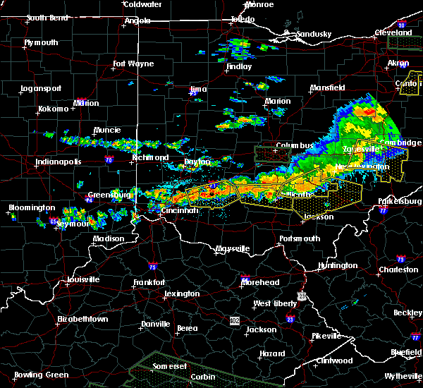 At 330 pm edt, radar indicated severe thunderstorms located along a line extending from near shawnee to 10 miles west of hocking hills state park, moving southeast at 50 mph. storm hazards include, winds to 60 mph, penny size hail, locations impacted include, logan, nelsonville, kingston, hocking hills state park, starr, laurelville, murray city, adelphi, tarlton, south bloomingville, haydenville, buena vista in hocking county, hallsville, carbon hill, enterprise, ilesboro, lake logan state park, gibisonville, whisler and union furnace. At 330 pm edt, radar indicated severe thunderstorms located along a line extending from near shawnee to 10 miles west of hocking hills state park, moving southeast at 50 mph. storm hazards include, winds to 60 mph, penny size hail, locations impacted include, logan, nelsonville, kingston, hocking hills state park, starr, laurelville, murray city, adelphi, tarlton, south bloomingville, haydenville, buena vista in hocking county, hallsville, carbon hill, enterprise, ilesboro, lake logan state park, gibisonville, whisler and union furnace.
|
| 7/14/2015 3:21 PM EDT |
 At 321 pm edt, doppler radar indicated a line of severe thunderstorms capable of producing damaging winds in excess of 60 mph. these storms were located along a line extending from 7 miles west of logan to 8 miles east of kingston, and moving southeast at 35 mph. * severe thunderstorms will be near, nelsonville, nelsonville and buchtel around 355 pm edt. mcarthur around 400 pm edt. lake hope state park around 405 pm edt. athens around 410 pm edt. albany around 415 pm edt. other locations impacted by these severe thunderstorms include creola, stroud run state park, coalton, chauncey, trimble, new straitsville, zaleski, eagle mills, corning and hamden. At 321 pm edt, doppler radar indicated a line of severe thunderstorms capable of producing damaging winds in excess of 60 mph. these storms were located along a line extending from 7 miles west of logan to 8 miles east of kingston, and moving southeast at 35 mph. * severe thunderstorms will be near, nelsonville, nelsonville and buchtel around 355 pm edt. mcarthur around 400 pm edt. lake hope state park around 405 pm edt. athens around 410 pm edt. albany around 415 pm edt. other locations impacted by these severe thunderstorms include creola, stroud run state park, coalton, chauncey, trimble, new straitsville, zaleski, eagle mills, corning and hamden.
|
| 7/14/2015 3:13 PM EDT |
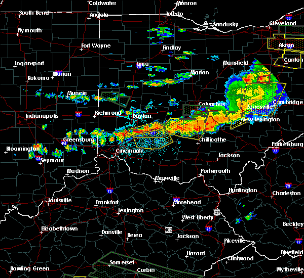 At 312 pm edt, radar indicated severe thunderstorms located along a line extending from bremen to near logan elm village, moving east at 55 mph. storm hazards include, winds to 60 mph, penny size hail,. At 312 pm edt, radar indicated severe thunderstorms located along a line extending from bremen to near logan elm village, moving east at 55 mph. storm hazards include, winds to 60 mph, penny size hail,.
|
| 6/23/2015 3:18 PM EDT |
 At 317 pm edt, doppler radar indicated a severe thunderstorm capable of producing quarter size hail and damaging winds in excess of 60 mph. this storm was located near nelsonville, moving southeast at 20 mph. locations impacted include, athens, nelsonville, albany, chauncey, buchtel, stroud run state park and the plains. At 317 pm edt, doppler radar indicated a severe thunderstorm capable of producing quarter size hail and damaging winds in excess of 60 mph. this storm was located near nelsonville, moving southeast at 20 mph. locations impacted include, athens, nelsonville, albany, chauncey, buchtel, stroud run state park and the plains.
|
| 6/23/2015 3:06 PM EDT |
 At 306 pm edt, doppler radar indicated a severe thunderstorm capable of producing half dollar size hail and damaging winds in excess of 60 mph. this storm was located near nelsonville, and moving southeast at 20 mph. At 306 pm edt, doppler radar indicated a severe thunderstorm capable of producing half dollar size hail and damaging winds in excess of 60 mph. this storm was located near nelsonville, and moving southeast at 20 mph.
|
| 5/11/2015 6:49 PM EDT | At 647 pm edt, national weather service doppler radar continued to indicate a line of severe thunderstorms capable of producing damaging winds in excess of 60 mph. these storms were located along a line extending from eagleport to chesterhill to 6 miles southeast of dexter, or along a line extending from 9 miles north of mcconnelsville to chesterhill to rutland, moving east at 35 mph. other locations in the warning include but are not limited to malta, darwin, stockport, bartlett, bristol, hackney, beverly, fleming, marietta, macksburg, lower salem, lowell and devola this will impact the following interstate, i-77 between mile markers 1 and 17 in ohio. very heavy rain will also fall from this line of severe thunderstorms, and will cause water to pond on roads and quickly fill roadside ditches and small streams. a severe thunderstorm watch remains in effect until 1000 pm edt monday evening for central kentucky and southeast ohio and central west virginia. a severe thunderstorm watch also remains in effect until 100 am edt tuesday morning for central west virginia. please report severe weather to the national weather service by calling toll free, 800-401-9535, when you can do so safely. you may also report severe weather by posting your report to the charleston west virginia national weather service facebook page, or by using the twitter hashtag, nwsrlx. |
| 5/11/2015 6:24 PM EDT | The severe thunderstorm warning for hocking and eastern fairfield counties will expire at 630 pm edt, the storms were moving out of the warned area, therefore the severe thunderstorm warning will be allowed to expire. gusty winds and heavy rain are still possible just behind these storms. please report previous wind damage or hail to the national weather service by going to our website at weather.gov/iln and submitting your report via social media. |
| 5/11/2015 6:03 PM EDT | At 602 pm edt, national weather service doppler radar continued to indicate a line of severe thunderstorms capable of producing quarter size hail, and damaging winds in excess of 60 mph. these storms were located along a line extending from glenford to 10 miles west of new straitsville to 7 miles southwest of mabee, or along a line extending from 8 miles northwest of somerset to logan to 13 miles northeast of portsmouth, moving east at 35 mph. other locations in the warning include but are not limited to coalton, jackson, junction city, creola, mcarthur, hamden, wellston, zaleski, perry state forest, new lexington, lake hope state park, oak hill, shawnee, nelsonville, hemlock, radcliffe, buchtel, crooksville, wilkesville and gallia in addition to large hail and damaging winds, continuous cloud to ground lightning is occurring with this storm. move indoors immediately! lightning is one of natures number one killers. remember, if you can hear thunder, you are close enough to be struck by lightning. very heavy rain will also fall from this line of severe thunderstorms, and will cause water to pond on roads and quickly fill roadside ditches and small streams. a severe thunderstorm watch remains in effect until 1000 pm edt monday evening for central kentucky and southeast ohio and central west virginia. a severe thunderstorm watch also remains in effect until 100 am edt tuesday morning for central west virginia. please report severe weather to the national weather service by calling toll free, 800-401-9535, when you can do so safely. you may also report severe weather by posting your report to the charleston west virginia national weather service facebook page, or by using the twitter hashtag, nwsrlx. |
| 5/11/2015 6:02 PM EDT | At 600 pm edt, radar continued to indicate severe thunderstorms located along a line extending from rushville to logan to hocking hills state park, moving east at 30 mph. storm hazards include, winds to 60 mph, quarter size hail, frequent cloud to ground lightning, locations impacted include, logan. in addition, ilesboro, union furnace, haydenville, starr and carbon hill are near the path of these storms. , 1.00in. |
| 5/11/2015 5:48 PM EDT | At 546 pm edt, radar continued to indicate severe thunderstorms located along a line extending from thurston to rockbridge to linn, moving east at 30 mph. storm hazards include, winds to 60 mph, quarter size hail, frequent cloud to ground lightning, locations impacted include, hocking hills state park, bremen and logan. in addition, fairfield beach, north berne, hideaway hills, enterprise, lake logan state park, west rushville, rushville and ilesboro are near the path of these storms. , 1.00in. |
| 5/11/2015 5:25 PM EDT | At 522 pm edt, national weather service doppler radar indicated a line of severe thunderstorms capable of producing quarter size. |
| 5/11/2015 5:25 PM EDT | At 522 pm edt, radar indicated severe thunderstorms located along a line extending from pickerington to tarlton to omega, moving east at 25 mph. storm hazards include, winds to 60 mph, quarter size hail,. |
| 4/9/2015 3:07 PM EDT | The national weather service in charleston has issued a * severe thunderstorm warning for. northwestern athens county in southeast ohio. this includes the cities of. nelsonville. glouster. western morgan county in southeast ohio. This includes the city of mcconnelsville. |
| 4/9/2015 2:39 PM EDT | A severe thunderstorm warning remains in effect until 300 pm edt for east central vinton. southwestern morgan. northwestern meigs and athens counties. at 236 pm edt. national weather service doppler radar continued to indicate a severe thunderstorm capable of producing golf ball size hail. and damaging winds in excess of 60 mph. This storm was. |
| 4/9/2015 2:13 PM EDT | The national weather service in charleston has issued a * severe thunderstorm warning for. athens county in southeast ohio. this includes the cities of. nelsonville. glouster. athens. albany. North central gallia county in southeast ohio. |
| 4/8/2015 12:29 PM EDT | A severe thunderstorm warning remains in effect until 100 pm edt for greenup county in kentucky. and vinton. western meigs. northern lawrence. jackson. gallia and western athens counties in southeast ohio. at 1221 pm edt. National weather service doppler radar continued to indicate a line of severe thunderstorms capable of producing damaging. |
| 4/8/2015 12:29 PM EDT | A severe thunderstorm warning remains in effect until 100 pm edt for greenup county in kentucky. and vinton. western meigs. northern lawrence. jackson. gallia and western athens counties in southeast ohio. at 1221 pm edt. National weather service doppler radar continued to indicate a line of severe thunderstorms capable of producing damaging. |
| 4/8/2015 12:02 PM EDT | The national weather service in charleston has issued a * severe thunderstorm warning for. greenup county in kentucky. western athens county in southeast ohio. this includes the cities of. nelsonville. albany. Gallia county in southeast ohio. |
| 4/8/2015 12:02 PM EDT | The national weather service in charleston has issued a * severe thunderstorm warning for. greenup county in kentucky. western athens county in southeast ohio. this includes the cities of. nelsonville. albany. Gallia county in southeast ohio. |
| 11/17/2013 8:20 PM EST | Multiple trees down on edwards street in athens county OH, 1.3 miles ESE of Nelsonville, OH |
| 7/10/2013 6:27 PM EDT | Multiple trees down on diamond brook r in athens county OH, 1.3 miles ESE of Nelsonville, OH |
| 7/10/2013 5:21 PM EDT | Multiple trees down on old rt 3 in athens county OH, 1.3 miles ESE of Nelsonville, OH |
| 6/29/2012 6:23 PM EDT | Large tree down in nelsonville ohio. power is ou in athens county OH, 1.3 miles ESE of Nelsonville, OH |
| 3/30/2012 10:05 PM EDT | Several trees down in athens county OH, 1.3 miles ESE of Nelsonville, OH |
| 3/18/2012 9:00 PM EDT | Quarter sized hail reported 2.2 miles E of Nelsonville, OH |
| 3/18/2012 8:55 PM EDT | Golf Ball sized hail reported 2.2 miles E of Nelsonville, OH |
Hail Maps for Nelsonville, OH


Connect with Interactive Hail Maps