

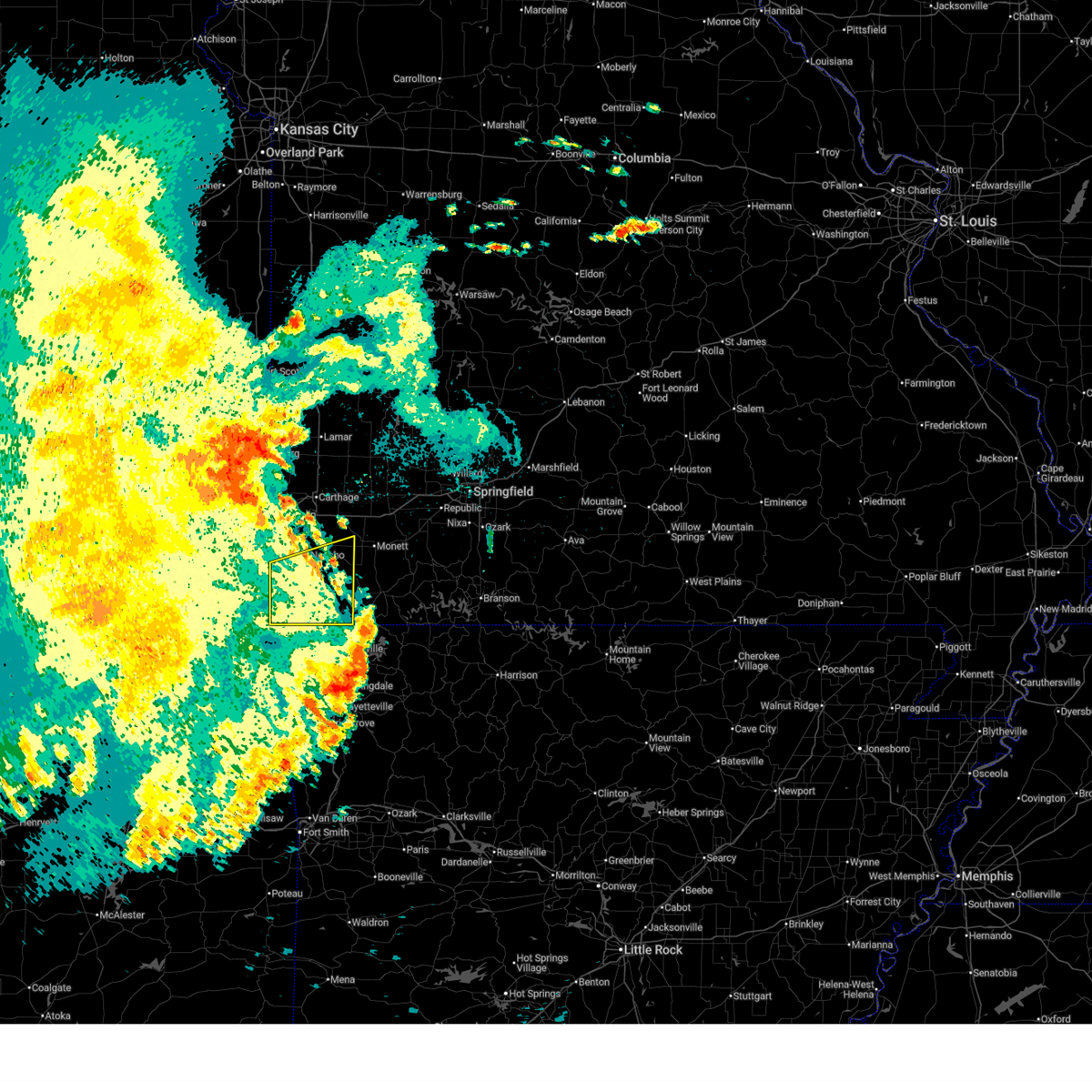
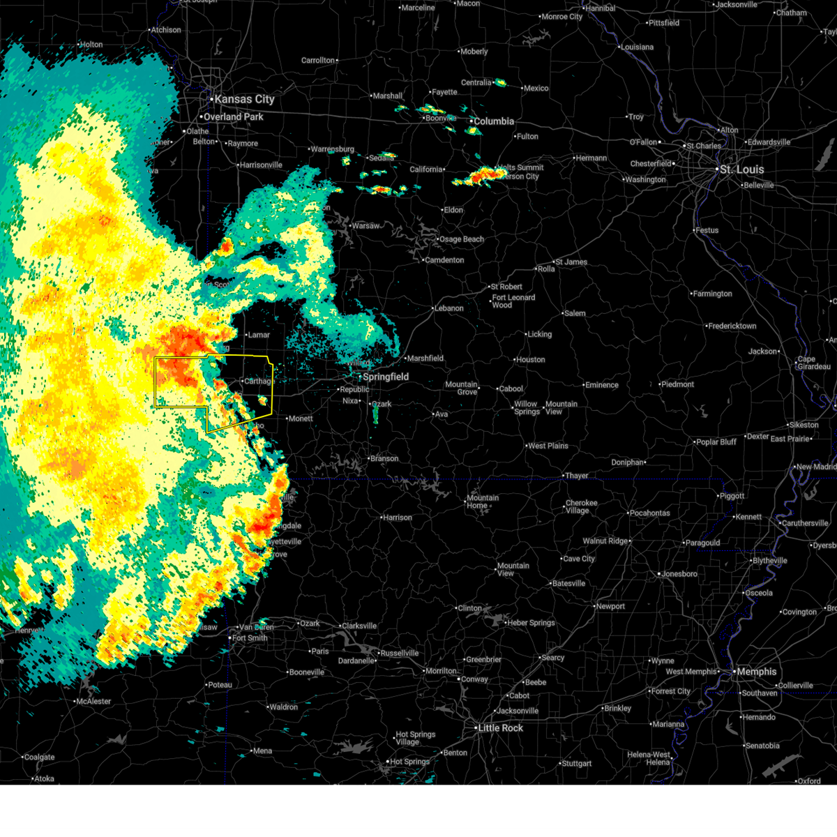
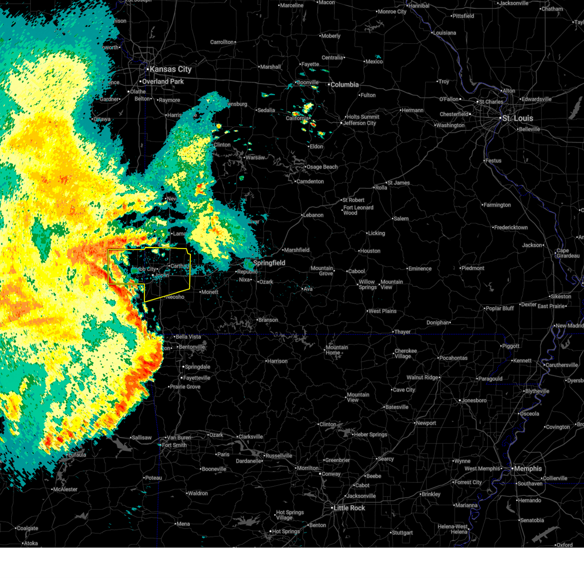
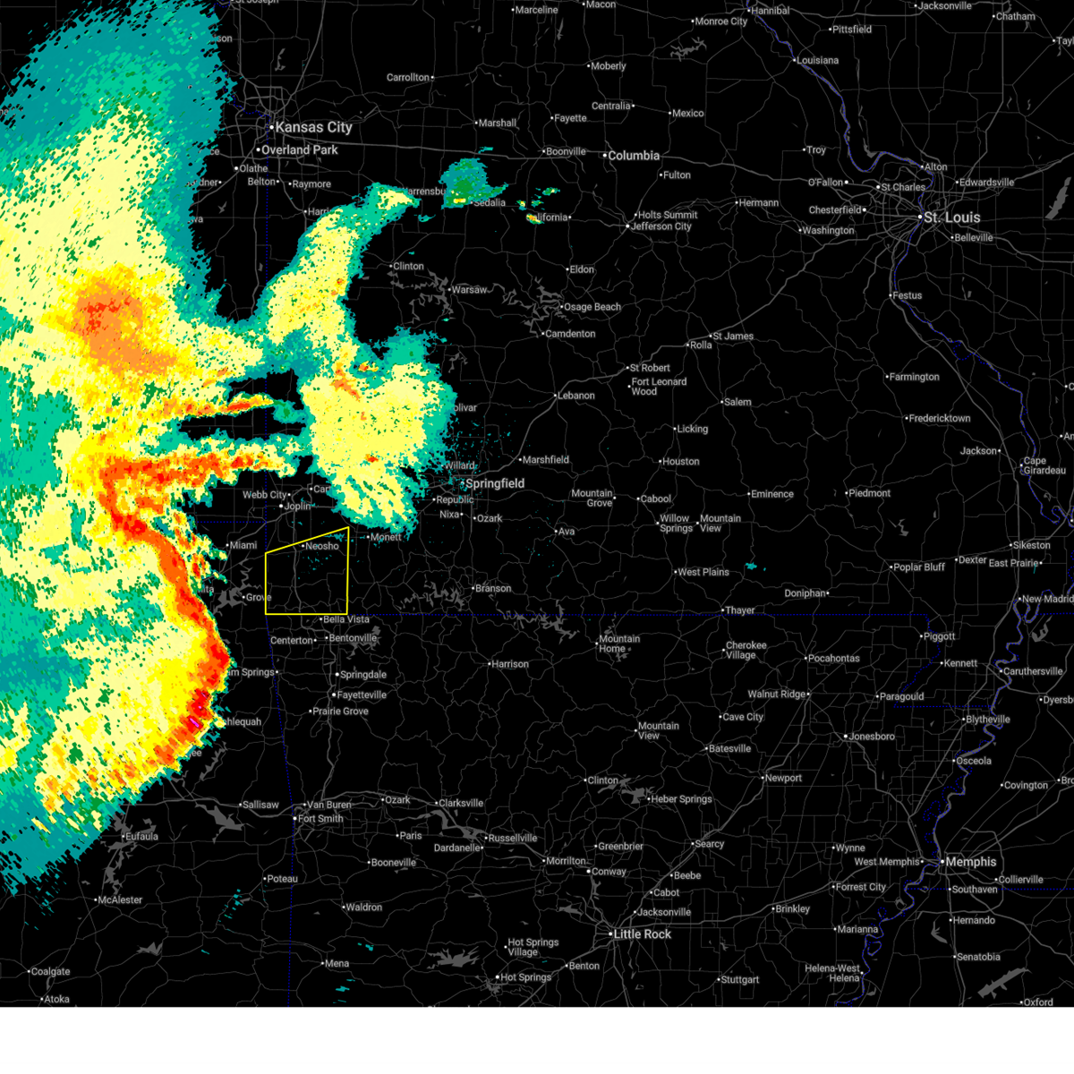
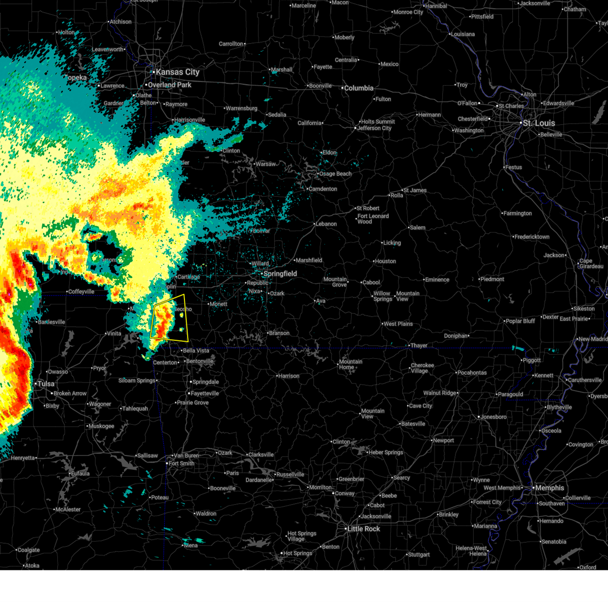
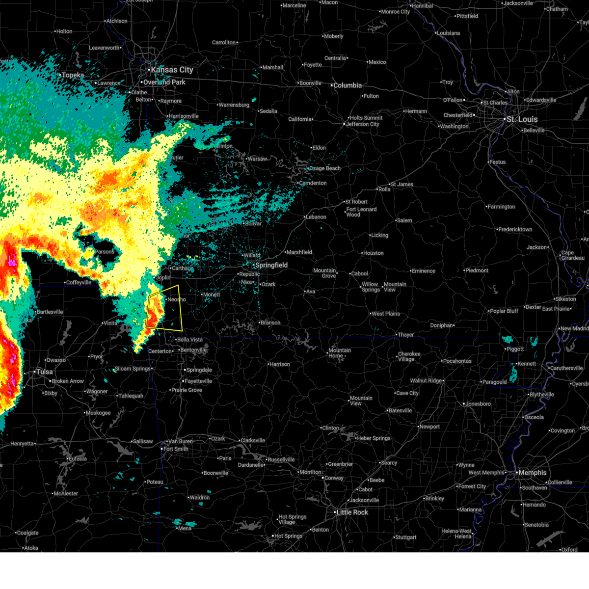
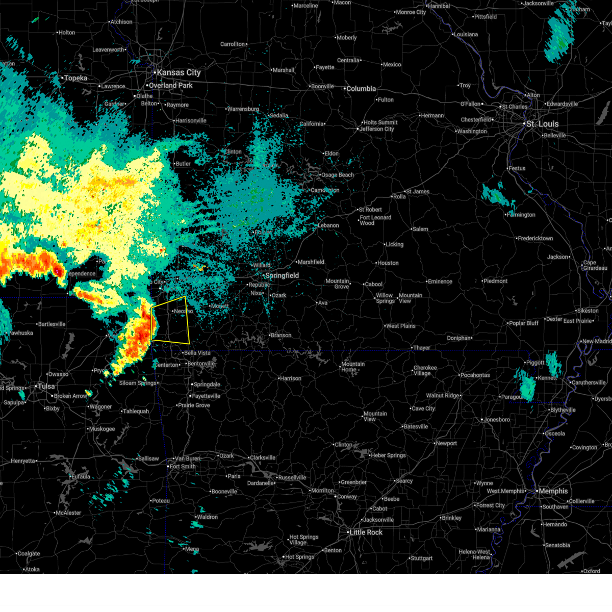
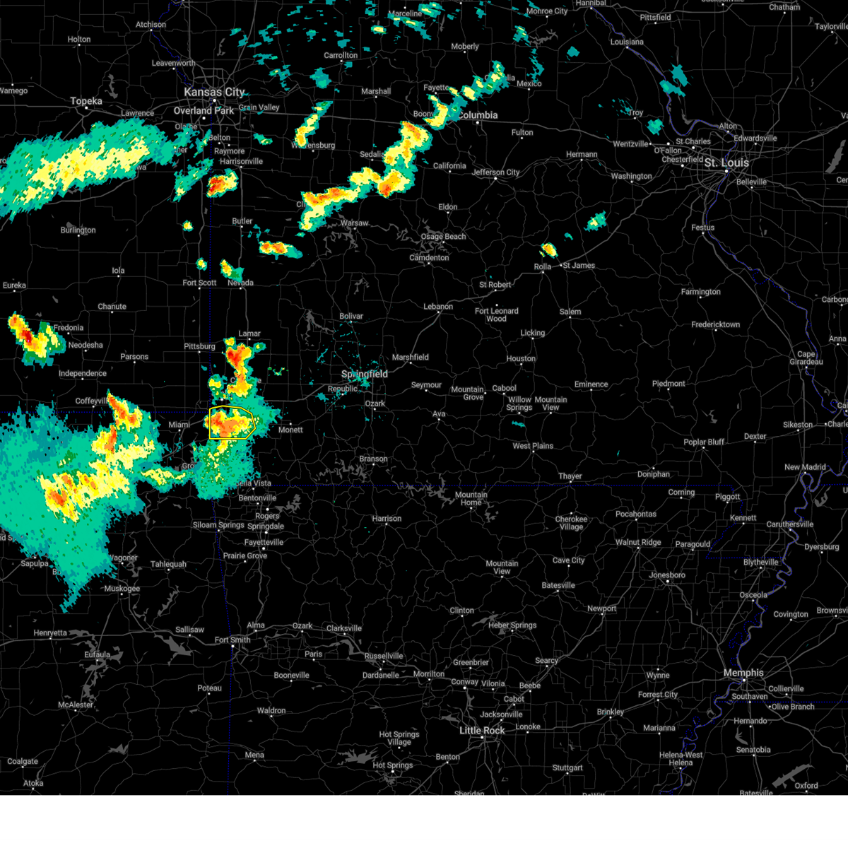
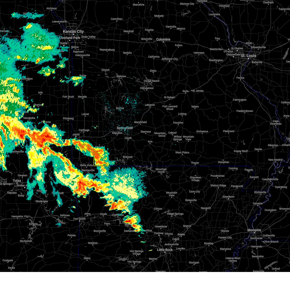
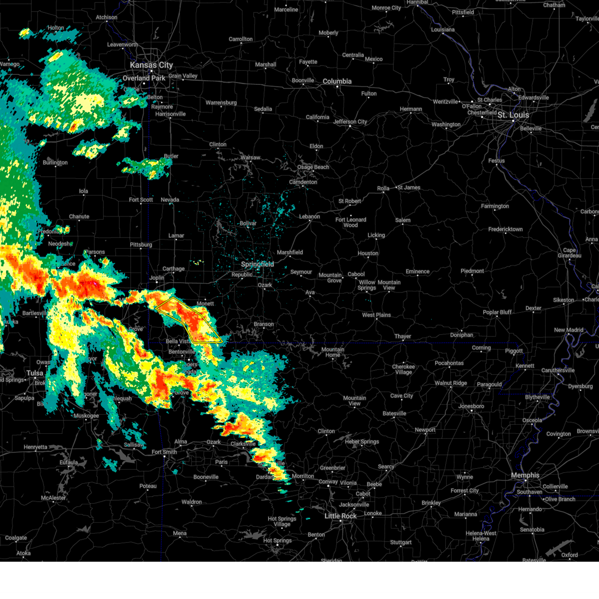
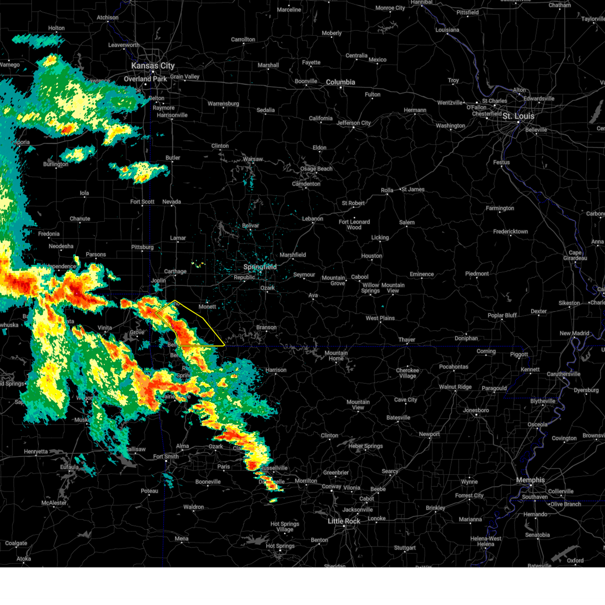
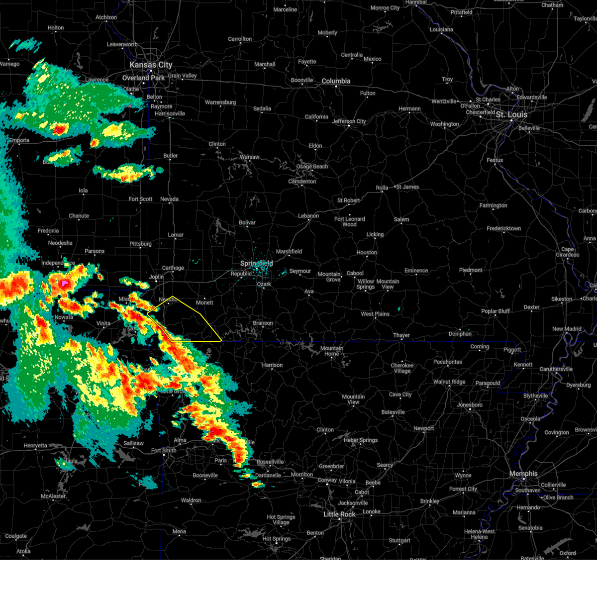
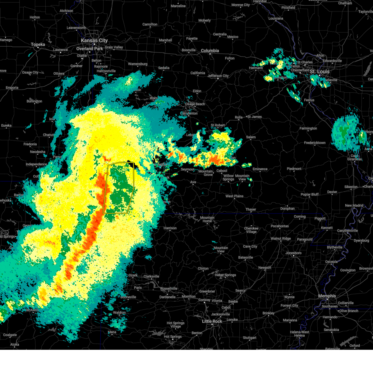
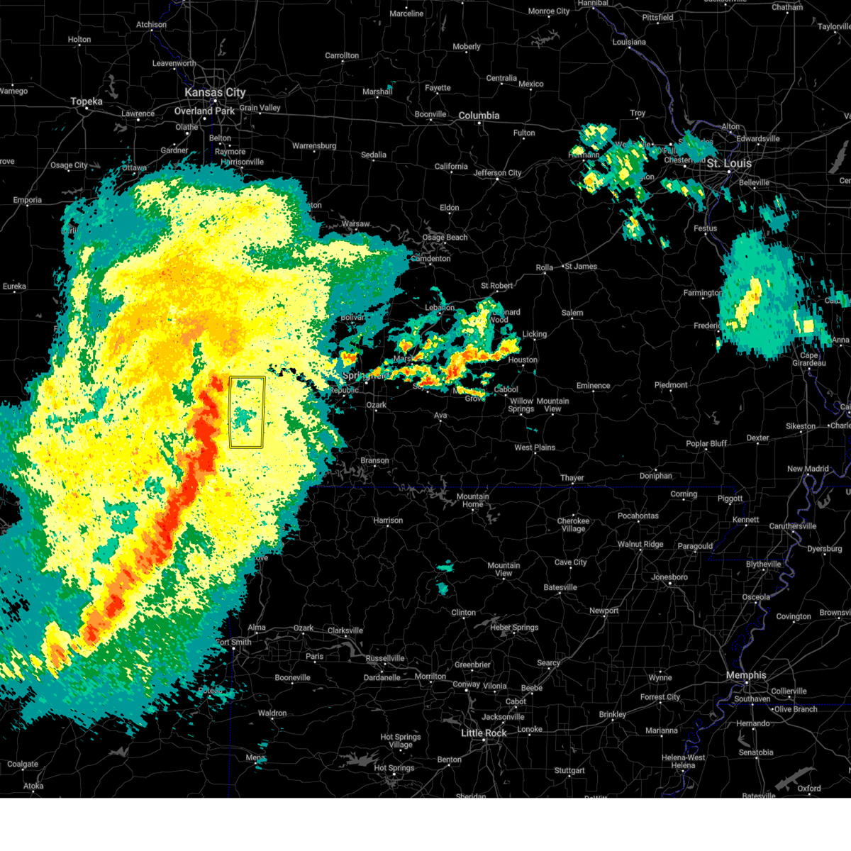
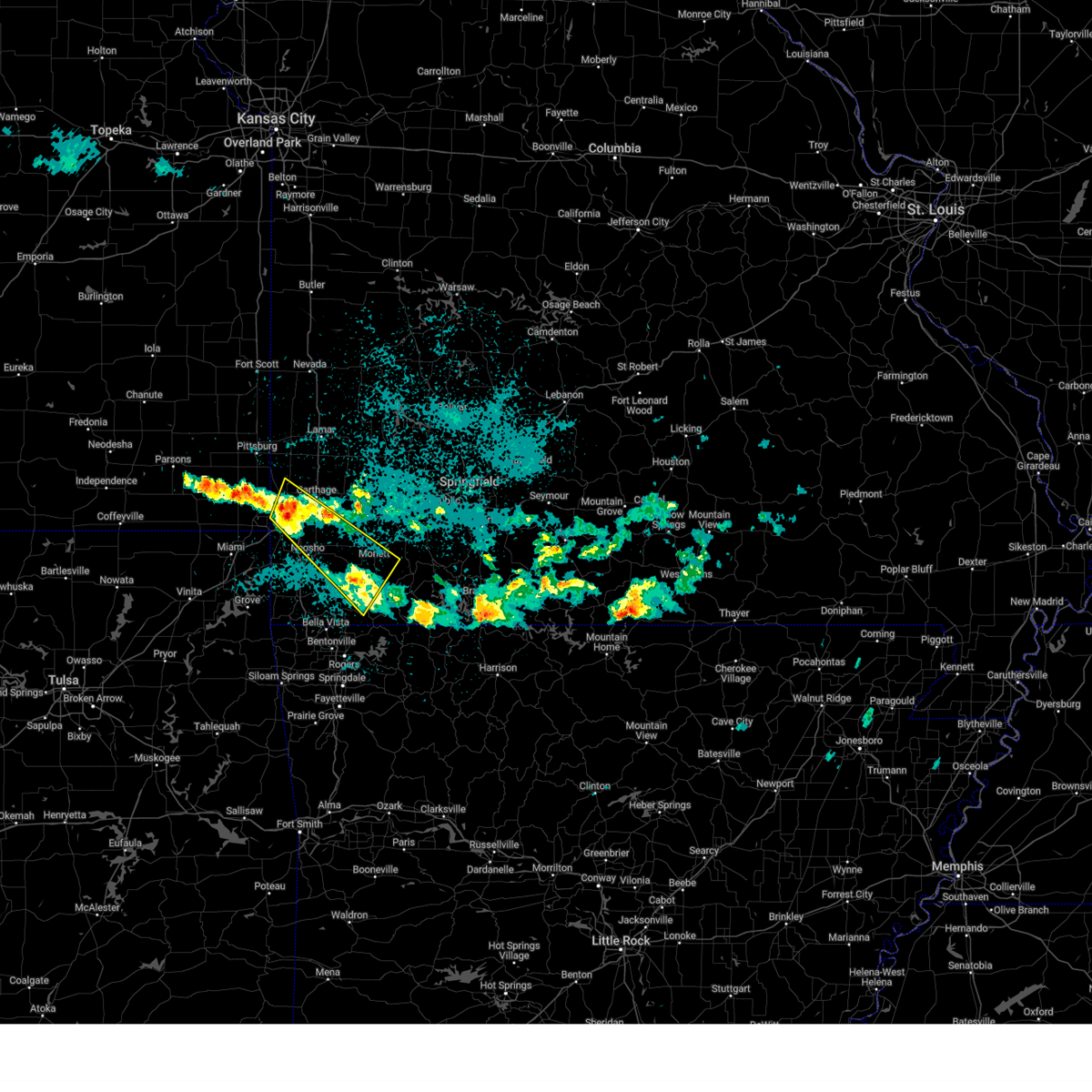
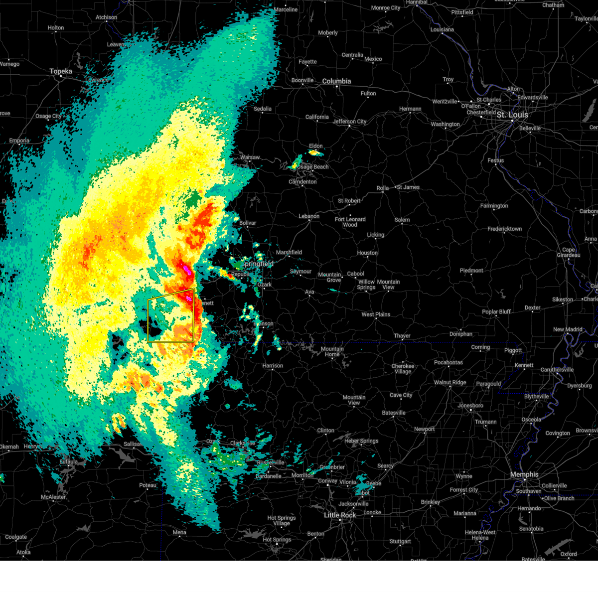
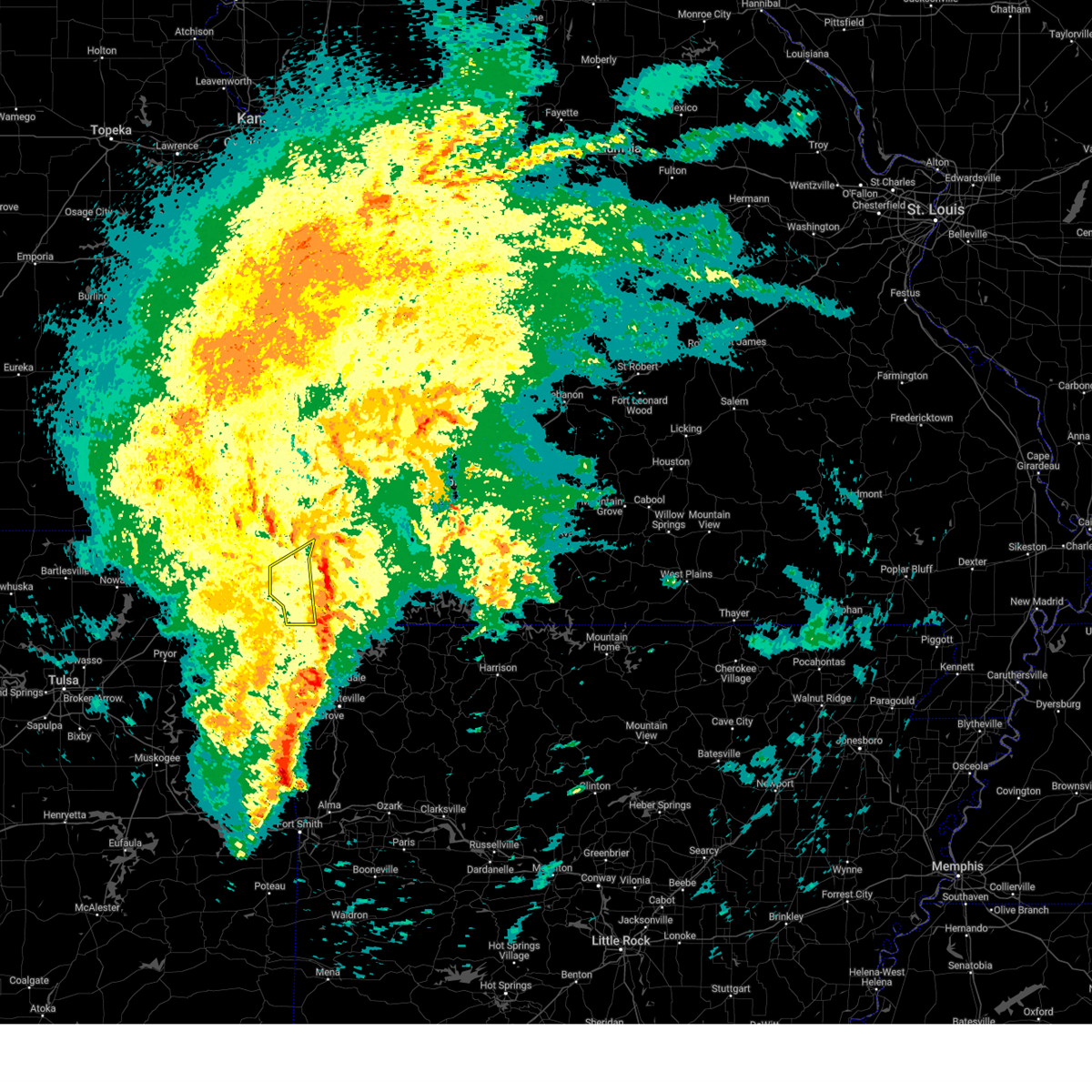
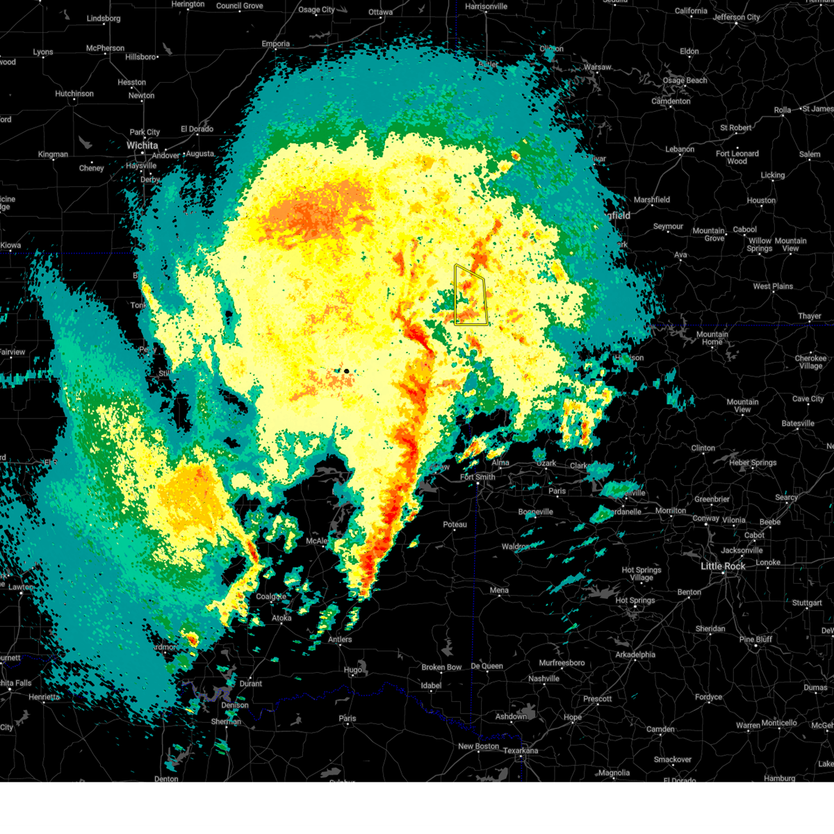
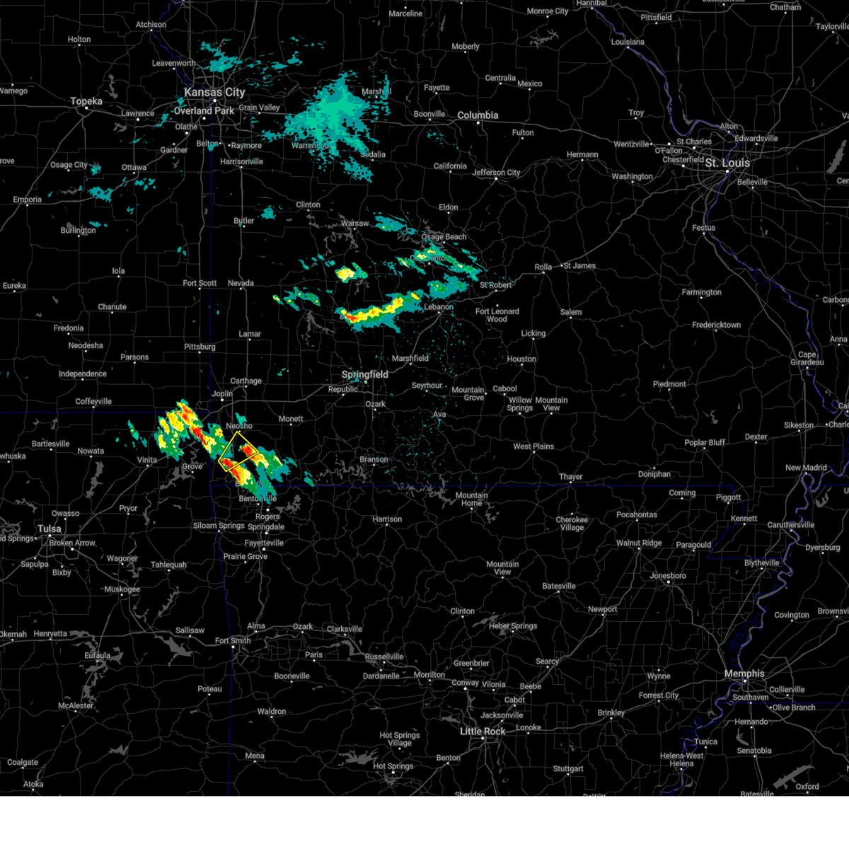
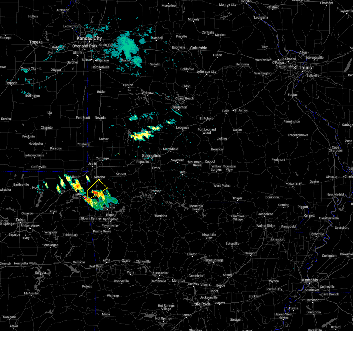
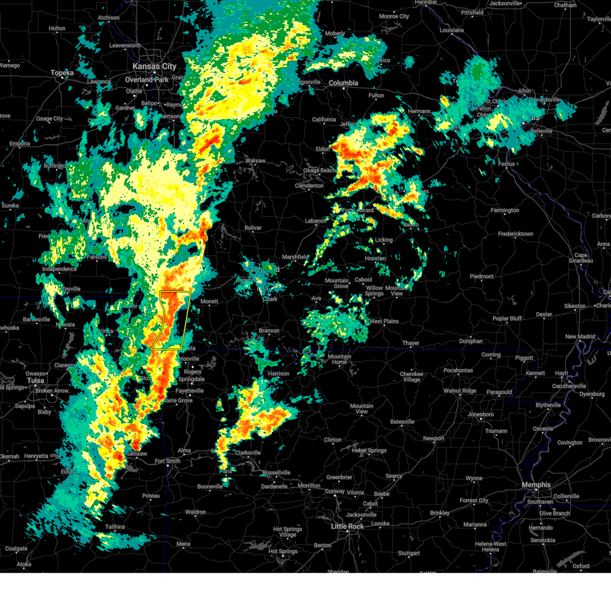
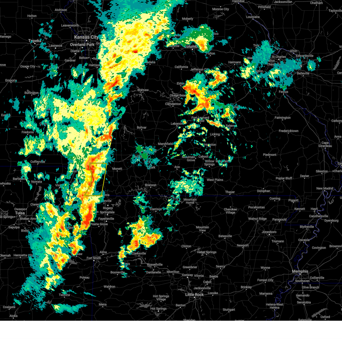
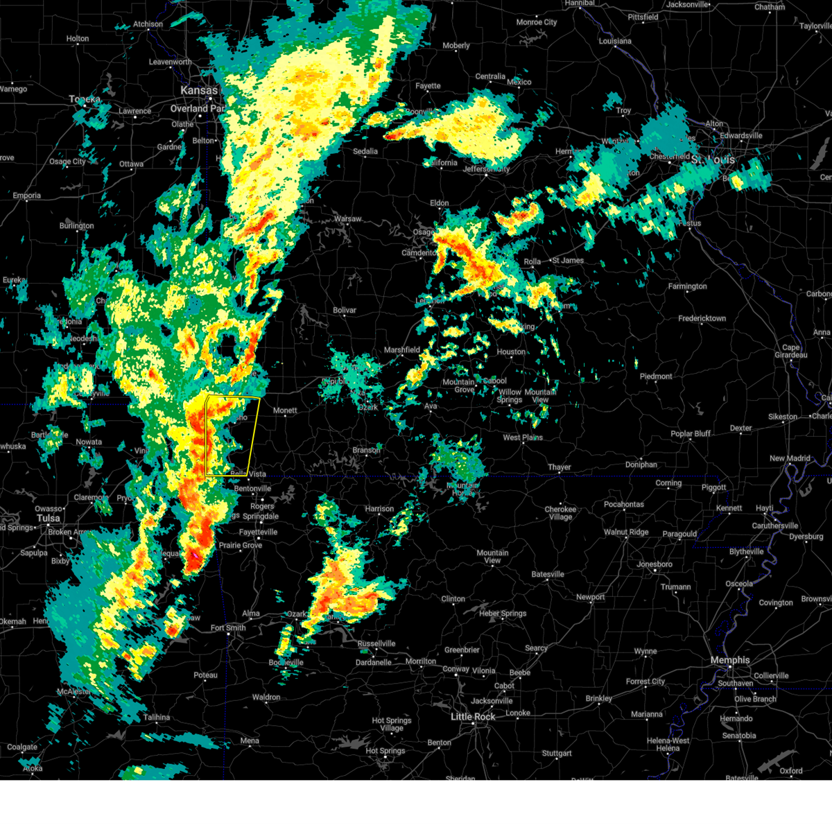
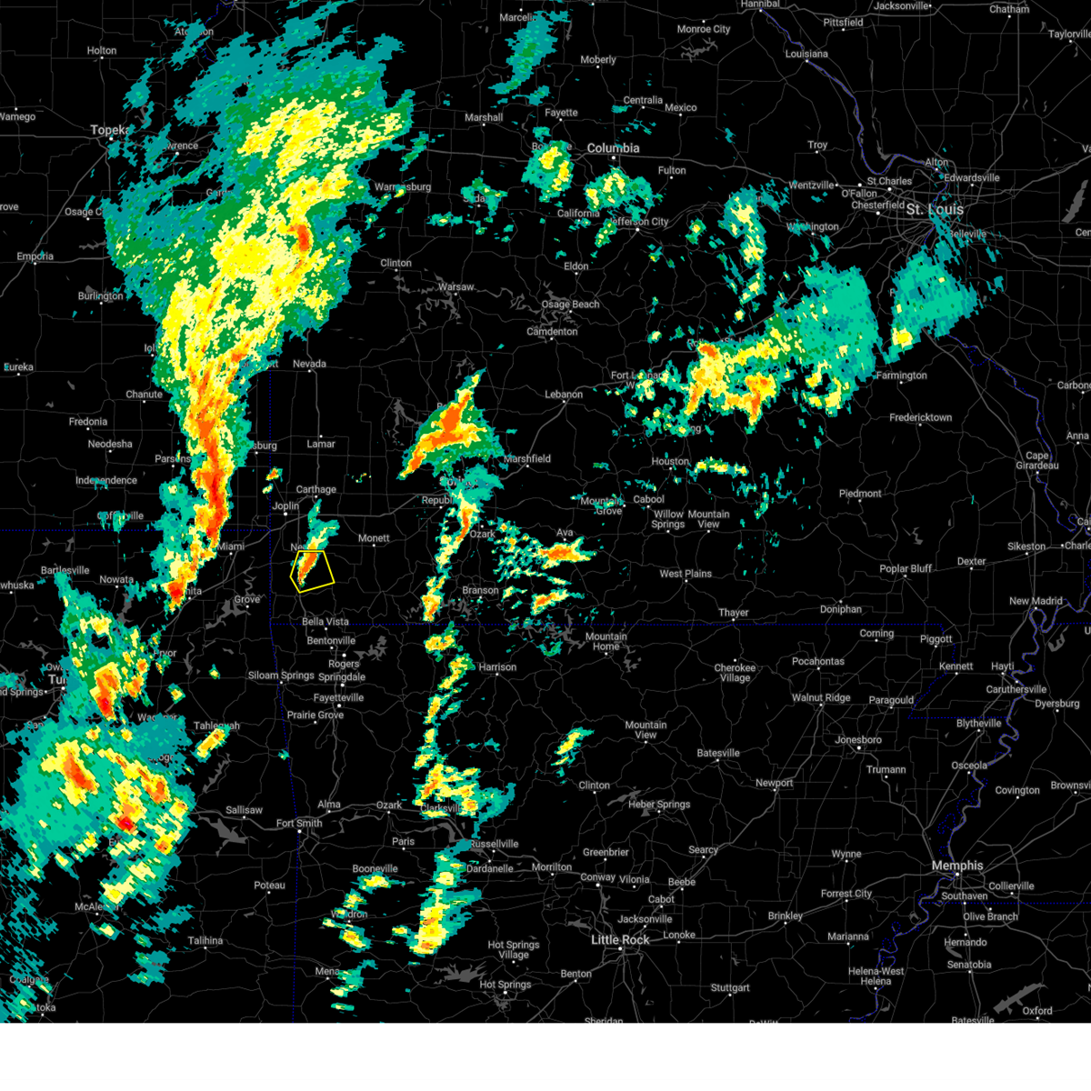
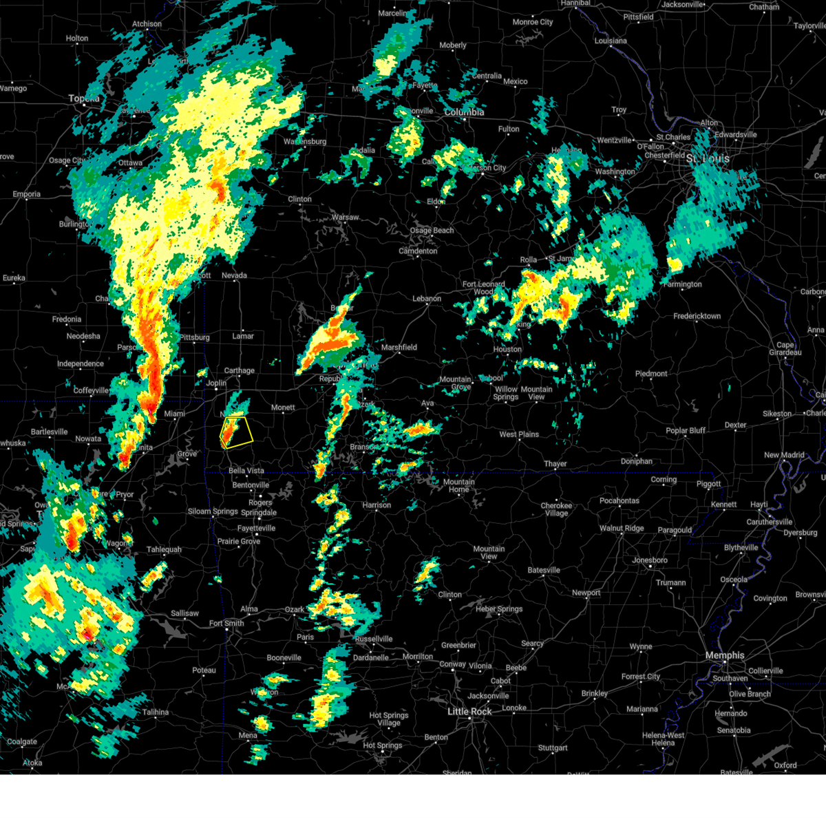
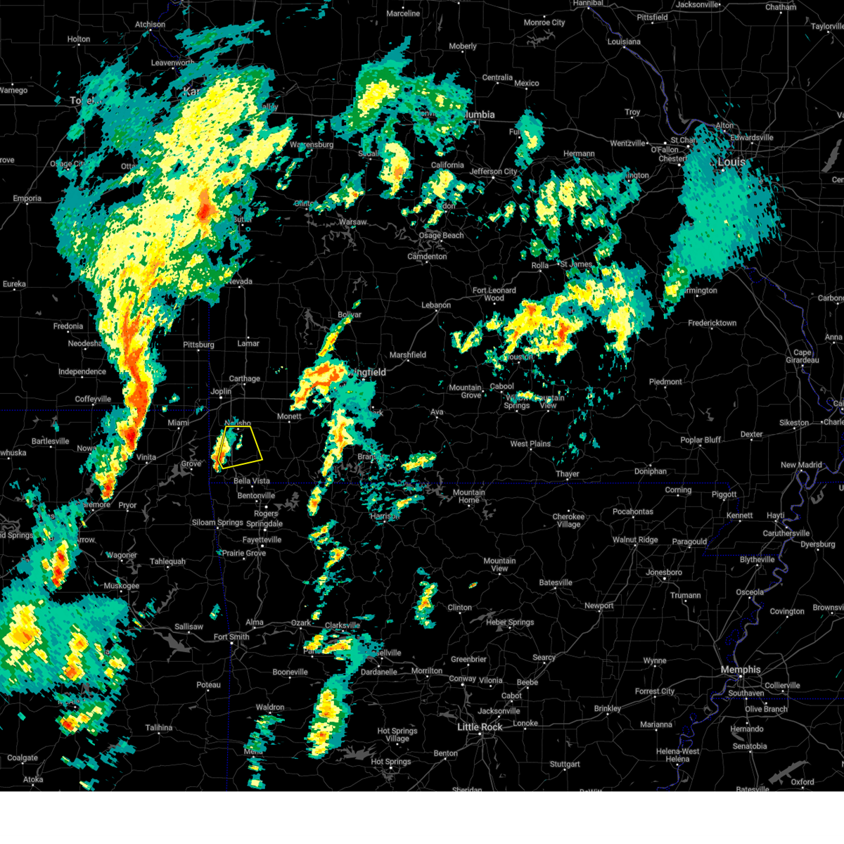
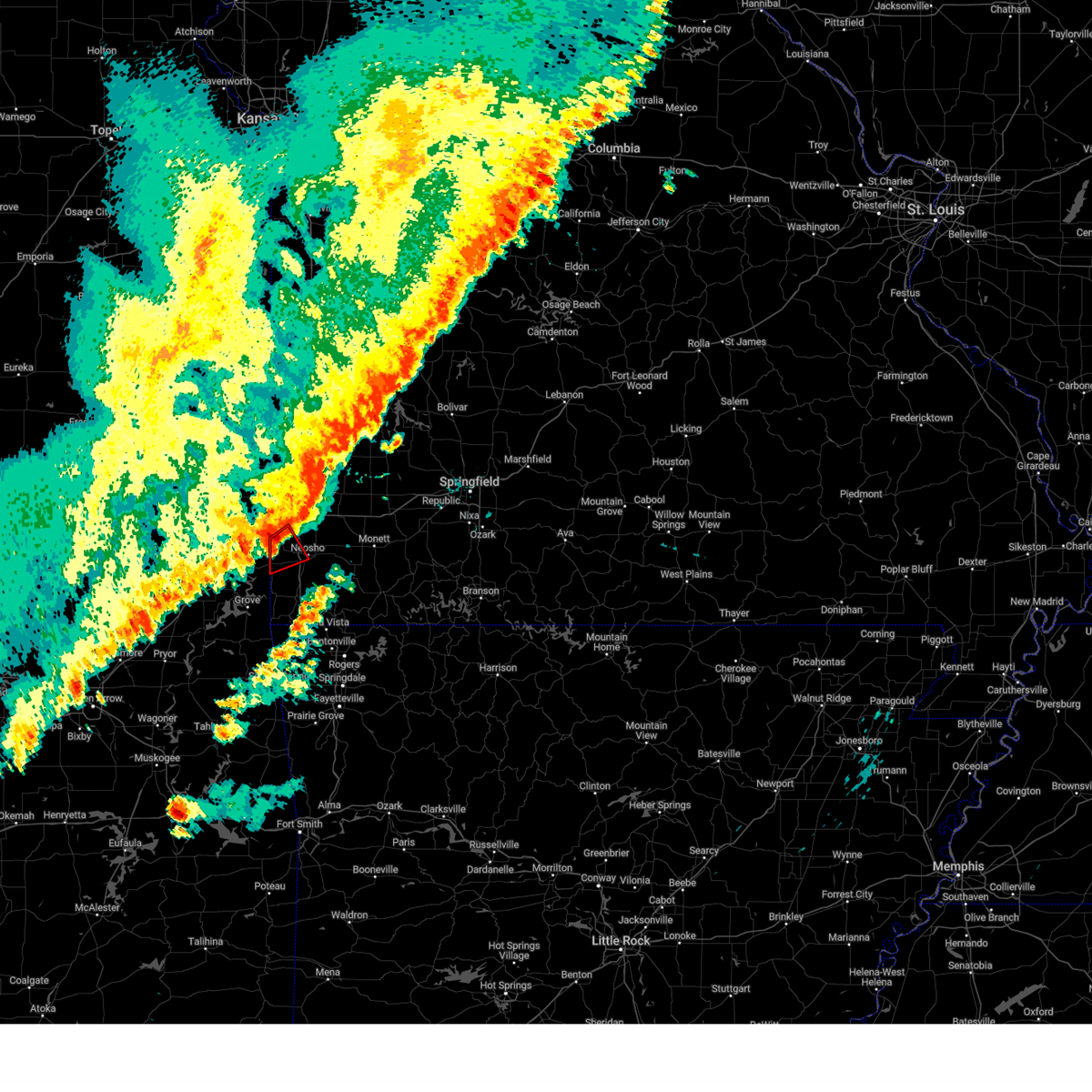
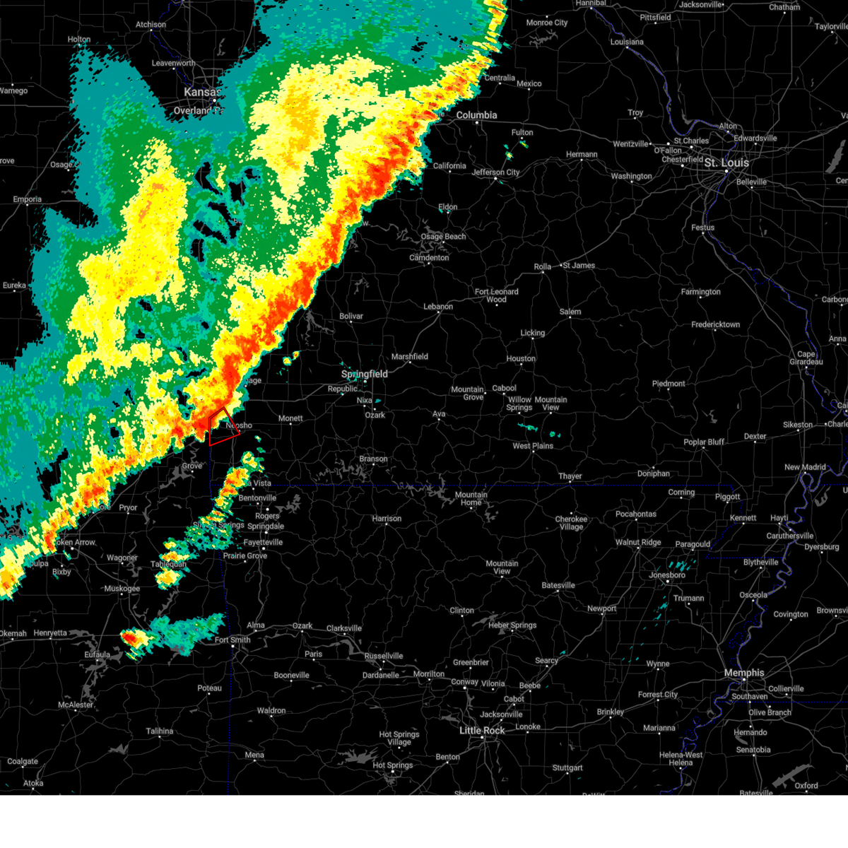
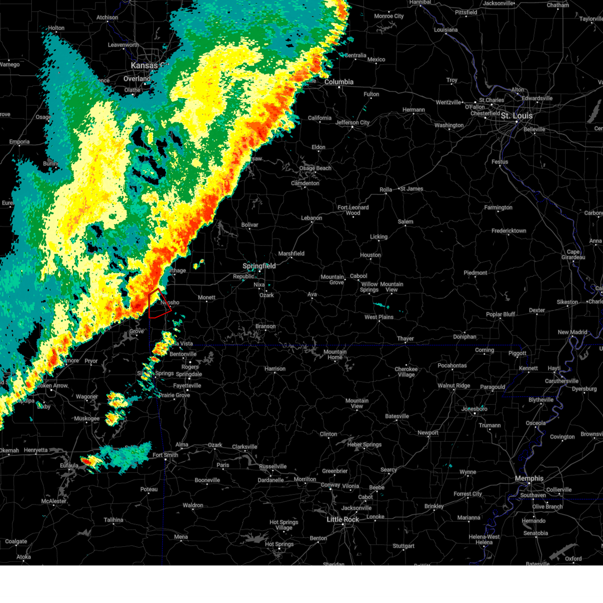
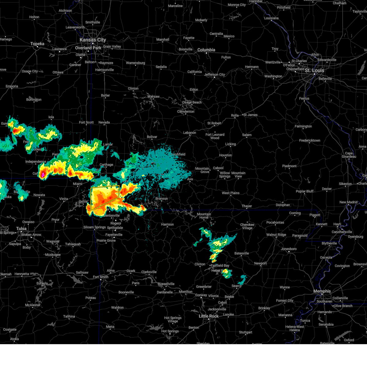
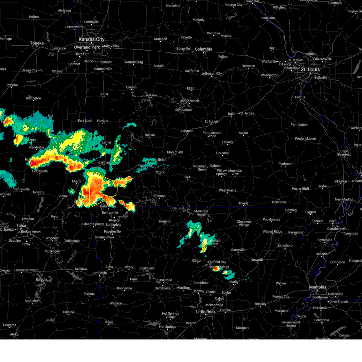
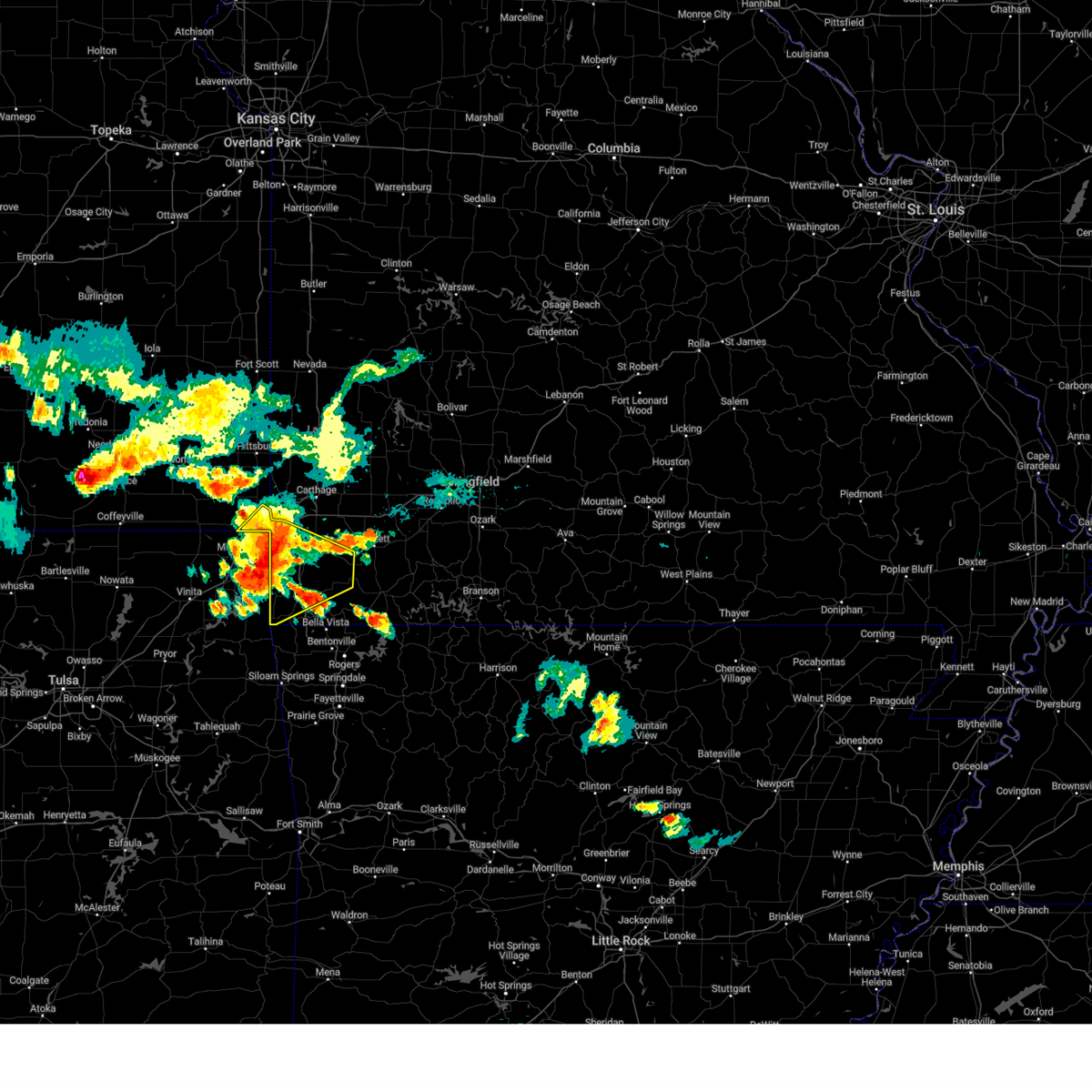
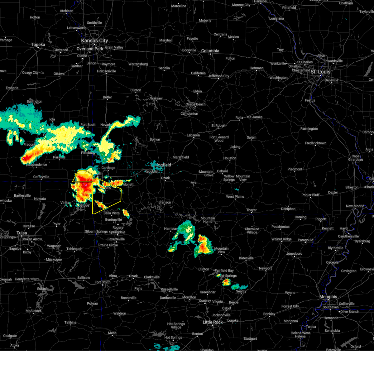
Hail Map for Neosho, MO
The Neosho, MO area has had 45 reports of on-the-ground hail by trained spotters, and has been under severe weather warnings 60 times during the past 12 months. Doppler radar has detected hail at or near Neosho, MO on 85 occasions, including 5 occasions during the past year.
| Name: | Neosho, MO |
| Where Located: | 65.3 miles WSW of Springfield, MO |
| Map: | Google Map for Neosho, MO |
| Population: | 11835 |
| Housing Units: | 4998 |
| More Info: | Search Google for Neosho, MO |
2
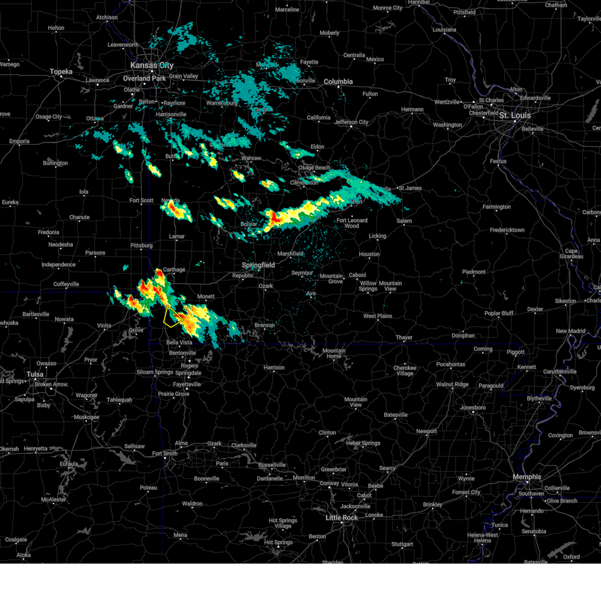
The Top Recent Hail Date for Neosho, MO is Tuesday, April 29, 2025 (13th out of 85)

Hail and Wind Damage Spotted near Neosho, MO
| Date / Time | Report Details |
|---|---|
| 6/18/2025 1:58 AM CDT |
 The storms which prompted the warning have weakened below severe limits, and no longer pose an immediate threat to life or property. therefore, the warning will be allowed to expire. however, gusty winds and heavy rain are still possible with these thunderstorms. a severe thunderstorm watch remains in effect until 400 am cdt for southwestern missouri. The storms which prompted the warning have weakened below severe limits, and no longer pose an immediate threat to life or property. therefore, the warning will be allowed to expire. however, gusty winds and heavy rain are still possible with these thunderstorms. a severe thunderstorm watch remains in effect until 400 am cdt for southwestern missouri.
|
| 6/18/2025 1:58 AM CDT |
 The storms which prompted the warning have weakened below severe limits, and no longer pose an immediate threat to life or property. therefore, the warning will be allowed to expire. however, gusty winds and heavy rain are still possible with these thunderstorms. a severe thunderstorm watch remains in effect until 400 am cdt for southeastern kansas, and southwestern missouri. The storms which prompted the warning have weakened below severe limits, and no longer pose an immediate threat to life or property. therefore, the warning will be allowed to expire. however, gusty winds and heavy rain are still possible with these thunderstorms. a severe thunderstorm watch remains in effect until 400 am cdt for southeastern kansas, and southwestern missouri.
|
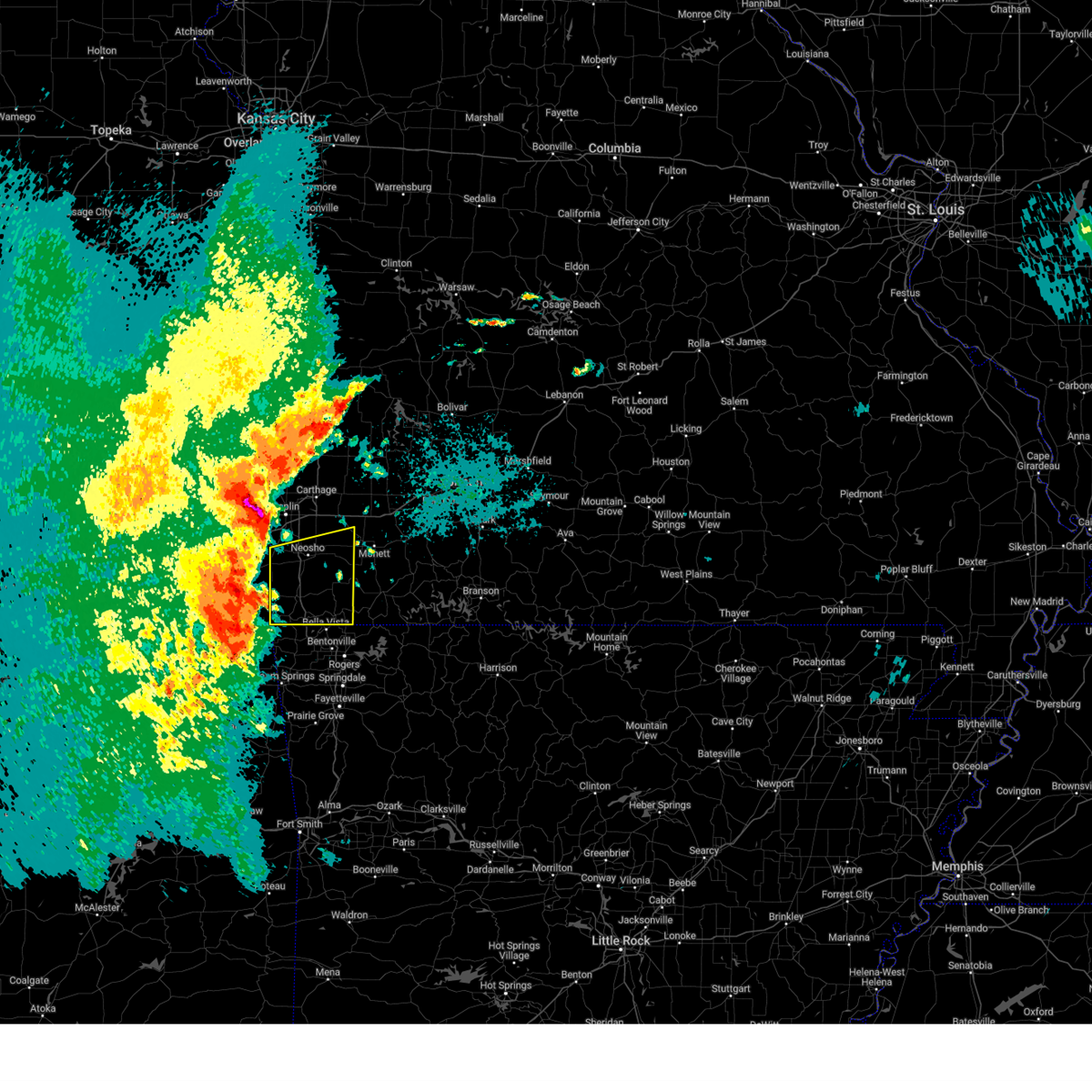
| 6/18/2025 1:26 AM CDT |
 At 126 am cdt, severe thunderstorms were located along a line extending from near oswego to near fairland, moving northeast at 50 mph (radar indicated). Hazards include 60 mph wind gusts and quarter size hail. Hail damage to vehicles is expected. expect wind damage to roofs, siding, and trees. these severe storms will be near, baxter springs, columbus, and treece around 130 am cdt. seneca around 135 am cdt. galena and scammon around 140 am cdt. joplin, weir, leawood, and shoal creek drive around 145 am cdt. webb city, carl junction, duquesne, silver creek, and saginaw around 150 am cdt. oronogo, carterville, duenweg, and diamond around 155 am cdt. carthage, alba, and purcell around 200 am cdt. Other locations impacted by these severe thunderstorms include asbury, fidelity, neutral, melrose, carytown, shoal creek estates, riverton, dennis acres, carona, and grand falls plaza. At 126 am cdt, severe thunderstorms were located along a line extending from near oswego to near fairland, moving northeast at 50 mph (radar indicated). Hazards include 60 mph wind gusts and quarter size hail. Hail damage to vehicles is expected. expect wind damage to roofs, siding, and trees. these severe storms will be near, baxter springs, columbus, and treece around 130 am cdt. seneca around 135 am cdt. galena and scammon around 140 am cdt. joplin, weir, leawood, and shoal creek drive around 145 am cdt. webb city, carl junction, duquesne, silver creek, and saginaw around 150 am cdt. oronogo, carterville, duenweg, and diamond around 155 am cdt. carthage, alba, and purcell around 200 am cdt. Other locations impacted by these severe thunderstorms include asbury, fidelity, neutral, melrose, carytown, shoal creek estates, riverton, dennis acres, carona, and grand falls plaza.
|
| 6/18/2025 1:25 AM CDT |
 At 125 am cdt, severe thunderstorms were located along a line extending from 6 miles south of wyandotte to near decatur, moving east at 55 mph (radar indicated). Hazards include 70 mph wind gusts and quarter size hail. Hail damage to vehicles is expected. expect considerable tree damage. wind damage is also likely to mobile homes, roofs, and outbuildings. these severe storms will be near, pineville, anderson, noel, and lanagan around 130 am cdt. goodman around 135 am cdt. neosho around 140 am cdt. wheaton and fairview around 155 am cdt. Other locations impacted by these severe thunderstorms include stark city, newtonia, stella, powell, tiff city, rocky comfort, dodge, and cayuga. At 125 am cdt, severe thunderstorms were located along a line extending from 6 miles south of wyandotte to near decatur, moving east at 55 mph (radar indicated). Hazards include 70 mph wind gusts and quarter size hail. Hail damage to vehicles is expected. expect considerable tree damage. wind damage is also likely to mobile homes, roofs, and outbuildings. these severe storms will be near, pineville, anderson, noel, and lanagan around 130 am cdt. goodman around 135 am cdt. neosho around 140 am cdt. wheaton and fairview around 155 am cdt. Other locations impacted by these severe thunderstorms include stark city, newtonia, stella, powell, tiff city, rocky comfort, dodge, and cayuga.
|
| 6/18/2025 1:06 AM CDT |
 Svrsgf the national weather service in springfield has issued a * severe thunderstorm warning for, cherokee county in southeastern kansas, northern newton county in southwestern missouri, jasper county in southwestern missouri, * until 200 am cdt. * at 106 am cdt, severe thunderstorms were located along a line extending from near edna to near afton, moving northeast at 55 mph (radar indicated). Hazards include 60 mph wind gusts and quarter size hail. Hail damage to vehicles is expected. expect wind damage to roofs, siding, and trees. severe thunderstorms will be near, treece around 120 am cdt. baxter springs and columbus around 125 am cdt. Other locations in the path of these severe thunderstorms include seneca, galena, scammon, joplin, neosho, carl junction, weir, leawood, silver creek, shoal creek drive, saginaw, webb city, oronogo, carterville, duquesne, duenweg, carthage, granby, diamond, alba and purcell. Svrsgf the national weather service in springfield has issued a * severe thunderstorm warning for, cherokee county in southeastern kansas, northern newton county in southwestern missouri, jasper county in southwestern missouri, * until 200 am cdt. * at 106 am cdt, severe thunderstorms were located along a line extending from near edna to near afton, moving northeast at 55 mph (radar indicated). Hazards include 60 mph wind gusts and quarter size hail. Hail damage to vehicles is expected. expect wind damage to roofs, siding, and trees. severe thunderstorms will be near, treece around 120 am cdt. baxter springs and columbus around 125 am cdt. Other locations in the path of these severe thunderstorms include seneca, galena, scammon, joplin, neosho, carl junction, weir, leawood, silver creek, shoal creek drive, saginaw, webb city, oronogo, carterville, duquesne, duenweg, carthage, granby, diamond, alba and purcell.
|
| 6/18/2025 1:03 AM CDT |
 Svrsgf the national weather service in springfield has issued a * severe thunderstorm warning for, southern newton county in southwestern missouri, mcdonald county in southwestern missouri, * until 200 am cdt. * at 103 am cdt, severe thunderstorms were located along a line extending from near cleora to near kansas, moving east at 60 mph (radar indicated). Hazards include 70 mph wind gusts and quarter size hail. Hail damage to vehicles is expected. expect considerable tree damage. wind damage is also likely to mobile homes, roofs, and outbuildings. severe thunderstorms will be near, south west city around 115 am cdt. Other locations in the path of these severe thunderstorms include noel, lanagan, pineville and anderson. Svrsgf the national weather service in springfield has issued a * severe thunderstorm warning for, southern newton county in southwestern missouri, mcdonald county in southwestern missouri, * until 200 am cdt. * at 103 am cdt, severe thunderstorms were located along a line extending from near cleora to near kansas, moving east at 60 mph (radar indicated). Hazards include 70 mph wind gusts and quarter size hail. Hail damage to vehicles is expected. expect considerable tree damage. wind damage is also likely to mobile homes, roofs, and outbuildings. severe thunderstorms will be near, south west city around 115 am cdt. Other locations in the path of these severe thunderstorms include noel, lanagan, pineville and anderson.
|
| 6/18/2025 12:07 AM CDT |
 The storm which prompted the warning has weakened below severe limits, and no longer poses an immediate threat to life or property. therefore, the warning will be allowed to expire. however, gusty winds are still possible with this thunderstorm. a severe thunderstorm watch remains in effect until 400 am cdt for southwestern missouri. The storm which prompted the warning has weakened below severe limits, and no longer poses an immediate threat to life or property. therefore, the warning will be allowed to expire. however, gusty winds are still possible with this thunderstorm. a severe thunderstorm watch remains in effect until 400 am cdt for southwestern missouri.
|
| 6/17/2025 11:48 PM CDT |
 At 1148 pm cdt, a severe thunderstorm was located near neosho, moving east at 35 mph (radar indicated). Hazards include 60 mph wind gusts and quarter size hail. Hail damage to vehicles is expected. expect wind damage to roofs, siding, and trees. This severe thunderstorm will remain over mainly rural areas of western newton and central mcdonald counties, including the following locations, powell, racine, and stella. At 1148 pm cdt, a severe thunderstorm was located near neosho, moving east at 35 mph (radar indicated). Hazards include 60 mph wind gusts and quarter size hail. Hail damage to vehicles is expected. expect wind damage to roofs, siding, and trees. This severe thunderstorm will remain over mainly rural areas of western newton and central mcdonald counties, including the following locations, powell, racine, and stella.
|
| 6/17/2025 11:29 PM CDT |
 Svrsgf the national weather service in springfield has issued a * severe thunderstorm warning for, western newton county in southwestern missouri, central mcdonald county in southwestern missouri, * until 1215 am cdt. * at 1128 pm cdt, a severe thunderstorm was located near seneca, or 12 miles southwest of neosho, moving east at 35 mph (radar indicated). Hazards include 60 mph wind gusts and quarter size hail. Hail damage to vehicles is expected. expect wind damage to roofs, siding, and trees. This severe thunderstorm will be near, neosho and goodman around 1140 pm cdt. Svrsgf the national weather service in springfield has issued a * severe thunderstorm warning for, western newton county in southwestern missouri, central mcdonald county in southwestern missouri, * until 1215 am cdt. * at 1128 pm cdt, a severe thunderstorm was located near seneca, or 12 miles southwest of neosho, moving east at 35 mph (radar indicated). Hazards include 60 mph wind gusts and quarter size hail. Hail damage to vehicles is expected. expect wind damage to roofs, siding, and trees. This severe thunderstorm will be near, neosho and goodman around 1140 pm cdt.
|
| 6/8/2025 6:27 PM CDT |
 The storm which prompted the warning has weakened below severe limits, and no longer poses an immediate threat to life or property. therefore, the warning will be allowed to expire. however, heavy rain is still possible with this thunderstorm. a severe thunderstorm watch remains in effect until 1000 pm cdt for southeastern kansas, and southwestern missouri. to report severe weather, contact your nearest law enforcement agency. they will relay your report to the national weather service springfield. The storm which prompted the warning has weakened below severe limits, and no longer poses an immediate threat to life or property. therefore, the warning will be allowed to expire. however, heavy rain is still possible with this thunderstorm. a severe thunderstorm watch remains in effect until 1000 pm cdt for southeastern kansas, and southwestern missouri. to report severe weather, contact your nearest law enforcement agency. they will relay your report to the national weather service springfield.
|
| 6/8/2025 6:19 PM CDT | the severe thunderstorm warning has been cancelled and is no longer in effect |
| 6/8/2025 6:19 PM CDT | At 619 pm cdt, a severe thunderstorm was located near saginaw, or 8 miles northwest of neosho, moving southeast at 25 mph (radar indicated). Hazards include 60 mph wind gusts and quarter size hail. Hail damage to vehicles is expected. expect wind damage to roofs, siding, and trees. locations impacted include, southern joplin, neosho, seneca, granby, diamond, loma linda, leawood, silver creek, shoal creek drive, saginaw, redings mill, grand falls plaza, shoal creek estates, cliff village, and racine. this includes the following highways, interstate 44 between mile markers 0 and 6. Interstate 49 between mile markers 20 and 34. |
| 6/8/2025 6:02 PM CDT | At 602 pm cdt, a severe thunderstorm was located over shoal creek drive, or near joplin, moving south at 10 mph (radar indicated). Hazards include 70 mph wind gusts and half dollar size hail. Hail damage to vehicles is expected. expect considerable tree damage. wind damage is also likely to mobile homes, roofs, and outbuildings. locations impacted include, joplin, carthage, neosho, webb city, carl junction, galena, oronogo, seneca, granby, carterville, duquesne, duenweg, diamond, loma linda, airport drive, leawood, silver creek, shoal creek drive, saginaw, and fidelity. this includes the following highways, interstate 44 between mile markers 0 and 20. Interstate 49 between mile markers 17 and 38. |
| 6/8/2025 5:47 PM CDT | At 547 pm cdt, a severe thunderstorm was located over southwestern joplin, moving southeast at 25 mph (radar indicated). Hazards include 70 mph wind gusts and half dollar size hail. Hail damage to vehicles is expected. expect considerable tree damage. wind damage is also likely to mobile homes, roofs, and outbuildings. locations impacted include, joplin, carthage, neosho, webb city, carl junction, galena, oronogo, seneca, granby, carterville, duquesne, duenweg, diamond, loma linda, airport drive, leawood, silver creek, shoal creek drive, saginaw, and fidelity. this includes the following highways, interstate 44 between mile markers 0 and 20. Interstate 49 between mile markers 15 and 38. |
| 6/8/2025 5:39 PM CDT | Svrsgf the national weather service in springfield has issued a * severe thunderstorm warning for, southeastern cherokee county in southeastern kansas, newton county in southwestern missouri, southwestern jasper county in southwestern missouri, * until 630 pm cdt. * at 539 pm cdt, a severe thunderstorm was located near carl junction, or near joplin, moving southeast at 25 mph (radar indicated). Hazards include 60 mph wind gusts and half dollar size hail. Hail damage to vehicles is expected. Expect wind damage to roofs, siding, and trees. |
| 6/7/2025 3:20 AM CDT |
 The storms which prompted the warning have weakened below severe limits, and no longer pose an immediate threat to life or property. therefore, the warning will be allowed to expire. The storms which prompted the warning have weakened below severe limits, and no longer pose an immediate threat to life or property. therefore, the warning will be allowed to expire.
|
| 6/7/2025 3:19 AM CDT |
 At 318 am cdt, severe thunderstorms were located along a line extending from near saginaw to wheaton to near beaver, moving east at 40 mph (radar indicated). Hazards include 60 mph wind gusts and quarter size hail. Hail damage to vehicles is expected. expect wind damage to roofs, siding, and trees. Locations impacted include, neosho, roaring river state park, cassville, granby, seligman, exeter, wheaton, washburn, fairview, stark city, wayne, and ridgley. At 318 am cdt, severe thunderstorms were located along a line extending from near saginaw to wheaton to near beaver, moving east at 40 mph (radar indicated). Hazards include 60 mph wind gusts and quarter size hail. Hail damage to vehicles is expected. expect wind damage to roofs, siding, and trees. Locations impacted include, neosho, roaring river state park, cassville, granby, seligman, exeter, wheaton, washburn, fairview, stark city, wayne, and ridgley.
|
| 6/7/2025 3:19 AM CDT |
 the severe thunderstorm warning has been cancelled and is no longer in effect the severe thunderstorm warning has been cancelled and is no longer in effect
|
| 6/7/2025 3:10 AM CDT |
 At 310 am cdt, severe thunderstorms were located along a line extending from 7 miles south of shoal creek drive to near wheaton to gateway, moving northeast at 35 mph (radar indicated). Hazards include 60 mph wind gusts and quarter size hail. Hail damage to vehicles is expected. expect wind damage to roofs, siding, and trees. locations impacted include, neosho, roaring river state park, cassville, granby, seligman, exeter, wheaton, washburn, fairview, stella, stark city, wayne, rocky comfort, and ridgley. This includes interstate 49 between mile markers 17 and 23. At 310 am cdt, severe thunderstorms were located along a line extending from 7 miles south of shoal creek drive to near wheaton to gateway, moving northeast at 35 mph (radar indicated). Hazards include 60 mph wind gusts and quarter size hail. Hail damage to vehicles is expected. expect wind damage to roofs, siding, and trees. locations impacted include, neosho, roaring river state park, cassville, granby, seligman, exeter, wheaton, washburn, fairview, stella, stark city, wayne, rocky comfort, and ridgley. This includes interstate 49 between mile markers 17 and 23.
|
| 6/7/2025 2:53 AM CDT |
 At 253 am cdt, severe thunderstorms were located along a line extending from 6 miles northwest of seneca to 8 miles southeast of goodman to near pea ridge, moving northeast at 35 mph (radar indicated). Hazards include 60 mph wind gusts and quarter size hail. Hail damage to vehicles is expected. expect wind damage to roofs, siding, and trees. locations impacted include, neosho, roaring river state park, big sugar creek state park, cassville, granby, goodman, seligman, exeter, wheaton, washburn, fairview, stella, stark city, wayne, powell, rocky comfort, and ridgley. This includes interstate 49 between mile markers 12 and 23. At 253 am cdt, severe thunderstorms were located along a line extending from 6 miles northwest of seneca to 8 miles southeast of goodman to near pea ridge, moving northeast at 35 mph (radar indicated). Hazards include 60 mph wind gusts and quarter size hail. Hail damage to vehicles is expected. expect wind damage to roofs, siding, and trees. locations impacted include, neosho, roaring river state park, big sugar creek state park, cassville, granby, goodman, seligman, exeter, wheaton, washburn, fairview, stella, stark city, wayne, powell, rocky comfort, and ridgley. This includes interstate 49 between mile markers 12 and 23.
|
| 6/7/2025 2:40 AM CDT |
 Svrsgf the national weather service in springfield has issued a * severe thunderstorm warning for, southern newton county in southwestern missouri, mcdonald county in southwestern missouri, southwestern barry county in southwestern missouri, * until 330 am cdt. * at 240 am cdt, severe thunderstorms were located along a line extending from near wyandotte to anderson to near bentonville, moving east at 40 mph (radar indicated). Hazards include 60 mph wind gusts and quarter size hail. Hail damage to vehicles is expected. Expect wind damage to roofs, siding, and trees. Svrsgf the national weather service in springfield has issued a * severe thunderstorm warning for, southern newton county in southwestern missouri, mcdonald county in southwestern missouri, southwestern barry county in southwestern missouri, * until 330 am cdt. * at 240 am cdt, severe thunderstorms were located along a line extending from near wyandotte to anderson to near bentonville, moving east at 40 mph (radar indicated). Hazards include 60 mph wind gusts and quarter size hail. Hail damage to vehicles is expected. Expect wind damage to roofs, siding, and trees.
|
| 6/6/2025 6:56 AM CDT |
 Svrsgf the national weather service in springfield has issued a * severe thunderstorm warning for, eastern newton county in southwestern missouri, eastern mcdonald county in southwestern missouri, western barry county in southwestern missouri, western lawrence county in southwestern missouri, southeastern jasper county in southwestern missouri, * until 745 am cdt. * at 656 am cdt, severe thunderstorms were located along a line extending from near jasper to near granby to near bella vista, moving east at 30 mph (radar indicated). Hazards include 60 mph wind gusts. expect damage to roofs, siding, and trees Svrsgf the national weather service in springfield has issued a * severe thunderstorm warning for, eastern newton county in southwestern missouri, eastern mcdonald county in southwestern missouri, western barry county in southwestern missouri, western lawrence county in southwestern missouri, southeastern jasper county in southwestern missouri, * until 745 am cdt. * at 656 am cdt, severe thunderstorms were located along a line extending from near jasper to near granby to near bella vista, moving east at 30 mph (radar indicated). Hazards include 60 mph wind gusts. expect damage to roofs, siding, and trees
|
| 6/6/2025 6:20 AM CDT |
 Svrsgf the national weather service in springfield has issued a * severe thunderstorm warning for, central newton county in southwestern missouri, southeastern jasper county in southwestern missouri, * until 700 am cdt. * at 620 am cdt, a severe thunderstorm was located 7 miles southwest of shoal creek drive, or 8 miles southeast of baxter springs, moving east at 25 mph (radar indicated). Hazards include 60 mph wind gusts. expect damage to roofs, siding, and trees Svrsgf the national weather service in springfield has issued a * severe thunderstorm warning for, central newton county in southwestern missouri, southeastern jasper county in southwestern missouri, * until 700 am cdt. * at 620 am cdt, a severe thunderstorm was located 7 miles southwest of shoal creek drive, or 8 miles southeast of baxter springs, moving east at 25 mph (radar indicated). Hazards include 60 mph wind gusts. expect damage to roofs, siding, and trees
|
| 5/21/2025 9:58 PM CDT |
 Svrsgf the national weather service in springfield has issued a * severe thunderstorm warning for, newton county in southwestern missouri, northeastern mcdonald county in southwestern missouri, western barry county in southwestern missouri, southwestern lawrence county in southwestern missouri, southwestern jasper county in southwestern missouri, * until 1045 pm cdt. * at 957 pm cdt, a severe thunderstorm was located over southeastern joplin, moving southeast at 50 mph (radar indicated). Hazards include quarter size hail. damage to vehicles is expected Svrsgf the national weather service in springfield has issued a * severe thunderstorm warning for, newton county in southwestern missouri, northeastern mcdonald county in southwestern missouri, western barry county in southwestern missouri, southwestern lawrence county in southwestern missouri, southwestern jasper county in southwestern missouri, * until 1045 pm cdt. * at 957 pm cdt, a severe thunderstorm was located over southeastern joplin, moving southeast at 50 mph (radar indicated). Hazards include quarter size hail. damage to vehicles is expected
|
| 5/19/2025 5:45 PM CDT | At 545 pm cdt, severe thunderstorms were located along a line extending from near neosho to 6 miles northeast of pineville to near cave springs, moving east at 65 mph (emergency management reported 69 mph wind gusts near goodman). Hazards include 70 mph wind gusts and half dollar size hail. Hail damage to vehicles is expected. expect considerable tree damage. wind damage is also likely to mobile homes, roofs, and outbuildings. locations impacted include, neosho, table rock lake, roaring river state park, big sugar creek state park, monett, cassville, seneca, granby, anderson, noel, dodge, shell knob, goodman, purdy, south west city, seligman, pineville, exeter, wheaton, and butterfield. This includes interstate 49 between mile markers 1 and 27. |
| 5/19/2025 5:29 PM CDT | Svrsgf the national weather service in springfield has issued a * severe thunderstorm warning for, newton county in southwestern missouri, mcdonald county in southwestern missouri, barry county in southwestern missouri, * until 615 pm cdt. * at 529 pm cdt, severe thunderstorms were located along a line extending from near wyandotte to near south west city to near siloam springs, moving northeast at 65 mph (radar indicated). Hazards include 70 mph wind gusts and half dollar size hail. Hail damage to vehicles is expected. expect considerable tree damage. Wind damage is also likely to mobile homes, roofs, and outbuildings. |
| 4/29/2025 8:53 AM CDT |
 The storms which prompted the warning have moved out of the area. therefore, the warning will be allowed to expire. a severe thunderstorm watch remains in effect until 1000 am cdt for southwestern missouri. The storms which prompted the warning have moved out of the area. therefore, the warning will be allowed to expire. a severe thunderstorm watch remains in effect until 1000 am cdt for southwestern missouri.
|
| 4/29/2025 8:36 AM CDT | Heavy rain and strong wind est 50-60 mph ne of neosh in newton county MO, 2.4 miles SW of Neosho, MO |
| 4/29/2025 8:29 AM CDT |
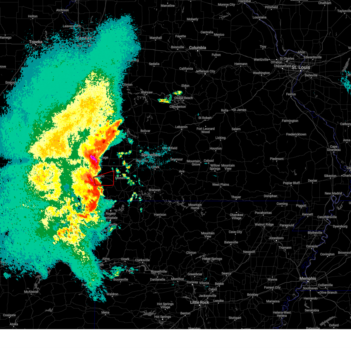 Torsgf the national weather service in springfield has issued a * tornado warning for, southeastern newton county in southwestern missouri, * until 900 am cdt. * at 829 am cdt, a severe thunderstorm capable of producing a tornado was located over neosho, moving east at 50 mph (radar indicated rotation). Hazards include tornado. Flying debris will be dangerous to those caught without shelter. mobile homes will be damaged or destroyed. damage to roofs, windows, and vehicles will occur. Tree damage is likely. Torsgf the national weather service in springfield has issued a * tornado warning for, southeastern newton county in southwestern missouri, * until 900 am cdt. * at 829 am cdt, a severe thunderstorm capable of producing a tornado was located over neosho, moving east at 50 mph (radar indicated rotation). Hazards include tornado. Flying debris will be dangerous to those caught without shelter. mobile homes will be damaged or destroyed. damage to roofs, windows, and vehicles will occur. Tree damage is likely.
|
| 4/29/2025 8:27 AM CDT | Possible tornado damage at the 23 mm i 49 southbound south of neosho in newton county. part of a barn is blocking the interstate with multiple trees down in a defined p in newton county MO, 2.5 miles NE of Neosho, MO |
| 4/29/2025 8:09 AM CDT |
 Svrsgf the national weather service in springfield has issued a * severe thunderstorm warning for, newton county in southwestern missouri, mcdonald county in southwestern missouri, * until 900 am cdt. * at 809 am cdt, severe thunderstorms were located along a line extending from wyandotte to 6 miles north of south west city to near colcord, moving east at 50 mph (radar indicated). Hazards include 60 mph wind gusts and quarter size hail. Hail damage to vehicles is expected. Expect wind damage to roofs, siding, and trees. Svrsgf the national weather service in springfield has issued a * severe thunderstorm warning for, newton county in southwestern missouri, mcdonald county in southwestern missouri, * until 900 am cdt. * at 809 am cdt, severe thunderstorms were located along a line extending from wyandotte to 6 miles north of south west city to near colcord, moving east at 50 mph (radar indicated). Hazards include 60 mph wind gusts and quarter size hail. Hail damage to vehicles is expected. Expect wind damage to roofs, siding, and trees.
|
| 4/20/2025 2:37 PM CDT |
 Svrsgf the national weather service in springfield has issued a * severe thunderstorm warning for, barton county in southwestern missouri, eastern newton county in southwestern missouri, cedar county in southwestern missouri, lawrence county in southwestern missouri, st. clair county in west central missouri, vernon county in west central missouri, eastern jasper county in southwestern missouri, dade county in southwestern missouri, * until 330 pm cdt. * at 236 pm cdt, severe thunderstorms were located along a line extending from 7 miles northwest of sheldon to 8 miles east of lamar to near goodman, moving northeast at 60 mph (radar indicated). Hazards include 60 mph wind gusts and penny size hail. expect damage to roofs, siding, and trees Svrsgf the national weather service in springfield has issued a * severe thunderstorm warning for, barton county in southwestern missouri, eastern newton county in southwestern missouri, cedar county in southwestern missouri, lawrence county in southwestern missouri, st. clair county in west central missouri, vernon county in west central missouri, eastern jasper county in southwestern missouri, dade county in southwestern missouri, * until 330 pm cdt. * at 236 pm cdt, severe thunderstorms were located along a line extending from 7 miles northwest of sheldon to 8 miles east of lamar to near goodman, moving northeast at 60 mph (radar indicated). Hazards include 60 mph wind gusts and penny size hail. expect damage to roofs, siding, and trees
|
| 4/20/2025 1:54 PM CDT |
 Svrsgf the national weather service in springfield has issued a * severe thunderstorm warning for, barton county in southwestern missouri, newton county in southwestern missouri, jasper county in southwestern missouri, * until 300 pm cdt. * at 154 pm cdt, severe thunderstorms were located along a line extending from 6 miles southwest of girard to near baxter springs to near grove, moving northeast at 45 mph (radar indicated). Hazards include 60 mph wind gusts and penny size hail. Expect damage to roofs, siding, and trees. severe thunderstorms will be near, joplin, seneca, and carl junction around 200 pm cdt. leawood, webb city, and shoal creek drive around 205 pm cdt. carterville, oronogo, saginaw, silver creek, duquesne, and mindenmines around 210 pm cdt. alba, neosho, purcell, and duenweg around 215 pm cdt. liberal and carthage around 220 pm cdt. jasper and diamond around 225 pm cdt. granby around 230 pm cdt. lamar around 235 pm cdt. other locations impacted by these severe thunderstorms include asbury, fidelity, carytown, shoal creek estates, irwin, dennis acres, lamar heights, grand falls plaza, oakland park, and maple grove. this includes the following highways, interstate 44 between mile markers 1 and 31. Interstate 49 between mile markers 16 and 76. Svrsgf the national weather service in springfield has issued a * severe thunderstorm warning for, barton county in southwestern missouri, newton county in southwestern missouri, jasper county in southwestern missouri, * until 300 pm cdt. * at 154 pm cdt, severe thunderstorms were located along a line extending from 6 miles southwest of girard to near baxter springs to near grove, moving northeast at 45 mph (radar indicated). Hazards include 60 mph wind gusts and penny size hail. Expect damage to roofs, siding, and trees. severe thunderstorms will be near, joplin, seneca, and carl junction around 200 pm cdt. leawood, webb city, and shoal creek drive around 205 pm cdt. carterville, oronogo, saginaw, silver creek, duquesne, and mindenmines around 210 pm cdt. alba, neosho, purcell, and duenweg around 215 pm cdt. liberal and carthage around 220 pm cdt. jasper and diamond around 225 pm cdt. granby around 230 pm cdt. lamar around 235 pm cdt. other locations impacted by these severe thunderstorms include asbury, fidelity, carytown, shoal creek estates, irwin, dennis acres, lamar heights, grand falls plaza, oakland park, and maple grove. this includes the following highways, interstate 44 between mile markers 1 and 31. Interstate 49 between mile markers 16 and 76.
|
| 4/20/2025 3:10 AM CDT |
 The storms which prompted the warning have moved out of the area. therefore, the warning will be allowed to expire. a severe thunderstorm watch remains in effect until 800 am cdt for southwestern missouri. The storms which prompted the warning have moved out of the area. therefore, the warning will be allowed to expire. a severe thunderstorm watch remains in effect until 800 am cdt for southwestern missouri.
|
| 4/20/2025 2:48 AM CDT |
 Svrsgf the national weather service in springfield has issued a * severe thunderstorm warning for, southwestern newton county in southwestern missouri, western mcdonald county in southwestern missouri, * until 315 am cdt. * at 248 am cdt, severe thunderstorms were located along a line extending from 6 miles west of goodman to near anderson to near pineville, moving north at 60 mph (radar indicated). Hazards include 70 mph wind gusts. Expect considerable tree damage. Damage is likely to mobile homes, roofs, and outbuildings. Svrsgf the national weather service in springfield has issued a * severe thunderstorm warning for, southwestern newton county in southwestern missouri, western mcdonald county in southwestern missouri, * until 315 am cdt. * at 248 am cdt, severe thunderstorms were located along a line extending from 6 miles west of goodman to near anderson to near pineville, moving north at 60 mph (radar indicated). Hazards include 70 mph wind gusts. Expect considerable tree damage. Damage is likely to mobile homes, roofs, and outbuildings.
|
| 4/20/2025 2:38 AM CDT |
 Svrsgf the national weather service in springfield has issued a * severe thunderstorm warning for, eastern newton county in southwestern missouri, eastern mcdonald county in southwestern missouri, western barry county in southwestern missouri, * until 330 am cdt. * at 238 am cdt, severe thunderstorms were located along a line extending from near south west city to near noel to near decatur, moving northeast at 60 mph (radar indicated). Hazards include 70 mph wind gusts. Expect considerable tree damage. Damage is likely to mobile homes, roofs, and outbuildings. Svrsgf the national weather service in springfield has issued a * severe thunderstorm warning for, eastern newton county in southwestern missouri, eastern mcdonald county in southwestern missouri, western barry county in southwestern missouri, * until 330 am cdt. * at 238 am cdt, severe thunderstorms were located along a line extending from near south west city to near noel to near decatur, moving northeast at 60 mph (radar indicated). Hazards include 70 mph wind gusts. Expect considerable tree damage. Damage is likely to mobile homes, roofs, and outbuildings.
|
| 4/20/2025 2:30 AM CDT |
 At 230 am cdt, severe thunderstorms were located along a line extending from 6 miles southeast of wyandotte to near south west city to near gentry, moving northeast at 40 mph (radar indicated). Hazards include 70 mph wind gusts. Expect considerable tree damage. damage is likely to mobile homes, roofs, and outbuildings. locations impacted include, goodman, seneca, south west city, pineville, lanagan, tiff city, anderson, noel, dodge, neosho, and cayuga. This includes interstate 49 between mile markers 1 and 20. At 230 am cdt, severe thunderstorms were located along a line extending from 6 miles southeast of wyandotte to near south west city to near gentry, moving northeast at 40 mph (radar indicated). Hazards include 70 mph wind gusts. Expect considerable tree damage. damage is likely to mobile homes, roofs, and outbuildings. locations impacted include, goodman, seneca, south west city, pineville, lanagan, tiff city, anderson, noel, dodge, neosho, and cayuga. This includes interstate 49 between mile markers 1 and 20.
|
| 4/20/2025 2:07 AM CDT |
 Svrsgf the national weather service in springfield has issued a * severe thunderstorm warning for, southwestern newton county in southwestern missouri, western mcdonald county in southwestern missouri, * until 245 am cdt. * at 206 am cdt, severe thunderstorms were located along a line extending from 6 miles southwest of honey creek state park to near jay to 6 miles north of colcord, moving northeast at 45 mph (radar indicated). Hazards include 70 mph wind gusts. Expect considerable tree damage. Damage is likely to mobile homes, roofs, and outbuildings. Svrsgf the national weather service in springfield has issued a * severe thunderstorm warning for, southwestern newton county in southwestern missouri, western mcdonald county in southwestern missouri, * until 245 am cdt. * at 206 am cdt, severe thunderstorms were located along a line extending from 6 miles southwest of honey creek state park to near jay to 6 miles north of colcord, moving northeast at 45 mph (radar indicated). Hazards include 70 mph wind gusts. Expect considerable tree damage. Damage is likely to mobile homes, roofs, and outbuildings.
|
| 4/2/2025 8:45 AM CDT |
 Svrsgf the national weather service in springfield has issued a * severe thunderstorm warning for, southeastern barton county in southwestern missouri, newton county in southwestern missouri, cedar county in southwestern missouri, western christian county in southwestern missouri, polk county in southwestern missouri, stone county in southwestern missouri, mcdonald county in southwestern missouri, barry county in southwestern missouri, lawrence county in southwestern missouri, greene county in southwestern missouri, eastern jasper county in southwestern missouri, dade county in southwestern missouri, * until 945 am cdt. * at 844 am cdt, severe thunderstorms were located along a line extending from 8 miles southwest of stockton to near lanagan, moving northeast at 80 mph (radar indicated). Hazards include 60 mph wind gusts and quarter size hail. Hail damage to vehicles is expected. Expect wind damage to roofs, siding, and trees. Svrsgf the national weather service in springfield has issued a * severe thunderstorm warning for, southeastern barton county in southwestern missouri, newton county in southwestern missouri, cedar county in southwestern missouri, western christian county in southwestern missouri, polk county in southwestern missouri, stone county in southwestern missouri, mcdonald county in southwestern missouri, barry county in southwestern missouri, lawrence county in southwestern missouri, greene county in southwestern missouri, eastern jasper county in southwestern missouri, dade county in southwestern missouri, * until 945 am cdt. * at 844 am cdt, severe thunderstorms were located along a line extending from 8 miles southwest of stockton to near lanagan, moving northeast at 80 mph (radar indicated). Hazards include 60 mph wind gusts and quarter size hail. Hail damage to vehicles is expected. Expect wind damage to roofs, siding, and trees.
|
| 4/2/2025 8:06 AM CDT | Svrsgf the national weather service in springfield has issued a * severe thunderstorm warning for, newton county in southwestern missouri, mcdonald county in southwestern missouri, western barry county in southwestern missouri, southeastern jasper county in southwestern missouri, * until 845 am cdt. * at 806 am cdt, severe thunderstorms were located along a line extending from near wyandotte to near anderson to near noel, moving northeast at 70 mph (radar indicated). Hazards include 60 mph wind gusts and quarter size hail. Hail damage to vehicles is expected. Expect wind damage to roofs, siding, and trees. |
| 3/22/2025 10:41 PM CDT |
 The storm which prompted the warning has weakened below severe limits, and has exited the warned area. therefore, the warning will be allowed to expire. The storm which prompted the warning has weakened below severe limits, and has exited the warned area. therefore, the warning will be allowed to expire.
|
| 3/22/2025 10:25 PM CDT |
 At 1025 pm cdt, a severe thunderstorm was located over goodman, or 8 miles south of neosho, moving northeast at 35 mph (radar indicated). Hazards include 60 mph wind gusts and quarter size hail. Hail damage to vehicles is expected. expect wind damage to roofs, siding, and trees. locations impacted include, goodman and neosho. This includes interstate 49 between mile markers 11 and 14. At 1025 pm cdt, a severe thunderstorm was located over goodman, or 8 miles south of neosho, moving northeast at 35 mph (radar indicated). Hazards include 60 mph wind gusts and quarter size hail. Hail damage to vehicles is expected. expect wind damage to roofs, siding, and trees. locations impacted include, goodman and neosho. This includes interstate 49 between mile markers 11 and 14.
|
| 3/22/2025 10:21 PM CDT |
 Svrsgf the national weather service in springfield has issued a * severe thunderstorm warning for, northern newton county in southwestern missouri, * until 1100 pm cdt. * at 1019 pm cdt, a severe thunderstorm was located near seneca, or 9 miles southeast of baxter springs, moving northeast at 40 mph (radar indicated). Hazards include 60 mph wind gusts and half dollar size hail. Hail damage to vehicles is expected. Expect wind damage to roofs, siding, and trees. Svrsgf the national weather service in springfield has issued a * severe thunderstorm warning for, northern newton county in southwestern missouri, * until 1100 pm cdt. * at 1019 pm cdt, a severe thunderstorm was located near seneca, or 9 miles southeast of baxter springs, moving northeast at 40 mph (radar indicated). Hazards include 60 mph wind gusts and half dollar size hail. Hail damage to vehicles is expected. Expect wind damage to roofs, siding, and trees.
|
| 3/22/2025 10:12 PM CDT |
 At 1012 pm cdt, a severe thunderstorm was located over anderson, or 7 miles northwest of pineville, moving northeast at 40 mph (radar indicated). Hazards include 60 mph wind gusts and quarter size hail. Hail damage to vehicles is expected. expect wind damage to roofs, siding, and trees. locations impacted include, goodman, anderson, neosho, and lanagan. This includes interstate 49 between mile markers 6 and 20. At 1012 pm cdt, a severe thunderstorm was located over anderson, or 7 miles northwest of pineville, moving northeast at 40 mph (radar indicated). Hazards include 60 mph wind gusts and quarter size hail. Hail damage to vehicles is expected. expect wind damage to roofs, siding, and trees. locations impacted include, goodman, anderson, neosho, and lanagan. This includes interstate 49 between mile markers 6 and 20.
|
| 3/22/2025 9:56 PM CDT |
 Svrsgf the national weather service in springfield has issued a * severe thunderstorm warning for, south central newton county in southwestern missouri, northwestern mcdonald county in southwestern missouri, * until 1045 pm cdt. * at 956 pm cdt, a severe thunderstorm was located near south west city, or 13 miles northeast of jay, moving northeast at 35 mph (radar indicated). Hazards include 60 mph wind gusts and quarter size hail. Hail damage to vehicles is expected. Expect wind damage to roofs, siding, and trees. Svrsgf the national weather service in springfield has issued a * severe thunderstorm warning for, south central newton county in southwestern missouri, northwestern mcdonald county in southwestern missouri, * until 1045 pm cdt. * at 956 pm cdt, a severe thunderstorm was located near south west city, or 13 miles northeast of jay, moving northeast at 35 mph (radar indicated). Hazards include 60 mph wind gusts and quarter size hail. Hail damage to vehicles is expected. Expect wind damage to roofs, siding, and trees.
|
| 3/14/2025 4:08 PM CDT | At 408 pm cdt, a severe thunderstorm was located near goodman, or 10 miles northwest of pineville, moving northeast at 60 mph (emergency management. report of 67 mph wind gust in goodman, missouri at 312 pm cdt). Hazards include 70 mph wind gusts and quarter size hail. Hail damage to vehicles is expected. expect considerable tree damage. wind damage is also likely to mobile homes, roofs, and outbuildings. locations impacted include, monett, fairview, goodman, granby, pleasant ridge, loma linda, wheaton, south west city, big sugar creek state park, lanagan, rocky comfort, ridgley, purdy, madry, racine, neosho, seneca, exeter, butterfield, and stella. This includes interstate 49 between mile markers 1 and 30. |
| 3/14/2025 3:45 PM CDT |
 Svrsgf the national weather service in springfield has issued a * severe thunderstorm warning for, newton county in southwestern missouri, mcdonald county in southwestern missouri, northwestern barry county in southwestern missouri, * until 445 pm cdt. * at 344 pm cdt, a severe thunderstorm was located near south west city, or 8 miles northeast of jay, moving northeast at 70 mph (emergency management. report of 67 mph wind gust in goodman, missouri at 312 pm cdt). Hazards include 70 mph wind gusts and penny size hail. Expect considerable tree damage. Damage is likely to mobile homes, roofs, and outbuildings. Svrsgf the national weather service in springfield has issued a * severe thunderstorm warning for, newton county in southwestern missouri, mcdonald county in southwestern missouri, northwestern barry county in southwestern missouri, * until 445 pm cdt. * at 344 pm cdt, a severe thunderstorm was located near south west city, or 8 miles northeast of jay, moving northeast at 70 mph (emergency management. report of 67 mph wind gust in goodman, missouri at 312 pm cdt). Hazards include 70 mph wind gusts and penny size hail. Expect considerable tree damage. Damage is likely to mobile homes, roofs, and outbuildings.
|
| 3/14/2025 3:09 PM CDT |
 Svrsgf the national weather service in springfield has issued a * severe thunderstorm warning for, newton county in southwestern missouri, northwestern mcdonald county in southwestern missouri, * until 345 pm cdt. * at 308 pm cdt, a severe thunderstorm was located 9 miles west of anderson, or 13 miles northwest of pineville, moving northeast at 60 mph (radar indicated). Hazards include 70 mph wind gusts and penny size hail. Expect considerable tree damage. Damage is likely to mobile homes, roofs, and outbuildings. Svrsgf the national weather service in springfield has issued a * severe thunderstorm warning for, newton county in southwestern missouri, northwestern mcdonald county in southwestern missouri, * until 345 pm cdt. * at 308 pm cdt, a severe thunderstorm was located 9 miles west of anderson, or 13 miles northwest of pineville, moving northeast at 60 mph (radar indicated). Hazards include 70 mph wind gusts and penny size hail. Expect considerable tree damage. Damage is likely to mobile homes, roofs, and outbuildings.
|
| 11/4/2024 4:20 PM CST |
 At 420 pm cst, severe thunderstorms were located along a line extending from near carthage to near diamond to near neosho to near pineville, moving northeast at 50 mph (radar indicated). Hazards include 60 mph wind gusts and quarter size hail. Hail damage to vehicles is expected. expect wind damage to roofs, siding, and trees. locations impacted include, southeastern joplin, neosho, big sugar creek state park, granby, anderson, noel, goodman, south west city, diamond, pineville, leawood, silver creek, lanagan, saginaw, newtonia, stark city, shoal creek estates, ritchey, and dennis acres. this includes the following highways, interstate 44 near mile marker 7. Interstate 49 between mile markers 1 and 35. At 420 pm cst, severe thunderstorms were located along a line extending from near carthage to near diamond to near neosho to near pineville, moving northeast at 50 mph (radar indicated). Hazards include 60 mph wind gusts and quarter size hail. Hail damage to vehicles is expected. expect wind damage to roofs, siding, and trees. locations impacted include, southeastern joplin, neosho, big sugar creek state park, granby, anderson, noel, goodman, south west city, diamond, pineville, leawood, silver creek, lanagan, saginaw, newtonia, stark city, shoal creek estates, ritchey, and dennis acres. this includes the following highways, interstate 44 near mile marker 7. Interstate 49 between mile markers 1 and 35.
|
| 11/4/2024 4:13 PM CST |
 At 413 pm cst, severe thunderstorms were located along a line extending from near diamond to near neosho to near goodman to noel, moving east at 45 mph (radar indicated). Hazards include 60 mph wind gusts and quarter size hail. Hail damage to vehicles is expected. expect wind damage to roofs, siding, and trees. locations impacted include, southeastern joplin, neosho, big sugar creek state park, granby, anderson, noel, goodman, south west city, diamond, pineville, leawood, silver creek, lanagan, saginaw, newtonia, stark city, shoal creek estates, ritchey, and dennis acres. this includes the following highways, interstate 44 near mile marker 7. Interstate 49 between mile markers 1 and 35. At 413 pm cst, severe thunderstorms were located along a line extending from near diamond to near neosho to near goodman to noel, moving east at 45 mph (radar indicated). Hazards include 60 mph wind gusts and quarter size hail. Hail damage to vehicles is expected. expect wind damage to roofs, siding, and trees. locations impacted include, southeastern joplin, neosho, big sugar creek state park, granby, anderson, noel, goodman, south west city, diamond, pineville, leawood, silver creek, lanagan, saginaw, newtonia, stark city, shoal creek estates, ritchey, and dennis acres. this includes the following highways, interstate 44 near mile marker 7. Interstate 49 between mile markers 1 and 35.
|
| 11/4/2024 3:56 PM CST |
 Svrsgf the national weather service in springfield has issued a * severe thunderstorm warning for, newton county in southwestern missouri, mcdonald county in southwestern missouri, * until 430 pm cst. * at 356 pm cst, severe thunderstorms were located along a line extending from near shoal creek drive to near seneca to 8 miles west of goodman to south west city, moving northeast at 50 mph (radar indicated). Hazards include 60 mph wind gusts and quarter size hail. Hail damage to vehicles is expected. Expect wind damage to roofs, siding, and trees. Svrsgf the national weather service in springfield has issued a * severe thunderstorm warning for, newton county in southwestern missouri, mcdonald county in southwestern missouri, * until 430 pm cst. * at 356 pm cst, severe thunderstorms were located along a line extending from near shoal creek drive to near seneca to 8 miles west of goodman to south west city, moving northeast at 50 mph (radar indicated). Hazards include 60 mph wind gusts and quarter size hail. Hail damage to vehicles is expected. Expect wind damage to roofs, siding, and trees.
|
| 11/4/2024 2:23 PM CST |
 The storm which prompted the warning has weakened below severe limits, and no longer poses an immediate threat to life or property. therefore, the warning will be allowed to expire. however, gusty winds are still possible with this thunderstorm. a tornado watch remains in effect until 900 pm cst for southwestern missouri. The storm which prompted the warning has weakened below severe limits, and no longer poses an immediate threat to life or property. therefore, the warning will be allowed to expire. however, gusty winds are still possible with this thunderstorm. a tornado watch remains in effect until 900 pm cst for southwestern missouri.
|
| 11/4/2024 2:16 PM CST |
 At 216 pm cst, a severe thunderstorm was located over goodman, or 8 miles south of neosho, moving northeast at 30 mph (radar indicated). Hazards include 60 mph wind gusts and quarter size hail. Hail damage to vehicles is expected. expect wind damage to roofs, siding, and trees. locations impacted include, neosho and goodman. This includes interstate 49 between mile markers 9 and 23. At 216 pm cst, a severe thunderstorm was located over goodman, or 8 miles south of neosho, moving northeast at 30 mph (radar indicated). Hazards include 60 mph wind gusts and quarter size hail. Hail damage to vehicles is expected. expect wind damage to roofs, siding, and trees. locations impacted include, neosho and goodman. This includes interstate 49 between mile markers 9 and 23.
|
| 11/4/2024 2:06 PM CST |
 Svrsgf the national weather service in springfield has issued a * severe thunderstorm warning for, south central newton county in southwestern missouri, northern mcdonald county in southwestern missouri, * until 230 pm cst. * at 206 pm cst, a severe thunderstorm was located over anderson, or 7 miles northwest of pineville, moving northeast at 30 mph (radar indicated). Hazards include 60 mph wind gusts and quarter size hail. Hail damage to vehicles is expected. Expect wind damage to roofs, siding, and trees. Svrsgf the national weather service in springfield has issued a * severe thunderstorm warning for, south central newton county in southwestern missouri, northern mcdonald county in southwestern missouri, * until 230 pm cst. * at 206 pm cst, a severe thunderstorm was located over anderson, or 7 miles northwest of pineville, moving northeast at 30 mph (radar indicated). Hazards include 60 mph wind gusts and quarter size hail. Hail damage to vehicles is expected. Expect wind damage to roofs, siding, and trees.
|
| 10/30/2024 11:06 PM CDT |
 The storm which prompted the warning has moved out of the area. therefore, the warning will be allowed to expire. however, gusty winds are still possible with this thunderstorm. a severe thunderstorm watch remains in effect until 400 am cdt for southwestern missouri. remember, a severe thunderstorm warning still remains in effect for portions of west missouri. The storm which prompted the warning has moved out of the area. therefore, the warning will be allowed to expire. however, gusty winds are still possible with this thunderstorm. a severe thunderstorm watch remains in effect until 400 am cdt for southwestern missouri. remember, a severe thunderstorm warning still remains in effect for portions of west missouri.
|
| 10/30/2024 10:50 PM CDT |
 At 1050 pm cdt, a severe thunderstorm capable of producing a tornado was located near seneca, or 10 miles southeast of baxter springs, moving northeast at 50 mph (radar indicated rotation). Hazards include tornado and ping pong ball size hail. Flying debris will be dangerous to those caught without shelter. mobile homes will be damaged or destroyed. damage to roofs, windows, and vehicles will occur. tree damage is likely. locations impacted include, southern joplin, neosho, seneca, loma linda, leawood, redings mill, shoal creek estates, and racine. This includes interstate 49 between mile markers 20 and 27. At 1050 pm cdt, a severe thunderstorm capable of producing a tornado was located near seneca, or 10 miles southeast of baxter springs, moving northeast at 50 mph (radar indicated rotation). Hazards include tornado and ping pong ball size hail. Flying debris will be dangerous to those caught without shelter. mobile homes will be damaged or destroyed. damage to roofs, windows, and vehicles will occur. tree damage is likely. locations impacted include, southern joplin, neosho, seneca, loma linda, leawood, redings mill, shoal creek estates, and racine. This includes interstate 49 between mile markers 20 and 27.
|
| 10/30/2024 10:41 PM CDT |
 Torsgf the national weather service in springfield has issued a * tornado warning for, western newton county in southwestern missouri, * until 1115 pm cdt. * at 1039 pm cdt, a severe thunderstorm capable of producing a tornado was located over wyandotte, or 7 miles southeast of miami, moving northeast at 45 mph (radar indicated rotation). Hazards include tornado and ping pong ball size hail. Flying debris will be dangerous to those caught without shelter. mobile homes will be damaged or destroyed. damage to roofs, windows, and vehicles will occur. Tree damage is likely. Torsgf the national weather service in springfield has issued a * tornado warning for, western newton county in southwestern missouri, * until 1115 pm cdt. * at 1039 pm cdt, a severe thunderstorm capable of producing a tornado was located over wyandotte, or 7 miles southeast of miami, moving northeast at 45 mph (radar indicated rotation). Hazards include tornado and ping pong ball size hail. Flying debris will be dangerous to those caught without shelter. mobile homes will be damaged or destroyed. damage to roofs, windows, and vehicles will occur. Tree damage is likely.
|
| 8/16/2024 8:29 PM CDT |
 At 828 pm cdt, a severe thunderstorm was located 7 miles southeast of neosho, moving southeast at 40 mph (radar indicated). Hazards include 70 mph wind gusts and quarter size hail. Hail damage to vehicles is expected. expect considerable tree damage. wind damage is also likely to mobile homes, roofs, and outbuildings. locations impacted include, neosho, big sugar creek state park, seneca, anderson, noel, dodge, goodman, south west city, pineville, wheaton, lanagan, fairview, newtonia, stella, cayuga, stark city, tiff city, and rocky comfort. This includes interstate 49 between mile markers 1 and 22. At 828 pm cdt, a severe thunderstorm was located 7 miles southeast of neosho, moving southeast at 40 mph (radar indicated). Hazards include 70 mph wind gusts and quarter size hail. Hail damage to vehicles is expected. expect considerable tree damage. wind damage is also likely to mobile homes, roofs, and outbuildings. locations impacted include, neosho, big sugar creek state park, seneca, anderson, noel, dodge, goodman, south west city, pineville, wheaton, lanagan, fairview, newtonia, stella, cayuga, stark city, tiff city, and rocky comfort. This includes interstate 49 between mile markers 1 and 22.
|
| 8/16/2024 8:11 PM CDT |
 the severe thunderstorm warning has been cancelled and is no longer in effect the severe thunderstorm warning has been cancelled and is no longer in effect
|
| 8/16/2024 8:11 PM CDT |
 At 811 pm cdt, a severe thunderstorm was located over neosho, moving southeast at 45 mph (radar indicated). Hazards include 70 mph wind gusts and quarter size hail. Hail damage to vehicles is expected. expect considerable tree damage. wind damage is also likely to mobile homes, roofs, and outbuildings. locations impacted include, southwestern joplin, neosho, big sugar creek state park, seneca, granby, anderson, noel, dodge, goodman, south west city, pineville, loma linda, wheaton, leawood, silver creek, lanagan, fairview, shoal creek drive, saginaw, and newtonia. this includes the following highways, interstate 44 between mile markers 0 and 7. Interstate 49 between mile markers 1 and 33. At 811 pm cdt, a severe thunderstorm was located over neosho, moving southeast at 45 mph (radar indicated). Hazards include 70 mph wind gusts and quarter size hail. Hail damage to vehicles is expected. expect considerable tree damage. wind damage is also likely to mobile homes, roofs, and outbuildings. locations impacted include, southwestern joplin, neosho, big sugar creek state park, seneca, granby, anderson, noel, dodge, goodman, south west city, pineville, loma linda, wheaton, leawood, silver creek, lanagan, fairview, shoal creek drive, saginaw, and newtonia. this includes the following highways, interstate 44 between mile markers 0 and 7. Interstate 49 between mile markers 1 and 33.
|
| 8/16/2024 7:56 PM CDT |
 At 755 pm cdt, a severe thunderstorm was located near seneca, or 11 miles northwest of neosho, moving southeast at 45 mph. this is a destructive storm for seneca (emergency management). Hazards include 80 mph wind gusts and golf ball size hail. Flying debris will be dangerous to those caught without shelter. mobile homes will be heavily damaged. expect considerable damage to roofs, windows, and vehicles. extensive tree damage and power outages are likely. locations impacted include, southwestern joplin, neosho, big sugar creek state park, baxter springs, galena, seneca, granby, anderson, noel, dodge, goodman, south west city, pineville, loma linda, wheaton, leawood, lowell, silver creek, lanagan, and fairview. this includes the following highways, interstate 44 between mile markers 0 and 7. Interstate 49 between mile markers 1 and 33. At 755 pm cdt, a severe thunderstorm was located near seneca, or 11 miles northwest of neosho, moving southeast at 45 mph. this is a destructive storm for seneca (emergency management). Hazards include 80 mph wind gusts and golf ball size hail. Flying debris will be dangerous to those caught without shelter. mobile homes will be heavily damaged. expect considerable damage to roofs, windows, and vehicles. extensive tree damage and power outages are likely. locations impacted include, southwestern joplin, neosho, big sugar creek state park, baxter springs, galena, seneca, granby, anderson, noel, dodge, goodman, south west city, pineville, loma linda, wheaton, leawood, lowell, silver creek, lanagan, and fairview. this includes the following highways, interstate 44 between mile markers 0 and 7. Interstate 49 between mile markers 1 and 33.
|
| 8/16/2024 7:42 PM CDT |
 Svrsgf the national weather service in springfield has issued a * severe thunderstorm warning for, southeastern cherokee county in southeastern kansas, newton county in southwestern missouri, mcdonald county in southwestern missouri, * until 845 pm cdt. * at 742 pm cdt, a severe thunderstorm was located near baxter springs, moving southeast at 45 mph. this is a destructive storm for baxter springs and neosho (emergency management). Hazards include 80 mph wind gusts and two inch hail. Flying debris will be dangerous to those caught without shelter. mobile homes will be heavily damaged. expect considerable damage to roofs, windows, and vehicles. Extensive tree damage and power outages are likely. Svrsgf the national weather service in springfield has issued a * severe thunderstorm warning for, southeastern cherokee county in southeastern kansas, newton county in southwestern missouri, mcdonald county in southwestern missouri, * until 845 pm cdt. * at 742 pm cdt, a severe thunderstorm was located near baxter springs, moving southeast at 45 mph. this is a destructive storm for baxter springs and neosho (emergency management). Hazards include 80 mph wind gusts and two inch hail. Flying debris will be dangerous to those caught without shelter. mobile homes will be heavily damaged. expect considerable damage to roofs, windows, and vehicles. Extensive tree damage and power outages are likely.
|
| 7/4/2024 9:06 PM CDT |
 At 906 pm cdt, severe thunderstorms were located along a line extending from near neosho to 8 miles southwest of fairview to 9 miles east of pineville, moving northeast at 40 mph (radar indicated). Hazards include 60 mph wind gusts. Expect damage to roofs, siding, and trees. locations impacted include, neosho, big sugar creek state park, granby, anderson, goodman, pineville, wheaton, washburn, lanagan, fairview, newtonia, stella, stark city, wayne, powell, rocky comfort, and ridgley. This includes interstate 49 between mile markers 1 and 21. At 906 pm cdt, severe thunderstorms were located along a line extending from near neosho to 8 miles southwest of fairview to 9 miles east of pineville, moving northeast at 40 mph (radar indicated). Hazards include 60 mph wind gusts. Expect damage to roofs, siding, and trees. locations impacted include, neosho, big sugar creek state park, granby, anderson, goodman, pineville, wheaton, washburn, lanagan, fairview, newtonia, stella, stark city, wayne, powell, rocky comfort, and ridgley. This includes interstate 49 between mile markers 1 and 21.
|
| 7/4/2024 8:47 PM CDT |
 Svrsgf the national weather service in springfield has issued a * severe thunderstorm warning for, southern newton county in southwestern missouri, mcdonald county in southwestern missouri, southwestern barry county in southwestern missouri, * until 915 pm cdt. * at 847 pm cdt, severe thunderstorms were located along a line extending from near goodman to near anderson to near pineville, moving northeast at 40 mph (radar indicated). Hazards include 60 mph wind gusts and quarter size hail. Hail damage to vehicles is expected. Expect wind damage to roofs, siding, and trees. Svrsgf the national weather service in springfield has issued a * severe thunderstorm warning for, southern newton county in southwestern missouri, mcdonald county in southwestern missouri, southwestern barry county in southwestern missouri, * until 915 pm cdt. * at 847 pm cdt, severe thunderstorms were located along a line extending from near goodman to near anderson to near pineville, moving northeast at 40 mph (radar indicated). Hazards include 60 mph wind gusts and quarter size hail. Hail damage to vehicles is expected. Expect wind damage to roofs, siding, and trees.
|
| 6/26/2024 6:14 AM CDT | Report from emergency manager of a 59 mph wind gusts. additional reports of some tree damage and power outages northeast of neosho. time estimated from rada in newton county MO, 1.9 miles SW of Neosho, MO |
| 6/26/2024 5:52 AM CDT |
 The storms which prompted the warning have moved out of the area. therefore, the warning will be allowed to expire. a severe thunderstorm watch remains in effect until 1100 am cdt for southeastern kansas, and southwestern missouri. The storms which prompted the warning have moved out of the area. therefore, the warning will be allowed to expire. a severe thunderstorm watch remains in effect until 1100 am cdt for southeastern kansas, and southwestern missouri.
|
| 6/26/2024 5:08 AM CDT |
 Svrsgf the national weather service in springfield has issued a * severe thunderstorm warning for, cherokee county in southeastern kansas, southern crawford county in southeastern kansas, southwestern barton county in southwestern missouri, newton county in southwestern missouri, western jasper county in southwestern missouri, * until 600 am cdt. * at 507 am cdt, severe thunderstorms were located along a line extending from near liberal to 6 miles southwest of girard to near galesburg, moving southeast at 65 mph (radar indicated). Hazards include 60 mph wind gusts. expect damage to roofs, siding, and trees Svrsgf the national weather service in springfield has issued a * severe thunderstorm warning for, cherokee county in southeastern kansas, southern crawford county in southeastern kansas, southwestern barton county in southwestern missouri, newton county in southwestern missouri, western jasper county in southwestern missouri, * until 600 am cdt. * at 507 am cdt, severe thunderstorms were located along a line extending from near liberal to 6 miles southwest of girard to near galesburg, moving southeast at 65 mph (radar indicated). Hazards include 60 mph wind gusts. expect damage to roofs, siding, and trees
|
| 5/26/2024 3:27 AM CDT |
 At 326 am cdt, severe thunderstorms were located along a line extending from near pierce city to near fairview to pineville, moving east at 65 mph (radar indicated). Hazards include two inch hail and 70 mph wind gusts. People and animals outdoors will be injured. expect hail damage to roofs, siding, windows, and vehicles. expect considerable tree damage. wind damage is also likely to mobile homes, roofs, and outbuildings. locations impacted include, neosho, table rock lake, roaring river state park, big sugar creek state park, monett, aurora, cassville, marionville, granby, anderson, noel, shell knob, pierce city, purdy, seligman, pineville, exeter, wheaton, verona, and butterfield. This includes interstate 49 between mile markers 1 and 9. At 326 am cdt, severe thunderstorms were located along a line extending from near pierce city to near fairview to pineville, moving east at 65 mph (radar indicated). Hazards include two inch hail and 70 mph wind gusts. People and animals outdoors will be injured. expect hail damage to roofs, siding, windows, and vehicles. expect considerable tree damage. wind damage is also likely to mobile homes, roofs, and outbuildings. locations impacted include, neosho, table rock lake, roaring river state park, big sugar creek state park, monett, aurora, cassville, marionville, granby, anderson, noel, shell knob, pierce city, purdy, seligman, pineville, exeter, wheaton, verona, and butterfield. This includes interstate 49 between mile markers 1 and 9.
|
| 5/26/2024 3:18 AM CDT |
 Svrsgf the national weather service in springfield has issued a * severe thunderstorm warning for, eastern newton county in southwestern missouri, mcdonald county in southwestern missouri, barry county in southwestern missouri, southern lawrence county in southwestern missouri, * until 400 am cdt. * at 318 am cdt, severe thunderstorms were located along a line extending from near pierce city to near fairview to pineville, moving east at 65 mph (radar indicated). Hazards include two inch hail and 70 mph wind gusts. People and animals outdoors will be injured. expect hail damage to roofs, siding, windows, and vehicles. expect considerable tree damage. Wind damage is also likely to mobile homes, roofs, and outbuildings. Svrsgf the national weather service in springfield has issued a * severe thunderstorm warning for, eastern newton county in southwestern missouri, mcdonald county in southwestern missouri, barry county in southwestern missouri, southern lawrence county in southwestern missouri, * until 400 am cdt. * at 318 am cdt, severe thunderstorms were located along a line extending from near pierce city to near fairview to pineville, moving east at 65 mph (radar indicated). Hazards include two inch hail and 70 mph wind gusts. People and animals outdoors will be injured. expect hail damage to roofs, siding, windows, and vehicles. expect considerable tree damage. Wind damage is also likely to mobile homes, roofs, and outbuildings.
|
| 5/26/2024 3:10 AM CDT | Quarter sized hail reported 1.5 miles ESE of Neosho, MO, report from mping... quarter 1.00 in. |
| 5/26/2024 3:03 AM CDT | Quarter sized hail reported 2.6 miles ENE of Neosho, MO, report from mping: quarter (1.00 in.). |
| 5/26/2024 2:59 AM CDT | Golf Ball sized hail reported 5.6 miles ESE of Neosho, MO, golf ball hail 6 miles west of neosho. |
| 5/26/2024 2:58 AM CDT | Quarter sized hail reported 0.8 miles W of Neosho, MO, report from mping: quarter (1.00 in.). |
| 5/26/2024 2:58 AM CDT | Hen Egg sized hail reported 0.6 miles SSW of Neosho, MO, report from mping: hen egg (2.00 in.). |
| 5/26/2024 2:55 AM CDT |
 At 254 am cdt, a severe thunderstorm was located near seneca, or 10 miles northwest of neosho, moving east at 45 mph. this is a destructive storm for seneca and neosho (law enforcement. golf ball size hail has been reported with this storm in neosho). Hazards include baseball size hail and 70 mph wind gusts. People and animals outdoors will be severely injured. expect shattered windows, extensive damage to roofs, siding, and vehicles. locations impacted include, southwestern joplin, neosho, big sugar creek state park, seneca, granby, anderson, noel, dodge, goodman, south west city, diamond, pineville, loma linda, wheaton, leawood, silver creek, lanagan, fairview, shoal creek drive, and saginaw. this includes the following highways, interstate 44 between mile markers 0 and 7. Interstate 49 between mile markers 1 and 34. At 254 am cdt, a severe thunderstorm was located near seneca, or 10 miles northwest of neosho, moving east at 45 mph. this is a destructive storm for seneca and neosho (law enforcement. golf ball size hail has been reported with this storm in neosho). Hazards include baseball size hail and 70 mph wind gusts. People and animals outdoors will be severely injured. expect shattered windows, extensive damage to roofs, siding, and vehicles. locations impacted include, southwestern joplin, neosho, big sugar creek state park, seneca, granby, anderson, noel, dodge, goodman, south west city, diamond, pineville, loma linda, wheaton, leawood, silver creek, lanagan, fairview, shoal creek drive, and saginaw. this includes the following highways, interstate 44 between mile markers 0 and 7. Interstate 49 between mile markers 1 and 34.
|
| 5/26/2024 2:53 AM CDT | Golf Ball sized hail reported 1.5 miles SW of Neosho, MO, golf ball hail in neosho on highway 86. |
| 5/26/2024 2:36 AM CDT |
 Svrsgf the national weather service in springfield has issued a * severe thunderstorm warning for, newton county in southwestern missouri, mcdonald county in southwestern missouri, * until 330 am cdt. * at 235 am cdt, a severe thunderstorm was located over quapaw, or near miami, moving east at 45 mph. this is a destructive storm for areas near seneca (radar indicated). Hazards include three inch hail and 70 mph wind gusts. People and animals outdoors will be severely injured. Expect shattered windows, extensive damage to roofs, siding, and vehicles. Svrsgf the national weather service in springfield has issued a * severe thunderstorm warning for, newton county in southwestern missouri, mcdonald county in southwestern missouri, * until 330 am cdt. * at 235 am cdt, a severe thunderstorm was located over quapaw, or near miami, moving east at 45 mph. this is a destructive storm for areas near seneca (radar indicated). Hazards include three inch hail and 70 mph wind gusts. People and animals outdoors will be severely injured. Expect shattered windows, extensive damage to roofs, siding, and vehicles.
|
| 5/8/2024 5:04 PM CDT |
 At 504 pm cdt, a severe thunderstorm was located over goodman, or 9 miles southwest of neosho, moving east at 30 mph (radar indicated). Hazards include 60 mph wind gusts and quarter size hail. Hail damage to vehicles is expected. expect wind damage to roofs, siding, and trees. locations impacted include, neosho, big sugar creek state park, monett, granby, anderson, dodge, pierce city, goodman, purdy, wheaton, butterfield, lanagan, fairview, newtonia, pioneer, freistatt, stella, wentworth, cayuga, and stark city. This includes interstate 49 between mile markers 4 and 22. At 504 pm cdt, a severe thunderstorm was located over goodman, or 9 miles southwest of neosho, moving east at 30 mph (radar indicated). Hazards include 60 mph wind gusts and quarter size hail. Hail damage to vehicles is expected. expect wind damage to roofs, siding, and trees. locations impacted include, neosho, big sugar creek state park, monett, granby, anderson, dodge, pierce city, goodman, purdy, wheaton, butterfield, lanagan, fairview, newtonia, pioneer, freistatt, stella, wentworth, cayuga, and stark city. This includes interstate 49 between mile markers 4 and 22.
|
| 5/8/2024 4:42 PM CDT |
 Svrsgf the national weather service in springfield has issued a * severe thunderstorm warning for, newton county in southwestern missouri, northern mcdonald county in southwestern missouri, northwestern barry county in southwestern missouri, southwestern lawrence county in southwestern missouri, * until 530 pm cdt. * at 442 pm cdt, a severe thunderstorm was located 8 miles northeast of grove, or 16 miles west of pineville, moving east at 30 mph (radar indicated). Hazards include 60 mph wind gusts and quarter size hail. Hail damage to vehicles is expected. Expect wind damage to roofs, siding, and trees. Svrsgf the national weather service in springfield has issued a * severe thunderstorm warning for, newton county in southwestern missouri, northern mcdonald county in southwestern missouri, northwestern barry county in southwestern missouri, southwestern lawrence county in southwestern missouri, * until 530 pm cdt. * at 442 pm cdt, a severe thunderstorm was located 8 miles northeast of grove, or 16 miles west of pineville, moving east at 30 mph (radar indicated). Hazards include 60 mph wind gusts and quarter size hail. Hail damage to vehicles is expected. Expect wind damage to roofs, siding, and trees.
|
| 5/8/2024 4:15 PM CDT | Quarter sized hail reported 1 miles WSW of Neosho, MO |
| 5/8/2024 4:12 PM CDT | Half Dollar sized hail reported 7.1 miles ENE of Neosho, MO |
| 5/8/2024 4:12 PM CDT | Golf Ball sized hail reported 0.6 miles SSW of Neosho, MO, report from mping... golf ball 1.75 in. |
| 5/8/2024 4:01 PM CDT |
 Svrsgf the national weather service in springfield has issued a * severe thunderstorm warning for, newton county in southwestern missouri, northern mcdonald county in southwestern missouri, * until 445 pm cdt. * at 401 pm cdt, a severe thunderstorm was located near seneca, or 10 miles east of miami, moving northeast at 45 mph (radar indicated). Hazards include ping pong ball size hail and 60 mph wind gusts. People and animals outdoors will be injured. expect hail damage to roofs, siding, windows, and vehicles. Expect wind damage to roofs, siding, and trees. Svrsgf the national weather service in springfield has issued a * severe thunderstorm warning for, newton county in southwestern missouri, northern mcdonald county in southwestern missouri, * until 445 pm cdt. * at 401 pm cdt, a severe thunderstorm was located near seneca, or 10 miles east of miami, moving northeast at 45 mph (radar indicated). Hazards include ping pong ball size hail and 60 mph wind gusts. People and animals outdoors will be injured. expect hail damage to roofs, siding, windows, and vehicles. Expect wind damage to roofs, siding, and trees.
|
| 5/8/2024 3:49 PM CDT | Quarter sized hail reported 2.1 miles SSW of Neosho, MO |
| 5/8/2024 3:37 PM CDT |
 At 337 pm cdt, a severe thunderstorm was located near seneca, or 7 miles northwest of neosho, moving east at 35 mph (emergency management). Hazards include golf ball size hail and 60 mph wind gusts. People and animals outdoors will be injured. expect hail damage to roofs, siding, windows, and vehicles. expect wind damage to roofs, siding, and trees. locations impacted include, southern joplin, neosho, seneca, granby, sarcoxie, goodman, diamond, loma linda, leawood, fairview, saginaw, newtonia, stella, redings mill, wentworth, stark city, shoal creek estates, ritchey, rocky comfort, and racine. this includes the following highways, interstate 44 between mile markers 1 and 5, and between mile markers 26 and 32. Interstate 49 between mile markers 11 and 34. At 337 pm cdt, a severe thunderstorm was located near seneca, or 7 miles northwest of neosho, moving east at 35 mph (emergency management). Hazards include golf ball size hail and 60 mph wind gusts. People and animals outdoors will be injured. expect hail damage to roofs, siding, windows, and vehicles. expect wind damage to roofs, siding, and trees. locations impacted include, southern joplin, neosho, seneca, granby, sarcoxie, goodman, diamond, loma linda, leawood, fairview, saginaw, newtonia, stella, redings mill, wentworth, stark city, shoal creek estates, ritchey, rocky comfort, and racine. this includes the following highways, interstate 44 between mile markers 1 and 5, and between mile markers 26 and 32. Interstate 49 between mile markers 11 and 34.
|
| 5/8/2024 3:29 PM CDT |
 Svrsgf the national weather service in springfield has issued a * severe thunderstorm warning for, newton county in southwestern missouri, northern mcdonald county in southwestern missouri, southeastern jasper county in southwestern missouri, * until 415 pm cdt. * at 329 pm cdt, a severe thunderstorm was located over seneca, or 11 miles west of neosho, moving east at 35 mph (radar indicated). Hazards include golf ball size hail and 60 mph wind gusts. People and animals outdoors will be injured. expect hail damage to roofs, siding, windows, and vehicles. Expect wind damage to roofs, siding, and trees. Svrsgf the national weather service in springfield has issued a * severe thunderstorm warning for, newton county in southwestern missouri, northern mcdonald county in southwestern missouri, southeastern jasper county in southwestern missouri, * until 415 pm cdt. * at 329 pm cdt, a severe thunderstorm was located over seneca, or 11 miles west of neosho, moving east at 35 mph (radar indicated). Hazards include golf ball size hail and 60 mph wind gusts. People and animals outdoors will be injured. expect hail damage to roofs, siding, windows, and vehicles. Expect wind damage to roofs, siding, and trees.
|
| 5/8/2024 3:24 PM CDT |
 At 324 pm cdt, a severe thunderstorm capable of producing a tornado was located near neosho, moving east at 25 mph (radar indicated rotation). Hazards include tornado and golf ball size hail. Flying debris will be dangerous to those caught without shelter. mobile homes will be damaged or destroyed. damage to roofs, windows, and vehicles will occur. tree damage is likely. locations impacted include, neosho, granby, diamond, newtonia, wentworth, and ritchey. This includes interstate 49 between mile markers 23 and 29. At 324 pm cdt, a severe thunderstorm capable of producing a tornado was located near neosho, moving east at 25 mph (radar indicated rotation). Hazards include tornado and golf ball size hail. Flying debris will be dangerous to those caught without shelter. mobile homes will be damaged or destroyed. damage to roofs, windows, and vehicles will occur. tree damage is likely. locations impacted include, neosho, granby, diamond, newtonia, wentworth, and ritchey. This includes interstate 49 between mile markers 23 and 29.
|
| 5/8/2024 3:10 PM CDT |
 Torsgf the national weather service in springfield has issued a * tornado warning for, central newton county in southwestern missouri, * until 400 pm cdt. * at 310 pm cdt, a severe thunderstorm capable of producing a tornado was located near seneca, or 8 miles northwest of neosho, moving east at 20 mph (radar indicated rotation). Hazards include tornado and golf ball size hail. Flying debris will be dangerous to those caught without shelter. mobile homes will be damaged or destroyed. damage to roofs, windows, and vehicles will occur. Tree damage is likely. Torsgf the national weather service in springfield has issued a * tornado warning for, central newton county in southwestern missouri, * until 400 pm cdt. * at 310 pm cdt, a severe thunderstorm capable of producing a tornado was located near seneca, or 8 miles northwest of neosho, moving east at 20 mph (radar indicated rotation). Hazards include tornado and golf ball size hail. Flying debris will be dangerous to those caught without shelter. mobile homes will be damaged or destroyed. damage to roofs, windows, and vehicles will occur. Tree damage is likely.
|
| 5/8/2024 3:02 PM CDT |
 At 302 pm cdt, a severe thunderstorm was located near seneca, or 11 miles northwest of neosho, moving east at 25 mph (radar indicated). Hazards include golf ball size hail and 60 mph wind gusts. People and animals outdoors will be injured. expect hail damage to roofs, siding, windows, and vehicles. expect wind damage to roofs, siding, and trees. locations impacted include, joplin, carthage, neosho, webb city, galena, seneca, granby, carterville, duquesne, duenweg, diamond, loma linda, leawood, silver creek, shoal creek drive, saginaw, fidelity, newtonia, redings mill, and stark city. this includes the following highways, interstate 44 between mile markers 0 and 25. Interstate 49 between mile markers 18 and 41. At 302 pm cdt, a severe thunderstorm was located near seneca, or 11 miles northwest of neosho, moving east at 25 mph (radar indicated). Hazards include golf ball size hail and 60 mph wind gusts. People and animals outdoors will be injured. expect hail damage to roofs, siding, windows, and vehicles. expect wind damage to roofs, siding, and trees. locations impacted include, joplin, carthage, neosho, webb city, galena, seneca, granby, carterville, duquesne, duenweg, diamond, loma linda, leawood, silver creek, shoal creek drive, saginaw, fidelity, newtonia, redings mill, and stark city. this includes the following highways, interstate 44 between mile markers 0 and 25. Interstate 49 between mile markers 18 and 41.
|
| 5/8/2024 3:02 PM CDT |
 the severe thunderstorm warning has been cancelled and is no longer in effect the severe thunderstorm warning has been cancelled and is no longer in effect
|
| 5/8/2024 2:50 PM CDT |
 Torsgf the national weather service in springfield has issued a * tornado warning for, northwestern newton county in southwestern missouri, * until 315 pm cdt. * at 250 pm cdt, a severe thunderstorm capable of producing a tornado was located near seneca, or 11 miles southeast of baxter springs, moving east at 25 mph (radar indicated rotation). Hazards include tornado and golf ball size hail. Flying debris will be dangerous to those caught without shelter. mobile homes will be damaged or destroyed. damage to roofs, windows, and vehicles will occur. Tree damage is likely. Torsgf the national weather service in springfield has issued a * tornado warning for, northwestern newton county in southwestern missouri, * until 315 pm cdt. * at 250 pm cdt, a severe thunderstorm capable of producing a tornado was located near seneca, or 11 miles southeast of baxter springs, moving east at 25 mph (radar indicated rotation). Hazards include tornado and golf ball size hail. Flying debris will be dangerous to those caught without shelter. mobile homes will be damaged or destroyed. damage to roofs, windows, and vehicles will occur. Tree damage is likely.
|
| 5/8/2024 2:36 PM CDT |
 Svrsgf the national weather service in springfield has issued a * severe thunderstorm warning for, southeastern cherokee county in southeastern kansas, newton county in southwestern missouri, southwestern jasper county in southwestern missouri, * until 330 pm cdt. * at 235 pm cdt, a severe thunderstorm was located over quapaw, or near baxter springs, moving northeast at 35 mph (radar indicated). Hazards include golf ball size hail and 60 mph wind gusts. People and animals outdoors will be injured. expect hail damage to roofs, siding, windows, and vehicles. Expect wind damage to roofs, siding, and trees. Svrsgf the national weather service in springfield has issued a * severe thunderstorm warning for, southeastern cherokee county in southeastern kansas, newton county in southwestern missouri, southwestern jasper county in southwestern missouri, * until 330 pm cdt. * at 235 pm cdt, a severe thunderstorm was located over quapaw, or near baxter springs, moving northeast at 35 mph (radar indicated). Hazards include golf ball size hail and 60 mph wind gusts. People and animals outdoors will be injured. expect hail damage to roofs, siding, windows, and vehicles. Expect wind damage to roofs, siding, and trees.
|
| 5/6/2024 11:48 PM CDT | Report from mping... 3-inch tree limbs broken... power poles broke in newton county MO, 3.1 miles SW of Neosho, MO |
| 5/6/2024 11:43 PM CDT | Report from mping 3-inch tree limbs broken... power poles broke in newton county MO, 0.6 miles SSW of Neosho, MO |
| 5/6/2024 11:20 PM CDT |
 Svrsgf the national weather service in springfield has issued a * severe thunderstorm warning for, barton county in southwestern missouri, newton county in southwestern missouri, mcdonald county in southwestern missouri, southeastern vernon county in west central missouri, jasper county in southwestern missouri, * until midnight cdt. * at 1119 pm cdt, a severe thunderstorm was located near scammon, or near columbus, moving northeast at 60 mph (mesonet measured 65 mph gusts in vinita). Hazards include 60 mph wind gusts and penny size hail. expect damage to roofs, siding, and trees Svrsgf the national weather service in springfield has issued a * severe thunderstorm warning for, barton county in southwestern missouri, newton county in southwestern missouri, mcdonald county in southwestern missouri, southeastern vernon county in west central missouri, jasper county in southwestern missouri, * until midnight cdt. * at 1119 pm cdt, a severe thunderstorm was located near scammon, or near columbus, moving northeast at 60 mph (mesonet measured 65 mph gusts in vinita). Hazards include 60 mph wind gusts and penny size hail. expect damage to roofs, siding, and trees
|
| 4/28/2024 2:54 AM CDT |
 The storms which prompted the warning have weakened below severe limits, and have exited the warned area. therefore, the warning will be allowed to expire. however, gusty winds are still possible with these thunderstorms. a tornado watch remains in effect until 700 am cdt for southwestern missouri. The storms which prompted the warning have weakened below severe limits, and have exited the warned area. therefore, the warning will be allowed to expire. however, gusty winds are still possible with these thunderstorms. a tornado watch remains in effect until 700 am cdt for southwestern missouri.
|
| 4/28/2024 2:20 AM CDT |
 Svrsgf the national weather service in springfield has issued a * severe thunderstorm warning for, newton county in southwestern missouri, mcdonald county in southwestern missouri, southern jasper county in southwestern missouri, * until 300 am cdt. * at 220 am cdt, severe thunderstorms were located along a line extending from shoal creek drive to near goodman to near gravette, moving northeast at 50 mph (radar indicated). Hazards include 70 mph wind gusts and penny size hail. Expect considerable tree damage. Damage is likely to mobile homes, roofs, and outbuildings. Svrsgf the national weather service in springfield has issued a * severe thunderstorm warning for, newton county in southwestern missouri, mcdonald county in southwestern missouri, southern jasper county in southwestern missouri, * until 300 am cdt. * at 220 am cdt, severe thunderstorms were located along a line extending from shoal creek drive to near goodman to near gravette, moving northeast at 50 mph (radar indicated). Hazards include 70 mph wind gusts and penny size hail. Expect considerable tree damage. Damage is likely to mobile homes, roofs, and outbuildings.
|
| 4/28/2024 2:15 AM CDT |
 The storms which prompted the warning have weakened below severe limits, and no longer pose an immediate threat to life or property. therefore, the warning will be allowed to expire. a tornado watch remains in effect until 700 am cdt for southeastern kansas, and southwestern missouri. The storms which prompted the warning have weakened below severe limits, and no longer pose an immediate threat to life or property. therefore, the warning will be allowed to expire. a tornado watch remains in effect until 700 am cdt for southeastern kansas, and southwestern missouri.
|
| 4/28/2024 1:13 AM CDT |
 Svrsgf the national weather service in springfield has issued a * severe thunderstorm warning for, cherokee county in southeastern kansas, newton county in southwestern missouri, jasper county in southwestern missouri, * until 215 am cdt. * at 112 am cdt, severe thunderstorms were located along a line extending from near oswego to near afton to near locust grove, moving northeast at 50 mph (radar indicated). Hazards include 60 mph wind gusts and penny size hail. expect damage to roofs, siding, and trees Svrsgf the national weather service in springfield has issued a * severe thunderstorm warning for, cherokee county in southeastern kansas, newton county in southwestern missouri, jasper county in southwestern missouri, * until 215 am cdt. * at 112 am cdt, severe thunderstorms were located along a line extending from near oswego to near afton to near locust grove, moving northeast at 50 mph (radar indicated). Hazards include 60 mph wind gusts and penny size hail. expect damage to roofs, siding, and trees
|
| 4/1/2024 10:08 PM CDT |
 The storms which prompted the warning have moved out of the area. therefore, the warning will be allowed to expire. however, small hail and gusty winds are still possible with these thunderstorms. a tornado watch remains in effect until 1100 pm cdt for southwestern missouri. remember, a severe thunderstorm warning still remains in effect for jasper county. The storms which prompted the warning have moved out of the area. therefore, the warning will be allowed to expire. however, small hail and gusty winds are still possible with these thunderstorms. a tornado watch remains in effect until 1100 pm cdt for southwestern missouri. remember, a severe thunderstorm warning still remains in effect for jasper county.
|
| 4/1/2024 9:55 PM CDT |
 At 955 pm cdt, severe thunderstorms were located along a line extending from 6 miles northwest of jasper to carthage to near saginaw, moving east at 35 mph (radar indicated). Hazards include 70 mph wind gusts and quarter size hail. Hail damage to vehicles is expected. expect considerable tree damage. wind damage is also likely to mobile homes, roofs, and outbuildings. locations impacted include, joplin, carthage, webb city, granby, carterville, duquesne, sarcoxie, duenweg, jasper, diamond, golden city, loma linda, leawood, silver creek, shoal creek drive, saginaw, carytown, fidelity, redings mill, and wentworth. this includes the following highways, interstate 44 between mile markers 1 and 32. Interstate 49 between mile markers 26 and 56. At 955 pm cdt, severe thunderstorms were located along a line extending from 6 miles northwest of jasper to carthage to near saginaw, moving east at 35 mph (radar indicated). Hazards include 70 mph wind gusts and quarter size hail. Hail damage to vehicles is expected. expect considerable tree damage. wind damage is also likely to mobile homes, roofs, and outbuildings. locations impacted include, joplin, carthage, webb city, granby, carterville, duquesne, sarcoxie, duenweg, jasper, diamond, golden city, loma linda, leawood, silver creek, shoal creek drive, saginaw, carytown, fidelity, redings mill, and wentworth. this includes the following highways, interstate 44 between mile markers 1 and 32. Interstate 49 between mile markers 26 and 56.
|
| 4/1/2024 9:33 PM CDT |
 At 933 pm cdt, severe thunderstorms were located along a line extending from 6 miles south of mindenmines to joplin to near baxter springs, moving east at 25 mph (radar indicated). Hazards include 70 mph wind gusts and quarter size hail. Hail damage to vehicles is expected. expect considerable tree damage. wind damage is also likely to mobile homes, roofs, and outbuildings. locations impacted include, joplin, carthage, neosho, webb city, carl junction, lamar, oronogo, granby, carterville, duquesne, sarcoxie, duenweg, jasper, diamond, golden city, loma linda, airport drive, leawood, silver creek, and alba. this includes the following highways, interstate 44 between mile markers 0 and 32. Interstate 49 between mile markers 25 and 69. At 933 pm cdt, severe thunderstorms were located along a line extending from 6 miles south of mindenmines to joplin to near baxter springs, moving east at 25 mph (radar indicated). Hazards include 70 mph wind gusts and quarter size hail. Hail damage to vehicles is expected. expect considerable tree damage. wind damage is also likely to mobile homes, roofs, and outbuildings. locations impacted include, joplin, carthage, neosho, webb city, carl junction, lamar, oronogo, granby, carterville, duquesne, sarcoxie, duenweg, jasper, diamond, golden city, loma linda, airport drive, leawood, silver creek, and alba. this includes the following highways, interstate 44 between mile markers 0 and 32. Interstate 49 between mile markers 25 and 69.
|
| 4/1/2024 9:33 PM CDT |
 the severe thunderstorm warning has been cancelled and is no longer in effect the severe thunderstorm warning has been cancelled and is no longer in effect
|
| 4/1/2024 9:25 PM CDT |
 Svrsgf the national weather service in springfield has issued a * severe thunderstorm warning for, eastern cherokee county in southeastern kansas, southern barton county in southwestern missouri, northern newton county in southwestern missouri, jasper county in southwestern missouri, * until 1015 pm cdt. * at 924 pm cdt, severe thunderstorms were located along a line extending from 8 miles southeast of pittsburg to joplin to 6 miles east of quapaw, moving east at 35 mph (radar indicated). Hazards include 60 mph wind gusts and quarter size hail. Hail damage to vehicles is expected. Expect wind damage to roofs, siding, and trees. Svrsgf the national weather service in springfield has issued a * severe thunderstorm warning for, eastern cherokee county in southeastern kansas, southern barton county in southwestern missouri, northern newton county in southwestern missouri, jasper county in southwestern missouri, * until 1015 pm cdt. * at 924 pm cdt, severe thunderstorms were located along a line extending from 8 miles southeast of pittsburg to joplin to 6 miles east of quapaw, moving east at 35 mph (radar indicated). Hazards include 60 mph wind gusts and quarter size hail. Hail damage to vehicles is expected. Expect wind damage to roofs, siding, and trees.
|
| 3/14/2024 2:10 PM CDT |
 Svrsgf the national weather service in springfield has issued a * severe thunderstorm warning for, eastern newton county in southwestern missouri, northwestern barry county in southwestern missouri, western lawrence county in southwestern missouri, southeastern jasper county in southwestern missouri, * until 315 pm cdt. * at 210 pm cdt, severe thunderstorms were located along a line extending from near goodman to near anderson to pineville, moving northeast at 40 mph (radar indicated). Hazards include 60 mph wind gusts and half dollar size hail. Hail damage to vehicles is expected. Expect wind damage to roofs, siding, and trees. Svrsgf the national weather service in springfield has issued a * severe thunderstorm warning for, eastern newton county in southwestern missouri, northwestern barry county in southwestern missouri, western lawrence county in southwestern missouri, southeastern jasper county in southwestern missouri, * until 315 pm cdt. * at 210 pm cdt, severe thunderstorms were located along a line extending from near goodman to near anderson to pineville, moving northeast at 40 mph (radar indicated). Hazards include 60 mph wind gusts and half dollar size hail. Hail damage to vehicles is expected. Expect wind damage to roofs, siding, and trees.
|
| 9/8/2023 4:36 AM CDT |
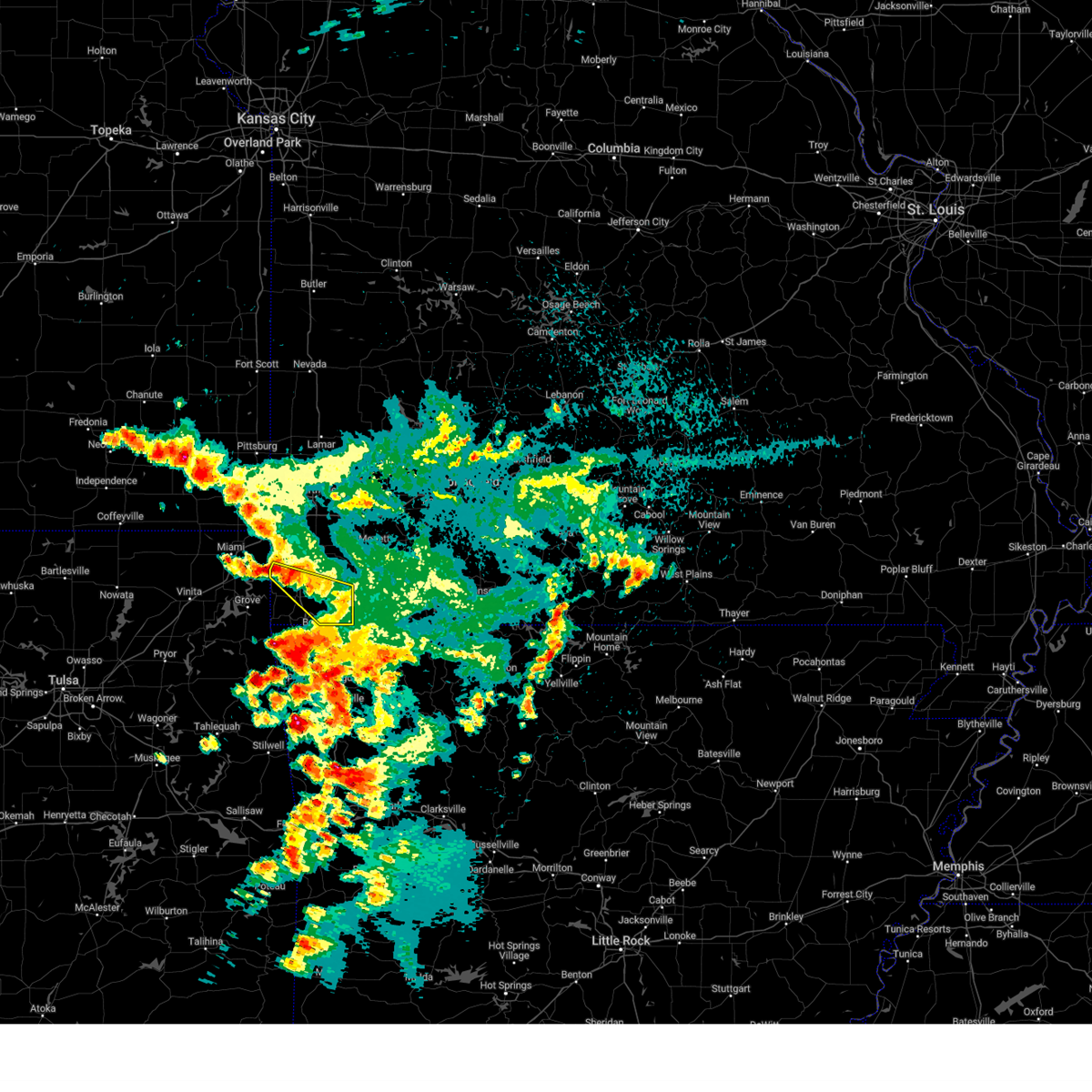 At 436 am cdt, a severe thunderstorm was located near seneca, or 11 miles southwest of neosho, moving southeast at 45 mph (public). Hazards include 60 mph wind gusts and quarter size hail. Hail damage to vehicles is expected. Expect wind damage to roofs, siding, and trees. At 436 am cdt, a severe thunderstorm was located near seneca, or 11 miles southwest of neosho, moving southeast at 45 mph (public). Hazards include 60 mph wind gusts and quarter size hail. Hail damage to vehicles is expected. Expect wind damage to roofs, siding, and trees.
|
| 8/13/2023 9:40 PM CDT |
 At 939 pm cdt, a severe thunderstorm was located 8 miles east of purdy, or 10 miles south of aurora, moving east at 30 mph. this replaces the previous severe thunderstorm warnings expiring at 945 pm cdt (radar indicated). Hazards include 60 mph wind gusts and quarter size hail. Hail damage to vehicles is expected. Expect wind damage to roofs, siding, and trees. At 939 pm cdt, a severe thunderstorm was located 8 miles east of purdy, or 10 miles south of aurora, moving east at 30 mph. this replaces the previous severe thunderstorm warnings expiring at 945 pm cdt (radar indicated). Hazards include 60 mph wind gusts and quarter size hail. Hail damage to vehicles is expected. Expect wind damage to roofs, siding, and trees.
|
| 8/13/2023 9:30 PM CDT |
 At 930 pm cdt, a severe thunderstorm was located 7 miles northeast of seneca, or 7 miles northwest of neosho, moving east at 25 mph (radar indicated). Hazards include 60 mph wind gusts and quarter size hail. Hail damage to vehicles is expected. expect wind damage to roofs, siding, and trees. locations impacted include, neosho, seneca, granby, diamond, loma linda and racine. this includes the following highways, interstate 44 near mile marker 0. interstate 49 between mile markers 19 and 32. hail threat, radar indicated max hail size, 1. 00 in wind threat, radar indicated max wind gust, 60 mph. At 930 pm cdt, a severe thunderstorm was located 7 miles northeast of seneca, or 7 miles northwest of neosho, moving east at 25 mph (radar indicated). Hazards include 60 mph wind gusts and quarter size hail. Hail damage to vehicles is expected. expect wind damage to roofs, siding, and trees. locations impacted include, neosho, seneca, granby, diamond, loma linda and racine. this includes the following highways, interstate 44 near mile marker 0. interstate 49 between mile markers 19 and 32. hail threat, radar indicated max hail size, 1. 00 in wind threat, radar indicated max wind gust, 60 mph.
|
| 8/13/2023 9:15 PM CDT |
 At 914 pm cdt, a severe thunderstorm was located west of miami, oklahoma, or 10 miles southeast of baxter springs, moving east at 25 mph (radar indicated). Hazards include golf ball size hail and 60 mph wind gusts. People and animals outdoors will be injured. expect hail damage to roofs, siding, windows, and vehicles. Expect wind damage to roofs, siding, and trees. At 914 pm cdt, a severe thunderstorm was located west of miami, oklahoma, or 10 miles southeast of baxter springs, moving east at 25 mph (radar indicated). Hazards include golf ball size hail and 60 mph wind gusts. People and animals outdoors will be injured. expect hail damage to roofs, siding, windows, and vehicles. Expect wind damage to roofs, siding, and trees.
|
| 8/13/2023 9:01 PM CDT |
 At 900 pm cdt, a severe thunderstorm was located near neosho, moving northeast at 25 mph (radar indicated). Hazards include 60 mph wind gusts and quarter size hail. Hail damage to vehicles is expected. Expect wind damage to roofs, siding, and trees. At 900 pm cdt, a severe thunderstorm was located near neosho, moving northeast at 25 mph (radar indicated). Hazards include 60 mph wind gusts and quarter size hail. Hail damage to vehicles is expected. Expect wind damage to roofs, siding, and trees.
|
| 8/13/2023 8:51 PM CDT | Quarter sized hail reported 5.4 miles ESE of Neosho, MO, quarter sized hail reported west of neosho along highway 86 in newton county. |
| 7/30/2023 11:06 PM CDT |
 At 1105 pm cdt, severe thunderstorms were located along a line extending from near aurora to near wheaton to near anderson, moving east at 55 mph (public). Hazards include 70 mph wind gusts. Expect considerable tree damage. damage is likely to mobile homes, roofs, and outbuildings. locations impacted include, joplin, carthage, neosho, webb city, monett, aurora, mount vernon, marionville, granby, carterville, duquesne, sarcoxie, pierce city, duenweg, diamond, loma linda, miller, airport drive, leawood and silver creek. this includes the following highways, interstate 44 between mile markers 4 and 58. interstate 49 between mile markers 19 and 39. thunderstorm damage threat, considerable hail threat, radar indicated max hail size, <. 75 in wind threat, radar indicated max wind gust, 70 mph. At 1105 pm cdt, severe thunderstorms were located along a line extending from near aurora to near wheaton to near anderson, moving east at 55 mph (public). Hazards include 70 mph wind gusts. Expect considerable tree damage. damage is likely to mobile homes, roofs, and outbuildings. locations impacted include, joplin, carthage, neosho, webb city, monett, aurora, mount vernon, marionville, granby, carterville, duquesne, sarcoxie, pierce city, duenweg, diamond, loma linda, miller, airport drive, leawood and silver creek. this includes the following highways, interstate 44 between mile markers 4 and 58. interstate 49 between mile markers 19 and 39. thunderstorm damage threat, considerable hail threat, radar indicated max hail size, <. 75 in wind threat, radar indicated max wind gust, 70 mph.
|
| 7/30/2023 10:57 PM CDT |
 At 1057 pm cdt, severe thunderstorms were located along a line extending from near everton to 8 miles northwest of billings to near mount vernon to diamond, moving east at 45 mph (emergency management). Hazards include 70 mph wind gusts. Expect considerable tree damage. Damage is likely to mobile homes, roofs, and outbuildings. At 1057 pm cdt, severe thunderstorms were located along a line extending from near everton to 8 miles northwest of billings to near mount vernon to diamond, moving east at 45 mph (emergency management). Hazards include 70 mph wind gusts. Expect considerable tree damage. Damage is likely to mobile homes, roofs, and outbuildings.
|
| 7/30/2023 10:46 PM CDT |
 At 1046 pm cdt, severe thunderstorms were located along a line extending from near mount vernon to 6 miles west of pierce city to near seneca, moving southeast at 55 mph (public). Hazards include 70 mph wind gusts. Expect considerable tree damage. damage is likely to mobile homes, roofs, and outbuildings. locations impacted include, joplin, carthage, neosho, webb city, stockton lake, stockton state park, monett, aurora, carl junction, mount vernon, galena, oronogo, seneca, marionville, granby, carterville, stockton, duquesne, greenfield and sarcoxie. this includes the following highways, interstate 44 between mile markers 0 and 58. interstate 49 between mile markers 15 and 60. thunderstorm damage threat, considerable hail threat, radar indicated max hail size, <. 75 in wind threat, radar indicated max wind gust, 70 mph. At 1046 pm cdt, severe thunderstorms were located along a line extending from near mount vernon to 6 miles west of pierce city to near seneca, moving southeast at 55 mph (public). Hazards include 70 mph wind gusts. Expect considerable tree damage. damage is likely to mobile homes, roofs, and outbuildings. locations impacted include, joplin, carthage, neosho, webb city, stockton lake, stockton state park, monett, aurora, carl junction, mount vernon, galena, oronogo, seneca, marionville, granby, carterville, stockton, duquesne, greenfield and sarcoxie. this includes the following highways, interstate 44 between mile markers 0 and 58. interstate 49 between mile markers 15 and 60. thunderstorm damage threat, considerable hail threat, radar indicated max hail size, <. 75 in wind threat, radar indicated max wind gust, 70 mph.
|
| 7/30/2023 10:08 PM CDT |
 At 1007 pm cdt, severe thunderstorms were located along a line extending from 8 miles northeast of lamar to 8 miles northwest of jasper to near west mineral, moving southeast at 55 mph. these are destructive storms for northern barton county and western cedar (radar indicated). Hazards include 80 mph wind gusts. Flying debris will be dangerous to those caught without shelter. mobile homes will be heavily damaged. expect considerable damage to roofs, windows, and vehicles. Extensive tree damage and power outages are likely. At 1007 pm cdt, severe thunderstorms were located along a line extending from 8 miles northeast of lamar to 8 miles northwest of jasper to near west mineral, moving southeast at 55 mph. these are destructive storms for northern barton county and western cedar (radar indicated). Hazards include 80 mph wind gusts. Flying debris will be dangerous to those caught without shelter. mobile homes will be heavily damaged. expect considerable damage to roofs, windows, and vehicles. Extensive tree damage and power outages are likely.
|
| 7/21/2023 8:21 AM CDT |
 At 821 am cdt, severe thunderstorms were located along a line extending from shoal creek drive to near neosho to near anderson, moving northeast at 45 mph (radar indicated). Hazards include 60 mph wind gusts. Expect damage to roofs, siding, and trees. severe thunderstorms will be near, southern joplin, leawood, silver creek and saginaw around 825 am cdt. granby and diamond around 835 am cdt. fairview around 845 am cdt. other locations impacted by these severe thunderstorms include big sugar creek state park, loma linda, newtonia, stella, redings mill, wentworth, stark city, grand falls plaza, shoal creek estates and ritchey. this includes the following highways, interstate 44 between mile markers 0 and 8. interstate 49 between mile markers 1 and 35. hail threat, radar indicated max hail size, <. 75 in wind threat, radar indicated max wind gust, 60 mph. At 821 am cdt, severe thunderstorms were located along a line extending from shoal creek drive to near neosho to near anderson, moving northeast at 45 mph (radar indicated). Hazards include 60 mph wind gusts. Expect damage to roofs, siding, and trees. severe thunderstorms will be near, southern joplin, leawood, silver creek and saginaw around 825 am cdt. granby and diamond around 835 am cdt. fairview around 845 am cdt. other locations impacted by these severe thunderstorms include big sugar creek state park, loma linda, newtonia, stella, redings mill, wentworth, stark city, grand falls plaza, shoal creek estates and ritchey. this includes the following highways, interstate 44 between mile markers 0 and 8. interstate 49 between mile markers 1 and 35. hail threat, radar indicated max hail size, <. 75 in wind threat, radar indicated max wind gust, 60 mph.
|
| 7/14/2023 7:15 PM CDT | Report from mping: 3-inch tree limbs broken; power poles broken. time based on rada in newton county MO, 0.6 miles SSW of Neosho, MO |
| 7/14/2023 7:13 PM CDT | Report from mping: 3-inch tree limbs broken; power poles broke in newton county MO, 1.3 miles SSW of Neosho, MO |
| 7/14/2023 6:49 PM CDT |
 At 649 pm cdt, severe thunderstorms were located along a line extending from purcell to joplin to near quapaw to near welch, moving southeast at 40 mph (trained weather spotters). Hazards include 60 mph wind gusts and quarter size hail. Hail damage to vehicles is expected. Expect wind damage to roofs, siding, and trees. At 649 pm cdt, severe thunderstorms were located along a line extending from purcell to joplin to near quapaw to near welch, moving southeast at 40 mph (trained weather spotters). Hazards include 60 mph wind gusts and quarter size hail. Hail damage to vehicles is expected. Expect wind damage to roofs, siding, and trees.
|
| 7/13/2023 1:35 AM CDT |
 The severe thunderstorm warning for newton, northwestern barry, southwestern lawrence and southeastern jasper counties will expire at 145 am cdt, the storms which prompted the warning have weakened below severe limits, and no longer pose an immediate threat to life or property. therefore, the warning will be allowed to expire. a severe thunderstorm watch remains in effect until 300 am cdt for southeastern kansas, and southwestern missouri. The severe thunderstorm warning for newton, northwestern barry, southwestern lawrence and southeastern jasper counties will expire at 145 am cdt, the storms which prompted the warning have weakened below severe limits, and no longer pose an immediate threat to life or property. therefore, the warning will be allowed to expire. a severe thunderstorm watch remains in effect until 300 am cdt for southeastern kansas, and southwestern missouri.
|
| 7/13/2023 1:18 AM CDT |
 At 117 am cdt, severe thunderstorms were located along a line extending from 8 miles north of sarcoxie to near diamond to picher, moving south at 35 mph (radar indicated). Hazards include 60 mph wind gusts and penny size hail. Expect damage to roofs, siding, and trees. locations impacted include, neosho, monett, seneca, granby, sarcoxie, pierce city, diamond, loma linda, fairview, fidelity, newtonia, pioneer, stella, wentworth, stark city, avilla, la russell, reeds, ritchey and racine. this includes the following highways, interstate 44 between mile markers 0 and 5, and between mile markers 18 and 36. interstate 49 between mile markers 16 and 32. hail threat, radar indicated max hail size, 0. 75 in wind threat, radar indicated max wind gust, 60 mph. At 117 am cdt, severe thunderstorms were located along a line extending from 8 miles north of sarcoxie to near diamond to picher, moving south at 35 mph (radar indicated). Hazards include 60 mph wind gusts and penny size hail. Expect damage to roofs, siding, and trees. locations impacted include, neosho, monett, seneca, granby, sarcoxie, pierce city, diamond, loma linda, fairview, fidelity, newtonia, pioneer, stella, wentworth, stark city, avilla, la russell, reeds, ritchey and racine. this includes the following highways, interstate 44 between mile markers 0 and 5, and between mile markers 18 and 36. interstate 49 between mile markers 16 and 32. hail threat, radar indicated max hail size, 0. 75 in wind threat, radar indicated max wind gust, 60 mph.
|
| 7/13/2023 12:58 AM CDT |
 At 1258 am cdt, severe thunderstorms were located along a line extending from 6 miles southwest of golden city to duenweg to near columbus, moving south at 35 mph (radar indicated). Hazards include 60 mph wind gusts and penny size hail. expect damage to roofs, siding, and trees At 1258 am cdt, severe thunderstorms were located along a line extending from 6 miles southwest of golden city to duenweg to near columbus, moving south at 35 mph (radar indicated). Hazards include 60 mph wind gusts and penny size hail. expect damage to roofs, siding, and trees
|
| 6/18/2023 2:51 AM CDT |
 At 249 am cdt, severe thunderstorms were located along a line extending from carthage to pierce city to 8 miles southwest of galena, moving northeast at 45 mph (trained weather spotters. these storms have a long history of producing damaging winds). Hazards include 70 mph wind gusts and nickel size hail. Expect considerable tree damage. damage is likely to mobile homes, roofs, and outbuildings. severe thunderstorms will be near, mount vernon around 305 am cdt. other locations impacted by these severe thunderstorms include table rock lake, roaring river state park, shell knob, butterfield, golden, carytown, fidelity, emerald beach, stotts city and newtonia. this includes the following highways, interstate 44 between mile markers 12 and 49. interstate 49 between mile markers 36 and 52. thunderstorm damage threat, considerable hail threat, radar indicated max hail size, 0. 88 in wind threat, observed max wind gust, 70 mph. At 249 am cdt, severe thunderstorms were located along a line extending from carthage to pierce city to 8 miles southwest of galena, moving northeast at 45 mph (trained weather spotters. these storms have a long history of producing damaging winds). Hazards include 70 mph wind gusts and nickel size hail. Expect considerable tree damage. damage is likely to mobile homes, roofs, and outbuildings. severe thunderstorms will be near, mount vernon around 305 am cdt. other locations impacted by these severe thunderstorms include table rock lake, roaring river state park, shell knob, butterfield, golden, carytown, fidelity, emerald beach, stotts city and newtonia. this includes the following highways, interstate 44 between mile markers 12 and 49. interstate 49 between mile markers 36 and 52. thunderstorm damage threat, considerable hail threat, radar indicated max hail size, 0. 88 in wind threat, observed max wind gust, 70 mph.
|
| 6/18/2023 2:37 AM CDT |
 At 235 am cdt, severe thunderstorms were located along a line extending from near diamond to near fairview to 11 miles northeast of beaver, moving northeast at 45 mph (trained weather spotters. these storms have a long history of producing damaging winds). Hazards include 70 mph wind gusts and nickel size hail. Expect considerable tree damage. damage is likely to mobile homes, roofs, and outbuildings. these severe storms will be near, duenweg around 240 am cdt. carterville and pierce city around 245 am cdt. monett around 250 am cdt. carthage around 255 am cdt. mount vernon around 305 am cdt. other locations impacted by these severe thunderstorms include table rock lake, roaring river state park, big sugar creek state park, shell knob, butterfield, golden, carytown, fidelity, emerald beach and stotts city. this includes the following highways, interstate 44 between mile markers 12 and 49. interstate 49 between mile markers 10 and 15, and between mile markers 36 and 52. thunderstorm damage threat, considerable hail threat, radar indicated max hail size, 0. 88 in wind threat, observed max wind gust, 70 mph. At 235 am cdt, severe thunderstorms were located along a line extending from near diamond to near fairview to 11 miles northeast of beaver, moving northeast at 45 mph (trained weather spotters. these storms have a long history of producing damaging winds). Hazards include 70 mph wind gusts and nickel size hail. Expect considerable tree damage. damage is likely to mobile homes, roofs, and outbuildings. these severe storms will be near, duenweg around 240 am cdt. carterville and pierce city around 245 am cdt. monett around 250 am cdt. carthage around 255 am cdt. mount vernon around 305 am cdt. other locations impacted by these severe thunderstorms include table rock lake, roaring river state park, big sugar creek state park, shell knob, butterfield, golden, carytown, fidelity, emerald beach and stotts city. this includes the following highways, interstate 44 between mile markers 12 and 49. interstate 49 between mile markers 10 and 15, and between mile markers 36 and 52. thunderstorm damage threat, considerable hail threat, radar indicated max hail size, 0. 88 in wind threat, observed max wind gust, 70 mph.
|
| 6/18/2023 2:22 AM CDT | Storm damage reported in newton county MO, 1.5 miles SW of Neosho, MO |
| 6/18/2023 2:11 AM CDT |
 At 211 am cdt, severe thunderstorms were located along a line extending from west mineral to treece to seneca, moving northeast at 45 mph (radar indicated). Hazards include 60 mph wind gusts and nickel size hail. Expect damage to roofs, siding, and trees. these severe storms will be near, scammon and west mineral around 215 am cdt. galena, cherokee and weir around 220 am cdt. columbus around 225 am cdt. pittsburg and shoal creek drive around 230 am cdt. joplin, carl junction, duquesne, leawood, silver creek and saginaw around 235 am cdt. oronogo and duenweg around 240 am cdt. carterville around 245 am cdt. other locations impacted by these severe thunderstorms include loma linda, airport drive, lowell, sherman, chicopee, asbury, redings mill, grand falls plaza, shoal creek estates and waco. this includes the following highways, interstate 44 between mile markers 0 and 13. interstate 49 between mile markers 16 and 35. hail threat, radar indicated max hail size, 0. 88 in wind threat, radar indicated max wind gust, 60 mph. At 211 am cdt, severe thunderstorms were located along a line extending from west mineral to treece to seneca, moving northeast at 45 mph (radar indicated). Hazards include 60 mph wind gusts and nickel size hail. Expect damage to roofs, siding, and trees. these severe storms will be near, scammon and west mineral around 215 am cdt. galena, cherokee and weir around 220 am cdt. columbus around 225 am cdt. pittsburg and shoal creek drive around 230 am cdt. joplin, carl junction, duquesne, leawood, silver creek and saginaw around 235 am cdt. oronogo and duenweg around 240 am cdt. carterville around 245 am cdt. other locations impacted by these severe thunderstorms include loma linda, airport drive, lowell, sherman, chicopee, asbury, redings mill, grand falls plaza, shoal creek estates and waco. this includes the following highways, interstate 44 between mile markers 0 and 13. interstate 49 between mile markers 16 and 35. hail threat, radar indicated max hail size, 0. 88 in wind threat, radar indicated max wind gust, 60 mph.
|
| 6/18/2023 2:06 AM CDT |
 At 204 am cdt, severe thunderstorms were located along a line extending from 6 miles west of goodman to 7 miles north of bella vista to near garfield, moving northeast at 45 mph (trained weather spotters. this line of storms has produced significant wind damage across northeastern oklahoma and southwestern portions of mcdonald county). Hazards include 70 mph wind gusts and nickel size hail. Expect considerable tree damage. damage is likely to mobile homes, roofs, and outbuildings. severe thunderstorms will be near, goodman around 210 am cdt. neosho around 215 am cdt. seligman around 220 am cdt. wheaton around 225 am cdt. cassville, granby and fairview around 230 am cdt. diamond around 235 am cdt. duenweg around 240 am cdt. carterville and pierce city around 245 am cdt. other locations impacted by these severe thunderstorms include table rock lake, roaring river state park, big sugar creek state park, dodge, shell knob, butterfield, golden, carytown, fidelity and emerald beach. this includes the following highways, interstate 44 between mile markers 12 and 49. interstate 49 between mile markers 1 and 15, and between mile markers 36 and 52. thunderstorm damage threat, considerable hail threat, radar indicated max hail size, 0. 88 in wind threat, observed max wind gust, 70 mph. At 204 am cdt, severe thunderstorms were located along a line extending from 6 miles west of goodman to 7 miles north of bella vista to near garfield, moving northeast at 45 mph (trained weather spotters. this line of storms has produced significant wind damage across northeastern oklahoma and southwestern portions of mcdonald county). Hazards include 70 mph wind gusts and nickel size hail. Expect considerable tree damage. damage is likely to mobile homes, roofs, and outbuildings. severe thunderstorms will be near, goodman around 210 am cdt. neosho around 215 am cdt. seligman around 220 am cdt. wheaton around 225 am cdt. cassville, granby and fairview around 230 am cdt. diamond around 235 am cdt. duenweg around 240 am cdt. carterville and pierce city around 245 am cdt. other locations impacted by these severe thunderstorms include table rock lake, roaring river state park, big sugar creek state park, dodge, shell knob, butterfield, golden, carytown, fidelity and emerald beach. this includes the following highways, interstate 44 between mile markers 12 and 49. interstate 49 between mile markers 1 and 15, and between mile markers 36 and 52. thunderstorm damage threat, considerable hail threat, radar indicated max hail size, 0. 88 in wind threat, observed max wind gust, 70 mph.
|
| 6/18/2023 1:50 AM CDT |
 At 150 am cdt, severe thunderstorms were located along a line extending from near oswego to near narcissa to near grove, moving northeast at 45 mph (radar indicated). Hazards include 60 mph wind gusts and nickel size hail. Expect damage to roofs, siding, and trees. severe thunderstorms will be near, seneca, mccune, west mineral and treece around 210 am cdt. baxter springs and scammon around 215 am cdt. columbus, galena, cherokee and weir around 220 am cdt. pittsburg and shoal creek drive around 230 am cdt. joplin, carl junction, duquesne, leawood, silver creek and saginaw around 235 am cdt. webb city, oronogo and duenweg around 240 am cdt. carterville around 245 am cdt. other locations impacted by these severe thunderstorms include loma linda, airport drive, lowell, sherman, chicopee, asbury, redings mill, grand falls plaza, shoal creek estates and waco. this includes the following highways, interstate 44 between mile markers 0 and 13. interstate 49 between mile markers 16 and 35. hail threat, radar indicated max hail size, 0. 88 in wind threat, radar indicated max wind gust, 60 mph. At 150 am cdt, severe thunderstorms were located along a line extending from near oswego to near narcissa to near grove, moving northeast at 45 mph (radar indicated). Hazards include 60 mph wind gusts and nickel size hail. Expect damage to roofs, siding, and trees. severe thunderstorms will be near, seneca, mccune, west mineral and treece around 210 am cdt. baxter springs and scammon around 215 am cdt. columbus, galena, cherokee and weir around 220 am cdt. pittsburg and shoal creek drive around 230 am cdt. joplin, carl junction, duquesne, leawood, silver creek and saginaw around 235 am cdt. webb city, oronogo and duenweg around 240 am cdt. carterville around 245 am cdt. other locations impacted by these severe thunderstorms include loma linda, airport drive, lowell, sherman, chicopee, asbury, redings mill, grand falls plaza, shoal creek estates and waco. this includes the following highways, interstate 44 between mile markers 0 and 13. interstate 49 between mile markers 16 and 35. hail threat, radar indicated max hail size, 0. 88 in wind threat, radar indicated max wind gust, 60 mph.
|
| 5/9/2023 7:29 PM CDT |
 At 729 pm cdt, severe thunderstorms were located along a line extending from near lowry city to 6 miles south of stockton to near sarcoxie to near seneca, moving southeast at 35 mph (radar indicated). Hazards include 60 mph wind gusts and quarter size hail. Hail damage to vehicles is expected. Expect wind damage to roofs, siding, and trees. At 729 pm cdt, severe thunderstorms were located along a line extending from near lowry city to 6 miles south of stockton to near sarcoxie to near seneca, moving southeast at 35 mph (radar indicated). Hazards include 60 mph wind gusts and quarter size hail. Hail damage to vehicles is expected. Expect wind damage to roofs, siding, and trees.
|
| 4/5/2023 5:07 AM CDT |
 The severe thunderstorm warning for eastern newton county will expire at 515 am cdt, the storm which prompted the warning has moved out of the area. therefore, the warning will be allowed to expire. a severe thunderstorm watch remains in effect until 1000 am cdt for southwestern missouri. to report severe weather, contact your nearest law enforcement agency. they will relay your report to the national weather service springfield. The severe thunderstorm warning for eastern newton county will expire at 515 am cdt, the storm which prompted the warning has moved out of the area. therefore, the warning will be allowed to expire. a severe thunderstorm watch remains in effect until 1000 am cdt for southwestern missouri. to report severe weather, contact your nearest law enforcement agency. they will relay your report to the national weather service springfield.
|
| 4/5/2023 4:57 AM CDT |
 At 457 am cdt, a severe thunderstorm was located near sarcoxie, or 9 miles southeast of carthage, moving northeast at 65 mph (radar indicated). Hazards include 60 mph wind gusts and quarter size hail. Hail damage to vehicles is expected. expect wind damage to roofs, siding, and trees. locations impacted include, neosho, granby, diamond, newtonia, wentworth, stark city and ritchey. this includes interstate 49 between mile markers 15 and 19. hail threat, radar indicated max hail size, 1. 00 in wind threat, radar indicated max wind gust, 60 mph. At 457 am cdt, a severe thunderstorm was located near sarcoxie, or 9 miles southeast of carthage, moving northeast at 65 mph (radar indicated). Hazards include 60 mph wind gusts and quarter size hail. Hail damage to vehicles is expected. expect wind damage to roofs, siding, and trees. locations impacted include, neosho, granby, diamond, newtonia, wentworth, stark city and ritchey. this includes interstate 49 between mile markers 15 and 19. hail threat, radar indicated max hail size, 1. 00 in wind threat, radar indicated max wind gust, 60 mph.
|
| 4/5/2023 4:54 AM CDT |
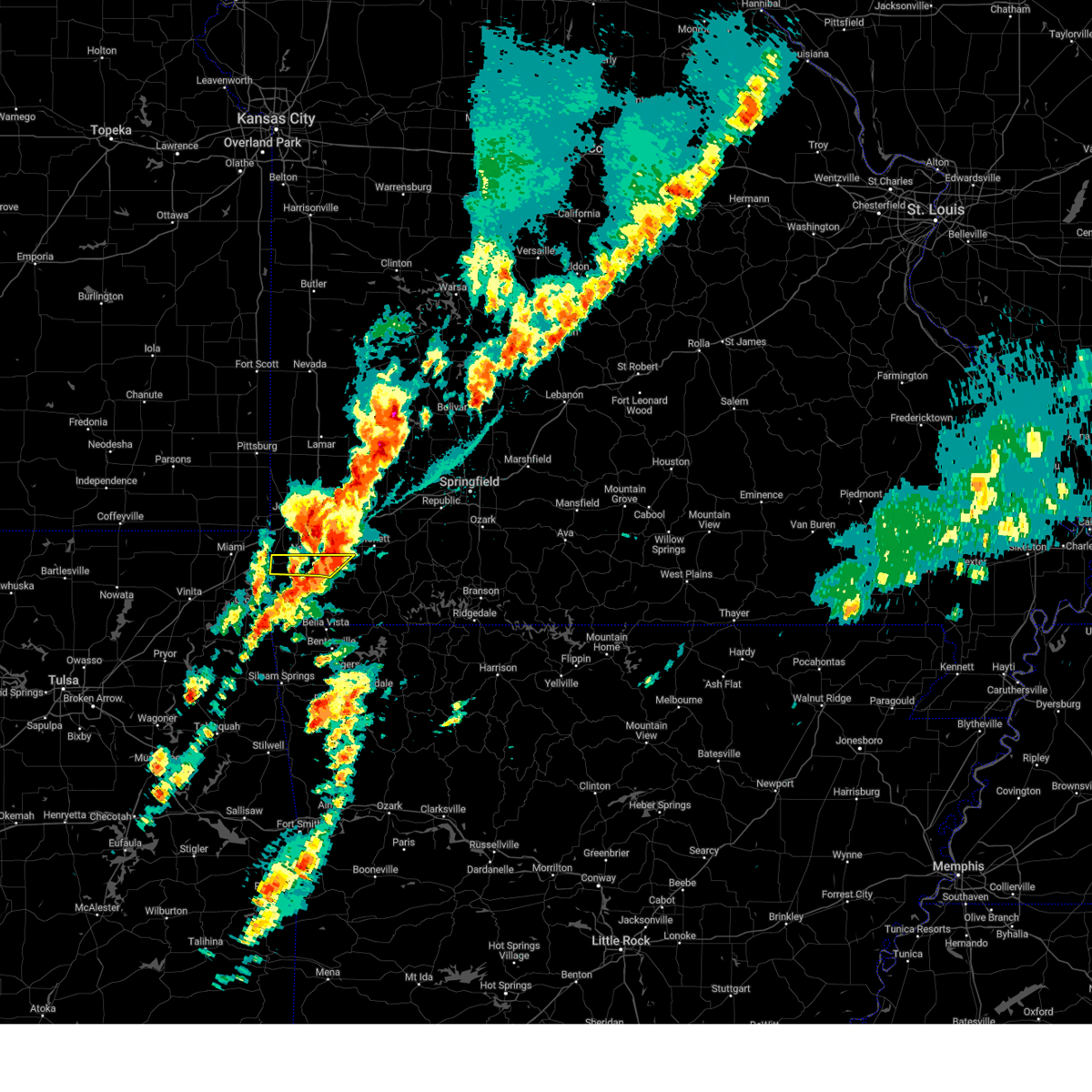 At 453 am cdt, a severe thunderstorm was located near granby, or 13 miles northeast of neosho, moving northeast at 60 mph (radar indicated). Hazards include 60 mph wind gusts and quarter size hail. Hail damage to vehicles is expected. expect wind damage to roofs, siding, and trees. locations impacted include, neosho, seneca and stark city. this includes interstate 49 between mile markers 16 and 22. hail threat, radar indicated max hail size, 1. 00 in wind threat, radar indicated max wind gust, 60 mph. At 453 am cdt, a severe thunderstorm was located near granby, or 13 miles northeast of neosho, moving northeast at 60 mph (radar indicated). Hazards include 60 mph wind gusts and quarter size hail. Hail damage to vehicles is expected. expect wind damage to roofs, siding, and trees. locations impacted include, neosho, seneca and stark city. this includes interstate 49 between mile markers 16 and 22. hail threat, radar indicated max hail size, 1. 00 in wind threat, radar indicated max wind gust, 60 mph.
|
| 4/5/2023 4:39 AM CDT |
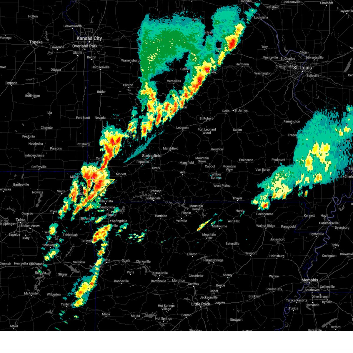 At 438 am cdt, a severe thunderstorm was located near neosho, moving northeast at 55 mph (radar indicated). Hazards include 70 mph wind gusts and half dollar size hail. Hail damage to vehicles is expected. expect considerable tree damage. wind damage is also likely to mobile homes, roofs, and outbuildings. locations impacted include, neosho, seneca, anderson, noel, dodge, goodman, south west city, lanagan, stella, cayuga, stark city and tiff city. this includes interstate 49 between mile markers 4 and 22. thunderstorm damage threat, considerable hail threat, radar indicated max hail size, 1. 25 in wind threat, radar indicated max wind gust, 70 mph. At 438 am cdt, a severe thunderstorm was located near neosho, moving northeast at 55 mph (radar indicated). Hazards include 70 mph wind gusts and half dollar size hail. Hail damage to vehicles is expected. expect considerable tree damage. wind damage is also likely to mobile homes, roofs, and outbuildings. locations impacted include, neosho, seneca, anderson, noel, dodge, goodman, south west city, lanagan, stella, cayuga, stark city and tiff city. this includes interstate 49 between mile markers 4 and 22. thunderstorm damage threat, considerable hail threat, radar indicated max hail size, 1. 25 in wind threat, radar indicated max wind gust, 70 mph.
|
| 4/5/2023 4:36 AM CDT | Quarter sized hail reported 2.9 miles N of Neosho, MO |
| 4/5/2023 4:30 AM CDT |
 At 430 am cdt, a severe thunderstorm was located near wyandotte, or 10 miles east of miami, moving northeast at 60 mph (radar indicated). Hazards include 60 mph wind gusts and half dollar size hail. Hail damage to vehicles is expected. Expect wind damage to roofs, siding, and trees. At 430 am cdt, a severe thunderstorm was located near wyandotte, or 10 miles east of miami, moving northeast at 60 mph (radar indicated). Hazards include 60 mph wind gusts and half dollar size hail. Hail damage to vehicles is expected. Expect wind damage to roofs, siding, and trees.
|
| 4/5/2023 4:17 AM CDT |
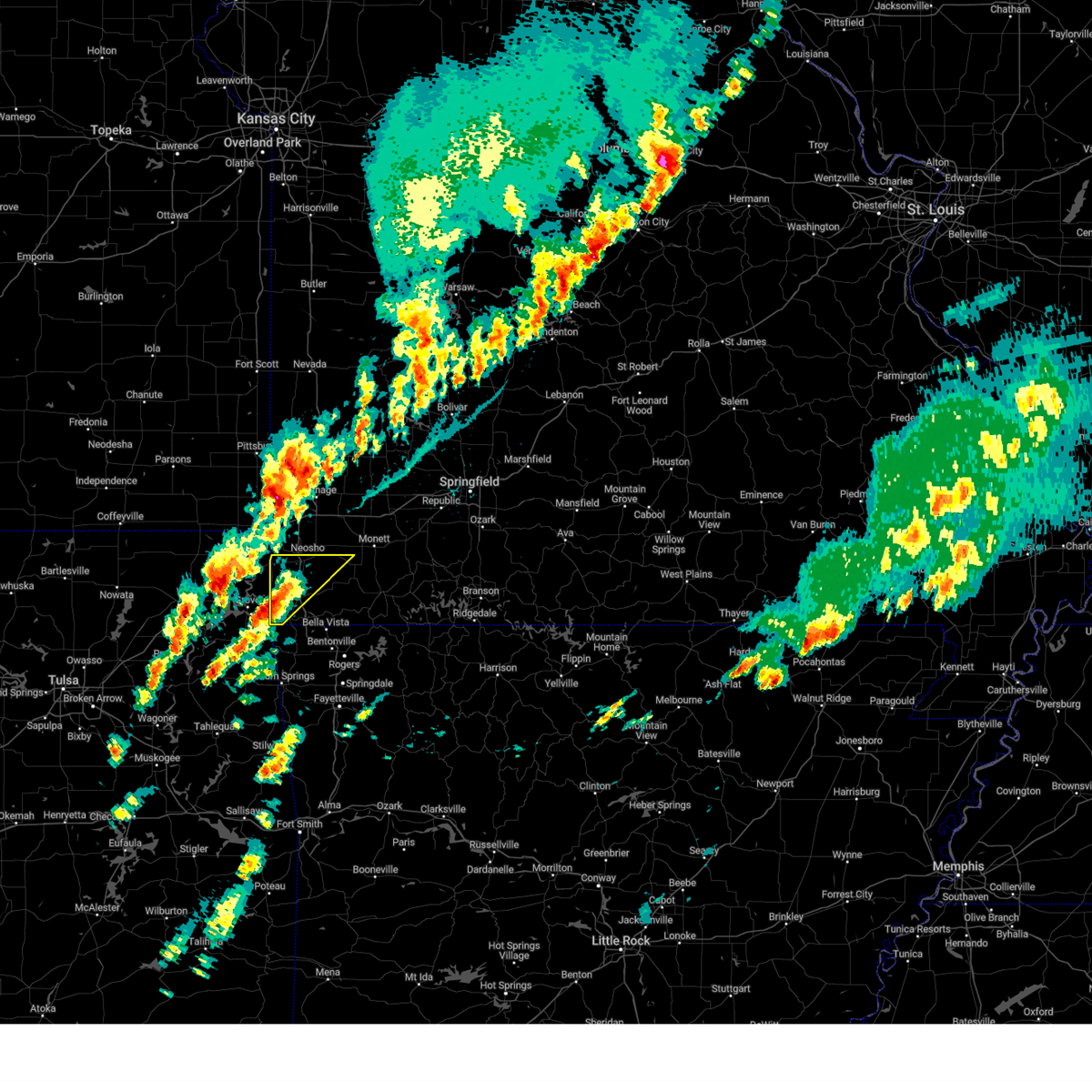 At 417 am cdt, a severe thunderstorm was located near south west city, or 13 miles west of pineville, moving northeast at 55 mph (radar indicated). Hazards include 60 mph wind gusts and quarter size hail. Hail damage to vehicles is expected. Expect wind damage to roofs, siding, and trees. At 417 am cdt, a severe thunderstorm was located near south west city, or 13 miles west of pineville, moving northeast at 55 mph (radar indicated). Hazards include 60 mph wind gusts and quarter size hail. Hail damage to vehicles is expected. Expect wind damage to roofs, siding, and trees.
|
| 2/27/2023 12:59 AM CST | Significant damage to a barn and other farm outbuildings... along with a power outage to the area ... on poppy drive between kodiak road and jaguar road in rural neosho in newton county MO, 4.1 miles NNE of Neosho, MO |
| 2/27/2023 12:46 AM CST |
 At 1246 am cst, severe thunderstorms were located along a line extending from 7 miles southeast of weir to 7 miles south of saginaw to springtown, moving northeast at 65 mph (radar indicated). Hazards include 60 mph wind gusts. Expect damage to roofs, siding, and trees. locations impacted include, joplin, carthage, neosho, webb city, big sugar creek state park, carl junction, galena, oronogo, seneca, granby, anderson, carterville, noel, duquesne, dodge, sarcoxie, goodman, duenweg, south west city and diamond. this includes the following highways, interstate 44 between mile markers 0 and 31. interstate 49 between mile markers 1 and 46. hail threat, radar indicated max hail size, <. 75 in wind threat, radar indicated max wind gust, 60 mph. At 1246 am cst, severe thunderstorms were located along a line extending from 7 miles southeast of weir to 7 miles south of saginaw to springtown, moving northeast at 65 mph (radar indicated). Hazards include 60 mph wind gusts. Expect damage to roofs, siding, and trees. locations impacted include, joplin, carthage, neosho, webb city, big sugar creek state park, carl junction, galena, oronogo, seneca, granby, anderson, carterville, noel, duquesne, dodge, sarcoxie, goodman, duenweg, south west city and diamond. this includes the following highways, interstate 44 between mile markers 0 and 31. interstate 49 between mile markers 1 and 46. hail threat, radar indicated max hail size, <. 75 in wind threat, radar indicated max wind gust, 60 mph.
|
| 2/27/2023 12:18 AM CST |
 At 1218 am cst, severe thunderstorms were located along a line extending from near chetopa to near bernice state park to near proctor, moving northeast at 60 mph (radar indicated). Hazards include 60 mph wind gusts. expect damage to roofs, siding, and trees At 1218 am cst, severe thunderstorms were located along a line extending from near chetopa to near bernice state park to near proctor, moving northeast at 60 mph (radar indicated). Hazards include 60 mph wind gusts. expect damage to roofs, siding, and trees
|
| 8/8/2022 6:10 PM CDT | Trained spotter reported 60 mph wind gust near mile marker 3 in newton county MO, 4.4 miles SSE of Neosho, MO |
| 8/8/2022 5:54 PM CDT |
 At 554 pm cdt, a severe thunderstorm was located near seneca, or 8 miles northwest of neosho, moving east at 15 mph (radar indicated). Hazards include 60 mph wind gusts and nickel size hail. expect damage to roofs, siding, and trees At 554 pm cdt, a severe thunderstorm was located near seneca, or 8 miles northwest of neosho, moving east at 15 mph (radar indicated). Hazards include 60 mph wind gusts and nickel size hail. expect damage to roofs, siding, and trees
|
| 8/8/2022 5:53 PM CDT |
 At 553 pm cdt, a severe thunderstorm was located near sarcoxie, or 7 miles southeast of carthage, moving southwest at 15 mph (radar indicated). Hazards include 60 mph wind gusts and nickel size hail. expect damage to roofs, siding, and trees At 553 pm cdt, a severe thunderstorm was located near sarcoxie, or 7 miles southeast of carthage, moving southwest at 15 mph (radar indicated). Hazards include 60 mph wind gusts and nickel size hail. expect damage to roofs, siding, and trees
|
| 5/18/2022 2:32 AM CDT |
 At 232 am cdt, severe thunderstorm outflow winds were located along a line extending from 7 miles south of golden city to near carthage to near quapaw, moving southeast at 40 mph (radar indicated). Hazards include 60 mph wind gusts. expect damage to roofs, siding, and trees At 232 am cdt, severe thunderstorm outflow winds were located along a line extending from 7 miles south of golden city to near carthage to near quapaw, moving southeast at 40 mph (radar indicated). Hazards include 60 mph wind gusts. expect damage to roofs, siding, and trees
|
| 4/11/2022 12:10 PM CDT |
 At 1209 pm cdt, a severe thunderstorm was located over wyandotte, or 10 miles east of miami, moving northeast at 60 mph (radar indicated). Hazards include 60 mph wind gusts and quarter size hail. Hail damage to vehicles is expected. Expect wind damage to roofs, siding, and trees. At 1209 pm cdt, a severe thunderstorm was located over wyandotte, or 10 miles east of miami, moving northeast at 60 mph (radar indicated). Hazards include 60 mph wind gusts and quarter size hail. Hail damage to vehicles is expected. Expect wind damage to roofs, siding, and trees.
|
| 4/11/2022 1:37 AM CDT |
 At 136 am cdt, severe thunderstorms were located along a line extending from leawood to near goodman to near anderson to near south west city, moving east at 55 mph (radar indicated. 50 mph winds have been reported near tiff city at 130 am). Hazards include 60 mph wind gusts and quarter size hail. Hail damage to vehicles is expected. expect wind damage to roofs, siding, and trees. locations impacted include, southern joplin, neosho, big sugar creek state park, seneca, granby, anderson, noel, duquesne, dodge, goodman, south west city, diamond, pineville, loma linda, wheaton, leawood, silver creek, lanagan, fairview, shoal creek drive, this includes the following highways, interstate 44 between mile markers 0 and 9. interstate 49 between mile markers 1 and 35. hail threat, radar indicated max hail size, 1. 00 in wind threat, radar indicated max wind gust, 60 mph. At 136 am cdt, severe thunderstorms were located along a line extending from leawood to near goodman to near anderson to near south west city, moving east at 55 mph (radar indicated. 50 mph winds have been reported near tiff city at 130 am). Hazards include 60 mph wind gusts and quarter size hail. Hail damage to vehicles is expected. expect wind damage to roofs, siding, and trees. locations impacted include, southern joplin, neosho, big sugar creek state park, seneca, granby, anderson, noel, duquesne, dodge, goodman, south west city, diamond, pineville, loma linda, wheaton, leawood, silver creek, lanagan, fairview, shoal creek drive, this includes the following highways, interstate 44 between mile markers 0 and 9. interstate 49 between mile markers 1 and 35. hail threat, radar indicated max hail size, 1. 00 in wind threat, radar indicated max wind gust, 60 mph.
|
| 4/11/2022 1:19 AM CDT |
 At 118 am cdt, severe thunderstorms were located along a line extending from quapaw to wyandotte to near fairland to cleora, moving east at 50 mph (radar indicated). Hazards include 60 mph wind gusts and quarter size hail. Hail damage to vehicles is expected. Expect wind damage to roofs, siding, and trees. At 118 am cdt, severe thunderstorms were located along a line extending from quapaw to wyandotte to near fairland to cleora, moving east at 50 mph (radar indicated). Hazards include 60 mph wind gusts and quarter size hail. Hail damage to vehicles is expected. Expect wind damage to roofs, siding, and trees.
|
| 10/11/2021 1:39 AM CDT |
 The tornado warning for central newton county will expire at 145 am cdt, the storm which prompted the warning has moved out of the area. therefore, the warning will be allowed to expire. a tornado watch remains in effect until 200 am cdt for southwestern missouri. to report severe weather, contact your nearest law enforcement agency. they will relay your report to the national weather service springfield. The tornado warning for central newton county will expire at 145 am cdt, the storm which prompted the warning has moved out of the area. therefore, the warning will be allowed to expire. a tornado watch remains in effect until 200 am cdt for southwestern missouri. to report severe weather, contact your nearest law enforcement agency. they will relay your report to the national weather service springfield.
|
| 10/11/2021 1:27 AM CDT |
 At 126 am cdt, a confirmed tornado was located near diamond, or near neosho, moving north at 30 mph (radar confirmed tornado). Hazards include damaging tornado. Flying debris will be dangerous to those caught without shelter. mobile homes will be damaged or destroyed. damage to roofs, windows, and vehicles will occur. tree damage is likely. Locations impacted include, neosho, diamond, this includes interstate 49 between mile markers 27 and 34. At 126 am cdt, a confirmed tornado was located near diamond, or near neosho, moving north at 30 mph (radar confirmed tornado). Hazards include damaging tornado. Flying debris will be dangerous to those caught without shelter. mobile homes will be damaged or destroyed. damage to roofs, windows, and vehicles will occur. tree damage is likely. Locations impacted include, neosho, diamond, this includes interstate 49 between mile markers 27 and 34.
|
| 10/11/2021 1:16 AM CDT |
 At 116 am cdt, a tornado producing storm was located over neosho, moving north at 30 mph (radar confirmed tornado). Hazards include damaging tornado. Flying debris will be dangerous to those caught without shelter. mobile homes will be damaged or destroyed. damage to roofs, windows, and vehicles will occur. Tree damage is likely. At 116 am cdt, a tornado producing storm was located over neosho, moving north at 30 mph (radar confirmed tornado). Hazards include damaging tornado. Flying debris will be dangerous to those caught without shelter. mobile homes will be damaged or destroyed. damage to roofs, windows, and vehicles will occur. Tree damage is likely.
|
| 10/11/2021 1:12 AM CDT |
 At 111 am cdt, severe thunderstorms were located along a line extending from 6 miles northwest of neosho to near goodman to near anderson, moving northeast at 35 mph (radar indicated). Hazards include 60 mph wind gusts. Expect damage to roofs, siding, and trees. locations impacted include, neosho, granby, goodman, newtonia, stella, stark city, ritchey, this includes interstate 49 between mile markers 11 and 26. hail threat, radar indicated max hail size, <. 75 in wind threat, radar indicated max wind gust, 60 mph. At 111 am cdt, severe thunderstorms were located along a line extending from 6 miles northwest of neosho to near goodman to near anderson, moving northeast at 35 mph (radar indicated). Hazards include 60 mph wind gusts. Expect damage to roofs, siding, and trees. locations impacted include, neosho, granby, goodman, newtonia, stella, stark city, ritchey, this includes interstate 49 between mile markers 11 and 26. hail threat, radar indicated max hail size, <. 75 in wind threat, radar indicated max wind gust, 60 mph.
|
| 10/11/2021 12:58 AM CDT |
 At 1257 am cdt, severe thunderstorms were located along a line extending from 6 miles southeast of seneca to near anderson to near noel, moving northeast at 40 mph (radar indicated). Hazards include 60 mph wind gusts. expect damage to roofs, siding, and trees At 1257 am cdt, severe thunderstorms were located along a line extending from 6 miles southeast of seneca to near anderson to near noel, moving northeast at 40 mph (radar indicated). Hazards include 60 mph wind gusts. expect damage to roofs, siding, and trees
|
| 9/20/2021 11:06 PM CDT |
 At 1106 pm cdt, a severe thunderstorm was located near goodman, or 7 miles southwest of neosho, moving southeast at 20 mph (radar indicated). Hazards include 60 mph wind gusts and nickel size hail. expect damage to roofs, siding, and trees At 1106 pm cdt, a severe thunderstorm was located near goodman, or 7 miles southwest of neosho, moving southeast at 20 mph (radar indicated). Hazards include 60 mph wind gusts and nickel size hail. expect damage to roofs, siding, and trees
|
| 9/20/2021 10:40 PM CDT | Tree/limb down in the roadway. state highway cc and norway road. time estimate in newton county MO, 7.5 miles E of Neosho, MO |
| 9/20/2021 10:30 PM CDT | Large tree branch broke off and struck a roof of a home near highway 86 and goldfinch road. time estimate in newton county MO, 5.9 miles ESE of Neosho, MO |
| 7/17/2021 8:06 PM CDT |
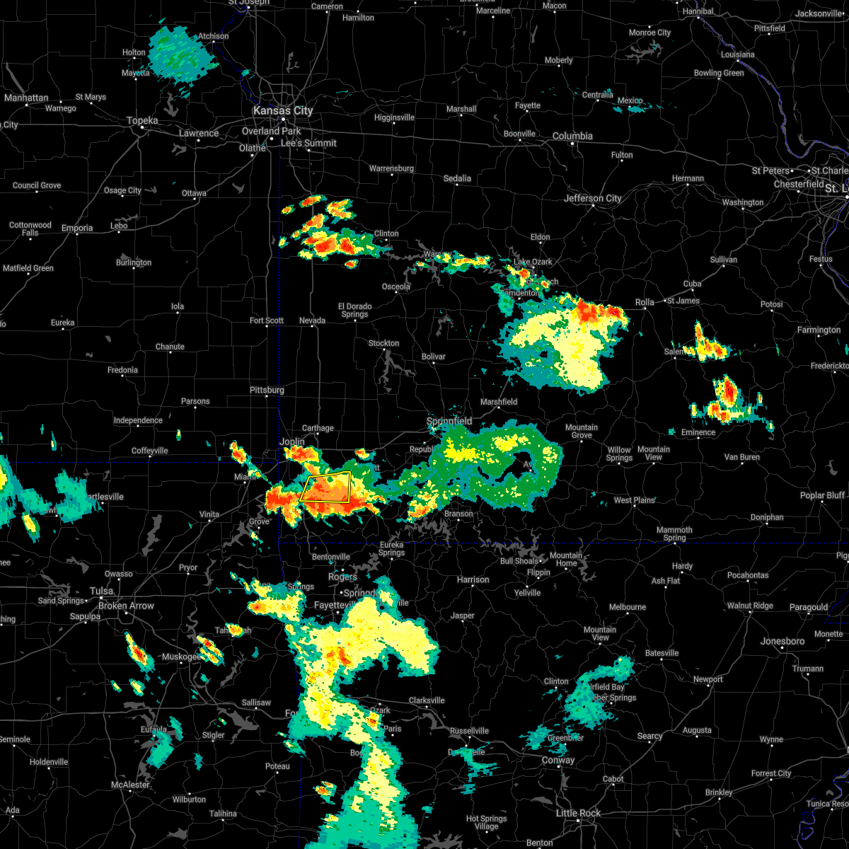 The severe thunderstorm warning for southeastern newton county will expire at 815 pm cdt, the storm which prompted the warning has weakened below severe limits, and no longer poses an immediate threat to life or property. therefore, the warning will be allowed to expire. however heavy rain is still possible with this thunderstorm. The severe thunderstorm warning for southeastern newton county will expire at 815 pm cdt, the storm which prompted the warning has weakened below severe limits, and no longer poses an immediate threat to life or property. therefore, the warning will be allowed to expire. however heavy rain is still possible with this thunderstorm.
|
| 7/17/2021 7:35 PM CDT | Via social media a report of a large event tent that was blown completely down. nobody was in the tent and nobody got hur in newton county MO, 5.9 miles WSW of Neosho, MO |
| 7/17/2021 7:23 PM CDT |
 At 723 pm cdt, a severe thunderstorm was located over neosho, moving south at 10 mph (radar indicated). Hazards include 60 mph wind gusts and quarter size hail. Hail damage to vehicles is expected. Expect wind damage to roofs, siding, and trees. At 723 pm cdt, a severe thunderstorm was located over neosho, moving south at 10 mph (radar indicated). Hazards include 60 mph wind gusts and quarter size hail. Hail damage to vehicles is expected. Expect wind damage to roofs, siding, and trees.
|
| 7/17/2021 7:15 PM CDT |
 At 715 pm cdt, a severe thunderstorm was located over granby, or 8 miles northeast of neosho, moving southwest at 5 mph (radar indicated). Hazards include 60 mph wind gusts and quarter size hail. Hail damage to vehicles is expected. Expect wind damage to roofs, siding, and trees. At 715 pm cdt, a severe thunderstorm was located over granby, or 8 miles northeast of neosho, moving southwest at 5 mph (radar indicated). Hazards include 60 mph wind gusts and quarter size hail. Hail damage to vehicles is expected. Expect wind damage to roofs, siding, and trees.
|
| 6/11/2021 8:44 PM CDT |
 At 844 pm cdt, severe thunderstorms were located along a line extending from near pierce city to near shoal creek drive, moving southeast at 30 mph (radar indicated). Hazards include 60 mph wind gusts and quarter size hail. Hail damage to vehicles is expected. expect wind damage to roofs, siding, and trees. locations impacted include, southern joplin, neosho, seneca, granby, diamond, loma linda, leawood, silver creek, fairview, shoal creek drive, saginaw, newtonia, stella, redings mill, stark city, grand falls plaza, shoal creek estates, ritchey, dennis acres, cliff village, this includes the following highways, interstate 44 between mile markers 1 and 7. Interstate 49 between mile markers 15 and 35. At 844 pm cdt, severe thunderstorms were located along a line extending from near pierce city to near shoal creek drive, moving southeast at 30 mph (radar indicated). Hazards include 60 mph wind gusts and quarter size hail. Hail damage to vehicles is expected. expect wind damage to roofs, siding, and trees. locations impacted include, southern joplin, neosho, seneca, granby, diamond, loma linda, leawood, silver creek, fairview, shoal creek drive, saginaw, newtonia, stella, redings mill, stark city, grand falls plaza, shoal creek estates, ritchey, dennis acres, cliff village, this includes the following highways, interstate 44 between mile markers 1 and 7. Interstate 49 between mile markers 15 and 35.
|
| 6/11/2021 8:26 PM CDT |
 At 825 pm cdt, a severe thunderstorm was located over silver creek, or near joplin, moving southeast at 30 mph (radar indicated). Hazards include 60 mph wind gusts and quarter size hail. Hail damage to vehicles is expected. Expect wind damage to roofs, siding, and trees. At 825 pm cdt, a severe thunderstorm was located over silver creek, or near joplin, moving southeast at 30 mph (radar indicated). Hazards include 60 mph wind gusts and quarter size hail. Hail damage to vehicles is expected. Expect wind damage to roofs, siding, and trees.
|
| 5/27/2021 2:45 PM CDT |
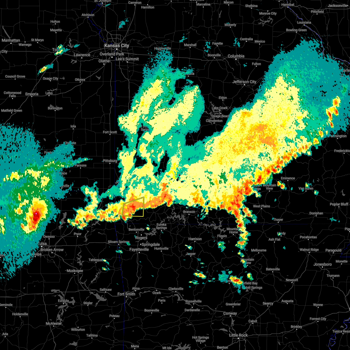 At 244 pm cdt, a severe thunderstorm was located 7 miles east of goodman, or 9 miles northeast of pineville, moving east at 40 mph (radar indicated). Hazards include 60 mph wind gusts and nickel size hail. Expect damage to roofs, siding, and trees. Locations impacted include, neosho, big sugar creek state park, anderson, goodman, fairview, stella, stark city, powell, rocky comfort, this includes interstate 49 between mile markers 5 and 18. At 244 pm cdt, a severe thunderstorm was located 7 miles east of goodman, or 9 miles northeast of pineville, moving east at 40 mph (radar indicated). Hazards include 60 mph wind gusts and nickel size hail. Expect damage to roofs, siding, and trees. Locations impacted include, neosho, big sugar creek state park, anderson, goodman, fairview, stella, stark city, powell, rocky comfort, this includes interstate 49 between mile markers 5 and 18.
|
| 5/27/2021 2:25 PM CDT |
 At 225 pm cdt, a severe thunderstorm was located near goodman, or 9 miles southwest of neosho, moving east at 30 mph (radar indicated). Hazards include 60 mph wind gusts and nickel size hail. expect damage to roofs, siding, and trees At 225 pm cdt, a severe thunderstorm was located near goodman, or 9 miles southwest of neosho, moving east at 30 mph (radar indicated). Hazards include 60 mph wind gusts and nickel size hail. expect damage to roofs, siding, and trees
|
| 5/27/2021 2:13 PM CDT |
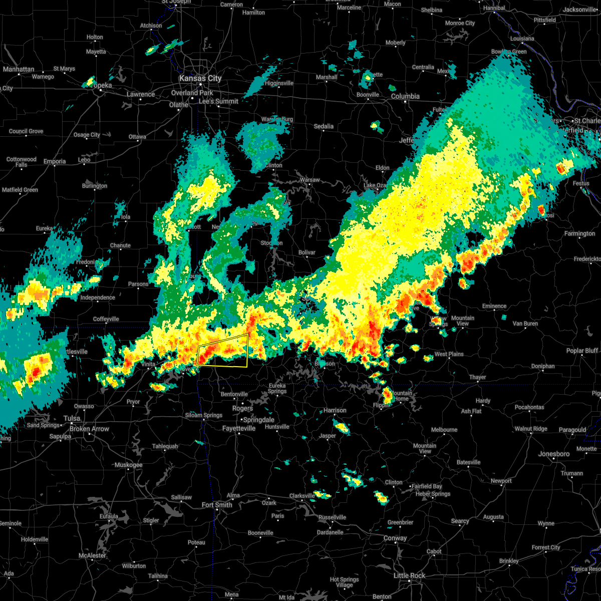 At 213 pm cdt, a severe thunderstorm was located near goodman, or 7 miles southwest of neosho, moving east at 40 mph (radar indicated). Hazards include 60 mph wind gusts. Expect damage to roofs, siding, and trees. Locations impacted include, neosho, anderson, goodman, wheaton, fairview, newtonia, stella, stark city, rocky comfort, this includes interstate 49 between mile markers 8 and 22. At 213 pm cdt, a severe thunderstorm was located near goodman, or 7 miles southwest of neosho, moving east at 40 mph (radar indicated). Hazards include 60 mph wind gusts. Expect damage to roofs, siding, and trees. Locations impacted include, neosho, anderson, goodman, wheaton, fairview, newtonia, stella, stark city, rocky comfort, this includes interstate 49 between mile markers 8 and 22.
|
| 5/27/2021 1:57 PM CDT |
 At 156 pm cdt, severe thunderstorms were located along a line extending from near sarcoxie to 6 miles east of granby to 6 miles southeast of wyandotte, moving east at 30 mph (radar indicated). Hazards include 60 mph wind gusts. Expect damage to roofs, siding, and trees. Locations impacted include, neosho, seneca, granby, anderson, goodman, diamond, wheaton, fairview, newtonia, stella, wentworth, stark city, ritchey, rocky comfort, racine, this includes interstate 49 between mile markers 8 and 32. At 156 pm cdt, severe thunderstorms were located along a line extending from near sarcoxie to 6 miles east of granby to 6 miles southeast of wyandotte, moving east at 30 mph (radar indicated). Hazards include 60 mph wind gusts. Expect damage to roofs, siding, and trees. Locations impacted include, neosho, seneca, granby, anderson, goodman, diamond, wheaton, fairview, newtonia, stella, wentworth, stark city, ritchey, rocky comfort, racine, this includes interstate 49 between mile markers 8 and 32.
|
| 5/27/2021 1:31 PM CDT |
 At 131 pm cdt, severe thunderstorms were located along a line extending from near carl junction to near saginaw to 7 miles southeast of wyandotte, moving east at 25 mph (radar indicated). Hazards include 60 mph wind gusts. expect damage to roofs, siding, and trees At 131 pm cdt, severe thunderstorms were located along a line extending from near carl junction to near saginaw to 7 miles southeast of wyandotte, moving east at 25 mph (radar indicated). Hazards include 60 mph wind gusts. expect damage to roofs, siding, and trees
|
| 3/17/2021 4:40 PM CDT |
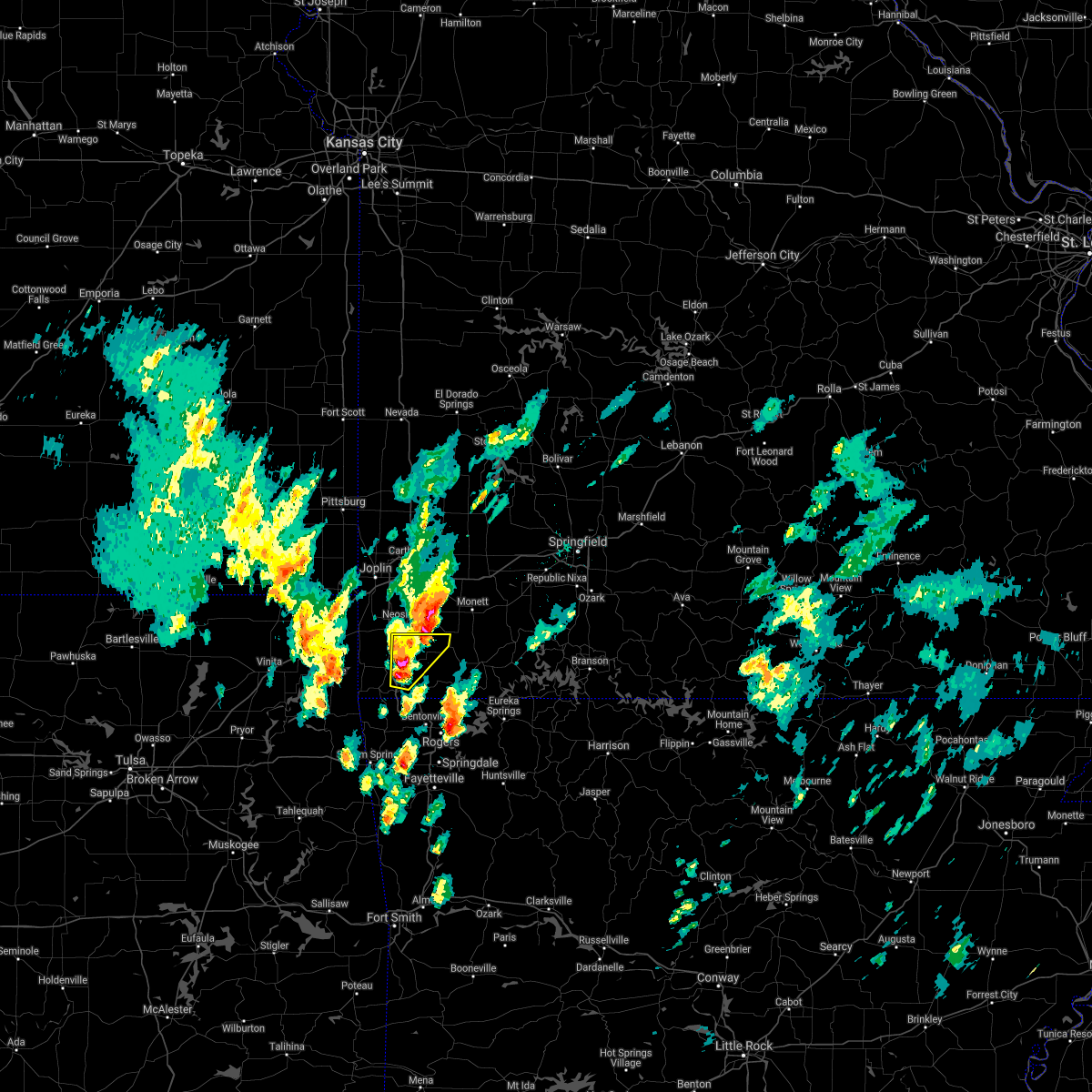 At 440 pm cdt, a severe thunderstorm was located near pineville, moving northeast at 30 mph (radar indicated). Hazards include 60 mph wind gusts and quarter size hail. Hail damage to vehicles is expected. Expect wind damage to roofs, siding, and trees. At 440 pm cdt, a severe thunderstorm was located near pineville, moving northeast at 30 mph (radar indicated). Hazards include 60 mph wind gusts and quarter size hail. Hail damage to vehicles is expected. Expect wind damage to roofs, siding, and trees.
|
| 3/17/2021 4:10 PM CDT |
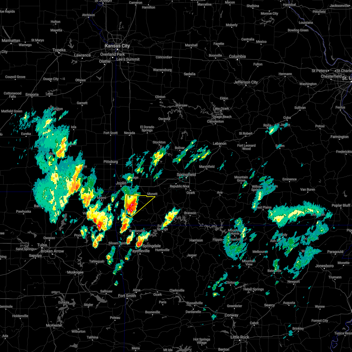 At 410 pm cdt, a severe thunderstorm was located near goodman, or near pineville, moving northeast at 30 mph (radar indicated). Hazards include two inch hail and 60 mph wind gusts. People and animals outdoors will be injured. expect hail damage to roofs, siding, windows, and vehicles. Expect wind damage to roofs, siding, and trees. At 410 pm cdt, a severe thunderstorm was located near goodman, or near pineville, moving northeast at 30 mph (radar indicated). Hazards include two inch hail and 60 mph wind gusts. People and animals outdoors will be injured. expect hail damage to roofs, siding, windows, and vehicles. Expect wind damage to roofs, siding, and trees.
|
| 3/17/2021 4:02 PM CDT |
 At 401 pm cdt, a severe thunderstorm was located over goodman, or 8 miles south of neosho, moving northeast at 35 mph (emergency management reported two inch hail that caused damage to vehicles in anderson). Hazards include two inch hail and 60 mph wind gusts. People and animals outdoors will be injured. expect hail damage to roofs, siding, windows, and vehicles. expect wind damage to roofs, siding, and trees. Locations impacted include, neosho, big sugar creek state park, anderson, goodman, pineville, lanagan, stella, rocky comfort, this includes interstate 49 near mile marker 1, and between mile markers 3 and 21. At 401 pm cdt, a severe thunderstorm was located over goodman, or 8 miles south of neosho, moving northeast at 35 mph (emergency management reported two inch hail that caused damage to vehicles in anderson). Hazards include two inch hail and 60 mph wind gusts. People and animals outdoors will be injured. expect hail damage to roofs, siding, windows, and vehicles. expect wind damage to roofs, siding, and trees. Locations impacted include, neosho, big sugar creek state park, anderson, goodman, pineville, lanagan, stella, rocky comfort, this includes interstate 49 near mile marker 1, and between mile markers 3 and 21.
|
| 3/17/2021 3:47 PM CDT |
 At 346 pm cdt, a severe thunderstorm was located over anderson, or near pineville, moving northeast at 35 mph (law enforcement reported half dollar size hail 4 miles north of noel). Hazards include ping pong ball size hail and 60 mph wind gusts. People and animals outdoors will be injured. expect hail damage to roofs, siding, windows, and vehicles. expect wind damage to roofs, siding, and trees. Locations impacted include, neosho, big sugar creek state park, anderson, noel, goodman, pineville, lanagan, stella, rocky comfort, this includes interstate 49 between mile markers 1 and 22. At 346 pm cdt, a severe thunderstorm was located over anderson, or near pineville, moving northeast at 35 mph (law enforcement reported half dollar size hail 4 miles north of noel). Hazards include ping pong ball size hail and 60 mph wind gusts. People and animals outdoors will be injured. expect hail damage to roofs, siding, windows, and vehicles. expect wind damage to roofs, siding, and trees. Locations impacted include, neosho, big sugar creek state park, anderson, noel, goodman, pineville, lanagan, stella, rocky comfort, this includes interstate 49 between mile markers 1 and 22.
|
| 3/17/2021 3:35 PM CDT |
 At 335 pm cdt, a severe thunderstorm was located over noel, or 7 miles southwest of pineville, moving northeast at 35 mph (radar indicated). Hazards include 60 mph wind gusts and quarter size hail. Hail damage to vehicles is expected. Expect wind damage to roofs, siding, and trees. At 335 pm cdt, a severe thunderstorm was located over noel, or 7 miles southwest of pineville, moving northeast at 35 mph (radar indicated). Hazards include 60 mph wind gusts and quarter size hail. Hail damage to vehicles is expected. Expect wind damage to roofs, siding, and trees.
|
| 3/17/2021 6:28 AM CDT |
 The severe thunderstorm warning for barton, northern newton and jasper counties will expire at 630 am cdt, the storms which prompted the warning have weakened below severe limits, and no longer pose an immediate threat to life or property. therefore, the warning will be allowed to expire. however heavy rain is still possible with these thunderstorms. a severe thunderstorm watch remains in effect until 800 am cdt for southeastern kansas, and southwestern and west central missouri. The severe thunderstorm warning for barton, northern newton and jasper counties will expire at 630 am cdt, the storms which prompted the warning have weakened below severe limits, and no longer pose an immediate threat to life or property. therefore, the warning will be allowed to expire. however heavy rain is still possible with these thunderstorms. a severe thunderstorm watch remains in effect until 800 am cdt for southeastern kansas, and southwestern and west central missouri.
|
| 3/17/2021 6:09 AM CDT |
 At 608 am cdt, severe thunderstorms were located along a line extending from near liberal to joplin, moving east at 35 mph (radar indicated). Hazards include 60 mph wind gusts and penny size hail. Expect damage to roofs, siding, and trees. locations impacted include, joplin, carthage, neosho, webb city, prairie state park, carl junction, lamar, galena, oronogo, granby, carterville, duquesne, sarcoxie, duenweg, jasper, diamond, golden city, liberal, loma linda, airport drive, this includes the following highways, interstate 44 between mile markers 0 and 29. Interstate 49 between mile markers 25 and 76. At 608 am cdt, severe thunderstorms were located along a line extending from near liberal to joplin, moving east at 35 mph (radar indicated). Hazards include 60 mph wind gusts and penny size hail. Expect damage to roofs, siding, and trees. locations impacted include, joplin, carthage, neosho, webb city, prairie state park, carl junction, lamar, galena, oronogo, granby, carterville, duquesne, sarcoxie, duenweg, jasper, diamond, golden city, liberal, loma linda, airport drive, this includes the following highways, interstate 44 between mile markers 0 and 29. Interstate 49 between mile markers 25 and 76.
|
| 3/17/2021 5:51 AM CDT |
 At 551 am cdt, severe thunderstorms were located along a line extending from arcadia to near galena, moving east at 40 mph (radar indicated). Hazards include 60 mph wind gusts and penny size hail. Expect damage to roofs, siding, and trees. locations impacted include, joplin, pittsburg, carthage, neosho, webb city, prairie state park, carl junction, lamar, baxter springs, frontenac, columbus, galena, girard, oronogo, granby, carterville, duquesne, arma, sarcoxie, duenweg, this includes the following highways, interstate 44 between mile markers 0 and 29. Interstate 49 between mile markers 25 and 76. At 551 am cdt, severe thunderstorms were located along a line extending from arcadia to near galena, moving east at 40 mph (radar indicated). Hazards include 60 mph wind gusts and penny size hail. Expect damage to roofs, siding, and trees. locations impacted include, joplin, pittsburg, carthage, neosho, webb city, prairie state park, carl junction, lamar, baxter springs, frontenac, columbus, galena, girard, oronogo, granby, carterville, duquesne, arma, sarcoxie, duenweg, this includes the following highways, interstate 44 between mile markers 0 and 29. Interstate 49 between mile markers 25 and 76.
|
| 3/17/2021 5:33 AM CDT |
 At 533 am cdt, severe thunderstorms were located along a line extending from 8 miles east of hepler to treece, moving east at 40 mph (radar indicated). Hazards include 60 mph wind gusts and penny size hail. expect damage to roofs, siding, and trees At 533 am cdt, severe thunderstorms were located along a line extending from 8 miles east of hepler to treece, moving east at 40 mph (radar indicated). Hazards include 60 mph wind gusts and penny size hail. expect damage to roofs, siding, and trees
|
| 1/30/2021 4:10 PM CST |
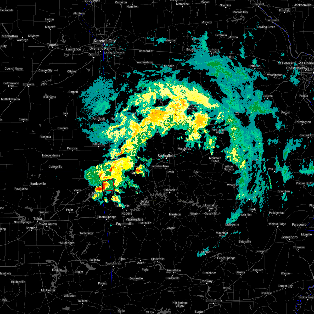 At 409 pm cst, a severe thunderstorm capable of producing a tornado was located 7 miles southeast of wyandotte, or 16 miles southeast of miami, moving east at 30 mph (radar indicated rotation). Hazards include tornado. Flying debris will be dangerous to those caught without shelter. mobile homes will be damaged or destroyed. damage to roofs, windows, and vehicles will occur. Tree damage is likely. At 409 pm cst, a severe thunderstorm capable of producing a tornado was located 7 miles southeast of wyandotte, or 16 miles southeast of miami, moving east at 30 mph (radar indicated rotation). Hazards include tornado. Flying debris will be dangerous to those caught without shelter. mobile homes will be damaged or destroyed. damage to roofs, windows, and vehicles will occur. Tree damage is likely.
|
| 1/30/2021 3:30 PM CST |
 At 330 pm cst, a severe thunderstorm capable of producing a tornado was located over neosho, moving east at 35 mph (radar indicated rotation). Hazards include tornado. Flying debris will be dangerous to those caught without shelter. mobile homes will be damaged or destroyed. damage to roofs, windows, and vehicles will occur. Tree damage is likely. At 330 pm cst, a severe thunderstorm capable of producing a tornado was located over neosho, moving east at 35 mph (radar indicated rotation). Hazards include tornado. Flying debris will be dangerous to those caught without shelter. mobile homes will be damaged or destroyed. damage to roofs, windows, and vehicles will occur. Tree damage is likely.
|
| 11/24/2020 9:23 PM CST |
 At 922 pm cst, severe thunderstorms were located along a line extending from 9 miles west of sheldon to near lamar to near jasper to near granby to near pineville, moving east at 70 mph (public). Hazards include 60 mph wind gusts and quarter size hail. a measured 62 mph gust was reported at the joplin regional airport. Hail damage to vehicles is expected. expect wind damage to roofs, siding, and trees. locations impacted include, eastern joplin, bella vista, carthage, neosho, webb city, prairie state park, big sugar creek state park, lamar, oronogo, granby, anderson, carterville, noel, duquesne, sarcoxie, goodman, duenweg, south west city, jasper, diamond, this includes the following highways, interstate 44 between mile markers 9 and 32. Interstate 49 between mile markers 1 and 76. At 922 pm cst, severe thunderstorms were located along a line extending from 9 miles west of sheldon to near lamar to near jasper to near granby to near pineville, moving east at 70 mph (public). Hazards include 60 mph wind gusts and quarter size hail. a measured 62 mph gust was reported at the joplin regional airport. Hail damage to vehicles is expected. expect wind damage to roofs, siding, and trees. locations impacted include, eastern joplin, bella vista, carthage, neosho, webb city, prairie state park, big sugar creek state park, lamar, oronogo, granby, anderson, carterville, noel, duquesne, sarcoxie, goodman, duenweg, south west city, jasper, diamond, this includes the following highways, interstate 44 between mile markers 9 and 32. Interstate 49 between mile markers 1 and 76.
|
| 11/24/2020 8:58 PM CST |
 At 858 pm cst, severe thunderstorms were located along a line extending from near girard to near pittsburg to near carl junction to seneca to near south west city, moving east at 60 mph (radar indicated). Hazards include 60 mph wind gusts and quarter size hail. Hail damage to vehicles is expected. Expect wind damage to roofs, siding, and trees. At 858 pm cst, severe thunderstorms were located along a line extending from near girard to near pittsburg to near carl junction to seneca to near south west city, moving east at 60 mph (radar indicated). Hazards include 60 mph wind gusts and quarter size hail. Hail damage to vehicles is expected. Expect wind damage to roofs, siding, and trees.
|
| 11/14/2020 6:48 PM CST |
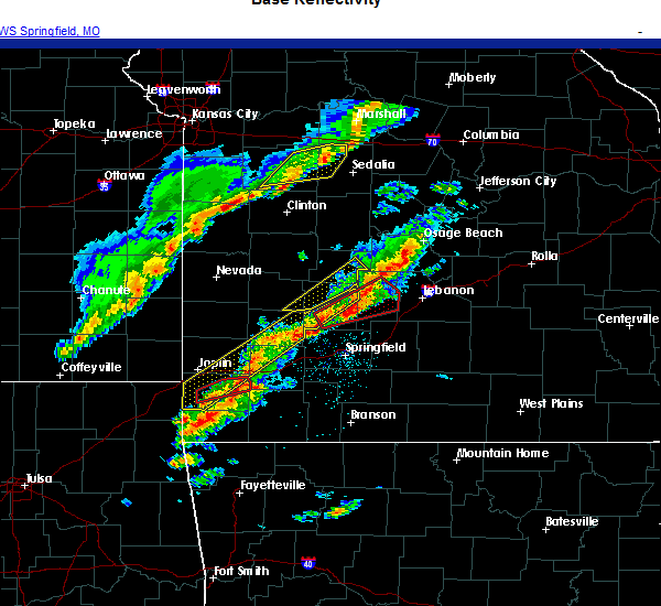 At 648 pm cst, a severe thunderstorm was located over lanagan, or near pineville, moving east at 45 mph (radar indicated). Hazards include 60 mph wind gusts and half dollar size hail. Hail damage to vehicles is expected. Expect wind damage to roofs, siding, and trees. At 648 pm cst, a severe thunderstorm was located over lanagan, or near pineville, moving east at 45 mph (radar indicated). Hazards include 60 mph wind gusts and half dollar size hail. Hail damage to vehicles is expected. Expect wind damage to roofs, siding, and trees.
|
| 11/14/2020 6:46 PM CST | Measure 61 mph winds. power outages in central neosh in newton county MO, 1.5 miles SW of Neosho, MO |
| 11/14/2020 6:35 PM CST |
 At 634 pm cst, a severe thunderstorm capable of producing a tornado was located near neosho, moving northeast at 35 mph (radar indicated rotation). Hazards include tornado and quarter size hail. Flying debris will be dangerous to those caught without shelter. mobile homes will be damaged or destroyed. damage to roofs, windows, and vehicles will occur. tree damage is likely. Locations impacted include, neosho, granby, diamond, wentworth, ritchey, this includes interstate 49 between mile markers 21 and 28. At 634 pm cst, a severe thunderstorm capable of producing a tornado was located near neosho, moving northeast at 35 mph (radar indicated rotation). Hazards include tornado and quarter size hail. Flying debris will be dangerous to those caught without shelter. mobile homes will be damaged or destroyed. damage to roofs, windows, and vehicles will occur. tree damage is likely. Locations impacted include, neosho, granby, diamond, wentworth, ritchey, this includes interstate 49 between mile markers 21 and 28.
|
| 11/14/2020 6:28 PM CST |
 At 628 pm cst, a severe thunderstorm capable of producing a tornado was located near seneca, or 7 miles west of neosho, moving east at 55 mph (radar indicated rotation). Hazards include tornado and ping pong ball size hail. Flying debris will be dangerous to those caught without shelter. mobile homes will be damaged or destroyed. damage to roofs, windows, and vehicles will occur. tree damage is likely. Locations impacted include, neosho, seneca, granby, diamond, wentworth, ritchey, racine, this includes interstate 49 between mile markers 21 and 31. At 628 pm cst, a severe thunderstorm capable of producing a tornado was located near seneca, or 7 miles west of neosho, moving east at 55 mph (radar indicated rotation). Hazards include tornado and ping pong ball size hail. Flying debris will be dangerous to those caught without shelter. mobile homes will be damaged or destroyed. damage to roofs, windows, and vehicles will occur. tree damage is likely. Locations impacted include, neosho, seneca, granby, diamond, wentworth, ritchey, racine, this includes interstate 49 between mile markers 21 and 31.
|
| 11/14/2020 6:20 PM CST |
 At 620 pm cst, a severe thunderstorm capable of producing a tornado was located over seneca, or 12 miles southeast of baxter springs, moving northeast at 50 mph (radar indicated rotation). Hazards include tornado and ping pong ball size hail. Flying debris will be dangerous to those caught without shelter. mobile homes will be damaged or destroyed. damage to roofs, windows, and vehicles will occur. Tree damage is likely. At 620 pm cst, a severe thunderstorm capable of producing a tornado was located over seneca, or 12 miles southeast of baxter springs, moving northeast at 50 mph (radar indicated rotation). Hazards include tornado and ping pong ball size hail. Flying debris will be dangerous to those caught without shelter. mobile homes will be damaged or destroyed. damage to roofs, windows, and vehicles will occur. Tree damage is likely.
|
| 11/14/2020 6:14 PM CST |
 At 614 pm cst, severe thunderstorms were located along a line extending from 10 miles southwest of urbana to near greenfield, moving northeast at 50 mph (radar indicated). Hazards include ping pong ball size hail and 60 mph wind gusts. People and animals outdoors will be injured. expect hail damage to roofs, siding, windows, and vehicles. expect wind damage to roofs, siding, and trees. locations impacted include, southeastern joplin, carthage, neosho, bolivar, stockton lake, seneca, granby, duquesne, greenfield, sarcoxie, duenweg, lockwood, diamond, loma linda, miller, leawood, silver creek, shoal creek drive, everton, saginaw, this includes the following highways, interstate 44 between mile markers 4 and 5, and between mile markers 7 and 36. Interstate 49 between mile markers 16 and 41. At 614 pm cst, severe thunderstorms were located along a line extending from 10 miles southwest of urbana to near greenfield, moving northeast at 50 mph (radar indicated). Hazards include ping pong ball size hail and 60 mph wind gusts. People and animals outdoors will be injured. expect hail damage to roofs, siding, windows, and vehicles. expect wind damage to roofs, siding, and trees. locations impacted include, southeastern joplin, carthage, neosho, bolivar, stockton lake, seneca, granby, duquesne, greenfield, sarcoxie, duenweg, lockwood, diamond, loma linda, miller, leawood, silver creek, shoal creek drive, everton, saginaw, this includes the following highways, interstate 44 between mile markers 4 and 5, and between mile markers 7 and 36. Interstate 49 between mile markers 16 and 41.
|
| 11/14/2020 6:04 PM CST |
 At 604 pm cst, severe thunderstorms were located along a line extending from 7 miles north of bolivar to near lockwood, moving northeast at 50 mph (radar indicated). Hazards include 60 mph wind gusts and quarter size hail. Hail damage to vehicles is expected. Expect wind damage to roofs, siding, and trees. At 604 pm cst, severe thunderstorms were located along a line extending from 7 miles north of bolivar to near lockwood, moving northeast at 50 mph (radar indicated). Hazards include 60 mph wind gusts and quarter size hail. Hail damage to vehicles is expected. Expect wind damage to roofs, siding, and trees.
|
| 8/15/2020 5:13 PM CDT |
 The severe thunderstorm warning for southeastern cherokee, northwestern newton and southwestern jasper counties will expire at 515 pm cdt, the storm which prompted the warning has moved out of the area. therefore, the warning will be allowed to expire. however small hail, gusty winds and heavy rain are still possible with thunderstorms in the area. The severe thunderstorm warning for southeastern cherokee, northwestern newton and southwestern jasper counties will expire at 515 pm cdt, the storm which prompted the warning has moved out of the area. therefore, the warning will be allowed to expire. however small hail, gusty winds and heavy rain are still possible with thunderstorms in the area.
|
| 8/15/2020 4:34 PM CDT |
 At 433 pm cdt, a severe thunderstorm was located over galena, or near joplin, moving southeast at 20 mph (public). Hazards include ping pong ball size hail and 60 mph wind gusts. People and animals outdoors will be injured. expect hail damage to roofs, siding, windows, and vehicles. Expect wind damage to roofs, siding, and trees. At 433 pm cdt, a severe thunderstorm was located over galena, or near joplin, moving southeast at 20 mph (public). Hazards include ping pong ball size hail and 60 mph wind gusts. People and animals outdoors will be injured. expect hail damage to roofs, siding, windows, and vehicles. Expect wind damage to roofs, siding, and trees.
|
| 8/10/2020 5:46 PM CDT | Reported power line down causing power outages in neosho. time based on rada in newton county MO, 1.5 miles SW of Neosho, MO |
| 8/10/2020 5:45 PM CDT |
 At 544 pm cdt, severe thunderstorms were located along a line extending from carterville to near saginaw to near seneca to 6 miles southeast of fairland, moving southeast at 40 mph (radar indicated). Hazards include 60 mph wind gusts and nickel size hail. Expect damage to roofs, siding, and trees. locations impacted include, joplin, carthage, neosho, webb city, big sugar creek state park, carl junction, oronogo, seneca, granby, anderson, carterville, duquesne, sarcoxie, goodman, duenweg, diamond, pineville, loma linda, airport drive, leawood, this includes the following highways, interstate 44 between mile markers 1 and 31. Interstate 49 between mile markers 4 and 43. At 544 pm cdt, severe thunderstorms were located along a line extending from carterville to near saginaw to near seneca to 6 miles southeast of fairland, moving southeast at 40 mph (radar indicated). Hazards include 60 mph wind gusts and nickel size hail. Expect damage to roofs, siding, and trees. locations impacted include, joplin, carthage, neosho, webb city, big sugar creek state park, carl junction, oronogo, seneca, granby, anderson, carterville, duquesne, sarcoxie, goodman, duenweg, diamond, pineville, loma linda, airport drive, leawood, this includes the following highways, interstate 44 between mile markers 1 and 31. Interstate 49 between mile markers 4 and 43.
|
| 8/10/2020 5:20 PM CDT |
 At 520 pm cdt, severe thunderstorms were located along a line extending from near west mineral to near baxter springs to quapaw to near bluejacket, moving east at 40 mph (radar indicated). Hazards include 70 mph wind gusts and nickel size hail. Expect considerable tree damage. Damage is likely to mobile homes, roofs, and outbuildings. At 520 pm cdt, severe thunderstorms were located along a line extending from near west mineral to near baxter springs to quapaw to near bluejacket, moving east at 40 mph (radar indicated). Hazards include 70 mph wind gusts and nickel size hail. Expect considerable tree damage. Damage is likely to mobile homes, roofs, and outbuildings.
|
| 7/16/2020 9:59 PM CDT |
 At 941 pm cdt, a severe thunderstorm was located near neosho, moving northeast at 10 mph (radar indicated). Hazards include 60 mph wind gusts and quarter size hail. Hail damage to vehicles is expected. Expect wind damage to roofs, siding, and trees. At 941 pm cdt, a severe thunderstorm was located near neosho, moving northeast at 10 mph (radar indicated). Hazards include 60 mph wind gusts and quarter size hail. Hail damage to vehicles is expected. Expect wind damage to roofs, siding, and trees.
|
| 7/16/2020 9:41 PM CDT |
 At 941 pm cdt, a severe thunderstorm was located near neosho, moving northeast at 10 mph (radar indicated). Hazards include 60 mph wind gusts and quarter size hail. Hail damage to vehicles is expected. Expect wind damage to roofs, siding, and trees. At 941 pm cdt, a severe thunderstorm was located near neosho, moving northeast at 10 mph (radar indicated). Hazards include 60 mph wind gusts and quarter size hail. Hail damage to vehicles is expected. Expect wind damage to roofs, siding, and trees.
|
| 7/16/2020 9:13 PM CDT |
 At 913 pm cdt, a severe thunderstorm was located over neosho, moving northeast at 5 mph (radar indicated). Hazards include ping pong ball size hail and 60 mph wind gusts. People and animals outdoors will be injured. expect hail damage to roofs, siding, windows, and vehicles. Expect wind damage to roofs, siding, and trees. At 913 pm cdt, a severe thunderstorm was located over neosho, moving northeast at 5 mph (radar indicated). Hazards include ping pong ball size hail and 60 mph wind gusts. People and animals outdoors will be injured. expect hail damage to roofs, siding, windows, and vehicles. Expect wind damage to roofs, siding, and trees.
|
| 7/2/2020 5:13 PM CDT |
 At 511 pm cdt, severe thunderstorms were located along a line extending from sarcoxie to near saginaw to quapaw, moving south at 15 mph. emergency management has reported multiple power poles down on newman road in joplin (emergency management). Hazards include 60 mph wind gusts and quarter size hail. Hail damage to vehicles is expected. expect wind damage to roofs, siding, and trees. locations impacted include, joplin, carthage, neosho, webb city, monett, carl junction, baxter springs, galena, oronogo, seneca, granby, carterville, duquesne, sarcoxie, pierce city, duenweg, diamond, loma linda, airport drive, leawood, this includes the following highways, interstate 44 between mile markers 0 and 41. Interstate 49 between mile markers 16 and 45. At 511 pm cdt, severe thunderstorms were located along a line extending from sarcoxie to near saginaw to quapaw, moving south at 15 mph. emergency management has reported multiple power poles down on newman road in joplin (emergency management). Hazards include 60 mph wind gusts and quarter size hail. Hail damage to vehicles is expected. expect wind damage to roofs, siding, and trees. locations impacted include, joplin, carthage, neosho, webb city, monett, carl junction, baxter springs, galena, oronogo, seneca, granby, carterville, duquesne, sarcoxie, pierce city, duenweg, diamond, loma linda, airport drive, leawood, this includes the following highways, interstate 44 between mile markers 0 and 41. Interstate 49 between mile markers 16 and 45.
|
| 7/2/2020 4:59 PM CDT |
 The national weather service in springfield has issued a * severe thunderstorm warning for. southeastern cherokee county in southeastern kansas. newton county in southwestern missouri. southwestern lawrence county in southwestern missouri. Southern jasper county in southwestern missouri. The national weather service in springfield has issued a * severe thunderstorm warning for. southeastern cherokee county in southeastern kansas. newton county in southwestern missouri. southwestern lawrence county in southwestern missouri. Southern jasper county in southwestern missouri.
|
| 5/25/2020 10:06 PM CDT |
 The severe thunderstorm warning for newton county will expire at 1015 pm cdt, the storms which prompted the warning have weakened below severe limits, and no longer pose an immediate threat to life or property. therefore, the warning will be allowed to expire. however heavy rain is still possible with these thunderstorms. a severe thunderstorm watch remains in effect until midnight cdt for southwestern missouri. The severe thunderstorm warning for newton county will expire at 1015 pm cdt, the storms which prompted the warning have weakened below severe limits, and no longer pose an immediate threat to life or property. therefore, the warning will be allowed to expire. however heavy rain is still possible with these thunderstorms. a severe thunderstorm watch remains in effect until midnight cdt for southwestern missouri.
|
| 5/25/2020 9:44 PM CDT |
 At 943 pm cdt, severe thunderstorms were located along a line extending from saginaw to near granby to 10 miles east of neosho to near fairview, moving north at 30 mph (radar indicated). Hazards include 60 mph wind gusts and penny size hail. expect damage to roofs, siding, and trees At 943 pm cdt, severe thunderstorms were located along a line extending from saginaw to near granby to 10 miles east of neosho to near fairview, moving north at 30 mph (radar indicated). Hazards include 60 mph wind gusts and penny size hail. expect damage to roofs, siding, and trees
|
| 5/25/2020 9:00 PM CDT |
 At 859 pm cdt, severe thunderstorms were located along a line extending from near seneca to near goodman to near pineville to 7 miles north of bella vista, moving north at 35 mph (radar indicated). Hazards include 60 mph wind gusts and quarter size hail. Hail damage to vehicles is expected. Expect wind damage to roofs, siding, and trees. At 859 pm cdt, severe thunderstorms were located along a line extending from near seneca to near goodman to near pineville to 7 miles north of bella vista, moving north at 35 mph (radar indicated). Hazards include 60 mph wind gusts and quarter size hail. Hail damage to vehicles is expected. Expect wind damage to roofs, siding, and trees.
|
| 5/4/2020 8:16 PM CDT |
 At 815 pm cdt, a severe thunderstorm was located over monett, moving east at 35 mph (radar indicated). Hazards include 60 mph wind gusts and quarter size hail. Hail damage to vehicles is expected. expect wind damage to roofs, siding, and trees. Locations impacted include, monett, granby, pierce city, purdy, wheaton, butterfield, fairview, newtonia, pioneer, stella, stark city, ritchey, rocky comfort,. At 815 pm cdt, a severe thunderstorm was located over monett, moving east at 35 mph (radar indicated). Hazards include 60 mph wind gusts and quarter size hail. Hail damage to vehicles is expected. expect wind damage to roofs, siding, and trees. Locations impacted include, monett, granby, pierce city, purdy, wheaton, butterfield, fairview, newtonia, pioneer, stella, stark city, ritchey, rocky comfort,.
|
| 5/4/2020 7:58 PM CDT |
 At 758 pm cdt, a severe thunderstorm was located near fairview, or 11 miles east of neosho, moving east at 35 mph (radar indicated). Hazards include golf ball size hail and 60 mph wind gusts. People and animals outdoors will be injured. expect hail damage to roofs, siding, windows, and vehicles. expect wind damage to roofs, siding, and trees. Locations impacted include, neosho, monett, granby, anderson, pierce city, goodman, purdy, wheaton, butterfield, fairview, newtonia, pioneer, stella, stark city, ritchey, rocky comfort, this includes interstate 49 between mile markers 9 and 26. At 758 pm cdt, a severe thunderstorm was located near fairview, or 11 miles east of neosho, moving east at 35 mph (radar indicated). Hazards include golf ball size hail and 60 mph wind gusts. People and animals outdoors will be injured. expect hail damage to roofs, siding, windows, and vehicles. expect wind damage to roofs, siding, and trees. Locations impacted include, neosho, monett, granby, anderson, pierce city, goodman, purdy, wheaton, butterfield, fairview, newtonia, pioneer, stella, stark city, ritchey, rocky comfort, this includes interstate 49 between mile markers 9 and 26.
|
| 5/4/2020 7:50 PM CDT |
 At 750 pm cdt, a severe thunderstorm was located near granby, or near neosho, moving east at 35 mph (radar indicated). Hazards include 60 mph wind gusts and quarter size hail. Hail damage to vehicles is expected. Expect wind damage to roofs, siding, and trees. At 750 pm cdt, a severe thunderstorm was located near granby, or near neosho, moving east at 35 mph (radar indicated). Hazards include 60 mph wind gusts and quarter size hail. Hail damage to vehicles is expected. Expect wind damage to roofs, siding, and trees.
|
| 5/4/2020 7:11 PM CDT |
 At 710 pm cdt, a severe thunderstorm was located near granby, or 10 miles northeast of neosho, moving east at 60 mph (radar indicated). Hazards include quarter size hail. Damage to vehicles is expected. locations impacted include, southeastern joplin, neosho, seneca, granby, diamond, loma linda, leawood, silver creek, saginaw, redings mill, wentworth, shoal creek estates, ritchey, cliff village, racine, this includes the following highways, interstate 44 between mile markers 0 and 5. Interstate 49 between mile markers 21 and 35. At 710 pm cdt, a severe thunderstorm was located near granby, or 10 miles northeast of neosho, moving east at 60 mph (radar indicated). Hazards include quarter size hail. Damage to vehicles is expected. locations impacted include, southeastern joplin, neosho, seneca, granby, diamond, loma linda, leawood, silver creek, saginaw, redings mill, wentworth, shoal creek estates, ritchey, cliff village, racine, this includes the following highways, interstate 44 between mile markers 0 and 5. Interstate 49 between mile markers 21 and 35.
|
| 5/4/2020 6:53 PM CDT |
 At 653 pm cdt, a severe thunderstorm was located near seneca, or 10 miles west of neosho, moving east at 60 mph (radar indicated). Hazards include ping pong ball size hail and 60 mph wind gusts. People and animals outdoors will be injured. expect hail damage to roofs, siding, windows, and vehicles. Expect wind damage to roofs, siding, and trees. At 653 pm cdt, a severe thunderstorm was located near seneca, or 10 miles west of neosho, moving east at 60 mph (radar indicated). Hazards include ping pong ball size hail and 60 mph wind gusts. People and animals outdoors will be injured. expect hail damage to roofs, siding, windows, and vehicles. Expect wind damage to roofs, siding, and trees.
|
| 5/4/2020 6:31 PM CDT |
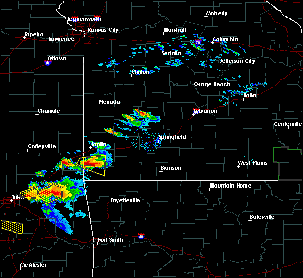 At 631 pm cdt, a severe thunderstorm capable of producing a tornado was located near anderson, or 11 miles northwest of pineville, moving east at 40 mph (radar indicated rotation). Hazards include tornado and tennis ball size hail. Flying debris will be dangerous to those caught without shelter. mobile homes will be damaged or destroyed. damage to roofs, windows, and vehicles will occur. Tree damage is likely. At 631 pm cdt, a severe thunderstorm capable of producing a tornado was located near anderson, or 11 miles northwest of pineville, moving east at 40 mph (radar indicated rotation). Hazards include tornado and tennis ball size hail. Flying debris will be dangerous to those caught without shelter. mobile homes will be damaged or destroyed. damage to roofs, windows, and vehicles will occur. Tree damage is likely.
|
| 5/4/2020 6:18 PM CDT |
 At 618 pm cdt, a severe thunderstorm was located near seneca, or 12 miles southwest of neosho, moving east at 45 mph. this is a very dangerous storm (radar indicated). Hazards include baseball size hail and 60 mph wind gusts. People and animals outdoors will be severely injured. expect shattered windows, extensive damage to roofs, siding, and vehicles. Locations impacted include, neosho, big sugar creek state park, seneca, granby, anderson, goodman, racine, this includes interstate 49 between mile markers 7 and 26. At 618 pm cdt, a severe thunderstorm was located near seneca, or 12 miles southwest of neosho, moving east at 45 mph. this is a very dangerous storm (radar indicated). Hazards include baseball size hail and 60 mph wind gusts. People and animals outdoors will be severely injured. expect shattered windows, extensive damage to roofs, siding, and vehicles. Locations impacted include, neosho, big sugar creek state park, seneca, granby, anderson, goodman, racine, this includes interstate 49 between mile markers 7 and 26.
|
| 5/4/2020 6:03 PM CDT |
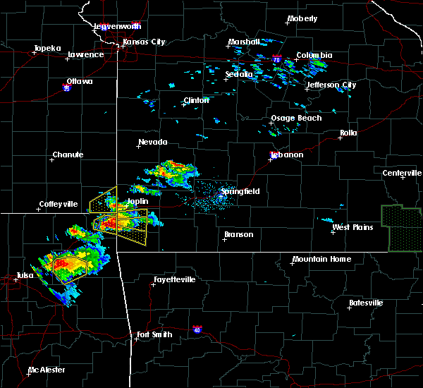 At 602 pm cdt, a severe thunderstorm was located near wyandotte, or 9 miles east of miami, moving east at 35 mph. this is a very dangerous storm (radar indicated). Hazards include softball size hail and 60 mph wind gusts. People and animals outdoors will be severely injured. Expect shattered windows, extensive damage to roofs, siding, and vehicles. At 602 pm cdt, a severe thunderstorm was located near wyandotte, or 9 miles east of miami, moving east at 35 mph. this is a very dangerous storm (radar indicated). Hazards include softball size hail and 60 mph wind gusts. People and animals outdoors will be severely injured. Expect shattered windows, extensive damage to roofs, siding, and vehicles.
|
| 5/4/2020 5:55 PM CDT |
 At 554 pm cdt, a severe thunderstorm was located near quapaw, or 7 miles east of miami, moving east at 40 mph (radar indicated). Hazards include two inch hail and 60 mph wind gusts. People and animals outdoors will be injured. expect hail damage to roofs, siding, windows, and vehicles. Expect wind damage to roofs, siding, and trees. At 554 pm cdt, a severe thunderstorm was located near quapaw, or 7 miles east of miami, moving east at 40 mph (radar indicated). Hazards include two inch hail and 60 mph wind gusts. People and animals outdoors will be injured. expect hail damage to roofs, siding, windows, and vehicles. Expect wind damage to roofs, siding, and trees.
|
| 5/4/2020 5:27 PM CDT |
 At 527 pm cdt, a severe thunderstorm was located near seneca, or 7 miles southeast of baxter springs, moving east at 35 mph (radar indicated). Hazards include ping pong ball size hail and 60 mph wind gusts. People and animals outdoors will be injured. expect hail damage to roofs, siding, windows, and vehicles. Expect wind damage to roofs, siding, and trees. At 527 pm cdt, a severe thunderstorm was located near seneca, or 7 miles southeast of baxter springs, moving east at 35 mph (radar indicated). Hazards include ping pong ball size hail and 60 mph wind gusts. People and animals outdoors will be injured. expect hail damage to roofs, siding, windows, and vehicles. Expect wind damage to roofs, siding, and trees.
|
| 5/4/2020 10:25 AM CDT |
 At 1025 am cdt, a severe thunderstorm was located near goodman, or near pineville, moving east at 40 mph (radar indicated). Hazards include half dollar size hail. Damage to vehicles is expected. locations impacted include, southeastern joplin, neosho, big sugar creek state park, granby, anderson, noel, goodman, diamond, pineville, leawood, silver creek, lanagan, fairview, shoal creek drive, saginaw, newtonia, stella, redings mill, wentworth, stark city, this includes the following highways, interstate 44 near mile marker 7. Interstate 49 between mile markers 1 and 35. At 1025 am cdt, a severe thunderstorm was located near goodman, or near pineville, moving east at 40 mph (radar indicated). Hazards include half dollar size hail. Damage to vehicles is expected. locations impacted include, southeastern joplin, neosho, big sugar creek state park, granby, anderson, noel, goodman, diamond, pineville, leawood, silver creek, lanagan, fairview, shoal creek drive, saginaw, newtonia, stella, redings mill, wentworth, stark city, this includes the following highways, interstate 44 near mile marker 7. Interstate 49 between mile markers 1 and 35.
|
| 5/4/2020 9:52 AM CDT |
 At 951 am cdt, a severe thunderstorm was located 8 miles southeast of wyandotte, or 15 miles northwest of pineville, moving east at 30 mph. other storms were developing across both newton and mcdonalds counties (radar indicated). Hazards include golf ball size hail. People and animals outdoors will be injured. Expect damage to roofs, siding, windows, and vehicles. At 951 am cdt, a severe thunderstorm was located 8 miles southeast of wyandotte, or 15 miles northwest of pineville, moving east at 30 mph. other storms were developing across both newton and mcdonalds counties (radar indicated). Hazards include golf ball size hail. People and animals outdoors will be injured. Expect damage to roofs, siding, windows, and vehicles.
|
| 5/3/2020 9:39 AM CDT |
 At 938 am cdt, severe thunderstorms were located along a line extending from near carthage to near commerce, moving east at 45 mph (radar indicated). Hazards include golf ball size hail and 60 mph wind gusts. People and animals outdoors will be injured. expect hail damage to roofs, siding, windows, and vehicles. Expect wind damage to roofs, siding, and trees. At 938 am cdt, severe thunderstorms were located along a line extending from near carthage to near commerce, moving east at 45 mph (radar indicated). Hazards include golf ball size hail and 60 mph wind gusts. People and animals outdoors will be injured. expect hail damage to roofs, siding, windows, and vehicles. Expect wind damage to roofs, siding, and trees.
|
| 4/28/2020 6:23 PM CDT |
 At 623 pm cdt, severe thunderstorms were located along a line extending from 7 miles east of mindenmines to near jasper to near carthage to diamond to near seneca, moving east at 50 mph (radar indicated). Hazards include 60 mph wind gusts. expect damage to roofs, siding, and trees At 623 pm cdt, severe thunderstorms were located along a line extending from 7 miles east of mindenmines to near jasper to near carthage to diamond to near seneca, moving east at 50 mph (radar indicated). Hazards include 60 mph wind gusts. expect damage to roofs, siding, and trees
|
| 4/28/2020 6:09 PM CDT |
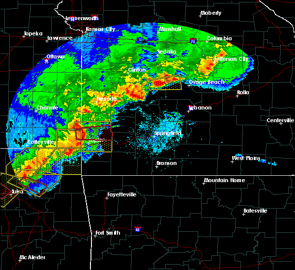 At 609 pm cdt, a severe thunderstorm was located near quapaw, or 7 miles south of baxter springs, moving east at 45 mph (radar indicated). Hazards include 60 mph wind gusts. expect damage to roofs, siding, and trees At 609 pm cdt, a severe thunderstorm was located near quapaw, or 7 miles south of baxter springs, moving east at 45 mph (radar indicated). Hazards include 60 mph wind gusts. expect damage to roofs, siding, and trees
|
| 3/27/2020 5:06 PM CDT |
 The severe thunderstorm warning for southeastern newton and northeastern mcdonald counties will expire at 515 pm cdt, the storm which prompted the warning has moved out of the area. therefore, the warning will be allowed to expire. a severe thunderstorm watch remains in effect until 900 pm cdt for southwestern missouri. to report severe weather, contact your nearest law enforcement agency. they will relay your report to the national weather service springfield. The severe thunderstorm warning for southeastern newton and northeastern mcdonald counties will expire at 515 pm cdt, the storm which prompted the warning has moved out of the area. therefore, the warning will be allowed to expire. a severe thunderstorm watch remains in effect until 900 pm cdt for southwestern missouri. to report severe weather, contact your nearest law enforcement agency. they will relay your report to the national weather service springfield.
|
| 3/27/2020 4:46 PM CDT |
 At 445 pm cdt, a severe thunderstorm was located near goodman, or 10 miles southeast of neosho, moving northeast at 60 mph (trained weather spotters. these storms have a history of producing large hail over western mcdonald county). Hazards include 60 mph wind gusts and half dollar size hail. Hail damage to vehicles is expected. expect wind damage to roofs, siding, and trees. this severe storm will be near, fairview around 500 pm cdt. other locations impacted by this severe thunderstorm include big sugar creek state park, newtonia, stella, stark city and rocky comfort. This includes interstate 49 between mile markers 6 and 17. At 445 pm cdt, a severe thunderstorm was located near goodman, or 10 miles southeast of neosho, moving northeast at 60 mph (trained weather spotters. these storms have a history of producing large hail over western mcdonald county). Hazards include 60 mph wind gusts and half dollar size hail. Hail damage to vehicles is expected. expect wind damage to roofs, siding, and trees. this severe storm will be near, fairview around 500 pm cdt. other locations impacted by this severe thunderstorm include big sugar creek state park, newtonia, stella, stark city and rocky comfort. This includes interstate 49 between mile markers 6 and 17.
|
| 3/27/2020 4:29 PM CDT |
 At 428 pm cdt, a severe thunderstorm was located near anderson, or 8 miles northwest of pineville, moving northeast at 65 mph (trained weather spotters). Hazards include tennis ball size hail and 60 mph wind gusts. tiff city fire department has reported tennis ball size hail with this storm. People and animals outdoors will be injured. expect hail damage to roofs, siding, windows, and vehicles. expect wind damage to roofs, siding, and trees. this severe storm will be near, goodman around 435 pm cdt. neosho around 440 pm cdt. fairview around 455 pm cdt. other locations impacted by this severe thunderstorm include big sugar creek state park, dodge, newtonia, stella, cayuga, stark city, powell, tiff city and rocky comfort. This includes interstate 49 between mile markers 1 and 21. At 428 pm cdt, a severe thunderstorm was located near anderson, or 8 miles northwest of pineville, moving northeast at 65 mph (trained weather spotters). Hazards include tennis ball size hail and 60 mph wind gusts. tiff city fire department has reported tennis ball size hail with this storm. People and animals outdoors will be injured. expect hail damage to roofs, siding, windows, and vehicles. expect wind damage to roofs, siding, and trees. this severe storm will be near, goodman around 435 pm cdt. neosho around 440 pm cdt. fairview around 455 pm cdt. other locations impacted by this severe thunderstorm include big sugar creek state park, dodge, newtonia, stella, cayuga, stark city, powell, tiff city and rocky comfort. This includes interstate 49 between mile markers 1 and 21.
|
| 3/27/2020 4:14 PM CDT |
 At 414 pm cdt, a severe thunderstorm was located over grove, or 11 miles north of jay, moving northeast at 65 mph (radar indicated). Hazards include golf ball size hail and 60 mph wind gusts. People and animals outdoors will be injured. expect hail damage to roofs, siding, windows, and vehicles. Expect wind damage to roofs, siding, and trees. At 414 pm cdt, a severe thunderstorm was located over grove, or 11 miles north of jay, moving northeast at 65 mph (radar indicated). Hazards include golf ball size hail and 60 mph wind gusts. People and animals outdoors will be injured. expect hail damage to roofs, siding, windows, and vehicles. Expect wind damage to roofs, siding, and trees.
|
| 3/27/2020 3:58 PM CDT |
 At 357 pm cdt, a severe thunderstorm was located near fairview, or 12 miles southeast of neosho, moving northeast at 55 mph. other storms will enter from the southwest with time (radar indicated). Hazards include ping pong ball size hail and 60 mph wind gusts. People and animals outdoors will be injured. expect hail damage to roofs, siding, windows, and vehicles. expect wind damage to roofs, siding, and trees. Locations impacted include, neosho, big sugar creek state park, granby, anderson, noel, dodge, goodman, south west city, pineville, wheaton, lanagan, fairview, newtonia, stella, cayuga, stark city, tiff city, powell, rocky comfort, this includes interstate 49 between mile markers 1 and 21. At 357 pm cdt, a severe thunderstorm was located near fairview, or 12 miles southeast of neosho, moving northeast at 55 mph. other storms will enter from the southwest with time (radar indicated). Hazards include ping pong ball size hail and 60 mph wind gusts. People and animals outdoors will be injured. expect hail damage to roofs, siding, windows, and vehicles. expect wind damage to roofs, siding, and trees. Locations impacted include, neosho, big sugar creek state park, granby, anderson, noel, dodge, goodman, south west city, pineville, wheaton, lanagan, fairview, newtonia, stella, cayuga, stark city, tiff city, powell, rocky comfort, this includes interstate 49 between mile markers 1 and 21.
|
| 3/27/2020 3:24 PM CDT |
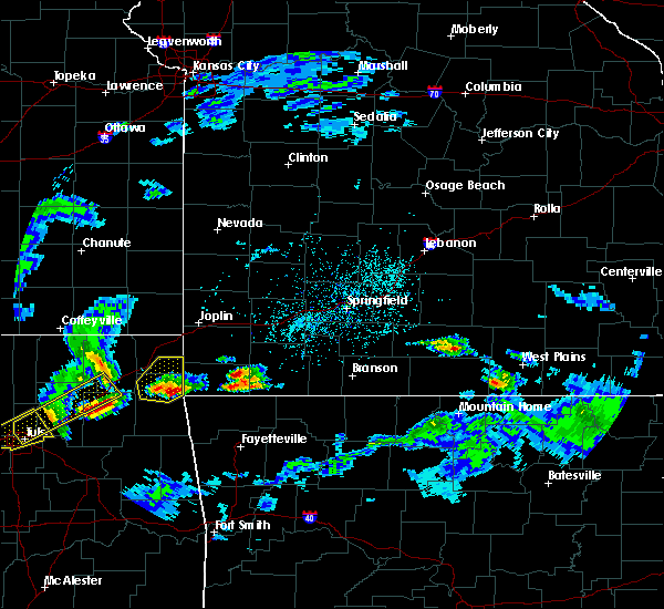 At 323 pm cdt, a severe thunderstorm was located near south west city, or 9 miles northeast of jay, moving northeast at 55 mph (radar indicated). Hazards include 60 mph wind gusts and quarter size hail. Hail damage to vehicles is expected. Expect wind damage to roofs, siding, and trees. At 323 pm cdt, a severe thunderstorm was located near south west city, or 9 miles northeast of jay, moving northeast at 55 mph (radar indicated). Hazards include 60 mph wind gusts and quarter size hail. Hail damage to vehicles is expected. Expect wind damage to roofs, siding, and trees.
|
| 3/11/2020 5:45 AM CDT |
 At 545 am cdt, severe thunderstorms were located along a line extending from near neosho to near south west city, moving southeast at 60 mph (radar indicated). Hazards include 60 mph wind gusts and quarter size hail. Hail damage to vehicles is expected. expect wind damage to roofs, siding, and trees. Locations impacted include, neosho, big sugar creek state park, seneca, anderson, noel, dodge, goodman, south west city, pineville, lanagan, stella, powell, rocky comfort, racine, this includes interstate 49 between mile markers 1 and 24. At 545 am cdt, severe thunderstorms were located along a line extending from near neosho to near south west city, moving southeast at 60 mph (radar indicated). Hazards include 60 mph wind gusts and quarter size hail. Hail damage to vehicles is expected. expect wind damage to roofs, siding, and trees. Locations impacted include, neosho, big sugar creek state park, seneca, anderson, noel, dodge, goodman, south west city, pineville, lanagan, stella, powell, rocky comfort, racine, this includes interstate 49 between mile markers 1 and 24.
|
| 3/11/2020 5:35 AM CDT |
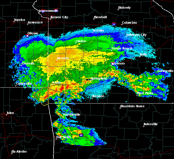 At 534 am cdt, severe thunderstorms were located along a line extending from near seneca to grove, moving southeast at 55 mph (radar indicated). Hazards include 60 mph wind gusts and quarter size hail. Hail damage to vehicles is expected. Expect wind damage to roofs, siding, and trees. At 534 am cdt, severe thunderstorms were located along a line extending from near seneca to grove, moving southeast at 55 mph (radar indicated). Hazards include 60 mph wind gusts and quarter size hail. Hail damage to vehicles is expected. Expect wind damage to roofs, siding, and trees.
|
| 3/11/2020 5:26 AM CDT |
 At 524 am cdt, a severe thunderstorm was located near diamond, or 9 miles northeast of neosho, moving east at 45 mph (trained weather spotters reported quarter size hail in joplin at 515 am this morning as the storm moved through). Hazards include quarter size hail and 60 mph wind. Damage to vehicles is expected. locations impacted include, joplin, neosho, webb city, granby, duquesne, sarcoxie, duenweg, diamond, loma linda, leawood, silver creek, fairview, shoal creek drive, saginaw, fidelity, newtonia, redings mill, wentworth, stark city, grand falls plaza, this includes the following highways, interstate 44 between mile markers 2 and 28. Interstate 49 between mile markers 25 and 36. At 524 am cdt, a severe thunderstorm was located near diamond, or 9 miles northeast of neosho, moving east at 45 mph (trained weather spotters reported quarter size hail in joplin at 515 am this morning as the storm moved through). Hazards include quarter size hail and 60 mph wind. Damage to vehicles is expected. locations impacted include, joplin, neosho, webb city, granby, duquesne, sarcoxie, duenweg, diamond, loma linda, leawood, silver creek, fairview, shoal creek drive, saginaw, fidelity, newtonia, redings mill, wentworth, stark city, grand falls plaza, this includes the following highways, interstate 44 between mile markers 2 and 28. Interstate 49 between mile markers 25 and 36.
|
| 3/11/2020 5:16 AM CDT |
 At 516 am cdt, a severe thunderstorm was located near diamond, or 8 miles southeast of joplin, moving east at 40 mph (radar indicated). Hazards include 60 mph wind gusts and quarter size hail. Hail damage to vehicles is expected. expect wind damage to roofs, siding, and trees. locations impacted include, joplin, neosho, webb city, granby, duquesne, sarcoxie, duenweg, diamond, loma linda, leawood, silver creek, fairview, shoal creek drive, saginaw, fidelity, newtonia, redings mill, wentworth, stark city, grand falls plaza, this includes the following highways, interstate 44 between mile markers 2 and 28. Interstate 49 between mile markers 25 and 36. At 516 am cdt, a severe thunderstorm was located near diamond, or 8 miles southeast of joplin, moving east at 40 mph (radar indicated). Hazards include 60 mph wind gusts and quarter size hail. Hail damage to vehicles is expected. expect wind damage to roofs, siding, and trees. locations impacted include, joplin, neosho, webb city, granby, duquesne, sarcoxie, duenweg, diamond, loma linda, leawood, silver creek, fairview, shoal creek drive, saginaw, fidelity, newtonia, redings mill, wentworth, stark city, grand falls plaza, this includes the following highways, interstate 44 between mile markers 2 and 28. Interstate 49 between mile markers 25 and 36.
|
| 3/11/2020 5:07 AM CDT |
 At 505 am cdt, a severe thunderstorm was located over silver creek, or near joplin, moving east at 45 mph (trained weather spotters reported 1 inch hail in northwestern newton county). Hazards include 60 mph wind gusts and quarter size hail. Hail damage to vehicles is expected. Expect wind damage to roofs, siding, and trees. At 505 am cdt, a severe thunderstorm was located over silver creek, or near joplin, moving east at 45 mph (trained weather spotters reported 1 inch hail in northwestern newton county). Hazards include 60 mph wind gusts and quarter size hail. Hail damage to vehicles is expected. Expect wind damage to roofs, siding, and trees.
|
| 1/10/2020 3:31 PM CST |
 At 330 pm cst, severe thunderstorms were located along a line extending from near sarcoxie to near granby to 6 miles west of fairview, moving east at 55 mph (radar indicated). Hazards include 60 mph wind gusts and quarter size hail. Hail damage to vehicles is expected. expect wind damage to roofs, siding, and trees. Locations impacted include, neosho, monett, mount vernon, granby, sarcoxie, pierce city, diamond, miller, fairview, stotts city, newtonia, pioneer, freistatt, stella, wentworth, stark city, avilla, la russell, reeds, ritchey, this includes interstate 44 between mile markers 21 and 45. At 330 pm cst, severe thunderstorms were located along a line extending from near sarcoxie to near granby to 6 miles west of fairview, moving east at 55 mph (radar indicated). Hazards include 60 mph wind gusts and quarter size hail. Hail damage to vehicles is expected. expect wind damage to roofs, siding, and trees. Locations impacted include, neosho, monett, mount vernon, granby, sarcoxie, pierce city, diamond, miller, fairview, stotts city, newtonia, pioneer, freistatt, stella, wentworth, stark city, avilla, la russell, reeds, ritchey, this includes interstate 44 between mile markers 21 and 45.
|
| 1/10/2020 3:20 PM CST |
 At 319 pm cst, severe thunderstorms were located along a line extending from near diamond to near granby to near goodman, moving northeast at 50 mph (radar indicated). Hazards include 60 mph wind gusts and quarter size hail. Hail damage to vehicles is expected. Expect wind damage to roofs, siding, and trees. At 319 pm cst, severe thunderstorms were located along a line extending from near diamond to near granby to near goodman, moving northeast at 50 mph (radar indicated). Hazards include 60 mph wind gusts and quarter size hail. Hail damage to vehicles is expected. Expect wind damage to roofs, siding, and trees.
|
| 1/10/2020 3:14 PM CST |
 At 314 pm cst, severe thunderstorms were located along a line extending from near neosho to near goodman to near anderson, moving northeast at 50 mph (radar indicated). Hazards include 60 mph wind gusts and quarter size hail. Hail damage to vehicles is expected. expect wind damage to roofs, siding, and trees. Locations impacted include, neosho, anderson, goodman, this includes interstate 49 between mile markers 7 and 20. At 314 pm cst, severe thunderstorms were located along a line extending from near neosho to near goodman to near anderson, moving northeast at 50 mph (radar indicated). Hazards include 60 mph wind gusts and quarter size hail. Hail damage to vehicles is expected. expect wind damage to roofs, siding, and trees. Locations impacted include, neosho, anderson, goodman, this includes interstate 49 between mile markers 7 and 20.
|
| 1/10/2020 2:56 PM CST |
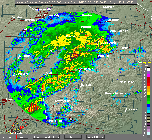 At 255 pm cst, severe thunderstorms were located along a line extending from 7 miles northwest of anderson to near lanagan to near noel, moving northeast at 25 mph (radar indicated). Hazards include 60 mph wind gusts and quarter size hail. Hail damage to vehicles is expected. Expect wind damage to roofs, siding, and trees. At 255 pm cst, severe thunderstorms were located along a line extending from 7 miles northwest of anderson to near lanagan to near noel, moving northeast at 25 mph (radar indicated). Hazards include 60 mph wind gusts and quarter size hail. Hail damage to vehicles is expected. Expect wind damage to roofs, siding, and trees.
|
| 11/26/2019 5:46 PM CST |
 At 546 pm cst, a severe thunderstorm was located near south west city, or 12 miles west of pineville, moving northeast at 55 mph (radar indicated). Hazards include 60 mph wind gusts and quarter size hail. Hail damage to vehicles is expected. Expect wind damage to roofs, siding, and trees. At 546 pm cst, a severe thunderstorm was located near south west city, or 12 miles west of pineville, moving northeast at 55 mph (radar indicated). Hazards include 60 mph wind gusts and quarter size hail. Hail damage to vehicles is expected. Expect wind damage to roofs, siding, and trees.
|
| 10/21/2019 12:06 AM CDT |
 At 1206 am cdt, a severe thunderstorm was located near sarcoxie, or 11 miles west of monett, moving northeast at 65 mph (radar indicated). Hazards include 60 mph wind gusts and quarter size hail. Hail damage to vehicles is expected. expect wind damage to roofs, siding, and trees. locations impacted include, carthage, neosho, big sugar creek state park, monett, granby, anderson, noel, sarcoxie, pierce city, goodman, purdy, south west city, diamond, pineville, wheaton, lanagan, fairview, fidelity, stotts city, newtonia, this includes the following highways, interstate 44 between mile markers 14 and 38. Interstate 49 between mile markers 1 and 18, and between mile markers 36 and 39. At 1206 am cdt, a severe thunderstorm was located near sarcoxie, or 11 miles west of monett, moving northeast at 65 mph (radar indicated). Hazards include 60 mph wind gusts and quarter size hail. Hail damage to vehicles is expected. expect wind damage to roofs, siding, and trees. locations impacted include, carthage, neosho, big sugar creek state park, monett, granby, anderson, noel, sarcoxie, pierce city, goodman, purdy, south west city, diamond, pineville, wheaton, lanagan, fairview, fidelity, stotts city, newtonia, this includes the following highways, interstate 44 between mile markers 14 and 38. Interstate 49 between mile markers 1 and 18, and between mile markers 36 and 39.
|
| 10/20/2019 11:43 PM CDT |
 At 1142 pm cdt, a severe thunderstorm was located near goodman, or 10 miles southwest of neosho, moving northeast at 45 mph (radar indicated). Hazards include 60 mph wind gusts and quarter size hail. Hail damage to vehicles is expected. Expect wind damage to roofs, siding, and trees. At 1142 pm cdt, a severe thunderstorm was located near goodman, or 10 miles southwest of neosho, moving northeast at 45 mph (radar indicated). Hazards include 60 mph wind gusts and quarter size hail. Hail damage to vehicles is expected. Expect wind damage to roofs, siding, and trees.
|
| 10/20/2019 10:56 PM CDT |
 At 1055 pm cdt, a severe thunderstorm was located over seneca, or 11 miles west of neosho, moving northeast at 55 mph (radar indicated). Hazards include 60 mph wind gusts and quarter size hail. Hail damage to vehicles is expected. Expect wind damage to roofs, siding, and trees. At 1055 pm cdt, a severe thunderstorm was located over seneca, or 11 miles west of neosho, moving northeast at 55 mph (radar indicated). Hazards include 60 mph wind gusts and quarter size hail. Hail damage to vehicles is expected. Expect wind damage to roofs, siding, and trees.
|
| 10/10/2019 10:26 AM CDT |
 At 1025 am cdt, a severe thunderstorm was located over neosho, moving northeast at 30 mph. additional storms were also moving back through northwest mcdonald county (radar indicated). Hazards include 60 mph wind gusts and penny size hail. Expect damage to roofs, siding, and trees. Locations impacted include, neosho, granby, goodman, diamond, newtonia, wentworth, stark city, ritchey, this includes interstate 49 between mile markers 13 and 30. At 1025 am cdt, a severe thunderstorm was located over neosho, moving northeast at 30 mph. additional storms were also moving back through northwest mcdonald county (radar indicated). Hazards include 60 mph wind gusts and penny size hail. Expect damage to roofs, siding, and trees. Locations impacted include, neosho, granby, goodman, diamond, newtonia, wentworth, stark city, ritchey, this includes interstate 49 between mile markers 13 and 30.
|
| 10/10/2019 10:11 AM CDT | Damage shed and trees. shed had roof removed. some trees blown down. time estimated via rada in newton county MO, 3.2 miles SE of Neosho, MO |
| 10/10/2019 9:54 AM CDT |
 At 954 am cdt, a severe thunderstorm was located near seneca, or 14 miles southwest of neosho, moving northeast at 30 mph (radar indicated). Hazards include 60 mph wind gusts and nickel size hail. expect damage to roofs, siding, and trees At 954 am cdt, a severe thunderstorm was located near seneca, or 14 miles southwest of neosho, moving northeast at 30 mph (radar indicated). Hazards include 60 mph wind gusts and nickel size hail. expect damage to roofs, siding, and trees
|
| 9/25/2019 11:10 PM CDT |
 The severe thunderstorm warning for southwestern newton and northwestern mcdonald counties will expire at 1115 pm cdt, the storm which prompted the warning has weakened below severe limits, and no longer poses an immediate threat to life or property. therefore, the warning will be allowed to expire. however gusty winds and heavy rain are still possible with this thunderstorm. a severe thunderstorm watch remains in effect until 500 am cdt for southwestern missouri. remember, a severe thunderstorm warning still remains in effect for southwestern mcdonald county until 1130 pm. The severe thunderstorm warning for southwestern newton and northwestern mcdonald counties will expire at 1115 pm cdt, the storm which prompted the warning has weakened below severe limits, and no longer poses an immediate threat to life or property. therefore, the warning will be allowed to expire. however gusty winds and heavy rain are still possible with this thunderstorm. a severe thunderstorm watch remains in effect until 500 am cdt for southwestern missouri. remember, a severe thunderstorm warning still remains in effect for southwestern mcdonald county until 1130 pm.
|
| 9/25/2019 10:53 PM CDT |
 At 1053 pm cdt, a severe thunderstorm was located near goodman, or 8 miles southwest of neosho, moving southeast at 25 mph (radar indicated). Hazards include 60 mph wind gusts and quarter size hail. Hail damage to vehicles is expected. expect wind damage to roofs, siding, and trees. Locations impacted include, neosho, seneca, anderson, goodman, this includes interstate 49 between mile markers 6 and 24. At 1053 pm cdt, a severe thunderstorm was located near goodman, or 8 miles southwest of neosho, moving southeast at 25 mph (radar indicated). Hazards include 60 mph wind gusts and quarter size hail. Hail damage to vehicles is expected. expect wind damage to roofs, siding, and trees. Locations impacted include, neosho, seneca, anderson, goodman, this includes interstate 49 between mile markers 6 and 24.
|
| 9/25/2019 10:34 PM CDT |
 At 1034 pm cdt, a severe thunderstorm was located near seneca, or 11 miles west of neosho, moving southeast at 15 mph (radar indicated). Hazards include 60 mph wind gusts and quarter size hail. Hail damage to vehicles is expected. Expect wind damage to roofs, siding, and trees. At 1034 pm cdt, a severe thunderstorm was located near seneca, or 11 miles west of neosho, moving southeast at 15 mph (radar indicated). Hazards include 60 mph wind gusts and quarter size hail. Hail damage to vehicles is expected. Expect wind damage to roofs, siding, and trees.
|
| 8/26/2019 10:29 PM CDT |
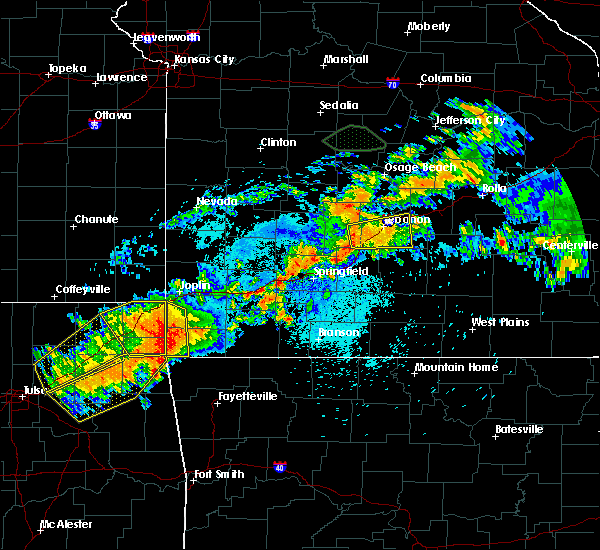 At 1028 pm cdt, a severe thunderstorm was located over anderson, or 7 miles northwest of pineville, moving southeast at 30 mph (radar indicated). Hazards include 60 mph wind gusts and penny size hail. expect damage to roofs, siding, and trees At 1028 pm cdt, a severe thunderstorm was located over anderson, or 7 miles northwest of pineville, moving southeast at 30 mph (radar indicated). Hazards include 60 mph wind gusts and penny size hail. expect damage to roofs, siding, and trees
|
| 8/26/2019 10:15 PM CDT |
 At 1014 pm cdt, a severe thunderstorm was located over anderson, or near pineville, moving southeast at 25 mph (radar indicated). Hazards include 70 mph wind gusts and quarter size hail. Hail damage to vehicles is expected. expect considerable tree damage. wind damage is also likely to mobile homes, roofs, and outbuildings. Locations impacted include, seneca, anderson, noel, dodge, south west city, loma linda, lanagan, racine, this includes interstate 49 near mile marker 14. At 1014 pm cdt, a severe thunderstorm was located over anderson, or near pineville, moving southeast at 25 mph (radar indicated). Hazards include 70 mph wind gusts and quarter size hail. Hail damage to vehicles is expected. expect considerable tree damage. wind damage is also likely to mobile homes, roofs, and outbuildings. Locations impacted include, seneca, anderson, noel, dodge, south west city, loma linda, lanagan, racine, this includes interstate 49 near mile marker 14.
|
| 8/26/2019 9:42 PM CDT |
 At 942 pm cdt, a severe thunderstorm was located over wyandotte, or 12 miles southeast of miami, moving southeast at 25 mph (radar indicated). Hazards include 60 mph wind gusts and quarter size hail. Hail damage to vehicles is expected. Expect wind damage to roofs, siding, and trees. At 942 pm cdt, a severe thunderstorm was located over wyandotte, or 12 miles southeast of miami, moving southeast at 25 mph (radar indicated). Hazards include 60 mph wind gusts and quarter size hail. Hail damage to vehicles is expected. Expect wind damage to roofs, siding, and trees.
|
| 8/26/2019 9:16 PM CDT |
 At 915 pm cdt, severe thunderstorms were located along a line extending from joplin to seneca, moving southeast at 15 mph (radar indicated). Hazards include 60 mph wind gusts and quarter size hail. Hail damage to vehicles is expected. expect wind damage to roofs, siding, and trees. locations impacted include, joplin, neosho, webb city, galena, seneca, duquesne, duenweg, diamond, loma linda, leawood, silver creek, shoal creek drive, saginaw, fidelity, redings mill, grand falls plaza, shoal creek estates, dennis acres, cliff village, atlas, this includes the following highways, interstate 44 between mile markers 0 and 19. Interstate 49 between mile markers 16 and 37. At 915 pm cdt, severe thunderstorms were located along a line extending from joplin to seneca, moving southeast at 15 mph (radar indicated). Hazards include 60 mph wind gusts and quarter size hail. Hail damage to vehicles is expected. expect wind damage to roofs, siding, and trees. locations impacted include, joplin, neosho, webb city, galena, seneca, duquesne, duenweg, diamond, loma linda, leawood, silver creek, shoal creek drive, saginaw, fidelity, redings mill, grand falls plaza, shoal creek estates, dennis acres, cliff village, atlas, this includes the following highways, interstate 44 between mile markers 0 and 19. Interstate 49 between mile markers 16 and 37.
|
| 8/26/2019 9:00 PM CDT |
 At 900 pm cdt, severe thunderstorms were located along a line extending from near webb city to near seneca, moving southeast at 30 mph (radar indicated). Hazards include 60 mph wind gusts and half dollar size hail. Hail damage to vehicles is expected. expect wind damage to roofs, siding, and trees. locations impacted include, joplin, carthage, neosho, webb city, carl junction, baxter springs, galena, oronogo, seneca, carterville, duquesne, duenweg, diamond, loma linda, airport drive, leawood, lowell, silver creek, shoal creek drive, saginaw, this includes the following highways, interstate 44 between mile markers 0 and 19. Interstate 49 between mile markers 16 and 44. At 900 pm cdt, severe thunderstorms were located along a line extending from near webb city to near seneca, moving southeast at 30 mph (radar indicated). Hazards include 60 mph wind gusts and half dollar size hail. Hail damage to vehicles is expected. expect wind damage to roofs, siding, and trees. locations impacted include, joplin, carthage, neosho, webb city, carl junction, baxter springs, galena, oronogo, seneca, carterville, duquesne, duenweg, diamond, loma linda, airport drive, leawood, lowell, silver creek, shoal creek drive, saginaw, this includes the following highways, interstate 44 between mile markers 0 and 19. Interstate 49 between mile markers 16 and 44.
|
| 8/26/2019 8:47 PM CDT |
 At 847 pm cdt, a severe thunderstorm was located over galena, or near baxter springs, moving southeast at 15 mph (radar indicated). Hazards include two inch hail and 60 mph wind gusts. People and animals outdoors will be injured. expect hail damage to roofs, siding, windows, and vehicles. Expect wind damage to roofs, siding, and trees. At 847 pm cdt, a severe thunderstorm was located over galena, or near baxter springs, moving southeast at 15 mph (radar indicated). Hazards include two inch hail and 60 mph wind gusts. People and animals outdoors will be injured. expect hail damage to roofs, siding, windows, and vehicles. Expect wind damage to roofs, siding, and trees.
|
| 7/21/2019 10:54 PM CDT |
 The severe thunderstorm warning for southern barton, newton and jasper counties will expire at 1100 pm cdt, the storms which prompted the warning have weakened below severe limits, and no longer pose an immediate threat to life or property. therefore, the warning will be allowed to expire. however gusty winds and heavy rain are still possible with these thunderstorms. a severe thunderstorm watch remains in effect until midnight cdt for southeastern kansas, and southwestern missouri. The severe thunderstorm warning for southern barton, newton and jasper counties will expire at 1100 pm cdt, the storms which prompted the warning have weakened below severe limits, and no longer pose an immediate threat to life or property. therefore, the warning will be allowed to expire. however gusty winds and heavy rain are still possible with these thunderstorms. a severe thunderstorm watch remains in effect until midnight cdt for southeastern kansas, and southwestern missouri.
|
| 7/21/2019 10:38 PM CDT |
 At 1038 pm cdt, severe thunderstorms were located along a line extending from near jasper to near carthage to near neosho to 6 miles southeast of seneca, moving southeast at 55 mph (trained weather spotters). Hazards include 60 mph wind gusts. Expect damage to roofs, siding, and trees. locations impacted include, joplin, carthage, neosho, webb city, carl junction, galena, oronogo, seneca, granby, carterville, duquesne, sarcoxie, duenweg, jasper, diamond, golden city, loma linda, airport drive, leawood, silver creek, this includes the following highways, interstate 44 between mile markers 0 and 32. Interstate 49 between mile markers 16 and 63. At 1038 pm cdt, severe thunderstorms were located along a line extending from near jasper to near carthage to near neosho to 6 miles southeast of seneca, moving southeast at 55 mph (trained weather spotters). Hazards include 60 mph wind gusts. Expect damage to roofs, siding, and trees. locations impacted include, joplin, carthage, neosho, webb city, carl junction, galena, oronogo, seneca, granby, carterville, duquesne, sarcoxie, duenweg, jasper, diamond, golden city, loma linda, airport drive, leawood, silver creek, this includes the following highways, interstate 44 between mile markers 0 and 32. Interstate 49 between mile markers 16 and 63.
|
| 7/21/2019 10:12 PM CDT |
 At 1010 pm cdt, severe thunderstorms were located along a line extending from near mindenmines to carl junction to near baxter springs to near miami, moving southeast at 35 mph. at 1005 pm cdt there was a report of 60 mph winds west of joplin (trained weather spotters). Hazards include 60 mph wind gusts. Expect damage to roofs, siding, and trees. locations impacted include, joplin, pittsburg, carthage, neosho, webb city, carl junction, frontenac, galena, oronogo, seneca, granby, carterville, duquesne, sarcoxie, duenweg, jasper, diamond, golden city, loma linda, airport drive, this includes the following highways, interstate 44 between mile markers 0 and 32. Interstate 49 between mile markers 16 and 63. At 1010 pm cdt, severe thunderstorms were located along a line extending from near mindenmines to carl junction to near baxter springs to near miami, moving southeast at 35 mph. at 1005 pm cdt there was a report of 60 mph winds west of joplin (trained weather spotters). Hazards include 60 mph wind gusts. Expect damage to roofs, siding, and trees. locations impacted include, joplin, pittsburg, carthage, neosho, webb city, carl junction, frontenac, galena, oronogo, seneca, granby, carterville, duquesne, sarcoxie, duenweg, jasper, diamond, golden city, loma linda, airport drive, this includes the following highways, interstate 44 between mile markers 0 and 32. Interstate 49 between mile markers 16 and 63.
|
| 7/21/2019 9:53 PM CDT |
 At 953 pm cdt, severe thunderstorms were located along a line extending from near mindenmines to 7 miles southeast of weir to near chetopa, moving east at 40 mph (radar indicated). Hazards include 60 mph wind gusts. expect damage to roofs, siding, and trees At 953 pm cdt, severe thunderstorms were located along a line extending from near mindenmines to 7 miles southeast of weir to near chetopa, moving east at 40 mph (radar indicated). Hazards include 60 mph wind gusts. expect damage to roofs, siding, and trees
|
| 6/19/2019 4:56 AM CDT |
 The severe thunderstorm warning for newton and mcdonald counties will expire at 500 am cdt, the storms which prompted the warning have weakened below severe limits, and no longer pose an immediate threat to life or property. therefore, the warning will be allowed to expire. however small hail, gusty winds and heavy rain are still possible with these thunderstorms. The severe thunderstorm warning for newton and mcdonald counties will expire at 500 am cdt, the storms which prompted the warning have weakened below severe limits, and no longer pose an immediate threat to life or property. therefore, the warning will be allowed to expire. however small hail, gusty winds and heavy rain are still possible with these thunderstorms.
|
| 6/19/2019 4:52 AM CDT |
 At 451 am cdt, severe thunderstorms were located along a line extending from near granby to near anderson to near noel, moving southeast at 25 mph (radar indicated). Hazards include 60 mph wind gusts and quarter size hail. Hail damage to vehicles is expected. expect wind damage to roofs, siding, and trees. Locations impacted include, neosho, big sugar creek state park, seneca, granby, anderson, noel, dodge, goodman, south west city, diamond, pineville, lanagan, this includes interstate 49 between mile markers 1 and 32. At 451 am cdt, severe thunderstorms were located along a line extending from near granby to near anderson to near noel, moving southeast at 25 mph (radar indicated). Hazards include 60 mph wind gusts and quarter size hail. Hail damage to vehicles is expected. expect wind damage to roofs, siding, and trees. Locations impacted include, neosho, big sugar creek state park, seneca, granby, anderson, noel, dodge, goodman, south west city, diamond, pineville, lanagan, this includes interstate 49 between mile markers 1 and 32.
|
| 6/19/2019 4:37 AM CDT |
 At 436 am cdt, severe thunderstorms were located along a line extending from near duenweg to near neosho to near south west city, moving east at 30 mph (radar indicated). Hazards include 60 mph wind gusts and quarter size hail. Hail damage to vehicles is expected. expect wind damage to roofs, siding, and trees. locations impacted include, joplin, carthage, neosho, webb city, big sugar creek state park, carl junction, seneca, granby, anderson, carterville, noel, duquesne, dodge, sarcoxie, goodman, duenweg, south west city, diamond, pineville, loma linda, this includes the following highways, interstate 44 between mile markers 2 and 32. Interstate 49 between mile markers 1 and 41. At 436 am cdt, severe thunderstorms were located along a line extending from near duenweg to near neosho to near south west city, moving east at 30 mph (radar indicated). Hazards include 60 mph wind gusts and quarter size hail. Hail damage to vehicles is expected. expect wind damage to roofs, siding, and trees. locations impacted include, joplin, carthage, neosho, webb city, big sugar creek state park, carl junction, seneca, granby, anderson, carterville, noel, duquesne, dodge, sarcoxie, goodman, duenweg, south west city, diamond, pineville, loma linda, this includes the following highways, interstate 44 between mile markers 2 and 32. Interstate 49 between mile markers 1 and 41.
|
| 6/19/2019 4:17 AM CDT |
 At 416 am cdt, severe thunderstorms were located along a line extending from joplin to near seneca to near honey creek state park, moving east at 30 mph (radar indicated). Hazards include 60 mph wind gusts and quarter size hail. Hail damage to vehicles is expected. Expect wind damage to roofs, siding, and trees. At 416 am cdt, severe thunderstorms were located along a line extending from joplin to near seneca to near honey creek state park, moving east at 30 mph (radar indicated). Hazards include 60 mph wind gusts and quarter size hail. Hail damage to vehicles is expected. Expect wind damage to roofs, siding, and trees.
|
| 5/23/2019 5:23 AM CDT |
 The severe thunderstorm warning for northeastern newton and southeastern jasper counties will expire at 530 am cdt, the storm which prompted the warning has moved out of the area. therefore, the warning will be allowed to expire. however gusty winds and heavy rain are still possible with this thunderstorm. a tornado watch remains in effect until 600 am cdt for southwestern missouri. The severe thunderstorm warning for northeastern newton and southeastern jasper counties will expire at 530 am cdt, the storm which prompted the warning has moved out of the area. therefore, the warning will be allowed to expire. however gusty winds and heavy rain are still possible with this thunderstorm. a tornado watch remains in effect until 600 am cdt for southwestern missouri.
|
| 5/23/2019 4:52 AM CDT |
 At 452 am cdt, a severe thunderstorm was located near saginaw, or 7 miles southeast of joplin, moving east at 35 mph (radar indicated). Hazards include 60 mph wind gusts and half dollar size hail. Hail damage to vehicles is expected. expect wind damage to roofs, siding, and trees. locations impacted include, southeastern joplin, carthage, granby, duquesne, sarcoxie, duenweg, diamond, leawood, silver creek, saginaw, fidelity, avilla, reeds, atlas, this includes the following highways, interstate 44 between mile markers 8 and 31. Interstate 49 between mile markers 29 and 39. At 452 am cdt, a severe thunderstorm was located near saginaw, or 7 miles southeast of joplin, moving east at 35 mph (radar indicated). Hazards include 60 mph wind gusts and half dollar size hail. Hail damage to vehicles is expected. expect wind damage to roofs, siding, and trees. locations impacted include, southeastern joplin, carthage, granby, duquesne, sarcoxie, duenweg, diamond, leawood, silver creek, saginaw, fidelity, avilla, reeds, atlas, this includes the following highways, interstate 44 between mile markers 8 and 31. Interstate 49 between mile markers 29 and 39.
|
| 5/23/2019 4:38 AM CDT |
 At 438 am cdt, a severe thunderstorm was located over saginaw, or near joplin, moving northeast at 40 mph (radar indicated). Hazards include 60 mph wind gusts and half dollar size hail. Hail damage to vehicles is expected. Expect wind damage to roofs, siding, and trees. At 438 am cdt, a severe thunderstorm was located over saginaw, or near joplin, moving northeast at 40 mph (radar indicated). Hazards include 60 mph wind gusts and half dollar size hail. Hail damage to vehicles is expected. Expect wind damage to roofs, siding, and trees.
|
| 5/23/2019 2:46 AM CDT |
 At 246 am cdt, a severe thunderstorm was located over goodman, or 7 miles south of neosho, moving east at 25 mph (radar indicated). Hazards include 60 mph wind gusts and quarter size hail. Hail damage to vehicles is expected. expect wind damage to roofs, siding, and trees. Locations impacted include, neosho, big sugar creek state park, granby, anderson, goodman, diamond, wheaton, lanagan, fairview, newtonia, stella, wentworth, cayuga, stark city, ritchey, tiff city, powell, rocky comfort, this includes interstate 49 between mile markers 5 and 25. At 246 am cdt, a severe thunderstorm was located over goodman, or 7 miles south of neosho, moving east at 25 mph (radar indicated). Hazards include 60 mph wind gusts and quarter size hail. Hail damage to vehicles is expected. expect wind damage to roofs, siding, and trees. Locations impacted include, neosho, big sugar creek state park, granby, anderson, goodman, diamond, wheaton, lanagan, fairview, newtonia, stella, wentworth, cayuga, stark city, ritchey, tiff city, powell, rocky comfort, this includes interstate 49 between mile markers 5 and 25.
|
| 5/23/2019 2:25 AM CDT |
 At 225 am cdt, a severe thunderstorm was located 8 miles southeast of seneca, or 13 miles northwest of pineville, moving east at 35 mph (radar indicated). Hazards include ping pong ball size hail and 60 mph wind gusts. People and animals outdoors will be injured. expect hail damage to roofs, siding, windows, and vehicles. expect wind damage to roofs, siding, and trees. Locations impacted include, neosho, big sugar creek state park, seneca, granby, anderson, goodman, diamond, wheaton, lanagan, fairview, saginaw, newtonia, stella, wentworth, cayuga, stark city, ritchey, tiff city, powell, rocky comfort, this includes interstate 49 between mile markers 5 and 35. At 225 am cdt, a severe thunderstorm was located 8 miles southeast of seneca, or 13 miles northwest of pineville, moving east at 35 mph (radar indicated). Hazards include ping pong ball size hail and 60 mph wind gusts. People and animals outdoors will be injured. expect hail damage to roofs, siding, windows, and vehicles. expect wind damage to roofs, siding, and trees. Locations impacted include, neosho, big sugar creek state park, seneca, granby, anderson, goodman, diamond, wheaton, lanagan, fairview, saginaw, newtonia, stella, wentworth, cayuga, stark city, ritchey, tiff city, powell, rocky comfort, this includes interstate 49 between mile markers 5 and 35.
|
| 5/23/2019 2:13 AM CDT |
 At 212 am cdt, a severe thunderstorm was located near wyandotte, or 14 miles southeast of miami, moving east at 25 mph. other strong to severe thunderstorms were located over central and northern newton county. these storms are also moving east at 25 mph (radar indicated). Hazards include ping pong ball size hail and 60 mph wind gusts. People and animals outdoors will be injured. expect hail damage to roofs, siding, windows, and vehicles. Expect wind damage to roofs, siding, and trees. At 212 am cdt, a severe thunderstorm was located near wyandotte, or 14 miles southeast of miami, moving east at 25 mph. other strong to severe thunderstorms were located over central and northern newton county. these storms are also moving east at 25 mph (radar indicated). Hazards include ping pong ball size hail and 60 mph wind gusts. People and animals outdoors will be injured. expect hail damage to roofs, siding, windows, and vehicles. Expect wind damage to roofs, siding, and trees.
|
| 5/23/2019 1:57 AM CDT |
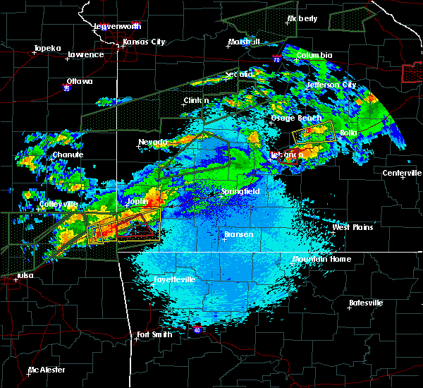 At 156 am cdt, a severe thunderstorm capable of producing a tornado was located near neosho, moving northeast at 30 mph (radar indicated rotation). Hazards include tornado and half dollar size hail. Flying debris will be dangerous to those caught without shelter. mobile homes will be damaged or destroyed. damage to roofs, windows, and vehicles will occur. tree damage is likely. Locations impacted include, neosho, granby, this includes interstate 49 between mile markers 17 and 26. At 156 am cdt, a severe thunderstorm capable of producing a tornado was located near neosho, moving northeast at 30 mph (radar indicated rotation). Hazards include tornado and half dollar size hail. Flying debris will be dangerous to those caught without shelter. mobile homes will be damaged or destroyed. damage to roofs, windows, and vehicles will occur. tree damage is likely. Locations impacted include, neosho, granby, this includes interstate 49 between mile markers 17 and 26.
|
| 5/23/2019 1:39 AM CDT |
 At 139 am cdt, a confirmed tornado was located near seneca, or 14 miles southwest of neosho, moving northeast at 25 mph (emergency management confirmed tornado). Hazards include damaging tornado and half dollar size hail. Flying debris will be dangerous to those caught without shelter. mobile homes will be damaged or destroyed. damage to roofs, windows, and vehicles will occur. tree damage is likely. Locations impacted include, neosho, seneca, granby, goodman, stella, this includes interstate 49 between mile markers 11 and 26. At 139 am cdt, a confirmed tornado was located near seneca, or 14 miles southwest of neosho, moving northeast at 25 mph (emergency management confirmed tornado). Hazards include damaging tornado and half dollar size hail. Flying debris will be dangerous to those caught without shelter. mobile homes will be damaged or destroyed. damage to roofs, windows, and vehicles will occur. tree damage is likely. Locations impacted include, neosho, seneca, granby, goodman, stella, this includes interstate 49 between mile markers 11 and 26.
|
| 5/23/2019 1:29 AM CDT |
 The national weather service in springfield has issued a * tornado warning for. southwestern newton county in southwestern missouri. northern mcdonald county in southwestern missouri. until 215 am cdt. At 129 am cdt, a confirmed tornado was located near wyandotte, or. The national weather service in springfield has issued a * tornado warning for. southwestern newton county in southwestern missouri. northern mcdonald county in southwestern missouri. until 215 am cdt. At 129 am cdt, a confirmed tornado was located near wyandotte, or.
|
| 5/23/2019 1:19 AM CDT |
 At 117 am cdt, a severe thunderstorm was located over wyandotte, or 12 miles southeast of miami, moving east at 35 mph. this storm does have a history of producing tornadoes in northeastern oklahoma (radar indicated). Hazards include 60 mph wind gusts and half dollar size hail. Hail damage to vehicles is expected. Expect wind damage to roofs, siding, and trees. At 117 am cdt, a severe thunderstorm was located over wyandotte, or 12 miles southeast of miami, moving east at 35 mph. this storm does have a history of producing tornadoes in northeastern oklahoma (radar indicated). Hazards include 60 mph wind gusts and half dollar size hail. Hail damage to vehicles is expected. Expect wind damage to roofs, siding, and trees.
|
| 5/22/2019 10:26 PM CDT |
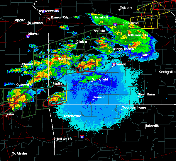 At 1024 pm cdt, a severe thunderstorm was located near lanagan, or 7 miles west of pineville, moving east at 25 mph (radar indicated). Hazards include 60 mph wind gusts and quarter size hail. Hail damage to vehicles is expected. Expect wind damage to roofs, siding, and trees. At 1024 pm cdt, a severe thunderstorm was located near lanagan, or 7 miles west of pineville, moving east at 25 mph (radar indicated). Hazards include 60 mph wind gusts and quarter size hail. Hail damage to vehicles is expected. Expect wind damage to roofs, siding, and trees.
|
| 5/22/2019 7:11 PM CDT |
 At 711 pm cdt, a severe thunderstorm was located near commerce, or 8 miles northwest of miami, moving east at 20 mph (radar indicated). Hazards include golf ball size hail and 60 mph wind gusts. People and animals outdoors will be injured. expect hail damage to roofs, siding, windows, and vehicles. Expect wind damage to roofs, siding, and trees. At 711 pm cdt, a severe thunderstorm was located near commerce, or 8 miles northwest of miami, moving east at 20 mph (radar indicated). Hazards include golf ball size hail and 60 mph wind gusts. People and animals outdoors will be injured. expect hail damage to roofs, siding, windows, and vehicles. Expect wind damage to roofs, siding, and trees.
|
| 5/21/2019 8:55 AM CDT |
 The severe thunderstorm warning for newton county will expire at 900 am cdt, the storms which prompted the warning have weakened below severe limits, and no longer pose an immediate threat to life or property. therefore, the warning will be allowed to expire. however small hail and gusty winds are still possible with these thunderstorms. The severe thunderstorm warning for newton county will expire at 900 am cdt, the storms which prompted the warning have weakened below severe limits, and no longer pose an immediate threat to life or property. therefore, the warning will be allowed to expire. however small hail and gusty winds are still possible with these thunderstorms.
|
| 5/21/2019 8:51 AM CDT |
 At 850 am cdt, severe thunderstorms were located along a line extending from near shoal creek drive to 6 miles southeast of seneca, moving northeast at 30 mph (radar indicated). Hazards include 60 mph wind gusts and nickel size hail. Expect damage to roofs, siding, and trees. locations impacted include, southern joplin, neosho, seneca, granby, duquesne, diamond, loma linda, leawood, silver creek, shoal creek drive, saginaw, newtonia, redings mill, wentworth, grand falls plaza, shoal creek estates, ritchey, dennis acres, cliff village, racine, this includes the following highways, interstate 44 between mile markers 1 and 9. Interstate 49 between mile markers 15 and 35. At 850 am cdt, severe thunderstorms were located along a line extending from near shoal creek drive to 6 miles southeast of seneca, moving northeast at 30 mph (radar indicated). Hazards include 60 mph wind gusts and nickel size hail. Expect damage to roofs, siding, and trees. locations impacted include, southern joplin, neosho, seneca, granby, duquesne, diamond, loma linda, leawood, silver creek, shoal creek drive, saginaw, newtonia, redings mill, wentworth, grand falls plaza, shoal creek estates, ritchey, dennis acres, cliff village, racine, this includes the following highways, interstate 44 between mile markers 1 and 9. Interstate 49 between mile markers 15 and 35.
|
| 5/21/2019 8:23 AM CDT |
 At 822 am cdt, severe thunderstorms were located along a line extending from 6 miles northwest of seneca to near grove, moving northeast at 35 mph (radar indicated). Hazards include 60 mph wind gusts and nickel size hail. Expect damage to roofs, siding, and trees. locations impacted include, southern joplin, neosho, seneca, granby, duquesne, goodman, diamond, loma linda, leawood, silver creek, shoal creek drive, saginaw, newtonia, redings mill, wentworth, grand falls plaza, shoal creek estates, ritchey, dennis acres, cliff village, this includes the following highways, interstate 44 between mile markers 1 and 9. Interstate 49 between mile markers 12 and 35. At 822 am cdt, severe thunderstorms were located along a line extending from 6 miles northwest of seneca to near grove, moving northeast at 35 mph (radar indicated). Hazards include 60 mph wind gusts and nickel size hail. Expect damage to roofs, siding, and trees. locations impacted include, southern joplin, neosho, seneca, granby, duquesne, goodman, diamond, loma linda, leawood, silver creek, shoal creek drive, saginaw, newtonia, redings mill, wentworth, grand falls plaza, shoal creek estates, ritchey, dennis acres, cliff village, this includes the following highways, interstate 44 between mile markers 1 and 9. Interstate 49 between mile markers 12 and 35.
|
| 5/21/2019 8:05 AM CDT |
 At 804 am cdt, a severe thunderstorm was located near fairland, or 13 miles south of miami, moving northeast at 40 mph (radar indicated). Hazards include 60 mph wind gusts and quarter size hail. Hail damage to vehicles is expected. Expect wind damage to roofs, siding, and trees. At 804 am cdt, a severe thunderstorm was located near fairland, or 13 miles south of miami, moving northeast at 40 mph (radar indicated). Hazards include 60 mph wind gusts and quarter size hail. Hail damage to vehicles is expected. Expect wind damage to roofs, siding, and trees.
|
| 5/20/2019 10:08 PM CDT |
 At 1007 pm cdt, severe thunderstorms were located along a line extending from near pierce city to 8 miles southwest of fairview to noel, moving east at 30 mph (radar indicated). Hazards include 60 mph wind gusts and nickel size hail. Expect damage to roofs, siding, and trees. Locations impacted include, neosho, big sugar creek state park, seneca, granby, anderson, noel, goodman, south west city, pineville, lanagan, fairview, newtonia, stella, wentworth, stark city, ritchey, powell, rocky comfort, this includes interstate 49 between mile markers 1 and 25. At 1007 pm cdt, severe thunderstorms were located along a line extending from near pierce city to 8 miles southwest of fairview to noel, moving east at 30 mph (radar indicated). Hazards include 60 mph wind gusts and nickel size hail. Expect damage to roofs, siding, and trees. Locations impacted include, neosho, big sugar creek state park, seneca, granby, anderson, noel, goodman, south west city, pineville, lanagan, fairview, newtonia, stella, wentworth, stark city, ritchey, powell, rocky comfort, this includes interstate 49 between mile markers 1 and 25.
|
| 5/20/2019 9:26 PM CDT |
 At 925 pm cdt, severe thunderstorms were located along a line extending from near diamond to near neosho to near grove, moving northeast at 55 mph (radar indicated). Hazards include 60 mph wind gusts and nickel size hail. expect damage to roofs, siding, and trees At 925 pm cdt, severe thunderstorms were located along a line extending from near diamond to near neosho to near grove, moving northeast at 55 mph (radar indicated). Hazards include 60 mph wind gusts and nickel size hail. expect damage to roofs, siding, and trees
|
| 5/20/2019 5:15 PM CDT |
 At 515 pm cdt, a severe thunderstorm was located near shoal creek drive, or near joplin, moving northeast at 50 mph (radar indicated). Hazards include 60 mph wind gusts. Expect damage to roofs, siding, and trees. locations impacted include, joplin, carthage, webb city, carl junction, oronogo, seneca, carterville, duquesne, sarcoxie, duenweg, diamond, loma linda, airport drive, leawood, silver creek, shoal creek drive, saginaw, fidelity, redings mill, avilla, this includes the following highways, interstate 44 between mile markers 1 and 31. Interstate 49 between mile markers 24 and 46. At 515 pm cdt, a severe thunderstorm was located near shoal creek drive, or near joplin, moving northeast at 50 mph (radar indicated). Hazards include 60 mph wind gusts. Expect damage to roofs, siding, and trees. locations impacted include, joplin, carthage, webb city, carl junction, oronogo, seneca, carterville, duquesne, sarcoxie, duenweg, diamond, loma linda, airport drive, leawood, silver creek, shoal creek drive, saginaw, fidelity, redings mill, avilla, this includes the following highways, interstate 44 between mile markers 1 and 31. Interstate 49 between mile markers 24 and 46.
|
| 5/20/2019 4:59 PM CDT |
 At 459 pm cdt, a severe thunderstorm was located near seneca, or 9 miles east of miami, moving northeast at 50 mph (radar indicated). Hazards include 60 mph wind gusts. expect damage to roofs, siding, and trees At 459 pm cdt, a severe thunderstorm was located near seneca, or 9 miles east of miami, moving northeast at 50 mph (radar indicated). Hazards include 60 mph wind gusts. expect damage to roofs, siding, and trees
|
| 5/20/2019 1:57 PM CDT |
 At 157 pm cdt, severe thunderstorms were located along a line extending from joplin to near neosho to near goodman, moving northeast at 45 mph (radar indicated). Hazards include 60 mph wind gusts and quarter size hail. Hail damage to vehicles is expected. expect wind damage to roofs, siding, and trees. locations impacted include, joplin, carthage, neosho, webb city, big sugar creek state park, granby, anderson, carterville, duquesne, sarcoxie, goodman, duenweg, diamond, leawood, silver creek, fairview, shoal creek drive, saginaw, fidelity, newtonia, this includes the following highways, interstate 44 between mile markers 6 and 31. Interstate 49 between mile markers 6 and 41. At 157 pm cdt, severe thunderstorms were located along a line extending from joplin to near neosho to near goodman, moving northeast at 45 mph (radar indicated). Hazards include 60 mph wind gusts and quarter size hail. Hail damage to vehicles is expected. expect wind damage to roofs, siding, and trees. locations impacted include, joplin, carthage, neosho, webb city, big sugar creek state park, granby, anderson, carterville, duquesne, sarcoxie, goodman, duenweg, diamond, leawood, silver creek, fairview, shoal creek drive, saginaw, fidelity, newtonia, this includes the following highways, interstate 44 between mile markers 6 and 31. Interstate 49 between mile markers 6 and 41.
|
| 5/20/2019 1:43 PM CDT |
 At 143 pm cdt, severe thunderstorms were located along a line extending from near galena to near seneca to 6 miles west of anderson, moving northeast at 45 mph (radar indicated). Hazards include 60 mph wind gusts and quarter size hail. Hail damage to vehicles is expected. expect wind damage to roofs, siding, and trees. locations impacted include, joplin, carthage, neosho, webb city, big sugar creek state park, seneca, granby, anderson, carterville, duquesne, sarcoxie, goodman, duenweg, diamond, loma linda, leawood, silver creek, fairview, shoal creek drive, saginaw, this includes the following highways, interstate 44 between mile markers 1 and 31. Interstate 49 between mile markers 6 and 41. At 143 pm cdt, severe thunderstorms were located along a line extending from near galena to near seneca to 6 miles west of anderson, moving northeast at 45 mph (radar indicated). Hazards include 60 mph wind gusts and quarter size hail. Hail damage to vehicles is expected. expect wind damage to roofs, siding, and trees. locations impacted include, joplin, carthage, neosho, webb city, big sugar creek state park, seneca, granby, anderson, carterville, duquesne, sarcoxie, goodman, duenweg, diamond, loma linda, leawood, silver creek, fairview, shoal creek drive, saginaw, this includes the following highways, interstate 44 between mile markers 1 and 31. Interstate 49 between mile markers 6 and 41.
|
| 5/20/2019 1:30 PM CDT |
 At 130 pm cdt, a severe thunderstorm was located near wyandotte, or 15 miles southeast of miami, moving east at 45 mph (radar indicated). Hazards include golf ball size hail and 60 mph wind gusts. People and animals outdoors will be injured. expect hail damage to roofs, siding, windows, and vehicles. expect wind damage to roofs, siding, and trees. locations impacted include, joplin, carthage, neosho, webb city, big sugar creek state park, seneca, granby, anderson, carterville, duquesne, dodge, sarcoxie, goodman, duenweg, south west city, diamond, pineville, loma linda, leawood, silver creek, this includes the following highways, interstate 44 between mile markers 0 and 31. Interstate 49 between mile markers 1 and 41. At 130 pm cdt, a severe thunderstorm was located near wyandotte, or 15 miles southeast of miami, moving east at 45 mph (radar indicated). Hazards include golf ball size hail and 60 mph wind gusts. People and animals outdoors will be injured. expect hail damage to roofs, siding, windows, and vehicles. expect wind damage to roofs, siding, and trees. locations impacted include, joplin, carthage, neosho, webb city, big sugar creek state park, seneca, granby, anderson, carterville, duquesne, dodge, sarcoxie, goodman, duenweg, south west city, diamond, pineville, loma linda, leawood, silver creek, this includes the following highways, interstate 44 between mile markers 0 and 31. Interstate 49 between mile markers 1 and 41.
|
| 5/20/2019 1:13 PM CDT |
 At 112 pm cdt, a severe thunderstorm was located near fairland, or 12 miles south of miami, moving east at 45 mph (radar indicated). Hazards include golf ball size hail and 60 mph wind gusts. People and animals outdoors will be injured. expect hail damage to roofs, siding, windows, and vehicles. Expect wind damage to roofs, siding, and trees. At 112 pm cdt, a severe thunderstorm was located near fairland, or 12 miles south of miami, moving east at 45 mph (radar indicated). Hazards include golf ball size hail and 60 mph wind gusts. People and animals outdoors will be injured. expect hail damage to roofs, siding, windows, and vehicles. Expect wind damage to roofs, siding, and trees.
|
| 5/19/2019 1:52 AM CDT | 60 mph wind gusts estimated by trained spotter. minor tree damage near the intersection of iris road and highway n in newton county MO, 6.3 miles SE of Neosho, MO |
| 5/19/2019 1:50 AM CDT |
 The severe thunderstorm warning for eastern newton and northeastern mcdonald counties will expire at 200 am cdt, the storms which prompted the warning have weakened below severe limits, and have exited the warned area. therefore, the warning will be allowed to expire. to report severe weather, contact your nearest law enforcement agency. they will relay your report to the national weather service springfield. The severe thunderstorm warning for eastern newton and northeastern mcdonald counties will expire at 200 am cdt, the storms which prompted the warning have weakened below severe limits, and have exited the warned area. therefore, the warning will be allowed to expire. to report severe weather, contact your nearest law enforcement agency. they will relay your report to the national weather service springfield.
|
| 5/19/2019 1:34 AM CDT |
 At 133 am cdt, severe thunderstorms were located along a line extending from near duenweg to near granby to near anderson, moving east at 55 mph (radar indicated). Hazards include 60 mph wind gusts. Expect damage to roofs, siding, and trees. Locations impacted include, neosho, granby, diamond, wheaton, fairview, newtonia, stella, wentworth, stark city, ritchey, rocky comfort,. At 133 am cdt, severe thunderstorms were located along a line extending from near duenweg to near granby to near anderson, moving east at 55 mph (radar indicated). Hazards include 60 mph wind gusts. Expect damage to roofs, siding, and trees. Locations impacted include, neosho, granby, diamond, wheaton, fairview, newtonia, stella, wentworth, stark city, ritchey, rocky comfort,.
|
| 5/19/2019 1:22 AM CDT | Corrects previous tstm wnd gst report from 4 ene racine. corrects previous tstm wnd gst report from 4 ene racine. 60 mph wind gusts estimated by trained spotter. minor in newton county MO, 6.3 miles SE of Neosho, MO |
| 5/19/2019 1:04 AM CDT |
 At 104 am cdt, severe thunderstorms were located along a line extending from near miami to near wyandotte to bernice state park, moving east at 50 mph (radar indicated). Hazards include 60 mph wind gusts. expect damage to roofs, siding, and trees At 104 am cdt, severe thunderstorms were located along a line extending from near miami to near wyandotte to bernice state park, moving east at 50 mph (radar indicated). Hazards include 60 mph wind gusts. expect damage to roofs, siding, and trees
|
| 5/18/2019 2:25 PM CDT |
 At 224 pm cdt, severe thunderstorms were located along a line extending from 10 miles southeast of hume to near nevada to near sheldon to near carthage to near goodman, moving northeast at 40 mph (radar indicated). Hazards include 60 mph wind gusts and quarter size hail. Hail damage to vehicles is expected. expect wind damage to roofs, siding, and trees. locations impacted include, eastern joplin, carthage, neosho, webb city, big sugar creek state park, prairie state park, roaring river state park, monett, nevada, lamar, el dorado springs, cassville, oronogo, granby, anderson, carterville, duquesne, sarcoxie, pierce city, goodman, this includes the following highways, interstate 44 between mile markers 11 and 42. Interstate 49 between mile markers 1 and 30, and between mile markers 32 and 105. At 224 pm cdt, severe thunderstorms were located along a line extending from 10 miles southeast of hume to near nevada to near sheldon to near carthage to near goodman, moving northeast at 40 mph (radar indicated). Hazards include 60 mph wind gusts and quarter size hail. Hail damage to vehicles is expected. expect wind damage to roofs, siding, and trees. locations impacted include, eastern joplin, carthage, neosho, webb city, big sugar creek state park, prairie state park, roaring river state park, monett, nevada, lamar, el dorado springs, cassville, oronogo, granby, anderson, carterville, duquesne, sarcoxie, pierce city, goodman, this includes the following highways, interstate 44 between mile markers 11 and 42. Interstate 49 between mile markers 1 and 30, and between mile markers 32 and 105.
|
| 5/18/2019 2:11 PM CDT |
 At 210 pm cdt, severe thunderstorms were located along a line extending from near fulton to 8 miles northeast of arcadia to near sheldon to near carthage to near pineville, moving northeast at 45 mph (radar indicated). Hazards include 60 mph wind gusts and quarter size hail. Hail damage to vehicles is expected. expect wind damage to roofs, siding, and trees. locations impacted include, joplin, carthage, neosho, webb city, big sugar creek state park, prairie state park, roaring river state park, monett, nevada, carl junction, lamar, el dorado springs, cassville, oronogo, granby, anderson, carterville, noel, duquesne, sarcoxie, this includes the following highways, interstate 44 between mile markers 5 and 42. Interstate 49 between mile markers 1 and 105. At 210 pm cdt, severe thunderstorms were located along a line extending from near fulton to 8 miles northeast of arcadia to near sheldon to near carthage to near pineville, moving northeast at 45 mph (radar indicated). Hazards include 60 mph wind gusts and quarter size hail. Hail damage to vehicles is expected. expect wind damage to roofs, siding, and trees. locations impacted include, joplin, carthage, neosho, webb city, big sugar creek state park, prairie state park, roaring river state park, monett, nevada, carl junction, lamar, el dorado springs, cassville, oronogo, granby, anderson, carterville, noel, duquesne, sarcoxie, this includes the following highways, interstate 44 between mile markers 5 and 42. Interstate 49 between mile markers 1 and 105.
|
| 5/18/2019 2:11 PM CDT |
 A severe thunderstorm warning remains in effect until 300 pm cdt for northeastern bourbon. barton. newton. western cedar. mcdonald. western barry. western lawrence. vernon. jasper and western dade counties. At 210 pm cdt, severe thunderstorms were located along a line extending from near fulton to 8 miles northeast of arcadia to near. A severe thunderstorm warning remains in effect until 300 pm cdt for northeastern bourbon. barton. newton. western cedar. mcdonald. western barry. western lawrence. vernon. jasper and western dade counties. At 210 pm cdt, severe thunderstorms were located along a line extending from near fulton to 8 miles northeast of arcadia to near.
|
| 5/18/2019 1:55 PM CDT |
 At 154 pm cdt, severe thunderstorms were located along a line extending from near redfield to near arcadia to near mindenmines to joplin to near noel, moving northeast at 40 mph (radar indicated). Hazards include 60 mph wind gusts and quarter size hail. Hail damage to vehicles is expected. Expect wind damage to roofs, siding, and trees. At 154 pm cdt, severe thunderstorms were located along a line extending from near redfield to near arcadia to near mindenmines to joplin to near noel, moving northeast at 40 mph (radar indicated). Hazards include 60 mph wind gusts and quarter size hail. Hail damage to vehicles is expected. Expect wind damage to roofs, siding, and trees.
|
| 5/18/2019 1:55 PM CDT |
 The national weather service in springfield has issued a * severe thunderstorm warning for. bourbon county in southeastern kansas. northeastern crawford county in southeastern kansas. barton county in southwestern missouri. Newton county in southwestern missouri. The national weather service in springfield has issued a * severe thunderstorm warning for. bourbon county in southeastern kansas. northeastern crawford county in southeastern kansas. barton county in southwestern missouri. Newton county in southwestern missouri.
|
| 5/18/2019 1:47 PM CDT |
 At 146 pm cdt, severe thunderstorms were located along a line extending from near bronson to 8 miles southeast of redfield to near mindenmines to near shoal creek drive to 7 miles northwest of anderson, moving north at 55 mph (radar indicated. at 141 pm cdt...powerlines were blown over 2 miles east of pittsburg kansas). Hazards include 60 mph wind gusts and quarter size hail. Hail damage to vehicles is expected. expect wind damage to roofs, siding, and trees. locations impacted include, joplin, pittsburg, carthage, neosho, webb city, big sugar creek state park, prairie state park, fort scott, carl junction, lamar, frontenac, galena, girard, oronogo, seneca, granby, anderson, carterville, noel, duquesne, this includes the following highways, interstate 44 between mile markers 0 and 30. Interstate 49 between mile markers 1 and 85. At 146 pm cdt, severe thunderstorms were located along a line extending from near bronson to 8 miles southeast of redfield to near mindenmines to near shoal creek drive to 7 miles northwest of anderson, moving north at 55 mph (radar indicated. at 141 pm cdt...powerlines were blown over 2 miles east of pittsburg kansas). Hazards include 60 mph wind gusts and quarter size hail. Hail damage to vehicles is expected. expect wind damage to roofs, siding, and trees. locations impacted include, joplin, pittsburg, carthage, neosho, webb city, big sugar creek state park, prairie state park, fort scott, carl junction, lamar, frontenac, galena, girard, oronogo, seneca, granby, anderson, carterville, noel, duquesne, this includes the following highways, interstate 44 between mile markers 0 and 30. Interstate 49 between mile markers 1 and 85.
|
| 5/18/2019 1:32 PM CDT |
 At 132 pm cdt, severe thunderstorms were located along a line extending from near uniontown to near girard to near pittsburg to seneca to near south west city, moving north-northeast at 55 mph (radar indicated). Hazards include 60 mph wind gusts and quarter size hail. Hail damage to vehicles is expected. expect wind damage to roofs, siding, and trees. locations impacted include, joplin, pittsburg, carthage, neosho, webb city, big sugar creek state park, prairie state park, fort scott, carl junction, lamar, baxter springs, frontenac, galena, girard, oronogo, seneca, granby, anderson, carterville, noel, this includes the following highways, interstate 44 between mile markers 0 and 30. Interstate 49 between mile markers 1 and 85. At 132 pm cdt, severe thunderstorms were located along a line extending from near uniontown to near girard to near pittsburg to seneca to near south west city, moving north-northeast at 55 mph (radar indicated). Hazards include 60 mph wind gusts and quarter size hail. Hail damage to vehicles is expected. expect wind damage to roofs, siding, and trees. locations impacted include, joplin, pittsburg, carthage, neosho, webb city, big sugar creek state park, prairie state park, fort scott, carl junction, lamar, baxter springs, frontenac, galena, girard, oronogo, seneca, granby, anderson, carterville, noel, this includes the following highways, interstate 44 between mile markers 0 and 30. Interstate 49 between mile markers 1 and 85.
|
| 5/18/2019 1:13 PM CDT |
 At 113 pm cdt, severe thunderstorms were located along a line extending from near mccune to near scammon to near miami to near maysville, moving north at 55 mph (radar indicated). Hazards include 60 mph wind gusts and half dollar size hail. Hail damage to vehicles is expected. Expect wind damage to roofs, siding, and trees. At 113 pm cdt, severe thunderstorms were located along a line extending from near mccune to near scammon to near miami to near maysville, moving north at 55 mph (radar indicated). Hazards include 60 mph wind gusts and half dollar size hail. Hail damage to vehicles is expected. Expect wind damage to roofs, siding, and trees.
|
| 5/7/2019 12:14 AM CDT |
 At 1214 am cdt, severe thunderstorms were located along a line extending from near fairview to near goodman, moving southeast at 40 mph (trained weather spotters). Hazards include 60 mph wind gusts and penny size hail. Expect damage to roofs, siding, and trees. Locations impacted include, neosho, granby, fairview, newtonia, stella, stark city, ritchey, this includes interstate 49 between mile markers 15 and 25. At 1214 am cdt, severe thunderstorms were located along a line extending from near fairview to near goodman, moving southeast at 40 mph (trained weather spotters). Hazards include 60 mph wind gusts and penny size hail. Expect damage to roofs, siding, and trees. Locations impacted include, neosho, granby, fairview, newtonia, stella, stark city, ritchey, this includes interstate 49 between mile markers 15 and 25.
|
| 5/7/2019 12:13 AM CDT |
 The severe thunderstorm warning for northwestern newton and south central jasper counties will expire at 1215 am cdt, the storm which prompted the warning has moved out of the area. therefore, the warning will be allowed to expire. a severe thunderstorm watch remains in effect until 400 am cdt for southeastern kansas, and southwestern missouri. The severe thunderstorm warning for northwestern newton and south central jasper counties will expire at 1215 am cdt, the storm which prompted the warning has moved out of the area. therefore, the warning will be allowed to expire. a severe thunderstorm watch remains in effect until 400 am cdt for southeastern kansas, and southwestern missouri.
|
| 5/6/2019 11:55 PM CDT |
 At 1154 pm cdt, a severe thunderstorm was located near saginaw, or 8 miles northwest of neosho, moving southeast at 30 mph (trained weather spotters. half dollar to golf ball size hail has been reported with this storm). Hazards include ping pong ball size hail and 60 mph wind gusts. People and animals outdoors will be injured. expect hail damage to roofs, siding, windows, and vehicles. Expect wind damage to roofs, siding, and trees. At 1154 pm cdt, a severe thunderstorm was located near saginaw, or 8 miles northwest of neosho, moving southeast at 30 mph (trained weather spotters. half dollar to golf ball size hail has been reported with this storm). Hazards include ping pong ball size hail and 60 mph wind gusts. People and animals outdoors will be injured. expect hail damage to roofs, siding, windows, and vehicles. Expect wind damage to roofs, siding, and trees.
|
| 5/6/2019 11:51 PM CDT |
 At 1148 pm cdt, a severe thunderstorm was located near saginaw, or 7 miles south of joplin, moving southeast at 30 mph (trained weather spotters. half dollar to golf ball size hail has been reported with this storm). Hazards include ping pong ball size hail and 60 mph wind gusts. People and animals outdoors will be injured. expect hail damage to roofs, siding, windows, and vehicles. expect wind damage to roofs, siding, and trees. locations impacted include, joplin, webb city, seneca, duquesne, duenweg, diamond, loma linda, leawood, silver creek, shoal creek drive, saginaw, redings mill, grand falls plaza, shoal creek estates, dennis acres, cliff village, oakland park, iron gates, racine, this includes the following highways, interstate 44 between mile markers 0 and 14. Interstate 49 between mile markers 24 and 35. At 1148 pm cdt, a severe thunderstorm was located near saginaw, or 7 miles south of joplin, moving southeast at 30 mph (trained weather spotters. half dollar to golf ball size hail has been reported with this storm). Hazards include ping pong ball size hail and 60 mph wind gusts. People and animals outdoors will be injured. expect hail damage to roofs, siding, windows, and vehicles. expect wind damage to roofs, siding, and trees. locations impacted include, joplin, webb city, seneca, duquesne, duenweg, diamond, loma linda, leawood, silver creek, shoal creek drive, saginaw, redings mill, grand falls plaza, shoal creek estates, dennis acres, cliff village, oakland park, iron gates, racine, this includes the following highways, interstate 44 between mile markers 0 and 14. Interstate 49 between mile markers 24 and 35.
|
| 5/6/2019 11:50 PM CDT |
 At 1148 pm cdt, a severe thunderstorm was located near saginaw, or 7 miles south of joplin, moving southeast at 30 mph (trained weather spotters. half dollar to golf ball size hail has been reported with this storm). Hazards include ping pong ball size hail and 60 mph wind gusts. People and animals outdoors will be injured. expect hail damage to roofs, siding, windows, and vehicles. expect wind damage to roofs, siding, and trees. locations impacted include, joplin, webb city, seneca, duquesne, duenweg, diamond, loma linda, leawood, silver creek, shoal creek drive, saginaw, redings mill, grand falls plaza, shoal creek estates, dennis acres, cliff village, oakland park, iron gates, racine, this includes the following highways, interstate 44 between mile markers 0 and 14. Interstate 49 between mile markers 24 and 35. At 1148 pm cdt, a severe thunderstorm was located near saginaw, or 7 miles south of joplin, moving southeast at 30 mph (trained weather spotters. half dollar to golf ball size hail has been reported with this storm). Hazards include ping pong ball size hail and 60 mph wind gusts. People and animals outdoors will be injured. expect hail damage to roofs, siding, windows, and vehicles. expect wind damage to roofs, siding, and trees. locations impacted include, joplin, webb city, seneca, duquesne, duenweg, diamond, loma linda, leawood, silver creek, shoal creek drive, saginaw, redings mill, grand falls plaza, shoal creek estates, dennis acres, cliff village, oakland park, iron gates, racine, this includes the following highways, interstate 44 between mile markers 0 and 14. Interstate 49 between mile markers 24 and 35.
|
| 5/6/2019 11:40 PM CDT |
 At 1139 pm cdt, severe thunderstorms were located along a line extending from near joplin to 6 miles southwest of shoal creek drive, moving southeast at 30 mph (radar indicated. at 11:38 pm half dollar size hail was reported 3 miles southeast of galena, ks). Hazards include ping pong ball size hail and 60 mph wind gusts. People and animals outdoors will be injured. expect hail damage to roofs, siding, windows, and vehicles. expect wind damage to roofs, siding, and trees. locations impacted include, joplin, carthage, webb city, carl junction, galena, oronogo, seneca, carterville, duquesne, duenweg, diamond, loma linda, airport drive, leawood, silver creek, shoal creek drive, saginaw, fidelity, redings mill, grand falls plaza, this includes the following highways, interstate 44 between mile markers 0 and 25. Interstate 49 between mile markers 24 and 42. At 1139 pm cdt, severe thunderstorms were located along a line extending from near joplin to 6 miles southwest of shoal creek drive, moving southeast at 30 mph (radar indicated. at 11:38 pm half dollar size hail was reported 3 miles southeast of galena, ks). Hazards include ping pong ball size hail and 60 mph wind gusts. People and animals outdoors will be injured. expect hail damage to roofs, siding, windows, and vehicles. expect wind damage to roofs, siding, and trees. locations impacted include, joplin, carthage, webb city, carl junction, galena, oronogo, seneca, carterville, duquesne, duenweg, diamond, loma linda, airport drive, leawood, silver creek, shoal creek drive, saginaw, fidelity, redings mill, grand falls plaza, this includes the following highways, interstate 44 between mile markers 0 and 25. Interstate 49 between mile markers 24 and 42.
|
| 5/6/2019 11:34 PM CDT |
 At 1134 pm cdt, severe thunderstorms were located along a line extending from near carl junction to near baxter springs, moving southeast at 25 mph (radar indicated. quarter size hail has been reported with this storm). Hazards include ping pong ball size hail and 60 mph wind gusts. People and animals outdoors will be injured. expect hail damage to roofs, siding, windows, and vehicles. expect wind damage to roofs, siding, and trees. locations impacted include, joplin, carthage, webb city, carl junction, galena, oronogo, seneca, carterville, duquesne, duenweg, diamond, loma linda, airport drive, leawood, silver creek, shoal creek drive, saginaw, fidelity, redings mill, grand falls plaza, this includes the following highways, interstate 44 between mile markers 0 and 25. Interstate 49 between mile markers 24 and 42. At 1134 pm cdt, severe thunderstorms were located along a line extending from near carl junction to near baxter springs, moving southeast at 25 mph (radar indicated. quarter size hail has been reported with this storm). Hazards include ping pong ball size hail and 60 mph wind gusts. People and animals outdoors will be injured. expect hail damage to roofs, siding, windows, and vehicles. expect wind damage to roofs, siding, and trees. locations impacted include, joplin, carthage, webb city, carl junction, galena, oronogo, seneca, carterville, duquesne, duenweg, diamond, loma linda, airport drive, leawood, silver creek, shoal creek drive, saginaw, fidelity, redings mill, grand falls plaza, this includes the following highways, interstate 44 between mile markers 0 and 25. Interstate 49 between mile markers 24 and 42.
|
| 5/6/2019 11:25 PM CDT |
 At 1124 pm cdt, severe thunderstorms were located along a line extending from near carl junction to galena, moving southeast at 30 mph (radar indicated). Hazards include ping pong ball size hail and 60 mph wind gusts. People and animals outdoors will be injured. expect hail damage to roofs, siding, windows, and vehicles. Expect wind damage to roofs, siding, and trees. At 1124 pm cdt, severe thunderstorms were located along a line extending from near carl junction to galena, moving southeast at 30 mph (radar indicated). Hazards include ping pong ball size hail and 60 mph wind gusts. People and animals outdoors will be injured. expect hail damage to roofs, siding, windows, and vehicles. Expect wind damage to roofs, siding, and trees.
|
| 5/3/2019 3:54 PM CDT | Large tree blown down east of goodman via social media repor in mcdonald county MO, 8.8 miles NNW of Neosho, MO |
| 5/3/2019 3:53 PM CDT |
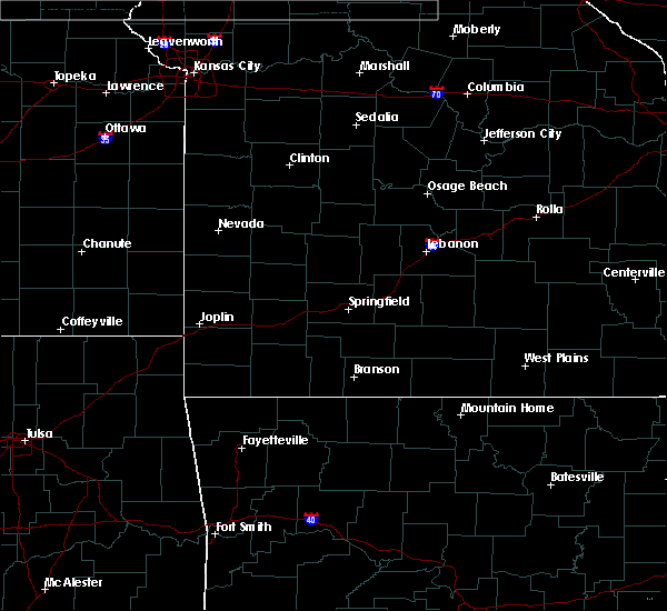 At 353 pm cdt, a severe thunderstorm was located 7 miles east of goodman, or 10 miles southeast of neosho, moving east at 30 mph (radar indicated). Hazards include 60 mph wind gusts and quarter size hail. Hail damage to vehicles is expected. Expect wind damage to roofs, siding, and trees. At 353 pm cdt, a severe thunderstorm was located 7 miles east of goodman, or 10 miles southeast of neosho, moving east at 30 mph (radar indicated). Hazards include 60 mph wind gusts and quarter size hail. Hail damage to vehicles is expected. Expect wind damage to roofs, siding, and trees.
|
| 4/18/2019 12:15 AM CDT |
 At 1214 am cdt, severe thunderstorms were located along a line extending from 9 miles northwest of arma to near seneca, moving east at 65 mph (radar indicated. at 1214 am, 73 mph wind gusts were measured at koam tv). Hazards include 70 mph wind gusts. Expect considerable tree damage. damage is likely to mobile homes, roofs, and outbuildings. locations impacted include, joplin, carthage, webb city, prairie state park, nevada, carl junction, lamar, galena, oronogo, granby, carterville, duquesne, sarcoxie, duenweg, jasper, diamond, golden city, liberal, loma linda, airport drive, this includes the following highways, interstate 44 between mile markers 0 and 32. Interstate 49 between mile markers 25 and 90. At 1214 am cdt, severe thunderstorms were located along a line extending from 9 miles northwest of arma to near seneca, moving east at 65 mph (radar indicated. at 1214 am, 73 mph wind gusts were measured at koam tv). Hazards include 70 mph wind gusts. Expect considerable tree damage. damage is likely to mobile homes, roofs, and outbuildings. locations impacted include, joplin, carthage, webb city, prairie state park, nevada, carl junction, lamar, galena, oronogo, granby, carterville, duquesne, sarcoxie, duenweg, jasper, diamond, golden city, liberal, loma linda, airport drive, this includes the following highways, interstate 44 between mile markers 0 and 32. Interstate 49 between mile markers 25 and 90.
|
| 4/18/2019 12:03 AM CDT |
 At 1200 am cdt, severe thunderstorms were located along a line extending from near walnut to near narcissa, moving east at 65 mph (radar indicated). Hazards include 70 mph wind gusts. Expect considerable tree damage. Damage is likely to mobile homes, roofs, and outbuildings. At 1200 am cdt, severe thunderstorms were located along a line extending from near walnut to near narcissa, moving east at 65 mph (radar indicated). Hazards include 70 mph wind gusts. Expect considerable tree damage. Damage is likely to mobile homes, roofs, and outbuildings.
|
| 3/9/2019 4:36 AM CST |
 At 435 am cst, severe thunderstorms were located along a line extending from joplin to noel, moving northeast at 45 mph (radar indicated). Hazards include 60 mph wind gusts and quarter size hail. Hail damage to vehicles is expected. expect wind damage to roofs, siding, and trees. these severe storms will be near, webb city, oronogo, carterville, duquesne, duenweg and silver creek around 440 am cst. carthage around 450 am cst. wheaton and fairview around 510 am cst. other locations impacted by these severe thunderstorms include big sugar creek state park, carytown, fidelity, newtonia, stella, wentworth, stark city, avilla, la russell and brooklyn heights. this includes the following highways, interstate 44 between mile markers 8 and 32. Interstate 49 between mile markers 1 and 52. At 435 am cst, severe thunderstorms were located along a line extending from joplin to noel, moving northeast at 45 mph (radar indicated). Hazards include 60 mph wind gusts and quarter size hail. Hail damage to vehicles is expected. expect wind damage to roofs, siding, and trees. these severe storms will be near, webb city, oronogo, carterville, duquesne, duenweg and silver creek around 440 am cst. carthage around 450 am cst. wheaton and fairview around 510 am cst. other locations impacted by these severe thunderstorms include big sugar creek state park, carytown, fidelity, newtonia, stella, wentworth, stark city, avilla, la russell and brooklyn heights. this includes the following highways, interstate 44 between mile markers 8 and 32. Interstate 49 between mile markers 1 and 52.
|
| 3/9/2019 4:21 AM CST |
 At 420 am cst, severe thunderstorms were located along a line extending from near loma linda to near south west city, moving northeast at 55 mph (radar indicated). Hazards include 60 mph wind gusts and quarter size hail. Hail damage to vehicles is expected. expect wind damage to roofs, siding, and trees. severe thunderstorms will be near, galena around 425 am cst. joplin, carl junction, leawood, silver creek, shoal creek drive and saginaw around 430 am cst. webb city, oronogo, carterville, duquesne, duenweg and lanagan around 435 am cst. pineville, anderson, alba and purcell around 440 am cst. carthage and goodman around 445 am cst. neosho around 450 am cst. wheaton around 500 am cst. fairview around 505 am cst. other locations impacted by these severe thunderstorms include big sugar creek state park, dodge, loma linda, airport drive, carytown, fidelity, newtonia, neck city, stella and redings mill. this includes the following highways, interstate 44 between mile markers 0 and 32. Interstate 49 between mile markers 1 and 56. At 420 am cst, severe thunderstorms were located along a line extending from near loma linda to near south west city, moving northeast at 55 mph (radar indicated). Hazards include 60 mph wind gusts and quarter size hail. Hail damage to vehicles is expected. expect wind damage to roofs, siding, and trees. severe thunderstorms will be near, galena around 425 am cst. joplin, carl junction, leawood, silver creek, shoal creek drive and saginaw around 430 am cst. webb city, oronogo, carterville, duquesne, duenweg and lanagan around 435 am cst. pineville, anderson, alba and purcell around 440 am cst. carthage and goodman around 445 am cst. neosho around 450 am cst. wheaton around 500 am cst. fairview around 505 am cst. other locations impacted by these severe thunderstorms include big sugar creek state park, dodge, loma linda, airport drive, carytown, fidelity, newtonia, neck city, stella and redings mill. this includes the following highways, interstate 44 between mile markers 0 and 32. Interstate 49 between mile markers 1 and 56.
|
| 2/6/2019 10:50 PM CST | Three trees were blown down from severe thunderstorm wind gusts. one house near granby had shingles blown off of i in newton county MO, 1.5 miles SW of Neosho, MO |
| 2/6/2019 10:36 PM CST |
 At 1035 pm cst, a severe thunderstorm was located near anderson, or 10 miles northwest of pineville, moving northeast at 60 mph (radar indicated). Hazards include 60 mph wind gusts and quarter size hail. Hail damage to vehicles is expected. Expect wind damage to roofs, siding, and trees. At 1035 pm cst, a severe thunderstorm was located near anderson, or 10 miles northwest of pineville, moving northeast at 60 mph (radar indicated). Hazards include 60 mph wind gusts and quarter size hail. Hail damage to vehicles is expected. Expect wind damage to roofs, siding, and trees.
|
| 11/30/2018 11:35 PM CST |
 At 1135 pm cst, severe thunderstorms were located along a line extending from 6 miles north of seneca to near gentry, moving northeast at 80 mph (radar indicated). Hazards include 60 mph wind gusts and quarter size hail. Hail damage to vehicles is expected. Expect wind damage to roofs, siding, and trees. At 1135 pm cst, severe thunderstorms were located along a line extending from 6 miles north of seneca to near gentry, moving northeast at 80 mph (radar indicated). Hazards include 60 mph wind gusts and quarter size hail. Hail damage to vehicles is expected. Expect wind damage to roofs, siding, and trees.
|
| 10/7/2018 2:26 PM CDT |
 At 226 pm cdt, a severe thunderstorm was located near granby, or near neosho, moving northeast at 30 mph (radar indicated). Hazards include 60 mph wind gusts and penny size hail. expect damage to roofs, siding, and trees At 226 pm cdt, a severe thunderstorm was located near granby, or near neosho, moving northeast at 30 mph (radar indicated). Hazards include 60 mph wind gusts and penny size hail. expect damage to roofs, siding, and trees
|
| 10/6/2018 7:20 PM CDT |
 At 718 pm cdt, severe thunderstorms were located along a line extending from near saginaw to near neosho to near goodman, moving northeast at 40 mph (radar indicated. this storm has a history of producing 70 mph winds in grove oklahoma). Hazards include 60 mph wind gusts and penny size hail. Expect damage to roofs, siding, and trees. Locations impacted include, neosho, granby, diamond, newtonia, stella, stark city, ritchey, this includes interstate 49 between mile markers 18 and 33. At 718 pm cdt, severe thunderstorms were located along a line extending from near saginaw to near neosho to near goodman, moving northeast at 40 mph (radar indicated. this storm has a history of producing 70 mph winds in grove oklahoma). Hazards include 60 mph wind gusts and penny size hail. Expect damage to roofs, siding, and trees. Locations impacted include, neosho, granby, diamond, newtonia, stella, stark city, ritchey, this includes interstate 49 between mile markers 18 and 33.
|
| 10/6/2018 6:42 PM CDT |
 At 641 pm cdt, severe thunderstorms were located along a line extending from near fairland to 8 miles northwest of noel to south west city, moving northeast at 40 mph (trained weather spotters. the grove oklahoma airport measured at 72mph winds gust with this line of storms). Hazards include 70 mph wind gusts and penny size hail. Expect considerable tree damage. damage is likely to mobile homes, roofs, and outbuildings. Locations impacted include, neosho, big sugar creek state park, seneca, granby, anderson, noel, dodge, goodman, south west city, diamond, pineville, lanagan, newtonia, stella, cayuga, stark city, ritchey, tiff city, racine, this includes interstate 49 between mile markers 1 and 33. At 641 pm cdt, severe thunderstorms were located along a line extending from near fairland to 8 miles northwest of noel to south west city, moving northeast at 40 mph (trained weather spotters. the grove oklahoma airport measured at 72mph winds gust with this line of storms). Hazards include 70 mph wind gusts and penny size hail. Expect considerable tree damage. damage is likely to mobile homes, roofs, and outbuildings. Locations impacted include, neosho, big sugar creek state park, seneca, granby, anderson, noel, dodge, goodman, south west city, diamond, pineville, lanagan, newtonia, stella, cayuga, stark city, ritchey, tiff city, racine, this includes interstate 49 between mile markers 1 and 33.
|
| 10/6/2018 6:28 PM CDT |
 At 627 pm cdt, severe thunderstorms were located along a line extending from near bernice state park to near grove to near jay, moving northeast at 40 mph (radar indicated). Hazards include 60 mph wind gusts and penny size hail. expect damage to roofs, siding, and trees At 627 pm cdt, severe thunderstorms were located along a line extending from near bernice state park to near grove to near jay, moving northeast at 40 mph (radar indicated). Hazards include 60 mph wind gusts and penny size hail. expect damage to roofs, siding, and trees
|
| 8/19/2018 6:05 PM CDT |
 At 604 pm cdt, severe thunderstorms were located along a line extending from 12 miles south of el dorado springs to 8 miles west of miller to 8 miles northeast of pineville, moving east at 15 mph (radar indicated). Hazards include 60 mph wind gusts and penny size hail. expect damage to roofs, siding, and trees At 604 pm cdt, severe thunderstorms were located along a line extending from 12 miles south of el dorado springs to 8 miles west of miller to 8 miles northeast of pineville, moving east at 15 mph (radar indicated). Hazards include 60 mph wind gusts and penny size hail. expect damage to roofs, siding, and trees
|
| 8/19/2018 5:41 PM CDT |
 At 540 pm cdt, a severe thunderstorm capable of producing a tornado was located over neosho, moving northeast at 25 mph. another possible tornado was located northeast of granby (radar indicated rotation). Hazards include tornado. Flying debris will be dangerous to those caught without shelter. mobile homes will be damaged or destroyed. damage to roofs, windows, and vehicles will occur. tree damage is likely. Locations impacted include, neosho, granby, newtonia, wentworth, ritchey,. At 540 pm cdt, a severe thunderstorm capable of producing a tornado was located over neosho, moving northeast at 25 mph. another possible tornado was located northeast of granby (radar indicated rotation). Hazards include tornado. Flying debris will be dangerous to those caught without shelter. mobile homes will be damaged or destroyed. damage to roofs, windows, and vehicles will occur. tree damage is likely. Locations impacted include, neosho, granby, newtonia, wentworth, ritchey,.
|
| 8/19/2018 5:30 PM CDT |
 At 530 pm cdt, a severe thunderstorm capable of producing a tornado was located over neosho, moving northeast at 25 mph. another possible tornado was located near granby (radar indicated rotation). Hazards include tornado. Flying debris will be dangerous to those caught without shelter. mobile homes will be damaged or destroyed. damage to roofs, windows, and vehicles will occur. Tree damage is likely. At 530 pm cdt, a severe thunderstorm capable of producing a tornado was located over neosho, moving northeast at 25 mph. another possible tornado was located near granby (radar indicated rotation). Hazards include tornado. Flying debris will be dangerous to those caught without shelter. mobile homes will be damaged or destroyed. damage to roofs, windows, and vehicles will occur. Tree damage is likely.
|
| 8/19/2018 5:16 PM CDT |
 At 515 pm cdt, severe thunderstorms were located along a line extending from near liberal to near carterville to near south west city, moving east at 35 mph (radar indicated). Hazards include 60 mph wind gusts and penny size hail. expect damage to roofs, siding, and trees At 515 pm cdt, severe thunderstorms were located along a line extending from near liberal to near carterville to near south west city, moving east at 35 mph (radar indicated). Hazards include 60 mph wind gusts and penny size hail. expect damage to roofs, siding, and trees
|
| 8/19/2018 4:54 PM CDT |
 At 453 pm cdt, severe thunderstorms were located along a line extending from 8 miles west of sheldon to near purcell to 6 miles north of seneca, moving east at 25 mph. at 445 pm, emergency management reported 60 mph winds at mile marker one on interstate 44 (emergency management). Hazards include 60 mph wind gusts and nickel size hail. Expect damage to roofs, siding, and trees. locations impacted include, joplin, pittsburg, carthage, neosho, webb city, prairie state park, carl junction, lamar, baxter springs, frontenac, galena, oronogo, seneca, granby, carterville, duquesne, arma, sarcoxie, duenweg, jasper, this includes the following highways, interstate 44 between mile markers 0 and 31. interstate 49 between mile markers 22 and 76. A tornado watch remains in effect until 900 pm cdt for southeastern kansas, and southwestern missouri. At 453 pm cdt, severe thunderstorms were located along a line extending from 8 miles west of sheldon to near purcell to 6 miles north of seneca, moving east at 25 mph. at 445 pm, emergency management reported 60 mph winds at mile marker one on interstate 44 (emergency management). Hazards include 60 mph wind gusts and nickel size hail. Expect damage to roofs, siding, and trees. locations impacted include, joplin, pittsburg, carthage, neosho, webb city, prairie state park, carl junction, lamar, baxter springs, frontenac, galena, oronogo, seneca, granby, carterville, duquesne, arma, sarcoxie, duenweg, jasper, this includes the following highways, interstate 44 between mile markers 0 and 31. interstate 49 between mile markers 22 and 76. A tornado watch remains in effect until 900 pm cdt for southeastern kansas, and southwestern missouri.
|
| 8/19/2018 4:22 PM CDT |
 At 422 pm cdt, severe thunderstorms were located along a line extending from near arcadia to near columbus to miami, moving east at 40 mph (radar indicated). Hazards include 60 mph wind gusts and nickel size hail. expect damage to roofs, siding, and trees At 422 pm cdt, severe thunderstorms were located along a line extending from near arcadia to near columbus to miami, moving east at 40 mph (radar indicated). Hazards include 60 mph wind gusts and nickel size hail. expect damage to roofs, siding, and trees
|
| 8/16/2018 6:17 PM CDT |
 At 617 pm cdt, a severe thunderstorm was located over granby, or near neosho, moving northeast at 15 mph (radar indicated). Hazards include 60 mph wind gusts and quarter size hail. Hail damage to vehicles is expected. expect wind damage to roofs, siding, and trees. Locations impacted include, neosho, granby, fairview, newtonia, stella, wentworth, stark city, ritchey,. At 617 pm cdt, a severe thunderstorm was located over granby, or near neosho, moving northeast at 15 mph (radar indicated). Hazards include 60 mph wind gusts and quarter size hail. Hail damage to vehicles is expected. expect wind damage to roofs, siding, and trees. Locations impacted include, neosho, granby, fairview, newtonia, stella, wentworth, stark city, ritchey,.
|
| 8/16/2018 6:00 PM CDT |
 At 559 pm cdt, a severe thunderstorm was located near neosho, moving northeast at 15 mph (radar indicated). Hazards include 60 mph wind gusts and quarter size hail. Hail damage to vehicles is expected. expect wind damage to roofs, siding, and trees. Locations impacted include, neosho, granby, fairview, newtonia, stella, wentworth, stark city, ritchey, this includes interstate 49 between mile markers 15 and 27. At 559 pm cdt, a severe thunderstorm was located near neosho, moving northeast at 15 mph (radar indicated). Hazards include 60 mph wind gusts and quarter size hail. Hail damage to vehicles is expected. expect wind damage to roofs, siding, and trees. Locations impacted include, neosho, granby, fairview, newtonia, stella, wentworth, stark city, ritchey, this includes interstate 49 between mile markers 15 and 27.
|
| 8/16/2018 5:47 PM CDT |
 At 546 pm cdt, a severe thunderstorm was located near neosho, moving northeast at 15 mph (radar indicated). Hazards include 60 mph wind gusts and quarter size hail. Hail damage to vehicles is expected. Expect wind damage to roofs, siding, and trees. At 546 pm cdt, a severe thunderstorm was located near neosho, moving northeast at 15 mph (radar indicated). Hazards include 60 mph wind gusts and quarter size hail. Hail damage to vehicles is expected. Expect wind damage to roofs, siding, and trees.
|
| 8/9/2018 4:12 PM CDT |
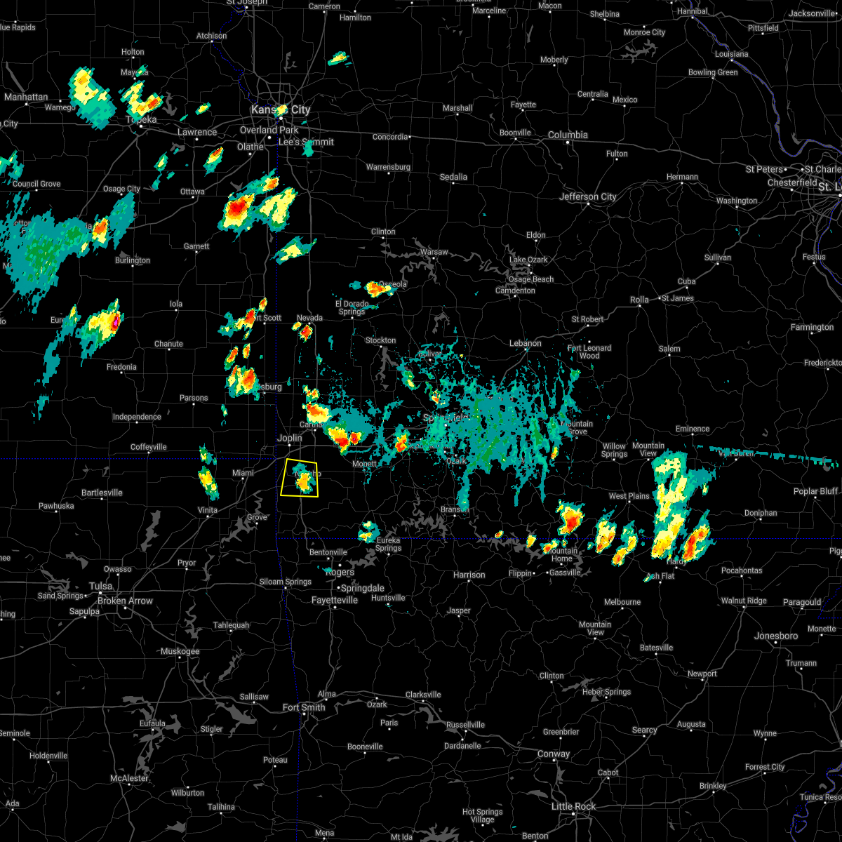 The severe thunderstorm warning for western newton county will expire at 415 pm cdt, the storm which prompted the warning has weakened below severe limits, and no longer poses an immediate threat to life or property. therefore, the warning will be allowed to expire. to report severe weather, contact your nearest law enforcement agency. they will relay your report to the national weather service springfield. The severe thunderstorm warning for western newton county will expire at 415 pm cdt, the storm which prompted the warning has weakened below severe limits, and no longer poses an immediate threat to life or property. therefore, the warning will be allowed to expire. to report severe weather, contact your nearest law enforcement agency. they will relay your report to the national weather service springfield.
|
| 8/9/2018 3:43 PM CDT |
 At 342 pm cdt, a severe thunderstorm was located near neosho, moving south at 15 mph (radar indicated). Hazards include 60 mph wind gusts and nickel size hail. expect damage to roofs, siding, and trees At 342 pm cdt, a severe thunderstorm was located near neosho, moving south at 15 mph (radar indicated). Hazards include 60 mph wind gusts and nickel size hail. expect damage to roofs, siding, and trees
|
| 7/21/2018 12:07 AM CDT |
 At 1207 am cdt, a severe thunderstorm was located over neosho, moving southeast at 40 mph (radar indicated). Hazards include quarter size hail. Damage to vehicles is expected. Locations impacted include, neosho, seneca, granby, newtonia, stark city, this includes interstate 49 between mile markers 15 and 25. At 1207 am cdt, a severe thunderstorm was located over neosho, moving southeast at 40 mph (radar indicated). Hazards include quarter size hail. Damage to vehicles is expected. Locations impacted include, neosho, seneca, granby, newtonia, stark city, this includes interstate 49 between mile markers 15 and 25.
|
| 7/20/2018 11:49 PM CDT |
 At 1149 pm cdt, a severe thunderstorm was located near shoal creek drive, or 9 miles south of joplin, moving southeast at 40 mph (radar indicated). Hazards include quarter size hail. Damage to vehicles is expected. locations impacted include, southern joplin, neosho, seneca, granby, loma linda, leawood, silver creek, shoal creek drive, saginaw, newtonia, redings mill, stark city, grand falls plaza, shoal creek estates, dennis acres, cliff village, racine, this includes the following highways, interstate 44 between mile markers 0 and 9. Interstate 49 between mile markers 15 and 34. At 1149 pm cdt, a severe thunderstorm was located near shoal creek drive, or 9 miles south of joplin, moving southeast at 40 mph (radar indicated). Hazards include quarter size hail. Damage to vehicles is expected. locations impacted include, southern joplin, neosho, seneca, granby, loma linda, leawood, silver creek, shoal creek drive, saginaw, newtonia, redings mill, stark city, grand falls plaza, shoal creek estates, dennis acres, cliff village, racine, this includes the following highways, interstate 44 between mile markers 0 and 9. Interstate 49 between mile markers 15 and 34.
|
| 7/20/2018 11:44 PM CDT |
 At 1143 pm cdt, a severe thunderstorm was located 8 miles southwest of wheaton, or 13 miles northeast of pineville, and is nearly stationary (radar indicated). Hazards include quarter size hail. Damage to vehicles is expected. locations impacted include, southern joplin, neosho, baxter springs, galena, seneca, granby, loma linda, leawood, lowell, silver creek, shoal creek drive, saginaw, newtonia, redings mill, stark city, grand falls plaza, shoal creek estates, dennis acres, cliff village, racine, this includes the following highways, interstate 44 between mile markers 0 and 8. Interstate 49 between mile markers 15 and 34. At 1143 pm cdt, a severe thunderstorm was located 8 miles southwest of wheaton, or 13 miles northeast of pineville, and is nearly stationary (radar indicated). Hazards include quarter size hail. Damage to vehicles is expected. locations impacted include, southern joplin, neosho, baxter springs, galena, seneca, granby, loma linda, leawood, lowell, silver creek, shoal creek drive, saginaw, newtonia, redings mill, stark city, grand falls plaza, shoal creek estates, dennis acres, cliff village, racine, this includes the following highways, interstate 44 between mile markers 0 and 8. Interstate 49 between mile markers 15 and 34.
|
| 7/20/2018 11:38 PM CDT |
 At 1137 pm cdt, a severe thunderstorm was located near baxter springs, moving southeast at 40 mph (radar indicated). Hazards include quarter size hail. damage to vehicles is expected At 1137 pm cdt, a severe thunderstorm was located near baxter springs, moving southeast at 40 mph (radar indicated). Hazards include quarter size hail. damage to vehicles is expected
|
| 7/20/2018 11:17 PM CDT | Half Dollar sized hail reported 1.2 miles NE of Neosho, MO |
| 7/20/2018 11:15 PM CDT |
 The national weather service in springfield has issued a * severe thunderstorm warning for. southern newton county in southwestern missouri. eastern mcdonald county in southwestern missouri. southwestern barry county in southwestern missouri. Until midnight cdt. The national weather service in springfield has issued a * severe thunderstorm warning for. southern newton county in southwestern missouri. eastern mcdonald county in southwestern missouri. southwestern barry county in southwestern missouri. Until midnight cdt.
|
| 7/17/2018 1:53 PM CDT |
 The severe thunderstorm warning for newton and southwestern jasper counties will expire at 200 pm cdt, the storms which prompted the warning have weakened below severe limits, and no longer pose an immediate threat to life or property. therefore, the warning will be allowed to expire. however heavy rain is still possible with these thunderstorms. The severe thunderstorm warning for newton and southwestern jasper counties will expire at 200 pm cdt, the storms which prompted the warning have weakened below severe limits, and no longer pose an immediate threat to life or property. therefore, the warning will be allowed to expire. however heavy rain is still possible with these thunderstorms.
|
| 7/17/2018 1:33 PM CDT |
 At 132 pm cdt, severe thunderstorms were located along a line extending from near joplin to near seneca, moving east at 25 mph (radar indicated). Hazards include 60 mph wind gusts. Expect damage to roofs, siding, and trees. locations impacted include, joplin, carthage, neosho, webb city, carl junction, galena, seneca, granby, carterville, duquesne, duenweg, diamond, loma linda, airport drive, leawood, silver creek, shoal creek drive, saginaw, fidelity, redings mill, this includes the following highways, interstate 44 between mile markers 0 and 23. Interstate 49 between mile markers 16 and 40. At 132 pm cdt, severe thunderstorms were located along a line extending from near joplin to near seneca, moving east at 25 mph (radar indicated). Hazards include 60 mph wind gusts. Expect damage to roofs, siding, and trees. locations impacted include, joplin, carthage, neosho, webb city, carl junction, galena, seneca, granby, carterville, duquesne, duenweg, diamond, loma linda, airport drive, leawood, silver creek, shoal creek drive, saginaw, fidelity, redings mill, this includes the following highways, interstate 44 between mile markers 0 and 23. Interstate 49 between mile markers 16 and 40.
|
| 7/17/2018 1:23 PM CDT |
 At 123 pm cdt, severe thunderstorms were located along a line extending from near galena to near bernice state park, moving east at 25 mph (radar indicated). Hazards include 60 mph wind gusts. Expect damage to roofs, siding, and trees. locations impacted include, joplin, carthage, neosho, webb city, carl junction, baxter springs, galena, seneca, granby, carterville, duquesne, duenweg, diamond, loma linda, airport drive, leawood, lowell, silver creek, shoal creek drive, saginaw, this includes the following highways, interstate 44 between mile markers 0 and 23. Interstate 49 between mile markers 16 and 40. At 123 pm cdt, severe thunderstorms were located along a line extending from near galena to near bernice state park, moving east at 25 mph (radar indicated). Hazards include 60 mph wind gusts. Expect damage to roofs, siding, and trees. locations impacted include, joplin, carthage, neosho, webb city, carl junction, baxter springs, galena, seneca, granby, carterville, duquesne, duenweg, diamond, loma linda, airport drive, leawood, lowell, silver creek, shoal creek drive, saginaw, this includes the following highways, interstate 44 between mile markers 0 and 23. Interstate 49 between mile markers 16 and 40.
|
| 7/17/2018 12:59 PM CDT |
 The national weather service in springfield has issued a * severe thunderstorm warning for. southeastern cherokee county in southeastern kansas. newton county in southwestern missouri. southwestern jasper county in southwestern missouri. Until 200 pm cdt. The national weather service in springfield has issued a * severe thunderstorm warning for. southeastern cherokee county in southeastern kansas. newton county in southwestern missouri. southwestern jasper county in southwestern missouri. Until 200 pm cdt.
|
| 7/17/2018 12:59 PM CDT |
 At 1259 pm cdt, severe thunderstorms were located along a line extending from near columbus to picher, moving east at 25 mph (radar indicated). Hazards include 60 mph wind gusts. expect damage to roofs, siding, and trees At 1259 pm cdt, severe thunderstorms were located along a line extending from near columbus to picher, moving east at 25 mph (radar indicated). Hazards include 60 mph wind gusts. expect damage to roofs, siding, and trees
|
| 7/16/2018 3:20 PM CDT |
 The severe thunderstorm warning for south central newton and northwestern mcdonald counties will expire at 330 pm cdt, the storm which prompted the warning has weakened below severe limits, and no longer poses an immediate threat to life or property. therefore, the warning will be allowed to expire. however heavy rain is still possible with this thunderstorm. The severe thunderstorm warning for south central newton and northwestern mcdonald counties will expire at 330 pm cdt, the storm which prompted the warning has weakened below severe limits, and no longer poses an immediate threat to life or property. therefore, the warning will be allowed to expire. however heavy rain is still possible with this thunderstorm.
|
| 7/16/2018 3:04 PM CDT |
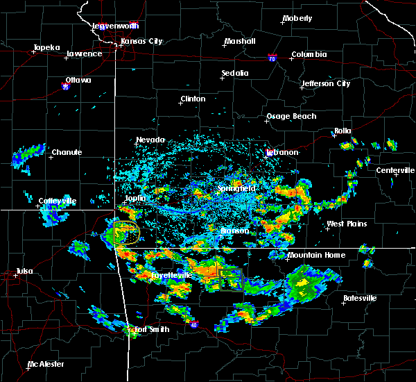 At 303 pm cdt, a severe thunderstorm was located near goodman, or 9 miles southwest of neosho, moving east at 20 mph (radar indicated). Hazards include 60 mph wind gusts. Expect damage to roofs, siding, and trees. Locations impacted include, neosho, goodman, this includes interstate 49 between mile markers 10 and 18. At 303 pm cdt, a severe thunderstorm was located near goodman, or 9 miles southwest of neosho, moving east at 20 mph (radar indicated). Hazards include 60 mph wind gusts. Expect damage to roofs, siding, and trees. Locations impacted include, neosho, goodman, this includes interstate 49 between mile markers 10 and 18.
|
| 7/16/2018 2:34 PM CDT |
 At 234 pm cdt, a severe thunderstorm was located near wyandotte, or 15 miles southeast of miami, moving east at 20 mph (radar indicated). Hazards include 60 mph wind gusts. expect damage to roofs, siding, and trees At 234 pm cdt, a severe thunderstorm was located near wyandotte, or 15 miles southeast of miami, moving east at 20 mph (radar indicated). Hazards include 60 mph wind gusts. expect damage to roofs, siding, and trees
|
| 6/26/2018 4:53 PM CDT |
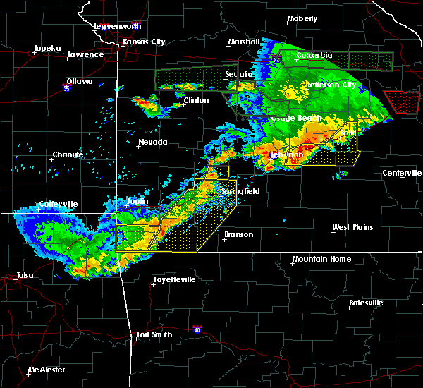 The severe thunderstorm warning for southern newton and mcdonald counties will expire at 500 pm cdt, the storm which prompted the warning has weakened below severe limits, and has exited the warned area. therefore, the warning will be allowed to expire. however gusty winds and heavy rain are still possible with this thunderstorm. a severe thunderstorm watch remains in effect until 900 pm cdt for southwestern missouri. The severe thunderstorm warning for southern newton and mcdonald counties will expire at 500 pm cdt, the storm which prompted the warning has weakened below severe limits, and has exited the warned area. therefore, the warning will be allowed to expire. however gusty winds and heavy rain are still possible with this thunderstorm. a severe thunderstorm watch remains in effect until 900 pm cdt for southwestern missouri.
|
| 6/26/2018 4:30 PM CDT | 2 large trees and power lines dow in newton county MO, 1 miles WSW of Neosho, MO |
| 6/26/2018 4:16 PM CDT |
 At 416 pm cdt, a severe thunderstorm was located near wyandotte, or 13 miles southeast of miami, moving east at 30 mph (radar indicated). Hazards include 60 mph wind gusts and penny size hail. expect damage to roofs, siding, and trees At 416 pm cdt, a severe thunderstorm was located near wyandotte, or 13 miles southeast of miami, moving east at 30 mph (radar indicated). Hazards include 60 mph wind gusts and penny size hail. expect damage to roofs, siding, and trees
|
| 5/20/2018 5:45 AM CDT |
 At 544 am cdt, severe thunderstorms were located along a line extending from near columbus to near saginaw to lanagan, moving northeast at 30 mph (radar indicated). Hazards include 60 mph wind gusts and quarter size hail. Hail damage to vehicles is expected. expect wind damage to roofs, siding, and trees. locations impacted include, joplin, carthage, neosho, webb city, big sugar creek state park, carl junction, baxter springs, columbus, galena, oronogo, seneca, granby, anderson, carterville, noel, duquesne, dodge, sarcoxie, goodman, duenweg, this includes the following highways, interstate 44 between mile markers 0 and 30. Interstate 49 between mile markers 1 and 55. At 544 am cdt, severe thunderstorms were located along a line extending from near columbus to near saginaw to lanagan, moving northeast at 30 mph (radar indicated). Hazards include 60 mph wind gusts and quarter size hail. Hail damage to vehicles is expected. expect wind damage to roofs, siding, and trees. locations impacted include, joplin, carthage, neosho, webb city, big sugar creek state park, carl junction, baxter springs, columbus, galena, oronogo, seneca, granby, anderson, carterville, noel, duquesne, dodge, sarcoxie, goodman, duenweg, this includes the following highways, interstate 44 between mile markers 0 and 30. Interstate 49 between mile markers 1 and 55.
|
| 5/20/2018 5:16 AM CDT |
 At 516 am cdt, severe thunderstorms were located along a line extending from 6 miles northwest of treece to wyandotte to near south west city, moving northeast at 65 mph (radar indicated). Hazards include 60 mph wind gusts and quarter size hail. Hail damage to vehicles is expected. Expect wind damage to roofs, siding, and trees. At 516 am cdt, severe thunderstorms were located along a line extending from 6 miles northwest of treece to wyandotte to near south west city, moving northeast at 65 mph (radar indicated). Hazards include 60 mph wind gusts and quarter size hail. Hail damage to vehicles is expected. Expect wind damage to roofs, siding, and trees.
|
| 5/19/2018 5:27 PM CDT |
 At 527 pm cdt, a severe thunderstorm was located near shoal creek drive, or 7 miles southwest of joplin, moving east at 25 mph (radar indicated). Hazards include 60 mph wind gusts and quarter size hail. Hail damage to vehicles is expected. Expect wind damage to roofs, siding, and trees. At 527 pm cdt, a severe thunderstorm was located near shoal creek drive, or 7 miles southwest of joplin, moving east at 25 mph (radar indicated). Hazards include 60 mph wind gusts and quarter size hail. Hail damage to vehicles is expected. Expect wind damage to roofs, siding, and trees.
|
| 5/6/2018 7:46 PM CDT |
 At 745 pm cdt, a severe thunderstorm was located near diamond, or near neosho, moving southeast at 25 mph (radar indicated). Hazards include 60 mph wind gusts and quarter size hail. this storm has a history of producing quarter size hail. Hail damage to vehicles is expected. expect wind damage to roofs, siding, and trees. Locations impacted include, neosho, granby, diamond, newtonia, stella, stark city, this includes interstate 49 between mile markers 15 and 33. At 745 pm cdt, a severe thunderstorm was located near diamond, or near neosho, moving southeast at 25 mph (radar indicated). Hazards include 60 mph wind gusts and quarter size hail. this storm has a history of producing quarter size hail. Hail damage to vehicles is expected. expect wind damage to roofs, siding, and trees. Locations impacted include, neosho, granby, diamond, newtonia, stella, stark city, this includes interstate 49 between mile markers 15 and 33.
|
| 5/6/2018 7:23 PM CDT |
 At 722 pm cdt, a severe thunderstorm was located over eastern joplin, moving south at 20 mph (emergency management). Hazards include 60 mph wind gusts and quarter size hail. multiple reports of quarter size hail are occuring with this storm. Hail damage to vehicles is expected. Expect wind damage to roofs, siding, and trees. At 722 pm cdt, a severe thunderstorm was located over eastern joplin, moving south at 20 mph (emergency management). Hazards include 60 mph wind gusts and quarter size hail. multiple reports of quarter size hail are occuring with this storm. Hail damage to vehicles is expected. Expect wind damage to roofs, siding, and trees.
|
| 5/3/2018 12:32 AM CDT |
 At 1230 am cdt, severe thunderstorms were located along a line extending from 7 miles northwest of lamar to near jasper to near diamond, moving east at 50 mph (law enforcement). Hazards include 60 mph wind gusts. these storms recently downed a tree and power pole in the webb city area. Expect damage to roofs, siding, and trees. locations impacted include, joplin, carthage, neosho, webb city, prairie state park, lamar, oronogo, seneca, granby, carterville, duquesne, sarcoxie, duenweg, jasper, diamond, golden city, liberal, loma linda, airport drive, leawood, this includes the following highways, interstate 44 between mile markers 1 and 32. Interstate 49 between mile markers 21 and 76. At 1230 am cdt, severe thunderstorms were located along a line extending from 7 miles northwest of lamar to near jasper to near diamond, moving east at 50 mph (law enforcement). Hazards include 60 mph wind gusts. these storms recently downed a tree and power pole in the webb city area. Expect damage to roofs, siding, and trees. locations impacted include, joplin, carthage, neosho, webb city, prairie state park, lamar, oronogo, seneca, granby, carterville, duquesne, sarcoxie, duenweg, jasper, diamond, golden city, liberal, loma linda, airport drive, leawood, this includes the following highways, interstate 44 between mile markers 1 and 32. Interstate 49 between mile markers 21 and 76.
|
| 5/3/2018 12:06 AM CDT |
 At 1205 am cdt, severe thunderstorms were located along a line extending from near girard to near carl junction to near quapaw, moving east at 50 mph (emergency management). Hazards include 60 mph wind gusts. the cherokee county, kansas emergency manager has reported 50 to 60 mph winds with these storms. Expect damage to roofs, siding, and trees. locations impacted include, joplin, carthage, neosho, webb city, prairie state park, carl junction, lamar, galena, oronogo, seneca, granby, carterville, duquesne, sarcoxie, duenweg, jasper, diamond, golden city, liberal, loma linda, this includes the following highways, interstate 44 between mile markers 0 and 32. Interstate 49 between mile markers 21 and 76. At 1205 am cdt, severe thunderstorms were located along a line extending from near girard to near carl junction to near quapaw, moving east at 50 mph (emergency management). Hazards include 60 mph wind gusts. the cherokee county, kansas emergency manager has reported 50 to 60 mph winds with these storms. Expect damage to roofs, siding, and trees. locations impacted include, joplin, carthage, neosho, webb city, prairie state park, carl junction, lamar, galena, oronogo, seneca, granby, carterville, duquesne, sarcoxie, duenweg, jasper, diamond, golden city, liberal, loma linda, this includes the following highways, interstate 44 between mile markers 0 and 32. Interstate 49 between mile markers 21 and 76.
|
| 5/2/2018 11:58 PM CDT |
 At 1158 pm cdt, severe thunderstorms were located along a line extending from near girard to near columbus to miami, moving east at 50 mph (radar indicated). Hazards include 60 mph wind gusts. expect damage to roofs, siding, and trees At 1158 pm cdt, severe thunderstorms were located along a line extending from near girard to near columbus to miami, moving east at 50 mph (radar indicated). Hazards include 60 mph wind gusts. expect damage to roofs, siding, and trees
|
| 10/21/2017 11:42 PM CDT |
 The severe thunderstorm warning for southeastern barton, newton and eastern jasper counties will expire at 1145 pm cdt, the storms which prompted the warning have weakened below severe limits, and no longer pose an immediate threat to life or property. therefore the warning will be allowed to expire. however gusty winds up to 50 mph and heavy rain are still possible with these thunderstorms. a severe thunderstorm watch remains in effect until 400 am cdt for southwestern missouri. to report severe weather, contact your nearest law enforcement agency. they will relay your report to the national weather service springfield. The severe thunderstorm warning for southeastern barton, newton and eastern jasper counties will expire at 1145 pm cdt, the storms which prompted the warning have weakened below severe limits, and no longer pose an immediate threat to life or property. therefore the warning will be allowed to expire. however gusty winds up to 50 mph and heavy rain are still possible with these thunderstorms. a severe thunderstorm watch remains in effect until 400 am cdt for southwestern missouri. to report severe weather, contact your nearest law enforcement agency. they will relay your report to the national weather service springfield.
|
| 10/21/2017 11:34 PM CDT |
 At 1134 pm cdt, severe thunderstorms were located along a line extending from near golden city to near sarcoxie, moving east at 40 mph (radar indicated). Hazards include 60 mph wind gusts. Expect damage to roofs, siding, and trees. locations impacted include, carthage, neosho, granby, sarcoxie, duenweg, diamond, golden city, fairview, carytown, fidelity, newtonia, stella, wentworth, stark city, avilla, la russell, reeds, ritchey, atlas, dudenville, this includes the following highways, interstate 44 between mile markers 12 and 32. Interstate 49 between mile markers 16 and 43, and between mile markers 45 and 48. At 1134 pm cdt, severe thunderstorms were located along a line extending from near golden city to near sarcoxie, moving east at 40 mph (radar indicated). Hazards include 60 mph wind gusts. Expect damage to roofs, siding, and trees. locations impacted include, carthage, neosho, granby, sarcoxie, duenweg, diamond, golden city, fairview, carytown, fidelity, newtonia, stella, wentworth, stark city, avilla, la russell, reeds, ritchey, atlas, dudenville, this includes the following highways, interstate 44 between mile markers 12 and 32. Interstate 49 between mile markers 16 and 43, and between mile markers 45 and 48.
|
| 10/21/2017 11:13 PM CDT |
 At 1113 pm cdt, severe thunderstorms were located along a line extending from near lamar to near diamond, moving east at 40 mph (radar indicated). Hazards include 60 mph wind gusts. Expect damage to roofs, siding, and trees. locations impacted include, joplin, carthage, neosho, webb city, carl junction, lamar, galena, oronogo, seneca, granby, carterville, duquesne, sarcoxie, duenweg, jasper, diamond, golden city, loma linda, airport drive, leawood, this includes the following highways, interstate 44 between mile markers 0 and 32. Interstate 49 between mile markers 16 and 76. At 1113 pm cdt, severe thunderstorms were located along a line extending from near lamar to near diamond, moving east at 40 mph (radar indicated). Hazards include 60 mph wind gusts. Expect damage to roofs, siding, and trees. locations impacted include, joplin, carthage, neosho, webb city, carl junction, lamar, galena, oronogo, seneca, granby, carterville, duquesne, sarcoxie, duenweg, jasper, diamond, golden city, loma linda, airport drive, leawood, this includes the following highways, interstate 44 between mile markers 0 and 32. Interstate 49 between mile markers 16 and 76.
|
| 10/21/2017 11:02 PM CDT |
 At 1102 pm cdt, severe thunderstorms were located along a line extending from near purcell to 6 miles north of seneca, moving east at 50 mph (radar indicated). Hazards include 60 mph wind gusts and nickel size hail. Expect damage to roofs, siding, and trees. locations impacted include, joplin, carthage, neosho, webb city, prairie state park, carl junction, lamar, oronogo, seneca, granby, carterville, duquesne, sarcoxie, duenweg, jasper, diamond, golden city, liberal, loma linda, airport drive, this includes the following highways, interstate 44 between mile markers 1 and 32. Interstate 49 between mile markers 16 and 76. At 1102 pm cdt, severe thunderstorms were located along a line extending from near purcell to 6 miles north of seneca, moving east at 50 mph (radar indicated). Hazards include 60 mph wind gusts and nickel size hail. Expect damage to roofs, siding, and trees. locations impacted include, joplin, carthage, neosho, webb city, prairie state park, carl junction, lamar, oronogo, seneca, granby, carterville, duquesne, sarcoxie, duenweg, jasper, diamond, golden city, liberal, loma linda, airport drive, this includes the following highways, interstate 44 between mile markers 1 and 32. Interstate 49 between mile markers 16 and 76.
|
| 10/21/2017 10:49 PM CDT |
 At 1049 pm cdt, severe thunderstorms were located along a line extending from 6 miles east of weir to near seneca, moving east at 50 mph (radar indicated). Hazards include 60 mph wind gusts and nickel size hail. expect damage to roofs, siding, and trees At 1049 pm cdt, severe thunderstorms were located along a line extending from 6 miles east of weir to near seneca, moving east at 50 mph (radar indicated). Hazards include 60 mph wind gusts and nickel size hail. expect damage to roofs, siding, and trees
|
| 8/18/2017 4:34 PM CDT |
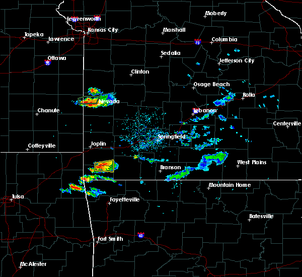 At 433 pm cdt, a severe thunderstorm was located near goodman, or 9 miles north of pineville, moving east at 20 mph (radar indicated). Hazards include 60 mph wind gusts and quarter size hail. Hail damage to vehicles is expected. expect wind damage to roofs, siding, and trees. Locations impacted include, neosho, goodman, fairview, stella, rocky comfort,. At 433 pm cdt, a severe thunderstorm was located near goodman, or 9 miles north of pineville, moving east at 20 mph (radar indicated). Hazards include 60 mph wind gusts and quarter size hail. Hail damage to vehicles is expected. expect wind damage to roofs, siding, and trees. Locations impacted include, neosho, goodman, fairview, stella, rocky comfort,.
|
| 8/18/2017 4:11 PM CDT |
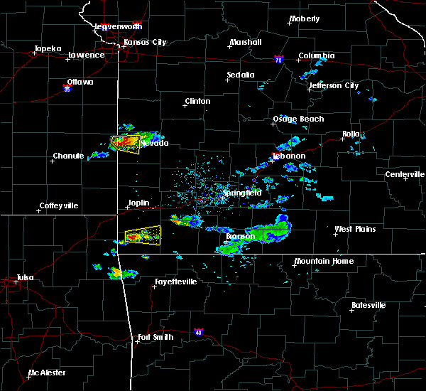 At 410 pm cdt, a severe thunderstorm was located near anderson, or 7 miles north of pineville, moving east at 20 mph (radar indicated). Hazards include 60 mph wind gusts and quarter size hail. Hail damage to vehicles is expected. Expect wind damage to roofs, siding, and trees. At 410 pm cdt, a severe thunderstorm was located near anderson, or 7 miles north of pineville, moving east at 20 mph (radar indicated). Hazards include 60 mph wind gusts and quarter size hail. Hail damage to vehicles is expected. Expect wind damage to roofs, siding, and trees.
|
| 7/7/2017 6:31 PM CDT |
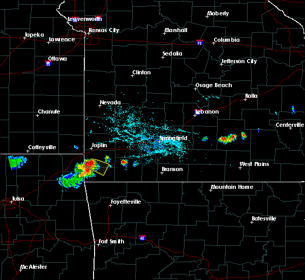 At 629 pm cdt, a severe thunderstorm was located near goodman, or 7 miles southwest of neosho, moving southeast at 25 mph (trained weather spotters. quarter to half dollar size hail was reported south of racine). Hazards include 60 mph wind gusts and half dollar size hail. Hail damage to vehicles is expected. expect wind damage to roofs, siding, and trees. Locations impacted include, neosho, big sugar creek state park, goodman, stella,. At 629 pm cdt, a severe thunderstorm was located near goodman, or 7 miles southwest of neosho, moving southeast at 25 mph (trained weather spotters. quarter to half dollar size hail was reported south of racine). Hazards include 60 mph wind gusts and half dollar size hail. Hail damage to vehicles is expected. expect wind damage to roofs, siding, and trees. Locations impacted include, neosho, big sugar creek state park, goodman, stella,.
|
| 7/7/2017 6:25 PM CDT | Half Dollar sized hail reported 8.1 miles E of Neosho, MO, hail estimated size of quarters to half dollars. |
| 7/7/2017 6:24 PM CDT |
 At 624 pm cdt, a severe thunderstorm was located near seneca, or 8 miles west of neosho, moving southeast at 25 mph (radar indicated). Hazards include 60 mph wind gusts and quarter size hail. Hail damage to vehicles is expected. expect wind damage to roofs, siding, and trees. Locations impacted include, neosho, big sugar creek state park, seneca, goodman, stella, racine,. At 624 pm cdt, a severe thunderstorm was located near seneca, or 8 miles west of neosho, moving southeast at 25 mph (radar indicated). Hazards include 60 mph wind gusts and quarter size hail. Hail damage to vehicles is expected. expect wind damage to roofs, siding, and trees. Locations impacted include, neosho, big sugar creek state park, seneca, goodman, stella, racine,.
|
| 7/7/2017 6:14 PM CDT |
 At 614 pm cdt, a severe thunderstorm was located near seneca, or 10 miles west of neosho, moving southeast at 20 mph (radar indicated). Hazards include 60 mph wind gusts. expect damage to roofs, siding, and trees At 614 pm cdt, a severe thunderstorm was located near seneca, or 10 miles west of neosho, moving southeast at 20 mph (radar indicated). Hazards include 60 mph wind gusts. expect damage to roofs, siding, and trees
|
| 6/17/2017 6:28 AM CDT |
 The severe thunderstorm warning for western newton and southwestern jasper counties will expire at 630 am cdt. the storm which prompted the warning has weakened below severe limits, and no longer poses an immediate threat to life or property. therefore the warning will be allowed to expire. A severe thunderstorm watch remains in effect until 900 am cdt for. The severe thunderstorm warning for western newton and southwestern jasper counties will expire at 630 am cdt. the storm which prompted the warning has weakened below severe limits, and no longer poses an immediate threat to life or property. therefore the warning will be allowed to expire. A severe thunderstorm watch remains in effect until 900 am cdt for.
|
| 6/17/2017 6:14 AM CDT |
 At 613 am cdt, a severe thunderstorm was located near shoal creek drive, or near joplin, moving southeast at 30 mph (radar indicated). Hazards include 60 mph wind gusts and quarter size hail. Hail damage to vehicles is expected. expect wind damage to roofs, siding, and trees. Locations impacted include, joplin, carthage, neosho, webb city, carl junction, oronogo, seneca, granby, carterville, duquesne, duenweg, diamond, loma linda, airport drive, leawood, silver creek, shoal creek drive, saginaw, fidelity, redings mill, this includes interstate 44 between mile markers 0 and 18. At 613 am cdt, a severe thunderstorm was located near shoal creek drive, or near joplin, moving southeast at 30 mph (radar indicated). Hazards include 60 mph wind gusts and quarter size hail. Hail damage to vehicles is expected. expect wind damage to roofs, siding, and trees. Locations impacted include, joplin, carthage, neosho, webb city, carl junction, oronogo, seneca, granby, carterville, duquesne, duenweg, diamond, loma linda, airport drive, leawood, silver creek, shoal creek drive, saginaw, fidelity, redings mill, this includes interstate 44 between mile markers 0 and 18.
|
| 6/17/2017 6:01 AM CDT |
 At 540 am cdt, a severe thunderstorm was located near carl junction, or 11 miles northwest of joplin, moving southeast at 35 mph (radar indicated). Hazards include 60 mph wind gusts and quarter size hail. Hail damage to vehicles is expected. Expect wind damage to roofs, siding, and trees. At 540 am cdt, a severe thunderstorm was located near carl junction, or 11 miles northwest of joplin, moving southeast at 35 mph (radar indicated). Hazards include 60 mph wind gusts and quarter size hail. Hail damage to vehicles is expected. Expect wind damage to roofs, siding, and trees.
|
| 6/17/2017 5:40 AM CDT |
 At 540 am cdt, a severe thunderstorm was located near carl junction, or 11 miles northwest of joplin, moving southeast at 35 mph (radar indicated). Hazards include 60 mph wind gusts and quarter size hail. Hail damage to vehicles is expected. Expect wind damage to roofs, siding, and trees. At 540 am cdt, a severe thunderstorm was located near carl junction, or 11 miles northwest of joplin, moving southeast at 35 mph (radar indicated). Hazards include 60 mph wind gusts and quarter size hail. Hail damage to vehicles is expected. Expect wind damage to roofs, siding, and trees.
|
| 5/28/2017 12:32 AM CDT |
 At 1231 am cdt, a severe thunderstorm was located over webb city, or near joplin, moving northeast at 45 mph (trained weather spotters. golf ball size hail was reported on the west side of joplin with this storm). Hazards include tennis ball size hail and 60 mph wind gusts. People and animals outdoors will be injured. expect hail damage to roofs, siding, windows, and vehicles. expect wind damage to roofs, siding, and trees. Locations impacted include, joplin, carthage, neosho, webb city, carl junction, oronogo, carterville, duquesne, duenweg, diamond, loma linda, airport drive, leawood, silver creek, purcell, shoal creek drive, saginaw, fidelity, asbury, redings mill, this includes interstate 44 between mile markers 0 and 25. At 1231 am cdt, a severe thunderstorm was located over webb city, or near joplin, moving northeast at 45 mph (trained weather spotters. golf ball size hail was reported on the west side of joplin with this storm). Hazards include tennis ball size hail and 60 mph wind gusts. People and animals outdoors will be injured. expect hail damage to roofs, siding, windows, and vehicles. expect wind damage to roofs, siding, and trees. Locations impacted include, joplin, carthage, neosho, webb city, carl junction, oronogo, carterville, duquesne, duenweg, diamond, loma linda, airport drive, leawood, silver creek, purcell, shoal creek drive, saginaw, fidelity, asbury, redings mill, this includes interstate 44 between mile markers 0 and 25.
|
| 5/28/2017 12:18 AM CDT |
 At 1217 am cdt, a severe thunderstorm was located near galena, or near joplin, moving northeast at 35 mph (trained weather spotters. this storm has a history of producing very large hail in northeast oklahoma). Hazards include tennis ball size hail and 60 mph wind gusts. People and animals outdoors will be injured. expect hail damage to roofs, siding, windows, and vehicles. expect wind damage to roofs, siding, and trees. Locations impacted include, joplin, carthage, neosho, webb city, carl junction, baxter springs, columbus, galena, oronogo, seneca, granby, carterville, duquesne, duenweg, diamond, loma linda, airport drive, leawood, lowell, silver creek, this includes interstate 44 between mile markers 0 and 25. At 1217 am cdt, a severe thunderstorm was located near galena, or near joplin, moving northeast at 35 mph (trained weather spotters. this storm has a history of producing very large hail in northeast oklahoma). Hazards include tennis ball size hail and 60 mph wind gusts. People and animals outdoors will be injured. expect hail damage to roofs, siding, windows, and vehicles. expect wind damage to roofs, siding, and trees. Locations impacted include, joplin, carthage, neosho, webb city, carl junction, baxter springs, columbus, galena, oronogo, seneca, granby, carterville, duquesne, duenweg, diamond, loma linda, airport drive, leawood, lowell, silver creek, this includes interstate 44 between mile markers 0 and 25.
|
| 5/27/2017 11:49 PM CDT |
 At 1147 pm cdt, a severe thunderstorm was located over commerce, or near miami, moving northeast at 45 mph. this is a very dangerous storm (trained weather spotters. this storm has produced baseball size hail in craig and ottawa counties). Hazards include baseball size hail and 60 mph wind gusts. People and animals outdoors will be severely injured. Expect shattered windows, extensive damage to roofs, siding, and vehicles. At 1147 pm cdt, a severe thunderstorm was located over commerce, or near miami, moving northeast at 45 mph. this is a very dangerous storm (trained weather spotters. this storm has produced baseball size hail in craig and ottawa counties). Hazards include baseball size hail and 60 mph wind gusts. People and animals outdoors will be severely injured. Expect shattered windows, extensive damage to roofs, siding, and vehicles.
|
| 5/27/2017 7:56 PM CDT | Quarter sized hail reported 6.8 miles S of Neosho, MO |
| 5/27/2017 7:54 PM CDT | Quarter sized hail reported 2.1 miles SSW of Neosho, MO |
| 5/27/2017 7:28 PM CDT |
 At 728 pm cdt, severe thunderstorms were located along a line extending from near sparta to near galena to near seneca, moving southeast at 40 mph (trained weather spotters). Hazards include golf ball size hail and 60 mph wind gusts. People and animals outdoors will be injured. expect hail damage to roofs, siding, windows, and vehicles. Expect wind damage to roofs, siding, and trees. At 728 pm cdt, severe thunderstorms were located along a line extending from near sparta to near galena to near seneca, moving southeast at 40 mph (trained weather spotters). Hazards include golf ball size hail and 60 mph wind gusts. People and animals outdoors will be injured. expect hail damage to roofs, siding, windows, and vehicles. Expect wind damage to roofs, siding, and trees.
|
| 5/27/2017 6:44 PM CDT |
 At 644 pm cdt, a severe thunderstorm was located near seneca, or 11 miles east of miami, moving east at 40 mph (radar indicated). Hazards include 60 mph wind gusts and quarter size hail. Hail damage to vehicles is expected. Expect wind damage to roofs, siding, and trees. At 644 pm cdt, a severe thunderstorm was located near seneca, or 11 miles east of miami, moving east at 40 mph (radar indicated). Hazards include 60 mph wind gusts and quarter size hail. Hail damage to vehicles is expected. Expect wind damage to roofs, siding, and trees.
|
| 5/27/2017 6:16 PM CDT |
 At 616 pm cdt, severe thunderstorms were located along a line extending from near shoal creek drive to near miami, moving southeast at 15 mph (radar indicated). Hazards include 60 mph wind gusts and quarter size hail. Hail damage to vehicles is expected. expect wind damage to roofs, siding, and trees. locations impacted include, southern joplin, neosho, seneca, diamond, loma linda, leawood, silver creek, shoal creek drive, saginaw, redings mill, grand falls plaza, shoal creek estates, dennis acres, cliff village, racine, this includes interstate 44 between mile markers 0 and 7. A tornado watch remains in effect until 700 pm cdt for southeastern kansas, and southwestern missouri. At 616 pm cdt, severe thunderstorms were located along a line extending from near shoal creek drive to near miami, moving southeast at 15 mph (radar indicated). Hazards include 60 mph wind gusts and quarter size hail. Hail damage to vehicles is expected. expect wind damage to roofs, siding, and trees. locations impacted include, southern joplin, neosho, seneca, diamond, loma linda, leawood, silver creek, shoal creek drive, saginaw, redings mill, grand falls plaza, shoal creek estates, dennis acres, cliff village, racine, this includes interstate 44 between mile markers 0 and 7. A tornado watch remains in effect until 700 pm cdt for southeastern kansas, and southwestern missouri.
|
| 5/27/2017 5:39 PM CDT |
 At 538 pm cdt, severe thunderstorms were located along a line extending from near galena to near commerce, moving southeast at 15 mph (radar indicated). Hazards include 60 mph wind gusts and quarter size hail. Hail damage to vehicles is expected. Expect wind damage to roofs, siding, and trees. At 538 pm cdt, severe thunderstorms were located along a line extending from near galena to near commerce, moving southeast at 15 mph (radar indicated). Hazards include 60 mph wind gusts and quarter size hail. Hail damage to vehicles is expected. Expect wind damage to roofs, siding, and trees.
|
| 5/19/2017 9:29 PM CDT |
 At 929 pm cdt, severe thunderstorms were located along a line extending from near shoal creek drive to near goodman to near bella vista, moving northeast at 50 mph (radar indicated). Hazards include 60 mph wind gusts and nickel size hail. Expect damage to roofs, siding, and trees. locations impacted include, southern joplin, neosho, big sugar creek state park, seneca, granby, anderson, noel, duquesne, goodman, diamond, pineville, loma linda, wheaton, leawood, silver creek, lanagan, fairview, shoal creek drive, saginaw, newtonia, this includes interstate 44 between mile markers 0 and 9. A tornado watch remains in effect until 1000 pm cdt for southwestern missouri. At 929 pm cdt, severe thunderstorms were located along a line extending from near shoal creek drive to near goodman to near bella vista, moving northeast at 50 mph (radar indicated). Hazards include 60 mph wind gusts and nickel size hail. Expect damage to roofs, siding, and trees. locations impacted include, southern joplin, neosho, big sugar creek state park, seneca, granby, anderson, noel, duquesne, goodman, diamond, pineville, loma linda, wheaton, leawood, silver creek, lanagan, fairview, shoal creek drive, saginaw, newtonia, this includes interstate 44 between mile markers 0 and 9. A tornado watch remains in effect until 1000 pm cdt for southwestern missouri.
|
| 5/19/2017 9:17 PM CDT |
 At 917 pm cdt, severe thunderstorms were located along a line extending from near wyandotte to near anderson to gravette, moving northeast at 50 mph (radar indicated). Hazards include 60 mph wind gusts and nickel size hail. Expect damage to roofs, siding, and trees. locations impacted include, southern joplin, neosho, big sugar creek state park, seneca, granby, anderson, noel, duquesne, dodge, goodman, south west city, diamond, pineville, loma linda, wheaton, leawood, silver creek, lanagan, fairview, shoal creek drive, this includes interstate 44 between mile markers 0 and 9. A tornado watch remains in effect until 1000 pm cdt for southwestern missouri. At 917 pm cdt, severe thunderstorms were located along a line extending from near wyandotte to near anderson to gravette, moving northeast at 50 mph (radar indicated). Hazards include 60 mph wind gusts and nickel size hail. Expect damage to roofs, siding, and trees. locations impacted include, southern joplin, neosho, big sugar creek state park, seneca, granby, anderson, noel, duquesne, dodge, goodman, south west city, diamond, pineville, loma linda, wheaton, leawood, silver creek, lanagan, fairview, shoal creek drive, this includes interstate 44 between mile markers 0 and 9. A tornado watch remains in effect until 1000 pm cdt for southwestern missouri.
|
| 5/19/2017 8:51 PM CDT |
 At 850 pm cdt, severe thunderstorms were located along a line extending from near bluejacket to near jay to kansas, moving northeast at 50 mph (radar indicated). Hazards include 60 mph wind gusts and nickel size hail. expect damage to roofs, siding, and trees At 850 pm cdt, severe thunderstorms were located along a line extending from near bluejacket to near jay to kansas, moving northeast at 50 mph (radar indicated). Hazards include 60 mph wind gusts and nickel size hail. expect damage to roofs, siding, and trees
|
| 5/19/2017 7:54 PM CDT |
 The severe thunderstorm warning for newton and mcdonald counties will expire at 800 pm cdt, the storms which prompted the warning have weakened below severe limits, and no longer pose an immediate threat to life or property. therefore the warning will be allowed to expire. however heavy rain is still possible with these thunderstorms. a tornado watch remains in effect until 1000 pm cdt for southwestern missouri. to report severe weather, contact your nearest law enforcement agency. they will relay your report to the national weather service springfield. The severe thunderstorm warning for newton and mcdonald counties will expire at 800 pm cdt, the storms which prompted the warning have weakened below severe limits, and no longer pose an immediate threat to life or property. therefore the warning will be allowed to expire. however heavy rain is still possible with these thunderstorms. a tornado watch remains in effect until 1000 pm cdt for southwestern missouri. to report severe weather, contact your nearest law enforcement agency. they will relay your report to the national weather service springfield.
|
| 5/19/2017 7:34 PM CDT |
 At 734 pm cdt, severe thunderstorms were located along a line extending from diamond to 6 miles southwest of fairview to near pineville, moving northeast at 30 mph (radar indicated). Hazards include 60 mph wind gusts and quarter size hail. Hail damage to vehicles is expected. expect wind damage to roofs, siding, and trees. Locations impacted include, neosho, big sugar creek state park, granby, goodman, diamond, pineville, wheaton, lanagan, fairview, newtonia, stella, wentworth, stark city, ritchey, powell, rocky comfort, racine, a tornado watch remains in effect until 1000 pm cdt for southwestern missouri. At 734 pm cdt, severe thunderstorms were located along a line extending from diamond to 6 miles southwest of fairview to near pineville, moving northeast at 30 mph (radar indicated). Hazards include 60 mph wind gusts and quarter size hail. Hail damage to vehicles is expected. expect wind damage to roofs, siding, and trees. Locations impacted include, neosho, big sugar creek state park, granby, goodman, diamond, pineville, wheaton, lanagan, fairview, newtonia, stella, wentworth, stark city, ritchey, powell, rocky comfort, racine, a tornado watch remains in effect until 1000 pm cdt for southwestern missouri.
|
| 5/19/2017 7:19 PM CDT |
 At 719 pm cdt, severe thunderstorms were located along a line extending from near neosho to near goodman to near noel, moving northeast at 50 mph (radar indicated). Hazards include 60 mph wind gusts and quarter size hail. Hail damage to vehicles is expected. expect wind damage to roofs, siding, and trees. Locations impacted include, neosho, big sugar creek state park, seneca, granby, anderson, noel, goodman, diamond, pineville, wheaton, lanagan, fairview, newtonia, stella, wentworth, stark city, ritchey, powell, rocky comfort, racine, a tornado watch remains in effect until 1000 pm cdt for southwestern missouri. At 719 pm cdt, severe thunderstorms were located along a line extending from near neosho to near goodman to near noel, moving northeast at 50 mph (radar indicated). Hazards include 60 mph wind gusts and quarter size hail. Hail damage to vehicles is expected. expect wind damage to roofs, siding, and trees. Locations impacted include, neosho, big sugar creek state park, seneca, granby, anderson, noel, goodman, diamond, pineville, wheaton, lanagan, fairview, newtonia, stella, wentworth, stark city, ritchey, powell, rocky comfort, racine, a tornado watch remains in effect until 1000 pm cdt for southwestern missouri.
|
| 5/19/2017 6:55 PM CDT |
 At 654 pm cdt, severe thunderstorms were located along a line extending from 7 miles southeast of wyandotte to near noel to near maysville, moving northeast at 30 mph (radar indicated). Hazards include 60 mph wind gusts and quarter size hail. Hail damage to vehicles is expected. Expect wind damage to roofs, siding, and trees. At 654 pm cdt, severe thunderstorms were located along a line extending from 7 miles southeast of wyandotte to near noel to near maysville, moving northeast at 30 mph (radar indicated). Hazards include 60 mph wind gusts and quarter size hail. Hail damage to vehicles is expected. Expect wind damage to roofs, siding, and trees.
|
| 5/19/2017 6:39 PM CDT |
 At 638 pm cdt, a severe thunderstorm was located near seneca, or 14 miles southwest of neosho, moving northeast at 30 mph. other strong to severe thunderstorms were located near grove and also moving northeast at 30 mph (radar indicated). Hazards include quarter size hail. Damage to vehicles is expected. locations impacted include, neosho, seneca, goodman, loma linda, racine, this includes interstate 44 between mile markers 0 and 3. A tornado watch remains in effect until 1000 pm cdt for southwestern missouri. At 638 pm cdt, a severe thunderstorm was located near seneca, or 14 miles southwest of neosho, moving northeast at 30 mph. other strong to severe thunderstorms were located near grove and also moving northeast at 30 mph (radar indicated). Hazards include quarter size hail. Damage to vehicles is expected. locations impacted include, neosho, seneca, goodman, loma linda, racine, this includes interstate 44 between mile markers 0 and 3. A tornado watch remains in effect until 1000 pm cdt for southwestern missouri.
|
| 5/19/2017 6:24 PM CDT |
 At 624 pm cdt, a severe thunderstorm was located 7 miles northeast of grove, or 16 miles west of pineville, moving northeast at 30 mph (radar indicated). Hazards include quarter size hail. damage to vehicles is expected At 624 pm cdt, a severe thunderstorm was located 7 miles northeast of grove, or 16 miles west of pineville, moving northeast at 30 mph (radar indicated). Hazards include quarter size hail. damage to vehicles is expected
|
| 5/19/2017 3:13 PM CDT |
 At 312 pm cdt, a severe thunderstorm capable of producing a tornado was located over neosho, moving northeast at 40 mph (radar indicated rotation). Hazards include tornado. Flying debris will be dangerous to those caught without shelter. mobile homes will be damaged or destroyed. damage to roofs, windows, and vehicles will occur. Tree damage is likely. At 312 pm cdt, a severe thunderstorm capable of producing a tornado was located over neosho, moving northeast at 40 mph (radar indicated rotation). Hazards include tornado. Flying debris will be dangerous to those caught without shelter. mobile homes will be damaged or destroyed. damage to roofs, windows, and vehicles will occur. Tree damage is likely.
|
| 5/19/2017 3:11 PM CDT | Powerlines down along n. high stree in newton county MO, 2.1 miles SSW of Neosho, MO |
| 5/19/2017 3:11 PM CDT | Trees and powerlines dow in newton county MO, 1.9 miles S of Neosho, MO |
| 5/19/2017 3:11 PM CDT | Multiple reports of trees and powerlines down across the northern portions of neosho. some structural damage also reporte in newton county MO, 2.7 miles SSW of Neosho, MO |
| 5/19/2017 3:10 PM CDT |
 At 310 pm cdt, severe thunderstorms were located along a line extending from near shoal creek drive to near bella vista, moving northeast at 40 mph (radar indicated). Hazards include 60 mph wind gusts and nickel size hail. Expect damage to roofs, siding, and trees. Locations impacted include, neosho, big sugar creek state park, granby, anderson, goodman, diamond, pineville, loma linda, wheaton, fairview, newtonia, stella, wentworth, stark city, ritchey, powell, rocky comfort, racine, a tornado watch remains in effect until 1000 pm cdt for southwestern missouri. At 310 pm cdt, severe thunderstorms were located along a line extending from near shoal creek drive to near bella vista, moving northeast at 40 mph (radar indicated). Hazards include 60 mph wind gusts and nickel size hail. Expect damage to roofs, siding, and trees. Locations impacted include, neosho, big sugar creek state park, granby, anderson, goodman, diamond, pineville, loma linda, wheaton, fairview, newtonia, stella, wentworth, stark city, ritchey, powell, rocky comfort, racine, a tornado watch remains in effect until 1000 pm cdt for southwestern missouri.
|
| 5/19/2017 2:34 PM CDT |
 At 234 pm cdt, severe thunderstorms were located along a line extending from 6 miles northeast of grove to near maysville, moving northeast at 40 mph (radar indicated). Hazards include 60 mph wind gusts and quarter size hail. Hail damage to vehicles is expected. Expect wind damage to roofs, siding, and trees. At 234 pm cdt, severe thunderstorms were located along a line extending from 6 miles northeast of grove to near maysville, moving northeast at 40 mph (radar indicated). Hazards include 60 mph wind gusts and quarter size hail. Hail damage to vehicles is expected. Expect wind damage to roofs, siding, and trees.
|
| 5/11/2017 3:55 PM CDT | Quarter sized hail reported 0.3 miles WNW of Neosho, MO |
| 5/11/2017 3:53 PM CDT |
 At 352 pm cdt, a severe thunderstorm was located over neosho, moving east at 35 mph (radar indicated). Hazards include 60 mph wind gusts and half dollar size hail. Hail damage to vehicles is expected. expect wind damage to roofs, siding, and trees. Locations impacted include, eastern joplin, neosho, granby, duquesne, diamond, silver creek, saginaw, this includes interstate 44 near mile marker 9. At 352 pm cdt, a severe thunderstorm was located over neosho, moving east at 35 mph (radar indicated). Hazards include 60 mph wind gusts and half dollar size hail. Hail damage to vehicles is expected. expect wind damage to roofs, siding, and trees. Locations impacted include, eastern joplin, neosho, granby, duquesne, diamond, silver creek, saginaw, this includes interstate 44 near mile marker 9.
|
| 5/11/2017 3:28 PM CDT |
 At 327 pm cdt, a severe thunderstorm was located near neosho, moving north at 35 mph (radar indicated). Hazards include 60 mph wind gusts and half dollar size hail. Hail damage to vehicles is expected. Expect wind damage to roofs, siding, and trees. At 327 pm cdt, a severe thunderstorm was located near neosho, moving north at 35 mph (radar indicated). Hazards include 60 mph wind gusts and half dollar size hail. Hail damage to vehicles is expected. Expect wind damage to roofs, siding, and trees.
|
| 5/11/2017 3:25 PM CDT | Golf Ball sized hail reported 2.1 miles ENE of Neosho, MO |
| 5/11/2017 3:25 PM CDT | Half Dollar sized hail reported 4.1 miles NNE of Neosho, MO |
| 5/11/2017 3:22 PM CDT |
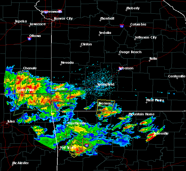 The severe thunderstorm warning for southwestern newton and western mcdonald counties will expire at 330 pm cdt, the storm which prompted the warning has weakened below severe limits, and no longer poses an immediate threat to life or property. therefore the warning will be allowed to expire. a severe thunderstorm watch remains in effect until 900 pm cdt for southwestern missouri. The severe thunderstorm warning for southwestern newton and western mcdonald counties will expire at 330 pm cdt, the storm which prompted the warning has weakened below severe limits, and no longer poses an immediate threat to life or property. therefore the warning will be allowed to expire. a severe thunderstorm watch remains in effect until 900 pm cdt for southwestern missouri.
|
| 5/11/2017 3:19 PM CDT | Golf Ball sized hail reported 2.1 miles ENE of Neosho, MO, corrected for time of report. |
| 5/11/2017 3:18 PM CDT | Golf Ball sized hail reported 2.1 miles ENE of Neosho, MO, corrected for time of report. |
| 5/11/2017 3:09 PM CDT |
 At 256 pm cdt, a severe thunderstorm was located near saginaw, or 8 miles northwest of neosho, moving north at 10 mph. public reported quarter to half dollar sized hail near racine (public). Hazards include 60 mph wind gusts and quarter size hail. Hail damage to vehicles is expected. Expect wind damage to roofs, siding, and trees. At 256 pm cdt, a severe thunderstorm was located near saginaw, or 8 miles northwest of neosho, moving north at 10 mph. public reported quarter to half dollar sized hail near racine (public). Hazards include 60 mph wind gusts and quarter size hail. Hail damage to vehicles is expected. Expect wind damage to roofs, siding, and trees.
|
| 5/11/2017 3:06 PM CDT |
 At 305 pm cdt, a severe thunderstorm was located near anderson, or 8 miles northwest of pineville, moving north at 35 mph (radar indicated). Hazards include 60 mph wind gusts and quarter size hail. Hail damage to vehicles is expected. Expect wind damage to roofs, siding, and trees. At 305 pm cdt, a severe thunderstorm was located near anderson, or 8 miles northwest of pineville, moving north at 35 mph (radar indicated). Hazards include 60 mph wind gusts and quarter size hail. Hail damage to vehicles is expected. Expect wind damage to roofs, siding, and trees.
|
| 5/11/2017 2:57 PM CDT |
 The national weather service in springfield has issued a * severe thunderstorm warning for. western newton county in southwestern missouri. until 345 pm cdt * at 256 pm cdt, a severe thunderstorm was located near saginaw, or 8 miles northwest of neosho, moving north at 10 mph. Public reported. The national weather service in springfield has issued a * severe thunderstorm warning for. western newton county in southwestern missouri. until 345 pm cdt * at 256 pm cdt, a severe thunderstorm was located near saginaw, or 8 miles northwest of neosho, moving north at 10 mph. Public reported.
|
| 5/11/2017 2:31 PM CDT |
 At 230 pm cdt, a severe thunderstorm was located near seneca, or 9 miles west of neosho, moving northeast at 15 mph (radar indicated). Hazards include 60 mph wind gusts and half dollar size hail. Hail damage to vehicles is expected. expect wind damage to roofs, siding, and trees. Locations impacted include, neosho, seneca, granby, diamond, racine,. At 230 pm cdt, a severe thunderstorm was located near seneca, or 9 miles west of neosho, moving northeast at 15 mph (radar indicated). Hazards include 60 mph wind gusts and half dollar size hail. Hail damage to vehicles is expected. expect wind damage to roofs, siding, and trees. Locations impacted include, neosho, seneca, granby, diamond, racine,.
|
| 5/11/2017 2:14 PM CDT |
 At 214 pm cdt, a severe thunderstorm was located near seneca, or 7 miles west of neosho, moving northeast at 25 mph (radar indicated). Hazards include 60 mph wind gusts and half dollar size hail. Hail damage to vehicles is expected. Expect wind damage to roofs, siding, and trees. At 214 pm cdt, a severe thunderstorm was located near seneca, or 7 miles west of neosho, moving northeast at 25 mph (radar indicated). Hazards include 60 mph wind gusts and half dollar size hail. Hail damage to vehicles is expected. Expect wind damage to roofs, siding, and trees.
|
| 5/11/2017 10:27 AM CDT |
 At 1027 am cdt, a severe thunderstorm was located near diamond, or near neosho, moving northeast at 30 mph (trained weather spotters). Hazards include quarter size hail. Damage to vehicles is expected. Locations impacted include, southeastern joplin, neosho, granby, duquesne, diamond, leawood, silver creek, saginaw, this includes interstate 44 near mile marker 9. At 1027 am cdt, a severe thunderstorm was located near diamond, or near neosho, moving northeast at 30 mph (trained weather spotters). Hazards include quarter size hail. Damage to vehicles is expected. Locations impacted include, southeastern joplin, neosho, granby, duquesne, diamond, leawood, silver creek, saginaw, this includes interstate 44 near mile marker 9.
|
| 5/11/2017 10:22 AM CDT | Quarter sized hail reported 3.8 miles SSE of Neosho, MO |
| 5/11/2017 10:17 AM CDT |
 At 1016 am cdt, a severe thunderstorm was located near neosho, moving northeast at 30 mph (radar indicated). Hazards include quarter size hail. damage to vehicles is expected At 1016 am cdt, a severe thunderstorm was located near neosho, moving northeast at 30 mph (radar indicated). Hazards include quarter size hail. damage to vehicles is expected
|
| 5/11/2017 10:15 AM CDT | Quarter sized hail reported 3.1 miles SE of Neosho, MO, quarter size hail reported at a business located at i-49 and highway 86. |
| 5/11/2017 9:10 AM CDT |
 At 909 am cdt, a severe thunderstorm was located 7 miles northwest of anderson, or 12 miles northwest of pineville, moving northeast at 35 mph (radar indicated). Hazards include 60 mph wind gusts and quarter size hail. Hail damage to vehicles is expected. expect wind damage to roofs, siding, and trees. Locations impacted include, neosho, seneca, granby, anderson, dodge, goodman, diamond, lanagan, fairview, newtonia, stella, wentworth, cayuga, stark city, ritchey, tiff city, rocky comfort, racine,. At 909 am cdt, a severe thunderstorm was located 7 miles northwest of anderson, or 12 miles northwest of pineville, moving northeast at 35 mph (radar indicated). Hazards include 60 mph wind gusts and quarter size hail. Hail damage to vehicles is expected. expect wind damage to roofs, siding, and trees. Locations impacted include, neosho, seneca, granby, anderson, dodge, goodman, diamond, lanagan, fairview, newtonia, stella, wentworth, cayuga, stark city, ritchey, tiff city, rocky comfort, racine,.
|
| 5/11/2017 8:53 AM CDT |
 At 853 am cdt, a severe thunderstorm was located near grove, or 15 miles north of jay, moving northeast at 40 mph (radar indicated). Hazards include 60 mph wind gusts and half dollar size hail. Hail damage to vehicles is expected. Expect wind damage to roofs, siding, and trees. At 853 am cdt, a severe thunderstorm was located near grove, or 15 miles north of jay, moving northeast at 40 mph (radar indicated). Hazards include 60 mph wind gusts and half dollar size hail. Hail damage to vehicles is expected. Expect wind damage to roofs, siding, and trees.
|
| 5/11/2017 1:10 AM CDT |
 The severe thunderstorm warning for eastern newton and southern jasper counties will expire at 115 am cdt, the storms which prompted the warning have weakened below severe limits, and have exited the warned area. therefore the warning will be allowed to expire. The severe thunderstorm warning for eastern newton and southern jasper counties will expire at 115 am cdt, the storms which prompted the warning have weakened below severe limits, and have exited the warned area. therefore the warning will be allowed to expire.
|
| 5/11/2017 12:57 AM CDT |
 At 1257 am cdt, severe thunderstorms were located along a line extending from near diamond to near granby to near fairview, moving east at 55 mph (radar indicated). Hazards include 60 mph wind gusts. Expect damage to roofs, siding, and trees. Locations impacted include, northeastern joplin, carthage, neosho, webb city, carl junction, oronogo, granby, carterville, duquesne, sarcoxie, duenweg, diamond, airport drive, fairview, carytown, fidelity, newtonia, stella, wentworth, stark city, this includes interstate 44 between mile markers 10 and 31. At 1257 am cdt, severe thunderstorms were located along a line extending from near diamond to near granby to near fairview, moving east at 55 mph (radar indicated). Hazards include 60 mph wind gusts. Expect damage to roofs, siding, and trees. Locations impacted include, northeastern joplin, carthage, neosho, webb city, carl junction, oronogo, granby, carterville, duquesne, sarcoxie, duenweg, diamond, airport drive, fairview, carytown, fidelity, newtonia, stella, wentworth, stark city, this includes interstate 44 between mile markers 10 and 31.
|
| 5/11/2017 12:40 AM CDT | A tree around 20ft tall was uprooted and numerous shingles were blown off hous in newton county MO, 4.2 miles SSE of Neosho, MO |
| 5/11/2017 12:38 AM CDT |
 At 1238 am cdt, severe thunderstorms were located along a line extending from near shoal creek drive to 6 miles west of neosho to 7 miles west of goodman, moving east at 50 mph (radar indicated). Hazards include 60 mph wind gusts. Expect damage to roofs, siding, and trees. Locations impacted include, joplin, carthage, neosho, webb city, carl junction, galena, oronogo, seneca, granby, carterville, duquesne, sarcoxie, duenweg, diamond, loma linda, airport drive, leawood, silver creek, fairview, shoal creek drive, this includes interstate 44 between mile markers 0 and 31. At 1238 am cdt, severe thunderstorms were located along a line extending from near shoal creek drive to 6 miles west of neosho to 7 miles west of goodman, moving east at 50 mph (radar indicated). Hazards include 60 mph wind gusts. Expect damage to roofs, siding, and trees. Locations impacted include, joplin, carthage, neosho, webb city, carl junction, galena, oronogo, seneca, granby, carterville, duquesne, sarcoxie, duenweg, diamond, loma linda, airport drive, leawood, silver creek, fairview, shoal creek drive, this includes interstate 44 between mile markers 0 and 31.
|
| 5/11/2017 12:22 AM CDT |
 At 1222 am cdt, severe thunderstorms were located along a line extending from near picher to near seneca to near grove, moving east at 50 mph (radar indicated). Hazards include 60 mph wind gusts. expect damage to roofs, siding, and trees At 1222 am cdt, severe thunderstorms were located along a line extending from near picher to near seneca to near grove, moving east at 50 mph (radar indicated). Hazards include 60 mph wind gusts. expect damage to roofs, siding, and trees
|
| 4/29/2017 4:35 AM CDT |
 The severe thunderstorm warning for eastern newton and northeastern mcdonald counties will expire at 445 am cdt, the storms which prompted the warning have moved out of the area. therefore the warning will be allowed to expire. a severe thunderstorm watch remains in effect until 700 am cdt for southwestern missouri. The severe thunderstorm warning for eastern newton and northeastern mcdonald counties will expire at 445 am cdt, the storms which prompted the warning have moved out of the area. therefore the warning will be allowed to expire. a severe thunderstorm watch remains in effect until 700 am cdt for southwestern missouri.
|
| 4/29/2017 4:11 AM CDT |
 At 411 am cdt, severe thunderstorms were located along a line extending from granby to 9 miles southeast of goodman, moving northeast at 45 mph (radar indicated). Hazards include quarter size hail. Damage to vehicles is expected. Locations impacted include, neosho, big sugar creek state park, granby, fairview, newtonia, stella, wentworth, stark city, ritchey, rocky comfort,. At 411 am cdt, severe thunderstorms were located along a line extending from granby to 9 miles southeast of goodman, moving northeast at 45 mph (radar indicated). Hazards include quarter size hail. Damage to vehicles is expected. Locations impacted include, neosho, big sugar creek state park, granby, fairview, newtonia, stella, wentworth, stark city, ritchey, rocky comfort,.
|
| 4/29/2017 3:53 AM CDT |
 At 353 am cdt, severe thunderstorms were located along a line extending from near neosho to near pineville, moving northeast at 45 mph (radar indicated). Hazards include quarter size hail. damage to vehicles is expected At 353 am cdt, severe thunderstorms were located along a line extending from near neosho to near pineville, moving northeast at 45 mph (radar indicated). Hazards include quarter size hail. damage to vehicles is expected
|
| 4/26/2017 12:50 AM CDT |
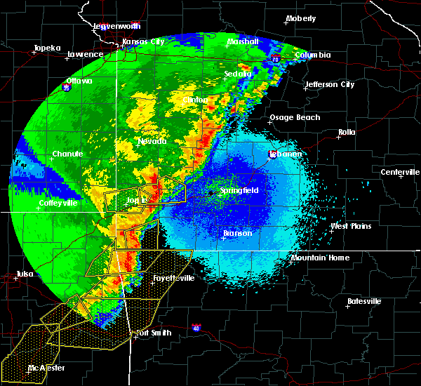 At 1250 am cdt, a severe thunderstorm was located near pineville, moving northeast at 60 mph (radar indicated). Hazards include 60 mph wind gusts and quarter size hail. Hail damage to vehicles is expected. expect wind damage to roofs, siding, and trees. Locations impacted include, big sugar creek state park, anderson, noel, goodman, pineville, lanagan, fairview, stella, powell, rocky comfort,. At 1250 am cdt, a severe thunderstorm was located near pineville, moving northeast at 60 mph (radar indicated). Hazards include 60 mph wind gusts and quarter size hail. Hail damage to vehicles is expected. expect wind damage to roofs, siding, and trees. Locations impacted include, big sugar creek state park, anderson, noel, goodman, pineville, lanagan, fairview, stella, powell, rocky comfort,.
|
| 4/26/2017 12:39 AM CDT |
 At 1239 am cdt, a severe thunderstorm was located over noel, or 7 miles west of pineville, moving northeast at 55 mph (radar indicated). Hazards include 60 mph wind gusts and quarter size hail. Hail damage to vehicles is expected. expect wind damage to roofs, siding, and trees. Locations impacted include, big sugar creek state park, anderson, noel, dodge, goodman, south west city, pineville, lanagan, fairview, stella, cayuga, tiff city, powell, rocky comfort,. At 1239 am cdt, a severe thunderstorm was located over noel, or 7 miles west of pineville, moving northeast at 55 mph (radar indicated). Hazards include 60 mph wind gusts and quarter size hail. Hail damage to vehicles is expected. expect wind damage to roofs, siding, and trees. Locations impacted include, big sugar creek state park, anderson, noel, dodge, goodman, south west city, pineville, lanagan, fairview, stella, cayuga, tiff city, powell, rocky comfort,.
|
| 4/26/2017 12:18 AM CDT |
 At 1218 am cdt, a severe thunderstorm was located near grove, or 10 miles northeast of jay, moving east at 60 mph (radar indicated). Hazards include 60 mph wind gusts and quarter size hail. Hail damage to vehicles is expected. Expect wind damage to roofs, siding, and trees. At 1218 am cdt, a severe thunderstorm was located near grove, or 10 miles northeast of jay, moving east at 60 mph (radar indicated). Hazards include 60 mph wind gusts and quarter size hail. Hail damage to vehicles is expected. Expect wind damage to roofs, siding, and trees.
|
| 4/16/2017 10:04 PM CDT |
 At 1003 pm cdt, a severe thunderstorm was located over neosho, moving east at 15 mph (radar indicated). Hazards include quarter size hail. Damage to vehicles is expected. Locations impacted include, neosho, granby, fairview, newtonia, wentworth, stark city, ritchey,. At 1003 pm cdt, a severe thunderstorm was located over neosho, moving east at 15 mph (radar indicated). Hazards include quarter size hail. Damage to vehicles is expected. Locations impacted include, neosho, granby, fairview, newtonia, wentworth, stark city, ritchey,.
|
| 4/16/2017 9:36 PM CDT |
 At 935 pm cdt, a severe thunderstorm was located over neosho, moving east at 15 mph (radar indicated). Hazards include quarter size hail. damage to vehicles is expected At 935 pm cdt, a severe thunderstorm was located over neosho, moving east at 15 mph (radar indicated). Hazards include quarter size hail. damage to vehicles is expected
|
| 4/4/2017 7:01 PM CDT |
 At 701 pm cdt, a confirmed tornado was located 2 miles southeast of neosho, moving northeast at 45 mph (law enforcement confirmed tornado). Hazards include damaging tornado and golf ball size hail. Flying debris will be dangerous to those caught without shelter. mobile homes will be damaged or destroyed. damage to roofs, windows, and vehicles will occur. tree damage is likely. Locations impacted include, neosho, monett, granby, pierce city, stotts city, newtonia, freistatt, wentworth, stark city, ritchey, this includes interstate 44 between mile markers 33 and 41. At 701 pm cdt, a confirmed tornado was located 2 miles southeast of neosho, moving northeast at 45 mph (law enforcement confirmed tornado). Hazards include damaging tornado and golf ball size hail. Flying debris will be dangerous to those caught without shelter. mobile homes will be damaged or destroyed. damage to roofs, windows, and vehicles will occur. tree damage is likely. Locations impacted include, neosho, monett, granby, pierce city, stotts city, newtonia, freistatt, wentworth, stark city, ritchey, this includes interstate 44 between mile markers 33 and 41.
|
| 4/4/2017 6:57 PM CDT | Light tree damage on south side of neosh in newton county MO, 2.4 miles NNW of Neosho, MO |
| 4/4/2017 6:54 PM CDT |
 At 653 pm cdt, a severe thunderstorm was located near neosho, moving northeast at 45 mph (radar indicated). Hazards include golf ball size hail and 70 mph wind gusts. People and animals outdoors will be injured. expect hail damage to roofs, siding, windows, and vehicles. expect considerable tree damage. Wind damage is also likely to mobile homes, roofs, and outbuildings. At 653 pm cdt, a severe thunderstorm was located near neosho, moving northeast at 45 mph (radar indicated). Hazards include golf ball size hail and 70 mph wind gusts. People and animals outdoors will be injured. expect hail damage to roofs, siding, windows, and vehicles. expect considerable tree damage. Wind damage is also likely to mobile homes, roofs, and outbuildings.
|
| 4/4/2017 6:51 PM CDT |
 At 651 pm cdt, a severe thunderstorm capable of producing a tornado was located over goodman, or 7 miles south of neosho, moving northeast at 50 mph (radar indicated rotation). Hazards include tornado and ping pong ball size hail. Flying debris will be dangerous to those caught without shelter. mobile homes will be damaged or destroyed. damage to roofs, windows, and vehicles will occur. tree damage is likely. Locations impacted include, neosho, goodman, fairview, newtonia, stella, stark city,. At 651 pm cdt, a severe thunderstorm capable of producing a tornado was located over goodman, or 7 miles south of neosho, moving northeast at 50 mph (radar indicated rotation). Hazards include tornado and ping pong ball size hail. Flying debris will be dangerous to those caught without shelter. mobile homes will be damaged or destroyed. damage to roofs, windows, and vehicles will occur. tree damage is likely. Locations impacted include, neosho, goodman, fairview, newtonia, stella, stark city,.
|
| 4/4/2017 6:50 PM CDT | Quarter sized hail reported 3.1 miles SE of Neosho, MO, public reported quarter sized hail at i49 and hwy 86 neosho via social media. |
| 4/4/2017 6:45 PM CDT | Half Dollar sized hail reported 1.5 miles SW of Neosho, MO |
| 3/21/2017 8:55 AM CDT |
 At 853 am cdt, a severe thunderstorm was located over neosho, moving east at 20 mph (law enforcement. at 850 am reported quarter size hail near the neosho area). Hazards include quarter size hail. Damage to vehicles is expected. Locations impacted include, neosho, granby, fairview, newtonia, stella, stark city, ritchey,. At 853 am cdt, a severe thunderstorm was located over neosho, moving east at 20 mph (law enforcement. at 850 am reported quarter size hail near the neosho area). Hazards include quarter size hail. Damage to vehicles is expected. Locations impacted include, neosho, granby, fairview, newtonia, stella, stark city, ritchey,.
|
| 3/21/2017 8:50 AM CDT | Golf Ball sized hail reported 2.4 miles NNW of Neosho, MO, golfball sized hail at crowder college. |
| 3/21/2017 8:50 AM CDT | Quarter sized hail reported 2.4 miles NNW of Neosho, MO, corrected for hail size. 1 inch hail at crowder college. |
| 3/21/2017 8:37 AM CDT |
 At 837 am cdt, a severe thunderstorm was located over neosho, moving east at 30 mph (radar indicated). Hazards include quarter size hail. damage to vehicles is expected At 837 am cdt, a severe thunderstorm was located over neosho, moving east at 30 mph (radar indicated). Hazards include quarter size hail. damage to vehicles is expected
|
| 3/9/2017 7:15 PM CST | Half Dollar sized hail reported 0.8 miles W of Neosho, MO, half dollar size hail reported on social media with a picture. time was estimated |
| 3/9/2017 7:11 PM CST | Quarter sized hail reported 1.5 miles SW of Neosho, MO, quarter sized hail wornall and south street in south central neosho. other reports also of 1.00" hail from the public. |
| 3/9/2017 7:05 PM CST |
 At 704 pm cst, a severe thunderstorm was located near neosho, moving southeast at 30 mph (radar indicated). Hazards include 60 mph wind gusts and quarter size hail. Hail damage to vehicles is expected. Expect wind damage to roofs, siding, and trees. At 704 pm cst, a severe thunderstorm was located near neosho, moving southeast at 30 mph (radar indicated). Hazards include 60 mph wind gusts and quarter size hail. Hail damage to vehicles is expected. Expect wind damage to roofs, siding, and trees.
|
| 3/9/2017 7:04 PM CST | Golf Ball sized hail reported 7.5 miles E of Neosho, MO, golf ball size hail. . |
| 3/6/2017 10:25 PM CST | 6 to 12 inch tree limbs dow in newton county MO, 1.3 miles SSE of Neosho, MO |
| 3/6/2017 10:14 PM CST |
 At 1013 pm cst, severe thunderstorms were located along a line extending from near shoal creek drive to near bernice, moving east at 60 mph (radar indicated). Hazards include 70 mph wind gusts and quarter size hail. Hail damage to vehicles is expected. expect considerable tree damage. Wind damage is also likely to mobile homes, roofs, and outbuildings. At 1013 pm cst, severe thunderstorms were located along a line extending from near shoal creek drive to near bernice, moving east at 60 mph (radar indicated). Hazards include 70 mph wind gusts and quarter size hail. Hail damage to vehicles is expected. expect considerable tree damage. Wind damage is also likely to mobile homes, roofs, and outbuildings.
|
| 8/25/2016 7:43 PM CDT |
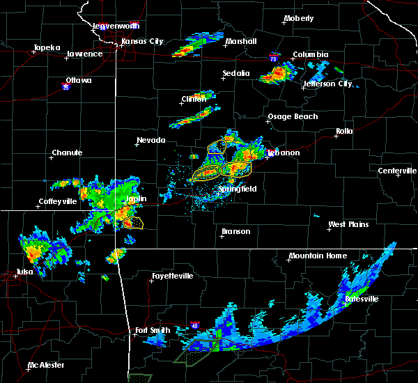 At 743 pm cdt, a severe thunderstorm was located near goodman, or near neosho, moving east at 25 mph (radar indicated). Hazards include 60 mph wind gusts. Expect damage to roofs. siding. and trees. Locations impacted include, neosho,. At 743 pm cdt, a severe thunderstorm was located near goodman, or near neosho, moving east at 25 mph (radar indicated). Hazards include 60 mph wind gusts. Expect damage to roofs. siding. and trees. Locations impacted include, neosho,.
|
| 8/25/2016 7:30 PM CDT | Quarter sized hail reported 7.5 miles E of Neosho, MO |
| 8/25/2016 7:26 PM CDT |
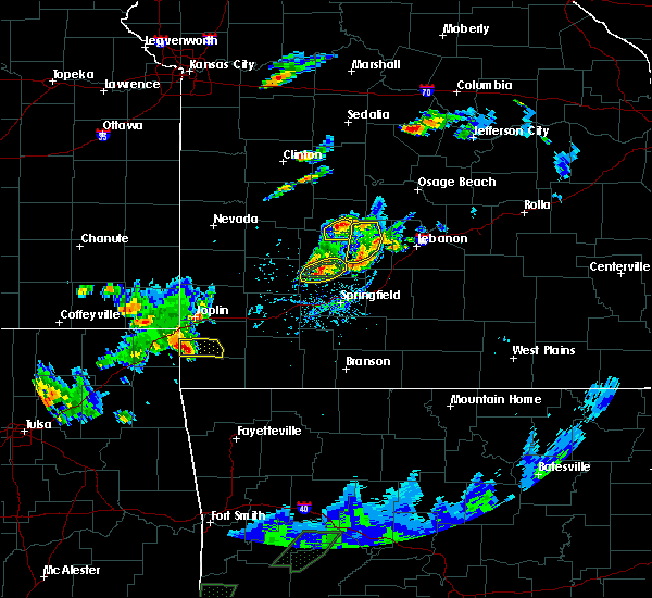 At 726 pm cdt, a severe thunderstorm was located over seneca, or 12 miles west of neosho, moving east at 15 mph (radar indicated). Hazards include 60 mph wind gusts. Expect damage to roofs. siding. And trees. At 726 pm cdt, a severe thunderstorm was located over seneca, or 12 miles west of neosho, moving east at 15 mph (radar indicated). Hazards include 60 mph wind gusts. Expect damage to roofs. siding. And trees.
|
| 7/8/2016 1:07 AM CDT |
 At 106 am cdt, severe thunderstorms were located along a line extending from 6 miles south of everton to near pierce city to 6 miles southwest of saginaw, moving southeast at 35 mph (trained weather spotters. these storms have a long history of downing trees and powerlines across western missouri). Hazards include 60 mph wind gusts. Expect damage to roofs. siding. and trees. Locations impacted include, southern joplin, neosho, monett, aurora, mount vernon, seneca, marionville, granby, duquesne, pierce city, purdy, diamond, loma linda, wheaton, leawood, silver creek, verona, fairview, shoal creek drive, saginaw, this includes interstate 44 between mile markers 1 and 9, and between mile markers 37 and 58. At 106 am cdt, severe thunderstorms were located along a line extending from 6 miles south of everton to near pierce city to 6 miles southwest of saginaw, moving southeast at 35 mph (trained weather spotters. these storms have a long history of downing trees and powerlines across western missouri). Hazards include 60 mph wind gusts. Expect damage to roofs. siding. and trees. Locations impacted include, southern joplin, neosho, monett, aurora, mount vernon, seneca, marionville, granby, duquesne, pierce city, purdy, diamond, loma linda, wheaton, leawood, silver creek, verona, fairview, shoal creek drive, saginaw, this includes interstate 44 between mile markers 1 and 9, and between mile markers 37 and 58.
|
| 7/8/2016 12:45 AM CDT | Severe thunderstorm wind gusts downed a tree on a car at the newton county fairground in newton county MO, 1.5 miles SW of Neosho, MO |
| 7/8/2016 12:29 AM CDT |
 At 1227 am cdt, severe thunderstorms were located along a line extending from 9 miles north of lockwood to near golden city to near carl junction, moving southeast at 45 mph (law enforcement. these storms have a long history of producing 60 to 70 mph wind gusts which have downed trees and power lines). Hazards include 70 mph wind gusts. Expect considerable tree damage. Damage is likely to mobile homes, roofs, and outbuildings. At 1227 am cdt, severe thunderstorms were located along a line extending from 9 miles north of lockwood to near golden city to near carl junction, moving southeast at 45 mph (law enforcement. these storms have a long history of producing 60 to 70 mph wind gusts which have downed trees and power lines). Hazards include 70 mph wind gusts. Expect considerable tree damage. Damage is likely to mobile homes, roofs, and outbuildings.
|
| 5/24/2016 2:05 PM CDT | Power pole reported down by law enforcement near the intersection of iris rd and goldfinch roa in newton county MO, 7 miles SE of Neosho, MO |
| 4/27/2016 1:08 AM CDT |
 At 106 am cdt, severe thunderstorms were located along a line extending from 11 miles southwest of stockton to near garfield, moving east at 35 mph (law enforcement. there were numerous reports of wind damage with this line of storms over the past hour). Hazards include 70 mph wind gusts. Expect considerable tree damage. damage is likely to mobile homes, roofs, and outbuildings. Locations impacted include, carthage, stockton lake, table rock lake, big sugar creek state park, roaring river state park, monett, aurora, mount vernon, lamar, cassville, marionville, granby, crane, shell knob, greenfield, sarcoxie, pierce city, purdy, lockwood, jasper, this includes interstate 44 between mile markers 17 and 58. At 106 am cdt, severe thunderstorms were located along a line extending from 11 miles southwest of stockton to near garfield, moving east at 35 mph (law enforcement. there were numerous reports of wind damage with this line of storms over the past hour). Hazards include 70 mph wind gusts. Expect considerable tree damage. damage is likely to mobile homes, roofs, and outbuildings. Locations impacted include, carthage, stockton lake, table rock lake, big sugar creek state park, roaring river state park, monett, aurora, mount vernon, lamar, cassville, marionville, granby, crane, shell knob, greenfield, sarcoxie, pierce city, purdy, lockwood, jasper, this includes interstate 44 between mile markers 17 and 58.
|
| 4/27/2016 12:40 AM CDT | Powerlines down at i-49 and us 60 in neosho in newton county MO, 1.5 miles SW of Neosho, MO |
| 4/27/2016 12:40 AM CDT |
 At 1238 am cdt, severe thunderstorms were located along a line extending from near sheldon to near bella vista, moving east at 35 mph (law enforcement. there have been numerous reports of wind damage with storms over parts of newton and mcdonald counties). Hazards include 70 mph wind gusts. Expect considerable tree damage. Damage is likely to mobile homes, roofs, and outbuildings. At 1238 am cdt, severe thunderstorms were located along a line extending from near sheldon to near bella vista, moving east at 35 mph (law enforcement. there have been numerous reports of wind damage with storms over parts of newton and mcdonald counties). Hazards include 70 mph wind gusts. Expect considerable tree damage. Damage is likely to mobile homes, roofs, and outbuildings.
|
| 4/27/2016 12:23 AM CDT |
 At 1222 am cdt, severe thunderstorms were located along a line extending from 7 miles north of seneca to south west city, moving east at 35 mph (radar indicated). Hazards include 60 mph wind gusts and penny size hail. Expect damage to roofs. siding. And trees. At 1222 am cdt, severe thunderstorms were located along a line extending from 7 miles north of seneca to south west city, moving east at 35 mph (radar indicated). Hazards include 60 mph wind gusts and penny size hail. Expect damage to roofs. siding. And trees.
|
| 11/17/2015 5:09 AM CST |
 At 509 am cst, severe thunderstorms were located along a line extending from 7 miles southeast of pittsburg to near galena to near quapaw, moving northeast at 65 mph (radar indicated). Hazards include 60 mph wind gusts. Expect damage to roofs. Siding and trees. At 509 am cst, severe thunderstorms were located along a line extending from 7 miles southeast of pittsburg to near galena to near quapaw, moving northeast at 65 mph (radar indicated). Hazards include 60 mph wind gusts. Expect damage to roofs. Siding and trees.
|
| 8/23/2015 5:07 AM CDT |
 At 506 am cdt, severe thunderstorms were located along a line extending from 7 miles northwest of noel to near exeter to near clever, and are nearly stationary (radar indicated). Hazards include 60 mph wind gusts. Expect damage to roofs. siding and trees. Locations impacted include, neosho, branson, lake taneycomo, table rock lake, bull shoals lake, table rock state park, big sugar creek state park, roaring river state park, monett, aurora, hollister, cassville, silver dollar city, kimberling city, seneca, forsyth, marionville, granby, anderson, noel,. At 506 am cdt, severe thunderstorms were located along a line extending from 7 miles northwest of noel to near exeter to near clever, and are nearly stationary (radar indicated). Hazards include 60 mph wind gusts. Expect damage to roofs. siding and trees. Locations impacted include, neosho, branson, lake taneycomo, table rock lake, bull shoals lake, table rock state park, big sugar creek state park, roaring river state park, monett, aurora, hollister, cassville, silver dollar city, kimberling city, seneca, forsyth, marionville, granby, anderson, noel,.
|
| 8/23/2015 5:00 AM CDT |
 At 459 am cdt, severe thunderstorms were located along a line extending from 7 miles west of lanagan to near exeter to near clever, moving southeast at 40 mph (radar indicated). Hazards include 60 mph wind gusts. Expect damage to roofs. Siding and trees. At 459 am cdt, severe thunderstorms were located along a line extending from 7 miles west of lanagan to near exeter to near clever, moving southeast at 40 mph (radar indicated). Hazards include 60 mph wind gusts. Expect damage to roofs. Siding and trees.
|
| 8/23/2015 4:53 AM CDT |
 At 452 am cdt, severe thunderstorms were located along a line extending from near galena to near sarcoxie to near willard, moving southeast at 45 mph (radar indicated). Hazards include 60 mph wind gusts. Expect damage to roofs. siding and trees. Locations impacted include, neosho, table rock lake, big sugar creek state park, roaring river state park, monett, aurora, mount vernon, cassville, seneca, marionville, granby, anderson, crane, shell knob, pierce city, goodman, purdy, billings, reeds spring, diamond, this includes interstate 44 near mile marker 0, and between mile markers 33 and 56. At 452 am cdt, severe thunderstorms were located along a line extending from near galena to near sarcoxie to near willard, moving southeast at 45 mph (radar indicated). Hazards include 60 mph wind gusts. Expect damage to roofs. siding and trees. Locations impacted include, neosho, table rock lake, big sugar creek state park, roaring river state park, monett, aurora, mount vernon, cassville, seneca, marionville, granby, anderson, crane, shell knob, pierce city, goodman, purdy, billings, reeds spring, diamond, this includes interstate 44 near mile marker 0, and between mile markers 33 and 56.
|
| 8/23/2015 4:45 AM CDT | There are reports of power lines down in neosh in newton county MO, 1.5 miles SW of Neosho, MO |
| 8/23/2015 4:22 AM CDT |
 At 422 am cdt, severe thunderstorms were located along a line extending from 6 miles west of commerce to near diamond to near mount vernon to near morrisville to 6 miles northeast of bolivar, moving southeast at 45 mph (radar indicated). Hazards include 60 mph wind gusts. Expect damage to roofs. Siding and trees. At 422 am cdt, severe thunderstorms were located along a line extending from 6 miles west of commerce to near diamond to near mount vernon to near morrisville to 6 miles northeast of bolivar, moving southeast at 45 mph (radar indicated). Hazards include 60 mph wind gusts. Expect damage to roofs. Siding and trees.
|
| 8/23/2015 3:48 AM CDT |
 At 348 am cdt, severe thunderstorms were located along a line extending from humansville to near lockwood to 8 miles south of mindenmines to near altamont, moving southeast at 40 mph (radar indicated). Hazards include 60 mph wind gusts. Expect damage to roofs. Siding and trees. At 348 am cdt, severe thunderstorms were located along a line extending from humansville to near lockwood to 8 miles south of mindenmines to near altamont, moving southeast at 40 mph (radar indicated). Hazards include 60 mph wind gusts. Expect damage to roofs. Siding and trees.
|
| 5/29/2015 3:45 PM CDT | At 344 pm cdt, a severe thunderstorm was located 7 miles southeast of goodman, and moving north at 25 mph (radar indicated). Hazards include 60 mph wind gusts and quarter size hail. Hail damage to vehicles is expected. expect wind damage to roofs, siding and trees. locations impacted include, anderson and goodman. this warning also includes big sugar creek state park. A tornado watch remains in effect until 700 pm cdt friday evening for southwest missouri. |
| 5/29/2015 3:25 PM CDT | At 322 pm cdt, a severe thunderstorm was located near pineville, and moving north at 35 mph (radar indicated). Hazards include 60 mph wind gusts and quarter size hail. Hail damage to vehicles is expected. Expect wind damage to roofs, siding and trees. |
| 5/17/2015 1:11 AM CDT | Measure at business 49 and south street in newton county MO, 0.6 miles SSE of Neosho, MO |
| 5/17/2015 1:10 AM CDT | At 109 am cdt, a severe thunderstorm capable of producing a tornado was located near saginaw, and moving northeast at 50 mph (radar indicated rotation. while a tornado has not yet been confirmed, this circulation has likely resulted in damage to power poles near seneca). Hazards include tornado. Flying debris will be dangerous to those caught without shelter. mobile homes will be damaged or destroyed. damage to roofs, windows and vehicles will occur. Tree damage is likely. |
| 5/17/2015 1:06 AM CDT | Several homes damaged on 14000 block of heron drive. damage to roofs... windows blown out of homes... trees down and detached garages heavily damage in newton county MO, 3.2 miles SE of Neosho, MO |
| 5/17/2015 1:04 AM CDT | At 102 am cdt, a severe thunderstorm capable of producing a tornado was located 8 miles southwest of shoal creek drive, and moving northeast at 55 mph (radar indicated rotation). Hazards include tornado. Flying debris will be dangerous to those caught without shelter. mobile homes will be damaged or destroyed. damage to roofs, windows and vehicles will occur. tree damage is likely. locations impacted include, cliff village, dennis acres, diamond, duenweg, duquesne, iron gates, joplin, leawood, oakland park, racine, redings mill, saginaw, seneca, shoal creek drive, shoal creek estates and silver creek. interstate 44 between mile markers 1 and 12 will also be impacted by this dangerous storm. radar is indicating a strengthening circulation near racine in newton county. a tornado watch remains in effect until 500 am cdt sunday morning for southeast kansas and southwestern missouri. Radar indicated. |
| 5/17/2015 12:59 AM CDT | At 1255 am cdt, severe thunderstorms were located along a line extending from baxter springs to anderson to 7 miles south of noel, and moving northeast at 55 mph (radar indicated). Hazards include 60 mph wind gusts. 60 mph wind gusts are expected within this line of severe thunderstorms. in addition, a tornado warning is in effect for far southeastern kansas, southern jasper, and newton counties, where stronger tornado winds will be possible. Expect damage to roofs. siding and trees. locations impacted include, airport drive, alba, anderson, baxter springs, carl junction, carterville, carthage, diamond, duenweg, duquesne, fairview, galena, goodman, granby, iron gates, joplin, lanagan, leawood, neosho, noel, oronogo, pineville, purcell, saginaw, sarcoxie, seneca, shoal creek drive, silver creek, south west city, treece and webb city. this warning also includes big sugar creek state park. interstate 44 between mile markers 0 and 29 will also be impacted by severe thunderstorms. once again, in addition to this severe thunderstorm warning, a tornado warning is in effect for far southeastern kansas, southern jasper, and newton counties until 115 am cdt. a tornado watch remains in effect until 500 am cdt sunday morning for southeast kansas and southwestern missouri. 75in. |
| 5/17/2015 12:59 AM CDT | At 1255 am cdt, severe thunderstorms were located along a line extending from baxter springs to anderson to 7 miles south of noel, and moving northeast at 55 mph (radar indicated). Hazards include 60 mph wind gusts. 60 mph wind gusts are expected within this line of severe thunderstorms. in addition, a tornado warning is in effect for far southeastern kansas, southern jasper, and newton counties, where stronger tornado winds will be possible. Expect damage to roofs. siding and trees. locations impacted include, airport drive, alba, anderson, baxter springs, carl junction, carterville, carthage, diamond, duenweg, duquesne, fairview, galena, goodman, granby, iron gates, joplin, lanagan, leawood, neosho, noel, oronogo, pineville, purcell, saginaw, sarcoxie, seneca, shoal creek drive, silver creek, south west city, treece and webb city. this warning also includes big sugar creek state park. interstate 44 between mile markers 0 and 29 will also be impacted by severe thunderstorms. once again, in addition to this severe thunderstorm warning, a tornado warning is in effect for far southeastern kansas, southern jasper, and newton counties until 115 am cdt. a tornado watch remains in effect until 500 am cdt sunday morning for southeast kansas and southwestern missouri. 75in. |
| 5/17/2015 12:52 AM CDT | At 1250 am cdt, a severe thunderstorm capable of producing a tornado was located 10 miles west of seneca, and moving northeast at 55 mph (radar indicated rotation). Hazards include tornado. Flying debris will be dangerous to those caught without shelter. mobile homes will be damaged or destroyed. damage to roofs, windows and vehicles will occur. Tree damage is likely. |
| 5/17/2015 12:52 AM CDT | At 1250 am cdt, a severe thunderstorm capable of producing a tornado was located 10 miles west of seneca, and moving northeast at 55 mph (radar indicated rotation). Hazards include tornado. Flying debris will be dangerous to those caught without shelter. mobile homes will be damaged or destroyed. damage to roofs, windows and vehicles will occur. Tree damage is likely. |
| 5/17/2015 12:38 AM CDT | At 1234 am cdt, severe thunderstorms were located along a line extending from 16 miles southwest of treece to 10 miles northwest of south west city to 18 miles southwest of south west city, or near jay oklahoma, and moving northeast at 60 mph (radar indicated). Hazards include 60 mph wind gusts. Expect damage to roofs. Siding and trees. |
| 5/17/2015 12:38 AM CDT | At 1234 am cdt, severe thunderstorms were located along a line extending from 16 miles southwest of treece to 10 miles northwest of south west city to 18 miles southwest of south west city, or near jay oklahoma, and moving northeast at 60 mph (radar indicated). Hazards include 60 mph wind gusts. Expect damage to roofs. Siding and trees. |
| 4/22/2015 9:05 AM CDT | Quarter sized hail reported 1.7 miles NNW of Neosho, MO, several facebook pictures of nickel to quarter size hail on southern edge of neosho. |
| 4/3/2015 3:13 AM CDT | A tornado warning remains in effect for newton county until 330 am cdt. at 311 am cdt. a severe thunderstorm capable of producing a tornado was located near granby. and moving east at 60 mph. hazard. tornado and golf ball size hail. source. Radar indicated rotation. |
| 4/3/2015 3:11 AM CDT | A severe thunderstorm warning remains in effect for northern newton. eastern jasper and eastern barton counties until 330 am cdt. at 308 am cdt. severe thunderstorms were located along a line extending from 8 miles north of lamar to neosho. And moving east at 50 mph. |
| 4/3/2015 2:59 AM CDT | A tornado warning remains in effect for newton county until 330 am cdt. at 258 am cdt. a severe thunderstorm capable of producing a tornado was located near saginaw. and moving east at 60 mph. hazard. tornado and half dollar size hail. source. Radar indicated rotation. |
| 4/3/2015 2:45 AM CDT | The national weather service in springfield has issued a * tornado warning for. newton county in southwest missouri. until 330 am cdt * at 244 am cdt. a severe thunderstorm capable of producing a tornado was located 9 miles northwest of seneca. And moving east. |
| 4/3/2015 2:28 AM CDT | The national weather service in springfield has issued a * severe thunderstorm warning for. barton county in southwest missouri. jasper county in southwest missouri. newton county in southwest missouri. Until 330 am cdt. |
| 4/2/2015 9:46 PM CDT | A severe thunderstorm warning remains in effect for northern newton and southern jasper counties until 1030 pm cdt. at 944 pm cdt. severe thunderstorms were located along a line extending from airport drive to 8 miles southwest of shoal creek drive. and moving east at 30 mph. hazard. 60 mph wind gusts and quarter size hail. |
| 4/2/2015 9:31 PM CDT | The national weather service in springfield has issued a * severe thunderstorm warning for. southeastern cherokee county in southeast kansas. southern jasper county in southwest missouri. northern newton county in southwest missouri. Until 1030 pm cdt. |
| 4/2/2015 9:31 PM CDT | The national weather service in springfield has issued a * severe thunderstorm warning for. southeastern cherokee county in southeast kansas. southern jasper county in southwest missouri. northern newton county in southwest missouri. Until 1030 pm cdt. |
| 4/2/2015 8:42 PM CDT | The national weather service in springfield has issued a * tornado warning for. southeastern cherokee county in southeast kansas. southern jasper county in southwest missouri. northern newton county in southwest missouri. Until 930 pm cdt. |
| 4/2/2015 8:42 PM CDT | The national weather service in springfield has issued a * tornado warning for. southeastern cherokee county in southeast kansas. southern jasper county in southwest missouri. northern newton county in southwest missouri. Until 930 pm cdt. |
| 4/1/2015 1:33 PM CDT | A severe thunderstorm warning remains in effect for southeastern newton and northern mcdonald counties until 145 pm cdt. at 132 pm cdt. severe thunderstorms were located along a line extending from granby to 8 miles east of goodman to anderson. and moving northeast at 35 mph. hazard. 60 mph wind gusts and quarter size hail. |
| 4/1/2015 1:12 PM CDT | A severe thunderstorm warning remains in effect for newton and northern mcdonald counties until 145 pm cdt. at 110 pm cdt. severe thunderstorms were located along a line extending from saginaw to neosho to goodman to 6 miles southwest of anderson. and moving northeast at 20 mph. hazard. 60 mph wind gusts and quarter size hail. |
| 4/1/2015 12:58 PM CDT | The national weather service in springfield has issued a * severe thunderstorm warning for. northwestern mcdonald county in southwest missouri. newton county in southwest missouri. until 145 pm cdt * at 1257 pm cdt. Severe thunderstorms were located along a line. |
| 3/25/2015 4:39 PM CDT | The national weather service in springfield has issued a * severe thunderstorm warning for. southeastern jasper county in southwest missouri. western lawrence county in southwest missouri. eastern newton county in southwest missouri. Until 515 pm cdt. |
| 3/25/2015 4:34 PM CDT | A severe thunderstorm warning remains in effect for southern lawrence. eastern newton. northern mcdonald and northwestern barry counties until 500 pm cdt. at 431 pm cdt. a large area of severe thunderstorms were located along a line extending from mount vernon to 6 miles southeast of goodman. And moving northeast at 40 mph. |
| 3/25/2015 3:30 PM CST | Golf Ball sized hail reported 1.2 miles NW of Neosho, MO |
| 3/25/2015 3:30 PM CST | Ping Pong Ball sized hail reported 1.5 miles SW of Neosho, MO, delayed report via facebook |
| 3/25/2015 4:15 PM CDT | The national weather service in springfield has issued a * severe thunderstorm warning for. northwestern barry county in southwest missouri. southern lawrence county in southwest missouri. northern mcdonald county in southwest missouri. Eastern newton county in southwest missouri. |
| 3/25/2015 2:54 PM CST | Quarter sized hail reported 1.5 miles SW of Neosho, MO |
| 3/25/2015 3:54 PM CDT | A severe thunderstorm warning remains in effect for eastern newton. northern mcdonald and southeastern jasper counties until 415 pm cdt. at 352 pm cdt. severe thunderstorms were located along a line extending from 6 miles east of diamond to neosho. And moving northeast at 30 mph. |
| 3/25/2015 2:45 PM CST | Quarter sized hail reported 2.1 miles SSW of Neosho, MO |
| 3/25/2015 3:41 PM CDT | A severe thunderstorm warning remains in effect for newton. northern mcdonald and southeastern jasper counties until 415 pm cdt. at 339 pm cdt. severe thunderstorms were located along a line extending from diamond to goodman. and moving northeast at 45 mph. hazard. Golf ball size hail. |
| 3/25/2015 3:33 PM CDT | The national weather service in springfield has issued a * severe thunderstorm warning for. southeastern jasper county in southwest missouri. northern mcdonald county in southwest missouri. newton county in southwest missouri. Until 415 pm cdt. |
| 3/24/2015 4:17 PM CST | Half Dollar sized hail reported 4.3 miles WSW of Neosho, MO, various sizes ranging from dime to half dollar |
| 3/24/2015 4:06 PM CST | Quarter sized hail reported 4.5 miles SW of Neosho, MO, dime to quarter size hail |
| 3/24/2015 5:00 PM CDT | The national weather service in springfield has issued a * severe thunderstorm warning for. northern mcdonald county in southwest missouri. southern newton county in southwest missouri. until 530 pm cdt * at 457 pm cdt. A severe thunderstorm was located near anderson. |
| 3/24/2015 4:57 PM CDT | The national weather service in springfield has issued a * severe thunderstorm warning for. newton county in southwest missouri. until 530 pm cdt * at 455 pm cdt. a severe thunderstorm was located 5 miles west of neosho. And moving east at 55 mph. |
| 9/1/2014 11:15 PM CDT | *** 2 inj *** several camper trailers blown over just east of reddings mill. 2 minor injuries reported near the riverbend campground with overturned camper trailer. num in newton county MO, 3.6 miles SSE of Neosho, MO |
| 6/28/2014 4:38 PM CDT | *** 2 inj *** winds blew down some fireworks tents. two minor injuries. some trees were also blown down in the count in newton county MO, 1.5 miles SW of Neosho, MO |
| 6/5/2014 11:56 PM CDT | Half Dollar sized hail reported 8.5 miles SSW of Neosho, MO |
| 6/5/2014 9:00 AM CDT | Nimerous trees blown down and several vehicles damages due to limbs falling on the in newton county MO, 1.5 miles SW of Neosho, MO |
| 5/20/2013 6:55 PM CDT | Tree fell onto hous in newton county MO, 7.6 miles E of Neosho, MO |
| 3/30/2013 8:08 PM CDT | Half Dollar sized hail reported 6.9 miles SSE of Neosho, MO |
| 9/7/2012 4:30 PM CDT | Power outages reported throughout newton county. numerous trees and power poles dow in newton county MO, 1.5 miles SW of Neosho, MO |
| 9/7/2012 4:30 PM CDT | Power outages repoted throuh out newton county. numerous trees and power poles dow in newton county MO, 1.5 miles SW of Neosho, MO |
| 9/7/2012 4:24 PM CDT | Tree fell on truck. wind estimated at 65 mp in newton county MO, 1.5 miles SW of Neosho, MO |
| 9/7/2012 4:22 PM CDT | Storm damage reported in newton county MO, 1.5 miles SW of Neosho, MO |
| 5/29/2012 1:15 AM CDT | Tree reported down at the intersection of ried road and summit stree in newton county MO, 1.5 miles SW of Neosho, MO |
| 1/1/0001 12:00 AM | Baseball sized hail reported 7.7 miles SSW of Neosho, MO |
| 1/1/0001 12:00 AM | Quarter sized hail reported 3.6 miles SSE of Neosho, MO |
| 1/1/0001 12:00 AM | Golf Ball sized hail reported 1.5 miles SW of Neosho, MO, reported at corner of norway street and monarch street. |
| 1/1/0001 12:00 AM | Tennis Ball sized hail reported 1.7 miles NNW of Neosho, MO, fire chief collected tennis ball hail |
| 1/1/0001 12:00 AM | Quarter sized hail reported 1.3 miles SSE of Neosho, MO, ham radio report of quarter sized hail at intersection of us 60 and kodiac road. |
Hail Maps for Neosho, MO
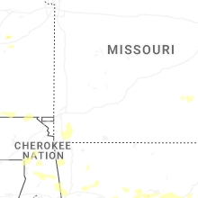
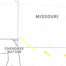


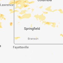


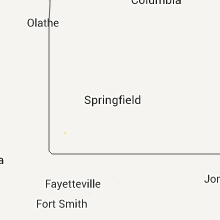


Connect with Interactive Hail Maps