

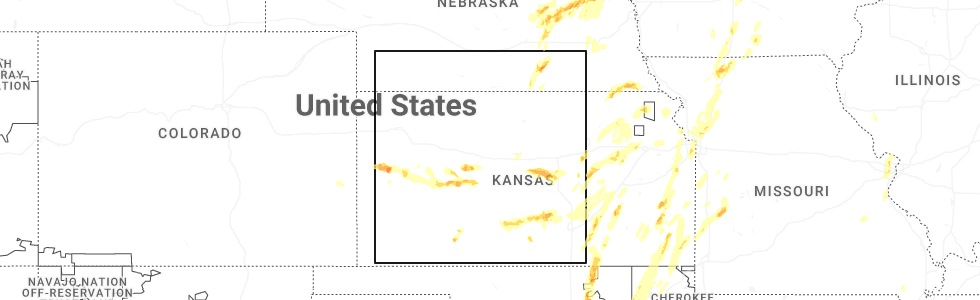
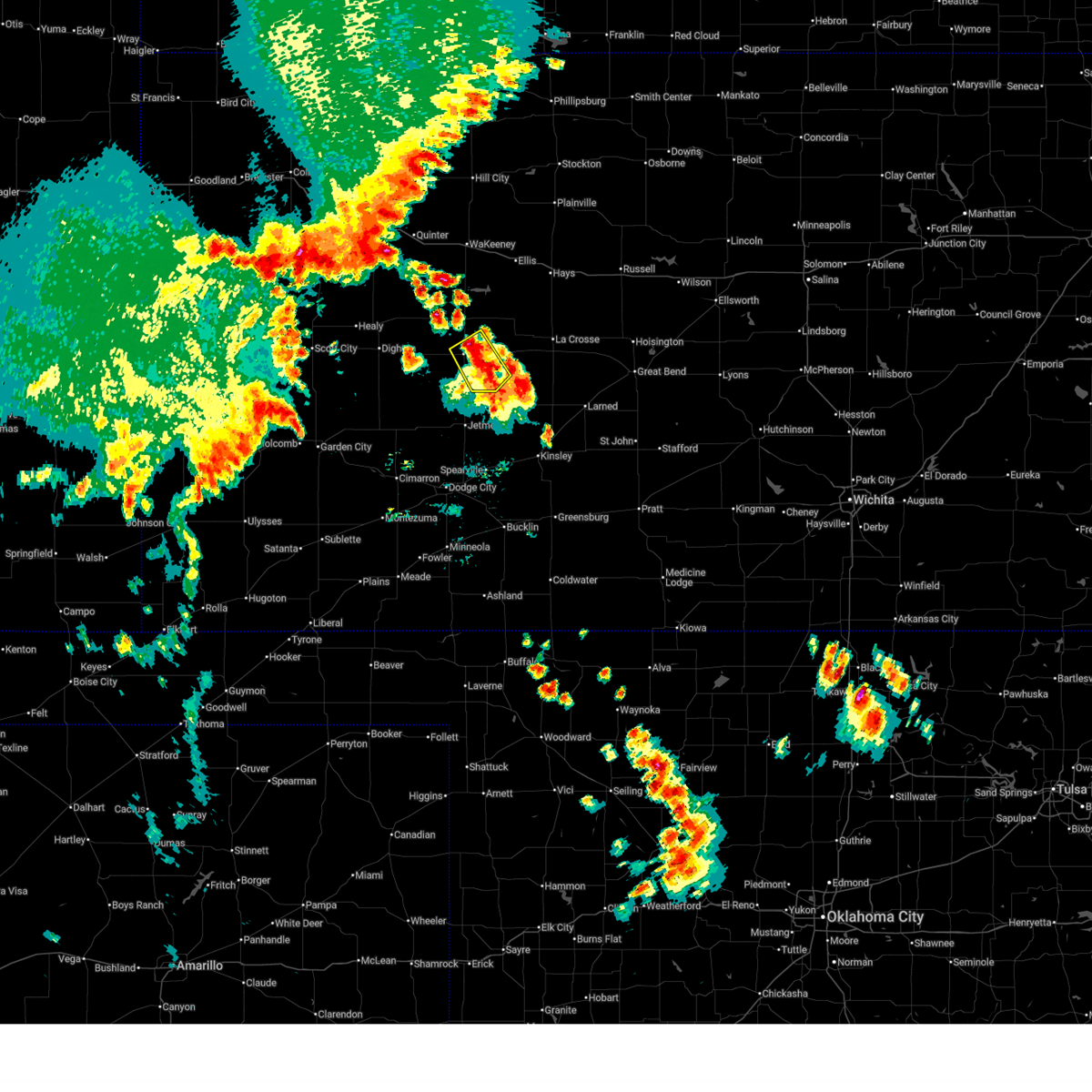
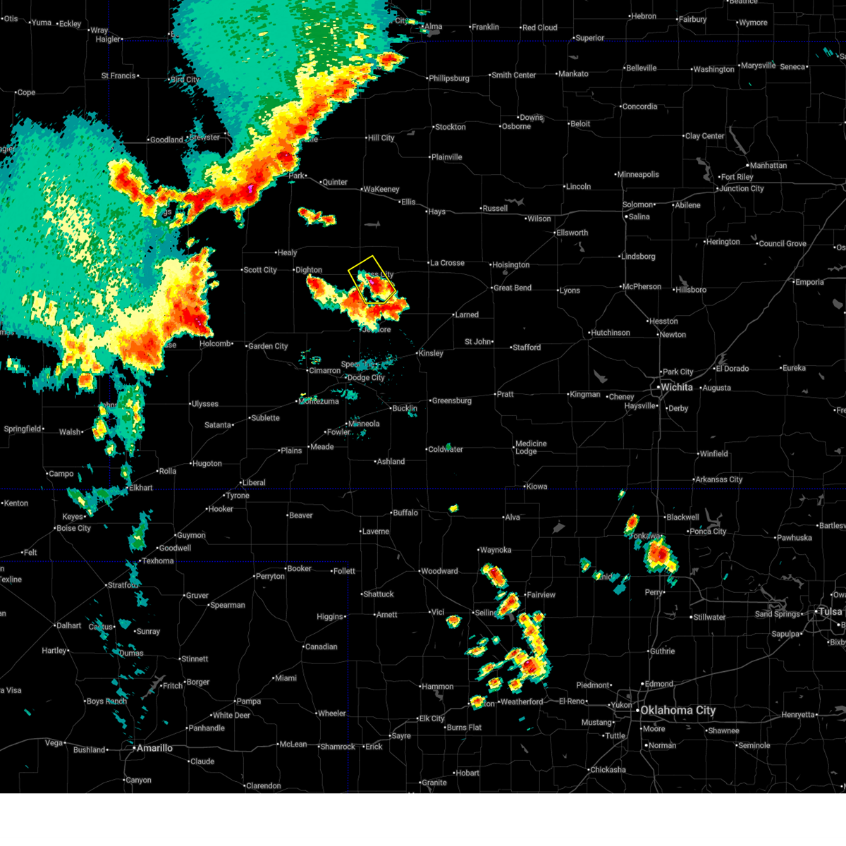
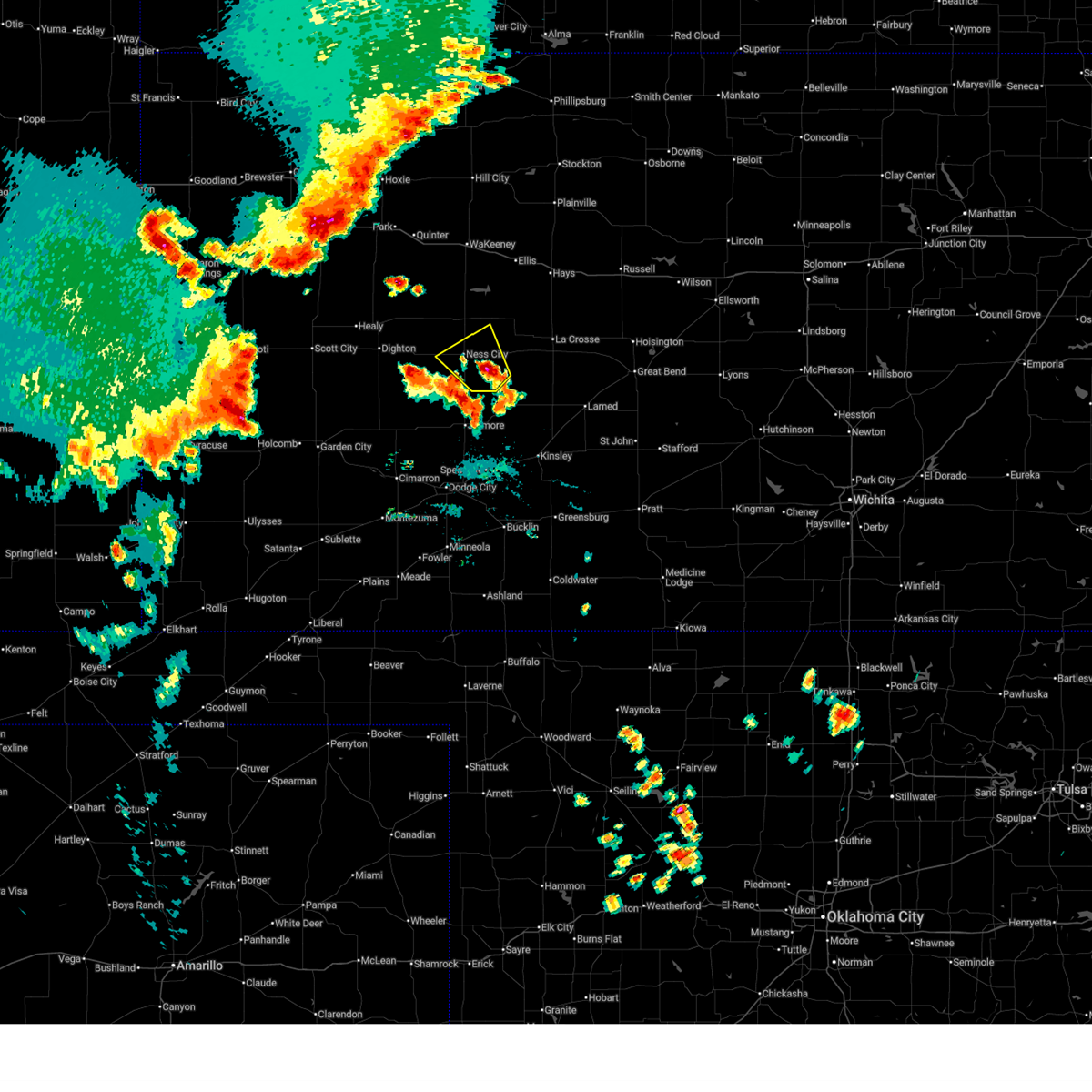
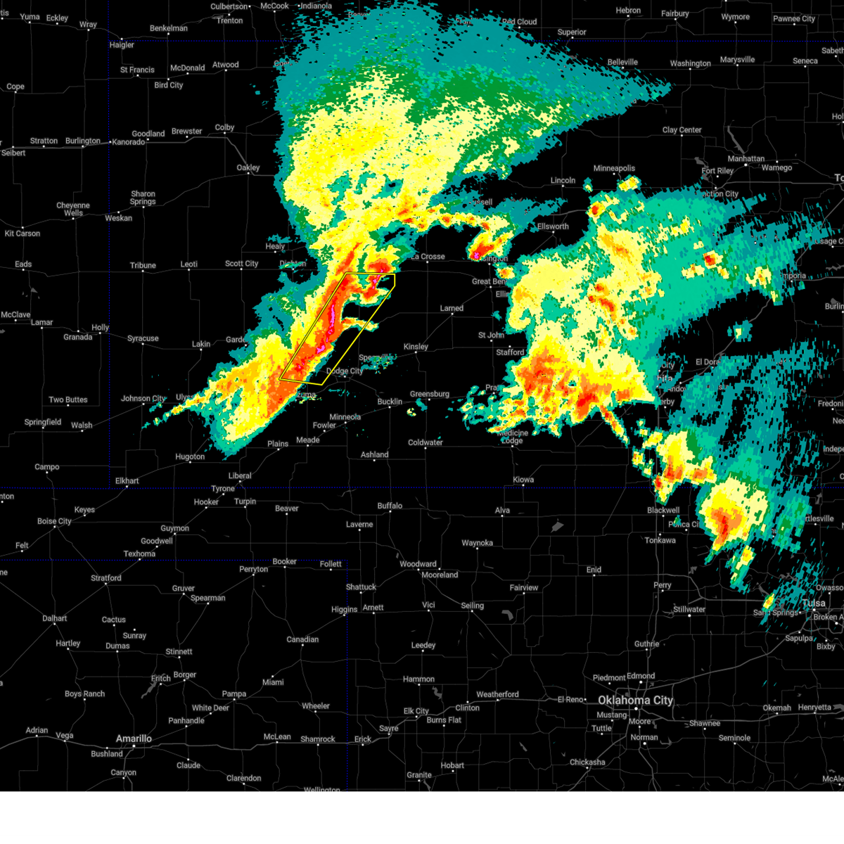
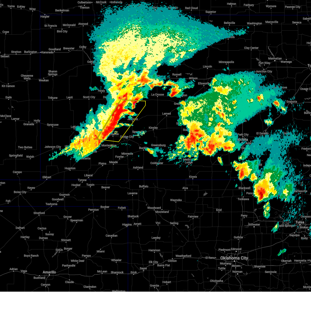
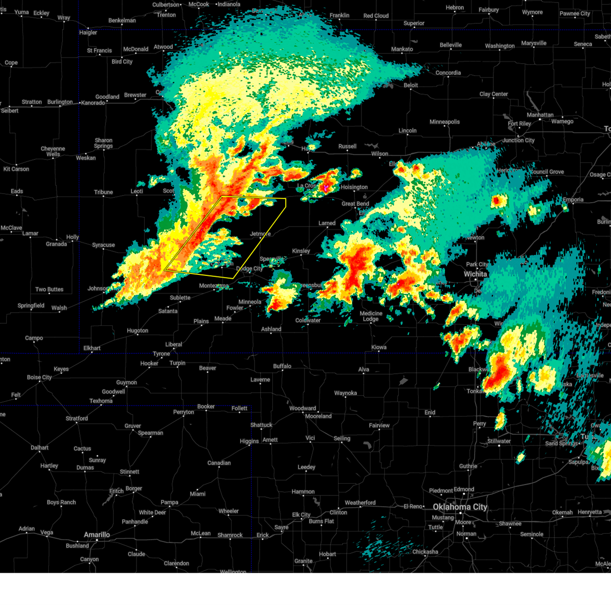
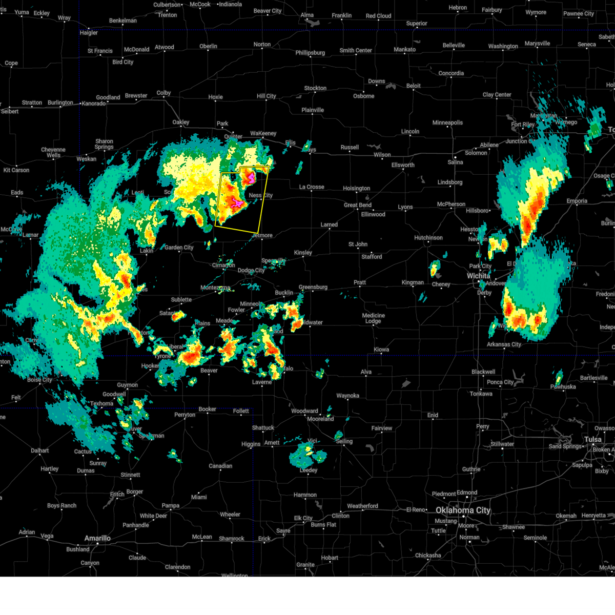
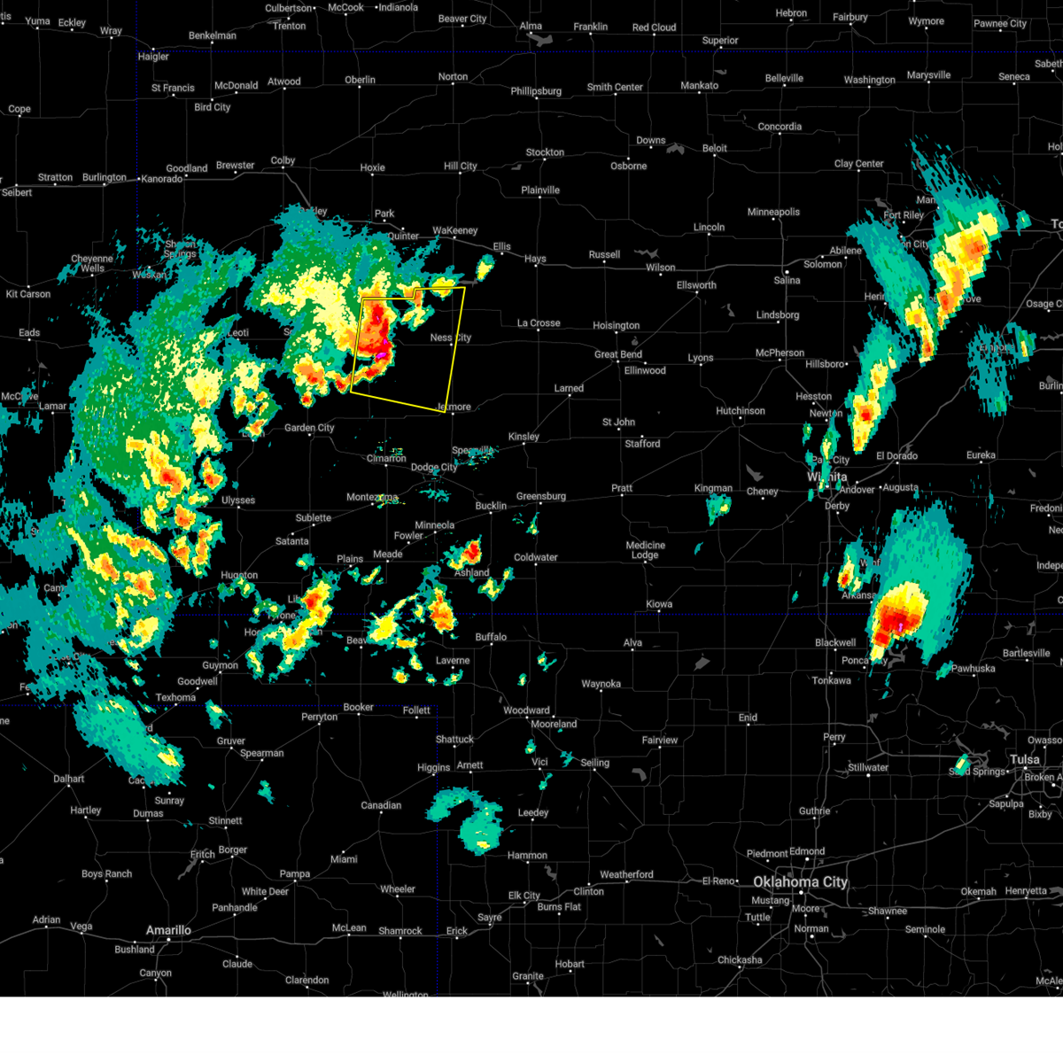
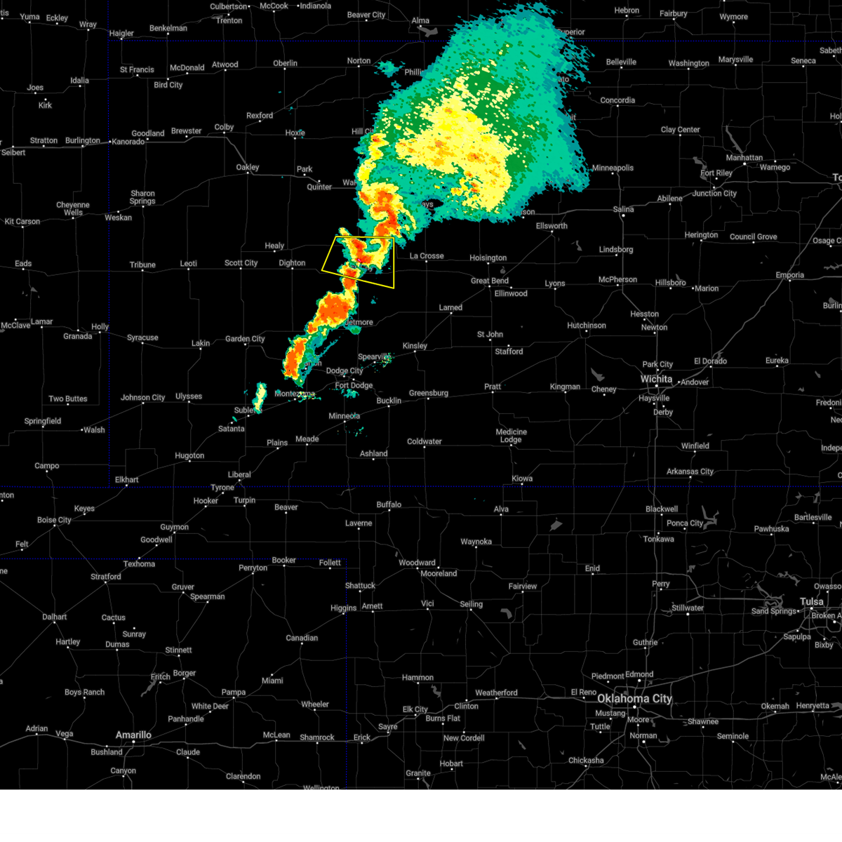
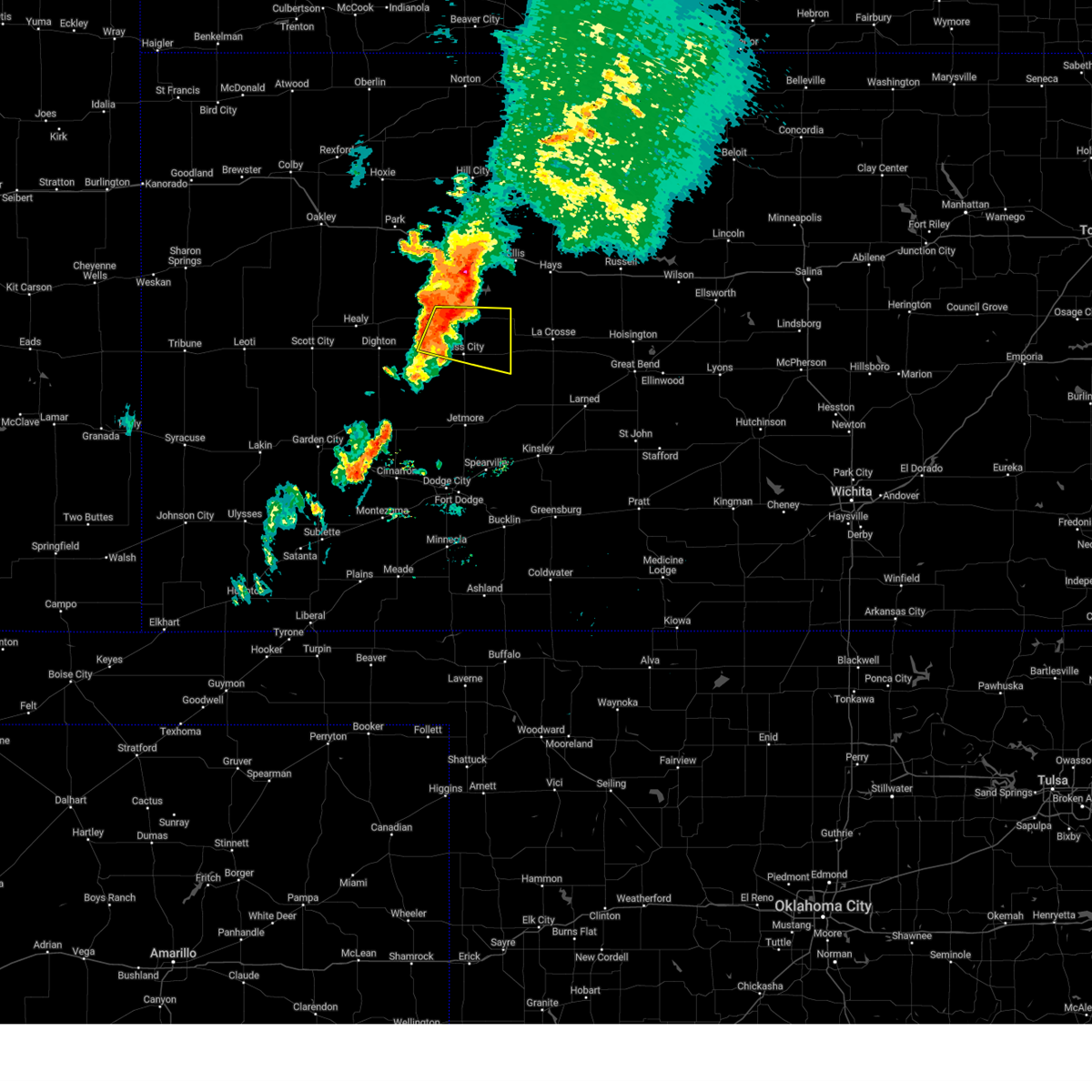
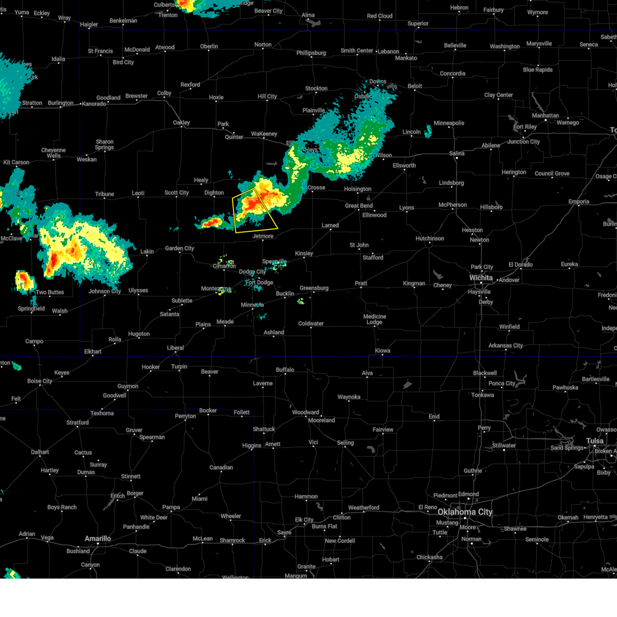
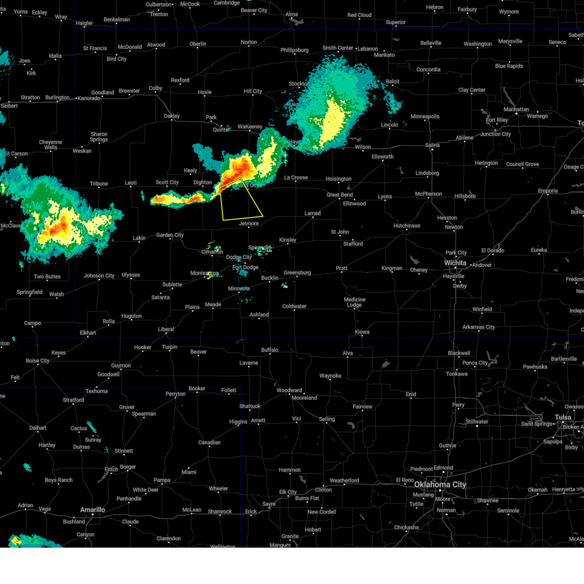
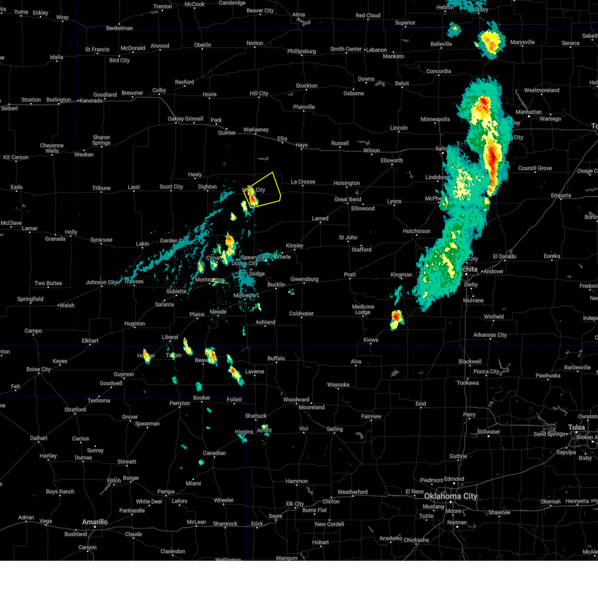
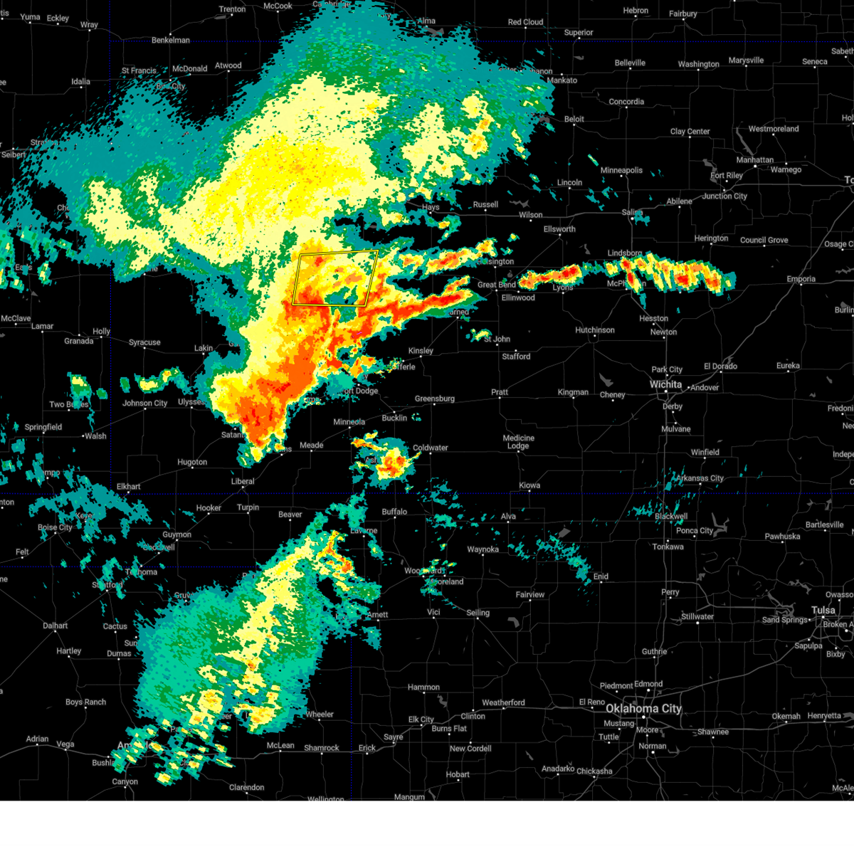
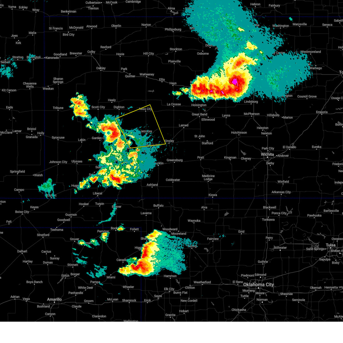
Hail Map for Ness City, KS
The Ness City, KS area has had 42 reports of on-the-ground hail by trained spotters, and has been under severe weather warnings 17 times during the past 12 months. Doppler radar has detected hail at or near Ness City, KS on 92 occasions, including 7 occasions during the past year.
| Name: | Ness City, KS |
| Where Located: | 42.3 miles SW of Hays, KS |
| Map: | Google Map for Ness City, KS |
| Population: | 1449 |
| Housing Units: | 739 |
| More Info: | Search Google for Ness City, KS |
2
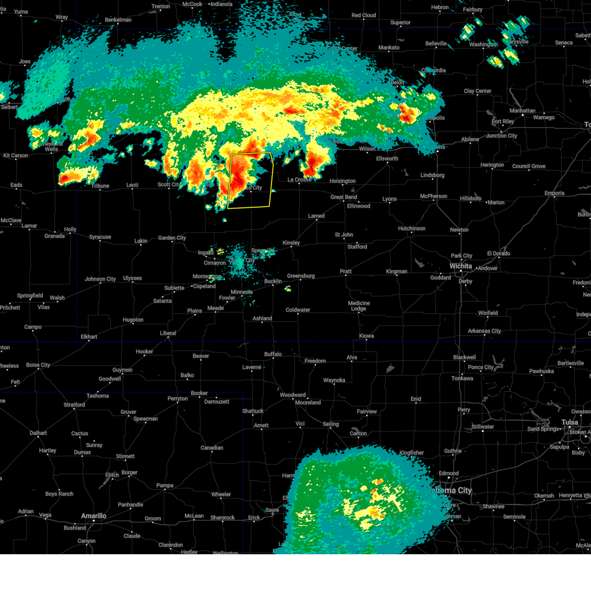
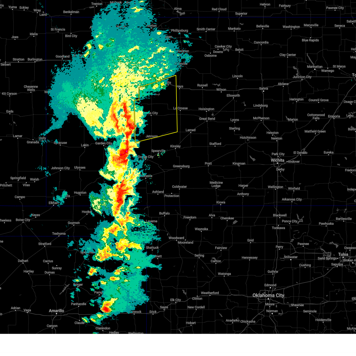
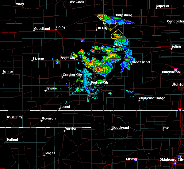
The Top Recent Hail Date for Ness City, KS is Monday, May 19, 2025 (4th out of 92)
Hail and Wind Damage Spotted near Ness City, KS
| Date / Time | Report Details |
|---|---|
| 6/14/2025 3:20 AM CDT |
 The storm which prompted the warning has weakened below severe limits, and no longer poses an immediate threat to life or property. therefore, the warning will be allowed to expire. however, small hail and gusty winds are still possible with this thunderstorm. The storm which prompted the warning has weakened below severe limits, and no longer poses an immediate threat to life or property. therefore, the warning will be allowed to expire. however, small hail and gusty winds are still possible with this thunderstorm.
|
| 6/14/2025 3:07 AM CDT |
 At 307 am cdt, a severe thunderstorm was located near ness city, moving northwest at 15 mph (radar indicated). Hazards include 60 mph wind gusts and quarter size hail. Hail damage to vehicles is expected. expect wind damage to roofs, siding, and trees. Locations impacted include, ness city and bazine. At 307 am cdt, a severe thunderstorm was located near ness city, moving northwest at 15 mph (radar indicated). Hazards include 60 mph wind gusts and quarter size hail. Hail damage to vehicles is expected. expect wind damage to roofs, siding, and trees. Locations impacted include, ness city and bazine.
|
| 6/14/2025 2:45 AM CDT |
 Svrddc the national weather service in dodge city has issued a * severe thunderstorm warning for, eastern ness county in west central kansas, * until 330 am cdt. * at 245 am cdt, a severe thunderstorm was located 7 miles southwest of bazine, moving northwest at 15 mph (radar indicated). Hazards include 60 mph wind gusts and quarter size hail. Hail damage to vehicles is expected. Expect wind damage to roofs, siding, and trees. Svrddc the national weather service in dodge city has issued a * severe thunderstorm warning for, eastern ness county in west central kansas, * until 330 am cdt. * at 245 am cdt, a severe thunderstorm was located 7 miles southwest of bazine, moving northwest at 15 mph (radar indicated). Hazards include 60 mph wind gusts and quarter size hail. Hail damage to vehicles is expected. Expect wind damage to roofs, siding, and trees.
|
| 5/25/2025 4:34 AM CDT |
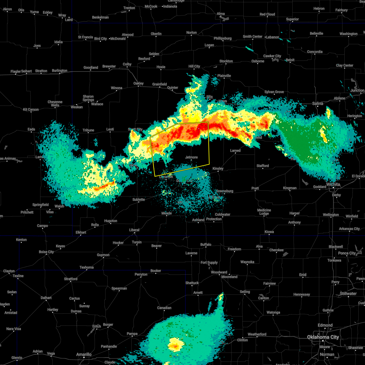
 At 433 am cdt, severe thunderstorms were located along a line extending from 6 miles southeast of ness city to near cimarron, moving east at 40 mph (radar indicated). Hazards include 60 mph wind gusts and penny size hail. Expect damage to roofs, siding, and trees. Locations impacted include, cimarron, ness city, jetmore, bazine, ingalls, howell, and kalvesta. At 433 am cdt, severe thunderstorms were located along a line extending from 6 miles southeast of ness city to near cimarron, moving east at 40 mph (radar indicated). Hazards include 60 mph wind gusts and penny size hail. Expect damage to roofs, siding, and trees. Locations impacted include, cimarron, ness city, jetmore, bazine, ingalls, howell, and kalvesta.
|
| 5/25/2025 4:34 AM CDT |
 the severe thunderstorm warning has been cancelled and is no longer in effect the severe thunderstorm warning has been cancelled and is no longer in effect
|
| 5/25/2025 4:22 AM CDT |
 At 421 am cdt, severe thunderstorms were located along a line extending from 7 miles southwest of ness city to near charleston, moving east at 40 mph (radar indicated). Hazards include 60 mph wind gusts and penny size hail. Expect damage to roofs, siding, and trees. Locations impacted include, ingalls, kalvesta, cimarron, jetmore and howell. At 421 am cdt, severe thunderstorms were located along a line extending from 7 miles southwest of ness city to near charleston, moving east at 40 mph (radar indicated). Hazards include 60 mph wind gusts and penny size hail. Expect damage to roofs, siding, and trees. Locations impacted include, ingalls, kalvesta, cimarron, jetmore and howell.
|
| 5/25/2025 4:00 AM CDT |
 Svrddc the national weather service in dodge city has issued a * severe thunderstorm warning for, northwestern ford county in southwestern kansas, central finney county in southwestern kansas, southern ness county in west central kansas, western hodgeman county in southwestern kansas, southeastern lane county in west central kansas, northern gray county in southwestern kansas, * until 445 am cdt. * at 359 am cdt, severe thunderstorms were located along a line extending from near alamota to near plymell, moving east at 40 mph (radar indicated). Hazards include 60 mph wind gusts and penny size hail. Expect damage to roofs, siding, and trees. severe thunderstorms will be near, pierceville and beeler around 405 am cdt. charleston around 410 am cdt. kalvesta around 415 am cdt. Other locations in the path of these severe thunderstorms include ingalls and cimarron. Svrddc the national weather service in dodge city has issued a * severe thunderstorm warning for, northwestern ford county in southwestern kansas, central finney county in southwestern kansas, southern ness county in west central kansas, western hodgeman county in southwestern kansas, southeastern lane county in west central kansas, northern gray county in southwestern kansas, * until 445 am cdt. * at 359 am cdt, severe thunderstorms were located along a line extending from near alamota to near plymell, moving east at 40 mph (radar indicated). Hazards include 60 mph wind gusts and penny size hail. Expect damage to roofs, siding, and trees. severe thunderstorms will be near, pierceville and beeler around 405 am cdt. charleston around 410 am cdt. kalvesta around 415 am cdt. Other locations in the path of these severe thunderstorms include ingalls and cimarron.
|
| 5/19/2025 7:42 PM CDT | Svrddc the national weather service in dodge city has issued a * severe thunderstorm warning for, ness county in west central kansas, southeastern trego county in west central kansas, northwestern rush county in central kansas, southwestern ellis county in central kansas, * until 830 pm cdt. * at 741 pm cdt, severe thunderstorms were located along a line extending from near ransom to near beeler, moving east at 15 mph (radar indicated). Hazards include 60 mph wind gusts and quarter size hail. Hail damage to vehicles is expected. expect wind damage to roofs, siding, and trees. severe thunderstorms will be near, ransom around 745 pm cdt. ness city around 755 pm cdt. Other locations in the path of these severe thunderstorms include brownell. |
| 5/19/2025 7:27 PM CDT |
 At 727 pm cdt, severe thunderstorms were located along a line extending from near pendennis to 9 miles southwest of beeler, moving east at 15 mph (radar indicated). Hazards include 60 mph wind gusts and quarter size hail. Hail damage to vehicles is expected. expect wind damage to roofs, siding, and trees. Locations impacted include, beeler and utica. At 727 pm cdt, severe thunderstorms were located along a line extending from near pendennis to 9 miles southwest of beeler, moving east at 15 mph (radar indicated). Hazards include 60 mph wind gusts and quarter size hail. Hail damage to vehicles is expected. expect wind damage to roofs, siding, and trees. Locations impacted include, beeler and utica.
|
| 5/19/2025 7:00 PM CDT |
 Svrddc the national weather service in dodge city has issued a * severe thunderstorm warning for, northeastern finney county in southwestern kansas, western ness county in west central kansas, northwestern hodgeman county in southwestern kansas, southwestern trego county in west central kansas, lane county in west central kansas, * until 745 pm cdt. * at 700 pm cdt, severe thunderstorms were located along a line extending from near shields to 9 miles southwest of alamota, moving east at 15 mph (radar indicated). Hazards include 60 mph wind gusts and quarter size hail. Hail damage to vehicles is expected. expect wind damage to roofs, siding, and trees. Severe thunderstorms will be near, alamota and pendennis around 705 pm cdt. Svrddc the national weather service in dodge city has issued a * severe thunderstorm warning for, northeastern finney county in southwestern kansas, western ness county in west central kansas, northwestern hodgeman county in southwestern kansas, southwestern trego county in west central kansas, lane county in west central kansas, * until 745 pm cdt. * at 700 pm cdt, severe thunderstorms were located along a line extending from near shields to 9 miles southwest of alamota, moving east at 15 mph (radar indicated). Hazards include 60 mph wind gusts and quarter size hail. Hail damage to vehicles is expected. expect wind damage to roofs, siding, and trees. Severe thunderstorms will be near, alamota and pendennis around 705 pm cdt.
|
| 9/16/2024 10:43 PM CDT |
 The severe thunderstorm which prompted the warning has weakened. moved out of the warned area. therefore, the warning will be allowed to expire. The severe thunderstorm which prompted the warning has weakened. moved out of the warned area. therefore, the warning will be allowed to expire.
|
| 9/16/2024 9:56 PM CDT |
 Svrddc the national weather service in dodge city has issued a * severe thunderstorm warning for, northern ness county in west central kansas, * until 1045 pm cdt. * at 956 pm cdt, a severe thunderstorm was located near ransom, moving east at 30 mph (radar indicated). Hazards include 60 mph wind gusts and penny size hail. Expect damage to roofs, siding, and trees. this severe thunderstorm will be near, ransom around 1000 pm cdt. Brownell around 1015 pm cdt. Svrddc the national weather service in dodge city has issued a * severe thunderstorm warning for, northern ness county in west central kansas, * until 1045 pm cdt. * at 956 pm cdt, a severe thunderstorm was located near ransom, moving east at 30 mph (radar indicated). Hazards include 60 mph wind gusts and penny size hail. Expect damage to roofs, siding, and trees. this severe thunderstorm will be near, ransom around 1000 pm cdt. Brownell around 1015 pm cdt.
|
| 7/19/2024 7:29 PM CDT |
 the severe thunderstorm warning has been cancelled and is no longer in effect the severe thunderstorm warning has been cancelled and is no longer in effect
|
| 7/19/2024 7:07 PM CDT |
 Svrddc the national weather service in dodge city has issued a * severe thunderstorm warning for, southwestern ness county in west central kansas, northwestern hodgeman county in southwestern kansas, * until 800 pm cdt. * at 707 pm cdt, a severe thunderstorm was located very near beeler, moving southeast at 25 mph (radar indicated). Hazards include 60 mph wind gusts and nickel size hail. Expect damage to roofs, siding, and trees. This severe thunderstorm will remain over mainly rural areas of southwestern ness and northwestern hodgeman counties. Svrddc the national weather service in dodge city has issued a * severe thunderstorm warning for, southwestern ness county in west central kansas, northwestern hodgeman county in southwestern kansas, * until 800 pm cdt. * at 707 pm cdt, a severe thunderstorm was located very near beeler, moving southeast at 25 mph (radar indicated). Hazards include 60 mph wind gusts and nickel size hail. Expect damage to roofs, siding, and trees. This severe thunderstorm will remain over mainly rural areas of southwestern ness and northwestern hodgeman counties.
|
| 7/16/2024 2:34 AM CDT |
 Svrddc the national weather service in dodge city has issued a * severe thunderstorm warning for, ness county in west central kansas, trego county in west central kansas, western rush county in central kansas, ellis county in central kansas, * until 315 am cdt. * at 234 am cdt, a severe thunderstorm was located near cedar bluff, moving east at 35 mph (radar indicated). Hazards include 70 mph wind gusts and nickel size hail. Expect considerable tree damage. Damage is likely to mobile homes, roofs, and outbuildings. Svrddc the national weather service in dodge city has issued a * severe thunderstorm warning for, ness county in west central kansas, trego county in west central kansas, western rush county in central kansas, ellis county in central kansas, * until 315 am cdt. * at 234 am cdt, a severe thunderstorm was located near cedar bluff, moving east at 35 mph (radar indicated). Hazards include 70 mph wind gusts and nickel size hail. Expect considerable tree damage. Damage is likely to mobile homes, roofs, and outbuildings.
|
| 7/6/2024 6:30 PM CDT |
 Svrddc the national weather service in dodge city has issued a * severe thunderstorm warning for, southern scott county in west central kansas, ness county in west central kansas, lane county in west central kansas, * until 700 pm cdt. * at 630 pm cdt, severe thunderstorms were located along a line extending from near bazine to near grigston, moving southeast at 40 mph (radar indicated). Hazards include 60 mph wind gusts and nickel size hail. Expect damage to roofs, siding, and trees. Severe thunderstorms will be near, ness city, bazine, alamota, and beeler around 635 pm cdt. Svrddc the national weather service in dodge city has issued a * severe thunderstorm warning for, southern scott county in west central kansas, ness county in west central kansas, lane county in west central kansas, * until 700 pm cdt. * at 630 pm cdt, severe thunderstorms were located along a line extending from near bazine to near grigston, moving southeast at 40 mph (radar indicated). Hazards include 60 mph wind gusts and nickel size hail. Expect damage to roofs, siding, and trees. Severe thunderstorms will be near, ness city, bazine, alamota, and beeler around 635 pm cdt.
|
| 7/6/2024 5:34 PM CDT |
 Svrddc the national weather service in dodge city has issued a * severe thunderstorm warning for, eastern scott county in west central kansas, ness county in west central kansas, southern trego county in west central kansas, lane county in west central kansas, * until 630 pm cdt. * at 533 pm cdt, severe thunderstorms were located along a line extending from near scott state lake to 6 miles north of beeler, moving southeast at 40 mph. these are destructive storms (radar indicated). Hazards include 80 mph wind gusts and golf ball size hail. Flying debris will be dangerous to those caught without shelter. mobile homes will be heavily damaged. expect considerable damage to roofs, windows, and vehicles. extensive tree damage and power outages are likely. severe thunderstorms will be near, dighton, alamota, manning, and beeler around 540 pm cdt. Grigston and amy around 545 pm cdt. Svrddc the national weather service in dodge city has issued a * severe thunderstorm warning for, eastern scott county in west central kansas, ness county in west central kansas, southern trego county in west central kansas, lane county in west central kansas, * until 630 pm cdt. * at 533 pm cdt, severe thunderstorms were located along a line extending from near scott state lake to 6 miles north of beeler, moving southeast at 40 mph. these are destructive storms (radar indicated). Hazards include 80 mph wind gusts and golf ball size hail. Flying debris will be dangerous to those caught without shelter. mobile homes will be heavily damaged. expect considerable damage to roofs, windows, and vehicles. extensive tree damage and power outages are likely. severe thunderstorms will be near, dighton, alamota, manning, and beeler around 540 pm cdt. Grigston and amy around 545 pm cdt.
|
| 6/15/2024 5:25 PM CDT | Half Dollar sized hail reported 0.3 miles NE of Ness City, KS |
| 6/15/2024 5:22 PM CDT |
 Svrddc the national weather service in dodge city has issued a * severe thunderstorm warning for, eastern ness county in west central kansas, * until 615 pm cdt. * at 522 pm cdt, a severe thunderstorm was located very near ness city, moving northeast at 20 mph (radar indicated). Hazards include 60 mph wind gusts and quarter size hail. Hail damage to vehicles is expected. Expect wind damage to roofs, siding, and trees. Svrddc the national weather service in dodge city has issued a * severe thunderstorm warning for, eastern ness county in west central kansas, * until 615 pm cdt. * at 522 pm cdt, a severe thunderstorm was located very near ness city, moving northeast at 20 mph (radar indicated). Hazards include 60 mph wind gusts and quarter size hail. Hail damage to vehicles is expected. Expect wind damage to roofs, siding, and trees.
|
| 6/13/2024 5:54 PM CDT |
 The storms which prompted the warning have weakened below severe limits, and no longer pose an immediate threat to life or property. therefore, the warning will be allowed to expire. however, small hail, gusty winds and heavy rain are still possible with these thunderstorms. a severe thunderstorm watch remains in effect until 1100 pm cdt for central and west central kansas. The storms which prompted the warning have weakened below severe limits, and no longer pose an immediate threat to life or property. therefore, the warning will be allowed to expire. however, small hail, gusty winds and heavy rain are still possible with these thunderstorms. a severe thunderstorm watch remains in effect until 1100 pm cdt for central and west central kansas.
|
| 6/13/2024 5:22 PM CDT |
 At 522 pm cdt, severe thunderstorms were located along a line extending from near mccracken to near arnold, moving south at 15 mph (radar indicated). Hazards include golf ball size hail and 60 mph wind gusts. People and animals outdoors will be injured. expect hail damage to roofs, siding, windows, and vehicles. expect wind damage to roofs, siding, and trees. Locations impacted include, ness city, bazine, ransom, mccracken, rush center, utica, alexander, brownell, nekoma, hargrave, beeler, and arnold. At 522 pm cdt, severe thunderstorms were located along a line extending from near mccracken to near arnold, moving south at 15 mph (radar indicated). Hazards include golf ball size hail and 60 mph wind gusts. People and animals outdoors will be injured. expect hail damage to roofs, siding, windows, and vehicles. expect wind damage to roofs, siding, and trees. Locations impacted include, ness city, bazine, ransom, mccracken, rush center, utica, alexander, brownell, nekoma, hargrave, beeler, and arnold.
|
| 6/13/2024 5:12 PM CDT |
 At 512 pm cdt, severe thunderstorms were located along a line extending from near mccracken to near arnold, moving south at 15 mph (radar indicated). Hazards include 60 mph wind gusts and quarter size hail. Hail damage to vehicles is expected. expect wind damage to roofs, siding, and trees. Locations impacted include, ness city, bazine, ransom, mccracken, rush center, utica, alexander, brownell, nekoma, hargrave, beeler, and arnold. At 512 pm cdt, severe thunderstorms were located along a line extending from near mccracken to near arnold, moving south at 15 mph (radar indicated). Hazards include 60 mph wind gusts and quarter size hail. Hail damage to vehicles is expected. expect wind damage to roofs, siding, and trees. Locations impacted include, ness city, bazine, ransom, mccracken, rush center, utica, alexander, brownell, nekoma, hargrave, beeler, and arnold.
|
| 6/13/2024 4:57 PM CDT |
 Svrddc the national weather service in dodge city has issued a * severe thunderstorm warning for, ness county in west central kansas, western rush county in central kansas, * until 600 pm cdt. * at 457 pm cdt, severe thunderstorms were located along a line extending from near brownell to near utica, moving south at 15 mph (radar indicated). Hazards include 60 mph wind gusts and penny size hail. Expect damage to roofs, siding, and trees. severe thunderstorms will be near, mccracken around 505 pm cdt. Other locations in the path of these severe thunderstorms include ness city, bazine and alexander. Svrddc the national weather service in dodge city has issued a * severe thunderstorm warning for, ness county in west central kansas, western rush county in central kansas, * until 600 pm cdt. * at 457 pm cdt, severe thunderstorms were located along a line extending from near brownell to near utica, moving south at 15 mph (radar indicated). Hazards include 60 mph wind gusts and penny size hail. Expect damage to roofs, siding, and trees. severe thunderstorms will be near, mccracken around 505 pm cdt. Other locations in the path of these severe thunderstorms include ness city, bazine and alexander.
|
| 6/8/2024 10:59 PM CDT |
 At 1058 pm cdt, severe thunderstorms were located along a line extending from 6 miles south of utica to 10 miles south of beeler, moving east at 30 mph (radar indicated). Hazards include 60 mph wind gusts and penny size hail. Expect damage to roofs, siding, and trees. Locations impacted include, ness city. At 1058 pm cdt, severe thunderstorms were located along a line extending from 6 miles south of utica to 10 miles south of beeler, moving east at 30 mph (radar indicated). Hazards include 60 mph wind gusts and penny size hail. Expect damage to roofs, siding, and trees. Locations impacted include, ness city.
|
| 6/8/2024 10:35 PM CDT |
 Svrddc the national weather service in dodge city has issued a * severe thunderstorm warning for, western ness county in west central kansas, lane county in west central kansas, * until 1130 pm cdt. * at 1034 pm cdt, severe thunderstorms were located along a line extending from near alamota to 14 miles north of kalvesta, moving east at 35 mph (radar indicated). Hazards include 70 mph wind gusts and penny size hail. Expect considerable tree damage. damage is likely to mobile homes, roofs, and outbuildings. severe thunderstorms will be near, beeler around 1040 pm cdt. Other locations in the path of these severe thunderstorms include ness city. Svrddc the national weather service in dodge city has issued a * severe thunderstorm warning for, western ness county in west central kansas, lane county in west central kansas, * until 1130 pm cdt. * at 1034 pm cdt, severe thunderstorms were located along a line extending from near alamota to 14 miles north of kalvesta, moving east at 35 mph (radar indicated). Hazards include 70 mph wind gusts and penny size hail. Expect considerable tree damage. damage is likely to mobile homes, roofs, and outbuildings. severe thunderstorms will be near, beeler around 1040 pm cdt. Other locations in the path of these severe thunderstorms include ness city.
|
| 5/19/2024 6:08 PM CDT |
 At 608 pm cdt, severe thunderstorms were located along a line extending from 6 miles east of beeler to near alexander to near garfield, moving east at 55 mph (radar indicated). Hazards include 70 mph wind gusts and penny size hail. Expect considerable tree damage. damage is likely to mobile homes, roofs, and outbuildings. Locations impacted include, larned, ness city, bazine, rush center, alexander, ash valley, frizell, nekoma, la crosse, hargrave, bison, timken, radium, shaffer, otis, mccracken, liebenthal and loretta. At 608 pm cdt, severe thunderstorms were located along a line extending from 6 miles east of beeler to near alexander to near garfield, moving east at 55 mph (radar indicated). Hazards include 70 mph wind gusts and penny size hail. Expect considerable tree damage. damage is likely to mobile homes, roofs, and outbuildings. Locations impacted include, larned, ness city, bazine, rush center, alexander, ash valley, frizell, nekoma, la crosse, hargrave, bison, timken, radium, shaffer, otis, mccracken, liebenthal and loretta.
|
| 5/19/2024 6:08 PM CDT |
 the severe thunderstorm warning has been cancelled and is no longer in effect the severe thunderstorm warning has been cancelled and is no longer in effect
|
| 5/19/2024 5:52 PM CDT |
 Svrddc the national weather service in dodge city has issued a * severe thunderstorm warning for, ness county in west central kansas, hodgeman county in southwestern kansas, southern trego county in west central kansas, pawnee county in south central kansas, southeastern lane county in west central kansas, northern stafford county in south central kansas, rush county in central kansas, northwestern edwards county in south central kansas, southern ellis county in central kansas, * until 645 pm cdt. * at 552 pm cdt, severe thunderstorms were located along a line extending from 7 miles south of alamota to 8 miles southwest of bazine to 9 miles southeast of gray, moving east at 55 mph (radar indicated). Hazards include 70 mph wind gusts and penny size hail. Expect considerable tree damage. damage is likely to mobile homes, roofs, and outbuildings. severe thunderstorms will be near, burdett around 555 pm cdt. ness city, bazine, rozel, and beeler around 600 pm cdt. garfield, alexander, and sanford around 605 pm cdt. frizell and nekoma around 610 pm cdt. Other locations in the path of these severe thunderstorms include larned, rush center, ash valley, la crosse, bison, timken, radium, shaffer, hargrave, otis and mccracken. Svrddc the national weather service in dodge city has issued a * severe thunderstorm warning for, ness county in west central kansas, hodgeman county in southwestern kansas, southern trego county in west central kansas, pawnee county in south central kansas, southeastern lane county in west central kansas, northern stafford county in south central kansas, rush county in central kansas, northwestern edwards county in south central kansas, southern ellis county in central kansas, * until 645 pm cdt. * at 552 pm cdt, severe thunderstorms were located along a line extending from 7 miles south of alamota to 8 miles southwest of bazine to 9 miles southeast of gray, moving east at 55 mph (radar indicated). Hazards include 70 mph wind gusts and penny size hail. Expect considerable tree damage. damage is likely to mobile homes, roofs, and outbuildings. severe thunderstorms will be near, burdett around 555 pm cdt. ness city, bazine, rozel, and beeler around 600 pm cdt. garfield, alexander, and sanford around 605 pm cdt. frizell and nekoma around 610 pm cdt. Other locations in the path of these severe thunderstorms include larned, rush center, ash valley, la crosse, bison, timken, radium, shaffer, hargrave, otis and mccracken.
|
| 5/19/2024 5:17 PM CDT |
 Svrddc the national weather service in dodge city has issued a * severe thunderstorm warning for, northern ford county in southwestern kansas, northeastern finney county in southwestern kansas, southern ness county in west central kansas, hodgeman county in southwestern kansas, southeastern lane county in west central kansas, northeastern gray county in southwestern kansas, west central edwards county in south central kansas, * until 600 pm cdt. * at 517 pm cdt, severe thunderstorms were located along a line extending from 12 miles southwest of alamota to near dodge city, moving northeast at 35 mph (radar indicated). Hazards include 70 mph wind gusts and penny size hail. Expect considerable tree damage. damage is likely to mobile homes, roofs, and outbuildings. severe thunderstorms will be near, jetmore around 535 pm cdt. Other locations in the path of these severe thunderstorms include beeler and hanston. Svrddc the national weather service in dodge city has issued a * severe thunderstorm warning for, northern ford county in southwestern kansas, northeastern finney county in southwestern kansas, southern ness county in west central kansas, hodgeman county in southwestern kansas, southeastern lane county in west central kansas, northeastern gray county in southwestern kansas, west central edwards county in south central kansas, * until 600 pm cdt. * at 517 pm cdt, severe thunderstorms were located along a line extending from 12 miles southwest of alamota to near dodge city, moving northeast at 35 mph (radar indicated). Hazards include 70 mph wind gusts and penny size hail. Expect considerable tree damage. damage is likely to mobile homes, roofs, and outbuildings. severe thunderstorms will be near, jetmore around 535 pm cdt. Other locations in the path of these severe thunderstorms include beeler and hanston.
|
| 4/16/2024 12:35 AM CDT |
 The storms which prompted the warning have weakened below severe limits, and no longer pose an immediate threat to life or property. therefore, the warning will be allowed to expire. a tornado watch remains in effect until 300 am cdt for southwestern and west central kansas. The storms which prompted the warning have weakened below severe limits, and no longer pose an immediate threat to life or property. therefore, the warning will be allowed to expire. a tornado watch remains in effect until 300 am cdt for southwestern and west central kansas.
|
| 4/16/2024 12:25 AM CDT |
 the severe thunderstorm warning has been cancelled and is no longer in effect the severe thunderstorm warning has been cancelled and is no longer in effect
|
| 4/16/2024 12:25 AM CDT |
 At 1225 am cdt, severe thunderstorms were located along a line extending from near arnold to 10 miles west of jetmore, moving east at 25 mph (radar indicated). Hazards include 60 mph wind gusts and penny size hail. Expect damage to roofs, siding, and trees. these severe storms will be near, ransom around 1230 am cdt. ness city around 1235 am cdt. brownell around 1255 am cdt. Bazine around 105 am cdt. At 1225 am cdt, severe thunderstorms were located along a line extending from near arnold to 10 miles west of jetmore, moving east at 25 mph (radar indicated). Hazards include 60 mph wind gusts and penny size hail. Expect damage to roofs, siding, and trees. these severe storms will be near, ransom around 1230 am cdt. ness city around 1235 am cdt. brownell around 1255 am cdt. Bazine around 105 am cdt.
|
| 4/16/2024 12:02 AM CDT |
 Svrddc the national weather service in dodge city has issued a * severe thunderstorm warning for, northeastern finney county in southwestern kansas, ness county in west central kansas, northern hodgeman county in southwestern kansas, southern trego county in west central kansas, eastern lane county in west central kansas, northern gray county in southwestern kansas, * until 1245 am cdt. * at 1202 am cdt, severe thunderstorms were located along a line extending from near utica to near kalvesta, moving east at 25 mph (radar indicated). Hazards include 60 mph wind gusts and penny size hail. Expect damage to roofs, siding, and trees. severe thunderstorms will be near, utica and beeler around 1205 am cdt. arnold around 1215 am cdt. Ness city and ransom around 1230 am cdt. Svrddc the national weather service in dodge city has issued a * severe thunderstorm warning for, northeastern finney county in southwestern kansas, ness county in west central kansas, northern hodgeman county in southwestern kansas, southern trego county in west central kansas, eastern lane county in west central kansas, northern gray county in southwestern kansas, * until 1245 am cdt. * at 1202 am cdt, severe thunderstorms were located along a line extending from near utica to near kalvesta, moving east at 25 mph (radar indicated). Hazards include 60 mph wind gusts and penny size hail. Expect damage to roofs, siding, and trees. severe thunderstorms will be near, utica and beeler around 1205 am cdt. arnold around 1215 am cdt. Ness city and ransom around 1230 am cdt.
|
| 9/9/2023 11:39 PM CDT |
 At 1139 pm cdt, a severe thunderstorm was located near beeler, moving south at 25 mph (radar indicated). Hazards include 60 mph wind gusts and quarter size hail. Hail damage to vehicles is expected. expect wind damage to roofs, siding, and trees. locations impacted include, ness city, utica, alamota, beeler and arnold. hail threat, radar indicated max hail size, 1. 00 in wind threat, radar indicated max wind gust, 60 mph. At 1139 pm cdt, a severe thunderstorm was located near beeler, moving south at 25 mph (radar indicated). Hazards include 60 mph wind gusts and quarter size hail. Hail damage to vehicles is expected. expect wind damage to roofs, siding, and trees. locations impacted include, ness city, utica, alamota, beeler and arnold. hail threat, radar indicated max hail size, 1. 00 in wind threat, radar indicated max wind gust, 60 mph.
|
| 9/9/2023 11:23 PM CDT |
 At 1122 pm cdt, a severe thunderstorm was located near utica, moving south at 25 mph (radar indicated). Hazards include 60 mph wind gusts and half dollar size hail. Hail damage to vehicles is expected. Expect wind damage to roofs, siding, and trees. At 1122 pm cdt, a severe thunderstorm was located near utica, moving south at 25 mph (radar indicated). Hazards include 60 mph wind gusts and half dollar size hail. Hail damage to vehicles is expected. Expect wind damage to roofs, siding, and trees.
|
| 8/12/2023 9:08 PM CDT |
 At 907 pm cdt, a severe thunderstorm was located 7 miles south of alamota, moving northeast at 30 mph (radar indicated). Hazards include 60 mph wind gusts. Expect damage to roofs, siding, and trees. locations impacted include, alamota, beeler and utica. hail threat, radar indicated max hail size, <. 75 in wind threat, radar indicated max wind gust, 60 mph. At 907 pm cdt, a severe thunderstorm was located 7 miles south of alamota, moving northeast at 30 mph (radar indicated). Hazards include 60 mph wind gusts. Expect damage to roofs, siding, and trees. locations impacted include, alamota, beeler and utica. hail threat, radar indicated max hail size, <. 75 in wind threat, radar indicated max wind gust, 60 mph.
|
| 8/12/2023 8:42 PM CDT |
 At 841 pm cdt, a severe thunderstorm was located near kalvesta, moving northeast at 30 mph (radar indicated). Hazards include 60 mph wind gusts and penny size hail. Expect damage to roofs, siding, and trees. this severe thunderstorm will be near, kalvesta around 845 pm cdt. hail threat, radar indicated max hail size, 0. 75 in wind threat, radar indicated max wind gust, 60 mph. At 841 pm cdt, a severe thunderstorm was located near kalvesta, moving northeast at 30 mph (radar indicated). Hazards include 60 mph wind gusts and penny size hail. Expect damage to roofs, siding, and trees. this severe thunderstorm will be near, kalvesta around 845 pm cdt. hail threat, radar indicated max hail size, 0. 75 in wind threat, radar indicated max wind gust, 60 mph.
|
| 8/9/2023 2:13 AM CDT |
 At 213 am cdt, severe thunderstorms were located along a line extending from near mccracken to near alexander to 6 miles northwest of gray, moving east at 25 mph (radar indicated). Hazards include 60 mph wind gusts. Expect damage to roofs, siding, and trees. locations impacted include, nekoma, burdett and hargrave. hail threat, radar indicated max hail size, <. 75 in wind threat, radar indicated max wind gust, 60 mph. At 213 am cdt, severe thunderstorms were located along a line extending from near mccracken to near alexander to 6 miles northwest of gray, moving east at 25 mph (radar indicated). Hazards include 60 mph wind gusts. Expect damage to roofs, siding, and trees. locations impacted include, nekoma, burdett and hargrave. hail threat, radar indicated max hail size, <. 75 in wind threat, radar indicated max wind gust, 60 mph.
|
| 8/9/2023 1:53 AM CDT |
 At 152 am cdt, severe thunderstorms were located along a line extending from near brownell to near bazine to 11 miles south of ness city, moving east at 30 mph (radar indicated). Hazards include 70 mph wind gusts and nickel size hail. Expect considerable tree damage. damage is likely to mobile homes, roofs, and outbuildings. severe thunderstorms will be near, bazine around 200 am cdt. alexander around 210 am cdt. mccracken and nekoma around 220 am cdt. burdett around 230 am cdt. hargrave around 235 am cdt. thunderstorm damage threat, considerable hail threat, radar indicated max hail size, 0. 88 in wind threat, radar indicated max wind gust, 70 mph. At 152 am cdt, severe thunderstorms were located along a line extending from near brownell to near bazine to 11 miles south of ness city, moving east at 30 mph (radar indicated). Hazards include 70 mph wind gusts and nickel size hail. Expect considerable tree damage. damage is likely to mobile homes, roofs, and outbuildings. severe thunderstorms will be near, bazine around 200 am cdt. alexander around 210 am cdt. mccracken and nekoma around 220 am cdt. burdett around 230 am cdt. hargrave around 235 am cdt. thunderstorm damage threat, considerable hail threat, radar indicated max hail size, 0. 88 in wind threat, radar indicated max wind gust, 70 mph.
|
| 8/9/2023 1:38 AM CDT |
 At 137 am cdt, severe thunderstorms were located along a line extending from 7 miles north of ransom to near ness city to 12 miles southeast of beeler, moving east at 25 mph (radar indicated). Hazards include 70 mph wind gusts and nickel size hail. Expect considerable tree damage. damage is likely to mobile homes, roofs, and outbuildings. locations impacted include, ness city, bazine, ransom, brownell, cedar bluff and arnold. thunderstorm damage threat, considerable hail threat, radar indicated max hail size, 0. 88 in wind threat, radar indicated max wind gust, 70 mph. At 137 am cdt, severe thunderstorms were located along a line extending from 7 miles north of ransom to near ness city to 12 miles southeast of beeler, moving east at 25 mph (radar indicated). Hazards include 70 mph wind gusts and nickel size hail. Expect considerable tree damage. damage is likely to mobile homes, roofs, and outbuildings. locations impacted include, ness city, bazine, ransom, brownell, cedar bluff and arnold. thunderstorm damage threat, considerable hail threat, radar indicated max hail size, 0. 88 in wind threat, radar indicated max wind gust, 70 mph.
|
| 8/9/2023 1:22 AM CDT |
 At 122 am cdt, severe thunderstorms were located along a line extending from 10 miles northeast of utica to near arnold to 6 miles south of beeler, moving east at 30 mph (radar indicated). Hazards include 70 mph wind gusts and nickel size hail. Expect considerable tree damage. damage is likely to mobile homes, roofs, and outbuildings. severe thunderstorms will be near, arnold around 125 am cdt. ransom around 135 am cdt. other locations in the path of these severe thunderstorms include ness city, brownell, bazine and cedar bluff. thunderstorm damage threat, considerable hail threat, radar indicated max hail size, 0. 88 in wind threat, radar indicated max wind gust, 70 mph. At 122 am cdt, severe thunderstorms were located along a line extending from 10 miles northeast of utica to near arnold to 6 miles south of beeler, moving east at 30 mph (radar indicated). Hazards include 70 mph wind gusts and nickel size hail. Expect considerable tree damage. damage is likely to mobile homes, roofs, and outbuildings. severe thunderstorms will be near, arnold around 125 am cdt. ransom around 135 am cdt. other locations in the path of these severe thunderstorms include ness city, brownell, bazine and cedar bluff. thunderstorm damage threat, considerable hail threat, radar indicated max hail size, 0. 88 in wind threat, radar indicated max wind gust, 70 mph.
|
| 7/22/2023 8:01 PM CDT |
 At 801 pm cdt, a severe thunderstorm was located near riga, moving south at 35 mph (radar indicated). Hazards include 60 mph wind gusts and quarter size hail. Hail damage to vehicles is expected. expect wind damage to roofs, siding, and trees. this severe thunderstorm will be near, cedar bluff around 815 pm cdt. other locations in the path of this severe thunderstorm include mccracken, alexander, hargrave and nekoma. hail threat, radar indicated max hail size, 1. 00 in wind threat, radar indicated max wind gust, 60 mph. At 801 pm cdt, a severe thunderstorm was located near riga, moving south at 35 mph (radar indicated). Hazards include 60 mph wind gusts and quarter size hail. Hail damage to vehicles is expected. expect wind damage to roofs, siding, and trees. this severe thunderstorm will be near, cedar bluff around 815 pm cdt. other locations in the path of this severe thunderstorm include mccracken, alexander, hargrave and nekoma. hail threat, radar indicated max hail size, 1. 00 in wind threat, radar indicated max wind gust, 60 mph.
|
| 6/27/2023 9:11 PM CDT |
 At 910 pm cdt, severe thunderstorms were located along a line extending from 13 miles northwest of jetmore to near bucklin, moving northeast at 50 mph (radar indicated). Hazards include 70 mph wind gusts. Expect considerable tree damage. damage is likely to mobile homes, roofs, and outbuildings. thunderstorm damage threat, considerable hail threat, radar indicated max hail size, <. 75 in wind threat, radar indicated max wind gust, 70 mph. At 910 pm cdt, severe thunderstorms were located along a line extending from 13 miles northwest of jetmore to near bucklin, moving northeast at 50 mph (radar indicated). Hazards include 70 mph wind gusts. Expect considerable tree damage. damage is likely to mobile homes, roofs, and outbuildings. thunderstorm damage threat, considerable hail threat, radar indicated max hail size, <. 75 in wind threat, radar indicated max wind gust, 70 mph.
|
| 5/30/2023 9:07 PM CDT |
 At 907 pm cdt, severe thunderstorms were located along a line extending from near arnold to 7 miles north of kalvesta to near garden city, moving southeast at 35 mph (radar indicated). Hazards include 70 mph wind gusts and nickel size hail. Expect considerable tree damage. damage is likely to mobile homes, roofs, and outbuildings. these severe storms will be near, kalvesta around 915 pm cdt. other locations in the path of these severe thunderstorms include ness city, charleston and ingalls. thunderstorm damage threat, considerable hail threat, radar indicated max hail size, 0. 88 in wind threat, radar indicated max wind gust, 70 mph. At 907 pm cdt, severe thunderstorms were located along a line extending from near arnold to 7 miles north of kalvesta to near garden city, moving southeast at 35 mph (radar indicated). Hazards include 70 mph wind gusts and nickel size hail. Expect considerable tree damage. damage is likely to mobile homes, roofs, and outbuildings. these severe storms will be near, kalvesta around 915 pm cdt. other locations in the path of these severe thunderstorms include ness city, charleston and ingalls. thunderstorm damage threat, considerable hail threat, radar indicated max hail size, 0. 88 in wind threat, radar indicated max wind gust, 70 mph.
|
| 5/30/2023 8:57 PM CDT |
 At 855 pm cdt, severe thunderstorms were located along a line extending from near utica to 11 miles northwest of kalvesta to holcomb, moving southeast at 35 mph (radar indicated). Hazards include 70 mph wind gusts and quarter size hail. Hail damage to vehicles is expected. expect considerable tree damage. wind damage is also likely to mobile homes, roofs, and outbuildings. severe thunderstorms will be near, utica and arnold around 900 pm cdt. kalvesta around 910 pm cdt. other locations in the path of these severe thunderstorms include ness city, pierceville and charleston. thunderstorm damage threat, considerable hail threat, radar indicated max hail size, 1. 00 in wind threat, radar indicated max wind gust, 70 mph. At 855 pm cdt, severe thunderstorms were located along a line extending from near utica to 11 miles northwest of kalvesta to holcomb, moving southeast at 35 mph (radar indicated). Hazards include 70 mph wind gusts and quarter size hail. Hail damage to vehicles is expected. expect considerable tree damage. wind damage is also likely to mobile homes, roofs, and outbuildings. severe thunderstorms will be near, utica and arnold around 900 pm cdt. kalvesta around 910 pm cdt. other locations in the path of these severe thunderstorms include ness city, pierceville and charleston. thunderstorm damage threat, considerable hail threat, radar indicated max hail size, 1. 00 in wind threat, radar indicated max wind gust, 70 mph.
|
| 5/9/2023 8:30 PM CDT | Half Dollar sized hail reported 0.5 miles SSE of Ness City, KS, photo on social media. |
| 5/9/2023 8:25 PM CDT | Half Dollar sized hail reported 0.5 miles SSE of Ness City, KS, photo on social media. |
| 2/26/2023 6:19 PM CST |
 At 619 pm cst, severe thunderstorms were located along a line extending from near trego center to 10 miles southeast of ness city, moving northeast at 50 mph (radar indicated). Hazards include 70 mph wind gusts and ping pong ball size hail. People and animals outdoors will be injured. expect hail damage to roofs, siding, windows, and vehicles. expect considerable tree damage. wind damage is also likely to mobile homes, roofs, and outbuildings. Locations impacted include, ogallah, riga, alexander, mccracken, nekoma and hargrave. At 619 pm cst, severe thunderstorms were located along a line extending from near trego center to 10 miles southeast of ness city, moving northeast at 50 mph (radar indicated). Hazards include 70 mph wind gusts and ping pong ball size hail. People and animals outdoors will be injured. expect hail damage to roofs, siding, windows, and vehicles. expect considerable tree damage. wind damage is also likely to mobile homes, roofs, and outbuildings. Locations impacted include, ogallah, riga, alexander, mccracken, nekoma and hargrave.
|
| 2/26/2023 5:41 PM CST |
 At 540 pm cst, severe thunderstorms were located along a line extending from near pendennis to kalvesta, moving northeast at 50 mph (radar indicated). Hazards include 70 mph wind gusts and ping pong ball size hail. People and animals outdoors will be injured. expect hail damage to roofs, siding, windows, and vehicles. expect considerable tree damage. wind damage is also likely to mobile homes, roofs, and outbuildings. severe thunderstorms will be near, utica around 545 pm cst. Other locations in the path of these severe thunderstorms include trego center, bazine, ogallah and riga. At 540 pm cst, severe thunderstorms were located along a line extending from near pendennis to kalvesta, moving northeast at 50 mph (radar indicated). Hazards include 70 mph wind gusts and ping pong ball size hail. People and animals outdoors will be injured. expect hail damage to roofs, siding, windows, and vehicles. expect considerable tree damage. wind damage is also likely to mobile homes, roofs, and outbuildings. severe thunderstorms will be near, utica around 545 pm cst. Other locations in the path of these severe thunderstorms include trego center, bazine, ogallah and riga.
|
| 5/17/2022 10:15 PM CDT |
 At 1015 pm cdt, severe thunderstorms were located along a line extending from 8 miles south of dorrance to near shaffer to near bazine, moving southeast at 40 mph (radar indicated). Hazards include 60 mph wind gusts and penny size hail. Expect damage to roofs, siding, and trees. locations impacted include, otis and shaffer. hail threat, radar indicated max hail size, 0. 75 in wind threat, radar indicated max wind gust, 60 mph. At 1015 pm cdt, severe thunderstorms were located along a line extending from 8 miles south of dorrance to near shaffer to near bazine, moving southeast at 40 mph (radar indicated). Hazards include 60 mph wind gusts and penny size hail. Expect damage to roofs, siding, and trees. locations impacted include, otis and shaffer. hail threat, radar indicated max hail size, 0. 75 in wind threat, radar indicated max wind gust, 60 mph.
|
| 5/17/2022 9:42 PM CDT |
 At 942 pm cdt, severe thunderstorms were located along a line extending from near gorham to near hargrave to 7 miles south of arnold, moving southeast at 40 mph (radar indicated). Hazards include 60 mph wind gusts and quarter size hail. Hail damage to vehicles is expected. expect wind damage to roofs, siding, and trees. severe thunderstorms will be near, walker, liebenthal and hargrave around 945 pm cdt. la crosse and rush center around 955 pm cdt. bison around 1000 pm cdt. other locations in the path of these severe thunderstorms include timken, bazine, otis and shaffer. hail threat, radar indicated max hail size, 1. 00 in wind threat, radar indicated max wind gust, 60 mph. At 942 pm cdt, severe thunderstorms were located along a line extending from near gorham to near hargrave to 7 miles south of arnold, moving southeast at 40 mph (radar indicated). Hazards include 60 mph wind gusts and quarter size hail. Hail damage to vehicles is expected. expect wind damage to roofs, siding, and trees. severe thunderstorms will be near, walker, liebenthal and hargrave around 945 pm cdt. la crosse and rush center around 955 pm cdt. bison around 1000 pm cdt. other locations in the path of these severe thunderstorms include timken, bazine, otis and shaffer. hail threat, radar indicated max hail size, 1. 00 in wind threat, radar indicated max wind gust, 60 mph.
|
| 4/29/2022 3:31 PM CDT | Quarter sized hail reported 12 miles N of Ness City, KS |
| 4/23/2022 2:47 AM CDT |
 At 246 am cdt, severe thunderstorms were located along a line extending from 9 miles north of ogallah to near ness city, moving east at 40 mph (radar indicated). Hazards include 60 mph wind gusts. Expect damage to roofs, siding, and trees. severe thunderstorms will be near, bazine around 300 am cdt. other locations in the path of these severe thunderstorms include alexander, nekoma, hargrave, rush center, la crosse, bison, timken and shaffer. hail threat, radar indicated max hail size, <. 75 in wind threat, radar indicated max wind gust, 60 mph. At 246 am cdt, severe thunderstorms were located along a line extending from 9 miles north of ogallah to near ness city, moving east at 40 mph (radar indicated). Hazards include 60 mph wind gusts. Expect damage to roofs, siding, and trees. severe thunderstorms will be near, bazine around 300 am cdt. other locations in the path of these severe thunderstorms include alexander, nekoma, hargrave, rush center, la crosse, bison, timken and shaffer. hail threat, radar indicated max hail size, <. 75 in wind threat, radar indicated max wind gust, 60 mph.
|
| 4/23/2022 1:58 AM CDT |
 At 157 am cdt, severe thunderstorms were located along a line extending from near quinter to 15 miles east of friend, moving east at 40 mph (radar indicated). Hazards include 60 mph wind gusts. Expect damage to roofs, siding, and trees. severe thunderstorms will be near, collyer around 210 am cdt. voda around 215 am cdt. other locations in the path of these severe thunderstorms include wakeeney and ness city. hail threat, radar indicated max hail size, <. 75 in wind threat, radar indicated max wind gust, 60 mph. At 157 am cdt, severe thunderstorms were located along a line extending from near quinter to 15 miles east of friend, moving east at 40 mph (radar indicated). Hazards include 60 mph wind gusts. Expect damage to roofs, siding, and trees. severe thunderstorms will be near, collyer around 210 am cdt. voda around 215 am cdt. other locations in the path of these severe thunderstorms include wakeeney and ness city. hail threat, radar indicated max hail size, <. 75 in wind threat, radar indicated max wind gust, 60 mph.
|
| 10/12/2021 10:21 PM CDT |
 At 1021 pm cdt, severe thunderstorms were located along a line extending from 6 miles south of arnold to 11 miles north of jetmore, moving northeast at 55 mph (radar indicated). Hazards include 70 mph wind gusts and quarter size hail. Hail damage to vehicles is expected. expect considerable tree damage. Wind damage is also likely to mobile homes, roofs, and outbuildings. At 1021 pm cdt, severe thunderstorms were located along a line extending from 6 miles south of arnold to 11 miles north of jetmore, moving northeast at 55 mph (radar indicated). Hazards include 70 mph wind gusts and quarter size hail. Hail damage to vehicles is expected. expect considerable tree damage. Wind damage is also likely to mobile homes, roofs, and outbuildings.
|
| 8/7/2021 6:54 PM CDT |
 The severe thunderstorm warning for southwestern ness county will expire at 700 pm cdt, the storm which prompted the warning has moved out of the area. therefore, the warning will be allowed to expire. however gusty winds are still possible with this thunderstorm. a severe thunderstorm watch remains in effect until 900 pm cdt for west central kansas. The severe thunderstorm warning for southwestern ness county will expire at 700 pm cdt, the storm which prompted the warning has moved out of the area. therefore, the warning will be allowed to expire. however gusty winds are still possible with this thunderstorm. a severe thunderstorm watch remains in effect until 900 pm cdt for west central kansas.
|
| 8/7/2021 6:46 PM CDT |
 At 646 pm cdt, a severe thunderstorm was located near bazine, moving east at 35 mph (radar indicated). Hazards include 70 mph wind gusts and ping pong ball size hail. People and animals outdoors will be injured. expect hail damage to roofs, siding, windows, and vehicles. expect considerable tree damage. wind damage is also likely to mobile homes, roofs, and outbuildings. this severe thunderstorm will be near, bazine around 655 pm cdt. mccracken and alexander around 705 pm cdt. other locations in the path of this severe thunderstorm include nekoma, hargrave, la crosse, rush center, bison and timken. thunderstorm damage threat, considerable hail threat, radar indicated max hail size, 1. 50 in wind threat, radar indicated max wind gust, 70 mph. At 646 pm cdt, a severe thunderstorm was located near bazine, moving east at 35 mph (radar indicated). Hazards include 70 mph wind gusts and ping pong ball size hail. People and animals outdoors will be injured. expect hail damage to roofs, siding, windows, and vehicles. expect considerable tree damage. wind damage is also likely to mobile homes, roofs, and outbuildings. this severe thunderstorm will be near, bazine around 655 pm cdt. mccracken and alexander around 705 pm cdt. other locations in the path of this severe thunderstorm include nekoma, hargrave, la crosse, rush center, bison and timken. thunderstorm damage threat, considerable hail threat, radar indicated max hail size, 1. 50 in wind threat, radar indicated max wind gust, 70 mph.
|
| 8/7/2021 6:38 PM CDT |
 At 638 pm cdt, a severe thunderstorm was located very near ness city, moving east at 35 mph (radar indicated). Hazards include golf ball size hail and 60 mph wind gusts. People and animals outdoors will be injured. expect hail damage to roofs, siding, windows, and vehicles. expect wind damage to roofs, siding, and trees. this severe thunderstorm will remain over mainly rural areas of southwestern ness county. thunderstorm damage threat, considerable hail threat, radar indicated max hail size, 1. 75 in wind threat, radar indicated max wind gust, 60 mph. At 638 pm cdt, a severe thunderstorm was located very near ness city, moving east at 35 mph (radar indicated). Hazards include golf ball size hail and 60 mph wind gusts. People and animals outdoors will be injured. expect hail damage to roofs, siding, windows, and vehicles. expect wind damage to roofs, siding, and trees. this severe thunderstorm will remain over mainly rural areas of southwestern ness county. thunderstorm damage threat, considerable hail threat, radar indicated max hail size, 1. 75 in wind threat, radar indicated max wind gust, 60 mph.
|
| 8/7/2021 6:34 PM CDT | Tree blown dow in ness county KS, 7 miles SE of Ness City, KS |
| 8/7/2021 6:08 PM CDT |
 At 607 pm cdt, a severe thunderstorm was located near alamota, moving east at 25 mph (radar indicated). Hazards include two inch hail and 60 mph wind gusts. People and animals outdoors will be injured. expect hail damage to roofs, siding, windows, and vehicles. expect wind damage to roofs, siding, and trees. this severe thunderstorm will be near, beeler around 620 pm cdt. other locations in the path of this severe thunderstorm include ness city. thunderstorm damage threat, considerable hail threat, radar indicated max hail size, 2. 00 in wind threat, radar indicated max wind gust, 60 mph. At 607 pm cdt, a severe thunderstorm was located near alamota, moving east at 25 mph (radar indicated). Hazards include two inch hail and 60 mph wind gusts. People and animals outdoors will be injured. expect hail damage to roofs, siding, windows, and vehicles. expect wind damage to roofs, siding, and trees. this severe thunderstorm will be near, beeler around 620 pm cdt. other locations in the path of this severe thunderstorm include ness city. thunderstorm damage threat, considerable hail threat, radar indicated max hail size, 2. 00 in wind threat, radar indicated max wind gust, 60 mph.
|
| 5/14/2021 11:06 PM CDT |
 The severe thunderstorm warning for northeastern finney, southern ness, hodgeman and northeastern gray counties will expire at 1115 pm cdt, the storms which prompted the warning have moved out of the area. therefore, the warning will be allowed to expire. however small hail, gusty winds and heavy rain are still possible with these thunderstorms. a severe thunderstorm watch remains in effect until 100 am cdt for south central, central, southwestern and west central kansas. The severe thunderstorm warning for northeastern finney, southern ness, hodgeman and northeastern gray counties will expire at 1115 pm cdt, the storms which prompted the warning have moved out of the area. therefore, the warning will be allowed to expire. however small hail, gusty winds and heavy rain are still possible with these thunderstorms. a severe thunderstorm watch remains in effect until 100 am cdt for south central, central, southwestern and west central kansas.
|
| 5/14/2021 10:45 PM CDT |
 At 1045 pm cdt, severe thunderstorms were located along a line extending from near alexander to 15 miles west of kalvesta, moving south at 20 mph (radar indicated). Hazards include 70 mph wind gusts and quarter size hail. Hail damage to vehicles is expected. expect considerable tree damage. wind damage is also likely to mobile homes, roofs, and outbuildings. These severe thunderstorms will remain over mainly rural areas of northeastern finney, southern ness, hodgeman and northeastern gray counties. At 1045 pm cdt, severe thunderstorms were located along a line extending from near alexander to 15 miles west of kalvesta, moving south at 20 mph (radar indicated). Hazards include 70 mph wind gusts and quarter size hail. Hail damage to vehicles is expected. expect considerable tree damage. wind damage is also likely to mobile homes, roofs, and outbuildings. These severe thunderstorms will remain over mainly rural areas of northeastern finney, southern ness, hodgeman and northeastern gray counties.
|
| 5/14/2021 10:26 PM CDT |
 The severe thunderstorm warning for ness, northwestern pawnee and western rush counties will expire at 1030 pm cdt, the storm which prompted the warning has moved out of the area. therefore, the warning will be allowed to expire. however small hail, gusty winds and heavy rain are still possible with this thunderstorm. a severe thunderstorm watch remains in effect until 1100 pm cdt for west central kansas. a severe thunderstorm watch also remains in effect until 100 am cdt for south central and central kansas. The severe thunderstorm warning for ness, northwestern pawnee and western rush counties will expire at 1030 pm cdt, the storm which prompted the warning has moved out of the area. therefore, the warning will be allowed to expire. however small hail, gusty winds and heavy rain are still possible with this thunderstorm. a severe thunderstorm watch remains in effect until 1100 pm cdt for west central kansas. a severe thunderstorm watch also remains in effect until 100 am cdt for south central and central kansas.
|
| 5/14/2021 10:24 PM CDT |
 At 1024 pm cdt, severe thunderstorms were located along a line extending from near mccracken to 15 miles south of amy, moving south at 40 mph (radar indicated). Hazards include 70 mph wind gusts and quarter size hail. Hail damage to vehicles is expected. expect considerable tree damage. wind damage is also likely to mobile homes, roofs, and outbuildings. Severe thunderstorms will be near, bazine around 1030 pm cdt. At 1024 pm cdt, severe thunderstorms were located along a line extending from near mccracken to 15 miles south of amy, moving south at 40 mph (radar indicated). Hazards include 70 mph wind gusts and quarter size hail. Hail damage to vehicles is expected. expect considerable tree damage. wind damage is also likely to mobile homes, roofs, and outbuildings. Severe thunderstorms will be near, bazine around 1030 pm cdt.
|
| 5/14/2021 10:16 PM CDT |
 At 1016 pm cdt, a severe thunderstorm was located very near bazine, moving south at 25 mph (radar indicated). Hazards include 70 mph wind gusts and quarter size hail. Hail damage to vehicles is expected. expect considerable tree damage. wind damage is also likely to mobile homes, roofs, and outbuildings. Locations impacted include, ness city, bazine, ransom, mccracken, alexander, brownell, nekoma, hargrave and arnold. At 1016 pm cdt, a severe thunderstorm was located very near bazine, moving south at 25 mph (radar indicated). Hazards include 70 mph wind gusts and quarter size hail. Hail damage to vehicles is expected. expect considerable tree damage. wind damage is also likely to mobile homes, roofs, and outbuildings. Locations impacted include, ness city, bazine, ransom, mccracken, alexander, brownell, nekoma, hargrave and arnold.
|
| 5/14/2021 9:57 PM CDT |
 At 957 pm cdt, a severe thunderstorm was located near brownell, moving south at 30 mph (radar indicated). Hazards include 70 mph wind gusts and quarter size hail. Hail damage to vehicles is expected. expect considerable tree damage. wind damage is also likely to mobile homes, roofs, and outbuildings. Locations impacted include, ness city, bazine, ransom, mccracken, alexander, brownell, nekoma, hargrave and arnold. At 957 pm cdt, a severe thunderstorm was located near brownell, moving south at 30 mph (radar indicated). Hazards include 70 mph wind gusts and quarter size hail. Hail damage to vehicles is expected. expect considerable tree damage. wind damage is also likely to mobile homes, roofs, and outbuildings. Locations impacted include, ness city, bazine, ransom, mccracken, alexander, brownell, nekoma, hargrave and arnold.
|
| 5/14/2021 9:52 PM CDT |
 At 952 pm cdt, a severe thunderstorm was located near brownell, moving south at 40 mph (radar indicated). Hazards include ping pong ball size hail and 60 mph wind gusts. People and animals outdoors will be injured. expect hail damage to roofs, siding, windows, and vehicles. expect wind damage to roofs, siding, and trees. Locations impacted include, ness city, bazine, ransom, mccracken, alexander, brownell, nekoma, hargrave and arnold. At 952 pm cdt, a severe thunderstorm was located near brownell, moving south at 40 mph (radar indicated). Hazards include ping pong ball size hail and 60 mph wind gusts. People and animals outdoors will be injured. expect hail damage to roofs, siding, windows, and vehicles. expect wind damage to roofs, siding, and trees. Locations impacted include, ness city, bazine, ransom, mccracken, alexander, brownell, nekoma, hargrave and arnold.
|
| 5/14/2021 9:33 PM CDT |
 At 933 pm cdt, a severe thunderstorm was located near cedar bluff, moving south at 35 mph (radar indicated). Hazards include ping pong ball size hail and 60 mph wind gusts. People and animals outdoors will be injured. expect hail damage to roofs, siding, windows, and vehicles. Expect wind damage to roofs, siding, and trees. At 933 pm cdt, a severe thunderstorm was located near cedar bluff, moving south at 35 mph (radar indicated). Hazards include ping pong ball size hail and 60 mph wind gusts. People and animals outdoors will be injured. expect hail damage to roofs, siding, windows, and vehicles. Expect wind damage to roofs, siding, and trees.
|
| 5/2/2021 10:00 PM CDT |
 At 1000 pm cdt, severe thunderstorms were located along a line extending from catherine to near bazine, moving east at 45 mph (radar indicated). Hazards include 60 mph wind gusts and nickel size hail. Expect damage to roofs, siding, and trees. Locations impacted include, hays, ellis, ness city, la crosse, victoria, walker, bazine, catherine, ransom, schoenchen, mccracken, ogallah, liebenthal, alexander, brownell, emmeram, yocemento, nekoma, hargrave and riga. At 1000 pm cdt, severe thunderstorms were located along a line extending from catherine to near bazine, moving east at 45 mph (radar indicated). Hazards include 60 mph wind gusts and nickel size hail. Expect damage to roofs, siding, and trees. Locations impacted include, hays, ellis, ness city, la crosse, victoria, walker, bazine, catherine, ransom, schoenchen, mccracken, ogallah, liebenthal, alexander, brownell, emmeram, yocemento, nekoma, hargrave and riga.
|
| 5/2/2021 9:42 PM CDT |
 At 942 pm cdt, severe thunderstorms were located along a line extending from near ellis to near arnold, moving southeast at 45 mph (radar indicated). Hazards include 60 mph wind gusts and nickel size hail. expect damage to roofs, siding, and trees At 942 pm cdt, severe thunderstorms were located along a line extending from near ellis to near arnold, moving southeast at 45 mph (radar indicated). Hazards include 60 mph wind gusts and nickel size hail. expect damage to roofs, siding, and trees
|
| 8/15/2020 12:36 AM CDT |
 At 1235 am cdt, a severe thunderstorm was located very near arnold, moving south at 15 mph (radar indicated). Hazards include golf ball size hail. People and animals outdoors will be injured. Expect damage to roofs, siding, windows, and vehicles. At 1235 am cdt, a severe thunderstorm was located very near arnold, moving south at 15 mph (radar indicated). Hazards include golf ball size hail. People and animals outdoors will be injured. Expect damage to roofs, siding, windows, and vehicles.
|
| 7/30/2020 1:27 AM CDT |
 The severe thunderstorm warning for northeastern finney, ness, hodgeman, northwestern pawnee, southeastern lane and southwestern rush counties will expire at 130 am cdt, the storms which prompted the warning have weakened below severe limits, and no longer pose an immediate threat to life or property. therefore, the warning will be allowed to expire. however gusty winds and heavy rain are still possible with these thunderstorms. The severe thunderstorm warning for northeastern finney, ness, hodgeman, northwestern pawnee, southeastern lane and southwestern rush counties will expire at 130 am cdt, the storms which prompted the warning have weakened below severe limits, and no longer pose an immediate threat to life or property. therefore, the warning will be allowed to expire. however gusty winds and heavy rain are still possible with these thunderstorms.
|
| 7/30/2020 1:00 AM CDT |
 At 100 am cdt, severe thunderstorms were located along a line extending from near ness city to 14 miles south of beeler, moving southeast at 40 mph (radar indicated). Hazards include 60 mph wind gusts and nickel size hail. Expect damage to roofs, siding, and trees. Locations impacted include, ness city, jetmore, bazine, hanston, rush center, alexander and nekoma. At 100 am cdt, severe thunderstorms were located along a line extending from near ness city to 14 miles south of beeler, moving southeast at 40 mph (radar indicated). Hazards include 60 mph wind gusts and nickel size hail. Expect damage to roofs, siding, and trees. Locations impacted include, ness city, jetmore, bazine, hanston, rush center, alexander and nekoma.
|
| 7/30/2020 12:41 AM CDT |
 The national weather service in dodge city has issued a * severe thunderstorm warning for. northeastern finney county in southwestern kansas. ness county in west central kansas. hodgeman county in southwestern kansas. Northwestern pawnee county in south central kansas. The national weather service in dodge city has issued a * severe thunderstorm warning for. northeastern finney county in southwestern kansas. ness county in west central kansas. hodgeman county in southwestern kansas. Northwestern pawnee county in south central kansas.
|
| 7/14/2020 1:39 AM CDT |
 The national weather service in dodge city has issued a * severe thunderstorm warning for. eastern ness county in west central kansas. northwestern pawnee county in south central kansas. western rush county in central kansas. Until 230 am cdt. The national weather service in dodge city has issued a * severe thunderstorm warning for. eastern ness county in west central kansas. northwestern pawnee county in south central kansas. western rush county in central kansas. Until 230 am cdt.
|
| 7/12/2020 10:21 PM CDT |
 At 1021 pm cdt, a severe thunderstorm was located near utica, moving southeast at 40 mph (radar indicated). Hazards include 60 mph wind gusts and quarter size hail. Hail damage to vehicles is expected. expect wind damage to roofs, siding, and trees. Locations impacted include, ness city, ransom, utica, alamota, brownell, beeler, pendennis, shields and arnold. At 1021 pm cdt, a severe thunderstorm was located near utica, moving southeast at 40 mph (radar indicated). Hazards include 60 mph wind gusts and quarter size hail. Hail damage to vehicles is expected. expect wind damage to roofs, siding, and trees. Locations impacted include, ness city, ransom, utica, alamota, brownell, beeler, pendennis, shields and arnold.
|
| 7/12/2020 10:01 PM CDT |
 At 1000 pm cdt, a severe thunderstorm was located 10 miles southeast of gove, moving southeast at 20 mph (radar indicated). Hazards include 60 mph wind gusts and quarter size hail. Hail damage to vehicles is expected. Expect wind damage to roofs, siding, and trees. At 1000 pm cdt, a severe thunderstorm was located 10 miles southeast of gove, moving southeast at 20 mph (radar indicated). Hazards include 60 mph wind gusts and quarter size hail. Hail damage to vehicles is expected. Expect wind damage to roofs, siding, and trees.
|
| 6/27/2020 1:25 AM CDT |
 The severe thunderstorm warning for northeastern finney, western ness, eastern scott, northwestern hodgeman, southwestern trego and lane counties will expire at 130 am cdt, the storms which prompted the warning have weakened below severe limits, and no longer pose an immediate threat to life or property. therefore, the warning will be allowed to expire. however gusty winds are still possible with these thunderstorms. a severe thunderstorm watch remains in effect until 400 am cdt for southwestern and west central kansas. The severe thunderstorm warning for northeastern finney, western ness, eastern scott, northwestern hodgeman, southwestern trego and lane counties will expire at 130 am cdt, the storms which prompted the warning have weakened below severe limits, and no longer pose an immediate threat to life or property. therefore, the warning will be allowed to expire. however gusty winds are still possible with these thunderstorms. a severe thunderstorm watch remains in effect until 400 am cdt for southwestern and west central kansas.
|
| 6/27/2020 1:05 AM CDT |
 At 104 am cdt, severe thunderstorms were located along a line extending from near shields to near beeler to near kalvesta, moving east at 60 mph (radar indicated. at 1249 am cdt, a 63 mph thunderstorm wind gust was recorded by a weather station 2 miles southwest of shields). Hazards include 70 mph wind gusts. Expect considerable tree damage. damage is likely to mobile homes, roofs, and outbuildings. Locations impacted include, ness city, dighton, jetmore, utica, alamota, grigston, manning, beeler, pendennis, amy, arnold, healy and shields. At 104 am cdt, severe thunderstorms were located along a line extending from near shields to near beeler to near kalvesta, moving east at 60 mph (radar indicated. at 1249 am cdt, a 63 mph thunderstorm wind gust was recorded by a weather station 2 miles southwest of shields). Hazards include 70 mph wind gusts. Expect considerable tree damage. damage is likely to mobile homes, roofs, and outbuildings. Locations impacted include, ness city, dighton, jetmore, utica, alamota, grigston, manning, beeler, pendennis, amy, arnold, healy and shields.
|
| 6/27/2020 12:41 AM CDT |
 At 1241 am cdt, severe thunderstorms were located along a line extending from near manning to 7 miles south of amy to 16 miles northeast of garden city, moving east at 55 mph (radar indicated). Hazards include 60 mph wind gusts and nickel size hail. expect damage to roofs, siding, and trees At 1241 am cdt, severe thunderstorms were located along a line extending from near manning to 7 miles south of amy to 16 miles northeast of garden city, moving east at 55 mph (radar indicated). Hazards include 60 mph wind gusts and nickel size hail. expect damage to roofs, siding, and trees
|
| 6/21/2020 5:16 PM CDT |
 At 516 pm cdt, severe thunderstorms were located along a line extending from 8 miles northwest of gray to 7 miles northwest of spearville, moving east at 20 mph (radar indicated). Hazards include 70 mph wind gusts and ping pong ball size hail. People and animals outdoors will be injured. expect hail damage to roofs, siding, windows, and vehicles. expect considerable tree damage. Wind damage is also likely to mobile homes, roofs, and outbuildings. At 516 pm cdt, severe thunderstorms were located along a line extending from 8 miles northwest of gray to 7 miles northwest of spearville, moving east at 20 mph (radar indicated). Hazards include 70 mph wind gusts and ping pong ball size hail. People and animals outdoors will be injured. expect hail damage to roofs, siding, windows, and vehicles. expect considerable tree damage. Wind damage is also likely to mobile homes, roofs, and outbuildings.
|
| 6/21/2020 4:56 PM CDT | Storm damage reported in ness county KS, 10.6 miles N of Ness City, KS |
| 6/21/2020 4:31 PM CDT |
 At 431 pm cdt, severe thunderstorms were located along a line extending from 12 miles south of ness city to 6 miles north of charleston, moving southeast at 45 mph (radar indicated). Hazards include tennis ball size hail and 70 mph wind gusts. People and animals outdoors will be injured. expect hail damage to roofs, siding, windows, and vehicles. expect considerable tree damage. wind damage is also likely to mobile homes, roofs, and outbuildings. Locations impacted include, garden city, scott city, holcomb, ness city, dighton, jetmore, ransom, hanston, utica, alamota, grigston, shallow water, manning, beeler, pendennis, amy, arnold, healy, friend and kalvesta. At 431 pm cdt, severe thunderstorms were located along a line extending from 12 miles south of ness city to 6 miles north of charleston, moving southeast at 45 mph (radar indicated). Hazards include tennis ball size hail and 70 mph wind gusts. People and animals outdoors will be injured. expect hail damage to roofs, siding, windows, and vehicles. expect considerable tree damage. wind damage is also likely to mobile homes, roofs, and outbuildings. Locations impacted include, garden city, scott city, holcomb, ness city, dighton, jetmore, ransom, hanston, utica, alamota, grigston, shallow water, manning, beeler, pendennis, amy, arnold, healy, friend and kalvesta.
|
| 6/21/2020 4:14 PM CDT |
 At 414 pm cdt, severe thunderstorms were located along a line extending from 7 miles west of ness city to 16 miles east of friend, moving southeast at 40 mph (radar indicated). Hazards include tennis ball size hail and 70 mph wind gusts. People and animals outdoors will be injured. expect hail damage to roofs, siding, windows, and vehicles. expect considerable tree damage. Wind damage is also likely to mobile homes, roofs, and outbuildings. At 414 pm cdt, severe thunderstorms were located along a line extending from 7 miles west of ness city to 16 miles east of friend, moving southeast at 40 mph (radar indicated). Hazards include tennis ball size hail and 70 mph wind gusts. People and animals outdoors will be injured. expect hail damage to roofs, siding, windows, and vehicles. expect considerable tree damage. Wind damage is also likely to mobile homes, roofs, and outbuildings.
|
| 6/20/2020 9:10 PM CDT | Half Dollar sized hail reported 7.6 miles NE of Ness City, KS |
| 6/20/2020 8:35 PM CDT | Golf Ball sized hail reported 12.9 miles NE of Ness City, KS |
| 6/20/2020 8:24 PM CDT |
 At 824 pm cdt, a severe thunderstorm was located 8 miles southwest of ness city, moving southeast at 25 mph (radar indicated). Hazards include two inch hail and 60 mph wind gusts. People and animals outdoors will be injured. expect hail damage to roofs, siding, windows, and vehicles. Expect wind damage to roofs, siding, and trees. At 824 pm cdt, a severe thunderstorm was located 8 miles southwest of ness city, moving southeast at 25 mph (radar indicated). Hazards include two inch hail and 60 mph wind gusts. People and animals outdoors will be injured. expect hail damage to roofs, siding, windows, and vehicles. Expect wind damage to roofs, siding, and trees.
|
| 6/20/2020 7:32 PM CDT | Quarter sized hail reported 7.7 miles NNW of Ness City, KS |
| 6/20/2020 7:30 PM CDT | Quarter sized hail reported 7.7 miles NNW of Ness City, KS |
| 6/20/2020 7:26 PM CDT | Quarter sized hail reported 7.8 miles N of Ness City, KS |
| 6/20/2020 7:26 PM CDT | Several small limbs downe in ness county KS, 7.1 miles N of Ness City, KS |
| 6/20/2020 7:23 PM CDT |
 At 722 pm cdt, a severe thunderstorm was located 7 miles south of ness city, moving east at 15 mph (radar indicated). Hazards include two inch hail and 60 mph wind gusts. People and animals outdoors will be injured. expect hail damage to roofs, siding, windows, and vehicles. expect wind damage to roofs, siding, and trees. Locations impacted include, ness city and bazine. At 722 pm cdt, a severe thunderstorm was located 7 miles south of ness city, moving east at 15 mph (radar indicated). Hazards include two inch hail and 60 mph wind gusts. People and animals outdoors will be injured. expect hail damage to roofs, siding, windows, and vehicles. expect wind damage to roofs, siding, and trees. Locations impacted include, ness city and bazine.
|
| 6/20/2020 7:09 PM CDT |
 At 709 pm cdt, a severe thunderstorm was located near ness city, moving east at 15 mph (radar indicated). Hazards include 60 mph wind gusts and quarter size hail. Hail damage to vehicles is expected. expect wind damage to roofs, siding, and trees. Locations impacted include, ness city and bazine. At 709 pm cdt, a severe thunderstorm was located near ness city, moving east at 15 mph (radar indicated). Hazards include 60 mph wind gusts and quarter size hail. Hail damage to vehicles is expected. expect wind damage to roofs, siding, and trees. Locations impacted include, ness city and bazine.
|
| 6/20/2020 7:00 PM CDT | Quarter sized hail reported 7.6 miles NE of Ness City, KS |
| 6/20/2020 6:47 PM CDT |
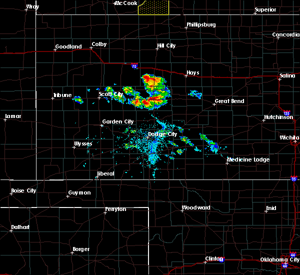 At 647 pm cdt, a severe thunderstorm was located 8 miles east of beeler, moving east at 15 mph (radar indicated). Hazards include 60 mph wind gusts and quarter size hail. Hail damage to vehicles is expected. Expect wind damage to roofs, siding, and trees. At 647 pm cdt, a severe thunderstorm was located 8 miles east of beeler, moving east at 15 mph (radar indicated). Hazards include 60 mph wind gusts and quarter size hail. Hail damage to vehicles is expected. Expect wind damage to roofs, siding, and trees.
|
| 5/24/2020 10:12 PM CDT |
 The severe thunderstorm warning for southern ness, northeastern hodgeman, northwestern pawnee and western rush counties will expire at 1015 pm cdt, the storms which prompted the warning have weakened below severe limits, and no longer pose an immediate threat to life or property. therefore, the warning will be allowed to expire. however gusty winds and heavy rain are still possible with these thunderstorms. a severe thunderstorm watch remains in effect until midnight cdt for south central, central, southwestern and west central kansas. The severe thunderstorm warning for southern ness, northeastern hodgeman, northwestern pawnee and western rush counties will expire at 1015 pm cdt, the storms which prompted the warning have weakened below severe limits, and no longer pose an immediate threat to life or property. therefore, the warning will be allowed to expire. however gusty winds and heavy rain are still possible with these thunderstorms. a severe thunderstorm watch remains in effect until midnight cdt for south central, central, southwestern and west central kansas.
|
| 5/24/2020 9:45 PM CDT |
 At 945 pm cdt, severe thunderstorms were located along a line extending from 6 miles south of nekoma to 7 miles northwest of jetmore, moving north at 15 mph (radar indicated and storm spotter reported. at 942 pm cdt, quarter size hail was reported 8 miles north of jetmore). Hazards include ping pong ball size hail and 60 mph wind gusts. People and animals outdoors will be injured. expect hail damage to roofs, siding, windows, and vehicles. expect wind damage to roofs, siding, and trees. Locations impacted include, ness city, bazine, mccracken, alexander and beeler. At 945 pm cdt, severe thunderstorms were located along a line extending from 6 miles south of nekoma to 7 miles northwest of jetmore, moving north at 15 mph (radar indicated and storm spotter reported. at 942 pm cdt, quarter size hail was reported 8 miles north of jetmore). Hazards include ping pong ball size hail and 60 mph wind gusts. People and animals outdoors will be injured. expect hail damage to roofs, siding, windows, and vehicles. expect wind damage to roofs, siding, and trees. Locations impacted include, ness city, bazine, mccracken, alexander and beeler.
|
| 5/24/2020 9:28 PM CDT |
 At 928 pm cdt, severe thunderstorms were located along a line extending from 9 miles northwest of burdett to 8 miles northwest of jetmore, moving north at 30 mph (radar indicated). Hazards include golf ball size hail and 60 mph wind gusts. People and animals outdoors will be injured. expect hail damage to roofs, siding, windows, and vehicles. Expect wind damage to roofs, siding, and trees. At 928 pm cdt, severe thunderstorms were located along a line extending from 9 miles northwest of burdett to 8 miles northwest of jetmore, moving north at 30 mph (radar indicated). Hazards include golf ball size hail and 60 mph wind gusts. People and animals outdoors will be injured. expect hail damage to roofs, siding, windows, and vehicles. Expect wind damage to roofs, siding, and trees.
|
| 9/21/2019 6:13 PM CDT |
 At 612 pm cdt, a severe thunderstorm was located near ness city, moving northeast at 30 mph (radar indicated). Hazards include 60 mph wind gusts and half dollar size hail. Hail damage to vehicles is expected. Expect wind damage to roofs, siding, and trees. At 612 pm cdt, a severe thunderstorm was located near ness city, moving northeast at 30 mph (radar indicated). Hazards include 60 mph wind gusts and half dollar size hail. Hail damage to vehicles is expected. Expect wind damage to roofs, siding, and trees.
|
| 9/21/2019 5:54 PM CDT |
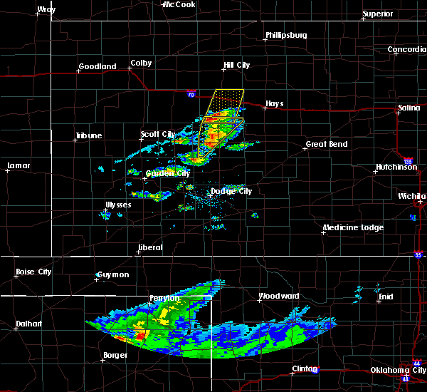 The severe thunderstorm warning for central ness and southern trego counties will expire at 600 pm cdt, the storm which prompted the warning has weakened below severe limits, and no longer poses an immediate threat to life or property. therefore, the warning will be allowed to expire. however gusty winds are still possible with this thunderstorm and another severe thunderstorm warning is in effect for trego county. a severe thunderstorm watch remains in effect until midnight cdt for southwestern and west central kansas. The severe thunderstorm warning for central ness and southern trego counties will expire at 600 pm cdt, the storm which prompted the warning has weakened below severe limits, and no longer poses an immediate threat to life or property. therefore, the warning will be allowed to expire. however gusty winds are still possible with this thunderstorm and another severe thunderstorm warning is in effect for trego county. a severe thunderstorm watch remains in effect until midnight cdt for southwestern and west central kansas.
|
| 9/21/2019 5:44 PM CDT |
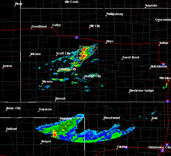 At 543 pm cdt, a severe thunderstorm was located near arnold, moving north at 25 mph. a second severe storm was located between beeler and ness city moving north at 25 mph (radar indicated). Hazards include ping pong ball size hail and 60 mph wind gusts. People and animals outdoors will be injured. expect hail damage to roofs, siding, windows, and vehicles. expect wind damage to roofs, siding, and trees. Locations impacted include, ness city, ransom, brownell and arnold. At 543 pm cdt, a severe thunderstorm was located near arnold, moving north at 25 mph. a second severe storm was located between beeler and ness city moving north at 25 mph (radar indicated). Hazards include ping pong ball size hail and 60 mph wind gusts. People and animals outdoors will be injured. expect hail damage to roofs, siding, windows, and vehicles. expect wind damage to roofs, siding, and trees. Locations impacted include, ness city, ransom, brownell and arnold.
|
| 9/21/2019 5:29 PM CDT |
 At 528 pm cdt, a severe thunderstorm was located near arnold, moving northeast at 25 mph. a second severe thunderstorm was located 5 miles south of beeler, moving northeast at 25 mph (radar indicated). Hazards include ping pong ball size hail and 60 mph wind gusts. People and animals outdoors will be injured. expect hail damage to roofs, siding, windows, and vehicles. expect wind damage to roofs, siding, and trees. Locations impacted include, ness city, ransom, utica, brownell, beeler and arnold. At 528 pm cdt, a severe thunderstorm was located near arnold, moving northeast at 25 mph. a second severe thunderstorm was located 5 miles south of beeler, moving northeast at 25 mph (radar indicated). Hazards include ping pong ball size hail and 60 mph wind gusts. People and animals outdoors will be injured. expect hail damage to roofs, siding, windows, and vehicles. expect wind damage to roofs, siding, and trees. Locations impacted include, ness city, ransom, utica, brownell, beeler and arnold.
|
| 9/21/2019 5:16 PM CDT |
 At 515 pm cdt, a severe thunderstorm was located 7 miles south of beeler, moving northeast at 25 mph. another severe thunderstorm was located near beeler moving northeast at 25 mph (radar indicated). Hazards include 60 mph wind gusts and quarter size hail. Hail damage to vehicles is expected. Expect wind damage to roofs, siding, and trees. At 515 pm cdt, a severe thunderstorm was located 7 miles south of beeler, moving northeast at 25 mph. another severe thunderstorm was located near beeler moving northeast at 25 mph (radar indicated). Hazards include 60 mph wind gusts and quarter size hail. Hail damage to vehicles is expected. Expect wind damage to roofs, siding, and trees.
|
| 9/7/2019 4:49 PM CDT |
 The national weather service in dodge city has issued a * severe thunderstorm warning for. central ness county in west central kansas. until 530 pm cdt. At 449 pm cdt, a severe thunderstorm was located 8 miles east of beeler, moving east at 30 mph. The national weather service in dodge city has issued a * severe thunderstorm warning for. central ness county in west central kansas. until 530 pm cdt. At 449 pm cdt, a severe thunderstorm was located 8 miles east of beeler, moving east at 30 mph.
|
| 8/31/2019 6:50 PM CDT |
 At 650 pm cdt, a severe thunderstorm was located near mccracken, moving east at 30 mph (radar indicated). Hazards include 60 mph wind gusts and penny size hail. Expect damage to roofs, siding, and trees. Locations impacted include, ness city, bazine, ransom, brownell and cedar bluff. At 650 pm cdt, a severe thunderstorm was located near mccracken, moving east at 30 mph (radar indicated). Hazards include 60 mph wind gusts and penny size hail. Expect damage to roofs, siding, and trees. Locations impacted include, ness city, bazine, ransom, brownell and cedar bluff.
|
| 8/31/2019 6:36 PM CDT |
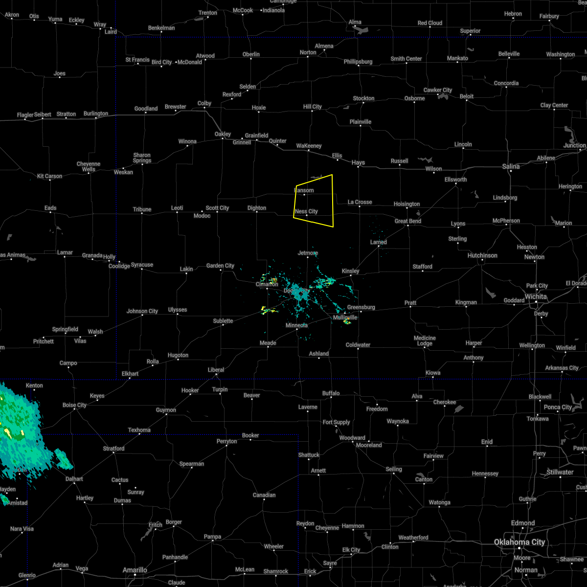 At 636 pm cdt, a severe thunderstorm was located near ransom, moving east at 20 mph (radar indicated). Hazards include 60 mph wind gusts and nickel size hail. expect damage to roofs, siding, and trees At 636 pm cdt, a severe thunderstorm was located near ransom, moving east at 20 mph (radar indicated). Hazards include 60 mph wind gusts and nickel size hail. expect damage to roofs, siding, and trees
|
| 8/24/2019 11:01 PM CDT |
 At 1100 pm cdt, severe thunderstorms were located along a line extending from 10 miles east of natoma to near trego center, moving southeast at 25 mph (radar indicated). Hazards include 60 mph wind gusts and half dollar size hail. Hail damage to vehicles is expected. Expect wind damage to roofs, siding, and trees. At 1100 pm cdt, severe thunderstorms were located along a line extending from 10 miles east of natoma to near trego center, moving southeast at 25 mph (radar indicated). Hazards include 60 mph wind gusts and half dollar size hail. Hail damage to vehicles is expected. Expect wind damage to roofs, siding, and trees.
|
| 8/13/2019 7:23 PM CDT |
 At 722 pm cdt, severe thunderstorms were located along a line extending from 10 miles south of zurich to near mccracken to 6 miles southwest of ness city, moving southeast at 40 mph (radar indicated). Hazards include 70 mph wind gusts and ping pong ball size hail. People and animals outdoors will be injured. expect hail damage to roofs, siding, windows, and vehicles. expect considerable tree damage. wind damage is also likely to mobile homes, roofs, and outbuildings. locations impacted include, hays, ellis, ness city, la crosse, victoria, walker, bazine, catherine, ransom, schoenchen, mccracken, rush center, liebenthal, alexander, brownell, emmeram, yocemento, nekoma, hargrave and riga. At 655 pm cdt, a 72 mph wind gust was measured 1 mile south of wakeeney. At 722 pm cdt, severe thunderstorms were located along a line extending from 10 miles south of zurich to near mccracken to 6 miles southwest of ness city, moving southeast at 40 mph (radar indicated). Hazards include 70 mph wind gusts and ping pong ball size hail. People and animals outdoors will be injured. expect hail damage to roofs, siding, windows, and vehicles. expect considerable tree damage. wind damage is also likely to mobile homes, roofs, and outbuildings. locations impacted include, hays, ellis, ness city, la crosse, victoria, walker, bazine, catherine, ransom, schoenchen, mccracken, rush center, liebenthal, alexander, brownell, emmeram, yocemento, nekoma, hargrave and riga. At 655 pm cdt, a 72 mph wind gust was measured 1 mile south of wakeeney.
|
| 8/13/2019 7:00 PM CDT |
 At 659 pm cdt, severe thunderstorms were located along a line extending from 8 miles south of palco to near cedar bluff to near utica, moving southeast at 40 mph (radar indicated). Hazards include 70 mph wind gusts and ping pong ball size hail. People and animals outdoors will be injured. expect hail damage to roofs, siding, windows, and vehicles. expect considerable tree damage. Wind damage is also likely to mobile homes, roofs, and outbuildings. At 659 pm cdt, severe thunderstorms were located along a line extending from 8 miles south of palco to near cedar bluff to near utica, moving southeast at 40 mph (radar indicated). Hazards include 70 mph wind gusts and ping pong ball size hail. People and animals outdoors will be injured. expect hail damage to roofs, siding, windows, and vehicles. expect considerable tree damage. Wind damage is also likely to mobile homes, roofs, and outbuildings.
|
| 7/31/2019 6:50 PM CDT |
 At 650 pm cdt, a severe thunderstorm was located near mccracken, moving east at 30 mph (radar indicated). Hazards include 60 mph wind gusts and penny size hail. Expect damage to roofs, siding, and trees. Locations impacted include, ness city, bazine, ransom, brownell and cedar bluff. At 650 pm cdt, a severe thunderstorm was located near mccracken, moving east at 30 mph (radar indicated). Hazards include 60 mph wind gusts and penny size hail. Expect damage to roofs, siding, and trees. Locations impacted include, ness city, bazine, ransom, brownell and cedar bluff.
|
| 7/31/2019 6:36 PM CDT |
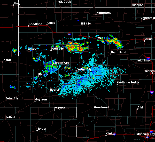 At 636 pm cdt, a severe thunderstorm was located near ransom, moving east at 20 mph (radar indicated). Hazards include 60 mph wind gusts and nickel size hail. expect damage to roofs, siding, and trees At 636 pm cdt, a severe thunderstorm was located near ransom, moving east at 20 mph (radar indicated). Hazards include 60 mph wind gusts and nickel size hail. expect damage to roofs, siding, and trees
|
| 7/5/2019 8:15 PM CDT | Relayed by nws ic in ness county KS, 2.5 miles W of Ness City, KS |
| 7/5/2019 6:49 PM CDT |
 At 649 pm cdt, a severe thunderstorm was located 14 miles southwest of ness city, moving southeast at 10 mph (radar indicated). Hazards include ping pong ball size hail and 60 mph wind gusts. People and animals outdoors will be injured. expect hail damage to roofs, siding, windows, and vehicles. expect wind damage to roofs, siding, and trees. Locations impacted include, ness city. At 649 pm cdt, a severe thunderstorm was located 14 miles southwest of ness city, moving southeast at 10 mph (radar indicated). Hazards include ping pong ball size hail and 60 mph wind gusts. People and animals outdoors will be injured. expect hail damage to roofs, siding, windows, and vehicles. expect wind damage to roofs, siding, and trees. Locations impacted include, ness city.
|
| 7/5/2019 6:35 PM CDT |
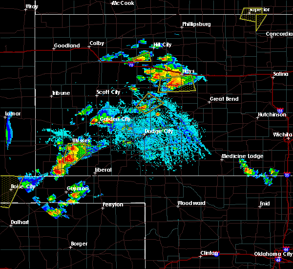 At 635 pm cdt, a severe thunderstorm was located 14 miles northwest of jetmore, moving northeast at 10 mph (radar indicated). Hazards include ping pong ball size hail and 60 mph wind gusts. People and animals outdoors will be injured. expect hail damage to roofs, siding, windows, and vehicles. Expect wind damage to roofs, siding, and trees. At 635 pm cdt, a severe thunderstorm was located 14 miles northwest of jetmore, moving northeast at 10 mph (radar indicated). Hazards include ping pong ball size hail and 60 mph wind gusts. People and animals outdoors will be injured. expect hail damage to roofs, siding, windows, and vehicles. Expect wind damage to roofs, siding, and trees.
|
| 6/25/2019 8:14 AM CDT |
 At 814 am cdt, a severe thunderstorm was located near ness city, moving east at 25 mph (radar indicated). Hazards include quarter size hail. damage to vehicles is expected At 814 am cdt, a severe thunderstorm was located near ness city, moving east at 25 mph (radar indicated). Hazards include quarter size hail. damage to vehicles is expected
|
| 6/9/2019 1:30 AM CDT |
 At 130 am cdt, severe thunderstorms were located along a line extending from near catherine to near la crosse to 6 miles south of bazine, moving southeast at 55 mph (radar indicated). Hazards include 70 mph wind gusts and nickel size hail. Expect considerable tree damage. damage is likely to mobile homes, roofs, and outbuildings. Locations impacted include, hays, ness city, la crosse, victoria, walker, bazine, catherine, otis, bison, schoenchen, mccracken, rush center, liebenthal, timken, alexander, emmeram, yocemento, nekoma, hargrave and pfeifer. At 130 am cdt, severe thunderstorms were located along a line extending from near catherine to near la crosse to 6 miles south of bazine, moving southeast at 55 mph (radar indicated). Hazards include 70 mph wind gusts and nickel size hail. Expect considerable tree damage. damage is likely to mobile homes, roofs, and outbuildings. Locations impacted include, hays, ness city, la crosse, victoria, walker, bazine, catherine, otis, bison, schoenchen, mccracken, rush center, liebenthal, timken, alexander, emmeram, yocemento, nekoma, hargrave and pfeifer.
|
| 6/9/2019 1:17 AM CDT |
 At 117 am cdt, severe thunderstorms were located along a line extending from 6 miles northwest of catherine to near mccracken to near ness city, moving southeast at 40 mph (radar indicated). Hazards include 60 mph wind gusts and nickel size hail. Expect damage to roofs, siding, and trees. Locations impacted include, hays, ness city, la crosse, victoria, walker, bazine, catherine, otis, bison, schoenchen, mccracken, rush center, liebenthal, timken, alexander, brownell, emmeram, yocemento, nekoma and hargrave. At 117 am cdt, severe thunderstorms were located along a line extending from 6 miles northwest of catherine to near mccracken to near ness city, moving southeast at 40 mph (radar indicated). Hazards include 60 mph wind gusts and nickel size hail. Expect damage to roofs, siding, and trees. Locations impacted include, hays, ness city, la crosse, victoria, walker, bazine, catherine, otis, bison, schoenchen, mccracken, rush center, liebenthal, timken, alexander, brownell, emmeram, yocemento, nekoma and hargrave.
|
| 6/9/2019 1:06 AM CDT |
 At 106 am cdt, severe thunderstorms were located along a line extending from near ellis to near brownell to near ness city, moving southeast at 40 mph (radar indicated). Hazards include 70 mph wind gusts and half dollar size hail. Hail damage to vehicles is expected. expect considerable tree damage. wind damage is also likely to mobile homes, roofs, and outbuildings. Locations impacted include, ellis, ness city, ransom, brownell, yocemento, cedar bluff and riga. At 106 am cdt, severe thunderstorms were located along a line extending from near ellis to near brownell to near ness city, moving southeast at 40 mph (radar indicated). Hazards include 70 mph wind gusts and half dollar size hail. Hail damage to vehicles is expected. expect considerable tree damage. wind damage is also likely to mobile homes, roofs, and outbuildings. Locations impacted include, ellis, ness city, ransom, brownell, yocemento, cedar bluff and riga.
|
| 6/9/2019 12:51 AM CDT |
 At 1251 am cdt, severe thunderstorms were located along a line extending from 9 miles south of zurich to near beeler, moving southeast at 45 mph (radar indicated). Hazards include 60 mph wind gusts and nickel size hail. expect damage to roofs, siding, and trees At 1251 am cdt, severe thunderstorms were located along a line extending from 9 miles south of zurich to near beeler, moving southeast at 45 mph (radar indicated). Hazards include 60 mph wind gusts and nickel size hail. expect damage to roofs, siding, and trees
|
| 6/9/2019 12:18 AM CDT |
 At 1217 am cdt, severe thunderstorms were located along a line extending from 7 miles northeast of wakeeney to 10 miles southeast of gove, moving southeast at 40 mph (radar indicated). Hazards include 60 mph wind gusts and half dollar size hail. Hail damage to vehicles is expected. Expect wind damage to roofs, siding, and trees. At 1217 am cdt, severe thunderstorms were located along a line extending from 7 miles northeast of wakeeney to 10 miles southeast of gove, moving southeast at 40 mph (radar indicated). Hazards include 60 mph wind gusts and half dollar size hail. Hail damage to vehicles is expected. Expect wind damage to roofs, siding, and trees.
|
| 5/26/2019 11:35 PM CDT |
 At 1135 pm cdt, severe thunderstorms were located along a line extending from 8 miles north of utica to near burdett, moving northeast at 40 mph (radar indicated). Hazards include 60 mph wind gusts and nickel size hail. Expect damage to roofs, siding, and trees. Locations impacted include, ellis, ness city, la crosse, bazine, ransom, bison, schoenchen, mccracken, ogallah, rush center, liebenthal, timken, alexander, brownell, trego center, cedar bluff, arnold, nekoma, hargrave and riga. At 1135 pm cdt, severe thunderstorms were located along a line extending from 8 miles north of utica to near burdett, moving northeast at 40 mph (radar indicated). Hazards include 60 mph wind gusts and nickel size hail. Expect damage to roofs, siding, and trees. Locations impacted include, ellis, ness city, la crosse, bazine, ransom, bison, schoenchen, mccracken, ogallah, rush center, liebenthal, timken, alexander, brownell, trego center, cedar bluff, arnold, nekoma, hargrave and riga.
|
| 5/26/2019 11:21 PM CDT |
 At 1121 pm cdt, severe thunderstorms were located along a line extending from near pendennis to near jetmore, moving east at 45 mph (radar indicated). Hazards include 60 mph wind gusts and nickel size hail. expect damage to roofs, siding, and trees At 1121 pm cdt, severe thunderstorms were located along a line extending from near pendennis to near jetmore, moving east at 45 mph (radar indicated). Hazards include 60 mph wind gusts and nickel size hail. expect damage to roofs, siding, and trees
|
| 5/17/2019 9:18 PM CDT |
 At 918 pm cdt, a severe thunderstorm was located near bazine, moving northeast at 35 mph (radar indicated). Hazards include 60 mph wind gusts and half dollar size hail. Hail damage to vehicles is expected. expect wind damage to roofs, siding, and trees. Locations impacted include, ness city, bazine, schoenchen, mccracken, liebenthal, alexander, brownell, nekoma, cedar bluff, hargrave and antonino. At 918 pm cdt, a severe thunderstorm was located near bazine, moving northeast at 35 mph (radar indicated). Hazards include 60 mph wind gusts and half dollar size hail. Hail damage to vehicles is expected. expect wind damage to roofs, siding, and trees. Locations impacted include, ness city, bazine, schoenchen, mccracken, liebenthal, alexander, brownell, nekoma, cedar bluff, hargrave and antonino.
|
| 5/17/2019 9:07 PM CDT |
 At 906 pm cdt, a severe thunderstorm was located 11 miles south of ness city, moving northeast at 35 mph. this warning will replace the previous tornado warning for hodgeman and ness counties (radar indicated). Hazards include golf ball size hail and 60 mph wind gusts. People and animals outdoors will be injured. expect hail damage to roofs, siding, windows, and vehicles. Expect wind damage to roofs, siding, and trees. At 906 pm cdt, a severe thunderstorm was located 11 miles south of ness city, moving northeast at 35 mph. this warning will replace the previous tornado warning for hodgeman and ness counties (radar indicated). Hazards include golf ball size hail and 60 mph wind gusts. People and animals outdoors will be injured. expect hail damage to roofs, siding, windows, and vehicles. Expect wind damage to roofs, siding, and trees.
|
| 5/17/2019 8:03 PM CDT |
 At 802 pm cdt, a severe thunderstorm was located near kalvesta, moving north at 30 mph (radar indicated). Hazards include tennis ball size hail and 60 mph wind gusts. People and animals outdoors will be injured. expect hail damage to roofs, siding, windows, and vehicles. expect wind damage to roofs, siding, and trees. Locations impacted include, cimarron, ness city, ingalls, ransom, utica, alamota, brownell, kalvesta, beeler and arnold. At 802 pm cdt, a severe thunderstorm was located near kalvesta, moving north at 30 mph (radar indicated). Hazards include tennis ball size hail and 60 mph wind gusts. People and animals outdoors will be injured. expect hail damage to roofs, siding, windows, and vehicles. expect wind damage to roofs, siding, and trees. Locations impacted include, cimarron, ness city, ingalls, ransom, utica, alamota, brownell, kalvesta, beeler and arnold.
|
| 5/17/2019 7:51 PM CDT |
 At 749 pm cdt, a severe thunderstorm was located 13 miles south of beeler, moving north at 30 mph. a second severe storm was located 6 miles north of cimarron moving north at 30 mph (radar indicated). Hazards include golf ball size hail and 60 mph wind gusts. People and animals outdoors will be injured. expect hail damage to roofs, siding, windows, and vehicles. Expect wind damage to roofs, siding, and trees. At 749 pm cdt, a severe thunderstorm was located 13 miles south of beeler, moving north at 30 mph. a second severe storm was located 6 miles north of cimarron moving north at 30 mph (radar indicated). Hazards include golf ball size hail and 60 mph wind gusts. People and animals outdoors will be injured. expect hail damage to roofs, siding, windows, and vehicles. Expect wind damage to roofs, siding, and trees.
|
| 4/28/2019 11:54 PM CDT |
 The severe thunderstorm warning for ness, southern trego, western rush and southwestern ellis counties will expire at midnight cdt, the storm which prompted the warning has weakened below severe limits, and no longer poses an immediate threat to life or property. therefore, the warning will be allowed to expire. however small hail and gusty winds are still possible with this thunderstorm. a severe thunderstorm watch remains in effect until 300 am cdt for central kansas. The severe thunderstorm warning for ness, southern trego, western rush and southwestern ellis counties will expire at midnight cdt, the storm which prompted the warning has weakened below severe limits, and no longer poses an immediate threat to life or property. therefore, the warning will be allowed to expire. however small hail and gusty winds are still possible with this thunderstorm. a severe thunderstorm watch remains in effect until 300 am cdt for central kansas.
|
| 4/28/2019 11:30 PM CDT |
 At 1129 pm cdt, a severe thunderstorm was located near ransom, moving east at 35 mph (radar indicated). Hazards include 60 mph wind gusts and quarter size hail. Hail damage to vehicles is expected. expect wind damage to roofs, siding, and trees. Locations impacted include, ness city, bazine, ransom, mccracken, utica, alexander, brownell, nekoma, cedar bluff and arnold. At 1129 pm cdt, a severe thunderstorm was located near ransom, moving east at 35 mph (radar indicated). Hazards include 60 mph wind gusts and quarter size hail. Hail damage to vehicles is expected. expect wind damage to roofs, siding, and trees. Locations impacted include, ness city, bazine, ransom, mccracken, utica, alexander, brownell, nekoma, cedar bluff and arnold.
|
| 4/28/2019 11:13 PM CDT |
 At 1113 pm cdt, a severe thunderstorm was located near arnold, moving east at 35 mph (radar indicated). Hazards include 60 mph wind gusts and half dollar size hail. Hail damage to vehicles is expected. expect wind damage to roofs, siding, and trees. Locations impacted include, ness city, bazine, ransom, mccracken, utica, alexander, brownell, nekoma, cedar bluff, pendennis, shields and arnold. At 1113 pm cdt, a severe thunderstorm was located near arnold, moving east at 35 mph (radar indicated). Hazards include 60 mph wind gusts and half dollar size hail. Hail damage to vehicles is expected. expect wind damage to roofs, siding, and trees. Locations impacted include, ness city, bazine, ransom, mccracken, utica, alexander, brownell, nekoma, cedar bluff, pendennis, shields and arnold.
|
| 4/28/2019 10:54 PM CDT |
 At 1054 pm cdt, a severe thunderstorm was located near utica, moving east at 35 mph (radar indicated). Hazards include ping pong ball size hail and 60 mph wind gusts. People and animals outdoors will be injured. expect hail damage to roofs, siding, windows, and vehicles. Expect wind damage to roofs, siding, and trees. At 1054 pm cdt, a severe thunderstorm was located near utica, moving east at 35 mph (radar indicated). Hazards include ping pong ball size hail and 60 mph wind gusts. People and animals outdoors will be injured. expect hail damage to roofs, siding, windows, and vehicles. Expect wind damage to roofs, siding, and trees.
|
| 4/28/2019 9:41 PM CDT |
 At 940 pm cdt, a severe thunderstorm was located 8 miles south of bazine, moving east at 40 mph. this is a very dangerous storm (radar indicated). Hazards include 80 mph wind gusts and two inch hail. Flying debris will be dangerous to those caught without shelter. mobile homes will be heavily damaged. expect considerable damage to roofs, windows, and vehicles. extensive tree damage and power outages are likely. Locations impacted include, gray, larned, kinsley, ness city, lewis, bazine, burdett, hanston, garfield, rush center, rozel, belpre, timken, alexander, ash valley, radium, sanford, nekoma, frizell and zook. At 940 pm cdt, a severe thunderstorm was located 8 miles south of bazine, moving east at 40 mph. this is a very dangerous storm (radar indicated). Hazards include 80 mph wind gusts and two inch hail. Flying debris will be dangerous to those caught without shelter. mobile homes will be heavily damaged. expect considerable damage to roofs, windows, and vehicles. extensive tree damage and power outages are likely. Locations impacted include, gray, larned, kinsley, ness city, lewis, bazine, burdett, hanston, garfield, rush center, rozel, belpre, timken, alexander, ash valley, radium, sanford, nekoma, frizell and zook.
|
| 4/28/2019 9:26 PM CDT |
 At 926 pm cdt, a severe thunderstorm was located 8 miles southeast of ness city, moving southeast at 45 mph. this is a very dangerous storm (radar indicated). Hazards include 80 mph wind gusts and two inch hail. Flying debris will be dangerous to those caught without shelter. mobile homes will be heavily damaged. expect considerable damage to roofs, windows, and vehicles. Extensive tree damage and power outages are likely. At 926 pm cdt, a severe thunderstorm was located 8 miles southeast of ness city, moving southeast at 45 mph. this is a very dangerous storm (radar indicated). Hazards include 80 mph wind gusts and two inch hail. Flying debris will be dangerous to those caught without shelter. mobile homes will be heavily damaged. expect considerable damage to roofs, windows, and vehicles. Extensive tree damage and power outages are likely.
|
| 4/28/2019 9:25 PM CDT | Storm damage reported in ness county KS, 0.3 miles NE of Ness City, KS |
| 4/28/2019 9:25 PM CDT | Golf Ball sized hail reported 0.3 miles NE of Ness City, KS |
| 4/28/2019 9:10 PM CDT |
 At 910 pm cdt, a severe thunderstorm capable of producing a tornado was located near ness city, moving east at 40 mph (radar indicated rotation). Hazards include tornado and ping pong ball size hail. Flying debris will be dangerous to those caught without shelter. mobile homes will be damaged or destroyed. damage to roofs, windows, and vehicles will occur. tree damage is likely. this dangerous storm will be near, ness city around 920 pm cdt. Bazine around 935 pm cdt. At 910 pm cdt, a severe thunderstorm capable of producing a tornado was located near ness city, moving east at 40 mph (radar indicated rotation). Hazards include tornado and ping pong ball size hail. Flying debris will be dangerous to those caught without shelter. mobile homes will be damaged or destroyed. damage to roofs, windows, and vehicles will occur. tree damage is likely. this dangerous storm will be near, ness city around 920 pm cdt. Bazine around 935 pm cdt.
|
| 4/28/2019 8:58 PM CDT |
 At 857 pm cdt, a severe thunderstorm was located near beeler, moving east at 40 mph. this is a very dangerous storm (radar indicated). Hazards include 80 mph wind gusts and golf ball size hail. Flying debris will be dangerous to those caught without shelter. mobile homes will be heavily damaged. expect considerable damage to roofs, windows, and vehicles. extensive tree damage and power outages are likely. Locations impacted include, ness city, bazine, utica, alamota, beeler, pendennis and arnold. At 857 pm cdt, a severe thunderstorm was located near beeler, moving east at 40 mph. this is a very dangerous storm (radar indicated). Hazards include 80 mph wind gusts and golf ball size hail. Flying debris will be dangerous to those caught without shelter. mobile homes will be heavily damaged. expect considerable damage to roofs, windows, and vehicles. extensive tree damage and power outages are likely. Locations impacted include, ness city, bazine, utica, alamota, beeler, pendennis and arnold.
|
| 4/28/2019 8:37 PM CDT |
 At 837 pm cdt, a severe thunderstorm was located near amy, moving southeast at 35 mph. this is a very dangerous storm (radar indicated). Hazards include 80 mph wind gusts and golf ball size hail. Flying debris will be dangerous to those caught without shelter. mobile homes will be heavily damaged. expect considerable damage to roofs, windows, and vehicles. Extensive tree damage and power outages are likely. At 837 pm cdt, a severe thunderstorm was located near amy, moving southeast at 35 mph. this is a very dangerous storm (radar indicated). Hazards include 80 mph wind gusts and golf ball size hail. Flying debris will be dangerous to those caught without shelter. mobile homes will be heavily damaged. expect considerable damage to roofs, windows, and vehicles. Extensive tree damage and power outages are likely.
|
| 4/21/2019 6:46 PM CDT |
 At 646 pm cdt, a severe thunderstorm was located near trego center, moving east at 40 mph (radar indicated). Hazards include 70 mph wind gusts and nickel size hail. Expect considerable tree damage. damage is likely to mobile homes, roofs, and outbuildings. Locations impacted include, wakeeney, ness city, bazine, ransom, ogallah, utica, collyer, brownell, trego center, cedar bluff, arnold, riga and voda. At 646 pm cdt, a severe thunderstorm was located near trego center, moving east at 40 mph (radar indicated). Hazards include 70 mph wind gusts and nickel size hail. Expect considerable tree damage. damage is likely to mobile homes, roofs, and outbuildings. Locations impacted include, wakeeney, ness city, bazine, ransom, ogallah, utica, collyer, brownell, trego center, cedar bluff, arnold, riga and voda.
|
| 4/21/2019 6:24 PM CDT |
 At 624 pm cdt, a severe thunderstorm was located 13 miles north of utica, moving east at 40 mph (radar indicated). Hazards include 70 mph wind gusts and penny size hail. Expect considerable tree damage. Damage is likely to mobile homes, roofs, and outbuildings. At 624 pm cdt, a severe thunderstorm was located 13 miles north of utica, moving east at 40 mph (radar indicated). Hazards include 70 mph wind gusts and penny size hail. Expect considerable tree damage. Damage is likely to mobile homes, roofs, and outbuildings.
|
| 7/29/2018 2:20 AM CDT |
 The severe thunderstorm warning for western ness and southeastern lane counties will expire at 230 am cdt, the storms which prompted the warning have weakened below severe limits, and no longer pose an immediate threat to life or property. therefore, the warning will be allowed to expire. however gusty winds and heavy rain are still possible with these thunderstorms. The severe thunderstorm warning for western ness and southeastern lane counties will expire at 230 am cdt, the storms which prompted the warning have weakened below severe limits, and no longer pose an immediate threat to life or property. therefore, the warning will be allowed to expire. however gusty winds and heavy rain are still possible with these thunderstorms.
|
| 7/29/2018 2:04 AM CDT |
 At 204 am cdt, severe thunderstorms were located along a line extending from 2 miles southwest of arnold to 2 miles southwest of beeler to 11 miles south of dighton, moving south at 55 mph (radar indicated). Hazards include 60 mph wind gusts and nickel size hail. Expect damage to roofs, siding, and trees. Locations impacted include, ness city, utica, alamota, beeler and arnold. At 204 am cdt, severe thunderstorms were located along a line extending from 2 miles southwest of arnold to 2 miles southwest of beeler to 11 miles south of dighton, moving south at 55 mph (radar indicated). Hazards include 60 mph wind gusts and nickel size hail. Expect damage to roofs, siding, and trees. Locations impacted include, ness city, utica, alamota, beeler and arnold.
|
| 7/29/2018 1:55 AM CDT |
 At 155 am cdt, severe thunderstorms were located along a line extending from 4 miles northeast of utica to 4 miles north of alamota to 5 miles southwest of dighton, moving south at 55 mph (radar indicated). Hazards include 70 mph wind gusts and quarter size hail. Hail damage to vehicles is expected. expect considerable tree damage. wind damage is also likely to mobile homes, roofs, and outbuildings. Locations impacted include, ness city, dighton, utica, alamota, beeler and arnold. At 155 am cdt, severe thunderstorms were located along a line extending from 4 miles northeast of utica to 4 miles north of alamota to 5 miles southwest of dighton, moving south at 55 mph (radar indicated). Hazards include 70 mph wind gusts and quarter size hail. Hail damage to vehicles is expected. expect considerable tree damage. wind damage is also likely to mobile homes, roofs, and outbuildings. Locations impacted include, ness city, dighton, utica, alamota, beeler and arnold.
|
| 7/29/2018 1:35 AM CDT |
 At 134 am cdt, severe thunderstorms were located along a line extending from 13 miles south of collyer to 7 miles north of healy, moving south at 40 mph (radar indicated). Hazards include golf ball size hail and 70 mph wind gusts. People and animals outdoors will be injured. expect hail damage to roofs, siding, windows, and vehicles. expect considerable tree damage. Wind damage is also likely to mobile homes, roofs, and outbuildings. At 134 am cdt, severe thunderstorms were located along a line extending from 13 miles south of collyer to 7 miles north of healy, moving south at 40 mph (radar indicated). Hazards include golf ball size hail and 70 mph wind gusts. People and animals outdoors will be injured. expect hail damage to roofs, siding, windows, and vehicles. expect considerable tree damage. Wind damage is also likely to mobile homes, roofs, and outbuildings.
|
| 7/20/2018 11:15 PM CDT |
 At 1114 pm cdt, a severe thunderstorm was located 6 miles southwest of bazine, moving east at 25 mph (radar indicated). Hazards include 60 mph wind gusts and half dollar size hail. Hail damage to vehicles is expected. Expect wind damage to roofs, siding, and trees. At 1114 pm cdt, a severe thunderstorm was located 6 miles southwest of bazine, moving east at 25 mph (radar indicated). Hazards include 60 mph wind gusts and half dollar size hail. Hail damage to vehicles is expected. Expect wind damage to roofs, siding, and trees.
|
| 7/20/2018 11:04 PM CDT |
 At 1103 pm cdt, a severe thunderstorm was located 6 miles southeast of ness city, moving east at 25 mph (radar indicated). Hazards include tennis ball size hail and 60 mph wind gusts. People and animals outdoors will be injured. expect hail damage to roofs, siding, windows, and vehicles. expect wind damage to roofs, siding, and trees. Locations impacted include, gray, ness city, jetmore, bazine, ransom, hanston, utica, brownell, beeler and arnold. At 1103 pm cdt, a severe thunderstorm was located 6 miles southeast of ness city, moving east at 25 mph (radar indicated). Hazards include tennis ball size hail and 60 mph wind gusts. People and animals outdoors will be injured. expect hail damage to roofs, siding, windows, and vehicles. expect wind damage to roofs, siding, and trees. Locations impacted include, gray, ness city, jetmore, bazine, ransom, hanston, utica, brownell, beeler and arnold.
|
| 7/20/2018 10:37 PM CDT | Golf Ball sized hail reported 11.2 miles ENE of Ness City, KS |
| 7/20/2018 10:36 PM CDT |
 At 1035 pm cdt, a severe thunderstorm was located 7 miles southeast of beeler, moving east at 35 mph. this is a very dangerous storm (radar indicated). Hazards include three inch hail and 60 mph wind gusts. People and animals outdoors will be severely injured. expect shattered windows, extensive damage to roofs, siding, and vehicles. Locations impacted include, gray, ness city, jetmore, bazine, ransom, hanston, utica, brownell, beeler and arnold. At 1035 pm cdt, a severe thunderstorm was located 7 miles southeast of beeler, moving east at 35 mph. this is a very dangerous storm (radar indicated). Hazards include three inch hail and 60 mph wind gusts. People and animals outdoors will be severely injured. expect shattered windows, extensive damage to roofs, siding, and vehicles. Locations impacted include, gray, ness city, jetmore, bazine, ransom, hanston, utica, brownell, beeler and arnold.
|
| 7/20/2018 10:28 PM CDT |
 At 1028 pm cdt, a severe thunderstorm was located 10 miles south of beeler, moving east at 35 mph (radar indicated). Hazards include two inch hail and 60 mph wind gusts. People and animals outdoors will be injured. expect hail damage to roofs, siding, windows, and vehicles. Expect wind damage to roofs, siding, and trees. At 1028 pm cdt, a severe thunderstorm was located 10 miles south of beeler, moving east at 35 mph (radar indicated). Hazards include two inch hail and 60 mph wind gusts. People and animals outdoors will be injured. expect hail damage to roofs, siding, windows, and vehicles. Expect wind damage to roofs, siding, and trees.
|
| 7/19/2018 5:53 PM CDT |
 At 552 pm cdt, a severe thunderstorm was located 4 miles southeast of pendennis, moving southeast at 30 mph (radar indicated). Hazards include quarter size hail. damage to vehicles is expected At 552 pm cdt, a severe thunderstorm was located 4 miles southeast of pendennis, moving southeast at 30 mph (radar indicated). Hazards include quarter size hail. damage to vehicles is expected
|
| 6/30/2018 11:35 PM CDT |
 The severe thunderstorm warning for eastern ness county will expire at 1145 pm cdt, the storms which prompted the warning have weakened below severe limits, and no longer pose an immediate threat to life or property. therefore, the warning will be allowed to expire. however gusty winds are still possible with these thunderstorms. The severe thunderstorm warning for eastern ness county will expire at 1145 pm cdt, the storms which prompted the warning have weakened below severe limits, and no longer pose an immediate threat to life or property. therefore, the warning will be allowed to expire. however gusty winds are still possible with these thunderstorms.
|
| 6/30/2018 11:27 PM CDT |
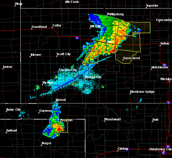 At 1127 pm cdt, severe thunderstorms were located along a line extending from 3 miles southeast of cedar bluff to 7 miles southwest of ness city, moving east at 30 mph (radar indicated). Hazards include 60 mph wind gusts and nickel size hail. Expect damage to roofs, siding, and trees. Locations impacted include, ness city, bazine and brownell. At 1127 pm cdt, severe thunderstorms were located along a line extending from 3 miles southeast of cedar bluff to 7 miles southwest of ness city, moving east at 30 mph (radar indicated). Hazards include 60 mph wind gusts and nickel size hail. Expect damage to roofs, siding, and trees. Locations impacted include, ness city, bazine and brownell.
|
| 6/30/2018 11:06 PM CDT |
 At 1106 pm cdt, severe thunderstorms were located along a line extending from 7 miles north of arnold to 6 miles south of alamota, moving northeast at 30 mph (radar indicated). Hazards include 60 mph wind gusts and nickel size hail. Expect damage to roofs, siding, and trees. Locations impacted include, ness city, bazine, ransom, utica, alamota, brownell, beeler and arnold. At 1106 pm cdt, severe thunderstorms were located along a line extending from 7 miles north of arnold to 6 miles south of alamota, moving northeast at 30 mph (radar indicated). Hazards include 60 mph wind gusts and nickel size hail. Expect damage to roofs, siding, and trees. Locations impacted include, ness city, bazine, ransom, utica, alamota, brownell, beeler and arnold.
|
| 6/30/2018 10:42 PM CDT |
 At 1042 pm cdt, severe thunderstorms were located along a line extending from 5 miles northeast of pendennis to 11 miles south of dighton, moving east at 35 mph (radar indicated). Hazards include 60 mph wind gusts and nickel size hail. expect damage to roofs, siding, and trees At 1042 pm cdt, severe thunderstorms were located along a line extending from 5 miles northeast of pendennis to 11 miles south of dighton, moving east at 35 mph (radar indicated). Hazards include 60 mph wind gusts and nickel size hail. expect damage to roofs, siding, and trees
|
| 6/23/2018 10:42 PM CDT |
 At 1042 pm cdt, severe thunderstorms were located along a line extending from near ness city to 8 miles north of dodge city to 3 miles north of the haggard elev, moving east at 40 mph (radar indicated). Hazards include 70 mph wind gusts and nickel size hail. Expect considerable tree damage. Damage is likely to mobile homes, roofs, and outbuildings. At 1042 pm cdt, severe thunderstorms were located along a line extending from near ness city to 8 miles north of dodge city to 3 miles north of the haggard elev, moving east at 40 mph (radar indicated). Hazards include 70 mph wind gusts and nickel size hail. Expect considerable tree damage. Damage is likely to mobile homes, roofs, and outbuildings.
|
| 6/22/2018 6:09 PM CDT |
 At 608 pm cdt, severe thunderstorms were located along a line extending from 3 miles east of ness city to 9 miles north of charleston, moving southeast at 45 mph (radar indicated). Hazards include 70 mph wind gusts and quarter size hail. Hail damage to vehicles is expected. expect considerable tree damage. wind damage is also likely to mobile homes, roofs, and outbuildings. Locations impacted include, cimarron, ness city, jetmore, kalvesta and beeler. At 608 pm cdt, severe thunderstorms were located along a line extending from 3 miles east of ness city to 9 miles north of charleston, moving southeast at 45 mph (radar indicated). Hazards include 70 mph wind gusts and quarter size hail. Hail damage to vehicles is expected. expect considerable tree damage. wind damage is also likely to mobile homes, roofs, and outbuildings. Locations impacted include, cimarron, ness city, jetmore, kalvesta and beeler.
|
| 6/22/2018 5:44 PM CDT |
 At 543 pm cdt, severe thunderstorms were located along a line extending from 2 miles southwest of utica to 7 miles east of friend, moving southeast at 50 mph (radar indicated). Hazards include 70 mph wind gusts and half dollar size hail. Hail damage to vehicles is expected. expect considerable tree damage. wind damage is also likely to mobile homes, roofs, and outbuildings. This warning extends the previous warning which was in effect for portions of scott, lane, and ness county. At 543 pm cdt, severe thunderstorms were located along a line extending from 2 miles southwest of utica to 7 miles east of friend, moving southeast at 50 mph (radar indicated). Hazards include 70 mph wind gusts and half dollar size hail. Hail damage to vehicles is expected. expect considerable tree damage. wind damage is also likely to mobile homes, roofs, and outbuildings. This warning extends the previous warning which was in effect for portions of scott, lane, and ness county.
|
| 6/19/2018 10:31 PM CDT |
 At 1030 pm cdt, severe thunderstorms were located along a line extending from 2 miles northwest of ransom to 7 miles west of jetmore to near ensign, moving east at 50 mph (radar indicated). Hazards include 70 mph wind gusts and penny size hail. Expect considerable tree damage. Damage is likely to mobile homes, roofs, and outbuildings. At 1030 pm cdt, severe thunderstorms were located along a line extending from 2 miles northwest of ransom to 7 miles west of jetmore to near ensign, moving east at 50 mph (radar indicated). Hazards include 70 mph wind gusts and penny size hail. Expect considerable tree damage. Damage is likely to mobile homes, roofs, and outbuildings.
|
| 6/19/2018 10:17 PM CDT |
 At 1016 pm cdt, the leading edge of severe thunderstorms were located along a line extending from 4 miles north of jetmore to 3 miles west of howell to 3 miles north of satanta, moving south at 55 mph (radar indicated). Hazards include 70 mph wind gusts and penny size hail. Expect considerable tree damage. damage is likely to mobile homes, roofs, and outbuildings. Locations impacted include, dodge city, cimarron, sublette, ness city, montezuma, jetmore, pierceville, copeland, ingalls, ransom, ensign, charleston, howell, beeler, plymell, arnold and kalvesta. At 1016 pm cdt, the leading edge of severe thunderstorms were located along a line extending from 4 miles north of jetmore to 3 miles west of howell to 3 miles north of satanta, moving south at 55 mph (radar indicated). Hazards include 70 mph wind gusts and penny size hail. Expect considerable tree damage. damage is likely to mobile homes, roofs, and outbuildings. Locations impacted include, dodge city, cimarron, sublette, ness city, montezuma, jetmore, pierceville, copeland, ingalls, ransom, ensign, charleston, howell, beeler, plymell, arnold and kalvesta.
|
| 6/19/2018 9:51 PM CDT |
 At 949 pm cdt, severe thunderstorms were located along a line extending from 2 miles northeast of arnold to 4 miles northwest of kalvesta to 11 miles southwest of plymell, moving southeast at 40 mph (radar indicated and winds measured by automated weather stations). Hazards include 70 mph wind gusts and penny size hail. Expect considerable tree damage. damage is likely to mobile homes, roofs, and outbuildings. locations impacted include, dodge city, garden city, cimarron, holcomb, sublette, ness city, dighton, montezuma, jetmore, pierceville, copeland, ingalls, ransom, ensign, utica, alamota, charleston, howell, shields and beeler. At 935 pm cdt, a 65 mph wind gust was measured by a mesonet station in garden city. At 949 pm cdt, severe thunderstorms were located along a line extending from 2 miles northeast of arnold to 4 miles northwest of kalvesta to 11 miles southwest of plymell, moving southeast at 40 mph (radar indicated and winds measured by automated weather stations). Hazards include 70 mph wind gusts and penny size hail. Expect considerable tree damage. damage is likely to mobile homes, roofs, and outbuildings. locations impacted include, dodge city, garden city, cimarron, holcomb, sublette, ness city, dighton, montezuma, jetmore, pierceville, copeland, ingalls, ransom, ensign, utica, alamota, charleston, howell, shields and beeler. At 935 pm cdt, a 65 mph wind gust was measured by a mesonet station in garden city.
|
| 6/19/2018 9:25 PM CDT |
 At 924 pm cdt, the leading edge of severe thunderstorms were located along a line extending from 5 miles north of shields to 15 miles southeast of friend to 2 miles southeast of lakin, moving southeast at 55 mph (radar indicated and measured winds from automated weather stations). Hazards include 70 mph wind gusts and penny size hail. Expect considerable tree damage. Damage is likely to mobile homes, roofs, and outbuildings. At 924 pm cdt, the leading edge of severe thunderstorms were located along a line extending from 5 miles north of shields to 15 miles southeast of friend to 2 miles southeast of lakin, moving southeast at 55 mph (radar indicated and measured winds from automated weather stations). Hazards include 70 mph wind gusts and penny size hail. Expect considerable tree damage. Damage is likely to mobile homes, roofs, and outbuildings.
|
| 6/7/2018 2:53 AM CDT |
 At 253 am cdt, severe thunderstorms were located along a line extending from 4 miles north of cedar bluff to 9 miles south of bazine, moving east at 15 mph (radar indicated). Hazards include 70 mph wind gusts and quarter size hail. Hail damage to vehicles is expected. expect considerable tree damage. wind damage is also likely to mobile homes, roofs, and outbuildings. Locations impacted include, hays, ellis, wakeeney, ness city, la crosse, bazine, catherine, ransom, bison, schoenchen, mccracken, ogallah, rush center, liebenthal, timken, alexander, brownell, yocemento, nekoma and hargrave. At 253 am cdt, severe thunderstorms were located along a line extending from 4 miles north of cedar bluff to 9 miles south of bazine, moving east at 15 mph (radar indicated). Hazards include 70 mph wind gusts and quarter size hail. Hail damage to vehicles is expected. expect considerable tree damage. wind damage is also likely to mobile homes, roofs, and outbuildings. Locations impacted include, hays, ellis, wakeeney, ness city, la crosse, bazine, catherine, ransom, bison, schoenchen, mccracken, ogallah, rush center, liebenthal, timken, alexander, brownell, yocemento, nekoma and hargrave.
|
| 6/7/2018 2:24 AM CDT |
 At 224 am cdt, severe thunderstorms were located along a line extending from 4 miles southeast of trego center to 12 miles south of ness city, moving east at 10 mph (radar indicated). Hazards include 70 mph wind gusts and quarter size hail. Hail damage to vehicles is expected. expect considerable tree damage. Wind damage is also likely to mobile homes, roofs, and outbuildings. At 224 am cdt, severe thunderstorms were located along a line extending from 4 miles southeast of trego center to 12 miles south of ness city, moving east at 10 mph (radar indicated). Hazards include 70 mph wind gusts and quarter size hail. Hail damage to vehicles is expected. expect considerable tree damage. Wind damage is also likely to mobile homes, roofs, and outbuildings.
|
| 5/28/2018 8:23 PM CDT |
 The severe thunderstorm warning for northeastern finney, ness, northern hodgeman, southern trego, northwestern pawnee, lane, rush and southwestern ellis counties will expire at 830 pm cdt, the storms which prompted the warning have moved out of the area. therefore the warning will be allowed to expire. however small hail, gusty winds and heavy rain are still possible with these thunderstorms. a tornado watch remains in effect until 1000 pm cdt for central and west central kansas. a severe thunderstorm watch remains in effect until 1000 pm cdt for south central and southwestern kansas. The severe thunderstorm warning for northeastern finney, ness, northern hodgeman, southern trego, northwestern pawnee, lane, rush and southwestern ellis counties will expire at 830 pm cdt, the storms which prompted the warning have moved out of the area. therefore the warning will be allowed to expire. however small hail, gusty winds and heavy rain are still possible with these thunderstorms. a tornado watch remains in effect until 1000 pm cdt for central and west central kansas. a severe thunderstorm watch remains in effect until 1000 pm cdt for south central and southwestern kansas.
|
| 5/28/2018 8:22 PM CDT |
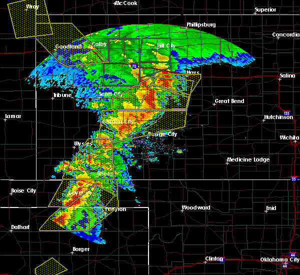 At 822 pm cdt, a severe thunderstorm was located 4 miles east of ness city, moving east at 25 mph (radar indicated). Hazards include 70 mph wind gusts and quarter size hail. Hail damage to vehicles is expected. expect considerable tree damage. Wind damage is also likely to mobile homes, roofs, and outbuildings. At 822 pm cdt, a severe thunderstorm was located 4 miles east of ness city, moving east at 25 mph (radar indicated). Hazards include 70 mph wind gusts and quarter size hail. Hail damage to vehicles is expected. expect considerable tree damage. Wind damage is also likely to mobile homes, roofs, and outbuildings.
|
| 5/28/2018 7:47 PM CDT |
 At 747 pm cdt, severe thunderstorms were located along a line extending from 2 miles northwest of cedar bluff to 14 miles south of dighton, moving east at 50 mph (radar indicated). Hazards include 70 mph wind gusts and quarter size hail. Hail damage to vehicles is expected. expect considerable tree damage. wind damage is also likely to mobile homes, roofs, and outbuildings. locations impacted include, ness city, la crosse, dighton, bazine, ransom, schoenchen, mccracken, rush center, utica, liebenthal, alamota, alexander, brownell, cedar bluff, beeler, pendennis, amy, arnold, nekoma and hargrave. A tornado watch remains in effect until 1000 pm cdt for central and west central kansas. At 747 pm cdt, severe thunderstorms were located along a line extending from 2 miles northwest of cedar bluff to 14 miles south of dighton, moving east at 50 mph (radar indicated). Hazards include 70 mph wind gusts and quarter size hail. Hail damage to vehicles is expected. expect considerable tree damage. wind damage is also likely to mobile homes, roofs, and outbuildings. locations impacted include, ness city, la crosse, dighton, bazine, ransom, schoenchen, mccracken, rush center, utica, liebenthal, alamota, alexander, brownell, cedar bluff, beeler, pendennis, amy, arnold, nekoma and hargrave. A tornado watch remains in effect until 1000 pm cdt for central and west central kansas.
|
| 5/28/2018 7:37 PM CDT |
 At 736 pm cdt, severe thunderstorms were located along a line extending from 5 miles southwest of trego center to 14 miles south of amy, moving east at 50 mph (radar indicated). Hazards include 60 mph wind gusts and quarter size hail. Hail damage to vehicles is expected. Expect wind damage to roofs, siding, and trees. At 736 pm cdt, severe thunderstorms were located along a line extending from 5 miles southwest of trego center to 14 miles south of amy, moving east at 50 mph (radar indicated). Hazards include 60 mph wind gusts and quarter size hail. Hail damage to vehicles is expected. Expect wind damage to roofs, siding, and trees.
|
| 5/28/2018 7:19 PM CDT |
 At 718 pm cdt, severe thunderstorms were located along a line extending from 11 miles south of amy to 9 miles north of charleston, moving northeast at 45 mph. these are very dangerous storms (radar indicated). Hazards include 80 mph wind gusts and half dollar size hail. Flying debris will be dangerous to those caught without shelter. mobile homes will be heavily damaged. expect considerable damage to roofs, windows, and vehicles. extensive tree damage and power outages are likely. locations impacted include, ness city. A tornado watch remains in effect until 1000 pm cdt for west central kansas. At 718 pm cdt, severe thunderstorms were located along a line extending from 11 miles south of amy to 9 miles north of charleston, moving northeast at 45 mph. these are very dangerous storms (radar indicated). Hazards include 80 mph wind gusts and half dollar size hail. Flying debris will be dangerous to those caught without shelter. mobile homes will be heavily damaged. expect considerable damage to roofs, windows, and vehicles. extensive tree damage and power outages are likely. locations impacted include, ness city. A tornado watch remains in effect until 1000 pm cdt for west central kansas.
|
| 5/28/2018 7:05 PM CDT |
 At 704 pm cdt, severe thunderstorms were located along a line extending from 5 miles east of friend to 5 miles southeast of garden city, moving east at 40 mph (radar indicated). Hazards include 70 mph wind gusts and half dollar size hail. Hail damage to vehicles is expected. expect considerable tree damage. Wind damage is also likely to mobile homes, roofs, and outbuildings. At 704 pm cdt, severe thunderstorms were located along a line extending from 5 miles east of friend to 5 miles southeast of garden city, moving east at 40 mph (radar indicated). Hazards include 70 mph wind gusts and half dollar size hail. Hail damage to vehicles is expected. expect considerable tree damage. Wind damage is also likely to mobile homes, roofs, and outbuildings.
|
| 5/14/2018 10:28 PM CDT |
 The severe thunderstorm warning for southern ness, hodgeman, northwestern pawnee and southwestern rush counties will expire at 1030 pm cdt, the storm which prompted the warning has moved out of the area. therefore the warning will be allowed to expire. however small hail, gusty winds and heavy rain are still possible with this thunderstorm. The severe thunderstorm warning for southern ness, hodgeman, northwestern pawnee and southwestern rush counties will expire at 1030 pm cdt, the storm which prompted the warning has moved out of the area. therefore the warning will be allowed to expire. however small hail, gusty winds and heavy rain are still possible with this thunderstorm.
|
| 5/14/2018 10:02 PM CDT |
 At 959 pm cdt, one severe thunderstorm was located 11 miles northwest of gray and a second severe thunderstorm was located 5 miles east of kalvesta. both storms were moving east at 40 mph. this is a very dangerous storm (radar indicated). Hazards include 80 mph wind gusts and tennis ball size hail. Flying debris will be dangerous to those caught without shelter. mobile homes will be heavily damaged. expect considerable damage to roofs, windows, and vehicles. extensive tree damage and power outages are likely. Locations impacted include, gray, ness city, jetmore, bazine, burdett, hanston, rush center, alexander and nekoma. At 959 pm cdt, one severe thunderstorm was located 11 miles northwest of gray and a second severe thunderstorm was located 5 miles east of kalvesta. both storms were moving east at 40 mph. this is a very dangerous storm (radar indicated). Hazards include 80 mph wind gusts and tennis ball size hail. Flying debris will be dangerous to those caught without shelter. mobile homes will be heavily damaged. expect considerable damage to roofs, windows, and vehicles. extensive tree damage and power outages are likely. Locations impacted include, gray, ness city, jetmore, bazine, burdett, hanston, rush center, alexander and nekoma.
|
| 5/14/2018 9:45 PM CDT | 70 plus mph reported on road by empoye in ness county KS, 12.6 miles N of Ness City, KS |
| 5/14/2018 9:40 PM CDT | Hen Egg sized hail reported 10.3 miles NNE of Ness City, KS, 2 inch hail. |
| 5/14/2018 9:38 PM CDT | Ping Pong Ball sized hail reported 11.5 miles NE of Ness City, KS, 1.5 incher. |
| 5/14/2018 9:30 PM CDT |
 At 929 pm cdt, one severe thunderstorm was located 6 miles southeast of beeler. a second severe thunderstorm was located 5 miles west of friend. both storms were moving east at 45 mph. this is a very dangerous storm (radar indicated). Hazards include 80 mph wind gusts and baseball size hail. Flying debris will be dangerous to those caught without shelter. mobile homes will be heavily damaged. expect considerable damage to roofs, windows, and vehicles. Extensive tree damage and power outages are likely. At 929 pm cdt, one severe thunderstorm was located 6 miles southeast of beeler. a second severe thunderstorm was located 5 miles west of friend. both storms were moving east at 45 mph. this is a very dangerous storm (radar indicated). Hazards include 80 mph wind gusts and baseball size hail. Flying debris will be dangerous to those caught without shelter. mobile homes will be heavily damaged. expect considerable damage to roofs, windows, and vehicles. Extensive tree damage and power outages are likely.
|
| 5/13/2018 7:35 PM CDT |
 At 735 pm cdt, a severe thunderstorm was located near ness city, moving north at 20 mph (radar indicated). Hazards include two inch hail and 70 mph wind gusts. People and animals outdoors will be injured. expect hail damage to roofs, siding, windows, and vehicles. expect considerable tree damage. Wind damage is also likely to mobile homes, roofs, and outbuildings. At 735 pm cdt, a severe thunderstorm was located near ness city, moving north at 20 mph (radar indicated). Hazards include two inch hail and 70 mph wind gusts. People and animals outdoors will be injured. expect hail damage to roofs, siding, windows, and vehicles. expect considerable tree damage. Wind damage is also likely to mobile homes, roofs, and outbuildings.
|
| 10/6/2017 6:01 PM CDT | Quarter sized hail reported 15.2 miles NW of Ness City, KS, quarter sized. |
| 6/15/2017 6:35 PM CDT |
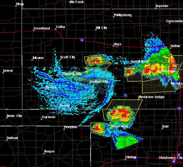 The severe thunderstorm warning for central ness and southwestern rush counties will expire at 645 pm cdt, the storm which prompted the warning has moved out of the area. therefore the warning will be allowed to expire. a severe thunderstorm watch remains in effect until 700 pm cdt for central and west central kansas. The severe thunderstorm warning for central ness and southwestern rush counties will expire at 645 pm cdt, the storm which prompted the warning has moved out of the area. therefore the warning will be allowed to expire. a severe thunderstorm watch remains in effect until 700 pm cdt for central and west central kansas.
|
| 6/15/2017 6:28 PM CDT | Quarter sized hail reported 0.6 miles SSW of Ness City, KS |
| 6/15/2017 6:28 PM CDT |
 At 628 pm cdt, a severe thunderstorm was located very near ness city, moving southeast at 25 mph (radar indicated). Hazards include 60 mph wind gusts and half dollar size hail. Hail damage to vehicles is expected. Expect wind damage to roofs, siding, and trees. At 628 pm cdt, a severe thunderstorm was located very near ness city, moving southeast at 25 mph (radar indicated). Hazards include 60 mph wind gusts and half dollar size hail. Hail damage to vehicles is expected. Expect wind damage to roofs, siding, and trees.
|
| 6/15/2017 6:25 PM CDT | Golf Ball sized hail reported 0.3 miles NE of Ness City, KS, mostly quarters with a few golf ball. |
| 6/15/2017 6:08 PM CDT |
 At 608 pm cdt, a severe thunderstorm was located 6 miles northwest of bazine, or 8 miles northeast of ness city, moving southeast at 15 mph (radar indicated). Hazards include 60 mph wind gusts and quarter size hail. Hail damage to vehicles is expected. expect wind damage to roofs, siding, and trees. Locations impacted include, ness city, bazine, alexander and the laird elevator. At 608 pm cdt, a severe thunderstorm was located 6 miles northwest of bazine, or 8 miles northeast of ness city, moving southeast at 15 mph (radar indicated). Hazards include 60 mph wind gusts and quarter size hail. Hail damage to vehicles is expected. expect wind damage to roofs, siding, and trees. Locations impacted include, ness city, bazine, alexander and the laird elevator.
|
| 6/15/2017 5:43 PM CDT |
 At 542 pm cdt, a severe thunderstorm was located 3 miles southeast of ransom, or 10 miles north of ness city, moving southeast at 25 mph (radar indicated). Hazards include 60 mph wind gusts and quarter size hail. Hail damage to vehicles is expected. Expect wind damage to roofs, siding, and trees. At 542 pm cdt, a severe thunderstorm was located 3 miles southeast of ransom, or 10 miles north of ness city, moving southeast at 25 mph (radar indicated). Hazards include 60 mph wind gusts and quarter size hail. Hail damage to vehicles is expected. Expect wind damage to roofs, siding, and trees.
|
| 5/25/2017 8:28 PM CDT |
 At 827 pm cdt, a severe thunderstorm was located 3 miles east of cedar bluff reservoir, or 18 miles southeast of wakeeney, moving east at 45 mph (radar indicated). Hazards include golf ball size hail and 70 mph wind gusts. People and animals outdoors will be injured. expect hail damage to roofs, siding, windows, and vehicles. expect considerable tree damage. Wind damage is also likely to mobile homes, roofs, and outbuildings. At 827 pm cdt, a severe thunderstorm was located 3 miles east of cedar bluff reservoir, or 18 miles southeast of wakeeney, moving east at 45 mph (radar indicated). Hazards include golf ball size hail and 70 mph wind gusts. People and animals outdoors will be injured. expect hail damage to roofs, siding, windows, and vehicles. expect considerable tree damage. Wind damage is also likely to mobile homes, roofs, and outbuildings.
|
| 5/16/2017 8:22 PM CDT |
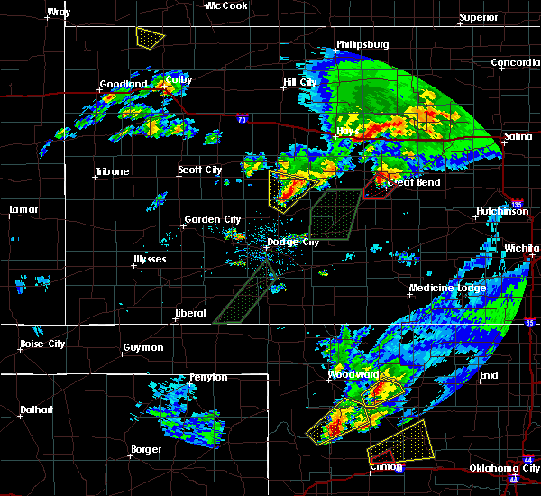 At 821 pm cdt, a severe thunderstorm was located 12 miles north of jetmore, moving north at 25 mph (radar indicated). Hazards include 60 mph wind gusts and half dollar size hail. Hail damage to vehicles is expected. expect wind damage to roofs, siding, and trees. locations impacted include, ness city and bazine. A tornado watch remains in effect until 1000 pm cdt for south central, central, southwestern and west central kansas. At 821 pm cdt, a severe thunderstorm was located 12 miles north of jetmore, moving north at 25 mph (radar indicated). Hazards include 60 mph wind gusts and half dollar size hail. Hail damage to vehicles is expected. expect wind damage to roofs, siding, and trees. locations impacted include, ness city and bazine. A tornado watch remains in effect until 1000 pm cdt for south central, central, southwestern and west central kansas.
|
| 5/16/2017 8:14 PM CDT |
 At 814 pm cdt, a severe thunderstorm was located 9 miles north of jetmore, moving north at 25 mph (radar indicated). Hazards include 60 mph wind gusts and quarter size hail. Hail damage to vehicles is expected. Expect wind damage to roofs, siding, and trees. At 814 pm cdt, a severe thunderstorm was located 9 miles north of jetmore, moving north at 25 mph (radar indicated). Hazards include 60 mph wind gusts and quarter size hail. Hail damage to vehicles is expected. Expect wind damage to roofs, siding, and trees.
|
| 5/16/2017 5:22 PM CDT |
 The severe thunderstorm warning for central ness and northeastern lane counties will expire at 530 pm cdt, the storm which prompted the warning has weakened below severe limits, and no longer poses an immediate threat to life or property. therefore the warning will be allowed to expire. however small hail and gusty winds are still possible with this thunderstorm. a tornado watch remains in effect until 1000 pm cdt for west central kansas. The severe thunderstorm warning for central ness and northeastern lane counties will expire at 530 pm cdt, the storm which prompted the warning has weakened below severe limits, and no longer poses an immediate threat to life or property. therefore the warning will be allowed to expire. however small hail and gusty winds are still possible with this thunderstorm. a tornado watch remains in effect until 1000 pm cdt for west central kansas.
|
| 5/16/2017 5:02 PM CDT |
 At 502 pm cdt, a severe thunderstorm was located 5 miles south of brownell, or 10 miles northeast of ness city, moving north at 35 mph (radar indicated). Hazards include 60 mph wind gusts and quarter size hail. Hail damage to vehicles is expected. expect wind damage to roofs, siding, and trees. locations impacted include, ness city, dighton, ransom, utica, alamota, arnold, brownell, shields, beeler, pendennis and the laird elevator. A tornado watch remains in effect until 1000 pm cdt for west central kansas. At 502 pm cdt, a severe thunderstorm was located 5 miles south of brownell, or 10 miles northeast of ness city, moving north at 35 mph (radar indicated). Hazards include 60 mph wind gusts and quarter size hail. Hail damage to vehicles is expected. expect wind damage to roofs, siding, and trees. locations impacted include, ness city, dighton, ransom, utica, alamota, arnold, brownell, shields, beeler, pendennis and the laird elevator. A tornado watch remains in effect until 1000 pm cdt for west central kansas.
|
| 5/16/2017 4:40 PM CDT |
 At 440 pm cdt, a severe thunderstorm was located 5 miles southeast of pendennis, or 13 miles northeast of dighton, moving north at 35 mph (radar indicated). Hazards include two inch hail and 60 mph wind gusts. People and animals outdoors will be injured. expect hail damage to roofs, siding, windows, and vehicles. Expect wind damage to roofs, siding, and trees. At 440 pm cdt, a severe thunderstorm was located 5 miles southeast of pendennis, or 13 miles northeast of dighton, moving north at 35 mph (radar indicated). Hazards include two inch hail and 60 mph wind gusts. People and animals outdoors will be injured. expect hail damage to roofs, siding, windows, and vehicles. Expect wind damage to roofs, siding, and trees.
|
| 5/16/2017 4:34 PM CDT |
 At 434 pm cdt, a severe thunderstorm was located very near arnold, or 13 miles northwest of ness city, moving north at 55 mph (radar indicated). Hazards include tennis ball size hail and 60 mph wind gusts. People and animals outdoors will be injured. expect hail damage to roofs, siding, windows, and vehicles. expect wind damage to roofs, siding, and trees. locations impacted include, ness city, ransom, utica, alamota, arnold, beeler, pendennis and the laird elevator. A tornado watch remains in effect until 1000 pm cdt for west central kansas. At 434 pm cdt, a severe thunderstorm was located very near arnold, or 13 miles northwest of ness city, moving north at 55 mph (radar indicated). Hazards include tennis ball size hail and 60 mph wind gusts. People and animals outdoors will be injured. expect hail damage to roofs, siding, windows, and vehicles. expect wind damage to roofs, siding, and trees. locations impacted include, ness city, ransom, utica, alamota, arnold, beeler, pendennis and the laird elevator. A tornado watch remains in effect until 1000 pm cdt for west central kansas.
|
| 5/16/2017 4:22 PM CDT |
 At 422 pm cdt, a severe thunderstorm was located 3 miles east of utica, or 17 miles northwest of ness city, moving north at 45 mph (radar indicated). Hazards include tennis ball size hail and 60 mph wind gusts. People and animals outdoors will be injured. expect hail damage to roofs, siding, windows, and vehicles. expect wind damage to roofs, siding, and trees. locations impacted include, ness city, ransom, utica, alamota, arnold, beeler, pendennis and the laird elevator. A tornado watch remains in effect until 1000 pm cdt for west central kansas. At 422 pm cdt, a severe thunderstorm was located 3 miles east of utica, or 17 miles northwest of ness city, moving north at 45 mph (radar indicated). Hazards include tennis ball size hail and 60 mph wind gusts. People and animals outdoors will be injured. expect hail damage to roofs, siding, windows, and vehicles. expect wind damage to roofs, siding, and trees. locations impacted include, ness city, ransom, utica, alamota, arnold, beeler, pendennis and the laird elevator. A tornado watch remains in effect until 1000 pm cdt for west central kansas.
|
| 5/16/2017 3:54 PM CDT | Quarter sized hail reported 15.9 miles ENE of Ness City, KS |
| 5/16/2017 3:54 PM CDT |
 At 353 pm cdt, a severe thunderstorm was located 10 miles south of beeler, or 19 miles southeast of dighton, moving north at 40 mph (radar indicated). Hazards include golf ball size hail and 60 mph wind gusts. People and animals outdoors will be injured. expect hail damage to roofs, siding, windows, and vehicles. Expect wind damage to roofs, siding, and trees. At 353 pm cdt, a severe thunderstorm was located 10 miles south of beeler, or 19 miles southeast of dighton, moving north at 40 mph (radar indicated). Hazards include golf ball size hail and 60 mph wind gusts. People and animals outdoors will be injured. expect hail damage to roofs, siding, windows, and vehicles. Expect wind damage to roofs, siding, and trees.
|
| 4/12/2017 6:01 PM CDT |
 At 601 pm cdt, severe thunderstorms were located along a line extending from 6 miles southwest of grigston to 2 miles southeast of arnold, moving east at 20 mph (radar indicated). Hazards include 60 mph wind gusts and quarter size hail. Hail damage to vehicles is expected. Expect wind damage to roofs, siding, and trees. At 601 pm cdt, severe thunderstorms were located along a line extending from 6 miles southwest of grigston to 2 miles southeast of arnold, moving east at 20 mph (radar indicated). Hazards include 60 mph wind gusts and quarter size hail. Hail damage to vehicles is expected. Expect wind damage to roofs, siding, and trees.
|
| 3/24/2017 1:28 AM CDT |
 At 127 am cdt, a severe thunderstorm was located very near hanston, or 8 miles east of jetmore, moving northeast at 45 mph (radar indicated). Hazards include 60 mph wind gusts. Expect damage to roofs, siding, and trees. Locations impacted include, ness city, bazine, mccracken, alexander, gray and the laird elevator. At 127 am cdt, a severe thunderstorm was located very near hanston, or 8 miles east of jetmore, moving northeast at 45 mph (radar indicated). Hazards include 60 mph wind gusts. Expect damage to roofs, siding, and trees. Locations impacted include, ness city, bazine, mccracken, alexander, gray and the laird elevator.
|
| 3/24/2017 1:13 AM CDT |
 At 112 am cdt, a severe thunderstorm was located 8 miles northwest of spearville, or 9 miles south of jetmore, moving northeast at 45 mph (radar indicated). Hazards include 60 mph wind gusts. expect damage to roofs, siding, and trees At 112 am cdt, a severe thunderstorm was located 8 miles northwest of spearville, or 9 miles south of jetmore, moving northeast at 45 mph (radar indicated). Hazards include 60 mph wind gusts. expect damage to roofs, siding, and trees
|
| 7/13/2016 5:42 AM CDT |
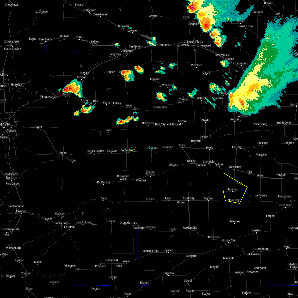 The severe thunderstorm warning for southern trego and northern ness counties will expire at 545 am cdt, the storm which prompted the warning has moved out of the area. therefore, the warning will be allowed to expire. a severe thunderstorm watch remains in effect until 1000 am cdt for west central kansas. The severe thunderstorm warning for southern trego and northern ness counties will expire at 545 am cdt, the storm which prompted the warning has moved out of the area. therefore, the warning will be allowed to expire. a severe thunderstorm watch remains in effect until 1000 am cdt for west central kansas.
|
| 7/13/2016 5:17 AM CDT |
 At 517 am cdt, a severe thunderstorm was located 8 miles southwest of trego center, moving east at 45 mph (radar indicated). Hazards include 60 mph wind gusts and penny size hail. Expect damage to roofs. siding. and trees. Locations impacted include, ness city, ransom, brownell and arnold. At 517 am cdt, a severe thunderstorm was located 8 miles southwest of trego center, moving east at 45 mph (radar indicated). Hazards include 60 mph wind gusts and penny size hail. Expect damage to roofs. siding. and trees. Locations impacted include, ness city, ransom, brownell and arnold.
|
| 7/13/2016 5:01 AM CDT |
 At 500 am cdt, a severe thunderstorm was located 12 miles north of utica, moving southeast at 40 mph (radar indicated). Hazards include 60 mph wind gusts and nickel size hail. Expect damage to roofs. siding. And trees. At 500 am cdt, a severe thunderstorm was located 12 miles north of utica, moving southeast at 40 mph (radar indicated). Hazards include 60 mph wind gusts and nickel size hail. Expect damage to roofs. siding. And trees.
|
| 7/12/2016 12:07 AM CDT |
 At 1207 am cdt, a severe thunderstorm was located 4 miles east of beeler, moving northeast at 30 mph (radar indicated). Hazards include 60 mph wind gusts and half dollar size hail. Hail damage to vehicles is expected. Expect wind damage to roofs, siding, and trees. At 1207 am cdt, a severe thunderstorm was located 4 miles east of beeler, moving northeast at 30 mph (radar indicated). Hazards include 60 mph wind gusts and half dollar size hail. Hail damage to vehicles is expected. Expect wind damage to roofs, siding, and trees.
|
| 7/5/2016 11:42 PM CDT |
 At 1141 pm cdt, severe thunderstorms were located along a line extending from 2 miles north of rush center to near burdett to 9 miles southeast of kalvesta, moving southeast at 55 mph. these are very dangerous storms (radar indicated). Hazards include 80 mph wind gusts and half dollar size hail. Flying debris will be dangerous to those caught without shelter. mobile homes will be heavily damaged. expect considerable damage to roofs, windows and vehicles. extensive tree damage and power outages are likely. Locations impacted include, gray, kinsley, ness city, la crosse, jetmore, spearville, bazine, bison, burdett, hanston, offerle, mccracken, garfield, rush center, rozel, timken, alexander, ash valley, brownell and bellefont. At 1141 pm cdt, severe thunderstorms were located along a line extending from 2 miles north of rush center to near burdett to 9 miles southeast of kalvesta, moving southeast at 55 mph. these are very dangerous storms (radar indicated). Hazards include 80 mph wind gusts and half dollar size hail. Flying debris will be dangerous to those caught without shelter. mobile homes will be heavily damaged. expect considerable damage to roofs, windows and vehicles. extensive tree damage and power outages are likely. Locations impacted include, gray, kinsley, ness city, la crosse, jetmore, spearville, bazine, bison, burdett, hanston, offerle, mccracken, garfield, rush center, rozel, timken, alexander, ash valley, brownell and bellefont.
|
| 7/5/2016 11:20 PM CDT |
 At 1118 pm cdt, severe thunderstorms were located along a line extending from 6 miles south of brownell to 4 miles northwest of kalvesta, moving southeast at 60 mph. these are very dangerous storms (radar indicated). Hazards include 80 mph wind gusts and half dollar size hail. Flying debris will be dangerous to those caught without shelter. mobile homes will be heavily damaged. expect considerable damage to roofs, windows and vehicles. Extensive tree damage and power outages are likely. At 1118 pm cdt, severe thunderstorms were located along a line extending from 6 miles south of brownell to 4 miles northwest of kalvesta, moving southeast at 60 mph. these are very dangerous storms (radar indicated). Hazards include 80 mph wind gusts and half dollar size hail. Flying debris will be dangerous to those caught without shelter. mobile homes will be heavily damaged. expect considerable damage to roofs, windows and vehicles. Extensive tree damage and power outages are likely.
|
| 7/5/2016 11:19 PM CDT | . in ness county KS, 0.4 miles WNW of Ness City, KS |
| 7/5/2016 11:07 PM CDT |
 At 1107 pm cdt, severe thunderstorms were located along a line extending from 2 miles southeast of ogallah to 3 miles southwest of ransom to 3 miles northwest of alamota, moving southeast at 50 mph (radar indicated). Hazards include 70 mph wind gusts and half dollar size hail. Hail damage to vehicles is expected. expect considerable tree damage. wind damage is also likely to mobile homes, roofs and outbuildings. Locations impacted include, ness city, dighton, bazine, ransom, ogallah, utica, brownell, shields, trego center, pendennis, cedar bluff and arnold. At 1107 pm cdt, severe thunderstorms were located along a line extending from 2 miles southeast of ogallah to 3 miles southwest of ransom to 3 miles northwest of alamota, moving southeast at 50 mph (radar indicated). Hazards include 70 mph wind gusts and half dollar size hail. Hail damage to vehicles is expected. expect considerable tree damage. wind damage is also likely to mobile homes, roofs and outbuildings. Locations impacted include, ness city, dighton, bazine, ransom, ogallah, utica, brownell, shields, trego center, pendennis, cedar bluff and arnold.
|
| 7/5/2016 10:47 PM CDT |
 At 1046 pm cdt, a severe thunderstorm was located 9 miles west of trego center, moving southeast at 30 mph (radar indicated). Hazards include 70 mph wind gusts and half dollar size hail. Hail damage to vehicles is expected. expect considerable tree damage. Wind damage is also likely to mobile homes, roofs and outbuildings. At 1046 pm cdt, a severe thunderstorm was located 9 miles west of trego center, moving southeast at 30 mph (radar indicated). Hazards include 70 mph wind gusts and half dollar size hail. Hail damage to vehicles is expected. expect considerable tree damage. Wind damage is also likely to mobile homes, roofs and outbuildings.
|
| 7/2/2016 4:52 PM CDT |
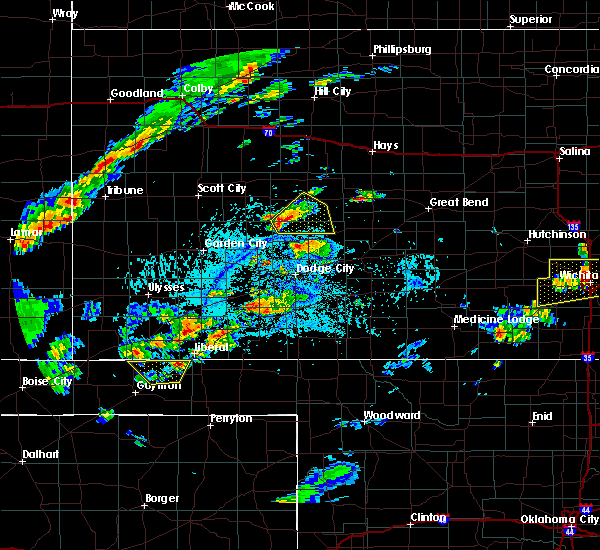 At 452 pm cdt, a severe thunderstorm was located 15 miles northeast of kalvesta, moving northeast at 25 mph (radar indicated). Hazards include ping pong ball size hail and 60 mph wind gusts. People and animals outdoors will be injured. expect hail damage to roofs, siding, windows and vehicles. expect wind damage to roofs, siding and trees. Locations impacted include, ness city. At 452 pm cdt, a severe thunderstorm was located 15 miles northeast of kalvesta, moving northeast at 25 mph (radar indicated). Hazards include ping pong ball size hail and 60 mph wind gusts. People and animals outdoors will be injured. expect hail damage to roofs, siding, windows and vehicles. expect wind damage to roofs, siding and trees. Locations impacted include, ness city.
|
| 7/2/2016 4:39 PM CDT |
 At 438 pm cdt, a severe thunderstorm was located 9 miles north of kalvesta, moving east at 25 mph (radar indicated). Hazards include ping pong ball size hail and 60 mph wind gusts. People and animals outdoors will be injured. expect hail damage to roofs, siding, windows and vehicles. Expect wind damage to roofs, siding and trees. At 438 pm cdt, a severe thunderstorm was located 9 miles north of kalvesta, moving east at 25 mph (radar indicated). Hazards include ping pong ball size hail and 60 mph wind gusts. People and animals outdoors will be injured. expect hail damage to roofs, siding, windows and vehicles. Expect wind damage to roofs, siding and trees.
|
| 6/17/2016 9:39 PM CDT |
 The severe thunderstorm warning for southern trego and eastern ness counties will expire at 945 pm cdt, the storm which prompted the warning has moved out of the area. therefore the warning will be allowed to expire. The severe thunderstorm warning for southern trego and eastern ness counties will expire at 945 pm cdt, the storm which prompted the warning has moved out of the area. therefore the warning will be allowed to expire.
|
| 6/17/2016 9:31 PM CDT |
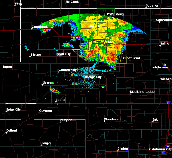 At 931 pm cdt, a severe thunderstorm was located 6 miles southwest of ransom, moving southeast at 20 mph (radar indicated). Hazards include 60 mph wind gusts and quarter size hail. Hail damage to vehicles is expected. expect wind damage to roofs, siding and trees. Locations impacted include, ness city, ransom and brownell. At 931 pm cdt, a severe thunderstorm was located 6 miles southwest of ransom, moving southeast at 20 mph (radar indicated). Hazards include 60 mph wind gusts and quarter size hail. Hail damage to vehicles is expected. expect wind damage to roofs, siding and trees. Locations impacted include, ness city, ransom and brownell.
|
| 6/17/2016 9:12 PM CDT |
 At 912 pm cdt, a severe thunderstorm was located near arnold, moving southeast at 20 mph (radar indicated). Hazards include 60 mph wind gusts and quarter size hail. Hail damage to vehicles is expected. expect wind damage to roofs, siding and trees. Locations impacted include, ness city, ransom, utica, brownell, arnold and pendennis. At 912 pm cdt, a severe thunderstorm was located near arnold, moving southeast at 20 mph (radar indicated). Hazards include 60 mph wind gusts and quarter size hail. Hail damage to vehicles is expected. expect wind damage to roofs, siding and trees. Locations impacted include, ness city, ransom, utica, brownell, arnold and pendennis.
|
| 6/17/2016 8:55 PM CDT |
 At 855 pm cdt, a severe thunderstorm was located very near utica, moving southeast at 20 mph (radar indicated). Hazards include 60 mph wind gusts and quarter size hail. Hail damage to vehicles is expected. Expect wind damage to roofs, siding and trees. At 855 pm cdt, a severe thunderstorm was located very near utica, moving southeast at 20 mph (radar indicated). Hazards include 60 mph wind gusts and quarter size hail. Hail damage to vehicles is expected. Expect wind damage to roofs, siding and trees.
|
| 5/24/2016 7:04 PM CDT | A tornado warning remains in effect until 745 pm cdt for west central rush and eastern ness counties. at 703 pm cdt. a confirmed large and extremely dangerous tornado was located 3 miles south of ness city. moving east at 15 mph. this is a particularly dangerous situation. hazard. Damaging tornado. |
| 5/24/2016 7:03 PM CDT | Storm damage reported in ness county KS, 0.3 miles NE of Ness City, KS |
| 5/24/2016 7:03 PM CDT | Quarter sized hail reported 0.3 miles NE of Ness City, KS |
| 5/8/2016 8:56 PM CDT |
 At 856 pm cdt, a severe thunderstorm was located 4 miles northwest of ness city, moving northeast at 25 mph (radar indicated). Hazards include 60 mph wind gusts and half dollar size hail. Hail damage to vehicles is expected. Expect wind damage to roofs, siding and trees. At 856 pm cdt, a severe thunderstorm was located 4 miles northwest of ness city, moving northeast at 25 mph (radar indicated). Hazards include 60 mph wind gusts and half dollar size hail. Hail damage to vehicles is expected. Expect wind damage to roofs, siding and trees.
|
| 11/16/2015 6:06 PM CST |
 At 605 pm cst, a large and extremely dangerous tornado was located 5 miles south of beeler, moving northeast at 40 mph. this is a particularly dangerous situation (radar indicated rotation). Hazards include damaging tornado. Flying debris will be dangerous to those caught without shelter. mobile homes will be damaged or destroyed. damage to roofs, windows and vehicles will occur. tree damage is likely. Locations impacted include, ness city, utica, beeler and arnold. At 605 pm cst, a large and extremely dangerous tornado was located 5 miles south of beeler, moving northeast at 40 mph. this is a particularly dangerous situation (radar indicated rotation). Hazards include damaging tornado. Flying debris will be dangerous to those caught without shelter. mobile homes will be damaged or destroyed. damage to roofs, windows and vehicles will occur. tree damage is likely. Locations impacted include, ness city, utica, beeler and arnold.
|
| 11/16/2015 5:48 PM CST |
 At 547 pm cst, a severe thunderstorm capable of producing a tornado was located 12 miles north of kalvesta, moving northeast at 40 mph (radar indicated rotation. rural locations of eastern finney and southern lane counties are in the path of this tornado). Hazards include tornado and two inch hail. Flying debris will be dangerous to those caught without shelter. mobile homes will be damaged or destroyed. damage to roofs, windows and vehicles will occur. tree damage is likely. Locations impacted include, ness city, utica, alamota, beeler and arnold. At 547 pm cst, a severe thunderstorm capable of producing a tornado was located 12 miles north of kalvesta, moving northeast at 40 mph (radar indicated rotation. rural locations of eastern finney and southern lane counties are in the path of this tornado). Hazards include tornado and two inch hail. Flying debris will be dangerous to those caught without shelter. mobile homes will be damaged or destroyed. damage to roofs, windows and vehicles will occur. tree damage is likely. Locations impacted include, ness city, utica, alamota, beeler and arnold.
|
| 11/16/2015 5:34 PM CST |
 At 534 pm cst, a severe thunderstorm capable of producing a tornado was located 9 miles northwest of kalvesta, moving northeast at 55 mph (radar indicated rotation). Hazards include tornado and hail up to two inches in diameter. Flying debris will be dangerous to those caught without shelter. mobile homes will be damaged or destroyed. damage to roofs, windows and vehicles will occur. Tree damage is likely. At 534 pm cst, a severe thunderstorm capable of producing a tornado was located 9 miles northwest of kalvesta, moving northeast at 55 mph (radar indicated rotation). Hazards include tornado and hail up to two inches in diameter. Flying debris will be dangerous to those caught without shelter. mobile homes will be damaged or destroyed. damage to roofs, windows and vehicles will occur. Tree damage is likely.
|
| 9/10/2015 7:30 PM CDT |
 At 730 pm cdt, a severe thunderstorm was located 12 miles north of jetmore, moving southeast at 30 mph (radar indicated). Hazards include 70 mph wind gusts and quarter size hail. Hail damage to vehicles is expected. expect considerable tree damage. Wind damage is also likely to mobile homes, roofs and outbuildings. At 730 pm cdt, a severe thunderstorm was located 12 miles north of jetmore, moving southeast at 30 mph (radar indicated). Hazards include 70 mph wind gusts and quarter size hail. Hail damage to vehicles is expected. expect considerable tree damage. Wind damage is also likely to mobile homes, roofs and outbuildings.
|
| 9/10/2015 7:02 PM CDT |
 At 701 pm cdt, a severe thunderstorm was located 5 miles northwest of ness city, moving southeast at 15 mph. this is a very dangerous storm (radar indicated). Hazards include 80 mph wind gusts and quarter size hail. Flying debris will be dangerous to those caught without shelter. mobile homes will be heavily damaged. expect considerable damage to roofs, windows and vehicles. extensive tree damage and power outages are likely. Locations impacted include, ness city, ransom, utica and arnold. At 701 pm cdt, a severe thunderstorm was located 5 miles northwest of ness city, moving southeast at 15 mph. this is a very dangerous storm (radar indicated). Hazards include 80 mph wind gusts and quarter size hail. Flying debris will be dangerous to those caught without shelter. mobile homes will be heavily damaged. expect considerable damage to roofs, windows and vehicles. extensive tree damage and power outages are likely. Locations impacted include, ness city, ransom, utica and arnold.
|
| 9/10/2015 6:42 PM CDT |
 At 642 pm cdt, a severe thunderstorm was located 3 miles southeast of arnold, moving southeast at 15 mph (radar indicated). Hazards include golf ball size hail and 60 mph wind gusts. People and animals outdoors will be injured. expect hail damage to roofs, siding, windows and vehicles. Expect wind damage to roofs, siding and trees. At 642 pm cdt, a severe thunderstorm was located 3 miles southeast of arnold, moving southeast at 15 mph (radar indicated). Hazards include golf ball size hail and 60 mph wind gusts. People and animals outdoors will be injured. expect hail damage to roofs, siding, windows and vehicles. Expect wind damage to roofs, siding and trees.
|
| 8/4/2015 7:28 PM CDT |
 At 727 pm cdt, a severe thunderstorm was located 6 miles north of ransom, moving south at 30 mph (radar indicated). Hazards include two inch hail and 60 mph wind gusts. People and animals outdoors will be injured. expect hail damage to roofs, siding, windows and vehicles. Expect wind damage to roofs, siding and trees. At 727 pm cdt, a severe thunderstorm was located 6 miles north of ransom, moving south at 30 mph (radar indicated). Hazards include two inch hail and 60 mph wind gusts. People and animals outdoors will be injured. expect hail damage to roofs, siding, windows and vehicles. Expect wind damage to roofs, siding and trees.
|
| 7/26/2015 11:24 PM CDT |
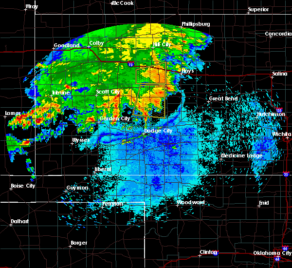 The severe thunderstorm warning for northern hodgeman and ness counties will expire at 1130 pm cdt, the storm which prompted the warning has weakened below severe limits, and no longer pose an immediate threat to life or property. therefore the warning will be allowed to expire. however gusty winds and heavy rain are still possible with this thunderstorm. The severe thunderstorm warning for northern hodgeman and ness counties will expire at 1130 pm cdt, the storm which prompted the warning has weakened below severe limits, and no longer pose an immediate threat to life or property. therefore the warning will be allowed to expire. however gusty winds and heavy rain are still possible with this thunderstorm.
|
| 7/26/2015 11:08 PM CDT |
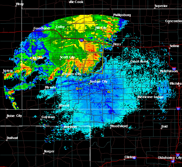 At 1107 pm cdt, a severe thunderstorm was located 3 miles northeast of brownell, moving northeast at 75 mph (radar indicated). Hazards include 60 mph wind gusts and nickel size hail. Expect damage to roofs. siding and trees. Locations impacted include, gray, ness city, jetmore, bazine, ransom, hanston, brownell and arnold. At 1107 pm cdt, a severe thunderstorm was located 3 miles northeast of brownell, moving northeast at 75 mph (radar indicated). Hazards include 60 mph wind gusts and nickel size hail. Expect damage to roofs. siding and trees. Locations impacted include, gray, ness city, jetmore, bazine, ransom, hanston, brownell and arnold.
|
| 7/26/2015 10:41 PM CDT |
 At 1041 pm cdt, severe thunderstorms were located along a line extending from 2 miles west of ransom to 10 miles northeast of kalvesta, moving east at 30 mph (radar indicated). Hazards include 70 mph wind gusts and penny size hail. Expect considerable tree damage. damage is likely to mobile homes, roofs and outbuildings. Locations impacted include, gray, ness city, dighton, jetmore, bazine, ransom, hanston, utica, alamota, brownell, arnold, beeler, shields and pendennis. At 1041 pm cdt, severe thunderstorms were located along a line extending from 2 miles west of ransom to 10 miles northeast of kalvesta, moving east at 30 mph (radar indicated). Hazards include 70 mph wind gusts and penny size hail. Expect considerable tree damage. damage is likely to mobile homes, roofs and outbuildings. Locations impacted include, gray, ness city, dighton, jetmore, bazine, ransom, hanston, utica, alamota, brownell, arnold, beeler, shields and pendennis.
|
| 7/26/2015 10:33 PM CDT | Storm damage reported in ness county KS, 11 miles NE of Ness City, KS |
| 7/26/2015 10:16 PM CDT |
 At 1015 pm cdt, a severe thunderstorm was located 5 miles southwest of alamota, moving east at 40 mph (radar indicated). Hazards include 70 mph wind gusts and nickel size hail. Expect considerable tree damage. Damage is likely to mobile homes, roofs and outbuildings. At 1015 pm cdt, a severe thunderstorm was located 5 miles southwest of alamota, moving east at 40 mph (radar indicated). Hazards include 70 mph wind gusts and nickel size hail. Expect considerable tree damage. Damage is likely to mobile homes, roofs and outbuildings.
|
| 7/19/2015 9:59 PM CDT |
 At 959 pm cdt, severe thunderstorms were located along a line extending from 4 miles northwest of utica to 9 miles south of beeler, moving east at 30 mph (radar indicated). Hazards include 60 mph wind gusts. Expect damage to roofs. Siding and trees. At 959 pm cdt, severe thunderstorms were located along a line extending from 4 miles northwest of utica to 9 miles south of beeler, moving east at 30 mph (radar indicated). Hazards include 60 mph wind gusts. Expect damage to roofs. Siding and trees.
|
| 5/28/2015 6:52 PM CDT | The severe thunderstorm warning for hodgeman, ness, northeastern finney and eastern lane counties will expire at 700 pm cdt, the storm which prompted the warning has weakened below severe limits, and no longer pose an immediate threat to life or property. therefore the warning will be allowed to expire. however gusty winds and heavy rain are still possible with this thunderstorm. |
| 5/28/2015 6:35 PM CDT | Storm damage reported in ness county KS, 0.3 miles NE of Ness City, KS |
| 5/28/2015 6:24 PM CDT | At 624 pm cdt, a severe thunderstorm was located 9 miles southwest of ness city, moving east at 45 mph (radar indicated). Hazards include 60 mph wind gusts and quarter size hail. Hail damage to vehicles is expected. expect wind damage to roofs, siding and trees. Locations impacted include, gray, ness city, dighton, jetmore, bazine, ransom, hanston, utica, alamota, brownell, arnold, beeler and pendennis. |
| 5/28/2015 6:15 PM CDT | Storm damage reported in ness county KS, 10.6 miles NE of Ness City, KS |
| 5/28/2015 5:59 PM CDT | At 559 pm cdt, a severe thunderstorm was located 4 miles southwest of alamota, moving east at 50 mph (radar indicated). Hazards include 60 mph wind gusts and quarter size hail. Hail damage to vehicles is expected. Expect wind damage to roofs, siding and trees. |
| 4/17/2015 7:23 PM CDT | Quarter sized hail reported 0.3 miles NE of Ness City, KS |
| 4/17/2015 7:23 PM CDT | Quarter sized hail reported 8.2 miles SE of Ness City, KS |
| 4/17/2015 7:15 PM CDT | Golf Ball sized hail reported 9.7 miles ESE of Ness City, KS, the hail covered the ground. |
| 4/2/2015 9:55 PM CDT | The national weather service in dodge city has issued a * severe thunderstorm warning for. pawnee county in south central kansas. southern rush county in central kansas. hodgeman county in southwestern kansas. Southeastern ness county in west central kansas. |
| 4/2/2015 8:50 PM CST | Quarter sized hail reported 10 miles E of Ness City, KS |
| 4/2/2015 9:36 PM CDT | A severe thunderstorm warning remains in effect until 1015 pm cdt for southern trego. northwestern rush. northwestern hodgeman. ness. northeastern finney. northeastern gray. southwestern ellis and southeastern lane counties. at 934 pm cdt. Severe thunderstorms were located along a line extending from near arnold to near beeler to 14 miles west of. |
| 4/2/2015 9:20 PM CDT | The national weather service in dodge city has issued a * severe thunderstorm warning for. southern trego county in west central kansas. northwestern rush county in central kansas. northwestern hodgeman county in southwestern kansas. Ness county in west central kansas. |
| 9/23/2014 5:38 PM CDT | Wind gusts estimated to be around 60 to 70 mph west of ness city on highway 9 in ness county KS, 7.3 miles E of Ness City, KS |
| 9/9/2014 9:05 PM CDT | Storm damage reported in ness county KS, 11.9 miles NE of Ness City, KS |
| 7/26/2014 8:20 PM CDT | Storm damage reported in ness county KS, 19.9 miles NE of Ness City, KS |
| 6/29/2014 8:05 AM CDT | Quarter sized hail reported 7.2 miles N of Ness City, KS |
| 6/11/2014 9:51 PM CDT | Storm damage reported in ness county KS, 0.3 miles NE of Ness City, KS |
| 6/11/2014 9:12 PM CDT | Storm damage reported in ness county KS, 0.3 miles NE of Ness City, KS |
| 6/11/2014 9:02 PM CDT | Storm damage reported in ness county KS, 10.2 miles NE of Ness City, KS |
| 8/5/2013 6:23 PM CDT | Storm damage reported in ness county KS, 0.3 miles NE of Ness City, KS |
| 5/8/2013 7:59 PM CDT | Storm damage reported in ness county KS, 11.9 miles NE of Ness City, KS |
| 5/7/2013 7:40 PM CDT | Quarter sized hail reported 1.6 miles NNW of Ness City, KS, the hail was soft |
| 3/30/2013 2:00 AM CDT | Tennis Ball sized hail reported 0.3 miles NE of Ness City, KS, most of the hail was smaller. |
| 9/6/2012 7:50 PM CDT | Quarter sized hail reported 11.5 miles NNE of Ness City, KS |
| 9/6/2012 6:50 PM CDT | Quarter sized hail reported 1.6 miles NNW of Ness City, KS |
| 9/6/2012 6:40 PM CDT | Large hay bales were blown off of a semi trailer on highway 28 in ness county KS, 9.9 miles N of Ness City, KS |
| 9/6/2012 6:15 PM CDT | Golf Ball sized hail reported 9.7 miles ESE of Ness City, KS |
| 6/14/2012 6:45 PM CDT | The report was from near ness cit in ness county KS, 0.3 miles NE of Ness City, KS |
| 5/30/2012 6:03 PM CDT | Hen Egg sized hail reported 11.5 miles NNE of Ness City, KS |
| 5/30/2012 5:57 PM CDT | Golf Ball sized hail reported 10.8 miles NE of Ness City, KS |
| 5/30/2012 4:59 PM CDT | Quarter sized hail reported 12.3 miles NE of Ness City, KS |
| 5/30/2012 4:37 PM CDT | Quarter sized hail reported 15.7 miles W of Ness City, KS |
| 5/27/2012 8:10 PM CDT | Golf Ball sized hail reported 19.6 miles NW of Ness City, KS |
| 5/27/2012 5:57 PM CDT | Quarter sized hail reported 7.2 miles WNW of Ness City, KS |
| 5/26/2012 5:53 PM CDT | A large tree was also blown down and power pole snapped within ness cit in ness county KS, 0.3 miles NE of Ness City, KS |
| 4/14/2012 12:08 PM CDT | Golf Ball sized hail reported 9.7 miles ESE of Ness City, KS |
| 1/1/0001 12:00 AM | The spotter was southbound on highway u.s. 28 in ness county KS, 5 miles N of Ness City, KS |
| 1/1/0001 12:00 AM | Storm damage reported in ness county KS, 11.6 miles E of Ness City, KS |
| 1/1/0001 12:00 AM | Storm damage reported in ness county KS, 15.9 miles ENE of Ness City, KS |
| 1/1/0001 12:00 AM | Storm damage reported in ness county KS, 4.2 miles ENE of Ness City, KS |
| 1/1/0001 12:00 AM | Quarter sized hail reported 1.9 miles ESE of Ness City, KS |
| 1/1/0001 12:00 AM | Ping Pong Ball sized hail reported 6.2 miles SSW of Ness City, KS |
| 5/24/2011 5:20 PM CDT | Baseball sized hail reported 0.3 miles NE of Ness City, KS |
| 1/1/0001 12:00 AM | Baseball sized hail reported 0.8 miles ENE of Ness City, KS |
| 1/1/0001 12:00 AM | Baseball sized hail reported 1.6 miles NNW of Ness City, KS |
| 5/24/2011 4:56 PM CDT | Grapefruit sized hail reported 11.8 miles NE of Ness City, KS, several baseball sized hail stones were reported in addition to a couple that were softball sized. |
Hail Maps for Ness City, KS

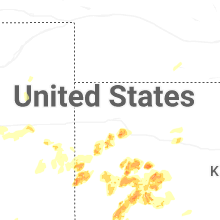


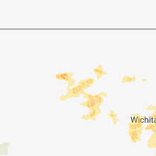


Connect with Interactive Hail Maps