

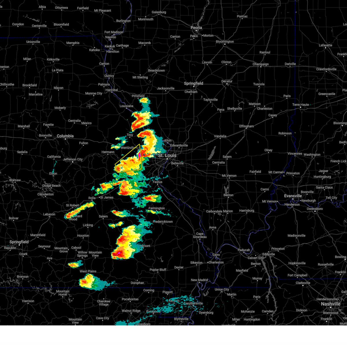
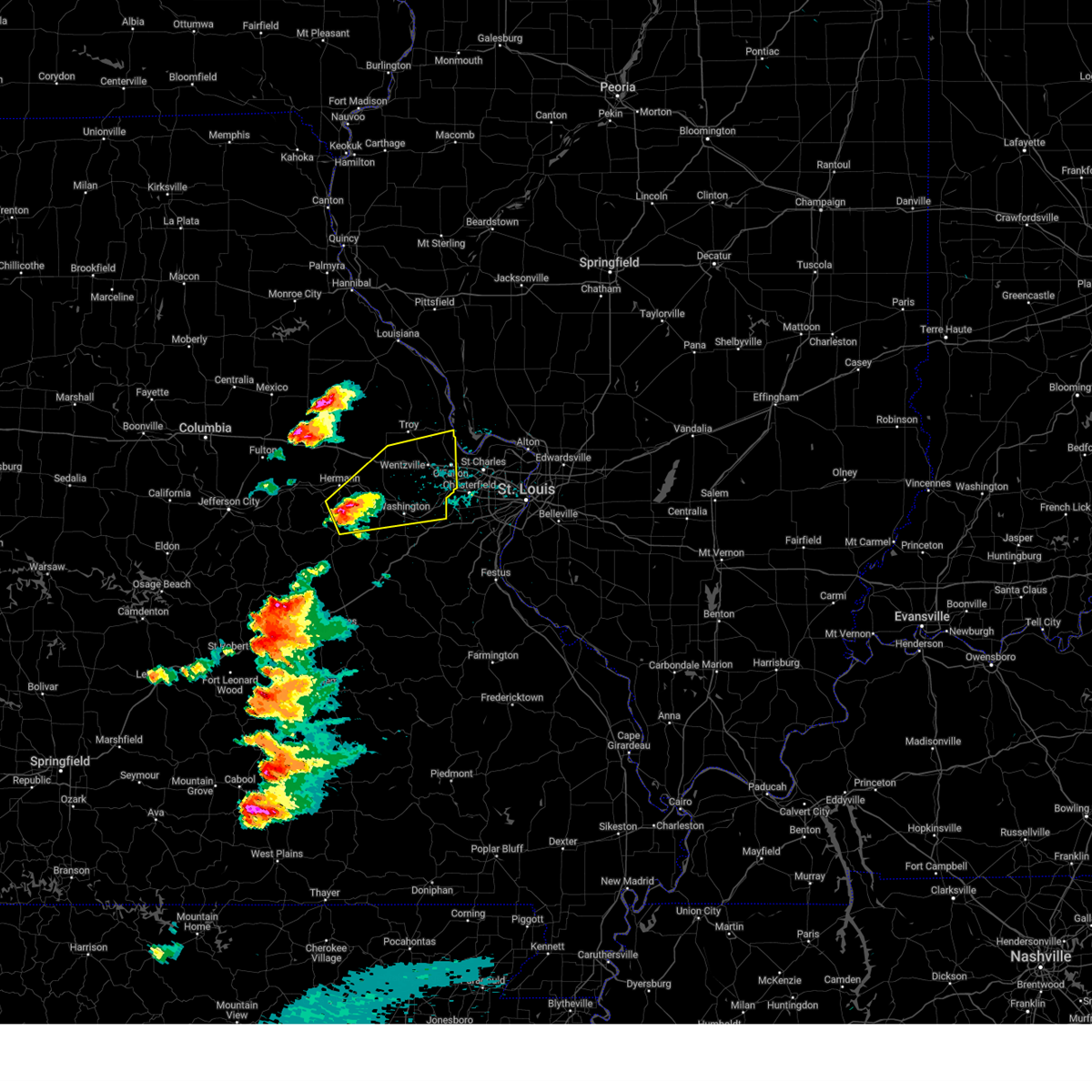
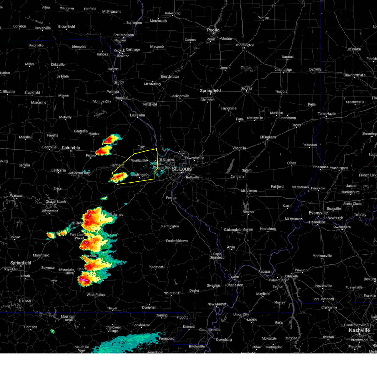
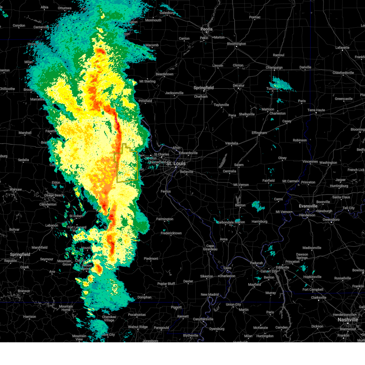
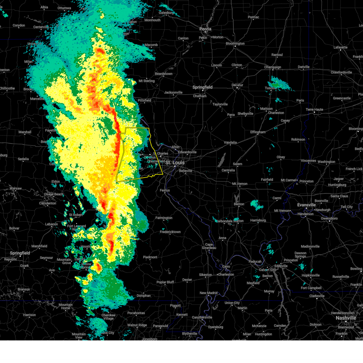
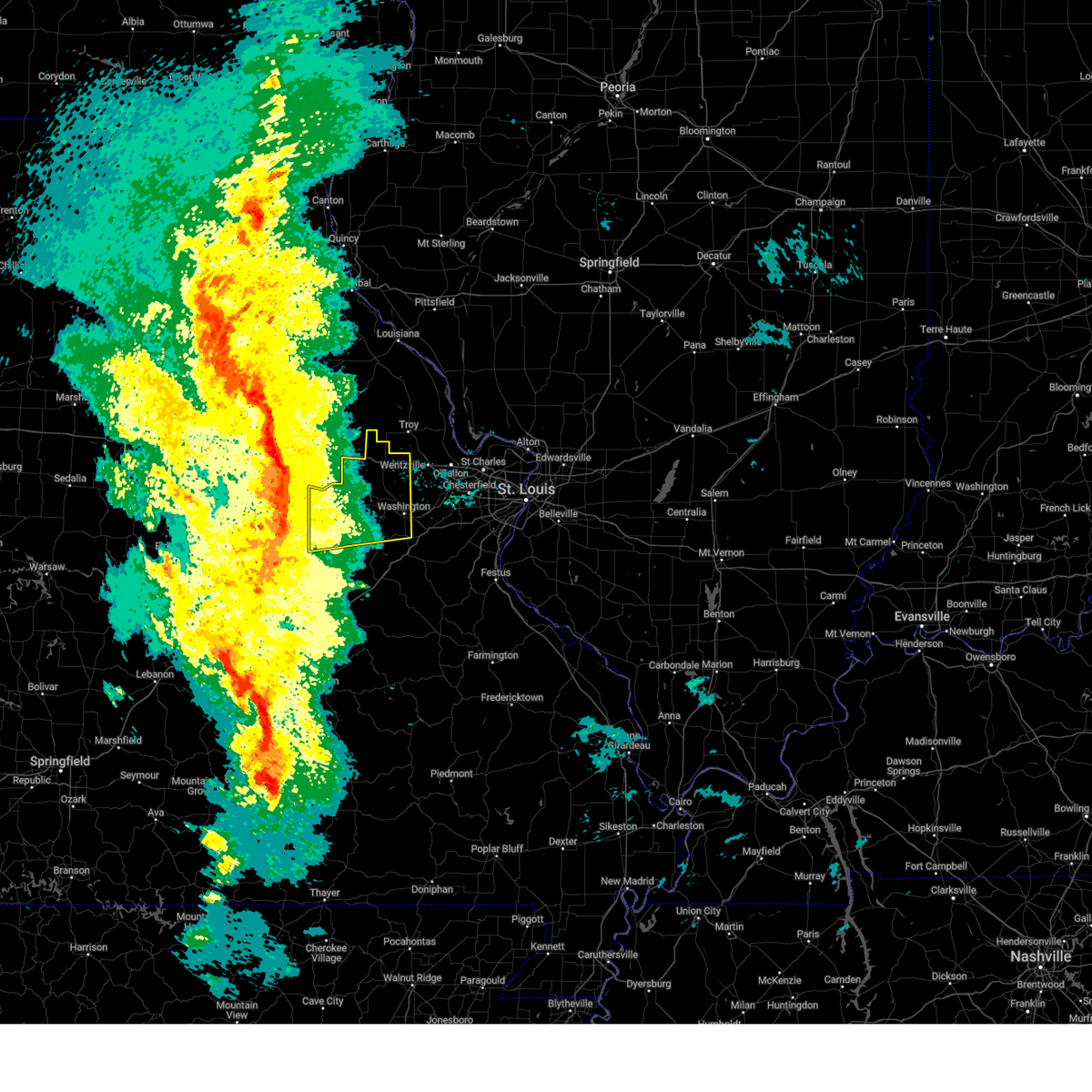
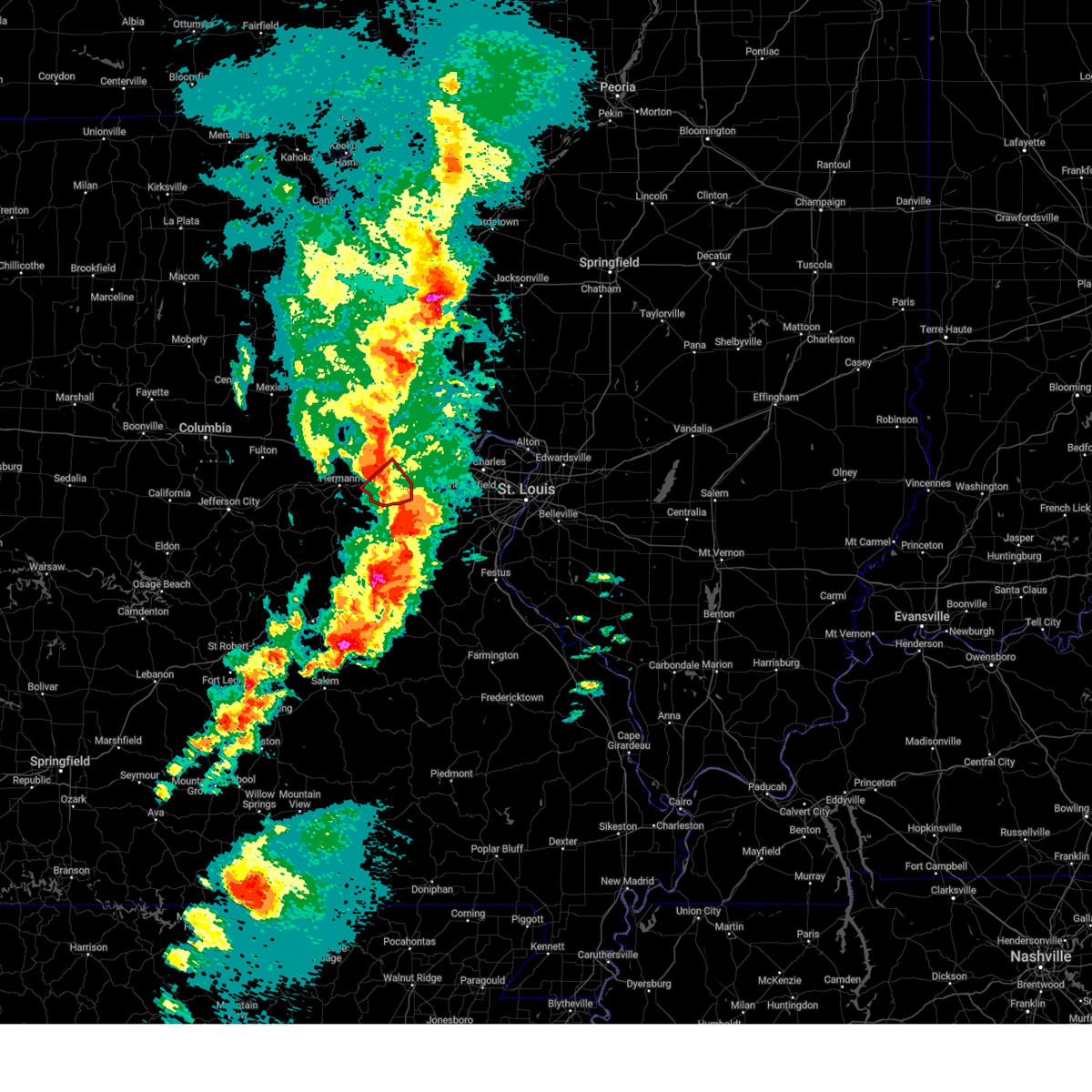
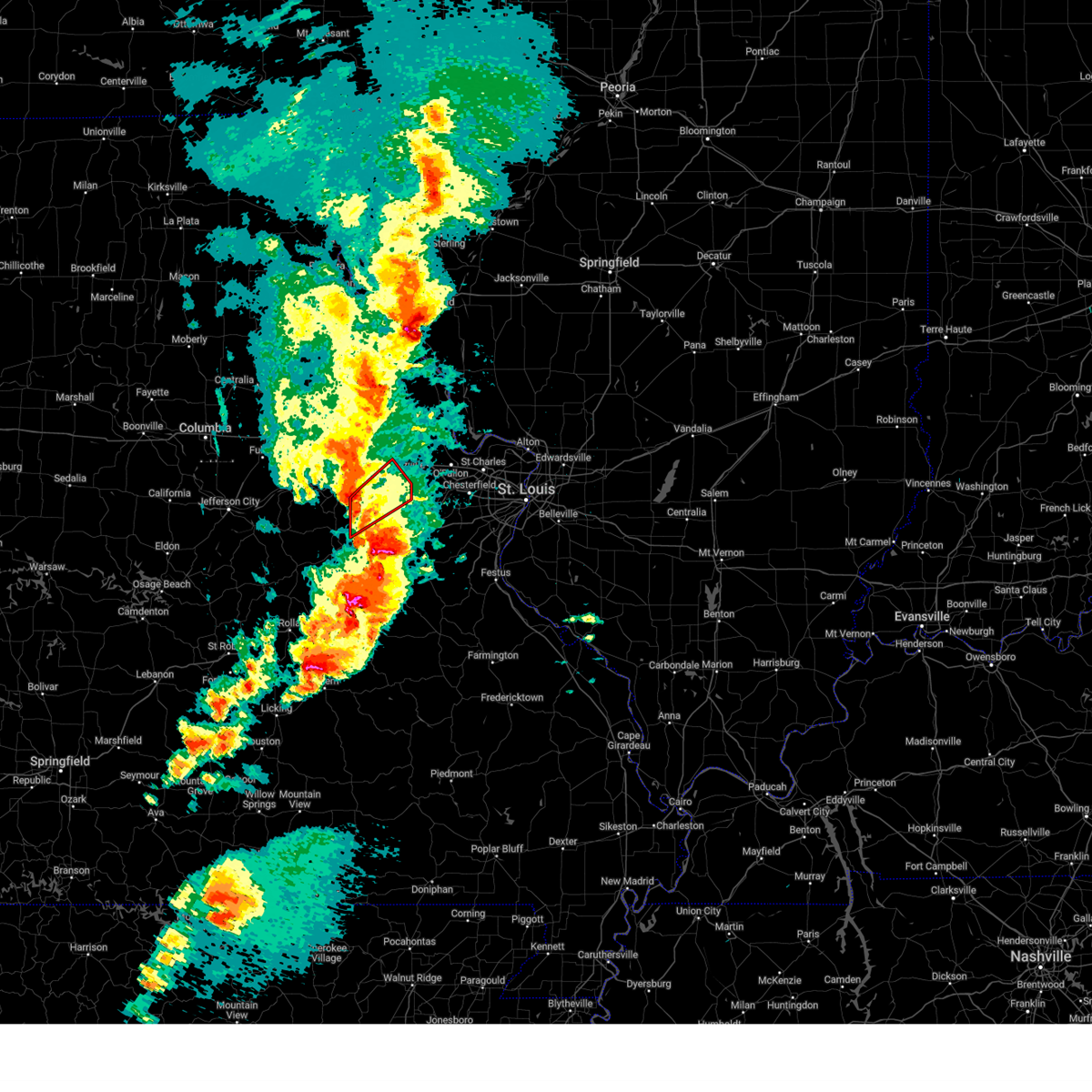
Hail Map for New Haven, MO
The New Haven, MO area has had 17 reports of on-the-ground hail by trained spotters, and has been under severe weather warnings 34 times during the past 12 months. Doppler radar has detected hail at or near New Haven, MO on 73 occasions, including 4 occasions during the past year.
| Name: | New Haven, MO |
| Where Located: | 55.3 miles W of Saint Louis, MO |
| Map: | Google Map for New Haven, MO |
| Population: | 2089 |
| Housing Units: | 905 |
| More Info: | Search Google for New Haven, MO |
3
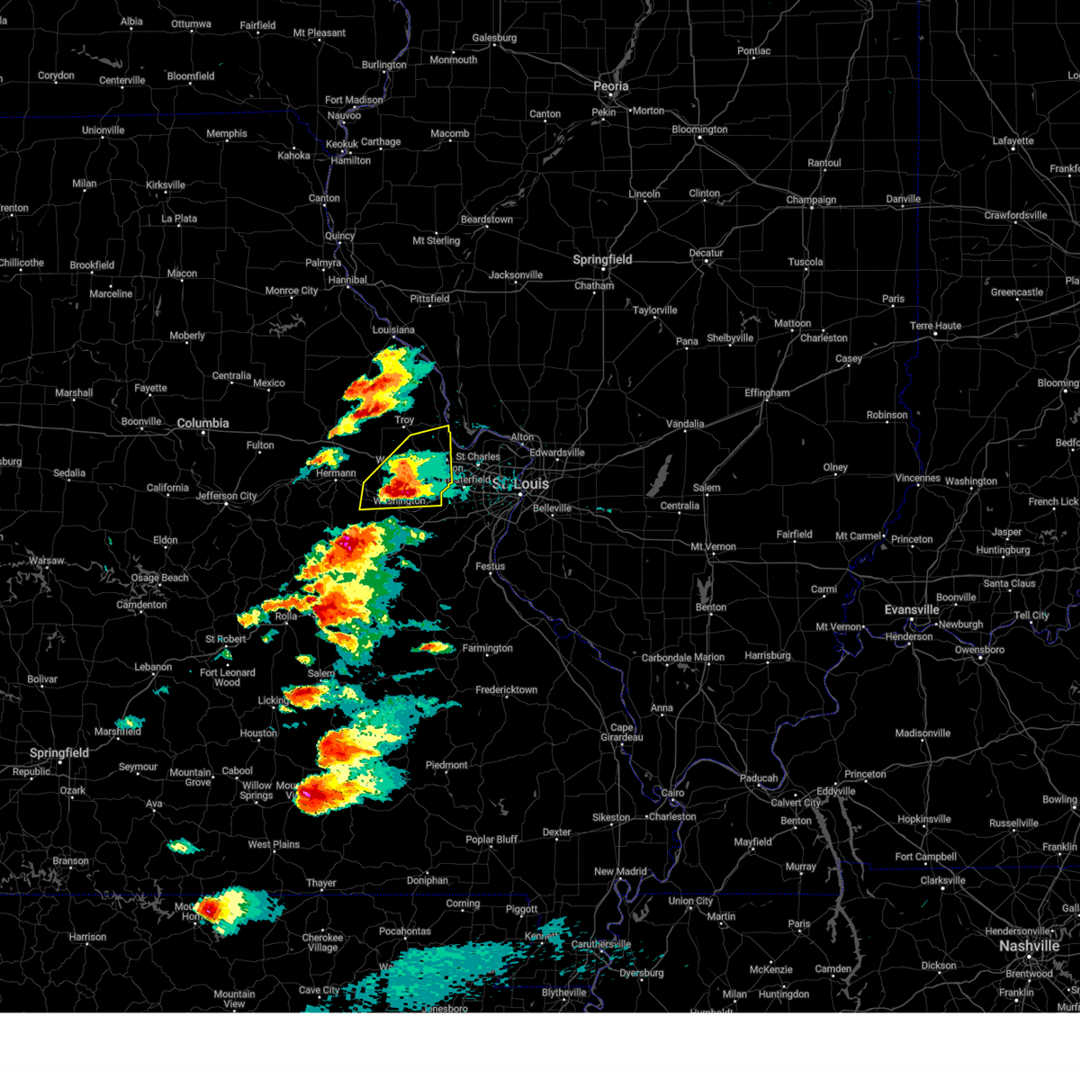
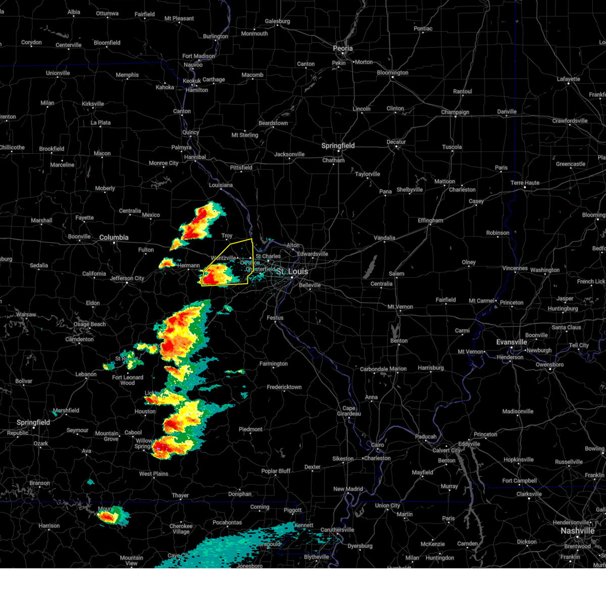
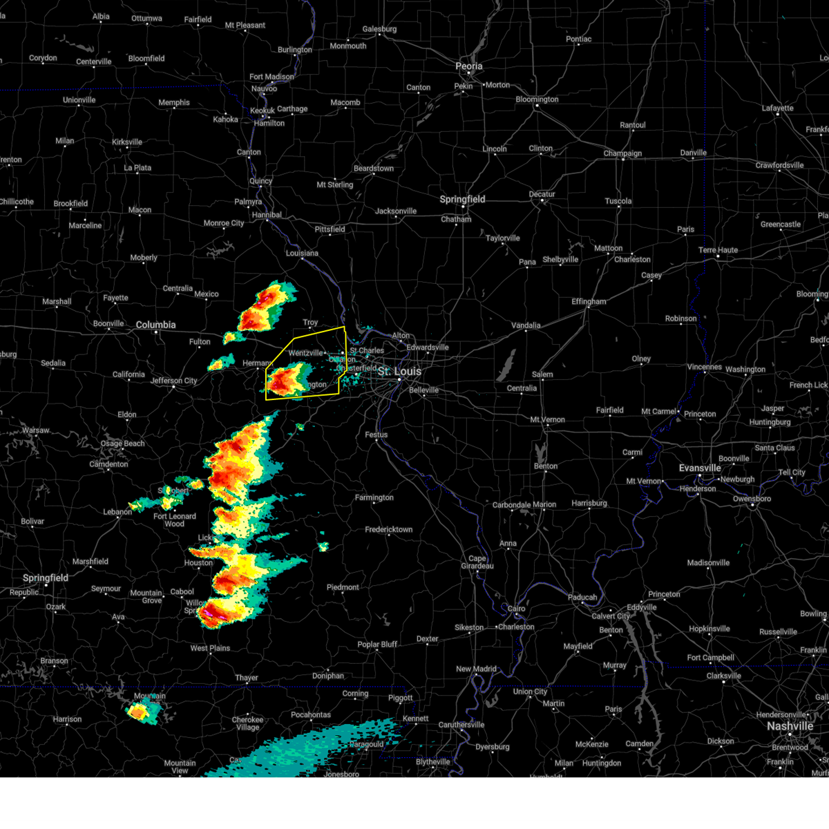
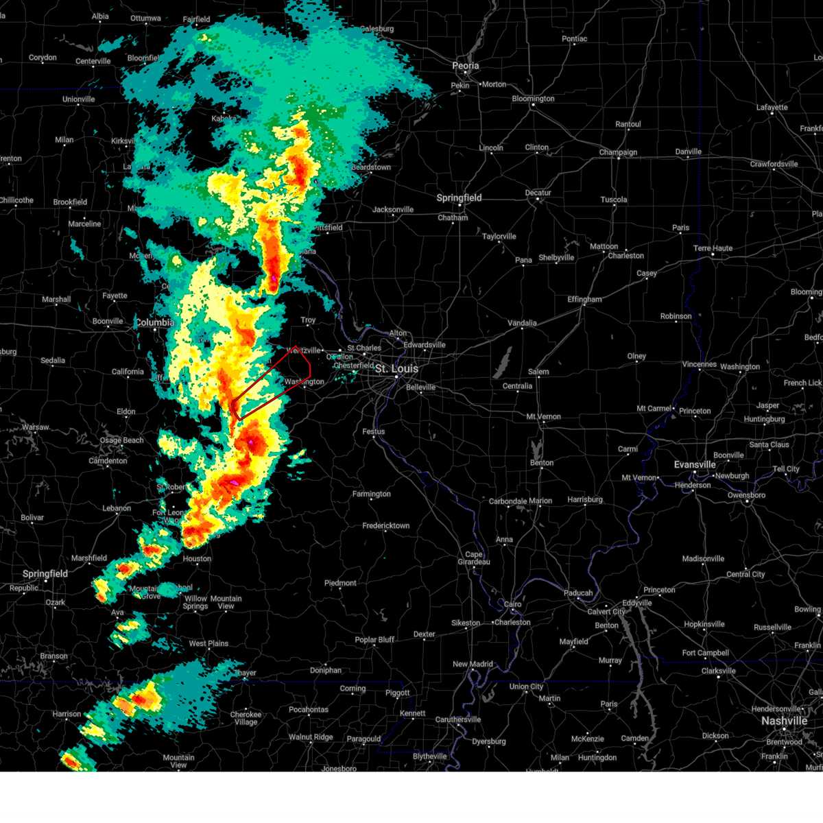
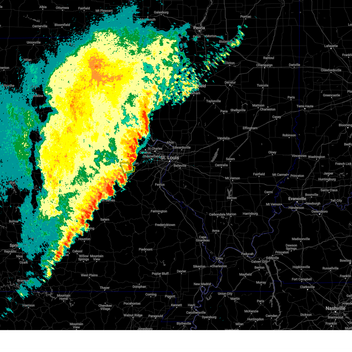
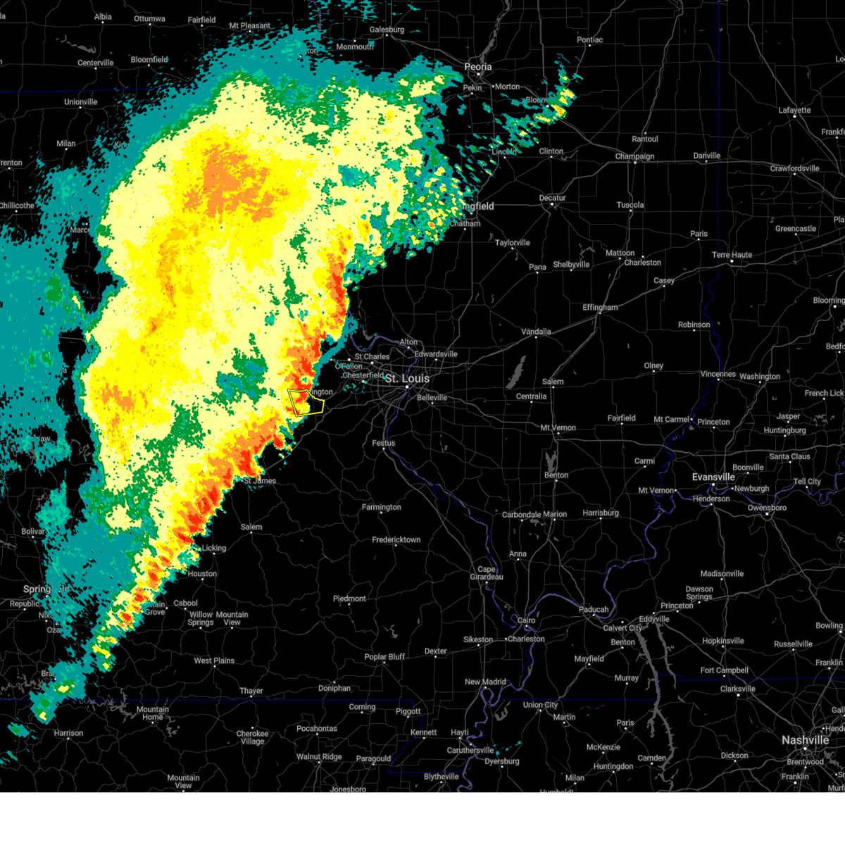
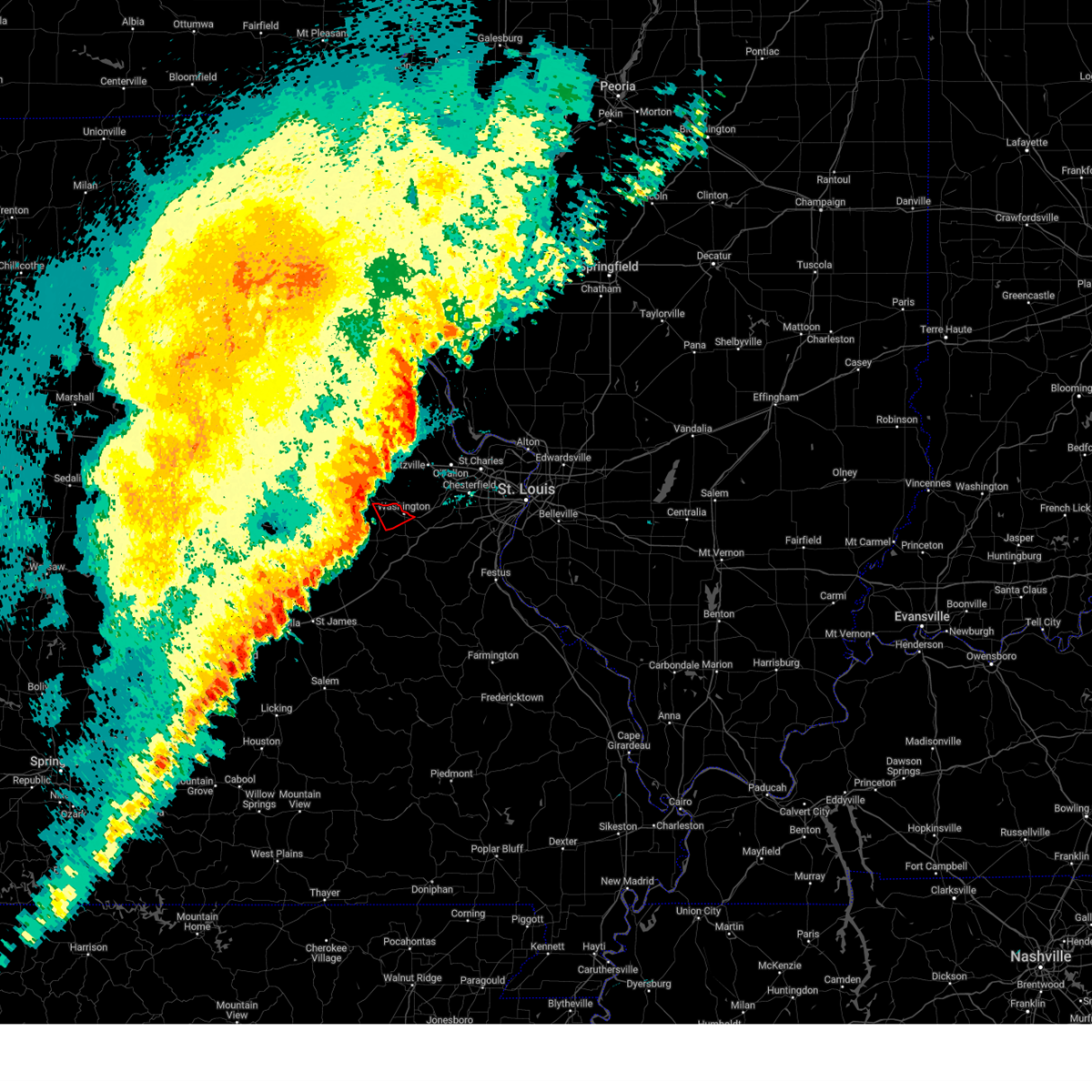
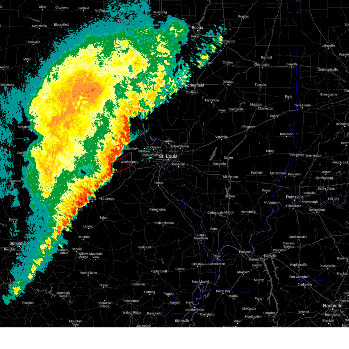
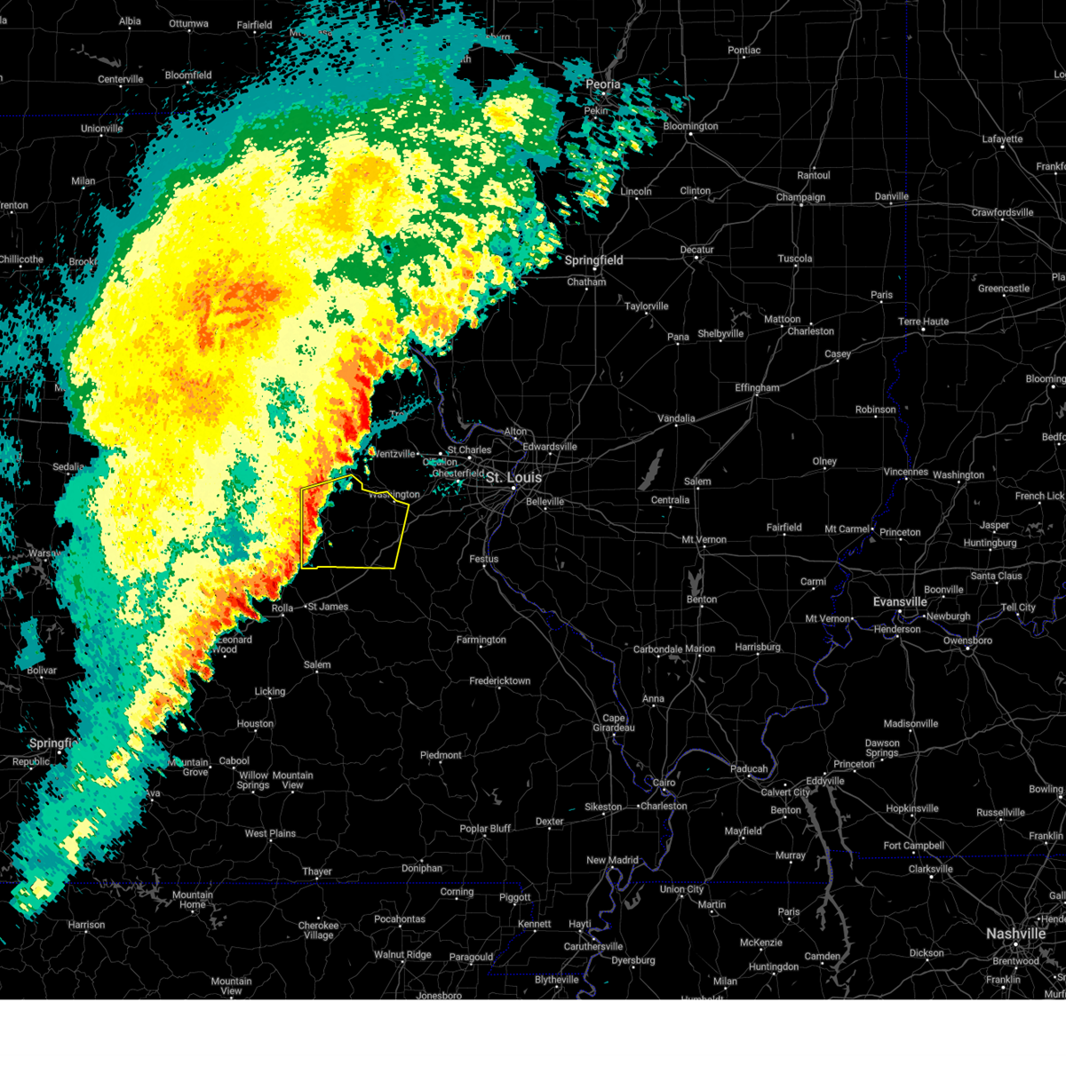
The Top Recent Hail Date for New Haven, MO is Friday, May 16, 2025 (10th out of 73)

Hail and Wind Damage Spotted near New Haven, MO
| Date / Time | Report Details |
|---|---|
| 5/16/2025 2:17 PM CDT |
 Svrlsx the national weather service in st louis has issued a * severe thunderstorm warning for, central franklin county in east central missouri, southwestern saint charles county in east central missouri, southeastern warren county in east central missouri, * until 245 pm cdt. * at 217 pm cdt, a severe thunderstorm was located 5 miles north of beaufort, or 9 miles south of new haven, moving northeast at 55 mph (radar indicated). Hazards include 60 mph wind gusts and half dollar size hail. Hail damage to vehicles is expected. Expect wind damage to roofs, siding, and trees. Svrlsx the national weather service in st louis has issued a * severe thunderstorm warning for, central franklin county in east central missouri, southwestern saint charles county in east central missouri, southeastern warren county in east central missouri, * until 245 pm cdt. * at 217 pm cdt, a severe thunderstorm was located 5 miles north of beaufort, or 9 miles south of new haven, moving northeast at 55 mph (radar indicated). Hazards include 60 mph wind gusts and half dollar size hail. Hail damage to vehicles is expected. Expect wind damage to roofs, siding, and trees.
|
| 5/16/2025 1:52 PM CDT |
 At 152 pm cdt, a severe thunderstorm was located over dutzow, or 7 miles north of washington, moving east at 50 mph (trained spotters reported). Hazards include two inch hail and 60 mph wind gusts. People and animals outdoors will be injured. expect hail damage to roofs, siding, windows, and vehicles. expect wind damage to roofs, siding, and trees. locations impacted include, o'fallon, st. peters, wildwood, wentzville, lake st. louis, washington, dardenne prairie, warrenton, weldon spring, wright city, cottleville, new haven, st. paul, moscow mills, marthasville, innsbrook, new melle, josephville, augusta and chain of rocks. This includes interstate 70 in missouri between exits 199 and 219. At 152 pm cdt, a severe thunderstorm was located over dutzow, or 7 miles north of washington, moving east at 50 mph (trained spotters reported). Hazards include two inch hail and 60 mph wind gusts. People and animals outdoors will be injured. expect hail damage to roofs, siding, windows, and vehicles. expect wind damage to roofs, siding, and trees. locations impacted include, o'fallon, st. peters, wildwood, wentzville, lake st. louis, washington, dardenne prairie, warrenton, weldon spring, wright city, cottleville, new haven, st. paul, moscow mills, marthasville, innsbrook, new melle, josephville, augusta and chain of rocks. This includes interstate 70 in missouri between exits 199 and 219.
|
| 5/16/2025 1:47 PM CDT | Quarter sized hail reported 0.7 miles S of New Haven, MO, report from mping: quarter (1.00 in.). |
| 5/16/2025 1:45 PM CDT |
 At 145 pm cdt, a severe thunderstorm was located over marthasville, or 6 miles east of new haven, moving east at 50 mph (radar indicated). Hazards include two inch hail and 60 mph wind gusts. People and animals outdoors will be injured. expect hail damage to roofs, siding, windows, and vehicles. expect wind damage to roofs, siding, and trees. locations impacted include, o'fallon, st. peters, wildwood, wentzville, lake st. louis, washington, dardenne prairie, warrenton, weldon spring, wright city, cottleville, new haven, st. paul, moscow mills, marthasville, innsbrook, new melle, josephville, augusta and chain of rocks. This includes interstate 70 in missouri between exits 199 and 219. At 145 pm cdt, a severe thunderstorm was located over marthasville, or 6 miles east of new haven, moving east at 50 mph (radar indicated). Hazards include two inch hail and 60 mph wind gusts. People and animals outdoors will be injured. expect hail damage to roofs, siding, windows, and vehicles. expect wind damage to roofs, siding, and trees. locations impacted include, o'fallon, st. peters, wildwood, wentzville, lake st. louis, washington, dardenne prairie, warrenton, weldon spring, wright city, cottleville, new haven, st. paul, moscow mills, marthasville, innsbrook, new melle, josephville, augusta and chain of rocks. This includes interstate 70 in missouri between exits 199 and 219.
|
| 5/16/2025 1:43 PM CDT | Quarter sized hail reported 2.3 miles WNW of New Haven, MO, report from mping: quarter (1.00 in.). |
| 5/16/2025 1:41 PM CDT | Quarter sized hail reported 2.2 miles W of New Haven, MO |
| 5/16/2025 1:37 PM CDT | Ping Pong Ball sized hail reported 2.1 miles N of New Haven, MO |
| 5/16/2025 1:34 PM CDT |
 the severe thunderstorm warning has been cancelled and is no longer in effect the severe thunderstorm warning has been cancelled and is no longer in effect
|
| 5/16/2025 1:34 PM CDT |
 At 134 pm cdt, a severe thunderstorm was located over new haven, moving northeast at 55 mph (radar indicated). Hazards include 60 mph wind gusts and half dollar size hail. Hail damage to vehicles is expected. expect wind damage to roofs, siding, and trees. locations impacted include, o'fallon, st. peters, wildwood, wentzville, lake st. louis, washington, dardenne prairie, warrenton, weldon spring, wright city, cottleville, new haven, st. paul, moscow mills, marthasville, truesdale, innsbrook, new melle, josephville and augusta. This includes interstate 70 in missouri between exits 193 and 219. At 134 pm cdt, a severe thunderstorm was located over new haven, moving northeast at 55 mph (radar indicated). Hazards include 60 mph wind gusts and half dollar size hail. Hail damage to vehicles is expected. expect wind damage to roofs, siding, and trees. locations impacted include, o'fallon, st. peters, wildwood, wentzville, lake st. louis, washington, dardenne prairie, warrenton, weldon spring, wright city, cottleville, new haven, st. paul, moscow mills, marthasville, truesdale, innsbrook, new melle, josephville and augusta. This includes interstate 70 in missouri between exits 193 and 219.
|
| 5/16/2025 1:25 PM CDT |
 At 125 pm cdt, a severe thunderstorm was located 7 miles west of new haven, moving northeast at 60 mph (radar indicated). Hazards include 60 mph wind gusts and half dollar size hail. Hail damage to vehicles is expected. expect wind damage to roofs, siding, and trees. locations impacted include, o'fallon, st. peters, wildwood, wentzville, lake st. louis, washington, dardenne prairie, warrenton, weldon spring, wright city, cottleville, hermann, new haven, st. paul, moscow mills, marthasville, truesdale, innsbrook, new melle and josephville. This includes interstate 70 in missouri between exits 193 and 219. At 125 pm cdt, a severe thunderstorm was located 7 miles west of new haven, moving northeast at 60 mph (radar indicated). Hazards include 60 mph wind gusts and half dollar size hail. Hail damage to vehicles is expected. expect wind damage to roofs, siding, and trees. locations impacted include, o'fallon, st. peters, wildwood, wentzville, lake st. louis, washington, dardenne prairie, warrenton, weldon spring, wright city, cottleville, hermann, new haven, st. paul, moscow mills, marthasville, truesdale, innsbrook, new melle and josephville. This includes interstate 70 in missouri between exits 193 and 219.
|
| 5/16/2025 1:23 PM CDT |
 Svrlsx the national weather service in st louis has issued a * severe thunderstorm warning for, northern franklin county in east central missouri, northeastern gasconade county in east central missouri, southeastern lincoln county in east central missouri, western saint charles county in east central missouri, warren county in east central missouri, * until 215 pm cdt. * at 123 pm cdt, a severe thunderstorm was located 5 miles east of swiss, or 9 miles west of new haven, moving northeast at 60 mph (radar indicated). Hazards include 60 mph wind gusts. expect damage to roofs, siding, and trees Svrlsx the national weather service in st louis has issued a * severe thunderstorm warning for, northern franklin county in east central missouri, northeastern gasconade county in east central missouri, southeastern lincoln county in east central missouri, western saint charles county in east central missouri, warren county in east central missouri, * until 215 pm cdt. * at 123 pm cdt, a severe thunderstorm was located 5 miles east of swiss, or 9 miles west of new haven, moving northeast at 60 mph (radar indicated). Hazards include 60 mph wind gusts. expect damage to roofs, siding, and trees
|
| 4/20/2025 6:46 PM CDT | the severe thunderstorm warning has been cancelled and is no longer in effect |
| 4/20/2025 6:46 PM CDT | At 646 pm cdt, severe thunderstorms were located along a line from near eolia to 5 miles east of beaufort, or along a line from 9 miles northwest of elsberry to 6 miles west of union, moving northeast at 50 mph (radar indicated). Hazards include 60 mph wind gusts and small hail. Expect damage to roofs, siding, and trees. locations impacted include, o'fallon, st. charles, st. peters, chesterfield, wildwood, ballwin, wentzville, maryland heights, manchester, lake st. louis, washington, dardenne prairie, town and country, troy, union, eureka, ellisville, warrenton, pacific and valley park. this includes the following state parks, babler memorial state park, route 66 state park, cuivre river state park and castlewood state park. this includes the following highways, interstate 70 in missouri between exits 193 and 224. Interstate 44 in missouri between exits 251 and 274. |
| 4/20/2025 6:22 PM CDT |
 the severe thunderstorm warning has been cancelled and is no longer in effect the severe thunderstorm warning has been cancelled and is no longer in effect
|
| 4/20/2025 6:22 PM CDT |
 At 622 pm cdt, severe thunderstorms were located along a line from 6 miles northeast of jonesburg to over new haven, or along a line from 9 miles northwest of warrenton to over new haven, moving northeast at 45 mph (radar indicated). Hazards include 70 mph wind gusts and small hail. Expect considerable tree damage. damage is likely to mobile homes, roofs, and outbuildings. locations impacted include, washington, union, warrenton, wright city, new haven, gerald, marthasville, jonesburg, truesdale, innsbrook, treloar, dutzow, beaufort, foristell, berger, leslie, holstein and lyon. This includes interstate 70 in missouri between exits 188 and 200. At 622 pm cdt, severe thunderstorms were located along a line from 6 miles northeast of jonesburg to over new haven, or along a line from 9 miles northwest of warrenton to over new haven, moving northeast at 45 mph (radar indicated). Hazards include 70 mph wind gusts and small hail. Expect considerable tree damage. damage is likely to mobile homes, roofs, and outbuildings. locations impacted include, washington, union, warrenton, wright city, new haven, gerald, marthasville, jonesburg, truesdale, innsbrook, treloar, dutzow, beaufort, foristell, berger, leslie, holstein and lyon. This includes interstate 70 in missouri between exits 188 and 200.
|
| 4/20/2025 6:20 PM CDT |
 Svrlsx the national weather service in st louis has issued a * severe thunderstorm warning for, central franklin county in east central missouri, lincoln county in east central missouri, southeastern montgomery county in east central missouri, saint charles county in east central missouri, southwestern saint louis county in east central missouri, warren county in east central missouri, * until 700 pm cdt. * at 620 pm cdt, severe thunderstorms were located along a line from over new hartford to over jonesburg, or along a line from 8 miles southwest of bowling green to 9 miles northwest of warrenton, moving northeast at 50 mph (radar indicated). Hazards include 70 mph wind gusts and small hail. Expect considerable tree damage. Damage is likely to mobile homes, roofs, and outbuildings. Svrlsx the national weather service in st louis has issued a * severe thunderstorm warning for, central franklin county in east central missouri, lincoln county in east central missouri, southeastern montgomery county in east central missouri, saint charles county in east central missouri, southwestern saint louis county in east central missouri, warren county in east central missouri, * until 700 pm cdt. * at 620 pm cdt, severe thunderstorms were located along a line from over new hartford to over jonesburg, or along a line from 8 miles southwest of bowling green to 9 miles northwest of warrenton, moving northeast at 50 mph (radar indicated). Hazards include 70 mph wind gusts and small hail. Expect considerable tree damage. Damage is likely to mobile homes, roofs, and outbuildings.
|
| 4/20/2025 5:46 PM CDT |
 Svrlsx the national weather service in st louis has issued a * severe thunderstorm warning for, northwestern franklin county in east central missouri, gasconade county in east central missouri, warren county in east central missouri, * until 630 pm cdt. * at 546 pm cdt, severe thunderstorms were located along a line from 5 miles northeast of chamois to 6 miles northwest of bland, or along a line from 14 miles west of hermann to 11 miles southeast of linn, moving northeast at 60 mph (radar indicated). Hazards include 70 mph wind gusts and small hail. Expect considerable tree damage. Damage is likely to mobile homes, roofs, and outbuildings. Svrlsx the national weather service in st louis has issued a * severe thunderstorm warning for, northwestern franklin county in east central missouri, gasconade county in east central missouri, warren county in east central missouri, * until 630 pm cdt. * at 546 pm cdt, severe thunderstorms were located along a line from 5 miles northeast of chamois to 6 miles northwest of bland, or along a line from 14 miles west of hermann to 11 miles southeast of linn, moving northeast at 60 mph (radar indicated). Hazards include 70 mph wind gusts and small hail. Expect considerable tree damage. Damage is likely to mobile homes, roofs, and outbuildings.
|
| 3/14/2025 8:47 PM CDT |
 At 847 pm cdt, a severe thunderstorm capable of producing a tornado was located near treloar, or 6 miles north of new haven, moving northeast at 55 mph (radar indicated rotation). Hazards include tornado and quarter size hail. Flying debris will be dangerous to those caught without shelter. mobile homes will be damaged or destroyed. damage to roofs, windows and vehicles will occur. tree damage is likely. Locations impacted include, warrenton, wright city, new haven, marthasville, truesdale, innsbrook, treloar and holstein. At 847 pm cdt, a severe thunderstorm capable of producing a tornado was located near treloar, or 6 miles north of new haven, moving northeast at 55 mph (radar indicated rotation). Hazards include tornado and quarter size hail. Flying debris will be dangerous to those caught without shelter. mobile homes will be damaged or destroyed. damage to roofs, windows and vehicles will occur. tree damage is likely. Locations impacted include, warrenton, wright city, new haven, marthasville, truesdale, innsbrook, treloar and holstein.
|
| 3/14/2025 8:47 PM CDT |
 the tornado warning has been cancelled and is no longer in effect the tornado warning has been cancelled and is no longer in effect
|
| 3/14/2025 8:40 PM CDT |
 At 840 pm cdt, a tornado producing storm was located near new haven, moving northeast at 55 mph (radar confirmed tornado). Hazards include damaging tornado and quarter size hail. Flying debris will be dangerous to those caught without shelter. mobile homes will be damaged or destroyed. damage to roofs, windows and vehicles will occur. tree damage is likely. Locations impacted include, warrenton, wright city, new haven, marthasville, truesdale, innsbrook, treloar and holstein. At 840 pm cdt, a tornado producing storm was located near new haven, moving northeast at 55 mph (radar confirmed tornado). Hazards include damaging tornado and quarter size hail. Flying debris will be dangerous to those caught without shelter. mobile homes will be damaged or destroyed. damage to roofs, windows and vehicles will occur. tree damage is likely. Locations impacted include, warrenton, wright city, new haven, marthasville, truesdale, innsbrook, treloar and holstein.
|
| 3/14/2025 8:37 PM CDT |
 the tornado warning has been cancelled and is no longer in effect the tornado warning has been cancelled and is no longer in effect
|
| 3/14/2025 8:37 PM CDT |
 At 837 pm cdt, a severe thunderstorm capable of producing a tornado was located 5 miles west of new haven, moving northeast at 55 mph (radar indicated rotation). Hazards include tornado and quarter size hail. Flying debris will be dangerous to those caught without shelter. mobile homes will be damaged or destroyed. damage to roofs, windows and vehicles will occur. tree damage is likely. Locations impacted include, washington, warrenton, wright city, new haven, marthasville, truesdale, innsbrook, treloar and holstein. At 837 pm cdt, a severe thunderstorm capable of producing a tornado was located 5 miles west of new haven, moving northeast at 55 mph (radar indicated rotation). Hazards include tornado and quarter size hail. Flying debris will be dangerous to those caught without shelter. mobile homes will be damaged or destroyed. damage to roofs, windows and vehicles will occur. tree damage is likely. Locations impacted include, washington, warrenton, wright city, new haven, marthasville, truesdale, innsbrook, treloar and holstein.
|
| 3/14/2025 8:26 PM CDT | At 826 pm cdt, a severe thunderstorm capable of producing a tornado was located over drake, or 10 miles north of owensville, moving northeast at 40 mph (radar indicated rotation). Hazards include tornado and quarter size hail. Flying debris will be dangerous to those caught without shelter. mobile homes will be damaged or destroyed. damage to roofs, windows and vehicles will occur. tree damage is likely. Locations impacted include, washington, warrenton, wright city, new haven, marthasville, truesdale, innsbrook, treloar, swiss, drake and holstein. |
| 3/14/2025 8:16 PM CDT |
 Torlsx the national weather service in st louis has issued a * tornado warning for, northwestern franklin county in east central missouri, central gasconade county in east central missouri, southeastern warren county in east central missouri, * until 900 pm cdt. * at 816 pm cdt, a severe thunderstorm capable of producing a tornado was located 5 miles southeast of mount sterling, or 5 miles northwest of owensville, moving northeast at 55 mph (radar indicated rotation). Hazards include tornado and quarter size hail. Flying debris will be dangerous to those caught without shelter. mobile homes will be damaged or destroyed. damage to roofs, windows and vehicles will occur. Tree damage is likely. Torlsx the national weather service in st louis has issued a * tornado warning for, northwestern franklin county in east central missouri, central gasconade county in east central missouri, southeastern warren county in east central missouri, * until 900 pm cdt. * at 816 pm cdt, a severe thunderstorm capable of producing a tornado was located 5 miles southeast of mount sterling, or 5 miles northwest of owensville, moving northeast at 55 mph (radar indicated rotation). Hazards include tornado and quarter size hail. Flying debris will be dangerous to those caught without shelter. mobile homes will be damaged or destroyed. damage to roofs, windows and vehicles will occur. Tree damage is likely.
|
| 10/31/2024 2:17 AM CDT |
 the severe thunderstorm warning has been cancelled and is no longer in effect the severe thunderstorm warning has been cancelled and is no longer in effect
|
| 10/31/2024 2:16 AM CDT |
 The storm which prompted the warning has weakened below severe limits, and has exited the warned area. therefore, the warning has been allowed to expire. The storm which prompted the warning has weakened below severe limits, and has exited the warned area. therefore, the warning has been allowed to expire.
|
| 10/31/2024 2:08 AM CDT |
 At 208 am cdt, severe thunderstorms were located along a line from over dutzow to 6 miles southwest of union, or along a line from near washington to 6 miles southwest of union, moving east at 45 mph (radar indicated). Hazards include 60 mph wind gusts and small hail. Expect damage to roofs, siding, and trees. Locations impacted include, washington, union, new haven and lyon. At 208 am cdt, severe thunderstorms were located along a line from over dutzow to 6 miles southwest of union, or along a line from near washington to 6 miles southwest of union, moving east at 45 mph (radar indicated). Hazards include 60 mph wind gusts and small hail. Expect damage to roofs, siding, and trees. Locations impacted include, washington, union, new haven and lyon.
|
| 10/31/2024 2:03 AM CDT |
 At 203 am cdt, a severe thunderstorm capable of producing a tornado was located near union, moving east at 40 mph (radar indicated rotation). Hazards include tornado. Flying debris will be dangerous to those caught without shelter. mobile homes will be damaged or destroyed. damage to roofs, windows and vehicles will occur. tree damage is likely. Locations impacted include, washington and new haven. At 203 am cdt, a severe thunderstorm capable of producing a tornado was located near union, moving east at 40 mph (radar indicated rotation). Hazards include tornado. Flying debris will be dangerous to those caught without shelter. mobile homes will be damaged or destroyed. damage to roofs, windows and vehicles will occur. tree damage is likely. Locations impacted include, washington and new haven.
|
| 10/31/2024 2:03 AM CDT |
 the tornado warning has been cancelled and is no longer in effect the tornado warning has been cancelled and is no longer in effect
|
| 10/31/2024 1:53 AM CDT |
 the severe thunderstorm warning has been cancelled and is no longer in effect the severe thunderstorm warning has been cancelled and is no longer in effect
|
| 10/31/2024 1:53 AM CDT |
 At 153 am cdt, severe thunderstorms were located along a line from 7 miles southwest of new haven to near rosebud, or along a line from 7 miles southwest of new haven to 7 miles east of owensville, moving east at 35 mph (radar indicated). Hazards include 60 mph wind gusts and small hail. Expect damage to roofs, siding, and trees. locations impacted include, washington, union, st. clair, new haven, gerald, beaufort, berger, leslie, lyon and noser mill. This includes interstate 44 in missouri between exits 240 and 242. At 153 am cdt, severe thunderstorms were located along a line from 7 miles southwest of new haven to near rosebud, or along a line from 7 miles southwest of new haven to 7 miles east of owensville, moving east at 35 mph (radar indicated). Hazards include 60 mph wind gusts and small hail. Expect damage to roofs, siding, and trees. locations impacted include, washington, union, st. clair, new haven, gerald, beaufort, berger, leslie, lyon and noser mill. This includes interstate 44 in missouri between exits 240 and 242.
|
| 10/31/2024 1:45 AM CDT |
 Torlsx the national weather service in st louis has issued a * tornado warning for, northwestern franklin county in east central missouri, southeastern warren county in east central missouri, * until 215 am cdt. * at 145 am cdt, a severe thunderstorm capable of producing a tornado was located 5 miles north of gerald, or 11 miles southwest of new haven, moving northeast at 55 mph (radar indicated rotation). Hazards include tornado. Flying debris will be dangerous to those caught without shelter. mobile homes will be damaged or destroyed. damage to roofs, windows and vehicles will occur. Tree damage is likely. Torlsx the national weather service in st louis has issued a * tornado warning for, northwestern franklin county in east central missouri, southeastern warren county in east central missouri, * until 215 am cdt. * at 145 am cdt, a severe thunderstorm capable of producing a tornado was located 5 miles north of gerald, or 11 miles southwest of new haven, moving northeast at 55 mph (radar indicated rotation). Hazards include tornado. Flying debris will be dangerous to those caught without shelter. mobile homes will be damaged or destroyed. damage to roofs, windows and vehicles will occur. Tree damage is likely.
|
| 10/31/2024 1:34 AM CDT |
 Svrlsx the national weather service in st louis has issued a * severe thunderstorm warning for, franklin county in east central missouri, gasconade county in east central missouri, * until 230 am cdt. * at 134 am cdt, severe thunderstorms were located along a line from near swiss to near bland, or along a line from 12 miles north of owensville to 5 miles southwest of owensville, moving east at 35 mph (radar indicated). Hazards include 60 mph wind gusts and small hail. expect damage to roofs, siding, and trees Svrlsx the national weather service in st louis has issued a * severe thunderstorm warning for, franklin county in east central missouri, gasconade county in east central missouri, * until 230 am cdt. * at 134 am cdt, severe thunderstorms were located along a line from near swiss to near bland, or along a line from 12 miles north of owensville to 5 miles southwest of owensville, moving east at 35 mph (radar indicated). Hazards include 60 mph wind gusts and small hail. expect damage to roofs, siding, and trees
|
| 8/15/2024 10:12 PM CDT |
 Svrlsx the national weather service in st louis has issued a * severe thunderstorm warning for, north central franklin county in east central missouri, southwestern saint charles county in east central missouri, southeastern warren county in east central missouri, * until 1100 pm cdt. * at 1012 pm cdt, a severe thunderstorm was located near marthasville, or 6 miles east of new haven, moving northeast at 30 mph (radar indicated). Hazards include 60 mph wind gusts and quarter size hail. Hail damage to vehicles is expected. Expect wind damage to roofs, siding, and trees. Svrlsx the national weather service in st louis has issued a * severe thunderstorm warning for, north central franklin county in east central missouri, southwestern saint charles county in east central missouri, southeastern warren county in east central missouri, * until 1100 pm cdt. * at 1012 pm cdt, a severe thunderstorm was located near marthasville, or 6 miles east of new haven, moving northeast at 30 mph (radar indicated). Hazards include 60 mph wind gusts and quarter size hail. Hail damage to vehicles is expected. Expect wind damage to roofs, siding, and trees.
|
| 7/16/2024 12:04 PM CDT |
 the tornado warning has been cancelled and is no longer in effect the tornado warning has been cancelled and is no longer in effect
|
| 7/16/2024 11:59 AM CDT |
 the tornado warning has been cancelled and is no longer in effect the tornado warning has been cancelled and is no longer in effect
|
| 7/16/2024 11:59 AM CDT |
 At 1158 am cdt, a confirmed tornado was located near new haven, moving south at 15 mph (radar confirmed tornado). Hazards include damaging tornado. Flying debris will be dangerous to those caught without shelter. mobile homes will be damaged or destroyed. damage to roofs, windows, and vehicles will occur. tree damage is likely. This tornadic thunderstorm will remain over mainly rural areas of northwestern franklin county, including the following locations, lyon. At 1158 am cdt, a confirmed tornado was located near new haven, moving south at 15 mph (radar confirmed tornado). Hazards include damaging tornado. Flying debris will be dangerous to those caught without shelter. mobile homes will be damaged or destroyed. damage to roofs, windows, and vehicles will occur. tree damage is likely. This tornadic thunderstorm will remain over mainly rural areas of northwestern franklin county, including the following locations, lyon.
|
| 7/16/2024 11:37 AM CDT |
 Torlsx the national weather service in st louis has issued a * tornado warning for, northwestern franklin county in east central missouri, southeastern warren county in east central missouri, * until 1230 pm cdt. * at 1137 am cdt, a tornado producing storm was located over treloar, moving south at 15 mph (radar confirmed tornado). Hazards include damaging tornado. Flying debris will be dangerous to those caught without shelter. mobile homes will be damaged or destroyed. damage to roofs, windows, and vehicles will occur. tree damage is likely. This tornadic storm will be near, new haven around 1145 am cdt. Torlsx the national weather service in st louis has issued a * tornado warning for, northwestern franklin county in east central missouri, southeastern warren county in east central missouri, * until 1230 pm cdt. * at 1137 am cdt, a tornado producing storm was located over treloar, moving south at 15 mph (radar confirmed tornado). Hazards include damaging tornado. Flying debris will be dangerous to those caught without shelter. mobile homes will be damaged or destroyed. damage to roofs, windows, and vehicles will occur. tree damage is likely. This tornadic storm will be near, new haven around 1145 am cdt.
|
| 7/7/2024 9:35 PM CDT |
 The storm which prompted the warning has weakened below severe limits, and has exited the warned area. therefore, the warning will be allowed to expire. The storm which prompted the warning has weakened below severe limits, and has exited the warned area. therefore, the warning will be allowed to expire.
|
| 7/7/2024 9:27 PM CDT |
 the severe thunderstorm warning has been cancelled and is no longer in effect the severe thunderstorm warning has been cancelled and is no longer in effect
|
| 7/7/2024 9:27 PM CDT |
 At 926 pm cdt, a severe thunderstorm was located near treloar, moving northeast at 20 mph (radar indicated). Hazards include 60 mph wind gusts. Expect damage to roofs, siding, and trees. Locations impacted include, new haven and berger. At 926 pm cdt, a severe thunderstorm was located near treloar, moving northeast at 20 mph (radar indicated). Hazards include 60 mph wind gusts. Expect damage to roofs, siding, and trees. Locations impacted include, new haven and berger.
|
| 7/7/2024 9:15 PM CDT |
 At 915 pm cdt, a severe thunderstorm was located near new haven, moving northeast at 25 mph (radar indicated). Hazards include 60 mph wind gusts. Expect damage to roofs, siding, and trees. Locations impacted include, hermann, new haven, and berger. At 915 pm cdt, a severe thunderstorm was located near new haven, moving northeast at 25 mph (radar indicated). Hazards include 60 mph wind gusts. Expect damage to roofs, siding, and trees. Locations impacted include, hermann, new haven, and berger.
|
| 7/7/2024 8:57 PM CDT |
 Svrlsx the national weather service in st louis has issued a * severe thunderstorm warning for, northwestern franklin county in east central missouri, northeastern gasconade county in east central missouri, * until 945 pm cdt. * at 857 pm cdt, a severe thunderstorm was located over swiss, moving northeast at 20 mph (radar indicated). Hazards include 60 mph wind gusts and penny size hail. expect damage to roofs, siding, and trees Svrlsx the national weather service in st louis has issued a * severe thunderstorm warning for, northwestern franklin county in east central missouri, northeastern gasconade county in east central missouri, * until 945 pm cdt. * at 857 pm cdt, a severe thunderstorm was located over swiss, moving northeast at 20 mph (radar indicated). Hazards include 60 mph wind gusts and penny size hail. expect damage to roofs, siding, and trees
|
| 5/26/2024 5:33 PM CDT |
 the severe thunderstorm warning has been cancelled and is no longer in effect the severe thunderstorm warning has been cancelled and is no longer in effect
|
| 5/26/2024 5:14 PM CDT |
 At 514 pm cdt, a severe thunderstorm was located near washington, moving east at 35 mph (radar indicated). Hazards include 60 mph wind gusts and quarter size hail. Hail damage to vehicles is expected. expect wind damage to roofs, siding, and trees. locations impacted include, washington, union, st. clair, new haven, gerald, marthasville, parkway, beaufort, dutzow, leslie, noser mill, and lyon. This includes interstate 44 in missouri between exits 239 and 240. At 514 pm cdt, a severe thunderstorm was located near washington, moving east at 35 mph (radar indicated). Hazards include 60 mph wind gusts and quarter size hail. Hail damage to vehicles is expected. expect wind damage to roofs, siding, and trees. locations impacted include, washington, union, st. clair, new haven, gerald, marthasville, parkway, beaufort, dutzow, leslie, noser mill, and lyon. This includes interstate 44 in missouri between exits 239 and 240.
|
| 5/26/2024 4:58 PM CDT |
 Svrlsx the national weather service in st louis has issued a * severe thunderstorm warning for, western franklin county in east central missouri, southeastern warren county in east central missouri, * until 545 pm cdt. * at 458 pm cdt, a severe thunderstorm was located near beaufort, moving east at 35 mph (radar indicated). Hazards include 60 mph wind gusts and quarter size hail. Hail damage to vehicles is expected. Expect wind damage to roofs, siding, and trees. Svrlsx the national weather service in st louis has issued a * severe thunderstorm warning for, western franklin county in east central missouri, southeastern warren county in east central missouri, * until 545 pm cdt. * at 458 pm cdt, a severe thunderstorm was located near beaufort, moving east at 35 mph (radar indicated). Hazards include 60 mph wind gusts and quarter size hail. Hail damage to vehicles is expected. Expect wind damage to roofs, siding, and trees.
|
| 5/26/2024 4:40 PM CDT | Quarter sized hail reported 2.3 miles WNW of New Haven, MO, report from mping: quarter (1.00 in.). |
| 5/26/2024 4:35 PM CDT |
 At 434 pm cdt, a severe thunderstorm was located over marthasville, moving east at 40 mph (public reported 1 inch hail just east of new haven). Hazards include ping pong ball size hail and 60 mph wind gusts. People and animals outdoors will be injured. expect hail damage to roofs, siding, windows, and vehicles. expect wind damage to roofs, siding, and trees. Locations impacted include, washington, union, new haven, marthasville, innsbrook, treloar, dutzow, lyon, and holstein. At 434 pm cdt, a severe thunderstorm was located over marthasville, moving east at 40 mph (public reported 1 inch hail just east of new haven). Hazards include ping pong ball size hail and 60 mph wind gusts. People and animals outdoors will be injured. expect hail damage to roofs, siding, windows, and vehicles. expect wind damage to roofs, siding, and trees. Locations impacted include, washington, union, new haven, marthasville, innsbrook, treloar, dutzow, lyon, and holstein.
|
| 5/26/2024 4:30 PM CDT | Quarter sized hail reported 2.3 miles WNW of New Haven, MO, report from mping: quarter (1.00 in.). |
| 5/26/2024 4:28 PM CDT |
 At 427 pm cdt, a severe thunderstorm was located over new haven, moving east at 35 mph (radar indicated). Hazards include two inch hail and 60 mph wind gusts. People and animals outdoors will be injured. expect hail damage to roofs, siding, windows, and vehicles. expect wind damage to roofs, siding, and trees. Locations impacted include, washington, union, new haven, marthasville, innsbrook, treloar, dutzow, lyon, and holstein. At 427 pm cdt, a severe thunderstorm was located over new haven, moving east at 35 mph (radar indicated). Hazards include two inch hail and 60 mph wind gusts. People and animals outdoors will be injured. expect hail damage to roofs, siding, windows, and vehicles. expect wind damage to roofs, siding, and trees. Locations impacted include, washington, union, new haven, marthasville, innsbrook, treloar, dutzow, lyon, and holstein.
|
| 5/26/2024 4:28 PM CDT |
 the severe thunderstorm warning has been cancelled and is no longer in effect the severe thunderstorm warning has been cancelled and is no longer in effect
|
| 5/26/2024 4:09 PM CDT |
 Svrlsx the national weather service in st louis has issued a * severe thunderstorm warning for, northwestern franklin county in east central missouri, southern warren county in east central missouri, northeastern gasconade county in east central missouri, * until 500 pm cdt. * at 409 pm cdt, a severe thunderstorm was located near swiss, moving east at 40 mph (radar indicated). Hazards include two inch hail and 60 mph wind gusts. People and animals outdoors will be injured. expect hail damage to roofs, siding, windows, and vehicles. Expect wind damage to roofs, siding, and trees. Svrlsx the national weather service in st louis has issued a * severe thunderstorm warning for, northwestern franklin county in east central missouri, southern warren county in east central missouri, northeastern gasconade county in east central missouri, * until 500 pm cdt. * at 409 pm cdt, a severe thunderstorm was located near swiss, moving east at 40 mph (radar indicated). Hazards include two inch hail and 60 mph wind gusts. People and animals outdoors will be injured. expect hail damage to roofs, siding, windows, and vehicles. Expect wind damage to roofs, siding, and trees.
|
| 5/26/2024 4:02 PM CDT |
 At 402 pm cdt, a severe thunderstorm was located near swiss, moving east at 45 mph (radar indicated). Hazards include tennis ball size hail and 60 mph wind gusts. People and animals outdoors will be injured. expect hail damage to roofs, siding, windows, and vehicles. expect wind damage to roofs, siding, and trees. locations impacted include, hermann, swiss, gasconade, berger, rhineland, morrison, mckittrick, and bay. This also includes deutschheim historic site. At 402 pm cdt, a severe thunderstorm was located near swiss, moving east at 45 mph (radar indicated). Hazards include tennis ball size hail and 60 mph wind gusts. People and animals outdoors will be injured. expect hail damage to roofs, siding, windows, and vehicles. expect wind damage to roofs, siding, and trees. locations impacted include, hermann, swiss, gasconade, berger, rhineland, morrison, mckittrick, and bay. This also includes deutschheim historic site.
|
| 5/26/2024 3:56 PM CDT |
 At 355 pm cdt, a severe thunderstorm was located near swiss, moving east at 45 mph (radar indicated). Hazards include golf ball size hail and 60 mph wind gusts. People and animals outdoors will be injured. expect hail damage to roofs, siding, windows, and vehicles. expect wind damage to roofs, siding, and trees. locations impacted include, hermann, swiss, gasconade, berger, rhineland, morrison, mckittrick, and bay. This also includes deutschheim historic site. At 355 pm cdt, a severe thunderstorm was located near swiss, moving east at 45 mph (radar indicated). Hazards include golf ball size hail and 60 mph wind gusts. People and animals outdoors will be injured. expect hail damage to roofs, siding, windows, and vehicles. expect wind damage to roofs, siding, and trees. locations impacted include, hermann, swiss, gasconade, berger, rhineland, morrison, mckittrick, and bay. This also includes deutschheim historic site.
|
| 5/26/2024 3:56 PM CDT |
 the severe thunderstorm warning has been cancelled and is no longer in effect the severe thunderstorm warning has been cancelled and is no longer in effect
|
| 5/26/2024 3:48 PM CDT |
 At 348 pm cdt, a severe thunderstorm was located 8 miles west of swiss, moving east at 35 mph (radar indicated). Hazards include 60 mph wind gusts and quarter size hail. Hail damage to vehicles is expected. expect wind damage to roofs, siding, and trees. locations impacted include, hermann, swiss, gasconade, berger, rhineland, morrison, mckittrick, and bay. This also includes deutschheim historic site. At 348 pm cdt, a severe thunderstorm was located 8 miles west of swiss, moving east at 35 mph (radar indicated). Hazards include 60 mph wind gusts and quarter size hail. Hail damage to vehicles is expected. expect wind damage to roofs, siding, and trees. locations impacted include, hermann, swiss, gasconade, berger, rhineland, morrison, mckittrick, and bay. This also includes deutschheim historic site.
|
| 5/26/2024 3:30 PM CDT |
 Svrlsx the national weather service in st louis has issued a * severe thunderstorm warning for, south central montgomery county in east central missouri, northwestern franklin county in east central missouri, northeastern osage county in central missouri, west central warren county in east central missouri, northern gasconade county in east central missouri, * until 415 pm cdt. * at 330 pm cdt, a severe thunderstorm was located near linn, moving east at 45 mph (radar indicated). Hazards include 60 mph wind gusts and quarter size hail. Hail damage to vehicles is expected. Expect wind damage to roofs, siding, and trees. Svrlsx the national weather service in st louis has issued a * severe thunderstorm warning for, south central montgomery county in east central missouri, northwestern franklin county in east central missouri, northeastern osage county in central missouri, west central warren county in east central missouri, northern gasconade county in east central missouri, * until 415 pm cdt. * at 330 pm cdt, a severe thunderstorm was located near linn, moving east at 45 mph (radar indicated). Hazards include 60 mph wind gusts and quarter size hail. Hail damage to vehicles is expected. Expect wind damage to roofs, siding, and trees.
|
| 5/21/2024 9:03 PM CDT |
 At 903 pm cdt, a severe thunderstorm was located near washington, moving east at 40 mph (radar indicated). Hazards include 60 mph wind gusts and quarter size hail. Hail damage to vehicles is expected. expect wind damage to roofs, siding, and trees. locations impacted include, o'fallon, lake st. louis, washington, dardenne prairie, union, pacific, new haven, gray summit, villa ridge, marthasville, new melle, augusta, dutzow, defiance, matson, and lyon. this includes the following highways, interstate 44 in missouri between exits 247 and 257. Interstate 70 in missouri near exit 216. At 903 pm cdt, a severe thunderstorm was located near washington, moving east at 40 mph (radar indicated). Hazards include 60 mph wind gusts and quarter size hail. Hail damage to vehicles is expected. expect wind damage to roofs, siding, and trees. locations impacted include, o'fallon, lake st. louis, washington, dardenne prairie, union, pacific, new haven, gray summit, villa ridge, marthasville, new melle, augusta, dutzow, defiance, matson, and lyon. this includes the following highways, interstate 44 in missouri between exits 247 and 257. Interstate 70 in missouri near exit 216.
|
| 5/21/2024 8:53 PM CDT |
 Svrlsx the national weather service in st louis has issued a * severe thunderstorm warning for, southwestern st. charles county in east central missouri, central franklin county in east central missouri, southeastern warren county in east central missouri, * until 945 pm cdt. * at 853 pm cdt, a severe thunderstorm was located near new haven, moving east at 45 mph (radar indicated). Hazards include 60 mph wind gusts and quarter size hail. Hail damage to vehicles is expected. Expect wind damage to roofs, siding, and trees. Svrlsx the national weather service in st louis has issued a * severe thunderstorm warning for, southwestern st. charles county in east central missouri, central franklin county in east central missouri, southeastern warren county in east central missouri, * until 945 pm cdt. * at 853 pm cdt, a severe thunderstorm was located near new haven, moving east at 45 mph (radar indicated). Hazards include 60 mph wind gusts and quarter size hail. Hail damage to vehicles is expected. Expect wind damage to roofs, siding, and trees.
|
| 5/7/2024 3:41 AM CDT |
 Svrlsx the national weather service in st louis has issued a * severe thunderstorm warning for, franklin county in east central missouri, * until 430 am cdt. * at 340 am cdt, severe thunderstorms were located along a line extending from near gerald to near bourbon to near courtois, moving east at 50 mph (radar indicated). Hazards include 60 mph wind gusts. Expect damage to roofs, siding, and trees. severe thunderstorms will be near, oak grove, sullivan, miramiguoa park, and beaufort around 345 am cdt. st. clair around 350 am cdt. union and parkway around 355 am cdt. washington around 400 am cdt. other locations in the path of these severe thunderstorms include villa ridge, gray summit, lonedell and pacific. this includes interstate 44 in missouri between exits 225 and 257. This also includes robertsville state park and meramec state park. Svrlsx the national weather service in st louis has issued a * severe thunderstorm warning for, franklin county in east central missouri, * until 430 am cdt. * at 340 am cdt, severe thunderstorms were located along a line extending from near gerald to near bourbon to near courtois, moving east at 50 mph (radar indicated). Hazards include 60 mph wind gusts. Expect damage to roofs, siding, and trees. severe thunderstorms will be near, oak grove, sullivan, miramiguoa park, and beaufort around 345 am cdt. st. clair around 350 am cdt. union and parkway around 355 am cdt. washington around 400 am cdt. other locations in the path of these severe thunderstorms include villa ridge, gray summit, lonedell and pacific. this includes interstate 44 in missouri between exits 225 and 257. This also includes robertsville state park and meramec state park.
|
| 5/7/2024 3:24 AM CDT |
 the severe thunderstorm warning has been cancelled and is no longer in effect the severe thunderstorm warning has been cancelled and is no longer in effect
|
| 5/7/2024 3:24 AM CDT |
 At 324 am cdt, severe thunderstorms were located along a line extending from near swiss to near owensville to 7 miles southwest of steelville, moving northeast at 40 mph (radar indicated). Hazards include 60 mph wind gusts. Expect damage to roofs, siding, and trees. locations impacted include, cuba, hermann, gerald, rosebud, leasburg, bourbon, sullivan, new haven, beaufort, oak grove and miramiguoa park. this also includes onondaga cave state park, deutschheim historic site, and meramec state park. This includes interstate 44 in missouri between exits 203 and 230. At 324 am cdt, severe thunderstorms were located along a line extending from near swiss to near owensville to 7 miles southwest of steelville, moving northeast at 40 mph (radar indicated). Hazards include 60 mph wind gusts. Expect damage to roofs, siding, and trees. locations impacted include, cuba, hermann, gerald, rosebud, leasburg, bourbon, sullivan, new haven, beaufort, oak grove and miramiguoa park. this also includes onondaga cave state park, deutschheim historic site, and meramec state park. This includes interstate 44 in missouri between exits 203 and 230.
|
| 5/7/2024 2:59 AM CDT |
 Svrlsx the national weather service in st louis has issued a * severe thunderstorm warning for, northern crawford county in east central missouri, western franklin county in east central missouri, southeastern osage county in central missouri, gasconade county in east central missouri, * until 345 am cdt. * at 258 am cdt, severe thunderstorms were located along a line extending from near belle to 9 miles south of bland to 7 miles southeast of rolla, moving northeast at 50 mph (radar indicated). Hazards include 60 mph wind gusts. Expect damage to roofs, siding, and trees. severe thunderstorms will be near, bland around 305 am cdt. cuba, owensville, and mount sterling around 310 am cdt. other locations in the path of these severe thunderstorms include rosebud, leasburg, drake, bourbon, gerald, swiss, sullivan, beaufort and oak grove. this includes interstate 44 in missouri between exits 203 and 230. This also includes onondaga cave state park, deutschheim historic site, and meramec state park. Svrlsx the national weather service in st louis has issued a * severe thunderstorm warning for, northern crawford county in east central missouri, western franklin county in east central missouri, southeastern osage county in central missouri, gasconade county in east central missouri, * until 345 am cdt. * at 258 am cdt, severe thunderstorms were located along a line extending from near belle to 9 miles south of bland to 7 miles southeast of rolla, moving northeast at 50 mph (radar indicated). Hazards include 60 mph wind gusts. Expect damage to roofs, siding, and trees. severe thunderstorms will be near, bland around 305 am cdt. cuba, owensville, and mount sterling around 310 am cdt. other locations in the path of these severe thunderstorms include rosebud, leasburg, drake, bourbon, gerald, swiss, sullivan, beaufort and oak grove. this includes interstate 44 in missouri between exits 203 and 230. This also includes onondaga cave state park, deutschheim historic site, and meramec state park.
|
| 4/1/2024 7:23 PM CDT |
 At 722 pm cdt, a severe thunderstorm was located near treloar, moving east at 40 mph (radar indicated). Hazards include ping pong ball size hail and 60 mph wind gusts. People and animals outdoors will be injured. expect hail damage to roofs, siding, windows, and vehicles. expect wind damage to roofs, siding, and trees. Locations impacted include, warrenton, new haven, truesdale, treloar, berger, and holstein. At 722 pm cdt, a severe thunderstorm was located near treloar, moving east at 40 mph (radar indicated). Hazards include ping pong ball size hail and 60 mph wind gusts. People and animals outdoors will be injured. expect hail damage to roofs, siding, windows, and vehicles. expect wind damage to roofs, siding, and trees. Locations impacted include, warrenton, new haven, truesdale, treloar, berger, and holstein.
|
| 4/1/2024 7:23 PM CDT |
 the severe thunderstorm warning has been cancelled and is no longer in effect the severe thunderstorm warning has been cancelled and is no longer in effect
|
| 4/1/2024 7:13 PM CDT |
 the severe thunderstorm warning has been cancelled and is no longer in effect the severe thunderstorm warning has been cancelled and is no longer in effect
|
| 4/1/2024 7:13 PM CDT |
 At 713 pm cdt, a severe thunderstorm was located near hermann, moving east at 35 mph (radar indicated). Hazards include ping pong ball size hail and 60 mph wind gusts. People and animals outdoors will be injured. expect hail damage to roofs, siding, windows, and vehicles. expect wind damage to roofs, siding, and trees. locations impacted include, warrenton, hermann, new haven, truesdale, treloar, berger, and holstein. This also includes deutschheim historic site. At 713 pm cdt, a severe thunderstorm was located near hermann, moving east at 35 mph (radar indicated). Hazards include ping pong ball size hail and 60 mph wind gusts. People and animals outdoors will be injured. expect hail damage to roofs, siding, windows, and vehicles. expect wind damage to roofs, siding, and trees. locations impacted include, warrenton, hermann, new haven, truesdale, treloar, berger, and holstein. This also includes deutschheim historic site.
|
| 4/1/2024 6:57 PM CDT |
 At 655 pm cdt, a severe thunderstorm was located near swiss, moving east at 35 mph (trained weather spotters). Hazards include ping pong ball size hail and 60 mph wind gusts. ping pong ball sized hail was reported in pershing at 653 pm. People and animals outdoors will be injured. expect hail damage to roofs, siding, windows, and vehicles. expect wind damage to roofs, siding, and trees. locations impacted include, warrenton, hermann, new haven, truesdale, swiss, treloar, gasconade, berger, rhineland, morrison, mckittrick, lyon, holstein, and bay. This also includes deutschheim historic site. At 655 pm cdt, a severe thunderstorm was located near swiss, moving east at 35 mph (trained weather spotters). Hazards include ping pong ball size hail and 60 mph wind gusts. ping pong ball sized hail was reported in pershing at 653 pm. People and animals outdoors will be injured. expect hail damage to roofs, siding, windows, and vehicles. expect wind damage to roofs, siding, and trees. locations impacted include, warrenton, hermann, new haven, truesdale, swiss, treloar, gasconade, berger, rhineland, morrison, mckittrick, lyon, holstein, and bay. This also includes deutschheim historic site.
|
| 4/1/2024 6:43 PM CDT |
 Svrlsx the national weather service in st louis has issued a * severe thunderstorm warning for, south central montgomery county in east central missouri, northwestern franklin county in east central missouri, southwestern warren county in east central missouri, northern gasconade county in east central missouri, * until 745 pm cdt. * at 643 pm cdt, a severe thunderstorm was located near mount sterling, moving east at 40 mph (radar indicated). Hazards include 60 mph wind gusts and quarter size hail. Hail damage to vehicles is expected. Expect wind damage to roofs, siding, and trees. Svrlsx the national weather service in st louis has issued a * severe thunderstorm warning for, south central montgomery county in east central missouri, northwestern franklin county in east central missouri, southwestern warren county in east central missouri, northern gasconade county in east central missouri, * until 745 pm cdt. * at 643 pm cdt, a severe thunderstorm was located near mount sterling, moving east at 40 mph (radar indicated). Hazards include 60 mph wind gusts and quarter size hail. Hail damage to vehicles is expected. Expect wind damage to roofs, siding, and trees.
|
| 4/1/2024 5:59 PM CDT |
 The storm which prompted the warning has moved out of the area. therefore, the warning will be allowed to expire. a tornado watch remains in effect until midnight cdt for east central missouri. The storm which prompted the warning has moved out of the area. therefore, the warning will be allowed to expire. a tornado watch remains in effect until midnight cdt for east central missouri.
|
| 4/1/2024 5:39 PM CDT |
 At 539 pm cdt, a severe thunderstorm was located near new haven, moving east at 35 mph (radar indicated). Hazards include ping pong ball size hail and 60 mph wind gusts. People and animals outdoors will be injured. expect hail damage to roofs, siding, windows, and vehicles. expect wind damage to roofs, siding, and trees. Locations impacted include, washington, new haven, marthasville, innsbrook, treloar, dutzow, and holstein. At 539 pm cdt, a severe thunderstorm was located near new haven, moving east at 35 mph (radar indicated). Hazards include ping pong ball size hail and 60 mph wind gusts. People and animals outdoors will be injured. expect hail damage to roofs, siding, windows, and vehicles. expect wind damage to roofs, siding, and trees. Locations impacted include, washington, new haven, marthasville, innsbrook, treloar, dutzow, and holstein.
|
| 4/1/2024 5:29 PM CDT |
 the severe thunderstorm warning has been cancelled and is no longer in effect the severe thunderstorm warning has been cancelled and is no longer in effect
|
| 4/1/2024 5:29 PM CDT |
 At 529 pm cdt, a severe thunderstorm was located near new haven, moving northeast at 40 mph (radar indicated). Hazards include golf ball size hail and 60 mph wind gusts. People and animals outdoors will be injured. expect hail damage to roofs, siding, windows, and vehicles. expect wind damage to roofs, siding, and trees. locations impacted include, washington, warrenton, wright city, new haven, marthasville, truesdale, innsbrook, treloar, dutzow, foristell, and holstein. This includes interstate 70 in missouri between exits 199 and 200. At 529 pm cdt, a severe thunderstorm was located near new haven, moving northeast at 40 mph (radar indicated). Hazards include golf ball size hail and 60 mph wind gusts. People and animals outdoors will be injured. expect hail damage to roofs, siding, windows, and vehicles. expect wind damage to roofs, siding, and trees. locations impacted include, washington, warrenton, wright city, new haven, marthasville, truesdale, innsbrook, treloar, dutzow, foristell, and holstein. This includes interstate 70 in missouri between exits 199 and 200.
|
| 4/1/2024 5:21 PM CDT |
 At 521 pm cdt, a severe thunderstorm was located near swiss, moving northeast at 45 mph (radar indicated). Hazards include golf ball size hail and 60 mph wind gusts. People and animals outdoors will be injured. expect hail damage to roofs, siding, windows, and vehicles. expect wind damage to roofs, siding, and trees. locations impacted include, washington, warrenton, wright city, new haven, marthasville, truesdale, innsbrook, treloar, dutzow, foristell, berger, lyon, and holstein. This includes interstate 70 in missouri between exits 193 and 200. At 521 pm cdt, a severe thunderstorm was located near swiss, moving northeast at 45 mph (radar indicated). Hazards include golf ball size hail and 60 mph wind gusts. People and animals outdoors will be injured. expect hail damage to roofs, siding, windows, and vehicles. expect wind damage to roofs, siding, and trees. locations impacted include, washington, warrenton, wright city, new haven, marthasville, truesdale, innsbrook, treloar, dutzow, foristell, berger, lyon, and holstein. This includes interstate 70 in missouri between exits 193 and 200.
|
| 4/1/2024 5:15 PM CDT |
 Svrlsx the national weather service in st louis has issued a * severe thunderstorm warning for, northwestern franklin county in east central missouri, warren county in east central missouri, northern gasconade county in east central missouri, * until 600 pm cdt. * at 515 pm cdt, a severe thunderstorm was located over swiss, moving northeast at 45 mph (radar indicated). Hazards include 60 mph wind gusts and quarter size hail. Hail damage to vehicles is expected. Expect wind damage to roofs, siding, and trees. Svrlsx the national weather service in st louis has issued a * severe thunderstorm warning for, northwestern franklin county in east central missouri, warren county in east central missouri, northern gasconade county in east central missouri, * until 600 pm cdt. * at 515 pm cdt, a severe thunderstorm was located over swiss, moving northeast at 45 mph (radar indicated). Hazards include 60 mph wind gusts and quarter size hail. Hail damage to vehicles is expected. Expect wind damage to roofs, siding, and trees.
|
| 3/14/2024 6:12 PM CDT |
 At 611 pm cdt, a severe thunderstorm was located near innsbrook, moving northeast at 50 mph (radar indicated). Hazards include 60 mph wind gusts and nickel size hail. Expect damage to roofs, siding, and trees. locations impacted include, washington, warrenton, wright city, new haven, marthasville, jonesburg, truesdale, innsbrook, treloar, dutzow, foristell, berger, high hill, and holstein. This includes interstate 70 in missouri between exits 179 and 200. At 611 pm cdt, a severe thunderstorm was located near innsbrook, moving northeast at 50 mph (radar indicated). Hazards include 60 mph wind gusts and nickel size hail. Expect damage to roofs, siding, and trees. locations impacted include, washington, warrenton, wright city, new haven, marthasville, jonesburg, truesdale, innsbrook, treloar, dutzow, foristell, berger, high hill, and holstein. This includes interstate 70 in missouri between exits 179 and 200.
|
| 3/14/2024 6:12 PM CDT |
 the severe thunderstorm warning has been cancelled and is no longer in effect the severe thunderstorm warning has been cancelled and is no longer in effect
|
| 3/14/2024 5:54 PM CDT |
 Torlsx the national weather service in st louis has issued a * tornado warning for, northwestern franklin county in east central missouri, southeastern warren county in east central missouri, * until 630 pm cdt. * at 554 pm cdt, a severe thunderstorm capable of producing a tornado was located near new haven, moving northeast at 50 mph (radar indicated rotation). Hazards include tornado and quarter size hail. Flying debris will be dangerous to those caught without shelter. mobile homes will be damaged or destroyed. damage to roofs, windows, and vehicles will occur. tree damage is likely. this dangerous storm will be near, new haven and treloar around 600 pm cdt. marthasville around 605 pm cdt. Innsbrook around 610 pm cdt. Torlsx the national weather service in st louis has issued a * tornado warning for, northwestern franklin county in east central missouri, southeastern warren county in east central missouri, * until 630 pm cdt. * at 554 pm cdt, a severe thunderstorm capable of producing a tornado was located near new haven, moving northeast at 50 mph (radar indicated rotation). Hazards include tornado and quarter size hail. Flying debris will be dangerous to those caught without shelter. mobile homes will be damaged or destroyed. damage to roofs, windows, and vehicles will occur. tree damage is likely. this dangerous storm will be near, new haven and treloar around 600 pm cdt. marthasville around 605 pm cdt. Innsbrook around 610 pm cdt.
|
| 3/14/2024 5:51 PM CDT |
 At 551 pm cdt, a severe thunderstorm was located near swiss, moving northeast at 50 mph (radar indicated). Hazards include 60 mph wind gusts and half dollar size hail. Hail damage to vehicles is expected. expect wind damage to roofs, siding, and trees. locations impacted include, washington, warrenton, wright city, hermann, new haven, marthasville, jonesburg, truesdale, innsbrook, swiss, big spring, treloar, dutzow, foristell, gasconade, berger, high hill, leslie, rhineland, and mckittrick. this also includes deutschheim historic site. This includes interstate 70 in missouri between exits 179 and 200. At 551 pm cdt, a severe thunderstorm was located near swiss, moving northeast at 50 mph (radar indicated). Hazards include 60 mph wind gusts and half dollar size hail. Hail damage to vehicles is expected. expect wind damage to roofs, siding, and trees. locations impacted include, washington, warrenton, wright city, hermann, new haven, marthasville, jonesburg, truesdale, innsbrook, swiss, big spring, treloar, dutzow, foristell, gasconade, berger, high hill, leslie, rhineland, and mckittrick. this also includes deutschheim historic site. This includes interstate 70 in missouri between exits 179 and 200.
|
| 3/14/2024 5:46 PM CDT |
 Svrlsx the national weather service in st louis has issued a * severe thunderstorm warning for, southeastern montgomery county in east central missouri, northwestern franklin county in east central missouri, warren county in east central missouri, northern gasconade county in east central missouri, * until 630 pm cdt. * at 545 pm cdt, a severe thunderstorm was located over swiss, moving northeast at 50 mph (radar indicated). Hazards include 60 mph wind gusts and half dollar size hail. Hail damage to vehicles is expected. Expect wind damage to roofs, siding, and trees. Svrlsx the national weather service in st louis has issued a * severe thunderstorm warning for, southeastern montgomery county in east central missouri, northwestern franklin county in east central missouri, warren county in east central missouri, northern gasconade county in east central missouri, * until 630 pm cdt. * at 545 pm cdt, a severe thunderstorm was located over swiss, moving northeast at 50 mph (radar indicated). Hazards include 60 mph wind gusts and half dollar size hail. Hail damage to vehicles is expected. Expect wind damage to roofs, siding, and trees.
|
| 3/14/2024 3:32 PM CDT |
 At 331 pm cdt, a severe thunderstorm was located near jonesburg, moving east at 40 mph (at 329 pm, law enforcement reported ping pong sized hail south of jonesburg, mo). Hazards include golf ball size hail and 60 mph wind gusts. People and animals outdoors will be injured. expect hail damage to roofs, siding, windows, and vehicles. expect wind damage to roofs, siding, and trees. locations impacted include, new haven, jonesburg, treloar, berger, and high hill. This includes interstate 70 in missouri between exits 179 and 188. At 331 pm cdt, a severe thunderstorm was located near jonesburg, moving east at 40 mph (at 329 pm, law enforcement reported ping pong sized hail south of jonesburg, mo). Hazards include golf ball size hail and 60 mph wind gusts. People and animals outdoors will be injured. expect hail damage to roofs, siding, windows, and vehicles. expect wind damage to roofs, siding, and trees. locations impacted include, new haven, jonesburg, treloar, berger, and high hill. This includes interstate 70 in missouri between exits 179 and 188.
|
| 3/14/2024 3:28 PM CDT |
 the severe thunderstorm warning has been cancelled and is no longer in effect the severe thunderstorm warning has been cancelled and is no longer in effect
|
| 3/14/2024 3:28 PM CDT |
 At 328 pm cdt, a severe thunderstorm was located near jonesburg, moving east at 40 mph (radar indicated). Hazards include golf ball size hail and 60 mph wind gusts. People and animals outdoors will be injured. expect hail damage to roofs, siding, windows, and vehicles. expect wind damage to roofs, siding, and trees. locations impacted include, new haven, jonesburg, treloar, berger, high hill, and mckittrick. This includes interstate 70 in missouri between exits 179 and 188. At 328 pm cdt, a severe thunderstorm was located near jonesburg, moving east at 40 mph (radar indicated). Hazards include golf ball size hail and 60 mph wind gusts. People and animals outdoors will be injured. expect hail damage to roofs, siding, windows, and vehicles. expect wind damage to roofs, siding, and trees. locations impacted include, new haven, jonesburg, treloar, berger, high hill, and mckittrick. This includes interstate 70 in missouri between exits 179 and 188.
|
| 3/14/2024 3:07 PM CDT |
 the severe thunderstorm warning has been cancelled and is no longer in effect the severe thunderstorm warning has been cancelled and is no longer in effect
|
| 3/14/2024 3:07 PM CDT |
 At 307 pm cdt, a severe thunderstorm was located near big spring, moving east at 40 mph (radar indicated). Hazards include ping pong ball size hail and 60 mph wind gusts. People and animals outdoors will be injured. expect hail damage to roofs, siding, windows, and vehicles. expect wind damage to roofs, siding, and trees. locations impacted include, hermann, new haven, new florence, jonesburg, bellflower, big spring, treloar, mineola, gasconade, berger, high hill, rhineland, morrison, mckittrick, danville, and americus. this also includes deutschheim historic site. This includes interstate 70 in missouri between exits 170 and 188. At 307 pm cdt, a severe thunderstorm was located near big spring, moving east at 40 mph (radar indicated). Hazards include ping pong ball size hail and 60 mph wind gusts. People and animals outdoors will be injured. expect hail damage to roofs, siding, windows, and vehicles. expect wind damage to roofs, siding, and trees. locations impacted include, hermann, new haven, new florence, jonesburg, bellflower, big spring, treloar, mineola, gasconade, berger, high hill, rhineland, morrison, mckittrick, danville, and americus. this also includes deutschheim historic site. This includes interstate 70 in missouri between exits 170 and 188.
|
| 3/14/2024 2:58 PM CDT |
 Svrlsx the national weather service in st louis has issued a * severe thunderstorm warning for, southern montgomery county in east central missouri, east central callaway county in central missouri, northwestern franklin county in east central missouri, northeastern osage county in central missouri, western warren county in east central missouri, northern gasconade county in east central missouri, * until 345 pm cdt. * at 258 pm cdt, a severe thunderstorm was located near chamois, moving east at 40 mph (radar indicated). Hazards include 60 mph wind gusts and quarter size hail. Hail damage to vehicles is expected. Expect wind damage to roofs, siding, and trees. Svrlsx the national weather service in st louis has issued a * severe thunderstorm warning for, southern montgomery county in east central missouri, east central callaway county in central missouri, northwestern franklin county in east central missouri, northeastern osage county in central missouri, western warren county in east central missouri, northern gasconade county in east central missouri, * until 345 pm cdt. * at 258 pm cdt, a severe thunderstorm was located near chamois, moving east at 40 mph (radar indicated). Hazards include 60 mph wind gusts and quarter size hail. Hail damage to vehicles is expected. Expect wind damage to roofs, siding, and trees.
|
| 9/27/2023 3:05 AM CDT |
 The severe thunderstorm warning for northwestern franklin and southeastern warren counties will expire at 315 am cdt, the storm which prompted the warning has weakened below severe limits, and no longer poses an immediate threat to life or property. therefore, the warning will be allowed to expire. The severe thunderstorm warning for northwestern franklin and southeastern warren counties will expire at 315 am cdt, the storm which prompted the warning has weakened below severe limits, and no longer poses an immediate threat to life or property. therefore, the warning will be allowed to expire.
|
| 9/27/2023 2:57 AM CDT |
 At 256 am cdt, a severe thunderstorm was located over treloar, moving east at 40 mph (radar indicated). Hazards include quarter size hail. Damage to vehicles is expected. locations impacted include, washington, new haven, marthasville, treloar, and holstein. hail threat, radar indicated max hail size, 1. 00 in wind threat, radar indicated max wind gust, <50 mph. At 256 am cdt, a severe thunderstorm was located over treloar, moving east at 40 mph (radar indicated). Hazards include quarter size hail. Damage to vehicles is expected. locations impacted include, washington, new haven, marthasville, treloar, and holstein. hail threat, radar indicated max hail size, 1. 00 in wind threat, radar indicated max wind gust, <50 mph.
|
| 9/27/2023 2:42 AM CDT |
 At 242 am cdt, a severe thunderstorm was located over hermann, moving east at 40 mph (radar indicated). Hazards include quarter size hail. damage to vehicles is expected At 242 am cdt, a severe thunderstorm was located over hermann, moving east at 40 mph (radar indicated). Hazards include quarter size hail. damage to vehicles is expected
|
| 8/4/2023 11:22 PM CDT |
 At 1122 pm cdt, severe thunderstorms were located along a line extending from near treloar to near beaufort to 7 miles south of rosebud, moving east at 45 mph (radar indicated). Hazards include 60 mph wind gusts and quarter size hail. Hail damage to vehicles is expected. Expect wind damage to roofs, siding, and trees. At 1122 pm cdt, severe thunderstorms were located along a line extending from near treloar to near beaufort to 7 miles south of rosebud, moving east at 45 mph (radar indicated). Hazards include 60 mph wind gusts and quarter size hail. Hail damage to vehicles is expected. Expect wind damage to roofs, siding, and trees.
|
| 7/29/2023 3:02 PM CDT |
 At 302 pm cdt, severe thunderstorms were located along a line extending from near louisiana to 7 miles east of davis to near chain of rocks to wentzville to near marthasville to near gerald, moving southeast at 45 mph (trained weather spotters). Hazards include 70 mph wind gusts and quarter size hail. Hail damage to vehicles is expected. expect considerable tree damage. wind damage is also likely to mobile homes, roofs, and outbuildings. locations impacted include, o`fallon, st. peters, wentzville, lake st. louis, washington, dardenne prairie, union, weldon spring, cottleville, elsberry, chesterfield, wildwood, st. clair, villa ridge, gray summit, spirit of st. louis airport, weldon spring heights, st. charles, pacific, clarkson valley, parkway, harvester, ballwin, maryland heights, creve coeur, bridgeton, town and country, eureka, ellisville, hardin, champ, hazelwood, manchester and orchard farms. this also includes babler memorial state park, route 66 state park, cuivre river state park, first missouri state capitol historic site, and robertsville state park. this includes the following highways, interstate 44 in missouri between exits 230 and 265. interstate 70 in missouri between exits 193 and 231. thunderstorm damage threat, considerable hail threat, radar indicated max hail size, 1. 00 in wind threat, observed max wind gust, 70 mph. At 302 pm cdt, severe thunderstorms were located along a line extending from near louisiana to 7 miles east of davis to near chain of rocks to wentzville to near marthasville to near gerald, moving southeast at 45 mph (trained weather spotters). Hazards include 70 mph wind gusts and quarter size hail. Hail damage to vehicles is expected. expect considerable tree damage. wind damage is also likely to mobile homes, roofs, and outbuildings. locations impacted include, o`fallon, st. peters, wentzville, lake st. louis, washington, dardenne prairie, union, weldon spring, cottleville, elsberry, chesterfield, wildwood, st. clair, villa ridge, gray summit, spirit of st. louis airport, weldon spring heights, st. charles, pacific, clarkson valley, parkway, harvester, ballwin, maryland heights, creve coeur, bridgeton, town and country, eureka, ellisville, hardin, champ, hazelwood, manchester and orchard farms. this also includes babler memorial state park, route 66 state park, cuivre river state park, first missouri state capitol historic site, and robertsville state park. this includes the following highways, interstate 44 in missouri between exits 230 and 265. interstate 70 in missouri between exits 193 and 231. thunderstorm damage threat, considerable hail threat, radar indicated max hail size, 1. 00 in wind threat, observed max wind gust, 70 mph.
|
| 7/29/2023 2:47 PM CDT |
 At 246 pm cdt, severe thunderstorms were located along a line extending from near tarrants to 6 miles southwest of eolia to near wright city to near treloar to near owensville, moving east at 45 mph (trained weather spotters. at 240 pm, a wind gust of 68 mph was measured in warrenton). Hazards include 70 mph wind gusts and quarter size hail. Hail damage to vehicles is expected. expect considerable tree damage. wind damage is also likely to mobile homes, roofs, and outbuildings. severe thunderstorms will be near, wentzville, troy, warrenton, bowling green, wright city, owensville, new haven, moscow mills, gerald, and davis around 250 pm cdt. washington, fountain n` lakes, and beaufort around 255 pm cdt. lake st. louis, st. paul, new melle, josephville, chain of rocks, and dutzow around 300 pm cdt. o`fallon, dardenne prairie, union, elsberry, winfield, clarksville, and augusta around 305 pm cdt. other locations in the path of these severe thunderstorms include st. peters, weldon spring, cottleville, villa ridge, gray summit, defiance, st. charles, chesterfield, wildwood, pacific, st. clair, spirit of st. louis airport, hardin, parkway, weldon spring heights, belleview, maryland heights, eureka, clarkson valley, miramiguoa park and harvester. this includes the following highways, interstate 44 in missouri between exits 230 and 265. interstate 70 in missouri between exits 193 and 231. this also includes babler memorial state park, route 66 state park, cuivre river state park, first missouri state capitol historic site, and robertsville state park. thunderstorm damage threat, considerable hail threat, radar indicated max hail size, 1. 00 in wind threat, observed max wind gust, 70 mph. At 246 pm cdt, severe thunderstorms were located along a line extending from near tarrants to 6 miles southwest of eolia to near wright city to near treloar to near owensville, moving east at 45 mph (trained weather spotters. at 240 pm, a wind gust of 68 mph was measured in warrenton). Hazards include 70 mph wind gusts and quarter size hail. Hail damage to vehicles is expected. expect considerable tree damage. wind damage is also likely to mobile homes, roofs, and outbuildings. severe thunderstorms will be near, wentzville, troy, warrenton, bowling green, wright city, owensville, new haven, moscow mills, gerald, and davis around 250 pm cdt. washington, fountain n` lakes, and beaufort around 255 pm cdt. lake st. louis, st. paul, new melle, josephville, chain of rocks, and dutzow around 300 pm cdt. o`fallon, dardenne prairie, union, elsberry, winfield, clarksville, and augusta around 305 pm cdt. other locations in the path of these severe thunderstorms include st. peters, weldon spring, cottleville, villa ridge, gray summit, defiance, st. charles, chesterfield, wildwood, pacific, st. clair, spirit of st. louis airport, hardin, parkway, weldon spring heights, belleview, maryland heights, eureka, clarkson valley, miramiguoa park and harvester. this includes the following highways, interstate 44 in missouri between exits 230 and 265. interstate 70 in missouri between exits 193 and 231. this also includes babler memorial state park, route 66 state park, cuivre river state park, first missouri state capitol historic site, and robertsville state park. thunderstorm damage threat, considerable hail threat, radar indicated max hail size, 1. 00 in wind threat, observed max wind gust, 70 mph.
|
| 7/29/2023 2:20 PM CDT |
 At 219 pm cdt, severe thunderstorms were located along a line extending from 6 miles west of spencerburg to 6 miles southeast of vandalia to near big spring to 6 miles northeast of linn, moving east at 40 mph (radar indicated. at 211 pm, tree damage was reported in wellsville). Hazards include 60 mph wind gusts and quarter size hail. Hail damage to vehicles is expected. expect wind damage to roofs, siding, and trees. these severe storms will be near, hermann, jonesburg, bellflower, curryville, new hartford, and spencerburg around 225 pm cdt. mount sterling and swiss around 230 pm cdt. other locations in the path of these severe thunderstorms include warrenton, bowling green, truesdale, hawk point, tarrants, drake, wright city, new haven, davis, innsbrook, eolia, treloar, troy and louisiana. this also includes deutschheim historic site and cuivre river state park. this includes interstate 70 in missouri between exits 170 and 200. hail threat, radar indicated max hail size, 1. 00 in wind threat, observed max wind gust, 60 mph. At 219 pm cdt, severe thunderstorms were located along a line extending from 6 miles west of spencerburg to 6 miles southeast of vandalia to near big spring to 6 miles northeast of linn, moving east at 40 mph (radar indicated. at 211 pm, tree damage was reported in wellsville). Hazards include 60 mph wind gusts and quarter size hail. Hail damage to vehicles is expected. expect wind damage to roofs, siding, and trees. these severe storms will be near, hermann, jonesburg, bellflower, curryville, new hartford, and spencerburg around 225 pm cdt. mount sterling and swiss around 230 pm cdt. other locations in the path of these severe thunderstorms include warrenton, bowling green, truesdale, hawk point, tarrants, drake, wright city, new haven, davis, innsbrook, eolia, treloar, troy and louisiana. this also includes deutschheim historic site and cuivre river state park. this includes interstate 70 in missouri between exits 170 and 200. hail threat, radar indicated max hail size, 1. 00 in wind threat, observed max wind gust, 60 mph.
|
| 7/29/2023 2:12 PM CDT |
 At 212 pm cdt, severe thunderstorms were located along a line extending from near perry to near farber to near mineola to near linn, moving east at 40 mph (radar indicated). Hazards include 60 mph wind gusts and quarter size hail. Hail damage to vehicles is expected. expect wind damage to roofs, siding, and trees. severe thunderstorms will be near, vandalia, montgomery city, new florence, buell, and big spring around 215 pm cdt. bellflower around 220 pm cdt. hermann, jonesburg, curryville, new hartford, spencerburg, and mount sterling around 225 pm cdt. swiss around 230 pm cdt. other locations in the path of these severe thunderstorms include warrenton, bowling green, hawk point, drake, truesdale, tarrants, wright city, new haven, davis, innsbrook, eolia, treloar and troy. this includes interstate 70 in missouri between exits 170 and 200. this also includes deutschheim historic site and cuivre river state park. hail threat, radar indicated max hail size, 1. 00 in wind threat, radar indicated max wind gust, 60 mph. At 212 pm cdt, severe thunderstorms were located along a line extending from near perry to near farber to near mineola to near linn, moving east at 40 mph (radar indicated). Hazards include 60 mph wind gusts and quarter size hail. Hail damage to vehicles is expected. expect wind damage to roofs, siding, and trees. severe thunderstorms will be near, vandalia, montgomery city, new florence, buell, and big spring around 215 pm cdt. bellflower around 220 pm cdt. hermann, jonesburg, curryville, new hartford, spencerburg, and mount sterling around 225 pm cdt. swiss around 230 pm cdt. other locations in the path of these severe thunderstorms include warrenton, bowling green, hawk point, drake, truesdale, tarrants, wright city, new haven, davis, innsbrook, eolia, treloar and troy. this includes interstate 70 in missouri between exits 170 and 200. this also includes deutschheim historic site and cuivre river state park. hail threat, radar indicated max hail size, 1. 00 in wind threat, radar indicated max wind gust, 60 mph.
|
| 7/16/2023 2:28 PM CDT |
 At 228 pm cdt, severe thunderstorms were located along a line extending from near treloar to near owensville, moving east at 35 mph (radar indicated). Hazards include 60 mph wind gusts and nickel size hail. expect damage to roofs, siding, and trees At 228 pm cdt, severe thunderstorms were located along a line extending from near treloar to near owensville, moving east at 35 mph (radar indicated). Hazards include 60 mph wind gusts and nickel size hail. expect damage to roofs, siding, and trees
|
| 7/1/2023 11:38 PM CDT |
 At 1138 pm cdt, a severe thunderstorm was located near washington, moving east at 40 mph (trained weather spotters reported ping pong sized hail ssw of new haven). Hazards include ping pong ball size hail and 60 mph wind gusts. People and animals outdoors will be injured. expect hail damage to roofs, siding, windows, and vehicles. expect wind damage to roofs, siding, and trees. locations impacted include, washington, union, pacific, new haven, gray summit, villa ridge, marthasville, augusta, beaufort, treloar, dutzow, defiance, leslie, matson, lyon, robertsville, and catawissa. this also includes robertsville state park. this includes interstate 44 in missouri between exits 247 and 257. hail threat, radar indicated max hail size, 1. 50 in wind threat, radar indicated max wind gust, 60 mph. At 1138 pm cdt, a severe thunderstorm was located near washington, moving east at 40 mph (trained weather spotters reported ping pong sized hail ssw of new haven). Hazards include ping pong ball size hail and 60 mph wind gusts. People and animals outdoors will be injured. expect hail damage to roofs, siding, windows, and vehicles. expect wind damage to roofs, siding, and trees. locations impacted include, washington, union, pacific, new haven, gray summit, villa ridge, marthasville, augusta, beaufort, treloar, dutzow, defiance, leslie, matson, lyon, robertsville, and catawissa. this also includes robertsville state park. this includes interstate 44 in missouri between exits 247 and 257. hail threat, radar indicated max hail size, 1. 50 in wind threat, radar indicated max wind gust, 60 mph.
|
| 7/1/2023 11:32 PM CDT | Ping Pong Ball sized hail reported 2.4 miles NNE of New Haven, MO |
| 7/1/2023 11:31 PM CDT |
 At 1131 pm cdt, a severe thunderstorm was located near new haven, moving east at 45 mph (radar indicated). Hazards include 60 mph wind gusts and quarter size hail. Hail damage to vehicles is expected. Expect wind damage to roofs, siding, and trees. At 1131 pm cdt, a severe thunderstorm was located near new haven, moving east at 45 mph (radar indicated). Hazards include 60 mph wind gusts and quarter size hail. Hail damage to vehicles is expected. Expect wind damage to roofs, siding, and trees.
|
| 6/30/2023 5:42 PM CDT |
 At 542 pm cdt, a severe thunderstorm was located near hermann, moving east at 25 mph (radar indicated). Hazards include 60 mph wind gusts and quarter size hail. Hail damage to vehicles is expected. Expect wind damage to roofs, siding, and trees. At 542 pm cdt, a severe thunderstorm was located near hermann, moving east at 25 mph (radar indicated). Hazards include 60 mph wind gusts and quarter size hail. Hail damage to vehicles is expected. Expect wind damage to roofs, siding, and trees.
|
| 4/15/2023 4:30 PM CDT | Quarter sized hail reported 4.9 miles E of New Haven, MO |
| 4/15/2023 4:16 PM CDT |
 At 414 pm cdt, a severe thunderstorm was located near swiss, moving northeast at 30 mph (at 4:12 pm, trained weather spotters reported golf ball sized hail 4 miles northwest of drake, missouri). Hazards include ping pong ball size hail and 60 mph wind gusts. People and animals outdoors will be injured. expect hail damage to roofs, siding, windows, and vehicles. expect wind damage to roofs, siding, and trees. locations impacted include, washington, hermann, new haven, gerald, marthasville, rosebud, swiss, treloar, drake, dutzow, gasconade, berger, leslie, rhineland, mckittrick, lyon, holstein, and bay. this also includes deutschheim historic site. hail threat, observed max hail size, 1. 50 in wind threat, radar indicated max wind gust, 60 mph. At 414 pm cdt, a severe thunderstorm was located near swiss, moving northeast at 30 mph (at 4:12 pm, trained weather spotters reported golf ball sized hail 4 miles northwest of drake, missouri). Hazards include ping pong ball size hail and 60 mph wind gusts. People and animals outdoors will be injured. expect hail damage to roofs, siding, windows, and vehicles. expect wind damage to roofs, siding, and trees. locations impacted include, washington, hermann, new haven, gerald, marthasville, rosebud, swiss, treloar, drake, dutzow, gasconade, berger, leslie, rhineland, mckittrick, lyon, holstein, and bay. this also includes deutschheim historic site. hail threat, observed max hail size, 1. 50 in wind threat, radar indicated max wind gust, 60 mph.
|
| 4/15/2023 4:11 PM CDT |
 At 410 pm cdt, a severe thunderstorm was located over swiss, moving northeast at 30 mph (radar indicated). Hazards include ping pong ball size hail and 60 mph wind gusts. People and animals outdoors will be injured. expect hail damage to roofs, siding, windows, and vehicles. expect wind damage to roofs, siding, and trees. locations impacted include, washington, hermann, new haven, gerald, marthasville, rosebud, swiss, treloar, mount sterling, drake, dutzow, gasconade, berger, leslie, rhineland, mckittrick, lyon, holstein, and bay. this also includes deutschheim historic site. hail threat, radar indicated max hail size, 1. 50 in wind threat, radar indicated max wind gust, 60 mph. At 410 pm cdt, a severe thunderstorm was located over swiss, moving northeast at 30 mph (radar indicated). Hazards include ping pong ball size hail and 60 mph wind gusts. People and animals outdoors will be injured. expect hail damage to roofs, siding, windows, and vehicles. expect wind damage to roofs, siding, and trees. locations impacted include, washington, hermann, new haven, gerald, marthasville, rosebud, swiss, treloar, mount sterling, drake, dutzow, gasconade, berger, leslie, rhineland, mckittrick, lyon, holstein, and bay. this also includes deutschheim historic site. hail threat, radar indicated max hail size, 1. 50 in wind threat, radar indicated max wind gust, 60 mph.
|
| 4/15/2023 4:03 PM CDT |
 At 403 pm cdt, a severe thunderstorm was located over swiss, moving northeast at 30 mph (radar indicated). Hazards include 60 mph wind gusts and quarter size hail. Hail damage to vehicles is expected. expect wind damage to roofs, siding, and trees. locations impacted include, washington, owensville, hermann, new haven, gerald, marthasville, rosebud, swiss, treloar, mount sterling, drake, dutzow, gasconade, berger, leslie, rhineland, mckittrick, lyon, holstein, and bay. this also includes deutschheim historic site. hail threat, radar indicated max hail size, 1. 00 in wind threat, radar indicated max wind gust, 60 mph. At 403 pm cdt, a severe thunderstorm was located over swiss, moving northeast at 30 mph (radar indicated). Hazards include 60 mph wind gusts and quarter size hail. Hail damage to vehicles is expected. expect wind damage to roofs, siding, and trees. locations impacted include, washington, owensville, hermann, new haven, gerald, marthasville, rosebud, swiss, treloar, mount sterling, drake, dutzow, gasconade, berger, leslie, rhineland, mckittrick, lyon, holstein, and bay. this also includes deutschheim historic site. hail threat, radar indicated max hail size, 1. 00 in wind threat, radar indicated max wind gust, 60 mph.
|
| 4/15/2023 3:48 PM CDT |
 At 348 pm cdt, a severe thunderstorm was located near mount sterling, moving northeast at 30 mph (radar indicated). Hazards include 60 mph wind gusts and quarter size hail. Hail damage to vehicles is expected. Expect wind damage to roofs, siding, and trees. At 348 pm cdt, a severe thunderstorm was located near mount sterling, moving northeast at 30 mph (radar indicated). Hazards include 60 mph wind gusts and quarter size hail. Hail damage to vehicles is expected. Expect wind damage to roofs, siding, and trees.
|
| 2/22/2023 12:34 PM CST |
 At 1234 pm cst, severe thunderstorms were located along a line extending from near bowling green to near warrenton to near gerald, moving northeast at 60 mph (radar indicated). Hazards include 60 mph wind gusts. Expect damage to roofs, siding, and trees. locations impacted include, washington, troy, union, warrenton, bowling green, louisiana, wright city, new haven, gerald, davis, marthasville, jonesburg, truesdale, hawk point, innsbrook, eolia, bellflower, new hartford, tarrants and beaufort. This includes interstate 70 in missouri between exits 179 and 200. At 1234 pm cst, severe thunderstorms were located along a line extending from near bowling green to near warrenton to near gerald, moving northeast at 60 mph (radar indicated). Hazards include 60 mph wind gusts. Expect damage to roofs, siding, and trees. locations impacted include, washington, troy, union, warrenton, bowling green, louisiana, wright city, new haven, gerald, davis, marthasville, jonesburg, truesdale, hawk point, innsbrook, eolia, bellflower, new hartford, tarrants and beaufort. This includes interstate 70 in missouri between exits 179 and 200.
|
| 2/22/2023 12:24 PM CST |
 At 1223 pm cst, severe thunderstorms capable of producing both tornadoes and extensive straight line wind damage were located near hermann, moving northeast at 40 mph (radar indicated rotation). Hazards include tornado. Flying debris will be dangerous to those caught without shelter. mobile homes will be damaged or destroyed. damage to roofs, windows, and vehicles will occur. tree damage is likely. these dangerous storms will be near, treloar around 1235 pm cst. other locations in the path of this tornadic thunderstorm include warrenton, truesdale, innsbrook, wright city, new melle and wentzville. This includes interstate 70 in missouri between exits 188 and 209. At 1223 pm cst, severe thunderstorms capable of producing both tornadoes and extensive straight line wind damage were located near hermann, moving northeast at 40 mph (radar indicated rotation). Hazards include tornado. Flying debris will be dangerous to those caught without shelter. mobile homes will be damaged or destroyed. damage to roofs, windows, and vehicles will occur. tree damage is likely. these dangerous storms will be near, treloar around 1235 pm cst. other locations in the path of this tornadic thunderstorm include warrenton, truesdale, innsbrook, wright city, new melle and wentzville. This includes interstate 70 in missouri between exits 188 and 209.
|
| 2/22/2023 12:14 PM CST |
 At 1213 pm cst, severe thunderstorms were located along a line extending from wellsville to near hermann to near bland, moving northeast at 45 mph (radar indicated). Hazards include 60 mph wind gusts. Expect damage to roofs, siding, and trees. locations impacted include, hermann, wellsville, buell, new haven, rosebud, treloar, gerald, new hartford, warrenton, bowling green, truesdale, beaufort, wright city, innsbrook, tarrants, eolia and union. this also includes deutschheim historic site and graham cave state park. This includes interstate 70 in missouri between exits 170 and 200. At 1213 pm cst, severe thunderstorms were located along a line extending from wellsville to near hermann to near bland, moving northeast at 45 mph (radar indicated). Hazards include 60 mph wind gusts. Expect damage to roofs, siding, and trees. locations impacted include, hermann, wellsville, buell, new haven, rosebud, treloar, gerald, new hartford, warrenton, bowling green, truesdale, beaufort, wright city, innsbrook, tarrants, eolia and union. this also includes deutschheim historic site and graham cave state park. This includes interstate 70 in missouri between exits 170 and 200.
|
| 2/22/2023 11:58 AM CST |
 At 1157 am cst, severe thunderstorms were located along a line extending from near williamsburg to 7 miles east of chamois to near belle, moving northeast at 60 mph (radar indicated). Hazards include 60 mph wind gusts. Expect damage to roofs, siding, and trees. severe thunderstorms will be near, shamrock around 1205 pm cst. montgomery city, hermann, wellsville, martinsburg and big spring around 1210 pm cst. new florence, rosebud, buell and drake around 1215 pm cst. other locations in the path of these severe thunderstorms include gerald, jonesburg, new hartford, beaufort, hawk point, bowling green, new haven, treloar, washington, troy, davis, marthasville and tarrants. this includes interstate 70 in missouri between exits 155 and 200. This also includes deutschheim historic site and graham cave state park. At 1157 am cst, severe thunderstorms were located along a line extending from near williamsburg to 7 miles east of chamois to near belle, moving northeast at 60 mph (radar indicated). Hazards include 60 mph wind gusts. Expect damage to roofs, siding, and trees. severe thunderstorms will be near, shamrock around 1205 pm cst. montgomery city, hermann, wellsville, martinsburg and big spring around 1210 pm cst. new florence, rosebud, buell and drake around 1215 pm cst. other locations in the path of these severe thunderstorms include gerald, jonesburg, new hartford, beaufort, hawk point, bowling green, new haven, treloar, washington, troy, davis, marthasville and tarrants. this includes interstate 70 in missouri between exits 155 and 200. This also includes deutschheim historic site and graham cave state park.
|
| 8/29/2022 4:36 PM CDT |
 At 433 pm cdt, a severe thunderstorm was located near gerald, and is nearly stationary (radar indicated). Hazards include 60 mph wind gusts and quarter size hail. Hail damage to vehicles is expected. expect wind damage to roofs, siding, and trees. this severe thunderstorm will remain over mainly rural areas of northwestern franklin and east central gasconade counties, including the following locations, lyon, berger, leslie and noser mill. hail threat, radar indicated max hail size, 1. 00 in wind threat, radar indicated max wind gust, 60 mph. At 433 pm cdt, a severe thunderstorm was located near gerald, and is nearly stationary (radar indicated). Hazards include 60 mph wind gusts and quarter size hail. Hail damage to vehicles is expected. expect wind damage to roofs, siding, and trees. this severe thunderstorm will remain over mainly rural areas of northwestern franklin and east central gasconade counties, including the following locations, lyon, berger, leslie and noser mill. hail threat, radar indicated max hail size, 1. 00 in wind threat, radar indicated max wind gust, 60 mph.
|
| 8/29/2022 4:26 PM CDT | County dispatch has a report of a tree down at the intersection of highways c and y in franklin county MO, 6.3 miles N of New Haven, MO |
| 8/29/2022 4:14 PM CDT |
 At 414 pm cdt, a severe thunderstorm was located near gerald, moving northeast at 10 mph (radar indicated). Hazards include 60 mph wind gusts and quarter size hail. Hail damage to vehicles is expected. expect wind damage to roofs, siding, and trees. this severe thunderstorm will be near, beaufort around 420 pm cdt. other locations in the path of this severe thunderstorm include new haven and treloar. hail threat, radar indicated max hail size, 1. 00 in wind threat, radar indicated max wind gust, 60 mph. At 414 pm cdt, a severe thunderstorm was located near gerald, moving northeast at 10 mph (radar indicated). Hazards include 60 mph wind gusts and quarter size hail. Hail damage to vehicles is expected. expect wind damage to roofs, siding, and trees. this severe thunderstorm will be near, beaufort around 420 pm cdt. other locations in the path of this severe thunderstorm include new haven and treloar. hail threat, radar indicated max hail size, 1. 00 in wind threat, radar indicated max wind gust, 60 mph.
|
| 8/29/2022 4:08 PM CDT |
 At 406 pm cdt, a severe thunderstorm was located near new haven. a second severe storm was located northeast of gerald. both storms were moving northeast at 10 mph (radar indicated). Hazards include 60 mph wind gusts and quarter size hail. Hail damage to vehicles is expected. expect wind damage to roofs, siding, and trees. locations impacted include, washington. hail threat, radar indicated max hail size, 1. 00 in wind threat, radar indicated max wind gust, 60 mph. At 406 pm cdt, a severe thunderstorm was located near new haven. a second severe storm was located northeast of gerald. both storms were moving northeast at 10 mph (radar indicated). Hazards include 60 mph wind gusts and quarter size hail. Hail damage to vehicles is expected. expect wind damage to roofs, siding, and trees. locations impacted include, washington. hail threat, radar indicated max hail size, 1. 00 in wind threat, radar indicated max wind gust, 60 mph.
|
| 8/29/2022 3:52 PM CDT |
 At 352 pm cdt, a severe thunderstorm was located near new haven, moving north at 10 mph (trained weather spotters). Hazards include 60 mph wind gusts and quarter size hail. Hail damage to vehicles is expected. expect wind damage to roofs, siding, and trees. this severe thunderstorm will be near, washington around 410 pm cdt. other locations in the path of this severe thunderstorm include new haven. hail threat, radar indicated max hail size, 1. 00 in wind threat, radar indicated max wind gust, 60 mph. At 352 pm cdt, a severe thunderstorm was located near new haven, moving north at 10 mph (trained weather spotters). Hazards include 60 mph wind gusts and quarter size hail. Hail damage to vehicles is expected. expect wind damage to roofs, siding, and trees. this severe thunderstorm will be near, washington around 410 pm cdt. other locations in the path of this severe thunderstorm include new haven. hail threat, radar indicated max hail size, 1. 00 in wind threat, radar indicated max wind gust, 60 mph.
|
| 8/29/2022 3:50 PM CDT | Quarter sized hail reported 6.2 miles NNW of New Haven, MO, spotter reported quarter size hail and tree limbs down in lyon. |
| 8/3/2022 3:12 PM CDT |
 At 312 pm cdt, a severe thunderstorm was located near treloar, moving east at 30 mph (radar indicated). Hazards include 60 mph wind gusts and nickel size hail. expect damage to roofs, siding, and trees At 312 pm cdt, a severe thunderstorm was located near treloar, moving east at 30 mph (radar indicated). Hazards include 60 mph wind gusts and nickel size hail. expect damage to roofs, siding, and trees
|
| 6/17/2022 4:29 AM CDT |
 At 429 am cdt, severe thunderstorms were located along a line extending from near old kane to near winfield to near treloar, moving east at 80 mph (radar indicated). Hazards include 60 mph wind gusts and nickel size hail. Expect damage to roofs, siding, and trees. locations impacted include, o`fallon, st. charles, st. peters, chesterfield, wentzville, maryland heights, hazelwood, lake st. louis, washington, bridgeton, dardenne prairie, troy, jerseyville, warrenton, weldon spring, wright city, cottleville, hermann, new haven and elsberry. this also includes cuivre river state park, first missouri state capitol historic site, and pere marquette state park. this includes interstate 70 in missouri between exits 188 and 229. hail threat, radar indicated max hail size, 0. 88 in wind threat, radar indicated max wind gust, 60 mph. At 429 am cdt, severe thunderstorms were located along a line extending from near old kane to near winfield to near treloar, moving east at 80 mph (radar indicated). Hazards include 60 mph wind gusts and nickel size hail. Expect damage to roofs, siding, and trees. locations impacted include, o`fallon, st. charles, st. peters, chesterfield, wentzville, maryland heights, hazelwood, lake st. louis, washington, bridgeton, dardenne prairie, troy, jerseyville, warrenton, weldon spring, wright city, cottleville, hermann, new haven and elsberry. this also includes cuivre river state park, first missouri state capitol historic site, and pere marquette state park. this includes interstate 70 in missouri between exits 188 and 229. hail threat, radar indicated max hail size, 0. 88 in wind threat, radar indicated max wind gust, 60 mph.
|
| 6/17/2022 4:19 AM CDT |
 At 419 am cdt, severe thunderstorms were located along a line extending from near hardin to near fountain n` lakes to 6 miles east of big spring, moving east at 65 mph (radar indicated). Hazards include 60 mph wind gusts and nickel size hail. Expect damage to roofs, siding, and trees. locations impacted include, winfield, hardin, fountain n` lakes, chain of rocks, warrenton, st. paul, truesdale, treloar, marthasville, innsbrook, st. charles, jerseyville, dutzow, grafton, elsah, new melle, portage des sioux, augusta, orchard farms, kemper, hazelwood, bridgeton, brighton, west alton, defiance and weldon spring heights. this also includes deutschheim historic site, cuivre river state park, graham cave state park, first missouri state capitol historic site, and pere marquette state park. this includes interstate 70 in missouri between exits 170 and 229. hail threat, radar indicated max hail size, 0. 88 in wind threat, radar indicated max wind gust, 60 mph. At 419 am cdt, severe thunderstorms were located along a line extending from near hardin to near fountain n` lakes to 6 miles east of big spring, moving east at 65 mph (radar indicated). Hazards include 60 mph wind gusts and nickel size hail. Expect damage to roofs, siding, and trees. locations impacted include, winfield, hardin, fountain n` lakes, chain of rocks, warrenton, st. paul, truesdale, treloar, marthasville, innsbrook, st. charles, jerseyville, dutzow, grafton, elsah, new melle, portage des sioux, augusta, orchard farms, kemper, hazelwood, bridgeton, brighton, west alton, defiance and weldon spring heights. this also includes deutschheim historic site, cuivre river state park, graham cave state park, first missouri state capitol historic site, and pere marquette state park. this includes interstate 70 in missouri between exits 170 and 229. hail threat, radar indicated max hail size, 0. 88 in wind threat, radar indicated max wind gust, 60 mph.
|
| 6/17/2022 3:59 AM CDT |
 At 358 am cdt, severe thunderstorms were located along a line extending from near eolia to 6 miles northeast of bellflower to near williamsburg, moving east at 80 mph (radar indicated). Hazards include 60 mph wind gusts and penny size hail. Expect damage to roofs, siding, and trees. severe thunderstorms will be near, hawk point and eolia around 405 am cdt. elsberry, davis and new florence around 410 am cdt. troy, hermann, moscow mills, jonesburg and fountain n` lakes around 415 am cdt. other locations in the path of these severe thunderstorms include st. paul, winfield, hardin, chain of rocks, warrenton, new haven, truesdale, treloar, st. charles, washington, jerseyville, marthasville, innsbrook, dutzow, maryland heights, bridgeton, elsah, new melle, portage des sioux, augusta, orchard farms, hazelwood, brighton, west alton and defiance. this includes interstate 70 in missouri between exits 155 and 229. this also includes deutschheim historic site, cuivre river state park, clarks hill/norton historic site, graham cave state park, first missouri state capitol historic site, and pere marquette state park. hail threat, radar indicated max hail size, 0. 75 in wind threat, radar indicated max wind gust, 60 mph. At 358 am cdt, severe thunderstorms were located along a line extending from near eolia to 6 miles northeast of bellflower to near williamsburg, moving east at 80 mph (radar indicated). Hazards include 60 mph wind gusts and penny size hail. Expect damage to roofs, siding, and trees. severe thunderstorms will be near, hawk point and eolia around 405 am cdt. elsberry, davis and new florence around 410 am cdt. troy, hermann, moscow mills, jonesburg and fountain n` lakes around 415 am cdt. other locations in the path of these severe thunderstorms include st. paul, winfield, hardin, chain of rocks, warrenton, new haven, truesdale, treloar, st. charles, washington, jerseyville, marthasville, innsbrook, dutzow, maryland heights, bridgeton, elsah, new melle, portage des sioux, augusta, orchard farms, hazelwood, brighton, west alton and defiance. this includes interstate 70 in missouri between exits 155 and 229. this also includes deutschheim historic site, cuivre river state park, clarks hill/norton historic site, graham cave state park, first missouri state capitol historic site, and pere marquette state park. hail threat, radar indicated max hail size, 0. 75 in wind threat, radar indicated max wind gust, 60 mph.
|
| 5/19/2022 4:38 PM CDT |
 At 437 pm cdt, severe thunderstorms were located along a line extending from near washington to pacific to hillsboro, moving northeast at 50 mph (radar indicated). Hazards include 60 mph wind gusts and penny size hail. Expect damage to roofs, siding, and trees. severe thunderstorms will be near, festus, crystal city and horine around 445 pm cdt. eureka, pevely, herculaneum, antonia and barnhart around 450 pm cdt. wildwood, ballwin, ellisville, clarkson valley, spirit of st. louis airport, valmeyer, new melle, imperial and defiance around 455 pm cdt. other locations in the path of these severe thunderstorms include arnold, manchester, valley park, fenton, winchester, twin oaks, fountain, chesterfield, wentzville, kirkwood, lake st. louis, crestwood, town and country, sunset hills, des peres, glendale, warson woods, o`fallon, st. peters, maryland heights, webster groves, creve coeur, clayton, dardenne prairie, columbia, richmond heights, ladue, university city, overland, cahokia, st. ann, bridgeton, st. john, dupo, woodson terrace, millstadt, bel-ridge, st. charles, hazelwood, ferguson, jennings, berkeley, centreville, normandy, northwoods, cool valley and kinloch. this includes the following highways, interstate 44 in missouri between exits 247 and 277. interstate 55 in missouri between exits 178 and 191. interstate 70 in missouri between exits 199 and 231. this also includes babler memorial state park, scott joplin historic site, route 66 state park, castlewood state park, mastodon historic site, sandy creek covered bridge historic site, gov. Dunklin`s grave historic site, first missouri state capitol historic site, and robertsville state park. At 437 pm cdt, severe thunderstorms were located along a line extending from near washington to pacific to hillsboro, moving northeast at 50 mph (radar indicated). Hazards include 60 mph wind gusts and penny size hail. Expect damage to roofs, siding, and trees. severe thunderstorms will be near, festus, crystal city and horine around 445 pm cdt. eureka, pevely, herculaneum, antonia and barnhart around 450 pm cdt. wildwood, ballwin, ellisville, clarkson valley, spirit of st. louis airport, valmeyer, new melle, imperial and defiance around 455 pm cdt. other locations in the path of these severe thunderstorms include arnold, manchester, valley park, fenton, winchester, twin oaks, fountain, chesterfield, wentzville, kirkwood, lake st. louis, crestwood, town and country, sunset hills, des peres, glendale, warson woods, o`fallon, st. peters, maryland heights, webster groves, creve coeur, clayton, dardenne prairie, columbia, richmond heights, ladue, university city, overland, cahokia, st. ann, bridgeton, st. john, dupo, woodson terrace, millstadt, bel-ridge, st. charles, hazelwood, ferguson, jennings, berkeley, centreville, normandy, northwoods, cool valley and kinloch. this includes the following highways, interstate 44 in missouri between exits 247 and 277. interstate 55 in missouri between exits 178 and 191. interstate 70 in missouri between exits 199 and 231. this also includes babler memorial state park, scott joplin historic site, route 66 state park, castlewood state park, mastodon historic site, sandy creek covered bridge historic site, gov. Dunklin`s grave historic site, first missouri state capitol historic site, and robertsville state park.
|
| 4/5/2022 9:43 PM CDT |
 At 942 pm cdt, severe thunderstorms were located along a line extending from near jonesburg to near hermann to near swiss, moving east at 45 mph (radar indicated). Hazards include 60 mph wind gusts. Expect damage to roofs, siding, and trees. severe thunderstorms will be near, warrenton and truesdale around 955 pm cdt. new haven around 1000 pm cdt. other locations in the path of these severe thunderstorms include wright city, treloar, washington, marthasville, innsbrook and dutzow. this includes interstate 70 in missouri between exits 188 and 200. hail threat, radar indicated max hail size, <. 75 in wind threat, radar indicated max wind gust, 60 mph. At 942 pm cdt, severe thunderstorms were located along a line extending from near jonesburg to near hermann to near swiss, moving east at 45 mph (radar indicated). Hazards include 60 mph wind gusts. Expect damage to roofs, siding, and trees. severe thunderstorms will be near, warrenton and truesdale around 955 pm cdt. new haven around 1000 pm cdt. other locations in the path of these severe thunderstorms include wright city, treloar, washington, marthasville, innsbrook and dutzow. this includes interstate 70 in missouri between exits 188 and 200. hail threat, radar indicated max hail size, <. 75 in wind threat, radar indicated max wind gust, 60 mph.
|
| 10/24/2021 7:39 PM CDT |
 The severe thunderstorm warning for southern montgomery, east central callaway, northwestern franklin, northeastern osage, warren and northern gasconade counties will expire at 745 pm cdt, the storms which prompted the warning have weakened below severe limits, and no longer pose an immediate threat to life or property. therefore, the warning will be allowed to expire. a tornado watch remains in effect until 1000 pm cdt for central and east central missouri. The severe thunderstorm warning for southern montgomery, east central callaway, northwestern franklin, northeastern osage, warren and northern gasconade counties will expire at 745 pm cdt, the storms which prompted the warning have weakened below severe limits, and no longer pose an immediate threat to life or property. therefore, the warning will be allowed to expire. a tornado watch remains in effect until 1000 pm cdt for central and east central missouri.
|
| 10/24/2021 7:17 PM CDT |
 At 717 pm cdt, severe thunderstorms were located along a line extending from near big spring to near linn, moving east at 35 mph (radar indicated). Hazards include 60 mph wind gusts and penny size hail. Expect damage to roofs, siding, and trees. these severe storms will be near, big spring around 725 pm cdt. other locations in the path of these severe thunderstorms include hermann, swiss, warrenton, wright city, truesdale and innsbrook. this also includes deutschheim historic site. This includes interstate 70 in missouri between exits 188 and 193. At 717 pm cdt, severe thunderstorms were located along a line extending from near big spring to near linn, moving east at 35 mph (radar indicated). Hazards include 60 mph wind gusts and penny size hail. Expect damage to roofs, siding, and trees. these severe storms will be near, big spring around 725 pm cdt. other locations in the path of these severe thunderstorms include hermann, swiss, warrenton, wright city, truesdale and innsbrook. this also includes deutschheim historic site. This includes interstate 70 in missouri between exits 188 and 193.
|
| 10/24/2021 7:07 PM CDT |
 At 706 pm cdt, severe thunderstorms were located along a line extending from 11 miles southeast of fulton to near chamois, moving east at 50 mph (radar indicated). Hazards include 60 mph wind gusts and penny size hail. Expect damage to roofs, siding, and trees. severe thunderstorms will be near, big spring and swiss around 725 pm cdt. other locations in the path of these severe thunderstorms include hermann, new haven, warrenton, truesdale and treloar. this includes interstate 70 in missouri between exits 188 and 193. This also includes deutschheim historic site. At 706 pm cdt, severe thunderstorms were located along a line extending from 11 miles southeast of fulton to near chamois, moving east at 50 mph (radar indicated). Hazards include 60 mph wind gusts and penny size hail. Expect damage to roofs, siding, and trees. severe thunderstorms will be near, big spring and swiss around 725 pm cdt. other locations in the path of these severe thunderstorms include hermann, new haven, warrenton, truesdale and treloar. this includes interstate 70 in missouri between exits 188 and 193. This also includes deutschheim historic site.
|
| 8/12/2021 6:15 PM CDT |
 At 615 pm cdt, severe thunderstorms were located along a line extending from near winfield to near augusta to near gerald, moving east at 40 mph (this line of storms has a history of producing wind damage). Hazards include 60 mph wind gusts and penny size hail. Expect damage to roofs, siding, and trees. locations impacted include, winfield, new melle, augusta, pacific, defiance, wildwood, sullivan, weldon spring heights, orchard farms, eureka, spirit of st. louis airport, ballwin, union, ellisville, st. clair, clarkson valley, parkway, portage des sioux, chesterfield, manchester, town and country, winchester, west alton, twin oaks, kirkwood, des peres, valley park, fenton, murphy, crystal lake park, westwood, country life acres, webster groves, creve coeur, overland, crestwood, ladue, sunset hills, brentwood, olivette, glendale and frontenac. this also includes babler memorial state park, route 66 state park, castlewood state park, first missouri state capitol historic site, and robertsville state park. this includes the following highways, interstate 44 in missouri between exits 228 and 277. interstate 70 in missouri between exits 200 and 231. hail threat, radar indicated max hail size, 0. 75 in wind threat, radar indicated max wind gust, 60 mph. At 615 pm cdt, severe thunderstorms were located along a line extending from near winfield to near augusta to near gerald, moving east at 40 mph (this line of storms has a history of producing wind damage). Hazards include 60 mph wind gusts and penny size hail. Expect damage to roofs, siding, and trees. locations impacted include, winfield, new melle, augusta, pacific, defiance, wildwood, sullivan, weldon spring heights, orchard farms, eureka, spirit of st. louis airport, ballwin, union, ellisville, st. clair, clarkson valley, parkway, portage des sioux, chesterfield, manchester, town and country, winchester, west alton, twin oaks, kirkwood, des peres, valley park, fenton, murphy, crystal lake park, westwood, country life acres, webster groves, creve coeur, overland, crestwood, ladue, sunset hills, brentwood, olivette, glendale and frontenac. this also includes babler memorial state park, route 66 state park, castlewood state park, first missouri state capitol historic site, and robertsville state park. this includes the following highways, interstate 44 in missouri between exits 228 and 277. interstate 70 in missouri between exits 200 and 231. hail threat, radar indicated max hail size, 0. 75 in wind threat, radar indicated max wind gust, 60 mph.
|
| 8/12/2021 5:58 PM CDT |
 At 557 pm cdt, severe thunderstorms were located along a line extending from near fountain n` lakes to near marthasville to near drake, moving east at 40 mph (this line of storms has downed trees and snapped power poles). Hazards include 70 mph wind gusts and penny size hail. Expect considerable tree damage. damage is likely to mobile homes, roofs, and outbuildings. these severe storms will be near, washington, marthasville and fountain n` lakes around 600 pm cdt. winfield, innsbrook and dutzow around 605 pm cdt. gerald around 610 pm cdt. other locations in the path of these severe thunderstorms include new melle, augusta, defiance, dardenne prairie, beaufort, o`fallon, wildwood, spirit of st. louis airport, weldon spring heights, st. peters, union, weldon spring, cottleville and clarkson valley. this also includes babler memorial state park, route 66 state park, deutschheim historic site, castlewood state park, first missouri state capitol historic site, and robertsville state park. this includes the following highways, interstate 44 in missouri between exits 228 and 277. interstate 70 in missouri between exits 188 and 231. thunderstorm damage threat, considerable hail threat, radar indicated max hail size, 0. 75 in wind threat, radar indicated max wind gust, 70 mph. At 557 pm cdt, severe thunderstorms were located along a line extending from near fountain n` lakes to near marthasville to near drake, moving east at 40 mph (this line of storms has downed trees and snapped power poles). Hazards include 70 mph wind gusts and penny size hail. Expect considerable tree damage. damage is likely to mobile homes, roofs, and outbuildings. these severe storms will be near, washington, marthasville and fountain n` lakes around 600 pm cdt. winfield, innsbrook and dutzow around 605 pm cdt. gerald around 610 pm cdt. other locations in the path of these severe thunderstorms include new melle, augusta, defiance, dardenne prairie, beaufort, o`fallon, wildwood, spirit of st. louis airport, weldon spring heights, st. peters, union, weldon spring, cottleville and clarkson valley. this also includes babler memorial state park, route 66 state park, deutschheim historic site, castlewood state park, first missouri state capitol historic site, and robertsville state park. this includes the following highways, interstate 44 in missouri between exits 228 and 277. interstate 70 in missouri between exits 188 and 231. thunderstorm damage threat, considerable hail threat, radar indicated max hail size, 0. 75 in wind threat, radar indicated max wind gust, 70 mph.
|
| 8/12/2021 5:51 PM CDT |
 At 551 pm cdt, severe thunderstorms were located along a line extending from near davis to near treloar to near mount sterling, moving southeast at 40 mph (this line of storms has a history of wind damage). Hazards include 60 mph wind gusts and penny size hail. Expect damage to roofs, siding, and trees. severe thunderstorms will be near, marthasville and fountain n` lakes around 600 pm cdt. washington, winfield, chain of rocks and dutzow around 605 pm cdt. gerald around 610 pm cdt. other locations in the path of these severe thunderstorms include augusta, villa ridge, defiance, beaufort, gray summit, st. charles, oak grove, sullivan, pacific, orchard farms, maryland heights, eureka, portage des sioux and miramiguoa park. this includes the following highways, interstate 44 in missouri between exits 228 and 277. interstate 70 in missouri between exits 188 and 231. this also includes babler memorial state park, route 66 state park, deutschheim historic site, castlewood state park, first missouri state capitol historic site, and robertsville state park. hail threat, radar indicated max hail size, 0. 75 in wind threat, radar indicated max wind gust, 60 mph. At 551 pm cdt, severe thunderstorms were located along a line extending from near davis to near treloar to near mount sterling, moving southeast at 40 mph (this line of storms has a history of wind damage). Hazards include 60 mph wind gusts and penny size hail. Expect damage to roofs, siding, and trees. severe thunderstorms will be near, marthasville and fountain n` lakes around 600 pm cdt. washington, winfield, chain of rocks and dutzow around 605 pm cdt. gerald around 610 pm cdt. other locations in the path of these severe thunderstorms include augusta, villa ridge, defiance, beaufort, gray summit, st. charles, oak grove, sullivan, pacific, orchard farms, maryland heights, eureka, portage des sioux and miramiguoa park. this includes the following highways, interstate 44 in missouri between exits 228 and 277. interstate 70 in missouri between exits 188 and 231. this also includes babler memorial state park, route 66 state park, deutschheim historic site, castlewood state park, first missouri state capitol historic site, and robertsville state park. hail threat, radar indicated max hail size, 0. 75 in wind threat, radar indicated max wind gust, 60 mph.
|
| 8/8/2021 3:19 PM CDT |
 At 318 pm cdt, severe thunderstorms were located along a line extending from treloar to near beaufort, moving northeast at 35 mph (radar indicated). Hazards include 60 mph wind gusts and penny size hail. Expect damage to roofs, siding, and trees. severe thunderstorms will be near, marthasville around 325 pm cdt. washington, warrenton, truesdale and innsbrook around 335 pm cdt. other locations in the path of these severe thunderstorms include dutzow, wright city, new melle, augusta, wentzville, defiance, lake st. louis, st. paul, josephville, fountain n` lakes, chain of rocks and weldon spring heights. this includes interstate 70 in missouri between exits 193 and 222. hail threat, radar indicated max hail size, 0. 75 in wind threat, radar indicated max wind gust, 60 mph. At 318 pm cdt, severe thunderstorms were located along a line extending from treloar to near beaufort, moving northeast at 35 mph (radar indicated). Hazards include 60 mph wind gusts and penny size hail. Expect damage to roofs, siding, and trees. severe thunderstorms will be near, marthasville around 325 pm cdt. washington, warrenton, truesdale and innsbrook around 335 pm cdt. other locations in the path of these severe thunderstorms include dutzow, wright city, new melle, augusta, wentzville, defiance, lake st. louis, st. paul, josephville, fountain n` lakes, chain of rocks and weldon spring heights. this includes interstate 70 in missouri between exits 193 and 222. hail threat, radar indicated max hail size, 0. 75 in wind threat, radar indicated max wind gust, 60 mph.
|
| 8/8/2021 3:06 PM CDT |
 At 306 pm cdt, severe thunderstorms were located along a line extending from near beaufort to 6 miles north of sullivan, moving northeast at 35 mph (radar indicated). Hazards include 60 mph wind gusts and penny size hail. Expect damage to roofs, siding, and trees. locations impacted include, new haven, washington, st. clair, parkway and union. this includes interstate 44 in missouri between exits 239 and 247. hail threat, radar indicated max hail size, 0. 75 in wind threat, radar indicated max wind gust, 60 mph. At 306 pm cdt, severe thunderstorms were located along a line extending from near beaufort to 6 miles north of sullivan, moving northeast at 35 mph (radar indicated). Hazards include 60 mph wind gusts and penny size hail. Expect damage to roofs, siding, and trees. locations impacted include, new haven, washington, st. clair, parkway and union. this includes interstate 44 in missouri between exits 239 and 247. hail threat, radar indicated max hail size, 0. 75 in wind threat, radar indicated max wind gust, 60 mph.
|
| 8/8/2021 2:43 PM CDT |
 At 243 pm cdt, severe thunderstorms were located along a line extending from near rosebud to 9 miles northwest of bourbon, moving northeast at 35 mph (radar indicated). Hazards include 60 mph wind gusts and quarter size hail. Hail damage to vehicles is expected. expect wind damage to roofs, siding, and trees. severe thunderstorms will be near, gerald around 255 pm cdt. other locations in the path of these severe thunderstorms include beaufort, washington, st. clair, parkway and union. this includes interstate 44 in missouri between exits 230 and 247. hail threat, radar indicated max hail size, 1. 00 in wind threat, radar indicated max wind gust, 60 mph. At 243 pm cdt, severe thunderstorms were located along a line extending from near rosebud to 9 miles northwest of bourbon, moving northeast at 35 mph (radar indicated). Hazards include 60 mph wind gusts and quarter size hail. Hail damage to vehicles is expected. expect wind damage to roofs, siding, and trees. severe thunderstorms will be near, gerald around 255 pm cdt. other locations in the path of these severe thunderstorms include beaufort, washington, st. clair, parkway and union. this includes interstate 44 in missouri between exits 230 and 247. hail threat, radar indicated max hail size, 1. 00 in wind threat, radar indicated max wind gust, 60 mph.
|
| 7/9/2021 11:59 PM CDT |
 At 1158 pm cdt, severe thunderstorms were located along a line extending from near grafton to near chain of rocks to innsbrook to near treloar, moving south at 30 mph (trained weather spotters). Hazards include 70 mph wind gusts and penny size hail. Expect considerable tree damage. damage is likely to mobile homes, roofs, and outbuildings. severe thunderstorms will be near, innsbrook and treloar around 1205 am cdt. new haven and josephville around 1210 am cdt. wentzville, lake st. louis and marthasville around 1215 am cdt. other locations in the path of these severe thunderstorms include dardenne prairie, dutzow, st. charles, florissant, washington, new melle, hazelwood, maryland heights, ferguson, bridgeton, berkeley, lambert-st. louis international airport, calverton park, st. ann, union, st. john, normandy, woodson terrace, bel-ridge, cool valley, kinloch, breckenridge hills and edmundson. this includes the following highways, interstate 44 in missouri between exits 230 and 277. interstate 55 in missouri between exits 187 and 191. interstate 70 in missouri between exits 199 and 231. This also includes babler memorial state park, scott joplin historic site, route 66 state park, castlewood state park, confluence state park, mastodon historic site, first missouri state capitol historic site, robertsville state park, pere marquette state park, and horseshoe lake state park. At 1158 pm cdt, severe thunderstorms were located along a line extending from near grafton to near chain of rocks to innsbrook to near treloar, moving south at 30 mph (trained weather spotters). Hazards include 70 mph wind gusts and penny size hail. Expect considerable tree damage. damage is likely to mobile homes, roofs, and outbuildings. severe thunderstorms will be near, innsbrook and treloar around 1205 am cdt. new haven and josephville around 1210 am cdt. wentzville, lake st. louis and marthasville around 1215 am cdt. other locations in the path of these severe thunderstorms include dardenne prairie, dutzow, st. charles, florissant, washington, new melle, hazelwood, maryland heights, ferguson, bridgeton, berkeley, lambert-st. louis international airport, calverton park, st. ann, union, st. john, normandy, woodson terrace, bel-ridge, cool valley, kinloch, breckenridge hills and edmundson. this includes the following highways, interstate 44 in missouri between exits 230 and 277. interstate 55 in missouri between exits 187 and 191. interstate 70 in missouri between exits 199 and 231. This also includes babler memorial state park, scott joplin historic site, route 66 state park, castlewood state park, confluence state park, mastodon historic site, first missouri state capitol historic site, robertsville state park, pere marquette state park, and horseshoe lake state park.
|
| 7/9/2021 11:58 PM CDT |
 At 1157 pm cdt, severe thunderstorms were located along a line extending from new haven to 6 miles east of drake, moving south at 40 mph (radar indicated). Hazards include 70 mph wind gusts and nickel size hail. Expect considerable tree damage. damage is likely to mobile homes, roofs, and outbuildings. locations impacted include, warrenton, wright city, new haven, marthasville, truesdale, innsbrook, treloar, dutzow, foristell and holstein. This includes interstate 70 in missouri between exits 188 and 200. At 1157 pm cdt, severe thunderstorms were located along a line extending from new haven to 6 miles east of drake, moving south at 40 mph (radar indicated). Hazards include 70 mph wind gusts and nickel size hail. Expect considerable tree damage. damage is likely to mobile homes, roofs, and outbuildings. locations impacted include, warrenton, wright city, new haven, marthasville, truesdale, innsbrook, treloar, dutzow, foristell and holstein. This includes interstate 70 in missouri between exits 188 and 200.
|
| 7/9/2021 11:34 PM CDT |
 At 1133 pm cdt, severe thunderstorms were located along a line extending from near jonesburg to hermann, moving southeast at 40 mph (radar indicated). Hazards include 60 mph wind gusts and nickel size hail. Expect damage to roofs, siding, and trees. locations impacted include, warrenton, truesdale, innsbrook, treloar, new haven, marthasville, dutzow and washington. this also includes deutschheim historic site. This includes interstate 70 in missouri between exits 188 and 200. At 1133 pm cdt, severe thunderstorms were located along a line extending from near jonesburg to hermann, moving southeast at 40 mph (radar indicated). Hazards include 60 mph wind gusts and nickel size hail. Expect damage to roofs, siding, and trees. locations impacted include, warrenton, truesdale, innsbrook, treloar, new haven, marthasville, dutzow and washington. this also includes deutschheim historic site. This includes interstate 70 in missouri between exits 188 and 200.
|
| 7/9/2021 11:08 PM CDT |
 At 1108 pm cdt, severe thunderstorms were located along a line extending from 7 miles north of buell to montgomery city to near mineola to 6 miles northeast of fulton, moving south at 40 mph (radar indicated). Hazards include 60 mph wind gusts and nickel size hail. Expect damage to roofs, siding, and trees. severe thunderstorms will be near, big spring around 1125 pm cdt. other locations in the path of these severe thunderstorms include chamois, hermann, swiss, linn, drake, mount sterling, owensville, treloar, new haven, gerald and rosebud. this includes the following highways, interstate 44 in missouri between exits 225 and 242. interstate 70 in missouri between exits 188 and 200. This also includes deutschheim historic site. At 1108 pm cdt, severe thunderstorms were located along a line extending from 7 miles north of buell to montgomery city to near mineola to 6 miles northeast of fulton, moving south at 40 mph (radar indicated). Hazards include 60 mph wind gusts and nickel size hail. Expect damage to roofs, siding, and trees. severe thunderstorms will be near, big spring around 1125 pm cdt. other locations in the path of these severe thunderstorms include chamois, hermann, swiss, linn, drake, mount sterling, owensville, treloar, new haven, gerald and rosebud. this includes the following highways, interstate 44 in missouri between exits 225 and 242. interstate 70 in missouri between exits 188 and 200. This also includes deutschheim historic site.
|
| 6/21/2021 12:24 AM CDT |
 The severe thunderstorm warning for northwestern franklin, southwestern warren and northern gasconade counties will expire at 1230 am cdt, the storms which prompted the warning have weakened below severe limits, and have exited the warned area. therefore, the warning will be allowed to expire. however gusty winds are still possible with these thunderstorms. a severe thunderstorm watch remains in effect until 100 am cdt for east central missouri. The severe thunderstorm warning for northwestern franklin, southwestern warren and northern gasconade counties will expire at 1230 am cdt, the storms which prompted the warning have weakened below severe limits, and have exited the warned area. therefore, the warning will be allowed to expire. however gusty winds are still possible with these thunderstorms. a severe thunderstorm watch remains in effect until 100 am cdt for east central missouri.
|
| 6/21/2021 12:11 AM CDT |
 At 1211 am cdt, severe thunderstorms were located along a line extending from treloar to near gerald, moving east at 65 mph (radar indicated). Hazards include 60 mph wind gusts. Expect damage to roofs, siding, and trees. these severe thunderstorms will remain over mainly rural areas of northwestern franklin, southwestern warren and northern gasconade counties, including the following locations, berger, holstein, leslie and bay. This also includes deutschheim historic site. At 1211 am cdt, severe thunderstorms were located along a line extending from treloar to near gerald, moving east at 65 mph (radar indicated). Hazards include 60 mph wind gusts. Expect damage to roofs, siding, and trees. these severe thunderstorms will remain over mainly rural areas of northwestern franklin, southwestern warren and northern gasconade counties, including the following locations, berger, holstein, leslie and bay. This also includes deutschheim historic site.
|
| 6/20/2021 11:59 PM CDT |
 At 1159 pm cdt, severe thunderstorms were located along a line extending from hermann to near mount sterling, moving east at 65 mph (radar indicated). Hazards include 60 mph wind gusts. Expect damage to roofs, siding, and trees. severe thunderstorms will be near, new haven, gerald and treloar around 1210 am cdt. This also includes deutschheim historic site. At 1159 pm cdt, severe thunderstorms were located along a line extending from hermann to near mount sterling, moving east at 65 mph (radar indicated). Hazards include 60 mph wind gusts. Expect damage to roofs, siding, and trees. severe thunderstorms will be near, new haven, gerald and treloar around 1210 am cdt. This also includes deutschheim historic site.
|
| 6/20/2021 11:44 PM CDT |
 At 1144 pm cdt, severe thunderstorms were located along a line extending from near new melle to near marthasville to rich fountain, moving east at 65 mph (radar indicated). Hazards include 60 mph wind gusts. Expect damage to roofs, siding, and trees. locations impacted include, marthasville, mount sterling and drake. this also includes deutschheim historic site, clarks hill/norton historic site, and graham cave state park. This includes interstate 70 in missouri between exits 170 and 200. At 1144 pm cdt, severe thunderstorms were located along a line extending from near new melle to near marthasville to rich fountain, moving east at 65 mph (radar indicated). Hazards include 60 mph wind gusts. Expect damage to roofs, siding, and trees. locations impacted include, marthasville, mount sterling and drake. this also includes deutschheim historic site, clarks hill/norton historic site, and graham cave state park. This includes interstate 70 in missouri between exits 170 and 200.
|
| 6/20/2021 11:29 PM CDT |
 At 1129 pm cdt, severe thunderstorms were located along a line extending from near hawk point to 6 miles east of hermann to near linn, moving east at 50 mph (radar indicated). Hazards include 60 mph wind gusts. Expect damage to roofs, siding, and trees. severe thunderstorms will be near, hawk point around 1135 pm cdt. troy, new haven and treloar around 1140 pm cdt. washington, marthasville and innsbrook around 1145 pm cdt. other locations in the path of these severe thunderstorms include mount sterling and drake. this includes interstate 70 in missouri between exits 155 and 200. This also includes deutschheim historic site, clarks hill/norton historic site, jefferson landing historic site, and graham cave state park. At 1129 pm cdt, severe thunderstorms were located along a line extending from near hawk point to 6 miles east of hermann to near linn, moving east at 50 mph (radar indicated). Hazards include 60 mph wind gusts. Expect damage to roofs, siding, and trees. severe thunderstorms will be near, hawk point around 1135 pm cdt. troy, new haven and treloar around 1140 pm cdt. washington, marthasville and innsbrook around 1145 pm cdt. other locations in the path of these severe thunderstorms include mount sterling and drake. this includes interstate 70 in missouri between exits 155 and 200. This also includes deutschheim historic site, clarks hill/norton historic site, jefferson landing historic site, and graham cave state park.
|
| 3/27/2021 5:32 PM CDT |
 At 532 pm cdt, severe thunderstorms were located along a line extending from near swiss to near owensville, moving northeast at 65 mph (radar indicated). Hazards include 60 mph wind gusts and quarter size hail. Hail damage to vehicles is expected. expect wind damage to roofs, siding, and trees. locations impacted include, washington, union, pacific, st. clair, owensville, new haven, gray summit, villa ridge, gerald, rosebud, beaufort, swiss, drake, leslie, noser mill, lyon, robertsville, catawissa and moselle. this also includes robertsville state park. This includes interstate 44 in missouri between exits 242 and 257. At 532 pm cdt, severe thunderstorms were located along a line extending from near swiss to near owensville, moving northeast at 65 mph (radar indicated). Hazards include 60 mph wind gusts and quarter size hail. Hail damage to vehicles is expected. expect wind damage to roofs, siding, and trees. locations impacted include, washington, union, pacific, st. clair, owensville, new haven, gray summit, villa ridge, gerald, rosebud, beaufort, swiss, drake, leslie, noser mill, lyon, robertsville, catawissa and moselle. this also includes robertsville state park. This includes interstate 44 in missouri between exits 242 and 257.
|
| 3/27/2021 5:24 PM CDT |
 At 523 pm cdt, a severe thunderstorm was located near bland, moving east at 45 mph (radar indicated). Hazards include 60 mph wind gusts and quarter size hail. Hail damage to vehicles is expected. Expect wind damage to roofs, siding, and trees. At 523 pm cdt, a severe thunderstorm was located near bland, moving east at 45 mph (radar indicated). Hazards include 60 mph wind gusts and quarter size hail. Hail damage to vehicles is expected. Expect wind damage to roofs, siding, and trees.
|
| 3/27/2021 4:44 PM CDT |
 At 443 pm cdt, a severe thunderstorm was located near new melle, moving northeast at 50 mph (radar indicated). Hazards include 60 mph wind gusts and quarter size hail. Hail damage to vehicles is expected. expect wind damage to roofs, siding, and trees. locations impacted include, o`fallon, wentzville, lake st. louis, dardenne prairie, new haven, marthasville, innsbrook, new melle, josephville, treloar, dutzow, defiance, flint hill, foristell and holstein. This includes interstate 70 in missouri between exits 203 and 212. At 443 pm cdt, a severe thunderstorm was located near new melle, moving northeast at 50 mph (radar indicated). Hazards include 60 mph wind gusts and quarter size hail. Hail damage to vehicles is expected. expect wind damage to roofs, siding, and trees. locations impacted include, o`fallon, wentzville, lake st. louis, dardenne prairie, new haven, marthasville, innsbrook, new melle, josephville, treloar, dutzow, defiance, flint hill, foristell and holstein. This includes interstate 70 in missouri between exits 203 and 212.
|
| 3/27/2021 4:29 PM CDT |
 At 428 pm cdt, a severe thunderstorm was located over new haven, moving northeast at 50 mph (radar indicated). Hazards include 60 mph wind gusts and quarter size hail. Hail damage to vehicles is expected. expect wind damage to roofs, siding, and trees. locations impacted include, o`fallon, wentzville, lake st. louis, washington, dardenne prairie, new haven, marthasville, innsbrook, new melle, josephville, treloar, dutzow, defiance, flint hill, foristell and holstein. This includes interstate 70 in missouri between exits 203 and 212. At 428 pm cdt, a severe thunderstorm was located over new haven, moving northeast at 50 mph (radar indicated). Hazards include 60 mph wind gusts and quarter size hail. Hail damage to vehicles is expected. expect wind damage to roofs, siding, and trees. locations impacted include, o`fallon, wentzville, lake st. louis, washington, dardenne prairie, new haven, marthasville, innsbrook, new melle, josephville, treloar, dutzow, defiance, flint hill, foristell and holstein. This includes interstate 70 in missouri between exits 203 and 212.
|
| 3/27/2021 4:16 PM CDT |
 At 415 pm cdt, a severe thunderstorm was located near swiss, moving northeast at 50 mph (radar indicated). Hazards include 60 mph wind gusts and quarter size hail. Hail damage to vehicles is expected. Expect wind damage to roofs, siding, and trees. At 415 pm cdt, a severe thunderstorm was located near swiss, moving northeast at 50 mph (radar indicated). Hazards include 60 mph wind gusts and quarter size hail. Hail damage to vehicles is expected. Expect wind damage to roofs, siding, and trees.
|
| 8/31/2020 11:41 AM CDT |
 At 1141 am cdt, severe thunderstorms were located along a line extending from 7 miles west of hermann to near owensville to 7 miles southeast of belle to 8 miles northwest of rolla, moving southeast at 35 mph (radar indicated). Hazards include 60 mph wind gusts. expect damage to roofs, siding, and trees At 1141 am cdt, severe thunderstorms were located along a line extending from 7 miles west of hermann to near owensville to 7 miles southeast of belle to 8 miles northwest of rolla, moving southeast at 35 mph (radar indicated). Hazards include 60 mph wind gusts. expect damage to roofs, siding, and trees
|
| 8/31/2020 11:27 AM CDT |
 At 1127 am cdt, severe thunderstorms were located along a line extending from near mineola to near mount sterling to near belle to near vienna, moving east at 50 mph (law enforcement. several reports of trees down including in brazito). Hazards include 60 mph wind gusts. Expect damage to roofs, siding, and trees. locations impacted include, owensville, hermann, new haven, linn, belle, gerald, new florence, jonesburg, bland, freeburg, rosebud, chamois, rich fountain, swiss, big spring, williamsburg, mount sterling, mineola, drake and gasconade. this also includes deutschheim historic site and graham cave state park. This includes interstate 70 in missouri between exits 161 and 188. At 1127 am cdt, severe thunderstorms were located along a line extending from near mineola to near mount sterling to near belle to near vienna, moving east at 50 mph (law enforcement. several reports of trees down including in brazito). Hazards include 60 mph wind gusts. Expect damage to roofs, siding, and trees. locations impacted include, owensville, hermann, new haven, linn, belle, gerald, new florence, jonesburg, bland, freeburg, rosebud, chamois, rich fountain, swiss, big spring, williamsburg, mount sterling, mineola, drake and gasconade. this also includes deutschheim historic site and graham cave state park. This includes interstate 70 in missouri between exits 161 and 188.
|
| 8/31/2020 11:14 AM CDT |
 At 1114 am cdt, severe thunderstorms were located along a line extending from near williamsburg to 6 miles south of chamois to near westphalia to near vienna, moving southeast at 40 mph (law enforcement). Hazards include 60 mph wind gusts. Expect damage to roofs, siding, and trees. locations impacted include, montgomery city, owensville, hermann, new haven, linn, belle, gerald, new florence, jonesburg, bland, freeburg, rosebud, chamois, rich fountain, swiss, big spring, williamsburg, mount sterling, treloar and mineola. this also includes deutschheim historic site and graham cave state park. This includes interstate 70 in missouri between exits 161 and 188. At 1114 am cdt, severe thunderstorms were located along a line extending from near williamsburg to 6 miles south of chamois to near westphalia to near vienna, moving southeast at 40 mph (law enforcement). Hazards include 60 mph wind gusts. Expect damage to roofs, siding, and trees. locations impacted include, montgomery city, owensville, hermann, new haven, linn, belle, gerald, new florence, jonesburg, bland, freeburg, rosebud, chamois, rich fountain, swiss, big spring, williamsburg, mount sterling, treloar and mineola. this also includes deutschheim historic site and graham cave state park. This includes interstate 70 in missouri between exits 161 and 188.
|
| 8/31/2020 10:59 AM CDT |
 At 1058 am cdt, severe thunderstorms were located along a line extending from near auxvasse to near chamois to near taos to near st. thomas, moving east at 40 mph (law enforcement. several reports of trees down). Hazards include 60 mph wind gusts. expect damage to roofs, siding, and trees At 1058 am cdt, severe thunderstorms were located along a line extending from near auxvasse to near chamois to near taos to near st. thomas, moving east at 40 mph (law enforcement. several reports of trees down). Hazards include 60 mph wind gusts. expect damage to roofs, siding, and trees
|
| 8/10/2020 5:22 PM CDT |
 At 522 pm cdt, severe thunderstorms were located along a line extending from near moscow mills to treloar to near owensville, moving east at 45 mph (radar indicated). Hazards include 60 mph wind gusts. Expect damage to roofs, siding, and trees. locations impacted include, o`fallon, st. peters, wentzville, lake st. louis, washington, dardenne prairie, union, warrenton, weldon spring, wright city, cottleville, owensville, new haven, st. paul, villa ridge, gerald, marthasville, truesdale, innsbrook and new melle. This includes interstate 70 in missouri between exits 188 and 220. At 522 pm cdt, severe thunderstorms were located along a line extending from near moscow mills to treloar to near owensville, moving east at 45 mph (radar indicated). Hazards include 60 mph wind gusts. Expect damage to roofs, siding, and trees. locations impacted include, o`fallon, st. peters, wentzville, lake st. louis, washington, dardenne prairie, union, warrenton, weldon spring, wright city, cottleville, owensville, new haven, st. paul, villa ridge, gerald, marthasville, truesdale, innsbrook and new melle. This includes interstate 70 in missouri between exits 188 and 220.
|
| 8/10/2020 4:58 PM CDT |
 At 458 pm cdt, severe thunderstorms were located along a line extending from near jonesburg to near hermann to near linn, moving east at 45 mph (radar indicated). Hazards include 60 mph wind gusts and penny size hail. Expect damage to roofs, siding, and trees. locations impacted include, o`fallon, st. peters, wentzville, lake st. louis, washington, dardenne prairie, union, warrenton, weldon spring, wright city, cottleville, owensville, hermann, new haven, st. paul, linn, villa ridge, gerald, marthasville and jonesburg. this also includes deutschheim historic site. This includes interstate 70 in missouri between exits 183 and 220. At 458 pm cdt, severe thunderstorms were located along a line extending from near jonesburg to near hermann to near linn, moving east at 45 mph (radar indicated). Hazards include 60 mph wind gusts and penny size hail. Expect damage to roofs, siding, and trees. locations impacted include, o`fallon, st. peters, wentzville, lake st. louis, washington, dardenne prairie, union, warrenton, weldon spring, wright city, cottleville, owensville, hermann, new haven, st. paul, linn, villa ridge, gerald, marthasville and jonesburg. this also includes deutschheim historic site. This includes interstate 70 in missouri between exits 183 and 220.
|
| 8/10/2020 4:39 PM CDT |
 At 438 pm cdt, severe thunderstorms were located along a line extending from montgomery city to near chamois to near taos, moving east at 45 mph (automated weather station in jefferson city reported a wind gust of 60 miles per hour). Hazards include 60 mph wind gusts and penny size hail. expect damage to roofs, siding, and trees At 438 pm cdt, severe thunderstorms were located along a line extending from montgomery city to near chamois to near taos, moving east at 45 mph (automated weather station in jefferson city reported a wind gust of 60 miles per hour). Hazards include 60 mph wind gusts and penny size hail. expect damage to roofs, siding, and trees
|
| 7/21/2020 4:20 PM CDT |
 At 420 pm cdt, a severe thunderstorm was located over treloar, moving northeast at 25 mph (radar indicated). Hazards include 60 mph wind gusts and quarter size hail. Hail damage to vehicles is expected. Expect wind damage to roofs, siding, and trees. At 420 pm cdt, a severe thunderstorm was located over treloar, moving northeast at 25 mph (radar indicated). Hazards include 60 mph wind gusts and quarter size hail. Hail damage to vehicles is expected. Expect wind damage to roofs, siding, and trees.
|
| 7/15/2020 2:56 PM CDT |
 At 256 pm cdt, a severe thunderstorm was located near new haven, moving east at 30 mph (radar indicated). Hazards include ping pong ball size hail and 60 mph wind gusts. People and animals outdoors will be injured. expect hail damage to roofs, siding, windows, and vehicles. expect wind damage to roofs, siding, and trees. Locations impacted include, new haven, treloar, berger and holstein. At 256 pm cdt, a severe thunderstorm was located near new haven, moving east at 30 mph (radar indicated). Hazards include ping pong ball size hail and 60 mph wind gusts. People and animals outdoors will be injured. expect hail damage to roofs, siding, windows, and vehicles. expect wind damage to roofs, siding, and trees. Locations impacted include, new haven, treloar, berger and holstein.
|
| 7/15/2020 2:43 PM CDT |
 At 242 pm cdt, a severe thunderstorm was located near swiss, moving east at 30 mph (radar indicated). Hazards include ping pong ball size hail and 60 mph wind gusts. People and animals outdoors will be injured. expect hail damage to roofs, siding, windows, and vehicles. expect wind damage to roofs, siding, and trees. Locations impacted include, hermann, new haven, swiss, treloar, berger and holstein. At 242 pm cdt, a severe thunderstorm was located near swiss, moving east at 30 mph (radar indicated). Hazards include ping pong ball size hail and 60 mph wind gusts. People and animals outdoors will be injured. expect hail damage to roofs, siding, windows, and vehicles. expect wind damage to roofs, siding, and trees. Locations impacted include, hermann, new haven, swiss, treloar, berger and holstein.
|
| 7/15/2020 2:32 PM CDT |
 At 232 pm cdt, a severe thunderstorm was located over swiss, moving northeast at 30 mph (radar indicated). Hazards include 60 mph wind gusts and quarter size hail. Hail damage to vehicles is expected. Expect wind damage to roofs, siding, and trees. At 232 pm cdt, a severe thunderstorm was located over swiss, moving northeast at 30 mph (radar indicated). Hazards include 60 mph wind gusts and quarter size hail. Hail damage to vehicles is expected. Expect wind damage to roofs, siding, and trees.
|
| 5/24/2020 4:31 PM CDT |
 At 431 pm cdt, severe thunderstorms were located along a line extending from new haven to near washington, moving northeast at 20 mph (radar indicated). Hazards include 60 mph wind gusts and quarter size hail. Hail damage to vehicles is expected. Expect wind damage to roofs, siding, and trees. At 431 pm cdt, severe thunderstorms were located along a line extending from new haven to near washington, moving northeast at 20 mph (radar indicated). Hazards include 60 mph wind gusts and quarter size hail. Hail damage to vehicles is expected. Expect wind damage to roofs, siding, and trees.
|
| 4/28/2020 7:01 PM CDT |
 At 701 pm cdt, severe thunderstorms were located along a line extending from near hermann to near gerald to near owensville, moving east at 45 mph (radar indicated). Hazards include 60 mph wind gusts and penny size hail. expect damage to roofs, siding, and trees At 701 pm cdt, severe thunderstorms were located along a line extending from near hermann to near gerald to near owensville, moving east at 45 mph (radar indicated). Hazards include 60 mph wind gusts and penny size hail. expect damage to roofs, siding, and trees
|
| 3/27/2020 10:53 PM CDT |
 At 1052 pm cdt, a severe thunderstorm was located over chamois, moving east at 55 mph. this is a very dangerous storm (trained weather spotters. this storm has a history of very large hail to 3 inches in diameter). Hazards include three inch hail and 60 mph wind gusts. People and animals outdoors will be severely injured. Expect shattered windows, extensive damage to roofs, siding, and vehicles. At 1052 pm cdt, a severe thunderstorm was located over chamois, moving east at 55 mph. this is a very dangerous storm (trained weather spotters. this storm has a history of very large hail to 3 inches in diameter). Hazards include three inch hail and 60 mph wind gusts. People and animals outdoors will be severely injured. Expect shattered windows, extensive damage to roofs, siding, and vehicles.
|
| 3/27/2020 9:36 PM CDT |
 The severe thunderstorm warning for northwestern franklin and northern gasconade counties will expire at 945 pm cdt, the storm which prompted the warning has weakened below severe limits, and no longer poses an immediate threat to life or property. therefore, the warning will be allowed to expire. however heavy rain is still possible with this thunderstorm. The severe thunderstorm warning for northwestern franklin and northern gasconade counties will expire at 945 pm cdt, the storm which prompted the warning has weakened below severe limits, and no longer poses an immediate threat to life or property. therefore, the warning will be allowed to expire. however heavy rain is still possible with this thunderstorm.
|
| 3/27/2020 9:22 PM CDT |
 At 922 pm cdt, a severe thunderstorm was located 7 miles west of swiss, moving northeast at 60 mph (radar indicated). Hazards include quarter size hail. Damage to vehicles is expected. locations impacted include, hermann, new haven, swiss, gasconade, berger, morrison and bay. This also includes deutschheim historic site. At 922 pm cdt, a severe thunderstorm was located 7 miles west of swiss, moving northeast at 60 mph (radar indicated). Hazards include quarter size hail. Damage to vehicles is expected. locations impacted include, hermann, new haven, swiss, gasconade, berger, morrison and bay. This also includes deutschheim historic site.
|
| 3/27/2020 9:10 PM CDT |
 At 910 pm cdt, a severe thunderstorm was located near linn, moving northeast at 60 mph (radar indicated). Hazards include quarter size hail. Damage to vehicles is expected. locations impacted include, hermann, new haven, linn, swiss, gasconade, berger, morrison, frankenstein and bay. This also includes deutschheim historic site. At 910 pm cdt, a severe thunderstorm was located near linn, moving northeast at 60 mph (radar indicated). Hazards include quarter size hail. Damage to vehicles is expected. locations impacted include, hermann, new haven, linn, swiss, gasconade, berger, morrison, frankenstein and bay. This also includes deutschheim historic site.
|
| 3/27/2020 8:59 PM CDT |
 The national weather service in st louis has issued a * severe thunderstorm warning for. east central cole county in central missouri. northwestern franklin county in east central missouri. central osage county in central missouri. Northern gasconade county in east central missouri. The national weather service in st louis has issued a * severe thunderstorm warning for. east central cole county in central missouri. northwestern franklin county in east central missouri. central osage county in central missouri. Northern gasconade county in east central missouri.
|
| 1/10/2020 6:35 PM CST |
 At 635 pm cst, severe thunderstorms capable of producing tornadoes were located along a line extending from near bellflower to near jonesburg to treloar, moving northeast at 60 mph (radar indicated rotation). Hazards include tornado. Flying debris will be dangerous to those caught without shelter. mobile homes will be damaged or destroyed. damage to roofs, windows, and vehicles will occur. tree damage is likely. these dangerous storms will be near, warrenton and truesdale around 640 pm cst. wright city, hawk point and innsbrook around 650 pm cst. troy, moscow mills and davis around 655 pm cst. wentzville, lake st. louis, eolia and josephville around 700 pm cst. st. paul, fountain n` lakes and chain of rocks around 705 pm cst. elsberry, winfield and clarksville around 710 pm cst. hardin and belleview around 715 pm cst. other locations impacted by these tornadic storms include nebo, whiteside, brussels, mozier, batchtown, high hill, meppen, olney, hamburg and silex. this also includes cuivre river state park. This includes interstate 70 in missouri between exits 179 and 219. At 635 pm cst, severe thunderstorms capable of producing tornadoes were located along a line extending from near bellflower to near jonesburg to treloar, moving northeast at 60 mph (radar indicated rotation). Hazards include tornado. Flying debris will be dangerous to those caught without shelter. mobile homes will be damaged or destroyed. damage to roofs, windows, and vehicles will occur. tree damage is likely. these dangerous storms will be near, warrenton and truesdale around 640 pm cst. wright city, hawk point and innsbrook around 650 pm cst. troy, moscow mills and davis around 655 pm cst. wentzville, lake st. louis, eolia and josephville around 700 pm cst. st. paul, fountain n` lakes and chain of rocks around 705 pm cst. elsberry, winfield and clarksville around 710 pm cst. hardin and belleview around 715 pm cst. other locations impacted by these tornadic storms include nebo, whiteside, brussels, mozier, batchtown, high hill, meppen, olney, hamburg and silex. this also includes cuivre river state park. This includes interstate 70 in missouri between exits 179 and 219.
|
| 1/10/2020 6:30 PM CST |
 At 629 pm cst, a severe thunderstorm capable of producing a tornado was located near jonesburg, moving northeast at 55 mph (radar indicated rotation). Hazards include tornado. Flying debris will be dangerous to those caught without shelter. mobile homes will be damaged or destroyed. damage to roofs, windows, and vehicles will occur. tree damage is likely. this dangerous storm will be near, warrenton and truesdale around 640 pm cst. other locations impacted by this tornadic thunderstorm include berger, holstein, mckittrick and high hill. this also includes deutschheim historic site. This includes interstate 70 in missouri between exits 179 and 193. At 629 pm cst, a severe thunderstorm capable of producing a tornado was located near jonesburg, moving northeast at 55 mph (radar indicated rotation). Hazards include tornado. Flying debris will be dangerous to those caught without shelter. mobile homes will be damaged or destroyed. damage to roofs, windows, and vehicles will occur. tree damage is likely. this dangerous storm will be near, warrenton and truesdale around 640 pm cst. other locations impacted by this tornadic thunderstorm include berger, holstein, mckittrick and high hill. this also includes deutschheim historic site. This includes interstate 70 in missouri between exits 179 and 193.
|
| 1/10/2020 6:25 PM CST |
 At 624 pm cst, a severe thunderstorm was located near hermann, moving northeast at 65 mph (radar indicated). Hazards include 60 mph wind gusts. Expect damage to roofs, siding, and trees. locations impacted include, washington, warrenton, wright city, hermann, new haven, gerald, davis, marthasville, jonesburg, truesdale, hawk point, innsbrook, swiss, treloar, drake, berger, rhineland, mckittrick, cave and lyon. this also includes deutschheim historic site. This includes interstate 70 in missouri between exits 183 and 199. At 624 pm cst, a severe thunderstorm was located near hermann, moving northeast at 65 mph (radar indicated). Hazards include 60 mph wind gusts. Expect damage to roofs, siding, and trees. locations impacted include, washington, warrenton, wright city, hermann, new haven, gerald, davis, marthasville, jonesburg, truesdale, hawk point, innsbrook, swiss, treloar, drake, berger, rhineland, mckittrick, cave and lyon. this also includes deutschheim historic site. This includes interstate 70 in missouri between exits 183 and 199.
|
| 1/10/2020 6:19 PM CST |
 At 618 pm cst, a severe thunderstorm capable of producing a tornado was located near hermann, moving northeast at 60 mph (radar indicated rotation). Hazards include tornado. Flying debris will be dangerous to those caught without shelter. mobile homes will be damaged or destroyed. damage to roofs, windows, and vehicles will occur. tree damage is likely. this dangerous storm will be near, jonesburg around 635 pm cst. warrenton and truesdale around 640 pm cst. other locations impacted by this tornadic thunderstorm include gasconade, berger, americus, high hill, holstein, mckittrick and rhineland. this also includes deutschheim historic site. This includes interstate 70 in missouri between exits 179 and 193. At 618 pm cst, a severe thunderstorm capable of producing a tornado was located near hermann, moving northeast at 60 mph (radar indicated rotation). Hazards include tornado. Flying debris will be dangerous to those caught without shelter. mobile homes will be damaged or destroyed. damage to roofs, windows, and vehicles will occur. tree damage is likely. this dangerous storm will be near, jonesburg around 635 pm cst. warrenton and truesdale around 640 pm cst. other locations impacted by this tornadic thunderstorm include gasconade, berger, americus, high hill, holstein, mckittrick and rhineland. this also includes deutschheim historic site. This includes interstate 70 in missouri between exits 179 and 193.
|
| 1/10/2020 6:09 PM CST |
 At 609 pm cst, a severe thunderstorm capable of producing a tornado was located 8 miles north of mount sterling, moving northeast at 60 mph (radar indicated rotation). Hazards include tornado. Flying debris will be dangerous to those caught without shelter. mobile homes will be damaged or destroyed. damage to roofs, windows, and vehicles will occur. tree damage is likely. this dangerous storm will be near, swiss around 615 pm cst. hermann and big spring around 625 pm cst. jonesburg around 635 pm cst. warrenton and truesdale around 640 pm cst. other locations impacted by this tornadic thunderstorm include gasconade, berger, americus, morrison, high hill, holstein, bay, mckittrick and rhineland. this also includes deutschheim historic site. This includes interstate 70 in missouri between exits 179 and 193. At 609 pm cst, a severe thunderstorm capable of producing a tornado was located 8 miles north of mount sterling, moving northeast at 60 mph (radar indicated rotation). Hazards include tornado. Flying debris will be dangerous to those caught without shelter. mobile homes will be damaged or destroyed. damage to roofs, windows, and vehicles will occur. tree damage is likely. this dangerous storm will be near, swiss around 615 pm cst. hermann and big spring around 625 pm cst. jonesburg around 635 pm cst. warrenton and truesdale around 640 pm cst. other locations impacted by this tornadic thunderstorm include gasconade, berger, americus, morrison, high hill, holstein, bay, mckittrick and rhineland. this also includes deutschheim historic site. This includes interstate 70 in missouri between exits 179 and 193.
|
| 1/10/2020 5:58 PM CST |
 At 558 pm cst, a severe thunderstorm was located near linn, moving northeast at 65 mph (radar indicated). Hazards include 60 mph wind gusts and penny size hail. expect damage to roofs, siding, and trees At 558 pm cst, a severe thunderstorm was located near linn, moving northeast at 65 mph (radar indicated). Hazards include 60 mph wind gusts and penny size hail. expect damage to roofs, siding, and trees
|
| 11/29/2019 9:00 PM CST |
 At 859 pm cst, a severe thunderstorm was located over gerald, moving northeast at 60 mph (radar indicated). Hazards include quarter size hail. Damage to vehicles is expected. locations impacted include, st. Clair, owensville, new haven, gerald, rosebud, beaufort, drake, leslie, noser mill and lyon. At 859 pm cst, a severe thunderstorm was located over gerald, moving northeast at 60 mph (radar indicated). Hazards include quarter size hail. Damage to vehicles is expected. locations impacted include, st. Clair, owensville, new haven, gerald, rosebud, beaufort, drake, leslie, noser mill and lyon.
|
| 11/29/2019 8:48 PM CST |
 At 847 pm cst, a severe thunderstorm was located over bland, moving northeast at 50 mph (radar indicated). Hazards include quarter size hail. Damage to vehicles is expected. locations impacted include, st. Clair, owensville, new haven, belle, gerald, bland, rosebud, beaufort, drake, leslie, canaan, noser mill and lyon. At 847 pm cst, a severe thunderstorm was located over bland, moving northeast at 50 mph (radar indicated). Hazards include quarter size hail. Damage to vehicles is expected. locations impacted include, st. Clair, owensville, new haven, belle, gerald, bland, rosebud, beaufort, drake, leslie, canaan, noser mill and lyon.
|
| 11/29/2019 8:34 PM CST |
 At 834 pm cst, a severe thunderstorm was located near belle, moving northeast at 75 mph (radar indicated). Hazards include quarter size hail. damage to vehicles is expected At 834 pm cst, a severe thunderstorm was located near belle, moving northeast at 75 mph (radar indicated). Hazards include quarter size hail. damage to vehicles is expected
|
| 9/8/2019 7:08 AM CDT |
 At 708 am cdt, severe thunderstorms were located along a line extending from near hawk point to near innsbrook to treloar, moving east at 40 mph (radar indicated). Hazards include 60 mph wind gusts and nickel size hail. Expect damage to roofs, siding, and trees. locations impacted include, o`fallon, st. peters, chesterfield, wentzville, lake st. louis, dardenne prairie, troy, warrenton, weldon spring, wright city, cottleville, new haven, st. paul, moscow mills, winfield, marthasville, truesdale, hawk point, innsbrook and new melle. This includes interstate 70 in missouri between exits 188 and 220. At 708 am cdt, severe thunderstorms were located along a line extending from near hawk point to near innsbrook to treloar, moving east at 40 mph (radar indicated). Hazards include 60 mph wind gusts and nickel size hail. Expect damage to roofs, siding, and trees. locations impacted include, o`fallon, st. peters, chesterfield, wentzville, lake st. louis, dardenne prairie, troy, warrenton, weldon spring, wright city, cottleville, new haven, st. paul, moscow mills, winfield, marthasville, truesdale, hawk point, innsbrook and new melle. This includes interstate 70 in missouri between exits 188 and 220.
|
| 9/8/2019 6:46 AM CDT |
 At 646 am cdt, severe thunderstorms were located along a line extending from bellflower to jonesburg to near hermann, moving east at 40 mph (radar indicated). Hazards include 60 mph wind gusts and quarter size hail. Hail damage to vehicles is expected. Expect wind damage to roofs, siding, and trees. At 646 am cdt, severe thunderstorms were located along a line extending from bellflower to jonesburg to near hermann, moving east at 40 mph (radar indicated). Hazards include 60 mph wind gusts and quarter size hail. Hail damage to vehicles is expected. Expect wind damage to roofs, siding, and trees.
|
| 6/5/2019 7:42 PM CDT |
 The severe thunderstorm warning for northwestern franklin, southeastern warren and northern gasconade counties will expire at 745 pm cdt, the storms which prompted the warning have weakened below severe limits, and no longer pose an immediate threat to life or property. therefore, the warning will be allowed to expire. however gusty winds are still possible with these thunderstorms. a severe thunderstorm watch remains in effect until 1000 pm cdt for east central missouri. The severe thunderstorm warning for northwestern franklin, southeastern warren and northern gasconade counties will expire at 745 pm cdt, the storms which prompted the warning have weakened below severe limits, and no longer pose an immediate threat to life or property. therefore, the warning will be allowed to expire. however gusty winds are still possible with these thunderstorms. a severe thunderstorm watch remains in effect until 1000 pm cdt for east central missouri.
|
| 6/5/2019 7:32 PM CDT |
 At 732 pm cdt, severe thunderstorms were located along a line extending from near swiss to near marthasville to new melle, moving southeast at 40 mph (radar indicated). Hazards include 60 mph wind gusts. Expect damage to roofs, siding, and trees. locations impacted include, washington, union, st. clair, new haven, gerald, marthasville, beaufort, swiss, treloar, dutzow, mount sterling, drake, gasconade, berger, leslie, noser mill, lyon, holstein and bay. This includes interstate 44 in missouri near exit 242. At 732 pm cdt, severe thunderstorms were located along a line extending from near swiss to near marthasville to new melle, moving southeast at 40 mph (radar indicated). Hazards include 60 mph wind gusts. Expect damage to roofs, siding, and trees. locations impacted include, washington, union, st. clair, new haven, gerald, marthasville, beaufort, swiss, treloar, dutzow, mount sterling, drake, gasconade, berger, leslie, noser mill, lyon, holstein and bay. This includes interstate 44 in missouri near exit 242.
|
| 6/5/2019 7:22 PM CDT |
 At 722 pm cdt, severe thunderstorms were located along a line extending from near hermann to near treloar to near new melle, moving southeast at 40 mph (radar indicated). Hazards include 60 mph wind gusts. Expect damage to roofs, siding, and trees. locations impacted include, washington, union, warrenton, st. clair, wright city, hermann, new haven, gerald, marthasville, truesdale, innsbrook, swiss, mount sterling, beaufort, treloar, dutzow, drake, foristell, gasconade and berger. this also includes deutschheim historic site. This includes interstate 44 in missouri near exit 242. At 722 pm cdt, severe thunderstorms were located along a line extending from near hermann to near treloar to near new melle, moving southeast at 40 mph (radar indicated). Hazards include 60 mph wind gusts. Expect damage to roofs, siding, and trees. locations impacted include, washington, union, warrenton, st. clair, wright city, hermann, new haven, gerald, marthasville, truesdale, innsbrook, swiss, mount sterling, beaufort, treloar, dutzow, drake, foristell, gasconade and berger. this also includes deutschheim historic site. This includes interstate 44 in missouri near exit 242.
|
| 6/5/2019 7:06 PM CDT |
 At 706 pm cdt, severe thunderstorms were located along a line extending from near big spring to near jonesburg to near wright city, moving southeast at 40 mph (radar indicated). Hazards include 60 mph wind gusts and penny size hail. expect damage to roofs, siding, and trees At 706 pm cdt, severe thunderstorms were located along a line extending from near big spring to near jonesburg to near wright city, moving southeast at 40 mph (radar indicated). Hazards include 60 mph wind gusts and penny size hail. expect damage to roofs, siding, and trees
|
| 6/4/2019 5:26 PM CDT |
 At 525 pm cdt, a severe thunderstorm was located near beaufort, moving east at 40 mph (trained weather spotters). Hazards include 60 mph wind gusts and penny size hail. Expect damage to roofs, siding, and trees. locations impacted include, washington, union, sullivan, st. clair, new haven, gerald, parkway, rosebud, miramiguoa park, beaufort, drake, leslie, noser mill, japan, stanton and lyon. this also includes meramec state park. This includes interstate 44 in missouri between exits 225 and 240. At 525 pm cdt, a severe thunderstorm was located near beaufort, moving east at 40 mph (trained weather spotters). Hazards include 60 mph wind gusts and penny size hail. Expect damage to roofs, siding, and trees. locations impacted include, washington, union, sullivan, st. clair, new haven, gerald, parkway, rosebud, miramiguoa park, beaufort, drake, leslie, noser mill, japan, stanton and lyon. this also includes meramec state park. This includes interstate 44 in missouri between exits 225 and 240.
|
| 6/4/2019 5:09 PM CDT |
 The national weather service in st louis has issued a * severe thunderstorm warning for. franklin county in east central missouri. southern gasconade county in east central missouri. until 600 pm cdt. At 508 pm cdt, a severe thunderstorm was located over owensville,. The national weather service in st louis has issued a * severe thunderstorm warning for. franklin county in east central missouri. southern gasconade county in east central missouri. until 600 pm cdt. At 508 pm cdt, a severe thunderstorm was located over owensville,.
|
| 5/29/2019 5:18 PM CDT |
 At 518 pm cdt, severe thunderstorms were located along a line extending from near bland to near owensville to 6 miles north of beaufort, moving northeast at 10 mph (radar indicated). Hazards include 60 mph wind gusts and quarter size hail. Hail damage to vehicles is expected. expect wind damage to roofs, siding, and trees. Locations impacted include, washington, union, owensville, new haven, gerald, marthasville, bland, rosebud, beaufort, treloar, dutzow, mount sterling, drake, swiss, leslie, canaan, noser mill, lyon, holstein and bay. At 518 pm cdt, severe thunderstorms were located along a line extending from near bland to near owensville to 6 miles north of beaufort, moving northeast at 10 mph (radar indicated). Hazards include 60 mph wind gusts and quarter size hail. Hail damage to vehicles is expected. expect wind damage to roofs, siding, and trees. Locations impacted include, washington, union, owensville, new haven, gerald, marthasville, bland, rosebud, beaufort, treloar, dutzow, mount sterling, drake, swiss, leslie, canaan, noser mill, lyon, holstein and bay.
|
| 5/29/2019 4:56 PM CDT |
 At 456 pm cdt, a severe thunderstorm was located over drake, moving northeast at 20 mph (radar indicated). Hazards include 60 mph wind gusts and quarter size hail. Hail damage to vehicles is expected. Expect wind damage to roofs, siding, and trees. At 456 pm cdt, a severe thunderstorm was located over drake, moving northeast at 20 mph (radar indicated). Hazards include 60 mph wind gusts and quarter size hail. Hail damage to vehicles is expected. Expect wind damage to roofs, siding, and trees.
|
| 5/22/2019 11:36 PM CDT |
 At 1135 pm cdt, a severe thunderstorm was located near new haven, moving northeast at 45 mph (radar indicated). Hazards include 60 mph wind gusts and quarter size hail. Hail damage to vehicles is expected. Expect wind damage to roofs, siding, and trees. At 1135 pm cdt, a severe thunderstorm was located near new haven, moving northeast at 45 mph (radar indicated). Hazards include 60 mph wind gusts and quarter size hail. Hail damage to vehicles is expected. Expect wind damage to roofs, siding, and trees.
|
| 5/21/2019 5:22 PM CDT |
 The national weather service in st louis has issued a * severe thunderstorm warning for. southwestern st. charles county in east central missouri. northeastern crawford county in east central missouri. northwestern washington county in east central missouri. Franklin county in east central missouri. The national weather service in st louis has issued a * severe thunderstorm warning for. southwestern st. charles county in east central missouri. northeastern crawford county in east central missouri. northwestern washington county in east central missouri. Franklin county in east central missouri.
|
| 5/21/2019 12:22 PM CDT |
 At 521 pm cdt, severe thunderstorms were located along a line extending from near hermann to near bourbon, moving northeast at 45 mph (radar indicated). Hazards include 60 mph wind gusts and quarter size hail. Hail damage to vehicles is expected. Expect wind damage to roofs, siding, and trees. At 521 pm cdt, severe thunderstorms were located along a line extending from near hermann to near bourbon, moving northeast at 45 mph (radar indicated). Hazards include 60 mph wind gusts and quarter size hail. Hail damage to vehicles is expected. Expect wind damage to roofs, siding, and trees.
|
| 5/18/2019 7:06 PM CDT |
 The severe thunderstorm warning for northwestern franklin and warren counties will expire at 715 pm cdt, the storms which prompted the warning have weakened below severe limits, and no longer pose an immediate threat to life or property. therefore, the warning will be allowed to expire. however gusty winds are still possible with these thunderstorms. a severe thunderstorm watch remains in effect until midnight cdt for east central missouri. The severe thunderstorm warning for northwestern franklin and warren counties will expire at 715 pm cdt, the storms which prompted the warning have weakened below severe limits, and no longer pose an immediate threat to life or property. therefore, the warning will be allowed to expire. however gusty winds are still possible with these thunderstorms. a severe thunderstorm watch remains in effect until midnight cdt for east central missouri.
|
| 5/18/2019 6:47 PM CDT |
 At 647 pm cdt, severe thunderstorms were located along a line extending from warrenton to near beaufort, moving northeast at 45 mph (radar indicated). Hazards include 60 mph wind gusts. Expect damage to roofs, siding, and trees. locations impacted include, washington, union, warrenton, wright city, new haven, marthasville, jonesburg, truesdale, innsbrook, beaufort, treloar, dutzow, foristell, leslie, lyon and holstein. This includes interstate 70 in missouri between exits 188 and 200. At 647 pm cdt, severe thunderstorms were located along a line extending from warrenton to near beaufort, moving northeast at 45 mph (radar indicated). Hazards include 60 mph wind gusts. Expect damage to roofs, siding, and trees. locations impacted include, washington, union, warrenton, wright city, new haven, marthasville, jonesburg, truesdale, innsbrook, beaufort, treloar, dutzow, foristell, leslie, lyon and holstein. This includes interstate 70 in missouri between exits 188 and 200.
|
| 5/18/2019 6:23 PM CDT |
 At 622 pm cdt, severe thunderstorms were located along a line extending from near hermann to 8 miles southeast of owensville, moving northeast at 45 mph (radar indicated). Hazards include 60 mph wind gusts. expect damage to roofs, siding, and trees At 622 pm cdt, severe thunderstorms were located along a line extending from near hermann to 8 miles southeast of owensville, moving northeast at 45 mph (radar indicated). Hazards include 60 mph wind gusts. expect damage to roofs, siding, and trees
|
| 3/24/2019 6:31 PM CDT |
 At 631 pm cdt, severe thunderstorms were located along a line extending from davis to near swiss, moving east at 45 mph (trained weather spotters reported golf ball size hail in truxton). Hazards include golf ball size hail. People and animals outdoors will be injured. Expect damage to roofs, siding, windows, and vehicles. At 631 pm cdt, severe thunderstorms were located along a line extending from davis to near swiss, moving east at 45 mph (trained weather spotters reported golf ball size hail in truxton). Hazards include golf ball size hail. People and animals outdoors will be injured. Expect damage to roofs, siding, windows, and vehicles.
|
| 3/24/2019 4:37 PM CDT |
 At 437 pm cdt, a severe thunderstorm was located over beaufort, moving northeast at 30 mph (radar indicated). Hazards include 60 mph wind gusts and quarter size hail. Hail damage to vehicles is expected. expect wind damage to roofs, siding, and trees. Locations impacted include, new haven, gerald, beaufort, leslie, lyon and noser mill. At 437 pm cdt, a severe thunderstorm was located over beaufort, moving northeast at 30 mph (radar indicated). Hazards include 60 mph wind gusts and quarter size hail. Hail damage to vehicles is expected. expect wind damage to roofs, siding, and trees. Locations impacted include, new haven, gerald, beaufort, leslie, lyon and noser mill.
|
| 3/24/2019 4:12 PM CDT |
 At 412 pm cdt, a severe thunderstorm was located near owensville, moving northeast at 25 mph (radar indicated). Hazards include 60 mph wind gusts and quarter size hail. Hail damage to vehicles is expected. Expect wind damage to roofs, siding, and trees. At 412 pm cdt, a severe thunderstorm was located near owensville, moving northeast at 25 mph (radar indicated). Hazards include 60 mph wind gusts and quarter size hail. Hail damage to vehicles is expected. Expect wind damage to roofs, siding, and trees.
|
| 10/7/2018 2:51 PM CDT |
 The severe thunderstorm warning for western franklin county will expire at 300 pm cdt, the storm which prompted the warning has weakened below severe limits, and no longer poses an immediate threat to life or property. therefore, the warning will be allowed to expire. however small hail, gusty winds and heavy rain are still possible with this thunderstorm. to report severe weather, contact your nearest law enforcement agency. they will relay your report to the national weather service st louis. The severe thunderstorm warning for western franklin county will expire at 300 pm cdt, the storm which prompted the warning has weakened below severe limits, and no longer poses an immediate threat to life or property. therefore, the warning will be allowed to expire. however small hail, gusty winds and heavy rain are still possible with this thunderstorm. to report severe weather, contact your nearest law enforcement agency. they will relay your report to the national weather service st louis.
|
| 10/7/2018 2:27 PM CDT |
 At 226 pm cdt, a severe thunderstorm was located over beaufort, moving northeast at 30 mph (radar indicated). Hazards include 60 mph wind gusts. Expect damage to roofs, siding, and trees. Locations impacted include, washington, union, new haven, gerald, beaufort, berger, leslie, noser mill and lyon. At 226 pm cdt, a severe thunderstorm was located over beaufort, moving northeast at 30 mph (radar indicated). Hazards include 60 mph wind gusts. Expect damage to roofs, siding, and trees. Locations impacted include, washington, union, new haven, gerald, beaufort, berger, leslie, noser mill and lyon.
|
| 10/7/2018 2:14 PM CDT |
 At 213 pm cdt, a severe thunderstorm was located near gerald, moving northeast at 30 mph (radar indicated). Hazards include 60 mph wind gusts and quarter size hail. Hail damage to vehicles is expected. Expect wind damage to roofs, siding, and trees. At 213 pm cdt, a severe thunderstorm was located near gerald, moving northeast at 30 mph (radar indicated). Hazards include 60 mph wind gusts and quarter size hail. Hail damage to vehicles is expected. Expect wind damage to roofs, siding, and trees.
|
| 6/26/2018 4:23 PM CDT |
 At 423 pm cdt, a severe thunderstorm capable of producing a tornado was located 7 miles northwest of beaufort, moving east at 35 mph (radar indicated rotation). Hazards include tornado. Flying debris will be dangerous to those caught without shelter. mobile homes will be damaged or destroyed. damage to roofs, windows, and vehicles will occur. tree damage is likely. this dangerous storm will be near, washington around 440 pm cdt. Other locations impacted by this tornadic thunderstorm include lyon. At 423 pm cdt, a severe thunderstorm capable of producing a tornado was located 7 miles northwest of beaufort, moving east at 35 mph (radar indicated rotation). Hazards include tornado. Flying debris will be dangerous to those caught without shelter. mobile homes will be damaged or destroyed. damage to roofs, windows, and vehicles will occur. tree damage is likely. this dangerous storm will be near, washington around 440 pm cdt. Other locations impacted by this tornadic thunderstorm include lyon.
|
| 6/26/2018 4:09 PM CDT |
 At 409 pm cdt, a severe thunderstorm capable of producing a tornado was located over swiss, moving east at 40 mph (radar indicated rotation). Hazards include tornado. Flying debris will be dangerous to those caught without shelter. mobile homes will be damaged or destroyed. damage to roofs, windows, and vehicles will occur. tree damage is likely. this dangerous storm will be near, new haven around 430 pm cdt. washington around 440 pm cdt. Other locations impacted by this tornadic thunderstorm include lyon. At 409 pm cdt, a severe thunderstorm capable of producing a tornado was located over swiss, moving east at 40 mph (radar indicated rotation). Hazards include tornado. Flying debris will be dangerous to those caught without shelter. mobile homes will be damaged or destroyed. damage to roofs, windows, and vehicles will occur. tree damage is likely. this dangerous storm will be near, new haven around 430 pm cdt. washington around 440 pm cdt. Other locations impacted by this tornadic thunderstorm include lyon.
|
| 6/26/2018 3:57 PM CDT |
 At 356 pm cdt, severe thunderstorms were located along a line extending from big spring to near mount sterling to near rich fountain to 7 miles southwest of westphalia, moving east at 55 mph (radar indicated). Hazards include 60 mph wind gusts and penny size hail. Expect damage to roofs, siding, and trees. locations impacted include, warrenton, owensville, hermann, new haven, linn, belle, gerald, new florence, jonesburg, bland, freeburg, rosebud, westphalia, rich fountain, swiss, big spring, williamsburg, mount sterling, mineola and drake. this also includes deutschheim historic site and graham cave state park. This includes interstate 70 in missouri between exits 161 and 188. At 356 pm cdt, severe thunderstorms were located along a line extending from big spring to near mount sterling to near rich fountain to 7 miles southwest of westphalia, moving east at 55 mph (radar indicated). Hazards include 60 mph wind gusts and penny size hail. Expect damage to roofs, siding, and trees. locations impacted include, warrenton, owensville, hermann, new haven, linn, belle, gerald, new florence, jonesburg, bland, freeburg, rosebud, westphalia, rich fountain, swiss, big spring, williamsburg, mount sterling, mineola and drake. this also includes deutschheim historic site and graham cave state park. This includes interstate 70 in missouri between exits 161 and 188.
|
| 6/26/2018 3:39 PM CDT |
 At 338 pm cdt, severe thunderstorms were located along a line extending from williamsburg to near linn to 6 miles northeast of st. thomas to hickory hill, moving east at 55 mph (law enforcement. trees and limbs were reported down in holts summit). Hazards include 60 mph wind gusts and penny size hail. expect damage to roofs, siding, and trees At 338 pm cdt, severe thunderstorms were located along a line extending from williamsburg to near linn to 6 miles northeast of st. thomas to hickory hill, moving east at 55 mph (law enforcement. trees and limbs were reported down in holts summit). Hazards include 60 mph wind gusts and penny size hail. expect damage to roofs, siding, and trees
|
| 6/25/2018 6:48 PM CDT |
 At 648 pm cdt, a severe thunderstorm was located over treloar, moving east at 15 mph (radar indicated). Hazards include ping pong ball size hail and 60 mph wind gusts. People and animals outdoors will be injured. expect hail damage to roofs, siding, windows, and vehicles. Expect wind damage to roofs, siding, and trees. At 648 pm cdt, a severe thunderstorm was located over treloar, moving east at 15 mph (radar indicated). Hazards include ping pong ball size hail and 60 mph wind gusts. People and animals outdoors will be injured. expect hail damage to roofs, siding, windows, and vehicles. Expect wind damage to roofs, siding, and trees.
|
| 6/14/2018 5:21 PM CDT |
 The severe thunderstorm warning for northwestern franklin, southwestern warren and northern gasconade counties will expire at 530 pm cdt, the storm which prompted the warning has moved out of the area. therefore, the warning will be allowed to expire. however small hail is still possible with this thunderstorm. remember, a severe thunderstorm warning still remains in effect for southern portions of gasconade and most of franklin counties. The severe thunderstorm warning for northwestern franklin, southwestern warren and northern gasconade counties will expire at 530 pm cdt, the storm which prompted the warning has moved out of the area. therefore, the warning will be allowed to expire. however small hail is still possible with this thunderstorm. remember, a severe thunderstorm warning still remains in effect for southern portions of gasconade and most of franklin counties.
|
| 6/14/2018 5:14 PM CDT |
 At 513 pm cdt, a severe thunderstorm was located near drake, moving southeast at 10 mph. another severe thunderstorm was just northwest of washington (radar indicated). Hazards include 60 mph wind gusts and quarter size hail. Hail damage to vehicles is expected. Expect wind damage to roofs, siding, and trees. At 513 pm cdt, a severe thunderstorm was located near drake, moving southeast at 10 mph. another severe thunderstorm was just northwest of washington (radar indicated). Hazards include 60 mph wind gusts and quarter size hail. Hail damage to vehicles is expected. Expect wind damage to roofs, siding, and trees.
|
| 6/14/2018 5:08 PM CDT |
 At 508 pm cdt, a severe thunderstorm was located over swiss, moving southeast at 10 mph (radar indicated). Hazards include 60 mph wind gusts and half dollar size hail. Hail damage to vehicles is expected. expect wind damage to roofs, siding, and trees. locations impacted include, hermann, new haven, swiss, drake, gasconade, berger, morrison, lyon and bay. This also includes deutschheim historic site. At 508 pm cdt, a severe thunderstorm was located over swiss, moving southeast at 10 mph (radar indicated). Hazards include 60 mph wind gusts and half dollar size hail. Hail damage to vehicles is expected. expect wind damage to roofs, siding, and trees. locations impacted include, hermann, new haven, swiss, drake, gasconade, berger, morrison, lyon and bay. This also includes deutschheim historic site.
|
| 6/14/2018 4:45 PM CDT |
 At 444 pm cdt, a severe thunderstorm was located near swiss, moving north at 10 mph. another severe thunderstorm was located just east of mckittrick and another one was near morrison (radar indicated). Hazards include 60 mph wind gusts and half dollar size hail. Hail damage to vehicles is expected. Expect wind damage to roofs, siding, and trees. At 444 pm cdt, a severe thunderstorm was located near swiss, moving north at 10 mph. another severe thunderstorm was located just east of mckittrick and another one was near morrison (radar indicated). Hazards include 60 mph wind gusts and half dollar size hail. Hail damage to vehicles is expected. Expect wind damage to roofs, siding, and trees.
|
| 5/20/2018 10:00 AM CDT |
 At 944 am cdt, severe thunderstorms were located along a line extending from near swiss to 8 miles south of rosebud, moving northeast at 35 mph (trained weather spotters). Hazards include 60 mph wind gusts and quarter size hail. Hail damage to vehicles is expected. Expect wind damage to roofs, siding, and trees. At 944 am cdt, severe thunderstorms were located along a line extending from near swiss to 8 miles south of rosebud, moving northeast at 35 mph (trained weather spotters). Hazards include 60 mph wind gusts and quarter size hail. Hail damage to vehicles is expected. Expect wind damage to roofs, siding, and trees.
|
| 5/20/2018 9:44 AM CDT |
 At 944 am cdt, severe thunderstorms were located along a line extending from near swiss to 8 miles south of rosebud, moving northeast at 35 mph (trained weather spotters). Hazards include 60 mph wind gusts and quarter size hail. Hail damage to vehicles is expected. Expect wind damage to roofs, siding, and trees. At 944 am cdt, severe thunderstorms were located along a line extending from near swiss to 8 miles south of rosebud, moving northeast at 35 mph (trained weather spotters). Hazards include 60 mph wind gusts and quarter size hail. Hail damage to vehicles is expected. Expect wind damage to roofs, siding, and trees.
|
| 5/14/2018 6:04 PM CDT |
 At 603 pm cdt, a severe thunderstorm was located near beaufort, moving east at 45 mph (radar indicated). Hazards include 60 mph wind gusts and quarter size hail. Hail damage to vehicles is expected. expect wind damage to roofs, siding, and trees. locations impacted include, washington, union, owensville, new haven, villa ridge, gerald, rosebud, beaufort, drake, leslie, noser mill and lyon. This includes interstate 44 in missouri near exit 247. At 603 pm cdt, a severe thunderstorm was located near beaufort, moving east at 45 mph (radar indicated). Hazards include 60 mph wind gusts and quarter size hail. Hail damage to vehicles is expected. expect wind damage to roofs, siding, and trees. locations impacted include, washington, union, owensville, new haven, villa ridge, gerald, rosebud, beaufort, drake, leslie, noser mill and lyon. This includes interstate 44 in missouri near exit 247.
|
| 5/14/2018 5:47 PM CDT |
 At 547 pm cdt, a severe thunderstorm was located over drake, moving east at 30 mph (radar indicated). Hazards include 60 mph wind gusts and quarter size hail. Hail damage to vehicles is expected. expect wind damage to roofs, siding, and trees. locations impacted include, washington, union, owensville, new haven, villa ridge, gerald, rosebud, beaufort, drake, leslie, noser mill and lyon. This includes interstate 44 in missouri near exit 247. At 547 pm cdt, a severe thunderstorm was located over drake, moving east at 30 mph (radar indicated). Hazards include 60 mph wind gusts and quarter size hail. Hail damage to vehicles is expected. expect wind damage to roofs, siding, and trees. locations impacted include, washington, union, owensville, new haven, villa ridge, gerald, rosebud, beaufort, drake, leslie, noser mill and lyon. This includes interstate 44 in missouri near exit 247.
|
| 5/14/2018 5:30 PM CDT |
 At 529 pm cdt, a severe thunderstorm was located near mount sterling, moving east at 45 mph (radar indicated). Hazards include 60 mph wind gusts and quarter size hail. Hail damage to vehicles is expected. Expect wind damage to roofs, siding, and trees. At 529 pm cdt, a severe thunderstorm was located near mount sterling, moving east at 45 mph (radar indicated). Hazards include 60 mph wind gusts and quarter size hail. Hail damage to vehicles is expected. Expect wind damage to roofs, siding, and trees.
|
| 4/13/2018 9:53 PM CDT |
 At 953 pm cdt, severe thunderstorms were located along a line extending from near washington to near lonedell to old mines to near belleview, moving northeast at 50 mph (radar indicated). Hazards include 60 mph wind gusts. expect damage to roofs, siding, and trees At 953 pm cdt, severe thunderstorms were located along a line extending from near washington to near lonedell to old mines to near belleview, moving northeast at 50 mph (radar indicated). Hazards include 60 mph wind gusts. expect damage to roofs, siding, and trees
|
| 6/29/2017 10:38 AM CDT |
 The severe thunderstorm warning for northwestern franklin and southeastern warren counties will expire at 345 pm cdt, the storms which prompted the warning have moved out of the area. therefore the warning will be allowed to expire. The severe thunderstorm warning for northwestern franklin and southeastern warren counties will expire at 345 pm cdt, the storms which prompted the warning have moved out of the area. therefore the warning will be allowed to expire.
|
| 6/29/2017 10:23 AM CDT |
 At 323 pm cdt, severe thunderstorms were located along a line extending from 6 miles northwest of treloar to near gerald, moving east at 30 mph (radar indicated). Hazards include 60 mph wind gusts and quarter size hail. Hail damage to vehicles is expected. expect wind damage to roofs, siding, and trees. Locations impacted include, washington, union, new haven, marthasville, innsbrook, treloar, dutzow, lyon and holstein. At 323 pm cdt, severe thunderstorms were located along a line extending from 6 miles northwest of treloar to near gerald, moving east at 30 mph (radar indicated). Hazards include 60 mph wind gusts and quarter size hail. Hail damage to vehicles is expected. expect wind damage to roofs, siding, and trees. Locations impacted include, washington, union, new haven, marthasville, innsbrook, treloar, dutzow, lyon and holstein.
|
| 6/29/2017 9:49 AM CDT |
 At 249 pm cdt, severe thunderstorms were located along a line extending from near hermann to near owensville, moving east at 30 mph (radar indicated). Hazards include ping pong ball size hail and 60 mph wind gusts. People and animals outdoors will be injured. expect hail damage to roofs, siding, windows, and vehicles. Expect wind damage to roofs, siding, and trees. At 249 pm cdt, severe thunderstorms were located along a line extending from near hermann to near owensville, moving east at 30 mph (radar indicated). Hazards include ping pong ball size hail and 60 mph wind gusts. People and animals outdoors will be injured. expect hail damage to roofs, siding, windows, and vehicles. Expect wind damage to roofs, siding, and trees.
|
| 6/18/2017 12:15 AM CDT |
 At 1213 am cdt, severe thunderstorms were located along a line extending from near mineola to 6 miles northwest of swiss to near linn, moving southeast at 55 mph (radar indicated). Hazards include 60 mph wind gusts. Expect damage to roofs, siding, and trees. locations impacted include, warrenton, montgomery city, owensville, hermann, new haven, linn, belle, gerald, new florence, jonesburg, truesdale, bland, rosebud, chamois, westphalia, rich fountain, shamrock, swiss, big spring and williamsburg. this also includes deutschheim historic site and graham cave state park. This includes interstate 70 in missouri between exits 161 and 193. At 1213 am cdt, severe thunderstorms were located along a line extending from near mineola to 6 miles northwest of swiss to near linn, moving southeast at 55 mph (radar indicated). Hazards include 60 mph wind gusts. Expect damage to roofs, siding, and trees. locations impacted include, warrenton, montgomery city, owensville, hermann, new haven, linn, belle, gerald, new florence, jonesburg, truesdale, bland, rosebud, chamois, westphalia, rich fountain, shamrock, swiss, big spring and williamsburg. this also includes deutschheim historic site and graham cave state park. This includes interstate 70 in missouri between exits 161 and 193.
|
| 6/17/2017 11:55 PM CDT |
 At 1155 pm cdt, severe thunderstorms were located along a line extending from near shamrock to near chamois to taos, moving southeast at 55 mph (radar indicated). Hazards include 60 mph wind gusts. expect damage to roofs, siding, and trees At 1155 pm cdt, severe thunderstorms were located along a line extending from near shamrock to near chamois to taos, moving southeast at 55 mph (radar indicated). Hazards include 60 mph wind gusts. expect damage to roofs, siding, and trees
|
| 5/27/2017 4:13 PM CDT |
 At 413 pm cdt, severe thunderstorms were located along a line extending from near jonesburg to 6 miles northwest of bourbon, moving east at 40 mph (radar indicated). Hazards include 60 mph wind gusts. Expect damage to roofs, siding, and trees. locations impacted include, washington, union, warrenton, wright city, new haven, gerald, marthasville, jonesburg, truesdale, innsbrook, beaufort, treloar, dutzow, foristell, berger, high hill, leslie, noser mill, lyon and holstein. this includes interstate 70 in missouri between exits 179 and 200. A tornado watch remains in effect until 700 pm cdt for east central missouri. At 413 pm cdt, severe thunderstorms were located along a line extending from near jonesburg to 6 miles northwest of bourbon, moving east at 40 mph (radar indicated). Hazards include 60 mph wind gusts. Expect damage to roofs, siding, and trees. locations impacted include, washington, union, warrenton, wright city, new haven, gerald, marthasville, jonesburg, truesdale, innsbrook, beaufort, treloar, dutzow, foristell, berger, high hill, leslie, noser mill, lyon and holstein. this includes interstate 70 in missouri between exits 179 and 200. A tornado watch remains in effect until 700 pm cdt for east central missouri.
|
| 5/27/2017 4:12 PM CDT |
 At 411 pm cdt, severe thunderstorms were located along a line extending from near jonesburg to near truesdale to near beaufort, moving east at 55 mph (radar indicated). Hazards include 60 mph wind gusts. expect damage to roofs, siding, and trees At 411 pm cdt, severe thunderstorms were located along a line extending from near jonesburg to near truesdale to near beaufort, moving east at 55 mph (radar indicated). Hazards include 60 mph wind gusts. expect damage to roofs, siding, and trees
|
| 5/27/2017 4:06 PM CDT |
 At 406 pm cdt, severe thunderstorms were located along a line extending from near new florence to 9 miles southeast of owensville, moving east at 70 mph (radar indicated). Hazards include 60 mph wind gusts. Expect damage to roofs, siding, and trees. locations impacted include, washington, union, warrenton, sullivan, st. clair, wright city, owensville, hermann, new haven, gerald, marthasville, jonesburg, truesdale, innsbrook, parkway, rosebud, miramiguoa park, swiss, big spring and beaufort. this also includes deutschheim historic site. this includes the following highways, interstate 44 in missouri between exits 228 and 240. interstate 70 in missouri between exits 179 and 200. A tornado watch remains in effect until 700 pm cdt for east central missouri. At 406 pm cdt, severe thunderstorms were located along a line extending from near new florence to 9 miles southeast of owensville, moving east at 70 mph (radar indicated). Hazards include 60 mph wind gusts. Expect damage to roofs, siding, and trees. locations impacted include, washington, union, warrenton, sullivan, st. clair, wright city, owensville, hermann, new haven, gerald, marthasville, jonesburg, truesdale, innsbrook, parkway, rosebud, miramiguoa park, swiss, big spring and beaufort. this also includes deutschheim historic site. this includes the following highways, interstate 44 in missouri between exits 228 and 240. interstate 70 in missouri between exits 179 and 200. A tornado watch remains in effect until 700 pm cdt for east central missouri.
|
| 5/27/2017 3:35 PM CDT |
 At 335 pm cdt, severe thunderstorms were located along a line extending from 6 miles east of fulton to near vienna, moving east at 40 mph (trained weather spotters reported trees blown over in meta). Hazards include 60 mph wind gusts. expect damage to roofs, siding, and trees At 335 pm cdt, severe thunderstorms were located along a line extending from 6 miles east of fulton to near vienna, moving east at 40 mph (trained weather spotters reported trees blown over in meta). Hazards include 60 mph wind gusts. expect damage to roofs, siding, and trees
|
| 5/19/2017 8:12 PM CDT |
 The severe thunderstorm warning for southwestern lincoln, central franklin and warren counties will expire at 815 pm cdt, the storms which prompted the warning have weakened below severe limits, and were exiting the warned area. therefore the warning will be allowed to expire. however small hail and gusty winds of 30 to 40 mph are still possible with these thunderstorms. a tornado watch remains in effect until 1000 pm cdt for east central missouri. The severe thunderstorm warning for southwestern lincoln, central franklin and warren counties will expire at 815 pm cdt, the storms which prompted the warning have weakened below severe limits, and were exiting the warned area. therefore the warning will be allowed to expire. however small hail and gusty winds of 30 to 40 mph are still possible with these thunderstorms. a tornado watch remains in effect until 1000 pm cdt for east central missouri.
|
| 5/19/2017 7:54 PM CDT |
 At 754 pm cdt, severe thunderstorms were located along a line extending from 6 miles northwest of hawk point to near innsbrook to near beaufort, moving east at 50 mph (radar indicated). Hazards include 60 mph wind gusts and quarter size hail. Hail damage to vehicles is expected. expect wind damage to roofs, siding, and trees. locations impacted include, washington, troy, union, warrenton, st. clair, wright city, new haven, marthasville, truesdale, hawk point, innsbrook, parkway, beaufort, treloar, dutzow, foristell, leslie, truxton, cave and noser mill. this includes the following highways, interstate 44 in missouri between exits 239 and 242. interstate 70 in missouri between exits 188 and 200. A tornado watch remains in effect until 1000 pm cdt for east central missouri. At 754 pm cdt, severe thunderstorms were located along a line extending from 6 miles northwest of hawk point to near innsbrook to near beaufort, moving east at 50 mph (radar indicated). Hazards include 60 mph wind gusts and quarter size hail. Hail damage to vehicles is expected. expect wind damage to roofs, siding, and trees. locations impacted include, washington, troy, union, warrenton, st. clair, wright city, new haven, marthasville, truesdale, hawk point, innsbrook, parkway, beaufort, treloar, dutzow, foristell, leslie, truxton, cave and noser mill. this includes the following highways, interstate 44 in missouri between exits 239 and 242. interstate 70 in missouri between exits 188 and 200. A tornado watch remains in effect until 1000 pm cdt for east central missouri.
|
| 5/19/2017 7:44 PM CDT |
 At 743 pm cdt, severe thunderstorms were located along a line extending from bellflower to near treloar to near gerald, moving east at 45 mph (radar indicated). Hazards include 60 mph wind gusts and penny size hail. Expect damage to roofs, siding, and trees. locations impacted include, washington, troy, union, warrenton, sullivan, st. clair, wright city, new haven, gerald, marthasville, jonesburg, truesdale, hawk point, innsbrook, parkway, bellflower, miramiguoa park, beaufort, treloar and dutzow. this also includes meramec state park. this includes the following highways, interstate 44 in missouri between exits 225 and 240. interstate 70 in missouri between exits 179 and 200. A tornado watch remains in effect until 1000 pm cdt for east central missouri. At 743 pm cdt, severe thunderstorms were located along a line extending from bellflower to near treloar to near gerald, moving east at 45 mph (radar indicated). Hazards include 60 mph wind gusts and penny size hail. Expect damage to roofs, siding, and trees. locations impacted include, washington, troy, union, warrenton, sullivan, st. clair, wright city, new haven, gerald, marthasville, jonesburg, truesdale, hawk point, innsbrook, parkway, bellflower, miramiguoa park, beaufort, treloar and dutzow. this also includes meramec state park. this includes the following highways, interstate 44 in missouri between exits 225 and 240. interstate 70 in missouri between exits 179 and 200. A tornado watch remains in effect until 1000 pm cdt for east central missouri.
|
| 5/19/2017 7:23 PM CDT |
 At 723 pm cdt, severe thunderstorms were located along a line extending from near williamsburg to near swiss to 8 miles southeast of bland, moving east at 50 mph (radar indicated). Hazards include 60 mph wind gusts. expect damage to roofs, siding, and trees At 723 pm cdt, severe thunderstorms were located along a line extending from near williamsburg to near swiss to 8 miles southeast of bland, moving east at 50 mph (radar indicated). Hazards include 60 mph wind gusts. expect damage to roofs, siding, and trees
|
| 5/19/2017 4:24 AM CDT |
 At 424 am cdt, severe thunderstorms were located along a line extending from 6 miles southeast of hermann to 8 miles southeast of anthonies mill, moving east at 60 mph (trained weather spotters). Hazards include 60 mph wind gusts. Expect damage to roofs, siding, and trees. locations impacted include, washington, union, warrenton, sullivan, st. clair, cuba, wright city, owensville, potosi, hermann, new haven, steelville, bourbon, anthonies mill, gerald, marthasville, truesdale, innsbrook, parkway and rosebud. this also includes onondaga cave state park, deutschheim historic site, and meramec state park. this includes the following highways, interstate 44 in missouri between exits 210 and 247. Interstate 70 in missouri between exits 193 and 200. At 424 am cdt, severe thunderstorms were located along a line extending from 6 miles southeast of hermann to 8 miles southeast of anthonies mill, moving east at 60 mph (trained weather spotters). Hazards include 60 mph wind gusts. Expect damage to roofs, siding, and trees. locations impacted include, washington, union, warrenton, sullivan, st. clair, cuba, wright city, owensville, potosi, hermann, new haven, steelville, bourbon, anthonies mill, gerald, marthasville, truesdale, innsbrook, parkway and rosebud. this also includes onondaga cave state park, deutschheim historic site, and meramec state park. this includes the following highways, interstate 44 in missouri between exits 210 and 247. Interstate 70 in missouri between exits 193 and 200.
|
| 5/19/2017 4:03 AM CDT |
 At 402 am cdt, severe thunderstorms were located along a line extending from near chamois to near steelville, moving east at 60 mph (trained weather spotters). Hazards include 60 mph wind gusts. expect damage to roofs, siding, and trees At 402 am cdt, severe thunderstorms were located along a line extending from near chamois to near steelville, moving east at 60 mph (trained weather spotters). Hazards include 60 mph wind gusts. expect damage to roofs, siding, and trees
|
| 3/6/2017 11:41 PM CST |
 The severe thunderstorm warning for southwestern pike county in west central illinois, western lincoln county in east central missouri, east central audrain county in central missouri, montgomery county in east central missouri, southeastern callaway county in central missouri, western franklin county in east central missouri, osage county in central missouri, warren county in east central missouri, pike county in northeastern missouri and gasconade counties in east central missouri will expire at 1145 pm cst, the storms which prompted the warning have weakened below severe limits, and no longer poses an immediate threat to life or property. therefore, the warning will be allowed to expire. a tornado watch remains in effect until 400 am cst for southwestern and west central illinois, and central, northeastern and east central missouri. The severe thunderstorm warning for southwestern pike county in west central illinois, western lincoln county in east central missouri, east central audrain county in central missouri, montgomery county in east central missouri, southeastern callaway county in central missouri, western franklin county in east central missouri, osage county in central missouri, warren county in east central missouri, pike county in northeastern missouri and gasconade counties in east central missouri will expire at 1145 pm cst, the storms which prompted the warning have weakened below severe limits, and no longer poses an immediate threat to life or property. therefore, the warning will be allowed to expire. a tornado watch remains in effect until 400 am cst for southwestern and west central illinois, and central, northeastern and east central missouri.
|
| 3/6/2017 11:27 PM CST |
 At 1127 pm cst, severe thunderstorms were located along a line extending from near pleasant hill to near bellflower to 6 miles northwest of bland, moving east at 50 mph (radar indicated). Hazards include 60 mph wind gusts and quarter size hail. Hail damage to vehicles is expected. expect wind damage to roofs, siding, and trees. locations impacted include, washington, troy, warrenton, bowling green, louisiana, wright city, montgomery city, owensville, hermann, new haven, linn, wellsville, belle, gerald, davis, marthasville, new florence, jonesburg, truesdale and hawk point. this also includes deutschheim historic site, cuivre river state park, and graham cave state park. this includes interstate 70 in missouri between exits 161 and 200. A tornado watch remains in effect until 400 am cst for southwestern and west central illinois, and central, northeastern and east central missouri. At 1127 pm cst, severe thunderstorms were located along a line extending from near pleasant hill to near bellflower to 6 miles northwest of bland, moving east at 50 mph (radar indicated). Hazards include 60 mph wind gusts and quarter size hail. Hail damage to vehicles is expected. expect wind damage to roofs, siding, and trees. locations impacted include, washington, troy, warrenton, bowling green, louisiana, wright city, montgomery city, owensville, hermann, new haven, linn, wellsville, belle, gerald, davis, marthasville, new florence, jonesburg, truesdale and hawk point. this also includes deutschheim historic site, cuivre river state park, and graham cave state park. this includes interstate 70 in missouri between exits 161 and 200. A tornado watch remains in effect until 400 am cst for southwestern and west central illinois, and central, northeastern and east central missouri.
|
| 3/6/2017 11:11 PM CST |
 At 1111 pm cst, severe thunderstorms were located along a line extending from 6 miles north of tarrants to near wellsville to near rich fountain, moving east at 60 mph (radar indicated). Hazards include 60 mph wind gusts and quarter size hail. Hail damage to vehicles is expected. expect wind damage to roofs, siding, and trees. locations impacted include, jefferson city, washington, fulton, troy, warrenton, bowling green, vandalia, louisiana, holts summit, wright city, montgomery city, owensville, hermann, new haven, linn, wellsville, belle, gerald, davis and marthasville. this also includes deutschheim historic site, clarks hill/norton historic site, and graham cave state park. this includes interstate 70 in missouri between exits 155 and 200. A tornado watch remains in effect until 400 am cst for southwestern and west central illinois, and central, northeastern and east central missouri. At 1111 pm cst, severe thunderstorms were located along a line extending from 6 miles north of tarrants to near wellsville to near rich fountain, moving east at 60 mph (radar indicated). Hazards include 60 mph wind gusts and quarter size hail. Hail damage to vehicles is expected. expect wind damage to roofs, siding, and trees. locations impacted include, jefferson city, washington, fulton, troy, warrenton, bowling green, vandalia, louisiana, holts summit, wright city, montgomery city, owensville, hermann, new haven, linn, wellsville, belle, gerald, davis and marthasville. this also includes deutschheim historic site, clarks hill/norton historic site, and graham cave state park. this includes interstate 70 in missouri between exits 155 and 200. A tornado watch remains in effect until 400 am cst for southwestern and west central illinois, and central, northeastern and east central missouri.
|
| 3/6/2017 10:55 PM CST |
 At 1054 pm cst, severe thunderstorms were located along a line extending from vandalia to 7 miles northwest of chamois to near st. thomas, moving east at 80 mph (radar indicated). Hazards include 60 mph wind gusts and quarter size hail. Hail damage to vehicles is expected. Expect wind damage to roofs, siding, and trees. At 1054 pm cst, severe thunderstorms were located along a line extending from vandalia to 7 miles northwest of chamois to near st. thomas, moving east at 80 mph (radar indicated). Hazards include 60 mph wind gusts and quarter size hail. Hail damage to vehicles is expected. Expect wind damage to roofs, siding, and trees.
|
| 10/19/2016 12:23 PM CDT |
 The severe thunderstorm warning for northeastern gasconade and northwestern franklin counties will expire at 1230 pm cdt, the storm which prompted the warning has weakened below severe limits, and has exited the warned area. therefore, the warning will be allowed to expire. however small hail and heavy rain are still possible with this thunderstorm. The severe thunderstorm warning for northeastern gasconade and northwestern franklin counties will expire at 1230 pm cdt, the storm which prompted the warning has weakened below severe limits, and has exited the warned area. therefore, the warning will be allowed to expire. however small hail and heavy rain are still possible with this thunderstorm.
|
| 10/19/2016 12:01 PM CDT |
 At 1200 pm cdt, a severe thunderstorm was located near swiss, moving east at 35 mph (radar indicated). Hazards include quarter size hail. Damage to vehicles is expected. Locations impacted include, new haven and berger. At 1200 pm cdt, a severe thunderstorm was located near swiss, moving east at 35 mph (radar indicated). Hazards include quarter size hail. Damage to vehicles is expected. Locations impacted include, new haven and berger.
|
| 10/19/2016 11:51 AM CDT |
 At 1150 am cdt, a severe thunderstorm was located near swiss, moving east at 30 mph (radar indicated). Hazards include quarter size hail. Damage to vehicles is expected. Locations impacted include, hermann, new haven, drake, mount sterling, swiss, berger, bay and lyon. At 1150 am cdt, a severe thunderstorm was located near swiss, moving east at 30 mph (radar indicated). Hazards include quarter size hail. Damage to vehicles is expected. Locations impacted include, hermann, new haven, drake, mount sterling, swiss, berger, bay and lyon.
|
| 10/19/2016 11:41 AM CDT |
 At 1141 am cdt, a severe thunderstorm was located near mount sterling, moving east at 30 mph (radar indicated). Hazards include quarter size hail. damage to vehicles is expected At 1141 am cdt, a severe thunderstorm was located near mount sterling, moving east at 30 mph (radar indicated). Hazards include quarter size hail. damage to vehicles is expected
|
| 7/13/2016 2:38 PM CDT |
 At 237 pm cdt, severe thunderstorms were located along a line extending from near barry to troy to 8 miles northwest of bourbon, moving east at 40 mph (trained weather spotters). Hazards include 70 mph wind gusts and penny size hail. Expect considerable tree damage. damage is likely to mobile homes, roofs, and outbuildings. locations impacted include, st. louis, o`fallon, st. charles, st. peters, florissant, chesterfield, wildwood, university city, ballwin, granite city, wentzville, alton, kirkwood, maryland heights, east st. louis, hazelwood, webster groves, ferguson, arnold and manchester. this also includes babler memorial state park, scott joplin historic site, route 66 state park, cuivre river state park, castlewood state park, mastodon historic site, sandy creek covered bridge historic site, gov. dunklin`s grave historic site, first missouri state capitol historic site, robertsville state park, meramec state park, and pere marquette state park. this includes the following highways, interstate 72 between exits 20 and 35. interstate 44 in missouri between exits 225 and 277. interstate 55 in missouri between exits 170 and 191. Interstate 70 in missouri between exits 188 and 231. At 237 pm cdt, severe thunderstorms were located along a line extending from near barry to troy to 8 miles northwest of bourbon, moving east at 40 mph (trained weather spotters). Hazards include 70 mph wind gusts and penny size hail. Expect considerable tree damage. damage is likely to mobile homes, roofs, and outbuildings. locations impacted include, st. louis, o`fallon, st. charles, st. peters, florissant, chesterfield, wildwood, university city, ballwin, granite city, wentzville, alton, kirkwood, maryland heights, east st. louis, hazelwood, webster groves, ferguson, arnold and manchester. this also includes babler memorial state park, scott joplin historic site, route 66 state park, cuivre river state park, castlewood state park, mastodon historic site, sandy creek covered bridge historic site, gov. dunklin`s grave historic site, first missouri state capitol historic site, robertsville state park, meramec state park, and pere marquette state park. this includes the following highways, interstate 72 between exits 20 and 35. interstate 44 in missouri between exits 225 and 277. interstate 55 in missouri between exits 170 and 191. Interstate 70 in missouri between exits 188 and 231.
|
| 7/13/2016 2:06 PM CDT |
 At 206 pm cdt, severe thunderstorms were located along a line extending from near hannibal to bellflower to near belle, moving east at 50 mph (trained weather spotters). Hazards include 70 mph wind gusts and penny size hail. Expect considerable tree damage. Damage is likely to mobile homes, roofs, and outbuildings. At 206 pm cdt, severe thunderstorms were located along a line extending from near hannibal to bellflower to near belle, moving east at 50 mph (trained weather spotters). Hazards include 70 mph wind gusts and penny size hail. Expect considerable tree damage. Damage is likely to mobile homes, roofs, and outbuildings.
|
| 7/7/2016 8:36 AM CDT |
 At 835 am cdt, severe thunderstorms were located along a line extending from near pittsfield to wentzville to cuba, moving east at 30 mph (radar indicated). Hazards include 60 mph wind gusts. Expect damage to roofs. siding. and trees. locations impacted include, o`fallon, st. charles, st. peters, florissant, chesterfield, wildwood, university city, ballwin, wentzville, kirkwood, maryland heights, hazelwood, webster groves, ferguson, arnold, manchester, godfrey, creve coeur, overland and clayton. this also includes babler memorial state park, washington state park, route 66 state park, onondaga cave state park, cuivre river state park, castlewood state park, mastodon historic site, sandy creek covered bridge historic site, first missouri state capitol historic site, robertsville state park, meramec state park, and pere marquette state park. this includes the following highways, interstate 44 in missouri between exits 203 and 277. interstate 55 in missouri between exits 175 and 191. Interstate 70 in missouri between exits 188 and 231. At 835 am cdt, severe thunderstorms were located along a line extending from near pittsfield to wentzville to cuba, moving east at 30 mph (radar indicated). Hazards include 60 mph wind gusts. Expect damage to roofs. siding. and trees. locations impacted include, o`fallon, st. charles, st. peters, florissant, chesterfield, wildwood, university city, ballwin, wentzville, kirkwood, maryland heights, hazelwood, webster groves, ferguson, arnold, manchester, godfrey, creve coeur, overland and clayton. this also includes babler memorial state park, washington state park, route 66 state park, onondaga cave state park, cuivre river state park, castlewood state park, mastodon historic site, sandy creek covered bridge historic site, first missouri state capitol historic site, robertsville state park, meramec state park, and pere marquette state park. this includes the following highways, interstate 44 in missouri between exits 203 and 277. interstate 55 in missouri between exits 175 and 191. Interstate 70 in missouri between exits 188 and 231.
|
| 7/7/2016 8:11 AM CDT |
 At 811 am cdt, severe thunderstorms were located along a line extending from 6 miles southwest of barry to warrenton to 8 miles southeast of owensville, moving east at 40 mph (radar indicated). Hazards include 70 mph wind gusts. Expect considerable tree damage. damage is likely to mobile homes, roofs, and outbuildings. locations impacted include, o`fallon, st. charles, st. peters, florissant, chesterfield, wildwood, university city, ballwin, wentzville, kirkwood, maryland heights, hazelwood, webster groves, ferguson, arnold, manchester, godfrey, creve coeur, overland and clayton. this also includes babler memorial state park, washington state park, route 66 state park, onondaga cave state park, deutschheim historic site, cuivre river state park, castlewood state park, mastodon historic site, sandy creek covered bridge historic site, first missouri state capitol historic site, robertsville state park, meramec state park, and pere marquette state park. this includes the following highways, interstate 44 in missouri between exits 203 and 277. interstate 55 in missouri between exits 175 and 191. Interstate 70 in missouri between exits 175 and 231. At 811 am cdt, severe thunderstorms were located along a line extending from 6 miles southwest of barry to warrenton to 8 miles southeast of owensville, moving east at 40 mph (radar indicated). Hazards include 70 mph wind gusts. Expect considerable tree damage. damage is likely to mobile homes, roofs, and outbuildings. locations impacted include, o`fallon, st. charles, st. peters, florissant, chesterfield, wildwood, university city, ballwin, wentzville, kirkwood, maryland heights, hazelwood, webster groves, ferguson, arnold, manchester, godfrey, creve coeur, overland and clayton. this also includes babler memorial state park, washington state park, route 66 state park, onondaga cave state park, deutschheim historic site, cuivre river state park, castlewood state park, mastodon historic site, sandy creek covered bridge historic site, first missouri state capitol historic site, robertsville state park, meramec state park, and pere marquette state park. this includes the following highways, interstate 44 in missouri between exits 203 and 277. interstate 55 in missouri between exits 175 and 191. Interstate 70 in missouri between exits 175 and 231.
|
| 7/7/2016 7:59 AM CDT |
 At 758 am cdt, severe thunderstorms were located along a line extending from 9 miles southeast of hannibal to jonesburg to near bland, moving east at 65 mph (radar indicated). Hazards include 70 mph wind gusts. Expect considerable tree damage. Damage is likely to mobile homes, roofs, and outbuildings. At 758 am cdt, severe thunderstorms were located along a line extending from 9 miles southeast of hannibal to jonesburg to near bland, moving east at 65 mph (radar indicated). Hazards include 70 mph wind gusts. Expect considerable tree damage. Damage is likely to mobile homes, roofs, and outbuildings.
|
| 7/7/2016 7:52 AM CDT |
 At 752 am cdt, severe thunderstorms were located along a line extending from near frankford to near jonesburg to 7 miles southwest of mount sterling, moving east at 35 mph (radar indicated). Hazards include 70 mph wind gusts. Expect considerable tree damage. damage is likely to mobile homes, roofs, and outbuildings. locations impacted include, hannibal, washington, troy, warrenton, bowling green, vandalia, louisiana, wright city, montgomery city, owensville, monroe city, hermann, new haven, linn, wellsville, belle, gerald, davis, marthasville and new london. this also includes deutschheim historic site, clarks hill/norton historic site, and graham cave state park. This includes interstate 70 in missouri between exits 161 and 200. At 752 am cdt, severe thunderstorms were located along a line extending from near frankford to near jonesburg to 7 miles southwest of mount sterling, moving east at 35 mph (radar indicated). Hazards include 70 mph wind gusts. Expect considerable tree damage. damage is likely to mobile homes, roofs, and outbuildings. locations impacted include, hannibal, washington, troy, warrenton, bowling green, vandalia, louisiana, wright city, montgomery city, owensville, monroe city, hermann, new haven, linn, wellsville, belle, gerald, davis, marthasville and new london. this also includes deutschheim historic site, clarks hill/norton historic site, and graham cave state park. This includes interstate 70 in missouri between exits 161 and 200.
|
| 7/7/2016 7:29 AM CDT |
 At 728 am cdt, severe thunderstorms were located along a line extending from near perry to near williamsburg to near westphalia, moving east at 60 mph (radar indicated). Hazards include 70 mph wind gusts. Expect considerable tree damage. damage is likely to mobile homes, roofs, and outbuildings. locations impacted include, hannibal, washington, troy, warrenton, bowling green, vandalia, louisiana, wright city, montgomery city, owensville, monroe city, hermann, new haven, linn, wellsville, belle, gerald, davis, marthasville and new london. this also includes deutschheim historic site and graham cave state park. This includes interstate 70 in missouri between exits 155 and 200. At 728 am cdt, severe thunderstorms were located along a line extending from near perry to near williamsburg to near westphalia, moving east at 60 mph (radar indicated). Hazards include 70 mph wind gusts. Expect considerable tree damage. damage is likely to mobile homes, roofs, and outbuildings. locations impacted include, hannibal, washington, troy, warrenton, bowling green, vandalia, louisiana, wright city, montgomery city, owensville, monroe city, hermann, new haven, linn, wellsville, belle, gerald, davis, marthasville and new london. this also includes deutschheim historic site and graham cave state park. This includes interstate 70 in missouri between exits 155 and 200.
|
| 7/7/2016 7:06 AM CDT |
 At 705 am cdt, severe thunderstorms were located along a line extending from near granville to 8 miles northwest of fulton to near russellville, moving east at 60 mph (public reported damage in northern boone county). Hazards include 60 mph wind gusts. Expect damage to roofs. siding. And trees. At 705 am cdt, severe thunderstorms were located along a line extending from near granville to 8 miles northwest of fulton to near russellville, moving east at 60 mph (public reported damage in northern boone county). Hazards include 60 mph wind gusts. Expect damage to roofs. siding. And trees.
|
| 5/11/2016 7:19 PM CDT |
 At 719 pm cdt, a severe thunderstorm was located near new haven, moving east at 35 mph (radar indicated). Hazards include 60 mph wind gusts and half dollar size hail. Hail damage to vehicles is expected. Expect wind damage to roofs, siding, and trees. At 719 pm cdt, a severe thunderstorm was located near new haven, moving east at 35 mph (radar indicated). Hazards include 60 mph wind gusts and half dollar size hail. Hail damage to vehicles is expected. Expect wind damage to roofs, siding, and trees.
|
| 5/11/2016 5:41 PM CDT |
 At 541 pm cdt, a severe thunderstorm was located near hermann, moving east at 25 mph (radar indicated). Hazards include 60 mph wind gusts and half dollar size hail. Hail damage to vehicles is expected. expect wind damage to roofs, siding, and trees. locations impacted include, hermann, new haven, gasconade, berger, rhineland and mckittrick. This also includes deutschheim historic site. At 541 pm cdt, a severe thunderstorm was located near hermann, moving east at 25 mph (radar indicated). Hazards include 60 mph wind gusts and half dollar size hail. Hail damage to vehicles is expected. expect wind damage to roofs, siding, and trees. locations impacted include, hermann, new haven, gasconade, berger, rhineland and mckittrick. This also includes deutschheim historic site.
|
| 5/11/2016 5:18 PM CDT |
 At 518 pm cdt, a severe thunderstorm was located 8 miles southeast of chamois, moving northeast at 25 mph (radar indicated). Hazards include 60 mph wind gusts and half dollar size hail. Hail damage to vehicles is expected. Expect wind damage to roofs, siding, and trees. At 518 pm cdt, a severe thunderstorm was located 8 miles southeast of chamois, moving northeast at 25 mph (radar indicated). Hazards include 60 mph wind gusts and half dollar size hail. Hail damage to vehicles is expected. Expect wind damage to roofs, siding, and trees.
|
| 4/26/2016 1:10 PM CDT |
 The severe thunderstorm warning for central montgomery, gasconade, western franklin, southwestern lincoln and central warren counties will expire at 115 pm cdt, the storms which prompted the warning have moved out of the area. therefore the warning will be allowed to expire. however a severe thunderstorm warning remains in effect for portions of franklin, warren, and gasconade counties. a severe thunderstorm watch remains in effect until 700 pm cdt for east central missouri. remember, a severe thunderstorm warning still remains in effect for portions of franklin, warren, and gasconade counties. The severe thunderstorm warning for central montgomery, gasconade, western franklin, southwestern lincoln and central warren counties will expire at 115 pm cdt, the storms which prompted the warning have moved out of the area. therefore the warning will be allowed to expire. however a severe thunderstorm warning remains in effect for portions of franklin, warren, and gasconade counties. a severe thunderstorm watch remains in effect until 700 pm cdt for east central missouri. remember, a severe thunderstorm warning still remains in effect for portions of franklin, warren, and gasconade counties.
|
| 4/26/2016 1:03 PM CDT |
 At 103 pm cdt, severe thunderstorms were located along a line extending from near buell to gerald to 9 miles southeast of vienna, moving east at 45 mph (trained weather spotters). Hazards include golf ball size hail and 60 mph wind gusts. People and animals outdoors will be injured. expect hail damage to roofs, siding, windows, and vehicles. expect wind damage to roofs, siding, and trees. locations impacted include, warrenton, montgomery city, owensville, hermann, new haven, wellsville, gerald, new florence, jonesburg, truesdale, rosebud, bellflower, big spring, beaufort, treloar, swiss, drake, buell, berger and high hill. this also includes deutschheim historic site. This includes interstate 70 in missouri between exits 175 and 193. At 103 pm cdt, severe thunderstorms were located along a line extending from near buell to gerald to 9 miles southeast of vienna, moving east at 45 mph (trained weather spotters). Hazards include golf ball size hail and 60 mph wind gusts. People and animals outdoors will be injured. expect hail damage to roofs, siding, windows, and vehicles. expect wind damage to roofs, siding, and trees. locations impacted include, warrenton, montgomery city, owensville, hermann, new haven, wellsville, gerald, new florence, jonesburg, truesdale, rosebud, bellflower, big spring, beaufort, treloar, swiss, drake, buell, berger and high hill. this also includes deutschheim historic site. This includes interstate 70 in missouri between exits 175 and 193.
|
| 4/26/2016 1:01 PM CDT |
 At 101 pm cdt, severe thunderstorms were located along a line extending from jonesburg to near gerald to 7 miles south of vienna, moving east at 40 mph (radar indicated). Hazards include 60 mph wind gusts and quarter size hail. Hail damage to vehicles is expected. Expect wind damage to roofs, siding, and trees. At 101 pm cdt, severe thunderstorms were located along a line extending from jonesburg to near gerald to 7 miles south of vienna, moving east at 40 mph (radar indicated). Hazards include 60 mph wind gusts and quarter size hail. Hail damage to vehicles is expected. Expect wind damage to roofs, siding, and trees.
|
| 4/26/2016 12:50 PM CDT |
 At 1249 pm cdt, severe thunderstorms were located along a line extending from near wellsville to near drake to near vienna, moving southeast at 45 mph (trained weather spotters reported golf ball size hail near bland). Hazards include golf ball size hail and 60 mph wind gusts. People and animals outdoors will be injured. expect hail damage to roofs, siding, windows, and vehicles. expect wind damage to roofs, siding, and trees. locations impacted include, warrenton, montgomery city, owensville, hermann, new haven, wellsville, belle, gerald, new florence, jonesburg, truesdale, bland, rosebud, bellflower, big spring, mount sterling, beaufort, treloar, mineola and swiss. this also includes deutschheim historic site and graham cave state park. This includes interstate 70 in missouri between exits 170 and 193. At 1249 pm cdt, severe thunderstorms were located along a line extending from near wellsville to near drake to near vienna, moving southeast at 45 mph (trained weather spotters reported golf ball size hail near bland). Hazards include golf ball size hail and 60 mph wind gusts. People and animals outdoors will be injured. expect hail damage to roofs, siding, windows, and vehicles. expect wind damage to roofs, siding, and trees. locations impacted include, warrenton, montgomery city, owensville, hermann, new haven, wellsville, belle, gerald, new florence, jonesburg, truesdale, bland, rosebud, bellflower, big spring, mount sterling, beaufort, treloar, mineola and swiss. this also includes deutschheim historic site and graham cave state park. This includes interstate 70 in missouri between exits 170 and 193.
|
| 4/26/2016 12:38 PM CDT |
 At 1238 pm cdt, severe thunderstorms were located along a line extending from near martinsburg to mount sterling to 8 miles west of vienna, moving southeast at 45 mph (law enforcement reported multiple trees down across osage county). Hazards include 60 mph wind gusts and half dollar size hail. Hail damage to vehicles is expected. expect wind damage to roofs, siding, and trees. locations impacted include, warrenton, montgomery city, owensville, hermann, new haven, linn, wellsville, belle, gerald, new florence, jonesburg, truesdale, bland, freeburg, rosebud, chamois, bellflower, big spring, mount sterling and beaufort. this also includes deutschheim historic site and graham cave state park. This includes interstate 70 in missouri between exits 161 and 193. At 1238 pm cdt, severe thunderstorms were located along a line extending from near martinsburg to mount sterling to 8 miles west of vienna, moving southeast at 45 mph (law enforcement reported multiple trees down across osage county). Hazards include 60 mph wind gusts and half dollar size hail. Hail damage to vehicles is expected. expect wind damage to roofs, siding, and trees. locations impacted include, warrenton, montgomery city, owensville, hermann, new haven, linn, wellsville, belle, gerald, new florence, jonesburg, truesdale, bland, freeburg, rosebud, chamois, bellflower, big spring, mount sterling and beaufort. this also includes deutschheim historic site and graham cave state park. This includes interstate 70 in missouri between exits 161 and 193.
|
| 4/26/2016 12:17 PM CDT |
 At 1216 pm cdt, severe thunderstorms were located along a line extending from near mexico to near linn to 9 miles north of iberia, moving southeast at 45 mph (trained weather spotters have reported hail larger than quarters as well as damaging wind gusts in mokane). Hazards include 60 mph wind gusts and half dollar size hail. Hail damage to vehicles is expected. Expect wind damage to roofs, siding, and trees. At 1216 pm cdt, severe thunderstorms were located along a line extending from near mexico to near linn to 9 miles north of iberia, moving southeast at 45 mph (trained weather spotters have reported hail larger than quarters as well as damaging wind gusts in mokane). Hazards include 60 mph wind gusts and half dollar size hail. Hail damage to vehicles is expected. Expect wind damage to roofs, siding, and trees.
|
| 8/19/2015 12:39 AM CDT |
 The severe thunderstorm warning for southeastern montgomery, southwestern lincoln, warren, northwestern franklin and northeastern gasconade counties will expire at 1245 am cdt, the storms which prompted the warning have weakened below severe limits, and exited the warned area. therefore the warning will be allowed to expire. however gusty winds and heavy rain are still possible with these thunderstorms. The severe thunderstorm warning for southeastern montgomery, southwestern lincoln, warren, northwestern franklin and northeastern gasconade counties will expire at 1245 am cdt, the storms which prompted the warning have weakened below severe limits, and exited the warned area. therefore the warning will be allowed to expire. however gusty winds and heavy rain are still possible with these thunderstorms.
|
| 8/19/2015 12:16 AM CDT |
 At 1216 am cdt, severe thunderstorms were located along a line extending from near hawk point to near treloar, moving east at 50 mph (radar indicated). Hazards include 60 mph wind gusts. Expect damage to roofs. siding and trees. locations impacted include, washington, troy, warrenton, wright city, hermann, new haven, davis, marthasville, jonesburg, truesdale, hawk point, innsbrook, dutzow, treloar, foristell, berger, high hill, truxton, mckittrick and cave. this warning also includes deutschheim historic site. This includes interstate 70 in missouri between exits 179 and 200. At 1216 am cdt, severe thunderstorms were located along a line extending from near hawk point to near treloar, moving east at 50 mph (radar indicated). Hazards include 60 mph wind gusts. Expect damage to roofs. siding and trees. locations impacted include, washington, troy, warrenton, wright city, hermann, new haven, davis, marthasville, jonesburg, truesdale, hawk point, innsbrook, dutzow, treloar, foristell, berger, high hill, truxton, mckittrick and cave. this warning also includes deutschheim historic site. This includes interstate 70 in missouri between exits 179 and 200.
|
| 8/18/2015 11:49 PM CDT |
 At 1148 pm cdt, a severe thunderstorm was located along a line extending from near new florence to 6 miles west of hermann, moving east at 45 mph (radar indicated). Hazards include 70 mph wind gusts. Expect considerable tree damage. Damage is likely to mobile homes, roofs and outbuildings. At 1148 pm cdt, a severe thunderstorm was located along a line extending from near new florence to 6 miles west of hermann, moving east at 45 mph (radar indicated). Hazards include 70 mph wind gusts. Expect considerable tree damage. Damage is likely to mobile homes, roofs and outbuildings.
|
| 8/18/2015 2:40 PM CDT |
 At 240 pm cdt, a severe thunderstorm was located near washington, moving northeast at 35 mph (radar indicated). Hazards include 60 mph wind gusts. Expect damage to roofs. siding and trees. Locations impacted include, washington, union, new haven and lyon. At 240 pm cdt, a severe thunderstorm was located near washington, moving northeast at 35 mph (radar indicated). Hazards include 60 mph wind gusts. Expect damage to roofs. siding and trees. Locations impacted include, washington, union, new haven and lyon.
|
| 8/18/2015 2:36 PM CDT | Soptter repoted 50 - 60 mph wind gust in franklin county MO, 3.4 miles NW of New Haven, MO |
| 8/18/2015 2:30 PM CDT | Large tree limb fell on a car causing extensive damag in franklin county MO, 4.7 miles NW of New Haven, MO |
| 8/18/2015 2:23 PM CDT |
 At 223 pm cdt, a severe thunderstorm was located over gerald, moving northeast at 30 mph (radar indicated). Hazards include 60 mph wind gusts. Expect damage to roofs. Siding and trees. At 223 pm cdt, a severe thunderstorm was located over gerald, moving northeast at 30 mph (radar indicated). Hazards include 60 mph wind gusts. Expect damage to roofs. Siding and trees.
|
| 8/9/2015 6:05 PM CDT |
 At 605 pm cdt, a severe thunderstorm was located over owensville, moving east at 40 mph (radar indicated). Hazards include 60 mph wind gusts and nickel size hail. Expect damage to roofs. siding and trees. locations impacted include, washington, sullivan, owensville, gerald, bland, rosebud, drake, swiss, mount sterling, beaufort, leslie, noser mill, stanton, japan, canaan, bay and lyon. This includes interstate 44 in missouri near exit 228. At 605 pm cdt, a severe thunderstorm was located over owensville, moving east at 40 mph (radar indicated). Hazards include 60 mph wind gusts and nickel size hail. Expect damage to roofs. siding and trees. locations impacted include, washington, sullivan, owensville, gerald, bland, rosebud, drake, swiss, mount sterling, beaufort, leslie, noser mill, stanton, japan, canaan, bay and lyon. This includes interstate 44 in missouri near exit 228.
|
| 8/9/2015 5:48 PM CDT |
 At 548 pm cdt, a severe thunderstorm was located 7 miles southwest of mount sterling, moving east at 45 mph (radar indicated). Hazards include 60 mph wind gusts and nickel size hail. Expect damage to roofs. Siding and trees. At 548 pm cdt, a severe thunderstorm was located 7 miles southwest of mount sterling, moving east at 45 mph (radar indicated). Hazards include 60 mph wind gusts and nickel size hail. Expect damage to roofs. Siding and trees.
|
| 6/28/2015 6:45 PM CDT |
 At 644 pm cdt, a severe thunderstorm was located 7 miles north of gerald, and moving southeast at 25 mph (radar indicated). Hazards include 60 mph wind gusts and quarter size hail. Hail damage to vehicles is expected. Expect wind damage to roofs, siding and trees. At 644 pm cdt, a severe thunderstorm was located 7 miles north of gerald, and moving southeast at 25 mph (radar indicated). Hazards include 60 mph wind gusts and quarter size hail. Hail damage to vehicles is expected. Expect wind damage to roofs, siding and trees.
|
| 4/8/2015 1:59 PM CDT | A severe thunderstorm warning remains in effect for northwestern washington. southeastern warren. western franklin and northeastern crawford counties until 230 pm cdt. at 157 pm cdt. severe thunderstorms were located along a line extending from 8 miles east of swiss to 7 miles northwest of bourbon. and moving east at 40 mph. Radar indicates the largest. |
| 4/8/2015 1:43 PM CDT | The national weather service in st louis has issued a * severe thunderstorm warning for. northern crawford county in east central missouri. western franklin county in east central missouri. gasconade county in east central missouri. Southeastern warren county in east central missouri. |
| 4/27/2014 6:43 PM CDT | Quarter sized hail reported 0.7 miles S of New Haven, MO, hail covering the ground...report relayed via fox2 |
| 8/31/2013 7:24 PM CDT | County dispatch had reports of trees and power lines downed in new haven. no specifics on tree limb siz in franklin county MO, 0.7 miles S of New Haven, MO |
| 8/31/2013 7:03 PM CDT | County dispatch had reports of trees and power lines downed in new haven. no specifics on tree limb siz in franklin county MO, 0.7 miles S of New Haven, MO |
| 9/7/2012 5:52 PM CDT | Power lines blown down in tow in franklin county MO, 0.7 miles S of New Haven, MO |
| 8/4/2012 9:38 PM CDT | 60 to 70 mph wind gust about 4 miles south of new have in franklin county MO, 4.3 miles NNE of New Haven, MO |
| 1/1/0001 12:00 AM | Quarter sized hail reported 2.8 miles N of New Haven, MO |
| 1/1/0001 12:00 AM | Quarter sized hail reported 2.8 miles N of New Haven, MO |
| 1/1/0001 12:00 AM | Storm damage reported in franklin county MO, 0.7 miles S of New Haven, MO |
| 1/1/0001 12:00 AM | Quarter sized hail reported 6.2 miles N of New Haven, MO, hail ranges from pea sized to quarter sized |
| 1/1/0001 12:00 AM | Quarter sized hail reported 4.9 miles W of New Haven, MO |
| 1/1/0001 12:00 AM | Quarter sized hail reported 0.7 miles S of New Haven, MO |
| 1/1/0001 12:00 AM | Golf Ball sized hail reported 6.4 miles NNW of New Haven, MO, hail observed near highways 185 and yy |
| 1/1/0001 12:00 AM | Quarter sized hail reported 2.8 miles ESE of New Haven, MO |
| 1/1/0001 12:00 AM | Numerous trees uprooted. time estimated by rada in franklin county MO, 6.4 miles NNE of New Haven, MO |
Hail Maps for New Haven, MO


Connect with Interactive Hail Maps