

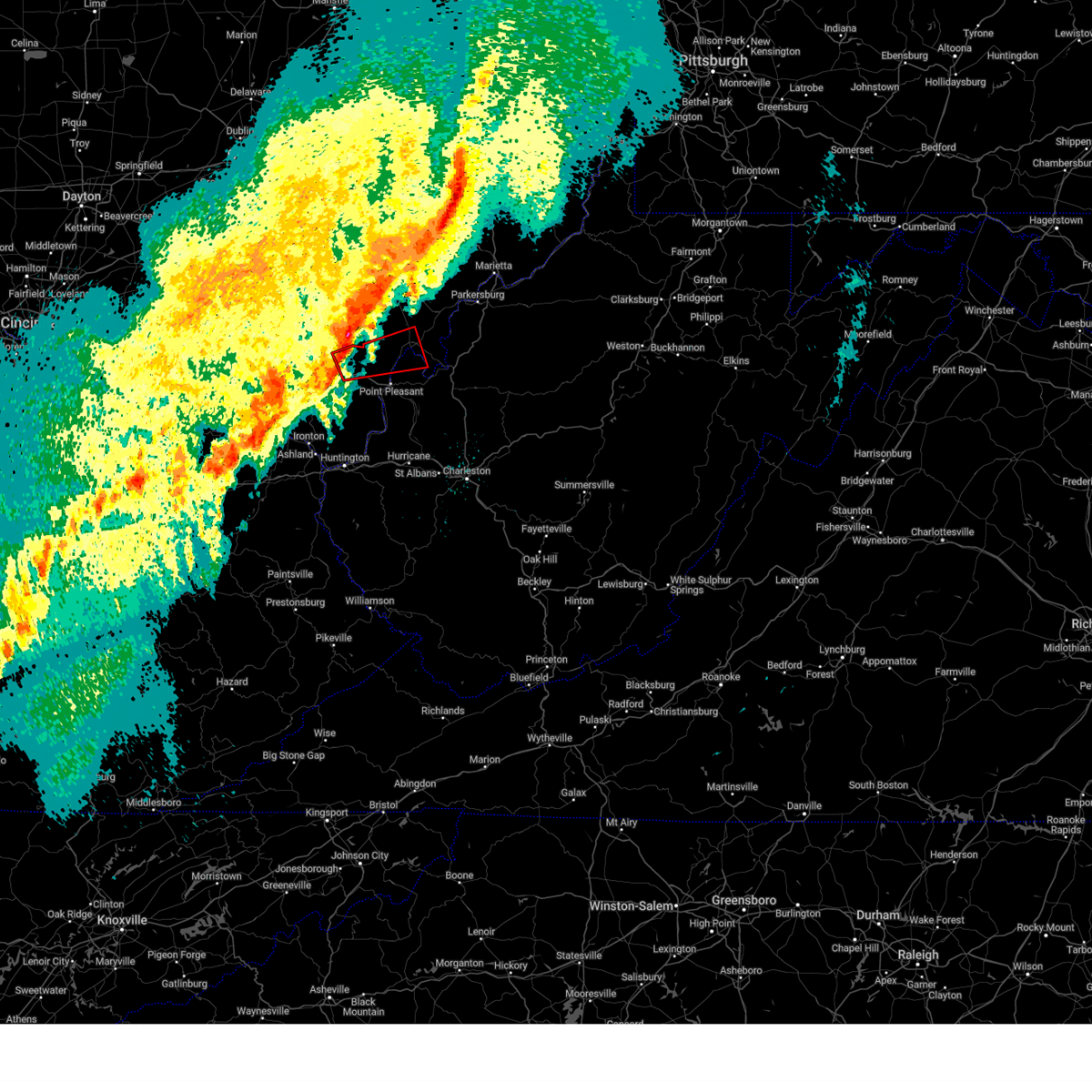
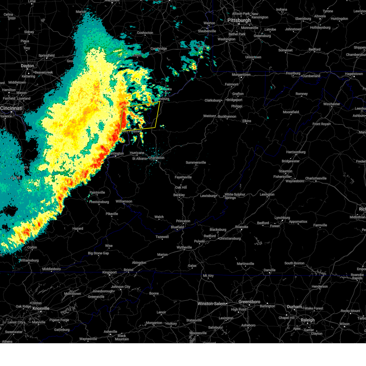
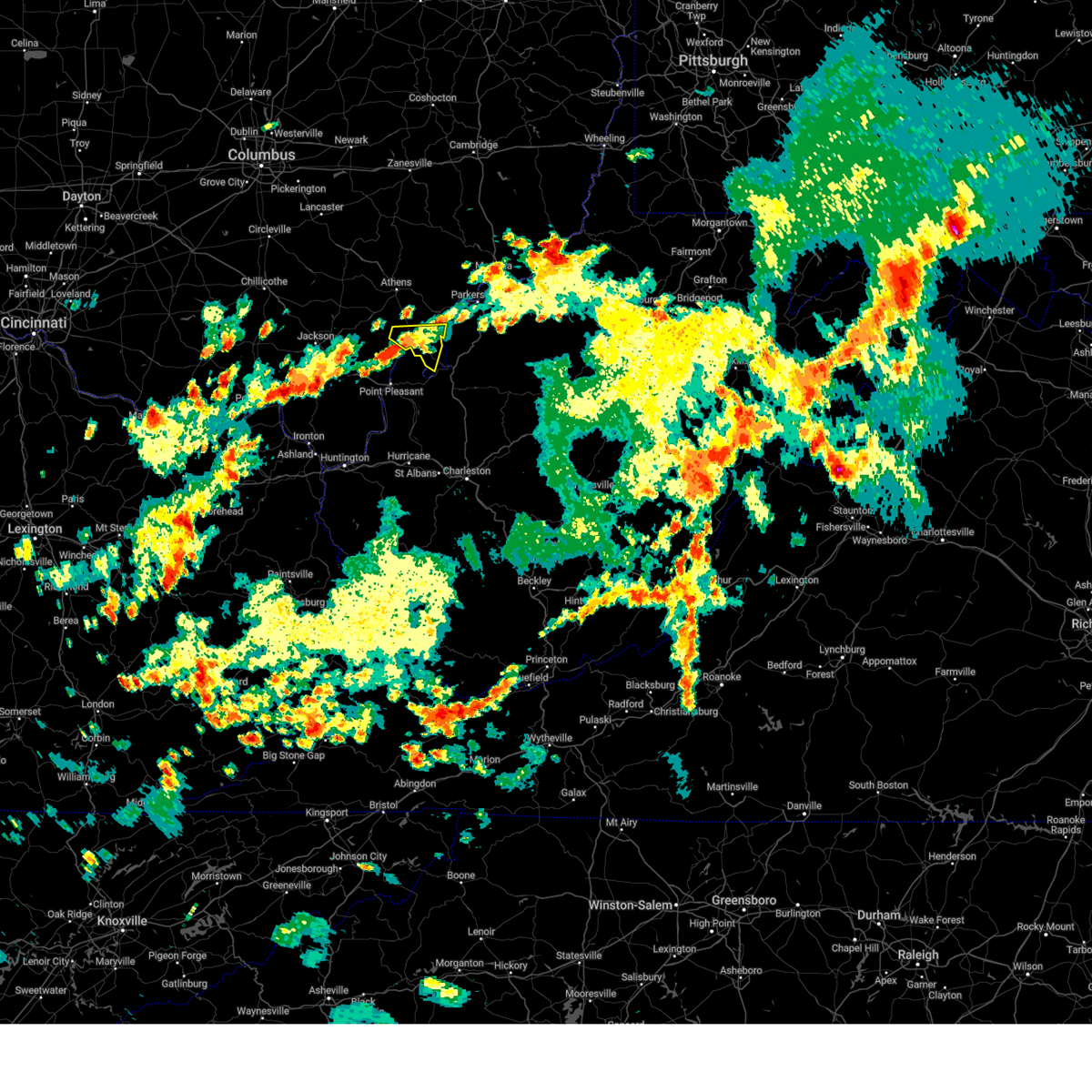
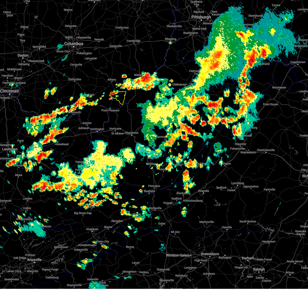
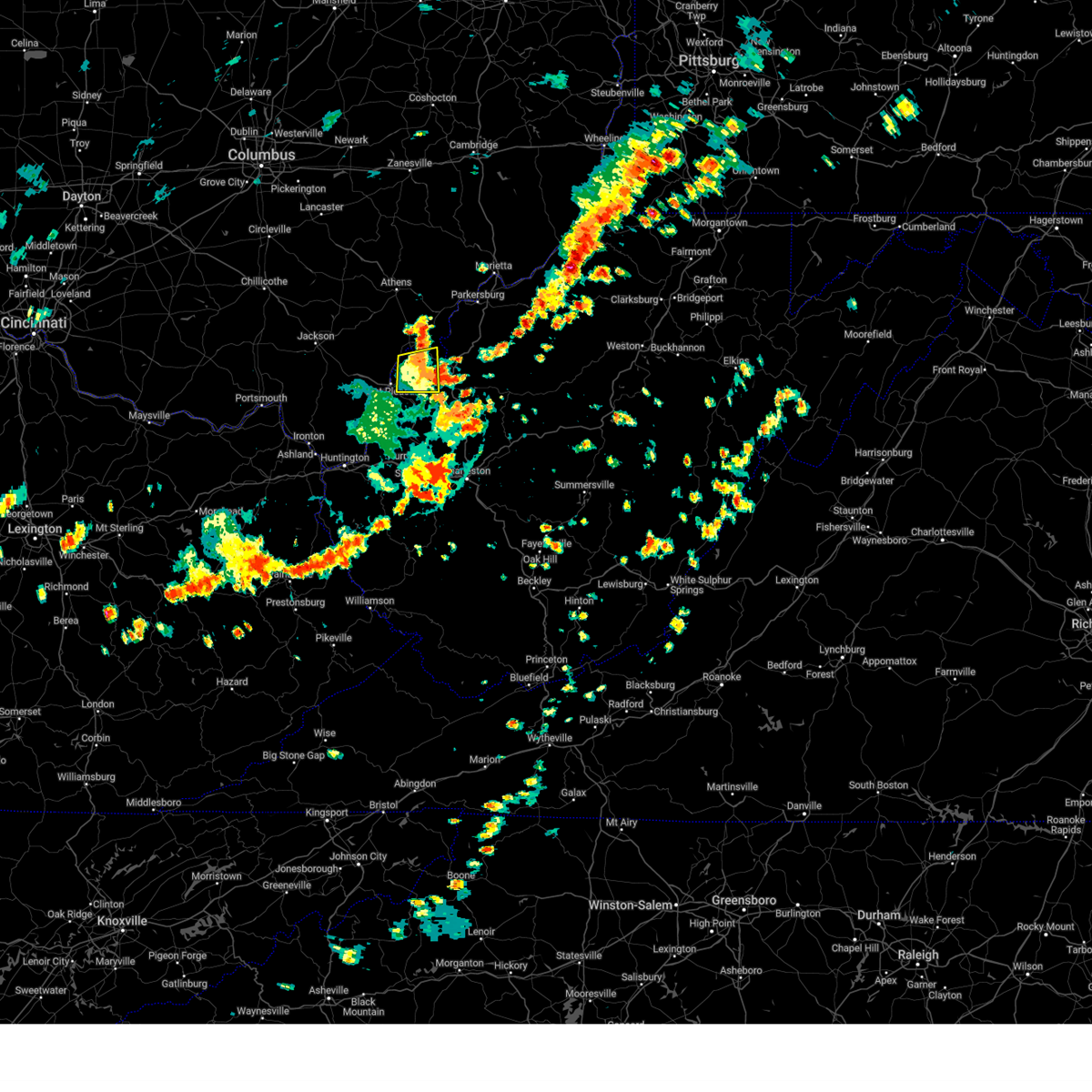
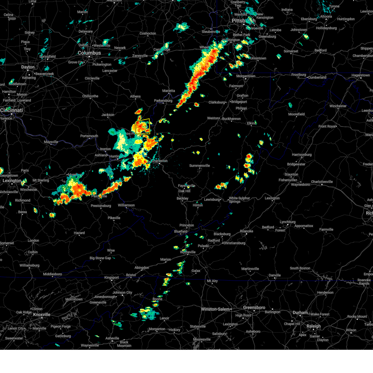
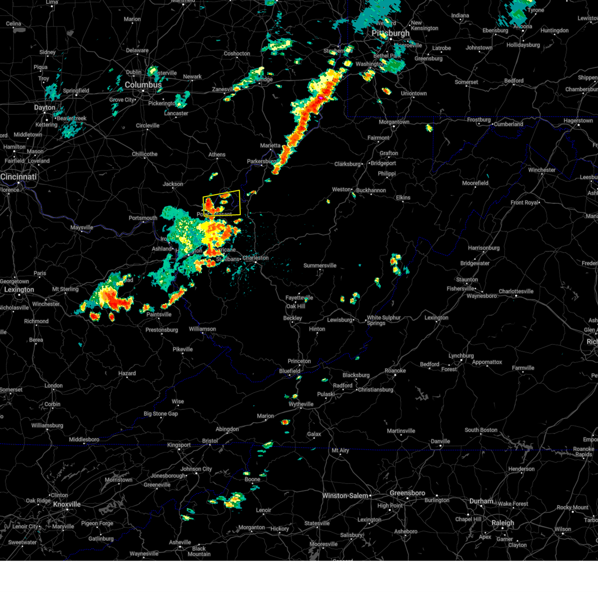
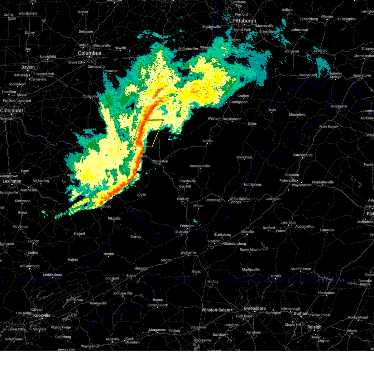
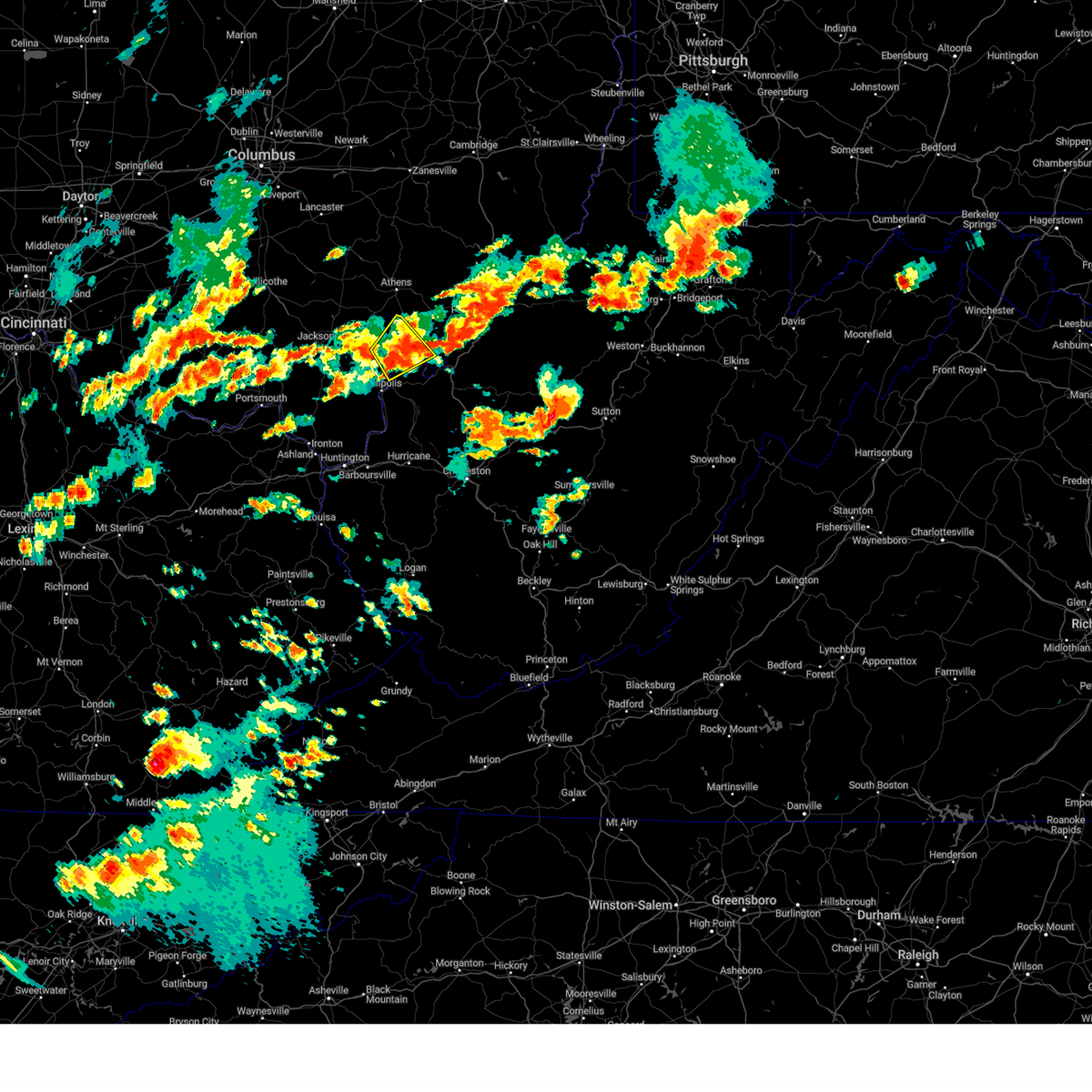
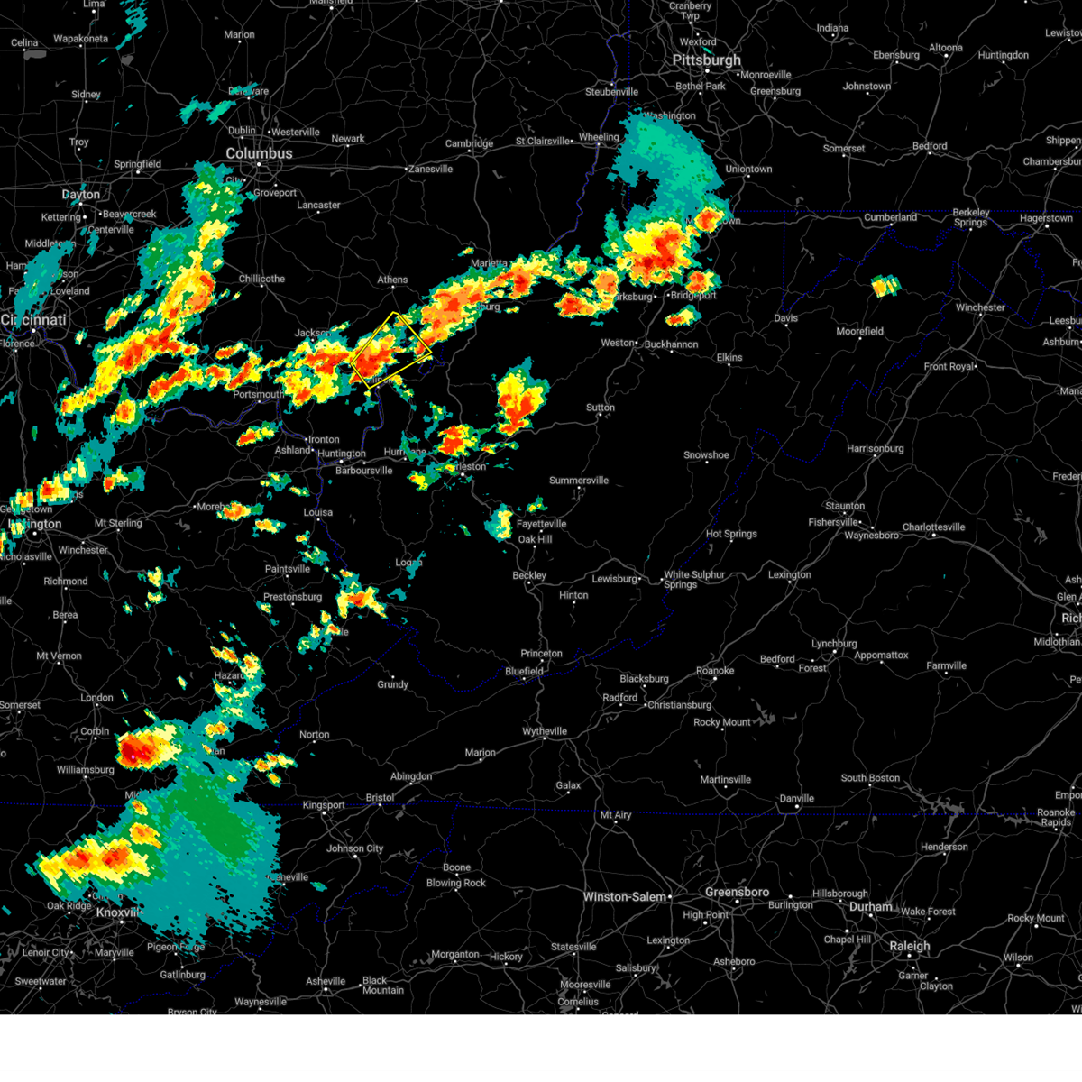
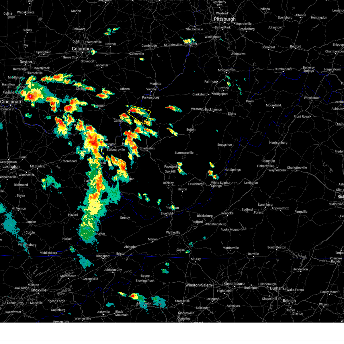
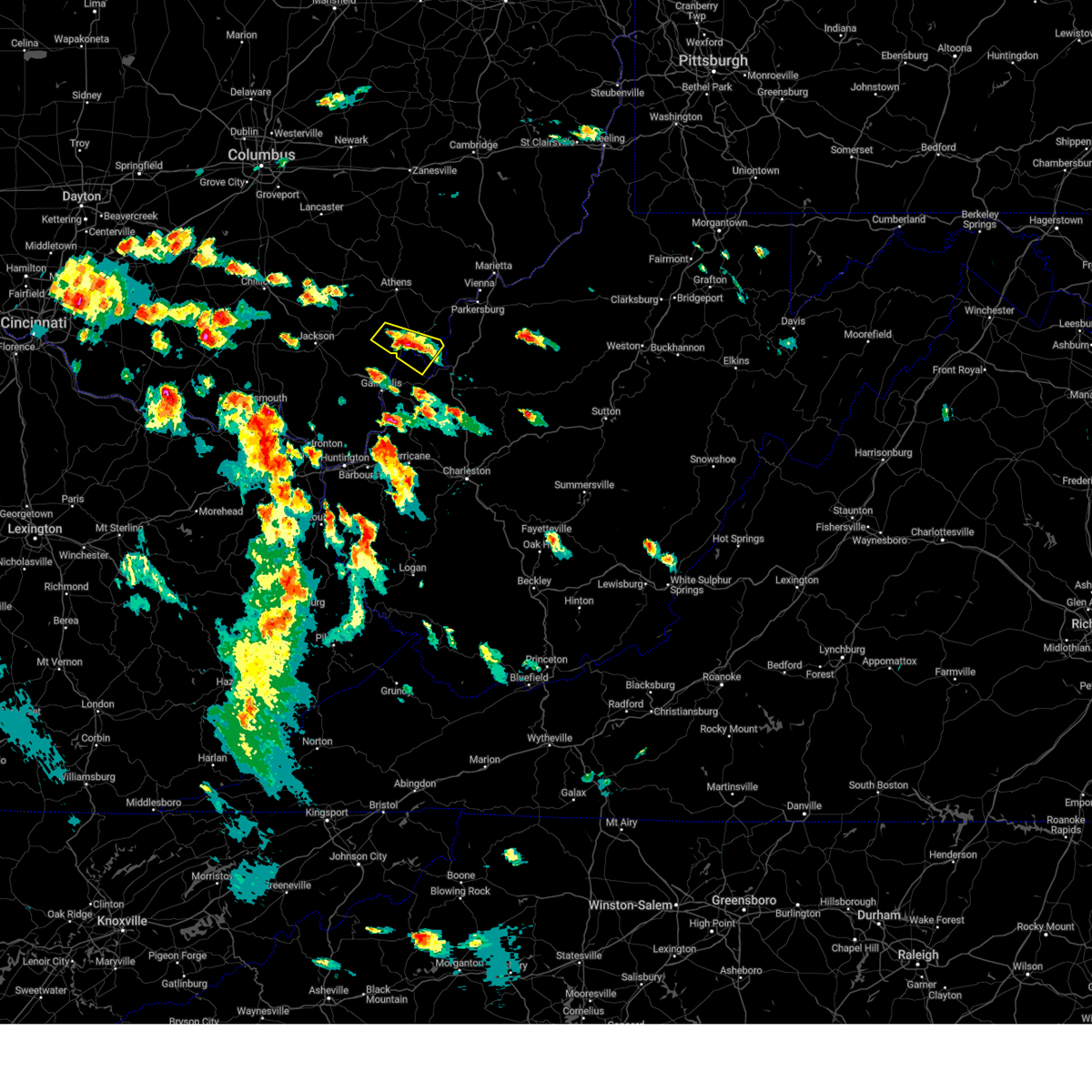
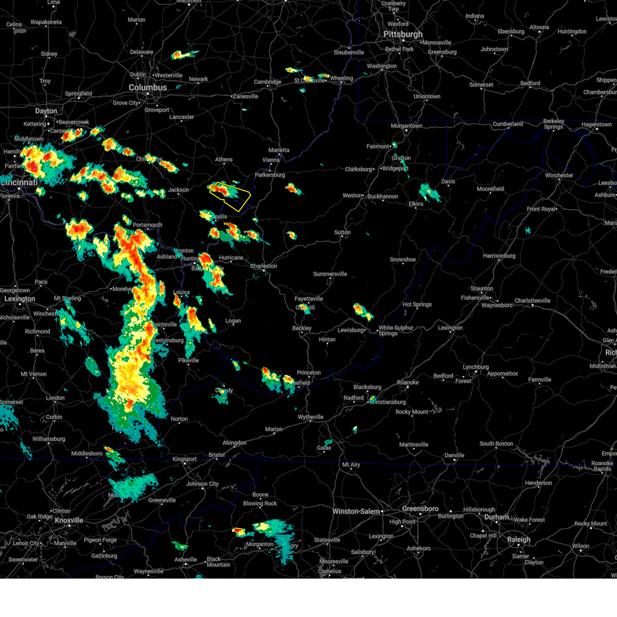
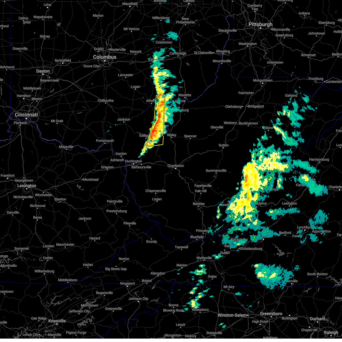
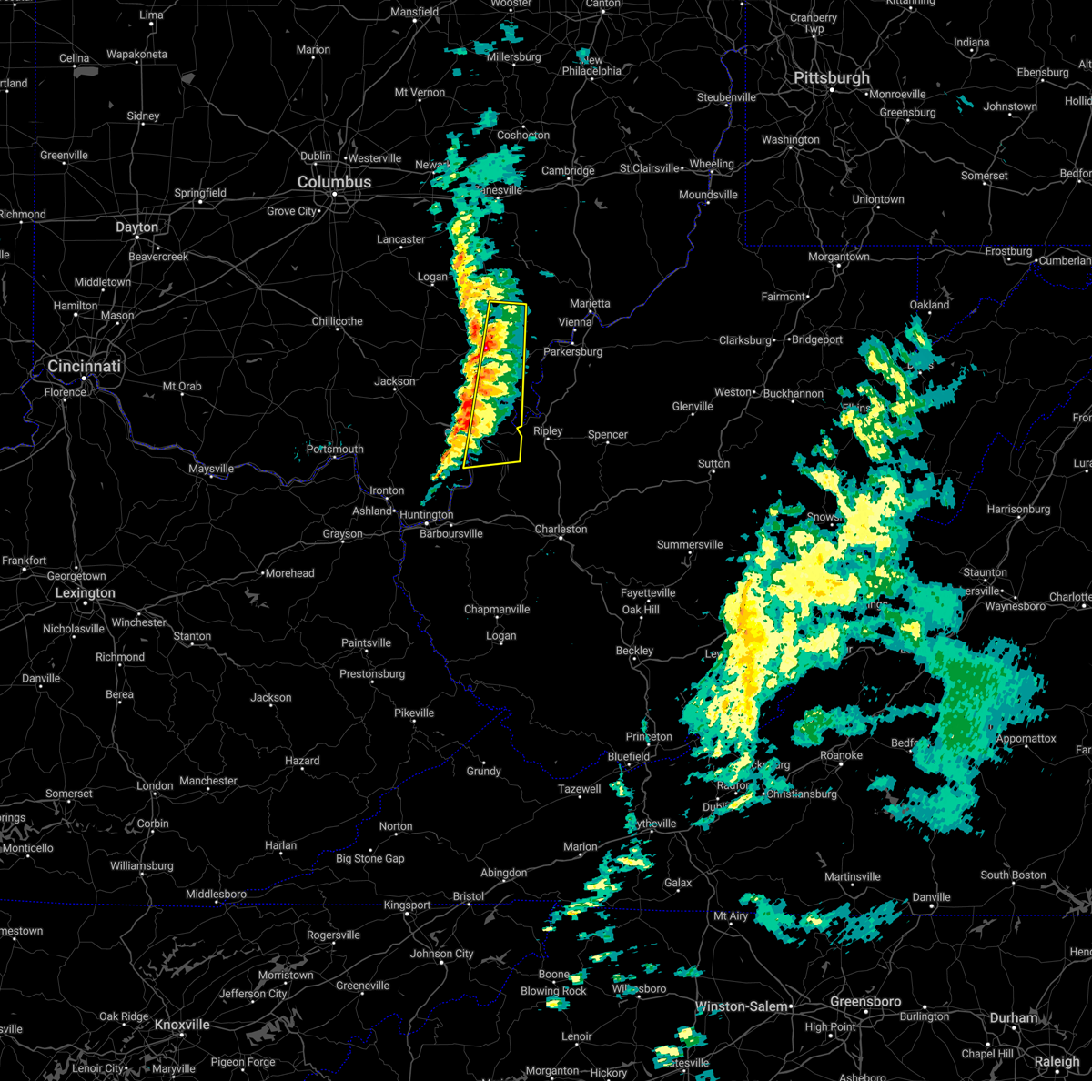
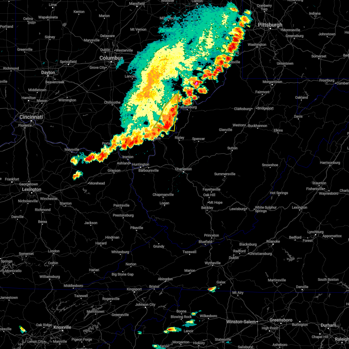
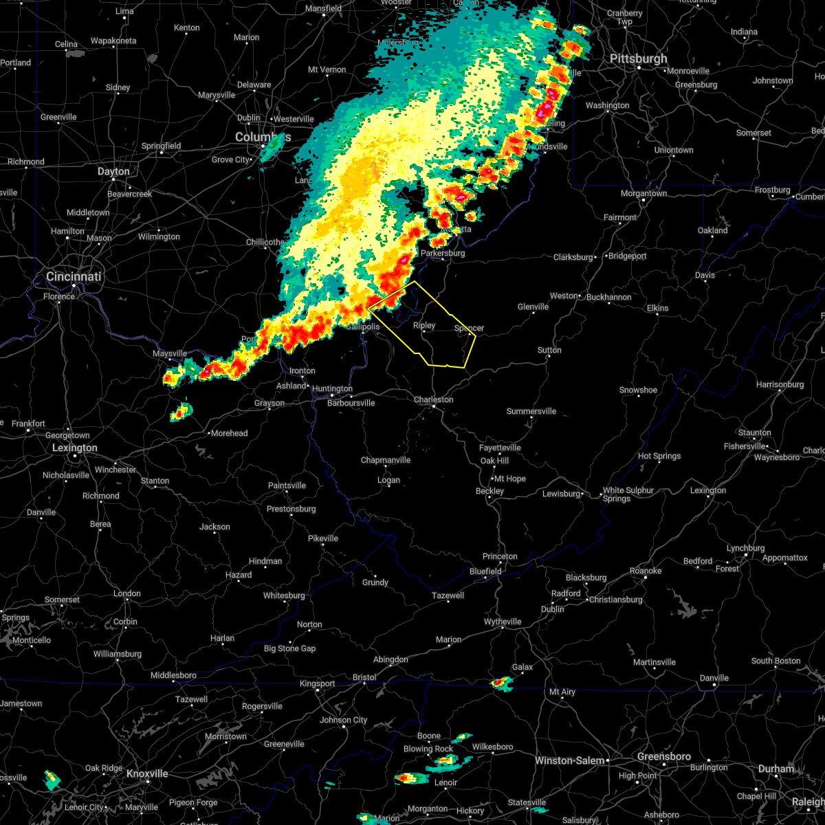
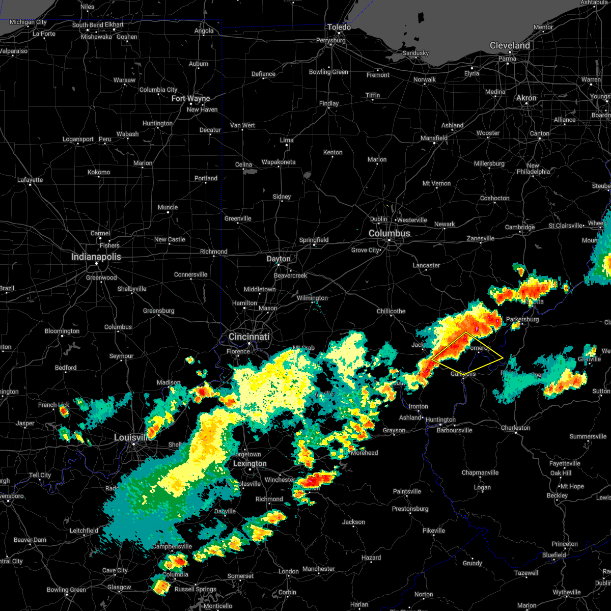
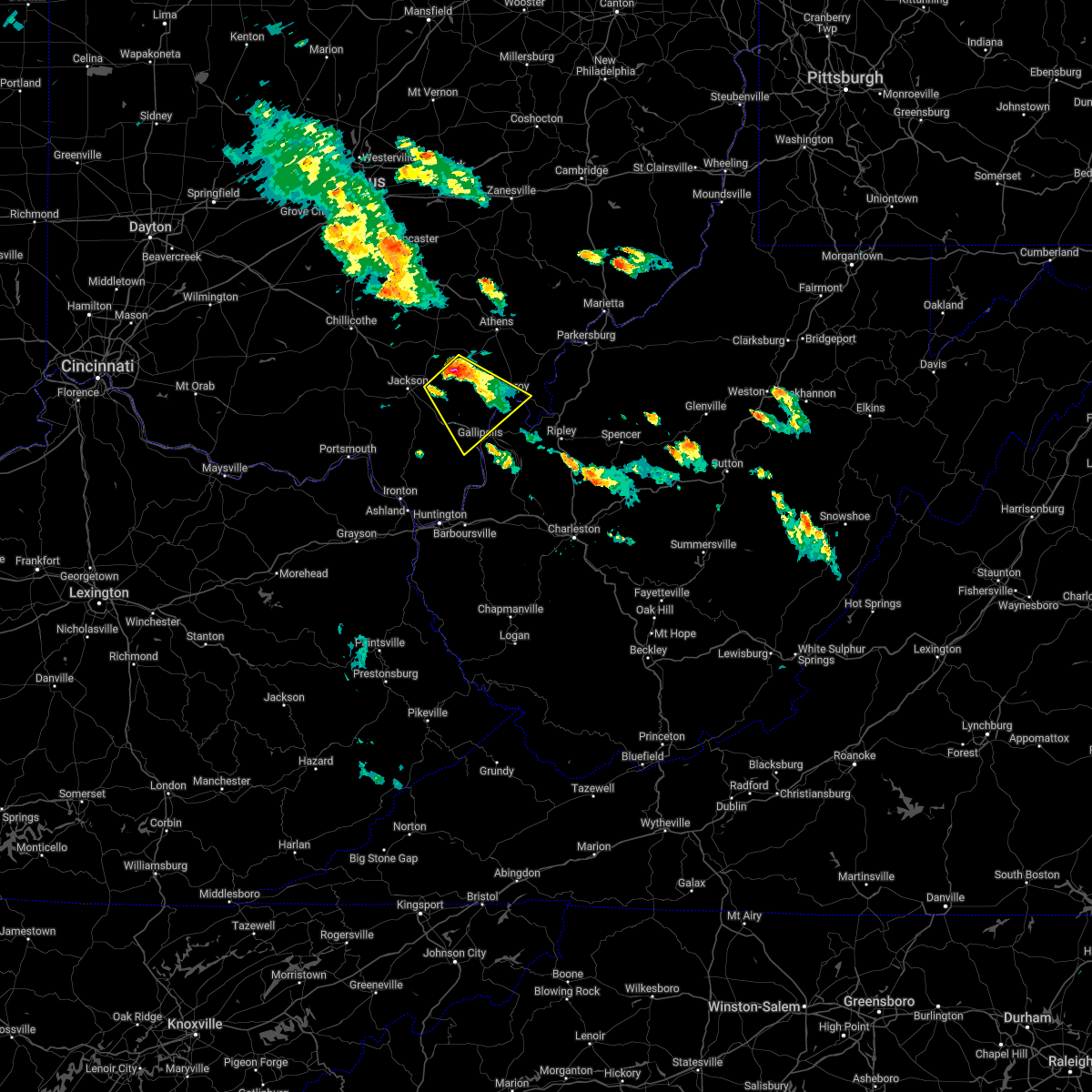
Hail Map for New Haven, WV
The New Haven, WV area has had 2 reports of on-the-ground hail by trained spotters, and has been under severe weather warnings 28 times during the past 12 months. Doppler radar has detected hail at or near New Haven, WV on 40 occasions, including 1 occasion during the past year.
| Name: | New Haven, WV |
| Where Located: | 47.4 miles NNW of Charleston, WV |
| Map: | Google Map for New Haven, WV |
| Population: | 1560 |
| Housing Units: | 765 |
| More Info: | Search Google for New Haven, WV |
0
The Top Recent Hail Date for New Haven, WV is Saturday, August 31, 2024 (31st out of 40)

Hail and Wind Damage Spotted near New Haven, WV
| Date / Time | Report Details |
|---|---|
| 4/14/2025 5:40 PM EDT |
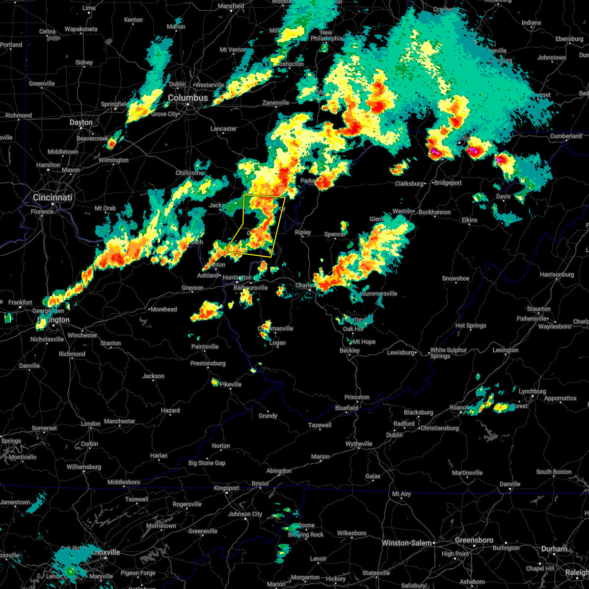
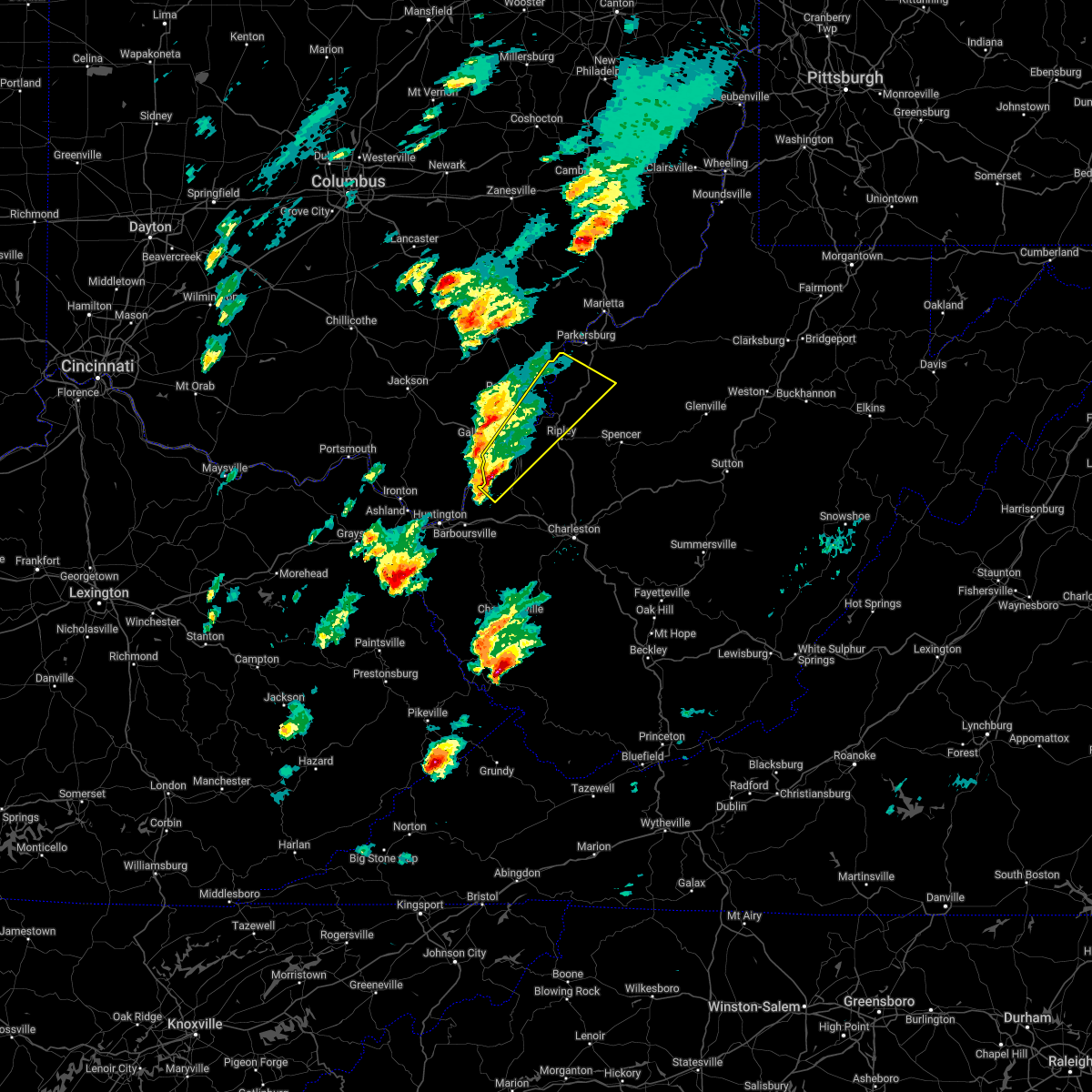
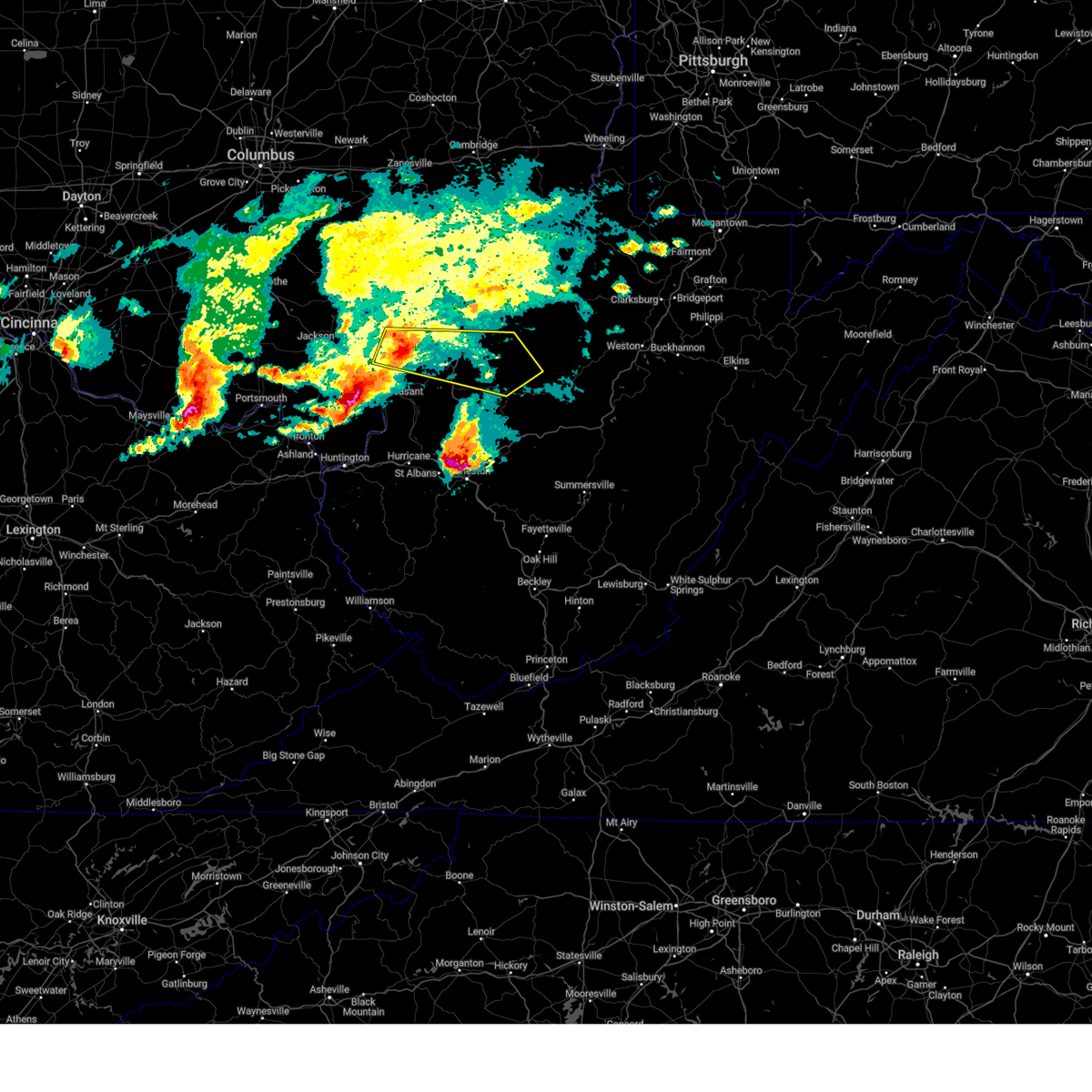 Svrrlx the national weather service in charleston west virginia has issued a * severe thunderstorm warning for, central meigs county in southeastern ohio, northeastern gallia county in southeastern ohio, northwestern calhoun county in north central west virginia, north central mason county in western west virginia, wirt county in northwestern west virginia, northwestern roane county in central west virginia, northern jackson county in northwestern west virginia, southwestern wood county in northwestern west virginia, * until 645 pm edt. * at 540 pm edt, a severe thunderstorm was located over pomeroy, moving east at 50 mph (radar indicated). Hazards include 60 mph wind gusts and quarter size hail. Hail damage to vehicles is expected. Expect wind damage to roofs, siding, and trees. Svrrlx the national weather service in charleston west virginia has issued a * severe thunderstorm warning for, central meigs county in southeastern ohio, northeastern gallia county in southeastern ohio, northwestern calhoun county in north central west virginia, north central mason county in western west virginia, wirt county in northwestern west virginia, northwestern roane county in central west virginia, northern jackson county in northwestern west virginia, southwestern wood county in northwestern west virginia, * until 645 pm edt. * at 540 pm edt, a severe thunderstorm was located over pomeroy, moving east at 50 mph (radar indicated). Hazards include 60 mph wind gusts and quarter size hail. Hail damage to vehicles is expected. Expect wind damage to roofs, siding, and trees.
|
| 4/3/2025 5:04 AM EDT | the severe thunderstorm warning has been cancelled and is no longer in effect |
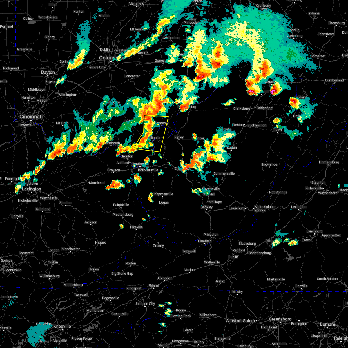
| 4/3/2025 5:04 AM EDT | At 504 am edt, severe thunderstorms were located along a line extending from near racine to 11 miles southwest of ripley to near buffalo, moving east at 40 mph (radar indicated). Hazards include 60 mph wind gusts. Expect damage to roofs, siding, and trees. Locations impacted include, portland, statts mills, sandyville, winfield, given, reedsville, kentuck, liberty, cottageville, syracuse, eleanor, poca, fraziers bottom, leon, fairplain, racine, buffalo, mount alto, ravenswood, and hartford city. |
| 4/3/2025 4:58 AM EDT | At 457 am edt, severe thunderstorms were located along a line extending from new haven to 8 miles north of buffalo to 7 miles north of milton, moving east at 60 mph (radar indicated). Hazards include 60 mph wind gusts. Expect damage to roofs, siding, and trees. Locations impacted include, portland, statts mills, sandyville, winfield, point pleasant, crown city, lakin, given, reedsville, pomeroy, kentuck, liberty, ashton, cottageville, syracuse, eleanor, poca, fraziers bottom, leon, and fairplain. |
| 4/3/2025 4:58 AM EDT | the severe thunderstorm warning has been cancelled and is no longer in effect |
| 4/3/2025 4:46 AM EDT | Svrrlx the national weather service in charleston west virginia has issued a * severe thunderstorm warning for, meigs county in southeastern ohio, eastern gallia county in southeastern ohio, east central lawrence county in southeastern ohio, mason county in western west virginia, northeastern cabell county in central west virginia, putnam county in western west virginia, northwestern kanawha county in central west virginia, west central roane county in central west virginia, jackson county in northwestern west virginia, southwestern wood county in northwestern west virginia, * until 530 am edt. * at 446 am edt, severe thunderstorms were located along a line extending from near rutland to near gallipolis to 9 miles northeast of proctorville, moving east at 35 mph (radar indicated). Hazards include 60 mph wind gusts. expect damage to roofs, siding, and trees |
| 4/3/2025 4:11 AM EDT | Svrrlx the national weather service in charleston west virginia has issued a * severe thunderstorm warning for, southeastern meigs county in southeastern ohio, east central gallia county in southeastern ohio, northern mason county in western west virginia, northern jackson county in northwestern west virginia, southwestern wood county in northwestern west virginia, * until 445 am edt. * at 411 am edt, a severe thunderstorm was located near gallipolis, moving northeast at 60 mph (radar indicated). Hazards include 60 mph wind gusts. expect damage to roofs, siding, and trees |
| 4/3/2025 3:44 AM EDT | The storm which prompted the warning has weakened below severe limits, and no longer appears capable of producing a tornado. therefore, the warning will be allowed to expire. a severe thunderstorm watch remains in effect until 700 am edt for southeastern ohio, and western west virginia. |
| 4/3/2025 3:37 AM EDT |
 Svrrlx the national weather service in charleston west virginia has issued a * severe thunderstorm warning for, eastern meigs county in southeastern ohio, eastern gallia county in southeastern ohio, southwestern washington county in southeastern ohio, southeastern athens county in southeastern ohio, southwestern pleasants county in northwestern west virginia, northwestern mason county in western west virginia, northwestern wirt county in northwestern west virginia, northern jackson county in northwestern west virginia, wood county in northwestern west virginia, * until 400 am edt. * at 337 am edt, severe thunderstorms were located along a line extending from 6 miles southeast of chesterhill to near rutland, moving east at 75 mph (radar indicated). Hazards include 60 mph wind gusts and penny size hail. expect damage to roofs, siding, and trees Svrrlx the national weather service in charleston west virginia has issued a * severe thunderstorm warning for, eastern meigs county in southeastern ohio, eastern gallia county in southeastern ohio, southwestern washington county in southeastern ohio, southeastern athens county in southeastern ohio, southwestern pleasants county in northwestern west virginia, northwestern mason county in western west virginia, northwestern wirt county in northwestern west virginia, northern jackson county in northwestern west virginia, wood county in northwestern west virginia, * until 400 am edt. * at 337 am edt, severe thunderstorms were located along a line extending from 6 miles southeast of chesterhill to near rutland, moving east at 75 mph (radar indicated). Hazards include 60 mph wind gusts and penny size hail. expect damage to roofs, siding, and trees
|
| 4/3/2025 3:34 AM EDT |
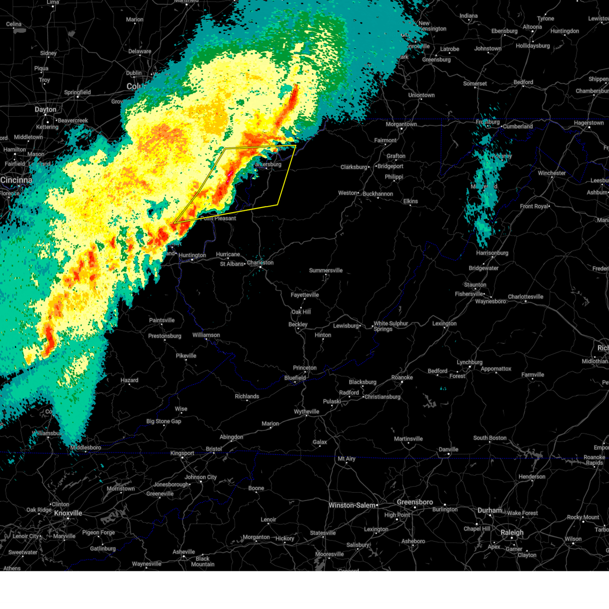
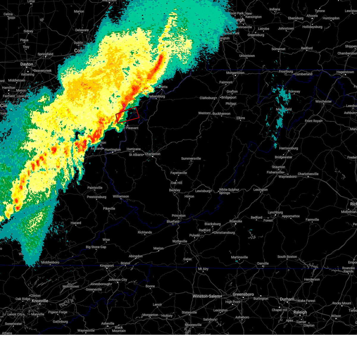
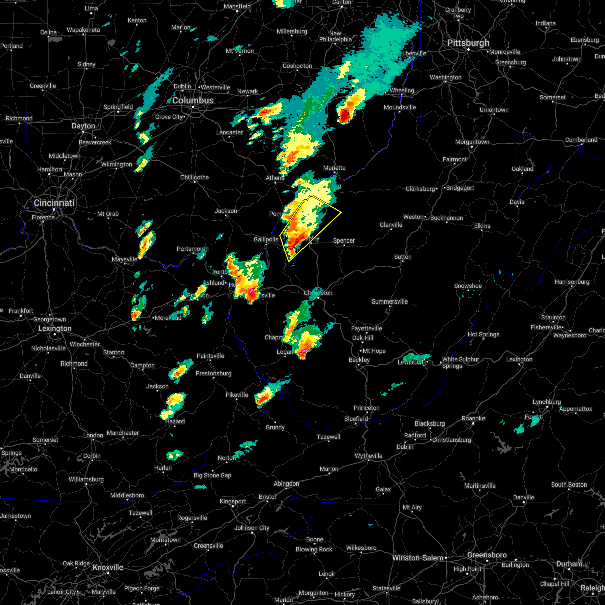
 At 333 am edt, a severe thunderstorm capable of producing a tornado was located near mason, or near pomeroy, moving east at 55 mph (radar indicated rotation). Hazards include tornado. Flying debris will be dangerous to those caught without shelter. mobile homes will be damaged or destroyed. damage to roofs, windows, and vehicles will occur. tree damage is likely. this dangerous storm will be near, new haven, mason, and pomeroy around 340 am edt. Other locations impacted by this tornadic thunderstorm include hartford city, syracuse, middleport, lakin, and kyger. At 333 am edt, a severe thunderstorm capable of producing a tornado was located near mason, or near pomeroy, moving east at 55 mph (radar indicated rotation). Hazards include tornado. Flying debris will be dangerous to those caught without shelter. mobile homes will be damaged or destroyed. damage to roofs, windows, and vehicles will occur. tree damage is likely. this dangerous storm will be near, new haven, mason, and pomeroy around 340 am edt. Other locations impacted by this tornadic thunderstorm include hartford city, syracuse, middleport, lakin, and kyger.
|
| 4/3/2025 3:31 AM EDT |
 At 331 am edt, severe thunderstorms were located along a line extending from near chesterhill to 7 miles northwest of point pleasant, moving east at 45 mph (radar indicated). Hazards include 70 mph wind gusts. Expect considerable tree damage. damage is likely to mobile homes, roofs, and outbuildings. Locations impacted include, sandyville, point pleasant, belmont, stroud run state park, adamsville, pomeroy, mineralwells, little hocking, salem center, fleming, syracuse, dexter, amesville, racine, albany, gallia, peewee, rutland, parkersburg, and hartford city. At 331 am edt, severe thunderstorms were located along a line extending from near chesterhill to 7 miles northwest of point pleasant, moving east at 45 mph (radar indicated). Hazards include 70 mph wind gusts. Expect considerable tree damage. damage is likely to mobile homes, roofs, and outbuildings. Locations impacted include, sandyville, point pleasant, belmont, stroud run state park, adamsville, pomeroy, mineralwells, little hocking, salem center, fleming, syracuse, dexter, amesville, racine, albany, gallia, peewee, rutland, parkersburg, and hartford city.
|
| 4/3/2025 3:23 AM EDT |
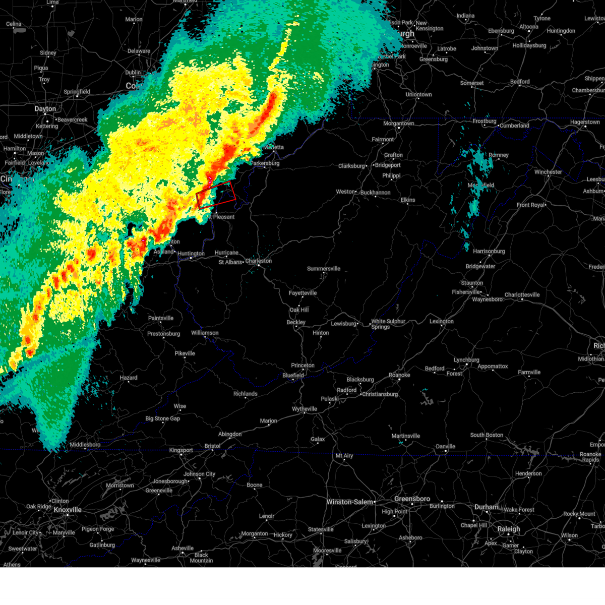 At 323 am edt, a severe thunderstorm capable of producing a tornado was located 7 miles northeast of rio grande, moving east at 55 mph (radar indicated rotation). Hazards include tornado. Flying debris will be dangerous to those caught without shelter. mobile homes will be damaged or destroyed. damage to roofs, windows, and vehicles will occur. tree damage is likely. this dangerous storm will be near, rutland, new haven, mason, and pomeroy around 330 am edt. racine around 335 am edt. Other locations impacted by this tornadic thunderstorm include cheshire, vinton, salem center, lakin, hartford city, syracuse, middleport, and kyger. At 323 am edt, a severe thunderstorm capable of producing a tornado was located 7 miles northeast of rio grande, moving east at 55 mph (radar indicated rotation). Hazards include tornado. Flying debris will be dangerous to those caught without shelter. mobile homes will be damaged or destroyed. damage to roofs, windows, and vehicles will occur. tree damage is likely. this dangerous storm will be near, rutland, new haven, mason, and pomeroy around 330 am edt. racine around 335 am edt. Other locations impacted by this tornadic thunderstorm include cheshire, vinton, salem center, lakin, hartford city, syracuse, middleport, and kyger.
|
| 4/3/2025 3:23 AM EDT |
 the tornado warning has been cancelled and is no longer in effect the tornado warning has been cancelled and is no longer in effect
|
| 4/3/2025 3:16 AM EDT |
 Torrlx the national weather service in charleston west virginia has issued a * tornado warning for, central meigs county in southeastern ohio, northeastern gallia county in southeastern ohio, southeastern jackson county in southeastern ohio, northwestern mason county in western west virginia, * until 345 am edt. * at 315 am edt, a severe thunderstorm capable of producing a tornado was located near rio grande, moving east at 55 mph (radar indicated rotation). Hazards include tornado. Flying debris will be dangerous to those caught without shelter. mobile homes will be damaged or destroyed. damage to roofs, windows, and vehicles will occur. tree damage is likely. this dangerous storm will be near, rio grande around 320 am edt. rutland around 325 am edt. new haven, mason, and pomeroy around 330 am edt. racine around 335 am edt. Other locations impacted by this tornadic thunderstorm include cheshire, vinton, salem center, lakin, hartford city, syracuse, middleport, and kyger. Torrlx the national weather service in charleston west virginia has issued a * tornado warning for, central meigs county in southeastern ohio, northeastern gallia county in southeastern ohio, southeastern jackson county in southeastern ohio, northwestern mason county in western west virginia, * until 345 am edt. * at 315 am edt, a severe thunderstorm capable of producing a tornado was located near rio grande, moving east at 55 mph (radar indicated rotation). Hazards include tornado. Flying debris will be dangerous to those caught without shelter. mobile homes will be damaged or destroyed. damage to roofs, windows, and vehicles will occur. tree damage is likely. this dangerous storm will be near, rio grande around 320 am edt. rutland around 325 am edt. new haven, mason, and pomeroy around 330 am edt. racine around 335 am edt. Other locations impacted by this tornadic thunderstorm include cheshire, vinton, salem center, lakin, hartford city, syracuse, middleport, and kyger.
|
| 4/3/2025 3:09 AM EDT |
 Svrrlx the national weather service in charleston west virginia has issued a * severe thunderstorm warning for, meigs county in southeastern ohio, northern gallia county in southeastern ohio, southern washington county in southeastern ohio, southeastern jackson county in southeastern ohio, southeastern vinton county in southeastern ohio, athens county in southeastern ohio, northwestern lawrence county in southeastern ohio, southwestern pleasants county in northwestern west virginia, northwestern mason county in western west virginia, western wirt county in northwestern west virginia, northern jackson county in northwestern west virginia, wood county in northwestern west virginia, * until 345 am edt. * at 308 am edt, severe thunderstorms were located along a line extending from near nelsonville to near oak hill, moving east at 90 mph (radar indicated). Hazards include 70 mph wind gusts. Expect considerable tree damage. Damage is likely to mobile homes, roofs, and outbuildings. Svrrlx the national weather service in charleston west virginia has issued a * severe thunderstorm warning for, meigs county in southeastern ohio, northern gallia county in southeastern ohio, southern washington county in southeastern ohio, southeastern jackson county in southeastern ohio, southeastern vinton county in southeastern ohio, athens county in southeastern ohio, northwestern lawrence county in southeastern ohio, southwestern pleasants county in northwestern west virginia, northwestern mason county in western west virginia, western wirt county in northwestern west virginia, northern jackson county in northwestern west virginia, wood county in northwestern west virginia, * until 345 am edt. * at 308 am edt, severe thunderstorms were located along a line extending from near nelsonville to near oak hill, moving east at 90 mph (radar indicated). Hazards include 70 mph wind gusts. Expect considerable tree damage. Damage is likely to mobile homes, roofs, and outbuildings.
|
| 3/31/2025 1:31 AM EDT | The storms which prompted the warning have weakened below severe limits, and no longer pose an immediate threat to life or property. therefore, the warning will be allowed to expire. however, gusty winds and heavy rain are still possible with these thunderstorms. a severe thunderstorm watch remains in effect until 300 am edt for southeastern ohio, and northwestern west virginia. a severe thunderstorm watch also remains in effect until 600 am edt for southeastern ohio, and western and northwestern west virginia. to report severe weather, contact your nearest law enforcement agency. they will relay your report to the national weather service charleston west virginia. remember, a severe thunderstorm warning still remains in effect for portions of gallia county in ohio, and portions of mason and jackson counties in west virginia. |
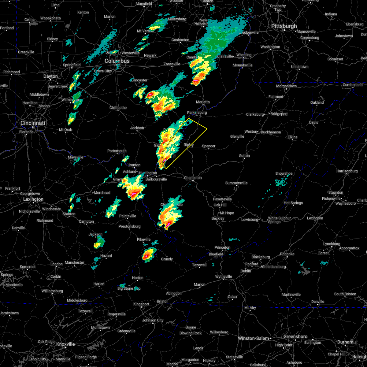
| 3/31/2025 1:19 AM EDT | At 116 am edt, severe thunderstorms were located along a line extending from 7 miles west of tuppers plains to near point pleasant, moving east at 50 mph (radar indicated). Hazards include 60 mph wind gusts. Expect damage to roofs, siding, and trees. Locations impacted include, portland, sandyville, point pleasant, lakin, reedsville, pomeroy, washington, darwin, cottageville, coolville, tuppers plains, syracuse, lubeck, racine, gallipolis, mount alto, ravenswood, hartford city, belleville, and middleport. |
| 3/31/2025 12:59 AM EDT |
 Svrrlx the national weather service in charleston west virginia has issued a * severe thunderstorm warning for, meigs county in southeastern ohio, northeastern gallia county in southeastern ohio, southeastern athens county in southeastern ohio, northwestern mason county in western west virginia, northwestern jackson county in northwestern west virginia, southwestern wood county in northwestern west virginia, * until 130 am edt. * at 1259 am edt, severe thunderstorms were located along a line extending from 6 miles south of albany to near rio grande, moving east at 55 mph (radar indicated). Hazards include 60 mph wind gusts and penny size hail. expect damage to roofs, siding, and trees Svrrlx the national weather service in charleston west virginia has issued a * severe thunderstorm warning for, meigs county in southeastern ohio, northeastern gallia county in southeastern ohio, southeastern athens county in southeastern ohio, northwestern mason county in western west virginia, northwestern jackson county in northwestern west virginia, southwestern wood county in northwestern west virginia, * until 130 am edt. * at 1259 am edt, severe thunderstorms were located along a line extending from 6 miles south of albany to near rio grande, moving east at 55 mph (radar indicated). Hazards include 60 mph wind gusts and penny size hail. expect damage to roofs, siding, and trees
|
| 8/31/2024 5:26 PM EDT |
 The storm which prompted the warning has weakened below severe limits, and no longer poses an immediate threat to life or property. therefore, the warning will be allowed to expire. a severe thunderstorm watch remains in effect until 700 pm edt for northwestern west virginia. The storm which prompted the warning has weakened below severe limits, and no longer poses an immediate threat to life or property. therefore, the warning will be allowed to expire. a severe thunderstorm watch remains in effect until 700 pm edt for northwestern west virginia.
|
| 8/31/2024 5:07 PM EDT |
 Svrrlx the national weather service in charleston west virginia has issued a * severe thunderstorm warning for, southeastern meigs county in southeastern ohio, eastern gallia county in southeastern ohio, northern mason county in western west virginia, west central jackson county in northwestern west virginia, * until 530 pm edt. * at 506 pm edt, a severe thunderstorm was located near new haven, or near pomeroy, moving southeast at 10 mph (radar indicated). Hazards include 60 mph wind gusts. expect damage to roofs, siding, and trees Svrrlx the national weather service in charleston west virginia has issued a * severe thunderstorm warning for, southeastern meigs county in southeastern ohio, eastern gallia county in southeastern ohio, northern mason county in western west virginia, west central jackson county in northwestern west virginia, * until 530 pm edt. * at 506 pm edt, a severe thunderstorm was located near new haven, or near pomeroy, moving southeast at 10 mph (radar indicated). Hazards include 60 mph wind gusts. expect damage to roofs, siding, and trees
|
| 8/31/2024 4:30 PM EDT |
 the severe thunderstorm warning has been cancelled and is no longer in effect the severe thunderstorm warning has been cancelled and is no longer in effect
|
| 8/31/2024 3:53 PM EDT |
 Svrrlx the national weather service in charleston west virginia has issued a * severe thunderstorm warning for, eastern meigs county in southeastern ohio, * until 445 pm edt. * at 352 pm edt, a severe thunderstorm was located near pomeroy, moving east at 20 mph (radar indicated). Hazards include 60 mph wind gusts and penny size hail. expect damage to roofs, siding, and trees Svrrlx the national weather service in charleston west virginia has issued a * severe thunderstorm warning for, eastern meigs county in southeastern ohio, * until 445 pm edt. * at 352 pm edt, a severe thunderstorm was located near pomeroy, moving east at 20 mph (radar indicated). Hazards include 60 mph wind gusts and penny size hail. expect damage to roofs, siding, and trees
|
| 8/31/2024 1:33 PM EDT |
 The severe thunderstorm which prompted the warning has moved out of the warned area. therefore, the warning has been allowed to expire. a severe thunderstorm watch remains in effect until 700 pm edt for northwestern west virginia. a severe thunderstorm warning has been issued a portion of central jackson county until 200 pm edt. The severe thunderstorm which prompted the warning has moved out of the warned area. therefore, the warning has been allowed to expire. a severe thunderstorm watch remains in effect until 700 pm edt for northwestern west virginia. a severe thunderstorm warning has been issued a portion of central jackson county until 200 pm edt.
|
| 8/31/2024 1:25 PM EDT | Downed tree reported on union campground roa in mason county WV, 0.6 miles NNE of New Haven, WV |
| 8/31/2024 1:19 PM EDT |
 At 117 pm edt, a severe thunderstorm was located near racine, moving east at 30 mph (radar indicated). Hazards include 60 mph wind gusts and quarter size hail. Hail damage to vehicles is expected. expect wind damage to roofs, siding, and trees. Locations impacted include, racine, new haven, middleport, syracuse, hartford city, mount alto, lakin, and letart. At 117 pm edt, a severe thunderstorm was located near racine, moving east at 30 mph (radar indicated). Hazards include 60 mph wind gusts and quarter size hail. Hail damage to vehicles is expected. expect wind damage to roofs, siding, and trees. Locations impacted include, racine, new haven, middleport, syracuse, hartford city, mount alto, lakin, and letart.
|
| 8/31/2024 1:19 PM EDT |
 the severe thunderstorm warning has been cancelled and is no longer in effect the severe thunderstorm warning has been cancelled and is no longer in effect
|
| 8/31/2024 12:57 PM EDT |
 Svrrlx the national weather service in charleston west virginia has issued a * severe thunderstorm warning for, southeastern meigs county in southeastern ohio, northeastern gallia county in southeastern ohio, northern mason county in western west virginia, west central jackson county in northwestern west virginia, * until 130 pm edt. * at 1256 pm edt, a severe thunderstorm was located near point pleasant, moving east at 25 mph (radar indicated). Hazards include 60 mph wind gusts and quarter size hail. Hail damage to vehicles is expected. Expect wind damage to roofs, siding, and trees. Svrrlx the national weather service in charleston west virginia has issued a * severe thunderstorm warning for, southeastern meigs county in southeastern ohio, northeastern gallia county in southeastern ohio, northern mason county in western west virginia, west central jackson county in northwestern west virginia, * until 130 pm edt. * at 1256 pm edt, a severe thunderstorm was located near point pleasant, moving east at 25 mph (radar indicated). Hazards include 60 mph wind gusts and quarter size hail. Hail damage to vehicles is expected. Expect wind damage to roofs, siding, and trees.
|
| 7/14/2024 6:03 PM EDT |
 At 602 pm edt, severe thunderstorms were located along a line extending from near new haven to 9 miles south of gallipolis to near chesapeake, moving southeast at 45 mph (radar indicated). Hazards include 60 mph wind gusts. Expect damage to roofs, siding, and trees. Locations impacted include, huntington, ashland, ironton, point pleasant, gallipolis, coal grove, pomeroy, rio grande, chesapeake, racine, proctorville, rutland, beech fork state park, lake vesuvius, barboursville, ravenswood, kenova, catlettsburg, new haven, and ceredo. At 602 pm edt, severe thunderstorms were located along a line extending from near new haven to 9 miles south of gallipolis to near chesapeake, moving southeast at 45 mph (radar indicated). Hazards include 60 mph wind gusts. Expect damage to roofs, siding, and trees. Locations impacted include, huntington, ashland, ironton, point pleasant, gallipolis, coal grove, pomeroy, rio grande, chesapeake, racine, proctorville, rutland, beech fork state park, lake vesuvius, barboursville, ravenswood, kenova, catlettsburg, new haven, and ceredo.
|
| 7/14/2024 5:35 PM EDT |
 Svrrlx the national weather service in charleston west virginia has issued a * severe thunderstorm warning for, northeastern boyd county in northeastern kentucky, central greenup county in northeastern kentucky, meigs county in southeastern ohio, gallia county in southeastern ohio, lawrence county in southeastern ohio, mason county in western west virginia, cabell county in central west virginia, northwestern putnam county in western west virginia, northwestern jackson county in northwestern west virginia, north central wayne county in western west virginia, * until 615 pm edt. * at 534 pm edt, severe thunderstorms were located along a line extending from 10 miles southwest of albany to near rio grande to 6 miles northwest of lake vesuvius, moving southeast at 45 mph (radar indicated). Hazards include 60 mph wind gusts. expect damage to roofs, siding, and trees Svrrlx the national weather service in charleston west virginia has issued a * severe thunderstorm warning for, northeastern boyd county in northeastern kentucky, central greenup county in northeastern kentucky, meigs county in southeastern ohio, gallia county in southeastern ohio, lawrence county in southeastern ohio, mason county in western west virginia, cabell county in central west virginia, northwestern putnam county in western west virginia, northwestern jackson county in northwestern west virginia, north central wayne county in western west virginia, * until 615 pm edt. * at 534 pm edt, severe thunderstorms were located along a line extending from 10 miles southwest of albany to near rio grande to 6 miles northwest of lake vesuvius, moving southeast at 45 mph (radar indicated). Hazards include 60 mph wind gusts. expect damage to roofs, siding, and trees
|
| 5/26/2024 4:38 PM EDT |
 The storms which prompted the warning have moved out of the warned area. therefore, the warning will be allowed to expire. a severe thunderstorm watch remains in effect until 800 pm edt for southeastern ohio, and central, western and northwestern west virginia. a severe thunderstorm watch also remains in effect until 900 pm edt for central west virginia. The storms which prompted the warning have moved out of the warned area. therefore, the warning will be allowed to expire. a severe thunderstorm watch remains in effect until 800 pm edt for southeastern ohio, and central, western and northwestern west virginia. a severe thunderstorm watch also remains in effect until 900 pm edt for central west virginia.
|
| 5/26/2024 4:30 PM EDT |
 At 429 pm edt, severe thunderstorms were located along a line extending from near athens to 8 miles north of buffalo to near spurlockville, moving east at 45 mph (radar indicated). Hazards include 60 mph wind gusts and penny size hail. Expect damage to roofs, siding, and trees. locations impacted include, charleston, nitro, ripley, winfield, pomeroy, racine, forked run state park, jefferson, south charleston, st. Albans, dunbar, ravenswood, sissonville, new haven, eleanor, buffalo, poca, mason, institute, and tuppers plains. At 429 pm edt, severe thunderstorms were located along a line extending from near athens to 8 miles north of buffalo to near spurlockville, moving east at 45 mph (radar indicated). Hazards include 60 mph wind gusts and penny size hail. Expect damage to roofs, siding, and trees. locations impacted include, charleston, nitro, ripley, winfield, pomeroy, racine, forked run state park, jefferson, south charleston, st. Albans, dunbar, ravenswood, sissonville, new haven, eleanor, buffalo, poca, mason, institute, and tuppers plains.
|
| 5/26/2024 4:30 PM EDT |
 the severe thunderstorm warning has been cancelled and is no longer in effect the severe thunderstorm warning has been cancelled and is no longer in effect
|
| 5/26/2024 3:58 PM EDT |
 Svrrlx the national weather service in charleston west virginia has issued a * severe thunderstorm warning for, eastern meigs county in southeastern ohio, eastern gallia county in southeastern ohio, southeastern athens county in southeastern ohio, mason county in western west virginia, putnam county in western west virginia, northwestern kanawha county in central west virginia, northeastern lincoln county in central west virginia, central jackson county in northwestern west virginia, * until 445 pm edt. * at 358 pm edt, a severe thunderstorm was located near rio grande, moving east at 45 mph (radar indicated). Hazards include 60 mph wind gusts and penny size hail. expect damage to roofs, siding, and trees Svrrlx the national weather service in charleston west virginia has issued a * severe thunderstorm warning for, eastern meigs county in southeastern ohio, eastern gallia county in southeastern ohio, southeastern athens county in southeastern ohio, mason county in western west virginia, putnam county in western west virginia, northwestern kanawha county in central west virginia, northeastern lincoln county in central west virginia, central jackson county in northwestern west virginia, * until 445 pm edt. * at 358 pm edt, a severe thunderstorm was located near rio grande, moving east at 45 mph (radar indicated). Hazards include 60 mph wind gusts and penny size hail. expect damage to roofs, siding, and trees
|
| 4/17/2024 10:41 PM EDT |
 Svrrlx the national weather service in charleston west virginia has issued a * severe thunderstorm warning for, southern meigs county in southeastern ohio, northeastern gallia county in southeastern ohio, central calhoun county in north central west virginia, northeastern mason county in western west virginia, southern wirt county in northwestern west virginia, northwestern roane county in central west virginia, northern jackson county in northwestern west virginia, * until 1045 pm edt. * at 1019 pm edt, severe thunderstorms were located along a line extending from 7 miles southeast of elizabeth to mason, moving southeast at 30 mph (radar indicated). Hazards include 60 mph wind gusts and half dollar size hail. Hail damage to vehicles is expected. Expect wind damage to roofs, siding, and trees. Svrrlx the national weather service in charleston west virginia has issued a * severe thunderstorm warning for, southern meigs county in southeastern ohio, northeastern gallia county in southeastern ohio, central calhoun county in north central west virginia, northeastern mason county in western west virginia, southern wirt county in northwestern west virginia, northwestern roane county in central west virginia, northern jackson county in northwestern west virginia, * until 1045 pm edt. * at 1019 pm edt, severe thunderstorms were located along a line extending from 7 miles southeast of elizabeth to mason, moving southeast at 30 mph (radar indicated). Hazards include 60 mph wind gusts and half dollar size hail. Hail damage to vehicles is expected. Expect wind damage to roofs, siding, and trees.
|
| 4/17/2024 10:19 PM EDT |
 Svrrlx the national weather service in charleston west virginia has issued a * severe thunderstorm warning for, southern meigs county in southeastern ohio, northeastern gallia county in southeastern ohio, central calhoun county in north central west virginia, northeastern mason county in western west virginia, southern wirt county in northwestern west virginia, northwestern roane county in central west virginia, northern jackson county in northwestern west virginia, * until 1045 pm edt. * at 1019 pm edt, severe thunderstorms were located along a line extending from 7 miles southeast of elizabeth to mason, moving southeast at 30 mph (radar indicated). Hazards include 60 mph wind gusts and half dollar size hail. Hail damage to vehicles is expected. Expect wind damage to roofs, siding, and trees. Svrrlx the national weather service in charleston west virginia has issued a * severe thunderstorm warning for, southern meigs county in southeastern ohio, northeastern gallia county in southeastern ohio, central calhoun county in north central west virginia, northeastern mason county in western west virginia, southern wirt county in northwestern west virginia, northwestern roane county in central west virginia, northern jackson county in northwestern west virginia, * until 1045 pm edt. * at 1019 pm edt, severe thunderstorms were located along a line extending from 7 miles southeast of elizabeth to mason, moving southeast at 30 mph (radar indicated). Hazards include 60 mph wind gusts and half dollar size hail. Hail damage to vehicles is expected. Expect wind damage to roofs, siding, and trees.
|
| 4/2/2024 11:15 AM EDT |
 The storms which prompted the warning have moved out of the area. therefore, the warning will be allowed to expire. a tornado watch remains in effect until 100 pm edt for western and northwestern west virginia. The storms which prompted the warning have moved out of the area. therefore, the warning will be allowed to expire. a tornado watch remains in effect until 100 pm edt for western and northwestern west virginia.
|
| 4/2/2024 10:59 AM EDT |
 the severe thunderstorm warning has been cancelled and is no longer in effect the severe thunderstorm warning has been cancelled and is no longer in effect
|
| 4/2/2024 10:59 AM EDT |
 At 1058 am edt, severe thunderstorms were located along a line extending from new haven to 8 miles west of buffalo, moving east at 60 mph (radar indicated). Hazards include 70 mph wind gusts. Expect considerable tree damage. damage is likely to mobile homes, roofs, and outbuildings. Locations impacted include, ripley, racine, ravenswood, new haven, buffalo, sandyville, syracuse, hartford city, leon, portland, mount alto, given, southside, ashton, cottageville, grimms landing, evans, and letart. At 1058 am edt, severe thunderstorms were located along a line extending from new haven to 8 miles west of buffalo, moving east at 60 mph (radar indicated). Hazards include 70 mph wind gusts. Expect considerable tree damage. damage is likely to mobile homes, roofs, and outbuildings. Locations impacted include, ripley, racine, ravenswood, new haven, buffalo, sandyville, syracuse, hartford city, leon, portland, mount alto, given, southside, ashton, cottageville, grimms landing, evans, and letart.
|
| 4/2/2024 10:43 AM EDT |
 At 1042 am edt, severe thunderstorms were located along a line extending from near rutland to 11 miles north of proctorville, moving east at 60 mph (radar indicated). Hazards include 70 mph wind gusts. Expect considerable tree damage. damage is likely to mobile homes, roofs, and outbuildings. Locations impacted include, point pleasant, gallipolis, ripley, pomeroy, racine, ravenswood, new haven, buffalo, mason, sandyville, middleport, syracuse, hartford city, henderson, leon, cheshire, portland, lakin, given, and ashton. At 1042 am edt, severe thunderstorms were located along a line extending from near rutland to 11 miles north of proctorville, moving east at 60 mph (radar indicated). Hazards include 70 mph wind gusts. Expect considerable tree damage. damage is likely to mobile homes, roofs, and outbuildings. Locations impacted include, point pleasant, gallipolis, ripley, pomeroy, racine, ravenswood, new haven, buffalo, mason, sandyville, middleport, syracuse, hartford city, henderson, leon, cheshire, portland, lakin, given, and ashton.
|
| 4/2/2024 10:43 AM EDT |
 the severe thunderstorm warning has been cancelled and is no longer in effect the severe thunderstorm warning has been cancelled and is no longer in effect
|
| 4/2/2024 10:24 AM EDT |
 Svrrlx the national weather service in charleston west virginia has issued a * severe thunderstorm warning for, southeastern meigs county in southeastern ohio, gallia county in southeastern ohio, southeastern jackson county in southeastern ohio, central lawrence county in southeastern ohio, mason county in western west virginia, northwestern putnam county in western west virginia, central jackson county in northwestern west virginia, * until 1115 am edt. * at 1024 am edt, severe thunderstorms were located along a line extending from near oak hill to near lake vesuvius, moving east at 60 mph (radar indicated). Hazards include 60 mph wind gusts. expect damage to roofs, siding, and trees Svrrlx the national weather service in charleston west virginia has issued a * severe thunderstorm warning for, southeastern meigs county in southeastern ohio, gallia county in southeastern ohio, southeastern jackson county in southeastern ohio, central lawrence county in southeastern ohio, mason county in western west virginia, northwestern putnam county in western west virginia, central jackson county in northwestern west virginia, * until 1115 am edt. * at 1024 am edt, severe thunderstorms were located along a line extending from near oak hill to near lake vesuvius, moving east at 60 mph (radar indicated). Hazards include 60 mph wind gusts. expect damage to roofs, siding, and trees
|
| 8/7/2023 1:08 PM EDT |
 The severe thunderstorm warning for central meigs, northeastern gallia and northwestern mason counties will expire at 115 pm edt, the storm which prompted the warning has moved out of the area. therefore, the warning will be allowed to expire. a tornado watch remains in effect until 600 pm edt for southeastern ohio, and western west virginia. The severe thunderstorm warning for central meigs, northeastern gallia and northwestern mason counties will expire at 115 pm edt, the storm which prompted the warning has moved out of the area. therefore, the warning will be allowed to expire. a tornado watch remains in effect until 600 pm edt for southeastern ohio, and western west virginia.
|
| 8/7/2023 1:01 PM EDT |
 At 100 pm edt, a severe thunderstorm was located over rutland, moving northeast at 25 mph (radar indicated). Hazards include 60 mph wind gusts and quarter size hail. Hail damage to vehicles is expected. expect wind damage to roofs, siding, and trees. Locations impacted include, point pleasant, pomeroy, racine, rutland, new haven, mason, middleport, syracuse, hartford city, cheshire, lakin, darwin, harrisonville, and kyger. At 100 pm edt, a severe thunderstorm was located over rutland, moving northeast at 25 mph (radar indicated). Hazards include 60 mph wind gusts and quarter size hail. Hail damage to vehicles is expected. expect wind damage to roofs, siding, and trees. Locations impacted include, point pleasant, pomeroy, racine, rutland, new haven, mason, middleport, syracuse, hartford city, cheshire, lakin, darwin, harrisonville, and kyger.
|
| 8/7/2023 12:48 PM EDT |
 At 1247 pm edt, a severe thunderstorm was located near rutland, moving northeast at 25 mph (radar indicated). Hazards include 60 mph wind gusts and quarter size hail. Hail damage to vehicles is expected. Expect wind damage to roofs, siding, and trees. At 1247 pm edt, a severe thunderstorm was located near rutland, moving northeast at 25 mph (radar indicated). Hazards include 60 mph wind gusts and quarter size hail. Hail damage to vehicles is expected. Expect wind damage to roofs, siding, and trees.
|
| 7/18/2023 6:00 PM EDT | Quarter sized hail reported 0.3 miles ESE of New Haven, WV |
| 7/18/2023 5:58 PM EDT |
 At 558 pm edt, a severe thunderstorm was located over racine, moving east at 35 mph (radar indicated). Hazards include 60 mph wind gusts and quarter size hail. Hail damage to vehicles is expected. Expect wind damage to roofs, siding, and trees. At 558 pm edt, a severe thunderstorm was located over racine, moving east at 35 mph (radar indicated). Hazards include 60 mph wind gusts and quarter size hail. Hail damage to vehicles is expected. Expect wind damage to roofs, siding, and trees.
|
| 7/18/2023 5:53 PM EDT | Quarter sized hail reported 0.3 miles ESE of New Haven, WV, also heard that a funnel cloud had been spotted. |
| 7/18/2023 5:43 PM EDT |
 At 543 pm edt, a severe thunderstorm was located over new haven, or near pomeroy, moving east at 25 mph (radar indicated). Hazards include 60 mph wind gusts and quarter size hail. Hail damage to vehicles is expected. expect wind damage to roofs, siding, and trees. locations impacted include, pomeroy, racine, rutland, new haven, mason, middleport, chester, syracuse, hartford city, harrisonville, dexter and letart. hail threat, radar indicated max hail size, 1. 00 in wind threat, radar indicated max wind gust, 60 mph. At 543 pm edt, a severe thunderstorm was located over new haven, or near pomeroy, moving east at 25 mph (radar indicated). Hazards include 60 mph wind gusts and quarter size hail. Hail damage to vehicles is expected. expect wind damage to roofs, siding, and trees. locations impacted include, pomeroy, racine, rutland, new haven, mason, middleport, chester, syracuse, hartford city, harrisonville, dexter and letart. hail threat, radar indicated max hail size, 1. 00 in wind threat, radar indicated max wind gust, 60 mph.
|
| 7/18/2023 5:24 PM EDT |
 At 524 pm edt, a severe thunderstorm was located over rutland, moving east at 30 mph (radar indicated). Hazards include 60 mph wind gusts and quarter size hail. Hail damage to vehicles is expected. Expect wind damage to roofs, siding, and trees. At 524 pm edt, a severe thunderstorm was located over rutland, moving east at 30 mph (radar indicated). Hazards include 60 mph wind gusts and quarter size hail. Hail damage to vehicles is expected. Expect wind damage to roofs, siding, and trees.
|
| 3/3/2023 7:41 PM EST |
 At 738 pm est, a line of severe thunderstorms extending from amesville to near racine to near leon, is moving east at 60 mph (radar indicated). Hazards include 60 mph wind gusts. Expect damage to roofs, siding, and trees. locations impacted include, point pleasant, pomeroy, racine, new haven, mason, middleport, chester, syracuse, hartford city, henderson, leon, amesville, lakin, stroud run state park, southside, darwin and letart. hail threat, radar indicated max hail size, <. 75 in wind threat, radar indicated max wind gust, 60 mph. At 738 pm est, a line of severe thunderstorms extending from amesville to near racine to near leon, is moving east at 60 mph (radar indicated). Hazards include 60 mph wind gusts. Expect damage to roofs, siding, and trees. locations impacted include, point pleasant, pomeroy, racine, new haven, mason, middleport, chester, syracuse, hartford city, henderson, leon, amesville, lakin, stroud run state park, southside, darwin and letart. hail threat, radar indicated max hail size, <. 75 in wind threat, radar indicated max wind gust, 60 mph.
|
| 3/3/2023 7:25 PM EST |
 At 724 pm est, a line of severe thunderstorms was located over tuppers plains, or near coolville, moving east at 60 mph (radar indicated). Hazards include 60 mph wind gusts. expect damage to roofs, siding, and trees At 724 pm est, a line of severe thunderstorms was located over tuppers plains, or near coolville, moving east at 60 mph (radar indicated). Hazards include 60 mph wind gusts. expect damage to roofs, siding, and trees
|
| 7/23/2022 2:15 PM EDT |
 At 214 pm edt, a severe thunderstorm was located near tuppers plains, or near forked run state park, moving east at 35 mph (radar indicated). Hazards include 60 mph wind gusts and nickel size hail. Expect damage to roofs, siding, and trees. locations impacted include, pomeroy, racine, coolville, rutland, forked run state park, new haven, mason, tuppers plains, middleport, chester, syracuse, hartford city, darwin and bartlett. hail threat, radar indicated max hail size, 0. 88 in wind threat, radar indicated max wind gust, 60 mph. At 214 pm edt, a severe thunderstorm was located near tuppers plains, or near forked run state park, moving east at 35 mph (radar indicated). Hazards include 60 mph wind gusts and nickel size hail. Expect damage to roofs, siding, and trees. locations impacted include, pomeroy, racine, coolville, rutland, forked run state park, new haven, mason, tuppers plains, middleport, chester, syracuse, hartford city, darwin and bartlett. hail threat, radar indicated max hail size, 0. 88 in wind threat, radar indicated max wind gust, 60 mph.
|
| 7/23/2022 2:11 PM EDT |
 At 210 pm edt, a severe thunderstorm was located near racine, moving southeast at 50 mph (radar indicated). Hazards include 60 mph wind gusts and quarter size hail. Hail damage to vehicles is expected. Expect wind damage to roofs, siding, and trees. At 210 pm edt, a severe thunderstorm was located near racine, moving southeast at 50 mph (radar indicated). Hazards include 60 mph wind gusts and quarter size hail. Hail damage to vehicles is expected. Expect wind damage to roofs, siding, and trees.
|
| 7/23/2022 1:47 PM EDT |
 At 146 pm edt, a severe thunderstorm was located over albany, moving east at 35 mph (radar indicated). Hazards include 60 mph wind gusts and nickel size hail. expect damage to roofs, siding, and trees At 146 pm edt, a severe thunderstorm was located over albany, moving east at 35 mph (radar indicated). Hazards include 60 mph wind gusts and nickel size hail. expect damage to roofs, siding, and trees
|
| 7/6/2022 5:15 PM EDT |
 At 514 pm edt, severe thunderstorms were located along a line extending from 6 miles northeast of oak hill to near lake vesuvius to naples, moving east at 50 mph (radar indicated). Hazards include 60 mph wind gusts. expect damage to roofs, siding, and trees At 514 pm edt, severe thunderstorms were located along a line extending from 6 miles northeast of oak hill to near lake vesuvius to naples, moving east at 50 mph (radar indicated). Hazards include 60 mph wind gusts. expect damage to roofs, siding, and trees
|
| 6/22/2022 6:57 PM EDT |
 At 657 pm edt, a severe thunderstorm was located 8 miles west of rutland, moving southeast at 40 mph (radar indicated). Hazards include 60 mph wind gusts and quarter size hail. Hail damage to vehicles is expected. Expect wind damage to roofs, siding, and trees. At 657 pm edt, a severe thunderstorm was located 8 miles west of rutland, moving southeast at 40 mph (radar indicated). Hazards include 60 mph wind gusts and quarter size hail. Hail damage to vehicles is expected. Expect wind damage to roofs, siding, and trees.
|
| 6/14/2022 1:29 AM EDT |
 At 128 am edt, a severe thunderstorm was located over forked run state park, moving southeast at 45 mph (radar indicated). Hazards include 60 mph wind gusts and penny size hail. Expect damage to roofs, siding, and trees. locations impacted include, pomeroy, racine, forked run state park, ravenswood, new haven, washington, tuppers plains, lubeck, chester, syracuse, hartford city, portland, mount alto, belleville, reedsville, palestine, cottageville, morristown, rockport and letart. hail threat, radar indicated max hail size, 0. 75 in wind threat, radar indicated max wind gust, 60 mph. At 128 am edt, a severe thunderstorm was located over forked run state park, moving southeast at 45 mph (radar indicated). Hazards include 60 mph wind gusts and penny size hail. Expect damage to roofs, siding, and trees. locations impacted include, pomeroy, racine, forked run state park, ravenswood, new haven, washington, tuppers plains, lubeck, chester, syracuse, hartford city, portland, mount alto, belleville, reedsville, palestine, cottageville, morristown, rockport and letart. hail threat, radar indicated max hail size, 0. 75 in wind threat, radar indicated max wind gust, 60 mph.
|
| 6/14/2022 1:13 AM EDT |
 At 112 am edt, a severe thunderstorm was located near coolville, moving southeast at 45 mph (radar indicated). Hazards include 60 mph wind gusts and nickel size hail. expect damage to roofs, siding, and trees At 112 am edt, a severe thunderstorm was located near coolville, moving southeast at 45 mph (radar indicated). Hazards include 60 mph wind gusts and nickel size hail. expect damage to roofs, siding, and trees
|
| 6/13/2022 8:51 PM EDT |
 At 850 pm edt, severe thunderstorms were located along a line extending from 8 miles northeast of rutland to near proctorville to near oldtown, moving east at 40 mph (radar indicated). Hazards include 70 mph wind gusts and quarter size hail. Hail damage to vehicles is expected. expect considerable tree damage. wind damage is also likely to mobile homes, roofs, and outbuildings. locations impacted include, huntington, ashland, ironton, point pleasant, gallipolis, ripley, winfield, coal grove, pomeroy, wayne, hamlin, chesapeake, racine, coolville, beech fork state park, cannonsburg, forked run state park, hurricane, barboursville and ravenswood. thunderstorm damage threat, considerable hail threat, radar indicated max hail size, 1. 00 in wind threat, radar indicated max wind gust, 70 mph. At 850 pm edt, severe thunderstorms were located along a line extending from 8 miles northeast of rutland to near proctorville to near oldtown, moving east at 40 mph (radar indicated). Hazards include 70 mph wind gusts and quarter size hail. Hail damage to vehicles is expected. expect considerable tree damage. wind damage is also likely to mobile homes, roofs, and outbuildings. locations impacted include, huntington, ashland, ironton, point pleasant, gallipolis, ripley, winfield, coal grove, pomeroy, wayne, hamlin, chesapeake, racine, coolville, beech fork state park, cannonsburg, forked run state park, hurricane, barboursville and ravenswood. thunderstorm damage threat, considerable hail threat, radar indicated max hail size, 1. 00 in wind threat, radar indicated max wind gust, 70 mph.
|
| 6/12/2022 4:16 PM EDT |
 At 414 pm edt, a severe thunderstorm was located 9 miles east of wellston, moving southeast at 25 mph. this is a destructive storm for wilkesville and salem center (radar indicated). Hazards include 80 mph wind gusts and golf ball size hail. Flying debris will be dangerous to those caught without shelter. mobile homes will be heavily damaged. expect considerable damage to roofs, windows, and vehicles. Extensive tree damage and power outages are likely. At 414 pm edt, a severe thunderstorm was located 9 miles east of wellston, moving southeast at 25 mph. this is a destructive storm for wilkesville and salem center (radar indicated). Hazards include 80 mph wind gusts and golf ball size hail. Flying debris will be dangerous to those caught without shelter. mobile homes will be heavily damaged. expect considerable damage to roofs, windows, and vehicles. Extensive tree damage and power outages are likely.
|
| 6/8/2022 8:57 PM EDT |
 The severe thunderstorm warning for northwestern meigs, gallia, southeastern vinton, northeastern lawrence and northwestern mason counties will expire at 900 pm edt, the storms which prompted the warning have weakened below severe limits, and no longer pose an immediate threat to life or property. therefore, the warning will be allowed to expire. a tornado watch remains in effect until 1000 pm edt for southeastern ohio. a tornado watch also remains in effect until 100 am edt for southeastern ohio, and western west virginia. The severe thunderstorm warning for northwestern meigs, gallia, southeastern vinton, northeastern lawrence and northwestern mason counties will expire at 900 pm edt, the storms which prompted the warning have weakened below severe limits, and no longer pose an immediate threat to life or property. therefore, the warning will be allowed to expire. a tornado watch remains in effect until 1000 pm edt for southeastern ohio. a tornado watch also remains in effect until 100 am edt for southeastern ohio, and western west virginia.
|
| 6/8/2022 8:46 PM EDT |
 At 846 pm edt, severe thunderstorms were located along a line extending from near albany to 7 miles northeast of rio grande, moving east at 60 mph (radar indicated). Hazards include 60 mph wind gusts. Expect damage to roofs, siding, and trees. locations impacted include, point pleasant, gallipolis, pomeroy, rio grande, rutland, new haven, mason, waterloo, middleport, syracuse, hartford city, henderson, vinton, wilkesville, cheshire, adamsville, lakin, dyesville, darwin and gallopolis ferry. hail threat, radar indicated max hail size, <. 75 in wind threat, radar indicated max wind gust, 60 mph. At 846 pm edt, severe thunderstorms were located along a line extending from near albany to 7 miles northeast of rio grande, moving east at 60 mph (radar indicated). Hazards include 60 mph wind gusts. Expect damage to roofs, siding, and trees. locations impacted include, point pleasant, gallipolis, pomeroy, rio grande, rutland, new haven, mason, waterloo, middleport, syracuse, hartford city, henderson, vinton, wilkesville, cheshire, adamsville, lakin, dyesville, darwin and gallopolis ferry. hail threat, radar indicated max hail size, <. 75 in wind threat, radar indicated max wind gust, 60 mph.
|
| 6/8/2022 8:18 PM EDT |
 At 817 pm edt, severe thunderstorms were located along a line extending from near jackson to near south webster, moving east at 55 mph (radar indicated). Hazards include 60 mph wind gusts. expect damage to roofs, siding, and trees At 817 pm edt, severe thunderstorms were located along a line extending from near jackson to near south webster, moving east at 55 mph (radar indicated). Hazards include 60 mph wind gusts. expect damage to roofs, siding, and trees
|
| 3/23/2022 4:35 PM EDT |
 At 435 pm edt, a severe thunderstorm was located over ravenswood, or near racine, moving northeast at 70 mph (radar indicated). Hazards include 70 mph wind gusts and nickel size hail. Expect considerable tree damage. damage is likely to mobile homes, roofs, and outbuildings. locations impacted include, ripley, elizabeth, racine, forked run state park, ravenswood, new haven, sandyville, syracuse, leon, portland, mount alto, belleville, reedsville, southside, cottageville, grimms landing, evans, morristown, rockport and letart. thunderstorm damage threat, considerable hail threat, radar indicated max hail size, 0. 88 in wind threat, radar indicated max wind gust, 70 mph. At 435 pm edt, a severe thunderstorm was located over ravenswood, or near racine, moving northeast at 70 mph (radar indicated). Hazards include 70 mph wind gusts and nickel size hail. Expect considerable tree damage. damage is likely to mobile homes, roofs, and outbuildings. locations impacted include, ripley, elizabeth, racine, forked run state park, ravenswood, new haven, sandyville, syracuse, leon, portland, mount alto, belleville, reedsville, southside, cottageville, grimms landing, evans, morristown, rockport and letart. thunderstorm damage threat, considerable hail threat, radar indicated max hail size, 0. 88 in wind threat, radar indicated max wind gust, 70 mph.
|
| 3/23/2022 4:12 PM EDT |
 At 412 pm edt, a severe thunderstorm was located 8 miles northwest of buffalo, or 10 miles southeast of gallipolis, moving northeast at 70 mph (radar indicated). Hazards include 60 mph wind gusts and nickel size hail. expect damage to roofs, siding, and trees At 412 pm edt, a severe thunderstorm was located 8 miles northwest of buffalo, or 10 miles southeast of gallipolis, moving northeast at 70 mph (radar indicated). Hazards include 60 mph wind gusts and nickel size hail. expect damage to roofs, siding, and trees
|
| 8/13/2021 4:39 PM EDT |
 At 439 pm edt, a severe thunderstorm was located over coolville, moving northeast at 25 mph (radar indicated). Hazards include 60 mph wind gusts. Expect damage to roofs, siding, and trees. locations impacted include, pomeroy, coolville, forked run state park, new haven, tuppers plains, chester, syracuse, hartford city, darwin, belleville and reedsville. hail threat, radar indicated max hail size, <. 75 in wind threat, radar indicated max wind gust, 60 mph. At 439 pm edt, a severe thunderstorm was located over coolville, moving northeast at 25 mph (radar indicated). Hazards include 60 mph wind gusts. Expect damage to roofs, siding, and trees. locations impacted include, pomeroy, coolville, forked run state park, new haven, tuppers plains, chester, syracuse, hartford city, darwin, belleville and reedsville. hail threat, radar indicated max hail size, <. 75 in wind threat, radar indicated max wind gust, 60 mph.
|
| 8/13/2021 4:14 PM EDT |
 At 413 pm edt, a severe thunderstorm was located over rutland, moving northeast at 25 mph (radar indicated). Hazards include 60 mph wind gusts. expect damage to roofs, siding, and trees At 413 pm edt, a severe thunderstorm was located over rutland, moving northeast at 25 mph (radar indicated). Hazards include 60 mph wind gusts. expect damage to roofs, siding, and trees
|
| 6/21/2021 4:45 PM EDT |
 At 445 pm edt, a severe thunderstorm was located near pomeroy, moving east at 45 mph (radar indicated). Hazards include 60 mph wind gusts and penny size hail. expect damage to roofs, siding, and trees At 445 pm edt, a severe thunderstorm was located near pomeroy, moving east at 45 mph (radar indicated). Hazards include 60 mph wind gusts and penny size hail. expect damage to roofs, siding, and trees
|
| 3/18/2021 6:21 PM EDT |
 The severe thunderstorm warning for southeastern meigs, northwestern mason and west central jackson counties will expire at 630 pm edt, the storm which prompted the warning has weakened below severe limits, and no longer poses an immediate threat to life or property. therefore, the warning will be allowed to expire. The severe thunderstorm warning for southeastern meigs, northwestern mason and west central jackson counties will expire at 630 pm edt, the storm which prompted the warning has weakened below severe limits, and no longer poses an immediate threat to life or property. therefore, the warning will be allowed to expire.
|
| 3/18/2021 6:21 PM EDT |
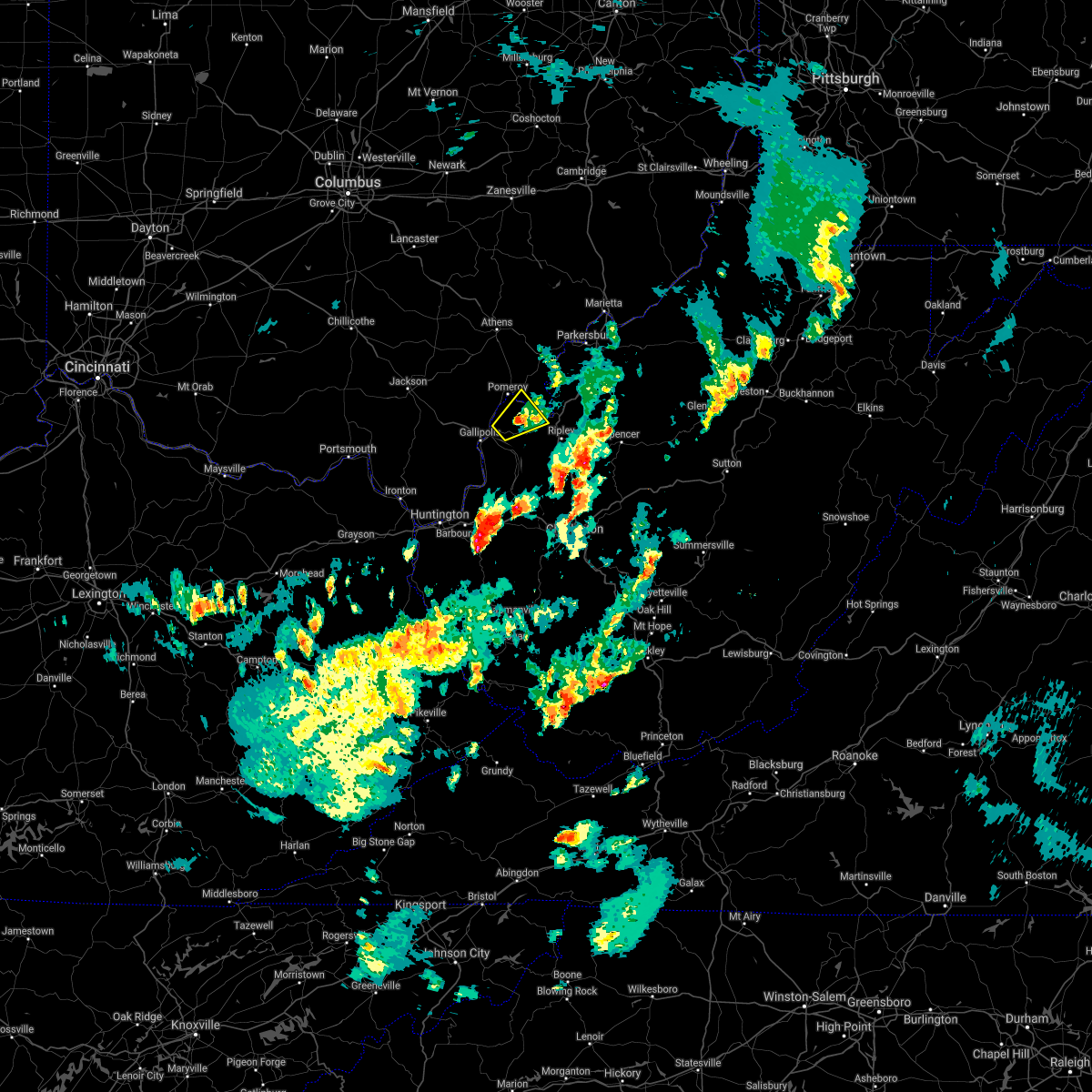 The severe thunderstorm warning for southeastern meigs, northwestern mason and west central jackson counties will expire at 630 pm edt, the storm which prompted the warning has weakened below severe limits, and no longer poses an immediate threat to life or property. therefore, the warning will be allowed to expire. The severe thunderstorm warning for southeastern meigs, northwestern mason and west central jackson counties will expire at 630 pm edt, the storm which prompted the warning has weakened below severe limits, and no longer poses an immediate threat to life or property. therefore, the warning will be allowed to expire.
|
| 3/18/2021 6:11 PM EDT |
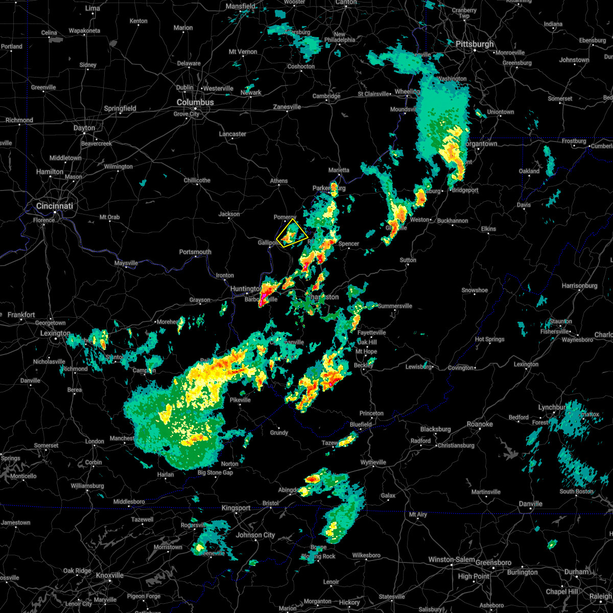 At 611 pm edt, a severe thunderstorm was located near new haven, or near point pleasant, moving northeast at 20 mph (radar indicated). Hazards include 60 mph wind gusts and quarter size hail. Hail damage to vehicles is expected. expect wind damage to roofs, siding, and trees. Locations impacted include, point pleasant, racine, new haven, syracuse, hartford city, mount alto and letart. At 611 pm edt, a severe thunderstorm was located near new haven, or near point pleasant, moving northeast at 20 mph (radar indicated). Hazards include 60 mph wind gusts and quarter size hail. Hail damage to vehicles is expected. expect wind damage to roofs, siding, and trees. Locations impacted include, point pleasant, racine, new haven, syracuse, hartford city, mount alto and letart.
|
| 3/18/2021 6:11 PM EDT |
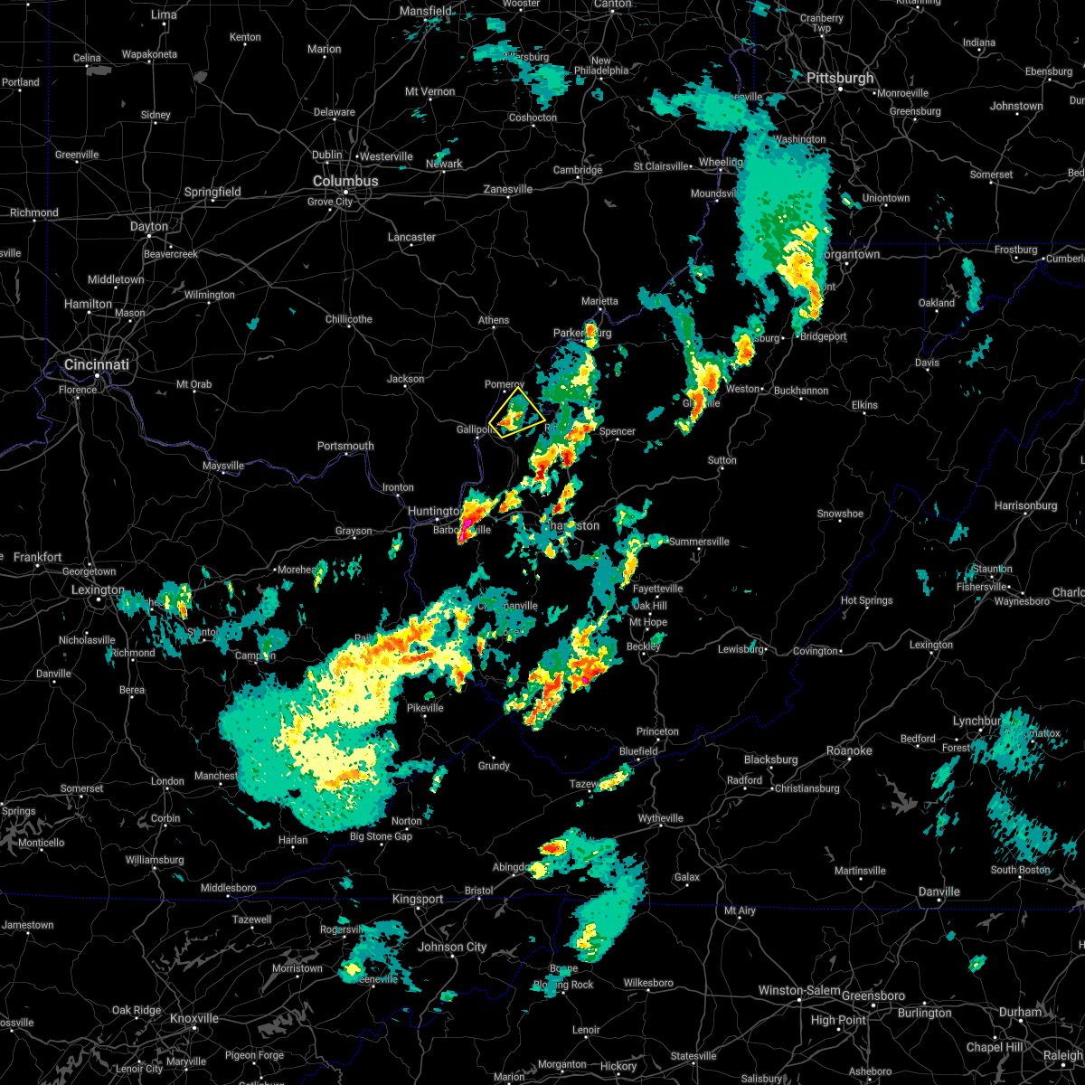 At 611 pm edt, a severe thunderstorm was located near new haven, or near point pleasant, moving northeast at 20 mph (radar indicated). Hazards include 60 mph wind gusts and quarter size hail. Hail damage to vehicles is expected. expect wind damage to roofs, siding, and trees. Locations impacted include, point pleasant, racine, new haven, syracuse, hartford city, mount alto and letart. At 611 pm edt, a severe thunderstorm was located near new haven, or near point pleasant, moving northeast at 20 mph (radar indicated). Hazards include 60 mph wind gusts and quarter size hail. Hail damage to vehicles is expected. expect wind damage to roofs, siding, and trees. Locations impacted include, point pleasant, racine, new haven, syracuse, hartford city, mount alto and letart.
|
| 3/18/2021 5:43 PM EDT |
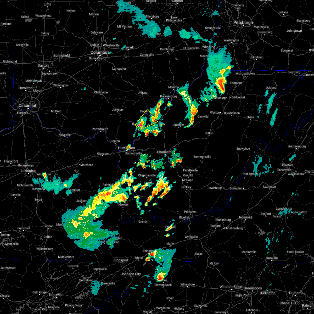 At 543 pm edt, a severe thunderstorm was located over gallipolis, moving northeast at 20 mph (radar indicated). Hazards include 60 mph wind gusts and quarter size hail. Hail damage to vehicles is expected. Expect wind damage to roofs, siding, and trees. At 543 pm edt, a severe thunderstorm was located over gallipolis, moving northeast at 20 mph (radar indicated). Hazards include 60 mph wind gusts and quarter size hail. Hail damage to vehicles is expected. Expect wind damage to roofs, siding, and trees.
|
| 3/18/2021 5:43 PM EDT |
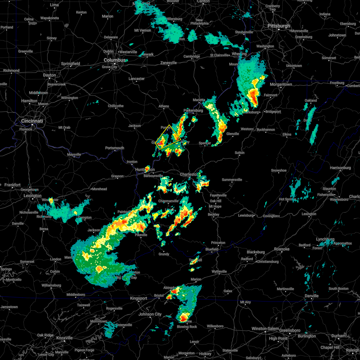 At 543 pm edt, a severe thunderstorm was located over gallipolis, moving northeast at 20 mph (radar indicated). Hazards include 60 mph wind gusts and quarter size hail. Hail damage to vehicles is expected. Expect wind damage to roofs, siding, and trees. At 543 pm edt, a severe thunderstorm was located over gallipolis, moving northeast at 20 mph (radar indicated). Hazards include 60 mph wind gusts and quarter size hail. Hail damage to vehicles is expected. Expect wind damage to roofs, siding, and trees.
|
| 8/25/2020 5:23 PM EDT |
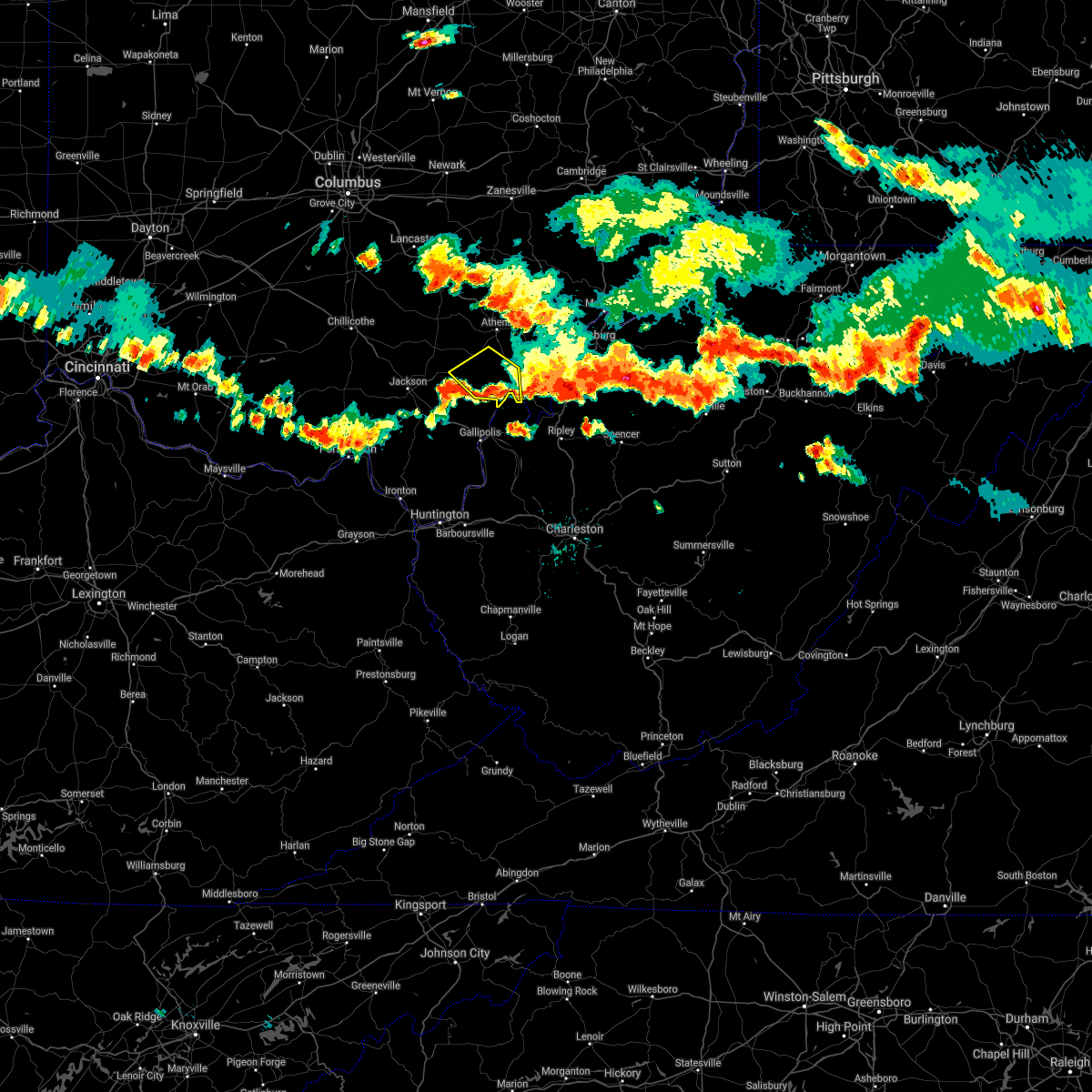 The severe thunderstorm warning for northwestern meigs, south central athens and east central vinton counties will expire at 530 pm edt, the storm which prompted the warning has weakened below severe limits, and has exited the warned area. therefore, the warning will be allowed to expire. however gusty winds are still possible with this thunderstorm. a severe thunderstorm watch remains in effect until 1100 pm edt for southeastern ohio, and western west virginia. The severe thunderstorm warning for northwestern meigs, south central athens and east central vinton counties will expire at 530 pm edt, the storm which prompted the warning has weakened below severe limits, and has exited the warned area. therefore, the warning will be allowed to expire. however gusty winds are still possible with this thunderstorm. a severe thunderstorm watch remains in effect until 1100 pm edt for southeastern ohio, and western west virginia.
|
| 8/25/2020 5:05 PM EDT |
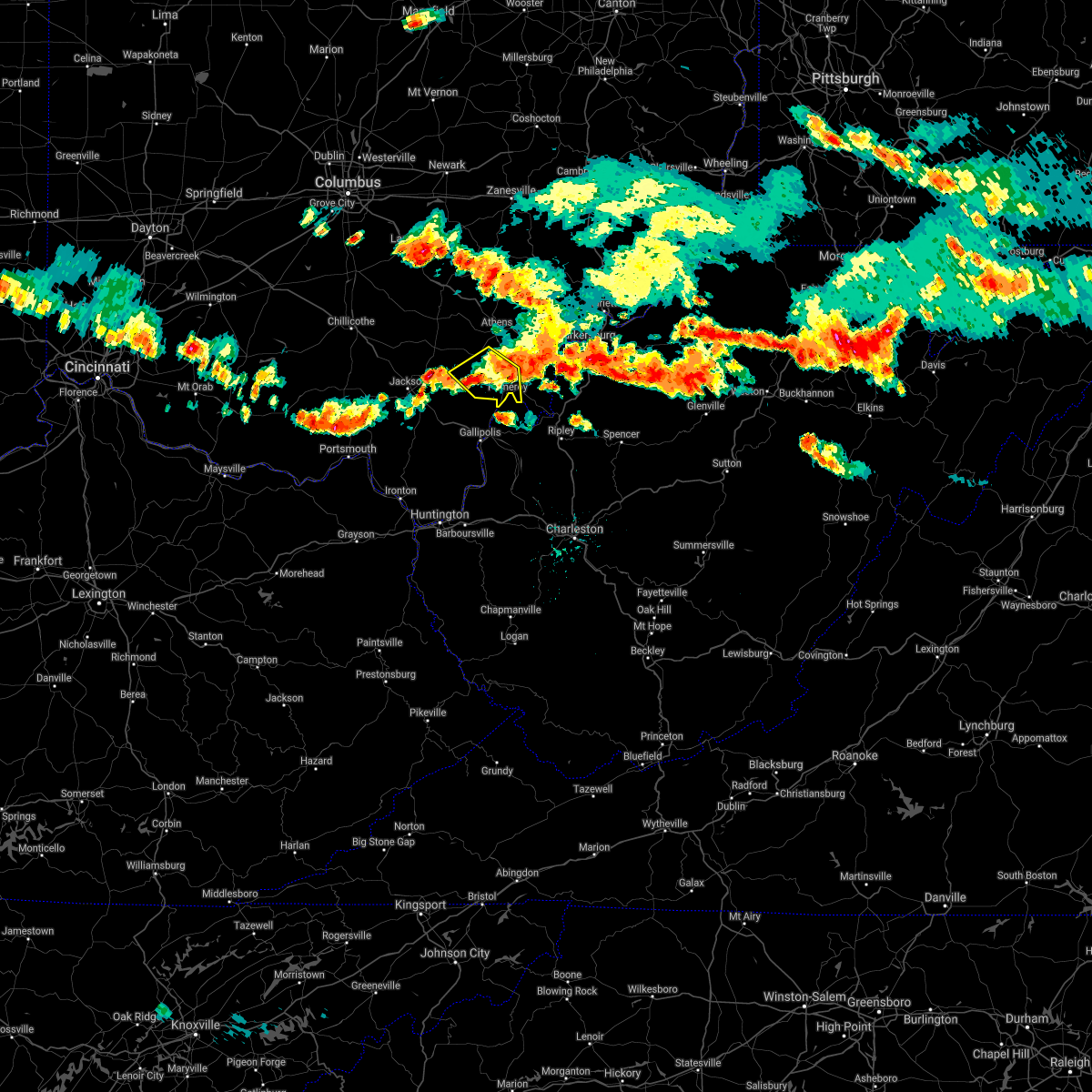 At 505 pm edt, a severe thunderstorm was located near rutland, moving southeast at 30 mph (radar indicated). Hazards include 60 mph wind gusts. Expect damage to roofs, siding, and trees. Locations impacted include, pomeroy, albany, rutland, new haven, mason, middleport, syracuse, hartford city, wilkesville, radcliffe, dyesville, darwin, harrisonville, dexter, carpenter and salem center. At 505 pm edt, a severe thunderstorm was located near rutland, moving southeast at 30 mph (radar indicated). Hazards include 60 mph wind gusts. Expect damage to roofs, siding, and trees. Locations impacted include, pomeroy, albany, rutland, new haven, mason, middleport, syracuse, hartford city, wilkesville, radcliffe, dyesville, darwin, harrisonville, dexter, carpenter and salem center.
|
| 8/25/2020 4:45 PM EDT |
 At 445 pm edt, a severe thunderstorm was located near albany, moving southeast at 30 mph (radar indicated). Hazards include 60 mph wind gusts. expect damage to roofs, siding, and trees At 445 pm edt, a severe thunderstorm was located near albany, moving southeast at 30 mph (radar indicated). Hazards include 60 mph wind gusts. expect damage to roofs, siding, and trees
|
| 6/10/2020 9:24 PM EDT |
 At 924 pm edt, a severe thunderstorm was located over forked run state park, moving northeast at 45 mph (radar indicated). Hazards include 60 mph wind gusts and nickel size hail. Expect damage to roofs, siding, and trees. Locations impacted include, racine, forked run state park, ravenswood, new haven, tuppers plains, chester, syracuse, hartford city, portland, lakin, belleville, reedsville and letart. At 924 pm edt, a severe thunderstorm was located over forked run state park, moving northeast at 45 mph (radar indicated). Hazards include 60 mph wind gusts and nickel size hail. Expect damage to roofs, siding, and trees. Locations impacted include, racine, forked run state park, ravenswood, new haven, tuppers plains, chester, syracuse, hartford city, portland, lakin, belleville, reedsville and letart.
|
| 6/10/2020 9:24 PM EDT |
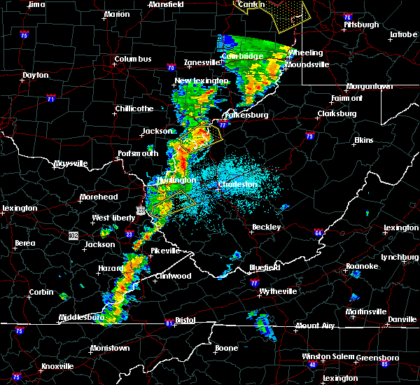 At 924 pm edt, a severe thunderstorm was located over forked run state park, moving northeast at 45 mph (radar indicated). Hazards include 60 mph wind gusts and nickel size hail. Expect damage to roofs, siding, and trees. Locations impacted include, racine, forked run state park, ravenswood, new haven, tuppers plains, chester, syracuse, hartford city, portland, lakin, belleville, reedsville and letart. At 924 pm edt, a severe thunderstorm was located over forked run state park, moving northeast at 45 mph (radar indicated). Hazards include 60 mph wind gusts and nickel size hail. Expect damage to roofs, siding, and trees. Locations impacted include, racine, forked run state park, ravenswood, new haven, tuppers plains, chester, syracuse, hartford city, portland, lakin, belleville, reedsville and letart.
|
| 6/10/2020 9:12 PM EDT |
 The tornado warning for western meigs, northeastern gallia and northwestern mason counties will expire at 915 pm edt, the tornado threat has diminished and the tornado warning has been cancelled. however, large hail and damaging winds remain likely and a severe thunderstorm warning remains in effect for portions of the area. a severe thunderstorm watch remains in effect until 100 am edt for southeastern ohio, and western west virginia. The tornado warning for western meigs, northeastern gallia and northwestern mason counties will expire at 915 pm edt, the tornado threat has diminished and the tornado warning has been cancelled. however, large hail and damaging winds remain likely and a severe thunderstorm warning remains in effect for portions of the area. a severe thunderstorm watch remains in effect until 100 am edt for southeastern ohio, and western west virginia.
|
| 6/10/2020 9:12 PM EDT |
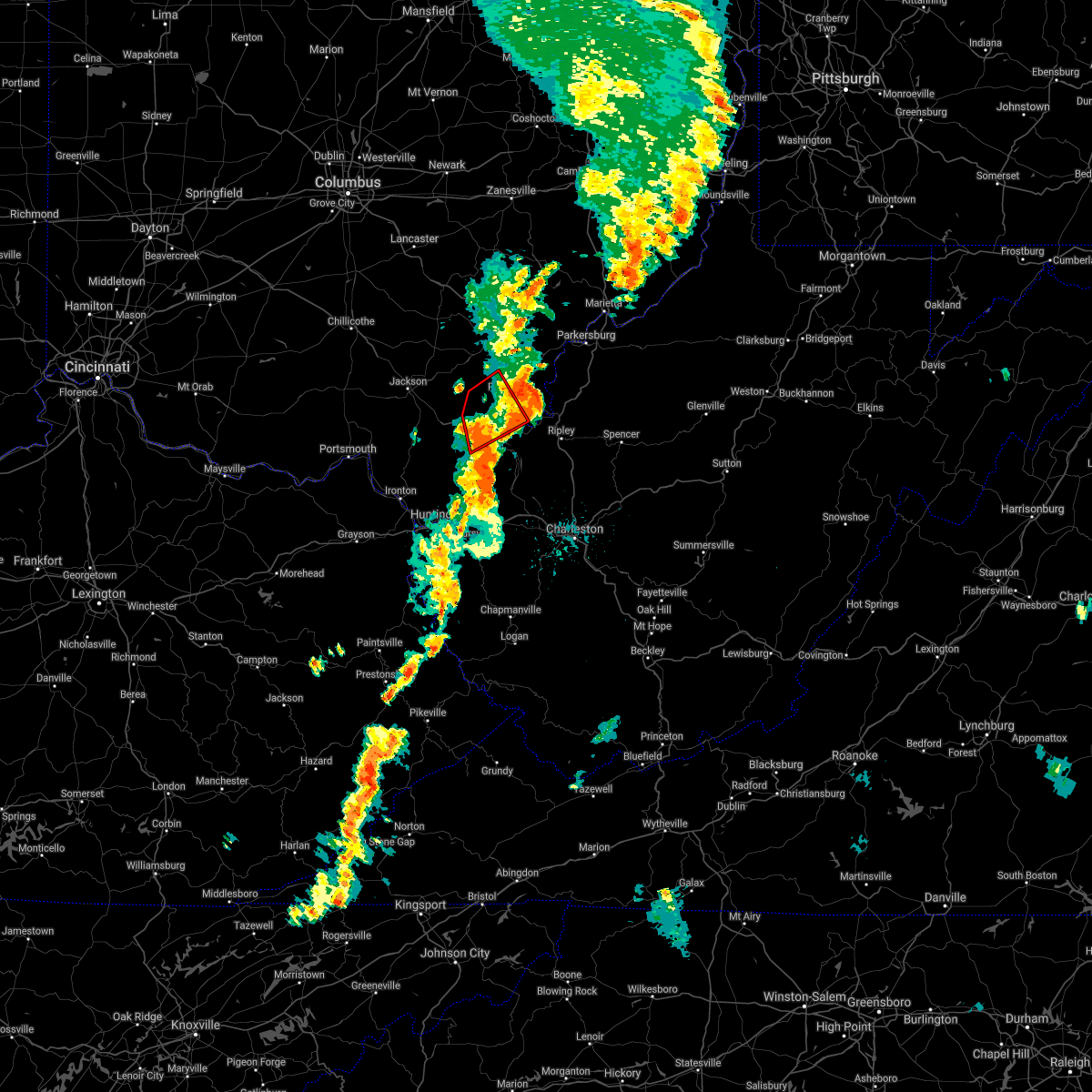 The tornado warning for western meigs, northeastern gallia and northwestern mason counties will expire at 915 pm edt, the tornado threat has diminished and the tornado warning has been cancelled. however, large hail and damaging winds remain likely and a severe thunderstorm warning remains in effect for portions of the area. a severe thunderstorm watch remains in effect until 100 am edt for southeastern ohio, and western west virginia. The tornado warning for western meigs, northeastern gallia and northwestern mason counties will expire at 915 pm edt, the tornado threat has diminished and the tornado warning has been cancelled. however, large hail and damaging winds remain likely and a severe thunderstorm warning remains in effect for portions of the area. a severe thunderstorm watch remains in effect until 100 am edt for southeastern ohio, and western west virginia.
|
| 6/10/2020 9:08 PM EDT |
 At 907 pm edt, a severe thunderstorm was located over mason, or over pomeroy, moving northeast at 45 mph (radar indicated). Hazards include 60 mph wind gusts and nickel size hail. expect damage to roofs, siding, and trees At 907 pm edt, a severe thunderstorm was located over mason, or over pomeroy, moving northeast at 45 mph (radar indicated). Hazards include 60 mph wind gusts and nickel size hail. expect damage to roofs, siding, and trees
|
| 6/10/2020 9:08 PM EDT |
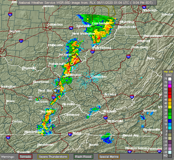 At 907 pm edt, a severe thunderstorm was located over mason, or over pomeroy, moving northeast at 45 mph (radar indicated). Hazards include 60 mph wind gusts and nickel size hail. expect damage to roofs, siding, and trees At 907 pm edt, a severe thunderstorm was located over mason, or over pomeroy, moving northeast at 45 mph (radar indicated). Hazards include 60 mph wind gusts and nickel size hail. expect damage to roofs, siding, and trees
|
| 6/10/2020 8:56 PM EDT |
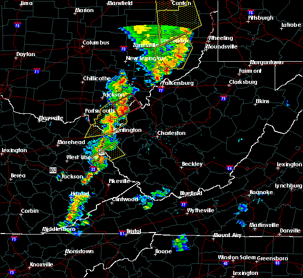 At 855 pm edt, a severe line of storms capable of producing both tornadoes and straight line wind damage was located near rutland, moving northeast at 45 mph (radar indicated rotation). Hazards include tornado and quarter size hail. Flying debris will be dangerous to those caught without shelter. mobile homes will be damaged or destroyed. damage to roofs, windows, and vehicles will occur. tree damage is likely. Locations impacted include, point pleasant, gallipolis, pomeroy, rutland, new haven, mason, middleport, hartford city, henderson, cheshire, lakin, letart, kyger and harrisonville. At 855 pm edt, a severe line of storms capable of producing both tornadoes and straight line wind damage was located near rutland, moving northeast at 45 mph (radar indicated rotation). Hazards include tornado and quarter size hail. Flying debris will be dangerous to those caught without shelter. mobile homes will be damaged or destroyed. damage to roofs, windows, and vehicles will occur. tree damage is likely. Locations impacted include, point pleasant, gallipolis, pomeroy, rutland, new haven, mason, middleport, hartford city, henderson, cheshire, lakin, letart, kyger and harrisonville.
|
| 6/10/2020 8:43 PM EDT |
 At 843 pm edt, severe thunderstorms capable of producing both tornadoes and extensive straight line wind damage were located near rio grande, moving northeast at 45 mph (radar indicated rotation). Hazards include tornado. Flying debris will be dangerous to those caught without shelter. mobile homes will be damaged or destroyed. damage to roofs, windows, and vehicles will occur. Tree damage is likely. At 843 pm edt, severe thunderstorms capable of producing both tornadoes and extensive straight line wind damage were located near rio grande, moving northeast at 45 mph (radar indicated rotation). Hazards include tornado. Flying debris will be dangerous to those caught without shelter. mobile homes will be damaged or destroyed. damage to roofs, windows, and vehicles will occur. Tree damage is likely.
|
| 4/9/2020 12:54 AM EDT |
 At 1253 am edt, a severe thunderstorm was located near forked run state park, moving east at 75 mph (radar indicated). Hazards include 70 mph wind gusts and quarter size hail. Hail damage to vehicles is expected. expect considerable tree damage. Wind damage is also likely to mobile homes, roofs, and outbuildings. At 1253 am edt, a severe thunderstorm was located near forked run state park, moving east at 75 mph (radar indicated). Hazards include 70 mph wind gusts and quarter size hail. Hail damage to vehicles is expected. expect considerable tree damage. Wind damage is also likely to mobile homes, roofs, and outbuildings.
|
| 4/9/2020 12:51 AM EDT |
 At 1250 am edt, a severe thunderstorm was located near new haven, or near racine, moving east at 65 mph (radar indicated). Hazards include 70 mph wind gusts and quarter size hail. Hail damage to vehicles is expected. expect considerable tree damage. wind damage is also likely to mobile homes, roofs, and outbuildings. Locations impacted include, athens, point pleasant, gallipolis, ripley, pomeroy, albany, racine, coolville, rutland, forked run state park, ravenswood, new haven, mason, sandyville, washington, tuppers plains, lubeck, middleport, chester and syracuse. At 1250 am edt, a severe thunderstorm was located near new haven, or near racine, moving east at 65 mph (radar indicated). Hazards include 70 mph wind gusts and quarter size hail. Hail damage to vehicles is expected. expect considerable tree damage. wind damage is also likely to mobile homes, roofs, and outbuildings. Locations impacted include, athens, point pleasant, gallipolis, ripley, pomeroy, albany, racine, coolville, rutland, forked run state park, ravenswood, new haven, mason, sandyville, washington, tuppers plains, lubeck, middleport, chester and syracuse.
|
| 4/9/2020 12:42 AM EDT |
 At 1242 am edt, a severe thunderstorm was located near rutland, moving east at 45 mph (radar indicated). Hazards include 70 mph wind gusts and quarter size hail. Hail damage to vehicles is expected. expect considerable tree damage. wind damage is also likely to mobile homes, roofs, and outbuildings. Locations impacted include, athens, point pleasant, gallipolis, ripley, pomeroy, mcarthur, rio grande, albany, racine, coolville, rutland, forked run state park, ravenswood, new haven, mason, sandyville, washington, tuppers plains, lubeck and middleport. At 1242 am edt, a severe thunderstorm was located near rutland, moving east at 45 mph (radar indicated). Hazards include 70 mph wind gusts and quarter size hail. Hail damage to vehicles is expected. expect considerable tree damage. wind damage is also likely to mobile homes, roofs, and outbuildings. Locations impacted include, athens, point pleasant, gallipolis, ripley, pomeroy, mcarthur, rio grande, albany, racine, coolville, rutland, forked run state park, ravenswood, new haven, mason, sandyville, washington, tuppers plains, lubeck and middleport.
|
| 4/9/2020 12:24 AM EDT |
 At 1222 am edt, a line of severe thunderstorms were located just west of the above stated counties. another seperate severe thunderstorm is northwest of meigs county. all storms are moving east at 45 mph (radar indicated). Hazards include 70 mph wind gusts and quarter size hail. Hail damage to vehicles is expected. expect considerable tree damage. Wind damage is also likely to mobile homes, roofs, and outbuildings. At 1222 am edt, a line of severe thunderstorms were located just west of the above stated counties. another seperate severe thunderstorm is northwest of meigs county. all storms are moving east at 45 mph (radar indicated). Hazards include 70 mph wind gusts and quarter size hail. Hail damage to vehicles is expected. expect considerable tree damage. Wind damage is also likely to mobile homes, roofs, and outbuildings.
|
| 6/16/2019 9:22 PM EDT |
 The severe thunderstorm warning for central meigs, mason and northwestern jackson counties will expire at 930 pm edt, the storms which prompted the warning have weakened below severe limits, and no longer pose an immediate threat to life or property. therefore, the warning will be allowed to expire. however gusty winds and heavy rain are still possible with these thunderstorms. a severe thunderstorm watch remains in effect until 300 am edt for western and northwestern west virginia. The severe thunderstorm warning for central meigs, mason and northwestern jackson counties will expire at 930 pm edt, the storms which prompted the warning have weakened below severe limits, and no longer pose an immediate threat to life or property. therefore, the warning will be allowed to expire. however gusty winds and heavy rain are still possible with these thunderstorms. a severe thunderstorm watch remains in effect until 300 am edt for western and northwestern west virginia.
|
| 6/16/2019 9:22 PM EDT |
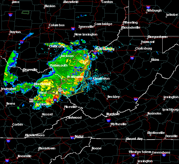 The severe thunderstorm warning for central meigs, mason and northwestern jackson counties will expire at 930 pm edt, the storms which prompted the warning have weakened below severe limits, and no longer pose an immediate threat to life or property. therefore, the warning will be allowed to expire. however gusty winds and heavy rain are still possible with these thunderstorms. a severe thunderstorm watch remains in effect until 300 am edt for western and northwestern west virginia. The severe thunderstorm warning for central meigs, mason and northwestern jackson counties will expire at 930 pm edt, the storms which prompted the warning have weakened below severe limits, and no longer pose an immediate threat to life or property. therefore, the warning will be allowed to expire. however gusty winds and heavy rain are still possible with these thunderstorms. a severe thunderstorm watch remains in effect until 300 am edt for western and northwestern west virginia.
|
| 6/16/2019 9:07 PM EDT |
 At 907 pm edt, severe thunderstorms were located along a line extending from 8 miles southeast of mcarthur to near mason to 8 miles southwest of gallipolis, moving east at 30 mph (radar indicated). Hazards include 60 mph wind gusts. Expect damage to roofs, siding, and trees. Locations impacted include, point pleasant, gallipolis, pomeroy, racine, rutland, ravenswood, new haven, mason, middleport, chester, syracuse, hartford city, henderson, leon, cheshire, portland, mount alto, lakin, southside and darwin. At 907 pm edt, severe thunderstorms were located along a line extending from 8 miles southeast of mcarthur to near mason to 8 miles southwest of gallipolis, moving east at 30 mph (radar indicated). Hazards include 60 mph wind gusts. Expect damage to roofs, siding, and trees. Locations impacted include, point pleasant, gallipolis, pomeroy, racine, rutland, ravenswood, new haven, mason, middleport, chester, syracuse, hartford city, henderson, leon, cheshire, portland, mount alto, lakin, southside and darwin.
|
| 6/16/2019 9:07 PM EDT |
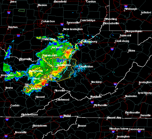 At 907 pm edt, severe thunderstorms were located along a line extending from 8 miles southeast of mcarthur to near mason to 8 miles southwest of gallipolis, moving east at 30 mph (radar indicated). Hazards include 60 mph wind gusts. Expect damage to roofs, siding, and trees. Locations impacted include, point pleasant, gallipolis, pomeroy, racine, rutland, ravenswood, new haven, mason, middleport, chester, syracuse, hartford city, henderson, leon, cheshire, portland, mount alto, lakin, southside and darwin. At 907 pm edt, severe thunderstorms were located along a line extending from 8 miles southeast of mcarthur to near mason to 8 miles southwest of gallipolis, moving east at 30 mph (radar indicated). Hazards include 60 mph wind gusts. Expect damage to roofs, siding, and trees. Locations impacted include, point pleasant, gallipolis, pomeroy, racine, rutland, ravenswood, new haven, mason, middleport, chester, syracuse, hartford city, henderson, leon, cheshire, portland, mount alto, lakin, southside and darwin.
|
| 6/16/2019 9:04 PM EDT |
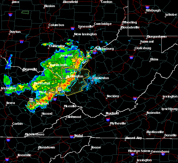 At 903 pm edt, severe thunderstorms were located along a line extending from 8 miles southeast of mcarthur to 6 miles south of rutland to 9 miles southwest of gallipolis, moving east at 30 mph (radar indicated). Hazards include 60 mph wind gusts. Expect damage to roofs, siding, and trees. Locations impacted include, point pleasant, gallipolis, pomeroy, racine, rutland, ravenswood, new haven, mason, middleport, chester, syracuse, hartford city, henderson, leon, cheshire, portland, mount alto, lakin, southside and darwin. At 903 pm edt, severe thunderstorms were located along a line extending from 8 miles southeast of mcarthur to 6 miles south of rutland to 9 miles southwest of gallipolis, moving east at 30 mph (radar indicated). Hazards include 60 mph wind gusts. Expect damage to roofs, siding, and trees. Locations impacted include, point pleasant, gallipolis, pomeroy, racine, rutland, ravenswood, new haven, mason, middleport, chester, syracuse, hartford city, henderson, leon, cheshire, portland, mount alto, lakin, southside and darwin.
|
| 6/16/2019 8:47 PM EDT |
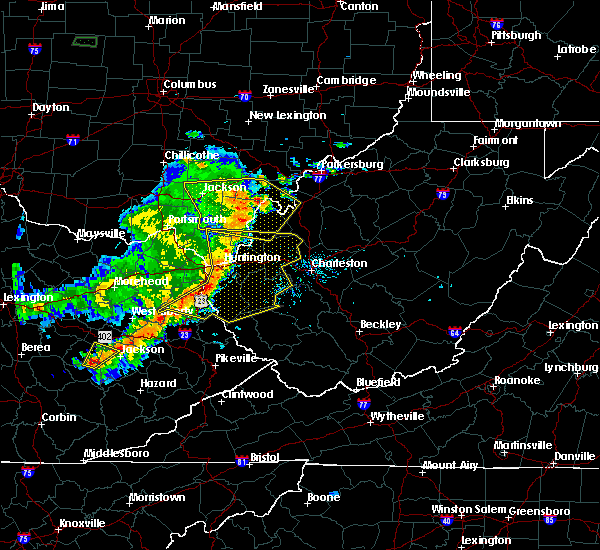 At 846 pm edt, severe thunderstorms were located along a line extending from wellston to 7 miles northeast of rio grande to 11 miles northeast of lake vesuvius, moving east at 30 mph (radar indicated). Hazards include 60 mph wind gusts and nickel size hail. Expect damage to roofs, siding, and trees. Locations impacted include, point pleasant, gallipolis, pomeroy, rio grande, racine, rutland, ravenswood, new haven, mason, middleport, chester, syracuse, hartford city, henderson, vinton, leon, wilkesville, cheshire, adamsville and portland. At 846 pm edt, severe thunderstorms were located along a line extending from wellston to 7 miles northeast of rio grande to 11 miles northeast of lake vesuvius, moving east at 30 mph (radar indicated). Hazards include 60 mph wind gusts and nickel size hail. Expect damage to roofs, siding, and trees. Locations impacted include, point pleasant, gallipolis, pomeroy, rio grande, racine, rutland, ravenswood, new haven, mason, middleport, chester, syracuse, hartford city, henderson, vinton, leon, wilkesville, cheshire, adamsville and portland.
|
| 6/16/2019 8:28 PM EDT |
 At 827 pm edt, severe thunderstorms were located along a line extending from near jackson to near rio grande to near lake vesuvius, moving east at 30 mph. an additional thunderstorm was developing across northern gallia county and may also become severe (radar indicated). Hazards include 60 mph wind gusts and nickel size hail. expect damage to roofs, siding, and trees At 827 pm edt, severe thunderstorms were located along a line extending from near jackson to near rio grande to near lake vesuvius, moving east at 30 mph. an additional thunderstorm was developing across northern gallia county and may also become severe (radar indicated). Hazards include 60 mph wind gusts and nickel size hail. expect damage to roofs, siding, and trees
|
| 5/29/2019 12:33 PM EDT |
 At 1232 pm edt, severe thunderstorms were located along a line extending from forked run state park to 11 miles east of point pleasant to 12 miles north of ona, moving east at 45 mph (radar indicated). Hazards include 60 mph wind gusts and nickel size hail. expect damage to roofs, siding, and trees At 1232 pm edt, severe thunderstorms were located along a line extending from forked run state park to 11 miles east of point pleasant to 12 miles north of ona, moving east at 45 mph (radar indicated). Hazards include 60 mph wind gusts and nickel size hail. expect damage to roofs, siding, and trees
|
| 5/29/2019 12:33 PM EDT |
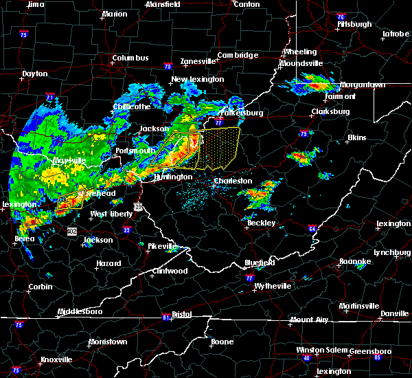 At 1232 pm edt, severe thunderstorms were located along a line extending from forked run state park to 11 miles east of point pleasant to 12 miles north of ona, moving east at 45 mph (radar indicated). Hazards include 60 mph wind gusts and nickel size hail. expect damage to roofs, siding, and trees At 1232 pm edt, severe thunderstorms were located along a line extending from forked run state park to 11 miles east of point pleasant to 12 miles north of ona, moving east at 45 mph (radar indicated). Hazards include 60 mph wind gusts and nickel size hail. expect damage to roofs, siding, and trees
|
| 5/29/2019 12:19 PM EDT |
 At 1218 pm edt, a severe thunderstorm was located near point pleasant, moving east at 45 mph (radar indicated). Hazards include 60 mph wind gusts and nickel size hail. Expect damage to roofs, siding, and trees. Locations impacted include, point pleasant, gallipolis, pomeroy, racine, rutland, new haven, buffalo, mason, middleport, syracuse, hartford city, henderson, leon, cheshire, mount alto, lakin, southside, ashton, cottageville and grimms landing. At 1218 pm edt, a severe thunderstorm was located near point pleasant, moving east at 45 mph (radar indicated). Hazards include 60 mph wind gusts and nickel size hail. Expect damage to roofs, siding, and trees. Locations impacted include, point pleasant, gallipolis, pomeroy, racine, rutland, new haven, buffalo, mason, middleport, syracuse, hartford city, henderson, leon, cheshire, mount alto, lakin, southside, ashton, cottageville and grimms landing.
|
| 5/29/2019 12:19 PM EDT |
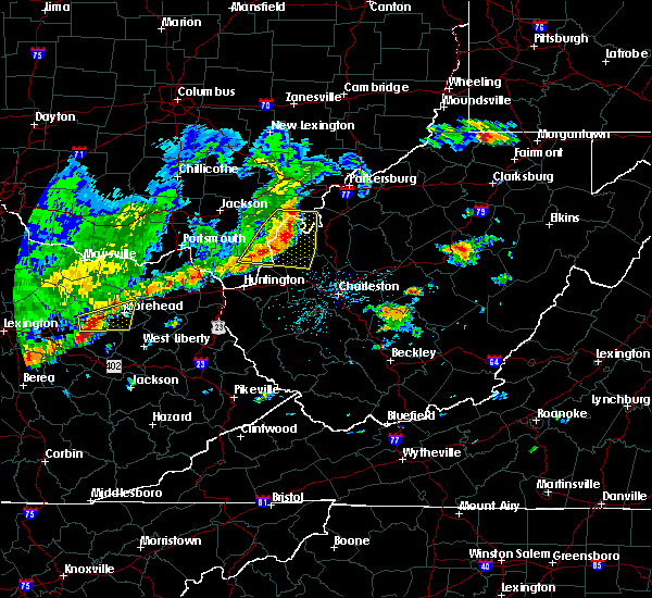 At 1218 pm edt, a severe thunderstorm was located near point pleasant, moving east at 45 mph (radar indicated). Hazards include 60 mph wind gusts and nickel size hail. Expect damage to roofs, siding, and trees. Locations impacted include, point pleasant, gallipolis, pomeroy, racine, rutland, new haven, buffalo, mason, middleport, syracuse, hartford city, henderson, leon, cheshire, mount alto, lakin, southside, ashton, cottageville and grimms landing. At 1218 pm edt, a severe thunderstorm was located near point pleasant, moving east at 45 mph (radar indicated). Hazards include 60 mph wind gusts and nickel size hail. Expect damage to roofs, siding, and trees. Locations impacted include, point pleasant, gallipolis, pomeroy, racine, rutland, new haven, buffalo, mason, middleport, syracuse, hartford city, henderson, leon, cheshire, mount alto, lakin, southside, ashton, cottageville and grimms landing.
|
| 5/29/2019 11:57 AM EDT |
 At 1156 am edt, a severe thunderstorm was located near rio grande, moving east at 35 mph (radar indicated). Hazards include 60 mph wind gusts and nickel size hail. expect damage to roofs, siding, and trees At 1156 am edt, a severe thunderstorm was located near rio grande, moving east at 35 mph (radar indicated). Hazards include 60 mph wind gusts and nickel size hail. expect damage to roofs, siding, and trees
|
| 5/23/2019 6:18 PM EDT |
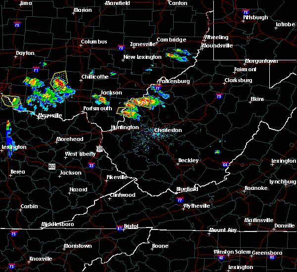 At 617 pm edt, a severe thunderstorm was located over racine, moving east at 40 mph (radar indicated). Hazards include 60 mph wind gusts and quarter size hail. Hail damage to vehicles is expected. expect wind damage to roofs, siding, and trees. Locations impacted include, racine, ravenswood, new haven, syracuse, hartford city, cottageville, portland, lakin and letart. At 617 pm edt, a severe thunderstorm was located over racine, moving east at 40 mph (radar indicated). Hazards include 60 mph wind gusts and quarter size hail. Hail damage to vehicles is expected. expect wind damage to roofs, siding, and trees. Locations impacted include, racine, ravenswood, new haven, syracuse, hartford city, cottageville, portland, lakin and letart.
|
| 5/23/2019 5:59 PM EDT |
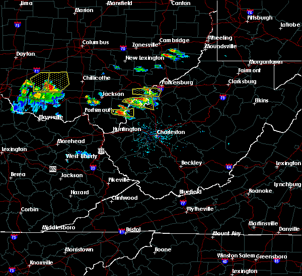 At 558 pm edt, a severe thunderstorm was located near new haven, or near pomeroy, moving east at 30 mph. an additional severe thunderstorm was located across northeastern gallia county (radar indicated). Hazards include 60 mph wind gusts and quarter size hail. Hail damage to vehicles is expected. Expect wind damage to roofs, siding, and trees. At 558 pm edt, a severe thunderstorm was located near new haven, or near pomeroy, moving east at 30 mph. an additional severe thunderstorm was located across northeastern gallia county (radar indicated). Hazards include 60 mph wind gusts and quarter size hail. Hail damage to vehicles is expected. Expect wind damage to roofs, siding, and trees.
|
| 5/17/2019 5:55 PM EDT |
 At 509 pm edt, a severe thunderstorm was located near new haven, or near racine, moving southeast at 15 mph (radar indicated). Hazards include 60 mph wind gusts and quarter size hail. Hail damage to vehicles is expected. Expect wind damage to roofs, siding, and trees. At 509 pm edt, a severe thunderstorm was located near new haven, or near racine, moving southeast at 15 mph (radar indicated). Hazards include 60 mph wind gusts and quarter size hail. Hail damage to vehicles is expected. Expect wind damage to roofs, siding, and trees.
|
| 5/17/2019 5:09 PM EDT |
 The national weather service in charleston west virginia has issued a * severe thunderstorm warning for. southeastern meigs county in southeastern ohio. northern mason county in western west virginia. west central jackson county in northwestern west virginia. Until 600 pm edt. The national weather service in charleston west virginia has issued a * severe thunderstorm warning for. southeastern meigs county in southeastern ohio. northern mason county in western west virginia. west central jackson county in northwestern west virginia. Until 600 pm edt.
|
| 5/17/2019 5:09 PM EDT |
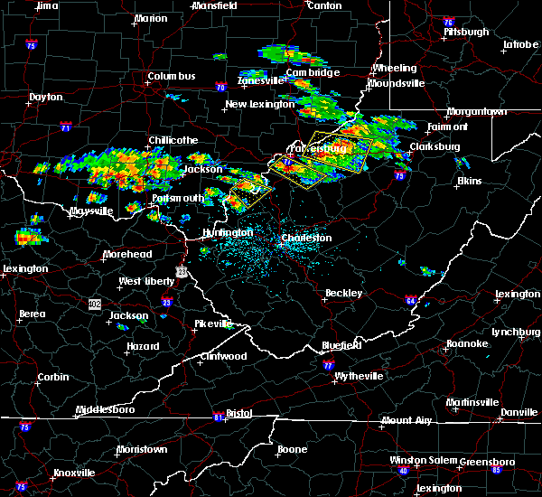 The national weather service in charleston west virginia has issued a * severe thunderstorm warning for. southeastern meigs county in southeastern ohio. northern mason county in western west virginia. west central jackson county in northwestern west virginia. Until 600 pm edt. The national weather service in charleston west virginia has issued a * severe thunderstorm warning for. southeastern meigs county in southeastern ohio. northern mason county in western west virginia. west central jackson county in northwestern west virginia. Until 600 pm edt.
|
| 5/17/2019 4:37 PM EDT |
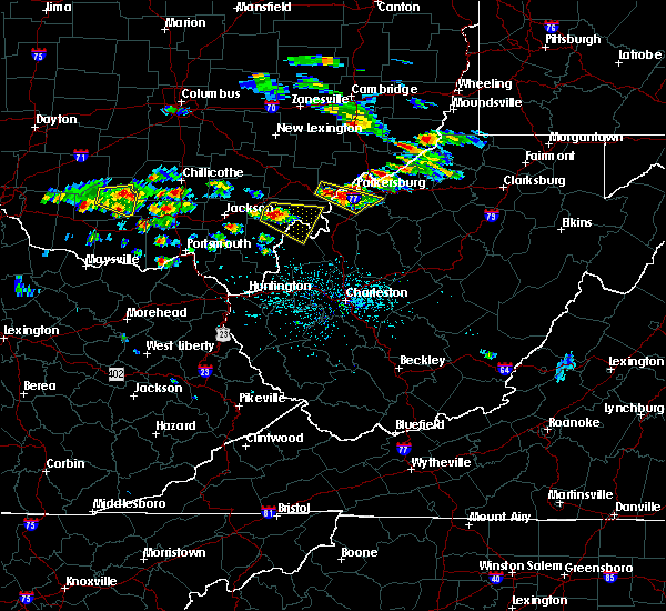 At 436 pm edt, a severe thunderstorm was located over rutland, moving east at 35 mph (radar indicated). Hazards include 60 mph wind gusts and quarter size hail. Hail damage to vehicles is expected. expect wind damage to roofs, siding, and trees. Locations impacted include, pomeroy, racine, rutland, new haven, mason, middleport, chester, syracuse, hartford city, cheshire, lakin, dyesville, salem center, harrisonville, dexter, letart and kyger. At 436 pm edt, a severe thunderstorm was located over rutland, moving east at 35 mph (radar indicated). Hazards include 60 mph wind gusts and quarter size hail. Hail damage to vehicles is expected. expect wind damage to roofs, siding, and trees. Locations impacted include, pomeroy, racine, rutland, new haven, mason, middleport, chester, syracuse, hartford city, cheshire, lakin, dyesville, salem center, harrisonville, dexter, letart and kyger.
|
| 5/17/2019 4:17 PM EDT |
 At 417 pm edt, a severe thunderstorm was located 10 miles southwest of albany, moving east at 35 mph (radar indicated). Hazards include 60 mph wind gusts and quarter size hail. Hail damage to vehicles is expected. Expect wind damage to roofs, siding, and trees. At 417 pm edt, a severe thunderstorm was located 10 miles southwest of albany, moving east at 35 mph (radar indicated). Hazards include 60 mph wind gusts and quarter size hail. Hail damage to vehicles is expected. Expect wind damage to roofs, siding, and trees.
|
| 5/17/2019 4:17 PM EDT |
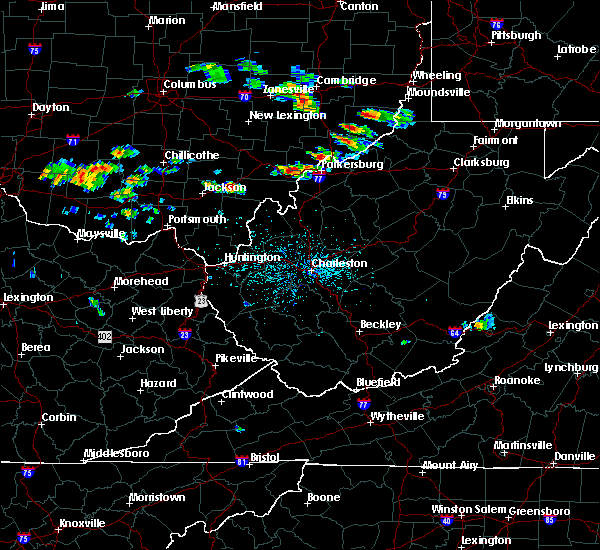 At 417 pm edt, a severe thunderstorm was located 10 miles southwest of albany, moving east at 35 mph (radar indicated). Hazards include 60 mph wind gusts and quarter size hail. Hail damage to vehicles is expected. Expect wind damage to roofs, siding, and trees. At 417 pm edt, a severe thunderstorm was located 10 miles southwest of albany, moving east at 35 mph (radar indicated). Hazards include 60 mph wind gusts and quarter size hail. Hail damage to vehicles is expected. Expect wind damage to roofs, siding, and trees.
|
| 5/30/2018 5:40 PM EDT |
 At 539 pm edt, a severe thunderstorm was located over racine, moving north at 35 mph (radar indicated). Hazards include 60 mph wind gusts. expect damage to roofs, siding, and trees At 539 pm edt, a severe thunderstorm was located over racine, moving north at 35 mph (radar indicated). Hazards include 60 mph wind gusts. expect damage to roofs, siding, and trees
|
| 5/30/2018 5:40 PM EDT |
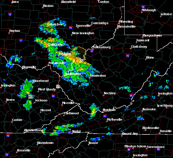 At 539 pm edt, a severe thunderstorm was located over racine, moving north at 35 mph (radar indicated). Hazards include 60 mph wind gusts. expect damage to roofs, siding, and trees At 539 pm edt, a severe thunderstorm was located over racine, moving north at 35 mph (radar indicated). Hazards include 60 mph wind gusts. expect damage to roofs, siding, and trees
|
| 4/3/2018 8:45 PM EDT |
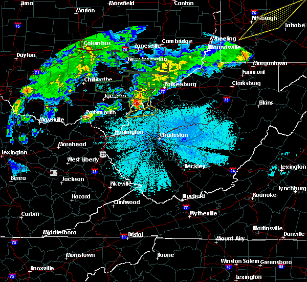 At 845 pm edt, severe thunderstorms were located along a line extending from 7 miles west of tuppers plains to near new haven to near point pleasant, moving east at 50 mph (radar indicated). Hazards include 60 mph wind gusts and quarter size hail. Hail damage to vehicles is expected. expect wind damage to roofs, siding, and trees. locations impacted include, point pleasant, pomeroy, racine, rutland, new haven, mason, middleport, chester, syracuse, hartford city, cheshire, lakin, darwin, letart and kyger. At 845 pm edt, severe thunderstorms were located along a line extending from 7 miles west of tuppers plains to near new haven to near point pleasant, moving east at 50 mph (radar indicated). Hazards include 60 mph wind gusts and quarter size hail. Hail damage to vehicles is expected. expect wind damage to roofs, siding, and trees. locations impacted include, point pleasant, pomeroy, racine, rutland, new haven, mason, middleport, chester, syracuse, hartford city, cheshire, lakin, darwin, letart and kyger.
|
| 4/3/2018 8:32 PM EDT |
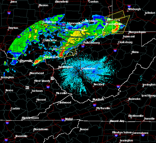 At 832 pm edt, severe thunderstorms were located along a line extending from 6 miles south of albany to 7 miles northwest of point pleasant to near rio grande, moving east at 50 mph (radar indicated). Hazards include 60 mph wind gusts and half dollar size hail. Hail damage to vehicles is expected. expect wind damage to roofs, siding, and trees. locations impacted include, point pleasant, gallipolis, pomeroy, rio grande, racine, rutland, new haven, mason, middleport, chester, syracuse, hartford city, henderson, vinton, cheshire, adamsville, lakin, dyesville, darwin and harrisonville. At 832 pm edt, severe thunderstorms were located along a line extending from 6 miles south of albany to 7 miles northwest of point pleasant to near rio grande, moving east at 50 mph (radar indicated). Hazards include 60 mph wind gusts and half dollar size hail. Hail damage to vehicles is expected. expect wind damage to roofs, siding, and trees. locations impacted include, point pleasant, gallipolis, pomeroy, rio grande, racine, rutland, new haven, mason, middleport, chester, syracuse, hartford city, henderson, vinton, cheshire, adamsville, lakin, dyesville, darwin and harrisonville.
|
| 4/3/2018 8:15 PM EDT |
 At 814 pm edt, severe thunderstorms were located along a line extending from near wellston to near oak hill to 6 miles east of south webster, moving east at 50 mph (radar indicated). Hazards include 60 mph wind gusts and quarter size hail. Hail damage to vehicles is expected. Expect wind damage to roofs, siding, and trees. At 814 pm edt, severe thunderstorms were located along a line extending from near wellston to near oak hill to 6 miles east of south webster, moving east at 50 mph (radar indicated). Hazards include 60 mph wind gusts and quarter size hail. Hail damage to vehicles is expected. Expect wind damage to roofs, siding, and trees.
|
| 7/10/2017 7:39 PM EDT |
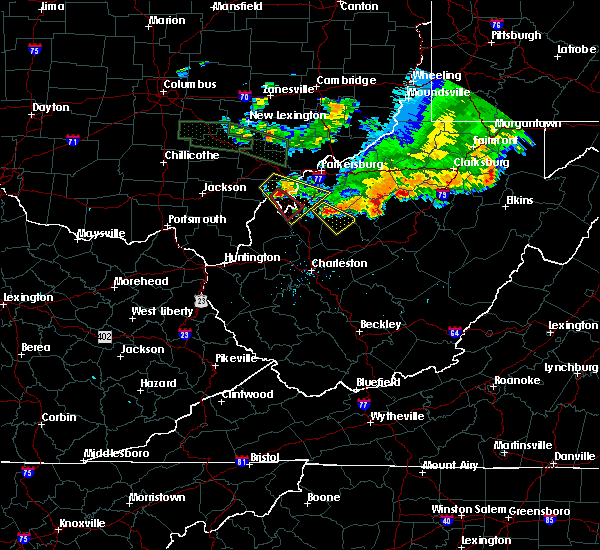 At 739 pm edt, a severe thunderstorm capable of producing a tornado was located near new haven, or near racine, moving southeast at 35 mph (radar indicated rotation). Hazards include tornado. Flying debris will be dangerous to those caught without shelter. mobile homes will be damaged or destroyed. damage to roofs, windows, and vehicles will occur. tree damage is likely. this dangerous storm will be near, racine around 745 pm edt. ravenswood around 755 pm edt. other locations impacted by this tornadic thunderstorm include chester, cottageville, portland and syracuse. This includes interstate 77 in west virginia between mile markers 145 and 148. At 739 pm edt, a severe thunderstorm capable of producing a tornado was located near new haven, or near racine, moving southeast at 35 mph (radar indicated rotation). Hazards include tornado. Flying debris will be dangerous to those caught without shelter. mobile homes will be damaged or destroyed. damage to roofs, windows, and vehicles will occur. tree damage is likely. this dangerous storm will be near, racine around 745 pm edt. ravenswood around 755 pm edt. other locations impacted by this tornadic thunderstorm include chester, cottageville, portland and syracuse. This includes interstate 77 in west virginia between mile markers 145 and 148.
|
| 7/10/2017 7:30 PM EDT |
 At 729 pm edt, a severe thunderstorm was located near tuppers plains, or 7 miles northeast of pomeroy, moving southeast at 40 mph (radar indicated. this storm is also exhibiting radar indicated rotation). Hazards include 60 mph wind gusts and quarter size hail. Hail damage to vehicles is expected. Expect wind damage to roofs, siding, and trees. At 729 pm edt, a severe thunderstorm was located near tuppers plains, or 7 miles northeast of pomeroy, moving southeast at 40 mph (radar indicated. this storm is also exhibiting radar indicated rotation). Hazards include 60 mph wind gusts and quarter size hail. Hail damage to vehicles is expected. Expect wind damage to roofs, siding, and trees.
|
| 7/7/2017 8:32 PM EDT |
 At 832 pm edt, severe thunderstorms were located along a line extending from new haven to near oldtown, moving southeast at 25 mph (radar indicated). Hazards include 60 mph wind gusts and nickel size hail. Expect damage to roofs, siding, and trees. locations impacted include, ashland, ironton, point pleasant, grayson, gallipolis, coal grove, pomeroy, olive hill, rio grande, chesapeake, racine, rutland, cannonsburg, lake vesuvius, carter caves state park, kenova, catlettsburg, new haven, ceredo and greenup. This includes interstate 64 in kentucky between mile markers 151 and 190. At 832 pm edt, severe thunderstorms were located along a line extending from new haven to near oldtown, moving southeast at 25 mph (radar indicated). Hazards include 60 mph wind gusts and nickel size hail. Expect damage to roofs, siding, and trees. locations impacted include, ashland, ironton, point pleasant, grayson, gallipolis, coal grove, pomeroy, olive hill, rio grande, chesapeake, racine, rutland, cannonsburg, lake vesuvius, carter caves state park, kenova, catlettsburg, new haven, ceredo and greenup. This includes interstate 64 in kentucky between mile markers 151 and 190.
|
| 7/7/2017 8:16 PM EDT |
 At 816 pm edt, severe thunderstorms were located along a line extending from near pomeroy to near load, moving southeast at 30 mph (radar indicated). Hazards include 60 mph wind gusts and nickel size hail. Expect damage to roofs, siding, and trees. locations impacted include, ashland, portsmouth, ironton, jackson, wellston, point pleasant, grayson, gallipolis, coal grove, pomeroy, olive hill, oak hill, rio grande, chesapeake, racine, rutland, cannonsburg, lake vesuvius, carter caves state park and kenova. This includes interstate 64 in kentucky between mile markers 151 and 190. At 816 pm edt, severe thunderstorms were located along a line extending from near pomeroy to near load, moving southeast at 30 mph (radar indicated). Hazards include 60 mph wind gusts and nickel size hail. Expect damage to roofs, siding, and trees. locations impacted include, ashland, portsmouth, ironton, jackson, wellston, point pleasant, grayson, gallipolis, coal grove, pomeroy, olive hill, oak hill, rio grande, chesapeake, racine, rutland, cannonsburg, lake vesuvius, carter caves state park and kenova. This includes interstate 64 in kentucky between mile markers 151 and 190.
|
| 7/7/2017 7:47 PM EDT |
 At 747 pm edt, severe thunderstorms were located along a line extending from 8 miles south of chesterhill to near vanceburg, moving southeast at 30 mph (radar indicated). Hazards include 60 mph wind gusts and nickel size hail. expect damage to roofs, siding, and trees At 747 pm edt, severe thunderstorms were located along a line extending from 8 miles south of chesterhill to near vanceburg, moving southeast at 30 mph (radar indicated). Hazards include 60 mph wind gusts and nickel size hail. expect damage to roofs, siding, and trees
|
| 6/23/2017 6:29 PM EDT |
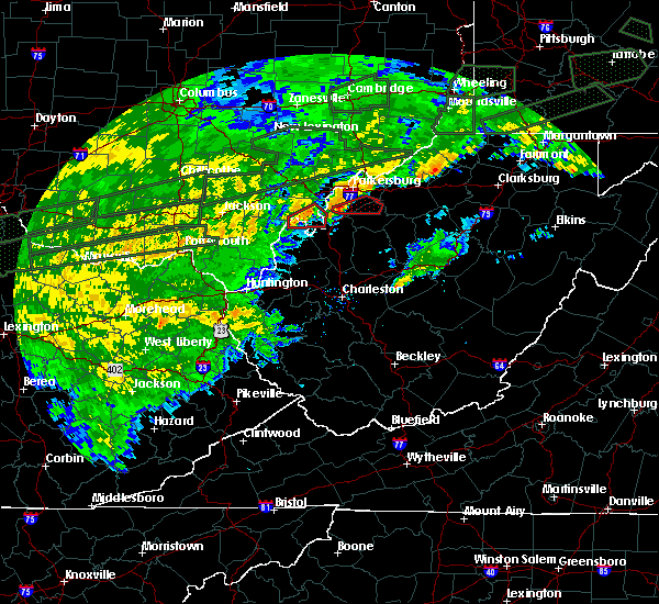 At 629 pm edt, a severe thunderstorm capable of producing a tornado was located over new haven, or over pomeroy, moving east at 40 mph (radar indicated rotation). Hazards include tornado. Flying debris will be dangerous to those caught without shelter. mobile homes will be damaged or destroyed. damage to roofs, windows, and vehicles will occur. tree damage is likely. this dangerous storm will be near, racine around 635 pm edt. ravenswood around 645 pm edt. other locations impacted by this tornadic thunderstorm include hartford city, syracuse, chester, middleport and portland. At 629 pm edt, a severe thunderstorm capable of producing a tornado was located over new haven, or over pomeroy, moving east at 40 mph (radar indicated rotation). Hazards include tornado. Flying debris will be dangerous to those caught without shelter. mobile homes will be damaged or destroyed. damage to roofs, windows, and vehicles will occur. tree damage is likely. this dangerous storm will be near, racine around 635 pm edt. ravenswood around 645 pm edt. other locations impacted by this tornadic thunderstorm include hartford city, syracuse, chester, middleport and portland.
|
| 6/23/2017 6:20 PM EDT |
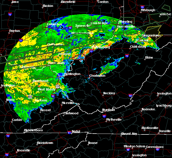 At 620 pm edt, a severe thunderstorm capable of producing a tornado was located near mason, or near rutland, moving east at 40 mph (radar indicated rotation). Hazards include tornado. Flying debris will be dangerous to those caught without shelter. mobile homes will be damaged or destroyed. damage to roofs, windows, and vehicles will occur. tree damage is likely. this dangerous storm will be near, pomeroy around 625 pm edt. mason around 630 pm edt. racine and new haven around 635 pm edt. ravenswood around 645 pm edt. other locations impacted by this tornadic thunderstorm include chester, cheshire, portland, lakin, hartford city, syracuse, middleport and kyger. At 620 pm edt, a severe thunderstorm capable of producing a tornado was located near mason, or near rutland, moving east at 40 mph (radar indicated rotation). Hazards include tornado. Flying debris will be dangerous to those caught without shelter. mobile homes will be damaged or destroyed. damage to roofs, windows, and vehicles will occur. tree damage is likely. this dangerous storm will be near, pomeroy around 625 pm edt. mason around 630 pm edt. racine and new haven around 635 pm edt. ravenswood around 645 pm edt. other locations impacted by this tornadic thunderstorm include chester, cheshire, portland, lakin, hartford city, syracuse, middleport and kyger.
|
| 4/29/2017 12:28 AM EDT |
 At 1228 am edt, a severe thunderstorm was located over new haven, or near pomeroy, moving east at 60 mph (radar indicated). Hazards include 60 mph wind gusts and quarter size hail. Hail damage to vehicles is expected. Expect wind damage to roofs, siding, and trees. At 1228 am edt, a severe thunderstorm was located over new haven, or near pomeroy, moving east at 60 mph (radar indicated). Hazards include 60 mph wind gusts and quarter size hail. Hail damage to vehicles is expected. Expect wind damage to roofs, siding, and trees.
|
| 4/29/2017 12:21 AM EDT |
 At 1219 am edt, a severe thunderstorm was located near rio grande, moving east at 60 mph (trained weather spotters have reported several trees down with this storm in jackson, ohio). Hazards include 60 mph wind gusts and quarter size hail. Hail damage to vehicles is expected. expect wind damage to roofs, siding, and trees. locations impacted include, point pleasant, gallipolis, pomeroy, racine, rutland, new haven, mason, middleport, syracuse, hartford city, henderson, leon, cheshire, lakin, southside, gallopolis ferry, letart and kyger. At 1219 am edt, a severe thunderstorm was located near rio grande, moving east at 60 mph (trained weather spotters have reported several trees down with this storm in jackson, ohio). Hazards include 60 mph wind gusts and quarter size hail. Hail damage to vehicles is expected. expect wind damage to roofs, siding, and trees. locations impacted include, point pleasant, gallipolis, pomeroy, racine, rutland, new haven, mason, middleport, syracuse, hartford city, henderson, leon, cheshire, lakin, southside, gallopolis ferry, letart and kyger.
|
| 4/29/2017 12:11 AM EDT |
 At 1210 am edt, a severe thunderstorm was located near oak hill, moving east at 60 mph (radar indicated). Hazards include 60 mph wind gusts and quarter size hail. Hail damage to vehicles is expected. expect wind damage to roofs, siding, and trees. locations impacted include, point pleasant, gallipolis, pomeroy, rio grande, racine, rutland, new haven, mason, middleport, syracuse, hartford city, henderson, vinton, leon, cheshire, adamsville, lakin, southside, gallopolis ferry and salem center. At 1210 am edt, a severe thunderstorm was located near oak hill, moving east at 60 mph (radar indicated). Hazards include 60 mph wind gusts and quarter size hail. Hail damage to vehicles is expected. expect wind damage to roofs, siding, and trees. locations impacted include, point pleasant, gallipolis, pomeroy, rio grande, racine, rutland, new haven, mason, middleport, syracuse, hartford city, henderson, vinton, leon, cheshire, adamsville, lakin, southside, gallopolis ferry and salem center.
|
| 4/28/2017 11:55 PM EDT |
 At 1155 pm edt, a severe thunderstorm was located near oak hill, moving east at 60 mph (radar indicated). Hazards include 60 mph wind gusts and quarter size hail. Hail damage to vehicles is expected. Expect wind damage to roofs, siding, and trees. At 1155 pm edt, a severe thunderstorm was located near oak hill, moving east at 60 mph (radar indicated). Hazards include 60 mph wind gusts and quarter size hail. Hail damage to vehicles is expected. Expect wind damage to roofs, siding, and trees.
|
| 4/11/2017 5:26 PM EDT |
 The severe thunderstorm warning for northwestern mason county will expire at 530 pm edt, the storm which prompted the warning has weakened below severe limits, and no longer pose an immediate threat to life or property. therefore the warning will be allowed to expire. The severe thunderstorm warning for northwestern mason county will expire at 530 pm edt, the storm which prompted the warning has weakened below severe limits, and no longer pose an immediate threat to life or property. therefore the warning will be allowed to expire.
|
| 4/11/2017 5:10 PM EDT |
 At 510 pm edt, a severe thunderstorm was located over gallipolis, moving northeast at 35 mph (radar indicated). Hazards include 60 mph wind gusts and quarter size hail. Hail damage to vehicles is expected. expect wind damage to roofs, siding, and trees. Locations impacted include, point pleasant, gallipolis, racine, new haven, mason, syracuse, hartford city, henderson, cheshire, lakin and letart. At 510 pm edt, a severe thunderstorm was located over gallipolis, moving northeast at 35 mph (radar indicated). Hazards include 60 mph wind gusts and quarter size hail. Hail damage to vehicles is expected. expect wind damage to roofs, siding, and trees. Locations impacted include, point pleasant, gallipolis, racine, new haven, mason, syracuse, hartford city, henderson, cheshire, lakin and letart.
|
| 4/11/2017 5:00 PM EDT |
 At 500 pm edt, a severe thunderstorm was located near gallipolis, moving northeast at 35 mph (radar indicated). Hazards include 60 mph wind gusts and quarter size hail. Hail damage to vehicles is expected. Expect wind damage to roofs, siding, and trees. At 500 pm edt, a severe thunderstorm was located near gallipolis, moving northeast at 35 mph (radar indicated). Hazards include 60 mph wind gusts and quarter size hail. Hail damage to vehicles is expected. Expect wind damage to roofs, siding, and trees.
|
| 4/11/2017 5:00 PM EDT |
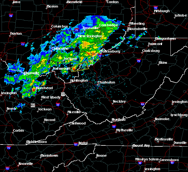 At 500 pm edt, a severe thunderstorm was located near gallipolis, moving northeast at 35 mph (radar indicated). Hazards include 60 mph wind gusts and quarter size hail. Hail damage to vehicles is expected. Expect wind damage to roofs, siding, and trees. At 500 pm edt, a severe thunderstorm was located near gallipolis, moving northeast at 35 mph (radar indicated). Hazards include 60 mph wind gusts and quarter size hail. Hail damage to vehicles is expected. Expect wind damage to roofs, siding, and trees.
|
| 3/1/2017 9:24 AM EST |
 At 923 am est, a severe thunderstorm capable of producing a tornado was located near new haven, or near pomeroy, moving east at 55 mph (radar indicated rotation). Hazards include tornado and half dollar size hail. Flying debris will be dangerous to those caught without shelter. mobile homes will be damaged or destroyed. damage to roofs, windows, and vehicles will occur. tree damage is likely. this tornadic thunderstorm will remain over mainly rural areas of eastern meigs, north central mason, northern jackson and southwestern wood counties, including the following locations: hartford city, belleville, syracuse, chester, reedsville and portland. This includes interstate 77 in west virginia between mile markers 148 and 161. At 923 am est, a severe thunderstorm capable of producing a tornado was located near new haven, or near pomeroy, moving east at 55 mph (radar indicated rotation). Hazards include tornado and half dollar size hail. Flying debris will be dangerous to those caught without shelter. mobile homes will be damaged or destroyed. damage to roofs, windows, and vehicles will occur. tree damage is likely. this tornadic thunderstorm will remain over mainly rural areas of eastern meigs, north central mason, northern jackson and southwestern wood counties, including the following locations: hartford city, belleville, syracuse, chester, reedsville and portland. This includes interstate 77 in west virginia between mile markers 148 and 161.
|
| 3/1/2017 8:58 AM EST |
 At 858 am est, a severe thunderstorm capable of producing a tornado was located 7 miles north of rio grande, moving east at 75 mph (radar indicated rotation). Hazards include tornado and golf ball size hail. Flying debris will be dangerous to those caught without shelter. mobile homes will be damaged or destroyed. damage to roofs, windows, and vehicles will occur. tree damage is likely. this dangerous storm will be near, pomeroy, rutland and mason around 910 am est. racine and new haven around 915 am est. ravenswood and tuppers plains around 920 am est. forked run state park around 925 am est. other locations impacted by this tornadic thunderstorm include portland, vinton, lakin, hartford city, belleville, reedsville, middleport, chester, cheshire and salem center. This includes interstate 77 in west virginia between mile markers 148 and 161. At 858 am est, a severe thunderstorm capable of producing a tornado was located 7 miles north of rio grande, moving east at 75 mph (radar indicated rotation). Hazards include tornado and golf ball size hail. Flying debris will be dangerous to those caught without shelter. mobile homes will be damaged or destroyed. damage to roofs, windows, and vehicles will occur. tree damage is likely. this dangerous storm will be near, pomeroy, rutland and mason around 910 am est. racine and new haven around 915 am est. ravenswood and tuppers plains around 920 am est. forked run state park around 925 am est. other locations impacted by this tornadic thunderstorm include portland, vinton, lakin, hartford city, belleville, reedsville, middleport, chester, cheshire and salem center. This includes interstate 77 in west virginia between mile markers 148 and 161.
|
| 3/1/2017 5:57 AM EST |
 At 557 am est, a severe thunderstorm was located over racine, moving northeast at 70 mph (radar indicated). Hazards include 70 mph wind gusts and quarter size hail. Hail damage to vehicles is expected. expect considerable tree damage. wind damage is also likely to mobile homes, roofs, and outbuildings. locations impacted include, racine, ravenswood, new haven, sandyville, mineralwells, middleport, syracuse, hartford city, portland, mount alto, peewee, cottageville, morristown, rockport and letart. This includes interstate 77 in west virginia between mile markers 141 and 170. At 557 am est, a severe thunderstorm was located over racine, moving northeast at 70 mph (radar indicated). Hazards include 70 mph wind gusts and quarter size hail. Hail damage to vehicles is expected. expect considerable tree damage. wind damage is also likely to mobile homes, roofs, and outbuildings. locations impacted include, racine, ravenswood, new haven, sandyville, mineralwells, middleport, syracuse, hartford city, portland, mount alto, peewee, cottageville, morristown, rockport and letart. This includes interstate 77 in west virginia between mile markers 141 and 170.
|
| 3/1/2017 5:57 AM EST |
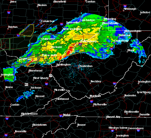 At 557 am est, a severe thunderstorm was located over racine, moving northeast at 70 mph (radar indicated). Hazards include 70 mph wind gusts and quarter size hail. Hail damage to vehicles is expected. expect considerable tree damage. wind damage is also likely to mobile homes, roofs, and outbuildings. locations impacted include, racine, ravenswood, new haven, sandyville, mineralwells, middleport, syracuse, hartford city, portland, mount alto, peewee, cottageville, morristown, rockport and letart. This includes interstate 77 in west virginia between mile markers 141 and 170. At 557 am est, a severe thunderstorm was located over racine, moving northeast at 70 mph (radar indicated). Hazards include 70 mph wind gusts and quarter size hail. Hail damage to vehicles is expected. expect considerable tree damage. wind damage is also likely to mobile homes, roofs, and outbuildings. locations impacted include, racine, ravenswood, new haven, sandyville, mineralwells, middleport, syracuse, hartford city, portland, mount alto, peewee, cottageville, morristown, rockport and letart. This includes interstate 77 in west virginia between mile markers 141 and 170.
|
| 3/1/2017 5:44 AM EST |
 At 544 am est, a severe thunderstorm was located over point pleasant, moving east at 70 mph (radar indicated). Hazards include 70 mph wind gusts and quarter size hail. Hail damage to vehicles is expected. expect considerable tree damage. Wind damage is also likely to mobile homes, roofs, and outbuildings. At 544 am est, a severe thunderstorm was located over point pleasant, moving east at 70 mph (radar indicated). Hazards include 70 mph wind gusts and quarter size hail. Hail damage to vehicles is expected. expect considerable tree damage. Wind damage is also likely to mobile homes, roofs, and outbuildings.
|
| 6/23/2016 5:47 PM EDT |
 At 545 pm edt, a severe thunderstorm was located near racine, moving southeast at 30 mph (radar indicated). Hazards include 60 mph wind gusts and quarter size hail. Hail damage to vehicles is expected. expect wind damage to roofs, siding, and trees. locations impacted include, ripley, pomeroy, racine, ravenswood, new haven, sandyville, syracuse, hartford city, letart, cottageville, evans, mount alto and portland. A tornado watch remains in effect until 1000 pm edt for southeastern ohio, and western and northwestern west virginia. At 545 pm edt, a severe thunderstorm was located near racine, moving southeast at 30 mph (radar indicated). Hazards include 60 mph wind gusts and quarter size hail. Hail damage to vehicles is expected. expect wind damage to roofs, siding, and trees. locations impacted include, ripley, pomeroy, racine, ravenswood, new haven, sandyville, syracuse, hartford city, letart, cottageville, evans, mount alto and portland. A tornado watch remains in effect until 1000 pm edt for southeastern ohio, and western and northwestern west virginia.
|
| 6/23/2016 5:34 PM EDT |
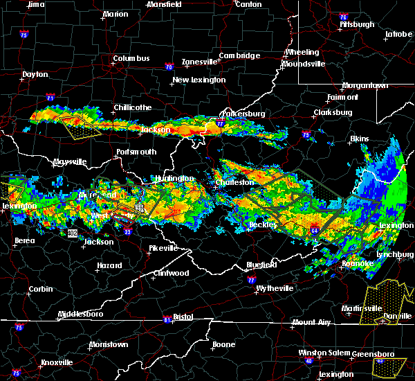 At 533 pm edt, a severe thunderstorm was located near forked run state park, moving south at 30 mph (radar indicated). Hazards include 60 mph wind gusts and quarter size hail. Hail damage to vehicles is expected. Expect wind damage to roofs, siding, and trees. At 533 pm edt, a severe thunderstorm was located near forked run state park, moving south at 30 mph (radar indicated). Hazards include 60 mph wind gusts and quarter size hail. Hail damage to vehicles is expected. Expect wind damage to roofs, siding, and trees.
|
| 4/26/2016 3:44 PM EDT |
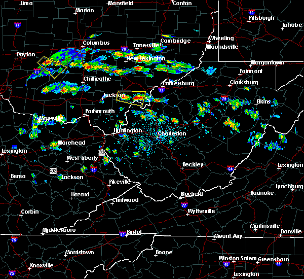 At 344 pm edt, a severe thunderstorm was located over pomeroy, moving east at 30 mph (radar indicated). Hazards include quarter size hail. damage to vehicles is expected At 344 pm edt, a severe thunderstorm was located over pomeroy, moving east at 30 mph (radar indicated). Hazards include quarter size hail. damage to vehicles is expected
|
| 4/26/2016 3:31 PM EDT |
 At 331 pm edt, a severe thunderstorm was located over rutland, moving east at 30 mph (radar indicated). Hazards include quarter size hail. Damage to vehicles is expected. Locations impacted include, pomeroy, racine, rutland, new haven, mason, tuppers plains, middleport, chester, syracuse, hartford city, wilkesville, harrisonville, darwin, dexter, salem center, kyger, lakin, carpenter and dyesville. At 331 pm edt, a severe thunderstorm was located over rutland, moving east at 30 mph (radar indicated). Hazards include quarter size hail. Damage to vehicles is expected. Locations impacted include, pomeroy, racine, rutland, new haven, mason, tuppers plains, middleport, chester, syracuse, hartford city, wilkesville, harrisonville, darwin, dexter, salem center, kyger, lakin, carpenter and dyesville.
|
| 4/26/2016 3:15 PM EDT |
 At 315 pm edt, a severe thunderstorm was located 8 miles northwest of rutland, moving east at 20 mph (public). Hazards include quarter size hail. damage to vehicles is expected At 315 pm edt, a severe thunderstorm was located 8 miles northwest of rutland, moving east at 20 mph (public). Hazards include quarter size hail. damage to vehicles is expected
|
| 4/26/2016 3:15 PM EDT |
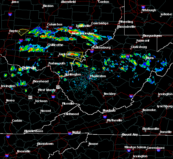 At 315 pm edt, a severe thunderstorm was located 8 miles northwest of rutland, moving east at 20 mph (public). Hazards include quarter size hail. damage to vehicles is expected At 315 pm edt, a severe thunderstorm was located 8 miles northwest of rutland, moving east at 20 mph (public). Hazards include quarter size hail. damage to vehicles is expected
|
| 3/28/2016 12:14 AM EDT |
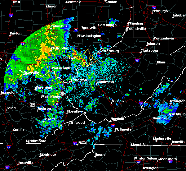 At 1214 am edt, doppler radar indicated a line of severe thunderstorms capable of producing quarter size hail and damaging winds in excess of 60 mph. these storms were located along a line extending from near rutland to near pomeroy to racine, and moving northeast at 55 mph. At 1214 am edt, doppler radar indicated a line of severe thunderstorms capable of producing quarter size hail and damaging winds in excess of 60 mph. these storms were located along a line extending from near rutland to near pomeroy to racine, and moving northeast at 55 mph.
|
| 7/14/2015 4:33 PM EDT |
 At 432 pm edt, doppler radar indicated a line of severe thunderstorms capable of producing damaging winds in excess of 60 mph. these storms were located along a line extending from near oak hill to 6 miles north of south webster, moving southeast at 45 mph. locations impacted include, jackson, wellston, point pleasant, gallipolis, ripley, pomeroy, oak hill, rio grande, racine, rutland, new haven, mason, gallia, vernon, waterloo, middleport, syracuse, hartford city, henderson and vinton. At 432 pm edt, doppler radar indicated a line of severe thunderstorms capable of producing damaging winds in excess of 60 mph. these storms were located along a line extending from near oak hill to 6 miles north of south webster, moving southeast at 45 mph. locations impacted include, jackson, wellston, point pleasant, gallipolis, ripley, pomeroy, oak hill, rio grande, racine, rutland, new haven, mason, gallia, vernon, waterloo, middleport, syracuse, hartford city, henderson and vinton.
|
| 7/14/2015 3:59 PM EDT |
 At 358 pm edt, doppler radar indicated a line of severe thunderstorms capable of producing damaging winds in excess of 60 mph. these storms were located along a line extending from 7 miles northeast of waverly to near waverly city, and moving southeast at 45 mph. At 358 pm edt, doppler radar indicated a line of severe thunderstorms capable of producing damaging winds in excess of 60 mph. these storms were located along a line extending from 7 miles northeast of waverly to near waverly city, and moving southeast at 45 mph.
|
| 6/26/2015 7:00 PM EDT | At 659 pm edt, doppler radar indicated a severe thunderstorm capable of producing quarter size hail and damaging winds in excess of 60 mph. this storm was located 7 miles west of ripley, and moving east at 35 mph. |
| 6/26/2015 7:00 PM EDT | At 659 pm edt, doppler radar indicated a severe thunderstorm capable of producing quarter size hail and damaging winds in excess of 60 mph. this storm was located 7 miles west of ripley, and moving east at 35 mph. |
| 6/26/2015 6:31 PM EDT | At 629 pm edt, doppler radar indicated a severe thunderstorm capable of producing half dollar size hail and destructive winds in excess of 70 mph. this storm was located over gallipolis, moving east at 25 mph. at 627 pm a trained spotter reported trees down just north of rio grand. locations impacted include, point pleasant, gallipolis, ripley, pomeroy, racine, rutland, ravenswood, new haven, mason, middleport, syracuse, hartford city, henderson, leon, cheshire, gallopolis ferry, letart, kyger, evans and given. |
| 6/26/2015 6:31 PM EDT | At 629 pm edt, doppler radar indicated a severe thunderstorm capable of producing half dollar size hail and destructive winds in excess of 70 mph. this storm was located over gallipolis, moving east at 25 mph. at 627 pm a trained spotter reported trees down just north of rio grand. locations impacted include, point pleasant, gallipolis, ripley, pomeroy, racine, rutland, ravenswood, new haven, mason, middleport, syracuse, hartford city, henderson, leon, cheshire, gallopolis ferry, letart, kyger, evans and given. |
| 6/26/2015 5:58 PM EDT | At 557 pm edt, doppler radar indicated a severe thunderstorm capable of producing large damaging hail up to golf ball size and destructive winds in excess of 70 mph. this storm was located over rio grande, and moving southeast at 40 mph. |
| 6/26/2015 5:58 PM EDT | At 557 pm edt, doppler radar indicated a severe thunderstorm capable of producing large damaging hail up to golf ball size and destructive winds in excess of 70 mph. this storm was located over rio grande, and moving southeast at 40 mph. |
| 4/9/2015 8:24 PM EDT | The severe thunderstorm warning for southeastern meigs county in southeast ohio. and wood. northwestern wirt. northern jackson and north central mason counties in west virginia will expire at 830 pm edt. the storm which prompted the warning has weakened below severe limits. And no longer poses an immediate threat to life or. |
| 4/9/2015 8:24 PM EDT | The severe thunderstorm warning for southeastern meigs county in southeast ohio. and wood. northwestern wirt. northern jackson and north central mason counties in west virginia will expire at 830 pm edt. the storm which prompted the warning has weakened below severe limits. And no longer poses an immediate threat to life or. |
| 4/9/2015 8:07 PM EDT | The national weather service in charleston has issued a * severe thunderstorm warning for. northern jackson county in west virginia. north central mason county in west virginia. northwestern wirt county in west virginia. Wood county in west virginia. |
| 4/9/2015 8:07 PM EDT | The national weather service in charleston has issued a * severe thunderstorm warning for. northern jackson county in west virginia. north central mason county in west virginia. northwestern wirt county in west virginia. Wood county in west virginia. |
| 4/9/2015 7:31 PM EDT | The national weather service in charleston has issued a * severe thunderstorm warning for. north central cabell county in west virginia. mason county in west virginia. this includes the city of point pleasant. Northwestern putnam county in west virginia. |
| 4/9/2015 7:31 PM EDT | The national weather service in charleston has issued a * severe thunderstorm warning for. north central cabell county in west virginia. mason county in west virginia. this includes the city of point pleasant. Northwestern putnam county in west virginia. |
| 4/9/2015 2:55 PM EDT | The national weather service in charleston has issued a * severe thunderstorm warning for. northern jackson county in west virginia. this includes the city of ripley. northeastern mason county in west virginia. Northwestern roane county in west virginia. |
| 4/9/2015 2:55 PM EDT | The national weather service in charleston has issued a * severe thunderstorm warning for. northern jackson county in west virginia. this includes the city of ripley. northeastern mason county in west virginia. Northwestern roane county in west virginia. |
| 4/9/2015 2:40 PM EDT | A severe thunderstorm warning remains in effect until 300 pm edt for southeastern meigs and east central gallia counties in southeast ohio. and west central jackson and northern mason counties in west virginia. at 238 pm edt. National weather service doppler radar continued to indicate a severe thunderstorm capable of producing quarter size. |
| 4/9/2015 2:40 PM EDT | A severe thunderstorm warning remains in effect until 300 pm edt for southeastern meigs and east central gallia counties in southeast ohio. and west central jackson and northern mason counties in west virginia. at 238 pm edt. National weather service doppler radar continued to indicate a severe thunderstorm capable of producing quarter size. |
| 4/9/2015 2:26 PM EDT | The severe thunderstorm warning for southeastern vinton. western meigs. east central jackson and northern gallia counties in southeast ohio. and north central mason county in west virginia will expire at 230 pm edt. The storm which prompted the warning has moved out of the warned area. |
| 4/9/2015 2:26 PM EDT | The severe thunderstorm warning for southeastern vinton. western meigs. east central jackson and northern gallia counties in southeast ohio. and north central mason county in west virginia will expire at 230 pm edt. The storm which prompted the warning has moved out of the warned area. |
| 4/9/2015 2:20 PM EDT | The national weather service in charleston has issued a * severe thunderstorm warning for. west central jackson county in west virginia. this includes the city of ripley. northern mason county in west virginia. This includes the city of point pleasant. |
| 4/9/2015 2:20 PM EDT | The national weather service in charleston has issued a * severe thunderstorm warning for. west central jackson county in west virginia. this includes the city of ripley. northern mason county in west virginia. This includes the city of point pleasant. |
| 4/9/2015 2:07 PM EDT | A severe thunderstorm warning remains in effect until 230 pm edt for southeastern vinton. western meigs. east central jackson and northern gallia counties in southeast ohio. and north central mason county in west virginia. at 204 pm edt. National weather service doppler radar continued to indicate a severe thunderstorm capable of producing golf ball size. |
| 4/9/2015 2:07 PM EDT | A severe thunderstorm warning remains in effect until 230 pm edt for southeastern vinton. western meigs. east central jackson and northern gallia counties in southeast ohio. and north central mason county in west virginia. at 204 pm edt. National weather service doppler radar continued to indicate a severe thunderstorm capable of producing golf ball size. |
| 4/9/2015 1:47 PM EDT | The national weather service in charleston has issued a * severe thunderstorm warning for. north central mason county in west virginia. this includes the city of pomeroy. northern gallia county in southeast ohio. This includes the city of rio grande. |
| 4/9/2015 1:47 PM EDT | The national weather service in charleston has issued a * severe thunderstorm warning for. north central mason county in west virginia. this includes the city of pomeroy. northern gallia county in southeast ohio. This includes the city of rio grande. |
| 4/8/2015 1:35 PM EDT | A severe thunderstorm warning remains in effect until 200 pm edt for southern greenup. carter and boyd counties in kentucky. and eastern meigs. lawrence. southern gallia and extreme southeastern athens counties in southeast ohio. and northern wayne. cabell. northern jackson and mason counties in west virginia. at 122 pm edt. National weather service doppler radar continued to. |
| 4/8/2015 1:35 PM EDT | A severe thunderstorm warning remains in effect until 200 pm edt for southern greenup. carter and boyd counties in kentucky. and eastern meigs. lawrence. southern gallia and extreme southeastern athens counties in southeast ohio. and northern wayne. cabell. northern jackson and mason counties in west virginia. at 122 pm edt. National weather service doppler radar continued to. |
| 4/8/2015 1:35 PM EDT | A severe thunderstorm warning remains in effect until 200 pm edt for southern greenup. carter and boyd counties in kentucky. and eastern meigs. lawrence. southern gallia and extreme southeastern athens counties in southeast ohio. and northern wayne. cabell. northern jackson and mason counties in west virginia. at 122 pm edt. National weather service doppler radar continued to. |
| 4/8/2015 12:56 PM EDT | The national weather service in charleston has issued a * severe thunderstorm warning for. boyd county in kentucky. this includes the cities of. cannonsburg. ashland. carter county in kentucky. this includes the cities of. olive hill. Grayson lake state. |
| 4/8/2015 12:56 PM EDT | The national weather service in charleston has issued a * severe thunderstorm warning for. boyd county in kentucky. this includes the cities of. cannonsburg. ashland. carter county in kentucky. this includes the cities of. olive hill. Grayson lake state. |
| 4/8/2015 12:56 PM EDT | The national weather service in charleston has issued a * severe thunderstorm warning for. boyd county in kentucky. this includes the cities of. cannonsburg. ashland. carter county in kentucky. this includes the cities of. olive hill. Grayson lake state. |
| 6/29/2012 6:41 PM EDT | Spotter lowell rogers... roof damage... large branches down... power out in mason county WV, 0.3 miles ESE of New Haven, WV |
Hail Maps for New Haven, WV


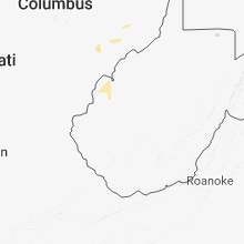


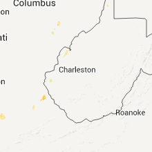


Connect with Interactive Hail Maps