

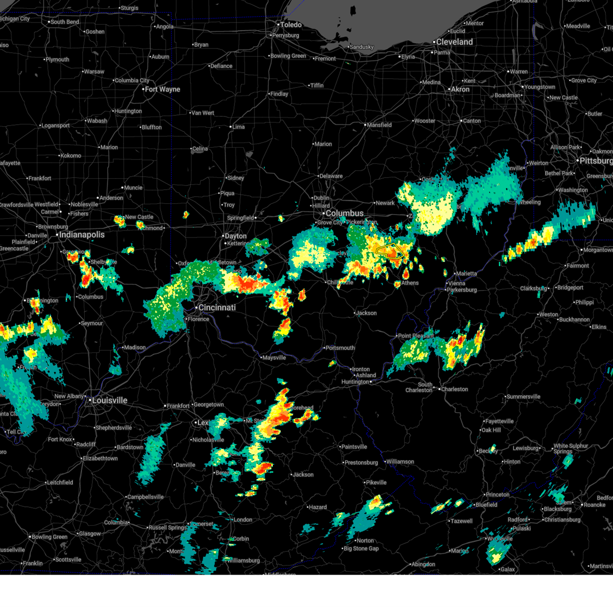
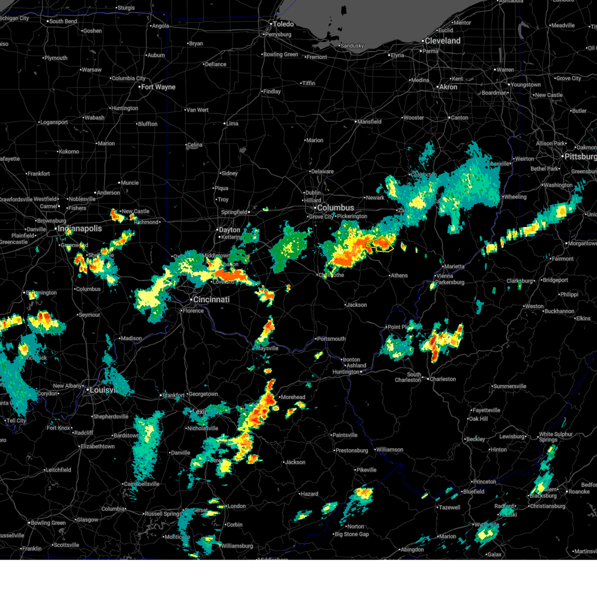
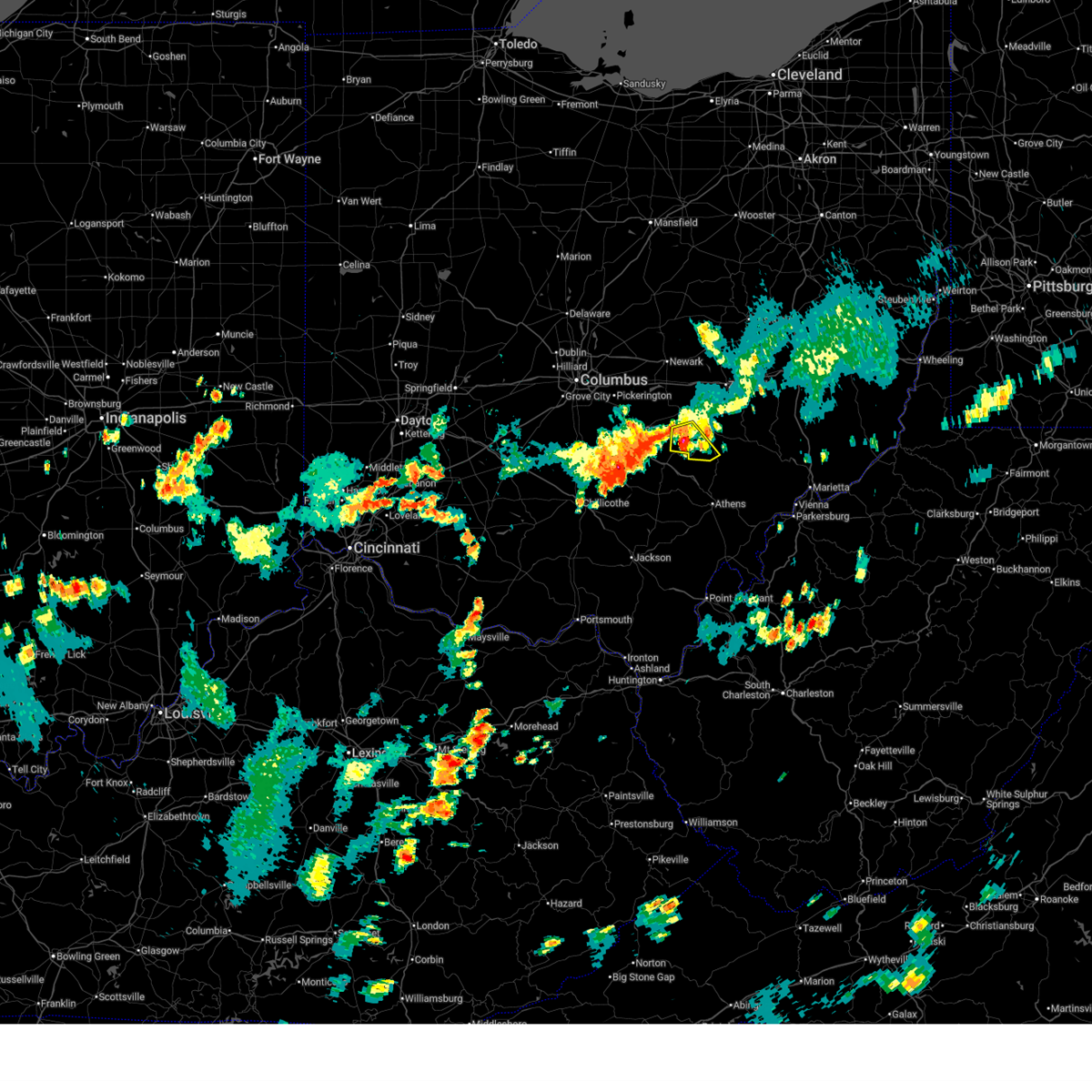
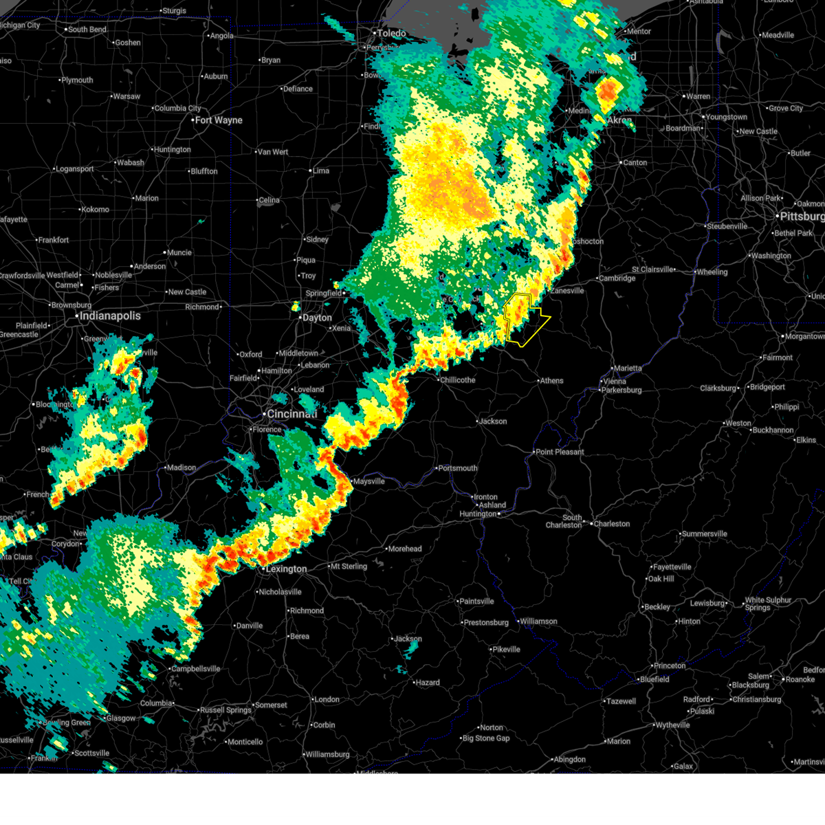
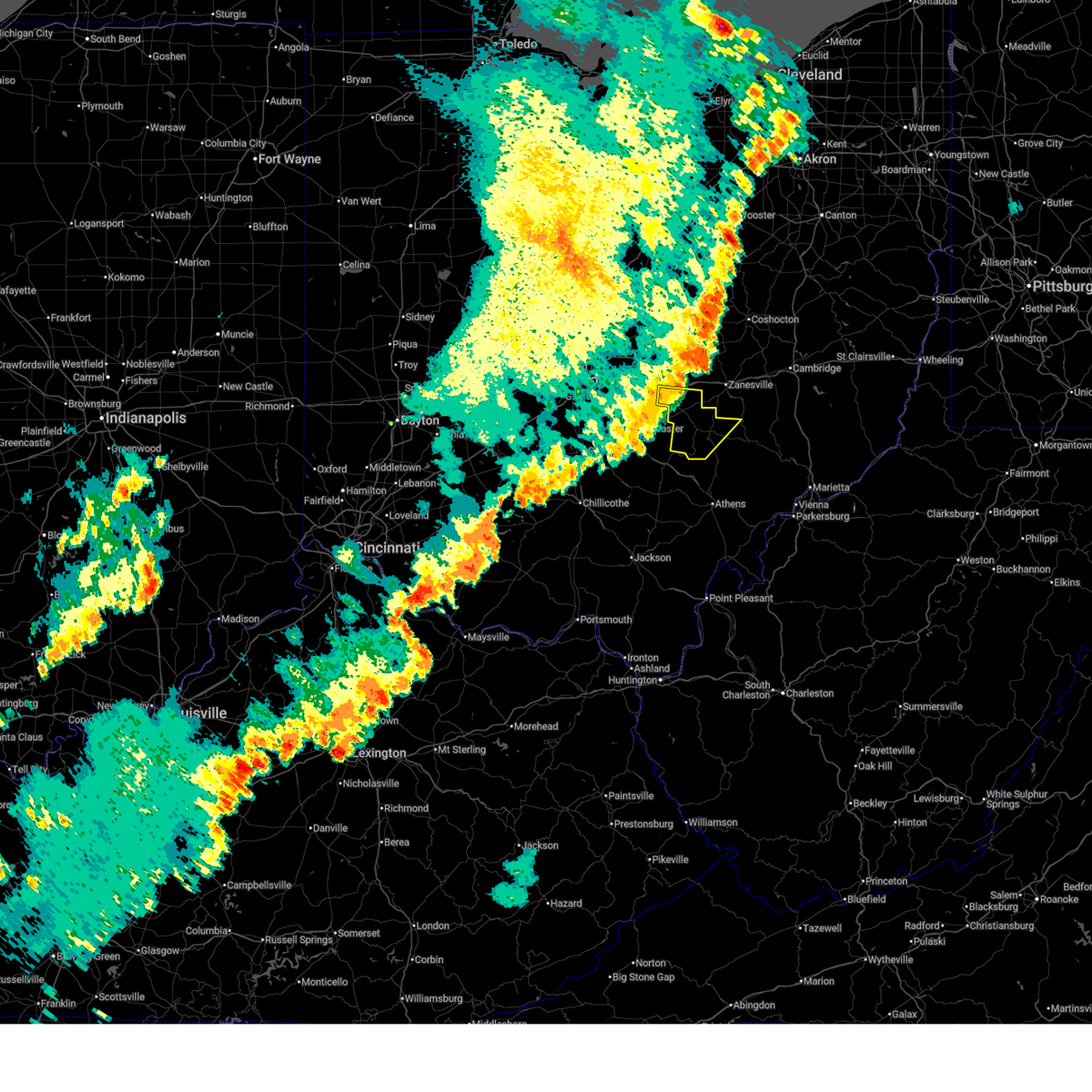
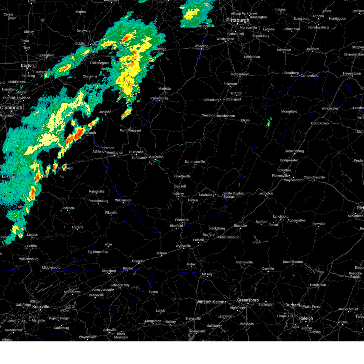
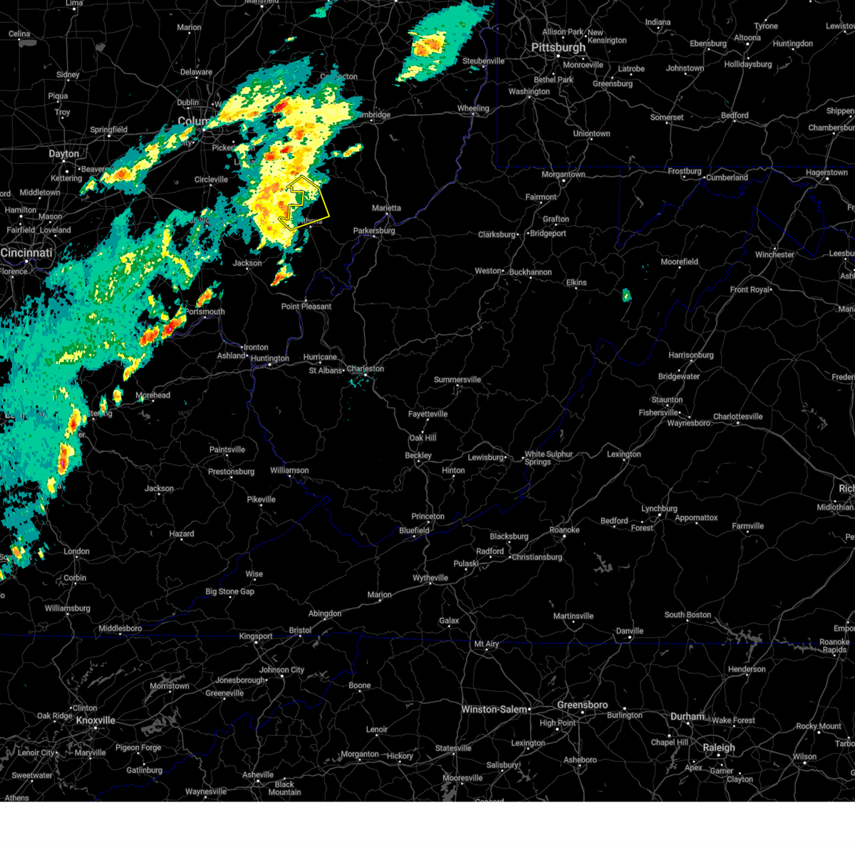
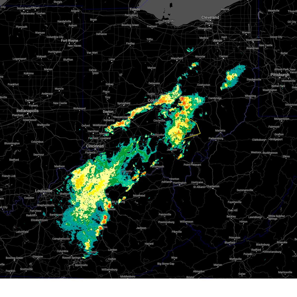
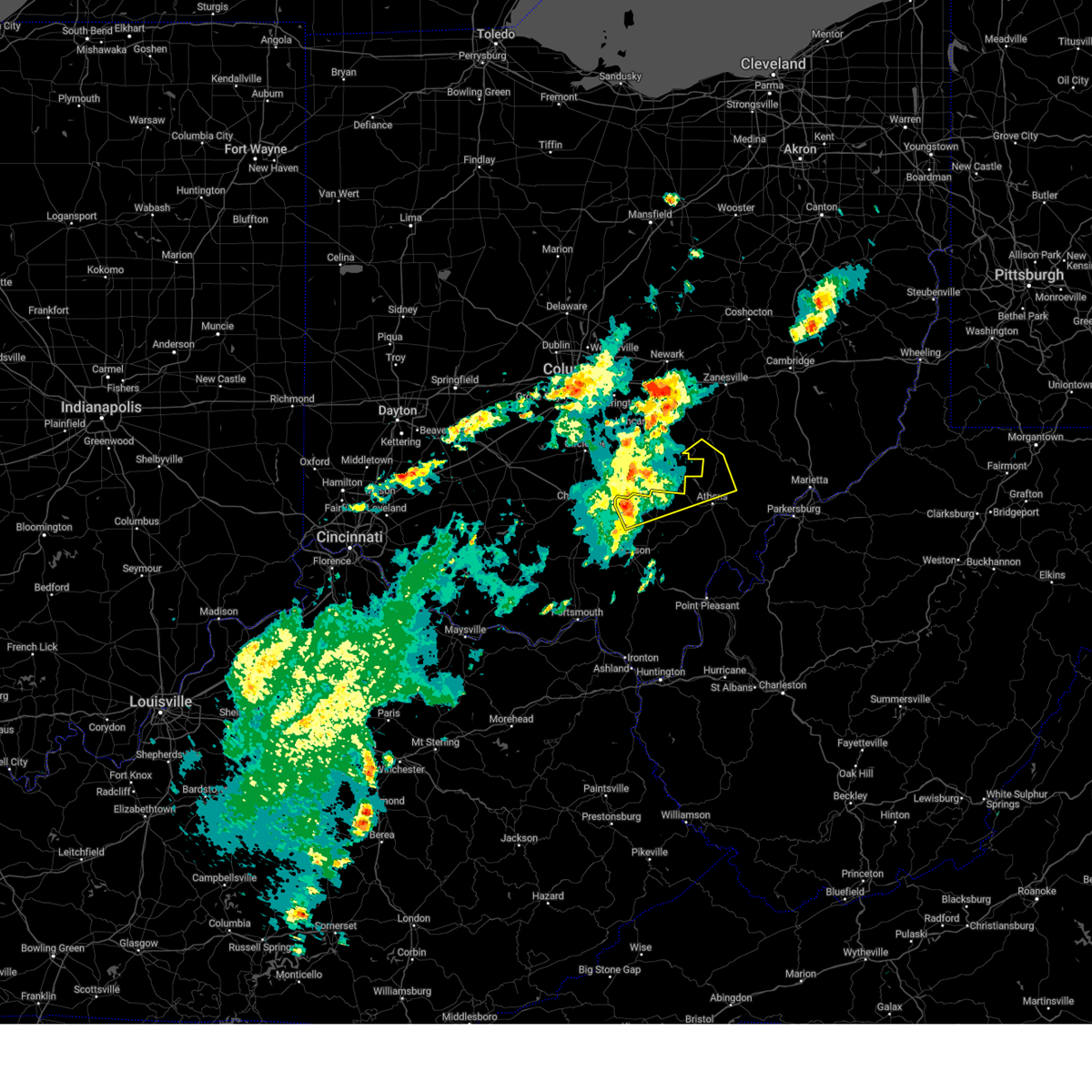
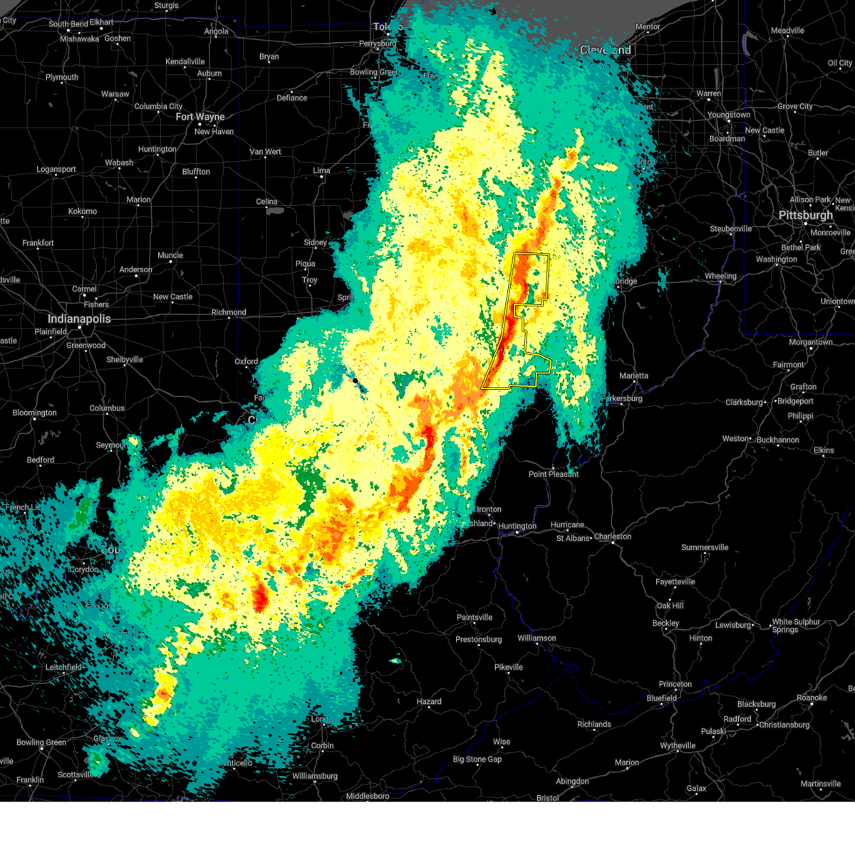
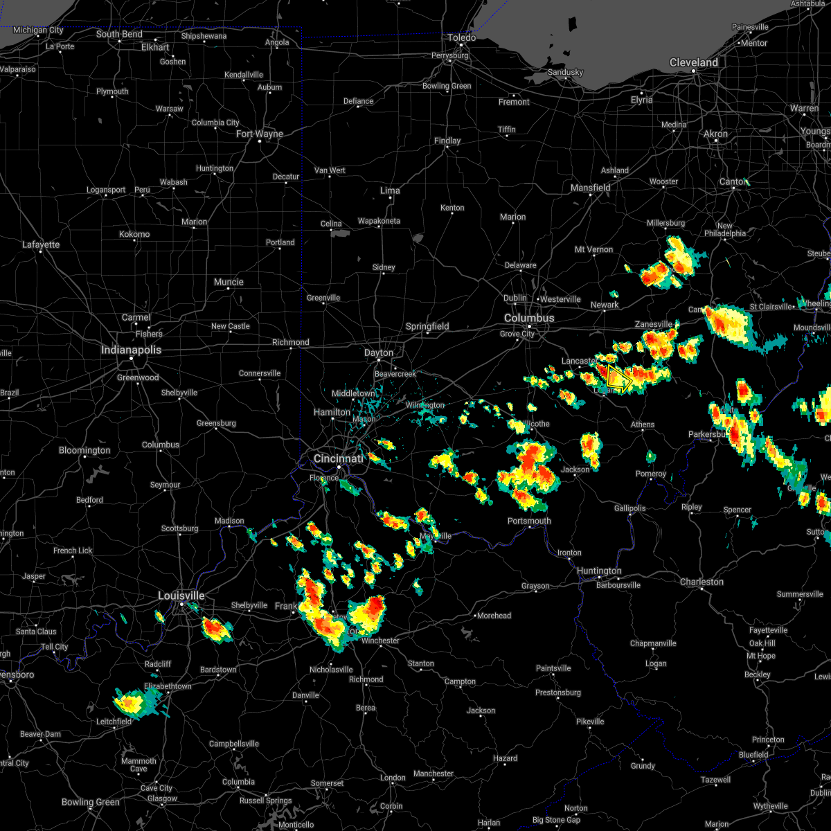
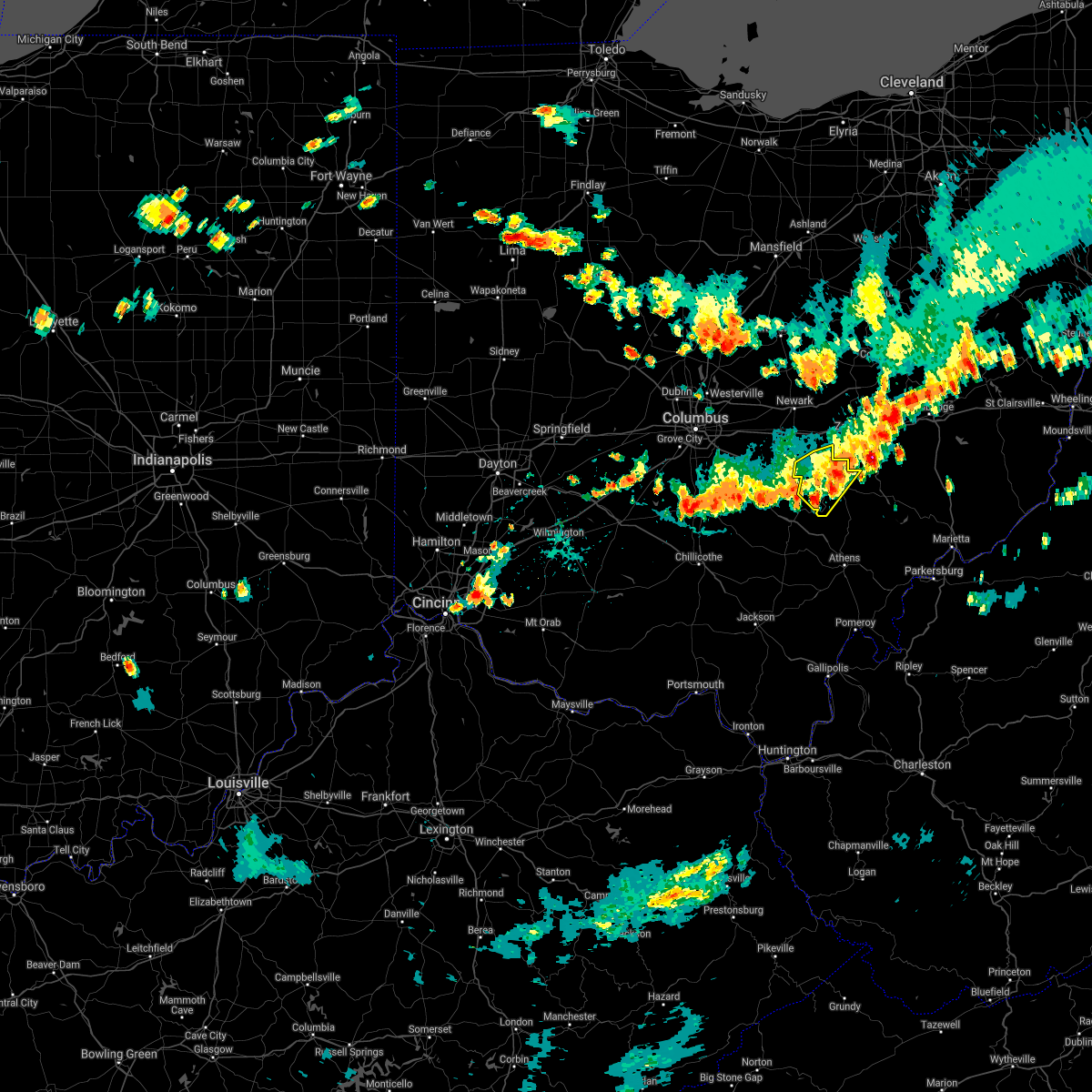
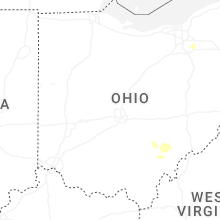
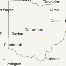
Hail Map for New Straitsville, OH
The New Straitsville, OH area has had 1 report of on-the-ground hail by trained spotters, and has been under severe weather warnings 29 times during the past 12 months. Doppler radar has detected hail at or near New Straitsville, OH on 34 occasions, including 4 occasions during the past year.
| Name: | New Straitsville, OH |
| Where Located: | 48.6 miles ESE of Columbus, OH |
| Map: | Google Map for New Straitsville, OH |
| Population: | 722 |
| Housing Units: | 363 |
| More Info: | Search Google for New Straitsville, OH |
1
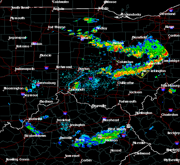
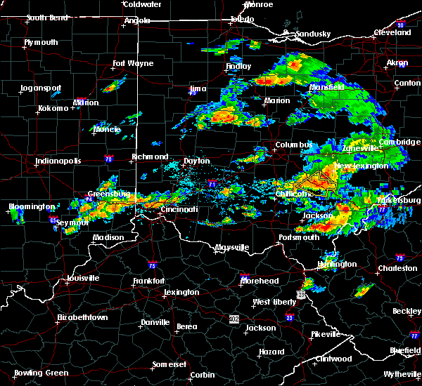
The Top Recent Hail Date for New Straitsville, OH is Friday, May 16, 2025 (6th out of 34)

Hail and Wind Damage Spotted near New Straitsville, OH
| Date / Time | Report Details |
|---|---|
| 6/28/2025 7:14 PM EDT |
 The storm which prompted the warning has weakened below severe limits, and no longer poses an immediate threat to life or property. therefore, the warning will be allowed to expire. however, gusty winds and heavy rain are still possible with this thunderstorm. to report severe weather, contact your nearest law enforcement agency. they will relay your report to the national weather service charleston west virginia. The storm which prompted the warning has weakened below severe limits, and no longer poses an immediate threat to life or property. therefore, the warning will be allowed to expire. however, gusty winds and heavy rain are still possible with this thunderstorm. to report severe weather, contact your nearest law enforcement agency. they will relay your report to the national weather service charleston west virginia.
|
| 6/28/2025 7:06 PM EDT |
 At 705 pm edt, a severe thunderstorm was located over shawnee, moving southeast at 15 mph (radar indicated). Hazards include 60 mph wind gusts. Expect damage to roofs, siding, and trees. Locations impacted include, shawnee, new straitsville, corning, hemlock, and rendville. At 705 pm edt, a severe thunderstorm was located over shawnee, moving southeast at 15 mph (radar indicated). Hazards include 60 mph wind gusts. Expect damage to roofs, siding, and trees. Locations impacted include, shawnee, new straitsville, corning, hemlock, and rendville.
|
| 6/28/2025 6:37 PM EDT |
 Svrrlx the national weather service in charleston west virginia has issued a * severe thunderstorm warning for, southern perry county in southeastern ohio, * until 715 pm edt. * at 637 pm edt, a severe thunderstorm was located near shawnee, moving southeast at 15 mph (radar indicated). Hazards include 60 mph wind gusts and penny size hail. expect damage to roofs, siding, and trees Svrrlx the national weather service in charleston west virginia has issued a * severe thunderstorm warning for, southern perry county in southeastern ohio, * until 715 pm edt. * at 637 pm edt, a severe thunderstorm was located near shawnee, moving southeast at 15 mph (radar indicated). Hazards include 60 mph wind gusts and penny size hail. expect damage to roofs, siding, and trees
|
| 6/18/2025 9:30 PM EDT |
 The storms which prompted the warning have weakened below severe limits, and no longer pose an immediate threat to life or property. therefore, the warning has been allowed to expire. however, gusty winds are still possible with these thunderstorms. a severe thunderstorm watch remains in effect until 300 am edt for southeastern ohio. to report severe weather, contact your nearest law enforcement agency. they will relay your report to the national weather service charleston west virginia. The storms which prompted the warning have weakened below severe limits, and no longer pose an immediate threat to life or property. therefore, the warning has been allowed to expire. however, gusty winds are still possible with these thunderstorms. a severe thunderstorm watch remains in effect until 300 am edt for southeastern ohio. to report severe weather, contact your nearest law enforcement agency. they will relay your report to the national weather service charleston west virginia.
|
| 6/18/2025 9:23 PM EDT | At 923 pm edt, severe thunderstorms were located along a line extending from zanesville to 6 miles west of logan, moving east at 45 mph (radar indicated). Hazards include 60 mph wind gusts. Expect damage to roofs, siding, and trees. Locations impacted include, new lexington, somerset, shawnee, perry state forest, crooksville, junction city, new straitsville, and glenford. |
| 6/18/2025 9:06 PM EDT |
 Svrrlx the national weather service in charleston west virginia has issued a * severe thunderstorm warning for, perry county in southeastern ohio, northwestern morgan county in southeastern ohio, * until 930 pm edt. * at 905 pm edt, severe thunderstorms were located along a line extending from 7 miles east of thornport to 8 miles northeast of kingston, moving east at 45 mph (radar indicated). Hazards include 60 mph wind gusts. expect damage to roofs, siding, and trees Svrrlx the national weather service in charleston west virginia has issued a * severe thunderstorm warning for, perry county in southeastern ohio, northwestern morgan county in southeastern ohio, * until 930 pm edt. * at 905 pm edt, severe thunderstorms were located along a line extending from 7 miles east of thornport to 8 miles northeast of kingston, moving east at 45 mph (radar indicated). Hazards include 60 mph wind gusts. expect damage to roofs, siding, and trees
|
| 6/9/2025 2:35 PM EDT |
 The storm which prompted the warning has weakened below severe limits, and no longer poses an immediate threat to life or property. therefore, the warning will be allowed to expire. however, gusty winds and heavy rain are still possible with this thunderstorm. The storm which prompted the warning has weakened below severe limits, and no longer poses an immediate threat to life or property. therefore, the warning will be allowed to expire. however, gusty winds and heavy rain are still possible with this thunderstorm.
|
| 6/9/2025 2:19 PM EDT |
 At 219 pm edt, a severe thunderstorm was located near nelsonville, moving northeast at 40 mph (radar indicated). Hazards include 60 mph wind gusts and quarter size hail. Hail damage to vehicles is expected. expect wind damage to roofs, siding, and trees. Locations impacted include, nelsonville, glouster, shawnee, chauncey, new straitsville, corning, buchtel, jacksonville, trimble, hemlock, amesville, rendville, burr oak state park, and the plains. At 219 pm edt, a severe thunderstorm was located near nelsonville, moving northeast at 40 mph (radar indicated). Hazards include 60 mph wind gusts and quarter size hail. Hail damage to vehicles is expected. expect wind damage to roofs, siding, and trees. Locations impacted include, nelsonville, glouster, shawnee, chauncey, new straitsville, corning, buchtel, jacksonville, trimble, hemlock, amesville, rendville, burr oak state park, and the plains.
|
| 6/9/2025 2:08 PM EDT |
 At 208 pm edt, a severe thunderstorm was located near hocking hills state park, or near lake hope state park, moving northeast at 40 mph (radar indicated). Hazards include 60 mph wind gusts and quarter size hail. Hail damage to vehicles is expected. expect wind damage to roofs, siding, and trees. Locations impacted include, nelsonville, glouster, shawnee, lake hope state park, chauncey, new straitsville, corning, buchtel, jacksonville, trimble, zaleski, hemlock, amesville, rendville, creola, burr oak state park, and the plains. At 208 pm edt, a severe thunderstorm was located near hocking hills state park, or near lake hope state park, moving northeast at 40 mph (radar indicated). Hazards include 60 mph wind gusts and quarter size hail. Hail damage to vehicles is expected. expect wind damage to roofs, siding, and trees. Locations impacted include, nelsonville, glouster, shawnee, lake hope state park, chauncey, new straitsville, corning, buchtel, jacksonville, trimble, zaleski, hemlock, amesville, rendville, creola, burr oak state park, and the plains.
|
| 6/9/2025 1:55 PM EDT |
 Svrrlx the national weather service in charleston west virginia has issued a * severe thunderstorm warning for, southeastern perry county in southeastern ohio, southwestern morgan county in southeastern ohio, northern vinton county in southeastern ohio, northwestern athens county in southeastern ohio, * until 245 pm edt. * at 154 pm edt, a severe thunderstorm was located 8 miles southwest of hocking hills state park, or 9 miles northwest of mcarthur, moving northeast at 50 mph (radar indicated). Hazards include 60 mph wind gusts and quarter size hail. Hail damage to vehicles is expected. Expect wind damage to roofs, siding, and trees. Svrrlx the national weather service in charleston west virginia has issued a * severe thunderstorm warning for, southeastern perry county in southeastern ohio, southwestern morgan county in southeastern ohio, northern vinton county in southeastern ohio, northwestern athens county in southeastern ohio, * until 245 pm edt. * at 154 pm edt, a severe thunderstorm was located 8 miles southwest of hocking hills state park, or 9 miles northwest of mcarthur, moving northeast at 50 mph (radar indicated). Hazards include 60 mph wind gusts and quarter size hail. Hail damage to vehicles is expected. Expect wind damage to roofs, siding, and trees.
|
| 5/16/2025 11:14 PM EDT | Svrrlx the national weather service in charleston west virginia has issued a * severe thunderstorm warning for, southeastern perry county in southeastern ohio, northwestern washington county in southeastern ohio, morgan county in southeastern ohio, northern athens county in southeastern ohio, * until 1145 pm edt. * at 1113 pm edt, severe thunderstorms were located along a line extending from near shawnee to 6 miles north of lake hope state park, moving east at 60 mph (radar indicated). Hazards include 60 mph wind gusts and half dollar size hail. Hail damage to vehicles is expected. Expect wind damage to roofs, siding, and trees. |
| 5/16/2025 11:02 PM EDT | At 1102 pm edt, severe thunderstorms were located along a line extending from near logan to 11 miles southwest of hocking hills state park, moving east at 55 mph (radar indicated). Hazards include 60 mph wind gusts and half dollar size hail. Hail damage to vehicles is expected. expect wind damage to roofs, siding, and trees. Locations impacted include, nelsonville, glouster, lake hope state park, new straitsville, buchtel, jacksonville, trimble, zaleski, hemlock, creola, eagle mills, burr oak state park, and allensville. |
| 5/16/2025 10:52 PM EDT | Svrrlx the national weather service in charleston west virginia has issued a * severe thunderstorm warning for, southeastern perry county in southeastern ohio, west central morgan county in southeastern ohio, northern vinton county in southeastern ohio, northwestern athens county in southeastern ohio, * until 1115 pm edt. * at 1051 pm edt, severe thunderstorms were located along a line extending from 9 miles south of lancaster to chillicothe, moving east at 50 mph (radar indicated). Hazards include 60 mph wind gusts and half dollar size hail. Hail damage to vehicles is expected. Expect wind damage to roofs, siding, and trees. |
| 4/29/2025 3:57 PM EDT |
 Svrrlx the national weather service in charleston west virginia has issued a * severe thunderstorm warning for, southeastern perry county in southeastern ohio, morgan county in southeastern ohio, * until 430 pm edt. * at 356 pm edt, severe thunderstorms were located along a line extending from 8 miles southeast of south zanesville to near shawnee, moving east at 50 mph (radar indicated). Hazards include 60 mph wind gusts. expect damage to roofs, siding, and trees Svrrlx the national weather service in charleston west virginia has issued a * severe thunderstorm warning for, southeastern perry county in southeastern ohio, morgan county in southeastern ohio, * until 430 pm edt. * at 356 pm edt, severe thunderstorms were located along a line extending from 8 miles southeast of south zanesville to near shawnee, moving east at 50 mph (radar indicated). Hazards include 60 mph wind gusts. expect damage to roofs, siding, and trees
|
| 4/29/2025 3:49 PM EDT | At 349 pm edt, severe thunderstorms were located along a line extending from 9 miles south of south zanesville to near logan, moving southeast at 30 mph (radar indicated). Hazards include 60 mph wind gusts. Expect damage to roofs, siding, and trees. Locations impacted include, eagleport, junction city, perry state forest, hemlock, shawnee, new straitsville, rendville, crooksville, new lexington, and corning. |
| 4/29/2025 3:42 PM EDT |
 At 341 pm edt, severe thunderstorms were located along a line extending from 7 miles south of south zanesville to near logan, moving southeast at 30 mph (radar indicated). Hazards include 60 mph wind gusts. Expect damage to roofs, siding, and trees. Locations impacted include, eagleport, junction city, perry state forest, hemlock, shawnee, new straitsville, rendville, crooksville, somerset, new lexington, and corning. At 341 pm edt, severe thunderstorms were located along a line extending from 7 miles south of south zanesville to near logan, moving southeast at 30 mph (radar indicated). Hazards include 60 mph wind gusts. Expect damage to roofs, siding, and trees. Locations impacted include, eagleport, junction city, perry state forest, hemlock, shawnee, new straitsville, rendville, crooksville, somerset, new lexington, and corning.
|
| 4/29/2025 3:30 PM EDT |
 Svrrlx the national weather service in charleston west virginia has issued a * severe thunderstorm warning for, perry county in southeastern ohio, northwestern morgan county in southeastern ohio, * until 400 pm edt. * at 329 pm edt, severe thunderstorms were located along a line extending from 7 miles north of somerset to 7 miles northeast of kingston, moving east at 60 mph (radar indicated). Hazards include 60 mph wind gusts. expect damage to roofs, siding, and trees Svrrlx the national weather service in charleston west virginia has issued a * severe thunderstorm warning for, perry county in southeastern ohio, northwestern morgan county in southeastern ohio, * until 400 pm edt. * at 329 pm edt, severe thunderstorms were located along a line extending from 7 miles north of somerset to 7 miles northeast of kingston, moving east at 60 mph (radar indicated). Hazards include 60 mph wind gusts. expect damage to roofs, siding, and trees
|
| 4/3/2025 2:32 AM EDT |
 At 231 am edt, a severe thunderstorm was located over bremen, moving northeast at 65 mph (radar indicated). Hazards include 60 mph wind gusts. Expect damage to trees and power lines. locations impacted include, hanover, hocking hills state park, millersport, starr, purity, brownsville, ilesboro, new straitsville, haydenville, utica, harbor hills, south bloomingville, bremen, thornport, hebron, north berne, pleasantville, murray city, union furnace, and hide-a-way hills. This includes i-70 in ohio between mile markers 127 and 142, and near mile marker 144. At 231 am edt, a severe thunderstorm was located over bremen, moving northeast at 65 mph (radar indicated). Hazards include 60 mph wind gusts. Expect damage to trees and power lines. locations impacted include, hanover, hocking hills state park, millersport, starr, purity, brownsville, ilesboro, new straitsville, haydenville, utica, harbor hills, south bloomingville, bremen, thornport, hebron, north berne, pleasantville, murray city, union furnace, and hide-a-way hills. This includes i-70 in ohio between mile markers 127 and 142, and near mile marker 144.
|
| 4/3/2025 2:16 AM EDT | Svrrlx the national weather service in charleston west virginia has issued a * severe thunderstorm warning for, perry county in southeastern ohio, western morgan county in southeastern ohio, northwestern vinton county in southeastern ohio, northwestern athens county in southeastern ohio, * until 300 am edt. * at 215 am edt, severe thunderstorms were located along a line extending from beechwood trails to 8 miles west of lancaster to 6 miles south of kingston, moving east at 75 mph (radar indicated). Hazards include 60 mph wind gusts. expect damage to roofs, siding, and trees |
| 4/3/2025 2:02 AM EDT | Svriln the national weather service in wilmington has issued a * severe thunderstorm warning for, fairfield county in central ohio, hocking county in central ohio, licking county in central ohio, * until 300 am edt. * at 202 am edt, a severe thunderstorm was located over canal winchester, moving northeast at 75 mph (radar indicated). Hazards include 60 mph wind gusts. expect damage to trees and power lines |
| 4/2/2025 11:41 AM EDT |
 Svrrlx the national weather service in charleston west virginia has issued a * severe thunderstorm warning for, southeastern perry county in southeastern ohio, morgan county in southeastern ohio, northwestern athens county in southeastern ohio, * until 1215 pm edt. * at 1141 am edt, a severe thunderstorm was located near shawnee, moving northeast at 70 mph (radar indicated). Hazards include 60 mph wind gusts and half dollar size hail. Hail damage to vehicles is expected. Expect wind damage to roofs, siding, and trees. Svrrlx the national weather service in charleston west virginia has issued a * severe thunderstorm warning for, southeastern perry county in southeastern ohio, morgan county in southeastern ohio, northwestern athens county in southeastern ohio, * until 1215 pm edt. * at 1141 am edt, a severe thunderstorm was located near shawnee, moving northeast at 70 mph (radar indicated). Hazards include 60 mph wind gusts and half dollar size hail. Hail damage to vehicles is expected. Expect wind damage to roofs, siding, and trees.
|
| 3/30/2025 11:45 PM EDT |
 The storms which prompted the warning have weakened below severe limits, and have exited the warned area. therefore, the warning has been allowed to expire. however, gusty winds are still possible with these thunderstorms. a severe thunderstorm watch remains in effect until 300 am edt for southeastern ohio. to report severe weather, contact your nearest law enforcement agency. they will relay your report to the national weather service charleston west virginia. The storms which prompted the warning have weakened below severe limits, and have exited the warned area. therefore, the warning has been allowed to expire. however, gusty winds are still possible with these thunderstorms. a severe thunderstorm watch remains in effect until 300 am edt for southeastern ohio. to report severe weather, contact your nearest law enforcement agency. they will relay your report to the national weather service charleston west virginia.
|
| 3/30/2025 11:27 PM EDT | At 1127 pm edt, severe thunderstorms were located along a line extending from near south zanesville to nelsonville, moving east at 45 mph (radar indicated). Hazards include 60 mph wind gusts and penny size hail. Expect damage to roofs, siding, and trees. Locations impacted include, lake hope state park, chauncey, creola, buchtel, shawnee, new straitsville, burr oak state park, mcconnelsville, rendville, new lexington, malta, eagleport, nelsonville, allensville, trimble, hemlock, glouster, jacksonville, crooksville, and the plains. |
| 3/30/2025 10:53 PM EDT |
 Svrrlx the national weather service in charleston west virginia has issued a * severe thunderstorm warning for, perry county in southeastern ohio, western morgan county in southeastern ohio, northern vinton county in southeastern ohio, northwestern athens county in southeastern ohio, * until 1145 pm edt. * at 1052 pm edt, severe thunderstorms were located along a line extending from near bremen to 10 miles southwest of hocking hills state park, moving east at 45 mph (radar indicated). Hazards include 60 mph wind gusts and penny size hail. expect damage to roofs, siding, and trees Svrrlx the national weather service in charleston west virginia has issued a * severe thunderstorm warning for, perry county in southeastern ohio, western morgan county in southeastern ohio, northern vinton county in southeastern ohio, northwestern athens county in southeastern ohio, * until 1145 pm edt. * at 1052 pm edt, severe thunderstorms were located along a line extending from near bremen to 10 miles southwest of hocking hills state park, moving east at 45 mph (radar indicated). Hazards include 60 mph wind gusts and penny size hail. expect damage to roofs, siding, and trees
|
| 7/17/2024 4:54 PM EDT |
 The storms which prompted the warning have moved out of the area. therefore, the warning will be allowed to expire. to report severe weather, contact your nearest law enforcement agency. they will relay your report to the national weather service charleston west virginia. The storms which prompted the warning have moved out of the area. therefore, the warning will be allowed to expire. to report severe weather, contact your nearest law enforcement agency. they will relay your report to the national weather service charleston west virginia.
|
| 7/17/2024 4:41 PM EDT | At 441 pm edt, severe thunderstorms were located along a line extending from shawnee to 7 miles north of nelsonville, moving east at 35 mph (radar indicated). Hazards include 60 mph wind gusts. Expect damage to roofs, siding, and trees. Locations impacted include, shawnee, new straitsville, corning, hemlock, and rendville. |
| 7/17/2024 4:27 PM EDT | Svrrlx the national weather service in charleston west virginia has issued a * severe thunderstorm warning for, southern perry county in southeastern ohio, * until 500 pm edt. * at 426 pm edt, severe thunderstorms were located along a line extending from 6 miles southeast of bremen to near logan, moving southeast at 25 mph (radar indicated). Hazards include 60 mph wind gusts. expect damage to roofs, siding, and trees |
| 7/15/2024 6:06 PM EDT |
 At 605 pm edt, severe thunderstorms were located along a line extending from 7 miles northeast of somerset to hide-a-way hills, moving east at 40 mph (radar indicated). Hazards include 60 mph wind gusts and penny size hail. Expect damage to roofs, siding, and trees. Locations impacted include, new lexington, somerset, shawnee, perry state forest, crooksville, junction city, new straitsville, corning, glenford, hemlock, rendville, and eagleport. At 605 pm edt, severe thunderstorms were located along a line extending from 7 miles northeast of somerset to hide-a-way hills, moving east at 40 mph (radar indicated). Hazards include 60 mph wind gusts and penny size hail. Expect damage to roofs, siding, and trees. Locations impacted include, new lexington, somerset, shawnee, perry state forest, crooksville, junction city, new straitsville, corning, glenford, hemlock, rendville, and eagleport.
|
| 7/15/2024 5:44 PM EDT | Svrrlx the national weather service in charleston west virginia has issued a * severe thunderstorm warning for, perry county in southeastern ohio, northwestern morgan county in southeastern ohio, * until 630 pm edt. * at 543 pm edt, severe thunderstorms were located along a line extending from harbor hills to near lancaster, moving east at 45 mph (radar indicated). Hazards include 60 mph wind gusts and penny size hail. expect damage to roofs, siding, and trees |
| 5/26/2024 4:24 PM EDT |
 The storms which prompted the warning have moved out of the area. therefore, the warning will be allowed to expire. a severe thunderstorm watch remains in effect until 800 pm edt for southeastern ohio, and western west virginia. a severe thunderstorm watch also remains in effect until 900 pm edt for southeastern ohio. The storms which prompted the warning have moved out of the area. therefore, the warning will be allowed to expire. a severe thunderstorm watch remains in effect until 800 pm edt for southeastern ohio, and western west virginia. a severe thunderstorm watch also remains in effect until 900 pm edt for southeastern ohio.
|
| 5/26/2024 4:06 PM EDT |
 At 405 pm edt, severe thunderstorms were located along a line extending from near bremen to 6 miles southwest of albany to 10 miles south of gallipolis, moving east at 40 mph (radar indicated). Hazards include 60 mph wind gusts and quarter size hail. Hail damage to vehicles is expected. expect wind damage to roofs, siding, and trees. Locations impacted include, athens, nelsonville, new lexington, pomeroy, glouster, mcarthur, albany, shawnee, rutland, lake hope state park, mason, middleport, chauncey, junction city, new straitsville, corning, buchtel, jacksonville, trimble, and zaleski. At 405 pm edt, severe thunderstorms were located along a line extending from near bremen to 6 miles southwest of albany to 10 miles south of gallipolis, moving east at 40 mph (radar indicated). Hazards include 60 mph wind gusts and quarter size hail. Hail damage to vehicles is expected. expect wind damage to roofs, siding, and trees. Locations impacted include, athens, nelsonville, new lexington, pomeroy, glouster, mcarthur, albany, shawnee, rutland, lake hope state park, mason, middleport, chauncey, junction city, new straitsville, corning, buchtel, jacksonville, trimble, and zaleski.
|
| 5/26/2024 3:19 PM EDT |
 Svrrlx the national weather service in charleston west virginia has issued a * severe thunderstorm warning for, northwestern meigs county in southeastern ohio, southern perry county in southeastern ohio, northeastern gallia county in southeastern ohio, northeastern jackson county in southeastern ohio, vinton county in southeastern ohio, athens county in southeastern ohio, northwestern mason county in western west virginia, * until 430 pm edt. * at 319 pm edt, a severe thunderstorm was located over pike lake, or 11 miles west of waverly, moving east at 45 mph (radar indicated). Hazards include 60 mph wind gusts and quarter size hail. Hail damage to vehicles is expected. Expect wind damage to roofs, siding, and trees. Svrrlx the national weather service in charleston west virginia has issued a * severe thunderstorm warning for, northwestern meigs county in southeastern ohio, southern perry county in southeastern ohio, northeastern gallia county in southeastern ohio, northeastern jackson county in southeastern ohio, vinton county in southeastern ohio, athens county in southeastern ohio, northwestern mason county in western west virginia, * until 430 pm edt. * at 319 pm edt, a severe thunderstorm was located over pike lake, or 11 miles west of waverly, moving east at 45 mph (radar indicated). Hazards include 60 mph wind gusts and quarter size hail. Hail damage to vehicles is expected. Expect wind damage to roofs, siding, and trees.
|
| 4/17/2024 8:03 PM EDT |
 The storm which prompted the warning has weakened below severe limits, and no longer poses an immediate threat to life or property. therefore, the warning has been allowed to expire. however, small hail, gusty winds and heavy rain are still possible with this thunderstorm. a tornado watch remains in effect until midnight edt for southeastern ohio. to report severe weather, contact your nearest law enforcement agency. they will relay your report to the national weather service charleston west virginia. The storm which prompted the warning has weakened below severe limits, and no longer poses an immediate threat to life or property. therefore, the warning has been allowed to expire. however, small hail, gusty winds and heavy rain are still possible with this thunderstorm. a tornado watch remains in effect until midnight edt for southeastern ohio. to report severe weather, contact your nearest law enforcement agency. they will relay your report to the national weather service charleston west virginia.
|
| 4/17/2024 7:46 PM EDT |
 At 746 pm edt, a severe thunderstorm was located over glouster, moving east at 35 mph (radar indicated). Hazards include 60 mph wind gusts and quarter size hail. Hail damage to vehicles is expected. expect wind damage to roofs, siding, and trees. Locations impacted include, glouster, shawnee, chesterhill, new straitsville, corning, buchtel, stockport, jacksonville, trimble, hemlock, amesville, rendville, and burr oak state park. At 746 pm edt, a severe thunderstorm was located over glouster, moving east at 35 mph (radar indicated). Hazards include 60 mph wind gusts and quarter size hail. Hail damage to vehicles is expected. expect wind damage to roofs, siding, and trees. Locations impacted include, glouster, shawnee, chesterhill, new straitsville, corning, buchtel, stockport, jacksonville, trimble, hemlock, amesville, rendville, and burr oak state park.
|
| 4/17/2024 7:28 PM EDT |
 Svrrlx the national weather service in charleston west virginia has issued a * severe thunderstorm warning for, southeastern perry county in southeastern ohio, southwestern morgan county in southeastern ohio, northern athens county in southeastern ohio, * until 800 pm edt. * at 727 pm edt, a severe thunderstorm was located near shawnee, moving east at 35 mph (radar indicated). Hazards include 60 mph wind gusts and quarter size hail. Hail damage to vehicles is expected. Expect wind damage to roofs, siding, and trees. Svrrlx the national weather service in charleston west virginia has issued a * severe thunderstorm warning for, southeastern perry county in southeastern ohio, southwestern morgan county in southeastern ohio, northern athens county in southeastern ohio, * until 800 pm edt. * at 727 pm edt, a severe thunderstorm was located near shawnee, moving east at 35 mph (radar indicated). Hazards include 60 mph wind gusts and quarter size hail. Hail damage to vehicles is expected. Expect wind damage to roofs, siding, and trees.
|
| 4/17/2024 7:25 PM EDT | Tree dow in perry county OH, 1.1 miles NW of New Straitsville, OH |
| 3/14/2024 11:45 PM EDT |
 The storms which prompted the warning have weakened below severe limits, and no longer pose an immediate threat to life or property. therefore, the warning will be allowed to expire. however, small hail, gusty winds and heavy rain are still possible with these thunderstorms. a tornado watch remains in effect until 100 am edt for southeastern ohio. to report severe weather, contact your nearest law enforcement agency. they will relay your report to the national weather service charleston west virginia. remember, a tornado warning still remains in effect for perry and morgan counties until 1 am edt. The storms which prompted the warning have weakened below severe limits, and no longer pose an immediate threat to life or property. therefore, the warning will be allowed to expire. however, small hail, gusty winds and heavy rain are still possible with these thunderstorms. a tornado watch remains in effect until 100 am edt for southeastern ohio. to report severe weather, contact your nearest law enforcement agency. they will relay your report to the national weather service charleston west virginia. remember, a tornado warning still remains in effect for perry and morgan counties until 1 am edt.
|
| 3/14/2024 11:28 PM EDT |
 At 1128 pm edt, severe thunderstorms were located along a line extending from near south zanesville to 9 miles east of perry state forest to near shawnee, moving east at 60 mph (radar indicated). Hazards include 60 mph wind gusts and penny size hail. Expect damage to roofs, siding, and trees. Locations impacted include, new lexington, mcconnelsville, shawnee, crooksville, new straitsville, malta, corning, bristol, hemlock, rendville, and eagleport. At 1128 pm edt, severe thunderstorms were located along a line extending from near south zanesville to 9 miles east of perry state forest to near shawnee, moving east at 60 mph (radar indicated). Hazards include 60 mph wind gusts and penny size hail. Expect damage to roofs, siding, and trees. Locations impacted include, new lexington, mcconnelsville, shawnee, crooksville, new straitsville, malta, corning, bristol, hemlock, rendville, and eagleport.
|
| 3/14/2024 11:12 PM EDT |
 Svrrlx the national weather service in charleston west virginia has issued a * severe thunderstorm warning for, perry county in southeastern ohio, northern morgan county in southeastern ohio, * until 1145 pm edt. * at 1112 pm edt, severe thunderstorms were located along a line extending from 9 miles east of thornport to somerset to 8 miles southwest of lancaster, moving east at 60 mph (radar indicated). Hazards include 60 mph wind gusts and nickel size hail. expect damage to roofs, siding, and trees Svrrlx the national weather service in charleston west virginia has issued a * severe thunderstorm warning for, perry county in southeastern ohio, northern morgan county in southeastern ohio, * until 1145 pm edt. * at 1112 pm edt, severe thunderstorms were located along a line extending from 9 miles east of thornport to somerset to 8 miles southwest of lancaster, moving east at 60 mph (radar indicated). Hazards include 60 mph wind gusts and nickel size hail. expect damage to roofs, siding, and trees
|
| 7/28/2023 1:33 PM EDT |
 At 131 pm edt, a thunderstorm was located over hide-a-way hills, or 7 miles north of logan, moving east at 35 mph. this storm is likely to become severe as it moves into perry county (radar indicated). Hazards include 60 mph wind gusts and quarter size hail. Hail damage to vehicles is expected. Expect wind damage to roofs, siding, and trees. At 131 pm edt, a thunderstorm was located over hide-a-way hills, or 7 miles north of logan, moving east at 35 mph. this storm is likely to become severe as it moves into perry county (radar indicated). Hazards include 60 mph wind gusts and quarter size hail. Hail damage to vehicles is expected. Expect wind damage to roofs, siding, and trees.
|
| 7/20/2023 10:51 PM EDT |
 The severe thunderstorm warning for perry, northwestern morgan and north central athens counties will expire at 1100 pm edt, the storm which prompted the warning has weakened below severe limits, and no longer poses an immediate threat to life or property. therefore, the warning will be allowed to expire. The severe thunderstorm warning for perry, northwestern morgan and north central athens counties will expire at 1100 pm edt, the storm which prompted the warning has weakened below severe limits, and no longer poses an immediate threat to life or property. therefore, the warning will be allowed to expire.
|
| 7/20/2023 10:42 PM EDT |
 The severe thunderstorm warning for perry, northwestern morgan and north central athens counties will expire at 1045 pm edt, the storm which prompted the warning has weakened below severe limits, and no longer poses an immediate threat to life or property. therefore, the warning will be allowed to expire. The severe thunderstorm warning for perry, northwestern morgan and north central athens counties will expire at 1045 pm edt, the storm which prompted the warning has weakened below severe limits, and no longer poses an immediate threat to life or property. therefore, the warning will be allowed to expire.
|
| 7/20/2023 9:39 PM EDT |
 At 938 pm edt, a severe thunderstorm was located near reynoldsburg, moving southeast at 45 mph (radar indicated). Hazards include 60 mph wind gusts. expect damage to roofs, siding, and trees At 938 pm edt, a severe thunderstorm was located near reynoldsburg, moving southeast at 45 mph (radar indicated). Hazards include 60 mph wind gusts. expect damage to roofs, siding, and trees
|
| 7/20/2023 9:35 PM EDT |
 At 933 pm edt, a severe thunderstorm was located over reynoldsburg, moving southeast at 45 mph (radar indicated). Hazards include 60 mph wind gusts. expect damage to roofs, siding, and trees At 933 pm edt, a severe thunderstorm was located over reynoldsburg, moving southeast at 45 mph (radar indicated). Hazards include 60 mph wind gusts. expect damage to roofs, siding, and trees
|
| 7/20/2022 11:49 PM EDT |
 At 1149 pm edt, a severe thunderstorm was located near new lexington, moving southeast at 30 mph (radar indicated). Hazards include 60 mph wind gusts. Expect damage to roofs, siding, and trees. locations impacted include, new lexington, somerset, shawnee, perry state forest, crooksville, junction city, new straitsville, corning, hemlock and rendville. hail threat, radar indicated max hail size, <. 75 in wind threat, radar indicated max wind gust, 60 mph. At 1149 pm edt, a severe thunderstorm was located near new lexington, moving southeast at 30 mph (radar indicated). Hazards include 60 mph wind gusts. Expect damage to roofs, siding, and trees. locations impacted include, new lexington, somerset, shawnee, perry state forest, crooksville, junction city, new straitsville, corning, hemlock and rendville. hail threat, radar indicated max hail size, <. 75 in wind threat, radar indicated max wind gust, 60 mph.
|
| 7/20/2022 11:34 PM EDT |
 At 1133 pm edt, a severe thunderstorm was located near bremen, or 7 miles west of somerset, moving southeast at 30 mph (radar indicated). Hazards include 60 mph wind gusts. expect damage to roofs, siding, and trees At 1133 pm edt, a severe thunderstorm was located near bremen, or 7 miles west of somerset, moving southeast at 30 mph (radar indicated). Hazards include 60 mph wind gusts. expect damage to roofs, siding, and trees
|
| 6/16/2022 8:33 PM EDT |
 At 832 pm edt, a severe thunderstorm was located near new lexington, moving southeast at 30 mph (radar indicated). Hazards include 60 mph wind gusts and quarter size hail. Hail damage to vehicles is expected. Expect wind damage to roofs, siding, and trees. At 832 pm edt, a severe thunderstorm was located near new lexington, moving southeast at 30 mph (radar indicated). Hazards include 60 mph wind gusts and quarter size hail. Hail damage to vehicles is expected. Expect wind damage to roofs, siding, and trees.
|
| 6/14/2022 12:33 AM EDT |
 At 1232 am edt, severe thunderstorms were located along a line extending from 8 miles north of mcconnelsville to near new lexington to near lancaster, moving southeast at 55 mph (radar indicated). Hazards include 60 mph wind gusts and penny size hail. Expect damage to roofs, siding, and trees. locations impacted include, new lexington, mcconnelsville, somerset, shawnee, perry state forest, crooksville, junction city, new straitsville, malta, corning, bristol, hemlock, rendville, burr oak state park, hackney and eagleport. hail threat, radar indicated max hail size, 0. 75 in wind threat, radar indicated max wind gust, 60 mph. At 1232 am edt, severe thunderstorms were located along a line extending from 8 miles north of mcconnelsville to near new lexington to near lancaster, moving southeast at 55 mph (radar indicated). Hazards include 60 mph wind gusts and penny size hail. Expect damage to roofs, siding, and trees. locations impacted include, new lexington, mcconnelsville, somerset, shawnee, perry state forest, crooksville, junction city, new straitsville, malta, corning, bristol, hemlock, rendville, burr oak state park, hackney and eagleport. hail threat, radar indicated max hail size, 0. 75 in wind threat, radar indicated max wind gust, 60 mph.
|
| 6/14/2022 12:11 AM EDT |
 At 1210 am edt, severe thunderstorms were located along a line extending from near north zanesville to near pickerington, moving southeast at 55 mph (radar indicated). Hazards include 70 mph wind gusts and penny size hail. Expect considerable tree damage. Damage is likely to mobile homes, roofs, and outbuildings. At 1210 am edt, severe thunderstorms were located along a line extending from near north zanesville to near pickerington, moving southeast at 55 mph (radar indicated). Hazards include 70 mph wind gusts and penny size hail. Expect considerable tree damage. Damage is likely to mobile homes, roofs, and outbuildings.
|
| 6/13/2022 9:21 PM EDT |
 The national weather service in charleston west virginia has issued a * severe thunderstorm warning for. southeastern perry county in southeastern ohio. southwestern morgan county in southeastern ohio. north central athens county in southeastern ohio. Until 945 pm edt. The national weather service in charleston west virginia has issued a * severe thunderstorm warning for. southeastern perry county in southeastern ohio. southwestern morgan county in southeastern ohio. north central athens county in southeastern ohio. Until 945 pm edt.
|
| 6/13/2021 3:13 PM EDT |
 At 313 pm edt, a severe thunderstorm was located over bremen, or 9 miles north of logan, moving southeast at 15 mph (radar indicated). Hazards include 60 mph wind gusts and quarter size hail. Hail damage to vehicles is expected. Expect wind damage to roofs, siding, and trees. At 313 pm edt, a severe thunderstorm was located over bremen, or 9 miles north of logan, moving southeast at 15 mph (radar indicated). Hazards include 60 mph wind gusts and quarter size hail. Hail damage to vehicles is expected. Expect wind damage to roofs, siding, and trees.
|
| 11/15/2020 12:51 PM EST |
 At 1249 pm est, severe thunderstorms were located along a line extending from near danville to near logan to clarktown, moving east at 50 mph (radar indicated). Hazards include 60 mph wind gusts. Expect damage to roofs, siding, and trees. Locations impacted include, athens, marietta, belpre, jackson, wellston, nelsonville, new lexington, glouster, mcconnelsville, mcarthur, somerset, beverly, albany, shawnee, coolville, rutland, chesterhill, perry state forest, lake hope state park and tuppers plains. At 1249 pm est, severe thunderstorms were located along a line extending from near danville to near logan to clarktown, moving east at 50 mph (radar indicated). Hazards include 60 mph wind gusts. Expect damage to roofs, siding, and trees. Locations impacted include, athens, marietta, belpre, jackson, wellston, nelsonville, new lexington, glouster, mcconnelsville, mcarthur, somerset, beverly, albany, shawnee, coolville, rutland, chesterhill, perry state forest, lake hope state park and tuppers plains.
|
| 11/15/2020 12:25 PM EST |
 At 1224 pm est, severe thunderstorms were located along a line extending from chesterville to 10 miles northeast of kingston to 10 miles southeast of peebles, moving east at 50 mph. sporadic severe wind gusts are likely with this line of thunderstorms (radar indicated). Hazards include 60 mph wind gusts. expect damage to roofs, siding, and trees At 1224 pm est, severe thunderstorms were located along a line extending from chesterville to 10 miles northeast of kingston to 10 miles southeast of peebles, moving east at 50 mph. sporadic severe wind gusts are likely with this line of thunderstorms (radar indicated). Hazards include 60 mph wind gusts. expect damage to roofs, siding, and trees
|
| 8/25/2020 4:52 PM EDT |
 The severe thunderstorm warning for southeastern perry, morgan and north central athens counties will expire at 500 pm edt, the storm which prompted the warning has weakened below severe limits, and has exited the warned area. therefore, the warning will be allowed to expire. a severe thunderstorm watch remains in effect until 1100 pm edt for southeastern ohio. The severe thunderstorm warning for southeastern perry, morgan and north central athens counties will expire at 500 pm edt, the storm which prompted the warning has weakened below severe limits, and has exited the warned area. therefore, the warning will be allowed to expire. a severe thunderstorm watch remains in effect until 1100 pm edt for southeastern ohio.
|
| 8/25/2020 4:15 PM EDT |
 At 415 pm edt, a severe thunderstorm was located near new lexington, moving southeast at 20 mph (radar indicated). Hazards include 60 mph wind gusts and penny size hail. Expect damage to roofs, siding, and trees. Locations impacted include, new lexington, glouster, mcconnelsville, shawnee, chesterhill, crooksville, malta, corning, stockport, jacksonville, trimble, bristol, hemlock, rendville, burr oak state park, hackney and eagleport. At 415 pm edt, a severe thunderstorm was located near new lexington, moving southeast at 20 mph (radar indicated). Hazards include 60 mph wind gusts and penny size hail. Expect damage to roofs, siding, and trees. Locations impacted include, new lexington, glouster, mcconnelsville, shawnee, chesterhill, crooksville, malta, corning, stockport, jacksonville, trimble, bristol, hemlock, rendville, burr oak state park, hackney and eagleport.
|
| 8/25/2020 3:55 PM EDT |
 At 355 pm edt, a severe thunderstorm was located over perry state forest, moving southeast at 20 mph (radar indicated). Hazards include 60 mph wind gusts and penny size hail. expect damage to roofs, siding, and trees At 355 pm edt, a severe thunderstorm was located over perry state forest, moving southeast at 20 mph (radar indicated). Hazards include 60 mph wind gusts and penny size hail. expect damage to roofs, siding, and trees
|
| 6/10/2020 7:35 PM EDT |
 At 733 pm edt, severe thunderstorms were located along a line extending from near north zanesville to near nelsonville to 7 miles southwest of albany, moving northeast at 60 mph (radar indicated). Hazards include 60 mph wind gusts. Expect damage to roofs, siding, and trees. Locations impacted include, athens, jackson, wellston, nelsonville, new lexington, glouster, mcarthur, shawnee, chesterhill, lake hope state park, perry state forest, crooksville, chauncey, hamden, junction city, new straitsville, corning, buchtel, jacksonville and coalton. At 733 pm edt, severe thunderstorms were located along a line extending from near north zanesville to near nelsonville to 7 miles southwest of albany, moving northeast at 60 mph (radar indicated). Hazards include 60 mph wind gusts. Expect damage to roofs, siding, and trees. Locations impacted include, athens, jackson, wellston, nelsonville, new lexington, glouster, mcarthur, shawnee, chesterhill, lake hope state park, perry state forest, crooksville, chauncey, hamden, junction city, new straitsville, corning, buchtel, jacksonville and coalton.
|
| 6/10/2020 6:44 PM EDT |
 At 643 pm edt, severe thunderstorms were located along a line extending from 9 miles southwest of lancaster to near piketon to 6 miles east of rome, moving northeast at 60 mph (radar indicated). Hazards include 60 mph wind gusts. expect damage to roofs, siding, and trees At 643 pm edt, severe thunderstorms were located along a line extending from 9 miles southwest of lancaster to near piketon to 6 miles east of rome, moving northeast at 60 mph (radar indicated). Hazards include 60 mph wind gusts. expect damage to roofs, siding, and trees
|
| 8/8/2019 4:57 PM EDT |
 At 456 pm edt, a severe thunderstorm was located over perry state forest, moving southeast at 45 mph (radar indicated). Hazards include 60 mph wind gusts and quarter size hail. Hail damage to vehicles is expected. expect wind damage to roofs, siding, and trees. Locations impacted include, new lexington, somerset, shawnee, perry state forest, crooksville, thornville, junction city, new straitsville, glenford, hemlock, rendville and eagleport. At 456 pm edt, a severe thunderstorm was located over perry state forest, moving southeast at 45 mph (radar indicated). Hazards include 60 mph wind gusts and quarter size hail. Hail damage to vehicles is expected. expect wind damage to roofs, siding, and trees. Locations impacted include, new lexington, somerset, shawnee, perry state forest, crooksville, thornville, junction city, new straitsville, glenford, hemlock, rendville and eagleport.
|
| 8/8/2019 4:36 PM EDT |
 At 436 pm edt, a severe thunderstorm was located over thornport, or 7 miles south of heath, moving southeast at 45 mph (radar indicated). Hazards include 60 mph wind gusts and quarter size hail. Hail damage to vehicles is expected. Expect wind damage to roofs, siding, and trees. At 436 pm edt, a severe thunderstorm was located over thornport, or 7 miles south of heath, moving southeast at 45 mph (radar indicated). Hazards include 60 mph wind gusts and quarter size hail. Hail damage to vehicles is expected. Expect wind damage to roofs, siding, and trees.
|
| 8/8/2019 4:33 PM EDT |
 At 433 pm edt, a severe thunderstorm was located over shawnee, moving southeast at 30 mph (radar indicated). Hazards include 60 mph wind gusts and quarter size hail. Hail damage to vehicles is expected. Expect wind damage to roofs, siding, and trees. At 433 pm edt, a severe thunderstorm was located over shawnee, moving southeast at 30 mph (radar indicated). Hazards include 60 mph wind gusts and quarter size hail. Hail damage to vehicles is expected. Expect wind damage to roofs, siding, and trees.
|
| 8/8/2019 3:59 PM EDT |
 At 359 pm edt, a severe thunderstorm was located near new lexington, moving southeast at 25 mph (radar indicated). Hazards include 60 mph wind gusts and quarter size hail. Hail damage to vehicles is expected. expect wind damage to roofs, siding, and trees. Locations impacted include, new lexington, shawnee, perry state forest, junction city, new straitsville, corning, hemlock and rendville. At 359 pm edt, a severe thunderstorm was located near new lexington, moving southeast at 25 mph (radar indicated). Hazards include 60 mph wind gusts and quarter size hail. Hail damage to vehicles is expected. expect wind damage to roofs, siding, and trees. Locations impacted include, new lexington, shawnee, perry state forest, junction city, new straitsville, corning, hemlock and rendville.
|
| 8/8/2019 3:48 PM EDT |
 At 347 pm edt, a severe thunderstorm was located near bremen, or near somerset, moving southeast at 30 mph (radar indicated). Hazards include 60 mph wind gusts and quarter size hail. Hail damage to vehicles is expected. Expect wind damage to roofs, siding, and trees. At 347 pm edt, a severe thunderstorm was located near bremen, or near somerset, moving southeast at 30 mph (radar indicated). Hazards include 60 mph wind gusts and quarter size hail. Hail damage to vehicles is expected. Expect wind damage to roofs, siding, and trees.
|
| 7/2/2019 7:38 PM EDT |
 At 737 pm edt, severe thunderstorms were located along a line extending from near frazeysburg to near somerset to near hide-a-way hills, moving east at 25 mph (radar indicated). Hazards include 60 mph wind gusts. Expect damage to roofs, siding, and trees. Locations impacted include, new lexington, somerset, shawnee, perry state forest, crooksville, thornville, junction city, new straitsville, corning, glenford, hemlock and rendville. At 737 pm edt, severe thunderstorms were located along a line extending from near frazeysburg to near somerset to near hide-a-way hills, moving east at 25 mph (radar indicated). Hazards include 60 mph wind gusts. Expect damage to roofs, siding, and trees. Locations impacted include, new lexington, somerset, shawnee, perry state forest, crooksville, thornville, junction city, new straitsville, corning, glenford, hemlock and rendville.
|
| 7/2/2019 7:17 PM EDT |
 At 714 pm edt, severe thunderstorms were located along a line extending from 8 miles east of utica to thornport to near lancaster, moving southeast at 30 mph (radar indicated). Hazards include 60 mph wind gusts. expect damage to roofs, siding, and trees At 714 pm edt, severe thunderstorms were located along a line extending from 8 miles east of utica to thornport to near lancaster, moving southeast at 30 mph (radar indicated). Hazards include 60 mph wind gusts. expect damage to roofs, siding, and trees
|
| 6/24/2019 4:27 PM EDT |
 At 426 pm edt, severe thunderstorms were located along a line extending from near perry state forest to near glouster to near athens, moving northeast at 40 mph (radar indicated). Hazards include 60 mph wind gusts. Expect damage to roofs, siding, and trees. Locations impacted include, glouster, mcconnelsville, shawnee, new straitsville, malta, corning, stockport, jacksonville, trimble, bristol, hemlock, rendville, burr oak state park and hackney. At 426 pm edt, severe thunderstorms were located along a line extending from near perry state forest to near glouster to near athens, moving northeast at 40 mph (radar indicated). Hazards include 60 mph wind gusts. Expect damage to roofs, siding, and trees. Locations impacted include, glouster, mcconnelsville, shawnee, new straitsville, malta, corning, stockport, jacksonville, trimble, bristol, hemlock, rendville, burr oak state park and hackney.
|
| 6/24/2019 3:59 PM EDT |
 At 358 pm edt, severe thunderstorms were located along a line extending from near logan to near nelsonville to near mcarthur, moving northeast at 50 mph (radar indicated). Hazards include 60 mph wind gusts. expect damage to roofs, siding, and trees At 358 pm edt, severe thunderstorms were located along a line extending from near logan to near nelsonville to near mcarthur, moving northeast at 50 mph (radar indicated). Hazards include 60 mph wind gusts. expect damage to roofs, siding, and trees
|
| 6/17/2019 10:39 PM EDT |
 At 1038 pm edt, severe thunderstorms were located along a line extending from near lancaster to near hocking hills state park to near mcarthur, moving east at 40 mph (radar indicated). Hazards include 60 mph wind gusts. Expect damage to roofs, siding, and trees. Locations impacted include, athens, nelsonville, glouster, mcarthur, albany, shawnee, lake hope state park, chauncey, new straitsville, buchtel, jacksonville, trimble, zaleski, hemlock, creola, allensville and the plains. At 1038 pm edt, severe thunderstorms were located along a line extending from near lancaster to near hocking hills state park to near mcarthur, moving east at 40 mph (radar indicated). Hazards include 60 mph wind gusts. Expect damage to roofs, siding, and trees. Locations impacted include, athens, nelsonville, glouster, mcarthur, albany, shawnee, lake hope state park, chauncey, new straitsville, buchtel, jacksonville, trimble, zaleski, hemlock, creola, allensville and the plains.
|
| 6/17/2019 10:09 PM EDT |
 At 1009 pm edt, severe thunderstorms were located along a line extending from near circleville to 9 miles southeast of kingston to 8 miles southeast of chillicothe, moving east at 40 mph (radar indicated). Hazards include 60 mph wind gusts. expect damage to roofs, siding, and trees At 1009 pm edt, severe thunderstorms were located along a line extending from near circleville to 9 miles southeast of kingston to 8 miles southeast of chillicothe, moving east at 40 mph (radar indicated). Hazards include 60 mph wind gusts. expect damage to roofs, siding, and trees
|
| 3/14/2019 10:37 PM EDT |
 At 1036 pm edt, a severe thunderstorm was located near logan, moving northeast at 55 mph (radar indicated). Hazards include 60 mph wind gusts. expect damage to roofs, siding, and trees At 1036 pm edt, a severe thunderstorm was located near logan, moving northeast at 55 mph (radar indicated). Hazards include 60 mph wind gusts. expect damage to roofs, siding, and trees
|
| 3/14/2019 9:18 PM EDT |
 At 917 pm edt, a severe thunderstorm was located over logan, moving northeast at 55 mph (radar indicated). Hazards include 60 mph wind gusts. expect damage to roofs, siding, and trees At 917 pm edt, a severe thunderstorm was located over logan, moving northeast at 55 mph (radar indicated). Hazards include 60 mph wind gusts. expect damage to roofs, siding, and trees
|
| 8/10/2018 5:12 PM EDT |
 The severe thunderstorm warning for perry and northwestern morgan counties will expire at 515 pm edt. the storm which prompted the warning has weakened below severe limits. therefore, the warning will be allowed to expire. However winds of 30 to 40 mph are still possible with this thunderstorm. The severe thunderstorm warning for perry and northwestern morgan counties will expire at 515 pm edt. the storm which prompted the warning has weakened below severe limits. therefore, the warning will be allowed to expire. However winds of 30 to 40 mph are still possible with this thunderstorm.
|
| 8/10/2018 4:53 PM EDT |
 At 453 pm edt, a severe thunderstorm was located near perry state forest, moving southeast at 15 mph (radar indicated). Hazards include 60 mph wind gusts. Expect damage to roofs, siding, and trees. Locations impacted include, new lexington, somerset, shawnee, perry state forest, crooksville, junction city and new straitsville. At 453 pm edt, a severe thunderstorm was located near perry state forest, moving southeast at 15 mph (radar indicated). Hazards include 60 mph wind gusts. Expect damage to roofs, siding, and trees. Locations impacted include, new lexington, somerset, shawnee, perry state forest, crooksville, junction city and new straitsville.
|
| 8/10/2018 4:33 PM EDT |
 At 433 pm edt, a severe thunderstorm was located near somerset, moving southeast at 15 mph (radar indicated). Hazards include 60 mph wind gusts. expect damage to roofs, siding, and trees At 433 pm edt, a severe thunderstorm was located near somerset, moving southeast at 15 mph (radar indicated). Hazards include 60 mph wind gusts. expect damage to roofs, siding, and trees
|
| 6/16/2018 9:01 PM EDT |
 At 901 pm edt, a severe thunderstorm was located near shawnee, moving southeast at 35 mph (radar indicated). Hazards include 60 mph wind gusts. Expect damage to roofs, siding, and trees. Locations impacted include, new lexington, shawnee, new straitsville, corning, hemlock and rendville. At 901 pm edt, a severe thunderstorm was located near shawnee, moving southeast at 35 mph (radar indicated). Hazards include 60 mph wind gusts. Expect damage to roofs, siding, and trees. Locations impacted include, new lexington, shawnee, new straitsville, corning, hemlock and rendville.
|
| 6/16/2018 8:42 PM EDT |
 At 842 pm edt, a severe thunderstorm was located over bremen, or 8 miles east of lancaster, moving southeast at 35 mph (radar indicated). Hazards include 65 mph wind gusts. expect damage to roofs, siding, and trees At 842 pm edt, a severe thunderstorm was located over bremen, or 8 miles east of lancaster, moving southeast at 35 mph (radar indicated). Hazards include 65 mph wind gusts. expect damage to roofs, siding, and trees
|
| 5/14/2018 2:23 PM EDT |
 The severe thunderstorm warning for southeastern perry, morgan and north central athens counties will expire at 230 pm edt, the storms which prompted the warning have weakened below severe limits, and no longer pose an immediate threat to life or property. therefore the warning will be allowed to expire. however small hail, gusty winds and heavy rain are still possible with these thunderstorms. a severe thunderstorm watch remains in effect until 900 pm edt for southeastern ohio. The severe thunderstorm warning for southeastern perry, morgan and north central athens counties will expire at 230 pm edt, the storms which prompted the warning have weakened below severe limits, and no longer pose an immediate threat to life or property. therefore the warning will be allowed to expire. however small hail, gusty winds and heavy rain are still possible with these thunderstorms. a severe thunderstorm watch remains in effect until 900 pm edt for southeastern ohio.
|
| 5/14/2018 2:07 PM EDT | Quarter sized hail reported 0.3 miles ENE of New Straitsville, OH |
| 5/14/2018 2:06 PM EDT |
 At 205 pm edt, severe thunderstorms were located along a line extending from near mcconnelsville to near shawnee, moving east at 30 mph (radar indicated). Hazards include 60 mph wind gusts and quarter size hail. Hail damage to vehicles is expected. expect wind damage to roofs, siding, and trees. locations impacted include, glouster, mcconnelsville, shawnee, new straitsville, malta, corning, jacksonville, murray city, trimble, bristol, hemlock, rendville, burr oak state park and eagleport. At 205 pm edt, severe thunderstorms were located along a line extending from near mcconnelsville to near shawnee, moving east at 30 mph (radar indicated). Hazards include 60 mph wind gusts and quarter size hail. Hail damage to vehicles is expected. expect wind damage to roofs, siding, and trees. locations impacted include, glouster, mcconnelsville, shawnee, new straitsville, malta, corning, jacksonville, murray city, trimble, bristol, hemlock, rendville, burr oak state park and eagleport.
|
| 5/14/2018 1:43 PM EDT |
 At 142 pm edt, severe thunderstorms were located along a line extending from 8 miles east of perry state forest to near logan, moving east at 30 mph (radar indicated). Hazards include 60 mph wind gusts and quarter size hail. Hail damage to vehicles is expected. Expect wind damage to roofs, siding, and trees. At 142 pm edt, severe thunderstorms were located along a line extending from 8 miles east of perry state forest to near logan, moving east at 30 mph (radar indicated). Hazards include 60 mph wind gusts and quarter size hail. Hail damage to vehicles is expected. Expect wind damage to roofs, siding, and trees.
|
| 5/14/2018 1:20 PM EDT |
 At 120 pm edt, severe thunderstorms were located along a line extending from perry state forest to near hide-a-way hills, moving east at 35 mph (radar indicated). Hazards include 70 mph wind gusts and half dollar size hail. Hail damage to vehicles is expected. expect considerable tree damage. Wind damage is also likely to mobile homes, roofs, and outbuildings. At 120 pm edt, severe thunderstorms were located along a line extending from perry state forest to near hide-a-way hills, moving east at 35 mph (radar indicated). Hazards include 70 mph wind gusts and half dollar size hail. Hail damage to vehicles is expected. expect considerable tree damage. Wind damage is also likely to mobile homes, roofs, and outbuildings.
|
| 4/3/2018 6:40 PM EDT |
 At 640 pm edt, severe thunderstorms were located along a line extending from 8 miles southeast of south zanesville to 9 miles east of new lexington to shawnee, moving east at 70 mph (radar indicated). Hazards include 60 mph wind gusts and quarter size hail. Hail damage to vehicles is expected. Expect wind damage to roofs, siding, and trees. At 640 pm edt, severe thunderstorms were located along a line extending from 8 miles southeast of south zanesville to 9 miles east of new lexington to shawnee, moving east at 70 mph (radar indicated). Hazards include 60 mph wind gusts and quarter size hail. Hail damage to vehicles is expected. Expect wind damage to roofs, siding, and trees.
|
| 7/22/2017 4:24 PM EDT |
 At 424 pm edt, a severe thunderstorm was located over shawnee, moving east at 35 mph (radar indicated). Hazards include 60 mph wind gusts and quarter size hail. Hail damage to vehicles is expected. Expect wind damage to roofs, siding, and trees. At 424 pm edt, a severe thunderstorm was located over shawnee, moving east at 35 mph (radar indicated). Hazards include 60 mph wind gusts and quarter size hail. Hail damage to vehicles is expected. Expect wind damage to roofs, siding, and trees.
|
| 7/10/2017 5:09 PM EDT |
 At 508 pm edt, a severe thunderstorm was located over shawnee, moving east at 30 mph (radar indicated. this storm is also exhibiting radar based rotation). Hazards include ping pong ball size hail and 60 mph wind gusts. People and animals outdoors will be injured. expect hail damage to roofs, siding, windows, and vehicles. expect wind damage to roofs, siding, and trees. locations impacted include, nelsonville, new lexington, shawnee, new straitsville, corning, buchtel, murray city, hemlock and rendville. At 508 pm edt, a severe thunderstorm was located over shawnee, moving east at 30 mph (radar indicated. this storm is also exhibiting radar based rotation). Hazards include ping pong ball size hail and 60 mph wind gusts. People and animals outdoors will be injured. expect hail damage to roofs, siding, windows, and vehicles. expect wind damage to roofs, siding, and trees. locations impacted include, nelsonville, new lexington, shawnee, new straitsville, corning, buchtel, murray city, hemlock and rendville.
|
| 7/10/2017 4:45 PM EDT |
 At 444 pm edt, a severe thunderstorm was located over hide-a-way hills, or 8 miles north of logan, moving east at 30 mph (radar indicated. this storm is also exhibiting radar based rotation). Hazards include 60 mph wind gusts and quarter size hail. Hail damage to vehicles is expected. Expect wind damage to roofs, siding, and trees. At 444 pm edt, a severe thunderstorm was located over hide-a-way hills, or 8 miles north of logan, moving east at 30 mph (radar indicated. this storm is also exhibiting radar based rotation). Hazards include 60 mph wind gusts and quarter size hail. Hail damage to vehicles is expected. Expect wind damage to roofs, siding, and trees.
|
| 7/7/2017 2:49 PM EDT |
 At 249 pm edt, severe thunderstorms were located along a line extending from near mcconnelsville to near glouster to near nelsonville, moving southeast at 35 mph (radar indicated). Hazards include 60 mph wind gusts. Expect damage to roofs, siding, and trees. locations impacted include, athens, nelsonville, glouster, mcconnelsville, shawnee, chesterhill, chauncey, new straitsville, malta, corning, buchtel, stockport, jacksonville, murray city, trimble, bristol, hemlock, amesville, rendville and burr oak state park. At 249 pm edt, severe thunderstorms were located along a line extending from near mcconnelsville to near glouster to near nelsonville, moving southeast at 35 mph (radar indicated). Hazards include 60 mph wind gusts. Expect damage to roofs, siding, and trees. locations impacted include, athens, nelsonville, glouster, mcconnelsville, shawnee, chesterhill, chauncey, new straitsville, malta, corning, buchtel, stockport, jacksonville, murray city, trimble, bristol, hemlock, amesville, rendville and burr oak state park.
|
| 7/7/2017 2:35 PM EDT |
 At 234 pm edt, severe thunderstorms were located along a line extending from 7 miles south of south zanesville to near new lexington to near logan, moving southeast at 45 mph (radar indicated). Hazards include 60 mph wind gusts. expect damage to roofs, siding, and trees At 234 pm edt, severe thunderstorms were located along a line extending from 7 miles south of south zanesville to near new lexington to near logan, moving southeast at 45 mph (radar indicated). Hazards include 60 mph wind gusts. expect damage to roofs, siding, and trees
|
| 5/19/2017 7:04 PM EDT |
 At 703 pm edt, severe thunderstorms were located along a line extending from 6 miles west of new concord to near mcarthur, moving east at 35 mph (radar indicated). Hazards include 60 mph wind gusts and quarter size hail. Hail damage to vehicles is expected. expect wind damage to roofs, siding, and trees. locations impacted include, nelsonville, new lexington, glouster, mcconnelsville, somerset, shawnee, perry state forest, crooksville, chauncey, junction city, new straitsville, malta, corning, buchtel, jacksonville, murray city, trimble, glenford, hemlock and rendville. At 703 pm edt, severe thunderstorms were located along a line extending from 6 miles west of new concord to near mcarthur, moving east at 35 mph (radar indicated). Hazards include 60 mph wind gusts and quarter size hail. Hail damage to vehicles is expected. expect wind damage to roofs, siding, and trees. locations impacted include, nelsonville, new lexington, glouster, mcconnelsville, somerset, shawnee, perry state forest, crooksville, chauncey, junction city, new straitsville, malta, corning, buchtel, jacksonville, murray city, trimble, glenford, hemlock and rendville.
|
| 5/19/2017 6:48 PM EDT |
 At 647 pm edt, severe thunderstorms were located along a line extending from near north zanesville to 13 miles northwest of wellston, moving east at 35 mph (radar indicated). Hazards include 60 mph wind gusts and quarter size hail. Hail damage to vehicles is expected. expect wind damage to roofs, siding, and trees. locations impacted include, athens, wellston, nelsonville, new lexington, glouster, mcconnelsville, mcarthur, somerset, albany, shawnee, lake hope state park, perry state forest, crooksville, chauncey, hamden, junction city, new straitsville, malta, corning and buchtel. At 647 pm edt, severe thunderstorms were located along a line extending from near north zanesville to 13 miles northwest of wellston, moving east at 35 mph (radar indicated). Hazards include 60 mph wind gusts and quarter size hail. Hail damage to vehicles is expected. expect wind damage to roofs, siding, and trees. locations impacted include, athens, wellston, nelsonville, new lexington, glouster, mcconnelsville, mcarthur, somerset, albany, shawnee, lake hope state park, perry state forest, crooksville, chauncey, hamden, junction city, new straitsville, malta, corning and buchtel.
|
| 5/19/2017 6:19 PM EDT |
 At 618 pm edt, severe thunderstorms were located along a line extending from near thornport to 6 miles northwest of waverly, moving east at 35 mph (radar indicated). Hazards include 60 mph wind gusts and quarter size hail. Hail damage to vehicles is expected. Expect wind damage to roofs, siding, and trees. At 618 pm edt, severe thunderstorms were located along a line extending from near thornport to 6 miles northwest of waverly, moving east at 35 mph (radar indicated). Hazards include 60 mph wind gusts and quarter size hail. Hail damage to vehicles is expected. Expect wind damage to roofs, siding, and trees.
|
| 8/10/2015 6:16 PM EDT |
 At 615 pm edt, doppler radar indicated a severe thunderstorm capable of producing damaging winds in excess of 60 mph. this storm was located near shawnee, and moving southeast at 35 mph. At 615 pm edt, doppler radar indicated a severe thunderstorm capable of producing damaging winds in excess of 60 mph. this storm was located near shawnee, and moving southeast at 35 mph.
|
| 7/14/2015 3:21 PM EDT |
 At 321 pm edt, doppler radar indicated a line of severe thunderstorms capable of producing damaging winds in excess of 60 mph. these storms were located along a line extending from 7 miles west of logan to 8 miles east of kingston, and moving southeast at 35 mph. * severe thunderstorms will be near, nelsonville, nelsonville and buchtel around 355 pm edt. mcarthur around 400 pm edt. lake hope state park around 405 pm edt. athens around 410 pm edt. albany around 415 pm edt. other locations impacted by these severe thunderstorms include creola, stroud run state park, coalton, chauncey, trimble, new straitsville, zaleski, eagle mills, corning and hamden. At 321 pm edt, doppler radar indicated a line of severe thunderstorms capable of producing damaging winds in excess of 60 mph. these storms were located along a line extending from 7 miles west of logan to 8 miles east of kingston, and moving southeast at 35 mph. * severe thunderstorms will be near, nelsonville, nelsonville and buchtel around 355 pm edt. mcarthur around 400 pm edt. lake hope state park around 405 pm edt. athens around 410 pm edt. albany around 415 pm edt. other locations impacted by these severe thunderstorms include creola, stroud run state park, coalton, chauncey, trimble, new straitsville, zaleski, eagle mills, corning and hamden.
|
| 5/11/2015 6:49 PM EDT | At 647 pm edt, national weather service doppler radar continued to indicate a line of severe thunderstorms capable of producing damaging winds in excess of 60 mph. these storms were located along a line extending from eagleport to chesterhill to 6 miles southeast of dexter, or along a line extending from 9 miles north of mcconnelsville to chesterhill to rutland, moving east at 35 mph. other locations in the warning include but are not limited to malta, darwin, stockport, bartlett, bristol, hackney, beverly, fleming, marietta, macksburg, lower salem, lowell and devola this will impact the following interstate, i-77 between mile markers 1 and 17 in ohio. very heavy rain will also fall from this line of severe thunderstorms, and will cause water to pond on roads and quickly fill roadside ditches and small streams. a severe thunderstorm watch remains in effect until 1000 pm edt monday evening for central kentucky and southeast ohio and central west virginia. a severe thunderstorm watch also remains in effect until 100 am edt tuesday morning for central west virginia. please report severe weather to the national weather service by calling toll free, 800-401-9535, when you can do so safely. you may also report severe weather by posting your report to the charleston west virginia national weather service facebook page, or by using the twitter hashtag, nwsrlx. |
| 5/11/2015 6:24 PM EDT | The severe thunderstorm warning for hocking and eastern fairfield counties will expire at 630 pm edt, the storms were moving out of the warned area, therefore the severe thunderstorm warning will be allowed to expire. gusty winds and heavy rain are still possible just behind these storms. please report previous wind damage or hail to the national weather service by going to our website at weather.gov/iln and submitting your report via social media. |
| 5/11/2015 6:03 PM EDT | At 602 pm edt, national weather service doppler radar continued to indicate a line of severe thunderstorms capable of producing quarter size hail, and damaging winds in excess of 60 mph. these storms were located along a line extending from glenford to 10 miles west of new straitsville to 7 miles southwest of mabee, or along a line extending from 8 miles northwest of somerset to logan to 13 miles northeast of portsmouth, moving east at 35 mph. other locations in the warning include but are not limited to coalton, jackson, junction city, creola, mcarthur, hamden, wellston, zaleski, perry state forest, new lexington, lake hope state park, oak hill, shawnee, nelsonville, hemlock, radcliffe, buchtel, crooksville, wilkesville and gallia in addition to large hail and damaging winds, continuous cloud to ground lightning is occurring with this storm. move indoors immediately! lightning is one of natures number one killers. remember, if you can hear thunder, you are close enough to be struck by lightning. very heavy rain will also fall from this line of severe thunderstorms, and will cause water to pond on roads and quickly fill roadside ditches and small streams. a severe thunderstorm watch remains in effect until 1000 pm edt monday evening for central kentucky and southeast ohio and central west virginia. a severe thunderstorm watch also remains in effect until 100 am edt tuesday morning for central west virginia. please report severe weather to the national weather service by calling toll free, 800-401-9535, when you can do so safely. you may also report severe weather by posting your report to the charleston west virginia national weather service facebook page, or by using the twitter hashtag, nwsrlx. |
| 5/11/2015 6:02 PM EDT | At 600 pm edt, radar continued to indicate severe thunderstorms located along a line extending from rushville to logan to hocking hills state park, moving east at 30 mph. storm hazards include, winds to 60 mph, quarter size hail, frequent cloud to ground lightning, locations impacted include, logan. in addition, ilesboro, union furnace, haydenville, starr and carbon hill are near the path of these storms. , 1.00in. |
| 5/11/2015 5:48 PM EDT | At 546 pm edt, radar continued to indicate severe thunderstorms located along a line extending from thurston to rockbridge to linn, moving east at 30 mph. storm hazards include, winds to 60 mph, quarter size hail, frequent cloud to ground lightning, locations impacted include, hocking hills state park, bremen and logan. in addition, fairfield beach, north berne, hideaway hills, enterprise, lake logan state park, west rushville, rushville and ilesboro are near the path of these storms. , 1.00in. |
| 5/11/2015 5:25 PM EDT | At 522 pm edt, national weather service doppler radar indicated a line of severe thunderstorms capable of producing quarter size. |
| 5/11/2015 5:25 PM EDT | At 522 pm edt, radar indicated severe thunderstorms located along a line extending from pickerington to tarlton to omega, moving east at 25 mph. storm hazards include, winds to 60 mph, quarter size hail,. |
| 1/30/2013 8:15 AM EST | A couple trees down along plummer hill rd. timed from rada in perry county OH, 0.3 miles ENE of New Straitsville, OH |
| 8/9/2012 7:20 PM EDT | Tree down in electric lines on sr21 in hocking county OH, 2.9 miles NW of New Straitsville, OH |
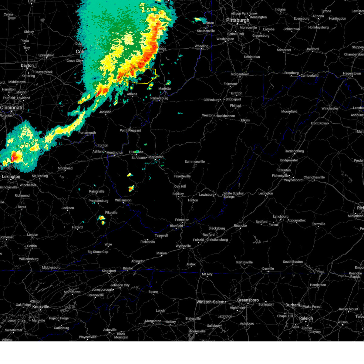
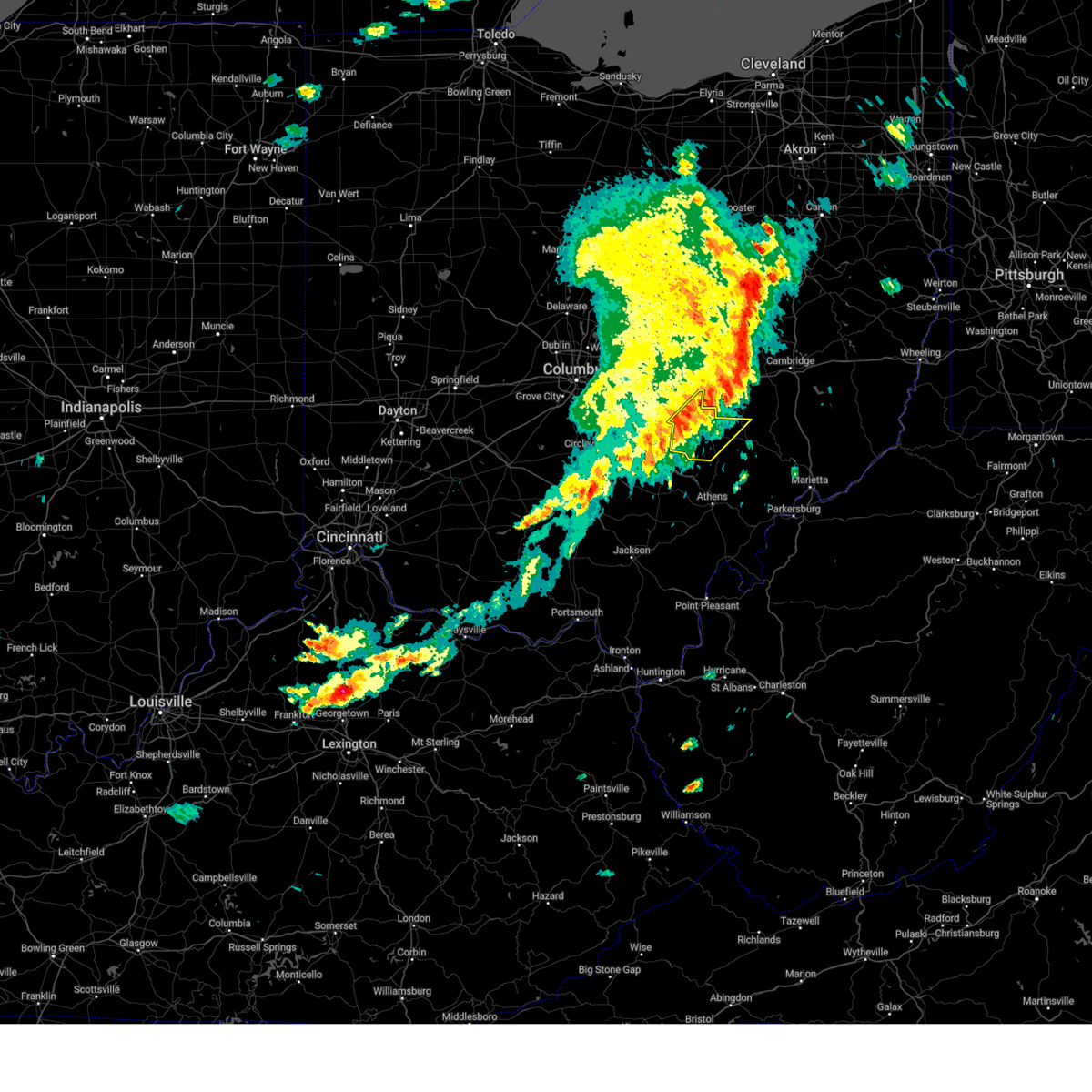
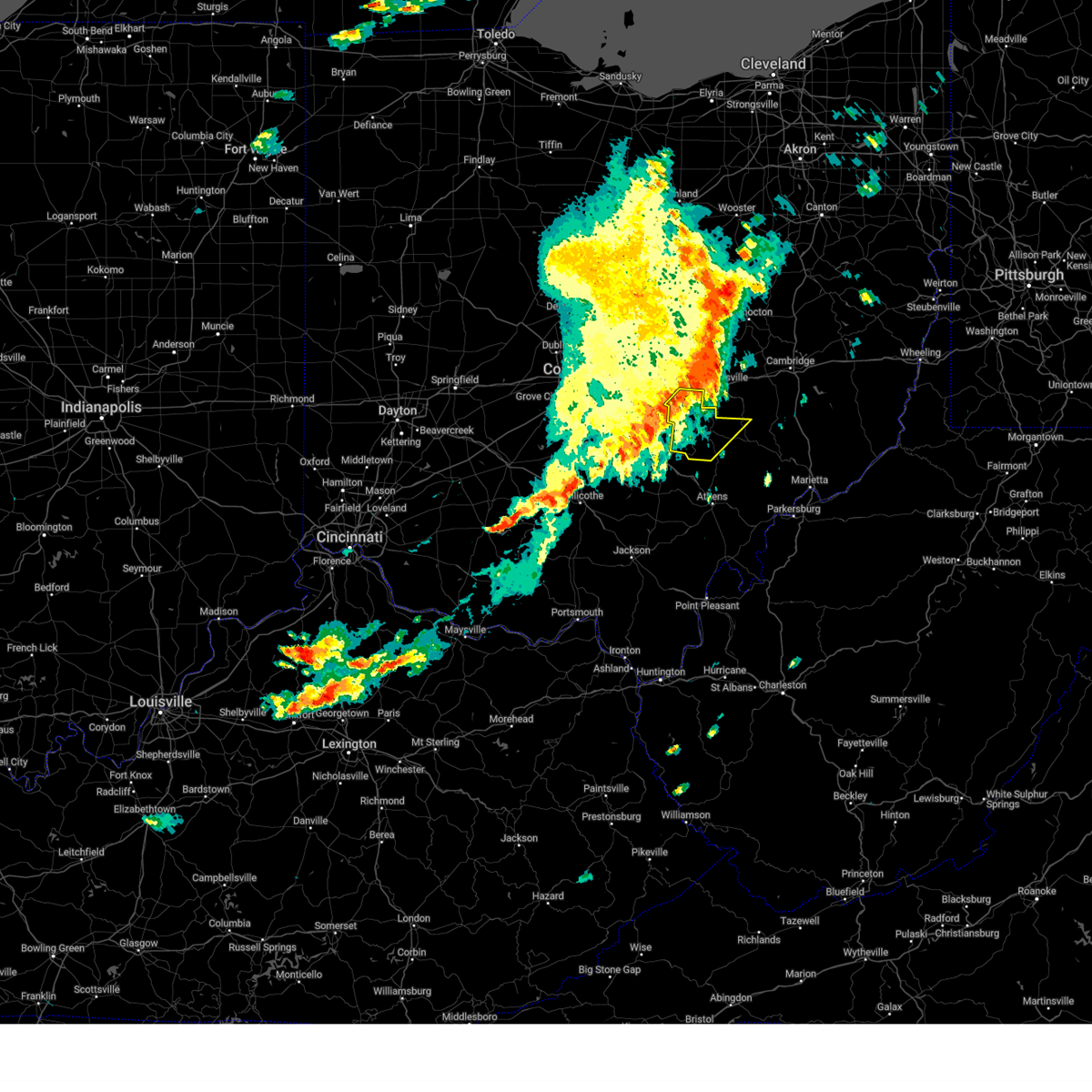
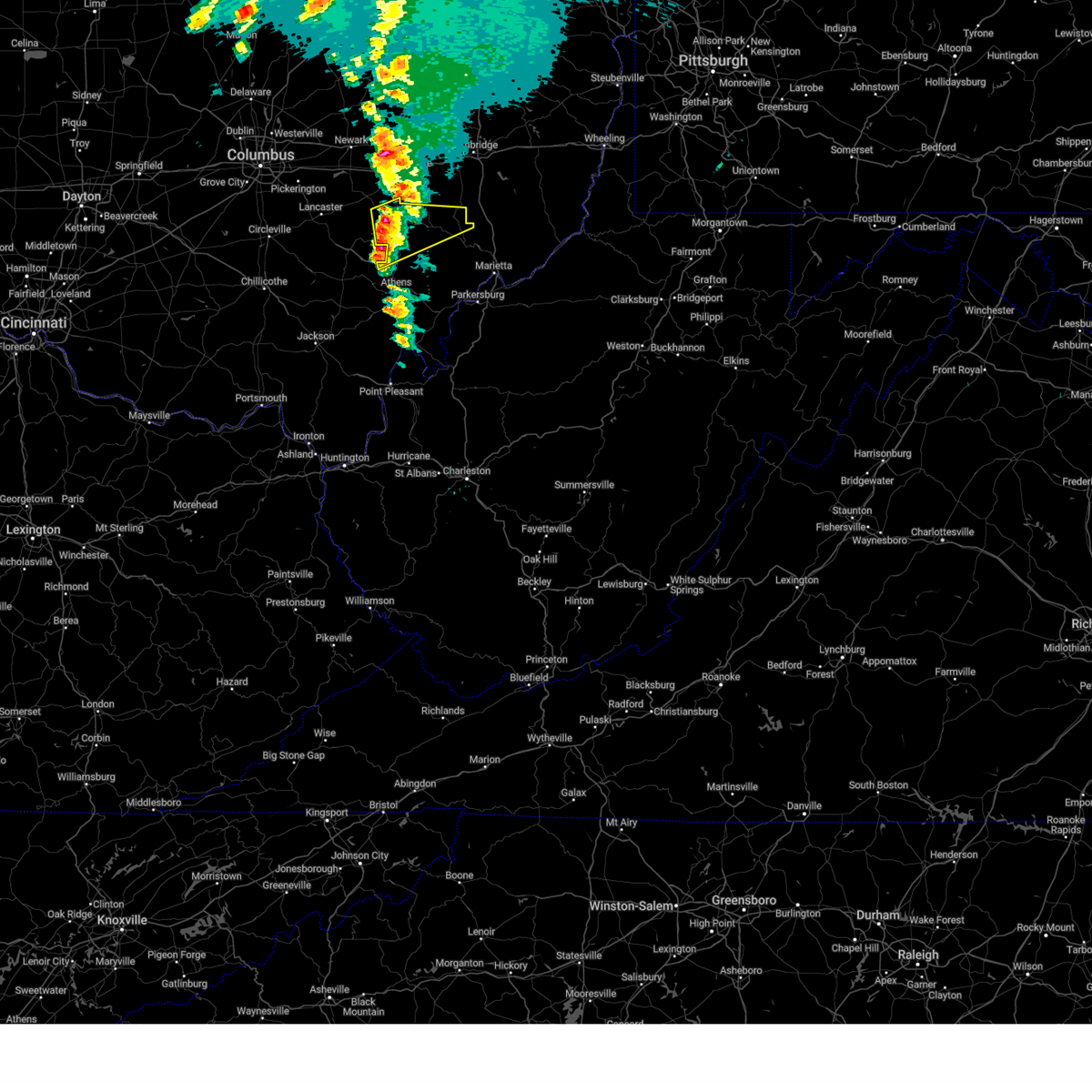
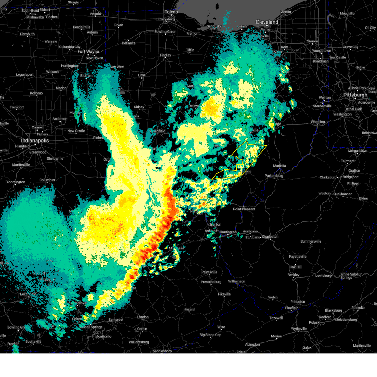
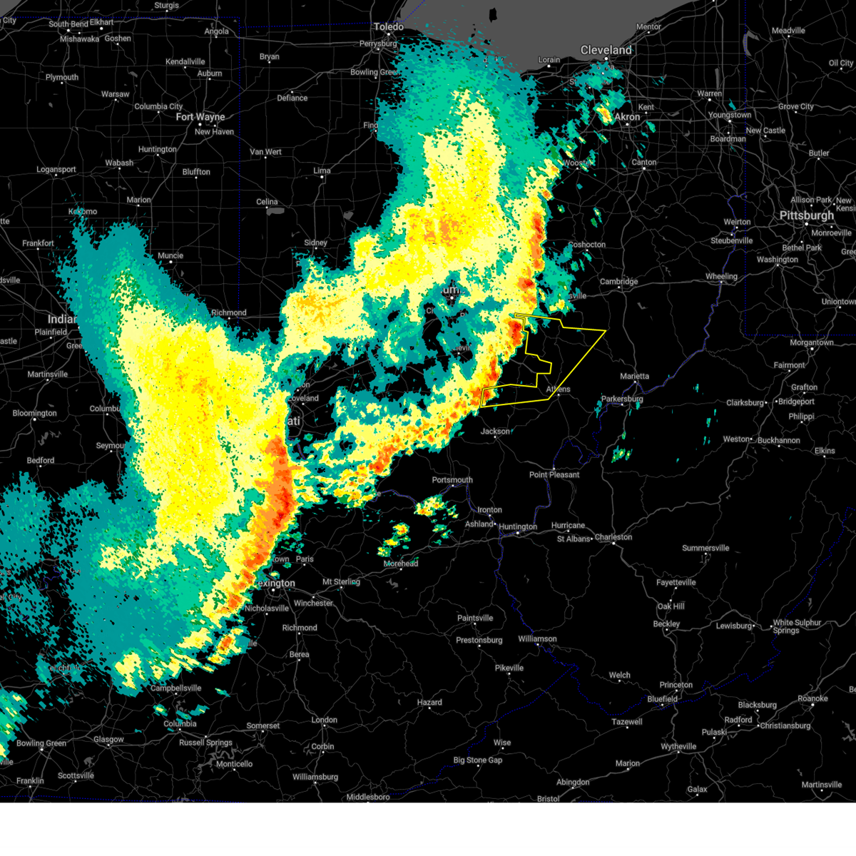
Hail Maps for New Straitsville, OH


Connect with Interactive Hail Maps