

Hail Map for Newport, NE
The Newport, NE area has had 18 reports of on-the-ground hail by trained spotters, and has been under severe weather warnings 10 times during the past 12 months. Doppler radar has detected hail at or near Newport, NE on 70 occasions, including 5 occasions during the past year.
| Name: | Newport, NE |
| Where Located: | 36.1 miles WNW of Oneill, NE |
| Map: | Google Map for Newport, NE |
| Population: | 97 |
| Housing Units: | 57 |
| More Info: | Search Google for Newport, NE |
1
The Top Recent Hail Date for Newport, NE is Thursday, August 15, 2024 (22nd out of 70)

Hail and Wind Damage Spotted near Newport, NE
| Date / Time | Report Details |
|---|---|
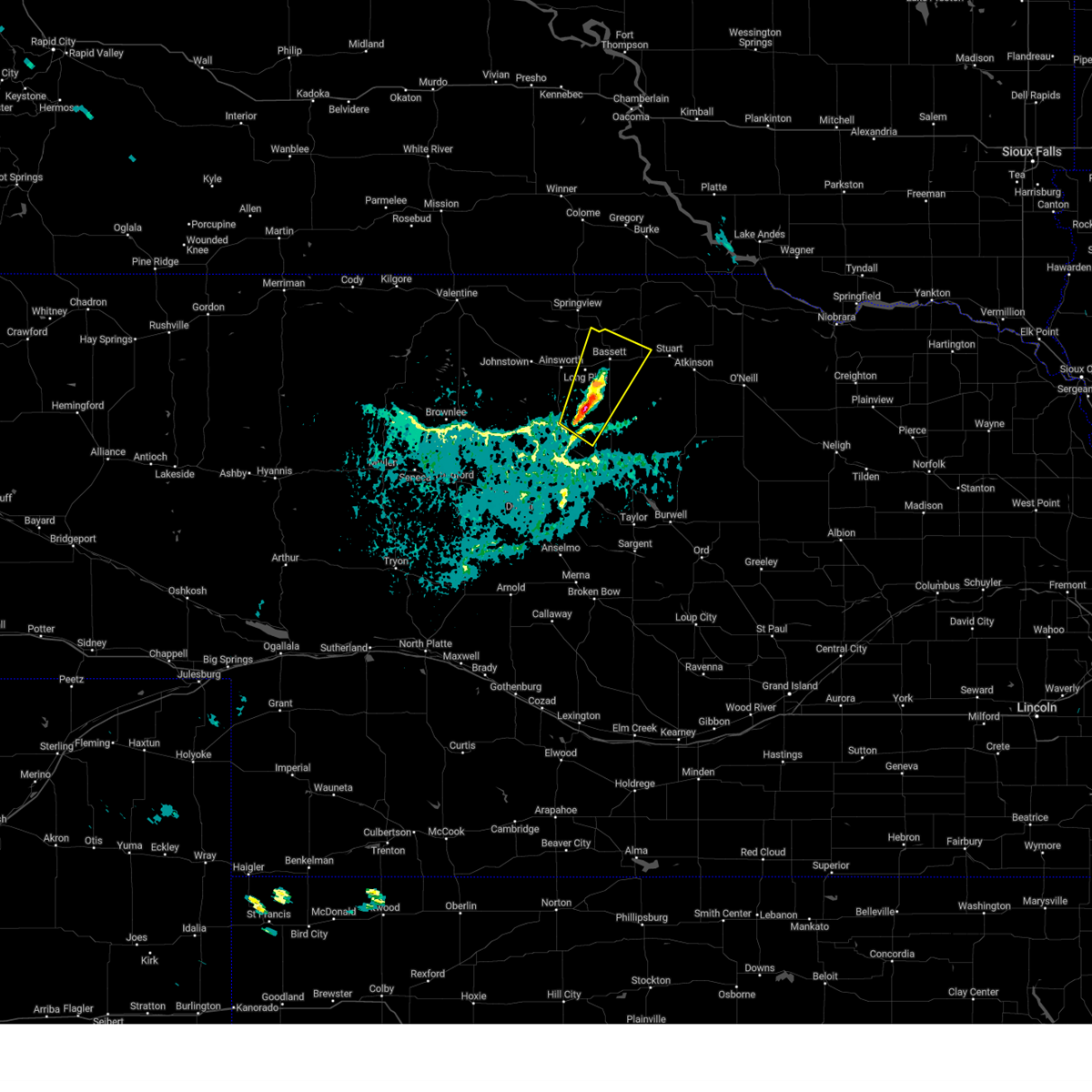
| 4/21/2025 4:38 PM CDT |
 At 438 pm cdt, a severe thunderstorm was located 11 miles east of springview, moving east at 45 mph (radar indicated). Hazards include 60 mph wind gusts. Expect damage to roofs, siding, and trees. locations impacted include, ainsworth, bassett, springview, long pine, newport, burton, nets peak, bobcat state wildlife management area, meadville, keller park state recreation area, thomas creek state wildlife management area, mariaville, pine glen state wildlife refuge, antelope peak, mills, and brocksburg. this includes the following highways, highway 183 between mile markers 171 and 225. highway 20 between mile markers 236 and 277. Highway 12 between mile markers 33 and 85. At 438 pm cdt, a severe thunderstorm was located 11 miles east of springview, moving east at 45 mph (radar indicated). Hazards include 60 mph wind gusts. Expect damage to roofs, siding, and trees. locations impacted include, ainsworth, bassett, springview, long pine, newport, burton, nets peak, bobcat state wildlife management area, meadville, keller park state recreation area, thomas creek state wildlife management area, mariaville, pine glen state wildlife refuge, antelope peak, mills, and brocksburg. this includes the following highways, highway 183 between mile markers 171 and 225. highway 20 between mile markers 236 and 277. Highway 12 between mile markers 33 and 85.
|
| 4/21/2025 4:16 PM CDT |
 Svrlbf the national weather service in north platte has issued a * severe thunderstorm warning for, northern rock county in north central nebraska, northern brown county in north central nebraska, west central holt county in north central nebraska, keya paha county in north central nebraska, * until 515 pm cdt. * at 415 pm cdt, a severe thunderstorm was located near norden, or 12 miles west of springview, moving east at 45 mph (radar indicated). Hazards include 60 mph wind gusts. expect damage to roofs, siding, and trees Svrlbf the national weather service in north platte has issued a * severe thunderstorm warning for, northern rock county in north central nebraska, northern brown county in north central nebraska, west central holt county in north central nebraska, keya paha county in north central nebraska, * until 515 pm cdt. * at 415 pm cdt, a severe thunderstorm was located near norden, or 12 miles west of springview, moving east at 45 mph (radar indicated). Hazards include 60 mph wind gusts. expect damage to roofs, siding, and trees
|
| 8/26/2024 4:22 PM CDT |
 The storm which prompted the warning has weakened below severe limits, and has exited the warned area. therefore, the warning will be allowed to expire. a severe thunderstorm watch remains in effect until 1100 pm cdt for north central nebraska. to report severe weather, contact your nearest law enforcement agency. they will relay your report to the national weather service north platte. The storm which prompted the warning has weakened below severe limits, and has exited the warned area. therefore, the warning will be allowed to expire. a severe thunderstorm watch remains in effect until 1100 pm cdt for north central nebraska. to report severe weather, contact your nearest law enforcement agency. they will relay your report to the national weather service north platte.
|
| 8/26/2024 4:01 PM CDT |
 At 400 pm cdt, a severe thunderstorm was located 11 miles southeast of long pine, or 14 miles south of bassett, moving east-northeast at 20 mph (radar indicated). Hazards include ping pong ball size hail and 60 mph wind gusts. People and animals outdoors will be injured. expect hail damage to roofs, siding, windows, and vehicles. expect wind damage to roofs, siding, and trees. locations impacted include, bassett, long pine, newport, raven, jones lake, and johnsons corner. this includes the following highways, highway 183 between mile markers 163 and 182. Highway 20 between mile markers 249 and 272. At 400 pm cdt, a severe thunderstorm was located 11 miles southeast of long pine, or 14 miles south of bassett, moving east-northeast at 20 mph (radar indicated). Hazards include ping pong ball size hail and 60 mph wind gusts. People and animals outdoors will be injured. expect hail damage to roofs, siding, windows, and vehicles. expect wind damage to roofs, siding, and trees. locations impacted include, bassett, long pine, newport, raven, jones lake, and johnsons corner. this includes the following highways, highway 183 between mile markers 163 and 182. Highway 20 between mile markers 249 and 272.
|
| 8/26/2024 3:41 PM CDT |
 Svrlbf the national weather service in north platte has issued a * severe thunderstorm warning for, northern rock county in north central nebraska, southeastern brown county in north central nebraska, * until 430 pm cdt. * at 340 pm cdt, a severe thunderstorm was located 11 miles south of long pine, or 15 miles southeast of ainsworth, moving northeast at 20 mph (radar indicated). Hazards include ping pong ball size hail and 60 mph wind gusts. People and animals outdoors will be injured. expect hail damage to roofs, siding, windows, and vehicles. Expect wind damage to roofs, siding, and trees. Svrlbf the national weather service in north platte has issued a * severe thunderstorm warning for, northern rock county in north central nebraska, southeastern brown county in north central nebraska, * until 430 pm cdt. * at 340 pm cdt, a severe thunderstorm was located 11 miles south of long pine, or 15 miles southeast of ainsworth, moving northeast at 20 mph (radar indicated). Hazards include ping pong ball size hail and 60 mph wind gusts. People and animals outdoors will be injured. expect hail damage to roofs, siding, windows, and vehicles. Expect wind damage to roofs, siding, and trees.
|
| 7/14/2024 3:46 AM CDT |
 The storms which prompted the warning have weakened below severe limits, and have exited the warned area. therefore, the warning has been allowed to expire. however, gusty winds are still possible with these thunderstorms. a severe thunderstorm watch remains in effect until 800 am cdt for north central nebraska. The storms which prompted the warning have weakened below severe limits, and have exited the warned area. therefore, the warning has been allowed to expire. however, gusty winds are still possible with these thunderstorms. a severe thunderstorm watch remains in effect until 800 am cdt for north central nebraska.
|
| 7/14/2024 3:35 AM CDT |
 At 334 am cdt, severe thunderstorms were located along a line extending from 6 miles south of verdel to 6 miles south of o'neill to 13 miles west of amelia, moving southeast at 70 mph. other strong to severe thunderstorms were located over western boyd and northwestern holt county. these storms are capable of producing penny sized hail and 60 mph wind gusts (radar indicated). Hazards include 60 mph wind gusts and penny size hail. Expect damage to roofs, siding, and trees. locations impacted include, o'neill, spencer, atkinson, stuart, butte, chambers, lynch, page, newport, naper, gross, amelia, inman, bristow, emmet, dustin, anoka, monowi, hull lake state wildlife management area, and mariaville. this includes the following highways, highway 20 between mile markers 270 and 328. highway 281 between mile markers 164 and 223. Highway 12 between mile markers 80 and 144. At 334 am cdt, severe thunderstorms were located along a line extending from 6 miles south of verdel to 6 miles south of o'neill to 13 miles west of amelia, moving southeast at 70 mph. other strong to severe thunderstorms were located over western boyd and northwestern holt county. these storms are capable of producing penny sized hail and 60 mph wind gusts (radar indicated). Hazards include 60 mph wind gusts and penny size hail. Expect damage to roofs, siding, and trees. locations impacted include, o'neill, spencer, atkinson, stuart, butte, chambers, lynch, page, newport, naper, gross, amelia, inman, bristow, emmet, dustin, anoka, monowi, hull lake state wildlife management area, and mariaville. this includes the following highways, highway 20 between mile markers 270 and 328. highway 281 between mile markers 164 and 223. Highway 12 between mile markers 80 and 144.
|
| 7/14/2024 3:35 AM CDT |
 the severe thunderstorm warning has been cancelled and is no longer in effect the severe thunderstorm warning has been cancelled and is no longer in effect
|
| 7/14/2024 3:18 AM CDT |
 At 316 am cdt, severe thunderstorms were located along a line extending from near gross to near stuart to 9 miles southeast of long pine, moving southeast at 70 mph. thunderstorms behind the line were entering western boyd and northwestern holt counties and these storms may contain hail up to penny size along with the potential for wind gusts to 60 mph (radar indicated). Hazards include 60 mph wind gusts and penny size hail. Expect damage to roofs, siding, and trees. locations impacted include, o'neill, ainsworth, bassett, spencer, atkinson, stuart, butte, long pine, chambers, lynch, page, newport, naper, gross, amelia, inman, bristow, emmet, dustin, and anoka. this includes the following highways, highway 183 between mile markers 160 and 204. highway 20 between mile markers 242 and 328. highway 281 between mile markers 164 and 223. Highway 12 between mile markers 69 and 144. At 316 am cdt, severe thunderstorms were located along a line extending from near gross to near stuart to 9 miles southeast of long pine, moving southeast at 70 mph. thunderstorms behind the line were entering western boyd and northwestern holt counties and these storms may contain hail up to penny size along with the potential for wind gusts to 60 mph (radar indicated). Hazards include 60 mph wind gusts and penny size hail. Expect damage to roofs, siding, and trees. locations impacted include, o'neill, ainsworth, bassett, spencer, atkinson, stuart, butte, long pine, chambers, lynch, page, newport, naper, gross, amelia, inman, bristow, emmet, dustin, and anoka. this includes the following highways, highway 183 between mile markers 160 and 204. highway 20 between mile markers 242 and 328. highway 281 between mile markers 164 and 223. Highway 12 between mile markers 69 and 144.
|
| 7/14/2024 2:59 AM CDT |
 Svrlbf the national weather service in north platte has issued a * severe thunderstorm warning for, rock county in north central nebraska, northern brown county in north central nebraska, holt county in north central nebraska, eastern keya paha county in north central nebraska, boyd county in north central nebraska, * until 345 am cdt. * at 258 am cdt, severe thunderstorms were located along a line extending from near bonesteel to 11 miles northwest of newport to near johnstown, moving southeast at 60 mph (radar indicated). Hazards include 60 mph wind gusts. expect damage to roofs, siding, and trees Svrlbf the national weather service in north platte has issued a * severe thunderstorm warning for, rock county in north central nebraska, northern brown county in north central nebraska, holt county in north central nebraska, eastern keya paha county in north central nebraska, boyd county in north central nebraska, * until 345 am cdt. * at 258 am cdt, severe thunderstorms were located along a line extending from near bonesteel to 11 miles northwest of newport to near johnstown, moving southeast at 60 mph (radar indicated). Hazards include 60 mph wind gusts. expect damage to roofs, siding, and trees
|
| 6/21/2024 6:58 PM CDT |
 The storm which prompted the warning has weakened below severe limits, and no longer poses an immediate threat to life or property. therefore, the warning will be allowed to expire. a severe thunderstorm watch remains in effect until 1100 pm cdt for north central nebraska. The storm which prompted the warning has weakened below severe limits, and no longer poses an immediate threat to life or property. therefore, the warning will be allowed to expire. a severe thunderstorm watch remains in effect until 1100 pm cdt for north central nebraska.
|
| 6/21/2024 6:47 PM CDT |
 At 646 pm cdt, a severe thunderstorm was located 10 miles south of newport, or 16 miles southeast of bassett, moving northeast at 35 mph (radar indicated). Hazards include 60 mph wind gusts and quarter size hail. Hail damage to vehicles is expected. expect wind damage to roofs, siding, and trees. locations impacted include, stuart, newport, sybrant, twin lakes state wildlife management area, and pony lake. this includes the following highways, highway 183 between mile markers 160 and 178. Highway 20 between mile markers 269 and 285. At 646 pm cdt, a severe thunderstorm was located 10 miles south of newport, or 16 miles southeast of bassett, moving northeast at 35 mph (radar indicated). Hazards include 60 mph wind gusts and quarter size hail. Hail damage to vehicles is expected. expect wind damage to roofs, siding, and trees. locations impacted include, stuart, newport, sybrant, twin lakes state wildlife management area, and pony lake. this includes the following highways, highway 183 between mile markers 160 and 178. Highway 20 between mile markers 269 and 285.
|
| 6/21/2024 6:47 PM CDT |
 the severe thunderstorm warning has been cancelled and is no longer in effect the severe thunderstorm warning has been cancelled and is no longer in effect
|
| 6/21/2024 6:21 PM CDT |
 Svrlbf the national weather service in north platte has issued a * severe thunderstorm warning for, central rock county in north central nebraska, east central brown county in north central nebraska, southwestern holt county in north central nebraska, * until 700 pm cdt. * at 621 pm cdt, a severe thunderstorm was located 13 miles north of rose, or 15 miles south of bassett, moving northeast at 35 mph (radar indicated). Hazards include 60 mph wind gusts and quarter size hail. Hail damage to vehicles is expected. Expect wind damage to roofs, siding, and trees. Svrlbf the national weather service in north platte has issued a * severe thunderstorm warning for, central rock county in north central nebraska, east central brown county in north central nebraska, southwestern holt county in north central nebraska, * until 700 pm cdt. * at 621 pm cdt, a severe thunderstorm was located 13 miles north of rose, or 15 miles south of bassett, moving northeast at 35 mph (radar indicated). Hazards include 60 mph wind gusts and quarter size hail. Hail damage to vehicles is expected. Expect wind damage to roofs, siding, and trees.
|
| 6/20/2024 7:21 PM CDT |
 At 721 pm cdt, a severe thunderstorm was located 9 miles south of stuart, or 20 miles southeast of bassett, moving east at 40 mph (radar indicated). Hazards include 60 mph wind gusts and quarter size hail. Hail damage to vehicles is expected. expect wind damage to roofs, siding, and trees. locations impacted include, atkinson, stuart, newport, and pony lake. This includes highway 20 between mile markers 264 and 292. At 721 pm cdt, a severe thunderstorm was located 9 miles south of stuart, or 20 miles southeast of bassett, moving east at 40 mph (radar indicated). Hazards include 60 mph wind gusts and quarter size hail. Hail damage to vehicles is expected. expect wind damage to roofs, siding, and trees. locations impacted include, atkinson, stuart, newport, and pony lake. This includes highway 20 between mile markers 264 and 292.
|
| 6/20/2024 7:00 PM CDT | Wind gust estimated at 60 mph at this location with dime to penny size hai in rock county NE, 8.4 miles N of Newport, NE |
| 6/20/2024 6:57 PM CDT |
 Svrlbf the national weather service in north platte has issued a * severe thunderstorm warning for, east central rock county in north central nebraska, west central holt county in north central nebraska, * until 745 pm cdt. * at 657 pm cdt, a severe thunderstorm was located 7 miles south of newport, or 13 miles southeast of bassett, moving east at 25 mph (radar indicated). Hazards include golf ball size hail and 60 mph wind gusts. People and animals outdoors will be injured. expect hail damage to roofs, siding, windows, and vehicles. Expect wind damage to roofs, siding, and trees. Svrlbf the national weather service in north platte has issued a * severe thunderstorm warning for, east central rock county in north central nebraska, west central holt county in north central nebraska, * until 745 pm cdt. * at 657 pm cdt, a severe thunderstorm was located 7 miles south of newport, or 13 miles southeast of bassett, moving east at 25 mph (radar indicated). Hazards include golf ball size hail and 60 mph wind gusts. People and animals outdoors will be injured. expect hail damage to roofs, siding, windows, and vehicles. Expect wind damage to roofs, siding, and trees.
|
| 5/14/2024 9:12 PM CDT |
 The storms which prompted the warning have weakened below severe limits, and no longer pose an immediate threat to life or property. therefore, the warning will be allowed to expire. however, small hail and gusty winds are still possible with these thunderstorms. to report severe weather, contact your nearest law enforcement agency. they will relay your report to the national weather service north platte. The storms which prompted the warning have weakened below severe limits, and no longer pose an immediate threat to life or property. therefore, the warning will be allowed to expire. however, small hail and gusty winds are still possible with these thunderstorms. to report severe weather, contact your nearest law enforcement agency. they will relay your report to the national weather service north platte.
|
| 5/14/2024 8:43 PM CDT |
 At 843 pm cdt, severe thunderstorms were located along a line extending from 6 miles west of naper to near newport to near rose, moving east at 35 mph (radar indicated). Hazards include ping pong ball size hail and 60 mph wind gusts. People and animals outdoors will be injured. expect hail damage to roofs, siding, windows, and vehicles. expect wind damage to roofs, siding, and trees. locations impacted include, atkinson, stuart, butte, newport, naper, rose, dustin, anoka, sybrant, twin lakes state wildlife management area, hull lake state wildlife management area, duff, mariaville, pony lake, brocksburg, and parshall bridge state wildlife management area. this includes the following highways, highway 183 between mile markers 149 and 168. highway 20 between mile markers 268 and 295. Highway 12 between mile markers 81 and 117. At 843 pm cdt, severe thunderstorms were located along a line extending from 6 miles west of naper to near newport to near rose, moving east at 35 mph (radar indicated). Hazards include ping pong ball size hail and 60 mph wind gusts. People and animals outdoors will be injured. expect hail damage to roofs, siding, windows, and vehicles. expect wind damage to roofs, siding, and trees. locations impacted include, atkinson, stuart, butte, newport, naper, rose, dustin, anoka, sybrant, twin lakes state wildlife management area, hull lake state wildlife management area, duff, mariaville, pony lake, brocksburg, and parshall bridge state wildlife management area. this includes the following highways, highway 183 between mile markers 149 and 168. highway 20 between mile markers 268 and 295. Highway 12 between mile markers 81 and 117.
|
| 5/14/2024 8:26 PM CDT |
 Svrlbf the national weather service in north platte has issued a * severe thunderstorm warning for, rock county in north central nebraska, southeastern brown county in north central nebraska, western holt county in north central nebraska, eastern keya paha county in north central nebraska, western boyd county in north central nebraska, * until 915 pm cdt. * at 825 pm cdt, severe thunderstorms were located along a line extending from 13 miles west of naper to 6 miles southwest of newport to 10 miles northwest of rose, moving east at 30 mph (radar indicated. at 815 pm cdt, quarter size hail was reported 6 miles northeast of bassett). Hazards include ping pong ball size hail and 60 mph wind gusts. People and animals outdoors will be injured. expect hail damage to roofs, siding, windows, and vehicles. Expect wind damage to roofs, siding, and trees. Svrlbf the national weather service in north platte has issued a * severe thunderstorm warning for, rock county in north central nebraska, southeastern brown county in north central nebraska, western holt county in north central nebraska, eastern keya paha county in north central nebraska, western boyd county in north central nebraska, * until 915 pm cdt. * at 825 pm cdt, severe thunderstorms were located along a line extending from 13 miles west of naper to 6 miles southwest of newport to 10 miles northwest of rose, moving east at 30 mph (radar indicated. at 815 pm cdt, quarter size hail was reported 6 miles northeast of bassett). Hazards include ping pong ball size hail and 60 mph wind gusts. People and animals outdoors will be injured. expect hail damage to roofs, siding, windows, and vehicles. Expect wind damage to roofs, siding, and trees.
|
| 5/14/2024 8:14 PM CDT |
 At 814 pm cdt, a severe thunderstorm was located near bassett, moving east at 20 mph (radar indicated). Hazards include ping pong ball size hail and 60 mph wind gusts. People and animals outdoors will be injured. expect hail damage to roofs, siding, windows, and vehicles. expect wind damage to roofs, siding, and trees. locations impacted include, bassett, newport, and mariaville. this includes the following highways, highway 183 between mile markers 180 and 182. Highway 20 between mile markers 254 and 274. At 814 pm cdt, a severe thunderstorm was located near bassett, moving east at 20 mph (radar indicated). Hazards include ping pong ball size hail and 60 mph wind gusts. People and animals outdoors will be injured. expect hail damage to roofs, siding, windows, and vehicles. expect wind damage to roofs, siding, and trees. locations impacted include, bassett, newport, and mariaville. this includes the following highways, highway 183 between mile markers 180 and 182. Highway 20 between mile markers 254 and 274.
|
| 5/14/2024 8:05 PM CDT |
 Svrlbf the national weather service in north platte has issued a * severe thunderstorm warning for, northern rock county in north central nebraska, southeastern keya paha county in north central nebraska, * until 830 pm cdt. * at 805 pm cdt, a severe thunderstorm was located near bassett, moving east at 20 mph (radar indicated). Hazards include ping pong ball size hail and 60 mph wind gusts. People and animals outdoors will be injured. expect hail damage to roofs, siding, windows, and vehicles. Expect wind damage to roofs, siding, and trees. Svrlbf the national weather service in north platte has issued a * severe thunderstorm warning for, northern rock county in north central nebraska, southeastern keya paha county in north central nebraska, * until 830 pm cdt. * at 805 pm cdt, a severe thunderstorm was located near bassett, moving east at 20 mph (radar indicated). Hazards include ping pong ball size hail and 60 mph wind gusts. People and animals outdoors will be injured. expect hail damage to roofs, siding, windows, and vehicles. Expect wind damage to roofs, siding, and trees.
|
| 9/7/2023 7:54 PM CDT |
 At 754 pm cdt, a severe thunderstorm was located near newport, or near bassett, moving northeast at 25 mph (radar indicated). Hazards include 60 mph wind gusts and quarter size hail. Hail damage to vehicles is expected. expect wind damage to roofs, siding, and trees. locations impacted include, stuart and newport. this includes highway 20 between mile markers 262 and 283. hail threat, radar indicated max hail size, 1. 00 in wind threat, radar indicated max wind gust, 60 mph. At 754 pm cdt, a severe thunderstorm was located near newport, or near bassett, moving northeast at 25 mph (radar indicated). Hazards include 60 mph wind gusts and quarter size hail. Hail damage to vehicles is expected. expect wind damage to roofs, siding, and trees. locations impacted include, stuart and newport. this includes highway 20 between mile markers 262 and 283. hail threat, radar indicated max hail size, 1. 00 in wind threat, radar indicated max wind gust, 60 mph.
|
| 9/7/2023 7:39 PM CDT |
 At 739 pm cdt, a severe thunderstorm was located over bassett, moving northeast at 25 mph (radar indicated). Hazards include 60 mph wind gusts and quarter size hail. Hail damage to vehicles is expected. Expect wind damage to roofs, siding, and trees. At 739 pm cdt, a severe thunderstorm was located over bassett, moving northeast at 25 mph (radar indicated). Hazards include 60 mph wind gusts and quarter size hail. Hail damage to vehicles is expected. Expect wind damage to roofs, siding, and trees.
|
| 7/29/2023 5:13 AM CDT |
 The severe thunderstorm warning for southeastern cherry, northern rock, brown, northwestern blaine, northeastern thomas and southwestern keya paha counties will expire at 515 am cdt, the storms which prompted the warning have weakened below severe limits, and have exited the warned area. therefore, the warning will be allowed to expire. however gusty winds are still possible with these thunderstorms. a severe thunderstorm watch remains in effect until 1100 am cdt for north central nebraska. The severe thunderstorm warning for southeastern cherry, northern rock, brown, northwestern blaine, northeastern thomas and southwestern keya paha counties will expire at 515 am cdt, the storms which prompted the warning have weakened below severe limits, and have exited the warned area. therefore, the warning will be allowed to expire. however gusty winds are still possible with these thunderstorms. a severe thunderstorm watch remains in effect until 1100 am cdt for north central nebraska.
|
| 7/29/2023 4:47 AM CDT |
 At 447 am cdt, severe thunderstorms were located along a line extending from near ainsworth to 9 miles east of brownlee, moving southeast at 45 mph (radar indicated). Hazards include 70 mph wind gusts and quarter size hail. Hail damage to vehicles is expected. expect considerable tree damage. wind damage is also likely to mobile homes, roofs, and outbuildings. locations impacted include, ainsworth, bassett, long pine, newport, johnstown, purdum, norden, valentine national wildlife refuge, elsmere, wood lake, hofeld lake, raven, bobcat state wildlife management area, willow lake state wildlife management area, smith falls state park, pine glen state wildlife refuge, antelope peak and meadville. this includes the following highways, highway 183 between mile markers 169 and 210. highway 20 between mile markers 200 and 272. highway 97 between mile markers 119 and 124. highway 83 between mile markers 161 and 207. highway 12 between mile markers 19 and 35, between mile markers 38 and 39, and between mile markers 41 and 46. thunderstorm damage threat, considerable hail threat, radar indicated max hail size, 1. 00 in wind threat, observed max wind gust, 70 mph. At 447 am cdt, severe thunderstorms were located along a line extending from near ainsworth to 9 miles east of brownlee, moving southeast at 45 mph (radar indicated). Hazards include 70 mph wind gusts and quarter size hail. Hail damage to vehicles is expected. expect considerable tree damage. wind damage is also likely to mobile homes, roofs, and outbuildings. locations impacted include, ainsworth, bassett, long pine, newport, johnstown, purdum, norden, valentine national wildlife refuge, elsmere, wood lake, hofeld lake, raven, bobcat state wildlife management area, willow lake state wildlife management area, smith falls state park, pine glen state wildlife refuge, antelope peak and meadville. this includes the following highways, highway 183 between mile markers 169 and 210. highway 20 between mile markers 200 and 272. highway 97 between mile markers 119 and 124. highway 83 between mile markers 161 and 207. highway 12 between mile markers 19 and 35, between mile markers 38 and 39, and between mile markers 41 and 46. thunderstorm damage threat, considerable hail threat, radar indicated max hail size, 1. 00 in wind threat, observed max wind gust, 70 mph.
|
| 7/29/2023 4:27 AM CDT |
 At 427 am cdt, severe thunderstorms were located along a line extending from johnstown to 7 miles south of valentine national wildlife refuge, moving southeast at 45 mph (radar indicated). Hazards include 70 mph wind gusts and quarter size hail. Hail damage to vehicles is expected. expect considerable tree damage. Wind damage is also likely to mobile homes, roofs, and outbuildings. At 427 am cdt, severe thunderstorms were located along a line extending from johnstown to 7 miles south of valentine national wildlife refuge, moving southeast at 45 mph (radar indicated). Hazards include 70 mph wind gusts and quarter size hail. Hail damage to vehicles is expected. expect considerable tree damage. Wind damage is also likely to mobile homes, roofs, and outbuildings.
|
| 7/25/2023 3:53 AM CDT |
 The severe thunderstorm warning for northern rock, northern brown and keya paha counties will expire at 400 am cdt, the storm which prompted the warning has weakened below severe limits, and no longer poses an immediate threat to life or property. therefore, the warning will be allowed to expire. however gusty winds are still possible with this thunderstorm. to report severe weather, contact your nearest law enforcement agency. they will relay your report to the national weather service north platte. The severe thunderstorm warning for northern rock, northern brown and keya paha counties will expire at 400 am cdt, the storm which prompted the warning has weakened below severe limits, and no longer poses an immediate threat to life or property. therefore, the warning will be allowed to expire. however gusty winds are still possible with this thunderstorm. to report severe weather, contact your nearest law enforcement agency. they will relay your report to the national weather service north platte.
|
| 7/25/2023 3:33 AM CDT |
 At 333 am cdt, a severe thunderstorm was located 7 miles southwest of springview, moving east at 45 mph (radar indicated). Hazards include 60 mph wind gusts and nickel size hail. Expect damage to roofs, siding, and trees. locations impacted include, bassett, springview, newport, norden, burton, nets peak, bobcat state wildlife management area, meadville, north river trail, keller park state recreation area, thomas creek state wildlife management area, mariaville, pine glen state wildlife refuge, antelope peak, mills and brocksburg. this includes the following highways, highway 183 between mile markers 180 and 182, and between mile markers 196 and 224. highway 20 between mile markers 254 and 272. highway 12 between mile markers 24 and 85. hail threat, radar indicated max hail size, 0. 88 in wind threat, radar indicated max wind gust, 60 mph. At 333 am cdt, a severe thunderstorm was located 7 miles southwest of springview, moving east at 45 mph (radar indicated). Hazards include 60 mph wind gusts and nickel size hail. Expect damage to roofs, siding, and trees. locations impacted include, bassett, springview, newport, norden, burton, nets peak, bobcat state wildlife management area, meadville, north river trail, keller park state recreation area, thomas creek state wildlife management area, mariaville, pine glen state wildlife refuge, antelope peak, mills and brocksburg. this includes the following highways, highway 183 between mile markers 180 and 182, and between mile markers 196 and 224. highway 20 between mile markers 254 and 272. highway 12 between mile markers 24 and 85. hail threat, radar indicated max hail size, 0. 88 in wind threat, radar indicated max wind gust, 60 mph.
|
| 7/25/2023 3:03 AM CDT |
 At 302 am cdt, a severe thunderstorm was located 8 miles southwest of norden, or 17 miles east of valentine, moving east at 45 mph (radar indicated). Hazards include 60 mph wind gusts and quarter size hail. Hail damage to vehicles is expected. Expect wind damage to roofs, siding, and trees. At 302 am cdt, a severe thunderstorm was located 8 miles southwest of norden, or 17 miles east of valentine, moving east at 45 mph (radar indicated). Hazards include 60 mph wind gusts and quarter size hail. Hail damage to vehicles is expected. Expect wind damage to roofs, siding, and trees.
|
| 7/19/2023 12:04 AM CDT |
 At 1204 am cdt, a severe thunderstorm was located 8 miles south of stuart, or 20 miles east of bassett, moving southeast at 20 mph (radar indicated). Hazards include 60 mph wind gusts and quarter size hail. Hail damage to vehicles is expected. expect wind damage to roofs, siding, and trees. locations impacted include, atkinson, stuart, newport and pony lake. this includes highway 20 between mile markers 271 and 295. hail threat, radar indicated max hail size, 1. 00 in wind threat, radar indicated max wind gust, 60 mph. At 1204 am cdt, a severe thunderstorm was located 8 miles south of stuart, or 20 miles east of bassett, moving southeast at 20 mph (radar indicated). Hazards include 60 mph wind gusts and quarter size hail. Hail damage to vehicles is expected. expect wind damage to roofs, siding, and trees. locations impacted include, atkinson, stuart, newport and pony lake. this includes highway 20 between mile markers 271 and 295. hail threat, radar indicated max hail size, 1. 00 in wind threat, radar indicated max wind gust, 60 mph.
|
| 7/18/2023 11:54 PM CDT |
 At 1153 pm cdt, a severe thunderstorm was located near stuart, or 18 miles east of bassett, moving southeast at 25 mph (radar indicated). Hazards include 60 mph wind gusts and quarter size hail. Hail damage to vehicles is expected. expect wind damage to roofs, siding, and trees. locations impacted include, atkinson, stuart, newport and pony lake. this includes highway 20 between mile markers 271 and 295. hail threat, radar indicated max hail size, 1. 00 in wind threat, radar indicated max wind gust, 60 mph. At 1153 pm cdt, a severe thunderstorm was located near stuart, or 18 miles east of bassett, moving southeast at 25 mph (radar indicated). Hazards include 60 mph wind gusts and quarter size hail. Hail damage to vehicles is expected. expect wind damage to roofs, siding, and trees. locations impacted include, atkinson, stuart, newport and pony lake. this includes highway 20 between mile markers 271 and 295. hail threat, radar indicated max hail size, 1. 00 in wind threat, radar indicated max wind gust, 60 mph.
|
| 7/18/2023 11:29 PM CDT |
 At 1129 pm cdt, a severe thunderstorm was located near newport, or 15 miles east of bassett, moving southeast at 30 mph (radar indicated). Hazards include 60 mph wind gusts and half dollar size hail. Hail damage to vehicles is expected. Expect wind damage to roofs, siding, and trees. At 1129 pm cdt, a severe thunderstorm was located near newport, or 15 miles east of bassett, moving southeast at 30 mph (radar indicated). Hazards include 60 mph wind gusts and half dollar size hail. Hail damage to vehicles is expected. Expect wind damage to roofs, siding, and trees.
|
| 7/12/2023 3:21 AM CDT |
 At 321 am cdt, severe thunderstorms were located along a line extending from 6 miles northwest of butte to 12 miles north of rose, moving east at 60 mph (radar indicated). Hazards include 60 mph wind gusts. expect damage to roofs, siding, and trees At 321 am cdt, severe thunderstorms were located along a line extending from 6 miles northwest of butte to 12 miles north of rose, moving east at 60 mph (radar indicated). Hazards include 60 mph wind gusts. expect damage to roofs, siding, and trees
|
| 7/12/2023 3:10 AM CDT |
 At 308 am cdt, severe thunderstorms were located along a line extending from 12 miles west of naper to 6 miles southeast of ainsworth, moving east at 60 mph (radar indicated). Hazards include 70 mph wind gusts. Expect considerable tree damage. damage is likely to mobile homes, roofs, and outbuildings. locations impacted include, ainsworth, bassett, springview, long pine, newport, naper, johnstown, dustin, burton, mariaville, pine glen state wildlife refuge, antelope peak, mills and brocksburg. this includes the following highways, highway 183 between mile markers 170 and 225. highway 20 between mile markers 230 and 270. highway 12 between mile markers 36 and 108. thunderstorm damage threat, considerable hail threat, radar indicated max hail size, <. 75 in wind threat, radar indicated max wind gust, 70 mph. At 308 am cdt, severe thunderstorms were located along a line extending from 12 miles west of naper to 6 miles southeast of ainsworth, moving east at 60 mph (radar indicated). Hazards include 70 mph wind gusts. Expect considerable tree damage. damage is likely to mobile homes, roofs, and outbuildings. locations impacted include, ainsworth, bassett, springview, long pine, newport, naper, johnstown, dustin, burton, mariaville, pine glen state wildlife refuge, antelope peak, mills and brocksburg. this includes the following highways, highway 183 between mile markers 170 and 225. highway 20 between mile markers 230 and 270. highway 12 between mile markers 36 and 108. thunderstorm damage threat, considerable hail threat, radar indicated max hail size, <. 75 in wind threat, radar indicated max wind gust, 70 mph.
|
| 7/12/2023 2:46 AM CDT |
 At 245 am cdt, severe thunderstorms were located along a line extending from near wewela to 9 miles southwest of johnstown, moving east at 60 mph (radar indicated). Hazards include 70 mph wind gusts. Expect considerable tree damage. Damage is likely to mobile homes, roofs, and outbuildings. At 245 am cdt, severe thunderstorms were located along a line extending from near wewela to 9 miles southwest of johnstown, moving east at 60 mph (radar indicated). Hazards include 70 mph wind gusts. Expect considerable tree damage. Damage is likely to mobile homes, roofs, and outbuildings.
|
| 6/29/2023 11:27 PM CDT |
 The severe thunderstorm warning for east central cherry, rock, northern loup, brown and northeastern blaine counties will expire at 1130 pm cdt, the storms which prompted the warning remain severe so a new warning has been issued. a severe thunderstorm watch remains in effect until 200 am cdt for north central nebraska. The severe thunderstorm warning for east central cherry, rock, northern loup, brown and northeastern blaine counties will expire at 1130 pm cdt, the storms which prompted the warning remain severe so a new warning has been issued. a severe thunderstorm watch remains in effect until 200 am cdt for north central nebraska.
|
| 6/29/2023 11:26 PM CDT |
 At 1124 pm cdt, severe thunderstorms were located along a line extending from near ainsworth to 8 miles east of brewster, moving east at 30 mph (radar indicated). Hazards include 60 mph wind gusts and quarter size hail. Hail damage to vehicles is expected. Expect wind damage to roofs, siding, and trees. At 1124 pm cdt, severe thunderstorms were located along a line extending from near ainsworth to 8 miles east of brewster, moving east at 30 mph (radar indicated). Hazards include 60 mph wind gusts and quarter size hail. Hail damage to vehicles is expected. Expect wind damage to roofs, siding, and trees.
|
| 6/29/2023 11:19 PM CDT |
 At 1118 pm cdt, severe thunderstorms were located along a line extending from 14 miles south of long pine to 20 miles northeast of brewster to 8 miles west of rose, moving east at 40 mph (radar indicated). Hazards include 60 mph wind gusts and half dollar size hail. Hail damage to vehicles is expected. expect wind damage to roofs, siding, and trees. locations impacted include, ainsworth, bassett, long pine, newport, rose, hofeld lake, fox bayou, raven, sybrant, moon lake, twin lakes state wildlife management area, willow lake state wildlife management area, long lake state wildlife management area, duff, pony lake, koshopah, jones lake, johnsons corner and horseshoe bend lake. this includes the following highways, highway 183 between mile markers 136 and 199. Highway 20 between mile markers 236 and 273. At 1118 pm cdt, severe thunderstorms were located along a line extending from 14 miles south of long pine to 20 miles northeast of brewster to 8 miles west of rose, moving east at 40 mph (radar indicated). Hazards include 60 mph wind gusts and half dollar size hail. Hail damage to vehicles is expected. expect wind damage to roofs, siding, and trees. locations impacted include, ainsworth, bassett, long pine, newport, rose, hofeld lake, fox bayou, raven, sybrant, moon lake, twin lakes state wildlife management area, willow lake state wildlife management area, long lake state wildlife management area, duff, pony lake, koshopah, jones lake, johnsons corner and horseshoe bend lake. this includes the following highways, highway 183 between mile markers 136 and 199. Highway 20 between mile markers 236 and 273.
|
| 6/29/2023 11:06 PM CDT |
 At 1105 pm cdt, severe thunderstorms were located along a line extending from 15 miles south of ainsworth to 16 miles east of elsmere to 14 miles north of brewster, moving east at 40 mph. Hazards include 70 mph wind gusts and ping pong ball size hail. state wildlife management area source, radar indicated. People and animals outdoors will be injured. expect hail damage to roofs, siding, windows, and vehicles. expect considerable tree damage. wind damage is also likely to mobile homes, roofs, and outbuildings. locations impacted include, ainsworth, bassett, long pine, newport, johnstown, purdum, rose, elsmere, hofeld lake, fox bayou, raven, twin lakes, willow lake, duff, koshopah, pine glen, antelope peak, sybrant, moon lake and long lake. this includes the following highways, highway 183 between mile markers 136 and 203. Highway 20 between mile markers 224 and 273. At 1105 pm cdt, severe thunderstorms were located along a line extending from 15 miles south of ainsworth to 16 miles east of elsmere to 14 miles north of brewster, moving east at 40 mph. Hazards include 70 mph wind gusts and ping pong ball size hail. state wildlife management area source, radar indicated. People and animals outdoors will be injured. expect hail damage to roofs, siding, windows, and vehicles. expect considerable tree damage. wind damage is also likely to mobile homes, roofs, and outbuildings. locations impacted include, ainsworth, bassett, long pine, newport, johnstown, purdum, rose, elsmere, hofeld lake, fox bayou, raven, twin lakes, willow lake, duff, koshopah, pine glen, antelope peak, sybrant, moon lake and long lake. this includes the following highways, highway 183 between mile markers 136 and 203. Highway 20 between mile markers 224 and 273.
|
| 6/29/2023 10:56 PM CDT |
 At 1055 pm cdt, severe thunderstorms were located along a line extending from near johnstown to 11 miles east of elsmere to 9 miles north of brewster, moving east at 40 mph (radar indicated). Hazards include 60 mph wind gusts and quarter size hail. Hail damage to vehicles is expected. expect wind damage to roofs, siding, and trees. locations impacted include, ainsworth, bassett, long pine, newport, johnstown, purdum, rose, elsmere, hofeld lake, fox bayou, raven, twin lakes, willow lake, duff, koshopah, pine glen, antelope peak, sybrant, moon lake and long lake. this includes the following highways, highway 183 between mile markers 136 and 203. highway 20 between mile markers 224 and 273. Highway 83 between mile markers 179 and 190. At 1055 pm cdt, severe thunderstorms were located along a line extending from near johnstown to 11 miles east of elsmere to 9 miles north of brewster, moving east at 40 mph (radar indicated). Hazards include 60 mph wind gusts and quarter size hail. Hail damage to vehicles is expected. expect wind damage to roofs, siding, and trees. locations impacted include, ainsworth, bassett, long pine, newport, johnstown, purdum, rose, elsmere, hofeld lake, fox bayou, raven, twin lakes, willow lake, duff, koshopah, pine glen, antelope peak, sybrant, moon lake and long lake. this includes the following highways, highway 183 between mile markers 136 and 203. highway 20 between mile markers 224 and 273. Highway 83 between mile markers 179 and 190.
|
| 6/29/2023 10:24 PM CDT |
 At 1023 pm cdt, severe thunderstorms were located along a line extending from near valentine national wildlife refuge to 10 miles northwest of elsmere to near purdum, moving east at 40 mph (radar indicated). Hazards include 70 mph wind gusts and quarter size hail. Hail damage to vehicles is expected. expect considerable tree damage. Wind damage is also likely to mobile homes, roofs, and outbuildings. At 1023 pm cdt, severe thunderstorms were located along a line extending from near valentine national wildlife refuge to 10 miles northwest of elsmere to near purdum, moving east at 40 mph (radar indicated). Hazards include 70 mph wind gusts and quarter size hail. Hail damage to vehicles is expected. expect considerable tree damage. Wind damage is also likely to mobile homes, roofs, and outbuildings.
|
| 6/24/2023 1:58 AM CDT |
 The severe thunderstorm warning for northern rock, northeastern brown, northwestern holt, eastern keya paha and western boyd counties will expire at 200 am cdt, the storms which prompted the warning have weakened below severe limits, and no longer pose an immediate threat to life or property. therefore, the warning will be allowed to expire. however gusty winds are still possible with these thunderstorms. a severe thunderstorm watch remains in effect until 600 am cdt for north central nebraska. to report severe weather, contact your nearest law enforcement agency. they will relay your report to the national weather service north platte. The severe thunderstorm warning for northern rock, northeastern brown, northwestern holt, eastern keya paha and western boyd counties will expire at 200 am cdt, the storms which prompted the warning have weakened below severe limits, and no longer pose an immediate threat to life or property. therefore, the warning will be allowed to expire. however gusty winds are still possible with these thunderstorms. a severe thunderstorm watch remains in effect until 600 am cdt for north central nebraska. to report severe weather, contact your nearest law enforcement agency. they will relay your report to the national weather service north platte.
|
| 6/24/2023 1:43 AM CDT |
 At 143 am cdt, severe thunderstorms were located along a line extending from 14 miles southwest of herrick to 6 miles southeast of long pine, moving east at 50 mph (radar indicated). Hazards include 60 mph wind gusts and nickel size hail. Expect damage to roofs, siding, and trees. locations impacted include, ainsworth, bassett, springview, atkinson, stuart, butte, long pine, newport, naper, dustin, burton, anoka, nets peak, hull lake state wildlife management area, keller park state recreation area, thomas creek state wildlife management area, mariaville, pine glen state wildlife refuge, mills and brocksburg. this includes the following highways, highway 183 between mile markers 173 and 127. highway 20 between mile markers 237 and 293. highway 281 near mile marker 223. highway 12 between mile markers 51 and 120. hail threat, radar indicated max hail size, 0. 88 in wind threat, radar indicated max wind gust, 60 mph. At 143 am cdt, severe thunderstorms were located along a line extending from 14 miles southwest of herrick to 6 miles southeast of long pine, moving east at 50 mph (radar indicated). Hazards include 60 mph wind gusts and nickel size hail. Expect damage to roofs, siding, and trees. locations impacted include, ainsworth, bassett, springview, atkinson, stuart, butte, long pine, newport, naper, dustin, burton, anoka, nets peak, hull lake state wildlife management area, keller park state recreation area, thomas creek state wildlife management area, mariaville, pine glen state wildlife refuge, mills and brocksburg. this includes the following highways, highway 183 between mile markers 173 and 127. highway 20 between mile markers 237 and 293. highway 281 near mile marker 223. highway 12 between mile markers 51 and 120. hail threat, radar indicated max hail size, 0. 88 in wind threat, radar indicated max wind gust, 60 mph.
|
| 6/24/2023 1:12 AM CDT |
 At 111 am cdt, severe thunderstorms were located along a line extending from 11 miles east of wewela to near long pine, moving east at 45 mph (radar indicated). Hazards include 60 mph wind gusts and quarter size hail. Hail damage to vehicles is expected. Expect wind damage to roofs, siding, and trees. At 111 am cdt, severe thunderstorms were located along a line extending from 11 miles east of wewela to near long pine, moving east at 45 mph (radar indicated). Hazards include 60 mph wind gusts and quarter size hail. Hail damage to vehicles is expected. Expect wind damage to roofs, siding, and trees.
|
| 6/23/2023 10:47 PM CDT |
 At 1047 pm cdt, a severe thunderstorm was located 7 miles north of bassett, moving northeast at 25 mph (radar indicated). Hazards include 60 mph wind gusts and quarter size hail. Hail damage to vehicles is expected. expect wind damage to roofs, siding, and trees. locations impacted include, bassett, newport, mills, brocksburg and mariaville. this includes the following highways, highway 183 between mile markers 181 and 182. highway 20 between mile markers 256 and 269. highway 12 between mile markers 73 and 92. hail threat, radar indicated max hail size, 1. 00 in wind threat, radar indicated max wind gust, 60 mph. At 1047 pm cdt, a severe thunderstorm was located 7 miles north of bassett, moving northeast at 25 mph (radar indicated). Hazards include 60 mph wind gusts and quarter size hail. Hail damage to vehicles is expected. expect wind damage to roofs, siding, and trees. locations impacted include, bassett, newport, mills, brocksburg and mariaville. this includes the following highways, highway 183 between mile markers 181 and 182. highway 20 between mile markers 256 and 269. highway 12 between mile markers 73 and 92. hail threat, radar indicated max hail size, 1. 00 in wind threat, radar indicated max wind gust, 60 mph.
|
| 6/23/2023 10:36 PM CDT |
 At 1036 pm cdt, a severe thunderstorm was located near bassett, moving northeast at 15 mph (radar indicated). Hazards include golf ball size hail and 60 mph wind gusts. People and animals outdoors will be injured. expect hail damage to roofs, siding, windows, and vehicles. expect wind damage to roofs, siding, and trees. locations impacted include, bassett, newport, mills, brocksburg and mariaville. this includes the following highways, highway 183 between mile markers 181 and 182. highway 20 between mile markers 256 and 269. highway 12 between mile markers 73 and 92. thunderstorm damage threat, considerable hail threat, radar indicated max hail size, 1. 75 in wind threat, radar indicated max wind gust, 60 mph. At 1036 pm cdt, a severe thunderstorm was located near bassett, moving northeast at 15 mph (radar indicated). Hazards include golf ball size hail and 60 mph wind gusts. People and animals outdoors will be injured. expect hail damage to roofs, siding, windows, and vehicles. expect wind damage to roofs, siding, and trees. locations impacted include, bassett, newport, mills, brocksburg and mariaville. this includes the following highways, highway 183 between mile markers 181 and 182. highway 20 between mile markers 256 and 269. highway 12 between mile markers 73 and 92. thunderstorm damage threat, considerable hail threat, radar indicated max hail size, 1. 75 in wind threat, radar indicated max wind gust, 60 mph.
|
| 6/23/2023 10:24 PM CDT |
 At 1023 pm cdt, a severe thunderstorm was located near bassett, moving northeast at 25 mph (radar indicated). Hazards include 60 mph wind gusts and quarter size hail. Hail damage to vehicles is expected. Expect wind damage to roofs, siding, and trees. At 1023 pm cdt, a severe thunderstorm was located near bassett, moving northeast at 25 mph (radar indicated). Hazards include 60 mph wind gusts and quarter size hail. Hail damage to vehicles is expected. Expect wind damage to roofs, siding, and trees.
|
| 5/6/2023 7:14 PM CDT | Public estimates 60 mph wind in rock county NE, 6.3 miles N of Newport, NE |
| 5/6/2023 6:26 PM CDT |
 The severe thunderstorm warning for northeastern rock and west central holt counties will expire at 630 pm cdt, the storm which prompted the warning remains severe so a new warning has been issued. The severe thunderstorm warning for northeastern rock and west central holt counties will expire at 630 pm cdt, the storm which prompted the warning remains severe so a new warning has been issued.
|
| 5/6/2023 6:25 PM CDT | Tea Cup sized hail reported 6.3 miles N of Newport, NE, public reports three inch hail... golf ball hail... and quarter sized with accumulation of at least 2 inches in depth of hail. |
| 5/6/2023 6:25 PM CDT |
 At 624 pm cdt, a severe thunderstorm was located near newport, or 10 miles east of bassett, moving east at 35 mph. this storm has a history of producing large hail (radar indicated). Hazards include 60 mph wind gusts and half dollar size hail. Hail damage to vehicles is expected. Expect wind damage to roofs, siding, and trees. At 624 pm cdt, a severe thunderstorm was located near newport, or 10 miles east of bassett, moving east at 35 mph. this storm has a history of producing large hail (radar indicated). Hazards include 60 mph wind gusts and half dollar size hail. Hail damage to vehicles is expected. Expect wind damage to roofs, siding, and trees.
|
| 5/6/2023 6:12 PM CDT |
 At 611 pm cdt, a severe thunderstorm was located near bassett, moving east at 35 mph (radar indicated). Hazards include ping pong ball size hail and 60 mph wind gusts. People and animals outdoors will be injured. expect hail damage to roofs, siding, windows, and vehicles. expect wind damage to roofs, siding, and trees. locations impacted include, bassett and newport. this includes the following highways, highway 183 between mile markers 172 and 182. Highway 20 between mile markers 258 and 279. At 611 pm cdt, a severe thunderstorm was located near bassett, moving east at 35 mph (radar indicated). Hazards include ping pong ball size hail and 60 mph wind gusts. People and animals outdoors will be injured. expect hail damage to roofs, siding, windows, and vehicles. expect wind damage to roofs, siding, and trees. locations impacted include, bassett and newport. this includes the following highways, highway 183 between mile markers 172 and 182. Highway 20 between mile markers 258 and 279.
|
| 5/6/2023 5:49 PM CDT |
 At 549 pm cdt, severe thunderstorms were located along a line extending from 8 miles south of springview to near long pine, moving east at 30 mph (radar indicated). Hazards include ping pong ball size hail and 60 mph wind gusts. People and animals outdoors will be injured. expect hail damage to roofs, siding, windows, and vehicles. expect wind damage to roofs, siding, and trees. locations impacted include, ainsworth, bassett, long pine, newport, keller park state recreation area, thomas creek state wildlife management area, mariaville, bobcat state wildlife management area, pine glen state wildlife refuge and meadville. this includes the following highways, highway 183 between mile markers 172 and 210. Highway 20 between mile markers 242 and 279. At 549 pm cdt, severe thunderstorms were located along a line extending from 8 miles south of springview to near long pine, moving east at 30 mph (radar indicated). Hazards include ping pong ball size hail and 60 mph wind gusts. People and animals outdoors will be injured. expect hail damage to roofs, siding, windows, and vehicles. expect wind damage to roofs, siding, and trees. locations impacted include, ainsworth, bassett, long pine, newport, keller park state recreation area, thomas creek state wildlife management area, mariaville, bobcat state wildlife management area, pine glen state wildlife refuge and meadville. this includes the following highways, highway 183 between mile markers 172 and 210. Highway 20 between mile markers 242 and 279.
|
| 5/6/2023 5:45 PM CDT |
 At 544 pm cdt, a severe thunderstorm was extended from 9 miles south of springview to near ainsworth, moving east at 30 mph (radar indicated). Hazards include 60 mph wind gusts and quarter size hail. Hail damage to vehicles is expected. Expect wind damage to roofs, siding, and trees. At 544 pm cdt, a severe thunderstorm was extended from 9 miles south of springview to near ainsworth, moving east at 30 mph (radar indicated). Hazards include 60 mph wind gusts and quarter size hail. Hail damage to vehicles is expected. Expect wind damage to roofs, siding, and trees.
|
| 7/5/2022 2:00 PM CDT |
 At 159 pm cdt, severe thunderstorms were located along a line extending from 8 miles west of naper to 6 miles southeast of springview to 9 miles northwest of johnstown, moving southeast at 45 mph (radar indicated). Hazards include 60 mph wind gusts. Expect damage to roofs, siding, and trees. locations impacted include, ainsworth, bassett, springview, long pine, newport, johnstown, norden, wood lake, burton, nets peak, bobcat state wildlife management area, meadville, north river trail, sparks, keller park state recreation area, thomas creek state wildlife management area, mariaville, pine glen state wildlife refuge, antelope peak and mills. this includes the following highways, highway 183 between mile markers 172 and 225. highway 20 between mile markers 222 and 273. highway 12 between mile markers 17 and 86. hail threat, radar indicated max hail size, <. 75 in wind threat, radar indicated max wind gust, 60 mph. At 159 pm cdt, severe thunderstorms were located along a line extending from 8 miles west of naper to 6 miles southeast of springview to 9 miles northwest of johnstown, moving southeast at 45 mph (radar indicated). Hazards include 60 mph wind gusts. Expect damage to roofs, siding, and trees. locations impacted include, ainsworth, bassett, springview, long pine, newport, johnstown, norden, wood lake, burton, nets peak, bobcat state wildlife management area, meadville, north river trail, sparks, keller park state recreation area, thomas creek state wildlife management area, mariaville, pine glen state wildlife refuge, antelope peak and mills. this includes the following highways, highway 183 between mile markers 172 and 225. highway 20 between mile markers 222 and 273. highway 12 between mile markers 17 and 86. hail threat, radar indicated max hail size, <. 75 in wind threat, radar indicated max wind gust, 60 mph.
|
| 7/5/2022 1:30 PM CDT |
 At 130 pm cdt, severe thunderstorms were located along a line extending from 8 miles northwest of dallas to millboro to 9 miles southeast of littleburg, moving southeast at 50 mph (radar indicated). Hazards include 60 mph wind gusts. expect damage to roofs, siding, and trees At 130 pm cdt, severe thunderstorms were located along a line extending from 8 miles northwest of dallas to millboro to 9 miles southeast of littleburg, moving southeast at 50 mph (radar indicated). Hazards include 60 mph wind gusts. expect damage to roofs, siding, and trees
|
| 6/29/2022 7:26 PM CDT |
 At 726 pm cdt, severe thunderstorms were located along a line extending from near wewela to near long pine to 12 miles south of ainsworth, moving east at 40 mph (radar indicated). Hazards include 60 mph wind gusts. Expect damage to roofs, siding, and trees. locations impacted include, bassett, springview, long pine, newport, burton, hofeld lake, nets peak, raven, sybrant, mariaville, pony lake, pine glen state wildlife refuge, jones lake, mills, brocksburg and johnsons corner. this includes the following highways, highway 183 between mile markers 159 and 225. highway 20 between mile markers 244 and 273. highway 12 between mile markers 49 and 85. hail threat, radar indicated max hail size, <. 75 in wind threat, radar indicated max wind gust, 60 mph. At 726 pm cdt, severe thunderstorms were located along a line extending from near wewela to near long pine to 12 miles south of ainsworth, moving east at 40 mph (radar indicated). Hazards include 60 mph wind gusts. Expect damage to roofs, siding, and trees. locations impacted include, bassett, springview, long pine, newport, burton, hofeld lake, nets peak, raven, sybrant, mariaville, pony lake, pine glen state wildlife refuge, jones lake, mills, brocksburg and johnsons corner. this includes the following highways, highway 183 between mile markers 159 and 225. highway 20 between mile markers 244 and 273. highway 12 between mile markers 49 and 85. hail threat, radar indicated max hail size, <. 75 in wind threat, radar indicated max wind gust, 60 mph.
|
| 6/29/2022 7:08 PM CDT |
 At 707 pm cdt, severe thunderstorms were located along a line extending from near millboro to near ainsworth to 8 miles northeast of elsmere, moving east at 40 mph (radar indicated). Hazards include 70 mph wind gusts. Expect considerable tree damage. Damage is likely to mobile homes, roofs, and outbuildings. At 707 pm cdt, severe thunderstorms were located along a line extending from near millboro to near ainsworth to 8 miles northeast of elsmere, moving east at 40 mph (radar indicated). Hazards include 70 mph wind gusts. Expect considerable tree damage. Damage is likely to mobile homes, roofs, and outbuildings.
|
| 6/20/2022 9:15 PM CDT | Golf Ball sized hail reported 8.4 miles S of Newport, NE, time estimated from radar. |
| 6/20/2022 9:15 PM CDT | Report of multiple 6 inch diameter tree branches broken. damage to gutters on house. time estimated from rada in rock county NE, 8.4 miles S of Newport, NE |
| 6/20/2022 9:14 PM CDT | Quarter sized hail reported 5 miles SSE of Newport, NE, hail ranged from peas to quarters. winds estimated as less than 60 mph. time estimated from radar. |
| 6/20/2022 4:39 PM CDT |
 At 439 pm cdt, severe thunderstorms were located along a line extending from 12 miles east of rose to 8 miles southwest of amelia, moving north at 50 mph (radar indicated). Hazards include 60 mph wind gusts and quarter size hail. Hail damage to vehicles is expected. Expect wind damage to roofs, siding, and trees. At 439 pm cdt, severe thunderstorms were located along a line extending from 12 miles east of rose to 8 miles southwest of amelia, moving north at 50 mph (radar indicated). Hazards include 60 mph wind gusts and quarter size hail. Hail damage to vehicles is expected. Expect wind damage to roofs, siding, and trees.
|
| 5/30/2022 9:43 AM CDT |
 At 943 am cdt, a severe thunderstorm was located 12 miles northeast of rose, or 18 miles south of bassett, moving northeast at 45 mph (radar indicated). Hazards include 60 mph wind gusts and quarter size hail. Hail damage to vehicles is expected. expect wind damage to roofs, siding, and trees. locations impacted include, bassett, spencer, atkinson, stuart, butte, lynch, newport, naper, gross, bristow, emmet, dustin, anoka, monowi, twin lakes state wildlife management area, hull lake state wildlife management area, duff, mariaville, mills and brocksburg. this includes the following highways, highway 183 between mile markers 155 and 182. highway 20 between mile markers 252 and 303. highway 281 between mile markers 188 and 223. highway 12 between mile markers 69 and 144. hail threat, radar indicated max hail size, 1. 00 in wind threat, radar indicated max wind gust, 60 mph. At 943 am cdt, a severe thunderstorm was located 12 miles northeast of rose, or 18 miles south of bassett, moving northeast at 45 mph (radar indicated). Hazards include 60 mph wind gusts and quarter size hail. Hail damage to vehicles is expected. expect wind damage to roofs, siding, and trees. locations impacted include, bassett, spencer, atkinson, stuart, butte, lynch, newport, naper, gross, bristow, emmet, dustin, anoka, monowi, twin lakes state wildlife management area, hull lake state wildlife management area, duff, mariaville, mills and brocksburg. this includes the following highways, highway 183 between mile markers 155 and 182. highway 20 between mile markers 252 and 303. highway 281 between mile markers 188 and 223. highway 12 between mile markers 69 and 144. hail threat, radar indicated max hail size, 1. 00 in wind threat, radar indicated max wind gust, 60 mph.
|
| 5/30/2022 9:31 AM CDT |
 At 931 am cdt, a severe thunderstorm was located over rose, or 24 miles northeast of brewster, moving northeast at 45 mph (radar indicated). Hazards include 60 mph wind gusts and quarter size hail. Hail damage to vehicles is expected. Expect wind damage to roofs, siding, and trees. At 931 am cdt, a severe thunderstorm was located over rose, or 24 miles northeast of brewster, moving northeast at 45 mph (radar indicated). Hazards include 60 mph wind gusts and quarter size hail. Hail damage to vehicles is expected. Expect wind damage to roofs, siding, and trees.
|
| 5/29/2022 11:38 PM CDT |
 The severe thunderstorm warning for eastern rock, northeastern loup, northwestern garfield and southwestern holt counties will expire at 1145 pm cdt, the storms which prompted the warning remain severe and have moved out of the area. therefore, this warning will be allowed to expire and a new warning has been issued. a tornado watch remains in effect until 200 am cdt for north central nebraska. The severe thunderstorm warning for eastern rock, northeastern loup, northwestern garfield and southwestern holt counties will expire at 1145 pm cdt, the storms which prompted the warning remain severe and have moved out of the area. therefore, this warning will be allowed to expire and a new warning has been issued. a tornado watch remains in effect until 200 am cdt for north central nebraska.
|
| 5/29/2022 11:37 PM CDT |
 At 1136 pm cdt, severe thunderstorms were located along a line extending from near naper to near atkinson to 8 miles southwest of amelia, moving northeast at 55 mph (radar indicated). Hazards include golf ball size hail and 70 mph wind gusts. People and animals outdoors will be injured. expect hail damage to roofs, siding, windows, and vehicles. expect considerable tree damage. Wind damage is also likely to mobile homes, roofs, and outbuildings. At 1136 pm cdt, severe thunderstorms were located along a line extending from near naper to near atkinson to 8 miles southwest of amelia, moving northeast at 55 mph (radar indicated). Hazards include golf ball size hail and 70 mph wind gusts. People and animals outdoors will be injured. expect hail damage to roofs, siding, windows, and vehicles. expect considerable tree damage. Wind damage is also likely to mobile homes, roofs, and outbuildings.
|
| 5/29/2022 11:37 PM CDT |
 The severe thunderstorm warning for northeastern rock, northwestern holt, eastern keya paha and western boyd counties will expire at 1145 pm cdt, the storms which prompted the warning remain severe and have moved out of the area. therefore, this warning will be allowed to expire and a new warning has been issued. a tornado watch remains in effect until 200 am cdt for north central nebraska. The severe thunderstorm warning for northeastern rock, northwestern holt, eastern keya paha and western boyd counties will expire at 1145 pm cdt, the storms which prompted the warning remain severe and have moved out of the area. therefore, this warning will be allowed to expire and a new warning has been issued. a tornado watch remains in effect until 200 am cdt for north central nebraska.
|
| 5/29/2022 11:23 PM CDT |
 At 1123 pm cdt, severe thunderstorms were located along a line extending from 9 miles southeast of bassett to 11 miles west of amelia to near burwell, moving east at 30 mph (radar indicated). Hazards include 70 mph wind gusts and quarter size hail. Hail damage to vehicles is expected. expect considerable tree damage. wind damage is also likely to mobile homes, roofs, and outbuildings. locations impacted include, newport, rose, sybrant, twin lakes state wildlife management area, pony lake and carson lake. this includes the following highways, highway 183 between mile markers 153 and 179. highway 20 between mile markers 263 and 276. thunderstorm damage threat, considerable hail threat, radar indicated max hail size, 1. 00 in wind threat, radar indicated max wind gust, 70 mph. At 1123 pm cdt, severe thunderstorms were located along a line extending from 9 miles southeast of bassett to 11 miles west of amelia to near burwell, moving east at 30 mph (radar indicated). Hazards include 70 mph wind gusts and quarter size hail. Hail damage to vehicles is expected. expect considerable tree damage. wind damage is also likely to mobile homes, roofs, and outbuildings. locations impacted include, newport, rose, sybrant, twin lakes state wildlife management area, pony lake and carson lake. this includes the following highways, highway 183 between mile markers 153 and 179. highway 20 between mile markers 263 and 276. thunderstorm damage threat, considerable hail threat, radar indicated max hail size, 1. 00 in wind threat, radar indicated max wind gust, 70 mph.
|
| 5/29/2022 11:18 PM CDT |
 At 1118 pm cdt, severe thunderstorms were located along a line extending from 7 miles east of wewela to 14 miles southwest of naper to stuart, moving northeast at 55 mph (radar indicated). Hazards include two inch hail and 70 mph wind gusts. People and animals outdoors will be injured. expect hail damage to roofs, siding, windows, and vehicles. expect considerable tree damage. Wind damage is also likely to mobile homes, roofs, and outbuildings. At 1118 pm cdt, severe thunderstorms were located along a line extending from 7 miles east of wewela to 14 miles southwest of naper to stuart, moving northeast at 55 mph (radar indicated). Hazards include two inch hail and 70 mph wind gusts. People and animals outdoors will be injured. expect hail damage to roofs, siding, windows, and vehicles. expect considerable tree damage. Wind damage is also likely to mobile homes, roofs, and outbuildings.
|
| 5/29/2022 11:11 PM CDT |
 At 1111 pm cdt, severe thunderstorms were located along a line extending from 8 miles south of bassett to 12 miles east of rose to near calamus reservoir state recreation area, moving east at 30 mph (radar indicated). Hazards include 70 mph wind gusts and quarter size hail. Hail damage to vehicles is expected. expect considerable tree damage. wind damage is also likely to mobile homes, roofs, and outbuildings. locations impacted include, newport, rose, duff, horseshoe bend lake, pony lake, hannamon bayou campground, sybrant, twin lakes state wildlife management area, valley view flat campground and carson lake. this includes the following highways, highway 183 between mile markers 132 and 180. highway 20 between mile markers 262 and 276. thunderstorm damage threat, considerable hail threat, radar indicated max hail size, 1. 00 in wind threat, radar indicated max wind gust, 70 mph. At 1111 pm cdt, severe thunderstorms were located along a line extending from 8 miles south of bassett to 12 miles east of rose to near calamus reservoir state recreation area, moving east at 30 mph (radar indicated). Hazards include 70 mph wind gusts and quarter size hail. Hail damage to vehicles is expected. expect considerable tree damage. wind damage is also likely to mobile homes, roofs, and outbuildings. locations impacted include, newport, rose, duff, horseshoe bend lake, pony lake, hannamon bayou campground, sybrant, twin lakes state wildlife management area, valley view flat campground and carson lake. this includes the following highways, highway 183 between mile markers 132 and 180. highway 20 between mile markers 262 and 276. thunderstorm damage threat, considerable hail threat, radar indicated max hail size, 1. 00 in wind threat, radar indicated max wind gust, 70 mph.
|
| 5/29/2022 10:53 PM CDT |
 At 1053 pm cdt, severe thunderstorms were located along a line extending from 7 miles south of long pine to near rose to near taylor, moving east at 30 mph (radar indicated). Hazards include 60 mph wind gusts and quarter size hail. Hail damage to vehicles is expected. Expect wind damage to roofs, siding, and trees. At 1053 pm cdt, severe thunderstorms were located along a line extending from 7 miles south of long pine to near rose to near taylor, moving east at 30 mph (radar indicated). Hazards include 60 mph wind gusts and quarter size hail. Hail damage to vehicles is expected. Expect wind damage to roofs, siding, and trees.
|
| 5/9/2022 3:25 AM CDT |
 At 325 am cdt, a severe thunderstorm was located 11 miles east of springview, moving northeast at 50 mph (radar indicated). Hazards include 70 mph wind gusts and quarter size hail. Hail damage to vehicles is expected. expect considerable tree damage. Wind damage is also likely to mobile homes, roofs, and outbuildings. At 325 am cdt, a severe thunderstorm was located 11 miles east of springview, moving northeast at 50 mph (radar indicated). Hazards include 70 mph wind gusts and quarter size hail. Hail damage to vehicles is expected. expect considerable tree damage. Wind damage is also likely to mobile homes, roofs, and outbuildings.
|
| 5/7/2022 8:26 PM CDT |
 At 826 pm cdt, a severe thunderstorm was located near newport, or 7 miles southeast of bassett, moving east at 30 mph (radar indicated). Hazards include 60 mph wind gusts and quarter size hail. Hail damage to vehicles is expected. Expect wind damage to roofs, siding, and trees. At 826 pm cdt, a severe thunderstorm was located near newport, or 7 miles southeast of bassett, moving east at 30 mph (radar indicated). Hazards include 60 mph wind gusts and quarter size hail. Hail damage to vehicles is expected. Expect wind damage to roofs, siding, and trees.
|
| 5/7/2022 8:00 PM CDT |
 At 800 pm cdt, a severe thunderstorm was located near bassett, moving east at 45 mph (radar indicated). Hazards include ping pong ball size hail and 60 mph wind gusts. People and animals outdoors will be injured. expect hail damage to roofs, siding, windows, and vehicles. expect wind damage to roofs, siding, and trees. locations impacted include, bassett, long pine and newport. this includes the following highways, highway 183 between mile markers 172 and 182, and between mile markers 195 and 200. highway 20 between mile markers 248 and 273. hail threat, radar indicated max hail size, 1. 50 in wind threat, radar indicated max wind gust, 60 mph. At 800 pm cdt, a severe thunderstorm was located near bassett, moving east at 45 mph (radar indicated). Hazards include ping pong ball size hail and 60 mph wind gusts. People and animals outdoors will be injured. expect hail damage to roofs, siding, windows, and vehicles. expect wind damage to roofs, siding, and trees. locations impacted include, bassett, long pine and newport. this includes the following highways, highway 183 between mile markers 172 and 182, and between mile markers 195 and 200. highway 20 between mile markers 248 and 273. hail threat, radar indicated max hail size, 1. 50 in wind threat, radar indicated max wind gust, 60 mph.
|
| 5/7/2022 7:25 PM CDT |
 At 725 pm cdt, a severe thunderstorm was located near ainsworth, moving east at 30 mph (radar indicated). Hazards include ping pong ball size hail and 60 mph wind gusts. People and animals outdoors will be injured. expect hail damage to roofs, siding, windows, and vehicles. Expect wind damage to roofs, siding, and trees. At 725 pm cdt, a severe thunderstorm was located near ainsworth, moving east at 30 mph (radar indicated). Hazards include ping pong ball size hail and 60 mph wind gusts. People and animals outdoors will be injured. expect hail damage to roofs, siding, windows, and vehicles. Expect wind damage to roofs, siding, and trees.
|
| 8/5/2021 5:49 PM CDT |
 At 548 pm cdt, a severe thunderstorm was located near newport, or 15 miles east of bassett, moving southeast at 40 mph. this is a destructive storm approaching stuart! (radar indicated). Hazards include three inch hail and 70 mph wind gusts. People and animals outdoors will be severely injured. Expect shattered windows, extensive damage to roofs, siding, and vehicles. At 548 pm cdt, a severe thunderstorm was located near newport, or 15 miles east of bassett, moving southeast at 40 mph. this is a destructive storm approaching stuart! (radar indicated). Hazards include three inch hail and 70 mph wind gusts. People and animals outdoors will be severely injured. Expect shattered windows, extensive damage to roofs, siding, and vehicles.
|
| 8/5/2021 5:27 PM CDT |
 At 523 pm cdt, severe thunderstorms were located along a line extending from 10 miles east of springview to near johnstown, moving southeast at 25 mph. these are destructive storms for locations mainly between newport and the niobrara river (radar indicated). Hazards include three inch hail and 70 mph wind gusts. People and animals outdoors will be severely injured. expect shattered windows, extensive damage to roofs, siding, and vehicles. locations impacted include, ainsworth, bassett, long pine, newport, johnstown, hofeld lake, keller park state recreation area, pine glen state wildlife refuge, antelope peak and jones lake. this includes the following highways, highway 183 between mile markers 171 and 207. highway 20 between mile markers 225 and 274. thunderstorm damage threat, destructive hail threat, ${observedhail} max hail size, 3. 00 in wind threat, ${observedwind} max wind gust, 70 mph. At 523 pm cdt, severe thunderstorms were located along a line extending from 10 miles east of springview to near johnstown, moving southeast at 25 mph. these are destructive storms for locations mainly between newport and the niobrara river (radar indicated). Hazards include three inch hail and 70 mph wind gusts. People and animals outdoors will be severely injured. expect shattered windows, extensive damage to roofs, siding, and vehicles. locations impacted include, ainsworth, bassett, long pine, newport, johnstown, hofeld lake, keller park state recreation area, pine glen state wildlife refuge, antelope peak and jones lake. this includes the following highways, highway 183 between mile markers 171 and 207. highway 20 between mile markers 225 and 274. thunderstorm damage threat, destructive hail threat, ${observedhail} max hail size, 3. 00 in wind threat, ${observedwind} max wind gust, 70 mph.
|
| 8/5/2021 5:13 PM CDT |
 At 513 pm cdt, severe thunderstorms were located along a line extending from 7 miles east of springview to 7 miles west of johnstown, moving southeast at 25 mph (radar indicated). Hazards include ping pong ball size hail and 60 mph wind gusts. People and animals outdoors will be injured. expect hail damage to roofs, siding, windows, and vehicles. Expect wind damage to roofs, siding, and trees. At 513 pm cdt, severe thunderstorms were located along a line extending from 7 miles east of springview to 7 miles west of johnstown, moving southeast at 25 mph (radar indicated). Hazards include ping pong ball size hail and 60 mph wind gusts. People and animals outdoors will be injured. expect hail damage to roofs, siding, windows, and vehicles. Expect wind damage to roofs, siding, and trees.
|
| 6/23/2021 11:40 PM CDT |
 At 1139 pm cdt, severe thunderstorms were located along a line extending from 6 miles south of newport to 8 miles east of rose to 8 miles north of anselmo, moving east at 45 mph (radar indicated). Hazards include 60 mph wind gusts and quarter size hail. Hail damage to vehicles is expected. Expect wind damage to roofs, siding, and trees. At 1139 pm cdt, severe thunderstorms were located along a line extending from 6 miles south of newport to 8 miles east of rose to 8 miles north of anselmo, moving east at 45 mph (radar indicated). Hazards include 60 mph wind gusts and quarter size hail. Hail damage to vehicles is expected. Expect wind damage to roofs, siding, and trees.
|
| 6/23/2021 11:13 PM CDT |
 At 1113 pm cdt, a severe thunderstorm was located over long pine, or near ainsworth, moving east at 45 mph (radar indicated). Hazards include 60 mph wind gusts and quarter size hail. Hail damage to vehicles is expected. expect wind damage to roofs, siding, and trees. locations impacted include, ainsworth, bassett, long pine, newport, johnstown, rose, wood lake, hofeld lake, fox bayou, raven, bobcat state wildlife management area, twin lakes state wildlife management area, willow lake state wildlife management area, thomas creek state wildlife management area, duff, mariaville, pine glen state wildlife refuge, antelope peak, sybrant and moon lake. this includes the following highways, highway 183 between mile markers 145 and 208. Highway 20 between mile markers 222 and 272. At 1113 pm cdt, a severe thunderstorm was located over long pine, or near ainsworth, moving east at 45 mph (radar indicated). Hazards include 60 mph wind gusts and quarter size hail. Hail damage to vehicles is expected. expect wind damage to roofs, siding, and trees. locations impacted include, ainsworth, bassett, long pine, newport, johnstown, rose, wood lake, hofeld lake, fox bayou, raven, bobcat state wildlife management area, twin lakes state wildlife management area, willow lake state wildlife management area, thomas creek state wildlife management area, duff, mariaville, pine glen state wildlife refuge, antelope peak, sybrant and moon lake. this includes the following highways, highway 183 between mile markers 145 and 208. Highway 20 between mile markers 222 and 272.
|
| 6/23/2021 10:57 PM CDT |
 At 1056 pm cdt, a severe thunderstorm was located near johnstown, or 9 miles west of ainsworth, moving east at 45 mph (radar indicated). Hazards include 60 mph wind gusts and quarter size hail. Hail damage to vehicles is expected. Expect wind damage to roofs, siding, and trees. At 1056 pm cdt, a severe thunderstorm was located near johnstown, or 9 miles west of ainsworth, moving east at 45 mph (radar indicated). Hazards include 60 mph wind gusts and quarter size hail. Hail damage to vehicles is expected. Expect wind damage to roofs, siding, and trees.
|
| 6/23/2021 10:47 PM CDT |
 At 1046 pm cdt, a severe thunderstorm was located 7 miles south of bassett, moving southeast at 40 mph (radar indicated). Hazards include 60 mph wind gusts and half dollar size hail. Hail damage to vehicles is expected. expect wind damage to roofs, siding, and trees. locations impacted include, ainsworth, bassett, long pine, newport, johnstown, wood lake, hofeld lake, raven, bobcat state wildlife management area, meadville, north river trail, keller park state recreation area, pine glen state wildlife refuge, antelope peak, jones lake and johnsons corner. this includes the following highways, highway 183 between mile markers 169 and 207. Highway 20 between mile markers 219 and 271. At 1046 pm cdt, a severe thunderstorm was located 7 miles south of bassett, moving southeast at 40 mph (radar indicated). Hazards include 60 mph wind gusts and half dollar size hail. Hail damage to vehicles is expected. expect wind damage to roofs, siding, and trees. locations impacted include, ainsworth, bassett, long pine, newport, johnstown, wood lake, hofeld lake, raven, bobcat state wildlife management area, meadville, north river trail, keller park state recreation area, pine glen state wildlife refuge, antelope peak, jones lake and johnsons corner. this includes the following highways, highway 183 between mile markers 169 and 207. Highway 20 between mile markers 219 and 271.
|
| 6/23/2021 10:25 PM CDT |
 At 1025 pm cdt, a severe thunderstorm was located over ainsworth, moving southeast at 40 mph (radar indicated). Hazards include 60 mph wind gusts and half dollar size hail. Hail damage to vehicles is expected. Expect wind damage to roofs, siding, and trees. At 1025 pm cdt, a severe thunderstorm was located over ainsworth, moving southeast at 40 mph (radar indicated). Hazards include 60 mph wind gusts and half dollar size hail. Hail damage to vehicles is expected. Expect wind damage to roofs, siding, and trees.
|
| 6/23/2021 10:10 PM CDT |
 At 1010 pm cdt, a severe thunderstorm was located 11 miles north of stuart, or 22 miles west of spencer, moving east at 30 mph (radar indicated). Hazards include two inch hail and 70 mph wind gusts. People and animals outdoors will be injured. expect hail damage to roofs, siding, windows, and vehicles. expect considerable tree damage. wind damage is also likely to mobile homes, roofs, and outbuildings. locations impacted include, atkinson, stuart, butte, newport, naper, emmet, dustin, anoka, hull lake state wildlife management area, mariaville, mills, brocksburg and parshall bridge state wildlife management area. this includes the following highways, highway 20 between mile markers 263 and 298. Highway 12 between mile markers 68 and 118. At 1010 pm cdt, a severe thunderstorm was located 11 miles north of stuart, or 22 miles west of spencer, moving east at 30 mph (radar indicated). Hazards include two inch hail and 70 mph wind gusts. People and animals outdoors will be injured. expect hail damage to roofs, siding, windows, and vehicles. expect considerable tree damage. wind damage is also likely to mobile homes, roofs, and outbuildings. locations impacted include, atkinson, stuart, butte, newport, naper, emmet, dustin, anoka, hull lake state wildlife management area, mariaville, mills, brocksburg and parshall bridge state wildlife management area. this includes the following highways, highway 20 between mile markers 263 and 298. Highway 12 between mile markers 68 and 118.
|
| 6/23/2021 9:52 PM CDT |
 The severe thunderstorm warning for northern rock, northeastern brown and southeastern keya paha counties will expire at 1000 pm cdt, the storm which prompted the warning has moved out of the area. therefore, the warning will be allowed to expire. a severe thunderstorm watch remains in effect until 1100 pm cdt for north central nebraska. remember, a severe thunderstorm warning still remains in effect for brown, keya paha and rock counties. The severe thunderstorm warning for northern rock, northeastern brown and southeastern keya paha counties will expire at 1000 pm cdt, the storm which prompted the warning has moved out of the area. therefore, the warning will be allowed to expire. a severe thunderstorm watch remains in effect until 1100 pm cdt for north central nebraska. remember, a severe thunderstorm warning still remains in effect for brown, keya paha and rock counties.
|
| 6/23/2021 9:47 PM CDT |
 At 947 pm cdt, a severe thunderstorm was located 10 miles north of newport, or 15 miles northeast of bassett, moving east at 30 mph (radar indicated). Hazards include two inch hail and 60 mph wind gusts. People and animals outdoors will be injured. expect hail damage to roofs, siding, windows, and vehicles. Expect wind damage to roofs, siding, and trees. At 947 pm cdt, a severe thunderstorm was located 10 miles north of newport, or 15 miles northeast of bassett, moving east at 30 mph (radar indicated). Hazards include two inch hail and 60 mph wind gusts. People and animals outdoors will be injured. expect hail damage to roofs, siding, windows, and vehicles. Expect wind damage to roofs, siding, and trees.
|
| 6/23/2021 9:35 PM CDT |
 At 934 pm cdt, a severe thunderstorm was located near bassett, moving southeast at 30 mph (radar indicated). Hazards include golf ball size hail and 60 mph wind gusts. People and animals outdoors will be injured. expect hail damage to roofs, siding, windows, and vehicles. expect wind damage to roofs, siding, and trees. locations impacted include, bassett, newport, keller park state recreation area, thomas creek state wildlife management area, mariaville, bobcat state wildlife management area, pine glen state wildlife refuge and meadville. this includes the following highways, highway 183 between mile markers 177 and 182, and between mile markers 199 and 212. Highway 20 between mile markers 254 and 271. At 934 pm cdt, a severe thunderstorm was located near bassett, moving southeast at 30 mph (radar indicated). Hazards include golf ball size hail and 60 mph wind gusts. People and animals outdoors will be injured. expect hail damage to roofs, siding, windows, and vehicles. expect wind damage to roofs, siding, and trees. locations impacted include, bassett, newport, keller park state recreation area, thomas creek state wildlife management area, mariaville, bobcat state wildlife management area, pine glen state wildlife refuge and meadville. this includes the following highways, highway 183 between mile markers 177 and 182, and between mile markers 199 and 212. Highway 20 between mile markers 254 and 271.
|
| 6/23/2021 9:07 PM CDT |
 At 907 pm cdt, a severe thunderstorm was located near springview, moving southeast at 30 mph (radar indicated). Hazards include 60 mph wind gusts and quarter size hail. Hail damage to vehicles is expected. Expect wind damage to roofs, siding, and trees. At 907 pm cdt, a severe thunderstorm was located near springview, moving southeast at 30 mph (radar indicated). Hazards include 60 mph wind gusts and quarter size hail. Hail damage to vehicles is expected. Expect wind damage to roofs, siding, and trees.
|
| 8/8/2020 11:40 PM CDT |
 At 1140 pm cdt, severe thunderstorms were located along a line extending from 9 miles southwest of naper to near stuart, moving northeast at 40 mph (radar indicated). Hazards include 60 mph wind gusts and penny size hail. Expect damage to roofs, siding, and trees. locations impacted include, atkinson, stuart, newport, naper, dustin and mariaville. this includes the following highways, highway 20 between mile markers 262 and 288. Highway 12 between mile markers 90 and 104, and near mile marker 107. At 1140 pm cdt, severe thunderstorms were located along a line extending from 9 miles southwest of naper to near stuart, moving northeast at 40 mph (radar indicated). Hazards include 60 mph wind gusts and penny size hail. Expect damage to roofs, siding, and trees. locations impacted include, atkinson, stuart, newport, naper, dustin and mariaville. this includes the following highways, highway 20 between mile markers 262 and 288. Highway 12 between mile markers 90 and 104, and near mile marker 107.
|
| 8/8/2020 11:25 PM CDT |
 At 1125 pm cdt, a severe thunderstorm was located over bassett, moving east at 35 mph (radar indicated). Hazards include 60 mph wind gusts. expect damage to roofs, siding, and trees At 1125 pm cdt, a severe thunderstorm was located over bassett, moving east at 35 mph (radar indicated). Hazards include 60 mph wind gusts. expect damage to roofs, siding, and trees
|
| 7/10/2020 9:50 PM CDT |
 At 949 pm cdt, severe thunderstorms were located along a line extending from 6 miles northeast of newport to 7 miles northeast of valentine national wildlife refuge, moving south at 40 mph (radar indicated). Hazards include 70 mph wind gusts and quarter size hail. Hail damage to vehicles is expected. expect considerable tree damage. wind damage is also likely to mobile homes, roofs, and outbuildings. locations impacted include, ainsworth, bassett, springview, long pine, newport, johnstown, norden, wood lake, burton, meadville, north river trail, keller park, mariaville, antelope peak, mills and brocksburg. this includes the following highways, highway 183 between mile markers 176 and 222. highway 20 between mile markers 198 and 273. highway 97 between mile markers 137 and 140. highway 83 between mile markers 195 and 207. Highway 12 between mile markers 24 and 85. At 949 pm cdt, severe thunderstorms were located along a line extending from 6 miles northeast of newport to 7 miles northeast of valentine national wildlife refuge, moving south at 40 mph (radar indicated). Hazards include 70 mph wind gusts and quarter size hail. Hail damage to vehicles is expected. expect considerable tree damage. wind damage is also likely to mobile homes, roofs, and outbuildings. locations impacted include, ainsworth, bassett, springview, long pine, newport, johnstown, norden, wood lake, burton, meadville, north river trail, keller park, mariaville, antelope peak, mills and brocksburg. this includes the following highways, highway 183 between mile markers 176 and 222. highway 20 between mile markers 198 and 273. highway 97 between mile markers 137 and 140. highway 83 between mile markers 195 and 207. Highway 12 between mile markers 24 and 85.
|
| 7/10/2020 9:34 PM CDT |
 At 933 pm cdt, severe thunderstorms were located along a line extending from 10 miles west of naper to valentine, moving south at 25 mph (radar indicated). Hazards include 70 mph wind gusts and quarter size hail. Hail damage to vehicles is expected. expect considerable tree damage. wind damage is also likely to mobile homes, roofs, and outbuildings. locations impacted include, valentine, ainsworth, bassett, springview, long pine, newport, johnstown, norden, wood lake, burton, nets peak, meadville, north river trail, sparks, keller park, thomas creek, mariaville and smith falls. this includes the following highways, highway 183 between mile markers 176 and 225. highway 20 between mile markers 192 and 273. highway 97 between mile markers 137 and 141. highway 83 between mile markers 195 and 222. Highway 12 between mile markers 1 and 85. At 933 pm cdt, severe thunderstorms were located along a line extending from 10 miles west of naper to valentine, moving south at 25 mph (radar indicated). Hazards include 70 mph wind gusts and quarter size hail. Hail damage to vehicles is expected. expect considerable tree damage. wind damage is also likely to mobile homes, roofs, and outbuildings. locations impacted include, valentine, ainsworth, bassett, springview, long pine, newport, johnstown, norden, wood lake, burton, nets peak, meadville, north river trail, sparks, keller park, thomas creek, mariaville and smith falls. this includes the following highways, highway 183 between mile markers 176 and 225. highway 20 between mile markers 192 and 273. highway 97 between mile markers 137 and 141. highway 83 between mile markers 195 and 222. Highway 12 between mile markers 1 and 85.
|
| 7/10/2020 9:14 PM CDT |
 At 913 pm cdt, severe thunderstorms were located along a line extending from near herrick to 8 miles northwest of valentine, moving south at 25 mph (radar indicated). Hazards include 70 mph wind gusts and half dollar size hail. Hail damage to vehicles is expected. expect considerable tree damage. Wind damage is also likely to mobile homes, roofs, and outbuildings. At 913 pm cdt, severe thunderstorms were located along a line extending from near herrick to 8 miles northwest of valentine, moving south at 25 mph (radar indicated). Hazards include 70 mph wind gusts and half dollar size hail. Hail damage to vehicles is expected. expect considerable tree damage. Wind damage is also likely to mobile homes, roofs, and outbuildings.
|
| 7/8/2020 9:10 PM CDT | Town of newport without power due to strong wind in rock county NE, 0.1 miles NE of Newport, NE |
| 7/7/2020 1:59 AM CDT |
 At 158 am cdt, severe thunderstorms were located along a line extending from near lynch to 13 miles northeast of atkinson to 6 miles northwest of stuart, moving southeast at 35 mph (radar indicated). Hazards include 70 mph wind gusts and penny size hail. Expect considerable tree damage. Damage is likely to mobile homes, roofs, and outbuildings. At 158 am cdt, severe thunderstorms were located along a line extending from near lynch to 13 miles northeast of atkinson to 6 miles northwest of stuart, moving southeast at 35 mph (radar indicated). Hazards include 70 mph wind gusts and penny size hail. Expect considerable tree damage. Damage is likely to mobile homes, roofs, and outbuildings.
|
| 7/7/2020 1:43 AM CDT |
 At 143 am cdt, severe thunderstorms were located along a line extending from near spencer to 11 miles northeast of stuart to 8 miles east of springview, moving southeast at 60 mph (radar indicated). Hazards include 70 mph wind gusts and penny size hail. Expect considerable tree damage. damage is likely to mobile homes, roofs, and outbuildings. locations impacted include, o`neill, bassett, spencer, springview, atkinson, stuart, butte, lynch, newport, bristow, emmet, dustin, monowi, hull lake state wildlife management area, thomas creek state wildlife management area, mariaville, opportunity, midway and anncar. this includes the following highways, highway 183 between mile markers 173 and 182, and between mile markers 211 and 215. highway 20 between mile markers 255 and 311. highway 281 between mile markers 181 and 217. Highway 12 between mile markers 50 and 51, and between mile markers 106 and 144. At 143 am cdt, severe thunderstorms were located along a line extending from near spencer to 11 miles northeast of stuart to 8 miles east of springview, moving southeast at 60 mph (radar indicated). Hazards include 70 mph wind gusts and penny size hail. Expect considerable tree damage. damage is likely to mobile homes, roofs, and outbuildings. locations impacted include, o`neill, bassett, spencer, springview, atkinson, stuart, butte, lynch, newport, bristow, emmet, dustin, monowi, hull lake state wildlife management area, thomas creek state wildlife management area, mariaville, opportunity, midway and anncar. this includes the following highways, highway 183 between mile markers 173 and 182, and between mile markers 211 and 215. highway 20 between mile markers 255 and 311. highway 281 between mile markers 181 and 217. Highway 12 between mile markers 50 and 51, and between mile markers 106 and 144.
|
| 7/7/2020 1:18 AM CDT |
 At 118 am cdt, severe thunderstorms were located along a line extending from naper to 6 miles southwest of wewela, moving southeast at 45 mph (radar indicated). Hazards include 70 mph wind gusts and penny size hail. Expect considerable tree damage. Damage is likely to mobile homes, roofs, and outbuildings. At 118 am cdt, severe thunderstorms were located along a line extending from naper to 6 miles southwest of wewela, moving southeast at 45 mph (radar indicated). Hazards include 70 mph wind gusts and penny size hail. Expect considerable tree damage. Damage is likely to mobile homes, roofs, and outbuildings.
|
| 6/8/2020 9:23 PM CDT |
 At 922 pm cdt, a severe thunderstorm was located 12 miles south of stuart, or 18 miles southeast of bassett, moving northeast at 30 mph (radar indicated). Hazards include ping pong ball size hail and 60 mph wind gusts. People and animals outdoors will be injured. expect hail damage to roofs, siding, windows, and vehicles. Expect wind damage to roofs, siding, and trees. At 922 pm cdt, a severe thunderstorm was located 12 miles south of stuart, or 18 miles southeast of bassett, moving northeast at 30 mph (radar indicated). Hazards include ping pong ball size hail and 60 mph wind gusts. People and animals outdoors will be injured. expect hail damage to roofs, siding, windows, and vehicles. Expect wind damage to roofs, siding, and trees.
|
| 6/8/2020 8:22 PM CDT |
 At 821 pm cdt, a severe thunderstorm was located near stuart, or 20 miles east of bassett, moving northeast at 30 mph. this is a very dangerous storm (radar indicated). Hazards include baseball size hail and 70 mph wind gusts. People and animals outdoors will be severely injured. expect shattered windows, extensive damage to roofs, siding, and vehicles. locations impacted include, atkinson, stuart and newport. this includes the following highways, highway 20 between mile markers 270 and 296. Highway 281 between mile markers 194 and 198. At 821 pm cdt, a severe thunderstorm was located near stuart, or 20 miles east of bassett, moving northeast at 30 mph. this is a very dangerous storm (radar indicated). Hazards include baseball size hail and 70 mph wind gusts. People and animals outdoors will be severely injured. expect shattered windows, extensive damage to roofs, siding, and vehicles. locations impacted include, atkinson, stuart and newport. this includes the following highways, highway 20 between mile markers 270 and 296. Highway 281 between mile markers 194 and 198.
|
| 6/8/2020 8:05 PM CDT | Golf Ball sized hail reported 6.9 miles NW of Newport, NE, report via social media |
| 6/8/2020 8:01 PM CDT |
 At 801 pm cdt, a severe thunderstorm was located 9 miles south of newport, or 15 miles southeast of bassett, moving northeast at 45 mph. this is a very dangerous storm (radar indicated). Hazards include baseball size hail and 70 mph wind gusts. People and animals outdoors will be severely injured. Expect shattered windows, extensive damage to roofs, siding, and vehicles. At 801 pm cdt, a severe thunderstorm was located 9 miles south of newport, or 15 miles southeast of bassett, moving northeast at 45 mph. this is a very dangerous storm (radar indicated). Hazards include baseball size hail and 70 mph wind gusts. People and animals outdoors will be severely injured. Expect shattered windows, extensive damage to roofs, siding, and vehicles.
|
| 6/8/2020 7:42 PM CDT |
 At 742 pm cdt, a severe thunderstorm was located 13 miles southeast of long pine, or 14 miles south of bassett, moving north at 35 mph (radar indicated). Hazards include tennis ball size hail and 70 mph wind gusts. People and animals outdoors will be injured. expect hail damage to roofs, siding, windows, and vehicles. expect considerable tree damage. Wind damage is also likely to mobile homes, roofs, and outbuildings. At 742 pm cdt, a severe thunderstorm was located 13 miles southeast of long pine, or 14 miles south of bassett, moving north at 35 mph (radar indicated). Hazards include tennis ball size hail and 70 mph wind gusts. People and animals outdoors will be injured. expect hail damage to roofs, siding, windows, and vehicles. expect considerable tree damage. Wind damage is also likely to mobile homes, roofs, and outbuildings.
|
| 6/3/2020 3:25 PM CDT | 8 to 10 inch diameter tree branches dow in rock county NE, 0.1 miles NE of Newport, NE |
| 6/3/2020 3:25 PM CDT | 8 to 10 inch diameter tree branches dow in keya paha county NE, 15.1 miles S of Newport, NE |
| 5/24/2020 12:55 AM CDT |
 At 1255 am cdt, severe thunderstorms were located along a line extending from 12 miles southwest of herrick to newport to 14 miles southwest of amelia, moving east at 35 mph (radar indicated). Hazards include 60 mph wind gusts and quarter size hail. Hail damage to vehicles is expected. Expect wind damage to roofs, siding, and trees. At 1255 am cdt, severe thunderstorms were located along a line extending from 12 miles southwest of herrick to newport to 14 miles southwest of amelia, moving east at 35 mph (radar indicated). Hazards include 60 mph wind gusts and quarter size hail. Hail damage to vehicles is expected. Expect wind damage to roofs, siding, and trees.
|
| 5/24/2020 12:40 AM CDT |
 At 1239 am cdt, severe thunderstorms were located along a line extending from 9 miles north of bassett to near rose, moving east at 40 mph (radar indicated). Hazards include 60 mph wind gusts and quarter size hail. Hail damage to vehicles is expected. expect wind damage to roofs, siding, and trees. locations impacted include, bassett, atkinson, stuart, newport, amelia, rose, dustin, duff, mariaville, pony lake, sybrant and twin lakes state wildlife management area. this includes the following highways, highway 183 between mile markers 149 and 182. Highway 20 between mile markers 253 and 295. At 1239 am cdt, severe thunderstorms were located along a line extending from 9 miles north of bassett to near rose, moving east at 40 mph (radar indicated). Hazards include 60 mph wind gusts and quarter size hail. Hail damage to vehicles is expected. expect wind damage to roofs, siding, and trees. locations impacted include, bassett, atkinson, stuart, newport, amelia, rose, dustin, duff, mariaville, pony lake, sybrant and twin lakes state wildlife management area. this includes the following highways, highway 183 between mile markers 149 and 182. Highway 20 between mile markers 253 and 295.
|
| 5/24/2020 12:23 AM CDT |
 At 1222 am cdt, severe thunderstorms were located along a line extending from 7 miles south of springview to 8 miles northwest of rose to 10 miles north of anselmo, moving east at 35 mph (radar indicated). Hazards include 60 mph wind gusts and half dollar size hail. Hail damage to vehicles is expected. Expect wind damage to roofs, siding, and trees. At 1222 am cdt, severe thunderstorms were located along a line extending from 7 miles south of springview to 8 miles northwest of rose to 10 miles north of anselmo, moving east at 35 mph (radar indicated). Hazards include 60 mph wind gusts and half dollar size hail. Hail damage to vehicles is expected. Expect wind damage to roofs, siding, and trees.
|
| 8/7/2019 6:06 PM CDT |
 At 606 pm cdt, a severe thunderstorm was located near newport, or 11 miles east of bassett, moving southeast at 15 mph (public). Hazards include quarter size hail. Damage to vehicles is expected. locations impacted include, atkinson, stuart, newport, sybrant, twin lakes state wildlife management area and pony lake. this includes the following highways, highway 183 between mile markers 156 and 176. Highway 20 between mile markers 269 and 296. At 606 pm cdt, a severe thunderstorm was located near newport, or 11 miles east of bassett, moving southeast at 15 mph (public). Hazards include quarter size hail. Damage to vehicles is expected. locations impacted include, atkinson, stuart, newport, sybrant, twin lakes state wildlife management area and pony lake. this includes the following highways, highway 183 between mile markers 156 and 176. Highway 20 between mile markers 269 and 296.
|
| 8/7/2019 5:52 PM CDT |
 At 551 pm cdt, a severe thunderstorm was located over newport, or 8 miles east of bassett, moving southeast at 15 mph (radar indicated). Hazards include 60 mph wind gusts and half dollar size hail. Hail damage to vehicles is expected. Expect wind damage to roofs, siding, and trees. At 551 pm cdt, a severe thunderstorm was located over newport, or 8 miles east of bassett, moving southeast at 15 mph (radar indicated). Hazards include 60 mph wind gusts and half dollar size hail. Hail damage to vehicles is expected. Expect wind damage to roofs, siding, and trees.
|
| 7/13/2019 1:07 AM CDT |
 At 1220 am cdt, severe thunderstorms were located along a line extending from 12 miles south of johnstown to 8 miles south of rose to near taylor, moving northeast at 50 mph (radar indicated). Hazards include 70 mph wind gusts and penny size hail. Expect considerable tree damage. Damage is likely to mobile homes, roofs, and outbuildings. At 1220 am cdt, severe thunderstorms were located along a line extending from 12 miles south of johnstown to 8 miles south of rose to near taylor, moving northeast at 50 mph (radar indicated). Hazards include 70 mph wind gusts and penny size hail. Expect considerable tree damage. Damage is likely to mobile homes, roofs, and outbuildings.
|
| 7/13/2019 12:20 AM CDT |
 The national weather service in north platte has issued a * severe thunderstorm warning for. rock county in north central nebraska. loup county in north central nebraska. brown county in north central nebraska. Northwestern garfield county in north central nebraska. The national weather service in north platte has issued a * severe thunderstorm warning for. rock county in north central nebraska. loup county in north central nebraska. brown county in north central nebraska. Northwestern garfield county in north central nebraska.
|
| 7/5/2019 4:25 AM CDT |
 The severe thunderstorm warning for southeastern cherry, rock, brown, eastern garfield, holt, central keya paha, southern boyd and wheeler counties will expire at 430 am cdt/330 am mdt/, the storms which prompted the warning have weakened below severe limits, and no longer pose an immediate threat to life or property. therefore, the warning will be allowed to expire. however gusty winds and heavy rain are still possible with these thunderstorms. a severe thunderstorm watch remains in effect until 700 am cdt/600 am mdt/ for north central nebraska. The severe thunderstorm warning for southeastern cherry, rock, brown, eastern garfield, holt, central keya paha, southern boyd and wheeler counties will expire at 430 am cdt/330 am mdt/, the storms which prompted the warning have weakened below severe limits, and no longer pose an immediate threat to life or property. therefore, the warning will be allowed to expire. however gusty winds and heavy rain are still possible with these thunderstorms. a severe thunderstorm watch remains in effect until 700 am cdt/600 am mdt/ for north central nebraska.
|
| 7/5/2019 3:56 AM CDT |
 At 356 am cdt/256 am mdt/, severe thunderstorms were located along a line extending from 8 miles northwest of brownlee to springview to near bartlett, moving northeast at 35 mph (radar indicated). Hazards include 60 mph wind gusts and quarter size hail. Hail damage to vehicles is expected. expect wind damage to roofs, siding, and trees. locations impacted include, ainsworth, bassett, spencer, springview, o`neill, atkinson, stuart, long pine, chambers, lynch, page, bartlett, newport, ericson, johnstown, brownlee, amelia and inman. this includes the following highways, highway 183 between mile markers 156 and 128. highway 20 between mile markers 212 and 324. highway 281 between mile markers 133 and 214. highway 83 between mile markers 169 and 198. Highway 12 between mile markers 38 and 51, between mile markers 53 and 72, and between mile markers 118 and 128. At 356 am cdt/256 am mdt/, severe thunderstorms were located along a line extending from 8 miles northwest of brownlee to springview to near bartlett, moving northeast at 35 mph (radar indicated). Hazards include 60 mph wind gusts and quarter size hail. Hail damage to vehicles is expected. expect wind damage to roofs, siding, and trees. locations impacted include, ainsworth, bassett, spencer, springview, o`neill, atkinson, stuart, long pine, chambers, lynch, page, bartlett, newport, ericson, johnstown, brownlee, amelia and inman. this includes the following highways, highway 183 between mile markers 156 and 128. highway 20 between mile markers 212 and 324. highway 281 between mile markers 133 and 214. highway 83 between mile markers 169 and 198. Highway 12 between mile markers 38 and 51, between mile markers 53 and 72, and between mile markers 118 and 128.
|
| 7/5/2019 3:36 AM CDT |
 At 335 am cdt/235 am mdt/, severe thunderstorms were located along a line extending from 16 miles north of mullen to 7 miles north of long pine to burwell, moving east at 45 mph (radar indicated). Hazards include 60 mph wind gusts and quarter size hail. Hail damage to vehicles is expected. Expect wind damage to roofs, siding, and trees. At 335 am cdt/235 am mdt/, severe thunderstorms were located along a line extending from 16 miles north of mullen to 7 miles north of long pine to burwell, moving east at 45 mph (radar indicated). Hazards include 60 mph wind gusts and quarter size hail. Hail damage to vehicles is expected. Expect wind damage to roofs, siding, and trees.
|
| 5/17/2019 6:12 PM CDT |
 At 612 pm cdt, a severe thunderstorm was located 12 miles south of newport, or 18 miles southeast of bassett, moving north at 40 mph (radar indicated). Hazards include ping pong ball size hail and 60 mph wind gusts. People and animals outdoors will be injured. expect hail damage to roofs, siding, windows, and vehicles. Expect wind damage to roofs, siding, and trees. At 612 pm cdt, a severe thunderstorm was located 12 miles south of newport, or 18 miles southeast of bassett, moving north at 40 mph (radar indicated). Hazards include ping pong ball size hail and 60 mph wind gusts. People and animals outdoors will be injured. expect hail damage to roofs, siding, windows, and vehicles. Expect wind damage to roofs, siding, and trees.
|
| 6/1/2018 7:18 PM CDT |
 At 717 pm cdt, severe thunderstorms were located along a line extending from near bonesteel to near stuart to 8 miles southeast of rose, moving southeast at 10 mph (radar indicated). Hazards include ping pong ball size hail and 60 mph wind gusts. People and animals outdoors will be injured. expect hail damage to roofs, siding, windows, and vehicles. expect wind damage to roofs, siding, and trees. locations impacted include, atkinson, stuart, butte, newport, naper, amelia, dustin, anoka, sybrant, carson lake, hull lake state wildlife management area, sunfish lake, pony lake and parshall bridge state wildlife management area. this includes the following highways, highway 183 between mile markers 140 and 146. highway 20 between mile markers 270 and 298. highway 281 near mile marker 223. highway 12 between mile markers 83 and 115. A tornado watch remains in effect until 1100 pm cdt for north central nebraska. At 717 pm cdt, severe thunderstorms were located along a line extending from near bonesteel to near stuart to 8 miles southeast of rose, moving southeast at 10 mph (radar indicated). Hazards include ping pong ball size hail and 60 mph wind gusts. People and animals outdoors will be injured. expect hail damage to roofs, siding, windows, and vehicles. expect wind damage to roofs, siding, and trees. locations impacted include, atkinson, stuart, butte, newport, naper, amelia, dustin, anoka, sybrant, carson lake, hull lake state wildlife management area, sunfish lake, pony lake and parshall bridge state wildlife management area. this includes the following highways, highway 183 between mile markers 140 and 146. highway 20 between mile markers 270 and 298. highway 281 near mile marker 223. highway 12 between mile markers 83 and 115. A tornado watch remains in effect until 1100 pm cdt for north central nebraska.
|
| 6/1/2018 6:53 PM CDT |
 At 653 pm cdt, severe thunderstorms were located along a line extending from naper to near stuart to 10 miles south of rose, moving northeast at 30 mph (radar indicated). Hazards include ping pong ball size hail and 60 mph wind gusts. People and animals outdoors will be injured. expect hail damage to roofs, siding, windows, and vehicles. Expect wind damage to roofs, siding, and trees. At 653 pm cdt, severe thunderstorms were located along a line extending from naper to near stuart to 10 miles south of rose, moving northeast at 30 mph (radar indicated). Hazards include ping pong ball size hail and 60 mph wind gusts. People and animals outdoors will be injured. expect hail damage to roofs, siding, windows, and vehicles. Expect wind damage to roofs, siding, and trees.
|
| 6/1/2018 6:47 PM CDT |
 At 647 pm cdt, severe thunderstorms were located along a line extending from 6 miles west of naper to near stuart to near rose, moving northeast at 30 mph (public). Hazards include ping pong ball size hail and 60 mph wind gusts. People and animals outdoors will be injured. expect hail damage to roofs, siding, windows, and vehicles. expect wind damage to roofs, siding, and trees. locations impacted include, bassett, atkinson, stuart, butte, long pine, newport, naper, dustin, burton, anoka, nets peak, sybrant, duff, mariaville, pony lake, mills and brocksburg. this includes the following highways, highway 183 between mile markers 155 and 182. highway 20 between mile markers 250 and 295. highway 12 between mile markers 55 and 110. A tornado watch remains in effect until 1100 pm cdt for north central nebraska. At 647 pm cdt, severe thunderstorms were located along a line extending from 6 miles west of naper to near stuart to near rose, moving northeast at 30 mph (public). Hazards include ping pong ball size hail and 60 mph wind gusts. People and animals outdoors will be injured. expect hail damage to roofs, siding, windows, and vehicles. expect wind damage to roofs, siding, and trees. locations impacted include, bassett, atkinson, stuart, butte, long pine, newport, naper, dustin, burton, anoka, nets peak, sybrant, duff, mariaville, pony lake, mills and brocksburg. this includes the following highways, highway 183 between mile markers 155 and 182. highway 20 between mile markers 250 and 295. highway 12 between mile markers 55 and 110. A tornado watch remains in effect until 1100 pm cdt for north central nebraska.
|
| 6/1/2018 6:25 PM CDT |
 At 624 pm cdt, severe thunderstorms were located along a line extending from 14 miles southwest of herrick to near newport to 8 miles west of rose, moving northeast at 35 mph (radar indicated). Hazards include 60 mph wind gusts and half dollar size hail. Hail damage to vehicles is expected. expect wind damage to roofs, siding, and trees. locations impacted include, bassett, atkinson, stuart, butte, long pine, newport, naper, dustin, burton, anoka, nets peak, sybrant, duff, mariaville, pony lake, mills and brocksburg. this includes the following highways, highway 183 between mile markers 155 and 182. highway 20 between mile markers 250 and 295. highway 12 between mile markers 55 and 110. A tornado watch remains in effect until 1100 pm cdt for north central nebraska. At 624 pm cdt, severe thunderstorms were located along a line extending from 14 miles southwest of herrick to near newport to 8 miles west of rose, moving northeast at 35 mph (radar indicated). Hazards include 60 mph wind gusts and half dollar size hail. Hail damage to vehicles is expected. expect wind damage to roofs, siding, and trees. locations impacted include, bassett, atkinson, stuart, butte, long pine, newport, naper, dustin, burton, anoka, nets peak, sybrant, duff, mariaville, pony lake, mills and brocksburg. this includes the following highways, highway 183 between mile markers 155 and 182. highway 20 between mile markers 250 and 295. highway 12 between mile markers 55 and 110. A tornado watch remains in effect until 1100 pm cdt for north central nebraska.
|
| 6/1/2018 6:07 PM CDT |
 At 606 pm cdt, severe thunderstorms were located along a line extending from 6 miles east of wewela to 10 miles west of rose, moving northeast at 50 mph (radar indicated). Hazards include tennis ball size hail and 60 mph wind gusts. People and animals outdoors will be injured. expect hail damage to roofs, siding, windows, and vehicles. Expect wind damage to roofs, siding, and trees. At 606 pm cdt, severe thunderstorms were located along a line extending from 6 miles east of wewela to 10 miles west of rose, moving northeast at 50 mph (radar indicated). Hazards include tennis ball size hail and 60 mph wind gusts. People and animals outdoors will be injured. expect hail damage to roofs, siding, windows, and vehicles. Expect wind damage to roofs, siding, and trees.
|
| 7/6/2017 12:21 AM CDT |
 At 1220 am cdt, a severe thunderstorm was located near bassett, moving southeast at 30 mph (radar indicated). Hazards include 60 mph wind gusts and quarter size hail. Hail damage to vehicles is expected. Expect wind damage to roofs, siding, and trees. At 1220 am cdt, a severe thunderstorm was located near bassett, moving southeast at 30 mph (radar indicated). Hazards include 60 mph wind gusts and quarter size hail. Hail damage to vehicles is expected. Expect wind damage to roofs, siding, and trees.
|
| 6/13/2017 4:59 PM CDT | Golf Ball sized hail reported 1.6 miles NNE of Newport, NE, has been hailing for 10 minutes |
| 6/13/2017 4:55 PM CDT |
 At 455 pm cdt, a severe thunderstorm capable of producing a tornado was located near newport, or 13 miles east of bassett, moving northeast at 45 mph (radar indicated rotation). Hazards include tornado and baseball size hail. Flying debris will be dangerous to those caught without shelter. mobile homes will be damaged or destroyed. damage to roofs, windows, and vehicles will occur. tree damage is likely. this dangerous storm will be near, stuart around 505 pm cdt. Other locations impacted by this tornadic thunderstorm include midway. At 455 pm cdt, a severe thunderstorm capable of producing a tornado was located near newport, or 13 miles east of bassett, moving northeast at 45 mph (radar indicated rotation). Hazards include tornado and baseball size hail. Flying debris will be dangerous to those caught without shelter. mobile homes will be damaged or destroyed. damage to roofs, windows, and vehicles will occur. tree damage is likely. this dangerous storm will be near, stuart around 505 pm cdt. Other locations impacted by this tornadic thunderstorm include midway.
|
| 6/13/2017 4:50 PM CDT |
 At 450 pm cdt, a severe thunderstorm capable of producing a tornado was located near newport, or 11 miles east of bassett, moving northeast at 30 mph (radar indicated rotation). Hazards include tornado and baseball size hail. Flying debris will be dangerous to those caught without shelter. mobile homes will be damaged or destroyed. damage to roofs, windows, and vehicles will occur. tree damage is likely. locations impacted include, bassett and newport. this includes the following highways, highway 183 between mile markers 167 and 182. Highway 20 between mile markers 260 and 271. At 450 pm cdt, a severe thunderstorm capable of producing a tornado was located near newport, or 11 miles east of bassett, moving northeast at 30 mph (radar indicated rotation). Hazards include tornado and baseball size hail. Flying debris will be dangerous to those caught without shelter. mobile homes will be damaged or destroyed. damage to roofs, windows, and vehicles will occur. tree damage is likely. locations impacted include, bassett and newport. this includes the following highways, highway 183 between mile markers 167 and 182. Highway 20 between mile markers 260 and 271.
|
| 6/13/2017 4:41 PM CDT |
 At 440 pm cdt, a severe thunderstorm capable of producing a tornado was located 9 miles southeast of bassett, moving northeast at 45 mph (radar indicated rotation). Hazards include tornado and baseball size hail. Flying debris will be dangerous to those caught without shelter. mobile homes will be damaged or destroyed. damage to roofs, windows, and vehicles will occur. tree damage is likely. locations impacted include, bassett and newport. this includes the following highways, highway 183 between mile markers 167 and 182. Highway 20 between mile markers 260 and 271. At 440 pm cdt, a severe thunderstorm capable of producing a tornado was located 9 miles southeast of bassett, moving northeast at 45 mph (radar indicated rotation). Hazards include tornado and baseball size hail. Flying debris will be dangerous to those caught without shelter. mobile homes will be damaged or destroyed. damage to roofs, windows, and vehicles will occur. tree damage is likely. locations impacted include, bassett and newport. this includes the following highways, highway 183 between mile markers 167 and 182. Highway 20 between mile markers 260 and 271.
|
| 6/13/2017 4:27 PM CDT |
 At 426 pm cdt, a severe thunderstorm capable of producing a tornado was located 11 miles south of long pine, or 14 miles south of bassett, moving northeast at 35 mph (radar indicated rotation). Hazards include tornado and baseball size hail. Flying debris will be dangerous to those caught without shelter. mobile homes will be damaged or destroyed. damage to roofs, windows, and vehicles will occur. Tree damage is likely. At 426 pm cdt, a severe thunderstorm capable of producing a tornado was located 11 miles south of long pine, or 14 miles south of bassett, moving northeast at 35 mph (radar indicated rotation). Hazards include tornado and baseball size hail. Flying debris will be dangerous to those caught without shelter. mobile homes will be damaged or destroyed. damage to roofs, windows, and vehicles will occur. Tree damage is likely.
|
| 7/27/2016 5:23 PM CDT |
 At 522 pm cdt, severe thunderstorms were located along a line extending from near newport to 12 miles north of rose to 16 miles east of elsmere, moving southeast at 30 mph (radar indicated). Hazards include 60 mph wind gusts. Expect damage to roofs. siding. and trees. locations impacted include, bassett, newport, rose, hofeld lake, duff, jones lake, pony lake, sybrant, raven, johnsons corner, twin lakes state wildlife management area and thomas creek state wildlife management area. this includes the following highways, highway 183 between mile markers 153 and 182. Highway 20 between mile markers 253 and 273. At 522 pm cdt, severe thunderstorms were located along a line extending from near newport to 12 miles north of rose to 16 miles east of elsmere, moving southeast at 30 mph (radar indicated). Hazards include 60 mph wind gusts. Expect damage to roofs. siding. and trees. locations impacted include, bassett, newport, rose, hofeld lake, duff, jones lake, pony lake, sybrant, raven, johnsons corner, twin lakes state wildlife management area and thomas creek state wildlife management area. this includes the following highways, highway 183 between mile markers 153 and 182. Highway 20 between mile markers 253 and 273.
|
| 7/27/2016 4:54 PM CDT |
 At 454 pm cdt, a severe thunderstorm was located over long pine, or 7 miles east of ainsworth, moving southeast at 40 mph (radar indicated). Hazards include 60 mph wind gusts and penny size hail. Expect damage to roofs. siding. And trees. At 454 pm cdt, a severe thunderstorm was located over long pine, or 7 miles east of ainsworth, moving southeast at 40 mph (radar indicated). Hazards include 60 mph wind gusts and penny size hail. Expect damage to roofs. siding. And trees.
|
| 7/17/2016 3:45 AM CDT |
 At 344 am cdt, a severe thunderstorm was located over newport, or 9 miles east of bassett, moving east at 40 mph (radar indicated). Hazards include quarter size hail. Damage to vehicles is expected. locations impacted include, atkinson, stuart and newport. This includes highway 20 between mile markers 265 and 293. At 344 am cdt, a severe thunderstorm was located over newport, or 9 miles east of bassett, moving east at 40 mph (radar indicated). Hazards include quarter size hail. Damage to vehicles is expected. locations impacted include, atkinson, stuart and newport. This includes highway 20 between mile markers 265 and 293.
|
| 7/17/2016 3:23 AM CDT |
 At 322 am cdt, a severe thunderstorm was located 7 miles west of bassett, moving east at 40 mph (radar indicated). Hazards include half dollar size hail. damage to vehicles is expected At 322 am cdt, a severe thunderstorm was located 7 miles west of bassett, moving east at 40 mph (radar indicated). Hazards include half dollar size hail. damage to vehicles is expected
|
| 7/6/2016 8:16 PM CDT |
 At 816 pm cdt, severe thunderstorms were located along a line extending from 7 miles northwest of naper to 12 miles southwest of butte to stuart to 9 miles southwest of newport, moving east at 45 mph (radar indicated). Hazards include 70 mph wind gusts. Expect considerable tree damage. damage is likely to mobile homes, roofs, and outbuildings. locations impacted include, spencer, atkinson, stuart, butte, lynch, newport, naper, gross, bristow, emmet, dustin, anoka, scottville, anncar, redbird state wildlife management area, parshall bridge state wildlife management area, hull lake state wildlife management area, brocksburg, mariaville and mills. this includes the following highways, highway 20 between mile markers 264 and 301. highway 281 between mile markers 188 and 223. A tornado watch remains in effect until 1000 pm cdt for north central nebraska. At 816 pm cdt, severe thunderstorms were located along a line extending from 7 miles northwest of naper to 12 miles southwest of butte to stuart to 9 miles southwest of newport, moving east at 45 mph (radar indicated). Hazards include 70 mph wind gusts. Expect considerable tree damage. damage is likely to mobile homes, roofs, and outbuildings. locations impacted include, spencer, atkinson, stuart, butte, lynch, newport, naper, gross, bristow, emmet, dustin, anoka, scottville, anncar, redbird state wildlife management area, parshall bridge state wildlife management area, hull lake state wildlife management area, brocksburg, mariaville and mills. this includes the following highways, highway 20 between mile markers 264 and 301. highway 281 between mile markers 188 and 223. A tornado watch remains in effect until 1000 pm cdt for north central nebraska.
|
| 7/6/2016 8:00 PM CDT |
 At 759 pm cdt, severe thunderstorms were located along a line extending from 15 miles southwest of burke to 12 miles northwest of stuart to near newport to 7 miles southeast of long pine, moving east at 45 mph (radar indicated). Hazards include 70 mph wind gusts. Expect considerable tree damage. Damage is likely to mobile homes, roofs, and outbuildings. At 759 pm cdt, severe thunderstorms were located along a line extending from 15 miles southwest of burke to 12 miles northwest of stuart to near newport to 7 miles southeast of long pine, moving east at 45 mph (radar indicated). Hazards include 70 mph wind gusts. Expect considerable tree damage. Damage is likely to mobile homes, roofs, and outbuildings.
|
| 7/6/2016 7:36 PM CDT |
 At 734 pm cdt, severe thunderstorms were located along a line extending from near wewela to 7 miles southeast of springview to near ainsworth to 9 miles south of johnstown, moving east at 45 mph (radar indicated). Hazards include 70 mph wind gusts and quarter size hail. Hail damage to vehicles is expected. expect considerable tree damage. wind damage is also likely to mobile homes, roofs, and outbuildings. locations impacted include, ainsworth, bassett, springview, long pine, newport, johnstown, norden, burton, hofeld lake, bobcat state wildlife management area, moon lake, north river trail, meadville, antelope peak, pine glen state wildlife refuge, thomas creek state wildlife management area, brocksburg, mariaville, mills and jones lake. this includes the following highways, highway 183 between mile markers 167 and 225. highway 20 between mile markers 226 and 274. A tornado watch remains in effect until 1000 pm cdt for north central nebraska. At 734 pm cdt, severe thunderstorms were located along a line extending from near wewela to 7 miles southeast of springview to near ainsworth to 9 miles south of johnstown, moving east at 45 mph (radar indicated). Hazards include 70 mph wind gusts and quarter size hail. Hail damage to vehicles is expected. expect considerable tree damage. wind damage is also likely to mobile homes, roofs, and outbuildings. locations impacted include, ainsworth, bassett, springview, long pine, newport, johnstown, norden, burton, hofeld lake, bobcat state wildlife management area, moon lake, north river trail, meadville, antelope peak, pine glen state wildlife refuge, thomas creek state wildlife management area, brocksburg, mariaville, mills and jones lake. this includes the following highways, highway 183 between mile markers 167 and 225. highway 20 between mile markers 226 and 274. A tornado watch remains in effect until 1000 pm cdt for north central nebraska.
|
| 7/6/2016 7:13 PM CDT |
 At 712 pm cdt, severe thunderstorms were located along a line extending from 8 miles south of keyapaha to 9 miles southeast of norden to near johnstown to 12 miles northeast of brownlee, moving east at 45 mph (radar indicated). Hazards include 70 mph wind gusts and quarter size hail. Hail damage to vehicles is expected. expect considerable tree damage. Wind damage is also likely to mobile homes, roofs, and outbuildings. At 712 pm cdt, severe thunderstorms were located along a line extending from 8 miles south of keyapaha to 9 miles southeast of norden to near johnstown to 12 miles northeast of brownlee, moving east at 45 mph (radar indicated). Hazards include 70 mph wind gusts and quarter size hail. Hail damage to vehicles is expected. expect considerable tree damage. Wind damage is also likely to mobile homes, roofs, and outbuildings.
|
| 6/29/2016 10:40 PM CDT | The severe thunderstorm warning for eastern blaine, garfield, eastern keya paha, western holt, loup, brown, western boyd and rock counties will expire at 1045 pm cdt, the storms which prompted the warning have moved out of the area. therefore the warning will be allowed to expire. a severe thunderstorm watch remains in effect until 300 am cdt for north central nebraska. |
| 6/29/2016 10:21 PM CDT |
 At 1020 pm cdt, severe thunderstorms were located along a line extending from 7 miles southwest of naper to rose to 7 miles northwest of brewster, moving southeast at 35 mph (radar indicated). Hazards include 60 mph wind gusts. Expect damage to roofs. siding. and trees. locations impacted include, ainsworth, burwell, bassett, spencer, taylor, brewster, atkinson, stuart, butte, long pine, newport, naper, amelia, calamus reservoir state recreation area, rose, emmet, dustin, anoka, kent diversion dam state wildlife management area and anncar. this includes the following highways, highway 183 between mile markers 124 and 204. highway 20 between mile markers 238 and 301. Highway 281 between mile markers 214 and 223. At 1020 pm cdt, severe thunderstorms were located along a line extending from 7 miles southwest of naper to rose to 7 miles northwest of brewster, moving southeast at 35 mph (radar indicated). Hazards include 60 mph wind gusts. Expect damage to roofs. siding. and trees. locations impacted include, ainsworth, burwell, bassett, spencer, taylor, brewster, atkinson, stuart, butte, long pine, newport, naper, amelia, calamus reservoir state recreation area, rose, emmet, dustin, anoka, kent diversion dam state wildlife management area and anncar. this includes the following highways, highway 183 between mile markers 124 and 204. highway 20 between mile markers 238 and 301. Highway 281 between mile markers 214 and 223.
|
| 6/29/2016 10:05 PM CDT |
 At 1004 pm cdt, severe thunderstorms were located along a line extending from 10 miles west of naper to 7 miles northwest of rose to 8 miles southeast of elsmere, moving southeast at 45 mph (radar indicated). Hazards include 60 mph wind gusts. Expect damage to roofs. siding. And trees. At 1004 pm cdt, severe thunderstorms were located along a line extending from 10 miles west of naper to 7 miles northwest of rose to 8 miles southeast of elsmere, moving southeast at 45 mph (radar indicated). Hazards include 60 mph wind gusts. Expect damage to roofs. siding. And trees.
|
| 6/29/2016 9:58 PM CDT |
 At 958 pm cdt/858 pm mdt/, severe thunderstorms were located along a line extending from 10 miles west of naper to 8 miles east of elsmere to near seneca, moving southeast at 50 mph (radar indicated). Hazards include 70 mph wind gusts. Expect considerable tree damage. damage is likely to mobile homes, roofs, and outbuildings. locations impacted include, ainsworth, bassett, mullen, springview, thedford, long pine, newport, johnstown, seneca, purdum, valentine national wildlife refuge, elsmere, norden, brownlee, wood lake, burton, bobcat state wildlife management area, north river trail, giant hill and marsh flat. this includes the following highways, highway 183 between mile markers 158 and 225. highway 20 between mile markers 212 and 273. highway 2 between mile markers 172 and 217. highway 97 between mile markers 52 and 94, near mile marker 98, and between mile markers 102 and 104. Highway 83 between mile markers 145 and 196. At 958 pm cdt/858 pm mdt/, severe thunderstorms were located along a line extending from 10 miles west of naper to 8 miles east of elsmere to near seneca, moving southeast at 50 mph (radar indicated). Hazards include 70 mph wind gusts. Expect considerable tree damage. damage is likely to mobile homes, roofs, and outbuildings. locations impacted include, ainsworth, bassett, mullen, springview, thedford, long pine, newport, johnstown, seneca, purdum, valentine national wildlife refuge, elsmere, norden, brownlee, wood lake, burton, bobcat state wildlife management area, north river trail, giant hill and marsh flat. this includes the following highways, highway 183 between mile markers 158 and 225. highway 20 between mile markers 212 and 273. highway 2 between mile markers 172 and 217. highway 97 between mile markers 52 and 94, near mile marker 98, and between mile markers 102 and 104. Highway 83 between mile markers 145 and 196.
|
| 6/29/2016 9:41 PM CDT |
 At 939 pm cdt/839 pm mdt/, severe thunderstorms were located along a line extending from 8 miles east of springview to 8 miles south of johnstown to 14 miles north of mullen, moving southeast at 55 mph (radar indicated. at 835 pm...a 62 mph wind gust was reported at ainsworth airport). Hazards include 70 mph wind gusts. Expect considerable tree damage. damage is likely to mobile homes, roofs, and outbuildings. locations impacted include, ainsworth, bassett, mullen, springview, thedford, long pine, newport, johnstown, seneca, purdum, valentine national wildlife refuge, elsmere, merritt reservoir, norden, brownlee, wood lake, burton, bobcat state wildlife management area, north river trail and giant hill. this includes the following highways, highway 183 between mile markers 158 and 225. highway 20 between mile markers 203 and 273. highway 2 between mile markers 171 and 217. highway 97 between mile markers 52 and 123. Highway 83 between mile markers 145 and 206. At 939 pm cdt/839 pm mdt/, severe thunderstorms were located along a line extending from 8 miles east of springview to 8 miles south of johnstown to 14 miles north of mullen, moving southeast at 55 mph (radar indicated. at 835 pm...a 62 mph wind gust was reported at ainsworth airport). Hazards include 70 mph wind gusts. Expect considerable tree damage. damage is likely to mobile homes, roofs, and outbuildings. locations impacted include, ainsworth, bassett, mullen, springview, thedford, long pine, newport, johnstown, seneca, purdum, valentine national wildlife refuge, elsmere, merritt reservoir, norden, brownlee, wood lake, burton, bobcat state wildlife management area, north river trail and giant hill. this includes the following highways, highway 183 between mile markers 158 and 225. highway 20 between mile markers 203 and 273. highway 2 between mile markers 171 and 217. highway 97 between mile markers 52 and 123. Highway 83 between mile markers 145 and 206.
|
| 6/29/2016 9:30 PM CDT |
 At 928 pm cdt/828 pm mdt/, severe thunderstorms were located along a line extending from 6 miles north of springview to 6 miles southwest of johnstown to 21 miles north of mullen, moving southeast at 55 mph (radar indicated. at 856 pm...64 mph winds were reported at miller field in valentine for 20 minutes). Hazards include 70 mph wind gusts. Expect considerable tree damage. Damage is likely to mobile homes, roofs, and outbuildings. At 928 pm cdt/828 pm mdt/, severe thunderstorms were located along a line extending from 6 miles north of springview to 6 miles southwest of johnstown to 21 miles north of mullen, moving southeast at 55 mph (radar indicated. at 856 pm...64 mph winds were reported at miller field in valentine for 20 minutes). Hazards include 70 mph wind gusts. Expect considerable tree damage. Damage is likely to mobile homes, roofs, and outbuildings.
|
| 6/29/2016 9:18 PM CDT |
 At 916 pm cdt/816 pm mdt/, severe thunderstorms were located along a line extending from 6 miles northeast of norden to 15 miles northeast of valentine national wildlife refuge to 10 miles southeast of medicine lake, moving southeast at 50 mph (radar indicated. at 856 pm...a 64 mph wind gust was reported at miller field in valentine. these winds have lasted 20 minutes or longer). Hazards include 70 mph wind gusts. Expect considerable tree damage. damage is likely to mobile homes, roofs, and outbuildings. locations impacted include, valentine, ainsworth, bassett, springview, long pine, cody, merriman, newport, kilgore, johnstown, nenzel, valentine national wildlife refuge, merritt reservoir, medicine lake, norden, brownlee, crookston, wood lake, burton and bobcat state wildlife management area. this includes the following highways, highway 183 between mile markers 178 and 225. highway 20 between mile markers 123 and 271. highway 61 between mile markers 180 and 231. highway 97 between mile markers 82 and 141. Highway 83 between mile markers 165 and 222. At 916 pm cdt/816 pm mdt/, severe thunderstorms were located along a line extending from 6 miles northeast of norden to 15 miles northeast of valentine national wildlife refuge to 10 miles southeast of medicine lake, moving southeast at 50 mph (radar indicated. at 856 pm...a 64 mph wind gust was reported at miller field in valentine. these winds have lasted 20 minutes or longer). Hazards include 70 mph wind gusts. Expect considerable tree damage. damage is likely to mobile homes, roofs, and outbuildings. locations impacted include, valentine, ainsworth, bassett, springview, long pine, cody, merriman, newport, kilgore, johnstown, nenzel, valentine national wildlife refuge, merritt reservoir, medicine lake, norden, brownlee, crookston, wood lake, burton and bobcat state wildlife management area. this includes the following highways, highway 183 between mile markers 178 and 225. highway 20 between mile markers 123 and 271. highway 61 between mile markers 180 and 231. highway 97 between mile markers 82 and 141. Highway 83 between mile markers 165 and 222.
|
| 6/29/2016 9:02 PM CDT |
 At 859 pm cdt/759 pm mdt/, severe thunderstorms were located along a line extending from 8 miles northeast of millboro to 6 miles north of merritt reservoir to 7 miles south of merriman, moving south at 45 mph (radar indicated. at 856 pm...a 64 mph wind gust was reported at miller field in valentine. these winds have lasted 5 minutes or longer). Hazards include 70 mph wind gusts. Expect considerable tree damage. damage is likely to mobile homes, roofs, and outbuildings. locations impacted include, valentine, ainsworth, bassett, springview, long pine, cody, merriman, newport, kilgore, johnstown, nenzel, valentine national wildlife refuge, merritt reservoir, medicine lake, norden, brownlee, crookston, wood lake, burton and bobcat state wildlife management area. this includes the following highways, highway 183 between mile markers 178 and 225. highway 20 between mile markers 123 and 271. highway 61 between mile markers 180 and 231. highway 97 between mile markers 82 and 141. Highway 83 between mile markers 165 and 222. At 859 pm cdt/759 pm mdt/, severe thunderstorms were located along a line extending from 8 miles northeast of millboro to 6 miles north of merritt reservoir to 7 miles south of merriman, moving south at 45 mph (radar indicated. at 856 pm...a 64 mph wind gust was reported at miller field in valentine. these winds have lasted 5 minutes or longer). Hazards include 70 mph wind gusts. Expect considerable tree damage. damage is likely to mobile homes, roofs, and outbuildings. locations impacted include, valentine, ainsworth, bassett, springview, long pine, cody, merriman, newport, kilgore, johnstown, nenzel, valentine national wildlife refuge, merritt reservoir, medicine lake, norden, brownlee, crookston, wood lake, burton and bobcat state wildlife management area. this includes the following highways, highway 183 between mile markers 178 and 225. highway 20 between mile markers 123 and 271. highway 61 between mile markers 180 and 231. highway 97 between mile markers 82 and 141. Highway 83 between mile markers 165 and 222.
|
| 6/29/2016 8:44 PM CDT |
 At 844 pm cdt/744 pm mdt/, severe thunderstorms were located along a line extending from near winner to near kilgore to near merriman, moving south at 40 mph (radar indicated). Hazards include 70 mph wind gusts. Expect considerable tree damage. Damage is likely to mobile homes, roofs, and outbuildings. At 844 pm cdt/744 pm mdt/, severe thunderstorms were located along a line extending from near winner to near kilgore to near merriman, moving south at 40 mph (radar indicated). Hazards include 70 mph wind gusts. Expect considerable tree damage. Damage is likely to mobile homes, roofs, and outbuildings.
|
| 6/14/2016 6:14 PM CDT |
 At 614 pm cdt, a severe thunderstorm was located 9 miles south of bassett, moving east at 25 mph (radar indicated). Hazards include 60 mph wind gusts and quarter size hail. Hail damage to vehicles is expected. Expect wind damage to roofs, siding, and trees. At 614 pm cdt, a severe thunderstorm was located 9 miles south of bassett, moving east at 25 mph (radar indicated). Hazards include 60 mph wind gusts and quarter size hail. Hail damage to vehicles is expected. Expect wind damage to roofs, siding, and trees.
|
| 7/19/2015 9:50 PM CDT |
 At 949 pm cdt, a severe thunderstorm was located near stuart, and moving southeast at 20 mph (radar indicated). Hazards include 60 mph wind gusts and quarter size hail. Hail damage to vehicles is expected. expect wind damage to roofs, siding and trees. The severe thunderstorm will be near, stuart around 955 pm cdt. At 949 pm cdt, a severe thunderstorm was located near stuart, and moving southeast at 20 mph (radar indicated). Hazards include 60 mph wind gusts and quarter size hail. Hail damage to vehicles is expected. expect wind damage to roofs, siding and trees. The severe thunderstorm will be near, stuart around 955 pm cdt.
|
| 7/19/2015 9:20 PM CDT | Storm damage reported in rock county NE, 8.2 miles S of Newport, NE |
| 7/19/2015 9:17 PM CDT |
 The national weather service in north platte has issued a * severe thunderstorm warning for. west central holt county in north central nebraska. northeastern rock county in north central nebraska. until 1000 pm cdt * at 913 pm cdt. A severe thunderstorm was located 7 miles northwest. The national weather service in north platte has issued a * severe thunderstorm warning for. west central holt county in north central nebraska. northeastern rock county in north central nebraska. until 1000 pm cdt * at 913 pm cdt. A severe thunderstorm was located 7 miles northwest.
|
| 7/19/2015 9:08 PM CDT |
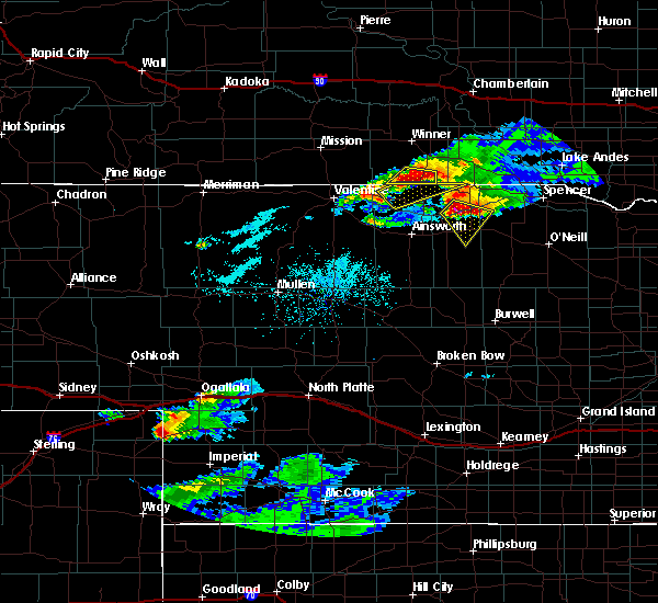 At 906 pm cdt, a severe thunderstorm was located 6 miles north of newport, and moving southeast at 35 mph (radar indicated). Hazards include 60 mph wind gusts and half dollar size hail. Hail damage to vehicles is expected. expect wind damage to roofs, siding and trees. locations impacted include, newport. Everyone in the town of stuart are in the path of this storm and should prepare for dangerous weather conditions by 930 pm cdt. At 906 pm cdt, a severe thunderstorm was located 6 miles north of newport, and moving southeast at 35 mph (radar indicated). Hazards include 60 mph wind gusts and half dollar size hail. Hail damage to vehicles is expected. expect wind damage to roofs, siding and trees. locations impacted include, newport. Everyone in the town of stuart are in the path of this storm and should prepare for dangerous weather conditions by 930 pm cdt.
|
| 7/19/2015 9:05 PM CDT | Quarter sized hail reported 9.6 miles SSE of Newport, NE |
| 7/19/2015 9:05 PM CDT | Storm damage reported in rock county NE, 9.6 miles SSE of Newport, NE |
| 7/19/2015 8:53 PM CDT |
 At 851 pm cdt, a severe thunderstorm was located 12 miles north of bassett, and moving southeast at 35 mph (radar indicated. half dollar size hail was reported 4 miles north northeast of springview at 0830 pm cdt). Hazards include 60 mph wind gusts and half dollar size hail. Hail damage to vehicles is expected. expect wind damage to roofs, siding and trees. locations impacted include, newport and mariaville. This includes highway 20 between mile markers 261 and 274. At 851 pm cdt, a severe thunderstorm was located 12 miles north of bassett, and moving southeast at 35 mph (radar indicated. half dollar size hail was reported 4 miles north northeast of springview at 0830 pm cdt). Hazards include 60 mph wind gusts and half dollar size hail. Hail damage to vehicles is expected. expect wind damage to roofs, siding and trees. locations impacted include, newport and mariaville. This includes highway 20 between mile markers 261 and 274.
|
| 7/19/2015 8:38 PM CDT |
 At 836 pm cdt, a severe thunderstorm was located near springview, and moving southeast at 30 mph (radar indicated). Hazards include 60 mph wind gusts and half dollar size hail. Hail damage to vehicles is expected. Expect wind damage to roofs, siding and trees. At 836 pm cdt, a severe thunderstorm was located near springview, and moving southeast at 30 mph (radar indicated). Hazards include 60 mph wind gusts and half dollar size hail. Hail damage to vehicles is expected. Expect wind damage to roofs, siding and trees.
|
| 7/5/2015 11:39 PM CDT |
 The severe thunderstorm warning for east central rock and central holt counties will expire at 1145 pm cdt, the storm which prompted the warning has weakened below severe limits, and no longer poses an immediate threat to life or property. however, heavy rain is still possible with this thunderstorm. The severe thunderstorm warning for east central rock and central holt counties will expire at 1145 pm cdt, the storm which prompted the warning has weakened below severe limits, and no longer poses an immediate threat to life or property. however, heavy rain is still possible with this thunderstorm.
|
| 7/5/2015 11:26 PM CDT |
 At 1125 pm cdt, a severe thunderstorm was located near atkinson, and moving east at 35 mph (radar indicated). Hazards include 60 mph wind gusts. Expect damage to roofs. siding and trees. locations impacted include, atkinson and emmet. This includes highway 20 between mile markers 264 and 304. At 1125 pm cdt, a severe thunderstorm was located near atkinson, and moving east at 35 mph (radar indicated). Hazards include 60 mph wind gusts. Expect damage to roofs. siding and trees. locations impacted include, atkinson and emmet. This includes highway 20 between mile markers 264 and 304.
|
| 7/5/2015 11:20 PM CDT |
 At 1117 pm cdt, a severe thunderstorm was located 6 miles south of stuart, and moving east at 25 mph (radar indicated). Hazards include 60 mph wind gusts and quarter size hail. Hail damage to vehicles is expected. expect wind damage to roofs, siding and trees. locations impacted include, atkinson and emmet. This includes highway 20 between mile markers 264 and 304. At 1117 pm cdt, a severe thunderstorm was located 6 miles south of stuart, and moving east at 25 mph (radar indicated). Hazards include 60 mph wind gusts and quarter size hail. Hail damage to vehicles is expected. expect wind damage to roofs, siding and trees. locations impacted include, atkinson and emmet. This includes highway 20 between mile markers 264 and 304.
|
| 7/5/2015 10:59 PM CDT |
 At 1058 pm cdt, a severe thunderstorm was located 8 miles south of newport, and moving east at 20 mph (radar indicated). Hazards include 60 mph wind gusts and quarter size hail. Hail damage to vehicles is expected. Expect wind damage to roofs, siding and trees. At 1058 pm cdt, a severe thunderstorm was located 8 miles south of newport, and moving east at 20 mph (radar indicated). Hazards include 60 mph wind gusts and quarter size hail. Hail damage to vehicles is expected. Expect wind damage to roofs, siding and trees.
|
| 6/20/2015 3:09 AM CDT |
 The severe thunderstorm warning for northern rock, keya paha, northern holt, northeastern brown and boyd counties will expire at 215 am mdt, the storms which prompted the warning have weakened below severe limits, and no longer pose an immediate threat to life or property. however, gusty winds are still possible with these thunderstorms. The severe thunderstorm warning for northern rock, keya paha, northern holt, northeastern brown and boyd counties will expire at 215 am mdt, the storms which prompted the warning have weakened below severe limits, and no longer pose an immediate threat to life or property. however, gusty winds are still possible with these thunderstorms.
|
| 6/20/2015 2:53 AM CDT |
 At 251 am cdt, a severe thunderstorm was located 9 miles southeast of mills, and moving east at 45 mph (radar indicated). Hazards include 60 mph wind gusts. Expect damage to roofs. siding and trees. locations impacted include, spencer, oneill, stuart, naper, atkinson, butte, anoka, bristow, gross, lynch, emmet, monowi, dustin, hull lake state wildlife management area, parshall bridge state wildlife management area, anncar, spencer dam, midway, scottville and redbird state wildlife management area. this includes highway 20 between mile markers 237 and 309. This includes highway 183 between mile markers 175 and 225. At 251 am cdt, a severe thunderstorm was located 9 miles southeast of mills, and moving east at 45 mph (radar indicated). Hazards include 60 mph wind gusts. Expect damage to roofs. siding and trees. locations impacted include, spencer, oneill, stuart, naper, atkinson, butte, anoka, bristow, gross, lynch, emmet, monowi, dustin, hull lake state wildlife management area, parshall bridge state wildlife management area, anncar, spencer dam, midway, scottville and redbird state wildlife management area. this includes highway 20 between mile markers 237 and 309. This includes highway 183 between mile markers 175 and 225.
|
| 6/20/2015 2:40 AM CDT |
 At 239 am cdt, a severe thunderstorm was located 7 miles southwest of mills, and moving east at 45 mph (radar indicated). Hazards include 60 mph wind gusts. Expect damage to roofs. siding and trees. locations impacted include, spencer, oneill, mills, newport, stuart, naper, atkinson, butte, anoka, bristow, gross, lynch, emmet, monowi, brocksburg, mariaville, dustin, hull lake state wildlife management area, parshall bridge state wildlife management area and anncar. this includes highway 20 between mile markers 237 and 309. This includes highway 183 between mile markers 175 and 225. At 239 am cdt, a severe thunderstorm was located 7 miles southwest of mills, and moving east at 45 mph (radar indicated). Hazards include 60 mph wind gusts. Expect damage to roofs. siding and trees. locations impacted include, spencer, oneill, mills, newport, stuart, naper, atkinson, butte, anoka, bristow, gross, lynch, emmet, monowi, brocksburg, mariaville, dustin, hull lake state wildlife management area, parshall bridge state wildlife management area and anncar. this includes highway 20 between mile markers 237 and 309. This includes highway 183 between mile markers 175 and 225.
|
| 6/20/2015 2:10 AM CDT |
 At 209 am cdt, a severe thunderstorm was located 8 miles west of springview, and moving east at 45 mph (radar indicated). Hazards include 60 mph wind gusts. Expect damage to roofs. Siding and trees. At 209 am cdt, a severe thunderstorm was located 8 miles west of springview, and moving east at 45 mph (radar indicated). Hazards include 60 mph wind gusts. Expect damage to roofs. Siding and trees.
|
| 6/3/2014 1:20 PM CDT | Golf Ball sized hail reported 0.1 miles NE of Newport, NE |
| 6/3/2014 12:46 PM CDT | Golf Ball sized hail reported 0.1 miles NE of Newport, NE |
| 6/3/2014 12:46 PM CDT | Report of 80 to 100 mph winds reporte in rock county NE, 0.1 miles NE of Newport, NE |
| 6/3/2014 12:45 PM CDT | Golf Ball sized hail reported 4.1 miles S of Newport, NE |
| 8/21/2013 7:50 PM CDT | Golf Ball sized hail reported 4.1 miles NW of Newport, NE, reported one window broken out. |
| 8/21/2013 7:44 PM CDT | Baseball sized hail reported 0.1 miles NE of Newport, NE |
| 9/3/2012 5:15 PM CDT | Quarter sized hail reported 17.3 miles N of Newport, NE |
| 9/3/2012 5:15 PM CDT | A few tree limbs down...size unknow in rock county NE, 17.3 miles N of Newport, NE |
| 5/5/2012 9:45 PM CDT | Quarter sized hail reported 10.3 miles S of Newport, NE, delayed public report. |
| 1/1/0001 12:00 AM | Tennis Ball sized hail reported 1 miles NE of Newport, NE, the hail lasted for 20 minutes. |
| 1/1/0001 12:00 AM | Half Dollar sized hail reported 0.1 miles NE of Newport, NE, quarters and half dollars size hail reported in newport. |
| 1/1/0001 12:00 AM | Quarter sized hail reported 5.4 miles NNE of Newport, NE, public reported quarter sized hail 5 miles ssw of newport |
| 1/1/0001 12:00 AM | Baseball sized hail reported 22.2 miles N of Newport, NE |
| 1/1/0001 12:00 AM | Quarter sized hail reported 4.9 miles ENE of Newport, NE, big marbles to quarter sized hail with brief duration. |
Hail Maps for Newport, NE
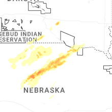
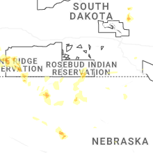


Connect with Interactive Hail Maps