

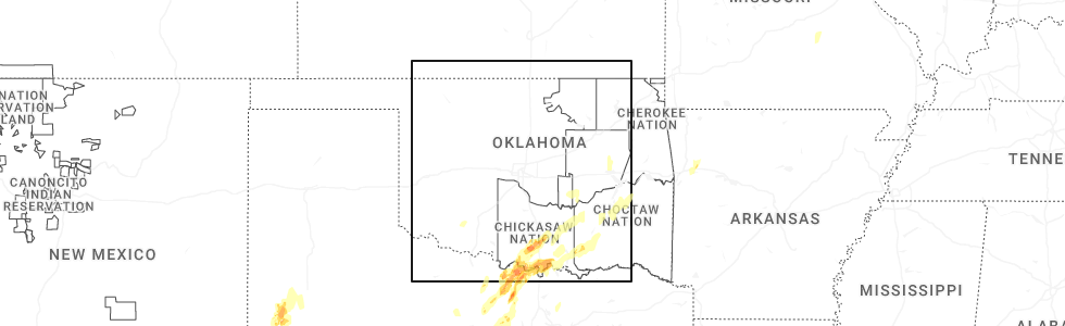
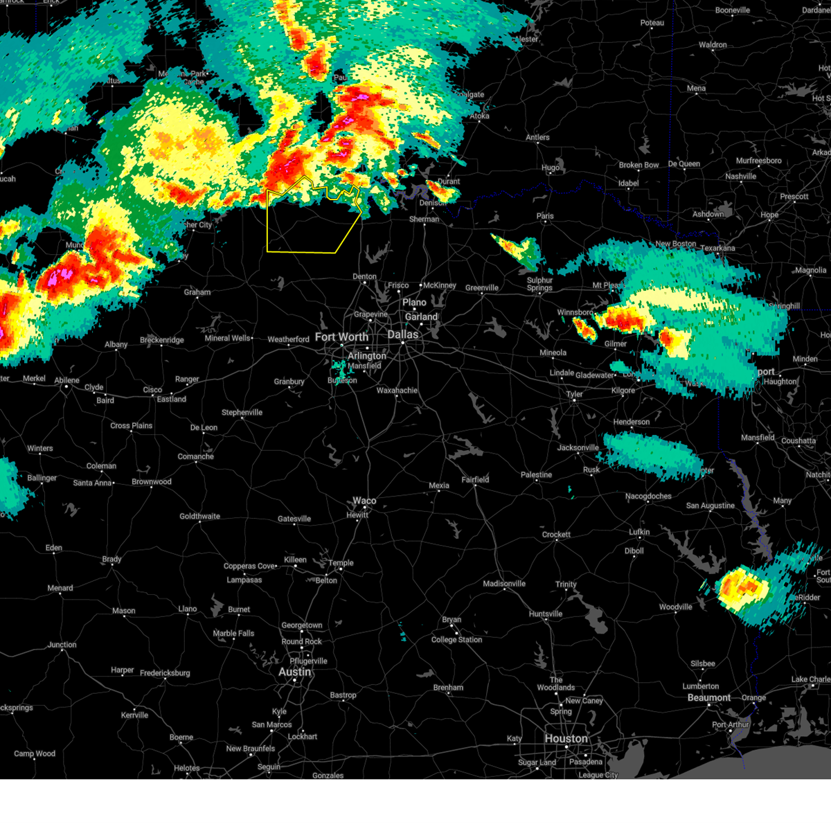
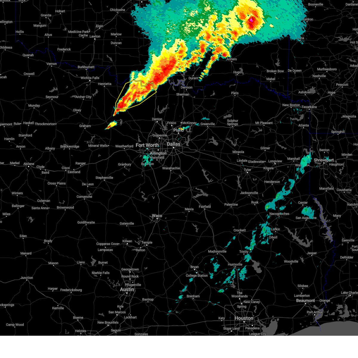
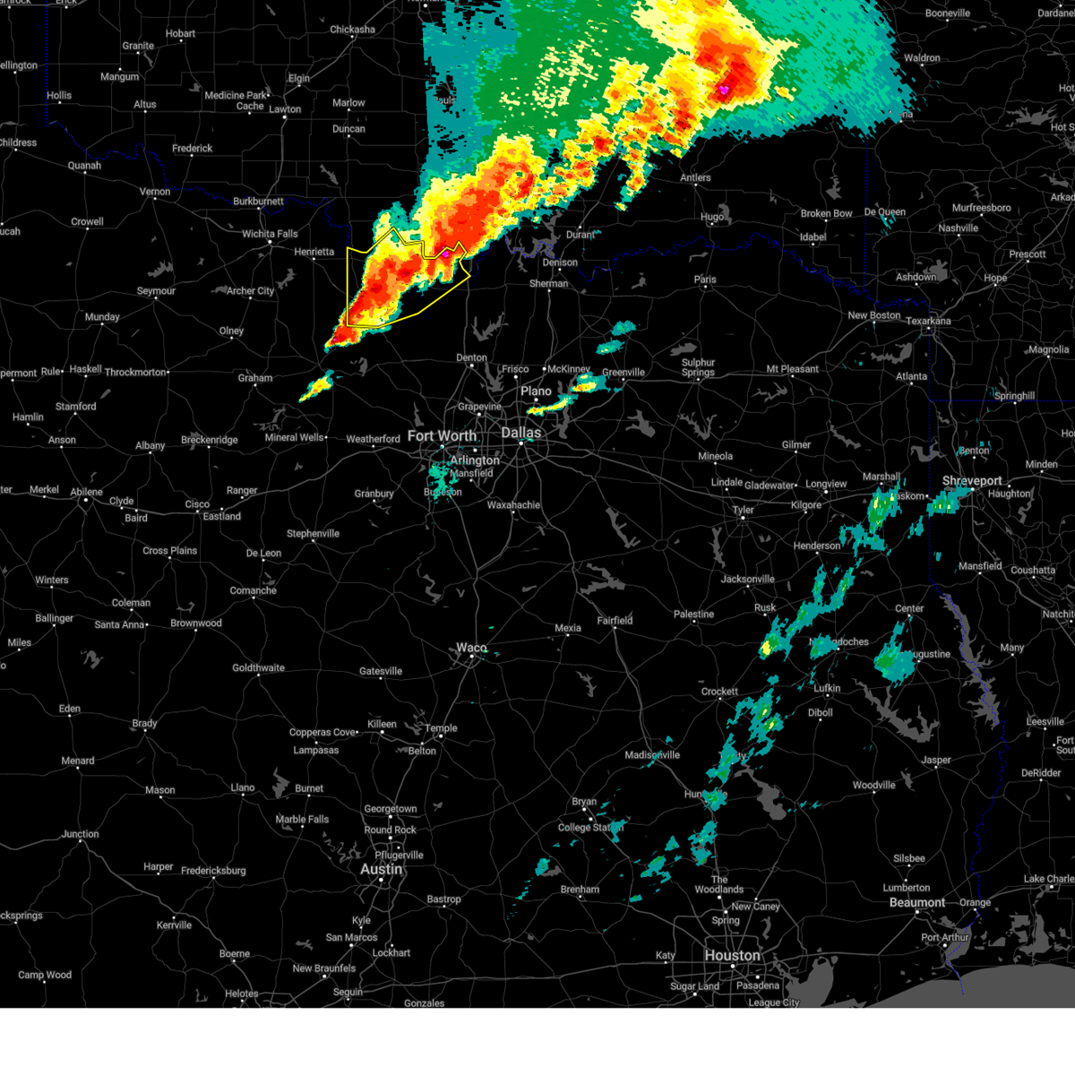
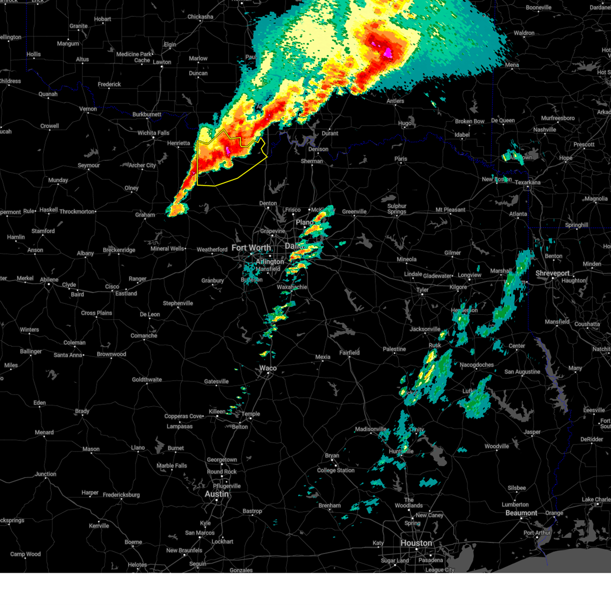
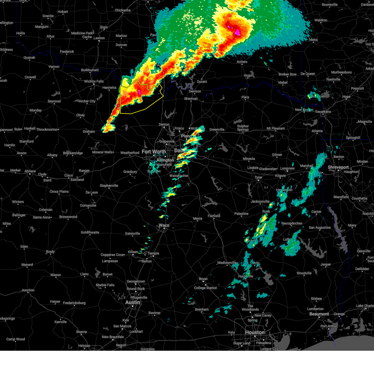
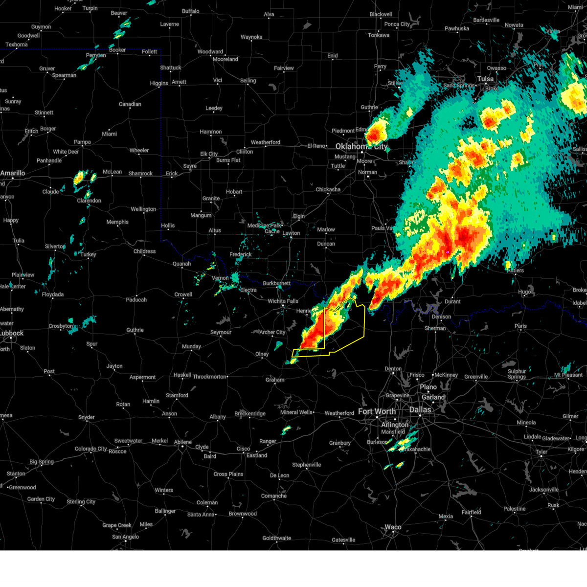
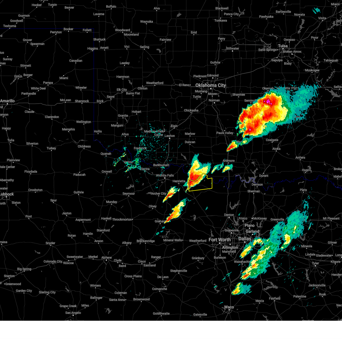
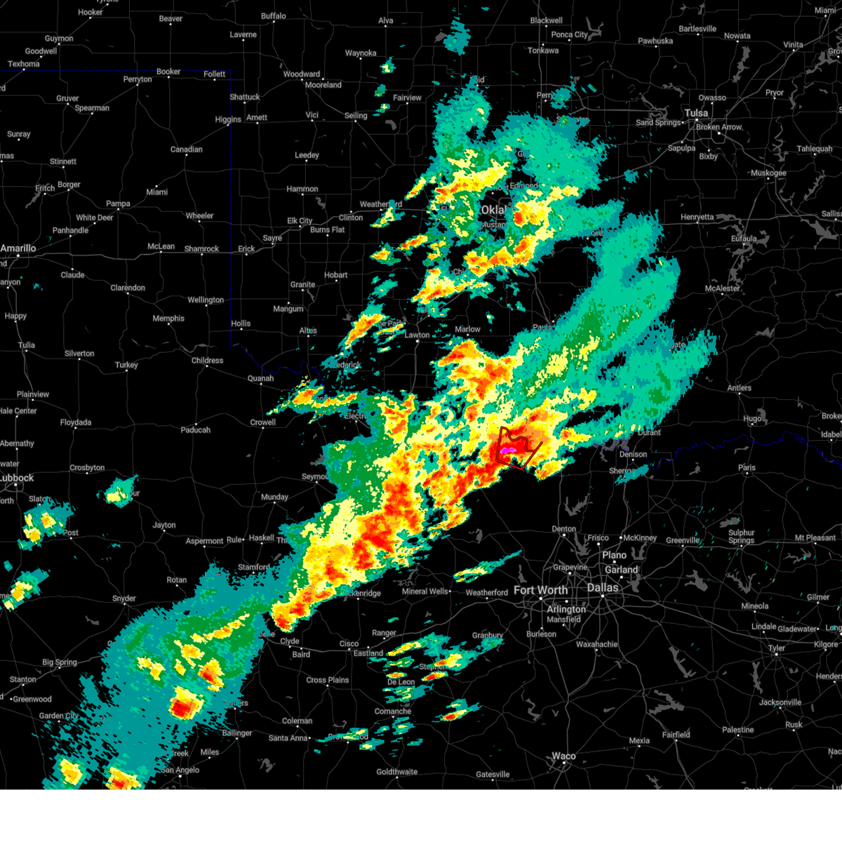
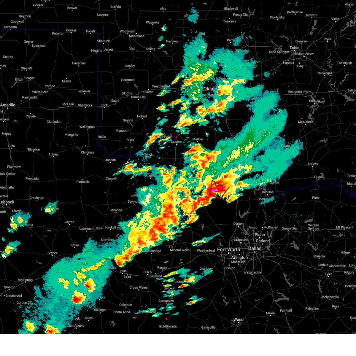
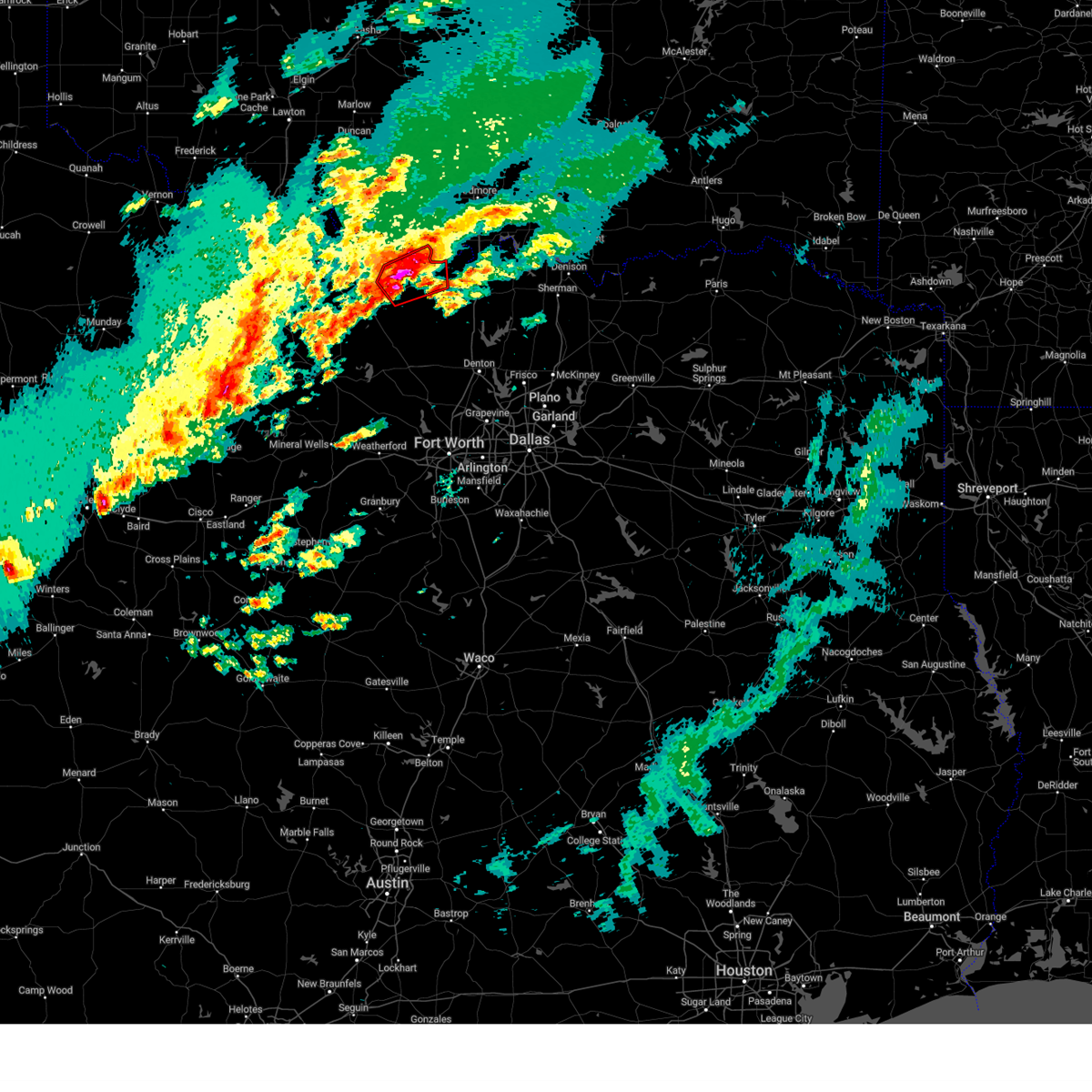
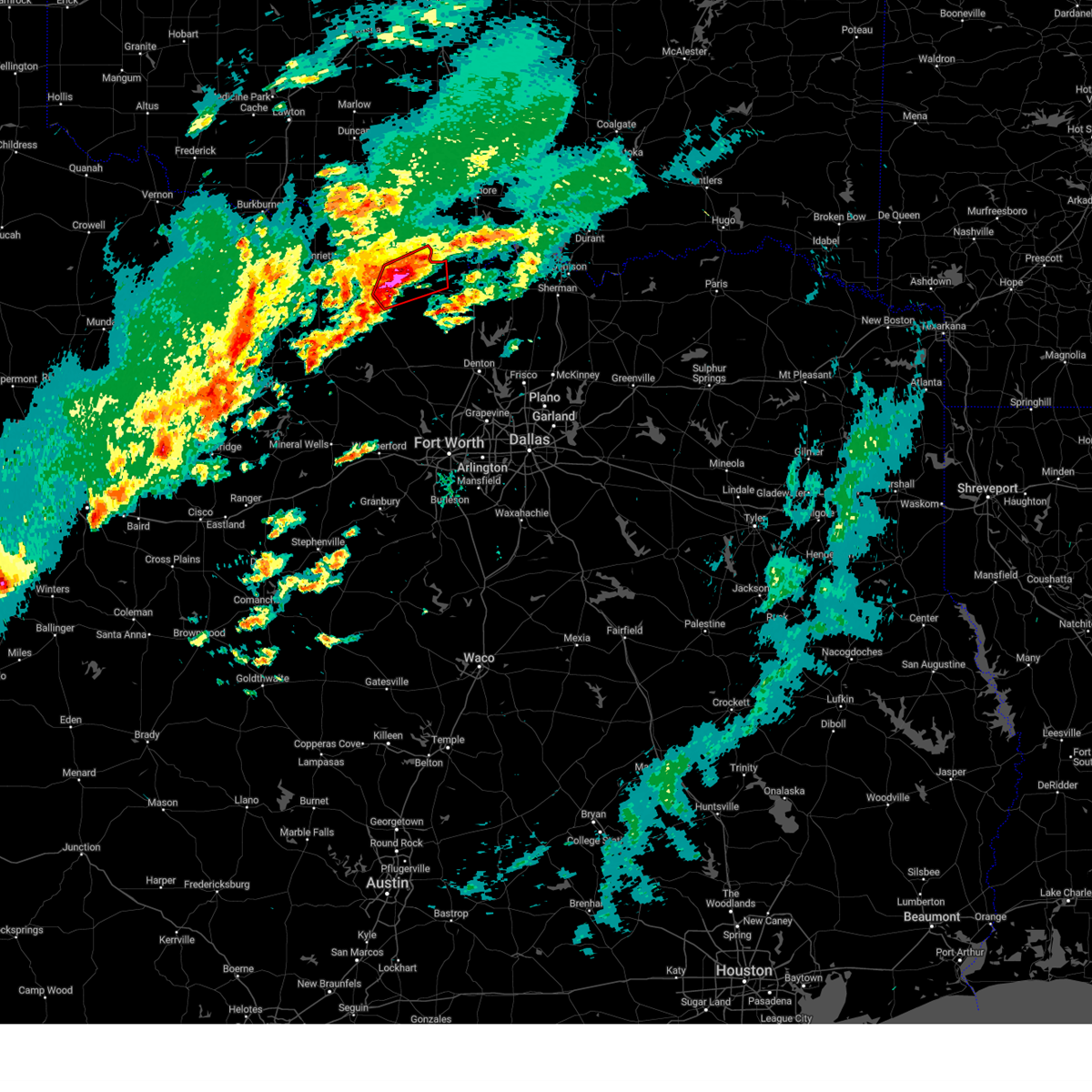
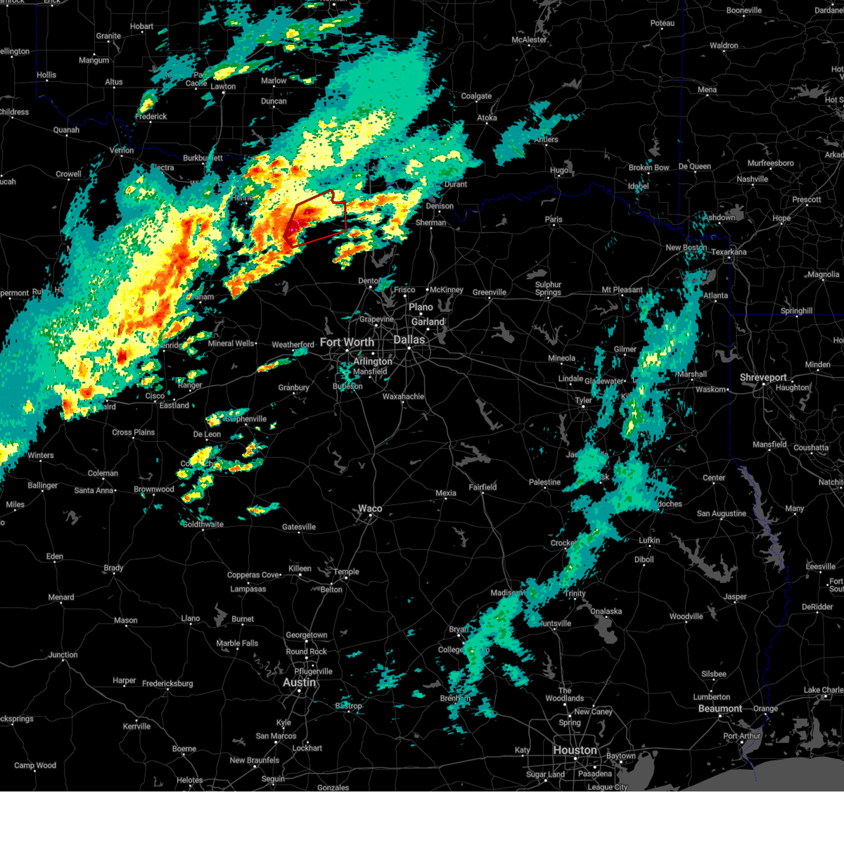
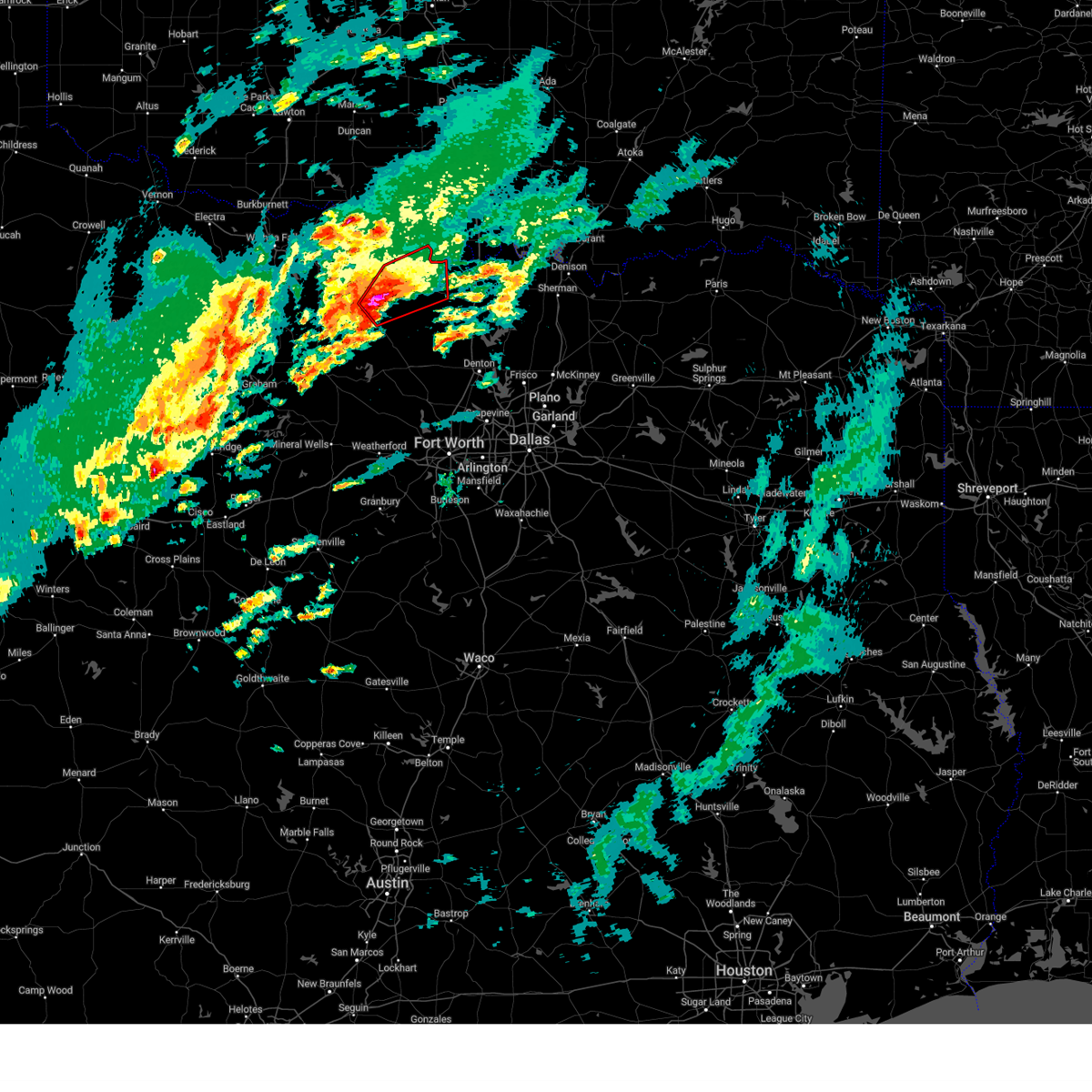
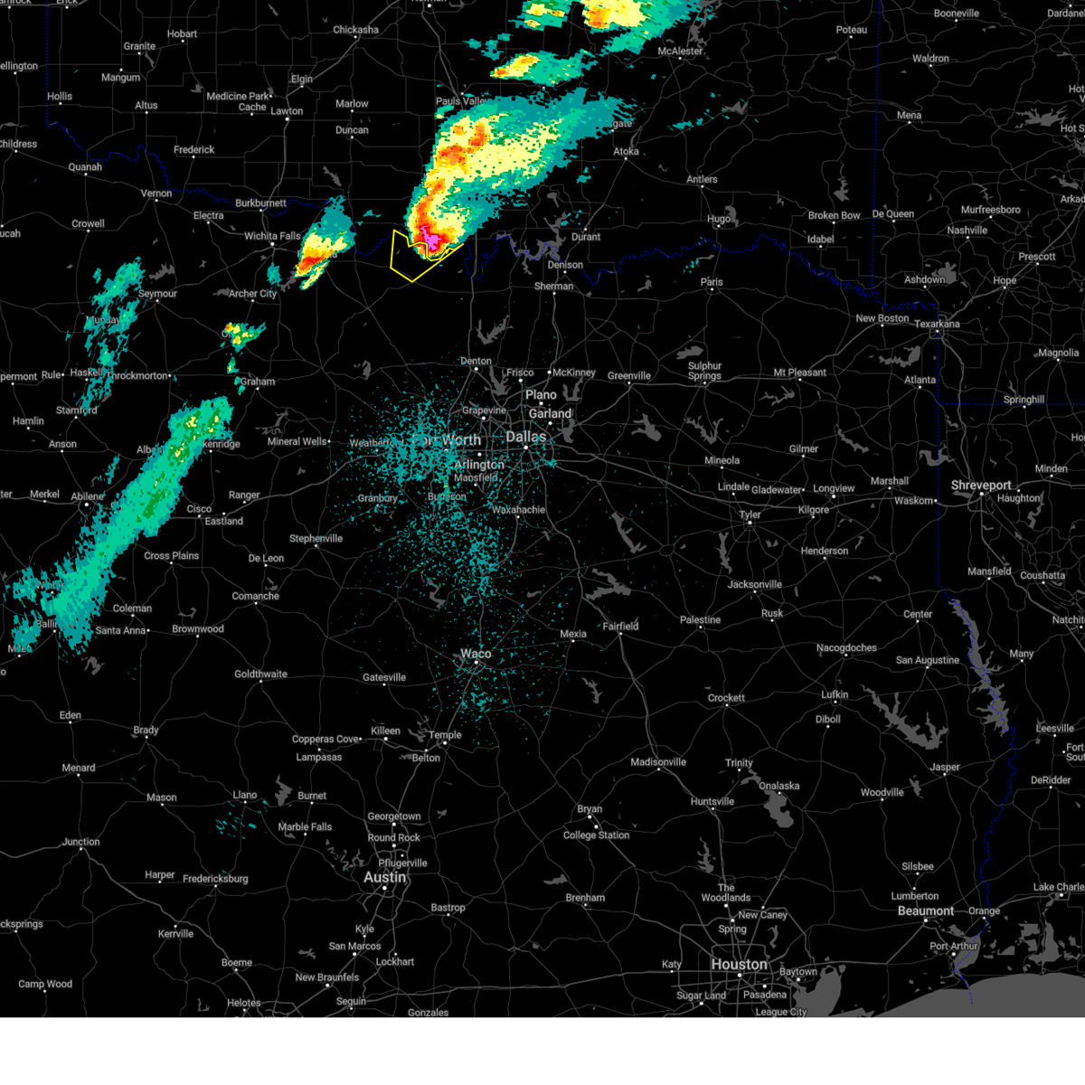
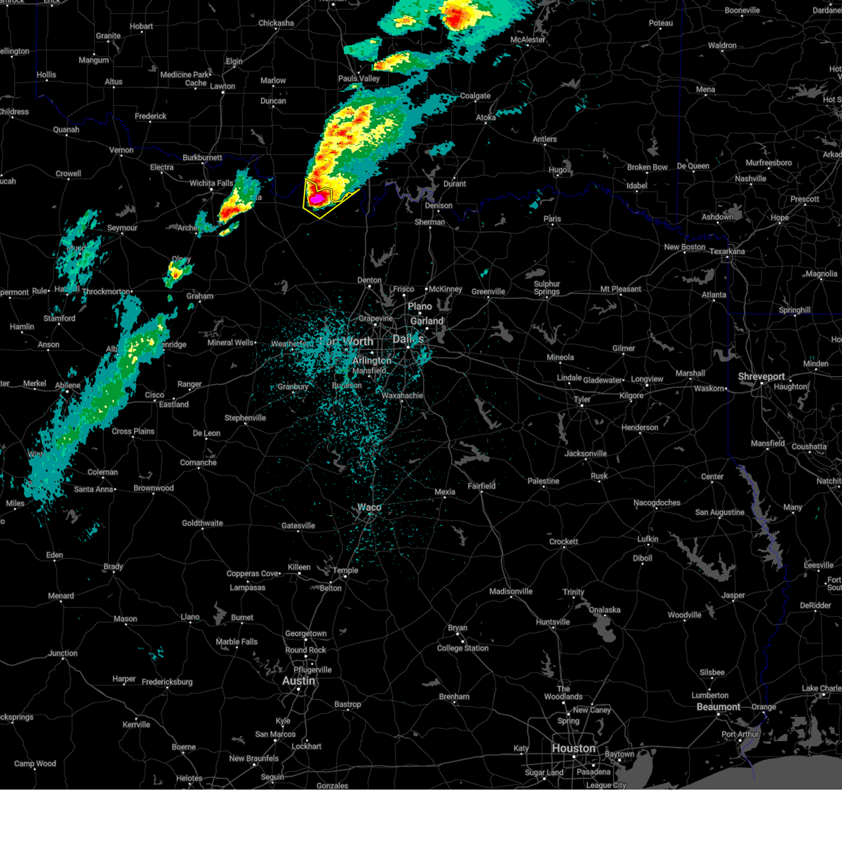
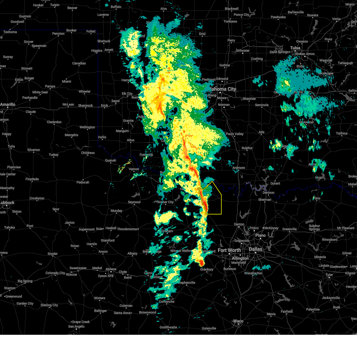
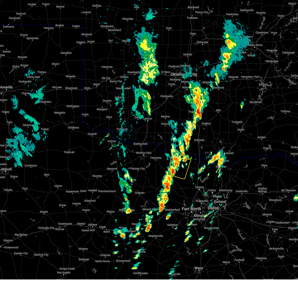
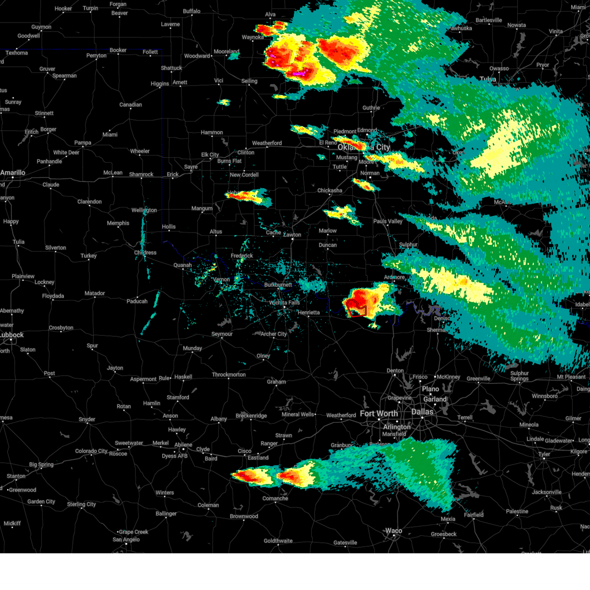
Hail Map for Nocona Hills, TX
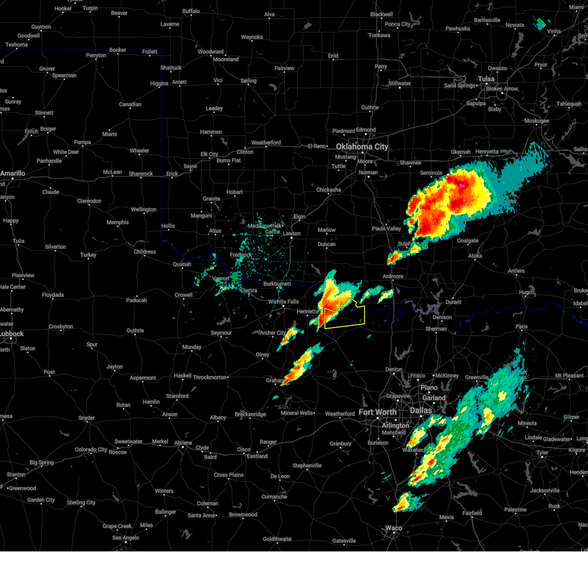
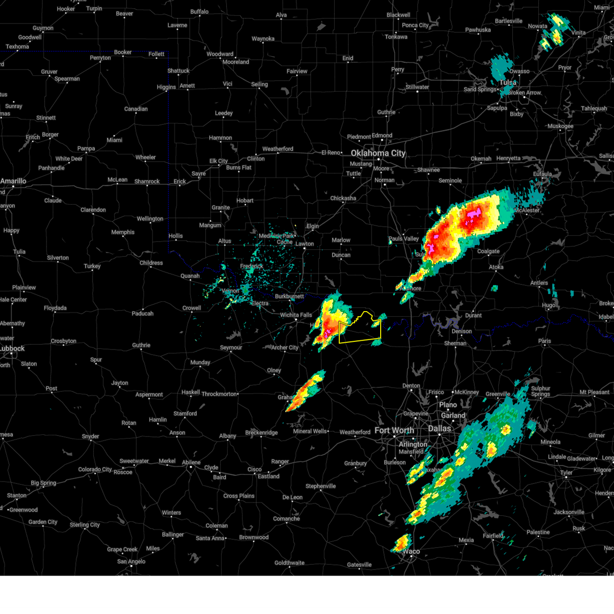
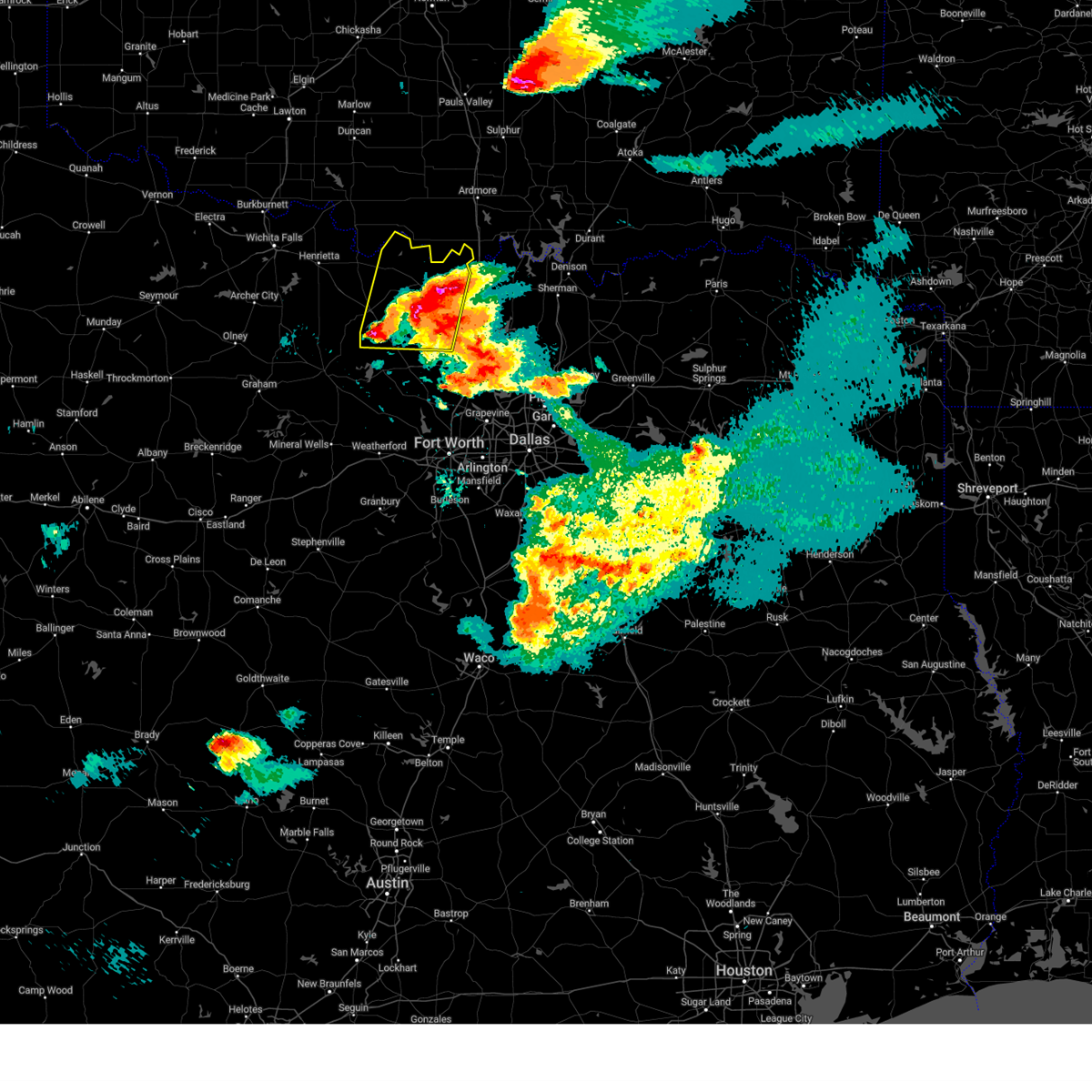
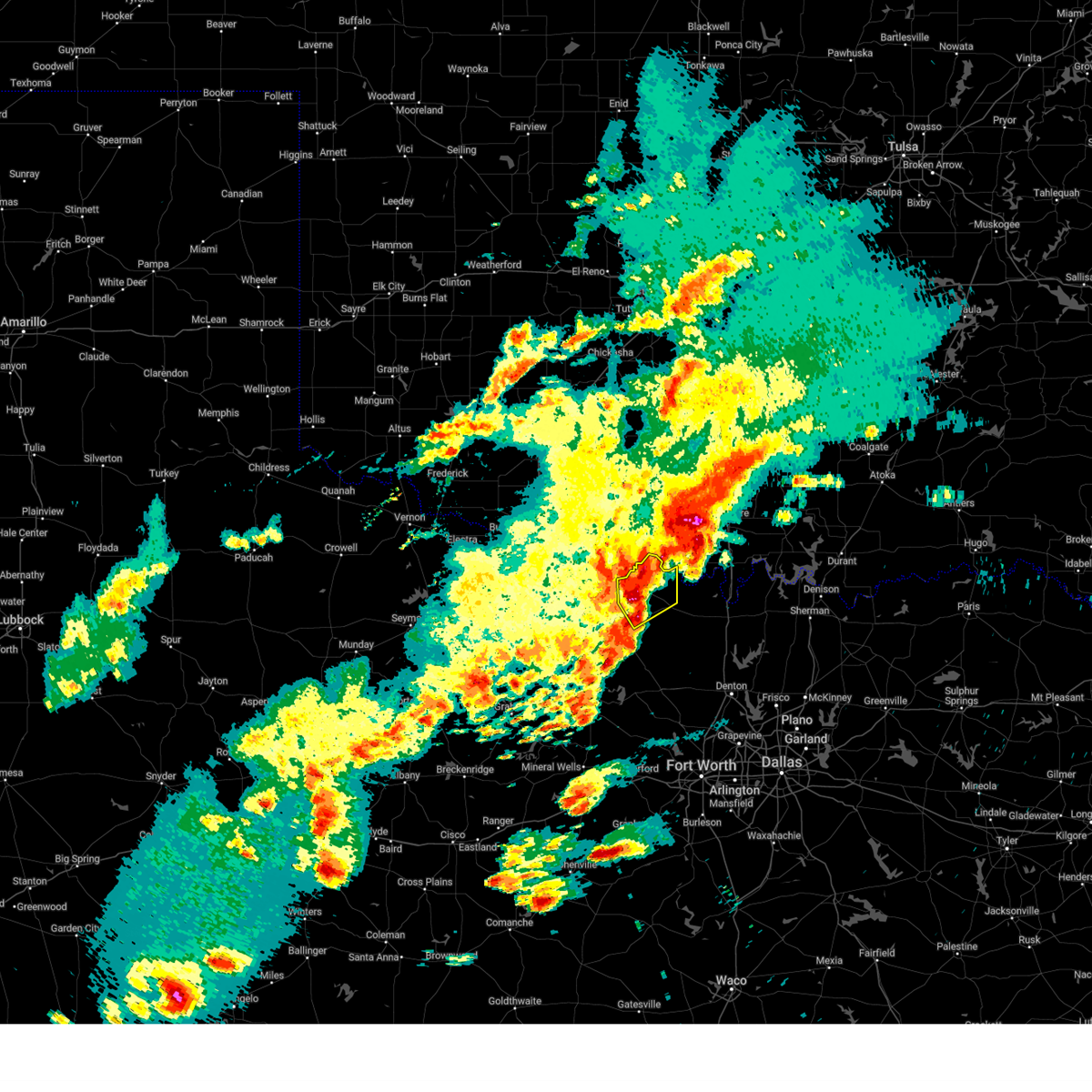
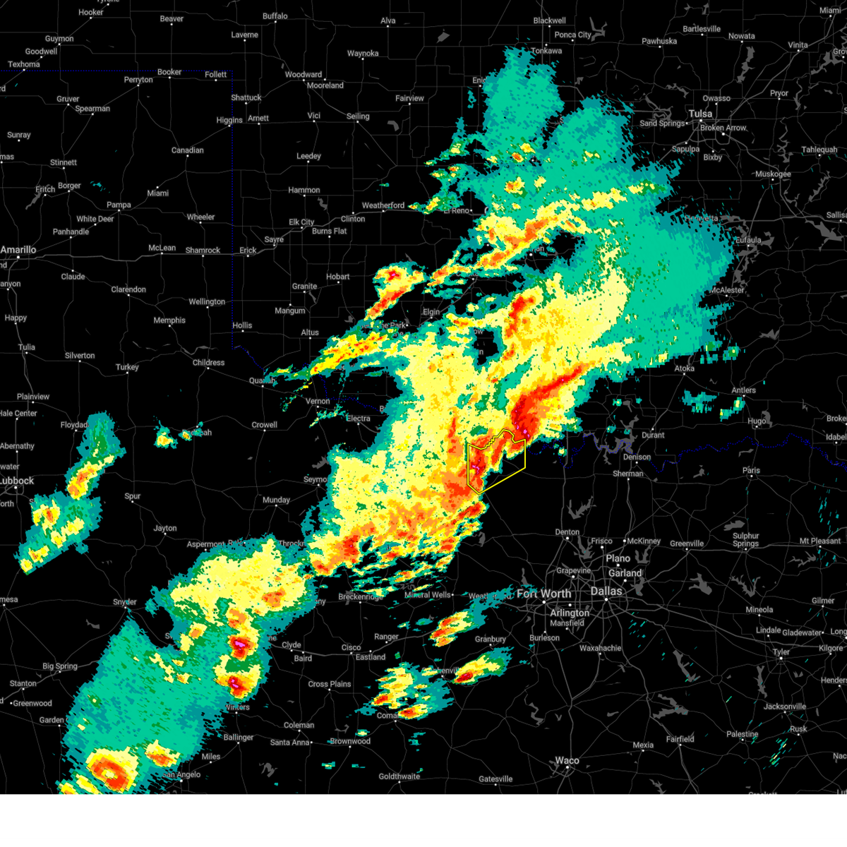
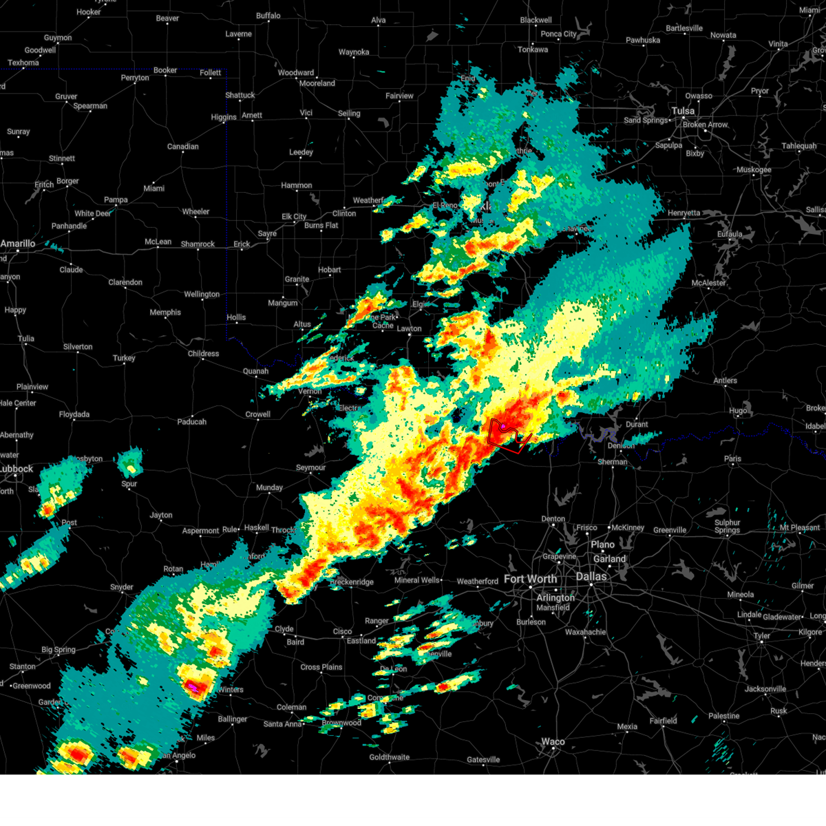
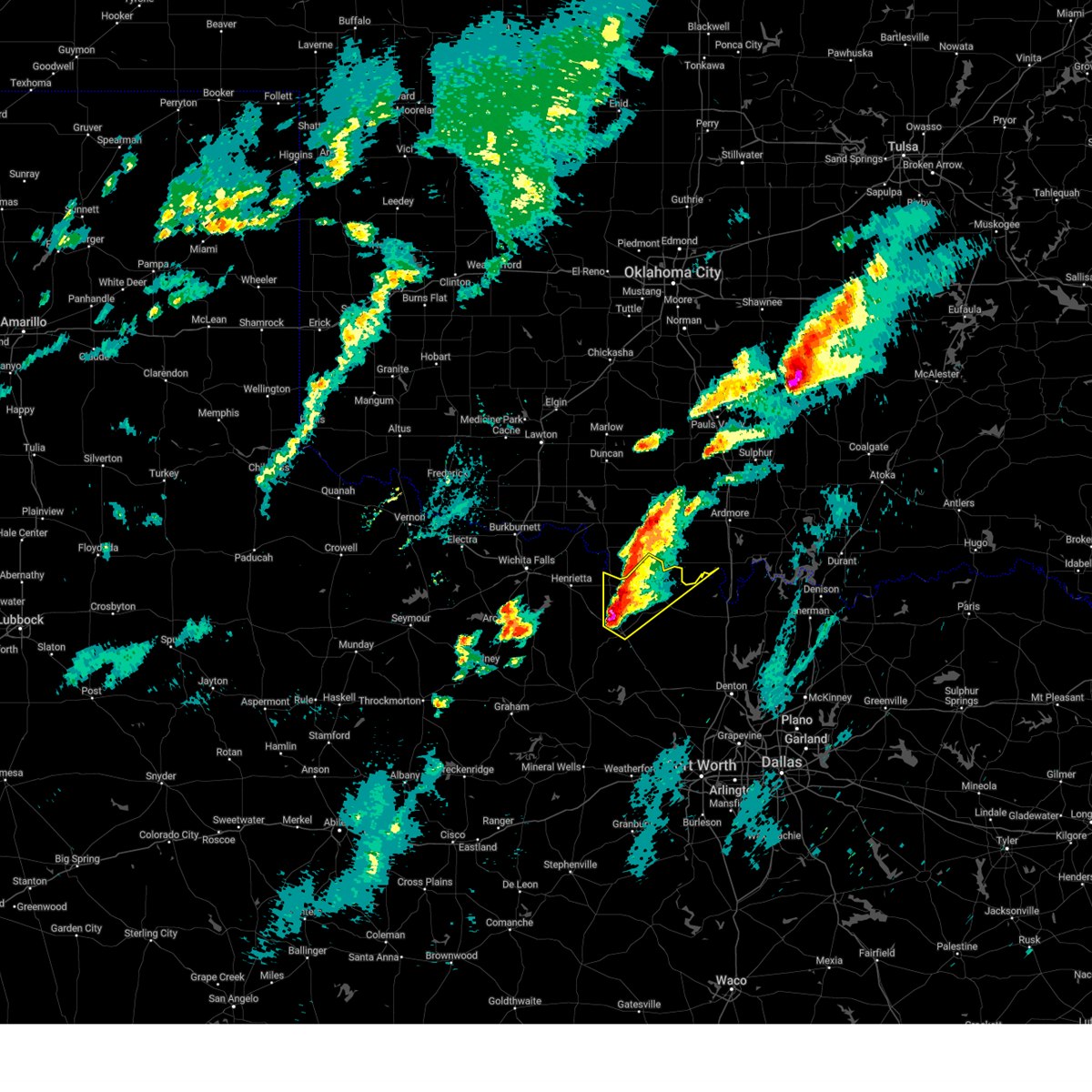
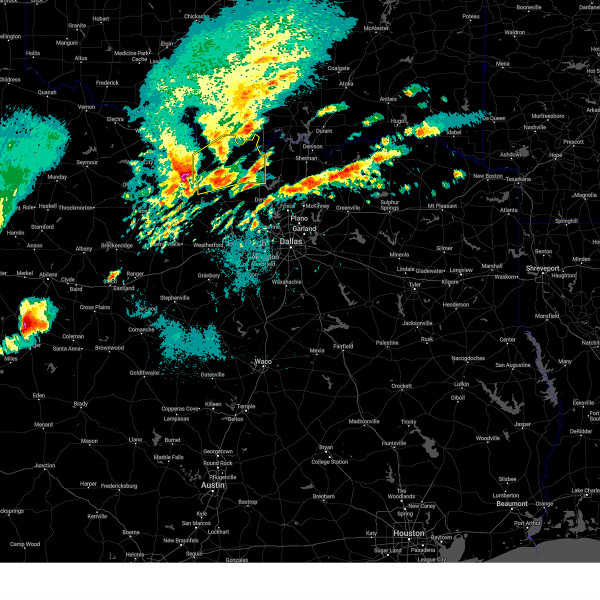
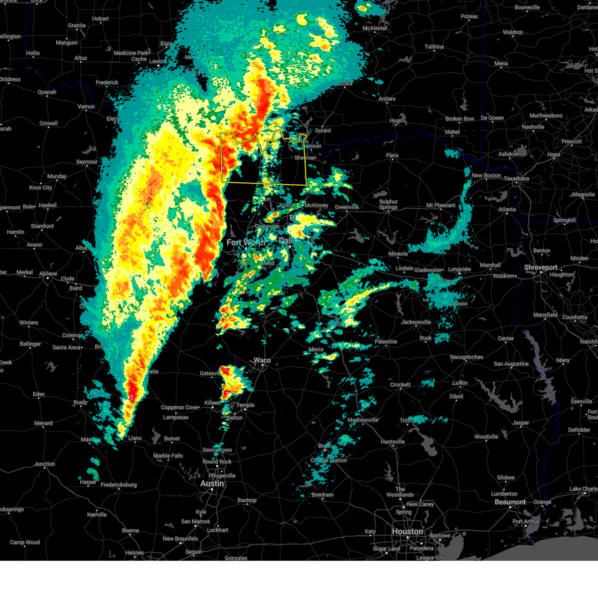
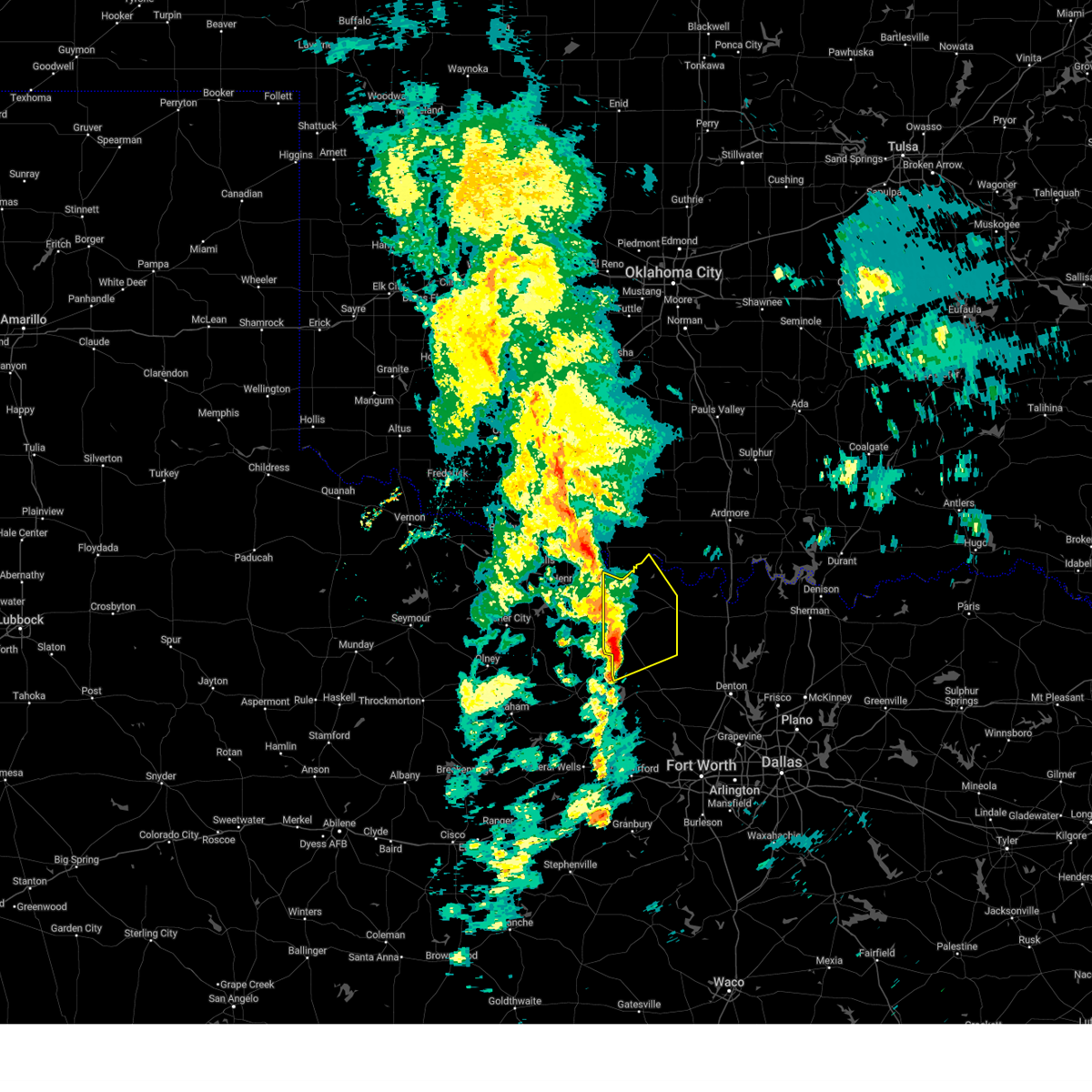
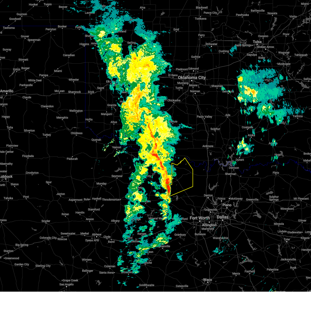
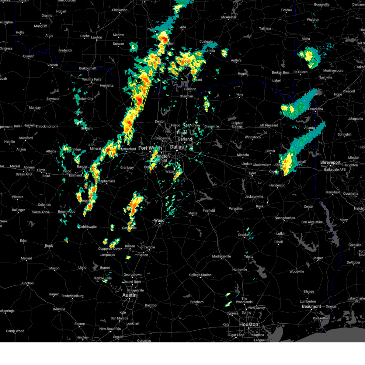
The Nocona Hills, TX area has had 3 reports of on-the-ground hail by trained spotters, and has been under severe weather warnings 57 times during the past 12 months. Doppler radar has detected hail at or near Nocona Hills, TX on 99 occasions, including 8 occasions during the past year.
| Name: | Nocona Hills, TX |
| Where Located: | 50 miles E of Wichita Falls, TX |
| Map: | Google Map for Nocona Hills, TX |
| Population: | 675 |
| Housing Units: | 572 |
| More Info: | Search Google for Nocona Hills, TX |
4
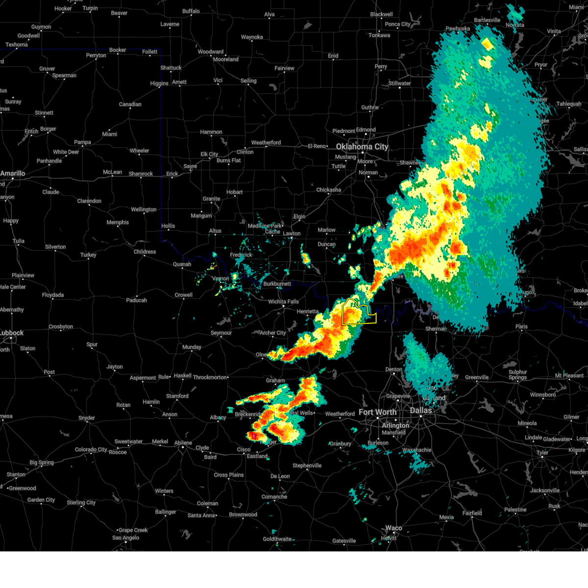
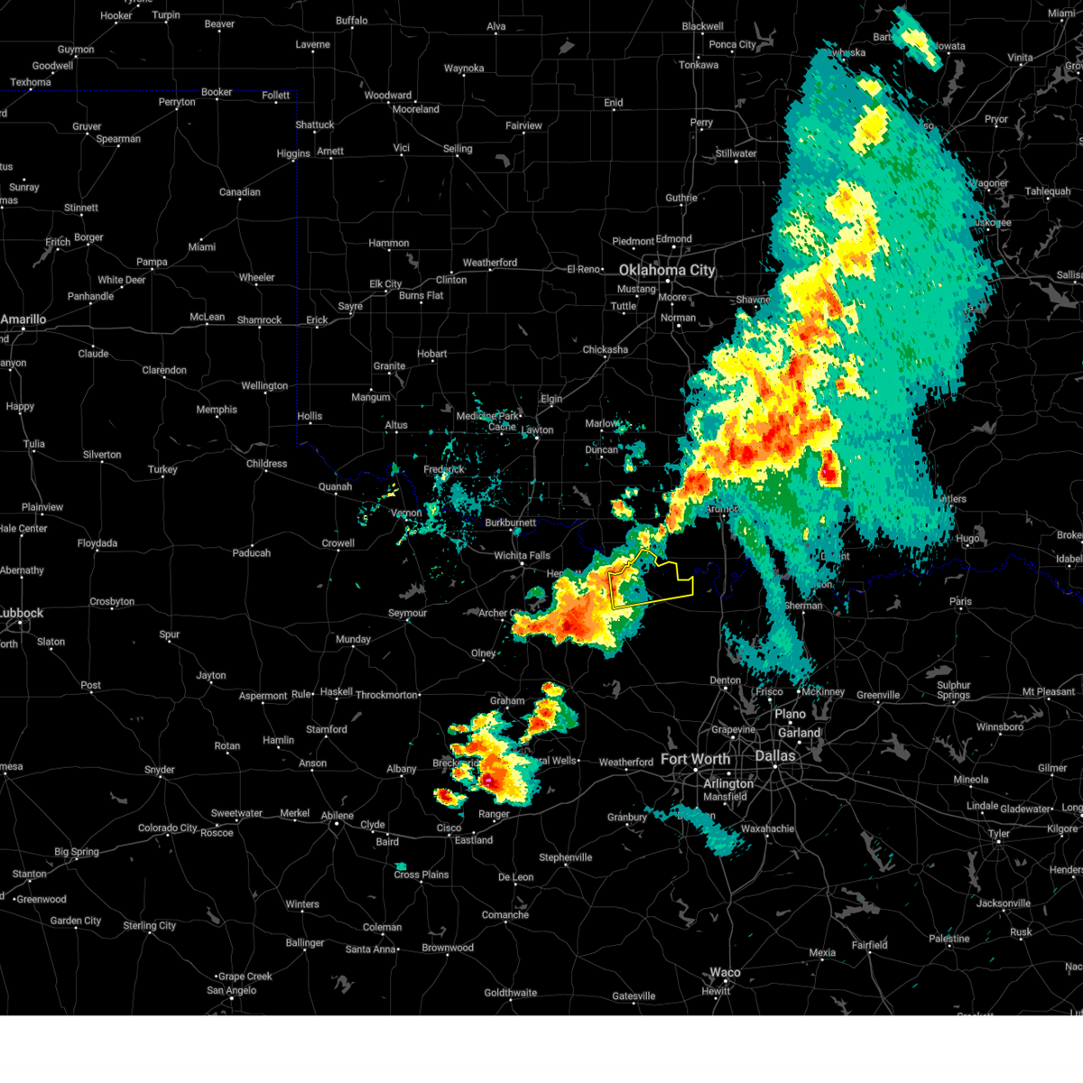
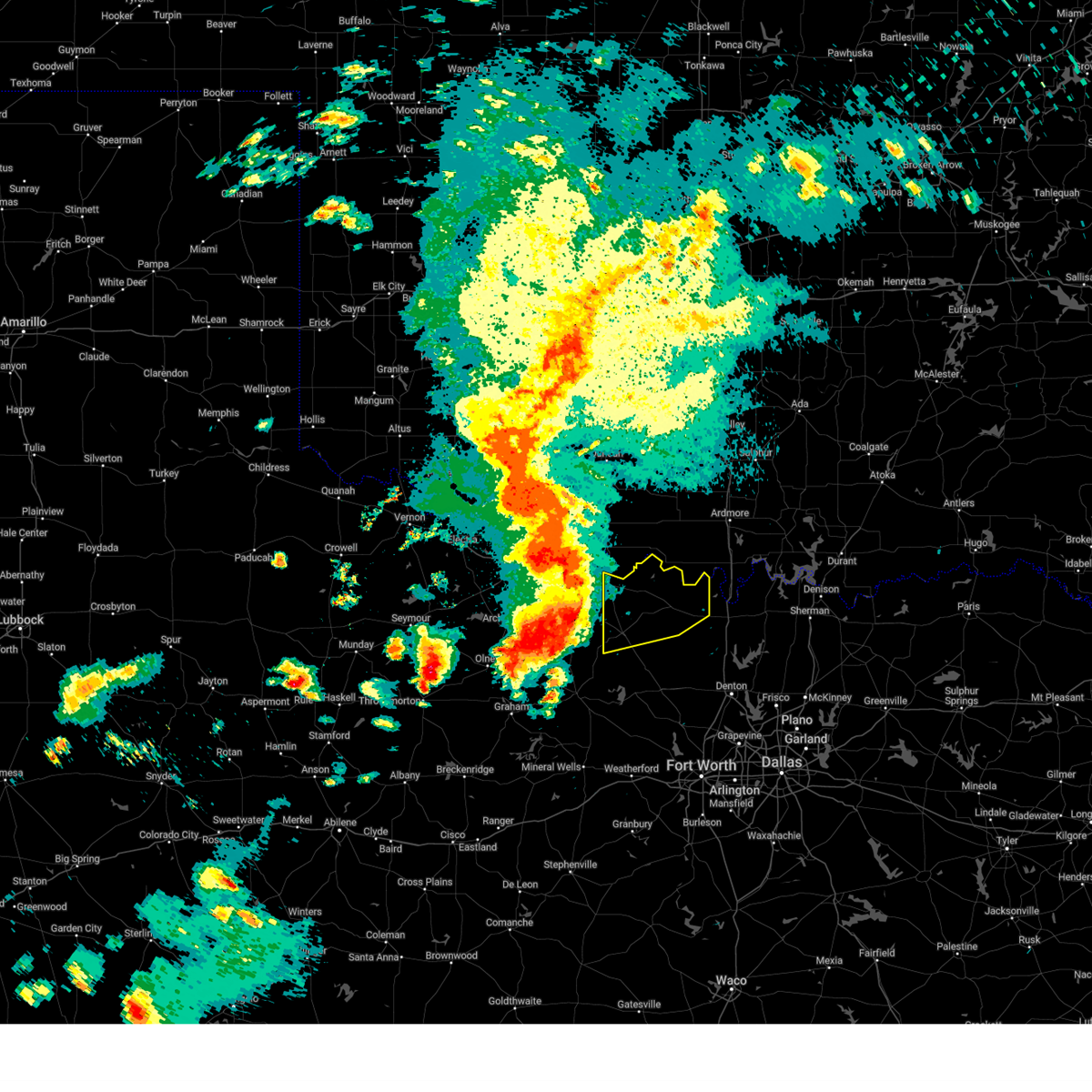
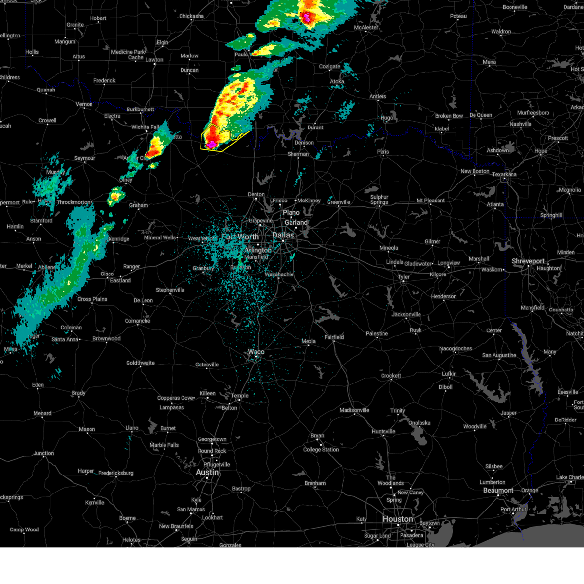
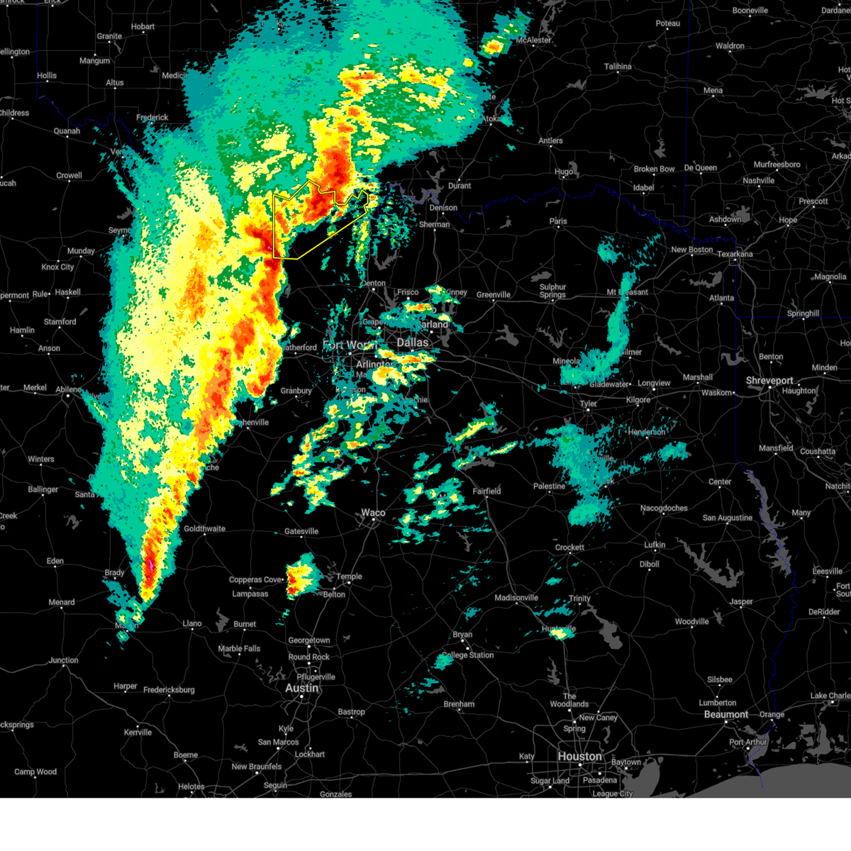
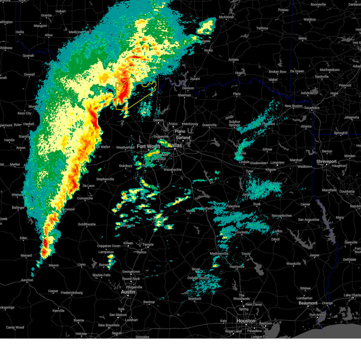
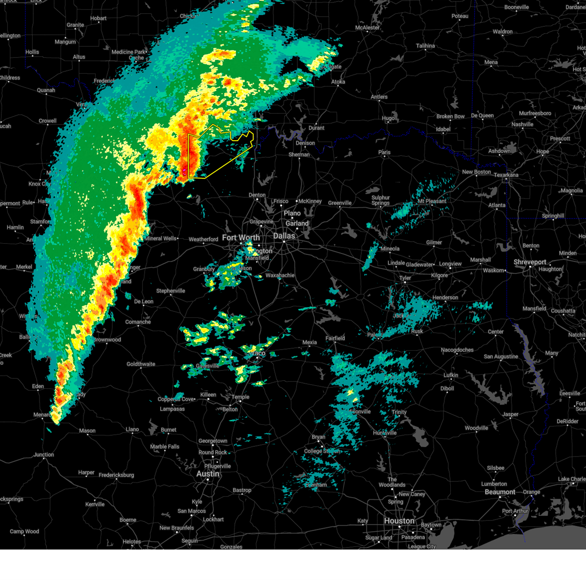
The Top Recent Hail Date for Nocona Hills, TX is Saturday, April 19, 2025 (3rd out of 99)
Hail and Wind Damage Spotted near Nocona Hills, TX
| Date / Time | Report Details |
|---|---|
| 6/8/2025 8:13 PM CDT |
 Svrfwd the national weather service in fort worth has issued a * severe thunderstorm warning for, montague county in north central texas, western cooke county in north central texas, * until 930 pm cdt. * at 812 pm cdt, severe thunderstorms were located along a line extending from near ringling to near terral, moving southeast at 30 mph (radar indicated). Hazards include 65 mph wind gusts and quarter size hail. Hail damage to vehicles is expected. expect wind damage to roofs, siding, and trees. severe thunderstorms will be near, lake nocona and nocona around 830 pm cdt. bowie around 850 pm cdt. st. jo around 900 pm cdt. lake muenster and sunset around 910 pm cdt. muenster around 915 pm cdt. Other locations impacted by these severe thunderstorms include prairie point, rosston, fruitland, bulcher, capps corner, montague, ringgold, forestburg, illinois bend, and nocona hills. Svrfwd the national weather service in fort worth has issued a * severe thunderstorm warning for, montague county in north central texas, western cooke county in north central texas, * until 930 pm cdt. * at 812 pm cdt, severe thunderstorms were located along a line extending from near ringling to near terral, moving southeast at 30 mph (radar indicated). Hazards include 65 mph wind gusts and quarter size hail. Hail damage to vehicles is expected. expect wind damage to roofs, siding, and trees. severe thunderstorms will be near, lake nocona and nocona around 830 pm cdt. bowie around 850 pm cdt. st. jo around 900 pm cdt. lake muenster and sunset around 910 pm cdt. muenster around 915 pm cdt. Other locations impacted by these severe thunderstorms include prairie point, rosston, fruitland, bulcher, capps corner, montague, ringgold, forestburg, illinois bend, and nocona hills.
|
| 6/3/2025 7:32 PM CDT |
 At 732 pm cdt, severe thunderstorms were located along a line extending from near lake nocona to near nocona, moving east at 30 mph (radar indicated). Hazards include 60 mph wind gusts and quarter size hail. Hail damage to vehicles is expected. expect wind damage to roofs, siding, and trees. these severe storms will be near, lake nocona around 735 pm cdt. Other locations impacted by these severe thunderstorms include bulcher, spanish fort, bonita, capps corner, illinois bend, and nocona hills. At 732 pm cdt, severe thunderstorms were located along a line extending from near lake nocona to near nocona, moving east at 30 mph (radar indicated). Hazards include 60 mph wind gusts and quarter size hail. Hail damage to vehicles is expected. expect wind damage to roofs, siding, and trees. these severe storms will be near, lake nocona around 735 pm cdt. Other locations impacted by these severe thunderstorms include bulcher, spanish fort, bonita, capps corner, illinois bend, and nocona hills.
|
| 6/3/2025 7:15 PM CDT |
 Svrfwd the national weather service in fort worth has issued a * severe thunderstorm warning for, northern montague county in north central texas, northwestern cooke county in north central texas, * until 815 pm cdt. * at 715 pm cdt, severe thunderstorms were located along a line extending from 7 miles east of terral to 6 miles southwest of nocona, moving east at 30 mph (radar indicated). Hazards include 60 mph wind gusts and quarter size hail. Hail damage to vehicles is expected. expect wind damage to roofs, siding, and trees. severe thunderstorms will be near, nocona around 720 pm cdt. lake nocona around 725 pm cdt. Other locations impacted by these severe thunderstorms include spanish fort, belcherville, bulcher, bonita, capps corner, illinois bend, and nocona hills. Svrfwd the national weather service in fort worth has issued a * severe thunderstorm warning for, northern montague county in north central texas, northwestern cooke county in north central texas, * until 815 pm cdt. * at 715 pm cdt, severe thunderstorms were located along a line extending from 7 miles east of terral to 6 miles southwest of nocona, moving east at 30 mph (radar indicated). Hazards include 60 mph wind gusts and quarter size hail. Hail damage to vehicles is expected. expect wind damage to roofs, siding, and trees. severe thunderstorms will be near, nocona around 720 pm cdt. lake nocona around 725 pm cdt. Other locations impacted by these severe thunderstorms include spanish fort, belcherville, bulcher, bonita, capps corner, illinois bend, and nocona hills.
|
| 5/19/2025 6:37 PM CDT |
 At 637 pm cdt, a severe thunderstorm was located over st. jo, or 14 miles southeast of nocona, moving east at 35 mph (radar indicated). Hazards include 60 mph wind gusts and half dollar size hail. Hail damage to vehicles is expected. expect wind damage to roofs, siding, and trees. locations impacted include, st. Jo, nocona, lake nocona, fruitland, bulcher, capps corner, montague, muenster, forestburg, illinois bend, nocona hills, bowie, sunset, marysville, lake amon g carter, lake muenster, sivells bend, mallard, hubert h moss lake, and bonita. At 637 pm cdt, a severe thunderstorm was located over st. jo, or 14 miles southeast of nocona, moving east at 35 mph (radar indicated). Hazards include 60 mph wind gusts and half dollar size hail. Hail damage to vehicles is expected. expect wind damage to roofs, siding, and trees. locations impacted include, st. Jo, nocona, lake nocona, fruitland, bulcher, capps corner, montague, muenster, forestburg, illinois bend, nocona hills, bowie, sunset, marysville, lake amon g carter, lake muenster, sivells bend, mallard, hubert h moss lake, and bonita.
|
| 5/19/2025 6:21 PM CDT |
 At 621 pm cdt, a severe thunderstorm was located near leon, or 16 miles southwest of marietta, moving east at 30 mph (emergency management). Hazards include golf ball size hail and 65 mph wind gusts. People and animals outdoors will be injured. expect hail damage to roofs, siding, windows, and vehicles. expect wind damage to roofs, siding, and trees. locations impacted include, st. Jo, lake nocona, bulcher, capps corner, nocona hills, bowie, hubert h moss lake, myra, nocona, fruitland, montague, muenster, ringgold, forestburg, illinois bend, sunset, marysville, lake amon g carter, stoneburg, and lake muenster. At 621 pm cdt, a severe thunderstorm was located near leon, or 16 miles southwest of marietta, moving east at 30 mph (emergency management). Hazards include golf ball size hail and 65 mph wind gusts. People and animals outdoors will be injured. expect hail damage to roofs, siding, windows, and vehicles. expect wind damage to roofs, siding, and trees. locations impacted include, st. Jo, lake nocona, bulcher, capps corner, nocona hills, bowie, hubert h moss lake, myra, nocona, fruitland, montague, muenster, ringgold, forestburg, illinois bend, sunset, marysville, lake amon g carter, stoneburg, and lake muenster.
|
| 5/19/2025 6:00 PM CDT |
 At 559 pm cdt, a severe thunderstorm was located near st. jo, or 9 miles east of nocona, moving east at 30 mph. this is a destructive storm for locations near st. jo, capps corner, and bulcher (emergency management). Hazards include baseball size hail and 65 mph wind gusts. People and animals outdoors will be severely injured. expect shattered windows, extensive damage to roofs, siding, and vehicles. locations impacted include, st. Jo, lake nocona, bulcher, capps corner, nocona hills, bowie, hubert h moss lake, myra, nocona, fruitland, montague, muenster, ringgold, forestburg, illinois bend, sunset, marysville, lake amon g carter, stoneburg, and lake muenster. At 559 pm cdt, a severe thunderstorm was located near st. jo, or 9 miles east of nocona, moving east at 30 mph. this is a destructive storm for locations near st. jo, capps corner, and bulcher (emergency management). Hazards include baseball size hail and 65 mph wind gusts. People and animals outdoors will be severely injured. expect shattered windows, extensive damage to roofs, siding, and vehicles. locations impacted include, st. Jo, lake nocona, bulcher, capps corner, nocona hills, bowie, hubert h moss lake, myra, nocona, fruitland, montague, muenster, ringgold, forestburg, illinois bend, sunset, marysville, lake amon g carter, stoneburg, and lake muenster.
|
| 5/19/2025 5:55 PM CDT |
 Svrfwd the national weather service in fort worth has issued a * severe thunderstorm warning for, montague county in north central texas, northwestern cooke county in north central texas, * until 700 pm cdt. * at 555 pm cdt, a severe thunderstorm was located near st. jo, or near nocona, moving east at 30 mph (radar indicated). Hazards include golf ball size hail and 65 mph wind gusts. People and animals outdoors will be injured. expect hail damage to roofs, siding, windows, and vehicles. expect wind damage to roofs, siding, and trees. this severe thunderstorm will remain over mainly rural areas of montague and northwestern cooke counties, including the following locations, fruitland, bulcher, capps corner, montague, ringgold, forestburg, illinois bend, nocona hills, marysville, and stoneburg. This includes interstate 35 near mile marker 503. Svrfwd the national weather service in fort worth has issued a * severe thunderstorm warning for, montague county in north central texas, northwestern cooke county in north central texas, * until 700 pm cdt. * at 555 pm cdt, a severe thunderstorm was located near st. jo, or near nocona, moving east at 30 mph (radar indicated). Hazards include golf ball size hail and 65 mph wind gusts. People and animals outdoors will be injured. expect hail damage to roofs, siding, windows, and vehicles. expect wind damage to roofs, siding, and trees. this severe thunderstorm will remain over mainly rural areas of montague and northwestern cooke counties, including the following locations, fruitland, bulcher, capps corner, montague, ringgold, forestburg, illinois bend, nocona hills, marysville, and stoneburg. This includes interstate 35 near mile marker 503.
|
| 5/19/2025 5:38 PM CDT | At 538 pm cdt, a severe thunderstorm was located 7 miles southwest of nocona, moving northeast at 30 mph (radar indicated). Hazards include golf ball size hail and 60 mph wind gusts. People and animals outdoors will be injured. expect hail damage to roofs, siding, windows, and vehicles. expect wind damage to roofs, siding, and trees. this severe storm will be near, nocona around 545 pm cdt. lake nocona around 600 pm cdt. Other locations impacted by this severe thunderstorm include spanish fort, stoneburg, belcherville, mallard, fruitland, bonita, capps corner, montague, postoak, and ringgold. |
| 5/19/2025 5:06 PM CDT |
 Svrfwd the national weather service in fort worth has issued a * severe thunderstorm warning for, montague county in north central texas, northern jack county in north central texas, * until 600 pm cdt. * at 506 pm cdt, a severe thunderstorm was located near bellevue, or 15 miles west of bowie, moving northeast at 30 mph (radar indicated). Hazards include golf ball size hail and 65 mph wind gusts. People and animals outdoors will be injured. expect hail damage to roofs, siding, windows, and vehicles. expect wind damage to roofs, siding, and trees. this severe thunderstorm will be near, nocona around 550 pm cdt. Other locations impacted by this severe thunderstorm include fruitland, capps corner, montague, ringgold, illinois bend, nocona hills, spanish fort, stoneburg, belcherville, and mallard. Svrfwd the national weather service in fort worth has issued a * severe thunderstorm warning for, montague county in north central texas, northern jack county in north central texas, * until 600 pm cdt. * at 506 pm cdt, a severe thunderstorm was located near bellevue, or 15 miles west of bowie, moving northeast at 30 mph (radar indicated). Hazards include golf ball size hail and 65 mph wind gusts. People and animals outdoors will be injured. expect hail damage to roofs, siding, windows, and vehicles. expect wind damage to roofs, siding, and trees. this severe thunderstorm will be near, nocona around 550 pm cdt. Other locations impacted by this severe thunderstorm include fruitland, capps corner, montague, ringgold, illinois bend, nocona hills, spanish fort, stoneburg, belcherville, and mallard.
|
| 5/19/2025 4:40 PM CDT |
 At 439 pm cdt, a severe thunderstorm was located near lake nocona, or 11 miles east of nocona, moving northeast at 35 mph. this is a destructive storm for locations near capps corner, illinois bend, and bulcher (trained weather spotters). Hazards include baseball size hail and 60 mph wind gusts. People and animals outdoors will be severely injured. expect shattered windows, extensive damage to roofs, siding, and vehicles. locations impacted include, marysville, spanish fort, st. Jo, nocona, sivells bend, lake nocona, bulcher, bonita, capps corner, illinois bend, nocona hills, and hubert h moss lake. At 439 pm cdt, a severe thunderstorm was located near lake nocona, or 11 miles east of nocona, moving northeast at 35 mph. this is a destructive storm for locations near capps corner, illinois bend, and bulcher (trained weather spotters). Hazards include baseball size hail and 60 mph wind gusts. People and animals outdoors will be severely injured. expect shattered windows, extensive damage to roofs, siding, and vehicles. locations impacted include, marysville, spanish fort, st. Jo, nocona, sivells bend, lake nocona, bulcher, bonita, capps corner, illinois bend, nocona hills, and hubert h moss lake.
|
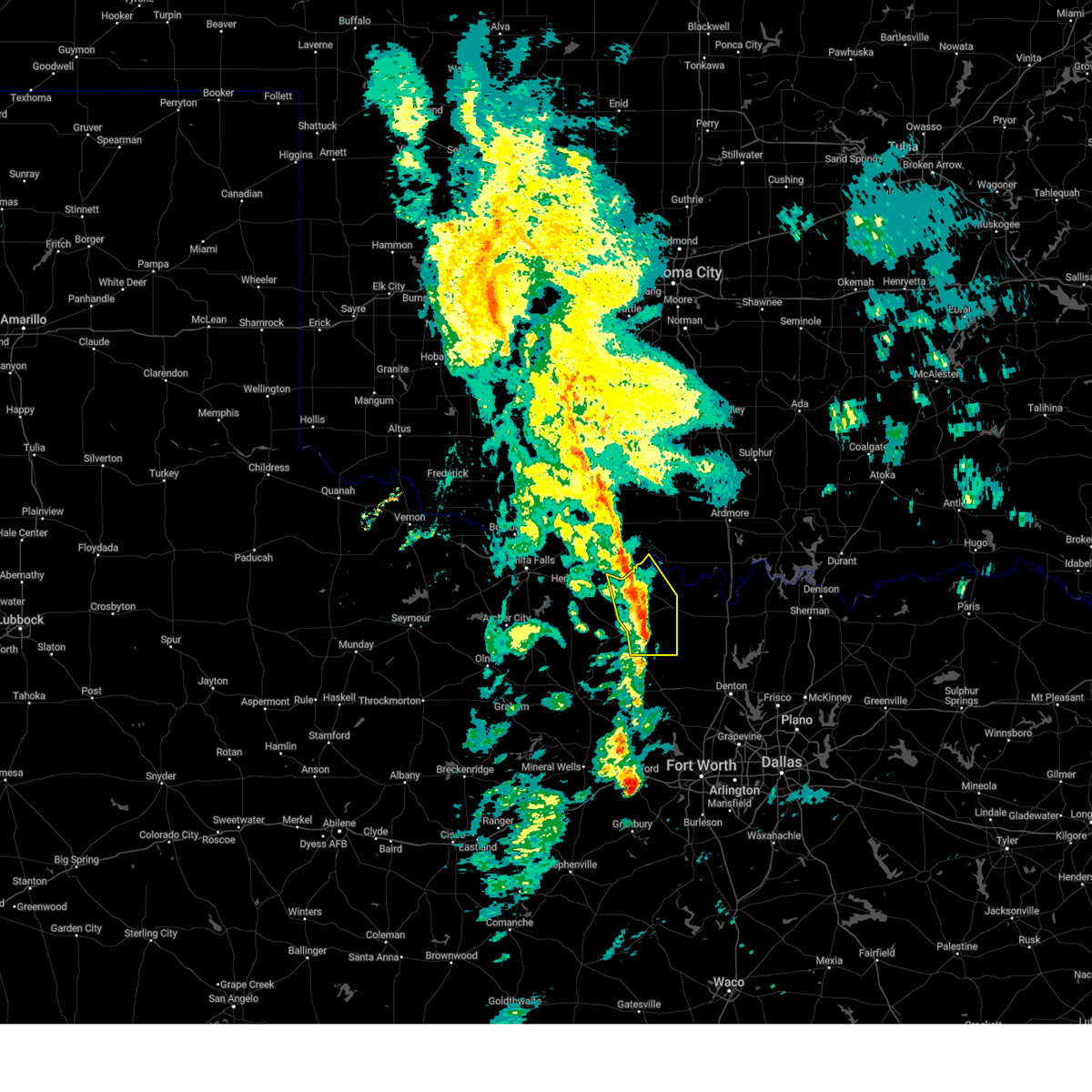
| 5/19/2025 4:34 PM CDT | Softball sized hail reported 7.7 miles WNW of Nocona Hills, TX, 4.5 inch diameter hail 7 miles north of saint jo. |
| 5/19/2025 4:23 PM CDT |
 Svrfwd the national weather service in fort worth has issued a * severe thunderstorm warning for, central montague county in north central texas, northwestern cooke county in north central texas, * until 530 pm cdt. * at 423 pm cdt, a severe thunderstorm was located near nocona, moving northeast at 35 mph (emergency management). Hazards include golf ball size hail and 60 mph wind gusts. People and animals outdoors will be injured. expect hail damage to roofs, siding, windows, and vehicles. expect wind damage to roofs, siding, and trees. This severe thunderstorm will remain over mainly rural areas of central montague and northwestern cooke counties, including the following locations, marysville, spanish fort, sivells bend, belcherville, bulcher, bonita, capps corner, montague, illinois bend, and nocona hills. Svrfwd the national weather service in fort worth has issued a * severe thunderstorm warning for, central montague county in north central texas, northwestern cooke county in north central texas, * until 530 pm cdt. * at 423 pm cdt, a severe thunderstorm was located near nocona, moving northeast at 35 mph (emergency management). Hazards include golf ball size hail and 60 mph wind gusts. People and animals outdoors will be injured. expect hail damage to roofs, siding, windows, and vehicles. expect wind damage to roofs, siding, and trees. This severe thunderstorm will remain over mainly rural areas of central montague and northwestern cooke counties, including the following locations, marysville, spanish fort, sivells bend, belcherville, bulcher, bonita, capps corner, montague, illinois bend, and nocona hills.
|
| 5/19/2025 4:04 PM CDT |
 At 403 pm cdt, a severe thunderstorm was located near terral, or 8 miles northwest of nocona, moving east at 35 mph (radar indicated). Hazards include two inch hail and 65 mph wind gusts. People and animals outdoors will be injured. expect hail damage to roofs, siding, windows, and vehicles. expect wind damage to roofs, siding, and trees. locations impacted include, spanish fort, stoneburg, nocona, belcherville, lake nocona, bonita, capps corner, ringgold, illinois bend, nocona hills, st. Jo, and montague. At 403 pm cdt, a severe thunderstorm was located near terral, or 8 miles northwest of nocona, moving east at 35 mph (radar indicated). Hazards include two inch hail and 65 mph wind gusts. People and animals outdoors will be injured. expect hail damage to roofs, siding, windows, and vehicles. expect wind damage to roofs, siding, and trees. locations impacted include, spanish fort, stoneburg, nocona, belcherville, lake nocona, bonita, capps corner, ringgold, illinois bend, nocona hills, st. Jo, and montague.
|
| 5/19/2025 3:27 PM CDT |
 Svrfwd the national weather service in fort worth has issued a * severe thunderstorm warning for, northern montague county in north central texas, * until 430 pm cdt. * at 325 pm cdt, a severe thunderstorm was located near bluegrove, or near henrietta, moving northeast at 35 mph. an additional severe thunderstorm is located north of nocona along the red river, moving northeast at 35 mph (radar indicated). Hazards include two inch hail and 60 mph wind gusts. People and animals outdoors will be injured. expect hail damage to roofs, siding, windows, and vehicles. expect wind damage to roofs, siding, and trees. This severe thunderstorm will remain over mainly rural areas of northern montague county, including the following locations, spanish fort, stoneburg, belcherville, bonita, capps corner, ringgold, illinois bend, nocona hills, and montague. Svrfwd the national weather service in fort worth has issued a * severe thunderstorm warning for, northern montague county in north central texas, * until 430 pm cdt. * at 325 pm cdt, a severe thunderstorm was located near bluegrove, or near henrietta, moving northeast at 35 mph. an additional severe thunderstorm is located north of nocona along the red river, moving northeast at 35 mph (radar indicated). Hazards include two inch hail and 60 mph wind gusts. People and animals outdoors will be injured. expect hail damage to roofs, siding, windows, and vehicles. expect wind damage to roofs, siding, and trees. This severe thunderstorm will remain over mainly rural areas of northern montague county, including the following locations, spanish fort, stoneburg, belcherville, bonita, capps corner, ringgold, illinois bend, nocona hills, and montague.
|
| 5/19/2025 3:09 PM CDT | At 309 pm cdt, a severe thunderstorm was located near nocona, moving east at 30 mph (radar indicated). Hazards include two inch hail and 65 mph wind gusts. People and animals outdoors will be injured. expect hail damage to roofs, siding, windows, and vehicles. expect wind damage to roofs, siding, and trees. this severe storm will be near, lake nocona and nocona around 315 pm cdt. Other locations impacted by this severe thunderstorm include spanish fort, belcherville, bonita, capps corner, ringgold, nocona hills, and illinois bend. |
| 5/19/2025 2:58 PM CDT |
 At 258 pm cdt, a severe thunderstorm was located 7 miles southeast of terral, or 8 miles west of nocona, moving east at 30 mph. this is a destructive storm along highway 82 from nocona westward (radar indicated). Hazards include baseball size hail and 65 mph wind gusts. People and animals outdoors will be severely injured. expect shattered windows, extensive damage to roofs, siding, and vehicles. this severe storm will be near, nocona around 305 pm cdt. lake nocona around 315 pm cdt. Other locations impacted by this severe thunderstorm include spanish fort, belcherville, bonita, capps corner, ringgold, nocona hills, and illinois bend. At 258 pm cdt, a severe thunderstorm was located 7 miles southeast of terral, or 8 miles west of nocona, moving east at 30 mph. this is a destructive storm along highway 82 from nocona westward (radar indicated). Hazards include baseball size hail and 65 mph wind gusts. People and animals outdoors will be severely injured. expect shattered windows, extensive damage to roofs, siding, and vehicles. this severe storm will be near, nocona around 305 pm cdt. lake nocona around 315 pm cdt. Other locations impacted by this severe thunderstorm include spanish fort, belcherville, bonita, capps corner, ringgold, nocona hills, and illinois bend.
|
| 5/19/2025 2:52 PM CDT |
 At 251 pm cdt, a severe thunderstorm was located 7 miles south of terral, or 12 miles west of nocona, moving east at 30 mph (radar indicated). Hazards include tennis ball size hail and 65 mph wind gusts. People and animals outdoors will be injured. expect hail damage to roofs, siding, windows, and vehicles. expect wind damage to roofs, siding, and trees. this severe storm will be near, nocona around 310 pm cdt. lake nocona around 315 pm cdt. Other locations impacted by this severe thunderstorm include spanish fort, belcherville, bonita, capps corner, ringgold, nocona hills, and illinois bend. At 251 pm cdt, a severe thunderstorm was located 7 miles south of terral, or 12 miles west of nocona, moving east at 30 mph (radar indicated). Hazards include tennis ball size hail and 65 mph wind gusts. People and animals outdoors will be injured. expect hail damage to roofs, siding, windows, and vehicles. expect wind damage to roofs, siding, and trees. this severe storm will be near, nocona around 310 pm cdt. lake nocona around 315 pm cdt. Other locations impacted by this severe thunderstorm include spanish fort, belcherville, bonita, capps corner, ringgold, nocona hills, and illinois bend.
|
| 5/19/2025 2:42 PM CDT |
 At 242 pm cdt, a severe thunderstorm was located 9 miles north of bellevue, or 10 miles east of henrietta, moving east at 30 mph (radar indicated). Hazards include golf ball size hail and 60 mph wind gusts. People and animals outdoors will be injured. expect hail damage to roofs, siding, windows, and vehicles. expect wind damage to roofs, siding, and trees. this severe storm will be near, nocona around 310 pm cdt. lake nocona around 315 pm cdt. Other locations impacted by this severe thunderstorm include spanish fort, belcherville, bonita, capps corner, ringgold, nocona hills, and illinois bend. At 242 pm cdt, a severe thunderstorm was located 9 miles north of bellevue, or 10 miles east of henrietta, moving east at 30 mph (radar indicated). Hazards include golf ball size hail and 60 mph wind gusts. People and animals outdoors will be injured. expect hail damage to roofs, siding, windows, and vehicles. expect wind damage to roofs, siding, and trees. this severe storm will be near, nocona around 310 pm cdt. lake nocona around 315 pm cdt. Other locations impacted by this severe thunderstorm include spanish fort, belcherville, bonita, capps corner, ringgold, nocona hills, and illinois bend.
|
| 5/19/2025 2:33 PM CDT |
 Svrfwd the national weather service in fort worth has issued a * severe thunderstorm warning for, northern montague county in north central texas, * until 330 pm cdt. * at 233 pm cdt, a severe thunderstorm was located near henrietta, moving east at 30 mph (radar indicated). Hazards include ping pong ball size hail and 60 mph wind gusts. People and animals outdoors will be injured. expect hail damage to roofs, siding, windows, and vehicles. expect wind damage to roofs, siding, and trees. this severe thunderstorm will be near, nocona around 310 pm cdt. lake nocona around 320 pm cdt. Other locations impacted by this severe thunderstorm include spanish fort, belcherville, bonita, capps corner, ringgold, nocona hills, and illinois bend. Svrfwd the national weather service in fort worth has issued a * severe thunderstorm warning for, northern montague county in north central texas, * until 330 pm cdt. * at 233 pm cdt, a severe thunderstorm was located near henrietta, moving east at 30 mph (radar indicated). Hazards include ping pong ball size hail and 60 mph wind gusts. People and animals outdoors will be injured. expect hail damage to roofs, siding, windows, and vehicles. expect wind damage to roofs, siding, and trees. this severe thunderstorm will be near, nocona around 310 pm cdt. lake nocona around 320 pm cdt. Other locations impacted by this severe thunderstorm include spanish fort, belcherville, bonita, capps corner, ringgold, nocona hills, and illinois bend.
|
| 5/17/2025 6:34 PM CDT |
 At 632 pm cdt, severe thunderstorms were located along a line extending from near sunset to st. jo to near thackerville, moving northeast at 45 mph (emergency management. at 631 pm cdt...quarter size hail was reported in muenster with these storms). Hazards include 65 mph wind gusts and half dollar size hail. Hail damage to vehicles is expected. expect wind damage to roofs, siding, and trees. locations impacted include, st. Jo, rosston, lake nocona, bulcher, park springs, capps corner, crafton, nocona hills, bowie, hubert h moss lake, hood, myra, prairie point, alvord, nocona, greenwood, fruitland, montague, muenster, and forestburg. At 632 pm cdt, severe thunderstorms were located along a line extending from near sunset to st. jo to near thackerville, moving northeast at 45 mph (emergency management. at 631 pm cdt...quarter size hail was reported in muenster with these storms). Hazards include 65 mph wind gusts and half dollar size hail. Hail damage to vehicles is expected. expect wind damage to roofs, siding, and trees. locations impacted include, st. Jo, rosston, lake nocona, bulcher, park springs, capps corner, crafton, nocona hills, bowie, hubert h moss lake, hood, myra, prairie point, alvord, nocona, greenwood, fruitland, montague, muenster, and forestburg.
|
| 5/17/2025 6:26 PM CDT |
 Svrfwd the national weather service in fort worth has issued a * severe thunderstorm warning for, montague county in north central texas, northern wise county in north central texas, northwestern denton county in north central texas, western cooke county in north central texas, * until 730 pm cdt. * at 625 pm cdt, severe thunderstorms were located along a line extending from near lake amon carter to st. jo to near lindsay, moving northeast at 45 mph (radar indicated). Hazards include 60 mph wind gusts and quarter size hail. Hail damage to vehicles is expected. Expect wind damage to roofs, siding, and trees. Svrfwd the national weather service in fort worth has issued a * severe thunderstorm warning for, montague county in north central texas, northern wise county in north central texas, northwestern denton county in north central texas, western cooke county in north central texas, * until 730 pm cdt. * at 625 pm cdt, severe thunderstorms were located along a line extending from near lake amon carter to st. jo to near lindsay, moving northeast at 45 mph (radar indicated). Hazards include 60 mph wind gusts and quarter size hail. Hail damage to vehicles is expected. Expect wind damage to roofs, siding, and trees.
|
| 5/2/2025 3:41 AM CDT |
 At 341 am cdt, a severe thunderstorm was located near lake nocona, or near nocona, moving southeast at 45 mph (radar indicated). Hazards include 65 mph wind gusts and quarter size hail. Hail damage to vehicles is expected. expect wind damage to roofs, siding, and trees. this severe storm will be near, st. jo around 350 am cdt. Other locations impacted by this severe thunderstorm include spanish fort, stoneburg, belcherville, mallard, fruitland, bonita, capps corner, montague, ringgold, and forestburg. At 341 am cdt, a severe thunderstorm was located near lake nocona, or near nocona, moving southeast at 45 mph (radar indicated). Hazards include 65 mph wind gusts and quarter size hail. Hail damage to vehicles is expected. expect wind damage to roofs, siding, and trees. this severe storm will be near, st. jo around 350 am cdt. Other locations impacted by this severe thunderstorm include spanish fort, stoneburg, belcherville, mallard, fruitland, bonita, capps corner, montague, ringgold, and forestburg.
|
| 5/2/2025 3:18 AM CDT |
 Svrfwd the national weather service in fort worth has issued a * severe thunderstorm warning for, montague county in north central texas, * until 415 am cdt. * at 318 am cdt, a severe thunderstorm was located over terral, or 14 miles northwest of nocona, moving southeast at 35 mph (radar indicated). Hazards include 65 mph wind gusts and quarter size hail. Hail damage to vehicles is expected. expect wind damage to roofs, siding, and trees. this severe thunderstorm will be near, nocona around 335 am cdt. st. jo around 400 am cdt. Other locations impacted by this severe thunderstorm include spanish fort, stoneburg, belcherville, mallard, fruitland, bonita, capps corner, montague, ringgold, and forestburg. Svrfwd the national weather service in fort worth has issued a * severe thunderstorm warning for, montague county in north central texas, * until 415 am cdt. * at 318 am cdt, a severe thunderstorm was located over terral, or 14 miles northwest of nocona, moving southeast at 35 mph (radar indicated). Hazards include 65 mph wind gusts and quarter size hail. Hail damage to vehicles is expected. expect wind damage to roofs, siding, and trees. this severe thunderstorm will be near, nocona around 335 am cdt. st. jo around 400 am cdt. Other locations impacted by this severe thunderstorm include spanish fort, stoneburg, belcherville, mallard, fruitland, bonita, capps corner, montague, ringgold, and forestburg.
|
| 4/29/2025 9:51 PM CDT |
 The storm which prompted the warning has weakened below severe limits. therefore the warning will be allowed to expire. however gusty winds and heavy rain are still possible with this thunderstorm. a tornado watch remains in effect until 100 am cdt for north central texas. The storm which prompted the warning has weakened below severe limits. therefore the warning will be allowed to expire. however gusty winds and heavy rain are still possible with this thunderstorm. a tornado watch remains in effect until 100 am cdt for north central texas.
|
| 4/29/2025 9:24 PM CDT |
 At 923 pm cdt, a severe thunderstorm was located 8 miles southwest of nocona, moving east at 30 mph (radar indicated). Hazards include 70 mph wind gusts and quarter size hail. Hail damage to vehicles is expected. expect considerable tree damage. wind damage is also likely to mobile homes, roofs, and outbuildings. this severe storm will be near, st. jo around 945 pm cdt. Other locations impacted by this severe thunderstorm include fruitland, bulcher, capps corner, montague, ringgold, forestburg, illinois bend, nocona hills, marysville, and spanish fort. At 923 pm cdt, a severe thunderstorm was located 8 miles southwest of nocona, moving east at 30 mph (radar indicated). Hazards include 70 mph wind gusts and quarter size hail. Hail damage to vehicles is expected. expect considerable tree damage. wind damage is also likely to mobile homes, roofs, and outbuildings. this severe storm will be near, st. jo around 945 pm cdt. Other locations impacted by this severe thunderstorm include fruitland, bulcher, capps corner, montague, ringgold, forestburg, illinois bend, nocona hills, marysville, and spanish fort.
|
| 4/29/2025 8:47 PM CDT |
 Svrfwd the national weather service in fort worth has issued a * severe thunderstorm warning for, montague county in north central texas, northwestern cooke county in north central texas, * until 1000 pm cdt. * at 845 pm cdt, a severe thunderstorm was located near bellevue, or 10 miles southeast of henrietta, moving east at 40 mph (radar indicated). Hazards include 65 mph wind gusts and quarter size hail. Hail damage to vehicles is expected. expect wind damage to roofs, siding, and trees. this severe thunderstorm will be near, nocona around 905 pm cdt. Other locations impacted by this severe thunderstorm include fruitland, bulcher, capps corner, montague, ringgold, forestburg, illinois bend, nocona hills, marysville, and spanish fort. Svrfwd the national weather service in fort worth has issued a * severe thunderstorm warning for, montague county in north central texas, northwestern cooke county in north central texas, * until 1000 pm cdt. * at 845 pm cdt, a severe thunderstorm was located near bellevue, or 10 miles southeast of henrietta, moving east at 40 mph (radar indicated). Hazards include 65 mph wind gusts and quarter size hail. Hail damage to vehicles is expected. expect wind damage to roofs, siding, and trees. this severe thunderstorm will be near, nocona around 905 pm cdt. Other locations impacted by this severe thunderstorm include fruitland, bulcher, capps corner, montague, ringgold, forestburg, illinois bend, nocona hills, marysville, and spanish fort.
|
| 4/19/2025 9:35 PM CDT | The storm which prompted the warning has moved out of the area. therefore the warning will be allowed to expire. a tornado watch remains in effect until midnight cdt for north central texas. |
| 4/19/2025 9:26 PM CDT | At 925 pm cdt, a severe thunderstorm was located near lake nocona, or 10 miles east of nocona, moving northeast at 30 mph (radar indicated). Hazards include 70 mph wind gusts and ping pong ball size hail. People and animals outdoors will be injured. expect hail damage to roofs, siding, windows, and vehicles. expect considerable tree damage. wind damage is also likely to mobile homes, roofs, and outbuildings. Locations impacted include, bonita, capps corner, lake nocona, nocona hills, and illinois bend. |
| 4/19/2025 9:25 PM CDT | Svrfwd the national weather service in fort worth has issued a * severe thunderstorm warning for, northeastern montague county in north central texas, northwestern cooke county in north central texas, * until 1030 pm cdt. * at 924 pm cdt, a severe thunderstorm was located near leon, or 14 miles east of nocona, moving northeast at 35 mph (radar indicated). Hazards include 70 mph wind gusts and ping pong ball size hail. People and animals outdoors will be injured. expect hail damage to roofs, siding, windows, and vehicles. expect considerable tree damage. wind damage is also likely to mobile homes, roofs, and outbuildings. This severe thunderstorm will remain over mainly rural areas of northeastern montague and northwestern cooke counties, including the following locations, marysville, sivells bend, bulcher, bonita, capps corner, illinois bend, and nocona hills. |
| 4/19/2025 9:15 PM CDT | At 915 pm cdt, a severe thunderstorm was located near nocona, moving northeast at 30 mph (radar indicated). Hazards include ping pong ball size hail and 65 mph wind gusts. People and animals outdoors will be injured. expect hail damage to roofs, siding, windows, and vehicles. expect wind damage to roofs, siding, and trees. This severe thunderstorm will remain over mainly rural areas of northeastern montague county, including the following locations, spanish fort, bonita, capps corner, montague, nocona hills, illinois bend, and belcherville. |
| 4/19/2025 8:58 PM CDT |
 At 857 pm cdt, a severe thunderstorm was located near nocona, moving northeast at 25 mph (radar indicated). Hazards include golf ball size hail and 65 mph wind gusts. People and animals outdoors will be injured. expect hail damage to roofs, siding, windows, and vehicles. expect wind damage to roofs, siding, and trees. this severe storm will be near, nocona around 905 pm cdt. lake nocona around 915 pm cdt. Other locations impacted by this severe thunderstorm include spanish fort, belcherville, bonita, capps corner, montague, nocona hills, and illinois bend. At 857 pm cdt, a severe thunderstorm was located near nocona, moving northeast at 25 mph (radar indicated). Hazards include golf ball size hail and 65 mph wind gusts. People and animals outdoors will be injured. expect hail damage to roofs, siding, windows, and vehicles. expect wind damage to roofs, siding, and trees. this severe storm will be near, nocona around 905 pm cdt. lake nocona around 915 pm cdt. Other locations impacted by this severe thunderstorm include spanish fort, belcherville, bonita, capps corner, montague, nocona hills, and illinois bend.
|
| 4/19/2025 8:40 PM CDT |
 Svrfwd the national weather service in fort worth has issued a * severe thunderstorm warning for, montague county in north central texas, * until 945 pm cdt. * at 840 pm cdt, a severe thunderstorm was located near bellevue, or 7 miles northwest of bowie, moving northeast at 30 mph (radar indicated). Hazards include golf ball size hail and 60 mph wind gusts. People and animals outdoors will be injured. expect hail damage to roofs, siding, windows, and vehicles. expect wind damage to roofs, siding, and trees. this severe thunderstorm will be near, nocona around 900 pm cdt. lake nocona around 910 pm cdt. Other locations impacted by this severe thunderstorm include spanish fort, stoneburg, belcherville, bonita, capps corner, montague, ringgold, nocona hills, and illinois bend. Svrfwd the national weather service in fort worth has issued a * severe thunderstorm warning for, montague county in north central texas, * until 945 pm cdt. * at 840 pm cdt, a severe thunderstorm was located near bellevue, or 7 miles northwest of bowie, moving northeast at 30 mph (radar indicated). Hazards include golf ball size hail and 60 mph wind gusts. People and animals outdoors will be injured. expect hail damage to roofs, siding, windows, and vehicles. expect wind damage to roofs, siding, and trees. this severe thunderstorm will be near, nocona around 900 pm cdt. lake nocona around 910 pm cdt. Other locations impacted by this severe thunderstorm include spanish fort, stoneburg, belcherville, bonita, capps corner, montague, ringgold, nocona hills, and illinois bend.
|
| 4/19/2025 8:09 PM CDT |
 At 809 pm cdt, a severe thunderstorm capable of producing a tornado was located near leon, or 13 miles northeast of nocona, moving northeast at 30 mph (radar indicated rotation). Hazards include tornado and golf ball size hail. Flying debris will be dangerous to those caught without shelter. mobile homes will be damaged or destroyed. damage to roofs, windows, and vehicles will occur. tree damage is likely. Locations impacted include, bulcher, spanish fort, capps corner, lake nocona, illinois bend, and nocona hills. At 809 pm cdt, a severe thunderstorm capable of producing a tornado was located near leon, or 13 miles northeast of nocona, moving northeast at 30 mph (radar indicated rotation). Hazards include tornado and golf ball size hail. Flying debris will be dangerous to those caught without shelter. mobile homes will be damaged or destroyed. damage to roofs, windows, and vehicles will occur. tree damage is likely. Locations impacted include, bulcher, spanish fort, capps corner, lake nocona, illinois bend, and nocona hills.
|
| 4/19/2025 8:01 PM CDT |
 At 801 pm cdt, a severe thunderstorm capable of producing a tornado was located near lake nocona, or 9 miles east of nocona, moving northeast at 30 mph (radar indicated rotation). Hazards include tornado and golf ball size hail. Flying debris will be dangerous to those caught without shelter. mobile homes will be damaged or destroyed. damage to roofs, windows, and vehicles will occur. tree damage is likely. locations impacted include, spanish fort, lake nocona, bulcher, bonita, capps corner, illinois bend, nocona hills, and st. Jo. At 801 pm cdt, a severe thunderstorm capable of producing a tornado was located near lake nocona, or 9 miles east of nocona, moving northeast at 30 mph (radar indicated rotation). Hazards include tornado and golf ball size hail. Flying debris will be dangerous to those caught without shelter. mobile homes will be damaged or destroyed. damage to roofs, windows, and vehicles will occur. tree damage is likely. locations impacted include, spanish fort, lake nocona, bulcher, bonita, capps corner, illinois bend, nocona hills, and st. Jo.
|
| 4/19/2025 7:53 PM CDT |
 Torfwd the national weather service in fort worth has issued a * tornado warning for, northeastern montague county in north central texas, northwestern cooke county in north central texas, * until 830 pm cdt. * at 752 pm cdt, a severe thunderstorm capable of producing a tornado was located near st. jo, or 7 miles east of nocona, moving northeast at 30 mph (radar indicated rotation). Hazards include tornado and golf ball size hail. Flying debris will be dangerous to those caught without shelter. mobile homes will be damaged or destroyed. damage to roofs, windows, and vehicles will occur. tree damage is likely. This tornadic thunderstorm will remain over mainly rural areas of northeastern montague and northwestern cooke counties, including the following locations, bulcher, spanish fort, bonita, capps corner, illinois bend, and nocona hills. Torfwd the national weather service in fort worth has issued a * tornado warning for, northeastern montague county in north central texas, northwestern cooke county in north central texas, * until 830 pm cdt. * at 752 pm cdt, a severe thunderstorm capable of producing a tornado was located near st. jo, or 7 miles east of nocona, moving northeast at 30 mph (radar indicated rotation). Hazards include tornado and golf ball size hail. Flying debris will be dangerous to those caught without shelter. mobile homes will be damaged or destroyed. damage to roofs, windows, and vehicles will occur. tree damage is likely. This tornadic thunderstorm will remain over mainly rural areas of northeastern montague and northwestern cooke counties, including the following locations, bulcher, spanish fort, bonita, capps corner, illinois bend, and nocona hills.
|
| 4/19/2025 7:41 PM CDT |
 At 741 pm cdt, a severe thunderstorm capable of producing a tornado was located near st. jo, or 7 miles southeast of nocona, moving northeast at 40 mph (radar indicated rotation). Hazards include tornado and golf ball size hail. Flying debris will be dangerous to those caught without shelter. mobile homes will be damaged or destroyed. damage to roofs, windows, and vehicles will occur. tree damage is likely. locations impacted include, st. Jo, lake muenster, nocona, bulcher, bonita, capps corner, montague, illinois bend, nocona hills, and muenster. At 741 pm cdt, a severe thunderstorm capable of producing a tornado was located near st. jo, or 7 miles southeast of nocona, moving northeast at 40 mph (radar indicated rotation). Hazards include tornado and golf ball size hail. Flying debris will be dangerous to those caught without shelter. mobile homes will be damaged or destroyed. damage to roofs, windows, and vehicles will occur. tree damage is likely. locations impacted include, st. Jo, lake muenster, nocona, bulcher, bonita, capps corner, montague, illinois bend, nocona hills, and muenster.
|
| 4/19/2025 7:30 PM CDT |
 At 730 pm cdt, a confirmed tornado was located 9 miles south of nocona, moving northeast at 40 mph (emergency management confirmed tornado). Hazards include damaging tornado and golf ball size hail. Flying debris will be dangerous to those caught without shelter. mobile homes will be damaged or destroyed. damage to roofs, windows, and vehicles will occur. tree damage is likely. locations impacted include, st. Jo, lake muenster, nocona, bulcher, bonita, capps corner, montague, illinois bend, nocona hills, and muenster. At 730 pm cdt, a confirmed tornado was located 9 miles south of nocona, moving northeast at 40 mph (emergency management confirmed tornado). Hazards include damaging tornado and golf ball size hail. Flying debris will be dangerous to those caught without shelter. mobile homes will be damaged or destroyed. damage to roofs, windows, and vehicles will occur. tree damage is likely. locations impacted include, st. Jo, lake muenster, nocona, bulcher, bonita, capps corner, montague, illinois bend, nocona hills, and muenster.
|
| 4/19/2025 7:20 PM CDT |
 At 719 pm cdt, a severe thunderstorm capable of producing a tornado was located near bowie, moving northeast at 20 mph (radar indicated rotation). Hazards include tornado and golf ball size hail. Flying debris will be dangerous to those caught without shelter. mobile homes will be damaged or destroyed. damage to roofs, windows, and vehicles will occur. tree damage is likely. This tornadic thunderstorm will remain over mainly rural areas of southeastern montague and west central cooke counties, including the following locations, mallard, fruitland, bulcher, bonita, capps corner, montague, illinois bend, and nocona hills. At 719 pm cdt, a severe thunderstorm capable of producing a tornado was located near bowie, moving northeast at 20 mph (radar indicated rotation). Hazards include tornado and golf ball size hail. Flying debris will be dangerous to those caught without shelter. mobile homes will be damaged or destroyed. damage to roofs, windows, and vehicles will occur. tree damage is likely. This tornadic thunderstorm will remain over mainly rural areas of southeastern montague and west central cooke counties, including the following locations, mallard, fruitland, bulcher, bonita, capps corner, montague, illinois bend, and nocona hills.
|
| 4/19/2025 7:11 PM CDT |
 Torfwd the national weather service in fort worth has issued a * tornado warning for, central montague county in north central texas, west central cooke county in north central texas, * until 800 pm cdt. * at 711 pm cdt, a severe thunderstorm capable of producing a tornado was located near bowie, moving northeast at 35 mph (radar indicated rotation). Hazards include tornado and ping pong ball size hail. Flying debris will be dangerous to those caught without shelter. mobile homes will be damaged or destroyed. damage to roofs, windows, and vehicles will occur. tree damage is likely. this dangerous storm will be near, st. jo around 735 pm cdt. Other locations impacted by this tornadic thunderstorm include mallard, fruitland, bulcher, bonita, capps corner, montague, illinois bend, and nocona hills. Torfwd the national weather service in fort worth has issued a * tornado warning for, central montague county in north central texas, west central cooke county in north central texas, * until 800 pm cdt. * at 711 pm cdt, a severe thunderstorm capable of producing a tornado was located near bowie, moving northeast at 35 mph (radar indicated rotation). Hazards include tornado and ping pong ball size hail. Flying debris will be dangerous to those caught without shelter. mobile homes will be damaged or destroyed. damage to roofs, windows, and vehicles will occur. tree damage is likely. this dangerous storm will be near, st. jo around 735 pm cdt. Other locations impacted by this tornadic thunderstorm include mallard, fruitland, bulcher, bonita, capps corner, montague, illinois bend, and nocona hills.
|
| 4/18/2025 10:25 PM CDT |
 the severe thunderstorm warning has been cancelled and is no longer in effect the severe thunderstorm warning has been cancelled and is no longer in effect
|
| 4/18/2025 10:18 PM CDT |
 At 1018 pm cdt, a severe thunderstorm was located near lake nocona, or 10 miles northeast of nocona, moving northeast at 35 mph (radar indicated). Hazards include 70 mph wind gusts and quarter size hail. Hail damage to vehicles is expected. expect considerable tree damage. wind damage is also likely to mobile homes, roofs, and outbuildings. This severe thunderstorm will remain over mainly rural areas of northeastern montague and northwestern cooke counties, including the following locations, bulcher, spanish fort, bonita, capps corner, illinois bend, and nocona hills. At 1018 pm cdt, a severe thunderstorm was located near lake nocona, or 10 miles northeast of nocona, moving northeast at 35 mph (radar indicated). Hazards include 70 mph wind gusts and quarter size hail. Hail damage to vehicles is expected. expect considerable tree damage. wind damage is also likely to mobile homes, roofs, and outbuildings. This severe thunderstorm will remain over mainly rural areas of northeastern montague and northwestern cooke counties, including the following locations, bulcher, spanish fort, bonita, capps corner, illinois bend, and nocona hills.
|
| 4/18/2025 10:07 PM CDT |
 At 1006 pm cdt, a severe thunderstorm was located near nocona, moving northeast at 50 mph (radar indicated). Hazards include ping pong ball size hail and 60 mph wind gusts. People and animals outdoors will be injured. expect hail damage to roofs, siding, windows, and vehicles. expect wind damage to roofs, siding, and trees. this severe storm will be near, lake nocona around 1010 pm cdt. Other locations impacted by this severe thunderstorm include bulcher, spanish fort, bonita, capps corner, illinois bend, and nocona hills. At 1006 pm cdt, a severe thunderstorm was located near nocona, moving northeast at 50 mph (radar indicated). Hazards include ping pong ball size hail and 60 mph wind gusts. People and animals outdoors will be injured. expect hail damage to roofs, siding, windows, and vehicles. expect wind damage to roofs, siding, and trees. this severe storm will be near, lake nocona around 1010 pm cdt. Other locations impacted by this severe thunderstorm include bulcher, spanish fort, bonita, capps corner, illinois bend, and nocona hills.
|
| 4/18/2025 9:47 PM CDT |
 Svrfwd the national weather service in fort worth has issued a * severe thunderstorm warning for, montague county in north central texas, northwestern cooke county in north central texas, * until 1045 pm cdt. * at 947 pm cdt, a severe thunderstorm was located near bowie, moving northeast at 35 mph (radar indicated). Hazards include ping pong ball size hail and 60 mph wind gusts. People and animals outdoors will be injured. expect hail damage to roofs, siding, windows, and vehicles. expect wind damage to roofs, siding, and trees. this severe thunderstorm will be near, bowie around 950 pm cdt. nocona around 1005 pm cdt. lake nocona around 1015 pm cdt. Other locations impacted by this severe thunderstorm include spanish fort, stoneburg, belcherville, bulcher, bonita, capps corner, montague, ringgold, illinois bend, and nocona hills. Svrfwd the national weather service in fort worth has issued a * severe thunderstorm warning for, montague county in north central texas, northwestern cooke county in north central texas, * until 1045 pm cdt. * at 947 pm cdt, a severe thunderstorm was located near bowie, moving northeast at 35 mph (radar indicated). Hazards include ping pong ball size hail and 60 mph wind gusts. People and animals outdoors will be injured. expect hail damage to roofs, siding, windows, and vehicles. expect wind damage to roofs, siding, and trees. this severe thunderstorm will be near, bowie around 950 pm cdt. nocona around 1005 pm cdt. lake nocona around 1015 pm cdt. Other locations impacted by this severe thunderstorm include spanish fort, stoneburg, belcherville, bulcher, bonita, capps corner, montague, ringgold, illinois bend, and nocona hills.
|
| 4/3/2025 4:22 AM CDT |
 Svrfwd the national weather service in fort worth has issued a * severe thunderstorm warning for, montague county in north central texas, northern wise county in north central texas, cooke county in north central texas, * until 530 am cdt. * at 422 am cdt, a severe thunderstorm was located over newport, or 12 miles southwest of bowie, moving northeast at 55 mph (radar indicated). Hazards include golf ball size hail and 60 mph wind gusts. People and animals outdoors will be injured. expect hail damage to roofs, siding, windows, and vehicles. expect wind damage to roofs, siding, and trees. this severe thunderstorm will be near, lake amon g carter around 425 am cdt. bowie and sunset around 430 am cdt. lake muenster and muenster around 500 am cdt. lindsay and gainesville around 510 am cdt. hubert h moss lake around 515 am cdt. other locations impacted by this severe thunderstorm include prairie point, rosston, valley view, fruitland, lois, bulcher, park springs, capps corner, montague, and crafton. This includes interstate 35 between mile markers 482 and 503. Svrfwd the national weather service in fort worth has issued a * severe thunderstorm warning for, montague county in north central texas, northern wise county in north central texas, cooke county in north central texas, * until 530 am cdt. * at 422 am cdt, a severe thunderstorm was located over newport, or 12 miles southwest of bowie, moving northeast at 55 mph (radar indicated). Hazards include golf ball size hail and 60 mph wind gusts. People and animals outdoors will be injured. expect hail damage to roofs, siding, windows, and vehicles. expect wind damage to roofs, siding, and trees. this severe thunderstorm will be near, lake amon g carter around 425 am cdt. bowie and sunset around 430 am cdt. lake muenster and muenster around 500 am cdt. lindsay and gainesville around 510 am cdt. hubert h moss lake around 515 am cdt. other locations impacted by this severe thunderstorm include prairie point, rosston, valley view, fruitland, lois, bulcher, park springs, capps corner, montague, and crafton. This includes interstate 35 between mile markers 482 and 503.
|
| 3/4/2025 4:46 AM CST |
 Svrfwd the national weather service in fort worth has issued a * severe thunderstorm warning for, eastern montague county in north central texas, cooke county in north central texas, grayson county in north central texas, * until 545 am cst. * at 445 am cst, severe thunderstorms were located along a line extending from near lake nocona to 9 miles northeast of alvord, moving east at 55 mph (radar indicated). Hazards include 60 mph wind gusts and quarter size hail. Hail damage to vehicles is expected. expect wind damage to roofs, siding, and trees. severe thunderstorms will be near, st. jo around 450 am cst. lake muenster and muenster around 455 am cst. lindsay, gainesville, and hubert h moss lake around 505 am cst. lake texoma around 515 am cst. lake kiowa and callisburg around 520 am cst. lake texoma, collinsville, and whitesboro around 525 am cst. pottsboro around 535 am cst. dorchester around 540 am cst. other locations impacted by these severe thunderstorms include preston, tioga, rosston, valley view, bulcher, sadler, elmont, capps corner, locust, and lake ray roberts. This includes interstate 35 between mile markers 482 and 503. Svrfwd the national weather service in fort worth has issued a * severe thunderstorm warning for, eastern montague county in north central texas, cooke county in north central texas, grayson county in north central texas, * until 545 am cst. * at 445 am cst, severe thunderstorms were located along a line extending from near lake nocona to 9 miles northeast of alvord, moving east at 55 mph (radar indicated). Hazards include 60 mph wind gusts and quarter size hail. Hail damage to vehicles is expected. expect wind damage to roofs, siding, and trees. severe thunderstorms will be near, st. jo around 450 am cst. lake muenster and muenster around 455 am cst. lindsay, gainesville, and hubert h moss lake around 505 am cst. lake texoma around 515 am cst. lake kiowa and callisburg around 520 am cst. lake texoma, collinsville, and whitesboro around 525 am cst. pottsboro around 535 am cst. dorchester around 540 am cst. other locations impacted by these severe thunderstorms include preston, tioga, rosston, valley view, bulcher, sadler, elmont, capps corner, locust, and lake ray roberts. This includes interstate 35 between mile markers 482 and 503.
|
| 3/4/2025 4:24 AM CST |
 At 424 am cst, a severe thunderstorm was located near bowie, moving northeast at 65 mph (radar indicated). Hazards include 60 mph wind gusts and quarter size hail. Hail damage to vehicles is expected. expect wind damage to roofs, siding, and trees. this severe storm will be near, bowie around 430 am cst. nocona around 440 am cst. Other locations impacted by this severe thunderstorm include fruitland, bulcher, capps corner, montague, ringgold, illinois bend, nocona hills, marysville, spanish fort, and stoneburg. At 424 am cst, a severe thunderstorm was located near bowie, moving northeast at 65 mph (radar indicated). Hazards include 60 mph wind gusts and quarter size hail. Hail damage to vehicles is expected. expect wind damage to roofs, siding, and trees. this severe storm will be near, bowie around 430 am cst. nocona around 440 am cst. Other locations impacted by this severe thunderstorm include fruitland, bulcher, capps corner, montague, ringgold, illinois bend, nocona hills, marysville, spanish fort, and stoneburg.
|
| 3/4/2025 4:04 AM CST |
 At 404 am cst, a severe thunderstorm was located near nocona, moving northeast at 60 mph (radar indicated). Hazards include 60 mph wind gusts and quarter size hail. Hail damage to vehicles is expected. expect wind damage to roofs, siding, and trees. This severe thunderstorm will remain over mainly rural areas of montague and northwestern cooke counties, including the following locations, fruitland, bulcher, capps corner, montague, ringgold, illinois bend, nocona hills, marysville, spanish fort, and stoneburg. At 404 am cst, a severe thunderstorm was located near nocona, moving northeast at 60 mph (radar indicated). Hazards include 60 mph wind gusts and quarter size hail. Hail damage to vehicles is expected. expect wind damage to roofs, siding, and trees. This severe thunderstorm will remain over mainly rural areas of montague and northwestern cooke counties, including the following locations, fruitland, bulcher, capps corner, montague, ringgold, illinois bend, nocona hills, marysville, spanish fort, and stoneburg.
|
| 3/4/2025 3:45 AM CST |
 Svrfwd the national weather service in fort worth has issued a * severe thunderstorm warning for, montague county in north central texas, northwestern cooke county in north central texas, * until 445 am cst. * at 345 am cst, a severe thunderstorm was located near lake amon g carter, or near bowie, moving northeast at 55 mph (radar indicated). Hazards include 60 mph wind gusts and quarter size hail. Hail damage to vehicles is expected. expect wind damage to roofs, siding, and trees. this severe thunderstorm will be near, bowie and lake amon g carter around 350 am cst. st. jo around 410 am cst. Other locations impacted by this severe thunderstorm include fruitland, bulcher, capps corner, montague, ringgold, illinois bend, nocona hills, marysville, spanish fort, and stoneburg. Svrfwd the national weather service in fort worth has issued a * severe thunderstorm warning for, montague county in north central texas, northwestern cooke county in north central texas, * until 445 am cst. * at 345 am cst, a severe thunderstorm was located near lake amon g carter, or near bowie, moving northeast at 55 mph (radar indicated). Hazards include 60 mph wind gusts and quarter size hail. Hail damage to vehicles is expected. expect wind damage to roofs, siding, and trees. this severe thunderstorm will be near, bowie and lake amon g carter around 350 am cst. st. jo around 410 am cst. Other locations impacted by this severe thunderstorm include fruitland, bulcher, capps corner, montague, ringgold, illinois bend, nocona hills, marysville, spanish fort, and stoneburg.
|
| 11/8/2024 3:13 PM CST |
 the severe thunderstorm warning has been cancelled and is no longer in effect the severe thunderstorm warning has been cancelled and is no longer in effect
|
| 11/8/2024 3:02 PM CST |
 the severe thunderstorm warning has been cancelled and is no longer in effect the severe thunderstorm warning has been cancelled and is no longer in effect
|
| 11/8/2024 3:02 PM CST |
 At 302 pm cst, a severe thunderstorm was located near bowie, moving northeast at 35 mph (radar indicated). Hazards include 60 mph wind gusts. Expect damage to roofs, siding, and trees. this severe storm will be near, st. jo around 320 pm cst. Other locations impacted by this severe thunderstorm include belcherville, mallard, fruitland, bonita, montague, forestburg, nocona hills, ringgold, and capps corner. At 302 pm cst, a severe thunderstorm was located near bowie, moving northeast at 35 mph (radar indicated). Hazards include 60 mph wind gusts. Expect damage to roofs, siding, and trees. this severe storm will be near, st. jo around 320 pm cst. Other locations impacted by this severe thunderstorm include belcherville, mallard, fruitland, bonita, montague, forestburg, nocona hills, ringgold, and capps corner.
|
| 11/8/2024 2:48 PM CST |
 At 247 pm cst, a severe thunderstorm was located over lake amon g carter, or near bowie, moving northeast at 30 mph (radar indicated). Hazards include 65 mph wind gusts. Expect damage to roofs, siding, and trees. this severe storm will be near, bowie around 255 pm cst. st. jo around 325 pm cst. Other locations impacted by this severe thunderstorm include stoneburg, belcherville, mallard, fruitland, bonita, park springs, montague, crafton, forestburg, and ringgold. At 247 pm cst, a severe thunderstorm was located over lake amon g carter, or near bowie, moving northeast at 30 mph (radar indicated). Hazards include 65 mph wind gusts. Expect damage to roofs, siding, and trees. this severe storm will be near, bowie around 255 pm cst. st. jo around 325 pm cst. Other locations impacted by this severe thunderstorm include stoneburg, belcherville, mallard, fruitland, bonita, park springs, montague, crafton, forestburg, and ringgold.
|
| 11/8/2024 2:48 PM CST |
 the severe thunderstorm warning has been cancelled and is no longer in effect the severe thunderstorm warning has been cancelled and is no longer in effect
|
| 11/8/2024 2:28 PM CST |
 Svrfwd the national weather service in fort worth has issued a * severe thunderstorm warning for, montague county in north central texas, northwestern wise county in north central texas, northeastern jack county in north central texas, * until 330 pm cst. * at 228 pm cst, a severe thunderstorm was located near newport, or 12 miles southwest of bowie, moving northeast at 35 mph (radar indicated). Hazards include 65 mph wind gusts. Expect damage to roofs, siding, and trees. this severe thunderstorm will be near, lake amon g carter around 235 pm cst. bowie around 240 pm cst. st. jo around 315 pm cst. Other locations impacted by this severe thunderstorm include cundiff, fruitland, park springs, montague, crafton, forestburg, ringgold, nocona hills, stoneburg, and belcherville. Svrfwd the national weather service in fort worth has issued a * severe thunderstorm warning for, montague county in north central texas, northwestern wise county in north central texas, northeastern jack county in north central texas, * until 330 pm cst. * at 228 pm cst, a severe thunderstorm was located near newport, or 12 miles southwest of bowie, moving northeast at 35 mph (radar indicated). Hazards include 65 mph wind gusts. Expect damage to roofs, siding, and trees. this severe thunderstorm will be near, lake amon g carter around 235 pm cst. bowie around 240 pm cst. st. jo around 315 pm cst. Other locations impacted by this severe thunderstorm include cundiff, fruitland, park springs, montague, crafton, forestburg, ringgold, nocona hills, stoneburg, and belcherville.
|
| 11/4/2024 12:32 PM CST |
 At 1231 pm cst, a severe thunderstorm was located near st. jo, moving northeast at 50 mph (radar indicated). Hazards include 60 mph wind gusts and quarter size hail. Hail damage to vehicles is expected. expect wind damage to roofs, siding, and trees. locations impacted include, st. Jo, lake muenster, nocona hills, prairie point, mallard, bulcher, bonita, capps corner, forestburg, and illinois bend. At 1231 pm cst, a severe thunderstorm was located near st. jo, moving northeast at 50 mph (radar indicated). Hazards include 60 mph wind gusts and quarter size hail. Hail damage to vehicles is expected. expect wind damage to roofs, siding, and trees. locations impacted include, st. Jo, lake muenster, nocona hills, prairie point, mallard, bulcher, bonita, capps corner, forestburg, and illinois bend.
|
| 11/4/2024 12:03 PM CST |
 Svrfwd the national weather service in fort worth has issued a * severe thunderstorm warning for, montague county in north central texas, northwestern cooke county in north central texas, * until 1245 pm cst. * at 1203 pm cst, a severe thunderstorm was located 9 miles northeast of bowie, moving northeast at 45 mph (radar indicated). Hazards include 60 mph wind gusts and quarter size hail. Hail damage to vehicles is expected. expect wind damage to roofs, siding, and trees. This severe thunderstorm will remain over mainly rural areas of montague and northwestern cooke counties, including the following locations, spanish fort, prairie point, belcherville, mallard, fruitland, bulcher, bonita, capps corner, montague, and forestburg. Svrfwd the national weather service in fort worth has issued a * severe thunderstorm warning for, montague county in north central texas, northwestern cooke county in north central texas, * until 1245 pm cst. * at 1203 pm cst, a severe thunderstorm was located 9 miles northeast of bowie, moving northeast at 45 mph (radar indicated). Hazards include 60 mph wind gusts and quarter size hail. Hail damage to vehicles is expected. expect wind damage to roofs, siding, and trees. This severe thunderstorm will remain over mainly rural areas of montague and northwestern cooke counties, including the following locations, spanish fort, prairie point, belcherville, mallard, fruitland, bulcher, bonita, capps corner, montague, and forestburg.
|
| 11/3/2024 3:07 PM CST |
 At 306 pm cst, a severe thunderstorm was located over nocona, moving northeast at 55 mph (radar indicated). Hazards include 60 mph wind gusts and quarter size hail. Hail damage to vehicles is expected. expect wind damage to roofs, siding, and trees. this severe storm will be near, lake nocona around 310 pm cst. Other locations impacted by this severe thunderstorm include spanish fort, belcherville, bonita, capps corner, montague, illinois bend, and nocona hills. At 306 pm cst, a severe thunderstorm was located over nocona, moving northeast at 55 mph (radar indicated). Hazards include 60 mph wind gusts and quarter size hail. Hail damage to vehicles is expected. expect wind damage to roofs, siding, and trees. this severe storm will be near, lake nocona around 310 pm cst. Other locations impacted by this severe thunderstorm include spanish fort, belcherville, bonita, capps corner, montague, illinois bend, and nocona hills.
|
| 11/3/2024 2:35 PM CST |
 Svrfwd the national weather service in fort worth has issued a * severe thunderstorm warning for, central montague county in north central texas, * until 330 pm cst. * at 234 pm cst, a severe thunderstorm was located near bellevue, or 10 miles southeast of henrietta, moving northeast at 55 mph (radar indicated). Hazards include 60 mph wind gusts and quarter size hail. Hail damage to vehicles is expected. expect wind damage to roofs, siding, and trees. this severe thunderstorm will be near, nocona around 255 pm cst. lake nocona around 300 pm cst. Other locations impacted by this severe thunderstorm include spanish fort, stoneburg, belcherville, bonita, capps corner, montague, ringgold, illinois bend, and nocona hills. Svrfwd the national weather service in fort worth has issued a * severe thunderstorm warning for, central montague county in north central texas, * until 330 pm cst. * at 234 pm cst, a severe thunderstorm was located near bellevue, or 10 miles southeast of henrietta, moving northeast at 55 mph (radar indicated). Hazards include 60 mph wind gusts and quarter size hail. Hail damage to vehicles is expected. expect wind damage to roofs, siding, and trees. this severe thunderstorm will be near, nocona around 255 pm cst. lake nocona around 300 pm cst. Other locations impacted by this severe thunderstorm include spanish fort, stoneburg, belcherville, bonita, capps corner, montague, ringgold, illinois bend, and nocona hills.
|
| 6/26/2024 10:52 PM CDT |
 the severe thunderstorm warning has been cancelled and is no longer in effect the severe thunderstorm warning has been cancelled and is no longer in effect
|
| 6/26/2024 10:39 PM CDT |
 At 1039 pm cdt, a severe thunderstorm was located near nocona, moving southwest at 30 mph (radar indicated). Hazards include 60 mph wind gusts and quarter size hail. Hail damage to vehicles is expected. expect wind damage to roofs, siding, and trees. this severe storm will be near, nocona around 1045 pm cdt. Other locations impacted by this severe thunderstorm include spanish fort, stoneburg, belcherville, nocona hills, illinois bend, and montague. At 1039 pm cdt, a severe thunderstorm was located near nocona, moving southwest at 30 mph (radar indicated). Hazards include 60 mph wind gusts and quarter size hail. Hail damage to vehicles is expected. expect wind damage to roofs, siding, and trees. this severe storm will be near, nocona around 1045 pm cdt. Other locations impacted by this severe thunderstorm include spanish fort, stoneburg, belcherville, nocona hills, illinois bend, and montague.
|
| 6/26/2024 10:18 PM CDT |
 Svrfwd the national weather service in fort worth has issued a * severe thunderstorm warning for, central montague county in north central texas, * until 1115 pm cdt. * at 1018 pm cdt, a severe thunderstorm was located near grady, or 13 miles northeast of nocona, moving southwest at 35 mph (radar indicated). Hazards include 60 mph wind gusts and half dollar size hail. Hail damage to vehicles is expected. expect wind damage to roofs, siding, and trees. this severe thunderstorm will be near, lake nocona around 1025 pm cdt. nocona around 1030 pm cdt. bowie around 1100 pm cdt. Other locations impacted by this severe thunderstorm include spanish fort, stoneburg, belcherville, fruitland, bonita, montague, illinois bend, and nocona hills. Svrfwd the national weather service in fort worth has issued a * severe thunderstorm warning for, central montague county in north central texas, * until 1115 pm cdt. * at 1018 pm cdt, a severe thunderstorm was located near grady, or 13 miles northeast of nocona, moving southwest at 35 mph (radar indicated). Hazards include 60 mph wind gusts and half dollar size hail. Hail damage to vehicles is expected. expect wind damage to roofs, siding, and trees. this severe thunderstorm will be near, lake nocona around 1025 pm cdt. nocona around 1030 pm cdt. bowie around 1100 pm cdt. Other locations impacted by this severe thunderstorm include spanish fort, stoneburg, belcherville, fruitland, bonita, montague, illinois bend, and nocona hills.
|
| 6/2/2024 3:40 PM CDT |
 Svrfwd the national weather service in fort worth has issued a * severe thunderstorm warning for, southern montague county in north central texas, * until 445 pm cdt. * at 338 pm cdt, a cluster of severe thunderstorms continued to impact much of montague county. one core was near bowie, and another was 7 miles west of saint jo. the activity is moving northeast at 35 mph (radar indicated). Hazards include 60 mph wind gusts and quarter size hail. Hail damage to vehicles is expected. expect wind damage to roofs, siding, and trees. Severe thunderstorms will be near, saint jo around 345 pm cdt. Svrfwd the national weather service in fort worth has issued a * severe thunderstorm warning for, southern montague county in north central texas, * until 445 pm cdt. * at 338 pm cdt, a cluster of severe thunderstorms continued to impact much of montague county. one core was near bowie, and another was 7 miles west of saint jo. the activity is moving northeast at 35 mph (radar indicated). Hazards include 60 mph wind gusts and quarter size hail. Hail damage to vehicles is expected. expect wind damage to roofs, siding, and trees. Severe thunderstorms will be near, saint jo around 345 pm cdt.
|
| 6/2/2024 3:03 PM CDT |
 At 302 pm cdt, severe thunderstorms were impacting much of montague county. one cluster was near lake nocona, and another was impacting the highway 287 corridor near bellevue. the storms are moving east at 30 mph (radar indicated). Hazards include 60 mph wind gusts and quarter size hail. Hail damage to vehicles is expected. Expect wind damage to roofs, siding, and trees. At 302 pm cdt, severe thunderstorms were impacting much of montague county. one cluster was near lake nocona, and another was impacting the highway 287 corridor near bellevue. the storms are moving east at 30 mph (radar indicated). Hazards include 60 mph wind gusts and quarter size hail. Hail damage to vehicles is expected. Expect wind damage to roofs, siding, and trees.
|
| 6/2/2024 2:42 PM CDT |
 Svrfwd the national weather service in fort worth has issued a * severe thunderstorm warning for, montague county in north central texas, * until 345 pm cdt. * at 240 pm cdt, the leading edge of a cluster of severe thunderstorms was located along a line extending from grady to near nocona to 10 miles northeast of bellevue, moving southeast at 20 mph (radar indicated). Hazards include 60 mph wind gusts and half dollar size hail. Hail damage to vehicles is expected. expect wind damage to roofs, siding, and trees. severe thunderstorms will be near, nocona and lake nocona around 245 pm cdt. Saint jo around 310 pm cdt. Svrfwd the national weather service in fort worth has issued a * severe thunderstorm warning for, montague county in north central texas, * until 345 pm cdt. * at 240 pm cdt, the leading edge of a cluster of severe thunderstorms was located along a line extending from grady to near nocona to 10 miles northeast of bellevue, moving southeast at 20 mph (radar indicated). Hazards include 60 mph wind gusts and half dollar size hail. Hail damage to vehicles is expected. expect wind damage to roofs, siding, and trees. severe thunderstorms will be near, nocona and lake nocona around 245 pm cdt. Saint jo around 310 pm cdt.
|
| 5/28/2024 3:06 AM CDT |
 At 306 am cdt, a severe thunderstorm was located 7 miles east of henrietta, moving east at 20 mph (radar indicated). Hazards include up quarter size hail. wind up to 50 mph. Damage to vehicles is possible. Locations impacted include, nocona, lake nocona, nocona hills, spanish fort, belcherville, bonita, capps corner, ringgold, and illinois bend. At 306 am cdt, a severe thunderstorm was located 7 miles east of henrietta, moving east at 20 mph (radar indicated). Hazards include up quarter size hail. wind up to 50 mph. Damage to vehicles is possible. Locations impacted include, nocona, lake nocona, nocona hills, spanish fort, belcherville, bonita, capps corner, ringgold, and illinois bend.
|
| 5/28/2024 2:50 AM CDT |
 Svrfwd the national weather service in fort worth has issued a * severe thunderstorm warning for, central montague county in north central texas, * until 345 am cdt. * at 248 am cdt, a severe thunderstorm was located over henrietta, with other storms near ringgold and near thackerville. all storms were moving east-southeast at 20 mph (radar indicated). Hazards include up to quarter size hail. Damage to vehicles is possible. This severe thunderstorm will remain over mainly rural areas of central montague county, including the following locations, spanish fort, belcherville, bonita, capps corner, montague, ringgold, nocona hills, and illinois bend. Svrfwd the national weather service in fort worth has issued a * severe thunderstorm warning for, central montague county in north central texas, * until 345 am cdt. * at 248 am cdt, a severe thunderstorm was located over henrietta, with other storms near ringgold and near thackerville. all storms were moving east-southeast at 20 mph (radar indicated). Hazards include up to quarter size hail. Damage to vehicles is possible. This severe thunderstorm will remain over mainly rural areas of central montague county, including the following locations, spanish fort, belcherville, bonita, capps corner, montague, ringgold, nocona hills, and illinois bend.
|
| 5/25/2024 7:20 PM CDT |
 the tornado warning has been cancelled and is no longer in effect the tornado warning has been cancelled and is no longer in effect
|
| 5/25/2024 7:06 PM CDT |
 At 706 pm cdt, a severe thunderstorm capable of producing a tornado was located just east of lake nocona, or 10 miles northeast of nocona, moving northeast at 30 mph (radar indicated rotation). Hazards include tornado. Flying debris will be dangerous to those caught without shelter. mobile homes will be damaged or destroyed. damage to roofs, windows, and vehicles will occur. tree damage is likely. This tornadic thunderstorm will remain over mainly rural areas of northeastern montague county, including the following locations, spanish fort, nocona hills, and illinois bend. At 706 pm cdt, a severe thunderstorm capable of producing a tornado was located just east of lake nocona, or 10 miles northeast of nocona, moving northeast at 30 mph (radar indicated rotation). Hazards include tornado. Flying debris will be dangerous to those caught without shelter. mobile homes will be damaged or destroyed. damage to roofs, windows, and vehicles will occur. tree damage is likely. This tornadic thunderstorm will remain over mainly rural areas of northeastern montague county, including the following locations, spanish fort, nocona hills, and illinois bend.
|
| 5/25/2024 6:56 PM CDT |
 At 655 pm cdt, a severe thunderstorm capable of producing a tornado was located over lake nocona, or near nocona, moving northeast at 30 mph (radar indicated rotation). Hazards include tornado and quarter size hail. Flying debris will be dangerous to those caught without shelter. mobile homes will be damaged or destroyed. damage to roofs, windows, and vehicles will occur. tree damage is likely. this dangerous storm will be near, lake nocona around 700 pm cdt. Other locations impacted by this tornadic thunderstorm include spanish fort, nocona hills, and illinois bend. At 655 pm cdt, a severe thunderstorm capable of producing a tornado was located over lake nocona, or near nocona, moving northeast at 30 mph (radar indicated rotation). Hazards include tornado and quarter size hail. Flying debris will be dangerous to those caught without shelter. mobile homes will be damaged or destroyed. damage to roofs, windows, and vehicles will occur. tree damage is likely. this dangerous storm will be near, lake nocona around 700 pm cdt. Other locations impacted by this tornadic thunderstorm include spanish fort, nocona hills, and illinois bend.
|
| 5/25/2024 6:49 PM CDT |
 At 649 pm cdt, a severe thunderstorm was located near oscar, or 8 miles north of nocona, moving northeast at 30 mph. this storm is rotating and could produce a tornado shortly (radar indicated). Hazards include 60 mph wind gusts and half dollar size hail. Hail damage to vehicles is expected. expect wind damage to roofs, siding, and trees. Locations impacted include, nocona, lake nocona, nocona hills, spanish fort, belcherville, and illinois bend. At 649 pm cdt, a severe thunderstorm was located near oscar, or 8 miles north of nocona, moving northeast at 30 mph. this storm is rotating and could produce a tornado shortly (radar indicated). Hazards include 60 mph wind gusts and half dollar size hail. Hail damage to vehicles is expected. expect wind damage to roofs, siding, and trees. Locations impacted include, nocona, lake nocona, nocona hills, spanish fort, belcherville, and illinois bend.
|
| 5/25/2024 6:41 PM CDT |
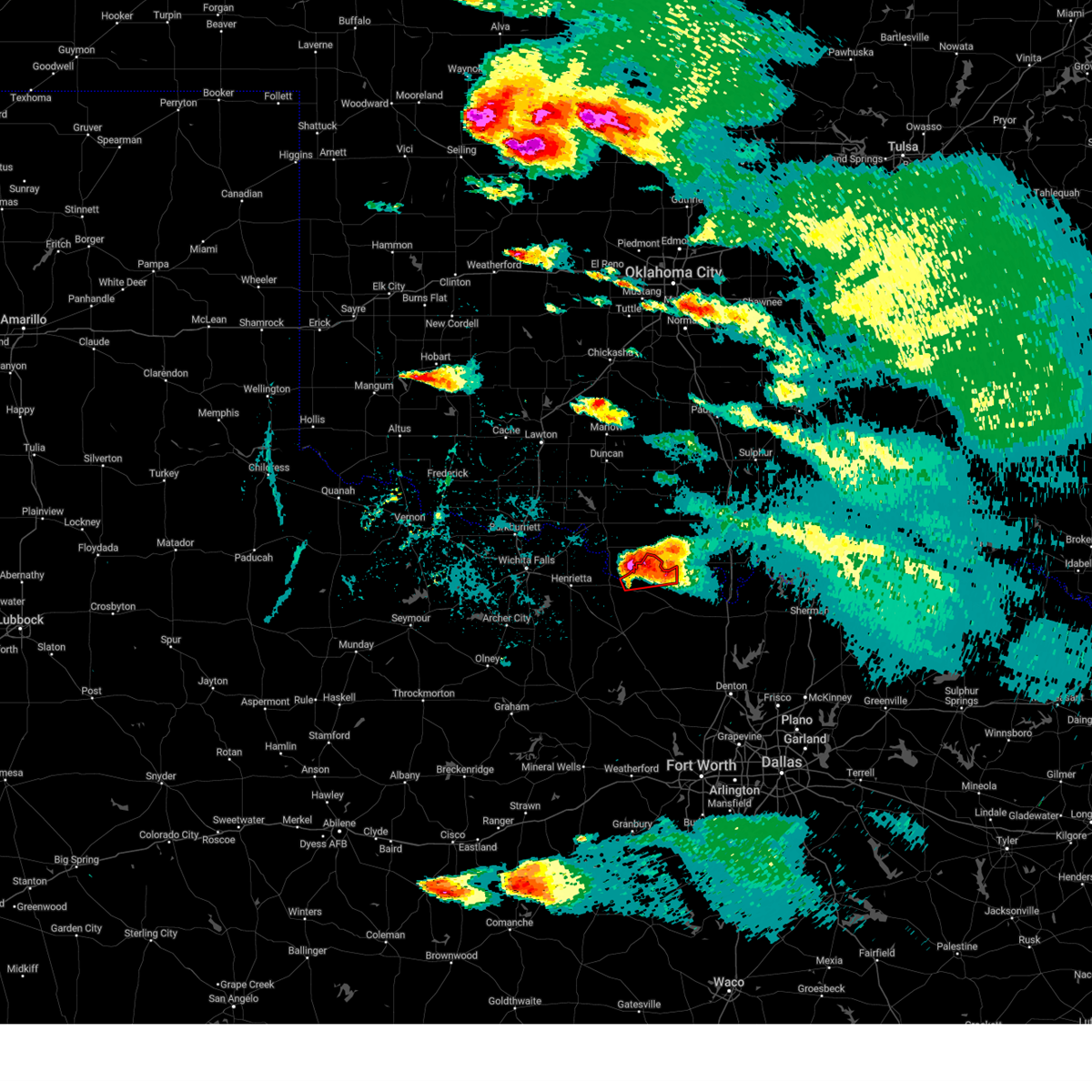 Torfwd the national weather service in fort worth has issued a * tornado warning for, northeastern montague county in north central texas, * until 730 pm cdt. * at 641 pm cdt, a severe thunderstorm capable of producing a tornado was located near nocona, moving northeast at 35 mph (radar indicated rotation). Hazards include tornado and quarter size hail. Flying debris will be dangerous to those caught without shelter. mobile homes will be damaged or destroyed. damage to roofs, windows, and vehicles will occur. tree damage is likely. this dangerous storm will be near, lake nocona around 650 pm cdt. Other locations impacted by this tornadic thunderstorm include spanish fort, belcherville, nocona hills, and illinois bend. Torfwd the national weather service in fort worth has issued a * tornado warning for, northeastern montague county in north central texas, * until 730 pm cdt. * at 641 pm cdt, a severe thunderstorm capable of producing a tornado was located near nocona, moving northeast at 35 mph (radar indicated rotation). Hazards include tornado and quarter size hail. Flying debris will be dangerous to those caught without shelter. mobile homes will be damaged or destroyed. damage to roofs, windows, and vehicles will occur. tree damage is likely. this dangerous storm will be near, lake nocona around 650 pm cdt. Other locations impacted by this tornadic thunderstorm include spanish fort, belcherville, nocona hills, and illinois bend.
|
| 5/25/2024 6:27 PM CDT |
 At 627 pm cdt, a severe thunderstorm was located near terral, or 10 miles northwest of nocona, moving northeast at 25 mph (radar indicated). Hazards include 60 mph wind gusts and quarter size hail. Hail damage to vehicles is expected. expect wind damage to roofs, siding, and trees. This severe thunderstorm will remain over mainly rural areas of northern montague county, including the following locations, spanish fort, belcherville, bonita, capps corner, ringgold, nocona hills, and illinois bend. At 627 pm cdt, a severe thunderstorm was located near terral, or 10 miles northwest of nocona, moving northeast at 25 mph (radar indicated). Hazards include 60 mph wind gusts and quarter size hail. Hail damage to vehicles is expected. expect wind damage to roofs, siding, and trees. This severe thunderstorm will remain over mainly rural areas of northern montague county, including the following locations, spanish fort, belcherville, bonita, capps corner, ringgold, nocona hills, and illinois bend.
|
| 5/25/2024 6:12 PM CDT |
 At 612 pm cdt, a severe thunderstorm was located 5 miles south of terral, or 10 miles west of nocona, moving northeast at 30 mph (radar indicated). Hazards include ping pong ball size hail and 60 mph wind gusts. People and animals outdoors will be injured. expect hail damage to roofs, siding, windows, and vehicles. expect wind damage to roofs, siding, and trees. this severe storm will be near, nocona around 625 pm cdt. lake nocona around 635 pm cdt. Other locations impacted by this severe thunderstorm include spanish fort, stoneburg, belcherville, bonita, capps corner, ringgold, nocona hills, and illinois bend. At 612 pm cdt, a severe thunderstorm was located 5 miles south of terral, or 10 miles west of nocona, moving northeast at 30 mph (radar indicated). Hazards include ping pong ball size hail and 60 mph wind gusts. People and animals outdoors will be injured. expect hail damage to roofs, siding, windows, and vehicles. expect wind damage to roofs, siding, and trees. this severe storm will be near, nocona around 625 pm cdt. lake nocona around 635 pm cdt. Other locations impacted by this severe thunderstorm include spanish fort, stoneburg, belcherville, bonita, capps corner, ringgold, nocona hills, and illinois bend.
|
| 5/25/2024 6:00 PM CDT |
 Svrfwd the national weather service in fort worth has issued a * severe thunderstorm warning for, northern montague county in north central texas, * until 700 pm cdt. * at 600 pm cdt, a severe thunderstorm was located 8 miles north of bellevue, or 10 miles east of henrietta, moving northeast at 30 mph (radar indicated). Hazards include ping pong ball size hail and 60 mph wind gusts. People and animals outdoors will be injured. expect hail damage to roofs, siding, windows, and vehicles. expect wind damage to roofs, siding, and trees. this severe thunderstorm will be near, nocona around 625 pm cdt. lake nocona around 635 pm cdt. Other locations impacted by this severe thunderstorm include spanish fort, stoneburg, belcherville, bonita, capps corner, ringgold, nocona hills, and illinois bend. Svrfwd the national weather service in fort worth has issued a * severe thunderstorm warning for, northern montague county in north central texas, * until 700 pm cdt. * at 600 pm cdt, a severe thunderstorm was located 8 miles north of bellevue, or 10 miles east of henrietta, moving northeast at 30 mph (radar indicated). Hazards include ping pong ball size hail and 60 mph wind gusts. People and animals outdoors will be injured. expect hail damage to roofs, siding, windows, and vehicles. expect wind damage to roofs, siding, and trees. this severe thunderstorm will be near, nocona around 625 pm cdt. lake nocona around 635 pm cdt. Other locations impacted by this severe thunderstorm include spanish fort, stoneburg, belcherville, bonita, capps corner, ringgold, nocona hills, and illinois bend.
|
| 3/24/2024 9:16 PM CDT |
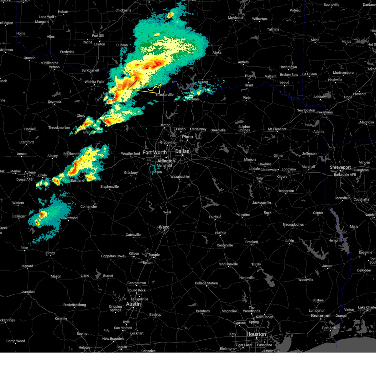 Svrfwd the national weather service in fort worth has issued a * severe thunderstorm warning for, northeastern montague county in north central texas, northwestern cooke county in north central texas, * until 1015 pm cdt. * at 916 pm cdt, a severe thunderstorm was located near oscar, or 11 miles north of nocona, moving east at 35 mph (radar indicated). Hazards include 60 mph wind gusts and nickel size hail. Expect damage to roofs, siding, and trees. This severe thunderstorm will remain over mainly rural areas of northeastern montague and northwestern cooke counties, including the following locations, bulcher, spanish fort, capps corner, illinois bend, nocona hills, and sivells bend. Svrfwd the national weather service in fort worth has issued a * severe thunderstorm warning for, northeastern montague county in north central texas, northwestern cooke county in north central texas, * until 1015 pm cdt. * at 916 pm cdt, a severe thunderstorm was located near oscar, or 11 miles north of nocona, moving east at 35 mph (radar indicated). Hazards include 60 mph wind gusts and nickel size hail. Expect damage to roofs, siding, and trees. This severe thunderstorm will remain over mainly rural areas of northeastern montague and northwestern cooke counties, including the following locations, bulcher, spanish fort, capps corner, illinois bend, nocona hills, and sivells bend.
|
| 3/14/2024 1:25 PM CDT |
 the severe thunderstorm warning has been cancelled and is no longer in effect the severe thunderstorm warning has been cancelled and is no longer in effect
|
| 3/14/2024 1:14 PM CDT |
 At 113 pm cdt, a severe thunderstorm was located near oscar, or 7 miles north of nocona, moving northeast at 35 mph (radar indicated). Hazards include 60 mph wind gusts and quarter size hail. Hail damage to vehicles is expected. expect wind damage to roofs, siding, and trees. Locations impacted include, nocona, lake nocona, nocona hills, and spanish fort. At 113 pm cdt, a severe thunderstorm was located near oscar, or 7 miles north of nocona, moving northeast at 35 mph (radar indicated). Hazards include 60 mph wind gusts and quarter size hail. Hail damage to vehicles is expected. expect wind damage to roofs, siding, and trees. Locations impacted include, nocona, lake nocona, nocona hills, and spanish fort.
|
| 3/14/2024 12:48 PM CDT |
 Svrfwd the national weather service in fort worth has issued a * severe thunderstorm warning for, northern montague county in north central texas, * until 145 pm cdt. * at 1247 pm cdt, a severe thunderstorm was located near terral, or 10 miles east of henrietta, moving northeast at 35 mph (radar indicated). Hazards include 60 mph wind gusts and quarter size hail. Hail damage to vehicles is expected. expect wind damage to roofs, siding, and trees. This severe thunderstorm will remain over mainly rural areas of northern montague county, including the following locations, spanish fort, belcherville, ringgold, and nocona hills. Svrfwd the national weather service in fort worth has issued a * severe thunderstorm warning for, northern montague county in north central texas, * until 145 pm cdt. * at 1247 pm cdt, a severe thunderstorm was located near terral, or 10 miles east of henrietta, moving northeast at 35 mph (radar indicated). Hazards include 60 mph wind gusts and quarter size hail. Hail damage to vehicles is expected. expect wind damage to roofs, siding, and trees. This severe thunderstorm will remain over mainly rural areas of northern montague county, including the following locations, spanish fort, belcherville, ringgold, and nocona hills.
|
| 8/10/2023 8:38 PM CDT |
 At 838 pm cdt, a severe thunderstorm was located near bowie, moving northeast at 25 mph (emergency management). Hazards include golf ball size hail and 60 mph wind gusts. People and animals outdoors will be injured. expect hail damage to roofs, siding, windows, and vehicles. Expect wind damage to roofs, siding, and trees. At 838 pm cdt, a severe thunderstorm was located near bowie, moving northeast at 25 mph (emergency management). Hazards include golf ball size hail and 60 mph wind gusts. People and animals outdoors will be injured. expect hail damage to roofs, siding, windows, and vehicles. Expect wind damage to roofs, siding, and trees.
|
| 7/9/2023 5:57 AM CDT |
 The severe thunderstorm warning for montague and cooke counties will expire at 600 am cdt, the storms which prompted the warning have weakened below severe limits. therefore the warning will be allowed to expire. however gusty winds are still possible with these thunderstorms. a severe thunderstorm watch remains in effect until 1000 am cdt for north central texas. The severe thunderstorm warning for montague and cooke counties will expire at 600 am cdt, the storms which prompted the warning have weakened below severe limits. therefore the warning will be allowed to expire. however gusty winds are still possible with these thunderstorms. a severe thunderstorm watch remains in effect until 1000 am cdt for north central texas.
|
| 7/9/2023 5:01 AM CDT |
 At 501 am cdt, severe thunderstorms were located along a line extending from near ringling to near ryan, moving southeast at 55 mph (radar indicated). Hazards include 60 mph wind gusts. expect damage to roofs, siding, and trees At 501 am cdt, severe thunderstorms were located along a line extending from near ringling to near ryan, moving southeast at 55 mph (radar indicated). Hazards include 60 mph wind gusts. expect damage to roofs, siding, and trees
|
| 6/17/2023 9:58 PM CDT |
 At 957 pm cdt, severe thunderstorms were located near grady and lake nocona, moving southeast at 35 mph (radar indicated). Hazards include 60 mph wind gusts and quarter size hail. Hail damage to vehicles is expected. Expect wind damage to roofs, siding, and trees. At 957 pm cdt, severe thunderstorms were located near grady and lake nocona, moving southeast at 35 mph (radar indicated). Hazards include 60 mph wind gusts and quarter size hail. Hail damage to vehicles is expected. Expect wind damage to roofs, siding, and trees.
|
| 6/15/2023 11:43 PM CDT |
 At 1142 pm cdt, a severe thunderstorm was located over st. jo, moving east at 30 mph (radar indicated). Hazards include two inch hail and 60 mph wind gusts. People and animals outdoors will be injured. expect hail damage to roofs, siding, windows, and vehicles. Expect wind damage to roofs, siding, and trees. At 1142 pm cdt, a severe thunderstorm was located over st. jo, moving east at 30 mph (radar indicated). Hazards include two inch hail and 60 mph wind gusts. People and animals outdoors will be injured. expect hail damage to roofs, siding, windows, and vehicles. Expect wind damage to roofs, siding, and trees.
|
| 6/15/2023 11:30 PM CDT |
 At 1129 pm cdt, a severe thunderstorm was located near st. jo, moving southeast at 40 mph. at 1124 pm cdt, ping pong ball size hail was reported with this storm. another severe thunderstorm was located near leo moving east at 35 mph (radar indicated). Hazards include tennis ball size hail and 60 mph wind gusts. People and animals outdoors will be injured. expect hail damage to roofs, siding, windows, and vehicles. expect wind damage to roofs, siding, and trees. locations impacted include, nocona, muenster, st. jo, lake nocona, lake muenster, nocona hills, montague, prairie point, leo, rosston, bulcher, capps corner, illinois bend, bonita, hood and marysville. thunderstorm damage threat, considerable hail threat, observed max hail size, 2. 50 in wind threat, radar indicated max wind gust, 60 mph. At 1129 pm cdt, a severe thunderstorm was located near st. jo, moving southeast at 40 mph. at 1124 pm cdt, ping pong ball size hail was reported with this storm. another severe thunderstorm was located near leo moving east at 35 mph (radar indicated). Hazards include tennis ball size hail and 60 mph wind gusts. People and animals outdoors will be injured. expect hail damage to roofs, siding, windows, and vehicles. expect wind damage to roofs, siding, and trees. locations impacted include, nocona, muenster, st. jo, lake nocona, lake muenster, nocona hills, montague, prairie point, leo, rosston, bulcher, capps corner, illinois bend, bonita, hood and marysville. thunderstorm damage threat, considerable hail threat, observed max hail size, 2. 50 in wind threat, radar indicated max wind gust, 60 mph.
|
| 6/15/2023 11:18 PM CDT |
 At 1117 pm cdt, a severe thunderstorm was located 13 miles southwest of lake muenster moving east at 30 mph. another severe thunderstorm was located near nocona moving northeast at 30 mph (radar indicated). Hazards include 60 mph wind gusts and quarter size hail. Hail damage to vehicles is expected. expect wind damage to roofs, siding, and trees. locations impacted include, nocona, muenster, st. jo, lake nocona, lake muenster, nocona hills, montague, prairie point, leo, rosston, bulcher, capps corner, forestburg, illinois bend, belcherville, mallard, bonita, hood and marysville. hail threat, radar indicated max hail size, 1. 00 in wind threat, radar indicated max wind gust, 60 mph. At 1117 pm cdt, a severe thunderstorm was located 13 miles southwest of lake muenster moving east at 30 mph. another severe thunderstorm was located near nocona moving northeast at 30 mph (radar indicated). Hazards include 60 mph wind gusts and quarter size hail. Hail damage to vehicles is expected. expect wind damage to roofs, siding, and trees. locations impacted include, nocona, muenster, st. jo, lake nocona, lake muenster, nocona hills, montague, prairie point, leo, rosston, bulcher, capps corner, forestburg, illinois bend, belcherville, mallard, bonita, hood and marysville. hail threat, radar indicated max hail size, 1. 00 in wind threat, radar indicated max wind gust, 60 mph.
|
| 6/15/2023 10:41 PM CDT |
 At 1041 pm cdt, a severe thunderstorm was located near bowie, moving east at 25 mph (radar indicated). Hazards include 60 mph wind gusts and quarter size hail. Hail damage to vehicles is expected. Expect wind damage to roofs, siding, and trees. At 1041 pm cdt, a severe thunderstorm was located near bowie, moving east at 25 mph (radar indicated). Hazards include 60 mph wind gusts and quarter size hail. Hail damage to vehicles is expected. Expect wind damage to roofs, siding, and trees.
|
| 6/15/2023 10:13 PM CDT |
 At 1013 pm cdt, a severe thunderstorm was located near grady, or 14 miles northeast of nocona, moving southeast at 45 mph (radar indicated). Hazards include 60 mph wind gusts and quarter size hail. Hail damage to vehicles is expected. Expect wind damage to roofs, siding, and trees. At 1013 pm cdt, a severe thunderstorm was located near grady, or 14 miles northeast of nocona, moving southeast at 45 mph (radar indicated). Hazards include 60 mph wind gusts and quarter size hail. Hail damage to vehicles is expected. Expect wind damage to roofs, siding, and trees.
|
| 6/15/2023 8:59 PM CDT |
 At 859 pm cdt, a severe thunderstorm was located near st. jo, or 9 miles southeast of nocona, moving east at 35 mph (radar indicated). Hazards include 60 mph wind gusts and quarter size hail. Hail damage to vehicles is expected. Expect wind damage to roofs, siding, and trees. At 859 pm cdt, a severe thunderstorm was located near st. jo, or 9 miles southeast of nocona, moving east at 35 mph (radar indicated). Hazards include 60 mph wind gusts and quarter size hail. Hail damage to vehicles is expected. Expect wind damage to roofs, siding, and trees.
|
| 6/15/2023 8:39 PM CDT |
 At 838 pm cdt, a severe thunderstorm capable of producing a tornado was located 7 miles north of bowie, moving east at 35 mph (radar indicated rotation). Hazards include tornado and half dollar size hail. Flying debris will be dangerous to those caught without shelter. mobile homes will be damaged or destroyed. damage to roofs, windows, and vehicles will occur. tree damage is likely. Locations impacted include, nocona, lake nocona, nocona hills, montague, stoneburg, belcherville, mallard and bonita. At 838 pm cdt, a severe thunderstorm capable of producing a tornado was located 7 miles north of bowie, moving east at 35 mph (radar indicated rotation). Hazards include tornado and half dollar size hail. Flying debris will be dangerous to those caught without shelter. mobile homes will be damaged or destroyed. damage to roofs, windows, and vehicles will occur. tree damage is likely. Locations impacted include, nocona, lake nocona, nocona hills, montague, stoneburg, belcherville, mallard and bonita.
|
| 6/15/2023 8:16 PM CDT |
 At 816 pm cdt, a severe thunderstorm capable of producing a tornado was located 7 miles north of bellevue, or 11 miles southeast of henrietta, moving east at 35 mph (radar indicated rotation). Hazards include tornado and half dollar size hail. Flying debris will be dangerous to those caught without shelter. mobile homes will be damaged or destroyed. damage to roofs, windows, and vehicles will occur. tree damage is likely. This tornadic thunderstorm will remain over mainly rural areas of central montague county, including the following locations, stoneburg, belcherville, mallard, bonita, montague, ringgold and nocona hills. At 816 pm cdt, a severe thunderstorm capable of producing a tornado was located 7 miles north of bellevue, or 11 miles southeast of henrietta, moving east at 35 mph (radar indicated rotation). Hazards include tornado and half dollar size hail. Flying debris will be dangerous to those caught without shelter. mobile homes will be damaged or destroyed. damage to roofs, windows, and vehicles will occur. tree damage is likely. This tornadic thunderstorm will remain over mainly rural areas of central montague county, including the following locations, stoneburg, belcherville, mallard, bonita, montague, ringgold and nocona hills.
|
| 6/15/2023 6:26 PM CDT |
 At 626 pm cdt, a severe thunderstorm was located over oscar, or 15 miles north of nocona, moving southeast at 30 mph (radar indicated). Hazards include 65 mph wind gusts and quarter size hail. Hail damage to vehicles is expected. Expect wind damage to roofs, siding, and trees. At 626 pm cdt, a severe thunderstorm was located over oscar, or 15 miles north of nocona, moving southeast at 30 mph (radar indicated). Hazards include 65 mph wind gusts and quarter size hail. Hail damage to vehicles is expected. Expect wind damage to roofs, siding, and trees.
|
| 6/12/2023 4:42 PM CDT |
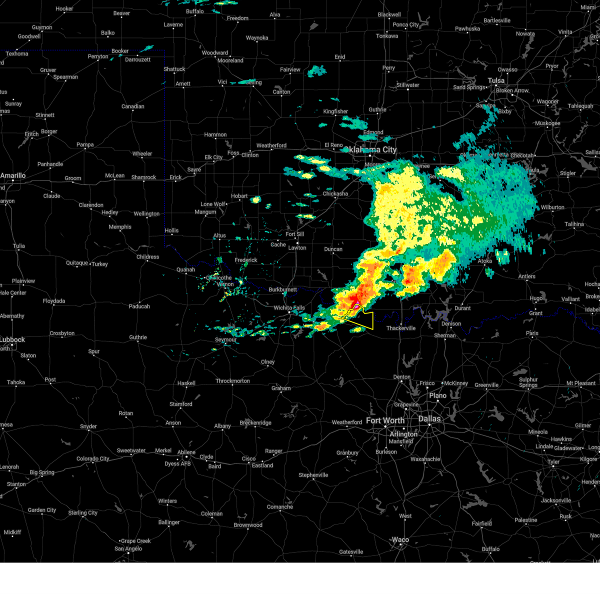 At 442 pm cdt, a severe thunderstorm was located near lake nocona, or 12 miles northeast of nocona, moving east at 40 mph (radar indicated). Hazards include quarter size hail. Damage to vehicles is possible. locations impacted include, nocona, lake nocona, nocona hills, spanish fort, capps corner and illinois bend. hail threat, radar indicated max hail size, 1. 00 in wind threat, radar indicated max wind gust, <50 mph. At 442 pm cdt, a severe thunderstorm was located near lake nocona, or 12 miles northeast of nocona, moving east at 40 mph (radar indicated). Hazards include quarter size hail. Damage to vehicles is possible. locations impacted include, nocona, lake nocona, nocona hills, spanish fort, capps corner and illinois bend. hail threat, radar indicated max hail size, 1. 00 in wind threat, radar indicated max wind gust, <50 mph.
|
| 6/12/2023 4:28 PM CDT |
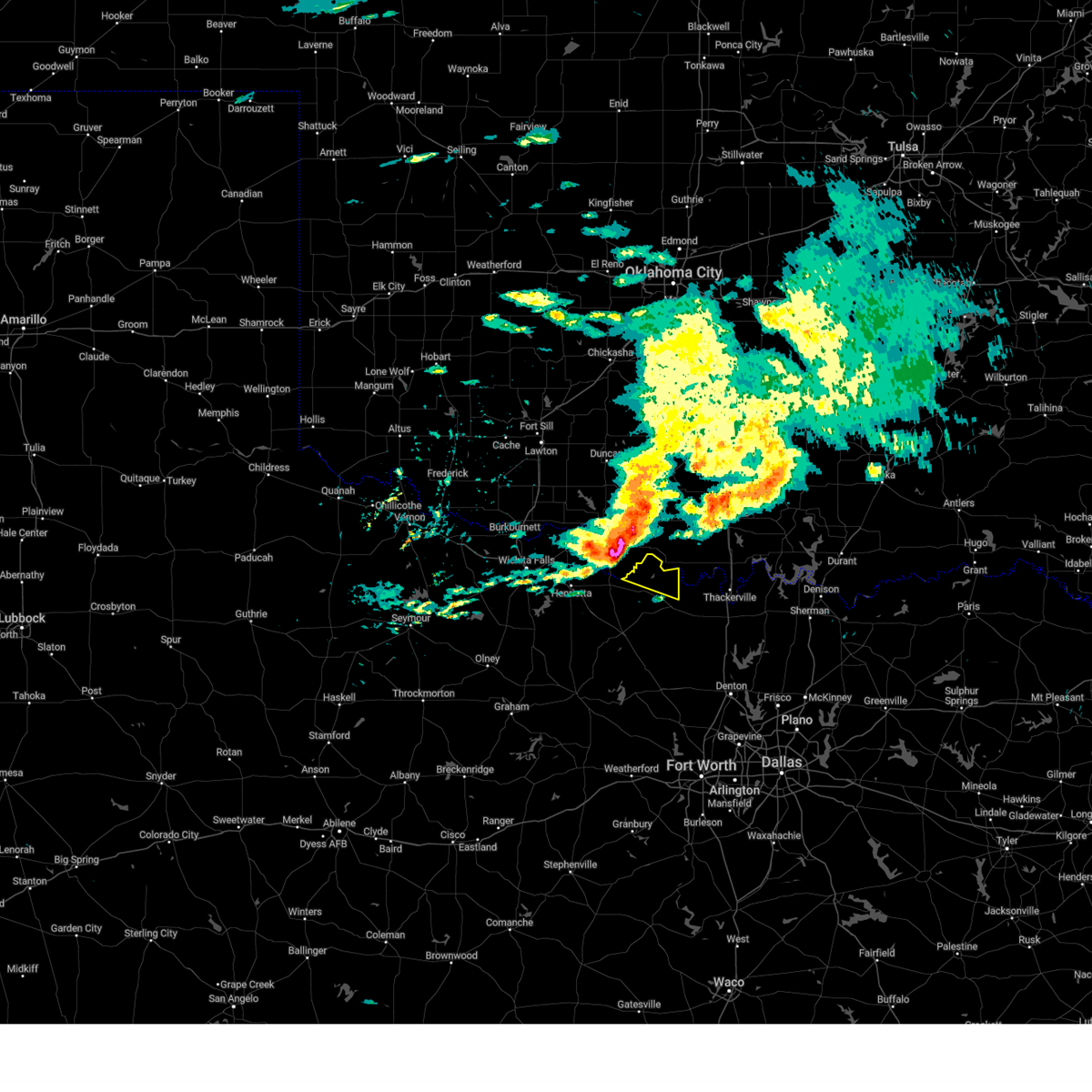 At 428 pm cdt, a severe thunderstorm was located over oscar, or 12 miles north of nocona, moving east at 40 mph (radar indicated). Hazards include quarter size hail. damage to vehicles is possible At 428 pm cdt, a severe thunderstorm was located over oscar, or 12 miles north of nocona, moving east at 40 mph (radar indicated). Hazards include quarter size hail. damage to vehicles is possible
|
| 5/6/2023 8:43 PM CDT |
 At 843 pm cdt, a severe thunderstorm was located over bowie, moving east at 25 mph (radar indicated). Hazards include 60 mph wind gusts. Expect damage to roofs, siding, and trees. locations impacted include, bowie, nocona, st. jo, lake nocona, sunset, lake amon g carter, nocona hills, montague, fruitland, capps corner, forestburg, ringgold, spanish fort, stoneburg, belcherville, mallard, bonita and illinois bend. hail threat, radar indicated max hail size, <. 75 in wind threat, radar indicated max wind gust, 60 mph. At 843 pm cdt, a severe thunderstorm was located over bowie, moving east at 25 mph (radar indicated). Hazards include 60 mph wind gusts. Expect damage to roofs, siding, and trees. locations impacted include, bowie, nocona, st. jo, lake nocona, sunset, lake amon g carter, nocona hills, montague, fruitland, capps corner, forestburg, ringgold, spanish fort, stoneburg, belcherville, mallard, bonita and illinois bend. hail threat, radar indicated max hail size, <. 75 in wind threat, radar indicated max wind gust, 60 mph.
|
| 5/6/2023 8:22 PM CDT |
 At 822 pm cdt, a severe thunderstorm was located near bellevue, or near bowie, moving east at 25 mph (radar indicated). Hazards include 65 mph wind gusts. expect damage to roofs, siding, and trees At 822 pm cdt, a severe thunderstorm was located near bellevue, or near bowie, moving east at 25 mph (radar indicated). Hazards include 65 mph wind gusts. expect damage to roofs, siding, and trees
|
| 5/5/2023 4:51 PM CDT |
 At 451 pm cdt, a severe thunderstorm was located near alvord, or 14 miles north of decatur, moving northeast at 20 mph (radar indicated). Hazards include 65 mph wind gusts and quarter size hail. Hail damage to vehicles is expected. Expect wind damage to roofs, siding, and trees. At 451 pm cdt, a severe thunderstorm was located near alvord, or 14 miles north of decatur, moving northeast at 20 mph (radar indicated). Hazards include 65 mph wind gusts and quarter size hail. Hail damage to vehicles is expected. Expect wind damage to roofs, siding, and trees.
|
| 5/4/2023 7:44 PM CDT |
 At 744 pm cdt, a severe thunderstorm was located near nocona, moving east at 35 mph (radar indicated). Hazards include ping pong ball size hail and 60 mph wind gusts. People and animals outdoors will be injured. expect hail damage to roofs, siding, windows, and vehicles. expect wind damage to roofs, siding, and trees. locations impacted include, bowie, nocona, st. jo, lake nocona, nocona hills, montague, mallard, bonita, capps corner, forestburg, illinois bend and fruitland. hail threat, radar indicated max hail size, 1. 50 in wind threat, radar indicated max wind gust, 60 mph. At 744 pm cdt, a severe thunderstorm was located near nocona, moving east at 35 mph (radar indicated). Hazards include ping pong ball size hail and 60 mph wind gusts. People and animals outdoors will be injured. expect hail damage to roofs, siding, windows, and vehicles. expect wind damage to roofs, siding, and trees. locations impacted include, bowie, nocona, st. jo, lake nocona, nocona hills, montague, mallard, bonita, capps corner, forestburg, illinois bend and fruitland. hail threat, radar indicated max hail size, 1. 50 in wind threat, radar indicated max wind gust, 60 mph.
|
| 5/4/2023 7:34 PM CDT |
 At 733 pm cdt, a severe thunderstorm capable of producing a tornado was located over nocona, moving east at 30 mph (radar indicated rotation). Hazards include tornado and ping pong ball size hail. Flying debris will be dangerous to those caught without shelter. mobile homes will be damaged or destroyed. damage to roofs, windows, and vehicles will occur. tree damage is likely. This tornadic thunderstorm will remain over mainly rural areas of northeastern montague county, including the following locations, bonita, capps corner, illinois bend and nocona hills. At 733 pm cdt, a severe thunderstorm capable of producing a tornado was located over nocona, moving east at 30 mph (radar indicated rotation). Hazards include tornado and ping pong ball size hail. Flying debris will be dangerous to those caught without shelter. mobile homes will be damaged or destroyed. damage to roofs, windows, and vehicles will occur. tree damage is likely. This tornadic thunderstorm will remain over mainly rural areas of northeastern montague county, including the following locations, bonita, capps corner, illinois bend and nocona hills.
|
| 5/4/2023 7:21 PM CDT |
 At 721 pm cdt, a severe thunderstorm capable of producing a tornado was located near nocona, moving east at 35 mph (radar indicated rotation). Hazards include tornado and ping pong ball size hail. Flying debris will be dangerous to those caught without shelter. mobile homes will be damaged or destroyed. damage to roofs, windows, and vehicles will occur. tree damage is likely. this dangerous storm will be near, nocona around 725 pm cdt. lake nocona around 735 pm cdt. Other locations impacted by this tornadic thunderstorm include marysville, belcherville, bulcher, bonita, capps corner, illinois bend, nocona hills and spanish fort. At 721 pm cdt, a severe thunderstorm capable of producing a tornado was located near nocona, moving east at 35 mph (radar indicated rotation). Hazards include tornado and ping pong ball size hail. Flying debris will be dangerous to those caught without shelter. mobile homes will be damaged or destroyed. damage to roofs, windows, and vehicles will occur. tree damage is likely. this dangerous storm will be near, nocona around 725 pm cdt. lake nocona around 735 pm cdt. Other locations impacted by this tornadic thunderstorm include marysville, belcherville, bulcher, bonita, capps corner, illinois bend, nocona hills and spanish fort.
|
| 5/4/2023 7:09 PM CDT |
 At 709 pm cdt, a severe thunderstorm was located near bellevue, or 10 miles southeast of henrietta, moving east at 35 mph (radar indicated). Hazards include ping pong ball size hail and 60 mph wind gusts. People and animals outdoors will be injured. expect hail damage to roofs, siding, windows, and vehicles. Expect wind damage to roofs, siding, and trees. At 709 pm cdt, a severe thunderstorm was located near bellevue, or 10 miles southeast of henrietta, moving east at 35 mph (radar indicated). Hazards include ping pong ball size hail and 60 mph wind gusts. People and animals outdoors will be injured. expect hail damage to roofs, siding, windows, and vehicles. Expect wind damage to roofs, siding, and trees.
|
| 4/2/2023 5:10 PM CDT |
 At 510 pm cdt, a severe thunderstorm was located near st. jo, or 12 miles east of nocona, moving east at 35 mph (radar indicated). Hazards include 60 mph wind gusts and quarter size hail. Hail damage to vehicles is expected. Expect wind damage to roofs, siding, and trees. At 510 pm cdt, a severe thunderstorm was located near st. jo, or 12 miles east of nocona, moving east at 35 mph (radar indicated). Hazards include 60 mph wind gusts and quarter size hail. Hail damage to vehicles is expected. Expect wind damage to roofs, siding, and trees.
|
| 4/2/2023 5:04 PM CDT |
 At 504 pm cdt, a severe thunderstorm was located 7 miles southeast of lake nocona, or 10 miles east of nocona, moving east at 35 mph (radar indicated). Hazards include 60 mph wind gusts and quarter size hail. Hail damage to vehicles is expected. expect wind damage to roofs, siding, and trees. locations impacted include, nocona, st. jo, hubert h moss lake, lake nocona, nocona hills, montague, marysville, sivells bend, bulcher, bonita, capps corner and illinois bend. hail threat, radar indicated max hail size, 1. 00 in wind threat, radar indicated max wind gust, 60 mph. At 504 pm cdt, a severe thunderstorm was located 7 miles southeast of lake nocona, or 10 miles east of nocona, moving east at 35 mph (radar indicated). Hazards include 60 mph wind gusts and quarter size hail. Hail damage to vehicles is expected. expect wind damage to roofs, siding, and trees. locations impacted include, nocona, st. jo, hubert h moss lake, lake nocona, nocona hills, montague, marysville, sivells bend, bulcher, bonita, capps corner and illinois bend. hail threat, radar indicated max hail size, 1. 00 in wind threat, radar indicated max wind gust, 60 mph.
|
| 4/2/2023 4:35 PM CDT |
 At 435 pm cdt, a severe thunderstorm was located 7 miles southwest of nocona, moving east at 35 mph (radar indicated). Hazards include 60 mph wind gusts and quarter size hail. Hail damage to vehicles is expected. Expect wind damage to roofs, siding, and trees. At 435 pm cdt, a severe thunderstorm was located 7 miles southwest of nocona, moving east at 35 mph (radar indicated). Hazards include 60 mph wind gusts and quarter size hail. Hail damage to vehicles is expected. Expect wind damage to roofs, siding, and trees.
|
| 3/24/2023 12:48 AM CDT |
 At 1248 am cdt, a severe thunderstorm was located near sunset, or near bowie, moving east at 55 mph (radar indicated). Hazards include quarter size hail. damage to vehicles is possible At 1248 am cdt, a severe thunderstorm was located near sunset, or near bowie, moving east at 55 mph (radar indicated). Hazards include quarter size hail. damage to vehicles is possible
|
| 3/16/2023 3:21 PM CDT |
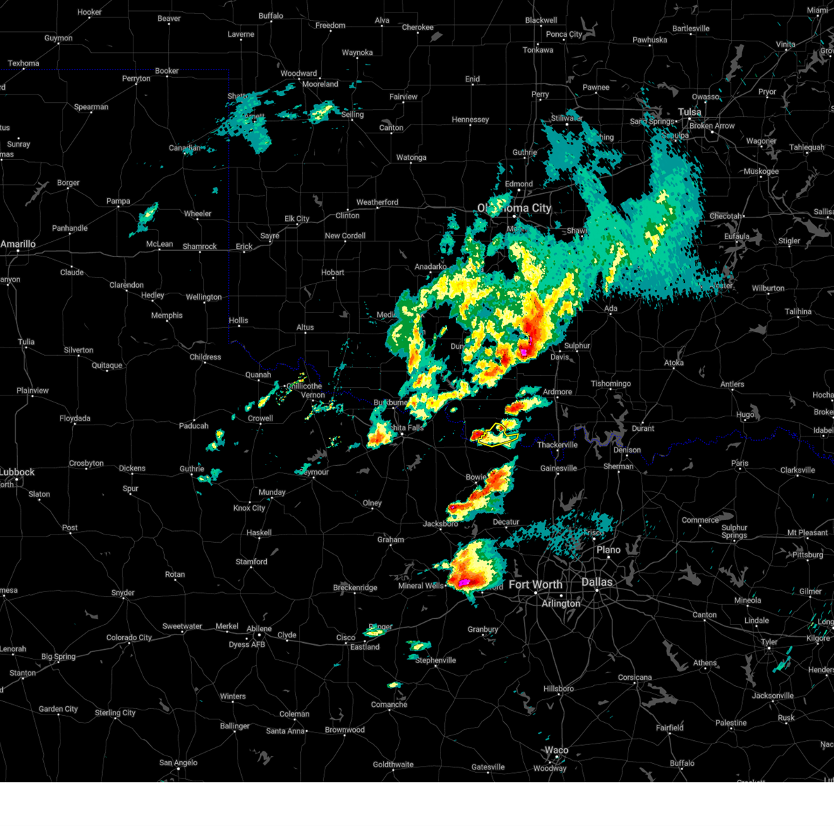 At 321 pm cdt, a severe thunderstorm was located over oscar, or 11 miles north of nocona, moving northeast at 50 mph (radar indicated). Hazards include 60 mph wind gusts and quarter size hail. Hail damage to vehicles is expected. expect wind damage to roofs, siding, and trees. locations impacted include, lake nocona, nocona hills, spanish fort and illinois bend. hail threat, radar indicated max hail size, 1. 00 in wind threat, radar indicated max wind gust, 60 mph. At 321 pm cdt, a severe thunderstorm was located over oscar, or 11 miles north of nocona, moving northeast at 50 mph (radar indicated). Hazards include 60 mph wind gusts and quarter size hail. Hail damage to vehicles is expected. expect wind damage to roofs, siding, and trees. locations impacted include, lake nocona, nocona hills, spanish fort and illinois bend. hail threat, radar indicated max hail size, 1. 00 in wind threat, radar indicated max wind gust, 60 mph.
|
| 3/16/2023 2:57 PM CDT |
 At 256 pm cdt, a severe thunderstorm was located 7 miles north of bellevue, or 9 miles southeast of henrietta, moving northeast at 50 mph (radar indicated). Hazards include 60 mph wind gusts and quarter size hail. Hail damage to vehicles is expected. Expect wind damage to roofs, siding, and trees. At 256 pm cdt, a severe thunderstorm was located 7 miles north of bellevue, or 9 miles southeast of henrietta, moving northeast at 50 mph (radar indicated). Hazards include 60 mph wind gusts and quarter size hail. Hail damage to vehicles is expected. Expect wind damage to roofs, siding, and trees.
|
| 6/10/2022 2:38 AM CDT |
 The severe thunderstorm warning for montague county will expire at 245 am cdt, the storm which prompted the warning has weakened below severe limits and is exiting the warned area. therefore, the warning will be allowed to expire. however, gusty winds are still possible with this thunderstorm. a severe thunderstorm watch remains in effect until 800 am cdt for north central texas. The severe thunderstorm warning for montague county will expire at 245 am cdt, the storm which prompted the warning has weakened below severe limits and is exiting the warned area. therefore, the warning will be allowed to expire. however, gusty winds are still possible with this thunderstorm. a severe thunderstorm watch remains in effect until 800 am cdt for north central texas.
|
| 6/10/2022 2:24 AM CDT |
 At 221 am cdt, a severe thunderstorm was located near nocona, moving southeast at 45 mph (trained weather spotters). Hazards include 60 mph wind gusts. Expect damage to roofs, siding, and trees. locations impacted include, bowie, nocona, st. jo, sunset, stoneburg and forestburg. hail threat, radar indicated max hail size, <. 75 in wind threat, radar indicated max wind gust, 60 mph. At 221 am cdt, a severe thunderstorm was located near nocona, moving southeast at 45 mph (trained weather spotters). Hazards include 60 mph wind gusts. Expect damage to roofs, siding, and trees. locations impacted include, bowie, nocona, st. jo, sunset, stoneburg and forestburg. hail threat, radar indicated max hail size, <. 75 in wind threat, radar indicated max wind gust, 60 mph.
|
| 6/10/2022 1:45 AM CDT |
 At 143 am cdt, a severe thunderstorm was located near petrolia, or 10 miles north of henrietta, moving southeast at 40 mph (trained weather spotters). Hazards include 65 mph wind gusts. expect damage to roofs, siding, and trees At 143 am cdt, a severe thunderstorm was located near petrolia, or 10 miles north of henrietta, moving southeast at 40 mph (trained weather spotters). Hazards include 65 mph wind gusts. expect damage to roofs, siding, and trees
|
| 5/15/2022 8:56 PM CDT |
 At 855 pm cdt, severe thunderstorms were located along a line extending from near utica to near wilson, moving south at 25 mph (trained weather spotters). Hazards include golf ball size hail and 70 mph wind gusts. People and animals outdoors will be injured. expect hail damage to roofs, siding, windows, and vehicles. expect considerable tree damage. Wind damage is also likely to mobile homes, roofs, and outbuildings. At 855 pm cdt, severe thunderstorms were located along a line extending from near utica to near wilson, moving south at 25 mph (trained weather spotters). Hazards include golf ball size hail and 70 mph wind gusts. People and animals outdoors will be injured. expect hail damage to roofs, siding, windows, and vehicles. expect considerable tree damage. Wind damage is also likely to mobile homes, roofs, and outbuildings.
|
| 5/4/2022 11:10 PM CDT |
 At 1110 pm cdt, a severe thunderstorm was located near nocona, moving northeast at 35 mph (radar indicated). Hazards include 60 mph wind gusts. Expect damage to roofs, siding, and trees. locations impacted include, nocona and stoneburg. hail threat, radar indicated max hail size, <. 75 in wind threat, radar indicated max wind gust, 60 mph. At 1110 pm cdt, a severe thunderstorm was located near nocona, moving northeast at 35 mph (radar indicated). Hazards include 60 mph wind gusts. Expect damage to roofs, siding, and trees. locations impacted include, nocona and stoneburg. hail threat, radar indicated max hail size, <. 75 in wind threat, radar indicated max wind gust, 60 mph.
|
| 5/4/2022 10:44 PM CDT |
 At 1044 pm cdt, severe thunderstorms were located along a line extending from henrietta to near bluegrove, moving east at 45 mph (radar indicated). Hazards include 60 mph wind gusts. expect damage to roofs, siding, and trees At 1044 pm cdt, severe thunderstorms were located along a line extending from henrietta to near bluegrove, moving east at 45 mph (radar indicated). Hazards include 60 mph wind gusts. expect damage to roofs, siding, and trees
|
| 3/21/2022 4:58 PM CDT |
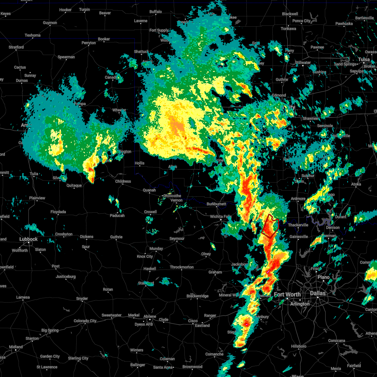 At 457 pm cdt, a severe thunderstorm with a history of producing a tornado was located southeast of nocona, moving northeast at 45 mph (radar indicated rotation). Hazards include tornado and half dollar size hail. Flying debris will be dangerous to those caught without shelter. mobile homes will be damaged or destroyed. damage to roofs, windows, and vehicles will occur. tree damage is likely. This tornadic thunderstorm will remain over mainly rural areas of northeastern montague county. At 457 pm cdt, a severe thunderstorm with a history of producing a tornado was located southeast of nocona, moving northeast at 45 mph (radar indicated rotation). Hazards include tornado and half dollar size hail. Flying debris will be dangerous to those caught without shelter. mobile homes will be damaged or destroyed. damage to roofs, windows, and vehicles will occur. tree damage is likely. This tornadic thunderstorm will remain over mainly rural areas of northeastern montague county.
|
| 11/10/2021 7:31 PM CST |
 At 730 pm cst, severe thunderstorms were located along a line extending from 6 miles southwest of leon to 6 miles south of newport, moving southeast at 40 mph (radar indicated). Hazards include 60 mph wind gusts and quarter size hail. Hail damage to vehicles is expected. Expect wind damage to roofs, siding, and trees. At 730 pm cst, severe thunderstorms were located along a line extending from 6 miles southwest of leon to 6 miles south of newport, moving southeast at 40 mph (radar indicated). Hazards include 60 mph wind gusts and quarter size hail. Hail damage to vehicles is expected. Expect wind damage to roofs, siding, and trees.
|
| 11/10/2021 7:01 PM CST |
 At 701 pm cst, a severe thunderstorm was located near stoneburg, or 12 miles northwest of bowie, moving east at 40 mph (radar indicated). Hazards include 60 mph wind gusts and quarter size hail. Hail damage to vehicles is expected. Expect wind damage to roofs, siding, and trees. At 701 pm cst, a severe thunderstorm was located near stoneburg, or 12 miles northwest of bowie, moving east at 40 mph (radar indicated). Hazards include 60 mph wind gusts and quarter size hail. Hail damage to vehicles is expected. Expect wind damage to roofs, siding, and trees.
|
| 10/10/2021 7:54 PM CDT |
 At 753 pm cdt, severe thunderstorms were located along a line extending from near newport to near graford to near gorman, moving east at 50 mph (radar indicated). Hazards include 60 mph wind gusts and quarter size hail. Hail damage to vehicles is expected. Expect wind damage to roofs, siding, and trees. At 753 pm cdt, severe thunderstorms were located along a line extending from near newport to near graford to near gorman, moving east at 50 mph (radar indicated). Hazards include 60 mph wind gusts and quarter size hail. Hail damage to vehicles is expected. Expect wind damage to roofs, siding, and trees.
|
| 7/11/2021 12:38 AM CDT |
 At 1237 am cdt, a severe thunderstorm was located over grady, or 15 miles north of nocona, moving southeast at 40 mph (radar indicated). Hazards include 60 mph wind gusts. expect damage to roofs, siding, and trees At 1237 am cdt, a severe thunderstorm was located over grady, or 15 miles north of nocona, moving southeast at 40 mph (radar indicated). Hazards include 60 mph wind gusts. expect damage to roofs, siding, and trees
|
| 6/12/2021 4:40 AM CDT |
 At 436 am cdt, severe thunderstorms were located along a line extending from near wilson to 7 miles northeast of grady to near terral, moving southeast at 40 mph (multiple automated weather sites in southern oklahoma have measured 55 mph to 65 mph winds). Hazards include 65 mph wind gusts and quarter size hail. Hail damage to vehicles is expected. Expect wind damage to roofs, siding, and trees. At 436 am cdt, severe thunderstorms were located along a line extending from near wilson to 7 miles northeast of grady to near terral, moving southeast at 40 mph (multiple automated weather sites in southern oklahoma have measured 55 mph to 65 mph winds). Hazards include 65 mph wind gusts and quarter size hail. Hail damage to vehicles is expected. Expect wind damage to roofs, siding, and trees.
|
| 5/16/2021 7:31 PM CDT |
 At 730 pm cdt, a severe thunderstorm was located 7 miles southeast of terral, or 7 miles west of nocona, moving southeast at 20 mph (radar indicated). Hazards include 60 mph wind gusts and quarter size hail. Hail damage to vehicles is expected. Expect wind damage to roofs, siding, and trees. At 730 pm cdt, a severe thunderstorm was located 7 miles southeast of terral, or 7 miles west of nocona, moving southeast at 20 mph (radar indicated). Hazards include 60 mph wind gusts and quarter size hail. Hail damage to vehicles is expected. Expect wind damage to roofs, siding, and trees.
|
| 4/23/2021 9:40 PM CDT |
 At 937 pm cdt, severe thunderstorms were located along a line extending from near oscar to near bluegrove, moving east at 35 mph (radar indicated). Hazards include 60 mph wind gusts and quarter size hail. Hail damage to vehicles is expected. Expect wind damage to roofs, siding, and trees. At 937 pm cdt, severe thunderstorms were located along a line extending from near oscar to near bluegrove, moving east at 35 mph (radar indicated). Hazards include 60 mph wind gusts and quarter size hail. Hail damage to vehicles is expected. Expect wind damage to roofs, siding, and trees.
|
| 4/23/2021 2:42 PM CDT |
 At 242 pm cdt, a severe thunderstorm was located over stoneburg, or near bowie, moving northeast at 30 mph (radar indicated). Hazards include quarter size hail. damage to vehicles is possible At 242 pm cdt, a severe thunderstorm was located over stoneburg, or near bowie, moving northeast at 30 mph (radar indicated). Hazards include quarter size hail. damage to vehicles is possible
|
| 4/23/2021 2:21 PM CDT |
 At 220 pm cdt, a severe thunderstorm was located near newport, or 7 miles southwest of bowie, moving northeast at 35 mph (radar indicated). Hazards include quarter size hail. Damage to vehicles is possible. locations impacted include, bowie, nocona, st. Jo, sunset, stoneburg and forestburg. At 220 pm cdt, a severe thunderstorm was located near newport, or 7 miles southwest of bowie, moving northeast at 35 mph (radar indicated). Hazards include quarter size hail. Damage to vehicles is possible. locations impacted include, bowie, nocona, st. Jo, sunset, stoneburg and forestburg.
|
| 4/23/2021 2:03 PM CDT |
 At 203 pm cdt, a severe thunderstorm was located near newport, or 14 miles north of jacksboro, moving northeast at 60 mph (radar indicated). Hazards include half dollar size hail. damage to vehicles is possible At 203 pm cdt, a severe thunderstorm was located near newport, or 14 miles north of jacksboro, moving northeast at 60 mph (radar indicated). Hazards include half dollar size hail. damage to vehicles is possible
|
| 8/16/2020 5:49 PM CDT |
 At 549 pm cdt, a cluster of severe thunderstorms was located near the red river, moving south at 30 mph (radar indicated). Hazards include 70 mph wind gusts and quarter size hail. Hail damage to vehicles is expected. expect considerable tree damage. wind damage is also likely to mobile homes, roofs, and outbuildings. locations impacted include, sherman, gainesville, bowie, whitesboro, nocona, pilot point, van alstyne, howe, pottsboro, collinsville, muenster, gunter, st. Jo, lindsay, callisburg, knollwood, dorchester, lake kiowa, ray roberts park johnson branch and forestburg. At 549 pm cdt, a cluster of severe thunderstorms was located near the red river, moving south at 30 mph (radar indicated). Hazards include 70 mph wind gusts and quarter size hail. Hail damage to vehicles is expected. expect considerable tree damage. wind damage is also likely to mobile homes, roofs, and outbuildings. locations impacted include, sherman, gainesville, bowie, whitesboro, nocona, pilot point, van alstyne, howe, pottsboro, collinsville, muenster, gunter, st. Jo, lindsay, callisburg, knollwood, dorchester, lake kiowa, ray roberts park johnson branch and forestburg.
|
| 8/16/2020 5:38 PM CDT |
 At 537 pm cdt, a cluster of severe thunderstorms was located near the red river, moving south at 30 mph (radar indicated). Hazards include 60 mph wind gusts and quarter size hail. Hail damage to vehicles is expected. Expect wind damage to roofs, siding, and trees. At 537 pm cdt, a cluster of severe thunderstorms was located near the red river, moving south at 30 mph (radar indicated). Hazards include 60 mph wind gusts and quarter size hail. Hail damage to vehicles is expected. Expect wind damage to roofs, siding, and trees.
|
| 7/12/2020 2:05 AM CDT |
 At 204 am cdt, severe thunderstorms were located along a line extending from 6 miles southwest of terral to 7 miles north of muenster to near madill, moving south at 50 mph (radar indicated). Hazards include 60 mph wind gusts. Expect damage to roofs, siding, and trees. locations impacted include, gainesville, bowie, whitesboro, nocona, collinsville, muenster, st. Jo, lindsay, callisburg, dorchester, forestburg, sunset, stoneburg, lake kiowa, southwestern lake texoma, southmayd, tioga, valley view and sadler. At 204 am cdt, severe thunderstorms were located along a line extending from 6 miles southwest of terral to 7 miles north of muenster to near madill, moving south at 50 mph (radar indicated). Hazards include 60 mph wind gusts. Expect damage to roofs, siding, and trees. locations impacted include, gainesville, bowie, whitesboro, nocona, collinsville, muenster, st. Jo, lindsay, callisburg, dorchester, forestburg, sunset, stoneburg, lake kiowa, southwestern lake texoma, southmayd, tioga, valley view and sadler.
|
| 7/12/2020 1:56 AM CDT |
 The national weather service in fort worth has issued a * severe thunderstorm warning for. montague county in north central texas. cooke county in north central texas. western grayson county in north central texas. Until 230 am cdt. The national weather service in fort worth has issued a * severe thunderstorm warning for. montague county in north central texas. cooke county in north central texas. western grayson county in north central texas. Until 230 am cdt.
|
| 6/22/2020 2:41 AM CDT |
 The severe thunderstorm warning for montague, cooke and northwestern grayson counties will expire at 245 am cdt, the storms which prompted the warning have weakened below severe limits. therefore the warning will be allowed to expire. however gusty winds up to 40 mph and heavy rain are still possible with these thunderstorms. The severe thunderstorm warning for montague, cooke and northwestern grayson counties will expire at 245 am cdt, the storms which prompted the warning have weakened below severe limits. therefore the warning will be allowed to expire. however gusty winds up to 40 mph and heavy rain are still possible with these thunderstorms.
|
| 6/22/2020 2:23 AM CDT |
 At 223 am cdt, severe thunderstorms were located along a line extending from bowie to whitesboro, moving south at 30 mph (radar indicated). Hazards include 60 mph wind gusts. Expect damage to roofs, siding, and trees. locations impacted include, gainesville, bowie, whitesboro, nocona, collinsville, muenster, st. Jo, lindsay, callisburg, ray roberts park johnson branch, forestburg, stoneburg, lake kiowa, southwestern lake texoma, southmayd, tioga, valley view and sadler. At 223 am cdt, severe thunderstorms were located along a line extending from bowie to whitesboro, moving south at 30 mph (radar indicated). Hazards include 60 mph wind gusts. Expect damage to roofs, siding, and trees. locations impacted include, gainesville, bowie, whitesboro, nocona, collinsville, muenster, st. Jo, lindsay, callisburg, ray roberts park johnson branch, forestburg, stoneburg, lake kiowa, southwestern lake texoma, southmayd, tioga, valley view and sadler.
|
| 6/22/2020 1:28 AM CDT |
 At 126 am cdt, severe thunderstorms were located along a line extending from near terral to near ardmore, moving southeast at 40 mph. winds over 60 mph have been observed (automated weather observations). Hazards include 60 mph wind gusts and penny size hail. expect damage to roofs, siding, and trees At 126 am cdt, severe thunderstorms were located along a line extending from near terral to near ardmore, moving southeast at 40 mph. winds over 60 mph have been observed (automated weather observations). Hazards include 60 mph wind gusts and penny size hail. expect damage to roofs, siding, and trees
|
| 6/21/2020 6:54 AM CDT |
 The severe thunderstorm warning for central montague county will expire at 700 am cdt, the storms which prompted the warning have weakened below severe limits. therefore the warning will be allowed to expire. however, gusty winds and heavy rain are still possible with these thunderstorms. The severe thunderstorm warning for central montague county will expire at 700 am cdt, the storms which prompted the warning have weakened below severe limits. therefore the warning will be allowed to expire. however, gusty winds and heavy rain are still possible with these thunderstorms.
|
| 6/21/2020 6:41 AM CDT |
 At 603 am cdt, a severe thunderstorm was located over nocona, moving southeast at 15 mph (radar indicated). Hazards include 60 mph wind gusts and penny size hail. expect damage to roofs, siding, and trees At 603 am cdt, a severe thunderstorm was located over nocona, moving southeast at 15 mph (radar indicated). Hazards include 60 mph wind gusts and penny size hail. expect damage to roofs, siding, and trees
|
| 6/21/2020 6:04 AM CDT |
 At 603 am cdt, a severe thunderstorm was located over nocona, moving southeast at 15 mph (radar indicated). Hazards include 60 mph wind gusts and penny size hail. expect damage to roofs, siding, and trees At 603 am cdt, a severe thunderstorm was located over nocona, moving southeast at 15 mph (radar indicated). Hazards include 60 mph wind gusts and penny size hail. expect damage to roofs, siding, and trees
|
| 6/4/2020 10:43 PM CDT |
 At 1040 pm cdt, severe thunderstorms were located along a line extending from st. jo to olney, moving southeast at 35 mph (emergency management). Hazards include 60 mph wind gusts. Expect damage to roofs, siding, and trees. Locations impacted include, bowie, jacksboro, nocona, alvord, chico, bryson, sunset, stoneburg, forestburg and newport. At 1040 pm cdt, severe thunderstorms were located along a line extending from st. jo to olney, moving southeast at 35 mph (emergency management). Hazards include 60 mph wind gusts. Expect damage to roofs, siding, and trees. Locations impacted include, bowie, jacksboro, nocona, alvord, chico, bryson, sunset, stoneburg, forestburg and newport.
|
| 6/4/2020 10:06 PM CDT |
 At 1005 pm cdt, severe thunderstorms were located along a line extending from near grady to near archer city, moving southeast at 40 mph (trained weather spotters). Hazards include 60 mph wind gusts. expect damage to roofs, siding, and trees At 1005 pm cdt, severe thunderstorms were located along a line extending from near grady to near archer city, moving southeast at 40 mph (trained weather spotters). Hazards include 60 mph wind gusts. expect damage to roofs, siding, and trees
|
| 5/22/2020 9:09 PM CDT |
 At 909 pm cdt, a severe thunderstorm was located near stoneburg, or near bowie, moving east at 20 mph (radar indicated). Hazards include two inch hail and 60 mph wind gusts. People and animals outdoors will be injured. expect hail damage to roofs, siding, windows, and vehicles. Expect wind damage to roofs, siding, and trees. At 909 pm cdt, a severe thunderstorm was located near stoneburg, or near bowie, moving east at 20 mph (radar indicated). Hazards include two inch hail and 60 mph wind gusts. People and animals outdoors will be injured. expect hail damage to roofs, siding, windows, and vehicles. Expect wind damage to roofs, siding, and trees.
|
| 5/8/2020 3:16 AM CDT |
 At 316 am cdt, severe thunderstorms were located along a line extending from near woodville to near marietta to 7 miles southeast of oscar, moving southeast at 40 mph (radar indicated). Hazards include 60 mph wind gusts and quarter size hail. Hail damage to vehicles is expected. Expect wind damage to roofs, siding, and trees. At 316 am cdt, severe thunderstorms were located along a line extending from near woodville to near marietta to 7 miles southeast of oscar, moving southeast at 40 mph (radar indicated). Hazards include 60 mph wind gusts and quarter size hail. Hail damage to vehicles is expected. Expect wind damage to roofs, siding, and trees.
|
| 5/4/2020 9:12 PM CDT |
 At 911 pm cdt, severe thunderstorms were located along a line extending from near thackerville to near st. jo to near bowie, moving east at 20 mph (radar indicated. 70mph winds were measured near burneyville, oklahoma with numerous storm spotter reports of golf ball to hen egg sized hail). Hazards include two inch hail and 70 mph wind gusts. People and animals outdoors will be injured. expect hail damage to roofs, siding, windows, and vehicles. expect considerable tree damage. Wind damage is also likely to mobile homes, roofs, and outbuildings. At 911 pm cdt, severe thunderstorms were located along a line extending from near thackerville to near st. jo to near bowie, moving east at 20 mph (radar indicated. 70mph winds were measured near burneyville, oklahoma with numerous storm spotter reports of golf ball to hen egg sized hail). Hazards include two inch hail and 70 mph wind gusts. People and animals outdoors will be injured. expect hail damage to roofs, siding, windows, and vehicles. expect considerable tree damage. Wind damage is also likely to mobile homes, roofs, and outbuildings.
|
| 5/4/2020 8:57 PM CDT |
 At 855 pm cdt, a cluster of severe thunderstorms were located along a line extending from near thackerville to near leon to near nocona, moving southeast at 30 mph (radar indicated...multiple reports of large hail have been reported in southern oklahoma. 72 mph winds were measured near burneyville, oklahoma). Hazards include two inch hail and 70 mph wind gusts. People and animals outdoors will be injured. expect hail damage to roofs, siding, windows, and vehicles. expect considerable tree damage. wind damage is also likely to mobile homes, roofs, and outbuildings. locations impacted include, gainesville, nocona, muenster, st. Jo, lindsay, callisburg, lake kiowa, forestburg, ray roberts park johnson branch and valley view. At 855 pm cdt, a cluster of severe thunderstorms were located along a line extending from near thackerville to near leon to near nocona, moving southeast at 30 mph (radar indicated...multiple reports of large hail have been reported in southern oklahoma. 72 mph winds were measured near burneyville, oklahoma). Hazards include two inch hail and 70 mph wind gusts. People and animals outdoors will be injured. expect hail damage to roofs, siding, windows, and vehicles. expect considerable tree damage. wind damage is also likely to mobile homes, roofs, and outbuildings. locations impacted include, gainesville, nocona, muenster, st. Jo, lindsay, callisburg, lake kiowa, forestburg, ray roberts park johnson branch and valley view.
|
| 5/4/2020 8:19 PM CDT |
 At 819 pm cdt, a severe thunderstorm was located over rubottom, or 18 miles west of marietta, moving southeast at 35 mph (radar indicated). Hazards include two inch hail and 65 mph wind gusts. People and animals outdoors will be injured. expect hail damage to roofs, siding, windows, and vehicles. Expect wind damage to roofs, siding, and trees. At 819 pm cdt, a severe thunderstorm was located over rubottom, or 18 miles west of marietta, moving southeast at 35 mph (radar indicated). Hazards include two inch hail and 65 mph wind gusts. People and animals outdoors will be injured. expect hail damage to roofs, siding, windows, and vehicles. Expect wind damage to roofs, siding, and trees.
|
| 4/28/2020 9:08 PM CDT |
 At 906 pm cdt, a severe thunderstorm was located 11 miles northeast of henrietta in far northeastern clay county, moving south at 30 mph (radar indicated). Hazards include ping pong ball size hail and 60 mph wind gusts. People and animals outdoors will be injured. expect hail damage to roofs, siding, windows, and vehicles. expect wind damage to roofs, siding, and trees. this severe thunderstorm will be near, stoneburg around 945 pm cdt. Bowie around 1000 pm cdt. At 906 pm cdt, a severe thunderstorm was located 11 miles northeast of henrietta in far northeastern clay county, moving south at 30 mph (radar indicated). Hazards include ping pong ball size hail and 60 mph wind gusts. People and animals outdoors will be injured. expect hail damage to roofs, siding, windows, and vehicles. expect wind damage to roofs, siding, and trees. this severe thunderstorm will be near, stoneburg around 945 pm cdt. Bowie around 1000 pm cdt.
|
| 8/13/2019 8:06 PM CDT |
 The severe thunderstorm warning for northern montague county will expire at 815 pm cdt, the severe thunderstorm which prompted the warning has weakened. therefore, the warning will be allowed to expire. The severe thunderstorm warning for northern montague county will expire at 815 pm cdt, the severe thunderstorm which prompted the warning has weakened. therefore, the warning will be allowed to expire.
|
| 8/13/2019 7:08 PM CDT |
 At 707 pm cdt, a severe thunderstorm was located near stoneburg, or 9 miles west of nocona, moving northeast at 10 mph (radar indicated). Hazards include 60 mph wind gusts and quarter size hail. Hail damage to vehicles is expected. Expect wind damage to roofs, siding, and trees. At 707 pm cdt, a severe thunderstorm was located near stoneburg, or 9 miles west of nocona, moving northeast at 10 mph (radar indicated). Hazards include 60 mph wind gusts and quarter size hail. Hail damage to vehicles is expected. Expect wind damage to roofs, siding, and trees.
|
| 6/23/2019 5:52 PM CDT |
 At 551 pm cdt, a severe thunderstorm was located near nocona, moving east at 40 mph (radar indicated). Hazards include 60 mph wind gusts and quarter size hail. Hail damage to vehicles is expected. Expect wind damage to roofs, siding, and trees. At 551 pm cdt, a severe thunderstorm was located near nocona, moving east at 40 mph (radar indicated). Hazards include 60 mph wind gusts and quarter size hail. Hail damage to vehicles is expected. Expect wind damage to roofs, siding, and trees.
|
| 5/1/2019 5:18 PM CDT |
 At 517 pm cdt, a severe thunderstorm was located near between bowie and nocona , moving east at 55 mph (radar indicated). Hazards include 65 mph wind gusts and quarter size hail. Hail damage to vehicles is expected. expect wind damage to roofs, siding, and trees. locations impacted include, bowie, nocona, st. Jo, sunset, stoneburg and forestburg. At 517 pm cdt, a severe thunderstorm was located near between bowie and nocona , moving east at 55 mph (radar indicated). Hazards include 65 mph wind gusts and quarter size hail. Hail damage to vehicles is expected. expect wind damage to roofs, siding, and trees. locations impacted include, bowie, nocona, st. Jo, sunset, stoneburg and forestburg.
|
| 5/1/2019 5:03 PM CDT |
 At 502 pm cdt, a severe thunderstorm was located across the county, moving east at 35 mph. in addition, another severe storm was moving into the southwestern parts of the county (radar indicated). Hazards include 65 mph wind gusts and quarter size hail. Hail damage to vehicles is expected. expect wind damage to roofs, siding, and trees. locations impacted include, bowie, nocona, st. Jo, sunset, stoneburg and forestburg. At 502 pm cdt, a severe thunderstorm was located across the county, moving east at 35 mph. in addition, another severe storm was moving into the southwestern parts of the county (radar indicated). Hazards include 65 mph wind gusts and quarter size hail. Hail damage to vehicles is expected. expect wind damage to roofs, siding, and trees. locations impacted include, bowie, nocona, st. Jo, sunset, stoneburg and forestburg.
|
| 5/1/2019 4:39 PM CDT |
 At 438 pm cdt, a severe thunderstorm was located near stoneburg, or 13 miles west of nocona, moving east at 40 mph (radar indicated). Hazards include 65 mph wind gusts and quarter size hail. Hail damage to vehicles is expected. Expect wind damage to roofs, siding, and trees. At 438 pm cdt, a severe thunderstorm was located near stoneburg, or 13 miles west of nocona, moving east at 40 mph (radar indicated). Hazards include 65 mph wind gusts and quarter size hail. Hail damage to vehicles is expected. Expect wind damage to roofs, siding, and trees.
|
| 4/17/2019 8:07 PM CDT |
 At 805 pm cdt, a severe thunderstorm was located near chico, or 8 miles northwest of bridgeport, moving northeast at 25 mph (radar indicated. at 7:45 pm...2" diameter hail was reported near sunset). Hazards include tennis ball size hail and 60 mph wind gusts. People and animals outdoors will be injured. expect hail and wind damage to roofs, siding, windows, and vehicles. locations impacted include, bowie, nocona, alvord, st. Jo, chico, sunset, stoneburg and runaway bay. At 805 pm cdt, a severe thunderstorm was located near chico, or 8 miles northwest of bridgeport, moving northeast at 25 mph (radar indicated. at 7:45 pm...2" diameter hail was reported near sunset). Hazards include tennis ball size hail and 60 mph wind gusts. People and animals outdoors will be injured. expect hail and wind damage to roofs, siding, windows, and vehicles. locations impacted include, bowie, nocona, alvord, st. Jo, chico, sunset, stoneburg and runaway bay.
|
| 4/17/2019 7:57 PM CDT |
 At 755 pm cdt, a cluster of severe thunderstorms was located from east of jacksboro to sunset to near ringgold, moving northeast at 45 mph (radar indicated. at 754 pm cdt storm spotters reported golf ball size hail north of alvord). Hazards include tennis ball size hail and 60 mph wind gusts. People and animals outdoors will be injured. expect hail damage to roofs, siding, windows, and vehicles. Expect wind damage to roofs, siding, and trees. At 755 pm cdt, a cluster of severe thunderstorms was located from east of jacksboro to sunset to near ringgold, moving northeast at 45 mph (radar indicated. at 754 pm cdt storm spotters reported golf ball size hail north of alvord). Hazards include tennis ball size hail and 60 mph wind gusts. People and animals outdoors will be injured. expect hail damage to roofs, siding, windows, and vehicles. Expect wind damage to roofs, siding, and trees.
|
| 4/17/2019 7:42 PM CDT |
 At 742 pm cdt, a severe thunderstorm was located over sunset, or 10 miles south of bowie, moving northeast at 30 mph (radar indicated). Hazards include tennis ball size hail and 60 mph wind gusts. People and animals outdoors will be injured. expect hail damage to roofs, siding, windows, and vehicles. expect wind damage to roofs, siding, and trees. locations impacted include, bowie, jacksboro, nocona, alvord, st. Jo, chico, sunset, stoneburg, newport and runaway bay. At 742 pm cdt, a severe thunderstorm was located over sunset, or 10 miles south of bowie, moving northeast at 30 mph (radar indicated). Hazards include tennis ball size hail and 60 mph wind gusts. People and animals outdoors will be injured. expect hail damage to roofs, siding, windows, and vehicles. expect wind damage to roofs, siding, and trees. locations impacted include, bowie, jacksboro, nocona, alvord, st. Jo, chico, sunset, stoneburg, newport and runaway bay.
|
| 4/17/2019 7:35 PM CDT |
 At 734 pm cdt, a severe thunderstorm was located near chico, or 12 miles northwest of bridgeport, moving northeast at 35 mph (radar indicated). Hazards include golf ball size hail and 60 mph wind gusts. People and animals outdoors will be injured. expect hail damage to roofs, siding, windows, and vehicles. expect wind damage to roofs, siding, and trees. locations impacted include, bowie, jacksboro, nocona, alvord, st. Jo, chico, sunset, stoneburg, newport and runaway bay. At 734 pm cdt, a severe thunderstorm was located near chico, or 12 miles northwest of bridgeport, moving northeast at 35 mph (radar indicated). Hazards include golf ball size hail and 60 mph wind gusts. People and animals outdoors will be injured. expect hail damage to roofs, siding, windows, and vehicles. expect wind damage to roofs, siding, and trees. locations impacted include, bowie, jacksboro, nocona, alvord, st. Jo, chico, sunset, stoneburg, newport and runaway bay.
|
| 4/17/2019 7:25 PM CDT |
 At 724 pm cdt, a cluster of severe thunderstorms was located from south of jacksboro to bowie to nocona, moving northeast at 30 mph (radar indicated). Hazards include 60 mph wind gusts and quarter size hail. Hail damage to vehicles is expected. Expect wind damage to roofs, siding, and trees. At 724 pm cdt, a cluster of severe thunderstorms was located from south of jacksboro to bowie to nocona, moving northeast at 30 mph (radar indicated). Hazards include 60 mph wind gusts and quarter size hail. Hail damage to vehicles is expected. Expect wind damage to roofs, siding, and trees.
|
| 3/13/2019 3:29 AM CDT |
 At 328 am cdt, severe thunderstorms were located along a line extending from newport to boonsville, moving northeast at 50 mph (radar indicated). Hazards include 60 mph wind gusts. expect damage to roofs, siding, and trees At 328 am cdt, severe thunderstorms were located along a line extending from newport to boonsville, moving northeast at 50 mph (radar indicated). Hazards include 60 mph wind gusts. expect damage to roofs, siding, and trees
|
| 7/1/2018 7:40 PM CDT |
 The severe thunderstorm warning for northeastern montague county will expire at 745 pm cdt, the storm which prompted the warning has weakened below severe limits. therefore the warning will be allowed to expire. however gusty winds and frequent lightning are still possible with this thunderstorm. The severe thunderstorm warning for northeastern montague county will expire at 745 pm cdt, the storm which prompted the warning has weakened below severe limits. therefore the warning will be allowed to expire. however gusty winds and frequent lightning are still possible with this thunderstorm.
|
| 7/1/2018 7:17 PM CDT |
 At 717 pm cdt, a severe thunderstorm was located over nocona, moving east at 15 mph (radar indicated). Hazards include 60 mph wind gusts and penny size hail. expect damage to roofs, siding, and trees At 717 pm cdt, a severe thunderstorm was located over nocona, moving east at 15 mph (radar indicated). Hazards include 60 mph wind gusts and penny size hail. expect damage to roofs, siding, and trees
|
| 5/17/2018 11:58 PM CDT |
 At 1157 pm cdt, a severe thunderstorm was located near bowie, moving northeast at 10 mph (radar indicated). Hazards include 60 mph wind gusts and quarter size hail. Hail damage to vehicles is expected. expect wind damage to roofs, siding, and trees. locations impacted include, bowie, nocona, st. Jo, forestburg and sunset. At 1157 pm cdt, a severe thunderstorm was located near bowie, moving northeast at 10 mph (radar indicated). Hazards include 60 mph wind gusts and quarter size hail. Hail damage to vehicles is expected. expect wind damage to roofs, siding, and trees. locations impacted include, bowie, nocona, st. Jo, forestburg and sunset.
|
| 5/17/2018 11:37 PM CDT |
 At 1136 pm cdt, a severe thunderstorm was located over bowie, moving northeast at 15 mph (radar indicated). Hazards include 60 mph wind gusts and quarter size hail. Hail damage to vehicles is expected. Expect wind damage to roofs, siding, and trees. At 1136 pm cdt, a severe thunderstorm was located over bowie, moving northeast at 15 mph (radar indicated). Hazards include 60 mph wind gusts and quarter size hail. Hail damage to vehicles is expected. Expect wind damage to roofs, siding, and trees.
|
| 3/26/2018 12:54 PM CDT |
 At 1253 pm cdt, a severe thunderstorm was located near bellevue, or 12 miles northwest of bowie, moving northeast at 35 mph (law enforcement). Hazards include quarter size hail. Damage to vehicles is possible. Locations impacted include, bowie, nocona and stoneburg. At 1253 pm cdt, a severe thunderstorm was located near bellevue, or 12 miles northwest of bowie, moving northeast at 35 mph (law enforcement). Hazards include quarter size hail. Damage to vehicles is possible. Locations impacted include, bowie, nocona and stoneburg.
|
| 3/26/2018 12:35 PM CDT |
 At 1234 pm cdt, two severe thunderstorms were located near nocona to near newport, moving northeast at 50 mph (law enforcement). Hazards include quarter size hail. damage to vehicles is possible At 1234 pm cdt, two severe thunderstorms were located near nocona to near newport, moving northeast at 50 mph (law enforcement). Hazards include quarter size hail. damage to vehicles is possible
|
| 3/25/2018 8:18 PM CDT |
 At 818 pm cdt, a severe thunderstorm was located near st. jo, or 8 miles east of nocona, moving east at 20 mph (radar indicated). Hazards include quarter size hail. Damage to vehicles is possible. locations impacted include, muenster and st. Jo. At 818 pm cdt, a severe thunderstorm was located near st. jo, or 8 miles east of nocona, moving east at 20 mph (radar indicated). Hazards include quarter size hail. Damage to vehicles is possible. locations impacted include, muenster and st. Jo.
|
| 3/25/2018 8:07 PM CDT |
 At 805 pm cdt, a severe thunderstorm was located near nocona, moving east at 20 mph (radar indicated). Hazards include golf ball size hail and 60 mph wind gusts. People and animals outdoors will be injured. expect hail damage to roofs, siding, windows, and vehicles. expect wind damage to roofs, siding, and trees. locations impacted include, nocona, muenster and st. Jo. At 805 pm cdt, a severe thunderstorm was located near nocona, moving east at 20 mph (radar indicated). Hazards include golf ball size hail and 60 mph wind gusts. People and animals outdoors will be injured. expect hail damage to roofs, siding, windows, and vehicles. expect wind damage to roofs, siding, and trees. locations impacted include, nocona, muenster and st. Jo.
|
| 3/25/2018 7:56 PM CDT |
 At 755 pm cdt, a severe thunderstorm was located over nocona, moving east at 20 mph (radar indicated). Hazards include tennis ball size hail and 60 mph wind gusts. People and animals outdoors will be injured. expect hail damage to roofs, siding, windows, and vehicles. Expect wind damage to roofs, siding, and trees. At 755 pm cdt, a severe thunderstorm was located over nocona, moving east at 20 mph (radar indicated). Hazards include tennis ball size hail and 60 mph wind gusts. People and animals outdoors will be injured. expect hail damage to roofs, siding, windows, and vehicles. Expect wind damage to roofs, siding, and trees.
|
| 3/25/2018 7:40 PM CDT |
 At 739 pm cdt, a severe thunderstorm was located near nocona, moving east at 25 mph (radar indicated). Hazards include tennis ball size hail and 60 mph wind gusts. People and animals outdoors will be injured. expect hail damage to roofs, siding, windows, and vehicles. expect wind damage to roofs, siding, and trees. Locations impacted include, nocona. At 739 pm cdt, a severe thunderstorm was located near nocona, moving east at 25 mph (radar indicated). Hazards include tennis ball size hail and 60 mph wind gusts. People and animals outdoors will be injured. expect hail damage to roofs, siding, windows, and vehicles. expect wind damage to roofs, siding, and trees. Locations impacted include, nocona.
|
| 3/25/2018 7:19 PM CDT |
 At 718 pm cdt, a severe thunderstorm was located over terral, or 13 miles northwest of nocona, moving east at 20 mph (radar indicated). Hazards include two inch hail and 60 mph wind gusts. People and animals outdoors will be injured. expect hail damage to roofs, siding, windows, and vehicles. expect wind damage to roofs, siding, and trees. Locations impacted include, nocona. At 718 pm cdt, a severe thunderstorm was located over terral, or 13 miles northwest of nocona, moving east at 20 mph (radar indicated). Hazards include two inch hail and 60 mph wind gusts. People and animals outdoors will be injured. expect hail damage to roofs, siding, windows, and vehicles. expect wind damage to roofs, siding, and trees. Locations impacted include, nocona.
|
| 3/25/2018 7:02 PM CDT |
 At 700 pm cdt, a severe thunderstorm was located over terral, or 15 miles northwest of nocona, moving east at 30 mph (radar indicated). Hazards include golf ball size hail and 60 mph wind gusts. People and animals outdoors will be injured. expect hail damage to roofs, siding, windows, and vehicles. Expect wind damage to roofs, siding, and trees. At 700 pm cdt, a severe thunderstorm was located over terral, or 15 miles northwest of nocona, moving east at 30 mph (radar indicated). Hazards include golf ball size hail and 60 mph wind gusts. People and animals outdoors will be injured. expect hail damage to roofs, siding, windows, and vehicles. Expect wind damage to roofs, siding, and trees.
|
| 2/24/2018 6:14 AM CST |
 At 613 am cst, a severe thunderstorm was located near terral, or 9 miles west of nocona, moving northeast at 60 mph (radar indicated). Hazards include ping pong ball size hail. People and animals outdoors will be injured. expect damage to roofs, siding, windows, and vehicles. Locations impacted include, nocona. At 613 am cst, a severe thunderstorm was located near terral, or 9 miles west of nocona, moving northeast at 60 mph (radar indicated). Hazards include ping pong ball size hail. People and animals outdoors will be injured. expect damage to roofs, siding, windows, and vehicles. Locations impacted include, nocona.
|
| 2/24/2018 6:00 AM CST |
 At 600 am cst, a severe thunderstorm was located over bellevue, or 12 miles northwest of bowie, moving northeast at 60 mph (radar indicated). Hazards include ping pong ball size hail. People and animals outdoors will be injured. Expect damage to roofs, siding, windows, and vehicles. At 600 am cst, a severe thunderstorm was located over bellevue, or 12 miles northwest of bowie, moving northeast at 60 mph (radar indicated). Hazards include ping pong ball size hail. People and animals outdoors will be injured. Expect damage to roofs, siding, windows, and vehicles.
|
| 9/17/2017 4:12 PM CDT |
 The severe thunderstorm warning for northern montague county will expire at 415 pm cdt, the storm which prompted the warning has moved out of the area. therefore the warning will be allowed to expire. however storms over eastern clay county northwest of bellevue may produce penny hail as it moves east at 15 to 20 mph. The severe thunderstorm warning for northern montague county will expire at 415 pm cdt, the storm which prompted the warning has moved out of the area. therefore the warning will be allowed to expire. however storms over eastern clay county northwest of bellevue may produce penny hail as it moves east at 15 to 20 mph.
|
| 9/17/2017 3:49 PM CDT |
 At 346 pm cdt, a severe thunderstorm was located 1 mile southeast of spanish fort, or 11 miles northeast of nocona, moving east at 20 mph (radar indicated). Hazards include 60 mph wind gusts and quarter size hail. Hail damage to vehicles is expected. expect wind damage to roofs, siding, and trees. Locations impacted include, spanish fort and other areas adjacent to the red river. At 346 pm cdt, a severe thunderstorm was located 1 mile southeast of spanish fort, or 11 miles northeast of nocona, moving east at 20 mph (radar indicated). Hazards include 60 mph wind gusts and quarter size hail. Hail damage to vehicles is expected. expect wind damage to roofs, siding, and trees. Locations impacted include, spanish fort and other areas adjacent to the red river.
|
| 9/17/2017 3:22 PM CDT |
 At 321 pm cdt, a severe thunderstorm was located near lake nocona, moving east at 20 mph (radar indicated). Hazards include 60 mph wind gusts and quarter size hail. Hail damage to vehicles is expected. Expect wind damage to roofs, siding, and trees. At 321 pm cdt, a severe thunderstorm was located near lake nocona, moving east at 20 mph (radar indicated). Hazards include 60 mph wind gusts and quarter size hail. Hail damage to vehicles is expected. Expect wind damage to roofs, siding, and trees.
|
| 7/5/2017 4:23 AM CDT |
 The severe thunderstorm warning for central montague county will expire at 430 am cdt, the storm which prompted the warning has weakened below severe limits. therefore the warning will be allowed to expire. however gusty winds and heavy rain are still possible with this thunderstorm. The severe thunderstorm warning for central montague county will expire at 430 am cdt, the storm which prompted the warning has weakened below severe limits. therefore the warning will be allowed to expire. however gusty winds and heavy rain are still possible with this thunderstorm.
|
| 7/5/2017 3:54 AM CDT |
 At 353 am cdt, a severe thunderstorm was located near oscar, or 7 miles north of nocona, moving east at 35 mph (radar indicated). Hazards include 60 mph wind gusts and nickel size hail. Expect damage to roofs, siding, and trees. locations impacted include, nocona, st. Jo and stoneburg. At 353 am cdt, a severe thunderstorm was located near oscar, or 7 miles north of nocona, moving east at 35 mph (radar indicated). Hazards include 60 mph wind gusts and nickel size hail. Expect damage to roofs, siding, and trees. locations impacted include, nocona, st. Jo and stoneburg.
|
| 7/5/2017 3:09 AM CDT |
 At 308 am cdt, a severe thunderstorm was located near petrolia, or 7 miles north of henrietta, moving southeast at 25 mph (radar indicated). Hazards include 60 mph wind gusts and penny size hail. expect damage to roofs, siding, and trees At 308 am cdt, a severe thunderstorm was located near petrolia, or 7 miles north of henrietta, moving southeast at 25 mph (radar indicated). Hazards include 60 mph wind gusts and penny size hail. expect damage to roofs, siding, and trees
|
| 7/4/2017 12:56 AM CDT |
 The severe thunderstorm warning for montague, northern wise and western cooke counties will expire at 100 am cdt, the storms which prompted the warning have weakened below severe limits. therefore the warning will be allowed to expire. however gusty winds are still possible with these storms as they continue to move southeast. a severe thunderstorm watch remains in effect until 500 am cdt for north central texas. The severe thunderstorm warning for montague, northern wise and western cooke counties will expire at 100 am cdt, the storms which prompted the warning have weakened below severe limits. therefore the warning will be allowed to expire. however gusty winds are still possible with these storms as they continue to move southeast. a severe thunderstorm watch remains in effect until 500 am cdt for north central texas.
|
| 7/4/2017 12:42 AM CDT |
 At 1241 am cdt, a line of severe thunderstorms was located from near bowie to spanish fort, moving southeast at 40 mph (radar indicated). Hazards include 60 mph wind gusts. Expect damage to roofs, siding, and trees. locations impacted include, bridgeport, bowie, nocona, muenster, alvord, st. Jo, chico, sunset, stoneburg, forestburg, runaway bay and lake bridgeport. At 1241 am cdt, a line of severe thunderstorms was located from near bowie to spanish fort, moving southeast at 40 mph (radar indicated). Hazards include 60 mph wind gusts. Expect damage to roofs, siding, and trees. locations impacted include, bridgeport, bowie, nocona, muenster, alvord, st. Jo, chico, sunset, stoneburg, forestburg, runaway bay and lake bridgeport.
|
| 7/4/2017 12:24 AM CDT |
 At 1223 am cdt, a severe thunderstorm was 5 miles northwest of bowie, moving southeast at 50 mph. strong outflow winds are well ahead of this line of thunderstorms (radar indicated). Hazards include 60 mph wind gusts. expect damage to roofs, siding, and trees At 1223 am cdt, a severe thunderstorm was 5 miles northwest of bowie, moving southeast at 50 mph. strong outflow winds are well ahead of this line of thunderstorms (radar indicated). Hazards include 60 mph wind gusts. expect damage to roofs, siding, and trees
|
| 7/2/2017 5:21 PM CDT |
 The severe thunderstorm warning for northeastern montague county will expire at 530 pm cdt, the storm which prompted the warning has moved out of the area. therefore the warning will be allowed to expire. gusty winds are still possible with this thunderstorm as it moves away. The severe thunderstorm warning for northeastern montague county will expire at 530 pm cdt, the storm which prompted the warning has moved out of the area. therefore the warning will be allowed to expire. gusty winds are still possible with this thunderstorm as it moves away.
|
| 7/2/2017 5:10 PM CDT |
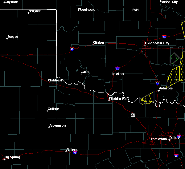 At 509 pm cdt, a severe thunderstorm was located near rubottom, or 15 miles northeast of nocona, moving east at 20 mph (radar indicated). Hazards include 60 mph wind gusts and quarter size hail. Hail damage to vehicles is expected. expect wind damage to roofs, siding, and trees. This severe thunderstorm will remain over mainly rural areas of northeastern montague county including the towns of illinois bend and corinth. At 509 pm cdt, a severe thunderstorm was located near rubottom, or 15 miles northeast of nocona, moving east at 20 mph (radar indicated). Hazards include 60 mph wind gusts and quarter size hail. Hail damage to vehicles is expected. expect wind damage to roofs, siding, and trees. This severe thunderstorm will remain over mainly rural areas of northeastern montague county including the towns of illinois bend and corinth.
|
| 7/2/2017 4:52 PM CDT |
 At 452 pm cdt, a severe thunderstorm was located 9 miles northeast of nocona, moving northeast at 20 mph (radar indicated). Hazards include 60 mph wind gusts and quarter size hail. Hail damage to vehicles is expected. expect wind damage to roofs, siding, and trees. Locations impacted include, lake nocona, corinth, and illinois bend. At 452 pm cdt, a severe thunderstorm was located 9 miles northeast of nocona, moving northeast at 20 mph (radar indicated). Hazards include 60 mph wind gusts and quarter size hail. Hail damage to vehicles is expected. expect wind damage to roofs, siding, and trees. Locations impacted include, lake nocona, corinth, and illinois bend.
|
| 7/2/2017 4:39 PM CDT |
 At 437 pm cdt, a severe thunderstorm was located just north of nocona, moving east at 20 mph (radar indicated). Hazards include 60 mph wind gusts and quarter size hail. Hail damage to vehicles is expected. Expect wind damage to roofs, siding, and trees. At 437 pm cdt, a severe thunderstorm was located just north of nocona, moving east at 20 mph (radar indicated). Hazards include 60 mph wind gusts and quarter size hail. Hail damage to vehicles is expected. Expect wind damage to roofs, siding, and trees.
|
| 5/28/2017 1:45 AM CDT |
 At 145 am cdt, severe thunderstorms were located along a line extending from near willis to near st. jo to near bowie, moving southeast at 20 mph (radar indicated). Hazards include quarter size hail. damage to vehicles is possible At 145 am cdt, severe thunderstorms were located along a line extending from near willis to near st. jo to near bowie, moving southeast at 20 mph (radar indicated). Hazards include quarter size hail. damage to vehicles is possible
|
| 5/28/2017 1:31 AM CDT |
 At 130 am cdt, a severe thunderstorm was located 7 miles northwest of st. jo, or 8 miles east of nocona, moving east at 20 mph. this storm produced quarter sized hail 10 miles north of st. jo (radar indicated). Hazards include 60 mph wind gusts and quarter size hail. Hail damage to vehicles is expected. expect wind damage to roofs, siding, and trees. locations impacted include, nocona and st. Jo. At 130 am cdt, a severe thunderstorm was located 7 miles northwest of st. jo, or 8 miles east of nocona, moving east at 20 mph. this storm produced quarter sized hail 10 miles north of st. jo (radar indicated). Hazards include 60 mph wind gusts and quarter size hail. Hail damage to vehicles is expected. expect wind damage to roofs, siding, and trees. locations impacted include, nocona and st. Jo.
|
| 5/28/2017 1:20 AM CDT | Quarter sized hail reported 6.1 miles WNW of Nocona Hills, TX, quarter size hail at the intersection of fm 677 and old miller rd north of nocona. |
| 5/28/2017 1:17 AM CDT |
 At 117 am cdt, a severe thunderstorm was located near st. jo, or 9 miles east of nocona, moving east at 35 mph (radar indicated). Hazards include 60 mph wind gusts and quarter size hail. Hail damage to vehicles is expected. Expect wind damage to roofs, siding, and trees. At 117 am cdt, a severe thunderstorm was located near st. jo, or 9 miles east of nocona, moving east at 35 mph (radar indicated). Hazards include 60 mph wind gusts and quarter size hail. Hail damage to vehicles is expected. Expect wind damage to roofs, siding, and trees.
|
| 5/28/2017 12:43 AM CDT |
 At 1243 am cdt, a severe thunderstorm was located 7 miles southeast of grady, or 11 miles northeast of nocona, moving east at 40 mph (radar indicated). Hazards include 60 mph wind gusts and quarter size hail. Hail damage to vehicles is expected. expect wind damage to roofs, siding, and trees. Locations impacted include, nocona and stoneburg. At 1243 am cdt, a severe thunderstorm was located 7 miles southeast of grady, or 11 miles northeast of nocona, moving east at 40 mph (radar indicated). Hazards include 60 mph wind gusts and quarter size hail. Hail damage to vehicles is expected. expect wind damage to roofs, siding, and trees. Locations impacted include, nocona and stoneburg.
|
| 5/28/2017 12:18 AM CDT |
 At 1217 am cdt, a severe thunderstorm was located near grady, or 12 miles north of nocona, moving east at 35 mph (radar indicated). Hazards include 60 mph wind gusts and nickel size hail. expect damage to roofs, siding, and trees At 1217 am cdt, a severe thunderstorm was located near grady, or 12 miles north of nocona, moving east at 35 mph (radar indicated). Hazards include 60 mph wind gusts and nickel size hail. expect damage to roofs, siding, and trees
|
| 5/19/2017 7:28 PM CDT |
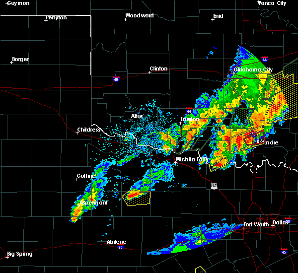 At 726 pm cdt, a severe thunderstorm was located near nocona, moving northeast at 35 mph (radar indicated). Hazards include 60 mph wind gusts and quarter size hail. Hail damage to vehicles is expected. expect wind damage to roofs, siding, and trees. this severe thunderstorm will remain over mainly rural areas of northwestern montague county but may impact the communities of hynds city, rowland, and spanish fort. A tornado watch remains in effect until 1100 pm. At 726 pm cdt, a severe thunderstorm was located near nocona, moving northeast at 35 mph (radar indicated). Hazards include 60 mph wind gusts and quarter size hail. Hail damage to vehicles is expected. expect wind damage to roofs, siding, and trees. this severe thunderstorm will remain over mainly rural areas of northwestern montague county but may impact the communities of hynds city, rowland, and spanish fort. A tornado watch remains in effect until 1100 pm.
|
| 5/19/2017 7:00 PM CDT |
 At 659 pm cdt, a severe thunderstorm was located near bellevue, or 13 miles southeast of henrietta, moving northeast at 25 mph (radar indicated). Hazards include 60 mph wind gusts and half dollar size hail. Hail damage to vehicles is expected. Expect wind damage to roofs, siding, and trees. At 659 pm cdt, a severe thunderstorm was located near bellevue, or 13 miles southeast of henrietta, moving northeast at 25 mph (radar indicated). Hazards include 60 mph wind gusts and half dollar size hail. Hail damage to vehicles is expected. Expect wind damage to roofs, siding, and trees.
|
| 5/19/2017 3:10 PM CDT |
 At 307 pm cdt, a severe thunderstorm was located near ringgold, or 11 miles west of nocona, moving northeast at 45 mph (radar indicated). Hazards include quarter size hail. Damage to vehicles is possible. The hail core will affect ringgold and belcherville, but will remain west of nocona. At 307 pm cdt, a severe thunderstorm was located near ringgold, or 11 miles west of nocona, moving northeast at 45 mph (radar indicated). Hazards include quarter size hail. Damage to vehicles is possible. The hail core will affect ringgold and belcherville, but will remain west of nocona.
|
| 5/19/2017 2:54 PM CDT |
 At 251 pm cdt, a severe thunderstorm was located 8 miles west of stoneburg, moving northeast at 40 mph (radar indicated). Hazards include quarter size hail. Damage to vehicles is possible. this severe thunderstorm will be near, stoneburg around 300 pm cdt. nocona around 320 pm cdt. the storm is currently over clay county but will enter montague county shortly. Very heavy rain will also accompany the storm. At 251 pm cdt, a severe thunderstorm was located 8 miles west of stoneburg, moving northeast at 40 mph (radar indicated). Hazards include quarter size hail. Damage to vehicles is possible. this severe thunderstorm will be near, stoneburg around 300 pm cdt. nocona around 320 pm cdt. the storm is currently over clay county but will enter montague county shortly. Very heavy rain will also accompany the storm.
|
| 5/18/2017 10:50 PM CDT |
 At 1049 pm cdt, a severe thunderstorm was located 8 miles west of rubottom, or 11 miles northeast of nocona, moving northeast at 25 mph (radar indicated). Hazards include 65 mph wind gusts and quarter size hail. Hail damage to vehicles is expected. expect wind damage to roofs, siding, and trees. locations impacted include, nocona. A tornado watch remains in effect until midnight cdt for north central texas. At 1049 pm cdt, a severe thunderstorm was located 8 miles west of rubottom, or 11 miles northeast of nocona, moving northeast at 25 mph (radar indicated). Hazards include 65 mph wind gusts and quarter size hail. Hail damage to vehicles is expected. expect wind damage to roofs, siding, and trees. locations impacted include, nocona. A tornado watch remains in effect until midnight cdt for north central texas.
|
| 5/18/2017 10:27 PM CDT |
 At 1025 pm cdt, a severe thunderstorm was located near nocona, moving east at 40 mph (radar indicated). Hazards include golf ball size hail and 65 mph wind gusts. People and animals outdoors will be injured. expect hail damage to roofs, siding, windows, and vehicles. Expect wind damage to roofs, siding, and trees. At 1025 pm cdt, a severe thunderstorm was located near nocona, moving east at 40 mph (radar indicated). Hazards include golf ball size hail and 65 mph wind gusts. People and animals outdoors will be injured. expect hail damage to roofs, siding, windows, and vehicles. Expect wind damage to roofs, siding, and trees.
|
| 5/18/2017 10:08 PM CDT |
 At 1008 pm cdt, a severe thunderstorm was located near nocona, moving east at 30 mph (radar indicated). Hazards include golf ball size hail and 65 mph wind gusts. People and animals outdoors will be injured. expect hail damage to roofs, siding, windows, and vehicles. expect wind damage to roofs, siding, and trees. locations impacted include, nocona, st. Jo and stoneburg. At 1008 pm cdt, a severe thunderstorm was located near nocona, moving east at 30 mph (radar indicated). Hazards include golf ball size hail and 65 mph wind gusts. People and animals outdoors will be injured. expect hail damage to roofs, siding, windows, and vehicles. expect wind damage to roofs, siding, and trees. locations impacted include, nocona, st. Jo and stoneburg.
|
| 5/18/2017 9:42 PM CDT |
 At 942 pm cdt, a severe thunderstorm was located near stoneburg, or 9 miles west of nocona, moving east at 50 mph (radar indicated). Hazards include 65 mph wind gusts and half dollar size hail. Hail damage to vehicles is expected. Expect wind damage to roofs, siding, and trees. At 942 pm cdt, a severe thunderstorm was located near stoneburg, or 9 miles west of nocona, moving east at 50 mph (radar indicated). Hazards include 65 mph wind gusts and half dollar size hail. Hail damage to vehicles is expected. Expect wind damage to roofs, siding, and trees.
|
| 4/21/2017 6:45 PM CDT |
 At 644 pm cdt, a severe thunderstorm was located near muenster, or 16 miles west of gainesville, moving east at 50 mph (radar indicated). Hazards include ping pong ball size hail and 60 mph wind gusts. People and animals outdoors will be injured. expect hail damage to roofs, siding, windows, and vehicles. expect wind damage to roofs, siding, and trees. locations impacted include, gainesville, muenster, st. jo, lindsay, callisburg and lake kiowa. A tornado watch remains in effect until 100 am cdt for north central texas. At 644 pm cdt, a severe thunderstorm was located near muenster, or 16 miles west of gainesville, moving east at 50 mph (radar indicated). Hazards include ping pong ball size hail and 60 mph wind gusts. People and animals outdoors will be injured. expect hail damage to roofs, siding, windows, and vehicles. expect wind damage to roofs, siding, and trees. locations impacted include, gainesville, muenster, st. jo, lindsay, callisburg and lake kiowa. A tornado watch remains in effect until 100 am cdt for north central texas.
|
| 4/21/2017 6:34 PM CDT |
 At 633 pm cdt, a severe thunderstorm was located near leon, or 11 miles east of nocona, moving east at 35 mph (radar indicated). Hazards include 60 mph wind gusts and half dollar size hail. Hail damage to vehicles is expected. Expect wind damage to roofs, siding, and trees. At 633 pm cdt, a severe thunderstorm was located near leon, or 11 miles east of nocona, moving east at 35 mph (radar indicated). Hazards include 60 mph wind gusts and half dollar size hail. Hail damage to vehicles is expected. Expect wind damage to roofs, siding, and trees.
|
| 4/21/2017 6:22 PM CDT |
 At 621 pm cdt, severe thunderstorms producing quarter size hail were located along a line extending from near grady to near stoneburg, moving east at 50 mph (law enforcement). Hazards include 60 mph wind gusts and quarter size hail. Hail damage to vehicles is expected. expect wind damage to roofs, siding, and trees. locations impacted include, nocona and st. jo. A tornado watch remains in effect until 100 am cdt for north central texas. At 621 pm cdt, severe thunderstorms producing quarter size hail were located along a line extending from near grady to near stoneburg, moving east at 50 mph (law enforcement). Hazards include 60 mph wind gusts and quarter size hail. Hail damage to vehicles is expected. expect wind damage to roofs, siding, and trees. locations impacted include, nocona and st. jo. A tornado watch remains in effect until 100 am cdt for north central texas.
|
| 4/21/2017 6:11 PM CDT |
 At 610 pm cdt, severe thunderstorms were located along a line extending from 6 miles east of sugden to 6 miles southeast of henrietta, moving southeast at 15 mph (radar indicated). Hazards include 60 mph wind gusts and quarter size hail. Hail damage to vehicles is expected. expect wind damage to roofs, siding, and trees. locations impacted include, nocona and st. jo. A tornado watch remains in effect until 100 am cdt for north central texas. At 610 pm cdt, severe thunderstorms were located along a line extending from 6 miles east of sugden to 6 miles southeast of henrietta, moving southeast at 15 mph (radar indicated). Hazards include 60 mph wind gusts and quarter size hail. Hail damage to vehicles is expected. expect wind damage to roofs, siding, and trees. locations impacted include, nocona and st. jo. A tornado watch remains in effect until 100 am cdt for north central texas.
|
| 4/21/2017 5:49 PM CDT |
 At 548 pm cdt, severe thunderstorms were located along a line extending from waurika to near henrietta, moving southeast at 30 mph (radar indicated). Hazards include 60 mph wind gusts and quarter size hail. Hail damage to vehicles is expected. Expect wind damage to roofs, siding, and trees. At 548 pm cdt, severe thunderstorms were located along a line extending from waurika to near henrietta, moving southeast at 30 mph (radar indicated). Hazards include 60 mph wind gusts and quarter size hail. Hail damage to vehicles is expected. Expect wind damage to roofs, siding, and trees.
|
| 4/21/2017 2:32 AM CDT |
 At 232 am cdt, a severe thunderstorm was located near nocona, moving east at 30 mph (radar indicated). Hazards include 60 mph wind gusts and half dollar size hail. Hail damage to vehicles is expected. expect wind damage to roofs, siding, and trees. locations impacted include, nocona, st. Jo and stoneburg. At 232 am cdt, a severe thunderstorm was located near nocona, moving east at 30 mph (radar indicated). Hazards include 60 mph wind gusts and half dollar size hail. Hail damage to vehicles is expected. expect wind damage to roofs, siding, and trees. locations impacted include, nocona, st. Jo and stoneburg.
|
| 4/21/2017 2:06 AM CDT |
 At 205 am cdt, a severe thunderstorm was located 7 miles northwest of stoneburg, or 12 miles east of henrietta, moving east at 45 mph (radar indicated). Hazards include ping pong ball size hail and 60 mph wind gusts. People and animals outdoors will be injured. expect hail damage to roofs, siding, windows, and vehicles. Expect wind damage to roofs, siding, and trees. At 205 am cdt, a severe thunderstorm was located 7 miles northwest of stoneburg, or 12 miles east of henrietta, moving east at 45 mph (radar indicated). Hazards include ping pong ball size hail and 60 mph wind gusts. People and animals outdoors will be injured. expect hail damage to roofs, siding, windows, and vehicles. Expect wind damage to roofs, siding, and trees.
|
| 3/26/2017 6:43 PM CDT |
 At 643 pm cdt, a severe thunderstorm was located 7 miles northwest of st. jo, or 7 miles east of nocona, moving northeast at 40 mph (radar indicated). Hazards include 60 mph wind gusts and quarter size hail. Hail damage to vehicles is expected. expect wind damage to roofs, siding, and trees. this severe thunderstorm will remain over mainly rural areas of northeastern montague county. A tornado watch remains in effect until 1100 pm cdt for north central texas. At 643 pm cdt, a severe thunderstorm was located 7 miles northwest of st. jo, or 7 miles east of nocona, moving northeast at 40 mph (radar indicated). Hazards include 60 mph wind gusts and quarter size hail. Hail damage to vehicles is expected. expect wind damage to roofs, siding, and trees. this severe thunderstorm will remain over mainly rural areas of northeastern montague county. A tornado watch remains in effect until 1100 pm cdt for north central texas.
|
| 3/26/2017 6:28 PM CDT |
 At 627 pm cdt, a severe thunderstorm was located 7 miles south of nocona, moving northeast at 45 mph (radar indicated). Hazards include 60 mph wind gusts and half dollar size hail. Hail damage to vehicles is expected. expect wind damage to roofs, siding, and trees. this severe storm will be near, st. jo around 645 pm cdt. A tornado watch remains in effect until 1100 pm cdt for north central texas. At 627 pm cdt, a severe thunderstorm was located 7 miles south of nocona, moving northeast at 45 mph (radar indicated). Hazards include 60 mph wind gusts and half dollar size hail. Hail damage to vehicles is expected. expect wind damage to roofs, siding, and trees. this severe storm will be near, st. jo around 645 pm cdt. A tornado watch remains in effect until 1100 pm cdt for north central texas.
|
| 3/26/2017 6:07 PM CDT |
 At 607 pm cdt, a severe thunderstorm was located near stoneburg, or near bowie, moving northeast at 45 mph (radar indicated). Hazards include golf ball size hail and 60 mph wind gusts. People and animals outdoors will be injured. expect hail damage to roofs, siding, windows, and vehicles. expect wind damage to roofs, siding, and trees. this severe storm will be near, nocona around 620 pm cdt. A tornado watch remains in effect until 1100 pm cdt for north central texas. At 607 pm cdt, a severe thunderstorm was located near stoneburg, or near bowie, moving northeast at 45 mph (radar indicated). Hazards include golf ball size hail and 60 mph wind gusts. People and animals outdoors will be injured. expect hail damage to roofs, siding, windows, and vehicles. expect wind damage to roofs, siding, and trees. this severe storm will be near, nocona around 620 pm cdt. A tornado watch remains in effect until 1100 pm cdt for north central texas.
|
| 3/26/2017 5:53 PM CDT |
 At 553 pm cdt, a severe thunderstorm was located near newport, or near bowie, moving northeast at 35 mph (radar indicated). Hazards include 60 mph wind gusts and half dollar size hail. Hail damage to vehicles is expected. expect wind damage to roofs, siding, and trees. this severe thunderstorm will be near, bowie around 605 pm cdt. stoneburg around 610 pm cdt. nocona around 635 pm cdt. st. jo around 640 pm cdt. A tornado watch remains in effect until 1100 pm cdt for north central texas. At 553 pm cdt, a severe thunderstorm was located near newport, or near bowie, moving northeast at 35 mph (radar indicated). Hazards include 60 mph wind gusts and half dollar size hail. Hail damage to vehicles is expected. expect wind damage to roofs, siding, and trees. this severe thunderstorm will be near, bowie around 605 pm cdt. stoneburg around 610 pm cdt. nocona around 635 pm cdt. st. jo around 640 pm cdt. A tornado watch remains in effect until 1100 pm cdt for north central texas.
|
| 7/3/2016 8:22 PM CDT |
 The severe thunderstorm warning for northern montague county will expire at 830 pm cdt, the storm which prompted the warning has weakened below severe limits. therefore the warning will be allowed to expire. however gusty winds and heavy rain are still possible with this thunderstorm. a severe thunderstorm watch remains in effect until 200 am cdt for north central texas. The severe thunderstorm warning for northern montague county will expire at 830 pm cdt, the storm which prompted the warning has weakened below severe limits. therefore the warning will be allowed to expire. however gusty winds and heavy rain are still possible with this thunderstorm. a severe thunderstorm watch remains in effect until 200 am cdt for north central texas.
|
| 7/3/2016 7:50 PM CDT |
 At 749 pm cdt, a severe thunderstorm was located near terral, or 11 miles east of henrietta, moving east at 30 mph (radar indicated). Hazards include 60 mph wind gusts and penny size hail. Expect damage to roofs. siding. and trees. This severe thunderstorm will be near, nocona around 820 pm cdt. At 749 pm cdt, a severe thunderstorm was located near terral, or 11 miles east of henrietta, moving east at 30 mph (radar indicated). Hazards include 60 mph wind gusts and penny size hail. Expect damage to roofs. siding. and trees. This severe thunderstorm will be near, nocona around 820 pm cdt.
|
| 4/26/2016 8:46 PM CDT |
 At 846 pm cdt, severe thunderstorms were located along a line extending from near leon to near st. jo to near sunset, moving east at 35 mph (radar indicated). Hazards include 60 mph wind gusts and nickel size hail. Expect damage to roofs. siding. and trees. these severe storms will be near, st. jo around 850 pm cdt. forestburg around 900 pm cdt. A tornado watch remains in effect until midnight cdt for north central texas. At 846 pm cdt, severe thunderstorms were located along a line extending from near leon to near st. jo to near sunset, moving east at 35 mph (radar indicated). Hazards include 60 mph wind gusts and nickel size hail. Expect damage to roofs. siding. and trees. these severe storms will be near, st. jo around 850 pm cdt. forestburg around 900 pm cdt. A tornado watch remains in effect until midnight cdt for north central texas.
|
| 4/26/2016 8:19 PM CDT |
 At 818 pm cdt, a severe thunderstorm was located over stoneburg, or 10 miles northwest of bowie, moving northeast at 50 mph (radar indicated). Hazards include 60 mph wind gusts and nickel size hail. Expect damage to roofs. siding. and trees. this severe thunderstorm will be near, nocona around 835 pm cdt. A tornado watch remains in effect until midnight cdt for north central texas. At 818 pm cdt, a severe thunderstorm was located over stoneburg, or 10 miles northwest of bowie, moving northeast at 50 mph (radar indicated). Hazards include 60 mph wind gusts and nickel size hail. Expect damage to roofs. siding. and trees. this severe thunderstorm will be near, nocona around 835 pm cdt. A tornado watch remains in effect until midnight cdt for north central texas.
|
| 4/11/2016 4:03 PM CDT |
 At 402 pm cdt, a severe thunderstorm was located near stoneburg, or 11 miles west of nocona, moving east at 15 mph (radar indicated). Hazards include 60 mph wind gusts and quarter size hail. Hail damage to vehicles is expected. expect wind damage to roofs, siding, and trees. This severe thunderstorm will be near, nocona around 445 pm cdt. At 402 pm cdt, a severe thunderstorm was located near stoneburg, or 11 miles west of nocona, moving east at 15 mph (radar indicated). Hazards include 60 mph wind gusts and quarter size hail. Hail damage to vehicles is expected. expect wind damage to roofs, siding, and trees. This severe thunderstorm will be near, nocona around 445 pm cdt.
|
| 12/26/2015 4:39 PM CST |
 At 438 pm cst, a severe thunderstorm was located near forestburg, or 13 miles southeast of bowie, moving northeast at 40 mph (radar indicated). Hazards include 60 mph wind gusts and quarter size hail. Hail damage to vehicles is expected. Expect wind damage to roofs, siding and trees. At 438 pm cst, a severe thunderstorm was located near forestburg, or 13 miles southeast of bowie, moving northeast at 40 mph (radar indicated). Hazards include 60 mph wind gusts and quarter size hail. Hail damage to vehicles is expected. Expect wind damage to roofs, siding and trees.
|
| 11/5/2015 2:56 PM CST |
 The severe thunderstorm warning for montague county will expire at 300 pm cst, the storm which prompted the warning has weakened below severe limits. therefore the warning will be allowed to expire. however gusty winds and heavy rain are still possible with this thunderstorm. a tornado watch remains in effect until 800 pm cst for north central texas. The severe thunderstorm warning for montague county will expire at 300 pm cst, the storm which prompted the warning has weakened below severe limits. therefore the warning will be allowed to expire. however gusty winds and heavy rain are still possible with this thunderstorm. a tornado watch remains in effect until 800 pm cst for north central texas.
|
| 11/5/2015 2:40 PM CST |
 At 239 pm cst, a severe thunderstorm was located near bowie, moving northeast at 45 mph (radar indicated). Hazards include 60 mph wind gusts and quarter size hail. Hail damage to vehicles is expected. expect wind damage to roofs, siding and trees. locations impacted include, bowie, nocona, st. jo and stoneburg. A tornado watch remains in effect until 800 pm cst for north central texas. At 239 pm cst, a severe thunderstorm was located near bowie, moving northeast at 45 mph (radar indicated). Hazards include 60 mph wind gusts and quarter size hail. Hail damage to vehicles is expected. expect wind damage to roofs, siding and trees. locations impacted include, bowie, nocona, st. jo and stoneburg. A tornado watch remains in effect until 800 pm cst for north central texas.
|
| 11/5/2015 2:06 PM CST |
 At 204 pm cst, a line of severe thunderstorms was located near stoneburg, or near bowie, moving northeast at 40 mph (radar indicated). Hazards include 60 mph wind gusts and quarter size hail. hail damage to vehicles is possible At 204 pm cst, a line of severe thunderstorms was located near stoneburg, or near bowie, moving northeast at 40 mph (radar indicated). Hazards include 60 mph wind gusts and quarter size hail. hail damage to vehicles is possible
|
| 5/28/2015 8:29 PM CDT | At 829 pm cdt, a severe thunderstorm was located near forestburg, or 18 miles west of gainesville, moving northeast at 30 mph (public). Hazards include 70 mph wind gusts and quarter size hail. Hail damage to vehicles is expected. expect considerable tree damage. Wind damage is also likely to mobile homes, roofs and outbuildings. |
| 5/28/2015 7:43 PM CDT | At 742 pm cdt, severe thunderstorms were located along a line extending from near terral to near sunset, moving northeast at 45 mph (radar indicated). Hazards include 60 mph wind gusts and quarter size hail. Hail damage to vehicles is expected. Expect wind damage to roofs, siding and trees. |
| 5/25/2015 2:13 PM CDT | The severe thunderstorm warning for eastern wise and eastern montague counties will expire at 215 pm cdt, the storms which prompted the warning have moved out of the area and weakened. therefore the warning will be allowed to expire. however gusty winds are still possible with these thunderstorms. a tornado watch remains in effect until 600 pm cdt for north central texas. |
| 5/25/2015 2:05 PM CDT | At 204 pm cdt, severe thunderstorms were located along a line extending from near forestburg to 7 miles northeast of decatur to near new fairview, moving east at 50 mph (radar indicated). Hazards include 70 mph wind gusts and penny size hail. Expect considerable tree damage. damage is likely to mobile homes, roofs and outbuildings. locations impacted include, decatur, nocona, briar, pecan acres, new fairview, aurora, boyd, st. jo, paradise, forestburg, cottondale, rhome and newark. A tornado watch remains in effect until 600 pm cdt for north central texas. |
| 5/25/2015 1:47 PM CDT | At 147 pm cdt, severe thunderstorms were located along a line extending from near forestburg to 7 miles northeast of decatur to near boyd, moving east at 45 mph (radar indicated). Hazards include 70 mph wind gusts and penny size hail. Expect considerable tree damage. damage is likely to mobile homes, roofs and outbuildings. locations impacted include, decatur, bridgeport, bowie, nocona, briar, pecan acres, alvord, new fairview, aurora, boyd, st. jo, chico, paradise, stoneburg, forestburg, sunset, boonsville, cottondale, rhome and runaway bay. A tornado watch remains in effect until 600 pm cdt for north central texas. |
| 5/25/2015 1:31 PM CDT | At 131 pm cdt, severe thunderstorms were located along a line extending from near bowie to near alvord to near cottondale, moving east at 50 mph (radar indicated). Hazards include 70 mph wind gusts and penny size hail. Expect considerable tree damage. damage is likely to mobile homes, roofs and outbuildings. locations impacted include, decatur, bridgeport, bowie, nocona, briar, pecan acres, alvord, new fairview, aurora, boyd, st. jo, chico, paradise, stoneburg, forestburg, sunset, boonsville, cottondale, rhome and runaway bay. A tornado watch remains in effect until 600 pm cdt for north central texas. |
| 5/25/2015 1:11 PM CDT | At 110 pm cdt, severe thunderstorms were located along a line extending from near newport to 9 miles west of chico to near poolville, moving east at 50 mph (radar indicated). Hazards include 60 mph wind gusts and penny size hail. Expect damage to roofs. Siding and trees. |
| 5/20/2015 1:06 AM CDT | At 106 am cdt, severe thunderstorms were located along a line extending from terral to 7 miles southwest of bellevue, moving east at 55 mph (radar indicated). Hazards include 60 mph wind gusts and quarter size hail. Hail damage to vehicles is expected. Expect wind damage to roofs, siding and trees. |
| 5/8/2015 9:06 PM CDT | The severe thunderstorm warning for montague county will expire at 915 pm cdt, the storm which prompted the warning has weakened below severe limits, and no longer pose an immediate threat to life or property. therefore the warning will be allowed to expire. however gusty winds and heavy rain are still possible with this thunderstorm. a tornado watch remains in effect until 300 am cdt for north central texas. |
| 5/8/2015 8:28 PM CDT | At 827 pm cdt, a severe thunderstorm was located 7 miles northwest of forestburg, or 12 miles east of bowie, moving east at 45 mph (radar indicated). Hazards include 60 mph wind gusts and quarter size hail. Hail damage to vehicles is expected. Expect wind damage to roofs, siding and trees. |
| 5/8/2015 8:13 PM CDT | At 813 pm cdt, a severe thunderstorm was located near st. jo, or 7 miles southeast of nocona, moving northeast at 15 mph (radar indicated). Hazards include 60 mph wind gusts and quarter size hail. Hail damage to vehicles is expected. expect wind damage to roofs, siding and trees. locations impacted include, bowie, nocona, st. jo, stoneburg, forestburg and sunset. a tornado watch remains in effect until 300 am cdt for north central texas. Possible. |
| 5/8/2015 7:30 PM CDT | At 729 pm cdt, a severe thunderstorm was located near nocona, moving northeast at 25 mph. this storm is capable of producing a tornado. another severe thunderstorm was also located near newport, also moving northeast (radar indicated). Hazards include ping pong ball size hail and 60 mph wind gusts. People and animals outdoors will be injured. expect hail damage to roofs, siding, windows and vehicles. Expect wind damage to roofs, siding and trees. |
| 5/7/2015 1:45 AM CDT | At 144 am cdt, a severe thunderstorm was located over bowie, moving northeast at 25 mph. additional severe storms extend from northeast of bowie to north of muenster (radar indicated). Hazards include 60 mph wind gusts and quarter size hail. Hail damage to vehicles is expected. expect wind damage to roofs, siding and trees. locations impacted include, bowie, nocona, muenster, st. jo, forestburg, sunset and stoneburg. 1. 00in. |
| 5/7/2015 1:27 AM CDT | At 126 am cdt, a cluster of severe thunderstorms was located from near bowie to east of nocona, moving northeast at 25 mph. torrential rainfall is also occurring with these storms which will likely cause flash flooding (radar indicated). Hazards include 60 mph wind gusts and quarter size hail. Hail damage to vehicles is expected. Expect wind damage to roofs, siding and trees. |
| 5/7/2015 1:08 AM CDT | At 108 am cdt, a severe thunderstorm was located near bowie, moving northeast at 25 mph (radar indicated). Hazards include golf ball size hail and 60 mph wind gusts. People and animals outdoors will be injured. expect hail damage to roofs, siding, windows and vehicles. expect wind damage to roofs, siding and trees. locations impacted include, bowie, nocona, st. jo, stoneburg and sunset. a tornado watch remains in effect until 200 am cdt for north central texas. 1. 75in. |
| 5/7/2015 12:37 AM CDT | At 1236 am cdt, a severe thunderstorm was located near newport, or 8 miles southwest of bowie, moving northeast at 20 mph (radar indicated). Hazards include golf ball size hail and 65 mph wind gusts. People and animals outdoors will be injured. expect hail damage to roofs, siding, windows and vehicles. expect wind damage to roofs, siding and trees. locations impacted include, bowie, nocona, st. jo, stoneburg and sunset. a tornado watch remains in effect until 200 am cdt for north central texas. 1. 75in. |
| 5/7/2015 12:28 AM CDT | At 1228 am cdt, a severe thunderstorm was located over newport, or 10 miles southwest of bowie, moving northeast at 30 mph (radar indicated). Hazards include 60 mph wind gusts and quarter size hail. Hail damage to vehicles is expected. Expect wind damage to roofs, siding and trees. |
| 5/7/2015 12:07 AM CDT | At 1206 am cdt, a severe thunderstorm was located near stoneburg, or 9 miles southwest of nocona, moving northeast at 20 mph (radar indicated). Hazards include 60 mph wind gusts and half dollar size hail. Hail damage to vehicles is expected. expect wind damage to roofs, siding and trees. locations impacted include, bowie, nocona and stoneburg. a tornado watch remains in effect until 200 am cdt for north central texas. Possible. |
| 5/6/2015 11:50 PM CDT | At 1150 pm cdt, a severe thunderstorm was located near stoneburg, or 10 miles southwest of nocona, moving northeast at 40 mph (radar indicated). Hazards include 60 mph wind gusts and quarter size hail. Hail damage to vehicles is expected. expect wind damage to roofs, siding and trees. locations impacted include, bowie, nocona and stoneburg. a tornado watch remains in effect until 200 am cdt for north central texas. Possible. |
| 5/6/2015 11:25 PM CDT | At 1125 pm cdt, a severe thunderstorm was located near stoneburg, or 12 miles west of nocona, moving northeast at 25 mph (radar indicated). Hazards include 60 mph wind gusts and quarter size hail. Hail damage to vehicles is expected. Expect wind damage to roofs, siding and trees. |
| 5/30/2012 8:58 PM CDT | Storm damage reported in love county OK, 11.6 miles SSW of Nocona Hills, TX |
| 1/1/0001 12:00 AM | Hen Egg sized hail reported 10.7 miles SE of Nocona Hills, TX |
Hail Maps for Nocona Hills, TX
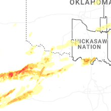
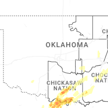

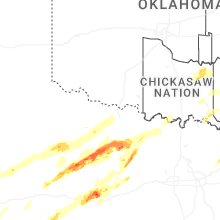
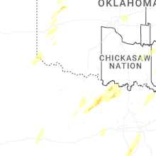
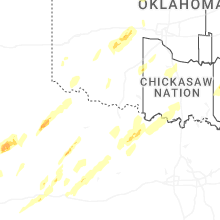


Connect with Interactive Hail Maps