

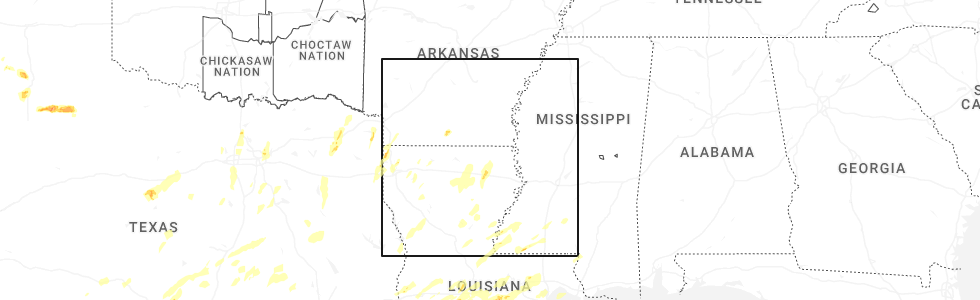
Hail Map for Norphlet, AR
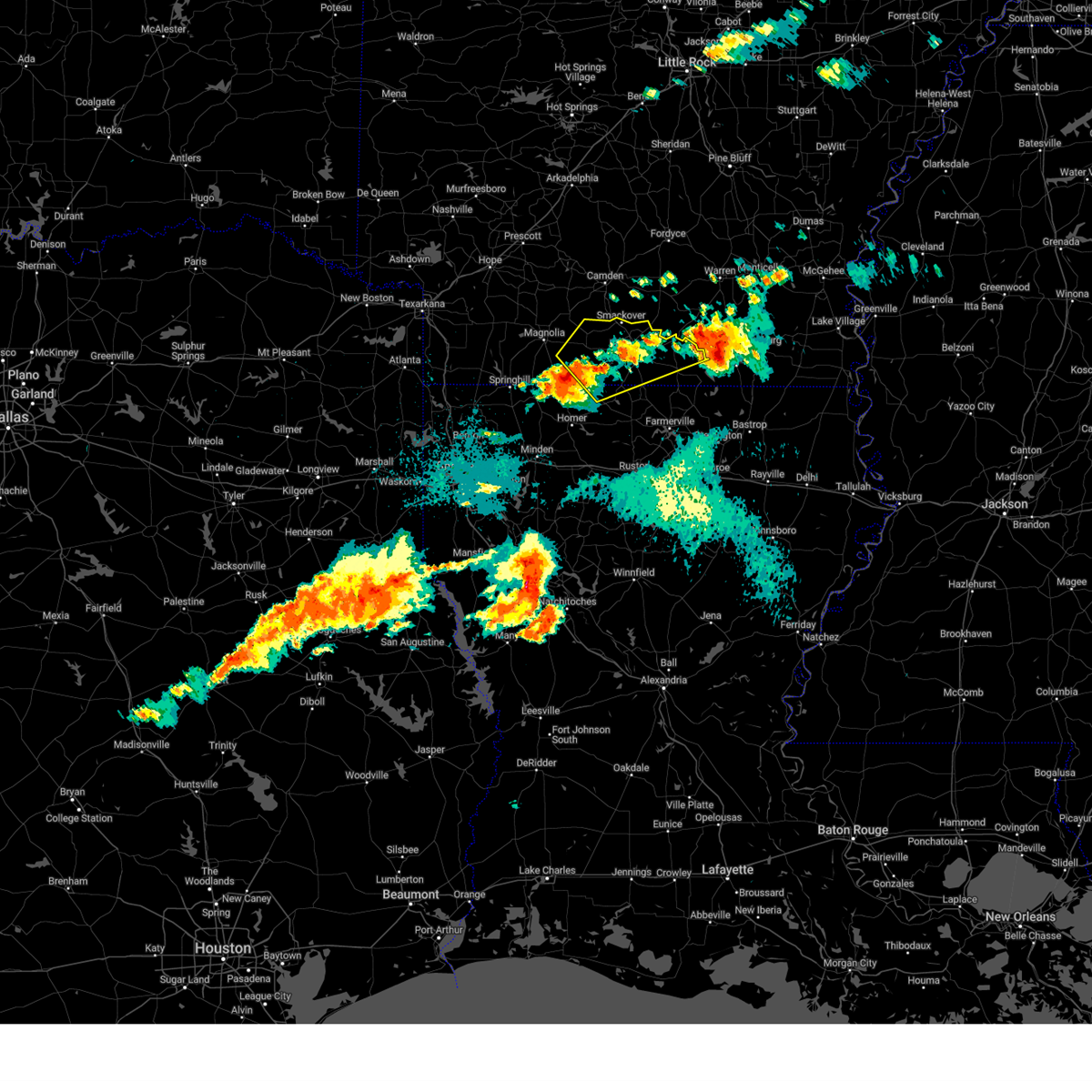
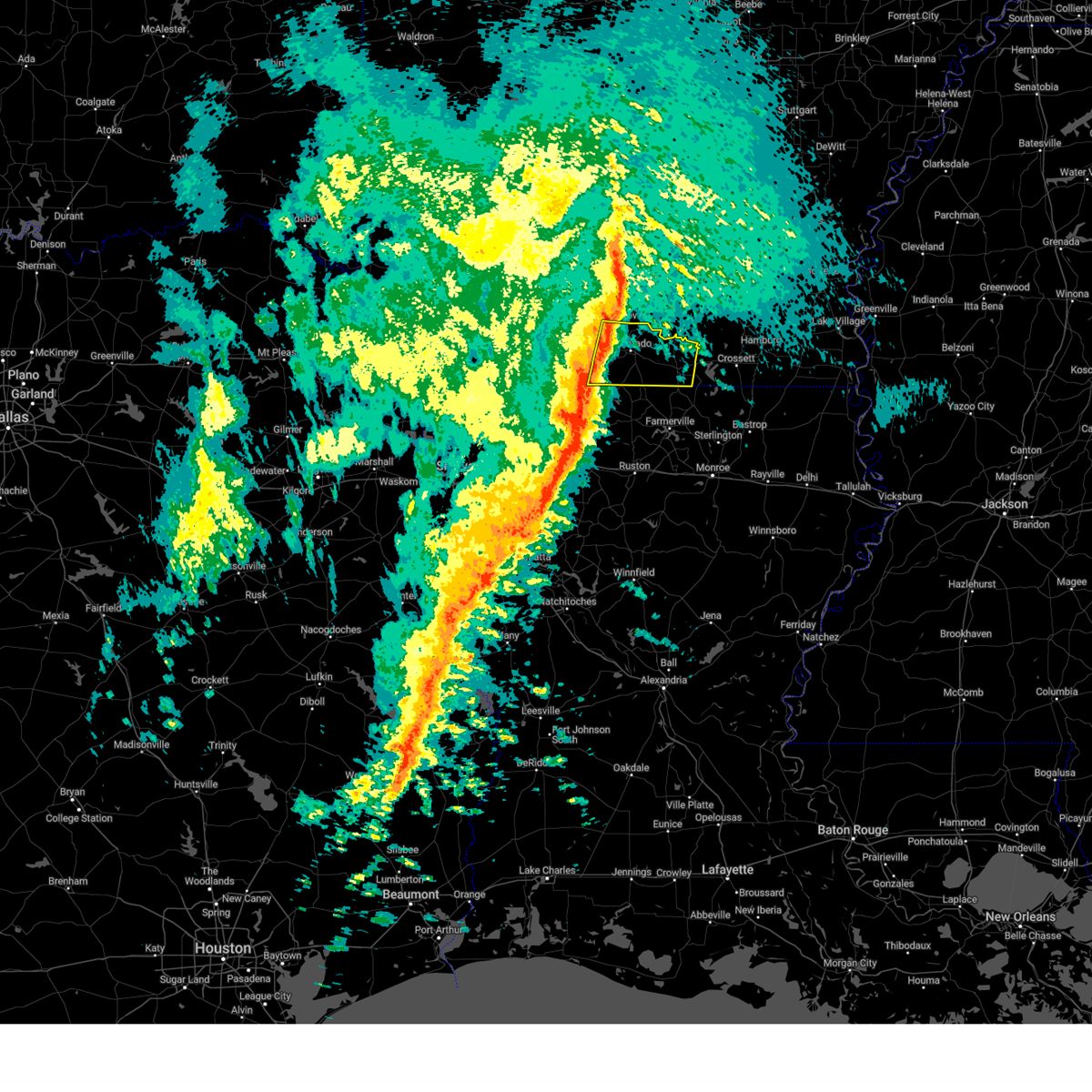
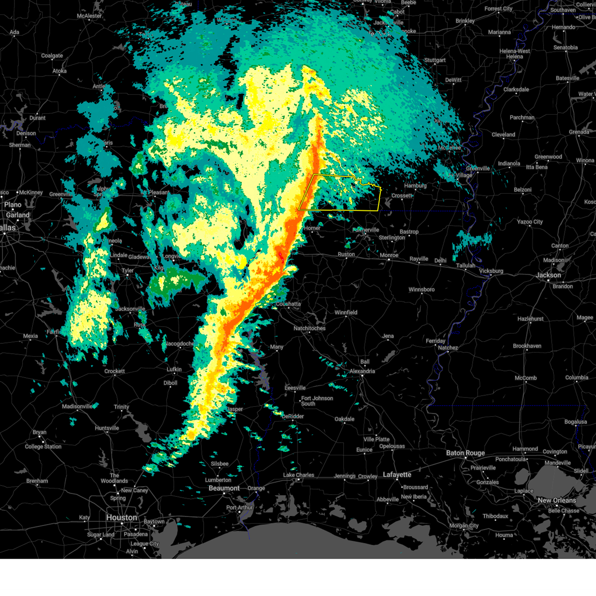
The Norphlet, AR area has had 1 report of on-the-ground hail by trained spotters, and has been under severe weather warnings 18 times during the past 12 months. Doppler radar has detected hail at or near Norphlet, AR on 46 occasions, including 3 occasions during the past year.
| Name: | Norphlet, AR |
| Where Located: | 57 miles NW of Bastrop, LA |
| Map: | Google Map for Norphlet, AR |
| Population: | 844 |
| Housing Units: | 354 |
| More Info: | Search Google for Norphlet, AR |
0
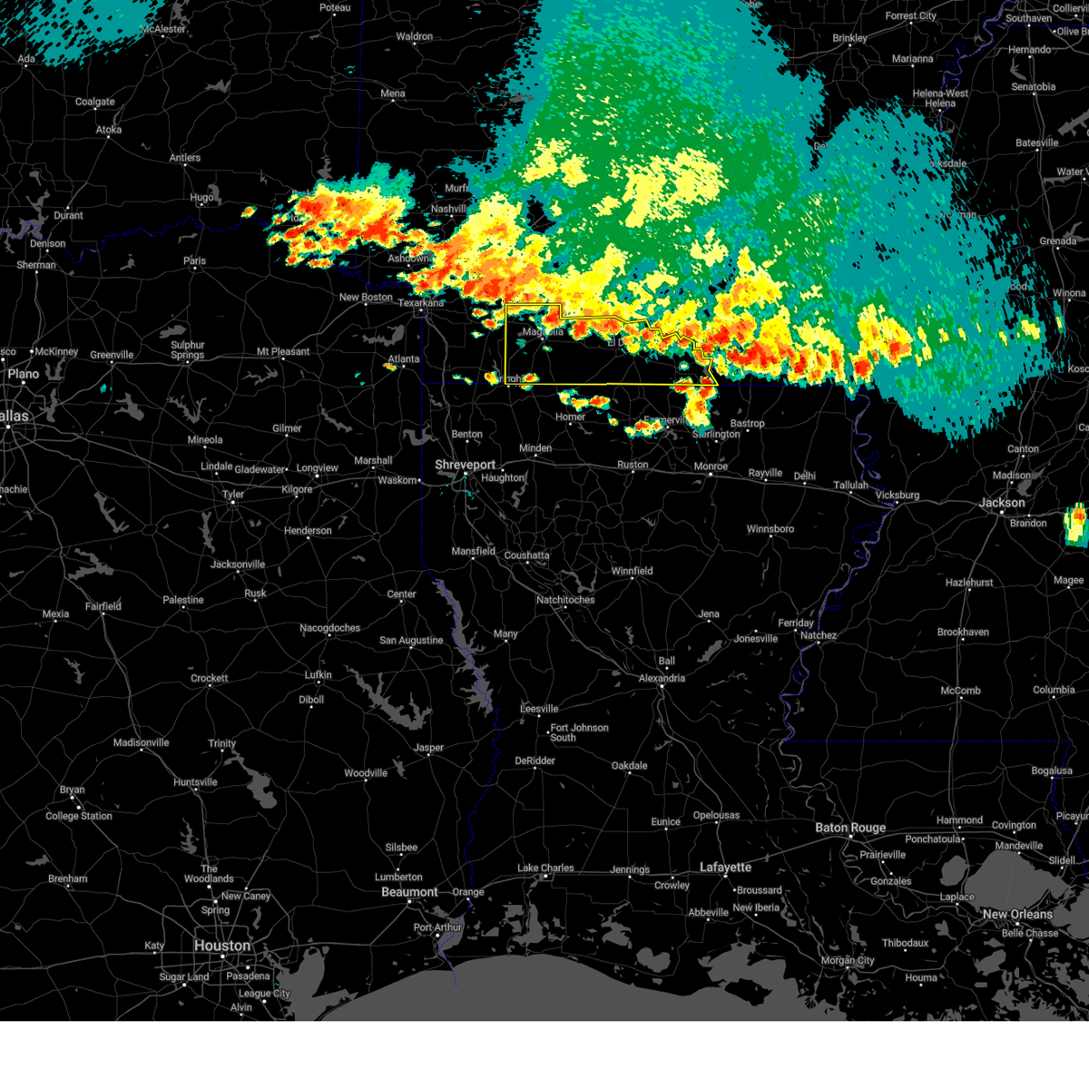
The Top Recent Hail Date for Norphlet, AR is Tuesday, May 6, 2025 (33rd out of 46)
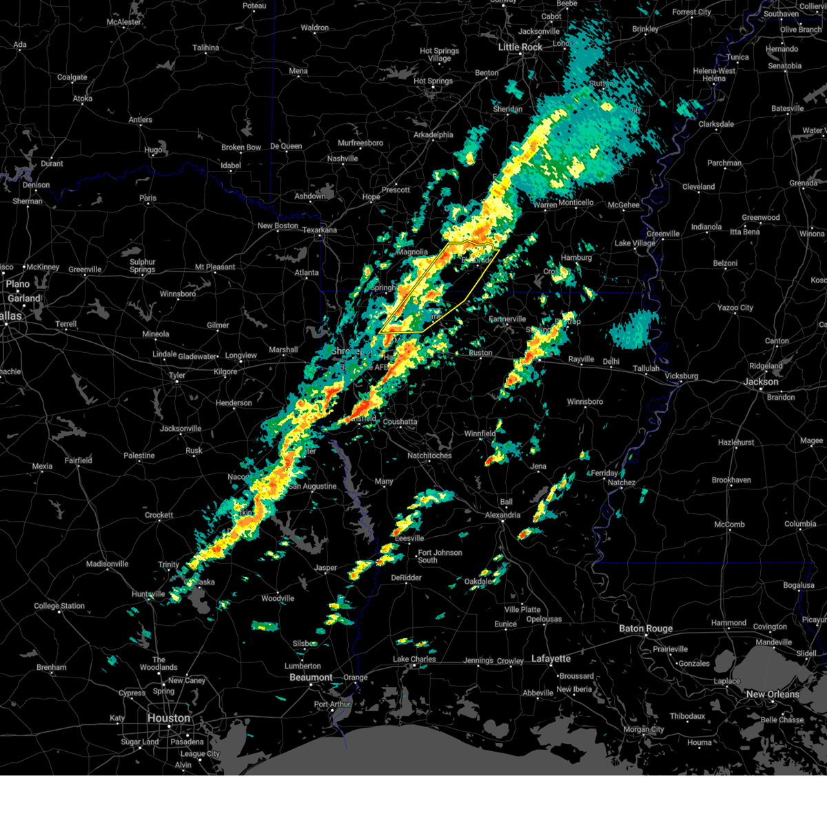
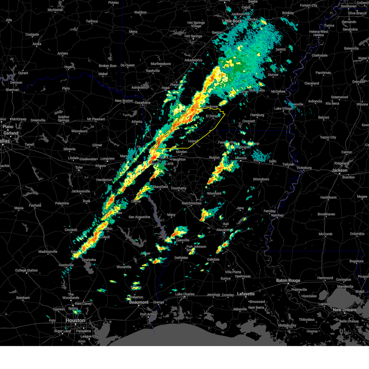
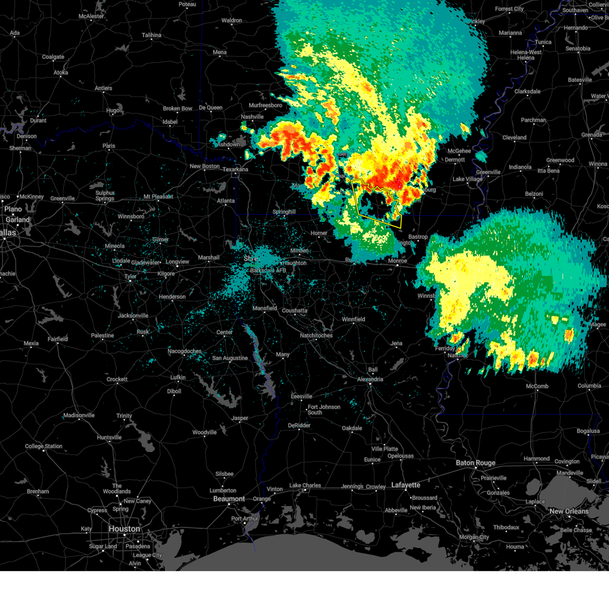
Hail and Wind Damage Spotted near Norphlet, AR
| Date / Time | Report Details |
|---|---|
| 5/25/2025 8:00 PM CDT |
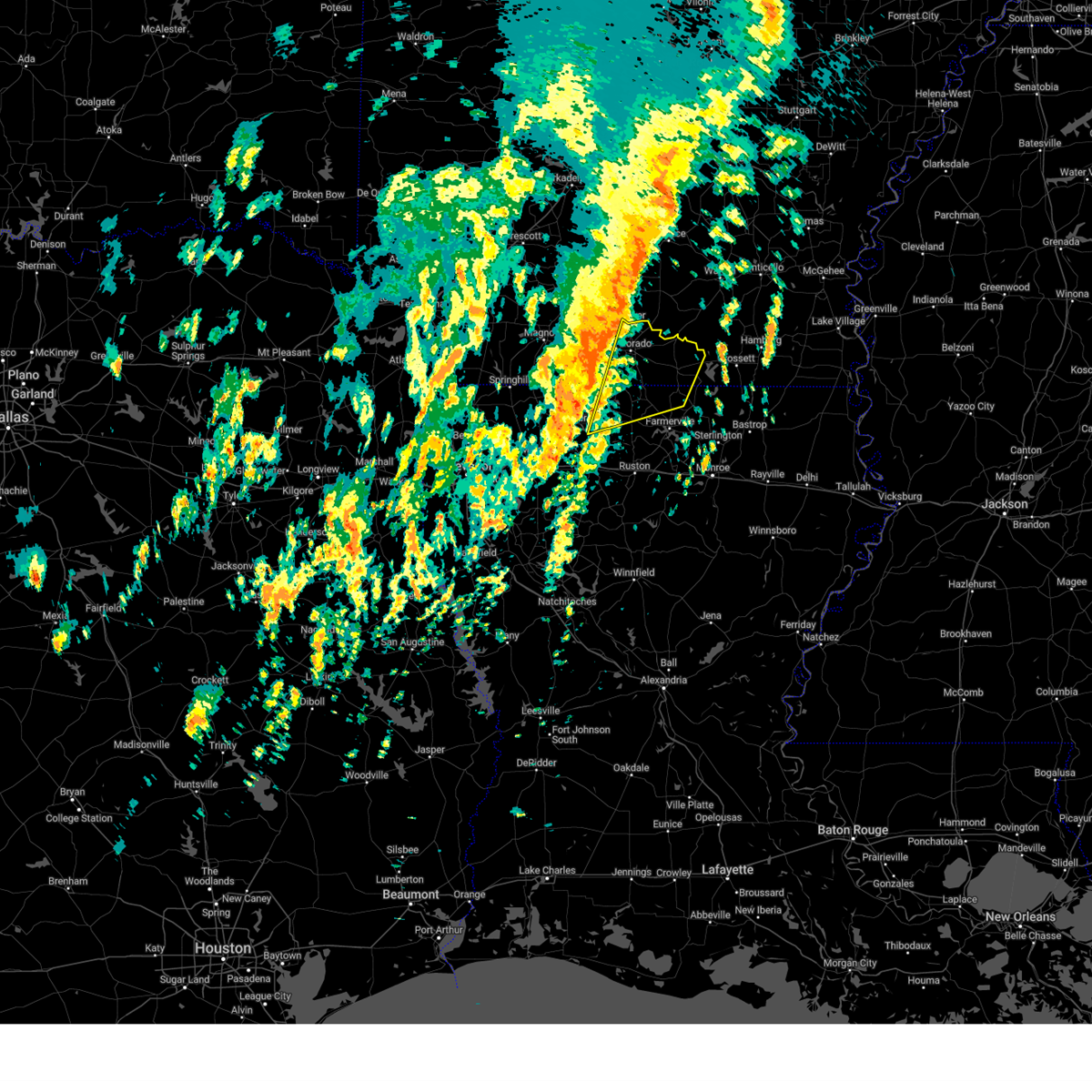
 Svrshv the national weather service in shreveport has issued a * severe thunderstorm warning for, eastern lafayette county in southwestern arkansas, union county in south central arkansas, southern nevada county in southwestern arkansas, columbia county in southwestern arkansas, * until 900 pm cdt. * at 759 pm cdt, severe thunderstorms were located along a line extending from near lawson to near smithland, moving south at 20 mph (radar indicated). Hazards include 60 mph wind gusts and quarter size hail. Hail damage to vehicles is expected. Expect wind damage to roofs, siding, and trees. Svrshv the national weather service in shreveport has issued a * severe thunderstorm warning for, eastern lafayette county in southwestern arkansas, union county in south central arkansas, southern nevada county in southwestern arkansas, columbia county in southwestern arkansas, * until 900 pm cdt. * at 759 pm cdt, severe thunderstorms were located along a line extending from near lawson to near smithland, moving south at 20 mph (radar indicated). Hazards include 60 mph wind gusts and quarter size hail. Hail damage to vehicles is expected. Expect wind damage to roofs, siding, and trees.
|
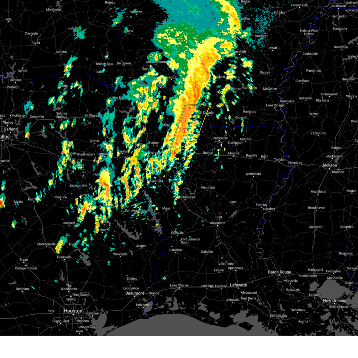
| 5/6/2025 3:35 PM CDT | The storm which prompted the warning has moved out of the area. therefore, the warning will be allowed to expire. |
| 5/6/2025 3:15 PM CDT | Svrshv the national weather service in shreveport has issued a * severe thunderstorm warning for, central union county in south central arkansas, * until 345 pm cdt. * at 315 pm cdt, a severe thunderstorm was located near calion, or near el dorado, moving northeast at 50 mph (radar indicated). Hazards include quarter size hail. damage to vehicles is expected |
| 4/30/2025 4:44 PM CDT |
 Svrshv the national weather service in shreveport has issued a * severe thunderstorm warning for, union county in south central arkansas, columbia county in southwestern arkansas, south central lafayette county in southwestern arkansas, southeastern nevada county in southwestern arkansas, northwestern union parish in north central louisiana, * until 545 pm cdt. * at 444 pm cdt, severe thunderstorms were located along a line from 9 miles northeast of bluff city to 6 miles north of shongaloo, or along a line from 21 miles east of prescott to 8 miles east of springhill, moving east at 40 mph (radar indicated). Hazards include 60 mph wind gusts and small hail. expect damage to roofs, siding, and trees Svrshv the national weather service in shreveport has issued a * severe thunderstorm warning for, union county in south central arkansas, columbia county in southwestern arkansas, south central lafayette county in southwestern arkansas, southeastern nevada county in southwestern arkansas, northwestern union parish in north central louisiana, * until 545 pm cdt. * at 444 pm cdt, severe thunderstorms were located along a line from 9 miles northeast of bluff city to 6 miles north of shongaloo, or along a line from 21 miles east of prescott to 8 miles east of springhill, moving east at 40 mph (radar indicated). Hazards include 60 mph wind gusts and small hail. expect damage to roofs, siding, and trees
|
| 4/27/2025 12:32 AM CDT |
 Svrshv the national weather service in shreveport has issued a * severe thunderstorm warning for, central union county in south central arkansas, * until 115 am cdt. * at 1232 am cdt, a severe thunderstorm was located over el dorado, moving northeast at 15 mph (radar indicated). Hazards include quarter size hail. damage to vehicles is expected Svrshv the national weather service in shreveport has issued a * severe thunderstorm warning for, central union county in south central arkansas, * until 115 am cdt. * at 1232 am cdt, a severe thunderstorm was located over el dorado, moving northeast at 15 mph (radar indicated). Hazards include quarter size hail. damage to vehicles is expected
|
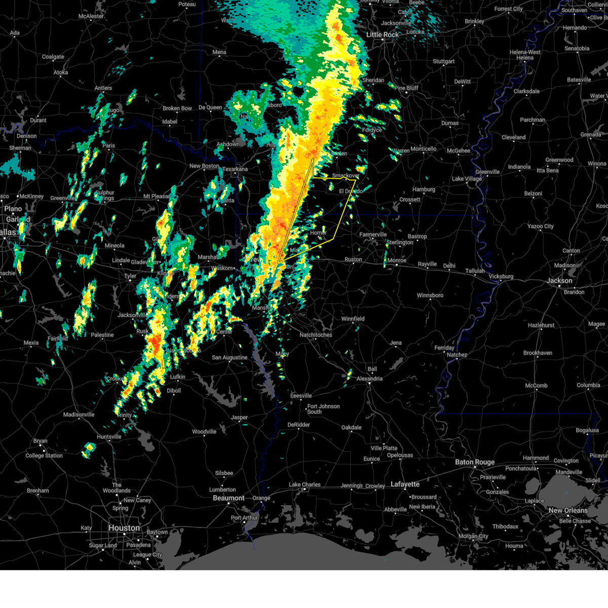
| 4/5/2025 11:50 AM CDT |
 Svrshv the national weather service in shreveport has issued a * severe thunderstorm warning for, union county in south central arkansas, northwestern union parish in north central louisiana, northeastern claiborne parish in northwestern louisiana, * until 100 pm cdt. * at 1150 am cdt, severe thunderstorms were located along a line extending from near smackover to near homer, moving northeast at 45 mph (radar indicated). Hazards include 60 mph wind gusts and quarter size hail. Hail damage to vehicles is expected. Expect wind damage to roofs, siding, and trees. Svrshv the national weather service in shreveport has issued a * severe thunderstorm warning for, union county in south central arkansas, northwestern union parish in north central louisiana, northeastern claiborne parish in northwestern louisiana, * until 100 pm cdt. * at 1150 am cdt, severe thunderstorms were located along a line extending from near smackover to near homer, moving northeast at 45 mph (radar indicated). Hazards include 60 mph wind gusts and quarter size hail. Hail damage to vehicles is expected. Expect wind damage to roofs, siding, and trees.
|
| 4/5/2025 11:25 AM CDT |
 At 1124 am cdt, severe thunderstorms were located along a line extending from near cullendale to 9 miles southwest of homer, moving east at 40 mph (radar indicated). Hazards include 60 mph wind gusts and quarter size hail. Hail damage to vehicles is expected. expect wind damage to roofs, siding, and trees. Locations impacted include, norphlet, leton, newell, mount holly, laughlin, gilark, atlanta, wesson, kenova, spotville, medlock, lake clairborne, hew hope, ebenezer, calhoun, village, lisbon, holly springs, antioch, and summerfield. At 1124 am cdt, severe thunderstorms were located along a line extending from near cullendale to 9 miles southwest of homer, moving east at 40 mph (radar indicated). Hazards include 60 mph wind gusts and quarter size hail. Hail damage to vehicles is expected. expect wind damage to roofs, siding, and trees. Locations impacted include, norphlet, leton, newell, mount holly, laughlin, gilark, atlanta, wesson, kenova, spotville, medlock, lake clairborne, hew hope, ebenezer, calhoun, village, lisbon, holly springs, antioch, and summerfield.
|
| 4/5/2025 11:25 AM CDT |
 the severe thunderstorm warning has been cancelled and is no longer in effect the severe thunderstorm warning has been cancelled and is no longer in effect
|
| 4/5/2025 10:54 AM CDT |
 Svrshv the national weather service in shreveport has issued a * severe thunderstorm warning for, western union county in south central arkansas, southeastern nevada county in southwestern arkansas, eastern columbia county in southwestern arkansas, central webster parish in northwestern louisiana, claiborne parish in northwestern louisiana, east central bossier parish in northwestern louisiana, * until 1215 pm cdt. * at 1054 am cdt, severe thunderstorms were located along a line extending from 6 miles southwest of poison springs state park to 7 miles west of dixie inn, moving northeast at 40 mph (radar indicated). Hazards include 60 mph wind gusts and quarter size hail. Hail damage to vehicles is expected. Expect wind damage to roofs, siding, and trees. Svrshv the national weather service in shreveport has issued a * severe thunderstorm warning for, western union county in south central arkansas, southeastern nevada county in southwestern arkansas, eastern columbia county in southwestern arkansas, central webster parish in northwestern louisiana, claiborne parish in northwestern louisiana, east central bossier parish in northwestern louisiana, * until 1215 pm cdt. * at 1054 am cdt, severe thunderstorms were located along a line extending from 6 miles southwest of poison springs state park to 7 miles west of dixie inn, moving northeast at 40 mph (radar indicated). Hazards include 60 mph wind gusts and quarter size hail. Hail damage to vehicles is expected. Expect wind damage to roofs, siding, and trees.
|
| 3/31/2025 1:54 AM CDT |
 The storm which prompted the warning has weakened below severe limits, and no longer poses an immediate threat to life or property. therefore, the warning has been allowed to expire. The storm which prompted the warning has weakened below severe limits, and no longer poses an immediate threat to life or property. therefore, the warning has been allowed to expire.
|
| 3/31/2025 1:03 AM CDT |
 Svrshv the national weather service in shreveport has issued a * severe thunderstorm warning for, union county in south central arkansas, southeastern columbia county in southwestern arkansas, northwestern union parish in north central louisiana, northeastern claiborne parish in northwestern louisiana, * until 145 am cdt. * at 103 am cdt, a severe thunderstorm was located 5 miles northeast of atlanta, or 16 miles west of junction city, moving northeast at 45 mph (radar indicated). Hazards include 60 mph wind gusts and quarter size hail. Hail damage to vehicles is expected. Expect wind damage to roofs, siding, and trees. Svrshv the national weather service in shreveport has issued a * severe thunderstorm warning for, union county in south central arkansas, southeastern columbia county in southwestern arkansas, northwestern union parish in north central louisiana, northeastern claiborne parish in northwestern louisiana, * until 145 am cdt. * at 103 am cdt, a severe thunderstorm was located 5 miles northeast of atlanta, or 16 miles west of junction city, moving northeast at 45 mph (radar indicated). Hazards include 60 mph wind gusts and quarter size hail. Hail damage to vehicles is expected. Expect wind damage to roofs, siding, and trees.
|
| 3/4/2025 10:20 AM CST |
 the severe thunderstorm warning has been cancelled and is no longer in effect the severe thunderstorm warning has been cancelled and is no longer in effect
|
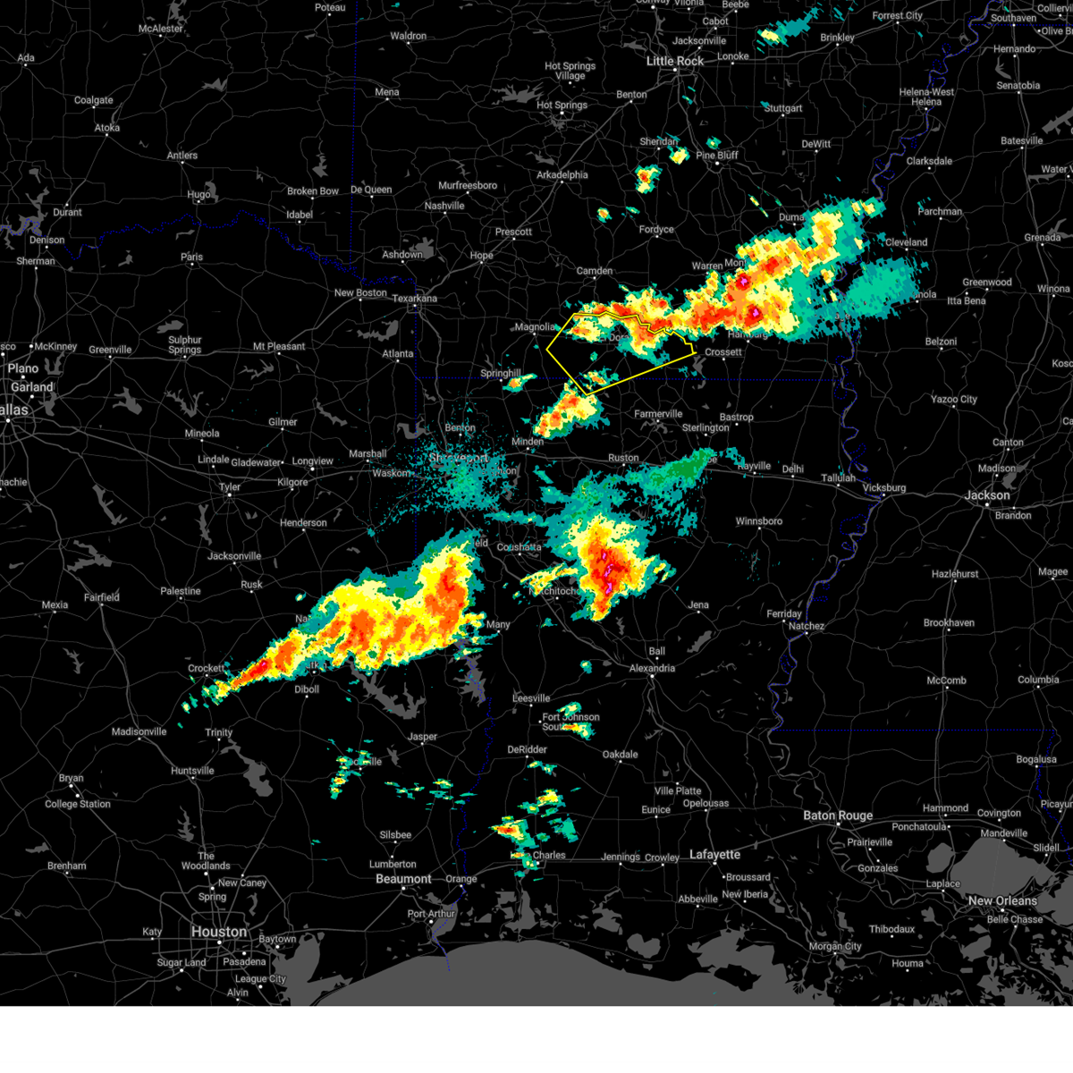
| 3/4/2025 10:20 AM CST |
 At 1020 am cst, severe thunderstorms were located along a line from over smackover to 7 miles southwest of wesson, or along a line from over smackover to 7 miles west of junction city, moving east at 40 mph (radar indicated). Hazards include 60 mph wind gusts and small hail. Expect damage to roofs, siding, and trees. Locations impacted include, el dorado, smackover, norphlet, junction city, strong, calion, lawson, urbana, wesson, lisbon, lapile, hillsboro, catesville, lockhart, newell, aurelle, kenova, pigeon hill, new london and cairo. At 1020 am cst, severe thunderstorms were located along a line from over smackover to 7 miles southwest of wesson, or along a line from over smackover to 7 miles west of junction city, moving east at 40 mph (radar indicated). Hazards include 60 mph wind gusts and small hail. Expect damage to roofs, siding, and trees. Locations impacted include, el dorado, smackover, norphlet, junction city, strong, calion, lawson, urbana, wesson, lisbon, lapile, hillsboro, catesville, lockhart, newell, aurelle, kenova, pigeon hill, new london and cairo.
|
| 3/4/2025 10:00 AM CST |
 Svrshv the national weather service in shreveport has issued a * severe thunderstorm warning for, union county in south central arkansas, southeastern columbia county in southwestern arkansas, * until 1115 am cst. * at 1000 am cst, severe thunderstorms were located along a line from 5 miles north of mount holly to over atlanta, or along a line from 12 miles west of smackover to 17 miles north of homer, moving east at 35 mph (radar indicated). Hazards include 60 mph wind gusts. expect damage to roofs, siding, and trees Svrshv the national weather service in shreveport has issued a * severe thunderstorm warning for, union county in south central arkansas, southeastern columbia county in southwestern arkansas, * until 1115 am cst. * at 1000 am cst, severe thunderstorms were located along a line from 5 miles north of mount holly to over atlanta, or along a line from 12 miles west of smackover to 17 miles north of homer, moving east at 35 mph (radar indicated). Hazards include 60 mph wind gusts. expect damage to roofs, siding, and trees
|
| 1/5/2025 12:52 PM CST |
 At 1252 pm cst, severe thunderstorms were located along a line from over norphlet to 6 miles southeast of cotton valley, or along a line from over norphlet to 10 miles northwest of minden, moving east at 35 mph (radar indicated). Hazards include 60 mph wind gusts and small hail. Expect damage to roofs, siding, and trees. Locations impacted include, el dorado, homer, smackover, norphlet, junction city, haynesville, cotton valley, calion, shongaloo, atlanta, wesson, mount holly, lisbon, evergreen, hew hope, three creeks, spotville, noxobe, marysville and cairo. At 1252 pm cst, severe thunderstorms were located along a line from over norphlet to 6 miles southeast of cotton valley, or along a line from over norphlet to 10 miles northwest of minden, moving east at 35 mph (radar indicated). Hazards include 60 mph wind gusts and small hail. Expect damage to roofs, siding, and trees. Locations impacted include, el dorado, homer, smackover, norphlet, junction city, haynesville, cotton valley, calion, shongaloo, atlanta, wesson, mount holly, lisbon, evergreen, hew hope, three creeks, spotville, noxobe, marysville and cairo.
|
| 1/5/2025 12:52 PM CST |
 the severe thunderstorm warning has been cancelled and is no longer in effect the severe thunderstorm warning has been cancelled and is no longer in effect
|
| 1/5/2025 12:17 PM CST |
 Svrshv the national weather service in shreveport has issued a * severe thunderstorm warning for, union county in south central arkansas, columbia county in southwestern arkansas, northern bossier parish in northwestern louisiana, central caddo parish in northwestern louisiana, northern claiborne parish in northwestern louisiana, northwestern webster parish in northwestern louisiana, * until 115 pm cst. * at 1217 pm cst, severe thunderstorms were located along a line from near mount holly to near benton, or along a line from 12 miles east of mcneil to 15 miles north of bossier city, moving east at 40 mph (radar indicated). Hazards include 60 mph wind gusts and small hail. expect damage to roofs, siding, and trees Svrshv the national weather service in shreveport has issued a * severe thunderstorm warning for, union county in south central arkansas, columbia county in southwestern arkansas, northern bossier parish in northwestern louisiana, central caddo parish in northwestern louisiana, northern claiborne parish in northwestern louisiana, northwestern webster parish in northwestern louisiana, * until 115 pm cst. * at 1217 pm cst, severe thunderstorms were located along a line from near mount holly to near benton, or along a line from 12 miles east of mcneil to 15 miles north of bossier city, moving east at 40 mph (radar indicated). Hazards include 60 mph wind gusts and small hail. expect damage to roofs, siding, and trees
|
| 8/18/2024 10:35 PM CDT |
 Svrshv the national weather service in shreveport has issued a * severe thunderstorm warning for, central union county in south central arkansas, northeastern union parish in north central louisiana, * until 1115 pm cdt. * at 1034 pm cdt, severe thunderstorms were located along a line extending from 6 miles northwest of west crossett to near calion, moving south at 30 mph (radar indicated). Hazards include 60 mph wind gusts and penny size hail. expect damage to roofs, siding, and trees Svrshv the national weather service in shreveport has issued a * severe thunderstorm warning for, central union county in south central arkansas, northeastern union parish in north central louisiana, * until 1115 pm cdt. * at 1034 pm cdt, severe thunderstorms were located along a line extending from 6 miles northwest of west crossett to near calion, moving south at 30 mph (radar indicated). Hazards include 60 mph wind gusts and penny size hail. expect damage to roofs, siding, and trees
|
| 7/8/2024 8:03 PM CDT |
 the tornado warning has been cancelled and is no longer in effect the tornado warning has been cancelled and is no longer in effect
|
| 7/8/2024 7:47 PM CDT |
 At 747 pm cdt, a severe thunderstorm capable of producing a tornado was located near lisbon, or near el dorado, moving north at 30 mph (radar indicated rotation). Hazards include tornado. Flying debris will be dangerous to those caught without shelter. mobile homes will be damaged or destroyed. damage to roofs, windows, and vehicles will occur. tree damage is likely. Locations impacted include, el dorado, smackover, norphlet, lisbon, and kenova. At 747 pm cdt, a severe thunderstorm capable of producing a tornado was located near lisbon, or near el dorado, moving north at 30 mph (radar indicated rotation). Hazards include tornado. Flying debris will be dangerous to those caught without shelter. mobile homes will be damaged or destroyed. damage to roofs, windows, and vehicles will occur. tree damage is likely. Locations impacted include, el dorado, smackover, norphlet, lisbon, and kenova.
|
| 7/8/2024 7:32 PM CDT |
 Torshv the national weather service in shreveport has issued a * tornado warning for, western union county in south central arkansas, * until 815 pm cdt. * at 732 pm cdt, a severe thunderstorm capable of producing a tornado was located near wesson, or near el dorado, moving north at 30 mph (radar indicated rotation). Hazards include tornado. Flying debris will be dangerous to those caught without shelter. mobile homes will be damaged or destroyed. damage to roofs, windows, and vehicles will occur. Tree damage is likely. Torshv the national weather service in shreveport has issued a * tornado warning for, western union county in south central arkansas, * until 815 pm cdt. * at 732 pm cdt, a severe thunderstorm capable of producing a tornado was located near wesson, or near el dorado, moving north at 30 mph (radar indicated rotation). Hazards include tornado. Flying debris will be dangerous to those caught without shelter. mobile homes will be damaged or destroyed. damage to roofs, windows, and vehicles will occur. Tree damage is likely.
|
| 6/3/2024 6:30 PM CDT |
 Svrshv the national weather service in shreveport has issued a * severe thunderstorm warning for, union county in south central arkansas, southeastern columbia county in southwestern arkansas, northeastern webster parish in northwestern louisiana, union parish in north central louisiana, claiborne parish in northwestern louisiana, northwestern lincoln parish in north central louisiana, * until 730 pm cdt. * at 630 pm cdt, severe thunderstorms were located along a line extending from near calion to near junction city to near shongaloo, moving east at 30 mph (radar indicated. numerous trees and power lines have been downed from these storms over southwest arkansas). Hazards include 60 mph wind gusts and quarter size hail. Hail damage to vehicles is expected. Expect wind damage to roofs, siding, and trees. Svrshv the national weather service in shreveport has issued a * severe thunderstorm warning for, union county in south central arkansas, southeastern columbia county in southwestern arkansas, northeastern webster parish in northwestern louisiana, union parish in north central louisiana, claiborne parish in northwestern louisiana, northwestern lincoln parish in north central louisiana, * until 730 pm cdt. * at 630 pm cdt, severe thunderstorms were located along a line extending from near calion to near junction city to near shongaloo, moving east at 30 mph (radar indicated. numerous trees and power lines have been downed from these storms over southwest arkansas). Hazards include 60 mph wind gusts and quarter size hail. Hail damage to vehicles is expected. Expect wind damage to roofs, siding, and trees.
|
| 6/3/2024 6:11 PM CDT |
 the severe thunderstorm warning has been cancelled and is no longer in effect the severe thunderstorm warning has been cancelled and is no longer in effect
|
| 6/3/2024 6:11 PM CDT |
 At 611 pm cdt, severe thunderstorms were located along a line extending from near lisbon to near haynesville to hosston to harleton, moving southeast at 35 mph (radar indicated. numerous trees and power lines have been downed with these storms. large hail has also been reported in shongaloo as well). Hazards include 60 mph wind gusts and half dollar size hail. Hail damage to vehicles is expected. expect wind damage to roofs, siding, and trees. Locations impacted include, el dorado, magnolia, springhill, homer, smackover, norphlet, mcneil, vivian, haynesville, jefferson, linden, benton, cullen, plain dealing, cotton valley, oil city, sarepta, mooringsport, bradley, and taylor. At 611 pm cdt, severe thunderstorms were located along a line extending from near lisbon to near haynesville to hosston to harleton, moving southeast at 35 mph (radar indicated. numerous trees and power lines have been downed with these storms. large hail has also been reported in shongaloo as well). Hazards include 60 mph wind gusts and half dollar size hail. Hail damage to vehicles is expected. expect wind damage to roofs, siding, and trees. Locations impacted include, el dorado, magnolia, springhill, homer, smackover, norphlet, mcneil, vivian, haynesville, jefferson, linden, benton, cullen, plain dealing, cotton valley, oil city, sarepta, mooringsport, bradley, and taylor.
|
| 6/3/2024 5:39 PM CDT |
 Svrshv the national weather service in shreveport has issued a * severe thunderstorm warning for, southeastern hempstead county in southwestern arkansas, lafayette county in southwestern arkansas, western union county in south central arkansas, southern nevada county in southwestern arkansas, southern miller county in southwestern arkansas, columbia county in southwestern arkansas, northwestern webster parish in northwestern louisiana, northwestern caddo parish in northwestern louisiana, northwestern claiborne parish in northwestern louisiana, northern bossier parish in northwestern louisiana, marion county in northeastern texas, southeastern bowie county in northeastern texas, northeastern upshur county in northeastern texas, cass county in northeastern texas, northern harrison county in northeastern texas, eastern morris county in northeastern texas, southeastern camp county in northeastern texas, north central gregg county in northeastern texas, * until 645 pm cdt. * at 538 pm cdt, severe thunderstorms were located along a line extending from near stephens to near bussey to ida, moving southeast at 35 mph (radar indicated). Hazards include 60 mph wind gusts and nickel size hail. expect damage to roofs, siding, and trees Svrshv the national weather service in shreveport has issued a * severe thunderstorm warning for, southeastern hempstead county in southwestern arkansas, lafayette county in southwestern arkansas, western union county in south central arkansas, southern nevada county in southwestern arkansas, southern miller county in southwestern arkansas, columbia county in southwestern arkansas, northwestern webster parish in northwestern louisiana, northwestern caddo parish in northwestern louisiana, northwestern claiborne parish in northwestern louisiana, northern bossier parish in northwestern louisiana, marion county in northeastern texas, southeastern bowie county in northeastern texas, northeastern upshur county in northeastern texas, cass county in northeastern texas, northern harrison county in northeastern texas, eastern morris county in northeastern texas, southeastern camp county in northeastern texas, north central gregg county in northeastern texas, * until 645 pm cdt. * at 538 pm cdt, severe thunderstorms were located along a line extending from near stephens to near bussey to ida, moving southeast at 35 mph (radar indicated). Hazards include 60 mph wind gusts and nickel size hail. expect damage to roofs, siding, and trees
|
| 5/25/2024 12:51 AM CDT |
 At 1251 am cdt, a severe thunderstorm was located near urbana, or 9 miles southeast of el dorado, moving southeast at 40 mph (radar indicated). Hazards include ping pong ball size hail and 60 mph wind gusts. People and animals outdoors will be injured. expect hail damage to roofs, siding, windows, and vehicles. expect wind damage to roofs, siding, and trees. Locations impacted include, el dorado, norphlet, huttig, junction city, strong, calion, lisbon, urbana, lawson, wesson, lapile, felsenthal, newell, new london, aurelle, oakland, taylorville, pigeon hill, hillsboro, and lockhart. At 1251 am cdt, a severe thunderstorm was located near urbana, or 9 miles southeast of el dorado, moving southeast at 40 mph (radar indicated). Hazards include ping pong ball size hail and 60 mph wind gusts. People and animals outdoors will be injured. expect hail damage to roofs, siding, windows, and vehicles. expect wind damage to roofs, siding, and trees. Locations impacted include, el dorado, norphlet, huttig, junction city, strong, calion, lisbon, urbana, lawson, wesson, lapile, felsenthal, newell, new london, aurelle, oakland, taylorville, pigeon hill, hillsboro, and lockhart.
|
| 5/25/2024 12:37 AM CDT |
 Svrshv the national weather service in shreveport has issued a * severe thunderstorm warning for, union county in south central arkansas, northwestern union parish in north central louisiana, * until 115 am cdt. * at 1236 am cdt, a severe thunderstorm was located over el dorado, moving southeast at 40 mph (radar indicated). Hazards include ping pong ball size hail and 60 mph wind gusts. People and animals outdoors will be injured. expect hail damage to roofs, siding, windows, and vehicles. Expect wind damage to roofs, siding, and trees. Svrshv the national weather service in shreveport has issued a * severe thunderstorm warning for, union county in south central arkansas, northwestern union parish in north central louisiana, * until 115 am cdt. * at 1236 am cdt, a severe thunderstorm was located over el dorado, moving southeast at 40 mph (radar indicated). Hazards include ping pong ball size hail and 60 mph wind gusts. People and animals outdoors will be injured. expect hail damage to roofs, siding, windows, and vehicles. Expect wind damage to roofs, siding, and trees.
|
| 4/28/2024 7:57 PM CDT |
 Svrshv the national weather service in shreveport has issued a * severe thunderstorm warning for, southeastern lafayette county in southwestern arkansas, union county in south central arkansas, southeastern nevada county in southwestern arkansas, columbia county in southwestern arkansas, webster parish in northwestern louisiana, union parish in north central louisiana, northeastern red river parish in northwestern louisiana, ouachita parish in north central louisiana, northwestern caldwell parish in north central louisiana, jackson parish in north central louisiana, claiborne parish in northwestern louisiana, bienville parish in northwestern louisiana, eastern bossier parish in northwestern louisiana, lincoln parish in north central louisiana, * until 900 pm cdt. * at 756 pm cdt, severe thunderstorms were located along a line extending from stamps to 16 miles northwest of winnfield, moving east at 50 mph (radar indicated). Hazards include 70 mph wind gusts and nickel size hail. Expect considerable tree damage. Damage is likely to mobile homes, roofs, and outbuildings. Svrshv the national weather service in shreveport has issued a * severe thunderstorm warning for, southeastern lafayette county in southwestern arkansas, union county in south central arkansas, southeastern nevada county in southwestern arkansas, columbia county in southwestern arkansas, webster parish in northwestern louisiana, union parish in north central louisiana, northeastern red river parish in northwestern louisiana, ouachita parish in north central louisiana, northwestern caldwell parish in north central louisiana, jackson parish in north central louisiana, claiborne parish in northwestern louisiana, bienville parish in northwestern louisiana, eastern bossier parish in northwestern louisiana, lincoln parish in north central louisiana, * until 900 pm cdt. * at 756 pm cdt, severe thunderstorms were located along a line extending from stamps to 16 miles northwest of winnfield, moving east at 50 mph (radar indicated). Hazards include 70 mph wind gusts and nickel size hail. Expect considerable tree damage. Damage is likely to mobile homes, roofs, and outbuildings.
|
| 3/15/2024 3:18 AM CDT |
 Svrshv the national weather service in shreveport has issued a * severe thunderstorm warning for, northwestern union county in south central arkansas, * until 400 am cdt. * at 318 am cdt, a severe thunderstorm was located near lisbon, or near el dorado, moving northeast at 35 mph (radar indicated). Hazards include 60 mph wind gusts and quarter size hail. Hail damage to vehicles is expected. Expect wind damage to roofs, siding, and trees. Svrshv the national weather service in shreveport has issued a * severe thunderstorm warning for, northwestern union county in south central arkansas, * until 400 am cdt. * at 318 am cdt, a severe thunderstorm was located near lisbon, or near el dorado, moving northeast at 35 mph (radar indicated). Hazards include 60 mph wind gusts and quarter size hail. Hail damage to vehicles is expected. Expect wind damage to roofs, siding, and trees.
|
| 3/15/2024 2:51 AM CDT |
 At 250 am cdt, a severe thunderstorm was located near lisbon, or 10 miles west of el dorado, moving northeast at 30 mph (radar indicated). Hazards include golf ball size hail and 60 mph wind gusts. People and animals outdoors will be injured. expect hail damage to roofs, siding, windows, and vehicles. expect wind damage to roofs, siding, and trees. Locations impacted include, el dorado, smackover, norphlet, calion, lisbon, marysville, cairo, newell, and kenova. At 250 am cdt, a severe thunderstorm was located near lisbon, or 10 miles west of el dorado, moving northeast at 30 mph (radar indicated). Hazards include golf ball size hail and 60 mph wind gusts. People and animals outdoors will be injured. expect hail damage to roofs, siding, windows, and vehicles. expect wind damage to roofs, siding, and trees. Locations impacted include, el dorado, smackover, norphlet, calion, lisbon, marysville, cairo, newell, and kenova.
|
| 3/15/2024 2:51 AM CDT |
 the severe thunderstorm warning has been cancelled and is no longer in effect the severe thunderstorm warning has been cancelled and is no longer in effect
|
| 3/15/2024 2:32 AM CDT |
 Svrshv the national weather service in shreveport has issued a * severe thunderstorm warning for, northwestern union county in south central arkansas, southeastern columbia county in southwestern arkansas, * until 315 am cdt. * at 232 am cdt, a severe thunderstorm was located 7 miles northeast of atlanta, or 15 miles northwest of junction city, moving northeast at 30 mph (radar indicated). Hazards include golf ball size hail and 60 mph wind gusts. People and animals outdoors will be injured. expect hail damage to roofs, siding, windows, and vehicles. Expect wind damage to roofs, siding, and trees. Svrshv the national weather service in shreveport has issued a * severe thunderstorm warning for, northwestern union county in south central arkansas, southeastern columbia county in southwestern arkansas, * until 315 am cdt. * at 232 am cdt, a severe thunderstorm was located 7 miles northeast of atlanta, or 15 miles northwest of junction city, moving northeast at 30 mph (radar indicated). Hazards include golf ball size hail and 60 mph wind gusts. People and animals outdoors will be injured. expect hail damage to roofs, siding, windows, and vehicles. Expect wind damage to roofs, siding, and trees.
|
| 7/16/2023 4:11 PM CDT |
 At 410 pm cdt, severe thunderstorms were located along a line extending from near highland industrial park to near calion to 6 miles southwest of strong, moving east at 40 mph (radar indicated). Hazards include 60 mph wind gusts and penny size hail. Expect damage to roofs, siding, and trees. locations impacted include, el dorado, norphlet, huttig, strong, calion, urbana, lawson, lapile, felsenthal, new london, aurelle, pigeon hill, hillsboro, lockhart, kenova and catesville. hail threat, radar indicated max hail size, 0. 75 in wind threat, radar indicated max wind gust, 60 mph. At 410 pm cdt, severe thunderstorms were located along a line extending from near highland industrial park to near calion to 6 miles southwest of strong, moving east at 40 mph (radar indicated). Hazards include 60 mph wind gusts and penny size hail. Expect damage to roofs, siding, and trees. locations impacted include, el dorado, norphlet, huttig, strong, calion, urbana, lawson, lapile, felsenthal, new london, aurelle, pigeon hill, hillsboro, lockhart, kenova and catesville. hail threat, radar indicated max hail size, 0. 75 in wind threat, radar indicated max wind gust, 60 mph.
|
| 7/16/2023 3:31 PM CDT |
 At 331 pm cdt, severe thunderstorms were located along a line extending from near bluff city to near mount holly to 7 miles west of junction city, moving east at 40 mph (radar indicated). Hazards include 60 mph wind gusts and penny size hail. expect damage to roofs, siding, and trees At 331 pm cdt, severe thunderstorms were located along a line extending from near bluff city to near mount holly to 7 miles west of junction city, moving east at 40 mph (radar indicated). Hazards include 60 mph wind gusts and penny size hail. expect damage to roofs, siding, and trees
|
| 7/15/2023 6:14 PM CDT | Large tree limbs across hwy 335 and power lines dow in union county AR, 0.2 miles SSE of Norphlet, AR |
| 7/15/2023 6:07 PM CDT |
 At 607 pm cdt, severe thunderstorms were located along a line extending from 6 miles southeast of cullendale to louann to near stephens, moving southeast at 35 mph (radar indicated. trees have been downed across ouachita county, including the city of camden, with these storms). Hazards include 60 mph wind gusts and nickel size hail. expect damage to roofs, siding, and trees At 607 pm cdt, severe thunderstorms were located along a line extending from 6 miles southeast of cullendale to louann to near stephens, moving southeast at 35 mph (radar indicated. trees have been downed across ouachita county, including the city of camden, with these storms). Hazards include 60 mph wind gusts and nickel size hail. expect damage to roofs, siding, and trees
|
| 6/26/2023 3:29 AM CDT |
 At 328 am cdt, severe thunderstorms were located along a line extending from 6 miles southwest of lisbon to near el dorado to near calion to near moro bay to hermitage, moving southeast at 30 mph (radar indicated). Hazards include 60 mph wind gusts and quarter size hail. Hail damage to vehicles is expected. expect wind damage to roofs, siding, and trees. locations impacted include, el dorado, smackover, norphlet, junction city, strong, calion, lisbon, mount holly, urbana, lawson, wesson, newell, new london, pigeon hill, marysville, cairo, hillsboro, three creeks, kenova and catesville. hail threat, radar indicated max hail size, 1. 00 in wind threat, radar indicated max wind gust, 60 mph. At 328 am cdt, severe thunderstorms were located along a line extending from 6 miles southwest of lisbon to near el dorado to near calion to near moro bay to hermitage, moving southeast at 30 mph (radar indicated). Hazards include 60 mph wind gusts and quarter size hail. Hail damage to vehicles is expected. expect wind damage to roofs, siding, and trees. locations impacted include, el dorado, smackover, norphlet, junction city, strong, calion, lisbon, mount holly, urbana, lawson, wesson, newell, new london, pigeon hill, marysville, cairo, hillsboro, three creeks, kenova and catesville. hail threat, radar indicated max hail size, 1. 00 in wind threat, radar indicated max wind gust, 60 mph.
|
| 6/26/2023 2:52 AM CDT |
 At 252 am cdt, severe thunderstorms were located along a line extending from near stephens to 8 miles west of louann to 8 miles east of cullendale to near hampton to near ellisville, moving southeast at 30 mph (radar indicated). Hazards include 60 mph wind gusts and quarter size hail. Hail damage to vehicles is expected. Expect wind damage to roofs, siding, and trees. At 252 am cdt, severe thunderstorms were located along a line extending from near stephens to 8 miles west of louann to 8 miles east of cullendale to near hampton to near ellisville, moving southeast at 30 mph (radar indicated). Hazards include 60 mph wind gusts and quarter size hail. Hail damage to vehicles is expected. Expect wind damage to roofs, siding, and trees.
|
| 6/18/2023 8:24 AM CDT |
 At 824 am cdt, severe thunderstorms were located along a line extending from near stephens to 6 miles east of taylor to 6 miles northeast of plain dealing to near hosston, moving southeast at 50 mph (radar indicated). Hazards include 60 mph wind gusts and nickel size hail. expect damage to roofs, siding, and trees At 824 am cdt, severe thunderstorms were located along a line extending from near stephens to 6 miles east of taylor to 6 miles northeast of plain dealing to near hosston, moving southeast at 50 mph (radar indicated). Hazards include 60 mph wind gusts and nickel size hail. expect damage to roofs, siding, and trees
|
| 5/8/2023 8:10 PM CDT |
 The severe thunderstorm warning for central union county, northwestern union and northeastern claiborne parishes will expire at 815 pm cdt, the storms which prompted the warning have weakened below severe limits, and no longer pose an immediate threat to life or property. therefore, the warning will be allowed to expire. however gusty winds and heavy rain are still possible with these thunderstorms. The severe thunderstorm warning for central union county, northwestern union and northeastern claiborne parishes will expire at 815 pm cdt, the storms which prompted the warning have weakened below severe limits, and no longer pose an immediate threat to life or property. therefore, the warning will be allowed to expire. however gusty winds and heavy rain are still possible with these thunderstorms.
|
| 5/8/2023 7:27 PM CDT |
 At 727 pm cdt, severe thunderstorms were located along a line extending from near junction city to 7 miles north of cooley to near moro bay state park, moving east at 25 mph (radar indicated). Hazards include 60 mph wind gusts and penny size hail. Expect damage to roofs, siding, and trees. locations impacted include, el dorado, norphlet, junction city, strong, calion, urbana, lawson, wesson, spearsville, lillie, newell, new london, aurelle, taylorville, pigeon hill, hillsboro, lockhart and catesville. hail threat, radar indicated max hail size, 0. 75 in wind threat, radar indicated max wind gust, 60 mph. At 727 pm cdt, severe thunderstorms were located along a line extending from near junction city to 7 miles north of cooley to near moro bay state park, moving east at 25 mph (radar indicated). Hazards include 60 mph wind gusts and penny size hail. Expect damage to roofs, siding, and trees. locations impacted include, el dorado, norphlet, junction city, strong, calion, urbana, lawson, wesson, spearsville, lillie, newell, new london, aurelle, taylorville, pigeon hill, hillsboro, lockhart and catesville. hail threat, radar indicated max hail size, 0. 75 in wind threat, radar indicated max wind gust, 60 mph.
|
| 5/8/2023 7:09 PM CDT |
 At 709 pm cdt, severe thunderstorms were located along a line extending from atlanta to just north of junction city to near lawson, moving southeast at 15 mph (radar indicated. quarter size hail and strong winds have been reported in el dorado with these storms). Hazards include 60 mph wind gusts and quarter size hail. Hail damage to vehicles is expected. Expect wind damage to roofs, siding, and trees. At 709 pm cdt, severe thunderstorms were located along a line extending from atlanta to just north of junction city to near lawson, moving southeast at 15 mph (radar indicated. quarter size hail and strong winds have been reported in el dorado with these storms). Hazards include 60 mph wind gusts and quarter size hail. Hail damage to vehicles is expected. Expect wind damage to roofs, siding, and trees.
|
| 5/8/2023 7:02 PM CDT |
 At 702 pm cdt, a severe thunderstorm was located over el dorado, moving south at 15 mph. quarter size hail has been reported on the north side of el dorado with this storm (radar indicated). Hazards include 60 mph wind gusts and quarter size hail. Hail damage to vehicles is expected. expect wind damage to roofs, siding, and trees. locations impacted include, el dorado, norphlet, calion, urbana, lawson, newell, hillsboro and pigeon hill. hail threat, observed max hail size, 1. 00 in wind threat, observed max wind gust, 60 mph. At 702 pm cdt, a severe thunderstorm was located over el dorado, moving south at 15 mph. quarter size hail has been reported on the north side of el dorado with this storm (radar indicated). Hazards include 60 mph wind gusts and quarter size hail. Hail damage to vehicles is expected. expect wind damage to roofs, siding, and trees. locations impacted include, el dorado, norphlet, calion, urbana, lawson, newell, hillsboro and pigeon hill. hail threat, observed max hail size, 1. 00 in wind threat, observed max wind gust, 60 mph.
|
| 5/8/2023 6:35 PM CDT |
 At 635 pm cdt, a severe thunderstorm was located near el dorado, moving southeast at 30 mph (radar indicated). Hazards include 60 mph wind gusts and quarter size hail. Hail damage to vehicles is expected. Expect wind damage to roofs, siding, and trees. At 635 pm cdt, a severe thunderstorm was located near el dorado, moving southeast at 30 mph (radar indicated). Hazards include 60 mph wind gusts and quarter size hail. Hail damage to vehicles is expected. Expect wind damage to roofs, siding, and trees.
|
| 4/15/2023 8:12 PM CDT |
 At 811 pm cdt, a severe thunderstorm was located near lawson, or 8 miles southeast of el dorado, moving east at 30 mph (radar indicated). Hazards include 60 mph wind gusts and half dollar size hail. Hail damage to vehicles is expected. Expect wind damage to roofs, siding, and trees. At 811 pm cdt, a severe thunderstorm was located near lawson, or 8 miles southeast of el dorado, moving east at 30 mph (radar indicated). Hazards include 60 mph wind gusts and half dollar size hail. Hail damage to vehicles is expected. Expect wind damage to roofs, siding, and trees.
|
| 4/15/2023 7:53 PM CDT |
 At 753 pm cdt, a severe thunderstorm was located near strong, or 14 miles west of huttig, moving east at 40 mph (radar indicated). Hazards include ping pong ball size hail and 60 mph wind gusts. People and animals outdoors will be injured. expect hail damage to roofs, siding, windows, and vehicles. expect wind damage to roofs, siding, and trees. locations impacted include, el dorado, norphlet, huttig, junction city, strong, calion, lisbon, mount holly, urbana, lawson, wesson, lapile, moro bay state park, felsenthal, hew hope, newell, new london, aurelle, pigeon hill and marysville. hail threat, radar indicated max hail size, 1. 50 in wind threat, radar indicated max wind gust, 60 mph. At 753 pm cdt, a severe thunderstorm was located near strong, or 14 miles west of huttig, moving east at 40 mph (radar indicated). Hazards include ping pong ball size hail and 60 mph wind gusts. People and animals outdoors will be injured. expect hail damage to roofs, siding, windows, and vehicles. expect wind damage to roofs, siding, and trees. locations impacted include, el dorado, norphlet, huttig, junction city, strong, calion, lisbon, mount holly, urbana, lawson, wesson, lapile, moro bay state park, felsenthal, hew hope, newell, new london, aurelle, pigeon hill and marysville. hail threat, radar indicated max hail size, 1. 50 in wind threat, radar indicated max wind gust, 60 mph.
|
| 4/15/2023 7:09 PM CDT |
 At 708 pm cdt, a severe thunderstorm was located 7 miles northeast of atlanta, or 16 miles northwest of junction city, moving east at 40 mph (radar indicated). Hazards include ping pong ball size hail and 60 mph wind gusts. People and animals outdoors will be injured. expect hail damage to roofs, siding, windows, and vehicles. Expect wind damage to roofs, siding, and trees. At 708 pm cdt, a severe thunderstorm was located 7 miles northeast of atlanta, or 16 miles northwest of junction city, moving east at 40 mph (radar indicated). Hazards include ping pong ball size hail and 60 mph wind gusts. People and animals outdoors will be injured. expect hail damage to roofs, siding, windows, and vehicles. Expect wind damage to roofs, siding, and trees.
|
| 4/15/2023 6:12 PM CDT |
 At 611 pm cdt, a severe thunderstorm was located near mount holly, or 15 miles west of el dorado, moving east at 20 mph (radar indicated). Hazards include ping pong ball size hail and 60 mph wind gusts. People and animals outdoors will be injured. expect hail damage to roofs, siding, windows, and vehicles. Expect wind damage to roofs, siding, and trees. At 611 pm cdt, a severe thunderstorm was located near mount holly, or 15 miles west of el dorado, moving east at 20 mph (radar indicated). Hazards include ping pong ball size hail and 60 mph wind gusts. People and animals outdoors will be injured. expect hail damage to roofs, siding, windows, and vehicles. Expect wind damage to roofs, siding, and trees.
|
| 4/15/2023 5:21 PM CDT |
 At 521 pm cdt, a severe thunderstorm was located over magnolia, moving east at 15 mph (radar indicated). Hazards include 60 mph wind gusts and half dollar size hail. Hail damage to vehicles is expected. Expect wind damage to roofs, siding, and trees. At 521 pm cdt, a severe thunderstorm was located over magnolia, moving east at 15 mph (radar indicated). Hazards include 60 mph wind gusts and half dollar size hail. Hail damage to vehicles is expected. Expect wind damage to roofs, siding, and trees.
|
| 3/3/2023 1:04 AM CST |
 At 104 am cst, severe thunderstorms were located along a line extending from norphlet to 8 miles northwest of bernice to near arcadia, moving east at 45 mph (radar indicated). Hazards include 60 mph wind gusts and penny size hail. expect damage to roofs, siding, and trees At 104 am cst, severe thunderstorms were located along a line extending from norphlet to 8 miles northwest of bernice to near arcadia, moving east at 45 mph (radar indicated). Hazards include 60 mph wind gusts and penny size hail. expect damage to roofs, siding, and trees
|
| 3/3/2023 12:12 AM CST |
 At 1212 am cst, severe thunderstorms were located along a line extending from near mcneil to near cotton valley to 7 miles southwest of haughton, moving east at 25 mph (radar indicated). Hazards include 60 mph wind gusts and penny size hail. expect damage to roofs, siding, and trees At 1212 am cst, severe thunderstorms were located along a line extending from near mcneil to near cotton valley to 7 miles southwest of haughton, moving east at 25 mph (radar indicated). Hazards include 60 mph wind gusts and penny size hail. expect damage to roofs, siding, and trees
|
| 1/18/2023 12:44 PM CST |
 At 1244 pm cst, a severe thunderstorm capable of producing a tornado was located over wesson, or 7 miles southwest of el dorado, moving northeast at 40 mph (radar indicated rotation). Hazards include tornado. Flying debris will be dangerous to those caught without shelter. mobile homes will be damaged or destroyed. damage to roofs, windows, and vehicles will occur. tree damage is likely. this dangerous storm will be near, el dorado around 1255 pm cst. norphlet around 105 pm cst. Other locations impacted by this tornadic thunderstorm include newell, hillsboro and catesville. At 1244 pm cst, a severe thunderstorm capable of producing a tornado was located over wesson, or 7 miles southwest of el dorado, moving northeast at 40 mph (radar indicated rotation). Hazards include tornado. Flying debris will be dangerous to those caught without shelter. mobile homes will be damaged or destroyed. damage to roofs, windows, and vehicles will occur. tree damage is likely. this dangerous storm will be near, el dorado around 1255 pm cst. norphlet around 105 pm cst. Other locations impacted by this tornadic thunderstorm include newell, hillsboro and catesville.
|
| 1/18/2023 12:32 PM CST |
 At 1231 pm cst, a severe thunderstorm capable of producing a tornado was located 7 miles southwest of wesson, or 9 miles west of junction city, moving northeast at 40 mph (radar indicated rotation). Hazards include tornado. Flying debris will be dangerous to those caught without shelter. mobile homes will be damaged or destroyed. damage to roofs, windows, and vehicles will occur. tree damage is likely. this dangerous storm will be near, wesson around 1240 pm cst. el dorado around 1255 pm cst. norphlet around 105 pm cst. Other locations impacted by this tornadic thunderstorm include hew hope, newell, hillsboro, three creeks and catesville. At 1231 pm cst, a severe thunderstorm capable of producing a tornado was located 7 miles southwest of wesson, or 9 miles west of junction city, moving northeast at 40 mph (radar indicated rotation). Hazards include tornado. Flying debris will be dangerous to those caught without shelter. mobile homes will be damaged or destroyed. damage to roofs, windows, and vehicles will occur. tree damage is likely. this dangerous storm will be near, wesson around 1240 pm cst. el dorado around 1255 pm cst. norphlet around 105 pm cst. Other locations impacted by this tornadic thunderstorm include hew hope, newell, hillsboro, three creeks and catesville.
|
| 1/18/2023 12:23 PM CST |
 At 1223 pm cst, a severe thunderstorm capable of producing a tornado was located 7 miles southeast of atlanta, or 13 miles west of junction city, moving northeast at 40 mph (radar indicated rotation). Hazards include tornado. Flying debris will be dangerous to those caught without shelter. mobile homes will be damaged or destroyed. damage to roofs, windows, and vehicles will occur. tree damage is likely. this dangerous storm will be near, wesson around 1245 pm cst. el dorado around 100 pm cst. norphlet around 105 pm cst. Other locations impacted by this tornadic thunderstorm include hew hope, newell, hillsboro, three creeks, catesville and junction city. At 1223 pm cst, a severe thunderstorm capable of producing a tornado was located 7 miles southeast of atlanta, or 13 miles west of junction city, moving northeast at 40 mph (radar indicated rotation). Hazards include tornado. Flying debris will be dangerous to those caught without shelter. mobile homes will be damaged or destroyed. damage to roofs, windows, and vehicles will occur. tree damage is likely. this dangerous storm will be near, wesson around 1245 pm cst. el dorado around 100 pm cst. norphlet around 105 pm cst. Other locations impacted by this tornadic thunderstorm include hew hope, newell, hillsboro, three creeks, catesville and junction city.
|
| 11/4/2022 11:05 PM CDT |
 At 1105 pm cdt, severe thunderstorms were located along a line extending from highland industrial park to near lisbon to 9 miles northeast of homer, moving east at 45 mph (radar indicated). Hazards include 60 mph wind gusts. expect damage to roofs, siding, and trees At 1105 pm cdt, severe thunderstorms were located along a line extending from highland industrial park to near lisbon to 9 miles northeast of homer, moving east at 45 mph (radar indicated). Hazards include 60 mph wind gusts. expect damage to roofs, siding, and trees
|
| 6/10/2022 8:10 AM CDT |
 At 809 am cdt, severe thunderstorms were located along a line extending from near highland industrial park to near cullendale to 7 miles southwest of poison springs state park to near willisville to 6 miles southwest of bodcaw, moving southeast at 50 mph (radar indicated). Hazards include 60 mph wind gusts and penny size hail. expect damage to roofs, siding, and trees At 809 am cdt, severe thunderstorms were located along a line extending from near highland industrial park to near cullendale to 7 miles southwest of poison springs state park to near willisville to 6 miles southwest of bodcaw, moving southeast at 50 mph (radar indicated). Hazards include 60 mph wind gusts and penny size hail. expect damage to roofs, siding, and trees
|
| 5/22/2022 12:41 AM CDT |
 At 1240 am cdt, severe thunderstorms were located along a line extending from near norphlet to 7 miles east of atlanta to 6 miles east of plain dealing to near benton, moving east southeast at 35 mph (radar indicated). Hazards include 60 mph wind gusts. Expect damage to roofs, siding, and trees. locations impacted include, el dorado, magnolia, springhill, homer, smackover, stamps, waldo, norphlet, junction city, mcneil, haynesville, benton, cullen, plain dealing, cotton valley, sarepta, bradley, taylor, strong and calion. hail threat, radar indicated max hail size, <. 75 in wind threat, radar indicated max wind gust, 60 mph. At 1240 am cdt, severe thunderstorms were located along a line extending from near norphlet to 7 miles east of atlanta to 6 miles east of plain dealing to near benton, moving east southeast at 35 mph (radar indicated). Hazards include 60 mph wind gusts. Expect damage to roofs, siding, and trees. locations impacted include, el dorado, magnolia, springhill, homer, smackover, stamps, waldo, norphlet, junction city, mcneil, haynesville, benton, cullen, plain dealing, cotton valley, sarepta, bradley, taylor, strong and calion. hail threat, radar indicated max hail size, <. 75 in wind threat, radar indicated max wind gust, 60 mph.
|
| 5/21/2022 11:59 PM CDT |
 At 1159 pm cdt, severe thunderstorms were located along a line extending from near stephens to near macedonia to near vivian to near karnack, moving southeast at 25 mph (radar indicated). Hazards include 60 mph wind gusts and penny size hail. expect damage to roofs, siding, and trees At 1159 pm cdt, severe thunderstorms were located along a line extending from near stephens to near macedonia to near vivian to near karnack, moving southeast at 25 mph (radar indicated). Hazards include 60 mph wind gusts and penny size hail. expect damage to roofs, siding, and trees
|
| 5/5/2022 3:11 PM CDT |
 At 310 pm cdt, severe thunderstorms were located along a line extending from near cullendale to near grambling, moving east at 55 mph (radar indicated). Hazards include 70 mph wind gusts and quarter size hail. Hail damage to vehicles is expected. expect considerable tree damage. wind damage is also likely to mobile homes, roofs, and outbuildings. Locations impacted include, el dorado, homer, smackover, norphlet, junction city, haynesville, bernice, emerson, mount holly, atlanta, wesson, village, lisbon, cooley, calhoun, spearsville, lillie, newell, laughlin and kenova. At 310 pm cdt, severe thunderstorms were located along a line extending from near cullendale to near grambling, moving east at 55 mph (radar indicated). Hazards include 70 mph wind gusts and quarter size hail. Hail damage to vehicles is expected. expect considerable tree damage. wind damage is also likely to mobile homes, roofs, and outbuildings. Locations impacted include, el dorado, homer, smackover, norphlet, junction city, haynesville, bernice, emerson, mount holly, atlanta, wesson, village, lisbon, cooley, calhoun, spearsville, lillie, newell, laughlin and kenova.
|
| 5/5/2022 2:25 PM CDT |
 At 224 pm cdt, severe thunderstorms were located along a line extending from 6 miles southwest of willisville to near dixie inn, moving east at 55 mph (radar indicated). Hazards include 70 mph wind gusts and quarter size hail. Hail damage to vehicles is expected. expect considerable tree damage. Wind damage is also likely to mobile homes, roofs, and outbuildings. At 224 pm cdt, severe thunderstorms were located along a line extending from 6 miles southwest of willisville to near dixie inn, moving east at 55 mph (radar indicated). Hazards include 70 mph wind gusts and quarter size hail. Hail damage to vehicles is expected. expect considerable tree damage. Wind damage is also likely to mobile homes, roofs, and outbuildings.
|
| 4/30/2022 9:50 PM CDT |
 At 949 pm cdt, a severe thunderstorm was located near urbana, or 11 miles southeast of el dorado, moving east at 25 mph (radar indicated). Hazards include 60 mph wind gusts and half dollar size hail. Hail damage to vehicles is expected. expect wind damage to roofs, siding, and trees. locations impacted include, el dorado, smackover, norphlet, calion, lisbon, urbana, lawson, wesson, newell, new london, pigeon hill, marysville, cairo, hillsboro, kenova and catesville. hail threat, radar indicated max hail size, 1. 25 in wind threat, radar indicated max wind gust, 60 mph. At 949 pm cdt, a severe thunderstorm was located near urbana, or 11 miles southeast of el dorado, moving east at 25 mph (radar indicated). Hazards include 60 mph wind gusts and half dollar size hail. Hail damage to vehicles is expected. expect wind damage to roofs, siding, and trees. locations impacted include, el dorado, smackover, norphlet, calion, lisbon, urbana, lawson, wesson, newell, new london, pigeon hill, marysville, cairo, hillsboro, kenova and catesville. hail threat, radar indicated max hail size, 1. 25 in wind threat, radar indicated max wind gust, 60 mph.
|
| 4/30/2022 9:04 PM CDT |
 At 904 pm cdt, a severe thunderstorm was located near wesson, or 9 miles northwest of junction city, moving east at 25 mph (radar indicated). Hazards include 60 mph wind gusts and half dollar size hail. Hail damage to vehicles is expected. Expect wind damage to roofs, siding, and trees. At 904 pm cdt, a severe thunderstorm was located near wesson, or 9 miles northwest of junction city, moving east at 25 mph (radar indicated). Hazards include 60 mph wind gusts and half dollar size hail. Hail damage to vehicles is expected. Expect wind damage to roofs, siding, and trees.
|
| 4/5/2022 3:17 AM CDT |
 At 316 am cdt, severe thunderstorms were located along a line extending from near sparkman to near highland industrial park to near lisbon to 9 miles east of atlanta, moving east at 45 mph (radar indicated). Hazards include 60 mph wind gusts and quarter size hail. Hail damage to vehicles is expected. expect wind damage to roofs, siding, and trees. locations impacted include, el dorado, smackover, norphlet, junction city, calion, lisbon, wesson, hew hope, newell, three creeks, kenova and catesville. hail threat, radar indicated max hail size, 1. 00 in wind threat, radar indicated max wind gust, 60 mph. At 316 am cdt, severe thunderstorms were located along a line extending from near sparkman to near highland industrial park to near lisbon to 9 miles east of atlanta, moving east at 45 mph (radar indicated). Hazards include 60 mph wind gusts and quarter size hail. Hail damage to vehicles is expected. expect wind damage to roofs, siding, and trees. locations impacted include, el dorado, smackover, norphlet, junction city, calion, lisbon, wesson, hew hope, newell, three creeks, kenova and catesville. hail threat, radar indicated max hail size, 1. 00 in wind threat, radar indicated max wind gust, 60 mph.
|
| 4/5/2022 2:59 AM CDT |
 At 259 am cdt, severe thunderstorms were located along a line extending from near gurdon to near poison springs state park to near mount holly to near haynesville, moving east at 45 mph (radar indicated). Hazards include 60 mph wind gusts and quarter size hail. Hail damage to vehicles is expected. expect wind damage to roofs, siding, and trees. locations impacted include, el dorado, smackover, norphlet, junction city, calion, village, lisbon, mount holly, atlanta, wesson, hew hope, ebenezer, newell, marysville, cairo, noxobe, three creeks, kenova, spotville and medlock. hail threat, radar indicated max hail size, 1. 00 in wind threat, radar indicated max wind gust, 60 mph. At 259 am cdt, severe thunderstorms were located along a line extending from near gurdon to near poison springs state park to near mount holly to near haynesville, moving east at 45 mph (radar indicated). Hazards include 60 mph wind gusts and quarter size hail. Hail damage to vehicles is expected. expect wind damage to roofs, siding, and trees. locations impacted include, el dorado, smackover, norphlet, junction city, calion, village, lisbon, mount holly, atlanta, wesson, hew hope, ebenezer, newell, marysville, cairo, noxobe, three creeks, kenova, spotville and medlock. hail threat, radar indicated max hail size, 1. 00 in wind threat, radar indicated max wind gust, 60 mph.
|
| 4/5/2022 2:38 AM CDT |
 At 237 am cdt, severe thunderstorms were located along a line extending from near okolona to near rosston to near macedonia to near cullen, moving east at 45 mph (radar indicated). Hazards include 60 mph wind gusts and quarter size hail. Hail damage to vehicles is expected. Expect wind damage to roofs, siding, and trees. At 237 am cdt, severe thunderstorms were located along a line extending from near okolona to near rosston to near macedonia to near cullen, moving east at 45 mph (radar indicated). Hazards include 60 mph wind gusts and quarter size hail. Hail damage to vehicles is expected. Expect wind damage to roofs, siding, and trees.
|
| 4/5/2022 12:33 AM CDT |
 At 1233 am cdt, a severe thunderstorm was located over wesson, or near junction city, moving northeast at 60 mph (radar indicated). Hazards include ping pong ball size hail and 60 mph wind gusts. People and animals outdoors will be injured. expect hail damage to roofs, siding, windows, and vehicles. Expect wind damage to roofs, siding, and trees. At 1233 am cdt, a severe thunderstorm was located over wesson, or near junction city, moving northeast at 60 mph (radar indicated). Hazards include ping pong ball size hail and 60 mph wind gusts. People and animals outdoors will be injured. expect hail damage to roofs, siding, windows, and vehicles. Expect wind damage to roofs, siding, and trees.
|
| 6/7/2021 4:21 PM CDT |
 At 420 pm cdt, severe thunderstorms were located along a line extending from 6 miles west of louann to near wesson to 12 miles northeast of homer, moving northeast at 40 mph (radar indicated). Hazards include 60 mph wind gusts. expect damage to roofs, siding, and trees At 420 pm cdt, severe thunderstorms were located along a line extending from 6 miles west of louann to near wesson to 12 miles northeast of homer, moving northeast at 40 mph (radar indicated). Hazards include 60 mph wind gusts. expect damage to roofs, siding, and trees
|
| 6/7/2021 4:08 PM CDT |
 At 407 pm cdt, a severe thunderstorm capable of producing a tornado was located 4 miles southeast of norphlet, moving northeast at 20 mph (radar indicated rotation). Hazards include tornado. Flying debris will be dangerous to those caught without shelter. mobile homes will be damaged or destroyed. damage to roofs, windows, and vehicles will occur. tree damage is likely. This dangerous storm will be near, calion around 425 pm cdt. At 407 pm cdt, a severe thunderstorm capable of producing a tornado was located 4 miles southeast of norphlet, moving northeast at 20 mph (radar indicated rotation). Hazards include tornado. Flying debris will be dangerous to those caught without shelter. mobile homes will be damaged or destroyed. damage to roofs, windows, and vehicles will occur. tree damage is likely. This dangerous storm will be near, calion around 425 pm cdt.
|
| 5/9/2021 7:17 PM CDT |
 The national weather service in shreveport has issued a * severe thunderstorm warning for. south central lafayette county in southwestern arkansas. union county in south central arkansas. columbia county in southwestern arkansas. North central webster parish in northwestern louisiana. The national weather service in shreveport has issued a * severe thunderstorm warning for. south central lafayette county in southwestern arkansas. union county in south central arkansas. columbia county in southwestern arkansas. North central webster parish in northwestern louisiana.
|
| 5/9/2021 7:17 PM CDT |
 At 717 pm cdt, severe thunderstorms were located along a line extending from near lisbon to near canfield, moving east at 30 mph (radar indicated). Hazards include 60 mph wind gusts and quarter size hail. Hail damage to vehicles is expected. Expect wind damage to roofs, siding, and trees. At 717 pm cdt, severe thunderstorms were located along a line extending from near lisbon to near canfield, moving east at 30 mph (radar indicated). Hazards include 60 mph wind gusts and quarter size hail. Hail damage to vehicles is expected. Expect wind damage to roofs, siding, and trees.
|
| 4/9/2021 3:05 PM CDT |
 At 304 pm cdt, severe thunderstorms were located along a line extending from near stephens to near village to near atlanta, moving east at 30 mph (radar indicated). Hazards include 60 mph wind gusts and quarter size hail. Hail damage to vehicles is expected. Expect wind damage to roofs, siding, and trees. At 304 pm cdt, severe thunderstorms were located along a line extending from near stephens to near village to near atlanta, moving east at 30 mph (radar indicated). Hazards include 60 mph wind gusts and quarter size hail. Hail damage to vehicles is expected. Expect wind damage to roofs, siding, and trees.
|
| 3/17/2021 12:46 AM CDT |
 At 1246 am cdt, severe thunderstorms were located along a line extending from near el dorado to moro bay state park, moving northeast at 45 mph (radar indicated). Hazards include 60 mph wind gusts and quarter size hail. Hail damage to vehicles is expected. expect wind damage to roofs, siding, and trees. Locations impacted include, el dorado, norphlet, calion, moro bay state park and pigeon hill. At 1246 am cdt, severe thunderstorms were located along a line extending from near el dorado to moro bay state park, moving northeast at 45 mph (radar indicated). Hazards include 60 mph wind gusts and quarter size hail. Hail damage to vehicles is expected. expect wind damage to roofs, siding, and trees. Locations impacted include, el dorado, norphlet, calion, moro bay state park and pigeon hill.
|
| 3/17/2021 12:31 AM CDT |
 At 1231 am cdt, severe thunderstorms were located along a line extending from near wesson to lawson, moving northeast at 45 mph (radar indicated). Hazards include 60 mph wind gusts and quarter size hail. Hail damage to vehicles is expected. expect wind damage to roofs, siding, and trees. Locations impacted include, el dorado, norphlet, calion, urbana, lawson, moro bay state park, newell, pigeon hill and kenova. At 1231 am cdt, severe thunderstorms were located along a line extending from near wesson to lawson, moving northeast at 45 mph (radar indicated). Hazards include 60 mph wind gusts and quarter size hail. Hail damage to vehicles is expected. expect wind damage to roofs, siding, and trees. Locations impacted include, el dorado, norphlet, calion, urbana, lawson, moro bay state park, newell, pigeon hill and kenova.
|
| 3/17/2021 12:21 AM CDT |
 At 1220 am cdt, severe thunderstorms were located along a line extending from near wesson to 7 miles southwest of lawson, moving northeast at 45 mph (radar indicated). Hazards include 60 mph wind gusts and quarter size hail. Hail damage to vehicles is expected. Expect wind damage to roofs, siding, and trees. At 1220 am cdt, severe thunderstorms were located along a line extending from near wesson to 7 miles southwest of lawson, moving northeast at 45 mph (radar indicated). Hazards include 60 mph wind gusts and quarter size hail. Hail damage to vehicles is expected. Expect wind damage to roofs, siding, and trees.
|
| 6/5/2020 8:31 PM CDT |
 At 831 pm cdt, a severe thunderstorm was located near el dorado, and is nearly stationary (radar indicated). Hazards include 60 mph wind gusts and quarter size hail. Hail damage to vehicles is expected. Expect wind damage to roofs, siding, and trees. At 831 pm cdt, a severe thunderstorm was located near el dorado, and is nearly stationary (radar indicated). Hazards include 60 mph wind gusts and quarter size hail. Hail damage to vehicles is expected. Expect wind damage to roofs, siding, and trees.
|
| 5/27/2020 12:43 AM CDT |
 At 1243 am cdt, a severe thunderstorm was located near wesson, or 8 miles west of el dorado, moving northeast at 25 mph (radar indicated). Hazards include 60 mph wind gusts and quarter size hail. Hail damage to vehicles is expected. Expect wind damage to roofs, siding, and trees. At 1243 am cdt, a severe thunderstorm was located near wesson, or 8 miles west of el dorado, moving northeast at 25 mph (radar indicated). Hazards include 60 mph wind gusts and quarter size hail. Hail damage to vehicles is expected. Expect wind damage to roofs, siding, and trees.
|
| 5/16/2020 8:42 PM CDT |
 The tornado warning for north central union county will expire at 845 pm cdt, the storm which prompted the warning has moved out of the area. therefore, the warning will be allowed to expire. a tornado watch remains in effect until 900 pm cdt for south central arkansas. The tornado warning for north central union county will expire at 845 pm cdt, the storm which prompted the warning has moved out of the area. therefore, the warning will be allowed to expire. a tornado watch remains in effect until 900 pm cdt for south central arkansas.
|
| 5/16/2020 8:13 PM CDT |
 At 813 pm cdt, a severe thunderstorm capable of producing a tornado was located over el dorado, moving north at 35 mph (radar indicated rotation). Hazards include tornado. Flying debris will be dangerous to those caught without shelter. mobile homes will be damaged or destroyed. damage to roofs, windows, and vehicles will occur. tree damage is likely. this dangerous storm will be near, norphlet around 825 pm cdt. smackover around 830 pm cdt. Other locations impacted by this tornadic thunderstorm include kenova. At 813 pm cdt, a severe thunderstorm capable of producing a tornado was located over el dorado, moving north at 35 mph (radar indicated rotation). Hazards include tornado. Flying debris will be dangerous to those caught without shelter. mobile homes will be damaged or destroyed. damage to roofs, windows, and vehicles will occur. tree damage is likely. this dangerous storm will be near, norphlet around 825 pm cdt. smackover around 830 pm cdt. Other locations impacted by this tornadic thunderstorm include kenova.
|
| 4/29/2020 12:53 AM CDT |
 At 1253 am cdt, severe thunderstorms were located along a line extending from near calion to 8 miles south of el dorado to 11 miles northeast of homer, moving southeast at 45 mph (radar indicated). Hazards include 60 mph wind gusts and quarter size hail. Hail damage to vehicles is expected. expect wind damage to roofs, siding, and trees. Locations impacted include, el dorado, norphlet, calion, urbana, lawson, hillsboro, pigeon hill and catesville. At 1253 am cdt, severe thunderstorms were located along a line extending from near calion to 8 miles south of el dorado to 11 miles northeast of homer, moving southeast at 45 mph (radar indicated). Hazards include 60 mph wind gusts and quarter size hail. Hail damage to vehicles is expected. expect wind damage to roofs, siding, and trees. Locations impacted include, el dorado, norphlet, calion, urbana, lawson, hillsboro, pigeon hill and catesville.
|
| 4/29/2020 12:20 AM CDT |
 At 1220 am cdt, severe thunderstorms were located along a line extending from near camden to near louann to near macedonia, moving southeast at 45 mph (radar indicated). Hazards include 60 mph wind gusts and quarter size hail. Hail damage to vehicles is expected. Expect wind damage to roofs, siding, and trees. At 1220 am cdt, severe thunderstorms were located along a line extending from near camden to near louann to near macedonia, moving southeast at 45 mph (radar indicated). Hazards include 60 mph wind gusts and quarter size hail. Hail damage to vehicles is expected. Expect wind damage to roofs, siding, and trees.
|
| 4/12/2020 7:52 PM CDT |
 At 752 pm cdt, a severe thunderstorm was located over calion, or 8 miles east of norphlet, moving east at 50 mph (radar indicated). Hazards include 60 mph wind gusts and quarter size hail. Hail damage to vehicles is expected. expect wind damage to roofs, siding, and trees. Locations impacted include, el dorado, norphlet, calion, urbana, lawson, new london and pigeon hill. At 752 pm cdt, a severe thunderstorm was located over calion, or 8 miles east of norphlet, moving east at 50 mph (radar indicated). Hazards include 60 mph wind gusts and quarter size hail. Hail damage to vehicles is expected. expect wind damage to roofs, siding, and trees. Locations impacted include, el dorado, norphlet, calion, urbana, lawson, new london and pigeon hill.
|
| 4/12/2020 7:29 PM CDT |
 At 728 pm cdt, a severe thunderstorm was located near louann, or 7 miles west of smackover, moving east at 50 mph (radar indicated). Hazards include 60 mph wind gusts and quarter size hail. Hail damage to vehicles is expected. expect wind damage to roofs, siding, and trees. Locations impacted include, el dorado, smackover, norphlet, calion, lisbon, mount holly, urbana, lawson, newell, new london, pigeon hill, marysville, cairo and kenova. At 728 pm cdt, a severe thunderstorm was located near louann, or 7 miles west of smackover, moving east at 50 mph (radar indicated). Hazards include 60 mph wind gusts and quarter size hail. Hail damage to vehicles is expected. expect wind damage to roofs, siding, and trees. Locations impacted include, el dorado, smackover, norphlet, calion, lisbon, mount holly, urbana, lawson, newell, new london, pigeon hill, marysville, cairo and kenova.
|
| 4/12/2020 7:10 PM CDT |
 At 710 pm cdt, a severe thunderstorm was located near stephens, or near mcneil, moving east at 50 mph (radar indicated). Hazards include 60 mph wind gusts and quarter size hail. Hail damage to vehicles is expected. Expect wind damage to roofs, siding, and trees. At 710 pm cdt, a severe thunderstorm was located near stephens, or near mcneil, moving east at 50 mph (radar indicated). Hazards include 60 mph wind gusts and quarter size hail. Hail damage to vehicles is expected. Expect wind damage to roofs, siding, and trees.
|
| 2/5/2020 12:04 PM CST |
 At 1203 pm cst, a severe thunderstorm was located near homer, moving northeast at 60 mph (radar indicated). Hazards include quarter size hail. damage to vehicles is expected At 1203 pm cst, a severe thunderstorm was located near homer, moving northeast at 60 mph (radar indicated). Hazards include quarter size hail. damage to vehicles is expected
|
| 1/11/2020 2:16 AM CST |
 At 216 am cst, severe thunderstorms were located along a line extending from norphlet to 9 miles east of junction city to near grambling, moving east at 40 mph (radar indicated). Hazards include 60 mph wind gusts. expect damage to roofs, siding, and trees At 216 am cst, severe thunderstorms were located along a line extending from norphlet to 9 miles east of junction city to near grambling, moving east at 40 mph (radar indicated). Hazards include 60 mph wind gusts. expect damage to roofs, siding, and trees
|
| 10/21/2019 4:56 AM CDT |
 At 456 am cdt, severe thunderstorms were located along a line extending from 6 miles west of louann to near village to atlanta to haynesville to near cotton valley, moving east at 45 mph (radar indicated). Hazards include 60 mph wind gusts. Expect damage to roofs, siding, and trees. Locations impacted include, el dorado, homer, smackover, norphlet, junction city, haynesville, cotton valley, calion, emerson, shongaloo, mount holly, atlanta, wesson, village, lisbon, calhoun, evergreen, leton, newell and laughlin. At 456 am cdt, severe thunderstorms were located along a line extending from 6 miles west of louann to near village to atlanta to haynesville to near cotton valley, moving east at 45 mph (radar indicated). Hazards include 60 mph wind gusts. Expect damage to roofs, siding, and trees. Locations impacted include, el dorado, homer, smackover, norphlet, junction city, haynesville, cotton valley, calion, emerson, shongaloo, mount holly, atlanta, wesson, village, lisbon, calhoun, evergreen, leton, newell and laughlin.
|
| 10/21/2019 4:24 AM CDT |
 At 423 am cdt, severe thunderstorms were located along a line extending from near mcneil to near smithland to near taylor to springhill to 6 miles southeast of plain dealing, moving east at 45 mph (radar indicated). Hazards include 60 mph wind gusts and nickel size hail. expect damage to roofs, siding, and trees At 423 am cdt, severe thunderstorms were located along a line extending from near mcneil to near smithland to near taylor to springhill to 6 miles southeast of plain dealing, moving east at 45 mph (radar indicated). Hazards include 60 mph wind gusts and nickel size hail. expect damage to roofs, siding, and trees
|
| 6/28/2019 10:47 PM CDT |
 At 1047 pm cdt, a severe thunderstorm was located over el dorado, moving southeast at 15 mph (radar indicated). Hazards include 60 mph wind gusts and quarter size hail. Hail damage to vehicles is expected. Expect wind damage to roofs, siding, and trees. At 1047 pm cdt, a severe thunderstorm was located over el dorado, moving southeast at 15 mph (radar indicated). Hazards include 60 mph wind gusts and quarter size hail. Hail damage to vehicles is expected. Expect wind damage to roofs, siding, and trees.
|
| 6/23/2019 7:23 PM CDT |
 At 723 pm cdt, severe thunderstorms were located along a line extending from near highland industrial park to near junction city, moving east at 40 mph (radar indicated). Hazards include 60 mph wind gusts and quarter size hail. Hail damage to vehicles is expected. Expect wind damage to roofs, siding, and trees. At 723 pm cdt, severe thunderstorms were located along a line extending from near highland industrial park to near junction city, moving east at 40 mph (radar indicated). Hazards include 60 mph wind gusts and quarter size hail. Hail damage to vehicles is expected. Expect wind damage to roofs, siding, and trees.
|
| 6/19/2019 9:18 PM CDT |
 At 917 pm cdt, severe thunderstorms were located along a line extending from near hilo to near moro bay state park to junction city, moving east at 70 mph (radar indicated). Hazards include 60 mph wind gusts and nickel size hail. Expect damage to roofs, siding, and trees. Locations impacted include, el dorado, norphlet, strong, calion, urbana, lawson, wesson, lapile, newell, new london, aurelle, pigeon hill, hillsboro, kenova and catesville. At 917 pm cdt, severe thunderstorms were located along a line extending from near hilo to near moro bay state park to junction city, moving east at 70 mph (radar indicated). Hazards include 60 mph wind gusts and nickel size hail. Expect damage to roofs, siding, and trees. Locations impacted include, el dorado, norphlet, strong, calion, urbana, lawson, wesson, lapile, newell, new london, aurelle, pigeon hill, hillsboro, kenova and catesville.
|
| 6/19/2019 9:06 PM CDT |
 At 906 pm cdt, severe thunderstorms were located along a line extending from near hampton municipal airport to near norphlet to 7 miles west of wesson, moving east at 50 mph (radar indicated). Hazards include 60 mph wind gusts and nickel size hail. Expect damage to roofs, siding, and trees. Locations impacted include, el dorado, smackover, norphlet, strong, calion, mount holly, wesson, village, lisbon, urbana, lawson, lapile, calhoun, newell, new london, pigeon hill, kenova, spotville, medlock and catesville. At 906 pm cdt, severe thunderstorms were located along a line extending from near hampton municipal airport to near norphlet to 7 miles west of wesson, moving east at 50 mph (radar indicated). Hazards include 60 mph wind gusts and nickel size hail. Expect damage to roofs, siding, and trees. Locations impacted include, el dorado, smackover, norphlet, strong, calion, mount holly, wesson, village, lisbon, urbana, lawson, lapile, calhoun, newell, new london, pigeon hill, kenova, spotville, medlock and catesville.
|
| 6/19/2019 8:35 PM CDT |
 At 835 pm cdt, severe thunderstorms were located along a line extending from 7 miles northeast of stephens to near village to smithland, moving east at 60 mph (radar indicated). Hazards include 60 mph wind gusts and nickel size hail. expect damage to roofs, siding, and trees At 835 pm cdt, severe thunderstorms were located along a line extending from 7 miles northeast of stephens to near village to smithland, moving east at 60 mph (radar indicated). Hazards include 60 mph wind gusts and nickel size hail. expect damage to roofs, siding, and trees
|
| 5/18/2019 9:02 PM CDT |
 At 902 pm cdt, severe thunderstorms were located along a line extending from near stephens to 6 miles east of atlanta to 8 miles northeast of eastwood, moving east at 40 mph (radar indicated). Hazards include 60 mph wind gusts. Expect damage to roofs, siding, and trees. Locations impacted include, el dorado, springhill, homer, smackover, norphlet, junction city, haynesville, cullen, cotton valley, sarepta, emerson, shongaloo, mount holly, atlanta, wesson, village, lisbon, calhoun, evergreen and leton. At 902 pm cdt, severe thunderstorms were located along a line extending from near stephens to 6 miles east of atlanta to 8 miles northeast of eastwood, moving east at 40 mph (radar indicated). Hazards include 60 mph wind gusts. Expect damage to roofs, siding, and trees. Locations impacted include, el dorado, springhill, homer, smackover, norphlet, junction city, haynesville, cullen, cotton valley, sarepta, emerson, shongaloo, mount holly, atlanta, wesson, village, lisbon, calhoun, evergreen and leton.
|
| 5/18/2019 8:29 PM CDT |
 At 828 pm cdt, severe thunderstorms were located along a line extending from near bussey to 6 miles east of springhill to 9 miles east of benton, moving northeast at 65 mph (radar indicated). Hazards include 60 mph wind gusts. expect damage to roofs, siding, and trees At 828 pm cdt, severe thunderstorms were located along a line extending from near bussey to 6 miles east of springhill to 9 miles east of benton, moving northeast at 65 mph (radar indicated). Hazards include 60 mph wind gusts. expect damage to roofs, siding, and trees
|
| 5/8/2019 5:06 PM CDT |
 The tornado warning for northwestern union county will expire at 515 pm cdt, the tornado threat has diminished and the tornado warning has been cancelled. however, damaging winds remain likely and a severe thunderstorm warning remains in effect for the area. a tornado watch remains in effect until 1100 pm cdt for south central arkansas. The tornado warning for northwestern union county will expire at 515 pm cdt, the tornado threat has diminished and the tornado warning has been cancelled. however, damaging winds remain likely and a severe thunderstorm warning remains in effect for the area. a tornado watch remains in effect until 1100 pm cdt for south central arkansas.
|
| 5/8/2019 4:54 PM CDT |
 At 453 pm cdt, a severe thunderstorm capable of producing a tornado was located near smackover, moving east at 45 mph (radar indicated rotation). Hazards include tornado. Flying debris will be dangerous to those caught without shelter. mobile homes will be damaged or destroyed. damage to roofs, windows, and vehicles will occur. tree damage is likely. this dangerous storm will be near, norphlet around 500 pm cdt. Other locations impacted by this tornadic thunderstorm include kenova. At 453 pm cdt, a severe thunderstorm capable of producing a tornado was located near smackover, moving east at 45 mph (radar indicated rotation). Hazards include tornado. Flying debris will be dangerous to those caught without shelter. mobile homes will be damaged or destroyed. damage to roofs, windows, and vehicles will occur. tree damage is likely. this dangerous storm will be near, norphlet around 500 pm cdt. Other locations impacted by this tornadic thunderstorm include kenova.
|
| 5/8/2019 4:46 PM CDT |
 At 446 pm cdt, severe thunderstorms were located along a line extending from near louann to 9 miles west of junction city, moving east at 45 mph (radar indicated). Hazards include 60 mph wind gusts. Expect damage to roofs, siding, and trees. Locations impacted include, el dorado, smackover, norphlet, junction city, lisbon, wesson, hew hope, cairo, newell, three creeks, kenova and catesville. At 446 pm cdt, severe thunderstorms were located along a line extending from near louann to 9 miles west of junction city, moving east at 45 mph (radar indicated). Hazards include 60 mph wind gusts. Expect damage to roofs, siding, and trees. Locations impacted include, el dorado, smackover, norphlet, junction city, lisbon, wesson, hew hope, cairo, newell, three creeks, kenova and catesville.
|
| 5/8/2019 4:40 PM CDT |
 A tornado warning remains in effect until 515 pm cdt for northwestern union county. at 440 pm cdt, a severe thunderstorm capable of producing a tornado was located near lisbon, or 12 miles southwest of smackover, moving east at 45 mph. hazard. Tornado. A tornado warning remains in effect until 515 pm cdt for northwestern union county. at 440 pm cdt, a severe thunderstorm capable of producing a tornado was located near lisbon, or 12 miles southwest of smackover, moving east at 45 mph. hazard. Tornado.
|
| 5/8/2019 4:22 PM CDT |
 At 422 pm cdt, a severe thunderstorm capable of producing a tornado was located near village, or 7 miles southeast of magnolia, moving east at 45 mph (radar indicated rotation). Hazards include tornado. Flying debris will be dangerous to those caught without shelter. mobile homes will be damaged or destroyed. damage to roofs, windows, and vehicles will occur. tree damage is likely. this dangerous storm will be near, mount holly around 435 pm cdt. lisbon around 445 pm cdt. smackover around 455 pm cdt. el dorado around 500 pm cdt. norphlet around 505 pm cdt. Other locations impacted by this tornadic thunderstorm include marysville, ebenezer, calhoun, cairo, noxobe, kenova, spotville and medlock. At 422 pm cdt, a severe thunderstorm capable of producing a tornado was located near village, or 7 miles southeast of magnolia, moving east at 45 mph (radar indicated rotation). Hazards include tornado. Flying debris will be dangerous to those caught without shelter. mobile homes will be damaged or destroyed. damage to roofs, windows, and vehicles will occur. tree damage is likely. this dangerous storm will be near, mount holly around 435 pm cdt. lisbon around 445 pm cdt. smackover around 455 pm cdt. el dorado around 500 pm cdt. norphlet around 505 pm cdt. Other locations impacted by this tornadic thunderstorm include marysville, ebenezer, calhoun, cairo, noxobe, kenova, spotville and medlock.
|
| 5/8/2019 4:17 PM CDT |
 At 417 pm cdt, severe thunderstorms were located along a line extending from near mcneil to near haynesville, moving east at 45 mph (radar indicated). Hazards include 60 mph wind gusts. expect damage to roofs, siding, and trees At 417 pm cdt, severe thunderstorms were located along a line extending from near mcneil to near haynesville, moving east at 45 mph (radar indicated). Hazards include 60 mph wind gusts. expect damage to roofs, siding, and trees
|
| 3/14/2019 5:49 AM CDT |
 At 549 am cdt, severe thunderstorms were located along a line extending from near calion to 11 miles southwest of strong to cooley to 7 miles southwest of bernice, moving east at 55 mph (radar indicated). Hazards include 60 mph wind gusts and penny size hail. Expect damage to roofs, siding, and trees. Locations impacted include, el dorado, huttig, junction city, farmerville, bernice, strong, calion, wesson, urbana, lawson, cooley, lapile, moro bay state park, dubach, athens, lisbon, felsenthal, spearsville, lillie and newell. At 549 am cdt, severe thunderstorms were located along a line extending from near calion to 11 miles southwest of strong to cooley to 7 miles southwest of bernice, moving east at 55 mph (radar indicated). Hazards include 60 mph wind gusts and penny size hail. Expect damage to roofs, siding, and trees. Locations impacted include, el dorado, huttig, junction city, farmerville, bernice, strong, calion, wesson, urbana, lawson, cooley, lapile, moro bay state park, dubach, athens, lisbon, felsenthal, spearsville, lillie and newell.
|
| 3/14/2019 5:36 AM CDT |
 At 535 am cdt, severe thunderstorms were located along a line extending from near el dorado to near cooley to 7 miles west of bernice to 9 miles north of arcadia, moving east at 55 mph (radar indicated). Hazards include 60 mph wind gusts and penny size hail. Expect damage to roofs, siding, and trees. Locations impacted include, el dorado, norphlet, huttig, junction city, farmerville, bernice, strong, calion, wesson, urbana, lawson, cooley, lapile, moro bay state park, dubach, athens, lisbon, felsenthal, spearsville and lillie. At 535 am cdt, severe thunderstorms were located along a line extending from near el dorado to near cooley to 7 miles west of bernice to 9 miles north of arcadia, moving east at 55 mph (radar indicated). Hazards include 60 mph wind gusts and penny size hail. Expect damage to roofs, siding, and trees. Locations impacted include, el dorado, norphlet, huttig, junction city, farmerville, bernice, strong, calion, wesson, urbana, lawson, cooley, lapile, moro bay state park, dubach, athens, lisbon, felsenthal, spearsville and lillie.
|
| 3/14/2019 5:14 AM CDT |
 At 514 am cdt, severe thunderstorms were located along a line extending from near atlanta to 12 miles southeast of haynesville to near homer to near dubberly, moving east at 55 mph (radar indicated). Hazards include 60 mph wind gusts and penny size hail. expect damage to roofs, siding, and trees At 514 am cdt, severe thunderstorms were located along a line extending from near atlanta to 12 miles southeast of haynesville to near homer to near dubberly, moving east at 55 mph (radar indicated). Hazards include 60 mph wind gusts and penny size hail. expect damage to roofs, siding, and trees
|
| 3/9/2019 12:16 PM CST |
 At 1216 pm cst, severe thunderstorms were located along a line extending from near calion to 11 miles southwest of junction city, moving east at 50 mph (radar indicated). Hazards include 60 mph wind gusts. Expect damage to roofs, siding, and trees. Locations impacted include, el dorado, norphlet, junction city, calion, wesson, newell, three creeks, kenova and catesville. At 1216 pm cst, severe thunderstorms were located along a line extending from near calion to 11 miles southwest of junction city, moving east at 50 mph (radar indicated). Hazards include 60 mph wind gusts. Expect damage to roofs, siding, and trees. Locations impacted include, el dorado, norphlet, junction city, calion, wesson, newell, three creeks, kenova and catesville.
|
| 3/9/2019 11:59 AM CST |
 At 1159 am cst, severe thunderstorms were located along a line extending from smackover to near haynesville, moving east at 50 mph (radar indicated). Hazards include 60 mph wind gusts. expect damage to roofs, siding, and trees At 1159 am cst, severe thunderstorms were located along a line extending from smackover to near haynesville, moving east at 50 mph (radar indicated). Hazards include 60 mph wind gusts. expect damage to roofs, siding, and trees
|
| 3/9/2019 11:44 AM CST |
 At 1144 am cst, severe thunderstorms were located along a line extending from near bearden to lisbon to 6 miles east of haynesville, moving east at 65 mph (radar indicated). Hazards include 60 mph wind gusts and quarter size hail. Hail damage to vehicles is expected. expect wind damage to roofs, siding, and trees. Locations impacted include, el dorado, magnolia, smackover, norphlet, junction city, haynesville, cullen, sarepta, emerson, shongaloo, mount holly, atlanta, wesson, village, lisbon, calhoun, newell, laughlin, kenova and spotville. At 1144 am cst, severe thunderstorms were located along a line extending from near bearden to lisbon to 6 miles east of haynesville, moving east at 65 mph (radar indicated). Hazards include 60 mph wind gusts and quarter size hail. Hail damage to vehicles is expected. expect wind damage to roofs, siding, and trees. Locations impacted include, el dorado, magnolia, smackover, norphlet, junction city, haynesville, cullen, sarepta, emerson, shongaloo, mount holly, atlanta, wesson, village, lisbon, calhoun, newell, laughlin, kenova and spotville.
|
| 3/9/2019 11:20 AM CST |
 At 1120 am cst, severe thunderstorms were located along a line extending from chidester to magnolia to cullen, moving east at 65 mph (radar indicated). Hazards include 60 mph wind gusts and quarter size hail. Hail damage to vehicles is expected. Expect wind damage to roofs, siding, and trees. At 1120 am cst, severe thunderstorms were located along a line extending from chidester to magnolia to cullen, moving east at 65 mph (radar indicated). Hazards include 60 mph wind gusts and quarter size hail. Hail damage to vehicles is expected. Expect wind damage to roofs, siding, and trees.
|
| 7/6/2018 8:18 PM CDT |
 At 817 pm cdt, severe thunderstorms were located along a line extending from near norphlet to calion to near moro bay, moving southwest at 20 mph (radar indicated). Hazards include 60 mph wind gusts. expect damage to roofs, siding, and trees At 817 pm cdt, severe thunderstorms were located along a line extending from near norphlet to calion to near moro bay, moving southwest at 20 mph (radar indicated). Hazards include 60 mph wind gusts. expect damage to roofs, siding, and trees
|
| 4/14/2018 2:01 AM CDT |
 At 200 am cdt, a severe thunderstorm capable of producing a tornado was located near lawson, or near el dorado, moving northeast at 45 mph (radar indicated rotation). Hazards include tornado and quarter size hail. Flying debris will be dangerous to those caught without shelter. mobile homes will be damaged or destroyed. damage to roofs, windows, and vehicles will occur. Tree damage is likely. At 200 am cdt, a severe thunderstorm capable of producing a tornado was located near lawson, or near el dorado, moving northeast at 45 mph (radar indicated rotation). Hazards include tornado and quarter size hail. Flying debris will be dangerous to those caught without shelter. mobile homes will be damaged or destroyed. damage to roofs, windows, and vehicles will occur. Tree damage is likely.
|
| 4/14/2018 1:47 AM CDT |
 At 147 am cdt, a severe thunderstorm capable of producing a tornado was located near norphlet, moving east at 65 mph (radar indicated rotation). Hazards include tornado. Flying debris will be dangerous to those caught without shelter. mobile homes will be damaged or destroyed. damage to roofs, windows, and vehicles will occur. tree damage is likely. This tornadic thunderstorm will remain over mainly rural areas of northwestern union county, including the following locations: kenova. At 147 am cdt, a severe thunderstorm capable of producing a tornado was located near norphlet, moving east at 65 mph (radar indicated rotation). Hazards include tornado. Flying debris will be dangerous to those caught without shelter. mobile homes will be damaged or destroyed. damage to roofs, windows, and vehicles will occur. tree damage is likely. This tornadic thunderstorm will remain over mainly rural areas of northwestern union county, including the following locations: kenova.
|
| 4/14/2018 1:45 AM CDT |
 At 144 am cdt, severe thunderstorms were located along a line extending from near wesson to junction city to near cooley to 8 miles southwest of bernice to near arcadia to 12 miles southeast of gibsland to 16 miles west of jonesboro to 16 miles southeast of ringgold, moving east at 50 mph (radar indicated). Hazards include 60 mph wind gusts and penny size hail. expect damage to roofs, siding, and trees At 144 am cdt, severe thunderstorms were located along a line extending from near wesson to junction city to near cooley to 8 miles southwest of bernice to near arcadia to 12 miles southeast of gibsland to 16 miles west of jonesboro to 16 miles southeast of ringgold, moving east at 50 mph (radar indicated). Hazards include 60 mph wind gusts and penny size hail. expect damage to roofs, siding, and trees
|
| 4/14/2018 1:28 AM CDT |
 At 128 am cdt, a severe thunderstorm capable of producing a tornado was located near mount holly, or 14 miles southwest of smackover, moving northeast at 65 mph (radar indicated rotation). Hazards include tornado. Flying debris will be dangerous to those caught without shelter. mobile homes will be damaged or destroyed. damage to roofs, windows, and vehicles will occur. tree damage is likely. this dangerous storm will be near, el dorado and smackover around 140 am cdt. norphlet around 145 am cdt. calion around 150 am cdt. Other locations impacted by this tornadic thunderstorm include kenova, marysville, medlock, ebenezer and cairo. At 128 am cdt, a severe thunderstorm capable of producing a tornado was located near mount holly, or 14 miles southwest of smackover, moving northeast at 65 mph (radar indicated rotation). Hazards include tornado. Flying debris will be dangerous to those caught without shelter. mobile homes will be damaged or destroyed. damage to roofs, windows, and vehicles will occur. tree damage is likely. this dangerous storm will be near, el dorado and smackover around 140 am cdt. norphlet around 145 am cdt. calion around 150 am cdt. Other locations impacted by this tornadic thunderstorm include kenova, marysville, medlock, ebenezer and cairo.
|
| 4/14/2018 1:23 AM CDT |
 At 122 am cdt, severe thunderstorms were located along a line extending from 9 miles west of junction city to 9 miles west of bernice to near arcadia to 13 miles northwest of jonesboro to 9 miles north of campti to 13 miles south of coushatta, moving east at 70 mph (radar indicated). Hazards include 60 mph wind gusts and penny size hail. Expect damage to roofs, siding, and trees. locations impacted include, ruston, el dorado, minden, magnolia, grambling, jonesboro, homer, smackover, norphlet, farmerville, arcadia, haynesville, coushatta, bernice, ringgold, sibley, campti, gibsland, emerson and dubberly. A tornado watch remains in effect until 600 am cdt for south central and southwestern arkansas, and north central and northwestern louisiana. At 122 am cdt, severe thunderstorms were located along a line extending from 9 miles west of junction city to 9 miles west of bernice to near arcadia to 13 miles northwest of jonesboro to 9 miles north of campti to 13 miles south of coushatta, moving east at 70 mph (radar indicated). Hazards include 60 mph wind gusts and penny size hail. Expect damage to roofs, siding, and trees. locations impacted include, ruston, el dorado, minden, magnolia, grambling, jonesboro, homer, smackover, norphlet, farmerville, arcadia, haynesville, coushatta, bernice, ringgold, sibley, campti, gibsland, emerson and dubberly. A tornado watch remains in effect until 600 am cdt for south central and southwestern arkansas, and north central and northwestern louisiana.
|
| 4/14/2018 12:59 AM CDT |
 At 1259 am cdt, severe thunderstorms were located along a line extending from 6 miles east of taylor to near shongaloo to minden to 7 miles northwest of ringgold to 9 miles east of mansfield to 9 miles northwest of converse, moving east at 75 mph (radar indicated). Hazards include 60 mph wind gusts and penny size hail. expect damage to roofs, siding, and trees At 1259 am cdt, severe thunderstorms were located along a line extending from 6 miles east of taylor to near shongaloo to minden to 7 miles northwest of ringgold to 9 miles east of mansfield to 9 miles northwest of converse, moving east at 75 mph (radar indicated). Hazards include 60 mph wind gusts and penny size hail. expect damage to roofs, siding, and trees
|
| 7/1/2017 4:48 PM CDT |
 At 448 pm cdt, a severe thunderstorm was located near junction city, moving northeast at 40 mph (radar indicated). Hazards include 60 mph wind gusts and quarter size hail. Hail damage to vehicles is expected. expect wind damage to roofs, siding, and trees. Locations impacted include, el dorado, smackover, norphlet, huttig, junction city, farmerville, bernice, strong, calion, mount holly, wesson, lisbon, urbana, lawson, cooley, lapile, marion, felsenthal, spearsville and lillie. At 448 pm cdt, a severe thunderstorm was located near junction city, moving northeast at 40 mph (radar indicated). Hazards include 60 mph wind gusts and quarter size hail. Hail damage to vehicles is expected. expect wind damage to roofs, siding, and trees. Locations impacted include, el dorado, smackover, norphlet, huttig, junction city, farmerville, bernice, strong, calion, mount holly, wesson, lisbon, urbana, lawson, cooley, lapile, marion, felsenthal, spearsville and lillie.
|
| 7/1/2017 4:11 PM CDT |
 At 410 pm cdt, a cluster of severe thunderstorm was located near atlanta, or 14 miles southeast of magnolia, moving northeast at 40 mph (radar indicated). Hazards include 60 mph wind gusts and quarter size hail. Hail damage to vehicles is expected. Expect wind damage to roofs, siding, and trees. At 410 pm cdt, a cluster of severe thunderstorm was located near atlanta, or 14 miles southeast of magnolia, moving northeast at 40 mph (radar indicated). Hazards include 60 mph wind gusts and quarter size hail. Hail damage to vehicles is expected. Expect wind damage to roofs, siding, and trees.
|
| 5/3/2017 12:11 PM CDT |
 At 1211 pm cdt, a severe thunderstorm was located near bussey, or 11 miles south of stamps, moving east at 55 mph (radar indicated). Hazards include 60 mph wind gusts and quarter size hail. Hail damage to vehicles is expected. Expect wind damage to roofs, siding, and trees. At 1211 pm cdt, a severe thunderstorm was located near bussey, or 11 miles south of stamps, moving east at 55 mph (radar indicated). Hazards include 60 mph wind gusts and quarter size hail. Hail damage to vehicles is expected. Expect wind damage to roofs, siding, and trees.
|
| 4/29/2017 5:59 PM CDT |
 At 559 pm cdt, a severe thunderstorm was located near norphlet, moving north at 55 mph (radar indicated). Hazards include 60 mph wind gusts and quarter size hail. Hail damage to vehicles is expected. Expect wind damage to roofs, siding, and trees. At 559 pm cdt, a severe thunderstorm was located near norphlet, moving north at 55 mph (radar indicated). Hazards include 60 mph wind gusts and quarter size hail. Hail damage to vehicles is expected. Expect wind damage to roofs, siding, and trees.
|
| 4/2/2017 3:44 PM CDT |
 At 344 pm cdt, severe thunderstorms were located along a line extending from near lisbon to 6 miles northeast of junction city to 6 miles east of cooley to near ruston to near jonesboro, moving east at 60 mph (radar indicated). Hazards include 70 mph wind gusts and quarter size hail. Hail damage to vehicles is expected. expect considerable tree damage. wind damage is also likely to mobile homes, roofs, and outbuildings. locations impacted include, monroe, ruston, el dorado, claiborne, west monroe, grambling, jonesboro, norphlet, huttig, junction city, swartz, brownsville-bawcom, brownsville-bawcomville, farmerville, richwood, bernice, sterlington, strong, calion and wesson. A tornado watch remains in effect until 900 pm cdt for north central and northwestern louisiana. At 344 pm cdt, severe thunderstorms were located along a line extending from near lisbon to 6 miles northeast of junction city to 6 miles east of cooley to near ruston to near jonesboro, moving east at 60 mph (radar indicated). Hazards include 70 mph wind gusts and quarter size hail. Hail damage to vehicles is expected. expect considerable tree damage. wind damage is also likely to mobile homes, roofs, and outbuildings. locations impacted include, monroe, ruston, el dorado, claiborne, west monroe, grambling, jonesboro, norphlet, huttig, junction city, swartz, brownsville-bawcom, brownsville-bawcomville, farmerville, richwood, bernice, sterlington, strong, calion and wesson. A tornado watch remains in effect until 900 pm cdt for north central and northwestern louisiana.
|
| 4/2/2017 3:20 PM CDT |
 At 319 pm cdt, severe thunderstorms were located along a line extending from near macedonia to near atlanta to 7 miles east of homer to near arcadia to 16 miles southeast of ringgold, moving east at 60 mph (radar indicated). Hazards include 70 mph wind gusts and quarter size hail. Hail damage to vehicles is expected. expect considerable tree damage. Wind damage is also likely to mobile homes, roofs, and outbuildings. At 319 pm cdt, severe thunderstorms were located along a line extending from near macedonia to near atlanta to 7 miles east of homer to near arcadia to 16 miles southeast of ringgold, moving east at 60 mph (radar indicated). Hazards include 70 mph wind gusts and quarter size hail. Hail damage to vehicles is expected. expect considerable tree damage. Wind damage is also likely to mobile homes, roofs, and outbuildings.
|
| 1/21/2017 7:13 PM CST |
 At 713 pm cst, a severe thunderstorm capable of producing a tornado was located over wesson, or near junction city, moving northeast at 30 mph (weather spotters reported funnel cloud). Hazards include tornado and half dollar size hail. Flying debris will be dangerous to those caught without shelter. mobile homes will be damaged or destroyed. damage to roofs, windows, and vehicles will occur. Tree damage is likely. At 713 pm cst, a severe thunderstorm capable of producing a tornado was located over wesson, or near junction city, moving northeast at 30 mph (weather spotters reported funnel cloud). Hazards include tornado and half dollar size hail. Flying debris will be dangerous to those caught without shelter. mobile homes will be damaged or destroyed. damage to roofs, windows, and vehicles will occur. Tree damage is likely.
|
| 7/14/2016 6:41 PM CDT |
 At 641 pm cdt, a strong gust front along and just ahead of severe thunderstorms was located along a line extending from near hampton municipal airport to near bradley, moving south at 35 mph (radar indicated). Hazards include 60 mph wind gusts. Expect damage to roofs. siding. And trees. At 641 pm cdt, a strong gust front along and just ahead of severe thunderstorms was located along a line extending from near hampton municipal airport to near bradley, moving south at 35 mph (radar indicated). Hazards include 60 mph wind gusts. Expect damage to roofs. siding. And trees.
|
| 5/2/2016 1:50 AM CDT |
 At 150 am cdt, a severe thunderstorm was located near lisbon, or 10 miles west of el dorado, moving northeast at 35 mph (radar indicated). Hazards include golf ball size hail and 60 mph wind gusts. People and animals outdoors will be injured. expect hail damage to roofs, siding, windows, and vehicles. expect wind damage to roofs, siding, and trees. Locations impacted include, el dorado, norphlet, lisbon, wesson, cairo, hew hope, kenova, marysville, three creeks and newell. At 150 am cdt, a severe thunderstorm was located near lisbon, or 10 miles west of el dorado, moving northeast at 35 mph (radar indicated). Hazards include golf ball size hail and 60 mph wind gusts. People and animals outdoors will be injured. expect hail damage to roofs, siding, windows, and vehicles. expect wind damage to roofs, siding, and trees. Locations impacted include, el dorado, norphlet, lisbon, wesson, cairo, hew hope, kenova, marysville, three creeks and newell.
|
| 5/2/2016 1:28 AM CDT |
 At 128 am cdt, a severe thunderstorm was located near atlanta, or 15 miles southeast of magnolia, moving northeast at 35 mph (radar indicated). Hazards include 60 mph wind gusts and half dollar size hail. Hail damage to vehicles is expected. Expect wind damage to roofs, siding, and trees. At 128 am cdt, a severe thunderstorm was located near atlanta, or 15 miles southeast of magnolia, moving northeast at 35 mph (radar indicated). Hazards include 60 mph wind gusts and half dollar size hail. Hail damage to vehicles is expected. Expect wind damage to roofs, siding, and trees.
|
| 4/30/2016 2:44 AM CDT |
 At 244 am cdt, a severe thunderstorm capable of producing a tornado was located over emerson, or 13 miles south of magnolia, moving northeast at 30 mph (radar indicated rotation). Hazards include tornado. Flying debris will be dangerous to those caught without shelter. mobile homes will be damaged or destroyed. damage to roofs, windows, and vehicles will occur. tree damage is likely. this dangerous storm will be near, village around 310 am cdt. mount holly around 320 am cdt. lisbon around 330 am cdt. Other locations impacted by this tornadic thunderstorm include cairo, kenova, marysville, calhoun, horsehead, medlock, noxobe, laughlin, spotville and ebenezer. At 244 am cdt, a severe thunderstorm capable of producing a tornado was located over emerson, or 13 miles south of magnolia, moving northeast at 30 mph (radar indicated rotation). Hazards include tornado. Flying debris will be dangerous to those caught without shelter. mobile homes will be damaged or destroyed. damage to roofs, windows, and vehicles will occur. tree damage is likely. this dangerous storm will be near, village around 310 am cdt. mount holly around 320 am cdt. lisbon around 330 am cdt. Other locations impacted by this tornadic thunderstorm include cairo, kenova, marysville, calhoun, horsehead, medlock, noxobe, laughlin, spotville and ebenezer.
|
| 4/11/2016 2:11 PM CDT |
 At 210 pm cdt, a severe thunderstorm was located near lawson, or near el dorado, moving east at 45 mph (radar indicated). Hazards include 60 mph wind gusts and quarter size hail. Hail damage to vehicles is expected. Expect wind damage to roofs, siding, and trees. At 210 pm cdt, a severe thunderstorm was located near lawson, or near el dorado, moving east at 45 mph (radar indicated). Hazards include 60 mph wind gusts and quarter size hail. Hail damage to vehicles is expected. Expect wind damage to roofs, siding, and trees.
|
| 4/11/2016 1:50 PM CDT |
 At 148 pm cdt, a severe thunderstorm capable of producing a tornado was located near wesson, or 9 miles northwest of junction city, moving east at 45 mph (radar indicated rotation). Hazards include tornado and quarter size hail. Flying debris will be dangerous to those caught without shelter. mobile homes will be damaged or destroyed. damage to roofs, windows, and vehicles will occur. tree damage is likely. this dangerous storm will be near, junction city around 200 pm cdt. Other locations impacted by this tornadic thunderstorm include new london, cairo, hew hope, kenova, marysville, catesville, three creeks, hillsboro, aurelle and pigeon hill. At 148 pm cdt, a severe thunderstorm capable of producing a tornado was located near wesson, or 9 miles northwest of junction city, moving east at 45 mph (radar indicated rotation). Hazards include tornado and quarter size hail. Flying debris will be dangerous to those caught without shelter. mobile homes will be damaged or destroyed. damage to roofs, windows, and vehicles will occur. tree damage is likely. this dangerous storm will be near, junction city around 200 pm cdt. Other locations impacted by this tornadic thunderstorm include new london, cairo, hew hope, kenova, marysville, catesville, three creeks, hillsboro, aurelle and pigeon hill.
|
| 4/11/2016 1:26 PM CDT |
 At 124 pm cdt, a severe thunderstorm capable of producing a tornado was located over village, or 10 miles east of magnolia, moving east at 60 mph (radar indicated rotation). Hazards include tornado and quarter size hail. Flying debris will be dangerous to those caught without shelter. mobile homes will be damaged or destroyed. damage to roofs, windows, and vehicles will occur. tree damage is likely. this dangerous storm will be near, lisbon around 140 pm cdt. el dorado and norphlet around 150 pm cdt. calion around 155 pm cdt. lawson and urbana around 200 pm cdt. Other locations impacted by this tornadic thunderstorm include marysville, three creeks, medlock, noxobe, laughlin, aurelle, ebenezer, felsenthal, new london and cairo. At 124 pm cdt, a severe thunderstorm capable of producing a tornado was located over village, or 10 miles east of magnolia, moving east at 60 mph (radar indicated rotation). Hazards include tornado and quarter size hail. Flying debris will be dangerous to those caught without shelter. mobile homes will be damaged or destroyed. damage to roofs, windows, and vehicles will occur. tree damage is likely. this dangerous storm will be near, lisbon around 140 pm cdt. el dorado and norphlet around 150 pm cdt. calion around 155 pm cdt. lawson and urbana around 200 pm cdt. Other locations impacted by this tornadic thunderstorm include marysville, three creeks, medlock, noxobe, laughlin, aurelle, ebenezer, felsenthal, new london and cairo.
|
| 3/24/2016 4:19 AM CDT |
 At 416 am cdt, severe thunderstorms were located along a line extending from smackover to near wesson to 11 miles southwest of junction city to near homer to 7 miles northwest of gibsland, moving east at 40 mph (radar indicated). Hazards include 60 mph wind gusts. Expect damage to roofs. siding. and trees. Locations impacted include, el dorado, homer, smackover, norphlet, junction city, bernice, calion, wesson, lawson, urbana, cooley, lisbon, dubach, athens, spearsville, lillie, lockhart, corney lake, lake clairborne and kenova. At 416 am cdt, severe thunderstorms were located along a line extending from smackover to near wesson to 11 miles southwest of junction city to near homer to 7 miles northwest of gibsland, moving east at 40 mph (radar indicated). Hazards include 60 mph wind gusts. Expect damage to roofs. siding. and trees. Locations impacted include, el dorado, homer, smackover, norphlet, junction city, bernice, calion, wesson, lawson, urbana, cooley, lisbon, dubach, athens, spearsville, lillie, lockhart, corney lake, lake clairborne and kenova.
|
| 3/24/2016 3:45 AM CDT |
 At 345 am cdt, severe thunderstorms were located along a line extending from stephens to emerson to near shongaloo to 6 miles northwest of dixie inn, moving east at 40 mph (radar indicated). Hazards include 60 mph wind gusts. Expect damage to roofs. siding. And trees. At 345 am cdt, severe thunderstorms were located along a line extending from stephens to emerson to near shongaloo to 6 miles northwest of dixie inn, moving east at 40 mph (radar indicated). Hazards include 60 mph wind gusts. Expect damage to roofs. siding. And trees.
|
| 3/13/2016 7:19 PM CDT |
 A severe thunderstorm warning remains in effect until 745 pm cdt for north central union county. at 714 pm cdt. a severe thunderstorm was located near lawson. or 14 miles east of el dorado. moving northeast at 40 mph. The trailing end of another severe thunderstorms was located near norphlet also moving to the northeast. A severe thunderstorm warning remains in effect until 745 pm cdt for north central union county. at 714 pm cdt. a severe thunderstorm was located near lawson. or 14 miles east of el dorado. moving northeast at 40 mph. The trailing end of another severe thunderstorms was located near norphlet also moving to the northeast.
|
| 3/13/2016 6:40 PM CDT |
 At 639 pm cdt, a severe thunderstorm was located near mount holly, or 11 miles west of smackover, moving northeast at 30 mph (radar indicated). Hazards include quarter size hail. Damage to vehicles is expected. locations impacted include, norphlet, lisbon, mount holly and kenova. A tornado watch remains in effect until 800 pm cdt for south central arkansas. At 639 pm cdt, a severe thunderstorm was located near mount holly, or 11 miles west of smackover, moving northeast at 30 mph (radar indicated). Hazards include quarter size hail. Damage to vehicles is expected. locations impacted include, norphlet, lisbon, mount holly and kenova. A tornado watch remains in effect until 800 pm cdt for south central arkansas.
|
| 3/13/2016 6:40 PM CDT |
 At 639 pm cdt, a severe thunderstorm was located over junction city, moving northeast at 25 mph (radar indicated). Hazards include 60 mph wind gusts and quarter size hail. Hail damage to vehicles is expected. Expect wind damage to roofs, siding, and trees. At 639 pm cdt, a severe thunderstorm was located over junction city, moving northeast at 25 mph (radar indicated). Hazards include 60 mph wind gusts and quarter size hail. Hail damage to vehicles is expected. Expect wind damage to roofs, siding, and trees.
|
| 3/13/2016 6:21 PM CDT |
 At 621 pm cdt, a severe thunderstorm was located over village, or 11 miles east of magnolia, moving northeast at 30 mph (radar indicated). Hazards include quarter size hail. damage to vehicles is expected At 621 pm cdt, a severe thunderstorm was located over village, or 11 miles east of magnolia, moving northeast at 30 mph (radar indicated). Hazards include quarter size hail. damage to vehicles is expected
|
| 12/28/2015 12:43 AM CST |
 At 1243 am cst, a severe thunderstorm was located over wesson, or 7 miles southwest of el dorado, moving northeast at 50 mph (radar indicated). Hazards include 60 mph wind gusts. Expect damage to roofs. siding. And trees. At 1243 am cst, a severe thunderstorm was located over wesson, or 7 miles southwest of el dorado, moving northeast at 50 mph (radar indicated). Hazards include 60 mph wind gusts. Expect damage to roofs. siding. And trees.
|
| 12/27/2015 3:37 PM CST |
 At 337 pm cst, a severe thunderstorm capable of producing a tornado was located near norphlet, moving north at 40 mph (radar indicated rotation). Hazards include tornado and quarter size hail. Flying debris will be dangerous to those caught without shelter. mobile homes will be damaged or destroyed. damage to roofs, windows, and vehicles will occur. tree damage is likely. Locations impacted include, el dorado, norphlet and calion. At 337 pm cst, a severe thunderstorm capable of producing a tornado was located near norphlet, moving north at 40 mph (radar indicated rotation). Hazards include tornado and quarter size hail. Flying debris will be dangerous to those caught without shelter. mobile homes will be damaged or destroyed. damage to roofs, windows, and vehicles will occur. tree damage is likely. Locations impacted include, el dorado, norphlet and calion.
|
| 12/27/2015 3:33 PM CST |
 At 332 pm cst, a severe thunderstorm was located over norphlet, moving north at 40 mph (radar indicated). Hazards include 60 mph wind gusts and quarter size hail. Hail damage to vehicles is expected. expect wind damage to roofs, siding, and trees. locations impacted include, el dorado, smackover, norphlet, calion, kenova and newell. A tornado watch remains in effect until 1000 pm cst for south central arkansas. At 332 pm cst, a severe thunderstorm was located over norphlet, moving north at 40 mph (radar indicated). Hazards include 60 mph wind gusts and quarter size hail. Hail damage to vehicles is expected. expect wind damage to roofs, siding, and trees. locations impacted include, el dorado, smackover, norphlet, calion, kenova and newell. A tornado watch remains in effect until 1000 pm cst for south central arkansas.
|
| 12/27/2015 3:12 PM CST |
 The national weather service in shreveport has issued a * tornado warning for. central union county in south central arkansas. until 345 pm cst * at 312 pm cst. a severe thunderstorm capable of producing a tornado was located near wesson. or near junction city. Moving north at 40. The national weather service in shreveport has issued a * tornado warning for. central union county in south central arkansas. until 345 pm cst * at 312 pm cst. a severe thunderstorm capable of producing a tornado was located near wesson. or near junction city. Moving north at 40.
|
| 12/27/2015 3:02 PM CST |
 At 302 pm cst, a severe thunderstorm was located over junction city, moving north at 40 mph (radar indicated). Hazards include 60 mph wind gusts and quarter size hail. Hail damage to vehicles is expected. Expect wind damage to roofs, siding, and trees. At 302 pm cst, a severe thunderstorm was located over junction city, moving north at 40 mph (radar indicated). Hazards include 60 mph wind gusts and quarter size hail. Hail damage to vehicles is expected. Expect wind damage to roofs, siding, and trees.
|
| 12/13/2015 11:37 AM CST |
 At 1137 am cst, showers containing strong winds were located along a line extending from norphlet to 6 miles north of cooley to near ruston to near jonesboro to near winnfield, moving east at 30 mph (radar indicated). Hazards include 60 mph wind gusts. Expect damage to roofs. siding. and trees. Locations impacted include, ruston, el dorado, grambling, winnfield, jonesboro, smackover, norphlet, junction city, farmerville, bernice, calion, lawson, urbana, cooley, dubach, choudrant, simsboro, chatham, hodge and north hodge. At 1137 am cst, showers containing strong winds were located along a line extending from norphlet to 6 miles north of cooley to near ruston to near jonesboro to near winnfield, moving east at 30 mph (radar indicated). Hazards include 60 mph wind gusts. Expect damage to roofs. siding. and trees. Locations impacted include, ruston, el dorado, grambling, winnfield, jonesboro, smackover, norphlet, junction city, farmerville, bernice, calion, lawson, urbana, cooley, dubach, choudrant, simsboro, chatham, hodge and north hodge.
|
| 12/13/2015 11:00 AM CST |
 At 1059 am cst, showers containing strong winds were located along a line extending from mount holly to near arcadia to 9 miles east of campti, moving east at 30 mph. these storms have produced widespread wind damage across northwest louisiana, with a 65 mph wind gust measured in gibsland louisiana in bienville parish (radar indicated). Hazards include 60 mph wind gusts. Expect damage to roofs. siding. And trees. At 1059 am cst, showers containing strong winds were located along a line extending from mount holly to near arcadia to 9 miles east of campti, moving east at 30 mph. these storms have produced widespread wind damage across northwest louisiana, with a 65 mph wind gust measured in gibsland louisiana in bienville parish (radar indicated). Hazards include 60 mph wind gusts. Expect damage to roofs. siding. And trees.
|
| 11/17/2015 1:15 PM CST |
 At 115 pm cst, severe thunderstorms were located along a line extending from norphlet to junction city to 8 miles north of arcadia to 11 miles south of gibsland, moving east at 30 mph (radar indicated). Hazards include 60 mph wind gusts. Expect damage to roofs, siding, and trees. A tornado watch remains in effect until 400 pm cst for south central arkansas and northwestern louisiana. At 115 pm cst, severe thunderstorms were located along a line extending from norphlet to junction city to 8 miles north of arcadia to 11 miles south of gibsland, moving east at 30 mph (radar indicated). Hazards include 60 mph wind gusts. Expect damage to roofs, siding, and trees. A tornado watch remains in effect until 400 pm cst for south central arkansas and northwestern louisiana.
|
| 11/17/2015 12:42 PM CST |
 At 1241 pm cst, severe thunderstorms were located along a line extending from near lisbon to 8 miles west of junction city to 7 miles north of gibsland to 8 miles east of ringgold, moving east at 30 mph (radar indicated). Hazards include 60 mph wind gusts. Expect damage to roofs, siding, and trees. A tornado watch remains in effect until 400 pm cst for south central arkansas and northwestern louisiana. At 1241 pm cst, severe thunderstorms were located along a line extending from near lisbon to 8 miles west of junction city to 7 miles north of gibsland to 8 miles east of ringgold, moving east at 30 mph (radar indicated). Hazards include 60 mph wind gusts. Expect damage to roofs, siding, and trees. A tornado watch remains in effect until 400 pm cst for south central arkansas and northwestern louisiana.
|
| 6/17/2015 3:38 PM CDT |
 At 338 pm cdt, a severe thunderstorm was located 8 miles west of bernice, or 14 miles east of homer, moving north at 35 mph (radar indicated). Hazards include 60 mph wind gusts. Expect damage to roofs. Siding and trees. At 338 pm cdt, a severe thunderstorm was located 8 miles west of bernice, or 14 miles east of homer, moving north at 35 mph (radar indicated). Hazards include 60 mph wind gusts. Expect damage to roofs. Siding and trees.
|
| 5/25/2015 5:59 PM CDT | At 558 pm cdt, a severe thunderstorm was located 11 miles north of farmerville, or 12 miles southwest of huttig, moving north at 40 mph (radar indicated). Hazards include 60 mph wind gusts and quarter size hail. Hail damage to vehicles is expected. Expect wind damage to roofs, siding and trees. |
| 5/25/2015 5:59 PM CDT | At 558 pm cdt, a severe thunderstorm was located 11 miles north of farmerville, or 12 miles southwest of huttig, moving north at 40 mph (radar indicated). Hazards include 60 mph wind gusts and quarter size hail. Hail damage to vehicles is expected. Expect wind damage to roofs, siding and trees. |
| 5/24/2015 2:54 PM CDT | At 253 pm cdt, a severe thunderstorm was located 8 miles southwest of strong, or 14 miles west of huttig, moving northeast at 50 mph (radar indicated). Hazards include 60 mph wind gusts. Expect damage to roofs. siding and trees. Locations impacted include, el dorado, norphlet, huttig, farmerville, strong, calion, lawson, lapile, urbana, marion, felsenthal, lockhart, aurelle, new london, litroe, cecil, oakland, hillsboro and pigeon hill. |
| 5/24/2015 2:54 PM CDT | At 253 pm cdt, a severe thunderstorm was located 8 miles southwest of strong, or 14 miles west of huttig, moving northeast at 50 mph (radar indicated). Hazards include 60 mph wind gusts. Expect damage to roofs. siding and trees. Locations impacted include, el dorado, norphlet, huttig, farmerville, strong, calion, lawson, lapile, urbana, marion, felsenthal, lockhart, aurelle, new london, litroe, cecil, oakland, hillsboro and pigeon hill. |
| 5/24/2015 2:39 PM CDT | At 238 pm cdt, a severe thunderstorm was located 7 miles east of cooley, or 17 miles southeast of junction city, moving northeast at 50 mph (radar indicated). Hazards include 60 mph wind gusts. Expect damage to roofs. Siding and trees. |
| 5/24/2015 2:39 PM CDT | At 238 pm cdt, a severe thunderstorm was located 7 miles east of cooley, or 17 miles southeast of junction city, moving northeast at 50 mph (radar indicated). Hazards include 60 mph wind gusts. Expect damage to roofs. Siding and trees. |
| 5/24/2015 2:07 PM CDT | At 206 pm cdt, severe thunderstorms were located along a line extending from 6 miles northeast of atlanta to 6 miles southwest of lisbon to junction city, moving north at 55 mph (radar indicated). Hazards include 60 mph wind gusts. Expect damage to roofs. siding and trees. Locations impacted include, el dorado, smackover, norphlet, junction city, wesson, village, lisbon, mount holly, marysville, three creeks, medlock, ebenezer, cairo, hew hope, kenova, spotville and newell. |
| 5/24/2015 2:00 PM CDT | At 159 pm cdt, severe thunderstorms were located along a line extending from near atlanta to 8 miles west of wesson to 6 miles west of junction city, moving north at 55 mph (radar indicated). Hazards include 60 mph wind gusts. Expect damage to roofs. Siding and trees. |
| 4/24/2015 10:52 PM CDT | At 1052 pm cdt, a severe thunderstorm was located near junction city, moving east at 50 mph (radar indicated). Hazards include 70 mph wind gusts and quarter size hail. Hail damage to vehicles is expected. expect considerable tree damage. Wind damage is also likely to mobile homes, roofs and outbuildings. |
| 4/24/2015 10:52 PM CDT | At 1052 pm cdt, a severe thunderstorm was located near junction city, moving east at 50 mph (radar indicated). Hazards include 70 mph wind gusts and quarter size hail. Hail damage to vehicles is expected. expect considerable tree damage. Wind damage is also likely to mobile homes, roofs and outbuildings. |
| 4/9/2015 7:53 PM CDT | The national weather service in shreveport has issued a * severe thunderstorm warning for. western union county in south central arkansas. until 830 pm cdt * at 753 pm cdt. a severe thunderstorm was located near el dorado. Moving northeast at 35 mph. |
| 4/24/2014 3:34 PM CDT | Quarter sized hail reported 0.2 miles SSE of Norphlet, AR |
| 1/1/0001 12:00 AM | Trees down in norphlet and along hwy 7 near 7 brothers roa in union county AR, 0.2 miles SSE of Norphlet, AR |
Hail Maps for Norphlet, AR
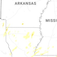
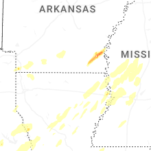


Connect with Interactive Hail Maps