

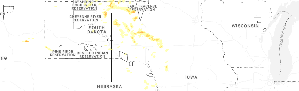
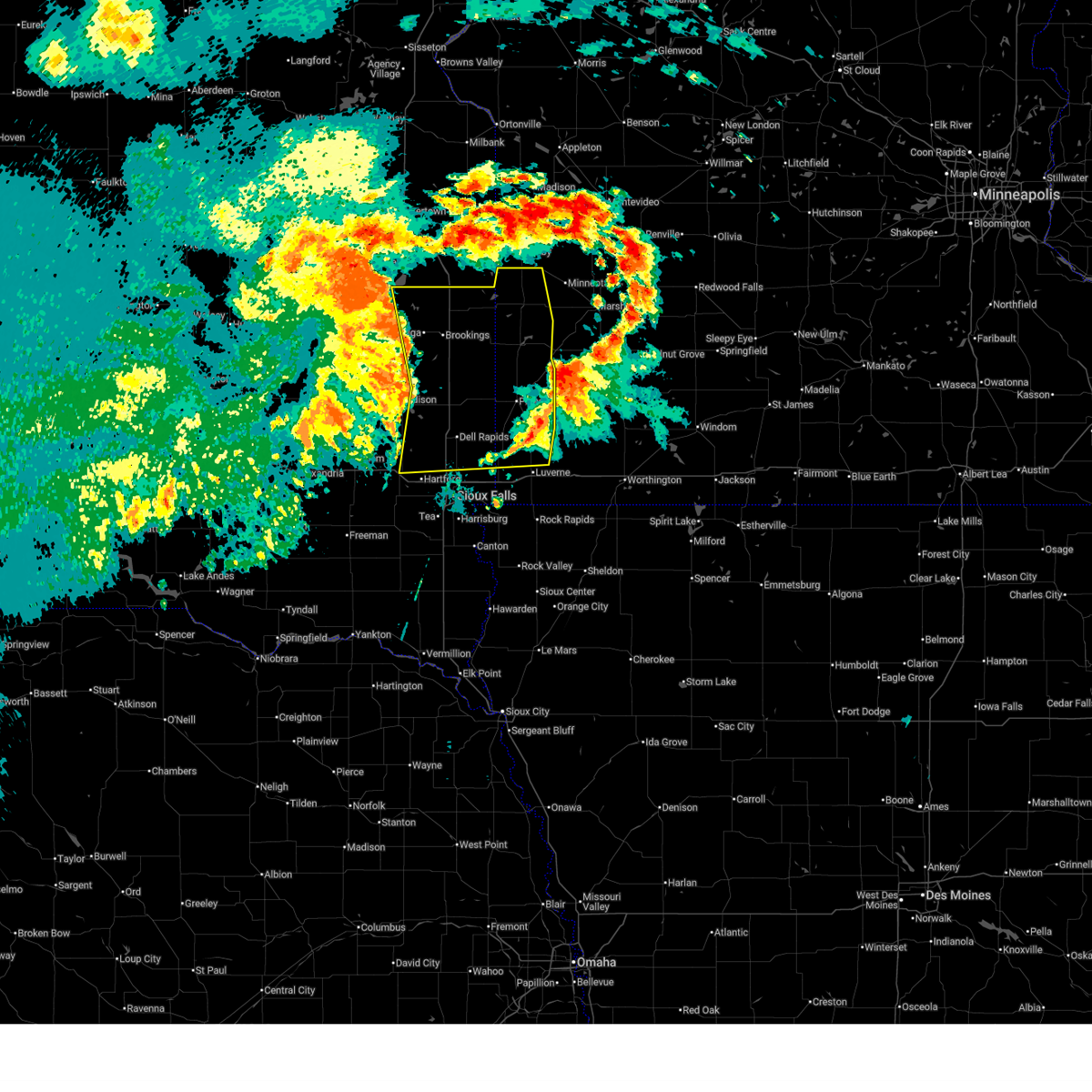
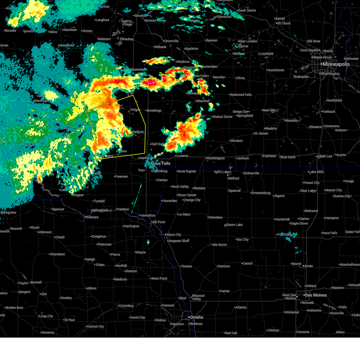
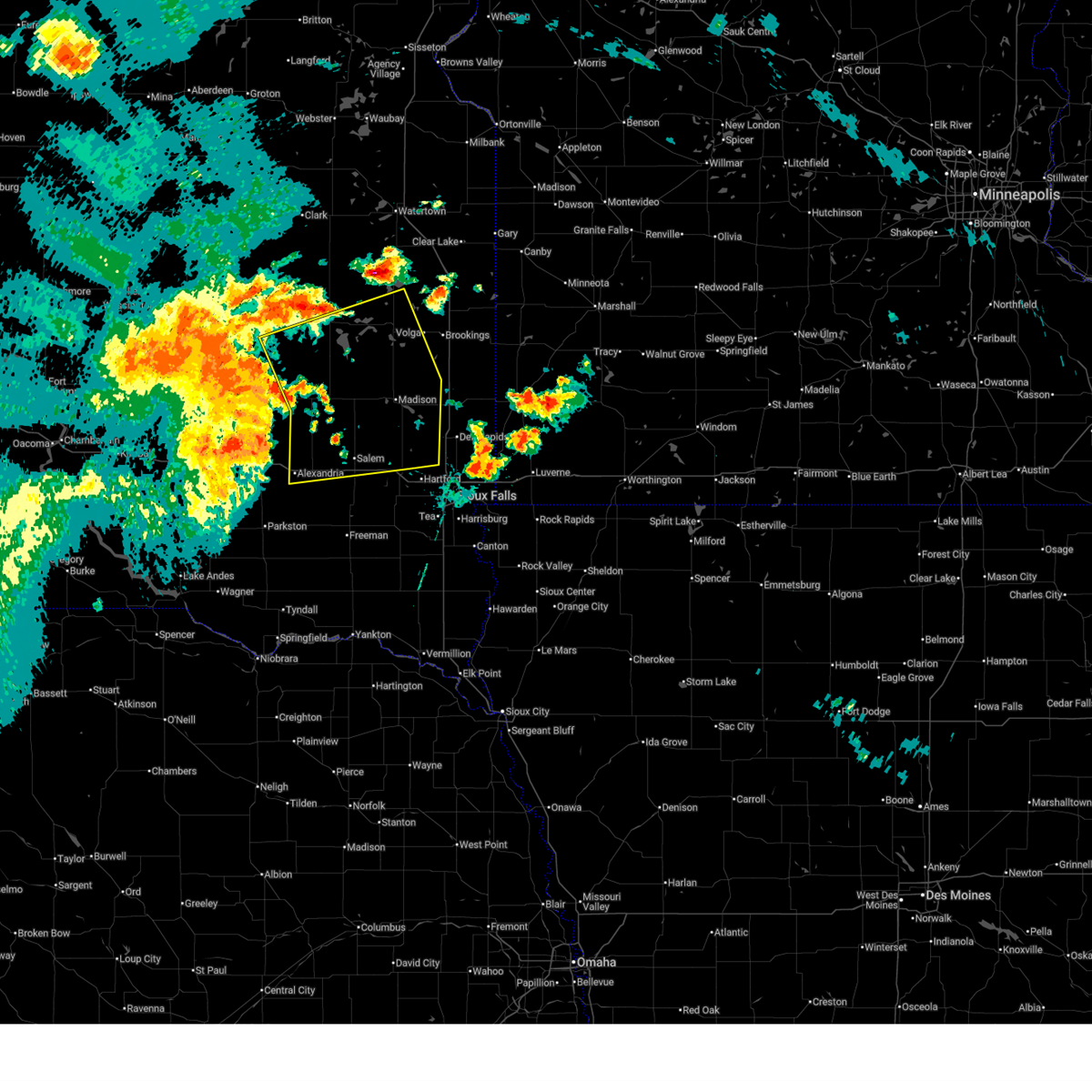
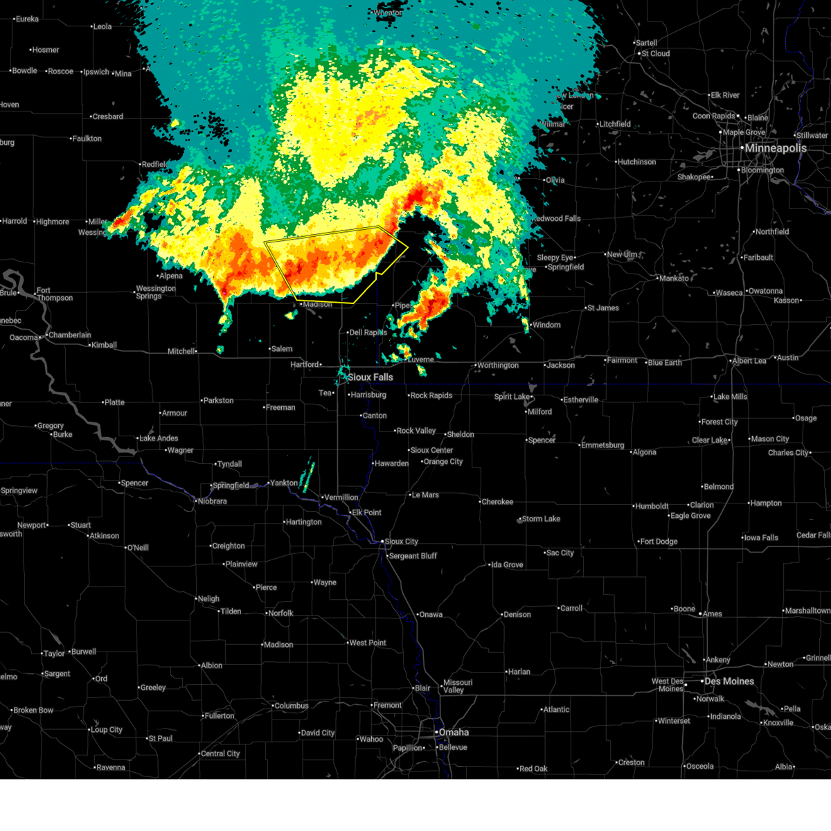
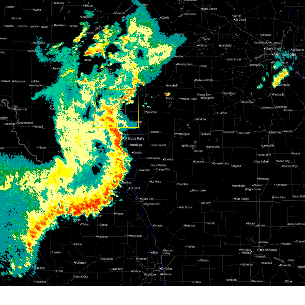
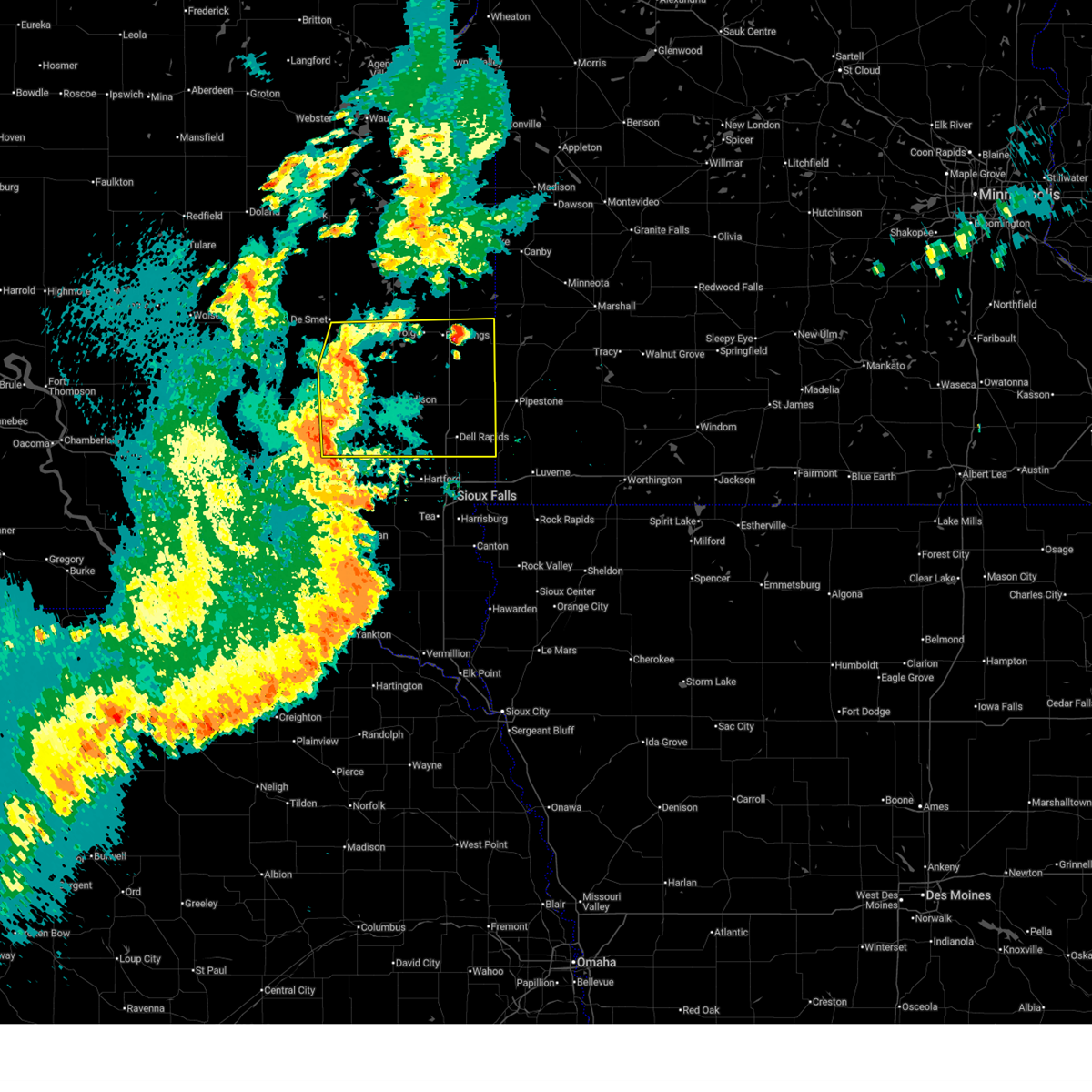
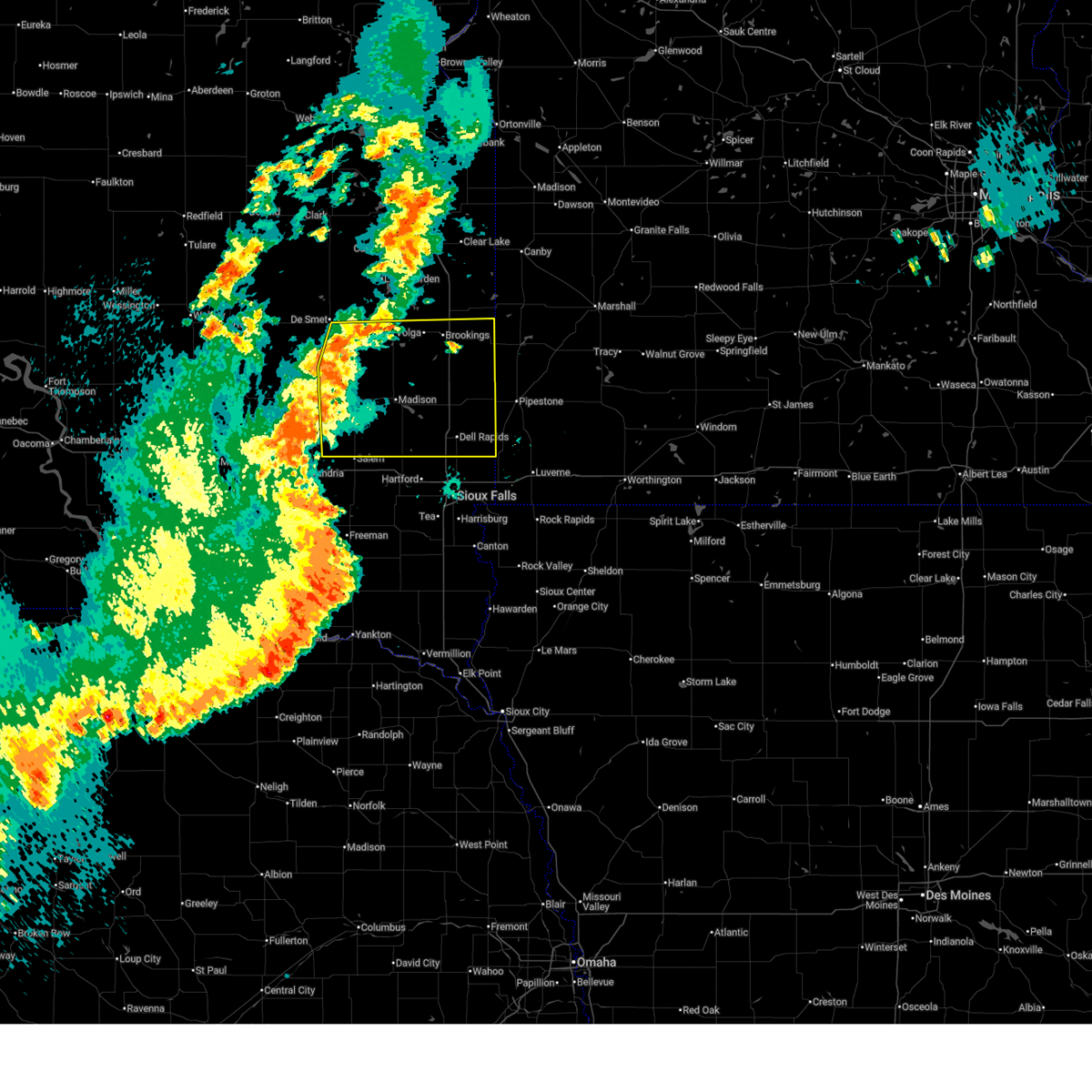
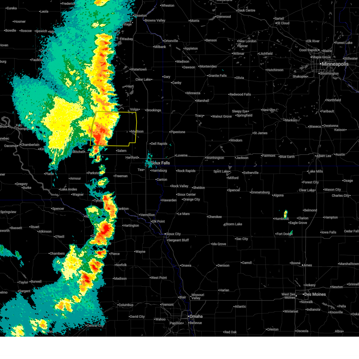
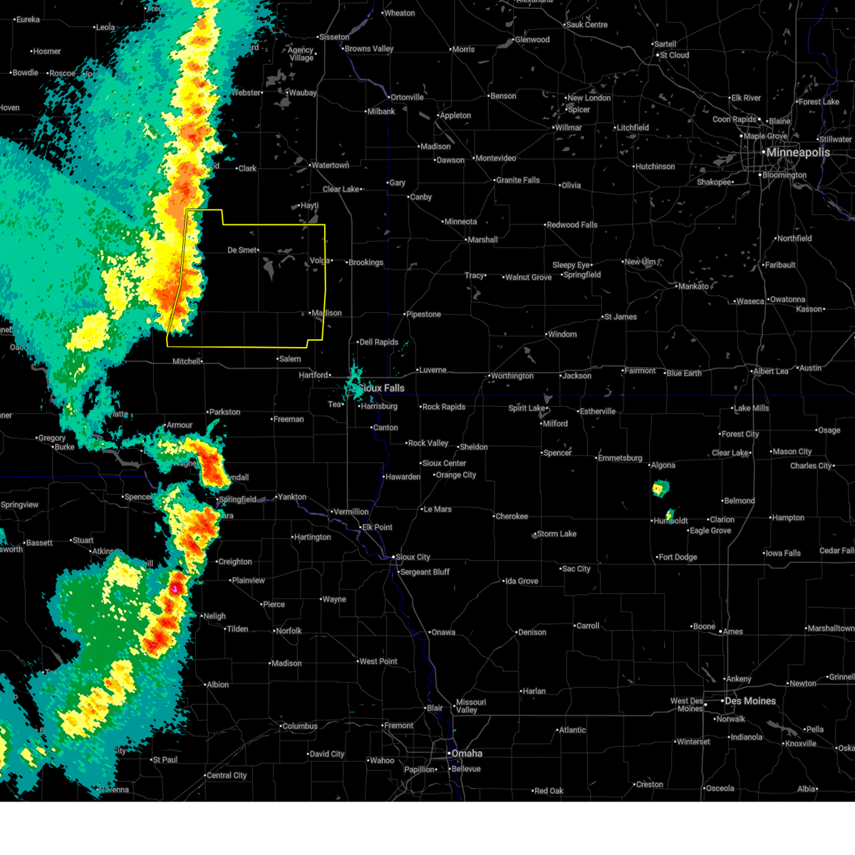
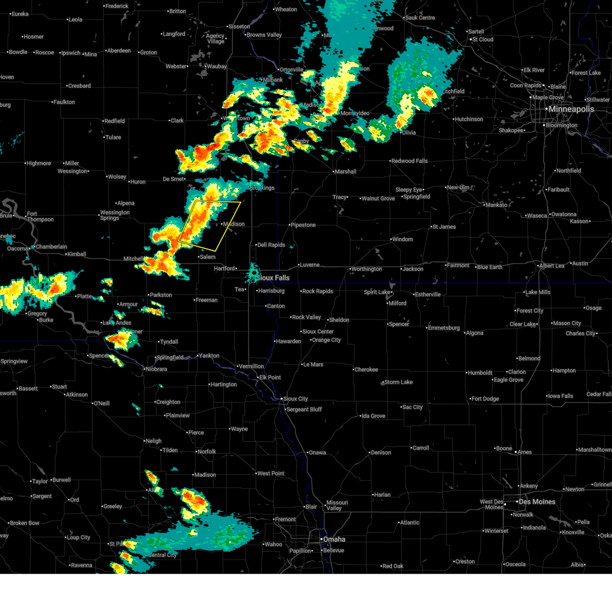
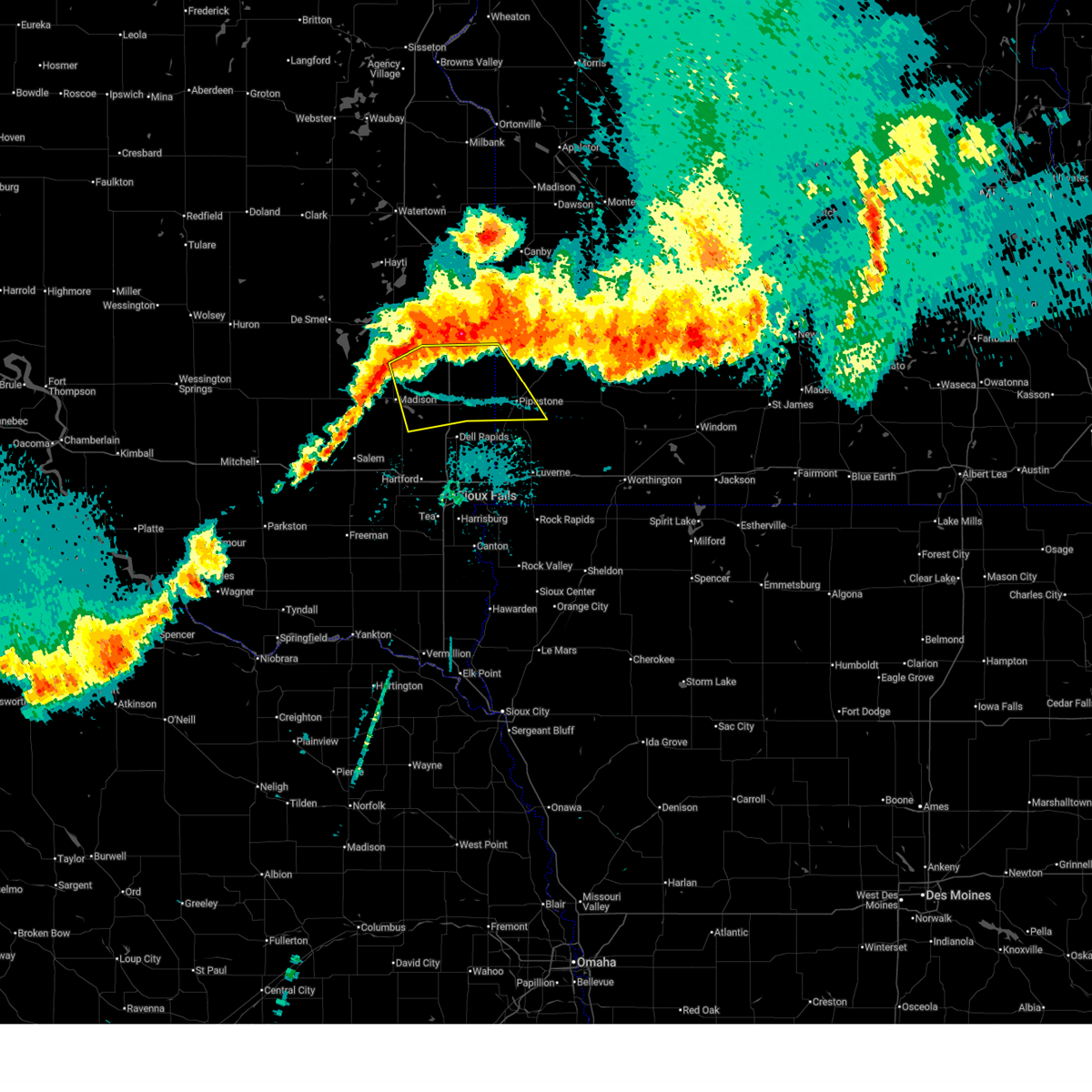
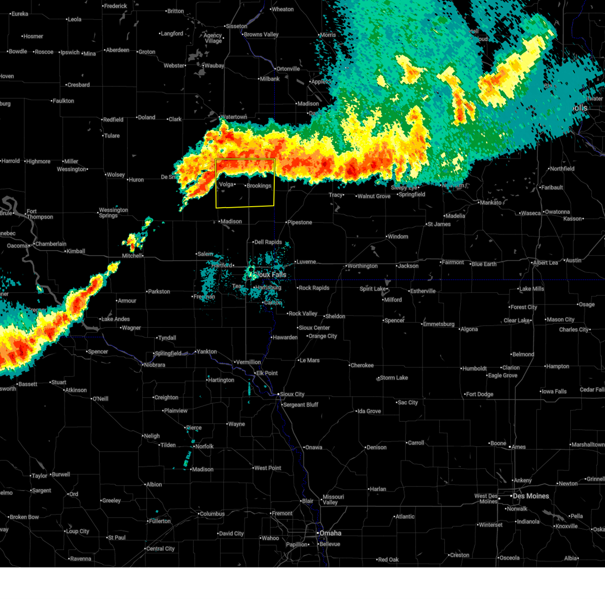
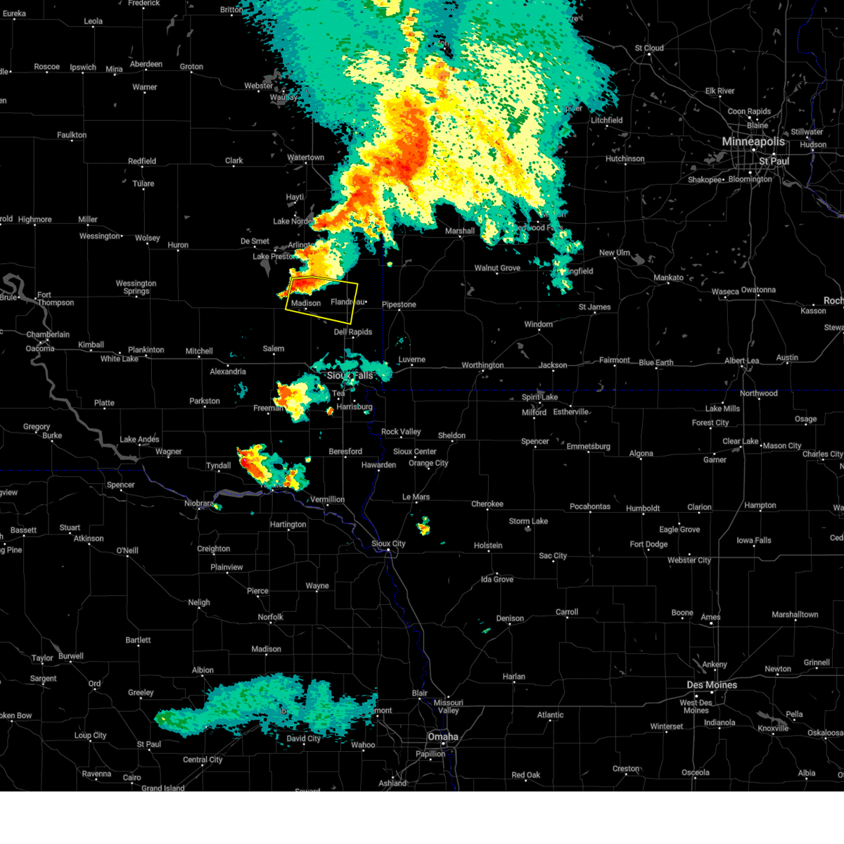
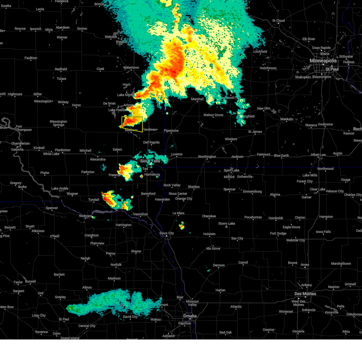
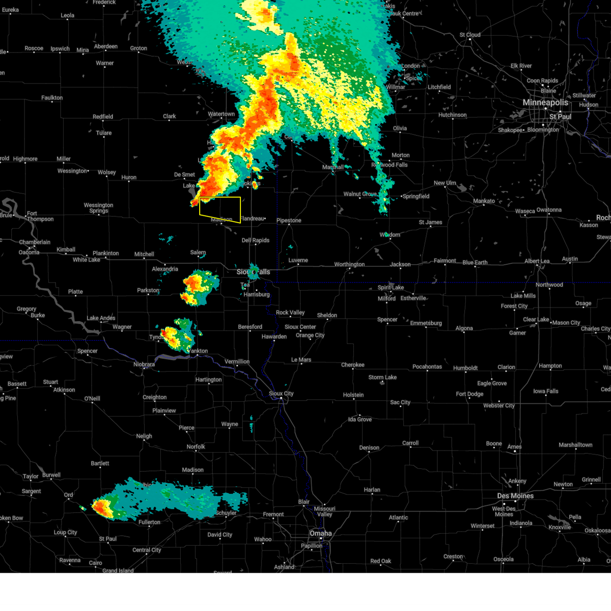
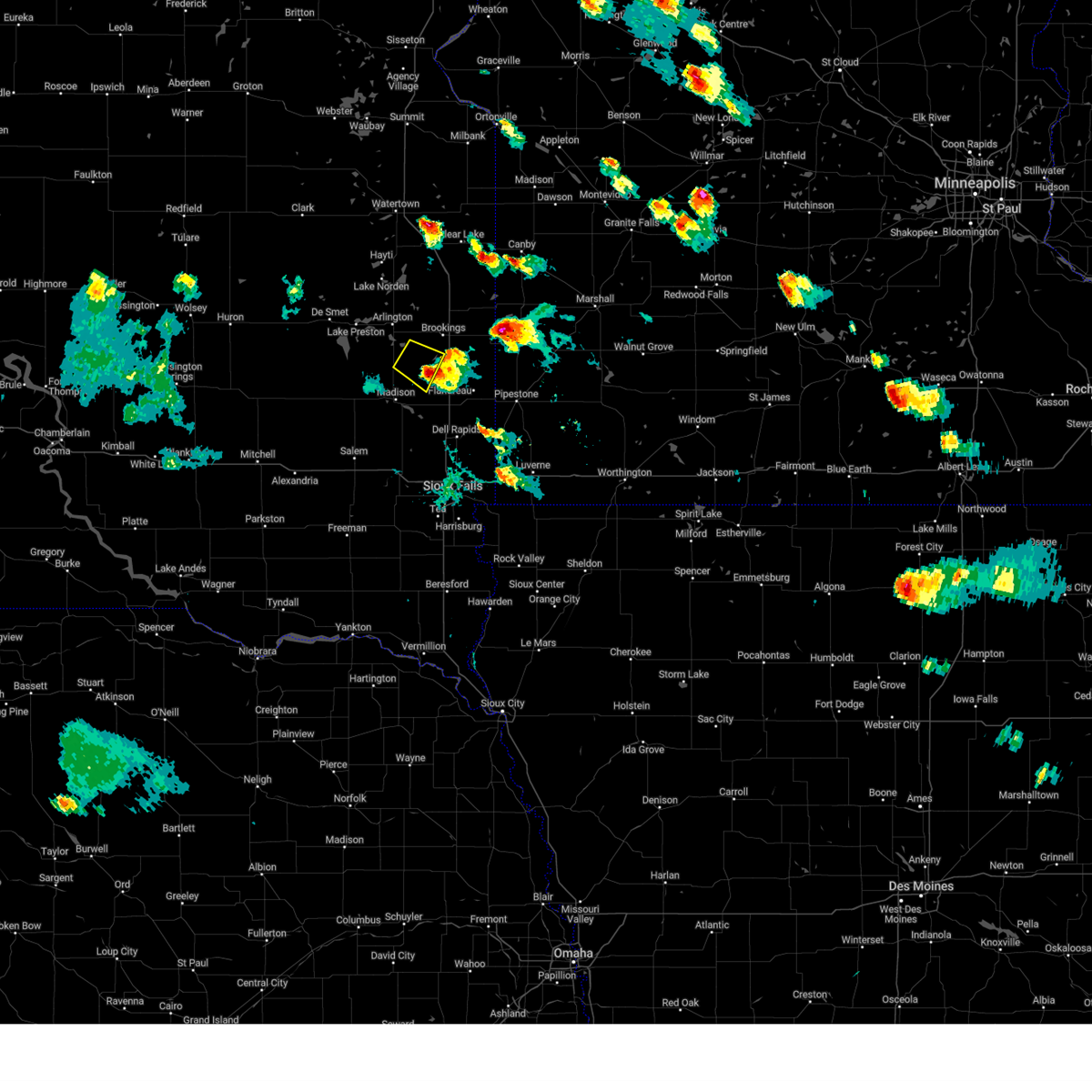
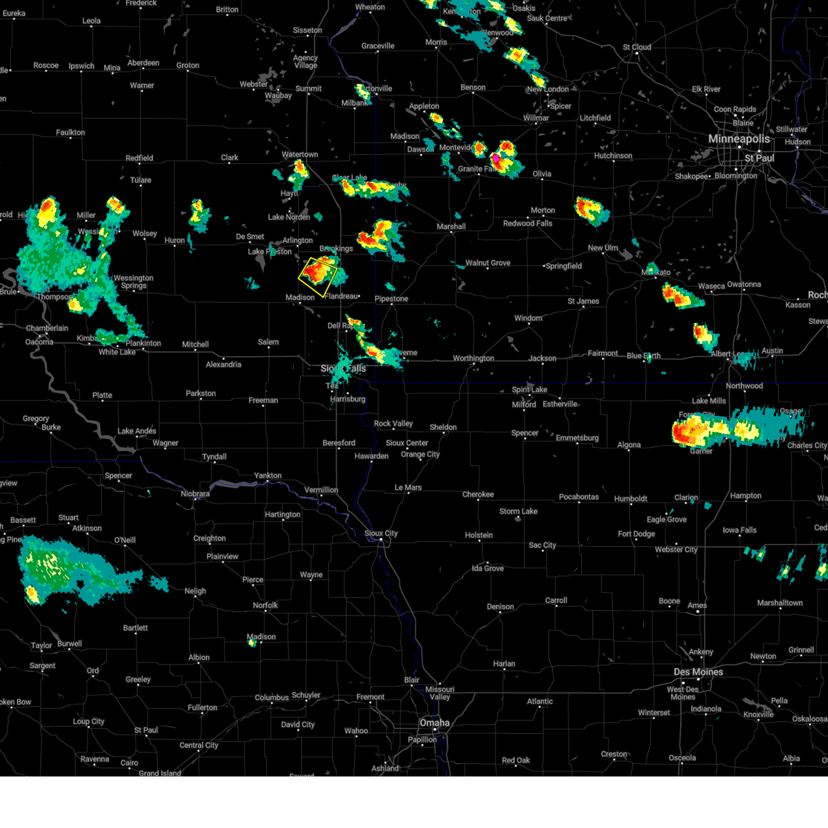
Hail Map for Nunda, SD
The Nunda, SD area has had 3 reports of on-the-ground hail by trained spotters, and has been under severe weather warnings 26 times during the past 12 months. Doppler radar has detected hail at or near Nunda, SD on 49 occasions, including 1 occasion during the past year.
| Name: | Nunda, SD |
| Where Located: | 44.9 miles NNW of Sioux Falls, SD |
| Map: | Google Map for Nunda, SD |
| Population: | 43 |
| Housing Units: | 24 |
| More Info: | Search Google for Nunda, SD |
2
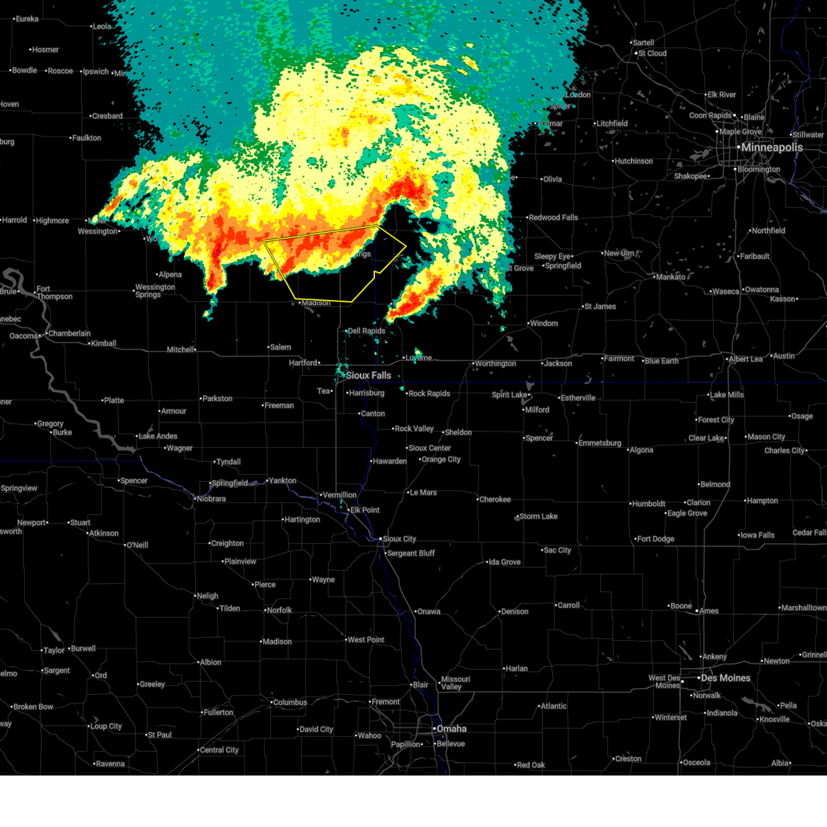
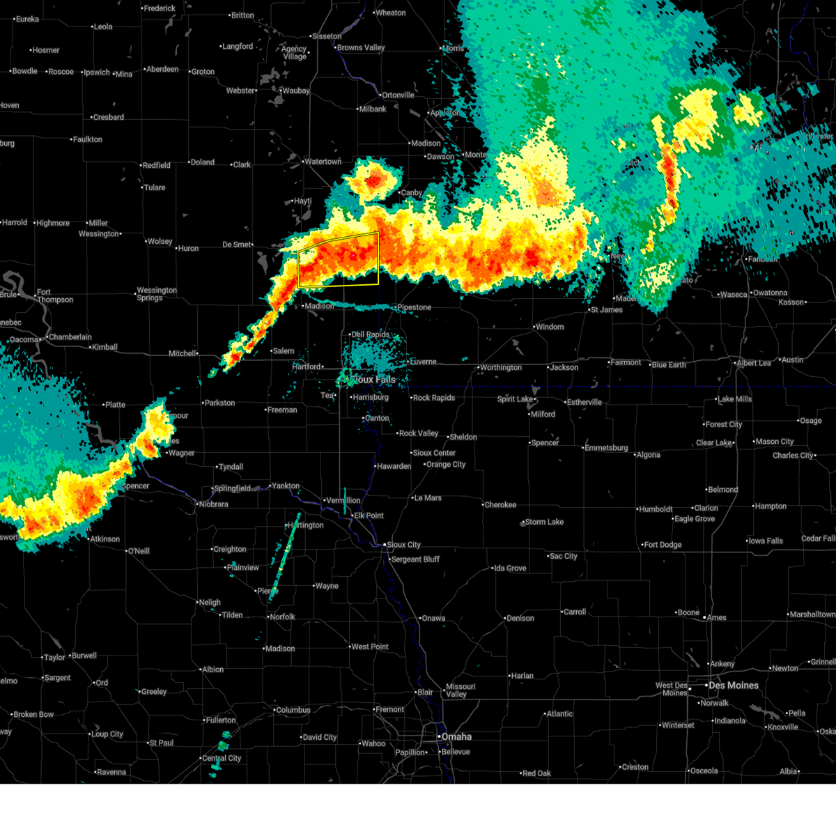
The Top Recent Hail Date for Nunda, SD is Tuesday, August 5, 2025 (12th out of 49)
Hail and Wind Damage Spotted near Nunda, SD
| Date / Time | Report Details |
|---|---|
| 6/10/2026 12:06 AM CDT |
 Svrfsd the national weather service in sioux falls has issued a * severe thunderstorm warning for, lincoln county in southwestern minnesota, northwestern pipestone county in southwestern minnesota, northern moody county in east central south dakota, northeastern lake county in east central south dakota, brookings county in east central south dakota, * until 1245 am cdt. * at 1206 am cdt, severe thunderstorms were located along a line extending from sinai to near ward, moving northeast at 55 mph (radar indicated). Hazards include 60 mph wind gusts and nickel size hail. Expect damage to roofs, siding, and trees. severe thunderstorms will be near, brookings, volga, elkton, lake benton, aurora, and ward around 1210 am cdt. bruce around 1215 am cdt. white around 1220 am cdt. arco around 1225 am cdt. Other locations in the path of these severe thunderstorms include hendricks and ivanhoe. Svrfsd the national weather service in sioux falls has issued a * severe thunderstorm warning for, lincoln county in southwestern minnesota, northwestern pipestone county in southwestern minnesota, northern moody county in east central south dakota, northeastern lake county in east central south dakota, brookings county in east central south dakota, * until 1245 am cdt. * at 1206 am cdt, severe thunderstorms were located along a line extending from sinai to near ward, moving northeast at 55 mph (radar indicated). Hazards include 60 mph wind gusts and nickel size hail. Expect damage to roofs, siding, and trees. severe thunderstorms will be near, brookings, volga, elkton, lake benton, aurora, and ward around 1210 am cdt. bruce around 1215 am cdt. white around 1220 am cdt. arco around 1225 am cdt. Other locations in the path of these severe thunderstorms include hendricks and ivanhoe.
|
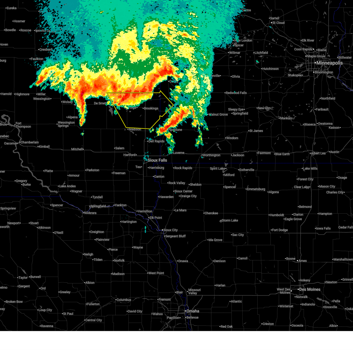
| 8/16/2025 4:31 AM CDT |
 At 430 am cdt, severe thunderstorms were located along a line extending from near astoria to near ward to near palisades state park, moving east at 60 mph (radar indicated. at 4:22 am cdt, a 58 mph wind gust was reported at ward). Hazards include 60 mph wind gusts and penny size hail. Expect damage to roofs, siding, and trees. these severe storms will be near, pipestone, garretson, hendricks, lake benton, jasper, sherman, pipestone national monument, and palisades state park around 435 am cdt. ivanhoe, hardwick, holland, trosky, and arco around 440 am cdt. Edgerton, tyler, ruthton, woodstock, and blue mounds state park around 445 am cdt. At 430 am cdt, severe thunderstorms were located along a line extending from near astoria to near ward to near palisades state park, moving east at 60 mph (radar indicated. at 4:22 am cdt, a 58 mph wind gust was reported at ward). Hazards include 60 mph wind gusts and penny size hail. Expect damage to roofs, siding, and trees. these severe storms will be near, pipestone, garretson, hendricks, lake benton, jasper, sherman, pipestone national monument, and palisades state park around 435 am cdt. ivanhoe, hardwick, holland, trosky, and arco around 440 am cdt. Edgerton, tyler, ruthton, woodstock, and blue mounds state park around 445 am cdt.
|
| 8/16/2025 4:25 AM CDT |
 At 425 am cdt, severe thunderstorms were located along a line extending from near toronto to near flandreau to near renner, moving east at 60 mph (radar indicated). Hazards include 60 mph wind gusts and penny size hail. Expect damage to roofs, siding, and trees. Locations impacted include, garretson, elkton, hendricks, jasper, sherman, ward, palisades state park, pipestone, lake benton, pipestone national monument, ivanhoe, hardwick, holland, trosky, arco, edgerton, tyler, ruthton, woodstock and blue mounds state park. At 425 am cdt, severe thunderstorms were located along a line extending from near toronto to near flandreau to near renner, moving east at 60 mph (radar indicated). Hazards include 60 mph wind gusts and penny size hail. Expect damage to roofs, siding, and trees. Locations impacted include, garretson, elkton, hendricks, jasper, sherman, ward, palisades state park, pipestone, lake benton, pipestone national monument, ivanhoe, hardwick, holland, trosky, arco, edgerton, tyler, ruthton, woodstock and blue mounds state park.
|
| 8/16/2025 4:04 AM CDT |
 Svrfsd the national weather service in sioux falls has issued a * severe thunderstorm warning for, northern rock county in southwestern minnesota, lincoln county in southwestern minnesota, pipestone county in southwestern minnesota, moody county in east central south dakota, eastern lake county in east central south dakota, northern minnehaha county in southeastern south dakota, brookings county in east central south dakota, * until 445 am cdt. * at 404 am cdt, severe thunderstorms were located along a line extending from near oakwood state park to near wentworth to near humboldt, moving east at 60 mph (radar indicated). Hazards include 60 mph wind gusts and penny size hail. Expect damage to roofs, siding, and trees. severe thunderstorms will be near, brookings, volga, crooks, baltic, colton, colman, bruce, dell rapids, and lyons around 410 am cdt. flandreau, aurora, egan, and trent around 415 am cdt. white around 420 am cdt. Other locations in the path of these severe thunderstorms include garretson, elkton, sherman, ward, palisades state park, pipestone, hendricks, lake benton, jasper, pipestone national monument and trosky. Svrfsd the national weather service in sioux falls has issued a * severe thunderstorm warning for, northern rock county in southwestern minnesota, lincoln county in southwestern minnesota, pipestone county in southwestern minnesota, moody county in east central south dakota, eastern lake county in east central south dakota, northern minnehaha county in southeastern south dakota, brookings county in east central south dakota, * until 445 am cdt. * at 404 am cdt, severe thunderstorms were located along a line extending from near oakwood state park to near wentworth to near humboldt, moving east at 60 mph (radar indicated). Hazards include 60 mph wind gusts and penny size hail. Expect damage to roofs, siding, and trees. severe thunderstorms will be near, brookings, volga, crooks, baltic, colton, colman, bruce, dell rapids, and lyons around 410 am cdt. flandreau, aurora, egan, and trent around 415 am cdt. white around 420 am cdt. Other locations in the path of these severe thunderstorms include garretson, elkton, sherman, ward, palisades state park, pipestone, hendricks, lake benton, jasper, pipestone national monument and trosky.
|
| 8/16/2025 3:50 AM CDT |
 At 349 am cdt, severe thunderstorms were located along a line extending from near lake thompson state recreation area to near lake herman state park to near montrose, moving east at 60 mph (radar indicated. at 3:34 am cdt, a 58 mph wind gust was reported in howard). Hazards include 70 mph wind gusts and penny size hail. Expect considerable tree damage. damage is likely to mobile homes, roofs, and outbuildings. Locations impacted include, madison, lake herman state park, arlington, montrose, ramona, hetland, nunda, colton, wentworth, sinai, chester, colman and lyons. At 349 am cdt, severe thunderstorms were located along a line extending from near lake thompson state recreation area to near lake herman state park to near montrose, moving east at 60 mph (radar indicated. at 3:34 am cdt, a 58 mph wind gust was reported in howard). Hazards include 70 mph wind gusts and penny size hail. Expect considerable tree damage. damage is likely to mobile homes, roofs, and outbuildings. Locations impacted include, madison, lake herman state park, arlington, montrose, ramona, hetland, nunda, colton, wentworth, sinai, chester, colman and lyons.
|
| 8/16/2025 3:23 AM CDT |
 Svrfsd the national weather service in sioux falls has issued a * severe thunderstorm warning for, kingsbury county in east central south dakota, western moody county in east central south dakota, northeastern sanborn county in east central south dakota, lake county in east central south dakota, southeastern beadle county in east central south dakota, northwestern minnehaha county in southeastern south dakota, miner county in east central south dakota, northern mccook county in southeastern south dakota, northeastern hanson county in southeastern south dakota, western brookings county in east central south dakota, * until 415 am cdt. * at 323 am cdt, severe thunderstorms were located along a line extending from 9 miles northwest of carthage to near roswell to near alexandria, moving east at 60 mph (radar indicated). Hazards include 70 mph wind gusts and penny size hail. Expect considerable tree damage. damage is likely to mobile homes, roofs, and outbuildings. severe thunderstorms will be near, howard, spencer in mccook county, carthage, canova, and vilas around 330 am cdt. salem and winfred around 335 am cdt. lake thompson state recreation area around 340 am cdt. Other locations in the path of these severe thunderstorms include lake herman state park, lake preston, montrose, ramona, oldham, orland, madison, arlington, wentworth, hetland, nunda, colton, sinai, chester, colman and lyons. Svrfsd the national weather service in sioux falls has issued a * severe thunderstorm warning for, kingsbury county in east central south dakota, western moody county in east central south dakota, northeastern sanborn county in east central south dakota, lake county in east central south dakota, southeastern beadle county in east central south dakota, northwestern minnehaha county in southeastern south dakota, miner county in east central south dakota, northern mccook county in southeastern south dakota, northeastern hanson county in southeastern south dakota, western brookings county in east central south dakota, * until 415 am cdt. * at 323 am cdt, severe thunderstorms were located along a line extending from 9 miles northwest of carthage to near roswell to near alexandria, moving east at 60 mph (radar indicated). Hazards include 70 mph wind gusts and penny size hail. Expect considerable tree damage. damage is likely to mobile homes, roofs, and outbuildings. severe thunderstorms will be near, howard, spencer in mccook county, carthage, canova, and vilas around 330 am cdt. salem and winfred around 335 am cdt. lake thompson state recreation area around 340 am cdt. Other locations in the path of these severe thunderstorms include lake herman state park, lake preston, montrose, ramona, oldham, orland, madison, arlington, wentworth, hetland, nunda, colton, sinai, chester, colman and lyons.
|
| 8/6/2025 12:37 AM CDT |
 The storms which prompted the warning have weakened below severe limits, and no longer pose an immediate threat to life or property. therefore, the warning will be allowed to expire. however, gusty winds to 50 mph and heavy rain are still possible with these thunderstorms. The storms which prompted the warning have weakened below severe limits, and no longer pose an immediate threat to life or property. therefore, the warning will be allowed to expire. however, gusty winds to 50 mph and heavy rain are still possible with these thunderstorms.
|
| 8/6/2025 12:24 AM CDT |
 At 1224 am cdt, severe thunderstorms were located along a line extending from 6 miles south of hendricks to 9 miles south of aurora to near ramona, moving southeast at 35 mph (radar indicated). Hazards include 60 mph wind gusts. Expect damage to roofs, siding, and trees. these severe storms will be near, elkton around 1230 am cdt. flandreau, lake benton, and ward around 1235 am cdt. Other locations impacted by these severe thunderstorms include bushnell and northwestern flandreau santee sioux tribal nation. At 1224 am cdt, severe thunderstorms were located along a line extending from 6 miles south of hendricks to 9 miles south of aurora to near ramona, moving southeast at 35 mph (radar indicated). Hazards include 60 mph wind gusts. Expect damage to roofs, siding, and trees. these severe storms will be near, elkton around 1230 am cdt. flandreau, lake benton, and ward around 1235 am cdt. Other locations impacted by these severe thunderstorms include bushnell and northwestern flandreau santee sioux tribal nation.
|
| 8/5/2025 11:59 PM CDT |
 Svrfsd the national weather service in sioux falls has issued a * severe thunderstorm warning for, southwestern lincoln county in southwestern minnesota, eastern kingsbury county in east central south dakota, northern moody county in east central south dakota, northeastern lake county in east central south dakota, brookings county in east central south dakota, * until 1245 am cdt. * at 1158 pm cdt, severe thunderstorms were located along a line extending from near astoria to volga to near lake preston, moving southeast at 35 mph (radar indicated). Hazards include 60 mph wind gusts. Expect damage to roofs, siding, and trees. severe thunderstorms will be near, brookings, hendricks, aurora, white, oldham, and sinai around 1205 am cdt. nunda around 1210 am cdt. ramona around 1220 am cdt. elkton around 1225 am cdt. Other locations impacted by these severe thunderstorms include erwin, bushnell, and northwestern flandreau santee sioux tribal nation. Svrfsd the national weather service in sioux falls has issued a * severe thunderstorm warning for, southwestern lincoln county in southwestern minnesota, eastern kingsbury county in east central south dakota, northern moody county in east central south dakota, northeastern lake county in east central south dakota, brookings county in east central south dakota, * until 1245 am cdt. * at 1158 pm cdt, severe thunderstorms were located along a line extending from near astoria to volga to near lake preston, moving southeast at 35 mph (radar indicated). Hazards include 60 mph wind gusts. Expect damage to roofs, siding, and trees. severe thunderstorms will be near, brookings, hendricks, aurora, white, oldham, and sinai around 1205 am cdt. nunda around 1210 am cdt. ramona around 1220 am cdt. elkton around 1225 am cdt. Other locations impacted by these severe thunderstorms include erwin, bushnell, and northwestern flandreau santee sioux tribal nation.
|
| 7/15/2025 8:44 PM CDT |
 The storms which prompted the warning have weakened below severe limits, and no longer pose an immediate threat to life or property. therefore, the warning will be allowed to expire. however, gusty winds and heavy rain are still possible with these thunderstorms. a severe thunderstorm watch remains in effect until 1100 pm cdt for southeastern and east central south dakota. a severe thunderstorm watch also remains in effect until 300 am cdt for southwestern minnesota. to report severe weather, contact your nearest law enforcement agency. they will relay your report to the national weather service sioux falls. remember, a severe thunderstorm warning still remains in effect for portions of minnehaha, lake, moody, and mccook counties until 930 pm cdt. The storms which prompted the warning have weakened below severe limits, and no longer pose an immediate threat to life or property. therefore, the warning will be allowed to expire. however, gusty winds and heavy rain are still possible with these thunderstorms. a severe thunderstorm watch remains in effect until 1100 pm cdt for southeastern and east central south dakota. a severe thunderstorm watch also remains in effect until 300 am cdt for southwestern minnesota. to report severe weather, contact your nearest law enforcement agency. they will relay your report to the national weather service sioux falls. remember, a severe thunderstorm warning still remains in effect for portions of minnehaha, lake, moody, and mccook counties until 930 pm cdt.
|
| 7/15/2025 8:19 PM CDT |
 At 819 pm cdt, severe thunderstorms were located along a line extending from near oldham to madison to near orland to near salem, moving east at 15 mph (radar indicated). Hazards include 60 mph wind gusts and quarter size hail. Hail damage to vehicles is expected. expect wind damage to roofs, siding, and trees. Locations impacted include, madison, wentworth, nunda, sinai, chester, colton and colman. At 819 pm cdt, severe thunderstorms were located along a line extending from near oldham to madison to near orland to near salem, moving east at 15 mph (radar indicated). Hazards include 60 mph wind gusts and quarter size hail. Hail damage to vehicles is expected. expect wind damage to roofs, siding, and trees. Locations impacted include, madison, wentworth, nunda, sinai, chester, colton and colman.
|
| 7/15/2025 7:55 PM CDT |
 At 755 pm cdt, severe thunderstorms were located along a line extending from near oldham to near ramona to near orland to near spencer in mccook county, moving east at 25 mph (radar indicated). Hazards include 60 mph wind gusts and nickel size hail. Expect damage to roofs, siding, and trees. these severe storms will be near, madison, lake herman state park, salem, ramona, oldham, and orland around 800 pm cdt. Other locations in the path of these severe thunderstorms include wentworth, nunda, sinai, chester, colton and colman. At 755 pm cdt, severe thunderstorms were located along a line extending from near oldham to near ramona to near orland to near spencer in mccook county, moving east at 25 mph (radar indicated). Hazards include 60 mph wind gusts and nickel size hail. Expect damage to roofs, siding, and trees. these severe storms will be near, madison, lake herman state park, salem, ramona, oldham, and orland around 800 pm cdt. Other locations in the path of these severe thunderstorms include wentworth, nunda, sinai, chester, colton and colman.
|
| 7/15/2025 7:41 PM CDT |
 Svrfsd the national weather service in sioux falls has issued a * severe thunderstorm warning for, southeastern kingsbury county in east central south dakota, moody county in east central south dakota, lake county in east central south dakota, northern minnehaha county in southeastern south dakota, eastern miner county in east central south dakota, northern mccook county in southeastern south dakota, southern brookings county in east central south dakota, * until 845 pm cdt. * at 740 pm cdt, severe thunderstorms were located along a line extending from near sinai to near ramona to near canova to near emery, moving east at 45 mph (public. at 725 pm, a 61 mph wind gust was reported 1 mile west of howard, sd!). Hazards include 60 mph wind gusts and quarter size hail. Hail damage to vehicles is expected. expect wind damage to roofs, siding, and trees. severe thunderstorms will be near, madison, lake herman state park, salem, ramona, sinai, and nunda around 745 pm cdt. volga and orland around 750 pm cdt. brookings around 755 pm cdt. wentworth around 800 pm cdt. Other locations in the path of these severe thunderstorms include aurora, chester, colton, colman, flandreau, elkton, egan, dell rapids, baltic, trent and ward. Svrfsd the national weather service in sioux falls has issued a * severe thunderstorm warning for, southeastern kingsbury county in east central south dakota, moody county in east central south dakota, lake county in east central south dakota, northern minnehaha county in southeastern south dakota, eastern miner county in east central south dakota, northern mccook county in southeastern south dakota, southern brookings county in east central south dakota, * until 845 pm cdt. * at 740 pm cdt, severe thunderstorms were located along a line extending from near sinai to near ramona to near canova to near emery, moving east at 45 mph (public. at 725 pm, a 61 mph wind gust was reported 1 mile west of howard, sd!). Hazards include 60 mph wind gusts and quarter size hail. Hail damage to vehicles is expected. expect wind damage to roofs, siding, and trees. severe thunderstorms will be near, madison, lake herman state park, salem, ramona, sinai, and nunda around 745 pm cdt. volga and orland around 750 pm cdt. brookings around 755 pm cdt. wentworth around 800 pm cdt. Other locations in the path of these severe thunderstorms include aurora, chester, colton, colman, flandreau, elkton, egan, dell rapids, baltic, trent and ward.
|
| 7/9/2025 11:34 PM CDT |
 the severe thunderstorm warning has been cancelled and is no longer in effect the severe thunderstorm warning has been cancelled and is no longer in effect
|
| 7/9/2025 11:34 PM CDT |
 At 1133 pm cdt, severe thunderstorms were located along a line extending from near hamlin education center to near hetland to near ramona to near canova, moving east at 50 mph (radar indicated). Hazards include 60 mph wind gusts. Expect damage to roofs, siding, and trees. these severe storms will be near, madison, lake herman state park, ramona, sinai, and orland around 1140 pm cdt. Nunda around 1145 pm cdt. At 1133 pm cdt, severe thunderstorms were located along a line extending from near hamlin education center to near hetland to near ramona to near canova, moving east at 50 mph (radar indicated). Hazards include 60 mph wind gusts. Expect damage to roofs, siding, and trees. these severe storms will be near, madison, lake herman state park, ramona, sinai, and orland around 1140 pm cdt. Nunda around 1145 pm cdt.
|
| 7/9/2025 10:48 PM CDT |
 Svrfsd the national weather service in sioux falls has issued a * severe thunderstorm warning for, northern davison county in southeastern south dakota, kingsbury county in east central south dakota, sanborn county in east central south dakota, lake county in east central south dakota, eastern beadle county in east central south dakota, miner county in east central south dakota, northern mccook county in southeastern south dakota, northern hanson county in southeastern south dakota, western brookings county in east central south dakota, * until 1145 pm cdt. * at 1048 pm cdt, severe thunderstorms were located along a line extending from near carpenter to near yale to 7 miles north of artesian to near letcher, moving east at 50 mph (radar indicated). Hazards include 60 mph wind gusts. Expect damage to roofs, siding, and trees. severe thunderstorms will be near, iroquois, carthage, artesian, and fedora around 1055 pm cdt. roswell around 1100 pm cdt. vilas around 1105 pm cdt. lake thompson state recreation area, de smet, and howard around 1110 pm cdt. lake preston and canova around 1120 pm cdt. winfred and oldham around 1125 pm cdt. ramona, badger, and hetland around 1130 pm cdt. arlington around 1135 pm cdt. Other locations impacted by these severe thunderstorms include bancroft and erwin. Svrfsd the national weather service in sioux falls has issued a * severe thunderstorm warning for, northern davison county in southeastern south dakota, kingsbury county in east central south dakota, sanborn county in east central south dakota, lake county in east central south dakota, eastern beadle county in east central south dakota, miner county in east central south dakota, northern mccook county in southeastern south dakota, northern hanson county in southeastern south dakota, western brookings county in east central south dakota, * until 1145 pm cdt. * at 1048 pm cdt, severe thunderstorms were located along a line extending from near carpenter to near yale to 7 miles north of artesian to near letcher, moving east at 50 mph (radar indicated). Hazards include 60 mph wind gusts. Expect damage to roofs, siding, and trees. severe thunderstorms will be near, iroquois, carthage, artesian, and fedora around 1055 pm cdt. roswell around 1100 pm cdt. vilas around 1105 pm cdt. lake thompson state recreation area, de smet, and howard around 1110 pm cdt. lake preston and canova around 1120 pm cdt. winfred and oldham around 1125 pm cdt. ramona, badger, and hetland around 1130 pm cdt. arlington around 1135 pm cdt. Other locations impacted by these severe thunderstorms include bancroft and erwin.
|
| 7/7/2025 4:36 PM CDT |
 the severe thunderstorm warning has been cancelled and is no longer in effect the severe thunderstorm warning has been cancelled and is no longer in effect
|
| 7/7/2025 4:25 PM CDT |
 At 425 pm cdt, severe thunderstorms were located along a line extending from near ramona to canova, moving east at 35 mph (radar indicated). Hazards include 60 mph wind gusts. Expect damage to roofs, siding, and trees. these severe storms will be near, ramona and winfred around 430 pm cdt. Other locations in the path of these severe thunderstorms include madison, lake herman state park, orland and nunda. At 425 pm cdt, severe thunderstorms were located along a line extending from near ramona to canova, moving east at 35 mph (radar indicated). Hazards include 60 mph wind gusts. Expect damage to roofs, siding, and trees. these severe storms will be near, ramona and winfred around 430 pm cdt. Other locations in the path of these severe thunderstorms include madison, lake herman state park, orland and nunda.
|
| 7/7/2025 4:10 PM CDT |
 Svrfsd the national weather service in sioux falls has issued a * severe thunderstorm warning for, lake county in east central south dakota, eastern miner county in east central south dakota, northeastern mccook county in southeastern south dakota, * until 500 pm cdt. * at 410 pm cdt, severe thunderstorms were located along a line extending from 9 miles southwest of oldham to 6 miles south of roswell, moving east at 30 mph (radar indicated). Hazards include 70 mph wind gusts. Expect considerable tree damage. damage is likely to mobile homes, roofs, and outbuildings. severe thunderstorms will be near, howard, canova, and vilas around 415 pm cdt. winfred around 420 pm cdt. ramona around 425 pm cdt. Other locations in the path of these severe thunderstorms include lake herman state park, madison and orland. Svrfsd the national weather service in sioux falls has issued a * severe thunderstorm warning for, lake county in east central south dakota, eastern miner county in east central south dakota, northeastern mccook county in southeastern south dakota, * until 500 pm cdt. * at 410 pm cdt, severe thunderstorms were located along a line extending from 9 miles southwest of oldham to 6 miles south of roswell, moving east at 30 mph (radar indicated). Hazards include 70 mph wind gusts. Expect considerable tree damage. damage is likely to mobile homes, roofs, and outbuildings. severe thunderstorms will be near, howard, canova, and vilas around 415 pm cdt. winfred around 420 pm cdt. ramona around 425 pm cdt. Other locations in the path of these severe thunderstorms include lake herman state park, madison and orland.
|
| 6/29/2025 12:17 AM CDT |
 The storms which prompted the warning have weakened below severe limits, and are exiting the warned area. therefore, the warning has been allowed to expire. however, gusty winds to 50 mph are still possible with these thunderstorms. a severe thunderstorm watch remains in effect until 500 am cdt for east central south dakota. remember, a severe thunderstorm warning still remains in effect for portions of lake and brookings counties until 1 am cdt. The storms which prompted the warning have weakened below severe limits, and are exiting the warned area. therefore, the warning has been allowed to expire. however, gusty winds to 50 mph are still possible with these thunderstorms. a severe thunderstorm watch remains in effect until 500 am cdt for east central south dakota. remember, a severe thunderstorm warning still remains in effect for portions of lake and brookings counties until 1 am cdt.
|
| 6/29/2025 12:14 AM CDT |
 Svrfsd the national weather service in sioux falls has issued a * severe thunderstorm warning for, southwestern lincoln county in southwestern minnesota, southwestern pipestone county in southwestern minnesota, moody county in east central south dakota, eastern lake county in east central south dakota, southeastern brookings county in east central south dakota, * until 100 am cdt. * at 1213 am cdt, severe thunderstorms were located along a line extending from ward to 9 miles north of colman to near wentworth, moving southeast at 20 mph (automated equipment. at 1203 am cdt a 66 mph wind gust was reported at the brookings airport). Hazards include 70 mph wind gusts. Expect considerable tree damage. damage is likely to mobile homes, roofs, and outbuildings. severe thunderstorms will be near, flandreau, colman, and wentworth around 1220 am cdt. egan around 1225 am cdt. pipestone and pipestone national monument around 1230 am cdt. Other locations in the path of these severe thunderstorms include chester. Svrfsd the national weather service in sioux falls has issued a * severe thunderstorm warning for, southwestern lincoln county in southwestern minnesota, southwestern pipestone county in southwestern minnesota, moody county in east central south dakota, eastern lake county in east central south dakota, southeastern brookings county in east central south dakota, * until 100 am cdt. * at 1213 am cdt, severe thunderstorms were located along a line extending from ward to 9 miles north of colman to near wentworth, moving southeast at 20 mph (automated equipment. at 1203 am cdt a 66 mph wind gust was reported at the brookings airport). Hazards include 70 mph wind gusts. Expect considerable tree damage. damage is likely to mobile homes, roofs, and outbuildings. severe thunderstorms will be near, flandreau, colman, and wentworth around 1220 am cdt. egan around 1225 am cdt. pipestone and pipestone national monument around 1230 am cdt. Other locations in the path of these severe thunderstorms include chester.
|
| 6/29/2025 12:05 AM CDT |
 At 1204 am cdt, severe thunderstorms were located along a line extending from elkton to 6 miles south of brookings to nunda, moving south at 20 mph (automated equipment. at 1148 pm a 63 mph wind gust was reported 1 mile south of volga). Hazards include 60 mph wind gusts. Expect damage to roofs, siding, and trees. Locations impacted include, elkton and ward. At 1204 am cdt, severe thunderstorms were located along a line extending from elkton to 6 miles south of brookings to nunda, moving south at 20 mph (automated equipment. at 1148 pm a 63 mph wind gust was reported 1 mile south of volga). Hazards include 60 mph wind gusts. Expect damage to roofs, siding, and trees. Locations impacted include, elkton and ward.
|
| 6/28/2025 11:51 PM CDT |
 At 1151 pm cdt, severe thunderstorms were located along a line extending from sinai to near ramona to near winfred, moving southeast at 30 mph (radar indicated). Hazards include 60 mph wind gusts. Expect damage to roofs, siding, and trees. Locations impacted include, ramona, winfred and nunda. At 1151 pm cdt, severe thunderstorms were located along a line extending from sinai to near ramona to near winfred, moving southeast at 30 mph (radar indicated). Hazards include 60 mph wind gusts. Expect damage to roofs, siding, and trees. Locations impacted include, ramona, winfred and nunda.
|
| 6/28/2025 11:49 PM CDT |
 At 1149 pm cdt, severe thunderstorms were located along a line extending from 6 miles north of elkton to near brookings to near sinai, moving southeast at 30 mph (radar indicated). Hazards include 60 mph wind gusts. Expect damage to roofs, siding, and trees. Locations impacted include, brookings, elkton, aurora, nunda and ward. At 1149 pm cdt, severe thunderstorms were located along a line extending from 6 miles north of elkton to near brookings to near sinai, moving southeast at 30 mph (radar indicated). Hazards include 60 mph wind gusts. Expect damage to roofs, siding, and trees. Locations impacted include, brookings, elkton, aurora, nunda and ward.
|
| 6/28/2025 11:31 PM CDT |
 Svrfsd the national weather service in sioux falls has issued a * severe thunderstorm warning for, southeastern kingsbury county in east central south dakota, northern lake county in east central south dakota, northeastern miner county in east central south dakota, southwestern brookings county in east central south dakota, * until 1215 am cdt. * at 1131 pm cdt, severe thunderstorms were located along a line extending from arlington to near oldham to 7 miles north of howard, moving southeast at 20 mph (radar indicated). Hazards include 60 mph wind gusts. Expect damage to roofs, siding, and trees. severe thunderstorms will be near, ramona and sinai around 1135 pm cdt. Winfred and nunda around 1150 pm cdt. Svrfsd the national weather service in sioux falls has issued a * severe thunderstorm warning for, southeastern kingsbury county in east central south dakota, northern lake county in east central south dakota, northeastern miner county in east central south dakota, southwestern brookings county in east central south dakota, * until 1215 am cdt. * at 1131 pm cdt, severe thunderstorms were located along a line extending from arlington to near oldham to 7 miles north of howard, moving southeast at 20 mph (radar indicated). Hazards include 60 mph wind gusts. Expect damage to roofs, siding, and trees. severe thunderstorms will be near, ramona and sinai around 1135 pm cdt. Winfred and nunda around 1150 pm cdt.
|
| 6/28/2025 11:26 PM CDT |
 Svrfsd the national weather service in sioux falls has issued a * severe thunderstorm warning for, east central kingsbury county in east central south dakota, northern moody county in east central south dakota, northeastern lake county in east central south dakota, brookings county in east central south dakota, * until 1215 am cdt. * at 1125 pm cdt, severe thunderstorms were located along a line extending from 8 miles southeast of white to near brookings to near arlington, moving south at 15 mph (public. at 1054 pm cdt quarter sized hail was reported 2 miles south southeast of stone bridge). Hazards include 60 mph wind gusts and half dollar size hail. Hail damage to vehicles is expected. expect wind damage to roofs, siding, and trees. severe thunderstorms will be near, brookings, volga, and aurora around 1130 pm cdt. sinai around 1135 pm cdt. Elkton around 1145 pm cdt. Svrfsd the national weather service in sioux falls has issued a * severe thunderstorm warning for, east central kingsbury county in east central south dakota, northern moody county in east central south dakota, northeastern lake county in east central south dakota, brookings county in east central south dakota, * until 1215 am cdt. * at 1125 pm cdt, severe thunderstorms were located along a line extending from 8 miles southeast of white to near brookings to near arlington, moving south at 15 mph (public. at 1054 pm cdt quarter sized hail was reported 2 miles south southeast of stone bridge). Hazards include 60 mph wind gusts and half dollar size hail. Hail damage to vehicles is expected. expect wind damage to roofs, siding, and trees. severe thunderstorms will be near, brookings, volga, and aurora around 1130 pm cdt. sinai around 1135 pm cdt. Elkton around 1145 pm cdt.
|
| 7/31/2024 8:58 PM CDT |
 The storms which prompted the warning have moved out of the area. therefore, the warning will be allowed to expire. however, gusty winds and heavy rain are still possible with these thunderstorms. a severe thunderstorm watch remains in effect until midnight cdt for east central south dakota. The storms which prompted the warning have moved out of the area. therefore, the warning will be allowed to expire. however, gusty winds and heavy rain are still possible with these thunderstorms. a severe thunderstorm watch remains in effect until midnight cdt for east central south dakota.
|
| 7/31/2024 8:14 PM CDT |
 Svrfsd the national weather service in sioux falls has issued a * severe thunderstorm warning for, lake county in east central south dakota, * until 900 pm cdt. * at 814 pm cdt, severe thunderstorms were located along a line extending from near ramona to lake herman state park to 6 miles northwest of montrose, moving northeast at 30 mph (radar indicated). Hazards include 60 mph wind gusts. Expect damage to roofs, siding, and trees. severe thunderstorms will be near, madison, lake herman state park, orland, and nunda around 820 pm cdt. Wentworth around 830 pm cdt. Svrfsd the national weather service in sioux falls has issued a * severe thunderstorm warning for, lake county in east central south dakota, * until 900 pm cdt. * at 814 pm cdt, severe thunderstorms were located along a line extending from near ramona to lake herman state park to 6 miles northwest of montrose, moving northeast at 30 mph (radar indicated). Hazards include 60 mph wind gusts. Expect damage to roofs, siding, and trees. severe thunderstorms will be near, madison, lake herman state park, orland, and nunda around 820 pm cdt. Wentworth around 830 pm cdt.
|
| 8/10/2023 9:08 PM CDT |
 At 908 pm cdt, a severe thunderstorm was located near madison, moving east at 25 mph (radar indicated). Hazards include quarter size hail. Damage to vehicles is expected. locations impacted include, wentworth and colman. hail threat, radar indicated max hail size, 1. 00 in wind threat, radar indicated max wind gust, <50 mph. At 908 pm cdt, a severe thunderstorm was located near madison, moving east at 25 mph (radar indicated). Hazards include quarter size hail. Damage to vehicles is expected. locations impacted include, wentworth and colman. hail threat, radar indicated max hail size, 1. 00 in wind threat, radar indicated max wind gust, <50 mph.
|
| 8/10/2023 8:52 PM CDT |
 At 852 pm cdt, a severe thunderstorm was located near ramona, or near madison, moving east at 30 mph (radar indicated). Hazards include half dollar size hail. Damage to vehicles is expected. this severe thunderstorm will be near, madison, wentworth, and nunda around 900 pm cdt. Colman around 910 pm cdt. At 852 pm cdt, a severe thunderstorm was located near ramona, or near madison, moving east at 30 mph (radar indicated). Hazards include half dollar size hail. Damage to vehicles is expected. this severe thunderstorm will be near, madison, wentworth, and nunda around 900 pm cdt. Colman around 910 pm cdt.
|
| 8/10/2023 8:47 PM CDT |
 At 846 pm cdt, a severe thunderstorm was located over ramona, or 9 miles north of madison, moving east at 20 mph (trained spotter. at 8:44 pm, half dollar sized hail was reported 2 miles east of ramona). Hazards include half dollar size hail. Damage to vehicles is expected. locations impacted include, nunda. hail threat, observed max hail size, 1. 25 in wind threat, radar indicated max wind gust, <50 mph. At 846 pm cdt, a severe thunderstorm was located over ramona, or 9 miles north of madison, moving east at 20 mph (trained spotter. at 8:44 pm, half dollar sized hail was reported 2 miles east of ramona). Hazards include half dollar size hail. Damage to vehicles is expected. locations impacted include, nunda. hail threat, observed max hail size, 1. 25 in wind threat, radar indicated max wind gust, <50 mph.
|
| 8/10/2023 8:27 PM CDT |
 At 827 pm cdt, a severe thunderstorm was located near oldham, or 13 miles southeast of lake thompson state recreation area, moving east at 35 mph (radar indicated). Hazards include quarter size hail. Damage to vehicles is expected. this severe thunderstorm will be near, ramona around 830 pm cdt. nunda around 835 pm cdt. hail threat, radar indicated max hail size, 1. 00 in wind threat, radar indicated max wind gust, <50 mph. At 827 pm cdt, a severe thunderstorm was located near oldham, or 13 miles southeast of lake thompson state recreation area, moving east at 35 mph (radar indicated). Hazards include quarter size hail. Damage to vehicles is expected. this severe thunderstorm will be near, ramona around 830 pm cdt. nunda around 835 pm cdt. hail threat, radar indicated max hail size, 1. 00 in wind threat, radar indicated max wind gust, <50 mph.
|
| 7/13/2023 5:56 PM CDT |
 The severe thunderstorm warning for northwestern moody, northeastern lake and southwestern brookings counties will expire at 600 pm cdt, the storm which prompted the warning has moved out of the area. therefore, the warning will be allowed to expire. however small hail and gusty winds are still possible with this thunderstorm. a severe thunderstorm watch remains in effect until 1100 pm cdt for east central south dakota. remember, a severe thunderstorm warning still remains in effect for parts of lake and moody counties!. The severe thunderstorm warning for northwestern moody, northeastern lake and southwestern brookings counties will expire at 600 pm cdt, the storm which prompted the warning has moved out of the area. therefore, the warning will be allowed to expire. however small hail and gusty winds are still possible with this thunderstorm. a severe thunderstorm watch remains in effect until 1100 pm cdt for east central south dakota. remember, a severe thunderstorm warning still remains in effect for parts of lake and moody counties!.
|
| 1/1/0001 12:00 AM | Quarter sized hail reported 3.8 miles WNW of Nunda, SD, report from mping: quarter (1.00 in.). |
| 7/13/2023 5:42 PM CDT |
 At 542 pm cdt, a severe thunderstorm was located over nunda, or 13 miles northeast of madison, moving southeast at 35 mph (radar indicated). Hazards include ping pong ball size hail and 60 mph wind gusts. People and animals outdoors will be injured. expect hail damage to roofs, siding, windows, and vehicles. expect wind damage to roofs, siding, and trees. locations impacted include, sinai and nunda. hail threat, radar indicated max hail size, 1. 50 in wind threat, radar indicated max wind gust, 60 mph. At 542 pm cdt, a severe thunderstorm was located over nunda, or 13 miles northeast of madison, moving southeast at 35 mph (radar indicated). Hazards include ping pong ball size hail and 60 mph wind gusts. People and animals outdoors will be injured. expect hail damage to roofs, siding, windows, and vehicles. expect wind damage to roofs, siding, and trees. locations impacted include, sinai and nunda. hail threat, radar indicated max hail size, 1. 50 in wind threat, radar indicated max wind gust, 60 mph.
|
| 7/13/2023 5:26 PM CDT |
 At 526 pm cdt, a severe thunderstorm was located near sinai, or 16 miles north of madison, moving southeast at 25 mph (radar indicated). Hazards include ping pong ball size hail and 60 mph wind gusts. People and animals outdoors will be injured. expect hail damage to roofs, siding, windows, and vehicles. expect wind damage to roofs, siding, and trees. locations impacted include, sinai and nunda. hail threat, radar indicated max hail size, 1. 50 in wind threat, radar indicated max wind gust, 60 mph. At 526 pm cdt, a severe thunderstorm was located near sinai, or 16 miles north of madison, moving southeast at 25 mph (radar indicated). Hazards include ping pong ball size hail and 60 mph wind gusts. People and animals outdoors will be injured. expect hail damage to roofs, siding, windows, and vehicles. expect wind damage to roofs, siding, and trees. locations impacted include, sinai and nunda. hail threat, radar indicated max hail size, 1. 50 in wind threat, radar indicated max wind gust, 60 mph.
|
| 7/13/2023 5:14 PM CDT |
 At 514 pm cdt, a severe thunderstorm was located near hetland, or 10 miles east of lake thompson state recreation area, moving southeast at 30 mph (radar indicated). Hazards include 60 mph wind gusts and half dollar size hail. Hail damage to vehicles is expected. expect wind damage to roofs, siding, and trees. this severe thunderstorm will be near, arlington around 520 pm cdt. other locations in the path of this severe thunderstorm include sinai and nunda. hail threat, radar indicated max hail size, 1. 25 in wind threat, radar indicated max wind gust, 60 mph. At 514 pm cdt, a severe thunderstorm was located near hetland, or 10 miles east of lake thompson state recreation area, moving southeast at 30 mph (radar indicated). Hazards include 60 mph wind gusts and half dollar size hail. Hail damage to vehicles is expected. expect wind damage to roofs, siding, and trees. this severe thunderstorm will be near, arlington around 520 pm cdt. other locations in the path of this severe thunderstorm include sinai and nunda. hail threat, radar indicated max hail size, 1. 25 in wind threat, radar indicated max wind gust, 60 mph.
|
| 10/23/2022 6:56 PM CDT |
 At 655 pm cdt, a severe thunderstorm was located over nunda, or 13 miles northeast of madison, moving northeast at 40 mph (public report of 1.5 inch hail reported in madison sd at approximately 6:39 cdt). Hazards include 60 mph wind gusts and half dollar size hail. Hail damage to vehicles is expected. expect wind damage to roofs, siding, and trees. locations impacted include, brookings, volga, arlington, bruce, oakwood state park and white. hail threat, radar indicated max hail size, 1. 25 in wind threat, radar indicated max wind gust, 60 mph. At 655 pm cdt, a severe thunderstorm was located over nunda, or 13 miles northeast of madison, moving northeast at 40 mph (public report of 1.5 inch hail reported in madison sd at approximately 6:39 cdt). Hazards include 60 mph wind gusts and half dollar size hail. Hail damage to vehicles is expected. expect wind damage to roofs, siding, and trees. locations impacted include, brookings, volga, arlington, bruce, oakwood state park and white. hail threat, radar indicated max hail size, 1. 25 in wind threat, radar indicated max wind gust, 60 mph.
|
| 10/23/2022 6:42 PM CDT |
 At 641 pm cdt, a severe thunderstorm was located near madison, moving northeast at 45 mph (radar indicated). Hazards include 60 mph wind gusts and half dollar size hail. Hail damage to vehicles is expected. expect wind damage to roofs, siding, and trees. this severe thunderstorm will be near, nunda around 655 pm cdt. sinai around 700 pm cdt. other locations in the path of this severe thunderstorm include arlington, brookings, volga, oakwood state park, bruce and white. hail threat, radar indicated max hail size, 1. 25 in wind threat, radar indicated max wind gust, 60 mph. At 641 pm cdt, a severe thunderstorm was located near madison, moving northeast at 45 mph (radar indicated). Hazards include 60 mph wind gusts and half dollar size hail. Hail damage to vehicles is expected. expect wind damage to roofs, siding, and trees. this severe thunderstorm will be near, nunda around 655 pm cdt. sinai around 700 pm cdt. other locations in the path of this severe thunderstorm include arlington, brookings, volga, oakwood state park, bruce and white. hail threat, radar indicated max hail size, 1. 25 in wind threat, radar indicated max wind gust, 60 mph.
|
| 8/2/2022 9:13 PM CDT |
 At 911 pm cdt, severe thunderstorms were located along a line extending from near bruce to near aurora to near trent, moving east at 50 mph (radar indicated). Hazards include 60 mph wind gusts. strong gusts are also occurring with the outflow ahead of the rainfall and lightning. Expect damage to roofs, siding, and trees. severe thunderstorms will be near, flandreau, aurora, egan and trent around 915 pm cdt. elkton, white and ward around 925 pm cdt. jasper around 930 pm cdt. pipestone, lake benton and pipestone national monument around 935 pm cdt. hendricks, holland and trosky around 940 pm cdt. edgerton, tyler and ruthton around 945 pm cdt. ivanhoe, woodstock and florence around 950 pm cdt. leota, russell, arco, current lake and camden state park around 955 pm cdt. other locations impacted by these severe thunderstorms include ihlen, flandreau santee sioux tribal nation, bushnell, hatfield, lynd and hadley. hail threat, radar indicated max hail size, <. 75 in wind threat, radar indicated max wind gust, 60 mph. At 911 pm cdt, severe thunderstorms were located along a line extending from near bruce to near aurora to near trent, moving east at 50 mph (radar indicated). Hazards include 60 mph wind gusts. strong gusts are also occurring with the outflow ahead of the rainfall and lightning. Expect damage to roofs, siding, and trees. severe thunderstorms will be near, flandreau, aurora, egan and trent around 915 pm cdt. elkton, white and ward around 925 pm cdt. jasper around 930 pm cdt. pipestone, lake benton and pipestone national monument around 935 pm cdt. hendricks, holland and trosky around 940 pm cdt. edgerton, tyler and ruthton around 945 pm cdt. ivanhoe, woodstock and florence around 950 pm cdt. leota, russell, arco, current lake and camden state park around 955 pm cdt. other locations impacted by these severe thunderstorms include ihlen, flandreau santee sioux tribal nation, bushnell, hatfield, lynd and hadley. hail threat, radar indicated max hail size, <. 75 in wind threat, radar indicated max wind gust, 60 mph.
|
| 8/2/2022 8:40 PM CDT |
 At 840 pm cdt, severe thunderstorms were located along a line extending from near bryant to ramona to near lake herman state park, moving east at 60 mph (radar indicated). Hazards include 60 mph wind gusts. the strongest winds are likely occurring ahead of the rain and lightning!. Expect damage to roofs, siding, and trees. severe thunderstorms will be near, madison, lake herman state park, ramona and orland around 845 pm cdt. wentworth, sinai and nunda around 850 pm cdt. volga, arlington, badger, chester and hetland around 855 pm cdt. brookings, colman and lake poinsett around 900 pm cdt. aurora, egan, trent and oakwood state park around 905 pm cdt. flandreau and bruce around 910 pm cdt. elkton, white and ward around 915 pm cdt. other locations impacted by these severe thunderstorms include bancroft, flandreau santee sioux tribal nation, erwin and bushnell. hail threat, radar indicated max hail size, <. 75 in wind threat, radar indicated max wind gust, 60 mph. At 840 pm cdt, severe thunderstorms were located along a line extending from near bryant to ramona to near lake herman state park, moving east at 60 mph (radar indicated). Hazards include 60 mph wind gusts. the strongest winds are likely occurring ahead of the rain and lightning!. Expect damage to roofs, siding, and trees. severe thunderstorms will be near, madison, lake herman state park, ramona and orland around 845 pm cdt. wentworth, sinai and nunda around 850 pm cdt. volga, arlington, badger, chester and hetland around 855 pm cdt. brookings, colman and lake poinsett around 900 pm cdt. aurora, egan, trent and oakwood state park around 905 pm cdt. flandreau and bruce around 910 pm cdt. elkton, white and ward around 915 pm cdt. other locations impacted by these severe thunderstorms include bancroft, flandreau santee sioux tribal nation, erwin and bushnell. hail threat, radar indicated max hail size, <. 75 in wind threat, radar indicated max wind gust, 60 mph.
|
| 7/22/2022 4:11 AM CDT |
 The severe thunderstorm warning for northwestern moody, eastern kingsbury, northeastern lake and brookings counties will expire at 415 am cdt, the storm which prompted the warning has weakened below severe limits, and no longer poses an immediate threat to life or property. therefore, the warning will be allowed to expire. The severe thunderstorm warning for northwestern moody, eastern kingsbury, northeastern lake and brookings counties will expire at 415 am cdt, the storm which prompted the warning has weakened below severe limits, and no longer poses an immediate threat to life or property. therefore, the warning will be allowed to expire.
|
| 7/22/2022 3:25 AM CDT |
 At 325 am cdt, a severe thunderstorm was located over hetland, or 12 miles east of lake thompson state recreation area, moving southeast at 50 mph (radar indicated). Hazards include ping pong ball size hail and 60 mph wind gusts. People and animals outdoors will be injured. expect hail damage to roofs, siding, windows, and vehicles. expect wind damage to roofs, siding, and trees. this severe thunderstorm will be near, sinai and oakwood state park around 335 am cdt. volga, bruce and nunda around 340 am cdt. other locations in the path of this severe thunderstorm include brookings and aurora. hail threat, radar indicated max hail size, 1. 50 in wind threat, radar indicated max wind gust, 60 mph. At 325 am cdt, a severe thunderstorm was located over hetland, or 12 miles east of lake thompson state recreation area, moving southeast at 50 mph (radar indicated). Hazards include ping pong ball size hail and 60 mph wind gusts. People and animals outdoors will be injured. expect hail damage to roofs, siding, windows, and vehicles. expect wind damage to roofs, siding, and trees. this severe thunderstorm will be near, sinai and oakwood state park around 335 am cdt. volga, bruce and nunda around 340 am cdt. other locations in the path of this severe thunderstorm include brookings and aurora. hail threat, radar indicated max hail size, 1. 50 in wind threat, radar indicated max wind gust, 60 mph.
|
| 7/5/2022 4:31 PM CDT |
 At 430 pm cdt, severe thunderstorms were located along a line extending from 9 miles south of brookings to near sherman, moving east at 45 mph (radar indicated). Hazards include 60 mph wind gusts. Expect damage to roofs, siding, and trees. severe thunderstorms will be near, trosky around 445 pm cdt. ward around 455 pm cdt. pipestone and pipestone national monument around 500 pm cdt. other locations impacted by these severe thunderstorms include ihlen and flandreau santee sioux tribal nation. hail threat, radar indicated max hail size, <. 75 in wind threat, radar indicated max wind gust, 60 mph. At 430 pm cdt, severe thunderstorms were located along a line extending from 9 miles south of brookings to near sherman, moving east at 45 mph (radar indicated). Hazards include 60 mph wind gusts. Expect damage to roofs, siding, and trees. severe thunderstorms will be near, trosky around 445 pm cdt. ward around 455 pm cdt. pipestone and pipestone national monument around 500 pm cdt. other locations impacted by these severe thunderstorms include ihlen and flandreau santee sioux tribal nation. hail threat, radar indicated max hail size, <. 75 in wind threat, radar indicated max wind gust, 60 mph.
|
| 7/5/2022 3:30 PM CDT |
 At 330 pm cdt, severe thunderstorms were located along a line extending from near oldham to near chester, moving east at 40 mph (radar indicated). Hazards include 80 mph wind gusts and half dollar size hail. Flying debris will be dangerous to those caught without shelter. mobile homes will be heavily damaged. expect considerable damage to roofs, windows, and vehicles. extensive tree damage and power outages are likely. severe thunderstorms will be near, madison, wentworth and chester around 335 pm cdt. colman around 345 pm cdt. other locations in the path of these severe thunderstorms include egan, trent, nunda, jasper, pipestone, pipestone national monument, trosky, flandreau and ward. thunderstorm damage threat, destructive hail threat, radar indicated max hail size, 1. 25 in wind threat, radar indicated max wind gust, 80 mph. At 330 pm cdt, severe thunderstorms were located along a line extending from near oldham to near chester, moving east at 40 mph (radar indicated). Hazards include 80 mph wind gusts and half dollar size hail. Flying debris will be dangerous to those caught without shelter. mobile homes will be heavily damaged. expect considerable damage to roofs, windows, and vehicles. extensive tree damage and power outages are likely. severe thunderstorms will be near, madison, wentworth and chester around 335 pm cdt. colman around 345 pm cdt. other locations in the path of these severe thunderstorms include egan, trent, nunda, jasper, pipestone, pipestone national monument, trosky, flandreau and ward. thunderstorm damage threat, destructive hail threat, radar indicated max hail size, 1. 25 in wind threat, radar indicated max wind gust, 80 mph.
|
| 7/5/2022 2:48 PM CDT |
 At 247 pm cdt, severe thunderstorms were located along a line extending from near de smet to howard to near spencer in mccook county, moving east at 35 mph (emergency management. at 230 pm cdt, an 80 mph wind with trees down was reported in cavour). Hazards include 70 mph wind gusts and quarter size hail. Hail damage to vehicles is expected. expect considerable tree damage. wind damage is also likely to mobile homes, roofs, and outbuildings. locations impacted include, canova, winfred, lake herman state park, oldham, orland, madison, ramona, wentworth, sinai, chester, hartford, wall lake and nunda. thunderstorm damage threat, considerable hail threat, radar indicated max hail size, 1. 00 in wind threat, radar indicated max wind gust, 70 mph. At 247 pm cdt, severe thunderstorms were located along a line extending from near de smet to howard to near spencer in mccook county, moving east at 35 mph (emergency management. at 230 pm cdt, an 80 mph wind with trees down was reported in cavour). Hazards include 70 mph wind gusts and quarter size hail. Hail damage to vehicles is expected. expect considerable tree damage. wind damage is also likely to mobile homes, roofs, and outbuildings. locations impacted include, canova, winfred, lake herman state park, oldham, orland, madison, ramona, wentworth, sinai, chester, hartford, wall lake and nunda. thunderstorm damage threat, considerable hail threat, radar indicated max hail size, 1. 00 in wind threat, radar indicated max wind gust, 70 mph.
|
| 7/5/2022 2:30 PM CDT |
 At 230 pm cdt, severe thunderstorms were located along a line extending from near iroquois to near roswell to 8 miles north of farmer, moving east at 35 mph (radar indicated). Hazards include 70 mph wind gusts and quarter size hail. Hail damage to vehicles is expected. expect considerable tree damage. wind damage is also likely to mobile homes, roofs, and outbuildings. severe thunderstorms will be near, roswell around 235 pm cdt. howard, canova and vilas around 245 pm cdt. de smet around 250 pm cdt. other locations in the path of these severe thunderstorms include lake thompson state recreation area, winfred, lake preston, lake herman state park, oldham, orland, madison and ramona. thunderstorm damage threat, considerable hail threat, radar indicated max hail size, 1. 00 in wind threat, radar indicated max wind gust, 70 mph. At 230 pm cdt, severe thunderstorms were located along a line extending from near iroquois to near roswell to 8 miles north of farmer, moving east at 35 mph (radar indicated). Hazards include 70 mph wind gusts and quarter size hail. Hail damage to vehicles is expected. expect considerable tree damage. wind damage is also likely to mobile homes, roofs, and outbuildings. severe thunderstorms will be near, roswell around 235 pm cdt. howard, canova and vilas around 245 pm cdt. de smet around 250 pm cdt. other locations in the path of these severe thunderstorms include lake thompson state recreation area, winfred, lake preston, lake herman state park, oldham, orland, madison and ramona. thunderstorm damage threat, considerable hail threat, radar indicated max hail size, 1. 00 in wind threat, radar indicated max wind gust, 70 mph.
|
| 6/20/2022 7:08 PM CDT |
 At 707 pm cdt, a severe thunderstorm was located near winfred, or 10 miles west of lake herman state park, moving northeast at 45 mph (radar indicated). Hazards include 60 mph wind gusts and quarter size hail. Hail damage to vehicles is expected. expect wind damage to roofs, siding, and trees. locations impacted include, lake herman state park, madison, ramona and nunda. hail threat, radar indicated max hail size, 1. 00 in wind threat, radar indicated max wind gust, 60 mph. At 707 pm cdt, a severe thunderstorm was located near winfred, or 10 miles west of lake herman state park, moving northeast at 45 mph (radar indicated). Hazards include 60 mph wind gusts and quarter size hail. Hail damage to vehicles is expected. expect wind damage to roofs, siding, and trees. locations impacted include, lake herman state park, madison, ramona and nunda. hail threat, radar indicated max hail size, 1. 00 in wind threat, radar indicated max wind gust, 60 mph.
|
| 6/20/2022 6:42 PM CDT |
 At 642 pm cdt, a severe thunderstorm was located near orland, or 10 miles southwest of lake herman state park, moving northeast at 35 mph (radar indicated). Hazards include 60 mph wind gusts and half dollar size hail. Hail damage to vehicles is expected. expect wind damage to roofs, siding, and trees. this severe thunderstorm will be near, winfred and orland around 650 pm cdt. lake herman state park around 700 pm cdt. other locations in the path of this severe thunderstorm include madison, ramona and nunda. hail threat, radar indicated max hail size, 1. 25 in wind threat, radar indicated max wind gust, 60 mph. At 642 pm cdt, a severe thunderstorm was located near orland, or 10 miles southwest of lake herman state park, moving northeast at 35 mph (radar indicated). Hazards include 60 mph wind gusts and half dollar size hail. Hail damage to vehicles is expected. expect wind damage to roofs, siding, and trees. this severe thunderstorm will be near, winfred and orland around 650 pm cdt. lake herman state park around 700 pm cdt. other locations in the path of this severe thunderstorm include madison, ramona and nunda. hail threat, radar indicated max hail size, 1. 25 in wind threat, radar indicated max wind gust, 60 mph.
|
| 6/20/2022 6:08 PM CDT |
 At 608 pm cdt, a severe thunderstorm was located over sinai, or 14 miles north of madison, moving northeast at 30 mph (radar indicated). Hazards include 70 mph wind gusts and half dollar size hail. Hail damage to vehicles is expected. expect considerable tree damage. wind damage is also likely to mobile homes, roofs, and outbuildings. this severe thunderstorm will remain over mainly rural areas of northwestern moody, southeastern kingsbury, northeastern lake and southwestern brookings counties. thunderstorm damage threat, considerable hail threat, radar indicated max hail size, 1. 25 in wind threat, radar indicated max wind gust, 70 mph. At 608 pm cdt, a severe thunderstorm was located over sinai, or 14 miles north of madison, moving northeast at 30 mph (radar indicated). Hazards include 70 mph wind gusts and half dollar size hail. Hail damage to vehicles is expected. expect considerable tree damage. wind damage is also likely to mobile homes, roofs, and outbuildings. this severe thunderstorm will remain over mainly rural areas of northwestern moody, southeastern kingsbury, northeastern lake and southwestern brookings counties. thunderstorm damage threat, considerable hail threat, radar indicated max hail size, 1. 25 in wind threat, radar indicated max wind gust, 70 mph.
|
| 6/20/2022 5:56 PM CDT |
 At 556 pm cdt, a severe thunderstorm was located near ramona, or 8 miles north of madison, moving northeast at 30 mph (radar indicated). Hazards include 70 mph wind gusts and half dollar size hail. Hail damage to vehicles is expected. expect considerable tree damage. wind damage is also likely to mobile homes, roofs, and outbuildings. this severe thunderstorm will be near, nunda around 605 pm cdt. sinai around 615 pm cdt. thunderstorm damage threat, considerable hail threat, radar indicated max hail size, 1. 25 in wind threat, radar indicated max wind gust, 70 mph. At 556 pm cdt, a severe thunderstorm was located near ramona, or 8 miles north of madison, moving northeast at 30 mph (radar indicated). Hazards include 70 mph wind gusts and half dollar size hail. Hail damage to vehicles is expected. expect considerable tree damage. wind damage is also likely to mobile homes, roofs, and outbuildings. this severe thunderstorm will be near, nunda around 605 pm cdt. sinai around 615 pm cdt. thunderstorm damage threat, considerable hail threat, radar indicated max hail size, 1. 25 in wind threat, radar indicated max wind gust, 70 mph.
|
| 6/13/2022 2:56 AM CDT |
 The severe thunderstorm warning for northern moody, southeastern kingsbury, lake, northeastern miner and brookings counties will expire at 300 am cdt, the storms which prompted the warning have weakened below severe limits, and no longer pose an immediate threat to life or property. therefore, the warning will be allowed to expire. however gusty winds are still possible with these thunderstorms. a severe thunderstorm watch remains in effect until 300 am cdt for east central south dakota. The severe thunderstorm warning for northern moody, southeastern kingsbury, lake, northeastern miner and brookings counties will expire at 300 am cdt, the storms which prompted the warning have weakened below severe limits, and no longer pose an immediate threat to life or property. therefore, the warning will be allowed to expire. however gusty winds are still possible with these thunderstorms. a severe thunderstorm watch remains in effect until 300 am cdt for east central south dakota.
|
| 6/13/2022 2:28 AM CDT |
 At 227 am cdt, severe thunderstorms were located along a line extending from near arlington to near ramona to near madison, moving northeast at 45 mph (radar indicated). Hazards include 60 mph wind gusts. Expect damage to roofs, siding, and trees. Locations impacted include, arlington, sinai, nunda, volga, colman, bruce, oakwood state park, brookings, egan, flandreau and aurora. At 227 am cdt, severe thunderstorms were located along a line extending from near arlington to near ramona to near madison, moving northeast at 45 mph (radar indicated). Hazards include 60 mph wind gusts. Expect damage to roofs, siding, and trees. Locations impacted include, arlington, sinai, nunda, volga, colman, bruce, oakwood state park, brookings, egan, flandreau and aurora.
|
| 6/13/2022 2:00 AM CDT |
 At 159 am cdt, severe thunderstorms were located along a line extending from 7 miles north of vilas to near howard to 6 miles northeast of spencer in mccook county, moving northeast at 50 mph (radar indicated). Hazards include 60 mph wind gusts. Expect damage to roofs, siding, and trees. severe thunderstorms will be near, winfred around 205 am cdt. Other locations in the path of these severe thunderstorms include ramona, oldham, orland, lake herman state park, madison, hetland, nunda, arlington, wentworth, sinai, volga, brookings, colman, oakwood state park, egan and bruce. At 159 am cdt, severe thunderstorms were located along a line extending from 7 miles north of vilas to near howard to 6 miles northeast of spencer in mccook county, moving northeast at 50 mph (radar indicated). Hazards include 60 mph wind gusts. Expect damage to roofs, siding, and trees. severe thunderstorms will be near, winfred around 205 am cdt. Other locations in the path of these severe thunderstorms include ramona, oldham, orland, lake herman state park, madison, hetland, nunda, arlington, wentworth, sinai, volga, brookings, colman, oakwood state park, egan and bruce.
|
| 5/30/2022 6:22 PM CDT |
 At 621 pm cdt, severe thunderstorms were located along a line extending from near nunda to 6 miles northwest of egan to near jasper, moving northeast at 65 mph (radar indicated). Hazards include 60 mph wind gusts. Expect damage to roofs, siding, and trees. severe thunderstorms will be near, flandreau around 625 pm cdt. pipestone national monument around 630 pm cdt. brookings, pipestone, volga, elkton, aurora and ward around 635 pm cdt. bruce, holland, woodstock and oakwood state park around 640 pm cdt. other locations in the path of these severe thunderstorms include lake benton, ruthton, tyler, hendricks, white, arco and ivanhoe. hail threat, radar indicated max hail size, <. 75 in wind threat, radar indicated max wind gust, 60 mph. At 621 pm cdt, severe thunderstorms were located along a line extending from near nunda to 6 miles northwest of egan to near jasper, moving northeast at 65 mph (radar indicated). Hazards include 60 mph wind gusts. Expect damage to roofs, siding, and trees. severe thunderstorms will be near, flandreau around 625 pm cdt. pipestone national monument around 630 pm cdt. brookings, pipestone, volga, elkton, aurora and ward around 635 pm cdt. bruce, holland, woodstock and oakwood state park around 640 pm cdt. other locations in the path of these severe thunderstorms include lake benton, ruthton, tyler, hendricks, white, arco and ivanhoe. hail threat, radar indicated max hail size, <. 75 in wind threat, radar indicated max wind gust, 60 mph.
|
| 5/30/2022 6:18 PM CDT |
 At 618 pm cdt, severe thunderstorms were located along a line extending from near nunda to colman to 6 miles west of jasper, moving northeast at 45 mph (radar indicated). Hazards include 60 mph wind gusts. Expect damage to roofs, siding, and trees. locations impacted include, egan, flandreau and ward. hail threat, radar indicated max hail size, <. 75 in wind threat, radar indicated max wind gust, 60 mph. At 618 pm cdt, severe thunderstorms were located along a line extending from near nunda to colman to 6 miles west of jasper, moving northeast at 45 mph (radar indicated). Hazards include 60 mph wind gusts. Expect damage to roofs, siding, and trees. locations impacted include, egan, flandreau and ward. hail threat, radar indicated max hail size, <. 75 in wind threat, radar indicated max wind gust, 60 mph.
|
| 5/30/2022 6:02 PM CDT |
 At 602 pm cdt, severe thunderstorms were located along a line extending from 6 miles west of orland to near colton to near renner, moving north at 60 mph (radar indicated). Hazards include 60 mph wind gusts. Expect damage to roofs, siding, and trees. severe thunderstorms will be near, orland around 605 pm cdt. winfred and chester around 610 pm cdt. lake herman state park around 615 pm cdt. madison, colman, trent, ramona and wentworth around 620 pm cdt. other locations in the path of these severe thunderstorms include flandreau, egan, ward and nunda. hail threat, radar indicated max hail size, <. 75 in wind threat, radar indicated max wind gust, 60 mph. At 602 pm cdt, severe thunderstorms were located along a line extending from 6 miles west of orland to near colton to near renner, moving north at 60 mph (radar indicated). Hazards include 60 mph wind gusts. Expect damage to roofs, siding, and trees. severe thunderstorms will be near, orland around 605 pm cdt. winfred and chester around 610 pm cdt. lake herman state park around 615 pm cdt. madison, colman, trent, ramona and wentworth around 620 pm cdt. other locations in the path of these severe thunderstorms include flandreau, egan, ward and nunda. hail threat, radar indicated max hail size, <. 75 in wind threat, radar indicated max wind gust, 60 mph.
|
| 5/30/2022 2:26 PM CDT |
 At 226 pm cdt, a severe thunderstorm capable of producing a tornado was located near chester, or 15 miles southeast of madison, moving northeast at 35 mph (radar indicated rotation). Hazards include tornado. Flying debris will be dangerous to those caught without shelter. mobile homes will be damaged or destroyed. damage to roofs, windows, and vehicles will occur. tree damage is likely. this dangerous storm will be near, baltic around 230 pm cdt. Other locations in the path of this tornadic thunderstorm include colman, dell rapids, trent, egan, flandreau and ward. At 226 pm cdt, a severe thunderstorm capable of producing a tornado was located near chester, or 15 miles southeast of madison, moving northeast at 35 mph (radar indicated rotation). Hazards include tornado. Flying debris will be dangerous to those caught without shelter. mobile homes will be damaged or destroyed. damage to roofs, windows, and vehicles will occur. tree damage is likely. this dangerous storm will be near, baltic around 230 pm cdt. Other locations in the path of this tornadic thunderstorm include colman, dell rapids, trent, egan, flandreau and ward.
|
| 5/30/2022 2:19 PM CDT |
 At 218 pm cdt, severe thunderstorms capable of producing both tornadoes and extensive straight line wind damage were located along a line extending from near arlington to near nunda, moving north at 45 mph (radar indicated rotation). Hazards include tornado. Flying debris will be dangerous to those caught without shelter. mobile homes will be damaged or destroyed. damage to roofs, windows, and vehicles will occur. tree damage is likely. these dangerous storms will be near, volga around 235 pm cdt. Other locations in the path of these tornadic storms include bruce and oakwood state park. At 218 pm cdt, severe thunderstorms capable of producing both tornadoes and extensive straight line wind damage were located along a line extending from near arlington to near nunda, moving north at 45 mph (radar indicated rotation). Hazards include tornado. Flying debris will be dangerous to those caught without shelter. mobile homes will be damaged or destroyed. damage to roofs, windows, and vehicles will occur. tree damage is likely. these dangerous storms will be near, volga around 235 pm cdt. Other locations in the path of these tornadic storms include bruce and oakwood state park.
|
| 5/30/2022 2:13 PM CDT |
 At 213 pm cdt, a severe thunderstorm capable of producing a tornado was located near chester, or 12 miles southeast of madison, moving northeast at 35 mph (radar indicated rotation). Hazards include tornado. Flying debris will be dangerous to those caught without shelter. mobile homes will be damaged or destroyed. damage to roofs, windows, and vehicles will occur. tree damage is likely. this dangerous storm will be near, chester around 220 pm cdt. wentworth around 225 pm cdt. baltic around 230 pm cdt. Other locations in the path of this tornadic thunderstorm include colman, dell rapids, trent, egan, flandreau and ward. At 213 pm cdt, a severe thunderstorm capable of producing a tornado was located near chester, or 12 miles southeast of madison, moving northeast at 35 mph (radar indicated rotation). Hazards include tornado. Flying debris will be dangerous to those caught without shelter. mobile homes will be damaged or destroyed. damage to roofs, windows, and vehicles will occur. tree damage is likely. this dangerous storm will be near, chester around 220 pm cdt. wentworth around 225 pm cdt. baltic around 230 pm cdt. Other locations in the path of this tornadic thunderstorm include colman, dell rapids, trent, egan, flandreau and ward.
|
| 5/30/2022 2:08 PM CDT |
 At 208 pm cdt, a severe thunderstorm capable of producing a tornado was located over lake herman state park, moving northeast at 45 mph (radar indicated rotation). Hazards include tornado. Flying debris will be dangerous to those caught without shelter. mobile homes will be damaged or destroyed. damage to roofs, windows, and vehicles will occur. tree damage is likely. Locations impacted include, madison, lake herman state park, ramona, winfred, orland and nunda. At 208 pm cdt, a severe thunderstorm capable of producing a tornado was located over lake herman state park, moving northeast at 45 mph (radar indicated rotation). Hazards include tornado. Flying debris will be dangerous to those caught without shelter. mobile homes will be damaged or destroyed. damage to roofs, windows, and vehicles will occur. tree damage is likely. Locations impacted include, madison, lake herman state park, ramona, winfred, orland and nunda.
|
| 5/30/2022 1:59 PM CDT |
 At 158 pm cdt, a severe thunderstorm capable of producing a tornado was located over orland, or near lake herman state park, moving north at 45 mph (radar indicated rotation). Hazards include tornado. Flying debris will be dangerous to those caught without shelter. mobile homes will be damaged or destroyed. damage to roofs, windows, and vehicles will occur. tree damage is likely. Locations impacted include, madison, lake herman state park, ramona and nunda. At 158 pm cdt, a severe thunderstorm capable of producing a tornado was located over orland, or near lake herman state park, moving north at 45 mph (radar indicated rotation). Hazards include tornado. Flying debris will be dangerous to those caught without shelter. mobile homes will be damaged or destroyed. damage to roofs, windows, and vehicles will occur. tree damage is likely. Locations impacted include, madison, lake herman state park, ramona and nunda.
|
| 5/30/2022 1:48 PM CDT |
 At 148 pm cdt, a severe thunderstorm capable of producing a tornado was located 7 miles southwest of orland, or 13 miles southwest of lake herman state park, moving north at 55 mph (radar indicated rotation). Hazards include tornado. Flying debris will be dangerous to those caught without shelter. mobile homes will be damaged or destroyed. damage to roofs, windows, and vehicles will occur. tree damage is likely. this dangerous storm will be near, lake herman state park and winfred around 200 pm cdt. madison around 205 pm cdt. Other locations in the path of this tornadic thunderstorm include ramona and nunda. At 148 pm cdt, a severe thunderstorm capable of producing a tornado was located 7 miles southwest of orland, or 13 miles southwest of lake herman state park, moving north at 55 mph (radar indicated rotation). Hazards include tornado. Flying debris will be dangerous to those caught without shelter. mobile homes will be damaged or destroyed. damage to roofs, windows, and vehicles will occur. tree damage is likely. this dangerous storm will be near, lake herman state park and winfred around 200 pm cdt. madison around 205 pm cdt. Other locations in the path of this tornadic thunderstorm include ramona and nunda.
|
| 5/30/2022 1:42 AM CDT |
 At 142 am cdt, severe thunderstorms were located along a line extending from near nunda to chester to near crooks, moving east at 65 mph (instrumentation. at 1:34 am, an observation site in montrose, south dakota recorded a wind gust of 62 mph). Hazards include 70 mph wind gusts and half dollar size hail. Hail damage to vehicles is expected. expect considerable tree damage. wind damage is also likely to mobile homes, roofs, and outbuildings. these severe storms will be near, sioux falls around 145 am cdt. baltic, colman, renner and dell rapids around 150 am cdt. egan and trent around 155 am cdt. flandreau, garretson, sherman and palisades state park around 200 am cdt. ward around 205 am cdt. elkton around 210 am cdt. other locations impacted by these severe thunderstorms include flandreau santee sioux tribal nation. thunderstorm damage threat, considerable hail threat, radar indicated max hail size, 1. 25 in wind threat, observed max wind gust, 70 mph. At 142 am cdt, severe thunderstorms were located along a line extending from near nunda to chester to near crooks, moving east at 65 mph (instrumentation. at 1:34 am, an observation site in montrose, south dakota recorded a wind gust of 62 mph). Hazards include 70 mph wind gusts and half dollar size hail. Hail damage to vehicles is expected. expect considerable tree damage. wind damage is also likely to mobile homes, roofs, and outbuildings. these severe storms will be near, sioux falls around 145 am cdt. baltic, colman, renner and dell rapids around 150 am cdt. egan and trent around 155 am cdt. flandreau, garretson, sherman and palisades state park around 200 am cdt. ward around 205 am cdt. elkton around 210 am cdt. other locations impacted by these severe thunderstorms include flandreau santee sioux tribal nation. thunderstorm damage threat, considerable hail threat, radar indicated max hail size, 1. 25 in wind threat, observed max wind gust, 70 mph.
|
| 5/30/2022 1:28 AM CDT |
 At 127 am cdt, severe thunderstorms were located along a line extending from winfred to near orland to lake vermillion state recreation area, moving east at 65 mph (instrumentation. at 1:13 am, an observation site in canova, south dakota recorded a wind gust of 78 mph). Hazards include 70 mph wind gusts and quarter size hail. Hail damage to vehicles is expected. expect considerable tree damage. wind damage is also likely to mobile homes, roofs, and outbuildings. severe thunderstorms will be near, humboldt around 130 am cdt. lake herman state park, hartford and ramona around 135 am cdt. madison, colton, wentworth, chester and lyons around 140 am cdt. sioux falls, crooks, colman, nunda and renner around 145 am cdt. other locations in the path of these severe thunderstorms include baltic, trent, dell rapids, flandreau, egan, palisades state park, garretson, elkton, sherman and ward. thunderstorm damage threat, considerable hail threat, radar indicated max hail size, 1. 00 in wind threat, observed max wind gust, 70 mph. At 127 am cdt, severe thunderstorms were located along a line extending from winfred to near orland to lake vermillion state recreation area, moving east at 65 mph (instrumentation. at 1:13 am, an observation site in canova, south dakota recorded a wind gust of 78 mph). Hazards include 70 mph wind gusts and quarter size hail. Hail damage to vehicles is expected. expect considerable tree damage. wind damage is also likely to mobile homes, roofs, and outbuildings. severe thunderstorms will be near, humboldt around 130 am cdt. lake herman state park, hartford and ramona around 135 am cdt. madison, colton, wentworth, chester and lyons around 140 am cdt. sioux falls, crooks, colman, nunda and renner around 145 am cdt. other locations in the path of these severe thunderstorms include baltic, trent, dell rapids, flandreau, egan, palisades state park, garretson, elkton, sherman and ward. thunderstorm damage threat, considerable hail threat, radar indicated max hail size, 1. 00 in wind threat, observed max wind gust, 70 mph.
|
| 5/12/2022 5:13 PM CDT |
 At 512 pm cdt, severe thunderstorms were located along a line extending from near carthage to near colman to near larchwood, moving northeast at 85 mph. these are destructive storms for brookings, pipestone, lake wilson, and surrounding areas (radar indicated). Hazards include 90 mph wind gusts. You are in a life-threatening situation. flying debris may be deadly to those caught without shelter. mobile homes will be heavily damaged or destroyed. homes and businesses will have substantial roof and window damage. expect extensive tree damage and power outages. severe thunderstorms will be near, flandreau, egan and nunda around 520 pm cdt. brookings, garretson, lake preston, sherman and hetland around 525 pm cdt. elkton, aurora, hardwick, badger, ward and blue mounds state park around 530 pm cdt. edgerton, lake benton, white, leota, lismore and trosky around 535 pm cdt. chandler and arco around 540 pm cdt. hendricks, ivanhoe, lake wilson, holland and woodstock around 545 pm cdt. ruthton and current lake around 550 pm cdt. florence around 555 pm cdt. other locations impacted by these severe thunderstorms include kenneth, ihlen, flandreau santee sioux tribal nation, hadley, steen, magnolia, erwin, bushnell and hatfield. thunderstorm damage threat, destructive hail threat, radar indicated max hail size, <. 75 in wind threat, radar indicated max wind gust, 90 mph. At 512 pm cdt, severe thunderstorms were located along a line extending from near carthage to near colman to near larchwood, moving northeast at 85 mph. these are destructive storms for brookings, pipestone, lake wilson, and surrounding areas (radar indicated). Hazards include 90 mph wind gusts. You are in a life-threatening situation. flying debris may be deadly to those caught without shelter. mobile homes will be heavily damaged or destroyed. homes and businesses will have substantial roof and window damage. expect extensive tree damage and power outages. severe thunderstorms will be near, flandreau, egan and nunda around 520 pm cdt. brookings, garretson, lake preston, sherman and hetland around 525 pm cdt. elkton, aurora, hardwick, badger, ward and blue mounds state park around 530 pm cdt. edgerton, lake benton, white, leota, lismore and trosky around 535 pm cdt. chandler and arco around 540 pm cdt. hendricks, ivanhoe, lake wilson, holland and woodstock around 545 pm cdt. ruthton and current lake around 550 pm cdt. florence around 555 pm cdt. other locations impacted by these severe thunderstorms include kenneth, ihlen, flandreau santee sioux tribal nation, hadley, steen, magnolia, erwin, bushnell and hatfield. thunderstorm damage threat, destructive hail threat, radar indicated max hail size, <. 75 in wind threat, radar indicated max wind gust, 90 mph.
|
| 5/11/2022 3:51 PM CDT |
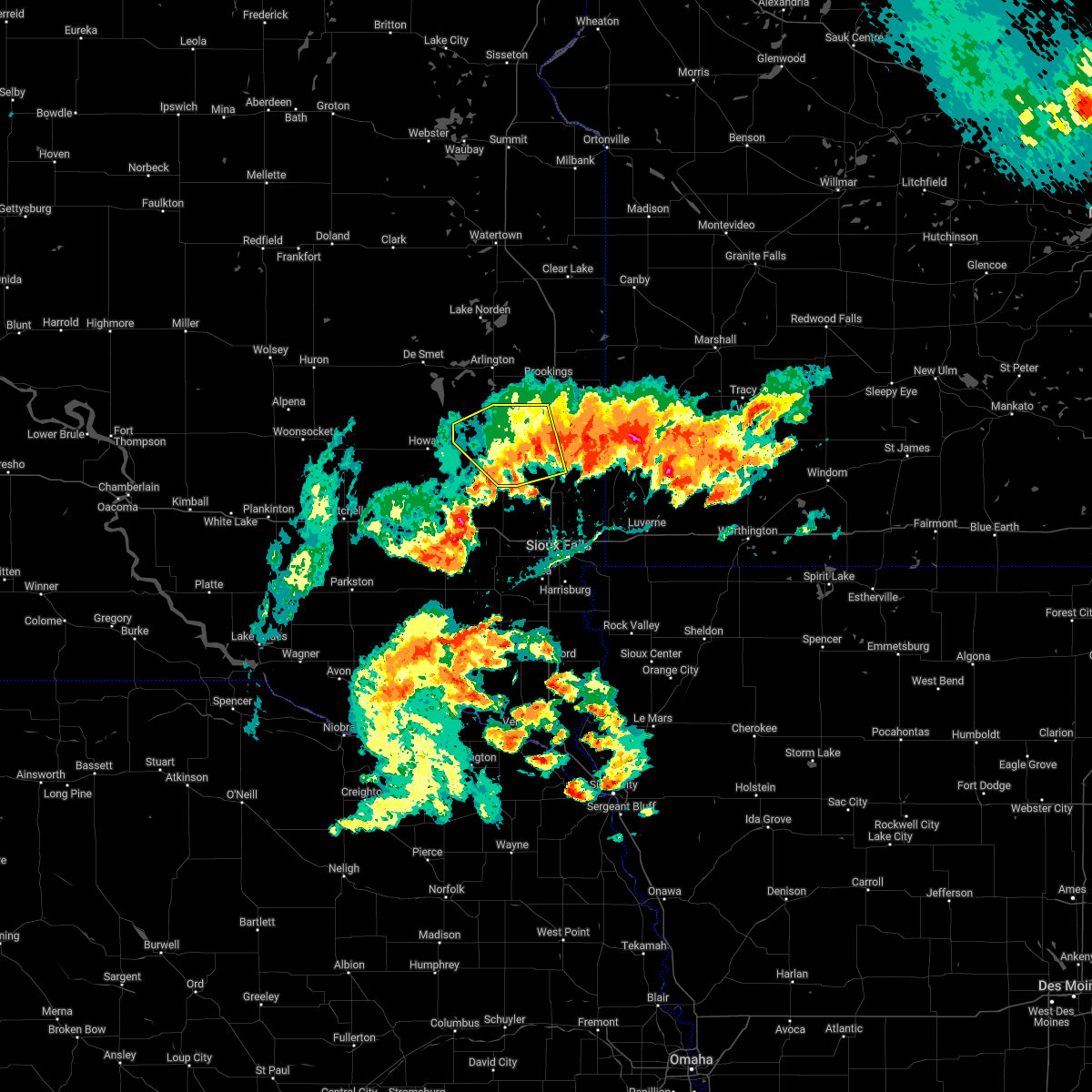 The severe thunderstorm warning for western moody and lake counties will expire at 400 pm cdt, the storm which prompted the warning has weakened below severe limits, and no longer poses an immediate threat to life or property. therefore, the warning will be allowed to expire. however heavy rain is still possible with this thunderstorm. a tornado watch remains in effect until 900 pm cdt for east central south dakota. The severe thunderstorm warning for western moody and lake counties will expire at 400 pm cdt, the storm which prompted the warning has weakened below severe limits, and no longer poses an immediate threat to life or property. therefore, the warning will be allowed to expire. however heavy rain is still possible with this thunderstorm. a tornado watch remains in effect until 900 pm cdt for east central south dakota.
|
| 5/11/2022 3:42 PM CDT |
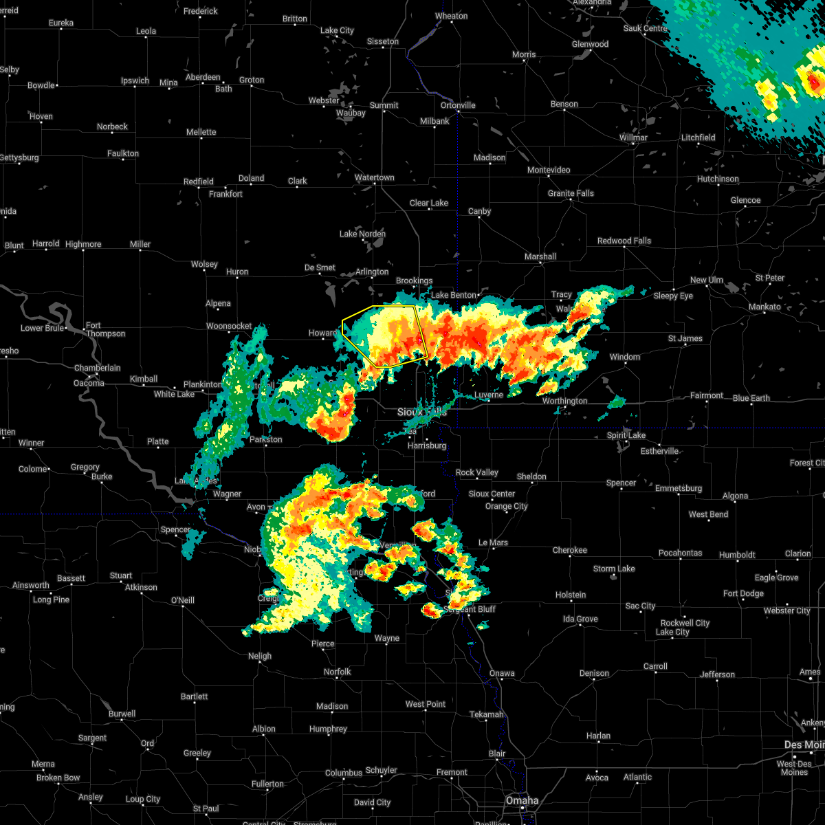 At 342 pm cdt, a severe thunderstorm was located near madison, moving northwest at 40 mph (public). Hazards include quarter size hail. Damage to vehicles is expected. locations impacted include, nunda and ramona. hail threat, radar indicated max hail size, 1. 00 in wind threat, radar indicated max wind gust, <50 mph. At 342 pm cdt, a severe thunderstorm was located near madison, moving northwest at 40 mph (public). Hazards include quarter size hail. Damage to vehicles is expected. locations impacted include, nunda and ramona. hail threat, radar indicated max hail size, 1. 00 in wind threat, radar indicated max wind gust, <50 mph.
|
| 5/11/2022 3:11 PM CDT |
 At 310 pm cdt, a severe thunderstorm was located near colton, or 18 miles southeast of madison, moving northwest at 40 mph (public). Hazards include ping pong ball size hail. People and animals outdoors will be injured. expect damage to roofs, siding, windows, and vehicles. this severe thunderstorm will be near, chester around 320 pm cdt. colman around 325 pm cdt. wentworth around 330 pm cdt. other locations in the path of this severe thunderstorm include madison, lake herman state park, nunda and ramona. hail threat, radar indicated max hail size, 1. 50 in wind threat, radar indicated max wind gust, <50 mph. At 310 pm cdt, a severe thunderstorm was located near colton, or 18 miles southeast of madison, moving northwest at 40 mph (public). Hazards include ping pong ball size hail. People and animals outdoors will be injured. expect damage to roofs, siding, windows, and vehicles. this severe thunderstorm will be near, chester around 320 pm cdt. colman around 325 pm cdt. wentworth around 330 pm cdt. other locations in the path of this severe thunderstorm include madison, lake herman state park, nunda and ramona. hail threat, radar indicated max hail size, 1. 50 in wind threat, radar indicated max wind gust, <50 mph.
|
| 5/11/2022 10:12 AM CDT |
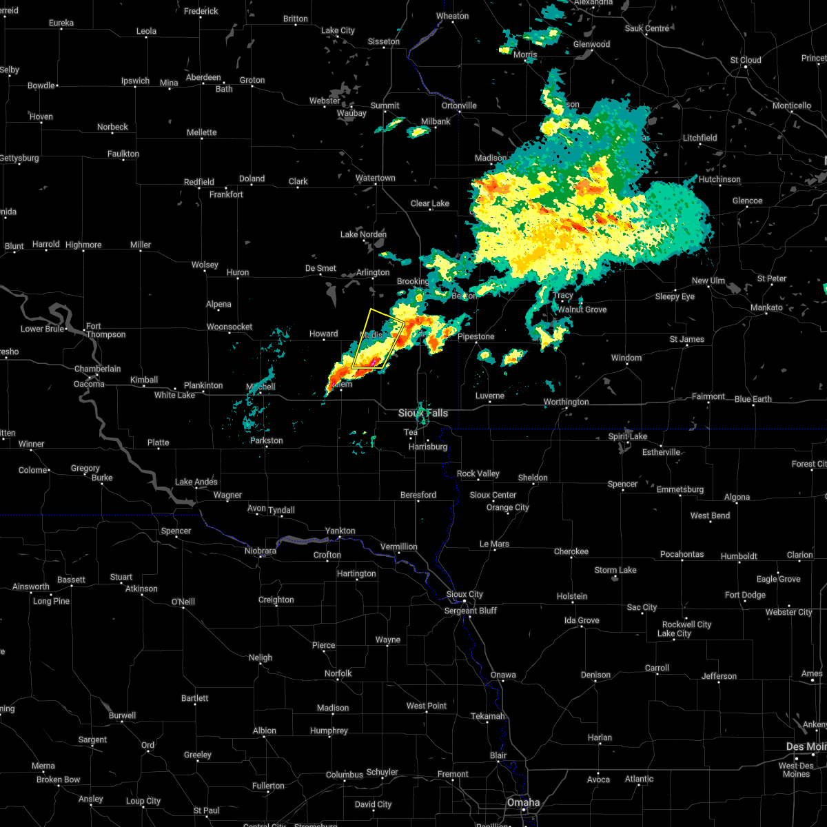 At 1011 am cdt, a severe thunderstorm was located near orland, or 7 miles south of lake herman state park, moving northeast at 40 mph (radar indicated). Hazards include half dollar size hail. Damage to vehicles is expected. this severe thunderstorm will be near, lake herman state park around 1020 am cdt. madison around 1025 am cdt. hail threat, radar indicated max hail size, 1. 25 in wind threat, radar indicated max wind gust, <50 mph. At 1011 am cdt, a severe thunderstorm was located near orland, or 7 miles south of lake herman state park, moving northeast at 40 mph (radar indicated). Hazards include half dollar size hail. Damage to vehicles is expected. this severe thunderstorm will be near, lake herman state park around 1020 am cdt. madison around 1025 am cdt. hail threat, radar indicated max hail size, 1. 25 in wind threat, radar indicated max wind gust, <50 mph.
|
| 8/26/2021 10:42 AM CDT |
 At 1041 am cdt, severe thunderstorms were located along a line extending from near moritz to near white to near wentworth, moving east at 45 mph (law enforcement reported trees down in arlington). Hazards include 70 mph wind gusts. Expect considerable tree damage. damage is likely to mobile homes, roofs, and outbuildings. locations impacted include, brookings, volga, aurora, white, bruce, ramona, sinai, nunda, oakwood state park and bushnell. thunderstorm damage threat, considerable hail threat, radar indicated max hail size, <. 75 in wind threat, radar indicated max wind gust, 70 mph. At 1041 am cdt, severe thunderstorms were located along a line extending from near moritz to near white to near wentworth, moving east at 45 mph (law enforcement reported trees down in arlington). Hazards include 70 mph wind gusts. Expect considerable tree damage. damage is likely to mobile homes, roofs, and outbuildings. locations impacted include, brookings, volga, aurora, white, bruce, ramona, sinai, nunda, oakwood state park and bushnell. thunderstorm damage threat, considerable hail threat, radar indicated max hail size, <. 75 in wind threat, radar indicated max wind gust, 70 mph.
|
| 8/26/2021 10:31 AM CDT |
 At 1030 am cdt, severe thunderstorms were located along a line extending from near altamont to near bruce to near nunda, moving east at 45 mph (law enforcement reported trees down in arlington at around 1015 am). Hazards include 70 mph wind gusts. Expect considerable tree damage. damage is likely to mobile homes, roofs, and outbuildings. locations impacted include, white. thunderstorm damage threat, considerable hail threat, radar indicated max hail size, <. 75 in wind threat, radar indicated max wind gust, 70 mph. At 1030 am cdt, severe thunderstorms were located along a line extending from near altamont to near bruce to near nunda, moving east at 45 mph (law enforcement reported trees down in arlington at around 1015 am). Hazards include 70 mph wind gusts. Expect considerable tree damage. damage is likely to mobile homes, roofs, and outbuildings. locations impacted include, white. thunderstorm damage threat, considerable hail threat, radar indicated max hail size, <. 75 in wind threat, radar indicated max wind gust, 70 mph.
|
| 8/26/2021 10:08 AM CDT |
 At 1007 am cdt, severe thunderstorms were located along a line extending from 6 miles southeast of watertown to badger to 8 miles southwest of oldham, moving east at 45 mph (emergency management reported multiple trees down in de smet around 950 am). Hazards include 70 mph wind gusts. Expect considerable tree damage. damage is likely to mobile homes, roofs, and outbuildings. locations impacted include, ramona, oakwood state park, bruce, nunda and white. thunderstorm damage threat, considerable hail threat, radar indicated max hail size, <. 75 in wind threat, radar indicated max wind gust, 70 mph. At 1007 am cdt, severe thunderstorms were located along a line extending from 6 miles southeast of watertown to badger to 8 miles southwest of oldham, moving east at 45 mph (emergency management reported multiple trees down in de smet around 950 am). Hazards include 70 mph wind gusts. Expect considerable tree damage. damage is likely to mobile homes, roofs, and outbuildings. locations impacted include, ramona, oakwood state park, bruce, nunda and white. thunderstorm damage threat, considerable hail threat, radar indicated max hail size, <. 75 in wind threat, radar indicated max wind gust, 70 mph.
|
| 8/26/2021 10:01 AM CDT |
 At 1000 am cdt, severe thunderstorms were located along a line extending from near watertown to near badger to 9 miles south of lake thompson state recreation area, moving east at 45 mph (radar indicated). Hazards include 60 mph wind gusts. Expect damage to roofs, siding, and trees. severe thunderstorms will be near, badger around 1005 am cdt. ramona and oakwood state park around 1020 am cdt. other locations in the path of these severe thunderstorms include bruce, nunda and white. hail threat, radar indicated max hail size, <. 75 in wind threat, radar indicated max wind gust, 60 mph. At 1000 am cdt, severe thunderstorms were located along a line extending from near watertown to near badger to 9 miles south of lake thompson state recreation area, moving east at 45 mph (radar indicated). Hazards include 60 mph wind gusts. Expect damage to roofs, siding, and trees. severe thunderstorms will be near, badger around 1005 am cdt. ramona and oakwood state park around 1020 am cdt. other locations in the path of these severe thunderstorms include bruce, nunda and white. hail threat, radar indicated max hail size, <. 75 in wind threat, radar indicated max wind gust, 60 mph.
|
| 6/11/2021 5:38 AM CDT |
 The severe thunderstorm warning for eastern kingsbury, lake, eastern miner and western brookings counties will expire at 545 am cdt, the storms which prompted the warning have weakened below severe limits, and no longer pose an immediate threat to life or property. therefore, the warning will be allowed to expire. however gusty winds to 50 mph are still possible with these thunderstorms. a severe thunderstorm watch remains in effect until 700 am cdt for east central south dakota. The severe thunderstorm warning for eastern kingsbury, lake, eastern miner and western brookings counties will expire at 545 am cdt, the storms which prompted the warning have weakened below severe limits, and no longer pose an immediate threat to life or property. therefore, the warning will be allowed to expire. however gusty winds to 50 mph are still possible with these thunderstorms. a severe thunderstorm watch remains in effect until 700 am cdt for east central south dakota.
|
| 6/11/2021 5:21 AM CDT |
 At 521 am cdt, severe thunderstorms were located along a line extending from near bryant to near oldham to 7 miles east of canova, moving east at 45 mph (radar indicated). Hazards include 60 mph wind gusts. Expect damage to roofs, siding, and trees. these severe storms will be near, ramona and orland around 530 am cdt. badger around 535 am cdt. sinai around 540 am cdt. nunda around 545 am cdt. Other locations impacted by these severe thunderstorms include erwin. At 521 am cdt, severe thunderstorms were located along a line extending from near bryant to near oldham to 7 miles east of canova, moving east at 45 mph (radar indicated). Hazards include 60 mph wind gusts. Expect damage to roofs, siding, and trees. these severe storms will be near, ramona and orland around 530 am cdt. badger around 535 am cdt. sinai around 540 am cdt. nunda around 545 am cdt. Other locations impacted by these severe thunderstorms include erwin.
|
| 6/11/2021 5:04 AM CDT |
 At 504 am cdt, severe thunderstorms were located along a line extending from 6 miles south of willow lake to 8 miles east of carthage to near canova, moving east at 45 mph (radar indicated). Hazards include 60 mph wind gusts. Expect damage to roofs, siding, and trees. severe thunderstorms will be near, lake thompson state recreation area around 510 am cdt. oldham around 520 am cdt. ramona around 525 am cdt. orland around 530 am cdt. badger around 535 am cdt. sinai and nunda around 540 am cdt. chester and oakwood state park around 545 am cdt. Other locations impacted by these severe thunderstorms include erwin. At 504 am cdt, severe thunderstorms were located along a line extending from 6 miles south of willow lake to 8 miles east of carthage to near canova, moving east at 45 mph (radar indicated). Hazards include 60 mph wind gusts. Expect damage to roofs, siding, and trees. severe thunderstorms will be near, lake thompson state recreation area around 510 am cdt. oldham around 520 am cdt. ramona around 525 am cdt. orland around 530 am cdt. badger around 535 am cdt. sinai and nunda around 540 am cdt. chester and oakwood state park around 545 am cdt. Other locations impacted by these severe thunderstorms include erwin.
|
| 8/28/2020 1:44 AM CDT |
 At 144 am cdt, severe thunderstorms were located along a line extending from near lake norden to oldham to near canova, moving east at 55 mph. these are very dangerous storms (radar indicated). Hazards include 80 mph wind gusts and penny size hail. Flying debris will be dangerous to those caught without shelter. mobile homes will be heavily damaged. expect considerable damage to roofs, windows, and vehicles. extensive tree damage and power outages are likely. these severe storms will be near, ramona and badger around 150 am cdt. sinai, orland, nunda and oakwood state park around 200 am cdt. volga and bruce around 205 am cdt. brookings around 210 am cdt. chester around 215 am cdt. Other locations impacted by these severe thunderstorms include erwin. At 144 am cdt, severe thunderstorms were located along a line extending from near lake norden to oldham to near canova, moving east at 55 mph. these are very dangerous storms (radar indicated). Hazards include 80 mph wind gusts and penny size hail. Flying debris will be dangerous to those caught without shelter. mobile homes will be heavily damaged. expect considerable damage to roofs, windows, and vehicles. extensive tree damage and power outages are likely. these severe storms will be near, ramona and badger around 150 am cdt. sinai, orland, nunda and oakwood state park around 200 am cdt. volga and bruce around 205 am cdt. brookings around 210 am cdt. chester around 215 am cdt. Other locations impacted by these severe thunderstorms include erwin.
|
| 8/28/2020 1:31 AM CDT |
 At 131 am cdt, severe thunderstorms were located along a line extending from bryant to 7 miles southwest of lake thompson state recreation area to 8 miles north of farmer, moving east at 55 mph. these are very dangerous storms (radar indicated). Hazards include 90 mph wind gusts and penny size hail. You are in a life-threatening situation. flying debris may be deadly to those caught without shelter. mobile homes will be heavily damaged or destroyed. homes and businesses will have substantial roof and window damage. expect extensive tree damage and power outages. these severe storms will be near, lake thompson state recreation area around 135 am cdt. oldham, badger and canova around 145 am cdt. ramona around 150 am cdt. bruce, sinai, orland, nunda and oakwood state park around 200 am cdt. volga around 205 am cdt. brookings around 210 am cdt. chester around 215 am cdt. Other locations impacted by these severe thunderstorms include erwin. At 131 am cdt, severe thunderstorms were located along a line extending from bryant to 7 miles southwest of lake thompson state recreation area to 8 miles north of farmer, moving east at 55 mph. these are very dangerous storms (radar indicated). Hazards include 90 mph wind gusts and penny size hail. You are in a life-threatening situation. flying debris may be deadly to those caught without shelter. mobile homes will be heavily damaged or destroyed. homes and businesses will have substantial roof and window damage. expect extensive tree damage and power outages. these severe storms will be near, lake thompson state recreation area around 135 am cdt. oldham, badger and canova around 145 am cdt. ramona around 150 am cdt. bruce, sinai, orland, nunda and oakwood state park around 200 am cdt. volga around 205 am cdt. brookings around 210 am cdt. chester around 215 am cdt. Other locations impacted by these severe thunderstorms include erwin.
|
| 8/28/2020 1:17 AM CDT |
 At 117 am cdt, severe thunderstorms were located along a line extending from carpenter to near iroquois to near artesian, moving east at 60 mph. these are very dangerous storms (radar indicated). Hazards include 80 mph wind gusts and nickel size hail. Flying debris will be dangerous to those caught without shelter. mobile homes will be heavily damaged. expect considerable damage to roofs, windows, and vehicles. extensive tree damage and power outages are likely. severe thunderstorms will be near, de smet and carthage around 130 am cdt. lake thompson state recreation area and vilas around 135 am cdt. howard and lake preston around 140 am cdt. hetland around 145 am cdt. arlington and oldham around 150 am cdt. ramona around 155 am cdt. volga and oakwood state park around 200 am cdt. bruce, sinai and nunda around 205 am cdt. Other locations impacted by these severe thunderstorms include bancroft and erwin. At 117 am cdt, severe thunderstorms were located along a line extending from carpenter to near iroquois to near artesian, moving east at 60 mph. these are very dangerous storms (radar indicated). Hazards include 80 mph wind gusts and nickel size hail. Flying debris will be dangerous to those caught without shelter. mobile homes will be heavily damaged. expect considerable damage to roofs, windows, and vehicles. extensive tree damage and power outages are likely. severe thunderstorms will be near, de smet and carthage around 130 am cdt. lake thompson state recreation area and vilas around 135 am cdt. howard and lake preston around 140 am cdt. hetland around 145 am cdt. arlington and oldham around 150 am cdt. ramona around 155 am cdt. volga and oakwood state park around 200 am cdt. bruce, sinai and nunda around 205 am cdt. Other locations impacted by these severe thunderstorms include bancroft and erwin.
|
| 8/28/2020 1:09 AM CDT |
 At 109 am cdt, severe thunderstorms were located along a line extending from 7 miles west of carpenter to 7 miles southeast of cavour to forestburg, moving east at 60 mph. these are very dangerous storms (radar indicated). Hazards include 80 mph wind gusts and nickel size hail. Flying debris will be dangerous to those caught without shelter. mobile homes will be heavily damaged. expect considerable damage to roofs, windows, and vehicles. extensive tree damage and power outages are likely. severe thunderstorms will be near, iroquois around 115 am cdt. fedora around 125 am cdt. de smet, carthage and roswell around 130 am cdt. lake thompson state recreation area and vilas around 135 am cdt. howard and lake preston around 140 am cdt. winfred and hetland around 145 am cdt. arlington around 150 am cdt. ramona around 155 am cdt. Other locations impacted by these severe thunderstorms include bancroft and erwin. At 109 am cdt, severe thunderstorms were located along a line extending from 7 miles west of carpenter to 7 miles southeast of cavour to forestburg, moving east at 60 mph. these are very dangerous storms (radar indicated). Hazards include 80 mph wind gusts and nickel size hail. Flying debris will be dangerous to those caught without shelter. mobile homes will be heavily damaged. expect considerable damage to roofs, windows, and vehicles. extensive tree damage and power outages are likely. severe thunderstorms will be near, iroquois around 115 am cdt. fedora around 125 am cdt. de smet, carthage and roswell around 130 am cdt. lake thompson state recreation area and vilas around 135 am cdt. howard and lake preston around 140 am cdt. winfred and hetland around 145 am cdt. arlington around 150 am cdt. ramona around 155 am cdt. Other locations impacted by these severe thunderstorms include bancroft and erwin.
|
| 8/9/2020 1:52 AM CDT |
 The severe thunderstorm warning for east central sanborn, miner, mccook, yankton, northeastern hanson, southwestern brookings, eastern hutchinson, southeastern kingsbury, southwestern moody, northern clay, lake, western minnehaha, western lincoln, turner and northwestern union counties will expire at 200 am cdt, the storms which prompted the warning have weakened below severe limits, and no longer pose an immediate threat to life or property. therefore, the warning will be allowed to expire. however gusty winds are still possible with these thunderstorms. a severe thunderstorm watch remains in effect until 500 am cdt for southeastern and east central south dakota. The severe thunderstorm warning for east central sanborn, miner, mccook, yankton, northeastern hanson, southwestern brookings, eastern hutchinson, southeastern kingsbury, southwestern moody, northern clay, lake, western minnehaha, western lincoln, turner and northwestern union counties will expire at 200 am cdt, the storms which prompted the warning have weakened below severe limits, and no longer pose an immediate threat to life or property. therefore, the warning will be allowed to expire. however gusty winds are still possible with these thunderstorms. a severe thunderstorm watch remains in effect until 500 am cdt for southeastern and east central south dakota.
|
| 8/9/2020 1:37 AM CDT |
 At 137 am cdt, severe thunderstorms were located along a line extending from 7 miles east of carthage to near montrose to near volin, moving northeast at 55 mph (radar indicated). Hazards include 70 mph wind gusts and penny size hail. Expect considerable tree damage. damage is likely to mobile homes, roofs, and outbuildings. these severe storms will be near, humboldt around 145 am cdt. oldham around 150 am cdt. colton around 155 am cdt. beresford and chester around 200 am cdt. dell rapids and baltic around 205 am cdt. worthing around 210 am cdt. other locations impacted by these severe thunderstorms include gayville and st. Helena boat dock. At 137 am cdt, severe thunderstorms were located along a line extending from 7 miles east of carthage to near montrose to near volin, moving northeast at 55 mph (radar indicated). Hazards include 70 mph wind gusts and penny size hail. Expect considerable tree damage. damage is likely to mobile homes, roofs, and outbuildings. these severe storms will be near, humboldt around 145 am cdt. oldham around 150 am cdt. colton around 155 am cdt. beresford and chester around 200 am cdt. dell rapids and baltic around 205 am cdt. worthing around 210 am cdt. other locations impacted by these severe thunderstorms include gayville and st. Helena boat dock.
|
| 8/9/2020 1:20 AM CDT |
 At 119 am cdt, severe thunderstorms were located along a line extending from near fedora to near bridgewater to near yankton, moving northeast at 55 mph (radar indicated). Hazards include 70 mph wind gusts and penny size hail. Expect considerable tree damage. damage is likely to mobile homes, roofs, and outbuildings. severe thunderstorms will be near, dolton and roswell around 125 am cdt. canistota around 130 am cdt. lake vermillion state recreation area, mayfield and volin around 135 am cdt. montrose, irene and wakonda around 140 am cdt. humboldt around 145 am cdt. centerville, viborg and oldham around 150 am cdt. colton around 155 am cdt. beresford, dell rapids, baltic and chester around 200 am cdt. other locations impacted by these severe thunderstorms include gayville and st. Helena boat dock. At 119 am cdt, severe thunderstorms were located along a line extending from near fedora to near bridgewater to near yankton, moving northeast at 55 mph (radar indicated). Hazards include 70 mph wind gusts and penny size hail. Expect considerable tree damage. damage is likely to mobile homes, roofs, and outbuildings. severe thunderstorms will be near, dolton and roswell around 125 am cdt. canistota around 130 am cdt. lake vermillion state recreation area, mayfield and volin around 135 am cdt. montrose, irene and wakonda around 140 am cdt. humboldt around 145 am cdt. centerville, viborg and oldham around 150 am cdt. colton around 155 am cdt. beresford, dell rapids, baltic and chester around 200 am cdt. other locations impacted by these severe thunderstorms include gayville and st. Helena boat dock.
|
| 7/20/2020 7:35 PM CDT |
 At 735 pm cdt, a severe thunderstorm was located near nunda, or 12 miles southwest of brookings, moving east at 40 mph (radar indicated). Hazards include 60 mph wind gusts and nickel size hail. Expect damage to roofs, siding, and trees. this severe storm will be near, egan around 755 pm cdt. Flandreau around 800 pm cdt. At 735 pm cdt, a severe thunderstorm was located near nunda, or 12 miles southwest of brookings, moving east at 40 mph (radar indicated). Hazards include 60 mph wind gusts and nickel size hail. Expect damage to roofs, siding, and trees. this severe storm will be near, egan around 755 pm cdt. Flandreau around 800 pm cdt.
|
| 7/20/2020 7:27 PM CDT |
 At 727 pm cdt, a severe thunderstorm was located over nunda, or 10 miles northeast of madison, moving east at 40 mph (radar indicated). Hazards include 60 mph wind gusts. Expect damage to roofs, siding, and trees. this severe thunderstorm will be near, egan around 755 pm cdt. Flandreau around 800 pm cdt. At 727 pm cdt, a severe thunderstorm was located over nunda, or 10 miles northeast of madison, moving east at 40 mph (radar indicated). Hazards include 60 mph wind gusts. Expect damage to roofs, siding, and trees. this severe thunderstorm will be near, egan around 755 pm cdt. Flandreau around 800 pm cdt.
|
| 7/6/2020 8:24 AM CDT |
 At 824 am cdt, a severe thunderstorm was located over winfred, or 7 miles west of lake herman state park, moving east at 20 mph (radar indicated). Hazards include 60 mph wind gusts and quarter size hail. Hail damage to vehicles is expected. expect wind damage to roofs, siding, and trees. this severe storm will be near, lake herman state park and ramona around 845 am cdt. madison around 900 am cdt. Wentworth and nunda around 915 am cdt. At 824 am cdt, a severe thunderstorm was located over winfred, or 7 miles west of lake herman state park, moving east at 20 mph (radar indicated). Hazards include 60 mph wind gusts and quarter size hail. Hail damage to vehicles is expected. expect wind damage to roofs, siding, and trees. this severe storm will be near, lake herman state park and ramona around 845 am cdt. madison around 900 am cdt. Wentworth and nunda around 915 am cdt.
|
| 7/6/2020 8:10 AM CDT |
 At 809 am cdt, a severe thunderstorm was located over winfred, or 11 miles west of lake herman state park, moving northeast at 25 mph (radar indicated). Hazards include 60 mph wind gusts and quarter size hail. Hail damage to vehicles is expected. expect wind damage to roofs, siding, and trees. this severe thunderstorm will be near, lake herman state park around 835 am cdt. ramona around 840 am cdt. madison around 845 am cdt. Nunda around 900 am cdt. At 809 am cdt, a severe thunderstorm was located over winfred, or 11 miles west of lake herman state park, moving northeast at 25 mph (radar indicated). Hazards include 60 mph wind gusts and quarter size hail. Hail damage to vehicles is expected. expect wind damage to roofs, siding, and trees. this severe thunderstorm will be near, lake herman state park around 835 am cdt. ramona around 840 am cdt. madison around 845 am cdt. Nunda around 900 am cdt.
|
| 6/25/2020 6:50 PM CDT |
 At 649 pm cdt, severe thunderstorms were located along a line extending from near ramona to madison to near orland, moving east at 35 mph (radar indicated). Hazards include 60 mph wind gusts and nickel size hail. Expect damage to roofs, siding, and trees. these severe storms will be near, wentworth and chester around 705 pm cdt. Nunda around 710 pm cdt. At 649 pm cdt, severe thunderstorms were located along a line extending from near ramona to madison to near orland, moving east at 35 mph (radar indicated). Hazards include 60 mph wind gusts and nickel size hail. Expect damage to roofs, siding, and trees. these severe storms will be near, wentworth and chester around 705 pm cdt. Nunda around 710 pm cdt.
|
| 6/25/2020 6:30 PM CDT |
 At 630 pm cdt, severe thunderstorms were located along a line extending from 9 miles north of howard to winfred to 7 miles southwest of orland, moving east at 35 mph (radar indicated). Hazards include 60 mph wind gusts and quarter size hail. Hail damage to vehicles is expected. expect wind damage to roofs, siding, and trees. severe thunderstorms will be near, orland around 640 pm cdt. lake herman state park around 645 pm cdt. madison and ramona around 650 pm cdt. wentworth around 700 pm cdt. chester around 705 pm cdt. Nunda around 710 pm cdt. At 630 pm cdt, severe thunderstorms were located along a line extending from 9 miles north of howard to winfred to 7 miles southwest of orland, moving east at 35 mph (radar indicated). Hazards include 60 mph wind gusts and quarter size hail. Hail damage to vehicles is expected. expect wind damage to roofs, siding, and trees. severe thunderstorms will be near, orland around 640 pm cdt. lake herman state park around 645 pm cdt. madison and ramona around 650 pm cdt. wentworth around 700 pm cdt. chester around 705 pm cdt. Nunda around 710 pm cdt.
|
| 6/6/2020 6:30 PM CDT |
 At 630 pm cdt, severe thunderstorms were located along a line extending from near nunda to near chester to near colton, moving east at 30 mph. these are very dangerous storms (radar indicated). Hazards include 80 mph wind gusts and nickel size hail. Flying debris will be dangerous to those caught without shelter. mobile homes will be heavily damaged. expect considerable damage to roofs, windows, and vehicles. extensive tree damage and power outages are likely. These severe storms will be near, chester around 635 pm cdt. At 630 pm cdt, severe thunderstorms were located along a line extending from near nunda to near chester to near colton, moving east at 30 mph. these are very dangerous storms (radar indicated). Hazards include 80 mph wind gusts and nickel size hail. Flying debris will be dangerous to those caught without shelter. mobile homes will be heavily damaged. expect considerable damage to roofs, windows, and vehicles. extensive tree damage and power outages are likely. These severe storms will be near, chester around 635 pm cdt.
|
| 6/6/2020 6:10 PM CDT |
 At 608 pm cdt, severe thunderstorms were located along a line extending from near ramona to near orland to near montrose, moving east at 30 mph. these are very dangerous storms (radar indicated. at 6:00 pm, 74 mph wind was reported approximately 5 miles northeast of salem). Hazards include 80 mph wind gusts and quarter size hail. Flying debris will be dangerous to those caught without shelter. mobile homes will be heavily damaged. expect considerable damage to roofs, windows, and vehicles. extensive tree damage and power outages are likely. these severe storms will be near, lake herman state park and orland around 615 pm cdt. montrose around 620 pm cdt. madison around 625 pm cdt. humboldt around 630 pm cdt. nunda around 635 pm cdt. wentworth and chester around 640 pm cdt. Colton around 645 pm cdt. At 608 pm cdt, severe thunderstorms were located along a line extending from near ramona to near orland to near montrose, moving east at 30 mph. these are very dangerous storms (radar indicated. at 6:00 pm, 74 mph wind was reported approximately 5 miles northeast of salem). Hazards include 80 mph wind gusts and quarter size hail. Flying debris will be dangerous to those caught without shelter. mobile homes will be heavily damaged. expect considerable damage to roofs, windows, and vehicles. extensive tree damage and power outages are likely. these severe storms will be near, lake herman state park and orland around 615 pm cdt. montrose around 620 pm cdt. madison around 625 pm cdt. humboldt around 630 pm cdt. nunda around 635 pm cdt. wentworth and chester around 640 pm cdt. Colton around 645 pm cdt.
|
| 6/6/2020 6:01 PM CDT |
 At 601 pm cdt, severe thunderstorms were located along a line extending from near winfred to 8 miles southwest of orland to near salem, moving east at 25 mph (radar indicated). Hazards include 60 mph wind gusts and quarter size hail. Hail damage to vehicles is expected. expect wind damage to roofs, siding, and trees. severe thunderstorms will be near, lake herman state park, ramona and orland around 620 pm cdt. montrose around 625 pm cdt. madison around 630 pm cdt. humboldt around 635 pm cdt. Colton, wentworth, chester and nunda around 645 pm cdt. At 601 pm cdt, severe thunderstorms were located along a line extending from near winfred to 8 miles southwest of orland to near salem, moving east at 25 mph (radar indicated). Hazards include 60 mph wind gusts and quarter size hail. Hail damage to vehicles is expected. expect wind damage to roofs, siding, and trees. severe thunderstorms will be near, lake herman state park, ramona and orland around 620 pm cdt. montrose around 625 pm cdt. madison around 630 pm cdt. humboldt around 635 pm cdt. Colton, wentworth, chester and nunda around 645 pm cdt.
|
| 8/17/2019 10:26 PM CDT |
 At 952 pm cdt, severe thunderstorms were located along a line extending from near sinai to near wentworth to near colton, moving east at 45 mph (radar indicated). Hazards include 60 mph wind gusts and quarter size hail. Hail damage to vehicles is expected. expect wind damage to roofs, siding, and trees. severe thunderstorms will be near, colton and chester around 955 pm cdt. volga, baltic and colman around 1005 pm cdt. brookings around 1010 pm cdt. flandreau, egan and trent around 1015 pm cdt. aurora and palisades state park around 1020 pm cdt. garretson and sherman around 1025 pm cdt. pipestone, elkton, jasper and pipestone national monument around 1030 pm cdt. Other locations impacted by these severe thunderstorms include bushnell and ihlen. At 952 pm cdt, severe thunderstorms were located along a line extending from near sinai to near wentworth to near colton, moving east at 45 mph (radar indicated). Hazards include 60 mph wind gusts and quarter size hail. Hail damage to vehicles is expected. expect wind damage to roofs, siding, and trees. severe thunderstorms will be near, colton and chester around 955 pm cdt. volga, baltic and colman around 1005 pm cdt. brookings around 1010 pm cdt. flandreau, egan and trent around 1015 pm cdt. aurora and palisades state park around 1020 pm cdt. garretson and sherman around 1025 pm cdt. pipestone, elkton, jasper and pipestone national monument around 1030 pm cdt. Other locations impacted by these severe thunderstorms include bushnell and ihlen.
|
| 8/17/2019 10:26 PM CDT |
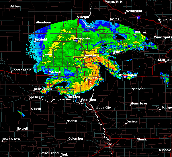 At 952 pm cdt, severe thunderstorms were located along a line extending from near sinai to near wentworth to near colton, moving east at 45 mph (radar indicated). Hazards include 60 mph wind gusts and quarter size hail. Hail damage to vehicles is expected. expect wind damage to roofs, siding, and trees. severe thunderstorms will be near, colton and chester around 955 pm cdt. volga, baltic and colman around 1005 pm cdt. brookings around 1010 pm cdt. flandreau, egan and trent around 1015 pm cdt. aurora and palisades state park around 1020 pm cdt. garretson and sherman around 1025 pm cdt. pipestone, elkton, jasper and pipestone national monument around 1030 pm cdt. Other locations impacted by these severe thunderstorms include bushnell and ihlen. At 952 pm cdt, severe thunderstorms were located along a line extending from near sinai to near wentworth to near colton, moving east at 45 mph (radar indicated). Hazards include 60 mph wind gusts and quarter size hail. Hail damage to vehicles is expected. expect wind damage to roofs, siding, and trees. severe thunderstorms will be near, colton and chester around 955 pm cdt. volga, baltic and colman around 1005 pm cdt. brookings around 1010 pm cdt. flandreau, egan and trent around 1015 pm cdt. aurora and palisades state park around 1020 pm cdt. garretson and sherman around 1025 pm cdt. pipestone, elkton, jasper and pipestone national monument around 1030 pm cdt. Other locations impacted by these severe thunderstorms include bushnell and ihlen.
|
| 8/17/2019 9:52 PM CDT |
 At 952 pm cdt, severe thunderstorms were located along a line extending from near sinai to near wentworth to near colton, moving east at 45 mph (radar indicated). Hazards include 60 mph wind gusts and quarter size hail. Hail damage to vehicles is expected. expect wind damage to roofs, siding, and trees. severe thunderstorms will be near, colton and chester around 955 pm cdt. volga, baltic and colman around 1005 pm cdt. brookings around 1010 pm cdt. flandreau, egan and trent around 1015 pm cdt. aurora and palisades state park around 1020 pm cdt. garretson and sherman around 1025 pm cdt. pipestone, elkton, jasper and pipestone national monument around 1030 pm cdt. Other locations impacted by these severe thunderstorms include bushnell and ihlen. At 952 pm cdt, severe thunderstorms were located along a line extending from near sinai to near wentworth to near colton, moving east at 45 mph (radar indicated). Hazards include 60 mph wind gusts and quarter size hail. Hail damage to vehicles is expected. expect wind damage to roofs, siding, and trees. severe thunderstorms will be near, colton and chester around 955 pm cdt. volga, baltic and colman around 1005 pm cdt. brookings around 1010 pm cdt. flandreau, egan and trent around 1015 pm cdt. aurora and palisades state park around 1020 pm cdt. garretson and sherman around 1025 pm cdt. pipestone, elkton, jasper and pipestone national monument around 1030 pm cdt. Other locations impacted by these severe thunderstorms include bushnell and ihlen.
|
| 8/17/2019 9:43 PM CDT |
 At 917 pm cdt, severe thunderstorms were located along a line extending from 8 miles southwest of oldham to near salem to 7 miles south of milltown, moving east at 50 mph (radar indicated). Hazards include 70 mph wind gusts and quarter size hail. Hail damage to vehicles is expected. expect considerable tree damage. wind damage is also likely to mobile homes, roofs, and outbuildings. severe thunderstorms will be near, salem and canistota around 925 pm cdt. montrose around 930 pm cdt. lake vermillion state recreation area and ramona around 935 pm cdt. freeman and humboldt around 940 pm cdt. wall lake and nunda around 945 pm cdt. hartford around 950 pm cdt. crooks around 955 pm cdt. Sioux falls and parker around 1000 pm cdt. At 917 pm cdt, severe thunderstorms were located along a line extending from 8 miles southwest of oldham to near salem to 7 miles south of milltown, moving east at 50 mph (radar indicated). Hazards include 70 mph wind gusts and quarter size hail. Hail damage to vehicles is expected. expect considerable tree damage. wind damage is also likely to mobile homes, roofs, and outbuildings. severe thunderstorms will be near, salem and canistota around 925 pm cdt. montrose around 930 pm cdt. lake vermillion state recreation area and ramona around 935 pm cdt. freeman and humboldt around 940 pm cdt. wall lake and nunda around 945 pm cdt. hartford around 950 pm cdt. crooks around 955 pm cdt. Sioux falls and parker around 1000 pm cdt.
|
| 8/17/2019 9:18 PM CDT |
 At 917 pm cdt, severe thunderstorms were located along a line extending from 8 miles southwest of oldham to near salem to 7 miles south of milltown, moving east at 50 mph (radar indicated). Hazards include 70 mph wind gusts and quarter size hail. Hail damage to vehicles is expected. expect considerable tree damage. wind damage is also likely to mobile homes, roofs, and outbuildings. severe thunderstorms will be near, salem and canistota around 925 pm cdt. montrose around 930 pm cdt. lake vermillion state recreation area and ramona around 935 pm cdt. freeman and humboldt around 940 pm cdt. wall lake and nunda around 945 pm cdt. hartford around 950 pm cdt. crooks around 955 pm cdt. Sioux falls and parker around 1000 pm cdt. At 917 pm cdt, severe thunderstorms were located along a line extending from 8 miles southwest of oldham to near salem to 7 miles south of milltown, moving east at 50 mph (radar indicated). Hazards include 70 mph wind gusts and quarter size hail. Hail damage to vehicles is expected. expect considerable tree damage. wind damage is also likely to mobile homes, roofs, and outbuildings. severe thunderstorms will be near, salem and canistota around 925 pm cdt. montrose around 930 pm cdt. lake vermillion state recreation area and ramona around 935 pm cdt. freeman and humboldt around 940 pm cdt. wall lake and nunda around 945 pm cdt. hartford around 950 pm cdt. crooks around 955 pm cdt. Sioux falls and parker around 1000 pm cdt.
|
| 8/15/2019 7:12 PM CDT |
 The severe thunderstorm warning for northwestern lincoln, northwestern moody, southeastern kingsbury, northern lake, east central miner and brookings counties will expire at 715 pm cdt, the storms which prompted the warning have weakened below severe limits, and no longer pose an immediate threat to life or property. therefore, the warning will be allowed to expire. a severe thunderstorm watch remains in effect until 900 pm cdt for east central south dakota. The severe thunderstorm warning for northwestern lincoln, northwestern moody, southeastern kingsbury, northern lake, east central miner and brookings counties will expire at 715 pm cdt, the storms which prompted the warning have weakened below severe limits, and no longer pose an immediate threat to life or property. therefore, the warning will be allowed to expire. a severe thunderstorm watch remains in effect until 900 pm cdt for east central south dakota.
|
| 8/15/2019 6:45 PM CDT |
 A severe thunderstorm warning remains in effect until 715 pm cdt for northwestern lincoln. northwestern moody. southeastern kingsbury. northern lake. east central miner and brookings counties. At 645 pm cdt, severe thunderstorms were located along a line extending from near estelline to near sinai to near winfred, moving. A severe thunderstorm warning remains in effect until 715 pm cdt for northwestern lincoln. northwestern moody. southeastern kingsbury. northern lake. east central miner and brookings counties. At 645 pm cdt, severe thunderstorms were located along a line extending from near estelline to near sinai to near winfred, moving.
|
| 8/15/2019 6:26 PM CDT |
 The national weather service in sioux falls has issued a * severe thunderstorm warning for. northwestern lincoln county in southwestern minnesota. northwestern moody county in east central south dakota. eastern kingsbury county in east central south dakota. Northern lake county in east central south dakota. The national weather service in sioux falls has issued a * severe thunderstorm warning for. northwestern lincoln county in southwestern minnesota. northwestern moody county in east central south dakota. eastern kingsbury county in east central south dakota. Northern lake county in east central south dakota.
|
| 8/15/2019 6:26 PM CDT |
 At 626 pm cdt, severe thunderstorms were located along a line extending from lake albert to near oldham to near roswell, moving east at 40 mph (radar indicated). Hazards include 60 mph wind gusts and quarter size hail. Hail damage to vehicles is expected. expect wind damage to roofs, siding, and trees. severe thunderstorms will be near, badger around 630 pm cdt. oldham around 635 pm cdt. oakwood state park around 640 pm cdt. bruce around 645 pm cdt. winfred and sinai around 650 pm cdt. nunda around 655 pm cdt. volga and ramona around 700 pm cdt. lake herman state park and white around 705 pm cdt. Other locations impacted by these severe thunderstorms include bushnell. At 626 pm cdt, severe thunderstorms were located along a line extending from lake albert to near oldham to near roswell, moving east at 40 mph (radar indicated). Hazards include 60 mph wind gusts and quarter size hail. Hail damage to vehicles is expected. expect wind damage to roofs, siding, and trees. severe thunderstorms will be near, badger around 630 pm cdt. oldham around 635 pm cdt. oakwood state park around 640 pm cdt. bruce around 645 pm cdt. winfred and sinai around 650 pm cdt. nunda around 655 pm cdt. volga and ramona around 700 pm cdt. lake herman state park and white around 705 pm cdt. Other locations impacted by these severe thunderstorms include bushnell.
|
| 7/20/2019 8:10 AM CDT |
 At 810 am cdt, severe thunderstorms were located along a line extending from near hendricks to 6 miles west of pipestone national monument to near wall lake, moving east at 65 mph (radar indicated. at 807 am cdt, automated equipment at the sioux falls airport reported a wind gust of 58 mph). Hazards include 70 mph wind gusts. Expect considerable tree damage. damage is likely to mobile homes, roofs, and outbuildings. these severe storms will be near, pipestone, ivanhoe and pipestone national monument around 815 am cdt. holland and arco around 820 am cdt. brandon, woodstock and rowena around 825 am cdt. marshall, minneota, valley springs, hills, ghent, lake wilson and camden state park around 830 am cdt. Other locations impacted by these severe thunderstorms include ihlen, hatfield, bushnell and lynd. At 810 am cdt, severe thunderstorms were located along a line extending from near hendricks to 6 miles west of pipestone national monument to near wall lake, moving east at 65 mph (radar indicated. at 807 am cdt, automated equipment at the sioux falls airport reported a wind gust of 58 mph). Hazards include 70 mph wind gusts. Expect considerable tree damage. damage is likely to mobile homes, roofs, and outbuildings. these severe storms will be near, pipestone, ivanhoe and pipestone national monument around 815 am cdt. holland and arco around 820 am cdt. brandon, woodstock and rowena around 825 am cdt. marshall, minneota, valley springs, hills, ghent, lake wilson and camden state park around 830 am cdt. Other locations impacted by these severe thunderstorms include ihlen, hatfield, bushnell and lynd.
|
| 7/20/2019 8:02 AM CDT |
 At 802 am cdt, severe thunderstorms were located along a line extending from near hendricks to flandreau to near wall lake, moving east at 55 mph (radar indicated). Hazards include 70 mph wind gusts. Expect considerable tree damage. damage is likely to mobile homes, roofs, and outbuildings. these severe storms will be near, flandreau and egan around 805 am cdt. hendricks around 810 am cdt. ivanhoe around 815 am cdt. sioux falls, pipestone, arco and pipestone national monument around 820 am cdt. holland around 825 am cdt. brandon, valley springs, ghent, lake wilson, woodstock and rowena around 830 am cdt. Other locations impacted by these severe thunderstorms include ihlen, hatfield, bushnell and lynd. At 802 am cdt, severe thunderstorms were located along a line extending from near hendricks to flandreau to near wall lake, moving east at 55 mph (radar indicated). Hazards include 70 mph wind gusts. Expect considerable tree damage. damage is likely to mobile homes, roofs, and outbuildings. these severe storms will be near, flandreau and egan around 805 am cdt. hendricks around 810 am cdt. ivanhoe around 815 am cdt. sioux falls, pipestone, arco and pipestone national monument around 820 am cdt. holland around 825 am cdt. brandon, valley springs, ghent, lake wilson, woodstock and rowena around 830 am cdt. Other locations impacted by these severe thunderstorms include ihlen, hatfield, bushnell and lynd.
|
| 7/20/2019 7:47 AM CDT |
 At 745 am cdt, severe thunderstorms were located along a line extending from near toronto to near colman to near canistota, moving east at 65 mph (radar indicated. at 733 am cdt, automated equipment at brookings airport reported a measured wind gust of 75 mph). Hazards include 70 mph wind gusts and penny size hail. Expect considerable tree damage. damage is likely to mobile homes, roofs, and outbuildings. these severe storms will be near, colman and white around 750 am cdt. egan around 755 am cdt. flandreau, hendricks and humboldt around 800 am cdt. hartford, wall lake and ivanhoe around 805 am cdt. sioux falls, pipestone, crooks and pipestone national monument around 810 am cdt. holland and taunton around 815 am cdt. brandon, minneota, ghent, woodstock and rowena around 820 am cdt. marshall, valley springs and lake wilson around 825 am cdt. Other locations impacted by these severe thunderstorms include ihlen, hatfield, bushnell and lynd. At 745 am cdt, severe thunderstorms were located along a line extending from near toronto to near colman to near canistota, moving east at 65 mph (radar indicated. at 733 am cdt, automated equipment at brookings airport reported a measured wind gust of 75 mph). Hazards include 70 mph wind gusts and penny size hail. Expect considerable tree damage. damage is likely to mobile homes, roofs, and outbuildings. these severe storms will be near, colman and white around 750 am cdt. egan around 755 am cdt. flandreau, hendricks and humboldt around 800 am cdt. hartford, wall lake and ivanhoe around 805 am cdt. sioux falls, pipestone, crooks and pipestone national monument around 810 am cdt. holland and taunton around 815 am cdt. brandon, minneota, ghent, woodstock and rowena around 820 am cdt. marshall, valley springs and lake wilson around 825 am cdt. Other locations impacted by these severe thunderstorms include ihlen, hatfield, bushnell and lynd.
|
| 7/20/2019 7:41 AM CDT |
 At 740 am cdt, severe thunderstorms were located along a line extending from 7 miles southeast of estelline to near wentworth to near bridgewater, moving east at 65 mph (radar indicated). Hazards include 70 mph wind gusts and penny size hail. Expect considerable tree damage. damage is likely to mobile homes, roofs, and outbuildings. severe thunderstorms will be near, white around 745 am cdt. lake vermillion state recreation area and colman around 750 am cdt. flandreau, hendricks, humboldt, egan and trent around 755 am cdt. wall lake around 800 am cdt. hartford, ivanhoe and arco around 805 am cdt. sioux falls, pipestone and pipestone national monument around 810 am cdt. minneota, holland and trosky around 815 am cdt. brandon, edgerton, ghent, woodstock, rowena and camden state park around 820 am cdt. Other locations impacted by these severe thunderstorms include ihlen, hatfield, bushnell and lynd. At 740 am cdt, severe thunderstorms were located along a line extending from 7 miles southeast of estelline to near wentworth to near bridgewater, moving east at 65 mph (radar indicated). Hazards include 70 mph wind gusts and penny size hail. Expect considerable tree damage. damage is likely to mobile homes, roofs, and outbuildings. severe thunderstorms will be near, white around 745 am cdt. lake vermillion state recreation area and colman around 750 am cdt. flandreau, hendricks, humboldt, egan and trent around 755 am cdt. wall lake around 800 am cdt. hartford, ivanhoe and arco around 805 am cdt. sioux falls, pipestone and pipestone national monument around 810 am cdt. minneota, holland and trosky around 815 am cdt. brandon, edgerton, ghent, woodstock, rowena and camden state park around 820 am cdt. Other locations impacted by these severe thunderstorms include ihlen, hatfield, bushnell and lynd.
|
| 7/20/2019 7:24 AM CDT |
 At 723 am cdt, severe thunderstorms were located along a line extending from near bruce to near ramona to near spencer in mccook county, moving east at 55 mph (radar indicated. at 719 am, a trained spotter 10 miles west of madison reported a measured wind gust of 72 mph). Hazards include 70 mph wind gusts and penny size hail. Expect considerable tree damage. damage is likely to mobile homes, roofs, and outbuildings. these severe storms will be near, bruce and nunda around 730 am cdt. white around 735 am cdt. canistota around 740 am cdt. lake vermillion state recreation area, hendricks, humboldt and montrose around 745 am cdt. Other locations impacted by these severe thunderstorms include bushnell. At 723 am cdt, severe thunderstorms were located along a line extending from near bruce to near ramona to near spencer in mccook county, moving east at 55 mph (radar indicated. at 719 am, a trained spotter 10 miles west of madison reported a measured wind gust of 72 mph). Hazards include 70 mph wind gusts and penny size hail. Expect considerable tree damage. damage is likely to mobile homes, roofs, and outbuildings. these severe storms will be near, bruce and nunda around 730 am cdt. white around 735 am cdt. canistota around 740 am cdt. lake vermillion state recreation area, hendricks, humboldt and montrose around 745 am cdt. Other locations impacted by these severe thunderstorms include bushnell.
|
| 7/20/2019 7:08 AM CDT |
 At 707 am cdt, severe thunderstorms were located along a line extending from near badger to 8 miles southwest of oldham to near fulton, moving east at 55 mph (radar indicated). Hazards include 70 mph wind gusts and quarter size hail. Hail damage to vehicles is expected. expect considerable tree damage. wind damage is also likely to mobile homes, roofs, and outbuildings. severe thunderstorms will be near, oldham, badger, lake poinsett and lake albert around 710 am cdt. ramona around 715 am cdt. emery, bruce, spencer in mccook county and oakwood state park around 720 am cdt. madison around 725 am cdt. wentworth and nunda around 730 am cdt. salem and white around 735 am cdt. canistota and colman around 740 am cdt. lake vermillion state recreation area, flandreau, hendricks, humboldt, montrose and egan around 745 am cdt. Other locations impacted by these severe thunderstorms include bushnell. At 707 am cdt, severe thunderstorms were located along a line extending from near badger to 8 miles southwest of oldham to near fulton, moving east at 55 mph (radar indicated). Hazards include 70 mph wind gusts and quarter size hail. Hail damage to vehicles is expected. expect considerable tree damage. wind damage is also likely to mobile homes, roofs, and outbuildings. severe thunderstorms will be near, oldham, badger, lake poinsett and lake albert around 710 am cdt. ramona around 715 am cdt. emery, bruce, spencer in mccook county and oakwood state park around 720 am cdt. madison around 725 am cdt. wentworth and nunda around 730 am cdt. salem and white around 735 am cdt. canistota and colman around 740 am cdt. lake vermillion state recreation area, flandreau, hendricks, humboldt, montrose and egan around 745 am cdt. Other locations impacted by these severe thunderstorms include bushnell.
|
| 7/12/2018 4:57 PM CDT |
 At 457 pm cdt, a severe thunderstorm was located near wentworth, or 10 miles east of madison, moving east at 25 mph (radar indicated). Hazards include 60 mph wind gusts and quarter size hail. Hail damage to vehicles is expected. expect wind damage to roofs, siding, and trees. this severe storm will be near, colman around 510 pm cdt. Flandreau and egan around 530 pm cdt. At 457 pm cdt, a severe thunderstorm was located near wentworth, or 10 miles east of madison, moving east at 25 mph (radar indicated). Hazards include 60 mph wind gusts and quarter size hail. Hail damage to vehicles is expected. expect wind damage to roofs, siding, and trees. this severe storm will be near, colman around 510 pm cdt. Flandreau and egan around 530 pm cdt.
|
| 7/12/2018 4:38 PM CDT |
 At 437 pm cdt, a severe thunderstorm was located near madison, moving east at 20 mph (radar indicated). Hazards include 60 mph wind gusts and quarter size hail. Hail damage to vehicles is expected. expect wind damage to roofs, siding, and trees. this severe thunderstorm will be near, nunda around 445 pm cdt. wentworth around 450 pm cdt. colman around 515 pm cdt. Flandreau and egan around 530 pm cdt. At 437 pm cdt, a severe thunderstorm was located near madison, moving east at 20 mph (radar indicated). Hazards include 60 mph wind gusts and quarter size hail. Hail damage to vehicles is expected. expect wind damage to roofs, siding, and trees. this severe thunderstorm will be near, nunda around 445 pm cdt. wentworth around 450 pm cdt. colman around 515 pm cdt. Flandreau and egan around 530 pm cdt.
|
| 7/12/2018 4:20 PM CDT |
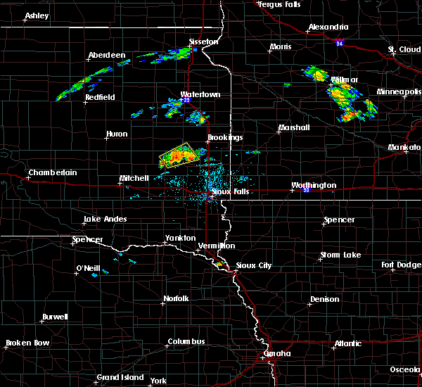 At 420 pm cdt, a severe thunderstorm was located over ramona, or 8 miles north of lake herman state park, moving northeast at 15 mph (radar indicated). Hazards include 60 mph wind gusts and quarter size hail. Hail damage to vehicles is expected. expect wind damage to roofs, siding, and trees. This severe storm will be near, sinai and nunda around 445 pm cdt. At 420 pm cdt, a severe thunderstorm was located over ramona, or 8 miles north of lake herman state park, moving northeast at 15 mph (radar indicated). Hazards include 60 mph wind gusts and quarter size hail. Hail damage to vehicles is expected. expect wind damage to roofs, siding, and trees. This severe storm will be near, sinai and nunda around 445 pm cdt.
|
| 7/12/2018 4:03 PM CDT |
 At 403 pm cdt, a severe thunderstorm was located near winfred, or 9 miles northwest of lake herman state park, moving northeast at 15 mph (radar indicated). Hazards include 60 mph wind gusts and quarter size hail. Hail damage to vehicles is expected. expect wind damage to roofs, siding, and trees. this severe thunderstorm will be near, ramona around 425 pm cdt. Sinai and nunda around 445 pm cdt. At 403 pm cdt, a severe thunderstorm was located near winfred, or 9 miles northwest of lake herman state park, moving northeast at 15 mph (radar indicated). Hazards include 60 mph wind gusts and quarter size hail. Hail damage to vehicles is expected. expect wind damage to roofs, siding, and trees. this severe thunderstorm will be near, ramona around 425 pm cdt. Sinai and nunda around 445 pm cdt.
|
| 4/13/2018 1:18 PM CDT |
 At 118 pm cdt, a severe thunderstorm was located near ramona, or 10 miles northwest of lake herman state park, moving northeast at 35 mph (radar indicated). Hazards include 60 mph wind gusts and quarter size hail. Hail damage to vehicles is expected. expect wind damage to roofs, siding, and trees. this severe thunderstorm will be near, oldham around 130 pm cdt. sinai around 140 pm cdt. hetland around 145 pm cdt. arlington around 150 pm cdt. Volga around 155 pm cdt. At 118 pm cdt, a severe thunderstorm was located near ramona, or 10 miles northwest of lake herman state park, moving northeast at 35 mph (radar indicated). Hazards include 60 mph wind gusts and quarter size hail. Hail damage to vehicles is expected. expect wind damage to roofs, siding, and trees. this severe thunderstorm will be near, oldham around 130 pm cdt. sinai around 140 pm cdt. hetland around 145 pm cdt. arlington around 150 pm cdt. Volga around 155 pm cdt.
|
| 9/23/2017 2:00 PM CDT |
 At 200 pm cdt, a severe thunderstorm was located near nunda, or 12 miles southwest of brookings, moving northeast at 30 mph (public. at 148 pm cdt, golf ball size hail was reported south southwest of nunda). Hazards include golf ball size hail. People and animals outdoors will be injured. expect damage to roofs, siding, windows, and vehicles. This severe storm will be near, brookings around 225 pm cdt. At 200 pm cdt, a severe thunderstorm was located near nunda, or 12 miles southwest of brookings, moving northeast at 30 mph (public. at 148 pm cdt, golf ball size hail was reported south southwest of nunda). Hazards include golf ball size hail. People and animals outdoors will be injured. expect damage to roofs, siding, windows, and vehicles. This severe storm will be near, brookings around 225 pm cdt.
|
| 9/23/2017 1:45 PM CDT |
 At 144 pm cdt, a severe thunderstorm was located near madison, moving northeast at 30 mph (radar indicated). Hazards include half dollar size hail. Damage to vehicles is expected. this severe thunderstorm will be near, nunda around 200 pm cdt. Brookings around 225 pm cdt. At 144 pm cdt, a severe thunderstorm was located near madison, moving northeast at 30 mph (radar indicated). Hazards include half dollar size hail. Damage to vehicles is expected. this severe thunderstorm will be near, nunda around 200 pm cdt. Brookings around 225 pm cdt.
|
| 9/23/2017 1:34 PM CDT |
 At 133 pm cdt, a severe thunderstorm was located near madison, moving northeast at 35 mph (radar indicated). Hazards include quarter size hail. Damage to vehicles is expected. This severe storm will be near, nunda around 145 pm cdt. At 133 pm cdt, a severe thunderstorm was located near madison, moving northeast at 35 mph (radar indicated). Hazards include quarter size hail. Damage to vehicles is expected. This severe storm will be near, nunda around 145 pm cdt.
|
| 9/23/2017 1:16 PM CDT |
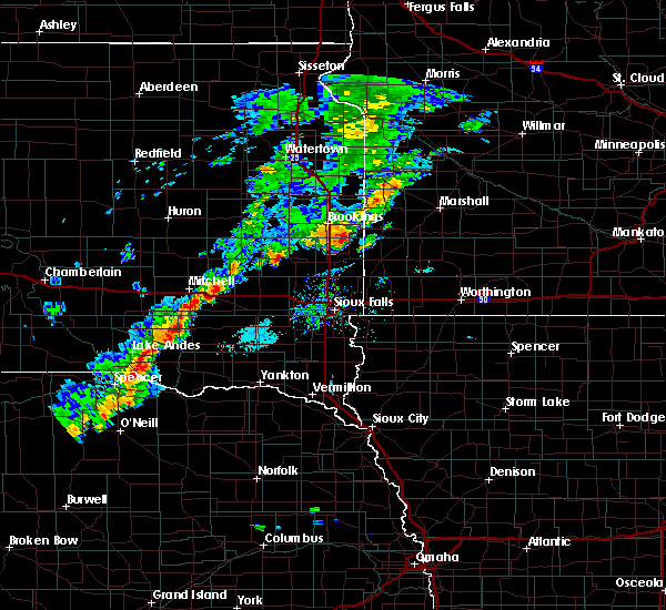 At 115 pm cdt, a severe thunderstorm was located near lake herman state park, moving northeast at 35 mph (radar indicated). Hazards include half dollar size hail. Damage to vehicles is expected. this severe thunderstorm will be near, lake herman state park around 120 pm cdt. madison around 130 pm cdt. Nunda around 145 pm cdt. At 115 pm cdt, a severe thunderstorm was located near lake herman state park, moving northeast at 35 mph (radar indicated). Hazards include half dollar size hail. Damage to vehicles is expected. this severe thunderstorm will be near, lake herman state park around 120 pm cdt. madison around 130 pm cdt. Nunda around 145 pm cdt.
|
| 9/23/2017 12:58 PM CDT |
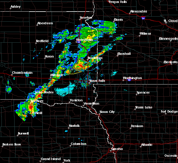 At 1258 pm cdt, a severe thunderstorm was located over nunda, or 11 miles north of madison, moving northeast at 40 mph (radar indicated). Hazards include half dollar size hail. Damage to vehicles is expected. This severe thunderstorm will remain over mainly rural areas of northwestern moody, southeastern kingsbury, northern lake and southwestern brookings counties. At 1258 pm cdt, a severe thunderstorm was located over nunda, or 11 miles north of madison, moving northeast at 40 mph (radar indicated). Hazards include half dollar size hail. Damage to vehicles is expected. This severe thunderstorm will remain over mainly rural areas of northwestern moody, southeastern kingsbury, northern lake and southwestern brookings counties.
|
| 9/23/2017 12:41 PM CDT |
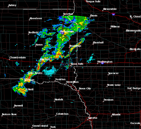 At 1240 pm cdt, a severe thunderstorm was located near lake herman state park, moving northeast at 45 mph (radar indicated). Hazards include half dollar size hail. Damage to vehicles is expected. this severe thunderstorm will be near, ramona around 1245 pm cdt. nunda around 100 pm cdt. Sinai around 105 pm cdt. At 1240 pm cdt, a severe thunderstorm was located near lake herman state park, moving northeast at 45 mph (radar indicated). Hazards include half dollar size hail. Damage to vehicles is expected. this severe thunderstorm will be near, ramona around 1245 pm cdt. nunda around 100 pm cdt. Sinai around 105 pm cdt.
|
| 9/19/2017 11:20 PM CDT |
 At 1119 pm cdt, a severe thunderstorm was located over colton, or 16 miles northeast of lake vermillion state recreation area, moving east at 55 mph (radar indicated). Hazards include 70 mph wind gusts. Expect considerable tree damage. damage is likely to mobile homes, roofs, and outbuildings. this severe storm will be near, dell rapids and baltic around 1130 pm cdt. trent around 1140 pm cdt. sherman around 1145 pm cdt. jasper around 1150 pm cdt. pipestone, trosky and pipestone national monument around 1200 am cdt. other locations impacted by this severe thunderstorm include ihlen. A tornado watch remains in effect until midnight cdt for east central south dakota. At 1119 pm cdt, a severe thunderstorm was located over colton, or 16 miles northeast of lake vermillion state recreation area, moving east at 55 mph (radar indicated). Hazards include 70 mph wind gusts. Expect considerable tree damage. damage is likely to mobile homes, roofs, and outbuildings. this severe storm will be near, dell rapids and baltic around 1130 pm cdt. trent around 1140 pm cdt. sherman around 1145 pm cdt. jasper around 1150 pm cdt. pipestone, trosky and pipestone national monument around 1200 am cdt. other locations impacted by this severe thunderstorm include ihlen. A tornado watch remains in effect until midnight cdt for east central south dakota.
|
| 9/19/2017 11:08 PM CDT |
 At 1107 pm cdt, a severe thunderstorm was located over montrose, or near lake vermillion state recreation area, moving east at 55 mph (radar indicated). Hazards include 70 mph wind gusts. Expect considerable tree damage. damage is likely to mobile homes, roofs, and outbuildings. this severe thunderstorm will be near, hartford around 1115 pm cdt. colton around 1120 pm cdt. crooks around 1125 pm cdt. baltic around 1130 pm cdt. dell rapids around 1135 pm cdt. trent around 1140 pm cdt. sherman around 1145 pm cdt. jasper around 1150 pm cdt. other locations impacted by this severe thunderstorm include ihlen. A tornado watch remains in effect until midnight cdt for southeastern and east central south dakota. At 1107 pm cdt, a severe thunderstorm was located over montrose, or near lake vermillion state recreation area, moving east at 55 mph (radar indicated). Hazards include 70 mph wind gusts. Expect considerable tree damage. damage is likely to mobile homes, roofs, and outbuildings. this severe thunderstorm will be near, hartford around 1115 pm cdt. colton around 1120 pm cdt. crooks around 1125 pm cdt. baltic around 1130 pm cdt. dell rapids around 1135 pm cdt. trent around 1140 pm cdt. sherman around 1145 pm cdt. jasper around 1150 pm cdt. other locations impacted by this severe thunderstorm include ihlen. A tornado watch remains in effect until midnight cdt for southeastern and east central south dakota.
|
| 8/25/2017 7:14 PM CDT |
 At 713 pm cdt, a severe thunderstorm was located near vilas, or 19 miles south of lake thompson state recreation area, moving east at 45 mph (radar indicated). Hazards include 70 mph wind gusts and quarter size hail. Hail damage to vehicles is expected. expect considerable tree damage. wind damage is also likely to mobile homes, roofs, and outbuildings. this severe storm will be near, howard around 718 pm cdt. winfred around 730 pm cdt. ramona around 740 pm cdt. Madison and lake herman state park around 745 pm cdt. At 713 pm cdt, a severe thunderstorm was located near vilas, or 19 miles south of lake thompson state recreation area, moving east at 45 mph (radar indicated). Hazards include 70 mph wind gusts and quarter size hail. Hail damage to vehicles is expected. expect considerable tree damage. wind damage is also likely to mobile homes, roofs, and outbuildings. this severe storm will be near, howard around 718 pm cdt. winfred around 730 pm cdt. ramona around 740 pm cdt. Madison and lake herman state park around 745 pm cdt.
|
| 8/25/2017 7:00 PM CDT |
 At 700 pm cdt, a severe thunderstorm was located near carthage, or 19 miles southwest of lake thompson state recreation area, moving east at 55 mph (radar indicated). Hazards include 70 mph wind gusts and quarter size hail. Hail damage to vehicles is expected. expect considerable tree damage. wind damage is also likely to mobile homes, roofs, and outbuildings. this severe thunderstorm will be near, howard around 710 pm cdt. oldham around 725 pm cdt. ramona around 730 pm cdt. Sinai and nunda around 740 pm cdt. At 700 pm cdt, a severe thunderstorm was located near carthage, or 19 miles southwest of lake thompson state recreation area, moving east at 55 mph (radar indicated). Hazards include 70 mph wind gusts and quarter size hail. Hail damage to vehicles is expected. expect considerable tree damage. wind damage is also likely to mobile homes, roofs, and outbuildings. this severe thunderstorm will be near, howard around 710 pm cdt. oldham around 725 pm cdt. ramona around 730 pm cdt. Sinai and nunda around 740 pm cdt.
|
| 7/19/2017 12:35 PM CDT |
 At 1235 pm cdt, a severe thunderstorm was located near nunda, or 12 miles north of madison, moving east at 45 mph (radar indicated). Hazards include 60 mph wind gusts and penny size hail. Expect damage to roofs, siding, and trees. This severe storm will be near, nunda around 1240 pm cdt. At 1235 pm cdt, a severe thunderstorm was located near nunda, or 12 miles north of madison, moving east at 45 mph (radar indicated). Hazards include 60 mph wind gusts and penny size hail. Expect damage to roofs, siding, and trees. This severe storm will be near, nunda around 1240 pm cdt.
|
| 7/19/2017 12:18 PM CDT |
 At 1218 pm cdt, a severe thunderstorm was located near oldham, or near lake thompson state recreation area, moving east at 50 mph (radar indicated). Hazards include 70 mph wind gusts and nickel size hail. Expect considerable tree damage. damage is likely to mobile homes, roofs, and outbuildings. this severe thunderstorm will be near, oldham around 1225 pm cdt. ramona around 1230 pm cdt. sinai around 1240 pm cdt. Nunda around 1245 pm cdt. At 1218 pm cdt, a severe thunderstorm was located near oldham, or near lake thompson state recreation area, moving east at 50 mph (radar indicated). Hazards include 70 mph wind gusts and nickel size hail. Expect considerable tree damage. damage is likely to mobile homes, roofs, and outbuildings. this severe thunderstorm will be near, oldham around 1225 pm cdt. ramona around 1230 pm cdt. sinai around 1240 pm cdt. Nunda around 1245 pm cdt.
|
| 7/17/2017 9:08 PM CDT |
 At 908 pm cdt, a severe thunderstorm was located over sinai, or 13 miles west of brookings, moving east at 40 mph. a well defined outflow boundary may produce significant dust ahead of this storm (trained weather spotters). Hazards include 60 mph wind gusts. Expect damage to roofs, siding, and trees. this severe storm will be near, volga around 915 pm cdt. Brookings around 925 pm cdt. At 908 pm cdt, a severe thunderstorm was located over sinai, or 13 miles west of brookings, moving east at 40 mph. a well defined outflow boundary may produce significant dust ahead of this storm (trained weather spotters). Hazards include 60 mph wind gusts. Expect damage to roofs, siding, and trees. this severe storm will be near, volga around 915 pm cdt. Brookings around 925 pm cdt.
|
| 7/17/2017 8:40 PM CDT |
 At 840 pm cdt, a severe thunderstorm was located over lake thompson state recreation area, moving east at 40 mph (trained weather spotters). Hazards include 70 mph wind gusts. Expect considerable tree damage. damage is likely to mobile homes, roofs, and outbuildings. this severe thunderstorm will be near, oldham and hetland around 850 pm cdt. arlington around 900 pm cdt. sinai around 910 pm cdt. volga and nunda around 915 pm cdt. Brookings around 925 pm cdt. At 840 pm cdt, a severe thunderstorm was located over lake thompson state recreation area, moving east at 40 mph (trained weather spotters). Hazards include 70 mph wind gusts. Expect considerable tree damage. damage is likely to mobile homes, roofs, and outbuildings. this severe thunderstorm will be near, oldham and hetland around 850 pm cdt. arlington around 900 pm cdt. sinai around 910 pm cdt. volga and nunda around 915 pm cdt. Brookings around 925 pm cdt.
|
| 6/12/2017 10:02 AM CDT |
 At 1002 am cdt, a severe thunderstorm was located near wentworth, or near madison, moving northeast at 10 mph (radar indicated). Hazards include quarter size hail. Damage to vehicles is expected. This severe thunderstorm will be near, nunda around 1020 am cdt. At 1002 am cdt, a severe thunderstorm was located near wentworth, or near madison, moving northeast at 10 mph (radar indicated). Hazards include quarter size hail. Damage to vehicles is expected. This severe thunderstorm will be near, nunda around 1020 am cdt.
|
| 6/11/2017 5:57 AM CDT |
 At 556 am cdt, severe thunderstorms were located along a line extending from near astoria to near elkton to near colton, moving east at 50 mph (radar indicated). Hazards include 60 mph wind gusts and half dollar size hail. Hail damage to vehicles is expected. expect wind damage to roofs, siding, and trees. these severe storms will be near, elkton around 600 am cdt. hendricks and ward around 605 am cdt. trent around 610 am cdt. lake benton and ivanhoe around 615 am cdt. Other locations impacted by these severe thunderstorms include bushnell. At 556 am cdt, severe thunderstorms were located along a line extending from near astoria to near elkton to near colton, moving east at 50 mph (radar indicated). Hazards include 60 mph wind gusts and half dollar size hail. Hail damage to vehicles is expected. expect wind damage to roofs, siding, and trees. these severe storms will be near, elkton around 600 am cdt. hendricks and ward around 605 am cdt. trent around 610 am cdt. lake benton and ivanhoe around 615 am cdt. Other locations impacted by these severe thunderstorms include bushnell.
|
| 6/11/2017 5:48 AM CDT |
 At 548 am cdt, severe thunderstorms were located along a line extending from near toronto to near aurora to 6 miles northwest of colton, moving east at 50 mph (radar indicated). Hazards include 60 mph wind gusts and half dollar size hail. Hail damage to vehicles is expected. expect wind damage to roofs, siding, and trees. these severe storms will be near, white around 555 am cdt. elkton and ward around 600 am cdt. hendricks around 605 am cdt. ivanhoe and trent around 610 am cdt. lake benton around 615 am cdt. Other locations impacted by these severe thunderstorms include bushnell. At 548 am cdt, severe thunderstorms were located along a line extending from near toronto to near aurora to 6 miles northwest of colton, moving east at 50 mph (radar indicated). Hazards include 60 mph wind gusts and half dollar size hail. Hail damage to vehicles is expected. expect wind damage to roofs, siding, and trees. these severe storms will be near, white around 555 am cdt. elkton and ward around 600 am cdt. hendricks around 605 am cdt. ivanhoe and trent around 610 am cdt. lake benton around 615 am cdt. Other locations impacted by these severe thunderstorms include bushnell.
|
| 6/11/2017 5:38 AM CDT |
 At 537 am cdt, severe thunderstorms were located along a line extending from near estelline to 7 miles east of nunda to near orland, moving east at 50 mph (radar indicated). Hazards include ping pong ball size hail and 60 mph wind gusts. People and animals outdoors will be injured. expect hail damage to roofs, siding, windows, and vehicles. expect wind damage to roofs, siding, and trees. severe thunderstorms will be near, brookings around 545 am cdt. aurora and white around 550 am cdt. chester around 555 am cdt. elkton, hendricks and ward around 600 am cdt. lake benton, ivanhoe and trent around 610 am cdt. Other locations impacted by these severe thunderstorms include bushnell. At 537 am cdt, severe thunderstorms were located along a line extending from near estelline to 7 miles east of nunda to near orland, moving east at 50 mph (radar indicated). Hazards include ping pong ball size hail and 60 mph wind gusts. People and animals outdoors will be injured. expect hail damage to roofs, siding, windows, and vehicles. expect wind damage to roofs, siding, and trees. severe thunderstorms will be near, brookings around 545 am cdt. aurora and white around 550 am cdt. chester around 555 am cdt. elkton, hendricks and ward around 600 am cdt. lake benton, ivanhoe and trent around 610 am cdt. Other locations impacted by these severe thunderstorms include bushnell.
|
| 6/11/2017 5:28 AM CDT |
 At 527 am cdt, severe thunderstorms were located along a line extending from lake poinsett to near nunda to 7 miles west of orland, moving east at 45 mph (radar indicated). Hazards include ping pong ball size hail and 60 mph wind gusts. People and animals outdoors will be injured. expect hail damage to roofs, siding, windows, and vehicles. expect wind damage to roofs, siding, and trees. these severe storms will be near, sinai, nunda and oakwood state park around 535 am cdt. Lake herman state park and bruce around 540 am cdt. At 527 am cdt, severe thunderstorms were located along a line extending from lake poinsett to near nunda to 7 miles west of orland, moving east at 45 mph (radar indicated). Hazards include ping pong ball size hail and 60 mph wind gusts. People and animals outdoors will be injured. expect hail damage to roofs, siding, windows, and vehicles. expect wind damage to roofs, siding, and trees. these severe storms will be near, sinai, nunda and oakwood state park around 535 am cdt. Lake herman state park and bruce around 540 am cdt.
|
| 6/11/2017 5:12 AM CDT |
 At 512 am cdt, severe thunderstorms were located along a line extending from 6 miles southeast of bryant to near oldham to near canova, moving east at 45 mph (radar indicated). Hazards include ping pong ball size hail and 60 mph wind gusts. People and animals outdoors will be injured. expect hail damage to roofs, siding, windows, and vehicles. expect wind damage to roofs, siding, and trees. these severe storms will be near, oldham around 515 am cdt. ramona and badger around 520 am cdt. winfred around 525 am cdt. sinai around 530 am cdt. nunda and oakwood state park around 535 am cdt. lake herman state park, bruce and orland around 540 am cdt. Other locations impacted by these severe thunderstorms include erwin. At 512 am cdt, severe thunderstorms were located along a line extending from 6 miles southeast of bryant to near oldham to near canova, moving east at 45 mph (radar indicated). Hazards include ping pong ball size hail and 60 mph wind gusts. People and animals outdoors will be injured. expect hail damage to roofs, siding, windows, and vehicles. expect wind damage to roofs, siding, and trees. these severe storms will be near, oldham around 515 am cdt. ramona and badger around 520 am cdt. winfred around 525 am cdt. sinai around 530 am cdt. nunda and oakwood state park around 535 am cdt. lake herman state park, bruce and orland around 540 am cdt. Other locations impacted by these severe thunderstorms include erwin.
|
| 6/11/2017 5:04 AM CDT |
 The national weather service in sioux falls has issued a * severe thunderstorm warning for. northwestern moody county in east central south dakota. kingsbury county in east central south dakota. lake county in east central south dakota. Miner county in east central south dakota. The national weather service in sioux falls has issued a * severe thunderstorm warning for. northwestern moody county in east central south dakota. kingsbury county in east central south dakota. lake county in east central south dakota. Miner county in east central south dakota.
|
| 5/28/2017 6:55 PM CDT |
 The severe thunderstorm warning for western moody, eastern lake and south central brookings counties will expire at 700 pm cdt, the storm which prompted the warning has moved out of the area. therefore the warning will be allowed to expire. The severe thunderstorm warning for western moody, eastern lake and south central brookings counties will expire at 700 pm cdt, the storm which prompted the warning has moved out of the area. therefore the warning will be allowed to expire.
|
| 5/28/2017 6:40 PM CDT |
 At 639 pm cdt, a severe thunderstorm was located near nunda, or 10 miles northeast of madison, moving southeast at 50 mph (radar indicated). Hazards include 60 mph wind gusts. Expect damage to roofs, siding, and trees. this severe storm will be near, colman and wentworth around 650 pm cdt. Chester around 655 pm cdt. At 639 pm cdt, a severe thunderstorm was located near nunda, or 10 miles northeast of madison, moving southeast at 50 mph (radar indicated). Hazards include 60 mph wind gusts. Expect damage to roofs, siding, and trees. this severe storm will be near, colman and wentworth around 650 pm cdt. Chester around 655 pm cdt.
|
| 5/28/2017 6:22 PM CDT |
 At 622 pm cdt, a severe thunderstorm was located near arlington, or 14 miles west of brookings, moving southeast at 50 mph (radar indicated). Hazards include 60 mph wind gusts. Expect damage to roofs, siding, and trees. this severe thunderstorm will be near, nunda around 635 pm cdt. colman and wentworth around 650 pm cdt. Chester around 655 pm cdt. At 622 pm cdt, a severe thunderstorm was located near arlington, or 14 miles west of brookings, moving southeast at 50 mph (radar indicated). Hazards include 60 mph wind gusts. Expect damage to roofs, siding, and trees. this severe thunderstorm will be near, nunda around 635 pm cdt. colman and wentworth around 650 pm cdt. Chester around 655 pm cdt.
|
| 8/11/2016 1:58 AM CDT | The severe thunderstorm warning for southern lincoln, pipestone, southwestern lyon, northwestern rock, northern minnehaha, moody, northeastern mccook, southeastern brookings and southeastern lake counties will expire at 200 am cdt, the storms which prompted the warning have weakened below severe limits, and no longer pose an immediate threat to life or property. therefore, the warning will be allowed to expire. |
| 8/11/2016 1:58 AM CDT | The severe thunderstorm warning for southern lincoln, pipestone, southwestern lyon, northwestern rock, northern minnehaha, moody, northeastern mccook, southeastern brookings and southeastern lake counties will expire at 200 am cdt, the storms which prompted the warning have weakened below severe limits, and no longer pose an immediate threat to life or property. therefore, the warning will be allowed to expire. |
| 8/11/2016 1:43 AM CDT |
 At 142 am cdt, severe thunderstorms were located along a line extending from 7 miles northwest of lake benton to chester, moving east at 50 mph (radar indicated). Hazards include 60 mph wind gusts. Expect damage to roofs. siding. and trees. these severe storms will be near, lake benton around 145 am cdt. dell rapids and arco around 150 am cdt. tyler, egan and trent around 155 am cdt. jasper, russell and camden state park around 200 am cdt. Other locations impacted by these severe thunderstorms include ihlen, lynd and bushnell. At 142 am cdt, severe thunderstorms were located along a line extending from 7 miles northwest of lake benton to chester, moving east at 50 mph (radar indicated). Hazards include 60 mph wind gusts. Expect damage to roofs. siding. and trees. these severe storms will be near, lake benton around 145 am cdt. dell rapids and arco around 150 am cdt. tyler, egan and trent around 155 am cdt. jasper, russell and camden state park around 200 am cdt. Other locations impacted by these severe thunderstorms include ihlen, lynd and bushnell.
|
| 8/11/2016 1:28 AM CDT | The severe thunderstorm warning for eastern miner, southwestern brookings, western lake and southeastern kingsbury counties will expire at 130 am cdt, the storms which prompted the warning have moved out of the area. therefore, the warning will be allowed to expire. a severe thunderstorm watch remains in effect until 200 am cdt for east central south dakota. |
| 8/11/2016 1:26 AM CDT |
 At 126 am cdt, severe thunderstorms were located along a line extending from near aurora to near orland, moving east at 70 mph (radar indicated). Hazards include 60 mph wind gusts. Expect damage to roofs. siding. and trees. severe thunderstorms will be near, aurora around 130 am cdt. elkton around 135 am cdt. wentworth and chester around 140 am cdt. lake benton and colman around 145 am cdt. dell rapids, tyler and arco around 150 am cdt. egan, trent and florence around 155 am cdt. jasper, russell and camden state park around 200 am cdt. Other locations impacted by these severe thunderstorms include ihlen, lynd and bushnell. At 126 am cdt, severe thunderstorms were located along a line extending from near aurora to near orland, moving east at 70 mph (radar indicated). Hazards include 60 mph wind gusts. Expect damage to roofs. siding. and trees. severe thunderstorms will be near, aurora around 130 am cdt. elkton around 135 am cdt. wentworth and chester around 140 am cdt. lake benton and colman around 145 am cdt. dell rapids, tyler and arco around 150 am cdt. egan, trent and florence around 155 am cdt. jasper, russell and camden state park around 200 am cdt. Other locations impacted by these severe thunderstorms include ihlen, lynd and bushnell.
|
| 8/11/2016 1:14 AM CDT |
 At 114 am cdt, severe thunderstorms were located along a line extending from near sinai to near winfred, moving east at 45 mph (radar indicated). Hazards include 60 mph wind gusts. Expect damage to roofs. siding. and trees. these severe storms will be near, sinai around 120 am cdt. nunda around 125 am cdt. Madison and volga around 130 am cdt. At 114 am cdt, severe thunderstorms were located along a line extending from near sinai to near winfred, moving east at 45 mph (radar indicated). Hazards include 60 mph wind gusts. Expect damage to roofs. siding. and trees. these severe storms will be near, sinai around 120 am cdt. nunda around 125 am cdt. Madison and volga around 130 am cdt.
|
| 8/11/2016 12:53 AM CDT |
 At 1253 am cdt, severe thunderstorms were located along a line extending from 7 miles south of lake thompson state recreation area to near vilas, moving east at 55 mph (radar indicated). Hazards include 60 mph wind gusts. Expect damage to roofs. siding. and trees. severe thunderstorms will be near, winfred and oldham around 105 am cdt. ramona and sinai around 115 am cdt. madison and lake herman state park around 120 am cdt. volga around 125 am cdt. Nunda around 130 am cdt. At 1253 am cdt, severe thunderstorms were located along a line extending from 7 miles south of lake thompson state recreation area to near vilas, moving east at 55 mph (radar indicated). Hazards include 60 mph wind gusts. Expect damage to roofs. siding. and trees. severe thunderstorms will be near, winfred and oldham around 105 am cdt. ramona and sinai around 115 am cdt. madison and lake herman state park around 120 am cdt. volga around 125 am cdt. Nunda around 130 am cdt.
|
| 8/4/2016 4:13 AM CDT |
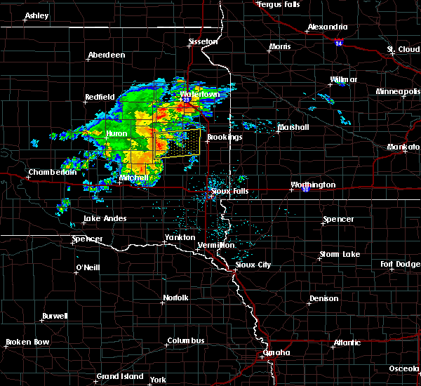 At 413 am cdt, a severe thunderstorm was located over oldham, or near lake thompson state recreation area, moving east at 55 mph (radar indicated). Hazards include 70 mph wind gusts. Expect considerable tree damage. damage is likely to mobile homes, roofs, and outbuildings. this severe thunderstorm will be near, sinai and nunda around 430 am cdt. Volga around 440 am cdt. At 413 am cdt, a severe thunderstorm was located over oldham, or near lake thompson state recreation area, moving east at 55 mph (radar indicated). Hazards include 70 mph wind gusts. Expect considerable tree damage. damage is likely to mobile homes, roofs, and outbuildings. this severe thunderstorm will be near, sinai and nunda around 430 am cdt. Volga around 440 am cdt.
|
| 7/6/2016 11:09 PM CDT |
 The severe thunderstorm warning for moody, brookings, lake and eastern kingsbury counties will expire at 1115 pm cdt, the storms which prompted the warning have weakened below severe limits, and no longer pose an immediate threat to life or property. therefore, the warning will be allowed to expire. however gusty winds of 40 to 50 mph are still possible with these thunderstorms. a severe thunderstorm watch remains in effect until 200 am cdt for southwestern minnesota, and east central south dakota. The severe thunderstorm warning for moody, brookings, lake and eastern kingsbury counties will expire at 1115 pm cdt, the storms which prompted the warning have weakened below severe limits, and no longer pose an immediate threat to life or property. therefore, the warning will be allowed to expire. however gusty winds of 40 to 50 mph are still possible with these thunderstorms. a severe thunderstorm watch remains in effect until 200 am cdt for southwestern minnesota, and east central south dakota.
|
| 7/6/2016 10:39 PM CDT |
 At 1038 pm cdt, severe thunderstorms were located along a line extending from 6 miles south of bryant to near ramona to 6 miles east of canova, moving east at 45 mph (radar indicated). Hazards include 60 mph wind gusts. Expect damage to roofs. siding. and trees. severe thunderstorms will be near, ramona around 1045 pm cdt. sinai and orland around 1050 pm cdt. badger and nunda around 1055 pm cdt. brookings and wentworth around 1105 pm cdt. chester and oakwood state park around 1110 pm cdt. colman, aurora and bruce around 1115 pm cdt. other locations impacted by these severe thunderstorms include erwin and bushnell. This warning replaces the previous warning for kingsbury and miner counties. At 1038 pm cdt, severe thunderstorms were located along a line extending from 6 miles south of bryant to near ramona to 6 miles east of canova, moving east at 45 mph (radar indicated). Hazards include 60 mph wind gusts. Expect damage to roofs. siding. and trees. severe thunderstorms will be near, ramona around 1045 pm cdt. sinai and orland around 1050 pm cdt. badger and nunda around 1055 pm cdt. brookings and wentworth around 1105 pm cdt. chester and oakwood state park around 1110 pm cdt. colman, aurora and bruce around 1115 pm cdt. other locations impacted by these severe thunderstorms include erwin and bushnell. This warning replaces the previous warning for kingsbury and miner counties.
|
| 6/19/2016 9:52 PM CDT |
 At 952 pm cdt, a severe thunderstorm was located 7 miles east of nunda, or 9 miles southwest of brookings, moving east at 45 mph (radar indicated). Hazards include 60 mph wind gusts and half dollar size hail. Hail damage to vehicles is expected. expect wind damage to roofs, siding, and trees. this severe storm will be near, brookings around 955 pm cdt. Ward around 1015 pm cdt. At 952 pm cdt, a severe thunderstorm was located 7 miles east of nunda, or 9 miles southwest of brookings, moving east at 45 mph (radar indicated). Hazards include 60 mph wind gusts and half dollar size hail. Hail damage to vehicles is expected. expect wind damage to roofs, siding, and trees. this severe storm will be near, brookings around 955 pm cdt. Ward around 1015 pm cdt.
|
| 6/19/2016 9:39 PM CDT |
 At 938 pm cdt, a severe thunderstorm was located over sinai, or 11 miles southwest of brookings, moving east at 45 mph (radar indicated). Hazards include 60 mph wind gusts and half dollar size hail. Hail damage to vehicles is expected. expect wind damage to roofs, siding, and trees. this severe thunderstorm will be near, brookings around 950 pm cdt. aurora around 955 pm cdt. elkton around 1010 pm cdt. ward around 1015 pm cdt. Other locations impacted by this severe thunderstorm include bushnell. At 938 pm cdt, a severe thunderstorm was located over sinai, or 11 miles southwest of brookings, moving east at 45 mph (radar indicated). Hazards include 60 mph wind gusts and half dollar size hail. Hail damage to vehicles is expected. expect wind damage to roofs, siding, and trees. this severe thunderstorm will be near, brookings around 950 pm cdt. aurora around 955 pm cdt. elkton around 1010 pm cdt. ward around 1015 pm cdt. Other locations impacted by this severe thunderstorm include bushnell.
|
| 6/17/2016 7:20 PM CDT |
 At 719 pm cdt, a severe thunderstorm was located over madison, moving northeast at 20 mph (radar indicated. at 717 pm cdt...1 inch hail was reported in madison). Hazards include quarter size hail. Damage to vehicles is expected. this severe storm will be near, wentworth around 735 pm cdt. Nunda around 745 pm cdt. At 719 pm cdt, a severe thunderstorm was located over madison, moving northeast at 20 mph (radar indicated. at 717 pm cdt...1 inch hail was reported in madison). Hazards include quarter size hail. Damage to vehicles is expected. this severe storm will be near, wentworth around 735 pm cdt. Nunda around 745 pm cdt.
|
| 6/17/2016 7:14 PM CDT |
 At 714 pm cdt, a severe thunderstorm was located over lake herman state park, moving northeast at 15 mph (radar indicated). Hazards include quarter size hail. Damage to vehicles is expected. this severe storm will be near, madison around 730 pm cdt. Wentworth around 745 pm cdt. At 714 pm cdt, a severe thunderstorm was located over lake herman state park, moving northeast at 15 mph (radar indicated). Hazards include quarter size hail. Damage to vehicles is expected. this severe storm will be near, madison around 730 pm cdt. Wentworth around 745 pm cdt.
|
| 6/17/2016 7:01 PM CDT |
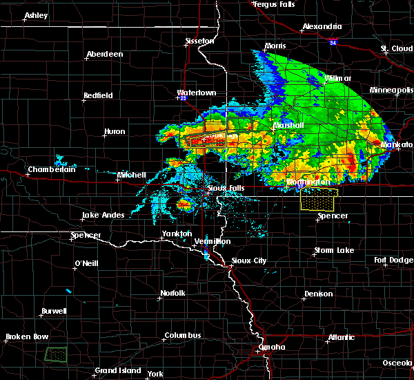 At 701 pm cdt, a severe thunderstorm was located over orland, or near lake herman state park, moving northeast at 20 mph (radar indicated). Hazards include half dollar size hail. Damage to vehicles is expected. this severe thunderstorm will be near, lake herman state park around 715 pm cdt. madison around 725 pm cdt. wentworth around 735 pm cdt. Nunda around 745 pm cdt. At 701 pm cdt, a severe thunderstorm was located over orland, or near lake herman state park, moving northeast at 20 mph (radar indicated). Hazards include half dollar size hail. Damage to vehicles is expected. this severe thunderstorm will be near, lake herman state park around 715 pm cdt. madison around 725 pm cdt. wentworth around 735 pm cdt. Nunda around 745 pm cdt.
|
| 6/3/2016 5:14 PM CDT | Quarter sized hail reported 5.5 miles W of Nunda, SD, marble to quarter size hail. |
| 6/3/2016 5:10 PM CDT |
 At 509 pm cdt, a severe thunderstorm was located near volga, or 8 miles southwest of brookings, moving east at 30 mph (radar indicated). Hazards include 60 mph wind gusts and quarter size hail. Hail damage to vehicles is expected. expect wind damage to roofs, siding, and trees. this severe thunderstorm will be near, brookings around 515 pm cdt. Flandreau and elkton around 545 pm cdt. At 509 pm cdt, a severe thunderstorm was located near volga, or 8 miles southwest of brookings, moving east at 30 mph (radar indicated). Hazards include 60 mph wind gusts and quarter size hail. Hail damage to vehicles is expected. expect wind damage to roofs, siding, and trees. this severe thunderstorm will be near, brookings around 515 pm cdt. Flandreau and elkton around 545 pm cdt.
|
| 8/9/2015 6:45 PM CDT |
 At 645 pm cdt, severe thunderstorms were located along a line extending from near estelline to 6 miles east of nunda to 6 miles west of orland, moving southeast at 35 mph (radar indicated). Hazards include 60 mph wind gusts and nickel size hail. Expect damage to roofs. siding and trees. these severe storms will be near, flandreau, colman, white and egan around 700 pm cdt. Other locations impacted by these severe thunderstorms include bushnell. At 645 pm cdt, severe thunderstorms were located along a line extending from near estelline to 6 miles east of nunda to 6 miles west of orland, moving southeast at 35 mph (radar indicated). Hazards include 60 mph wind gusts and nickel size hail. Expect damage to roofs. siding and trees. these severe storms will be near, flandreau, colman, white and egan around 700 pm cdt. Other locations impacted by these severe thunderstorms include bushnell.
|
| 8/9/2015 6:26 PM CDT |
 At 625 pm cdt, severe thunderstorms were located along a line extending from near lake poinsett to near nunda to near winfred, moving southeast at 40 mph (radar indicated). Hazards include 60 mph wind gusts and half dollar size hail. Hail damage to vehicles is expected. expect wind damage to roofs, siding and trees. severe thunderstorms will be near, sinai around 630 pm cdt. madison, nunda and oakwood state park around 635 pm cdt. lake herman state park and bruce around 640 pm cdt. volga, wentworth and orland around 645 pm cdt. brookings, colman and white around 655 pm cdt. flandreau, aurora, egan, trent and chester around 700 pm cdt. Other locations impacted by these severe thunderstorms include bushnell. At 625 pm cdt, severe thunderstorms were located along a line extending from near lake poinsett to near nunda to near winfred, moving southeast at 40 mph (radar indicated). Hazards include 60 mph wind gusts and half dollar size hail. Hail damage to vehicles is expected. expect wind damage to roofs, siding and trees. severe thunderstorms will be near, sinai around 630 pm cdt. madison, nunda and oakwood state park around 635 pm cdt. lake herman state park and bruce around 640 pm cdt. volga, wentworth and orland around 645 pm cdt. brookings, colman and white around 655 pm cdt. flandreau, aurora, egan, trent and chester around 700 pm cdt. Other locations impacted by these severe thunderstorms include bushnell.
|
| 8/9/2015 6:20 PM CDT |
 At 619 pm cdt, severe thunderstorms were located along a line extending from near badger to near oldham to 6 miles north of howard, moving southeast at 40 mph (radar indicated). Hazards include 60 mph wind gusts and quarter size hail. Hail damage to vehicles is expected. expect wind damage to roofs, siding and trees. these severe storms will be near, ramona around 625 pm cdt. volga, sinai, nunda and oakwood state park around 630 pm cdt. Other locations impacted by these severe thunderstorms include erwin. At 619 pm cdt, severe thunderstorms were located along a line extending from near badger to near oldham to 6 miles north of howard, moving southeast at 40 mph (radar indicated). Hazards include 60 mph wind gusts and quarter size hail. Hail damage to vehicles is expected. expect wind damage to roofs, siding and trees. these severe storms will be near, ramona around 625 pm cdt. volga, sinai, nunda and oakwood state park around 630 pm cdt. Other locations impacted by these severe thunderstorms include erwin.
|
| 8/9/2015 6:05 PM CDT |
 At 605 pm cdt, severe thunderstorms were located along a line extending from 6 miles west of badger to near lake thompson state recreation area to near carthage, moving southeast at 40 mph (radar indicated). Hazards include 60 mph wind gusts and half dollar size hail. Hail damage to vehicles is expected. expect wind damage to roofs, siding and trees. severe thunderstorms will be near, oldham and badger around 615 pm cdt. hetland around 620 pm cdt. arlington and ramona around 625 pm cdt. winfred, sinai, nunda and oakwood state park around 630 pm cdt. Other locations impacted by these severe thunderstorms include erwin. At 605 pm cdt, severe thunderstorms were located along a line extending from 6 miles west of badger to near lake thompson state recreation area to near carthage, moving southeast at 40 mph (radar indicated). Hazards include 60 mph wind gusts and half dollar size hail. Hail damage to vehicles is expected. expect wind damage to roofs, siding and trees. severe thunderstorms will be near, oldham and badger around 615 pm cdt. hetland around 620 pm cdt. arlington and ramona around 625 pm cdt. winfred, sinai, nunda and oakwood state park around 630 pm cdt. Other locations impacted by these severe thunderstorms include erwin.
|
| 8/6/2015 7:22 PM CDT |
 At 722 pm cdt, a severe thunderstorm was located over nunda, or 10 miles northeast of madison, moving southeast at 30 mph (radar indicated). Hazards include 60 mph wind gusts and quarter size hail. Hail damage to vehicles is expected. expect wind damage to roofs, siding and trees. this severe thunderstorm will be near, colman around 750 pm cdt. Flandreau and egan around 800 pm cdt. At 722 pm cdt, a severe thunderstorm was located over nunda, or 10 miles northeast of madison, moving southeast at 30 mph (radar indicated). Hazards include 60 mph wind gusts and quarter size hail. Hail damage to vehicles is expected. expect wind damage to roofs, siding and trees. this severe thunderstorm will be near, colman around 750 pm cdt. Flandreau and egan around 800 pm cdt.
|
| 7/16/2015 7:30 PM CDT |
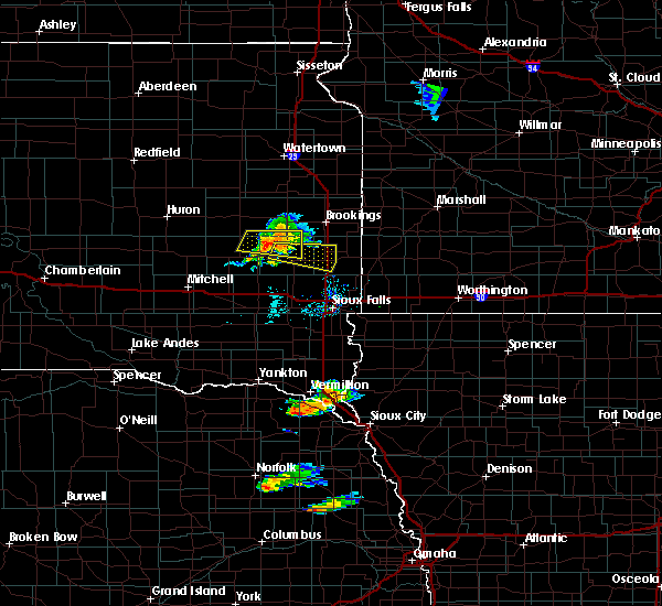 At 730 pm cdt, a severe thunderstorm was located near nunda, or 7 miles north of madison, moving east at 40 mph (radar indicated). Hazards include 60 mph wind gusts and nickel size hail. Expect damage to roofs. siding and trees. This severe thunderstorm will remain over mainly rural areas of northern lake county. At 730 pm cdt, a severe thunderstorm was located near nunda, or 7 miles north of madison, moving east at 40 mph (radar indicated). Hazards include 60 mph wind gusts and nickel size hail. Expect damage to roofs. siding and trees. This severe thunderstorm will remain over mainly rural areas of northern lake county.
|
| 7/16/2015 7:11 PM CDT |
 At 711 pm cdt, a severe thunderstorm was located near ramona, or 11 miles northwest of lake herman state park, moving east at 40 mph (radar indicated). Hazards include 60 mph wind gusts and nickel size hail. Expect damage to roofs. siding and trees. this severe storm will be near, ramona around 715 pm cdt. Madison and nunda around 730 pm cdt. At 711 pm cdt, a severe thunderstorm was located near ramona, or 11 miles northwest of lake herman state park, moving east at 40 mph (radar indicated). Hazards include 60 mph wind gusts and nickel size hail. Expect damage to roofs. siding and trees. this severe storm will be near, ramona around 715 pm cdt. Madison and nunda around 730 pm cdt.
|
| 7/16/2015 6:58 PM CDT |
 At 658 pm cdt, a severe thunderstorm was located 9 miles southwest of oldham, or 10 miles south of lake thompson state recreation area, moving east at 40 mph (radar indicated). Hazards include 60 mph wind gusts and nickel size hail. Expect damage to roofs. siding and trees. this severe thunderstorm will be near, oldham around 710 pm cdt. ramona around 720 pm cdt. sinai around 730 pm cdt. Nunda around 735 pm cdt. At 658 pm cdt, a severe thunderstorm was located 9 miles southwest of oldham, or 10 miles south of lake thompson state recreation area, moving east at 40 mph (radar indicated). Hazards include 60 mph wind gusts and nickel size hail. Expect damage to roofs. siding and trees. this severe thunderstorm will be near, oldham around 710 pm cdt. ramona around 720 pm cdt. sinai around 730 pm cdt. Nunda around 735 pm cdt.
|
| 6/20/2015 3:10 AM CDT |
 At 308 am cdt, severe thunderstorms were located along a line extending from near lake thompson state recreation area to chester to near monroe, moving east at 60 mph (weather equipment measured a 66 mph gust in madison). Hazards include 70 mph wind gusts. Expect considerable tree damage. damage is likely to mobile homes, roofs and outbuildings. these severe storms will be near, colman and chester around 315 am cdt. dell rapids and wall lake around 320 am cdt. tea and trent around 325 am cdt. Sinai and nunda around 330 am cdt. At 308 am cdt, severe thunderstorms were located along a line extending from near lake thompson state recreation area to chester to near monroe, moving east at 60 mph (weather equipment measured a 66 mph gust in madison). Hazards include 70 mph wind gusts. Expect considerable tree damage. damage is likely to mobile homes, roofs and outbuildings. these severe storms will be near, colman and chester around 315 am cdt. dell rapids and wall lake around 320 am cdt. tea and trent around 325 am cdt. Sinai and nunda around 330 am cdt.
|
| 6/20/2015 3:03 AM CDT |
 At 302 am cdt, severe thunderstorms were located along a line extending from 6 miles southeast of iroquois to near orland to near bridgewater, and are nearly stationary (radar indicated). Hazards include 60 mph wind gusts. Expect damage to roofs. siding and trees. these severe storms will be near, lake herman state park, canistota and orland around 310 am cdt. madison, lake vermillion state recreation area, marion and monroe around 315 am cdt. wentworth and chester around 320 am cdt. lake preston, humboldt and oldham around 325 am cdt. Dell rapids, hartford, wall lake, arlington, colman, egan, trent and hetland around 330 am cdt. At 302 am cdt, severe thunderstorms were located along a line extending from 6 miles southeast of iroquois to near orland to near bridgewater, and are nearly stationary (radar indicated). Hazards include 60 mph wind gusts. Expect damage to roofs. siding and trees. these severe storms will be near, lake herman state park, canistota and orland around 310 am cdt. madison, lake vermillion state recreation area, marion and monroe around 315 am cdt. wentworth and chester around 320 am cdt. lake preston, humboldt and oldham around 325 am cdt. Dell rapids, hartford, wall lake, arlington, colman, egan, trent and hetland around 330 am cdt.
|
| 6/20/2015 2:57 AM CDT |
 At 256 am cdt, severe thunderstorms were located along a line extending from 6 miles southeast of iroquois to near orland to near bridgewater, moving east at 55 mph (radar indicated). Hazards include 70 mph wind gusts. Expect considerable tree damage. damage is likely to mobile homes, roofs and outbuildings. severe thunderstorms will be near, orland and dolton around 300 am cdt. madison, lake herman state park, marion and canistota around 305 am cdt. lake thompson state recreation area, lake vermillion state recreation area and monroe around 310 am cdt. wentworth and chester around 315 am cdt. lake preston, colman and oldham around 320 am cdt. dell rapids, hartford, wall lake and hetland around 325 am cdt. Sioux falls, tea, arlington, egan, trent and sinai around 330 am cdt. At 256 am cdt, severe thunderstorms were located along a line extending from 6 miles southeast of iroquois to near orland to near bridgewater, moving east at 55 mph (radar indicated). Hazards include 70 mph wind gusts. Expect considerable tree damage. damage is likely to mobile homes, roofs and outbuildings. severe thunderstorms will be near, orland and dolton around 300 am cdt. madison, lake herman state park, marion and canistota around 305 am cdt. lake thompson state recreation area, lake vermillion state recreation area and monroe around 310 am cdt. wentworth and chester around 315 am cdt. lake preston, colman and oldham around 320 am cdt. dell rapids, hartford, wall lake and hetland around 325 am cdt. Sioux falls, tea, arlington, egan, trent and sinai around 330 am cdt.
|
| 6/19/2015 6:11 PM CDT |
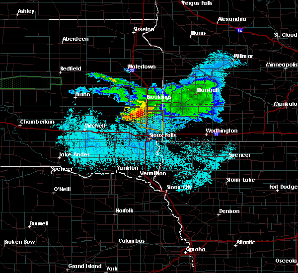 The severe thunderstorm warning for western moody and lake counties will expire at 615 pm cdt, the storm which prompted the warning has moved out of the area. therefore the warning will be allowed to expire. another severe thunderstorm warning is in effect for all of moody county and northeast minnehaha until 645 pm cdt. The severe thunderstorm warning for western moody and lake counties will expire at 615 pm cdt, the storm which prompted the warning has moved out of the area. therefore the warning will be allowed to expire. another severe thunderstorm warning is in effect for all of moody county and northeast minnehaha until 645 pm cdt.
|
| 6/19/2015 5:48 PM CDT |
 At 547 pm cdt, a severe thunderstorm was located near wentworth, or near madison, moving southeast at 30 mph (radar indicated). Hazards include 70 mph wind gusts and half dollar size hail. Hail damage to vehicles is expected. expect considerable tree damage. wind damage is also likely to mobile homes, roofs and outbuildings. this severe storm will be near, colman and chester around 605 pm cdt. At 547 pm cdt, 64 mph winds were reported in madison. At 547 pm cdt, a severe thunderstorm was located near wentworth, or near madison, moving southeast at 30 mph (radar indicated). Hazards include 70 mph wind gusts and half dollar size hail. Hail damage to vehicles is expected. expect considerable tree damage. wind damage is also likely to mobile homes, roofs and outbuildings. this severe storm will be near, colman and chester around 605 pm cdt. At 547 pm cdt, 64 mph winds were reported in madison.
|
| 6/19/2015 5:36 PM CDT |
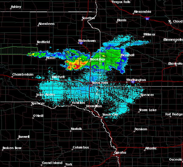 At 536 pm cdt, a severe thunderstorm was located over madison, moving southeast at 30 mph (radar indicated). Hazards include 60 mph wind gusts and half dollar size hail. Hail damage to vehicles is expected. expect wind damage to roofs, siding and trees. this severe thunderstorm will be near, wentworth around 550 pm cdt. Colman and chester around 605 pm cdt. At 536 pm cdt, a severe thunderstorm was located over madison, moving southeast at 30 mph (radar indicated). Hazards include 60 mph wind gusts and half dollar size hail. Hail damage to vehicles is expected. expect wind damage to roofs, siding and trees. this severe thunderstorm will be near, wentworth around 550 pm cdt. Colman and chester around 605 pm cdt.
|
| 1/1/0001 12:00 AM | Storm damage reported in lake county SD, 3.3 miles WNW of Nunda, SD |
| 1/1/0001 12:00 AM | Golf Ball sized hail reported 0.1 miles N of Nunda, SD |
Hail Maps for Nunda, SD


Connect with Interactive Hail Maps