

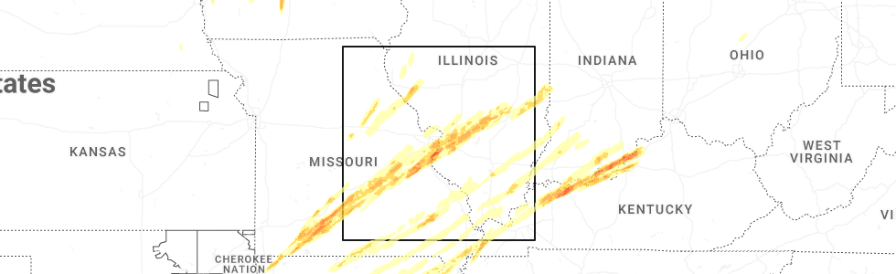
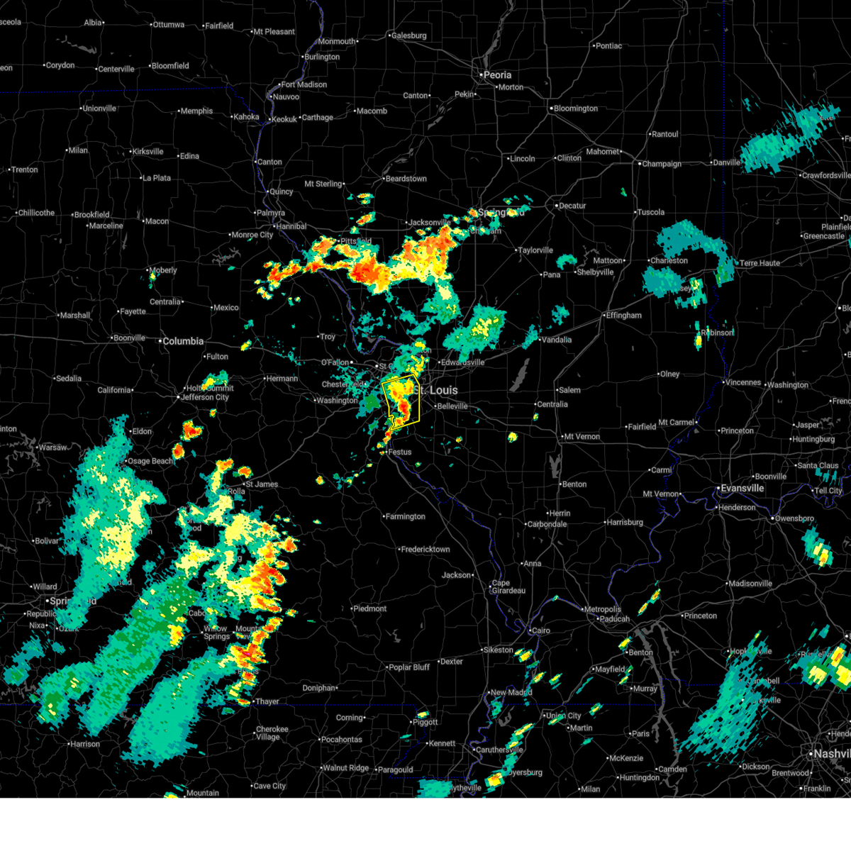
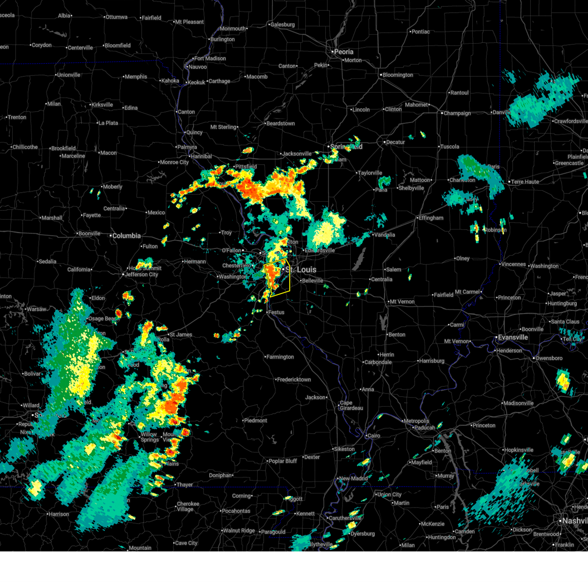
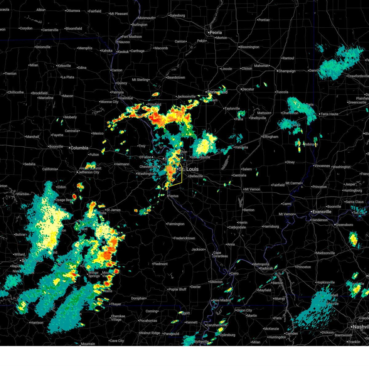
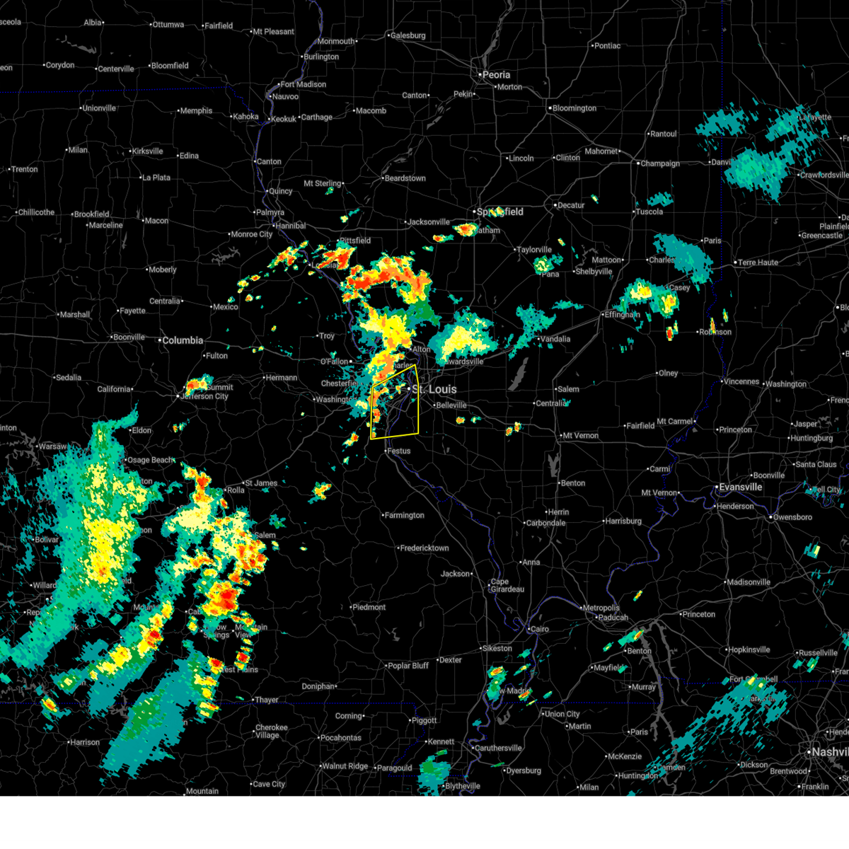
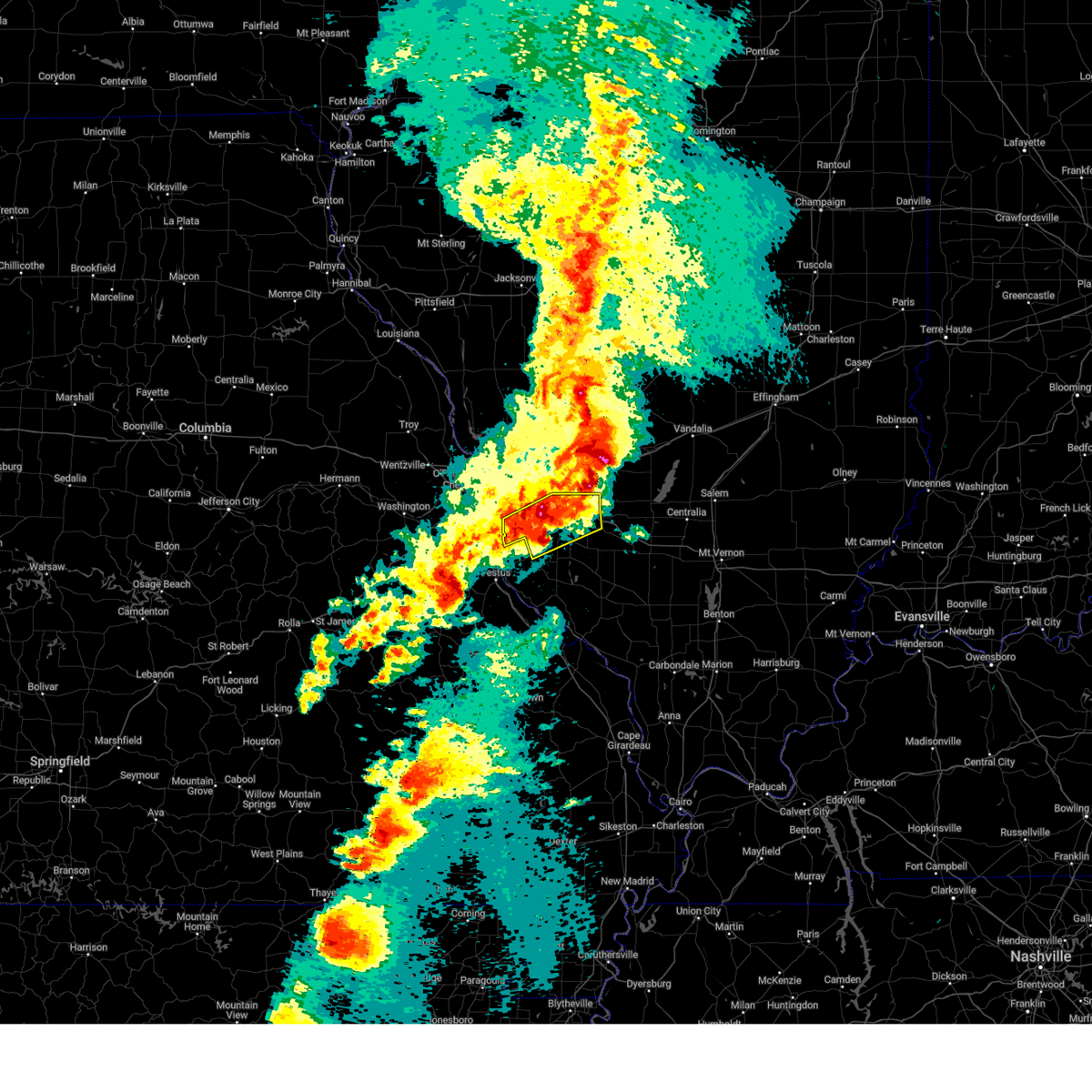
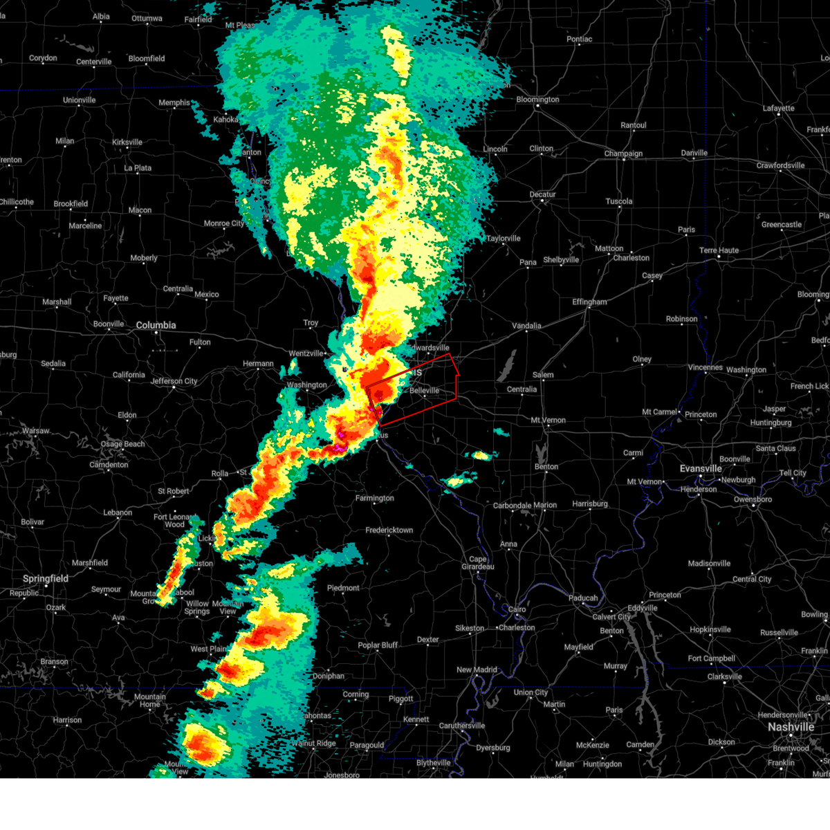
Hail Map for Oakville, MO
The Oakville, MO area has had 26 reports of on-the-ground hail by trained spotters, and has been under severe weather warnings 54 times during the past 12 months. Doppler radar has detected hail at or near Oakville, MO on 96 occasions, including 5 occasions during the past year.
| Name: | Oakville, MO |
| Where Located: | 13 miles SSW of Saint Louis, MO |
| Map: | Google Map for Oakville, MO |
| Population: | 36143 |
| Housing Units: | 14314 |
| More Info: | Search Google for Oakville, MO |
5
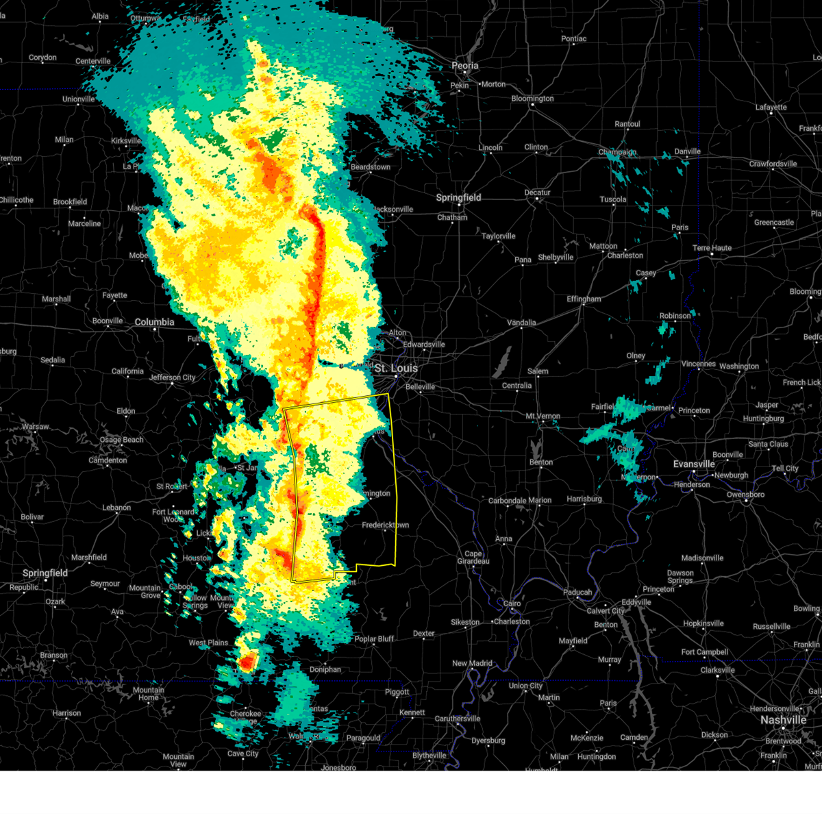
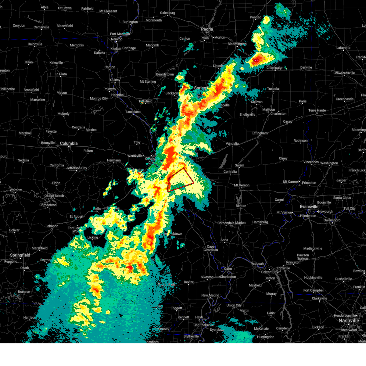
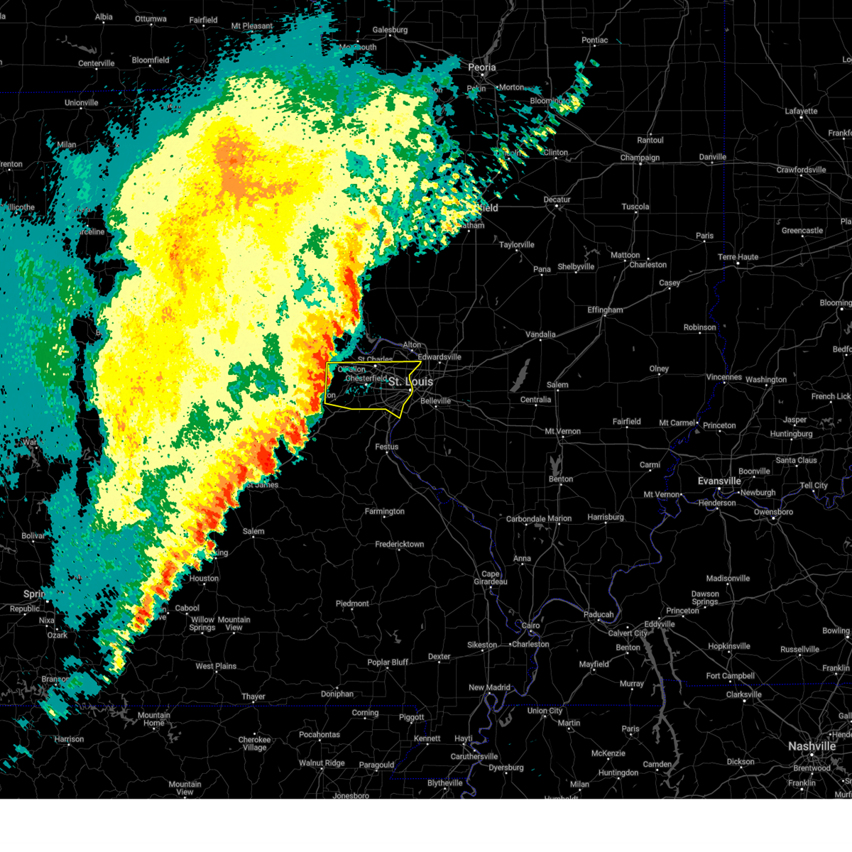
The Top Recent Hail Date for Oakville, MO is Friday, March 14, 2025 (1st out of 96)
Hail and Wind Damage Spotted near Oakville, MO
| Date / Time | Report Details |
|---|---|
| 6/27/2025 3:43 PM CDT |
 The storms which prompted the warning have weakened below severe limits, and no longer pose an immediate threat to life or property. therefore, the warning will be allowed to expire. however, gusty winds and heavy rain are still possible with these thunderstorms. to report severe weather, contact your nearest law enforcement agency. they will send your report to the national weather service office. The storms which prompted the warning have weakened below severe limits, and no longer pose an immediate threat to life or property. therefore, the warning will be allowed to expire. however, gusty winds and heavy rain are still possible with these thunderstorms. to report severe weather, contact your nearest law enforcement agency. they will send your report to the national weather service office.
|
| 6/27/2025 3:35 PM CDT |
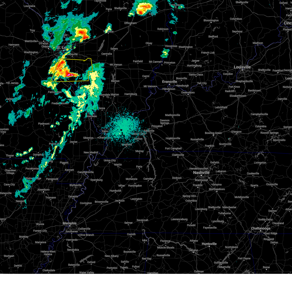
 At 335 pm cdt, severe thunderstorms were located along a line from over st. louis to near fountain, or along a line from over venice to near oakville, moving northeast at 30 mph (radar indicated). Hazards include 60 mph wind gusts. Expect damage to roofs, siding, and trees. locations impacted include, st. louis, university city, granite city, kirkwood, east st. louis, webster groves, arnold, creve coeur, overland, clayton, cahokia, jennings, crestwood, columbia, richmond heights, ladue, sunset hills, brentwood, maplewood and olivette. This includes the following state parks, scott joplin historic site. At 335 pm cdt, severe thunderstorms were located along a line from over st. louis to near fountain, or along a line from over venice to near oakville, moving northeast at 30 mph (radar indicated). Hazards include 60 mph wind gusts. Expect damage to roofs, siding, and trees. locations impacted include, st. louis, university city, granite city, kirkwood, east st. louis, webster groves, arnold, creve coeur, overland, clayton, cahokia, jennings, crestwood, columbia, richmond heights, ladue, sunset hills, brentwood, maplewood and olivette. This includes the following state parks, scott joplin historic site.
|
| 6/27/2025 3:35 PM CDT |
 the severe thunderstorm warning has been cancelled and is no longer in effect the severe thunderstorm warning has been cancelled and is no longer in effect
|
| 6/27/2025 3:28 PM CDT |
 At 328 pm cdt, severe thunderstorms were located along a line from over wellston to over fountain, or along a line from over st. louis to near arnold, moving northeast at 30 mph (radar indicated). Hazards include 60 mph wind gusts. Expect damage to roofs, siding, and trees. locations impacted include, st. louis, university city, granite city, kirkwood, east st. louis, webster groves, ferguson, arnold, creve coeur, overland, clayton, cahokia, jennings, crestwood, bellefontaine neighbors, town and country, waterloo, columbia, berkeley and richmond heights. this includes the following state parks, scott joplin historic site and mastodon historic site. this includes the following highways, interstate 44 in missouri between exits 276 and 277. Interstate 55 in missouri between exits 185 and 191. At 328 pm cdt, severe thunderstorms were located along a line from over wellston to over fountain, or along a line from over st. louis to near arnold, moving northeast at 30 mph (radar indicated). Hazards include 60 mph wind gusts. Expect damage to roofs, siding, and trees. locations impacted include, st. louis, university city, granite city, kirkwood, east st. louis, webster groves, ferguson, arnold, creve coeur, overland, clayton, cahokia, jennings, crestwood, bellefontaine neighbors, town and country, waterloo, columbia, berkeley and richmond heights. this includes the following state parks, scott joplin historic site and mastodon historic site. this includes the following highways, interstate 44 in missouri between exits 276 and 277. Interstate 55 in missouri between exits 185 and 191.
|
| 6/27/2025 3:12 PM CDT |
 Svrlsx the national weather service in st louis has issued a * severe thunderstorm warning for, southwestern madison county in southwestern illinois, northwestern monroe county in southwestern illinois, northwestern saint clair county in southwestern illinois, northeastern jefferson county in east central missouri, central saint louis county in east central missouri, saint louis city in east central missouri, * until 345 pm cdt. * at 312 pm cdt, severe thunderstorms were located along a line from over warson woods to over antonia, moving northeast at 30 mph (radar indicated). Hazards include 60 mph wind gusts. expect damage to roofs, siding, and trees Svrlsx the national weather service in st louis has issued a * severe thunderstorm warning for, southwestern madison county in southwestern illinois, northwestern monroe county in southwestern illinois, northwestern saint clair county in southwestern illinois, northeastern jefferson county in east central missouri, central saint louis county in east central missouri, saint louis city in east central missouri, * until 345 pm cdt. * at 312 pm cdt, severe thunderstorms were located along a line from over warson woods to over antonia, moving northeast at 30 mph (radar indicated). Hazards include 60 mph wind gusts. expect damage to roofs, siding, and trees
|
| 5/19/2025 11:40 PM CDT |
 the tornado warning has been cancelled and is no longer in effect the tornado warning has been cancelled and is no longer in effect
|
| 5/19/2025 11:28 PM CDT | the tornado warning has been cancelled and is no longer in effect |
| 5/19/2025 11:28 PM CDT | At 1128 pm cdt, a severe thunderstorm capable of producing a tornado was located over antonia, moving northeast at 30 mph (radar indicated rotation). Hazards include tornado. Flying debris will be dangerous to those caught without shelter. mobile homes will be damaged or destroyed. damage to roofs, windows and vehicles will occur. tree damage is likely. locations impacted include, kirkwood, arnold, manchester, crestwood, sunset hills, des peres, valley park, pevely, fenton, herculaneum, byrnes mill, lakeshire, antonia, murphy, barnhart, high ridge, oakville, mehlville, affton and lemay. this includes the following state parks, mastodon historic site, sandy creek covered bridge historic site and gov. dunklin's grave historic site. this includes the following highways, interstate 44 in missouri between exits 272 and 277. Interstate 55 in missouri between exits 180 and 191. |
| 5/19/2025 11:10 PM CDT | Torlsx the national weather service in st louis has issued a * tornado warning for, northwestern monroe county in southwestern illinois, northeastern jefferson county in east central missouri, southwestern saint louis county in east central missouri, * until midnight cdt. * at 1110 pm cdt, a severe thunderstorm capable of producing a tornado was located over hillsboro, moving northeast at 30 mph (radar indicated rotation). Hazards include tornado. Flying debris will be dangerous to those caught without shelter. mobile homes will be damaged or destroyed. damage to roofs, windows and vehicles will occur. Tree damage is likely. |
| 5/19/2025 10:59 PM CDT |
 At 1059 pm cdt, a severe thunderstorm capable of producing a tornado was located 5 miles northeast of hillsboro, moving northeast at 60 mph (radar indicated rotation). Hazards include tornado. Flying debris will be dangerous to those caught without shelter. mobile homes will be damaged or destroyed. damage to roofs, windows and vehicles will occur. tree damage is likely. locations impacted include, arnold, eureka, de soto, pevely, hillsboro, byrnes mill, antonia, cedar hill, high ridge, barnhart, murphy, oakville, cedar hill lakes, house springs, horine, dittmer, imperial, scotsdale, parkdale and kimmswick. this includes the following state parks, mastodon historic site and sandy creek covered bridge historic site. This includes interstate 55 in missouri between exits 185 and 191. At 1059 pm cdt, a severe thunderstorm capable of producing a tornado was located 5 miles northeast of hillsboro, moving northeast at 60 mph (radar indicated rotation). Hazards include tornado. Flying debris will be dangerous to those caught without shelter. mobile homes will be damaged or destroyed. damage to roofs, windows and vehicles will occur. tree damage is likely. locations impacted include, arnold, eureka, de soto, pevely, hillsboro, byrnes mill, antonia, cedar hill, high ridge, barnhart, murphy, oakville, cedar hill lakes, house springs, horine, dittmer, imperial, scotsdale, parkdale and kimmswick. this includes the following state parks, mastodon historic site and sandy creek covered bridge historic site. This includes interstate 55 in missouri between exits 185 and 191.
|
| 5/19/2025 10:52 PM CDT | At 1052 pm cdt, a severe thunderstorm capable of producing a tornado was located over hillsboro, moving northeast at 60 mph (radar indicated rotation). Hazards include tornado. Flying debris will be dangerous to those caught without shelter. mobile homes will be damaged or destroyed. damage to roofs, windows and vehicles will occur. tree damage is likely. locations impacted include, arnold, eureka, de soto, pevely, hillsboro, byrnes mill, cedar hill, antonia, high ridge, barnhart, murphy, oakville, cedar hill lakes, house springs, dittmer, horine, imperial, scotsdale, parkdale and kimmswick. this includes the following state parks, mastodon historic site and sandy creek covered bridge historic site. This includes interstate 55 in missouri between exits 180 and 191. |
| 5/19/2025 10:52 PM CDT | the tornado warning has been cancelled and is no longer in effect |
| 5/19/2025 10:43 PM CDT |
 Torlsx the national weather service in st louis has issued a * tornado warning for, jefferson county in east central missouri, northeastern washington county in east central missouri, * until 1115 pm cdt. * at 1043 pm cdt, a severe thunderstorm capable of producing a tornado was located 7 miles northeast of old mines, or 7 miles southwest of de soto, moving northeast at 60 mph (radar indicated rotation). Hazards include tornado. Flying debris will be dangerous to those caught without shelter. mobile homes will be damaged or destroyed. damage to roofs, windows and vehicles will occur. Tree damage is likely. Torlsx the national weather service in st louis has issued a * tornado warning for, jefferson county in east central missouri, northeastern washington county in east central missouri, * until 1115 pm cdt. * at 1043 pm cdt, a severe thunderstorm capable of producing a tornado was located 7 miles northeast of old mines, or 7 miles southwest of de soto, moving northeast at 60 mph (radar indicated rotation). Hazards include tornado. Flying debris will be dangerous to those caught without shelter. mobile homes will be damaged or destroyed. damage to roofs, windows and vehicles will occur. Tree damage is likely.
|
| 4/29/2025 7:08 AM CDT |
 Svrlsx the national weather service in st louis has issued a * severe thunderstorm warning for, western washington county in south central illinois, monroe county in southwestern illinois, northern randolph county in southwestern illinois, southern saint clair county in southwestern illinois, southeastern jefferson county in east central missouri, northwestern sainte genevieve county in southeastern missouri, * until 800 am cdt. * at 708 am cdt, a severe thunderstorm was located over red bud, moving east at 50 mph (radar indicated). Hazards include 60 mph wind gusts and quarter size hail. Hail damage to vehicles is expected. expect wind damage to roofs, siding, and trees. this severe thunderstorm will be near, red bud and evansville around 710 am cdt. baldwin around 715 am cdt. other locations impacted by the severe thunderstorm include prairie, ruma, ames, hecker, preston, lenzburg, houston, st. libory, stone church and johannisburg. this includes the following state parks, gov. dunklin's grave historic site. this includes the following highways, interstate 64 in illinois near exit 41. Interstate 55 in missouri between exits 162 and 178. Svrlsx the national weather service in st louis has issued a * severe thunderstorm warning for, western washington county in south central illinois, monroe county in southwestern illinois, northern randolph county in southwestern illinois, southern saint clair county in southwestern illinois, southeastern jefferson county in east central missouri, northwestern sainte genevieve county in southeastern missouri, * until 800 am cdt. * at 708 am cdt, a severe thunderstorm was located over red bud, moving east at 50 mph (radar indicated). Hazards include 60 mph wind gusts and quarter size hail. Hail damage to vehicles is expected. expect wind damage to roofs, siding, and trees. this severe thunderstorm will be near, red bud and evansville around 710 am cdt. baldwin around 715 am cdt. other locations impacted by the severe thunderstorm include prairie, ruma, ames, hecker, preston, lenzburg, houston, st. libory, stone church and johannisburg. this includes the following state parks, gov. dunklin's grave historic site. this includes the following highways, interstate 64 in illinois near exit 41. Interstate 55 in missouri between exits 162 and 178.
|
| 4/20/2025 8:11 PM CDT |
 At 811 pm cdt, severe thunderstorms were located along a line from over east carondelet to near st. mary, or along a line from over lemay to 11 miles south of ste. genevieve, moving east at 60 mph (radar indicated). Hazards include 60 mph wind gusts and small hail. Expect damage to roofs, siding, and trees. locations impacted include, st. louis, belleville, o'fallon, east st. louis, arnold, fairview heights, cahokia, swansea, shiloh, waterloo, columbia, chester, sunset hills, mascoutah, centreville, lebanon, ste. genevieve, freeburg, sparta and dupo. this includes the following state parks, felix valle house state park. this includes the following highways, interstate 64 in illinois between exits 14 and 23. Interstate 55 in missouri between exits 141 and 150, and near exit 191. At 811 pm cdt, severe thunderstorms were located along a line from over east carondelet to near st. mary, or along a line from over lemay to 11 miles south of ste. genevieve, moving east at 60 mph (radar indicated). Hazards include 60 mph wind gusts and small hail. Expect damage to roofs, siding, and trees. locations impacted include, st. louis, belleville, o'fallon, east st. louis, arnold, fairview heights, cahokia, swansea, shiloh, waterloo, columbia, chester, sunset hills, mascoutah, centreville, lebanon, ste. genevieve, freeburg, sparta and dupo. this includes the following state parks, felix valle house state park. this includes the following highways, interstate 64 in illinois between exits 14 and 23. Interstate 55 in missouri between exits 141 and 150, and near exit 191.
|
| 4/20/2025 8:11 PM CDT |
 the severe thunderstorm warning has been cancelled and is no longer in effect the severe thunderstorm warning has been cancelled and is no longer in effect
|
| 4/20/2025 7:53 PM CDT | Svrlsx the national weather service in st louis has issued a * severe thunderstorm warning for, monroe county in southwestern illinois, randolph county in southwestern illinois, saint clair county in southwestern illinois, northeastern jefferson county in east central missouri, south central saint louis county in east central missouri, northern madison county in southeastern missouri, sainte genevieve county in southeastern missouri, southeastern saint francois county in southeastern missouri, * until 845 pm cdt. * at 753 pm cdt, severe thunderstorms were located along a line from over fenton to over womac, or along a line from over fenton to 10 miles northeast of fredericktown, moving east at 60 mph (radar indicated). Hazards include 60 mph wind gusts and small hail. expect damage to roofs, siding, and trees |
| 4/20/2025 7:40 PM CDT |
 the severe thunderstorm warning has been cancelled and is no longer in effect the severe thunderstorm warning has been cancelled and is no longer in effect
|
| 4/20/2025 7:40 PM CDT |
 At 740 pm cdt, severe thunderstorms were located along a line from over high ridge to near roselle, or along a line from over high ridge to 7 miles southeast of ironton, moving east at 40 mph (radar indicated). Hazards include 60 mph wind gusts and small hail. Expect damage to roofs, siding, and trees. locations impacted include, arnold, farmington, festus, columbia, bonne terre, de soto, pevely, desloge, crystal city, fredericktown, herculaneum, hillsboro, byrnes mill, bismarck, ironton, leadwood, barnhart, antonia, cedar hill and high ridge. this includes the following state parks, washington state park, st. joe state park, st. francois state park, hawn state park, fort davidson historic site, elephant rocks state park, mastodon historic site, sandy creek covered bridge historic site, missouri mines historic site and gov. dunklin's grave historic site. This includes interstate 55 in missouri between exits 157 and 191. At 740 pm cdt, severe thunderstorms were located along a line from over high ridge to near roselle, or along a line from over high ridge to 7 miles southeast of ironton, moving east at 40 mph (radar indicated). Hazards include 60 mph wind gusts and small hail. Expect damage to roofs, siding, and trees. locations impacted include, arnold, farmington, festus, columbia, bonne terre, de soto, pevely, desloge, crystal city, fredericktown, herculaneum, hillsboro, byrnes mill, bismarck, ironton, leadwood, barnhart, antonia, cedar hill and high ridge. this includes the following state parks, washington state park, st. joe state park, st. francois state park, hawn state park, fort davidson historic site, elephant rocks state park, mastodon historic site, sandy creek covered bridge historic site, missouri mines historic site and gov. dunklin's grave historic site. This includes interstate 55 in missouri between exits 157 and 191.
|
| 4/20/2025 7:24 PM CDT | At 724 pm cdt, severe thunderstorms were located along a line from 6 miles south of pacific to 6 miles south of annapolis, or along a line from 6 miles northwest of cedar hill to 23 miles south of ironton, moving east at 40 mph (radar indicated). Hazards include 60 mph wind gusts and small hail. Expect damage to roofs, siding, and trees. locations impacted include, arnold, farmington, festus, union, columbia, bonne terre, de soto, pevely, desloge, crystal city, st. clair, fredericktown, herculaneum, hillsboro, byrnes mill, potosi, bismarck, ironton, leadwood and cedar hill. this includes the following state parks, washington state park, st. joe state park, st. francois state park, johnsons shut-ins state park, hawn state park, fort davidson historic site, elephant rocks state park, mastodon historic site, taum sauk mountain state park, sandy creek covered bridge historic site, missouri mines historic site, gov. dunklin's grave historic site and robertsville state park. this includes the following highways, interstate 44 in missouri near exit 242. Interstate 55 in missouri between exits 157 and 191. |
| 4/20/2025 7:24 PM CDT | the severe thunderstorm warning has been cancelled and is no longer in effect |
| 4/20/2025 6:58 PM CDT |
 Svrlsx the national weather service in st louis has issued a * severe thunderstorm warning for, western monroe county in southwestern illinois, northeastern crawford county in east central missouri, southeastern franklin county in east central missouri, jefferson county in east central missouri, southwestern saint louis county in east central missouri, washington county in east central missouri, iron county in southeastern missouri, madison county in southeastern missouri, reynolds county in southeastern missouri, western sainte genevieve county in southeastern missouri, saint francois county in southeastern missouri, * until 800 pm cdt. * at 658 pm cdt, severe thunderstorms were located along a line from near st. clair to over ellington, or along a line from near st. clair to 33 miles southwest of ironton, moving east at 40 mph (radar indicated). Hazards include 60 mph wind gusts and small hail. expect damage to roofs, siding, and trees Svrlsx the national weather service in st louis has issued a * severe thunderstorm warning for, western monroe county in southwestern illinois, northeastern crawford county in east central missouri, southeastern franklin county in east central missouri, jefferson county in east central missouri, southwestern saint louis county in east central missouri, washington county in east central missouri, iron county in southeastern missouri, madison county in southeastern missouri, reynolds county in southeastern missouri, western sainte genevieve county in southeastern missouri, saint francois county in southeastern missouri, * until 800 pm cdt. * at 658 pm cdt, severe thunderstorms were located along a line from near st. clair to over ellington, or along a line from near st. clair to 33 miles southwest of ironton, moving east at 40 mph (radar indicated). Hazards include 60 mph wind gusts and small hail. expect damage to roofs, siding, and trees
|
| 4/10/2025 2:57 PM CDT |
 The storms which prompted the warning have moved out of the area. therefore, the warning will be allowed to expire. The storms which prompted the warning have moved out of the area. therefore, the warning will be allowed to expire.
|
| 4/10/2025 2:41 PM CDT |
 Svrlsx the national weather service in st louis has issued a * severe thunderstorm warning for, central monroe county in southwestern illinois, central saint clair county in southwestern illinois, * until 330 pm cdt. * at 241 pm cdt, a severe thunderstorm was located over east carondelet, or over dupo, moving southeast at 40 mph (radar indicated). Hazards include 60 mph wind gusts and quarter size hail. Hail damage to vehicles is expected. expect wind damage to roofs, siding, and trees. this severe thunderstorm will be near, dupo, columbia, east carondelet, lemay, cahokia, st. louis, oakville, cahokia parks airport and centreville around 245 pm cdt. millstadt, waterloo and swansea around 255 pm cdt. other locations impacted by the severe thunderstorm include sauget, new hanover, barr, floraville, paderborn, hecker, fayetteville, lenzburg and st. Libory. Svrlsx the national weather service in st louis has issued a * severe thunderstorm warning for, central monroe county in southwestern illinois, central saint clair county in southwestern illinois, * until 330 pm cdt. * at 241 pm cdt, a severe thunderstorm was located over east carondelet, or over dupo, moving southeast at 40 mph (radar indicated). Hazards include 60 mph wind gusts and quarter size hail. Hail damage to vehicles is expected. expect wind damage to roofs, siding, and trees. this severe thunderstorm will be near, dupo, columbia, east carondelet, lemay, cahokia, st. louis, oakville, cahokia parks airport and centreville around 245 pm cdt. millstadt, waterloo and swansea around 255 pm cdt. other locations impacted by the severe thunderstorm include sauget, new hanover, barr, floraville, paderborn, hecker, fayetteville, lenzburg and st. Libory.
|
| 4/10/2025 2:36 PM CDT |
 At 236 pm cdt, severe thunderstorms were located along a line from over country club hills to near antonia, or along a line from over jennings to near antonia, moving southeast at 40 mph (radar indicated). Hazards include 60 mph wind gusts and quarter size hail. Hail damage to vehicles is expected. expect wind damage to roofs, siding, and trees. this severe thunderstorm will be near, chesterfield, wildwood, ballwin, maryland heights, manchester, creve coeur, town and country, eureka, winchester and ellisville around 215 pm cdt. kirkwood, bridgeton, des peres, valley park, frontenac and crystal lake park around 220 pm cdt. other locations impacted by the severe thunderstorm include peerless park, parkdale, scotsdale, otto, kimmswick and sauget. this includes the following state parks, scott joplin historic site, route 66 state park, castlewood state park and mastodon historic site. this includes the following highways, interstate 70 in missouri near exit 231. interstate 44 in missouri between exits 261 and 277. Interstate 55 in missouri between exits 185 and 191. At 236 pm cdt, severe thunderstorms were located along a line from over country club hills to near antonia, or along a line from over jennings to near antonia, moving southeast at 40 mph (radar indicated). Hazards include 60 mph wind gusts and quarter size hail. Hail damage to vehicles is expected. expect wind damage to roofs, siding, and trees. this severe thunderstorm will be near, chesterfield, wildwood, ballwin, maryland heights, manchester, creve coeur, town and country, eureka, winchester and ellisville around 215 pm cdt. kirkwood, bridgeton, des peres, valley park, frontenac and crystal lake park around 220 pm cdt. other locations impacted by the severe thunderstorm include peerless park, parkdale, scotsdale, otto, kimmswick and sauget. this includes the following state parks, scott joplin historic site, route 66 state park, castlewood state park and mastodon historic site. this includes the following highways, interstate 70 in missouri near exit 231. interstate 44 in missouri between exits 261 and 277. Interstate 55 in missouri between exits 185 and 191.
|
| 4/10/2025 2:36 PM CDT |
 the severe thunderstorm warning has been cancelled and is no longer in effect the severe thunderstorm warning has been cancelled and is no longer in effect
|
| 4/10/2025 2:11 PM CDT |
 Svrlsx the national weather service in st louis has issued a * severe thunderstorm warning for, east central franklin county in east central missouri, northeastern jefferson county in east central missouri, central saint charles county in east central missouri, saint louis county in east central missouri, saint louis city in east central missouri, * until 300 pm cdt. * at 211 pm cdt, severe thunderstorms were located along a line from 6 miles north of st. peters to over gray summit, or along a line from 6 miles north of st. peters to over pacific, moving southeast at 40 mph (trained spotters reported. at 205 pm a 58 mph wind gust and quarter sized hail were reported in o'fallon). Hazards include 60 mph wind gusts and quarter size hail. Hail damage to vehicles is expected. expect wind damage to roofs, siding, and trees. this severe thunderstorm will be near, st. peters, chesterfield, wildwood, pacific, clarkson valley, gray summit, st. charles, harvester, ballwin and ellisville around 210 pm cdt. maryland heights, town and country, eureka, manchester and winchester around 215 pm cdt. other locations impacted by the severe thunderstorm include peerless park, parkdale, scotsdale, otto, kimmswick and sauget. this includes the following state parks, babler memorial state park, scott joplin historic site, route 66 state park, castlewood state park, mastodon historic site and first missouri state capitol historic site. this includes the following highways, interstate 70 in missouri between exits 227 and 231. interstate 44 in missouri between exits 261 and 277. Interstate 55 in missouri between exits 185 and 191. Svrlsx the national weather service in st louis has issued a * severe thunderstorm warning for, east central franklin county in east central missouri, northeastern jefferson county in east central missouri, central saint charles county in east central missouri, saint louis county in east central missouri, saint louis city in east central missouri, * until 300 pm cdt. * at 211 pm cdt, severe thunderstorms were located along a line from 6 miles north of st. peters to over gray summit, or along a line from 6 miles north of st. peters to over pacific, moving southeast at 40 mph (trained spotters reported. at 205 pm a 58 mph wind gust and quarter sized hail were reported in o'fallon). Hazards include 60 mph wind gusts and quarter size hail. Hail damage to vehicles is expected. expect wind damage to roofs, siding, and trees. this severe thunderstorm will be near, st. peters, chesterfield, wildwood, pacific, clarkson valley, gray summit, st. charles, harvester, ballwin and ellisville around 210 pm cdt. maryland heights, town and country, eureka, manchester and winchester around 215 pm cdt. other locations impacted by the severe thunderstorm include peerless park, parkdale, scotsdale, otto, kimmswick and sauget. this includes the following state parks, babler memorial state park, scott joplin historic site, route 66 state park, castlewood state park, mastodon historic site and first missouri state capitol historic site. this includes the following highways, interstate 70 in missouri between exits 227 and 231. interstate 44 in missouri between exits 261 and 277. Interstate 55 in missouri between exits 185 and 191.
|
| 4/2/2025 4:26 PM CDT | the tornado warning has been cancelled and is no longer in effect |
| 4/2/2025 4:26 PM CDT | At 426 pm cdt, a severe thunderstorm capable of producing a tornado was located near columbia, moving northeast at 60 mph (radar indicated rotation). Hazards include tornado and quarter size hail. Flying debris will be dangerous to those caught without shelter. mobile homes will be damaged or destroyed. damage to roofs, windows and vehicles will occur. tree damage is likely. Other locations impacted by the tornado include new hanover, barr and floraville. |
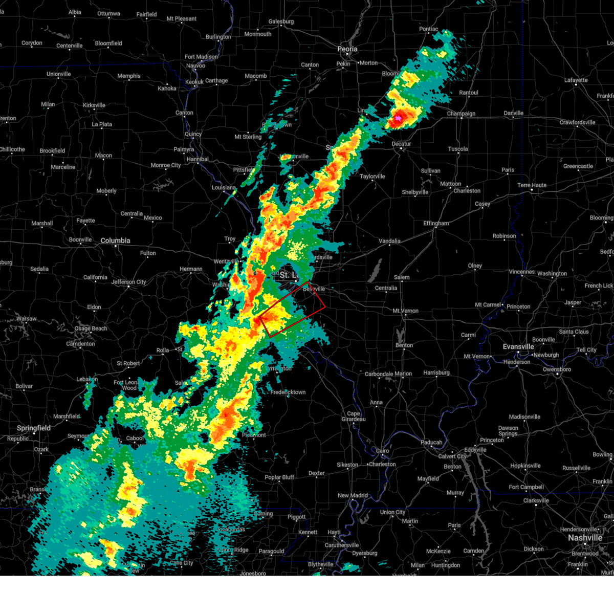
| 4/2/2025 4:22 PM CDT | Quarter sized hail reported 2.9 miles NNW of Oakville, MO, report from mping: quarter (1.00 in.). |
| 4/2/2025 4:21 PM CDT | Quarter sized hail reported 1.7 miles W of Oakville, MO, report from mping: quarter (1.00 in.). |
| 4/2/2025 4:19 PM CDT |
 At 419 pm cdt, a severe thunderstorm capable of producing a tornado was located over oakville, moving northeast at 45 mph (radar indicated rotation). Hazards include tornado and quarter size hail. Flying debris will be dangerous to those caught without shelter. mobile homes will be damaged or destroyed. damage to roofs, windows and vehicles will occur. tree damage is likely. this tornado will be near, herculaneum around 405 pm cdt. Other locations impacted by the tornado include harrisonville, new hanover, barr and sauget. At 419 pm cdt, a severe thunderstorm capable of producing a tornado was located over oakville, moving northeast at 45 mph (radar indicated rotation). Hazards include tornado and quarter size hail. Flying debris will be dangerous to those caught without shelter. mobile homes will be damaged or destroyed. damage to roofs, windows and vehicles will occur. tree damage is likely. this tornado will be near, herculaneum around 405 pm cdt. Other locations impacted by the tornado include harrisonville, new hanover, barr and sauget.
|
| 4/2/2025 4:19 PM CDT |
 the tornado warning has been cancelled and is no longer in effect the tornado warning has been cancelled and is no longer in effect
|
| 4/2/2025 3:55 PM CDT |
 Torlsx the national weather service in st louis has issued a * tornado warning for, northwestern monroe county in southwestern illinois, western saint clair county in southwestern illinois, central jefferson county in east central missouri, south central saint louis county in east central missouri, * until 445 pm cdt. * at 355 pm cdt, a severe thunderstorm capable of producing a tornado was located near de soto, moving northeast at 50 mph (radar indicated rotation). Hazards include tornado and quarter size hail. Flying debris will be dangerous to those caught without shelter. mobile homes will be damaged or destroyed. damage to roofs, windows and vehicles will occur. tree damage is likely. this tornado will be near, hillsboro and olympian village around 400 pm cdt. festus around 405 pm cdt. other locations impacted by the tornado include hematite, victoria, mapaville, harrisonville, kimmswick, monroe city, foster pond, wartburg, madonnaville and new hanover. this includes the following state parks, mastodon historic site, sandy creek covered bridge historic site and gov. dunklin's grave historic site. This includes interstate 55 in missouri between exits 174 and 191. Torlsx the national weather service in st louis has issued a * tornado warning for, northwestern monroe county in southwestern illinois, western saint clair county in southwestern illinois, central jefferson county in east central missouri, south central saint louis county in east central missouri, * until 445 pm cdt. * at 355 pm cdt, a severe thunderstorm capable of producing a tornado was located near de soto, moving northeast at 50 mph (radar indicated rotation). Hazards include tornado and quarter size hail. Flying debris will be dangerous to those caught without shelter. mobile homes will be damaged or destroyed. damage to roofs, windows and vehicles will occur. tree damage is likely. this tornado will be near, hillsboro and olympian village around 400 pm cdt. festus around 405 pm cdt. other locations impacted by the tornado include hematite, victoria, mapaville, harrisonville, kimmswick, monroe city, foster pond, wartburg, madonnaville and new hanover. this includes the following state parks, mastodon historic site, sandy creek covered bridge historic site and gov. dunklin's grave historic site. This includes interstate 55 in missouri between exits 174 and 191.
|
| 3/14/2025 10:52 PM CDT | the tornado warning has been cancelled and is no longer in effect |
| 3/14/2025 10:41 PM CDT |
 the tornado warning has been cancelled and is no longer in effect the tornado warning has been cancelled and is no longer in effect
|
| 3/14/2025 10:41 PM CDT |
 At 1041 pm cdt, a severe thunderstorm capable of producing a tornado was located over waterloo, moving northeast at 55 mph (radar indicated rotation). Hazards include tornado and quarter size hail. Flying debris will be dangerous to those caught without shelter. mobile homes will be damaged or destroyed. damage to roofs, windows and vehicles will occur. tree damage is likely. Locations impacted include, waterloo, columbia, dupo, millstadt, oakville, valmeyer, new design, fountain, hecker, barr, new hanover, wartburg, foster pond, burksville, floraville, paderborn, madonnaville and monroe city. At 1041 pm cdt, a severe thunderstorm capable of producing a tornado was located over waterloo, moving northeast at 55 mph (radar indicated rotation). Hazards include tornado and quarter size hail. Flying debris will be dangerous to those caught without shelter. mobile homes will be damaged or destroyed. damage to roofs, windows and vehicles will occur. tree damage is likely. Locations impacted include, waterloo, columbia, dupo, millstadt, oakville, valmeyer, new design, fountain, hecker, barr, new hanover, wartburg, foster pond, burksville, floraville, paderborn, madonnaville and monroe city.
|
| 3/14/2025 10:34 PM CDT | Multiple trees down. time estimated by rada in st. louis county MO, 2.1 miles NNW of Oakville, MO |
| 3/14/2025 10:28 PM CDT |
 Torlsx the national weather service in st louis has issued a * tornado warning for, monroe county in southwestern illinois, southwestern saint clair county in southwestern illinois, northeastern jefferson county in east central missouri, south central saint louis county in east central missouri, * until 1115 pm cdt. * at 1028 pm cdt, a severe thunderstorm capable of producing a tornado was located over crystal city, moving northeast at 60 mph (radar indicated rotation). Hazards include tornado and quarter size hail. Flying debris will be dangerous to those caught without shelter. mobile homes will be damaged or destroyed. damage to roofs, windows and vehicles will occur. Tree damage is likely. Torlsx the national weather service in st louis has issued a * tornado warning for, monroe county in southwestern illinois, southwestern saint clair county in southwestern illinois, northeastern jefferson county in east central missouri, south central saint louis county in east central missouri, * until 1115 pm cdt. * at 1028 pm cdt, a severe thunderstorm capable of producing a tornado was located over crystal city, moving northeast at 60 mph (radar indicated rotation). Hazards include tornado and quarter size hail. Flying debris will be dangerous to those caught without shelter. mobile homes will be damaged or destroyed. damage to roofs, windows and vehicles will occur. Tree damage is likely.
|
| 3/14/2025 10:18 PM CDT |
 At 1018 pm cdt, a severe thunderstorm was located over belleville, moving northeast at 60 mph (radar indicated). Hazards include golf ball size hail and 70 mph wind gusts. People and animals outdoors will be injured. expect hail damage to roofs, siding, windows, and vehicles. expect considerable tree damage. wind damage is also likely to mobile homes, roofs, and outbuildings. locations impacted include, st. louis, belleville, o'fallon, east st. louis, collinsville, arnold, fairview heights, cahokia, swansea, shiloh, waterloo, columbia, mascoutah, centreville, lebanon, freeburg, caseyville, washington park, dupo and millstadt. This includes interstate 64 in illinois between exits 9 and 27. At 1018 pm cdt, a severe thunderstorm was located over belleville, moving northeast at 60 mph (radar indicated). Hazards include golf ball size hail and 70 mph wind gusts. People and animals outdoors will be injured. expect hail damage to roofs, siding, windows, and vehicles. expect considerable tree damage. wind damage is also likely to mobile homes, roofs, and outbuildings. locations impacted include, st. louis, belleville, o'fallon, east st. louis, collinsville, arnold, fairview heights, cahokia, swansea, shiloh, waterloo, columbia, mascoutah, centreville, lebanon, freeburg, caseyville, washington park, dupo and millstadt. This includes interstate 64 in illinois between exits 9 and 27.
|
| 3/14/2025 10:09 PM CDT | Ping Pong Ball sized hail reported 2.9 miles NNW of Oakville, MO, report from mping: ping pong ball (1.50 in.). |
| 3/14/2025 10:08 PM CDT | Quarter sized hail reported 1.4 miles NNW of Oakville, MO |
| 3/14/2025 10:05 PM CDT | Half Dollar sized hail reported 2.1 miles NNW of Oakville, MO |
| 3/14/2025 10:01 PM CDT | Hen Egg sized hail reported 2.1 miles NNW of Oakville, MO |
| 3/14/2025 9:57 PM CDT |
 Svrlsx the national weather service in st louis has issued a * severe thunderstorm warning for, northwestern monroe county in southwestern illinois, saint clair county in southwestern illinois, south central saint louis county in east central missouri, south central saint louis city in east central missouri, * until 1045 pm cdt. * at 957 pm cdt, a severe thunderstorm was located over imperial, or over barnhart, moving northeast at 50 mph (emergency management reported). Hazards include golf ball size hail and 70 mph wind gusts. People and animals outdoors will be injured. expect hail damage to roofs, siding, windows, and vehicles. expect considerable tree damage. Wind damage is also likely to mobile homes, roofs, and outbuildings. Svrlsx the national weather service in st louis has issued a * severe thunderstorm warning for, northwestern monroe county in southwestern illinois, saint clair county in southwestern illinois, south central saint louis county in east central missouri, south central saint louis city in east central missouri, * until 1045 pm cdt. * at 957 pm cdt, a severe thunderstorm was located over imperial, or over barnhart, moving northeast at 50 mph (emergency management reported). Hazards include golf ball size hail and 70 mph wind gusts. People and animals outdoors will be injured. expect hail damage to roofs, siding, windows, and vehicles. expect considerable tree damage. Wind damage is also likely to mobile homes, roofs, and outbuildings.
|
| 3/14/2025 9:44 PM CDT |
 At 944 pm cdt, a severe thunderstorm was located near hillsboro, moving northeast at 60 mph (radar indicated). Hazards include 70 mph wind gusts and ping pong ball size hail. People and animals outdoors will be injured. expect hail damage to roofs, siding, windows, and vehicles. expect considerable tree damage. wind damage is also likely to mobile homes, roofs, and outbuildings. other locations impacted by the severe thunderstorm include fletcher, morse mill, oermann, grubville, victoria, hematite, mapaville, otto and kimmswick. this includes the following state parks, mastodon historic site, sandy creek covered bridge historic site and gov. dunklin's grave historic site. This includes interstate 55 in missouri between exits 175 and 191. At 944 pm cdt, a severe thunderstorm was located near hillsboro, moving northeast at 60 mph (radar indicated). Hazards include 70 mph wind gusts and ping pong ball size hail. People and animals outdoors will be injured. expect hail damage to roofs, siding, windows, and vehicles. expect considerable tree damage. wind damage is also likely to mobile homes, roofs, and outbuildings. other locations impacted by the severe thunderstorm include fletcher, morse mill, oermann, grubville, victoria, hematite, mapaville, otto and kimmswick. this includes the following state parks, mastodon historic site, sandy creek covered bridge historic site and gov. dunklin's grave historic site. This includes interstate 55 in missouri between exits 175 and 191.
|
| 3/14/2025 9:44 PM CDT |
 the severe thunderstorm warning has been cancelled and is no longer in effect the severe thunderstorm warning has been cancelled and is no longer in effect
|
| 3/14/2025 9:36 PM CDT |
 At 936 pm cdt, a confirmed tornado was located over arnold, moving northeast at 60 mph (weather spotters confirmed tornado, power flashes near arnold). Hazards include damaging tornado and golf ball size hail. Flying debris will be dangerous to those caught without shelter. mobile homes will be damaged or destroyed. damage to roofs, windows and vehicles will occur. tree damage is likely. locations impacted include, st. louis, university city, ballwin, kirkwood, webster groves, arnold, manchester, creve coeur, overland, clayton, crestwood, town and country, richmond heights, ladue, sunset hills, des peres, brentwood, maplewood, olivette and valley park. this includes the following state parks, mastodon historic site. this includes the following highways, interstate 44 in missouri between exits 272 and 277. Interstate 55 in missouri between exits 190 and 191. At 936 pm cdt, a confirmed tornado was located over arnold, moving northeast at 60 mph (weather spotters confirmed tornado, power flashes near arnold). Hazards include damaging tornado and golf ball size hail. Flying debris will be dangerous to those caught without shelter. mobile homes will be damaged or destroyed. damage to roofs, windows and vehicles will occur. tree damage is likely. locations impacted include, st. louis, university city, ballwin, kirkwood, webster groves, arnold, manchester, creve coeur, overland, clayton, crestwood, town and country, richmond heights, ladue, sunset hills, des peres, brentwood, maplewood, olivette and valley park. this includes the following state parks, mastodon historic site. this includes the following highways, interstate 44 in missouri between exits 272 and 277. Interstate 55 in missouri between exits 190 and 191.
|
| 3/14/2025 9:35 PM CDT |
 Torlsx the national weather service in st louis has issued a * tornado warning for, southeastern madison county in southwestern illinois, northwestern monroe county in southwestern illinois, saint clair county in southwestern illinois, northeastern jefferson county in east central missouri, south central saint louis county in east central missouri, saint louis city in east central missouri, * until 1015 pm cdt. * at 935 pm cdt, a confirmed tornado was located over arnold, moving northeast at 60 mph (weather spotters confirmed tornado, power flashers near arnold). Hazards include damaging tornado and golf ball size hail. Flying debris will be dangerous to those caught without shelter. mobile homes will be damaged or destroyed. damage to roofs, windows and vehicles will occur. Tree damage is likely. Torlsx the national weather service in st louis has issued a * tornado warning for, southeastern madison county in southwestern illinois, northwestern monroe county in southwestern illinois, saint clair county in southwestern illinois, northeastern jefferson county in east central missouri, south central saint louis county in east central missouri, saint louis city in east central missouri, * until 1015 pm cdt. * at 935 pm cdt, a confirmed tornado was located over arnold, moving northeast at 60 mph (weather spotters confirmed tornado, power flashers near arnold). Hazards include damaging tornado and golf ball size hail. Flying debris will be dangerous to those caught without shelter. mobile homes will be damaged or destroyed. damage to roofs, windows and vehicles will occur. Tree damage is likely.
|
| 3/14/2025 9:34 PM CDT |
 At 934 pm cdt, a severe thunderstorm was located 6 miles west of hillsboro, moving northeast at 60 mph (radar indicated). Hazards include 70 mph wind gusts and ping pong ball size hail. People and animals outdoors will be injured. expect hail damage to roofs, siding, windows, and vehicles. expect considerable tree damage. wind damage is also likely to mobile homes, roofs, and outbuildings. this severe thunderstorm will be near, richwoods around 925 pm cdt. other locations impacted by the severe thunderstorm include fletcher, morse mill, oermann, grubville, victoria, hematite, mapaville, otto and kimmswick. this includes the following state parks, mastodon historic site, sandy creek covered bridge historic site and gov. dunklin's grave historic site. This includes interstate 55 in missouri between exits 175 and 191. At 934 pm cdt, a severe thunderstorm was located 6 miles west of hillsboro, moving northeast at 60 mph (radar indicated). Hazards include 70 mph wind gusts and ping pong ball size hail. People and animals outdoors will be injured. expect hail damage to roofs, siding, windows, and vehicles. expect considerable tree damage. wind damage is also likely to mobile homes, roofs, and outbuildings. this severe thunderstorm will be near, richwoods around 925 pm cdt. other locations impacted by the severe thunderstorm include fletcher, morse mill, oermann, grubville, victoria, hematite, mapaville, otto and kimmswick. this includes the following state parks, mastodon historic site, sandy creek covered bridge historic site and gov. dunklin's grave historic site. This includes interstate 55 in missouri between exits 175 and 191.
|
| 3/14/2025 9:27 PM CDT |
 At 927 pm cdt, a severe thunderstorm capable of producing a tornado was located over antonia, moving northeast at 60 mph (radar indicated rotation). Hazards include tornado and quarter size hail. Flying debris will be dangerous to those caught without shelter. mobile homes will be damaged or destroyed. damage to roofs, windows and vehicles will occur. tree damage is likely. locations impacted include, st. louis, wildwood, university city, ballwin, kirkwood, webster groves, arnold, manchester, creve coeur, overland, clayton, crestwood, town and country, eureka, richmond heights, ladue, sunset hills, des peres, brentwood and maplewood. this includes the following state parks, route 66 state park, castlewood state park and mastodon historic site. this includes the following highways, interstate 44 in missouri between exits 264 and 277. Interstate 55 in missouri between exits 187 and 191. At 927 pm cdt, a severe thunderstorm capable of producing a tornado was located over antonia, moving northeast at 60 mph (radar indicated rotation). Hazards include tornado and quarter size hail. Flying debris will be dangerous to those caught without shelter. mobile homes will be damaged or destroyed. damage to roofs, windows and vehicles will occur. tree damage is likely. locations impacted include, st. louis, wildwood, university city, ballwin, kirkwood, webster groves, arnold, manchester, creve coeur, overland, clayton, crestwood, town and country, eureka, richmond heights, ladue, sunset hills, des peres, brentwood and maplewood. this includes the following state parks, route 66 state park, castlewood state park and mastodon historic site. this includes the following highways, interstate 44 in missouri between exits 264 and 277. Interstate 55 in missouri between exits 187 and 191.
|
| 3/14/2025 9:27 PM CDT |
 the tornado warning has been cancelled and is no longer in effect the tornado warning has been cancelled and is no longer in effect
|
| 3/14/2025 9:20 PM CDT |
 At 920 pm cdt, a severe thunderstorm capable of producing a tornado was located near cedar hill lakes, or near cedar hill, moving northeast at 60 mph (radar indicated rotation). Hazards include tornado and quarter size hail. Flying debris will be dangerous to those caught without shelter. mobile homes will be damaged or destroyed. damage to roofs, windows and vehicles will occur. tree damage is likely. locations impacted include, st. louis, wildwood, university city, ballwin, kirkwood, webster groves, arnold, manchester, creve coeur, overland, clayton, crestwood, town and country, eureka, richmond heights, ladue, sunset hills, des peres, brentwood and maplewood. this includes the following state parks, route 66 state park, castlewood state park and mastodon historic site. this includes the following highways, interstate 44 in missouri between exits 264 and 277. Interstate 55 in missouri between exits 187 and 191. At 920 pm cdt, a severe thunderstorm capable of producing a tornado was located near cedar hill lakes, or near cedar hill, moving northeast at 60 mph (radar indicated rotation). Hazards include tornado and quarter size hail. Flying debris will be dangerous to those caught without shelter. mobile homes will be damaged or destroyed. damage to roofs, windows and vehicles will occur. tree damage is likely. locations impacted include, st. louis, wildwood, university city, ballwin, kirkwood, webster groves, arnold, manchester, creve coeur, overland, clayton, crestwood, town and country, eureka, richmond heights, ladue, sunset hills, des peres, brentwood and maplewood. this includes the following state parks, route 66 state park, castlewood state park and mastodon historic site. this includes the following highways, interstate 44 in missouri between exits 264 and 277. Interstate 55 in missouri between exits 187 and 191.
|
| 3/14/2025 9:20 PM CDT |
 the tornado warning has been cancelled and is no longer in effect the tornado warning has been cancelled and is no longer in effect
|
| 3/14/2025 9:13 PM CDT | Svrlsx the national weather service in st louis has issued a * severe thunderstorm warning for, southeastern franklin county in east central missouri, jefferson county in east central missouri, south central saint louis county in east central missouri, northern washington county in east central missouri, * until 1000 pm cdt. * at 913 pm cdt, a severe thunderstorm was located near anthonies mill, moving northeast at 65 mph (at 859 pm, trained spotters reported two inch hail in steelville). Hazards include golf ball size hail and 70 mph wind gusts. People and animals outdoors will be injured. expect hail damage to roofs, siding, windows, and vehicles. expect considerable tree damage. wind damage is also likely to mobile homes, roofs, and outbuildings. this severe thunderstorm will be near, anthonies mill around 915 pm cdt. richwoods around 925 pm cdt. other locations impacted by the severe thunderstorm include grubville, fletcher, morse mill, oermann, scotsdale, mapaville, otto and kimmswick. this includes the following state parks, mastodon historic site, sandy creek covered bridge historic site and gov. dunklin's grave historic site. This includes interstate 55 in missouri between exits 175 and 191. |
| 3/14/2025 9:07 PM CDT | Torlsx the national weather service in st louis has issued a * tornado warning for, southeastern franklin county in east central missouri, northern jefferson county in east central missouri, southwestern saint louis county in east central missouri, northeastern washington county in east central missouri, * until 945 pm cdt. * at 907 pm cdt, a severe thunderstorm capable of producing a tornado was located near lonedell, or 11 miles southeast of st. clair, moving northeast at 60 mph (radar indicated rotation). Hazards include tornado and quarter size hail. Flying debris will be dangerous to those caught without shelter. mobile homes will be damaged or destroyed. damage to roofs, windows and vehicles will occur. Tree damage is likely. |
| 10/31/2024 2:15 AM CDT |
 Svrlsx the national weather service in st louis has issued a * severe thunderstorm warning for, east central franklin county in east central missouri, southern saint charles county in east central missouri, saint louis county in east central missouri, saint louis city in east central missouri, * until 315 am cdt. * at 215 am cdt, severe thunderstorms were located along a line from over josephville to over augusta, or along a line from near wentzville to 6 miles northwest of gray summit, moving east at 45 mph (radar indicated). Hazards include 60 mph wind gusts and small hail. expect damage to roofs, siding, and trees Svrlsx the national weather service in st louis has issued a * severe thunderstorm warning for, east central franklin county in east central missouri, southern saint charles county in east central missouri, saint louis county in east central missouri, saint louis city in east central missouri, * until 315 am cdt. * at 215 am cdt, severe thunderstorms were located along a line from over josephville to over augusta, or along a line from near wentzville to 6 miles northwest of gray summit, moving east at 45 mph (radar indicated). Hazards include 60 mph wind gusts and small hail. expect damage to roofs, siding, and trees
|
| 7/16/2024 12:13 PM CDT |
 the severe thunderstorm warning has been cancelled and is no longer in effect the severe thunderstorm warning has been cancelled and is no longer in effect
|
| 7/16/2024 12:13 PM CDT |
 At 1212 pm cdt, a severe thunderstorm was located over cedar hill lakes, moving southeast at 35 mph (radar indicated). Hazards include 60 mph wind gusts. Expect damage to roofs, siding, and trees. locations impacted include, arnold, de soto, pevely, herculaneum, hillsboro, barnhart, oakville, murphy, antonia, high ridge, horine, imperial, kimmswick, otto, morse mill, fletcher, and mapaville. this also includes mastodon historic site, sandy creek covered bridge historic site, and gov. dunklin's grave historic site. This includes interstate 55 in missouri between exits 178 and 191. At 1212 pm cdt, a severe thunderstorm was located over cedar hill lakes, moving southeast at 35 mph (radar indicated). Hazards include 60 mph wind gusts. Expect damage to roofs, siding, and trees. locations impacted include, arnold, de soto, pevely, herculaneum, hillsboro, barnhart, oakville, murphy, antonia, high ridge, horine, imperial, kimmswick, otto, morse mill, fletcher, and mapaville. this also includes mastodon historic site, sandy creek covered bridge historic site, and gov. dunklin's grave historic site. This includes interstate 55 in missouri between exits 178 and 191.
|
| 7/16/2024 12:05 PM CDT |
 At 1205 pm cdt, a severe thunderstorm was located over cedar hill, moving southeast at 35 mph (radar indicated). Hazards include 60 mph wind gusts. Expect damage to roofs, siding, and trees. locations impacted include, arnold, sunset hills, valley park, pevely, fenton, herculaneum, hillsboro, byrnes mill, high ridge, barnhart, cedar hill, murphy, oakville, antonia, cedar hill lakes, house springs, dittmer, horine, lonedell, and imperial. this also includes mastodon historic site, sandy creek covered bridge historic site, and gov. dunklin's grave historic site. this includes the following highways, interstate 44 in missouri between exits 272 and 274. Interstate 55 in missouri between exits 178 and 191. At 1205 pm cdt, a severe thunderstorm was located over cedar hill, moving southeast at 35 mph (radar indicated). Hazards include 60 mph wind gusts. Expect damage to roofs, siding, and trees. locations impacted include, arnold, sunset hills, valley park, pevely, fenton, herculaneum, hillsboro, byrnes mill, high ridge, barnhart, cedar hill, murphy, oakville, antonia, cedar hill lakes, house springs, dittmer, horine, lonedell, and imperial. this also includes mastodon historic site, sandy creek covered bridge historic site, and gov. dunklin's grave historic site. this includes the following highways, interstate 44 in missouri between exits 272 and 274. Interstate 55 in missouri between exits 178 and 191.
|
| 7/16/2024 11:52 AM CDT |
 Svrlsx the national weather service in st louis has issued a * severe thunderstorm warning for, jefferson county in east central missouri, southeastern franklin county in east central missouri, southwestern st. louis county in east central missouri, * until 1230 pm cdt. * at 1152 am cdt, a severe thunderstorm was located over pacific, moving southeast at 35 mph (radar indicated). Hazards include 60 mph wind gusts. expect damage to roofs, siding, and trees Svrlsx the national weather service in st louis has issued a * severe thunderstorm warning for, jefferson county in east central missouri, southeastern franklin county in east central missouri, southwestern st. louis county in east central missouri, * until 1230 pm cdt. * at 1152 am cdt, a severe thunderstorm was located over pacific, moving southeast at 35 mph (radar indicated). Hazards include 60 mph wind gusts. expect damage to roofs, siding, and trees
|
| 7/8/2024 5:21 PM CDT |
 At 521 pm cdt, a severe thunderstorm was located near waterloo, moving east at 30 mph (radar indicated). Hazards include 60 mph wind gusts and penny size hail. Expect damage to roofs, siding, and trees. locations impacted include, arnold, waterloo, columbia, pevely, dupo, millstadt, mehlville, oakville, lemay, valmeyer, fountain, new design, barr, madonnaville, floraville, wartburg, new hanover, burksville, monroe city, and foster pond. this also includes gov. Dunklin's grave historic site. At 521 pm cdt, a severe thunderstorm was located near waterloo, moving east at 30 mph (radar indicated). Hazards include 60 mph wind gusts and penny size hail. Expect damage to roofs, siding, and trees. locations impacted include, arnold, waterloo, columbia, pevely, dupo, millstadt, mehlville, oakville, lemay, valmeyer, fountain, new design, barr, madonnaville, floraville, wartburg, new hanover, burksville, monroe city, and foster pond. this also includes gov. Dunklin's grave historic site.
|
| 7/8/2024 5:21 PM CDT |
 the severe thunderstorm warning has been cancelled and is no longer in effect the severe thunderstorm warning has been cancelled and is no longer in effect
|
| 7/8/2024 5:08 PM CDT | At 508 pm cdt, a severe thunderstorm was located near columbia, moving east at 30 mph (radar indicated). Hazards include 60 mph wind gusts and quarter size hail. Hail damage to vehicles is expected. expect wind damage to roofs, siding, and trees. locations impacted include, arnold, waterloo, columbia, sunset hills, pevely, dupo, millstadt, herculaneum, barnhart, mehlville, oakville, antonia, lemay, green park, valmeyer, fountain, new design, concord, sappington, and imperial. this also includes mastodon historic site and gov. dunklin's grave historic site. This includes interstate 55 in missouri between exits 180 and 191. |
| 7/8/2024 5:05 PM CDT | Multiple large trees downed from winds across from oakville high schoo in st. louis county MO, 0.6 miles W of Oakville, MO |
| 7/8/2024 4:57 PM CDT |
 Svrlsx the national weather service in st louis has issued a * severe thunderstorm warning for, monroe county in southwestern illinois, southwestern st. clair county in southwestern illinois, northeastern jefferson county in east central missouri, south central st. louis county in east central missouri, * until 545 pm cdt. * at 457 pm cdt, a severe thunderstorm was located over imperial, moving east at 25 mph (radar indicated). Hazards include 60 mph wind gusts and quarter size hail. Hail damage to vehicles is expected. Expect wind damage to roofs, siding, and trees. Svrlsx the national weather service in st louis has issued a * severe thunderstorm warning for, monroe county in southwestern illinois, southwestern st. clair county in southwestern illinois, northeastern jefferson county in east central missouri, south central st. louis county in east central missouri, * until 545 pm cdt. * at 457 pm cdt, a severe thunderstorm was located over imperial, moving east at 25 mph (radar indicated). Hazards include 60 mph wind gusts and quarter size hail. Hail damage to vehicles is expected. Expect wind damage to roofs, siding, and trees.
|
| 7/8/2024 4:53 PM CDT | At 453 pm cdt, a severe thunderstorm was located over imperial, moving east at 20 mph (radar indicated). Hazards include 60 mph wind gusts and quarter size hail. Hail damage to vehicles is expected. expect wind damage to roofs, siding, and trees. locations impacted include, arnold, sunset hills, pevely, fenton, herculaneum, lakeshire, barnhart, lemay, mehlville, oakville, murphy, antonia, high ridge, affton, green park, st. george, concord, sappington, horine, and imperial. this also includes mastodon historic site and gov. dunklin's grave historic site. This includes interstate 55 in missouri between exits 180 and 191. |
| 7/8/2024 4:40 PM CDT | At 440 pm cdt, a severe thunderstorm was located near house springs, moving east at 15 mph (radar indicated). Hazards include 60 mph wind gusts and quarter size hail. Hail damage to vehicles is expected. expect wind damage to roofs, siding, and trees. locations impacted include, arnold, eureka, sunset hills, pevely, fenton, herculaneum, byrnes mill, lakeshire, high ridge, barnhart, cedar hill, murphy, lemay, mehlville, oakville, antonia, affton, green park, st. george, and cedar hill lakes. this also includes route 66 state park, mastodon historic site, and gov. dunklin's grave historic site. this includes the following highways, interstate 44 in missouri between exits 265 and 272. Interstate 55 in missouri between exits 180 and 191. |
| 7/8/2024 4:30 PM CDT |
 Svrlsx the national weather service in st louis has issued a * severe thunderstorm warning for, northern jefferson county in east central missouri, southwestern st. louis county in east central missouri, * until 500 pm cdt. * at 429 pm cdt, a severe thunderstorm was located over house springs, moving east at 20 mph (public. at 4:25 pm ping pong ball sized hail was reported in byrnes mill). Hazards include 70 mph wind gusts and ping pong ball size hail. People and animals outdoors will be injured. expect hail damage to roofs, siding, windows, and vehicles. expect considerable tree damage. Wind damage is also likely to mobile homes, roofs, and outbuildings. Svrlsx the national weather service in st louis has issued a * severe thunderstorm warning for, northern jefferson county in east central missouri, southwestern st. louis county in east central missouri, * until 500 pm cdt. * at 429 pm cdt, a severe thunderstorm was located over house springs, moving east at 20 mph (public. at 4:25 pm ping pong ball sized hail was reported in byrnes mill). Hazards include 70 mph wind gusts and ping pong ball size hail. People and animals outdoors will be injured. expect hail damage to roofs, siding, windows, and vehicles. expect considerable tree damage. Wind damage is also likely to mobile homes, roofs, and outbuildings.
|
| 5/26/2024 6:26 PM CDT |
 Svrlsx the national weather service in st louis has issued a * severe thunderstorm warning for, monroe county in southwestern illinois, northern randolph county in southwestern illinois, southeastern st. clair county in southwestern illinois, northeastern ste. genevieve county in southeastern missouri, * until 715 pm cdt. * at 626 pm cdt, a severe thunderstorm was located near crystal city, moving east at 60 mph (radar indicated). Hazards include 60 mph wind gusts and quarter size hail. Hail damage to vehicles is expected. Expect wind damage to roofs, siding, and trees. Svrlsx the national weather service in st louis has issued a * severe thunderstorm warning for, monroe county in southwestern illinois, northern randolph county in southwestern illinois, southeastern st. clair county in southwestern illinois, northeastern ste. genevieve county in southeastern missouri, * until 715 pm cdt. * at 626 pm cdt, a severe thunderstorm was located near crystal city, moving east at 60 mph (radar indicated). Hazards include 60 mph wind gusts and quarter size hail. Hail damage to vehicles is expected. Expect wind damage to roofs, siding, and trees.
|
| 5/26/2024 6:04 PM CDT |
 At 604 pm cdt, a severe thunderstorm capable of producing a tornado was located over dupo, moving east at 35 mph (radar indicated rotation). Hazards include tornado and tennis ball size hail. Flying debris will be dangerous to those caught without shelter. mobile homes will be damaged or destroyed. damage to roofs, windows, and vehicles will occur. tree damage is likely. this dangerous storm will be near, belleville, cahokia, centreville, cahokia parks airport, and alorton around 610 pm cdt. other locations in the path of this tornadic thunderstorm include millstadt. this also includes scott joplin historic site. this includes the following highways, interstate 64 in illinois near exit 9. Interstate 44 in missouri near exit 277. At 604 pm cdt, a severe thunderstorm capable of producing a tornado was located over dupo, moving east at 35 mph (radar indicated rotation). Hazards include tornado and tennis ball size hail. Flying debris will be dangerous to those caught without shelter. mobile homes will be damaged or destroyed. damage to roofs, windows, and vehicles will occur. tree damage is likely. this dangerous storm will be near, belleville, cahokia, centreville, cahokia parks airport, and alorton around 610 pm cdt. other locations in the path of this tornadic thunderstorm include millstadt. this also includes scott joplin historic site. this includes the following highways, interstate 64 in illinois near exit 9. Interstate 44 in missouri near exit 277.
|
| 5/26/2024 6:00 PM CDT | Large tree branches blown down. time approximat in st. louis county MO, 1.1 miles W of Oakville, MO |
| 5/26/2024 6:00 PM CDT | Significant damage to shingles... but roof still in place. possible tornado damag in st. louis county MO, 0.9 miles SE of Oakville, MO |
| 5/26/2024 5:58 PM CDT | Tree down on hous in st. louis county MO, 2.1 miles NNW of Oakville, MO |
| 5/26/2024 5:54 PM CDT |
 At 553 pm cdt, a confirmed tornado was located over green park, moving east at 35 mph (radar confirmed tornado). Hazards include damaging tornado and tennis ball size hail. Flying debris will be dangerous to those caught without shelter. mobile homes will be damaged or destroyed. damage to roofs, windows, and vehicles will occur. tree damage is likely. this tornado will be near, st. louis, cahokia, columbia, dupo, mehlville, lemay, oakville, bella villa, and east carondelet around 600 pm cdt. other locations in the path of this tornadic thunderstorm include centreville, cahokia parks airport, belleville and alorton. this also includes scott joplin historic site. this includes the following highways, interstate 64 in illinois near exit 9. Interstate 44 in missouri near exit 277. At 553 pm cdt, a confirmed tornado was located over green park, moving east at 35 mph (radar confirmed tornado). Hazards include damaging tornado and tennis ball size hail. Flying debris will be dangerous to those caught without shelter. mobile homes will be damaged or destroyed. damage to roofs, windows, and vehicles will occur. tree damage is likely. this tornado will be near, st. louis, cahokia, columbia, dupo, mehlville, lemay, oakville, bella villa, and east carondelet around 600 pm cdt. other locations in the path of this tornadic thunderstorm include centreville, cahokia parks airport, belleville and alorton. this also includes scott joplin historic site. this includes the following highways, interstate 64 in illinois near exit 9. Interstate 44 in missouri near exit 277.
|
| 5/26/2024 5:43 PM CDT |
 Torlsx the national weather service in st louis has issued a * tornado warning for, northwestern monroe county in southwestern illinois, northwestern st. clair county in southwestern illinois, st. louis city in east central missouri, south central st. louis county in east central missouri, * until 630 pm cdt. * at 543 pm cdt, a severe thunderstorm capable of producing a tornado was located over fenton, moving east at 35 mph (radar indicated rotation). Hazards include tornado and tennis ball size hail. Flying debris will be dangerous to those caught without shelter. mobile homes will be damaged or destroyed. damage to roofs, windows, and vehicles will occur. tree damage is likely. this dangerous storm will be near, kirkwood, webster groves, crestwood, sunset hills, shrewsbury, lakeshire, oakland, affton, mehlville, and lemay around 550 pm cdt. st. louis, columbia, dupo, and east carondelet around 555 pm cdt. cahokia around 600 pm cdt. other locations in the path of this tornadic thunderstorm include cahokia parks airport, belleville, centreville, millstadt and alorton. this also includes scott joplin historic site. this includes the following highways, interstate 64 in illinois near exit 9. Interstate 44 in missouri near exit 277. Torlsx the national weather service in st louis has issued a * tornado warning for, northwestern monroe county in southwestern illinois, northwestern st. clair county in southwestern illinois, st. louis city in east central missouri, south central st. louis county in east central missouri, * until 630 pm cdt. * at 543 pm cdt, a severe thunderstorm capable of producing a tornado was located over fenton, moving east at 35 mph (radar indicated rotation). Hazards include tornado and tennis ball size hail. Flying debris will be dangerous to those caught without shelter. mobile homes will be damaged or destroyed. damage to roofs, windows, and vehicles will occur. tree damage is likely. this dangerous storm will be near, kirkwood, webster groves, crestwood, sunset hills, shrewsbury, lakeshire, oakland, affton, mehlville, and lemay around 550 pm cdt. st. louis, columbia, dupo, and east carondelet around 555 pm cdt. cahokia around 600 pm cdt. other locations in the path of this tornadic thunderstorm include cahokia parks airport, belleville, centreville, millstadt and alorton. this also includes scott joplin historic site. this includes the following highways, interstate 64 in illinois near exit 9. Interstate 44 in missouri near exit 277.
|
| 5/26/2024 4:57 PM CDT | Large tree down and another snapped in half... central ac unit blown ove in st. louis county MO, 0.1 miles SSW of Oakville, MO |
| 5/26/2024 4:55 PM CDT | Tree on a house in oakvill in st. louis county MO, 1.1 miles W of Oakville, MO |
| 5/8/2024 5:24 PM CDT |
 At 524 pm cdt, a severe thunderstorm was located over o'fallon, moving northeast at 60 mph (radar indicated). Hazards include 60 mph wind gusts and quarter size hail. Hail damage to vehicles is expected. expect wind damage to roofs, siding, and trees. locations impacted include, belleville, o'fallon, east st. louis, collinsville, fairview heights, cahokia, swansea, shiloh, waterloo, columbia, mascoutah, pevely, centreville, lebanon, freeburg, caseyville, washington park, dupo, millstadt, and new baden. This includes interstate 64 in illinois between exits 9 and 27. At 524 pm cdt, a severe thunderstorm was located over o'fallon, moving northeast at 60 mph (radar indicated). Hazards include 60 mph wind gusts and quarter size hail. Hail damage to vehicles is expected. expect wind damage to roofs, siding, and trees. locations impacted include, belleville, o'fallon, east st. louis, collinsville, fairview heights, cahokia, swansea, shiloh, waterloo, columbia, mascoutah, pevely, centreville, lebanon, freeburg, caseyville, washington park, dupo, millstadt, and new baden. This includes interstate 64 in illinois between exits 9 and 27.
|
| 5/8/2024 5:14 PM CDT |
 At 513 pm cdt, a severe thunderstorm was located over millstadt, moving northeast at 35 mph. another severe thunderstorm was located north of valmeyer moving northeast at 35 mph (radar indicated). Hazards include 60 mph wind gusts and quarter size hail. Hail damage to vehicles is expected. expect wind damage to roofs, siding, and trees. locations impacted include, belleville, o'fallon, east st. louis, collinsville, fairview heights, cahokia, swansea, shiloh, waterloo, columbia, mascoutah, pevely, centreville, lebanon, freeburg, caseyville, washington park, dupo, millstadt, and new baden. This includes interstate 64 in illinois between exits 9 and 27. At 513 pm cdt, a severe thunderstorm was located over millstadt, moving northeast at 35 mph. another severe thunderstorm was located north of valmeyer moving northeast at 35 mph (radar indicated). Hazards include 60 mph wind gusts and quarter size hail. Hail damage to vehicles is expected. expect wind damage to roofs, siding, and trees. locations impacted include, belleville, o'fallon, east st. louis, collinsville, fairview heights, cahokia, swansea, shiloh, waterloo, columbia, mascoutah, pevely, centreville, lebanon, freeburg, caseyville, washington park, dupo, millstadt, and new baden. This includes interstate 64 in illinois between exits 9 and 27.
|
| 5/8/2024 4:57 PM CDT |
 At 457 pm cdt, a severe thunderstorm was located near waterloo, moving northeast at 40 mph (radar indicated). Hazards include 60 mph wind gusts and quarter size hail. Hail damage to vehicles is expected. expect wind damage to roofs, siding, and trees. locations impacted include, belleville, o'fallon, east st. louis, collinsville, fairview heights, cahokia, swansea, shiloh, waterloo, columbia, mascoutah, pevely, centreville, lebanon, freeburg, caseyville, washington park, dupo, millstadt, and new baden. This includes interstate 64 in illinois between exits 9 and 27. At 457 pm cdt, a severe thunderstorm was located near waterloo, moving northeast at 40 mph (radar indicated). Hazards include 60 mph wind gusts and quarter size hail. Hail damage to vehicles is expected. expect wind damage to roofs, siding, and trees. locations impacted include, belleville, o'fallon, east st. louis, collinsville, fairview heights, cahokia, swansea, shiloh, waterloo, columbia, mascoutah, pevely, centreville, lebanon, freeburg, caseyville, washington park, dupo, millstadt, and new baden. This includes interstate 64 in illinois between exits 9 and 27.
|
| 5/8/2024 4:48 PM CDT |
 Svrlsx the national weather service in st louis has issued a * severe thunderstorm warning for, northwestern monroe county in southwestern illinois, northern st. clair county in southwestern illinois, * until 530 pm cdt. * at 448 pm cdt, a severe thunderstorm was located near fountain, moving northeast at 60 mph (radar indicated). Hazards include 60 mph wind gusts and quarter size hail. Hail damage to vehicles is expected. Expect wind damage to roofs, siding, and trees. Svrlsx the national weather service in st louis has issued a * severe thunderstorm warning for, northwestern monroe county in southwestern illinois, northern st. clair county in southwestern illinois, * until 530 pm cdt. * at 448 pm cdt, a severe thunderstorm was located near fountain, moving northeast at 60 mph (radar indicated). Hazards include 60 mph wind gusts and quarter size hail. Hail damage to vehicles is expected. Expect wind damage to roofs, siding, and trees.
|
| 5/7/2024 4:05 AM CDT |
 Svrlsx the national weather service in st louis has issued a * severe thunderstorm warning for, western monroe county in southwestern illinois, st. louis city in east central missouri, jefferson county in east central missouri, st. louis county in east central missouri, * until 445 am cdt. * at 405 am cdt, severe thunderstorms were located along a line extending from near washington to lonedell to near potosi, moving northeast at 55 mph (radar indicated). Hazards include 60 mph wind gusts. Expect damage to roofs, siding, and trees. severe thunderstorms will be near, dittmer around 410 am cdt. wildwood, eureka, pacific, de soto, cedar hill, and cedar hill lakes around 415 am cdt. hillsboro, byrnes mill, and house springs around 420 am cdt. chesterfield, ballwin, ellisville, weldon spring, clarkson valley, murphy, high ridge, spirit of st. louis airport, and olympian village around 425 am cdt. other locations in the path of these severe thunderstorms include arnold, manchester, festus, town and country, sunset hills, valley park, pevely, crystal city, fenton, herculaneum, kirkwood, maryland heights, creve coeur, crestwood, des peres, glendale, frontenac, warson woods, oakland, mehlville, webster groves, ladue and green park. this includes the following highways, interstate 44 in missouri between exits 261 and 277. interstate 55 in missouri between exits 170 and 191. interstate 70 in missouri near exit 231. this also includes babler memorial state park, scott joplin historic site, route 66 state park, castlewood state park, mastodon historic site, sandy creek covered bridge historic site, and gov. Dunklin's grave historic site. Svrlsx the national weather service in st louis has issued a * severe thunderstorm warning for, western monroe county in southwestern illinois, st. louis city in east central missouri, jefferson county in east central missouri, st. louis county in east central missouri, * until 445 am cdt. * at 405 am cdt, severe thunderstorms were located along a line extending from near washington to lonedell to near potosi, moving northeast at 55 mph (radar indicated). Hazards include 60 mph wind gusts. Expect damage to roofs, siding, and trees. severe thunderstorms will be near, dittmer around 410 am cdt. wildwood, eureka, pacific, de soto, cedar hill, and cedar hill lakes around 415 am cdt. hillsboro, byrnes mill, and house springs around 420 am cdt. chesterfield, ballwin, ellisville, weldon spring, clarkson valley, murphy, high ridge, spirit of st. louis airport, and olympian village around 425 am cdt. other locations in the path of these severe thunderstorms include arnold, manchester, festus, town and country, sunset hills, valley park, pevely, crystal city, fenton, herculaneum, kirkwood, maryland heights, creve coeur, crestwood, des peres, glendale, frontenac, warson woods, oakland, mehlville, webster groves, ladue and green park. this includes the following highways, interstate 44 in missouri between exits 261 and 277. interstate 55 in missouri between exits 170 and 191. interstate 70 in missouri near exit 231. this also includes babler memorial state park, scott joplin historic site, route 66 state park, castlewood state park, mastodon historic site, sandy creek covered bridge historic site, and gov. Dunklin's grave historic site.
|
| 4/29/2024 1:08 AM CDT |
 At 108 am cdt, a severe thunderstorm was located near richwoods, moving northeast at 30 mph (radar indicated). Hazards include 60 mph wind gusts. Expect damage to roofs, siding, and trees. locations impacted include, arnold, festus, bonne terre, de soto, pevely, desloge, crystal city, herculaneum, hillsboro, potosi, leadwood, barnhart, cedar hill, antonia, oakville, park hills, olympian village, irondale, mineral point, and cedar hill lakes. this also includes washington state park, st. francois state park, mastodon historic site, sandy creek covered bridge historic site, missouri mines historic site, and gov. dunklin's grave historic site. This includes interstate 55 in missouri between exits 174 and 191. At 108 am cdt, a severe thunderstorm was located near richwoods, moving northeast at 30 mph (radar indicated). Hazards include 60 mph wind gusts. Expect damage to roofs, siding, and trees. locations impacted include, arnold, festus, bonne terre, de soto, pevely, desloge, crystal city, herculaneum, hillsboro, potosi, leadwood, barnhart, cedar hill, antonia, oakville, park hills, olympian village, irondale, mineral point, and cedar hill lakes. this also includes washington state park, st. francois state park, mastodon historic site, sandy creek covered bridge historic site, missouri mines historic site, and gov. dunklin's grave historic site. This includes interstate 55 in missouri between exits 174 and 191.
|
| 4/29/2024 12:48 AM CDT |
 Svrlsx the national weather service in st louis has issued a * severe thunderstorm warning for, jefferson county in east central missouri, washington county in east central missouri, southeastern franklin county in east central missouri, northwestern st. francois county in southeastern missouri, * until 130 am cdt. * at 1248 am cdt, a severe thunderstorm was located 8 miles southeast of anthonies mill, moving northeast at 55 mph (radar indicated). Hazards include 60 mph wind gusts. expect damage to roofs, siding, and trees Svrlsx the national weather service in st louis has issued a * severe thunderstorm warning for, jefferson county in east central missouri, washington county in east central missouri, southeastern franklin county in east central missouri, northwestern st. francois county in southeastern missouri, * until 130 am cdt. * at 1248 am cdt, a severe thunderstorm was located 8 miles southeast of anthonies mill, moving northeast at 55 mph (radar indicated). Hazards include 60 mph wind gusts. expect damage to roofs, siding, and trees
|
| 4/18/2024 6:06 PM CDT |
 the severe thunderstorm warning has been cancelled and is no longer in effect the severe thunderstorm warning has been cancelled and is no longer in effect
|
| 4/18/2024 6:06 PM CDT |
 At 605 pm cdt, severe thunderstorms were located along a line extending from staunton to columbia, moving east at 55 mph (radar indicated). Hazards include 60 mph wind gusts and quarter size hail. Hail damage to vehicles is expected. expect wind damage to roofs, siding, and trees. locations impacted include, st. louis, belleville, granite city, o'fallon, east st. louis, collinsville, edwardsville, fairview heights, cahokia, swansea, glen carbon, shiloh, wood river, highland, troy, waterloo, columbia, bethalto, maryville, and mascoutah. this also includes horseshoe lake state park. this includes the following highways, interstate 70 in illinois between exits 21 and 30. interstate 55 in illinois between exits 23 and 37. Interstate 64 in illinois between exits 9 and 23. At 605 pm cdt, severe thunderstorms were located along a line extending from staunton to columbia, moving east at 55 mph (radar indicated). Hazards include 60 mph wind gusts and quarter size hail. Hail damage to vehicles is expected. expect wind damage to roofs, siding, and trees. locations impacted include, st. louis, belleville, granite city, o'fallon, east st. louis, collinsville, edwardsville, fairview heights, cahokia, swansea, glen carbon, shiloh, wood river, highland, troy, waterloo, columbia, bethalto, maryville, and mascoutah. this also includes horseshoe lake state park. this includes the following highways, interstate 70 in illinois between exits 21 and 30. interstate 55 in illinois between exits 23 and 37. Interstate 64 in illinois between exits 9 and 23.
|
| 4/18/2024 5:58 PM CDT |
 the tornado warning has been cancelled and is no longer in effect the tornado warning has been cancelled and is no longer in effect
|
| 4/18/2024 5:52 PM CDT | Report from mping: trees uprooted or snapped; roof blown of in st. louis county MO, 1.7 miles W of Oakville, MO |
| 4/18/2024 5:51 PM CDT | 2-3inch live limbs down... 2-3 up-rooted trees... shingles off... bent tree in st. louis county MO, 1.3 miles WNW of Oakville, MO |
| 4/18/2024 5:51 PM CDT |
 At 551 pm cdt, severe thunderstorms were located along a line extending from near bunker hill to near arnold, moving east at 55 mph (radar indicated). Hazards include 60 mph wind gusts and quarter size hail. Hail damage to vehicles is expected. expect wind damage to roofs, siding, and trees. locations impacted include, st. louis, florissant, belleville, university city, granite city, o'fallon, alton, kirkwood, east st. louis, hazelwood, collinsville, edwardsville, webster groves, ferguson, arnold, manchester, godfrey, creve coeur, fairview heights, and overland. this also includes scott joplin historic site, confluence state park, mastodon historic site, and horseshoe lake state park. this includes the following highways, interstate 70 in illinois between exits 21 and 30. interstate 55 in illinois between exits 23 and 37. interstate 64 in illinois between exits 9 and 23. interstate 44 in missouri between exits 269 and 277. Interstate 55 in missouri between exits 187 and 191. At 551 pm cdt, severe thunderstorms were located along a line extending from near bunker hill to near arnold, moving east at 55 mph (radar indicated). Hazards include 60 mph wind gusts and quarter size hail. Hail damage to vehicles is expected. expect wind damage to roofs, siding, and trees. locations impacted include, st. louis, florissant, belleville, university city, granite city, o'fallon, alton, kirkwood, east st. louis, hazelwood, collinsville, edwardsville, webster groves, ferguson, arnold, manchester, godfrey, creve coeur, fairview heights, and overland. this also includes scott joplin historic site, confluence state park, mastodon historic site, and horseshoe lake state park. this includes the following highways, interstate 70 in illinois between exits 21 and 30. interstate 55 in illinois between exits 23 and 37. interstate 64 in illinois between exits 9 and 23. interstate 44 in missouri between exits 269 and 277. Interstate 55 in missouri between exits 187 and 191.
|
| 4/18/2024 5:49 PM CDT |
 Torlsx the national weather service in st louis has issued a * tornado warning for, northwestern monroe county in southwestern illinois, northwestern st. clair county in southwestern illinois, southern st. louis city in east central missouri, * until 630 pm cdt. * at 549 pm cdt, a severe thunderstorm capable of producing a tornado was located over sappington, moving east at 30 mph (radar indicated rotation). Hazards include tornado. Flying debris will be dangerous to those caught without shelter. mobile homes will be damaged or destroyed. damage to roofs, windows, and vehicles will occur. tree damage is likely. this dangerous storm will be near, st. louis and east carondelet around 555 pm cdt. cahokia, columbia, and dupo around 600 pm cdt. cahokia parks airport around 605 pm cdt. other locations in the path of this tornadic thunderstorm include east st. louis, centreville, belleville, alorton, fairview heights, caseyville and washington park. this also includes scott joplin historic site. This includes interstate 64 in illinois near exit 9. Torlsx the national weather service in st louis has issued a * tornado warning for, northwestern monroe county in southwestern illinois, northwestern st. clair county in southwestern illinois, southern st. louis city in east central missouri, * until 630 pm cdt. * at 549 pm cdt, a severe thunderstorm capable of producing a tornado was located over sappington, moving east at 30 mph (radar indicated rotation). Hazards include tornado. Flying debris will be dangerous to those caught without shelter. mobile homes will be damaged or destroyed. damage to roofs, windows, and vehicles will occur. tree damage is likely. this dangerous storm will be near, st. louis and east carondelet around 555 pm cdt. cahokia, columbia, and dupo around 600 pm cdt. cahokia parks airport around 605 pm cdt. other locations in the path of this tornadic thunderstorm include east st. louis, centreville, belleville, alorton, fairview heights, caseyville and washington park. this also includes scott joplin historic site. This includes interstate 64 in illinois near exit 9.
|
| 4/18/2024 5:43 PM CDT |
 At 543 pm cdt, a confirmed tornado was located over murphy, moving east at 40 mph (radar confirmed tornado). Hazards include damaging tornado and quarter size hail. Flying debris will be dangerous to those caught without shelter. mobile homes will be damaged or destroyed. damage to roofs, windows, and vehicles will occur. tree damage is likely. this tornado will be near, arnold, sunset hills, fenton, lakeshire, affton, mehlville, oakville, green park, concord, and sappington around 550 pm cdt. other locations in the path of this tornadic thunderstorm include lemay and st. george. this also includes mastodon historic site. This includes interstate 55 in missouri between exits 187 and 191. At 543 pm cdt, a confirmed tornado was located over murphy, moving east at 40 mph (radar confirmed tornado). Hazards include damaging tornado and quarter size hail. Flying debris will be dangerous to those caught without shelter. mobile homes will be damaged or destroyed. damage to roofs, windows, and vehicles will occur. tree damage is likely. this tornado will be near, arnold, sunset hills, fenton, lakeshire, affton, mehlville, oakville, green park, concord, and sappington around 550 pm cdt. other locations in the path of this tornadic thunderstorm include lemay and st. george. this also includes mastodon historic site. This includes interstate 55 in missouri between exits 187 and 191.
|
| 4/18/2024 5:39 PM CDT |
 Svrlsx the national weather service in st louis has issued a * severe thunderstorm warning for, northwestern monroe county in southwestern illinois, madison county in southwestern illinois, st. clair county in southwestern illinois, st. louis city in east central missouri, east central st. charles county in east central missouri, northeastern jefferson county in east central missouri, central st. louis county in east central missouri, * until 645 pm cdt. * at 539 pm cdt, severe thunderstorms were located along a line extending from near brighton to high ridge, moving east at 55 mph (radar indicated). Hazards include 60 mph wind gusts and quarter size hail. Hail damage to vehicles is expected. Expect wind damage to roofs, siding, and trees. Svrlsx the national weather service in st louis has issued a * severe thunderstorm warning for, northwestern monroe county in southwestern illinois, madison county in southwestern illinois, st. clair county in southwestern illinois, st. louis city in east central missouri, east central st. charles county in east central missouri, northeastern jefferson county in east central missouri, central st. louis county in east central missouri, * until 645 pm cdt. * at 539 pm cdt, severe thunderstorms were located along a line extending from near brighton to high ridge, moving east at 55 mph (radar indicated). Hazards include 60 mph wind gusts and quarter size hail. Hail damage to vehicles is expected. Expect wind damage to roofs, siding, and trees.
|
| 4/18/2024 5:34 PM CDT |
 At 534 pm cdt, a confirmed tornado was located over byrnes mill, moving east at 40 mph (radar confirmed tornado). Hazards include damaging tornado. Flying debris will be dangerous to those caught without shelter. mobile homes will be damaged or destroyed. damage to roofs, windows, and vehicles will occur. tree damage is likely. this tornado will be near, fenton, byrnes mill, murphy, and high ridge around 540 pm cdt. arnold, sunset hills, mehlville, oakville, concord, and sappington around 545 pm cdt. lakeshire, affton, and green park around 550 pm cdt. other locations in the path of this tornadic thunderstorm include lemay and st. george. this also includes route 66 state park and mastodon historic site. this includes the following highways, interstate 44 in missouri between exits 264 and 269. Interstate 55 in missouri between exits 187 and 191. At 534 pm cdt, a confirmed tornado was located over byrnes mill, moving east at 40 mph (radar confirmed tornado). Hazards include damaging tornado. Flying debris will be dangerous to those caught without shelter. mobile homes will be damaged or destroyed. damage to roofs, windows, and vehicles will occur. tree damage is likely. this tornado will be near, fenton, byrnes mill, murphy, and high ridge around 540 pm cdt. arnold, sunset hills, mehlville, oakville, concord, and sappington around 545 pm cdt. lakeshire, affton, and green park around 550 pm cdt. other locations in the path of this tornadic thunderstorm include lemay and st. george. this also includes route 66 state park and mastodon historic site. this includes the following highways, interstate 44 in missouri between exits 264 and 269. Interstate 55 in missouri between exits 187 and 191.
|
| 4/18/2024 5:33 PM CDT |
 Torlsx the national weather service in st louis has issued a * tornado warning for, northeastern jefferson county in east central missouri, southwestern st. louis county in east central missouri, * until 615 pm cdt. * at 533 pm cdt, a severe thunderstorm capable of producing a tornado was located over byrnes mill, moving east at 40 mph (radar indicated rotation). Hazards include tornado. Flying debris will be dangerous to those caught without shelter. mobile homes will be damaged or destroyed. damage to roofs, windows, and vehicles will occur. tree damage is likely. this dangerous storm will be near, fenton, byrnes mill, murphy, and high ridge around 540 pm cdt. arnold, sunset hills, oakville, concord, and sappington around 545 pm cdt. mehlville and green park around 550 pm cdt. other locations in the path of this tornadic thunderstorm include affton, lemay and st. george. this also includes route 66 state park, castlewood state park, and mastodon historic site. this includes the following highways, interstate 44 in missouri between exits 264 and 276. Interstate 55 in missouri between exits 187 and 191. Torlsx the national weather service in st louis has issued a * tornado warning for, northeastern jefferson county in east central missouri, southwestern st. louis county in east central missouri, * until 615 pm cdt. * at 533 pm cdt, a severe thunderstorm capable of producing a tornado was located over byrnes mill, moving east at 40 mph (radar indicated rotation). Hazards include tornado. Flying debris will be dangerous to those caught without shelter. mobile homes will be damaged or destroyed. damage to roofs, windows, and vehicles will occur. tree damage is likely. this dangerous storm will be near, fenton, byrnes mill, murphy, and high ridge around 540 pm cdt. arnold, sunset hills, oakville, concord, and sappington around 545 pm cdt. mehlville and green park around 550 pm cdt. other locations in the path of this tornadic thunderstorm include affton, lemay and st. george. this also includes route 66 state park, castlewood state park, and mastodon historic site. this includes the following highways, interstate 44 in missouri between exits 264 and 276. Interstate 55 in missouri between exits 187 and 191.
|
| 4/16/2024 3:57 PM CDT |
 the severe thunderstorm warning has been cancelled and is no longer in effect the severe thunderstorm warning has been cancelled and is no longer in effect
|
| 4/16/2024 3:52 PM CDT |
 At 352 pm cdt, a severe thunderstorm was located over imperial, moving northeast at 70 mph (radar indicated). Hazards include 60 mph wind gusts and penny size hail. Expect damage to roofs, siding, and trees. locations impacted include, arnold, festus, waterloo, columbia, pevely, crystal city, herculaneum, hillsboro, lakeshire, barnhart, lemay, mehlville, oakville, antonia, affton, green park, st. george, valmeyer, bella villa, and east carondelet. this also includes mastodon historic site, sandy creek covered bridge historic site, and gov. dunklin's grave historic site. This includes interstate 55 in missouri between exits 175 and 191. At 352 pm cdt, a severe thunderstorm was located over imperial, moving northeast at 70 mph (radar indicated). Hazards include 60 mph wind gusts and penny size hail. Expect damage to roofs, siding, and trees. locations impacted include, arnold, festus, waterloo, columbia, pevely, crystal city, herculaneum, hillsboro, lakeshire, barnhart, lemay, mehlville, oakville, antonia, affton, green park, st. george, valmeyer, bella villa, and east carondelet. this also includes mastodon historic site, sandy creek covered bridge historic site, and gov. dunklin's grave historic site. This includes interstate 55 in missouri between exits 175 and 191.
|
| 4/16/2024 3:41 PM CDT |
 the severe thunderstorm warning has been cancelled and is no longer in effect the severe thunderstorm warning has been cancelled and is no longer in effect
|
| 4/16/2024 3:41 PM CDT |
 At 341 pm cdt, a severe thunderstorm was located over hillsboro, moving northeast at 70 mph (radar indicated). Hazards include 60 mph wind gusts and quarter size hail. Hail damage to vehicles is expected. expect wind damage to roofs, siding, and trees. locations impacted include, arnold, festus, waterloo, columbia, de soto, pevely, crystal city, herculaneum, hillsboro, lakeshire, barnhart, affton, lemay, mehlville, oakville, antonia, green park, st. george, valmeyer, and bella villa. this also includes mastodon historic site, sandy creek covered bridge historic site, and gov. dunklin's grave historic site. This includes interstate 55 in missouri between exits 174 and 191. At 341 pm cdt, a severe thunderstorm was located over hillsboro, moving northeast at 70 mph (radar indicated). Hazards include 60 mph wind gusts and quarter size hail. Hail damage to vehicles is expected. expect wind damage to roofs, siding, and trees. locations impacted include, arnold, festus, waterloo, columbia, de soto, pevely, crystal city, herculaneum, hillsboro, lakeshire, barnhart, affton, lemay, mehlville, oakville, antonia, green park, st. george, valmeyer, and bella villa. this also includes mastodon historic site, sandy creek covered bridge historic site, and gov. dunklin's grave historic site. This includes interstate 55 in missouri between exits 174 and 191.
|
| 4/16/2024 3:29 PM CDT |
 Svrlsx the national weather service in st louis has issued a * severe thunderstorm warning for, northwestern monroe county in southwestern illinois, central jefferson county in east central missouri, northeastern washington county in east central missouri, south central st. louis county in east central missouri, * until 415 pm cdt. * at 329 pm cdt, a severe thunderstorm was located near richwoods, moving northeast at 75 mph (radar indicated). Hazards include 60 mph wind gusts and quarter size hail. Hail damage to vehicles is expected. Expect wind damage to roofs, siding, and trees. Svrlsx the national weather service in st louis has issued a * severe thunderstorm warning for, northwestern monroe county in southwestern illinois, central jefferson county in east central missouri, northeastern washington county in east central missouri, south central st. louis county in east central missouri, * until 415 pm cdt. * at 329 pm cdt, a severe thunderstorm was located near richwoods, moving northeast at 75 mph (radar indicated). Hazards include 60 mph wind gusts and quarter size hail. Hail damage to vehicles is expected. Expect wind damage to roofs, siding, and trees.
|
| 4/2/2024 2:01 AM CDT | Quarter sized hail reported 1.7 miles W of Oakville, MO, report from mping: quarter (1.00 in.). |
| 4/2/2024 2:00 AM CDT |
 The storms which prompted the warning have moved out of the area. therefore, the warning has been allowed to expire. however, small hail and gusty winds are still possible with these thunderstorms. a tornado watch remains in effect until 300 am cdt for southwestern illinois, and east central missouri. The storms which prompted the warning have moved out of the area. therefore, the warning has been allowed to expire. however, small hail and gusty winds are still possible with these thunderstorms. a tornado watch remains in effect until 300 am cdt for southwestern illinois, and east central missouri.
|
| 4/2/2024 1:57 AM CDT |
 Svrlsx the national weather service in st louis has issued a * severe thunderstorm warning for, western clinton county in south central illinois, northern monroe county in southwestern illinois, southeastern madison county in southwestern illinois, west central washington county in south central illinois, st. clair county in southwestern illinois, southern st. louis city in east central missouri, northeastern jefferson county in east central missouri, south central st. louis county in east central missouri, * until 245 am cdt. * at 157 am cdt, a severe thunderstorm was located over dupo, moving east at 50 mph (radar indicated). Hazards include golf ball size hail and 60 mph wind gusts. People and animals outdoors will be injured. expect hail damage to roofs, siding, windows, and vehicles. Expect wind damage to roofs, siding, and trees. Svrlsx the national weather service in st louis has issued a * severe thunderstorm warning for, western clinton county in south central illinois, northern monroe county in southwestern illinois, southeastern madison county in southwestern illinois, west central washington county in south central illinois, st. clair county in southwestern illinois, southern st. louis city in east central missouri, northeastern jefferson county in east central missouri, south central st. louis county in east central missouri, * until 245 am cdt. * at 157 am cdt, a severe thunderstorm was located over dupo, moving east at 50 mph (radar indicated). Hazards include golf ball size hail and 60 mph wind gusts. People and animals outdoors will be injured. expect hail damage to roofs, siding, windows, and vehicles. Expect wind damage to roofs, siding, and trees.
|
| 4/2/2024 1:55 AM CDT | Quarter sized hail reported 1.1 miles W of Oakville, MO, mping report of quarter sized hail. |
| 4/2/2024 1:55 AM CDT | Quarter sized hail reported 1.7 miles W of Oakville, MO, quarter sized hail in oakville. |
| 4/2/2024 1:40 AM CDT |
 At 139 am cdt, a severe thunderstorm was located 7 miles west of bloomsdale, moving east at 55 mph (radar indicated). Hazards include 60 mph wind gusts. Expect damage to roofs, siding, and trees. locations impacted include, belleville, arnold, farmington, festus, waterloo, columbia, bonne terre, de soto, pevely, desloge, crystal city, ste. genevieve, millstadt, red bud, herculaneum, hillsboro, byrnes mill, bismarck, leadwood, and antonia. this also includes st. joe state park, st. francois state park, hawn state park, felix valle house state park, mastodon historic site, sandy creek covered bridge historic site, missouri mines historic site, and gov. dunklin's grave historic site. This includes interstate 55 in missouri between exits 141 and 191. At 139 am cdt, a severe thunderstorm was located 7 miles west of bloomsdale, moving east at 55 mph (radar indicated). Hazards include 60 mph wind gusts. Expect damage to roofs, siding, and trees. locations impacted include, belleville, arnold, farmington, festus, waterloo, columbia, bonne terre, de soto, pevely, desloge, crystal city, ste. genevieve, millstadt, red bud, herculaneum, hillsboro, byrnes mill, bismarck, leadwood, and antonia. this also includes st. joe state park, st. francois state park, hawn state park, felix valle house state park, mastodon historic site, sandy creek covered bridge historic site, missouri mines historic site, and gov. dunklin's grave historic site. This includes interstate 55 in missouri between exits 141 and 191.
|
| 4/2/2024 1:40 AM CDT |
 the severe thunderstorm warning has been cancelled and is no longer in effect the severe thunderstorm warning has been cancelled and is no longer in effect
|
| 4/2/2024 1:18 AM CDT |
 Svrlsx the national weather service in st louis has issued a * severe thunderstorm warning for, monroe county in southwestern illinois, western randolph county in southwestern illinois, southwestern st. clair county in southwestern illinois, northwestern iron county in southeastern missouri, jefferson county in east central missouri, ste. genevieve county in southeastern missouri, washington county in east central missouri, southeastern franklin county in east central missouri, st. francois county in southeastern missouri, * until 200 am cdt. * at 117 am cdt, a severe thunderstorm was located near de soto, moving east at 55 mph (radar indicated). Hazards include 60 mph wind gusts. expect damage to roofs, siding, and trees Svrlsx the national weather service in st louis has issued a * severe thunderstorm warning for, monroe county in southwestern illinois, western randolph county in southwestern illinois, southwestern st. clair county in southwestern illinois, northwestern iron county in southeastern missouri, jefferson county in east central missouri, ste. genevieve county in southeastern missouri, washington county in east central missouri, southeastern franklin county in east central missouri, st. francois county in southeastern missouri, * until 200 am cdt. * at 117 am cdt, a severe thunderstorm was located near de soto, moving east at 55 mph (radar indicated). Hazards include 60 mph wind gusts. expect damage to roofs, siding, and trees
|
| 4/2/2024 1:12 AM CDT |
 Svrlsx the national weather service in st louis has issued a * severe thunderstorm warning for, northwestern monroe county in southwestern illinois, jefferson county in east central missouri, southeastern franklin county in east central missouri, southwestern st. louis county in east central missouri, * until 200 am cdt. * at 112 am cdt, severe thunderstorms were located along a line extending from near union to near lonedell to 7 miles east of richwoods, moving northeast at 45 mph (radar indicated). Hazards include 60 mph wind gusts and quarter size hail. Hail damage to vehicles is expected. Expect wind damage to roofs, siding, and trees. Svrlsx the national weather service in st louis has issued a * severe thunderstorm warning for, northwestern monroe county in southwestern illinois, jefferson county in east central missouri, southeastern franklin county in east central missouri, southwestern st. louis county in east central missouri, * until 200 am cdt. * at 112 am cdt, severe thunderstorms were located along a line extending from near union to near lonedell to 7 miles east of richwoods, moving northeast at 45 mph (radar indicated). Hazards include 60 mph wind gusts and quarter size hail. Hail damage to vehicles is expected. Expect wind damage to roofs, siding, and trees.
|
| 4/1/2024 11:30 PM CDT |
 At 1130 pm cdt, a severe thunderstorm was located over st. louis, moving east at 50 mph (trained weather spotters reported quarter sized hail in rock hill and kirkwood). Hazards include 60 mph wind gusts and quarter size hail. Hail damage to vehicles is expected. expect wind damage to roofs, siding, and trees. locations impacted include, st. louis, florissant, chesterfield, wildwood, university city, ballwin, kirkwood, maryland heights, hazelwood, webster groves, ferguson, arnold, manchester, creve coeur, overland, clayton, cahokia, jennings, st. ann, and crestwood. this also includes babler memorial state park, scott joplin historic site, route 66 state park, castlewood state park, and robertsville state park. this includes the following highways, interstate 44 in missouri between exits 253 and 277. Interstate 55 in missouri between exits 190 and 191. At 1130 pm cdt, a severe thunderstorm was located over st. louis, moving east at 50 mph (trained weather spotters reported quarter sized hail in rock hill and kirkwood). Hazards include 60 mph wind gusts and quarter size hail. Hail damage to vehicles is expected. expect wind damage to roofs, siding, and trees. locations impacted include, st. louis, florissant, chesterfield, wildwood, university city, ballwin, kirkwood, maryland heights, hazelwood, webster groves, ferguson, arnold, manchester, creve coeur, overland, clayton, cahokia, jennings, st. ann, and crestwood. this also includes babler memorial state park, scott joplin historic site, route 66 state park, castlewood state park, and robertsville state park. this includes the following highways, interstate 44 in missouri between exits 253 and 277. Interstate 55 in missouri between exits 190 and 191.
|
| 4/1/2024 11:21 PM CDT |
 At 1121 pm cdt, a severe thunderstorm was located over des peres, moving east at 45 mph (trained weather spotters). Hazards include 60 mph wind gusts and quarter size hail. Hail damage to vehicles is expected. expect wind damage to roofs, siding, and trees. locations impacted include, st. louis, florissant, chesterfield, wildwood, university city, ballwin, kirkwood, maryland heights, hazelwood, webster groves, ferguson, arnold, manchester, creve coeur, overland, clayton, cahokia, jennings, st. ann, and crestwood. this also includes babler memorial state park, scott joplin historic site, route 66 state park, castlewood state park, and robertsville state park. this includes the following highways, interstate 44 in missouri between exits 253 and 277. Interstate 55 in missouri between exits 190 and 191. At 1121 pm cdt, a severe thunderstorm was located over des peres, moving east at 45 mph (trained weather spotters). Hazards include 60 mph wind gusts and quarter size hail. Hail damage to vehicles is expected. expect wind damage to roofs, siding, and trees. locations impacted include, st. louis, florissant, chesterfield, wildwood, university city, ballwin, kirkwood, maryland heights, hazelwood, webster groves, ferguson, arnold, manchester, creve coeur, overland, clayton, cahokia, jennings, st. ann, and crestwood. this also includes babler memorial state park, scott joplin historic site, route 66 state park, castlewood state park, and robertsville state park. this includes the following highways, interstate 44 in missouri between exits 253 and 277. Interstate 55 in missouri between exits 190 and 191.
|
| 4/1/2024 11:17 PM CDT |
 At 1116 pm cdt, a severe thunderstorm was located over manchester, moving east at 45 mph (radar indicated). Hazards include 60 mph wind gusts and quarter size hail. Hail damage to vehicles is expected. expect wind damage to roofs, siding, and trees. locations impacted include, st. louis, florissant, chesterfield, wildwood, university city, ballwin, kirkwood, maryland heights, hazelwood, webster groves, ferguson, arnold, manchester, creve coeur, overland, clayton, cahokia, jennings, st. ann, and crestwood. this also includes babler memorial state park, scott joplin historic site, route 66 state park, castlewood state park, and robertsville state park. this includes the following highways, interstate 44 in missouri between exits 253 and 277. Interstate 55 in missouri between exits 190 and 191. At 1116 pm cdt, a severe thunderstorm was located over manchester, moving east at 45 mph (radar indicated). Hazards include 60 mph wind gusts and quarter size hail. Hail damage to vehicles is expected. expect wind damage to roofs, siding, and trees. locations impacted include, st. louis, florissant, chesterfield, wildwood, university city, ballwin, kirkwood, maryland heights, hazelwood, webster groves, ferguson, arnold, manchester, creve coeur, overland, clayton, cahokia, jennings, st. ann, and crestwood. this also includes babler memorial state park, scott joplin historic site, route 66 state park, castlewood state park, and robertsville state park. this includes the following highways, interstate 44 in missouri between exits 253 and 277. Interstate 55 in missouri between exits 190 and 191.
|
| 4/1/2024 10:47 PM CDT |
 Svrlsx the national weather service in st louis has issued a * severe thunderstorm warning for, st. louis city in east central missouri, northern jefferson county in east central missouri, east central franklin county in east central missouri, st. louis county in east central missouri, * until 1145 pm cdt. * at 1046 pm cdt, a severe thunderstorm was located over villa ridge, moving east at 45 mph (radar indicated). Hazards include 60 mph wind gusts and quarter size hail. Hail damage to vehicles is expected. Expect wind damage to roofs, siding, and trees. Svrlsx the national weather service in st louis has issued a * severe thunderstorm warning for, st. louis city in east central missouri, northern jefferson county in east central missouri, east central franklin county in east central missouri, st. louis county in east central missouri, * until 1145 pm cdt. * at 1046 pm cdt, a severe thunderstorm was located over villa ridge, moving east at 45 mph (radar indicated). Hazards include 60 mph wind gusts and quarter size hail. Hail damage to vehicles is expected. Expect wind damage to roofs, siding, and trees.
|
| 3/14/2024 6:29 PM CDT |
 the severe thunderstorm warning has been cancelled and is no longer in effect the severe thunderstorm warning has been cancelled and is no longer in effect
|
| 3/14/2024 6:08 PM CDT |
 Svrlsx the national weather service in st louis has issued a * severe thunderstorm warning for, west central monroe county in southwestern illinois, northeastern jefferson county in east central missouri, southeastern st. louis county in east central missouri, * until 700 pm cdt. * at 608 pm cdt, a severe thunderstorm was located over antonia, moving east at 60 mph (radar indicated). Hazards include 60 mph wind gusts and half dollar size hail. Hail damage to vehicles is expected. Expect wind damage to roofs, siding, and trees. Svrlsx the national weather service in st louis has issued a * severe thunderstorm warning for, west central monroe county in southwestern illinois, northeastern jefferson county in east central missouri, southeastern st. louis county in east central missouri, * until 700 pm cdt. * at 608 pm cdt, a severe thunderstorm was located over antonia, moving east at 60 mph (radar indicated). Hazards include 60 mph wind gusts and half dollar size hail. Hail damage to vehicles is expected. Expect wind damage to roofs, siding, and trees.
|
| 3/14/2024 6:00 PM CDT |
 Svrlsx the national weather service in st louis has issued a * severe thunderstorm warning for, northwestern monroe county in southwestern illinois, west central st. clair county in southwestern illinois, south central st. louis city in east central missouri, south central st. louis county in east central missouri, * until 630 pm cdt. * at 600 pm cdt, a severe thunderstorm was located over columbia, moving northeast at 40 mph (radar indicated). Hazards include 60 mph wind gusts and quarter size hail. Hail damage to vehicles is expected. Expect wind damage to roofs, siding, and trees. Svrlsx the national weather service in st louis has issued a * severe thunderstorm warning for, northwestern monroe county in southwestern illinois, west central st. clair county in southwestern illinois, south central st. louis city in east central missouri, south central st. louis county in east central missouri, * until 630 pm cdt. * at 600 pm cdt, a severe thunderstorm was located over columbia, moving northeast at 40 mph (radar indicated). Hazards include 60 mph wind gusts and quarter size hail. Hail damage to vehicles is expected. Expect wind damage to roofs, siding, and trees.
|
| 3/14/2024 5:48 PM CDT |
 The severe thunderstorm which prompted the warning has moved out of the warned area. therefore, the warning has been cancelled. a tornado watch remains in effect until 900 pm cdt for southwestern illinois, and east central missouri. The severe thunderstorm which prompted the warning has moved out of the warned area. therefore, the warning has been cancelled. a tornado watch remains in effect until 900 pm cdt for southwestern illinois, and east central missouri.
|
| 3/14/2024 5:48 PM CDT |
 At 547 pm cdt, a severe thunderstorm was located over cahokia, moving northeast at 45 mph (trained weather spotters reported golf ball hail in crestwood). Hazards include golf ball size hail and 60 mph wind gusts. People and animals outdoors will be injured. expect hail damage to roofs, siding, windows, and vehicles. expect wind damage to roofs, siding, and trees. locations impacted include, st. louis, kirkwood, webster groves, cahokia, crestwood, columbia, richmond heights, sunset hills, brentwood, maplewood, shrewsbury, glendale, dupo, fenton, millstadt, lakeshire, oakland, affton, lemay, and mehlville. This includes interstate 44 in missouri between exits 276 and 277. At 547 pm cdt, a severe thunderstorm was located over cahokia, moving northeast at 45 mph (trained weather spotters reported golf ball hail in crestwood). Hazards include golf ball size hail and 60 mph wind gusts. People and animals outdoors will be injured. expect hail damage to roofs, siding, windows, and vehicles. expect wind damage to roofs, siding, and trees. locations impacted include, st. louis, kirkwood, webster groves, cahokia, crestwood, columbia, richmond heights, sunset hills, brentwood, maplewood, shrewsbury, glendale, dupo, fenton, millstadt, lakeshire, oakland, affton, lemay, and mehlville. This includes interstate 44 in missouri between exits 276 and 277.
|
| 3/14/2024 5:47 PM CDT | Quarter sized hail reported 3.4 miles N of Oakville, MO, report from mping: quarter (1.00 in.). |
| 3/14/2024 5:43 PM CDT |
 the severe thunderstorm warning has been cancelled and is no longer in effect the severe thunderstorm warning has been cancelled and is no longer in effect
|
| 3/14/2024 5:43 PM CDT |
 At 542 pm cdt, a severe thunderstorm was located over lemay, moving northeast at 35 mph (trained weather spotters). Hazards include ping pong ball size hail and 60 mph wind gusts. numerous reports of one inch hail in south st. louis county. People and animals outdoors will be injured. expect hail damage to roofs, siding, windows, and vehicles. expect wind damage to roofs, siding, and trees. locations impacted include, st. louis, kirkwood, webster groves, cahokia, crestwood, columbia, richmond heights, sunset hills, brentwood, maplewood, shrewsbury, glendale, dupo, fenton, millstadt, lakeshire, oakland, affton, lemay, and mehlville. This includes interstate 44 in missouri between exits 276 and 277. At 542 pm cdt, a severe thunderstorm was located over lemay, moving northeast at 35 mph (trained weather spotters). Hazards include ping pong ball size hail and 60 mph wind gusts. numerous reports of one inch hail in south st. louis county. People and animals outdoors will be injured. expect hail damage to roofs, siding, windows, and vehicles. expect wind damage to roofs, siding, and trees. locations impacted include, st. louis, kirkwood, webster groves, cahokia, crestwood, columbia, richmond heights, sunset hills, brentwood, maplewood, shrewsbury, glendale, dupo, fenton, millstadt, lakeshire, oakland, affton, lemay, and mehlville. This includes interstate 44 in missouri between exits 276 and 277.
|
| 3/14/2024 5:33 PM CDT | Quarter sized hail reported 4.1 miles N of Oakville, MO, delayed report. |
| 3/14/2024 5:31 PM CDT | Quarter sized hail reported 2 miles N of Oakville, MO, report from mping: quarter (1.00 in.). |
| 3/14/2024 5:29 PM CDT |
 At 529 pm cdt, a severe thunderstorm was located near arnold, moving northeast at 35 mph (trained weather spotters). Hazards include ping pong ball size hail and 60 mph wind gusts. quarter size hail was reported in imperial. People and animals outdoors will be injured. expect hail damage to roofs, siding, windows, and vehicles. expect wind damage to roofs, siding, and trees. locations impacted include, st. louis, kirkwood, webster groves, arnold, cahokia, crestwood, columbia, richmond heights, sunset hills, brentwood, maplewood, shrewsbury, glendale, dupo, fenton, millstadt, lakeshire, oakland, affton, and murphy. this includes the following highways, interstate 44 in missouri between exits 274 and 277. Interstate 55 in missouri between exits 190 and 191. At 529 pm cdt, a severe thunderstorm was located near arnold, moving northeast at 35 mph (trained weather spotters). Hazards include ping pong ball size hail and 60 mph wind gusts. quarter size hail was reported in imperial. People and animals outdoors will be injured. expect hail damage to roofs, siding, windows, and vehicles. expect wind damage to roofs, siding, and trees. locations impacted include, st. louis, kirkwood, webster groves, arnold, cahokia, crestwood, columbia, richmond heights, sunset hills, brentwood, maplewood, shrewsbury, glendale, dupo, fenton, millstadt, lakeshire, oakland, affton, and murphy. this includes the following highways, interstate 44 in missouri between exits 274 and 277. Interstate 55 in missouri between exits 190 and 191.
|
| 3/14/2024 5:23 PM CDT |
 At 522 pm cdt, a severe thunderstorm was located near high ridge, moving northeast at 35 mph (trained weather spotters reported ping pong ball size hail in high ridge). Hazards include ping pong ball size hail and 60 mph wind gusts. People and animals outdoors will be injured. expect hail damage to roofs, siding, windows, and vehicles. expect wind damage to roofs, siding, and trees. locations impacted include, st. louis, kirkwood, webster groves, arnold, cahokia, crestwood, columbia, richmond heights, sunset hills, brentwood, maplewood, shrewsbury, glendale, dupo, fenton, millstadt, byrnes mill, lakeshire, oakland, and high ridge. this also includes mastodon historic site. this includes the following highways, interstate 44 in missouri between exits 274 and 277. Interstate 55 in missouri between exits 185 and 191. At 522 pm cdt, a severe thunderstorm was located near high ridge, moving northeast at 35 mph (trained weather spotters reported ping pong ball size hail in high ridge). Hazards include ping pong ball size hail and 60 mph wind gusts. People and animals outdoors will be injured. expect hail damage to roofs, siding, windows, and vehicles. expect wind damage to roofs, siding, and trees. locations impacted include, st. louis, kirkwood, webster groves, arnold, cahokia, crestwood, columbia, richmond heights, sunset hills, brentwood, maplewood, shrewsbury, glendale, dupo, fenton, millstadt, byrnes mill, lakeshire, oakland, and high ridge. this also includes mastodon historic site. this includes the following highways, interstate 44 in missouri between exits 274 and 277. Interstate 55 in missouri between exits 185 and 191.
|
| 3/14/2024 5:17 PM CDT |
 Svrlsx the national weather service in st louis has issued a * severe thunderstorm warning for, northwestern monroe county in southwestern illinois, west central st. clair county in southwestern illinois, southwestern st. louis city in east central missouri, northeastern jefferson county in east central missouri, south central st. louis county in east central missouri, * until 600 pm cdt. * at 517 pm cdt, a severe thunderstorm was located over house springs, moving northeast at 35 mph (radar indicated). Hazards include 60 mph wind gusts and quarter size hail. Hail damage to vehicles is expected. Expect wind damage to roofs, siding, and trees. Svrlsx the national weather service in st louis has issued a * severe thunderstorm warning for, northwestern monroe county in southwestern illinois, west central st. clair county in southwestern illinois, southwestern st. louis city in east central missouri, northeastern jefferson county in east central missouri, south central st. louis county in east central missouri, * until 600 pm cdt. * at 517 pm cdt, a severe thunderstorm was located over house springs, moving northeast at 35 mph (radar indicated). Hazards include 60 mph wind gusts and quarter size hail. Hail damage to vehicles is expected. Expect wind damage to roofs, siding, and trees.
|
| 3/14/2024 4:39 PM CDT | Ping Pong Ball sized hail reported 1.7 miles W of Oakville, MO, report from mping: ping pong ball (1.50 in.). |
| 3/14/2024 4:32 PM CDT | Half Dollar sized hail reported 2.2 miles ENE of Oakville, MO |
| 3/14/2024 4:32 PM CDT |
 Svrlsx the national weather service in st louis has issued a * severe thunderstorm warning for, northwestern monroe county in southwestern illinois, northwestern st. clair county in southwestern illinois, southern st. louis city in east central missouri, south central st. louis county in east central missouri, * until 515 pm cdt. * at 431 pm cdt, a severe thunderstorm was located over mehlville, moving northeast at 30 mph (at 428 pm, trained weather spotters reported up to golf ball sized hail in mehlville, mo). Hazards include golf ball size hail and 60 mph wind gusts. People and animals outdoors will be injured. expect hail damage to roofs, siding, windows, and vehicles. Expect wind damage to roofs, siding, and trees. Svrlsx the national weather service in st louis has issued a * severe thunderstorm warning for, northwestern monroe county in southwestern illinois, northwestern st. clair county in southwestern illinois, southern st. louis city in east central missouri, south central st. louis county in east central missouri, * until 515 pm cdt. * at 431 pm cdt, a severe thunderstorm was located over mehlville, moving northeast at 30 mph (at 428 pm, trained weather spotters reported up to golf ball sized hail in mehlville, mo). Hazards include golf ball size hail and 60 mph wind gusts. People and animals outdoors will be injured. expect hail damage to roofs, siding, windows, and vehicles. Expect wind damage to roofs, siding, and trees.
|
| 3/14/2024 3:57 PM CDT |
 Svrlsx the national weather service in st louis has issued a * severe thunderstorm warning for, northwestern monroe county in southwestern illinois, central jefferson county in east central missouri, south central st. louis county in east central missouri, * until 500 pm cdt. * at 356 pm cdt, a severe thunderstorm was located near hillsboro, moving east at 25 mph (radar indicated). Hazards include golf ball size hail. People and animals outdoors will be injured. Expect damage to roofs, siding, windows, and vehicles. Svrlsx the national weather service in st louis has issued a * severe thunderstorm warning for, northwestern monroe county in southwestern illinois, central jefferson county in east central missouri, south central st. louis county in east central missouri, * until 500 pm cdt. * at 356 pm cdt, a severe thunderstorm was located near hillsboro, moving east at 25 mph (radar indicated). Hazards include golf ball size hail. People and animals outdoors will be injured. Expect damage to roofs, siding, windows, and vehicles.
|
| 3/14/2024 8:23 AM CDT |
 The storms which prompted the warning have moved out of the area. therefore, the warning will be allowed to expire. a severe thunderstorm watch remains in effect until noon cdt for southwestern illinois, and east central missouri. The storms which prompted the warning have moved out of the area. therefore, the warning will be allowed to expire. a severe thunderstorm watch remains in effect until noon cdt for southwestern illinois, and east central missouri.
|
| 3/14/2024 8:03 AM CDT |
 At 803 am cdt, severe thunderstorms were located along a line extending from near hartford to valmeyer, moving east at 45 mph (radar indicated). Hazards include 60 mph wind gusts. Expect damage to roofs, siding, and trees. locations impacted include, st. louis, belleville, granite city, o'fallon, alton, east st. louis, collinsville, edwardsville, fairview heights, cahokia, swansea, glen carbon, shiloh, wood river, troy, waterloo, columbia, bethalto, maryville, and pontoon beach. this also includes horseshoe lake state park. this includes the following highways, interstate 70 in illinois near exit 21. interstate 55 in illinois between exits 23 and 33. Interstate 64 in illinois between exits 9 and 19. At 803 am cdt, severe thunderstorms were located along a line extending from near hartford to valmeyer, moving east at 45 mph (radar indicated). Hazards include 60 mph wind gusts. Expect damage to roofs, siding, and trees. locations impacted include, st. louis, belleville, granite city, o'fallon, alton, east st. louis, collinsville, edwardsville, fairview heights, cahokia, swansea, glen carbon, shiloh, wood river, troy, waterloo, columbia, bethalto, maryville, and pontoon beach. this also includes horseshoe lake state park. this includes the following highways, interstate 70 in illinois near exit 21. interstate 55 in illinois between exits 23 and 33. Interstate 64 in illinois between exits 9 and 19.
|
| 3/14/2024 8:03 AM CDT |
 the severe thunderstorm warning has been cancelled and is no longer in effect the severe thunderstorm warning has been cancelled and is no longer in effect
|
| 3/14/2024 7:47 AM CDT |
 Svrlsx the national weather service in st louis has issued a * severe thunderstorm warning for, northern monroe county in southwestern illinois, central madison county in southwestern illinois, western st. clair county in southwestern illinois, st. louis city in east central missouri, east central st. charles county in east central missouri, northeastern jefferson county in east central missouri, eastern st. louis county in east central missouri, * until 830 am cdt. * at 746 am cdt, severe thunderstorms were located along a line extending from calverton park to near hillsboro, moving east at 45 mph (radar indicated). Hazards include 60 mph wind gusts. expect damage to roofs, siding, and trees Svrlsx the national weather service in st louis has issued a * severe thunderstorm warning for, northern monroe county in southwestern illinois, central madison county in southwestern illinois, western st. clair county in southwestern illinois, st. louis city in east central missouri, east central st. charles county in east central missouri, northeastern jefferson county in east central missouri, eastern st. louis county in east central missouri, * until 830 am cdt. * at 746 am cdt, severe thunderstorms were located along a line extending from calverton park to near hillsboro, moving east at 45 mph (radar indicated). Hazards include 60 mph wind gusts. expect damage to roofs, siding, and trees
|
| 3/13/2024 3:25 AM CDT | Quarter sized hail reported 2.1 miles NNW of Oakville, MO |
| 9/27/2023 12:31 AM CDT |
 At 1231 am cdt, a severe thunderstorm was located over columbia, moving southeast at 30 mph (radar indicated). Hazards include quarter size hail. damage to vehicles is expected At 1231 am cdt, a severe thunderstorm was located over columbia, moving southeast at 30 mph (radar indicated). Hazards include quarter size hail. damage to vehicles is expected
|
| 9/26/2023 10:21 PM CDT |
 The severe thunderstorm warning for northeastern jefferson county will expire at 1030 pm cdt, the storm which prompted the warning has weakened below severe limits, and no longer poses an immediate threat to life or property. therefore, the warning will be allowed to expire. however, small hail and heavy rain are still possible with this thunderstorm. The severe thunderstorm warning for northeastern jefferson county will expire at 1030 pm cdt, the storm which prompted the warning has weakened below severe limits, and no longer poses an immediate threat to life or property. therefore, the warning will be allowed to expire. however, small hail and heavy rain are still possible with this thunderstorm.
|
| 9/26/2023 10:00 PM CDT |
 At 1000 pm cdt, a severe thunderstorm was located near cedar hill, moving southeast at 20 mph (radar indicated). Hazards include 60 mph wind gusts and quarter size hail. Hail damage to vehicles is expected. expect wind damage to roofs, siding, and trees. locations impacted include, arnold, byrnes mill, cedar hill, barnhart, antonia, high ridge, oakville, house springs, imperial, scotsdale, kimmswick, and otto. this also includes mastodon historic site and sandy creek covered bridge historic site. this includes interstate 55 in missouri between exits 185 and 190. hail threat, radar indicated max hail size, 1. 00 in wind threat, radar indicated max wind gust, 60 mph. At 1000 pm cdt, a severe thunderstorm was located near cedar hill, moving southeast at 20 mph (radar indicated). Hazards include 60 mph wind gusts and quarter size hail. Hail damage to vehicles is expected. expect wind damage to roofs, siding, and trees. locations impacted include, arnold, byrnes mill, cedar hill, barnhart, antonia, high ridge, oakville, house springs, imperial, scotsdale, kimmswick, and otto. this also includes mastodon historic site and sandy creek covered bridge historic site. this includes interstate 55 in missouri between exits 185 and 190. hail threat, radar indicated max hail size, 1. 00 in wind threat, radar indicated max wind gust, 60 mph.
|
| 9/26/2023 9:38 PM CDT |
 At 938 pm cdt, a severe thunderstorm was located near eureka, moving southeast at 35 mph (radar indicated). Hazards include 60 mph wind gusts and quarter size hail. Hail damage to vehicles is expected. Expect wind damage to roofs, siding, and trees. At 938 pm cdt, a severe thunderstorm was located near eureka, moving southeast at 35 mph (radar indicated). Hazards include 60 mph wind gusts and quarter size hail. Hail damage to vehicles is expected. Expect wind damage to roofs, siding, and trees.
|
| 8/12/2023 5:18 AM CDT |
 At 517 am cdt, severe thunderstorms were located along a line extending from near lebanon to smithton to valmeyer to near lonedell, moving southeast at 50 mph (radar indicated). Hazards include 60 mph wind gusts. Expect damage to roofs, siding, and trees. locations impacted include, belleville, o`fallon, east st. louis, collinsville, arnold, fairview heights, cahokia, swansea, shiloh, festus, eureka, waterloo, columbia, mascoutah, pacific, de soto, pevely, centreville, crystal city, and lebanon. this also includes mastodon historic site, sandy creek covered bridge historic site, gov. dunklin`s grave historic site, and robertsville state park. this includes the following highways, interstate 64 in illinois between exits 9 and 27. interstate 44 in missouri between exits 251 and 253. interstate 55 in missouri between exits 170 and 191. hail threat, radar indicated max hail size, <. 75 in wind threat, radar indicated max wind gust, 60 mph. At 517 am cdt, severe thunderstorms were located along a line extending from near lebanon to smithton to valmeyer to near lonedell, moving southeast at 50 mph (radar indicated). Hazards include 60 mph wind gusts. Expect damage to roofs, siding, and trees. locations impacted include, belleville, o`fallon, east st. louis, collinsville, arnold, fairview heights, cahokia, swansea, shiloh, festus, eureka, waterloo, columbia, mascoutah, pacific, de soto, pevely, centreville, crystal city, and lebanon. this also includes mastodon historic site, sandy creek covered bridge historic site, gov. dunklin`s grave historic site, and robertsville state park. this includes the following highways, interstate 64 in illinois between exits 9 and 27. interstate 44 in missouri between exits 251 and 253. interstate 55 in missouri between exits 170 and 191. hail threat, radar indicated max hail size, <. 75 in wind threat, radar indicated max wind gust, 60 mph.
|
| 8/12/2023 5:04 AM CDT |
 At 503 am cdt, severe thunderstorms were located along a line extending from near pontoon beach to columbia to antonia to near lonedell, moving southeast at 55 mph (trained weather spotters). Hazards include 60 mph wind gusts. Expect damage to roofs, siding, and trees. locations impacted include, st. louis, florissant, chesterfield, wildwood, university city, ballwin, kirkwood, maryland heights, hazelwood, webster groves, ferguson, arnold, manchester, creve coeur, overland, clayton, jennings, st. ann, crestwood, and bridgeton. this also includes babler memorial state park, scott joplin historic site, route 66 state park, castlewood state park, and mastodon historic site. this includes the following highways, interstate 44 in missouri between exits 257 and 277. interstate 55 in missouri between exits 185 and 191. hail threat, radar indicated max hail size, <. 75 in wind threat, observed max wind gust, 60 mph. At 503 am cdt, severe thunderstorms were located along a line extending from near pontoon beach to columbia to antonia to near lonedell, moving southeast at 55 mph (trained weather spotters). Hazards include 60 mph wind gusts. Expect damage to roofs, siding, and trees. locations impacted include, st. louis, florissant, chesterfield, wildwood, university city, ballwin, kirkwood, maryland heights, hazelwood, webster groves, ferguson, arnold, manchester, creve coeur, overland, clayton, jennings, st. ann, crestwood, and bridgeton. this also includes babler memorial state park, scott joplin historic site, route 66 state park, castlewood state park, and mastodon historic site. this includes the following highways, interstate 44 in missouri between exits 257 and 277. interstate 55 in missouri between exits 185 and 191. hail threat, radar indicated max hail size, <. 75 in wind threat, observed max wind gust, 60 mph.
|
| 8/12/2023 4:52 AM CDT |
 At 452 am cdt, severe thunderstorms were located along a line extending from near glasgow village to bella villa to byrnes mill to villa ridge, moving southeast at 55 mph (trained weather spotters). Hazards include 60 mph wind gusts. Expect damage to roofs, siding, and trees. locations impacted include, st. louis, o`fallon, st. charles, st. peters, florissant, chesterfield, wildwood, university city, ballwin, wentzville, kirkwood, maryland heights, hazelwood, webster groves, ferguson, arnold, manchester, creve coeur, overland, and clayton. this also includes babler memorial state park, scott joplin historic site, route 66 state park, castlewood state park, confluence state park, mastodon historic site, and first missouri state capitol historic site. this includes the following highways, interstate 44 in missouri between exits 257 and 277. interstate 55 in missouri between exits 185 and 191. interstate 70 in missouri between exits 216 and 231. hail threat, radar indicated max hail size, <. 75 in wind threat, observed max wind gust, 60 mph. At 452 am cdt, severe thunderstorms were located along a line extending from near glasgow village to bella villa to byrnes mill to villa ridge, moving southeast at 55 mph (trained weather spotters). Hazards include 60 mph wind gusts. Expect damage to roofs, siding, and trees. locations impacted include, st. louis, o`fallon, st. charles, st. peters, florissant, chesterfield, wildwood, university city, ballwin, wentzville, kirkwood, maryland heights, hazelwood, webster groves, ferguson, arnold, manchester, creve coeur, overland, and clayton. this also includes babler memorial state park, scott joplin historic site, route 66 state park, castlewood state park, confluence state park, mastodon historic site, and first missouri state capitol historic site. this includes the following highways, interstate 44 in missouri between exits 257 and 277. interstate 55 in missouri between exits 185 and 191. interstate 70 in missouri between exits 216 and 231. hail threat, radar indicated max hail size, <. 75 in wind threat, observed max wind gust, 60 mph.
|
| 8/12/2023 4:46 AM CDT |
 At 446 am cdt, severe thunderstorms were located along a line extending from glasgow village to fenton to villa ridge, moving southeast at 60 mph (trained weather spotters). Hazards include 60 mph wind gusts. expect damage to roofs, siding, and trees At 446 am cdt, severe thunderstorms were located along a line extending from glasgow village to fenton to villa ridge, moving southeast at 60 mph (trained weather spotters). Hazards include 60 mph wind gusts. expect damage to roofs, siding, and trees
|
| 8/12/2023 4:34 AM CDT |
 At 434 am cdt, severe thunderstorms were located along a line extending from near hardin to near orchard farms to near maryland heights to near augusta, moving southeast at 60 mph (radar indicated). Hazards include 70 mph wind gusts. Expect considerable tree damage. damage is likely to mobile homes, roofs, and outbuildings. locations impacted include, st. louis, o`fallon, st. charles, st. peters, florissant, chesterfield, wildwood, university city, ballwin, wentzville, alton, kirkwood, maryland heights, hazelwood, webster groves, ferguson, arnold, manchester, godfrey, and creve coeur. this also includes babler memorial state park, scott joplin historic site, route 66 state park, castlewood state park, confluence state park, mastodon historic site, first missouri state capitol historic site, and pere marquette state park. this includes the following highways, interstate 44 in missouri between exits 257 and 277. interstate 55 in missouri between exits 185 and 191. interstate 70 in missouri between exits 203 and 231. thunderstorm damage threat, considerable hail threat, radar indicated max hail size, <. 75 in wind threat, observed max wind gust, 70 mph. At 434 am cdt, severe thunderstorms were located along a line extending from near hardin to near orchard farms to near maryland heights to near augusta, moving southeast at 60 mph (radar indicated). Hazards include 70 mph wind gusts. Expect considerable tree damage. damage is likely to mobile homes, roofs, and outbuildings. locations impacted include, st. louis, o`fallon, st. charles, st. peters, florissant, chesterfield, wildwood, university city, ballwin, wentzville, alton, kirkwood, maryland heights, hazelwood, webster groves, ferguson, arnold, manchester, godfrey, and creve coeur. this also includes babler memorial state park, scott joplin historic site, route 66 state park, castlewood state park, confluence state park, mastodon historic site, first missouri state capitol historic site, and pere marquette state park. this includes the following highways, interstate 44 in missouri between exits 257 and 277. interstate 55 in missouri between exits 185 and 191. interstate 70 in missouri between exits 203 and 231. thunderstorm damage threat, considerable hail threat, radar indicated max hail size, <. 75 in wind threat, observed max wind gust, 70 mph.
|
| 8/12/2023 4:22 AM CDT |
 At 421 am cdt, severe thunderstorms were located along a line extending from elsberry to near st. paul to near treloar, moving southeast at 60 mph (radar indicated. at 403 am, news media reported trees down in troy missouri). Hazards include 70 mph wind gusts. Expect considerable tree damage. damage is likely to mobile homes, roofs, and outbuildings. locations impacted include, st. louis, o`fallon, st. charles, st. peters, florissant, chesterfield, wildwood, university city, ballwin, wentzville, alton, kirkwood, maryland heights, hazelwood, webster groves, ferguson, arnold, manchester, godfrey, and creve coeur. this also includes babler memorial state park, scott joplin historic site, route 66 state park, castlewood state park, confluence state park, mastodon historic site, first missouri state capitol historic site, and pere marquette state park. this includes the following highways, interstate 44 in missouri between exits 257 and 277. interstate 55 in missouri between exits 185 and 191. interstate 70 in missouri between exits 203 and 231. thunderstorm damage threat, considerable hail threat, radar indicated max hail size, <. 75 in wind threat, radar indicated max wind gust, 70 mph. At 421 am cdt, severe thunderstorms were located along a line extending from elsberry to near st. paul to near treloar, moving southeast at 60 mph (radar indicated. at 403 am, news media reported trees down in troy missouri). Hazards include 70 mph wind gusts. Expect considerable tree damage. damage is likely to mobile homes, roofs, and outbuildings. locations impacted include, st. louis, o`fallon, st. charles, st. peters, florissant, chesterfield, wildwood, university city, ballwin, wentzville, alton, kirkwood, maryland heights, hazelwood, webster groves, ferguson, arnold, manchester, godfrey, and creve coeur. this also includes babler memorial state park, scott joplin historic site, route 66 state park, castlewood state park, confluence state park, mastodon historic site, first missouri state capitol historic site, and pere marquette state park. this includes the following highways, interstate 44 in missouri between exits 257 and 277. interstate 55 in missouri between exits 185 and 191. interstate 70 in missouri between exits 203 and 231. thunderstorm damage threat, considerable hail threat, radar indicated max hail size, <. 75 in wind threat, radar indicated max wind gust, 70 mph.
|
| 8/12/2023 4:08 AM CDT |
 At 408 am cdt, severe thunderstorms were located along a line extending from near elsberry to fountain n` lakes to 6 miles south of jonesburg, moving southeast at 65 mph (radar indicated). Hazards include 70 mph wind gusts. Expect considerable tree damage. Damage is likely to mobile homes, roofs, and outbuildings. At 408 am cdt, severe thunderstorms were located along a line extending from near elsberry to fountain n` lakes to 6 miles south of jonesburg, moving southeast at 65 mph (radar indicated). Hazards include 70 mph wind gusts. Expect considerable tree damage. Damage is likely to mobile homes, roofs, and outbuildings.
|
| 7/29/2023 3:57 PM CDT |
 At 356 pm cdt, severe thunderstorms were located along a line extending from near jerseyville to madison to oakville, moving southeast at 45 mph (trained weather spotters. widespread wind damage reported across northern st. charles county). Hazards include 70 mph wind gusts and quarter size hail. Hail damage to vehicles is expected. expect considerable tree damage. wind damage is also likely to mobile homes, roofs, and outbuildings. severe thunderstorms will be near, belleville, granite city, alton, east st. louis, collinsville, edwardsville, godfrey, fairview heights, cahokia, and glen carbon around 400 pm cdt. o`fallon, swansea, maryville, and millstadt around 405 pm cdt. shiloh, troy, smithton, and dorsey around 410 pm cdt. lebanon, freeburg, scott afb, and prairietown around 415 pm cdt. other locations in the path of these severe thunderstorms include mascoutah, new athens, carpenter, new baden, st. jacob, worden, marine, highland, marissa and alhambra. this includes the following highways, interstate 70 in illinois between exits 21 and 30. interstate 55 in illinois between exits 23 and 41. interstate 64 in illinois between exits 9 and 27. interstate 44 in missouri between exits 272 and 277. interstate 55 in missouri between exits 170 and 191. this also includes scott joplin historic site, confluence state park, mastodon historic site, sandy creek covered bridge historic site, gov. dunklin`s grave historic site, and horseshoe lake state park. thunderstorm damage threat, considerable hail threat, radar indicated max hail size, 1. 00 in wind threat, observed max wind gust, 70 mph. At 356 pm cdt, severe thunderstorms were located along a line extending from near jerseyville to madison to oakville, moving southeast at 45 mph (trained weather spotters. widespread wind damage reported across northern st. charles county). Hazards include 70 mph wind gusts and quarter size hail. Hail damage to vehicles is expected. expect considerable tree damage. wind damage is also likely to mobile homes, roofs, and outbuildings. severe thunderstorms will be near, belleville, granite city, alton, east st. louis, collinsville, edwardsville, godfrey, fairview heights, cahokia, and glen carbon around 400 pm cdt. o`fallon, swansea, maryville, and millstadt around 405 pm cdt. shiloh, troy, smithton, and dorsey around 410 pm cdt. lebanon, freeburg, scott afb, and prairietown around 415 pm cdt. other locations in the path of these severe thunderstorms include mascoutah, new athens, carpenter, new baden, st. jacob, worden, marine, highland, marissa and alhambra. this includes the following highways, interstate 70 in illinois between exits 21 and 30. interstate 55 in illinois between exits 23 and 41. interstate 64 in illinois between exits 9 and 27. interstate 44 in missouri between exits 272 and 277. interstate 55 in missouri between exits 170 and 191. this also includes scott joplin historic site, confluence state park, mastodon historic site, sandy creek covered bridge historic site, gov. dunklin`s grave historic site, and horseshoe lake state park. thunderstorm damage threat, considerable hail threat, radar indicated max hail size, 1. 00 in wind threat, observed max wind gust, 70 mph.
|
| 7/29/2023 3:55 PM CDT | Multiple tree limbs down. one landed on a powerline. photos submitted via social media. time estimated by rada in st. louis county MO, 2.1 miles NNW of Oakville, MO |
| 7/29/2023 3:37 PM CDT |
 At 335 pm cdt, severe thunderstorms were located along a line extending from 8 miles southeast of belleview to near orchard farms to ellisville to lonedell, moving east at 40 mph (trained weather spotters. at 335 pm a wind gust of 72 mph was reported in new town, st. charles, missouri). Hazards include 70 mph wind gusts and quarter size hail. Hail damage to vehicles is expected. expect considerable tree damage. wind damage is also likely to mobile homes, roofs, and outbuildings. these severe storms will be near, florissant, chesterfield, wildwood, ballwin, kirkwood, maryland heights, hazelwood, ferguson, manchester, and creve coeur around 340 pm cdt. other locations in the path of these severe thunderstorms include university city, webster groves, godfrey, clayton, jennings, crestwood, bellefontaine neighbors, richmond heights, sunset hills, jerseyville, st. louis, alton, arnold, shrewsbury, riverview, hillsboro, lakeshire, affton, mehlville, antonia, granite city, cahokia, madison, venice, lemay, oakville, barnhart, east alton, hartford, brooklyn, east st. louis, edwardsville, festus, wood river, columbia, pontoon beach, pevely, dupo, herculaneum, cahokia parks airport, collinsville, glen carbon, bethalto, maryville, centreville, crystal city, caseyville, washington park, alorton and valmeyer. this also includes babler memorial state park, scott joplin historic site, route 66 state park, castlewood state park, confluence state park, mastodon historic site, sandy creek covered bridge historic site, gov. dunklin`s grave historic site, first missouri state capitol historic site, robertsville state park, pere marquette state park, and horseshoe lake state park. this includes the following highways, interstate 55 in illinois near exit 23. interstate 64 in illinois between exits 9 and 19. interstate 44 in missouri between exits 247 and 277. interstate 55 in missouri between exits 170 and 191. interstate 70 in missouri between exits 216 and 231. thunderstorm damage threat, considerable hail threat, radar indicated max hail size, 1. 00 in wind threat, observed max wind gust, 70 mph. At 335 pm cdt, severe thunderstorms were located along a line extending from 8 miles southeast of belleview to near orchard farms to ellisville to lonedell, moving east at 40 mph (trained weather spotters. at 335 pm a wind gust of 72 mph was reported in new town, st. charles, missouri). Hazards include 70 mph wind gusts and quarter size hail. Hail damage to vehicles is expected. expect considerable tree damage. wind damage is also likely to mobile homes, roofs, and outbuildings. these severe storms will be near, florissant, chesterfield, wildwood, ballwin, kirkwood, maryland heights, hazelwood, ferguson, manchester, and creve coeur around 340 pm cdt. other locations in the path of these severe thunderstorms include university city, webster groves, godfrey, clayton, jennings, crestwood, bellefontaine neighbors, richmond heights, sunset hills, jerseyville, st. louis, alton, arnold, shrewsbury, riverview, hillsboro, lakeshire, affton, mehlville, antonia, granite city, cahokia, madison, venice, lemay, oakville, barnhart, east alton, hartford, brooklyn, east st. louis, edwardsville, festus, wood river, columbia, pontoon beach, pevely, dupo, herculaneum, cahokia parks airport, collinsville, glen carbon, bethalto, maryville, centreville, crystal city, caseyville, washington park, alorton and valmeyer. this also includes babler memorial state park, scott joplin historic site, route 66 state park, castlewood state park, confluence state park, mastodon historic site, sandy creek covered bridge historic site, gov. dunklin`s grave historic site, first missouri state capitol historic site, robertsville state park, pere marquette state park, and horseshoe lake state park. this includes the following highways, interstate 55 in illinois near exit 23. interstate 64 in illinois between exits 9 and 19. interstate 44 in missouri between exits 247 and 277. interstate 55 in missouri between exits 170 and 191. interstate 70 in missouri between exits 216 and 231. thunderstorm damage threat, considerable hail threat, radar indicated max hail size, 1. 00 in wind threat, observed max wind gust, 70 mph.
|
| 7/29/2023 3:24 PM CDT |
 At 321 pm cdt, severe thunderstorms were located along a line extending from near belleview to near st. peters to near defiance to parkway, moving east at 40 mph (trained weather spotters. at 315 pm tree damage was reported in saint paul, missouri). Hazards include 70 mph wind gusts and quarter size hail. Hail damage to vehicles is expected. expect considerable tree damage. wind damage is also likely to mobile homes, roofs, and outbuildings. severe thunderstorms will be near, st. charles, st. peters, chesterfield, wildwood, ballwin, maryland heights, bridgeton, eureka, ellisville, and pacific around 325 pm cdt. florissant, hazelwood, manchester, creve coeur, town and country, lambert-st. louis international airport, winchester, grafton, and champ around 330 pm cdt. overland, st. ann, berkeley, des peres, valley park, woodson terrace, frontenac, byrnes mill, cedar hill, and high ridge around 335 pm cdt. university city, kirkwood, ferguson, clayton, richmond heights, ladue, sunset hills, brentwood, olivette, and black jack around 340 pm cdt. other locations in the path of these severe thunderstorms include st. louis, webster groves, godfrey, jennings, crestwood, bellefontaine neighbors, jerseyville, maplewood, shrewsbury, northwoods, alton, arnold, madison, hillsboro, lakeshire, mehlville, antonia, lemay, oakville and green park. this includes the following highways, interstate 55 in illinois near exit 23. interstate 64 in illinois between exits 9 and 19. interstate 44 in missouri between exits 247 and 277. interstate 55 in missouri between exits 170 and 191. interstate 70 in missouri between exits 216 and 231. this also includes babler memorial state park, scott joplin historic site, route 66 state park, castlewood state park, confluence state park, mastodon historic site, sandy creek covered bridge historic site, gov. dunklin`s grave historic site, first missouri state capitol historic site, robertsville state park, pere marquette state park, and horseshoe lake state park. thunderstorm damage threat, considerable hail threat, radar indicated max hail size, 1. 00 in wind threat, observed max wind gust, 70 mph. At 321 pm cdt, severe thunderstorms were located along a line extending from near belleview to near st. peters to near defiance to parkway, moving east at 40 mph (trained weather spotters. at 315 pm tree damage was reported in saint paul, missouri). Hazards include 70 mph wind gusts and quarter size hail. Hail damage to vehicles is expected. expect considerable tree damage. wind damage is also likely to mobile homes, roofs, and outbuildings. severe thunderstorms will be near, st. charles, st. peters, chesterfield, wildwood, ballwin, maryland heights, bridgeton, eureka, ellisville, and pacific around 325 pm cdt. florissant, hazelwood, manchester, creve coeur, town and country, lambert-st. louis international airport, winchester, grafton, and champ around 330 pm cdt. overland, st. ann, berkeley, des peres, valley park, woodson terrace, frontenac, byrnes mill, cedar hill, and high ridge around 335 pm cdt. university city, kirkwood, ferguson, clayton, richmond heights, ladue, sunset hills, brentwood, olivette, and black jack around 340 pm cdt. other locations in the path of these severe thunderstorms include st. louis, webster groves, godfrey, jennings, crestwood, bellefontaine neighbors, jerseyville, maplewood, shrewsbury, northwoods, alton, arnold, madison, hillsboro, lakeshire, mehlville, antonia, lemay, oakville and green park. this includes the following highways, interstate 55 in illinois near exit 23. interstate 64 in illinois between exits 9 and 19. interstate 44 in missouri between exits 247 and 277. interstate 55 in missouri between exits 170 and 191. interstate 70 in missouri between exits 216 and 231. this also includes babler memorial state park, scott joplin historic site, route 66 state park, castlewood state park, confluence state park, mastodon historic site, sandy creek covered bridge historic site, gov. dunklin`s grave historic site, first missouri state capitol historic site, robertsville state park, pere marquette state park, and horseshoe lake state park. thunderstorm damage threat, considerable hail threat, radar indicated max hail size, 1. 00 in wind threat, observed max wind gust, 70 mph.
|
| 7/16/2023 3:48 PM CDT |
 At 348 pm cdt, a severe thunderstorm was located over dupo, moving east at 30 mph (radar indicated). Hazards include 60 mph wind gusts. Expect damage to roofs, siding, and trees. locations impacted include, belleville, o`fallon, east st. louis, fairview heights, cahokia, swansea, shiloh, waterloo, columbia, mascoutah, centreville, lebanon, freeburg, caseyville, dupo, millstadt, new baden, scott afb, cahokia parks airport, and oakville. this includes interstate 64 in illinois between exits 12 and 27. hail threat, radar indicated max hail size, <. 75 in wind threat, radar indicated max wind gust, 60 mph. At 348 pm cdt, a severe thunderstorm was located over dupo, moving east at 30 mph (radar indicated). Hazards include 60 mph wind gusts. Expect damage to roofs, siding, and trees. locations impacted include, belleville, o`fallon, east st. louis, fairview heights, cahokia, swansea, shiloh, waterloo, columbia, mascoutah, centreville, lebanon, freeburg, caseyville, dupo, millstadt, new baden, scott afb, cahokia parks airport, and oakville. this includes interstate 64 in illinois between exits 12 and 27. hail threat, radar indicated max hail size, <. 75 in wind threat, radar indicated max wind gust, 60 mph.
|
| 7/16/2023 3:41 PM CDT | Report from mping: 3-inch tree limbs broken; power poles broke in st. louis county MO, 2.9 miles NNW of Oakville, MO |
| 7/16/2023 3:35 PM CDT |
 At 334 pm cdt, a severe thunderstorm was located over cedar hill lakes, moving east at 30 mph (radar indicated). Hazards include 60 mph wind gusts and penny size hail. Expect damage to roofs, siding, and trees. locations impacted include, arnold, festus, pevely, crystal city, herculaneum, hillsboro, byrnes mill, high ridge, barnhart, cedar hill, murphy, antonia, oakville, cedar hill lakes, house springs, dittmer, horine, imperial, scotsdale, and parkdale. this also includes mastodon historic site, sandy creek covered bridge historic site, and gov. dunklin`s grave historic site. this includes interstate 55 in missouri between exits 174 and 191. hail threat, radar indicated max hail size, 0. 75 in wind threat, radar indicated max wind gust, 60 mph. At 334 pm cdt, a severe thunderstorm was located over cedar hill lakes, moving east at 30 mph (radar indicated). Hazards include 60 mph wind gusts and penny size hail. Expect damage to roofs, siding, and trees. locations impacted include, arnold, festus, pevely, crystal city, herculaneum, hillsboro, byrnes mill, high ridge, barnhart, cedar hill, murphy, antonia, oakville, cedar hill lakes, house springs, dittmer, horine, imperial, scotsdale, and parkdale. this also includes mastodon historic site, sandy creek covered bridge historic site, and gov. dunklin`s grave historic site. this includes interstate 55 in missouri between exits 174 and 191. hail threat, radar indicated max hail size, 0. 75 in wind threat, radar indicated max wind gust, 60 mph.
|
| 7/16/2023 3:33 PM CDT |
 At 332 pm cdt, severe thunderstorms were located along a line extending from spanish lake to st. louis to concord, moving east at 35 mph (radar indicated). Hazards include 60 mph wind gusts and nickel size hail. expect damage to roofs, siding, and trees At 332 pm cdt, severe thunderstorms were located along a line extending from spanish lake to st. louis to concord, moving east at 35 mph (radar indicated). Hazards include 60 mph wind gusts and nickel size hail. expect damage to roofs, siding, and trees
|
| 7/16/2023 3:29 PM CDT |
 At 329 pm cdt, severe thunderstorms were located along a line extending from spanish lake to pine lawn to valley park, moving east at 45 mph (emergency management). Hazards include 60 mph wind gusts and nickel size hail. Expect damage to roofs, siding, and trees. locations impacted include, st. louis, st. charles, florissant, chesterfield, wildwood, university city, ballwin, kirkwood, maryland heights, hazelwood, webster groves, ferguson, arnold, manchester, creve coeur, overland, clayton, jennings, st. ann, and crestwood. this also includes babler memorial state park, scott joplin historic site, route 66 state park, castlewood state park, and first missouri state capitol historic site. this includes the following highways, interstate 44 in missouri between exits 261 and 277. interstate 70 in missouri between exits 229 and 231. hail threat, radar indicated max hail size, 0. 88 in wind threat, radar indicated max wind gust, 60 mph. At 329 pm cdt, severe thunderstorms were located along a line extending from spanish lake to pine lawn to valley park, moving east at 45 mph (emergency management). Hazards include 60 mph wind gusts and nickel size hail. Expect damage to roofs, siding, and trees. locations impacted include, st. louis, st. charles, florissant, chesterfield, wildwood, university city, ballwin, kirkwood, maryland heights, hazelwood, webster groves, ferguson, arnold, manchester, creve coeur, overland, clayton, jennings, st. ann, and crestwood. this also includes babler memorial state park, scott joplin historic site, route 66 state park, castlewood state park, and first missouri state capitol historic site. this includes the following highways, interstate 44 in missouri between exits 261 and 277. interstate 70 in missouri between exits 229 and 231. hail threat, radar indicated max hail size, 0. 88 in wind threat, radar indicated max wind gust, 60 mph.
|
| 7/16/2023 3:19 PM CDT |
 At 319 pm cdt, a severe thunderstorm was located near dittmer, moving east at 25 mph (radar indicated). Hazards include 60 mph wind gusts and penny size hail. expect damage to roofs, siding, and trees At 319 pm cdt, a severe thunderstorm was located near dittmer, moving east at 25 mph (radar indicated). Hazards include 60 mph wind gusts and penny size hail. expect damage to roofs, siding, and trees
|
| 7/16/2023 3:17 PM CDT |
 At 317 pm cdt, severe thunderstorms were located along a line extending from near florissant to near olivette to near eureka, moving east at 50 mph (trained weather spotters). Hazards include 60 mph wind gusts and nickel size hail. Expect damage to roofs, siding, and trees. locations impacted include, st. louis, st. charles, florissant, chesterfield, wildwood, university city, ballwin, kirkwood, maryland heights, hazelwood, webster groves, ferguson, arnold, manchester, creve coeur, overland, clayton, jennings, st. ann, and crestwood. this also includes babler memorial state park, scott joplin historic site, route 66 state park, castlewood state park, and first missouri state capitol historic site. this includes the following highways, interstate 44 in missouri between exits 261 and 277. interstate 70 in missouri between exits 228 and 231. hail threat, radar indicated max hail size, 0. 88 in wind threat, radar indicated max wind gust, 60 mph. At 317 pm cdt, severe thunderstorms were located along a line extending from near florissant to near olivette to near eureka, moving east at 50 mph (trained weather spotters). Hazards include 60 mph wind gusts and nickel size hail. Expect damage to roofs, siding, and trees. locations impacted include, st. louis, st. charles, florissant, chesterfield, wildwood, university city, ballwin, kirkwood, maryland heights, hazelwood, webster groves, ferguson, arnold, manchester, creve coeur, overland, clayton, jennings, st. ann, and crestwood. this also includes babler memorial state park, scott joplin historic site, route 66 state park, castlewood state park, and first missouri state capitol historic site. this includes the following highways, interstate 44 in missouri between exits 261 and 277. interstate 70 in missouri between exits 228 and 231. hail threat, radar indicated max hail size, 0. 88 in wind threat, radar indicated max wind gust, 60 mph.
|
| 7/16/2023 2:59 PM CDT |
 At 258 pm cdt, severe thunderstorms were located along a line extending from near st. charles to near augusta, moving east at 50 mph (radar indicated). Hazards include 70 mph wind gusts and nickel size hail. Expect considerable tree damage. Damage is likely to mobile homes, roofs, and outbuildings. At 258 pm cdt, severe thunderstorms were located along a line extending from near st. charles to near augusta, moving east at 50 mph (radar indicated). Hazards include 70 mph wind gusts and nickel size hail. Expect considerable tree damage. Damage is likely to mobile homes, roofs, and outbuildings.
|
| 7/2/2023 12:51 AM CDT |
 At 1250 am cdt, severe thunderstorms were located along a line extending from spanish lake to near millstadt, moving east at 50 mph (radar indicated). Hazards include 60 mph wind gusts and quarter size hail. Hail damage to vehicles is expected. expect wind damage to roofs, siding, and trees. locations impacted include, st. louis, florissant, university city, hazelwood, webster groves, ferguson, overland, clayton, cahokia, jennings, st. ann, bridgeton, bellefontaine neighbors, columbia, berkeley, richmond heights, ladue, brentwood, maplewood, and olivette. this also includes scott joplin historic site and confluence state park. hail threat, radar indicated max hail size, 1. 00 in wind threat, radar indicated max wind gust, 60 mph. At 1250 am cdt, severe thunderstorms were located along a line extending from spanish lake to near millstadt, moving east at 50 mph (radar indicated). Hazards include 60 mph wind gusts and quarter size hail. Hail damage to vehicles is expected. expect wind damage to roofs, siding, and trees. locations impacted include, st. louis, florissant, university city, hazelwood, webster groves, ferguson, overland, clayton, cahokia, jennings, st. ann, bridgeton, bellefontaine neighbors, columbia, berkeley, richmond heights, ladue, brentwood, maplewood, and olivette. this also includes scott joplin historic site and confluence state park. hail threat, radar indicated max hail size, 1. 00 in wind threat, radar indicated max wind gust, 60 mph.
|
| 7/2/2023 12:28 AM CDT |
 At 1228 am cdt, severe thunderstorms were located along a line extending from maryland heights to barnhart, moving east at 50 mph (radar indicated). Hazards include 60 mph wind gusts and quarter size hail. Hail damage to vehicles is expected. Expect wind damage to roofs, siding, and trees. At 1228 am cdt, severe thunderstorms were located along a line extending from maryland heights to barnhart, moving east at 50 mph (radar indicated). Hazards include 60 mph wind gusts and quarter size hail. Hail damage to vehicles is expected. Expect wind damage to roofs, siding, and trees.
|
| 6/30/2023 7:04 PM CDT |
 At 703 pm cdt, a severe thunderstorm was located near waterloo, moving east at 25 mph (trained weather spotters reported tree damage in columbia, illinois). Hazards include 70 mph wind gusts and ping pong ball size hail. People and animals outdoors will be injured. expect hail damage to roofs, siding, windows, and vehicles. expect considerable tree damage. wind damage is also likely to mobile homes, roofs, and outbuildings. locations impacted include, belleville, waterloo, columbia, freeburg, dupo, millstadt, lemay, smithton, new athens, east carondelet, hecker, barr, floraville, new hanover, and paderborn. thunderstorm damage threat, considerable hail threat, radar indicated max hail size, 1. 50 in wind threat, radar indicated max wind gust, 70 mph. At 703 pm cdt, a severe thunderstorm was located near waterloo, moving east at 25 mph (trained weather spotters reported tree damage in columbia, illinois). Hazards include 70 mph wind gusts and ping pong ball size hail. People and animals outdoors will be injured. expect hail damage to roofs, siding, windows, and vehicles. expect considerable tree damage. wind damage is also likely to mobile homes, roofs, and outbuildings. locations impacted include, belleville, waterloo, columbia, freeburg, dupo, millstadt, lemay, smithton, new athens, east carondelet, hecker, barr, floraville, new hanover, and paderborn. thunderstorm damage threat, considerable hail threat, radar indicated max hail size, 1. 50 in wind threat, radar indicated max wind gust, 70 mph.
|
| 6/30/2023 6:59 PM CDT |
 At 658 pm cdt, a severe thunderstorm was located near waterloo, moving east at 25 mph (trained weather spotters reported tree damage and 60 mph winds in oakville, missouri and columbia, illinos). Hazards include 70 mph wind gusts and ping pong ball size hail. People and animals outdoors will be injured. expect hail damage to roofs, siding, windows, and vehicles. expect considerable tree damage. wind damage is also likely to mobile homes, roofs, and outbuildings. locations impacted include, belleville, arnold, crestwood, waterloo, columbia, freeburg, dupo, millstadt, lakeshire, affton, lemay, mehlville, oakville, smithton, green park, new athens, st. george, valmeyer, grantwood village, and bella villa. thunderstorm damage threat, considerable hail threat, radar indicated max hail size, 1. 50 in wind threat, radar indicated max wind gust, 70 mph. At 658 pm cdt, a severe thunderstorm was located near waterloo, moving east at 25 mph (trained weather spotters reported tree damage and 60 mph winds in oakville, missouri and columbia, illinos). Hazards include 70 mph wind gusts and ping pong ball size hail. People and animals outdoors will be injured. expect hail damage to roofs, siding, windows, and vehicles. expect considerable tree damage. wind damage is also likely to mobile homes, roofs, and outbuildings. locations impacted include, belleville, arnold, crestwood, waterloo, columbia, freeburg, dupo, millstadt, lakeshire, affton, lemay, mehlville, oakville, smithton, green park, new athens, st. george, valmeyer, grantwood village, and bella villa. thunderstorm damage threat, considerable hail threat, radar indicated max hail size, 1. 50 in wind threat, radar indicated max wind gust, 70 mph.
|
| 6/30/2023 6:55 PM CDT | Report from mping: trees uprooted or snapped; roof blown off. time estimated from rada in st. louis county MO, 2.1 miles NW of Oakville, MO |
| 6/30/2023 6:52 PM CDT | 3 limbs down and flagpole bent ove in st. louis county MO, 1.3 miles WNW of Oakville, MO |
| 6/30/2023 6:52 PM CDT |
 At 651 pm cdt, a severe thunderstorm was located near fountain, moving east at 25 mph (radar indicated). Hazards include 70 mph wind gusts and ping pong ball size hail. People and animals outdoors will be injured. expect hail damage to roofs, siding, windows, and vehicles. expect considerable tree damage. wind damage is also likely to mobile homes, roofs, and outbuildings. locations impacted include, belleville, arnold, crestwood, waterloo, columbia, freeburg, dupo, millstadt, lakeshire, affton, lemay, mehlville, oakville, smithton, green park, new athens, st. george, valmeyer, grantwood village, and bella villa. thunderstorm damage threat, considerable hail threat, radar indicated max hail size, 1. 50 in wind threat, radar indicated max wind gust, 70 mph. At 651 pm cdt, a severe thunderstorm was located near fountain, moving east at 25 mph (radar indicated). Hazards include 70 mph wind gusts and ping pong ball size hail. People and animals outdoors will be injured. expect hail damage to roofs, siding, windows, and vehicles. expect considerable tree damage. wind damage is also likely to mobile homes, roofs, and outbuildings. locations impacted include, belleville, arnold, crestwood, waterloo, columbia, freeburg, dupo, millstadt, lakeshire, affton, lemay, mehlville, oakville, smithton, green park, new athens, st. george, valmeyer, grantwood village, and bella villa. thunderstorm damage threat, considerable hail threat, radar indicated max hail size, 1. 50 in wind threat, radar indicated max wind gust, 70 mph.
|
| 6/30/2023 6:50 PM CDT | 12-inch diameter trees limbs were thrown 40 f in st. louis county MO, 0.9 miles SW of Oakville, MO |
| 6/30/2023 6:44 PM CDT |
 At 644 pm cdt, a severe thunderstorm was located over oakville, moving east at 25 mph (radar indicated). Hazards include golf ball size hail and 70 mph wind gusts. People and animals outdoors will be injured. expect hail damage to roofs, siding, windows, and vehicles. expect considerable tree damage. wind damage is also likely to mobile homes, roofs, and outbuildings. locations impacted include, belleville, arnold, crestwood, waterloo, columbia, sunset hills, pevely, freeburg, dupo, fenton, millstadt, lakeshire, oakland, barnhart, affton, lemay, mehlville, oakville, antonia, and murphy. this also includes mastodon historic site and gov. dunklin`s grave historic site. this includes interstate 55 in missouri between exits 185 and 191. thunderstorm damage threat, considerable hail threat, radar indicated max hail size, 1. 75 in wind threat, radar indicated max wind gust, 70 mph. At 644 pm cdt, a severe thunderstorm was located over oakville, moving east at 25 mph (radar indicated). Hazards include golf ball size hail and 70 mph wind gusts. People and animals outdoors will be injured. expect hail damage to roofs, siding, windows, and vehicles. expect considerable tree damage. wind damage is also likely to mobile homes, roofs, and outbuildings. locations impacted include, belleville, arnold, crestwood, waterloo, columbia, sunset hills, pevely, freeburg, dupo, fenton, millstadt, lakeshire, oakland, barnhart, affton, lemay, mehlville, oakville, antonia, and murphy. this also includes mastodon historic site and gov. dunklin`s grave historic site. this includes interstate 55 in missouri between exits 185 and 191. thunderstorm damage threat, considerable hail threat, radar indicated max hail size, 1. 75 in wind threat, radar indicated max wind gust, 70 mph.
|
| 6/30/2023 6:39 PM CDT | Corrects previous tstm wnd dmg report from 1 ene oakville. report from mping: trees uprooted or snapped; roof blown off. time estimated from rada in st. louis county MO, 2.1 miles NW of Oakville, MO |
| 6/30/2023 6:39 PM CDT | Corrects previous tstm wnd dmg report from 1 ne oakville. 3 limbs down and flagpole bent ove in st. louis county MO, 1.3 miles WNW of Oakville, MO |
| 6/30/2023 6:33 PM CDT |
 At 633 pm cdt, a severe thunderstorm was located over concord, moving east at 25 mph (trained weather spotters reported trees down in high ridge). Hazards include 70 mph wind gusts and ping pong ball size hail. People and animals outdoors will be injured. expect hail damage to roofs, siding, windows, and vehicles. expect considerable tree damage. wind damage is also likely to mobile homes, roofs, and outbuildings. locations impacted include, wildwood, ballwin, kirkwood, arnold, manchester, crestwood, eureka, ellisville, sunset hills, des peres, valley park, fenton, byrnes mill, lakeshire, high ridge, affton, murphy, lemay, mehlville, and oakville. this also includes route 66 state park, castlewood state park, and mastodon historic site. this includes the following highways, interstate 44 in missouri between exits 266 and 277. interstate 55 in missouri between exits 187 and 191. thunderstorm damage threat, considerable hail threat, radar indicated max hail size, 1. 50 in wind threat, radar indicated max wind gust, 70 mph. At 633 pm cdt, a severe thunderstorm was located over concord, moving east at 25 mph (trained weather spotters reported trees down in high ridge). Hazards include 70 mph wind gusts and ping pong ball size hail. People and animals outdoors will be injured. expect hail damage to roofs, siding, windows, and vehicles. expect considerable tree damage. wind damage is also likely to mobile homes, roofs, and outbuildings. locations impacted include, wildwood, ballwin, kirkwood, arnold, manchester, crestwood, eureka, ellisville, sunset hills, des peres, valley park, fenton, byrnes mill, lakeshire, high ridge, affton, murphy, lemay, mehlville, and oakville. this also includes route 66 state park, castlewood state park, and mastodon historic site. this includes the following highways, interstate 44 in missouri between exits 266 and 277. interstate 55 in missouri between exits 187 and 191. thunderstorm damage threat, considerable hail threat, radar indicated max hail size, 1. 50 in wind threat, radar indicated max wind gust, 70 mph.
|
| 6/30/2023 6:31 PM CDT |
 At 631 pm cdt, a severe thunderstorm was located over arnold, moving east at 25 mph (radar indicated). Hazards include 70 mph wind gusts and half dollar size hail. Hail damage to vehicles is expected. expect considerable tree damage. Wind damage is also likely to mobile homes, roofs, and outbuildings. At 631 pm cdt, a severe thunderstorm was located over arnold, moving east at 25 mph (radar indicated). Hazards include 70 mph wind gusts and half dollar size hail. Hail damage to vehicles is expected. expect considerable tree damage. Wind damage is also likely to mobile homes, roofs, and outbuildings.
|
| 6/30/2023 6:24 PM CDT |
 At 623 pm cdt, a severe thunderstorm was located over murphy, moving east at 25 mph (trained weather spotters). Hazards include 70 mph wind gusts and ping pong ball size hail. People and animals outdoors will be injured. expect hail damage to roofs, siding, windows, and vehicles. expect considerable tree damage. wind damage is also likely to mobile homes, roofs, and outbuildings. locations impacted include, wildwood, ballwin, kirkwood, arnold, manchester, crestwood, eureka, ellisville, sunset hills, des peres, pacific, valley park, fenton, byrnes mill, lakeshire, high ridge, affton, murphy, lemay, and mehlville. this also includes route 66 state park, castlewood state park, and mastodon historic site. this includes the following highways, interstate 44 in missouri between exits 261 and 277. interstate 55 in missouri between exits 187 and 191. thunderstorm damage threat, considerable hail threat, radar indicated max hail size, 1. 50 in wind threat, radar indicated max wind gust, 70 mph. At 623 pm cdt, a severe thunderstorm was located over murphy, moving east at 25 mph (trained weather spotters). Hazards include 70 mph wind gusts and ping pong ball size hail. People and animals outdoors will be injured. expect hail damage to roofs, siding, windows, and vehicles. expect considerable tree damage. wind damage is also likely to mobile homes, roofs, and outbuildings. locations impacted include, wildwood, ballwin, kirkwood, arnold, manchester, crestwood, eureka, ellisville, sunset hills, des peres, pacific, valley park, fenton, byrnes mill, lakeshire, high ridge, affton, murphy, lemay, and mehlville. this also includes route 66 state park, castlewood state park, and mastodon historic site. this includes the following highways, interstate 44 in missouri between exits 261 and 277. interstate 55 in missouri between exits 187 and 191. thunderstorm damage threat, considerable hail threat, radar indicated max hail size, 1. 50 in wind threat, radar indicated max wind gust, 70 mph.
|
| 6/30/2023 6:08 PM CDT |
 At 608 pm cdt, a severe thunderstorm was located near eureka, moving east at 25 mph (trained weather spotters reported ping ball sized hail in eureka). Hazards include ping pong ball size hail and 60 mph wind gusts. People and animals outdoors will be injured. expect hail damage to roofs, siding, windows, and vehicles. expect wind damage to roofs, siding, and trees. locations impacted include, wildwood, ballwin, kirkwood, arnold, manchester, crestwood, eureka, ellisville, sunset hills, des peres, pacific, valley park, fenton, byrnes mill, lakeshire, high ridge, affton, murphy, lemay, and mehlville. this also includes route 66 state park, castlewood state park, and mastodon historic site. this includes the following highways, interstate 44 in missouri between exits 261 and 277. interstate 55 in missouri between exits 187 and 191. hail threat, radar indicated max hail size, 1. 50 in wind threat, radar indicated max wind gust, 60 mph. At 608 pm cdt, a severe thunderstorm was located near eureka, moving east at 25 mph (trained weather spotters reported ping ball sized hail in eureka). Hazards include ping pong ball size hail and 60 mph wind gusts. People and animals outdoors will be injured. expect hail damage to roofs, siding, windows, and vehicles. expect wind damage to roofs, siding, and trees. locations impacted include, wildwood, ballwin, kirkwood, arnold, manchester, crestwood, eureka, ellisville, sunset hills, des peres, pacific, valley park, fenton, byrnes mill, lakeshire, high ridge, affton, murphy, lemay, and mehlville. this also includes route 66 state park, castlewood state park, and mastodon historic site. this includes the following highways, interstate 44 in missouri between exits 261 and 277. interstate 55 in missouri between exits 187 and 191. hail threat, radar indicated max hail size, 1. 50 in wind threat, radar indicated max wind gust, 60 mph.
|
| 6/30/2023 6:07 PM CDT |
 At 606 pm cdt, a severe thunderstorm was located over columbia, moving east at 20 mph (trained weather spotters reported half dollar sized hail in oakville). Hazards include 60 mph wind gusts and half dollar size hail. Hail damage to vehicles is expected. Expect wind damage to roofs, siding, and trees. At 606 pm cdt, a severe thunderstorm was located over columbia, moving east at 20 mph (trained weather spotters reported half dollar sized hail in oakville). Hazards include 60 mph wind gusts and half dollar size hail. Hail damage to vehicles is expected. Expect wind damage to roofs, siding, and trees.
|
| 6/30/2023 6:05 PM CDT |
 At 604 pm cdt, a severe thunderstorm was located over eureka, moving east at 25 mph (radar indicated). Hazards include ping pong ball size hail and 60 mph wind gusts. People and animals outdoors will be injured. expect hail damage to roofs, siding, windows, and vehicles. Expect wind damage to roofs, siding, and trees. At 604 pm cdt, a severe thunderstorm was located over eureka, moving east at 25 mph (radar indicated). Hazards include ping pong ball size hail and 60 mph wind gusts. People and animals outdoors will be injured. expect hail damage to roofs, siding, windows, and vehicles. Expect wind damage to roofs, siding, and trees.
|
| 6/30/2023 6:02 PM CDT | Half Dollar sized hail reported 1.7 miles W of Oakville, MO, at the intersection of telegraph road and cliff cave road. |
| 6/30/2023 5:59 PM CDT |
 At 559 pm cdt, a severe thunderstorm was located over twin oaks, moving east at 30 mph (radar indicated). Hazards include 70 mph wind gusts and ping pong ball size hail. People and animals outdoors will be injured. expect hail damage to roofs, siding, windows, and vehicles. expect considerable tree damage. wind damage is also likely to mobile homes, roofs, and outbuildings. locations impacted include, chesterfield, wildwood, ballwin, kirkwood, webster groves, manchester, creve coeur, crestwood, town and country, eureka, ellisville, ladue, sunset hills, des peres, pacific, valley park, glendale, fenton, frontenac, and clarkson valley. this also includes route 66 state park and castlewood state park. this includes interstate 44 in missouri between exits 261 and 277. thunderstorm damage threat, considerable hail threat, radar indicated max hail size, 1. 50 in wind threat, radar indicated max wind gust, 70 mph. At 559 pm cdt, a severe thunderstorm was located over twin oaks, moving east at 30 mph (radar indicated). Hazards include 70 mph wind gusts and ping pong ball size hail. People and animals outdoors will be injured. expect hail damage to roofs, siding, windows, and vehicles. expect considerable tree damage. wind damage is also likely to mobile homes, roofs, and outbuildings. locations impacted include, chesterfield, wildwood, ballwin, kirkwood, webster groves, manchester, creve coeur, crestwood, town and country, eureka, ellisville, ladue, sunset hills, des peres, pacific, valley park, glendale, fenton, frontenac, and clarkson valley. this also includes route 66 state park and castlewood state park. this includes interstate 44 in missouri between exits 261 and 277. thunderstorm damage threat, considerable hail threat, radar indicated max hail size, 1. 50 in wind threat, radar indicated max wind gust, 70 mph.
|
| 6/30/2023 5:50 PM CDT | Quarter sized hail reported 1.3 miles WNW of Oakville, MO |
| 6/30/2023 5:45 PM CDT |
 At 544 pm cdt, a severe thunderstorm was located over wildwood, moving east at 30 mph (radar indicated). Hazards include ping pong ball size hail and 60 mph wind gusts. People and animals outdoors will be injured. expect hail damage to roofs, siding, windows, and vehicles. expect wind damage to roofs, siding, and trees. locations impacted include, chesterfield, wildwood, university city, ballwin, kirkwood, maryland heights, webster groves, manchester, creve coeur, overland, clayton, crestwood, town and country, eureka, ellisville, richmond heights, ladue, sunset hills, des peres, and brentwood. this also includes route 66 state park and castlewood state park. this includes interstate 44 in missouri between exits 261 and 277. hail threat, radar indicated max hail size, 1. 50 in wind threat, radar indicated max wind gust, 60 mph. At 544 pm cdt, a severe thunderstorm was located over wildwood, moving east at 30 mph (radar indicated). Hazards include ping pong ball size hail and 60 mph wind gusts. People and animals outdoors will be injured. expect hail damage to roofs, siding, windows, and vehicles. expect wind damage to roofs, siding, and trees. locations impacted include, chesterfield, wildwood, university city, ballwin, kirkwood, maryland heights, webster groves, manchester, creve coeur, overland, clayton, crestwood, town and country, eureka, ellisville, richmond heights, ladue, sunset hills, des peres, and brentwood. this also includes route 66 state park and castlewood state park. this includes interstate 44 in missouri between exits 261 and 277. hail threat, radar indicated max hail size, 1. 50 in wind threat, radar indicated max wind gust, 60 mph.
|
| 6/30/2023 5:37 PM CDT |
 At 536 pm cdt, a severe thunderstorm was located near wildwood, moving east at 30 mph (radar indicated). Hazards include 60 mph wind gusts and quarter size hail. Hail damage to vehicles is expected. Expect wind damage to roofs, siding, and trees. At 536 pm cdt, a severe thunderstorm was located near wildwood, moving east at 30 mph (radar indicated). Hazards include 60 mph wind gusts and quarter size hail. Hail damage to vehicles is expected. Expect wind damage to roofs, siding, and trees.
|
| 5/13/2023 3:30 PM CDT |
 At 330 pm cdt, a severe thunderstorm was located over lemay, moving east at 25 mph (radar indicated). Hazards include 60 mph wind gusts and half dollar size hail. Hail damage to vehicles is expected. Expect wind damage to roofs, siding, and trees. At 330 pm cdt, a severe thunderstorm was located over lemay, moving east at 25 mph (radar indicated). Hazards include 60 mph wind gusts and half dollar size hail. Hail damage to vehicles is expected. Expect wind damage to roofs, siding, and trees.
|
| 5/13/2023 3:18 PM CDT |
 At 318 pm cdt, a severe thunderstorm was located over sunset hills, moving east at 20 mph (radar indicated). Hazards include golf ball size hail and 60 mph wind gusts. People and animals outdoors will be injured. expect hail damage to roofs, siding, windows, and vehicles. expect wind damage to roofs, siding, and trees. locations impacted include, st. louis, kirkwood, webster groves, arnold, manchester, cahokia, crestwood, town and country, ladue, sunset hills, des peres, brentwood, maplewood, valley park, shrewsbury, glendale, fenton, frontenac, warson woods, and lakeshire. this includes interstate 44 in missouri between exits 274 and 277. thunderstorm damage threat, considerable hail threat, radar indicated max hail size, 1. 75 in wind threat, radar indicated max wind gust, 60 mph. At 318 pm cdt, a severe thunderstorm was located over sunset hills, moving east at 20 mph (radar indicated). Hazards include golf ball size hail and 60 mph wind gusts. People and animals outdoors will be injured. expect hail damage to roofs, siding, windows, and vehicles. expect wind damage to roofs, siding, and trees. locations impacted include, st. louis, kirkwood, webster groves, arnold, manchester, cahokia, crestwood, town and country, ladue, sunset hills, des peres, brentwood, maplewood, valley park, shrewsbury, glendale, fenton, frontenac, warson woods, and lakeshire. this includes interstate 44 in missouri between exits 274 and 277. thunderstorm damage threat, considerable hail threat, radar indicated max hail size, 1. 75 in wind threat, radar indicated max wind gust, 60 mph.
|
| 5/13/2023 2:58 PM CDT |
 At 257 pm cdt, a severe thunderstorm was located over valley park, moving east at 20 mph (radar indicated. at 255 pm cdt, ping pong ball size hail was reported near valley park). Hazards include golf ball size hail and 60 mph wind gusts. People and animals outdoors will be injured. expect hail damage to roofs, siding, windows, and vehicles. expect wind damage to roofs, siding, and trees. locations impacted include, st. louis, chesterfield, wildwood, university city, ballwin, kirkwood, webster groves, arnold, manchester, creve coeur, clayton, cahokia, crestwood, town and country, eureka, ellisville, richmond heights, ladue, sunset hills, and des peres. this also includes scott joplin historic site, route 66 state park, and castlewood state park. this includes interstate 44 in missouri between exits 266 and 277. thunderstorm damage threat, considerable hail threat, observed max hail size, 1. 75 in wind threat, radar indicated max wind gust, 60 mph. At 257 pm cdt, a severe thunderstorm was located over valley park, moving east at 20 mph (radar indicated. at 255 pm cdt, ping pong ball size hail was reported near valley park). Hazards include golf ball size hail and 60 mph wind gusts. People and animals outdoors will be injured. expect hail damage to roofs, siding, windows, and vehicles. expect wind damage to roofs, siding, and trees. locations impacted include, st. louis, chesterfield, wildwood, university city, ballwin, kirkwood, webster groves, arnold, manchester, creve coeur, clayton, cahokia, crestwood, town and country, eureka, ellisville, richmond heights, ladue, sunset hills, and des peres. this also includes scott joplin historic site, route 66 state park, and castlewood state park. this includes interstate 44 in missouri between exits 266 and 277. thunderstorm damage threat, considerable hail threat, observed max hail size, 1. 75 in wind threat, radar indicated max wind gust, 60 mph.
|
| 5/13/2023 2:45 PM CDT |
 At 245 pm cdt, a severe thunderstorm was located over twin oaks, moving east at 20 mph (radar indicated). Hazards include 60 mph wind gusts and quarter size hail. Hail damage to vehicles is expected. Expect wind damage to roofs, siding, and trees. At 245 pm cdt, a severe thunderstorm was located over twin oaks, moving east at 20 mph (radar indicated). Hazards include 60 mph wind gusts and quarter size hail. Hail damage to vehicles is expected. Expect wind damage to roofs, siding, and trees.
|
| 4/15/2023 6:58 PM CDT |
 At 658 pm cdt, severe thunderstorms were located along a line extending from fairview heights to near new design, moving east at 45 mph (trained weather spotters). Hazards include 60 mph wind gusts and quarter size hail. Hail damage to vehicles is expected. expect wind damage to roofs, siding, and trees. locations impacted include, belleville, o`fallon, east st. louis, fairview heights, cahokia, swansea, shiloh, waterloo, columbia, mascoutah, centreville, lebanon, freeburg, caseyville, dupo, millstadt, red bud, new baden, scott afb, and cahokia parks airport. This includes interstate 64 in illinois between exits 12 and 27. At 658 pm cdt, severe thunderstorms were located along a line extending from fairview heights to near new design, moving east at 45 mph (trained weather spotters). Hazards include 60 mph wind gusts and quarter size hail. Hail damage to vehicles is expected. expect wind damage to roofs, siding, and trees. locations impacted include, belleville, o`fallon, east st. louis, fairview heights, cahokia, swansea, shiloh, waterloo, columbia, mascoutah, centreville, lebanon, freeburg, caseyville, dupo, millstadt, red bud, new baden, scott afb, and cahokia parks airport. This includes interstate 64 in illinois between exits 12 and 27.
|
| 4/15/2023 6:57 PM CDT |
 The tornado warning for west central st. clair and south central st. louis counties and southwestern st. louis city will expire at 700 pm cdt, the storm which prompted the warning has moved out of the area. therefore, the warning will be allowed to expire. a tornado watch remains in effect until 1000 pm cdt for southwestern illinois, and east central missouri. The tornado warning for west central st. clair and south central st. louis counties and southwestern st. louis city will expire at 700 pm cdt, the storm which prompted the warning has moved out of the area. therefore, the warning will be allowed to expire. a tornado watch remains in effect until 1000 pm cdt for southwestern illinois, and east central missouri.
|
| 4/15/2023 6:57 PM CDT |
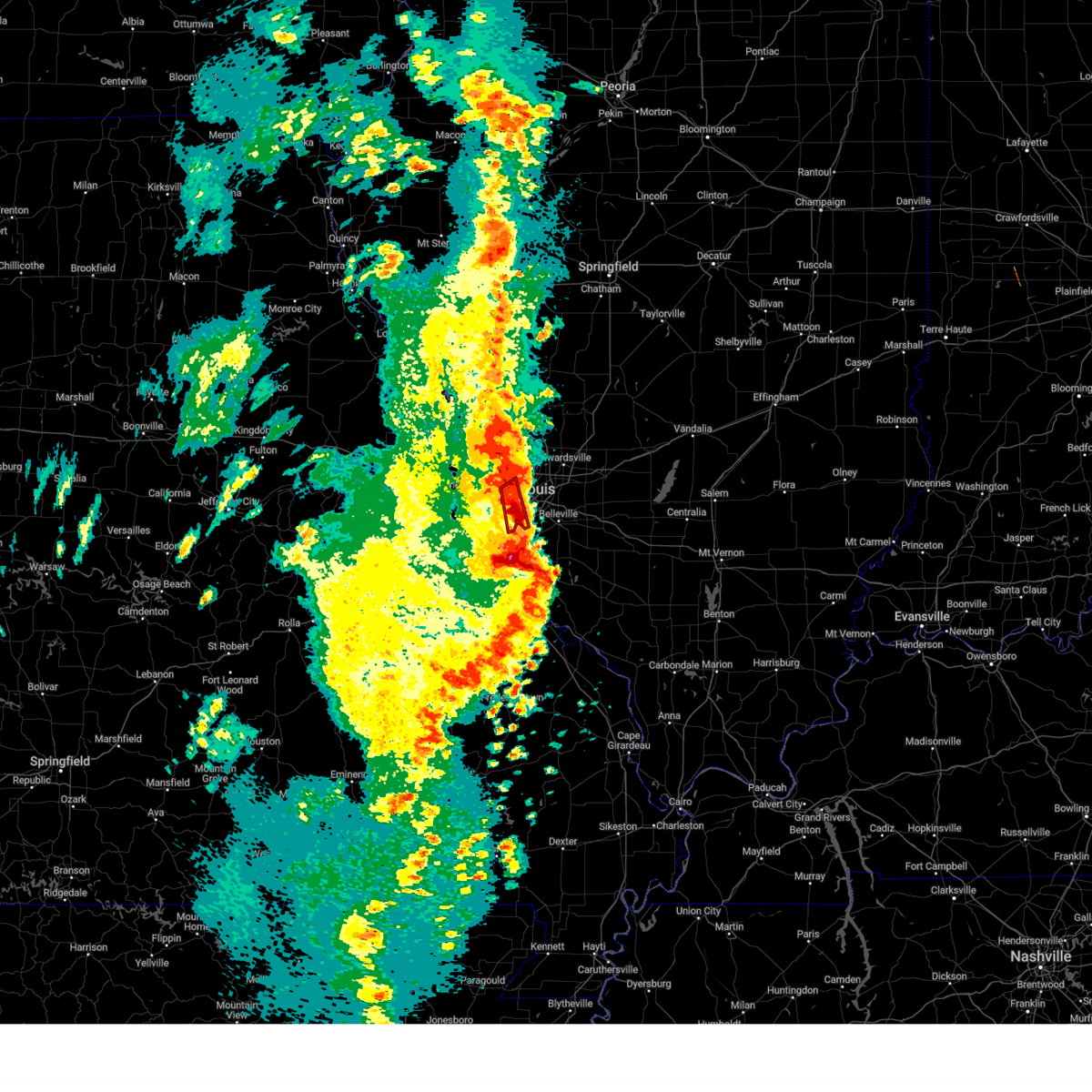 The tornado warning for west central st. clair and south central st. louis counties and southwestern st. louis city will expire at 700 pm cdt, the storm which prompted the warning has moved out of the area. therefore, the warning will be allowed to expire. a tornado watch remains in effect until 1000 pm cdt for southwestern illinois, and east central missouri. The tornado warning for west central st. clair and south central st. louis counties and southwestern st. louis city will expire at 700 pm cdt, the storm which prompted the warning has moved out of the area. therefore, the warning will be allowed to expire. a tornado watch remains in effect until 1000 pm cdt for southwestern illinois, and east central missouri.
|
| 4/15/2023 6:45 PM CDT |
 At 644 pm cdt, a severe thunderstorm was located over warson woods, moving northeast at 25 mph (radar indicated). Hazards include 60 mph wind gusts and quarter size hail. Hail damage to vehicles is expected. expect wind damage to roofs, siding, and trees. locations impacted include, chesterfield, university city, kirkwood, maryland heights, webster groves, creve coeur, overland, clayton, st. ann, crestwood, bridgeton, town and country, richmond heights, ladue, sunset hills, des peres, brentwood, maplewood, olivette, and shrewsbury. this includes interstate 44 in missouri between exits 276 and 277. hail threat, radar indicated max hail size, 1. 00 in wind threat, radar indicated max wind gust, 60 mph. At 644 pm cdt, a severe thunderstorm was located over warson woods, moving northeast at 25 mph (radar indicated). Hazards include 60 mph wind gusts and quarter size hail. Hail damage to vehicles is expected. expect wind damage to roofs, siding, and trees. locations impacted include, chesterfield, university city, kirkwood, maryland heights, webster groves, creve coeur, overland, clayton, st. ann, crestwood, bridgeton, town and country, richmond heights, ladue, sunset hills, des peres, brentwood, maplewood, olivette, and shrewsbury. this includes interstate 44 in missouri between exits 276 and 277. hail threat, radar indicated max hail size, 1. 00 in wind threat, radar indicated max wind gust, 60 mph.
|
| 4/15/2023 6:43 PM CDT |
 At 643 pm cdt, a severe thunderstorm capable of producing a tornado was located near new design, moving northeast at 60 mph (radar indicated rotation). Hazards include tornado and quarter size hail. Flying debris will be dangerous to those caught without shelter. mobile homes will be damaged or destroyed. damage to roofs, windows, and vehicles will occur. tree damage is likely. this dangerous storm will be near, red bud around 650 pm cdt. other locations in the path of this tornadic thunderstorm include new athens. This includes interstate 64 in illinois between exits 23 and 27. At 643 pm cdt, a severe thunderstorm capable of producing a tornado was located near new design, moving northeast at 60 mph (radar indicated rotation). Hazards include tornado and quarter size hail. Flying debris will be dangerous to those caught without shelter. mobile homes will be damaged or destroyed. damage to roofs, windows, and vehicles will occur. tree damage is likely. this dangerous storm will be near, red bud around 650 pm cdt. other locations in the path of this tornadic thunderstorm include new athens. This includes interstate 64 in illinois between exits 23 and 27.
|
| 4/15/2023 6:42 PM CDT |
 At 641 pm cdt, a severe thunderstorm capable of producing a tornado was located over marlborough, moving northeast at 20 mph (radar indicated rotation). Hazards include tornado and quarter size hail. Flying debris will be dangerous to those caught without shelter. mobile homes will be damaged or destroyed. damage to roofs, windows, and vehicles will occur. tree damage is likely. this dangerous storm will be near, st. louis, webster groves, richmond heights, brentwood, maplewood, shrewsbury, affton, mehlville, lemay, and marlborough around 645 pm cdt. Clayton and cahokia around 650 pm cdt. At 641 pm cdt, a severe thunderstorm capable of producing a tornado was located over marlborough, moving northeast at 20 mph (radar indicated rotation). Hazards include tornado and quarter size hail. Flying debris will be dangerous to those caught without shelter. mobile homes will be damaged or destroyed. damage to roofs, windows, and vehicles will occur. tree damage is likely. this dangerous storm will be near, st. louis, webster groves, richmond heights, brentwood, maplewood, shrewsbury, affton, mehlville, lemay, and marlborough around 645 pm cdt. Clayton and cahokia around 650 pm cdt.
|
| 4/15/2023 6:39 PM CDT |
 At 639 pm cdt, a severe thunderstorm capable of producing a tornado was located over maplewood, moving northeast at 40 mph (radar indicated rotation). Hazards include tornado and quarter size hail. Flying debris will be dangerous to those caught without shelter. mobile homes will be damaged or destroyed. damage to roofs, windows, and vehicles will occur. tree damage is likely. this dangerous storm will be near, st. louis, granite city, east st. louis, cahokia, madison, venice, fairmont city, wellston, and brooklyn around 645 pm cdt. collinsville, pontoon beach, and washington park around 650 pm cdt. caseyville around 655 pm cdt. other locations in the path of this tornadic thunderstorm include edwardsville, glen carbon, maryville and troy. this also includes scott joplin historic site and horseshoe lake state park. this includes the following highways, interstate 55 in illinois near exit 23. Interstate 64 in illinois between exits 9 and 19. At 639 pm cdt, a severe thunderstorm capable of producing a tornado was located over maplewood, moving northeast at 40 mph (radar indicated rotation). Hazards include tornado and quarter size hail. Flying debris will be dangerous to those caught without shelter. mobile homes will be damaged or destroyed. damage to roofs, windows, and vehicles will occur. tree damage is likely. this dangerous storm will be near, st. louis, granite city, east st. louis, cahokia, madison, venice, fairmont city, wellston, and brooklyn around 645 pm cdt. collinsville, pontoon beach, and washington park around 650 pm cdt. caseyville around 655 pm cdt. other locations in the path of this tornadic thunderstorm include edwardsville, glen carbon, maryville and troy. this also includes scott joplin historic site and horseshoe lake state park. this includes the following highways, interstate 55 in illinois near exit 23. Interstate 64 in illinois between exits 9 and 19.
|
| 4/15/2023 6:34 PM CDT |
 At 634 pm cdt, a severe thunderstorm capable of producing a tornado was located near crystal city, moving northeast at 60 mph (radar indicated rotation). Hazards include tornado. Flying debris will be dangerous to those caught without shelter. mobile homes will be damaged or destroyed. damage to roofs, windows, and vehicles will occur. tree damage is likely. this dangerous storm will be near, new design around 645 pm cdt. red bud around 650 pm cdt. other locations in the path of this tornadic thunderstorm include new athens. this also includes gov. dunklin`s grave historic site. this includes the following highways, interstate 64 in illinois between exits 23 and 27. Interstate 55 in missouri between exits 170 and 187. At 634 pm cdt, a severe thunderstorm capable of producing a tornado was located near crystal city, moving northeast at 60 mph (radar indicated rotation). Hazards include tornado. Flying debris will be dangerous to those caught without shelter. mobile homes will be damaged or destroyed. damage to roofs, windows, and vehicles will occur. tree damage is likely. this dangerous storm will be near, new design around 645 pm cdt. red bud around 650 pm cdt. other locations in the path of this tornadic thunderstorm include new athens. this also includes gov. dunklin`s grave historic site. this includes the following highways, interstate 64 in illinois between exits 23 and 27. Interstate 55 in missouri between exits 170 and 187.
|
| 4/15/2023 6:31 PM CDT |
 At 630 pm cdt, a confirmed tornado was located over sunset hills, moving east at 25 mph (radar confirmed tornado. one circulation is evident near kirkwood, missouri and another is evident near sunset hills, missouri). Hazards include damaging tornado and quarter size hail. Flying debris will be dangerous to those caught without shelter. mobile homes will be damaged or destroyed. damage to roofs, windows, and vehicles will occur. tree damage is likely. this tornado will be near, st. louis, webster groves, crestwood, sunset hills, shrewsbury, glendale, lakeshire, oakland, affton, and mehlville around 635 pm cdt. east carondelet around 640 pm cdt. other locations in the path of this tornadic thunderstorm include cahokia, dupo and columbia. This includes interstate 44 in missouri between exits 276 and 277. At 630 pm cdt, a confirmed tornado was located over sunset hills, moving east at 25 mph (radar confirmed tornado. one circulation is evident near kirkwood, missouri and another is evident near sunset hills, missouri). Hazards include damaging tornado and quarter size hail. Flying debris will be dangerous to those caught without shelter. mobile homes will be damaged or destroyed. damage to roofs, windows, and vehicles will occur. tree damage is likely. this tornado will be near, st. louis, webster groves, crestwood, sunset hills, shrewsbury, glendale, lakeshire, oakland, affton, and mehlville around 635 pm cdt. east carondelet around 640 pm cdt. other locations in the path of this tornadic thunderstorm include cahokia, dupo and columbia. This includes interstate 44 in missouri between exits 276 and 277.
|
| 4/15/2023 6:27 PM CDT |
 At 626 pm cdt, severe thunderstorms were located along a line extending from sunset hills to near olympian village, moving east at 45 mph (radar indicated). Hazards include 60 mph wind gusts and quarter size hail. Hail damage to vehicles is expected. Expect wind damage to roofs, siding, and trees. At 626 pm cdt, severe thunderstorms were located along a line extending from sunset hills to near olympian village, moving east at 45 mph (radar indicated). Hazards include 60 mph wind gusts and quarter size hail. Hail damage to vehicles is expected. Expect wind damage to roofs, siding, and trees.
|
| 4/15/2023 6:23 PM CDT |
 At 623 pm cdt, a confirmed tornado was located over valley park, moving northeast at 20 mph (radar confirmed tornado). Hazards include damaging tornado and quarter size hail. Flying debris will be dangerous to those caught without shelter. mobile homes will be damaged or destroyed. damage to roofs, windows, and vehicles will occur. tree damage is likely. this tornado will be near, kirkwood, webster groves, crestwood, town and country, ladue, sunset hills, des peres, glendale, frontenac, and warson woods around 630 pm cdt. st. louis, richmond heights, brentwood, maplewood, shrewsbury, lakeshire, and mackenzie around 635 pm cdt. other locations in the path of this tornadic thunderstorm include clayton, green park, wilbur park, university city, lemay, wellston and pagedale. This includes interstate 44 in missouri between exits 272 and 277. At 623 pm cdt, a confirmed tornado was located over valley park, moving northeast at 20 mph (radar confirmed tornado). Hazards include damaging tornado and quarter size hail. Flying debris will be dangerous to those caught without shelter. mobile homes will be damaged or destroyed. damage to roofs, windows, and vehicles will occur. tree damage is likely. this tornado will be near, kirkwood, webster groves, crestwood, town and country, ladue, sunset hills, des peres, glendale, frontenac, and warson woods around 630 pm cdt. st. louis, richmond heights, brentwood, maplewood, shrewsbury, lakeshire, and mackenzie around 635 pm cdt. other locations in the path of this tornadic thunderstorm include clayton, green park, wilbur park, university city, lemay, wellston and pagedale. This includes interstate 44 in missouri between exits 272 and 277.
|
| 4/15/2023 6:19 PM CDT |
 At 618 pm cdt, a severe thunderstorm capable of producing a tornado was located over valley park, moving northeast at 20 mph (radar indicated rotation). Hazards include tornado and quarter size hail. Flying debris will be dangerous to those caught without shelter. mobile homes will be damaged or destroyed. damage to roofs, windows, and vehicles will occur. tree damage is likely. this dangerous storm will be near, kirkwood, manchester, crestwood, town and country, sunset hills, des peres, valley park, glendale, fenton, and frontenac around 625 pm cdt. webster groves, ladue, warson woods, affton, rock hill, marlborough, grantwood village, crystal lake park, huntleigh, and concord around 630 pm cdt. brentwood, maplewood, shrewsbury, lakeshire, and green park around 635 pm cdt. other locations in the path of this tornadic thunderstorm include st. louis, clayton, richmond heights, st. george, wilbur park, mackenzie, university city, lemay and wellston. this also includes castlewood state park. This includes interstate 44 in missouri between exits 266 and 277. At 618 pm cdt, a severe thunderstorm capable of producing a tornado was located over valley park, moving northeast at 20 mph (radar indicated rotation). Hazards include tornado and quarter size hail. Flying debris will be dangerous to those caught without shelter. mobile homes will be damaged or destroyed. damage to roofs, windows, and vehicles will occur. tree damage is likely. this dangerous storm will be near, kirkwood, manchester, crestwood, town and country, sunset hills, des peres, valley park, glendale, fenton, and frontenac around 625 pm cdt. webster groves, ladue, warson woods, affton, rock hill, marlborough, grantwood village, crystal lake park, huntleigh, and concord around 630 pm cdt. brentwood, maplewood, shrewsbury, lakeshire, and green park around 635 pm cdt. other locations in the path of this tornadic thunderstorm include st. louis, clayton, richmond heights, st. george, wilbur park, mackenzie, university city, lemay and wellston. this also includes castlewood state park. This includes interstate 44 in missouri between exits 266 and 277.
|
| 4/15/2023 6:11 PM CDT |
 At 610 pm cdt, a severe thunderstorm was located over eureka, moving northeast at 25 mph (at 612 pm, trained weather spotters reported half dollar sized hail in ballwin, missouri). Hazards include half dollar size hail. damage to vehicles is expected At 610 pm cdt, a severe thunderstorm was located over eureka, moving northeast at 25 mph (at 612 pm, trained weather spotters reported half dollar sized hail in ballwin, missouri). Hazards include half dollar size hail. damage to vehicles is expected
|
| 4/5/2023 8:12 AM CDT |
 At 812 am cdt, severe thunderstorms were located along a line extending from dupo to near fountain to near crystal city, moving east at 60 mph (radar indicated). Hazards include 60 mph wind gusts and penny size hail. Expect damage to roofs, siding, and trees. these severe storms will be near, cahokia, waterloo, centreville, millstadt, cahokia parks airport and alorton around 815 am cdt. east st. louis and fairview heights around 820 am cdt. other locations in the path of these severe thunderstorms include belleville, swansea, shiloh, freeburg, smithton, new design, mascoutah, lebanon, red bud, scott afb, new athens, new baden and marissa. This includes interstate 64 in illinois between exits 14 and 27. At 812 am cdt, severe thunderstorms were located along a line extending from dupo to near fountain to near crystal city, moving east at 60 mph (radar indicated). Hazards include 60 mph wind gusts and penny size hail. Expect damage to roofs, siding, and trees. these severe storms will be near, cahokia, waterloo, centreville, millstadt, cahokia parks airport and alorton around 815 am cdt. east st. louis and fairview heights around 820 am cdt. other locations in the path of these severe thunderstorms include belleville, swansea, shiloh, freeburg, smithton, new design, mascoutah, lebanon, red bud, scott afb, new athens, new baden and marissa. This includes interstate 64 in illinois between exits 14 and 27.
|
| 4/5/2023 8:00 AM CDT |
 At 800 am cdt, severe thunderstorms were located along a line extending from mehlville to barnhart to near hillsboro, moving east at 60 mph (radar indicated). Hazards include 60 mph wind gusts and penny size hail. Expect damage to roofs, siding, and trees. severe thunderstorms will be near, columbia, lemay, oakville, mehlville, affton, st. george, valmeyer, bella villa, east carondelet and wilbur park around 805 am cdt. cahokia, centreville, dupo, millstadt, cahokia parks airport and alorton around 810 am cdt. east st. louis, fairview heights and waterloo around 815 am cdt. belleville, swansea, shiloh, smithton and new design around 820 am cdt. other locations in the path of these severe thunderstorms include o`fallon, mascoutah, freeburg, red bud, scott afb, lebanon, new baden, new athens and marissa. this includes the following highways, interstate 64 in illinois between exits 14 and 27. interstate 55 in missouri between exits 178 and 191. this also includes mastodon historic site and gov. Dunklin`s grave historic site. At 800 am cdt, severe thunderstorms were located along a line extending from mehlville to barnhart to near hillsboro, moving east at 60 mph (radar indicated). Hazards include 60 mph wind gusts and penny size hail. Expect damage to roofs, siding, and trees. severe thunderstorms will be near, columbia, lemay, oakville, mehlville, affton, st. george, valmeyer, bella villa, east carondelet and wilbur park around 805 am cdt. cahokia, centreville, dupo, millstadt, cahokia parks airport and alorton around 810 am cdt. east st. louis, fairview heights and waterloo around 815 am cdt. belleville, swansea, shiloh, smithton and new design around 820 am cdt. other locations in the path of these severe thunderstorms include o`fallon, mascoutah, freeburg, red bud, scott afb, lebanon, new baden, new athens and marissa. this includes the following highways, interstate 64 in illinois between exits 14 and 27. interstate 55 in missouri between exits 178 and 191. this also includes mastodon historic site and gov. Dunklin`s grave historic site.
|
| 2/16/2023 3:25 AM CST |
 The severe thunderstorm warning for west central monroe county will expire at 330 am cst, the storm which prompted the warning has weakened below severe limits, and has exited the warned area. therefore, the warning will be allowed to expire. The severe thunderstorm warning for west central monroe county will expire at 330 am cst, the storm which prompted the warning has weakened below severe limits, and has exited the warned area. therefore, the warning will be allowed to expire.
|
| 2/16/2023 3:18 AM CST |
 At 317 am cst, a severe thunderstorm was located over valmeyer, moving north at 45 mph (public). Hazards include 60 mph wind gusts and quarter size hail. Hail damage to vehicles is expected. expect wind damage to roofs, siding, and trees. locations impacted include, waterloo, pevely, oakville, valmeyer, fountain, imperial, foster pond and madonnaville. hail threat, observed max hail size, 1. 00 in wind threat, radar indicated max wind gust, 60 mph. At 317 am cst, a severe thunderstorm was located over valmeyer, moving north at 45 mph (public). Hazards include 60 mph wind gusts and quarter size hail. Hail damage to vehicles is expected. expect wind damage to roofs, siding, and trees. locations impacted include, waterloo, pevely, oakville, valmeyer, fountain, imperial, foster pond and madonnaville. hail threat, observed max hail size, 1. 00 in wind threat, radar indicated max wind gust, 60 mph.
|
| 2/16/2023 3:04 AM CST |
 At 303 am cst, a severe thunderstorm was located over crystal city, moving northeast at 45 mph (public). Hazards include 60 mph wind gusts and quarter size hail. Hail damage to vehicles is expected. expect wind damage to roofs, siding, and trees. locations impacted include, arnold, festus, waterloo, pevely, crystal city, herculaneum, barnhart, oakville, valmeyer, fountain, horine, imperial, kimmswick, maeystown, madonnaville, chalfin bridge, wartburg, burksville, monroe city and foster pond. this also includes mastodon historic site and gov. dunklin`s grave historic site. this includes interstate 55 in missouri between exits 170 and 187. hail threat, observed max hail size, 1. 00 in wind threat, radar indicated max wind gust, 60 mph. At 303 am cst, a severe thunderstorm was located over crystal city, moving northeast at 45 mph (public). Hazards include 60 mph wind gusts and quarter size hail. Hail damage to vehicles is expected. expect wind damage to roofs, siding, and trees. locations impacted include, arnold, festus, waterloo, pevely, crystal city, herculaneum, barnhart, oakville, valmeyer, fountain, horine, imperial, kimmswick, maeystown, madonnaville, chalfin bridge, wartburg, burksville, monroe city and foster pond. this also includes mastodon historic site and gov. dunklin`s grave historic site. this includes interstate 55 in missouri between exits 170 and 187. hail threat, observed max hail size, 1. 00 in wind threat, radar indicated max wind gust, 60 mph.
|
| 2/16/2023 2:54 AM CST |
 At 253 am cst, a severe thunderstorm was located near olympian village, moving northeast at 45 mph (public). Hazards include 60 mph wind gusts and quarter size hail. Hail damage to vehicles is expected. expect wind damage to roofs, siding, and trees. locations impacted include, festus, pevely, crystal city, herculaneum, horine, barnhart, valmeyer, fountain, imperial, waterloo and oakville. this also includes mastodon historic site and gov. dunklin`s grave historic site. this includes interstate 55 in missouri between exits 170 and 187. hail threat, observed max hail size, 1. 00 in wind threat, radar indicated max wind gust, 60 mph. At 253 am cst, a severe thunderstorm was located near olympian village, moving northeast at 45 mph (public). Hazards include 60 mph wind gusts and quarter size hail. Hail damage to vehicles is expected. expect wind damage to roofs, siding, and trees. locations impacted include, festus, pevely, crystal city, herculaneum, horine, barnhart, valmeyer, fountain, imperial, waterloo and oakville. this also includes mastodon historic site and gov. dunklin`s grave historic site. this includes interstate 55 in missouri between exits 170 and 187. hail threat, observed max hail size, 1. 00 in wind threat, radar indicated max wind gust, 60 mph.
|
| 2/16/2023 2:44 AM CST |
 At 244 am cst, a severe thunderstorm was located near bonne terre, moving northeast at 45 mph (public). Hazards include 60 mph wind gusts and quarter size hail. Hail damage to vehicles is expected. expect wind damage to roofs, siding, and trees. this severe thunderstorm will be near, olympian village around 255 am cst. other locations in the path of this severe thunderstorm include festus, pevely, crystal city, herculaneum, horine, barnhart, valmeyer, fountain, imperial, waterloo and oakville. this includes interstate 55 in missouri between exits 162 and 187. this also includes st. francois state park, mastodon historic site, and gov. dunklin`s grave historic site. hail threat, observed max hail size, 1. 00 in wind threat, radar indicated max wind gust, 60 mph. At 244 am cst, a severe thunderstorm was located near bonne terre, moving northeast at 45 mph (public). Hazards include 60 mph wind gusts and quarter size hail. Hail damage to vehicles is expected. expect wind damage to roofs, siding, and trees. this severe thunderstorm will be near, olympian village around 255 am cst. other locations in the path of this severe thunderstorm include festus, pevely, crystal city, herculaneum, horine, barnhart, valmeyer, fountain, imperial, waterloo and oakville. this includes interstate 55 in missouri between exits 162 and 187. this also includes st. francois state park, mastodon historic site, and gov. dunklin`s grave historic site. hail threat, observed max hail size, 1. 00 in wind threat, radar indicated max wind gust, 60 mph.
|
| 8/25/2022 8:40 PM CDT | The severe thunderstorm warning for north central jefferson and south central st. louis counties and southwestern st. louis city will expire at 845 pm cdt, the storm which prompted the warning has weakened below severe limits, and no longer poses an immediate threat to life or property. therefore, the warning will be allowed to expire. |
| 8/25/2022 8:24 PM CDT | At 824 pm cdt, a severe thunderstorm was located over sappington, moving southeast at 10 mph (radar indicated). Hazards include 60 mph wind gusts and penny size hail. Expect damage to roofs, siding, and trees. locations impacted include, lakeshire, affton, green park, wilbur park, concord, mehlville, lemay, st. george, arnold, bella villa and oakville. this includes the following highways, interstate 44 in missouri between exits 274 and 277. interstate 55 in missouri between exits 190 and 191. hail threat, radar indicated max hail size, 0. 75 in wind threat, radar indicated max wind gust, 60 mph. |
| 8/25/2022 8:06 PM CDT | At 806 pm cdt, a severe thunderstorm was located over kirkwood, moving southeast at 15 mph (radar indicated). Hazards include 60 mph wind gusts and penny size hail. Expect damage to roofs, siding, and trees. this severe thunderstorm will be near, webster groves, crestwood, richmond heights, sunset hills, brentwood, maplewood and oakland around 810 pm cdt. shrewsbury around 815 pm cdt. affton, marlborough, grantwood village, mackenzie and sappington around 820 pm cdt. lakeshire, green park and concord around 825 pm cdt. other locations in the path of this severe thunderstorm include mehlville, st. george, wilbur park, arnold, lemay, bella villa and oakville. this includes the following highways, interstate 44 in missouri between exits 272 and 277. interstate 55 in missouri between exits 190 and 191. hail threat, radar indicated max hail size, 0. 75 in wind threat, radar indicated max wind gust, 60 mph. |
| 8/3/2022 10:57 PM CDT |
 The severe thunderstorm warning for north central monroe, northwestern st. clair and south central st. louis counties and st. louis city will expire at 1100 pm cdt, the storm which prompted the warning has weakened below severe limits, and no longer poses an immediate threat to life or property. therefore, the warning will be allowed to expire. The severe thunderstorm warning for north central monroe, northwestern st. clair and south central st. louis counties and st. louis city will expire at 1100 pm cdt, the storm which prompted the warning has weakened below severe limits, and no longer poses an immediate threat to life or property. therefore, the warning will be allowed to expire.
|
| 8/3/2022 10:37 PM CDT |
 At 1037 pm cdt, a severe thunderstorm was located over mackenzie, moving east at 20 mph (radar indicated). Hazards include 60 mph wind gusts. Expect damage to roofs, siding, and trees. this severe storm will be near, lemay and bella villa around 1040 pm cdt. other locations in the path of this severe thunderstorm include east carondelet, columbia, dupo, brooklyn, cahokia, cahokia parks airport, centreville, fairmont city, alorton, washington park and east st. louis. this also includes scott joplin historic site. hail threat, radar indicated max hail size, <. 75 in wind threat, radar indicated max wind gust, 60 mph. At 1037 pm cdt, a severe thunderstorm was located over mackenzie, moving east at 20 mph (radar indicated). Hazards include 60 mph wind gusts. Expect damage to roofs, siding, and trees. this severe storm will be near, lemay and bella villa around 1040 pm cdt. other locations in the path of this severe thunderstorm include east carondelet, columbia, dupo, brooklyn, cahokia, cahokia parks airport, centreville, fairmont city, alorton, washington park and east st. louis. this also includes scott joplin historic site. hail threat, radar indicated max hail size, <. 75 in wind threat, radar indicated max wind gust, 60 mph.
|
| 8/3/2022 10:20 PM CDT |
 At 1020 pm cdt, a severe thunderstorm was located over kirkwood, moving east at 20 mph (radar indicated). Hazards include 60 mph wind gusts. Expect damage to roofs, siding, and trees. this severe thunderstorm will be near, crestwood, ladue, olivette, glendale and oakland around 1025 pm cdt. university city, webster groves, clayton, richmond heights, brentwood, rock hill, grantwood village, concord and sappington around 1030 pm cdt. maplewood, shrewsbury, lakeshire, affton, pagedale, green park, marlborough and mackenzie around 1035 pm cdt. lemay, mehlville, oakville, st. george, bella villa and wilbur park around 1040 pm cdt. other locations in the path of this severe thunderstorm include east carondelet, columbia, dupo, brooklyn, east st. louis, cahokia, centreville, washington park, cahokia parks airport, fairmont city and alorton. this includes interstate 44 in missouri between exits 272 and 277. this also includes scott joplin historic site. hail threat, radar indicated max hail size, <. 75 in wind threat, radar indicated max wind gust, 60 mph. At 1020 pm cdt, a severe thunderstorm was located over kirkwood, moving east at 20 mph (radar indicated). Hazards include 60 mph wind gusts. Expect damage to roofs, siding, and trees. this severe thunderstorm will be near, crestwood, ladue, olivette, glendale and oakland around 1025 pm cdt. university city, webster groves, clayton, richmond heights, brentwood, rock hill, grantwood village, concord and sappington around 1030 pm cdt. maplewood, shrewsbury, lakeshire, affton, pagedale, green park, marlborough and mackenzie around 1035 pm cdt. lemay, mehlville, oakville, st. george, bella villa and wilbur park around 1040 pm cdt. other locations in the path of this severe thunderstorm include east carondelet, columbia, dupo, brooklyn, east st. louis, cahokia, centreville, washington park, cahokia parks airport, fairmont city and alorton. this includes interstate 44 in missouri between exits 272 and 277. this also includes scott joplin historic site. hail threat, radar indicated max hail size, <. 75 in wind threat, radar indicated max wind gust, 60 mph.
|
| 6/17/2022 5:37 AM CDT |
 The severe thunderstorm warning for central madison, eastern macoupin counties in southwestern illinois and st. louis counties in east central missouri and st. louis city will expire at 545 am cdt, the storms which prompted the warning have moved out of the area. therefore, the warning will be allowed to expire. a severe thunderstorm watch remains in effect until 800 am cdt for south central and southwestern illinois, and east central missouri. The severe thunderstorm warning for central madison, eastern macoupin counties in southwestern illinois and st. louis counties in east central missouri and st. louis city will expire at 545 am cdt, the storms which prompted the warning have moved out of the area. therefore, the warning will be allowed to expire. a severe thunderstorm watch remains in effect until 800 am cdt for south central and southwestern illinois, and east central missouri.
|
| 6/17/2022 5:27 AM CDT |
 At 526 am cdt, severe thunderstorms were located along a line extending from near girard to near carlinville to shipman to west alton, moving east at 40 mph (trained weather spotters). Hazards include 60 mph wind gusts. Expect damage to roofs, siding, and trees. locations impacted include, st. louis, florissant, chesterfield, wildwood, university city, ballwin, granite city, alton, kirkwood, maryland heights, hazelwood, collinsville, edwardsville, webster groves, ferguson, arnold, manchester, creve coeur, overland and clayton. this also includes babler memorial state park, scott joplin historic site, route 66 state park, castlewood state park, confluence state park, and horseshoe lake state park. this includes the following highways, interstate 55 in illinois between exits 23 and 44. interstate 44 in missouri between exits 261 and 277. hail threat, radar indicated max hail size, <. 75 in wind threat, radar indicated max wind gust, 60 mph. At 526 am cdt, severe thunderstorms were located along a line extending from near girard to near carlinville to shipman to west alton, moving east at 40 mph (trained weather spotters). Hazards include 60 mph wind gusts. Expect damage to roofs, siding, and trees. locations impacted include, st. louis, florissant, chesterfield, wildwood, university city, ballwin, granite city, alton, kirkwood, maryland heights, hazelwood, collinsville, edwardsville, webster groves, ferguson, arnold, manchester, creve coeur, overland and clayton. this also includes babler memorial state park, scott joplin historic site, route 66 state park, castlewood state park, confluence state park, and horseshoe lake state park. this includes the following highways, interstate 55 in illinois between exits 23 and 44. interstate 44 in missouri between exits 261 and 277. hail threat, radar indicated max hail size, <. 75 in wind threat, radar indicated max wind gust, 60 mph.
|
| 6/17/2022 5:14 AM CDT |
 At 513 am cdt, severe thunderstorms were located along a line extending from near palmyra to 6 miles northwest of carlinville to near jerseyville to near portage des sioux, moving east at 40 mph (the automated station at lambert field reported a wind gust of 60 mph at 957 am). Hazards include 60 mph wind gusts. Expect damage to roofs, siding, and trees. locations impacted include, carlinville, palmyra, virden, girard, alton, wood river, east alton, bunker hill, hartford, bethalto, south roxana, roxana, rosewood heights, staunton, gillespie, wilsonville, mount clare, east gillespie, dorsey, edwardsville, benld, sawyerville, eagarville, prairietown, glen carbon, mount olive, carpenter and worden. this also includes babler memorial state park, scott joplin historic site, route 66 state park, castlewood state park, confluence state park, beaver dam state park, and horseshoe lake state park. this includes the following highways, interstate 55 in illinois between exits 23 and 44. interstate 44 in missouri between exits 261 and 277. interstate 70 in missouri between exits 229 and 231. hail threat, radar indicated max hail size, <. 75 in wind threat, radar indicated max wind gust, 60 mph. At 513 am cdt, severe thunderstorms were located along a line extending from near palmyra to 6 miles northwest of carlinville to near jerseyville to near portage des sioux, moving east at 40 mph (the automated station at lambert field reported a wind gust of 60 mph at 957 am). Hazards include 60 mph wind gusts. Expect damage to roofs, siding, and trees. locations impacted include, carlinville, palmyra, virden, girard, alton, wood river, east alton, bunker hill, hartford, bethalto, south roxana, roxana, rosewood heights, staunton, gillespie, wilsonville, mount clare, east gillespie, dorsey, edwardsville, benld, sawyerville, eagarville, prairietown, glen carbon, mount olive, carpenter and worden. this also includes babler memorial state park, scott joplin historic site, route 66 state park, castlewood state park, confluence state park, beaver dam state park, and horseshoe lake state park. this includes the following highways, interstate 55 in illinois between exits 23 and 44. interstate 44 in missouri between exits 261 and 277. interstate 70 in missouri between exits 229 and 231. hail threat, radar indicated max hail size, <. 75 in wind threat, radar indicated max wind gust, 60 mph.
|
| 6/17/2022 5:07 AM CDT |
 At 507 am cdt, severe thunderstorms were located along a line extending from near south roxana to st. louis to pacific, moving east at 35 mph (trained weather spotters). Hazards include 60 mph wind gusts and penny size hail. Expect damage to roofs, siding, and trees. severe thunderstorms will be near, granite city, cahokia, pontoon beach, dupo, madison, venice, cahokia parks airport, lemay, brooklyn and east carondelet around 515 am cdt. edwardsville, maryville, centreville, fairmont city and alorton around 520 am cdt. east st. louis, glen carbon, troy and washington park around 525 am cdt. other locations in the path of these severe thunderstorms include collinsville, fairview heights, caseyville, high ridge, belleville, swansea, shiloh, fenton, murphy, antonia, st. jacob, marine, o`fallon, arnold, barnhart, highland, lebanon, lakeshire, scott afb, green park, imperial, sappington, concord, oakville, mehlville, st. george, valmeyer, bella villa and fountain. this includes the following highways, interstate 70 in illinois between exits 21 and 30. interstate 55 in illinois near exit 23. interstate 64 in illinois between exits 9 and 27. interstate 44 in missouri between exits 251 and 277. interstate 55 in missouri between exits 178 and 191. this also includes route 66 state park, castlewood state park, mastodon historic site, sandy creek covered bridge historic site, gov. dunklin`s grave historic site, robertsville state park, and horseshoe lake state park. hail threat, radar indicated max hail size, 0. 75 in wind threat, radar indicated max wind gust, 60 mph. At 507 am cdt, severe thunderstorms were located along a line extending from near south roxana to st. louis to pacific, moving east at 35 mph (trained weather spotters). Hazards include 60 mph wind gusts and penny size hail. Expect damage to roofs, siding, and trees. severe thunderstorms will be near, granite city, cahokia, pontoon beach, dupo, madison, venice, cahokia parks airport, lemay, brooklyn and east carondelet around 515 am cdt. edwardsville, maryville, centreville, fairmont city and alorton around 520 am cdt. east st. louis, glen carbon, troy and washington park around 525 am cdt. other locations in the path of these severe thunderstorms include collinsville, fairview heights, caseyville, high ridge, belleville, swansea, shiloh, fenton, murphy, antonia, st. jacob, marine, o`fallon, arnold, barnhart, highland, lebanon, lakeshire, scott afb, green park, imperial, sappington, concord, oakville, mehlville, st. george, valmeyer, bella villa and fountain. this includes the following highways, interstate 70 in illinois between exits 21 and 30. interstate 55 in illinois near exit 23. interstate 64 in illinois between exits 9 and 27. interstate 44 in missouri between exits 251 and 277. interstate 55 in missouri between exits 178 and 191. this also includes route 66 state park, castlewood state park, mastodon historic site, sandy creek covered bridge historic site, gov. dunklin`s grave historic site, robertsville state park, and horseshoe lake state park. hail threat, radar indicated max hail size, 0. 75 in wind threat, radar indicated max wind gust, 60 mph.
|
| 6/17/2022 4:56 AM CDT |
 At 455 am cdt, severe thunderstorms were located along a line extending from near athensville to greenfield to near old kane to 8 miles west of orchard farms, moving east at 40 mph (trained weather spotters reported power outages across several towns and a national weather service employee estimated 60 mph gusts). Hazards include 60 mph wind gusts and penny size hail. Expect damage to roofs, siding, and trees. these severe storms will be near, greenfield around 500 am cdt. grafton around 510 am cdt. other locations in the path of these severe thunderstorms include florissant, hazelwood, berkeley, palmyra, elsah, portage des sioux, kemper, ferguson, carlinville, brighton, calverton park, west alton, bellefontaine neighbors, black jack, spanish lake, castle point, st. louis, godfrey, virden, girard, shipman, glasgow village, alton, wood river, madison, east alton, bunker hill, hartford, bethalto, pontoon beach, south roxana, roxana and rosewood heights. this also includes babler memorial state park, scott joplin historic site, route 66 state park, castlewood state park, confluence state park, first missouri state capitol historic site, beaver dam state park, and horseshoe lake state park. this includes the following highways, interstate 55 in illinois between exits 23 and 44. interstate 44 in missouri between exits 261 and 277. interstate 70 in missouri between exits 216 and 231. hail threat, radar indicated max hail size, 0. 75 in wind threat, radar indicated max wind gust, 60 mph. At 455 am cdt, severe thunderstorms were located along a line extending from near athensville to greenfield to near old kane to 8 miles west of orchard farms, moving east at 40 mph (trained weather spotters reported power outages across several towns and a national weather service employee estimated 60 mph gusts). Hazards include 60 mph wind gusts and penny size hail. Expect damage to roofs, siding, and trees. these severe storms will be near, greenfield around 500 am cdt. grafton around 510 am cdt. other locations in the path of these severe thunderstorms include florissant, hazelwood, berkeley, palmyra, elsah, portage des sioux, kemper, ferguson, carlinville, brighton, calverton park, west alton, bellefontaine neighbors, black jack, spanish lake, castle point, st. louis, godfrey, virden, girard, shipman, glasgow village, alton, wood river, madison, east alton, bunker hill, hartford, bethalto, pontoon beach, south roxana, roxana and rosewood heights. this also includes babler memorial state park, scott joplin historic site, route 66 state park, castlewood state park, confluence state park, first missouri state capitol historic site, beaver dam state park, and horseshoe lake state park. this includes the following highways, interstate 55 in illinois between exits 23 and 44. interstate 44 in missouri between exits 261 and 277. interstate 70 in missouri between exits 216 and 231. hail threat, radar indicated max hail size, 0. 75 in wind threat, radar indicated max wind gust, 60 mph.
|
| 6/17/2022 4:51 AM CDT |
 At 451 am cdt, severe thunderstorms were located along a line extending from near manchester to greenfield to 6 miles southwest of old kane to 6 miles northeast of st. paul, moving east at 40 mph (radar indicated). Hazards include 60 mph wind gusts and penny size hail. Expect damage to roofs, siding, and trees. these severe storms will be near, greenfield and athensville around 455 am cdt. old kane around 500 am cdt. other locations in the path of these severe thunderstorms include jerseyville, grafton, orchard farms, florissant, hazelwood, palmyra, elsah, portage des sioux, kemper, carlinville, brighton, west alton, black jack, spanish lake, godfrey, virden, girard and shipman. this also includes babler memorial state park, scott joplin historic site, route 66 state park, castlewood state park, confluence state park, first missouri state capitol historic site, pere marquette state park, beaver dam state park, and horseshoe lake state park. this includes the following highways, interstate 55 in illinois between exits 23 and 44. interstate 44 in missouri between exits 261 and 277. interstate 70 in missouri between exits 214 and 231. hail threat, radar indicated max hail size, 0. 75 in wind threat, radar indicated max wind gust, 60 mph. At 451 am cdt, severe thunderstorms were located along a line extending from near manchester to greenfield to 6 miles southwest of old kane to 6 miles northeast of st. paul, moving east at 40 mph (radar indicated). Hazards include 60 mph wind gusts and penny size hail. Expect damage to roofs, siding, and trees. these severe storms will be near, greenfield and athensville around 455 am cdt. old kane around 500 am cdt. other locations in the path of these severe thunderstorms include jerseyville, grafton, orchard farms, florissant, hazelwood, palmyra, elsah, portage des sioux, kemper, carlinville, brighton, west alton, black jack, spanish lake, godfrey, virden, girard and shipman. this also includes babler memorial state park, scott joplin historic site, route 66 state park, castlewood state park, confluence state park, first missouri state capitol historic site, pere marquette state park, beaver dam state park, and horseshoe lake state park. this includes the following highways, interstate 55 in illinois between exits 23 and 44. interstate 44 in missouri between exits 261 and 277. interstate 70 in missouri between exits 214 and 231. hail threat, radar indicated max hail size, 0. 75 in wind threat, radar indicated max wind gust, 60 mph.
|
| 6/17/2022 4:40 AM CDT |
 At 440 am cdt, severe thunderstorms were located along a line extending from roodhouse to near carrollton to hardin to near chain of rocks, moving east at 40 mph (radar indicated). Hazards include 60 mph wind gusts and penny size hail. Expect damage to roofs, siding, and trees. severe thunderstorms will be near, carrollton around 445 am cdt. greenfield around 450 am cdt. athensville around 455 am cdt. st. charles, jerseyville and old kane around 500 am cdt. other locations in the path of these severe thunderstorms include orchard farms, bridgeton, grafton, elsah, florissant, hazelwood, berkeley, palmyra, portage des sioux, kemper, ferguson, carlinville, dellwood, brighton, calverton park and west alton. this includes the following highways, interstate 55 in illinois between exits 23 and 44. interstate 44 in missouri between exits 261 and 277. interstate 70 in missouri between exits 208 and 231. this also includes babler memorial state park, scott joplin historic site, route 66 state park, castlewood state park, confluence state park, first missouri state capitol historic site, pere marquette state park, beaver dam state park, and horseshoe lake state park. hail threat, radar indicated max hail size, 0. 75 in wind threat, radar indicated max wind gust, 60 mph. At 440 am cdt, severe thunderstorms were located along a line extending from roodhouse to near carrollton to hardin to near chain of rocks, moving east at 40 mph (radar indicated). Hazards include 60 mph wind gusts and penny size hail. Expect damage to roofs, siding, and trees. severe thunderstorms will be near, carrollton around 445 am cdt. greenfield around 450 am cdt. athensville around 455 am cdt. st. charles, jerseyville and old kane around 500 am cdt. other locations in the path of these severe thunderstorms include orchard farms, bridgeton, grafton, elsah, florissant, hazelwood, berkeley, palmyra, portage des sioux, kemper, ferguson, carlinville, dellwood, brighton, calverton park and west alton. this includes the following highways, interstate 55 in illinois between exits 23 and 44. interstate 44 in missouri between exits 261 and 277. interstate 70 in missouri between exits 208 and 231. this also includes babler memorial state park, scott joplin historic site, route 66 state park, castlewood state park, confluence state park, first missouri state capitol historic site, pere marquette state park, beaver dam state park, and horseshoe lake state park. hail threat, radar indicated max hail size, 0. 75 in wind threat, radar indicated max wind gust, 60 mph.
|
| 5/19/2022 4:59 PM CDT |
 At 459 pm cdt, severe thunderstorms were located along a line extending from weldon spring heights to manchester to mehlville to herculaneum, moving northeast at 50 mph (radar indicated). Hazards include 60 mph wind gusts and penny size hail. Expect damage to roofs, siding, and trees. locations impacted include, webster groves, crestwood, columbia, ladue, glendale, frontenac, warson woods, lakeshire, oakland, lemay, university city, creve coeur, overland, clayton, st. ann, richmond heights, brentwood, maplewood, olivette, st. john, st. charles, maryland heights, ferguson, cahokia, jennings, waterloo, berkeley, centreville, normandy, northwoods, east st. louis, hazelwood, bridgeton, lambert-st. louis international airport, st. louis, millstadt and smithton. this also includes babler memorial state park, scott joplin historic site, route 66 state park, castlewood state park, mastodon historic site, sandy creek covered bridge historic site, gov. dunklin`s grave historic site, and first missouri state capitol historic site. this includes the following highways, interstate 44 in missouri between exits 251 and 277. interstate 55 in missouri between exits 178 and 191. Interstate 70 in missouri between exits 203 and 231. At 459 pm cdt, severe thunderstorms were located along a line extending from weldon spring heights to manchester to mehlville to herculaneum, moving northeast at 50 mph (radar indicated). Hazards include 60 mph wind gusts and penny size hail. Expect damage to roofs, siding, and trees. locations impacted include, webster groves, crestwood, columbia, ladue, glendale, frontenac, warson woods, lakeshire, oakland, lemay, university city, creve coeur, overland, clayton, st. ann, richmond heights, brentwood, maplewood, olivette, st. john, st. charles, maryland heights, ferguson, cahokia, jennings, waterloo, berkeley, centreville, normandy, northwoods, east st. louis, hazelwood, bridgeton, lambert-st. louis international airport, st. louis, millstadt and smithton. this also includes babler memorial state park, scott joplin historic site, route 66 state park, castlewood state park, mastodon historic site, sandy creek covered bridge historic site, gov. dunklin`s grave historic site, and first missouri state capitol historic site. this includes the following highways, interstate 44 in missouri between exits 251 and 277. interstate 55 in missouri between exits 178 and 191. Interstate 70 in missouri between exits 203 and 231.
|
| 5/19/2022 4:38 PM CDT |
 At 437 pm cdt, severe thunderstorms were located along a line extending from near washington to pacific to hillsboro, moving northeast at 50 mph (radar indicated). Hazards include 60 mph wind gusts and penny size hail. Expect damage to roofs, siding, and trees. severe thunderstorms will be near, festus, crystal city and horine around 445 pm cdt. eureka, pevely, herculaneum, antonia and barnhart around 450 pm cdt. wildwood, ballwin, ellisville, clarkson valley, spirit of st. louis airport, valmeyer, new melle, imperial and defiance around 455 pm cdt. other locations in the path of these severe thunderstorms include arnold, manchester, valley park, fenton, winchester, twin oaks, fountain, chesterfield, wentzville, kirkwood, lake st. louis, crestwood, town and country, sunset hills, des peres, glendale, warson woods, o`fallon, st. peters, maryland heights, webster groves, creve coeur, clayton, dardenne prairie, columbia, richmond heights, ladue, university city, overland, cahokia, st. ann, bridgeton, st. john, dupo, woodson terrace, millstadt, bel-ridge, st. charles, hazelwood, ferguson, jennings, berkeley, centreville, normandy, northwoods, cool valley and kinloch. this includes the following highways, interstate 44 in missouri between exits 247 and 277. interstate 55 in missouri between exits 178 and 191. interstate 70 in missouri between exits 199 and 231. this also includes babler memorial state park, scott joplin historic site, route 66 state park, castlewood state park, mastodon historic site, sandy creek covered bridge historic site, gov. Dunklin`s grave historic site, first missouri state capitol historic site, and robertsville state park. At 437 pm cdt, severe thunderstorms were located along a line extending from near washington to pacific to hillsboro, moving northeast at 50 mph (radar indicated). Hazards include 60 mph wind gusts and penny size hail. Expect damage to roofs, siding, and trees. severe thunderstorms will be near, festus, crystal city and horine around 445 pm cdt. eureka, pevely, herculaneum, antonia and barnhart around 450 pm cdt. wildwood, ballwin, ellisville, clarkson valley, spirit of st. louis airport, valmeyer, new melle, imperial and defiance around 455 pm cdt. other locations in the path of these severe thunderstorms include arnold, manchester, valley park, fenton, winchester, twin oaks, fountain, chesterfield, wentzville, kirkwood, lake st. louis, crestwood, town and country, sunset hills, des peres, glendale, warson woods, o`fallon, st. peters, maryland heights, webster groves, creve coeur, clayton, dardenne prairie, columbia, richmond heights, ladue, university city, overland, cahokia, st. ann, bridgeton, st. john, dupo, woodson terrace, millstadt, bel-ridge, st. charles, hazelwood, ferguson, jennings, berkeley, centreville, normandy, northwoods, cool valley and kinloch. this includes the following highways, interstate 44 in missouri between exits 247 and 277. interstate 55 in missouri between exits 178 and 191. interstate 70 in missouri between exits 199 and 231. this also includes babler memorial state park, scott joplin historic site, route 66 state park, castlewood state park, mastodon historic site, sandy creek covered bridge historic site, gov. Dunklin`s grave historic site, first missouri state capitol historic site, and robertsville state park.
|
| 5/19/2022 3:44 PM CDT |
 At 344 pm cdt, a severe thunderstorm was located near hillsboro, moving northeast at 30 mph (radar indicated). Hazards include quarter size hail. Damage to vehicles is expected. this severe thunderstorm will be near, hillsboro around 350 pm cdt. cedar hill lakes and dittmer around 355 pm cdt. cedar hill around 400 pm cdt. other locations in the path of this severe thunderstorm include antonia, house springs, byrnes mill, barnhart, imperial, high ridge, arnold and murphy. this includes interstate 55 in missouri between exits 185 and 191. this also includes mastodon historic site and sandy creek covered bridge historic site. hail threat, radar indicated max hail size, 1. 00 in wind threat, radar indicated max wind gust, <50 mph. At 344 pm cdt, a severe thunderstorm was located near hillsboro, moving northeast at 30 mph (radar indicated). Hazards include quarter size hail. Damage to vehicles is expected. this severe thunderstorm will be near, hillsboro around 350 pm cdt. cedar hill lakes and dittmer around 355 pm cdt. cedar hill around 400 pm cdt. other locations in the path of this severe thunderstorm include antonia, house springs, byrnes mill, barnhart, imperial, high ridge, arnold and murphy. this includes interstate 55 in missouri between exits 185 and 191. this also includes mastodon historic site and sandy creek covered bridge historic site. hail threat, radar indicated max hail size, 1. 00 in wind threat, radar indicated max wind gust, <50 mph.
|
| 5/19/2022 11:37 AM CDT |
 At 1137 am cdt, a severe thunderstorm was located over lemay, moving northeast at 30 mph (radar indicated). Hazards include 60 mph wind gusts and quarter size hail. Hail damage to vehicles is expected. expect wind damage to roofs, siding, and trees. this severe thunderstorm will be near, dupo and east carondelet around 1145 am cdt. millstadt and cahokia parks airport around 1150 am cdt. cahokia, alorton and brooklyn around 1155 am cdt. other locations in the path of this severe thunderstorm include centreville, venice, belleville, east st. louis, washington park, fairmont city, fairview heights, swansea, shiloh, o`fallon, collinsville and caseyville. this includes the following highways, interstate 64 in illinois between exits 9 and 12. interstate 44 in missouri between exits 272 and 277. this also includes scott joplin historic site. hail threat, radar indicated max hail size, 1. 00 in wind threat, radar indicated max wind gust, 60 mph. At 1137 am cdt, a severe thunderstorm was located over lemay, moving northeast at 30 mph (radar indicated). Hazards include 60 mph wind gusts and quarter size hail. Hail damage to vehicles is expected. expect wind damage to roofs, siding, and trees. this severe thunderstorm will be near, dupo and east carondelet around 1145 am cdt. millstadt and cahokia parks airport around 1150 am cdt. cahokia, alorton and brooklyn around 1155 am cdt. other locations in the path of this severe thunderstorm include centreville, venice, belleville, east st. louis, washington park, fairmont city, fairview heights, swansea, shiloh, o`fallon, collinsville and caseyville. this includes the following highways, interstate 64 in illinois between exits 9 and 12. interstate 44 in missouri between exits 272 and 277. this also includes scott joplin historic site. hail threat, radar indicated max hail size, 1. 00 in wind threat, radar indicated max wind gust, 60 mph.
|
| 4/11/2022 5:53 AM CDT |
 At 553 am cdt, a severe thunderstorm was located over valmeyer, moving east at 40 mph (radar indicated). Hazards include 60 mph wind gusts and quarter size hail. Hail damage to vehicles is expected. expect wind damage to roofs, siding, and trees. locations impacted include, waterloo and new design. this also includes mastodon historic site and gov. dunklin`s grave historic site. this includes interstate 55 in missouri between exits 185 and 187. hail threat, radar indicated max hail size, 1. 00 in wind threat, radar indicated max wind gust, 60 mph. At 553 am cdt, a severe thunderstorm was located over valmeyer, moving east at 40 mph (radar indicated). Hazards include 60 mph wind gusts and quarter size hail. Hail damage to vehicles is expected. expect wind damage to roofs, siding, and trees. locations impacted include, waterloo and new design. this also includes mastodon historic site and gov. dunklin`s grave historic site. this includes interstate 55 in missouri between exits 185 and 187. hail threat, radar indicated max hail size, 1. 00 in wind threat, radar indicated max wind gust, 60 mph.
|
| 4/11/2022 5:31 AM CDT |
 At 531 am cdt, a severe thunderstorm was located near hillsboro, moving east at 45 mph (radar indicated). Hazards include 60 mph wind gusts and quarter size hail. Hail damage to vehicles is expected. expect wind damage to roofs, siding, and trees. this severe thunderstorm will be near, festus, crystal city and horine around 540 am cdt. pevely, herculaneum and barnhart around 545 am cdt. valmeyer around 550 am cdt. other locations in the path of this severe thunderstorm include fountain, waterloo and new design. this includes interstate 55 in missouri between exits 170 and 187. this also includes mastodon historic site, sandy creek covered bridge historic site, and gov. dunklin`s grave historic site. hail threat, radar indicated max hail size, 1. 00 in wind threat, radar indicated max wind gust, 60 mph. At 531 am cdt, a severe thunderstorm was located near hillsboro, moving east at 45 mph (radar indicated). Hazards include 60 mph wind gusts and quarter size hail. Hail damage to vehicles is expected. expect wind damage to roofs, siding, and trees. this severe thunderstorm will be near, festus, crystal city and horine around 540 am cdt. pevely, herculaneum and barnhart around 545 am cdt. valmeyer around 550 am cdt. other locations in the path of this severe thunderstorm include fountain, waterloo and new design. this includes interstate 55 in missouri between exits 170 and 187. this also includes mastodon historic site, sandy creek covered bridge historic site, and gov. dunklin`s grave historic site. hail threat, radar indicated max hail size, 1. 00 in wind threat, radar indicated max wind gust, 60 mph.
|
| 10/24/2021 9:23 PM CDT |
 At 922 pm cdt, severe thunderstorms were located along a line extending from near lemay to columbia to near oakville to fountain, moving northeast at 55 mph (radar indicated). Hazards include 60 mph wind gusts. Expect damage to roofs, siding, and trees. locations impacted include, cahokia, cahokia parks airport, centreville, millstadt, alorton, belleville, east st. louis, fairview heights, swansea, smithton, shiloh, freeburg, caseyville, o`fallon, lebanon, scott afb, mascoutah and new baden. This includes interstate 64 in illinois between exits 12 and 27. At 922 pm cdt, severe thunderstorms were located along a line extending from near lemay to columbia to near oakville to fountain, moving northeast at 55 mph (radar indicated). Hazards include 60 mph wind gusts. Expect damage to roofs, siding, and trees. locations impacted include, cahokia, cahokia parks airport, centreville, millstadt, alorton, belleville, east st. louis, fairview heights, swansea, smithton, shiloh, freeburg, caseyville, o`fallon, lebanon, scott afb, mascoutah and new baden. This includes interstate 64 in illinois between exits 12 and 27.
|
| 10/24/2021 9:08 PM CDT |
 At 908 pm cdt, severe thunderstorms were located along a line extending from near murphy to near antonia to near barnhart to near horine, moving northeast at 55 mph (radar indicated). Hazards include 60 mph wind gusts. Expect damage to roofs, siding, and trees. severe thunderstorms will be near, arnold around 915 pm cdt. oakville, mehlville, lemay, valmeyer, fountain and concord around 920 pm cdt. columbia, dupo and east carondelet around 925 pm cdt. other locations in the path of these severe thunderstorms include cahokia, waterloo, millstadt, cahokia parks airport, alorton, east st. louis, centreville, belleville, fairview heights, swansea, shiloh, caseyville, smithton, o`fallon, freeburg, mascoutah, lebanon and scott afb. this includes the following highways, interstate 64 in illinois between exits 12 and 27. interstate 55 in missouri between exits 180 and 191. this also includes mastodon historic site, sandy creek covered bridge historic site, and gov. Dunklin`s grave historic site. At 908 pm cdt, severe thunderstorms were located along a line extending from near murphy to near antonia to near barnhart to near horine, moving northeast at 55 mph (radar indicated). Hazards include 60 mph wind gusts. Expect damage to roofs, siding, and trees. severe thunderstorms will be near, arnold around 915 pm cdt. oakville, mehlville, lemay, valmeyer, fountain and concord around 920 pm cdt. columbia, dupo and east carondelet around 925 pm cdt. other locations in the path of these severe thunderstorms include cahokia, waterloo, millstadt, cahokia parks airport, alorton, east st. louis, centreville, belleville, fairview heights, swansea, shiloh, caseyville, smithton, o`fallon, freeburg, mascoutah, lebanon and scott afb. this includes the following highways, interstate 64 in illinois between exits 12 and 27. interstate 55 in missouri between exits 180 and 191. this also includes mastodon historic site, sandy creek covered bridge historic site, and gov. Dunklin`s grave historic site.
|
| 8/12/2021 7:00 PM CDT | Large tree limbs dow in st. louis county MO, 1.4 miles NNW of Oakville, MO |
| 8/12/2021 6:51 PM CDT | Numerous tree limbs blown dow in st. louis county MO, 2.1 miles NNW of Oakville, MO |
| 8/12/2021 6:37 PM CDT |
 At 636 pm cdt, severe thunderstorms were located along a line extending from east alton to near valley park to near st. clair, moving southeast at 40 mph (this line of storms has a history of damaging wind gusts). Hazards include 60 mph wind gusts and penny size hail. Expect damage to roofs, siding, and trees. severe thunderstorms will be near, st. louis, kirkwood, sunset hills, des peres, valley park, fenton, byrnes mill, oakland, murphy and high ridge around 640 pm cdt. granite city, crestwood, madison, affton, south roxana, grantwood village, sappington and concord around 645 pm cdt. edwardsville, arnold, pontoon beach, lakeshire, mehlville, antonia, green park and st. george around 650 pm cdt. collinsville, maryville, oakville, barnhart, imperial and dittmer around 655 pm cdt. other locations in the path of these severe thunderstorms include glen carbon, troy, columbia, caseyville, cedar hill lakes, fountain, o`fallon, valmeyer, waterloo, hillsboro, st. jacob, de soto, lebanon and scott afb. this includes the following highways, interstate 64 in illinois between exits 9 and 41. interstate 44 in missouri between exits 239 and 247, and between exits 257 and 277. interstate 55 in missouri between exits 170 and 191. this also includes scott joplin historic site, route 66 state park, castlewood state park, confluence state park, mastodon historic site, sandy creek covered bridge historic site, gov. dunklin`s grave historic site, robertsville state park, and horseshoe lake state park. hail threat, radar indicated max hail size, 0. 75 in wind threat, radar indicated max wind gust, 60 mph. At 636 pm cdt, severe thunderstorms were located along a line extending from east alton to near valley park to near st. clair, moving southeast at 40 mph (this line of storms has a history of damaging wind gusts). Hazards include 60 mph wind gusts and penny size hail. Expect damage to roofs, siding, and trees. severe thunderstorms will be near, st. louis, kirkwood, sunset hills, des peres, valley park, fenton, byrnes mill, oakland, murphy and high ridge around 640 pm cdt. granite city, crestwood, madison, affton, south roxana, grantwood village, sappington and concord around 645 pm cdt. edwardsville, arnold, pontoon beach, lakeshire, mehlville, antonia, green park and st. george around 650 pm cdt. collinsville, maryville, oakville, barnhart, imperial and dittmer around 655 pm cdt. other locations in the path of these severe thunderstorms include glen carbon, troy, columbia, caseyville, cedar hill lakes, fountain, o`fallon, valmeyer, waterloo, hillsboro, st. jacob, de soto, lebanon and scott afb. this includes the following highways, interstate 64 in illinois between exits 9 and 41. interstate 44 in missouri between exits 239 and 247, and between exits 257 and 277. interstate 55 in missouri between exits 170 and 191. this also includes scott joplin historic site, route 66 state park, castlewood state park, confluence state park, mastodon historic site, sandy creek covered bridge historic site, gov. dunklin`s grave historic site, robertsville state park, and horseshoe lake state park. hail threat, radar indicated max hail size, 0. 75 in wind threat, radar indicated max wind gust, 60 mph.
|
| 7/10/2021 1:16 AM CDT |
 At 115 am cdt, severe thunderstorms were located along a line extending from near roxana to near belleville to near arnold, moving east at 30 mph (trained weather spotters). Hazards include 70 mph wind gusts. Expect considerable tree damage. damage is likely to mobile homes, roofs, and outbuildings. locations impacted include, fairview heights, millstadt, belleville, edwardsville, swansea, shiloh, columbia, maryville, freeburg, smithton, glen carbon, troy, waterloo, lebanon, scott afb, mascoutah, marine, new design, new baden, st. jacob and highland. this also includes mastodon historic site, gov. dunklin`s grave historic site, and horseshoe lake state park. this includes the following highways, interstate 70 in illinois between exits 21 and 36. interstate 55 in illinois near exit 23. interstate 64 in illinois between exits 9 and 41. Interstate 55 in missouri between exits 180 and 190. At 115 am cdt, severe thunderstorms were located along a line extending from near roxana to near belleville to near arnold, moving east at 30 mph (trained weather spotters). Hazards include 70 mph wind gusts. Expect considerable tree damage. damage is likely to mobile homes, roofs, and outbuildings. locations impacted include, fairview heights, millstadt, belleville, edwardsville, swansea, shiloh, columbia, maryville, freeburg, smithton, glen carbon, troy, waterloo, lebanon, scott afb, mascoutah, marine, new design, new baden, st. jacob and highland. this also includes mastodon historic site, gov. dunklin`s grave historic site, and horseshoe lake state park. this includes the following highways, interstate 70 in illinois between exits 21 and 36. interstate 55 in illinois near exit 23. interstate 64 in illinois between exits 9 and 41. Interstate 55 in missouri between exits 180 and 190.
|
| 7/10/2021 12:54 AM CDT |
 At 1254 am cdt, severe thunderstorms were located along a line extending from alton to near east carondelet to high ridge, moving east at 30 mph (lambert airport reported a wind gust near 70 mph). Hazards include 70 mph wind gusts. Expect considerable tree damage. damage is likely to mobile homes, roofs, and outbuildings. these severe storms will be near, cahokia, columbia, dupo, cahokia parks airport, east alton, fairmont city, brooklyn and east carondelet around 100 am cdt. other locations in the path of these severe thunderstorms include wood river, centreville, washington park, alorton, hartford, rosewood heights, east st. louis, bethalto, pontoon beach, millstadt, south roxana, roxana, fairview heights, oakville, swansea, valmeyer, fountain, belleville, edwardsville, shiloh, maryville, smithton, glen carbon, troy, waterloo, freeburg, lebanon and scott afb. this also includes scott joplin historic site, mastodon historic site, gov. dunklin`s grave historic site, and horseshoe lake state park. this includes the following highways, interstate 70 in illinois between exits 21 and 36. interstate 55 in illinois near exit 23. interstate 64 in illinois between exits 9 and 41. Interstate 55 in missouri between exits 180 and 191. At 1254 am cdt, severe thunderstorms were located along a line extending from alton to near east carondelet to high ridge, moving east at 30 mph (lambert airport reported a wind gust near 70 mph). Hazards include 70 mph wind gusts. Expect considerable tree damage. damage is likely to mobile homes, roofs, and outbuildings. these severe storms will be near, cahokia, columbia, dupo, cahokia parks airport, east alton, fairmont city, brooklyn and east carondelet around 100 am cdt. other locations in the path of these severe thunderstorms include wood river, centreville, washington park, alorton, hartford, rosewood heights, east st. louis, bethalto, pontoon beach, millstadt, south roxana, roxana, fairview heights, oakville, swansea, valmeyer, fountain, belleville, edwardsville, shiloh, maryville, smithton, glen carbon, troy, waterloo, freeburg, lebanon and scott afb. this also includes scott joplin historic site, mastodon historic site, gov. dunklin`s grave historic site, and horseshoe lake state park. this includes the following highways, interstate 70 in illinois between exits 21 and 36. interstate 55 in illinois near exit 23. interstate 64 in illinois between exits 9 and 41. Interstate 55 in missouri between exits 180 and 191.
|
| 7/10/2021 12:42 AM CDT |
 At 1242 am cdt, severe thunderstorms were located along a line extending from near portage des sioux to mackenzie to near byrnes mill, moving east at 30 mph (trained weather spotters). Hazards include 60 mph wind gusts. Expect damage to roofs, siding, and trees. severe thunderstorms will be near, lemay, mehlville, affton, spanish lake, green park, st. george, bella villa, west alton and east carondelet around 1250 am cdt. cahokia, columbia, dupo, cahokia parks airport and brooklyn around 1255 am cdt. st. louis, alton, centreville, east alton, fairmont city and alorton around 100 am cdt. other locations in the path of these severe thunderstorms include arnold, wood river, washington park, south roxana, roxana, hartford, rosewood heights, east st. louis, fairview heights, bethalto, pontoon beach, millstadt, barnhart, oakville, imperial, belleville, edwardsville, swansea, shiloh, valmeyer, fountain, maryville, freeburg, smithton, glen carbon, troy and waterloo. this includes the following highways, interstate 70 in illinois between exits 21 and 36. interstate 55 in illinois near exit 23. interstate 64 in illinois between exits 9 and 41. interstate 55 in missouri between exits 180 and 191. this also includes scott joplin historic site, mastodon historic site, gov. Dunklin`s grave historic site, and horseshoe lake state park. At 1242 am cdt, severe thunderstorms were located along a line extending from near portage des sioux to mackenzie to near byrnes mill, moving east at 30 mph (trained weather spotters). Hazards include 60 mph wind gusts. Expect damage to roofs, siding, and trees. severe thunderstorms will be near, lemay, mehlville, affton, spanish lake, green park, st. george, bella villa, west alton and east carondelet around 1250 am cdt. cahokia, columbia, dupo, cahokia parks airport and brooklyn around 1255 am cdt. st. louis, alton, centreville, east alton, fairmont city and alorton around 100 am cdt. other locations in the path of these severe thunderstorms include arnold, wood river, washington park, south roxana, roxana, hartford, rosewood heights, east st. louis, fairview heights, bethalto, pontoon beach, millstadt, barnhart, oakville, imperial, belleville, edwardsville, swansea, shiloh, valmeyer, fountain, maryville, freeburg, smithton, glen carbon, troy and waterloo. this includes the following highways, interstate 70 in illinois between exits 21 and 36. interstate 55 in illinois near exit 23. interstate 64 in illinois between exits 9 and 41. interstate 55 in missouri between exits 180 and 191. this also includes scott joplin historic site, mastodon historic site, gov. Dunklin`s grave historic site, and horseshoe lake state park.
|
| 7/10/2021 12:31 AM CDT |
 At 1231 am cdt, severe thunderstorms were located along a line extending from near orchard farms to clarkson valley to near union to near beaufort, moving south at 30 mph (trained weather spotters). Hazards include 70 mph wind gusts. Expect considerable tree damage. damage is likely to mobile homes, roofs, and outbuildings. locations impacted include, st. louis, o`fallon, st. charles, st. peters, florissant, chesterfield, wildwood, university city, ballwin, granite city, alton, kirkwood, maryland heights, hazelwood, collinsville, edwardsville, webster groves, ferguson, arnold and manchester. this also includes babler memorial state park, scott joplin historic site, route 66 state park, castlewood state park, confluence state park, mastodon historic site, first missouri state capitol historic site, robertsville state park, and horseshoe lake state park. this includes the following highways, interstate 44 in missouri between exits 230 and 277. interstate 55 in missouri between exits 187 and 191. Interstate 70 in missouri between exits 220 and 231. At 1231 am cdt, severe thunderstorms were located along a line extending from near orchard farms to clarkson valley to near union to near beaufort, moving south at 30 mph (trained weather spotters). Hazards include 70 mph wind gusts. Expect considerable tree damage. damage is likely to mobile homes, roofs, and outbuildings. locations impacted include, st. louis, o`fallon, st. charles, st. peters, florissant, chesterfield, wildwood, university city, ballwin, granite city, alton, kirkwood, maryland heights, hazelwood, collinsville, edwardsville, webster groves, ferguson, arnold and manchester. this also includes babler memorial state park, scott joplin historic site, route 66 state park, castlewood state park, confluence state park, mastodon historic site, first missouri state capitol historic site, robertsville state park, and horseshoe lake state park. this includes the following highways, interstate 44 in missouri between exits 230 and 277. interstate 55 in missouri between exits 187 and 191. Interstate 70 in missouri between exits 220 and 231.
|
| 7/10/2021 12:19 AM CDT |
 At 1219 am cdt, severe thunderstorms were located along a line extending from orchard farms to weldon spring to near washington to near beaufort, moving southeast at 50 mph (trained weather spotters). Hazards include 70 mph wind gusts and penny size hail. Expect considerable tree damage. damage is likely to mobile homes, roofs, and outbuildings. locations impacted include, wildwood, ballwin, town and country, ellisville, clarkson valley, villa ridge, kirkwood, ferguson, manchester, st. ann, eureka, berkeley, des peres, valley park, black jack, st. clair, university city, creve coeur, overland, jennings, bellefontaine neighbors, ladue, sunset hills, olivette, sullivan, st. john, webster groves, clayton, richmond heights, brentwood, maplewood, glendale, frontenac, byrnes mill, warson woods, venice, arnold, crestwood, shrewsbury, oakland, affton, marlborough, grantwood village, brooklyn, wilbur park, mackenzie, cahokia, lakeshire, barnhart, antonia, lemay, mehlville, green park, st. george, bella villa, east carondelet and oakville. this also includes babler memorial state park, scott joplin historic site, route 66 state park, castlewood state park, confluence state park, mastodon historic site, first missouri state capitol historic site, robertsville state park, and horseshoe lake state park. this includes the following highways, interstate 44 in missouri between exits 230 and 277. interstate 55 in missouri between exits 187 and 191. Interstate 70 in missouri between exits 216 and 231. At 1219 am cdt, severe thunderstorms were located along a line extending from orchard farms to weldon spring to near washington to near beaufort, moving southeast at 50 mph (trained weather spotters). Hazards include 70 mph wind gusts and penny size hail. Expect considerable tree damage. damage is likely to mobile homes, roofs, and outbuildings. locations impacted include, wildwood, ballwin, town and country, ellisville, clarkson valley, villa ridge, kirkwood, ferguson, manchester, st. ann, eureka, berkeley, des peres, valley park, black jack, st. clair, university city, creve coeur, overland, jennings, bellefontaine neighbors, ladue, sunset hills, olivette, sullivan, st. john, webster groves, clayton, richmond heights, brentwood, maplewood, glendale, frontenac, byrnes mill, warson woods, venice, arnold, crestwood, shrewsbury, oakland, affton, marlborough, grantwood village, brooklyn, wilbur park, mackenzie, cahokia, lakeshire, barnhart, antonia, lemay, mehlville, green park, st. george, bella villa, east carondelet and oakville. this also includes babler memorial state park, scott joplin historic site, route 66 state park, castlewood state park, confluence state park, mastodon historic site, first missouri state capitol historic site, robertsville state park, and horseshoe lake state park. this includes the following highways, interstate 44 in missouri between exits 230 and 277. interstate 55 in missouri between exits 187 and 191. Interstate 70 in missouri between exits 216 and 231.
|
| 7/9/2021 11:59 PM CDT |
 At 1158 pm cdt, severe thunderstorms were located along a line extending from near grafton to near chain of rocks to innsbrook to near treloar, moving south at 30 mph (trained weather spotters). Hazards include 70 mph wind gusts and penny size hail. Expect considerable tree damage. damage is likely to mobile homes, roofs, and outbuildings. severe thunderstorms will be near, innsbrook and treloar around 1205 am cdt. new haven and josephville around 1210 am cdt. wentzville, lake st. louis and marthasville around 1215 am cdt. other locations in the path of these severe thunderstorms include dardenne prairie, dutzow, st. charles, florissant, washington, new melle, hazelwood, maryland heights, ferguson, bridgeton, berkeley, lambert-st. louis international airport, calverton park, st. ann, union, st. john, normandy, woodson terrace, bel-ridge, cool valley, kinloch, breckenridge hills and edmundson. this includes the following highways, interstate 44 in missouri between exits 230 and 277. interstate 55 in missouri between exits 187 and 191. interstate 70 in missouri between exits 199 and 231. This also includes babler memorial state park, scott joplin historic site, route 66 state park, castlewood state park, confluence state park, mastodon historic site, first missouri state capitol historic site, robertsville state park, pere marquette state park, and horseshoe lake state park. At 1158 pm cdt, severe thunderstorms were located along a line extending from near grafton to near chain of rocks to innsbrook to near treloar, moving south at 30 mph (trained weather spotters). Hazards include 70 mph wind gusts and penny size hail. Expect considerable tree damage. damage is likely to mobile homes, roofs, and outbuildings. severe thunderstorms will be near, innsbrook and treloar around 1205 am cdt. new haven and josephville around 1210 am cdt. wentzville, lake st. louis and marthasville around 1215 am cdt. other locations in the path of these severe thunderstorms include dardenne prairie, dutzow, st. charles, florissant, washington, new melle, hazelwood, maryland heights, ferguson, bridgeton, berkeley, lambert-st. louis international airport, calverton park, st. ann, union, st. john, normandy, woodson terrace, bel-ridge, cool valley, kinloch, breckenridge hills and edmundson. this includes the following highways, interstate 44 in missouri between exits 230 and 277. interstate 55 in missouri between exits 187 and 191. interstate 70 in missouri between exits 199 and 231. This also includes babler memorial state park, scott joplin historic site, route 66 state park, castlewood state park, confluence state park, mastodon historic site, first missouri state capitol historic site, robertsville state park, pere marquette state park, and horseshoe lake state park.
|
| 6/19/2021 6:20 PM CDT |
 At 619 pm cdt, a severe thunderstorm was located over imperial, moving southeast at 25 mph (.local observations and trained weather spotter reported widespread wind damage with this storm, including downed trees and power lines). Hazards include 60 mph wind gusts and quarter size hail. Hail damage to vehicles is expected. expect wind damage to roofs, siding, and trees. locations impacted include, barnhart, imperial, pevely, horine, herculaneum and valmeyer. this also includes mastodon historic site, sandy creek covered bridge historic site, and gov. dunklin`s grave historic site. This includes interstate 55 in missouri between exits 180 and 190. At 619 pm cdt, a severe thunderstorm was located over imperial, moving southeast at 25 mph (.local observations and trained weather spotter reported widespread wind damage with this storm, including downed trees and power lines). Hazards include 60 mph wind gusts and quarter size hail. Hail damage to vehicles is expected. expect wind damage to roofs, siding, and trees. locations impacted include, barnhart, imperial, pevely, horine, herculaneum and valmeyer. this also includes mastodon historic site, sandy creek covered bridge historic site, and gov. dunklin`s grave historic site. This includes interstate 55 in missouri between exits 180 and 190.
|
| 6/19/2021 6:00 PM CDT |
 At 558 pm cdt, a severe thunderstorm was located over murphy, moving southeast at 25 mph (local observations and trained weather spotter reported widespread wind damage with this storm, including downed trees and power lines). Hazards include 60 mph wind gusts and quarter size hail. Hail damage to vehicles is expected. expect wind damage to roofs, siding, and trees. this severe thunderstorm will be near, arnold around 615 pm cdt. other locations in the path of this severe thunderstorm include antonia, imperial, barnhart, pevely, fountain, horine, herculaneum and valmeyer. this includes the following highways, interstate 44 in missouri between exits 264 and 277. interstate 55 in missouri between exits 180 and 191. this also includes route 66 state park, mastodon historic site, sandy creek covered bridge historic site, and gov. Dunklin`s grave historic site. At 558 pm cdt, a severe thunderstorm was located over murphy, moving southeast at 25 mph (local observations and trained weather spotter reported widespread wind damage with this storm, including downed trees and power lines). Hazards include 60 mph wind gusts and quarter size hail. Hail damage to vehicles is expected. expect wind damage to roofs, siding, and trees. this severe thunderstorm will be near, arnold around 615 pm cdt. other locations in the path of this severe thunderstorm include antonia, imperial, barnhart, pevely, fountain, horine, herculaneum and valmeyer. this includes the following highways, interstate 44 in missouri between exits 264 and 277. interstate 55 in missouri between exits 180 and 191. this also includes route 66 state park, mastodon historic site, sandy creek covered bridge historic site, and gov. Dunklin`s grave historic site.
|
| 6/19/2021 5:25 PM CDT |
 At 524 pm cdt, a severe thunderstorm was located over winchester, moving southeast at 25 mph (trained weather spotters reported 60 mph winds in st. charles county). Hazards include 60 mph wind gusts and quarter size hail. Hail damage to vehicles is expected. expect wind damage to roofs, siding, and trees. this severe thunderstorm will be near, des peres, valley park and twin oaks around 530 pm cdt. kirkwood around 535 pm cdt. glendale, fenton, byrnes mill, oakland and high ridge around 540 pm cdt. other locations in the path of this severe thunderstorm include crestwood, sunset hills, murphy, affton, marlborough, grantwood village, sappington, concord, lakeshire, mehlville, green park, st. george, arnold and oakville. this includes the following highways, interstate 44 in missouri between exits 264 and 277. interstate 55 in missouri between exits 190 and 191. This also includes route 66 state park and castlewood state park. At 524 pm cdt, a severe thunderstorm was located over winchester, moving southeast at 25 mph (trained weather spotters reported 60 mph winds in st. charles county). Hazards include 60 mph wind gusts and quarter size hail. Hail damage to vehicles is expected. expect wind damage to roofs, siding, and trees. this severe thunderstorm will be near, des peres, valley park and twin oaks around 530 pm cdt. kirkwood around 535 pm cdt. glendale, fenton, byrnes mill, oakland and high ridge around 540 pm cdt. other locations in the path of this severe thunderstorm include crestwood, sunset hills, murphy, affton, marlborough, grantwood village, sappington, concord, lakeshire, mehlville, green park, st. george, arnold and oakville. this includes the following highways, interstate 44 in missouri between exits 264 and 277. interstate 55 in missouri between exits 190 and 191. This also includes route 66 state park and castlewood state park.
|
| 4/7/2021 6:37 PM CDT |
 At 627 pm cdt, a severe thunderstorm was located over antonia, moving northeast at 45 mph (radar indicated). Hazards include 60 mph wind gusts and nickel size hail. Expect damage to roofs, siding, and trees. locations impacted include, arnold, festus, pevely, crystal city, herculaneum, byrnes mill, high ridge, barnhart, murphy, antonia, oakville, olympian village, house springs, horine, imperial, scotsdale, parkdale, kimmswick, hematite and otto. this also includes mastodon historic site, sandy creek covered bridge historic site, and gov. dunklin`s grave historic site. This includes interstate 55 in missouri between exits 170 and 191. At 627 pm cdt, a severe thunderstorm was located over antonia, moving northeast at 45 mph (radar indicated). Hazards include 60 mph wind gusts and nickel size hail. Expect damage to roofs, siding, and trees. locations impacted include, arnold, festus, pevely, crystal city, herculaneum, byrnes mill, high ridge, barnhart, murphy, antonia, oakville, olympian village, house springs, horine, imperial, scotsdale, parkdale, kimmswick, hematite and otto. this also includes mastodon historic site, sandy creek covered bridge historic site, and gov. dunklin`s grave historic site. This includes interstate 55 in missouri between exits 170 and 191.
|
| 4/7/2021 6:28 PM CDT |
 At 627 pm cdt, a severe thunderstorm was located over antonia, moving northeast at 45 mph (radar indicated). Hazards include 60 mph wind gusts and nickel size hail. Expect damage to roofs, siding, and trees. locations impacted include, arnold, festus, pevely, crystal city, herculaneum, byrnes mill, high ridge, barnhart, murphy, antonia, oakville, olympian village, house springs, horine, imperial, scotsdale, parkdale, kimmswick, hematite and otto. this also includes mastodon historic site, sandy creek covered bridge historic site, and gov. dunklin`s grave historic site. This includes interstate 55 in missouri between exits 170 and 191. At 627 pm cdt, a severe thunderstorm was located over antonia, moving northeast at 45 mph (radar indicated). Hazards include 60 mph wind gusts and nickel size hail. Expect damage to roofs, siding, and trees. locations impacted include, arnold, festus, pevely, crystal city, herculaneum, byrnes mill, high ridge, barnhart, murphy, antonia, oakville, olympian village, house springs, horine, imperial, scotsdale, parkdale, kimmswick, hematite and otto. this also includes mastodon historic site, sandy creek covered bridge historic site, and gov. dunklin`s grave historic site. This includes interstate 55 in missouri between exits 170 and 191.
|
| 4/7/2021 6:27 PM CDT |
 At 626 pm cdt, a severe thunderstorm was located over barnhart, moving northeast at 50 mph (radar indicated). Hazards include 60 mph wind gusts and nickel size hail. expect damage to roofs, siding, and trees At 626 pm cdt, a severe thunderstorm was located over barnhart, moving northeast at 50 mph (radar indicated). Hazards include 60 mph wind gusts and nickel size hail. expect damage to roofs, siding, and trees
|
| 4/7/2021 6:15 PM CDT |
 At 614 pm cdt, a severe thunderstorm was located over hillsboro, moving northeast at 45 mph (radar indicated). Hazards include 60 mph wind gusts and nickel size hail. Expect damage to roofs, siding, and trees. locations impacted include, arnold, festus, de soto, pevely, crystal city, herculaneum, hillsboro, byrnes mill, high ridge, barnhart, cedar hill, murphy, antonia, oakville, olympian village, cedar hill lakes, house springs, dittmer, horine and imperial. this also includes mastodon historic site, sandy creek covered bridge historic site, and gov. dunklin`s grave historic site. This includes interstate 55 in missouri between exits 170 and 191. At 614 pm cdt, a severe thunderstorm was located over hillsboro, moving northeast at 45 mph (radar indicated). Hazards include 60 mph wind gusts and nickel size hail. Expect damage to roofs, siding, and trees. locations impacted include, arnold, festus, de soto, pevely, crystal city, herculaneum, hillsboro, byrnes mill, high ridge, barnhart, cedar hill, murphy, antonia, oakville, olympian village, cedar hill lakes, house springs, dittmer, horine and imperial. this also includes mastodon historic site, sandy creek covered bridge historic site, and gov. dunklin`s grave historic site. This includes interstate 55 in missouri between exits 170 and 191.
|
| 4/7/2021 6:05 PM CDT |
 At 605 pm cdt, a severe thunderstorm was located near de soto, moving northeast at 45 mph (radar indicated). Hazards include 60 mph wind gusts and nickel size hail. Expect damage to roofs, siding, and trees. locations impacted include, arnold, festus, bonne terre, de soto, pevely, crystal city, herculaneum, hillsboro, byrnes mill, bismarck, leadwood, high ridge, barnhart, cedar hill, murphy, antonia, oakville, olympian village, cedar hill lakes and house springs. this also includes st. francois state park, mastodon historic site, sandy creek covered bridge historic site, and gov. dunklin`s grave historic site. This includes interstate 55 in missouri between exits 170 and 191. At 605 pm cdt, a severe thunderstorm was located near de soto, moving northeast at 45 mph (radar indicated). Hazards include 60 mph wind gusts and nickel size hail. Expect damage to roofs, siding, and trees. locations impacted include, arnold, festus, bonne terre, de soto, pevely, crystal city, herculaneum, hillsboro, byrnes mill, bismarck, leadwood, high ridge, barnhart, cedar hill, murphy, antonia, oakville, olympian village, cedar hill lakes and house springs. this also includes st. francois state park, mastodon historic site, sandy creek covered bridge historic site, and gov. dunklin`s grave historic site. This includes interstate 55 in missouri between exits 170 and 191.
|
| 4/7/2021 5:58 PM CDT |
 At 558 pm cdt, a severe thunderstorm was located near old mines, moving northeast at 50 mph (radar indicated). Hazards include 60 mph wind gusts and nickel size hail. Expect damage to roofs, siding, and trees. locations impacted include, arnold, festus, pacific, bonne terre, de soto, pevely, desloge, crystal city, herculaneum, hillsboro, byrnes mill, potosi, bismarck, leadwood, high ridge, murphy, antonia, barnhart, cedar hill and gray summit. this also includes washington state park, st. francois state park, mastodon historic site, sandy creek covered bridge historic site, gov. dunklin`s grave historic site, and robertsville state park. this includes the following highways, interstate 44 in missouri exit 247 and near exit 257. Interstate 55 in missouri between exits 170 and 191. At 558 pm cdt, a severe thunderstorm was located near old mines, moving northeast at 50 mph (radar indicated). Hazards include 60 mph wind gusts and nickel size hail. Expect damage to roofs, siding, and trees. locations impacted include, arnold, festus, pacific, bonne terre, de soto, pevely, desloge, crystal city, herculaneum, hillsboro, byrnes mill, potosi, bismarck, leadwood, high ridge, murphy, antonia, barnhart, cedar hill and gray summit. this also includes washington state park, st. francois state park, mastodon historic site, sandy creek covered bridge historic site, gov. dunklin`s grave historic site, and robertsville state park. this includes the following highways, interstate 44 in missouri exit 247 and near exit 257. Interstate 55 in missouri between exits 170 and 191.
|
| 4/7/2021 5:37 PM CDT |
 The national weather service in st louis has issued a * severe thunderstorm warning for. jefferson county in east central missouri. washington county in east central missouri. southeastern franklin county in east central missouri. northwestern st. Francois county in southeastern missouri. The national weather service in st louis has issued a * severe thunderstorm warning for. jefferson county in east central missouri. washington county in east central missouri. southeastern franklin county in east central missouri. northwestern st. Francois county in southeastern missouri.
|
| 8/10/2020 6:22 PM CDT |
 At 622 pm cdt, severe thunderstorms were located along a line extending from glen carbon to near waterloo to near olympian village, moving east at 40 mph (trained weather spotters). Hazards include 70 mph wind gusts. Expect considerable tree damage. damage is likely to mobile homes, roofs, and outbuildings. locations impacted include, st. louis, belleville, granite city, o`fallon, east st. louis, collinsville, fairview heights, cahokia, swansea, glen carbon, shiloh, highland, troy, waterloo, columbia, maryville, mascoutah, pontoon beach, centreville and breese. this also includes scott joplin historic site, carlyle lake recreational area, and horseshoe lake state park. This includes interstate 64 in illinois between exits 9 and 61. At 622 pm cdt, severe thunderstorms were located along a line extending from glen carbon to near waterloo to near olympian village, moving east at 40 mph (trained weather spotters). Hazards include 70 mph wind gusts. Expect considerable tree damage. damage is likely to mobile homes, roofs, and outbuildings. locations impacted include, st. louis, belleville, granite city, o`fallon, east st. louis, collinsville, fairview heights, cahokia, swansea, glen carbon, shiloh, highland, troy, waterloo, columbia, maryville, mascoutah, pontoon beach, centreville and breese. this also includes scott joplin historic site, carlyle lake recreational area, and horseshoe lake state park. This includes interstate 64 in illinois between exits 9 and 61.
|
| 8/10/2020 6:12 PM CDT |
 At 612 pm cdt, severe thunderstorms were located along a line extending from near hartford to near fountain to de soto, moving east at 40 mph (trained weather spotters reported trees and power lines down in arnold). Hazards include 60 mph wind gusts. Expect damage to roofs, siding, and trees. locations impacted include, st. louis, belleville, university city, granite city, o`fallon, east st. louis, collinsville, edwardsville, webster groves, ferguson, arnold, fairview heights, clayton, cahokia, jennings, swansea, glen carbon, shiloh, crestwood and festus. this also includes scott joplin historic site, mastodon historic site, gov. dunklin`s grave historic site, carlyle lake recreational area, and horseshoe lake state park. this includes the following highways, interstate 70 in illinois between exits 21 and 30. interstate 55 in illinois near exit 23. interstate 64 in illinois between exits 9 and 61. Interstate 55 in missouri between exits 170 and 191. At 612 pm cdt, severe thunderstorms were located along a line extending from near hartford to near fountain to de soto, moving east at 40 mph (trained weather spotters reported trees and power lines down in arnold). Hazards include 60 mph wind gusts. Expect damage to roofs, siding, and trees. locations impacted include, st. louis, belleville, university city, granite city, o`fallon, east st. louis, collinsville, edwardsville, webster groves, ferguson, arnold, fairview heights, clayton, cahokia, jennings, swansea, glen carbon, shiloh, crestwood and festus. this also includes scott joplin historic site, mastodon historic site, gov. dunklin`s grave historic site, carlyle lake recreational area, and horseshoe lake state park. this includes the following highways, interstate 70 in illinois between exits 21 and 30. interstate 55 in illinois near exit 23. interstate 64 in illinois between exits 9 and 61. Interstate 55 in missouri between exits 170 and 191.
|
| 8/10/2020 6:10 PM CDT | Delayed report: awning material removed from a structure on the property. several trees down in the area southeast of the i-55/255 junctio in st. louis county MO, 0.5 miles E of Oakville, MO |
| 8/10/2020 5:59 PM CDT |
 At 559 pm cdt, severe thunderstorms were located along a line extending from black jack to near antonia to near de soto, moving east at 40 mph (trained weather spotters). Hazards include 60 mph wind gusts. expect damage to roofs, siding, and trees At 559 pm cdt, severe thunderstorms were located along a line extending from black jack to near antonia to near de soto, moving east at 40 mph (trained weather spotters). Hazards include 60 mph wind gusts. expect damage to roofs, siding, and trees
|
| 8/10/2020 5:35 PM CDT |
 At 535 pm cdt, severe thunderstorms were located along a line extending from worden to chesterfield to near miramiguoa park, moving southeast at 45 mph (trained weather spotters reported power outages and roof damge in st. charles county). Hazards include 60 mph wind gusts. Expect damage to roofs, siding, and trees. locations impacted include, st. louis, st. charles, st. peters, florissant, chesterfield, belleville, wildwood, university city, ballwin, granite city, wentzville, o`fallon, alton, kirkwood, maryland heights, east st. louis, hazelwood, collinsville, edwardsville and webster groves. this also includes babler memorial state park, scott joplin historic site, route 66 state park, castlewood state park, confluence state park, mastodon historic site, sandy creek covered bridge historic site, gov. dunklin`s grave historic site, first missouri state capitol historic site, robertsville state park, and horseshoe lake state park. this includes the following highways, interstate 70 in illinois between exits 21 and 30. interstate 55 in illinois between exits 23 and 44. interstate 64 in illinois between exits 9 and 27. interstate 44 in missouri between exits 230 and 277. interstate 55 in missouri between exits 175 and 191. Interstate 70 in missouri between exits 212 and 231. At 535 pm cdt, severe thunderstorms were located along a line extending from worden to chesterfield to near miramiguoa park, moving southeast at 45 mph (trained weather spotters reported power outages and roof damge in st. charles county). Hazards include 60 mph wind gusts. Expect damage to roofs, siding, and trees. locations impacted include, st. louis, st. charles, st. peters, florissant, chesterfield, belleville, wildwood, university city, ballwin, granite city, wentzville, o`fallon, alton, kirkwood, maryland heights, east st. louis, hazelwood, collinsville, edwardsville and webster groves. this also includes babler memorial state park, scott joplin historic site, route 66 state park, castlewood state park, confluence state park, mastodon historic site, sandy creek covered bridge historic site, gov. dunklin`s grave historic site, first missouri state capitol historic site, robertsville state park, and horseshoe lake state park. this includes the following highways, interstate 70 in illinois between exits 21 and 30. interstate 55 in illinois between exits 23 and 44. interstate 64 in illinois between exits 9 and 27. interstate 44 in missouri between exits 230 and 277. interstate 55 in missouri between exits 175 and 191. Interstate 70 in missouri between exits 212 and 231.
|
| 8/10/2020 5:16 PM CDT |
 At 514 pm cdt, severe thunderstorms were located along a line extending from near bunker hill to near st. paul to beaufort, moving southeast at 45 mph (law enforcement). Hazards include 60 mph wind gusts. expect damage to roofs, siding, and trees At 514 pm cdt, severe thunderstorms were located along a line extending from near bunker hill to near st. paul to beaufort, moving southeast at 45 mph (law enforcement). Hazards include 60 mph wind gusts. expect damage to roofs, siding, and trees
|
| 7/21/2020 1:32 AM CDT |
 At 132 am cdt, a severe thunderstorm was located over cedar hill lakes, moving east at 20 mph (radar indicated). Hazards include 60 mph wind gusts and nickel size hail. expect damage to roofs, siding, and trees At 132 am cdt, a severe thunderstorm was located over cedar hill lakes, moving east at 20 mph (radar indicated). Hazards include 60 mph wind gusts and nickel size hail. expect damage to roofs, siding, and trees
|
| 7/15/2020 4:41 PM CDT |
 At 440 pm cdt, severe thunderstorms were located along a line extending from near dorsey to near edwardsville to pontoon beach to east st. louis to imperial, moving east at 55 mph (trained weather spotters. wind damage has been reported around alton, wood river, and roxana). Hazards include 70 mph wind gusts and nickel size hail. Expect considerable tree damage. damage is likely to mobile homes, roofs, and outbuildings. locations impacted include, st. louis, belleville, granite city, o`fallon, alton, east st. louis, collinsville, edwardsville, fairview heights, cahokia, swansea, glen carbon, shiloh, wood river, highland, troy, waterloo, columbia, bethalto and maryville. this also includes horseshoe lake state park. this includes the following highways, interstate 70 in illinois between exits 21 and 30. interstate 55 in illinois between exits 23 and 37. Interstate 64 in illinois between exits 9 and 27. At 440 pm cdt, severe thunderstorms were located along a line extending from near dorsey to near edwardsville to pontoon beach to east st. louis to imperial, moving east at 55 mph (trained weather spotters. wind damage has been reported around alton, wood river, and roxana). Hazards include 70 mph wind gusts and nickel size hail. Expect considerable tree damage. damage is likely to mobile homes, roofs, and outbuildings. locations impacted include, st. louis, belleville, granite city, o`fallon, alton, east st. louis, collinsville, edwardsville, fairview heights, cahokia, swansea, glen carbon, shiloh, wood river, highland, troy, waterloo, columbia, bethalto and maryville. this also includes horseshoe lake state park. this includes the following highways, interstate 70 in illinois between exits 21 and 30. interstate 55 in illinois between exits 23 and 37. Interstate 64 in illinois between exits 9 and 27.
|
| 7/15/2020 4:30 PM CDT |
 At 429 pm cdt, severe thunderstorms were located along a line extending from near alton to fountain, moving east at 50 mph (radar indicated). Hazards include 70 mph wind gusts and nickel size hail. Expect considerable tree damage. damage is likely to mobile homes, roofs, and outbuildings. locations impacted include, st. louis, belleville, granite city, o`fallon, alton, east st. louis, collinsville, edwardsville, godfrey, fairview heights, cahokia, swansea, glen carbon, shiloh, wood river, highland, troy, waterloo, columbia and bethalto. this also includes horseshoe lake state park. this includes the following highways, interstate 70 in illinois between exits 21 and 30. interstate 55 in illinois between exits 23 and 37. Interstate 64 in illinois between exits 9 and 27. At 429 pm cdt, severe thunderstorms were located along a line extending from near alton to fountain, moving east at 50 mph (radar indicated). Hazards include 70 mph wind gusts and nickel size hail. Expect considerable tree damage. damage is likely to mobile homes, roofs, and outbuildings. locations impacted include, st. louis, belleville, granite city, o`fallon, alton, east st. louis, collinsville, edwardsville, godfrey, fairview heights, cahokia, swansea, glen carbon, shiloh, wood river, highland, troy, waterloo, columbia and bethalto. this also includes horseshoe lake state park. this includes the following highways, interstate 70 in illinois between exits 21 and 30. interstate 55 in illinois between exits 23 and 37. Interstate 64 in illinois between exits 9 and 27.
|
| 7/15/2020 4:20 PM CDT |
 At 420 pm cdt, severe thunderstorms were located along a line extending from near godfrey to near antonia, moving east at 45 mph (radar indicated). Hazards include 60 mph wind gusts and nickel size hail. expect damage to roofs, siding, and trees At 420 pm cdt, severe thunderstorms were located along a line extending from near godfrey to near antonia, moving east at 45 mph (radar indicated). Hazards include 60 mph wind gusts and nickel size hail. expect damage to roofs, siding, and trees
|
| 7/15/2020 4:11 PM CDT |
 At 411 pm cdt, a severe thunderstorm was located over byrnes mill, moving east at 45 mph (radar indicated). Hazards include 60 mph wind gusts and penny size hail. expect damage to roofs, siding, and trees At 411 pm cdt, a severe thunderstorm was located over byrnes mill, moving east at 45 mph (radar indicated). Hazards include 60 mph wind gusts and penny size hail. expect damage to roofs, siding, and trees
|
| 4/8/2020 7:13 PM CDT |
 At 713 pm cdt, a severe thunderstorm was located over augusta, moving east at 35 mph (radar indicated). Hazards include 60 mph wind gusts and quarter size hail. Hail damage to vehicles is expected. Expect wind damage to roofs, siding, and trees. At 713 pm cdt, a severe thunderstorm was located over augusta, moving east at 35 mph (radar indicated). Hazards include 60 mph wind gusts and quarter size hail. Hail damage to vehicles is expected. Expect wind damage to roofs, siding, and trees.
|
| 11/29/2019 9:50 PM CST |
 At 950 pm cst, a severe thunderstorm was located over arnold, moving east at 60 mph (radar indicated). Hazards include quarter size hail. Damage to vehicles is expected. locations impacted include, arnold, waterloo, columbia, pevely, barnhart, mehlville, oakville, antonia, lemay, high ridge, valmeyer, fountain, imperial, horine, concord, kimmswick, new hanover and foster pond. this also includes mastodon historic site. This includes interstate 55 in missouri between exits 180 and 191. At 950 pm cst, a severe thunderstorm was located over arnold, moving east at 60 mph (radar indicated). Hazards include quarter size hail. Damage to vehicles is expected. locations impacted include, arnold, waterloo, columbia, pevely, barnhart, mehlville, oakville, antonia, lemay, high ridge, valmeyer, fountain, imperial, horine, concord, kimmswick, new hanover and foster pond. this also includes mastodon historic site. This includes interstate 55 in missouri between exits 180 and 191.
|
| 11/29/2019 9:37 PM CST |
 At 937 pm cst, a severe thunderstorm was located over cedar hill, moving east at 60 mph (radar indicated). Hazards include quarter size hail. Damage to vehicles is expected. locations impacted include, arnold, crestwood, eureka, waterloo, columbia, sunset hills, pacific, pevely, fenton, hillsboro, byrnes mill, lakeshire, high ridge, barnhart, affton, cedar hill, murphy, lemay, mehlville and oakville. this also includes route 66 state park, mastodon historic site, and sandy creek covered bridge historic site. this includes the following highways, interstate 44 in missouri between exits 264 and 276. Interstate 55 in missouri between exits 180 and 191. At 937 pm cst, a severe thunderstorm was located over cedar hill, moving east at 60 mph (radar indicated). Hazards include quarter size hail. Damage to vehicles is expected. locations impacted include, arnold, crestwood, eureka, waterloo, columbia, sunset hills, pacific, pevely, fenton, hillsboro, byrnes mill, lakeshire, high ridge, barnhart, affton, cedar hill, murphy, lemay, mehlville and oakville. this also includes route 66 state park, mastodon historic site, and sandy creek covered bridge historic site. this includes the following highways, interstate 44 in missouri between exits 264 and 276. Interstate 55 in missouri between exits 180 and 191.
|
| 11/29/2019 9:24 PM CST |
 At 924 pm cst, a severe thunderstorm was located over lonedell, moving east at 60 mph (radar indicated). Hazards include quarter size hail. damage to vehicles is expected At 924 pm cst, a severe thunderstorm was located over lonedell, moving east at 60 mph (radar indicated). Hazards include quarter size hail. damage to vehicles is expected
|
| 10/21/2019 4:27 AM CDT |
 The severe thunderstorm warning for monroe, randolph and jefferson counties will expire at 430 am cdt, the storms which prompted the warning have weakened below severe limits, or have exited the warned area. therefore, the warning will be allowed to expire. a tornado watch remains in effect until 900 am cdt for south central and southwestern illinois, and southeastern and east central missouri. The severe thunderstorm warning for monroe, randolph and jefferson counties will expire at 430 am cdt, the storms which prompted the warning have weakened below severe limits, or have exited the warned area. therefore, the warning will be allowed to expire. a tornado watch remains in effect until 900 am cdt for south central and southwestern illinois, and southeastern and east central missouri.
|
| 10/21/2019 4:16 AM CDT |
 At 415 am cdt, severe thunderstorms were located along a line extending from near arnold to near red bud to 6 miles northeast of perryville, moving east at 75 mph (radar indicated). Hazards include 60 mph wind gusts. Expect damage to roofs, siding, and trees. locations impacted include, arnold, festus, waterloo, columbia, chester, de soto, pevely, crystal city, sparta, red bud, herculaneum, hillsboro, byrnes mill, high ridge, antonia, barnhart, cedar hill, oakville, murphy and mehlville. this also includes mastodon historic site, sandy creek covered bridge historic site, and gov. dunklin`s grave historic site. This includes interstate 55 in missouri between exits 170 and 190. At 415 am cdt, severe thunderstorms were located along a line extending from near arnold to near red bud to 6 miles northeast of perryville, moving east at 75 mph (radar indicated). Hazards include 60 mph wind gusts. Expect damage to roofs, siding, and trees. locations impacted include, arnold, festus, waterloo, columbia, chester, de soto, pevely, crystal city, sparta, red bud, herculaneum, hillsboro, byrnes mill, high ridge, antonia, barnhart, cedar hill, oakville, murphy and mehlville. this also includes mastodon historic site, sandy creek covered bridge historic site, and gov. dunklin`s grave historic site. This includes interstate 55 in missouri between exits 170 and 190.
|
| 10/21/2019 3:44 AM CDT |
 At 344 am cdt, severe thunderstorms were located along a line extending from 7 miles east of anthonies mill to leadwood to 6 miles south of cobalt, moving northeast at 75 mph (radar indicated). Hazards include 60 mph wind gusts. expect damage to roofs, siding, and trees At 344 am cdt, severe thunderstorms were located along a line extending from 7 miles east of anthonies mill to leadwood to 6 miles south of cobalt, moving northeast at 75 mph (radar indicated). Hazards include 60 mph wind gusts. expect damage to roofs, siding, and trees
|
| 8/30/2019 7:53 PM CDT |
 The severe thunderstorm warning for northwestern monroe, northeastern jefferson and south central st. louis counties will expire at 800 pm cdt, the storm which prompted the warning has weakened below severe limits, and no longer poses an immediate threat to life or property. therefore, the warning will be allowed to expire. however small hail, gusty winds and heavy rain are still possible with this thunderstorm. a severe thunderstorm watch remains in effect until 800 pm cdt for southwestern illinois, and east central missouri. to report severe weather, contact your nearest law enforcement agency. they will relay your report to the national weather service st louis. The severe thunderstorm warning for northwestern monroe, northeastern jefferson and south central st. louis counties will expire at 800 pm cdt, the storm which prompted the warning has weakened below severe limits, and no longer poses an immediate threat to life or property. therefore, the warning will be allowed to expire. however small hail, gusty winds and heavy rain are still possible with this thunderstorm. a severe thunderstorm watch remains in effect until 800 pm cdt for southwestern illinois, and east central missouri. to report severe weather, contact your nearest law enforcement agency. they will relay your report to the national weather service st louis.
|
| 8/30/2019 7:39 PM CDT |
 At 739 pm cdt, a severe thunderstorm was located over antonia, moving northeast at 20 mph (radar indicated). Hazards include 60 mph wind gusts and quarter size hail. Hail damage to vehicles is expected. expect wind damage to roofs, siding, and trees. locations impacted include, arnold, festus, waterloo, columbia, pevely, crystal city, herculaneum, barnhart, mehlville, oakville, antonia, affton, lemay, high ridge, green park, st. george, valmeyer, house springs, fountain and concord. this also includes mastodon historic site, sandy creek covered bridge historic site, and gov. dunklin`s grave historic site. This includes interstate 55 in missouri between exits 175 and 191. At 739 pm cdt, a severe thunderstorm was located over antonia, moving northeast at 20 mph (radar indicated). Hazards include 60 mph wind gusts and quarter size hail. Hail damage to vehicles is expected. expect wind damage to roofs, siding, and trees. locations impacted include, arnold, festus, waterloo, columbia, pevely, crystal city, herculaneum, barnhart, mehlville, oakville, antonia, affton, lemay, high ridge, green park, st. george, valmeyer, house springs, fountain and concord. this also includes mastodon historic site, sandy creek covered bridge historic site, and gov. dunklin`s grave historic site. This includes interstate 55 in missouri between exits 175 and 191.
|
| 8/30/2019 7:26 PM CDT |
 At 726 pm cdt, a severe thunderstorm was located over horine, moving northeast at 20 mph (radar indicated). Hazards include 60 mph wind gusts and quarter size hail. Hail damage to vehicles is expected. expect wind damage to roofs, siding, and trees. locations impacted include, arnold, festus, waterloo, columbia, pevely, crystal city, herculaneum, hillsboro, barnhart, cedar hill, mehlville, oakville, antonia, affton, lemay, high ridge, green park, st. george, valmeyer and house springs. this also includes mastodon historic site, sandy creek covered bridge historic site, and gov. dunklin`s grave historic site. This includes interstate 55 in missouri between exits 178 and 191. At 726 pm cdt, a severe thunderstorm was located over horine, moving northeast at 20 mph (radar indicated). Hazards include 60 mph wind gusts and quarter size hail. Hail damage to vehicles is expected. expect wind damage to roofs, siding, and trees. locations impacted include, arnold, festus, waterloo, columbia, pevely, crystal city, herculaneum, hillsboro, barnhart, cedar hill, mehlville, oakville, antonia, affton, lemay, high ridge, green park, st. george, valmeyer and house springs. this also includes mastodon historic site, sandy creek covered bridge historic site, and gov. dunklin`s grave historic site. This includes interstate 55 in missouri between exits 178 and 191.
|
| 8/30/2019 7:10 PM CDT |
 At 709 pm cdt, a severe thunderstorm was located near cedar hill lakes, moving northeast at 25 mph (radar indicated). Hazards include 60 mph wind gusts and quarter size hail. Hail damage to vehicles is expected. Expect wind damage to roofs, siding, and trees. At 709 pm cdt, a severe thunderstorm was located near cedar hill lakes, moving northeast at 25 mph (radar indicated). Hazards include 60 mph wind gusts and quarter size hail. Hail damage to vehicles is expected. Expect wind damage to roofs, siding, and trees.
|
| 8/30/2019 5:54 PM CDT |
 The severe thunderstorm warning for southwestern madison, northwestern st. clair counties in southwestern illinois and southeastern st. louis counties in east central missouri and st. louis city will expire at 600 pm cdt, the storms which prompted the warning have weakened below severe limits, and no longer pose an immediate threat to life or property. therefore, the warning will be allowed to expire. however small hail, gusty winds and heavy rain are still possible with these thunderstorms. a severe thunderstorm watch remains in effect until 800 pm cdt for southwestern illinois, and east central missouri. to report severe weather, contact your nearest law enforcement agency. they will relay your report to the national weather service st louis. The severe thunderstorm warning for southwestern madison, northwestern st. clair counties in southwestern illinois and southeastern st. louis counties in east central missouri and st. louis city will expire at 600 pm cdt, the storms which prompted the warning have weakened below severe limits, and no longer pose an immediate threat to life or property. therefore, the warning will be allowed to expire. however small hail, gusty winds and heavy rain are still possible with these thunderstorms. a severe thunderstorm watch remains in effect until 800 pm cdt for southwestern illinois, and east central missouri. to report severe weather, contact your nearest law enforcement agency. they will relay your report to the national weather service st louis.
|
| 8/30/2019 5:51 PM CDT |
 The severe thunderstorm warning for northern jefferson and southwestern st. louis counties will expire at 600 pm cdt, the storm which prompted the warning has weakened below severe limits, and no longer poses an immediate threat to life or property. therefore, the warning will be allowed to expire. a severe thunderstorm watch remains in effect until 800 pm cdt for southwestern illinois, and east central missouri. The severe thunderstorm warning for northern jefferson and southwestern st. louis counties will expire at 600 pm cdt, the storm which prompted the warning has weakened below severe limits, and no longer poses an immediate threat to life or property. therefore, the warning will be allowed to expire. a severe thunderstorm watch remains in effect until 800 pm cdt for southwestern illinois, and east central missouri.
|
| 8/30/2019 5:42 PM CDT |
 At 541 pm cdt, severe thunderstorms were located along a line extending from webster groves to mehlville, moving northeast at 15 mph (radar indicated). Hazards include 60 mph wind gusts and penny size hail. Expect damage to roofs, siding, and trees. locations impacted include, st. louis, belleville, university city, granite city, kirkwood, east st. louis, collinsville, webster groves, fairview heights, clayton, cahokia, jennings, crestwood, bellefontaine neighbors, columbia, richmond heights, sunset hills, brentwood, maplewood and shrewsbury. this also includes scott joplin historic site and horseshoe lake state park. this includes the following highways, interstate 64 in illinois near exit 9. Interstate 44 in missouri between exits 276 and 277. At 541 pm cdt, severe thunderstorms were located along a line extending from webster groves to mehlville, moving northeast at 15 mph (radar indicated). Hazards include 60 mph wind gusts and penny size hail. Expect damage to roofs, siding, and trees. locations impacted include, st. louis, belleville, university city, granite city, kirkwood, east st. louis, collinsville, webster groves, fairview heights, clayton, cahokia, jennings, crestwood, bellefontaine neighbors, columbia, richmond heights, sunset hills, brentwood, maplewood and shrewsbury. this also includes scott joplin historic site and horseshoe lake state park. this includes the following highways, interstate 64 in illinois near exit 9. Interstate 44 in missouri between exits 276 and 277.
|
| 8/30/2019 5:37 PM CDT |
 At 536 pm cdt, a severe thunderstorm was located over high ridge, moving east at 25 mph (radar indicated). Hazards include 60 mph wind gusts and quarter size hail. Hail damage to vehicles is expected. expect wind damage to roofs, siding, and trees. locations impacted include, arnold, eureka, sunset hills, pevely, crystal city, fenton, herculaneum, byrnes mill, high ridge, barnhart, cedar hill, murphy, antonia, cedar hill lakes, house springs, dittmer, horine, imperial, sappington and concord. this also includes mastodon historic site, sandy creek covered bridge historic site, and gov. dunklin`s grave historic site. This includes interstate 55 in missouri between exits 178 and 191. At 536 pm cdt, a severe thunderstorm was located over high ridge, moving east at 25 mph (radar indicated). Hazards include 60 mph wind gusts and quarter size hail. Hail damage to vehicles is expected. expect wind damage to roofs, siding, and trees. locations impacted include, arnold, eureka, sunset hills, pevely, crystal city, fenton, herculaneum, byrnes mill, high ridge, barnhart, cedar hill, murphy, antonia, cedar hill lakes, house springs, dittmer, horine, imperial, sappington and concord. this also includes mastodon historic site, sandy creek covered bridge historic site, and gov. dunklin`s grave historic site. This includes interstate 55 in missouri between exits 178 and 191.
|
| 8/30/2019 5:28 PM CDT |
 At 528 pm cdt, severe thunderstorms were located along a line extending from crestwood to sappington, moving northeast at 15 mph (radar indicated). Hazards include 60 mph wind gusts and quarter size hail. Hail damage to vehicles is expected. Expect wind damage to roofs, siding, and trees. At 528 pm cdt, severe thunderstorms were located along a line extending from crestwood to sappington, moving northeast at 15 mph (radar indicated). Hazards include 60 mph wind gusts and quarter size hail. Hail damage to vehicles is expected. Expect wind damage to roofs, siding, and trees.
|
| 8/30/2019 5:17 PM CDT |
 At 517 pm cdt, a severe thunderstorm was located over cedar hill, moving east at 10 mph (radar indicated). Hazards include 60 mph wind gusts and quarter size hail. Hail damage to vehicles is expected. Expect wind damage to roofs, siding, and trees. At 517 pm cdt, a severe thunderstorm was located over cedar hill, moving east at 10 mph (radar indicated). Hazards include 60 mph wind gusts and quarter size hail. Hail damage to vehicles is expected. Expect wind damage to roofs, siding, and trees.
|
| 7/17/2019 6:41 PM CDT |
 The severe thunderstorm warning for monroe, southwestern st. clair, jefferson, northeastern washington, eastern franklin and st. louis counties and southwestern st. louis city will expire at 645 pm cdt, the storms which prompted the warning have moved out of most of the area. a new warning has replaced southern portions of this warning. a severe thunderstorm watch remains in effect until 900 pm cdt for southwestern illinois, and southeastern and east central missouri. The severe thunderstorm warning for monroe, southwestern st. clair, jefferson, northeastern washington, eastern franklin and st. louis counties and southwestern st. louis city will expire at 645 pm cdt, the storms which prompted the warning have moved out of most of the area. a new warning has replaced southern portions of this warning. a severe thunderstorm watch remains in effect until 900 pm cdt for southwestern illinois, and southeastern and east central missouri.
|
| 7/17/2019 6:37 PM CDT |
 At 637 pm cdt, severe thunderstorms were located along a line extending from near new athens to near de soto, moving south at 35 mph (radar indicated). Hazards include 60 mph wind gusts. expect damage to roofs, siding, and trees At 637 pm cdt, severe thunderstorms were located along a line extending from near new athens to near de soto, moving south at 35 mph (radar indicated). Hazards include 60 mph wind gusts. expect damage to roofs, siding, and trees
|
| 7/17/2019 6:18 PM CDT |
 At 618 pm cdt, severe thunderstorms were located along a line extending from cahokia parks airport to near parkway, moving southeast at 65 mph (radar indicated). Hazards include 60 mph wind gusts. Expect damage to roofs, siding, and trees. locations impacted include, st. louis, st. charles, chesterfield, wildwood, university city, ballwin, kirkwood, maryland heights, webster groves, arnold, manchester, creve coeur, overland, clayton, washington, crestwood, festus, town and country, union and eureka. this also includes babler memorial state park, washington state park, route 66 state park, castlewood state park, mastodon historic site, sandy creek covered bridge historic site, gov. dunklin`s grave historic site, and robertsville state park. this includes the following highways, interstate 44 in missouri between exits 247 and 277. interstate 55 in missouri between exits 170 and 191. Interstate 70 in missouri near exit 231. At 618 pm cdt, severe thunderstorms were located along a line extending from cahokia parks airport to near parkway, moving southeast at 65 mph (radar indicated). Hazards include 60 mph wind gusts. Expect damage to roofs, siding, and trees. locations impacted include, st. louis, st. charles, chesterfield, wildwood, university city, ballwin, kirkwood, maryland heights, webster groves, arnold, manchester, creve coeur, overland, clayton, washington, crestwood, festus, town and country, union and eureka. this also includes babler memorial state park, washington state park, route 66 state park, castlewood state park, mastodon historic site, sandy creek covered bridge historic site, gov. dunklin`s grave historic site, and robertsville state park. this includes the following highways, interstate 44 in missouri between exits 247 and 277. interstate 55 in missouri between exits 170 and 191. Interstate 70 in missouri near exit 231.
|
| 7/17/2019 6:01 PM CDT |
 The national weather service in st louis has issued a * severe thunderstorm warning for. monroe county in southwestern illinois. southwestern st. clair county in southwestern illinois. southwestern st. louis city in east central missouri. southwestern st. Charles county in east central missouri. The national weather service in st louis has issued a * severe thunderstorm warning for. monroe county in southwestern illinois. southwestern st. clair county in southwestern illinois. southwestern st. louis city in east central missouri. southwestern st. Charles county in east central missouri.
|
| 7/17/2019 6:01 PM CDT |
 At 601 pm cdt, severe thunderstorms were located along a line extending from overland to near beaufort, moving southeast at 65 mph (radar indicated). Hazards include 60 mph wind gusts. expect damage to roofs, siding, and trees At 601 pm cdt, severe thunderstorms were located along a line extending from overland to near beaufort, moving southeast at 65 mph (radar indicated). Hazards include 60 mph wind gusts. expect damage to roofs, siding, and trees
|
| 6/26/2019 3:38 PM CDT |
 At 338 pm cdt, a severe thunderstorm was located over east carondelet, moving northeast at 25 mph (radar indicated). Hazards include 60 mph wind gusts and quarter size hail. Hail damage to vehicles is expected. expect wind damage to roofs, siding, and trees. locations impacted include, st. louis, florissant, chesterfield, university city, ballwin, granite city, alton, kirkwood, maryland heights, east st. louis, hazelwood, collinsville, edwardsville, webster groves, ferguson, manchester, godfrey, creve coeur, overland and clayton. this also includes scott joplin historic site, confluence state park, and horseshoe lake state park. This includes interstate 44 in missouri between exits 276 and 277. At 338 pm cdt, a severe thunderstorm was located over east carondelet, moving northeast at 25 mph (radar indicated). Hazards include 60 mph wind gusts and quarter size hail. Hail damage to vehicles is expected. expect wind damage to roofs, siding, and trees. locations impacted include, st. louis, florissant, chesterfield, university city, ballwin, granite city, alton, kirkwood, maryland heights, east st. louis, hazelwood, collinsville, edwardsville, webster groves, ferguson, manchester, godfrey, creve coeur, overland and clayton. this also includes scott joplin historic site, confluence state park, and horseshoe lake state park. This includes interstate 44 in missouri between exits 276 and 277.
|
| 6/26/2019 3:17 PM CDT |
 At 317 pm cdt, a severe thunderstorm was located over rock hill, moving northeast at 25 mph (radar indicated). Hazards include 60 mph wind gusts and quarter size hail. Hail damage to vehicles is expected. Expect wind damage to roofs, siding, and trees. At 317 pm cdt, a severe thunderstorm was located over rock hill, moving northeast at 25 mph (radar indicated). Hazards include 60 mph wind gusts and quarter size hail. Hail damage to vehicles is expected. Expect wind damage to roofs, siding, and trees.
|
| 6/21/2019 12:58 PM CDT |
 The severe thunderstorm warning for west central bond county in south central illinois, north central monroe, central madison, st. clair counties in southwestern illinois and south central st. louis counties in east central missouri and southern st. louis city will expire at 100 pm cdt, the storms which prompted the warning have weakened below severe limits, and no longer pose an immediate threat to life or property. therefore, the warning will be allowed to expire. however heavy rain and lightning are still possible with these thunderstorms. a severe thunderstorm watch remains in effect until 400 pm cdt for south central and southwestern illinois, and east central missouri. The severe thunderstorm warning for west central bond county in south central illinois, north central monroe, central madison, st. clair counties in southwestern illinois and south central st. louis counties in east central missouri and southern st. louis city will expire at 100 pm cdt, the storms which prompted the warning have weakened below severe limits, and no longer pose an immediate threat to life or property. therefore, the warning will be allowed to expire. however heavy rain and lightning are still possible with these thunderstorms. a severe thunderstorm watch remains in effect until 400 pm cdt for south central and southwestern illinois, and east central missouri.
|
| 6/21/2019 12:52 PM CDT |
 At 1251 pm cdt, severe thunderstorms were located along a line extending from near highland to smithton, moving southeast at 45 mph (radar indicated). Hazards include 60 mph wind gusts and penny size hail. Expect damage to roofs, siding, and trees. locations impacted include, st. louis, belleville, granite city, o`fallon, east st. louis, collinsville, edwardsville, fairview heights, cahokia, swansea, glen carbon, shiloh, highland, troy, columbia, sunset hills, maryville, mascoutah, pontoon beach and centreville. this also includes scott joplin historic site and horseshoe lake state park. this includes the following highways, interstate 70 in illinois between exits 21 and 24. interstate 55 in illinois between exits 23 and 37. Interstate 64 in illinois between exits 9 and 23. At 1251 pm cdt, severe thunderstorms were located along a line extending from near highland to smithton, moving southeast at 45 mph (radar indicated). Hazards include 60 mph wind gusts and penny size hail. Expect damage to roofs, siding, and trees. locations impacted include, st. louis, belleville, granite city, o`fallon, east st. louis, collinsville, edwardsville, fairview heights, cahokia, swansea, glen carbon, shiloh, highland, troy, columbia, sunset hills, maryville, mascoutah, pontoon beach and centreville. this also includes scott joplin historic site and horseshoe lake state park. this includes the following highways, interstate 70 in illinois between exits 21 and 24. interstate 55 in illinois between exits 23 and 37. Interstate 64 in illinois between exits 9 and 23.
|
| 6/21/2019 11:54 AM CDT |
 At 1154 am cdt, severe thunderstorms were located along a line extending from near elsah to near defiance, moving southeast at 45 mph (radar indicated). Hazards include 60 mph wind gusts and penny size hail. expect damage to roofs, siding, and trees At 1154 am cdt, severe thunderstorms were located along a line extending from near elsah to near defiance, moving southeast at 45 mph (radar indicated). Hazards include 60 mph wind gusts and penny size hail. expect damage to roofs, siding, and trees
|
| 6/5/2019 7:23 PM CDT |
 At 722 pm cdt, severe thunderstorms were located along a line extending from near freeburg to near sunset hills to near new melle, moving south at 35 mph (radar indicated). Hazards include 60 mph wind gusts. Expect damage to roofs, siding, and trees. locations impacted include, st. louis, chesterfield, belleville, wildwood, university city, ballwin, o`fallon, kirkwood, east st. louis, collinsville, webster groves, arnold, manchester, creve coeur, fairview heights, clayton, cahokia, swansea, shiloh and crestwood. this also includes babler memorial state park, scott joplin historic site, route 66 state park, castlewood state park, mastodon historic site, sandy creek covered bridge historic site, gov. dunklin`s grave historic site, and robertsville state park. this includes the following highways, interstate 64 in illinois between exits 9 and 27. interstate 44 in missouri between exits 242 and 277. Interstate 55 in missouri between exits 178 and 191. At 722 pm cdt, severe thunderstorms were located along a line extending from near freeburg to near sunset hills to near new melle, moving south at 35 mph (radar indicated). Hazards include 60 mph wind gusts. Expect damage to roofs, siding, and trees. locations impacted include, st. louis, chesterfield, belleville, wildwood, university city, ballwin, o`fallon, kirkwood, east st. louis, collinsville, webster groves, arnold, manchester, creve coeur, fairview heights, clayton, cahokia, swansea, shiloh and crestwood. this also includes babler memorial state park, scott joplin historic site, route 66 state park, castlewood state park, mastodon historic site, sandy creek covered bridge historic site, gov. dunklin`s grave historic site, and robertsville state park. this includes the following highways, interstate 64 in illinois between exits 9 and 27. interstate 44 in missouri between exits 242 and 277. Interstate 55 in missouri between exits 178 and 191.
|
| 6/5/2019 7:03 PM CDT |
 At 703 pm cdt, severe thunderstorms were located along a line extending from o`fallon to clayton, moving south at 40 mph (radar indicated). Hazards include 60 mph wind gusts. expect damage to roofs, siding, and trees At 703 pm cdt, severe thunderstorms were located along a line extending from o`fallon to clayton, moving south at 40 mph (radar indicated). Hazards include 60 mph wind gusts. expect damage to roofs, siding, and trees
|
| 6/1/2019 8:55 PM CDT |
 At 855 pm cdt, severe thunderstorms were located along a line extending from fairview heights to near waterloo to near chesterfield, moving southeast at 30 mph (radar indicated). Hazards include 60 mph wind gusts and quarter size hail. Hail damage to vehicles is expected. expect wind damage to roofs, siding, and trees. locations impacted include, st. louis, chesterfield, belleville, university city, ballwin, granite city, o`fallon, kirkwood, maryland heights, east st. louis, collinsville, webster groves, arnold, manchester, creve coeur, fairview heights, overland, clayton, cahokia and jennings. this also includes scott joplin historic site, mastodon historic site, and horseshoe lake state park. this includes the following highways, interstate 64 in illinois between exits 9 and 23. interstate 44 in missouri between exits 272 and 277. Interstate 55 in missouri between exits 187 and 191. At 855 pm cdt, severe thunderstorms were located along a line extending from fairview heights to near waterloo to near chesterfield, moving southeast at 30 mph (radar indicated). Hazards include 60 mph wind gusts and quarter size hail. Hail damage to vehicles is expected. expect wind damage to roofs, siding, and trees. locations impacted include, st. louis, chesterfield, belleville, university city, ballwin, granite city, o`fallon, kirkwood, maryland heights, east st. louis, collinsville, webster groves, arnold, manchester, creve coeur, fairview heights, overland, clayton, cahokia and jennings. this also includes scott joplin historic site, mastodon historic site, and horseshoe lake state park. this includes the following highways, interstate 64 in illinois between exits 9 and 23. interstate 44 in missouri between exits 272 and 277. Interstate 55 in missouri between exits 187 and 191.
|
| 6/1/2019 8:35 PM CDT |
 At 833 pm cdt, severe thunderstorms were located along a line extending from granite city to green park to dardenne prairie, moving southeast at 30 mph (radar indicated). Hazards include 60 mph wind gusts and quarter size hail. Hail damage to vehicles is expected. expect wind damage to roofs, siding, and trees. locations impacted include, st. louis, st. charles, st. peters, florissant, chesterfield, belleville, wildwood, university city, ballwin, granite city, wentzville, o`fallon, kirkwood, maryland heights, east st. louis, hazelwood, collinsville, edwardsville, webster groves and ferguson. this also includes babler memorial state park, scott joplin historic site, castlewood state park, mastodon historic site, first missouri state capitol historic site, and horseshoe lake state park. this includes the following highways, interstate 64 in illinois between exits 9 and 23. interstate 44 in missouri between exits 269 and 277. interstate 55 in missouri between exits 185 and 191. Interstate 70 in missouri between exits 212 and 231. At 833 pm cdt, severe thunderstorms were located along a line extending from granite city to green park to dardenne prairie, moving southeast at 30 mph (radar indicated). Hazards include 60 mph wind gusts and quarter size hail. Hail damage to vehicles is expected. expect wind damage to roofs, siding, and trees. locations impacted include, st. louis, st. charles, st. peters, florissant, chesterfield, belleville, wildwood, university city, ballwin, granite city, wentzville, o`fallon, kirkwood, maryland heights, east st. louis, hazelwood, collinsville, edwardsville, webster groves and ferguson. this also includes babler memorial state park, scott joplin historic site, castlewood state park, mastodon historic site, first missouri state capitol historic site, and horseshoe lake state park. this includes the following highways, interstate 64 in illinois between exits 9 and 23. interstate 44 in missouri between exits 269 and 277. interstate 55 in missouri between exits 185 and 191. Interstate 70 in missouri between exits 212 and 231.
|
| 6/1/2019 8:19 PM CDT |
 At 819 pm cdt, severe thunderstorms were located along a line extending from black jack to huntleigh to wentzville, moving southeast at 30 mph (radar indicated). Hazards include ping pong ball size hail and 60 mph wind gusts. People and animals outdoors will be injured. expect hail damage to roofs, siding, windows, and vehicles. expect wind damage to roofs, siding, and trees. locations impacted include, st. louis, st. charles, st. peters, florissant, chesterfield, belleville, wildwood, university city, ballwin, granite city, wentzville, o`fallon, alton, kirkwood, maryland heights, east st. louis, hazelwood, collinsville, edwardsville and webster groves. this also includes babler memorial state park, scott joplin historic site, castlewood state park, confluence state park, mastodon historic site, first missouri state capitol historic site, and horseshoe lake state park. this includes the following highways, interstate 64 in illinois between exits 9 and 23. interstate 44 in missouri between exits 269 and 277. interstate 55 in missouri between exits 185 and 191. Interstate 70 in missouri between exits 208 and 231. At 819 pm cdt, severe thunderstorms were located along a line extending from black jack to huntleigh to wentzville, moving southeast at 30 mph (radar indicated). Hazards include ping pong ball size hail and 60 mph wind gusts. People and animals outdoors will be injured. expect hail damage to roofs, siding, windows, and vehicles. expect wind damage to roofs, siding, and trees. locations impacted include, st. louis, st. charles, st. peters, florissant, chesterfield, belleville, wildwood, university city, ballwin, granite city, wentzville, o`fallon, alton, kirkwood, maryland heights, east st. louis, hazelwood, collinsville, edwardsville and webster groves. this also includes babler memorial state park, scott joplin historic site, castlewood state park, confluence state park, mastodon historic site, first missouri state capitol historic site, and horseshoe lake state park. this includes the following highways, interstate 64 in illinois between exits 9 and 23. interstate 44 in missouri between exits 269 and 277. interstate 55 in missouri between exits 185 and 191. Interstate 70 in missouri between exits 208 and 231.
|
| 6/1/2019 8:10 PM CDT |
 At 809 pm cdt, severe thunderstorms were located along a line extending from near black jack to richmond heights to near harvester, moving southeast at 30 mph (radar indicated). Hazards include 60 mph wind gusts and quarter size hail. Hail damage to vehicles is expected. Expect wind damage to roofs, siding, and trees. At 809 pm cdt, severe thunderstorms were located along a line extending from near black jack to richmond heights to near harvester, moving southeast at 30 mph (radar indicated). Hazards include 60 mph wind gusts and quarter size hail. Hail damage to vehicles is expected. Expect wind damage to roofs, siding, and trees.
|
| 6/1/2019 8:01 PM CDT |
 At 800 pm cdt, severe thunderstorms were located along a line extending from near orchard farms to champ to st. paul, moving southeast at 30 mph (radar indicated). Hazards include 60 mph wind gusts and quarter size hail. Hail damage to vehicles is expected. expect wind damage to roofs, siding, and trees. locations impacted include, st. louis, o`fallon, st. charles, st. peters, florissant, chesterfield, belleville, wildwood, university city, ballwin, granite city, wentzville, alton, kirkwood, maryland heights, east st. louis, hazelwood, collinsville, edwardsville and webster groves. this also includes scott joplin historic site, confluence state park, first missouri state capitol historic site, and horseshoe lake state park. this includes the following highways, interstate 64 in illinois between exits 9 and 14. interstate 44 in missouri between exits 274 and 277. Interstate 70 in missouri between exits 208 and 231. At 800 pm cdt, severe thunderstorms were located along a line extending from near orchard farms to champ to st. paul, moving southeast at 30 mph (radar indicated). Hazards include 60 mph wind gusts and quarter size hail. Hail damage to vehicles is expected. expect wind damage to roofs, siding, and trees. locations impacted include, st. louis, o`fallon, st. charles, st. peters, florissant, chesterfield, belleville, wildwood, university city, ballwin, granite city, wentzville, alton, kirkwood, maryland heights, east st. louis, hazelwood, collinsville, edwardsville and webster groves. this also includes scott joplin historic site, confluence state park, first missouri state capitol historic site, and horseshoe lake state park. this includes the following highways, interstate 64 in illinois between exits 9 and 14. interstate 44 in missouri between exits 274 and 277. Interstate 70 in missouri between exits 208 and 231.
|
| 6/1/2019 7:50 PM CDT |
 At 731 pm cdt, severe thunderstorms were located along a line extending from 8 miles east of winfield to 6 miles north of st. peters to near troy, moving southeast at 30 mph (radar indicated). Hazards include 70 mph wind gusts and ping pong ball size hail. People and animals outdoors will be injured. expect hail damage to roofs, siding, windows, and vehicles. expect considerable tree damage. wind damage is also likely to mobile homes, roofs, and outbuildings. these severe storms will be near, o`fallon around 740 pm cdt. cottleville around 745 pm cdt. st. charles, st. peters, weldon spring, harvester and orchard farms around 750 pm cdt. maryland heights, st. paul and josephville around 755 pm cdt. florissant, wentzville and lake st. louis around 800 pm cdt. chesterfield, ballwin, hazelwood, bridgeton, town and country, new melle and champ around 805 pm cdt. ferguson, manchester, dardenne prairie, berkeley, ladue, frontenac, lambert-st. louis international airport, winchester, calverton park and westwood around 810 pm cdt. wildwood, university city, kirkwood, webster groves, creve coeur, overland, clayton, jennings, st. ann and crestwood around 815 pm cdt. other locations impacted by these severe thunderstorms include sauget, peerless park, matson, golden eagle, poag, mitchell, deer plain, flint hill, kampville and brussels. this also includes babler memorial state park, scott joplin historic site, castlewood state park, confluence state park, first missouri state capitol historic site, and horseshoe lake state park. this includes the following highways, interstate 64 in illinois between exits 9 and 14. interstate 44 in missouri between exits 269 and 277. Interstate 70 in missouri between exits 208 and 231. At 731 pm cdt, severe thunderstorms were located along a line extending from 8 miles east of winfield to 6 miles north of st. peters to near troy, moving southeast at 30 mph (radar indicated). Hazards include 70 mph wind gusts and ping pong ball size hail. People and animals outdoors will be injured. expect hail damage to roofs, siding, windows, and vehicles. expect considerable tree damage. wind damage is also likely to mobile homes, roofs, and outbuildings. these severe storms will be near, o`fallon around 740 pm cdt. cottleville around 745 pm cdt. st. charles, st. peters, weldon spring, harvester and orchard farms around 750 pm cdt. maryland heights, st. paul and josephville around 755 pm cdt. florissant, wentzville and lake st. louis around 800 pm cdt. chesterfield, ballwin, hazelwood, bridgeton, town and country, new melle and champ around 805 pm cdt. ferguson, manchester, dardenne prairie, berkeley, ladue, frontenac, lambert-st. louis international airport, winchester, calverton park and westwood around 810 pm cdt. wildwood, university city, kirkwood, webster groves, creve coeur, overland, clayton, jennings, st. ann and crestwood around 815 pm cdt. other locations impacted by these severe thunderstorms include sauget, peerless park, matson, golden eagle, poag, mitchell, deer plain, flint hill, kampville and brussels. this also includes babler memorial state park, scott joplin historic site, castlewood state park, confluence state park, first missouri state capitol historic site, and horseshoe lake state park. this includes the following highways, interstate 64 in illinois between exits 9 and 14. interstate 44 in missouri between exits 269 and 277. Interstate 70 in missouri between exits 208 and 231.
|
| 6/1/2019 7:31 PM CDT |
 At 712 pm cdt, severe thunderstorms were located along a line extending from near hardin to winfield to davis, moving southeast at 35 mph (radar indicated). Hazards include 70 mph wind gusts and ping pong ball size hail. People and animals outdoors will be injured. expect hail damage to roofs, siding, windows, and vehicles. expect considerable tree damage. wind damage is also likely to mobile homes, roofs, and outbuildings. severe thunderstorms will be near, o`fallon around 735 pm cdt. cottleville around 740 pm cdt. st. charles, st. peters, weldon spring, harvester and orchard farms around 745 pm cdt. wentzville, lake st. louis, st. paul and josephville around 750 pm cdt. florissant, chesterfield, maryland heights, town and country, clarkson valley and new melle around 755 pm cdt. ballwin, hazelwood, bridgeton, dardenne prairie, ellisville, berkeley, lambert-st. louis international airport, westwood and champ around 800 pm cdt. kirkwood, ferguson, manchester, overland, st. ann, des peres, st. john, dellwood, woodson terrace and warson woods around 805 pm cdt. wildwood, university city, creve coeur, jennings, crestwood, ladue, olivette, valley park, normandy and northwoods around 810 pm cdt. other locations impacted by these severe thunderstorms include sauget, peerless park, matson, golden eagle, poag, mitchell, deer plain, flint hill, kampville and brussels. this includes the following highways, interstate 64 in illinois between exits 9 and 14. interstate 44 in missouri between exits 269 and 277. interstate 70 in missouri between exits 208 and 231. This also includes babler memorial state park, scott joplin historic site, castlewood state park, confluence state park, first missouri state capitol historic site, and horseshoe lake state park. At 712 pm cdt, severe thunderstorms were located along a line extending from near hardin to winfield to davis, moving southeast at 35 mph (radar indicated). Hazards include 70 mph wind gusts and ping pong ball size hail. People and animals outdoors will be injured. expect hail damage to roofs, siding, windows, and vehicles. expect considerable tree damage. wind damage is also likely to mobile homes, roofs, and outbuildings. severe thunderstorms will be near, o`fallon around 735 pm cdt. cottleville around 740 pm cdt. st. charles, st. peters, weldon spring, harvester and orchard farms around 745 pm cdt. wentzville, lake st. louis, st. paul and josephville around 750 pm cdt. florissant, chesterfield, maryland heights, town and country, clarkson valley and new melle around 755 pm cdt. ballwin, hazelwood, bridgeton, dardenne prairie, ellisville, berkeley, lambert-st. louis international airport, westwood and champ around 800 pm cdt. kirkwood, ferguson, manchester, overland, st. ann, des peres, st. john, dellwood, woodson terrace and warson woods around 805 pm cdt. wildwood, university city, creve coeur, jennings, crestwood, ladue, olivette, valley park, normandy and northwoods around 810 pm cdt. other locations impacted by these severe thunderstorms include sauget, peerless park, matson, golden eagle, poag, mitchell, deer plain, flint hill, kampville and brussels. this includes the following highways, interstate 64 in illinois between exits 9 and 14. interstate 44 in missouri between exits 269 and 277. interstate 70 in missouri between exits 208 and 231. This also includes babler memorial state park, scott joplin historic site, castlewood state park, confluence state park, first missouri state capitol historic site, and horseshoe lake state park.
|
| 6/1/2019 7:31 PM CDT |
 At 731 pm cdt, severe thunderstorms were located along a line extending from 8 miles east of winfield to 6 miles north of st. peters to near troy, moving southeast at 30 mph (radar indicated). Hazards include 70 mph wind gusts and ping pong ball size hail. People and animals outdoors will be injured. expect hail damage to roofs, siding, windows, and vehicles. expect considerable tree damage. wind damage is also likely to mobile homes, roofs, and outbuildings. these severe storms will be near, o`fallon around 740 pm cdt. cottleville around 745 pm cdt. st. charles, st. peters, weldon spring, harvester and orchard farms around 750 pm cdt. maryland heights, st. paul and josephville around 755 pm cdt. florissant, wentzville and lake st. louis around 800 pm cdt. chesterfield, ballwin, hazelwood, bridgeton, town and country, new melle and champ around 805 pm cdt. ferguson, manchester, dardenne prairie, berkeley, ladue, frontenac, lambert-st. louis international airport, winchester, calverton park and westwood around 810 pm cdt. wildwood, university city, kirkwood, webster groves, creve coeur, overland, clayton, jennings, st. ann and crestwood around 815 pm cdt. other locations impacted by these severe thunderstorms include sauget, peerless park, matson, golden eagle, poag, mitchell, deer plain, flint hill, kampville and brussels. this also includes babler memorial state park, scott joplin historic site, castlewood state park, confluence state park, first missouri state capitol historic site, and horseshoe lake state park. this includes the following highways, interstate 64 in illinois between exits 9 and 14. interstate 44 in missouri between exits 269 and 277. Interstate 70 in missouri between exits 208 and 231. At 731 pm cdt, severe thunderstorms were located along a line extending from 8 miles east of winfield to 6 miles north of st. peters to near troy, moving southeast at 30 mph (radar indicated). Hazards include 70 mph wind gusts and ping pong ball size hail. People and animals outdoors will be injured. expect hail damage to roofs, siding, windows, and vehicles. expect considerable tree damage. wind damage is also likely to mobile homes, roofs, and outbuildings. these severe storms will be near, o`fallon around 740 pm cdt. cottleville around 745 pm cdt. st. charles, st. peters, weldon spring, harvester and orchard farms around 750 pm cdt. maryland heights, st. paul and josephville around 755 pm cdt. florissant, wentzville and lake st. louis around 800 pm cdt. chesterfield, ballwin, hazelwood, bridgeton, town and country, new melle and champ around 805 pm cdt. ferguson, manchester, dardenne prairie, berkeley, ladue, frontenac, lambert-st. louis international airport, winchester, calverton park and westwood around 810 pm cdt. wildwood, university city, kirkwood, webster groves, creve coeur, overland, clayton, jennings, st. ann and crestwood around 815 pm cdt. other locations impacted by these severe thunderstorms include sauget, peerless park, matson, golden eagle, poag, mitchell, deer plain, flint hill, kampville and brussels. this also includes babler memorial state park, scott joplin historic site, castlewood state park, confluence state park, first missouri state capitol historic site, and horseshoe lake state park. this includes the following highways, interstate 64 in illinois between exits 9 and 14. interstate 44 in missouri between exits 269 and 277. Interstate 70 in missouri between exits 208 and 231.
|
| 6/1/2019 7:12 PM CDT |
 The national weather service in st louis has issued a * severe thunderstorm warning for. southeastern calhoun county in southwestern illinois. western madison county in southwestern illinois. southeastern jersey county in southwestern illinois. northwestern st. Clair county in southwestern illinois. The national weather service in st louis has issued a * severe thunderstorm warning for. southeastern calhoun county in southwestern illinois. western madison county in southwestern illinois. southeastern jersey county in southwestern illinois. northwestern st. Clair county in southwestern illinois.
|
| 6/1/2019 7:12 PM CDT |
 At 712 pm cdt, severe thunderstorms were located along a line extending from near hardin to winfield to davis, moving southeast at 35 mph (radar indicated). Hazards include 70 mph wind gusts and ping pong ball size hail. People and animals outdoors will be injured. expect hail damage to roofs, siding, windows, and vehicles. expect considerable tree damage. wind damage is also likely to mobile homes, roofs, and outbuildings. severe thunderstorms will be near, o`fallon around 735 pm cdt. cottleville around 740 pm cdt. st. charles, st. peters, weldon spring, harvester and orchard farms around 745 pm cdt. wentzville, lake st. louis, st. paul and josephville around 750 pm cdt. florissant, chesterfield, maryland heights, town and country, clarkson valley and new melle around 755 pm cdt. ballwin, hazelwood, bridgeton, dardenne prairie, ellisville, berkeley, lambert-st. louis international airport, westwood and champ around 800 pm cdt. kirkwood, ferguson, manchester, overland, st. ann, des peres, st. john, dellwood, woodson terrace and warson woods around 805 pm cdt. wildwood, university city, creve coeur, jennings, crestwood, ladue, olivette, valley park, normandy and northwoods around 810 pm cdt. other locations impacted by these severe thunderstorms include sauget, peerless park, matson, golden eagle, poag, mitchell, deer plain, flint hill, kampville and brussels. this includes the following highways, interstate 64 in illinois between exits 9 and 14. interstate 44 in missouri between exits 269 and 277. interstate 70 in missouri between exits 208 and 231. This also includes babler memorial state park, scott joplin historic site, castlewood state park, confluence state park, first missouri state capitol historic site, and horseshoe lake state park. At 712 pm cdt, severe thunderstorms were located along a line extending from near hardin to winfield to davis, moving southeast at 35 mph (radar indicated). Hazards include 70 mph wind gusts and ping pong ball size hail. People and animals outdoors will be injured. expect hail damage to roofs, siding, windows, and vehicles. expect considerable tree damage. wind damage is also likely to mobile homes, roofs, and outbuildings. severe thunderstorms will be near, o`fallon around 735 pm cdt. cottleville around 740 pm cdt. st. charles, st. peters, weldon spring, harvester and orchard farms around 745 pm cdt. wentzville, lake st. louis, st. paul and josephville around 750 pm cdt. florissant, chesterfield, maryland heights, town and country, clarkson valley and new melle around 755 pm cdt. ballwin, hazelwood, bridgeton, dardenne prairie, ellisville, berkeley, lambert-st. louis international airport, westwood and champ around 800 pm cdt. kirkwood, ferguson, manchester, overland, st. ann, des peres, st. john, dellwood, woodson terrace and warson woods around 805 pm cdt. wildwood, university city, creve coeur, jennings, crestwood, ladue, olivette, valley park, normandy and northwoods around 810 pm cdt. other locations impacted by these severe thunderstorms include sauget, peerless park, matson, golden eagle, poag, mitchell, deer plain, flint hill, kampville and brussels. this includes the following highways, interstate 64 in illinois between exits 9 and 14. interstate 44 in missouri between exits 269 and 277. interstate 70 in missouri between exits 208 and 231. This also includes babler memorial state park, scott joplin historic site, castlewood state park, confluence state park, first missouri state capitol historic site, and horseshoe lake state park.
|
| 5/23/2019 4:27 AM CDT |
 The severe thunderstorm warning for northwestern monroe and northwestern st. clair counties will expire at 430 am cdt, the storm which prompted the warning has moved out of the area. therefore, the warning will be allowed to expire. a tornado watch remains in effect until 500 am cdt for southwestern illinois, and east central missouri. remember, a severe thunderstorm warning still remains in effect for eastern st. clair county until 445 am cdt. The severe thunderstorm warning for northwestern monroe and northwestern st. clair counties will expire at 430 am cdt, the storm which prompted the warning has moved out of the area. therefore, the warning will be allowed to expire. a tornado watch remains in effect until 500 am cdt for southwestern illinois, and east central missouri. remember, a severe thunderstorm warning still remains in effect for eastern st. clair county until 445 am cdt.
|
| 5/23/2019 4:15 AM CDT |
 At 415 am cdt, a severe thunderstorm was located over cahokia parks airport, moving east at 40 mph (radar indicated). Hazards include 60 mph wind gusts and nickel size hail. Expect damage to roofs, siding, and trees. locations impacted include, east st. Louis, cahokia, columbia, centreville, dupo, millstadt, madison, cahokia parks airport, lemay, oakville, mehlville, fairmont city, alorton, brooklyn, east carondelet, barr, sauget and new hanover. At 415 am cdt, a severe thunderstorm was located over cahokia parks airport, moving east at 40 mph (radar indicated). Hazards include 60 mph wind gusts and nickel size hail. Expect damage to roofs, siding, and trees. locations impacted include, east st. Louis, cahokia, columbia, centreville, dupo, millstadt, madison, cahokia parks airport, lemay, oakville, mehlville, fairmont city, alorton, brooklyn, east carondelet, barr, sauget and new hanover.
|
| 5/23/2019 3:41 AM CDT |
 At 341 am cdt, a severe thunderstorm was located over high ridge, moving east at 40 mph (radar indicated). Hazards include 60 mph wind gusts and nickel size hail. expect damage to roofs, siding, and trees At 341 am cdt, a severe thunderstorm was located over high ridge, moving east at 40 mph (radar indicated). Hazards include 60 mph wind gusts and nickel size hail. expect damage to roofs, siding, and trees
|
| 5/21/2019 2:20 PM CDT |
 At 720 pm cdt, severe thunderstorms were located along a line extending from granite city to near coffman, moving east at 30 mph (radar indicated). Hazards include 60 mph wind gusts. Expect damage to roofs, siding, and trees. locations impacted include, st. louis, belleville, university city, granite city, o`fallon, east st. louis, collinsville, edwardsville, fairview heights, clayton, cahokia, swansea, glen carbon, shiloh, bellefontaine neighbors, troy, waterloo, columbia, richmond heights and chester. this also includes scott joplin historic site, felix valle house state park, and horseshoe lake state park. this includes the following highways, interstate 64 in illinois between exits 9 and 27. Interstate 55 in missouri between exits 141 and 162. At 720 pm cdt, severe thunderstorms were located along a line extending from granite city to near coffman, moving east at 30 mph (radar indicated). Hazards include 60 mph wind gusts. Expect damage to roofs, siding, and trees. locations impacted include, st. louis, belleville, university city, granite city, o`fallon, east st. louis, collinsville, edwardsville, fairview heights, clayton, cahokia, swansea, glen carbon, shiloh, bellefontaine neighbors, troy, waterloo, columbia, richmond heights and chester. this also includes scott joplin historic site, felix valle house state park, and horseshoe lake state park. this includes the following highways, interstate 64 in illinois between exits 9 and 27. Interstate 55 in missouri between exits 141 and 162.
|
| 5/21/2019 2:10 PM CDT |
 At 710 pm cdt, severe thunderstorms were located along a line extending from caseyville to near grassy, moving east at 45 mph (radar indicated). Hazards include 60 mph wind gusts. Expect damage to roofs, siding, and trees. locations impacted include, st. louis, belleville, university city, granite city, o`fallon, kirkwood, east st. louis, collinsville, edwardsville, webster groves, arnold, fairview heights, clayton, cahokia, jennings, swansea, glen carbon, shiloh, crestwood and festus. this also includes scott joplin historic site, hawn state park, felix valle house state park, mastodon historic site, gov. dunklin`s grave historic site, and horseshoe lake state park. this includes the following highways, interstate 64 in illinois between exits 9 and 27. interstate 44 in missouri near exit 277. Interstate 55 in missouri between exits 141 and 191. At 710 pm cdt, severe thunderstorms were located along a line extending from caseyville to near grassy, moving east at 45 mph (radar indicated). Hazards include 60 mph wind gusts. Expect damage to roofs, siding, and trees. locations impacted include, st. louis, belleville, university city, granite city, o`fallon, kirkwood, east st. louis, collinsville, edwardsville, webster groves, arnold, fairview heights, clayton, cahokia, jennings, swansea, glen carbon, shiloh, crestwood and festus. this also includes scott joplin historic site, hawn state park, felix valle house state park, mastodon historic site, gov. dunklin`s grave historic site, and horseshoe lake state park. this includes the following highways, interstate 64 in illinois between exits 9 and 27. interstate 44 in missouri near exit 277. Interstate 55 in missouri between exits 141 and 191.
|
| 5/21/2019 2:03 PM CDT |
 At 702 pm cdt, severe thunderstorms capable of producing tornadoes were located along a line extending from near venice to near waterloo, moving northeast at 65 mph (radar indicated rotation). Hazards include tornado. Flying debris will be dangerous to those caught without shelter. mobile homes will be damaged or destroyed. damage to roofs, windows, and vehicles will occur. tree damage is likely. locations impacted include, st. louis, belleville, university city, east st. louis, webster groves, clayton, cahokia, swansea, crestwood, waterloo, columbia, richmond heights, ladue, brentwood, maplewood, shrewsbury, glendale, centreville, freeburg and washington park. This also includes scott joplin historic site. At 702 pm cdt, severe thunderstorms capable of producing tornadoes were located along a line extending from near venice to near waterloo, moving northeast at 65 mph (radar indicated rotation). Hazards include tornado. Flying debris will be dangerous to those caught without shelter. mobile homes will be damaged or destroyed. damage to roofs, windows, and vehicles will occur. tree damage is likely. locations impacted include, st. louis, belleville, university city, east st. louis, webster groves, clayton, cahokia, swansea, crestwood, waterloo, columbia, richmond heights, ladue, brentwood, maplewood, shrewsbury, glendale, centreville, freeburg and washington park. This also includes scott joplin historic site.
|
| 5/21/2019 1:32 PM CDT |
 At 631 pm cdt, severe thunderstorms were located along a line extending from clarkson valley to near sam a. baker state park, moving east at 45 mph (radar indicated). Hazards include 60 mph wind gusts and penny size hail. expect damage to roofs, siding, and trees At 631 pm cdt, severe thunderstorms were located along a line extending from clarkson valley to near sam a. baker state park, moving east at 45 mph (radar indicated). Hazards include 60 mph wind gusts and penny size hail. expect damage to roofs, siding, and trees
|
| 5/15/2019 12:53 AM CDT |
 The severe thunderstorm warning for north central jefferson and south central st. louis counties will expire at 100 am cdt, the storm which prompted the warning has weakened below severe limits, and has exited the warned area. therefore, the warning will be allowed to expire. The severe thunderstorm warning for north central jefferson and south central st. louis counties will expire at 100 am cdt, the storm which prompted the warning has weakened below severe limits, and has exited the warned area. therefore, the warning will be allowed to expire.
|
| 5/15/2019 12:40 AM CDT |
 At 1240 am cdt, a severe thunderstorm was located over murphy, moving east at 40 mph (radar indicated). Hazards include 60 mph wind gusts and quarter size hail. Hail damage to vehicles is expected. expect wind damage to roofs, siding, and trees. locations impacted include, arnold, eureka, sunset hills, fenton, byrnes mill, high ridge, mehlville, murphy, oakville, house springs, concord, sappington, scotsdale, parkdale and otto. this also includes castlewood state park. This includes interstate 44 in missouri between exits 266 and 269. At 1240 am cdt, a severe thunderstorm was located over murphy, moving east at 40 mph (radar indicated). Hazards include 60 mph wind gusts and quarter size hail. Hail damage to vehicles is expected. expect wind damage to roofs, siding, and trees. locations impacted include, arnold, eureka, sunset hills, fenton, byrnes mill, high ridge, mehlville, murphy, oakville, house springs, concord, sappington, scotsdale, parkdale and otto. this also includes castlewood state park. This includes interstate 44 in missouri between exits 266 and 269.
|
| 5/15/2019 12:29 AM CDT |
 At 1229 am cdt, a severe thunderstorm was located near eureka, moving east at 40 mph (radar indicated). Hazards include 60 mph wind gusts and quarter size hail. Hail damage to vehicles is expected. expect wind damage to roofs, siding, and trees. locations impacted include, wildwood, arnold, eureka, sunset hills, pacific, fenton, byrnes mill, high ridge, mehlville, murphy, cedar hill, gray summit, oakville, house springs, sappington, concord, scotsdale, parkdale, otto and catawissa. this also includes route 66 state park and castlewood state park. this includes the following highways, interstate 44 in missouri between exits 257 and 272. Interstate 55 in missouri near exit 191. At 1229 am cdt, a severe thunderstorm was located near eureka, moving east at 40 mph (radar indicated). Hazards include 60 mph wind gusts and quarter size hail. Hail damage to vehicles is expected. expect wind damage to roofs, siding, and trees. locations impacted include, wildwood, arnold, eureka, sunset hills, pacific, fenton, byrnes mill, high ridge, mehlville, murphy, cedar hill, gray summit, oakville, house springs, sappington, concord, scotsdale, parkdale, otto and catawissa. this also includes route 66 state park and castlewood state park. this includes the following highways, interstate 44 in missouri between exits 257 and 272. Interstate 55 in missouri near exit 191.
|
| 5/15/2019 12:14 AM CDT |
 At 1213 am cdt, a severe thunderstorm was located near pacific, moving east at 40 mph (radar indicated). Hazards include 60 mph wind gusts and quarter size hail. Hail damage to vehicles is expected. Expect wind damage to roofs, siding, and trees. At 1213 am cdt, a severe thunderstorm was located near pacific, moving east at 40 mph (radar indicated). Hazards include 60 mph wind gusts and quarter size hail. Hail damage to vehicles is expected. Expect wind damage to roofs, siding, and trees.
|
| 4/18/2019 1:10 AM CDT | Quarter sized hail reported 2.1 miles NNW of Oakville, MO, mostly quarter sized... with some golf ball sized hail. lasted 45 seconds. |
| 7/14/2018 6:03 PM CDT |
 At 602 pm cdt, severe thunderstorms were located along a line extending from edwardsville to fairview heights to near millstadt, moving east at 25 mph (radar indicated). Hazards include 60 mph wind gusts and penny size hail. Expect damage to roofs, siding, and trees. locations impacted include, st. louis, florissant, belleville, university city, granite city, o`fallon, alton, east st. louis, hazelwood, collinsville, edwardsville, webster groves, ferguson, arnold, fairview heights, clayton, cahokia, jennings, swansea and glen carbon. this also includes scott joplin historic site, confluence state park, and horseshoe lake state park. this includes the following highways, interstate 70 in illinois between exits 21 and 24. interstate 55 in illinois between exits 23 and 37. Interstate 64 in illinois between exits 9 and 23. At 602 pm cdt, severe thunderstorms were located along a line extending from edwardsville to fairview heights to near millstadt, moving east at 25 mph (radar indicated). Hazards include 60 mph wind gusts and penny size hail. Expect damage to roofs, siding, and trees. locations impacted include, st. louis, florissant, belleville, university city, granite city, o`fallon, alton, east st. louis, hazelwood, collinsville, edwardsville, webster groves, ferguson, arnold, fairview heights, clayton, cahokia, jennings, swansea and glen carbon. this also includes scott joplin historic site, confluence state park, and horseshoe lake state park. this includes the following highways, interstate 70 in illinois between exits 21 and 24. interstate 55 in illinois between exits 23 and 37. Interstate 64 in illinois between exits 9 and 23.
|
| 7/14/2018 6:03 PM CDT |
 At 544 pm cdt, severe thunderstorms were located along a line extending from near south roxana to centreville to near columbia, moving east at 30 mph (radar indicated). Hazards include 60 mph wind gusts and penny size hail. expect damage to roofs, siding, and trees At 544 pm cdt, severe thunderstorms were located along a line extending from near south roxana to centreville to near columbia, moving east at 30 mph (radar indicated). Hazards include 60 mph wind gusts and penny size hail. expect damage to roofs, siding, and trees
|
| 7/14/2018 5:44 PM CDT |
 At 544 pm cdt, severe thunderstorms were located along a line extending from near south roxana to centreville to near columbia, moving east at 30 mph (radar indicated). Hazards include 60 mph wind gusts and penny size hail. expect damage to roofs, siding, and trees At 544 pm cdt, severe thunderstorms were located along a line extending from near south roxana to centreville to near columbia, moving east at 30 mph (radar indicated). Hazards include 60 mph wind gusts and penny size hail. expect damage to roofs, siding, and trees
|
| 6/28/2018 6:25 PM CDT |
 At 628 pm cdt, severe thunderstorms were located along a line extending from near watson to near kinmundy to near okawville to cahokia, moving southeast at 60 mph (trained weather spotters. many trees and power lines have been reported down). Hazards include 60 mph wind gusts. Expect damage to roofs, siding, and trees. locations impacted include, st. louis, belleville, o`fallon, east st. louis, collinsville, fairview heights, cahokia, swansea, centralia, shiloh, highland, waterloo, columbia, salem, mascoutah, centreville, breese, lebanon, freeburg and caseyville. this also includes carlyle lake recreational area. this includes the following highways, interstate 57 in illinois between exits 116 and 135. Interstate 64 in illinois between exits 9 and 41. At 628 pm cdt, severe thunderstorms were located along a line extending from near watson to near kinmundy to near okawville to cahokia, moving southeast at 60 mph (trained weather spotters. many trees and power lines have been reported down). Hazards include 60 mph wind gusts. Expect damage to roofs, siding, and trees. locations impacted include, st. louis, belleville, o`fallon, east st. louis, collinsville, fairview heights, cahokia, swansea, centralia, shiloh, highland, waterloo, columbia, salem, mascoutah, centreville, breese, lebanon, freeburg and caseyville. this also includes carlyle lake recreational area. this includes the following highways, interstate 57 in illinois between exits 116 and 135. Interstate 64 in illinois between exits 9 and 41.
|
| 6/28/2018 6:25 PM CDT |
 A severe thunderstorm warning remains in effect until 645 pm cdt for clinton and southern bond counties in south central illinois. monroe county in southwestern illinois. northern washington county in south central illinois. southeastern madison county in southwestern illinois. marion and southern fayette counties in south central illinois. st. Clair county in southwestern illinois. A severe thunderstorm warning remains in effect until 645 pm cdt for clinton and southern bond counties in south central illinois. monroe county in southwestern illinois. northern washington county in south central illinois. southeastern madison county in southwestern illinois. marion and southern fayette counties in south central illinois. st. Clair county in southwestern illinois.
|
| 6/28/2018 6:06 PM CDT |
 A severe thunderstorm warning remains in effect until 645 pm cdt for bond county in south central illinois. monroe county in southwestern illinois. southeastern montgomery county in south central illinois. st. clair county in southwestern illinois. clinton and northern washington counties in south central illinois. southeastern madison county in southwestern illinois. Marion and. A severe thunderstorm warning remains in effect until 645 pm cdt for bond county in south central illinois. monroe county in southwestern illinois. southeastern montgomery county in south central illinois. st. clair county in southwestern illinois. clinton and northern washington counties in south central illinois. southeastern madison county in southwestern illinois. Marion and.
|
| 6/28/2018 6:06 PM CDT |
 At 605 pm cdt, severe thunderstorms were located along a line extending from 6 miles east of cowden to near mulberry grove to highland to st. louis, moving south at 35 mph (trained weather spotters. numerous trees and power lines have been reported down across the area). Hazards include 60 mph wind gusts. Expect damage to roofs, siding, and trees. locations impacted include, st. louis, chesterfield, belleville, university city, ballwin, granite city, o`fallon, kirkwood, maryland heights, east st. louis, collinsville, edwardsville, webster groves, ferguson, arnold, manchester, creve coeur, fairview heights, overland and clayton. this also includes scott joplin historic site, mastodon historic site, carlyle lake recreational area, and horseshoe lake state park. this includes the following highways, interstate 70 in illinois between exits 21 and 76. interstate 55 in illinois near exit 23. interstate 57 in illinois between exits 116 and 135. interstate 64 in illinois between exits 9 and 41. interstate 44 in missouri between exits 272 and 277. Interstate 55 in missouri between exits 187 and 191. At 605 pm cdt, severe thunderstorms were located along a line extending from 6 miles east of cowden to near mulberry grove to highland to st. louis, moving south at 35 mph (trained weather spotters. numerous trees and power lines have been reported down across the area). Hazards include 60 mph wind gusts. Expect damage to roofs, siding, and trees. locations impacted include, st. louis, chesterfield, belleville, university city, ballwin, granite city, o`fallon, kirkwood, maryland heights, east st. louis, collinsville, edwardsville, webster groves, ferguson, arnold, manchester, creve coeur, fairview heights, overland and clayton. this also includes scott joplin historic site, mastodon historic site, carlyle lake recreational area, and horseshoe lake state park. this includes the following highways, interstate 70 in illinois between exits 21 and 76. interstate 55 in illinois near exit 23. interstate 57 in illinois between exits 116 and 135. interstate 64 in illinois between exits 9 and 41. interstate 44 in missouri between exits 272 and 277. Interstate 55 in missouri between exits 187 and 191.
|
| 6/28/2018 5:22 PM CDT |
 At 521 pm cdt, severe thunderstorms were located along a line extending from near taylorville to witt to near carlinville to near orchard farms, moving southeast at 60 mph (trained weather spotters. numerous trees and power lines have been reported down when this line of storms moved through parts of missouri and illinois). Hazards include 60 mph wind gusts. expect damage to roofs, siding, and trees At 521 pm cdt, severe thunderstorms were located along a line extending from near taylorville to witt to near carlinville to near orchard farms, moving southeast at 60 mph (trained weather spotters. numerous trees and power lines have been reported down when this line of storms moved through parts of missouri and illinois). Hazards include 60 mph wind gusts. expect damage to roofs, siding, and trees
|
| 6/25/2018 7:48 PM CDT |
 At 748 pm cdt, a severe thunderstorm was located over oakville, moving east at 15 mph (radar indicated). Hazards include quarter size hail. damage to vehicles is expected At 748 pm cdt, a severe thunderstorm was located over oakville, moving east at 15 mph (radar indicated). Hazards include quarter size hail. damage to vehicles is expected
|
| 6/14/2018 6:42 PM CDT |
 At 641 pm cdt, severe thunderstorms were located along a line extending from near house springs to horine to near old mines, moving southeast at 30 mph (radar indicated). Hazards include 60 mph wind gusts and quarter size hail. Hail damage to vehicles is expected. Expect wind damage to roofs, siding, and trees. At 641 pm cdt, severe thunderstorms were located along a line extending from near house springs to horine to near old mines, moving southeast at 30 mph (radar indicated). Hazards include 60 mph wind gusts and quarter size hail. Hail damage to vehicles is expected. Expect wind damage to roofs, siding, and trees.
|
| 6/9/2018 11:44 AM CDT |
 At 1143 am cdt, a severe thunderstorm was located over dupo, moving east at 15 mph (trained weather spotters reported quarter size hail near east carondelet). Hazards include 60 mph wind gusts and quarter size hail. Hail damage to vehicles is expected. expect wind damage to roofs, siding, and trees. locations impacted include, belleville, east st. Louis, arnold, fairview heights, cahokia, crestwood, waterloo, columbia, sunset hills, centreville, dupo, millstadt, lakeshire, affton, lemay, mehlville, oakville, cahokia parks airport, green park and alorton. At 1143 am cdt, a severe thunderstorm was located over dupo, moving east at 15 mph (trained weather spotters reported quarter size hail near east carondelet). Hazards include 60 mph wind gusts and quarter size hail. Hail damage to vehicles is expected. expect wind damage to roofs, siding, and trees. locations impacted include, belleville, east st. Louis, arnold, fairview heights, cahokia, crestwood, waterloo, columbia, sunset hills, centreville, dupo, millstadt, lakeshire, affton, lemay, mehlville, oakville, cahokia parks airport, green park and alorton.
|
| 6/9/2018 11:25 AM CDT |
 At 1125 am cdt, a severe thunderstorm was located over lemay, moving east at 15 mph (radar indicated). Hazards include 60 mph wind gusts and quarter size hail. Hail damage to vehicles is expected. Expect wind damage to roofs, siding, and trees. At 1125 am cdt, a severe thunderstorm was located over lemay, moving east at 15 mph (radar indicated). Hazards include 60 mph wind gusts and quarter size hail. Hail damage to vehicles is expected. Expect wind damage to roofs, siding, and trees.
|
| 6/9/2018 10:51 AM CDT |
 At 1050 am cdt, a severe thunderstorm was located over arnold, moving southeast at 30 mph (radar indicated). Hazards include 60 mph wind gusts and quarter size hail. Hail damage to vehicles is expected. Expect wind damage to roofs, siding, and trees. At 1050 am cdt, a severe thunderstorm was located over arnold, moving southeast at 30 mph (radar indicated). Hazards include 60 mph wind gusts and quarter size hail. Hail damage to vehicles is expected. Expect wind damage to roofs, siding, and trees.
|
| 5/27/2018 3:47 PM CDT |
 At 347 pm cdt, a severe thunderstorm was located over mehlville, and is nearly stationary (public reported quarter-sized hail in affton). Hazards include 60 mph wind gusts and quarter size hail. Hail damage to vehicles is expected. expect wind damage to roofs, siding, and trees. locations impacted include, st. louis, kirkwood, webster groves, arnold, crestwood, sunset hills, maplewood, valley park, shrewsbury, glendale, fenton, lakeshire, oakland, affton, murphy, lemay, mehlville, oakville, green park and marlborough. this includes the following highways, interstate 44 in missouri between exits 272 and 277. Interstate 55 in missouri between exits 190 and 191. At 347 pm cdt, a severe thunderstorm was located over mehlville, and is nearly stationary (public reported quarter-sized hail in affton). Hazards include 60 mph wind gusts and quarter size hail. Hail damage to vehicles is expected. expect wind damage to roofs, siding, and trees. locations impacted include, st. louis, kirkwood, webster groves, arnold, crestwood, sunset hills, maplewood, valley park, shrewsbury, glendale, fenton, lakeshire, oakland, affton, murphy, lemay, mehlville, oakville, green park and marlborough. this includes the following highways, interstate 44 in missouri between exits 272 and 277. Interstate 55 in missouri between exits 190 and 191.
|
| 5/27/2018 3:45 PM CDT |
 At 347 pm cdt, a severe thunderstorm was located over mehlville, and is nearly stationary (public reported quarter-sized hail in affton). Hazards include 60 mph wind gusts and quarter size hail. Hail damage to vehicles is expected. expect wind damage to roofs, siding, and trees. locations impacted include, st. louis, kirkwood, webster groves, arnold, crestwood, sunset hills, maplewood, valley park, shrewsbury, glendale, fenton, lakeshire, oakland, affton, murphy, lemay, mehlville, oakville, green park and marlborough. this includes the following highways, interstate 44 in missouri between exits 272 and 277. Interstate 55 in missouri between exits 190 and 191. At 347 pm cdt, a severe thunderstorm was located over mehlville, and is nearly stationary (public reported quarter-sized hail in affton). Hazards include 60 mph wind gusts and quarter size hail. Hail damage to vehicles is expected. expect wind damage to roofs, siding, and trees. locations impacted include, st. louis, kirkwood, webster groves, arnold, crestwood, sunset hills, maplewood, valley park, shrewsbury, glendale, fenton, lakeshire, oakland, affton, murphy, lemay, mehlville, oakville, green park and marlborough. this includes the following highways, interstate 44 in missouri between exits 272 and 277. Interstate 55 in missouri between exits 190 and 191.
|
| 5/27/2018 3:28 PM CDT |
 At 328 pm cdt, a severe thunderstorm was located over mehlville, and is nearly stationary (radar indicated). Hazards include 60 mph wind gusts and quarter size hail. Hail damage to vehicles is expected. Expect wind damage to roofs, siding, and trees. At 328 pm cdt, a severe thunderstorm was located over mehlville, and is nearly stationary (radar indicated). Hazards include 60 mph wind gusts and quarter size hail. Hail damage to vehicles is expected. Expect wind damage to roofs, siding, and trees.
|
| 5/27/2018 2:19 AM CDT |
 At 219 am cdt, a severe thunderstorm was located over bella villa, moving southeast at 20 mph (radar indicated). Hazards include quarter size hail. Damage to vehicles is expected. locations impacted include, st. louis, kirkwood, east st. Louis, webster groves, arnold, cahokia, crestwood, columbia, brentwood, maplewood, shrewsbury, glendale, centreville, dupo, millstadt, warson woods, lakeshire, oakland, affton and lemay. At 219 am cdt, a severe thunderstorm was located over bella villa, moving southeast at 20 mph (radar indicated). Hazards include quarter size hail. Damage to vehicles is expected. locations impacted include, st. louis, kirkwood, east st. Louis, webster groves, arnold, cahokia, crestwood, columbia, brentwood, maplewood, shrewsbury, glendale, centreville, dupo, millstadt, warson woods, lakeshire, oakland, affton and lemay.
|
| 5/27/2018 1:58 AM CDT |
 At 158 am cdt, a severe thunderstorm was located over maplewood, moving south at 20 mph (radar indicated). Hazards include quarter size hail. damage to vehicles is expected At 158 am cdt, a severe thunderstorm was located over maplewood, moving south at 20 mph (radar indicated). Hazards include quarter size hail. damage to vehicles is expected
|
| 5/14/2018 6:29 PM CDT |
 At 629 pm cdt, severe thunderstorms were located along a line extending from near centreville to near richwoods, moving southeast at 30 mph (radar indicated). Hazards include 60 mph wind gusts. expect damage to roofs, siding, and trees At 629 pm cdt, severe thunderstorms were located along a line extending from near centreville to near richwoods, moving southeast at 30 mph (radar indicated). Hazards include 60 mph wind gusts. expect damage to roofs, siding, and trees
|
| 4/13/2018 10:31 PM CDT |
 At 1030 pm cdt, severe thunderstorms were located along a line extending from wentzville to chesterfield to near arnold to near valmeyer, moving north at 45 mph (radar indicated). Hazards include 60 mph wind gusts. Expect damage to roofs, siding, and trees. locations impacted include, st. louis, o`fallon, st. charles, st. peters, florissant, chesterfield, belleville, wildwood, university city, ballwin, granite city, wentzville, kirkwood, maryland heights, east st. louis, hazelwood, webster groves, ferguson, arnold and manchester. this also includes babler memorial state park, scott joplin historic site, castlewood state park, mastodon historic site, gov. dunklin`s grave historic site, and first missouri state capitol historic site. this includes the following highways, interstate 44 in missouri between exits 269 and 277. interstate 55 in missouri between exits 178 and 191. interstate 70 in missouri between exits 208 and 231. A tornado watch remains in effect until 100 am cdt for southwestern illinois, and east central missouri. At 1030 pm cdt, severe thunderstorms were located along a line extending from wentzville to chesterfield to near arnold to near valmeyer, moving north at 45 mph (radar indicated). Hazards include 60 mph wind gusts. Expect damage to roofs, siding, and trees. locations impacted include, st. louis, o`fallon, st. charles, st. peters, florissant, chesterfield, belleville, wildwood, university city, ballwin, granite city, wentzville, kirkwood, maryland heights, east st. louis, hazelwood, webster groves, ferguson, arnold and manchester. this also includes babler memorial state park, scott joplin historic site, castlewood state park, mastodon historic site, gov. dunklin`s grave historic site, and first missouri state capitol historic site. this includes the following highways, interstate 44 in missouri between exits 269 and 277. interstate 55 in missouri between exits 178 and 191. interstate 70 in missouri between exits 208 and 231. A tornado watch remains in effect until 100 am cdt for southwestern illinois, and east central missouri.
|
| 4/13/2018 10:13 PM CDT |
 At 1013 pm cdt, severe thunderstorms were located along a line extending from near marthasville to gray summit to near cedar hill lakes to near de soto to desloge, moving northeast at 50 mph (radar indicated). Hazards include 60 mph wind gusts. Expect damage to roofs, siding, and trees. locations impacted include, st. louis, o`fallon, st. charles, st. peters, florissant, chesterfield, belleville, wildwood, university city, ballwin, granite city, wentzville, kirkwood, maryland heights, east st. louis, hazelwood, webster groves, ferguson, arnold and manchester. this also includes babler memorial state park, scott joplin historic site, route 66 state park, castlewood state park, mastodon historic site, sandy creek covered bridge historic site, gov. dunklin`s grave historic site, first missouri state capitol historic site, and robertsville state park. this includes the following highways, interstate 44 in missouri between exits 251 and 277. interstate 55 in missouri between exits 170 and 191. interstate 70 in missouri between exits 203 and 231. A tornado watch remains in effect until 100 am cdt for southwestern illinois, and southeastern and east central missouri. At 1013 pm cdt, severe thunderstorms were located along a line extending from near marthasville to gray summit to near cedar hill lakes to near de soto to desloge, moving northeast at 50 mph (radar indicated). Hazards include 60 mph wind gusts. Expect damage to roofs, siding, and trees. locations impacted include, st. louis, o`fallon, st. charles, st. peters, florissant, chesterfield, belleville, wildwood, university city, ballwin, granite city, wentzville, kirkwood, maryland heights, east st. louis, hazelwood, webster groves, ferguson, arnold and manchester. this also includes babler memorial state park, scott joplin historic site, route 66 state park, castlewood state park, mastodon historic site, sandy creek covered bridge historic site, gov. dunklin`s grave historic site, first missouri state capitol historic site, and robertsville state park. this includes the following highways, interstate 44 in missouri between exits 251 and 277. interstate 55 in missouri between exits 170 and 191. interstate 70 in missouri between exits 203 and 231. A tornado watch remains in effect until 100 am cdt for southwestern illinois, and southeastern and east central missouri.
|
| 4/13/2018 9:53 PM CDT |
 At 953 pm cdt, severe thunderstorms were located along a line extending from near washington to near lonedell to old mines to near belleview, moving northeast at 50 mph (radar indicated). Hazards include 60 mph wind gusts. expect damage to roofs, siding, and trees At 953 pm cdt, severe thunderstorms were located along a line extending from near washington to near lonedell to old mines to near belleview, moving northeast at 50 mph (radar indicated). Hazards include 60 mph wind gusts. expect damage to roofs, siding, and trees
|
| 4/2/2018 11:42 PM CDT |
 The severe thunderstorm warning for northwestern monroe, central st. clair, northeastern jefferson and south central st. louis counties will expire at 1145 pm cdt, the storms which prompted the warning have weakened below severe limits, and no longer poses an immediate threat to life or property. therefore the warning will be allowed to expire. however hail up to nickle size is still possible with these thunderstorms. The severe thunderstorm warning for northwestern monroe, central st. clair, northeastern jefferson and south central st. louis counties will expire at 1145 pm cdt, the storms which prompted the warning have weakened below severe limits, and no longer poses an immediate threat to life or property. therefore the warning will be allowed to expire. however hail up to nickle size is still possible with these thunderstorms.
|
| 4/2/2018 11:13 PM CDT |
 At 1113 pm cdt, a severe thunderstorm was located over imperial, moving northeast at 55 mph (radar indicated). Hazards include quarter size hail. damage to vehicles is expected At 1113 pm cdt, a severe thunderstorm was located over imperial, moving northeast at 55 mph (radar indicated). Hazards include quarter size hail. damage to vehicles is expected
|
| 11/5/2017 4:05 PM CDT | Quarter sized hail reported 2.1 miles NNW of Oakville, MO, twitter report. |
| 11/5/2017 3:57 PM CDT |
 At 257 pm cst, a severe thunderstorm was located near antonia, moving east at 45 mph (radar indicated). Hazards include 60 mph wind gusts and half dollar size hail. Hail damage to vehicles is expected. Expect wind damage to roofs, siding, and trees. At 257 pm cst, a severe thunderstorm was located near antonia, moving east at 45 mph (radar indicated). Hazards include 60 mph wind gusts and half dollar size hail. Hail damage to vehicles is expected. Expect wind damage to roofs, siding, and trees.
|
| 11/5/2017 3:56 PM CDT |
 At 256 pm cst, a severe thunderstorm was located near arnold, moving east at 40 mph (radar indicated). Hazards include 60 mph wind gusts and half dollar size hail. Hail damage to vehicles is expected. expect wind damage to roofs, siding, and trees. locations impacted include, kirkwood, webster groves, arnold, manchester, crestwood, sunset hills, des peres, valley park, shrewsbury, glendale, fenton, byrnes mill, lakeshire, oakland, high ridge, affton, murphy, lemay, mehlville and oakville. this also includes mastodon historic site. this includes the following highways, interstate 44 in missouri between exits 269 and 277. interstate 55 in missouri between exits 187 and 191. A tornado watch remains in effect until 700 pm cst for southwestern illinois, and east central missouri. At 256 pm cst, a severe thunderstorm was located near arnold, moving east at 40 mph (radar indicated). Hazards include 60 mph wind gusts and half dollar size hail. Hail damage to vehicles is expected. expect wind damage to roofs, siding, and trees. locations impacted include, kirkwood, webster groves, arnold, manchester, crestwood, sunset hills, des peres, valley park, shrewsbury, glendale, fenton, byrnes mill, lakeshire, oakland, high ridge, affton, murphy, lemay, mehlville and oakville. this also includes mastodon historic site. this includes the following highways, interstate 44 in missouri between exits 269 and 277. interstate 55 in missouri between exits 187 and 191. A tornado watch remains in effect until 700 pm cst for southwestern illinois, and east central missouri.
|
| 11/5/2017 3:45 PM CDT |
 At 243 pm cst, a severe thunderstorm was located over byrnes mill, moving east at 40 mph (radar indicated). Hazards include 60 mph wind gusts and quarter size hail. Hail damage to vehicles is expected. expect wind damage to roofs, siding, and trees. locations impacted include, wildwood, kirkwood, webster groves, arnold, manchester, crestwood, eureka, sunset hills, des peres, pacific, valley park, shrewsbury, glendale, fenton, byrnes mill, warson woods, lakeshire, oakland, high ridge and affton. this also includes route 66 state park, castlewood state park, and mastodon historic site. this includes the following highways, interstate 44 in missouri between exits 261 and 277. interstate 55 in missouri between exits 187 and 191. A tornado watch remains in effect until 700 pm cst for southwestern illinois, and east central missouri. At 243 pm cst, a severe thunderstorm was located over byrnes mill, moving east at 40 mph (radar indicated). Hazards include 60 mph wind gusts and quarter size hail. Hail damage to vehicles is expected. expect wind damage to roofs, siding, and trees. locations impacted include, wildwood, kirkwood, webster groves, arnold, manchester, crestwood, eureka, sunset hills, des peres, pacific, valley park, shrewsbury, glendale, fenton, byrnes mill, warson woods, lakeshire, oakland, high ridge and affton. this also includes route 66 state park, castlewood state park, and mastodon historic site. this includes the following highways, interstate 44 in missouri between exits 261 and 277. interstate 55 in missouri between exits 187 and 191. A tornado watch remains in effect until 700 pm cst for southwestern illinois, and east central missouri.
|
| 11/5/2017 3:24 PM CDT |
 At 224 pm cst, a severe thunderstorm was located near villa ridge, moving east at 40 mph (radar indicated). Hazards include 60 mph wind gusts and quarter size hail. Hail damage to vehicles is expected. Expect wind damage to roofs, siding, and trees. At 224 pm cst, a severe thunderstorm was located near villa ridge, moving east at 40 mph (radar indicated). Hazards include 60 mph wind gusts and quarter size hail. Hail damage to vehicles is expected. Expect wind damage to roofs, siding, and trees.
|
| 9/4/2017 8:17 PM CDT |
 At 816 pm cdt, severe thunderstorms were located along a line extending from near imperial to near dittmer, moving southeast at 25 mph (radar indicated). Hazards include 60 mph wind gusts. Expect damage to roofs, siding, and trees. locations impacted include, arnold, festus, pevely, crystal city, herculaneum, hillsboro, byrnes mill, barnhart, cedar hill, antonia, oakville, valmeyer, cedar hill lakes, house springs, fountain, dittmer, horine, imperial, scotsdale and kimmswick. this also includes mastodon historic site, sandy creek covered bridge historic site, and gov. dunklin`s grave historic site. This includes interstate 55 in missouri between exits 178 and 191. At 816 pm cdt, severe thunderstorms were located along a line extending from near imperial to near dittmer, moving southeast at 25 mph (radar indicated). Hazards include 60 mph wind gusts. Expect damage to roofs, siding, and trees. locations impacted include, arnold, festus, pevely, crystal city, herculaneum, hillsboro, byrnes mill, barnhart, cedar hill, antonia, oakville, valmeyer, cedar hill lakes, house springs, fountain, dittmer, horine, imperial, scotsdale and kimmswick. this also includes mastodon historic site, sandy creek covered bridge historic site, and gov. dunklin`s grave historic site. This includes interstate 55 in missouri between exits 178 and 191.
|
| 9/4/2017 7:47 PM CDT |
 At 746 pm cdt, severe thunderstorms were located along a line extending from fenton to villa ridge, moving southeast at 25 mph (radar indicated). Hazards include 60 mph wind gusts and penny size hail. expect damage to roofs, siding, and trees At 746 pm cdt, severe thunderstorms were located along a line extending from fenton to villa ridge, moving southeast at 25 mph (radar indicated). Hazards include 60 mph wind gusts and penny size hail. expect damage to roofs, siding, and trees
|
| 7/23/2017 2:38 AM CDT |
 At 238 am cdt, a severe thunderstorm was located over clarkson valley, moving east at 25 mph (radar indicated). Hazards include 60 mph wind gusts and quarter size hail. Hail damage to vehicles is expected. Expect wind damage to roofs, siding, and trees. At 238 am cdt, a severe thunderstorm was located over clarkson valley, moving east at 25 mph (radar indicated). Hazards include 60 mph wind gusts and quarter size hail. Hail damage to vehicles is expected. Expect wind damage to roofs, siding, and trees.
|
| 5/19/2017 5:42 AM CDT |
 The severe thunderstorm warning for southeastern calhoun, monroe, northeastern st. charles, eastern jefferson and st. louis counties and st. louis city will expire at 545 am cdt, the storms which prompted the warning have moved out of the area. therefore the warning will be allowed to expire. however gusty winds are still possible with these thunderstorms. a severe thunderstorm watch remains in effect until 1000 am cdt for southwestern illinois, and east central missouri. The severe thunderstorm warning for southeastern calhoun, monroe, northeastern st. charles, eastern jefferson and st. louis counties and st. louis city will expire at 545 am cdt, the storms which prompted the warning have moved out of the area. therefore the warning will be allowed to expire. however gusty winds are still possible with these thunderstorms. a severe thunderstorm watch remains in effect until 1000 am cdt for southwestern illinois, and east central missouri.
|
| 5/19/2017 5:19 AM CDT |
 At 519 am cdt, severe thunderstorms were located along a line extending from near grafton to near red bud, moving northeast at 60 mph (radar indicated). Hazards include 70 mph wind gusts. Expect considerable tree damage. damage is likely to mobile homes, roofs, and outbuildings. locations impacted include, st. louis, o`fallon, st. charles, st. peters, florissant, chesterfield, university city, ballwin, kirkwood, maryland heights, hazelwood, webster groves, ferguson, arnold, manchester, creve coeur, overland, clayton, jennings and st. ann. this also includes scott joplin historic site, confluence state park, mastodon historic site, gov. dunklin`s grave historic site, and first missouri state capitol historic site. this includes the following highways, interstate 44 in missouri between exits 272 and 277. interstate 55 in missouri between exits 170 and 191. Interstate 70 in missouri between exits 220 and 231. At 519 am cdt, severe thunderstorms were located along a line extending from near grafton to near red bud, moving northeast at 60 mph (radar indicated). Hazards include 70 mph wind gusts. Expect considerable tree damage. damage is likely to mobile homes, roofs, and outbuildings. locations impacted include, st. louis, o`fallon, st. charles, st. peters, florissant, chesterfield, university city, ballwin, kirkwood, maryland heights, hazelwood, webster groves, ferguson, arnold, manchester, creve coeur, overland, clayton, jennings and st. ann. this also includes scott joplin historic site, confluence state park, mastodon historic site, gov. dunklin`s grave historic site, and first missouri state capitol historic site. this includes the following highways, interstate 44 in missouri between exits 272 and 277. interstate 55 in missouri between exits 170 and 191. Interstate 70 in missouri between exits 220 and 231.
|
| 5/19/2017 5:02 AM CDT |
 At 502 am cdt, severe thunderstorms were located along a line extending from near st. paul to 9 miles southeast of crystal city, moving east at 55 mph (radar indicated). Hazards include 70 mph wind gusts. Expect considerable tree damage. damage is likely to mobile homes, roofs, and outbuildings. locations impacted include, st. louis, o`fallon, st. charles, st. peters, florissant, chesterfield, wildwood, university city, ballwin, wentzville, kirkwood, maryland heights, hazelwood, webster groves, ferguson, arnold, manchester, creve coeur, overland and clayton. this also includes babler memorial state park, scott joplin historic site, route 66 state park, castlewood state park, confluence state park, mastodon historic site, sandy creek covered bridge historic site, gov. dunklin`s grave historic site, first missouri state capitol historic site, and robertsville state park. this includes the following highways, interstate 44 in missouri between exits 251 and 277. interstate 55 in missouri between exits 170 and 191. Interstate 70 in missouri between exits 203 and 231. At 502 am cdt, severe thunderstorms were located along a line extending from near st. paul to 9 miles southeast of crystal city, moving east at 55 mph (radar indicated). Hazards include 70 mph wind gusts. Expect considerable tree damage. damage is likely to mobile homes, roofs, and outbuildings. locations impacted include, st. louis, o`fallon, st. charles, st. peters, florissant, chesterfield, wildwood, university city, ballwin, wentzville, kirkwood, maryland heights, hazelwood, webster groves, ferguson, arnold, manchester, creve coeur, overland and clayton. this also includes babler memorial state park, scott joplin historic site, route 66 state park, castlewood state park, confluence state park, mastodon historic site, sandy creek covered bridge historic site, gov. dunklin`s grave historic site, first missouri state capitol historic site, and robertsville state park. this includes the following highways, interstate 44 in missouri between exits 251 and 277. interstate 55 in missouri between exits 170 and 191. Interstate 70 in missouri between exits 203 and 231.
|
| 5/19/2017 4:39 AM CDT |
 At 439 am cdt, severe thunderstorms were located along a line extending from near truesdale to near de soto, moving east at 55 mph (radar indicated). Hazards include 70 mph wind gusts. Expect considerable tree damage. Damage is likely to mobile homes, roofs, and outbuildings. At 439 am cdt, severe thunderstorms were located along a line extending from near truesdale to near de soto, moving east at 55 mph (radar indicated). Hazards include 70 mph wind gusts. Expect considerable tree damage. Damage is likely to mobile homes, roofs, and outbuildings.
|
| 4/5/2017 12:43 AM CDT |
 At 1242 am cdt, severe thunderstorms were located along a line extending from twin oaks to near valmeyer to near bloomsdale, moving northeast at 50 mph (radar indicated). Hazards include 60 mph wind gusts and penny size hail. Expect damage to roofs, siding, and trees. locations impacted include, st. louis, chesterfield, wildwood, university city, ballwin, kirkwood, east st. louis, webster groves, arnold, manchester, creve coeur, overland, clayton, cahokia, jennings, crestwood, festus, bellefontaine neighbors, town and country and eureka. this also includes scott joplin historic site, route 66 state park, castlewood state park, mastodon historic site, and gov. dunklin`s grave historic site. this includes the following highways, interstate 44 in missouri between exits 264 and 277. Interstate 55 in missouri between exits 154 and 191. At 1242 am cdt, severe thunderstorms were located along a line extending from twin oaks to near valmeyer to near bloomsdale, moving northeast at 50 mph (radar indicated). Hazards include 60 mph wind gusts and penny size hail. Expect damage to roofs, siding, and trees. locations impacted include, st. louis, chesterfield, wildwood, university city, ballwin, kirkwood, east st. louis, webster groves, arnold, manchester, creve coeur, overland, clayton, cahokia, jennings, crestwood, festus, bellefontaine neighbors, town and country and eureka. this also includes scott joplin historic site, route 66 state park, castlewood state park, mastodon historic site, and gov. dunklin`s grave historic site. this includes the following highways, interstate 44 in missouri between exits 264 and 277. Interstate 55 in missouri between exits 154 and 191.
|
| 4/5/2017 12:30 AM CDT |
 At 1230 am cdt, severe thunderstorms were located along a line extending from near eureka to near hillsboro to 8 miles northeast of bonne terre, moving northeast at 45 mph (radar indicated). Hazards include 60 mph wind gusts and nickel size hail. Expect damage to roofs, siding, and trees. locations impacted include, st. louis, chesterfield, wildwood, university city, ballwin, kirkwood, east st. louis, webster groves, arnold, manchester, creve coeur, overland, clayton, cahokia, jennings, crestwood, festus, bellefontaine neighbors, town and country and eureka. this also includes scott joplin historic site, route 66 state park, castlewood state park, mastodon historic site, sandy creek covered bridge historic site, and gov. dunklin`s grave historic site. this includes the following highways, interstate 44 in missouri between exits 261 and 277. Interstate 55 in missouri between exits 154 and 191. At 1230 am cdt, severe thunderstorms were located along a line extending from near eureka to near hillsboro to 8 miles northeast of bonne terre, moving northeast at 45 mph (radar indicated). Hazards include 60 mph wind gusts and nickel size hail. Expect damage to roofs, siding, and trees. locations impacted include, st. louis, chesterfield, wildwood, university city, ballwin, kirkwood, east st. louis, webster groves, arnold, manchester, creve coeur, overland, clayton, cahokia, jennings, crestwood, festus, bellefontaine neighbors, town and country and eureka. this also includes scott joplin historic site, route 66 state park, castlewood state park, mastodon historic site, sandy creek covered bridge historic site, and gov. dunklin`s grave historic site. this includes the following highways, interstate 44 in missouri between exits 261 and 277. Interstate 55 in missouri between exits 154 and 191.
|
| 4/5/2017 12:20 AM CDT |
 At 1220 am cdt, severe thunderstorms were located along a line extending from near pacific to near hillsboro to near bonne terre, moving northeast at 45 mph (radar indicated). Hazards include 60 mph wind gusts and nickel size hail. expect damage to roofs, siding, and trees At 1220 am cdt, severe thunderstorms were located along a line extending from near pacific to near hillsboro to near bonne terre, moving northeast at 45 mph (radar indicated). Hazards include 60 mph wind gusts and nickel size hail. expect damage to roofs, siding, and trees
|
| 3/7/2017 1:07 AM CST |
 At 106 am cst, severe thunderstorms were located along a line extending from near east carondelet to near valmeyer, moving east at 55 mph (radar indicated). Hazards include 60 mph wind gusts and quarter size hail. Hail damage to vehicles is expected. expect wind damage to roofs, siding, and trees. locations impacted include, belleville, o`fallon, east st. louis, fairview heights, cahokia, swansea, shiloh, waterloo, columbia, mascoutah, centreville, lebanon, freeburg, dupo, millstadt, scott afb, cahokia parks airport, lemay, oakville and mehlville. this includes interstate 64 in illinois between exits 12 and 23. A tornado watch remains in effect until 400 am cst for southwestern illinois, and east central missouri. At 106 am cst, severe thunderstorms were located along a line extending from near east carondelet to near valmeyer, moving east at 55 mph (radar indicated). Hazards include 60 mph wind gusts and quarter size hail. Hail damage to vehicles is expected. expect wind damage to roofs, siding, and trees. locations impacted include, belleville, o`fallon, east st. louis, fairview heights, cahokia, swansea, shiloh, waterloo, columbia, mascoutah, centreville, lebanon, freeburg, dupo, millstadt, scott afb, cahokia parks airport, lemay, oakville and mehlville. this includes interstate 64 in illinois between exits 12 and 23. A tornado watch remains in effect until 400 am cst for southwestern illinois, and east central missouri.
|
| 3/7/2017 12:59 AM CST |
 At 1259 am cst, severe thunderstorms were located along a line extending from mackenzie to valmeyer, moving east at 55 mph (radar indicated). Hazards include 60 mph wind gusts and quarter size hail. Hail damage to vehicles is expected. expect wind damage to roofs, siding, and trees. locations impacted include, belleville, o`fallon, east st. louis, arnold, fairview heights, cahokia, swansea, shiloh, waterloo, columbia, mascoutah, centreville, lebanon, freeburg, dupo, millstadt, red bud, scott afb, mehlville and oakville. this includes interstate 64 in illinois between exits 12 and 23. A tornado watch remains in effect until 400 am cst for southwestern illinois, and east central missouri. At 1259 am cst, severe thunderstorms were located along a line extending from mackenzie to valmeyer, moving east at 55 mph (radar indicated). Hazards include 60 mph wind gusts and quarter size hail. Hail damage to vehicles is expected. expect wind damage to roofs, siding, and trees. locations impacted include, belleville, o`fallon, east st. louis, arnold, fairview heights, cahokia, swansea, shiloh, waterloo, columbia, mascoutah, centreville, lebanon, freeburg, dupo, millstadt, red bud, scott afb, mehlville and oakville. this includes interstate 64 in illinois between exits 12 and 23. A tornado watch remains in effect until 400 am cst for southwestern illinois, and east central missouri.
|
| 3/7/2017 12:48 AM CST |
 At 1247 am cst, severe thunderstorms were located along a line extending from valley park to near horine, moving east at 55 mph (radar indicated). Hazards include 60 mph wind gusts and penny size hail. expect damage to roofs, siding, and trees At 1247 am cst, severe thunderstorms were located along a line extending from valley park to near horine, moving east at 55 mph (radar indicated). Hazards include 60 mph wind gusts and penny size hail. expect damage to roofs, siding, and trees
|
| 3/1/2017 2:15 AM CST |
 At 214 am cst, a severe thunderstorm was located over east carondelet, moving east at 55 mph (radar indicated). Hazards include 60 mph wind gusts. expect damage to roofs, siding, and trees At 214 am cst, a severe thunderstorm was located over east carondelet, moving east at 55 mph (radar indicated). Hazards include 60 mph wind gusts. expect damage to roofs, siding, and trees
|
| 2/28/2017 5:21 PM CST |
 At 521 pm cst, a severe thunderstorm was located over columbia, moving northeast at 50 mph (trained weather spotters. golf ball size hail was reported in the southern tip of st. louis city). Hazards include golf ball size hail and 60 mph wind gusts. People and animals outdoors will be injured. expect hail damage to roofs, siding, windows, and vehicles. expect wind damage to roofs, siding, and trees. locations impacted include, st. louis, belleville, o`fallon, east st. louis, collinsville, arnold, fairview heights, cahokia, swansea, shiloh, waterloo, columbia, sunset hills, mascoutah, pevely, centreville, freeburg, caseyville, washington park and dupo. this also includes mastodon historic site and gov. dunklin`s grave historic site. this includes the following highways, interstate 64 in illinois between exits 9 and 19. interstate 55 in missouri between exits 180 and 191. A tornado watch remains in effect until 900 pm cst for southwestern illinois, and east central missouri. At 521 pm cst, a severe thunderstorm was located over columbia, moving northeast at 50 mph (trained weather spotters. golf ball size hail was reported in the southern tip of st. louis city). Hazards include golf ball size hail and 60 mph wind gusts. People and animals outdoors will be injured. expect hail damage to roofs, siding, windows, and vehicles. expect wind damage to roofs, siding, and trees. locations impacted include, st. louis, belleville, o`fallon, east st. louis, collinsville, arnold, fairview heights, cahokia, swansea, shiloh, waterloo, columbia, sunset hills, mascoutah, pevely, centreville, freeburg, caseyville, washington park and dupo. this also includes mastodon historic site and gov. dunklin`s grave historic site. this includes the following highways, interstate 64 in illinois between exits 9 and 19. interstate 55 in missouri between exits 180 and 191. A tornado watch remains in effect until 900 pm cst for southwestern illinois, and east central missouri.
|
| 2/28/2017 5:19 PM CST | Ping Pong Ball sized hail reported 2.1 miles NNW of Oakville, MO |
| 2/28/2017 5:10 PM CST |
 At 510 pm cst, a severe thunderstorm was located over imperial, moving northeast at 50 mph (radar indicated). Hazards include ping pong ball size hail and 60 mph wind gusts. People and animals outdoors will be injured. expect hail damage to roofs, siding, windows, and vehicles. Expect wind damage to roofs, siding, and trees. At 510 pm cst, a severe thunderstorm was located over imperial, moving northeast at 50 mph (radar indicated). Hazards include ping pong ball size hail and 60 mph wind gusts. People and animals outdoors will be injured. expect hail damage to roofs, siding, windows, and vehicles. Expect wind damage to roofs, siding, and trees.
|
| 7/19/2016 9:08 PM CDT |
 The severe thunderstorm warning for northern st. clair, southwestern madison and northwestern monroe counties in southwestern illinois, st. louis, northern jefferson, southwestern st. charles, and east central franklin counties in east central missouri and st. louis city will expire at 915 pm cdt, the storms which prompted the warning have weakened below severe limits, and no longer pose an immediate threat to life or property. therefore the warning will be allowed to expire. The severe thunderstorm warning for northern st. clair, southwestern madison and northwestern monroe counties in southwestern illinois, st. louis, northern jefferson, southwestern st. charles, and east central franklin counties in east central missouri and st. louis city will expire at 915 pm cdt, the storms which prompted the warning have weakened below severe limits, and no longer pose an immediate threat to life or property. therefore the warning will be allowed to expire.
|
| 7/19/2016 8:59 PM CDT |
 At 859 pm cdt, severe thunderstorms were located along a line extending from near lebanon to near cedar hill, moving southeast at 35 mph (radar indicated). Hazards include 60 mph wind gusts. Expect damage to roofs. siding. and trees. locations impacted include, st. louis, chesterfield, belleville, wildwood, university city, ballwin, granite city, o`fallon, kirkwood, maryland heights, east st. louis, collinsville, webster groves, ferguson, arnold, manchester, creve coeur, fairview heights, overland and clayton. this also includes babler memorial state park, scott joplin historic site, route 66 state park, castlewood state park, mastodon historic site, and horseshoe lake state park. this includes the following highways, interstate 64 in illinois between exits 9 and 27. interstate 44 in missouri between exits 257 and 277. Interstate 55 in missouri between exits 187 and 191. At 859 pm cdt, severe thunderstorms were located along a line extending from near lebanon to near cedar hill, moving southeast at 35 mph (radar indicated). Hazards include 60 mph wind gusts. Expect damage to roofs. siding. and trees. locations impacted include, st. louis, chesterfield, belleville, wildwood, university city, ballwin, granite city, o`fallon, kirkwood, maryland heights, east st. louis, collinsville, webster groves, ferguson, arnold, manchester, creve coeur, fairview heights, overland and clayton. this also includes babler memorial state park, scott joplin historic site, route 66 state park, castlewood state park, mastodon historic site, and horseshoe lake state park. this includes the following highways, interstate 64 in illinois between exits 9 and 27. interstate 44 in missouri between exits 257 and 277. Interstate 55 in missouri between exits 187 and 191.
|
| 7/19/2016 8:26 PM CDT |
 At 825 pm cdt, severe thunderstorms were located along a line extending from bethalto to near new melle, moving southeast at 30 mph (radar indicated). Hazards include 60 mph wind gusts. Expect damage to roofs. siding. And trees. At 825 pm cdt, severe thunderstorms were located along a line extending from bethalto to near new melle, moving southeast at 30 mph (radar indicated). Hazards include 60 mph wind gusts. Expect damage to roofs. siding. And trees.
|
| 7/13/2016 4:10 PM CDT | 5 tree limbs down in st. louis county MO, 2.1 miles NNW of Oakville, MO |
| 7/13/2016 4:02 PM CDT | Vehicle windows blown out... portion of bus stop shelter blown away... large tree limbs down at jefferson barrack in st. louis county MO, 0.9 miles NW of Oakville, MO |
| 7/13/2016 3:45 PM CDT | Several trees partially or fully uproote in st. louis county MO, 0.9 miles SE of Oakville, MO |
| 7/13/2016 3:39 PM CDT |
 At 338 pm cdt, severe thunderstorms were located along a line extending from near new berlin to crystal city, moving east at 60 mph (trained weather spotters. numerous reports of wind damage and measured winds of 60 to 70 mph. one gust to 72 mph). Hazards include 70 mph wind gusts. Expect considerable tree damage. damage is likely to mobile homes, roofs, and outbuildings. locations impacted include, st. louis, o`fallon, st. charles, st. peters, florissant, belleville, wildwood, university city, ballwin, granite city, alton, kirkwood, maryland heights, east st. louis, hazelwood, collinsville, edwardsville, webster groves, ferguson and arnold. this also includes babler memorial state park, scott joplin historic site, route 66 state park, castlewood state park, confluence state park, mastodon historic site, sandy creek covered bridge historic site, gov. dunklin`s grave historic site, first missouri state capitol historic site, pere marquette state park, beaver dam state park, and horseshoe lake state park. this includes the following highways, interstate 64 in illinois between exits 9 and 12. interstate 44 in missouri between exits 261 and 277. interstate 55 in missouri between exits 174 and 191. Interstate 70 in missouri between exits 220 and 231. At 338 pm cdt, severe thunderstorms were located along a line extending from near new berlin to crystal city, moving east at 60 mph (trained weather spotters. numerous reports of wind damage and measured winds of 60 to 70 mph. one gust to 72 mph). Hazards include 70 mph wind gusts. Expect considerable tree damage. damage is likely to mobile homes, roofs, and outbuildings. locations impacted include, st. louis, o`fallon, st. charles, st. peters, florissant, belleville, wildwood, university city, ballwin, granite city, alton, kirkwood, maryland heights, east st. louis, hazelwood, collinsville, edwardsville, webster groves, ferguson and arnold. this also includes babler memorial state park, scott joplin historic site, route 66 state park, castlewood state park, confluence state park, mastodon historic site, sandy creek covered bridge historic site, gov. dunklin`s grave historic site, first missouri state capitol historic site, pere marquette state park, beaver dam state park, and horseshoe lake state park. this includes the following highways, interstate 64 in illinois between exits 9 and 12. interstate 44 in missouri between exits 261 and 277. interstate 55 in missouri between exits 174 and 191. Interstate 70 in missouri between exits 220 and 231.
|
| 7/13/2016 3:35 PM CDT | Small branches down in st. louis county MO, 2.1 miles E of Oakville, MO |
| 7/13/2016 3:15 PM CDT |
 At 314 pm cdt, severe thunderstorms were located along a line extending from near chapin to near richwoods, moving east at 55 mph (trained weather spotters. numeruus reports of trees down and winds in excess of 60 mph). Hazards include 70 mph wind gusts. Expect considerable tree damage. damage is likely to mobile homes, roofs, and outbuildings. locations impacted include, st. louis, o`fallon, st. charles, st. peters, florissant, belleville, wildwood, university city, ballwin, granite city, wentzville, alton, kirkwood, maryland heights, east st. louis, hazelwood, collinsville, edwardsville, webster groves and ferguson. this also includes babler memorial state park, scott joplin historic site, route 66 state park, castlewood state park, confluence state park, mastodon historic site, sandy creek covered bridge historic site, gov. dunklin`s grave historic site, first missouri state capitol historic site, robertsville state park, meramec state park, pere marquette state park, beaver dam state park, and horseshoe lake state park. this includes the following highways, interstate 64 in illinois between exits 9 and 12. interstate 44 in missouri between exits 230 and 277. interstate 55 in missouri between exits 174 and 191. Interstate 70 in missouri between exits 208 and 231. At 314 pm cdt, severe thunderstorms were located along a line extending from near chapin to near richwoods, moving east at 55 mph (trained weather spotters. numeruus reports of trees down and winds in excess of 60 mph). Hazards include 70 mph wind gusts. Expect considerable tree damage. damage is likely to mobile homes, roofs, and outbuildings. locations impacted include, st. louis, o`fallon, st. charles, st. peters, florissant, belleville, wildwood, university city, ballwin, granite city, wentzville, alton, kirkwood, maryland heights, east st. louis, hazelwood, collinsville, edwardsville, webster groves and ferguson. this also includes babler memorial state park, scott joplin historic site, route 66 state park, castlewood state park, confluence state park, mastodon historic site, sandy creek covered bridge historic site, gov. dunklin`s grave historic site, first missouri state capitol historic site, robertsville state park, meramec state park, pere marquette state park, beaver dam state park, and horseshoe lake state park. this includes the following highways, interstate 64 in illinois between exits 9 and 12. interstate 44 in missouri between exits 230 and 277. interstate 55 in missouri between exits 174 and 191. Interstate 70 in missouri between exits 208 and 231.
|
| 7/13/2016 2:58 PM CDT |
 At 258 pm cdt, severe thunderstorms were located along a line extending from naples to near miramiguoa park, moving east at 55 mph (trained weather spotters). Hazards include 70 mph wind gusts. Expect considerable tree damage. Damage is likely to mobile homes, roofs, and outbuildings. At 258 pm cdt, severe thunderstorms were located along a line extending from naples to near miramiguoa park, moving east at 55 mph (trained weather spotters). Hazards include 70 mph wind gusts. Expect considerable tree damage. Damage is likely to mobile homes, roofs, and outbuildings.
|
| 7/13/2016 2:38 PM CDT |
 At 237 pm cdt, severe thunderstorms were located along a line extending from near barry to troy to 8 miles northwest of bourbon, moving east at 40 mph (trained weather spotters). Hazards include 70 mph wind gusts and penny size hail. Expect considerable tree damage. damage is likely to mobile homes, roofs, and outbuildings. locations impacted include, st. louis, o`fallon, st. charles, st. peters, florissant, chesterfield, wildwood, university city, ballwin, granite city, wentzville, alton, kirkwood, maryland heights, east st. louis, hazelwood, webster groves, ferguson, arnold and manchester. this also includes babler memorial state park, scott joplin historic site, route 66 state park, cuivre river state park, castlewood state park, mastodon historic site, sandy creek covered bridge historic site, gov. dunklin`s grave historic site, first missouri state capitol historic site, robertsville state park, meramec state park, and pere marquette state park. this includes the following highways, interstate 72 between exits 20 and 35. interstate 44 in missouri between exits 225 and 277. interstate 55 in missouri between exits 170 and 191. Interstate 70 in missouri between exits 188 and 231. At 237 pm cdt, severe thunderstorms were located along a line extending from near barry to troy to 8 miles northwest of bourbon, moving east at 40 mph (trained weather spotters). Hazards include 70 mph wind gusts and penny size hail. Expect considerable tree damage. damage is likely to mobile homes, roofs, and outbuildings. locations impacted include, st. louis, o`fallon, st. charles, st. peters, florissant, chesterfield, wildwood, university city, ballwin, granite city, wentzville, alton, kirkwood, maryland heights, east st. louis, hazelwood, webster groves, ferguson, arnold and manchester. this also includes babler memorial state park, scott joplin historic site, route 66 state park, cuivre river state park, castlewood state park, mastodon historic site, sandy creek covered bridge historic site, gov. dunklin`s grave historic site, first missouri state capitol historic site, robertsville state park, meramec state park, and pere marquette state park. this includes the following highways, interstate 72 between exits 20 and 35. interstate 44 in missouri between exits 225 and 277. interstate 55 in missouri between exits 170 and 191. Interstate 70 in missouri between exits 188 and 231.
|
| 7/13/2016 2:06 PM CDT |
 At 206 pm cdt, severe thunderstorms were located along a line extending from near hannibal to bellflower to near belle, moving east at 50 mph (trained weather spotters). Hazards include 70 mph wind gusts and penny size hail. Expect considerable tree damage. Damage is likely to mobile homes, roofs, and outbuildings. At 206 pm cdt, severe thunderstorms were located along a line extending from near hannibal to bellflower to near belle, moving east at 50 mph (trained weather spotters). Hazards include 70 mph wind gusts and penny size hail. Expect considerable tree damage. Damage is likely to mobile homes, roofs, and outbuildings.
|
| 7/7/2016 8:54 AM CDT |
 At 853 am cdt, severe thunderstorms were located along a line extending from 6 miles west of alsey to st. peters to near anthonies mill, moving east at 50 mph (radar indicated). Hazards include 60 mph wind gusts. Expect damage to roofs. siding. and trees. locations impacted include, o`fallon, st. charles, st. peters, florissant, chesterfield, wildwood, university city, ballwin, wentzville, kirkwood, maryland heights, hazelwood, webster groves, ferguson, arnold, manchester, godfrey, creve coeur, overland and clayton. this also includes babler memorial state park, washington state park, route 66 state park, onondaga cave state park, cuivre river state park, castlewood state park, mastodon historic site, sandy creek covered bridge historic site, first missouri state capitol historic site, robertsville state park, meramec state park, and pere marquette state park. this includes the following highways, interstate 44 in missouri between exits 203 and 277. interstate 55 in missouri between exits 175 and 191. Interstate 70 in missouri between exits 203 and 231. At 853 am cdt, severe thunderstorms were located along a line extending from 6 miles west of alsey to st. peters to near anthonies mill, moving east at 50 mph (radar indicated). Hazards include 60 mph wind gusts. Expect damage to roofs. siding. and trees. locations impacted include, o`fallon, st. charles, st. peters, florissant, chesterfield, wildwood, university city, ballwin, wentzville, kirkwood, maryland heights, hazelwood, webster groves, ferguson, arnold, manchester, godfrey, creve coeur, overland and clayton. this also includes babler memorial state park, washington state park, route 66 state park, onondaga cave state park, cuivre river state park, castlewood state park, mastodon historic site, sandy creek covered bridge historic site, first missouri state capitol historic site, robertsville state park, meramec state park, and pere marquette state park. this includes the following highways, interstate 44 in missouri between exits 203 and 277. interstate 55 in missouri between exits 175 and 191. Interstate 70 in missouri between exits 203 and 231.
|
| 7/7/2016 8:36 AM CDT |
 At 835 am cdt, severe thunderstorms were located along a line extending from near pittsfield to wentzville to cuba, moving east at 30 mph (radar indicated). Hazards include 60 mph wind gusts. Expect damage to roofs. siding. and trees. locations impacted include, o`fallon, st. charles, st. peters, florissant, chesterfield, wildwood, university city, ballwin, wentzville, kirkwood, maryland heights, hazelwood, webster groves, ferguson, arnold, manchester, godfrey, creve coeur, overland and clayton. this also includes babler memorial state park, washington state park, route 66 state park, onondaga cave state park, cuivre river state park, castlewood state park, mastodon historic site, sandy creek covered bridge historic site, first missouri state capitol historic site, robertsville state park, meramec state park, and pere marquette state park. this includes the following highways, interstate 44 in missouri between exits 203 and 277. interstate 55 in missouri between exits 175 and 191. Interstate 70 in missouri between exits 188 and 231. At 835 am cdt, severe thunderstorms were located along a line extending from near pittsfield to wentzville to cuba, moving east at 30 mph (radar indicated). Hazards include 60 mph wind gusts. Expect damage to roofs. siding. and trees. locations impacted include, o`fallon, st. charles, st. peters, florissant, chesterfield, wildwood, university city, ballwin, wentzville, kirkwood, maryland heights, hazelwood, webster groves, ferguson, arnold, manchester, godfrey, creve coeur, overland and clayton. this also includes babler memorial state park, washington state park, route 66 state park, onondaga cave state park, cuivre river state park, castlewood state park, mastodon historic site, sandy creek covered bridge historic site, first missouri state capitol historic site, robertsville state park, meramec state park, and pere marquette state park. this includes the following highways, interstate 44 in missouri between exits 203 and 277. interstate 55 in missouri between exits 175 and 191. Interstate 70 in missouri between exits 188 and 231.
|
| 7/7/2016 8:11 AM CDT |
 At 811 am cdt, severe thunderstorms were located along a line extending from 6 miles southwest of barry to warrenton to 8 miles southeast of owensville, moving east at 40 mph (radar indicated). Hazards include 70 mph wind gusts. Expect considerable tree damage. damage is likely to mobile homes, roofs, and outbuildings. locations impacted include, o`fallon, st. charles, st. peters, florissant, chesterfield, wildwood, university city, ballwin, wentzville, kirkwood, maryland heights, hazelwood, webster groves, ferguson, arnold, manchester, godfrey, creve coeur, overland and clayton. this also includes babler memorial state park, washington state park, route 66 state park, onondaga cave state park, deutschheim historic site, cuivre river state park, castlewood state park, mastodon historic site, sandy creek covered bridge historic site, first missouri state capitol historic site, robertsville state park, meramec state park, and pere marquette state park. this includes the following highways, interstate 44 in missouri between exits 203 and 277. interstate 55 in missouri between exits 175 and 191. Interstate 70 in missouri between exits 175 and 231. At 811 am cdt, severe thunderstorms were located along a line extending from 6 miles southwest of barry to warrenton to 8 miles southeast of owensville, moving east at 40 mph (radar indicated). Hazards include 70 mph wind gusts. Expect considerable tree damage. damage is likely to mobile homes, roofs, and outbuildings. locations impacted include, o`fallon, st. charles, st. peters, florissant, chesterfield, wildwood, university city, ballwin, wentzville, kirkwood, maryland heights, hazelwood, webster groves, ferguson, arnold, manchester, godfrey, creve coeur, overland and clayton. this also includes babler memorial state park, washington state park, route 66 state park, onondaga cave state park, deutschheim historic site, cuivre river state park, castlewood state park, mastodon historic site, sandy creek covered bridge historic site, first missouri state capitol historic site, robertsville state park, meramec state park, and pere marquette state park. this includes the following highways, interstate 44 in missouri between exits 203 and 277. interstate 55 in missouri between exits 175 and 191. Interstate 70 in missouri between exits 175 and 231.
|
| 7/7/2016 7:59 AM CDT |
 At 758 am cdt, severe thunderstorms were located along a line extending from 9 miles southeast of hannibal to jonesburg to near bland, moving east at 65 mph (radar indicated). Hazards include 70 mph wind gusts. Expect considerable tree damage. Damage is likely to mobile homes, roofs, and outbuildings. At 758 am cdt, severe thunderstorms were located along a line extending from 9 miles southeast of hannibal to jonesburg to near bland, moving east at 65 mph (radar indicated). Hazards include 70 mph wind gusts. Expect considerable tree damage. Damage is likely to mobile homes, roofs, and outbuildings.
|
| 5/11/2016 1:55 PM CDT |
 At 154 pm cdt, a severe thunderstorm was located near columbia, moving east at 25 mph (radar indicated). Hazards include two inch hail and 60 mph wind gusts. this storm has a history of large hail. People and animals outdoors will be injured. expect hail damage to roofs, siding, windows, and vehicles. Expect wind damage to roofs, siding, and trees. At 154 pm cdt, a severe thunderstorm was located near columbia, moving east at 25 mph (radar indicated). Hazards include two inch hail and 60 mph wind gusts. this storm has a history of large hail. People and animals outdoors will be injured. expect hail damage to roofs, siding, windows, and vehicles. Expect wind damage to roofs, siding, and trees.
|
| 5/11/2016 1:45 PM CDT | Quarter sized hail reported 2.1 miles NNW of Oakville, MO |
| 5/11/2016 1:38 PM CDT |
 At 138 pm cdt, a severe thunderstorm was located over arnold, moving east at 35 mph (trained weather spotters. multiple reports of hail to the size of golfballs near arnold). Hazards include tennis ball size hail and 60 mph wind gusts. People and animals outdoors will be injured. expect hail damage to roofs, siding, windows, and vehicles. expect wind damage to roofs, siding, and trees. locations impacted include, belleville, wildwood, kirkwood, east st. louis, arnold, cahokia, crestwood, eureka, waterloo, columbia, sunset hills, valley park, pevely, centreville, dupo, fenton, millstadt, herculaneum, byrnes mill and lakeshire. this also includes route 66 state park, mastodon historic site, sandy creek covered bridge historic site, and gov. dunklin`s grave historic site. this includes the following highways, interstate 44 in missouri between exits 264 and 276. Interstate 55 in missouri between exits 180 and 191. At 138 pm cdt, a severe thunderstorm was located over arnold, moving east at 35 mph (trained weather spotters. multiple reports of hail to the size of golfballs near arnold). Hazards include tennis ball size hail and 60 mph wind gusts. People and animals outdoors will be injured. expect hail damage to roofs, siding, windows, and vehicles. expect wind damage to roofs, siding, and trees. locations impacted include, belleville, wildwood, kirkwood, east st. louis, arnold, cahokia, crestwood, eureka, waterloo, columbia, sunset hills, valley park, pevely, centreville, dupo, fenton, millstadt, herculaneum, byrnes mill and lakeshire. this also includes route 66 state park, mastodon historic site, sandy creek covered bridge historic site, and gov. dunklin`s grave historic site. this includes the following highways, interstate 44 in missouri between exits 264 and 276. Interstate 55 in missouri between exits 180 and 191.
|
| 5/11/2016 1:27 PM CDT |
 At 127 pm cdt, a severe thunderstorm was located over arnold, moving east at 30 mph (radar indicated). Hazards include tennis ball size hail and 60 mph wind gusts. People and animals outdoors will be injured. expect hail damage to roofs, siding, windows, and vehicles. expect wind damage to roofs, siding, and trees. locations impacted include, belleville, wildwood, kirkwood, east st. louis, arnold, cahokia, crestwood, eureka, waterloo, columbia, sunset hills, valley park, pevely, centreville, dupo, fenton, millstadt, herculaneum, byrnes mill and lakeshire. this also includes route 66 state park, mastodon historic site, sandy creek covered bridge historic site, and gov. dunklin`s grave historic site. this includes the following highways, interstate 44 in missouri between exits 264 and 276. Interstate 55 in missouri between exits 180 and 191. At 127 pm cdt, a severe thunderstorm was located over arnold, moving east at 30 mph (radar indicated). Hazards include tennis ball size hail and 60 mph wind gusts. People and animals outdoors will be injured. expect hail damage to roofs, siding, windows, and vehicles. expect wind damage to roofs, siding, and trees. locations impacted include, belleville, wildwood, kirkwood, east st. louis, arnold, cahokia, crestwood, eureka, waterloo, columbia, sunset hills, valley park, pevely, centreville, dupo, fenton, millstadt, herculaneum, byrnes mill and lakeshire. this also includes route 66 state park, mastodon historic site, sandy creek covered bridge historic site, and gov. dunklin`s grave historic site. this includes the following highways, interstate 44 in missouri between exits 264 and 276. Interstate 55 in missouri between exits 180 and 191.
|
| 5/11/2016 1:12 PM CDT |
 At 112 pm cdt, a severe thunderstorm was located near house springs, moving east at 30 mph (radar indicated). Hazards include quarter size hail. damage to vehicles is expected At 112 pm cdt, a severe thunderstorm was located near house springs, moving east at 30 mph (radar indicated). Hazards include quarter size hail. damage to vehicles is expected
|
| 4/30/2016 8:31 PM CDT |
 At 830 pm cdt, a severe thunderstorm was located over dupo, moving east at 20 mph (trained weather spotters). Hazards include quarter size hail. damage to vehicles is expected At 830 pm cdt, a severe thunderstorm was located over dupo, moving east at 20 mph (trained weather spotters). Hazards include quarter size hail. damage to vehicles is expected
|
| 4/30/2016 8:02 PM CDT |
 At 802 pm cdt, a severe thunderstorm was located over antonia, moving east at 20 mph (trained weather spotters). Hazards include quarter size hail. Damage to vehicles is expected. locations impacted include, belleville, east st. louis, arnold, cahokia, festus, waterloo, columbia, sunset hills, de soto, pevely, centreville, crystal city, washington park, dupo, fenton, millstadt, herculaneum, hillsboro, byrnes mill and lakeshire. this also includes mastodon historic site, sandy creek covered bridge historic site, and gov. dunklin`s grave historic site. This includes interstate 55 in missouri between exits 174 and 191. At 802 pm cdt, a severe thunderstorm was located over antonia, moving east at 20 mph (trained weather spotters). Hazards include quarter size hail. Damage to vehicles is expected. locations impacted include, belleville, east st. louis, arnold, cahokia, festus, waterloo, columbia, sunset hills, de soto, pevely, centreville, crystal city, washington park, dupo, fenton, millstadt, herculaneum, hillsboro, byrnes mill and lakeshire. this also includes mastodon historic site, sandy creek covered bridge historic site, and gov. dunklin`s grave historic site. This includes interstate 55 in missouri between exits 174 and 191.
|
| 4/30/2016 7:43 PM CDT |
 At 743 pm cdt, a severe thunderstorm was located near house springs, moving east at 20 mph (trained weather spotters). Hazards include quarter size hail. damage to vehicles is expected At 743 pm cdt, a severe thunderstorm was located near house springs, moving east at 20 mph (trained weather spotters). Hazards include quarter size hail. damage to vehicles is expected
|
| 4/27/2016 10:59 PM CDT |
 At 1058 pm cdt, a severe thunderstorm was located over oakville, moving east at 25 mph (trained weather spotters). Hazards include 60 mph wind gusts and quarter size hail. Hail damage to vehicles is expected. Expect wind damage to roofs, siding, and trees. At 1058 pm cdt, a severe thunderstorm was located over oakville, moving east at 25 mph (trained weather spotters). Hazards include 60 mph wind gusts and quarter size hail. Hail damage to vehicles is expected. Expect wind damage to roofs, siding, and trees.
|
| 4/26/2016 2:41 PM CDT |
 The severe thunderstorm warning for northwestern st. clair and southwestern madison counties in southwestern illinois, central st. louis, and east central st. charles counties in east central missouri and st. louis city will expire at 245 pm cdt, the storms which prompted the warning have moved out of the area. therefore the warning will be allowed to expire. a severe thunderstorm watch remains in effect until 700 pm cdt for southwestern illinois, and east central missouri. The severe thunderstorm warning for northwestern st. clair and southwestern madison counties in southwestern illinois, central st. louis, and east central st. charles counties in east central missouri and st. louis city will expire at 245 pm cdt, the storms which prompted the warning have moved out of the area. therefore the warning will be allowed to expire. a severe thunderstorm watch remains in effect until 700 pm cdt for southwestern illinois, and east central missouri.
|
| 4/26/2016 2:23 PM CDT |
 At 223 pm cdt, severe thunderstorms were located along a line extending from near bridgeton to brooklyn to near fountain, moving east at 45 mph (trained weather spotters. a 60 mph wind gust was reported at lambert airport). Hazards include 60 mph wind gusts and quarter size hail. Hail damage to vehicles is expected. expect wind damage to roofs, siding, and trees. locations impacted include, st. louis, st. charles, florissant, university city, granite city, kirkwood, maryland heights, east st. louis, hazelwood, webster groves, ferguson, creve coeur, overland, clayton, cahokia, jennings, st. ann, crestwood, bridgeton and bellefontaine neighbors. this also includes scott joplin historic site. this includes the following highways, interstate 44 in missouri between exits 276 and 277. Interstate 70 in missouri near exit 231. At 223 pm cdt, severe thunderstorms were located along a line extending from near bridgeton to brooklyn to near fountain, moving east at 45 mph (trained weather spotters. a 60 mph wind gust was reported at lambert airport). Hazards include 60 mph wind gusts and quarter size hail. Hail damage to vehicles is expected. expect wind damage to roofs, siding, and trees. locations impacted include, st. louis, st. charles, florissant, university city, granite city, kirkwood, maryland heights, east st. louis, hazelwood, webster groves, ferguson, creve coeur, overland, clayton, cahokia, jennings, st. ann, crestwood, bridgeton and bellefontaine neighbors. this also includes scott joplin historic site. this includes the following highways, interstate 44 in missouri between exits 276 and 277. Interstate 70 in missouri near exit 231.
|
| 4/26/2016 2:14 PM CDT |
 At 213 pm cdt, severe thunderstorms were located along a line extending from st. peters to richmond heights to imperial, moving east at 45 mph (trained weather spotters reported quarter size hail in maryland heights). Hazards include 60 mph wind gusts and quarter size hail. Hail damage to vehicles is expected. expect wind damage to roofs, siding, and trees. locations impacted include, st. louis, st. charles, florissant, university city, granite city, kirkwood, maryland heights, east st. louis, hazelwood, webster groves, ferguson, creve coeur, overland, clayton, cahokia, jennings, st. ann, crestwood, bridgeton and bellefontaine neighbors. this also includes scott joplin historic site. this includes the following highways, interstate 44 in missouri between exits 276 and 277. Interstate 70 in missouri near exit 231. At 213 pm cdt, severe thunderstorms were located along a line extending from st. peters to richmond heights to imperial, moving east at 45 mph (trained weather spotters reported quarter size hail in maryland heights). Hazards include 60 mph wind gusts and quarter size hail. Hail damage to vehicles is expected. expect wind damage to roofs, siding, and trees. locations impacted include, st. louis, st. charles, florissant, university city, granite city, kirkwood, maryland heights, east st. louis, hazelwood, webster groves, ferguson, creve coeur, overland, clayton, cahokia, jennings, st. ann, crestwood, bridgeton and bellefontaine neighbors. this also includes scott joplin historic site. this includes the following highways, interstate 44 in missouri between exits 276 and 277. Interstate 70 in missouri near exit 231.
|
| 4/26/2016 2:00 PM CDT |
 At 200 pm cdt, severe thunderstorms were located along a line extending from lake st. louis to town and country to near antonia, moving east at 45 mph (trained weather spotters). Hazards include 60 mph wind gusts. Expect damage to roofs. siding. And trees. At 200 pm cdt, severe thunderstorms were located along a line extending from lake st. louis to town and country to near antonia, moving east at 45 mph (trained weather spotters). Hazards include 60 mph wind gusts. Expect damage to roofs. siding. And trees.
|
| 3/30/2016 1:25 PM CDT |
 At 123 pm cdt, a cluster of strong to severe thunderstorms were moving northeast at 40 mph from eastern franklin county into jefferson and st. louis county (radar indicated). Hazards include quarter size hail. Damage to vehicles is expected. locations impacted include, chesterfield, wildwood, ballwin, kirkwood, arnold, manchester, crestwood, festus, town and country, eureka, ellisville, sunset hills, des peres, pacific, valley park, pevely, crystal city, fenton, herculaneum and hillsboro. this warning also includes , route 66 state park, castlewood state park, mastodon historic site, sandy creek covered bridge historic site, gov. dunklin`s grave historic site, and robertsville state park. this includes the following highways, interstate 44 in missouri between exits 261 and 277. Interstate 55 in missouri between exits 178 and 191. At 123 pm cdt, a cluster of strong to severe thunderstorms were moving northeast at 40 mph from eastern franklin county into jefferson and st. louis county (radar indicated). Hazards include quarter size hail. Damage to vehicles is expected. locations impacted include, chesterfield, wildwood, ballwin, kirkwood, arnold, manchester, crestwood, festus, town and country, eureka, ellisville, sunset hills, des peres, pacific, valley park, pevely, crystal city, fenton, herculaneum and hillsboro. this warning also includes , route 66 state park, castlewood state park, mastodon historic site, sandy creek covered bridge historic site, gov. dunklin`s grave historic site, and robertsville state park. this includes the following highways, interstate 44 in missouri between exits 261 and 277. Interstate 55 in missouri between exits 178 and 191.
|
| 3/30/2016 1:12 PM CDT |
 At 111 pm cdt, a severe thunderstorm was located over lonedell, moving northeast at 40 mph (radar indicated). Hazards include quarter size hail. damage to vehicles is expected At 111 pm cdt, a severe thunderstorm was located over lonedell, moving northeast at 40 mph (radar indicated). Hazards include quarter size hail. damage to vehicles is expected
|
| 4/7/2015 10:34 AM CDT | A severe thunderstorm warning remains in effect for southeastern st. louis. northwestern st. clair and north central monroe counties until 1045 am cdt. at 1032 am cdt. a severe thunderstorm was located near cahokia. and moving east at 25 mph. hazard. Quarter size hail. |
| 4/7/2015 10:34 AM CDT | A severe thunderstorm warning remains in effect for southeastern st. louis. northwestern st. clair and north central monroe counties until 1045 am cdt. at 1032 am cdt. a severe thunderstorm was located near cahokia. and moving east at 25 mph. hazard. Quarter size hail. |
| 4/7/2015 10:17 AM CDT | A severe thunderstorm warning remains in effect for st. louis city. south central st. louis. northwestern st. clair and north central monroe counties until 1045 am cdt. at 1015 am cdt. a severe thunderstorm was located near east carondelet. and moving east at 25 mph. hazard. Quarter size hail. |
| 4/7/2015 10:17 AM CDT | A severe thunderstorm warning remains in effect for st. louis city. south central st. louis. northwestern st. clair and north central monroe counties until 1045 am cdt. at 1015 am cdt. a severe thunderstorm was located near east carondelet. and moving east at 25 mph. hazard. Quarter size hail. |
| 4/7/2015 10:14 AM CDT | A severe thunderstorm warning remains in effect for jefferson and southeastern franklin counties until 1045 am cdt. at 1013 am cdt. a severe thunderstorm was located near lonedell. and moving east at 25 mph. hazard. 60 mph wind gusts and quarter size hail. source. Radar indicated. |
| 4/7/2015 10:03 AM CDT | The national weather service in st louis has issued a * severe thunderstorm warning for. north central monroe county in southwest illinois. northwestern st. clair county in southwest illinois. south central st. louis county in east central missouri. st. Louis city in east central missouri. |
| 4/7/2015 10:03 AM CDT | The national weather service in st louis has issued a * severe thunderstorm warning for. north central monroe county in southwest illinois. northwestern st. clair county in southwest illinois. south central st. louis county in east central missouri. st. Louis city in east central missouri. |
| 4/7/2015 9:58 AM CDT | The national weather service in st louis has issued a * severe thunderstorm warning for. southeastern franklin county in east central missouri. jefferson county in east central missouri. until 1045 am cdt * at 956 am cdt. A severe thunderstorm was located near lonedell. |
| 4/7/2015 9:43 AM CDT | A severe thunderstorm warning remains in effect for st. louis city. southern st. louis and northeastern jefferson counties until 1015 am cdt. at 942 am cdt. a severe thunderstorm was located near kirkwood. and moving east at 30 mph. hazard. Golf ball size hail. |
| 4/7/2015 9:34 AM CDT | A severe thunderstorm warning remains in effect for st. louis city. southern st. louis and northeastern jefferson counties until 1015 am cdt. at 932 am cdt. a severe thunderstorm was located near valley park. and moving east at 30 mph. hazard. Golf ball size hail. |
| 4/7/2015 9:26 AM CDT | The national weather service in st louis has issued a * severe thunderstorm warning for. northeastern jefferson county in east central missouri. southern st. louis county in east central missouri. st. louis city in east central missouri. Until 1015 am cdt. |
| 4/2/2015 11:07 PM CDT | The severe thunderstorm warning for south central st. louis and northern jefferson counties will expire at 1115 pm cdt. the storm which prompted the warning has weakened and moved out of the warned area. additional strong thunderstorms are still possible. And a severe thunderstorm watch remains in effect until 600 am. |
| 4/2/2015 10:47 PM CDT | A severe thunderstorm warning remains in effect for south central st. louis and northern jefferson counties until 1115 pm cdt. at 1045 pm cdt. a severe thunderstorm was located near arnold. and moving east at 30 mph. hazard. 60 mph wind gusts and quarter size hail. source. Radar indicated. |
| 4/2/2015 10:23 PM CDT | The national weather service in st louis has issued a * severe thunderstorm warning for. northern jefferson county in east central missouri. southeastern st. louis county in east central missouri. until 1115 pm cdt * at 1021 pm cdt. A severe thunderstorm was located 6 miles. |
| 9/5/2014 7:30 PM CDT | A few trees blown down...unknown size at this tim in st. louis county MO, 2.1 miles NNW of Oakville, MO |
| 7/7/2014 7:26 PM CDT | Half Dollar sized hail reported 2.1 miles NNW of Oakville, MO |
| 9/6/2012 4:40 PM CDT | Storm damage reported in st. louis county MO, 2.1 miles NNW of Oakville, MO |
| 9/6/2012 4:40 PM CDT | 6 inch diameter tree split...relayed through the st. louis county eoc in st. louis county MO, 2.1 miles NNW of Oakville, MO |
| 1/1/0001 12:00 AM | Quarter sized hail reported 2.1 miles NNW of Oakville, MO, winds 35 to 45 miles per hour |
| 1/1/0001 12:00 AM | Quarter sized hail reported 2.1 miles NNW of Oakville, MO, winds 35 to 45 miles per hour |
| 1/1/0001 12:00 AM | Some siding blown off of a house near the intersection of lemay ferry road and meramac bottom roa in st. louis county MO, 1.6 miles E of Oakville, MO |
| 1/1/0001 12:00 AM | Half Dollar sized hail reported 2.1 miles NNW of Oakville, MO, 1 to 1.25 inch hail. |
| 1/1/0001 12:00 AM | Ping Pong Ball sized hail reported 2.1 miles NNW of Oakville, MO, hail size increased quickly from quarters to ping pong balls. |
| 1/1/0001 12:00 AM | Large pine tree 35 to 40 foot tall uprooted. also one storage shed overturne in st. louis county MO, 3.4 miles N of Oakville, MO |
| 1/1/0001 12:00 AM | On christopher dr... large older tree down partially blocking road... and a car port blown over and collapsed. this damage viewed enroute to work this mornin in st. louis county MO, 2.1 miles NNW of Oakville, MO |
| 1/1/0001 12:00 AM | On christopher dr... large older tree down partially blocking road... and a car port blown over and collapsed. this damage viewed enroute to work this mornin in st. louis county MO, 2.1 miles NNW of Oakville, MO |
| 1/1/0001 12:00 AM | Large pine tree 35 to 40 foot tall uprooted. also one storage shed overturne in st. louis county MO, 3.4 miles N of Oakville, MO |
Hail Maps for Oakville, MO
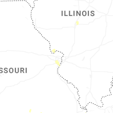
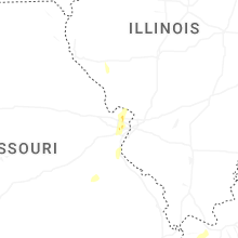
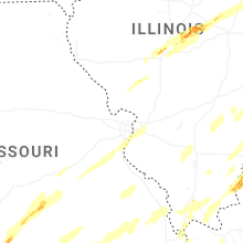


Connect with Interactive Hail Maps