

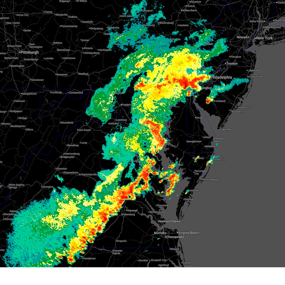
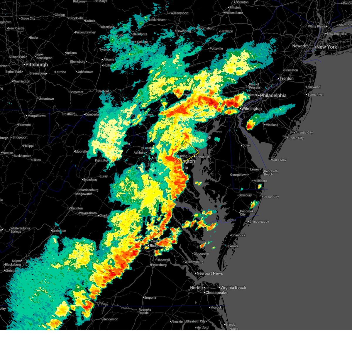
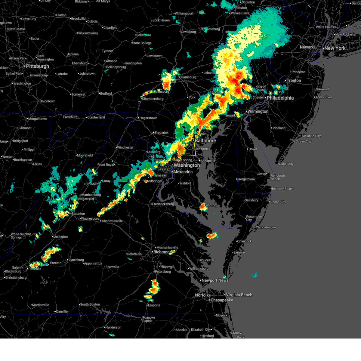
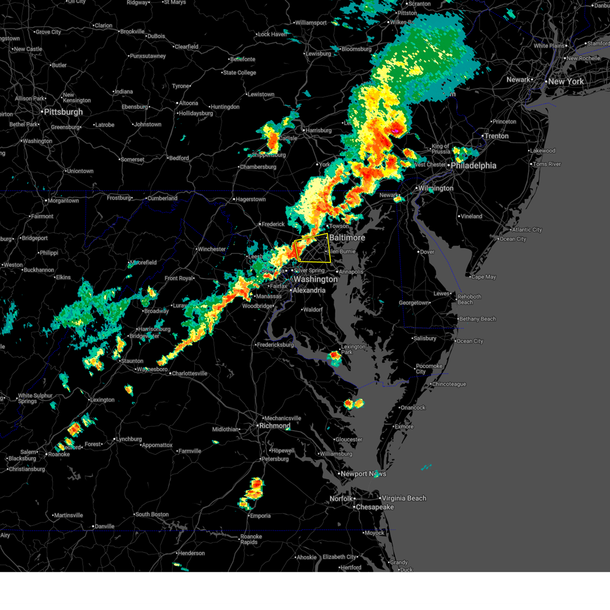
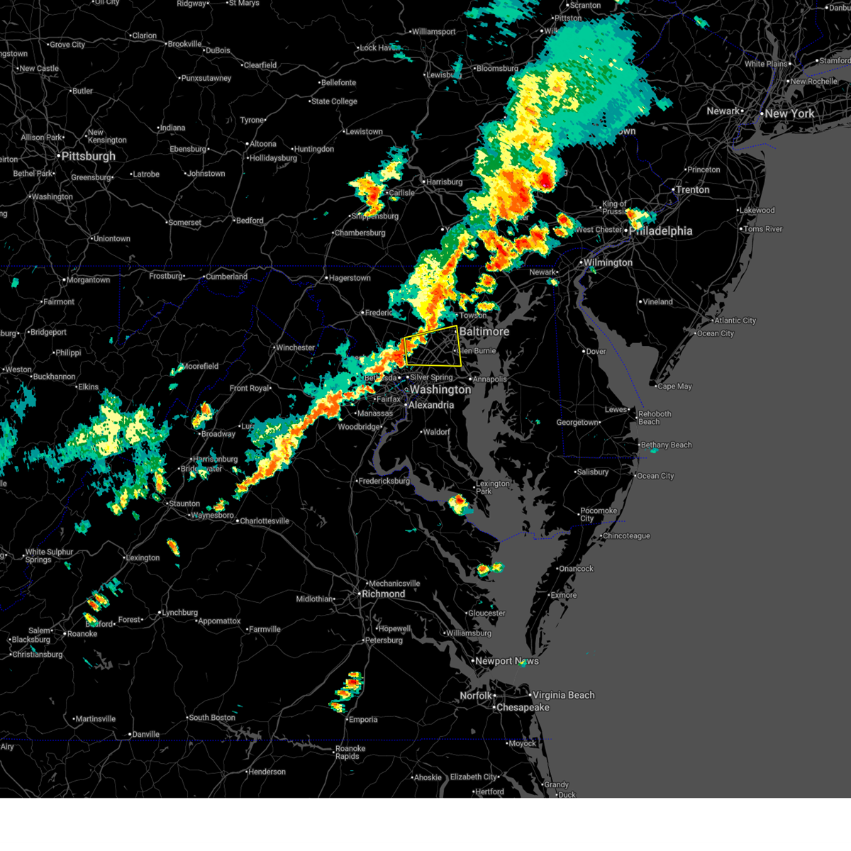
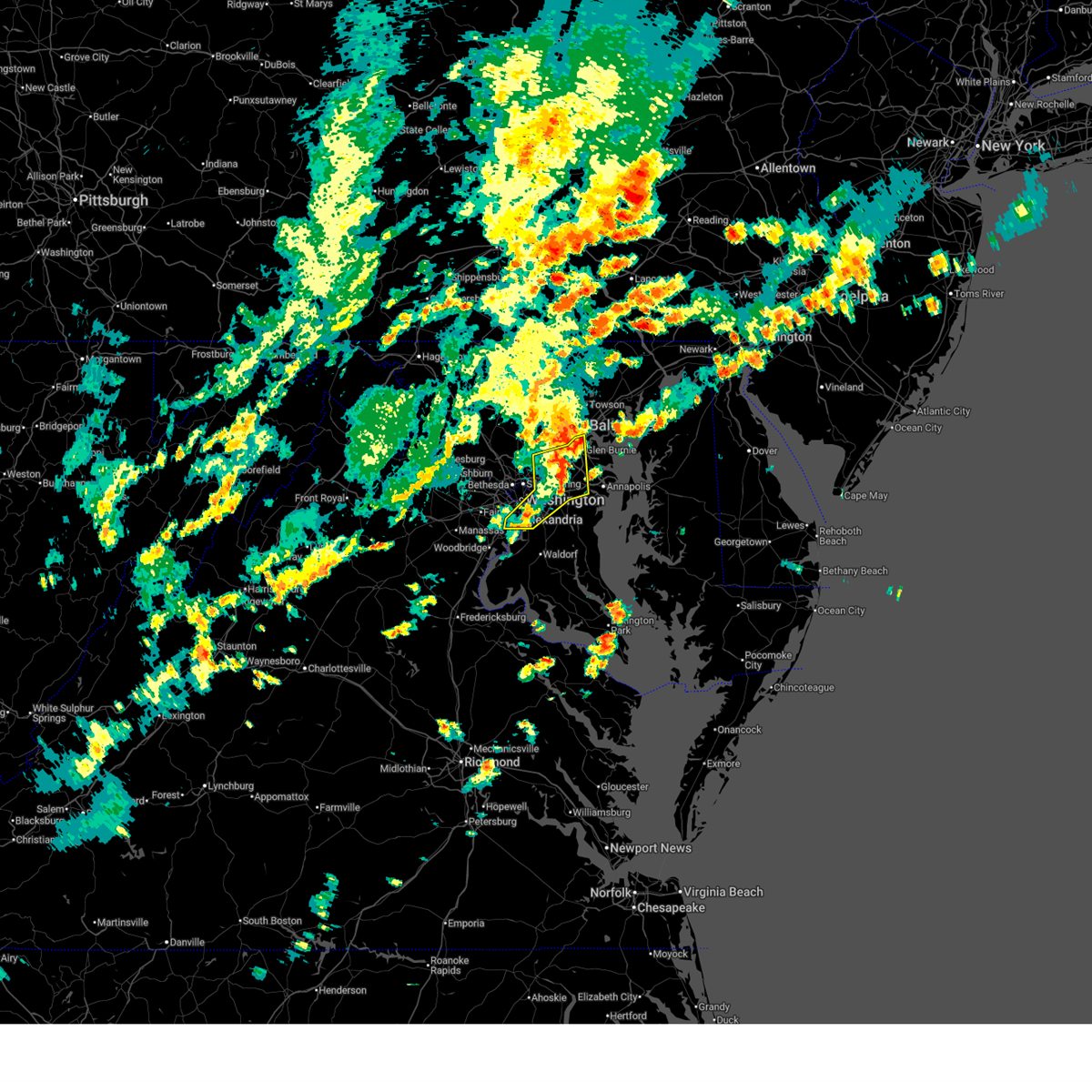
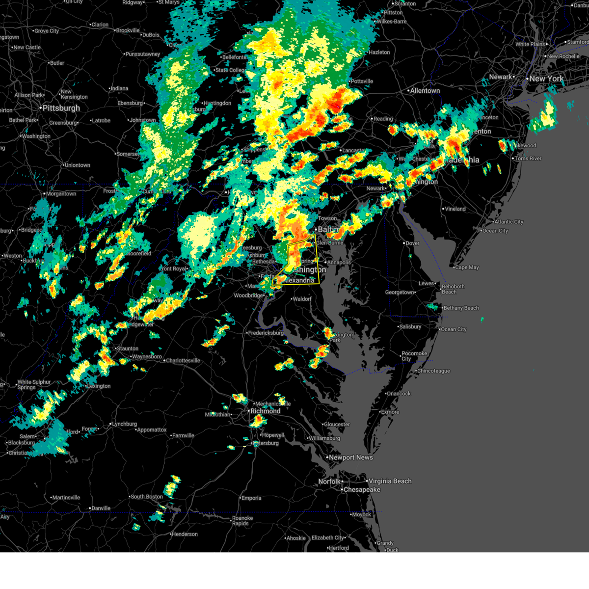
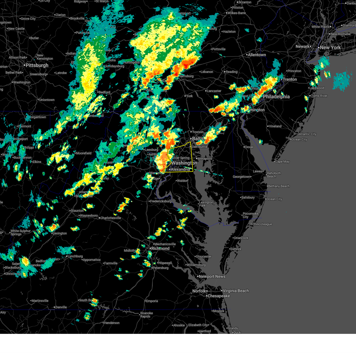
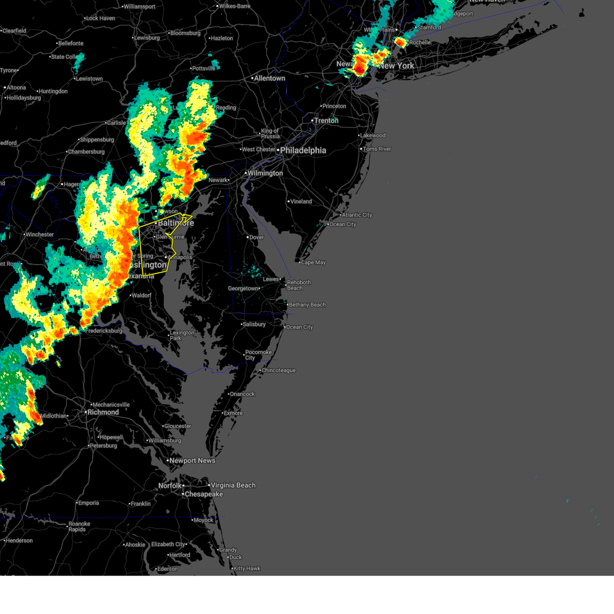
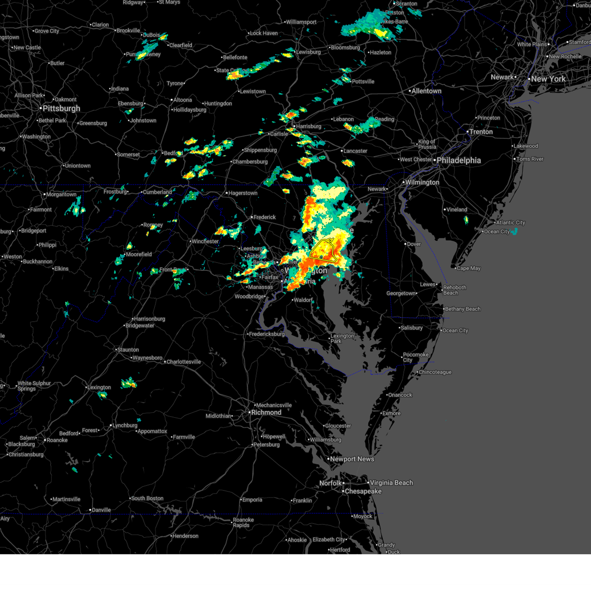
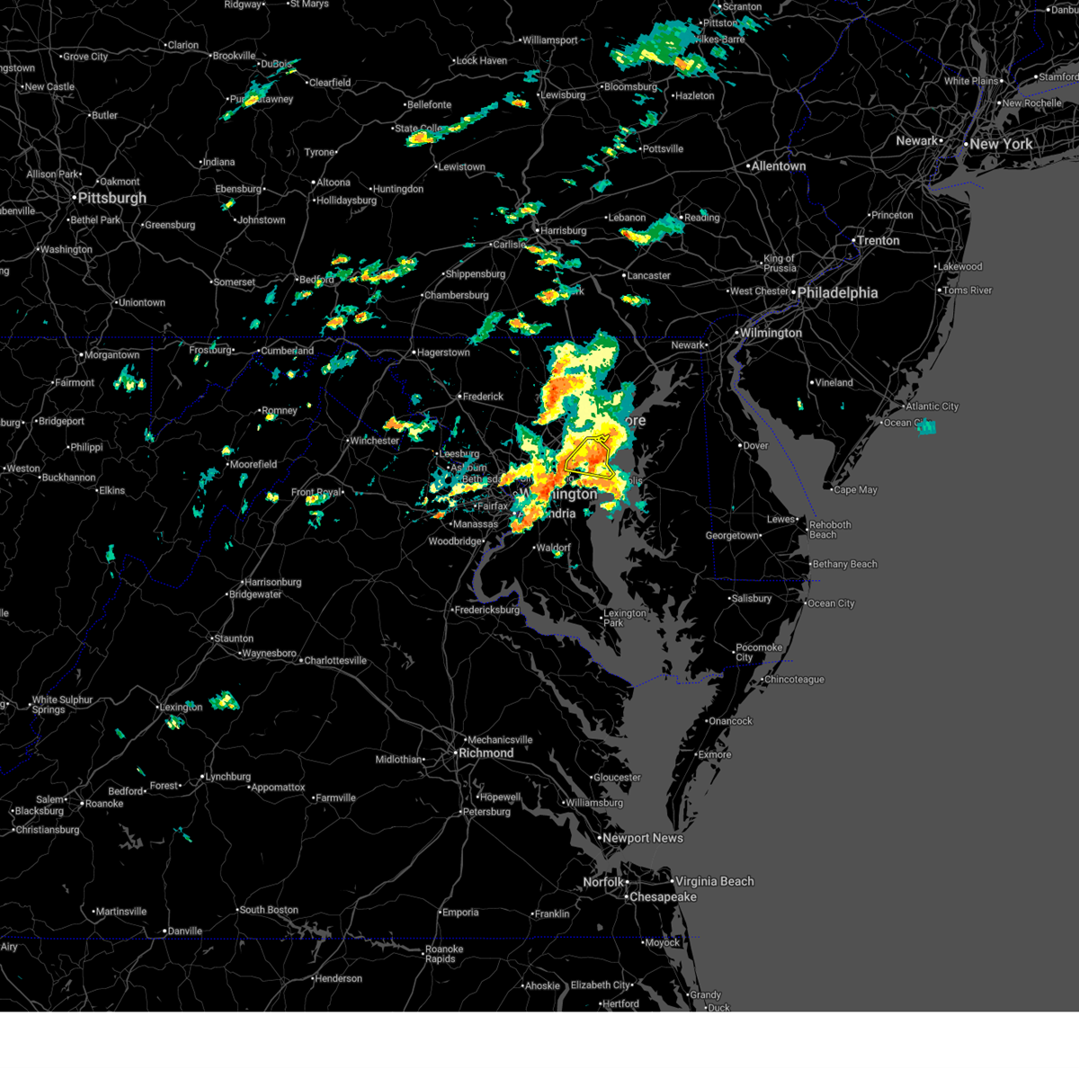
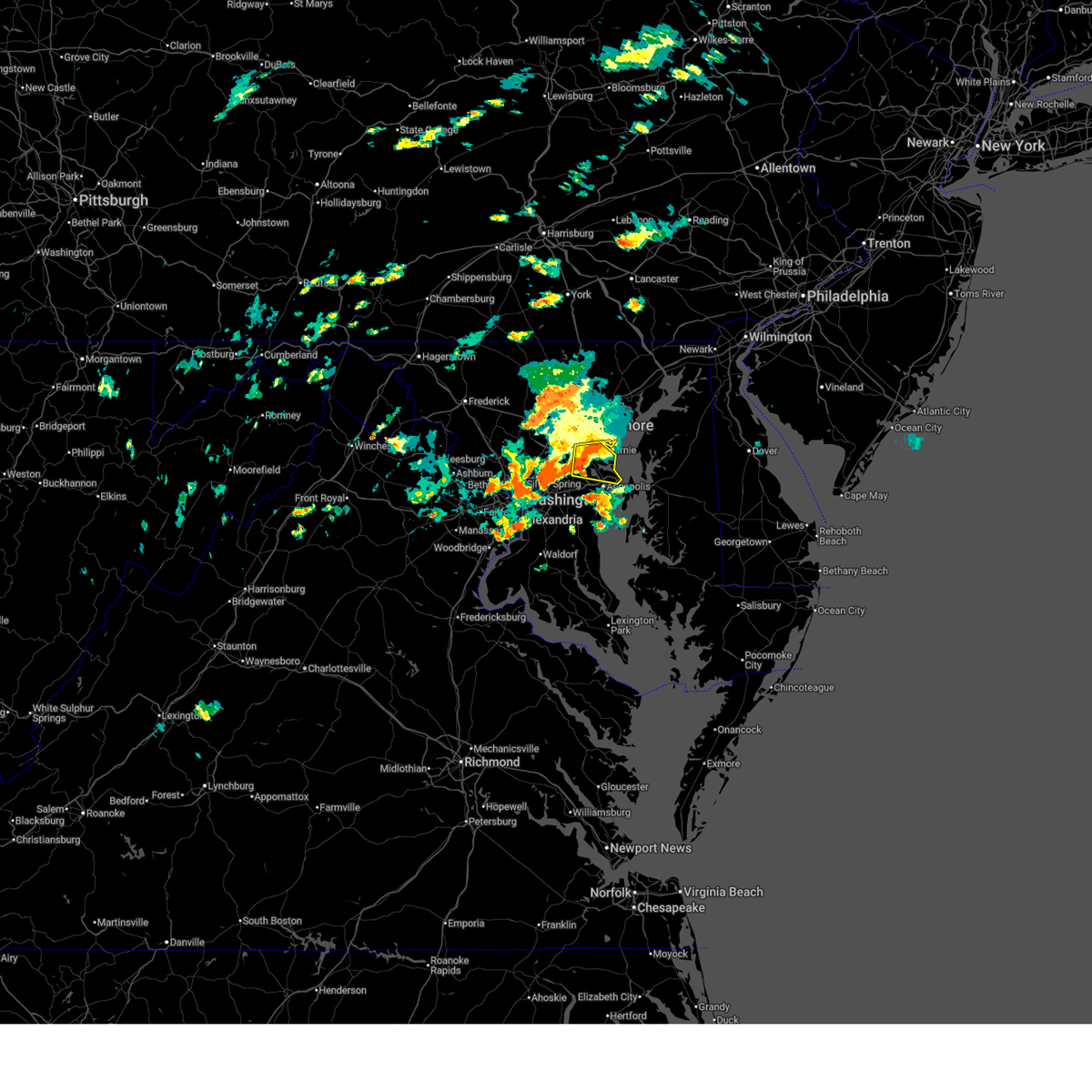
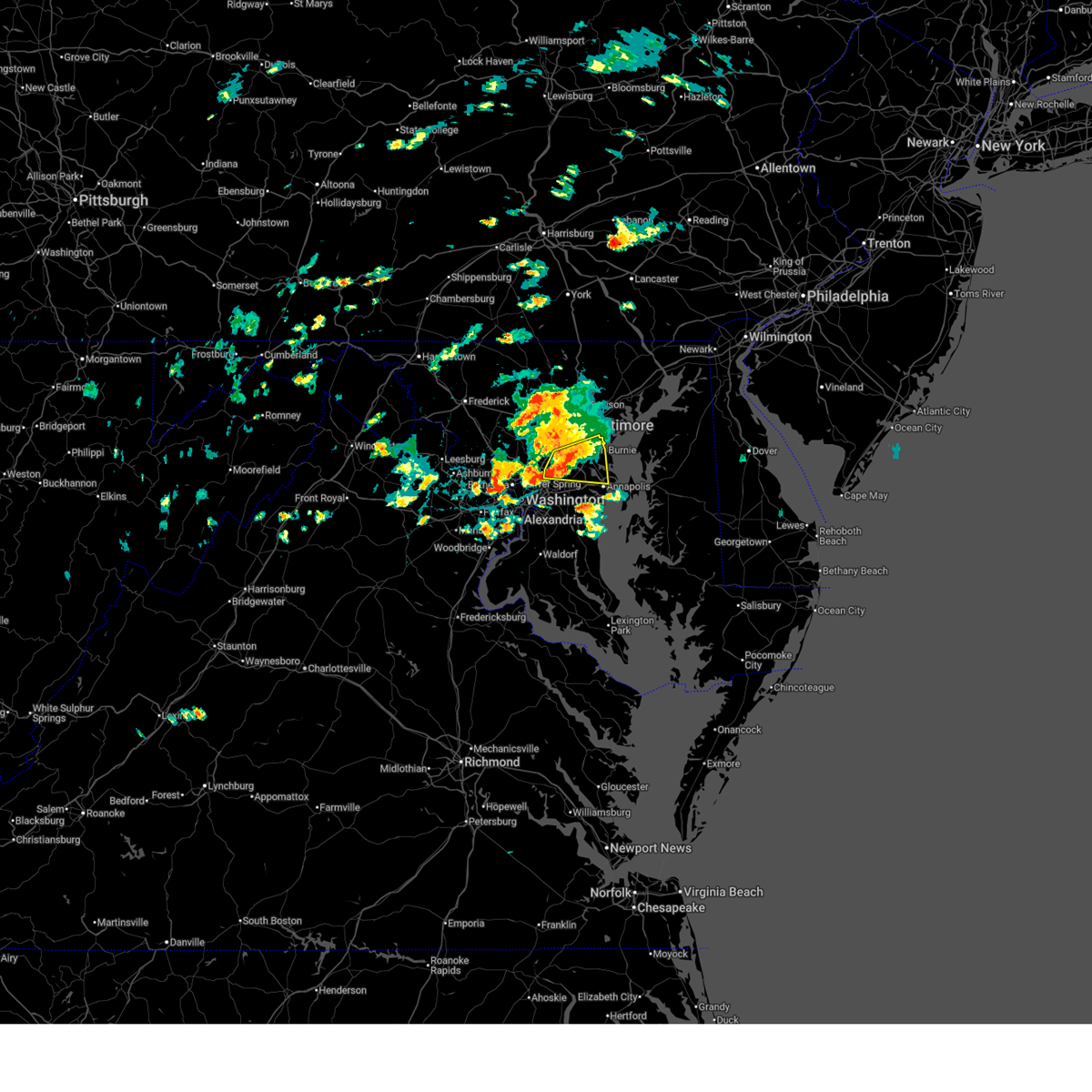
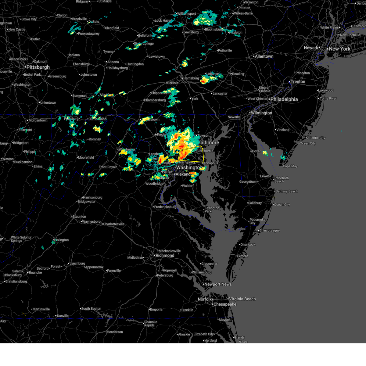
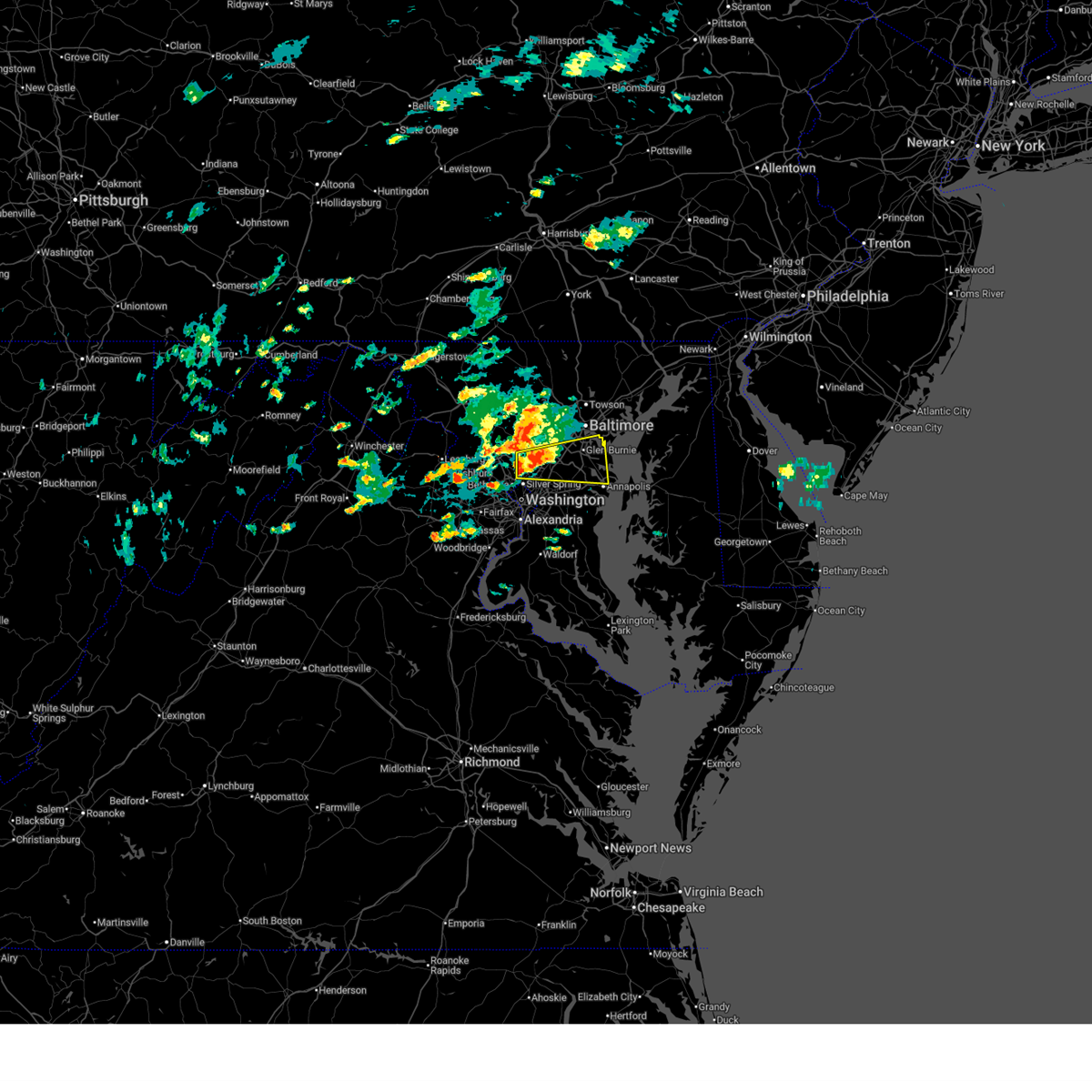
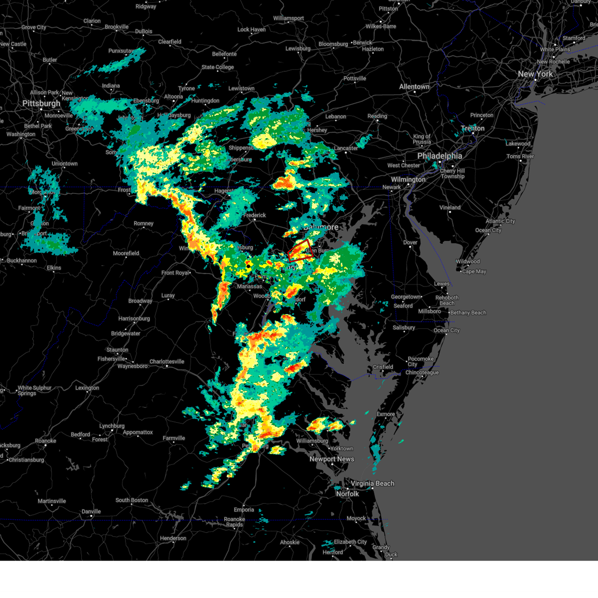
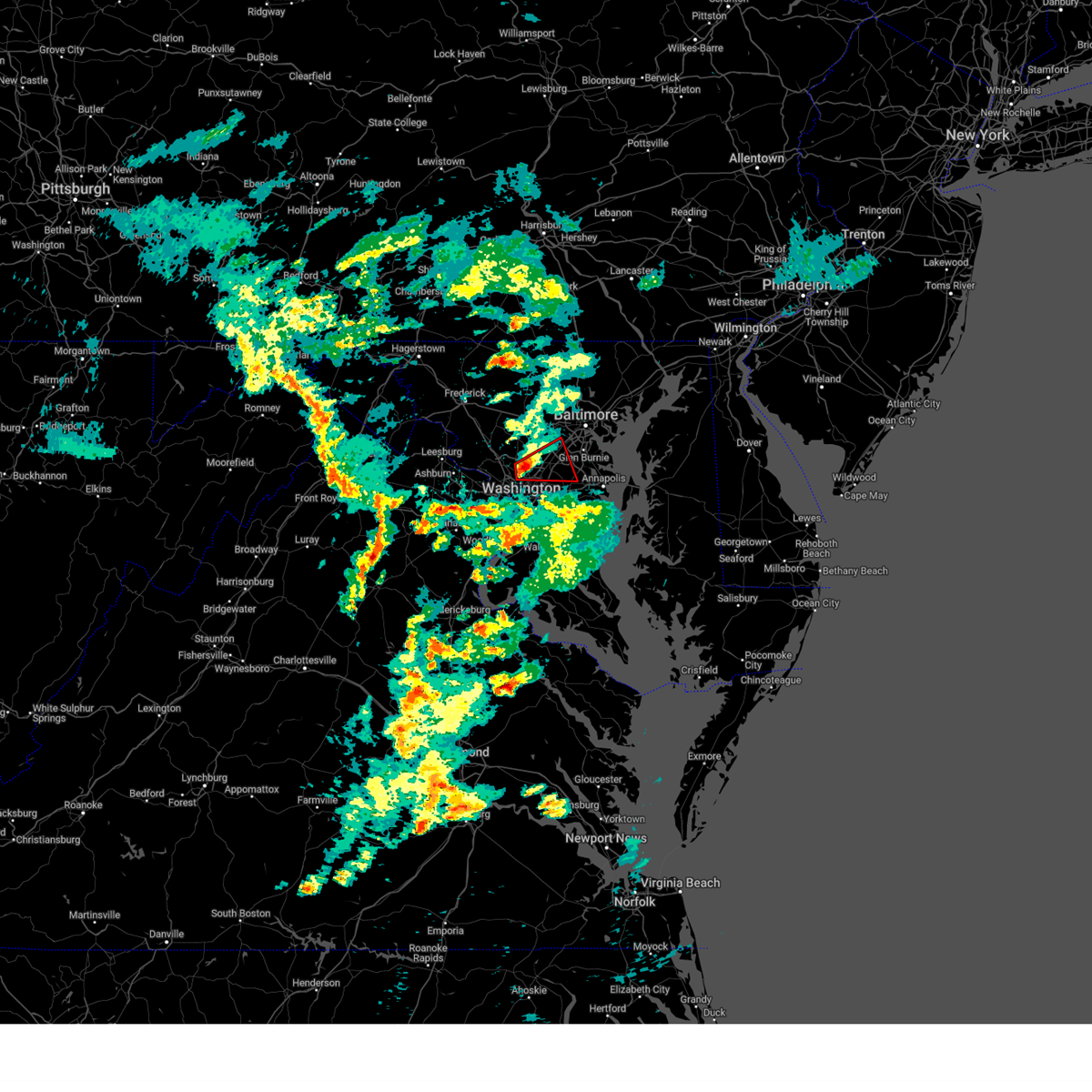
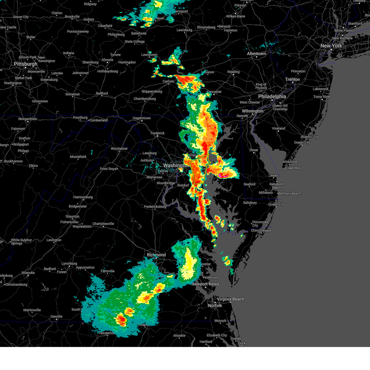
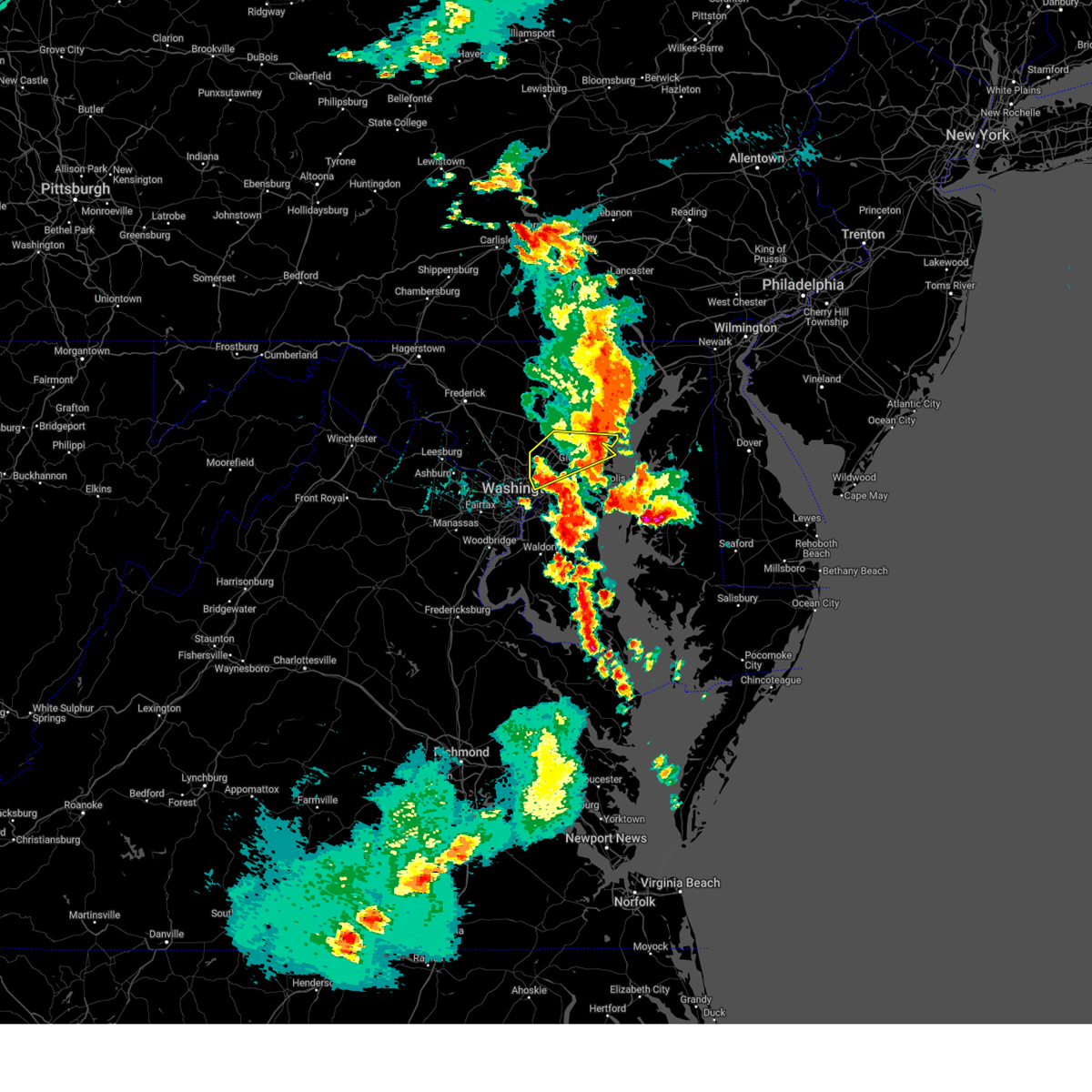
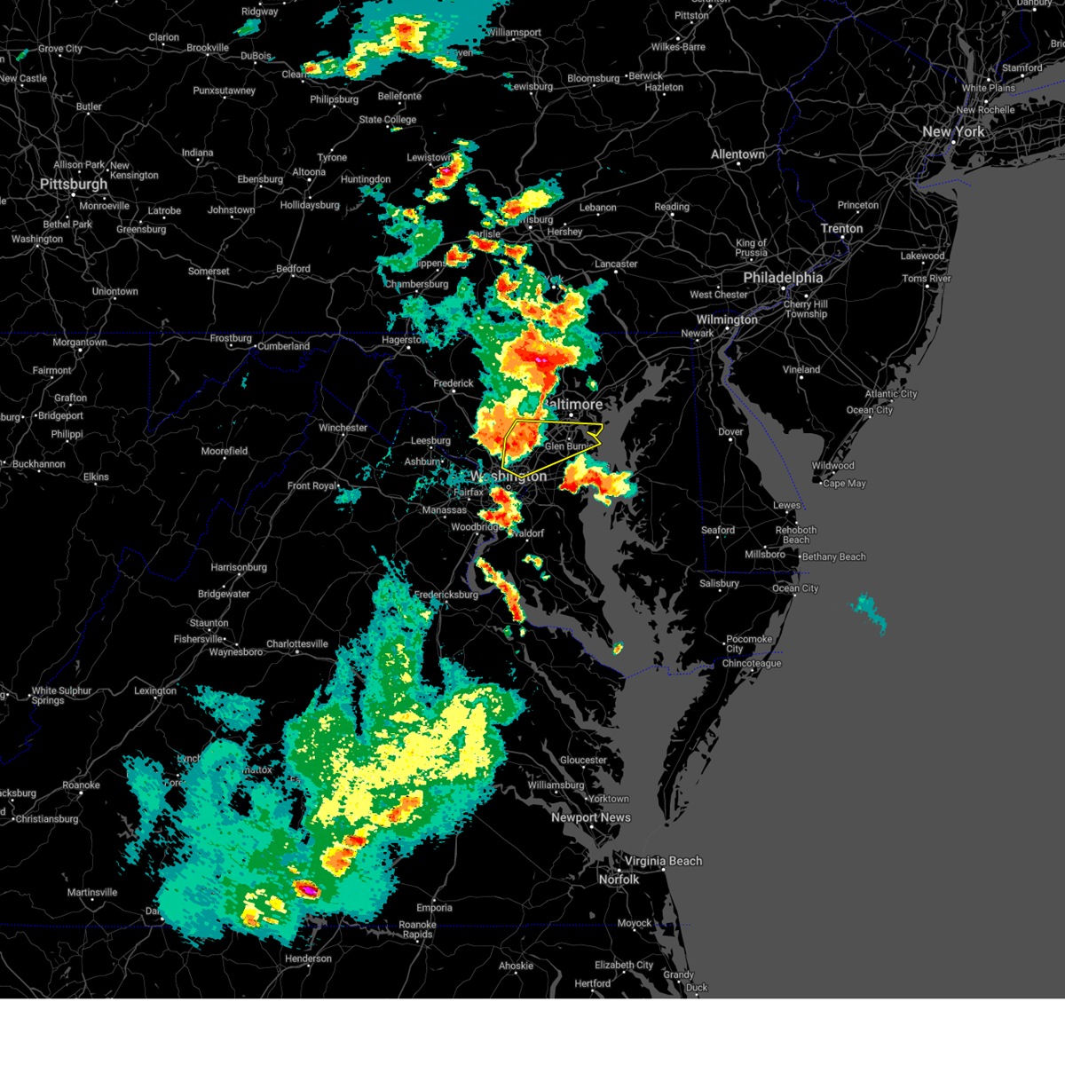
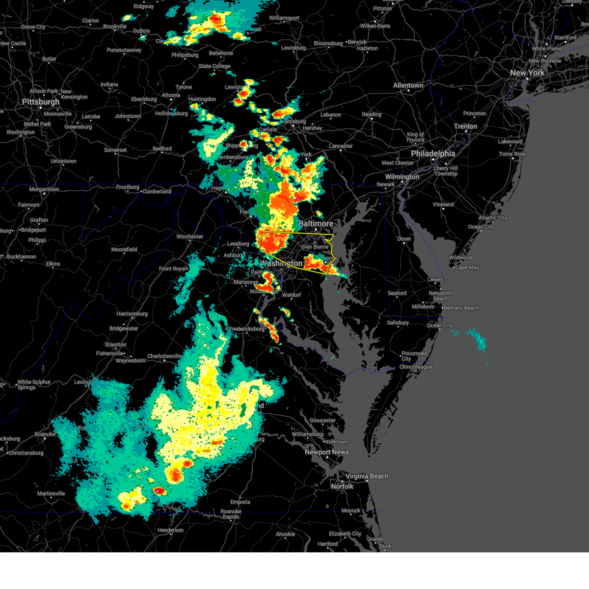
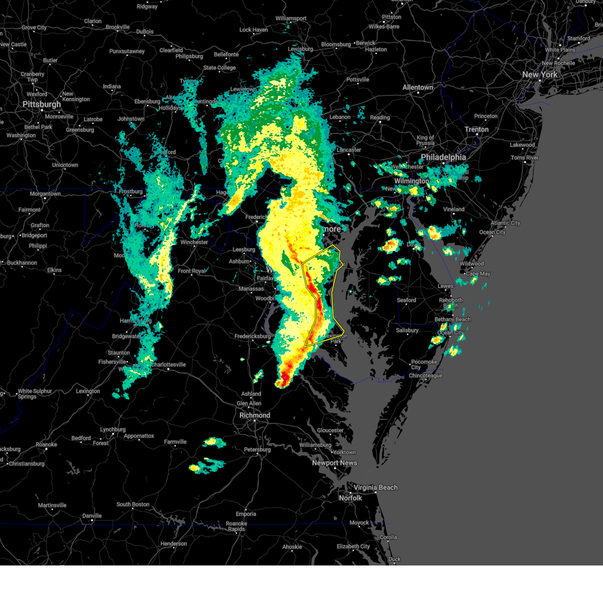
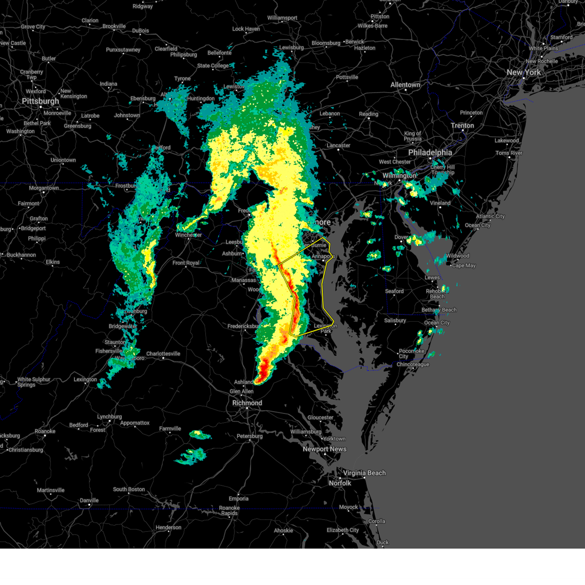
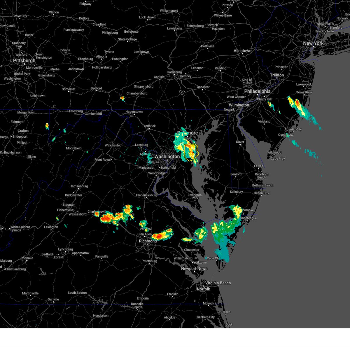
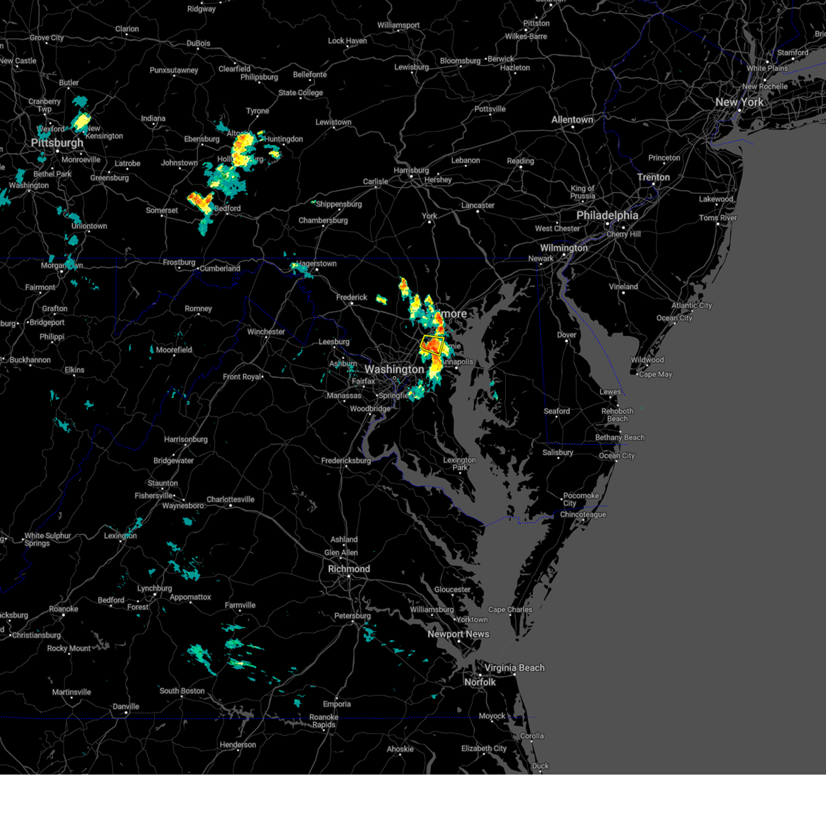
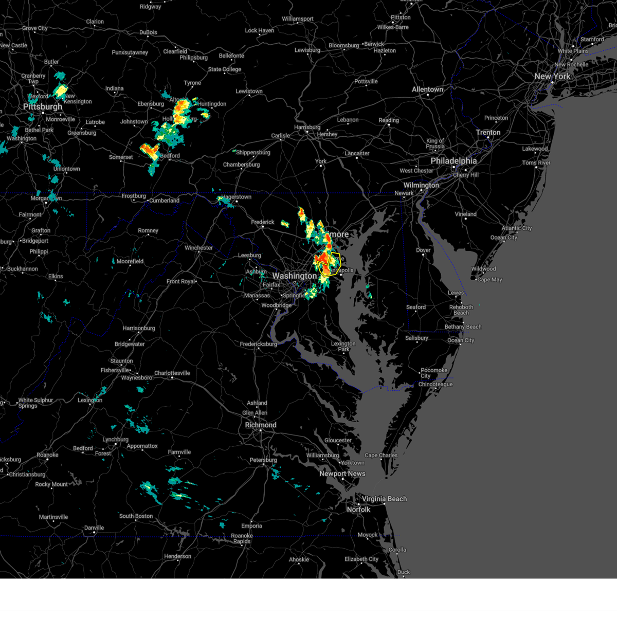
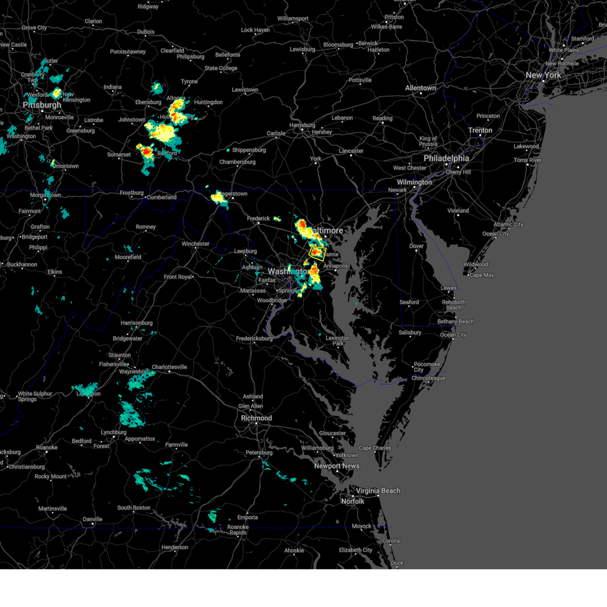
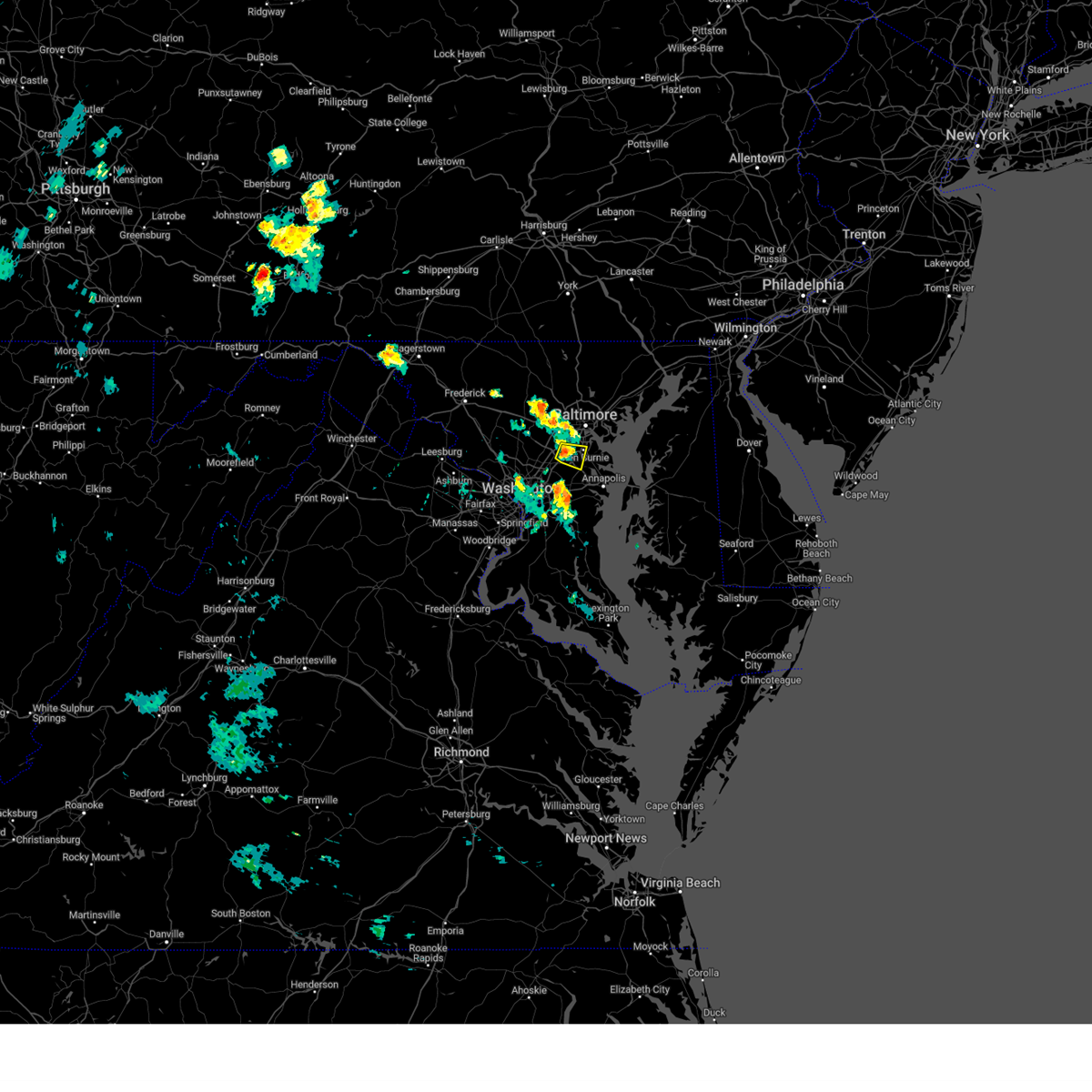
Hail Map for Odenton, MD
The Odenton, MD area has had 3 reports of on-the-ground hail by trained spotters, and has been under severe weather warnings 50 times during the past 12 months. Doppler radar has detected hail at or near Odenton, MD on 60 occasions, including 5 occasions during the past year.
| Name: | Odenton, MD |
| Where Located: | 15.8 miles SSW of Baltimore, MD |
| Map: | Google Map for Odenton, MD |
| Population: | 37132 |
| Housing Units: | 15319 |
| More Info: | Search Google for Odenton, MD |
2
The Top Recent Hail Date for Odenton, MD is Monday, July 29, 2024 (9th out of 60)

Hail and Wind Damage Spotted near Odenton, MD
| Date / Time | Report Details |
|---|---|
| 7/9/2025 7:30 PM EDT |
 the severe thunderstorm warning has been cancelled and is no longer in effect the severe thunderstorm warning has been cancelled and is no longer in effect
|
| 7/9/2025 6:56 PM EDT |
 Svrlwx the national weather service in sterling virginia has issued a * severe thunderstorm warning for, northern anne arundel county in central maryland, northeastern prince georges county in central maryland, * until 745 pm edt. * at 656 pm edt, severe thunderstorms were located along a line extending from hyattsville to woodmore, moving northeast at 30 mph (radar indicated). Hazards include 60 mph wind gusts. Damaging winds will cause some trees and large branches to fall. this could injure those outdoors, as well as damage homes and vehicles. roadways may become blocked by downed trees. localized power outages are possible. Unsecured light objects may become projectiles. Svrlwx the national weather service in sterling virginia has issued a * severe thunderstorm warning for, northern anne arundel county in central maryland, northeastern prince georges county in central maryland, * until 745 pm edt. * at 656 pm edt, severe thunderstorms were located along a line extending from hyattsville to woodmore, moving northeast at 30 mph (radar indicated). Hazards include 60 mph wind gusts. Damaging winds will cause some trees and large branches to fall. this could injure those outdoors, as well as damage homes and vehicles. roadways may become blocked by downed trees. localized power outages are possible. Unsecured light objects may become projectiles.
|
| 7/8/2025 5:10 PM EDT |
 At 510 pm edt, a severe thunderstorm was located over elkridge, moving east at 25 mph (radar indicated). Hazards include 70 mph wind gusts. Damaging winds will cause some trees and large branches to fall. this could injure those outdoors, as well as damage homes and vehicles. roadways may become blocked by downed trees. localized power outages are possible. unsecured light objects may become projectiles. Locations impacted include, baltimore, columbia, severn, elkridge, baltimore-washington airport, historic ellicott city, glen burnie, ellicott city, catonsville, woodlawn, severna park, odenton, laurel, pasadena, arbutus, ferndale, brooklyn park, fort meade, savage-guilford, and south gate. At 510 pm edt, a severe thunderstorm was located over elkridge, moving east at 25 mph (radar indicated). Hazards include 70 mph wind gusts. Damaging winds will cause some trees and large branches to fall. this could injure those outdoors, as well as damage homes and vehicles. roadways may become blocked by downed trees. localized power outages are possible. unsecured light objects may become projectiles. Locations impacted include, baltimore, columbia, severn, elkridge, baltimore-washington airport, historic ellicott city, glen burnie, ellicott city, catonsville, woodlawn, severna park, odenton, laurel, pasadena, arbutus, ferndale, brooklyn park, fort meade, savage-guilford, and south gate.
|
| 7/8/2025 5:10 PM EDT |
 the severe thunderstorm warning has been cancelled and is no longer in effect the severe thunderstorm warning has been cancelled and is no longer in effect
|
| 7/8/2025 4:58 PM EDT |
 At 457 pm edt, a severe thunderstorm was located over columbia, moving east at 25 mph (radar indicated). Hazards include 70 mph wind gusts. Damaging winds will cause some trees and large branches to fall. this could injure those outdoors, as well as damage homes and vehicles. roadways may become blocked by downed trees. localized power outages are possible. unsecured light objects may become projectiles. Locations impacted include, baltimore, columbia, severn, elkridge, baltimore-washington airport, historic ellicott city, glen burnie, ellicott city, catonsville, woodlawn, severna park, odenton, laurel, pasadena, fairland, arbutus, ferndale, brooklyn park, fort meade, and savage-guilford. At 457 pm edt, a severe thunderstorm was located over columbia, moving east at 25 mph (radar indicated). Hazards include 70 mph wind gusts. Damaging winds will cause some trees and large branches to fall. this could injure those outdoors, as well as damage homes and vehicles. roadways may become blocked by downed trees. localized power outages are possible. unsecured light objects may become projectiles. Locations impacted include, baltimore, columbia, severn, elkridge, baltimore-washington airport, historic ellicott city, glen burnie, ellicott city, catonsville, woodlawn, severna park, odenton, laurel, pasadena, fairland, arbutus, ferndale, brooklyn park, fort meade, and savage-guilford.
|
| 7/8/2025 4:50 PM EDT |
 Svrlwx the national weather service in sterling virginia has issued a * severe thunderstorm warning for, southwestern baltimore city in northern maryland, northwestern anne arundel county in central maryland, southeastern howard county in central maryland, east central montgomery county in central maryland, south central baltimore county in northern maryland, north central prince georges county in central maryland, * until 530 pm edt. * at 450 pm edt, a severe thunderstorm was located near columbia, moving east at 25 mph (radar indicated). Hazards include 60 mph wind gusts. Damaging winds will cause some trees and large branches to fall. this could injure those outdoors, as well as damage homes and vehicles. roadways may become blocked by downed trees. localized power outages are possible. Unsecured light objects may become projectiles. Svrlwx the national weather service in sterling virginia has issued a * severe thunderstorm warning for, southwestern baltimore city in northern maryland, northwestern anne arundel county in central maryland, southeastern howard county in central maryland, east central montgomery county in central maryland, south central baltimore county in northern maryland, north central prince georges county in central maryland, * until 530 pm edt. * at 450 pm edt, a severe thunderstorm was located near columbia, moving east at 25 mph (radar indicated). Hazards include 60 mph wind gusts. Damaging winds will cause some trees and large branches to fall. this could injure those outdoors, as well as damage homes and vehicles. roadways may become blocked by downed trees. localized power outages are possible. Unsecured light objects may become projectiles.
|
| 7/1/2025 3:59 PM EDT |
 the severe thunderstorm warning has been cancelled and is no longer in effect the severe thunderstorm warning has been cancelled and is no longer in effect
|
| 7/1/2025 3:59 PM EDT |
 At 359 pm edt, a severe thunderstorm was located over goddard, or near greenbelt, moving northeast at 20 mph (radar indicated). Hazards include 60 mph wind gusts. Damaging winds will cause some trees and large branches to fall. this could injure those outdoors, as well as damage homes and vehicles. roadways may become blocked by downed trees. localized power outages are possible. unsecured light objects may become projectiles. Locations impacted include, arlington, alexandria, columbia, bowie, severn, college park, crofton, fort washington, greenbelt, beltsville, fort hunt, elkridge, groveton, forestville, huntington, largo, coral hills, bladensburg, national harbor, and baltimore-washington airport. At 359 pm edt, a severe thunderstorm was located over goddard, or near greenbelt, moving northeast at 20 mph (radar indicated). Hazards include 60 mph wind gusts. Damaging winds will cause some trees and large branches to fall. this could injure those outdoors, as well as damage homes and vehicles. roadways may become blocked by downed trees. localized power outages are possible. unsecured light objects may become projectiles. Locations impacted include, arlington, alexandria, columbia, bowie, severn, college park, crofton, fort washington, greenbelt, beltsville, fort hunt, elkridge, groveton, forestville, huntington, largo, coral hills, bladensburg, national harbor, and baltimore-washington airport.
|
| 7/1/2025 3:46 PM EDT |
 At 346 pm edt, a severe thunderstorm was located over college park, moving northeast at 20 mph (radar indicated). Hazards include 60 mph wind gusts. Damaging winds will cause some trees and large branches to fall. this could injure those outdoors, as well as damage homes and vehicles. roadways may become blocked by downed trees. localized power outages are possible. unsecured light objects may become projectiles. Locations impacted include, arlington, alexandria, columbia, bowie, severn, clinton, college park, crofton, fort washington, greenbelt, beltsville, fort hunt, elkridge, groveton, forestville, huntington, largo, coral hills, bladensburg, and deale. At 346 pm edt, a severe thunderstorm was located over college park, moving northeast at 20 mph (radar indicated). Hazards include 60 mph wind gusts. Damaging winds will cause some trees and large branches to fall. this could injure those outdoors, as well as damage homes and vehicles. roadways may become blocked by downed trees. localized power outages are possible. unsecured light objects may become projectiles. Locations impacted include, arlington, alexandria, columbia, bowie, severn, clinton, college park, crofton, fort washington, greenbelt, beltsville, fort hunt, elkridge, groveton, forestville, huntington, largo, coral hills, bladensburg, and deale.
|
| 7/1/2025 3:18 PM EDT |
 Svrlwx the national weather service in sterling virginia has issued a * severe thunderstorm warning for, the district of columbia, southern baltimore city in northern maryland, western anne arundel county in central maryland, southeastern howard county in central maryland, southeastern montgomery county in central maryland, northwestern calvert county in southern maryland, southern baltimore county in northern maryland, prince georges county in central maryland, southeastern arlington county in northern virginia, east central fairfax county in northern virginia, the city of alexandria in northern virginia, * until 415 pm edt. * at 318 pm edt, a severe thunderstorm was located over american university, or near bethesda, moving northeast at 20 mph (radar indicated). Hazards include 60 mph wind gusts. Damaging winds will cause some trees and large branches to fall. this could injure those outdoors, as well as damage homes and vehicles. roadways may become blocked by downed trees. localized power outages are possible. Unsecured light objects may become projectiles. Svrlwx the national weather service in sterling virginia has issued a * severe thunderstorm warning for, the district of columbia, southern baltimore city in northern maryland, western anne arundel county in central maryland, southeastern howard county in central maryland, southeastern montgomery county in central maryland, northwestern calvert county in southern maryland, southern baltimore county in northern maryland, prince georges county in central maryland, southeastern arlington county in northern virginia, east central fairfax county in northern virginia, the city of alexandria in northern virginia, * until 415 pm edt. * at 318 pm edt, a severe thunderstorm was located over american university, or near bethesda, moving northeast at 20 mph (radar indicated). Hazards include 60 mph wind gusts. Damaging winds will cause some trees and large branches to fall. this could injure those outdoors, as well as damage homes and vehicles. roadways may become blocked by downed trees. localized power outages are possible. Unsecured light objects may become projectiles.
|
| 6/19/2025 4:29 PM EDT |
 Svrlwx the national weather service in sterling virginia has issued a * severe thunderstorm warning for, central baltimore city in northern maryland, anne arundel county in central maryland, southeastern howard county in central maryland, southeastern baltimore county in northern maryland, northeastern prince georges county in central maryland, * until 530 pm edt. * at 429 pm edt, a severe thunderstorm was located over lanham-seabrook, or over greenbelt, moving east at 50 mph (emergency management reports a history of downed trees with this line of storms). Hazards include 70 mph wind gusts. Damaging winds will cause some trees and large branches to fall. this could injure those outdoors, as well as damage homes and vehicles. roadways may become blocked by downed trees. localized power outages are possible. Unsecured light objects may become projectiles. Svrlwx the national weather service in sterling virginia has issued a * severe thunderstorm warning for, central baltimore city in northern maryland, anne arundel county in central maryland, southeastern howard county in central maryland, southeastern baltimore county in northern maryland, northeastern prince georges county in central maryland, * until 530 pm edt. * at 429 pm edt, a severe thunderstorm was located over lanham-seabrook, or over greenbelt, moving east at 50 mph (emergency management reports a history of downed trees with this line of storms). Hazards include 70 mph wind gusts. Damaging winds will cause some trees and large branches to fall. this could injure those outdoors, as well as damage homes and vehicles. roadways may become blocked by downed trees. localized power outages are possible. Unsecured light objects may become projectiles.
|
| 6/18/2025 2:57 PM EDT |
 The storm which prompted the warning has moved out of the area. therefore, the warning will be allowed to expire. however, heavy rain is still possible with this thunderstorm. a severe thunderstorm watch remains in effect until 700 pm edt for central and northern maryland. to report severe weather, contact your nearest law enforcement agency. they will relay your report to the national weather service sterling virginia. The storm which prompted the warning has moved out of the area. therefore, the warning will be allowed to expire. however, heavy rain is still possible with this thunderstorm. a severe thunderstorm watch remains in effect until 700 pm edt for central and northern maryland. to report severe weather, contact your nearest law enforcement agency. they will relay your report to the national weather service sterling virginia.
|
| 6/18/2025 2:48 PM EDT |
 At 247 pm edt, a severe thunderstorm was located over lake shore, or near dobbins island, moving east at 25 mph (radar indicated). Hazards include 60 mph wind gusts and quarter size hail. Damaging winds will cause some trees and large branches to fall. this could injure those outdoors, as well as damage homes and vehicles. roadways may become blocked by downed trees. localized power outages are possible. unsecured light objects may become projectiles. locations impacted include, crofton, riviera beach, magothy river, dobbins island, fort smallwood state park, pinehurst, gibson island, bodkin point, sillery bay, glen burnie, severna park, odenton, pasadena, arnold, lake shore, parole, millersville, green haven, cape st. Claire, and edgemere. At 247 pm edt, a severe thunderstorm was located over lake shore, or near dobbins island, moving east at 25 mph (radar indicated). Hazards include 60 mph wind gusts and quarter size hail. Damaging winds will cause some trees and large branches to fall. this could injure those outdoors, as well as damage homes and vehicles. roadways may become blocked by downed trees. localized power outages are possible. unsecured light objects may become projectiles. locations impacted include, crofton, riviera beach, magothy river, dobbins island, fort smallwood state park, pinehurst, gibson island, bodkin point, sillery bay, glen burnie, severna park, odenton, pasadena, arnold, lake shore, parole, millersville, green haven, cape st. Claire, and edgemere.
|
| 6/18/2025 2:29 PM EDT |
 At 229 pm edt, a severe thunderstorm was located over severna park, or near riviera beach, moving east at 30 mph (radar indicated). Hazards include 70 mph wind gusts and ping pong ball size hail. Damaging winds will cause some trees and large branches to fall. this could injure those outdoors, as well as damage homes and vehicles. roadways may become blocked by downed trees. localized power outages are possible. unsecured light objects may become projectiles. Locations impacted include, severn, crofton, riviera beach, baltimore-washington airport, magothy river, dobbins island, fort smallwood state park, pinehurst, gibson island, bodkin point, sillery bay, glen burnie, severna park, odenton, pasadena, arnold, lake shore, ferndale, parole, and millersville. At 229 pm edt, a severe thunderstorm was located over severna park, or near riviera beach, moving east at 30 mph (radar indicated). Hazards include 70 mph wind gusts and ping pong ball size hail. Damaging winds will cause some trees and large branches to fall. this could injure those outdoors, as well as damage homes and vehicles. roadways may become blocked by downed trees. localized power outages are possible. unsecured light objects may become projectiles. Locations impacted include, severn, crofton, riviera beach, baltimore-washington airport, magothy river, dobbins island, fort smallwood state park, pinehurst, gibson island, bodkin point, sillery bay, glen burnie, severna park, odenton, pasadena, arnold, lake shore, ferndale, parole, and millersville.
|
| 6/18/2025 2:27 PM EDT |
 Svrlwx the national weather service in sterling virginia has issued a * severe thunderstorm warning for, southeastern baltimore city in northern maryland, northeastern anne arundel county in central maryland, * until 300 pm edt. * at 227 pm edt, a severe thunderstorm was located over severna park, or near severn, moving east at 30 mph (radar indicated). Hazards include 70 mph wind gusts and ping pong ball size hail. Damaging winds will cause some trees and large branches to fall. this could injure those outdoors, as well as damage homes and vehicles. roadways may become blocked by downed trees. localized power outages are possible. Unsecured light objects may become projectiles. Svrlwx the national weather service in sterling virginia has issued a * severe thunderstorm warning for, southeastern baltimore city in northern maryland, northeastern anne arundel county in central maryland, * until 300 pm edt. * at 227 pm edt, a severe thunderstorm was located over severna park, or near severn, moving east at 30 mph (radar indicated). Hazards include 70 mph wind gusts and ping pong ball size hail. Damaging winds will cause some trees and large branches to fall. this could injure those outdoors, as well as damage homes and vehicles. roadways may become blocked by downed trees. localized power outages are possible. Unsecured light objects may become projectiles.
|
| 6/18/2025 2:22 PM EDT | Quarter sized hail reported 0.5 miles WNW of Odenton, MD, quarter sized hail estimated near odenton. |
| 6/18/2025 2:17 PM EDT |
 At 217 pm edt, a severe thunderstorm was located over odenton, or over severn, moving east at 25 mph (radar indicated). Hazards include golf ball size hail and 70 mph wind gusts. Expect wind damage to trees and power lines. hail is large enough to dent and damage vehicles. some hail damage to roofs, siding, and windows is possible. Locations impacted include, baltimore, severn, annapolis, crofton, elkridge, riviera beach, naval academy, baltimore-washington airport, fort smallwood state park, glen burnie, severna park, odenton, laurel, pasadena, arnold, lake shore, ferndale, parole, brooklyn park, and fort meade. At 217 pm edt, a severe thunderstorm was located over odenton, or over severn, moving east at 25 mph (radar indicated). Hazards include golf ball size hail and 70 mph wind gusts. Expect wind damage to trees and power lines. hail is large enough to dent and damage vehicles. some hail damage to roofs, siding, and windows is possible. Locations impacted include, baltimore, severn, annapolis, crofton, elkridge, riviera beach, naval academy, baltimore-washington airport, fort smallwood state park, glen burnie, severna park, odenton, laurel, pasadena, arnold, lake shore, ferndale, parole, brooklyn park, and fort meade.
|
| 6/18/2025 2:14 PM EDT | Multiple trees and large branches were snapped in anne arundel county MD, 0.9 miles N of Odenton, MD |
| 6/18/2025 2:12 PM EDT | the severe thunderstorm warning has been cancelled and is no longer in effect |
| 6/18/2025 2:12 PM EDT | At 212 pm edt, a severe thunderstorm was located over fort meade, or near severn, moving east at 25 mph (radar indicated). Hazards include 70 mph wind gusts and ping pong ball size hail. Damaging winds will cause some trees and large branches to fall. this could injure those outdoors, as well as damage homes and vehicles. roadways may become blocked by downed trees. localized power outages are possible. unsecured light objects may become projectiles. Locations impacted include, baltimore, severn, annapolis, crofton, elkridge, riviera beach, naval academy, baltimore-washington airport, fort smallwood state park, glen burnie, severna park, odenton, laurel, pasadena, arnold, lake shore, ferndale, parole, brooklyn park, and fort meade. |
| 6/18/2025 2:09 PM EDT | At 209 pm edt, a severe thunderstorm was located over fort meade, or near severn, moving east at 25 mph (radar indicated). Hazards include 60 mph wind gusts and quarter size hail. Damaging winds will cause some trees and large branches to fall. this could injure those outdoors, as well as damage homes and vehicles. roadways may become blocked by downed trees. localized power outages are possible. unsecured light objects may become projectiles. Locations impacted include, baltimore, columbia, severn, annapolis, college park, crofton, beltsville, elkridge, riviera beach, naval academy, baltimore-washington airport, fort smallwood state park, glen burnie, severna park, odenton, laurel, pasadena, arnold, lake shore, and ferndale. |
| 6/18/2025 2:02 PM EDT |
 At 202 pm edt, a severe thunderstorm was located over laurel, or near beltsville, moving east at 25 mph (radar indicated). Hazards include 60 mph wind gusts. Damaging winds will cause some trees and large branches to fall. this could injure those outdoors, as well as damage homes and vehicles. roadways may become blocked by downed trees. localized power outages are possible. unsecured light objects may become projectiles. Locations impacted include, baltimore, columbia, bowie, severn, annapolis, college park, crofton, beltsville, elkridge, riviera beach, naval academy, baltimore-washington airport, fort smallwood state park, glen burnie, severna park, odenton, laurel, pasadena, fairland, and arnold. At 202 pm edt, a severe thunderstorm was located over laurel, or near beltsville, moving east at 25 mph (radar indicated). Hazards include 60 mph wind gusts. Damaging winds will cause some trees and large branches to fall. this could injure those outdoors, as well as damage homes and vehicles. roadways may become blocked by downed trees. localized power outages are possible. unsecured light objects may become projectiles. Locations impacted include, baltimore, columbia, bowie, severn, annapolis, college park, crofton, beltsville, elkridge, riviera beach, naval academy, baltimore-washington airport, fort smallwood state park, glen burnie, severna park, odenton, laurel, pasadena, fairland, and arnold.
|
| 6/18/2025 1:47 PM EDT |
 Svrlwx the national weather service in sterling virginia has issued a * severe thunderstorm warning for, southeastern baltimore city in northern maryland, northern anne arundel county in central maryland, southeastern howard county in central maryland, southeastern montgomery county in central maryland, northeastern prince georges county in central maryland, * until 230 pm edt. * at 147 pm edt, a severe thunderstorm was located over fairland, or over beltsville, moving east at 25 mph (radar indicated). Hazards include 60 mph wind gusts. Damaging winds will cause some trees and large branches to fall. this could injure those outdoors, as well as damage homes and vehicles. roadways may become blocked by downed trees. localized power outages are possible. Unsecured light objects may become projectiles. Svrlwx the national weather service in sterling virginia has issued a * severe thunderstorm warning for, southeastern baltimore city in northern maryland, northern anne arundel county in central maryland, southeastern howard county in central maryland, southeastern montgomery county in central maryland, northeastern prince georges county in central maryland, * until 230 pm edt. * at 147 pm edt, a severe thunderstorm was located over fairland, or over beltsville, moving east at 25 mph (radar indicated). Hazards include 60 mph wind gusts. Damaging winds will cause some trees and large branches to fall. this could injure those outdoors, as well as damage homes and vehicles. roadways may become blocked by downed trees. localized power outages are possible. Unsecured light objects may become projectiles.
|
| 5/30/2025 7:18 PM EDT |
 At 717 pm edt, a severe thunderstorm capable of producing a tornado was located over fairland, or over beltsville, moving northeast at 20 mph (radar indicated rotation). Hazards include tornado and quarter size hail. For those in the direct path of a tornado touchdown, flying debris will be dangerous to those caught without shelter. damage to roofs, siding, and windows may occur. mobile homes may be damaged or destroyed. tree damage is likely. this dangerous storm will be near, savage-guilford, elkridge, fort meade, severn, columbia, and laurel around 725 pm edt. odenton around 730 pm edt. Other locations impacted by this tornadic thunderstorm include fulton, spencerville, cloverly, calverton, scaggsville, ilchester, burtonsville, savage, jessup, and georgetown. At 717 pm edt, a severe thunderstorm capable of producing a tornado was located over fairland, or over beltsville, moving northeast at 20 mph (radar indicated rotation). Hazards include tornado and quarter size hail. For those in the direct path of a tornado touchdown, flying debris will be dangerous to those caught without shelter. damage to roofs, siding, and windows may occur. mobile homes may be damaged or destroyed. tree damage is likely. this dangerous storm will be near, savage-guilford, elkridge, fort meade, severn, columbia, and laurel around 725 pm edt. odenton around 730 pm edt. Other locations impacted by this tornadic thunderstorm include fulton, spencerville, cloverly, calverton, scaggsville, ilchester, burtonsville, savage, jessup, and georgetown.
|
| 5/30/2025 6:54 PM EDT |
 Torlwx the national weather service in sterling virginia has issued a * tornado warning for, northwestern anne arundel county in central maryland, southeastern howard county in central maryland, southeastern montgomery county in central maryland, northeastern prince georges county in central maryland, * until 730 pm edt. * at 654 pm edt, a severe thunderstorm capable of producing a tornado was located over kemp mill, or near langley park, moving northeast at 25 mph (radar indicated rotation). Hazards include tornado and quarter size hail. For those in the direct path of a tornado touchdown, flying debris will be dangerous to those caught without shelter. damage to roofs, siding, and windows may occur. mobile homes may be damaged or destroyed. tree damage is likely. this dangerous storm will be near, adelphi, beltsville, goddard, fairland, savage-guilford, greenbelt, colesville, white oak, college park, and columbia around 700 pm edt. fort meade around 705 pm edt. bowie around 710 pm edt. odenton around 715 pm edt. Other locations impacted by this tornadic thunderstorm include fulton, spencerville, cloverly, calverton, ilchester, savage, scaggsville, burtonsville, four corners, and wheaton. Torlwx the national weather service in sterling virginia has issued a * tornado warning for, northwestern anne arundel county in central maryland, southeastern howard county in central maryland, southeastern montgomery county in central maryland, northeastern prince georges county in central maryland, * until 730 pm edt. * at 654 pm edt, a severe thunderstorm capable of producing a tornado was located over kemp mill, or near langley park, moving northeast at 25 mph (radar indicated rotation). Hazards include tornado and quarter size hail. For those in the direct path of a tornado touchdown, flying debris will be dangerous to those caught without shelter. damage to roofs, siding, and windows may occur. mobile homes may be damaged or destroyed. tree damage is likely. this dangerous storm will be near, adelphi, beltsville, goddard, fairland, savage-guilford, greenbelt, colesville, white oak, college park, and columbia around 700 pm edt. fort meade around 705 pm edt. bowie around 710 pm edt. odenton around 715 pm edt. Other locations impacted by this tornadic thunderstorm include fulton, spencerville, cloverly, calverton, ilchester, savage, scaggsville, burtonsville, four corners, and wheaton.
|
| 5/30/2025 6:47 PM EDT |
 Svrlwx the national weather service in sterling virginia has issued a * severe thunderstorm warning for, northwestern anne arundel county in central maryland, southeastern howard county in central maryland, southeastern montgomery county in central maryland, northern prince georges county in central maryland, * until 730 pm edt. * at 647 pm edt, a severe thunderstorm was located over kemp mill, or near langley park, moving east at 20 mph (radar indicated). Hazards include 60 mph wind gusts and quarter size hail. Damaging winds will cause some trees and large branches to fall. this could injure those outdoors, as well as damage homes and vehicles. roadways may become blocked by downed trees. localized power outages are possible. Unsecured light objects may become projectiles. Svrlwx the national weather service in sterling virginia has issued a * severe thunderstorm warning for, northwestern anne arundel county in central maryland, southeastern howard county in central maryland, southeastern montgomery county in central maryland, northern prince georges county in central maryland, * until 730 pm edt. * at 647 pm edt, a severe thunderstorm was located over kemp mill, or near langley park, moving east at 20 mph (radar indicated). Hazards include 60 mph wind gusts and quarter size hail. Damaging winds will cause some trees and large branches to fall. this could injure those outdoors, as well as damage homes and vehicles. roadways may become blocked by downed trees. localized power outages are possible. Unsecured light objects may become projectiles.
|
| 5/16/2025 6:25 PM EDT | The storms which prompted the warning have moved out of the area. therefore, the warning will be allowed to expire. however, gusty winds and heavy rain are still possible with these thunderstorms. a severe thunderstorm watch remains in effect until 1000 pm edt for central and southern maryland. to report severe weather, contact your nearest law enforcement agency. they will relay your report to the national weather service sterling virginia. |
| 5/16/2025 6:17 PM EDT | the severe thunderstorm warning has been cancelled and is no longer in effect |
| 5/16/2025 6:12 PM EDT |
 At 611 pm edt, severe thunderstorms were located along a line extending from odenton to near rhode river to near chesapeake beach, moving east at 45 mph (radar indicated). Hazards include 70 mph wind gusts and quarter size hail. Damaging winds will cause some trees and large branches to fall. this could injure those outdoors, as well as damage homes and vehicles. roadways may become blocked by downed trees. localized power outages are possible. unsecured light objects may become projectiles. locations impacted include, annapolis, bowie, lake shore, davidsonville, parole, highland beach, severn river, navy-marine corps stadium, south river, cape st. Claire, tracys landing, gibson island, bodkin point, sillery bay, arnold, chelsea beach, sherwood forest, prince georges stadium, deale, and rhode river. At 611 pm edt, severe thunderstorms were located along a line extending from odenton to near rhode river to near chesapeake beach, moving east at 45 mph (radar indicated). Hazards include 70 mph wind gusts and quarter size hail. Damaging winds will cause some trees and large branches to fall. this could injure those outdoors, as well as damage homes and vehicles. roadways may become blocked by downed trees. localized power outages are possible. unsecured light objects may become projectiles. locations impacted include, annapolis, bowie, lake shore, davidsonville, parole, highland beach, severn river, navy-marine corps stadium, south river, cape st. Claire, tracys landing, gibson island, bodkin point, sillery bay, arnold, chelsea beach, sherwood forest, prince georges stadium, deale, and rhode river.
|
| 5/16/2025 6:05 PM EDT |
 At 605 pm edt, severe thunderstorms were located along a line extending from dundalk to severna park, moving east at 45 mph (radar indicated). Hazards include 70 mph wind gusts and quarter size hail. Damaging winds will cause some trees and large branches to fall. this could injure those outdoors, as well as damage homes and vehicles. roadways may become blocked by downed trees. localized power outages are possible. unsecured light objects may become projectiles. Locations impacted include, baltimore-washington airport, calverton, ilchester, beltsville, savage, brooklyn park, glen burnie, edgemere, harmans, fort meade, halethorpe, hillandale, turners station, georgetown, fort smallwood state park, riviera beach, linthicum, fort howard, savage-guilford, and university of maryland. At 605 pm edt, severe thunderstorms were located along a line extending from dundalk to severna park, moving east at 45 mph (radar indicated). Hazards include 70 mph wind gusts and quarter size hail. Damaging winds will cause some trees and large branches to fall. this could injure those outdoors, as well as damage homes and vehicles. roadways may become blocked by downed trees. localized power outages are possible. unsecured light objects may become projectiles. Locations impacted include, baltimore-washington airport, calverton, ilchester, beltsville, savage, brooklyn park, glen burnie, edgemere, harmans, fort meade, halethorpe, hillandale, turners station, georgetown, fort smallwood state park, riviera beach, linthicum, fort howard, savage-guilford, and university of maryland.
|
| 5/16/2025 5:56 PM EDT | the severe thunderstorm warning has been cancelled and is no longer in effect |
| 5/16/2025 5:56 PM EDT | At 555 pm edt, severe thunderstorms were located along a line extending from new carrollton to near upper marlboro to 6 miles south of marlton, moving east at 45 mph (radar indicated). Hazards include 70 mph wind gusts and quarter size hail. Damaging winds will cause some trees and large branches to fall. this could injure those outdoors, as well as damage homes and vehicles. roadways may become blocked by downed trees. localized power outages are possible. unsecured light objects may become projectiles. Locations impacted include, walker mill, parole, navy-marine corps stadium, morningside, gibson island, sillery bay, greater landover, north brentwood, chelsea beach, lake arbor, prince georges stadium, fedex field, kettering, cottage city, magothy river, edgewater, shady side, owings, belvedere heights, and colmar manor. |
| 5/16/2025 5:41 PM EDT |
 At 540 pm edt, severe thunderstorms were located along a line extending from historic ellicott city to laurel, moving east at 50 mph (radar indicated). Hazards include 70 mph wind gusts and quarter size hail. Damaging winds will cause some trees and large branches to fall. this could injure those outdoors, as well as damage homes and vehicles. roadways may become blocked by downed trees. localized power outages are possible. unsecured light objects may become projectiles. Locations impacted include, baltimore-washington airport, cloverly, calverton, clarksville, ilchester, beltsville, forest glen, savage, brooklyn park, glen burnie, south kensington, edgemere, harmans, wheaton-glenmont, fort meade, halethorpe, wheaton, hillandale, sandy spring, and white oak. At 540 pm edt, severe thunderstorms were located along a line extending from historic ellicott city to laurel, moving east at 50 mph (radar indicated). Hazards include 70 mph wind gusts and quarter size hail. Damaging winds will cause some trees and large branches to fall. this could injure those outdoors, as well as damage homes and vehicles. roadways may become blocked by downed trees. localized power outages are possible. unsecured light objects may become projectiles. Locations impacted include, baltimore-washington airport, cloverly, calverton, clarksville, ilchester, beltsville, forest glen, savage, brooklyn park, glen burnie, south kensington, edgemere, harmans, wheaton-glenmont, fort meade, halethorpe, wheaton, hillandale, sandy spring, and white oak.
|
| 5/16/2025 5:41 PM EDT |
 the severe thunderstorm warning has been cancelled and is no longer in effect the severe thunderstorm warning has been cancelled and is no longer in effect
|
| 5/16/2025 5:40 PM EDT |
 Svrlwx the national weather service in sterling virginia has issued a * severe thunderstorm warning for, the district of columbia, anne arundel county in central maryland, northwestern calvert county in southern maryland, prince georges county in central maryland, north central charles county in southern maryland, arlington county in northern virginia, east central fairfax county in northern virginia, the city of alexandria in northern virginia, * until 630 pm edt. * at 540 pm edt, severe thunderstorms were located along a line extending from gallaudet university to oxon hill to fort washington, moving east at 45 mph (radar indicated). Hazards include 70 mph wind gusts and quarter size hail. Damaging winds will cause some trees and large branches to fall. this could injure those outdoors, as well as damage homes and vehicles. roadways may become blocked by downed trees. localized power outages are possible. Unsecured light objects may become projectiles. Svrlwx the national weather service in sterling virginia has issued a * severe thunderstorm warning for, the district of columbia, anne arundel county in central maryland, northwestern calvert county in southern maryland, prince georges county in central maryland, north central charles county in southern maryland, arlington county in northern virginia, east central fairfax county in northern virginia, the city of alexandria in northern virginia, * until 630 pm edt. * at 540 pm edt, severe thunderstorms were located along a line extending from gallaudet university to oxon hill to fort washington, moving east at 45 mph (radar indicated). Hazards include 70 mph wind gusts and quarter size hail. Damaging winds will cause some trees and large branches to fall. this could injure those outdoors, as well as damage homes and vehicles. roadways may become blocked by downed trees. localized power outages are possible. Unsecured light objects may become projectiles.
|
| 5/16/2025 5:31 PM EDT |
 the severe thunderstorm warning has been cancelled and is no longer in effect the severe thunderstorm warning has been cancelled and is no longer in effect
|
| 5/16/2025 5:31 PM EDT |
 At 531 pm edt, severe thunderstorms were located along a line extending from 6 miles north of olney to rockville, moving east at 45 mph (radar indicated). Hazards include 70 mph wind gusts and quarter size hail. Damaging winds will cause some trees and large branches to fall. this could injure those outdoors, as well as damage homes and vehicles. roadways may become blocked by downed trees. localized power outages are possible. unsecured light objects may become projectiles. Locations impacted include, baltimore-washington airport, cloverly, clarksville, gaithersburg, ilchester, savage, olney, severna park, glen burnie, south kensington, aspen hill, north potomac, edgemere, redland, wheaton-glenmont, fort meade, halethorpe, parole, chevy chase view, and norbeck. At 531 pm edt, severe thunderstorms were located along a line extending from 6 miles north of olney to rockville, moving east at 45 mph (radar indicated). Hazards include 70 mph wind gusts and quarter size hail. Damaging winds will cause some trees and large branches to fall. this could injure those outdoors, as well as damage homes and vehicles. roadways may become blocked by downed trees. localized power outages are possible. unsecured light objects may become projectiles. Locations impacted include, baltimore-washington airport, cloverly, clarksville, gaithersburg, ilchester, savage, olney, severna park, glen burnie, south kensington, aspen hill, north potomac, edgemere, redland, wheaton-glenmont, fort meade, halethorpe, parole, chevy chase view, and norbeck.
|
| 5/16/2025 5:14 PM EDT | Svrlwx the national weather service in sterling virginia has issued a * severe thunderstorm warning for, the north central district of columbia, southeastern baltimore city in northern maryland, anne arundel county in central maryland, southern howard county in central maryland, montgomery county in central maryland, south central frederick county in north central maryland, south central baltimore county in northern maryland, northern prince georges county in central maryland, east central loudoun county in northern virginia, north central fairfax county in northern virginia, * until 630 pm edt. * at 514 pm edt, severe thunderstorms were located along a line extending from near boyds to countryside, moving east at 45 mph (radar indicated). Hazards include 70 mph wind gusts and quarter size hail. Damaging winds will cause some trees and large branches to fall. this could injure those outdoors, as well as damage homes and vehicles. roadways may become blocked by downed trees. localized power outages are possible. Unsecured light objects may become projectiles. |
| 12/31/2024 6:43 PM EST |
 The storms which prompted the warning have moved out of the area. therefore, the warning will be allowed to expire. The storms which prompted the warning have moved out of the area. therefore, the warning will be allowed to expire.
|
| 12/31/2024 6:29 PM EST |
 the severe thunderstorm warning has been cancelled and is no longer in effect the severe thunderstorm warning has been cancelled and is no longer in effect
|
| 12/31/2024 6:29 PM EST |
 At 628 pm est, severe thunderstorms were located along a line extending from severna park to near tilghman island to flag harbor, moving northeast at 50 mph (radar indicated). Hazards include 60 mph wind gusts and quarter size hail. Damaging winds will cause some trees and large branches to fall. this could injure those outdoors, as well as damage homes and vehicles. roadways may become blocked by downed trees. localized power outages are possible. unsecured light objects may become projectiles. Locations impacted include, severn, annapolis, crofton, riviera beach, chesapeake ranch estates, mayo, shady side, chesapeake beach, deale, naval academy, severn river, south river, greenwell state park, saint leonard creek, fort smallwood park, gibson island, sillery bay, bodkin point, breezy point, and rhode river. At 628 pm est, severe thunderstorms were located along a line extending from severna park to near tilghman island to flag harbor, moving northeast at 50 mph (radar indicated). Hazards include 60 mph wind gusts and quarter size hail. Damaging winds will cause some trees and large branches to fall. this could injure those outdoors, as well as damage homes and vehicles. roadways may become blocked by downed trees. localized power outages are possible. unsecured light objects may become projectiles. Locations impacted include, severn, annapolis, crofton, riviera beach, chesapeake ranch estates, mayo, shady side, chesapeake beach, deale, naval academy, severn river, south river, greenwell state park, saint leonard creek, fort smallwood park, gibson island, sillery bay, bodkin point, breezy point, and rhode river.
|
| 12/31/2024 6:10 PM EST |
 At 610 pm est, severe thunderstorms were located along a line extending from near lanham-seabrook to near dunkirk to near leonardtown, moving northeast at 50 mph (radar indicated). Hazards include 60 mph wind gusts and quarter size hail. Damaging winds will cause some trees and large branches to fall. this could injure those outdoors, as well as damage homes and vehicles. roadways may become blocked by downed trees. localized power outages are possible. unsecured light objects may become projectiles. Locations impacted include, bowie, severn, annapolis, crofton, greenbelt, riviera beach, largo, chesapeake ranch estates, mayo, shady side, chesapeake beach, deale, naval academy, leonardtown, prince frederick, upper marlboro, hallowing point, saint leonard creek, fort smallwood park, and gibson island. At 610 pm est, severe thunderstorms were located along a line extending from near lanham-seabrook to near dunkirk to near leonardtown, moving northeast at 50 mph (radar indicated). Hazards include 60 mph wind gusts and quarter size hail. Damaging winds will cause some trees and large branches to fall. this could injure those outdoors, as well as damage homes and vehicles. roadways may become blocked by downed trees. localized power outages are possible. unsecured light objects may become projectiles. Locations impacted include, bowie, severn, annapolis, crofton, greenbelt, riviera beach, largo, chesapeake ranch estates, mayo, shady side, chesapeake beach, deale, naval academy, leonardtown, prince frederick, upper marlboro, hallowing point, saint leonard creek, fort smallwood park, and gibson island.
|
| 12/31/2024 6:10 PM EST |
 the severe thunderstorm warning has been cancelled and is no longer in effect the severe thunderstorm warning has been cancelled and is no longer in effect
|
| 12/31/2024 6:00 PM EST |
 Svrlwx the national weather service in sterling virginia has issued a * severe thunderstorm warning for, the eastern district of columbia, anne arundel county in central maryland, northwestern st. marys county in southern maryland, calvert county in southern maryland, prince georges county in central maryland, eastern charles county in southern maryland, * until 645 pm est. * at 600 pm est, severe thunderstorms were located along a line extending from bladensburg to 7 miles southwest of dunkirk to near wicomico river, moving northeast at 50 mph (radar indicated). Hazards include 60 mph wind gusts and quarter size hail. Damaging winds will cause some trees and large branches to fall. this could injure those outdoors, as well as damage homes and vehicles. roadways may become blocked by downed trees. localized power outages are possible. Unsecured light objects may become projectiles. Svrlwx the national weather service in sterling virginia has issued a * severe thunderstorm warning for, the eastern district of columbia, anne arundel county in central maryland, northwestern st. marys county in southern maryland, calvert county in southern maryland, prince georges county in central maryland, eastern charles county in southern maryland, * until 645 pm est. * at 600 pm est, severe thunderstorms were located along a line extending from bladensburg to 7 miles southwest of dunkirk to near wicomico river, moving northeast at 50 mph (radar indicated). Hazards include 60 mph wind gusts and quarter size hail. Damaging winds will cause some trees and large branches to fall. this could injure those outdoors, as well as damage homes and vehicles. roadways may become blocked by downed trees. localized power outages are possible. Unsecured light objects may become projectiles.
|
| 8/26/2024 4:54 PM EDT |
 Svrlwx the national weather service in sterling virginia has issued a * severe thunderstorm warning for, central anne arundel county in central maryland, * until 545 pm edt. * at 454 pm edt, a severe thunderstorm was located over severna park, or near severn, moving south at 20 mph (radar indicated). Hazards include 60 mph wind gusts and quarter size hail. Damaging winds will cause some trees and large branches to fall. this could injure those outdoors, as well as damage homes and vehicles. roadways may become blocked by downed trees. localized power outages are possible. Unsecured light objects may become projectiles. Svrlwx the national weather service in sterling virginia has issued a * severe thunderstorm warning for, central anne arundel county in central maryland, * until 545 pm edt. * at 454 pm edt, a severe thunderstorm was located over severna park, or near severn, moving south at 20 mph (radar indicated). Hazards include 60 mph wind gusts and quarter size hail. Damaging winds will cause some trees and large branches to fall. this could injure those outdoors, as well as damage homes and vehicles. roadways may become blocked by downed trees. localized power outages are possible. Unsecured light objects may become projectiles.
|
| 7/29/2024 7:20 PM EDT |
 At 720 pm edt, a severe thunderstorm was located over severn, and is nearly stationary (radar indicated). Hazards include 60 mph wind gusts. Damaging winds will cause some trees and large branches to fall. this could injure those outdoors, as well as damage homes and vehicles. roadways may become blocked by downed trees. localized power outages are possible. unsecured light objects may become projectiles. Locations impacted include, severn, elkridge, baltimore-washington airport, glen burnie, severna park, odenton, ferndale, fort meade, south gate, ilchester, jessup, gambrills, hanover, harmans, and georgetown. At 720 pm edt, a severe thunderstorm was located over severn, and is nearly stationary (radar indicated). Hazards include 60 mph wind gusts. Damaging winds will cause some trees and large branches to fall. this could injure those outdoors, as well as damage homes and vehicles. roadways may become blocked by downed trees. localized power outages are possible. unsecured light objects may become projectiles. Locations impacted include, severn, elkridge, baltimore-washington airport, glen burnie, severna park, odenton, ferndale, fort meade, south gate, ilchester, jessup, gambrills, hanover, harmans, and georgetown.
|
| 7/29/2024 7:20 PM EDT |
 At 720 pm edt, a severe thunderstorm was located over millersville, or near severn, moving east at 10 mph (radar indicated). Hazards include 60 mph wind gusts. Damaging winds will cause some trees and large branches to fall. this could injure those outdoors, as well as damage homes and vehicles. roadways may become blocked by downed trees. localized power outages are possible. unsecured light objects may become projectiles. Locations impacted include, bowie, crofton, riviera beach, glen burnie, severna park, odenton, pasadena, arnold, lake shore, parole, fort meade, millersville, green haven, gambrills, herald harbor, crownsville, chelsea beach, sherwood forest, and belvedere heights. At 720 pm edt, a severe thunderstorm was located over millersville, or near severn, moving east at 10 mph (radar indicated). Hazards include 60 mph wind gusts. Damaging winds will cause some trees and large branches to fall. this could injure those outdoors, as well as damage homes and vehicles. roadways may become blocked by downed trees. localized power outages are possible. unsecured light objects may become projectiles. Locations impacted include, bowie, crofton, riviera beach, glen burnie, severna park, odenton, pasadena, arnold, lake shore, parole, fort meade, millersville, green haven, gambrills, herald harbor, crownsville, chelsea beach, sherwood forest, and belvedere heights.
|
| 7/29/2024 7:09 PM EDT |
 Svrlwx the national weather service in sterling virginia has issued a * severe thunderstorm warning for, northwestern anne arundel county in central maryland, northeastern prince georges county in central maryland, * until 730 pm edt. * at 709 pm edt, a severe thunderstorm was located over odenton, or over crofton, moving northeast at 15 mph (radar indicated). Hazards include 60 mph wind gusts. Damaging winds will cause some trees and large branches to fall. this could injure those outdoors, as well as damage homes and vehicles. roadways may become blocked by downed trees. localized power outages are possible. Unsecured light objects may become projectiles. Svrlwx the national weather service in sterling virginia has issued a * severe thunderstorm warning for, northwestern anne arundel county in central maryland, northeastern prince georges county in central maryland, * until 730 pm edt. * at 709 pm edt, a severe thunderstorm was located over odenton, or over crofton, moving northeast at 15 mph (radar indicated). Hazards include 60 mph wind gusts. Damaging winds will cause some trees and large branches to fall. this could injure those outdoors, as well as damage homes and vehicles. roadways may become blocked by downed trees. localized power outages are possible. Unsecured light objects may become projectiles.
|
| 7/29/2024 7:06 PM EDT |
 At 706 pm edt, a severe thunderstorm was located over severn, and is nearly stationary (radar indicated). Hazards include 60 mph wind gusts. Damaging winds will cause some trees and large branches to fall. this could injure those outdoors, as well as damage homes and vehicles. roadways may become blocked by downed trees. localized power outages are possible. unsecured light objects may become projectiles. Locations impacted include, severn, elkridge, baltimore-washington airport, glen burnie, severna park, odenton, ferndale, fort meade, south gate, ilchester, jessup, gambrills, hanover, harmans, and georgetown. At 706 pm edt, a severe thunderstorm was located over severn, and is nearly stationary (radar indicated). Hazards include 60 mph wind gusts. Damaging winds will cause some trees and large branches to fall. this could injure those outdoors, as well as damage homes and vehicles. roadways may become blocked by downed trees. localized power outages are possible. unsecured light objects may become projectiles. Locations impacted include, severn, elkridge, baltimore-washington airport, glen burnie, severna park, odenton, ferndale, fort meade, south gate, ilchester, jessup, gambrills, hanover, harmans, and georgetown.
|
| 7/29/2024 6:56 PM EDT |
 Svrlwx the national weather service in sterling virginia has issued a * severe thunderstorm warning for, northwestern anne arundel county in central maryland, southeastern howard county in central maryland, * until 730 pm edt. * at 656 pm edt, a severe thunderstorm was located over severn, moving east at 5 mph (radar indicated). Hazards include 60 mph wind gusts. Damaging winds will cause some trees and large branches to fall. this could injure those outdoors, as well as damage homes and vehicles. roadways may become blocked by downed trees. localized power outages are possible. Unsecured light objects may become projectiles. Svrlwx the national weather service in sterling virginia has issued a * severe thunderstorm warning for, northwestern anne arundel county in central maryland, southeastern howard county in central maryland, * until 730 pm edt. * at 656 pm edt, a severe thunderstorm was located over severn, moving east at 5 mph (radar indicated). Hazards include 60 mph wind gusts. Damaging winds will cause some trees and large branches to fall. this could injure those outdoors, as well as damage homes and vehicles. roadways may become blocked by downed trees. localized power outages are possible. Unsecured light objects may become projectiles.
|
| 7/16/2024 10:02 PM EDT |
 Svrlwx the national weather service in sterling virginia has issued a * severe thunderstorm warning for, central anne arundel county in central maryland, northeastern prince georges county in central maryland, * until 1030 pm edt. * at 1001 pm edt, a severe thunderstorm was located over millersville, or near crofton, moving east at 20 mph (radar indicated). Hazards include 60 mph wind gusts. Damaging winds will cause some trees and large branches to fall. this could injure those outdoors, as well as damage homes and vehicles. roadways may become blocked by downed trees. localized power outages are possible. Unsecured light objects may become projectiles. Svrlwx the national weather service in sterling virginia has issued a * severe thunderstorm warning for, central anne arundel county in central maryland, northeastern prince georges county in central maryland, * until 1030 pm edt. * at 1001 pm edt, a severe thunderstorm was located over millersville, or near crofton, moving east at 20 mph (radar indicated). Hazards include 60 mph wind gusts. Damaging winds will cause some trees and large branches to fall. this could injure those outdoors, as well as damage homes and vehicles. roadways may become blocked by downed trees. localized power outages are possible. Unsecured light objects may become projectiles.
|
| 7/16/2024 9:23 PM EDT |
 Svrlwx the national weather service in sterling virginia has issued a * severe thunderstorm warning for, baltimore city in northern maryland, northern anne arundel county in central maryland, eastern howard county in central maryland, southern baltimore county in northern maryland, * until 1015 pm edt. * at 922 pm edt, a severe thunderstorm was located over historic ellicott city, moving east at 20 mph (radar indicated). Hazards include 60 mph wind gusts. Damaging winds will cause some trees and large branches to fall. this could injure those outdoors, as well as damage homes and vehicles. roadways may become blocked by downed trees. localized power outages are possible. Unsecured light objects may become projectiles. Svrlwx the national weather service in sterling virginia has issued a * severe thunderstorm warning for, baltimore city in northern maryland, northern anne arundel county in central maryland, eastern howard county in central maryland, southern baltimore county in northern maryland, * until 1015 pm edt. * at 922 pm edt, a severe thunderstorm was located over historic ellicott city, moving east at 20 mph (radar indicated). Hazards include 60 mph wind gusts. Damaging winds will cause some trees and large branches to fall. this could injure those outdoors, as well as damage homes and vehicles. roadways may become blocked by downed trees. localized power outages are possible. Unsecured light objects may become projectiles.
|
| 6/30/2024 5:45 PM EDT |
 At 545 pm edt, a severe thunderstorm was located over lake shore, or near riviera beach, moving east at 30 mph (radar indicated). Hazards include 70 mph wind gusts. Damaging winds will cause some trees and large branches to fall. this could injure those outdoors, as well as damage homes and vehicles. roadways may become blocked by downed trees. localized power outages are possible. unsecured light objects may become projectiles. locations impacted include, riviera beach, pinehurst, fort smallwood park, magothy river, dobbins island, gibson island, sillery bay, bodkin point, glen burnie, severna park, pasadena, arnold, lake shore, parole, green haven, cape st. Claire, gambrills, herald harbor, crownsville, and chelsea beach. At 545 pm edt, a severe thunderstorm was located over lake shore, or near riviera beach, moving east at 30 mph (radar indicated). Hazards include 70 mph wind gusts. Damaging winds will cause some trees and large branches to fall. this could injure those outdoors, as well as damage homes and vehicles. roadways may become blocked by downed trees. localized power outages are possible. unsecured light objects may become projectiles. locations impacted include, riviera beach, pinehurst, fort smallwood park, magothy river, dobbins island, gibson island, sillery bay, bodkin point, glen burnie, severna park, pasadena, arnold, lake shore, parole, green haven, cape st. Claire, gambrills, herald harbor, crownsville, and chelsea beach.
|
| 6/30/2024 5:45 PM EDT |
 the severe thunderstorm warning has been cancelled and is no longer in effect the severe thunderstorm warning has been cancelled and is no longer in effect
|
| 6/30/2024 5:31 PM EDT |
 the severe thunderstorm warning has been cancelled and is no longer in effect the severe thunderstorm warning has been cancelled and is no longer in effect
|
| 6/30/2024 5:31 PM EDT |
 At 530 pm edt, a severe thunderstorm was located over south gate, or over severn, moving east at 30 mph (radar indicated). Hazards include 70 mph wind gusts. Damaging winds will cause some trees and large branches to fall. this could injure those outdoors, as well as damage homes and vehicles. roadways may become blocked by downed trees. localized power outages are possible. unsecured light objects may become projectiles. Locations impacted include, severn, annapolis, riviera beach, naval academy, baltimore-washington airport, magothy river, dobbins island, severn river, pinehurst, fort smallwood park, gibson island, sillery bay, bodkin point, glen burnie, severna park, odenton, pasadena, arnold, lake shore, and ferndale. At 530 pm edt, a severe thunderstorm was located over south gate, or over severn, moving east at 30 mph (radar indicated). Hazards include 70 mph wind gusts. Damaging winds will cause some trees and large branches to fall. this could injure those outdoors, as well as damage homes and vehicles. roadways may become blocked by downed trees. localized power outages are possible. unsecured light objects may become projectiles. Locations impacted include, severn, annapolis, riviera beach, naval academy, baltimore-washington airport, magothy river, dobbins island, severn river, pinehurst, fort smallwood park, gibson island, sillery bay, bodkin point, glen burnie, severna park, odenton, pasadena, arnold, lake shore, and ferndale.
|
| 6/30/2024 5:18 PM EDT |
 Svrlwx the national weather service in sterling virginia has issued a * severe thunderstorm warning for, southeastern baltimore city in northern maryland, northern anne arundel county in central maryland, southeastern howard county in central maryland, * until 600 pm edt. * at 518 pm edt, a severe thunderstorm was located over savage-guilford, or near elkridge, moving east at 30 mph (radar indicated). Hazards include 60 mph wind gusts. Damaging winds will cause some trees and large branches to fall. this could injure those outdoors, as well as damage homes and vehicles. roadways may become blocked by downed trees. localized power outages are possible. Unsecured light objects may become projectiles. Svrlwx the national weather service in sterling virginia has issued a * severe thunderstorm warning for, southeastern baltimore city in northern maryland, northern anne arundel county in central maryland, southeastern howard county in central maryland, * until 600 pm edt. * at 518 pm edt, a severe thunderstorm was located over savage-guilford, or near elkridge, moving east at 30 mph (radar indicated). Hazards include 60 mph wind gusts. Damaging winds will cause some trees and large branches to fall. this could injure those outdoors, as well as damage homes and vehicles. roadways may become blocked by downed trees. localized power outages are possible. Unsecured light objects may become projectiles.
|
| 5/27/2024 8:59 PM EDT |
 The storms which prompted the warning have weakened below severe limits, and no longer pose an immediate threat to life or property. therefore, the warning will be allowed to expire. however, heavy rain is still possible with these thunderstorms. a tornado watch remains in effect until 1100 pm edt for central and northern maryland. to report severe weather, contact your nearest law enforcement agency. they will relay your report to the national weather service sterling virginia. The storms which prompted the warning have weakened below severe limits, and no longer pose an immediate threat to life or property. therefore, the warning will be allowed to expire. however, heavy rain is still possible with these thunderstorms. a tornado watch remains in effect until 1100 pm edt for central and northern maryland. to report severe weather, contact your nearest law enforcement agency. they will relay your report to the national weather service sterling virginia.
|
| 5/27/2024 8:51 PM EDT |
 the severe thunderstorm warning has been cancelled and is no longer in effect the severe thunderstorm warning has been cancelled and is no longer in effect
|
| 5/27/2024 8:51 PM EDT |
 At 850 pm edt, severe thunderstorms were located along a line extending from dundalk to near severna park to woodmore, moving east at 20 mph (radar indicated). Hazards include 60 mph wind gusts and quarter size hail. Damaging winds will cause some trees and large branches to fall. this could injure those outdoors, as well as damage homes and vehicles. roadways may become blocked by downed trees. localized power outages are possible. unsecured light objects may become projectiles. Locations impacted include, baltimore, bowie, severn, crofton, greenbelt, riviera beach, largo, bladensburg, fort smallwood park, millers island, fedex field, north point state park, sparrows point, back river, glen burnie, dundalk, severna park, odenton, pasadena, and arnold. At 850 pm edt, severe thunderstorms were located along a line extending from dundalk to near severna park to woodmore, moving east at 20 mph (radar indicated). Hazards include 60 mph wind gusts and quarter size hail. Damaging winds will cause some trees and large branches to fall. this could injure those outdoors, as well as damage homes and vehicles. roadways may become blocked by downed trees. localized power outages are possible. unsecured light objects may become projectiles. Locations impacted include, baltimore, bowie, severn, crofton, greenbelt, riviera beach, largo, bladensburg, fort smallwood park, millers island, fedex field, north point state park, sparrows point, back river, glen burnie, dundalk, severna park, odenton, pasadena, and arnold.
|
| 5/27/2024 8:51 PM EDT |
 the severe thunderstorm warning has been cancelled and is no longer in effect the severe thunderstorm warning has been cancelled and is no longer in effect
|
| 5/27/2024 8:51 PM EDT |
 At 850 pm edt, severe thunderstorms were located along a line extending from riviera beach to near severna park to woodmore, moving east at 20 mph (radar indicated). Hazards include 60 mph wind gusts and quarter size hail. Damaging winds will cause some trees and large branches to fall. this could injure those outdoors, as well as damage homes and vehicles. roadways may become blocked by downed trees. localized power outages are possible. unsecured light objects may become projectiles. Locations impacted include, baltimore, bowie, severn, crofton, riviera beach, largo, north point state park, sparrows point, fort smallwood park, millers island, fedex field, glen burnie, dundalk, severna park, odenton, pasadena, arnold, landover, lake shore, and parole. At 850 pm edt, severe thunderstorms were located along a line extending from riviera beach to near severna park to woodmore, moving east at 20 mph (radar indicated). Hazards include 60 mph wind gusts and quarter size hail. Damaging winds will cause some trees and large branches to fall. this could injure those outdoors, as well as damage homes and vehicles. roadways may become blocked by downed trees. localized power outages are possible. unsecured light objects may become projectiles. Locations impacted include, baltimore, bowie, severn, crofton, riviera beach, largo, north point state park, sparrows point, fort smallwood park, millers island, fedex field, glen burnie, dundalk, severna park, odenton, pasadena, arnold, landover, lake shore, and parole.
|
| 5/27/2024 8:28 PM EDT |
 the severe thunderstorm warning has been cancelled and is no longer in effect the severe thunderstorm warning has been cancelled and is no longer in effect
|
| 5/27/2024 8:28 PM EDT |
 At 828 pm edt, severe thunderstorms were located along a line extending from near brooklyn park to fort meade to greater landover, moving east at 20 mph (radar indicated). Hazards include 60 mph wind gusts and quarter size hail. Damaging winds will cause some trees and large branches to fall. this could injure those outdoors, as well as damage homes and vehicles. roadways may become blocked by downed trees. localized power outages are possible. unsecured light objects may become projectiles. Locations impacted include, baltimore, bowie, severn, college park, crofton, greenbelt, beltsville, elkridge, riviera beach, largo, bladensburg, baltimore-washington airport, fort smallwood park, millers island, fedex field, north point state park, sparrows point, back river, glen burnie, and dundalk. At 828 pm edt, severe thunderstorms were located along a line extending from near brooklyn park to fort meade to greater landover, moving east at 20 mph (radar indicated). Hazards include 60 mph wind gusts and quarter size hail. Damaging winds will cause some trees and large branches to fall. this could injure those outdoors, as well as damage homes and vehicles. roadways may become blocked by downed trees. localized power outages are possible. unsecured light objects may become projectiles. Locations impacted include, baltimore, bowie, severn, college park, crofton, greenbelt, beltsville, elkridge, riviera beach, largo, bladensburg, baltimore-washington airport, fort smallwood park, millers island, fedex field, north point state park, sparrows point, back river, glen burnie, and dundalk.
|
| 5/27/2024 8:25 PM EDT |
 The tornado threat has diminished and the tornado warning has been cancelled. however, large hail and damaging winds remain likely and a severe thunderstorm warning remains in effect for the area. a tornado watch remains in effect until 1100 pm edt for central maryland. to report severe weather, contact your nearest law enforcement agency. they will relay your report to the national weather service sterling virginia. The tornado threat has diminished and the tornado warning has been cancelled. however, large hail and damaging winds remain likely and a severe thunderstorm warning remains in effect for the area. a tornado watch remains in effect until 1100 pm edt for central maryland. to report severe weather, contact your nearest law enforcement agency. they will relay your report to the national weather service sterling virginia.
|
| 5/27/2024 8:17 PM EDT |
 the tornado warning has been cancelled and is no longer in effect the tornado warning has been cancelled and is no longer in effect
|
| 5/27/2024 8:17 PM EDT |
 At 816 pm edt, a severe thunderstorm capable of producing a tornado was located over fort meade, or near severn, moving east at 20 mph (radar indicated rotation). Hazards include tornado. For those in the direct path of a tornado touchdown, flying debris will be dangerous to those caught without shelter. damage to roofs, siding, and windows may occur. mobile homes may be damaged or destroyed. tree damage is likely. this dangerous storm will be near, severn, odenton, and fort meade around 820 pm edt. Other locations impacted by this tornadic thunderstorm include georgetown and jessup. At 816 pm edt, a severe thunderstorm capable of producing a tornado was located over fort meade, or near severn, moving east at 20 mph (radar indicated rotation). Hazards include tornado. For those in the direct path of a tornado touchdown, flying debris will be dangerous to those caught without shelter. damage to roofs, siding, and windows may occur. mobile homes may be damaged or destroyed. tree damage is likely. this dangerous storm will be near, severn, odenton, and fort meade around 820 pm edt. Other locations impacted by this tornadic thunderstorm include georgetown and jessup.
|
| 5/27/2024 8:11 PM EDT |
 Svrlwx the national weather service in sterling virginia has issued a * severe thunderstorm warning for, central baltimore city in northern maryland, anne arundel county in central maryland, southeastern howard county in central maryland, southeastern montgomery county in central maryland, southeastern baltimore county in northern maryland, northern prince georges county in central maryland, * until 900 pm edt. * at 810 pm edt, severe thunderstorms were located along a line extending from arbutus to near savage-guilford to fort totten, moving east at 20 mph (radar indicated). Hazards include 60 mph wind gusts and quarter size hail. Damaging winds will cause some trees and large branches to fall. this could injure those outdoors, as well as damage homes and vehicles. roadways may become blocked by downed trees. localized power outages are possible. Unsecured light objects may become projectiles. Svrlwx the national weather service in sterling virginia has issued a * severe thunderstorm warning for, central baltimore city in northern maryland, anne arundel county in central maryland, southeastern howard county in central maryland, southeastern montgomery county in central maryland, southeastern baltimore county in northern maryland, northern prince georges county in central maryland, * until 900 pm edt. * at 810 pm edt, severe thunderstorms were located along a line extending from arbutus to near savage-guilford to fort totten, moving east at 20 mph (radar indicated). Hazards include 60 mph wind gusts and quarter size hail. Damaging winds will cause some trees and large branches to fall. this could injure those outdoors, as well as damage homes and vehicles. roadways may become blocked by downed trees. localized power outages are possible. Unsecured light objects may become projectiles.
|
| 5/27/2024 8:09 PM EDT |
 Torlwx the national weather service in sterling virginia has issued a * tornado warning for, northwestern anne arundel county in central maryland, southeastern howard county in central maryland, northern prince georges county in central maryland, * until 830 pm edt. * at 809 pm edt, a severe thunderstorm capable of producing a tornado was located over laurel, or near beltsville, moving east at 20 mph (radar indicated rotation). Hazards include tornado. For those in the direct path of a tornado touchdown, flying debris will be dangerous to those caught without shelter. damage to roofs, siding, and windows may occur. mobile homes may be damaged or destroyed. tree damage is likely. this dangerous storm will be near, severn, odenton, and fort meade around 815 pm edt. Other locations impacted by this tornadic thunderstorm include georgetown, jessup, and scaggsville. Torlwx the national weather service in sterling virginia has issued a * tornado warning for, northwestern anne arundel county in central maryland, southeastern howard county in central maryland, northern prince georges county in central maryland, * until 830 pm edt. * at 809 pm edt, a severe thunderstorm capable of producing a tornado was located over laurel, or near beltsville, moving east at 20 mph (radar indicated rotation). Hazards include tornado. For those in the direct path of a tornado touchdown, flying debris will be dangerous to those caught without shelter. damage to roofs, siding, and windows may occur. mobile homes may be damaged or destroyed. tree damage is likely. this dangerous storm will be near, severn, odenton, and fort meade around 815 pm edt. Other locations impacted by this tornadic thunderstorm include georgetown, jessup, and scaggsville.
|
| 9/12/2023 11:22 PM EDT |
 At 1121 pm edt, a severe thunderstorm was located over brooklyn park, or near riviera beach, moving northeast at 45 mph (radar indicated). Hazards include 60 mph wind gusts and quarter size hail. Damaging winds will cause some trees and large branches to fall. this could injure those outdoors, as well as damage homes and vehicles. roadways may become blocked by downed trees. localized power outages are possible. unsecured light objects may become projectiles. Locations impacted include, severn, elkridge, riviera beach, baltimore-washington airport, glen burnie, severna park, odenton, laurel, pasadena, lake shore, ferndale, brooklyn park, fort meade, green haven, south gate, pumphrey, savage-guilford, scaggsville, ilchester, and linthicum. At 1121 pm edt, a severe thunderstorm was located over brooklyn park, or near riviera beach, moving northeast at 45 mph (radar indicated). Hazards include 60 mph wind gusts and quarter size hail. Damaging winds will cause some trees and large branches to fall. this could injure those outdoors, as well as damage homes and vehicles. roadways may become blocked by downed trees. localized power outages are possible. unsecured light objects may become projectiles. Locations impacted include, severn, elkridge, riviera beach, baltimore-washington airport, glen burnie, severna park, odenton, laurel, pasadena, lake shore, ferndale, brooklyn park, fort meade, green haven, south gate, pumphrey, savage-guilford, scaggsville, ilchester, and linthicum.
|
| 9/12/2023 11:00 PM EDT |
 At 1100 pm edt, a severe thunderstorm was located over laurel, or near beltsville, moving northeast at 45 mph (radar indicated). Hazards include 60 mph wind gusts and quarter size hail. Damaging winds will cause some trees and large branches to fall. this could injure those outdoors, as well as damage homes and vehicles. roadways may become blocked by downed trees. localized power outages are possible. Unsecured light objects may become projectiles. At 1100 pm edt, a severe thunderstorm was located over laurel, or near beltsville, moving northeast at 45 mph (radar indicated). Hazards include 60 mph wind gusts and quarter size hail. Damaging winds will cause some trees and large branches to fall. this could injure those outdoors, as well as damage homes and vehicles. roadways may become blocked by downed trees. localized power outages are possible. Unsecured light objects may become projectiles.
|
| 9/8/2023 4:37 AM EDT |
 The severe thunderstorm warning for northeastern anne arundel and southeastern baltimore counties and southeastern baltimore city will expire at 445 am edt, the storm which prompted the warning has weakened below severe limits, and no longer poses an immediate threat to life or property. therefore, the warning will be allowed to expire. The severe thunderstorm warning for northeastern anne arundel and southeastern baltimore counties and southeastern baltimore city will expire at 445 am edt, the storm which prompted the warning has weakened below severe limits, and no longer poses an immediate threat to life or property. therefore, the warning will be allowed to expire.
|
| 9/8/2023 4:22 AM EDT |
 At 422 am edt, a severe thunderstorm was located over severna park, or near riviera beach, moving northeast at 25 mph (radar indicated). Hazards include 60 mph wind gusts and quarter size hail. Damaging winds will cause some trees and large branches to fall. this could injure those outdoors, as well as damage homes and vehicles. roadways may become blocked by downed trees. localized power outages are possible. Unsecured light objects may become projectiles. At 422 am edt, a severe thunderstorm was located over severna park, or near riviera beach, moving northeast at 25 mph (radar indicated). Hazards include 60 mph wind gusts and quarter size hail. Damaging winds will cause some trees and large branches to fall. this could injure those outdoors, as well as damage homes and vehicles. roadways may become blocked by downed trees. localized power outages are possible. Unsecured light objects may become projectiles.
|
| 8/14/2023 5:20 PM EDT |
 The severe thunderstorm warning for west central anne arundel, south central howard, southeastern montgomery and northern prince georges counties will expire at 530 pm edt, the storm which prompted the warning has weakened below severe limits, and has exited the warned area. therefore, the warning will be allowed to expire. however gusty winds and heavy rain are still possible with this thunderstorm. to report severe weather, contact your nearest law enforcement agency. they will relay your report to the national weather service sterling virginia. The severe thunderstorm warning for west central anne arundel, south central howard, southeastern montgomery and northern prince georges counties will expire at 530 pm edt, the storm which prompted the warning has weakened below severe limits, and has exited the warned area. therefore, the warning will be allowed to expire. however gusty winds and heavy rain are still possible with this thunderstorm. to report severe weather, contact your nearest law enforcement agency. they will relay your report to the national weather service sterling virginia.
|
| 8/14/2023 5:00 PM EDT |
 At 500 pm edt, a severe thunderstorm was located over lanham-seabrook, or over greenbelt, moving northeast at 15 mph (radar indicated). Hazards include 60 mph wind gusts. Damaging winds will cause some trees and large branches to fall. this could injure those outdoors, as well as damage homes and vehicles. roadways may become blocked by downed trees. localized power outages are possible. unsecured light objects may become projectiles. locations impacted include, bowie, college park, crofton, greenbelt, langley park, beltsville, forestville, largo, bladensburg, university of maryland, fedex field, odenton, laurel, fairland, landover, hyattsville, white oak, takoma park, east riverdale, and adelphi. hail threat, radar indicated max hail size, <. 75 in wind threat, radar indicated max wind gust, 60 mph. At 500 pm edt, a severe thunderstorm was located over lanham-seabrook, or over greenbelt, moving northeast at 15 mph (radar indicated). Hazards include 60 mph wind gusts. Damaging winds will cause some trees and large branches to fall. this could injure those outdoors, as well as damage homes and vehicles. roadways may become blocked by downed trees. localized power outages are possible. unsecured light objects may become projectiles. locations impacted include, bowie, college park, crofton, greenbelt, langley park, beltsville, forestville, largo, bladensburg, university of maryland, fedex field, odenton, laurel, fairland, landover, hyattsville, white oak, takoma park, east riverdale, and adelphi. hail threat, radar indicated max hail size, <. 75 in wind threat, radar indicated max wind gust, 60 mph.
|
| 8/14/2023 4:47 PM EDT |
 At 447 pm edt, a severe thunderstorm was located over cheverly, or over bladensburg, moving northeast at 15 mph (radar indicated). Hazards include 60 mph wind gusts. Damaging winds will cause some trees and large branches to fall. this could injure those outdoors, as well as damage homes and vehicles. roadways may become blocked by downed trees. localized power outages are possible. Unsecured light objects may become projectiles. At 447 pm edt, a severe thunderstorm was located over cheverly, or over bladensburg, moving northeast at 15 mph (radar indicated). Hazards include 60 mph wind gusts. Damaging winds will cause some trees and large branches to fall. this could injure those outdoors, as well as damage homes and vehicles. roadways may become blocked by downed trees. localized power outages are possible. Unsecured light objects may become projectiles.
|
| 8/7/2023 6:11 PM EDT |
 At 611 pm edt, severe thunderstorms were located along a line extending from near fort smallwood state park to near arnold to mitchellville, moving east at 45 mph (radar indicated). Hazards include 60 mph wind gusts. Damaging winds will cause some trees and large branches to fall. this could injure those outdoors, as well as damage homes and vehicles. roadways may become blocked by downed trees. localized power outages are possible. unsecured light objects may become projectiles. locations impacted include, baltimore, bowie, severn, annapolis, crofton, elkridge, riviera beach, mayo, naval academy, baltimore-washington airport, severn river, south river, fort smallwood state park, gibson island, sillery bay, bodkin point, millers island, rhode river, magothy river and dobbins island. hail threat, radar indicated max hail size, <. 75 in wind threat, radar indicated max wind gust, 60 mph. At 611 pm edt, severe thunderstorms were located along a line extending from near fort smallwood state park to near arnold to mitchellville, moving east at 45 mph (radar indicated). Hazards include 60 mph wind gusts. Damaging winds will cause some trees and large branches to fall. this could injure those outdoors, as well as damage homes and vehicles. roadways may become blocked by downed trees. localized power outages are possible. unsecured light objects may become projectiles. locations impacted include, baltimore, bowie, severn, annapolis, crofton, elkridge, riviera beach, mayo, naval academy, baltimore-washington airport, severn river, south river, fort smallwood state park, gibson island, sillery bay, bodkin point, millers island, rhode river, magothy river and dobbins island. hail threat, radar indicated max hail size, <. 75 in wind threat, radar indicated max wind gust, 60 mph.
|
| 8/7/2023 5:42 PM EDT |
 At 541 pm edt, severe thunderstorms were located along a line extending from ellicott city to near laurel to potomac, moving east at 45 mph (radar indicated). Hazards include 60 mph wind gusts. Damaging winds will cause some trees and large branches to fall. this could injure those outdoors, as well as damage homes and vehicles. roadways may become blocked by downed trees. localized power outages are possible. Unsecured light objects may become projectiles. At 541 pm edt, severe thunderstorms were located along a line extending from ellicott city to near laurel to potomac, moving east at 45 mph (radar indicated). Hazards include 60 mph wind gusts. Damaging winds will cause some trees and large branches to fall. this could injure those outdoors, as well as damage homes and vehicles. roadways may become blocked by downed trees. localized power outages are possible. Unsecured light objects may become projectiles.
|
| 8/7/2023 5:06 PM EDT |
 At 505 pm edt, severe thunderstorms were located along a line extending from hampstead to near ellicott city to near north potomac, moving east at 55 mph (radar indicated). Hazards include 60 mph wind gusts. Damaging winds will cause some trees and large branches to fall. this could injure those outdoors, as well as damage homes and vehicles. roadways may become blocked by downed trees. localized power outages are possible. Unsecured light objects may become projectiles. At 505 pm edt, severe thunderstorms were located along a line extending from hampstead to near ellicott city to near north potomac, moving east at 55 mph (radar indicated). Hazards include 60 mph wind gusts. Damaging winds will cause some trees and large branches to fall. this could injure those outdoors, as well as damage homes and vehicles. roadways may become blocked by downed trees. localized power outages are possible. Unsecured light objects may become projectiles.
|
| 7/29/2023 5:04 PM EDT |
 At 503 pm edt, severe thunderstorms were located along a line extending from pinehurst to near crofton to anacostia, moving east at 30 mph (radar indicated). Hazards include 70 mph wind gusts and quarter size hail. Damaging winds will cause some trees and large branches to fall. this could injure those outdoors, as well as damage homes and vehicles. roadways may become blocked by downed trees. localized power outages are possible. unsecured light objects may become projectiles. locations impacted include, arlington, bethesda, bowie, severn, annapolis, college park, crofton, greenbelt, langley park, beltsville, riviera beach, forestville, falls church, largo, coral hills, bladensburg, mayo, pimmit hills, shady side and deale. thunderstorm damage threat, considerable hail threat, radar indicated max hail size, 1. 00 in wind threat, radar indicated max wind gust, 70 mph. At 503 pm edt, severe thunderstorms were located along a line extending from pinehurst to near crofton to anacostia, moving east at 30 mph (radar indicated). Hazards include 70 mph wind gusts and quarter size hail. Damaging winds will cause some trees and large branches to fall. this could injure those outdoors, as well as damage homes and vehicles. roadways may become blocked by downed trees. localized power outages are possible. unsecured light objects may become projectiles. locations impacted include, arlington, bethesda, bowie, severn, annapolis, college park, crofton, greenbelt, langley park, beltsville, riviera beach, forestville, falls church, largo, coral hills, bladensburg, mayo, pimmit hills, shady side and deale. thunderstorm damage threat, considerable hail threat, radar indicated max hail size, 1. 00 in wind threat, radar indicated max wind gust, 70 mph.
|
| 7/29/2023 4:47 PM EDT |
 At 447 pm edt, a severe thunderstorm was located over severn, moving east at 30 mph. this is a destructive storm for northern anne arundel county (radar indicated). Hazards include 80 mph wind gusts and quarter size hail. Expect considerable damage to trees and power lines. your life is at significant risk if outdoors. in addition to some trees falling into homes, wind damage is possible to roofs, sheds, open garages, and mobile homes. locations impacted include, severn, glen burnie, severna park, odenton, pasadena, arnold, lake shore, fort meade, millersville, south gate, gambrills, herald harbor, crownsville, chelsea beach, sherwood forest and belvedere heights. thunderstorm damage threat, destructive hail threat, radar indicated max hail size, 1. 00 in wind threat, radar indicated max wind gust, 80 mph. At 447 pm edt, a severe thunderstorm was located over severn, moving east at 30 mph. this is a destructive storm for northern anne arundel county (radar indicated). Hazards include 80 mph wind gusts and quarter size hail. Expect considerable damage to trees and power lines. your life is at significant risk if outdoors. in addition to some trees falling into homes, wind damage is possible to roofs, sheds, open garages, and mobile homes. locations impacted include, severn, glen burnie, severna park, odenton, pasadena, arnold, lake shore, fort meade, millersville, south gate, gambrills, herald harbor, crownsville, chelsea beach, sherwood forest and belvedere heights. thunderstorm damage threat, destructive hail threat, radar indicated max hail size, 1. 00 in wind threat, radar indicated max wind gust, 80 mph.
|
| 7/29/2023 4:41 PM EDT |
 At 441 pm edt, severe thunderstorms were located along a line extending from baltimore-washington airport to near goddard to pimmit hills, moving east at 35 mph (radar indicated). Hazards include 70 mph wind gusts and quarter size hail. Damaging winds will cause some trees and large branches to fall. this could injure those outdoors, as well as damage homes and vehicles. roadways may become blocked by downed trees. localized power outages are possible. unsecured light objects may become projectiles. locations impacted include, arlington, columbia, bethesda, reston, bowie, severn, annapolis, college park, crofton, greenbelt, langley park, beltsville, vienna, elkridge, riviera beach, forestville, falls church, largo, coral hills and bladensburg. thunderstorm damage threat, considerable hail threat, radar indicated max hail size, 1. 00 in wind threat, radar indicated max wind gust, 70 mph. At 441 pm edt, severe thunderstorms were located along a line extending from baltimore-washington airport to near goddard to pimmit hills, moving east at 35 mph (radar indicated). Hazards include 70 mph wind gusts and quarter size hail. Damaging winds will cause some trees and large branches to fall. this could injure those outdoors, as well as damage homes and vehicles. roadways may become blocked by downed trees. localized power outages are possible. unsecured light objects may become projectiles. locations impacted include, arlington, columbia, bethesda, reston, bowie, severn, annapolis, college park, crofton, greenbelt, langley park, beltsville, vienna, elkridge, riviera beach, forestville, falls church, largo, coral hills and bladensburg. thunderstorm damage threat, considerable hail threat, radar indicated max hail size, 1. 00 in wind threat, radar indicated max wind gust, 70 mph.
|
| 7/29/2023 4:35 PM EDT |
 At 434 pm edt, a severe thunderstorm was located over savage-guilford, or near elkridge, moving east at 35 mph. this is a destructive storm for eastern howard county and northern anne arundel county (radar indicated). Hazards include 80 mph wind gusts and quarter size hail. Expect considerable damage to trees and power lines. your life is at significant risk if outdoors. In addition to some trees falling into homes, wind damage is possible to roofs, sheds, open garages, and mobile homes. At 434 pm edt, a severe thunderstorm was located over savage-guilford, or near elkridge, moving east at 35 mph. this is a destructive storm for eastern howard county and northern anne arundel county (radar indicated). Hazards include 80 mph wind gusts and quarter size hail. Expect considerable damage to trees and power lines. your life is at significant risk if outdoors. In addition to some trees falling into homes, wind damage is possible to roofs, sheds, open garages, and mobile homes.
|
| 7/29/2023 4:24 PM EDT |
 At 424 pm edt, severe thunderstorms were located along a line extending from savage-guilford to hillandale to reston, moving east at 35 mph (radar indicated). Hazards include 70 mph wind gusts and quarter size hail. Damaging winds will cause some trees and large branches to fall. this could injure those outdoors, as well as damage homes and vehicles. roadways may become blocked by downed trees. localized power outages are possible. Unsecured light objects may become projectiles. At 424 pm edt, severe thunderstorms were located along a line extending from savage-guilford to hillandale to reston, moving east at 35 mph (radar indicated). Hazards include 70 mph wind gusts and quarter size hail. Damaging winds will cause some trees and large branches to fall. this could injure those outdoors, as well as damage homes and vehicles. roadways may become blocked by downed trees. localized power outages are possible. Unsecured light objects may become projectiles.
|
| 7/28/2023 9:08 PM EDT |
 At 907 pm edt, severe thunderstorms were located along a line extending from severna park to annapolis to near rhode river, moving east at 25 mph (radar indicated). Hazards include 60 mph wind gusts and quarter size hail. Damaging winds will cause some trees and large branches to fall. this could injure those outdoors, as well as damage homes and vehicles. roadways may become blocked by downed trees. localized power outages are possible. unsecured light objects may become projectiles. locations impacted include, annapolis, crofton, riviera beach, mayo, shady side, naval academy, magothy river, dobbins island, severn river, south river, fort smallwood state park, pinehurst, gibson island, sillery bay, bodkin point, rhode river, glen burnie, severna park, odenton and pasadena. hail threat, radar indicated max hail size, 1. 00 in wind threat, radar indicated max wind gust, 60 mph. At 907 pm edt, severe thunderstorms were located along a line extending from severna park to annapolis to near rhode river, moving east at 25 mph (radar indicated). Hazards include 60 mph wind gusts and quarter size hail. Damaging winds will cause some trees and large branches to fall. this could injure those outdoors, as well as damage homes and vehicles. roadways may become blocked by downed trees. localized power outages are possible. unsecured light objects may become projectiles. locations impacted include, annapolis, crofton, riviera beach, mayo, shady side, naval academy, magothy river, dobbins island, severn river, south river, fort smallwood state park, pinehurst, gibson island, sillery bay, bodkin point, rhode river, glen burnie, severna park, odenton and pasadena. hail threat, radar indicated max hail size, 1. 00 in wind threat, radar indicated max wind gust, 60 mph.
|
| 7/28/2023 9:00 PM EDT |
 At 900 pm edt, severe thunderstorms were located along a line extending from millersville to londontowne to near upper marlboro, moving east at 25 mph (radar indicated). Hazards include 60 mph wind gusts and quarter size hail. Damaging winds will cause some trees and large branches to fall. this could injure those outdoors, as well as damage homes and vehicles. roadways may become blocked by downed trees. localized power outages are possible. Unsecured light objects may become projectiles. At 900 pm edt, severe thunderstorms were located along a line extending from millersville to londontowne to near upper marlboro, moving east at 25 mph (radar indicated). Hazards include 60 mph wind gusts and quarter size hail. Damaging winds will cause some trees and large branches to fall. this could injure those outdoors, as well as damage homes and vehicles. roadways may become blocked by downed trees. localized power outages are possible. Unsecured light objects may become projectiles.
|
| 7/28/2023 7:34 PM EDT |
 At 733 pm edt, severe thunderstorms were located along a line extending from near jarrettsville to near carney to elkridge, moving northeast at 45 mph (emergency management). Hazards include 70 mph wind gusts and quarter size hail. Damaging winds will cause some trees and large branches to fall. this could injure those outdoors, as well as damage homes and vehicles. roadways may become blocked by downed trees. localized power outages are possible. unsecured light objects may become projectiles. locations impacted include, baltimore, columbia, bowie, severn, pikesville, college park, crofton, middle river, greenbelt, cockeysville, langley park, beltsville, elkridge, riviera beach, baltimore-washington airport, fort smallwood state park, gibson island, sillery bay, millers island and north point state park. thunderstorm damage threat, considerable hail threat, radar indicated max hail size, 1. 00 in wind threat, observed max wind gust, 70 mph. At 733 pm edt, severe thunderstorms were located along a line extending from near jarrettsville to near carney to elkridge, moving northeast at 45 mph (emergency management). Hazards include 70 mph wind gusts and quarter size hail. Damaging winds will cause some trees and large branches to fall. this could injure those outdoors, as well as damage homes and vehicles. roadways may become blocked by downed trees. localized power outages are possible. unsecured light objects may become projectiles. locations impacted include, baltimore, columbia, bowie, severn, pikesville, college park, crofton, middle river, greenbelt, cockeysville, langley park, beltsville, elkridge, riviera beach, baltimore-washington airport, fort smallwood state park, gibson island, sillery bay, millers island and north point state park. thunderstorm damage threat, considerable hail threat, radar indicated max hail size, 1. 00 in wind threat, observed max wind gust, 70 mph.
|
| 7/28/2023 7:00 PM EDT |
 At 659 pm edt, severe thunderstorms were located along a line extending from near sykesville to near columbia to forest glen, moving east at 30 mph (emergency management has reported numerous instance of damage with these severe thunderstorms as they moved across montogmery county). Hazards include 60 mph wind gusts and quarter size hail. Damaging winds will cause some trees and large branches to fall. this could injure those outdoors, as well as damage homes and vehicles. roadways may become blocked by downed trees. localized power outages are possible. Unsecured light objects may become projectiles. At 659 pm edt, severe thunderstorms were located along a line extending from near sykesville to near columbia to forest glen, moving east at 30 mph (emergency management has reported numerous instance of damage with these severe thunderstorms as they moved across montogmery county). Hazards include 60 mph wind gusts and quarter size hail. Damaging winds will cause some trees and large branches to fall. this could injure those outdoors, as well as damage homes and vehicles. roadways may become blocked by downed trees. localized power outages are possible. Unsecured light objects may become projectiles.
|
| 7/25/2023 12:48 PM EDT |
 At 1248 pm edt, a severe thunderstorm was located near bowie, moving northeast at 10 mph (radar indicated). Hazards include 60 mph wind gusts and quarter size hail. Damaging winds will cause some trees and large branches to fall. this could injure those outdoors, as well as damage homes and vehicles. roadways may become blocked by downed trees. localized power outages are possible. Unsecured light objects may become projectiles. At 1248 pm edt, a severe thunderstorm was located near bowie, moving northeast at 10 mph (radar indicated). Hazards include 60 mph wind gusts and quarter size hail. Damaging winds will cause some trees and large branches to fall. this could injure those outdoors, as well as damage homes and vehicles. roadways may become blocked by downed trees. localized power outages are possible. Unsecured light objects may become projectiles.
|
| 7/7/2023 12:22 PM EDT |
 At 1222 pm edt, a severe thunderstorm was located over severn, moving east at 10 mph (radar indicated). Hazards include 60 mph wind gusts and nickel size hail. Damaging winds will cause some trees and large branches to fall. this could injure those outdoors, as well as damage homes and vehicles. roadways may become blocked by downed trees. localized power outages are possible. unsecured light objects may become projectiles. locations impacted include, columbia, severn, crofton, elkridge, baltimore-washington airport, glen burnie, odenton, laurel, arbutus, ferndale, brooklyn park, fort meade, millersville, savage-guilford, south gate, pumphrey, scaggsville, ilchester, linthicum and lansdowne. hail threat, radar indicated max hail size, 0. 88 in wind threat, radar indicated max wind gust, 60 mph. At 1222 pm edt, a severe thunderstorm was located over severn, moving east at 10 mph (radar indicated). Hazards include 60 mph wind gusts and nickel size hail. Damaging winds will cause some trees and large branches to fall. this could injure those outdoors, as well as damage homes and vehicles. roadways may become blocked by downed trees. localized power outages are possible. unsecured light objects may become projectiles. locations impacted include, columbia, severn, crofton, elkridge, baltimore-washington airport, glen burnie, odenton, laurel, arbutus, ferndale, brooklyn park, fort meade, millersville, savage-guilford, south gate, pumphrey, scaggsville, ilchester, linthicum and lansdowne. hail threat, radar indicated max hail size, 0. 88 in wind threat, radar indicated max wind gust, 60 mph.
|
| 7/7/2023 12:11 PM EDT |
 At 1211 pm edt, a severe thunderstorm was located over savage-guilford, or near elkridge, moving east at 15 mph (radar indicated). Hazards include 60 mph wind gusts and quarter size hail. Damaging winds will cause some trees and large branches to fall. this could injure those outdoors, as well as damage homes and vehicles. roadways may become blocked by downed trees. localized power outages are possible. unsecured light objects may become projectiles. locations impacted include, columbia, severn, crofton, elkridge, baltimore-washington airport, glen burnie, odenton, laurel, arbutus, ferndale, brooklyn park, fort meade, millersville, savage-guilford, south gate, pumphrey, scaggsville, ilchester, linthicum and lansdowne. hail threat, radar indicated max hail size, 1. 00 in wind threat, radar indicated max wind gust, 60 mph. At 1211 pm edt, a severe thunderstorm was located over savage-guilford, or near elkridge, moving east at 15 mph (radar indicated). Hazards include 60 mph wind gusts and quarter size hail. Damaging winds will cause some trees and large branches to fall. this could injure those outdoors, as well as damage homes and vehicles. roadways may become blocked by downed trees. localized power outages are possible. unsecured light objects may become projectiles. locations impacted include, columbia, severn, crofton, elkridge, baltimore-washington airport, glen burnie, odenton, laurel, arbutus, ferndale, brooklyn park, fort meade, millersville, savage-guilford, south gate, pumphrey, scaggsville, ilchester, linthicum and lansdowne. hail threat, radar indicated max hail size, 1. 00 in wind threat, radar indicated max wind gust, 60 mph.
|
| 7/7/2023 11:54 AM EDT |
 At 1154 am edt, a severe thunderstorm was located over laurel, or near columbia, moving east at 10 mph (radar indicated). Hazards include 60 mph wind gusts and quarter size hail. Damaging winds will cause some trees and large branches to fall. this could injure those outdoors, as well as damage homes and vehicles. roadways may become blocked by downed trees. localized power outages are possible. Unsecured light objects may become projectiles. At 1154 am edt, a severe thunderstorm was located over laurel, or near columbia, moving east at 10 mph (radar indicated). Hazards include 60 mph wind gusts and quarter size hail. Damaging winds will cause some trees and large branches to fall. this could injure those outdoors, as well as damage homes and vehicles. roadways may become blocked by downed trees. localized power outages are possible. Unsecured light objects may become projectiles.
|
| 6/27/2023 4:23 PM EDT |
 The severe thunderstorm warning for northeastern anne arundel, eastern howard, south central harford and southeastern baltimore counties and baltimore city will expire at 430 pm edt, the storms which prompted the warning have weakened below severe limits, and have exited the warned area. therefore, the warning will be allowed to expire. however gusty winds and heavy rain are still possible with these thunderstorms. to report severe weather, contact your nearest law enforcement agency. they will relay your report to the national weather service sterling virginia. The severe thunderstorm warning for northeastern anne arundel, eastern howard, south central harford and southeastern baltimore counties and baltimore city will expire at 430 pm edt, the storms which prompted the warning have weakened below severe limits, and have exited the warned area. therefore, the warning will be allowed to expire. however gusty winds and heavy rain are still possible with these thunderstorms. to report severe weather, contact your nearest law enforcement agency. they will relay your report to the national weather service sterling virginia.
|
| 6/27/2023 3:52 PM EDT |
 At 352 pm edt, severe thunderstorms were located along a line extending from near parkville to odenton, moving east at 20 mph (radar indicated). Hazards include 60 mph wind gusts and quarter size hail. Damaging winds will cause some trees and large branches to fall. this could injure those outdoors, as well as damage homes and vehicles. roadways may become blocked by downed trees. localized power outages are possible. Unsecured light objects may become projectiles. At 352 pm edt, severe thunderstorms were located along a line extending from near parkville to odenton, moving east at 20 mph (radar indicated). Hazards include 60 mph wind gusts and quarter size hail. Damaging winds will cause some trees and large branches to fall. this could injure those outdoors, as well as damage homes and vehicles. roadways may become blocked by downed trees. localized power outages are possible. Unsecured light objects may become projectiles.
|
| 6/27/2023 3:41 PM EDT |
 At 340 pm edt, a severe thunderstorm was located near crofton, moving east at 15 mph. additional severe thunderstorms are expected to rapidly develop in central anne arundel county (radar indicated). Hazards include 60 mph wind gusts and quarter size hail. Damaging winds will cause some trees and large branches to fall. this could injure those outdoors, as well as damage homes and vehicles. roadways may become blocked by downed trees. localized power outages are possible. Unsecured light objects may become projectiles. At 340 pm edt, a severe thunderstorm was located near crofton, moving east at 15 mph. additional severe thunderstorms are expected to rapidly develop in central anne arundel county (radar indicated). Hazards include 60 mph wind gusts and quarter size hail. Damaging winds will cause some trees and large branches to fall. this could injure those outdoors, as well as damage homes and vehicles. roadways may become blocked by downed trees. localized power outages are possible. Unsecured light objects may become projectiles.
|
| 6/27/2023 3:33 PM EDT |
 At 333 pm edt, a severe thunderstorm was located over severna park, or near dobbins island, moving east at 15 mph (trained weather spotters). Hazards include 60 mph wind gusts and quarter size hail. Damaging winds will cause some trees and large branches to fall. this could injure those outdoors, as well as damage homes and vehicles. roadways may become blocked by downed trees. localized power outages are possible. unsecured light objects may become projectiles. locations impacted include, severn, crofton, glen burnie, severna park, odenton, pasadena, arnold, lake shore, parole, fort meade, millersville, south gate, green haven, gambrills, herald harbor, crownsville, chelsea beach, sherwood forest and belvedere heights. hail threat, observed max hail size, 1. 00 in wind threat, radar indicated max wind gust, 60 mph. At 333 pm edt, a severe thunderstorm was located over severna park, or near dobbins island, moving east at 15 mph (trained weather spotters). Hazards include 60 mph wind gusts and quarter size hail. Damaging winds will cause some trees and large branches to fall. this could injure those outdoors, as well as damage homes and vehicles. roadways may become blocked by downed trees. localized power outages are possible. unsecured light objects may become projectiles. locations impacted include, severn, crofton, glen burnie, severna park, odenton, pasadena, arnold, lake shore, parole, fort meade, millersville, south gate, green haven, gambrills, herald harbor, crownsville, chelsea beach, sherwood forest and belvedere heights. hail threat, observed max hail size, 1. 00 in wind threat, radar indicated max wind gust, 60 mph.
|
| 6/27/2023 3:25 PM EDT | Trees blew down blocking a couple of roadways in odento in anne arundel county MD, 0.9 miles N of Odenton, MD |
| 6/27/2023 3:12 PM EDT |
 At 311 pm edt, a severe thunderstorm was located over millersville, or near crofton, moving east at 15 mph (trained weather spotter reported quarter sized hail near odenton). Hazards include 60 mph wind gusts and quarter size hail. Damaging winds will cause some trees and large branches to fall. this could injure those outdoors, as well as damage homes and vehicles. roadways may become blocked by downed trees. localized power outages are possible. unsecured light objects may become projectiles. locations impacted include, severn, annapolis, crofton, riviera beach, magothy river, dobbins island, sillery bay, glen burnie, severna park, odenton, pasadena, arnold, lake shore, parole, fort meade, millersville, green haven, south gate, cape st. claire and gambrills. hail threat, observed max hail size, 1. 00 in wind threat, radar indicated max wind gust, 60 mph. At 311 pm edt, a severe thunderstorm was located over millersville, or near crofton, moving east at 15 mph (trained weather spotter reported quarter sized hail near odenton). Hazards include 60 mph wind gusts and quarter size hail. Damaging winds will cause some trees and large branches to fall. this could injure those outdoors, as well as damage homes and vehicles. roadways may become blocked by downed trees. localized power outages are possible. unsecured light objects may become projectiles. locations impacted include, severn, annapolis, crofton, riviera beach, magothy river, dobbins island, sillery bay, glen burnie, severna park, odenton, pasadena, arnold, lake shore, parole, fort meade, millersville, green haven, south gate, cape st. claire and gambrills. hail threat, observed max hail size, 1. 00 in wind threat, radar indicated max wind gust, 60 mph.
|
| 6/27/2023 3:09 PM EDT | Quarter sized hail reported 1.7 miles NNE of Odenton, MD, quarter size hail was reported in piney orchard near odenton. |
| 6/27/2023 3:02 PM EDT |
 At 301 pm edt, a severe thunderstorm was located over odenton, or near crofton, moving east at 15 mph (radar indicated). Hazards include 60 mph wind gusts and quarter size hail. Damaging winds will cause some trees and large branches to fall. this could injure those outdoors, as well as damage homes and vehicles. roadways may become blocked by downed trees. localized power outages are possible. Unsecured light objects may become projectiles. At 301 pm edt, a severe thunderstorm was located over odenton, or near crofton, moving east at 15 mph (radar indicated). Hazards include 60 mph wind gusts and quarter size hail. Damaging winds will cause some trees and large branches to fall. this could injure those outdoors, as well as damage homes and vehicles. roadways may become blocked by downed trees. localized power outages are possible. Unsecured light objects may become projectiles.
|
| 4/22/2023 2:49 PM EDT |
 At 249 pm edt, a severe thunderstorm was located over londontowne, or near mayo, moving northeast at 50 mph (radar indicated). Hazards include 60 mph wind gusts. Damaging winds will cause some trees and large branches to fall. this could injure those outdoors, as well as damage homes and vehicles. roadways may become blocked by downed trees. localized power outages are possible. unsecured light objects may become projectiles. locations impacted include, annapolis, crofton, mayo, shady side, rhode river, south river, odenton, parole, dunkirk, londontowne, millersville, edgewater, riva, crownsville, galesville, highland beach, hillsmere shores, harwood, west river and lothian. hail threat, radar indicated max hail size, <. 75 in wind threat, radar indicated max wind gust, 60 mph. At 249 pm edt, a severe thunderstorm was located over londontowne, or near mayo, moving northeast at 50 mph (radar indicated). Hazards include 60 mph wind gusts. Damaging winds will cause some trees and large branches to fall. this could injure those outdoors, as well as damage homes and vehicles. roadways may become blocked by downed trees. localized power outages are possible. unsecured light objects may become projectiles. locations impacted include, annapolis, crofton, mayo, shady side, rhode river, south river, odenton, parole, dunkirk, londontowne, millersville, edgewater, riva, crownsville, galesville, highland beach, hillsmere shores, harwood, west river and lothian. hail threat, radar indicated max hail size, <. 75 in wind threat, radar indicated max wind gust, 60 mph.
|
| 4/22/2023 2:47 PM EDT |
 At 247 pm edt, severe thunderstorms were located along a line extending from near reisterstown to elkridge to near upper marlboro, moving northeast at 45 mph (radar indicated). Hazards include 60 mph wind gusts. Damaging winds will cause some trees and large branches to fall. this could injure those outdoors, as well as damage homes and vehicles. roadways may become blocked by downed trees. localized power outages are possible. Unsecured light objects may become projectiles. At 247 pm edt, severe thunderstorms were located along a line extending from near reisterstown to elkridge to near upper marlboro, moving northeast at 45 mph (radar indicated). Hazards include 60 mph wind gusts. Damaging winds will cause some trees and large branches to fall. this could injure those outdoors, as well as damage homes and vehicles. roadways may become blocked by downed trees. localized power outages are possible. Unsecured light objects may become projectiles.
|
| 4/22/2023 2:35 PM EDT |
 At 234 pm edt, a severe thunderstorm was located over upper marlboro, moving northeast at 50 mph (radar indicated). Hazards include 60 mph wind gusts. Damaging winds will cause some trees and large branches to fall. this could injure those outdoors, as well as damage homes and vehicles. roadways may become blocked by downed trees. localized power outages are possible. unsecured light objects may become projectiles. locations impacted include, bowie, annapolis, clinton, crofton, forestville, largo, coral hills, mayo, shady side, upper marlboro, south river, fedex field, rhode river, andrews air force base, odenton, landover, camp springs, parole, kettering and walker mill. hail threat, radar indicated max hail size, <. 75 in wind threat, radar indicated max wind gust, 60 mph. At 234 pm edt, a severe thunderstorm was located over upper marlboro, moving northeast at 50 mph (radar indicated). Hazards include 60 mph wind gusts. Damaging winds will cause some trees and large branches to fall. this could injure those outdoors, as well as damage homes and vehicles. roadways may become blocked by downed trees. localized power outages are possible. unsecured light objects may become projectiles. locations impacted include, bowie, annapolis, clinton, crofton, forestville, largo, coral hills, mayo, shady side, upper marlboro, south river, fedex field, rhode river, andrews air force base, odenton, landover, camp springs, parole, kettering and walker mill. hail threat, radar indicated max hail size, <. 75 in wind threat, radar indicated max wind gust, 60 mph.
|
| 4/22/2023 2:14 PM EDT |
 At 214 pm edt, a severe thunderstorm was located over saint charles, or over waldorf, moving northeast at 50 mph (radar indicated). Hazards include 60 mph wind gusts. Damaging winds will cause some trees and large branches to fall. this could injure those outdoors, as well as damage homes and vehicles. roadways may become blocked by downed trees. localized power outages are possible. Unsecured light objects may become projectiles. At 214 pm edt, a severe thunderstorm was located over saint charles, or over waldorf, moving northeast at 50 mph (radar indicated). Hazards include 60 mph wind gusts. Damaging winds will cause some trees and large branches to fall. this could injure those outdoors, as well as damage homes and vehicles. roadways may become blocked by downed trees. localized power outages are possible. Unsecured light objects may become projectiles.
|
| 4/15/2023 3:34 PM EDT |
 At 334 pm edt, a severe thunderstorm was located over odenton, or over crofton, moving northeast at 10 mph (radar indicated). Hazards include 60 mph wind gusts and quarter size hail. Damaging winds will cause some trees and large branches to fall. this could injure those outdoors, as well as damage homes and vehicles. roadways may become blocked by downed trees. localized power outages are possible. Unsecured light objects may become projectiles. At 334 pm edt, a severe thunderstorm was located over odenton, or over crofton, moving northeast at 10 mph (radar indicated). Hazards include 60 mph wind gusts and quarter size hail. Damaging winds will cause some trees and large branches to fall. this could injure those outdoors, as well as damage homes and vehicles. roadways may become blocked by downed trees. localized power outages are possible. Unsecured light objects may become projectiles.
|
| 8/10/2022 5:32 PM EDT |
 At 532 pm edt, a severe thunderstorm was located over millersville, or over crofton, moving east at 20 mph (radar indicated). Hazards include 60 mph wind gusts. Damaging winds will cause some trees and large branches to fall. this could injure those outdoors, as well as damage homes and vehicles. roadways may become blocked by downed trees. localized power outages are possible. unsecured light objects may become projectiles. locations impacted include, severn, annapolis, crofton, riviera beach, mayo, naval academy, magothy river, dobbins island, severn river, pinehurst, gibson island, bodkin point, sillery bay, fort smallwood state park, glen burnie, severna park, odenton, pasadena, arnold and lake shore. hail threat, radar indicated max hail size, <. 75 in wind threat, radar indicated max wind gust, 60 mph. At 532 pm edt, a severe thunderstorm was located over millersville, or over crofton, moving east at 20 mph (radar indicated). Hazards include 60 mph wind gusts. Damaging winds will cause some trees and large branches to fall. this could injure those outdoors, as well as damage homes and vehicles. roadways may become blocked by downed trees. localized power outages are possible. unsecured light objects may become projectiles. locations impacted include, severn, annapolis, crofton, riviera beach, mayo, naval academy, magothy river, dobbins island, severn river, pinehurst, gibson island, bodkin point, sillery bay, fort smallwood state park, glen burnie, severna park, odenton, pasadena, arnold and lake shore. hail threat, radar indicated max hail size, <. 75 in wind threat, radar indicated max wind gust, 60 mph.
|
| 8/10/2022 5:19 PM EDT |
 At 518 pm edt, a severe thunderstorm was located over crofton, moving east at 20 mph (radar indicated). Hazards include localized 65 mph wind gusts. Damaging winds will cause some trees and large branches to fall. this could injure those outdoors, as well as damage homes and vehicles. roadways may become blocked by downed trees. localized power outages are possible. unsecured light objects may become projectiles. locations impacted include, bowie, severn, annapolis, crofton, riviera beach, mayo, naval academy, severn river, gibson island, bodkin point, sillery bay, magothy river, dobbins island, pinehurst, fort smallwood state park, glen burnie, severna park, odenton, laurel and pasadena. hail threat, radar indicated max hail size, <. 75 in wind threat, radar indicated max wind gust, 60 mph. At 518 pm edt, a severe thunderstorm was located over crofton, moving east at 20 mph (radar indicated). Hazards include localized 65 mph wind gusts. Damaging winds will cause some trees and large branches to fall. this could injure those outdoors, as well as damage homes and vehicles. roadways may become blocked by downed trees. localized power outages are possible. unsecured light objects may become projectiles. locations impacted include, bowie, severn, annapolis, crofton, riviera beach, mayo, naval academy, severn river, gibson island, bodkin point, sillery bay, magothy river, dobbins island, pinehurst, fort smallwood state park, glen burnie, severna park, odenton, laurel and pasadena. hail threat, radar indicated max hail size, <. 75 in wind threat, radar indicated max wind gust, 60 mph.
|
| 8/10/2022 5:04 PM EDT |
 At 504 pm edt, a severe thunderstorm was located over goddard, or near greenbelt, moving east at 20 mph (radar indicated). Hazards include 60 mph wind gusts. Damaging winds will cause some trees and large branches to fall. this could injure those outdoors, as well as damage homes and vehicles. roadways may become blocked by downed trees. localized power outages are possible. Unsecured light objects may become projectiles. At 504 pm edt, a severe thunderstorm was located over goddard, or near greenbelt, moving east at 20 mph (radar indicated). Hazards include 60 mph wind gusts. Damaging winds will cause some trees and large branches to fall. this could injure those outdoors, as well as damage homes and vehicles. roadways may become blocked by downed trees. localized power outages are possible. Unsecured light objects may become projectiles.
|
| 8/5/2022 5:44 PM EDT |
 At 544 pm edt, a severe thunderstorm was located over elkridge, moving north at 20 mph (radar indicated). Hazards include 60 mph wind gusts. Damaging winds will cause some trees and large branches to fall. this could injure those outdoors, as well as damage homes and vehicles. roadways may become blocked by downed trees. localized power outages are possible. Unsecured light objects may become projectiles. At 544 pm edt, a severe thunderstorm was located over elkridge, moving north at 20 mph (radar indicated). Hazards include 60 mph wind gusts. Damaging winds will cause some trees and large branches to fall. this could injure those outdoors, as well as damage homes and vehicles. roadways may become blocked by downed trees. localized power outages are possible. Unsecured light objects may become projectiles.
|
| 8/4/2022 6:28 PM EDT |
 At 628 pm edt, a severe thunderstorm was located over south gate, or over baltimore-washington airport, moving northeast at 20 mph (radar indicated). Hazards include 60 mph wind gusts and quarter size hail. Damaging winds will cause some trees and large branches to fall. this could injure those outdoors, as well as damage homes and vehicles. roadways may become blocked by downed trees. localized power outages are possible. unsecured light objects may become projectiles. locations impacted include, baltimore, bowie, severn, riviera beach, baltimore-washington airport, fort smallwood state park, glen burnie, severna park, odenton, pasadena, lake shore, ferndale, brooklyn park, fort meade, millersville, south gate, green haven, pumphrey, glenn dale and linthicum. hail threat, radar indicated max hail size, 1. 00 in wind threat, radar indicated max wind gust, 60 mph. At 628 pm edt, a severe thunderstorm was located over south gate, or over baltimore-washington airport, moving northeast at 20 mph (radar indicated). Hazards include 60 mph wind gusts and quarter size hail. Damaging winds will cause some trees and large branches to fall. this could injure those outdoors, as well as damage homes and vehicles. roadways may become blocked by downed trees. localized power outages are possible. unsecured light objects may become projectiles. locations impacted include, baltimore, bowie, severn, riviera beach, baltimore-washington airport, fort smallwood state park, glen burnie, severna park, odenton, pasadena, lake shore, ferndale, brooklyn park, fort meade, millersville, south gate, green haven, pumphrey, glenn dale and linthicum. hail threat, radar indicated max hail size, 1. 00 in wind threat, radar indicated max wind gust, 60 mph.
|
| 8/4/2022 5:58 PM EDT |
 At 558 pm edt, a severe thunderstorm was located near fort meade, or near crofton, moving northeast at 20 mph (radar indicated). Hazards include 60 mph wind gusts and quarter size hail. Damaging winds will cause some trees and large branches to fall. this could injure those outdoors, as well as damage homes and vehicles. roadways may become blocked by downed trees. localized power outages are possible. Unsecured light objects may become projectiles. At 558 pm edt, a severe thunderstorm was located near fort meade, or near crofton, moving northeast at 20 mph (radar indicated). Hazards include 60 mph wind gusts and quarter size hail. Damaging winds will cause some trees and large branches to fall. this could injure those outdoors, as well as damage homes and vehicles. roadways may become blocked by downed trees. localized power outages are possible. Unsecured light objects may become projectiles.
|
| 7/16/2022 3:26 PM EDT |
 At 326 pm edt, a severe thunderstorm was located over millersville, or over crofton, moving east at 10 mph (radar indicated). Hazards include 60 mph wind gusts. Damaging winds will cause some trees and large branches to fall. this could injure those outdoors, as well as damage homes and vehicles. roadways may become blocked by downed trees. localized power outages are possible. unsecured light objects may become projectiles. locations impacted include, severn, crofton, glen burnie, severna park, odenton, arnold, fort meade, millersville, south gate, gambrills, herald harbor, crownsville and sherwood forest. hail threat, radar indicated max hail size, <. 75 in wind threat, radar indicated max wind gust, 60 mph. At 326 pm edt, a severe thunderstorm was located over millersville, or over crofton, moving east at 10 mph (radar indicated). Hazards include 60 mph wind gusts. Damaging winds will cause some trees and large branches to fall. this could injure those outdoors, as well as damage homes and vehicles. roadways may become blocked by downed trees. localized power outages are possible. unsecured light objects may become projectiles. locations impacted include, severn, crofton, glen burnie, severna park, odenton, arnold, fort meade, millersville, south gate, gambrills, herald harbor, crownsville and sherwood forest. hail threat, radar indicated max hail size, <. 75 in wind threat, radar indicated max wind gust, 60 mph.
|
| 7/16/2022 3:15 PM EDT |
 At 315 pm edt, a severe thunderstorm was located over odenton, or over crofton, moving east at 10 mph (radar indicated). Hazards include 60 mph wind gusts. Damaging winds will cause some trees and large branches to fall. this could injure those outdoors, as well as damage homes and vehicles. roadways may become blocked by downed trees. localized power outages are possible. Unsecured light objects may become projectiles. At 315 pm edt, a severe thunderstorm was located over odenton, or over crofton, moving east at 10 mph (radar indicated). Hazards include 60 mph wind gusts. Damaging winds will cause some trees and large branches to fall. this could injure those outdoors, as well as damage homes and vehicles. roadways may become blocked by downed trees. localized power outages are possible. Unsecured light objects may become projectiles.
|
| 7/12/2022 6:35 PM EDT |
 At 634 pm edt, a severe thunderstorm was located over severna park, or near dobbins island, moving east at 40 mph (radar indicated). Hazards include 70 mph wind gusts and quarter size hail. Damaging winds will cause some trees and large branches to fall. this could injure those outdoors, as well as damage homes and vehicles. roadways may become blocked by downed trees. localized power outages are possible. unsecured light objects may become projectiles. locations impacted include, severn, annapolis, crofton, naval academy, magothy river, dobbins island, severn river, pinehurst, gibson island, sillery bay, glen burnie, severna park, odenton, pasadena, arnold, lake shore, parole, fort meade, millersville and south gate. thunderstorm damage threat, considerable hail threat, radar indicated max hail size, 1. 00 in wind threat, radar indicated max wind gust, 70 mph. At 634 pm edt, a severe thunderstorm was located over severna park, or near dobbins island, moving east at 40 mph (radar indicated). Hazards include 70 mph wind gusts and quarter size hail. Damaging winds will cause some trees and large branches to fall. this could injure those outdoors, as well as damage homes and vehicles. roadways may become blocked by downed trees. localized power outages are possible. unsecured light objects may become projectiles. locations impacted include, severn, annapolis, crofton, naval academy, magothy river, dobbins island, severn river, pinehurst, gibson island, sillery bay, glen burnie, severna park, odenton, pasadena, arnold, lake shore, parole, fort meade, millersville and south gate. thunderstorm damage threat, considerable hail threat, radar indicated max hail size, 1. 00 in wind threat, radar indicated max wind gust, 70 mph.
|
| 7/12/2022 6:22 PM EDT |
 At 622 pm edt, a severe thunderstorm was located over odenton, or near severn, moving east at 40 mph (radar indicated). Hazards include 70 mph wind gusts and quarter size hail. Damaging winds will cause some trees and large branches to fall. this could injure those outdoors, as well as damage homes and vehicles. roadways may become blocked by downed trees. localized power outages are possible. unsecured light objects may become projectiles. locations impacted include, columbia, bowie, severn, annapolis, crofton, greenbelt, naval academy, magothy river, dobbins island, severn river, pinehurst, gibson island, sillery bay, glen burnie, severna park, odenton, laurel, pasadena, arnold and lake shore. thunderstorm damage threat, considerable hail threat, radar indicated max hail size, 1. 00 in wind threat, radar indicated max wind gust, 70 mph. At 622 pm edt, a severe thunderstorm was located over odenton, or near severn, moving east at 40 mph (radar indicated). Hazards include 70 mph wind gusts and quarter size hail. Damaging winds will cause some trees and large branches to fall. this could injure those outdoors, as well as damage homes and vehicles. roadways may become blocked by downed trees. localized power outages are possible. unsecured light objects may become projectiles. locations impacted include, columbia, bowie, severn, annapolis, crofton, greenbelt, naval academy, magothy river, dobbins island, severn river, pinehurst, gibson island, sillery bay, glen burnie, severna park, odenton, laurel, pasadena, arnold and lake shore. thunderstorm damage threat, considerable hail threat, radar indicated max hail size, 1. 00 in wind threat, radar indicated max wind gust, 70 mph.
|
| 7/12/2022 6:10 PM EDT |
 At 609 pm edt, a severe thunderstorm was located over laurel, or near beltsville, moving east at 40 mph (radar indicated). Hazards include 70 mph wind gusts and quarter size hail. Damaging winds will cause some trees and large branches to fall. this could injure those outdoors, as well as damage homes and vehicles. roadways may become blocked by downed trees. localized power outages are possible. unsecured light objects may become projectiles. locations impacted include, columbia, bowie, severn, annapolis, crofton, greenbelt, beltsville, naval academy, severn river, gibson island, sillery bay, magothy river, dobbins island, pinehurst, glen burnie, severna park, odenton, laurel, pasadena and fairland. thunderstorm damage threat, considerable hail threat, radar indicated max hail size, 1. 00 in wind threat, radar indicated max wind gust, 70 mph. At 609 pm edt, a severe thunderstorm was located over laurel, or near beltsville, moving east at 40 mph (radar indicated). Hazards include 70 mph wind gusts and quarter size hail. Damaging winds will cause some trees and large branches to fall. this could injure those outdoors, as well as damage homes and vehicles. roadways may become blocked by downed trees. localized power outages are possible. unsecured light objects may become projectiles. locations impacted include, columbia, bowie, severn, annapolis, crofton, greenbelt, beltsville, naval academy, severn river, gibson island, sillery bay, magothy river, dobbins island, pinehurst, glen burnie, severna park, odenton, laurel, pasadena and fairland. thunderstorm damage threat, considerable hail threat, radar indicated max hail size, 1. 00 in wind threat, radar indicated max wind gust, 70 mph.
|
| 7/12/2022 6:00 PM EDT |
 At 559 pm edt, a severe thunderstorm was located over colesville, or near olney, moving east at 40 mph (radar indicated). Hazards include 60 mph wind gusts and quarter size hail. Damaging winds will cause some trees and large branches to fall. this could injure those outdoors, as well as damage homes and vehicles. roadways may become blocked by downed trees. localized power outages are possible. Unsecured light objects may become projectiles. At 559 pm edt, a severe thunderstorm was located over colesville, or near olney, moving east at 40 mph (radar indicated). Hazards include 60 mph wind gusts and quarter size hail. Damaging winds will cause some trees and large branches to fall. this could injure those outdoors, as well as damage homes and vehicles. roadways may become blocked by downed trees. localized power outages are possible. Unsecured light objects may become projectiles.
|
| 7/3/2022 1:17 AM EDT |
 At 116 am edt, a cluster of heavy thunderstorms capable of producing localized wet microbursts were located along a line extending from naval academy to fort totten, moving east at 10 mph (radar indicated). Hazards include localized wind gusts up to 60 mph. Damaging winds will cause some trees and large branches to fall. this could injure those outdoors, as well as damage homes and vehicles. roadways may become blocked by downed trees. localized power outages are possible. Unsecured light objects may become projectiles. At 116 am edt, a cluster of heavy thunderstorms capable of producing localized wet microbursts were located along a line extending from naval academy to fort totten, moving east at 10 mph (radar indicated). Hazards include localized wind gusts up to 60 mph. Damaging winds will cause some trees and large branches to fall. this could injure those outdoors, as well as damage homes and vehicles. roadways may become blocked by downed trees. localized power outages are possible. Unsecured light objects may become projectiles.
|
| 6/8/2022 6:25 PM EDT |
 At 624 pm edt, a severe thunderstorm was located over laurel, or near beltsville, moving northeast at 25 mph (radar indicated). Hazards include 60 mph wind gusts and quarter size hail. Damaging winds will cause some trees and large branches to fall. this could injure those outdoors, as well as damage homes and vehicles. roadways may become blocked by downed trees. localized power outages are possible. Unsecured light objects may become projectiles. At 624 pm edt, a severe thunderstorm was located over laurel, or near beltsville, moving northeast at 25 mph (radar indicated). Hazards include 60 mph wind gusts and quarter size hail. Damaging winds will cause some trees and large branches to fall. this could injure those outdoors, as well as damage homes and vehicles. roadways may become blocked by downed trees. localized power outages are possible. Unsecured light objects may become projectiles.
|
| 6/2/2022 4:43 PM EDT |
 At 443 pm edt, a severe thunderstorm was located near crofton, moving east at 30 mph (radar indicated). Hazards include 60 mph wind gusts and quarter size hail. Damaging winds will cause some trees and large branches to fall. this could injure those outdoors, as well as damage homes and vehicles. roadways may become blocked by downed trees. localized power outages are possible. Unsecured light objects may become projectiles. At 443 pm edt, a severe thunderstorm was located near crofton, moving east at 30 mph (radar indicated). Hazards include 60 mph wind gusts and quarter size hail. Damaging winds will cause some trees and large branches to fall. this could injure those outdoors, as well as damage homes and vehicles. roadways may become blocked by downed trees. localized power outages are possible. Unsecured light objects may become projectiles.
|
| 6/2/2022 4:26 PM EDT |
 At 425 pm edt, a severe thunderstorm was located over laurel, or near beltsville, moving east at 25 mph (radar indicated). Hazards include 60 mph wind gusts. Damaging winds will cause some trees and large branches to fall. this could injure those outdoors, as well as damage homes and vehicles. roadways may become blocked by downed trees. localized power outages are possible. unsecured light objects may become projectiles. locations impacted include, bowie, severn, college park, crofton, greenbelt, beltsville, glen burnie, severna park, odenton, laurel, fairland, white oak, adelphi, colesville, kemp mill, fort meade, forest glen, hillandale, millersville and south gate. hail threat, radar indicated max hail size, <. 75 in wind threat, radar indicated max wind gust, 60 mph. At 425 pm edt, a severe thunderstorm was located over laurel, or near beltsville, moving east at 25 mph (radar indicated). Hazards include 60 mph wind gusts. Damaging winds will cause some trees and large branches to fall. this could injure those outdoors, as well as damage homes and vehicles. roadways may become blocked by downed trees. localized power outages are possible. unsecured light objects may become projectiles. locations impacted include, bowie, severn, college park, crofton, greenbelt, beltsville, glen burnie, severna park, odenton, laurel, fairland, white oak, adelphi, colesville, kemp mill, fort meade, forest glen, hillandale, millersville and south gate. hail threat, radar indicated max hail size, <. 75 in wind threat, radar indicated max wind gust, 60 mph.
|
| 6/2/2022 4:02 PM EDT |
 At 402 pm edt, a severe thunderstorm was located over fairland, or near beltsville, moving east at 30 mph (radar indicated). Hazards include 60 mph wind gusts and quarter size hail. Damaging winds will cause some trees and large branches to fall. this could injure those outdoors, as well as damage homes and vehicles. roadways may become blocked by downed trees. localized power outages are possible. Unsecured light objects may become projectiles. At 402 pm edt, a severe thunderstorm was located over fairland, or near beltsville, moving east at 30 mph (radar indicated). Hazards include 60 mph wind gusts and quarter size hail. Damaging winds will cause some trees and large branches to fall. this could injure those outdoors, as well as damage homes and vehicles. roadways may become blocked by downed trees. localized power outages are possible. Unsecured light objects may become projectiles.
|
| 5/27/2022 12:53 PM EDT |
 At 1253 pm edt, severe thunderstorms were located along a line extending from reisterstown to near historic ellicott city to upper marlboro, moving east at 30 mph (radar indicated). Hazards include 60 mph wind gusts. Damaging winds will cause some trees and large branches to fall. this could injure those outdoors, as well as damage homes and vehicles. roadways may become blocked by downed trees. localized power outages are possible. unsecured light objects may become projectiles. Locations impacted include, baltimore, columbia, bowie, severn, annapolis, pikesville, crofton, middle river, cockeysville, elkridge, riviera beach, largo, mayo, naval academy, upper marlboro, baltimore-washington airport, fort smallwood state park, gibson island, sillery bay and millers island. At 1253 pm edt, severe thunderstorms were located along a line extending from reisterstown to near historic ellicott city to upper marlboro, moving east at 30 mph (radar indicated). Hazards include 60 mph wind gusts. Damaging winds will cause some trees and large branches to fall. this could injure those outdoors, as well as damage homes and vehicles. roadways may become blocked by downed trees. localized power outages are possible. unsecured light objects may become projectiles. Locations impacted include, baltimore, columbia, bowie, severn, annapolis, pikesville, crofton, middle river, cockeysville, elkridge, riviera beach, largo, mayo, naval academy, upper marlboro, baltimore-washington airport, fort smallwood state park, gibson island, sillery bay and millers island.
|
| 5/27/2022 12:29 PM EDT |
 At 1229 pm edt, severe thunderstorms were located along a line extending from near sykesville to near columbia to beltsville, moving northeast at 40 mph (radar indicated). Hazards include 60 mph wind gusts. Damaging winds will cause some trees and large branches to fall. this could injure those outdoors, as well as damage homes and vehicles. roadways may become blocked by downed trees. localized power outages are possible. Unsecured light objects may become projectiles. At 1229 pm edt, severe thunderstorms were located along a line extending from near sykesville to near columbia to beltsville, moving northeast at 40 mph (radar indicated). Hazards include 60 mph wind gusts. Damaging winds will cause some trees and large branches to fall. this could injure those outdoors, as well as damage homes and vehicles. roadways may become blocked by downed trees. localized power outages are possible. Unsecured light objects may become projectiles.
|
| 5/22/2022 8:19 PM EDT |
 At 818 pm edt, severe thunderstorms were located along a line extending from near baltimore to near crofton to near shady side to near saint clements bay, moving east at 25 mph (radar indicated). Hazards include 60 mph wind gusts. Damaging winds will cause some trees and large branches to fall. this could injure those outdoors, as well as damage homes and vehicles. roadways may become blocked by downed trees. localized power outages are possible. unsecured light objects may become projectiles. locations impacted include, baltimore, columbia, bowie, severn, annapolis, pikesville, crofton, middle river, greenbelt, elkridge, riviera beach, forestville, largo, bladensburg, mayo, shady side, chesapeake beach, deale, naval academy and leonardtown. hail threat, radar indicated max hail size, <. 75 in wind threat, observed max wind gust, 60 mph. At 818 pm edt, severe thunderstorms were located along a line extending from near baltimore to near crofton to near shady side to near saint clements bay, moving east at 25 mph (radar indicated). Hazards include 60 mph wind gusts. Damaging winds will cause some trees and large branches to fall. this could injure those outdoors, as well as damage homes and vehicles. roadways may become blocked by downed trees. localized power outages are possible. unsecured light objects may become projectiles. locations impacted include, baltimore, columbia, bowie, severn, annapolis, pikesville, crofton, middle river, greenbelt, elkridge, riviera beach, forestville, largo, bladensburg, mayo, shady side, chesapeake beach, deale, naval academy and leonardtown. hail threat, radar indicated max hail size, <. 75 in wind threat, observed max wind gust, 60 mph.
|
| 5/22/2022 7:26 PM EDT |
 At 725 pm edt, severe thunderstorms were located along a line extending from near milford mill to 7 miles east of massaponax, moving east at 40 mph (radar indicated). Hazards include 60 mph wind gusts. Damaging winds will cause some trees and large branches to fall. this could injure those outdoors, as well as damage homes and vehicles. roadways may become blocked by downed trees. localized power outages are possible. Unsecured light objects may become projectiles. At 725 pm edt, severe thunderstorms were located along a line extending from near milford mill to 7 miles east of massaponax, moving east at 40 mph (radar indicated). Hazards include 60 mph wind gusts. Damaging winds will cause some trees and large branches to fall. this could injure those outdoors, as well as damage homes and vehicles. roadways may become blocked by downed trees. localized power outages are possible. Unsecured light objects may become projectiles.
|
| 5/22/2022 6:07 PM EDT |
 The severe thunderstorm warning for northern anne arundel and northeastern prince georges counties will expire at 615 pm edt, the storm which prompted the warning has weakened below severe limits, and no longer poses an immediate threat to life or property. therefore, the warning will be allowed to expire. a severe thunderstorm watch remains in effect until 900 pm edt for central maryland. The severe thunderstorm warning for northern anne arundel and northeastern prince georges counties will expire at 615 pm edt, the storm which prompted the warning has weakened below severe limits, and no longer poses an immediate threat to life or property. therefore, the warning will be allowed to expire. a severe thunderstorm watch remains in effect until 900 pm edt for central maryland.
|
| 5/22/2022 5:51 PM EDT |
 At 551 pm edt, a severe thunderstorm was located over severna park, or near riviera beach, moving east at 25 mph (radar indicated). Hazards include 60 mph wind gusts. Damaging winds will cause some trees and large branches to fall. this could injure those outdoors, as well as damage homes and vehicles. roadways may become blocked by downed trees. localized power outages are possible. unsecured light objects may become projectiles. locations impacted include, bowie, severn, annapolis, college park, crofton, greenbelt, beltsville, riviera beach, naval academy, baltimore-washington airport, magothy river, dobbins island, severn river, pinehurst, gibson island, sillery bay, bodkin point, fort smallwood state park, glen burnie and severna park. hail threat, radar indicated max hail size, <. 75 in wind threat, radar indicated max wind gust, 60 mph. At 551 pm edt, a severe thunderstorm was located over severna park, or near riviera beach, moving east at 25 mph (radar indicated). Hazards include 60 mph wind gusts. Damaging winds will cause some trees and large branches to fall. this could injure those outdoors, as well as damage homes and vehicles. roadways may become blocked by downed trees. localized power outages are possible. unsecured light objects may become projectiles. locations impacted include, bowie, severn, annapolis, college park, crofton, greenbelt, beltsville, riviera beach, naval academy, baltimore-washington airport, magothy river, dobbins island, severn river, pinehurst, gibson island, sillery bay, bodkin point, fort smallwood state park, glen burnie and severna park. hail threat, radar indicated max hail size, <. 75 in wind threat, radar indicated max wind gust, 60 mph.
|
| 5/22/2022 5:30 PM EDT |
 At 530 pm edt, a severe thunderstorm was located over fort meade, or near severn, moving east at 25 mph (radar indicated). Hazards include 60 mph wind gusts. Damaging winds will cause some trees and large branches to fall. this could injure those outdoors, as well as damage homes and vehicles. roadways may become blocked by downed trees. localized power outages are possible. Unsecured light objects may become projectiles. At 530 pm edt, a severe thunderstorm was located over fort meade, or near severn, moving east at 25 mph (radar indicated). Hazards include 60 mph wind gusts. Damaging winds will cause some trees and large branches to fall. this could injure those outdoors, as well as damage homes and vehicles. roadways may become blocked by downed trees. localized power outages are possible. Unsecured light objects may become projectiles.
|
| 5/22/2022 5:22 PM EDT |
 At 521 pm edt, a severe thunderstorm was located over savage-guilford, or near elkridge, moving east at 30 mph (radar indicated). Hazards include 60 mph wind gusts. Damaging winds will cause some trees and large branches to fall. this could injure those outdoors, as well as damage homes and vehicles. roadways may become blocked by downed trees. localized power outages are possible. unsecured light objects may become projectiles. locations impacted include, columbia, severn, elkridge, glen burnie, severna park, odenton, laurel, pasadena, lake shore, fort meade, green haven, savage-guilford, south gate, scaggsville, ilchester, burtonsville, jessup, savage, gambrills and herald harbor. hail threat, radar indicated max hail size, <. 75 in wind threat, radar indicated max wind gust, 60 mph. At 521 pm edt, a severe thunderstorm was located over savage-guilford, or near elkridge, moving east at 30 mph (radar indicated). Hazards include 60 mph wind gusts. Damaging winds will cause some trees and large branches to fall. this could injure those outdoors, as well as damage homes and vehicles. roadways may become blocked by downed trees. localized power outages are possible. unsecured light objects may become projectiles. locations impacted include, columbia, severn, elkridge, glen burnie, severna park, odenton, laurel, pasadena, lake shore, fort meade, green haven, savage-guilford, south gate, scaggsville, ilchester, burtonsville, jessup, savage, gambrills and herald harbor. hail threat, radar indicated max hail size, <. 75 in wind threat, radar indicated max wind gust, 60 mph.
|
| 5/22/2022 5:20 PM EDT |
 At 520 pm edt, a severe thunderstorm was located over fairland, or over beltsville, moving east at 20 mph (radar indicated). Hazards include 60 mph wind gusts. Damaging winds will cause some trees and large branches to fall. this could injure those outdoors, as well as damage homes and vehicles. roadways may become blocked by downed trees. localized power outages are possible. unsecured light objects may become projectiles. locations impacted include, bowie, olney, college park, crofton, greenbelt, beltsville, aspen hill, north bethesda, severna park, odenton, laurel, fairland, arnold, white oak, parole, adelphi, colesville, kemp mill, north kensington and fort meade. hail threat, radar indicated max hail size, <. 75 in wind threat, radar indicated max wind gust, 60 mph. At 520 pm edt, a severe thunderstorm was located over fairland, or over beltsville, moving east at 20 mph (radar indicated). Hazards include 60 mph wind gusts. Damaging winds will cause some trees and large branches to fall. this could injure those outdoors, as well as damage homes and vehicles. roadways may become blocked by downed trees. localized power outages are possible. unsecured light objects may become projectiles. locations impacted include, bowie, olney, college park, crofton, greenbelt, beltsville, aspen hill, north bethesda, severna park, odenton, laurel, fairland, arnold, white oak, parole, adelphi, colesville, kemp mill, north kensington and fort meade. hail threat, radar indicated max hail size, <. 75 in wind threat, radar indicated max wind gust, 60 mph.
|
| 5/22/2022 5:02 PM EDT |
 At 502 pm edt, a severe thunderstorm was located over rossmoor, or near olney, moving east at 20 mph (radar indicated). Hazards include 60 mph wind gusts. Damaging winds will cause some trees and large branches to fall. this could injure those outdoors, as well as damage homes and vehicles. roadways may become blocked by downed trees. localized power outages are possible. Unsecured light objects may become projectiles. At 502 pm edt, a severe thunderstorm was located over rossmoor, or near olney, moving east at 20 mph (radar indicated). Hazards include 60 mph wind gusts. Damaging winds will cause some trees and large branches to fall. this could injure those outdoors, as well as damage homes and vehicles. roadways may become blocked by downed trees. localized power outages are possible. Unsecured light objects may become projectiles.
|
| 5/22/2022 5:00 PM EDT |
 At 459 pm edt, a severe thunderstorm was located near columbia, moving east at 25 mph (radar indicated). Hazards include 60 mph wind gusts. Damaging winds will cause some trees and large branches to fall. this could injure those outdoors, as well as damage homes and vehicles. roadways may become blocked by downed trees. localized power outages are possible. unsecured light objects may become projectiles. locations impacted include, columbia, severn, elkridge, glen burnie, severna park, odenton, laurel, pasadena, lake shore, fort meade, green haven, savage-guilford, south gate, scaggsville, ilchester, burtonsville, jessup, savage, gambrills and herald harbor. hail threat, radar indicated max hail size, <. 75 in wind threat, radar indicated max wind gust, 60 mph. At 459 pm edt, a severe thunderstorm was located near columbia, moving east at 25 mph (radar indicated). Hazards include 60 mph wind gusts. Damaging winds will cause some trees and large branches to fall. this could injure those outdoors, as well as damage homes and vehicles. roadways may become blocked by downed trees. localized power outages are possible. unsecured light objects may become projectiles. locations impacted include, columbia, severn, elkridge, glen burnie, severna park, odenton, laurel, pasadena, lake shore, fort meade, green haven, savage-guilford, south gate, scaggsville, ilchester, burtonsville, jessup, savage, gambrills and herald harbor. hail threat, radar indicated max hail size, <. 75 in wind threat, radar indicated max wind gust, 60 mph.
|
| 5/22/2022 4:46 PM EDT |
 At 445 pm edt, a severe thunderstorm was located near columbia, moving east at 30 mph (radar indicated). Hazards include 60 mph wind gusts. Damaging winds will cause some trees and large branches to fall. this could injure those outdoors, as well as damage homes and vehicles. roadways may become blocked by downed trees. localized power outages are possible. Unsecured light objects may become projectiles. At 445 pm edt, a severe thunderstorm was located near columbia, moving east at 30 mph (radar indicated). Hazards include 60 mph wind gusts. Damaging winds will cause some trees and large branches to fall. this could injure those outdoors, as well as damage homes and vehicles. roadways may become blocked by downed trees. localized power outages are possible. Unsecured light objects may become projectiles.
|
| 9/1/2021 4:23 AM EDT |
 At 423 am edt, a severe thunderstorm was located over millersville, or near crofton, moving northeast at 30 mph (radar indicated). Hazards include 60 mph wind gusts and quarter size hail. Damaging winds will cause some trees and large branches to fall. this could injure those outdoors, as well as damage homes and vehicles. roadways may become blocked by downed trees. localized power outages are possible. unsecured light objects may become projectiles. locations impacted include, bowie, severn, crofton, riviera beach, baltimore-washington airport, magothy river, dobbins island, fort smallwood state park, pinehurst, gibson island, sillery bay, bodkin point, glen burnie, severna park, odenton, pasadena, arnold, lake shore, ferndale and parole. hail threat, radar indicated max hail size, 1. 00 in wind threat, radar indicated max wind gust, 60 mph. At 423 am edt, a severe thunderstorm was located over millersville, or near crofton, moving northeast at 30 mph (radar indicated). Hazards include 60 mph wind gusts and quarter size hail. Damaging winds will cause some trees and large branches to fall. this could injure those outdoors, as well as damage homes and vehicles. roadways may become blocked by downed trees. localized power outages are possible. unsecured light objects may become projectiles. locations impacted include, bowie, severn, crofton, riviera beach, baltimore-washington airport, magothy river, dobbins island, fort smallwood state park, pinehurst, gibson island, sillery bay, bodkin point, glen burnie, severna park, odenton, pasadena, arnold, lake shore, ferndale and parole. hail threat, radar indicated max hail size, 1. 00 in wind threat, radar indicated max wind gust, 60 mph.
|
| 9/1/2021 4:00 AM EDT |
 At 400 am edt, a severe thunderstorm was located over lanham-seabrook, or over greenbelt, moving northeast at 30 mph (radar indicated). Hazards include 60 mph wind gusts and quarter size hail. Damaging winds will cause some trees and large branches to fall. this could injure those outdoors, as well as damage homes and vehicles. roadways may become blocked by downed trees. localized power outages are possible. Unsecured light objects may become projectiles. At 400 am edt, a severe thunderstorm was located over lanham-seabrook, or over greenbelt, moving northeast at 30 mph (radar indicated). Hazards include 60 mph wind gusts and quarter size hail. Damaging winds will cause some trees and large branches to fall. this could injure those outdoors, as well as damage homes and vehicles. roadways may become blocked by downed trees. localized power outages are possible. Unsecured light objects may become projectiles.
|
| 8/27/2021 4:40 PM EDT | Trees and wires down in millersvill in anne arundel county MD, 2.7 miles WNW of Odenton, MD |
| 8/13/2021 6:01 PM EDT |
 At 601 pm edt, severe thunderstorms were located along a line extending from odenton to near upper marlboro, moving east at 15 mph (radar indicated). Hazards include 60 mph wind gusts and quarter size hail. Damaging winds will cause some trees and large branches to fall. this could injure those outdoors, as well as damage homes and vehicles. roadways may become blocked by downed trees. localized power outages are possible. Unsecured light objects may become projectiles. At 601 pm edt, severe thunderstorms were located along a line extending from odenton to near upper marlboro, moving east at 15 mph (radar indicated). Hazards include 60 mph wind gusts and quarter size hail. Damaging winds will cause some trees and large branches to fall. this could injure those outdoors, as well as damage homes and vehicles. roadways may become blocked by downed trees. localized power outages are possible. Unsecured light objects may become projectiles.
|
| 8/13/2021 5:35 PM EDT |
 At 535 pm edt, a severe thunderstorm was located near goddard, or near bowie, moving northeast at 10 mph (radar indicated). Hazards include 70 mph wind gusts and ping pong ball size hail. Damaging winds will cause some trees and large branches to fall. this could injure those outdoors, as well as damage homes and vehicles. roadways may become blocked by downed trees. localized power outages are possible. Unsecured light objects may become projectiles. At 535 pm edt, a severe thunderstorm was located near goddard, or near bowie, moving northeast at 10 mph (radar indicated). Hazards include 70 mph wind gusts and ping pong ball size hail. Damaging winds will cause some trees and large branches to fall. this could injure those outdoors, as well as damage homes and vehicles. roadways may become blocked by downed trees. localized power outages are possible. Unsecured light objects may become projectiles.
|
| 8/13/2021 4:49 PM EDT |
 At 448 pm edt, severe thunderstorms were located along a line extending from near ellicott city to near columbia to fairland, moving southeast at 35 mph (radar indicated). Hazards include 70 mph wind gusts. Damaging winds will cause some trees and large branches to fall. this could injure those outdoors, as well as damage homes and vehicles. roadways may become blocked by downed trees. localized power outages are possible. Unsecured light objects may become projectiles. At 448 pm edt, severe thunderstorms were located along a line extending from near ellicott city to near columbia to fairland, moving southeast at 35 mph (radar indicated). Hazards include 70 mph wind gusts. Damaging winds will cause some trees and large branches to fall. this could injure those outdoors, as well as damage homes and vehicles. roadways may become blocked by downed trees. localized power outages are possible. Unsecured light objects may become projectiles.
|
| 8/11/2021 5:57 PM EDT |
 At 556 pm edt, severe thunderstorms were located along a line extending from near pleasant hills to glen burnie, moving southeast at 15 mph (radar indicated). Hazards include 60 mph wind gusts and quarter size hail. Damaging winds will cause some trees and large branches to fall. this could injure those outdoors, as well as damage homes and vehicles. roadways may become blocked by downed trees. localized power outages are possible. unsecured light objects may become projectiles. locations impacted include, baltimore, severn, middle river, aberdeen, havre de grace, riviera beach, aberdeen proving ground, baltimore-washington airport, fort smallwood state park, gibson island, sillery bay, bodkin point, millers island, north point state park, magothy river, sparrows point, dobbins island, pinehurst, back river and glen burnie. hail threat, radar indicated max hail size, 1. 00 in wind threat, radar indicated max wind gust, 60 mph. At 556 pm edt, severe thunderstorms were located along a line extending from near pleasant hills to glen burnie, moving southeast at 15 mph (radar indicated). Hazards include 60 mph wind gusts and quarter size hail. Damaging winds will cause some trees and large branches to fall. this could injure those outdoors, as well as damage homes and vehicles. roadways may become blocked by downed trees. localized power outages are possible. unsecured light objects may become projectiles. locations impacted include, baltimore, severn, middle river, aberdeen, havre de grace, riviera beach, aberdeen proving ground, baltimore-washington airport, fort smallwood state park, gibson island, sillery bay, bodkin point, millers island, north point state park, magothy river, sparrows point, dobbins island, pinehurst, back river and glen burnie. hail threat, radar indicated max hail size, 1. 00 in wind threat, radar indicated max wind gust, 60 mph.
|
| 8/11/2021 5:32 PM EDT |
 At 532 pm edt, severe thunderstorms were located along a line extending from near fallston to near baltimore-washington airport, moving southeast at 15 mph (radar indicated). Hazards include 60 mph wind gusts and quarter size hail. Damaging winds will cause some trees and large branches to fall. this could injure those outdoors, as well as damage homes and vehicles. roadways may become blocked by downed trees. localized power outages are possible. Unsecured light objects may become projectiles. At 532 pm edt, severe thunderstorms were located along a line extending from near fallston to near baltimore-washington airport, moving southeast at 15 mph (radar indicated). Hazards include 60 mph wind gusts and quarter size hail. Damaging winds will cause some trees and large branches to fall. this could injure those outdoors, as well as damage homes and vehicles. roadways may become blocked by downed trees. localized power outages are possible. Unsecured light objects may become projectiles.
|
| 8/11/2021 5:31 PM EDT |
 At 531 pm edt, severe thunderstorms were located along a line extending from near columbia to laurel, moving northeast at 20 mph (radar indicated). Hazards include 70 mph wind gusts. Considerable damage to trees and large branches is expected. this could injure those outdoors, as well as damage homes and vehicles. roadways may become blocked by downed trees. localized power outages are possible. unsecured light objects may become projectiles. locations impacted include, columbia, severn, elkridge, odenton, laurel, fort meade, savage-guilford, scaggsville, ilchester, burtonsville, jessup, savage, fulton, simpsonville and georgetown. thunderstorm damage threat, considerable hail threat, radar indicated max hail size, <. 75 in wind threat, radar indicated max wind gust, 70 mph. At 531 pm edt, severe thunderstorms were located along a line extending from near columbia to laurel, moving northeast at 20 mph (radar indicated). Hazards include 70 mph wind gusts. Considerable damage to trees and large branches is expected. this could injure those outdoors, as well as damage homes and vehicles. roadways may become blocked by downed trees. localized power outages are possible. unsecured light objects may become projectiles. locations impacted include, columbia, severn, elkridge, odenton, laurel, fort meade, savage-guilford, scaggsville, ilchester, burtonsville, jessup, savage, fulton, simpsonville and georgetown. thunderstorm damage threat, considerable hail threat, radar indicated max hail size, <. 75 in wind threat, radar indicated max wind gust, 70 mph.
|
| 8/11/2021 5:01 PM EDT |
 At 501 pm edt, severe thunderstorms were located along a line extending from near olney to adelphi, moving northeast at 20 mph (radar indicated). Hazards include 60 mph wind gusts. Damaging winds will cause some trees and large branches to fall. this could injure those outdoors, as well as damage homes and vehicles. roadways may become blocked by downed trees. localized power outages are possible. Unsecured light objects may become projectiles. At 501 pm edt, severe thunderstorms were located along a line extending from near olney to adelphi, moving northeast at 20 mph (radar indicated). Hazards include 60 mph wind gusts. Damaging winds will cause some trees and large branches to fall. this could injure those outdoors, as well as damage homes and vehicles. roadways may become blocked by downed trees. localized power outages are possible. Unsecured light objects may become projectiles.
|
| 7/29/2021 5:43 PM EDT |
 At 543 pm edt, a severe thunderstorm was located over millersville, or near crofton, moving southeast at 35 mph (radar indicated). Hazards include 60 mph wind gusts and quarter size hail. Damaging winds will cause some trees and large branches to fall. this could injure those outdoors, as well as damage homes and vehicles. roadways may become blocked by downed trees. localized power outages are possible. Unsecured light objects may become projectiles. At 543 pm edt, a severe thunderstorm was located over millersville, or near crofton, moving southeast at 35 mph (radar indicated). Hazards include 60 mph wind gusts and quarter size hail. Damaging winds will cause some trees and large branches to fall. this could injure those outdoors, as well as damage homes and vehicles. roadways may become blocked by downed trees. localized power outages are possible. Unsecured light objects may become projectiles.
|
| 7/26/2021 6:46 PM EDT |
 At 646 pm edt, a severe thunderstorm was located over wheaton-glenmont, or near langley park, moving southeast at 10 mph (radar indicated). Hazards include ping pong ball size hail and 60 mph wind gusts. Damaging winds will cause some trees and large branches to fall. this could injure those outdoors, as well as damage homes and vehicles. roadways may become blocked by downed trees. localized power outages are possible. Unsecured light objects may become projectiles. At 646 pm edt, a severe thunderstorm was located over wheaton-glenmont, or near langley park, moving southeast at 10 mph (radar indicated). Hazards include ping pong ball size hail and 60 mph wind gusts. Damaging winds will cause some trees and large branches to fall. this could injure those outdoors, as well as damage homes and vehicles. roadways may become blocked by downed trees. localized power outages are possible. Unsecured light objects may become projectiles.
|
| 7/8/2021 2:36 PM EDT |
 At 236 pm edt, a severe thunderstorm was located over odenton, or near crofton, moving northeast at 25 mph (radar indicated). Hazards include 60 mph wind gusts and quarter size hail. Damaging winds will cause some trees and large branches to fall. this could injure those outdoors, as well as damage homes and vehicles. roadways may become blocked by downed trees. localized power outages are possible. Unsecured light objects may become projectiles. At 236 pm edt, a severe thunderstorm was located over odenton, or near crofton, moving northeast at 25 mph (radar indicated). Hazards include 60 mph wind gusts and quarter size hail. Damaging winds will cause some trees and large branches to fall. this could injure those outdoors, as well as damage homes and vehicles. roadways may become blocked by downed trees. localized power outages are possible. Unsecured light objects may become projectiles.
|
| 7/1/2021 3:48 PM EDT |
 At 348 pm edt, severe thunderstorms were located along a line extending from near severna park to south river to near deale, moving east at 40 mph (radar indicated). Hazards include 70 mph wind gusts and quarter size hail. Damaging winds will cause some trees and large branches to fall. this could injure those outdoors, as well as damage homes and vehicles. roadways may become blocked by downed trees. localized power outages are possible. unsecured light objects may become projectiles. Locations impacted include, bowie, severn, annapolis, crofton, mayo, shady side, deale, naval academy, severn river, south river, gibson island, sillery bay, bodkin point, rhode river, magothy river, dobbins island, pinehurst, glen burnie, severna park and odenton. At 348 pm edt, severe thunderstorms were located along a line extending from near severna park to south river to near deale, moving east at 40 mph (radar indicated). Hazards include 70 mph wind gusts and quarter size hail. Damaging winds will cause some trees and large branches to fall. this could injure those outdoors, as well as damage homes and vehicles. roadways may become blocked by downed trees. localized power outages are possible. unsecured light objects may become projectiles. Locations impacted include, bowie, severn, annapolis, crofton, mayo, shady side, deale, naval academy, severn river, south river, gibson island, sillery bay, bodkin point, rhode river, magothy river, dobbins island, pinehurst, glen burnie, severna park and odenton.
|
| 7/1/2021 3:20 PM EDT |
 At 320 pm edt, severe thunderstorms were located along a line extending from greenbelt to forestville to clinton, moving east at 35 mph (radar indicated). Hazards include 70 mph wind gusts and quarter size hail. Damaging winds will cause some trees and large branches to fall. this could injure those outdoors, as well as damage homes and vehicles. roadways may become blocked by downed trees. localized power outages are possible. Unsecured light objects may become projectiles. At 320 pm edt, severe thunderstorms were located along a line extending from greenbelt to forestville to clinton, moving east at 35 mph (radar indicated). Hazards include 70 mph wind gusts and quarter size hail. Damaging winds will cause some trees and large branches to fall. this could injure those outdoors, as well as damage homes and vehicles. roadways may become blocked by downed trees. localized power outages are possible. Unsecured light objects may become projectiles.
|
| 7/1/2021 2:38 PM EDT |
 At 237 pm edt, a severe thunderstorm was located over crofton, moving east at 20 mph (radar indicated). Hazards include 60 mph wind gusts and half dollar size hail. Damaging winds will cause some trees and large branches to fall. this could injure those outdoors, as well as damage homes and vehicles. roadways may become blocked by downed trees. localized power outages are possible. unsecured light objects may become projectiles. locations impacted include, bowie, annapolis, crofton, mayo, naval academy, magothy river, dobbins island, severn river, south river, severna park, odenton, arnold, lake shore, parole, millersville, londontowne, edgewater, cape st. Claire, riva and gambrills. At 237 pm edt, a severe thunderstorm was located over crofton, moving east at 20 mph (radar indicated). Hazards include 60 mph wind gusts and half dollar size hail. Damaging winds will cause some trees and large branches to fall. this could injure those outdoors, as well as damage homes and vehicles. roadways may become blocked by downed trees. localized power outages are possible. unsecured light objects may become projectiles. locations impacted include, bowie, annapolis, crofton, mayo, naval academy, magothy river, dobbins island, severn river, south river, severna park, odenton, arnold, lake shore, parole, millersville, londontowne, edgewater, cape st. Claire, riva and gambrills.
|
| 7/1/2021 2:18 PM EDT |
 At 218 pm edt, a severe thunderstorm was located near bowie, moving east at 35 mph (radar indicated). Hazards include ping pong ball size hail and 60 mph wind gusts. Damaging winds will cause some trees and large branches to fall. this could injure those outdoors, as well as damage homes and vehicles. roadways may become blocked by downed trees. localized power outages are possible. Unsecured light objects may become projectiles. At 218 pm edt, a severe thunderstorm was located near bowie, moving east at 35 mph (radar indicated). Hazards include ping pong ball size hail and 60 mph wind gusts. Damaging winds will cause some trees and large branches to fall. this could injure those outdoors, as well as damage homes and vehicles. roadways may become blocked by downed trees. localized power outages are possible. Unsecured light objects may become projectiles.
|
| 7/1/2021 2:05 PM EDT |
 At 205 pm edt, a severe thunderstorm was located over greenbelt, moving east at 25 mph (trained weather spotters). Hazards include 70 mph wind gusts and half dollar size hail. Damaging winds will cause some trees and large branches to fall. this could injure those outdoors, as well as damage homes and vehicles. roadways may become blocked by downed trees. localized power outages are possible. unsecured light objects may become projectiles. Locations impacted include, bowie, severn, college park, crofton, greenbelt, beltsville, odenton, laurel, fairland, adelphi, new carrollton, mitchellville, fort meade, hillandale, woodmore, lanham-seabrook, goddard, calverton, glenn dale and berwyn heights. At 205 pm edt, a severe thunderstorm was located over greenbelt, moving east at 25 mph (trained weather spotters). Hazards include 70 mph wind gusts and half dollar size hail. Damaging winds will cause some trees and large branches to fall. this could injure those outdoors, as well as damage homes and vehicles. roadways may become blocked by downed trees. localized power outages are possible. unsecured light objects may become projectiles. Locations impacted include, bowie, severn, college park, crofton, greenbelt, beltsville, odenton, laurel, fairland, adelphi, new carrollton, mitchellville, fort meade, hillandale, woodmore, lanham-seabrook, goddard, calverton, glenn dale and berwyn heights.
|
| 7/1/2021 1:56 PM EDT |
 At 143 pm edt, a severe thunderstorm was located over south kensington, or over bethesda, moving east at 30 mph (radar indicated). Hazards include 60 mph wind gusts and quarter size hail. Damaging winds will cause some trees and large branches to fall. this could injure those outdoors, as well as damage homes and vehicles. roadways may become blocked by downed trees. localized power outages are possible. Unsecured light objects may become projectiles. At 143 pm edt, a severe thunderstorm was located over south kensington, or over bethesda, moving east at 30 mph (radar indicated). Hazards include 60 mph wind gusts and quarter size hail. Damaging winds will cause some trees and large branches to fall. this could injure those outdoors, as well as damage homes and vehicles. roadways may become blocked by downed trees. localized power outages are possible. Unsecured light objects may become projectiles.
|
| 7/1/2021 1:56 PM EDT |
 At 154 pm edt, a severe thunderstorm was located over hillandale, or over langley park, moving east at 30 mph (trained weather spotters reported quarter size to near half dollar size hail in parts of montgomery county). Hazards include 60 mph wind gusts and half dollar size hail. Damaging winds will cause some trees and large branches to fall. this could injure those outdoors, as well as damage homes and vehicles. roadways may become blocked by downed trees. localized power outages are possible. unsecured light objects may become projectiles. Locations impacted include, bowie, severn, college park, crofton, greenbelt, langley park, beltsville, university of maryland, odenton, laurel, fairland, hyattsville, white oak, takoma park, east riverdale, adelphi, colesville, kemp mill, new carrollton and mitchellville. At 154 pm edt, a severe thunderstorm was located over hillandale, or over langley park, moving east at 30 mph (trained weather spotters reported quarter size to near half dollar size hail in parts of montgomery county). Hazards include 60 mph wind gusts and half dollar size hail. Damaging winds will cause some trees and large branches to fall. this could injure those outdoors, as well as damage homes and vehicles. roadways may become blocked by downed trees. localized power outages are possible. unsecured light objects may become projectiles. Locations impacted include, bowie, severn, college park, crofton, greenbelt, langley park, beltsville, university of maryland, odenton, laurel, fairland, hyattsville, white oak, takoma park, east riverdale, adelphi, colesville, kemp mill, new carrollton and mitchellville.
|
| 7/1/2021 1:44 PM EDT |
 At 143 pm edt, a severe thunderstorm was located over south kensington, or over bethesda, moving east at 30 mph (radar indicated). Hazards include 60 mph wind gusts and quarter size hail. Damaging winds will cause some trees and large branches to fall. this could injure those outdoors, as well as damage homes and vehicles. roadways may become blocked by downed trees. localized power outages are possible. Unsecured light objects may become projectiles. At 143 pm edt, a severe thunderstorm was located over south kensington, or over bethesda, moving east at 30 mph (radar indicated). Hazards include 60 mph wind gusts and quarter size hail. Damaging winds will cause some trees and large branches to fall. this could injure those outdoors, as well as damage homes and vehicles. roadways may become blocked by downed trees. localized power outages are possible. Unsecured light objects may become projectiles.
|
| 6/21/2021 7:13 PM EDT |
 The severe thunderstorm warning for central anne arundel county will expire at 715 pm edt, the storm which prompted the warning has moved out of the area. therefore, the warning will be allowed to expire. a severe thunderstorm watch remains in effect until 1000 pm edt for central maryland. to report severe weather, contact your nearest law enforcement agency. they will relay your report to the national weather service sterling virginia. The severe thunderstorm warning for central anne arundel county will expire at 715 pm edt, the storm which prompted the warning has moved out of the area. therefore, the warning will be allowed to expire. a severe thunderstorm watch remains in effect until 1000 pm edt for central maryland. to report severe weather, contact your nearest law enforcement agency. they will relay your report to the national weather service sterling virginia.
|
| 6/21/2021 7:12 PM EDT |
 The severe thunderstorm warning for northern anne arundel, southeastern harford and southeastern baltimore counties and southeastern baltimore city will expire at 715 pm edt, the storms which prompted the warning have moved out of the area. therefore, the warning will be allowed to expire. a severe thunderstorm watch remains in effect until 1000 pm edt for central and northern maryland. to report severe weather, contact your nearest law enforcement agency. they will relay your report to the national weather service sterling virginia. The severe thunderstorm warning for northern anne arundel, southeastern harford and southeastern baltimore counties and southeastern baltimore city will expire at 715 pm edt, the storms which prompted the warning have moved out of the area. therefore, the warning will be allowed to expire. a severe thunderstorm watch remains in effect until 1000 pm edt for central and northern maryland. to report severe weather, contact your nearest law enforcement agency. they will relay your report to the national weather service sterling virginia.
|
| 6/21/2021 6:53 PM EDT |
 At 653 pm edt, a severe thunderstorm was located over parole, or near annapolis, moving east at 35 mph (radar indicated). Hazards include 60 mph wind gusts. Damaging winds will cause some trees and large branches to fall. this could injure those outdoors, as well as damage homes and vehicles. roadways may become blocked by downed trees. localized power outages are possible. unsecured light objects may become projectiles. Locations impacted include, severn, annapolis, crofton, mayo, naval academy, magothy river, dobbins island, severn river, pinehurst, gibson island, sillery bay, severna park, odenton, arnold, lake shore, parole, fort meade, millersville, londontowne and edgewater. At 653 pm edt, a severe thunderstorm was located over parole, or near annapolis, moving east at 35 mph (radar indicated). Hazards include 60 mph wind gusts. Damaging winds will cause some trees and large branches to fall. this could injure those outdoors, as well as damage homes and vehicles. roadways may become blocked by downed trees. localized power outages are possible. unsecured light objects may become projectiles. Locations impacted include, severn, annapolis, crofton, mayo, naval academy, magothy river, dobbins island, severn river, pinehurst, gibson island, sillery bay, severna park, odenton, arnold, lake shore, parole, fort meade, millersville, londontowne and edgewater.
|
| 6/21/2021 6:46 PM EDT |
 At 646 pm edt, severe thunderstorms were located along a line extending from near riverside to back river to near south gate, moving east at 35 mph (radar indicated). Hazards include 60 mph wind gusts. Damaging winds will cause some trees and large branches to fall. this could injure those outdoors, as well as damage homes and vehicles. roadways may become blocked by downed trees. localized power outages are possible. unsecured light objects may become projectiles. Locations impacted include, baltimore, severn, middle river, riviera beach, aberdeen proving ground, north point state park, sparrows point, fort smallwood state park, bodkin point, back river, millers island, glen burnie, dundalk, essex, severna park, odenton, pasadena, lake shore, ferndale and fort meade. At 646 pm edt, severe thunderstorms were located along a line extending from near riverside to back river to near south gate, moving east at 35 mph (radar indicated). Hazards include 60 mph wind gusts. Damaging winds will cause some trees and large branches to fall. this could injure those outdoors, as well as damage homes and vehicles. roadways may become blocked by downed trees. localized power outages are possible. unsecured light objects may become projectiles. Locations impacted include, baltimore, severn, middle river, riviera beach, aberdeen proving ground, north point state park, sparrows point, fort smallwood state park, bodkin point, back river, millers island, glen burnie, dundalk, essex, severna park, odenton, pasadena, lake shore, ferndale and fort meade.
|
| 6/21/2021 6:30 PM EDT |
 At 630 pm edt, a severe thunderstorm was located over lanham-seabrook, or near greenbelt, moving east at 40 mph (radar indicated). Hazards include 60 mph wind gusts. Damaging winds will cause some trees and large branches to fall. this could injure those outdoors, as well as damage homes and vehicles. roadways may become blocked by downed trees. localized power outages are possible. Unsecured light objects may become projectiles. At 630 pm edt, a severe thunderstorm was located over lanham-seabrook, or near greenbelt, moving east at 40 mph (radar indicated). Hazards include 60 mph wind gusts. Damaging winds will cause some trees and large branches to fall. this could injure those outdoors, as well as damage homes and vehicles. roadways may become blocked by downed trees. localized power outages are possible. Unsecured light objects may become projectiles.
|
| 6/21/2021 6:28 PM EDT |
 At 628 pm edt, severe thunderstorms were located along a line extending from near hampton to near dundalk to severn, moving east at 40 mph (radar indicated). Hazards include 60 mph wind gusts. Damaging winds will cause some trees and large branches to fall. this could injure those outdoors, as well as damage homes and vehicles. roadways may become blocked by downed trees. localized power outages are possible. Unsecured light objects may become projectiles. At 628 pm edt, severe thunderstorms were located along a line extending from near hampton to near dundalk to severn, moving east at 40 mph (radar indicated). Hazards include 60 mph wind gusts. Damaging winds will cause some trees and large branches to fall. this could injure those outdoors, as well as damage homes and vehicles. roadways may become blocked by downed trees. localized power outages are possible. Unsecured light objects may become projectiles.
|
| 6/21/2021 6:03 PM EDT |
 At 603 pm edt, severe thunderstorms were located along a line extending from oakland to ellicott city to near fairland, moving east at 40 mph (radar indicated). Hazards include 60 mph wind gusts. Damaging winds will cause some trees and large branches to fall. this could injure those outdoors, as well as damage homes and vehicles. roadways may become blocked by downed trees. localized power outages are possible. unsecured light objects may become projectiles. Locations impacted include, baltimore, columbia, severn, pikesville, cockeysville, elkridge, baltimore-washington airport, historic ellicott city, glen burnie, ellicott city, towson, catonsville, woodlawn, odenton, randallstown, owings mills, eldersburg, milford mill, reisterstown and lochearn. At 603 pm edt, severe thunderstorms were located along a line extending from oakland to ellicott city to near fairland, moving east at 40 mph (radar indicated). Hazards include 60 mph wind gusts. Damaging winds will cause some trees and large branches to fall. this could injure those outdoors, as well as damage homes and vehicles. roadways may become blocked by downed trees. localized power outages are possible. unsecured light objects may become projectiles. Locations impacted include, baltimore, columbia, severn, pikesville, cockeysville, elkridge, baltimore-washington airport, historic ellicott city, glen burnie, ellicott city, towson, catonsville, woodlawn, odenton, randallstown, owings mills, eldersburg, milford mill, reisterstown and lochearn.
|
| 6/21/2021 5:44 PM EDT |
 At 543 pm edt, severe thunderstorms were located along a line extending from near mount airy to rockville, moving east at 35 mph (radar indicated). Hazards include 60 mph wind gusts. Damaging winds will cause some trees and large branches to fall. this could injure those outdoors, as well as damage homes and vehicles. roadways may become blocked by downed trees. localized power outages are possible. Unsecured light objects may become projectiles. At 543 pm edt, severe thunderstorms were located along a line extending from near mount airy to rockville, moving east at 35 mph (radar indicated). Hazards include 60 mph wind gusts. Damaging winds will cause some trees and large branches to fall. this could injure those outdoors, as well as damage homes and vehicles. roadways may become blocked by downed trees. localized power outages are possible. Unsecured light objects may become projectiles.
|
| 6/14/2021 11:12 PM EDT |
 The severe thunderstorm warning for the district of columbia, northwestern anne arundel, southeastern montgomery, northern prince georges, arlington and northeastern fairfax counties and the city of falls church will expire at 1115 pm edt, the storms which prompted the warning have weakened below severe limits, and no longer pose an immediate threat to life or property. therefore, the warning will be allowed to expire. however gusty winds and heavy rain are still possible with these thunderstorms. a severe thunderstorm watch remains in effect until 200 am edt for district of columbia, central maryland, and northern virginia. to report severe weather, contact your nearest law enforcement agency. they will relay your report to the national weather service sterling virginia. The severe thunderstorm warning for the district of columbia, northwestern anne arundel, southeastern montgomery, northern prince georges, arlington and northeastern fairfax counties and the city of falls church will expire at 1115 pm edt, the storms which prompted the warning have weakened below severe limits, and no longer pose an immediate threat to life or property. therefore, the warning will be allowed to expire. however gusty winds and heavy rain are still possible with these thunderstorms. a severe thunderstorm watch remains in effect until 200 am edt for district of columbia, central maryland, and northern virginia. to report severe weather, contact your nearest law enforcement agency. they will relay your report to the national weather service sterling virginia.
|
| 6/14/2021 10:54 PM EDT |
 At 1053 pm edt, severe thunderstorms were located along a line extending from near crofton to anacostia, moving east at 35 mph (radar indicated). Hazards include 60 mph wind gusts. Damaging winds will cause some trees and large branches to fall. this could injure those outdoors, as well as damage homes and vehicles. roadways may become blocked by downed trees. localized power outages are possible. unsecured light objects may become projectiles. Locations impacted include, arlington, bowie, severn, college park, crofton, greenbelt, langley park, beltsville, forestville, falls church, largo, coral hills, bladensburg, university of maryland, nationals park, fedex field, howard university, gallaudet university, fort totten and rosslyn. At 1053 pm edt, severe thunderstorms were located along a line extending from near crofton to anacostia, moving east at 35 mph (radar indicated). Hazards include 60 mph wind gusts. Damaging winds will cause some trees and large branches to fall. this could injure those outdoors, as well as damage homes and vehicles. roadways may become blocked by downed trees. localized power outages are possible. unsecured light objects may become projectiles. Locations impacted include, arlington, bowie, severn, college park, crofton, greenbelt, langley park, beltsville, forestville, falls church, largo, coral hills, bladensburg, university of maryland, nationals park, fedex field, howard university, gallaudet university, fort totten and rosslyn.
|
| 6/14/2021 10:30 PM EDT |
 At 1029 pm edt, severe thunderstorms were located along a line extending from near colesville to pimmit hills, moving east at 30 mph (radar indicated). Hazards include 60 mph wind gusts. Damaging winds will cause some trees and large branches to fall. this could injure those outdoors, as well as damage homes and vehicles. roadways may become blocked by downed trees. localized power outages are possible. Unsecured light objects may become projectiles. At 1029 pm edt, severe thunderstorms were located along a line extending from near colesville to pimmit hills, moving east at 30 mph (radar indicated). Hazards include 60 mph wind gusts. Damaging winds will cause some trees and large branches to fall. this could injure those outdoors, as well as damage homes and vehicles. roadways may become blocked by downed trees. localized power outages are possible. Unsecured light objects may become projectiles.
|
| 6/14/2021 9:56 PM EDT |
 At 956 pm edt, a severe thunderstorm was located over historic ellicott city, moving east at 35 mph (radar indicated). Hazards include 60 mph wind gusts and quarter size hail. Damaging winds will cause some trees and large branches to fall. this could injure those outdoors, as well as damage homes and vehicles. roadways may become blocked by downed trees. localized power outages are possible. Unsecured light objects may become projectiles. At 956 pm edt, a severe thunderstorm was located over historic ellicott city, moving east at 35 mph (radar indicated). Hazards include 60 mph wind gusts and quarter size hail. Damaging winds will cause some trees and large branches to fall. this could injure those outdoors, as well as damage homes and vehicles. roadways may become blocked by downed trees. localized power outages are possible. Unsecured light objects may become projectiles.
|
| 6/3/2021 6:26 PM EDT |
 At 626 pm edt, a severe thunderstorm was located over savage-guilford, or near elkridge, moving east at 25 mph (radar indicated). Hazards include 60 mph wind gusts. Damaging winds will cause some trees and large branches to fall. this could injure those outdoors, as well as damage homes and vehicles. roadways may become blocked by downed trees. localized power outages are possible. unsecured light objects may become projectiles. Locations impacted include, columbia, severn, elkridge, baltimore-washington airport, glen burnie, odenton, ferndale, fort meade, savage-guilford, south gate, scaggsville, ilchester, linthicum, jessup, savage, gambrills, hanover, harmans and georgetown. At 626 pm edt, a severe thunderstorm was located over savage-guilford, or near elkridge, moving east at 25 mph (radar indicated). Hazards include 60 mph wind gusts. Damaging winds will cause some trees and large branches to fall. this could injure those outdoors, as well as damage homes and vehicles. roadways may become blocked by downed trees. localized power outages are possible. unsecured light objects may become projectiles. Locations impacted include, columbia, severn, elkridge, baltimore-washington airport, glen burnie, odenton, ferndale, fort meade, savage-guilford, south gate, scaggsville, ilchester, linthicum, jessup, savage, gambrills, hanover, harmans and georgetown.
|
| 6/3/2021 6:03 PM EDT |
 At 603 pm edt, a severe thunderstorm was located near olney, moving east at 30 mph (radar indicated). Hazards include 60 mph wind gusts. Damaging winds will cause some trees and large branches to fall. this could injure those outdoors, as well as damage homes and vehicles. roadways may become blocked by downed trees. localized power outages are possible. Unsecured light objects may become projectiles. At 603 pm edt, a severe thunderstorm was located near olney, moving east at 30 mph (radar indicated). Hazards include 60 mph wind gusts. Damaging winds will cause some trees and large branches to fall. this could injure those outdoors, as well as damage homes and vehicles. roadways may become blocked by downed trees. localized power outages are possible. Unsecured light objects may become projectiles.
|
| 5/26/2021 5:54 PM EDT |
 At 554 pm edt, severe thunderstorms were located along a line extending from near catonsville to brooklyn park to baltimore-washington airport, moving east at 35 mph (radar indicated). Hazards include 60 mph wind gusts and quarter size hail. Damaging winds will cause some trees and large branches to fall. this could injure those outdoors, as well as damage homes and vehicles. roadways may become blocked by downed trees. localized power outages are possible. unsecured light objects may become projectiles. Locations impacted include, baltimore, severn, middle river, elkridge, riviera beach, baltimore-washington airport, fort smallwood state park, bodkin point, millers island, north point state park, sparrows point, back river, pinehurst, glen burnie, dundalk, catonsville, essex, severna park, odenton and perry hall. At 554 pm edt, severe thunderstorms were located along a line extending from near catonsville to brooklyn park to baltimore-washington airport, moving east at 35 mph (radar indicated). Hazards include 60 mph wind gusts and quarter size hail. Damaging winds will cause some trees and large branches to fall. this could injure those outdoors, as well as damage homes and vehicles. roadways may become blocked by downed trees. localized power outages are possible. unsecured light objects may become projectiles. Locations impacted include, baltimore, severn, middle river, elkridge, riviera beach, baltimore-washington airport, fort smallwood state park, bodkin point, millers island, north point state park, sparrows point, back river, pinehurst, glen burnie, dundalk, catonsville, essex, severna park, odenton and perry hall.
|
| 5/26/2021 5:45 PM EDT |
 At 545 pm edt, severe thunderstorms were located along a line extending from catonsville to pumphrey to near severn, moving east at 35 mph (radar indicated). Hazards include 60 mph wind gusts. Damaging winds will cause some trees and large branches to fall. this could injure those outdoors, as well as damage homes and vehicles. roadways may become blocked by downed trees. localized power outages are possible. unsecured light objects may become projectiles. Locations impacted include, baltimore, severn, pikesville, middle river, elkridge, riviera beach, baltimore-washington airport, fort smallwood state park, sillery bay, bodkin point, millers island, north point state park, sparrows point, pinehurst, back river, glen burnie, dundalk, towson, catonsville and essex. At 545 pm edt, severe thunderstorms were located along a line extending from catonsville to pumphrey to near severn, moving east at 35 mph (radar indicated). Hazards include 60 mph wind gusts. Damaging winds will cause some trees and large branches to fall. this could injure those outdoors, as well as damage homes and vehicles. roadways may become blocked by downed trees. localized power outages are possible. unsecured light objects may become projectiles. Locations impacted include, baltimore, severn, pikesville, middle river, elkridge, riviera beach, baltimore-washington airport, fort smallwood state park, sillery bay, bodkin point, millers island, north point state park, sparrows point, pinehurst, back river, glen burnie, dundalk, towson, catonsville and essex.
|
| 5/26/2021 5:26 PM EDT |
 At 526 pm edt, severe thunderstorms were located along a line extending from near ellicott city to columbia to near fairland, moving east at 35 mph (radar indicated). Hazards include 60 mph wind gusts. Damaging winds will cause some trees and large branches to fall. this could injure those outdoors, as well as damage homes and vehicles. roadways may become blocked by downed trees. localized power outages are possible. Unsecured light objects may become projectiles. At 526 pm edt, severe thunderstorms were located along a line extending from near ellicott city to columbia to near fairland, moving east at 35 mph (radar indicated). Hazards include 60 mph wind gusts. Damaging winds will cause some trees and large branches to fall. this could injure those outdoors, as well as damage homes and vehicles. roadways may become blocked by downed trees. localized power outages are possible. Unsecured light objects may become projectiles.
|
| 4/30/2021 5:13 PM EDT |
 The severe thunderstorm warning for the district of columbia, south central howard, southeastern montgomery, prince georges, west central anne arundel, northwestern charles, fairfax, eastern fauquier, central prince william, and arlington counties, the city of falls church, the city of manassas park, the city of manassas, the city of fairfax and the city of alexandria will expire at 515 pm edt, the showers which prompted the warning have moved out of the area. therefore, the warning will be allowed to expire. however, high winds are still possible with these showers. remember, a severe thunderstorm warning still remains in effect for portions of southern maryland until 545 pm edt. The severe thunderstorm warning for the district of columbia, south central howard, southeastern montgomery, prince georges, west central anne arundel, northwestern charles, fairfax, eastern fauquier, central prince william, and arlington counties, the city of falls church, the city of manassas park, the city of manassas, the city of fairfax and the city of alexandria will expire at 515 pm edt, the showers which prompted the warning have moved out of the area. therefore, the warning will be allowed to expire. however, high winds are still possible with these showers. remember, a severe thunderstorm warning still remains in effect for portions of southern maryland until 545 pm edt.
|
| 4/30/2021 5:11 PM EDT |
 At 511 pm edt, severe thunderstorms were located along a line extending from near crofton to 7 miles southeast of fort belvoir, moving east at 70 mph (radar indicated). Hazards include 60 mph wind gusts. Damaging winds will cause some trees and large branches to fall. this could injure those outdoors, as well as damage homes and vehicles. roadways may become blocked by downed trees. localized power outages are possible. Unsecured light objects may become projectiles. At 511 pm edt, severe thunderstorms were located along a line extending from near crofton to 7 miles southeast of fort belvoir, moving east at 70 mph (radar indicated). Hazards include 60 mph wind gusts. Damaging winds will cause some trees and large branches to fall. this could injure those outdoors, as well as damage homes and vehicles. roadways may become blocked by downed trees. localized power outages are possible. Unsecured light objects may become projectiles.
|
| 4/30/2021 4:50 PM EDT |
 At 449 pm edt, a gust front associated with a line of strong showers were located along a line extending from near fairland to lake barcroft to near linton hall, moving east at 70 mph (radar indicated). Hazards include 70 mph wind gusts. Damaging winds will cause some trees and large branches to fall. this could injure those outdoors, as well as damage homes and vehicles. roadways may become blocked by downed trees. localized power outages are possible. unsecured light objects may become projectiles. locations impacted include, arlington, alexandria, centreville, waldorf, dale city, rockville, bethesda, bowie, severn, annandale, clinton, olney, springfield, college park, crofton, fort washington, greenbelt, fairfax, langley park and beltsville. People attending the fema greenbelt metro mass vaccination site should seek safe shelter immediately!. At 449 pm edt, a gust front associated with a line of strong showers were located along a line extending from near fairland to lake barcroft to near linton hall, moving east at 70 mph (radar indicated). Hazards include 70 mph wind gusts. Damaging winds will cause some trees and large branches to fall. this could injure those outdoors, as well as damage homes and vehicles. roadways may become blocked by downed trees. localized power outages are possible. unsecured light objects may become projectiles. locations impacted include, arlington, alexandria, centreville, waldorf, dale city, rockville, bethesda, bowie, severn, annandale, clinton, olney, springfield, college park, crofton, fort washington, greenbelt, fairfax, langley park and beltsville. People attending the fema greenbelt metro mass vaccination site should seek safe shelter immediately!.
|
| 4/30/2021 4:39 PM EDT |
 At 438 pm edt, severe thunderstorms were located along a line extending from montgomery village to near chantilly to warrenton, moving east at 65 mph (radar indicated). Hazards include 60 mph wind gusts. Damaging winds will cause some trees and large branches to fall. this could injure those outdoors, as well as damage homes and vehicles. roadways may become blocked by downed trees. localized power outages are possible. Unsecured light objects may become projectiles. At 438 pm edt, severe thunderstorms were located along a line extending from montgomery village to near chantilly to warrenton, moving east at 65 mph (radar indicated). Hazards include 60 mph wind gusts. Damaging winds will cause some trees and large branches to fall. this could injure those outdoors, as well as damage homes and vehicles. roadways may become blocked by downed trees. localized power outages are possible. Unsecured light objects may become projectiles.
|
| 4/30/2021 4:39 PM EDT |
 The national weather service in sterling virginia has issued a * severe thunderstorm warning for. the district of columbia. south central howard county in central maryland. southern montgomery county in central maryland. Prince georges county in central maryland. The national weather service in sterling virginia has issued a * severe thunderstorm warning for. the district of columbia. south central howard county in central maryland. southern montgomery county in central maryland. Prince georges county in central maryland.
|
| 11/30/2020 1:47 PM EST |
 At 147 pm est, severe thunderstorms were located along a line extending from near crofton to near londontowne to near upper marlboro, moving northeast at 55 mph (radar indicated). Hazards include 60 mph wind gusts. Damaging winds will cause some trees and large branches to fall. this could injure those outdoors, as well as damage homes and vehicles. roadways may become blocked by downed trees. localized power outages are possible. unsecured light objects may become projectiles. Locations impacted include, bowie, severn, annapolis, crofton, mayo, glen burnie, severna park, odenton, pasadena, parole, londontowne, millersville, south gate, edgewater, riva, gambrills, herald harbor, crownsville, harwood and sherwood forest. At 147 pm est, severe thunderstorms were located along a line extending from near crofton to near londontowne to near upper marlboro, moving northeast at 55 mph (radar indicated). Hazards include 60 mph wind gusts. Damaging winds will cause some trees and large branches to fall. this could injure those outdoors, as well as damage homes and vehicles. roadways may become blocked by downed trees. localized power outages are possible. unsecured light objects may become projectiles. Locations impacted include, bowie, severn, annapolis, crofton, mayo, glen burnie, severna park, odenton, pasadena, parole, londontowne, millersville, south gate, edgewater, riva, gambrills, herald harbor, crownsville, harwood and sherwood forest.
|
| 11/30/2020 1:39 PM EST |
 At 138 pm est, severe thunderstorms were located along a line extending from near woodmore to upper marlboro to near marlton, moving northeast at 55 mph (radar indicated). Hazards include 60 mph wind gusts. Damaging winds will cause some trees and large branches to fall. this could injure those outdoors, as well as damage homes and vehicles. roadways may become blocked by downed trees. localized power outages are possible. unsecured light objects may become projectiles. Locations impacted include, bowie, severn, annapolis, crofton, largo, mayo, upper marlboro, glen burnie, severna park, odenton, pasadena, ferndale, parole, brooklyn park, kettering, mitchellville, lake arbor, marlton, woodmore and millersville. At 138 pm est, severe thunderstorms were located along a line extending from near woodmore to upper marlboro to near marlton, moving northeast at 55 mph (radar indicated). Hazards include 60 mph wind gusts. Damaging winds will cause some trees and large branches to fall. this could injure those outdoors, as well as damage homes and vehicles. roadways may become blocked by downed trees. localized power outages are possible. unsecured light objects may become projectiles. Locations impacted include, bowie, severn, annapolis, crofton, largo, mayo, upper marlboro, glen burnie, severna park, odenton, pasadena, ferndale, parole, brooklyn park, kettering, mitchellville, lake arbor, marlton, woodmore and millersville.
|
| 11/30/2020 1:28 PM EST |
 At 128 pm est, severe thunderstorms were located along a line extending from andrews air force base to near clinton to waldorf, moving northeast at 55 mph (radar indicated). Hazards include 60 mph wind gusts. Damaging winds will cause some trees and large branches to fall. this could injure those outdoors, as well as damage homes and vehicles. roadways may become blocked by downed trees. localized power outages are possible. Unsecured light objects may become projectiles. At 128 pm est, severe thunderstorms were located along a line extending from andrews air force base to near clinton to waldorf, moving northeast at 55 mph (radar indicated). Hazards include 60 mph wind gusts. Damaging winds will cause some trees and large branches to fall. this could injure those outdoors, as well as damage homes and vehicles. roadways may become blocked by downed trees. localized power outages are possible. Unsecured light objects may become projectiles.
|
| 11/15/2020 7:58 PM EST |
 The severe thunderstorm warning for northwestern anne arundel, southeastern harford and southeastern baltimore counties and southeastern baltimore city will expire at 800 pm est, the storms which prompted the warning have moved out of the area. therefore, the warning will be allowed to expire. a severe thunderstorm watch remains in effect until 1100 pm est for central, northern and northeastern maryland. The severe thunderstorm warning for northwestern anne arundel, southeastern harford and southeastern baltimore counties and southeastern baltimore city will expire at 800 pm est, the storms which prompted the warning have moved out of the area. therefore, the warning will be allowed to expire. a severe thunderstorm watch remains in effect until 1100 pm est for central, northern and northeastern maryland.
|
| 11/15/2020 7:44 PM EST |
 At 744 pm est, severe thunderstorms were located along a line extending from green haven to near severna park to near mitchellville, moving southeast at 30 mph (radar indicated). Hazards include 60 mph wind gusts. Damaging winds will cause some trees and large branches to fall. this could injure those outdoors, as well as damage homes and vehicles. roadways may become blocked by downed trees. localized power outages are possible. unsecured light objects may become projectiles. Locations impacted include, bowie, annapolis, crofton, greenbelt, mayo, shady side, naval academy, magothy river, dobbins island, severn river, south river, pinehurst, gibson island, sillery bay, bodkin point, rhode river, glen burnie, severna park, odenton and pasadena. At 744 pm est, severe thunderstorms were located along a line extending from green haven to near severna park to near mitchellville, moving southeast at 30 mph (radar indicated). Hazards include 60 mph wind gusts. Damaging winds will cause some trees and large branches to fall. this could injure those outdoors, as well as damage homes and vehicles. roadways may become blocked by downed trees. localized power outages are possible. unsecured light objects may become projectiles. Locations impacted include, bowie, annapolis, crofton, greenbelt, mayo, shady side, naval academy, magothy river, dobbins island, severn river, south river, pinehurst, gibson island, sillery bay, bodkin point, rhode river, glen burnie, severna park, odenton and pasadena.
|
| 11/15/2020 7:38 PM EST |
 At 737 pm est, severe thunderstorms were located along a line extending from north east to near bowleys quarters to south gate, moving southeast at 40 mph (radar indicated). Hazards include 60 mph wind gusts. Damaging winds will cause some trees and large branches to fall. this could injure those outdoors, as well as damage homes and vehicles. roadways may become blocked by downed trees. localized power outages are possible. unsecured light objects may become projectiles. Locations impacted include, baltimore, severn, middle river, aberdeen, havre de grace, riviera beach, aberdeen proving ground, north point state park, sparrows point, fort smallwood state park, back river, millers island, glen burnie, dundalk, essex, severna park, odenton, pasadena, lake shore and ferndale. At 737 pm est, severe thunderstorms were located along a line extending from north east to near bowleys quarters to south gate, moving southeast at 40 mph (radar indicated). Hazards include 60 mph wind gusts. Damaging winds will cause some trees and large branches to fall. this could injure those outdoors, as well as damage homes and vehicles. roadways may become blocked by downed trees. localized power outages are possible. unsecured light objects may become projectiles. Locations impacted include, baltimore, severn, middle river, aberdeen, havre de grace, riviera beach, aberdeen proving ground, north point state park, sparrows point, fort smallwood state park, back river, millers island, glen burnie, dundalk, essex, severna park, odenton, pasadena, lake shore and ferndale.
|
| 11/15/2020 7:20 PM EST |
 At 720 pm est, a severe thunderstorm was located near fort meade, or near severn, moving east at 30 mph (radar indicated). Hazards include 60 mph wind gusts. Damaging winds will cause some trees and large branches to fall. this could injure those outdoors, as well as damage homes and vehicles. roadways may become blocked by downed trees. localized power outages are possible. Unsecured light objects may become projectiles. At 720 pm est, a severe thunderstorm was located near fort meade, or near severn, moving east at 30 mph (radar indicated). Hazards include 60 mph wind gusts. Damaging winds will cause some trees and large branches to fall. this could injure those outdoors, as well as damage homes and vehicles. roadways may become blocked by downed trees. localized power outages are possible. Unsecured light objects may become projectiles.
|
| 11/15/2020 7:17 PM EST |
 At 716 pm est, severe thunderstorms were located along a line extending from rock springs to white marsh to savage-guilford, moving southeast at 40 mph (radar indicated). Hazards include 60 mph wind gusts. Damaging winds will cause some trees and large branches to fall. this could injure those outdoors, as well as damage homes and vehicles. roadways may become blocked by downed trees. localized power outages are possible. unsecured light objects may become projectiles. Locations impacted include, baltimore, columbia, severn, middle river, elkridge, aberdeen, havre de grace, riviera beach, aberdeen proving ground, baltimore-washington airport, fort smallwood state park, millers island, north point state park, sparrows point, back river, glen burnie, dundalk, towson, bel air south and catonsville. At 716 pm est, severe thunderstorms were located along a line extending from rock springs to white marsh to savage-guilford, moving southeast at 40 mph (radar indicated). Hazards include 60 mph wind gusts. Damaging winds will cause some trees and large branches to fall. this could injure those outdoors, as well as damage homes and vehicles. roadways may become blocked by downed trees. localized power outages are possible. unsecured light objects may become projectiles. Locations impacted include, baltimore, columbia, severn, middle river, elkridge, aberdeen, havre de grace, riviera beach, aberdeen proving ground, baltimore-washington airport, fort smallwood state park, millers island, north point state park, sparrows point, back river, glen burnie, dundalk, towson, bel air south and catonsville.
|
| 11/15/2020 7:00 PM EST |
 At 700 pm est, severe thunderstorms were located along a line extending from near delta to cockeysville to near ellicott city, moving east at 40 mph (radar indicated). Hazards include 60 mph wind gusts. Damaging winds will cause some trees and large branches to fall. this could injure those outdoors, as well as damage homes and vehicles. roadways may become blocked by downed trees. localized power outages are possible. unsecured light objects may become projectiles. Locations impacted include, baltimore, columbia, severn, pikesville, middle river, cockeysville, elkridge, aberdeen, havre de grace, riviera beach, aberdeen proving ground, baltimore-washington airport, fort smallwood state park, millers island, north point state park, sparrows point, back river, historic ellicott city, glen burnie and ellicott city. At 700 pm est, severe thunderstorms were located along a line extending from near delta to cockeysville to near ellicott city, moving east at 40 mph (radar indicated). Hazards include 60 mph wind gusts. Damaging winds will cause some trees and large branches to fall. this could injure those outdoors, as well as damage homes and vehicles. roadways may become blocked by downed trees. localized power outages are possible. unsecured light objects may become projectiles. Locations impacted include, baltimore, columbia, severn, pikesville, middle river, cockeysville, elkridge, aberdeen, havre de grace, riviera beach, aberdeen proving ground, baltimore-washington airport, fort smallwood state park, millers island, north point state park, sparrows point, back river, historic ellicott city, glen burnie and ellicott city.
|
| 11/15/2020 6:28 PM EST |
 At 628 pm est, severe thunderstorms were located along a line extending from glen rock to near westminster to green valley, moving east at 30 mph (radar indicated). Hazards include 60 mph wind gusts. Damaging winds will cause some trees and large branches to fall. this could injure those outdoors, as well as damage homes and vehicles. roadways may become blocked by downed trees. localized power outages are possible. Unsecured light objects may become projectiles. At 628 pm est, severe thunderstorms were located along a line extending from glen rock to near westminster to green valley, moving east at 30 mph (radar indicated). Hazards include 60 mph wind gusts. Damaging winds will cause some trees and large branches to fall. this could injure those outdoors, as well as damage homes and vehicles. roadways may become blocked by downed trees. localized power outages are possible. Unsecured light objects may become projectiles.
|
| 9/3/2020 6:07 PM EDT |
 At 607 pm edt, severe thunderstorms were located along a line extending from near magothy river to near south river to near kettering, moving east at 35 mph (radar indicated). Hazards include 70 mph wind gusts and quarter size hail. Damaging winds will cause some trees and large branches to fall. this could injure those outdoors, as well as damage homes and vehicles. roadways may become blocked by downed trees. localized power outages are possible. unsecured light objects may become projectiles. Locations impacted include, bowie, annapolis, crofton, forestville, largo, mayo, shady side, deale, naval academy, severn river, south river, gibson island, sillery bay, fedex field, rhode river, magothy river, dobbins island, pinehurst, glen burnie and severna park. At 607 pm edt, severe thunderstorms were located along a line extending from near magothy river to near south river to near kettering, moving east at 35 mph (radar indicated). Hazards include 70 mph wind gusts and quarter size hail. Damaging winds will cause some trees and large branches to fall. this could injure those outdoors, as well as damage homes and vehicles. roadways may become blocked by downed trees. localized power outages are possible. unsecured light objects may become projectiles. Locations impacted include, bowie, annapolis, crofton, forestville, largo, mayo, shady side, deale, naval academy, severn river, south river, gibson island, sillery bay, fedex field, rhode river, magothy river, dobbins island, pinehurst, glen burnie and severna park.
|
| 9/3/2020 5:35 PM EDT |
 At 535 pm edt, severe thunderstorms were located along a line extending from fort meade to near bowie to bladensburg, moving east at 30 mph (radar indicated). Hazards include 70 mph wind gusts and quarter size hail. Damaging winds will cause some trees and large branches to fall. this could injure those outdoors, as well as damage homes and vehicles. roadways may become blocked by downed trees. localized power outages are possible. unsecured light objects may become projectiles. Locations impacted include, bowie, severn, annapolis, college park, crofton, greenbelt, langley park, beltsville, forestville, largo, bladensburg, mayo, shady side, deale, naval academy, gibson island, sillery bay, fedex field, magothy river and pinehurst. At 535 pm edt, severe thunderstorms were located along a line extending from fort meade to near bowie to bladensburg, moving east at 30 mph (radar indicated). Hazards include 70 mph wind gusts and quarter size hail. Damaging winds will cause some trees and large branches to fall. this could injure those outdoors, as well as damage homes and vehicles. roadways may become blocked by downed trees. localized power outages are possible. unsecured light objects may become projectiles. Locations impacted include, bowie, severn, annapolis, college park, crofton, greenbelt, langley park, beltsville, forestville, largo, bladensburg, mayo, shady side, deale, naval academy, gibson island, sillery bay, fedex field, magothy river and pinehurst.
|
| 9/3/2020 5:24 PM EDT |
 At 524 pm edt, severe thunderstorms were located along a line extending from laurel to greenbelt to fort totten, moving east at 30 mph. these are very dangerous storms (radar indicated). Hazards include widespread damaging wind gusts up to 80 mph. Expect considerable damage to trees and power lines. your life is at significant risk if outdoors. in addition to some trees falling into homes, wind damage is possible to roofs, sheds, open garages, and mobile homes. Locations impacted include, bowie, severn, annapolis, college park, crofton, greenbelt, langley park, beltsville, forestville, largo, bladensburg, mayo, shady side, deale, naval academy, gibson island, sillery bay, fedex field, magothy river and pinehurst. At 524 pm edt, severe thunderstorms were located along a line extending from laurel to greenbelt to fort totten, moving east at 30 mph. these are very dangerous storms (radar indicated). Hazards include widespread damaging wind gusts up to 80 mph. Expect considerable damage to trees and power lines. your life is at significant risk if outdoors. in addition to some trees falling into homes, wind damage is possible to roofs, sheds, open garages, and mobile homes. Locations impacted include, bowie, severn, annapolis, college park, crofton, greenbelt, langley park, beltsville, forestville, largo, bladensburg, mayo, shady side, deale, naval academy, gibson island, sillery bay, fedex field, magothy river and pinehurst.
|
| 9/3/2020 5:16 PM EDT |
 At 516 pm edt, severe thunderstorms were located along a line extending from near laurel to college park to friendship village, moving east at 30 mph (radar indicated). Hazards include 70 mph wind gusts. Damaging winds will cause some trees and large branches to fall. this could injure those outdoors, as well as damage homes and vehicles. roadways may become blocked by downed trees. localized power outages are possible. Unsecured light objects may become projectiles. At 516 pm edt, severe thunderstorms were located along a line extending from near laurel to college park to friendship village, moving east at 30 mph (radar indicated). Hazards include 70 mph wind gusts. Damaging winds will cause some trees and large branches to fall. this could injure those outdoors, as well as damage homes and vehicles. roadways may become blocked by downed trees. localized power outages are possible. Unsecured light objects may become projectiles.
|
| 8/24/2020 3:22 PM EDT |
 The severe thunderstorm warning for northern anne arundel county will expire at 330 pm edt, the storm which prompted the warning has weakened below severe limits, and no longer poses an immediate threat to life or property. therefore, the warning will be allowed to expire. however heavy rain is still possible with this thunderstorm. The severe thunderstorm warning for northern anne arundel county will expire at 330 pm edt, the storm which prompted the warning has weakened below severe limits, and no longer poses an immediate threat to life or property. therefore, the warning will be allowed to expire. however heavy rain is still possible with this thunderstorm.
|
| 8/24/2020 3:08 PM EDT |
 At 308 pm edt, a severe thunderstorm was located over severna park, or near riviera beach, moving east at 35 mph (radar indicated). Hazards include 60 mph wind gusts and quarter size hail. Damaging winds will cause some trees and large branches to fall. this could injure those outdoors, as well as damage homes and vehicles. roadways may become blocked by downed trees. localized power outages are possible. unsecured light objects may become projectiles. Locations impacted include, severn, annapolis, crofton, riviera beach, naval academy, magothy river, dobbins island, severn river, pinehurst, gibson island, bodkin point, sillery bay, glen burnie, severna park, odenton, pasadena, arnold, lake shore, parole and fort meade. At 308 pm edt, a severe thunderstorm was located over severna park, or near riviera beach, moving east at 35 mph (radar indicated). Hazards include 60 mph wind gusts and quarter size hail. Damaging winds will cause some trees and large branches to fall. this could injure those outdoors, as well as damage homes and vehicles. roadways may become blocked by downed trees. localized power outages are possible. unsecured light objects may become projectiles. Locations impacted include, severn, annapolis, crofton, riviera beach, naval academy, magothy river, dobbins island, severn river, pinehurst, gibson island, bodkin point, sillery bay, glen burnie, severna park, odenton, pasadena, arnold, lake shore, parole and fort meade.
|
| 8/24/2020 2:51 PM EDT |
 At 251 pm edt, a severe thunderstorm was located over fort meade, or near severn, moving east at 35 mph (radar indicated). Hazards include 60 mph wind gusts and quarter size hail. Damaging winds will cause some trees and large branches to fall. this could injure those outdoors, as well as damage homes and vehicles. roadways may become blocked by downed trees. localized power outages are possible. Unsecured light objects may become projectiles. At 251 pm edt, a severe thunderstorm was located over fort meade, or near severn, moving east at 35 mph (radar indicated). Hazards include 60 mph wind gusts and quarter size hail. Damaging winds will cause some trees and large branches to fall. this could injure those outdoors, as well as damage homes and vehicles. roadways may become blocked by downed trees. localized power outages are possible. Unsecured light objects may become projectiles.
|
| 8/12/2020 4:54 PM EDT |
 At 453 pm edt, a severe thunderstorm was located over odenton, or near crofton, and is nearly stationary (radar indicated). Hazards include 60 mph wind gusts. Damaging winds will cause some trees and large branches to fall. this could injure those outdoors, as well as damage homes and vehicles. roadways may become blocked by downed trees. localized power outages are possible. Unsecured light objects may become projectiles. At 453 pm edt, a severe thunderstorm was located over odenton, or near crofton, and is nearly stationary (radar indicated). Hazards include 60 mph wind gusts. Damaging winds will cause some trees and large branches to fall. this could injure those outdoors, as well as damage homes and vehicles. roadways may become blocked by downed trees. localized power outages are possible. Unsecured light objects may become projectiles.
|
| 8/6/2020 5:06 AM EDT |
 The severe thunderstorm warning for northeastern anne arundel county will expire at 515 am edt, the storm which prompted the warning has weakened below severe limits, and no longer poses an immediate threat to life or property. therefore, the warning will be allowed to expire. however gusty winds and heavy rain are still possible with this thunderstorm. The severe thunderstorm warning for northeastern anne arundel county will expire at 515 am edt, the storm which prompted the warning has weakened below severe limits, and no longer poses an immediate threat to life or property. therefore, the warning will be allowed to expire. however gusty winds and heavy rain are still possible with this thunderstorm.
|
| 8/6/2020 4:56 AM EDT |
 At 456 am edt, a severe thunderstorm was located over lake shore, or near dobbins island, moving east at 25 mph (radar indicated). Hazards include 60 mph wind gusts and quarter size hail. Damaging winds will cause some trees and large branches to fall. this could injure those outdoors, as well as damage homes and vehicles. roadways may become blocked by downed trees. localized power outages are possible. unsecured light objects may become projectiles. Locations impacted include, severn, crofton, riviera beach, magothy river, dobbins island, fort smallwood state park, pinehurst, gibson island, bodkin point, sillery bay, glen burnie, severna park, odenton, pasadena, arnold, lake shore, ferndale, parole, millersville and green haven. At 456 am edt, a severe thunderstorm was located over lake shore, or near dobbins island, moving east at 25 mph (radar indicated). Hazards include 60 mph wind gusts and quarter size hail. Damaging winds will cause some trees and large branches to fall. this could injure those outdoors, as well as damage homes and vehicles. roadways may become blocked by downed trees. localized power outages are possible. unsecured light objects may become projectiles. Locations impacted include, severn, crofton, riviera beach, magothy river, dobbins island, fort smallwood state park, pinehurst, gibson island, bodkin point, sillery bay, glen burnie, severna park, odenton, pasadena, arnold, lake shore, ferndale, parole, millersville and green haven.
|
| 8/6/2020 4:34 AM EDT | Road closure due to downed tree between seneca dr and strawberry lake way in anne arundel county MD, 0.9 miles N of Odenton, MD |
| 8/6/2020 4:33 AM EDT |
 At 432 am edt, a severe thunderstorm was located over odenton, or near crofton, moving east at 25 mph (radar indicated). Hazards include 60 mph wind gusts and quarter size hail. Damaging winds will cause some trees and large branches to fall. this could injure those outdoors, as well as damage homes and vehicles. roadways may become blocked by downed trees. localized power outages are possible. Unsecured light objects may become projectiles. At 432 am edt, a severe thunderstorm was located over odenton, or near crofton, moving east at 25 mph (radar indicated). Hazards include 60 mph wind gusts and quarter size hail. Damaging winds will cause some trees and large branches to fall. this could injure those outdoors, as well as damage homes and vehicles. roadways may become blocked by downed trees. localized power outages are possible. Unsecured light objects may become projectiles.
|
| 7/30/2020 8:50 PM EDT |
 At 850 pm edt, severe thunderstorms were located along a line extending from severn to near overton, moving northeast at 25 mph (radar indicated). Hazards include 60 mph wind gusts. Damaging winds will cause some trees and large branches to fall. this could injure those outdoors, as well as damage homes and vehicles. roadways may become blocked by downed trees. localized power outages are possible. unsecured light objects may become projectiles. Locations impacted include, baltimore, severn, elkridge, riviera beach, baltimore-washington airport, north point state park, magothy river, sparrows point, dobbins island, fort smallwood state park, pinehurst, gibson island, bodkin point, sillery bay, millers island, glen burnie, dundalk, severna park, odenton and pasadena. At 850 pm edt, severe thunderstorms were located along a line extending from severn to near overton, moving northeast at 25 mph (radar indicated). Hazards include 60 mph wind gusts. Damaging winds will cause some trees and large branches to fall. this could injure those outdoors, as well as damage homes and vehicles. roadways may become blocked by downed trees. localized power outages are possible. unsecured light objects may become projectiles. Locations impacted include, baltimore, severn, elkridge, riviera beach, baltimore-washington airport, north point state park, magothy river, sparrows point, dobbins island, fort smallwood state park, pinehurst, gibson island, bodkin point, sillery bay, millers island, glen burnie, dundalk, severna park, odenton and pasadena.
|
| 7/30/2020 8:27 PM EDT |
 At 826 pm edt, severe thunderstorms were located along a line extending from near goddard to near severn river, moving northeast at 25 mph (radar indicated). Hazards include 60 mph wind gusts. Damaging winds will cause some trees and large branches to fall. this could injure those outdoors, as well as damage homes and vehicles. roadways may become blocked by downed trees. localized power outages are possible. Unsecured light objects may become projectiles. At 826 pm edt, severe thunderstorms were located along a line extending from near goddard to near severn river, moving northeast at 25 mph (radar indicated). Hazards include 60 mph wind gusts. Damaging winds will cause some trees and large branches to fall. this could injure those outdoors, as well as damage homes and vehicles. roadways may become blocked by downed trees. localized power outages are possible. Unsecured light objects may become projectiles.
|
| 7/30/2020 8:20 PM EDT |
 At 820 pm edt, a severe thunderstorm was located over crofton, moving northeast at 35 mph (radar indicated). Hazards include 60 mph wind gusts. Damaging winds will cause some trees and large branches to fall. this could injure those outdoors, as well as damage homes and vehicles. roadways may become blocked by downed trees. localized power outages are possible. unsecured light objects may become projectiles. Locations impacted include, bowie, severn, annapolis, crofton, greenbelt, odenton, parole, new carrollton, mitchellville, fort meade, woodmore, millersville, lanham-seabrook, goddard, glenn dale, edgewater, riva, gambrills, crownsville and prince georges stadium. At 820 pm edt, a severe thunderstorm was located over crofton, moving northeast at 35 mph (radar indicated). Hazards include 60 mph wind gusts. Damaging winds will cause some trees and large branches to fall. this could injure those outdoors, as well as damage homes and vehicles. roadways may become blocked by downed trees. localized power outages are possible. unsecured light objects may become projectiles. Locations impacted include, bowie, severn, annapolis, crofton, greenbelt, odenton, parole, new carrollton, mitchellville, fort meade, woodmore, millersville, lanham-seabrook, goddard, glenn dale, edgewater, riva, gambrills, crownsville and prince georges stadium.
|
| 7/30/2020 8:10 PM EDT |
 At 810 pm edt, a severe thunderstorm was located over bowie, moving northeast at 35 mph (radar indicated). Hazards include 60 mph wind gusts. Damaging winds will cause some trees and large branches to fall. this could injure those outdoors, as well as damage homes and vehicles. roadways may become blocked by downed trees. localized power outages are possible. unsecured light objects may become projectiles. Locations impacted include, bowie, severn, annapolis, clinton, crofton, greenbelt, forestville, largo, coral hills, bladensburg, mayo, upper marlboro, fedex field, andrews air force base, odenton, landover, camp springs, parole, east riverdale and kettering. At 810 pm edt, a severe thunderstorm was located over bowie, moving northeast at 35 mph (radar indicated). Hazards include 60 mph wind gusts. Damaging winds will cause some trees and large branches to fall. this could injure those outdoors, as well as damage homes and vehicles. roadways may become blocked by downed trees. localized power outages are possible. unsecured light objects may become projectiles. Locations impacted include, bowie, severn, annapolis, clinton, crofton, greenbelt, forestville, largo, coral hills, bladensburg, mayo, upper marlboro, fedex field, andrews air force base, odenton, landover, camp springs, parole, east riverdale and kettering.
|
| 7/30/2020 7:42 PM EDT |
 At 742 pm edt, a severe thunderstorm was located over clinton, moving northeast at 35 mph (radar indicated). Hazards include 60 mph wind gusts. Damaging winds will cause some trees and large branches to fall. this could injure those outdoors, as well as damage homes and vehicles. roadways may become blocked by downed trees. localized power outages are possible. Unsecured light objects may become projectiles. At 742 pm edt, a severe thunderstorm was located over clinton, moving northeast at 35 mph (radar indicated). Hazards include 60 mph wind gusts. Damaging winds will cause some trees and large branches to fall. this could injure those outdoors, as well as damage homes and vehicles. roadways may become blocked by downed trees. localized power outages are possible. Unsecured light objects may become projectiles.
|
| 7/22/2020 4:52 PM EDT |
 The severe thunderstorm warning for anne arundel, northwestern calvert, eastern prince georges and northeastern charles counties will expire at 500 pm edt, the storms which prompted the warning have weakened below severe limits, and have exited the warned area. therefore, the warning will be allowed to expire. a severe thunderstorm watch remains in effect until 700 pm edt for central, northern and southern maryland. to report severe weather, contact your nearest law enforcement agency. they will relay your report to the national weather service sterling virginia. The severe thunderstorm warning for anne arundel, northwestern calvert, eastern prince georges and northeastern charles counties will expire at 500 pm edt, the storms which prompted the warning have weakened below severe limits, and have exited the warned area. therefore, the warning will be allowed to expire. a severe thunderstorm watch remains in effect until 700 pm edt for central, northern and southern maryland. to report severe weather, contact your nearest law enforcement agency. they will relay your report to the national weather service sterling virginia.
|
| 7/22/2020 4:45 PM EDT |
 At 444 pm edt, severe thunderstorms were located along a line extending from severn to near upper marlboro to 7 miles east of waldorf, moving east at 20 mph (radar indicated). Hazards include 60 mph wind gusts. Damaging winds will cause some trees and large branches to fall. this could injure those outdoors, as well as damage homes and vehicles. roadways may become blocked by downed trees. localized power outages are possible. unsecured light objects may become projectiles. Locations impacted include, baltimore, bowie, severn, annapolis, crofton, elkridge, riviera beach, mayo, shady side, chesapeake beach, deale, naval academy, prince frederick, baltimore-washington airport, severn river, south river, fort smallwood state park, gibson island, bodkin point and sillery bay. At 444 pm edt, severe thunderstorms were located along a line extending from severn to near upper marlboro to 7 miles east of waldorf, moving east at 20 mph (radar indicated). Hazards include 60 mph wind gusts. Damaging winds will cause some trees and large branches to fall. this could injure those outdoors, as well as damage homes and vehicles. roadways may become blocked by downed trees. localized power outages are possible. unsecured light objects may become projectiles. Locations impacted include, baltimore, bowie, severn, annapolis, crofton, elkridge, riviera beach, mayo, shady side, chesapeake beach, deale, naval academy, prince frederick, baltimore-washington airport, severn river, south river, fort smallwood state park, gibson island, bodkin point and sillery bay.
|
| 7/22/2020 4:27 PM EDT |
 At 426 pm edt, doppler radar indicated severe thunderstorms located along a line extending from fort meade to upper marlboro to waldorf, moving east at 20 mph (observed wind damage, measured wind gusts and doppler radar). Hazards include 60 mph wind gusts. Damaging winds will cause some trees and large branches to fall. this could injure those outdoors, as well as damage homes and vehicles. roadways may become blocked by downed trees. localized power outages are possible. unsecured light objects may become projectiles. Locations impacted include, baltimore, waldorf, bowie, severn, annapolis, clinton, crofton, elkridge, riviera beach, forestville, largo, la plata, mayo, shady side, chesapeake beach, deale, naval academy, prince frederick, upper marlboro and baltimore-washington airport. At 426 pm edt, doppler radar indicated severe thunderstorms located along a line extending from fort meade to upper marlboro to waldorf, moving east at 20 mph (observed wind damage, measured wind gusts and doppler radar). Hazards include 60 mph wind gusts. Damaging winds will cause some trees and large branches to fall. this could injure those outdoors, as well as damage homes and vehicles. roadways may become blocked by downed trees. localized power outages are possible. unsecured light objects may become projectiles. Locations impacted include, baltimore, waldorf, bowie, severn, annapolis, clinton, crofton, elkridge, riviera beach, forestville, largo, la plata, mayo, shady side, chesapeake beach, deale, naval academy, prince frederick, upper marlboro and baltimore-washington airport.
|
| 7/22/2020 4:05 PM EDT |
 At 404 pm edt, severe thunderstorms with a history of producing wind damage were located along a line extending from near fairland to marlow heights to near la plata, moving east at 20 mph (observed wind damage and doppler radar). Hazards include damaging wind gusts up to 70 mph and isolated hail up to quarter size. Damaging winds will cause some trees and large branches to fall. this could injure those outdoors, as well as damage homes and vehicles. roadways may become blocked by downed trees. localized power outages are possible. Unsecured light objects may become projectiles. At 404 pm edt, severe thunderstorms with a history of producing wind damage were located along a line extending from near fairland to marlow heights to near la plata, moving east at 20 mph (observed wind damage and doppler radar). Hazards include damaging wind gusts up to 70 mph and isolated hail up to quarter size. Damaging winds will cause some trees and large branches to fall. this could injure those outdoors, as well as damage homes and vehicles. roadways may become blocked by downed trees. localized power outages are possible. Unsecured light objects may become projectiles.
|
| 7/21/2020 7:59 PM EDT |
 The national weather service in sterling virginia has issued a * severe thunderstorm warning for. northwestern anne arundel county in central maryland. southeastern howard county in central maryland. eastern montgomery county in central maryland. North central prince georges county in central maryland. The national weather service in sterling virginia has issued a * severe thunderstorm warning for. northwestern anne arundel county in central maryland. southeastern howard county in central maryland. eastern montgomery county in central maryland. North central prince georges county in central maryland.
|
| 7/6/2020 6:25 PM EDT |
 At 625 pm edt, a severe thunderstorm was located over millersville, or near crofton, moving east at 5 mph (radar indicated). Hazards include 60 mph wind gusts. Damaging winds will cause some trees and large branches to fall. this could injure those outdoors, as well as damage homes and vehicles. roadways may become blocked by downed trees. localized power outages are possible. Unsecured light objects may become projectiles. At 625 pm edt, a severe thunderstorm was located over millersville, or near crofton, moving east at 5 mph (radar indicated). Hazards include 60 mph wind gusts. Damaging winds will cause some trees and large branches to fall. this could injure those outdoors, as well as damage homes and vehicles. roadways may become blocked by downed trees. localized power outages are possible. Unsecured light objects may become projectiles.
|
| 7/6/2020 6:15 PM EDT |
 At 615 pm edt, a severe thunderstorm was located near goddard, or near crofton, moving east at 5 mph (radar indicated). Hazards include localized damaging wind gusts as high as 70 mph and hail up to quarter size hail. Damaging winds will cause some trees and large branches to fall. this could injure those outdoors, as well as damage homes and vehicles. roadways may become blocked by downed trees. localized power outages are possible. unsecured light objects may become projectiles. Locations impacted include, bowie, severn, college park, crofton, greenbelt, langley park, beltsville, bladensburg, university of maryland, fedex field, glen burnie, severna park, odenton, laurel, landover, hyattsville, takoma park, parole, east riverdale and adelphi. At 615 pm edt, a severe thunderstorm was located near goddard, or near crofton, moving east at 5 mph (radar indicated). Hazards include localized damaging wind gusts as high as 70 mph and hail up to quarter size hail. Damaging winds will cause some trees and large branches to fall. this could injure those outdoors, as well as damage homes and vehicles. roadways may become blocked by downed trees. localized power outages are possible. unsecured light objects may become projectiles. Locations impacted include, bowie, severn, college park, crofton, greenbelt, langley park, beltsville, bladensburg, university of maryland, fedex field, glen burnie, severna park, odenton, laurel, landover, hyattsville, takoma park, parole, east riverdale and adelphi.
|
| 7/6/2020 5:57 PM EDT |
 At 557 pm edt, a cluster of severe thunderstorms was located near goddard, or near greenbelt, moving east at 5 mph (radar indicated). Hazards include 60 mph wind gusts and quarter size hail. Damaging winds will cause some trees and large branches to fall. this could injure those outdoors, as well as damage homes and vehicles. roadways may become blocked by downed trees. localized power outages are possible. Unsecured light objects may become projectiles. At 557 pm edt, a cluster of severe thunderstorms was located near goddard, or near greenbelt, moving east at 5 mph (radar indicated). Hazards include 60 mph wind gusts and quarter size hail. Damaging winds will cause some trees and large branches to fall. this could injure those outdoors, as well as damage homes and vehicles. roadways may become blocked by downed trees. localized power outages are possible. Unsecured light objects may become projectiles.
|
| 7/5/2020 5:05 PM EDT |
 At 505 pm edt, a severe thunderstorm was located over lake shore, or near dobbins island, moving south at 20 mph (radar indicated). Hazards include 60 mph wind gusts and quarter size hail. Damaging winds will cause some trees and large branches to fall. this could injure those outdoors, as well as damage homes and vehicles. roadways may become blocked by downed trees. localized power outages are possible. Unsecured light objects may become projectiles. At 505 pm edt, a severe thunderstorm was located over lake shore, or near dobbins island, moving south at 20 mph (radar indicated). Hazards include 60 mph wind gusts and quarter size hail. Damaging winds will cause some trees and large branches to fall. this could injure those outdoors, as well as damage homes and vehicles. roadways may become blocked by downed trees. localized power outages are possible. Unsecured light objects may become projectiles.
|
| 6/27/2020 5:13 PM EDT |
 At 513 pm edt, a severe thunderstorm was located over crofton, moving east at 20 mph (radar indicated). Hazards include 60 mph wind gusts and quarter size hail. Damaging winds will cause some trees and large branches to fall. this could injure those outdoors, as well as damage homes and vehicles. roadways may become blocked by downed trees. localized power outages are possible. Unsecured light objects may become projectiles. At 513 pm edt, a severe thunderstorm was located over crofton, moving east at 20 mph (radar indicated). Hazards include 60 mph wind gusts and quarter size hail. Damaging winds will cause some trees and large branches to fall. this could injure those outdoors, as well as damage homes and vehicles. roadways may become blocked by downed trees. localized power outages are possible. Unsecured light objects may become projectiles.
|
| 6/25/2020 7:39 PM EDT |
 The severe thunderstorm warning for anne arundel and northeastern prince georges counties will expire at 745 pm edt, the storms which prompted the warning have weakened below severe limits, and no longer pose an immediate threat to life or property. therefore, the warning will be allowed to expire. The severe thunderstorm warning for anne arundel and northeastern prince georges counties will expire at 745 pm edt, the storms which prompted the warning have weakened below severe limits, and no longer pose an immediate threat to life or property. therefore, the warning will be allowed to expire.
|
| 6/25/2020 7:29 PM EDT |
 At 728 pm edt, severe thunderstorms were located along a line extending from severna park to near parole to near kettering, moving east at 25 mph (radar indicated). Hazards include 60 mph wind gusts and quarter size hail. Damaging winds will cause some trees and large branches to fall. this could injure those outdoors, as well as damage homes and vehicles. roadways may become blocked by downed trees. localized power outages are possible. unsecured light objects may become projectiles. Locations impacted include, bowie, severn, annapolis, crofton, riviera beach, forestville, largo, mayo, shady side, deale, naval academy, upper marlboro, baltimore-washington airport, severn river, south river, fort smallwood state park, gibson island, bodkin point, sillery bay and rhode river. At 728 pm edt, severe thunderstorms were located along a line extending from severna park to near parole to near kettering, moving east at 25 mph (radar indicated). Hazards include 60 mph wind gusts and quarter size hail. Damaging winds will cause some trees and large branches to fall. this could injure those outdoors, as well as damage homes and vehicles. roadways may become blocked by downed trees. localized power outages are possible. unsecured light objects may become projectiles. Locations impacted include, bowie, severn, annapolis, crofton, riviera beach, forestville, largo, mayo, shady side, deale, naval academy, upper marlboro, baltimore-washington airport, severn river, south river, fort smallwood state park, gibson island, bodkin point, sillery bay and rhode river.
|
| 6/25/2020 6:53 PM EDT |
 At 652 pm edt, severe thunderstorms were located along a line extending from near savage-guilford to hyattsville, moving east at 30 mph (radar indicated). Hazards include 60 mph wind gusts and quarter size hail. Damaging winds will cause some trees and large branches to fall. this could injure those outdoors, as well as damage homes and vehicles. roadways may become blocked by downed trees. localized power outages are possible. Unsecured light objects may become projectiles. At 652 pm edt, severe thunderstorms were located along a line extending from near savage-guilford to hyattsville, moving east at 30 mph (radar indicated). Hazards include 60 mph wind gusts and quarter size hail. Damaging winds will cause some trees and large branches to fall. this could injure those outdoors, as well as damage homes and vehicles. roadways may become blocked by downed trees. localized power outages are possible. Unsecured light objects may become projectiles.
|
| 6/22/2020 5:23 PM EDT |
 At 523 pm edt, a severe thunderstorm was located over savage-guilford, or near columbia, moving north at 20 mph (radar indicated). Hazards include 60 mph wind gusts and quarter size hail. Damaging winds will cause some trees and large branches to fall. this could injure those outdoors, as well as damage homes and vehicles. roadways may become blocked by downed trees. localized power outages are possible. unsecured light objects may become projectiles. Locations impacted include, columbia, severn, elkridge, baltimore-washington airport, historic ellicott city, ellicott city, catonsville, odenton, laurel, arbutus, ferndale, brooklyn park, fort meade, savage-guilford, scaggsville, ilchester, linthicum, lansdowne, burtonsville and jessup. At 523 pm edt, a severe thunderstorm was located over savage-guilford, or near columbia, moving north at 20 mph (radar indicated). Hazards include 60 mph wind gusts and quarter size hail. Damaging winds will cause some trees and large branches to fall. this could injure those outdoors, as well as damage homes and vehicles. roadways may become blocked by downed trees. localized power outages are possible. unsecured light objects may become projectiles. Locations impacted include, columbia, severn, elkridge, baltimore-washington airport, historic ellicott city, ellicott city, catonsville, odenton, laurel, arbutus, ferndale, brooklyn park, fort meade, savage-guilford, scaggsville, ilchester, linthicum, lansdowne, burtonsville and jessup.
|
| 6/22/2020 5:00 PM EDT |
 At 500 pm edt, a severe thunderstorm was located over beltsville, moving north at 20 mph (radar indicated). Hazards include 60 mph wind gusts and quarter size hail. Damaging winds will cause some trees and large branches to fall. this could injure those outdoors, as well as damage homes and vehicles. roadways may become blocked by downed trees. localized power outages are possible. Unsecured light objects may become projectiles. At 500 pm edt, a severe thunderstorm was located over beltsville, moving north at 20 mph (radar indicated). Hazards include 60 mph wind gusts and quarter size hail. Damaging winds will cause some trees and large branches to fall. this could injure those outdoors, as well as damage homes and vehicles. roadways may become blocked by downed trees. localized power outages are possible. Unsecured light objects may become projectiles.
|
| 6/4/2020 8:50 PM EDT |
 At 850 pm edt, severe thunderstorms were located along a line extending from baltimore-washington airport to near upper marlboro to near waldorf, moving east at 30 mph (radar indicated). Hazards include 60 mph wind gusts. Damaging winds will cause some trees and large branches to fall. this could injure those outdoors, as well as damage homes and vehicles. roadways may become blocked by downed trees. localized power outages are possible. Unsecured light objects may become projectiles. At 850 pm edt, severe thunderstorms were located along a line extending from baltimore-washington airport to near upper marlboro to near waldorf, moving east at 30 mph (radar indicated). Hazards include 60 mph wind gusts. Damaging winds will cause some trees and large branches to fall. this could injure those outdoors, as well as damage homes and vehicles. roadways may become blocked by downed trees. localized power outages are possible. Unsecured light objects may become projectiles.
|
| 4/13/2020 3:08 PM EDT |
 The severe thunderstorm warning for central anne arundel and northern prince georges counties will expire at 315 pm edt, the storm which prompted the warning has weakened below severe limits, and has exited the warned area. therefore, the warning will be allowed to expire. a tornado watch remains in effect until 600 pm edt for district of columbia, and central maryland. to report severe weather, contact your nearest law enforcement agency. they will relay your report to the national weather service sterling virginia. The severe thunderstorm warning for central anne arundel and northern prince georges counties will expire at 315 pm edt, the storm which prompted the warning has weakened below severe limits, and has exited the warned area. therefore, the warning will be allowed to expire. a tornado watch remains in effect until 600 pm edt for district of columbia, and central maryland. to report severe weather, contact your nearest law enforcement agency. they will relay your report to the national weather service sterling virginia.
|
| 4/13/2020 2:51 PM EDT |
 At 251 pm edt, severe thunderstorms were located along a line extending from near bowleys quarters to near arnold, moving east at 60 mph (numerous reports of trees, branches and wires down and measured wind gusts of around 60 mph). Hazards include 60 mph wind gusts. Damaging winds will cause some trees and large branches to fall. this could injure those outdoors, as well as damage homes and vehicles. roadways may become blocked by downed trees. localized power outages are possible. unsecured light objects may become projectiles. Locations impacted include, bowie, severn, annapolis, college park, crofton, middle river, beltsville, riviera beach, naval academy, fort smallwood state park, gibson island, bodkin point, sillery bay, millers island, north point state park, magothy river, sparrows point, dobbins island, pinehurst and back river. At 251 pm edt, severe thunderstorms were located along a line extending from near bowleys quarters to near arnold, moving east at 60 mph (numerous reports of trees, branches and wires down and measured wind gusts of around 60 mph). Hazards include 60 mph wind gusts. Damaging winds will cause some trees and large branches to fall. this could injure those outdoors, as well as damage homes and vehicles. roadways may become blocked by downed trees. localized power outages are possible. unsecured light objects may become projectiles. Locations impacted include, bowie, severn, annapolis, college park, crofton, middle river, beltsville, riviera beach, naval academy, fort smallwood state park, gibson island, bodkin point, sillery bay, millers island, north point state park, magothy river, sparrows point, dobbins island, pinehurst and back river.
|
| 4/13/2020 2:46 PM EDT |
 At 246 pm edt, a severe thunderstorm was located over hyattsville, or over the university of maryland, moving east at 40 mph (radar indicated). Hazards include 60 mph wind gusts. Damaging winds will cause some trees and large branches to fall. this could injure those outdoors, as well as damage homes and vehicles. roadways may become blocked by downed trees. localized power outages are possible. unsecured light objects may become projectiles. Locations impacted include, bowie, annapolis, college park, crofton, greenbelt, langley park, beltsville, bladensburg, mayo, naval academy, severn river, south river, university of maryland, fedex field, rhode river, landover, hyattsville, takoma park, parole and east riverdale. At 246 pm edt, a severe thunderstorm was located over hyattsville, or over the university of maryland, moving east at 40 mph (radar indicated). Hazards include 60 mph wind gusts. Damaging winds will cause some trees and large branches to fall. this could injure those outdoors, as well as damage homes and vehicles. roadways may become blocked by downed trees. localized power outages are possible. unsecured light objects may become projectiles. Locations impacted include, bowie, annapolis, college park, crofton, greenbelt, langley park, beltsville, bladensburg, mayo, naval academy, severn river, south river, university of maryland, fedex field, rhode river, landover, hyattsville, takoma park, parole and east riverdale.
|
| 4/13/2020 2:45 PM EDT |
 At 243 pm edt, severe thunderstorms with a history of producing widespread wind damage were located along a line extending from essex to millersville, moving east at 60 mph (numerous reports of trees, branches and wires down and several wind gusts of around 60 mph measured). Hazards include 60 to 70 mph wind gusts. Damaging winds will cause some trees and large branches to fall. this could injure those outdoors, as well as damage homes and vehicles. roadways may become blocked by downed trees. localized power outages are possible. unsecured light objects may become projectiles. Locations impacted include, baltimore, bowie, severn, annapolis, college park, crofton, middle river, beltsville, riviera beach, naval academy, baltimore-washington airport, fort smallwood state park, gibson island, bodkin point, sillery bay, millers island, north point state park, magothy river, sparrows point and dobbins island. At 243 pm edt, severe thunderstorms with a history of producing widespread wind damage were located along a line extending from essex to millersville, moving east at 60 mph (numerous reports of trees, branches and wires down and several wind gusts of around 60 mph measured). Hazards include 60 to 70 mph wind gusts. Damaging winds will cause some trees and large branches to fall. this could injure those outdoors, as well as damage homes and vehicles. roadways may become blocked by downed trees. localized power outages are possible. unsecured light objects may become projectiles. Locations impacted include, baltimore, bowie, severn, annapolis, college park, crofton, middle river, beltsville, riviera beach, naval academy, baltimore-washington airport, fort smallwood state park, gibson island, bodkin point, sillery bay, millers island, north point state park, magothy river, sparrows point and dobbins island.
|
| 4/13/2020 2:41 PM EDT |
 The severe thunderstorm warning for northwestern anne arundel, southeastern howard, east central montgomery and north central prince georges counties will expire at 245 pm edt, the storm which prompted the warning has moved out of the area. therefore, the warning will be allowed to expire. however gusty winds and heavy rain are still possible with this thunderstorm. a tornado watch remains in effect until 600 pm edt for central maryland. to report severe weather, contact your nearest law enforcement agency. they will relay your report to the national weather service sterling virginia. remember, a severe thunderstorm warning still remains in effect for portions of anne arundel, howard, montgomery and prince george`s counties until 3:15 pm. The severe thunderstorm warning for northwestern anne arundel, southeastern howard, east central montgomery and north central prince georges counties will expire at 245 pm edt, the storm which prompted the warning has moved out of the area. therefore, the warning will be allowed to expire. however gusty winds and heavy rain are still possible with this thunderstorm. a tornado watch remains in effect until 600 pm edt for central maryland. to report severe weather, contact your nearest law enforcement agency. they will relay your report to the national weather service sterling virginia. remember, a severe thunderstorm warning still remains in effect for portions of anne arundel, howard, montgomery and prince george`s counties until 3:15 pm.
|
| 4/13/2020 2:35 PM EDT |
 At 235 pm edt, a severe thunderstorm was located over chevy chase, or over bethesda, moving east at 40 mph (radar indicated). Hazards include 60 mph wind gusts. Damaging winds will cause some trees and large branches to fall. this could injure those outdoors, as well as damage homes and vehicles. roadways may become blocked by downed trees. localized power outages are possible. Unsecured light objects may become projectiles. At 235 pm edt, a severe thunderstorm was located over chevy chase, or over bethesda, moving east at 40 mph (radar indicated). Hazards include 60 mph wind gusts. Damaging winds will cause some trees and large branches to fall. this could injure those outdoors, as well as damage homes and vehicles. roadways may become blocked by downed trees. localized power outages are possible. Unsecured light objects may become projectiles.
|
| 4/13/2020 2:24 PM EDT |
 At 223 pm edt, severe thunderstorms with a history of producing widespread wind damage were located along a line extending from near woodlawn to kemp mill, moving east at 60 mph (measured wind and radar indicated). Hazards include 60 to 70 mph wind gusts. Damaging winds will cause some trees and large branches to fall. this could injure those outdoors, as well as damage homes and vehicles. roadways may become blocked by downed trees. localized power outages are possible. Unsecured light objects may become projectiles. At 223 pm edt, severe thunderstorms with a history of producing widespread wind damage were located along a line extending from near woodlawn to kemp mill, moving east at 60 mph (measured wind and radar indicated). Hazards include 60 to 70 mph wind gusts. Damaging winds will cause some trees and large branches to fall. this could injure those outdoors, as well as damage homes and vehicles. roadways may become blocked by downed trees. localized power outages are possible. Unsecured light objects may become projectiles.
|
| 4/13/2020 2:18 PM EDT |
 At 218 pm edt, a severe thunderstorm was located near fairland, or near olney, moving east at 60 mph. this is a very dangerous storm (radar indicated). Hazards include 80 mph wind gusts and quarter size hail. Expect considerable damage to trees and power lines. your life is at significant risk if outdoors. In addition to some trees falling into homes, wind damage is possible to roofs, sheds, open garages, and mobile homes. At 218 pm edt, a severe thunderstorm was located near fairland, or near olney, moving east at 60 mph. this is a very dangerous storm (radar indicated). Hazards include 80 mph wind gusts and quarter size hail. Expect considerable damage to trees and power lines. your life is at significant risk if outdoors. In addition to some trees falling into homes, wind damage is possible to roofs, sheds, open garages, and mobile homes.
|
| 4/13/2020 1:18 PM EDT |
 At 117 pm edt, a severe thunderstorm with a history of producing quarter size hail was located over lake arbor, or over largo, moving northeast at 40 mph (trained spotters and radar indicated). Hazards include 60 mph wind gusts and quarter size hail. Damaging winds will cause some trees and large branches to fall. this could injure those outdoors, as well as damage homes and vehicles. roadways may become blocked by downed trees. localized power outages are possible. Unsecured light objects may become projectiles. At 117 pm edt, a severe thunderstorm with a history of producing quarter size hail was located over lake arbor, or over largo, moving northeast at 40 mph (trained spotters and radar indicated). Hazards include 60 mph wind gusts and quarter size hail. Damaging winds will cause some trees and large branches to fall. this could injure those outdoors, as well as damage homes and vehicles. roadways may become blocked by downed trees. localized power outages are possible. Unsecured light objects may become projectiles.
|
| 4/9/2020 12:34 PM EDT |
 At 1234 pm edt, a severe thunderstorm was located near bowie, moving east at 45 mph (radar indicated). Hazards include 60 mph wind gusts. Damaging winds will cause some trees and large branches to fall. this could injure those outdoors, as well as damage homes and vehicles. roadways may become blocked by downed trees. localized power outages are possible. unsecured light objects may become projectiles. Locations impacted include, bowie, annapolis, crofton, largo, mayo, shady side, deale, naval academy, severn river, south river, rhode river, severna park, odenton, arnold, lake shore, parole, kettering, mitchellville, lake arbor and woodmore. At 1234 pm edt, a severe thunderstorm was located near bowie, moving east at 45 mph (radar indicated). Hazards include 60 mph wind gusts. Damaging winds will cause some trees and large branches to fall. this could injure those outdoors, as well as damage homes and vehicles. roadways may become blocked by downed trees. localized power outages are possible. unsecured light objects may become projectiles. Locations impacted include, bowie, annapolis, crofton, largo, mayo, shady side, deale, naval academy, severn river, south river, rhode river, severna park, odenton, arnold, lake shore, parole, kettering, mitchellville, lake arbor and woodmore.
|
| 4/9/2020 12:13 PM EDT |
 At 1213 pm edt, a severe thunderstorm was located over riverdale park, or over university of maryland, moving east at 45 mph (radar indicated). Hazards include 60 mph wind gusts. Damaging winds will cause some trees and large branches to fall. this could injure those outdoors, as well as damage homes and vehicles. roadways may become blocked by downed trees. localized power outages are possible. Unsecured light objects may become projectiles. At 1213 pm edt, a severe thunderstorm was located over riverdale park, or over university of maryland, moving east at 45 mph (radar indicated). Hazards include 60 mph wind gusts. Damaging winds will cause some trees and large branches to fall. this could injure those outdoors, as well as damage homes and vehicles. roadways may become blocked by downed trees. localized power outages are possible. Unsecured light objects may become projectiles.
|
| 3/4/2020 12:21 AM EST |
 The severe thunderstorm warning for central anne arundel, northwestern calvert and central prince georges counties will expire at 1230 am est, the storms which prompted the warning have weakened below severe limits, and no longer pose an immediate threat to life or property. therefore, the warning will be allowed to expire. The severe thunderstorm warning for central anne arundel, northwestern calvert and central prince georges counties will expire at 1230 am est, the storms which prompted the warning have weakened below severe limits, and no longer pose an immediate threat to life or property. therefore, the warning will be allowed to expire.
|
| 3/4/2020 12:09 AM EST |
 At 1209 am est, severe thunderstorms were located along a line extending from millersville to bowie to reagan national airport, moving east at 55 mph (radar indicated). Hazards include 60 mph wind gusts. Damaging winds will cause some trees and large branches to fall. this could injure those outdoors, as well as damage homes and vehicles. roadways may become blocked by downed trees. localized power outages are possible. unsecured light objects may become projectiles. Locations impacted include, bowie, annapolis, clinton, crofton, fort washington, forestville, largo, mayo, shady side, deale, naval academy, national harbor, upper marlboro, severn river, south river, rhode river, magothy river, andrews air force base, severna park and odenton. At 1209 am est, severe thunderstorms were located along a line extending from millersville to bowie to reagan national airport, moving east at 55 mph (radar indicated). Hazards include 60 mph wind gusts. Damaging winds will cause some trees and large branches to fall. this could injure those outdoors, as well as damage homes and vehicles. roadways may become blocked by downed trees. localized power outages are possible. unsecured light objects may become projectiles. Locations impacted include, bowie, annapolis, clinton, crofton, fort washington, forestville, largo, mayo, shady side, deale, naval academy, national harbor, upper marlboro, severn river, south river, rhode river, magothy river, andrews air force base, severna park and odenton.
|
| 3/3/2020 11:59 PM EST |
 At 1159 pm est, severe thunderstorms were located along a line extending from near laurel to riverdale park to annandale, moving east at 55 mph (radar indicated). Hazards include 60 mph wind gusts. Damaging winds will cause some trees and large branches to fall. this could injure those outdoors, as well as damage homes and vehicles. roadways may become blocked by downed trees. localized power outages are possible. unsecured light objects may become projectiles. Locations impacted include, arlington, alexandria, bowie, annapolis, clinton, college park, crofton, fort washington, greenbelt, langley park, beltsville, forestville, falls church, huntington, largo, coral hills, bladensburg, mayo, shady side and deale. At 1159 pm est, severe thunderstorms were located along a line extending from near laurel to riverdale park to annandale, moving east at 55 mph (radar indicated). Hazards include 60 mph wind gusts. Damaging winds will cause some trees and large branches to fall. this could injure those outdoors, as well as damage homes and vehicles. roadways may become blocked by downed trees. localized power outages are possible. unsecured light objects may become projectiles. Locations impacted include, arlington, alexandria, bowie, annapolis, clinton, college park, crofton, fort washington, greenbelt, langley park, beltsville, forestville, falls church, huntington, largo, coral hills, bladensburg, mayo, shady side and deale.
|
| 3/3/2020 11:58 PM EST |
 At 1158 pm est, severe thunderstorms were located along a line extending from near white marsh to fort meade, moving east at 60 mph (radar indicated). Hazards include 60 mph wind gusts. Damaging winds will cause some trees and large branches to fall. this could injure those outdoors, as well as damage homes and vehicles. roadways may become blocked by downed trees. localized power outages are possible. unsecured light objects may become projectiles. Locations impacted include, baltimore, severn, middle river, elkridge, riviera beach, aberdeen proving ground, baltimore-washington airport, fort smallwood state park, gibson island, bodkin point, sillery bay, millers island, north point state park, magothy river, sparrows point, dobbins island, pinehurst, back river, glen burnie and dundalk. At 1158 pm est, severe thunderstorms were located along a line extending from near white marsh to fort meade, moving east at 60 mph (radar indicated). Hazards include 60 mph wind gusts. Damaging winds will cause some trees and large branches to fall. this could injure those outdoors, as well as damage homes and vehicles. roadways may become blocked by downed trees. localized power outages are possible. unsecured light objects may become projectiles. Locations impacted include, baltimore, severn, middle river, elkridge, riviera beach, aberdeen proving ground, baltimore-washington airport, fort smallwood state park, gibson island, bodkin point, sillery bay, millers island, north point state park, magothy river, sparrows point, dobbins island, pinehurst, back river, glen burnie and dundalk.
|
| 3/3/2020 11:49 PM EST |
 At 1148 pm est, severe thunderstorms were located along a line extending from lutherville-timonium to near laurel, moving east at 60 mph (radar indicated). Hazards include 60 mph wind gusts. Damaging winds will cause some trees and large branches to fall. this could injure those outdoors, as well as damage homes and vehicles. roadways may become blocked by downed trees. localized power outages are possible. Unsecured light objects may become projectiles. At 1148 pm est, severe thunderstorms were located along a line extending from lutherville-timonium to near laurel, moving east at 60 mph (radar indicated). Hazards include 60 mph wind gusts. Damaging winds will cause some trees and large branches to fall. this could injure those outdoors, as well as damage homes and vehicles. roadways may become blocked by downed trees. localized power outages are possible. Unsecured light objects may become projectiles.
|
| 3/3/2020 11:48 PM EST |
 At 1147 pm est, severe thunderstorms were located along a line extending from fairland to bethesda to near centreville, moving east at 55 mph (radar indicated). Hazards include 60 mph wind gusts. Damaging winds will cause some trees and large branches to fall. this could injure those outdoors, as well as damage homes and vehicles. roadways may become blocked by downed trees. localized power outages are possible. Unsecured light objects may become projectiles. At 1147 pm est, severe thunderstorms were located along a line extending from fairland to bethesda to near centreville, moving east at 55 mph (radar indicated). Hazards include 60 mph wind gusts. Damaging winds will cause some trees and large branches to fall. this could injure those outdoors, as well as damage homes and vehicles. roadways may become blocked by downed trees. localized power outages are possible. Unsecured light objects may become projectiles.
|
| 1/12/2020 1:05 AM EST |
 At 104 am est, severe thunderstorms were located along a line extending from fort meade to near mitchellville to near upper marlboro, moving east at 50 mph (radar indicated). Hazards include 60 mph wind gusts. Damaging winds will cause some trees and large branches to fall. this could injure those outdoors, as well as damage homes and vehicles. roadways may become blocked by downed trees. localized power outages are possible. Unsecured light objects may become projectiles. At 104 am est, severe thunderstorms were located along a line extending from fort meade to near mitchellville to near upper marlboro, moving east at 50 mph (radar indicated). Hazards include 60 mph wind gusts. Damaging winds will cause some trees and large branches to fall. this could injure those outdoors, as well as damage homes and vehicles. roadways may become blocked by downed trees. localized power outages are possible. Unsecured light objects may become projectiles.
|
| 10/31/2019 11:01 PM EDT |
 A severe thunderstorm warning remains in effect until 1130 pm edt for anne arundel and east central prince georges counties. at 1101 pm edt, severe thunderstorms were located along a line extending from 6 miles southwest of newtown to annapolis, moving east at 45 mph. hazard. 60 mph wind gusts. A severe thunderstorm warning remains in effect until 1130 pm edt for anne arundel and east central prince georges counties. at 1101 pm edt, severe thunderstorms were located along a line extending from 6 miles southwest of newtown to annapolis, moving east at 45 mph. hazard. 60 mph wind gusts.
|
| 10/31/2019 10:41 PM EDT |
 At 1041 pm edt, severe thunderstorms were located along a line extending from near sparrows point to woodmore, moving east at 45 mph (radar indicated). Hazards include 60 mph wind gusts. Damaging winds will cause some trees and large branches to fall. this could injure those outdoors, as well as damage homes and vehicles. roadways may become blocked by downed trees. localized power outages are possible. Unsecured light objects may become projectiles. At 1041 pm edt, severe thunderstorms were located along a line extending from near sparrows point to woodmore, moving east at 45 mph (radar indicated). Hazards include 60 mph wind gusts. Damaging winds will cause some trees and large branches to fall. this could injure those outdoors, as well as damage homes and vehicles. roadways may become blocked by downed trees. localized power outages are possible. Unsecured light objects may become projectiles.
|
| 8/22/2019 9:28 PM EDT |
 A severe thunderstorm warning remains in effect until 1000 pm edt for northern anne arundel county. at 928 pm edt, severe thunderstorms were located along a line extending from near millers island to millersville, moving east at 20 mph. hazard. 60 mph wind gusts. A severe thunderstorm warning remains in effect until 1000 pm edt for northern anne arundel county. at 928 pm edt, severe thunderstorms were located along a line extending from near millers island to millersville, moving east at 20 mph. hazard. 60 mph wind gusts.
|
| 8/22/2019 9:10 PM EDT |
 At 909 pm edt, severe thunderstorms were located along a line extending from dundalk to millersville, moving east at 25 mph (radar indicated). Hazards include 60 mph wind gusts. Damaging winds will cause some trees and large branches to fall. this could injure those outdoors, as well as damage homes and vehicles. roadways may become blocked by downed trees. localized power outages are possible. Unsecured light objects may become projectiles. At 909 pm edt, severe thunderstorms were located along a line extending from dundalk to millersville, moving east at 25 mph (radar indicated). Hazards include 60 mph wind gusts. Damaging winds will cause some trees and large branches to fall. this could injure those outdoors, as well as damage homes and vehicles. roadways may become blocked by downed trees. localized power outages are possible. Unsecured light objects may become projectiles.
|
| 8/22/2019 9:10 PM EDT |
 The national weather service in sterling virginia has issued a * severe thunderstorm warning for. southeastern baltimore city in northern maryland. northern anne arundel county in central maryland. southeastern baltimore county in northern maryland. Until 1000 pm edt. The national weather service in sterling virginia has issued a * severe thunderstorm warning for. southeastern baltimore city in northern maryland. northern anne arundel county in central maryland. southeastern baltimore county in northern maryland. Until 1000 pm edt.
|
| 8/22/2019 9:05 PM EDT |
 At 904 pm edt, severe thunderstorms were located along a line extending from ferndale to greenbelt, moving east at 30 mph (radar indicated). Hazards include 60 mph wind gusts. Damaging winds will cause some trees and large branches to fall. this could injure those outdoors, as well as damage homes and vehicles. roadways may become blocked by downed trees. localized power outages are possible. unsecured light objects may become projectiles. Locations impacted include, columbia, bowie, severn, college park, crofton, greenbelt, beltsville, elkridge, historic ellicott city, ellicott city, catonsville, odenton, laurel, fort meade, savage-guilford, goddard, scaggsville, ilchester, calverton and glenn dale. At 904 pm edt, severe thunderstorms were located along a line extending from ferndale to greenbelt, moving east at 30 mph (radar indicated). Hazards include 60 mph wind gusts. Damaging winds will cause some trees and large branches to fall. this could injure those outdoors, as well as damage homes and vehicles. roadways may become blocked by downed trees. localized power outages are possible. unsecured light objects may become projectiles. Locations impacted include, columbia, bowie, severn, college park, crofton, greenbelt, beltsville, elkridge, historic ellicott city, ellicott city, catonsville, odenton, laurel, fort meade, savage-guilford, goddard, scaggsville, ilchester, calverton and glenn dale.
|
| 8/22/2019 8:44 PM EDT |
 A severe thunderstorm warning remains in effect until 915 pm edt for northwestern anne arundel. southeastern howard. southeastern montgomery and northeastern prince georges counties. At 843 pm edt, severe thunderstorms were located along a line extending from near elkridge to wheaton-glenmont, moving east at 40 mph. A severe thunderstorm warning remains in effect until 915 pm edt for northwestern anne arundel. southeastern howard. southeastern montgomery and northeastern prince georges counties. At 843 pm edt, severe thunderstorms were located along a line extending from near elkridge to wheaton-glenmont, moving east at 40 mph.
|
| 8/22/2019 8:44 PM EDT |
 At 843 pm edt, severe thunderstorms were located along a line extending from near elkridge to wheaton-glenmont, moving east at 40 mph (radar indicated). Hazards include 60 mph wind gusts. Damaging winds will cause some trees and large branches to fall. this could injure those outdoors, as well as damage homes and vehicles. roadways may become blocked by downed trees. localized power outages are possible. unsecured light objects may become projectiles. Locations impacted include, columbia, rockville, bowie, severn, olney, college park, crofton, greenbelt, beltsville, elkridge, historic ellicott city, ellicott city, aspen hill, potomac, north bethesda, catonsville, odenton, laurel, fairland and white oak. At 843 pm edt, severe thunderstorms were located along a line extending from near elkridge to wheaton-glenmont, moving east at 40 mph (radar indicated). Hazards include 60 mph wind gusts. Damaging winds will cause some trees and large branches to fall. this could injure those outdoors, as well as damage homes and vehicles. roadways may become blocked by downed trees. localized power outages are possible. unsecured light objects may become projectiles. Locations impacted include, columbia, rockville, bowie, severn, olney, college park, crofton, greenbelt, beltsville, elkridge, historic ellicott city, ellicott city, aspen hill, potomac, north bethesda, catonsville, odenton, laurel, fairland and white oak.
|
| 8/22/2019 8:23 PM EDT |
 At 823 pm edt, a severe thunderstorm was located over redland, or over gaithersburg, moving east at 35 mph (radar indicated). Hazards include 60 mph wind gusts. Damaging winds will cause some trees and large branches to fall. this could injure those outdoors, as well as damage homes and vehicles. roadways may become blocked by downed trees. localized power outages are possible. Unsecured light objects may become projectiles. At 823 pm edt, a severe thunderstorm was located over redland, or over gaithersburg, moving east at 35 mph (radar indicated). Hazards include 60 mph wind gusts. Damaging winds will cause some trees and large branches to fall. this could injure those outdoors, as well as damage homes and vehicles. roadways may become blocked by downed trees. localized power outages are possible. Unsecured light objects may become projectiles.
|
| 8/21/2019 6:13 PM EDT |
 At 612 pm edt, a severe thunderstorm was located over new carrollton, or over greenbelt, moving southeast at 25 mph (college park airport reported a wind gust to 63 mph). Hazards include 60 mph wind gusts. Damaging winds will cause some trees and large branches to fall. this could injure those outdoors, as well as damage homes and vehicles. roadways may become blocked by downed trees. localized power outages are possible. Unsecured light objects may become projectiles. At 612 pm edt, a severe thunderstorm was located over new carrollton, or over greenbelt, moving southeast at 25 mph (college park airport reported a wind gust to 63 mph). Hazards include 60 mph wind gusts. Damaging winds will cause some trees and large branches to fall. this could injure those outdoors, as well as damage homes and vehicles. roadways may become blocked by downed trees. localized power outages are possible. Unsecured light objects may become projectiles.
|
| 8/18/2019 3:02 PM EDT |
 At 302 pm edt, a severe thunderstorm was located over elkridge, moving southwest at 10 mph (radar indicated). Hazards include 60 mph wind gusts and half dollar size hail. Damaging winds will cause some trees and large branches to fall. this could injure those outdoors, as well as damage homes and vehicles. roadways may become blocked by downed trees. localized power outages are possible. Unsecured light objects may become projectiles. At 302 pm edt, a severe thunderstorm was located over elkridge, moving southwest at 10 mph (radar indicated). Hazards include 60 mph wind gusts and half dollar size hail. Damaging winds will cause some trees and large branches to fall. this could injure those outdoors, as well as damage homes and vehicles. roadways may become blocked by downed trees. localized power outages are possible. Unsecured light objects may become projectiles.
|
| 8/17/2019 3:14 PM EDT |
 The national weather service in sterling virginia has issued a * severe thunderstorm warning for. southeastern baltimore city in northern maryland. northeastern anne arundel county in central maryland. until 400 pm edt. At 314 pm edt, a severe thunderstorm was located over south gate,. The national weather service in sterling virginia has issued a * severe thunderstorm warning for. southeastern baltimore city in northern maryland. northeastern anne arundel county in central maryland. until 400 pm edt. At 314 pm edt, a severe thunderstorm was located over south gate,.
|
| 8/7/2019 4:25 PM EDT |
 The severe thunderstorm warning for the district of columbia, west central anne arundel, south central howard, southeastern montgomery, northern prince georges, arlington, and east central fairfax counties, the eastern city of falls church and the city of alexandria will expire at 430 pm edt, the storm which prompted the warning has weakened below severe limits, and no longer poses an immediate threat to life or property. therefore, the warning will be allowed to expire. however small hail and gusty winds are still possible with this thunderstorm. a severe thunderstorm watch remains in effect until 800 pm edt for district of columbia, central maryland, and northern virginia. The severe thunderstorm warning for the district of columbia, west central anne arundel, south central howard, southeastern montgomery, northern prince georges, arlington, and east central fairfax counties, the eastern city of falls church and the city of alexandria will expire at 430 pm edt, the storm which prompted the warning has weakened below severe limits, and no longer poses an immediate threat to life or property. therefore, the warning will be allowed to expire. however small hail and gusty winds are still possible with this thunderstorm. a severe thunderstorm watch remains in effect until 800 pm edt for district of columbia, central maryland, and northern virginia.
|
| 8/7/2019 3:52 PM EDT |
 At 352 pm edt, a severe thunderstorm was located over arlington, moving northeast at 30 mph (radar indicated). Hazards include 60 mph wind gusts and quarter size hail. Damaging winds will cause some trees and large branches to fall. this could injure those outdoors, as well as damage homes and vehicles. roadways may become blocked by downed trees. localized power outages are possible. Unsecured light objects may become projectiles. At 352 pm edt, a severe thunderstorm was located over arlington, moving northeast at 30 mph (radar indicated). Hazards include 60 mph wind gusts and quarter size hail. Damaging winds will cause some trees and large branches to fall. this could injure those outdoors, as well as damage homes and vehicles. roadways may become blocked by downed trees. localized power outages are possible. Unsecured light objects may become projectiles.
|
| 8/1/2019 3:14 PM EDT |
 At 314 pm edt, a severe thunderstorm was located over millersville, or near crofton, moving south at 30 mph (radar indicated). Hazards include 60 mph wind gusts and quarter size hail. Damaging winds will cause some trees and large branches to fall. this could injure those outdoors, as well as damage homes and vehicles. roadways may become blocked by downed trees. localized power outages are possible. Unsecured light objects may become projectiles. At 314 pm edt, a severe thunderstorm was located over millersville, or near crofton, moving south at 30 mph (radar indicated). Hazards include 60 mph wind gusts and quarter size hail. Damaging winds will cause some trees and large branches to fall. this could injure those outdoors, as well as damage homes and vehicles. roadways may become blocked by downed trees. localized power outages are possible. Unsecured light objects may become projectiles.
|
| 8/1/2019 2:56 PM EDT | Tree down on a car partially blocking rita driv in anne arundel county MD, 0.5 miles S of Odenton, MD |
| 8/1/2019 2:51 PM EDT |
 At 250 pm edt, a severe thunderstorm was located over glen burnie, or near baltimore-washington airport, moving south at 20 mph (radar indicated). Hazards include 60 mph wind gusts and quarter size hail. Damaging winds will cause some trees and large branches to fall. this could injure those outdoors, as well as damage homes and vehicles. roadways may become blocked by downed trees. localized power outages are possible. Unsecured light objects may become projectiles. At 250 pm edt, a severe thunderstorm was located over glen burnie, or near baltimore-washington airport, moving south at 20 mph (radar indicated). Hazards include 60 mph wind gusts and quarter size hail. Damaging winds will cause some trees and large branches to fall. this could injure those outdoors, as well as damage homes and vehicles. roadways may become blocked by downed trees. localized power outages are possible. Unsecured light objects may become projectiles.
|
| 7/22/2019 3:48 PM EDT |
 At 348 pm edt, a severe thunderstorm was located over severn, moving east at 30 mph (radar indicated). Hazards include 60 mph wind gusts. Damaging winds will cause some trees and large branches to fall. this could injure those outdoors, as well as damage homes and vehicles. roadways may become blocked by downed trees. localized power outages are possible. unsecured light objects may become projectiles. Locations impacted include, severn, riviera beach, baltimore-washington airport, fort smallwood state park, pinehurst, gibson island, bodkin point, sillery bay, glen burnie, severna park, odenton, pasadena, arnold, lake shore, ferndale, brooklyn park, fort meade, millersville, green haven and south gate. At 348 pm edt, a severe thunderstorm was located over severn, moving east at 30 mph (radar indicated). Hazards include 60 mph wind gusts. Damaging winds will cause some trees and large branches to fall. this could injure those outdoors, as well as damage homes and vehicles. roadways may become blocked by downed trees. localized power outages are possible. unsecured light objects may become projectiles. Locations impacted include, severn, riviera beach, baltimore-washington airport, fort smallwood state park, pinehurst, gibson island, bodkin point, sillery bay, glen burnie, severna park, odenton, pasadena, arnold, lake shore, ferndale, brooklyn park, fort meade, millersville, green haven and south gate.
|
| 7/22/2019 3:42 PM EDT |
 At 342 pm edt, a severe thunderstorm was located over fort meade, or near severn, moving east at 30 mph (radar indicated). Hazards include 60 mph wind gusts. Damaging winds will cause some trees and large branches to fall. this could injure those outdoors, as well as damage homes and vehicles. roadways may become blocked by downed trees. localized power outages are possible. unsecured light objects may become projectiles. Locations impacted include, severn, elkridge, riviera beach, baltimore-washington airport, fort smallwood state park, pinehurst, gibson island, bodkin point, sillery bay, glen burnie, severna park, odenton, laurel, pasadena, arnold, lake shore, ferndale, brooklyn park, fort meade and millersville. At 342 pm edt, a severe thunderstorm was located over fort meade, or near severn, moving east at 30 mph (radar indicated). Hazards include 60 mph wind gusts. Damaging winds will cause some trees and large branches to fall. this could injure those outdoors, as well as damage homes and vehicles. roadways may become blocked by downed trees. localized power outages are possible. unsecured light objects may become projectiles. Locations impacted include, severn, elkridge, riviera beach, baltimore-washington airport, fort smallwood state park, pinehurst, gibson island, bodkin point, sillery bay, glen burnie, severna park, odenton, laurel, pasadena, arnold, lake shore, ferndale, brooklyn park, fort meade and millersville.
|
| 7/22/2019 3:36 PM EDT |
 At 336 pm edt, a severe thunderstorm was located over laurel, or near beltsville, moving east at 30 mph (radar indicated). Hazards include 60 mph wind gusts. Damaging winds will cause some trees and large branches to fall. this could injure those outdoors, as well as damage homes and vehicles. roadways may become blocked by downed trees. localized power outages are possible. unsecured light objects may become projectiles. Locations impacted include, severn, crofton, greenbelt, beltsville, elkridge, riviera beach, baltimore-washington airport, fort smallwood state park, pinehurst, gibson island, bodkin point, sillery bay, glen burnie, severna park, odenton, laurel, pasadena, arnold, lake shore and ferndale. At 336 pm edt, a severe thunderstorm was located over laurel, or near beltsville, moving east at 30 mph (radar indicated). Hazards include 60 mph wind gusts. Damaging winds will cause some trees and large branches to fall. this could injure those outdoors, as well as damage homes and vehicles. roadways may become blocked by downed trees. localized power outages are possible. unsecured light objects may become projectiles. Locations impacted include, severn, crofton, greenbelt, beltsville, elkridge, riviera beach, baltimore-washington airport, fort smallwood state park, pinehurst, gibson island, bodkin point, sillery bay, glen burnie, severna park, odenton, laurel, pasadena, arnold, lake shore and ferndale.
|
| 7/22/2019 3:19 PM EDT |
 At 319 pm edt, a severe thunderstorm was located over hillandale, or over langley park, moving east at 30 mph (radar indicated). Hazards include 60 to 65 mph wind gusts. Damaging winds will cause some trees and large branches to fall. this could injure those outdoors, as well as damage homes and vehicles. roadways may become blocked by downed trees. localized power outages are possible. Unsecured light objects may become projectiles. At 319 pm edt, a severe thunderstorm was located over hillandale, or over langley park, moving east at 30 mph (radar indicated). Hazards include 60 to 65 mph wind gusts. Damaging winds will cause some trees and large branches to fall. this could injure those outdoors, as well as damage homes and vehicles. roadways may become blocked by downed trees. localized power outages are possible. Unsecured light objects may become projectiles.
|
| 7/17/2019 6:19 PM EDT |
 At 619 pm edt, severe thunderstorms were located along a line extending from rosedale to green haven to near severna park, moving northeast at 35 mph (radar indicated). Hazards include 60 mph wind gusts. Damaging winds will cause some trees and large branches to fall. this could injure those outdoors, as well as damage homes and vehicles. roadways may become blocked by downed trees. localized power outages are possible. unsecured light objects may become projectiles. Locations impacted include, baltimore, crofton, middle river, riviera beach, north point state park, sparrows point, fort smallwood state park, bodkin point, back river, millers island, glen burnie, dundalk, essex, severna park, pasadena, lake shore, rosedale, rossville, white marsh and bowleys quarters. At 619 pm edt, severe thunderstorms were located along a line extending from rosedale to green haven to near severna park, moving northeast at 35 mph (radar indicated). Hazards include 60 mph wind gusts. Damaging winds will cause some trees and large branches to fall. this could injure those outdoors, as well as damage homes and vehicles. roadways may become blocked by downed trees. localized power outages are possible. unsecured light objects may become projectiles. Locations impacted include, baltimore, crofton, middle river, riviera beach, north point state park, sparrows point, fort smallwood state park, bodkin point, back river, millers island, glen burnie, dundalk, essex, severna park, pasadena, lake shore, rosedale, rossville, white marsh and bowleys quarters.
|
| 7/17/2019 6:08 PM EDT |
 At 608 pm edt, a severe thunderstorm was located over south gate, or over severn, moving northeast at 40 mph (radar indicated). Hazards include 60 mph wind gusts. Damaging winds will cause some trees and large branches to fall. this could injure those outdoors, as well as damage homes and vehicles. roadways may become blocked by downed trees. localized power outages are possible. Unsecured light objects may become projectiles. At 608 pm edt, a severe thunderstorm was located over south gate, or over severn, moving northeast at 40 mph (radar indicated). Hazards include 60 mph wind gusts. Damaging winds will cause some trees and large branches to fall. this could injure those outdoors, as well as damage homes and vehicles. roadways may become blocked by downed trees. localized power outages are possible. Unsecured light objects may become projectiles.
|
| 7/17/2019 6:05 PM EDT |
 At 605 pm edt, a severe thunderstorm was located over fort meade, or over severn, moving east at 40 mph (radar indicated). Hazards include 60 mph wind gusts. Damaging winds will cause some trees and large branches to fall. this could injure those outdoors, as well as damage homes and vehicles. roadways may become blocked by downed trees. localized power outages are possible. unsecured light objects may become projectiles. Locations impacted include, bowie, severn, crofton, odenton, fort meade, glenn dale, jessup and georgetown. At 605 pm edt, a severe thunderstorm was located over fort meade, or over severn, moving east at 40 mph (radar indicated). Hazards include 60 mph wind gusts. Damaging winds will cause some trees and large branches to fall. this could injure those outdoors, as well as damage homes and vehicles. roadways may become blocked by downed trees. localized power outages are possible. unsecured light objects may become projectiles. Locations impacted include, bowie, severn, crofton, odenton, fort meade, glenn dale, jessup and georgetown.
|
| 7/17/2019 5:52 PM EDT |
 At 552 pm edt, a severe thunderstorm was located over fairland, or near beltsville, moving northeast at 35 mph (radar indicated). Hazards include 60 mph wind gusts. Damaging winds will cause some trees and large branches to fall. this could injure those outdoors, as well as damage homes and vehicles. roadways may become blocked by downed trees. localized power outages are possible. unsecured light objects may become projectiles. Locations impacted include, columbia, bowie, severn, olney, college park, crofton, greenbelt, langley park, beltsville, elkridge, bladensburg, university of maryland, historic ellicott city, ellicott city, aspen hill, odenton, laurel, fairland, hyattsville and white oak. At 552 pm edt, a severe thunderstorm was located over fairland, or near beltsville, moving northeast at 35 mph (radar indicated). Hazards include 60 mph wind gusts. Damaging winds will cause some trees and large branches to fall. this could injure those outdoors, as well as damage homes and vehicles. roadways may become blocked by downed trees. localized power outages are possible. unsecured light objects may become projectiles. Locations impacted include, columbia, bowie, severn, olney, college park, crofton, greenbelt, langley park, beltsville, elkridge, bladensburg, university of maryland, historic ellicott city, ellicott city, aspen hill, odenton, laurel, fairland, hyattsville and white oak.
|
| 7/17/2019 5:23 PM EDT |
 At 523 pm edt, a severe thunderstorm was located over american legion bridge, moving northeast at 40 mph (radar indicated). Hazards include 60 mph wind gusts. Damaging winds will cause some trees and large branches to fall. this could injure those outdoors, as well as damage homes and vehicles. roadways may become blocked by downed trees. localized power outages are possible. Unsecured light objects may become projectiles. At 523 pm edt, a severe thunderstorm was located over american legion bridge, moving northeast at 40 mph (radar indicated). Hazards include 60 mph wind gusts. Damaging winds will cause some trees and large branches to fall. this could injure those outdoors, as well as damage homes and vehicles. roadways may become blocked by downed trees. localized power outages are possible. Unsecured light objects may become projectiles.
|
| 7/11/2019 4:36 PM EDT |
 The severe thunderstorm warning for northwestern anne arundel and northeastern prince georges counties will expire at 445 pm edt, the storm which prompted the warning has weakened below severe limits, and no longer poses an immediate threat to life or property. therefore, the warning will be allowed to expire. however gusty winds are still possible with this thunderstorm. The severe thunderstorm warning for northwestern anne arundel and northeastern prince georges counties will expire at 445 pm edt, the storm which prompted the warning has weakened below severe limits, and no longer poses an immediate threat to life or property. therefore, the warning will be allowed to expire. however gusty winds are still possible with this thunderstorm.
|
| 7/11/2019 4:25 PM EDT |
 A severe thunderstorm warning remains in effect until 445 pm edt for northwestern anne arundel and northeastern prince georges counties. at 424 pm edt, a severe thunderstorm was located over goddard, or near greenbelt, moving east at 20 mph. hazard. 60 mph wind gusts. A severe thunderstorm warning remains in effect until 445 pm edt for northwestern anne arundel and northeastern prince georges counties. at 424 pm edt, a severe thunderstorm was located over goddard, or near greenbelt, moving east at 20 mph. hazard. 60 mph wind gusts.
|
| 7/11/2019 3:59 PM EDT |
 At 359 pm edt, a severe thunderstorm was located over langley park, moving east at 25 mph (radar indicated). Hazards include 60 mph wind gusts. Damaging winds will cause some trees and large branches to fall. this could injure those outdoors, as well as damage homes and vehicles. roadways may become blocked by downed trees. localized power outages are possible. Unsecured light objects may become projectiles. At 359 pm edt, a severe thunderstorm was located over langley park, moving east at 25 mph (radar indicated). Hazards include 60 mph wind gusts. Damaging winds will cause some trees and large branches to fall. this could injure those outdoors, as well as damage homes and vehicles. roadways may become blocked by downed trees. localized power outages are possible. Unsecured light objects may become projectiles.
|
| 7/6/2019 8:27 PM EDT |
 The severe thunderstorm warning for central anne arundel and northern prince georges counties will expire at 830 pm edt, the storms which prompted the warning have moved out of the area. therefore, the warning will be allowed to expire. The severe thunderstorm warning for central anne arundel and northern prince georges counties will expire at 830 pm edt, the storms which prompted the warning have moved out of the area. therefore, the warning will be allowed to expire.
|
| 7/6/2019 8:09 PM EDT |
 At 808 pm edt, severe thunderstorms were located along a line extending from near fort meade to near woodmore to friendly, moving east at 25 mph (radar indicated). Hazards include 60 mph wind gusts. Damaging winds will cause some trees and large branches to fall. this could injure those outdoors, as well as damage homes and vehicles. roadways may become blocked by downed trees. localized power outages are possible. unsecured light objects may become projectiles. Locations impacted include, bowie, clinton, crofton, greenbelt, forestville, largo, coral hills, upper marlboro, fedex field, andrews air force base, severna park, odenton, landover, camp springs, oxon hill, parole, kettering, new carrollton, walker mill and mitchellville. At 808 pm edt, severe thunderstorms were located along a line extending from near fort meade to near woodmore to friendly, moving east at 25 mph (radar indicated). Hazards include 60 mph wind gusts. Damaging winds will cause some trees and large branches to fall. this could injure those outdoors, as well as damage homes and vehicles. roadways may become blocked by downed trees. localized power outages are possible. unsecured light objects may become projectiles. Locations impacted include, bowie, clinton, crofton, greenbelt, forestville, largo, coral hills, upper marlboro, fedex field, andrews air force base, severna park, odenton, landover, camp springs, oxon hill, parole, kettering, new carrollton, walker mill and mitchellville.
|
| 7/6/2019 7:35 PM EDT |
 At 735 pm edt, severe thunderstorms were located along a line extending from langley park to rfk stadium to reagan national airport, moving east at 20 mph (radar indicated). Hazards include 60 mph wind gusts. Damaging winds will cause some trees and large branches to fall. this could injure those outdoors, as well as damage homes and vehicles. roadways may become blocked by downed trees. localized power outages are possible. Unsecured light objects may become projectiles. At 735 pm edt, severe thunderstorms were located along a line extending from langley park to rfk stadium to reagan national airport, moving east at 20 mph (radar indicated). Hazards include 60 mph wind gusts. Damaging winds will cause some trees and large branches to fall. this could injure those outdoors, as well as damage homes and vehicles. roadways may become blocked by downed trees. localized power outages are possible. Unsecured light objects may become projectiles.
|
| 7/4/2019 2:27 PM EDT |
 The severe thunderstorm warning for west central anne arundel, southeastern howard and northeastern prince georges counties will expire at 230 pm edt, the storm which prompted the warning has weakened below severe limits, and no longer poses an immediate threat to life or property. therefore, the warning will be allowed to expire. to report severe weather, contact your nearest law enforcement agency. they will relay your report to the national weather service sterling virginia. The severe thunderstorm warning for west central anne arundel, southeastern howard and northeastern prince georges counties will expire at 230 pm edt, the storm which prompted the warning has weakened below severe limits, and no longer poses an immediate threat to life or property. therefore, the warning will be allowed to expire. to report severe weather, contact your nearest law enforcement agency. they will relay your report to the national weather service sterling virginia.
|
| 7/4/2019 1:40 PM EDT |
 At 140 pm edt, a severe thunderstorm was located over bowie, moving north at 15 mph (radar indicated). Hazards include 60 mph wind gusts. Damaging winds will cause some trees and large branches to fall. this could injure those outdoors, as well as damage homes and vehicles. roadways may become blocked by downed trees. localized power outages are possible. Unsecured light objects may become projectiles. At 140 pm edt, a severe thunderstorm was located over bowie, moving north at 15 mph (radar indicated). Hazards include 60 mph wind gusts. Damaging winds will cause some trees and large branches to fall. this could injure those outdoors, as well as damage homes and vehicles. roadways may become blocked by downed trees. localized power outages are possible. Unsecured light objects may become projectiles.
|
| 7/2/2019 8:22 PM EDT |
 The severe thunderstorm warning for northwestern anne arundel and northeastern prince georges counties will expire at 830 pm edt, the storms which prompted the warning have weakened below severe limits, and no longer pose an immediate threat to life or property. therefore, the warning will be allowed to expire. however gusty winds and heavy rain are still possible with these thunderstorms. to report severe weather, contact your nearest law enforcement agency. they will relay your report to the national weather service sterling virginia. The severe thunderstorm warning for northwestern anne arundel and northeastern prince georges counties will expire at 830 pm edt, the storms which prompted the warning have weakened below severe limits, and no longer pose an immediate threat to life or property. therefore, the warning will be allowed to expire. however gusty winds and heavy rain are still possible with these thunderstorms. to report severe weather, contact your nearest law enforcement agency. they will relay your report to the national weather service sterling virginia.
|
| 7/2/2019 8:09 PM EDT |
 At 809 pm edt, severe thunderstorms were located along a line extending from fort meade to greenbelt, moving southeast at 35 mph (radar indicated). Hazards include 60 mph wind gusts. Damaging winds will cause some trees and large branches to fall. this could injure those outdoors, as well as damage homes and vehicles. roadways may become blocked by downed trees. localized power outages are possible. unsecured light objects may become projectiles. Locations impacted include, bowie, severn, college park, crofton, greenbelt, beltsville, glen burnie, severna park, odenton, laurel, east riverdale, adelphi, kettering, new carrollton, mitchellville, lake arbor, fort meade, riverdale park, hillandale and woodmore. At 809 pm edt, severe thunderstorms were located along a line extending from fort meade to greenbelt, moving southeast at 35 mph (radar indicated). Hazards include 60 mph wind gusts. Damaging winds will cause some trees and large branches to fall. this could injure those outdoors, as well as damage homes and vehicles. roadways may become blocked by downed trees. localized power outages are possible. unsecured light objects may become projectiles. Locations impacted include, bowie, severn, college park, crofton, greenbelt, beltsville, glen burnie, severna park, odenton, laurel, east riverdale, adelphi, kettering, new carrollton, mitchellville, lake arbor, fort meade, riverdale park, hillandale and woodmore.
|
| 7/2/2019 7:53 PM EDT |
 At 753 pm edt, severe thunderstorms were located along a line extending from savage-guilford to white oak, moving southeast at 35 mph (radar indicated). Hazards include 60 mph wind gusts. Damaging winds will cause some trees and large branches to fall. this could injure those outdoors, as well as damage homes and vehicles. roadways may become blocked by downed trees. localized power outages are possible. Unsecured light objects may become projectiles. At 753 pm edt, severe thunderstorms were located along a line extending from savage-guilford to white oak, moving southeast at 35 mph (radar indicated). Hazards include 60 mph wind gusts. Damaging winds will cause some trees and large branches to fall. this could injure those outdoors, as well as damage homes and vehicles. roadways may become blocked by downed trees. localized power outages are possible. Unsecured light objects may become projectiles.
|
| 7/2/2019 5:52 PM EDT |
 At 551 pm edt, severe thunderstorms were located along a line extending from green haven to near crofton, moving east at 45 mph (emergency manager reported downed trees in montgomery county). Hazards include 60 mph wind gusts. Damaging winds will cause some trees and large branches to fall. this could injure those outdoors, as well as damage homes and vehicles. roadways may become blocked by downed trees. localized power outages are possible. unsecured light objects may become projectiles. Locations impacted include, bowie, annapolis, crofton, mayo, shady side, naval academy, severn river, south river, rhode river, severna park, odenton, arnold, landover, parole, kettering, mitchellville, lake arbor, woodmore, millersville and londontowne. At 551 pm edt, severe thunderstorms were located along a line extending from green haven to near crofton, moving east at 45 mph (emergency manager reported downed trees in montgomery county). Hazards include 60 mph wind gusts. Damaging winds will cause some trees and large branches to fall. this could injure those outdoors, as well as damage homes and vehicles. roadways may become blocked by downed trees. localized power outages are possible. unsecured light objects may become projectiles. Locations impacted include, bowie, annapolis, crofton, mayo, shady side, naval academy, severn river, south river, rhode river, severna park, odenton, arnold, landover, parole, kettering, mitchellville, lake arbor, woodmore, millersville and londontowne.
|
| 7/2/2019 5:25 PM EDT |
 At 525 pm edt, severe thunderstorms were located along a line extending from near columbia to takoma park, moving east at 45 mph (radar indicated). Hazards include 60 mph wind gusts. Damaging winds will cause some trees and large branches to fall. this could injure those outdoors, as well as damage homes and vehicles. roadways may become blocked by downed trees. localized power outages are possible. Unsecured light objects may become projectiles. At 525 pm edt, severe thunderstorms were located along a line extending from near columbia to takoma park, moving east at 45 mph (radar indicated). Hazards include 60 mph wind gusts. Damaging winds will cause some trees and large branches to fall. this could injure those outdoors, as well as damage homes and vehicles. roadways may become blocked by downed trees. localized power outages are possible. Unsecured light objects may become projectiles.
|
| 6/29/2019 5:07 PM EDT |
 The severe thunderstorm warning for west central anne arundel and northern prince georges counties will expire at 515 pm edt, the storm which prompted the warning has moved out of the area. therefore, the warning will be allowed to expire. a severe thunderstorm watch remains in effect until 700 pm edt for district of columbia, and central maryland. to report severe weather, contact your nearest law enforcement agency. they will relay your report to the national weather service sterling virginia. The severe thunderstorm warning for west central anne arundel and northern prince georges counties will expire at 515 pm edt, the storm which prompted the warning has moved out of the area. therefore, the warning will be allowed to expire. a severe thunderstorm watch remains in effect until 700 pm edt for district of columbia, and central maryland. to report severe weather, contact your nearest law enforcement agency. they will relay your report to the national weather service sterling virginia.
|
| 6/29/2019 5:06 PM EDT |
 The severe thunderstorm warning for northern anne arundel county will expire at 515 pm edt, the storm which prompted the warning has moved out of the area. therefore, the warning will be allowed to expire. a severe thunderstorm watch remains in effect until 700 pm edt for central maryland. to report severe weather, contact your nearest law enforcement agency. they will relay your report to the national weather service sterling virginia. The severe thunderstorm warning for northern anne arundel county will expire at 515 pm edt, the storm which prompted the warning has moved out of the area. therefore, the warning will be allowed to expire. a severe thunderstorm watch remains in effect until 700 pm edt for central maryland. to report severe weather, contact your nearest law enforcement agency. they will relay your report to the national weather service sterling virginia.
|
| 6/29/2019 5:05 PM EDT |
 At 505 pm edt, a severe thunderstorm was located over kettering, or near bowie, moving southeast at 25 mph (radar indicated). Hazards include 60 mph wind gusts and quarter size hail. Damaging winds will cause some trees and large branches to fall. this could injure those outdoors, as well as damage homes and vehicles. roadways may become blocked by downed trees. localized power outages are possible. Unsecured light objects may become projectiles. At 505 pm edt, a severe thunderstorm was located over kettering, or near bowie, moving southeast at 25 mph (radar indicated). Hazards include 60 mph wind gusts and quarter size hail. Damaging winds will cause some trees and large branches to fall. this could injure those outdoors, as well as damage homes and vehicles. roadways may become blocked by downed trees. localized power outages are possible. Unsecured light objects may become projectiles.
|
| 6/29/2019 5:01 PM EDT |
 At 501 pm edt, a severe thunderstorm was located over fairland, or over beltsville, moving southeast at 20 mph (radar indicated). Hazards include 60 mph wind gusts. Damaging winds will cause some trees and large branches to fall. this could injure those outdoors, as well as damage homes and vehicles. roadways may become blocked by downed trees. localized power outages are possible. unsecured light objects may become projectiles. Locations impacted include, bowie, college park, crofton, greenbelt, langley park, beltsville, forestville, largo, bladensburg, university of maryland, fedex field, laurel, fairland, landover, hyattsville, white oak, takoma park, east riverdale, adelphi and kettering. At 501 pm edt, a severe thunderstorm was located over fairland, or over beltsville, moving southeast at 20 mph (radar indicated). Hazards include 60 mph wind gusts. Damaging winds will cause some trees and large branches to fall. this could injure those outdoors, as well as damage homes and vehicles. roadways may become blocked by downed trees. localized power outages are possible. unsecured light objects may become projectiles. Locations impacted include, bowie, college park, crofton, greenbelt, langley park, beltsville, forestville, largo, bladensburg, university of maryland, fedex field, laurel, fairland, landover, hyattsville, white oak, takoma park, east riverdale, adelphi and kettering.
|
| 6/29/2019 5:00 PM EDT |
 At 500 pm edt, a severe thunderstorm was located over severna park, or near crofton, moving southeast at 20 mph (radar indicated). Hazards include 60 mph wind gusts. Damaging winds will cause some trees and large branches to fall. this could injure those outdoors, as well as damage homes and vehicles. roadways may become blocked by downed trees. localized power outages are possible. unsecured light objects may become projectiles. Locations impacted include, severn, annapolis, crofton, riviera beach, mayo, naval academy, severn river, south river, pinehurst, gibson island, bodkin point, sillery bay, glen burnie, severna park, odenton, laurel, pasadena, arnold, lake shore and parole. At 500 pm edt, a severe thunderstorm was located over severna park, or near crofton, moving southeast at 20 mph (radar indicated). Hazards include 60 mph wind gusts. Damaging winds will cause some trees and large branches to fall. this could injure those outdoors, as well as damage homes and vehicles. roadways may become blocked by downed trees. localized power outages are possible. unsecured light objects may become projectiles. Locations impacted include, severn, annapolis, crofton, riviera beach, mayo, naval academy, severn river, south river, pinehurst, gibson island, bodkin point, sillery bay, glen burnie, severna park, odenton, laurel, pasadena, arnold, lake shore and parole.
|
| 6/29/2019 4:37 PM EDT |
 At 436 pm edt, a severe thunderstorm was located over rossmoor, or over olney, moving southeast at 20 mph (radar indicated). Hazards include 60 mph wind gusts and quarter size hail. Damaging winds will cause some trees and large branches to fall. this could injure those outdoors, as well as damage homes and vehicles. roadways may become blocked by downed trees. localized power outages are possible. Unsecured light objects may become projectiles. At 436 pm edt, a severe thunderstorm was located over rossmoor, or over olney, moving southeast at 20 mph (radar indicated). Hazards include 60 mph wind gusts and quarter size hail. Damaging winds will cause some trees and large branches to fall. this could injure those outdoors, as well as damage homes and vehicles. roadways may become blocked by downed trees. localized power outages are possible. Unsecured light objects may become projectiles.
|
| 6/29/2019 4:34 PM EDT |
 At 434 pm edt, a severe thunderstorm was located over fort meade, or over severn, moving southeast at 20 mph (radar indicated). Hazards include 60 mph wind gusts. Damaging winds will cause some trees and large branches to fall. this could injure those outdoors, as well as damage homes and vehicles. roadways may become blocked by downed trees. localized power outages are possible. Unsecured light objects may become projectiles. At 434 pm edt, a severe thunderstorm was located over fort meade, or over severn, moving southeast at 20 mph (radar indicated). Hazards include 60 mph wind gusts. Damaging winds will cause some trees and large branches to fall. this could injure those outdoors, as well as damage homes and vehicles. roadways may become blocked by downed trees. localized power outages are possible. Unsecured light objects may become projectiles.
|
| 6/28/2019 6:25 PM EDT |
 At 624 pm edt, severe thunderstorms were located along a line extending from severn to near arnold, and are nearly stationary (radar indicated). Hazards include 60 mph wind gusts and quarter size hail. Damaging winds will cause some trees and large branches to fall. this could injure those outdoors, as well as damage homes and vehicles. roadways may become blocked by downed trees. localized power outages are possible. Unsecured light objects may become projectiles. At 624 pm edt, severe thunderstorms were located along a line extending from severn to near arnold, and are nearly stationary (radar indicated). Hazards include 60 mph wind gusts and quarter size hail. Damaging winds will cause some trees and large branches to fall. this could injure those outdoors, as well as damage homes and vehicles. roadways may become blocked by downed trees. localized power outages are possible. Unsecured light objects may become projectiles.
|
| 6/17/2019 5:08 PM EDT |
 The severe thunderstorm warning for northwestern anne arundel, southeastern howard and south central baltimore counties and southwestern baltimore city will expire at 515 pm edt, the storm which prompted the warning has moved out of the area. therefore, the warning will be allowed to expire. a severe thunderstorm watch remains in effect until 1100 pm edt for central and northern maryland. to report severe weather, contact your nearest law enforcement agency. they will relay your report to the national weather service sterling virginia. The severe thunderstorm warning for northwestern anne arundel, southeastern howard and south central baltimore counties and southwestern baltimore city will expire at 515 pm edt, the storm which prompted the warning has moved out of the area. therefore, the warning will be allowed to expire. a severe thunderstorm watch remains in effect until 1100 pm edt for central and northern maryland. to report severe weather, contact your nearest law enforcement agency. they will relay your report to the national weather service sterling virginia.
|
| 6/17/2019 4:32 PM EDT |
 At 432 pm edt, a severe thunderstorm was located over columbia, moving east at 20 mph (radar indicated). Hazards include 60 mph wind gusts and quarter size hail. Damaging winds will cause some trees and large branches to fall. this could injure those outdoors, as well as damage homes and vehicles. roadways may become blocked by downed trees. localized power outages are possible. Unsecured light objects may become projectiles. At 432 pm edt, a severe thunderstorm was located over columbia, moving east at 20 mph (radar indicated). Hazards include 60 mph wind gusts and quarter size hail. Damaging winds will cause some trees and large branches to fall. this could injure those outdoors, as well as damage homes and vehicles. roadways may become blocked by downed trees. localized power outages are possible. Unsecured light objects may become projectiles.
|
| 6/13/2019 6:25 PM EDT |
 At 624 pm edt, a severe thunderstorm was located over elkridge, moving east at 40 mph (radar indicated). Hazards include 60 mph wind gusts. Damaging winds will cause some trees and large branches to fall. this could injure those outdoors, as well as damage homes and vehicles. roadways may become blocked by downed trees. localized power outages are possible. unsecured light objects may become projectiles. Locations impacted include, baltimore, columbia, severn, middle river, elkridge, riviera beach, baltimore-washington airport, millers island, north point state park, sparrows point, back river, glen burnie, ellicott city, dundalk, catonsville, essex, woodlawn, severna park, odenton and milford mill. At 624 pm edt, a severe thunderstorm was located over elkridge, moving east at 40 mph (radar indicated). Hazards include 60 mph wind gusts. Damaging winds will cause some trees and large branches to fall. this could injure those outdoors, as well as damage homes and vehicles. roadways may become blocked by downed trees. localized power outages are possible. unsecured light objects may become projectiles. Locations impacted include, baltimore, columbia, severn, middle river, elkridge, riviera beach, baltimore-washington airport, millers island, north point state park, sparrows point, back river, glen burnie, ellicott city, dundalk, catonsville, essex, woodlawn, severna park, odenton and milford mill.
|
| 6/13/2019 6:14 PM EDT |
 At 614 pm edt, a severe thunderstorm was located over columbia, moving east at 40 mph (radar indicated). Hazards include 60 mph wind gusts. Damaging winds will cause some trees and large branches to fall. this could injure those outdoors, as well as damage homes and vehicles. roadways may become blocked by downed trees. localized power outages are possible. Unsecured light objects may become projectiles. At 614 pm edt, a severe thunderstorm was located over columbia, moving east at 40 mph (radar indicated). Hazards include 60 mph wind gusts. Damaging winds will cause some trees and large branches to fall. this could injure those outdoors, as well as damage homes and vehicles. roadways may become blocked by downed trees. localized power outages are possible. Unsecured light objects may become projectiles.
|
| 6/2/2019 6:36 PM EDT |
 At 635 pm edt, a line of severe thunderstorms with a history of producing wind damage was located along a line extending from near catonsville to odenton, moving east at 30 mph. damaging winds may occur before rain begins (trained spotters and doppler radar). Hazards include 60 mph wind gusts. Damaging winds will cause some trees and large branches to fall. this could injure those outdoors, as well as damage homes and vehicles. roadways may become blocked by downed trees. localized power outages are possible. unsecured light objects may become projectiles. Locations impacted include, baltimore, severn, pikesville, middle river, elkridge, riviera beach, baltimore-washington airport, millers island, north point state park, sparrows point, back river, glen burnie, dundalk, towson, catonsville, essex, woodlawn, severna park, odenton and parkville. At 635 pm edt, a line of severe thunderstorms with a history of producing wind damage was located along a line extending from near catonsville to odenton, moving east at 30 mph. damaging winds may occur before rain begins (trained spotters and doppler radar). Hazards include 60 mph wind gusts. Damaging winds will cause some trees and large branches to fall. this could injure those outdoors, as well as damage homes and vehicles. roadways may become blocked by downed trees. localized power outages are possible. unsecured light objects may become projectiles. Locations impacted include, baltimore, severn, pikesville, middle river, elkridge, riviera beach, baltimore-washington airport, millers island, north point state park, sparrows point, back river, glen burnie, dundalk, towson, catonsville, essex, woodlawn, severna park, odenton and parkville.
|
| 6/2/2019 6:31 PM EDT |
 At 630 pm edt, a line of severe thunderstorms with a history of producing wind damage was located along a line extending from near catonsville to odenton, moving east at 30 mph. winds may occur before rain begins (trained spotters and doppler radar). Hazards include 60 mph wind gusts. Damaging winds will cause some trees and large branches to fall. this could injure those outdoors, as well as damage homes and vehicles. roadways may become blocked by downed trees. localized power outages are possible. unsecured light objects may become projectiles. Locations impacted include, baltimore, severn, pikesville, middle river, elkridge, riviera beach, baltimore-washington airport, millers island, north point state park, sparrows point, back river, glen burnie, dundalk, towson, catonsville, essex, woodlawn, severna park, odenton and parkville. At 630 pm edt, a line of severe thunderstorms with a history of producing wind damage was located along a line extending from near catonsville to odenton, moving east at 30 mph. winds may occur before rain begins (trained spotters and doppler radar). Hazards include 60 mph wind gusts. Damaging winds will cause some trees and large branches to fall. this could injure those outdoors, as well as damage homes and vehicles. roadways may become blocked by downed trees. localized power outages are possible. unsecured light objects may become projectiles. Locations impacted include, baltimore, severn, pikesville, middle river, elkridge, riviera beach, baltimore-washington airport, millers island, north point state park, sparrows point, back river, glen burnie, dundalk, towson, catonsville, essex, woodlawn, severna park, odenton and parkville.
|
| 6/2/2019 6:24 PM EDT |
 At 623 pm edt, severe thunderstorms with a history of producing wind damage were located along a line extending from near columbia to fort meade, moving east at 30 mph (trained spotters). Hazards include 60 mph wind gusts. Damaging winds will cause some trees and large branches to fall. this could injure those outdoors, as well as damage homes and vehicles. roadways may become blocked by downed trees. localized power outages are possible. Unsecured light objects may become projectiles. At 623 pm edt, severe thunderstorms with a history of producing wind damage were located along a line extending from near columbia to fort meade, moving east at 30 mph (trained spotters). Hazards include 60 mph wind gusts. Damaging winds will cause some trees and large branches to fall. this could injure those outdoors, as well as damage homes and vehicles. roadways may become blocked by downed trees. localized power outages are possible. Unsecured light objects may become projectiles.
|
| 6/2/2019 6:21 PM EDT |
 At 621 pm edt, severe thunderstorms were located along a line extending from near columbia to largo, moving east at 25 mph (radar indicated). Hazards include 70 mph wind gusts. Damaging winds will cause some trees and large branches to fall. this could injure those outdoors, as well as damage homes and vehicles. roadways may become blocked by downed trees. localized power outages are possible. unsecured light objects may become projectiles. Locations impacted include, columbia, severn, elkridge, ellicott city, catonsville, woodlawn, odenton, laurel, fort meade, savage-guilford, scaggsville, ilchester, jessup, savage, simpsonville, oella, georgetown and hanover. At 621 pm edt, severe thunderstorms were located along a line extending from near columbia to largo, moving east at 25 mph (radar indicated). Hazards include 70 mph wind gusts. Damaging winds will cause some trees and large branches to fall. this could injure those outdoors, as well as damage homes and vehicles. roadways may become blocked by downed trees. localized power outages are possible. unsecured light objects may become projectiles. Locations impacted include, columbia, severn, elkridge, ellicott city, catonsville, woodlawn, odenton, laurel, fort meade, savage-guilford, scaggsville, ilchester, jessup, savage, simpsonville, oella, georgetown and hanover.
|
| 6/2/2019 6:12 PM EDT |
 At 612 pm edt, severe thunderstorms were located along a line extending from 7 miles northeast of olney to carmody hills-pepper mill village, moving east at 25 mph (radar indicated). Hazards include 70 mph wind gusts. Damaging winds will cause some trees and large branches to fall. this could injure those outdoors, as well as damage homes and vehicles. roadways may become blocked by downed trees. localized power outages are possible. unsecured light objects may become projectiles. Locations impacted include, columbia, severn, crofton, beltsville, elkridge, ellicott city, catonsville, woodlawn, odenton, randallstown, laurel, fort meade, savage-guilford, scaggsville, ilchester, burtonsville, jessup, savage, fulton and highland. At 612 pm edt, severe thunderstorms were located along a line extending from 7 miles northeast of olney to carmody hills-pepper mill village, moving east at 25 mph (radar indicated). Hazards include 70 mph wind gusts. Damaging winds will cause some trees and large branches to fall. this could injure those outdoors, as well as damage homes and vehicles. roadways may become blocked by downed trees. localized power outages are possible. unsecured light objects may become projectiles. Locations impacted include, columbia, severn, crofton, beltsville, elkridge, ellicott city, catonsville, woodlawn, odenton, randallstown, laurel, fort meade, savage-guilford, scaggsville, ilchester, burtonsville, jessup, savage, fulton and highland.
|
| 6/2/2019 6:01 PM EDT |
 At 601 pm edt, severe thunderstorms were located along a line extending from near olney to coral hills, moving east at 25 mph (radar indicated). Hazards include 60 mph wind gusts and quarter size hail. Damaging winds will cause some trees and large branches to fall. this could injure those outdoors, as well as damage homes and vehicles. roadways may become blocked by downed trees. localized power outages are possible. Unsecured light objects may become projectiles. At 601 pm edt, severe thunderstorms were located along a line extending from near olney to coral hills, moving east at 25 mph (radar indicated). Hazards include 60 mph wind gusts and quarter size hail. Damaging winds will cause some trees and large branches to fall. this could injure those outdoors, as well as damage homes and vehicles. roadways may become blocked by downed trees. localized power outages are possible. Unsecured light objects may become projectiles.
|
| 5/30/2019 3:35 PM EDT |
 At 334 pm edt, a severe thunderstorm capable of producing a tornado was located over columbia, moving southeast at 40 mph (radar indicated rotation). Hazards include tornado. For those in the direct path of a tornado touchdown, flying debris will be dangerous to those caught without shelter. damage to roofs, siding, and windows may occur. mobile homes may be damaged or destroyed. tree damage is likely. this dangerous storm will be near, severn, elkridge, baltimore-washington airport, odenton, ferndale, fort meade and pumphrey around 345 pm edt. Other locations impacted by this tornadic thunderstorm include hanover, linthicum, simpsonville, harmans, clarksville, ilchester, savage, jessup, georgetown and linthicum heights. At 334 pm edt, a severe thunderstorm capable of producing a tornado was located over columbia, moving southeast at 40 mph (radar indicated rotation). Hazards include tornado. For those in the direct path of a tornado touchdown, flying debris will be dangerous to those caught without shelter. damage to roofs, siding, and windows may occur. mobile homes may be damaged or destroyed. tree damage is likely. this dangerous storm will be near, severn, elkridge, baltimore-washington airport, odenton, ferndale, fort meade and pumphrey around 345 pm edt. Other locations impacted by this tornadic thunderstorm include hanover, linthicum, simpsonville, harmans, clarksville, ilchester, savage, jessup, georgetown and linthicum heights.
|
| 5/30/2019 3:33 PM EDT |
 At 332 pm edt, a severe thunderstorm was located near ellicott city, or near columbia, moving east at 45 mph (radar indicated). Hazards include 70 mph wind gusts. Damaging winds will cause some trees and large branches to fall. this could injure those outdoors, as well as damage homes and vehicles. roadways may become blocked by downed trees. localized power outages are possible. Unsecured light objects may become projectiles. At 332 pm edt, a severe thunderstorm was located near ellicott city, or near columbia, moving east at 45 mph (radar indicated). Hazards include 70 mph wind gusts. Damaging winds will cause some trees and large branches to fall. this could injure those outdoors, as well as damage homes and vehicles. roadways may become blocked by downed trees. localized power outages are possible. Unsecured light objects may become projectiles.
|
| 5/30/2019 3:22 PM EDT |
 At 321 pm edt, a severe thunderstorm capable of producing a tornado was located 7 miles northeast of olney, moving southeast at 40 mph (radar indicated rotation). Hazards include tornado. For those in the direct path of a tornado touchdown, flying debris will be dangerous to those caught without shelter. damage to roofs, siding, and windows may occur. mobile homes may be damaged or destroyed. tree damage is likely. this dangerous storm will be near, ellicott city around 330 pm edt. columbia around 335 pm edt. laurel and savage-guilford around 340 pm edt. severn, elkridge, baltimore-washington airport, odenton, ferndale, fort meade and pumphrey around 345 pm edt. Other locations impacted by this tornadic thunderstorm include fulton, hanover, linthicum, simpsonville, clarksville, ilchester, savage, glenwood, dayton and harmans. At 321 pm edt, a severe thunderstorm capable of producing a tornado was located 7 miles northeast of olney, moving southeast at 40 mph (radar indicated rotation). Hazards include tornado. For those in the direct path of a tornado touchdown, flying debris will be dangerous to those caught without shelter. damage to roofs, siding, and windows may occur. mobile homes may be damaged or destroyed. tree damage is likely. this dangerous storm will be near, ellicott city around 330 pm edt. columbia around 335 pm edt. laurel and savage-guilford around 340 pm edt. severn, elkridge, baltimore-washington airport, odenton, ferndale, fort meade and pumphrey around 345 pm edt. Other locations impacted by this tornadic thunderstorm include fulton, hanover, linthicum, simpsonville, clarksville, ilchester, savage, glenwood, dayton and harmans.
|
| 5/29/2019 6:08 PM EDT |
 At 607 pm edt, a severe thunderstorm was located over severn, moving east at 45 mph (radar indicated). Hazards include 60 mph wind gusts and half dollar size hail. Damaging winds will cause some trees and large branches to fall. this could injure those outdoors, as well as damage homes and vehicles. roadways may become blocked by downed trees. localized power outages are possible. unsecured light objects may become projectiles. Locations impacted include, severn, crofton, riviera beach, baltimore-washington airport, bodkin point, sillery bay, glen burnie, severna park, odenton, pasadena, arnold, lake shore, ferndale, brooklyn park, fort meade, millersville, green haven, south gate, pumphrey and linthicum. At 607 pm edt, a severe thunderstorm was located over severn, moving east at 45 mph (radar indicated). Hazards include 60 mph wind gusts and half dollar size hail. Damaging winds will cause some trees and large branches to fall. this could injure those outdoors, as well as damage homes and vehicles. roadways may become blocked by downed trees. localized power outages are possible. unsecured light objects may become projectiles. Locations impacted include, severn, crofton, riviera beach, baltimore-washington airport, bodkin point, sillery bay, glen burnie, severna park, odenton, pasadena, arnold, lake shore, ferndale, brooklyn park, fort meade, millersville, green haven, south gate, pumphrey and linthicum.
|
| 5/29/2019 5:51 PM EDT |
 At 550 pm edt, a severe thunderstorm was located over laurel, or near beltsville, moving east at 45 mph (radar indicated). Hazards include 60 mph wind gusts and quarter size hail. Damaging winds will cause some trees and large branches to fall. this could injure those outdoors, as well as damage homes and vehicles. roadways may become blocked by downed trees. localized power outages are possible. Unsecured light objects may become projectiles. At 550 pm edt, a severe thunderstorm was located over laurel, or near beltsville, moving east at 45 mph (radar indicated). Hazards include 60 mph wind gusts and quarter size hail. Damaging winds will cause some trees and large branches to fall. this could injure those outdoors, as well as damage homes and vehicles. roadways may become blocked by downed trees. localized power outages are possible. Unsecured light objects may become projectiles.
|
| 5/26/2019 10:06 PM EDT |
 The severe thunderstorm warning for northern anne arundel and southeastern howard counties will expire at 1015 pm edt, the storms which prompted the warning have moved out of the area. therefore, the warning will be allowed to expire. a severe thunderstorm watch remains in effect until 100 am edt for central and northern maryland. The severe thunderstorm warning for northern anne arundel and southeastern howard counties will expire at 1015 pm edt, the storms which prompted the warning have moved out of the area. therefore, the warning will be allowed to expire. a severe thunderstorm watch remains in effect until 100 am edt for central and northern maryland.
|
| 5/26/2019 9:50 PM EDT |
 At 950 pm edt, severe thunderstorms were located along a line extending from white marsh to sparrows point to severn to colesville, moving southeast at 35 mph (radar indicated). Hazards include 60 mph wind gusts and quarter size hail. Damaging winds will cause some trees and large branches to fall. this could injure those outdoors, as well as damage homes and vehicles. roadways may become blocked by downed trees. localized power outages are possible. unsecured light objects may become projectiles. Locations impacted include, columbia, severn, elkridge, riviera beach, baltimore-washington airport, bodkin point, sillery bay, glen burnie, severna park, odenton, pasadena, arnold, lake shore, ferndale, fort meade, millersville, brooklyn park, green haven, savage-guilford and south gate. At 950 pm edt, severe thunderstorms were located along a line extending from white marsh to sparrows point to severn to colesville, moving southeast at 35 mph (radar indicated). Hazards include 60 mph wind gusts and quarter size hail. Damaging winds will cause some trees and large branches to fall. this could injure those outdoors, as well as damage homes and vehicles. roadways may become blocked by downed trees. localized power outages are possible. unsecured light objects may become projectiles. Locations impacted include, columbia, severn, elkridge, riviera beach, baltimore-washington airport, bodkin point, sillery bay, glen burnie, severna park, odenton, pasadena, arnold, lake shore, ferndale, fort meade, millersville, brooklyn park, green haven, savage-guilford and south gate.
|
| 5/26/2019 9:35 PM EDT |
 At 935 pm edt, a severe thunderstorm was located over arbutus, or near baltimore, moving southeast at 35 mph (radar indicated). Hazards include 60 mph wind gusts and quarter size hail. Damaging winds will cause some trees and large branches to fall. this could injure those outdoors, as well as damage homes and vehicles. roadways may become blocked by downed trees. localized power outages are possible. Unsecured light objects may become projectiles. At 935 pm edt, a severe thunderstorm was located over arbutus, or near baltimore, moving southeast at 35 mph (radar indicated). Hazards include 60 mph wind gusts and quarter size hail. Damaging winds will cause some trees and large branches to fall. this could injure those outdoors, as well as damage homes and vehicles. roadways may become blocked by downed trees. localized power outages are possible. Unsecured light objects may become projectiles.
|
| 5/23/2019 4:16 PM EDT |
 At 415 pm edt, severe thunderstorms were located along a line extending from near newtown to near rock hall to near crofton, moving east at 50 mph (radar indicated). Hazards include 70 mph wind gusts and quarter size hail. Damaging winds will cause some trees and large branches to fall. this could injure those outdoors, as well as damage homes and vehicles. roadways may become blocked by downed trees. localized power outages are possible. unsecured light objects may become projectiles. Locations impacted include, bowie, annapolis, crofton, mayo, shady side, naval academy, severn river, south river, bodkin point, sillery bay, rhode river, severna park, odenton, pasadena, arnold, lake shore, parole, mitchellville, woodmore and millersville. At 415 pm edt, severe thunderstorms were located along a line extending from near newtown to near rock hall to near crofton, moving east at 50 mph (radar indicated). Hazards include 70 mph wind gusts and quarter size hail. Damaging winds will cause some trees and large branches to fall. this could injure those outdoors, as well as damage homes and vehicles. roadways may become blocked by downed trees. localized power outages are possible. unsecured light objects may become projectiles. Locations impacted include, bowie, annapolis, crofton, mayo, shady side, naval academy, severn river, south river, bodkin point, sillery bay, rhode river, severna park, odenton, pasadena, arnold, lake shore, parole, mitchellville, woodmore and millersville.
|
| 5/23/2019 3:58 PM EDT |
 At 357 pm edt, severe thunderstorms were located along a line extending from rosedale to severna park to greenbelt, moving east at 50 mph (radar indicated). Hazards include 70 mph wind gusts and quarter size hail. Damaging winds will cause some trees and large branches to fall. this could injure those outdoors, as well as damage homes and vehicles. roadways may become blocked by downed trees. localized power outages are possible. Unsecured light objects may become projectiles. At 357 pm edt, severe thunderstorms were located along a line extending from rosedale to severna park to greenbelt, moving east at 50 mph (radar indicated). Hazards include 70 mph wind gusts and quarter size hail. Damaging winds will cause some trees and large branches to fall. this could injure those outdoors, as well as damage homes and vehicles. roadways may become blocked by downed trees. localized power outages are possible. Unsecured light objects may become projectiles.
|
| 5/23/2019 3:49 PM EDT |
 At 348 pm edt, severe thunderstorms were located along a line extending from catonsville to near odenton to lanham-seabrook, moving east at 50 mph (trained weather spotters and emergency management. numerous reports of wind damage have been reported in montgomery and howard counties). Hazards include 70 mph wind gusts and quarter size hail. Damaging winds will cause some trees and large branches to fall. this could injure those outdoors, as well as damage homes and vehicles. roadways may become blocked by downed trees. localized power outages are possible. unsecured light objects may become projectiles. Locations impacted include, baltimore, columbia, rockville, bethesda, bowie, severn, annapolis, college park, crofton, greenbelt, langley park, beltsville, elkridge, riviera beach, mayo, naval academy, baltimore-washington airport, sillery bay, millers island and north point state park. At 348 pm edt, severe thunderstorms were located along a line extending from catonsville to near odenton to lanham-seabrook, moving east at 50 mph (trained weather spotters and emergency management. numerous reports of wind damage have been reported in montgomery and howard counties). Hazards include 70 mph wind gusts and quarter size hail. Damaging winds will cause some trees and large branches to fall. this could injure those outdoors, as well as damage homes and vehicles. roadways may become blocked by downed trees. localized power outages are possible. unsecured light objects may become projectiles. Locations impacted include, baltimore, columbia, rockville, bethesda, bowie, severn, annapolis, college park, crofton, greenbelt, langley park, beltsville, elkridge, riviera beach, mayo, naval academy, baltimore-washington airport, sillery bay, millers island and north point state park.
|
| 5/23/2019 3:40 PM EDT |
 At 340 pm edt, severe thunderstorms were located along a line extending from ellicott city to near laurel to university of maryland, moving east at 50 mph (radar indicated). Hazards include 70 mph wind gusts. Damaging winds will cause some trees and large branches to fall. this could injure those outdoors, as well as damage homes and vehicles. roadways may become blocked by downed trees. localized power outages are possible. unsecured light objects may become projectiles. Locations impacted include, baltimore, columbia, rockville, bethesda, bowie, severn, annapolis, college park, crofton, greenbelt, langley park, beltsville, elkridge, riviera beach, mayo, naval academy, baltimore-washington airport, sillery bay, millers island and north point state park. At 340 pm edt, severe thunderstorms were located along a line extending from ellicott city to near laurel to university of maryland, moving east at 50 mph (radar indicated). Hazards include 70 mph wind gusts. Damaging winds will cause some trees and large branches to fall. this could injure those outdoors, as well as damage homes and vehicles. roadways may become blocked by downed trees. localized power outages are possible. unsecured light objects may become projectiles. Locations impacted include, baltimore, columbia, rockville, bethesda, bowie, severn, annapolis, college park, crofton, greenbelt, langley park, beltsville, elkridge, riviera beach, mayo, naval academy, baltimore-washington airport, sillery bay, millers island and north point state park.
|
| 5/23/2019 3:21 PM EDT |
 At 321 pm edt, severe thunderstorms were located along a line extending from near mount airy to rossmoor to potomac, moving east at 50 mph (radar indicated). Hazards include 70 mph wind gusts. Damaging winds will cause some trees and large branches to fall. this could injure those outdoors, as well as damage homes and vehicles. roadways may become blocked by downed trees. localized power outages are possible. Unsecured light objects may become projectiles. At 321 pm edt, severe thunderstorms were located along a line extending from near mount airy to rossmoor to potomac, moving east at 50 mph (radar indicated). Hazards include 70 mph wind gusts. Damaging winds will cause some trees and large branches to fall. this could injure those outdoors, as well as damage homes and vehicles. roadways may become blocked by downed trees. localized power outages are possible. Unsecured light objects may become projectiles.
|
| 5/2/2019 4:34 PM EDT |
 At 433 pm edt, severe thunderstorms were located along a line extending from south gate to londontowne, moving east at 30 mph (radar indicated). Hazards include 60 mph wind gusts. Damaging winds will cause some trees and large branches to fall. this could injure those outdoors, as well as damage homes and vehicles. roadways may become blocked by downed trees. localized power outages are possible. unsecured light objects may become projectiles. Locations impacted include, severn, annapolis, crofton, riviera beach, mayo, naval academy, baltimore-washington airport, severn river, south river, fort smallwood state park, bodkin point, sillery bay, rhode river, glen burnie, severna park, odenton, pasadena, arnold, lake shore and ferndale. At 433 pm edt, severe thunderstorms were located along a line extending from south gate to londontowne, moving east at 30 mph (radar indicated). Hazards include 60 mph wind gusts. Damaging winds will cause some trees and large branches to fall. this could injure those outdoors, as well as damage homes and vehicles. roadways may become blocked by downed trees. localized power outages are possible. unsecured light objects may become projectiles. Locations impacted include, severn, annapolis, crofton, riviera beach, mayo, naval academy, baltimore-washington airport, severn river, south river, fort smallwood state park, bodkin point, sillery bay, rhode river, glen burnie, severna park, odenton, pasadena, arnold, lake shore and ferndale.
|
| 5/2/2019 4:22 PM EDT |
 At 421 pm edt, severe thunderstorms were located along a line extending from near severn to crofton to near woodmore, moving east at 30 mph (radar indicated). Hazards include 60 mph wind gusts. Damaging winds will cause some trees and large branches to fall. this could injure those outdoors, as well as damage homes and vehicles. roadways may become blocked by downed trees. localized power outages are possible. unsecured light objects may become projectiles. Locations impacted include, columbia, bowie, severn, annapolis, crofton, greenbelt, elkridge, riviera beach, bladensburg, mayo, naval academy, baltimore-washington airport, severn river, south river, fort smallwood state park, bodkin point, sillery bay, rhode river, glen burnie and severna park. At 421 pm edt, severe thunderstorms were located along a line extending from near severn to crofton to near woodmore, moving east at 30 mph (radar indicated). Hazards include 60 mph wind gusts. Damaging winds will cause some trees and large branches to fall. this could injure those outdoors, as well as damage homes and vehicles. roadways may become blocked by downed trees. localized power outages are possible. unsecured light objects may become projectiles. Locations impacted include, columbia, bowie, severn, annapolis, crofton, greenbelt, elkridge, riviera beach, bladensburg, mayo, naval academy, baltimore-washington airport, severn river, south river, fort smallwood state park, bodkin point, sillery bay, rhode river, glen burnie and severna park.
|
| 5/2/2019 3:54 PM EDT |
 At 353 pm edt, severe thunderstorms were located along a line extending from columbia to hyattsville, moving east at 35 mph (radar indicated). Hazards include 60 mph wind gusts. Damaging winds will cause some trees and large branches to fall. this could injure those outdoors, as well as damage homes and vehicles. roadways may become blocked by downed trees. localized power outages are possible. Unsecured light objects may become projectiles. At 353 pm edt, severe thunderstorms were located along a line extending from columbia to hyattsville, moving east at 35 mph (radar indicated). Hazards include 60 mph wind gusts. Damaging winds will cause some trees and large branches to fall. this could injure those outdoors, as well as damage homes and vehicles. roadways may become blocked by downed trees. localized power outages are possible. Unsecured light objects may become projectiles.
|
| 4/26/2019 3:37 PM EDT |
 At 337 pm edt, severe thunderstorms were located along a line extending from pasadena to near bowie, moving northeast at 45 mph (radar indicated). Hazards include 60 mph wind gusts. Damaging winds will cause some trees and large branches to fall. this could injure those outdoors, as well as damage homes and vehicles. roadways may become blocked by downed trees. localized power outages are possible. Unsecured light objects may become projectiles. At 337 pm edt, severe thunderstorms were located along a line extending from pasadena to near bowie, moving northeast at 45 mph (radar indicated). Hazards include 60 mph wind gusts. Damaging winds will cause some trees and large branches to fall. this could injure those outdoors, as well as damage homes and vehicles. roadways may become blocked by downed trees. localized power outages are possible. Unsecured light objects may become projectiles.
|
| 4/26/2019 3:18 PM EDT |
 At 318 pm edt, a severe thunderstorm was located over south gate, or near severn, moving northeast at 45 mph (radar indicated). Hazards include 60 mph wind gusts and half dollar size hail. Damaging winds will cause some trees and large branches to fall. this could injure those outdoors, as well as damage homes and vehicles. roadways may become blocked by downed trees. localized power outages are possible. unsecured light objects may become projectiles. Locations impacted include, bowie, severn, annapolis, college park, crofton, greenbelt, riviera beach, naval academy, baltimore-washington airport, severn river, fort smallwood state park, gibson island, bodkin point, sillery bay, pinehurst, glen burnie, severna park, odenton, pasadena and arnold. At 318 pm edt, a severe thunderstorm was located over south gate, or near severn, moving northeast at 45 mph (radar indicated). Hazards include 60 mph wind gusts and half dollar size hail. Damaging winds will cause some trees and large branches to fall. this could injure those outdoors, as well as damage homes and vehicles. roadways may become blocked by downed trees. localized power outages are possible. unsecured light objects may become projectiles. Locations impacted include, bowie, severn, annapolis, college park, crofton, greenbelt, riviera beach, naval academy, baltimore-washington airport, severn river, fort smallwood state park, gibson island, bodkin point, sillery bay, pinehurst, glen burnie, severna park, odenton, pasadena and arnold.
|
| 4/26/2019 3:00 PM EDT |
 At 300 pm edt, a severe thunderstorm was located over goddard, or near greenbelt, moving northeast at 50 mph (radar indicated). Hazards include 60 mph wind gusts. Damaging winds will cause some trees and large branches to fall. this could injure those outdoors, as well as damage homes and vehicles. roadways may become blocked by downed trees. localized power outages are possible. Unsecured light objects may become projectiles. At 300 pm edt, a severe thunderstorm was located over goddard, or near greenbelt, moving northeast at 50 mph (radar indicated). Hazards include 60 mph wind gusts. Damaging winds will cause some trees and large branches to fall. this could injure those outdoors, as well as damage homes and vehicles. roadways may become blocked by downed trees. localized power outages are possible. Unsecured light objects may become projectiles.
|
| 4/15/2019 2:09 AM EDT |
 The severe thunderstorm warning for northern anne arundel and southeastern baltimore counties and baltimore city will expire at 215 am edt, the storm which prompted the warning has moved out of the area. therefore, the warning will be allowed to expire. a tornado watch remains in effect until 400 am edt for central and northern maryland. to report severe weather, contact your nearest law enforcement agency. they will relay your report to the national weather service sterling virginia. The severe thunderstorm warning for northern anne arundel and southeastern baltimore counties and baltimore city will expire at 215 am edt, the storm which prompted the warning has moved out of the area. therefore, the warning will be allowed to expire. a tornado watch remains in effect until 400 am edt for central and northern maryland. to report severe weather, contact your nearest law enforcement agency. they will relay your report to the national weather service sterling virginia.
|
| 4/15/2019 2:03 AM EDT |
 At 203 am edt, a severe thunderstorm was located over dundalk, or over back river, moving northeast at 65 mph (radar indicated). Hazards include 70 mph wind gusts. Damaging winds will cause some trees and large branches to fall. this could injure those outdoors, as well as damage homes and vehicles. roadways may become blocked by downed trees. localized power outages are possible. unsecured light objects may become projectiles. Locations impacted include, baltimore, severn, pikesville, crofton, middle river, elkridge, riviera beach, baltimore-washington airport, fort smallwood state park, millers island, north point state park, sparrows point, back river, glen burnie, dundalk, towson, catonsville, essex, woodlawn and severna park. At 203 am edt, a severe thunderstorm was located over dundalk, or over back river, moving northeast at 65 mph (radar indicated). Hazards include 70 mph wind gusts. Damaging winds will cause some trees and large branches to fall. this could injure those outdoors, as well as damage homes and vehicles. roadways may become blocked by downed trees. localized power outages are possible. unsecured light objects may become projectiles. Locations impacted include, baltimore, severn, pikesville, crofton, middle river, elkridge, riviera beach, baltimore-washington airport, fort smallwood state park, millers island, north point state park, sparrows point, back river, glen burnie, dundalk, towson, catonsville, essex, woodlawn and severna park.
|
| 4/15/2019 1:46 AM EDT |
 At 146 am edt, a severe thunderstorm was located over odenton, or near severn, moving east at 65 mph (radar indicated). Hazards include 70 mph wind gusts. Damaging winds will cause some trees and large branches to fall. this could injure those outdoors, as well as damage homes and vehicles. roadways may become blocked by downed trees. localized power outages are possible. unsecured light objects may become projectiles. Locations impacted include, baltimore, columbia, bowie, severn, pikesville, college park, crofton, middle river, greenbelt, langley park, beltsville, elkridge, riviera beach, forestville, largo, bladensburg, baltimore-washington airport, millers island, fedex field and north point state park. At 146 am edt, a severe thunderstorm was located over odenton, or near severn, moving east at 65 mph (radar indicated). Hazards include 70 mph wind gusts. Damaging winds will cause some trees and large branches to fall. this could injure those outdoors, as well as damage homes and vehicles. roadways may become blocked by downed trees. localized power outages are possible. unsecured light objects may become projectiles. Locations impacted include, baltimore, columbia, bowie, severn, pikesville, college park, crofton, middle river, greenbelt, langley park, beltsville, elkridge, riviera beach, forestville, largo, bladensburg, baltimore-washington airport, millers island, fedex field and north point state park.
|
| 4/15/2019 1:36 AM EDT |
 At 136 am edt, a severe thunderstorm was located over new carrollton, or over greenbelt, moving northeast at 65 mph (radar indicated). Hazards include 60 mph wind gusts. Damaging winds will cause some trees and large branches to fall. this could injure those outdoors, as well as damage homes and vehicles. roadways may become blocked by downed trees. localized power outages are possible. Unsecured light objects may become projectiles. At 136 am edt, a severe thunderstorm was located over new carrollton, or over greenbelt, moving northeast at 65 mph (radar indicated). Hazards include 60 mph wind gusts. Damaging winds will cause some trees and large branches to fall. this could injure those outdoors, as well as damage homes and vehicles. roadways may become blocked by downed trees. localized power outages are possible. Unsecured light objects may become projectiles.
|
| 3/15/2019 9:10 PM EDT |
 At 908 pm edt, severe thunderstorms were located along a line extending from glen burnie to near crofton, moving southeast at 30 mph (radar indicated. a wind gust to 47 mph was reported in hanover md at 8:54 pm edt). Hazards include 60 mph wind gusts. Damaging winds will cause some trees and large branches to fall. this could injure those outdoors, as well as damage homes and vehicles. roadways may become blocked by downed trees. localized power outages are possible. unsecured light objects may become projectiles. Locations impacted include, severn, baltimore-washington airport, glen burnie, odenton, ferndale, brooklyn park, fort meade, south gate, linthicum, jessup, harmans and linthicum heights. At 908 pm edt, severe thunderstorms were located along a line extending from glen burnie to near crofton, moving southeast at 30 mph (radar indicated. a wind gust to 47 mph was reported in hanover md at 8:54 pm edt). Hazards include 60 mph wind gusts. Damaging winds will cause some trees and large branches to fall. this could injure those outdoors, as well as damage homes and vehicles. roadways may become blocked by downed trees. localized power outages are possible. unsecured light objects may become projectiles. Locations impacted include, severn, baltimore-washington airport, glen burnie, odenton, ferndale, brooklyn park, fort meade, south gate, linthicum, jessup, harmans and linthicum heights.
|
| 3/15/2019 8:49 PM EDT |
 At 848 pm edt, severe thunderstorms were located along a line extending from near elkridge to laurel, moving southeast at 30 mph (radar indicated). Hazards include 60 mph wind gusts. Damaging winds will cause some trees and large branches to fall. this could injure those outdoors, as well as damage homes and vehicles. roadways may become blocked by downed trees. localized power outages are possible. Unsecured light objects may become projectiles. At 848 pm edt, severe thunderstorms were located along a line extending from near elkridge to laurel, moving southeast at 30 mph (radar indicated). Hazards include 60 mph wind gusts. Damaging winds will cause some trees and large branches to fall. this could injure those outdoors, as well as damage homes and vehicles. roadways may become blocked by downed trees. localized power outages are possible. Unsecured light objects may become projectiles.
|
| 10/4/2018 7:37 PM EDT |
 The severe thunderstorm warning for southwestern anne arundel and northeastern prince georges counties will expire at 745 pm edt, the storms which prompted the warning have weakened below severe limits, and no longer pose an immediate threat to life or property. therefore the warning will be allowed to expire. The severe thunderstorm warning for southwestern anne arundel and northeastern prince georges counties will expire at 745 pm edt, the storms which prompted the warning have weakened below severe limits, and no longer pose an immediate threat to life or property. therefore the warning will be allowed to expire.
|
| 10/4/2018 7:12 PM EDT |
 At 712 pm edt, severe thunderstorms were located along a line extending from new carrollton to near bowie to millersville, moving southeast at 25 mph (radar indicated). Hazards include 60 mph wind gusts. Damaging winds will cause some trees and large branches to fall. this could injure those outdoors, as well as damage homes and vehicles. roadways may become blocked by downed trees. localized power outages are possible. unsecured light objects may become projectiles. Locations impacted include, bowie, severn, college park, crofton, greenbelt, beltsville, forestville, largo, bladensburg, mayo, university of maryland, fedex field, odenton, laurel, landover, hyattsville, parole, east riverdale, adelphi and kettering. At 712 pm edt, severe thunderstorms were located along a line extending from new carrollton to near bowie to millersville, moving southeast at 25 mph (radar indicated). Hazards include 60 mph wind gusts. Damaging winds will cause some trees and large branches to fall. this could injure those outdoors, as well as damage homes and vehicles. roadways may become blocked by downed trees. localized power outages are possible. unsecured light objects may become projectiles. Locations impacted include, bowie, severn, college park, crofton, greenbelt, beltsville, forestville, largo, bladensburg, mayo, university of maryland, fedex field, odenton, laurel, landover, hyattsville, parole, east riverdale, adelphi and kettering.
|
| 10/4/2018 7:03 PM EDT |
 At 702 pm edt, severe thunderstorms were located along a line extending from beltsville to near laurel to fort meade, moving southeast at 25 mph (radar indicated). Hazards include 60 mph wind gusts. Damaging winds will cause some trees and large branches to fall. this could injure those outdoors, as well as damage homes and vehicles. roadways may become blocked by downed trees. localized power outages are possible. Unsecured light objects may become projectiles. At 702 pm edt, severe thunderstorms were located along a line extending from beltsville to near laurel to fort meade, moving southeast at 25 mph (radar indicated). Hazards include 60 mph wind gusts. Damaging winds will cause some trees and large branches to fall. this could injure those outdoors, as well as damage homes and vehicles. roadways may become blocked by downed trees. localized power outages are possible. Unsecured light objects may become projectiles.
|
| 9/26/2018 7:04 PM EDT |
 At 704 pm edt, severe thunderstorms were located along a line extending from baltimore to near fort meade, moving southeast at 25 mph (radar indicated). Hazards include 60 mph wind gusts. Damaging winds will cause some trees and large branches to fall. this could injure those outdoors, as well as damage homes and vehicles. roadways may become blocked by downed trees. localized power outages are possible. unsecured light objects may become projectiles. Locations impacted include, baltimore, severn, annapolis, crofton, riviera beach, mayo, naval academy, baltimore-washington airport, severn river, south river, fort smallwood state park, gibson island, bodkin point, sillery bay, millers island, north point state park, sparrows point, pinehurst, glen burnie and dundalk. At 704 pm edt, severe thunderstorms were located along a line extending from baltimore to near fort meade, moving southeast at 25 mph (radar indicated). Hazards include 60 mph wind gusts. Damaging winds will cause some trees and large branches to fall. this could injure those outdoors, as well as damage homes and vehicles. roadways may become blocked by downed trees. localized power outages are possible. unsecured light objects may become projectiles. Locations impacted include, baltimore, severn, annapolis, crofton, riviera beach, mayo, naval academy, baltimore-washington airport, severn river, south river, fort smallwood state park, gibson island, bodkin point, sillery bay, millers island, north point state park, sparrows point, pinehurst, glen burnie and dundalk.
|
| 9/26/2018 6:50 PM EDT |
 At 649 pm edt, severe thunderstorms were located along a line extending from lochearn to near laurel, moving southeast at 25 mph (radar indicated). Hazards include 60 mph wind gusts. Damaging winds will cause some trees and large branches to fall. this could injure those outdoors, as well as damage homes and vehicles. roadways may become blocked by downed trees. localized power outages are possible. Unsecured light objects may become projectiles. At 649 pm edt, severe thunderstorms were located along a line extending from lochearn to near laurel, moving southeast at 25 mph (radar indicated). Hazards include 60 mph wind gusts. Damaging winds will cause some trees and large branches to fall. this could injure those outdoors, as well as damage homes and vehicles. roadways may become blocked by downed trees. localized power outages are possible. Unsecured light objects may become projectiles.
|
| 8/13/2018 5:42 PM EDT |
 At 541 pm edt, severe thunderstorms were located along a line extending from ellicott city to millersville, moving northeast at 25 mph (radar indicated). Hazards include 60 mph wind gusts. Damaging winds will cause some trees and large branches to fall. this could injure those outdoors, as well as damage homes and vehicles. roadways may become blocked by downed trees. localized power outages are possible. unsecured light objects may become projectiles. Locations impacted include, columbia, severn, elkridge, baltimore-washington airport, glen burnie, ellicott city, catonsville, woodlawn, odenton, pasadena, arbutus, ferndale, brooklyn park, fort meade, savage-guilford, pumphrey, south gate, scaggsville, ilchester and linthicum. At 541 pm edt, severe thunderstorms were located along a line extending from ellicott city to millersville, moving northeast at 25 mph (radar indicated). Hazards include 60 mph wind gusts. Damaging winds will cause some trees and large branches to fall. this could injure those outdoors, as well as damage homes and vehicles. roadways may become blocked by downed trees. localized power outages are possible. unsecured light objects may become projectiles. Locations impacted include, columbia, severn, elkridge, baltimore-washington airport, glen burnie, ellicott city, catonsville, woodlawn, odenton, pasadena, arbutus, ferndale, brooklyn park, fort meade, savage-guilford, pumphrey, south gate, scaggsville, ilchester and linthicum.
|
| 8/13/2018 5:22 PM EDT |
 At 522 pm edt, a severe thunderstorm was located over laurel, or near beltsville, moving northeast at 25 mph (radar indicated). Hazards include 60 mph wind gusts. Damaging winds will cause some trees and large branches to fall. this could injure those outdoors, as well as damage homes and vehicles. roadways may become blocked by downed trees. localized power outages are possible. Unsecured light objects may become projectiles. At 522 pm edt, a severe thunderstorm was located over laurel, or near beltsville, moving northeast at 25 mph (radar indicated). Hazards include 60 mph wind gusts. Damaging winds will cause some trees and large branches to fall. this could injure those outdoors, as well as damage homes and vehicles. roadways may become blocked by downed trees. localized power outages are possible. Unsecured light objects may become projectiles.
|
| 8/2/2018 3:44 PM EDT |
 At 344 pm edt, severe thunderstorms were located along a line extending from near crofton to near bowie to near upper marlboro, moving northeast at 25 mph (radar indicated). Hazards include 60 mph wind gusts. Damaging winds will cause some trees and large branches to fall. this could injure those outdoors, as well as damage homes and vehicles. roadways may become blocked by downed trees. localized power outages are possible. unsecured light objects may become projectiles. Locations impacted include, bowie, crofton, odenton, kettering, woodmore, glenn dale, edgewater, riva, prince georges stadium and davidsonville. At 344 pm edt, severe thunderstorms were located along a line extending from near crofton to near bowie to near upper marlboro, moving northeast at 25 mph (radar indicated). Hazards include 60 mph wind gusts. Damaging winds will cause some trees and large branches to fall. this could injure those outdoors, as well as damage homes and vehicles. roadways may become blocked by downed trees. localized power outages are possible. unsecured light objects may become projectiles. Locations impacted include, bowie, crofton, odenton, kettering, woodmore, glenn dale, edgewater, riva, prince georges stadium and davidsonville.
|
| 8/2/2018 3:25 PM EDT |
 At 324 pm edt, a severe thunderstorm was located over largo, moving northeast at 20 mph (radar indicated). Hazards include 60 mph wind gusts. Damaging winds will cause some trees and large branches to fall. this could injure those outdoors, as well as damage homes and vehicles. roadways may become blocked by downed trees. localized power outages are possible. Unsecured light objects may become projectiles. At 324 pm edt, a severe thunderstorm was located over largo, moving northeast at 20 mph (radar indicated). Hazards include 60 mph wind gusts. Damaging winds will cause some trees and large branches to fall. this could injure those outdoors, as well as damage homes and vehicles. roadways may become blocked by downed trees. localized power outages are possible. Unsecured light objects may become projectiles.
|
| 7/27/2018 5:17 PM EDT |
 At 517 pm edt, a severe thunderstorm was located over baltimore-washington airport, moving north at 25 mph (radar indicated). Hazards include 60 mph wind gusts. Damaging winds will cause some trees and large branches to fall. this could injure those outdoors, as well as damage homes and vehicles. roadways may become blocked by downed trees. localized power outages are possible. Unsecured light objects may become projectiles. At 517 pm edt, a severe thunderstorm was located over baltimore-washington airport, moving north at 25 mph (radar indicated). Hazards include 60 mph wind gusts. Damaging winds will cause some trees and large branches to fall. this could injure those outdoors, as well as damage homes and vehicles. roadways may become blocked by downed trees. localized power outages are possible. Unsecured light objects may become projectiles.
|
| 7/22/2018 2:38 PM EDT |
 At 238 pm edt, severe thunderstorms were located along a line extending from near fort meade to millersville to londontowne, moving north at 35 mph (radar indicated). Hazards include 60 mph wind gusts. Damaging winds will cause some trees and large branches to fall. this could injure those outdoors, as well as damage homes and vehicles. roadways may become blocked by downed trees. localized power outages are possible. unsecured light objects may become projectiles. Locations impacted include, bowie, severn, annapolis, crofton, riviera beach, mayo, shady side, naval academy, baltimore-washington airport, severn river, south river, fort smallwood state park, gibson island, bodkin point, sillery bay, rhode river, pinehurst, glen burnie, severna park and odenton. At 238 pm edt, severe thunderstorms were located along a line extending from near fort meade to millersville to londontowne, moving north at 35 mph (radar indicated). Hazards include 60 mph wind gusts. Damaging winds will cause some trees and large branches to fall. this could injure those outdoors, as well as damage homes and vehicles. roadways may become blocked by downed trees. localized power outages are possible. unsecured light objects may become projectiles. Locations impacted include, bowie, severn, annapolis, crofton, riviera beach, mayo, shady side, naval academy, baltimore-washington airport, severn river, south river, fort smallwood state park, gibson island, bodkin point, sillery bay, rhode river, pinehurst, glen burnie, severna park and odenton.
|
| 7/22/2018 2:17 PM EDT |
 At 217 pm edt, severe thunderstorms were located along a line extending from bowie to near kettering to near dunkirk, moving north at 30 mph (radar indicated). Hazards include 60 mph wind gusts. Damaging winds will cause some trees and large branches to fall. this could injure those outdoors, as well as damage homes and vehicles. roadways may become blocked by downed trees. localized power outages are possible. Unsecured light objects may become projectiles. At 217 pm edt, severe thunderstorms were located along a line extending from bowie to near kettering to near dunkirk, moving north at 30 mph (radar indicated). Hazards include 60 mph wind gusts. Damaging winds will cause some trees and large branches to fall. this could injure those outdoors, as well as damage homes and vehicles. roadways may become blocked by downed trees. localized power outages are possible. Unsecured light objects may become projectiles.
|
| 7/16/2018 6:07 PM EDT |
 The severe thunderstorm warning for northwestern anne arundel, southeastern howard and south central baltimore counties will expire at 615 pm edt, the storms which prompted the warning have weakened below severe limits, and no longer pose an immediate threat to life or property. therefore the warning will be allowed to expire. however gusty winds and heavy rain are still possible with these thunderstorms. to report severe weather, contact your nearest law enforcement agency. they will relay your report to the national weather service sterling virginia. The severe thunderstorm warning for northwestern anne arundel, southeastern howard and south central baltimore counties will expire at 615 pm edt, the storms which prompted the warning have weakened below severe limits, and no longer pose an immediate threat to life or property. therefore the warning will be allowed to expire. however gusty winds and heavy rain are still possible with these thunderstorms. to report severe weather, contact your nearest law enforcement agency. they will relay your report to the national weather service sterling virginia.
|
| 7/16/2018 5:50 PM EDT |
 At 550 pm edt, severe thunderstorms were located along a line extending from elkridge to millersville, moving northeast at 15 mph (radar indicated). Hazards include 60 mph wind gusts. Damaging winds will cause some trees and large branches to fall. this could injure those outdoors, as well as damage homes and vehicles. roadways may become blocked by downed trees. localized power outages are possible. unsecured light objects may become projectiles. Locations impacted include, columbia, severn, elkridge, riviera beach, baltimore-washington airport, glen burnie, catonsville, severna park, odenton, pasadena, arbutus, ferndale, brooklyn park, fort meade, south gate, pumphrey, ilchester, linthicum, lansdowne and jessup. At 550 pm edt, severe thunderstorms were located along a line extending from elkridge to millersville, moving northeast at 15 mph (radar indicated). Hazards include 60 mph wind gusts. Damaging winds will cause some trees and large branches to fall. this could injure those outdoors, as well as damage homes and vehicles. roadways may become blocked by downed trees. localized power outages are possible. unsecured light objects may become projectiles. Locations impacted include, columbia, severn, elkridge, riviera beach, baltimore-washington airport, glen burnie, catonsville, severna park, odenton, pasadena, arbutus, ferndale, brooklyn park, fort meade, south gate, pumphrey, ilchester, linthicum, lansdowne and jessup.
|
| 7/16/2018 5:35 PM EDT |
 At 534 pm edt, a severe thunderstorm was located over savage-guilford, or near elkridge, moving northeast at 10 mph (radar indicated). Hazards include 60 mph wind gusts. Damaging winds will cause some trees and large branches to fall. this could injure those outdoors, as well as damage homes and vehicles. roadways may become blocked by downed trees. localized power outages are possible. Unsecured light objects may become projectiles. At 534 pm edt, a severe thunderstorm was located over savage-guilford, or near elkridge, moving northeast at 10 mph (radar indicated). Hazards include 60 mph wind gusts. Damaging winds will cause some trees and large branches to fall. this could injure those outdoors, as well as damage homes and vehicles. roadways may become blocked by downed trees. localized power outages are possible. Unsecured light objects may become projectiles.
|
| 5/12/2018 8:41 PM EDT |
 The severe thunderstorm warning for northeastern anne arundel county will expire at 845 pm edt, the storm which prompted the warning is moving out of the area. therefore the warning will be allowed to expire. however heavy rain is still possible with this thunderstorm. a tornado watch remains in effect until 100 am edt for central maryland. The severe thunderstorm warning for northeastern anne arundel county will expire at 845 pm edt, the storm which prompted the warning is moving out of the area. therefore the warning will be allowed to expire. however heavy rain is still possible with this thunderstorm. a tornado watch remains in effect until 100 am edt for central maryland.
|
| 5/12/2018 8:35 PM EDT |
 At 834 pm edt, a severe thunderstorm was located over riviera beach, moving east at 25 mph (radar indicated). Hazards include 60 mph wind gusts and quarter size hail. Damaging winds will cause some trees and large branches to fall. this could injure those outdoors, as well as damage homes and vehicles. roadways may become blocked by downed trees. localized power outages are possible. unsecured light objects may become projectiles. locations impacted include, severn, riviera beach, fort smallwood state park, pinehurst, gibson island, bodkin point, sillery bay, glen burnie, severna park, pasadena, arnold, lake shore, south gate, green haven, cape st. claire, gambrills, herald harbor, chelsea beach and belvedere heights. A tornado watch remains in effect until 100 am edt for central and northern maryland. At 834 pm edt, a severe thunderstorm was located over riviera beach, moving east at 25 mph (radar indicated). Hazards include 60 mph wind gusts and quarter size hail. Damaging winds will cause some trees and large branches to fall. this could injure those outdoors, as well as damage homes and vehicles. roadways may become blocked by downed trees. localized power outages are possible. unsecured light objects may become projectiles. locations impacted include, severn, riviera beach, fort smallwood state park, pinehurst, gibson island, bodkin point, sillery bay, glen burnie, severna park, pasadena, arnold, lake shore, south gate, green haven, cape st. claire, gambrills, herald harbor, chelsea beach and belvedere heights. A tornado watch remains in effect until 100 am edt for central and northern maryland.
|
| 5/12/2018 8:30 PM EDT | Half Dollar sized hail reported 0.9 miles N of Odenton, MD |
| 5/12/2018 8:28 PM EDT |
 At 827 pm edt, severe thunderstorms were located along a line extending from fort smallwood state park to near goddard, moving east at 35 mph (radar indicated). Hazards include 60 mph wind gusts and quarter size hail. Damaging winds will cause some trees and large branches to fall. this could injure those outdoors, as well as damage homes and vehicles. roadways may become blocked by downed trees. localized power outages are possible. Unsecured light objects may become projectiles. At 827 pm edt, severe thunderstorms were located along a line extending from fort smallwood state park to near goddard, moving east at 35 mph (radar indicated). Hazards include 60 mph wind gusts and quarter size hail. Damaging winds will cause some trees and large branches to fall. this could injure those outdoors, as well as damage homes and vehicles. roadways may become blocked by downed trees. localized power outages are possible. Unsecured light objects may become projectiles.
|
| 5/12/2018 8:02 PM EDT |
 At 802 pm edt, a severe thunderstorm was located over elkridge, moving east at 25 mph (radar indicated). Hazards include 60 mph wind gusts and quarter to golf ball size hail. Damaging winds will cause some trees and large branches to fall. this could injure those outdoors, as well as damage homes and vehicles. roadways may become blocked by downed trees. localized power outages are possible. Unsecured light objects may become projectiles. At 802 pm edt, a severe thunderstorm was located over elkridge, moving east at 25 mph (radar indicated). Hazards include 60 mph wind gusts and quarter to golf ball size hail. Damaging winds will cause some trees and large branches to fall. this could injure those outdoors, as well as damage homes and vehicles. roadways may become blocked by downed trees. localized power outages are possible. Unsecured light objects may become projectiles.
|
| 8/18/2017 6:21 PM EDT |
 At 620 pm edt, severe thunderstorms were located along a line extending from near millers island to near millersville, moving east at 30 mph (radar indicated). Hazards include 60 mph wind gusts. Damaging winds will cause some trees and large branches to fall. this could injure those outdoors, as well as damage homes and vehicles. roadways may become blocked by downed trees. localized power outages are possible. unsecured light objects may become projectiles. Locations impacted include, bowie, severn, annapolis, crofton, riviera beach, naval academy, fort smallwood state park, pinehurst, gibson island, bodkin point, sillery bay, glen burnie, severna park, odenton, pasadena, arnold, lake shore, parole, millersville and green haven. At 620 pm edt, severe thunderstorms were located along a line extending from near millers island to near millersville, moving east at 30 mph (radar indicated). Hazards include 60 mph wind gusts. Damaging winds will cause some trees and large branches to fall. this could injure those outdoors, as well as damage homes and vehicles. roadways may become blocked by downed trees. localized power outages are possible. unsecured light objects may become projectiles. Locations impacted include, bowie, severn, annapolis, crofton, riviera beach, naval academy, fort smallwood state park, pinehurst, gibson island, bodkin point, sillery bay, glen burnie, severna park, odenton, pasadena, arnold, lake shore, parole, millersville and green haven.
|
| 8/18/2017 5:44 PM EDT |
 At 544 pm edt, severe thunderstorms were located along a line extending from elkridge to beltsville, moving east at 25 mph (radar indicated). Hazards include 60 mph wind gusts. Damaging winds will cause some trees and large branches to fall. this could injure those outdoors, as well as damage homes and vehicles. roadways may become blocked by downed trees. localized power outages are possible. unsecured light objects may become projectiles. Locations impacted include, bowie, severn, annapolis, crofton, beltsville, elkridge, riviera beach, naval academy, baltimore-washington airport, fort smallwood state park, pinehurst, gibson island, bodkin point, sillery bay, glen burnie, severna park, odenton, laurel, pasadena and arnold. At 544 pm edt, severe thunderstorms were located along a line extending from elkridge to beltsville, moving east at 25 mph (radar indicated). Hazards include 60 mph wind gusts. Damaging winds will cause some trees and large branches to fall. this could injure those outdoors, as well as damage homes and vehicles. roadways may become blocked by downed trees. localized power outages are possible. unsecured light objects may become projectiles. Locations impacted include, bowie, severn, annapolis, crofton, beltsville, elkridge, riviera beach, naval academy, baltimore-washington airport, fort smallwood state park, pinehurst, gibson island, bodkin point, sillery bay, glen burnie, severna park, odenton, laurel, pasadena and arnold.
|
| 8/18/2017 5:32 PM EDT |
 At 532 pm edt, severe thunderstorms were located along a line extending from near savage-guilford to forest glen, moving east at 25 mph (radar indicated). Hazards include 60 mph wind gusts. Damaging winds will cause some trees and large branches to fall. this could injure those outdoors, as well as damage homes and vehicles. roadways may become blocked by downed trees. localized power outages are possible. Unsecured light objects may become projectiles. At 532 pm edt, severe thunderstorms were located along a line extending from near savage-guilford to forest glen, moving east at 25 mph (radar indicated). Hazards include 60 mph wind gusts. Damaging winds will cause some trees and large branches to fall. this could injure those outdoors, as well as damage homes and vehicles. roadways may become blocked by downed trees. localized power outages are possible. Unsecured light objects may become projectiles.
|
| 8/12/2017 8:39 PM EDT |
 The severe thunderstorm warning for northeastern anne arundel county will expire at 845 pm edt, the storm which prompted the warning has weakened below severe limits, and no longer pose an immediate threat to life or property. therefore the warning will be allowed to expire. however gusty winds and heavy rain are still possible with this thunderstorm. a severe thunderstorm watch remains in effect until 1100 pm edt for central maryland. The severe thunderstorm warning for northeastern anne arundel county will expire at 845 pm edt, the storm which prompted the warning has weakened below severe limits, and no longer pose an immediate threat to life or property. therefore the warning will be allowed to expire. however gusty winds and heavy rain are still possible with this thunderstorm. a severe thunderstorm watch remains in effect until 1100 pm edt for central maryland.
|
| 8/12/2017 8:38 PM EDT |
 At 838 pm edt, severe thunderstorms were located along a line extending from near bowie to near upper marlboro to marlton, moving southeast at 25 mph (radar indicated). Hazards include 60 mph wind gusts. Damaging winds will cause some trees and large branches to fall. this could injure those outdoors, as well as damage homes and vehicles. roadways may become blocked by downed trees. localized power outages are possible. unsecured light objects may become projectiles. Locations impacted include, bowie, clinton, crofton, largo, mayo, shady side, chesapeake beach, deale, upper marlboro, south river, breezy point, rhode river, andrews air force base, odenton, parole, kettering, mitchellville, rosaryville, lake arbor and marlton. At 838 pm edt, severe thunderstorms were located along a line extending from near bowie to near upper marlboro to marlton, moving southeast at 25 mph (radar indicated). Hazards include 60 mph wind gusts. Damaging winds will cause some trees and large branches to fall. this could injure those outdoors, as well as damage homes and vehicles. roadways may become blocked by downed trees. localized power outages are possible. unsecured light objects may become projectiles. Locations impacted include, bowie, clinton, crofton, largo, mayo, shady side, chesapeake beach, deale, upper marlboro, south river, breezy point, rhode river, andrews air force base, odenton, parole, kettering, mitchellville, rosaryville, lake arbor and marlton.
|
| 8/12/2017 8:16 PM EDT |
 At 816 pm edt, a severe thunderstorm was located over severna park, or near riviera beach, moving southeast at 15 mph (radar indicated). Hazards include 60 mph wind gusts and quarter size hail. Damaging winds will cause some trees and large branches to fall. this could injure those outdoors, as well as damage homes and vehicles. roadways may become blocked by downed trees. localized power outages are possible. unsecured light objects may become projectiles. Locations impacted include, severn, annapolis, crofton, riviera beach, mayo, naval academy, severn river, south river, fort smallwood state park, pinehurst, gibson island, bodkin point, sillery bay, glen burnie, severna park, odenton, pasadena, arnold, lake shore and ferndale. At 816 pm edt, a severe thunderstorm was located over severna park, or near riviera beach, moving southeast at 15 mph (radar indicated). Hazards include 60 mph wind gusts and quarter size hail. Damaging winds will cause some trees and large branches to fall. this could injure those outdoors, as well as damage homes and vehicles. roadways may become blocked by downed trees. localized power outages are possible. unsecured light objects may become projectiles. Locations impacted include, severn, annapolis, crofton, riviera beach, mayo, naval academy, severn river, south river, fort smallwood state park, pinehurst, gibson island, bodkin point, sillery bay, glen burnie, severna park, odenton, pasadena, arnold, lake shore and ferndale.
|
| 8/12/2017 8:09 PM EDT |
 At 808 pm edt, severe thunderstorms were located along a line extending from near lanham-seabrook to marlow heights, moving east at 25 mph (radar indicated). Hazards include 60 mph wind gusts. Damaging winds will cause some trees and large branches to fall. this could injure those outdoors, as well as damage homes and vehicles. roadways may become blocked by downed trees. localized power outages are possible. Unsecured light objects may become projectiles. At 808 pm edt, severe thunderstorms were located along a line extending from near lanham-seabrook to marlow heights, moving east at 25 mph (radar indicated). Hazards include 60 mph wind gusts. Damaging winds will cause some trees and large branches to fall. this could injure those outdoors, as well as damage homes and vehicles. roadways may become blocked by downed trees. localized power outages are possible. Unsecured light objects may become projectiles.
|
| 8/12/2017 7:56 PM EDT |
 At 756 pm edt, a severe thunderstorm was located over south gate, or near baltimore-washington airport, moving southeast at 20 mph (radar indicated). Hazards include 60 mph wind gusts and quarter size hail. Damaging winds will cause some trees and large branches to fall. this could injure those outdoors, as well as damage homes and vehicles. roadways may become blocked by downed trees. localized power outages are possible. Unsecured light objects may become projectiles. At 756 pm edt, a severe thunderstorm was located over south gate, or near baltimore-washington airport, moving southeast at 20 mph (radar indicated). Hazards include 60 mph wind gusts and quarter size hail. Damaging winds will cause some trees and large branches to fall. this could injure those outdoors, as well as damage homes and vehicles. roadways may become blocked by downed trees. localized power outages are possible. Unsecured light objects may become projectiles.
|
| 7/24/2017 12:43 AM EDT |
 At 1241 am edt, a severe thunderstorm was located near londontowne, or near crofton, moving east at 25 mph (radar indicated. the prince george county 911 center has also reported tree damage with this storm). Hazards include 60 mph wind gusts. Damaging winds will cause some trees and large branches to fall. this could injure those outdoors, as well as damage homes and vehicles. roadways may become blocked by downed trees. localized power outages are possible. unsecured light objects may become projectiles. Locations impacted include, bowie, annapolis, crofton, largo, mayo, naval academy, severn river, south river, pinehurst, gibson island, bodkin point, sillery bay, fort smallwood state park, severna park, odenton, pasadena, arnold, lake shore, parole and kettering. At 1241 am edt, a severe thunderstorm was located near londontowne, or near crofton, moving east at 25 mph (radar indicated. the prince george county 911 center has also reported tree damage with this storm). Hazards include 60 mph wind gusts. Damaging winds will cause some trees and large branches to fall. this could injure those outdoors, as well as damage homes and vehicles. roadways may become blocked by downed trees. localized power outages are possible. unsecured light objects may become projectiles. Locations impacted include, bowie, annapolis, crofton, largo, mayo, naval academy, severn river, south river, pinehurst, gibson island, bodkin point, sillery bay, fort smallwood state park, severna park, odenton, pasadena, arnold, lake shore, parole and kettering.
|
| 7/24/2017 12:28 AM EDT |
 At 1227 am edt, a severe thunderstorm was located near bowie, moving east at 30 mph (radar indicated). Hazards include 60 mph wind gusts. Damaging winds will cause some trees and large branches to fall. this could injure those outdoors, as well as damage homes and vehicles. roadways may become blocked by downed trees. localized power outages are possible. unsecured light objects may become projectiles. Locations impacted include, bowie, annapolis, crofton, greenbelt, mayo, naval academy, severn river, south river, pinehurst, gibson island, bodkin point, sillery bay, severna park, odenton, pasadena, arnold, lake shore, parole, kettering and mitchellville. At 1227 am edt, a severe thunderstorm was located near bowie, moving east at 30 mph (radar indicated). Hazards include 60 mph wind gusts. Damaging winds will cause some trees and large branches to fall. this could injure those outdoors, as well as damage homes and vehicles. roadways may become blocked by downed trees. localized power outages are possible. unsecured light objects may become projectiles. Locations impacted include, bowie, annapolis, crofton, greenbelt, mayo, naval academy, severn river, south river, pinehurst, gibson island, bodkin point, sillery bay, severna park, odenton, pasadena, arnold, lake shore, parole, kettering and mitchellville.
|
| 7/24/2017 12:21 AM EDT |
 At 1221 am edt, a severe thunderstorm was located over bowie, moving east at 25 mph (radar indicated). Hazards include 60 mph wind gusts. Damaging winds will cause some trees and large branches to fall. this could injure those outdoors, as well as damage homes and vehicles. roadways may become blocked by downed trees. localized power outages are possible. Unsecured light objects may become projectiles. At 1221 am edt, a severe thunderstorm was located over bowie, moving east at 25 mph (radar indicated). Hazards include 60 mph wind gusts. Damaging winds will cause some trees and large branches to fall. this could injure those outdoors, as well as damage homes and vehicles. roadways may become blocked by downed trees. localized power outages are possible. Unsecured light objects may become projectiles.
|
| 7/22/2017 3:03 PM EDT |
 At 303 pm edt, a severe thunderstorm was located near south river, moving east at 50 mph (law enforcement. this storm has a history of downing trees and power lines). Hazards include 60 mph wind gusts. Damaging winds will cause some trees and large branches to fall. this could injure those outdoors, as well as damage homes and vehicles. roadways may become blocked by downed trees. localized power outages are possible. unsecured light objects may become projectiles. locations impacted include, annapolis, crofton, mayo, shady side, deale, naval academy, severn river, south river, rhode river, severna park, odenton, arnold, parole, millersville, londontowne, edgewater, cape st. Claire, riva, herald harbor and crownsville. At 303 pm edt, a severe thunderstorm was located near south river, moving east at 50 mph (law enforcement. this storm has a history of downing trees and power lines). Hazards include 60 mph wind gusts. Damaging winds will cause some trees and large branches to fall. this could injure those outdoors, as well as damage homes and vehicles. roadways may become blocked by downed trees. localized power outages are possible. unsecured light objects may become projectiles. locations impacted include, annapolis, crofton, mayo, shady side, deale, naval academy, severn river, south river, rhode river, severna park, odenton, arnold, parole, millersville, londontowne, edgewater, cape st. Claire, riva, herald harbor and crownsville.
|
| 7/22/2017 2:48 PM EDT |
 At 248 pm edt, a severe thunderstorm was located near crofton, moving east at 35 mph (law enforcement. this storm has a history of downing trees and power lines in montgomery county). Hazards include 60 mph wind gusts. Damaging winds will cause some trees and large branches to fall. this could injure those outdoors, as well as damage homes and vehicles. roadways may become blocked by downed trees. localized power outages are possible. unsecured light objects may become projectiles. Locations impacted include, bowie, annapolis, crofton, greenbelt, bladensburg, mayo, shady side, deale, naval academy, severn river, south river, rhode river, severna park, odenton, arnold, landover, lake shore, parole, east riverdale and kettering. At 248 pm edt, a severe thunderstorm was located near crofton, moving east at 35 mph (law enforcement. this storm has a history of downing trees and power lines in montgomery county). Hazards include 60 mph wind gusts. Damaging winds will cause some trees and large branches to fall. this could injure those outdoors, as well as damage homes and vehicles. roadways may become blocked by downed trees. localized power outages are possible. unsecured light objects may become projectiles. Locations impacted include, bowie, annapolis, crofton, greenbelt, bladensburg, mayo, shady side, deale, naval academy, severn river, south river, rhode river, severna park, odenton, arnold, landover, lake shore, parole, east riverdale and kettering.
|
| 7/22/2017 2:23 PM EDT |
 At 223 pm edt, a severe thunderstorm was located over beltsville, moving east at 50 mph (radar indicated). Hazards include 60 mph wind gusts. Damaging winds will cause some trees and large branches to fall. this could injure those outdoors, as well as damage homes and vehicles. roadways may become blocked by downed trees. localized power outages are possible. Unsecured light objects may become projectiles. At 223 pm edt, a severe thunderstorm was located over beltsville, moving east at 50 mph (radar indicated). Hazards include 60 mph wind gusts. Damaging winds will cause some trees and large branches to fall. this could injure those outdoors, as well as damage homes and vehicles. roadways may become blocked by downed trees. localized power outages are possible. Unsecured light objects may become projectiles.
|
| 7/14/2017 5:24 PM EDT |
 At 524 pm edt, a severe thunderstorm was located over parole, or near annapolis, moving east at 20 mph (radar indicated). Hazards include 60 mph wind gusts and quarter size hail. Damaging winds will cause some trees and large branches to fall. this could injure those outdoors, as well as damage homes and vehicles. roadways may become blocked by downed trees. localized power outages are possible. Unsecured light objects may become projectiles. At 524 pm edt, a severe thunderstorm was located over parole, or near annapolis, moving east at 20 mph (radar indicated). Hazards include 60 mph wind gusts and quarter size hail. Damaging winds will cause some trees and large branches to fall. this could injure those outdoors, as well as damage homes and vehicles. roadways may become blocked by downed trees. localized power outages are possible. Unsecured light objects may become projectiles.
|
| 7/1/2017 4:03 PM EDT |
 At 402 pm edt, a severe thunderstorm was located over odenton, or near crofton, moving east at 25 mph (radar indicated). Hazards include 60 mph wind gusts. Damaging winds will cause some trees and large branches to fall. this could injure those outdoors, as well as damage homes and vehicles. roadways may become blocked by downed trees. localized power outages are possible. unsecured light objects may become projectiles. Locations impacted include, columbia, bowie, severn, crofton, greenbelt, elkridge, bladensburg, baltimore-washington airport, glen burnie, odenton, laurel, landover, ferndale, east riverdale, new carrollton, mitchellville, fort meade, riverdale park, woodmore and millersville. At 402 pm edt, a severe thunderstorm was located over odenton, or near crofton, moving east at 25 mph (radar indicated). Hazards include 60 mph wind gusts. Damaging winds will cause some trees and large branches to fall. this could injure those outdoors, as well as damage homes and vehicles. roadways may become blocked by downed trees. localized power outages are possible. unsecured light objects may become projectiles. Locations impacted include, columbia, bowie, severn, crofton, greenbelt, elkridge, bladensburg, baltimore-washington airport, glen burnie, odenton, laurel, landover, ferndale, east riverdale, new carrollton, mitchellville, fort meade, riverdale park, woodmore and millersville.
|
| 7/1/2017 4:01 PM EDT |
 At 400 pm edt, a severe thunderstorm was located over odenton, or near crofton, moving east at 25 mph (radar indicated). Hazards include 60 mph wind gusts. Damaging winds will cause some trees and large branches to fall. this could injure those outdoors, as well as damage homes and vehicles. roadways may become blocked by downed trees. localized power outages are possible. Unsecured light objects may become projectiles. At 400 pm edt, a severe thunderstorm was located over odenton, or near crofton, moving east at 25 mph (radar indicated). Hazards include 60 mph wind gusts. Damaging winds will cause some trees and large branches to fall. this could injure those outdoors, as well as damage homes and vehicles. roadways may become blocked by downed trees. localized power outages are possible. Unsecured light objects may become projectiles.
|
| 7/1/2017 3:51 PM EDT |
 At 351 pm edt, a severe thunderstorm was located near laurel, or near beltsville, moving east at 35 mph (radar indicated). Hazards include 60 mph wind gusts. Damaging winds will cause some trees and large branches to fall. this could injure those outdoors, as well as damage homes and vehicles. roadways may become blocked by downed trees. localized power outages are possible. unsecured light objects may become projectiles. Locations impacted include, columbia, bowie, severn, college park, crofton, greenbelt, langley park, beltsville, elkridge, bladensburg, baltimore-washington airport, byrd stadium, glen burnie, odenton, laurel, fairland, landover, hyattsville, white oak and ferndale. At 351 pm edt, a severe thunderstorm was located near laurel, or near beltsville, moving east at 35 mph (radar indicated). Hazards include 60 mph wind gusts. Damaging winds will cause some trees and large branches to fall. this could injure those outdoors, as well as damage homes and vehicles. roadways may become blocked by downed trees. localized power outages are possible. unsecured light objects may become projectiles. Locations impacted include, columbia, bowie, severn, college park, crofton, greenbelt, langley park, beltsville, elkridge, bladensburg, baltimore-washington airport, byrd stadium, glen burnie, odenton, laurel, fairland, landover, hyattsville, white oak and ferndale.
|
| 7/1/2017 3:31 PM EDT |
 At 331 pm edt, a severe thunderstorm was located over colesville, or near olney, moving east at 30 mph (radar indicated). Hazards include 60 mph wind gusts. Damaging winds will cause some trees and large branches to fall. this could injure those outdoors, as well as damage homes and vehicles. roadways may become blocked by downed trees. localized power outages are possible. Unsecured light objects may become projectiles. At 331 pm edt, a severe thunderstorm was located over colesville, or near olney, moving east at 30 mph (radar indicated). Hazards include 60 mph wind gusts. Damaging winds will cause some trees and large branches to fall. this could injure those outdoors, as well as damage homes and vehicles. roadways may become blocked by downed trees. localized power outages are possible. Unsecured light objects may become projectiles.
|
| 6/19/2017 4:20 PM EDT |
 At 420 pm edt, a severe thunderstorm was located over severna park, or near crofton, moving northeast at 50 mph (radar indicated). Hazards include 60 mph wind gusts. Damaging winds will cause some trees and large branches to fall. this could injure those outdoors, as well as damage homes and vehicles. roadways may become blocked by downed trees. localized power outages are possible. unsecured light objects may become projectiles. Locations impacted include, baltimore, severn, annapolis, crofton, riviera beach, mayo, naval academy, baltimore-washington airport, severn river, fort smallwood state park, pinehurst, gibson island, bodkin point, sillery bay, glen burnie, severna park, odenton, pasadena, arnold and lake shore. At 420 pm edt, a severe thunderstorm was located over severna park, or near crofton, moving northeast at 50 mph (radar indicated). Hazards include 60 mph wind gusts. Damaging winds will cause some trees and large branches to fall. this could injure those outdoors, as well as damage homes and vehicles. roadways may become blocked by downed trees. localized power outages are possible. unsecured light objects may become projectiles. Locations impacted include, baltimore, severn, annapolis, crofton, riviera beach, mayo, naval academy, baltimore-washington airport, severn river, fort smallwood state park, pinehurst, gibson island, bodkin point, sillery bay, glen burnie, severna park, odenton, pasadena, arnold and lake shore.
|
| 6/19/2017 4:00 PM EDT |
 At 400 pm edt, a severe thunderstorm was located over bowie, moving northeast at 55 mph (radar indicated). Hazards include 60 mph wind gusts. Damaging winds will cause some trees and large branches to fall. this could injure those outdoors, as well as damage homes and vehicles. roadways may become blocked by downed trees. localized power outages are possible. Unsecured light objects may become projectiles. At 400 pm edt, a severe thunderstorm was located over bowie, moving northeast at 55 mph (radar indicated). Hazards include 60 mph wind gusts. Damaging winds will cause some trees and large branches to fall. this could injure those outdoors, as well as damage homes and vehicles. roadways may become blocked by downed trees. localized power outages are possible. Unsecured light objects may become projectiles.
|
| 5/31/2017 6:12 PM EDT |
 At 611 pm edt, a severe thunderstorm was located near savage-guilford, or near columbia, moving northeast at 20 mph (radar indicated). Hazards include 60 mph wind gusts and quarter size hail. Damaging winds will cause some trees and large branches to fall. this could injure those outdoors, as well as damage homes and vehicles. roadways may become blocked by downed trees. localized power outages are possible. unsecured light objects may become projectiles. Locations impacted include, columbia, beltsville, odenton, laurel, fairland, fort meade, savage-guilford, scaggsville, burtonsville, jessup, savage, fulton, highland, simpsonville, clarksville, georgetown and montpelier. At 611 pm edt, a severe thunderstorm was located near savage-guilford, or near columbia, moving northeast at 20 mph (radar indicated). Hazards include 60 mph wind gusts and quarter size hail. Damaging winds will cause some trees and large branches to fall. this could injure those outdoors, as well as damage homes and vehicles. roadways may become blocked by downed trees. localized power outages are possible. unsecured light objects may become projectiles. Locations impacted include, columbia, beltsville, odenton, laurel, fairland, fort meade, savage-guilford, scaggsville, burtonsville, jessup, savage, fulton, highland, simpsonville, clarksville, georgetown and montpelier.
|
| 5/31/2017 6:01 PM EDT |
 At 601 pm edt, a severe thunderstorm was located over fairland, or near beltsville, moving northeast at 20 mph (radar indicated). Hazards include 60 mph wind gusts and half dollar size hail. Damaging winds will cause some trees and large branches to fall. this could injure those outdoors, as well as damage homes and vehicles. roadways may become blocked by downed trees. localized power outages are possible. unsecured light objects may become projectiles. Locations impacted include, columbia, olney, beltsville, aspen hill, odenton, laurel, fairland, white oak, colesville, fort meade, hillandale, savage-guilford, scaggsville, calverton, cloverly, burtonsville, jessup, savage, fulton and spencerville. At 601 pm edt, a severe thunderstorm was located over fairland, or near beltsville, moving northeast at 20 mph (radar indicated). Hazards include 60 mph wind gusts and half dollar size hail. Damaging winds will cause some trees and large branches to fall. this could injure those outdoors, as well as damage homes and vehicles. roadways may become blocked by downed trees. localized power outages are possible. unsecured light objects may become projectiles. Locations impacted include, columbia, olney, beltsville, aspen hill, odenton, laurel, fairland, white oak, colesville, fort meade, hillandale, savage-guilford, scaggsville, calverton, cloverly, burtonsville, jessup, savage, fulton and spencerville.
|
| 5/31/2017 5:47 PM EDT |
 At 547 pm edt, a severe thunderstorm was located over wheaton-glenmont, or near olney, moving northeast at 20 mph (radar indicated). Hazards include 60 mph wind gusts and half dollar size hail. Damaging winds will cause some trees and large branches to fall. this could injure those outdoors, as well as damage homes and vehicles. roadways may become blocked by downed trees. localized power outages are possible. Unsecured light objects may become projectiles. At 547 pm edt, a severe thunderstorm was located over wheaton-glenmont, or near olney, moving northeast at 20 mph (radar indicated). Hazards include 60 mph wind gusts and half dollar size hail. Damaging winds will cause some trees and large branches to fall. this could injure those outdoors, as well as damage homes and vehicles. roadways may become blocked by downed trees. localized power outages are possible. Unsecured light objects may become projectiles.
|
| 5/25/2017 6:52 PM EDT |
 The severe thunderstorm warning for northern anne arundel, east central howard, southern baltimore and northeastern prince georges counties and southern baltimore city will expire at 700 pm edt, the storm which prompted the warning has weakened below severe limits, and no longer pose an immediate threat to life or property. therefore the warning will be allowed to expire. however small hail, gusty winds and heavy rain are still possible with this thunderstorm. The severe thunderstorm warning for northern anne arundel, east central howard, southern baltimore and northeastern prince georges counties and southern baltimore city will expire at 700 pm edt, the storm which prompted the warning has weakened below severe limits, and no longer pose an immediate threat to life or property. therefore the warning will be allowed to expire. however small hail, gusty winds and heavy rain are still possible with this thunderstorm.
|
| 5/25/2017 6:37 PM EDT |
 At 637 pm edt, a severe thunderstorm was located over crofton, moving northeast at 25 mph (radar indicated). Hazards include 60 mph wind gusts and quarter size hail. Damaging winds will cause some trees and large branches to fall. this could injure those outdoors, as well as damage homes and vehicles. roadways may become blocked by downed trees. localized power outages are possible. unsecured light objects may become projectiles. Locations impacted include, bowie, severn, annapolis, crofton, elkridge, riviera beach, baltimore-washington airport, fort smallwood state park, pinehurst, gibson island, bodkin point, sillery bay, glen burnie, severna park, odenton, pasadena, arnold, arbutus, lake shore and ferndale. At 637 pm edt, a severe thunderstorm was located over crofton, moving northeast at 25 mph (radar indicated). Hazards include 60 mph wind gusts and quarter size hail. Damaging winds will cause some trees and large branches to fall. this could injure those outdoors, as well as damage homes and vehicles. roadways may become blocked by downed trees. localized power outages are possible. unsecured light objects may become projectiles. Locations impacted include, bowie, severn, annapolis, crofton, elkridge, riviera beach, baltimore-washington airport, fort smallwood state park, pinehurst, gibson island, bodkin point, sillery bay, glen burnie, severna park, odenton, pasadena, arnold, arbutus, lake shore and ferndale.
|
| 5/25/2017 6:25 PM EDT |
 At 625 pm edt, a severe thunderstorm was located over bowie, moving northeast at 25 mph (radar indicated). Hazards include 60 mph wind gusts and quarter size hail. Damaging winds will cause some trees and large branches to fall. this could injure those outdoors, as well as damage homes and vehicles. roadways may become blocked by downed trees. localized power outages are possible. unsecured light objects may become projectiles. Locations impacted include, bowie, severn, annapolis, crofton, elkridge, riviera beach, baltimore-washington airport, fort smallwood state park, gibson island, bodkin point, sillery bay, pinehurst, glen burnie, severna park, odenton, pasadena, arnold, arbutus, lake shore and ferndale. At 625 pm edt, a severe thunderstorm was located over bowie, moving northeast at 25 mph (radar indicated). Hazards include 60 mph wind gusts and quarter size hail. Damaging winds will cause some trees and large branches to fall. this could injure those outdoors, as well as damage homes and vehicles. roadways may become blocked by downed trees. localized power outages are possible. unsecured light objects may become projectiles. Locations impacted include, bowie, severn, annapolis, crofton, elkridge, riviera beach, baltimore-washington airport, fort smallwood state park, gibson island, bodkin point, sillery bay, pinehurst, glen burnie, severna park, odenton, pasadena, arnold, arbutus, lake shore and ferndale.
|
| 5/25/2017 6:11 PM EDT |
 At 610 pm edt, a severe thunderstorm was located over kettering, or near bowie, moving northeast at 25 mph (radar indicated). Hazards include 60 mph wind gusts and quarter size hail. Damaging winds will cause some trees and large branches to fall. this could injure those outdoors, as well as damage homes and vehicles. roadways may become blocked by downed trees. localized power outages are possible. Unsecured light objects may become projectiles. At 610 pm edt, a severe thunderstorm was located over kettering, or near bowie, moving northeast at 25 mph (radar indicated). Hazards include 60 mph wind gusts and quarter size hail. Damaging winds will cause some trees and large branches to fall. this could injure those outdoors, as well as damage homes and vehicles. roadways may become blocked by downed trees. localized power outages are possible. Unsecured light objects may become projectiles.
|
| 5/19/2017 7:21 PM EDT |
 At 721 pm edt, severe thunderstorms were located along a line extending from severna park to near goddard, moving east at 20 mph (radar indicated). Hazards include 60 mph wind gusts and quarter size hail. Damaging winds will cause some trees and large branches to fall. this could injure those outdoors, as well as damage homes and vehicles. roadways may become blocked by downed trees. localized power outages are possible. Unsecured light objects may become projectiles. At 721 pm edt, severe thunderstorms were located along a line extending from severna park to near goddard, moving east at 20 mph (radar indicated). Hazards include 60 mph wind gusts and quarter size hail. Damaging winds will cause some trees and large branches to fall. this could injure those outdoors, as well as damage homes and vehicles. roadways may become blocked by downed trees. localized power outages are possible. Unsecured light objects may become projectiles.
|
| 5/19/2017 7:18 PM EDT |
 At 718 pm edt, severe thunderstorms were located along a line extending from odenton to near goddard, moving southeast at 10 mph (radar indicated). Hazards include 60 mph wind gusts and quarter size hail. Damaging winds will cause some trees and large branches to fall. this could injure those outdoors, as well as damage homes and vehicles. roadways may become blocked by downed trees. localized power outages are possible. unsecured light objects may become projectiles. Locations impacted include, severn, crofton, odenton, laurel, fort meade, millersville, gambrills and montpelier. At 718 pm edt, severe thunderstorms were located along a line extending from odenton to near goddard, moving southeast at 10 mph (radar indicated). Hazards include 60 mph wind gusts and quarter size hail. Damaging winds will cause some trees and large branches to fall. this could injure those outdoors, as well as damage homes and vehicles. roadways may become blocked by downed trees. localized power outages are possible. unsecured light objects may become projectiles. Locations impacted include, severn, crofton, odenton, laurel, fort meade, millersville, gambrills and montpelier.
|
| 5/19/2017 6:59 PM EDT |
 At 658 pm edt, severe thunderstorms were located along a line extending from odenton to near laurel, moving southeast at 10 mph (radar indicated). Hazards include 60 mph wind gusts and quarter size hail. Damaging winds will cause some trees and large branches to fall. this could injure those outdoors, as well as damage homes and vehicles. roadways may become blocked by downed trees. localized power outages are possible. unsecured light objects may become projectiles. Locations impacted include, severn, crofton, glen burnie, odenton, laurel, fort meade, millersville, south gate, savage-guilford, scaggsville, jessup, savage, gambrills, georgetown and montpelier. At 658 pm edt, severe thunderstorms were located along a line extending from odenton to near laurel, moving southeast at 10 mph (radar indicated). Hazards include 60 mph wind gusts and quarter size hail. Damaging winds will cause some trees and large branches to fall. this could injure those outdoors, as well as damage homes and vehicles. roadways may become blocked by downed trees. localized power outages are possible. unsecured light objects may become projectiles. Locations impacted include, severn, crofton, glen burnie, odenton, laurel, fort meade, millersville, south gate, savage-guilford, scaggsville, jessup, savage, gambrills, georgetown and montpelier.
|
| 5/19/2017 6:47 PM EDT |
 At 647 pm edt, a severe thunderstorm was located over fort meade, or near severn, moving east at 10 mph (radar indicated). Hazards include 60 mph wind gusts and quarter size hail. Damaging winds will cause some trees and large branches to fall. this could injure those outdoors, as well as damage homes and vehicles. roadways may become blocked by downed trees. localized power outages are possible. Unsecured light objects may become projectiles. At 647 pm edt, a severe thunderstorm was located over fort meade, or near severn, moving east at 10 mph (radar indicated). Hazards include 60 mph wind gusts and quarter size hail. Damaging winds will cause some trees and large branches to fall. this could injure those outdoors, as well as damage homes and vehicles. roadways may become blocked by downed trees. localized power outages are possible. Unsecured light objects may become projectiles.
|
| 5/5/2017 9:20 AM EDT |
 At 920 am edt, severe thunderstorms were located along a line extending from near crofton to near south river, moving northeast at 40 mph (radar indicated). Hazards include 60 mph wind gusts. Damaging winds will cause some trees and large branches to fall. this could injure those outdoors, as well as damage homes and vehicles. roadways may become blocked by downed trees. localized power outages are possible. Unsecured light objects may become projectiles. At 920 am edt, severe thunderstorms were located along a line extending from near crofton to near south river, moving northeast at 40 mph (radar indicated). Hazards include 60 mph wind gusts. Damaging winds will cause some trees and large branches to fall. this could injure those outdoors, as well as damage homes and vehicles. roadways may become blocked by downed trees. localized power outages are possible. Unsecured light objects may become projectiles.
|
| 5/5/2017 8:35 AM EDT |
 At 835 am edt, severe thunderstorms were located along a line extending from near fort belvoir to near prince frederick, moving north at 65 mph (radar indicated). Hazards include 60 mph wind gusts. Damaging winds will cause some trees and large branches to fall. this could injure those outdoors, as well as damage homes and vehicles. roadways may become blocked by downed trees. localized power outages are possible. Unsecured light objects may become projectiles. At 835 am edt, severe thunderstorms were located along a line extending from near fort belvoir to near prince frederick, moving north at 65 mph (radar indicated). Hazards include 60 mph wind gusts. Damaging winds will cause some trees and large branches to fall. this could injure those outdoors, as well as damage homes and vehicles. roadways may become blocked by downed trees. localized power outages are possible. Unsecured light objects may become projectiles.
|
| 4/6/2017 2:36 PM EDT |
 The severe thunderstorm warning for northern anne arundel, eastern howard and southern baltimore counties and baltimore city will expire at 245 pm edt, the storms which prompted the warning have moved out of the area. therefore the warning will be allowed to expire. a severe thunderstorm watch remains in effect until 500 pm edt for central and northern maryland. The severe thunderstorm warning for northern anne arundel, eastern howard and southern baltimore counties and baltimore city will expire at 245 pm edt, the storms which prompted the warning have moved out of the area. therefore the warning will be allowed to expire. a severe thunderstorm watch remains in effect until 500 pm edt for central and northern maryland.
|
| 4/6/2017 2:21 PM EDT |
 At 220 pm edt, severe thunderstorms were located along a line extending from near towson to gibson island to romancoke, moving northeast at 50 mph (radar indicated). Hazards include 60 mph wind gusts. Damaging winds will cause some trees and large branches to fall. this could injure those outdoors, as well as damage homes and vehicles. roadways may become blocked by downed trees. localized power outages are possible. unsecured light objects may become projectiles. Locations impacted include, baltimore, columbia, severn, annapolis, pikesville, middle river, cockeysville, elkridge, riviera beach, naval academy, baltimore-washington airport, fort smallwood state park, gibson island, sillery bay, millers island, north point state park, sparrows point, pinehurst, severn river and bodkin point. At 220 pm edt, severe thunderstorms were located along a line extending from near towson to gibson island to romancoke, moving northeast at 50 mph (radar indicated). Hazards include 60 mph wind gusts. Damaging winds will cause some trees and large branches to fall. this could injure those outdoors, as well as damage homes and vehicles. roadways may become blocked by downed trees. localized power outages are possible. unsecured light objects may become projectiles. Locations impacted include, baltimore, columbia, severn, annapolis, pikesville, middle river, cockeysville, elkridge, riviera beach, naval academy, baltimore-washington airport, fort smallwood state park, gibson island, sillery bay, millers island, north point state park, sparrows point, pinehurst, severn river and bodkin point.
|
| 4/6/2017 2:01 PM EDT |
 At 201 pm edt, severe thunderstorms were located along a line extending from laurel to near deale to near breezy point, moving northeast at 50 mph (radar indicated). Hazards include 60 mph wind gusts. Damaging winds will cause some trees and large branches to fall. this could injure those outdoors, as well as damage homes and vehicles. roadways may become blocked by downed trees. localized power outages are possible. Unsecured light objects may become projectiles. At 201 pm edt, severe thunderstorms were located along a line extending from laurel to near deale to near breezy point, moving northeast at 50 mph (radar indicated). Hazards include 60 mph wind gusts. Damaging winds will cause some trees and large branches to fall. this could injure those outdoors, as well as damage homes and vehicles. roadways may become blocked by downed trees. localized power outages are possible. Unsecured light objects may become projectiles.
|
| 3/1/2017 2:05 PM EST |
 At 204 pm est, severe thunderstorms were located along a line extending from near delta to near kingsville to lake shore, moving east at 60 mph (radar indicated). Hazards include 60 mph wind gusts. Damaging winds will cause some trees and large branches to fall. this could injure those outdoors, as well as damage homes and vehicles. roadways may become blocked by downed trees. localized power outages are possible. unsecured light objects may become projectiles. Locations impacted include, baltimore, severn, pikesville, middle river, cockeysville, aberdeen, havre de grace, riviera beach, aberdeen proving ground, baltimore-washington airport, fort smallwood state park, gibson island, sillery bay, millers island, north point state park, sparrows point, pinehurst, bodkin point, back river and glen burnie. At 204 pm est, severe thunderstorms were located along a line extending from near delta to near kingsville to lake shore, moving east at 60 mph (radar indicated). Hazards include 60 mph wind gusts. Damaging winds will cause some trees and large branches to fall. this could injure those outdoors, as well as damage homes and vehicles. roadways may become blocked by downed trees. localized power outages are possible. unsecured light objects may become projectiles. Locations impacted include, baltimore, severn, pikesville, middle river, cockeysville, aberdeen, havre de grace, riviera beach, aberdeen proving ground, baltimore-washington airport, fort smallwood state park, gibson island, sillery bay, millers island, north point state park, sparrows point, pinehurst, bodkin point, back river and glen burnie.
|
| 3/1/2017 2:04 PM EST |
 At 203 pm est, severe thunderstorms were located along a line extending from millersville to near upper marlboro to near waldorf, moving east at 60 mph (radar indicated). Hazards include 70 mph wind gusts. Damaging winds will cause some trees and large branches to fall. this could injure those outdoors, as well as damage homes and vehicles. roadways may become blocked by downed trees. localized power outages are possible. unsecured light objects may become projectiles. Locations impacted include, bowie, annapolis, clinton, crofton, mayo, shady side, chesapeake beach, deale, naval academy, upper marlboro, severn river, south river, rhode river, severna park, odenton, arnold, lake shore, parole, kettering and rosaryville. At 203 pm est, severe thunderstorms were located along a line extending from millersville to near upper marlboro to near waldorf, moving east at 60 mph (radar indicated). Hazards include 70 mph wind gusts. Damaging winds will cause some trees and large branches to fall. this could injure those outdoors, as well as damage homes and vehicles. roadways may become blocked by downed trees. localized power outages are possible. unsecured light objects may become projectiles. Locations impacted include, bowie, annapolis, clinton, crofton, mayo, shady side, chesapeake beach, deale, naval academy, upper marlboro, severn river, south river, rhode river, severna park, odenton, arnold, lake shore, parole, kettering and rosaryville.
|
| 3/1/2017 1:53 PM EST |
 At 153 pm est, severe thunderstorms were located along a line extending from near fort meade to near kettering to near waldorf, moving east at 60 mph (radar indicated). Hazards include 60 mph wind gusts. Damaging winds will cause some trees and large branches to fall. this could injure those outdoors, as well as damage homes and vehicles. roadways may become blocked by downed trees. localized power outages are possible. unsecured light objects may become projectiles. Locations impacted include, alexandria, waldorf, bowie, annapolis, clinton, college park, crofton, fort washington, greenbelt, beltsville, forestville, largo, coral hills, bladensburg, mayo, shady side, chesapeake beach, deale, naval academy and national harbor. At 153 pm est, severe thunderstorms were located along a line extending from near fort meade to near kettering to near waldorf, moving east at 60 mph (radar indicated). Hazards include 60 mph wind gusts. Damaging winds will cause some trees and large branches to fall. this could injure those outdoors, as well as damage homes and vehicles. roadways may become blocked by downed trees. localized power outages are possible. unsecured light objects may become projectiles. Locations impacted include, alexandria, waldorf, bowie, annapolis, clinton, college park, crofton, fort washington, greenbelt, beltsville, forestville, largo, coral hills, bladensburg, mayo, shady side, chesapeake beach, deale, naval academy and national harbor.
|
| 3/1/2017 1:47 PM EST |
 At 147 pm est, severe thunderstorms were located along a line extending from near stewartstown to towson to near fort meade, moving east at 60 mph (radar indicated). Hazards include 60 mph wind gusts. Damaging winds will cause some trees and large branches to fall. this could injure those outdoors, as well as damage homes and vehicles. roadways may become blocked by downed trees. localized power outages are possible. Unsecured light objects may become projectiles. At 147 pm est, severe thunderstorms were located along a line extending from near stewartstown to towson to near fort meade, moving east at 60 mph (radar indicated). Hazards include 60 mph wind gusts. Damaging winds will cause some trees and large branches to fall. this could injure those outdoors, as well as damage homes and vehicles. roadways may become blocked by downed trees. localized power outages are possible. Unsecured light objects may become projectiles.
|
| 3/1/2017 1:40 PM EST |
 At 139 pm est, severe thunderstorms were located along a line extending from near colesville to rosslyn to near fort belvoir, moving east at 60 mph (radar indicated). Hazards include 60 mph wind gusts. Damaging winds will cause some trees and large branches to fall. this could injure those outdoors, as well as damage homes and vehicles. roadways may become blocked by downed trees. localized power outages are possible. Unsecured light objects may become projectiles. At 139 pm est, severe thunderstorms were located along a line extending from near colesville to rosslyn to near fort belvoir, moving east at 60 mph (radar indicated). Hazards include 60 mph wind gusts. Damaging winds will cause some trees and large branches to fall. this could injure those outdoors, as well as damage homes and vehicles. roadways may become blocked by downed trees. localized power outages are possible. Unsecured light objects may become projectiles.
|
| 2/12/2017 11:24 PM EST |
 The severe thunderstorm warning for northern anne arundel, southeastern howard, harford and southeastern baltimore counties and baltimore city will expire at 1130 pm est, the storms which prompted the warning have moved out of the area. therefore the warning will be allowed to expire. to report severe weather, contact your nearest law enforcement agency. they will relay your report to the national weather service sterling virginia. remember, a severe thunderstorm warning still remains in effect for southern anne arundel county until 11:45 pm. The severe thunderstorm warning for northern anne arundel, southeastern howard, harford and southeastern baltimore counties and baltimore city will expire at 1130 pm est, the storms which prompted the warning have moved out of the area. therefore the warning will be allowed to expire. to report severe weather, contact your nearest law enforcement agency. they will relay your report to the national weather service sterling virginia. remember, a severe thunderstorm warning still remains in effect for southern anne arundel county until 11:45 pm.
|
| 2/12/2017 11:08 PM EST |
 At 1108 pm est, severe thunderstorms were located along a line extending from near bel air north to near columbia, moving east at 55 mph (radar indicated). Hazards include 60 mph wind gusts. Damaging winds will cause some trees and large branches to fall. this could injure those outdoors, as well as damage homes and vehicles. roadways may become blocked by downed trees. localized power outages are possible. unsecured light objects may become projectiles. Locations impacted include, baltimore, columbia, severn, pikesville, middle river, cockeysville, elkridge, aberdeen, havre de grace, riviera beach, aberdeen proving ground, baltimore-washington airport, fort smallwood state park, gibson island, sillery bay, millers island, north point state park, sparrows point, pinehurst and bodkin point. At 1108 pm est, severe thunderstorms were located along a line extending from near bel air north to near columbia, moving east at 55 mph (radar indicated). Hazards include 60 mph wind gusts. Damaging winds will cause some trees and large branches to fall. this could injure those outdoors, as well as damage homes and vehicles. roadways may become blocked by downed trees. localized power outages are possible. unsecured light objects may become projectiles. Locations impacted include, baltimore, columbia, severn, pikesville, middle river, cockeysville, elkridge, aberdeen, havre de grace, riviera beach, aberdeen proving ground, baltimore-washington airport, fort smallwood state park, gibson island, sillery bay, millers island, north point state park, sparrows point, pinehurst and bodkin point.
|
| 2/12/2017 10:58 PM EST |
 At 1057 pm est, severe thunderstorms were located along a line extending from near gaithersburg to lansdowne to near oatlands, moving east at 50 mph (radar indicated). Hazards include 60 mph wind gusts. Damaging winds will cause some trees and large branches to fall. this could injure those outdoors, as well as damage homes and vehicles. roadways may become blocked by downed trees. localized power outages are possible. unsecured light objects may become projectiles. Locations impacted include, germantown, rockville, bethesda, gaithersburg, reston, leesburg, olney, south riding, herndon, beltsville, vienna, broadlands, lansdowne, lowes island, brambleton, poolesville, american legion bridge, dulles international airport, aspen hill and potomac. At 1057 pm est, severe thunderstorms were located along a line extending from near gaithersburg to lansdowne to near oatlands, moving east at 50 mph (radar indicated). Hazards include 60 mph wind gusts. Damaging winds will cause some trees and large branches to fall. this could injure those outdoors, as well as damage homes and vehicles. roadways may become blocked by downed trees. localized power outages are possible. unsecured light objects may become projectiles. Locations impacted include, germantown, rockville, bethesda, gaithersburg, reston, leesburg, olney, south riding, herndon, beltsville, vienna, broadlands, lansdowne, lowes island, brambleton, poolesville, american legion bridge, dulles international airport, aspen hill and potomac.
|
| 2/12/2017 10:58 PM EST |
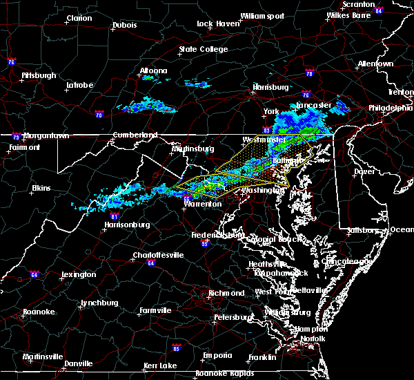 At 1057 pm est, severe thunderstorms were located along a line extending from near gaithersburg to lansdowne to near oatlands, moving east at 50 mph (radar indicated). Hazards include 60 mph wind gusts. Damaging winds will cause some trees and large branches to fall. this could injure those outdoors, as well as damage homes and vehicles. roadways may become blocked by downed trees. localized power outages are possible. unsecured light objects may become projectiles. Locations impacted include, germantown, rockville, bethesda, gaithersburg, reston, leesburg, olney, south riding, herndon, beltsville, vienna, broadlands, lansdowne, lowes island, brambleton, poolesville, american legion bridge, dulles international airport, aspen hill and potomac. At 1057 pm est, severe thunderstorms were located along a line extending from near gaithersburg to lansdowne to near oatlands, moving east at 50 mph (radar indicated). Hazards include 60 mph wind gusts. Damaging winds will cause some trees and large branches to fall. this could injure those outdoors, as well as damage homes and vehicles. roadways may become blocked by downed trees. localized power outages are possible. unsecured light objects may become projectiles. Locations impacted include, germantown, rockville, bethesda, gaithersburg, reston, leesburg, olney, south riding, herndon, beltsville, vienna, broadlands, lansdowne, lowes island, brambleton, poolesville, american legion bridge, dulles international airport, aspen hill and potomac.
|
| 2/12/2017 10:47 PM EST |
 At 1046 pm est, severe thunderstorms were located along a line extending from near hampstead to near damascus, moving east at 55 mph (radar indicated). Hazards include 60 mph wind gusts. Damaging winds will cause some trees and large branches to fall. this could injure those outdoors, as well as damage homes and vehicles. roadways may become blocked by downed trees. localized power outages are possible. unsecured light objects may become projectiles. Locations impacted include, baltimore, columbia, germantown, severn, olney, pikesville, middle river, cockeysville, elkridge, damascus, aberdeen, havre de grace, riviera beach, aberdeen proving ground, baltimore-washington airport, fort smallwood state park, gibson island, sillery bay, millers island and north point state park. At 1046 pm est, severe thunderstorms were located along a line extending from near hampstead to near damascus, moving east at 55 mph (radar indicated). Hazards include 60 mph wind gusts. Damaging winds will cause some trees and large branches to fall. this could injure those outdoors, as well as damage homes and vehicles. roadways may become blocked by downed trees. localized power outages are possible. unsecured light objects may become projectiles. Locations impacted include, baltimore, columbia, germantown, severn, olney, pikesville, middle river, cockeysville, elkridge, damascus, aberdeen, havre de grace, riviera beach, aberdeen proving ground, baltimore-washington airport, fort smallwood state park, gibson island, sillery bay, millers island and north point state park.
|
| 2/12/2017 10:38 PM EST |
 At 1037 pm est, severe thunderstorms were located along a line extending from near point of rocks to near round hill to near berryville, moving east at 50 mph (radar indicated). Hazards include 60 mph wind gusts. Damaging winds will cause some trees and large branches to fall. this could injure those outdoors, as well as damage homes and vehicles. roadways may become blocked by downed trees. localized power outages are possible. Unsecured light objects may become projectiles. At 1037 pm est, severe thunderstorms were located along a line extending from near point of rocks to near round hill to near berryville, moving east at 50 mph (radar indicated). Hazards include 60 mph wind gusts. Damaging winds will cause some trees and large branches to fall. this could injure those outdoors, as well as damage homes and vehicles. roadways may become blocked by downed trees. localized power outages are possible. Unsecured light objects may become projectiles.
|
| 2/12/2017 10:29 PM EST |
 At 1029 pm est, severe thunderstorms were located along a line extending from near littlestown to near point of rocks, moving east at 55 mph (radar indicated). Hazards include 60 mph wind gusts. Damaging winds will cause some trees and large branches to fall. this could injure those outdoors, as well as damage homes and vehicles. roadways may become blocked by downed trees. localized power outages are possible. Unsecured light objects may become projectiles. At 1029 pm est, severe thunderstorms were located along a line extending from near littlestown to near point of rocks, moving east at 55 mph (radar indicated). Hazards include 60 mph wind gusts. Damaging winds will cause some trees and large branches to fall. this could injure those outdoors, as well as damage homes and vehicles. roadways may become blocked by downed trees. localized power outages are possible. Unsecured light objects may become projectiles.
|
| 8/17/2016 9:42 PM EDT |
 At 942 pm edt, severe thunderstorms were located along a line extending from severn to marlton, moving east at 25 mph (radar indicated). Hazards include 70 mph wind gusts. Damaging winds will cause some trees and large branches to fall. this could injure those outdoors, as well as damage homes and vehicles. roadways may become blocked by downed trees. localized power outages are possible. Unsecured light objects may become projectiles. At 942 pm edt, severe thunderstorms were located along a line extending from severn to marlton, moving east at 25 mph (radar indicated). Hazards include 70 mph wind gusts. Damaging winds will cause some trees and large branches to fall. this could injure those outdoors, as well as damage homes and vehicles. roadways may become blocked by downed trees. localized power outages are possible. Unsecured light objects may become projectiles.
|
| 8/17/2016 9:36 PM EDT |
 At 935 pm edt, severe thunderstorms were located along a line extending from near beltsville to near fort washington, moving east at 35 mph (radar indicated). Hazards include 70 mph wind gusts. Damaging winds will cause some trees and large branches to fall. this could injure those outdoors, as well as damage homes and vehicles. roadways may become blocked by downed trees. localized power outages are possible. unsecured light objects may become projectiles. Locations impacted include, bowie, severn, annapolis, crofton, riviera beach, mayo, shady side, deale, naval academy, upper marlboro, fort smallwood state park, rhode river, sillery bay, glen burnie, severna park, odenton, pasadena, arnold, lake shore and parole. At 935 pm edt, severe thunderstorms were located along a line extending from near beltsville to near fort washington, moving east at 35 mph (radar indicated). Hazards include 70 mph wind gusts. Damaging winds will cause some trees and large branches to fall. this could injure those outdoors, as well as damage homes and vehicles. roadways may become blocked by downed trees. localized power outages are possible. unsecured light objects may become projectiles. Locations impacted include, bowie, severn, annapolis, crofton, riviera beach, mayo, shady side, deale, naval academy, upper marlboro, fort smallwood state park, rhode river, sillery bay, glen burnie, severna park, odenton, pasadena, arnold, lake shore and parole.
|
| 8/17/2016 9:22 PM EDT |
 At 922 pm edt, severe thunderstorms were located along a line extending from fairland to national harbor, moving east at 40 mph (radar indicated). Hazards include 70 mph wind gusts. Damaging winds will cause some trees and large branches to fall. this could injure those outdoors, as well as damage homes and vehicles. roadways may become blocked by downed trees. localized power outages are possible. unsecured light objects may become projectiles. Locations impacted include, arlington, alexandria, bowie, clinton, college park, fort washington, greenbelt, langley park, beltsville, fort hunt, groveton, forestville, huntington, largo, coral hills, bladensburg, fort belvoir, national harbor, upper marlboro and gallaudet university. At 922 pm edt, severe thunderstorms were located along a line extending from fairland to national harbor, moving east at 40 mph (radar indicated). Hazards include 70 mph wind gusts. Damaging winds will cause some trees and large branches to fall. this could injure those outdoors, as well as damage homes and vehicles. roadways may become blocked by downed trees. localized power outages are possible. unsecured light objects may become projectiles. Locations impacted include, arlington, alexandria, bowie, clinton, college park, fort washington, greenbelt, langley park, beltsville, fort hunt, groveton, forestville, huntington, largo, coral hills, bladensburg, fort belvoir, national harbor, upper marlboro and gallaudet university.
|
| 8/17/2016 9:21 PM EDT |
 At 921 pm edt, severe thunderstorms were located along a line extending from kemp mill to near fort belvoir, moving east at 35 mph (radar indicated). Hazards include 70 mph wind gusts. Damaging winds will cause some trees and large branches to fall. this could injure those outdoors, as well as damage homes and vehicles. roadways may become blocked by downed trees. localized power outages are possible. Unsecured light objects may become projectiles. At 921 pm edt, severe thunderstorms were located along a line extending from kemp mill to near fort belvoir, moving east at 35 mph (radar indicated). Hazards include 70 mph wind gusts. Damaging winds will cause some trees and large branches to fall. this could injure those outdoors, as well as damage homes and vehicles. roadways may become blocked by downed trees. localized power outages are possible. Unsecured light objects may become projectiles.
|
| 8/17/2016 9:08 PM EDT |
 At 908 pm edt, severe thunderstorms were located along a line extending from north bethesda to fort belvoir, moving east at 40 mph (radar indicated). Hazards include 70 mph wind gusts. Damaging winds will cause some trees and large branches to fall. this could injure those outdoors, as well as damage homes and vehicles. roadways may become blocked by downed trees. localized power outages are possible. unsecured light objects may become projectiles. Locations impacted include, arlington, alexandria, rockville, bethesda, bowie, annandale, clinton, springfield, college park, fort washington, greenbelt, langley park, beltsville, fort hunt, groveton, forestville, falls church, huntington, largo and coral hills. At 908 pm edt, severe thunderstorms were located along a line extending from north bethesda to fort belvoir, moving east at 40 mph (radar indicated). Hazards include 70 mph wind gusts. Damaging winds will cause some trees and large branches to fall. this could injure those outdoors, as well as damage homes and vehicles. roadways may become blocked by downed trees. localized power outages are possible. unsecured light objects may become projectiles. Locations impacted include, arlington, alexandria, rockville, bethesda, bowie, annandale, clinton, springfield, college park, fort washington, greenbelt, langley park, beltsville, fort hunt, groveton, forestville, falls church, huntington, largo and coral hills.
|
| 8/17/2016 8:57 PM EDT |
 At 857 pm edt, severe thunderstorms were located along a line extending from potomac to near lorton, moving east at 40 mph (radar indicated). Hazards include 60 mph wind gusts. Damaging winds will cause some trees and large branches to fall. this could injure those outdoors, as well as damage homes and vehicles. roadways may become blocked by downed trees. localized power outages are possible. Unsecured light objects may become projectiles. At 857 pm edt, severe thunderstorms were located along a line extending from potomac to near lorton, moving east at 40 mph (radar indicated). Hazards include 60 mph wind gusts. Damaging winds will cause some trees and large branches to fall. this could injure those outdoors, as well as damage homes and vehicles. roadways may become blocked by downed trees. localized power outages are possible. Unsecured light objects may become projectiles.
|
| 8/15/2016 6:50 PM EDT |
 At 650 pm edt, severe thunderstorms were located along a line extending from near elkridge to near fort meade to lanham- seabrook, moving east at 20 mph (radar indicated and history of damage). Hazards include 60 mph wind gusts. Damaging winds will cause some trees and large branches to fall. this could injure those outdoors, as well as damage homes and vehicles. roadways may become blocked by downed trees. localized power outages are possible. Unsecured light objects may become projectiles. At 650 pm edt, severe thunderstorms were located along a line extending from near elkridge to near fort meade to lanham- seabrook, moving east at 20 mph (radar indicated and history of damage). Hazards include 60 mph wind gusts. Damaging winds will cause some trees and large branches to fall. this could injure those outdoors, as well as damage homes and vehicles. roadways may become blocked by downed trees. localized power outages are possible. Unsecured light objects may become projectiles.
|
| 8/15/2016 6:41 PM EDT |
 At 640 pm edt, a line of severe thunderstorms were located over from elkridge to hyattsville, moving east at 20 mph (radar indicated and observed damage). Hazards include 60 mph wind gusts and quarter size hail. Damaging winds will cause some trees and large branches to fall. this could injure those outdoors, as well as damage homes and vehicles. roadways may become blocked by downed trees. localized power outages are possible. unsecured light objects may become projectiles. Locations impacted include, bowie, severn, college park, crofton, greenbelt, langley park, beltsville, elkridge, forestville, largo, bladensburg, baltimore-washington airport, byrd stadium, fedex field, glen burnie, odenton, laurel, pasadena, landover and hyattsville. At 640 pm edt, a line of severe thunderstorms were located over from elkridge to hyattsville, moving east at 20 mph (radar indicated and observed damage). Hazards include 60 mph wind gusts and quarter size hail. Damaging winds will cause some trees and large branches to fall. this could injure those outdoors, as well as damage homes and vehicles. roadways may become blocked by downed trees. localized power outages are possible. unsecured light objects may become projectiles. Locations impacted include, bowie, severn, college park, crofton, greenbelt, langley park, beltsville, elkridge, forestville, largo, bladensburg, baltimore-washington airport, byrd stadium, fedex field, glen burnie, odenton, laurel, pasadena, landover and hyattsville.
|
| 8/15/2016 6:18 PM EDT |
 At 617 pm edt, severe thunderstorms were located over fairland, or near beltsville, moving east at 15 mph (radar indicated). Hazards include 60 mph wind gusts and quarter size hail. Damaging winds will cause some trees and large branches to fall. this could injure those outdoors, as well as damage homes and vehicles. roadways may become blocked by downed trees. localized power outages are possible. Unsecured light objects may become projectiles. At 617 pm edt, severe thunderstorms were located over fairland, or near beltsville, moving east at 15 mph (radar indicated). Hazards include 60 mph wind gusts and quarter size hail. Damaging winds will cause some trees and large branches to fall. this could injure those outdoors, as well as damage homes and vehicles. roadways may become blocked by downed trees. localized power outages are possible. Unsecured light objects may become projectiles.
|
| 7/30/2016 9:20 PM EDT |
 At 919 pm edt, a severe thunderstorm was located near rock hall, or near bodkin point, moving east at 30 mph (radar indicated). Hazards include 60 mph wind gusts. Damaging winds will cause some trees and large branches to fall. this could injure those outdoors, as well as damage homes and vehicles. roadways may become blocked by downed trees. localized power outages are possible. unsecured light objects may become projectiles. Locations impacted include, baltimore, severn, annapolis, crofton, riviera beach, naval academy, sparrows point, pinehurst, sillery bay, gibson island, fort smallwood state park, north point state park, bodkin point, baltimore-washington airport, glen burnie, dundalk, severna park, odenton, pasadena and arnold. At 919 pm edt, a severe thunderstorm was located near rock hall, or near bodkin point, moving east at 30 mph (radar indicated). Hazards include 60 mph wind gusts. Damaging winds will cause some trees and large branches to fall. this could injure those outdoors, as well as damage homes and vehicles. roadways may become blocked by downed trees. localized power outages are possible. unsecured light objects may become projectiles. Locations impacted include, baltimore, severn, annapolis, crofton, riviera beach, naval academy, sparrows point, pinehurst, sillery bay, gibson island, fort smallwood state park, north point state park, bodkin point, baltimore-washington airport, glen burnie, dundalk, severna park, odenton, pasadena and arnold.
|
| 7/30/2016 9:01 PM EDT |
 At 901 pm edt, a severe thunderstorm was located over lake shore, or over sillery bay, moving east at 30 mph (radar indicated). Hazards include 60 mph wind gusts. Damaging winds will cause some trees and large branches to fall. this could injure those outdoors, as well as damage homes and vehicles. roadways may become blocked by downed trees. localized power outages are possible. Unsecured light objects may become projectiles. At 901 pm edt, a severe thunderstorm was located over lake shore, or over sillery bay, moving east at 30 mph (radar indicated). Hazards include 60 mph wind gusts. Damaging winds will cause some trees and large branches to fall. this could injure those outdoors, as well as damage homes and vehicles. roadways may become blocked by downed trees. localized power outages are possible. Unsecured light objects may become projectiles.
|
| 7/18/2016 4:49 PM EDT |
 At 448 pm edt, severe thunderstorms were located along a line extending from near odenton to near waldorf, moving east at 45 mph (trained weather spotters and emergency management have confirmed trees down in fairfax county). Hazards include 60 mph wind gusts. Damaging winds will cause some trees and large branches to fall. this could injure those outdoors, as well as damage homes and vehicles. roadways may become blocked by downed trees. localized power outages are possible. unsecured light objects may become projectiles. Locations impacted include, bowie, severn, annapolis, clinton, crofton, fort washington, forestville, largo, mayo, shady side, chesapeake beach, deale, naval academy, upper marlboro, south river, severn river, andrews air force base, pinehurst, sillery bay and rhode river. At 448 pm edt, severe thunderstorms were located along a line extending from near odenton to near waldorf, moving east at 45 mph (trained weather spotters and emergency management have confirmed trees down in fairfax county). Hazards include 60 mph wind gusts. Damaging winds will cause some trees and large branches to fall. this could injure those outdoors, as well as damage homes and vehicles. roadways may become blocked by downed trees. localized power outages are possible. unsecured light objects may become projectiles. Locations impacted include, bowie, severn, annapolis, clinton, crofton, fort washington, forestville, largo, mayo, shady side, chesapeake beach, deale, naval academy, upper marlboro, south river, severn river, andrews air force base, pinehurst, sillery bay and rhode river.
|
| 7/18/2016 4:38 PM EDT |
 At 438 pm edt, severe thunderstorms were located along a line extending from near laurel to near fort belvoir, moving east at 20 mph (trained spotter confirmed). Hazards include 60 mph wind gusts. Damaging winds will cause some trees and large branches to fall. this could injure those outdoors, as well as damage homes and vehicles. roadways may become blocked by downed trees. localized power outages are possible. unsecured light objects may become projectiles. Locations impacted include, arlington, alexandria, bowie, severn, annandale, annapolis, clinton, springfield, college park, crofton, fort washington, greenbelt, langley park, beltsville, fort hunt, groveton, forestville, falls church, huntington and largo. At 438 pm edt, severe thunderstorms were located along a line extending from near laurel to near fort belvoir, moving east at 20 mph (trained spotter confirmed). Hazards include 60 mph wind gusts. Damaging winds will cause some trees and large branches to fall. this could injure those outdoors, as well as damage homes and vehicles. roadways may become blocked by downed trees. localized power outages are possible. unsecured light objects may become projectiles. Locations impacted include, arlington, alexandria, bowie, severn, annandale, annapolis, clinton, springfield, college park, crofton, fort washington, greenbelt, langley park, beltsville, fort hunt, groveton, forestville, falls church, huntington and largo.
|
| 7/18/2016 4:08 PM EDT |
 At 407 pm edt, severe thunderstorms were located along a line extending from near fairland to near lorton, moving east at 35 mph (radar indicated). Hazards include 60 mph wind gusts. Damaging winds will cause some trees and large branches to fall. this could injure those outdoors, as well as damage homes and vehicles. roadways may become blocked by downed trees. localized power outages are possible. Unsecured light objects may become projectiles. At 407 pm edt, severe thunderstorms were located along a line extending from near fairland to near lorton, moving east at 35 mph (radar indicated). Hazards include 60 mph wind gusts. Damaging winds will cause some trees and large branches to fall. this could injure those outdoors, as well as damage homes and vehicles. roadways may become blocked by downed trees. localized power outages are possible. Unsecured light objects may become projectiles.
|
| 7/16/2016 6:00 PM EDT |
 At 600 pm edt, a severe thunderstorm was located over glen burnie, or over baltimore-washington airport, moving east at 15 mph (radar indicated). Hazards include 60 mph wind gusts and quarter size hail. Damaging winds will cause some trees and large branches to fall. this could injure those outdoors, as well as damage homes and vehicles. roadways may become blocked by downed trees. localized power outages are possible. Unsecured light objects may become projectiles. At 600 pm edt, a severe thunderstorm was located over glen burnie, or over baltimore-washington airport, moving east at 15 mph (radar indicated). Hazards include 60 mph wind gusts and quarter size hail. Damaging winds will cause some trees and large branches to fall. this could injure those outdoors, as well as damage homes and vehicles. roadways may become blocked by downed trees. localized power outages are possible. Unsecured light objects may become projectiles.
|
| 7/16/2016 5:44 PM EDT |
 At 544 pm edt, a severe thunderstorm was located near laurel, or near beltsville, moving southeast at 10 mph (radar indicated). Hazards include 60 mph wind gusts and quarter size hail. Damaging winds will cause some trees and large branches to fall. this could injure those outdoors, as well as damage homes and vehicles. roadways may become blocked by downed trees. localized power outages are possible. Unsecured light objects may become projectiles. At 544 pm edt, a severe thunderstorm was located near laurel, or near beltsville, moving southeast at 10 mph (radar indicated). Hazards include 60 mph wind gusts and quarter size hail. Damaging winds will cause some trees and large branches to fall. this could injure those outdoors, as well as damage homes and vehicles. roadways may become blocked by downed trees. localized power outages are possible. Unsecured light objects may become projectiles.
|
| 7/16/2016 5:34 PM EDT |
 At 533 pm edt, a severe thunderstorm was located near bowie, moving east at 15 mph (radar indicated). Hazards include 60 mph wind gusts and quarter size hail. Damaging winds will cause some trees and large branches to fall. this could injure those outdoors, as well as damage homes and vehicles. roadways may become blocked by downed trees. localized power outages are possible. Unsecured light objects may become projectiles. At 533 pm edt, a severe thunderstorm was located near bowie, moving east at 15 mph (radar indicated). Hazards include 60 mph wind gusts and quarter size hail. Damaging winds will cause some trees and large branches to fall. this could injure those outdoors, as well as damage homes and vehicles. roadways may become blocked by downed trees. localized power outages are possible. Unsecured light objects may become projectiles.
|
| 7/1/2016 5:41 PM EDT |
 At 540 pm edt, a severe thunderstorm was located over severna park, or near riviera beach, moving east at 10 mph (radar indicated). Hazards include 60 mph wind gusts and quarter size hail. Damaging winds will cause some trees and large branches to fall. this could injure those outdoors, as well as damage homes and vehicles. roadways may become blocked by downed trees. localized power outages are possible. Unsecured light objects may become projectiles. At 540 pm edt, a severe thunderstorm was located over severna park, or near riviera beach, moving east at 10 mph (radar indicated). Hazards include 60 mph wind gusts and quarter size hail. Damaging winds will cause some trees and large branches to fall. this could injure those outdoors, as well as damage homes and vehicles. roadways may become blocked by downed trees. localized power outages are possible. Unsecured light objects may become projectiles.
|
| 6/28/2016 7:21 PM EDT |
 The severe thunderstorm warning for anne arundel, northern prince georges, southeastern howard and southeastern montgomery counties will expire at 730 pm edt, the storms which prompted the warning have weakened below severe limits, and no longer pose an immediate threat to life or property. therefore the warning will be allowed to expire. a severe thunderstorm watch remains in effect until 1000 pm edt for northern and central maryland. The severe thunderstorm warning for anne arundel, northern prince georges, southeastern howard and southeastern montgomery counties will expire at 730 pm edt, the storms which prompted the warning have weakened below severe limits, and no longer pose an immediate threat to life or property. therefore the warning will be allowed to expire. a severe thunderstorm watch remains in effect until 1000 pm edt for northern and central maryland.
|
| 6/28/2016 7:04 PM EDT |
 The national weather service in sterling virginia has issued a * severe thunderstorm warning for. central anne arundel county in central maryland. northern prince georges county in central maryland. southeastern montgomery county in central maryland. Until 745 pm edt. The national weather service in sterling virginia has issued a * severe thunderstorm warning for. central anne arundel county in central maryland. northern prince georges county in central maryland. southeastern montgomery county in central maryland. Until 745 pm edt.
|
| 6/28/2016 7:04 PM EDT |
 At 704 pm edt, a severe thunderstorm was located over beltsville, moving east at 30 mph (radar indicated). Hazards include 60 mph wind gusts. Damaging winds will cause some trees and large branches to fall. this could injure those outdoors, as well as damage homes and vehicles. roadways may become blocked by downed trees. localized power outages are possible. Unsecured light objects may become projectiles. At 704 pm edt, a severe thunderstorm was located over beltsville, moving east at 30 mph (radar indicated). Hazards include 60 mph wind gusts. Damaging winds will cause some trees and large branches to fall. this could injure those outdoors, as well as damage homes and vehicles. roadways may become blocked by downed trees. localized power outages are possible. Unsecured light objects may become projectiles.
|
| 6/28/2016 6:42 PM EDT |
 At 642 pm edt, severe thunderstorms were located along a line extending from glen burnie to forest glen, moving south at 15 mph (radar indicated). Hazards include 60 mph wind gusts and quarter size hail. Damaging winds will cause some trees and large branches to fall. this could injure those outdoors, as well as damage homes and vehicles. roadways may become blocked by downed trees. localized power outages are possible. Unsecured light objects may become projectiles. At 642 pm edt, severe thunderstorms were located along a line extending from glen burnie to forest glen, moving south at 15 mph (radar indicated). Hazards include 60 mph wind gusts and quarter size hail. Damaging winds will cause some trees and large branches to fall. this could injure those outdoors, as well as damage homes and vehicles. roadways may become blocked by downed trees. localized power outages are possible. Unsecured light objects may become projectiles.
|
| 6/28/2016 6:36 PM EDT |
 The severe thunderstorm warning for north central prince georges, southeastern howard, east central montgomery and northwestern anne arundel counties will expire at 645 pm edt, the storms which prompted the warning have weakened below severe limits, and no longer pose an immediate threat to life or property. therefore the warning will be allowed to expire. however small hail and gusty winds are still possible with these thunderstorms. a severe thunderstorm watch remains in effect until 1000 pm edt for central maryland. The severe thunderstorm warning for north central prince georges, southeastern howard, east central montgomery and northwestern anne arundel counties will expire at 645 pm edt, the storms which prompted the warning have weakened below severe limits, and no longer pose an immediate threat to life or property. therefore the warning will be allowed to expire. however small hail and gusty winds are still possible with these thunderstorms. a severe thunderstorm watch remains in effect until 1000 pm edt for central maryland.
|
| 6/28/2016 6:27 PM EDT |
 At 627 pm edt, severe thunderstorms were located along a line extending from essex to severn to fairland, moving southeast at 25 mph (radar indicated). Hazards include 60 mph wind gusts. Damaging winds will cause some trees and large branches to fall. this could injure those outdoors, as well as damage homes and vehicles. roadways may become blocked by downed trees. localized power outages are possible. unsecured light objects may become projectiles. Locations impacted include, columbia, bowie, severn, college park, greenbelt, beltsville, elkridge, baltimore-washington airport, glen burnie, odenton, laurel, fairland, white oak, ferndale, adelphi, colesville, kemp mill, new carrollton, fort meade and hillandale. At 627 pm edt, severe thunderstorms were located along a line extending from essex to severn to fairland, moving southeast at 25 mph (radar indicated). Hazards include 60 mph wind gusts. Damaging winds will cause some trees and large branches to fall. this could injure those outdoors, as well as damage homes and vehicles. roadways may become blocked by downed trees. localized power outages are possible. unsecured light objects may become projectiles. Locations impacted include, columbia, bowie, severn, college park, greenbelt, beltsville, elkridge, baltimore-washington airport, glen burnie, odenton, laurel, fairland, white oak, ferndale, adelphi, colesville, kemp mill, new carrollton, fort meade and hillandale.
|
| 6/28/2016 6:14 PM EDT |
 At 614 pm edt, severe thunderstorms were located along a line extending from rosedale to near elkridge to rossmoor, moving southeast at 25 mph (radar indicated). Hazards include 60 mph wind gusts and quarter size hail. Damaging winds will cause some trees and large branches to fall. this could injure those outdoors, as well as damage homes and vehicles. roadways may become blocked by downed trees. localized power outages are possible. unsecured light objects may become projectiles. Locations impacted include, columbia, bowie, severn, olney, college park, greenbelt, beltsville, elkridge, baltimore-washington airport, glen burnie, aspen hill, odenton, laurel, fairland, white oak, redland, east riverdale, adelphi, colesville and kemp mill. At 614 pm edt, severe thunderstorms were located along a line extending from rosedale to near elkridge to rossmoor, moving southeast at 25 mph (radar indicated). Hazards include 60 mph wind gusts and quarter size hail. Damaging winds will cause some trees and large branches to fall. this could injure those outdoors, as well as damage homes and vehicles. roadways may become blocked by downed trees. localized power outages are possible. unsecured light objects may become projectiles. Locations impacted include, columbia, bowie, severn, olney, college park, greenbelt, beltsville, elkridge, baltimore-washington airport, glen burnie, aspen hill, odenton, laurel, fairland, white oak, redland, east riverdale, adelphi, colesville and kemp mill.
|
| 6/28/2016 5:55 PM EDT |
 At 555 pm edt, a severe thunderstorm was located near olney, moving southeast at 20 mph (radar indicated). Hazards include 60 mph wind gusts and quarter size hail. Damaging winds will cause some trees and large branches to fall. this could injure those outdoors, as well as damage homes and vehicles. roadways may become blocked by downed trees. localized power outages are possible. Unsecured light objects may become projectiles. At 555 pm edt, a severe thunderstorm was located near olney, moving southeast at 20 mph (radar indicated). Hazards include 60 mph wind gusts and quarter size hail. Damaging winds will cause some trees and large branches to fall. this could injure those outdoors, as well as damage homes and vehicles. roadways may become blocked by downed trees. localized power outages are possible. Unsecured light objects may become projectiles.
|
| 6/21/2016 8:29 PM EDT |
 A severe thunderstorm warning remains in effect until 900 pm edt for anne arundel. northeastern prince georges. southeastern howard and east central montgomery counties. at 829 pm edt. a severe thunderstorm was located near olney. moving southeast at 35 mph. hazard. 60 mph wind gusts. A severe thunderstorm warning remains in effect until 900 pm edt for anne arundel. northeastern prince georges. southeastern howard and east central montgomery counties. at 829 pm edt. a severe thunderstorm was located near olney. moving southeast at 35 mph. hazard. 60 mph wind gusts.
|
| 6/21/2016 8:22 PM EDT |
 At 822 pm edt, a severe thunderstorm was located near olney, moving southeast at 35 mph (radar indicated). Hazards include 60 mph wind gusts and quarter size hail. Damaging winds will cause some trees and large branches to fall. this could injure those outdoors, as well as damage homes and vehicles. roadways may become blocked by downed trees. localized power outages are possible. Unsecured light objects may become projectiles. At 822 pm edt, a severe thunderstorm was located near olney, moving southeast at 35 mph (radar indicated). Hazards include 60 mph wind gusts and quarter size hail. Damaging winds will cause some trees and large branches to fall. this could injure those outdoors, as well as damage homes and vehicles. roadways may become blocked by downed trees. localized power outages are possible. Unsecured light objects may become projectiles.
|
| 6/21/2016 2:43 PM EDT |
 At 243 pm edt, severe thunderstorms were located along a line extending from near gibson island to rhode river, moving southeast at 35 mph (radar indicated). Hazards include 60 mph wind gusts. Damaging winds will cause some trees and large branches to fall. this could injure those outdoors, as well as damage homes and vehicles. roadways may become blocked by downed trees. localized power outages are possible. unsecured light objects may become projectiles. locations impacted include, annapolis, crofton, mayo, shady side, naval academy, severn river, south river, pinehurst, sillery bay, gibson island, rhode river, severna park, odenton, arnold, lake shore, parole, londontowne, edgewater, cape st. Claire and riva. At 243 pm edt, severe thunderstorms were located along a line extending from near gibson island to rhode river, moving southeast at 35 mph (radar indicated). Hazards include 60 mph wind gusts. Damaging winds will cause some trees and large branches to fall. this could injure those outdoors, as well as damage homes and vehicles. roadways may become blocked by downed trees. localized power outages are possible. unsecured light objects may become projectiles. locations impacted include, annapolis, crofton, mayo, shady side, naval academy, severn river, south river, pinehurst, sillery bay, gibson island, rhode river, severna park, odenton, arnold, lake shore, parole, londontowne, edgewater, cape st. Claire and riva.
|
| 6/21/2016 2:23 PM EDT |
 At 222 pm edt, severe thunderstorms were located along a line extending from green haven to bowie, moving southeast at 35 mph (radar indicated). Hazards include 70 mph wind gusts. Damaging winds will cause some trees and large branches to fall. this could injure those outdoors, as well as damage homes and vehicles. roadways may become blocked by downed trees. localized power outages are possible. unsecured light objects may become projectiles. Locations impacted include, baltimore, severn, annapolis, crofton, riviera beach, mayo, shady side, naval academy, south river, gibson island, fort smallwood state park, bodkin point, baltimore-washington airport, severn river, pinehurst, sillery bay, rhode river, glen burnie, severna park and odenton. At 222 pm edt, severe thunderstorms were located along a line extending from green haven to bowie, moving southeast at 35 mph (radar indicated). Hazards include 70 mph wind gusts. Damaging winds will cause some trees and large branches to fall. this could injure those outdoors, as well as damage homes and vehicles. roadways may become blocked by downed trees. localized power outages are possible. unsecured light objects may become projectiles. Locations impacted include, baltimore, severn, annapolis, crofton, riviera beach, mayo, shady side, naval academy, south river, gibson island, fort smallwood state park, bodkin point, baltimore-washington airport, severn river, pinehurst, sillery bay, rhode river, glen burnie, severna park and odenton.
|
| 6/21/2016 2:08 PM EDT |
 At 208 pm edt, severe thunderstorms were located along a line extending from ferndale to goddard, moving southeast at 35 mph (radar indicated). Hazards include 70 mph wind gusts and half dollar size hail. Damaging winds will cause some trees and large branches to fall. this could injure those outdoors, as well as damage homes and vehicles. roadways may become blocked by downed trees. localized power outages are possible. Unsecured light objects may become projectiles. At 208 pm edt, severe thunderstorms were located along a line extending from ferndale to goddard, moving southeast at 35 mph (radar indicated). Hazards include 70 mph wind gusts and half dollar size hail. Damaging winds will cause some trees and large branches to fall. this could injure those outdoors, as well as damage homes and vehicles. roadways may become blocked by downed trees. localized power outages are possible. Unsecured light objects may become projectiles.
|
| 6/21/2016 1:54 PM EDT |
 At 154 pm edt, severe thunderstorms were located along a line extending from near randallstown to near montgomery village, moving southeast at 30 mph (radar indicated). Hazards include 70 mph wind gusts and half dollar size hail. Damaging winds will cause some trees and large branches to fall. this could injure those outdoors, as well as damage homes and vehicles. roadways may become blocked by downed trees. localized power outages are possible. unsecured light objects may become projectiles. Locations impacted include, baltimore, columbia, rockville, gaithersburg, bowie, severn, olney, pikesville, college park, crofton, middle river, greenbelt, langley park, beltsville, elkridge, riviera beach, bladensburg, back river, millers island and fedex field. At 154 pm edt, severe thunderstorms were located along a line extending from near randallstown to near montgomery village, moving southeast at 30 mph (radar indicated). Hazards include 70 mph wind gusts and half dollar size hail. Damaging winds will cause some trees and large branches to fall. this could injure those outdoors, as well as damage homes and vehicles. roadways may become blocked by downed trees. localized power outages are possible. unsecured light objects may become projectiles. Locations impacted include, baltimore, columbia, rockville, gaithersburg, bowie, severn, olney, pikesville, college park, crofton, middle river, greenbelt, langley park, beltsville, elkridge, riviera beach, bladensburg, back river, millers island and fedex field.
|
| 6/21/2016 1:40 PM EDT |
 At 139 pm edt, severe thunderstorms were located along a line extending from gamber to near damascus, moving southeast at 30 mph. these are very dangerous storms (radar indicated). Hazards include 80 mph wind gusts and half dollar size hail. Expect considerable damage to trees and power lines. your life is at significant risk if outdoors. in addition to some trees falling into homes, wind damage is possible to roofs, sheds, open garages, and mobile homes. Locations impacted include, baltimore, columbia, germantown, rockville, gaithersburg, bowie, severn, olney, pikesville, college park, crofton, middle river, greenbelt, langley park, beltsville, elkridge, damascus, riviera beach, bladensburg and back river. At 139 pm edt, severe thunderstorms were located along a line extending from gamber to near damascus, moving southeast at 30 mph. these are very dangerous storms (radar indicated). Hazards include 80 mph wind gusts and half dollar size hail. Expect considerable damage to trees and power lines. your life is at significant risk if outdoors. in addition to some trees falling into homes, wind damage is possible to roofs, sheds, open garages, and mobile homes. Locations impacted include, baltimore, columbia, germantown, rockville, gaithersburg, bowie, severn, olney, pikesville, college park, crofton, middle river, greenbelt, langley park, beltsville, elkridge, damascus, riviera beach, bladensburg and back river.
|
| 6/21/2016 1:30 PM EDT |
 At 130 pm edt, severe thunderstorms were located along a line extending from near gamber to 6 miles southwest of green valley, moving southeast at 30 mph (radar indicated). Hazards include 70 mph wind gusts and quarter size hail. Damaging winds will cause some trees and large branches to fall. this could injure those outdoors, as well as damage homes and vehicles. roadways may become blocked by downed trees. localized power outages are possible. unsecured light objects may become projectiles. Locations impacted include, baltimore, columbia, germantown, rockville, gaithersburg, bowie, severn, olney, pikesville, college park, crofton, middle river, greenbelt, langley park, beltsville, elkridge, damascus, riviera beach, bladensburg and back river. At 130 pm edt, severe thunderstorms were located along a line extending from near gamber to 6 miles southwest of green valley, moving southeast at 30 mph (radar indicated). Hazards include 70 mph wind gusts and quarter size hail. Damaging winds will cause some trees and large branches to fall. this could injure those outdoors, as well as damage homes and vehicles. roadways may become blocked by downed trees. localized power outages are possible. unsecured light objects may become projectiles. Locations impacted include, baltimore, columbia, germantown, rockville, gaithersburg, bowie, severn, olney, pikesville, college park, crofton, middle river, greenbelt, langley park, beltsville, elkridge, damascus, riviera beach, bladensburg and back river.
|
| 6/21/2016 1:19 PM EDT |
 At 118 pm edt, severe thunderstorms were located along a line extending from near gamber to near ballenger creek, moving southeast at 30 mph (radar indicated). Hazards include 60 mph wind gusts. frequent lightning is also occurring with this storm. Damaging winds will cause some trees and large branches to fall. this could injure those outdoors, as well as damage homes and vehicles. roadways may become blocked by downed trees. localized power outages are possible. Unsecured light objects may become projectiles. At 118 pm edt, severe thunderstorms were located along a line extending from near gamber to near ballenger creek, moving southeast at 30 mph (radar indicated). Hazards include 60 mph wind gusts. frequent lightning is also occurring with this storm. Damaging winds will cause some trees and large branches to fall. this could injure those outdoors, as well as damage homes and vehicles. roadways may become blocked by downed trees. localized power outages are possible. Unsecured light objects may become projectiles.
|
| 6/16/2016 8:51 PM EDT |
 At 851 pm edt, severe thunderstorms were located along a line extending from near poolesville to near lake ridge to near stafford to 11 miles west of spotsylvania, moving east at 35 mph (radar indicated). Hazards include 60 mph wind gusts. Damaging winds will cause some trees and large branches to fall. this could injure those outdoors, as well as damage homes and vehicles. roadways may become blocked by downed trees. localized power outages are possible. Unsecured light objects may become projectiles. At 851 pm edt, severe thunderstorms were located along a line extending from near poolesville to near lake ridge to near stafford to 11 miles west of spotsylvania, moving east at 35 mph (radar indicated). Hazards include 60 mph wind gusts. Damaging winds will cause some trees and large branches to fall. this could injure those outdoors, as well as damage homes and vehicles. roadways may become blocked by downed trees. localized power outages are possible. Unsecured light objects may become projectiles.
|
| 6/5/2016 4:22 PM EDT |
 At 422 pm edt, severe thunderstorms were located along a line extending from near stewartstown to near cockeysville to near montgomery village, moving east at 50 mph (radar indicated). Hazards include 60 mph wind gusts. Damaging winds will cause some trees and large branches to fall. this could injure those outdoors, as well as damage homes and vehicles. roadways may become blocked by downed trees. localized power outages are possible. Unsecured light objects may become projectiles. At 422 pm edt, severe thunderstorms were located along a line extending from near stewartstown to near cockeysville to near montgomery village, moving east at 50 mph (radar indicated). Hazards include 60 mph wind gusts. Damaging winds will cause some trees and large branches to fall. this could injure those outdoors, as well as damage homes and vehicles. roadways may become blocked by downed trees. localized power outages are possible. Unsecured light objects may become projectiles.
|
| 5/2/2016 9:39 PM EDT |
 At 939 pm edt, a severe thunderstorm was located near parole, or near crofton, moving east at 35 mph (radar indicated). Hazards include 60 mph wind gusts and quarter size hail. Expect wind damage to trees and powerlines. locations impacted include, bowie, crofton, severn river, south river, sillery bay, severna park, odenton, arnold, lake shore, parole, londontowne, millersville, edgewater, cape st. Claire, riva, gambrills, herald harbor, crownsville, highland beach and cape arthur. At 939 pm edt, a severe thunderstorm was located near parole, or near crofton, moving east at 35 mph (radar indicated). Hazards include 60 mph wind gusts and quarter size hail. Expect wind damage to trees and powerlines. locations impacted include, bowie, crofton, severn river, south river, sillery bay, severna park, odenton, arnold, lake shore, parole, londontowne, millersville, edgewater, cape st. Claire, riva, gambrills, herald harbor, crownsville, highland beach and cape arthur.
|
| 5/2/2016 9:20 PM EDT |
 At 920 pm edt, a severe thunderstorm was located over lanham-seabrook, or near fedex field, moving east at 30 mph (radar indicated). Hazards include 60 mph wind gusts and quarter size hail. expect wind damage to trees and powerlines At 920 pm edt, a severe thunderstorm was located over lanham-seabrook, or near fedex field, moving east at 30 mph (radar indicated). Hazards include 60 mph wind gusts and quarter size hail. expect wind damage to trees and powerlines
|
| 4/7/2016 11:36 AM EDT |
 The severe thunderstorm warning for baltimore, northern anne arundel, northeastern prince georges, southeastern howard and southwestern harford counties and baltimore city will expire at 1145 am edt, the storm which prompted the warning has moved out of the area. therefore the warning will be allowed to expire. The severe thunderstorm warning for baltimore, northern anne arundel, northeastern prince georges, southeastern howard and southwestern harford counties and baltimore city will expire at 1145 am edt, the storm which prompted the warning has moved out of the area. therefore the warning will be allowed to expire.
|
| 4/7/2016 10:44 AM EDT |
 At 1043 am edt, this severe thunderstorm is capable of producing damaging winds in excess of 60 mph. this storm was located over crofton, and moving northeast at 30 mph. At 1043 am edt, this severe thunderstorm is capable of producing damaging winds in excess of 60 mph. this storm was located over crofton, and moving northeast at 30 mph.
|
| 4/7/2016 10:33 AM EDT |
 At 1032 am edt, doppler radar indicated a line of severe thunderstorms just east of washington. these storms were located along a line extending from east riverdale to greater upper marlboro to near marlton, and moving east at 35 mph. At 1032 am edt, doppler radar indicated a line of severe thunderstorms just east of washington. these storms were located along a line extending from east riverdale to greater upper marlboro to near marlton, and moving east at 35 mph.
|
| 2/24/2016 6:58 PM EST | The severe thunderstorm warning for central baltimore, northeastern charles, anne arundel, prince georges, southeastern howard and northwestern calvert counties and baltimore city will expire at 700 pm est, the storms which prompted the warning have moved to the east, therefore the warning will be allowed to expire. a tornado watch remains in effect until 11 pm. a severe thunderstorm warning still remains in effect for portions of baltimore, charles, anne arundel, prince georges, and calvert counties and baltimore city. |
| 2/24/2016 6:28 PM EST |
 At 627 pm est, doppler radar indicated a line of severe thunderstorms capable of producing damaging winds in excess of 60 mph. these storms were located along a line extending from elkridge to mitchellville to near friendly, moving northeast at 35 mph. locations impacted include, bowie, greenbelt, chesapeake beach, upper marlboro, crofton, severn, elkridge, clinton, bodkin point, severn river, largo, pinehurst, sillery bay, back river, fedex field, rhode river, south river, forestville, gibson island and baltimore-washington airport. a tornado watch remains in effect until 1100 pm est for maryland. At 627 pm est, doppler radar indicated a line of severe thunderstorms capable of producing damaging winds in excess of 60 mph. these storms were located along a line extending from elkridge to mitchellville to near friendly, moving northeast at 35 mph. locations impacted include, bowie, greenbelt, chesapeake beach, upper marlboro, crofton, severn, elkridge, clinton, bodkin point, severn river, largo, pinehurst, sillery bay, back river, fedex field, rhode river, south river, forestville, gibson island and baltimore-washington airport. a tornado watch remains in effect until 1100 pm est for maryland.
|
| 2/24/2016 5:59 PM EST |
 At 558 pm est, doppler radar indicated a line of severe thunderstorms capable of producing damaging winds in excess of 60 mph. these storms were located along a line extending from rossmoor to huntington to near woodbridge, and moving northeast at 45 mph. At 558 pm est, doppler radar indicated a line of severe thunderstorms capable of producing damaging winds in excess of 60 mph. these storms were located along a line extending from rossmoor to huntington to near woodbridge, and moving northeast at 45 mph.
|
| 8/24/2015 8:53 PM EDT |
 The severe thunderstorm warning for northwestern anne arundel, south central baltimore and east central howard counties will expire at 900 pm edt, the storms which prompted the warning have weakened below severe limits and exited the warned area. therefore the warning will be allowed to expire. however heavy rain is still possible with these thunderstorms. to report severe weather, contact your nearest law enforcement agency. they will relay your report to the national weather service sterling virginia. The severe thunderstorm warning for northwestern anne arundel, south central baltimore and east central howard counties will expire at 900 pm edt, the storms which prompted the warning have weakened below severe limits and exited the warned area. therefore the warning will be allowed to expire. however heavy rain is still possible with these thunderstorms. to report severe weather, contact your nearest law enforcement agency. they will relay your report to the national weather service sterling virginia.
|
| 8/24/2015 8:45 PM EDT |
 At 843 pm edt, doppler radar indicated a line of severe thunderstorms capable of producing damaging winds in excess of 60 mph. these storms were located along a line extending from arbutus to glen burnie to pasadena to parole. these storms were moving the northeast at 25 mph. locations impacted include, severn, elkridge, baltimore-washington airport, south gate, pumphrey, arnold, severna park, green haven, millersville, brooklyn park, glen burnie, ferndale, pasadena, arbutus, parole, odenton, fort meade, herald harbor, cape arthur and gambrills. At 843 pm edt, doppler radar indicated a line of severe thunderstorms capable of producing damaging winds in excess of 60 mph. these storms were located along a line extending from arbutus to glen burnie to pasadena to parole. these storms were moving the northeast at 25 mph. locations impacted include, severn, elkridge, baltimore-washington airport, south gate, pumphrey, arnold, severna park, green haven, millersville, brooklyn park, glen burnie, ferndale, pasadena, arbutus, parole, odenton, fort meade, herald harbor, cape arthur and gambrills.
|
| 8/24/2015 8:36 PM EDT |
 At 835 pm edt, doppler radar indicated a line of severe thunderstorms capable of producing damaging winds in excess of 60 mph. these storms were located along a line extending from baltimore-washington airport to severna park to near crofton. these storms were nearly stationary. locations impacted include, crofton, severn, elkridge, baltimore-washington airport, columbia, south gate, odenton, pumphrey, fort meade, arnold, severna park, green haven, millersville, brooklyn park, glen burnie, ferndale, pasadena, arbutus, savage-guilford and herald harbor. At 835 pm edt, doppler radar indicated a line of severe thunderstorms capable of producing damaging winds in excess of 60 mph. these storms were located along a line extending from baltimore-washington airport to severna park to near crofton. these storms were nearly stationary. locations impacted include, crofton, severn, elkridge, baltimore-washington airport, columbia, south gate, odenton, pumphrey, fort meade, arnold, severna park, green haven, millersville, brooklyn park, glen burnie, ferndale, pasadena, arbutus, savage-guilford and herald harbor.
|
| 8/24/2015 8:12 PM EDT |
 At 812 pm edt, doppler radar indicated a line of severe thunderstorms capable of producing damaging winds in excess of 60 mph. these storms were located along a line extending from laurel to near fort meade to lanham-seabrook, and moving northeast at 25 mph. At 812 pm edt, doppler radar indicated a line of severe thunderstorms capable of producing damaging winds in excess of 60 mph. these storms were located along a line extending from laurel to near fort meade to lanham-seabrook, and moving northeast at 25 mph.
|
| 8/4/2015 4:49 AM EDT |
 At 449 am edt, doppler radar indicated a severe thunderstorm capable of producing quarter size hail and damaging winds in excess of 60 mph. this storm was located near olney, and moving east at 45 mph. At 449 am edt, doppler radar indicated a severe thunderstorm capable of producing quarter size hail and damaging winds in excess of 60 mph. this storm was located near olney, and moving east at 45 mph.
|
| 7/9/2015 7:21 PM EDT |
 At 721 pm edt, doppler radar indicated a line of severe thunderstorms capable of producing damaging winds in excess of 60 mph. these storms were located along a line extending from gibson island to near bowie, and moving east at 35 mph. At 721 pm edt, doppler radar indicated a line of severe thunderstorms capable of producing damaging winds in excess of 60 mph. these storms were located along a line extending from gibson island to near bowie, and moving east at 35 mph.
|
| 7/1/2015 1:39 AM EDT |
 At 138 am edt, doppler radar indicated a severe thunderstorm capable of producing damaging winds in excess of 60 mph. this storm was located over brooklyn park, or over locust point, moving northeast at 50 mph. locations impacted include, baltimore, crofton, severn, union square, elkridge, guilford, howard park, bodkin point, baltimore inner harbor, pinehurst, sillery bay, back river, locust point, camden yards, roland park, fallstaff, millers island, cockeysville, fells point and pikesville. At 138 am edt, doppler radar indicated a severe thunderstorm capable of producing damaging winds in excess of 60 mph. this storm was located over brooklyn park, or over locust point, moving northeast at 50 mph. locations impacted include, baltimore, crofton, severn, union square, elkridge, guilford, howard park, bodkin point, baltimore inner harbor, pinehurst, sillery bay, back river, locust point, camden yards, roland park, fallstaff, millers island, cockeysville, fells point and pikesville.
|
| 7/1/2015 1:24 AM EDT |
 At 124 am edt, doppler radar indicated a severe thunderstorm capable of producing damaging winds in excess of 60 mph. this storm was located over odenton, or near severn, and moving northeast at 50 mph. At 124 am edt, doppler radar indicated a severe thunderstorm capable of producing damaging winds in excess of 60 mph. this storm was located over odenton, or near severn, and moving northeast at 50 mph.
|
| 7/1/2015 1:19 AM EDT |
 At 119 am edt, doppler radar indicated a severe thunderstorm capable of producing quarter size hail and damaging winds in excess of 60 mph. this storm was located over baltimore-washington airport, moving northeast at 50 mph. locations impacted include, baltimore, bowie, college park, greenbelt, bladensburg, crofton, severn, union square, elkridge, guilford, howard park, baltimore inner harbor, largo, back river, locust point, camden yards, roland park, fallstaff, millers island and fedex field. At 119 am edt, doppler radar indicated a severe thunderstorm capable of producing quarter size hail and damaging winds in excess of 60 mph. this storm was located over baltimore-washington airport, moving northeast at 50 mph. locations impacted include, baltimore, bowie, college park, greenbelt, bladensburg, crofton, severn, union square, elkridge, guilford, howard park, baltimore inner harbor, largo, back river, locust point, camden yards, roland park, fallstaff, millers island and fedex field.
|
| 7/1/2015 1:00 AM EDT |
 At 100 am edt, doppler radar indicated a severe thunderstorm capable of producing quarter size hail and damaging winds in excess of 60 mph. this storm was located over lanham-seabrook, or near greenbelt, and moving northeast at 50 mph. At 100 am edt, doppler radar indicated a severe thunderstorm capable of producing quarter size hail and damaging winds in excess of 60 mph. this storm was located over lanham-seabrook, or near greenbelt, and moving northeast at 50 mph.
|
| 6/23/2015 7:14 PM EDT |
 At 714 pm edt, doppler radar indicated a line of severe thunderstorms capable of producing quarter size hail and damaging winds in excess of 60 mph. these storms were located along a line extending from near grasonville to 9 miles south of linton hall, and moving southeast at 35 mph. At 714 pm edt, doppler radar indicated a line of severe thunderstorms capable of producing quarter size hail and damaging winds in excess of 60 mph. these storms were located along a line extending from near grasonville to 9 miles south of linton hall, and moving southeast at 35 mph.
|
| 6/23/2015 6:27 PM EDT |
 At 627 pm edt, trained weather spotters reported a line of severe thunderstorms producing quarter size hail and damaging winds in excess of 60 mph. these storms were located along a line extending from brooklyn park to south riding, and moving southeast at 35 mph. At 627 pm edt, trained weather spotters reported a line of severe thunderstorms producing quarter size hail and damaging winds in excess of 60 mph. these storms were located along a line extending from brooklyn park to south riding, and moving southeast at 35 mph.
|
| 6/23/2015 6:18 PM EDT |
 At 618 pm edt, doppler radar indicated a line of severe thunderstorms capable of producing quarter size hail and destructive winds in excess of 70 mph. these storms were located along a line extending from near westminster to near purcellville, moving east at 25 mph. locations impacted include, rockville, gaithersburg, leesburg, college park, greenbelt, poolesville, crofton, severn, elkridge, broadlands, olney, damascus, lowes island, lansdowne, langley park, germantown, columbia, byrd stadium, beltsville and baltimore-washington airport. At 618 pm edt, doppler radar indicated a line of severe thunderstorms capable of producing quarter size hail and destructive winds in excess of 70 mph. these storms were located along a line extending from near westminster to near purcellville, moving east at 25 mph. locations impacted include, rockville, gaithersburg, leesburg, college park, greenbelt, poolesville, crofton, severn, elkridge, broadlands, olney, damascus, lowes island, lansdowne, langley park, germantown, columbia, byrd stadium, beltsville and baltimore-washington airport.
|
| 6/23/2015 6:01 PM EDT |
 At 600 pm edt, doppler radar indicated a line of severe thunderstorms capable of producing quarter size hail and destructive winds in excess of 70 mph. these storms were located along a line extending from near westminster to round hill, and moving east at 25 mph. At 600 pm edt, doppler radar indicated a line of severe thunderstorms capable of producing quarter size hail and destructive winds in excess of 70 mph. these storms were located along a line extending from near westminster to round hill, and moving east at 25 mph.
|
| 6/20/2015 9:08 PM EDT |
 At 908 pm edt, doppler radar indicated a line of severe thunderstorms capable of producing damaging winds in excess of 60 mph. these storms were located along a line extending from roland park to near locust point to millersville, and moving northeast at 40 mph. At 908 pm edt, doppler radar indicated a line of severe thunderstorms capable of producing damaging winds in excess of 60 mph. these storms were located along a line extending from roland park to near locust point to millersville, and moving northeast at 40 mph.
|
| 6/14/2015 5:52 PM EDT |
 At 551 pm edt, doppler radar indicated a severe thunderstorm capable of producing quarter size hail and damaging winds in excess of 60 mph. this storm was located near goddard, or near bowie. this storm was nearly stationary. locations impacted include, bowie, greenbelt, crofton, new carrollton, woodmore, goddard, kettering, lanham-seabrook, mitchellville, lake arbor, odenton, berwyn heights, prince georges stadium, springdale and glenn dale. At 551 pm edt, doppler radar indicated a severe thunderstorm capable of producing quarter size hail and damaging winds in excess of 60 mph. this storm was located near goddard, or near bowie. this storm was nearly stationary. locations impacted include, bowie, greenbelt, crofton, new carrollton, woodmore, goddard, kettering, lanham-seabrook, mitchellville, lake arbor, odenton, berwyn heights, prince georges stadium, springdale and glenn dale.
|
| 6/14/2015 5:24 PM EDT |
 At 524 pm edt, doppler radar indicated a severe thunderstorm capable of producing quarter size hail and damaging winds in excess of 60 mph. this storm was located over goddard, or over greenbelt, and moving east at 10 mph. At 524 pm edt, doppler radar indicated a severe thunderstorm capable of producing quarter size hail and damaging winds in excess of 60 mph. this storm was located over goddard, or over greenbelt, and moving east at 10 mph.
|
| 4/20/2015 9:24 PM EDT | At 923 pm edt, doppler radar indicated a line of severe thunderstorms capable of producing damaging winds in excess of 60 mph. these storms were located along a line extending from rosedale to near rock hall, moving northeast at 40 mph. locations impacted include, baltimore, aberdeen, bel air, severn, fells point, turners station, m and t stadium, fort smallwood state park, armistead gardens, john hopkins university, middle river, baltimore-washington airport, baltimore inner harbor, riviera beach, josephine lee, sparrows point, back river, eastpoint, camden yards and north point state park. a tornado watch remains in effect until 1000 pm edt for northern maryland. |
| 4/20/2015 9:06 PM EDT | At 905 pm edt, doppler radar indicated a line of severe thunderstorms capable of producing damaging winds in excess of 60 mph. these storms were located along a line extending from beechfield to arnold, moving northeast at 30 mph. locations impacted include, baltimore, aberdeen, bel air, morgan state university, severn, fells point, woodring, turners station, m and t stadium, fort smallwood state park, armistead gardens, john hopkins university, middle river, baltimore-washington airport, clifton park, baltimore inner harbor, riviera beach, josephine lee, sparrows point and back river. a tornado watch remains in effect until 1000 pm edt for northern maryland. |
| 4/20/2015 8:52 PM EDT | At 851 pm edt, doppler radar indicated a line of severe thunderstorms capable of producing damaging winds in excess of 60 mph. these storms were located along a line extending from mays chapel to baltimore inner harbor to near severn, and moving northeast at 85 mph. |
| 4/20/2015 8:37 PM EDT | At 837 pm edt, doppler radar indicated a line of severe thunderstorms capable of producing quarter size hail and damaging winds in excess of 60 mph. these storms were located along a line extending from catonsville to odenton, moving northeast at 60 mph. locations impacted include, baltimore, bowie, college park, greenbelt, bladensburg, crofton, morgan state university, severn, union square, elkridge, guilford, woodring, turners station, howard park, armistead gardens, coral hills, baltimore inner harbor, back river, camden yards and roland park. a tornado watch remains in effect until 1000 pm edt for central district of columbia and northern maryland. |
| 4/20/2015 8:37 PM EDT | At 837 pm edt, doppler radar indicated a line of severe thunderstorms capable of producing quarter size hail and damaging winds in excess of 60 mph. these storms were located along a line extending from catonsville to odenton, moving northeast at 60 mph. locations impacted include, baltimore, bowie, college park, greenbelt, bladensburg, crofton, morgan state university, severn, union square, elkridge, guilford, woodring, turners station, howard park, armistead gardens, coral hills, baltimore inner harbor, back river, camden yards and roland park. a tornado watch remains in effect until 1000 pm edt for central district of columbia and northern maryland. |
| 4/20/2015 8:20 PM EDT | At 820 pm edt, doppler radar indicated a line of severe thunderstorms capable of producing quarter size hail and damaging winds in excess of 60 mph. these storms were located along a line extending from near fairland to greater landover, and moving northeast at 55 mph. |
| 4/20/2015 8:20 PM EDT | At 820 pm edt, doppler radar indicated a line of severe thunderstorms capable of producing quarter size hail and damaging winds in excess of 60 mph. these storms were located along a line extending from near fairland to greater landover, and moving northeast at 55 mph. |
| 1/1/0001 12:00 AM | Tree was blown down onto garage crushing the roof...a car in the garage was damaged when the tree fell. also...multiple 150 year old trees blown dow in anne arundel county MD, 3 miles NNE of Odenton, MD |
Hail Maps for Odenton, MD
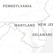


Connect with Interactive Hail Maps