

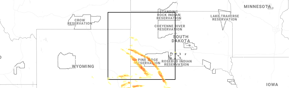
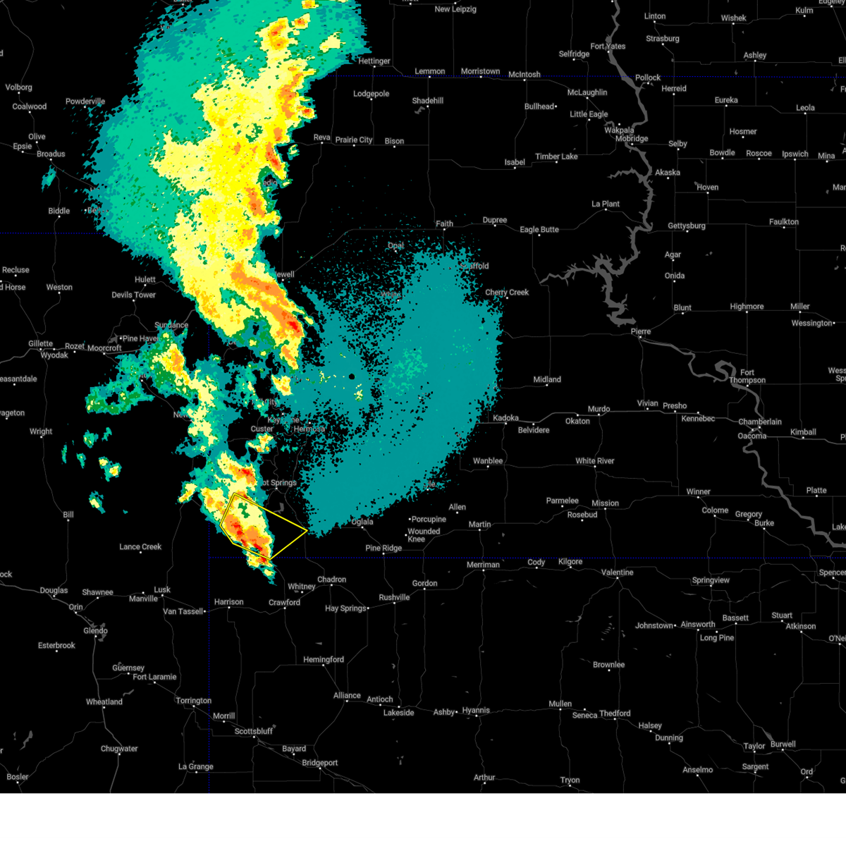
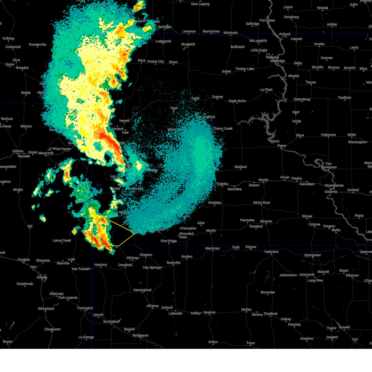
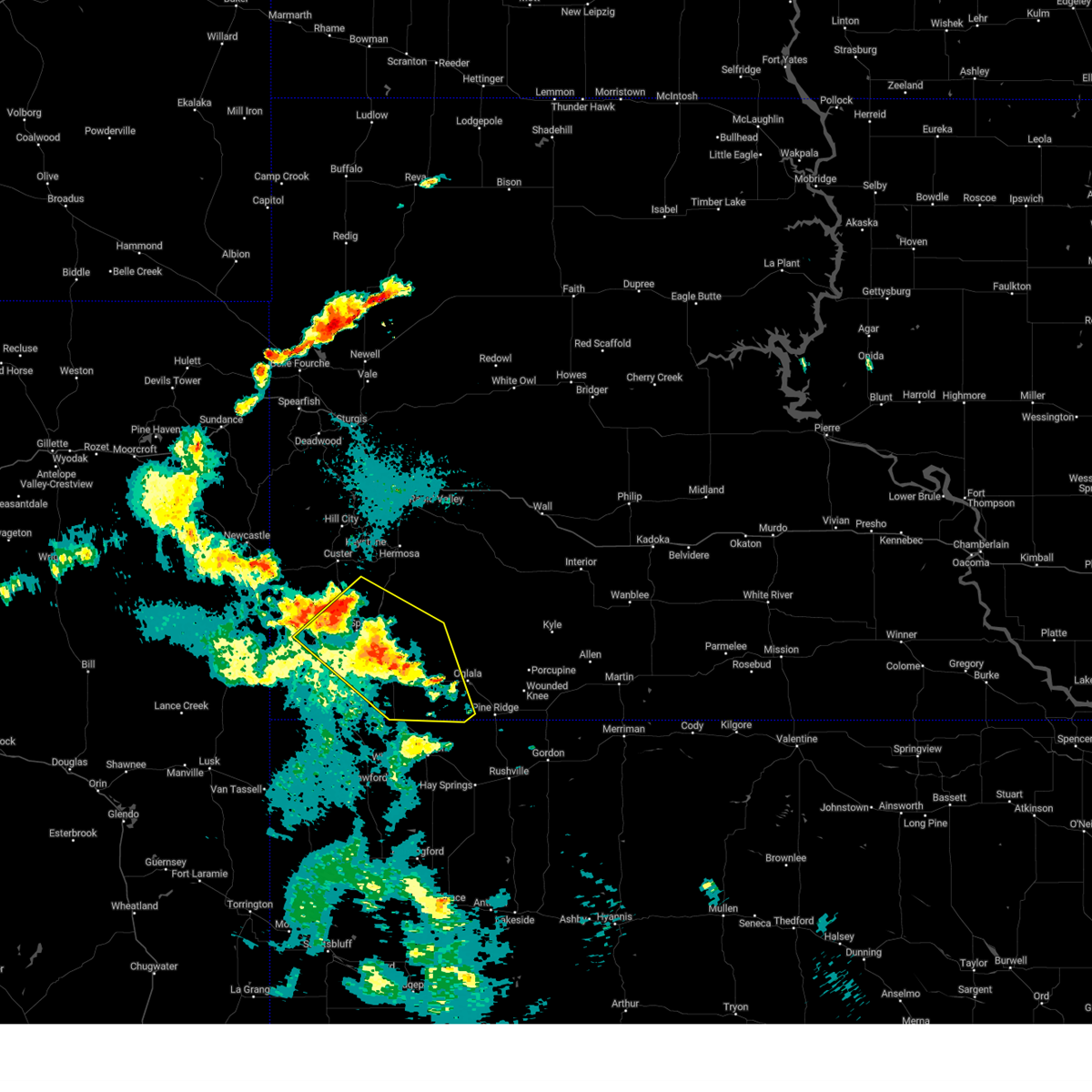
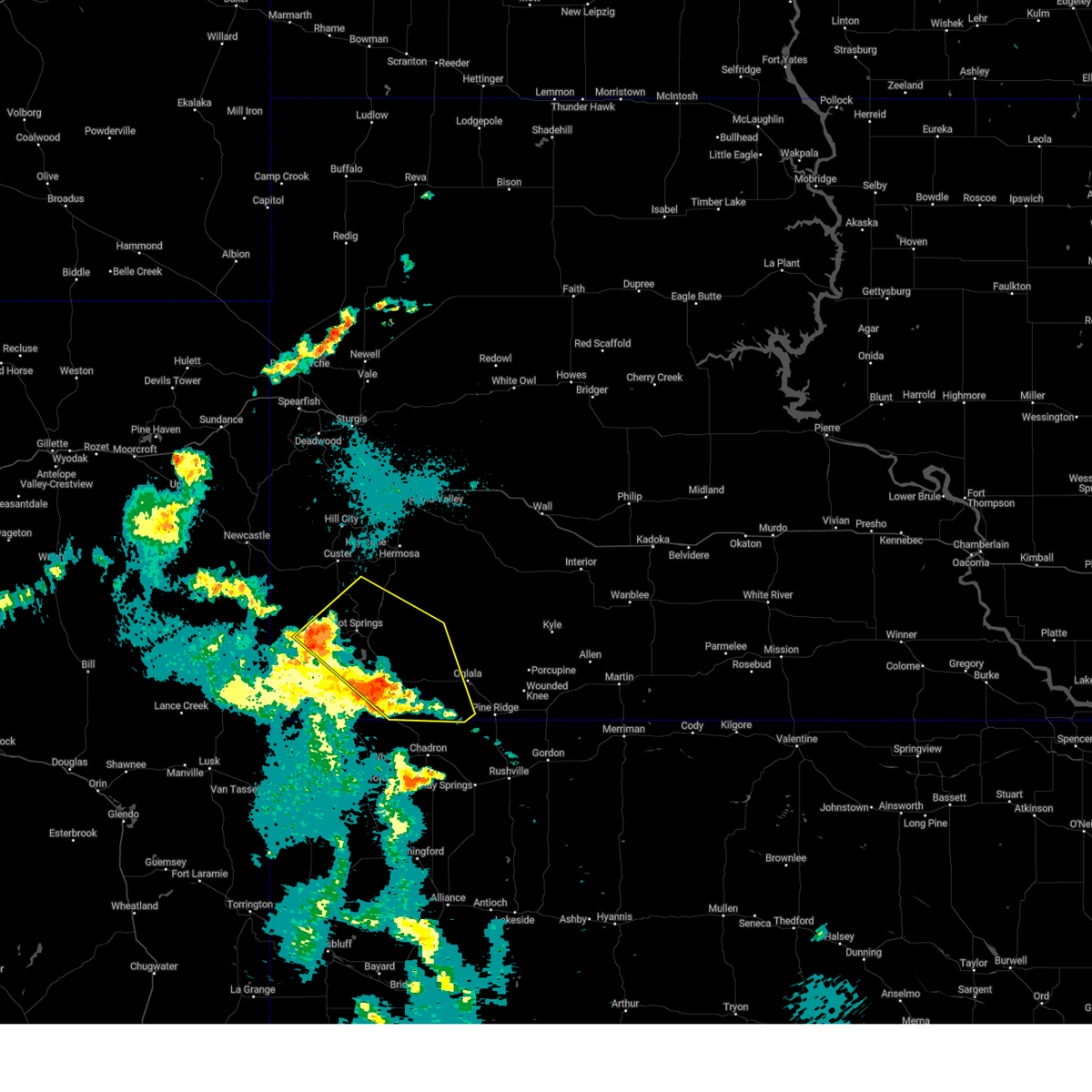
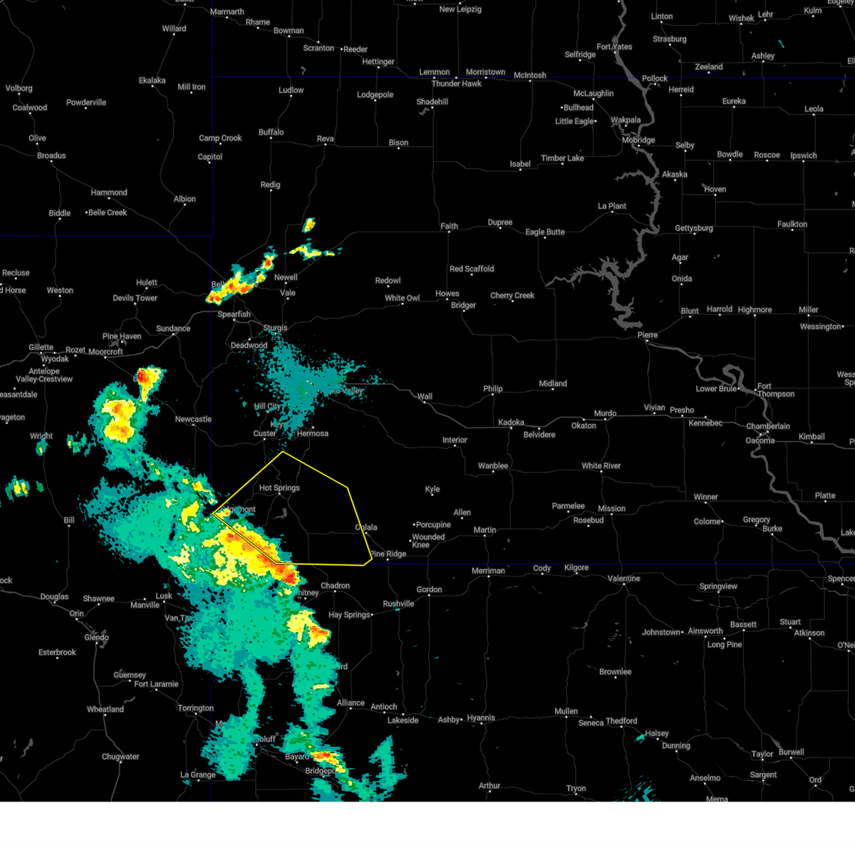
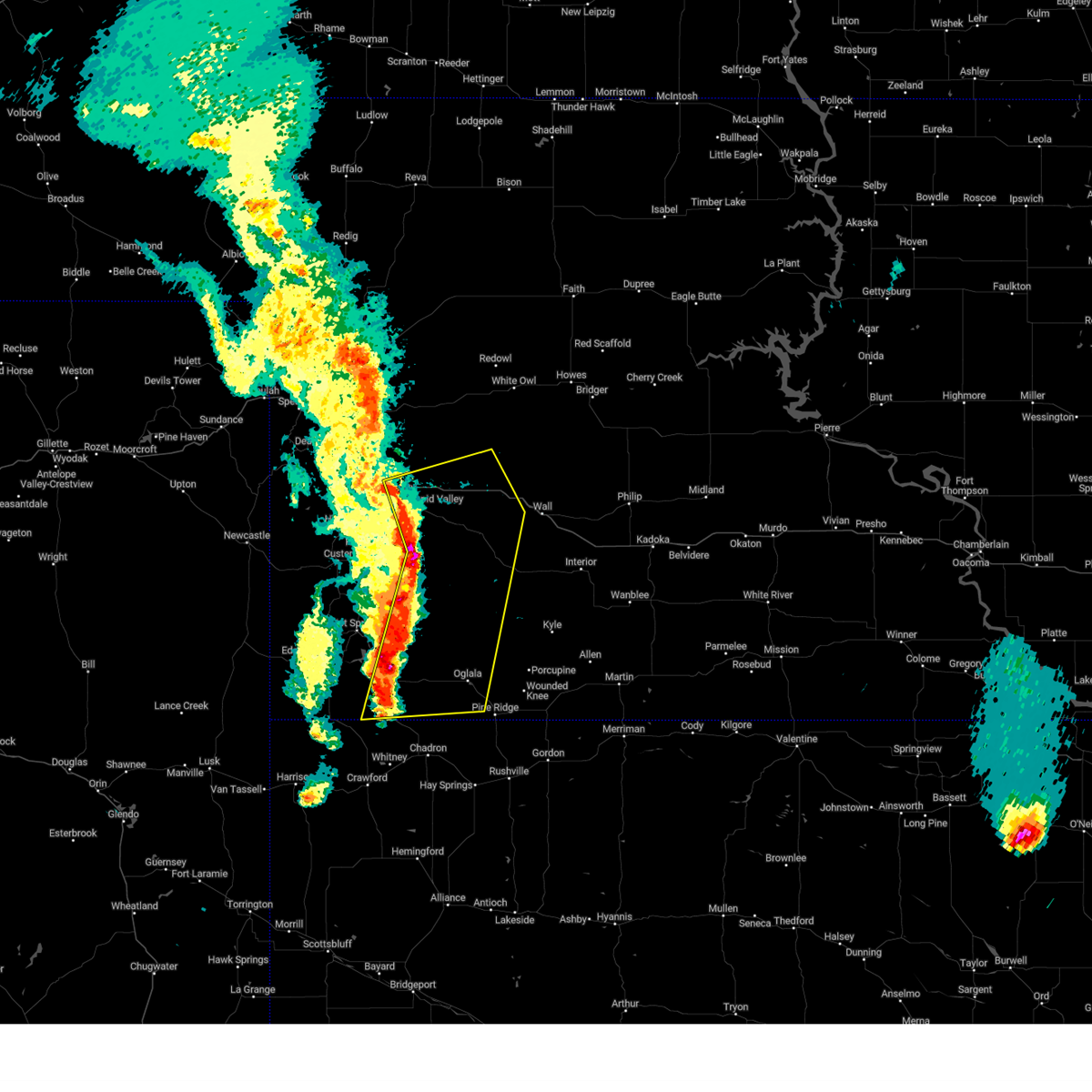
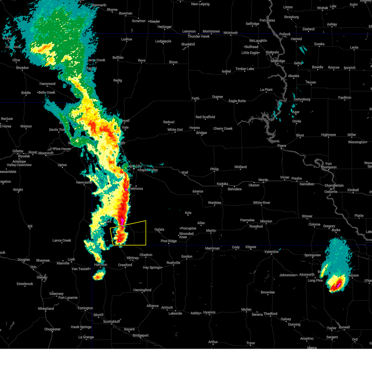
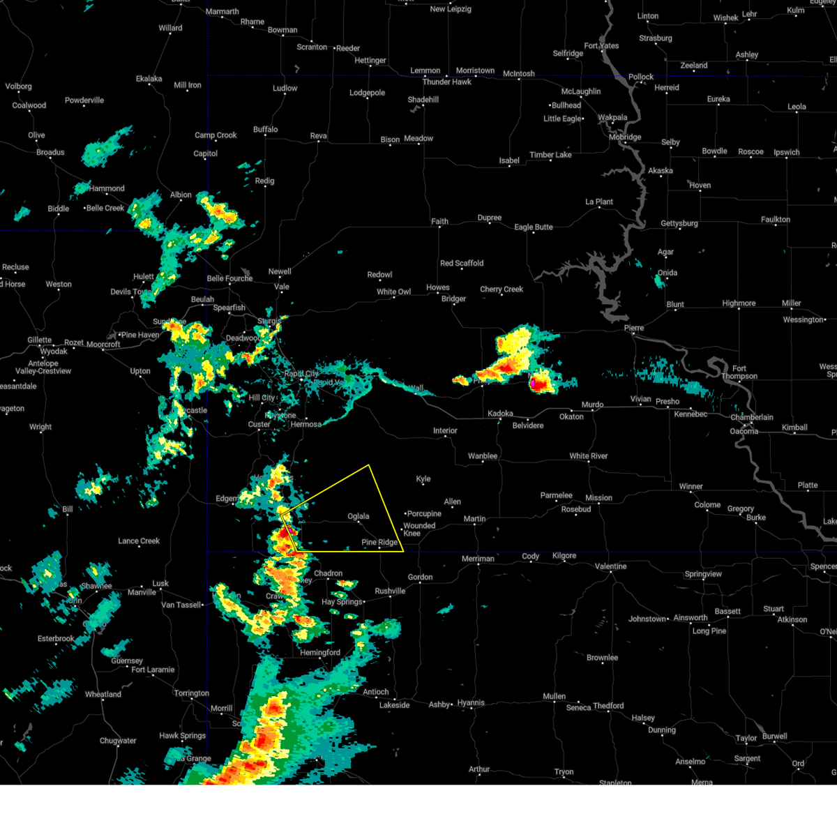
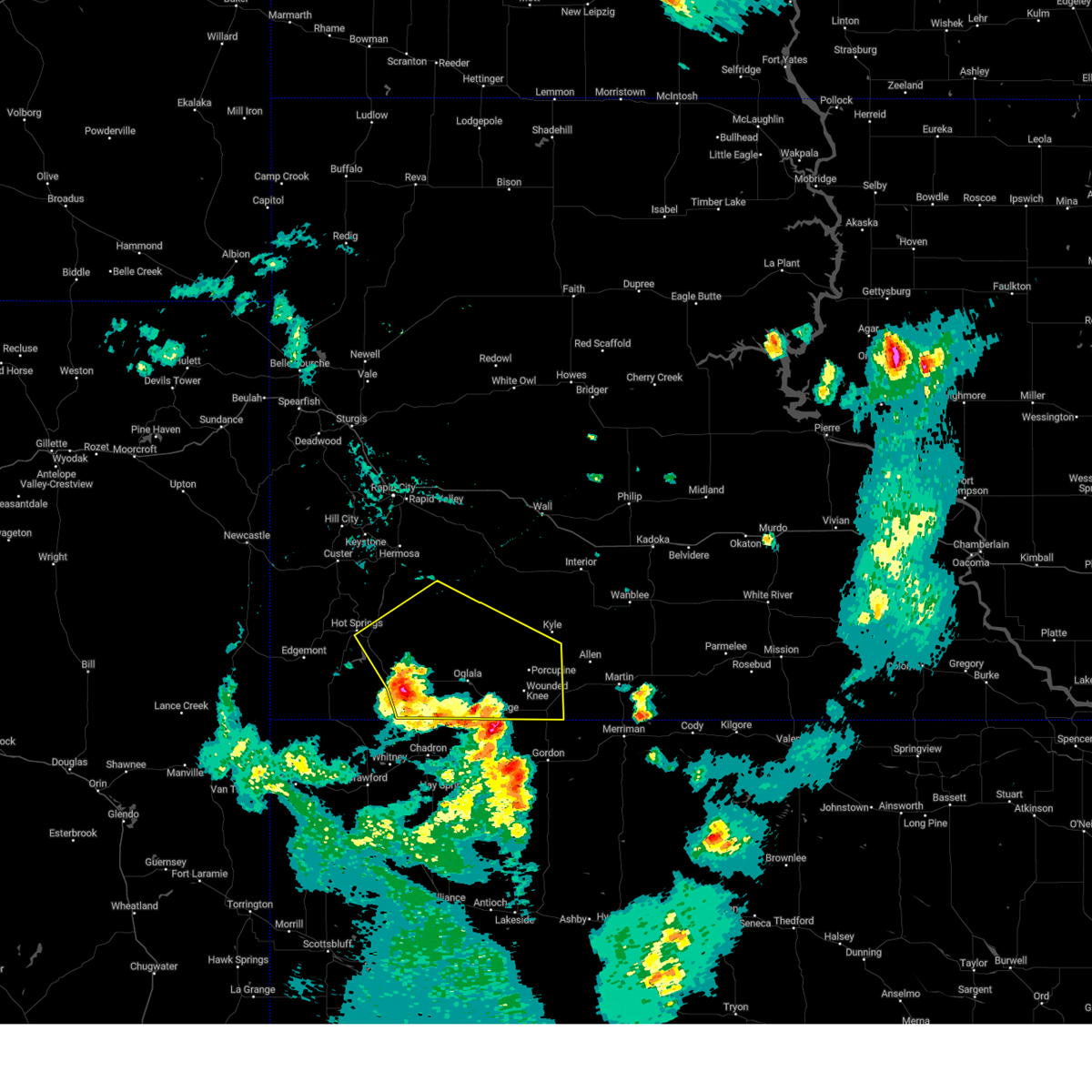
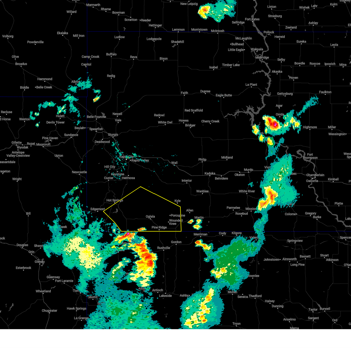
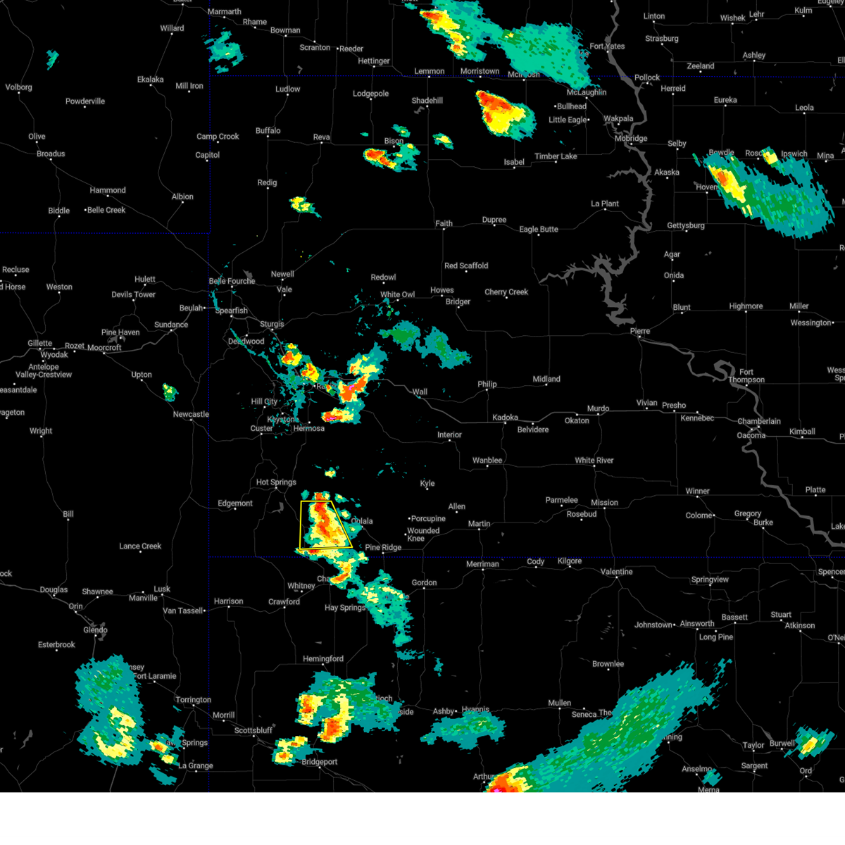
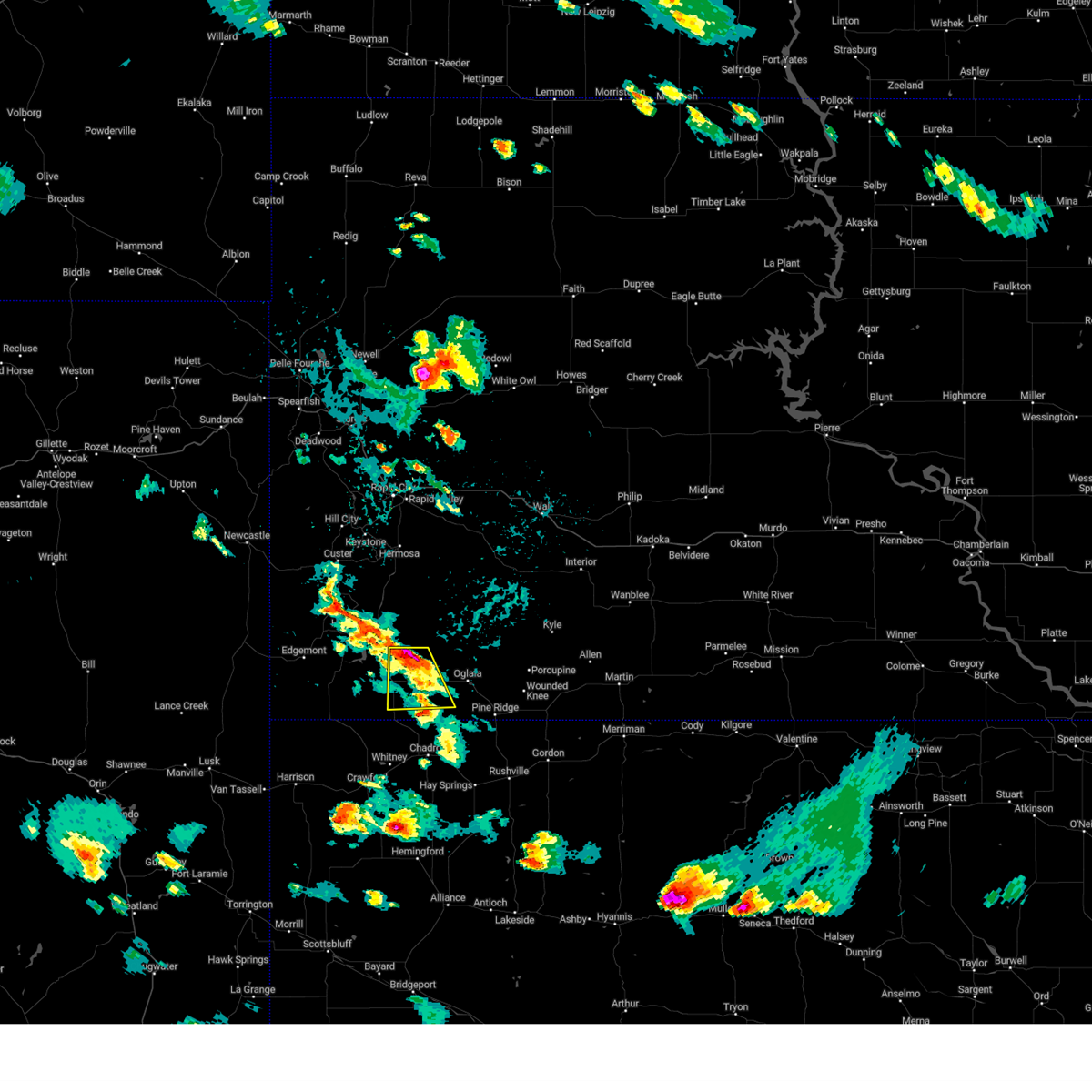
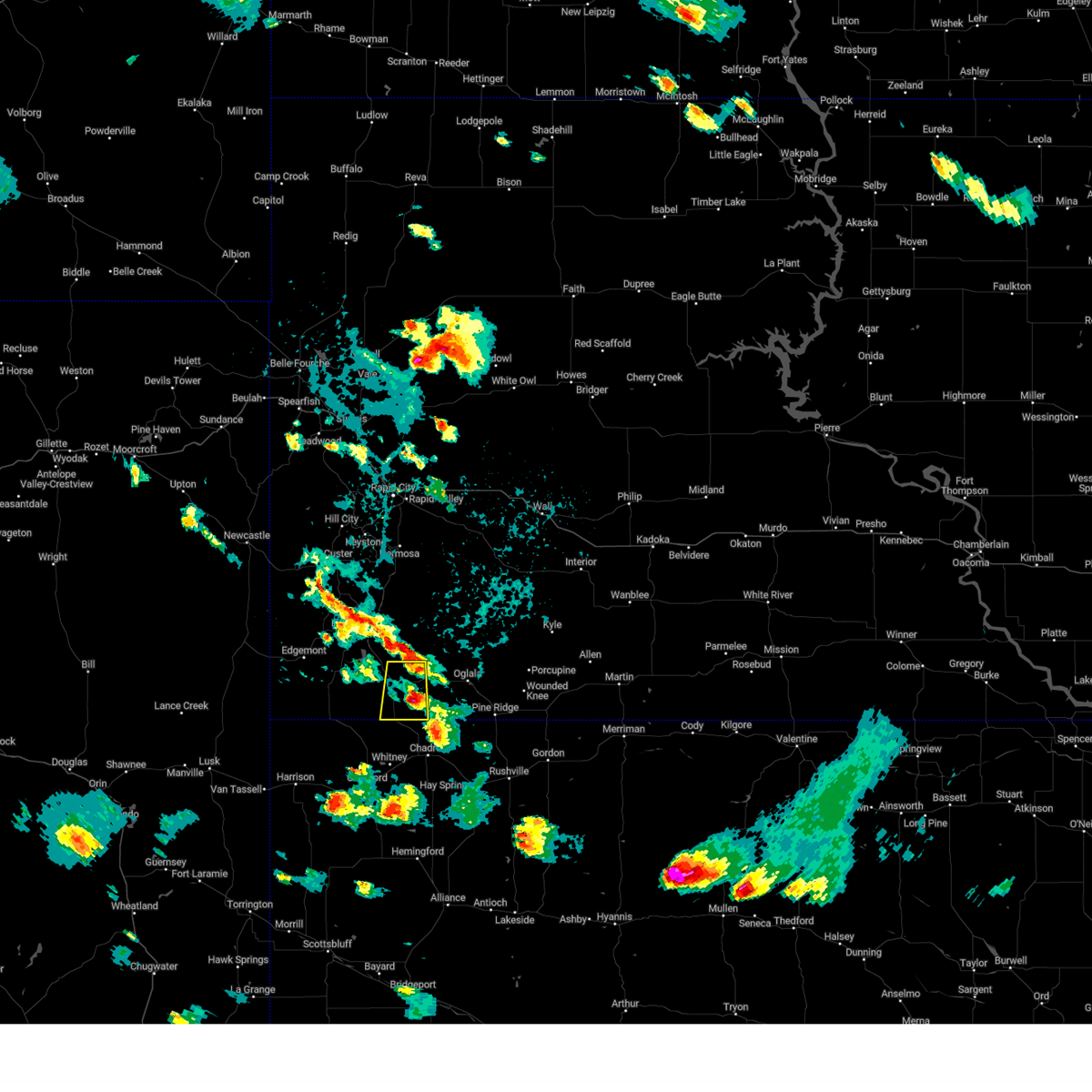
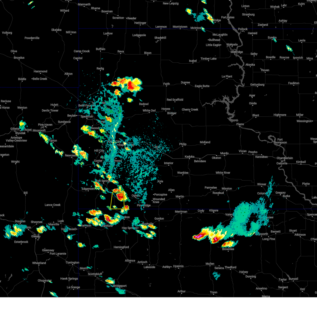
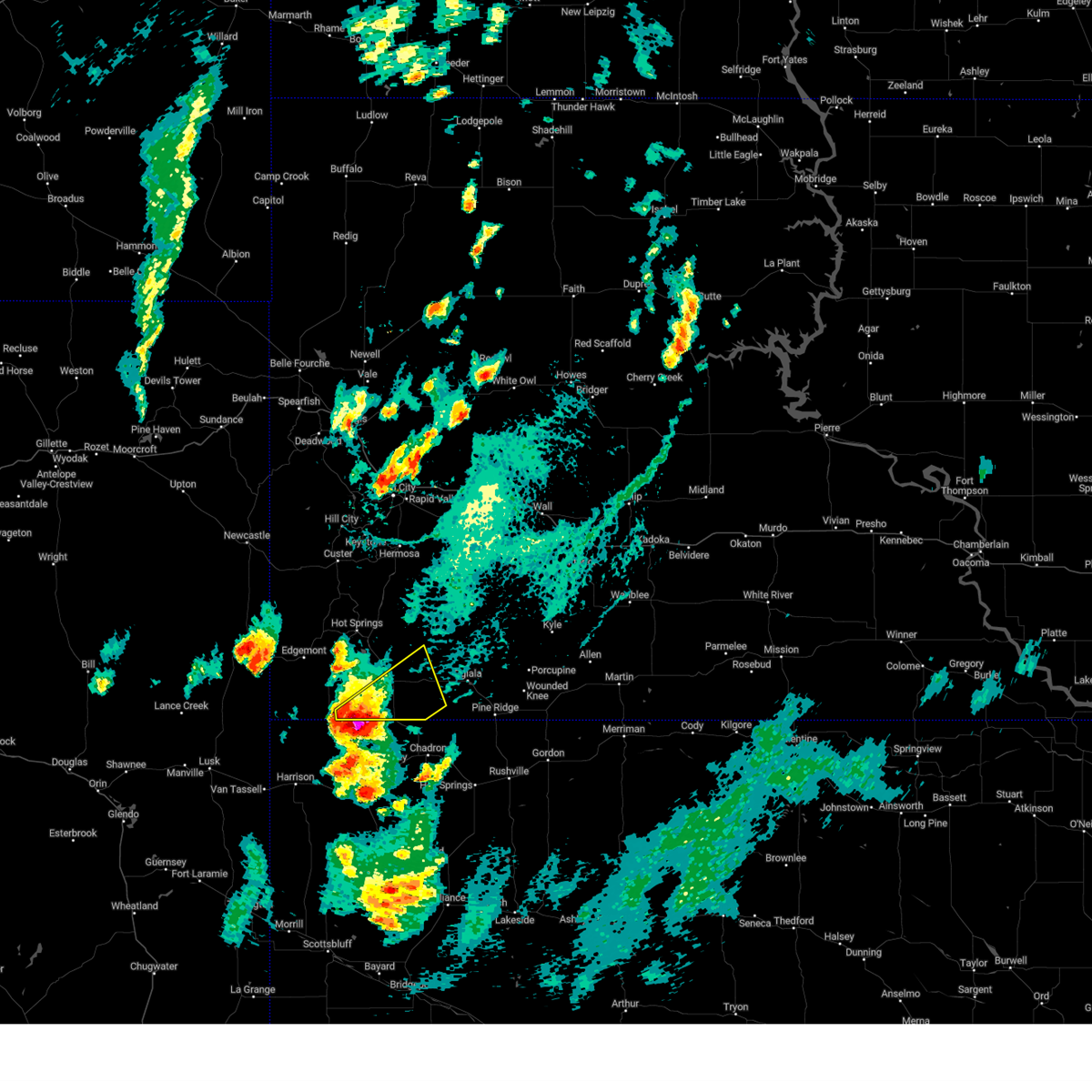
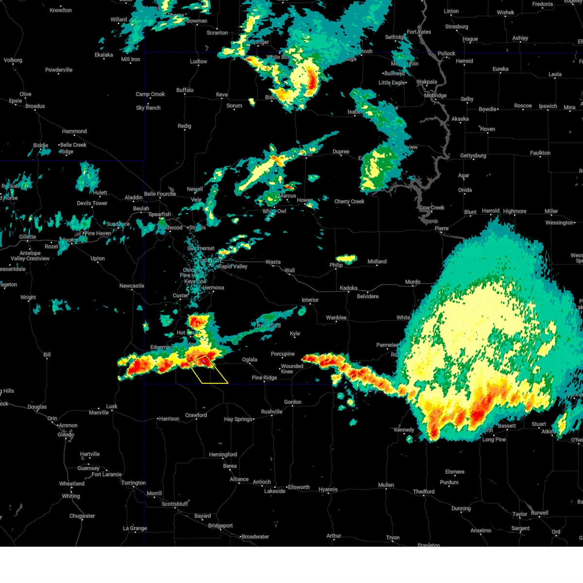
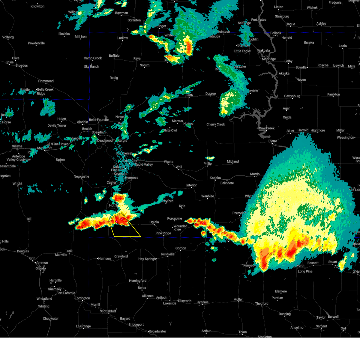
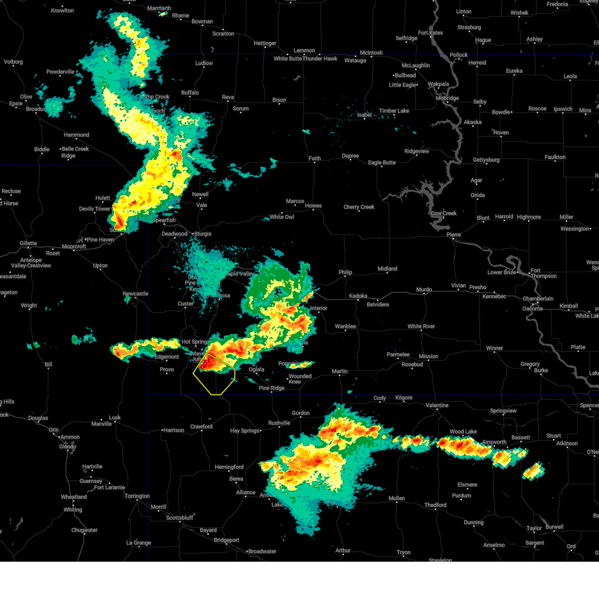
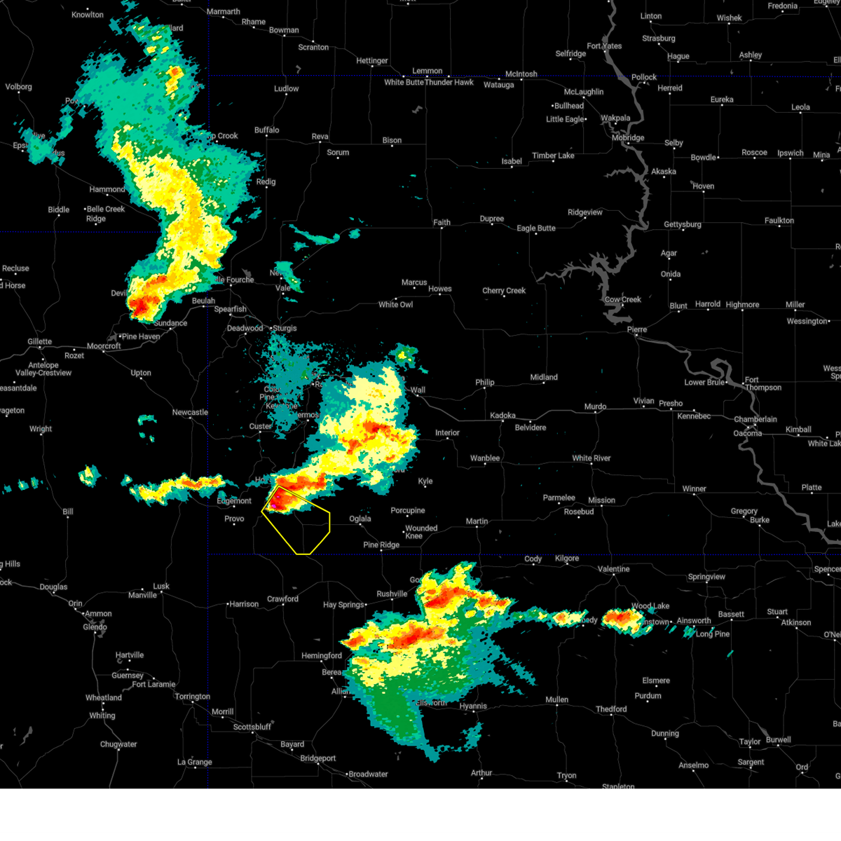
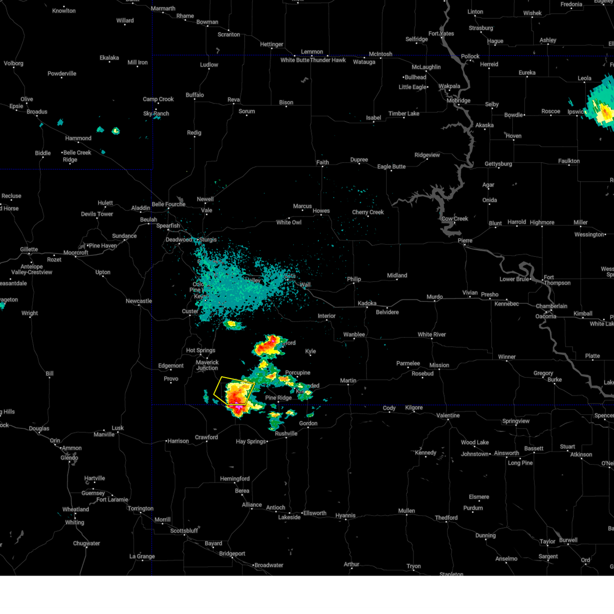
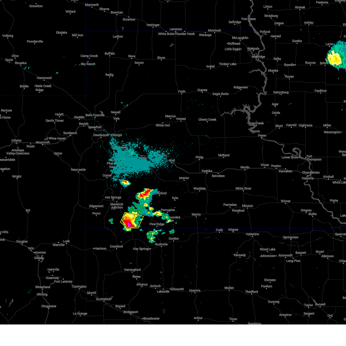
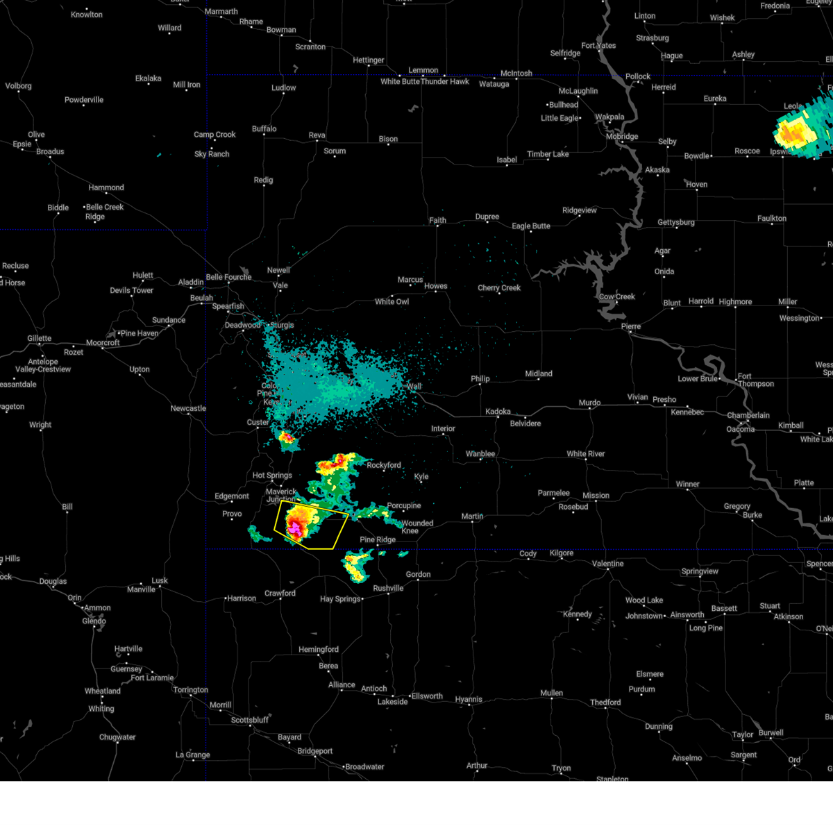
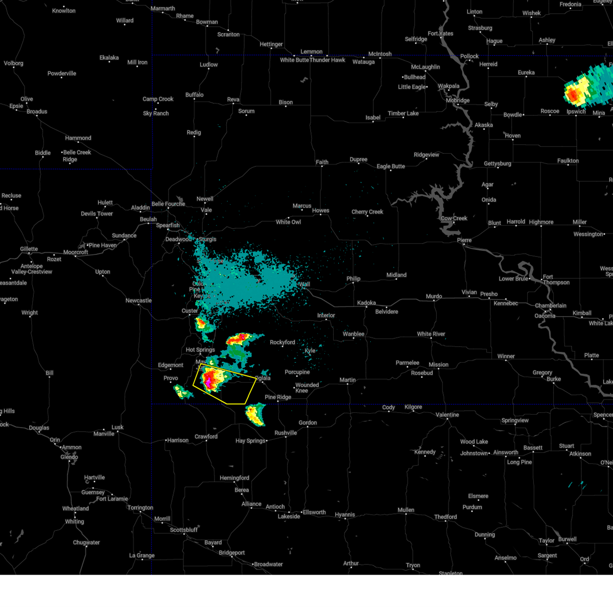
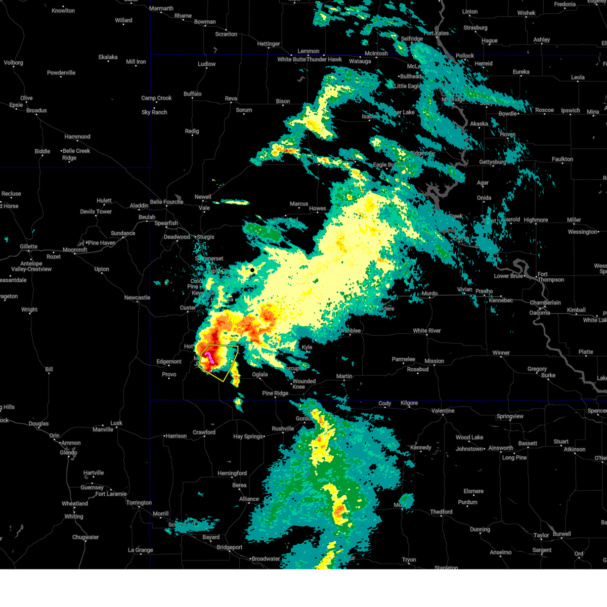
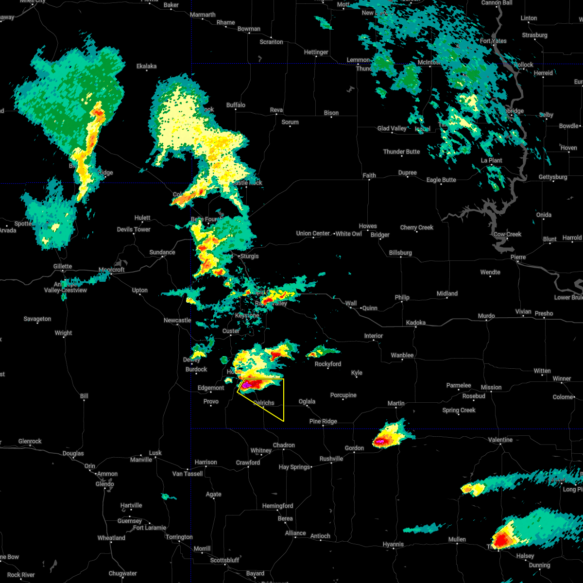
Hail Map for Oelrichs, SD
The Oelrichs, SD area has had 28 reports of on-the-ground hail by trained spotters, and has been under severe weather warnings 18 times during the past 12 months. Doppler radar has detected hail at or near Oelrichs, SD on 79 occasions, including 8 occasions during the past year.
| Name: | Oelrichs, SD |
| Where Located: | 62 miles S of Rapid City, SD |
| Map: | Google Map for Oelrichs, SD |
| Population: | 126 |
| Housing Units: | 74 |
| More Info: | Search Google for Oelrichs, SD |
0
The Top Recent Hail Date for Oelrichs, SD is Sunday, June 29, 2025 (47th out of 79)
Hail and Wind Damage Spotted near Oelrichs, SD
| Date / Time | Report Details |
|---|---|
| 6/29/2025 6:20 PM MDT | Quarter sized hail reported 14.9 miles NE of Oelrichs, SD |
| 6/29/2025 6:12 PM MDT | Storm damage reported in fall river county SD, 11.6 miles NE of Oelrichs, SD |
| 5/14/2025 2:00 AM MDT |
 At 200 am mdt, a severe thunderstorm was located 3 miles southwest of oral, or 9 miles southeast of hot springs, moving northeast at 25 mph (radar indicated). Hazards include 60 mph wind gusts and quarter size hail. Hail damage to vehicles is expected. expect wind damage to roofs, siding, and trees. Locations impacted include, hot springs, oral, oelrichs, smithwick, hay canyon butte, maverick junction, cold brook reservoir, and angostura reservoir. At 200 am mdt, a severe thunderstorm was located 3 miles southwest of oral, or 9 miles southeast of hot springs, moving northeast at 25 mph (radar indicated). Hazards include 60 mph wind gusts and quarter size hail. Hail damage to vehicles is expected. expect wind damage to roofs, siding, and trees. Locations impacted include, hot springs, oral, oelrichs, smithwick, hay canyon butte, maverick junction, cold brook reservoir, and angostura reservoir.
|
| 5/14/2025 1:46 AM MDT |
 At 146 am mdt, a severe thunderstorm was located 3 miles southeast of angostura reservoir, or 11 miles southeast of hot springs, moving northeast at 25 mph (radar indicated). Hazards include 60 mph wind gusts and quarter size hail. Hail damage to vehicles is expected. expect wind damage to roofs, siding, and trees. Locations impacted include, hot springs, oral, smithwick, hay canyon butte, maverick junction, northern angostura reservoir and cold brook reservoir. At 146 am mdt, a severe thunderstorm was located 3 miles southeast of angostura reservoir, or 11 miles southeast of hot springs, moving northeast at 25 mph (radar indicated). Hazards include 60 mph wind gusts and quarter size hail. Hail damage to vehicles is expected. expect wind damage to roofs, siding, and trees. Locations impacted include, hot springs, oral, smithwick, hay canyon butte, maverick junction, northern angostura reservoir and cold brook reservoir.
|
| 5/14/2025 1:26 AM MDT |
 Svrunr the national weather service in rapid city has issued a * severe thunderstorm warning for, eastern fall river county in southwestern south dakota, * until 215 am mdt. * at 126 am mdt, a severe thunderstorm was located 9 miles south of angostura reservoir, or 18 miles south of hot springs, moving northeast at 25 mph (radar indicated). Hazards include 60 mph wind gusts and half dollar size hail. Hail damage to vehicles is expected. expect wind damage to roofs, siding, and trees. this severe thunderstorm will be near, oelrichs, cascade falls, and angostura reservoir around 130 am mdt. smithwick, hay canyon butte, and maverick junction around 135 am mdt. hot springs and oral around 140 am mdt. Cold brook reservoir around 200 am mdt. Svrunr the national weather service in rapid city has issued a * severe thunderstorm warning for, eastern fall river county in southwestern south dakota, * until 215 am mdt. * at 126 am mdt, a severe thunderstorm was located 9 miles south of angostura reservoir, or 18 miles south of hot springs, moving northeast at 25 mph (radar indicated). Hazards include 60 mph wind gusts and half dollar size hail. Hail damage to vehicles is expected. expect wind damage to roofs, siding, and trees. this severe thunderstorm will be near, oelrichs, cascade falls, and angostura reservoir around 130 am mdt. smithwick, hay canyon butte, and maverick junction around 135 am mdt. hot springs and oral around 140 am mdt. Cold brook reservoir around 200 am mdt.
|
| 5/14/2025 1:03 AM MDT |
 At 102 am mdt, a severe thunderstorm was located 5 miles northeast of rumford, or 12 miles southeast of edgemont, moving northeast at 25 mph (radar indicated). Hazards include 60 mph wind gusts and quarter size hail. Hail damage to vehicles is expected. expect wind damage to roofs, siding, and trees. This severe thunderstorm will remain over mainly rural areas of southwestern fall river county, from a line from provo to ardmore and to the northeast. At 102 am mdt, a severe thunderstorm was located 5 miles northeast of rumford, or 12 miles southeast of edgemont, moving northeast at 25 mph (radar indicated). Hazards include 60 mph wind gusts and quarter size hail. Hail damage to vehicles is expected. expect wind damage to roofs, siding, and trees. This severe thunderstorm will remain over mainly rural areas of southwestern fall river county, from a line from provo to ardmore and to the northeast.
|
| 5/14/2025 12:44 AM MDT |
 Svrunr the national weather service in rapid city has issued a * severe thunderstorm warning for, southwestern fall river county in southwestern south dakota, * until 130 am mdt. * at 1244 am mdt, a severe thunderstorm was located 3 miles southwest of rumford, or 15 miles south of edgemont, moving northeast at 25 mph (radar indicated). Hazards include 60 mph wind gusts and half dollar size hail. Hail damage to vehicles is expected. expect wind damage to roofs, siding, and trees. This severe thunderstorm will be near, provo and rumford around 1250 am mdt. Svrunr the national weather service in rapid city has issued a * severe thunderstorm warning for, southwestern fall river county in southwestern south dakota, * until 130 am mdt. * at 1244 am mdt, a severe thunderstorm was located 3 miles southwest of rumford, or 15 miles south of edgemont, moving northeast at 25 mph (radar indicated). Hazards include 60 mph wind gusts and half dollar size hail. Hail damage to vehicles is expected. expect wind damage to roofs, siding, and trees. This severe thunderstorm will be near, provo and rumford around 1250 am mdt.
|
| 9/15/2024 9:35 PM MDT |
 The storms which prompted the warning have weakened below severe limits, and no longer pose an immediate threat to life or property. therefore, the warning will be allowed to expire. however, gusty winds are still possible with these thunderstorms. The storms which prompted the warning have weakened below severe limits, and no longer pose an immediate threat to life or property. therefore, the warning will be allowed to expire. however, gusty winds are still possible with these thunderstorms.
|
| 9/15/2024 9:11 PM MDT |
 At 911 pm mdt, severe thunderstorms were located along a line extending from 3 miles southeast of argyle to 2 miles west of hay canyon butte to 8 miles southwest of slim butte, moving northeast at 45 mph (radar indicated). Hazards include 60 mph wind gusts. Expect damage to roofs, siding, and trees. Locations impacted include, hot springs, oral, buffalo gap, smithwick, prairie winds casino, hay canyon butte, buffalo corrals, slim buttes housing, slim butte, cold brook reservoir, loneman and south lakeside. At 911 pm mdt, severe thunderstorms were located along a line extending from 3 miles southeast of argyle to 2 miles west of hay canyon butte to 8 miles southwest of slim butte, moving northeast at 45 mph (radar indicated). Hazards include 60 mph wind gusts. Expect damage to roofs, siding, and trees. Locations impacted include, hot springs, oral, buffalo gap, smithwick, prairie winds casino, hay canyon butte, buffalo corrals, slim buttes housing, slim butte, cold brook reservoir, loneman and south lakeside.
|
| 9/15/2024 8:50 PM MDT |
 Svrunr the national weather service in rapid city has issued a * severe thunderstorm warning for, south central custer county in southwestern south dakota, southwestern oglala lakota county in southwestern south dakota, fall river county in southwestern south dakota, * until 945 pm mdt. * at 850 pm mdt, severe thunderstorms were located along a line extending from near edgemont to 10 miles east of ardmore to 3 miles north of whitney lake, moving northeast at 40 mph (radar indicated). Hazards include 60 mph wind gusts. Expect damage to roofs, siding, and trees. severe thunderstorms will be near, oelrichs, cascade falls, angostura reservoir, and cottonwood springs dam around 855 pm mdt. hot springs, smithwick, argyle, hay canyon butte, cold brook reservoir, and maverick junction around 900 pm mdt. oral and wind cave national park around 905 pm mdt. buffalo gap, prairie winds casino, and slim butte around 910 pm mdt. Other locations in the path of these severe thunderstorms include southeastern custer state park, buffalo corrals, slim buttes housing and south lakeside. Svrunr the national weather service in rapid city has issued a * severe thunderstorm warning for, south central custer county in southwestern south dakota, southwestern oglala lakota county in southwestern south dakota, fall river county in southwestern south dakota, * until 945 pm mdt. * at 850 pm mdt, severe thunderstorms were located along a line extending from near edgemont to 10 miles east of ardmore to 3 miles north of whitney lake, moving northeast at 40 mph (radar indicated). Hazards include 60 mph wind gusts. Expect damage to roofs, siding, and trees. severe thunderstorms will be near, oelrichs, cascade falls, angostura reservoir, and cottonwood springs dam around 855 pm mdt. hot springs, smithwick, argyle, hay canyon butte, cold brook reservoir, and maverick junction around 900 pm mdt. oral and wind cave national park around 905 pm mdt. buffalo gap, prairie winds casino, and slim butte around 910 pm mdt. Other locations in the path of these severe thunderstorms include southeastern custer state park, buffalo corrals, slim buttes housing and south lakeside.
|
| 8/26/2024 4:07 PM MDT |
 Svrunr the national weather service in rapid city has issued a * severe thunderstorm warning for, south central meade county in west central south dakota, eastern custer county in southwestern south dakota, western oglala lakota county in southwestern south dakota, eastern fall river county in southwestern south dakota, southeastern pennington county in west central south dakota, * until 500 pm mdt. * at 407 pm mdt, severe thunderstorms were located along a line extending from 4 miles northeast of rapid city to 5 miles west of folsom to 5 miles south of oelrichs, moving east at 30 mph (radar indicated). Hazards include 60 mph wind gusts and quarter size hail. Hail damage to vehicles is expected. expect wind damage to roofs, siding, and trees. severe thunderstorms will be near, rapid valley, ellsworth air force base, box elder, prairie winds casino, red shirt, caputa, folsom, farmingdale, hay canyon butte, and slim butte around 410 pm mdt. new underwood around 415 pm mdt. dry wood housing and viewfield around 420 pm mdt. loneman, south lakeside, and curlew lake around 425 pm mdt. other locations in the path of these severe thunderstorms include oglala, scenic, owanka, sheep mountain table, slim buttes housing and wicksville. This includes interstate 90 in south dakota between mile markers 53 and 100. Svrunr the national weather service in rapid city has issued a * severe thunderstorm warning for, south central meade county in west central south dakota, eastern custer county in southwestern south dakota, western oglala lakota county in southwestern south dakota, eastern fall river county in southwestern south dakota, southeastern pennington county in west central south dakota, * until 500 pm mdt. * at 407 pm mdt, severe thunderstorms were located along a line extending from 4 miles northeast of rapid city to 5 miles west of folsom to 5 miles south of oelrichs, moving east at 30 mph (radar indicated). Hazards include 60 mph wind gusts and quarter size hail. Hail damage to vehicles is expected. expect wind damage to roofs, siding, and trees. severe thunderstorms will be near, rapid valley, ellsworth air force base, box elder, prairie winds casino, red shirt, caputa, folsom, farmingdale, hay canyon butte, and slim butte around 410 pm mdt. new underwood around 415 pm mdt. dry wood housing and viewfield around 420 pm mdt. loneman, south lakeside, and curlew lake around 425 pm mdt. other locations in the path of these severe thunderstorms include oglala, scenic, owanka, sheep mountain table, slim buttes housing and wicksville. This includes interstate 90 in south dakota between mile markers 53 and 100.
|
| 8/26/2024 3:33 PM MDT |
 Svrunr the national weather service in rapid city has issued a * severe thunderstorm warning for, southeastern fall river county in southwestern south dakota, * until 415 pm mdt. * at 333 pm mdt, a severe thunderstorm was located 10 miles east of rumford, or 20 miles southeast of edgemont, moving northeast at 40 mph (radar indicated). Hazards include 70 mph wind gusts and quarter size hail. Hail damage to vehicles is expected. expect considerable tree damage. wind damage is also likely to mobile homes, roofs, and outbuildings. this severe thunderstorm will be near, oelrichs, hay canyon butte, and southeastern angostura reservoir around 340 pm mdt. Smithwick around 345 pm mdt. Svrunr the national weather service in rapid city has issued a * severe thunderstorm warning for, southeastern fall river county in southwestern south dakota, * until 415 pm mdt. * at 333 pm mdt, a severe thunderstorm was located 10 miles east of rumford, or 20 miles southeast of edgemont, moving northeast at 40 mph (radar indicated). Hazards include 70 mph wind gusts and quarter size hail. Hail damage to vehicles is expected. expect considerable tree damage. wind damage is also likely to mobile homes, roofs, and outbuildings. this severe thunderstorm will be near, oelrichs, hay canyon butte, and southeastern angostura reservoir around 340 pm mdt. Smithwick around 345 pm mdt.
|
| 8/21/2024 5:35 PM MDT |
 Svrunr the national weather service in rapid city has issued a * severe thunderstorm warning for, southwestern oglala lakota county in southwestern south dakota, southeastern fall river county in southwestern south dakota, * until 630 pm mdt. * at 534 pm mdt, a severe thunderstorm was located 4 miles south of oelrichs, or 22 miles northwest of chadron, moving northeast at 40 mph (radar indicated). Hazards include 60 mph wind gusts. Expect damage to roofs, siding, and trees. this severe thunderstorm will be near, prairie winds casino, hay canyon butte, and slim butte around 540 pm mdt. loneman and south lakeside around 550 pm mdt. oglala, dry wood housing, and slim buttes housing around 555 pm mdt. Number 4 around 605 pm mdt. Svrunr the national weather service in rapid city has issued a * severe thunderstorm warning for, southwestern oglala lakota county in southwestern south dakota, southeastern fall river county in southwestern south dakota, * until 630 pm mdt. * at 534 pm mdt, a severe thunderstorm was located 4 miles south of oelrichs, or 22 miles northwest of chadron, moving northeast at 40 mph (radar indicated). Hazards include 60 mph wind gusts. Expect damage to roofs, siding, and trees. this severe thunderstorm will be near, prairie winds casino, hay canyon butte, and slim butte around 540 pm mdt. loneman and south lakeside around 550 pm mdt. oglala, dry wood housing, and slim buttes housing around 555 pm mdt. Number 4 around 605 pm mdt.
|
| 8/21/2024 5:30 PM MDT | Storm damage reported in fall river county SD, 11.5 miles NNE of Oelrichs, SD |
| 8/4/2024 4:00 PM MDT | Storm damage reported in fall river county SD, 10.9 miles WNW of Oelrichs, SD |
| 7/27/2024 8:04 PM MDT |
 At 804 pm mdt, severe thunderstorms were located along a line extending from 3 miles north of oral to 10 miles north of prairie winds casino to near loneman to 6 miles northeast of rushville, moving east at 45 mph (radar indicated). Hazards include 70 mph wind gusts. Expect considerable tree damage. damage is likely to mobile homes, roofs, and outbuildings. Locations impacted include, hot springs, pine ridge, oglala, porcupine, manderson, wounded knee, oral, buffalo gap, oelrichs, smithwick, lonesome valley, loneman, goose neck housing, south lakeside, wakpamni, rockyford, sharps corner, number 4, wolf creek housing, and dry wood housing. At 804 pm mdt, severe thunderstorms were located along a line extending from 3 miles north of oral to 10 miles north of prairie winds casino to near loneman to 6 miles northeast of rushville, moving east at 45 mph (radar indicated). Hazards include 70 mph wind gusts. Expect considerable tree damage. damage is likely to mobile homes, roofs, and outbuildings. Locations impacted include, hot springs, pine ridge, oglala, porcupine, manderson, wounded knee, oral, buffalo gap, oelrichs, smithwick, lonesome valley, loneman, goose neck housing, south lakeside, wakpamni, rockyford, sharps corner, number 4, wolf creek housing, and dry wood housing.
|
| 7/27/2024 7:33 PM MDT |
 Svrunr the national weather service in rapid city has issued a * severe thunderstorm warning for, southeastern custer county in southwestern south dakota, oglala lakota county in southwestern south dakota, eastern fall river county in southwestern south dakota, * until 845 pm mdt. * at 733 pm mdt, severe thunderstorms were located along a line extending from 4 miles southwest of cascade falls to 8 miles west of oelrichs to 12 miles northwest of chadron municipal airport to 5 miles southwest of hay springs, moving northeast at 45 mph (radar indicated). Hazards include 70 mph wind gusts. Expect considerable tree damage. Damage is likely to mobile homes, roofs, and outbuildings. Svrunr the national weather service in rapid city has issued a * severe thunderstorm warning for, southeastern custer county in southwestern south dakota, oglala lakota county in southwestern south dakota, eastern fall river county in southwestern south dakota, * until 845 pm mdt. * at 733 pm mdt, severe thunderstorms were located along a line extending from 4 miles southwest of cascade falls to 8 miles west of oelrichs to 12 miles northwest of chadron municipal airport to 5 miles southwest of hay springs, moving northeast at 45 mph (radar indicated). Hazards include 70 mph wind gusts. Expect considerable tree damage. Damage is likely to mobile homes, roofs, and outbuildings.
|
| 7/19/2024 5:56 PM MDT |
 The storm which prompted the warning has weakened below severe limits, and no longer poses an immediate threat to life or property. therefore, the warning will be allowed to expire. however, gusty winds and heavy rain are still possible with this thunderstorm. a severe thunderstorm watch remains in effect until 1100 pm mdt for southwestern south dakota. The storm which prompted the warning has weakened below severe limits, and no longer poses an immediate threat to life or property. therefore, the warning will be allowed to expire. however, gusty winds and heavy rain are still possible with this thunderstorm. a severe thunderstorm watch remains in effect until 1100 pm mdt for southwestern south dakota.
|
| 7/19/2024 4:54 PM MDT |
 Svrunr the national weather service in rapid city has issued a * severe thunderstorm warning for, southwestern oglala lakota county in southwestern south dakota, southeastern fall river county in southwestern south dakota, * until 600 pm mdt. * at 453 pm mdt, a severe thunderstorm was located 5 miles east of smithwick, or 19 miles southeast of hot springs, moving south at 10 mph (radar indicated). Hazards include ping pong ball size hail and 60 mph wind gusts. People and animals outdoors will be injured. expect hail damage to roofs, siding, windows, and vehicles. expect wind damage to roofs, siding, and trees. This severe thunderstorm will be near, oelrichs and hay canyon butte around 500 pm mdt. Svrunr the national weather service in rapid city has issued a * severe thunderstorm warning for, southwestern oglala lakota county in southwestern south dakota, southeastern fall river county in southwestern south dakota, * until 600 pm mdt. * at 453 pm mdt, a severe thunderstorm was located 5 miles east of smithwick, or 19 miles southeast of hot springs, moving south at 10 mph (radar indicated). Hazards include ping pong ball size hail and 60 mph wind gusts. People and animals outdoors will be injured. expect hail damage to roofs, siding, windows, and vehicles. expect wind damage to roofs, siding, and trees. This severe thunderstorm will be near, oelrichs and hay canyon butte around 500 pm mdt.
|
| 7/19/2024 4:42 PM MDT |
 At 441 pm mdt, a severe thunderstorm was located 8 miles southwest of prairie winds casino, or 18 miles north of chadron, moving south at 20 mph (radar indicated). Hazards include 60 mph wind gusts and quarter size hail. Hail damage to vehicles is expected. expect wind damage to roofs, siding, and trees. This severe thunderstorm will remain over mainly rural areas of southeastern fall river county, west of slim buttes. At 441 pm mdt, a severe thunderstorm was located 8 miles southwest of prairie winds casino, or 18 miles north of chadron, moving south at 20 mph (radar indicated). Hazards include 60 mph wind gusts and quarter size hail. Hail damage to vehicles is expected. expect wind damage to roofs, siding, and trees. This severe thunderstorm will remain over mainly rural areas of southeastern fall river county, west of slim buttes.
|
| 7/19/2024 4:08 PM MDT |
 Svrunr the national weather service in rapid city has issued a * severe thunderstorm warning for, southeastern fall river county in southwestern south dakota, * until 500 pm mdt. * at 408 pm mdt, a severe thunderstorm was located near hay canyon butte, or 22 miles southeast of hot springs, moving south at 25 mph (radar indicated). Hazards include 60 mph wind gusts and half dollar size hail. Hail damage to vehicles is expected. expect wind damage to roofs, siding, and trees. This severe thunderstorm will be near, oelrichs around 415 pm mdt. Svrunr the national weather service in rapid city has issued a * severe thunderstorm warning for, southeastern fall river county in southwestern south dakota, * until 500 pm mdt. * at 408 pm mdt, a severe thunderstorm was located near hay canyon butte, or 22 miles southeast of hot springs, moving south at 25 mph (radar indicated). Hazards include 60 mph wind gusts and half dollar size hail. Hail damage to vehicles is expected. expect wind damage to roofs, siding, and trees. This severe thunderstorm will be near, oelrichs around 415 pm mdt.
|
| 7/1/2024 2:30 PM MDT | Storm damage reported in fall river county SD, 11.3 miles N of Oelrichs, SD |
| 7/1/2024 2:15 PM MDT |
 Svrunr the national weather service in rapid city has issued a * severe thunderstorm warning for, southwestern oglala lakota county in southwestern south dakota, southeastern fall river county in southwestern south dakota, * until 300 pm mdt. * at 215 pm mdt, a severe thunderstorm was located 12 miles east of ardmore, or 24 miles northwest of chadron, moving northeast at 40 mph (radar indicated). Hazards include 60 mph wind gusts and quarter size hail. Hail damage to vehicles is expected. expect wind damage to roofs, siding, and trees. this severe thunderstorm will be near, oelrichs around 220 pm mdt. hay canyon butte around 225 pm mdt. Prairie winds casino and slim butte around 230 pm mdt. Svrunr the national weather service in rapid city has issued a * severe thunderstorm warning for, southwestern oglala lakota county in southwestern south dakota, southeastern fall river county in southwestern south dakota, * until 300 pm mdt. * at 215 pm mdt, a severe thunderstorm was located 12 miles east of ardmore, or 24 miles northwest of chadron, moving northeast at 40 mph (radar indicated). Hazards include 60 mph wind gusts and quarter size hail. Hail damage to vehicles is expected. expect wind damage to roofs, siding, and trees. this severe thunderstorm will be near, oelrichs around 220 pm mdt. hay canyon butte around 225 pm mdt. Prairie winds casino and slim butte around 230 pm mdt.
|
| 6/24/2024 5:00 PM MDT |
 Svrunr the national weather service in rapid city has issued a * severe thunderstorm warning for, southwestern oglala lakota county in southwestern south dakota, southeastern fall river county in southwestern south dakota, * until 600 pm mdt. * at 500 pm mdt, a severe thunderstorm was located near oelrichs, or 19 miles southeast of hot springs, moving east at 30 mph (radar indicated). Hazards include 60 mph wind gusts. expect damage to roofs, siding, and trees Svrunr the national weather service in rapid city has issued a * severe thunderstorm warning for, southwestern oglala lakota county in southwestern south dakota, southeastern fall river county in southwestern south dakota, * until 600 pm mdt. * at 500 pm mdt, a severe thunderstorm was located near oelrichs, or 19 miles southeast of hot springs, moving east at 30 mph (radar indicated). Hazards include 60 mph wind gusts. expect damage to roofs, siding, and trees
|
| 5/17/2024 6:02 PM MDT |
 the severe thunderstorm warning has been cancelled and is no longer in effect the severe thunderstorm warning has been cancelled and is no longer in effect
|
| 5/17/2024 5:51 PM MDT |
 At 550 pm mdt, severe thunderstorms were located along a line extending from 3 miles north of oral to 12 miles northwest of chadron municipal airport, moving east at 50 mph (radar indicated). Hazards include 60 mph wind gusts. Expect damage to roofs, siding, and trees. Locations impacted include, prairie winds casino, slim butte, hay canyon butte, oglala, dry wood housing, loneman, south lakeside and slim buttes housing. At 550 pm mdt, severe thunderstorms were located along a line extending from 3 miles north of oral to 12 miles northwest of chadron municipal airport, moving east at 50 mph (radar indicated). Hazards include 60 mph wind gusts. Expect damage to roofs, siding, and trees. Locations impacted include, prairie winds casino, slim butte, hay canyon butte, oglala, dry wood housing, loneman, south lakeside and slim buttes housing.
|
| 5/17/2024 5:24 PM MDT |
 Svrunr the national weather service in rapid city has issued a * severe thunderstorm warning for, southwestern oglala lakota county in southwestern south dakota, fall river county in southwestern south dakota, * until 630 pm mdt. * at 524 pm mdt, severe thunderstorms were located along a line extending from 5 miles southwest of argyle to 2 miles southwest of ardmore, moving east at 45 mph (radar indicated). Hazards include 70 mph wind gusts. Expect considerable tree damage. damage is likely to mobile homes, roofs, and outbuildings. severe thunderstorms will be near, hot springs, maverick junction, cold brook reservoir, angostura reservoir, cottonwood springs dam, and cascade falls around 530 pm mdt. oral around 535 pm mdt. oelrichs, smithwick, and hay canyon butte around 540 pm mdt. Other locations in the path of these severe thunderstorms include prairie winds casino, slim butte, slim buttes housing, oglala, dry wood housing, loneman and south lakeside. Svrunr the national weather service in rapid city has issued a * severe thunderstorm warning for, southwestern oglala lakota county in southwestern south dakota, fall river county in southwestern south dakota, * until 630 pm mdt. * at 524 pm mdt, severe thunderstorms were located along a line extending from 5 miles southwest of argyle to 2 miles southwest of ardmore, moving east at 45 mph (radar indicated). Hazards include 70 mph wind gusts. Expect considerable tree damage. damage is likely to mobile homes, roofs, and outbuildings. severe thunderstorms will be near, hot springs, maverick junction, cold brook reservoir, angostura reservoir, cottonwood springs dam, and cascade falls around 530 pm mdt. oral around 535 pm mdt. oelrichs, smithwick, and hay canyon butte around 540 pm mdt. Other locations in the path of these severe thunderstorms include prairie winds casino, slim butte, slim buttes housing, oglala, dry wood housing, loneman and south lakeside.
|
| 8/13/2023 1:00 AM MDT |
 At 100 am mdt, a severe thunderstorm was located over oelrichs, or 21 miles southeast of hot springs, moving southeast at 20 mph (radar indicated). Hazards include 60 mph wind gusts and quarter size hail. Hail damage to vehicles is expected. expect wind damage to roofs, siding, and trees. locations impacted include, oelrichs. hail threat, radar indicated max hail size, 1. 00 in wind threat, radar indicated max wind gust, 60 mph. At 100 am mdt, a severe thunderstorm was located over oelrichs, or 21 miles southeast of hot springs, moving southeast at 20 mph (radar indicated). Hazards include 60 mph wind gusts and quarter size hail. Hail damage to vehicles is expected. expect wind damage to roofs, siding, and trees. locations impacted include, oelrichs. hail threat, radar indicated max hail size, 1. 00 in wind threat, radar indicated max wind gust, 60 mph.
|
| 8/13/2023 12:40 AM MDT |
 At 1240 am mdt, a severe thunderstorm was located 6 miles south of angostura reservoir, or 15 miles south of hot springs, moving southeast at 25 mph (radar indicated). Hazards include 60 mph wind gusts and quarter size hail. Hail damage to vehicles is expected. expect wind damage to roofs, siding, and trees. this severe thunderstorm will remain over mainly rural areas of southeastern fall river county west of oelrichs. hail threat, radar indicated max hail size, 1. 00 in wind threat, radar indicated max wind gust, 60 mph. At 1240 am mdt, a severe thunderstorm was located 6 miles south of angostura reservoir, or 15 miles south of hot springs, moving southeast at 25 mph (radar indicated). Hazards include 60 mph wind gusts and quarter size hail. Hail damage to vehicles is expected. expect wind damage to roofs, siding, and trees. this severe thunderstorm will remain over mainly rural areas of southeastern fall river county west of oelrichs. hail threat, radar indicated max hail size, 1. 00 in wind threat, radar indicated max wind gust, 60 mph.
|
| 8/13/2023 12:08 AM MDT |
 At 1208 am mdt, a severe thunderstorm was located 4 miles northwest of cascade falls, or 7 miles southwest of hot springs, moving southeast at 25 mph (radar indicated). Hazards include 60 mph wind gusts and half dollar size hail. Hail damage to vehicles is expected. expect wind damage to roofs, siding, and trees. this severe thunderstorm will be near, cascade falls around 1215 am mdt. southwestern angostura reservoir around 1220 am mdt. hail threat, radar indicated max hail size, 1. 25 in wind threat, radar indicated max wind gust, 60 mph. At 1208 am mdt, a severe thunderstorm was located 4 miles northwest of cascade falls, or 7 miles southwest of hot springs, moving southeast at 25 mph (radar indicated). Hazards include 60 mph wind gusts and half dollar size hail. Hail damage to vehicles is expected. expect wind damage to roofs, siding, and trees. this severe thunderstorm will be near, cascade falls around 1215 am mdt. southwestern angostura reservoir around 1220 am mdt. hail threat, radar indicated max hail size, 1. 25 in wind threat, radar indicated max wind gust, 60 mph.
|
| 7/29/2023 12:55 AM MDT |
 At 1255 am mdt, a severe thunderstorm was located 5 miles southwest of prairie winds casino, or 22 miles north of chadron, moving southeast at 30 mph (radar indicated). Hazards include golf ball size hail and 60 mph wind gusts. People and animals outdoors will be injured. expect hail damage to roofs, siding, windows, and vehicles. expect wind damage to roofs, siding, and trees. locations impacted include, pine ridge, oelrichs, prairie winds casino, calico, hay canyon butte, slim butte and slim buttes housing. thunderstorm damage threat, considerable hail threat, radar indicated max hail size, 1. 75 in wind threat, radar indicated max wind gust, 60 mph. At 1255 am mdt, a severe thunderstorm was located 5 miles southwest of prairie winds casino, or 22 miles north of chadron, moving southeast at 30 mph (radar indicated). Hazards include golf ball size hail and 60 mph wind gusts. People and animals outdoors will be injured. expect hail damage to roofs, siding, windows, and vehicles. expect wind damage to roofs, siding, and trees. locations impacted include, pine ridge, oelrichs, prairie winds casino, calico, hay canyon butte, slim butte and slim buttes housing. thunderstorm damage threat, considerable hail threat, radar indicated max hail size, 1. 75 in wind threat, radar indicated max wind gust, 60 mph.
|
| 7/29/2023 12:38 AM MDT |
 At 1237 am mdt, a severe thunderstorm was located over oelrichs, or 20 miles southeast of hot springs, moving southeast at 20 mph (radar indicated). Hazards include ping pong ball size hail and 60 mph wind gusts. People and animals outdoors will be injured. expect hail damage to roofs, siding, windows, and vehicles. Expect wind damage to roofs, siding, and trees. At 1237 am mdt, a severe thunderstorm was located over oelrichs, or 20 miles southeast of hot springs, moving southeast at 20 mph (radar indicated). Hazards include ping pong ball size hail and 60 mph wind gusts. People and animals outdoors will be injured. expect hail damage to roofs, siding, windows, and vehicles. Expect wind damage to roofs, siding, and trees.
|
| 7/29/2023 12:27 AM MDT |
 At 1226 am mdt, a severe thunderstorm was located 4 miles northwest of oelrichs, or 17 miles southeast of hot springs, moving southeast at 20 mph (radar indicated). Hazards include ping pong ball size hail and 60 mph wind gusts. People and animals outdoors will be injured. expect hail damage to roofs, siding, windows, and vehicles. expect wind damage to roofs, siding, and trees. locations impacted include, oelrichs, smithwick, hay canyon butte and southeastern angostura reservoir. hail threat, radar indicated max hail size, 1. 50 in wind threat, radar indicated max wind gust, 60 mph. At 1226 am mdt, a severe thunderstorm was located 4 miles northwest of oelrichs, or 17 miles southeast of hot springs, moving southeast at 20 mph (radar indicated). Hazards include ping pong ball size hail and 60 mph wind gusts. People and animals outdoors will be injured. expect hail damage to roofs, siding, windows, and vehicles. expect wind damage to roofs, siding, and trees. locations impacted include, oelrichs, smithwick, hay canyon butte and southeastern angostura reservoir. hail threat, radar indicated max hail size, 1. 50 in wind threat, radar indicated max wind gust, 60 mph.
|
| 7/29/2023 12:07 AM MDT |
 At 1206 am mdt, a severe thunderstorm was located over angostura reservoir, or 10 miles south of hot springs, moving southeast at 25 mph (radar indicated). Hazards include ping pong ball size hail and 60 mph wind gusts. People and animals outdoors will be injured. expect hail damage to roofs, siding, windows, and vehicles. Expect wind damage to roofs, siding, and trees. At 1206 am mdt, a severe thunderstorm was located over angostura reservoir, or 10 miles south of hot springs, moving southeast at 25 mph (radar indicated). Hazards include ping pong ball size hail and 60 mph wind gusts. People and animals outdoors will be injured. expect hail damage to roofs, siding, windows, and vehicles. Expect wind damage to roofs, siding, and trees.
|
| 7/24/2023 11:07 PM MDT |
 The severe thunderstorm warning for southwestern oglala lakota and eastern fall river counties will expire at 1115 pm mdt, the storms which prompted the warning have weakened below severe limits, and no longer pose an immediate threat to life or property. therefore, the warning will be allowed to expire. however gusty winds and heavy rain are still possible with these thunderstorms. The severe thunderstorm warning for southwestern oglala lakota and eastern fall river counties will expire at 1115 pm mdt, the storms which prompted the warning have weakened below severe limits, and no longer pose an immediate threat to life or property. therefore, the warning will be allowed to expire. however gusty winds and heavy rain are still possible with these thunderstorms.
|
| 7/24/2023 10:52 PM MDT |
 At 1052 pm mdt, severe thunderstorms were located along a line extending from 2 miles south of hermosa to 7 miles southeast of intersection of red shirt and cuny table roads to 2 miles southwest of slim buttes housing, moving east at 40 mph (radar indicated). Hazards include 60 mph wind gusts. Expect damage to roofs, siding, and trees. locations impacted include, oglala, oelrichs, lonesome valley, loneman, dry wood housing, prairie winds casino, south lakeside, number 4, calico, intersection of red shirt and cuny table roads, slim butte, hay canyon butte and slim buttes housing. hail threat, radar indicated max hail size, <. 75 in wind threat, radar indicated max wind gust, 60 mph. At 1052 pm mdt, severe thunderstorms were located along a line extending from 2 miles south of hermosa to 7 miles southeast of intersection of red shirt and cuny table roads to 2 miles southwest of slim buttes housing, moving east at 40 mph (radar indicated). Hazards include 60 mph wind gusts. Expect damage to roofs, siding, and trees. locations impacted include, oglala, oelrichs, lonesome valley, loneman, dry wood housing, prairie winds casino, south lakeside, number 4, calico, intersection of red shirt and cuny table roads, slim butte, hay canyon butte and slim buttes housing. hail threat, radar indicated max hail size, <. 75 in wind threat, radar indicated max wind gust, 60 mph.
|
| 7/24/2023 10:35 PM MDT |
 At 1035 pm mdt, severe thunderstorms were located along a line extending from custer state park to 5 miles southwest of intersection of red shirt and cuny table roads to 6 miles southwest of slim butte, moving east at 55 mph (radar indicated). Hazards include 60 mph wind gusts. Expect damage to roofs, siding, and trees. locations impacted include, slim butte, intersection of red shirt and cuny table roads, slim buttes housing, number 4, lonesome valley, calico and southwestern badlands national park. hail threat, radar indicated max hail size, <. 75 in wind threat, radar indicated max wind gust, 60 mph. At 1035 pm mdt, severe thunderstorms were located along a line extending from custer state park to 5 miles southwest of intersection of red shirt and cuny table roads to 6 miles southwest of slim butte, moving east at 55 mph (radar indicated). Hazards include 60 mph wind gusts. Expect damage to roofs, siding, and trees. locations impacted include, slim butte, intersection of red shirt and cuny table roads, slim buttes housing, number 4, lonesome valley, calico and southwestern badlands national park. hail threat, radar indicated max hail size, <. 75 in wind threat, radar indicated max wind gust, 60 mph.
|
| 7/24/2023 10:12 PM MDT |
 At 1012 pm mdt, severe thunderstorms were located along a line extending from 4 miles south of bear mountain lookout to near maverick junction to 10 miles east of ardmore, moving east at 40 mph (radar indicated). Hazards include 60 mph wind gusts and quarter size hail. Hail damage to vehicles is expected. expect wind damage to roofs, siding, and trees. severe thunderstorms will be near, buffalo gap and maverick junction around 1015 pm mdt. oral around 1020 pm mdt. custer state park and sylvan lake around 1025 pm mdt. black elk peak, stockade lake, horse thief lake, mount coolidge, palmer gulch resort and blue bell around 1030 pm mdt. other locations in the path of these severe thunderstorms include keystone, black hills playhouse, center lake, legion lake, mount rushmore national memorial, keystone wye, state game lodge, hayward, slim butte and intersection of red shirt and cuny table roads. hail threat, radar indicated max hail size, 1. 00 in wind threat, radar indicated max wind gust, 60 mph. At 1012 pm mdt, severe thunderstorms were located along a line extending from 4 miles south of bear mountain lookout to near maverick junction to 10 miles east of ardmore, moving east at 40 mph (radar indicated). Hazards include 60 mph wind gusts and quarter size hail. Hail damage to vehicles is expected. expect wind damage to roofs, siding, and trees. severe thunderstorms will be near, buffalo gap and maverick junction around 1015 pm mdt. oral around 1020 pm mdt. custer state park and sylvan lake around 1025 pm mdt. black elk peak, stockade lake, horse thief lake, mount coolidge, palmer gulch resort and blue bell around 1030 pm mdt. other locations in the path of these severe thunderstorms include keystone, black hills playhouse, center lake, legion lake, mount rushmore national memorial, keystone wye, state game lodge, hayward, slim butte and intersection of red shirt and cuny table roads. hail threat, radar indicated max hail size, 1. 00 in wind threat, radar indicated max wind gust, 60 mph.
|
| 7/19/2023 12:11 AM MDT |
 The severe thunderstorm warning for southwestern oglala lakota and southeastern fall river counties will expire at 1215 am mdt, the storm which prompted the warning has weakened below severe limits, and has exited the warned area. therefore, the warning will be allowed to expire. however heavy rain is still possible with this thunderstorm. The severe thunderstorm warning for southwestern oglala lakota and southeastern fall river counties will expire at 1215 am mdt, the storm which prompted the warning has weakened below severe limits, and has exited the warned area. therefore, the warning will be allowed to expire. however heavy rain is still possible with this thunderstorm.
|
| 7/18/2023 11:59 PM MDT |
 At 1159 pm mdt, a severe thunderstorm was located 7 miles southeast of oelrichs, or 20 miles north of chadron, moving east at 35 mph (radar indicated). Hazards include 60 mph wind gusts and quarter size hail. Hail damage to vehicles is expected. expect wind damage to roofs, siding, and trees. locations impacted include, oelrichs, prairie winds casino and slim butte. hail threat, radar indicated max hail size, 1. 00 in wind threat, radar indicated max wind gust, 60 mph. At 1159 pm mdt, a severe thunderstorm was located 7 miles southeast of oelrichs, or 20 miles north of chadron, moving east at 35 mph (radar indicated). Hazards include 60 mph wind gusts and quarter size hail. Hail damage to vehicles is expected. expect wind damage to roofs, siding, and trees. locations impacted include, oelrichs, prairie winds casino and slim butte. hail threat, radar indicated max hail size, 1. 00 in wind threat, radar indicated max wind gust, 60 mph.
|
| 7/18/2023 11:48 PM MDT |
 At 1148 pm mdt, a severe thunderstorm was located 3 miles southwest of oelrichs, or 23 miles southeast of hot springs, moving southeast at 35 mph (radar indicated). Hazards include ping pong ball size hail and 60 mph wind gusts. People and animals outdoors will be injured. expect hail damage to roofs, siding, windows, and vehicles. expect wind damage to roofs, siding, and trees. locations impacted include, oelrichs, prairie winds casino, slim butte, hay canyon butte and southeastern angostura reservoir. hail threat, radar indicated max hail size, 1. 50 in wind threat, radar indicated max wind gust, 60 mph. At 1148 pm mdt, a severe thunderstorm was located 3 miles southwest of oelrichs, or 23 miles southeast of hot springs, moving southeast at 35 mph (radar indicated). Hazards include ping pong ball size hail and 60 mph wind gusts. People and animals outdoors will be injured. expect hail damage to roofs, siding, windows, and vehicles. expect wind damage to roofs, siding, and trees. locations impacted include, oelrichs, prairie winds casino, slim butte, hay canyon butte and southeastern angostura reservoir. hail threat, radar indicated max hail size, 1. 50 in wind threat, radar indicated max wind gust, 60 mph.
|
| 7/18/2023 11:38 PM MDT |
 At 1137 pm mdt, a severe thunderstorm was located 7 miles west of oelrichs, or 16 miles south of hot springs, moving east at 35 mph (radar indicated). Hazards include 60 mph wind gusts and half dollar size hail. Hail damage to vehicles is expected. Expect wind damage to roofs, siding, and trees. At 1137 pm mdt, a severe thunderstorm was located 7 miles west of oelrichs, or 16 miles south of hot springs, moving east at 35 mph (radar indicated). Hazards include 60 mph wind gusts and half dollar size hail. Hail damage to vehicles is expected. Expect wind damage to roofs, siding, and trees.
|
| 7/17/2023 9:26 PM MDT |
 At 926 pm mdt, a severe thunderstorm was located near smithwick, or 17 miles southeast of hot springs, moving southeast at 45 mph (radar indicated). Hazards include tennis ball size hail and 70 mph wind gusts. People and animals outdoors will be injured. expect hail damage to roofs, siding, windows, and vehicles. expect considerable tree damage. wind damage is also likely to mobile homes, roofs, and outbuildings. this severe thunderstorm will be near, prairie winds casino around 945 pm mdt. other locations in the path of this severe thunderstorm include slim butte, loneman, oglala, south lakeside, slim buttes housing, number 4, calico and pine ridge. thunderstorm damage threat, considerable hail threat, observed max hail size, 2. 50 in wind threat, radar indicated max wind gust, 70 mph. At 926 pm mdt, a severe thunderstorm was located near smithwick, or 17 miles southeast of hot springs, moving southeast at 45 mph (radar indicated). Hazards include tennis ball size hail and 70 mph wind gusts. People and animals outdoors will be injured. expect hail damage to roofs, siding, windows, and vehicles. expect considerable tree damage. wind damage is also likely to mobile homes, roofs, and outbuildings. this severe thunderstorm will be near, prairie winds casino around 945 pm mdt. other locations in the path of this severe thunderstorm include slim butte, loneman, oglala, south lakeside, slim buttes housing, number 4, calico and pine ridge. thunderstorm damage threat, considerable hail threat, observed max hail size, 2. 50 in wind threat, radar indicated max wind gust, 70 mph.
|
| 7/17/2023 9:20 PM MDT |
 At 920 pm mdt, a severe thunderstorm was located near smithwick, or 13 miles southeast of hot springs, moving southeast at 45 mph (public). Hazards include tennis ball size hail and 60 mph wind gusts. People and animals outdoors will be injured. expect hail damage to roofs, siding, windows, and vehicles. expect wind damage to roofs, siding, and trees. locations impacted include, oral, smithwick, hay canyon butte, angostura reservoir and maverick junction. thunderstorm damage threat, considerable hail threat, observed max hail size, 2. 50 in wind threat, radar indicated max wind gust, 60 mph. At 920 pm mdt, a severe thunderstorm was located near smithwick, or 13 miles southeast of hot springs, moving southeast at 45 mph (public). Hazards include tennis ball size hail and 60 mph wind gusts. People and animals outdoors will be injured. expect hail damage to roofs, siding, windows, and vehicles. expect wind damage to roofs, siding, and trees. locations impacted include, oral, smithwick, hay canyon butte, angostura reservoir and maverick junction. thunderstorm damage threat, considerable hail threat, observed max hail size, 2. 50 in wind threat, radar indicated max wind gust, 60 mph.
|
| 7/17/2023 9:09 PM MDT |
 At 909 pm mdt, a severe thunderstorm was located near maverick junction, or 5 miles southeast of hot springs, moving southeast at 40 mph (public). Hazards include golf ball size hail and 70 mph wind gusts. People and animals outdoors will be injured. expect hail damage to roofs, siding, windows, and vehicles. expect considerable tree damage. wind damage is also likely to mobile homes, roofs, and outbuildings. locations impacted include, hot springs, oral, smithwick, cottonwood springs dam, hay canyon butte, maverick junction, cold brook reservoir and angostura reservoir. thunderstorm damage threat, considerable hail threat, observed max hail size, 1. 75 in wind threat, radar indicated max wind gust, 70 mph. At 909 pm mdt, a severe thunderstorm was located near maverick junction, or 5 miles southeast of hot springs, moving southeast at 40 mph (public). Hazards include golf ball size hail and 70 mph wind gusts. People and animals outdoors will be injured. expect hail damage to roofs, siding, windows, and vehicles. expect considerable tree damage. wind damage is also likely to mobile homes, roofs, and outbuildings. locations impacted include, hot springs, oral, smithwick, cottonwood springs dam, hay canyon butte, maverick junction, cold brook reservoir and angostura reservoir. thunderstorm damage threat, considerable hail threat, observed max hail size, 1. 75 in wind threat, radar indicated max wind gust, 70 mph.
|
| 7/17/2023 8:59 PM MDT |
 At 859 pm mdt, a severe thunderstorm was located 3 miles south of cottonwood springs dam, or 4 miles southwest of hot springs, moving southeast at 35 mph (radar indicated). Hazards include golf ball size hail and 70 mph wind gusts. People and animals outdoors will be injured. expect hail damage to roofs, siding, windows, and vehicles. expect considerable tree damage. wind damage is also likely to mobile homes, roofs, and outbuildings. locations impacted include, angostura reservoir, maverick junction, smithwick and hay canyon butte. thunderstorm damage threat, considerable hail threat, radar indicated max hail size, 1. 75 in wind threat, radar indicated max wind gust, 70 mph. At 859 pm mdt, a severe thunderstorm was located 3 miles south of cottonwood springs dam, or 4 miles southwest of hot springs, moving southeast at 35 mph (radar indicated). Hazards include golf ball size hail and 70 mph wind gusts. People and animals outdoors will be injured. expect hail damage to roofs, siding, windows, and vehicles. expect considerable tree damage. wind damage is also likely to mobile homes, roofs, and outbuildings. locations impacted include, angostura reservoir, maverick junction, smithwick and hay canyon butte. thunderstorm damage threat, considerable hail threat, radar indicated max hail size, 1. 75 in wind threat, radar indicated max wind gust, 70 mph.
|
| 7/17/2023 8:46 PM MDT |
 At 846 pm mdt, a severe thunderstorm was located over argyle, or 9 miles northwest of hot springs, moving southeast at 45 mph (radar indicated). Hazards include golf ball size hail and 60 mph wind gusts. People and animals outdoors will be injured. expect hail damage to roofs, siding, windows, and vehicles. expect wind damage to roofs, siding, and trees. this severe storm will be near, southwestern wind cave national park around 850 pm mdt. cold brook reservoir and cottonwood springs dam around 855 pm mdt. hot springs around 900 pm mdt. other locations in the path of this severe thunderstorm include buffalo gap, maverick junction, oral, smithwick and hay canyon butte. thunderstorm damage threat, considerable hail threat, radar indicated max hail size, 1. 75 in wind threat, radar indicated max wind gust, 60 mph. At 846 pm mdt, a severe thunderstorm was located over argyle, or 9 miles northwest of hot springs, moving southeast at 45 mph (radar indicated). Hazards include golf ball size hail and 60 mph wind gusts. People and animals outdoors will be injured. expect hail damage to roofs, siding, windows, and vehicles. expect wind damage to roofs, siding, and trees. this severe storm will be near, southwestern wind cave national park around 850 pm mdt. cold brook reservoir and cottonwood springs dam around 855 pm mdt. hot springs around 900 pm mdt. other locations in the path of this severe thunderstorm include buffalo gap, maverick junction, oral, smithwick and hay canyon butte. thunderstorm damage threat, considerable hail threat, radar indicated max hail size, 1. 75 in wind threat, radar indicated max wind gust, 60 mph.
|
| 7/17/2023 8:40 PM MDT |
 At 840 pm mdt, a severe thunderstorm was located near argyle, or 13 miles northwest of hot springs, moving southeast at 40 mph (radar indicated). Hazards include ping pong ball size hail and 60 mph wind gusts. People and animals outdoors will be injured. expect hail damage to roofs, siding, windows, and vehicles. expect wind damage to roofs, siding, and trees. this severe storm will be near, pringle and argyle around 845 pm mdt. other locations in the path of this severe thunderstorm include southwestern wind cave national park, cottonwood springs dam, cold brook reservoir, hot springs, maverick junction, angostura reservoir, oral and smithwick. hail threat, radar indicated max hail size, 1. 50 in wind threat, radar indicated max wind gust, 60 mph. At 840 pm mdt, a severe thunderstorm was located near argyle, or 13 miles northwest of hot springs, moving southeast at 40 mph (radar indicated). Hazards include ping pong ball size hail and 60 mph wind gusts. People and animals outdoors will be injured. expect hail damage to roofs, siding, windows, and vehicles. expect wind damage to roofs, siding, and trees. this severe storm will be near, pringle and argyle around 845 pm mdt. other locations in the path of this severe thunderstorm include southwestern wind cave national park, cottonwood springs dam, cold brook reservoir, hot springs, maverick junction, angostura reservoir, oral and smithwick. hail threat, radar indicated max hail size, 1. 50 in wind threat, radar indicated max wind gust, 60 mph.
|
| 7/17/2023 8:28 PM MDT |
 At 827 pm mdt, a severe thunderstorm was located 5 miles south of jewel cave national monument, or 12 miles southwest of custer, moving southeast at 45 mph (radar indicated). Hazards include golf ball size hail and 60 mph wind gusts. People and animals outdoors will be injured. expect hail damage to roofs, siding, windows, and vehicles. expect wind damage to roofs, siding, and trees. this severe thunderstorm will be near, argyle around 840 pm mdt. pringle around 845 pm mdt. other locations in the path of this severe thunderstorm include wind cave national park, cold brook reservoir, hot springs, buffalo gap, maverick junction and oral. thunderstorm damage threat, considerable hail threat, radar indicated max hail size, 1. 75 in wind threat, radar indicated max wind gust, 60 mph. At 827 pm mdt, a severe thunderstorm was located 5 miles south of jewel cave national monument, or 12 miles southwest of custer, moving southeast at 45 mph (radar indicated). Hazards include golf ball size hail and 60 mph wind gusts. People and animals outdoors will be injured. expect hail damage to roofs, siding, windows, and vehicles. expect wind damage to roofs, siding, and trees. this severe thunderstorm will be near, argyle around 840 pm mdt. pringle around 845 pm mdt. other locations in the path of this severe thunderstorm include wind cave national park, cold brook reservoir, hot springs, buffalo gap, maverick junction and oral. thunderstorm damage threat, considerable hail threat, radar indicated max hail size, 1. 75 in wind threat, radar indicated max wind gust, 60 mph.
|
| 7/16/2023 4:20 PM MDT | Storm damage reported in fall river county SD, 9.2 miles N of Oelrichs, SD |
| 7/3/2023 10:27 PM MDT |
 The severe thunderstorm warning for custer, eastern fall river, southwestern pennington and east central weston counties will expire at 1030 pm mdt, the storms which prompted the warning are moving out of the area. therefore, the warning will be allowed to expire. however, gusty winds are still possible in the wake of these thunderstorms. a severe thunderstorm watch remains in effect until 200 am mdt for southwestern and west central south dakota, and northeastern wyoming. The severe thunderstorm warning for custer, eastern fall river, southwestern pennington and east central weston counties will expire at 1030 pm mdt, the storms which prompted the warning are moving out of the area. therefore, the warning will be allowed to expire. however, gusty winds are still possible in the wake of these thunderstorms. a severe thunderstorm watch remains in effect until 200 am mdt for southwestern and west central south dakota, and northeastern wyoming.
|
| 7/3/2023 10:02 PM MDT |
 At 1001 pm mdt, severe thunderstorms were located along a line extending from 3 miles northwest of moon to wind cave national park to near oelrichs, moving northeast at 40 mph (radar indicated). Hazards include 60 mph wind gusts and penny size hail. Expect damage to roofs, siding, and trees. locations impacted include, hay canyon butte, wind cave national park, smithwick, buffalo corrals, deerfield reservoir, fairburn and mystic. hail threat, radar indicated max hail size, 0. 75 in wind threat, radar indicated max wind gust, 60 mph. At 1001 pm mdt, severe thunderstorms were located along a line extending from 3 miles northwest of moon to wind cave national park to near oelrichs, moving northeast at 40 mph (radar indicated). Hazards include 60 mph wind gusts and penny size hail. Expect damage to roofs, siding, and trees. locations impacted include, hay canyon butte, wind cave national park, smithwick, buffalo corrals, deerfield reservoir, fairburn and mystic. hail threat, radar indicated max hail size, 0. 75 in wind threat, radar indicated max wind gust, 60 mph.
|
| 7/3/2023 9:30 PM MDT |
 At 929 pm mdt, severe thunderstorms were located along a line extending from 8 miles southwest of newcastle to 6 miles northeast of edgemont to 7 miles east of ardmore, moving northeast at 40 mph (radar indicated). Hazards include 60 mph wind gusts and quarter size hail. Hail damage to vehicles is expected. expect wind damage to roofs, siding, and trees. severe thunderstorms will be near, argyle and cottonwood springs dam around 945 pm mdt. Other locations in the path of these severe thunderstorms include hot springs, cold brook reservoir, pringle, wind cave national park, oelrichs, moon, buffalo gap, smithwick, redbank spring campground, hay canyon butte, buffalo corrals, deerfield, deerfield reservoir and flag mountain. At 929 pm mdt, severe thunderstorms were located along a line extending from 8 miles southwest of newcastle to 6 miles northeast of edgemont to 7 miles east of ardmore, moving northeast at 40 mph (radar indicated). Hazards include 60 mph wind gusts and quarter size hail. Hail damage to vehicles is expected. expect wind damage to roofs, siding, and trees. severe thunderstorms will be near, argyle and cottonwood springs dam around 945 pm mdt. Other locations in the path of these severe thunderstorms include hot springs, cold brook reservoir, pringle, wind cave national park, oelrichs, moon, buffalo gap, smithwick, redbank spring campground, hay canyon butte, buffalo corrals, deerfield, deerfield reservoir and flag mountain.
|
| 7/3/2023 9:11 PM MDT |
 At 910 pm mdt, severe thunderstorms were located along a line extending from 7 miles east of clareton to 6 miles southwest of edgemont to 8 miles southeast of montrose, moving northeast at 60 mph (radar indicated). Hazards include 70 mph wind gusts and quarter size hail. Hail damage to vehicles is expected. expect considerable tree damage. wind damage is also likely to mobile homes, roofs, and outbuildings. Locations impacted include, hot springs, edgemont, dewey, oral, buffalo gap, oelrichs, pringle, smithwick, provo, morrisey, rumford, ardmore, argyle, wind cave national park, cottonwood springs dam, burdock, maverick junction, angostura reservoir, hay canyon butte and cascade falls. At 910 pm mdt, severe thunderstorms were located along a line extending from 7 miles east of clareton to 6 miles southwest of edgemont to 8 miles southeast of montrose, moving northeast at 60 mph (radar indicated). Hazards include 70 mph wind gusts and quarter size hail. Hail damage to vehicles is expected. expect considerable tree damage. wind damage is also likely to mobile homes, roofs, and outbuildings. Locations impacted include, hot springs, edgemont, dewey, oral, buffalo gap, oelrichs, pringle, smithwick, provo, morrisey, rumford, ardmore, argyle, wind cave national park, cottonwood springs dam, burdock, maverick junction, angostura reservoir, hay canyon butte and cascade falls.
|
| 7/3/2023 9:02 PM MDT |
 At 902 pm mdt, severe thunderstorms were located along a line extending from 9 miles west of morrisey to 9 miles west of provo to 7 miles south of montrose, moving northeast at 45 mph (radar indicated). Hazards include 70 mph wind gusts and quarter size hail. Hail damage to vehicles is expected. expect considerable tree damage. wind damage is also likely to mobile homes, roofs, and outbuildings. locations impacted include, hot springs, edgemont, dewey, oral, buffalo gap, oelrichs, pringle, smithwick, provo, morrisey, rumford, ardmore, argyle, wind cave national park, cottonwood springs dam, burdock, maverick junction, angostura reservoir, hay canyon butte and cascade falls. thunderstorm damage threat, considerable hail threat, radar indicated max hail size, 1. 00 in wind threat, radar indicated max wind gust, 70 mph. At 902 pm mdt, severe thunderstorms were located along a line extending from 9 miles west of morrisey to 9 miles west of provo to 7 miles south of montrose, moving northeast at 45 mph (radar indicated). Hazards include 70 mph wind gusts and quarter size hail. Hail damage to vehicles is expected. expect considerable tree damage. wind damage is also likely to mobile homes, roofs, and outbuildings. locations impacted include, hot springs, edgemont, dewey, oral, buffalo gap, oelrichs, pringle, smithwick, provo, morrisey, rumford, ardmore, argyle, wind cave national park, cottonwood springs dam, burdock, maverick junction, angostura reservoir, hay canyon butte and cascade falls. thunderstorm damage threat, considerable hail threat, radar indicated max hail size, 1. 00 in wind threat, radar indicated max wind gust, 70 mph.
|
| 7/3/2023 8:37 PM MDT |
 At 836 pm mdt, severe thunderstorms were located along a line extending from 14 miles southeast of dull center to 14 miles south of redbird to 8 miles northwest of agate bed national monument, moving northeast at 55 mph (radar indicated). Hazards include 70 mph wind gusts and quarter size hail. Hail damage to vehicles is expected. expect considerable tree damage. Wind damage is also likely to mobile homes, roofs, and outbuildings. At 836 pm mdt, severe thunderstorms were located along a line extending from 14 miles southeast of dull center to 14 miles south of redbird to 8 miles northwest of agate bed national monument, moving northeast at 55 mph (radar indicated). Hazards include 70 mph wind gusts and quarter size hail. Hail damage to vehicles is expected. expect considerable tree damage. Wind damage is also likely to mobile homes, roofs, and outbuildings.
|
| 5/17/2023 2:22 PM MDT | Quarter sized hail reported 10.2 miles WNW of Oelrichs, SD |
| 5/10/2023 9:13 PM MDT |
 At 913 pm mdt, severe thunderstorms were located along a line extending from prairie winds casino to 11 miles east of ardmore, moving north at 30 mph (radar indicated). Hazards include 60 mph wind gusts and quarter size hail. Hail damage to vehicles is expected. expect wind damage to roofs, siding, and trees. severe thunderstorms will be near, hay canyon butte around 925 pm mdt. other locations in the path of these severe thunderstorms include angostura reservoir and cascade falls. hail threat, radar indicated max hail size, 1. 00 in wind threat, radar indicated max wind gust, 60 mph. At 913 pm mdt, severe thunderstorms were located along a line extending from prairie winds casino to 11 miles east of ardmore, moving north at 30 mph (radar indicated). Hazards include 60 mph wind gusts and quarter size hail. Hail damage to vehicles is expected. expect wind damage to roofs, siding, and trees. severe thunderstorms will be near, hay canyon butte around 925 pm mdt. other locations in the path of these severe thunderstorms include angostura reservoir and cascade falls. hail threat, radar indicated max hail size, 1. 00 in wind threat, radar indicated max wind gust, 60 mph.
|
| 7/2/2022 8:20 PM MDT | Storm damage reported in fall river county SD, 12.5 miles SW of Oelrichs, SD |
| 7/2/2022 8:10 PM MDT |
 At 810 pm mdt, severe thunderstorms were located along a line extending from 5 miles northeast of buffalo gap to 5 miles northeast of hay canyon butte to 11 miles southwest of oelrichs, moving east at 45 mph (radar indicated). Hazards include 60 mph wind gusts. Expect damage to roofs, siding, and trees. locations impacted include, oelrichs, dry wood housing, red shirt table overlook, intersection of red shirt and cuny table roads, prairie winds casino, slim butte, south lakeside, loneman, slim buttes housing and oglala. hail threat, radar indicated max hail size, <. 75 in wind threat, radar indicated max wind gust, 60 mph. At 810 pm mdt, severe thunderstorms were located along a line extending from 5 miles northeast of buffalo gap to 5 miles northeast of hay canyon butte to 11 miles southwest of oelrichs, moving east at 45 mph (radar indicated). Hazards include 60 mph wind gusts. Expect damage to roofs, siding, and trees. locations impacted include, oelrichs, dry wood housing, red shirt table overlook, intersection of red shirt and cuny table roads, prairie winds casino, slim butte, south lakeside, loneman, slim buttes housing and oglala. hail threat, radar indicated max hail size, <. 75 in wind threat, radar indicated max wind gust, 60 mph.
|
| 7/2/2022 7:38 PM MDT |
 At 738 pm mdt, severe thunderstorms were located along a line extending from 3 miles north of cottonwood springs dam to 4 miles south of cascade falls to 7 miles northwest of montrose, moving east at 40 mph. automated observations recently recorded wind gusts over 60 mph at minnekahta junction (automated observations). Hazards include 60 mph wind gusts. Expect damage to roofs, siding, and trees. severe thunderstorms will be near, hot springs, angostura reservoir, cold brook reservoir, southern wind cave national park and cottonwood springs dam around 745 pm mdt. maverick junction around 750 pm mdt. other locations in the path of these severe thunderstorms include oral, buffalo gap, oelrichs, smithwick, hay canyon butte, prairie winds casino, intersection of red shirt and cuny table roads, red shirt table overlook, oglala, dry wood housing, loneman and slim butte. hail threat, radar indicated max hail size, <. 75 in wind threat, observed max wind gust, 60 mph. At 738 pm mdt, severe thunderstorms were located along a line extending from 3 miles north of cottonwood springs dam to 4 miles south of cascade falls to 7 miles northwest of montrose, moving east at 40 mph. automated observations recently recorded wind gusts over 60 mph at minnekahta junction (automated observations). Hazards include 60 mph wind gusts. Expect damage to roofs, siding, and trees. severe thunderstorms will be near, hot springs, angostura reservoir, cold brook reservoir, southern wind cave national park and cottonwood springs dam around 745 pm mdt. maverick junction around 750 pm mdt. other locations in the path of these severe thunderstorms include oral, buffalo gap, oelrichs, smithwick, hay canyon butte, prairie winds casino, intersection of red shirt and cuny table roads, red shirt table overlook, oglala, dry wood housing, loneman and slim butte. hail threat, radar indicated max hail size, <. 75 in wind threat, observed max wind gust, 60 mph.
|
| 6/6/2022 4:16 PM MDT | Hen Egg sized hail reported 6.2 miles W of Oelrichs, SD |
| 6/6/2022 4:03 PM MDT |
 At 403 pm mdt, a severe thunderstorm was located over smithwick, or 16 miles southeast of hot springs, moving southeast at 40 mph (radar indicated). Hazards include tennis ball size hail and 60 mph wind gusts. People and animals outdoors will be injured. expect hail damage to roofs, siding, windows, and vehicles. expect wind damage to roofs, siding, and trees. This severe thunderstorm will remain over mainly rural areas of northeastern fall river county, north of oelrichs. At 403 pm mdt, a severe thunderstorm was located over smithwick, or 16 miles southeast of hot springs, moving southeast at 40 mph (radar indicated). Hazards include tennis ball size hail and 60 mph wind gusts. People and animals outdoors will be injured. expect hail damage to roofs, siding, windows, and vehicles. expect wind damage to roofs, siding, and trees. This severe thunderstorm will remain over mainly rural areas of northeastern fall river county, north of oelrichs.
|
| 6/6/2022 3:50 PM MDT |
 At 350 pm mdt, a severe thunderstorm was located 3 miles northeast of angostura reservoir, or 8 miles southeast of hot springs, moving southeast at 40 mph (radar indicated). Hazards include hail up to tennis ball size hail and 60 mph wind gusts. People and animals outdoors will be injured. expect hail damage to roofs, siding, windows, and vehicles. expect wind damage to roofs, siding, and trees. this severe storm will be near, oral around 355 pm mdt. smithwick around 400 pm mdt. other locations in the path of this severe thunderstorm include oelrichs and hay canyon butte. thunderstorm damage threat, considerable hail threat, radar indicated max hail size, 2. 50 in wind threat, radar indicated max wind gust, 60 mph. At 350 pm mdt, a severe thunderstorm was located 3 miles northeast of angostura reservoir, or 8 miles southeast of hot springs, moving southeast at 40 mph (radar indicated). Hazards include hail up to tennis ball size hail and 60 mph wind gusts. People and animals outdoors will be injured. expect hail damage to roofs, siding, windows, and vehicles. expect wind damage to roofs, siding, and trees. this severe storm will be near, oral around 355 pm mdt. smithwick around 400 pm mdt. other locations in the path of this severe thunderstorm include oelrichs and hay canyon butte. thunderstorm damage threat, considerable hail threat, radar indicated max hail size, 2. 50 in wind threat, radar indicated max wind gust, 60 mph.
|
| 6/6/2022 3:42 PM MDT |
 At 342 pm mdt, a severe thunderstorm was located 3 miles southwest of maverick junction, or 3 miles south of hot springs, moving southeast at 40 mph (radar indicated). Hazards include golf ball size hail and 60 mph wind gusts. People and animals outdoors will be injured. expect hail damage to roofs, siding, windows, and vehicles. expect wind damage to roofs, siding, and trees. this severe thunderstorm will be near, maverick junction and angostura reservoir around 345 pm mdt. oral around 355 pm mdt. smithwick around 400 pm mdt. other locations in the path of this severe thunderstorm include oelrichs and hay canyon butte. thunderstorm damage threat, considerable hail threat, radar indicated max hail size, 1. 75 in wind threat, radar indicated max wind gust, 60 mph. At 342 pm mdt, a severe thunderstorm was located 3 miles southwest of maverick junction, or 3 miles south of hot springs, moving southeast at 40 mph (radar indicated). Hazards include golf ball size hail and 60 mph wind gusts. People and animals outdoors will be injured. expect hail damage to roofs, siding, windows, and vehicles. expect wind damage to roofs, siding, and trees. this severe thunderstorm will be near, maverick junction and angostura reservoir around 345 pm mdt. oral around 355 pm mdt. smithwick around 400 pm mdt. other locations in the path of this severe thunderstorm include oelrichs and hay canyon butte. thunderstorm damage threat, considerable hail threat, radar indicated max hail size, 1. 75 in wind threat, radar indicated max wind gust, 60 mph.
|
| 8/14/2021 6:25 PM MDT | Quarter sized hail reported 5 miles N of Oelrichs, SD, dime to quarter hail |
| 8/14/2021 6:18 PM MDT |
 At 617 pm mdt, a severe thunderstorm was located 5 miles south of oelrichs, or 22 miles northwest of chadron, moving south at 10 mph (public. at 600 pm, ping-pong ball sized hail was reported 4 miles nw of oelrichs). Hazards include ping pong ball size hail and 60 mph wind gusts. People and animals outdoors will be injured. expect hail damage to roofs, siding, windows, and vehicles. expect wind damage to roofs, siding, and trees. locations impacted include, oelrichs. hail threat, observed max hail size, 1. 50 in wind threat, radar indicated max wind gust, 60 mph. At 617 pm mdt, a severe thunderstorm was located 5 miles south of oelrichs, or 22 miles northwest of chadron, moving south at 10 mph (public. at 600 pm, ping-pong ball sized hail was reported 4 miles nw of oelrichs). Hazards include ping pong ball size hail and 60 mph wind gusts. People and animals outdoors will be injured. expect hail damage to roofs, siding, windows, and vehicles. expect wind damage to roofs, siding, and trees. locations impacted include, oelrichs. hail threat, observed max hail size, 1. 50 in wind threat, radar indicated max wind gust, 60 mph.
|
| 8/14/2021 6:00 PM MDT | Ping Pong Ball sized hail reported 3.8 miles SE of Oelrichs, SD, pea hail to ping pong ball sized... irregular shape. |
| 8/14/2021 5:56 PM MDT |
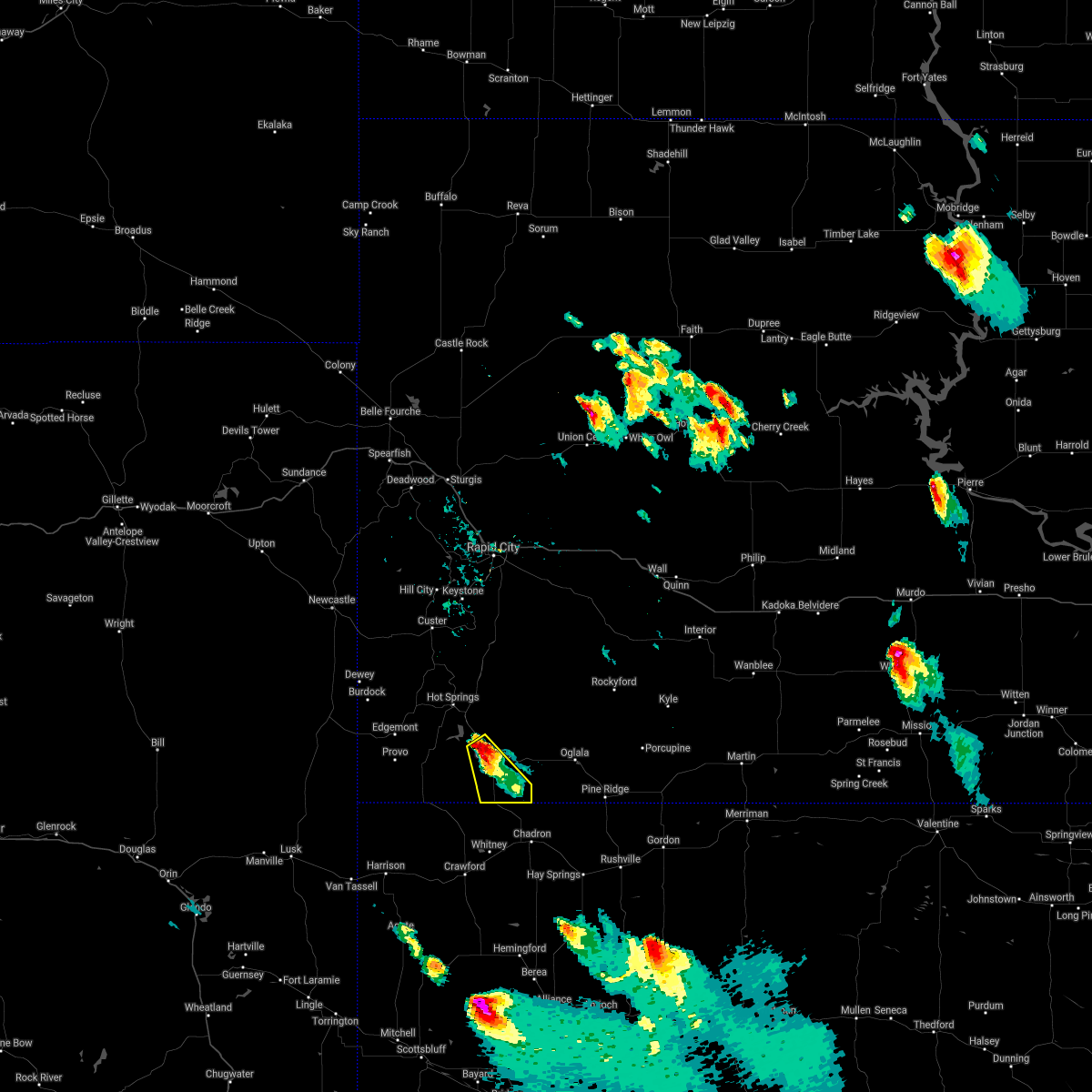 At 556 pm mdt, a severe thunderstorm was located 5 miles south of oelrichs, or 21 miles northwest of chadron, moving southeast at 20 mph (radar indicated). Hazards include 60 mph wind gusts and quarter size hail. Hail damage to vehicles is expected. expect wind damage to roofs, siding, and trees. this severe thunderstorm will remain over mainly rural areas of southeastern fall river county. hail threat, radar indicated max hail size, 1. 00 in wind threat, radar indicated max wind gust, 60 mph. At 556 pm mdt, a severe thunderstorm was located 5 miles south of oelrichs, or 21 miles northwest of chadron, moving southeast at 20 mph (radar indicated). Hazards include 60 mph wind gusts and quarter size hail. Hail damage to vehicles is expected. expect wind damage to roofs, siding, and trees. this severe thunderstorm will remain over mainly rural areas of southeastern fall river county. hail threat, radar indicated max hail size, 1. 00 in wind threat, radar indicated max wind gust, 60 mph.
|
| 8/14/2021 2:06 PM MDT |
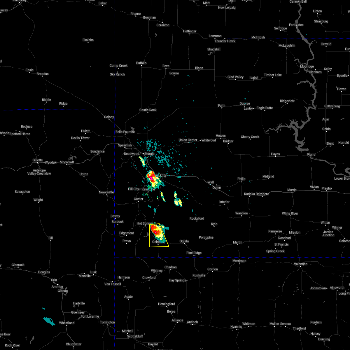 At 206 pm mdt, a severe thunderstorm was located 3 miles northwest of smithwick, or 12 miles southeast of hot springs, moving south at 15 mph (radar indicated). Hazards include 60 mph wind gusts and quarter size hail. Hail damage to vehicles is expected. expect wind damage to roofs, siding, and trees. this severe thunderstorm will be near, smithwick around 220 pm mdt. other locations in the path of this severe thunderstorm include hay canyon butte and oelrichs. hail threat, radar indicated max hail size, 1. 00 in wind threat, radar indicated max wind gust, 60 mph. At 206 pm mdt, a severe thunderstorm was located 3 miles northwest of smithwick, or 12 miles southeast of hot springs, moving south at 15 mph (radar indicated). Hazards include 60 mph wind gusts and quarter size hail. Hail damage to vehicles is expected. expect wind damage to roofs, siding, and trees. this severe thunderstorm will be near, smithwick around 220 pm mdt. other locations in the path of this severe thunderstorm include hay canyon butte and oelrichs. hail threat, radar indicated max hail size, 1. 00 in wind threat, radar indicated max wind gust, 60 mph.
|
| 8/6/2021 5:53 PM MDT |
 At 553 pm mdt, severe thunderstorms were located along a line extending from 2 miles southeast of hay canyon butte to 4 miles southwest of prairie winds casino to 8 miles southwest of slim butte, moving east at 50 mph (radar indicated). Hazards include 60 mph wind gusts. Expect damage to roofs, siding, and trees. severe thunderstorms will be near, slim butte around 605 pm mdt. oglala, loneman, south lakeside and slim buttes housing around 610 pm mdt. other locations in the path of these severe thunderstorms include dry wood housing, number 4, calico, manderson, wounded knee, lonesome valley, goose neck housing, porcupine, thunder valley, sharps corner, evergreen, porcupine butte housing, kyle and kyle north route housing. hail threat, radar indicated max hail size, <. 75 in wind threat, radar indicated max wind gust, 60 mph. At 553 pm mdt, severe thunderstorms were located along a line extending from 2 miles southeast of hay canyon butte to 4 miles southwest of prairie winds casino to 8 miles southwest of slim butte, moving east at 50 mph (radar indicated). Hazards include 60 mph wind gusts. Expect damage to roofs, siding, and trees. severe thunderstorms will be near, slim butte around 605 pm mdt. oglala, loneman, south lakeside and slim buttes housing around 610 pm mdt. other locations in the path of these severe thunderstorms include dry wood housing, number 4, calico, manderson, wounded knee, lonesome valley, goose neck housing, porcupine, thunder valley, sharps corner, evergreen, porcupine butte housing, kyle and kyle north route housing. hail threat, radar indicated max hail size, <. 75 in wind threat, radar indicated max wind gust, 60 mph.
|
| 8/6/2021 5:41 PM MDT |
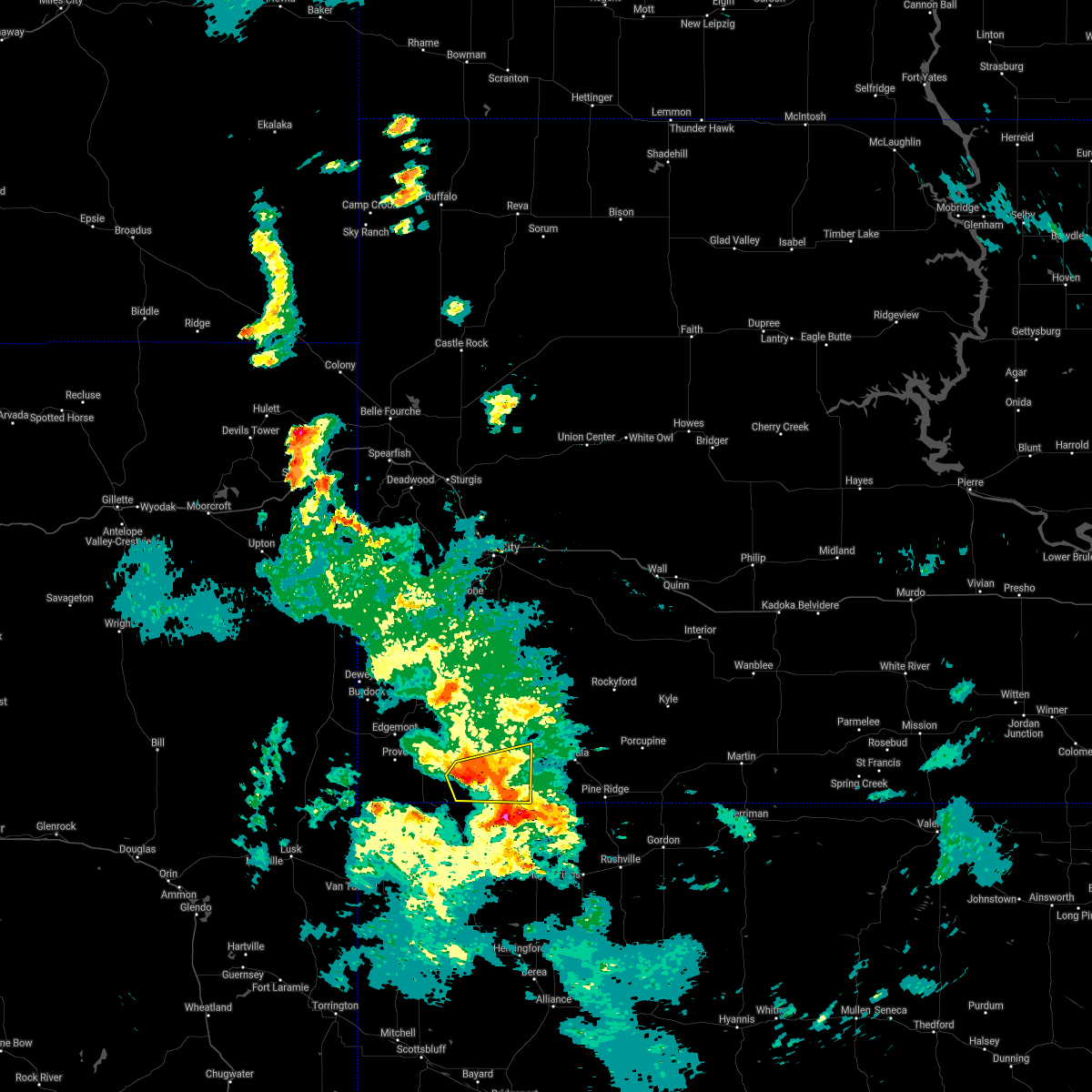 At 541 pm mdt, a severe thunderstorm was located 6 miles southwest of oelrichs, or 23 miles south of hot springs, moving east at 45 mph (radar indicated). Hazards include 60 mph wind gusts and penny size hail. Expect damage to roofs, siding, and trees. locations impacted include, oelrichs. hail threat, radar indicated max hail size, 0. 75 in wind threat, radar indicated max wind gust, 60 mph. At 541 pm mdt, a severe thunderstorm was located 6 miles southwest of oelrichs, or 23 miles south of hot springs, moving east at 45 mph (radar indicated). Hazards include 60 mph wind gusts and penny size hail. Expect damage to roofs, siding, and trees. locations impacted include, oelrichs. hail threat, radar indicated max hail size, 0. 75 in wind threat, radar indicated max wind gust, 60 mph.
|
| 8/6/2021 5:24 PM MDT |
 At 524 pm mdt, severe thunderstorms were located along a line extending from 2 miles south of cascade falls to 7 miles east of rumford to 5 miles east of ardmore, moving northeast at 30 mph. trained spotters recently reported wind gusts up to 60 mph 15 miles west of ardmore (trained weather spotters). Hazards include 60 mph wind gusts. Expect damage to roofs, siding, and trees. locations impacted include, cascade falls, angostura reservoir, oelrichs, smithwick, oral and hay canyon butte. hail threat, radar indicated max hail size, <. 75 in wind threat, observed max wind gust, 60 mph. At 524 pm mdt, severe thunderstorms were located along a line extending from 2 miles south of cascade falls to 7 miles east of rumford to 5 miles east of ardmore, moving northeast at 30 mph. trained spotters recently reported wind gusts up to 60 mph 15 miles west of ardmore (trained weather spotters). Hazards include 60 mph wind gusts. Expect damage to roofs, siding, and trees. locations impacted include, cascade falls, angostura reservoir, oelrichs, smithwick, oral and hay canyon butte. hail threat, radar indicated max hail size, <. 75 in wind threat, observed max wind gust, 60 mph.
|
| 8/6/2021 4:53 PM MDT |
 At 453 pm mdt, severe thunderstorms were located along a line extending from 7 miles west of provo to 13 miles southwest of rumford to 9 miles west of montrose, moving east at 45 mph (radar indicated). Hazards include 60 mph wind gusts. Expect damage to roofs, siding, and trees. severe thunderstorms will be near, provo around 500 pm mdt. edgemont around 505 pm mdt. rumford around 510 pm mdt. other locations in the path of these severe thunderstorms include ardmore, cascade falls, angostura reservoir, oral, oelrichs, smithwick and hay canyon butte. hail threat, radar indicated max hail size, <. 75 in wind threat, radar indicated max wind gust, 60 mph. At 453 pm mdt, severe thunderstorms were located along a line extending from 7 miles west of provo to 13 miles southwest of rumford to 9 miles west of montrose, moving east at 45 mph (radar indicated). Hazards include 60 mph wind gusts. Expect damage to roofs, siding, and trees. severe thunderstorms will be near, provo around 500 pm mdt. edgemont around 505 pm mdt. rumford around 510 pm mdt. other locations in the path of these severe thunderstorms include ardmore, cascade falls, angostura reservoir, oral, oelrichs, smithwick and hay canyon butte. hail threat, radar indicated max hail size, <. 75 in wind threat, radar indicated max wind gust, 60 mph.
|
| 6/10/2021 10:13 PM MDT |
 At 1013 pm mdt, severe thunderstorms were located along a line extending from 5 miles east of oral to 12 miles southwest of oelrichs, moving northeast at 40 mph (radar indicated). Hazards include 70 mph wind gusts and quarter size hail. Hail damage to vehicles is expected. expect considerable tree damage. wind damage is also likely to mobile homes, roofs, and outbuildings. Locations impacted include, oelrichs, intersection of red shirt and cuny table roads, prairie winds casino, slim butte and dry wood housing. At 1013 pm mdt, severe thunderstorms were located along a line extending from 5 miles east of oral to 12 miles southwest of oelrichs, moving northeast at 40 mph (radar indicated). Hazards include 70 mph wind gusts and quarter size hail. Hail damage to vehicles is expected. expect considerable tree damage. wind damage is also likely to mobile homes, roofs, and outbuildings. Locations impacted include, oelrichs, intersection of red shirt and cuny table roads, prairie winds casino, slim butte and dry wood housing.
|
| 6/10/2021 9:49 PM MDT |
 At 949 pm mdt, severe thunderstorms were located along a line extending from 2 miles north of angostura reservoir to 6 miles east of ardmore, moving northeast at 45 mph (radar indicated). Hazards include 70 mph wind gusts and quarter size hail. Hail damage to vehicles is expected. expect considerable tree damage. wind damage is also likely to mobile homes, roofs, and outbuildings. severe thunderstorms will be near, angostura reservoir around 955 pm mdt. oral and smithwick around 1000 pm mdt. Other locations in the path of these severe thunderstorms include oelrichs, hay canyon butte, intersection of red shirt and cuny table roads and prairie winds casino. At 949 pm mdt, severe thunderstorms were located along a line extending from 2 miles north of angostura reservoir to 6 miles east of ardmore, moving northeast at 45 mph (radar indicated). Hazards include 70 mph wind gusts and quarter size hail. Hail damage to vehicles is expected. expect considerable tree damage. wind damage is also likely to mobile homes, roofs, and outbuildings. severe thunderstorms will be near, angostura reservoir around 955 pm mdt. oral and smithwick around 1000 pm mdt. Other locations in the path of these severe thunderstorms include oelrichs, hay canyon butte, intersection of red shirt and cuny table roads and prairie winds casino.
|
| 8/27/2020 7:12 PM MDT |
 The severe thunderstorm warning for eastern fall river county will expire at 715 pm mdt, the storms which prompted the warning have weakened below severe limits, and no longer pose an immediate threat to life or property. therefore, the warning will be allowed to expire. however small hail and gusty winds are still possible with these thunderstorms. a severe thunderstorm watch remains in effect until 100 am mdt for southwestern south dakota. The severe thunderstorm warning for eastern fall river county will expire at 715 pm mdt, the storms which prompted the warning have weakened below severe limits, and no longer pose an immediate threat to life or property. therefore, the warning will be allowed to expire. however small hail and gusty winds are still possible with these thunderstorms. a severe thunderstorm watch remains in effect until 100 am mdt for southwestern south dakota.
|
| 8/27/2020 7:03 PM MDT |
 At 702 pm mdt, severe thunderstorms were located along a line extending from 3 miles east of cold brook reservoir to 8 miles west of slim buttes, moving east at 45 mph (radar indicated). Hazards include 60 mph wind gusts and penny size hail. Expect damage to roofs, siding, and trees. These severe thunderstorms will remain over mainly rural areas of eastern fall river county east of angostura reservoir. At 702 pm mdt, severe thunderstorms were located along a line extending from 3 miles east of cold brook reservoir to 8 miles west of slim buttes, moving east at 45 mph (radar indicated). Hazards include 60 mph wind gusts and penny size hail. Expect damage to roofs, siding, and trees. These severe thunderstorms will remain over mainly rural areas of eastern fall river county east of angostura reservoir.
|
| 8/27/2020 6:43 PM MDT |
 At 643 pm mdt, severe thunderstorms were located along a line extending from 4 miles west of cottonwood springs dam to 11 miles south of oelrichs, moving east at 50 mph (radar indicated). Hazards include 60 mph wind gusts and penny size hail. Expect damage to roofs, siding, and trees. these severe storms will be near, maverick junction around 700 pm mdt. Oral around 705 pm mdt. At 643 pm mdt, severe thunderstorms were located along a line extending from 4 miles west of cottonwood springs dam to 11 miles south of oelrichs, moving east at 50 mph (radar indicated). Hazards include 60 mph wind gusts and penny size hail. Expect damage to roofs, siding, and trees. these severe storms will be near, maverick junction around 700 pm mdt. Oral around 705 pm mdt.
|
| 8/27/2020 6:26 PM MDT |
 At 626 pm mdt, severe thunderstorms were located along a line extending from 3 miles east of burdock to 8 miles east of ardmore, moving east at 50 mph (radar indicated). Hazards include 60 mph wind gusts and penny size hail. Expect damage to roofs, siding, and trees. these severe storms will be near, cold brook reservoir and cottonwood springs dam around 650 pm mdt. hot springs and maverick junction around 655 pm mdt. Oral around 705 pm mdt. At 626 pm mdt, severe thunderstorms were located along a line extending from 3 miles east of burdock to 8 miles east of ardmore, moving east at 50 mph (radar indicated). Hazards include 60 mph wind gusts and penny size hail. Expect damage to roofs, siding, and trees. these severe storms will be near, cold brook reservoir and cottonwood springs dam around 650 pm mdt. hot springs and maverick junction around 655 pm mdt. Oral around 705 pm mdt.
|
| 8/27/2020 6:08 PM MDT |
 At 607 pm mdt, severe thunderstorms were located along a line extending from 3 miles north of mule creek junction to 6 miles northwest of montrose, moving east at 50 mph (radar indicated). Hazards include 60 mph wind gusts and penny size hail. Expect damage to roofs, siding, and trees. severe thunderstorms will be near, ardmore around 615 pm mdt. cottonwood springs dam and cold brook reservoir around 650 pm mdt. hot springs around 655 pm mdt. maverick junction around 700 pm mdt. Oral around 705 pm mdt. At 607 pm mdt, severe thunderstorms were located along a line extending from 3 miles north of mule creek junction to 6 miles northwest of montrose, moving east at 50 mph (radar indicated). Hazards include 60 mph wind gusts and penny size hail. Expect damage to roofs, siding, and trees. severe thunderstorms will be near, ardmore around 615 pm mdt. cottonwood springs dam and cold brook reservoir around 650 pm mdt. hot springs around 655 pm mdt. maverick junction around 700 pm mdt. Oral around 705 pm mdt.
|
| 7/9/2020 8:30 PM MDT | Quarter sized hail reported 7.3 miles NW of Oelrichs, SD |
| 7/9/2020 5:28 AM MDT |
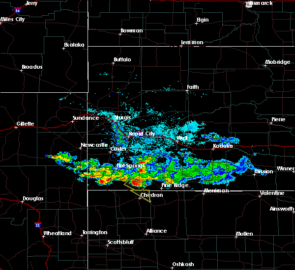 At 527 am mdt, a severe thunderstorm was located 4 miles southeast of oelrichs, or 22 miles north of chadron, moving southeast at 15 mph (radar indicated). Hazards include half dollar size hail. Damage to vehicles is expected. This severe thunderstorm will remain over mainly rural areas of southwestern oglala lakota county west of slim buttes, and southeastern fall river county south and east of oelrichs. At 527 am mdt, a severe thunderstorm was located 4 miles southeast of oelrichs, or 22 miles north of chadron, moving southeast at 15 mph (radar indicated). Hazards include half dollar size hail. Damage to vehicles is expected. This severe thunderstorm will remain over mainly rural areas of southwestern oglala lakota county west of slim buttes, and southeastern fall river county south and east of oelrichs.
|
| 7/9/2020 5:00 AM MDT |
 At 500 am mdt, a severe thunderstorm was located near oelrichs, or 19 miles southeast of hot springs, moving southeast at 20 mph (radar indicated). Hazards include half dollar size hail. Damage to vehicles is expected. This severe thunderstorm will be near, oelrichs and hay canyon butte around 510 am mdt. At 500 am mdt, a severe thunderstorm was located near oelrichs, or 19 miles southeast of hot springs, moving southeast at 20 mph (radar indicated). Hazards include half dollar size hail. Damage to vehicles is expected. This severe thunderstorm will be near, oelrichs and hay canyon butte around 510 am mdt.
|
| 7/5/2020 7:09 PM MDT |
 At 708 pm mdt, severe thunderstorms were located along a line extending from 2 miles west of dewey to 5 miles southwest of edgemont to 8 miles northwest of montrose, moving northeast at 40 mph (radar indicated). Hazards include 70 mph wind gusts and quarter size hail. Hail damage to vehicles is expected. expect considerable tree damage. wind damage is also likely to mobile homes, roofs, and outbuildings. severe thunderstorms will be near, edgemont around 715 pm mdt. ardmore around 720 pm mdt. cascade falls around 735 pm mdt. hot springs, cold brook reservoir, wind cave national park and angostura reservoir around 745 pm mdt. maverick junction around 750 pm mdt. Buffalo gap, oelrichs, and custer state park around 755 pm mdt. At 708 pm mdt, severe thunderstorms were located along a line extending from 2 miles west of dewey to 5 miles southwest of edgemont to 8 miles northwest of montrose, moving northeast at 40 mph (radar indicated). Hazards include 70 mph wind gusts and quarter size hail. Hail damage to vehicles is expected. expect considerable tree damage. wind damage is also likely to mobile homes, roofs, and outbuildings. severe thunderstorms will be near, edgemont around 715 pm mdt. ardmore around 720 pm mdt. cascade falls around 735 pm mdt. hot springs, cold brook reservoir, wind cave national park and angostura reservoir around 745 pm mdt. maverick junction around 750 pm mdt. Buffalo gap, oelrichs, and custer state park around 755 pm mdt.
|
| 7/2/2020 3:58 PM MDT |
 At 358 pm mdt, a severe thunderstorm was located 8 miles southwest of intersection of red shirt and cuny table roads, or 22 miles east of hot springs, moving northeast at 20 mph (radar indicated). Hazards include ping pong ball size hail and 60 mph wind gusts. People and animals outdoors will be injured. expect hail damage to roofs, siding, windows, and vehicles. Expect wind damage to roofs, siding, and trees. At 358 pm mdt, a severe thunderstorm was located 8 miles southwest of intersection of red shirt and cuny table roads, or 22 miles east of hot springs, moving northeast at 20 mph (radar indicated). Hazards include ping pong ball size hail and 60 mph wind gusts. People and animals outdoors will be injured. expect hail damage to roofs, siding, windows, and vehicles. Expect wind damage to roofs, siding, and trees.
|
| 6/6/2020 6:35 PM MDT |
 At 635 pm mdt, severe thunderstorms were located along a line extending from 4 miles east of fort meade to 2 miles northwest of rapid valley to 7 miles southwest of red shirt, moving northeast at 55 mph (radar indicated). Hazards include 70 mph wind gusts. Expect considerable tree damage. damage is likely to mobile homes, roofs, and outbuildings. these severe storms will be near, ellsworth air force base, box elder and rapid city airport around 640 pm mdt. new underwood around 650 pm mdt. scenic around 705 pm mdt. southwestern badlands national park around 720 pm mdt. This includes interstate 90 in south dakota between mile markers 35 and 92. At 635 pm mdt, severe thunderstorms were located along a line extending from 4 miles east of fort meade to 2 miles northwest of rapid valley to 7 miles southwest of red shirt, moving northeast at 55 mph (radar indicated). Hazards include 70 mph wind gusts. Expect considerable tree damage. damage is likely to mobile homes, roofs, and outbuildings. these severe storms will be near, ellsworth air force base, box elder and rapid city airport around 640 pm mdt. new underwood around 650 pm mdt. scenic around 705 pm mdt. southwestern badlands national park around 720 pm mdt. This includes interstate 90 in south dakota between mile markers 35 and 92.
|
| 6/6/2020 6:05 PM MDT |
 At 604 pm mdt, severe thunderstorms were located along a line extending from 3 miles south of cheyenne crossing to 2 miles west of hill city to 3 miles south of maverick junction, moving northeast at 65 mph. these are very dangerous storms (radar indicated). Hazards include 80 mph wind gusts. Flying debris will be dangerous to those caught without shelter. mobile homes will be heavily damaged. expect considerable damage to roofs, windows, and vehicles. extensive tree damage and power outages are likely. these severe storms will be near, keystone and sheridan lake around 610 pm mdt. johnson siding, hisega and rockerville around 615 pm mdt. rapid city around 620 pm mdt. rapid valley, black hawk and tilford around 625 pm mdt. ellsworth air force base, box elder, and rapid city airport around 630 pm mdt. red shirt around 635 pm mdt. sheep mountain table around 650 pm mdt. This includes interstate 90 in south dakota between mile markers 34 and 92. At 604 pm mdt, severe thunderstorms were located along a line extending from 3 miles south of cheyenne crossing to 2 miles west of hill city to 3 miles south of maverick junction, moving northeast at 65 mph. these are very dangerous storms (radar indicated). Hazards include 80 mph wind gusts. Flying debris will be dangerous to those caught without shelter. mobile homes will be heavily damaged. expect considerable damage to roofs, windows, and vehicles. extensive tree damage and power outages are likely. these severe storms will be near, keystone and sheridan lake around 610 pm mdt. johnson siding, hisega and rockerville around 615 pm mdt. rapid city around 620 pm mdt. rapid valley, black hawk and tilford around 625 pm mdt. ellsworth air force base, box elder, and rapid city airport around 630 pm mdt. red shirt around 635 pm mdt. sheep mountain table around 650 pm mdt. This includes interstate 90 in south dakota between mile markers 34 and 92.
|
| 6/6/2020 5:56 PM MDT |
 At 552 pm mdt, severe thunderstorms were located along a line extending from redbank spring campground to 5 miles southeast of jewel cave national monument to 7 miles east of rumford, moving northeast at 70 mph (radar indicated). Hazards include 70 mph wind gusts. Expect considerable tree damage. damage is likely to mobile homes, roofs, and outbuildings. severe thunderstorms will be near, custer, deerfield, crazy horse memorial around 600 pm mdt. oelrichs, rochford, and custer state park around 605 pm mdt. keystone, silver city and smithwick around 610 pm mdt. nemo and rockerville around 615 pm mdt. rapid city, summerset, piedmont and tilford around 620 pm mdt. rapid valley and black gap around 625 pm mdt. box elder and rapid city airport around 630 pm mdt. new underwood around 640 pm mdt. This includes interstate 90 in south dakota between mile markers 34 and 92. At 552 pm mdt, severe thunderstorms were located along a line extending from redbank spring campground to 5 miles southeast of jewel cave national monument to 7 miles east of rumford, moving northeast at 70 mph (radar indicated). Hazards include 70 mph wind gusts. Expect considerable tree damage. damage is likely to mobile homes, roofs, and outbuildings. severe thunderstorms will be near, custer, deerfield, crazy horse memorial around 600 pm mdt. oelrichs, rochford, and custer state park around 605 pm mdt. keystone, silver city and smithwick around 610 pm mdt. nemo and rockerville around 615 pm mdt. rapid city, summerset, piedmont and tilford around 620 pm mdt. rapid valley and black gap around 625 pm mdt. box elder and rapid city airport around 630 pm mdt. new underwood around 640 pm mdt. This includes interstate 90 in south dakota between mile markers 34 and 92.
|
| 8/25/2019 9:27 PM MDT |
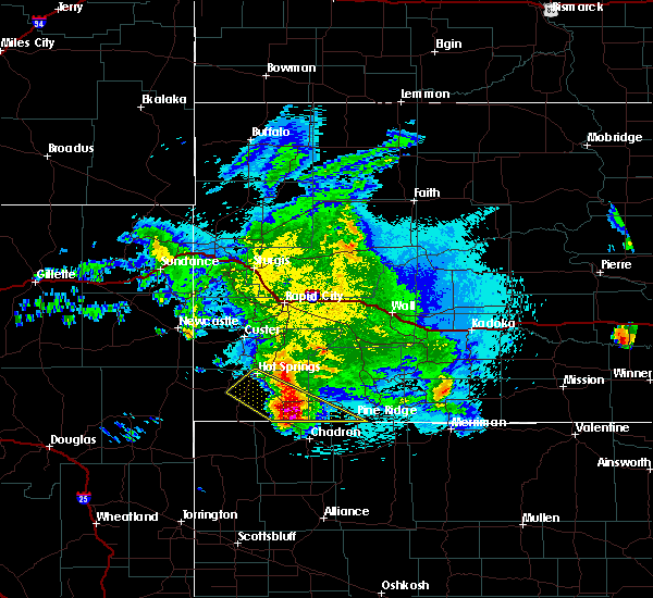 At 927 pm mdt, a severe thunderstorm was located 10 miles southeast of oelrichs, or 16 miles north of chadron, moving southeast at 50 mph (radar indicated). Hazards include tennis ball size hail and 60 mph wind gusts. People and animals outdoors will be injured. expect hail damage to roofs, siding, windows, and vehicles. expect wind damage to roofs, siding, and trees. Locations impacted include, oelrichs, slim buttes and hay canyon butte. At 927 pm mdt, a severe thunderstorm was located 10 miles southeast of oelrichs, or 16 miles north of chadron, moving southeast at 50 mph (radar indicated). Hazards include tennis ball size hail and 60 mph wind gusts. People and animals outdoors will be injured. expect hail damage to roofs, siding, windows, and vehicles. expect wind damage to roofs, siding, and trees. Locations impacted include, oelrichs, slim buttes and hay canyon butte.
|
| 8/25/2019 8:51 PM MDT |
 At 850 pm mdt, a severe thunderstorm was located over cascade falls, or 8 miles southwest of hot springs, moving southeast at 50 mph (radar indicated). Hazards include golf ball size hail and 70 mph wind gusts. People and animals outdoors will be injured. expect hail damage to roofs, siding, windows, and vehicles. expect considerable tree damage. Wind damage is also likely to mobile homes, roofs, and outbuildings. At 850 pm mdt, a severe thunderstorm was located over cascade falls, or 8 miles southwest of hot springs, moving southeast at 50 mph (radar indicated). Hazards include golf ball size hail and 70 mph wind gusts. People and animals outdoors will be injured. expect hail damage to roofs, siding, windows, and vehicles. expect considerable tree damage. Wind damage is also likely to mobile homes, roofs, and outbuildings.
|
| 8/15/2019 2:12 AM MDT |
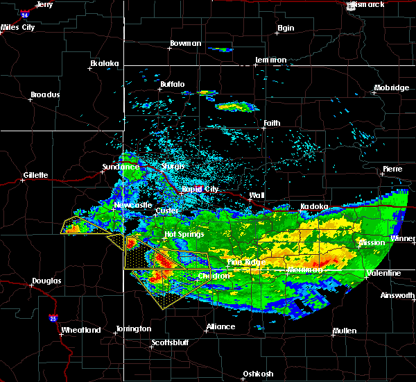 At 212 am mdt, severe thunderstorms were located along a line extending from 6 miles southwest of angostura reservoir to 9 miles southwest of oelrichs to 11 miles northwest of whitney lake, moving east at 45 mph (radar indicated). Hazards include 60 mph wind gusts and half dollar size hail. Hail damage to vehicles is expected. Expect wind damage to roofs, siding, and trees. At 212 am mdt, severe thunderstorms were located along a line extending from 6 miles southwest of angostura reservoir to 9 miles southwest of oelrichs to 11 miles northwest of whitney lake, moving east at 45 mph (radar indicated). Hazards include 60 mph wind gusts and half dollar size hail. Hail damage to vehicles is expected. Expect wind damage to roofs, siding, and trees.
|
| 8/11/2019 5:46 PM MDT |
 At 545 pm mdt, severe thunderstorms were located along a line extending from 7 miles south of jewel cave national monument to 4 miles west of smithwick to 10 miles southwest of oelrichs, moving northeast at 40 mph (radar indicated). Hazards include 60 mph wind gusts and penny size hail. Expect damage to roofs, siding, and trees. Locations impacted include, hot springs, custer, hermosa, oral, buffalo gap, oelrichs, pringle, fairburn, smithwick, argyle, wind cave national park, stockade lake, maverick junction, legion lake, buffalo corrals, state game lodge, angostura reservoir, blue bell, custer state park and hay canyon butte. At 545 pm mdt, severe thunderstorms were located along a line extending from 7 miles south of jewel cave national monument to 4 miles west of smithwick to 10 miles southwest of oelrichs, moving northeast at 40 mph (radar indicated). Hazards include 60 mph wind gusts and penny size hail. Expect damage to roofs, siding, and trees. Locations impacted include, hot springs, custer, hermosa, oral, buffalo gap, oelrichs, pringle, fairburn, smithwick, argyle, wind cave national park, stockade lake, maverick junction, legion lake, buffalo corrals, state game lodge, angostura reservoir, blue bell, custer state park and hay canyon butte.
|
| 8/11/2019 5:36 PM MDT |
 At 535 pm mdt, severe thunderstorms were located along a line extending from 9 miles northeast of dewey to angostura reservoir to near ardmore, moving east at 35 mph (radar indicated). Hazards include 70 mph wind gusts and quarter size hail. Hail damage to vehicles is expected. expect considerable tree damage. wind damage is also likely to mobile homes, roofs, and outbuildings. Locations impacted include, hot springs, custer, hermosa, oral, buffalo gap, oelrichs, pringle, fairburn, smithwick, argyle, ardmore, wind cave national park, stockade lake, maverick junction, legion lake, buffalo corrals, state game lodge, angostura reservoir, blue bell and custer state park. At 535 pm mdt, severe thunderstorms were located along a line extending from 9 miles northeast of dewey to angostura reservoir to near ardmore, moving east at 35 mph (radar indicated). Hazards include 70 mph wind gusts and quarter size hail. Hail damage to vehicles is expected. expect considerable tree damage. wind damage is also likely to mobile homes, roofs, and outbuildings. Locations impacted include, hot springs, custer, hermosa, oral, buffalo gap, oelrichs, pringle, fairburn, smithwick, argyle, ardmore, wind cave national park, stockade lake, maverick junction, legion lake, buffalo corrals, state game lodge, angostura reservoir, blue bell and custer state park.
|
| 8/11/2019 5:11 PM MDT |
 At 511 pm mdt, severe thunderstorms were located along a line extending from 4 miles northwest of dewey to 5 miles west of cascade falls to 15 miles southwest of provo, moving northeast at 40 mph. a 66 mph wind gust was recently recorded west of edgemont (automated observations). Hazards include 70 mph wind gusts and quarter size hail. Hail damage to vehicles is expected. expect considerable tree damage. wind damage is also likely to mobile homes, roofs, and outbuildings. Locations impacted include, hot springs, custer, edgemont, dewey, hermosa, oral, buffalo gap, oelrichs, pringle, fairburn, smithwick, provo, argyle, rumford, ardmore, wind cave national park, stockade lake, maverick junction, legion lake and buffalo corrals. At 511 pm mdt, severe thunderstorms were located along a line extending from 4 miles northwest of dewey to 5 miles west of cascade falls to 15 miles southwest of provo, moving northeast at 40 mph. a 66 mph wind gust was recently recorded west of edgemont (automated observations). Hazards include 70 mph wind gusts and quarter size hail. Hail damage to vehicles is expected. expect considerable tree damage. wind damage is also likely to mobile homes, roofs, and outbuildings. Locations impacted include, hot springs, custer, edgemont, dewey, hermosa, oral, buffalo gap, oelrichs, pringle, fairburn, smithwick, provo, argyle, rumford, ardmore, wind cave national park, stockade lake, maverick junction, legion lake and buffalo corrals.
|
| 8/11/2019 5:02 PM MDT |
 At 502 pm mdt, severe thunderstorms were located along a line extending from 8 miles west of dewey to 4 miles east of edgemont to 17 miles south of redbird, moving northeast at 40 mph (radar indicated). Hazards include 60 mph wind gusts and quarter size hail. Hail damage to vehicles is expected. Expect wind damage to roofs, siding, and trees. At 502 pm mdt, severe thunderstorms were located along a line extending from 8 miles west of dewey to 4 miles east of edgemont to 17 miles south of redbird, moving northeast at 40 mph (radar indicated). Hazards include 60 mph wind gusts and quarter size hail. Hail damage to vehicles is expected. Expect wind damage to roofs, siding, and trees.
|
| 8/10/2019 5:10 PM MDT |
 At 510 pm mdt, a severe thunderstorm was located near oelrichs, or 23 miles southeast of hot springs, moving east at 20 mph (radar indicated). Hazards include 60 mph wind gusts and penny size hail. Expect damage to roofs, siding, and trees. Locations impacted include, oelrichs, smithwick and hay canyon butte. At 510 pm mdt, a severe thunderstorm was located near oelrichs, or 23 miles southeast of hot springs, moving east at 20 mph (radar indicated). Hazards include 60 mph wind gusts and penny size hail. Expect damage to roofs, siding, and trees. Locations impacted include, oelrichs, smithwick and hay canyon butte.
|
| 8/10/2019 4:50 PM MDT |
 At 450 pm mdt, a severe thunderstorm was located 8 miles southwest of oelrichs, or 22 miles south of hot springs, moving east at 20 mph (radar indicated). Hazards include 60 mph wind gusts and quarter size hail. Hail damage to vehicles is expected. Expect wind damage to roofs, siding, and trees. At 450 pm mdt, a severe thunderstorm was located 8 miles southwest of oelrichs, or 22 miles south of hot springs, moving east at 20 mph (radar indicated). Hazards include 60 mph wind gusts and quarter size hail. Hail damage to vehicles is expected. Expect wind damage to roofs, siding, and trees.
|
| 8/5/2019 4:35 PM MDT | Golf Ball sized hail reported 12.5 miles SW of Oelrichs, SD |
| 8/5/2019 4:35 PM MDT | Storm damage reported in fall river county SD, 12.5 miles SW of Oelrichs, SD |
| 8/5/2019 4:21 PM MDT |
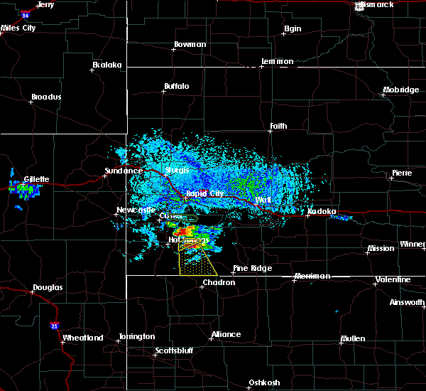 At 421 pm mdt, a severe thunderstorm was located 3 miles east of oral, or 14 miles east of hot springs, moving southeast at 25 mph (radar indicated). Hazards include golf ball size hail and 60 mph wind gusts. People and animals outdoors will be injured. expect hail damage to roofs, siding, windows, and vehicles. Expect wind damage to roofs, siding, and trees. At 421 pm mdt, a severe thunderstorm was located 3 miles east of oral, or 14 miles east of hot springs, moving southeast at 25 mph (radar indicated). Hazards include golf ball size hail and 60 mph wind gusts. People and animals outdoors will be injured. expect hail damage to roofs, siding, windows, and vehicles. Expect wind damage to roofs, siding, and trees.
|
| 7/28/2019 2:14 PM MDT | Quarter sized hail reported 10.1 miles NW of Oelrichs, SD |
| 7/28/2019 2:14 PM MDT | Golf Ball sized hail reported 10.1 miles NW of Oelrichs, SD, corrected size based on pictures received |
| 7/28/2019 1:45 PM MDT | Half Dollar sized hail reported 6 miles S of Oelrichs, SD |
| 7/28/2019 1:38 PM MDT | Half Dollar sized hail reported 8.1 miles S of Oelrichs, SD |
| 7/17/2019 7:11 PM MDT |
 At 711 pm mdt, a severe thunderstorm was located 3 miles southwest of rumford, or 14 miles south of edgemont, moving east at 40 mph (radar indicated). Hazards include 60 mph wind gusts and quarter size hail. Hail damage to vehicles is expected. expect wind damage to roofs, siding, and trees. Locations impacted include, oelrichs, provo, ardmore and rumford. At 711 pm mdt, a severe thunderstorm was located 3 miles southwest of rumford, or 14 miles south of edgemont, moving east at 40 mph (radar indicated). Hazards include 60 mph wind gusts and quarter size hail. Hail damage to vehicles is expected. expect wind damage to roofs, siding, and trees. Locations impacted include, oelrichs, provo, ardmore and rumford.
|
| 7/17/2019 6:55 PM MDT |
 At 655 pm mdt, a severe thunderstorm was located 8 miles southwest of provo, or 14 miles southwest of edgemont, moving east at 40 mph (radar indicated). Hazards include ping pong ball size hail and 60 mph wind gusts. People and animals outdoors will be injured. expect hail damage to roofs, siding, windows, and vehicles. Expect wind damage to roofs, siding, and trees. At 655 pm mdt, a severe thunderstorm was located 8 miles southwest of provo, or 14 miles southwest of edgemont, moving east at 40 mph (radar indicated). Hazards include ping pong ball size hail and 60 mph wind gusts. People and animals outdoors will be injured. expect hail damage to roofs, siding, windows, and vehicles. Expect wind damage to roofs, siding, and trees.
|
| 7/16/2019 7:11 PM MDT |
 At 711 pm mdt, severe thunderstorms were located along a line extending from custer state park to 8 miles west of intersection of red shirt and cuny table roads to 3 miles northwest of slim buttes, moving east at 40 mph (radar indicated). Hazards include 60 mph wind gusts and quarter size hail. Hail damage to vehicles is expected. expect wind damage to roofs, siding, and trees. Locations impacted include, hot springs, oglala, oral, buffalo gap, oelrichs, pringle, fairburn, smithwick, wind cave national park, red shirt table overlook, slim buttes, maverick junction, legion lake, intersection of red shirt and cuny table roads, buffalo corrals, state game lodge, blue bell, center lake, custer state park and hay canyon butte. At 711 pm mdt, severe thunderstorms were located along a line extending from custer state park to 8 miles west of intersection of red shirt and cuny table roads to 3 miles northwest of slim buttes, moving east at 40 mph (radar indicated). Hazards include 60 mph wind gusts and quarter size hail. Hail damage to vehicles is expected. expect wind damage to roofs, siding, and trees. Locations impacted include, hot springs, oglala, oral, buffalo gap, oelrichs, pringle, fairburn, smithwick, wind cave national park, red shirt table overlook, slim buttes, maverick junction, legion lake, intersection of red shirt and cuny table roads, buffalo corrals, state game lodge, blue bell, center lake, custer state park and hay canyon butte.
|
| 7/16/2019 6:56 PM MDT |
 At 655 pm mdt, severe thunderstorms were located along a line extending from pringle to 3 miles northeast of oral to 11 miles west of slim buttes, moving east at 40 mph (radar indicated). Hazards include 60 mph wind gusts and quarter size hail. Hail damage to vehicles is expected. Expect wind damage to roofs, siding, and trees. At 655 pm mdt, severe thunderstorms were located along a line extending from pringle to 3 miles northeast of oral to 11 miles west of slim buttes, moving east at 40 mph (radar indicated). Hazards include 60 mph wind gusts and quarter size hail. Hail damage to vehicles is expected. Expect wind damage to roofs, siding, and trees.
|
| 7/9/2019 2:12 PM MDT |
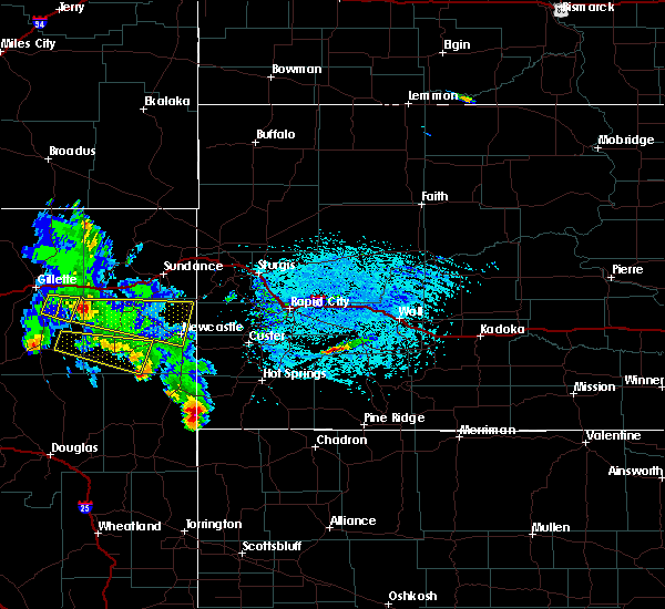 At 212 pm mdt, a severe thunderstorm was located 11 miles west of provo, or 15 miles southwest of edgemont, moving east at 50 mph (radar indicated). Hazards include 70 mph wind gusts and quarter size hail. Hail damage to vehicles is expected. expect considerable tree damage. Wind damage is also likely to mobile homes, roofs, and outbuildings. At 212 pm mdt, a severe thunderstorm was located 11 miles west of provo, or 15 miles southwest of edgemont, moving east at 50 mph (radar indicated). Hazards include 70 mph wind gusts and quarter size hail. Hail damage to vehicles is expected. expect considerable tree damage. Wind damage is also likely to mobile homes, roofs, and outbuildings.
|
| 7/3/2019 7:12 PM MDT |
 At 711 pm mdt, a severe thunderstorm was located over cottonwood springs dam, or 4 miles west of hot springs, moving east at 30 mph (trained weather spotters). Hazards include golf ball size hail and 60 mph wind gusts. People and animals outdoors will be injured. expect hail damage to roofs, siding, windows, and vehicles. Expect wind damage to roofs, siding, and trees. At 711 pm mdt, a severe thunderstorm was located over cottonwood springs dam, or 4 miles west of hot springs, moving east at 30 mph (trained weather spotters). Hazards include golf ball size hail and 60 mph wind gusts. People and animals outdoors will be injured. expect hail damage to roofs, siding, windows, and vehicles. Expect wind damage to roofs, siding, and trees.
|
| 6/26/2019 8:07 PM MDT | Quarter sized hail reported 8.1 miles S of Oelrichs, SD |
| 6/26/2019 7:50 PM MDT |
 At 750 pm mdt, a severe thunderstorm was located 3 miles south of smithwick, or 16 miles southeast of hot springs, moving northeast at 30 mph (radar indicated). Hazards include 60 mph wind gusts and quarter size hail. Hail damage to vehicles is expected. Expect wind damage to roofs, siding, and trees. At 750 pm mdt, a severe thunderstorm was located 3 miles south of smithwick, or 16 miles southeast of hot springs, moving northeast at 30 mph (radar indicated). Hazards include 60 mph wind gusts and quarter size hail. Hail damage to vehicles is expected. Expect wind damage to roofs, siding, and trees.
|
| 6/25/2019 6:41 PM MDT |
 At 641 pm mdt, a severe thunderstorm was located 6 miles southwest of oelrichs, or 22 miles south of hot springs, moving east at 35 mph (radar indicated). Hazards include quarter size hail. Damage to vehicles is expected. Locations impacted include, oelrichs and hay canyon butte. At 641 pm mdt, a severe thunderstorm was located 6 miles southwest of oelrichs, or 22 miles south of hot springs, moving east at 35 mph (radar indicated). Hazards include quarter size hail. Damage to vehicles is expected. Locations impacted include, oelrichs and hay canyon butte.
|
| 6/25/2019 6:30 PM MDT |
 At 630 pm mdt, a severe thunderstorm was located 6 miles west of oelrichs, or 17 miles south of hot springs, moving east at 35 mph (radar indicated). Hazards include 60 mph wind gusts and quarter size hail. Hail damage to vehicles is expected. expect wind damage to roofs, siding, and trees. Locations impacted include, oelrichs, smithwick, hay canyon butte and angostura reservoir. At 630 pm mdt, a severe thunderstorm was located 6 miles west of oelrichs, or 17 miles south of hot springs, moving east at 35 mph (radar indicated). Hazards include 60 mph wind gusts and quarter size hail. Hail damage to vehicles is expected. expect wind damage to roofs, siding, and trees. Locations impacted include, oelrichs, smithwick, hay canyon butte and angostura reservoir.
|
| 6/25/2019 6:15 PM MDT |
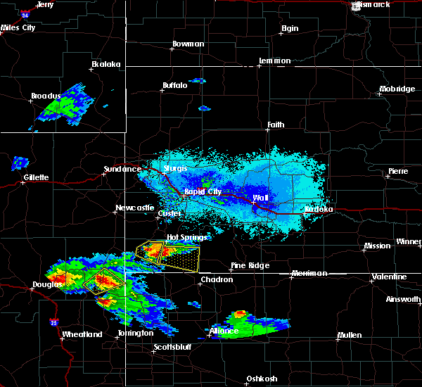 At 615 pm mdt, a severe thunderstorm was located 3 miles southwest of angostura reservoir, or 10 miles south of hot springs, moving east at 30 mph (radar indicated). Hazards include 60 mph wind gusts and quarter size hail. Hail damage to vehicles is expected. Expect wind damage to roofs, siding, and trees. At 615 pm mdt, a severe thunderstorm was located 3 miles southwest of angostura reservoir, or 10 miles south of hot springs, moving east at 30 mph (radar indicated). Hazards include 60 mph wind gusts and quarter size hail. Hail damage to vehicles is expected. Expect wind damage to roofs, siding, and trees.
|
| 8/15/2018 3:37 PM MDT |
 At 336 pm mdt, a severe thunderstorm was located 3 miles east of angostura reservoir, or 10 miles southeast of hot springs, moving south at 15 mph. wind gusts to 60 mph were recently reported near angostura reservoir (trained weather spotters). Hazards include 60 mph wind gusts and quarter size hail. Hail damage to vehicles is expected. expect wind damage to roofs, siding, and trees. Locations impacted include, oelrichs, smithwick, hay canyon butte and angostura reservoir. At 336 pm mdt, a severe thunderstorm was located 3 miles east of angostura reservoir, or 10 miles southeast of hot springs, moving south at 15 mph. wind gusts to 60 mph were recently reported near angostura reservoir (trained weather spotters). Hazards include 60 mph wind gusts and quarter size hail. Hail damage to vehicles is expected. expect wind damage to roofs, siding, and trees. Locations impacted include, oelrichs, smithwick, hay canyon butte and angostura reservoir.
|
| 8/15/2018 3:27 PM MDT |
 At 327 pm mdt, a severe thunderstorm was located near angostura reservoir, or 7 miles southeast of hot springs, moving south at 15 mph (radar indicated). Hazards include half dollar size hail. damage to vehicles is expected At 327 pm mdt, a severe thunderstorm was located near angostura reservoir, or 7 miles southeast of hot springs, moving south at 15 mph (radar indicated). Hazards include half dollar size hail. damage to vehicles is expected
|
| 7/29/2018 2:40 PM MDT | Quarter sized hail reported 10.9 miles NW of Oelrichs, SD |
| 7/29/2018 2:40 PM MDT | Storm damage reported in fall river county SD, 10.9 miles NW of Oelrichs, SD |
| 5/27/2018 8:23 PM MDT | Quarter sized hail reported 0.3 miles NW of Oelrichs, SD |
| 5/27/2018 8:19 PM MDT |
 At 818 pm mdt, severe thunderstorms were located along a line extending from 8 miles northwest of oglala to 7 miles east of ardmore, moving north at 40 mph (radar indicated). Hazards include ping pong ball size hail and 60 mph wind gusts. People and animals outdoors will be injured. expect hail damage to roofs, siding, windows, and vehicles. Expect wind damage to roofs, siding, and trees. At 818 pm mdt, severe thunderstorms were located along a line extending from 8 miles northwest of oglala to 7 miles east of ardmore, moving north at 40 mph (radar indicated). Hazards include ping pong ball size hail and 60 mph wind gusts. People and animals outdoors will be injured. expect hail damage to roofs, siding, windows, and vehicles. Expect wind damage to roofs, siding, and trees.
|
| 5/23/2018 4:25 PM MDT |
 At 425 pm mdt, a severe thunderstorm was located over rumford, or 15 miles southeast of edgemont, moving northeast at 30 mph (radar indicated). Hazards include 60 mph wind gusts and quarter size hail. Hail damage to vehicles is expected. expect wind damage to roofs, siding, and trees. Locations impacted include, oelrichs, provo, ardmore, rumford, cascade falls and southwestern angostura reservoir. At 425 pm mdt, a severe thunderstorm was located over rumford, or 15 miles southeast of edgemont, moving northeast at 30 mph (radar indicated). Hazards include 60 mph wind gusts and quarter size hail. Hail damage to vehicles is expected. expect wind damage to roofs, siding, and trees. Locations impacted include, oelrichs, provo, ardmore, rumford, cascade falls and southwestern angostura reservoir.
|
| 5/23/2018 4:06 PM MDT |
 At 406 pm mdt, a severe thunderstorm was located near montrose, or 21 miles south of edgemont, moving northeast at 30 mph (radar indicated). Hazards include 60 mph wind gusts and quarter size hail. Hail damage to vehicles is expected. Expect wind damage to roofs, siding, and trees. At 406 pm mdt, a severe thunderstorm was located near montrose, or 21 miles south of edgemont, moving northeast at 30 mph (radar indicated). Hazards include 60 mph wind gusts and quarter size hail. Hail damage to vehicles is expected. Expect wind damage to roofs, siding, and trees.
|
| 5/22/2018 10:22 PM MDT |
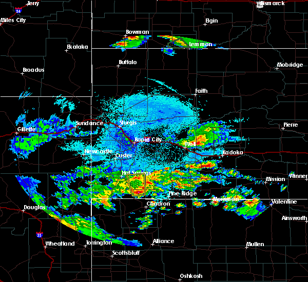 At 1022 pm mdt, a severe thunderstorm was located near oelrichs, or 23 miles north of chadron, moving north at 30 mph (radar indicated). Hazards include half dollar size hail. damage to vehicles is expected At 1022 pm mdt, a severe thunderstorm was located near oelrichs, or 23 miles north of chadron, moving north at 30 mph (radar indicated). Hazards include half dollar size hail. damage to vehicles is expected
|
| 8/26/2017 3:16 PM MDT | Quarter sized hail reported 12.5 miles SW of Oelrichs, SD |
| 7/30/2017 2:54 PM MDT |
 At 254 pm mdt, a severe thunderstorm was located near angostura reservoir, or 11 miles south of hot springs, moving southeast at 20 mph (radar indicated). Hazards include 60 mph wind gusts and nickel size hail. Expect damage to roofs, siding, and trees. Locations impacted include, oelrichs and angostura reservoir. At 254 pm mdt, a severe thunderstorm was located near angostura reservoir, or 11 miles south of hot springs, moving southeast at 20 mph (radar indicated). Hazards include 60 mph wind gusts and nickel size hail. Expect damage to roofs, siding, and trees. Locations impacted include, oelrichs and angostura reservoir.
|
| 7/30/2017 2:41 PM MDT |
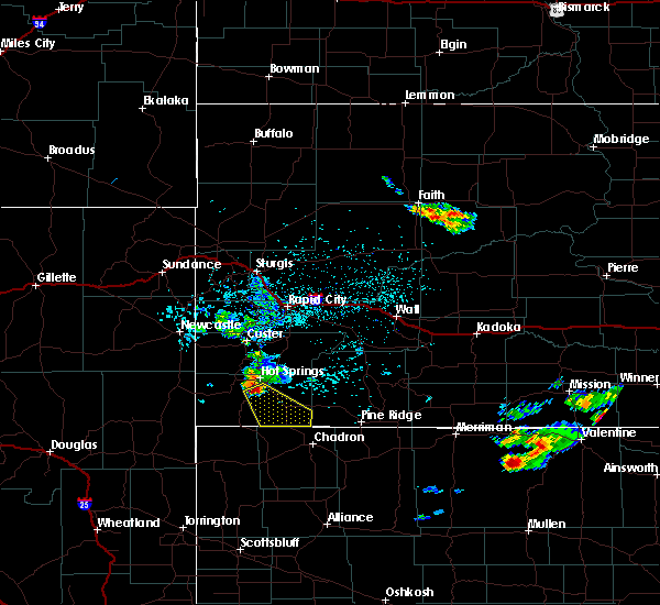 At 240 pm mdt, a severe thunderstorm was located over angostura reservoir, or 8 miles south of hot springs, moving southeast at 25 mph (radar indicated). Hazards include 60 mph wind gusts and half dollar size hail. Hail damage to vehicles is expected. Expect wind damage to roofs, siding, and trees. At 240 pm mdt, a severe thunderstorm was located over angostura reservoir, or 8 miles south of hot springs, moving southeast at 25 mph (radar indicated). Hazards include 60 mph wind gusts and half dollar size hail. Hail damage to vehicles is expected. Expect wind damage to roofs, siding, and trees.
|
| 6/12/2017 11:21 PM MDT |
 At 1120 pm mdt, a severe thunderstorm was located over hay canyon butte, or 20 miles southeast of hot springs, moving northeast at 40 mph. another severe thunderstorm was located near red shirt moving northeast at 40 mph (radar indicated). Hazards include golf ball size hail and 60 mph wind gusts. People and animals outdoors will be injured. expect hail damage to roofs, siding, windows, and vehicles. expect wind damage to roofs, siding, and trees. locations impacted include, oral, oelrichs, scenic, smithwick, rockyford, red shirt, folsom, ardmore, red shirt table overlook, sheep mountain table, intersection of red shirt and cuny table roads, angostura reservoir, badlands national park and hay canyon butte. A tornado watch remains in effect until 200 am mdt for southwestern and west central south dakota. At 1120 pm mdt, a severe thunderstorm was located over hay canyon butte, or 20 miles southeast of hot springs, moving northeast at 40 mph. another severe thunderstorm was located near red shirt moving northeast at 40 mph (radar indicated). Hazards include golf ball size hail and 60 mph wind gusts. People and animals outdoors will be injured. expect hail damage to roofs, siding, windows, and vehicles. expect wind damage to roofs, siding, and trees. locations impacted include, oral, oelrichs, scenic, smithwick, rockyford, red shirt, folsom, ardmore, red shirt table overlook, sheep mountain table, intersection of red shirt and cuny table roads, angostura reservoir, badlands national park and hay canyon butte. A tornado watch remains in effect until 200 am mdt for southwestern and west central south dakota.
|
| 6/12/2017 10:51 PM MDT |
 At 1051 pm mdt, severe thunderstorms were located along a line extending from near oral to 6 miles east of ardmore, moving northeast at 50 mph (radar indicated). Hazards include ping pong ball size hail and 60 mph wind gusts. People and animals outdoors will be injured. expect hail damage to roofs, siding, windows, and vehicles. Expect wind damage to roofs, siding, and trees. At 1051 pm mdt, severe thunderstorms were located along a line extending from near oral to 6 miles east of ardmore, moving northeast at 50 mph (radar indicated). Hazards include ping pong ball size hail and 60 mph wind gusts. People and animals outdoors will be injured. expect hail damage to roofs, siding, windows, and vehicles. Expect wind damage to roofs, siding, and trees.
|
| 6/12/2017 10:30 PM MDT |
 At 1030 pm mdt, severe thunderstorms were located along a line extending from near angostura reservoir to near ardmore, moving northeast at 45 mph (radar indicated). Hazards include ping pong ball size hail and 60 mph wind gusts. People and animals outdoors will be injured. expect hail damage to roofs, siding, windows, and vehicles. expect wind damage to roofs, siding, and trees. locations impacted include, hot springs, oelrichs, smithwick, rumford, ardmore, cascade falls, hay canyon butte, maverick junction, cold brook reservoir and angostura reservoir. A tornado watch remains in effect until 200 am mdt for southwestern south dakota. At 1030 pm mdt, severe thunderstorms were located along a line extending from near angostura reservoir to near ardmore, moving northeast at 45 mph (radar indicated). Hazards include ping pong ball size hail and 60 mph wind gusts. People and animals outdoors will be injured. expect hail damage to roofs, siding, windows, and vehicles. expect wind damage to roofs, siding, and trees. locations impacted include, hot springs, oelrichs, smithwick, rumford, ardmore, cascade falls, hay canyon butte, maverick junction, cold brook reservoir and angostura reservoir. A tornado watch remains in effect until 200 am mdt for southwestern south dakota.
|
| 6/12/2017 10:03 PM MDT |
 At 1003 pm mdt, a severe thunderstorm was located near ardmore, or 19 miles southeast of edgemont, moving northeast at 40 mph (radar indicated). Hazards include two inch hail and 60 mph wind gusts. People and animals outdoors will be injured. expect hail damage to roofs, siding, windows, and vehicles. expect wind damage to roofs, siding, and trees. locations impacted include, hot springs, oelrichs, smithwick, rumford, ardmore, cascade falls, hay canyon butte, maverick junction, cold brook reservoir and angostura reservoir. A tornado watch remains in effect until 200 am mdt for southwestern south dakota. At 1003 pm mdt, a severe thunderstorm was located near ardmore, or 19 miles southeast of edgemont, moving northeast at 40 mph (radar indicated). Hazards include two inch hail and 60 mph wind gusts. People and animals outdoors will be injured. expect hail damage to roofs, siding, windows, and vehicles. expect wind damage to roofs, siding, and trees. locations impacted include, hot springs, oelrichs, smithwick, rumford, ardmore, cascade falls, hay canyon butte, maverick junction, cold brook reservoir and angostura reservoir. A tornado watch remains in effect until 200 am mdt for southwestern south dakota.
|
| 6/12/2017 9:53 PM MDT |
 At 953 pm mdt, a severe thunderstorm was located over ardmore, or 21 miles south of edgemont, moving northeast at 35 mph (radar indicated). Hazards include ping pong ball size hail and 60 mph wind gusts. People and animals outdoors will be injured. expect hail damage to roofs, siding, windows, and vehicles. Expect wind damage to roofs, siding, and trees. At 953 pm mdt, a severe thunderstorm was located over ardmore, or 21 miles south of edgemont, moving northeast at 35 mph (radar indicated). Hazards include ping pong ball size hail and 60 mph wind gusts. People and animals outdoors will be injured. expect hail damage to roofs, siding, windows, and vehicles. Expect wind damage to roofs, siding, and trees.
|
| 6/12/2017 7:43 PM MDT | Quarter sized hail reported 12.5 miles SW of Oelrichs, SD |
| 6/12/2017 7:40 PM MDT | Quarter sized hail reported 12.5 miles SW of Oelrichs, SD |
| 6/12/2017 7:10 PM MDT | Quarter sized hail reported 10 miles WNW of Oelrichs, SD |
| 6/12/2017 7:03 PM MDT |
 At 703 pm mdt, severe thunderstorms were located along a line extending from 6 miles west of cottonwood springs dam to near angostura reservoir to near oelrichs, moving north at 35 mph (radar indicated). Hazards include 60 mph wind gusts and nickel size hail. Expect damage to roofs, siding, and trees. locations impacted include, hot springs, pine ridge, oglala, porcupine, manderson, wounded knee, oral, buffalo gap, oelrichs, pringle, smithwick, argyle, wind cave national park, cottonwood springs dam, intersection of red shirt and cuny table roads, maverick junction, slim butte, angostura reservoir, wind cave visitors center and cascade falls. A tornado watch remains in effect until 200 am mdt for southwestern south dakota. At 703 pm mdt, severe thunderstorms were located along a line extending from 6 miles west of cottonwood springs dam to near angostura reservoir to near oelrichs, moving north at 35 mph (radar indicated). Hazards include 60 mph wind gusts and nickel size hail. Expect damage to roofs, siding, and trees. locations impacted include, hot springs, pine ridge, oglala, porcupine, manderson, wounded knee, oral, buffalo gap, oelrichs, pringle, smithwick, argyle, wind cave national park, cottonwood springs dam, intersection of red shirt and cuny table roads, maverick junction, slim butte, angostura reservoir, wind cave visitors center and cascade falls. A tornado watch remains in effect until 200 am mdt for southwestern south dakota.
|
| 6/12/2017 6:23 PM MDT |
 At 623 pm mdt, severe thunderstorms were located along a line extending from near provo to 12 miles north of whitney lake to chadron, moving northeast at 35 mph (radar indicated). Hazards include ping pong ball size hail and 60 mph wind gusts. People and animals outdoors will be injured. expect hail damage to roofs, siding, windows, and vehicles. Expect wind damage to roofs, siding, and trees. At 623 pm mdt, severe thunderstorms were located along a line extending from near provo to 12 miles north of whitney lake to chadron, moving northeast at 35 mph (radar indicated). Hazards include ping pong ball size hail and 60 mph wind gusts. People and animals outdoors will be injured. expect hail damage to roofs, siding, windows, and vehicles. Expect wind damage to roofs, siding, and trees.
|
| 6/5/2017 9:07 PM MDT |
 The severe thunderstorm warning for south central custer and eastern fall river counties will expire at 915 pm mdt, the storms which prompted the warning have weakened below severe limits, and no longer pose an immediate threat to life or property. therefore the warning will be allowed to expire. however small hail, gusty winds and heavy rain are still possible with these thunderstorms. The severe thunderstorm warning for south central custer and eastern fall river counties will expire at 915 pm mdt, the storms which prompted the warning have weakened below severe limits, and no longer pose an immediate threat to life or property. therefore the warning will be allowed to expire. however small hail, gusty winds and heavy rain are still possible with these thunderstorms.
|
| 6/5/2017 8:49 PM MDT |
 At 848 pm mdt, severe thunderstorms were located along a line extending from wind cave national park to 10 miles southeast of oelrichs, moving east at 30 mph (radar indicated). Hazards include 60 mph wind gusts and quarter size hail. Hail damage to vehicles is expected. expect wind damage to roofs, siding, and trees. Locations impacted include, hot springs, oral, buffalo gap, oelrichs, pringle, smithwick, wind cave national park, cottonwood springs dam, maverick junction, angostura reservoir, wind cave visitors center, cascade falls, hay canyon butte, cold brook reservoir and southeastern custer state park. At 848 pm mdt, severe thunderstorms were located along a line extending from wind cave national park to 10 miles southeast of oelrichs, moving east at 30 mph (radar indicated). Hazards include 60 mph wind gusts and quarter size hail. Hail damage to vehicles is expected. expect wind damage to roofs, siding, and trees. Locations impacted include, hot springs, oral, buffalo gap, oelrichs, pringle, smithwick, wind cave national park, cottonwood springs dam, maverick junction, angostura reservoir, wind cave visitors center, cascade falls, hay canyon butte, cold brook reservoir and southeastern custer state park.
|
| 6/5/2017 8:37 PM MDT |
 At 835 pm mdt, severe thunderstorms were located along a line extending from near pringle to 8 miles south of oelrichs, moving east at 35 mph (trained weather spotters. at 825pm mdt, 60 mph winds were reported at the angostura reservoir marina). Hazards include 60 mph wind gusts and quarter size hail. Hail damage to vehicles is expected. expect wind damage to roofs, siding, and trees. Locations impacted include, hot springs, oral, buffalo gap, oelrichs, pringle, smithwick, sanator, argyle, wind cave national park, cottonwood springs dam, maverick junction, angostura reservoir, wind cave visitors center, cascade falls, hay canyon butte, cold brook reservoir and southeastern custer state park. At 835 pm mdt, severe thunderstorms were located along a line extending from near pringle to 8 miles south of oelrichs, moving east at 35 mph (trained weather spotters. at 825pm mdt, 60 mph winds were reported at the angostura reservoir marina). Hazards include 60 mph wind gusts and quarter size hail. Hail damage to vehicles is expected. expect wind damage to roofs, siding, and trees. Locations impacted include, hot springs, oral, buffalo gap, oelrichs, pringle, smithwick, sanator, argyle, wind cave national park, cottonwood springs dam, maverick junction, angostura reservoir, wind cave visitors center, cascade falls, hay canyon butte, cold brook reservoir and southeastern custer state park.
|
| 6/5/2017 8:19 PM MDT |
 At 819 pm mdt, severe thunderstorms were located along a line extending from 7 miles west of argyle to 10 miles east of ardmore, moving east at 30 mph (radar indicated). Hazards include 60 mph wind gusts and quarter size hail. Hail damage to vehicles is expected. Expect wind damage to roofs, siding, and trees. At 819 pm mdt, severe thunderstorms were located along a line extending from 7 miles west of argyle to 10 miles east of ardmore, moving east at 30 mph (radar indicated). Hazards include 60 mph wind gusts and quarter size hail. Hail damage to vehicles is expected. Expect wind damage to roofs, siding, and trees.
|
| 9/4/2016 4:08 PM MDT |
 At 408 pm mdt, a severe thunderstorm was located 8 miles southwest of angostura reservoir, or 15 miles south of hot springs, moving northeast at 30 mph (radar indicated). Hazards include 60 mph wind gusts. Expect damage to roofs. siding. and trees. Locations impacted include, oelrichs, smithwick, angostura reservoir and hay canyon butte. At 408 pm mdt, a severe thunderstorm was located 8 miles southwest of angostura reservoir, or 15 miles south of hot springs, moving northeast at 30 mph (radar indicated). Hazards include 60 mph wind gusts. Expect damage to roofs. siding. and trees. Locations impacted include, oelrichs, smithwick, angostura reservoir and hay canyon butte.
|
| 9/4/2016 3:50 PM MDT |
 At 350 pm mdt, a severe thunderstorm was located over rumford, or 15 miles southeast of edgemont, moving northeast at 35 mph (radar indicated). Hazards include golf ball size hail and 60 mph wind gusts. People and animals outdoors will be injured. expect hail damage to roofs, siding, windows, and vehicles. expect wind damage to roofs, siding, and trees. Locations impacted include, oelrichs, smithwick, provo, rumford, angostura reservoir and hay canyon butte. At 350 pm mdt, a severe thunderstorm was located over rumford, or 15 miles southeast of edgemont, moving northeast at 35 mph (radar indicated). Hazards include golf ball size hail and 60 mph wind gusts. People and animals outdoors will be injured. expect hail damage to roofs, siding, windows, and vehicles. expect wind damage to roofs, siding, and trees. Locations impacted include, oelrichs, smithwick, provo, rumford, angostura reservoir and hay canyon butte.
|
| 9/4/2016 3:23 PM MDT |
 At 323 pm mdt, a severe thunderstorm was located 10 miles south of provo, or 17 miles south of edgemont, moving east at 35 mph (radar indicated). Hazards include 60 mph wind gusts and half dollar size hail. Hail damage to vehicles is expected. Expect wind damage to roofs, siding, and trees. At 323 pm mdt, a severe thunderstorm was located 10 miles south of provo, or 17 miles south of edgemont, moving east at 35 mph (radar indicated). Hazards include 60 mph wind gusts and half dollar size hail. Hail damage to vehicles is expected. Expect wind damage to roofs, siding, and trees.
|
| 7/30/2016 9:36 PM MDT |
 At 936 pm mdt, severe thunderstorms were located along a line extending from 9 miles east of badlands national park to manderson to 8 miles west of slim butte to 9 miles southwest of oelrichs, moving southeast at 45 mph (radar indicated). Hazards include 70 mph wind gusts and penny size hail. Expect considerable tree damage. damage is likely to mobile homes, roofs, and outbuildings. Locations impacted include, oglala, porcupine, kyle, potato creek, manderson, allen, wounded knee, oelrichs, batesland, scenic, smithwick, red shirt, hisle, sharps corner, rockyford, badlands national park, slim butte, white clay, southeastern angostura reservoir and pine ridge. At 936 pm mdt, severe thunderstorms were located along a line extending from 9 miles east of badlands national park to manderson to 8 miles west of slim butte to 9 miles southwest of oelrichs, moving southeast at 45 mph (radar indicated). Hazards include 70 mph wind gusts and penny size hail. Expect considerable tree damage. damage is likely to mobile homes, roofs, and outbuildings. Locations impacted include, oglala, porcupine, kyle, potato creek, manderson, allen, wounded knee, oelrichs, batesland, scenic, smithwick, red shirt, hisle, sharps corner, rockyford, badlands national park, slim butte, white clay, southeastern angostura reservoir and pine ridge.
|
| 7/30/2016 9:12 PM MDT |
 At 911 pm mdt, severe thunderstorms were located along a line extending from 7 miles south of owanka to 9 miles southwest of rockyford to near smithwick to 7 miles southwest of angostura reservoir, moving southeast at 50 mph (radar indicated. at 906 pm mdt...65 mph wind gusts were reported 8 miles east of smithwick). Hazards include 70 mph wind gusts and nickel size hail. Expect considerable tree damage. damage is likely to mobile homes, roofs, and outbuildings. Locations impacted include, hot springs, oglala, porcupine, kyle, potato creek, manderson, allen, wounded knee, oral, buffalo gap, oelrichs, batesland, fairburn, scenic, smithwick, owanka, sharps corner, folsom, rockyford and red shirt. At 911 pm mdt, severe thunderstorms were located along a line extending from 7 miles south of owanka to 9 miles southwest of rockyford to near smithwick to 7 miles southwest of angostura reservoir, moving southeast at 50 mph (radar indicated. at 906 pm mdt...65 mph wind gusts were reported 8 miles east of smithwick). Hazards include 70 mph wind gusts and nickel size hail. Expect considerable tree damage. damage is likely to mobile homes, roofs, and outbuildings. Locations impacted include, hot springs, oglala, porcupine, kyle, potato creek, manderson, allen, wounded knee, oral, buffalo gap, oelrichs, batesland, fairburn, scenic, smithwick, owanka, sharps corner, folsom, rockyford and red shirt.
|
| 7/30/2016 9:06 PM MDT | Storm damage reported in fall river county SD, 12.5 miles SW of Oelrichs, SD |
| 7/30/2016 8:26 PM MDT |
 At 825 pm mdt, severe thunderstorms were located along a line extending from 7 miles east of farmingdale to 8 miles northwest of edgemont, moving southeast at 45 mph (radar indicated). Hazards include 60 mph wind gusts and nickel size hail. Expect damage to roofs. siding. And trees. At 825 pm mdt, severe thunderstorms were located along a line extending from 7 miles east of farmingdale to 8 miles northwest of edgemont, moving southeast at 45 mph (radar indicated). Hazards include 60 mph wind gusts and nickel size hail. Expect damage to roofs. siding. And trees.
|
| 7/29/2016 8:10 PM MDT |
 The severe thunderstorm warning for southeastern fall river county will expire at 815 pm mdt, the storm which prompted the warning has weakened below severe limits, and no longer pose an immediate threat to life or property. therefore the warning will be allowed to expire. however gusty winds are still possible with this thunderstorm. The severe thunderstorm warning for southeastern fall river county will expire at 815 pm mdt, the storm which prompted the warning has weakened below severe limits, and no longer pose an immediate threat to life or property. therefore the warning will be allowed to expire. however gusty winds are still possible with this thunderstorm.
|
| 7/29/2016 7:50 PM MDT |
 At 750 pm mdt, a severe thunderstorm was located near oelrichs, or 20 miles northwest of chadron, moving east at 25 mph (radar indicated). Hazards include 60 mph wind gusts and quarter size hail. Hail damage to vehicles is expected. expect wind damage to roofs, siding, and trees. Locations impacted include, oelrichs. At 750 pm mdt, a severe thunderstorm was located near oelrichs, or 20 miles northwest of chadron, moving east at 25 mph (radar indicated). Hazards include 60 mph wind gusts and quarter size hail. Hail damage to vehicles is expected. expect wind damage to roofs, siding, and trees. Locations impacted include, oelrichs.
|
| 7/29/2016 7:29 PM MDT |
 At 729 pm mdt, a severe thunderstorm was located near oelrichs, or 22 miles south of hot springs, moving east at 30 mph (radar indicated). Hazards include golf ball size hail and 60 mph wind gusts. People and animals outdoors will be injured. expect hail damage to roofs, siding, windows, and vehicles. Expect wind damage to roofs, siding, and trees. At 729 pm mdt, a severe thunderstorm was located near oelrichs, or 22 miles south of hot springs, moving east at 30 mph (radar indicated). Hazards include golf ball size hail and 60 mph wind gusts. People and animals outdoors will be injured. expect hail damage to roofs, siding, windows, and vehicles. Expect wind damage to roofs, siding, and trees.
|
| 7/27/2016 3:00 PM MDT | Quarter sized hail reported 11.2 miles SW of Oelrichs, SD |
| 7/26/2016 6:43 PM MDT | Hen Egg sized hail reported 3.2 miles W of Oelrichs, SD |
| 7/26/2016 6:28 PM MDT |
 At 628 pm mdt, severe thunderstorms were located along a line extending from smithwick to 8 miles southeast of oelrichs, moving southeast at 25 mph (radar indicated). Hazards include ping pong ball size hail and 60 mph wind gusts. People and animals outdoors will be injured. expect hail damage to roofs, siding, windows, and vehicles. Expect wind damage to roofs, siding, and trees. At 628 pm mdt, severe thunderstorms were located along a line extending from smithwick to 8 miles southeast of oelrichs, moving southeast at 25 mph (radar indicated). Hazards include ping pong ball size hail and 60 mph wind gusts. People and animals outdoors will be injured. expect hail damage to roofs, siding, windows, and vehicles. Expect wind damage to roofs, siding, and trees.
|
| 7/16/2016 5:30 PM MDT | Quarter sized hail reported 13.7 miles SSW of Oelrichs, SD |
| 7/6/2016 4:31 PM MDT |
 At 431 pm mdt, severe thunderstorms were located along a line extending from custer state park to near ardmore, moving east at 45 mph (radar indicated). Hazards include 60 mph wind gusts and quarter size hail. Hail damage to vehicles is expected. expect wind damage to roofs, siding, and trees. these severe storms will be near, custer park game lodge around 435 pm mdt. hermosa and fairburn around 445 pm mdt. A tornado watch remains in effect until 900 pm mdt for southwestern south dakota. At 431 pm mdt, severe thunderstorms were located along a line extending from custer state park to near ardmore, moving east at 45 mph (radar indicated). Hazards include 60 mph wind gusts and quarter size hail. Hail damage to vehicles is expected. expect wind damage to roofs, siding, and trees. these severe storms will be near, custer park game lodge around 435 pm mdt. hermosa and fairburn around 445 pm mdt. A tornado watch remains in effect until 900 pm mdt for southwestern south dakota.
|
| 7/6/2016 3:53 PM MDT |
 At 353 pm mdt, severe thunderstorms were located along a line extending from 8 miles south of moon to 12 miles south of redbird, moving east at 55 mph (radar indicated). Hazards include 60 mph wind gusts and quarter size hail. Hail damage to vehicles is expected. expect wind damage to roofs, siding, and trees. severe thunderstorms will be near, jewel cave national monument around 400 pm mdt. custer, sanator, crazy horse memorial and custer state park around 415 pm mdt. rumford, stockade lake and blue bell around 420 pm mdt. ardmore, center lake and custer park game lodge around 425 pm mdt. fairburn around 435 pm mdt. hermosa around 440 pm mdt. A tornado watch remains in effect until 900 pm mdt for southwestern south dakota. At 353 pm mdt, severe thunderstorms were located along a line extending from 8 miles south of moon to 12 miles south of redbird, moving east at 55 mph (radar indicated). Hazards include 60 mph wind gusts and quarter size hail. Hail damage to vehicles is expected. expect wind damage to roofs, siding, and trees. severe thunderstorms will be near, jewel cave national monument around 400 pm mdt. custer, sanator, crazy horse memorial and custer state park around 415 pm mdt. rumford, stockade lake and blue bell around 420 pm mdt. ardmore, center lake and custer park game lodge around 425 pm mdt. fairburn around 435 pm mdt. hermosa around 440 pm mdt. A tornado watch remains in effect until 900 pm mdt for southwestern south dakota.
|
| 6/28/2016 5:20 PM MDT |
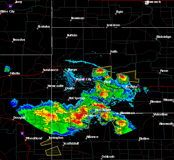 The severe thunderstorm warning for southeastern fall river county will expire at 530 pm mdt, the storm which prompted the warning has moved out of the area. therefore the warning will be allowed to expire. however gusty winds are still possible with this thunderstorm. a severe thunderstorm watch remains in effect until 900 pm mdt for southwestern south dakota. The severe thunderstorm warning for southeastern fall river county will expire at 530 pm mdt, the storm which prompted the warning has moved out of the area. therefore the warning will be allowed to expire. however gusty winds are still possible with this thunderstorm. a severe thunderstorm watch remains in effect until 900 pm mdt for southwestern south dakota.
|
| 6/28/2016 5:04 PM MDT |
 At 503 pm mdt, a severe thunderstorm was located 9 miles southeast of oelrichs, or 17 miles northwest of chadron, moving southeast at 30 mph (radar indicated). Hazards include golf ball size hail and 70 mph wind gusts. People and animals outdoors will be injured. expect hail damage to roofs, siding, windows, and vehicles. expect considerable tree damage. wind damage is also likely to mobile homes, roofs, and outbuildings. Locations impacted include, oelrichs. At 503 pm mdt, a severe thunderstorm was located 9 miles southeast of oelrichs, or 17 miles northwest of chadron, moving southeast at 30 mph (radar indicated). Hazards include golf ball size hail and 70 mph wind gusts. People and animals outdoors will be injured. expect hail damage to roofs, siding, windows, and vehicles. expect considerable tree damage. wind damage is also likely to mobile homes, roofs, and outbuildings. Locations impacted include, oelrichs.
|
| 6/28/2016 4:53 PM MDT |
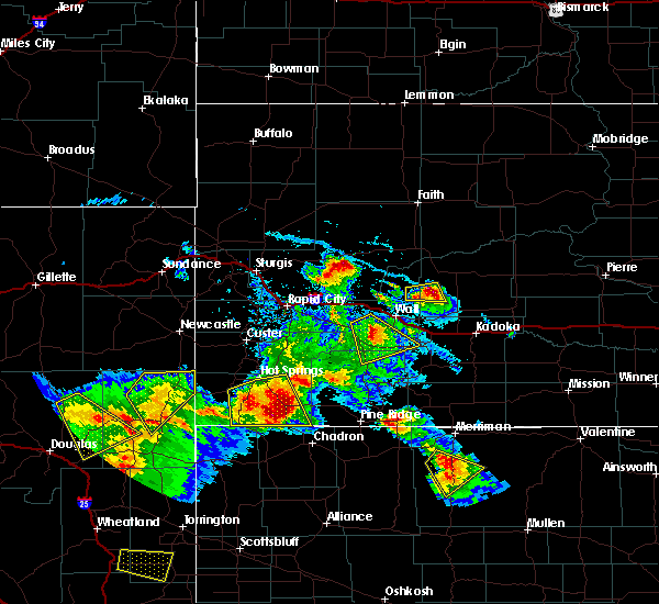 At 452 pm mdt, a severe thunderstorm was located near oelrichs, or 22 miles northwest of chadron, moving southeast at 35 mph (radar indicated). Hazards include tennis ball size hail and 70 mph wind gusts. People and animals outdoors will be injured. expect hail damage to roofs, siding, windows, and vehicles. expect considerable tree damage. wind damage is also likely to mobile homes, roofs, and outbuildings. Locations impacted include, oral, oelrichs, smithwick, ardmore, rumford and angostura reservoir. At 452 pm mdt, a severe thunderstorm was located near oelrichs, or 22 miles northwest of chadron, moving southeast at 35 mph (radar indicated). Hazards include tennis ball size hail and 70 mph wind gusts. People and animals outdoors will be injured. expect hail damage to roofs, siding, windows, and vehicles. expect considerable tree damage. wind damage is also likely to mobile homes, roofs, and outbuildings. Locations impacted include, oral, oelrichs, smithwick, ardmore, rumford and angostura reservoir.
|
| 6/28/2016 4:48 PM MDT | Storm damage reported in fall river county SD, 0.3 miles NW of Oelrichs, SD |
| 6/28/2016 4:34 PM MDT |
 At 433 pm mdt, a severe thunderstorm was located near angostura reservoir, or 15 miles south of hot springs, moving southeast at 40 mph. this is a very dangerous storm (radar indicated). Hazards include baseball size hail and 70 mph wind gusts. People and animals outdoors will be severely injured. expect shattered windows, extensive damage to roofs, siding, and vehicles. Locations impacted include, hot springs, oral, oelrichs, smithwick, ardmore, rumford, maverick junction and angostura reservoir. At 433 pm mdt, a severe thunderstorm was located near angostura reservoir, or 15 miles south of hot springs, moving southeast at 40 mph. this is a very dangerous storm (radar indicated). Hazards include baseball size hail and 70 mph wind gusts. People and animals outdoors will be severely injured. expect shattered windows, extensive damage to roofs, siding, and vehicles. Locations impacted include, hot springs, oral, oelrichs, smithwick, ardmore, rumford, maverick junction and angostura reservoir.
|
| 6/28/2016 4:13 PM MDT |
 At 413 pm mdt, a severe thunderstorm was located near cottonwood springs dam, or near hot springs, moving southeast at 30 mph (radar indicated). Hazards include tennis ball size hail and 70 mph wind gusts. People and animals outdoors will be injured. expect hail damage to roofs, siding, windows, and vehicles. expect considerable tree damage. Wind damage is also likely to mobile homes, roofs, and outbuildings. At 413 pm mdt, a severe thunderstorm was located near cottonwood springs dam, or near hot springs, moving southeast at 30 mph (radar indicated). Hazards include tennis ball size hail and 70 mph wind gusts. People and animals outdoors will be injured. expect hail damage to roofs, siding, windows, and vehicles. expect considerable tree damage. Wind damage is also likely to mobile homes, roofs, and outbuildings.
|
| 6/27/2016 7:12 PM MDT | The severe thunderstorm warning for southeastern fall river county will expire at 715 pm mdt, the severe thunderstorm which prompted the warning has weakened. therefore the warning will be allowed to expire. however small hail is still possible with this thunderstorm. |
| 6/27/2016 6:51 PM MDT |
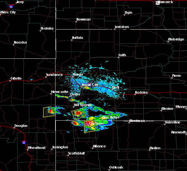 At 650 pm mdt, a severe thunderstorm was located near oelrichs, or 18 miles southeast of hot springs, moving southeast at 30 mph (radar indicated). Hazards include 60 mph wind gusts and quarter size hail. Hail damage to vehicles is expected. expect wind damage to roofs, siding, and trees. Locations impacted include, oelrichs. At 650 pm mdt, a severe thunderstorm was located near oelrichs, or 18 miles southeast of hot springs, moving southeast at 30 mph (radar indicated). Hazards include 60 mph wind gusts and quarter size hail. Hail damage to vehicles is expected. expect wind damage to roofs, siding, and trees. Locations impacted include, oelrichs.
|
| 6/27/2016 6:36 PM MDT |
 At 634 pm mdt, a severe thunderstorm was located over angostura reservoir, or 10 miles south of hot springs, moving southeast at 25 mph (radar indicated). Hazards include ping pong ball size hail and 60 mph wind gusts. People and animals outdoors will be injured. expect hail damage to roofs, siding, windows, and vehicles. expect wind damage to roofs, siding, and trees. Locations impacted include, oelrichs and angostura reservoir. At 634 pm mdt, a severe thunderstorm was located over angostura reservoir, or 10 miles south of hot springs, moving southeast at 25 mph (radar indicated). Hazards include ping pong ball size hail and 60 mph wind gusts. People and animals outdoors will be injured. expect hail damage to roofs, siding, windows, and vehicles. expect wind damage to roofs, siding, and trees. Locations impacted include, oelrichs and angostura reservoir.
|
| 6/27/2016 6:20 PM MDT |
 At 620 pm mdt, a severe thunderstorm was located near angostura reservoir, or near hot springs, moving southeast at 25 mph (radar indicated). Hazards include 60 mph wind gusts and half dollar size hail. Hail damage to vehicles is expected. Expect wind damage to roofs, siding, and trees. At 620 pm mdt, a severe thunderstorm was located near angostura reservoir, or near hot springs, moving southeast at 25 mph (radar indicated). Hazards include 60 mph wind gusts and half dollar size hail. Hail damage to vehicles is expected. Expect wind damage to roofs, siding, and trees.
|
| 6/27/2016 5:57 PM MDT |
 At 556 pm mdt, a severe thunderstorm was located 7 miles east of oelrichs, or 25 miles southeast of hot springs, moving southeast at 35 mph (radar indicated). Hazards include 60 mph wind gusts and quarter size hail. Hail damage to vehicles is expected. expect wind damage to roofs, siding, and trees. Locations impacted include, slim butte. At 556 pm mdt, a severe thunderstorm was located 7 miles east of oelrichs, or 25 miles southeast of hot springs, moving southeast at 35 mph (radar indicated). Hazards include 60 mph wind gusts and quarter size hail. Hail damage to vehicles is expected. expect wind damage to roofs, siding, and trees. Locations impacted include, slim butte.
|
| 6/27/2016 5:39 PM MDT |
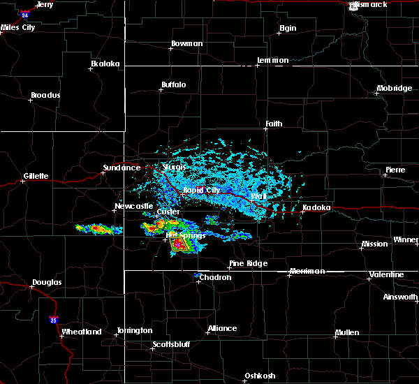 At 538 pm mdt, a severe thunderstorm was located over smithwick, or 16 miles southeast of hot springs, moving southeast at 30 mph (radar indicated). Hazards include 60 mph wind gusts and quarter size hail. Hail damage to vehicles is expected. Expect wind damage to roofs, siding, and trees. At 538 pm mdt, a severe thunderstorm was located over smithwick, or 16 miles southeast of hot springs, moving southeast at 30 mph (radar indicated). Hazards include 60 mph wind gusts and quarter size hail. Hail damage to vehicles is expected. Expect wind damage to roofs, siding, and trees.
|
| 8/5/2015 7:52 PM MDT |
 The severe thunderstorm warning for western shannon, eastern fall river and southeastern custer counties will expire at 800 pm mdt, the storms which prompted the warning have weakened below severe limits, and no longer pose an immediate threat to life or property. therefore the warning will be allowed to expire. however gusty winds are still possible with these thunderstorms. The severe thunderstorm warning for western shannon, eastern fall river and southeastern custer counties will expire at 800 pm mdt, the storms which prompted the warning have weakened below severe limits, and no longer pose an immediate threat to life or property. therefore the warning will be allowed to expire. however gusty winds are still possible with these thunderstorms.
|
| 8/5/2015 7:28 PM MDT |
 At 728 pm mdt, severe thunderstorms were located along a line extending from near buffalo gap to 10 miles south of oelrichs, moving northeast at 35 mph (radar indicated). Hazards include 60 mph wind gusts. Expect damage to roofs. siding and trees. these severe storms will be near, oral and buffalo gap around 735 pm mdt. Oelrichs around 740 pm mdt. At 728 pm mdt, severe thunderstorms were located along a line extending from near buffalo gap to 10 miles south of oelrichs, moving northeast at 35 mph (radar indicated). Hazards include 60 mph wind gusts. Expect damage to roofs. siding and trees. these severe storms will be near, oral and buffalo gap around 735 pm mdt. Oelrichs around 740 pm mdt.
|
| 8/5/2015 7:07 PM MDT |
 At 706 pm mdt, severe thunderstorms were located along a line extending from near cottonwood springs dam to 9 miles southeast of ardmore, moving northeast at 35 mph (radar indicated). Hazards include 60 mph wind gusts and penny size hail. Expect damage to roofs. siding and trees. severe thunderstorms will be near, angostura reservoir around 710 pm mdt. hot springs around 715 pm mdt. maverick junction around 720 pm mdt. oral and buffalo gap around 730 pm mdt. Oelrichs around 740 pm mdt. At 706 pm mdt, severe thunderstorms were located along a line extending from near cottonwood springs dam to 9 miles southeast of ardmore, moving northeast at 35 mph (radar indicated). Hazards include 60 mph wind gusts and penny size hail. Expect damage to roofs. siding and trees. severe thunderstorms will be near, angostura reservoir around 710 pm mdt. hot springs around 715 pm mdt. maverick junction around 720 pm mdt. oral and buffalo gap around 730 pm mdt. Oelrichs around 740 pm mdt.
|
| 7/27/2015 7:05 PM MDT | Storm damage reported in fall river county SD, 11.9 miles SW of Oelrichs, SD |
| 7/27/2015 5:09 PM MDT |
 The severe thunderstorm warning for central fall river and south central custer counties will expire at 515 pm mdt, the storm which prompted the warning has weakened below severe limits, and no longer pose an immediate threat to life or property. therefore the warning will be allowed to expire. however small hail and gusty winds are still possible with this thunderstorm. a severe thunderstorm watch remains in effect until 1000 pm mdt for southwestern south dakota. The severe thunderstorm warning for central fall river and south central custer counties will expire at 515 pm mdt, the storm which prompted the warning has weakened below severe limits, and no longer pose an immediate threat to life or property. therefore the warning will be allowed to expire. however small hail and gusty winds are still possible with this thunderstorm. a severe thunderstorm watch remains in effect until 1000 pm mdt for southwestern south dakota.
|
| 7/27/2015 4:42 PM MDT |
 At 441 pm mdt, a severe thunderstorm was located near rumford, or 10 miles southeast of edgemont, moving northeast at 35 mph (radar indicated). Hazards include 60 mph wind gusts and quarter size hail. Hail damage to vehicles is expected. expect wind damage to roofs, siding and trees. this severe storm will be near, angostura reservoir around 505 pm mdt. Hot springs, oral, smithwick and maverick junction around 515 pm mdt. At 441 pm mdt, a severe thunderstorm was located near rumford, or 10 miles southeast of edgemont, moving northeast at 35 mph (radar indicated). Hazards include 60 mph wind gusts and quarter size hail. Hail damage to vehicles is expected. expect wind damage to roofs, siding and trees. this severe storm will be near, angostura reservoir around 505 pm mdt. Hot springs, oral, smithwick and maverick junction around 515 pm mdt.
|
| 7/27/2015 4:16 PM MDT |
 At 415 pm mdt, a severe thunderstorm was located near provo, or 13 miles south of edgemont, moving northeast at 40 mph (radar indicated). Hazards include 60 mph wind gusts and quarter size hail. Hail damage to vehicles is expected. expect wind damage to roofs, siding and trees. this severe thunderstorm will be near, provo around 425 pm mdt. edgemont around 435 pm mdt. hot springs, argyle and cottonwood springs dam around 500 pm mdt. cold brook reservoir and maverick junction around 505 pm mdt. Wind cave visitors center and southwestern wind cave national park around 510 pm mdt. At 415 pm mdt, a severe thunderstorm was located near provo, or 13 miles south of edgemont, moving northeast at 40 mph (radar indicated). Hazards include 60 mph wind gusts and quarter size hail. Hail damage to vehicles is expected. expect wind damage to roofs, siding and trees. this severe thunderstorm will be near, provo around 425 pm mdt. edgemont around 435 pm mdt. hot springs, argyle and cottonwood springs dam around 500 pm mdt. cold brook reservoir and maverick junction around 505 pm mdt. Wind cave visitors center and southwestern wind cave national park around 510 pm mdt.
|
| 7/15/2015 8:25 PM MDT |
 The severe thunderstorm warning for eastern fall river and southeastern custer counties will expire at 830 pm mdt, the storms which prompted the warning have weakened below severe limits, and no longer pose an immediate threat to life or property. therefore the warning will be allowed to expire. however gusty winds are still possible with these thunderstorms. The severe thunderstorm warning for eastern fall river and southeastern custer counties will expire at 830 pm mdt, the storms which prompted the warning have weakened below severe limits, and no longer pose an immediate threat to life or property. therefore the warning will be allowed to expire. however gusty winds are still possible with these thunderstorms.
|
| 7/15/2015 7:55 PM MDT |
 At 753 pm mdt, severe thunderstorms were located along a line extending from custer state park to near buffalo gap to near rumford, moving east at 35 mph (trained weather spotters). Hazards include 60 mph wind gusts. Expect damage to roofs. siding and trees. locations impacted include, hot springs, oral, buffalo gap, oelrichs, fairburn, smithwick, cottonwood springs dam, maverick junction, eastern custer state park, angostura reservoir, wind cave visitors center, wind cave national park and cold brook reservoir. At 747 pm mdt, 60 mph wind gusts were reported 2 miles south of buffalo gap by an off duty national weather service employee. At 753 pm mdt, severe thunderstorms were located along a line extending from custer state park to near buffalo gap to near rumford, moving east at 35 mph (trained weather spotters). Hazards include 60 mph wind gusts. Expect damage to roofs. siding and trees. locations impacted include, hot springs, oral, buffalo gap, oelrichs, fairburn, smithwick, cottonwood springs dam, maverick junction, eastern custer state park, angostura reservoir, wind cave visitors center, wind cave national park and cold brook reservoir. At 747 pm mdt, 60 mph wind gusts were reported 2 miles south of buffalo gap by an off duty national weather service employee.
|
| 7/15/2015 7:28 PM MDT |
 At 727 pm mdt, severe thunderstorms were located along a line extending from custer to near argyle to near provo, moving east at 35 mph (radar indicated). Hazards include 60 mph wind gusts. Expect damage to roofs. Siding and trees. At 727 pm mdt, severe thunderstorms were located along a line extending from custer to near argyle to near provo, moving east at 35 mph (radar indicated). Hazards include 60 mph wind gusts. Expect damage to roofs. Siding and trees.
|
| 7/1/2015 11:58 PM MDT |
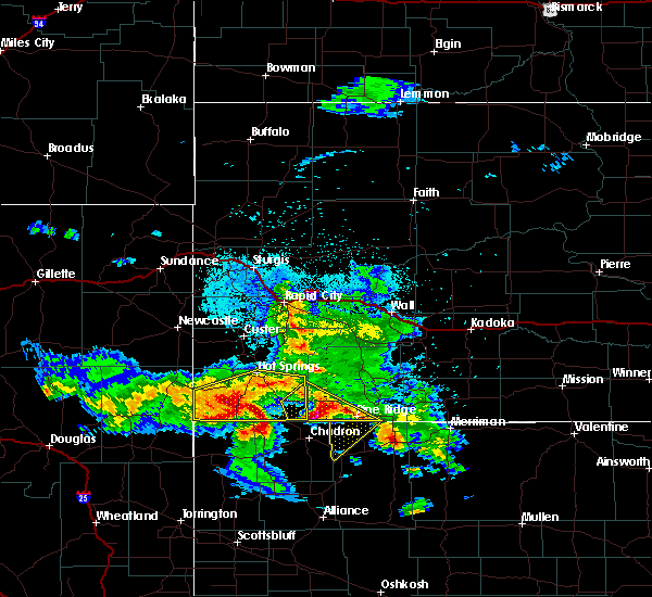 At 1158 pm mdt, a severe thunderstorm was located 12 miles east of ardmore, or 25 miles northwest of chadron, moving southeast at 35 mph (radar indicated). Hazards include 60 mph wind gusts and quarter size hail. Hail damage to vehicles is expected. expect wind damage to roofs, siding and trees. Locations impacted include, oelrichs, rumford and ardmore. At 1158 pm mdt, a severe thunderstorm was located 12 miles east of ardmore, or 25 miles northwest of chadron, moving southeast at 35 mph (radar indicated). Hazards include 60 mph wind gusts and quarter size hail. Hail damage to vehicles is expected. expect wind damage to roofs, siding and trees. Locations impacted include, oelrichs, rumford and ardmore.
|
| 7/1/2015 11:52 PM MDT |
 The severe thunderstorm warning for southwestern shannon and southeastern fall river counties will expire at 1200 am mdt, the storm which prompted the warning has moved out of the area. therefore the warning will be allowed to expire. remember, a severe thunderstorm warning still remains in effect for south central fall river county until 1230 am mdt. The severe thunderstorm warning for southwestern shannon and southeastern fall river counties will expire at 1200 am mdt, the storm which prompted the warning has moved out of the area. therefore the warning will be allowed to expire. remember, a severe thunderstorm warning still remains in effect for south central fall river county until 1230 am mdt.
|
| 7/1/2015 11:37 PM MDT |
 At 1137 pm mdt, a severe thunderstorm was located over ardmore, or 21 miles southeast of edgemont, moving southeast at 50 mph (radar indicated). Hazards include ping pong ball size hail and 60 mph wind gusts. People and animals outdoors will be injured. expect hail damage to roofs, siding, windows and vehicles. Expect wind damage to roofs, siding and trees. At 1137 pm mdt, a severe thunderstorm was located over ardmore, or 21 miles southeast of edgemont, moving southeast at 50 mph (radar indicated). Hazards include ping pong ball size hail and 60 mph wind gusts. People and animals outdoors will be injured. expect hail damage to roofs, siding, windows and vehicles. Expect wind damage to roofs, siding and trees.
|
| 7/1/2015 11:33 PM MDT |
 At 1132 pm mdt, a severe thunderstorm was located near ardmore, or 17 miles southeast of edgemont, moving southeast at 50 mph (radar indicated). Hazards include 70 mph wind gusts and half dollar size hail. Hail damage to vehicles is expected. expect considerable tree damage. wind damage is also likely to mobile homes, roofs and outbuildings. Locations impacted include, hot springs, edgemont, oral, oelrichs, smithwick, provo, ardmore, rumford, cottonwood springs dam, maverick junction, angostura reservoir and cold brook reservoir. At 1132 pm mdt, a severe thunderstorm was located near ardmore, or 17 miles southeast of edgemont, moving southeast at 50 mph (radar indicated). Hazards include 70 mph wind gusts and half dollar size hail. Hail damage to vehicles is expected. expect considerable tree damage. wind damage is also likely to mobile homes, roofs and outbuildings. Locations impacted include, hot springs, edgemont, oral, oelrichs, smithwick, provo, ardmore, rumford, cottonwood springs dam, maverick junction, angostura reservoir and cold brook reservoir.
|
| 7/1/2015 11:22 PM MDT |
 At 1122 pm mdt, a severe thunderstorm was located near provo, or near edgemont, moving southeast at 40 mph. another severe thunderstorm ws located over ardmore (radar indicated). Hazards include 70 mph wind gusts and half dollar size hail. Hail damage to vehicles is expected. expect considerable tree damage. wind damage is also likely to mobile homes, roofs and outbuildings. Locations impacted include, hot springs, edgemont, oral, buffalo gap, oelrichs, smithwick, provo, ardmore, rumford, cottonwood springs dam, maverick junction, angostura reservoir and cold brook reservoir. At 1122 pm mdt, a severe thunderstorm was located near provo, or near edgemont, moving southeast at 40 mph. another severe thunderstorm ws located over ardmore (radar indicated). Hazards include 70 mph wind gusts and half dollar size hail. Hail damage to vehicles is expected. expect considerable tree damage. wind damage is also likely to mobile homes, roofs and outbuildings. Locations impacted include, hot springs, edgemont, oral, buffalo gap, oelrichs, smithwick, provo, ardmore, rumford, cottonwood springs dam, maverick junction, angostura reservoir and cold brook reservoir.
|
| 7/1/2015 11:18 PM MDT |
 At 1117 pm mdt, a severe thunderstorm was located 9 miles northwest of slim butte, or 21 miles north of chadron, moving southeast at 40 mph (radar indicated). Hazards include ping pong ball size hail and 60 mph wind gusts. People and animals outdoors will be injured. expect hail damage to roofs, siding, windows and vehicles. Expect wind damage to roofs, siding and trees. At 1117 pm mdt, a severe thunderstorm was located 9 miles northwest of slim butte, or 21 miles north of chadron, moving southeast at 40 mph (radar indicated). Hazards include ping pong ball size hail and 60 mph wind gusts. People and animals outdoors will be injured. expect hail damage to roofs, siding, windows and vehicles. Expect wind damage to roofs, siding and trees.
|
| 7/1/2015 11:11 PM MDT |
 At 1109 pm mdt, a severe thunderstorm was located over edgemont, moving southeast at 50 mph. another severe thunderstorm was located near smithwick moving southeast at 40 mph. a third severe thunderstorm was located west of ardmore moving northeast at 20 mph (radar indicated). Hazards include 70 mph wind gusts and ping pong ball size hail. Hail damage to vehicles is expected. expect considerable tree damage. wind damage is also likely to mobile homes, roofs and outbuildings. Locations impacted include, hot springs, edgemont, oral, buffalo gap, oelrichs, pringle, fairburn, smithwick, provo, rumford, sanator, ardmore, argyle, cottonwood springs dam, custer state park, angostura reservoir, cold brook reservoir, maverick junction, wind cave visitors center and wind cave national park. At 1109 pm mdt, a severe thunderstorm was located over edgemont, moving southeast at 50 mph. another severe thunderstorm was located near smithwick moving southeast at 40 mph. a third severe thunderstorm was located west of ardmore moving northeast at 20 mph (radar indicated). Hazards include 70 mph wind gusts and ping pong ball size hail. Hail damage to vehicles is expected. expect considerable tree damage. wind damage is also likely to mobile homes, roofs and outbuildings. Locations impacted include, hot springs, edgemont, oral, buffalo gap, oelrichs, pringle, fairburn, smithwick, provo, rumford, sanator, ardmore, argyle, cottonwood springs dam, custer state park, angostura reservoir, cold brook reservoir, maverick junction, wind cave visitors center and wind cave national park.
|
| 7/1/2015 11:02 PM MDT |
 At 1100 pm mdt, severe thunderstorms were located along a line extending from near fairburn to 8 miles southwest of argyle to 8 miles southeast of mule creek junction, moving southeast at 50 mph. another severe thunderstorm was located near smithwick, moving southeast at 40 mph (radar indicated). Hazards include 70 mph wind gusts and quarter size hail. Hail damage to vehicles is expected. expect wind damage to roofs, siding and trees. Locations impacted include, hot springs, edgemont, oral, buffalo gap, oelrichs, pringle, fairburn, smithwick, provo, rumford, sanator, ardmore, argyle, cottonwood springs dam, custer state park, angostura reservoir, cold brook reservoir, maverick junction, wind cave visitors center and wind cave national park. At 1100 pm mdt, severe thunderstorms were located along a line extending from near fairburn to 8 miles southwest of argyle to 8 miles southeast of mule creek junction, moving southeast at 50 mph. another severe thunderstorm was located near smithwick, moving southeast at 40 mph (radar indicated). Hazards include 70 mph wind gusts and quarter size hail. Hail damage to vehicles is expected. expect wind damage to roofs, siding and trees. Locations impacted include, hot springs, edgemont, oral, buffalo gap, oelrichs, pringle, fairburn, smithwick, provo, rumford, sanator, ardmore, argyle, cottonwood springs dam, custer state park, angostura reservoir, cold brook reservoir, maverick junction, wind cave visitors center and wind cave national park.
|
| 7/1/2015 10:46 PM MDT |
 At 1044 pm mdt, a severe thunderstorm was located 9 miles northeast of dewey, or 18 miles southwest of custer, moving southeast at 40 mph. another severe thundesrtorm was located near oral, also moving southeast at 40 mph (trained weather spotters). Hazards include 60 mph wind gusts. quarter size hail is also possible. Hail damage to vehicles is expected. Expect wind damage to roofs, siding and trees. At 1044 pm mdt, a severe thunderstorm was located 9 miles northeast of dewey, or 18 miles southwest of custer, moving southeast at 40 mph. another severe thundesrtorm was located near oral, also moving southeast at 40 mph (trained weather spotters). Hazards include 60 mph wind gusts. quarter size hail is also possible. Hail damage to vehicles is expected. Expect wind damage to roofs, siding and trees.
|
| 6/24/2015 3:56 AM MDT |
 At 356 am mdt, a severe thunderstorm was located near oral, or 11 miles southeast of hot springs, moving southeast at 40 mph (radar indicated). Hazards include ping pong ball size hail. People and animals outdoors will be injured. Expect damage to roofs, siding, windows and vehicles. At 356 am mdt, a severe thunderstorm was located near oral, or 11 miles southeast of hot springs, moving southeast at 40 mph (radar indicated). Hazards include ping pong ball size hail. People and animals outdoors will be injured. Expect damage to roofs, siding, windows and vehicles.
|
| 6/24/2015 3:41 AM MDT |
 The severe thunderstorm warning for southwestern bennett, southern shannon and eastern fall river counties will expire at 345 am mdt, the storms which prompted the warning have weakened below severe limits, and no longer pose an immediate threat to life or property. therefore the warning will be allowed to expire. however heavy rain is still possible with these thunderstorms. a severe thunderstorm watch remains in effect until 500 am mdt for southwestern south dakota. The severe thunderstorm warning for southwestern bennett, southern shannon and eastern fall river counties will expire at 345 am mdt, the storms which prompted the warning have weakened below severe limits, and no longer pose an immediate threat to life or property. therefore the warning will be allowed to expire. however heavy rain is still possible with these thunderstorms. a severe thunderstorm watch remains in effect until 500 am mdt for southwestern south dakota.
|
| 6/24/2015 3:29 AM MDT |
 At 329 am mdt, severe thunderstorms were located along a line extending from 8 miles northeast of smithwick to 7 miles northeast of mount maria, moving northeast at 25 mph (radar indicated). Hazards include 60 mph wind gusts and quarter size hail. Hail damage to vehicles is expected. expect wind damage to roofs, siding and trees. Locations impacted include, pine ridge, oglala, porcupine, manderson, wounded knee, oral, oelrichs, batesland, smithwick, slim butte and angostura reservoir. At 329 am mdt, severe thunderstorms were located along a line extending from 8 miles northeast of smithwick to 7 miles northeast of mount maria, moving northeast at 25 mph (radar indicated). Hazards include 60 mph wind gusts and quarter size hail. Hail damage to vehicles is expected. expect wind damage to roofs, siding and trees. Locations impacted include, pine ridge, oglala, porcupine, manderson, wounded knee, oral, oelrichs, batesland, smithwick, slim butte and angostura reservoir.
|
| 6/24/2015 3:05 AM MDT |
 At 305 am mdt, severe thunderstorms were located along a line extending from near smithwick to 7 miles southwest of hoover lake, moving northeast at 25 mph (radar indicated). Hazards include 60 mph wind gusts and quarter size hail. Hail damage to vehicles is expected. expect wind damage to roofs, siding and trees. Locations impacted include, pine ridge, oglala, porcupine, manderson, wounded knee, oral, oelrichs, batesland, smithwick, slim butte and angostura reservoir. At 305 am mdt, severe thunderstorms were located along a line extending from near smithwick to 7 miles southwest of hoover lake, moving northeast at 25 mph (radar indicated). Hazards include 60 mph wind gusts and quarter size hail. Hail damage to vehicles is expected. expect wind damage to roofs, siding and trees. Locations impacted include, pine ridge, oglala, porcupine, manderson, wounded knee, oral, oelrichs, batesland, smithwick, slim butte and angostura reservoir.
|
| 6/24/2015 2:37 AM MDT |
 At 237 am mdt, severe thunderstorms were located along a line extending from 6 miles south of angostura reservoir to near clinton, moving northeast at 25 mph (radar indicated). Hazards include 60 mph wind gusts and quarter size hail. Hail damage to vehicles is expected. Expect wind damage to roofs, siding and trees. At 237 am mdt, severe thunderstorms were located along a line extending from 6 miles south of angostura reservoir to near clinton, moving northeast at 25 mph (radar indicated). Hazards include 60 mph wind gusts and quarter size hail. Hail damage to vehicles is expected. Expect wind damage to roofs, siding and trees.
|
| 6/20/2015 7:19 PM MDT |
 At 718 pm mdt, a severe thunderstorm was located near slim butte, or 14 miles northwest of pine ridge, moving southeast at 55 mph (law enforcement and radar confirmed). Hazards include tennis ball size hail and 70 mph wind gusts. People and animals outdoors will be injured. expect hail damage to roofs, siding, windows and vehicles. expect considerable tree damage. Wind damage is also likely to mobile homes, roofs and outbuildings. At 718 pm mdt, a severe thunderstorm was located near slim butte, or 14 miles northwest of pine ridge, moving southeast at 55 mph (law enforcement and radar confirmed). Hazards include tennis ball size hail and 70 mph wind gusts. People and animals outdoors will be injured. expect hail damage to roofs, siding, windows and vehicles. expect considerable tree damage. Wind damage is also likely to mobile homes, roofs and outbuildings.
|
| 6/20/2015 7:15 PM MDT |
 At 714 pm mdt, a severe thunderstorm was located 8 miles east of oelrichs, or 21 miles north of chadron, moving southeast at 40 mph (law enforcement and radar confirmed). Hazards include tennis ball size hail and 70 mph wind gusts. People and animals outdoors will be injured. expect hail damage to roofs, siding, windows and vehicles. expect considerable tree damage. wind damage is also likely to mobile homes, roofs and outbuildings. Locations impacted include, oglala and oelrichs. At 714 pm mdt, a severe thunderstorm was located 8 miles east of oelrichs, or 21 miles north of chadron, moving southeast at 40 mph (law enforcement and radar confirmed). Hazards include tennis ball size hail and 70 mph wind gusts. People and animals outdoors will be injured. expect hail damage to roofs, siding, windows and vehicles. expect considerable tree damage. wind damage is also likely to mobile homes, roofs and outbuildings. Locations impacted include, oglala and oelrichs.
|
| 6/20/2015 7:04 PM MDT |
 At 703 pm mdt, a severe thunderstorm was located over oelrichs, or 21 miles southeast of hot springs, moving southeast at 40 mph (law enforcement and radar confirmed). Hazards include tennis ball size hail and 70 mph wind gusts. People and animals outdoors will be injured. expect hail damage to roofs, siding, windows and vehicles. expect considerable tree damage. wind damage is also likely to mobile homes, roofs and outbuildings. Locations impacted include, oglala, oral, oelrichs, smithwick and angostura reservoir. At 703 pm mdt, a severe thunderstorm was located over oelrichs, or 21 miles southeast of hot springs, moving southeast at 40 mph (law enforcement and radar confirmed). Hazards include tennis ball size hail and 70 mph wind gusts. People and animals outdoors will be injured. expect hail damage to roofs, siding, windows and vehicles. expect considerable tree damage. wind damage is also likely to mobile homes, roofs and outbuildings. Locations impacted include, oglala, oral, oelrichs, smithwick and angostura reservoir.
|
| 6/20/2015 6:54 PM MDT |
 At 653 pm mdt, a severe thunderstorm was located near smithwick, or 14 miles southeast of hot springs, moving southeast at 40 mph (radar indicated and public reports). Hazards include tennis ball size hail and 70 mph wind gusts. golf ball size hail was reported near the cottonwood springs dam around 6:29pm. People and animals outdoors will be injured. expect hail damage to roofs, siding, windows and vehicles. expect considerable tree damage. wind damage is also likely to mobile homes, roofs and outbuildings. Locations impacted include, hot springs, oglala, oral, oelrichs, smithwick, maverick junction and angostura reservoir. At 653 pm mdt, a severe thunderstorm was located near smithwick, or 14 miles southeast of hot springs, moving southeast at 40 mph (radar indicated and public reports). Hazards include tennis ball size hail and 70 mph wind gusts. golf ball size hail was reported near the cottonwood springs dam around 6:29pm. People and animals outdoors will be injured. expect hail damage to roofs, siding, windows and vehicles. expect considerable tree damage. wind damage is also likely to mobile homes, roofs and outbuildings. Locations impacted include, hot springs, oglala, oral, oelrichs, smithwick, maverick junction and angostura reservoir.
|
| 6/20/2015 6:31 PM MDT |
 At 631 pm mdt, a severe thunderstorm was located near cottonwood springs dam, or near hot springs, moving southeast at 40 mph (radar indicated). Hazards include tennis ball size hail and 70 mph wind gusts. People and animals outdoors will be injured. expect hail damage to roofs, siding, windows and vehicles. expect considerable tree damage. Wind damage is also likely to mobile homes, roofs and outbuildings. At 631 pm mdt, a severe thunderstorm was located near cottonwood springs dam, or near hot springs, moving southeast at 40 mph (radar indicated). Hazards include tennis ball size hail and 70 mph wind gusts. People and animals outdoors will be injured. expect hail damage to roofs, siding, windows and vehicles. expect considerable tree damage. Wind damage is also likely to mobile homes, roofs and outbuildings.
|
| 6/4/2015 2:35 AM MDT | At 234 am mdt, a severe thunderstorm was located near oelrichs, or 17 miles southeast of hot springs, moving east at 30 mph (radar indicated). Hazards include tennis ball size hail and 60 mph wind gusts. People and animals outdoors will be injured. expect hail damage to roofs, siding, windows and vehicles. expect wind damage to roofs, siding and trees. Locations impacted include, oral, oelrichs, smithwick and angostura reservoir. |
| 6/4/2015 2:03 AM MDT | At 202 am mdt, a severe thunderstorm was located 8 miles east of rumford, or 17 miles southeast of edgemont, moving east at 30 mph (radar indicated). Hazards include tennis ball size hail and 60 mph wind gusts. People and animals outdoors will be injured. expect hail damage to roofs, siding, windows and vehicles. Expect wind damage to roofs, siding and trees. |
| 6/2/2015 5:13 PM MDT | At 513 pm mdt, severe thunderstorms were located along a line extending from near wind cave visitors center to oelrichs, moving east at 20 mph (radar indicated). Hazards include 60 mph wind gusts and half dollar size hail. Hail damage to vehicles is expected. expect wind damage to roofs, siding and trees. Locations impacted include, oral, buffalo gap, oelrichs, pringle, smithwick, maverick junction, angostura reservoir, wind cave visitors center, wind cave national park and cold brook reservoir. |
| 6/2/2015 4:51 PM MDT | At 450 pm mdt, severe thunderstorms were located along a line extending from near cold brook reservoir to 10 miles west of oelrichs, moving northeast at 20 mph (radar indicated). Hazards include 60 mph wind gusts and half dollar size hail. Hail damage to vehicles is expected. Expect wind damage to roofs, siding and trees. |
| 6/4/2014 5:42 PM MDT | Pea sized hail in fall river county SD, 11.9 miles SW of Oelrichs, SD |
| 8/7/2013 9:30 PM MDT | Storm damage reported in fall river county SD, 0.3 miles NW of Oelrichs, SD |
| 7/30/2013 6:55 PM MDT | Storm damage reported in fall river county SD, 0.3 miles NW of Oelrichs, SD |
| 7/30/2013 6:45 PM MDT | Storm damage reported in fall river county SD, 4.9 miles E of Oelrichs, SD |
| 7/22/2013 8:42 PM MDT | Golf Ball sized hail reported 3.7 miles N of Oelrichs, SD |
| 7/22/2013 8:30 PM MDT | Half Dollar sized hail reported 0.3 miles NW of Oelrichs, SD |
| 6/16/2013 1:45 PM MDT | Baseball sized hail reported 8.1 miles WSW of Oelrichs, SD |
| 6/16/2013 1:20 PM MDT | Golf Ball sized hail reported 13.3 miles SSW of Oelrichs, SD |
| 6/11/2013 8:15 PM MDT | Some small hail around 1/2 inch with lots of wind...thunder and lightnin in fall river county SD, 10.4 miles NNW of Oelrichs, SD |
| 6/15/2012 2:30 PM MDT | 10 inch diameter tree limbs snapped off cottonwood tree in fall river county SD, 9.5 miles S of Oelrichs, SD |
| 4/6/2012 3:54 PM MDT | Quarter sized hail reported 2.3 miles N of Oelrichs, SD, hail covering the ground |
| 1/1/0001 12:00 AM | Estimated 60 mph winds blew over a propane tank and damaged an outbuildin in fall river county SD, 13 miles NNE of Oelrichs, SD |
| 1/1/0001 12:00 AM | Golf Ball sized hail reported 11.4 miles NNW of Oelrichs, SD |
| 1/1/0001 12:00 AM | Quarter sized hail reported 4.9 miles ENE of Oelrichs, SD |
| 1/1/0001 12:00 AM | Storm damage reported in fall river county SD, 0.3 miles NW of Oelrichs, SD |
| 1/1/0001 12:00 AM | Storm damage reported in fall river county SD, 0.3 miles NW of Oelrichs, SD |
| 1/1/0001 12:00 AM | Storm damage reported in fall river county SD, 11.3 miles N of Oelrichs, SD |
Hail Maps for Oelrichs, SD
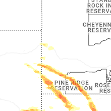
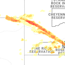
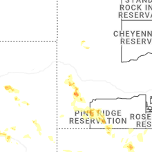
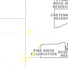


Connect with Interactive Hail Maps