

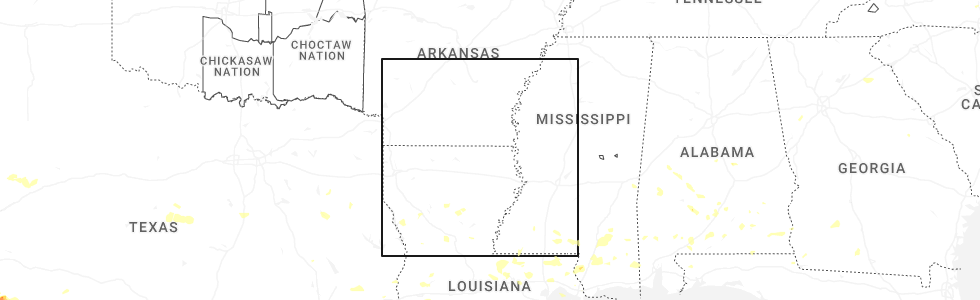
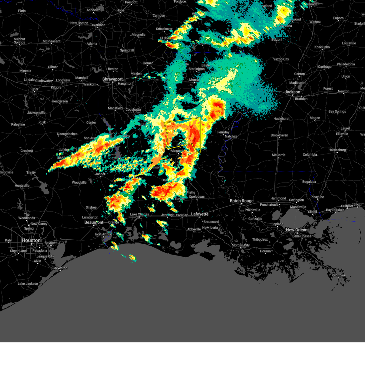
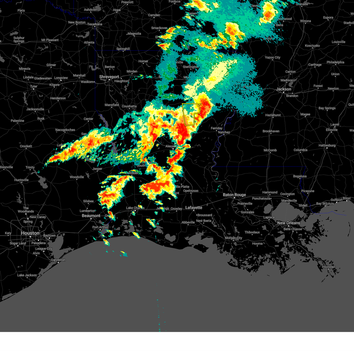
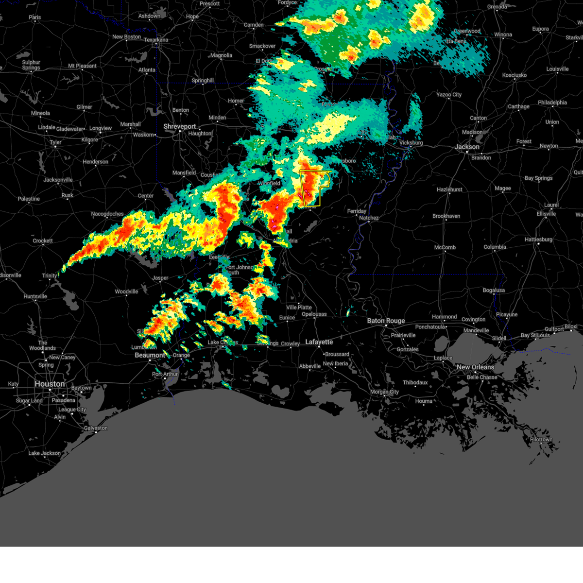
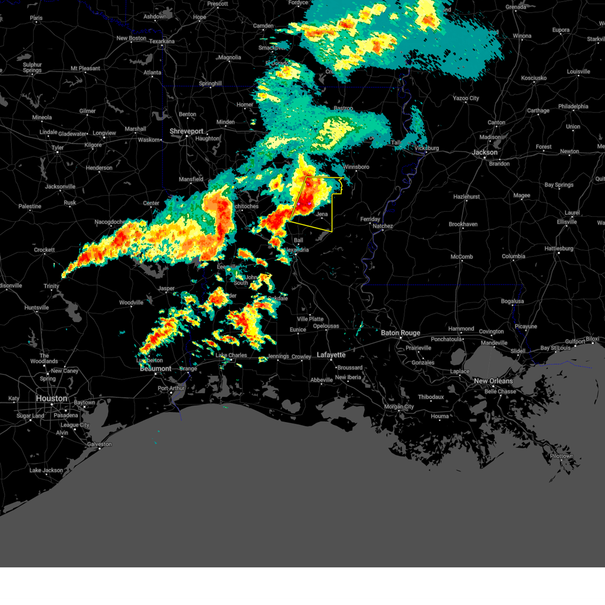
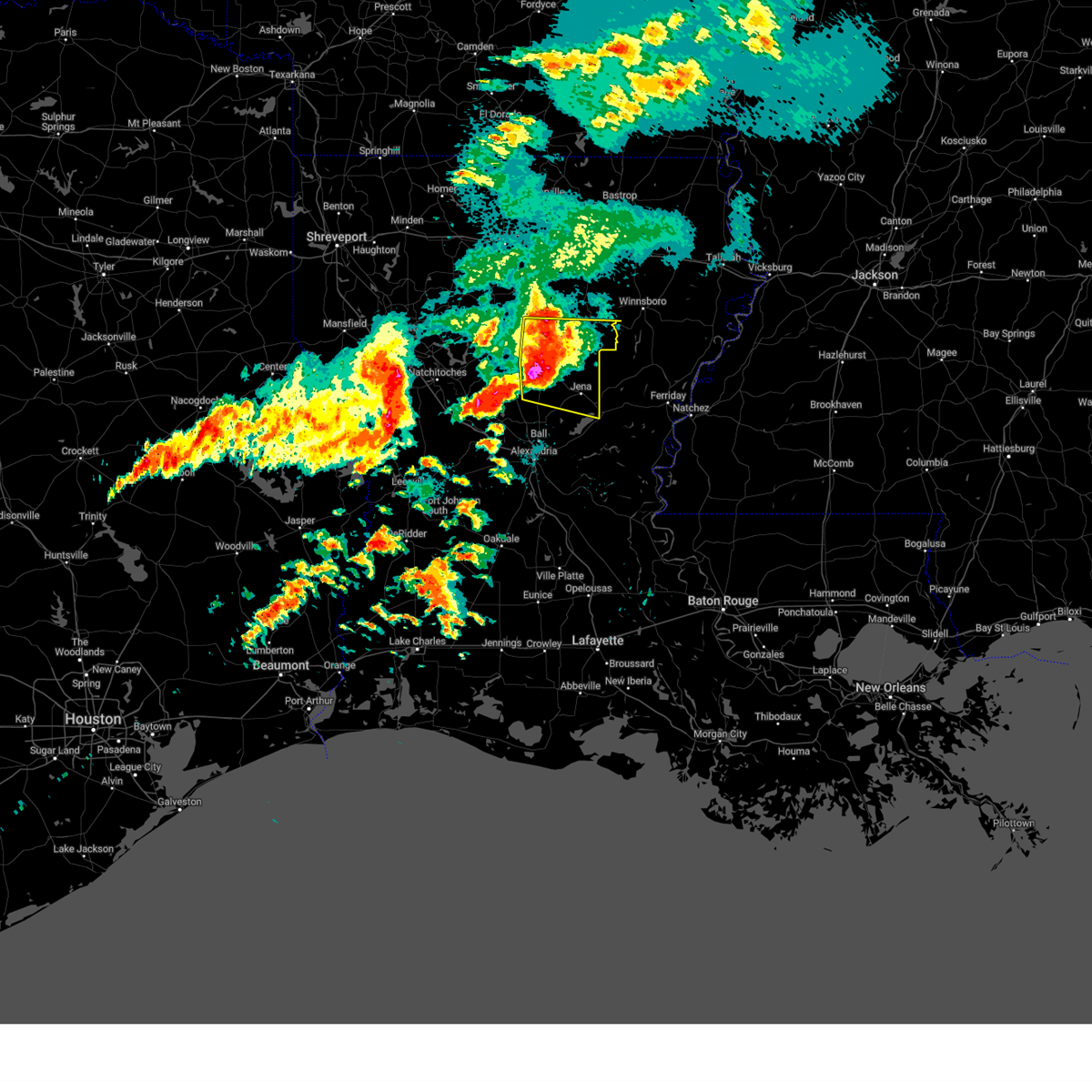
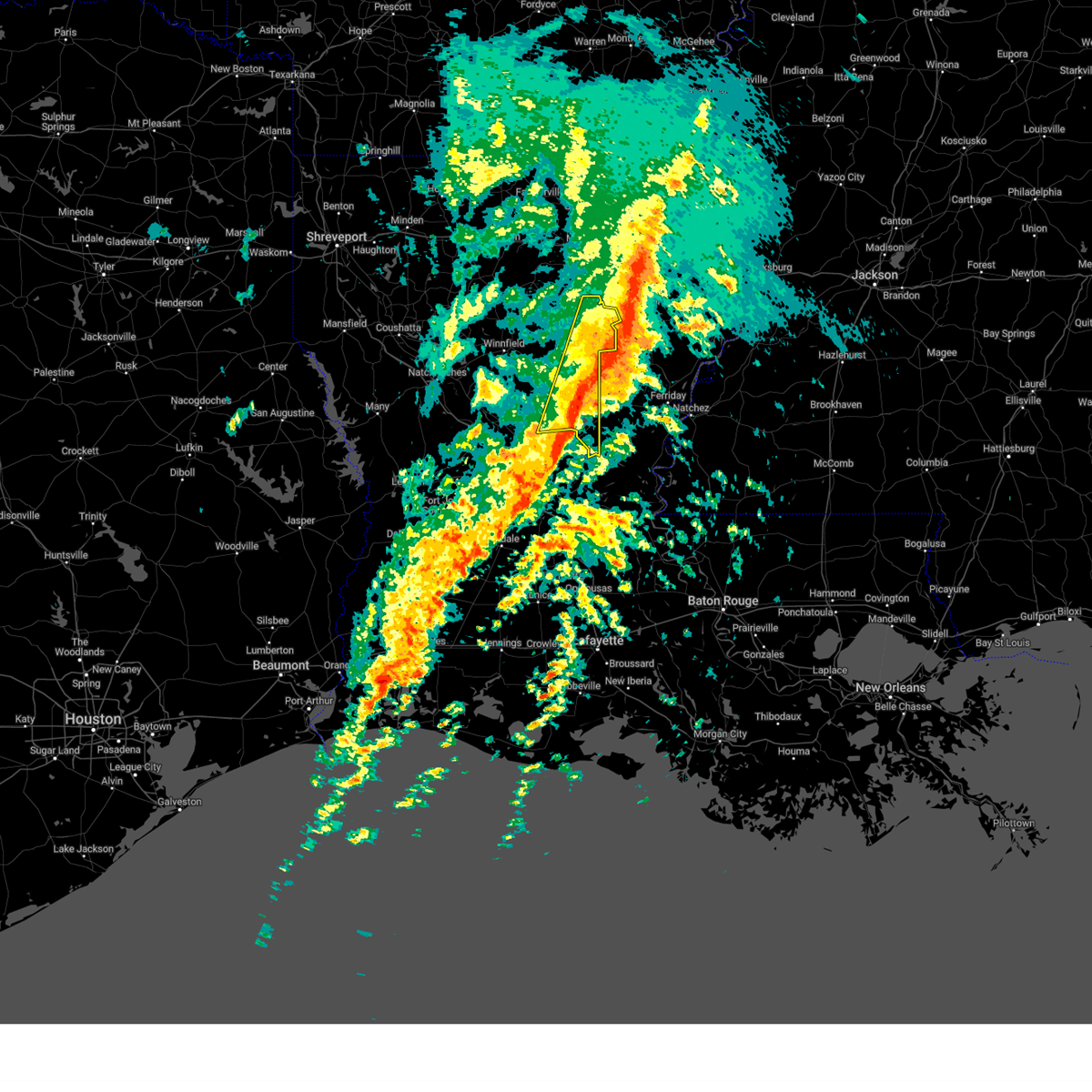
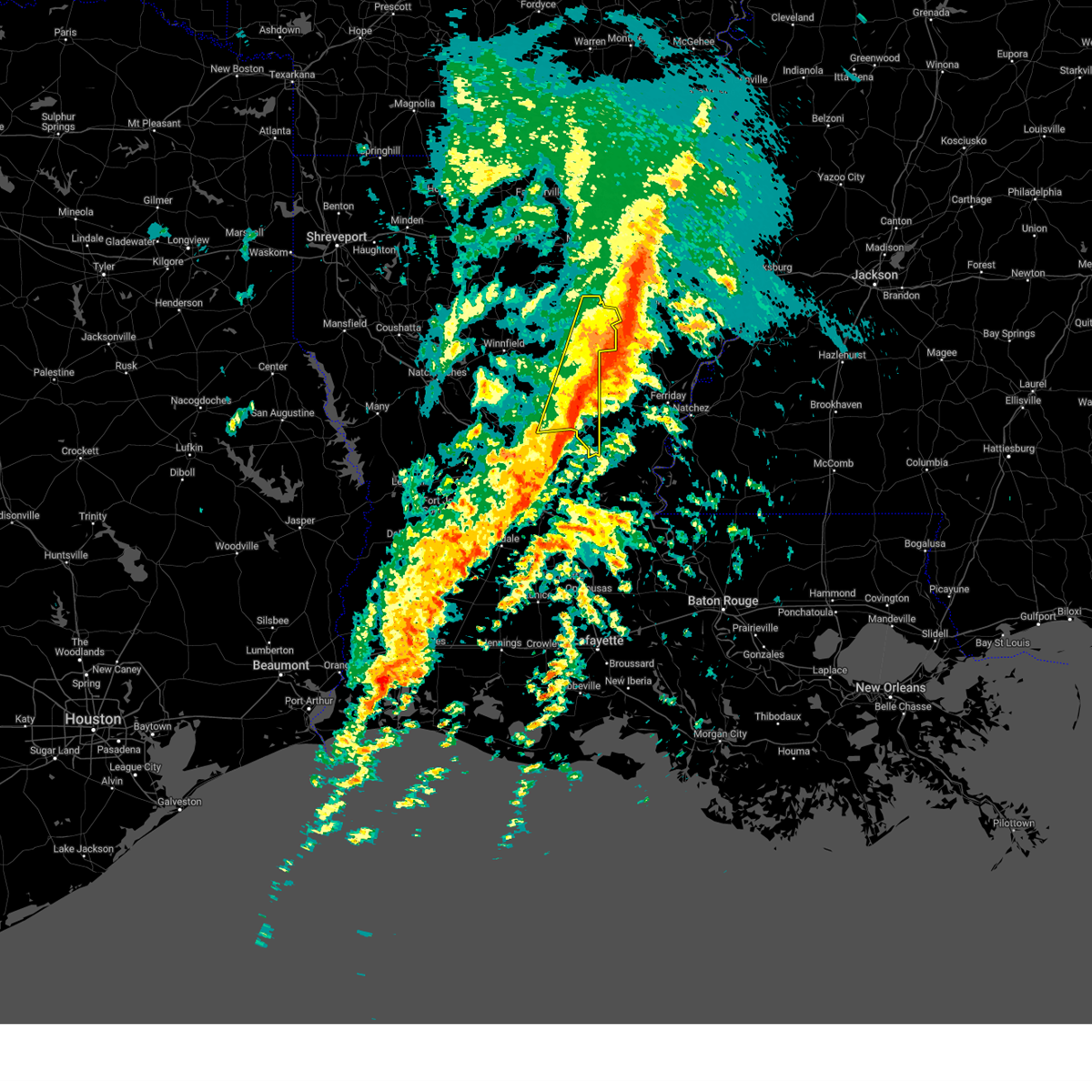
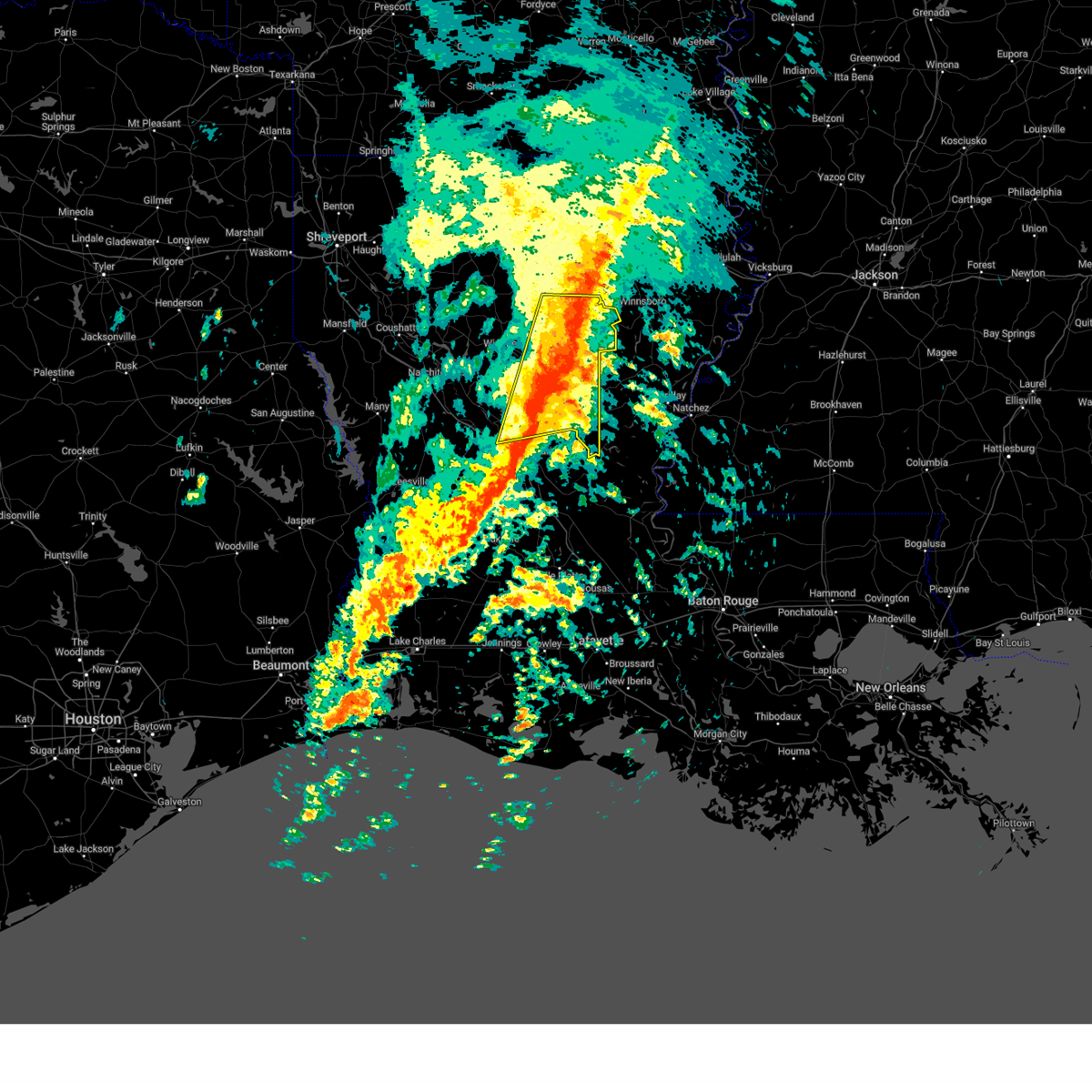
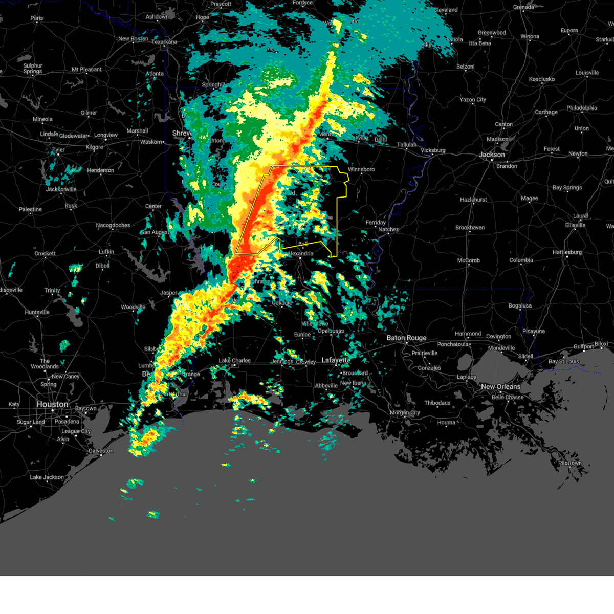
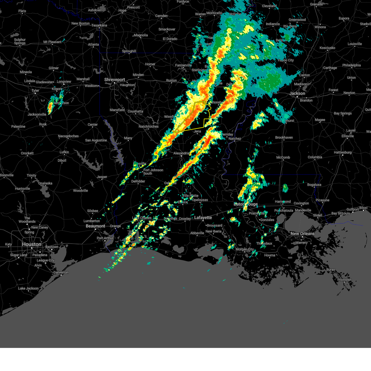
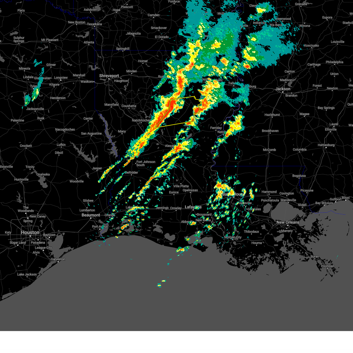
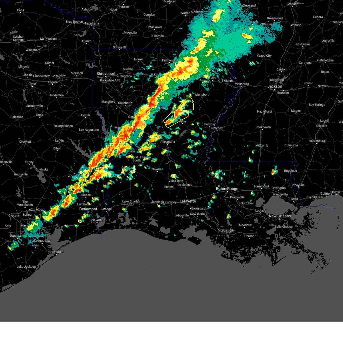
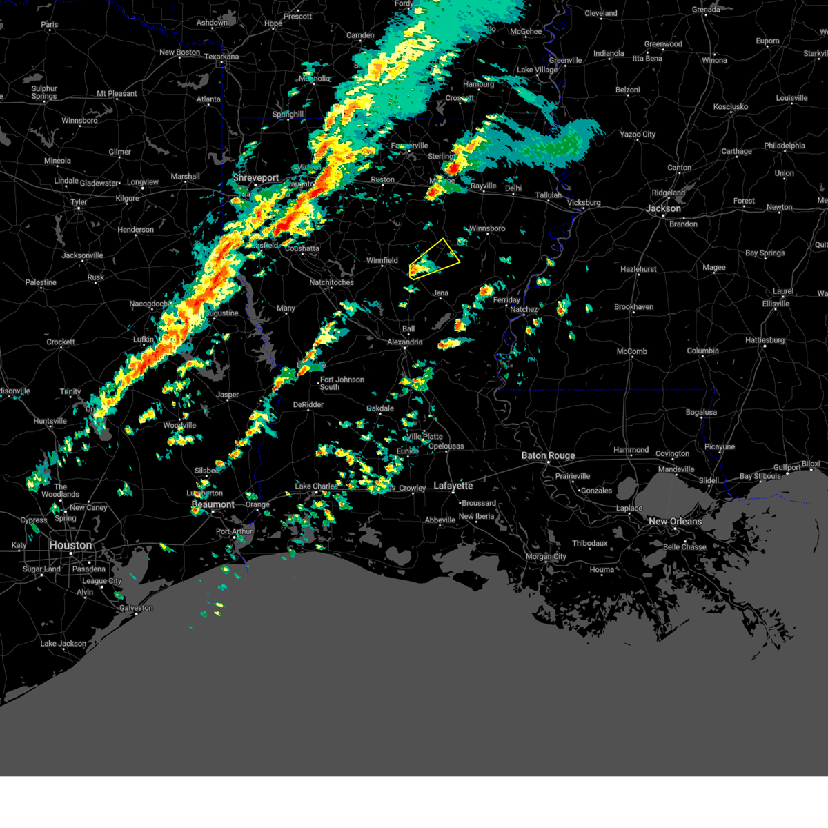
Hail Map for Olla, LA
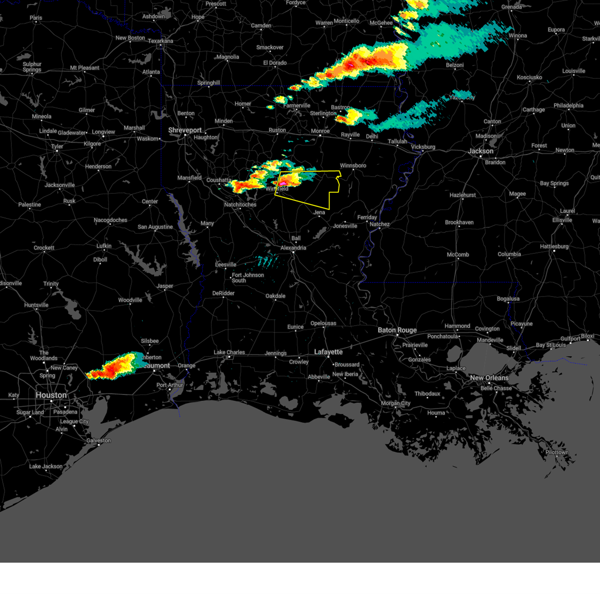
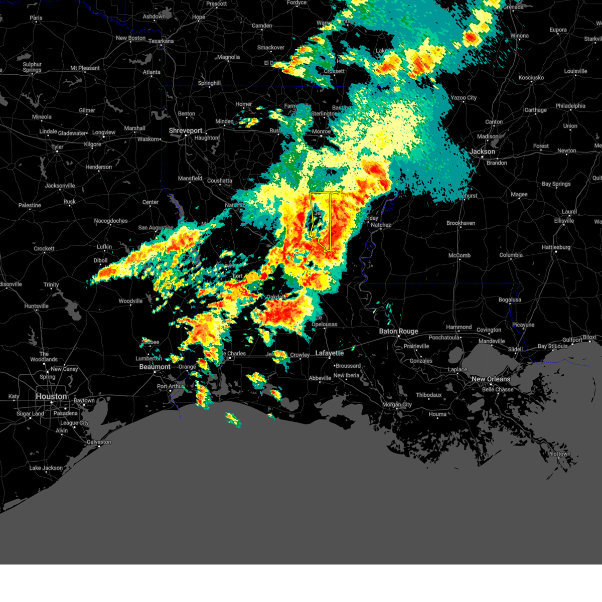
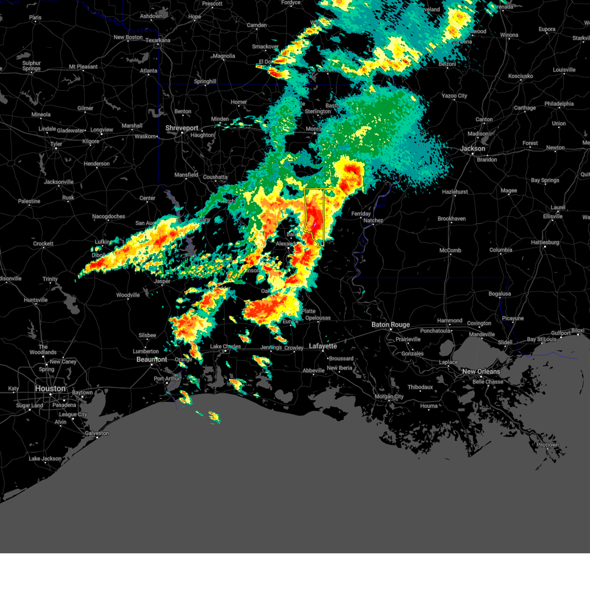
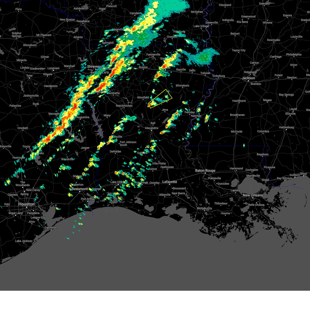
The Olla, LA area has had 3 reports of on-the-ground hail by trained spotters, and has been under severe weather warnings 36 times during the past 12 months. Doppler radar has detected hail at or near Olla, LA on 62 occasions, including 4 occasions during the past year.
| Name: | Olla, LA |
| Where Located: | 63.6 miles SSW of Bastrop, LA |
| Map: | Google Map for Olla, LA |
| Population: | 1385 |
| Housing Units: | 644 |
| More Info: | Search Google for Olla, LA |
0
The Top Recent Hail Date for Olla, LA is Tuesday, June 10, 2025 (34th out of 62)
Hail and Wind Damage Spotted near Olla, LA
| Date / Time | Report Details |
|---|---|
| 5/20/2025 6:23 PM CDT | Svrshv the national weather service in shreveport has issued a * severe thunderstorm warning for, northeastern grant parish in north central louisiana, southwestern caldwell parish in north central louisiana, la salle parish in north central louisiana, east central winn parish in north central louisiana, * until 715 pm cdt. * at 623 pm cdt, a severe thunderstorm was located near olla, or 22 miles southwest of columbia, moving east at 30 mph (radar indicated). Hazards include 60 mph wind gusts and quarter size hail. Hail damage to vehicles is expected. Expect wind damage to roofs, siding, and trees. |
| 5/20/2025 5:53 PM CDT | Svrshv the national weather service in shreveport has issued a * severe thunderstorm warning for, northeastern grant parish in north central louisiana, southern caldwell parish in north central louisiana, northern la salle parish in north central louisiana, central winn parish in north central louisiana, * until 645 pm cdt. * at 553 pm cdt, a severe thunderstorm was located near winnfield, moving southeast at 25 mph (radar indicated). Hazards include 60 mph wind gusts and quarter size hail. Hail damage to vehicles is expected. Expect wind damage to roofs, siding, and trees. |
| 5/20/2025 5:44 PM CDT | At 544 pm cdt, a severe thunderstorm was located near olla, or 13 miles southwest of columbia, moving east at 25 mph (radar indicated). Hazards include 60 mph wind gusts and half dollar size hail. Hail damage to vehicles is expected. expect wind damage to roofs, siding, and trees. Locations impacted include, spaulding, urania, columbia, burlington, clarks, olla, standard, grayson, kelly, and tullos. |
| 5/20/2025 4:54 PM CDT |
 Svrshv the national weather service in shreveport has issued a * severe thunderstorm warning for, caldwell parish in north central louisiana, northern la salle parish in north central louisiana, northeastern winn parish in north central louisiana, * until 600 pm cdt. * at 454 pm cdt, a severe thunderstorm was located 9 miles northeast of winnfield, moving southeast at 40 mph (radar indicated). Hazards include 60 mph wind gusts and half dollar size hail. Hail damage to vehicles is expected. Expect wind damage to roofs, siding, and trees. Svrshv the national weather service in shreveport has issued a * severe thunderstorm warning for, caldwell parish in north central louisiana, northern la salle parish in north central louisiana, northeastern winn parish in north central louisiana, * until 600 pm cdt. * at 454 pm cdt, a severe thunderstorm was located 9 miles northeast of winnfield, moving southeast at 40 mph (radar indicated). Hazards include 60 mph wind gusts and half dollar size hail. Hail damage to vehicles is expected. Expect wind damage to roofs, siding, and trees.
|
| 3/31/2025 3:46 AM CDT |
 The storms which prompted the warning have moved out of the area. therefore, the warning has been allowed to expire. a severe thunderstorm watch remains in effect until 800 am cdt monday for a portion of north central louisiana. The storms which prompted the warning have moved out of the area. therefore, the warning has been allowed to expire. a severe thunderstorm watch remains in effect until 800 am cdt monday for a portion of north central louisiana.
|
| 3/31/2025 3:32 AM CDT |
 Svrshv the national weather service in shreveport has issued a * severe thunderstorm warning for, south central caldwell parish in north central louisiana, la salle parish in north central louisiana, * until 345 am cdt. * at 332 am cdt, severe thunderstorms were located along a line from 10 miles south of clarks to 23 miles south of midway, or along a line from 15 miles south of columbia to 49 miles southeast of winnfield, moving east at 40 mph (radar indicated). Hazards include 60 mph wind gusts and half dollar size hail. Hail damage to vehicles is expected. Expect wind damage to roofs, siding, and trees. Svrshv the national weather service in shreveport has issued a * severe thunderstorm warning for, south central caldwell parish in north central louisiana, la salle parish in north central louisiana, * until 345 am cdt. * at 332 am cdt, severe thunderstorms were located along a line from 10 miles south of clarks to 23 miles south of midway, or along a line from 15 miles south of columbia to 49 miles southeast of winnfield, moving east at 40 mph (radar indicated). Hazards include 60 mph wind gusts and half dollar size hail. Hail damage to vehicles is expected. Expect wind damage to roofs, siding, and trees.
|
| 3/31/2025 3:32 AM CDT |
 The severe thunderstorm warning that was previously in effect has been reissued for and is in effect until 345 am cdt. please refer to that bulletin for the latest severe weather information. a severe thunderstorm watch remains in effect until 800 am cdt monday for a portion of north central louisiana. The severe thunderstorm warning that was previously in effect has been reissued for and is in effect until 345 am cdt. please refer to that bulletin for the latest severe weather information. a severe thunderstorm watch remains in effect until 800 am cdt monday for a portion of north central louisiana.
|
| 3/31/2025 3:16 AM CDT |
 The storms which prompted the warning have moved out of the area. therefore, the warning has been allowed to expire. a severe thunderstorm watch remains in effect until 800 am cdt monday for a portion of north central louisiana. The storms which prompted the warning have moved out of the area. therefore, the warning has been allowed to expire. a severe thunderstorm watch remains in effect until 800 am cdt monday for a portion of north central louisiana.
|
| 3/31/2025 2:56 AM CDT |
 the severe thunderstorm warning has been cancelled and is no longer in effect the severe thunderstorm warning has been cancelled and is no longer in effect
|
| 3/31/2025 2:56 AM CDT |
 At 256 am cdt, severe thunderstorms were located along a line from 8 miles southeast of grayson to over jena, or along a line from 8 miles southeast of columbia to 28 miles south of columbia, moving east at 45 mph (radar indicated). Hazards include two inch hail and 60 mph wind gusts. People and animals outdoors will be injured. expect hail damage to roofs, siding, windows, and vehicles. expect wind damage to roofs, siding, and trees. Locations impacted include, columbia, olla, clarks, grayson, spaulding, kelly, burlington and standard. At 256 am cdt, severe thunderstorms were located along a line from 8 miles southeast of grayson to over jena, or along a line from 8 miles southeast of columbia to 28 miles south of columbia, moving east at 45 mph (radar indicated). Hazards include two inch hail and 60 mph wind gusts. People and animals outdoors will be injured. expect hail damage to roofs, siding, windows, and vehicles. expect wind damage to roofs, siding, and trees. Locations impacted include, columbia, olla, clarks, grayson, spaulding, kelly, burlington and standard.
|
| 3/31/2025 2:47 AM CDT |
 Svrshv the national weather service in shreveport has issued a * severe thunderstorm warning for, grant parish in north central louisiana, la salle parish in north central louisiana, southeastern winn parish in north central louisiana, * until 330 am cdt. * at 247 am cdt, severe thunderstorms were located along a line from 10 miles southeast of winnfield to 13 miles southeast of colfax, or along a line from 10 miles southeast of winnfield to 38 miles south of winnfield, moving east at 40 mph (radar indicated). Hazards include golf ball size hail and 60 mph wind gusts. People and animals outdoors will be injured. expect hail damage to roofs, siding, windows, and vehicles. Expect wind damage to roofs, siding, and trees. Svrshv the national weather service in shreveport has issued a * severe thunderstorm warning for, grant parish in north central louisiana, la salle parish in north central louisiana, southeastern winn parish in north central louisiana, * until 330 am cdt. * at 247 am cdt, severe thunderstorms were located along a line from 10 miles southeast of winnfield to 13 miles southeast of colfax, or along a line from 10 miles southeast of winnfield to 38 miles south of winnfield, moving east at 40 mph (radar indicated). Hazards include golf ball size hail and 60 mph wind gusts. People and animals outdoors will be injured. expect hail damage to roofs, siding, windows, and vehicles. Expect wind damage to roofs, siding, and trees.
|
| 3/31/2025 2:39 AM CDT |
 At 239 am cdt, severe thunderstorms were located along a line from near clarks to 9 miles west of midway, or along a line from 9 miles southwest of columbia to 25 miles southeast of winnfield, moving east at 45 mph (radar indicated). Hazards include tennis ball size hail and 60 mph wind gusts. People and animals outdoors will be injured. expect hail damage to roofs, siding, windows, and vehicles. expect wind damage to roofs, siding, and trees. Locations impacted include, columbia, jena, olla, clarks, grayson, midway, urania, tullos, georgetown, standard, burlington, spaulding, kelly, zenoria, rochelle and nebo. At 239 am cdt, severe thunderstorms were located along a line from near clarks to 9 miles west of midway, or along a line from 9 miles southwest of columbia to 25 miles southeast of winnfield, moving east at 45 mph (radar indicated). Hazards include tennis ball size hail and 60 mph wind gusts. People and animals outdoors will be injured. expect hail damage to roofs, siding, windows, and vehicles. expect wind damage to roofs, siding, and trees. Locations impacted include, columbia, jena, olla, clarks, grayson, midway, urania, tullos, georgetown, standard, burlington, spaulding, kelly, zenoria, rochelle and nebo.
|
| 3/31/2025 2:27 AM CDT |
 At 227 am cdt, severe thunderstorms were located along a line from 12 miles northwest of olla to 14 miles west of midway, or along a line from 16 miles west of columbia to 21 miles southeast of winnfield, moving east at 45 mph. these are destructive storms for georgetown, tullos, urania (radar indicated). Hazards include baseball size hail and 60 mph wind gusts. People and animals outdoors will be severely injured. expect shattered windows, extensive damage to roofs, siding, and vehicles. Locations impacted include, columbia, jena, olla, clarks, grayson, midway, urania, tullos, georgetown, sikes, standard, burlington, spaulding, kelly, zenoria, rochelle and nebo. At 227 am cdt, severe thunderstorms were located along a line from 12 miles northwest of olla to 14 miles west of midway, or along a line from 16 miles west of columbia to 21 miles southeast of winnfield, moving east at 45 mph. these are destructive storms for georgetown, tullos, urania (radar indicated). Hazards include baseball size hail and 60 mph wind gusts. People and animals outdoors will be severely injured. expect shattered windows, extensive damage to roofs, siding, and vehicles. Locations impacted include, columbia, jena, olla, clarks, grayson, midway, urania, tullos, georgetown, sikes, standard, burlington, spaulding, kelly, zenoria, rochelle and nebo.
|
| 3/31/2025 2:20 AM CDT |
 the severe thunderstorm warning has been cancelled and is no longer in effect the severe thunderstorm warning has been cancelled and is no longer in effect
|
| 3/31/2025 2:18 AM CDT |
 Svrshv the national weather service in shreveport has issued a * severe thunderstorm warning for, southern caldwell parish in north central louisiana, northeastern grant parish in north central louisiana, la salle parish in north central louisiana, eastern winn parish in north central louisiana, * until 315 am cdt. * at 218 am cdt, severe thunderstorms were located along a line from 14 miles northeast of winnfield to 17 miles southeast of winnfield, moving east at 45 mph. these are destructive storms for georgetown, tullos, urania (radar indicated). Hazards include baseball size hail and 60 mph wind gusts. People and animals outdoors will be severely injured. Expect shattered windows, extensive damage to roofs, siding, and vehicles. Svrshv the national weather service in shreveport has issued a * severe thunderstorm warning for, southern caldwell parish in north central louisiana, northeastern grant parish in north central louisiana, la salle parish in north central louisiana, eastern winn parish in north central louisiana, * until 315 am cdt. * at 218 am cdt, severe thunderstorms were located along a line from 14 miles northeast of winnfield to 17 miles southeast of winnfield, moving east at 45 mph. these are destructive storms for georgetown, tullos, urania (radar indicated). Hazards include baseball size hail and 60 mph wind gusts. People and animals outdoors will be severely injured. Expect shattered windows, extensive damage to roofs, siding, and vehicles.
|
| 3/31/2025 2:04 AM CDT |
 the severe thunderstorm warning has been cancelled and is no longer in effect the severe thunderstorm warning has been cancelled and is no longer in effect
|
| 3/31/2025 2:04 AM CDT |
 At 204 am cdt, severe thunderstorms were located along a line from 6 miles southeast of jonesboro to 13 miles south of winnfield, moving east at 40 mph. these are destructive storms for southern winn parish (radar indicated). Hazards include three inch hail and 60 mph wind gusts. People and animals outdoors will be severely injured. expect shattered windows, extensive damage to roofs, siding, and vehicles. Locations impacted include, winnfield, olla, montgomery, urania, tullos, dodson, georgetown, calvin, atlanta, sikes, joyce, hudson, williana, rochelle and zenoria. At 204 am cdt, severe thunderstorms were located along a line from 6 miles southeast of jonesboro to 13 miles south of winnfield, moving east at 40 mph. these are destructive storms for southern winn parish (radar indicated). Hazards include three inch hail and 60 mph wind gusts. People and animals outdoors will be severely injured. expect shattered windows, extensive damage to roofs, siding, and vehicles. Locations impacted include, winnfield, olla, montgomery, urania, tullos, dodson, georgetown, calvin, atlanta, sikes, joyce, hudson, williana, rochelle and zenoria.
|
| 3/31/2025 2:01 AM CDT |
 At 201 am cdt, severe thunderstorms were located along a line from near jonesboro to 14 miles south of winnfield, moving east at 40 mph. these are destructive storms for southern winn parish (radar indicated). Hazards include three inch hail and 60 mph wind gusts. People and animals outdoors will be severely injured. expect shattered windows, extensive damage to roofs, siding, and vehicles. Locations impacted include, winnfield, jonesboro, olla, montgomery, urania, tullos, dodson, georgetown, calvin, atlanta, sikes, joyce, hudson, rochelle, williana and zenoria. At 201 am cdt, severe thunderstorms were located along a line from near jonesboro to 14 miles south of winnfield, moving east at 40 mph. these are destructive storms for southern winn parish (radar indicated). Hazards include three inch hail and 60 mph wind gusts. People and animals outdoors will be severely injured. expect shattered windows, extensive damage to roofs, siding, and vehicles. Locations impacted include, winnfield, jonesboro, olla, montgomery, urania, tullos, dodson, georgetown, calvin, atlanta, sikes, joyce, hudson, rochelle, williana and zenoria.
|
| 3/31/2025 1:55 AM CDT |
 the severe thunderstorm warning has been cancelled and is no longer in effect the severe thunderstorm warning has been cancelled and is no longer in effect
|
| 3/31/2025 1:55 AM CDT |
 At 155 am cdt, severe thunderstorms were located along a line from 5 miles south of jonesboro to 10 miles east of montgomery, or along a line from 5 miles south of jonesboro to 15 miles south of winnfield, moving east at 40 mph (radar indicated). Hazards include tennis ball size hail and 60 mph wind gusts. People and animals outdoors will be injured. expect hail damage to roofs, siding, windows, and vehicles. expect wind damage to roofs, siding, and trees. Locations impacted include, winnfield, jonesboro, olla, montgomery, urania, tullos, dodson, georgetown, calvin, atlanta, sikes, joyce, hudson, rochelle, williana and zenoria. At 155 am cdt, severe thunderstorms were located along a line from 5 miles south of jonesboro to 10 miles east of montgomery, or along a line from 5 miles south of jonesboro to 15 miles south of winnfield, moving east at 40 mph (radar indicated). Hazards include tennis ball size hail and 60 mph wind gusts. People and animals outdoors will be injured. expect hail damage to roofs, siding, windows, and vehicles. expect wind damage to roofs, siding, and trees. Locations impacted include, winnfield, jonesboro, olla, montgomery, urania, tullos, dodson, georgetown, calvin, atlanta, sikes, joyce, hudson, rochelle, williana and zenoria.
|
| 3/31/2025 1:37 AM CDT | Svrshv the national weather service in shreveport has issued a * severe thunderstorm warning for, southwestern caldwell parish in north central louisiana, northern grant parish in north central louisiana, southern jackson parish in north central louisiana, northwestern la salle parish in north central louisiana, winn parish in north central louisiana, northeastern natchitoches parish in northwestern louisiana, * until 230 am cdt. * at 137 am cdt, severe thunderstorms were located along a line from 15 miles southwest of jonesboro to over montgomery, or along a line from 15 miles southwest of jonesboro to 11 miles east of natchitoches, moving east at 40 mph (radar indicated). Hazards include golf ball size hail and 60 mph wind gusts. People and animals outdoors will be injured. expect hail damage to roofs, siding, windows, and vehicles. Expect wind damage to roofs, siding, and trees. |
| 3/4/2025 12:31 PM CST |
 At 1231 pm cst, severe thunderstorms were located along a line from 17 miles northeast of columbia to 15 miles south of midway, or along a line from 17 miles northeast of columbia to 39 miles southeast of winnfield, moving northeast at 15 mph (radar indicated). Hazards include 60 mph wind gusts and small hail. Expect damage to roofs, siding, and trees. Locations impacted include, columbia, jena, olla, clarks, grayson, midway, pollock, burlington, standard, spaulding, kelly, nebo, catahoula lake, rogers, fishville and riverton. At 1231 pm cst, severe thunderstorms were located along a line from 17 miles northeast of columbia to 15 miles south of midway, or along a line from 17 miles northeast of columbia to 39 miles southeast of winnfield, moving northeast at 15 mph (radar indicated). Hazards include 60 mph wind gusts and small hail. Expect damage to roofs, siding, and trees. Locations impacted include, columbia, jena, olla, clarks, grayson, midway, pollock, burlington, standard, spaulding, kelly, nebo, catahoula lake, rogers, fishville and riverton.
|
| 3/4/2025 12:31 PM CST |
 the severe thunderstorm warning has been cancelled and is no longer in effect the severe thunderstorm warning has been cancelled and is no longer in effect
|
| 3/4/2025 12:11 PM CST |
 the severe thunderstorm warning has been cancelled and is no longer in effect the severe thunderstorm warning has been cancelled and is no longer in effect
|
| 3/4/2025 12:11 PM CST |
 At 1211 pm cst, severe thunderstorms were located along a line from 9 miles northeast of columbia to 20 miles southwest of midway, or along a line from 9 miles northeast of columbia to 39 miles southeast of winnfield, moving east at 60 mph (radar indicated). Hazards include 70 mph wind gusts and quarter size hail. Hail damage to vehicles is expected. expect considerable tree damage. wind damage is also likely to mobile homes, roofs, and outbuildings. Locations impacted include, columbia, jena, olla, clarks, grayson, midway, urania, pollock, dry prong, tullos, georgetown, zenoria, rochelle, standard, burlington, spaulding, kelly, nebo, rogers and fishville. At 1211 pm cst, severe thunderstorms were located along a line from 9 miles northeast of columbia to 20 miles southwest of midway, or along a line from 9 miles northeast of columbia to 39 miles southeast of winnfield, moving east at 60 mph (radar indicated). Hazards include 70 mph wind gusts and quarter size hail. Hail damage to vehicles is expected. expect considerable tree damage. wind damage is also likely to mobile homes, roofs, and outbuildings. Locations impacted include, columbia, jena, olla, clarks, grayson, midway, urania, pollock, dry prong, tullos, georgetown, zenoria, rochelle, standard, burlington, spaulding, kelly, nebo, rogers and fishville.
|
| 3/4/2025 11:27 AM CST |
 Svrshv the national weather service in shreveport has issued a * severe thunderstorm warning for, caldwell parish in north central louisiana, grant parish in north central louisiana, southern jackson parish in north central louisiana, la salle parish in north central louisiana, winn parish in north central louisiana, eastern natchitoches parish in northwestern louisiana, * until 1245 pm cst. * at 1127 am cst, severe thunderstorms were located along a line from 10 miles east of jonesboro to 19 miles southwest of colfax, or along a line from 10 miles east of jonesboro to 26 miles south of natchitoches, moving east at 45 mph (radar indicated). Hazards include 70 mph wind gusts and quarter size hail. Hail damage to vehicles is expected. expect considerable tree damage. Wind damage is also likely to mobile homes, roofs, and outbuildings. Svrshv the national weather service in shreveport has issued a * severe thunderstorm warning for, caldwell parish in north central louisiana, grant parish in north central louisiana, southern jackson parish in north central louisiana, la salle parish in north central louisiana, winn parish in north central louisiana, eastern natchitoches parish in northwestern louisiana, * until 1245 pm cst. * at 1127 am cst, severe thunderstorms were located along a line from 10 miles east of jonesboro to 19 miles southwest of colfax, or along a line from 10 miles east of jonesboro to 26 miles south of natchitoches, moving east at 45 mph (radar indicated). Hazards include 70 mph wind gusts and quarter size hail. Hail damage to vehicles is expected. expect considerable tree damage. Wind damage is also likely to mobile homes, roofs, and outbuildings.
|
| 2/15/2025 8:14 PM CST |
 the severe thunderstorm warning has been cancelled and is no longer in effect the severe thunderstorm warning has been cancelled and is no longer in effect
|
| 2/15/2025 8:14 PM CST |
 At 814 pm cst, severe thunderstorms were located along a line from 5 miles north of columbia to near olla, or along a line from 5 miles north of columbia to 21 miles east of winnfield, moving east at 30 mph (radar indicated). Hazards include 60 mph wind gusts and small hail. Expect damage to roofs, siding, and trees. Locations impacted include, columbia, olla, clarks, grayson, urania, tullos, georgetown, spaulding, kelly, burlington, standard, riverton, zenoria and rochelle. At 814 pm cst, severe thunderstorms were located along a line from 5 miles north of columbia to near olla, or along a line from 5 miles north of columbia to 21 miles east of winnfield, moving east at 30 mph (radar indicated). Hazards include 60 mph wind gusts and small hail. Expect damage to roofs, siding, and trees. Locations impacted include, columbia, olla, clarks, grayson, urania, tullos, georgetown, spaulding, kelly, burlington, standard, riverton, zenoria and rochelle.
|
| 2/15/2025 7:43 PM CST |
 Svrshv the national weather service in shreveport has issued a * severe thunderstorm warning for, caldwell parish in north central louisiana, northwestern grant parish in north central louisiana, southeastern jackson parish in north central louisiana, northern la salle parish in north central louisiana, eastern winn parish in north central louisiana, * until 845 pm cst. * at 743 pm cst, severe thunderstorms were located along a line from 16 miles northwest of clarks to 9 miles south of winnfield, or along a line from 18 miles west of columbia to 9 miles south of winnfield, moving east at 55 mph (radar indicated). Hazards include 60 mph wind gusts and small hail. expect damage to roofs, siding, and trees Svrshv the national weather service in shreveport has issued a * severe thunderstorm warning for, caldwell parish in north central louisiana, northwestern grant parish in north central louisiana, southeastern jackson parish in north central louisiana, northern la salle parish in north central louisiana, eastern winn parish in north central louisiana, * until 845 pm cst. * at 743 pm cst, severe thunderstorms were located along a line from 16 miles northwest of clarks to 9 miles south of winnfield, or along a line from 18 miles west of columbia to 9 miles south of winnfield, moving east at 55 mph (radar indicated). Hazards include 60 mph wind gusts and small hail. expect damage to roofs, siding, and trees
|
| 1/5/2025 3:00 PM CST |
 Svrshv the national weather service in shreveport has issued a * severe thunderstorm warning for, southeastern caldwell parish in north central louisiana, northeastern grant parish in north central louisiana, northern la salle parish in north central louisiana, southeastern winn parish in north central louisiana, * until 345 pm cst. * at 300 pm cst, a severe thunderstorm was located 17 miles west of midway, or 20 miles southeast of winnfield. also, another strong to severe thunderstorm was located just south of urania in la salle parish. both are moving northeast at 45 mph (radar indicated). Hazards include 60 mph wind gusts and small hail. expect damage to roofs, siding, and trees Svrshv the national weather service in shreveport has issued a * severe thunderstorm warning for, southeastern caldwell parish in north central louisiana, northeastern grant parish in north central louisiana, northern la salle parish in north central louisiana, southeastern winn parish in north central louisiana, * until 345 pm cst. * at 300 pm cst, a severe thunderstorm was located 17 miles west of midway, or 20 miles southeast of winnfield. also, another strong to severe thunderstorm was located just south of urania in la salle parish. both are moving northeast at 45 mph (radar indicated). Hazards include 60 mph wind gusts and small hail. expect damage to roofs, siding, and trees
|
| 1/5/2025 1:08 PM CST |
 At 108 pm cst, a severe thunderstorm was located near olla, or 19 miles east of winnfield, moving northeast at 50 mph (radar indicated). Hazards include 60 mph wind gusts and small hail. Expect damage to roofs, siding, and trees. Locations impacted include, olla, clarks, grayson, urania, tullos, spaulding, kelly, burlington and standard. At 108 pm cst, a severe thunderstorm was located near olla, or 19 miles east of winnfield, moving northeast at 50 mph (radar indicated). Hazards include 60 mph wind gusts and small hail. Expect damage to roofs, siding, and trees. Locations impacted include, olla, clarks, grayson, urania, tullos, spaulding, kelly, burlington and standard.
|
| 1/5/2025 1:08 PM CST |
 the severe thunderstorm warning has been cancelled and is no longer in effect the severe thunderstorm warning has been cancelled and is no longer in effect
|
| 1/5/2025 12:58 PM CST |
 Svrshv the national weather service in shreveport has issued a * severe thunderstorm warning for, southwestern caldwell parish in north central louisiana, north central grant parish in north central louisiana, northwestern la salle parish in north central louisiana, southeastern winn parish in north central louisiana, * until 145 pm cst. * at 1258 pm cst, a severe thunderstorm was located 12 miles southwest of olla, or 14 miles southeast of winnfield, moving northeast at 50 mph (radar indicated). Hazards include 60 mph wind gusts and small hail. expect damage to roofs, siding, and trees Svrshv the national weather service in shreveport has issued a * severe thunderstorm warning for, southwestern caldwell parish in north central louisiana, north central grant parish in north central louisiana, northwestern la salle parish in north central louisiana, southeastern winn parish in north central louisiana, * until 145 pm cst. * at 1258 pm cst, a severe thunderstorm was located 12 miles southwest of olla, or 14 miles southeast of winnfield, moving northeast at 50 mph (radar indicated). Hazards include 60 mph wind gusts and small hail. expect damage to roofs, siding, and trees
|
| 12/28/2024 3:36 PM CST |
 The storm which prompted the warning has weakened below severe limits, and has exited the warned area. therefore, the warning has been allowed to expire. a tornado watch remains in effect until 900 pm cst for a portion of north central louisiana. The storm which prompted the warning has weakened below severe limits, and has exited the warned area. therefore, the warning has been allowed to expire. a tornado watch remains in effect until 900 pm cst for a portion of north central louisiana.
|
| 12/28/2024 3:30 PM CST | There are a couple of trees down on hwy 165 between olla and urania near the lasalle correctional center... reported by 911 dispatc in la salle county LA, 3.3 miles NE of Olla, LA |
| 12/28/2024 3:05 PM CST |
 At 305 pm cst, a severe thunderstorm was located 10 miles southeast of winnfield, moving northeast at 45 mph (radar indicated). Hazards include 60 mph wind gusts and quarter size hail. Hail damage to vehicles is expected. expect wind damage to roofs, siding, and trees. Locations impacted include, olla, urania, tullos, georgetown, rochelle, standard, burlington and spaulding. At 305 pm cst, a severe thunderstorm was located 10 miles southeast of winnfield, moving northeast at 45 mph (radar indicated). Hazards include 60 mph wind gusts and quarter size hail. Hail damage to vehicles is expected. expect wind damage to roofs, siding, and trees. Locations impacted include, olla, urania, tullos, georgetown, rochelle, standard, burlington and spaulding.
|
| 12/28/2024 2:48 PM CST | Svrshv the national weather service in shreveport has issued a * severe thunderstorm warning for, southwestern caldwell parish in north central louisiana, north central grant parish in north central louisiana, northwestern la salle parish in north central louisiana, southeastern winn parish in north central louisiana, * until 330 pm cst. * at 248 pm cst, a severe thunderstorm was located 14 miles north of colfax, or 14 miles south of winnfield, moving northeast at 45 mph (radar indicated). Hazards include 60 mph wind gusts and half dollar size hail. Hail damage to vehicles is expected. Expect wind damage to roofs, siding, and trees. |
| 6/3/2024 9:10 PM CDT | Large limbs were downed in oll in la salle county LA, 0.5 miles SE of Olla, LA |
| 6/3/2024 8:56 PM CDT |
 Svrshv the national weather service in shreveport has issued a * severe thunderstorm warning for, grant parish in north central louisiana, southern caldwell parish in north central louisiana, la salle parish in north central louisiana, southern winn parish in north central louisiana, * until 1000 pm cdt. * at 856 pm cdt, severe thunderstorms were located along a line extending from 7 miles southwest of liddieville to 11 miles west of olla to 11 miles east of campti, moving southeast at 35 mph (radar indicated. numerous trees and power lines have been downed across monroe and ouachita parish from these storms). Hazards include 60 mph wind gusts. expect damage to roofs, siding, and trees Svrshv the national weather service in shreveport has issued a * severe thunderstorm warning for, grant parish in north central louisiana, southern caldwell parish in north central louisiana, la salle parish in north central louisiana, southern winn parish in north central louisiana, * until 1000 pm cdt. * at 856 pm cdt, severe thunderstorms were located along a line extending from 7 miles southwest of liddieville to 11 miles west of olla to 11 miles east of campti, moving southeast at 35 mph (radar indicated. numerous trees and power lines have been downed across monroe and ouachita parish from these storms). Hazards include 60 mph wind gusts. expect damage to roofs, siding, and trees
|
| 6/3/2024 8:09 PM CDT |
 Svrshv the national weather service in shreveport has issued a * severe thunderstorm warning for, caldwell parish in north central louisiana, jackson parish in north central louisiana, southeastern union parish in north central louisiana, northeastern natchitoches parish in northwestern louisiana, northern la salle parish in north central louisiana, ouachita parish in north central louisiana, southeastern bienville parish in northwestern louisiana, winn parish in north central louisiana, * until 915 pm cdt. * at 809 pm cdt, severe thunderstorms were located along a line extending from near sterlington to 16 miles east of jonesboro to 15 miles northeast of coushatta, moving southeast at 35 mph (radar indicated). Hazards include 60 mph wind gusts. expect damage to roofs, siding, and trees Svrshv the national weather service in shreveport has issued a * severe thunderstorm warning for, caldwell parish in north central louisiana, jackson parish in north central louisiana, southeastern union parish in north central louisiana, northeastern natchitoches parish in northwestern louisiana, northern la salle parish in north central louisiana, ouachita parish in north central louisiana, southeastern bienville parish in northwestern louisiana, winn parish in north central louisiana, * until 915 pm cdt. * at 809 pm cdt, severe thunderstorms were located along a line extending from near sterlington to 16 miles east of jonesboro to 15 miles northeast of coushatta, moving southeast at 35 mph (radar indicated). Hazards include 60 mph wind gusts. expect damage to roofs, siding, and trees
|
| 5/30/2024 10:20 PM CDT |
 At 1019 pm cdt, severe thunderstorms were located along a line extending from 16 miles southeast of jonesboro to 6 miles northwest of olla to near midway to 10 miles north of holloway, moving east at 40 mph (radar indicated). Hazards include 60 mph wind gusts and penny size hail. Expect damage to roofs, siding, and trees. Locations impacted include, ball, jena, olla, clarks, grayson, midway, urania, pollock, dry prong, tullos, dodson, georgetown, sikes, nebo, rogers, catahoula lake, standard, joyce, burlington, and spaulding. At 1019 pm cdt, severe thunderstorms were located along a line extending from 16 miles southeast of jonesboro to 6 miles northwest of olla to near midway to 10 miles north of holloway, moving east at 40 mph (radar indicated). Hazards include 60 mph wind gusts and penny size hail. Expect damage to roofs, siding, and trees. Locations impacted include, ball, jena, olla, clarks, grayson, midway, urania, pollock, dry prong, tullos, dodson, georgetown, sikes, nebo, rogers, catahoula lake, standard, joyce, burlington, and spaulding.
|
| 5/30/2024 9:46 PM CDT |
 Svrshv the national weather service in shreveport has issued a * severe thunderstorm warning for, grant parish in north central louisiana, western caldwell parish in north central louisiana, southeastern jackson parish in north central louisiana, la salle parish in north central louisiana, winn parish in north central louisiana, * until 1045 pm cdt. * at 945 pm cdt, severe thunderstorms were located along a line extending from 14 miles south of jonesboro to near winnfield to 12 miles northeast of colfax to near timber trails, moving east at 40 mph (radar indicated). Hazards include 60 mph wind gusts and penny size hail. expect damage to roofs, siding, and trees Svrshv the national weather service in shreveport has issued a * severe thunderstorm warning for, grant parish in north central louisiana, western caldwell parish in north central louisiana, southeastern jackson parish in north central louisiana, la salle parish in north central louisiana, winn parish in north central louisiana, * until 1045 pm cdt. * at 945 pm cdt, severe thunderstorms were located along a line extending from 14 miles south of jonesboro to near winnfield to 12 miles northeast of colfax to near timber trails, moving east at 40 mph (radar indicated). Hazards include 60 mph wind gusts and penny size hail. expect damage to roofs, siding, and trees
|
| 4/9/2024 6:32 PM CDT |
 Svrshv the national weather service in shreveport has issued a * severe thunderstorm warning for, caldwell parish in north central louisiana, southeastern jackson parish in north central louisiana, northern la salle parish in north central louisiana, south central ouachita parish in north central louisiana, northeastern winn parish in north central louisiana, * until 715 pm cdt. * at 632 pm cdt, severe thunderstorms were located along a line extending from 14 miles northwest of columbia to 6 miles northwest of clarks to 6 miles north of olla, moving east at 50 mph (radar indicated). Hazards include 60 mph wind gusts and penny size hail. expect damage to roofs, siding, and trees Svrshv the national weather service in shreveport has issued a * severe thunderstorm warning for, caldwell parish in north central louisiana, southeastern jackson parish in north central louisiana, northern la salle parish in north central louisiana, south central ouachita parish in north central louisiana, northeastern winn parish in north central louisiana, * until 715 pm cdt. * at 632 pm cdt, severe thunderstorms were located along a line extending from 14 miles northwest of columbia to 6 miles northwest of clarks to 6 miles north of olla, moving east at 50 mph (radar indicated). Hazards include 60 mph wind gusts and penny size hail. expect damage to roofs, siding, and trees
|
| 3/25/2024 4:20 PM CDT |
 Svrshv the national weather service in shreveport has issued a * severe thunderstorm warning for, central grant parish in north central louisiana, la salle parish in north central louisiana, southeastern winn parish in north central louisiana, * until 500 pm cdt. * at 419 pm cdt, a severe thunderstorm was located 10 miles northeast of colfax, or 15 miles northeast of boyce, moving northeast at 50 mph (radar indicated). Hazards include 60 mph wind gusts. expect damage to roofs, siding, and trees Svrshv the national weather service in shreveport has issued a * severe thunderstorm warning for, central grant parish in north central louisiana, la salle parish in north central louisiana, southeastern winn parish in north central louisiana, * until 500 pm cdt. * at 419 pm cdt, a severe thunderstorm was located 10 miles northeast of colfax, or 15 miles northeast of boyce, moving northeast at 50 mph (radar indicated). Hazards include 60 mph wind gusts. expect damage to roofs, siding, and trees
|
| 3/4/2024 1:24 PM CST |
 Svrshv the national weather service in shreveport has issued a * severe thunderstorm warning for, caldwell parish in north central louisiana, north central la salle parish in north central louisiana, south central ouachita parish in north central louisiana, * until 200 pm cst. * at 123 pm cst, a severe thunderstorm was located near olla, or 12 miles southwest of columbia, moving northeast at 30 mph (radar indicated). Hazards include 60 mph wind gusts and quarter size hail. Hail damage to vehicles is expected. Expect wind damage to roofs, siding, and trees. Svrshv the national weather service in shreveport has issued a * severe thunderstorm warning for, caldwell parish in north central louisiana, north central la salle parish in north central louisiana, south central ouachita parish in north central louisiana, * until 200 pm cst. * at 123 pm cst, a severe thunderstorm was located near olla, or 12 miles southwest of columbia, moving northeast at 30 mph (radar indicated). Hazards include 60 mph wind gusts and quarter size hail. Hail damage to vehicles is expected. Expect wind damage to roofs, siding, and trees.
|
| 2/11/2024 4:12 PM CST |
 At 411 pm cst, a severe thunderstorm was located near aimwell, or 15 miles west of harrisonburg, moving northeast at 45 mph (radar indicated). Hazards include 60 mph wind gusts and quarter size hail. Hail damage to vehicles is expected. expect wind damage to roofs, siding, and trees. locations impacted include, jena, olla, midway, urania, nebo, spaulding, burlington, and standard. hail threat, radar indicated max hail size, 1. 00 in wind threat, radar indicated max wind gust, 60 mph. At 411 pm cst, a severe thunderstorm was located near aimwell, or 15 miles west of harrisonburg, moving northeast at 45 mph (radar indicated). Hazards include 60 mph wind gusts and quarter size hail. Hail damage to vehicles is expected. expect wind damage to roofs, siding, and trees. locations impacted include, jena, olla, midway, urania, nebo, spaulding, burlington, and standard. hail threat, radar indicated max hail size, 1. 00 in wind threat, radar indicated max wind gust, 60 mph.
|
| 2/11/2024 3:43 PM CST |
 At 342 pm cst, a severe thunderstorm was located 11 miles north of ball, or 17 miles north of pineville, moving northeast at 45 mph (radar indicated). Hazards include 60 mph wind gusts and quarter size hail. Hail damage to vehicles is expected. Expect wind damage to roofs, siding, and trees. At 342 pm cst, a severe thunderstorm was located 11 miles north of ball, or 17 miles north of pineville, moving northeast at 45 mph (radar indicated). Hazards include 60 mph wind gusts and quarter size hail. Hail damage to vehicles is expected. Expect wind damage to roofs, siding, and trees.
|
| 12/9/2023 6:37 PM CST |
 At 635 pm cst, a severe thunderstorm was located near georgetown, or 11 miles west of jena, moving northeast at 45 mph (radar indicated). Hazards include 60 mph wind gusts. Expect damage to roofs, siding, and trees. locations impacted include, jena, olla, midway, urania, pollock, tullos, georgetown, nebo, rogers, catahoula lake, bentley, rochelle, zenoria, and fishville. hail threat, radar indicated max hail size, <. 75 in wind threat, radar indicated max wind gust, 60 mph. At 635 pm cst, a severe thunderstorm was located near georgetown, or 11 miles west of jena, moving northeast at 45 mph (radar indicated). Hazards include 60 mph wind gusts. Expect damage to roofs, siding, and trees. locations impacted include, jena, olla, midway, urania, pollock, tullos, georgetown, nebo, rogers, catahoula lake, bentley, rochelle, zenoria, and fishville. hail threat, radar indicated max hail size, <. 75 in wind threat, radar indicated max wind gust, 60 mph.
|
| 12/9/2023 5:55 PM CST |
 At 555 pm cst, a severe thunderstorm was located over lena, moving northeast at 40 mph (radar indicated). Hazards include 60 mph wind gusts and quarter size hail. Hail damage to vehicles is expected. Expect wind damage to roofs, siding, and trees. At 555 pm cst, a severe thunderstorm was located over lena, moving northeast at 40 mph (radar indicated). Hazards include 60 mph wind gusts and quarter size hail. Hail damage to vehicles is expected. Expect wind damage to roofs, siding, and trees.
|
| 7/16/2023 4:31 PM CDT | A tree was downed in oll in la salle county LA, 1.1 miles SSE of Olla, LA |
| 7/16/2023 4:29 PM CDT |
 At 429 pm cdt, severe thunderstorms were located along a line extending from 8 miles west of columbia to near olla to 9 miles northwest of midway, moving east at 35 mph (radar indicated). Hazards include 60 mph wind gusts and penny size hail. expect damage to roofs, siding, and trees At 429 pm cdt, severe thunderstorms were located along a line extending from 8 miles west of columbia to near olla to 9 miles northwest of midway, moving east at 35 mph (radar indicated). Hazards include 60 mph wind gusts and penny size hail. expect damage to roofs, siding, and trees
|
| 6/26/2023 8:52 AM CDT |
 At 851 am cdt, severe thunderstorms were located along a line extending from near jena to 8 miles north of ball, moving southeast at 45 mph (radar indicated). Hazards include 60 mph wind gusts. Expect damage to roofs, siding, and trees. locations impacted include, ball, jena, olla, midway, urania, pollock, dry prong, tullos, georgetown, nebo, rogers, catahoula lake, bentley, rochelle, zenoria, fishville and williana. hail threat, radar indicated max hail size, <. 75 in wind threat, radar indicated max wind gust, 60 mph. At 851 am cdt, severe thunderstorms were located along a line extending from near jena to 8 miles north of ball, moving southeast at 45 mph (radar indicated). Hazards include 60 mph wind gusts. Expect damage to roofs, siding, and trees. locations impacted include, ball, jena, olla, midway, urania, pollock, dry prong, tullos, georgetown, nebo, rogers, catahoula lake, bentley, rochelle, zenoria, fishville and williana. hail threat, radar indicated max hail size, <. 75 in wind threat, radar indicated max wind gust, 60 mph.
|
| 6/26/2023 8:28 AM CDT |
 At 828 am cdt, severe thunderstorms were located along a line extending from 9 miles southwest of olla to 6 miles northeast of montgomery, moving southeast at 50 mph (radar indicated). Hazards include 60 mph wind gusts. expect damage to roofs, siding, and trees At 828 am cdt, severe thunderstorms were located along a line extending from 9 miles southwest of olla to 6 miles northeast of montgomery, moving southeast at 50 mph (radar indicated). Hazards include 60 mph wind gusts. expect damage to roofs, siding, and trees
|
| 6/26/2023 8:22 AM CDT |
 At 822 am cdt, severe thunderstorms were located along a line extending from 7 miles south of liddieville to 11 miles south of winnfield, moving southeast at 45 mph (radar indicated). Hazards include 60 mph wind gusts. Expect damage to roofs, siding, and trees. locations impacted include, winnfield, columbia, olla, clarks, grayson, urania, tullos, georgetown, calvin, sikes, spaulding, hudson, riverton, standard, rochelle, kelly, joyce, zenoria and burlington. hail threat, radar indicated max hail size, <. 75 in wind threat, radar indicated max wind gust, 60 mph. At 822 am cdt, severe thunderstorms were located along a line extending from 7 miles south of liddieville to 11 miles south of winnfield, moving southeast at 45 mph (radar indicated). Hazards include 60 mph wind gusts. Expect damage to roofs, siding, and trees. locations impacted include, winnfield, columbia, olla, clarks, grayson, urania, tullos, georgetown, calvin, sikes, spaulding, hudson, riverton, standard, rochelle, kelly, joyce, zenoria and burlington. hail threat, radar indicated max hail size, <. 75 in wind threat, radar indicated max wind gust, 60 mph.
|
| 6/26/2023 7:44 AM CDT |
 At 744 am cdt, severe thunderstorms were located along a line extending from 14 miles southwest of brownsville-bawcomville to 15 miles northwest of clarks to 6 miles northwest of winnfield, moving southeast at 40 mph (radar indicated). Hazards include 60 mph wind gusts. expect damage to roofs, siding, and trees At 744 am cdt, severe thunderstorms were located along a line extending from 14 miles southwest of brownsville-bawcomville to 15 miles northwest of clarks to 6 miles northwest of winnfield, moving southeast at 40 mph (radar indicated). Hazards include 60 mph wind gusts. expect damage to roofs, siding, and trees
|
| 6/16/2023 3:22 AM CDT |
 At 321 am cdt, severe thunderstorms were located along a line extending from 12 miles southwest of brownsville-bawcomville to near clarks to near olla to 15 miles north of ball to near lena, moving east at 50 mph. these are destructive storms for the effected locations (radar indicated). Hazards include 80 mph wind gusts and quarter size hail. Flying debris will be dangerous to those caught without shelter. mobile homes will be heavily damaged. expect considerable damage to roofs, windows, and vehicles. extensive tree damage and power outages are likely. locations impacted include, monroe, claiborne, west monroe, columbia, brownsville-bawcom, brownsville-bawcomville, swartz, jena, richwood, colfax, olla, clarks, grayson, midway, urania, pollock, dry prong, tullos, georgetown and drew. thunderstorm damage threat, destructive hail threat, radar indicated max hail size, 1. 00 in wind threat, radar indicated max wind gust, 80 mph. At 321 am cdt, severe thunderstorms were located along a line extending from 12 miles southwest of brownsville-bawcomville to near clarks to near olla to 15 miles north of ball to near lena, moving east at 50 mph. these are destructive storms for the effected locations (radar indicated). Hazards include 80 mph wind gusts and quarter size hail. Flying debris will be dangerous to those caught without shelter. mobile homes will be heavily damaged. expect considerable damage to roofs, windows, and vehicles. extensive tree damage and power outages are likely. locations impacted include, monroe, claiborne, west monroe, columbia, brownsville-bawcom, brownsville-bawcomville, swartz, jena, richwood, colfax, olla, clarks, grayson, midway, urania, pollock, dry prong, tullos, georgetown and drew. thunderstorm damage threat, destructive hail threat, radar indicated max hail size, 1. 00 in wind threat, radar indicated max wind gust, 80 mph.
|
| 6/16/2023 2:53 AM CDT |
 At 252 am cdt, severe thunderstorms were located along a line extending from near grambling to 7 miles southeast of jonesboro to near winnfield to 7 miles northeast of montgomery to 13 miles south of natchitoches, moving east at 50 mph. these are destructive storms for the effected locations (radar indicated). Hazards include 80 mph wind gusts and quarter size hail. Flying debris will be dangerous to those caught without shelter. mobile homes will be heavily damaged. expect considerable damage to roofs, windows, and vehicles. Extensive tree damage and power outages are likely. At 252 am cdt, severe thunderstorms were located along a line extending from near grambling to 7 miles southeast of jonesboro to near winnfield to 7 miles northeast of montgomery to 13 miles south of natchitoches, moving east at 50 mph. these are destructive storms for the effected locations (radar indicated). Hazards include 80 mph wind gusts and quarter size hail. Flying debris will be dangerous to those caught without shelter. mobile homes will be heavily damaged. expect considerable damage to roofs, windows, and vehicles. Extensive tree damage and power outages are likely.
|
| 6/10/2023 5:00 PM CDT |
 At 459 pm cdt, severe thunderstorms were located along a line extending from near clarks to 9 miles north of ball to flatwoods, moving east at 20 mph (radar indicated). Hazards include 60 mph wind gusts and quarter size hail. Hail damage to vehicles is expected. expect wind damage to roofs, siding, and trees. locations impacted include, columbia, jena, colfax, olla, clarks, grayson, midway, urania, pollock, dry prong, tullos, georgetown, nebo, spaulding, rogers, catahoula lake, standard, bentley, rochelle and kelly. hail threat, radar indicated max hail size, 1. 00 in wind threat, radar indicated max wind gust, 60 mph. At 459 pm cdt, severe thunderstorms were located along a line extending from near clarks to 9 miles north of ball to flatwoods, moving east at 20 mph (radar indicated). Hazards include 60 mph wind gusts and quarter size hail. Hail damage to vehicles is expected. expect wind damage to roofs, siding, and trees. locations impacted include, columbia, jena, colfax, olla, clarks, grayson, midway, urania, pollock, dry prong, tullos, georgetown, nebo, spaulding, rogers, catahoula lake, standard, bentley, rochelle and kelly. hail threat, radar indicated max hail size, 1. 00 in wind threat, radar indicated max wind gust, 60 mph.
|
| 6/10/2023 4:32 PM CDT |
 At 431 pm cdt, severe thunderstorms were located along a line extending from near olla to near colfax to near hutton, moving east at 20 mph (radar indicated). Hazards include 60 mph wind gusts and quarter size hail. Hail damage to vehicles is expected. Expect wind damage to roofs, siding, and trees. At 431 pm cdt, severe thunderstorms were located along a line extending from near olla to near colfax to near hutton, moving east at 20 mph (radar indicated). Hazards include 60 mph wind gusts and quarter size hail. Hail damage to vehicles is expected. Expect wind damage to roofs, siding, and trees.
|
| 5/11/2023 11:46 AM CDT |
 At 1146 am cdt, severe thunderstorms were located along a line extending from columbia to 6 miles west of rosefield, moving east at 35 mph (radar indicated). Hazards include 60 mph wind gusts and penny size hail. expect damage to roofs, siding, and trees At 1146 am cdt, severe thunderstorms were located along a line extending from columbia to 6 miles west of rosefield, moving east at 35 mph (radar indicated). Hazards include 60 mph wind gusts and penny size hail. expect damage to roofs, siding, and trees
|
| 5/11/2023 11:29 AM CDT |
 At 1129 am cdt, severe thunderstorms were located along a line extending from 6 miles west of clarks to near olla to 16 miles west of midway, moving east at 45 mph (radar indicated). Hazards include 60 mph wind gusts and penny size hail. Expect damage to roofs, siding, and trees. Locations impacted include, columbia, jena, olla, clarks, grayson, midway, urania, tullos, georgetown, sikes, nebo, spaulding, standard, rochelle, kelly, zenoria, burlington and williana. At 1129 am cdt, severe thunderstorms were located along a line extending from 6 miles west of clarks to near olla to 16 miles west of midway, moving east at 45 mph (radar indicated). Hazards include 60 mph wind gusts and penny size hail. Expect damage to roofs, siding, and trees. Locations impacted include, columbia, jena, olla, clarks, grayson, midway, urania, tullos, georgetown, sikes, nebo, spaulding, standard, rochelle, kelly, zenoria, burlington and williana.
|
| 5/11/2023 10:51 AM CDT |
 At 1051 am cdt, severe thunderstorms were located along a line extending from 9 miles south of jonesboro to near winnfield to near montgomery, moving east at 45 mph (radar indicated). Hazards include 60 mph wind gusts and penny size hail. expect damage to roofs, siding, and trees At 1051 am cdt, severe thunderstorms were located along a line extending from 9 miles south of jonesboro to near winnfield to near montgomery, moving east at 45 mph (radar indicated). Hazards include 60 mph wind gusts and penny size hail. expect damage to roofs, siding, and trees
|
| 5/11/2023 9:22 AM CDT |
 At 922 am cdt, a severe thunderstorm was located 8 miles northwest of midway, or 24 miles southeast of winnfield, moving northeast at 20 mph (radar indicated). Hazards include 60 mph wind gusts and nickel size hail. expect damage to roofs, siding, and trees At 922 am cdt, a severe thunderstorm was located 8 miles northwest of midway, or 24 miles southeast of winnfield, moving northeast at 20 mph (radar indicated). Hazards include 60 mph wind gusts and nickel size hail. expect damage to roofs, siding, and trees
|
| 3/26/2023 6:43 PM CDT |
 At 642 pm cdt, a severe thunderstorm was located over liddieville, or near winnsboro, moving northeast at 60 mph (radar indicated). Hazards include 60 mph wind gusts and quarter size hail. Hail damage to vehicles is expected. expect wind damage to roofs, siding, and trees. locations impacted include, columbia, olla, clarks, grayson, spaulding, burlington, standard and kelly. hail threat, radar indicated max hail size, 1. 00 in wind threat, radar indicated max wind gust, 60 mph. At 642 pm cdt, a severe thunderstorm was located over liddieville, or near winnsboro, moving northeast at 60 mph (radar indicated). Hazards include 60 mph wind gusts and quarter size hail. Hail damage to vehicles is expected. expect wind damage to roofs, siding, and trees. locations impacted include, columbia, olla, clarks, grayson, spaulding, burlington, standard and kelly. hail threat, radar indicated max hail size, 1. 00 in wind threat, radar indicated max wind gust, 60 mph.
|
| 3/26/2023 6:28 PM CDT |
 At 627 pm cdt, a severe thunderstorm was located near grayson, or near columbia, moving northeast at 60 mph (radar indicated). Hazards include 60 mph wind gusts and quarter size hail. Hail damage to vehicles is expected. expect wind damage to roofs, siding, and trees. locations impacted include, columbia, olla, clarks, grayson, urania, tullos, spaulding, zenoria, burlington, riverton, standard and kelly. hail threat, radar indicated max hail size, 1. 00 in wind threat, radar indicated max wind gust, 60 mph. At 627 pm cdt, a severe thunderstorm was located near grayson, or near columbia, moving northeast at 60 mph (radar indicated). Hazards include 60 mph wind gusts and quarter size hail. Hail damage to vehicles is expected. expect wind damage to roofs, siding, and trees. locations impacted include, columbia, olla, clarks, grayson, urania, tullos, spaulding, zenoria, burlington, riverton, standard and kelly. hail threat, radar indicated max hail size, 1. 00 in wind threat, radar indicated max wind gust, 60 mph.
|
| 3/26/2023 6:20 PM CDT | Quarter sized hail reported 0.5 miles SE of Olla, LA, dime to quarter size hail estimate from a gas station in olla. |
| 3/26/2023 6:08 PM CDT |
 At 607 pm cdt, a severe thunderstorm was located near olla, or 17 miles east of winnfield, moving northeast at 60 mph (radar indicated). Hazards include 60 mph wind gusts and quarter size hail. Hail damage to vehicles is expected. Expect wind damage to roofs, siding, and trees. At 607 pm cdt, a severe thunderstorm was located near olla, or 17 miles east of winnfield, moving northeast at 60 mph (radar indicated). Hazards include 60 mph wind gusts and quarter size hail. Hail damage to vehicles is expected. Expect wind damage to roofs, siding, and trees.
|
| 3/26/2023 4:21 PM CDT |
 At 421 pm cdt, a severe thunderstorm was located 15 miles west of midway, or 21 miles southeast of winnfield, moving northeast at 40 mph (radar indicated). Hazards include 60 mph wind gusts and quarter size hail. Hail damage to vehicles is expected. Expect wind damage to roofs, siding, and trees. At 421 pm cdt, a severe thunderstorm was located 15 miles west of midway, or 21 miles southeast of winnfield, moving northeast at 40 mph (radar indicated). Hazards include 60 mph wind gusts and quarter size hail. Hail damage to vehicles is expected. Expect wind damage to roofs, siding, and trees.
|
| 3/26/2023 3:47 PM CDT |
 At 346 pm cdt, a severe thunderstorm was located near olla, or 18 miles southwest of columbia, moving east at 45 mph (radar indicated). Hazards include 60 mph wind gusts and quarter size hail. Hail damage to vehicles is expected. expect wind damage to roofs, siding, and trees. locations impacted include, columbia, olla, clarks, grayson, urania, tullos, spaulding, burlington, standard and kelly. hail threat, radar indicated max hail size, 1. 00 in wind threat, radar indicated max wind gust, 60 mph. At 346 pm cdt, a severe thunderstorm was located near olla, or 18 miles southwest of columbia, moving east at 45 mph (radar indicated). Hazards include 60 mph wind gusts and quarter size hail. Hail damage to vehicles is expected. expect wind damage to roofs, siding, and trees. locations impacted include, columbia, olla, clarks, grayson, urania, tullos, spaulding, burlington, standard and kelly. hail threat, radar indicated max hail size, 1. 00 in wind threat, radar indicated max wind gust, 60 mph.
|
| 3/26/2023 3:23 PM CDT |
 At 323 pm cdt, a severe thunderstorm was located near winnfield, moving east at 50 mph (radar indicated). Hazards include 60 mph wind gusts and quarter size hail. Hail damage to vehicles is expected. Expect wind damage to roofs, siding, and trees. At 323 pm cdt, a severe thunderstorm was located near winnfield, moving east at 50 mph (radar indicated). Hazards include 60 mph wind gusts and quarter size hail. Hail damage to vehicles is expected. Expect wind damage to roofs, siding, and trees.
|
| 11/29/2022 5:49 PM CST |
 At 549 pm cst, a severe thunderstorm capable of producing a tornado was located near olla, or 12 miles southwest of columbia, moving northeast at 45 mph (radar indicated rotation). Hazards include tornado and quarter size hail. Flying debris will be dangerous to those caught without shelter. mobile homes will be damaged or destroyed. damage to roofs, windows, and vehicles will occur. Tree damage is likely. At 549 pm cst, a severe thunderstorm capable of producing a tornado was located near olla, or 12 miles southwest of columbia, moving northeast at 45 mph (radar indicated rotation). Hazards include tornado and quarter size hail. Flying debris will be dangerous to those caught without shelter. mobile homes will be damaged or destroyed. damage to roofs, windows, and vehicles will occur. Tree damage is likely.
|
| 11/29/2022 5:35 PM CST |
 At 535 pm cst, a severe thunderstorm was located 7 miles northwest of olla, or 14 miles southwest of columbia, moving northeast at 45 mph (radar indicated). Hazards include 60 mph wind gusts and half dollar size hail. Hail damage to vehicles is expected. Expect wind damage to roofs, siding, and trees. At 535 pm cst, a severe thunderstorm was located 7 miles northwest of olla, or 14 miles southwest of columbia, moving northeast at 45 mph (radar indicated). Hazards include 60 mph wind gusts and half dollar size hail. Hail damage to vehicles is expected. Expect wind damage to roofs, siding, and trees.
|
| 11/29/2022 4:00 PM CST |
 At 359 pm cst, a severe thunderstorm capable of producing a tornado was located near rosefield, or 11 miles south of columbia, moving northeast at 55 mph (radar indicated rotation). Hazards include tornado and golf ball size hail. Flying debris will be dangerous to those caught without shelter. mobile homes will be damaged or destroyed. damage to roofs, windows, and vehicles will occur. tree damage is likely. This tornadic thunderstorm will remain over mainly rural areas of southeastern caldwell and northeastern la salle parishes, including the following locations, spaulding, standard, burlington and kelly. At 359 pm cst, a severe thunderstorm capable of producing a tornado was located near rosefield, or 11 miles south of columbia, moving northeast at 55 mph (radar indicated rotation). Hazards include tornado and golf ball size hail. Flying debris will be dangerous to those caught without shelter. mobile homes will be damaged or destroyed. damage to roofs, windows, and vehicles will occur. tree damage is likely. This tornadic thunderstorm will remain over mainly rural areas of southeastern caldwell and northeastern la salle parishes, including the following locations, spaulding, standard, burlington and kelly.
|
| 4/17/2022 5:25 PM CDT |
 At 525 pm cdt, severe thunderstorms were located along a line extending from 9 miles south of richwood to 7 miles northwest of clarks to 12 miles northwest of olla, moving east southeast at 40 mph (radar indicated). Hazards include 60 mph wind gusts and quarter size hail. Hail damage to vehicles is expected. Expect wind damage to roofs, siding, and trees. At 525 pm cdt, severe thunderstorms were located along a line extending from 9 miles south of richwood to 7 miles northwest of clarks to 12 miles northwest of olla, moving east southeast at 40 mph (radar indicated). Hazards include 60 mph wind gusts and quarter size hail. Hail damage to vehicles is expected. Expect wind damage to roofs, siding, and trees.
|
| 4/13/2022 5:56 PM CDT |
 At 556 pm cdt, severe thunderstorms were located along a line extending from rosefield to near jena to tioga, moving east at 40 mph (radar indicated). Hazards include 70 mph wind gusts and penny size hail. Expect considerable tree damage. Damage is likely to mobile homes, roofs, and outbuildings. At 556 pm cdt, severe thunderstorms were located along a line extending from rosefield to near jena to tioga, moving east at 40 mph (radar indicated). Hazards include 70 mph wind gusts and penny size hail. Expect considerable tree damage. Damage is likely to mobile homes, roofs, and outbuildings.
|
| 4/13/2022 5:47 PM CDT |
 At 547 pm cdt, severe thunderstorms were located along a line extending from near buckner to near enterprise to near boyce, moving east at 55 mph (radar indicated. at 5 pm, numerous trees have been downed across much of winn parish from these storms). Hazards include 70 mph wind gusts and penny size hail. Expect considerable tree damage. damage is likely to mobile homes, roofs, and outbuildings. Locations impacted include, columbia, jena, colfax, olla, midway, urania, pollock, dry prong, tullos, georgetown, nebo, rogers, catahoula lake, chopin, standard, lake iatt, burlington, williana, spaulding and bentley. At 547 pm cdt, severe thunderstorms were located along a line extending from near buckner to near enterprise to near boyce, moving east at 55 mph (radar indicated. at 5 pm, numerous trees have been downed across much of winn parish from these storms). Hazards include 70 mph wind gusts and penny size hail. Expect considerable tree damage. damage is likely to mobile homes, roofs, and outbuildings. Locations impacted include, columbia, jena, colfax, olla, midway, urania, pollock, dry prong, tullos, georgetown, nebo, rogers, catahoula lake, chopin, standard, lake iatt, burlington, williana, spaulding and bentley.
|
| 4/13/2022 5:22 PM CDT | Trees were downed in olla. an antenna was blown down at a substation in tow in la salle county LA, 0.5 miles SE of Olla, LA |
| 4/13/2022 5:14 PM CDT |
 At 513 pm cdt, severe thunderstorms were located along a line extending from 13 miles northwest of columbia to 12 miles southwest of olla to near hutton, moving east at 65 mph. these are destructive storms for winn, caldwell, grant, and la salle parishes (radar indicated). Hazards include 80 mph wind gusts. Flying debris will be dangerous to those caught without shelter. mobile homes will be heavily damaged. expect considerable damage to roofs, windows, and vehicles. Extensive tree damage and power outages are likely. At 513 pm cdt, severe thunderstorms were located along a line extending from 13 miles northwest of columbia to 12 miles southwest of olla to near hutton, moving east at 65 mph. these are destructive storms for winn, caldwell, grant, and la salle parishes (radar indicated). Hazards include 80 mph wind gusts. Flying debris will be dangerous to those caught without shelter. mobile homes will be heavily damaged. expect considerable damage to roofs, windows, and vehicles. Extensive tree damage and power outages are likely.
|
| 3/30/2022 1:04 PM CDT |
 At 104 pm cdt, severe thunderstorms were located along a line extending from 18 miles northwest of clarks to 10 miles northeast of colfax to near boyce, moving east at 50 mph (radar indicated). Hazards include 60 mph wind gusts. expect damage to roofs, siding, and trees At 104 pm cdt, severe thunderstorms were located along a line extending from 18 miles northwest of clarks to 10 miles northeast of colfax to near boyce, moving east at 50 mph (radar indicated). Hazards include 60 mph wind gusts. expect damage to roofs, siding, and trees
|
| 1/9/2022 7:16 AM CST |
 At 716 am cst, a severe thunderstorm was located near olla, or 16 miles south of columbia, moving northeast at 45 mph (radar indicated). Hazards include 60 mph wind gusts and quarter size hail. Hail damage to vehicles is expected. Expect wind damage to roofs, siding, and trees. At 716 am cst, a severe thunderstorm was located near olla, or 16 miles south of columbia, moving northeast at 45 mph (radar indicated). Hazards include 60 mph wind gusts and quarter size hail. Hail damage to vehicles is expected. Expect wind damage to roofs, siding, and trees.
|
| 1/9/2022 6:41 AM CST |
 At 640 am cst, a severe thunderstorm was located 12 miles southeast of winnfield, moving northeast at 35 mph (radar indicated). Hazards include 60 mph wind gusts and quarter size hail. Hail damage to vehicles is expected. Expect wind damage to roofs, siding, and trees. At 640 am cst, a severe thunderstorm was located 12 miles southeast of winnfield, moving northeast at 35 mph (radar indicated). Hazards include 60 mph wind gusts and quarter size hail. Hail damage to vehicles is expected. Expect wind damage to roofs, siding, and trees.
|
| 10/27/2021 2:12 PM CDT |
 At 210 pm cdt, severe thunderstorms were located along a line extending from 10 miles southwest of olla to 11 miles southwest of midway to near esler regional airport, moving east at 45 mph (radar indicated). Hazards include 60 mph wind gusts. Expect damage to roofs, siding, and trees. Locations impacted include, columbia, jena, olla, clarks, grayson, midway, urania, pollock, tullos, georgetown, nebo, spaulding, rogers, catahoula lake, standard, rochelle, kelly, zenoria, burlington and fishville. At 210 pm cdt, severe thunderstorms were located along a line extending from 10 miles southwest of olla to 11 miles southwest of midway to near esler regional airport, moving east at 45 mph (radar indicated). Hazards include 60 mph wind gusts. Expect damage to roofs, siding, and trees. Locations impacted include, columbia, jena, olla, clarks, grayson, midway, urania, pollock, tullos, georgetown, nebo, spaulding, rogers, catahoula lake, standard, rochelle, kelly, zenoria, burlington and fishville.
|
| 10/27/2021 1:39 PM CDT |
 At 138 pm cdt, severe thunderstorms were located along a line extending from 7 miles northeast of colfax to near timber trails to 6 miles southwest of alexandria, moving northeast at 45 mph (radar indicated). Hazards include 60 mph wind gusts. expect damage to roofs, siding, and trees At 138 pm cdt, severe thunderstorms were located along a line extending from 7 miles northeast of colfax to near timber trails to 6 miles southwest of alexandria, moving northeast at 45 mph (radar indicated). Hazards include 60 mph wind gusts. expect damage to roofs, siding, and trees
|
| 5/4/2021 12:53 PM CDT |
 At 1252 pm cdt, severe thunderstorms were located along a line extending from 17 miles northwest of clarks to 12 miles southwest of olla, moving east at 40 mph (radar indicated). Hazards include 60 mph wind gusts. expect damage to roofs, siding, and trees At 1252 pm cdt, severe thunderstorms were located along a line extending from 17 miles northwest of clarks to 12 miles southwest of olla, moving east at 40 mph (radar indicated). Hazards include 60 mph wind gusts. expect damage to roofs, siding, and trees
|
| 7/31/2020 4:53 PM CDT |
 At 453 pm cdt, severe thunderstorms were located along a line extending from sherwood to near midway to near ball to near boyce, moving east southeast at 30 mph (radar indicated). Hazards include 60 mph wind gusts. Expect damage to roofs, siding, and trees. Locations impacted include, ball, jena, colfax, olla, clarks, grayson, midway, urania, pollock, dry prong, nebo, spaulding, rogers, catahoula lake, standard, bentley, kelly, zenoria, burlington and fishville. At 453 pm cdt, severe thunderstorms were located along a line extending from sherwood to near midway to near ball to near boyce, moving east southeast at 30 mph (radar indicated). Hazards include 60 mph wind gusts. Expect damage to roofs, siding, and trees. Locations impacted include, ball, jena, colfax, olla, clarks, grayson, midway, urania, pollock, dry prong, nebo, spaulding, rogers, catahoula lake, standard, bentley, kelly, zenoria, burlington and fishville.
|
| 7/31/2020 4:21 PM CDT |
 At 421 pm cdt, severe thunderstorms were located along a line extending from near grayson to 14 miles west of midway to 6 miles north of colfax to 9 miles northwest of flatwoods, moving east at 25 mph (radar indicated). Hazards include 60 mph wind gusts. expect damage to roofs, siding, and trees At 421 pm cdt, severe thunderstorms were located along a line extending from near grayson to 14 miles west of midway to 6 miles north of colfax to 9 miles northwest of flatwoods, moving east at 25 mph (radar indicated). Hazards include 60 mph wind gusts. expect damage to roofs, siding, and trees
|
| 4/29/2020 2:49 AM CDT |
 At 248 am cdt, severe thunderstorms were located along a line extending from 7 miles southwest of wisner to 9 miles west of midway to 8 miles northwest of flatwoods to 8 miles southwest of many, moving southeast at 45 mph (radar indicated). Hazards include 60 mph wind gusts and quarter size hail. Hail damage to vehicles is expected. expect wind damage to roofs, siding, and trees. Locations impacted include, natchitoches, jena, many, zwolle, colfax, olla, montgomery, midway, urania, florien, provencal, natchez, pollock, dry prong, tullos, georgetown, fisher, robeline, atlanta and nebo. At 248 am cdt, severe thunderstorms were located along a line extending from 7 miles southwest of wisner to 9 miles west of midway to 8 miles northwest of flatwoods to 8 miles southwest of many, moving southeast at 45 mph (radar indicated). Hazards include 60 mph wind gusts and quarter size hail. Hail damage to vehicles is expected. expect wind damage to roofs, siding, and trees. Locations impacted include, natchitoches, jena, many, zwolle, colfax, olla, montgomery, midway, urania, florien, provencal, natchez, pollock, dry prong, tullos, georgetown, fisher, robeline, atlanta and nebo.
|
| 4/29/2020 2:34 AM CDT |
 At 234 am cdt, severe thunderstorms were located along a line extending from 6 miles southeast of bakers to liddieville to 10 miles southeast of winnfield, moving southeast at 50 mph (radar indicated). Hazards include 60 mph wind gusts and quarter size hail. Hail damage to vehicles is expected. expect wind damage to roofs, siding, and trees. Locations impacted include, columbia, olla, clarks, grayson, urania, tullos, dodson, sikes, spaulding, hudson, riverton, standard, kelly, joyce and burlington. At 234 am cdt, severe thunderstorms were located along a line extending from 6 miles southeast of bakers to liddieville to 10 miles southeast of winnfield, moving southeast at 50 mph (radar indicated). Hazards include 60 mph wind gusts and quarter size hail. Hail damage to vehicles is expected. expect wind damage to roofs, siding, and trees. Locations impacted include, columbia, olla, clarks, grayson, urania, tullos, dodson, sikes, spaulding, hudson, riverton, standard, kelly, joyce and burlington.
|
| 4/29/2020 2:19 AM CDT |
 At 218 am cdt, severe thunderstorms were located along a line extending from 6 miles west of liddieville to 6 miles east of winnfield to near natchitoches to 6 miles west of converse, moving southeast at 45 mph (radar indicated). Hazards include 60 mph wind gusts and quarter size hail. Hail damage to vehicles is expected. Expect wind damage to roofs, siding, and trees. At 218 am cdt, severe thunderstorms were located along a line extending from 6 miles west of liddieville to 6 miles east of winnfield to near natchitoches to 6 miles west of converse, moving southeast at 45 mph (radar indicated). Hazards include 60 mph wind gusts and quarter size hail. Hail damage to vehicles is expected. Expect wind damage to roofs, siding, and trees.
|
| 4/29/2020 1:37 AM CDT |
 At 137 am cdt, severe thunderstorms were located along a line extending from near bastrop to 9 miles west of claiborne to 10 miles southwest of grambling, moving southeast at 55 mph (radar indicated). Hazards include 60 mph wind gusts and quarter size hail. Hail damage to vehicles is expected. Expect wind damage to roofs, siding, and trees. At 137 am cdt, severe thunderstorms were located along a line extending from near bastrop to 9 miles west of claiborne to 10 miles southwest of grambling, moving southeast at 55 mph (radar indicated). Hazards include 60 mph wind gusts and quarter size hail. Hail damage to vehicles is expected. Expect wind damage to roofs, siding, and trees.
|
| 4/24/2020 11:24 PM CDT |
 At 1124 pm cdt, a severe thunderstorm was located 17 miles northwest of clarks, or 19 miles east of jonesboro, moving east at 50 mph (radar indicated). Hazards include 70 mph wind gusts and quarter size hail. Hail damage to vehicles is expected. expect considerable tree damage. Wind damage is also likely to mobile homes, roofs, and outbuildings. At 1124 pm cdt, a severe thunderstorm was located 17 miles northwest of clarks, or 19 miles east of jonesboro, moving east at 50 mph (radar indicated). Hazards include 70 mph wind gusts and quarter size hail. Hail damage to vehicles is expected. expect considerable tree damage. Wind damage is also likely to mobile homes, roofs, and outbuildings.
|
| 4/22/2020 11:33 PM CDT |
 At 1133 pm cdt, a severe thunderstorm capable of producing a tornado was located over olla, or 17 miles southwest of columbia, moving east at 55 mph (radar indicated rotation). Hazards include tornado and quarter size hail. Flying debris will be dangerous to those caught without shelter. mobile homes will be damaged or destroyed. damage to roofs, windows, and vehicles will occur. Tree damage is likely. At 1133 pm cdt, a severe thunderstorm capable of producing a tornado was located over olla, or 17 miles southwest of columbia, moving east at 55 mph (radar indicated rotation). Hazards include tornado and quarter size hail. Flying debris will be dangerous to those caught without shelter. mobile homes will be damaged or destroyed. damage to roofs, windows, and vehicles will occur. Tree damage is likely.
|
| 4/19/2020 5:08 PM CDT |
 At 508 pm cdt, severe thunderstorms were located along a line extending from near columbia to 18 miles west of midway, moving east at 45 mph (radar indicated). Hazards include 60 mph wind gusts and quarter size hail. Hail damage to vehicles is expected. Expect wind damage to roofs, siding, and trees. At 508 pm cdt, severe thunderstorms were located along a line extending from near columbia to 18 miles west of midway, moving east at 45 mph (radar indicated). Hazards include 60 mph wind gusts and quarter size hail. Hail damage to vehicles is expected. Expect wind damage to roofs, siding, and trees.
|
| 4/19/2020 2:38 PM CDT |
 At 237 pm cdt, a severe thunderstorm was located near olla, or 21 miles southwest of columbia, moving east at 40 mph. this storm continues to weaken and should this trend continue, the warning will be allowed to expire at 245 pm (radar indicated). Hazards include 60 mph wind gusts. Expect damage to roofs, siding, and trees. Locations impacted include, urania, tullos and zenoria. At 237 pm cdt, a severe thunderstorm was located near olla, or 21 miles southwest of columbia, moving east at 40 mph. this storm continues to weaken and should this trend continue, the warning will be allowed to expire at 245 pm (radar indicated). Hazards include 60 mph wind gusts. Expect damage to roofs, siding, and trees. Locations impacted include, urania, tullos and zenoria.
|
| 4/19/2020 2:16 PM CDT |
 At 215 pm cdt, a severe thunderstorm capable of producing a tornado was located 17 miles northeast of colfax, or 18 miles southeast of winnfield, moving east at 45 mph (radar indicated rotation). Hazards include tornado. Flying debris will be dangerous to those caught without shelter. mobile homes will be damaged or destroyed. damage to roofs, windows, and vehicles will occur. tree damage is likely. this dangerous storm will be near, jena around 240 pm cdt. midway around 245 pm cdt. Other locations impacted by this tornadic thunderstorm include zenoria, georgetown, rochelle, tullos and urania. At 215 pm cdt, a severe thunderstorm capable of producing a tornado was located 17 miles northeast of colfax, or 18 miles southeast of winnfield, moving east at 45 mph (radar indicated rotation). Hazards include tornado. Flying debris will be dangerous to those caught without shelter. mobile homes will be damaged or destroyed. damage to roofs, windows, and vehicles will occur. tree damage is likely. this dangerous storm will be near, jena around 240 pm cdt. midway around 245 pm cdt. Other locations impacted by this tornadic thunderstorm include zenoria, georgetown, rochelle, tullos and urania.
|
| 4/19/2020 1:56 PM CDT |
 At 156 pm cdt, a severe thunderstorm capable of producing a tornado was located 11 miles east of montgomery, or 15 miles south of winnfield, moving east at 45 mph (radar indicated rotation). Hazards include tornado. Flying debris will be dangerous to those caught without shelter. mobile homes will be damaged or destroyed. damage to roofs, windows, and vehicles will occur. tree damage is likely. this dangerous storm will be near, jena around 235 pm cdt. midway around 240 pm cdt. Other locations impacted by this tornadic thunderstorm include zenoria, urania, williana, georgetown, rochelle and tullos. At 156 pm cdt, a severe thunderstorm capable of producing a tornado was located 11 miles east of montgomery, or 15 miles south of winnfield, moving east at 45 mph (radar indicated rotation). Hazards include tornado. Flying debris will be dangerous to those caught without shelter. mobile homes will be damaged or destroyed. damage to roofs, windows, and vehicles will occur. tree damage is likely. this dangerous storm will be near, jena around 235 pm cdt. midway around 240 pm cdt. Other locations impacted by this tornadic thunderstorm include zenoria, urania, williana, georgetown, rochelle and tullos.
|
| 4/19/2020 1:51 PM CDT |
 At 151 pm cdt, severe thunderstorms were located along a line extending from 10 miles southwest of winnfield to 11 miles north of colfax to 7 miles southeast of montgomery, moving east at 40 mph (radar indicated). Hazards include 60 mph wind gusts and quarter size hail. Hail damage to vehicles is expected. Expect wind damage to roofs, siding, and trees. At 151 pm cdt, severe thunderstorms were located along a line extending from 10 miles southwest of winnfield to 11 miles north of colfax to 7 miles southeast of montgomery, moving east at 40 mph (radar indicated). Hazards include 60 mph wind gusts and quarter size hail. Hail damage to vehicles is expected. Expect wind damage to roofs, siding, and trees.
|
| 4/12/2020 4:41 PM CDT |
 The severe thunderstorm warning for caldwell and northeastern la salle parishes will expire at 445 pm cdt, the storms which prompted the warning have moved out of the area. therefore, the warning will be allowed to expire. The severe thunderstorm warning for caldwell and northeastern la salle parishes will expire at 445 pm cdt, the storms which prompted the warning have moved out of the area. therefore, the warning will be allowed to expire.
|
| 4/12/2020 4:22 PM CDT |
 At 422 pm cdt, severe thunderstorms were located along a line extending from near columbia to near rosefield to midway, moving northeast at 90 mph (radar indicated). Hazards include 60 mph wind gusts and half dollar size hail. Hail damage to vehicles is expected. expect wind damage to roofs, siding, and trees. Locations impacted include, columbia, olla, clarks, grayson, spaulding, burlington, riverton, standard and kelly. At 422 pm cdt, severe thunderstorms were located along a line extending from near columbia to near rosefield to midway, moving northeast at 90 mph (radar indicated). Hazards include 60 mph wind gusts and half dollar size hail. Hail damage to vehicles is expected. expect wind damage to roofs, siding, and trees. Locations impacted include, columbia, olla, clarks, grayson, spaulding, burlington, riverton, standard and kelly.
|
| 4/12/2020 3:59 PM CDT |
 At 358 pm cdt, a severe thunderstorm was located 13 miles southeast of winnfield, moving northeast at 75 mph (radar indicated). Hazards include 60 mph wind gusts and half dollar size hail. Hail damage to vehicles is expected. Expect wind damage to roofs, siding, and trees. At 358 pm cdt, a severe thunderstorm was located 13 miles southeast of winnfield, moving northeast at 75 mph (radar indicated). Hazards include 60 mph wind gusts and half dollar size hail. Hail damage to vehicles is expected. Expect wind damage to roofs, siding, and trees.
|
| 4/12/2020 1:55 PM CDT |
 At 155 pm cdt, a severe thunderstorm was located near clarks, or 11 miles southwest of columbia, moving northeast at 60 mph (radar indicated). Hazards include 60 mph wind gusts and quarter size hail. Hail damage to vehicles is expected. Expect wind damage to roofs, siding, and trees. At 155 pm cdt, a severe thunderstorm was located near clarks, or 11 miles southwest of columbia, moving northeast at 60 mph (radar indicated). Hazards include 60 mph wind gusts and quarter size hail. Hail damage to vehicles is expected. Expect wind damage to roofs, siding, and trees.
|
| 1/11/2020 4:42 AM CST |
 At 442 am cst, severe thunderstorms were located along a line extending from 6 miles southeast of columbia to near holloway, moving northeast at 45 mph (radar indicated). Hazards include 60 mph wind gusts. expect damage to roofs, siding, and trees At 442 am cst, severe thunderstorms were located along a line extending from 6 miles southeast of columbia to near holloway, moving northeast at 45 mph (radar indicated). Hazards include 60 mph wind gusts. expect damage to roofs, siding, and trees
|
| 1/11/2020 4:19 AM CST |
 At 419 am cst, severe thunderstorms were located along a line extending from 6 miles west of columbia to 9 miles southwest of midway, moving east at 45 mph (radar indicated). Hazards include 60 mph wind gusts. Expect damage to roofs, siding, and trees. Locations impacted include, jena, olla, clarks, grayson, midway, urania, tullos, spaulding, zenoria, burlington, standard and kelly. At 419 am cst, severe thunderstorms were located along a line extending from 6 miles west of columbia to 9 miles southwest of midway, moving east at 45 mph (radar indicated). Hazards include 60 mph wind gusts. Expect damage to roofs, siding, and trees. Locations impacted include, jena, olla, clarks, grayson, midway, urania, tullos, spaulding, zenoria, burlington, standard and kelly.
|
| 1/11/2020 3:43 AM CST |
 At 343 am cst, severe thunderstorms were located along a line extending from near winnfield to near colfax, moving east at 45 mph (radar indicated). Hazards include 60 mph wind gusts and penny size hail. expect damage to roofs, siding, and trees At 343 am cst, severe thunderstorms were located along a line extending from near winnfield to near colfax, moving east at 45 mph (radar indicated). Hazards include 60 mph wind gusts and penny size hail. expect damage to roofs, siding, and trees
|
| 9/9/2019 6:10 PM CDT |
 At 608 pm cdt, a severe thunderstorm was located over olla, or 14 miles southwest of columbia, moving west at 15 mph (radar indicated). Hazards include 60 mph wind gusts. Expect damage to roofs, siding, and trees. Locations impacted include, olla, clarks, urania, spaulding, burlington, standard and kelly. At 608 pm cdt, a severe thunderstorm was located over olla, or 14 miles southwest of columbia, moving west at 15 mph (radar indicated). Hazards include 60 mph wind gusts. Expect damage to roofs, siding, and trees. Locations impacted include, olla, clarks, urania, spaulding, burlington, standard and kelly.
|
| 9/9/2019 6:09 PM CDT | Tree down on burlington loop off of route 165. another tree caught on fire after taking a lightning strike on hog r in caldwell county LA, 4 miles SW of Olla, LA |
| 9/9/2019 5:48 PM CDT |
 At 547 pm cdt, a severe thunderstorm was located near olla, or 14 miles south of columbia, moving west at 15 mph (radar indicated). Hazards include 60 mph wind gusts. expect damage to roofs, siding, and trees At 547 pm cdt, a severe thunderstorm was located near olla, or 14 miles south of columbia, moving west at 15 mph (radar indicated). Hazards include 60 mph wind gusts. expect damage to roofs, siding, and trees
|
| 5/19/2019 2:43 AM CDT |
 At 242 am cdt, severe thunderstorms were located along a line extending from near claiborne to near alto to near liddieville to 8 miles north of jena to 7 miles northwest of timber trails to near hutton, moving east at 35 mph (radar indicated). Hazards include 60 mph wind gusts and penny size hail. expect damage to roofs, siding, and trees At 242 am cdt, severe thunderstorms were located along a line extending from near claiborne to near alto to near liddieville to 8 miles north of jena to 7 miles northwest of timber trails to near hutton, moving east at 35 mph (radar indicated). Hazards include 60 mph wind gusts and penny size hail. expect damage to roofs, siding, and trees
|
| 5/19/2019 2:09 AM CDT |
 At 208 am cdt, severe thunderstorms were located along a line extending from near ruston to 12 miles southwest of brownsville-bawcom to near clarks to 12 miles southeast of winnfield to near flatwoods to near hornbeck, moving east at 50 mph (radar indicated). Hazards include 60 mph wind gusts and penny size hail. expect damage to roofs, siding, and trees At 208 am cdt, severe thunderstorms were located along a line extending from near ruston to 12 miles southwest of brownsville-bawcom to near clarks to 12 miles southeast of winnfield to near flatwoods to near hornbeck, moving east at 50 mph (radar indicated). Hazards include 60 mph wind gusts and penny size hail. expect damage to roofs, siding, and trees
|
| 5/8/2019 6:10 PM CDT | Trees down in oll in la salle county LA, 0.5 miles SE of Olla, LA |
| 5/8/2019 6:04 PM CDT |
 At 604 pm cdt, severe thunderstorms were located along a line extending from 16 miles northwest of columbia to 10 miles west of clarks to 6 miles west of olla to 15 miles north of ball to 6 miles northeast of boyce, moving east at 40 mph (radar indicated). Hazards include 60 mph wind gusts and penny size hail. expect damage to roofs, siding, and trees At 604 pm cdt, severe thunderstorms were located along a line extending from 16 miles northwest of columbia to 10 miles west of clarks to 6 miles west of olla to 15 miles north of ball to 6 miles northeast of boyce, moving east at 40 mph (radar indicated). Hazards include 60 mph wind gusts and penny size hail. expect damage to roofs, siding, and trees
|
| 4/25/2019 3:02 AM CDT |
 At 302 am cdt, severe thunderstorms were located along a line extending from 7 miles southwest of buckner to near clarks to 7 miles southeast of olla to 7 miles southwest of midway, moving northeast at 30 mph (radar indicated). Hazards include 60 mph wind gusts. expect damage to roofs, siding, and trees At 302 am cdt, severe thunderstorms were located along a line extending from 7 miles southwest of buckner to near clarks to 7 miles southeast of olla to 7 miles southwest of midway, moving northeast at 30 mph (radar indicated). Hazards include 60 mph wind gusts. expect damage to roofs, siding, and trees
|
| 4/13/2019 3:28 PM CDT |
 At 327 pm cdt, severe thunderstorms were located along a line extending from near holly ridge to near crowville, moving east at 80 mph (radar indicated). Hazards include 60 mph wind gusts and quarter size hail. Hail damage to vehicles is expected. expect wind damage to roofs, siding, and trees. Locations impacted include, columbia, olla, clarks, grayson, chatham, fondale, spaulding, vixen, bosco, riverton, standard, kelly, burlington, luna and lapine. At 327 pm cdt, severe thunderstorms were located along a line extending from near holly ridge to near crowville, moving east at 80 mph (radar indicated). Hazards include 60 mph wind gusts and quarter size hail. Hail damage to vehicles is expected. expect wind damage to roofs, siding, and trees. Locations impacted include, columbia, olla, clarks, grayson, chatham, fondale, spaulding, vixen, bosco, riverton, standard, kelly, burlington, luna and lapine.
|
| 4/13/2019 2:59 PM CDT |
 At 258 pm cdt, severe thunderstorms were located along a line extending from 7 miles south of brownsville-bawcom to near clarks, moving east at 80 mph (radar indicated). Hazards include 60 mph wind gusts and quarter size hail. Hail damage to vehicles is expected. Expect wind damage to roofs, siding, and trees. At 258 pm cdt, severe thunderstorms were located along a line extending from 7 miles south of brownsville-bawcom to near clarks, moving east at 80 mph (radar indicated). Hazards include 60 mph wind gusts and quarter size hail. Hail damage to vehicles is expected. Expect wind damage to roofs, siding, and trees.
|
| 4/13/2019 3:26 AM CDT |
 At 325 am cdt, a severe thunderstorm was located 17 miles southwest of olla, or 17 miles southeast of winnfield, moving northeast at 35 mph (radar indicated). Hazards include 60 mph wind gusts and quarter size hail. Hail damage to vehicles is expected. Expect wind damage to roofs, siding, and trees. At 325 am cdt, a severe thunderstorm was located 17 miles southwest of olla, or 17 miles southeast of winnfield, moving northeast at 35 mph (radar indicated). Hazards include 60 mph wind gusts and quarter size hail. Hail damage to vehicles is expected. Expect wind damage to roofs, siding, and trees.
|
| 4/6/2019 9:34 PM CDT |
 At 933 pm cdt, a severe thunderstorm was located 7 miles northwest of ball, or 12 miles north of pineville, moving northeast at 45 mph (radar indicated). Hazards include golf ball size hail and 60 mph wind gusts. People and animals outdoors will be injured. expect hail damage to roofs, siding, windows, and vehicles. Expect wind damage to roofs, siding, and trees. At 933 pm cdt, a severe thunderstorm was located 7 miles northwest of ball, or 12 miles north of pineville, moving northeast at 45 mph (radar indicated). Hazards include golf ball size hail and 60 mph wind gusts. People and animals outdoors will be injured. expect hail damage to roofs, siding, windows, and vehicles. Expect wind damage to roofs, siding, and trees.
|
| 4/6/2019 2:53 PM CDT |
 At 253 pm cdt, a severe thunderstorm was located near clarks, or 10 miles south of columbia, moving northeast at 40 mph (radar indicated). Hazards include 60 mph wind gusts and quarter size hail. Hail damage to vehicles is expected. Expect wind damage to roofs, siding, and trees. At 253 pm cdt, a severe thunderstorm was located near clarks, or 10 miles south of columbia, moving northeast at 40 mph (radar indicated). Hazards include 60 mph wind gusts and quarter size hail. Hail damage to vehicles is expected. Expect wind damage to roofs, siding, and trees.
|
| 4/6/2019 1:23 PM CDT |
 At 122 pm cdt, a severe thunderstorm was located near grayson, or near columbia, moving northeast at 35 mph (radar indicated). Hazards include 60 mph wind gusts and quarter size hail. Hail damage to vehicles is expected. expect wind damage to roofs, siding, and trees. Locations impacted include, columbia, jena, olla, clarks, grayson, midway, urania, tullos, nebo, spaulding, rogers, catahoula lake, standard, kelly, zenoria and burlington. At 122 pm cdt, a severe thunderstorm was located near grayson, or near columbia, moving northeast at 35 mph (radar indicated). Hazards include 60 mph wind gusts and quarter size hail. Hail damage to vehicles is expected. expect wind damage to roofs, siding, and trees. Locations impacted include, columbia, jena, olla, clarks, grayson, midway, urania, tullos, nebo, spaulding, rogers, catahoula lake, standard, kelly, zenoria and burlington.
|
| 4/6/2019 1:00 PM CDT |
 At 100 pm cdt, a severe thunderstorm was located over olla, or 14 miles southwest of columbia, moving northeast at 35 mph (radar indicated). Hazards include 60 mph wind gusts and quarter size hail. Hail damage to vehicles is expected. expect wind damage to roofs, siding, and trees. Locations impacted include, alexandria, columbia, jena, olla, clarks, grayson, midway, urania, pollock, tullos, georgetown, nebo, spaulding, rogers, catahoula lake, standard, bentley, rochelle, kelly and zenoria. At 100 pm cdt, a severe thunderstorm was located over olla, or 14 miles southwest of columbia, moving northeast at 35 mph (radar indicated). Hazards include 60 mph wind gusts and quarter size hail. Hail damage to vehicles is expected. expect wind damage to roofs, siding, and trees. Locations impacted include, alexandria, columbia, jena, olla, clarks, grayson, midway, urania, pollock, tullos, georgetown, nebo, spaulding, rogers, catahoula lake, standard, bentley, rochelle, kelly and zenoria.
|
| 4/6/2019 12:39 PM CDT |
 At 1238 pm cdt, a cluster of severe thunderstorms was located 10 miles southwest of olla, or 18 miles southeast of winnfield, moving northeast at 35 mph (radar indicated). Hazards include 60 mph wind gusts and quarter size hail. Hail damage to vehicles is expected. Expect wind damage to roofs, siding, and trees. At 1238 pm cdt, a cluster of severe thunderstorms was located 10 miles southwest of olla, or 18 miles southeast of winnfield, moving northeast at 35 mph (radar indicated). Hazards include 60 mph wind gusts and quarter size hail. Hail damage to vehicles is expected. Expect wind damage to roofs, siding, and trees.
|
| 1/19/2019 1:48 AM CST |
 At 148 am cst, a severe thunderstorm capable of producing a tornado was located near olla, or 21 miles southwest of columbia, moving northeast at 45 mph (radar indicated rotation). Hazards include tornado and quarter size hail. Flying debris will be dangerous to those caught without shelter. mobile homes will be damaged or destroyed. damage to roofs, windows, and vehicles will occur. tree damage is likely. Locations impacted include, jena, olla, midway, urania, tullos and zenoria. At 148 am cst, a severe thunderstorm capable of producing a tornado was located near olla, or 21 miles southwest of columbia, moving northeast at 45 mph (radar indicated rotation). Hazards include tornado and quarter size hail. Flying debris will be dangerous to those caught without shelter. mobile homes will be damaged or destroyed. damage to roofs, windows, and vehicles will occur. tree damage is likely. Locations impacted include, jena, olla, midway, urania, tullos and zenoria.
|
| 1/19/2019 1:26 AM CST |
 At 126 am cst, a severe thunderstorm capable of producing a tornado was located 16 miles southeast of winnfield, moving northeast at 50 mph (radar indicated rotation). Hazards include tornado and half dollar size hail. Flying debris will be dangerous to those caught without shelter. mobile homes will be damaged or destroyed. damage to roofs, windows, and vehicles will occur. Tree damage is likely. At 126 am cst, a severe thunderstorm capable of producing a tornado was located 16 miles southeast of winnfield, moving northeast at 50 mph (radar indicated rotation). Hazards include tornado and half dollar size hail. Flying debris will be dangerous to those caught without shelter. mobile homes will be damaged or destroyed. damage to roofs, windows, and vehicles will occur. Tree damage is likely.
|
| 1/19/2019 1:12 AM CST |
 At 112 am cst, a severe thunderstorm capable of producing a tornado was located 8 miles west of olla, or 15 miles east of winnfield, moving northeast at 35 mph (radar indicated rotation). Hazards include tornado and quarter size hail. Flying debris will be dangerous to those caught without shelter. mobile homes will be damaged or destroyed. damage to roofs, windows, and vehicles will occur. tree damage is likely. this dangerous storm will be near, olla around 125 am cst. Other locations impacted by this tornadic thunderstorm include burlington and standard. At 112 am cst, a severe thunderstorm capable of producing a tornado was located 8 miles west of olla, or 15 miles east of winnfield, moving northeast at 35 mph (radar indicated rotation). Hazards include tornado and quarter size hail. Flying debris will be dangerous to those caught without shelter. mobile homes will be damaged or destroyed. damage to roofs, windows, and vehicles will occur. tree damage is likely. this dangerous storm will be near, olla around 125 am cst. Other locations impacted by this tornadic thunderstorm include burlington and standard.
|
| 1/19/2019 12:59 AM CST |
 At 1259 am cst, a severe thunderstorm capable of producing a tornado was located 10 miles southeast of winnfield, moving northeast at 35 mph (radar indicated rotation). Hazards include tornado and quarter size hail. Flying debris will be dangerous to those caught without shelter. mobile homes will be damaged or destroyed. damage to roofs, windows, and vehicles will occur. tree damage is likely. this dangerous storm will be near, olla around 125 am cst. Other locations impacted by this tornadic thunderstorm include burlington and standard. At 1259 am cst, a severe thunderstorm capable of producing a tornado was located 10 miles southeast of winnfield, moving northeast at 35 mph (radar indicated rotation). Hazards include tornado and quarter size hail. Flying debris will be dangerous to those caught without shelter. mobile homes will be damaged or destroyed. damage to roofs, windows, and vehicles will occur. tree damage is likely. this dangerous storm will be near, olla around 125 am cst. Other locations impacted by this tornadic thunderstorm include burlington and standard.
|
| 8/20/2018 9:26 PM CDT |
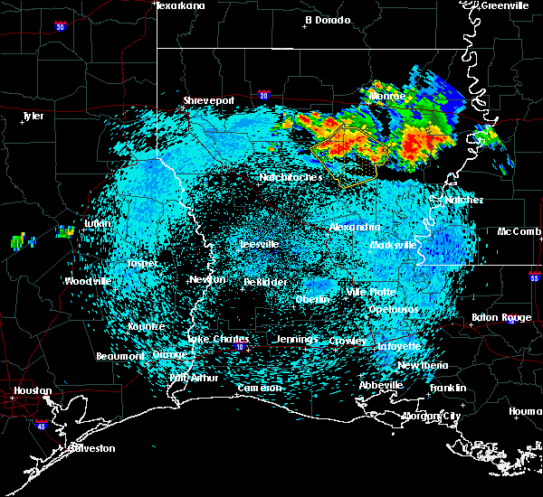 At 925 pm cdt, severe thunderstorms were located along a line extending from 7 miles northwest of columbia to 8 miles west of clarks to 10 miles east of winnfield, moving southeast at 30 mph (radar indicated). Hazards include 60 mph wind gusts and penny size hail. expect damage to roofs, siding, and trees At 925 pm cdt, severe thunderstorms were located along a line extending from 7 miles northwest of columbia to 8 miles west of clarks to 10 miles east of winnfield, moving southeast at 30 mph (radar indicated). Hazards include 60 mph wind gusts and penny size hail. expect damage to roofs, siding, and trees
|
| 8/9/2018 6:08 PM CDT |
 At 608 pm cdt, a severe thunderstorm was located near olla, or 13 miles south of columbia, moving east at 10 mph (radar indicated). Hazards include 60 mph wind gusts and quarter size hail. Hail damage to vehicles is expected. expect wind damage to roofs, siding, and trees. Locations impacted include, olla, clarks, spaulding, standard, burlington and kelly. At 608 pm cdt, a severe thunderstorm was located near olla, or 13 miles south of columbia, moving east at 10 mph (radar indicated). Hazards include 60 mph wind gusts and quarter size hail. Hail damage to vehicles is expected. expect wind damage to roofs, siding, and trees. Locations impacted include, olla, clarks, spaulding, standard, burlington and kelly.
|
| 8/9/2018 5:38 PM CDT |
 At 538 pm cdt, a severe thunderstorm was located near olla, or 13 miles southwest of columbia, moving east at 10 mph (radar indicated). Hazards include 60 mph wind gusts and quarter size hail. Hail damage to vehicles is expected. Expect wind damage to roofs, siding, and trees. At 538 pm cdt, a severe thunderstorm was located near olla, or 13 miles southwest of columbia, moving east at 10 mph (radar indicated). Hazards include 60 mph wind gusts and quarter size hail. Hail damage to vehicles is expected. Expect wind damage to roofs, siding, and trees.
|
| 7/29/2018 4:51 PM CDT |
 At 450 pm cdt, severe thunderstorms were located along a line extending from near grayson to near colfax, moving southeast at 30 mph (radar indicated). Hazards include 60 mph wind gusts. expect damage to roofs, siding, and trees At 450 pm cdt, severe thunderstorms were located along a line extending from near grayson to near colfax, moving southeast at 30 mph (radar indicated). Hazards include 60 mph wind gusts. expect damage to roofs, siding, and trees
|
| 4/13/2018 7:16 PM CDT |
 A tornado warning remains in effect until 745 pm cdt for southwestern caldwell. northwestern la salle and east central winn parishes. At 716 pm cdt, a severe thunderstorm capable of producing a tornado was located 8 miles west of olla, or 15 miles east of winnfield, moving northeast at 35 mph. A tornado warning remains in effect until 745 pm cdt for southwestern caldwell. northwestern la salle and east central winn parishes. At 716 pm cdt, a severe thunderstorm capable of producing a tornado was located 8 miles west of olla, or 15 miles east of winnfield, moving northeast at 35 mph.
|
| 4/13/2018 6:53 PM CDT |
 At 653 pm cdt, a severe thunderstorm capable of producing a tornado was located 13 miles southeast of winnfield, moving northeast at 35 mph (radar indicated rotation). Hazards include tornado and quarter size hail. Flying debris will be dangerous to those caught without shelter. mobile homes will be damaged or destroyed. damage to roofs, windows, and vehicles will occur. tree damage is likely. this dangerous storm will be near, olla around 725 pm cdt. Other locations impacted by this tornadic thunderstorm include urania, kelly, tullos and georgetown. At 653 pm cdt, a severe thunderstorm capable of producing a tornado was located 13 miles southeast of winnfield, moving northeast at 35 mph (radar indicated rotation). Hazards include tornado and quarter size hail. Flying debris will be dangerous to those caught without shelter. mobile homes will be damaged or destroyed. damage to roofs, windows, and vehicles will occur. tree damage is likely. this dangerous storm will be near, olla around 725 pm cdt. Other locations impacted by this tornadic thunderstorm include urania, kelly, tullos and georgetown.
|
| 4/13/2018 6:47 PM CDT |
 At 646 pm cdt, a severe thunderstorm was located 14 miles south of winnfield, moving northeast at 30 mph (radar indicated). Hazards include 60 mph wind gusts and quarter size hail. Hail damage to vehicles is expected. Expect wind damage to roofs, siding, and trees. At 646 pm cdt, a severe thunderstorm was located 14 miles south of winnfield, moving northeast at 30 mph (radar indicated). Hazards include 60 mph wind gusts and quarter size hail. Hail damage to vehicles is expected. Expect wind damage to roofs, siding, and trees.
|
| 4/6/2018 8:56 PM CDT |
 At 856 pm cdt, severe thunderstorms were located along a line extending from 6 miles west of zwolle to 10 miles east of many to 7 miles northeast of montgomery to near olla, moving southeast at 35 mph (radar indicated). Hazards include 60 mph wind gusts and quarter size hail. Hail damage to vehicles is expected. Expect wind damage to roofs, siding, and trees. At 856 pm cdt, severe thunderstorms were located along a line extending from 6 miles west of zwolle to 10 miles east of many to 7 miles northeast of montgomery to near olla, moving southeast at 35 mph (radar indicated). Hazards include 60 mph wind gusts and quarter size hail. Hail damage to vehicles is expected. Expect wind damage to roofs, siding, and trees.
|
| 4/6/2018 8:13 PM CDT |
 At 813 pm cdt, severe thunderstorms were located along a line extending from 12 miles northeast of winnfield to liddieville, moving southeast at 40 mph (radar indicated). Hazards include 60 mph wind gusts. expect damage to roofs, siding, and trees At 813 pm cdt, severe thunderstorms were located along a line extending from 12 miles northeast of winnfield to liddieville, moving southeast at 40 mph (radar indicated). Hazards include 60 mph wind gusts. expect damage to roofs, siding, and trees
|
| 4/3/2018 7:15 PM CDT |
 At 714 pm cdt, severe thunderstorms were located along a line extending from near jigger to 6 miles southwest of midway, moving east at 25 mph (radar indicated). Hazards include 60 mph wind gusts. expect damage to roofs, siding, and trees At 714 pm cdt, severe thunderstorms were located along a line extending from near jigger to 6 miles southwest of midway, moving east at 25 mph (radar indicated). Hazards include 60 mph wind gusts. expect damage to roofs, siding, and trees
|
| 4/3/2018 6:30 PM CDT |
 At 629 pm cdt, severe thunderstorms were located along a line extending from 6 miles northeast of columbia to 15 miles south of winnfield, moving southeast at 45 mph (radar indicated). Hazards include 60 mph wind gusts and penny size hail. expect damage to roofs, siding, and trees At 629 pm cdt, severe thunderstorms were located along a line extending from 6 miles northeast of columbia to 15 miles south of winnfield, moving southeast at 45 mph (radar indicated). Hazards include 60 mph wind gusts and penny size hail. expect damage to roofs, siding, and trees
|
| 4/3/2018 5:30 PM CDT |
 At 529 pm cdt, severe thunderstorms were located along a line extending from near jonesboro to near natchitoches, moving east at 55 mph (radar indicated). Hazards include 60 mph wind gusts and penny size hail. expect damage to roofs, siding, and trees At 529 pm cdt, severe thunderstorms were located along a line extending from near jonesboro to near natchitoches, moving east at 55 mph (radar indicated). Hazards include 60 mph wind gusts and penny size hail. expect damage to roofs, siding, and trees
|
| 3/28/2018 5:18 PM CDT |
 At 518 pm cdt, a severe thunderstorm capable of producing a tornado was located 8 miles south of olla, or 23 miles southeast of winnfield, moving east at 60 mph (radar indicated rotation). Hazards include tornado and quarter size hail. Flying debris will be dangerous to those caught without shelter. mobile homes will be damaged or destroyed. damage to roofs, windows, and vehicles will occur. tree damage is likely. Locations impacted include, jena, olla, midway, urania, tullos, georgetown, zenoria and rochelle. At 518 pm cdt, a severe thunderstorm capable of producing a tornado was located 8 miles south of olla, or 23 miles southeast of winnfield, moving east at 60 mph (radar indicated rotation). Hazards include tornado and quarter size hail. Flying debris will be dangerous to those caught without shelter. mobile homes will be damaged or destroyed. damage to roofs, windows, and vehicles will occur. tree damage is likely. Locations impacted include, jena, olla, midway, urania, tullos, georgetown, zenoria and rochelle.
|
| 3/28/2018 5:18 PM CDT |
 At 517 pm cdt, a severe thunderstorm was located 12 miles southwest of olla, or 20 miles southeast of winnfield, moving east at 55 mph (radar indicated). Hazards include 60 mph wind gusts and quarter size hail. Hail damage to vehicles is expected. expect wind damage to roofs, siding, and trees. locations impacted include, jena, midway, urania, tullos, georgetown, zenoria and rochelle. A tornado watch remains in effect until 900 pm cdt for north central louisiana. At 517 pm cdt, a severe thunderstorm was located 12 miles southwest of olla, or 20 miles southeast of winnfield, moving east at 55 mph (radar indicated). Hazards include 60 mph wind gusts and quarter size hail. Hail damage to vehicles is expected. expect wind damage to roofs, siding, and trees. locations impacted include, jena, midway, urania, tullos, georgetown, zenoria and rochelle. A tornado watch remains in effect until 900 pm cdt for north central louisiana.
|
| 3/28/2018 5:00 PM CDT |
 At 500 pm cdt, a severe thunderstorm capable of producing a tornado was located 14 miles northeast of colfax, or 16 miles south of winnfield, moving east at 60 mph (radar indicated rotation). Hazards include tornado and quarter size hail. Flying debris will be dangerous to those caught without shelter. mobile homes will be damaged or destroyed. damage to roofs, windows, and vehicles will occur. Tree damage is likely. At 500 pm cdt, a severe thunderstorm capable of producing a tornado was located 14 miles northeast of colfax, or 16 miles south of winnfield, moving east at 60 mph (radar indicated rotation). Hazards include tornado and quarter size hail. Flying debris will be dangerous to those caught without shelter. mobile homes will be damaged or destroyed. damage to roofs, windows, and vehicles will occur. Tree damage is likely.
|
| 3/28/2018 4:56 PM CDT |
 At 456 pm cdt, a severe thunderstorm was located 10 miles north of colfax, or 15 miles northeast of lena, moving east at 55 mph (radar indicated). Hazards include 60 mph wind gusts and quarter size hail. Hail damage to vehicles is expected. Expect wind damage to roofs, siding, and trees. At 456 pm cdt, a severe thunderstorm was located 10 miles north of colfax, or 15 miles northeast of lena, moving east at 55 mph (radar indicated). Hazards include 60 mph wind gusts and quarter size hail. Hail damage to vehicles is expected. Expect wind damage to roofs, siding, and trees.
|
| 3/28/2018 4:42 PM CDT |
 At 442 pm cdt, severe thunderstorms were located along a line extending from near sterlington to near richwood to near buckner to near olla, moving east at 40 mph (radar indicated). Hazards include 60 mph wind gusts. expect damage to roofs, siding, and trees At 442 pm cdt, severe thunderstorms were located along a line extending from near sterlington to near richwood to near buckner to near olla, moving east at 40 mph (radar indicated). Hazards include 60 mph wind gusts. expect damage to roofs, siding, and trees
|
| 3/28/2018 4:34 PM CDT |
 At 434 pm cdt, a severe thunderstorm was located over archibald, or near mangham, moving east at 55 mph (radar indicated). Hazards include 60 mph wind gusts and quarter size hail. Hail damage to vehicles is expected. expect wind damage to roofs, siding, and trees. locations impacted include, monroe, west monroe, columbia, brownsville-bawcom, brownsville-bawcomville, richwood, olla, clarks, grayson, urania, chatham, tullos, georgetown, eros, fondale, vixen, bosco, riverton, standard and millhaven. A tornado watch remains in effect until 900 pm cdt for north central louisiana. At 434 pm cdt, a severe thunderstorm was located over archibald, or near mangham, moving east at 55 mph (radar indicated). Hazards include 60 mph wind gusts and quarter size hail. Hail damage to vehicles is expected. expect wind damage to roofs, siding, and trees. locations impacted include, monroe, west monroe, columbia, brownsville-bawcom, brownsville-bawcomville, richwood, olla, clarks, grayson, urania, chatham, tullos, georgetown, eros, fondale, vixen, bosco, riverton, standard and millhaven. A tornado watch remains in effect until 900 pm cdt for north central louisiana.
|
| 3/28/2018 4:19 PM CDT |
 At 418 pm cdt, a severe thunderstorm capable of producing a tornado was just west of clarks, or 12 miles southwest of columbia, moving east at 55 mph (radar indicated rotation). Hazards include tornado and quarter size hail. Flying debris will be dangerous to those caught without shelter. mobile homes will be damaged or destroyed. damage to roofs, windows, and vehicles will occur. tree damage is likely. Locations impacted include, olla, clarks, spaulding, standard, burlington and kelly. At 418 pm cdt, a severe thunderstorm capable of producing a tornado was just west of clarks, or 12 miles southwest of columbia, moving east at 55 mph (radar indicated rotation). Hazards include tornado and quarter size hail. Flying debris will be dangerous to those caught without shelter. mobile homes will be damaged or destroyed. damage to roofs, windows, and vehicles will occur. tree damage is likely. Locations impacted include, olla, clarks, spaulding, standard, burlington and kelly.
|
| 3/28/2018 3:59 PM CDT |
 At 358 pm cdt, a severe thunderstorm capable of producing a tornado was located near winnfield, moving east at 55 mph (radar indicated rotation). Hazards include tornado and quarter size hail. Flying debris will be dangerous to those caught without shelter. mobile homes will be damaged or destroyed. damage to roofs, windows, and vehicles will occur. Tree damage is likely. At 358 pm cdt, a severe thunderstorm capable of producing a tornado was located near winnfield, moving east at 55 mph (radar indicated rotation). Hazards include tornado and quarter size hail. Flying debris will be dangerous to those caught without shelter. mobile homes will be damaged or destroyed. damage to roofs, windows, and vehicles will occur. Tree damage is likely.
|
| 3/28/2018 3:55 PM CDT |
 At 355 pm cdt, a severe thunderstorm was located 18 miles northwest of columbia, moving east at 55 mph (radar indicated). Hazards include 60 mph wind gusts and quarter size hail. Hail damage to vehicles is expected. Expect wind damage to roofs, siding, and trees. At 355 pm cdt, a severe thunderstorm was located 18 miles northwest of columbia, moving east at 55 mph (radar indicated). Hazards include 60 mph wind gusts and quarter size hail. Hail damage to vehicles is expected. Expect wind damage to roofs, siding, and trees.
|
| 2/21/2018 12:44 PM CST |
 At 1244 pm cst, a severe thunderstorm capable of producing a tornado was located near clarks, or 10 miles southwest of columbia, moving northeast at 35 mph (radar indicated rotation). Hazards include tornado. Flying debris will be dangerous to those caught without shelter. mobile homes will be damaged or destroyed. damage to roofs, windows, and vehicles will occur. Tree damage is likely. At 1244 pm cst, a severe thunderstorm capable of producing a tornado was located near clarks, or 10 miles southwest of columbia, moving northeast at 35 mph (radar indicated rotation). Hazards include tornado. Flying debris will be dangerous to those caught without shelter. mobile homes will be damaged or destroyed. damage to roofs, windows, and vehicles will occur. Tree damage is likely.
|
| 2/21/2018 12:31 PM CST |
 At 1230 pm cst, severe thunderstorms were located along a line extending from 13 miles northeast of winnfield to near midway to 8 miles northeast of holloway, moving northeast at 35 mph (radar indicated). Hazards include 60 mph wind gusts. expect damage to roofs, siding, and trees At 1230 pm cst, severe thunderstorms were located along a line extending from 13 miles northeast of winnfield to near midway to 8 miles northeast of holloway, moving northeast at 35 mph (radar indicated). Hazards include 60 mph wind gusts. expect damage to roofs, siding, and trees
|
| 5/28/2017 9:17 PM CDT |
 At 916 pm cdt, severe thunderstorms were located along a line extending from near richwood to near columbia to near rosefield to near jena to 7 miles southwest of midway to near ball, moving southeast at 45 mph (radar indicated). Hazards include 60 mph wind gusts and penny size hail. Expect damage to roofs, siding, and trees. Locations impacted include, columbia, jena, richwood, olla, clarks, grayson, midway, urania, pollock, fondale, nebo, spaulding, bosco, rogers, catahoula lake, riverton, standard, kelly, zenoria and burlington. At 916 pm cdt, severe thunderstorms were located along a line extending from near richwood to near columbia to near rosefield to near jena to 7 miles southwest of midway to near ball, moving southeast at 45 mph (radar indicated). Hazards include 60 mph wind gusts and penny size hail. Expect damage to roofs, siding, and trees. Locations impacted include, columbia, jena, richwood, olla, clarks, grayson, midway, urania, pollock, fondale, nebo, spaulding, bosco, rogers, catahoula lake, riverton, standard, kelly, zenoria and burlington.
|
| 5/28/2017 9:09 PM CDT |
 The tornado warning for northeastern grant, southwestern caldwell, la salle and southeastern winn parishes will expire at 915 pm cdt, the tornadic thunderstorm which prompted the warning has moved to near olla and weakened. therefore, the warning will be allowed to expire. a severe thunderstorm watch remains in effect until midnight cdt for north central louisiana. The tornado warning for northeastern grant, southwestern caldwell, la salle and southeastern winn parishes will expire at 915 pm cdt, the tornadic thunderstorm which prompted the warning has moved to near olla and weakened. therefore, the warning will be allowed to expire. a severe thunderstorm watch remains in effect until midnight cdt for north central louisiana.
|
| 5/28/2017 8:39 PM CDT |
 At 838 pm cdt, severe thunderstorms were located along a line extending from 12 miles southwest of claiborne to 14 miles east of jonesboro to 6 miles southeast of winnfield to near flatwoods, moving east at 20 mph (radar indicated). Hazards include 60 mph wind gusts and nickel size hail. expect damage to roofs, siding, and trees At 838 pm cdt, severe thunderstorms were located along a line extending from 12 miles southwest of claiborne to 14 miles east of jonesboro to 6 miles southeast of winnfield to near flatwoods, moving east at 20 mph (radar indicated). Hazards include 60 mph wind gusts and nickel size hail. expect damage to roofs, siding, and trees
|
| 5/28/2017 8:30 PM CDT |
 At 830 pm cdt, a severe thunderstorm capable of producing a tornado was located 8 miles southeast of winnfield, moving east at 35 mph (radar indicated rotation). Hazards include tornado. Flying debris will be dangerous to those caught without shelter. mobile homes will be damaged or destroyed. damage to roofs, windows, and vehicles will occur. Tree damage is likely. At 830 pm cdt, a severe thunderstorm capable of producing a tornado was located 8 miles southeast of winnfield, moving east at 35 mph (radar indicated rotation). Hazards include tornado. Flying debris will be dangerous to those caught without shelter. mobile homes will be damaged or destroyed. damage to roofs, windows, and vehicles will occur. Tree damage is likely.
|
| 4/2/2017 4:58 PM CDT |
 At 458 pm cdt, a severe thunderstorm capable of producing a tornado was located near olla, or 20 miles east of winnfield, moving northeast at 50 mph (radar indicated rotation). Hazards include tornado. Flying debris will be dangerous to those caught without shelter. mobile homes will be damaged or destroyed. damage to roofs, windows, and vehicles will occur. Tree damage is likely. At 458 pm cdt, a severe thunderstorm capable of producing a tornado was located near olla, or 20 miles east of winnfield, moving northeast at 50 mph (radar indicated rotation). Hazards include tornado. Flying debris will be dangerous to those caught without shelter. mobile homes will be damaged or destroyed. damage to roofs, windows, and vehicles will occur. Tree damage is likely.
|
| 4/2/2017 4:34 PM CDT |
 At 434 pm cdt, severe thunderstorms were located along a line extending from 16 miles east of jonesboro to 9 miles south of winnfield to near colfax, moving east at 40 mph (radar indicated). Hazards include 60 mph wind gusts and quarter size hail. Hail damage to vehicles is expected. expect wind damage to roofs, siding, and trees. locations impacted include, winnfield, columbia, jena, colfax, olla, clarks, grayson, midway, urania, pollock, dry prong, tullos, dodson, georgetown, atlanta, sikes, nebo, rogers, catahoula lake and chopin. A tornado watch remains in effect until 900 pm cdt for north central and northwestern louisiana. At 434 pm cdt, severe thunderstorms were located along a line extending from 16 miles east of jonesboro to 9 miles south of winnfield to near colfax, moving east at 40 mph (radar indicated). Hazards include 60 mph wind gusts and quarter size hail. Hail damage to vehicles is expected. expect wind damage to roofs, siding, and trees. locations impacted include, winnfield, columbia, jena, colfax, olla, clarks, grayson, midway, urania, pollock, dry prong, tullos, dodson, georgetown, atlanta, sikes, nebo, rogers, catahoula lake and chopin. A tornado watch remains in effect until 900 pm cdt for north central and northwestern louisiana.
|
| 4/2/2017 4:12 PM CDT |
 At 412 pm cdt, severe thunderstorms were located along a line extending from 7 miles southeast of jonesboro to 6 miles northeast of montgomery to flatwoods, moving east at 40 mph (radar indicated). Hazards include 60 mph wind gusts and quarter size hail. Hail damage to vehicles is expected. Expect wind damage to roofs, siding, and trees. At 412 pm cdt, severe thunderstorms were located along a line extending from 7 miles southeast of jonesboro to 6 miles northeast of montgomery to flatwoods, moving east at 40 mph (radar indicated). Hazards include 60 mph wind gusts and quarter size hail. Hail damage to vehicles is expected. Expect wind damage to roofs, siding, and trees.
|
| 4/2/2017 3:51 PM CDT |
 At 351 pm cdt, a severe thunderstorm was located 14 miles southeast of winnfield, moving northeast at 40 mph (radar indicated). Hazards include 60 mph wind gusts and quarter size hail. Hail damage to vehicles is expected. Expect wind damage to roofs, siding, and trees. At 351 pm cdt, a severe thunderstorm was located 14 miles southeast of winnfield, moving northeast at 40 mph (radar indicated). Hazards include 60 mph wind gusts and quarter size hail. Hail damage to vehicles is expected. Expect wind damage to roofs, siding, and trees.
|
| 4/2/2017 3:41 PM CDT |
 The tornado warning for northeastern la salle parish will expire at 345 pm cdt, the storm which prompted the warning has weakened below severe limits, and no longer appears capable of producing a tornado. therefore the warning will be allowed to expire. however small hail and gusty winds are still possible with this thunderstorm. a tornado watch remains in effect until 900 pm cdt for north central louisiana. The tornado warning for northeastern la salle parish will expire at 345 pm cdt, the storm which prompted the warning has weakened below severe limits, and no longer appears capable of producing a tornado. therefore the warning will be allowed to expire. however small hail and gusty winds are still possible with this thunderstorm. a tornado watch remains in effect until 900 pm cdt for north central louisiana.
|
| 4/2/2017 3:16 PM CDT |
 At 316 pm cdt, a severe thunderstorm capable of producing a tornado was located 7 miles north of midway, or 22 miles south of columbia, moving north at 40 mph (radar indicated rotation). Hazards include tornado and quarter size hail. Flying debris will be dangerous to those caught without shelter. mobile homes will be damaged or destroyed. damage to roofs, windows, and vehicles will occur. tree damage is likely. this dangerous storm will be near, olla around 325 pm cdt. Other locations impacted by this tornadic thunderstorm include burlington and standard. At 316 pm cdt, a severe thunderstorm capable of producing a tornado was located 7 miles north of midway, or 22 miles south of columbia, moving north at 40 mph (radar indicated rotation). Hazards include tornado and quarter size hail. Flying debris will be dangerous to those caught without shelter. mobile homes will be damaged or destroyed. damage to roofs, windows, and vehicles will occur. tree damage is likely. this dangerous storm will be near, olla around 325 pm cdt. Other locations impacted by this tornadic thunderstorm include burlington and standard.
|
| 4/2/2017 3:02 PM CDT |
 At 302 pm cdt, a tornado producing storm was located near midway, or 25 miles northeast of pineville, moving north at 40 mph (radar confirmed tornado). Hazards include damaging tornado and ping pong ball size hail. Flying debris will be dangerous to those caught without shelter. mobile homes will be damaged or destroyed. damage to roofs, windows, and vehicles will occur. tree damage is likely. this tornadic storm will be near, jena and midway around 310 pm cdt. olla around 325 pm cdt. Other locations impacted by this tornadic thunderstorm include burlington and standard. At 302 pm cdt, a tornado producing storm was located near midway, or 25 miles northeast of pineville, moving north at 40 mph (radar confirmed tornado). Hazards include damaging tornado and ping pong ball size hail. Flying debris will be dangerous to those caught without shelter. mobile homes will be damaged or destroyed. damage to roofs, windows, and vehicles will occur. tree damage is likely. this tornadic storm will be near, jena and midway around 310 pm cdt. olla around 325 pm cdt. Other locations impacted by this tornadic thunderstorm include burlington and standard.
|
| 3/27/2017 7:31 PM CDT |
 At 730 pm cdt, a severe thunderstorm was located near olla, or 12 miles southwest of columbia, moving east at 15 mph (radar indicated). Hazards include 60 mph wind gusts and nickel size hail. Expect damage to roofs, siding, and trees. Locations impacted include, olla, spaulding, standard and burlington. At 730 pm cdt, a severe thunderstorm was located near olla, or 12 miles southwest of columbia, moving east at 15 mph (radar indicated). Hazards include 60 mph wind gusts and nickel size hail. Expect damage to roofs, siding, and trees. Locations impacted include, olla, spaulding, standard and burlington.
|
| 3/27/2017 6:41 PM CDT |
 At 641 pm cdt, a severe thunderstorm was located near olla, or 18 miles southwest of columbia, moving east at 10 mph (radar indicated). Hazards include 60 mph wind gusts and quarter size hail. Hail damage to vehicles is expected. Expect wind damage to roofs, siding, and trees. At 641 pm cdt, a severe thunderstorm was located near olla, or 18 miles southwest of columbia, moving east at 10 mph (radar indicated). Hazards include 60 mph wind gusts and quarter size hail. Hail damage to vehicles is expected. Expect wind damage to roofs, siding, and trees.
|
| 1/2/2017 11:33 AM CST |
 At 1132 am cst, severe thunderstorms were located along a line extending from 13 miles northeast of winnfield to 10 miles southwest of olla to 6 miles north of esler regional airport, moving northeast at 50 mph (radar indicated). Hazards include 60 mph wind gusts and penny size hail. expect damage to roofs, siding, and trees At 1132 am cst, severe thunderstorms were located along a line extending from 13 miles northeast of winnfield to 10 miles southwest of olla to 6 miles north of esler regional airport, moving northeast at 50 mph (radar indicated). Hazards include 60 mph wind gusts and penny size hail. expect damage to roofs, siding, and trees
|
| 11/29/2016 9:10 PM CST |
 At 910 pm cst, severe thunderstorms were located along a line extending from near olla to near jena to 7 miles south of midway to ball, moving east at 55 mph (radar indicated). Hazards include 60 mph wind gusts and quarter size hail. Hail damage to vehicles is expected. Expect wind damage to roofs, siding, and trees. At 910 pm cst, severe thunderstorms were located along a line extending from near olla to near jena to 7 miles south of midway to ball, moving east at 55 mph (radar indicated). Hazards include 60 mph wind gusts and quarter size hail. Hail damage to vehicles is expected. Expect wind damage to roofs, siding, and trees.
|
| 11/29/2016 7:09 PM CST |
 At 709 pm cst, a severe thunderstorm capable of producing a tornado was located over olla, or 18 miles southwest of columbia, moving northeast at 40 mph (radar indicated rotation). Hazards include tornado and quarter size hail. Flying debris will be dangerous to those caught without shelter. mobile homes will be damaged or destroyed. damage to roofs, windows, and vehicles will occur. tree damage is likely. this dangerous storm will be near, clarks around 725 pm cst. Other locations impacted by this tornadic thunderstorm include spaulding, urania, standard, burlington and kelly. At 709 pm cst, a severe thunderstorm capable of producing a tornado was located over olla, or 18 miles southwest of columbia, moving northeast at 40 mph (radar indicated rotation). Hazards include tornado and quarter size hail. Flying debris will be dangerous to those caught without shelter. mobile homes will be damaged or destroyed. damage to roofs, windows, and vehicles will occur. tree damage is likely. this dangerous storm will be near, clarks around 725 pm cst. Other locations impacted by this tornadic thunderstorm include spaulding, urania, standard, burlington and kelly.
|
| 11/29/2016 6:57 PM CST |
 At 657 pm cst, a severe thunderstorm capable of producing a tornado was located 10 miles southwest of olla, or 16 miles southeast of winnfield, moving east at 30 mph (radar indicated rotation). Hazards include tornado and quarter size hail. Flying debris will be dangerous to those caught without shelter. mobile homes will be damaged or destroyed. damage to roofs, windows, and vehicles will occur. tree damage is likely. this dangerous storm will be near, olla around 720 pm cst. Other locations impacted by this tornadic thunderstorm include spaulding, urania, burlington, standard, georgetown, rochelle, tullos, kelly and zenoria. At 657 pm cst, a severe thunderstorm capable of producing a tornado was located 10 miles southwest of olla, or 16 miles southeast of winnfield, moving east at 30 mph (radar indicated rotation). Hazards include tornado and quarter size hail. Flying debris will be dangerous to those caught without shelter. mobile homes will be damaged or destroyed. damage to roofs, windows, and vehicles will occur. tree damage is likely. this dangerous storm will be near, olla around 720 pm cst. Other locations impacted by this tornadic thunderstorm include spaulding, urania, burlington, standard, georgetown, rochelle, tullos, kelly and zenoria.
|
| 11/29/2016 6:43 PM CST |
 At 643 pm cst, a severe thunderstorm capable of producing a tornado was located 13 miles southeast of winnfield, moving northeast at 40 mph (radar indicated rotation). Hazards include tornado and quarter size hail. Flying debris will be dangerous to those caught without shelter. mobile homes will be damaged or destroyed. damage to roofs, windows, and vehicles will occur. tree damage is likely. this dangerous storm will be near, olla around 715 pm cst. clarks around 730 pm cst. Other locations impacted by this tornadic thunderstorm include spaulding, zenoria, urania, burlington, standard, georgetown, rochelle, tullos and kelly. At 643 pm cst, a severe thunderstorm capable of producing a tornado was located 13 miles southeast of winnfield, moving northeast at 40 mph (radar indicated rotation). Hazards include tornado and quarter size hail. Flying debris will be dangerous to those caught without shelter. mobile homes will be damaged or destroyed. damage to roofs, windows, and vehicles will occur. tree damage is likely. this dangerous storm will be near, olla around 715 pm cst. clarks around 730 pm cst. Other locations impacted by this tornadic thunderstorm include spaulding, zenoria, urania, burlington, standard, georgetown, rochelle, tullos and kelly.
|
| 11/29/2016 5:41 PM CST |
 At 540 pm cst, a severe thunderstorm capable of producing a tornado was located near rosefield, or 15 miles south of columbia, moving northeast at 45 mph (radar indicated rotation). Hazards include tornado and quarter size hail. Flying debris will be dangerous to those caught without shelter. mobile homes will be damaged or destroyed. damage to roofs, windows, and vehicles will occur. tree damage is likely. This tornadic thunderstorm will remain over mainly rural areas of southeastern caldwell and northeastern la salle parishes. At 540 pm cst, a severe thunderstorm capable of producing a tornado was located near rosefield, or 15 miles south of columbia, moving northeast at 45 mph (radar indicated rotation). Hazards include tornado and quarter size hail. Flying debris will be dangerous to those caught without shelter. mobile homes will be damaged or destroyed. damage to roofs, windows, and vehicles will occur. tree damage is likely. This tornadic thunderstorm will remain over mainly rural areas of southeastern caldwell and northeastern la salle parishes.
|
| 11/29/2016 5:17 PM CST |
 At 516 pm cst, a severe thunderstorm capable of producing a tornado was located 11 miles west of midway, or 22 miles southeast of winnfield, moving northeast at 45 mph (radar indicated rotation). Hazards include tornado and quarter size hail. Flying debris will be dangerous to those caught without shelter. mobile homes will be damaged or destroyed. damage to roofs, windows, and vehicles will occur. tree damage is likely. this dangerous storm will be near, jena around 525 pm cst. olla around 535 pm cst. Other locations impacted by this tornadic thunderstorm include zenoria, georgetown, rochelle, tullos and urania. At 516 pm cst, a severe thunderstorm capable of producing a tornado was located 11 miles west of midway, or 22 miles southeast of winnfield, moving northeast at 45 mph (radar indicated rotation). Hazards include tornado and quarter size hail. Flying debris will be dangerous to those caught without shelter. mobile homes will be damaged or destroyed. damage to roofs, windows, and vehicles will occur. tree damage is likely. this dangerous storm will be near, jena around 525 pm cst. olla around 535 pm cst. Other locations impacted by this tornadic thunderstorm include zenoria, georgetown, rochelle, tullos and urania.
|
| 11/29/2016 4:56 PM CST |
 At 455 pm cst, a severe thunderstorm was located 16 miles west of midway, or 21 miles southeast of winnfield, moving northeast at 50 mph (radar indicated). Hazards include 70 mph wind gusts and quarter size hail. Hail damage to vehicles is expected. expect considerable tree damage. wind damage is also likely to mobile homes, roofs, and outbuildings. locations impacted include, jena, olla, midway, urania, dry prong, tullos, georgetown, zenoria, rochelle and williana. A tornado watch remains in effect until 900 pm cst for north central louisiana. At 455 pm cst, a severe thunderstorm was located 16 miles west of midway, or 21 miles southeast of winnfield, moving northeast at 50 mph (radar indicated). Hazards include 70 mph wind gusts and quarter size hail. Hail damage to vehicles is expected. expect considerable tree damage. wind damage is also likely to mobile homes, roofs, and outbuildings. locations impacted include, jena, olla, midway, urania, dry prong, tullos, georgetown, zenoria, rochelle and williana. A tornado watch remains in effect until 900 pm cst for north central louisiana.
|
| 11/29/2016 4:32 PM CST |
 At 432 pm cst, a severe thunderstorm was located over colfax, or near lena, moving northeast at 50 mph (radar indicated). Hazards include 70 mph wind gusts and quarter size hail. Hail damage to vehicles is expected. expect considerable tree damage. Wind damage is also likely to mobile homes, roofs, and outbuildings. At 432 pm cst, a severe thunderstorm was located over colfax, or near lena, moving northeast at 50 mph (radar indicated). Hazards include 70 mph wind gusts and quarter size hail. Hail damage to vehicles is expected. expect considerable tree damage. Wind damage is also likely to mobile homes, roofs, and outbuildings.
|
| 11/29/2016 4:12 PM CST |
 At 412 pm cst, a severe thunderstorm capable of producing a tornado was located 11 miles west of olla, or 12 miles east of winnfield, moving northeast at 40 mph (radar indicated rotation). Hazards include tornado and half dollar size hail. Flying debris will be dangerous to those caught without shelter. mobile homes will be damaged or destroyed. damage to roofs, windows, and vehicles will occur. tree damage is likely. this dangerous storm will be near, olla around 430 pm cst. clarks around 440 pm cst. grayson around 445 pm cst. columbia around 450 pm cst. Other locations impacted by this tornadic thunderstorm include riverton, spaulding, standard, urania, burlington and kelly. At 412 pm cst, a severe thunderstorm capable of producing a tornado was located 11 miles west of olla, or 12 miles east of winnfield, moving northeast at 40 mph (radar indicated rotation). Hazards include tornado and half dollar size hail. Flying debris will be dangerous to those caught without shelter. mobile homes will be damaged or destroyed. damage to roofs, windows, and vehicles will occur. tree damage is likely. this dangerous storm will be near, olla around 430 pm cst. clarks around 440 pm cst. grayson around 445 pm cst. columbia around 450 pm cst. Other locations impacted by this tornadic thunderstorm include riverton, spaulding, standard, urania, burlington and kelly.
|
| 11/29/2016 3:31 PM CST |
 At 331 pm cst, a severe thunderstorm capable of producing a tornado was located near olla, or 18 miles east of winnfield, moving northeast at 50 mph (radar indicated rotation). Hazards include tornado and ping pong ball size hail. Flying debris will be dangerous to those caught without shelter. mobile homes will be damaged or destroyed. damage to roofs, windows, and vehicles will occur. tree damage is likely. this dangerous storm will be near, olla around 340 pm cst. clarks and grayson around 350 pm cst. columbia around 355 pm cst. Other locations impacted by this tornadic thunderstorm include spaulding, urania, burlington, riverton, standard, kelly and tullos. At 331 pm cst, a severe thunderstorm capable of producing a tornado was located near olla, or 18 miles east of winnfield, moving northeast at 50 mph (radar indicated rotation). Hazards include tornado and ping pong ball size hail. Flying debris will be dangerous to those caught without shelter. mobile homes will be damaged or destroyed. damage to roofs, windows, and vehicles will occur. tree damage is likely. this dangerous storm will be near, olla around 340 pm cst. clarks and grayson around 350 pm cst. columbia around 355 pm cst. Other locations impacted by this tornadic thunderstorm include spaulding, urania, burlington, riverton, standard, kelly and tullos.
|
| 11/29/2016 2:06 PM CST |
 At 204 pm cst, a severe thunderstorm capable of producing a tornado was located near olla, or 19 miles east of winnfield, moving northeast at 40 mph (radar indicated rotation). Hazards include tornado and quarter size hail. Flying debris will be dangerous to those caught without shelter. mobile homes will be damaged or destroyed. damage to roofs, windows, and vehicles will occur. tree damage is likely. this dangerous storm will be near, olla around 215 pm cst. clarks around 230 pm cst. grayson around 235 pm cst. columbia around 240 pm cst. Other locations impacted by this tornadic thunderstorm include spaulding, standard, urania, burlington, tullos and kelly. At 204 pm cst, a severe thunderstorm capable of producing a tornado was located near olla, or 19 miles east of winnfield, moving northeast at 40 mph (radar indicated rotation). Hazards include tornado and quarter size hail. Flying debris will be dangerous to those caught without shelter. mobile homes will be damaged or destroyed. damage to roofs, windows, and vehicles will occur. tree damage is likely. this dangerous storm will be near, olla around 215 pm cst. clarks around 230 pm cst. grayson around 235 pm cst. columbia around 240 pm cst. Other locations impacted by this tornadic thunderstorm include spaulding, standard, urania, burlington, tullos and kelly.
|
| 11/29/2016 1:53 PM CST |
 At 152 pm cst, a severe thunderstorm capable of producing a tornado was located 13 miles southwest of olla, or 16 miles southeast of winnfield, moving northeast at 40 mph (radar indicated rotation). Hazards include tornado and quarter size hail. Flying debris will be dangerous to those caught without shelter. mobile homes will be damaged or destroyed. damage to roofs, windows, and vehicles will occur. tree damage is likely. this dangerous storm will be near, olla around 215 pm cst. clarks around 230 pm cst. grayson around 235 pm cst. columbia around 240 pm cst. Other locations impacted by this tornadic thunderstorm include spaulding, zenoria, urania, burlington, standard, georgetown, rochelle, tullos and kelly. At 152 pm cst, a severe thunderstorm capable of producing a tornado was located 13 miles southwest of olla, or 16 miles southeast of winnfield, moving northeast at 40 mph (radar indicated rotation). Hazards include tornado and quarter size hail. Flying debris will be dangerous to those caught without shelter. mobile homes will be damaged or destroyed. damage to roofs, windows, and vehicles will occur. tree damage is likely. this dangerous storm will be near, olla around 215 pm cst. clarks around 230 pm cst. grayson around 235 pm cst. columbia around 240 pm cst. Other locations impacted by this tornadic thunderstorm include spaulding, zenoria, urania, burlington, standard, georgetown, rochelle, tullos and kelly.
|
| 11/28/2016 3:07 PM CST |
 At 307 pm cst, a severe thunderstorm capable of producing a tornado was located near midway, or 24 miles south of columbia, moving northeast at 50 mph (radar indicated rotation). Hazards include tornado and quarter size hail. Flying debris will be dangerous to those caught without shelter. mobile homes will be damaged or destroyed. damage to roofs, windows, and vehicles will occur. tree damage is likely. This tornadic thunderstorm will remain over mainly rural areas of southern caldwell and northeastern la salle parishes, including the following locations: urania. At 307 pm cst, a severe thunderstorm capable of producing a tornado was located near midway, or 24 miles south of columbia, moving northeast at 50 mph (radar indicated rotation). Hazards include tornado and quarter size hail. Flying debris will be dangerous to those caught without shelter. mobile homes will be damaged or destroyed. damage to roofs, windows, and vehicles will occur. tree damage is likely. This tornadic thunderstorm will remain over mainly rural areas of southern caldwell and northeastern la salle parishes, including the following locations: urania.
|
| 11/28/2016 2:59 PM CST |
 At 259 pm cst, a severe thunderstorm capable of producing a tornado was located near midway, or 27 miles southeast of winnfield, moving northeast at 50 mph (radar indicated rotation). Hazards include tornado and quarter size hail. Flying debris will be dangerous to those caught without shelter. mobile homes will be damaged or destroyed. damage to roofs, windows, and vehicles will occur. tree damage is likely. this dangerous storm will be near, jena and midway around 305 pm cst. Other locations impacted by this tornadic thunderstorm include zenoria, georgetown, rochelle, tullos and urania. At 259 pm cst, a severe thunderstorm capable of producing a tornado was located near midway, or 27 miles southeast of winnfield, moving northeast at 50 mph (radar indicated rotation). Hazards include tornado and quarter size hail. Flying debris will be dangerous to those caught without shelter. mobile homes will be damaged or destroyed. damage to roofs, windows, and vehicles will occur. tree damage is likely. this dangerous storm will be near, jena and midway around 305 pm cst. Other locations impacted by this tornadic thunderstorm include zenoria, georgetown, rochelle, tullos and urania.
|
| 7/15/2016 4:10 PM CDT |
 At 410 pm cdt, a severe thunderstorm was located near rosefield, or 10 miles south of columbia, and is nearly stationary (radar indicated). Hazards include 60 mph wind gusts and quarter size hail. Hail damage to vehicles is expected. Expect wind damage to roofs, siding, and trees. At 410 pm cdt, a severe thunderstorm was located near rosefield, or 10 miles south of columbia, and is nearly stationary (radar indicated). Hazards include 60 mph wind gusts and quarter size hail. Hail damage to vehicles is expected. Expect wind damage to roofs, siding, and trees.
|
| 7/14/2016 9:56 PM CDT |
 At 956 pm cdt, a strong gust front with a broken line of strong to severe thunderstorms were located along a line extending from 6 miles west of natchitoches to 13 miles north of colfax to near aimwell, moving south at 25 mph. while these storms have weakened over the last few minutes, sporadic wind damage will remain possible over the next half hour (radar indicated). Hazards include 60 mph wind gusts. Expect damage to roofs. siding. and trees. Locations impacted include, natchitoches, jena, colfax, olla, montgomery, midway, allen, urania, provencal, natchez, clarence, pollock, dry prong, tullos, georgetown, robeline, atlanta, flora, williana and hagewood. At 956 pm cdt, a strong gust front with a broken line of strong to severe thunderstorms were located along a line extending from 6 miles west of natchitoches to 13 miles north of colfax to near aimwell, moving south at 25 mph. while these storms have weakened over the last few minutes, sporadic wind damage will remain possible over the next half hour (radar indicated). Hazards include 60 mph wind gusts. Expect damage to roofs. siding. and trees. Locations impacted include, natchitoches, jena, colfax, olla, montgomery, midway, allen, urania, provencal, natchez, clarence, pollock, dry prong, tullos, georgetown, robeline, atlanta, flora, williana and hagewood.
|
| 7/14/2016 9:26 PM CDT |
 At 926 pm cdt, severe thunderstorms were located along a line extending from campti to 6 miles southeast of winnfield to near enterprise, moving south at 25 mph (radar indicated). Hazards include 60 mph wind gusts. Expect damage to roofs. siding. And trees. At 926 pm cdt, severe thunderstorms were located along a line extending from campti to 6 miles southeast of winnfield to near enterprise, moving south at 25 mph (radar indicated). Hazards include 60 mph wind gusts. Expect damage to roofs. siding. And trees.
|
| 7/14/2016 9:10 PM CDT | Tree down 1 north of olla in la salle county LA, 1.1 miles SSE of Olla, LA |
| 7/14/2016 9:09 PM CDT |
 At 909 pm cdt, severe thunderstorms were located along a line extending from liddieville to near olla to near winnfield, moving south at 40 mph (radar indicated). Hazards include 60 mph wind gusts. Expect damage to roofs. siding. and trees. Locations impacted include, winnfield, columbia, olla, clarks, grayson, urania, tullos, dodson, sikes, standard, burlington, spaulding, hudson, riverton, kelly and joyce. At 909 pm cdt, severe thunderstorms were located along a line extending from liddieville to near olla to near winnfield, moving south at 40 mph (radar indicated). Hazards include 60 mph wind gusts. Expect damage to roofs. siding. and trees. Locations impacted include, winnfield, columbia, olla, clarks, grayson, urania, tullos, dodson, sikes, standard, burlington, spaulding, hudson, riverton, kelly and joyce.
|
| 7/14/2016 8:34 PM CDT |
 At 834 pm cdt, a strong gust front was located along a line extending from near start to 11 miles east of jonesboro, moving south southeast at 40 mph. strong to severe thunderstorms were noted behind this boundary along a line from just north of chatham to south monroe, also moving south southeast at 40 mph (radar indicated). Hazards include 60 mph wind gusts. Expect damage to roofs. siding. And trees. At 834 pm cdt, a strong gust front was located along a line extending from near start to 11 miles east of jonesboro, moving south southeast at 40 mph. strong to severe thunderstorms were noted behind this boundary along a line from just north of chatham to south monroe, also moving south southeast at 40 mph (radar indicated). Hazards include 60 mph wind gusts. Expect damage to roofs. siding. And trees.
|
| 5/27/2016 3:35 PM CDT |
 At 334 pm cdt, a severe thunderstorm was located near winnfield, moving east at 35 mph (radar indicated). Hazards include 60 mph wind gusts and quarter size hail. Hail damage to vehicles is expected. Expect wind damage to roofs, siding, and trees. At 334 pm cdt, a severe thunderstorm was located near winnfield, moving east at 35 mph (radar indicated). Hazards include 60 mph wind gusts and quarter size hail. Hail damage to vehicles is expected. Expect wind damage to roofs, siding, and trees.
|
| 3/17/2016 2:30 PM CDT |
 At 230 pm cdt, a severe thunderstorm was located near olla, or 18 miles south of columbia, moving east at 30 mph (radar indicated). Hazards include 60 mph wind gusts and quarter size hail. Hail damage to vehicles is expected. Expect wind damage to roofs, siding, and trees. At 230 pm cdt, a severe thunderstorm was located near olla, or 18 miles south of columbia, moving east at 30 mph (radar indicated). Hazards include 60 mph wind gusts and quarter size hail. Hail damage to vehicles is expected. Expect wind damage to roofs, siding, and trees.
|
| 3/1/2016 4:21 PM CST | Quarter sized hail reported 0.5 miles SE of Olla, LA, quarter size hail on 127 just south of olla |
| 3/1/2016 4:17 PM CST |
 At 416 pm cst, severe thunderstorms were located along a line extending from 6 miles east of columbia to olla to 8 miles south of winnfield to near montgomery, moving southeast at 35 mph (radar indicated). Hazards include 60 mph wind gusts and quarter size hail. Hail damage to vehicles is expected. Expect wind damage to roofs, siding, and trees. At 416 pm cst, severe thunderstorms were located along a line extending from 6 miles east of columbia to olla to 8 miles south of winnfield to near montgomery, moving southeast at 35 mph (radar indicated). Hazards include 60 mph wind gusts and quarter size hail. Hail damage to vehicles is expected. Expect wind damage to roofs, siding, and trees.
|
| 2/23/2016 6:43 PM CST |
 At 642 pm cst, severe thunderstorms were located along a line extending from 8 miles northwest of clarks to 10 miles west of midway to 9 miles north of holloway, moving east at 40 mph (public in natchitoches). Hazards include 60 mph wind gusts and half dollar size hail. Hail damage to vehicles is expected. expect wind damage to roofs, siding, and trees. Locations impacted include, columbia, jena, olla, clarks, grayson, midway, urania, tullos, standard, burlington, zenoria, spaulding, riverton, kelly, catahoula lake, rogers and nebo. At 642 pm cst, severe thunderstorms were located along a line extending from 8 miles northwest of clarks to 10 miles west of midway to 9 miles north of holloway, moving east at 40 mph (public in natchitoches). Hazards include 60 mph wind gusts and half dollar size hail. Hail damage to vehicles is expected. expect wind damage to roofs, siding, and trees. Locations impacted include, columbia, jena, olla, clarks, grayson, midway, urania, tullos, standard, burlington, zenoria, spaulding, riverton, kelly, catahoula lake, rogers and nebo.
|
| 2/23/2016 6:21 PM CST |
 At 620 pm cst, severe thunderstorms were located along a line extending from 17 miles northeast of winnfield to 14 miles northeast of colfax, moving east at 40 mph (public in natchitoches). Hazards include 60 mph wind gusts and quarter to half dollar sized hail. Hail damage to vehicles is expected. expect wind damage to roofs, siding, and trees. Locations impacted include, columbia, jena, olla, clarks, grayson, midway, urania, pollock, dry prong, tullos, georgetown, sikes, standard, burlington, zenoria, spaulding, williana, bentley, riverton and kelly. At 620 pm cst, severe thunderstorms were located along a line extending from 17 miles northeast of winnfield to 14 miles northeast of colfax, moving east at 40 mph (public in natchitoches). Hazards include 60 mph wind gusts and quarter to half dollar sized hail. Hail damage to vehicles is expected. expect wind damage to roofs, siding, and trees. Locations impacted include, columbia, jena, olla, clarks, grayson, midway, urania, pollock, dry prong, tullos, georgetown, sikes, standard, burlington, zenoria, spaulding, williana, bentley, riverton and kelly.
|
| 2/23/2016 5:59 PM CST |
 At 558 pm cst, severe thunderstorms were located along a line extending from 10 miles south of jonesboro to near colfax, moving east at 45 mph (public). Hazards include 60 mph wind gusts and quarter to half dollar sized hail. Hail damage to vehicles is expected. Expect wind damage to roofs, siding, and trees. At 558 pm cst, severe thunderstorms were located along a line extending from 10 miles south of jonesboro to near colfax, moving east at 45 mph (public). Hazards include 60 mph wind gusts and quarter to half dollar sized hail. Hail damage to vehicles is expected. Expect wind damage to roofs, siding, and trees.
|
| 12/28/2015 1:15 AM CST |
 At 115 am cst, severe thunderstorms were located along a line extending from 11 miles north of farmerville to 7 miles west of clarks, moving northeast at 50 mph (radar indicated). Hazards include 60 mph wind gusts. Expect damage to roofs. siding. and trees. locations impacted include, claiborne, west monroe, brownsville-bawcomville, farmerville, olla, clarks, grayson, chatham, eros, downsville, luna, eureka, caderville, kelly, drew, calhoun, folksville, bayou d arbonne lake, standard and burlington. A tornado watch remains in effect until 500 am cst for north central louisiana. At 115 am cst, severe thunderstorms were located along a line extending from 11 miles north of farmerville to 7 miles west of clarks, moving northeast at 50 mph (radar indicated). Hazards include 60 mph wind gusts. Expect damage to roofs. siding. and trees. locations impacted include, claiborne, west monroe, brownsville-bawcomville, farmerville, olla, clarks, grayson, chatham, eros, downsville, luna, eureka, caderville, kelly, drew, calhoun, folksville, bayou d arbonne lake, standard and burlington. A tornado watch remains in effect until 500 am cst for north central louisiana.
|
| 12/28/2015 1:00 AM CST |
 At 1229 am cst, severe thunderstorms were located along a line extending from near grambling to 7 miles northeast of colfax, moving northeast at 50 mph (radar indicated). Hazards include 60 mph wind gusts. Expect damage to roofs. siding. And trees. At 1229 am cst, severe thunderstorms were located along a line extending from near grambling to 7 miles northeast of colfax, moving northeast at 50 mph (radar indicated). Hazards include 60 mph wind gusts. Expect damage to roofs. siding. And trees.
|
| 12/28/2015 1:00 AM CST |
 A severe thunderstorm warning remains in effect until 130 am cst for southern unionunion union. jackson. western caldwell. union. northern la salle. eastern lincoln. northeastern claiborne. southwestern ouachita. eastern winn and northeastern grant parishes. at 1257 am cst. Severe thunderstorms were located along a line. A severe thunderstorm warning remains in effect until 130 am cst for southern unionunion union. jackson. western caldwell. union. northern la salle. eastern lincoln. northeastern claiborne. southwestern ouachita. eastern winn and northeastern grant parishes. at 1257 am cst. Severe thunderstorms were located along a line.
|
| 12/28/2015 12:29 AM CST |
 At 1229 am cst, severe thunderstorms were located along a line extending from near grambling to 7 miles northeast of colfax, moving northeast at 50 mph (radar indicated). Hazards include 60 mph wind gusts. Expect damage to roofs. siding. And trees. At 1229 am cst, severe thunderstorms were located along a line extending from near grambling to 7 miles northeast of colfax, moving northeast at 50 mph (radar indicated). Hazards include 60 mph wind gusts. Expect damage to roofs. siding. And trees.
|
| 5/29/2015 8:37 PM CDT | At 837 pm cdt, severe thunderstorms were located along a line extending from near olla to near deville, moving east at 35 mph (radar indicated). Hazards include 60 mph wind gusts and quarter size hail. Hail damage to vehicles is expected. Expect wind damage to roofs, siding and trees. |
| 5/25/2015 10:44 PM CDT | At 1044 pm cdt, severe thunderstorms were located along a line extending from near beekman to near sterlington to near richwood to 6 miles northwest of columbia to near olla, moving east at 45 mph (radar indicated). Hazards include 60 mph wind gusts and quarter size hail. Hail damage to vehicles is expected. Expect wind damage to roofs, siding and trees. |
| 4/19/2015 8:45 PM CDT | At 845 pm cdt, a severe thunderstorm was located 7 miles east of winnfield, moving east at 45 mph (radar indicated). Hazards include 60 mph wind gusts and quarter size hail. Hail damage to vehicles is expected. expect wind damage to roofs, siding and trees. this severe thunderstorm will be near, olla around 910 pm cdt. clarks and grayson around 920 pm cdt. columbia around 925 pm cdt. other locations impacted by this severe thunderstorm include standard, burlington, spaulding, hudson, sikes, riverton, joyce and kelly. a tornado watch remains in effect until 100 am cdt for north central louisiana. 1. 00in. |
| 4/19/2015 3:36 AM CDT | At 335 am cdt, severe thunderstorms were located along a line extending from near ruston to 15 miles northwest of clarks to near midway, and are nearly stationary (radar indicated). Hazards include 60 mph wind gusts. Expect damage to roofs. siding and trees. locations impacted include, ruston, jena, olla, midway, urania, choudrant, chatham, tullos, georgetown, eros, standard, burlington, zenoria, catahoula lake, rogers, nebo and rochelle. 75in. |
| 4/19/2015 3:34 AM CDT | At 333 am cdt, severe thunderstorms were located along a line extending from 6 miles northwest of farmerville to 12 miles southwest of brownsville-bawcom to jena, moving east at 45 mph (radar indicated). Hazards include 60 mph wind gusts. Expect damage to roofs. Siding and trees. |
| 4/19/2015 3:28 AM CDT | At 327 am cdt, severe thunderstorms were located along a line extending from near ruston to 15 miles northwest of clarks to near midway, moving northeast at 45 mph (radar indicated). Hazards include 60 mph wind gusts. Expect damage to roofs. siding and trees. locations impacted include, ruston, jena, olla, midway, urania, choudrant, chatham, tullos, georgetown, quitman, eros, sikes, standard, burlington, zenoria, catahoula lake, rogers, nebo and rochelle. 75in. |
| 4/19/2015 2:58 AM CDT | At 257 am cdt, severe thunderstorms were located along a line extending from 11 miles south of arcadia to 8 miles north of winnfield to 9 miles north of timber trails, moving northeast at 45 mph (radar indicated). Hazards include 60 mph wind gusts. Expect damage to roofs. Siding and trees. |
| 7/20/2012 7:23 PM CDT | Trees down east of oll in la salle county LA, 2.5 miles W of Olla, LA |
| 4/2/2012 1:45 PM CDT | Quarter sized hail reported 0.5 miles SE of Olla, LA, quarter size hail in olla |
Hail Maps for Olla, LA


Connect with Interactive Hail Maps