

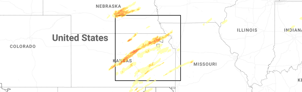
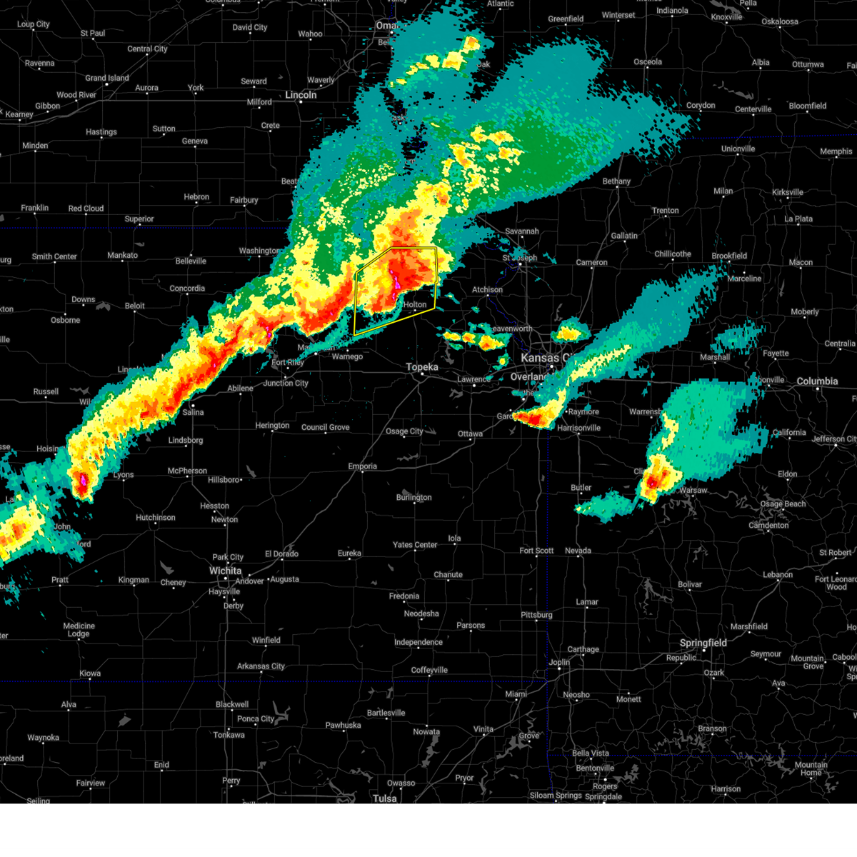
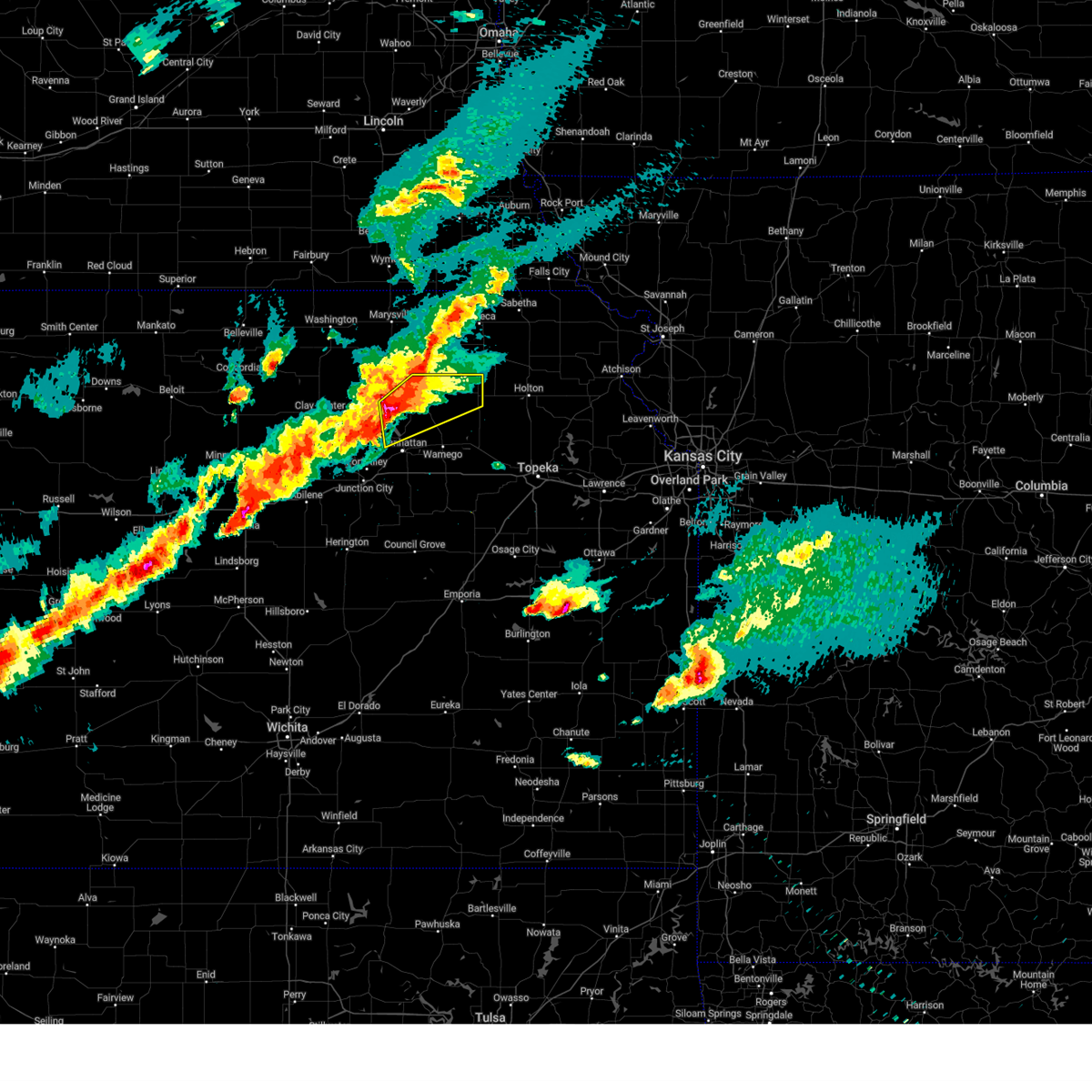
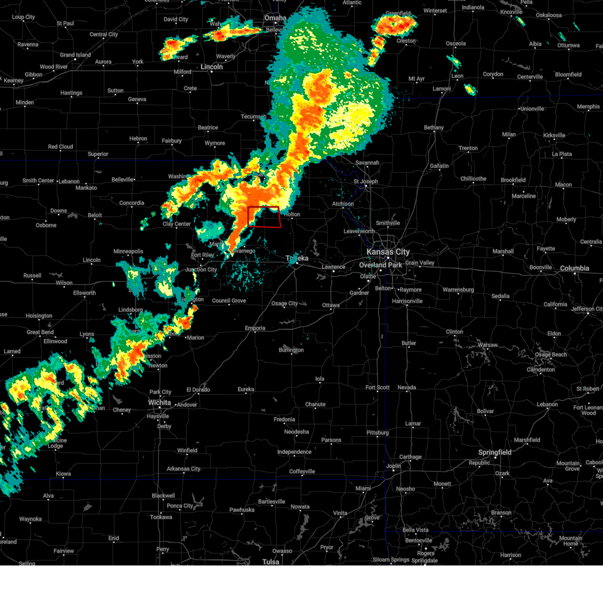
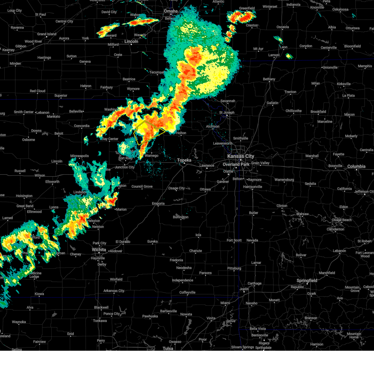
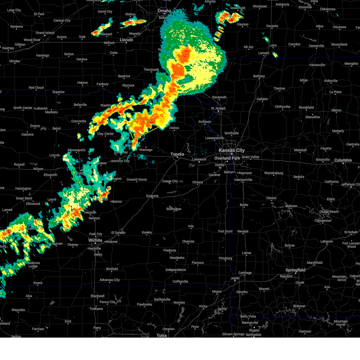
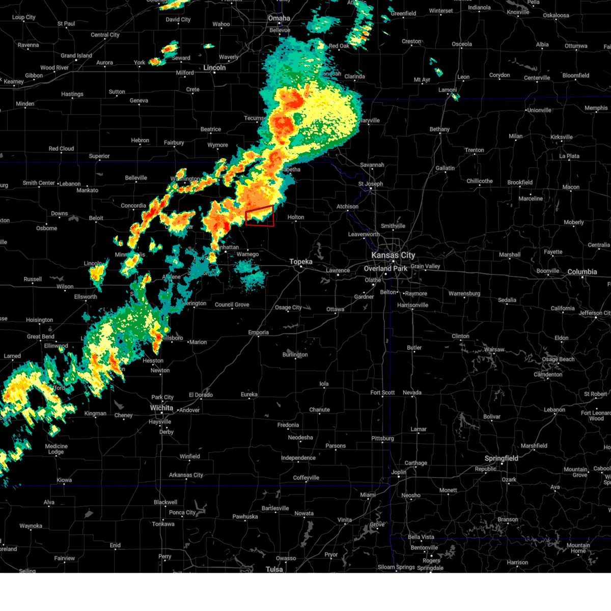
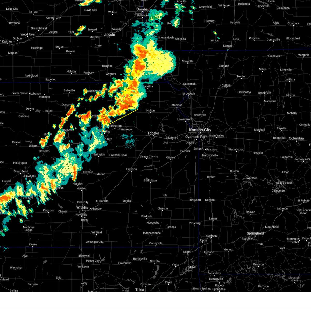
Hail Map for Onaga, KS
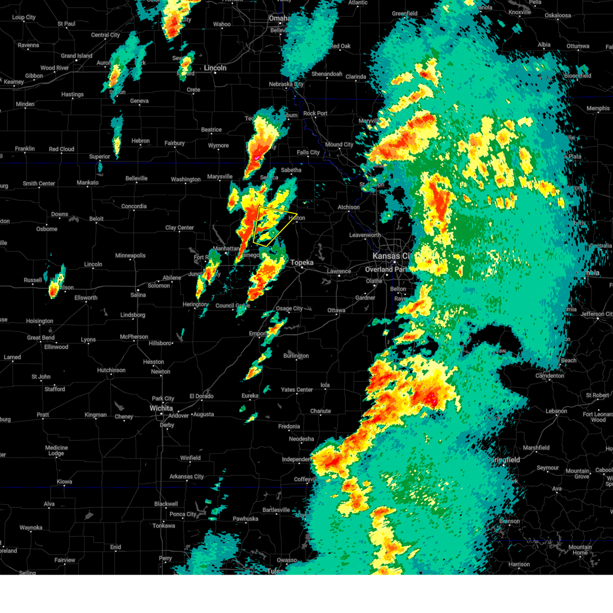
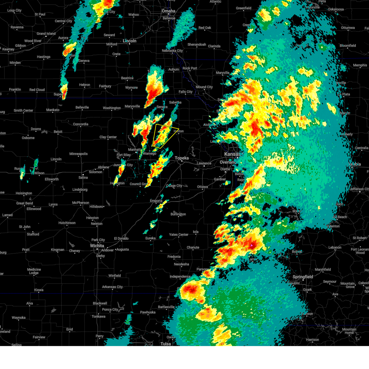
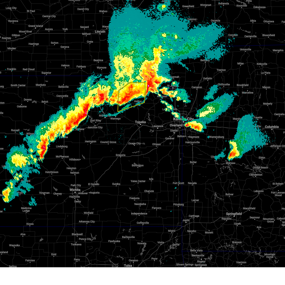
The Onaga, KS area has had 11 reports of on-the-ground hail by trained spotters, and has been under severe weather warnings 32 times during the past 12 months. Doppler radar has detected hail at or near Onaga, KS on 90 occasions, including 5 occasions during the past year.
| Name: | Onaga, KS |
| Where Located: | 30 miles NE of Manhattan, KS |
| Map: | Google Map for Onaga, KS |
| Population: | 702 |
| Housing Units: | 359 |
| More Info: | Search Google for Onaga, KS |
3
The Top Recent Hail Date for Onaga, KS is Tuesday, April 1, 2025 (4th out of 90)
Hail and Wind Damage Spotted near Onaga, KS
| Date / Time | Report Details |
|---|---|
| 5/19/2025 6:23 PM CDT | the severe thunderstorm warning has been cancelled and is no longer in effect |
| 5/19/2025 5:57 PM CDT | Svrtop the national weather service in topeka has issued a * severe thunderstorm warning for, northwestern wabaunsee county in east central kansas, eastern pottawatomie county in northeastern kansas, south central nemaha county in northeastern kansas, southwestern jackson county in northeastern kansas, * until 645 pm cdt. * at 556 pm cdt, a severe thunderstorm was located 5 miles west of emmett, moving northeast at 25 mph (radar indicated). Hazards include 60 mph wind gusts and half dollar size hail. Hail damage to vehicles is expected. Expect wind damage to roofs, siding, and trees. |
| 5/19/2025 5:47 PM CDT | At 547 pm cdt, a severe thunderstorm was located near havensville, moving northeast at 30 mph (trained weather spotters). Hazards include 60 mph wind gusts and half dollar size hail. Hail damage to vehicles is expected. expect wind damage to roofs, siding, and trees. Locations impacted include, westmoreland, onaga, havensville, wheaton, and lillis. |
| 5/19/2025 5:35 PM CDT |
 At 535 pm cdt, a severe thunderstorm was located over onaga, moving northeast at 30 mph (trained weather spotters. at 531, a nws employee reported quarter sized hail 3 miles west of onega). Hazards include 60 mph wind gusts and half dollar size hail. Hail damage to vehicles is expected. expect wind damage to roofs, siding, and trees. Locations impacted include, westmoreland, blaine, onaga, havensville, wheaton, and lillis. At 535 pm cdt, a severe thunderstorm was located over onaga, moving northeast at 30 mph (trained weather spotters. at 531, a nws employee reported quarter sized hail 3 miles west of onega). Hazards include 60 mph wind gusts and half dollar size hail. Hail damage to vehicles is expected. expect wind damage to roofs, siding, and trees. Locations impacted include, westmoreland, blaine, onaga, havensville, wheaton, and lillis.
|
| 5/19/2025 5:31 PM CDT | Quarter sized hail reported 3.2 miles E of Onaga, KS |
| 5/19/2025 5:24 PM CDT |
 the severe thunderstorm warning has been cancelled and is no longer in effect the severe thunderstorm warning has been cancelled and is no longer in effect
|
| 5/19/2025 5:11 PM CDT |
 Svrtop the national weather service in topeka has issued a * severe thunderstorm warning for, northeastern pottawatomie county in northeastern kansas, southwestern nemaha county in northeastern kansas, southeastern marshall county in northeastern kansas, * until 600 pm cdt. * at 511 pm cdt, a severe thunderstorm was located near westmoreland, moving northeast at 30 mph (radar indicated). Hazards include ping pong ball size hail and 60 mph wind gusts. People and animals outdoors will be injured. expect hail damage to roofs, siding, windows, and vehicles. Expect wind damage to roofs, siding, and trees. Svrtop the national weather service in topeka has issued a * severe thunderstorm warning for, northeastern pottawatomie county in northeastern kansas, southwestern nemaha county in northeastern kansas, southeastern marshall county in northeastern kansas, * until 600 pm cdt. * at 511 pm cdt, a severe thunderstorm was located near westmoreland, moving northeast at 30 mph (radar indicated). Hazards include ping pong ball size hail and 60 mph wind gusts. People and animals outdoors will be injured. expect hail damage to roofs, siding, windows, and vehicles. Expect wind damage to roofs, siding, and trees.
|
| 5/19/2025 5:07 PM CDT |
 Svrtop the national weather service in topeka has issued a * severe thunderstorm warning for, northeastern pottawatomie county in northeastern kansas, south central nemaha county in northeastern kansas, northwestern jackson county in northeastern kansas, * until 545 pm cdt. * at 506 pm cdt, a severe thunderstorm was located 6 miles west of emmett, moving north at 30 mph (radar indicated). Hazards include 60 mph wind gusts and half dollar size hail. Hail damage to vehicles is expected. Expect wind damage to roofs, siding, and trees. Svrtop the national weather service in topeka has issued a * severe thunderstorm warning for, northeastern pottawatomie county in northeastern kansas, south central nemaha county in northeastern kansas, northwestern jackson county in northeastern kansas, * until 545 pm cdt. * at 506 pm cdt, a severe thunderstorm was located 6 miles west of emmett, moving north at 30 mph (radar indicated). Hazards include 60 mph wind gusts and half dollar size hail. Hail damage to vehicles is expected. Expect wind damage to roofs, siding, and trees.
|
| 4/1/2025 11:59 PM CDT |
 The storm which prompted the warning has moved out of the area. therefore, the warning will be allowed to expire. however, small hail and gusty winds are still possible with other thunderstorms in this area. a severe thunderstorm watch remains in effect until 300 am cdt for northeastern kansas. remember, a severe thunderstorm warning still remains in effect for eastern brown county until 1230 am cdt. The storm which prompted the warning has moved out of the area. therefore, the warning will be allowed to expire. however, small hail and gusty winds are still possible with other thunderstorms in this area. a severe thunderstorm watch remains in effect until 300 am cdt for northeastern kansas. remember, a severe thunderstorm warning still remains in effect for eastern brown county until 1230 am cdt.
|
| 4/1/2025 11:31 PM CDT |
 At 1131 pm cdt, a severe thunderstorm was located 4 miles south of wetmore, moving east at 45 mph (radar indicated). Hazards include 70 mph wind gusts and quarter size hail. Hail damage to vehicles is expected. expect considerable tree damage. wind damage is also likely to mobile homes, roofs, and outbuildings. Locations impacted include, holton, kickapoo reservation, havensville, goff, oneida, woodlawn, powhattan, onaga, circleville, fairview, soldier, whiting, netawaka, wetmore, centralia, corning, horton, and hiawatha. At 1131 pm cdt, a severe thunderstorm was located 4 miles south of wetmore, moving east at 45 mph (radar indicated). Hazards include 70 mph wind gusts and quarter size hail. Hail damage to vehicles is expected. expect considerable tree damage. wind damage is also likely to mobile homes, roofs, and outbuildings. Locations impacted include, holton, kickapoo reservation, havensville, goff, oneida, woodlawn, powhattan, onaga, circleville, fairview, soldier, whiting, netawaka, wetmore, centralia, corning, horton, and hiawatha.
|
| 4/1/2025 11:10 PM CDT |
 Svrtop the national weather service in topeka has issued a * severe thunderstorm warning for, northeastern pottawatomie county in northeastern kansas, southern nemaha county in northeastern kansas, northern jackson county in northeastern kansas, southwestern brown county in northeastern kansas, * until midnight cdt. * at 1109 pm cdt, a severe thunderstorm was located over onaga, moving east at 40 mph (radar indicated). Hazards include 70 mph wind gusts and ping pong ball size hail. People and animals outdoors will be injured. expect hail damage to roofs, siding, windows, and vehicles. expect considerable tree damage. Wind damage is also likely to mobile homes, roofs, and outbuildings. Svrtop the national weather service in topeka has issued a * severe thunderstorm warning for, northeastern pottawatomie county in northeastern kansas, southern nemaha county in northeastern kansas, northern jackson county in northeastern kansas, southwestern brown county in northeastern kansas, * until midnight cdt. * at 1109 pm cdt, a severe thunderstorm was located over onaga, moving east at 40 mph (radar indicated). Hazards include 70 mph wind gusts and ping pong ball size hail. People and animals outdoors will be injured. expect hail damage to roofs, siding, windows, and vehicles. expect considerable tree damage. Wind damage is also likely to mobile homes, roofs, and outbuildings.
|
| 4/1/2025 10:55 PM CDT |
 At 1055 pm cdt, a severe thunderstorm was located over wheaton, moving northeast at 40 mph (radar indicated). Hazards include 70 mph wind gusts and ping pong ball size hail. People and animals outdoors will be injured. expect hail damage to roofs, siding, windows, and vehicles. expect considerable tree damage. wind damage is also likely to mobile homes, roofs, and outbuildings. Locations impacted include, onaga, wheaton, and havensville. At 1055 pm cdt, a severe thunderstorm was located over wheaton, moving northeast at 40 mph (radar indicated). Hazards include 70 mph wind gusts and ping pong ball size hail. People and animals outdoors will be injured. expect hail damage to roofs, siding, windows, and vehicles. expect considerable tree damage. wind damage is also likely to mobile homes, roofs, and outbuildings. Locations impacted include, onaga, wheaton, and havensville.
|
| 4/1/2025 10:43 PM CDT |
 At 1042 pm cdt, a severe thunderstorm was located near westmoreland, moving northeast at 40 mph (radar indicated). Hazards include ping pong ball size hail and 60 mph wind gusts. People and animals outdoors will be injured. expect hail damage to roofs, siding, windows, and vehicles. expect wind damage to roofs, siding, and trees. Locations impacted include, westmoreland, onaga, wheaton, blaine, and havensville. At 1042 pm cdt, a severe thunderstorm was located near westmoreland, moving northeast at 40 mph (radar indicated). Hazards include ping pong ball size hail and 60 mph wind gusts. People and animals outdoors will be injured. expect hail damage to roofs, siding, windows, and vehicles. expect wind damage to roofs, siding, and trees. Locations impacted include, westmoreland, onaga, wheaton, blaine, and havensville.
|
| 4/1/2025 10:43 PM CDT |
 the severe thunderstorm warning has been cancelled and is no longer in effect the severe thunderstorm warning has been cancelled and is no longer in effect
|
| 4/1/2025 10:25 PM CDT |
 Svrtop the national weather service in topeka has issued a * severe thunderstorm warning for, central riley county in northeastern kansas, pottawatomie county in northeastern kansas, * until 1115 pm cdt. * at 1024 pm cdt, a severe thunderstorm was located over tuttle creek lake, moving northeast at 40 mph (radar indicated). Hazards include ping pong ball size hail and 60 mph wind gusts. People and animals outdoors will be injured. expect hail damage to roofs, siding, windows, and vehicles. Expect wind damage to roofs, siding, and trees. Svrtop the national weather service in topeka has issued a * severe thunderstorm warning for, central riley county in northeastern kansas, pottawatomie county in northeastern kansas, * until 1115 pm cdt. * at 1024 pm cdt, a severe thunderstorm was located over tuttle creek lake, moving northeast at 40 mph (radar indicated). Hazards include ping pong ball size hail and 60 mph wind gusts. People and animals outdoors will be injured. expect hail damage to roofs, siding, windows, and vehicles. Expect wind damage to roofs, siding, and trees.
|
| 10/30/2024 12:49 PM CDT |
 Svrtop the national weather service in topeka has issued a * severe thunderstorm warning for, northeastern pottawatomie county in northeastern kansas, southeastern nemaha county in northeastern kansas, northwestern jackson county in northeastern kansas, brown county in northeastern kansas, * until 115 pm cdt. * at 1248 pm cdt, a severe thunderstorm was located over goff, moving northeast at 70 mph (radar indicated). Hazards include 60 mph wind gusts and penny size hail. expect damage to roofs, siding, and trees Svrtop the national weather service in topeka has issued a * severe thunderstorm warning for, northeastern pottawatomie county in northeastern kansas, southeastern nemaha county in northeastern kansas, northwestern jackson county in northeastern kansas, brown county in northeastern kansas, * until 115 pm cdt. * at 1248 pm cdt, a severe thunderstorm was located over goff, moving northeast at 70 mph (radar indicated). Hazards include 60 mph wind gusts and penny size hail. expect damage to roofs, siding, and trees
|
| 8/14/2024 9:25 PM CDT |
 The storms which prompted the warning have moved out of the area. therefore, the warning will be allowed to expire. a severe thunderstorm watch remains in effect until 100 am cdt for northeastern and east central kansas. remember, a severe thunderstorm warning still remains in effect for portions of jackson, northern shawnee and brown county. The storms which prompted the warning have moved out of the area. therefore, the warning will be allowed to expire. a severe thunderstorm watch remains in effect until 100 am cdt for northeastern and east central kansas. remember, a severe thunderstorm warning still remains in effect for portions of jackson, northern shawnee and brown county.
|
| 8/14/2024 8:58 PM CDT |
 The storm which prompted the warning has moved out of the area. therefore, the warning will be allowed to expire. a severe thunderstorm watch remains in effect until 100 am cdt for northeastern and east central kansas. remember, a severe thunderstorm warning still remains in effect for eastern pottawatomie county. The storm which prompted the warning has moved out of the area. therefore, the warning will be allowed to expire. a severe thunderstorm watch remains in effect until 100 am cdt for northeastern and east central kansas. remember, a severe thunderstorm warning still remains in effect for eastern pottawatomie county.
|
| 8/14/2024 8:56 PM CDT |
 The storms which prompted the warning have moved out of the area. therefore, the warning will be allowed to expire. however, gusty winds are still possible with these thunderstorms. a severe thunderstorm watch remains in effect until 100 am cdt for northeastern kansas. remember, a severe thunderstorm warning still remains in effect for eastern pottawatomie county and southern nemaha county. The storms which prompted the warning have moved out of the area. therefore, the warning will be allowed to expire. however, gusty winds are still possible with these thunderstorms. a severe thunderstorm watch remains in effect until 100 am cdt for northeastern kansas. remember, a severe thunderstorm warning still remains in effect for eastern pottawatomie county and southern nemaha county.
|
| 8/14/2024 8:54 PM CDT |
 Svrtop the national weather service in topeka has issued a * severe thunderstorm warning for, southeastern riley county in northeastern kansas, northern wabaunsee county in east central kansas, eastern pottawatomie county in northeastern kansas, southern nemaha county in northeastern kansas, western jackson county in northeastern kansas, southwestern brown county in northeastern kansas, * until 930 pm cdt. * at 854 pm cdt, severe thunderstorms were located along a line extending from 3 miles north of goff to 4 miles south of st. george, moving east at 30 mph (radar indicated). Hazards include 60 mph wind gusts and penny size hail. expect damage to roofs, siding, and trees Svrtop the national weather service in topeka has issued a * severe thunderstorm warning for, southeastern riley county in northeastern kansas, northern wabaunsee county in east central kansas, eastern pottawatomie county in northeastern kansas, southern nemaha county in northeastern kansas, western jackson county in northeastern kansas, southwestern brown county in northeastern kansas, * until 930 pm cdt. * at 854 pm cdt, severe thunderstorms were located along a line extending from 3 miles north of goff to 4 miles south of st. george, moving east at 30 mph (radar indicated). Hazards include 60 mph wind gusts and penny size hail. expect damage to roofs, siding, and trees
|
| 8/14/2024 8:44 PM CDT |
 Tortop the national weather service in topeka has issued a * tornado warning for, northeastern pottawatomie county in northeastern kansas, northwestern jackson county in northeastern kansas, * until 915 pm cdt. * at 844 pm cdt, a severe thunderstorm capable of producing a tornado was located near onaga, moving east at 35 mph (radar indicated rotation). Hazards include tornado. Flying debris will be dangerous to those caught without shelter. mobile homes will be damaged or destroyed. damage to roofs, windows, and vehicles will occur. Tree damage is likely. Tortop the national weather service in topeka has issued a * tornado warning for, northeastern pottawatomie county in northeastern kansas, northwestern jackson county in northeastern kansas, * until 915 pm cdt. * at 844 pm cdt, a severe thunderstorm capable of producing a tornado was located near onaga, moving east at 35 mph (radar indicated rotation). Hazards include tornado. Flying debris will be dangerous to those caught without shelter. mobile homes will be damaged or destroyed. damage to roofs, windows, and vehicles will occur. Tree damage is likely.
|
| 8/14/2024 8:40 PM CDT |
 The severe thunderstorm which prompted the warning has moved out of the warned area. therefore, the warning will be allowed to expire. a severe thunderstorm watch remains in effect until 100 am cdt for northeastern kansas. remember, a severe thunderstorm warning still remains in effect for northern pottawatomie county and nemaha county. The severe thunderstorm which prompted the warning has moved out of the warned area. therefore, the warning will be allowed to expire. a severe thunderstorm watch remains in effect until 100 am cdt for northeastern kansas. remember, a severe thunderstorm warning still remains in effect for northern pottawatomie county and nemaha county.
|
| 8/14/2024 8:38 PM CDT |
 Svrtop the national weather service in topeka has issued a * severe thunderstorm warning for, northeastern pottawatomie county in northeastern kansas, southwestern nemaha county in northeastern kansas, southeastern marshall county in northeastern kansas, * until 900 pm cdt. * at 838 pm cdt, severe thunderstorms were located along a line extending from 4 miles southwest of woodlawn to near westmoreland, moving northeast at 40 mph (radar indicated). Hazards include 60 mph wind gusts. expect damage to roofs, siding, and trees Svrtop the national weather service in topeka has issued a * severe thunderstorm warning for, northeastern pottawatomie county in northeastern kansas, southwestern nemaha county in northeastern kansas, southeastern marshall county in northeastern kansas, * until 900 pm cdt. * at 838 pm cdt, severe thunderstorms were located along a line extending from 4 miles southwest of woodlawn to near westmoreland, moving northeast at 40 mph (radar indicated). Hazards include 60 mph wind gusts. expect damage to roofs, siding, and trees
|
| 8/14/2024 8:35 PM CDT |
 Svrtop the national weather service in topeka has issued a * severe thunderstorm warning for, southeastern riley county in northeastern kansas, eastern pottawatomie county in northeastern kansas, * until 900 pm cdt. * at 835 pm cdt, a severe thunderstorm was located 5 miles northwest of st. george, moving northeast at 45 mph (radar indicated). Hazards include 60 mph wind gusts. expect damage to roofs, siding, and trees Svrtop the national weather service in topeka has issued a * severe thunderstorm warning for, southeastern riley county in northeastern kansas, eastern pottawatomie county in northeastern kansas, * until 900 pm cdt. * at 835 pm cdt, a severe thunderstorm was located 5 miles northwest of st. george, moving northeast at 45 mph (radar indicated). Hazards include 60 mph wind gusts. expect damage to roofs, siding, and trees
|
| 8/14/2024 8:33 PM CDT |
 At 832 pm cdt, a severe thunderstorm was located over lillis, moving northeast at 45 mph (radar indicated). Hazards include 60 mph wind gusts. Expect damage to roofs, siding, and trees. Locations impacted include, westmoreland, blaine, onaga, olsburg, havensville, wheaton, and lillis. At 832 pm cdt, a severe thunderstorm was located over lillis, moving northeast at 45 mph (radar indicated). Hazards include 60 mph wind gusts. Expect damage to roofs, siding, and trees. Locations impacted include, westmoreland, blaine, onaga, olsburg, havensville, wheaton, and lillis.
|
| 8/14/2024 8:33 PM CDT |
 the severe thunderstorm warning has been cancelled and is no longer in effect the severe thunderstorm warning has been cancelled and is no longer in effect
|
| 8/14/2024 8:25 PM CDT |
 At 825 pm cdt, a severe thunderstorm was located near blaine, moving northeast at 45 mph (radar indicated). Hazards include 60 mph wind gusts. Expect damage to roofs, siding, and trees. Locations impacted include, westmoreland, blaine, onaga, olsburg, havensville, wheaton, tuttle creek lake, and lillis. At 825 pm cdt, a severe thunderstorm was located near blaine, moving northeast at 45 mph (radar indicated). Hazards include 60 mph wind gusts. Expect damage to roofs, siding, and trees. Locations impacted include, westmoreland, blaine, onaga, olsburg, havensville, wheaton, tuttle creek lake, and lillis.
|
| 8/14/2024 8:13 PM CDT |
 Tortop the national weather service in topeka has issued a * tornado warning for, northeastern pottawatomie county in northeastern kansas, south central nemaha county in northeastern kansas, west central jackson county in northeastern kansas, * until 845 pm cdt. * at 813 pm cdt, a severe thunderstorm capable of producing a tornado was located near onaga, moving east at 20 mph (radar indicated rotation). Hazards include tornado and quarter size hail. Flying debris will be dangerous to those caught without shelter. mobile homes will be damaged or destroyed. damage to roofs, windows, and vehicles will occur. Tree damage is likely. Tortop the national weather service in topeka has issued a * tornado warning for, northeastern pottawatomie county in northeastern kansas, south central nemaha county in northeastern kansas, west central jackson county in northeastern kansas, * until 845 pm cdt. * at 813 pm cdt, a severe thunderstorm capable of producing a tornado was located near onaga, moving east at 20 mph (radar indicated rotation). Hazards include tornado and quarter size hail. Flying debris will be dangerous to those caught without shelter. mobile homes will be damaged or destroyed. damage to roofs, windows, and vehicles will occur. Tree damage is likely.
|
| 8/14/2024 8:10 PM CDT |
 Svrtop the national weather service in topeka has issued a * severe thunderstorm warning for, northwestern riley county in northeastern kansas, northern pottawatomie county in northeastern kansas, southeastern marshall county in northeastern kansas, * until 845 pm cdt. * at 808 pm cdt, a severe thunderstorm was located over olsburg, moving northeast at 45 mph (radar indicated. at 808 pm, an automated weather station reported a 51 mph in northern riley county). Hazards include 60 mph wind gusts. expect damage to roofs, siding, and trees Svrtop the national weather service in topeka has issued a * severe thunderstorm warning for, northwestern riley county in northeastern kansas, northern pottawatomie county in northeastern kansas, southeastern marshall county in northeastern kansas, * until 845 pm cdt. * at 808 pm cdt, a severe thunderstorm was located over olsburg, moving northeast at 45 mph (radar indicated. at 808 pm, an automated weather station reported a 51 mph in northern riley county). Hazards include 60 mph wind gusts. expect damage to roofs, siding, and trees
|
| 8/14/2024 7:41 PM CDT |
 Tortop the national weather service in topeka has issued a * tornado warning for, northeastern pottawatomie county in northeastern kansas, southwestern nemaha county in northeastern kansas, southeastern marshall county in northeastern kansas, * until 815 pm cdt. * at 741 pm cdt, a severe thunderstorm capable of producing a tornado was located over blaine, moving east at 20 mph (radar indicated rotation). Hazards include tornado and ping pong ball size hail. Flying debris will be dangerous to those caught without shelter. mobile homes will be damaged or destroyed. damage to roofs, windows, and vehicles will occur. Tree damage is likely. Tortop the national weather service in topeka has issued a * tornado warning for, northeastern pottawatomie county in northeastern kansas, southwestern nemaha county in northeastern kansas, southeastern marshall county in northeastern kansas, * until 815 pm cdt. * at 741 pm cdt, a severe thunderstorm capable of producing a tornado was located over blaine, moving east at 20 mph (radar indicated rotation). Hazards include tornado and ping pong ball size hail. Flying debris will be dangerous to those caught without shelter. mobile homes will be damaged or destroyed. damage to roofs, windows, and vehicles will occur. Tree damage is likely.
|
| 7/31/2024 9:12 PM CDT |
 At 911 pm cdt, severe thunderstorms were located along a line extending from 3 miles northwest of havensville to near maple hill to 3 miles east of americus, moving east at 35 mph (trained weather spotters have reported 60 to 70 mph wind gusts in this line of storms). Hazards include 60 mph wind gusts and nickel size hail. Expect damage to roofs, siding, and trees. locations impacted include, western topeka, wamego, council grove, rossville, alma, westmoreland, eskridge, blaine, st. marys, dover, silver lake, auburn, americus, onaga, st. george, maple hill, mcfarland, harveyville, reading, and paxico. this includes the following highways, interstate 70 between mile markers 323 and 355. Kansas turnpike between mile markers 132 and 166. At 911 pm cdt, severe thunderstorms were located along a line extending from 3 miles northwest of havensville to near maple hill to 3 miles east of americus, moving east at 35 mph (trained weather spotters have reported 60 to 70 mph wind gusts in this line of storms). Hazards include 60 mph wind gusts and nickel size hail. Expect damage to roofs, siding, and trees. locations impacted include, western topeka, wamego, council grove, rossville, alma, westmoreland, eskridge, blaine, st. marys, dover, silver lake, auburn, americus, onaga, st. george, maple hill, mcfarland, harveyville, reading, and paxico. this includes the following highways, interstate 70 between mile markers 323 and 355. Kansas turnpike between mile markers 132 and 166.
|
| 7/31/2024 9:12 PM CDT |
 the severe thunderstorm warning has been cancelled and is no longer in effect the severe thunderstorm warning has been cancelled and is no longer in effect
|
| 7/31/2024 8:46 PM CDT |
 Svrtop the national weather service in topeka has issued a * severe thunderstorm warning for, southeastern geary county in east central kansas, eastern riley county in northeastern kansas, eastern morris county in east central kansas, western shawnee county in east central kansas, wabaunsee county in east central kansas, northwestern osage county in east central kansas, pottawatomie county in northeastern kansas, southwestern nemaha county in northeastern kansas, western jackson county in northeastern kansas, northern lyon county in east central kansas, southeastern marshall county in northeastern kansas, * until 930 pm cdt. * at 845 pm cdt, severe thunderstorms were located along a line extending from 4 miles west of lillis to 4 miles south of wamego to 5 miles southwest of dunlap, moving east at 35 mph (radar indicated). Hazards include 60 mph wind gusts and nickel size hail. expect damage to roofs, siding, and trees Svrtop the national weather service in topeka has issued a * severe thunderstorm warning for, southeastern geary county in east central kansas, eastern riley county in northeastern kansas, eastern morris county in east central kansas, western shawnee county in east central kansas, wabaunsee county in east central kansas, northwestern osage county in east central kansas, pottawatomie county in northeastern kansas, southwestern nemaha county in northeastern kansas, western jackson county in northeastern kansas, northern lyon county in east central kansas, southeastern marshall county in northeastern kansas, * until 930 pm cdt. * at 845 pm cdt, severe thunderstorms were located along a line extending from 4 miles west of lillis to 4 miles south of wamego to 5 miles southwest of dunlap, moving east at 35 mph (radar indicated). Hazards include 60 mph wind gusts and nickel size hail. expect damage to roofs, siding, and trees
|
| 6/28/2024 7:11 PM CDT |
 Svrtop the national weather service in topeka has issued a * severe thunderstorm warning for, northeastern pottawatomie county in northeastern kansas, southwestern nemaha county in northeastern kansas, northwestern jackson county in northeastern kansas, southeastern marshall county in northeastern kansas, * until 745 pm cdt. * at 710 pm cdt, a severe thunderstorm was located 5 miles west of lillis, moving east at 30 mph. a second severe thunderstorm was located near vermillion, moving east at 30 mph (radar indicated). Hazards include 60 mph wind gusts and quarter size hail. Hail damage to vehicles is expected. Expect wind damage to roofs, siding, and trees. Svrtop the national weather service in topeka has issued a * severe thunderstorm warning for, northeastern pottawatomie county in northeastern kansas, southwestern nemaha county in northeastern kansas, northwestern jackson county in northeastern kansas, southeastern marshall county in northeastern kansas, * until 745 pm cdt. * at 710 pm cdt, a severe thunderstorm was located 5 miles west of lillis, moving east at 30 mph. a second severe thunderstorm was located near vermillion, moving east at 30 mph (radar indicated). Hazards include 60 mph wind gusts and quarter size hail. Hail damage to vehicles is expected. Expect wind damage to roofs, siding, and trees.
|
| 6/26/2024 3:03 AM CDT |
 the severe thunderstorm warning has been cancelled and is no longer in effect the severe thunderstorm warning has been cancelled and is no longer in effect
|
| 6/26/2024 3:03 AM CDT |
 At 302 am cdt, severe thunderstorms were located along a line extending from 7 miles south of muscotah to 3 miles south of potawatomi reservation to 4 miles northeast of moonlight, moving southeast at 80 mph (radar indicated). Hazards include 70 mph wind gusts. Expect considerable tree damage. damage is likely to mobile homes, roofs, and outbuildings. locations impacted include, manhattan, wamego, holton, westmoreland, riley, onaga, hoyt, st. George, milford, leonardville, wetmore, mayetta, olsburg, belvue, emmett, louisville, circleville, delia, soldier, and havensville. At 302 am cdt, severe thunderstorms were located along a line extending from 7 miles south of muscotah to 3 miles south of potawatomi reservation to 4 miles northeast of moonlight, moving southeast at 80 mph (radar indicated). Hazards include 70 mph wind gusts. Expect considerable tree damage. damage is likely to mobile homes, roofs, and outbuildings. locations impacted include, manhattan, wamego, holton, westmoreland, riley, onaga, hoyt, st. George, milford, leonardville, wetmore, mayetta, olsburg, belvue, emmett, louisville, circleville, delia, soldier, and havensville.
|
| 6/26/2024 2:50 AM CDT | Personal weather statio in pottawatomie county KS, 0.7 miles S of Onaga, KS |
| 6/26/2024 2:41 AM CDT |
 Svrtop the national weather service in topeka has issued a * severe thunderstorm warning for, northwestern dickinson county in central kansas, northwestern geary county in east central kansas, riley county in northeastern kansas, northeastern ottawa county in north central kansas, pottawatomie county in northeastern kansas, southern nemaha county in northeastern kansas, jackson county in northeastern kansas, clay county in north central kansas, southeastern cloud county in north central kansas, southeastern marshall county in northeastern kansas, * until 315 am cdt. * at 241 am cdt, severe thunderstorms were located along a line extending from near goff to 3 miles west of onaga to 6 miles south of miltonvale, moving southeast at 45 mph (radar indicated). Hazards include 70 mph wind gusts. Expect considerable tree damage. Damage is likely to mobile homes, roofs, and outbuildings. Svrtop the national weather service in topeka has issued a * severe thunderstorm warning for, northwestern dickinson county in central kansas, northwestern geary county in east central kansas, riley county in northeastern kansas, northeastern ottawa county in north central kansas, pottawatomie county in northeastern kansas, southern nemaha county in northeastern kansas, jackson county in northeastern kansas, clay county in north central kansas, southeastern cloud county in north central kansas, southeastern marshall county in northeastern kansas, * until 315 am cdt. * at 241 am cdt, severe thunderstorms were located along a line extending from near goff to 3 miles west of onaga to 6 miles south of miltonvale, moving southeast at 45 mph (radar indicated). Hazards include 70 mph wind gusts. Expect considerable tree damage. Damage is likely to mobile homes, roofs, and outbuildings.
|
| 6/15/2024 6:58 PM CDT |
 At 658 pm cdt, severe thunderstorms were located along a line extending from pawnee city to near bern to 3 miles northwest of soldier, moving northeast at 45 mph (radar indicated). Hazards include 60 mph wind gusts and nickel size hail. Expect damage to roofs, siding, and trees. Locations impacted include, seneca, onaga, centralia, axtell, beattie, bern, corning, summerfield, soldier, havensville, goff, vermillion, oneida, and baileyville. At 658 pm cdt, severe thunderstorms were located along a line extending from pawnee city to near bern to 3 miles northwest of soldier, moving northeast at 45 mph (radar indicated). Hazards include 60 mph wind gusts and nickel size hail. Expect damage to roofs, siding, and trees. Locations impacted include, seneca, onaga, centralia, axtell, beattie, bern, corning, summerfield, soldier, havensville, goff, vermillion, oneida, and baileyville.
|
| 6/15/2024 6:42 PM CDT |
 At 639 pm cdt, severe thunderstorms were located along a line extending from 4 miles southwest of burchard to 3 miles south of baileyville to 5 miles south of onaga, moving northeast at 45 mph (trained weather spotters. spotters reported 60 mph winds 3 miles northwest of vermillion at 630 pm). Hazards include 60 mph wind gusts and nickel size hail. Expect damage to roofs, siding, and trees. Locations impacted include, seneca, frankfort, onaga, centralia, axtell, beattie, bern, corning, summerfield, soldier, havensville, goff, vermillion, wheaton, oneida, baileyville, and lillis. At 639 pm cdt, severe thunderstorms were located along a line extending from 4 miles southwest of burchard to 3 miles south of baileyville to 5 miles south of onaga, moving northeast at 45 mph (trained weather spotters. spotters reported 60 mph winds 3 miles northwest of vermillion at 630 pm). Hazards include 60 mph wind gusts and nickel size hail. Expect damage to roofs, siding, and trees. Locations impacted include, seneca, frankfort, onaga, centralia, axtell, beattie, bern, corning, summerfield, soldier, havensville, goff, vermillion, wheaton, oneida, baileyville, and lillis.
|
| 6/15/2024 6:24 PM CDT |
 Svrtop the national weather service in topeka has issued a * severe thunderstorm warning for, eastern pottawatomie county in northeastern kansas, nemaha county in northeastern kansas, northwestern jackson county in northeastern kansas, marshall county in northeastern kansas, * until 715 pm cdt. * at 623 pm cdt, severe thunderstorms were located along a line extending from 3 miles east of oketo to 4 miles northwest of lillis to 3 miles northwest of louisville, moving northeast at 45 mph (radar indicated). Hazards include 60 mph wind gusts and nickel size hail. expect damage to roofs, siding, and trees Svrtop the national weather service in topeka has issued a * severe thunderstorm warning for, eastern pottawatomie county in northeastern kansas, nemaha county in northeastern kansas, northwestern jackson county in northeastern kansas, marshall county in northeastern kansas, * until 715 pm cdt. * at 623 pm cdt, severe thunderstorms were located along a line extending from 3 miles east of oketo to 4 miles northwest of lillis to 3 miles northwest of louisville, moving northeast at 45 mph (radar indicated). Hazards include 60 mph wind gusts and nickel size hail. expect damage to roofs, siding, and trees
|
| 6/8/2024 12:29 AM CDT |
 the severe thunderstorm warning has been cancelled and is no longer in effect the severe thunderstorm warning has been cancelled and is no longer in effect
|
| 6/8/2024 12:11 AM CDT |
 Svrtop the national weather service in topeka has issued a * severe thunderstorm warning for, northwestern shawnee county in east central kansas, northeastern wabaunsee county in east central kansas, pottawatomie county in northeastern kansas, southwestern jackson county in northeastern kansas, * until 1245 am cdt. * at 1210 am cdt, severe thunderstorms were located along a line extending from 3 miles south of lillis to 3 miles south of westmoreland, moving southeast at 45 mph (radar indicated). Hazards include 60 mph wind gusts. expect damage to roofs, siding, and trees Svrtop the national weather service in topeka has issued a * severe thunderstorm warning for, northwestern shawnee county in east central kansas, northeastern wabaunsee county in east central kansas, pottawatomie county in northeastern kansas, southwestern jackson county in northeastern kansas, * until 1245 am cdt. * at 1210 am cdt, severe thunderstorms were located along a line extending from 3 miles south of lillis to 3 miles south of westmoreland, moving southeast at 45 mph (radar indicated). Hazards include 60 mph wind gusts. expect damage to roofs, siding, and trees
|
| 5/25/2024 10:10 PM CDT |
 At 1009 pm cdt, severe thunderstorms were located along a line extending from 3 miles northeast of frankfort to 7 miles southeast of blue rapids, moving east at 50 mph (radar indicated). Hazards include 60 mph wind gusts. Expect damage to roofs, siding, and trees. Locations impacted include, blaine, frankfort, onaga, centralia, corning, havensville, goff, vermillion, wheaton, and lillis. At 1009 pm cdt, severe thunderstorms were located along a line extending from 3 miles northeast of frankfort to 7 miles southeast of blue rapids, moving east at 50 mph (radar indicated). Hazards include 60 mph wind gusts. Expect damage to roofs, siding, and trees. Locations impacted include, blaine, frankfort, onaga, centralia, corning, havensville, goff, vermillion, wheaton, and lillis.
|
| 5/25/2024 10:10 PM CDT |
 the severe thunderstorm warning has been cancelled and is no longer in effect the severe thunderstorm warning has been cancelled and is no longer in effect
|
| 5/25/2024 9:55 PM CDT |
 Svrtop the national weather service in topeka has issued a * severe thunderstorm warning for, northwestern riley county in northeastern kansas, northern pottawatomie county in northeastern kansas, southern nemaha county in northeastern kansas, southern marshall county in northeastern kansas, * until 1030 pm cdt. * at 954 pm cdt, severe thunderstorms were located along a line extending from 6 miles northeast of blue rapids to 7 miles south of waterville, moving east at 60 mph (radar indicated). Hazards include 60 mph wind gusts. expect damage to roofs, siding, and trees Svrtop the national weather service in topeka has issued a * severe thunderstorm warning for, northwestern riley county in northeastern kansas, northern pottawatomie county in northeastern kansas, southern nemaha county in northeastern kansas, southern marshall county in northeastern kansas, * until 1030 pm cdt. * at 954 pm cdt, severe thunderstorms were located along a line extending from 6 miles northeast of blue rapids to 7 miles south of waterville, moving east at 60 mph (radar indicated). Hazards include 60 mph wind gusts. expect damage to roofs, siding, and trees
|
| 5/19/2024 10:39 PM CDT |
 The storm which prompted the warning has weakened below severe limits, and no longer poses an immediate threat to life or property. therefore, the warning will be allowed to expire. however, gusty winds are still possible with this thunderstorm. a severe thunderstorm watch remains in effect until 200 am cdt for northeastern kansas. The storm which prompted the warning has weakened below severe limits, and no longer poses an immediate threat to life or property. therefore, the warning will be allowed to expire. however, gusty winds are still possible with this thunderstorm. a severe thunderstorm watch remains in effect until 200 am cdt for northeastern kansas.
|
| 5/19/2024 10:01 PM CDT |
 Svrtop the national weather service in topeka has issued a * severe thunderstorm warning for, northeastern pottawatomie county in northeastern kansas, west central jackson county in northeastern kansas, * until 1045 pm cdt. * at 1001 pm cdt, a severe thunderstorm was located 7 miles northwest of emmett, moving north at 15 mph (radar indicated). Hazards include 60 mph wind gusts and quarter size hail. Hail damage to vehicles is expected. Expect wind damage to roofs, siding, and trees. Svrtop the national weather service in topeka has issued a * severe thunderstorm warning for, northeastern pottawatomie county in northeastern kansas, west central jackson county in northeastern kansas, * until 1045 pm cdt. * at 1001 pm cdt, a severe thunderstorm was located 7 miles northwest of emmett, moving north at 15 mph (radar indicated). Hazards include 60 mph wind gusts and quarter size hail. Hail damage to vehicles is expected. Expect wind damage to roofs, siding, and trees.
|
| 5/6/2024 8:43 PM CDT |
 Svrtop the national weather service in topeka has issued a * severe thunderstorm warning for, northeastern pottawatomie county in northeastern kansas, nemaha county in northeastern kansas, northern jackson county in northeastern kansas, brown county in northeastern kansas, * until 930 pm cdt. * at 843 pm cdt, severe thunderstorms were located along a line extending from 3 miles northeast of bern to 3 miles north of havensville, moving east at 35 mph (radar indicated). Hazards include 60 mph wind gusts and quarter size hail. Hail damage to vehicles is expected. Expect wind damage to roofs, siding, and trees. Svrtop the national weather service in topeka has issued a * severe thunderstorm warning for, northeastern pottawatomie county in northeastern kansas, nemaha county in northeastern kansas, northern jackson county in northeastern kansas, brown county in northeastern kansas, * until 930 pm cdt. * at 843 pm cdt, severe thunderstorms were located along a line extending from 3 miles northeast of bern to 3 miles north of havensville, moving east at 35 mph (radar indicated). Hazards include 60 mph wind gusts and quarter size hail. Hail damage to vehicles is expected. Expect wind damage to roofs, siding, and trees.
|
| 5/6/2024 8:35 PM CDT |
 At 835 pm cdt, severe thunderstorms were located along a line extending from 4 miles north of bern to near havensville, moving east at 35 mph (radar indicated). Hazards include golf ball size hail and 60 mph wind gusts. People and animals outdoors will be injured. expect hail damage to roofs, siding, windows, and vehicles. expect wind damage to roofs, siding, and trees. Locations impacted include, holton, sabetha, seneca, onaga, centralia, axtell, wetmore, fairview, morrill, circleville, bern, corning, netawaka, soldier, havensville, goff, vermillion, oneida, baileyville, and woodlawn. At 835 pm cdt, severe thunderstorms were located along a line extending from 4 miles north of bern to near havensville, moving east at 35 mph (radar indicated). Hazards include golf ball size hail and 60 mph wind gusts. People and animals outdoors will be injured. expect hail damage to roofs, siding, windows, and vehicles. expect wind damage to roofs, siding, and trees. Locations impacted include, holton, sabetha, seneca, onaga, centralia, axtell, wetmore, fairview, morrill, circleville, bern, corning, netawaka, soldier, havensville, goff, vermillion, oneida, baileyville, and woodlawn.
|
| 5/6/2024 8:30 PM CDT |
 At 829 pm cdt, severe thunderstorms were located along a line extending from near bern to 3 miles south of havensville, moving northeast at 60 mph (radar indicated). Hazards include golf ball size hail and 60 mph wind gusts. People and animals outdoors will be injured. expect hail damage to roofs, siding, windows, and vehicles. expect wind damage to roofs, siding, and trees. Locations impacted include, holton, sabetha, seneca, onaga, centralia, axtell, wetmore, fairview, morrill, circleville, bern, corning, netawaka, soldier, havensville, goff, vermillion, wheaton, oneida, and baileyville. At 829 pm cdt, severe thunderstorms were located along a line extending from near bern to 3 miles south of havensville, moving northeast at 60 mph (radar indicated). Hazards include golf ball size hail and 60 mph wind gusts. People and animals outdoors will be injured. expect hail damage to roofs, siding, windows, and vehicles. expect wind damage to roofs, siding, and trees. Locations impacted include, holton, sabetha, seneca, onaga, centralia, axtell, wetmore, fairview, morrill, circleville, bern, corning, netawaka, soldier, havensville, goff, vermillion, wheaton, oneida, and baileyville.
|
| 5/6/2024 8:22 PM CDT |
 Svrtop the national weather service in topeka has issued a * severe thunderstorm warning for, northeastern pottawatomie county in northeastern kansas, nemaha county in northeastern kansas, northwestern jackson county in northeastern kansas, western brown county in northeastern kansas, eastern marshall county in northeastern kansas, * until 845 pm cdt. * at 821 pm cdt, severe thunderstorms were located along a line extending from 5 miles west of bern to 4 miles south of onaga, moving northeast at 55 mph (radar indicated). Hazards include 60 mph wind gusts and quarter size hail. Hail damage to vehicles is expected. Expect wind damage to roofs, siding, and trees. Svrtop the national weather service in topeka has issued a * severe thunderstorm warning for, northeastern pottawatomie county in northeastern kansas, nemaha county in northeastern kansas, northwestern jackson county in northeastern kansas, western brown county in northeastern kansas, eastern marshall county in northeastern kansas, * until 845 pm cdt. * at 821 pm cdt, severe thunderstorms were located along a line extending from 5 miles west of bern to 4 miles south of onaga, moving northeast at 55 mph (radar indicated). Hazards include 60 mph wind gusts and quarter size hail. Hail damage to vehicles is expected. Expect wind damage to roofs, siding, and trees.
|
| 5/6/2024 8:18 PM CDT |
 At 817 pm cdt, a severe thunderstorm capable of producing a tornado was located 5 miles northeast of wheaton, moving northeast at 50 mph (radar indicated rotation). Hazards include tornado. Flying debris will be dangerous to those caught without shelter. mobile homes will be damaged or destroyed. damage to roofs, windows, and vehicles will occur. tree damage is likely. Locations impacted include, onaga and wheaton. At 817 pm cdt, a severe thunderstorm capable of producing a tornado was located 5 miles northeast of wheaton, moving northeast at 50 mph (radar indicated rotation). Hazards include tornado. Flying debris will be dangerous to those caught without shelter. mobile homes will be damaged or destroyed. damage to roofs, windows, and vehicles will occur. tree damage is likely. Locations impacted include, onaga and wheaton.
|
| 5/6/2024 8:09 PM CDT |
 At 808 pm cdt, a severe thunderstorm capable of producing a tornado was located near wheaton, moving northeast at 50 mph (radar indicated rotation). Hazards include tornado. Flying debris will be dangerous to those caught without shelter. mobile homes will be damaged or destroyed. damage to roofs, windows, and vehicles will occur. tree damage is likely. Locations impacted include, onaga and wheaton. At 808 pm cdt, a severe thunderstorm capable of producing a tornado was located near wheaton, moving northeast at 50 mph (radar indicated rotation). Hazards include tornado. Flying debris will be dangerous to those caught without shelter. mobile homes will be damaged or destroyed. damage to roofs, windows, and vehicles will occur. tree damage is likely. Locations impacted include, onaga and wheaton.
|
| 5/6/2024 8:03 PM CDT |
 Tortop the national weather service in topeka has issued a * tornado warning for, northeastern pottawatomie county in northeastern kansas, * until 830 pm cdt. * at 803 pm cdt, a severe thunderstorm capable of producing a tornado was located over westmoreland, moving northeast at 50 mph (radar indicated rotation). Hazards include tornado. Flying debris will be dangerous to those caught without shelter. mobile homes will be damaged or destroyed. damage to roofs, windows, and vehicles will occur. Tree damage is likely. Tortop the national weather service in topeka has issued a * tornado warning for, northeastern pottawatomie county in northeastern kansas, * until 830 pm cdt. * at 803 pm cdt, a severe thunderstorm capable of producing a tornado was located over westmoreland, moving northeast at 50 mph (radar indicated rotation). Hazards include tornado. Flying debris will be dangerous to those caught without shelter. mobile homes will be damaged or destroyed. damage to roofs, windows, and vehicles will occur. Tree damage is likely.
|
| 5/6/2024 8:00 PM CDT |
 Svrtop the national weather service in topeka has issued a * severe thunderstorm warning for, pottawatomie county in northeastern kansas, western nemaha county in northeastern kansas, west central jackson county in northeastern kansas, eastern marshall county in northeastern kansas, * until 830 pm cdt. * at 800 pm cdt, severe thunderstorms were located along a line extending from 4 miles northwest of beattie to near st. george, moving northeast at 45 mph (radar indicated). Hazards include 70 mph wind gusts and quarter size hail. Hail damage to vehicles is expected. expect considerable tree damage. Wind damage is also likely to mobile homes, roofs, and outbuildings. Svrtop the national weather service in topeka has issued a * severe thunderstorm warning for, pottawatomie county in northeastern kansas, western nemaha county in northeastern kansas, west central jackson county in northeastern kansas, eastern marshall county in northeastern kansas, * until 830 pm cdt. * at 800 pm cdt, severe thunderstorms were located along a line extending from 4 miles northwest of beattie to near st. george, moving northeast at 45 mph (radar indicated). Hazards include 70 mph wind gusts and quarter size hail. Hail damage to vehicles is expected. expect considerable tree damage. Wind damage is also likely to mobile homes, roofs, and outbuildings.
|
| 4/30/2024 4:28 PM CDT |
 Svrtop the national weather service in topeka has issued a * severe thunderstorm warning for, northeastern pottawatomie county in northeastern kansas, * until 500 pm cdt. * at 428 pm cdt, a severe thunderstorm was located near westmoreland, moving east at 30 mph (radar indicated). Hazards include 60 mph wind gusts and quarter size hail. Hail damage to vehicles is expected. Expect wind damage to roofs, siding, and trees. Svrtop the national weather service in topeka has issued a * severe thunderstorm warning for, northeastern pottawatomie county in northeastern kansas, * until 500 pm cdt. * at 428 pm cdt, a severe thunderstorm was located near westmoreland, moving east at 30 mph (radar indicated). Hazards include 60 mph wind gusts and quarter size hail. Hail damage to vehicles is expected. Expect wind damage to roofs, siding, and trees.
|
| 4/27/2024 2:27 PM CDT |
 At 227 pm cdt, a severe thunderstorm capable of producing a tornado was located 5 miles northwest of havensville, moving northeast at 35 mph (radar indicated rotation). Hazards include tornado and ping pong ball size hail. Flying debris will be dangerous to those caught without shelter. mobile homes will be damaged or destroyed. damage to roofs, windows, and vehicles will occur. tree damage is likely. this dangerous storm will be near, corning, soldier, and goff around 235 pm cdt. wetmore around 245 pm cdt. Woodlawn around 300 pm cdt. At 227 pm cdt, a severe thunderstorm capable of producing a tornado was located 5 miles northwest of havensville, moving northeast at 35 mph (radar indicated rotation). Hazards include tornado and ping pong ball size hail. Flying debris will be dangerous to those caught without shelter. mobile homes will be damaged or destroyed. damage to roofs, windows, and vehicles will occur. tree damage is likely. this dangerous storm will be near, corning, soldier, and goff around 235 pm cdt. wetmore around 245 pm cdt. Woodlawn around 300 pm cdt.
|
| 4/27/2024 2:14 PM CDT |
 Tortop the national weather service in topeka has issued a * tornado warning for, northeastern pottawatomie county in northeastern kansas, southern nemaha county in northeastern kansas, northwestern jackson county in northeastern kansas, * until 300 pm cdt. * at 213 pm cdt, a severe thunderstorm capable of producing a tornado was located over wheaton, moving east at 35 mph (radar indicated rotation). Hazards include tornado and ping pong ball size hail. Flying debris will be dangerous to those caught without shelter. mobile homes will be damaged or destroyed. damage to roofs, windows, and vehicles will occur. tree damage is likely. this dangerous storm will be near, onaga and havensville around 220 pm cdt. corning around 230 pm cdt. soldier around 235 pm cdt. Goff around 240 pm cdt. Tortop the national weather service in topeka has issued a * tornado warning for, northeastern pottawatomie county in northeastern kansas, southern nemaha county in northeastern kansas, northwestern jackson county in northeastern kansas, * until 300 pm cdt. * at 213 pm cdt, a severe thunderstorm capable of producing a tornado was located over wheaton, moving east at 35 mph (radar indicated rotation). Hazards include tornado and ping pong ball size hail. Flying debris will be dangerous to those caught without shelter. mobile homes will be damaged or destroyed. damage to roofs, windows, and vehicles will occur. tree damage is likely. this dangerous storm will be near, onaga and havensville around 220 pm cdt. corning around 230 pm cdt. soldier around 235 pm cdt. Goff around 240 pm cdt.
|
| 3/13/2024 8:28 PM CDT |
 At 828 pm cdt, severe thunderstorms were located along a line extending from 5 miles southeast of lillis to near blaine to near olsburg, moving north at 35 mph (radar indicated). Hazards include golf ball size hail and 60 mph wind gusts. People and animals outdoors will be injured. expect hail damage to roofs, siding, windows, and vehicles. expect wind damage to roofs, siding, and trees. Locations impacted include, manhattan, westmoreland, blaine, onaga, olsburg, emmett, havensville, wheaton, tuttle creek lake, and lillis. At 828 pm cdt, severe thunderstorms were located along a line extending from 5 miles southeast of lillis to near blaine to near olsburg, moving north at 35 mph (radar indicated). Hazards include golf ball size hail and 60 mph wind gusts. People and animals outdoors will be injured. expect hail damage to roofs, siding, windows, and vehicles. expect wind damage to roofs, siding, and trees. Locations impacted include, manhattan, westmoreland, blaine, onaga, olsburg, emmett, havensville, wheaton, tuttle creek lake, and lillis.
|
| 3/13/2024 8:10 PM CDT |
 Svrtop the national weather service in topeka has issued a * severe thunderstorm warning for, central riley county in northeastern kansas, pottawatomie county in northeastern kansas, southwestern nemaha county in northeastern kansas, southern marshall county in northeastern kansas, * until 845 pm cdt. * at 810 pm cdt, severe thunderstorms were located along a line extending from 9 miles south of onaga to near westmoreland to 3 miles southeast of tuttle creek lake, moving north at 35 mph (radar indicated). Hazards include ping pong ball size hail and 60 mph wind gusts. People and animals outdoors will be injured. expect hail damage to roofs, siding, windows, and vehicles. Expect wind damage to roofs, siding, and trees. Svrtop the national weather service in topeka has issued a * severe thunderstorm warning for, central riley county in northeastern kansas, pottawatomie county in northeastern kansas, southwestern nemaha county in northeastern kansas, southern marshall county in northeastern kansas, * until 845 pm cdt. * at 810 pm cdt, severe thunderstorms were located along a line extending from 9 miles south of onaga to near westmoreland to 3 miles southeast of tuttle creek lake, moving north at 35 mph (radar indicated). Hazards include ping pong ball size hail and 60 mph wind gusts. People and animals outdoors will be injured. expect hail damage to roofs, siding, windows, and vehicles. Expect wind damage to roofs, siding, and trees.
|
| 9/16/2023 7:39 PM CDT |
 The severe thunderstorm warning for northeastern pottawatomie county will expire at 745 pm cdt, the storm which prompted the warning has moved out of the area. therefore, the warning will be allowed to expire. remember, a severe thunderstorm warning still remains in effect for east central pottawatomie county until 800 pm cdt. The severe thunderstorm warning for northeastern pottawatomie county will expire at 745 pm cdt, the storm which prompted the warning has moved out of the area. therefore, the warning will be allowed to expire. remember, a severe thunderstorm warning still remains in effect for east central pottawatomie county until 800 pm cdt.
|
| 9/16/2023 7:25 PM CDT |
 At 724 pm cdt, a severe thunderstorm was located over onaga, moving southeast at 35 mph (trained weather spotters. at 720 pm cdt, a trained spotter reported ping pong ball size hail 2 miles northeast of wheaton). Hazards include ping pong ball size hail and 60 mph wind gusts. People and animals outdoors will be injured. expect hail damage to roofs, siding, windows, and vehicles. expect wind damage to roofs, siding, and trees. locations impacted include, onaga. hail threat, observed max hail size, 1. 50 in wind threat, radar indicated max wind gust, 60 mph. At 724 pm cdt, a severe thunderstorm was located over onaga, moving southeast at 35 mph (trained weather spotters. at 720 pm cdt, a trained spotter reported ping pong ball size hail 2 miles northeast of wheaton). Hazards include ping pong ball size hail and 60 mph wind gusts. People and animals outdoors will be injured. expect hail damage to roofs, siding, windows, and vehicles. expect wind damage to roofs, siding, and trees. locations impacted include, onaga. hail threat, observed max hail size, 1. 50 in wind threat, radar indicated max wind gust, 60 mph.
|
| 9/16/2023 7:20 PM CDT | Ping Pong Ball sized hail reported 7.2 miles ESE of Onaga, KS, most were around quarter size. |
| 9/16/2023 7:15 PM CDT |
 At 714 pm cdt, a severe thunderstorm was located over wheaton, moving southeast at 35 mph (emergency management. at 709 pm cdt emergency management reported quarter size hail 5 miles north-northeast of blaine). Hazards include 60 mph wind gusts and quarter size hail. Hail damage to vehicles is expected. Expect wind damage to roofs, siding, and trees. At 714 pm cdt, a severe thunderstorm was located over wheaton, moving southeast at 35 mph (emergency management. at 709 pm cdt emergency management reported quarter size hail 5 miles north-northeast of blaine). Hazards include 60 mph wind gusts and quarter size hail. Hail damage to vehicles is expected. Expect wind damage to roofs, siding, and trees.
|
| 8/13/2023 5:36 AM CDT |
 The severe thunderstorm warning for northeastern pottawatomie, southeastern nemaha and jackson counties will expire at 545 am cdt, the storms which prompted the warning have weakened below severe limits, and no longer pose an immediate threat to life or property. therefore, the warning will be allowed to expire. however gusty winds and heavy rain are still possible with these thunderstorms. The severe thunderstorm warning for northeastern pottawatomie, southeastern nemaha and jackson counties will expire at 545 am cdt, the storms which prompted the warning have weakened below severe limits, and no longer pose an immediate threat to life or property. therefore, the warning will be allowed to expire. however gusty winds and heavy rain are still possible with these thunderstorms.
|
| 8/13/2023 5:24 AM CDT |
 At 523 am cdt, severe thunderstorms were located along a line extending from near onaga to 5 miles west of potawatomi reservation to 3 miles northeast of delia, moving northeast at 40 mph (radar indicated). Hazards include 60 mph wind gusts. Expect damage to roofs, siding, and trees. locations impacted include, holton, onaga, mayetta, emmett, circleville, delia, corning, soldier, havensville and potawatomi reservation. hail threat, radar indicated max hail size, <. 75 in wind threat, radar indicated max wind gust, 60 mph. At 523 am cdt, severe thunderstorms were located along a line extending from near onaga to 5 miles west of potawatomi reservation to 3 miles northeast of delia, moving northeast at 40 mph (radar indicated). Hazards include 60 mph wind gusts. Expect damage to roofs, siding, and trees. locations impacted include, holton, onaga, mayetta, emmett, circleville, delia, corning, soldier, havensville and potawatomi reservation. hail threat, radar indicated max hail size, <. 75 in wind threat, radar indicated max wind gust, 60 mph.
|
| 8/13/2023 5:16 AM CDT |
 At 515 am cdt, severe thunderstorms were located along a line extending from 4 miles south of onaga to near emmett to near delia, moving northeast at 35 mph (radar indicated). Hazards include 60 mph wind gusts. expect damage to roofs, siding, and trees At 515 am cdt, severe thunderstorms were located along a line extending from 4 miles south of onaga to near emmett to near delia, moving northeast at 35 mph (radar indicated). Hazards include 60 mph wind gusts. expect damage to roofs, siding, and trees
|
| 8/5/2023 11:41 PM CDT |
 At 1140 pm cdt, severe thunderstorms were located along a line extending from near oketo to 3 miles northeast of tuttle creek lake, moving east at 45 mph (radar indicated). Hazards include 60 mph wind gusts and penny size hail. expect damage to roofs, siding, and trees At 1140 pm cdt, severe thunderstorms were located along a line extending from near oketo to 3 miles northeast of tuttle creek lake, moving east at 45 mph (radar indicated). Hazards include 60 mph wind gusts and penny size hail. expect damage to roofs, siding, and trees
|
| 7/28/2023 8:27 PM CDT |
 At 826 pm cdt, a severe thunderstorm was located over blaine, moving east at 35 mph (radar indicated). Hazards include 60 mph wind gusts and quarter size hail. Hail damage to vehicles is expected. Expect wind damage to roofs, siding, and trees. At 826 pm cdt, a severe thunderstorm was located over blaine, moving east at 35 mph (radar indicated). Hazards include 60 mph wind gusts and quarter size hail. Hail damage to vehicles is expected. Expect wind damage to roofs, siding, and trees.
|
| 7/14/2023 1:40 PM CDT |
 At 139 pm cdt, severe thunderstorms were located along a line extending from 3 miles west of soldier to near emmett to near mcfarland, moving east at 30 mph (radar indicated). Hazards include 70 mph wind gusts and nickel size hail. Expect considerable tree damage. damage is likely to mobile homes, roofs, and outbuildings. locations impacted include, wamego, holton, rossville, alma, st. marys, dover, silver lake, onaga, maple hill, mcfarland, paxico, belvue, emmett, louisville, circleville, delia, soldier, havensville, willard and potawatomi reservation. this includes interstate 70 between mile markers 319 and 349. thunderstorm damage threat, considerable hail threat, radar indicated max hail size, 0. 88 in wind threat, radar indicated max wind gust, 70 mph. At 139 pm cdt, severe thunderstorms were located along a line extending from 3 miles west of soldier to near emmett to near mcfarland, moving east at 30 mph (radar indicated). Hazards include 70 mph wind gusts and nickel size hail. Expect considerable tree damage. damage is likely to mobile homes, roofs, and outbuildings. locations impacted include, wamego, holton, rossville, alma, st. marys, dover, silver lake, onaga, maple hill, mcfarland, paxico, belvue, emmett, louisville, circleville, delia, soldier, havensville, willard and potawatomi reservation. this includes interstate 70 between mile markers 319 and 349. thunderstorm damage threat, considerable hail threat, radar indicated max hail size, 0. 88 in wind threat, radar indicated max wind gust, 70 mph.
|
| 7/14/2023 1:25 PM CDT |
 At 125 pm cdt, severe thunderstorms were located along a line extending from 5 miles northwest of havensville to 8 miles west of emmett to 6 miles south of st. george, moving southeast at 30 mph (radar indicated). Hazards include 60 mph wind gusts and nickel size hail. expect damage to roofs, siding, and trees At 125 pm cdt, severe thunderstorms were located along a line extending from 5 miles northwest of havensville to 8 miles west of emmett to 6 miles south of st. george, moving southeast at 30 mph (radar indicated). Hazards include 60 mph wind gusts and nickel size hail. expect damage to roofs, siding, and trees
|
| 7/14/2023 1:14 PM CDT |
 At 114 pm cdt, severe thunderstorms were located along a line extending from near wheaton to westmoreland to near manhattan, moving east at 30 mph (radar indicated). Hazards include 60 mph wind gusts and nickel size hail. Expect damage to roofs, siding, and trees. locations impacted include, wamego, westmoreland, blaine, riley, onaga, st. george, olsburg, louisville, havensville, wheaton, tuttle creek lake and lillis. hail threat, radar indicated max hail size, 0. 88 in wind threat, radar indicated max wind gust, 60 mph. At 114 pm cdt, severe thunderstorms were located along a line extending from near wheaton to westmoreland to near manhattan, moving east at 30 mph (radar indicated). Hazards include 60 mph wind gusts and nickel size hail. Expect damage to roofs, siding, and trees. locations impacted include, wamego, westmoreland, blaine, riley, onaga, st. george, olsburg, louisville, havensville, wheaton, tuttle creek lake and lillis. hail threat, radar indicated max hail size, 0. 88 in wind threat, radar indicated max wind gust, 60 mph.
|
| 7/14/2023 12:54 PM CDT |
 At 1254 pm cdt, severe thunderstorms were located along a line extending from 8 miles northwest of blaine to near olsburg to 4 miles northwest of keats, moving southeast at 30 mph (radar indicated). Hazards include 60 mph wind gusts and penny size hail. expect damage to roofs, siding, and trees At 1254 pm cdt, severe thunderstorms were located along a line extending from 8 miles northwest of blaine to near olsburg to 4 miles northwest of keats, moving southeast at 30 mph (radar indicated). Hazards include 60 mph wind gusts and penny size hail. expect damage to roofs, siding, and trees
|
| 7/4/2023 10:42 PM CDT |
 At 1042 pm cdt, severe thunderstorms were located along a line extending from 3 miles southeast of oregon to near muscotah to near alma, moving east at 55 mph (radar indicated). Hazards include 70 mph wind gusts and penny size hail. Expect considerable tree damage. Damage is likely to mobile homes, roofs, and outbuildings. At 1042 pm cdt, severe thunderstorms were located along a line extending from 3 miles southeast of oregon to near muscotah to near alma, moving east at 55 mph (radar indicated). Hazards include 70 mph wind gusts and penny size hail. Expect considerable tree damage. Damage is likely to mobile homes, roofs, and outbuildings.
|
| 7/4/2023 10:31 PM CDT |
 At 1031 pm cdt, severe thunderstorms were located along a line extending from near white cloud to 4 miles southwest of whiting to 4 miles northwest of belvue, moving east at 55 mph (radar indicated). Hazards include 70 mph wind gusts and penny size hail. Expect considerable tree damage. damage is likely to mobile homes, roofs, and outbuildings. locations impacted include, holton, hiawatha, sabetha, seneca, horton, valley falls, westmoreland, blaine, meriden, onaga, hoyt, centralia, axtell, wetmore, mayetta, everest, fairview, robinson, morrill and emmett. thunderstorm damage threat, considerable hail threat, radar indicated max hail size, 0. 75 in wind threat, radar indicated max wind gust, 70 mph. At 1031 pm cdt, severe thunderstorms were located along a line extending from near white cloud to 4 miles southwest of whiting to 4 miles northwest of belvue, moving east at 55 mph (radar indicated). Hazards include 70 mph wind gusts and penny size hail. Expect considerable tree damage. damage is likely to mobile homes, roofs, and outbuildings. locations impacted include, holton, hiawatha, sabetha, seneca, horton, valley falls, westmoreland, blaine, meriden, onaga, hoyt, centralia, axtell, wetmore, mayetta, everest, fairview, robinson, morrill and emmett. thunderstorm damage threat, considerable hail threat, radar indicated max hail size, 0. 75 in wind threat, radar indicated max wind gust, 70 mph.
|
| 7/4/2023 10:22 PM CDT |
 At 1022 pm cdt, severe thunderstorms were located along a line extending from 4 miles east of reserve to 4 miles northeast of circleville to near louisville, moving east at 55 mph (radar indicated). Hazards include 70 mph wind gusts and penny size hail. Expect considerable tree damage. Damage is likely to mobile homes, roofs, and outbuildings. At 1022 pm cdt, severe thunderstorms were located along a line extending from 4 miles east of reserve to 4 miles northeast of circleville to near louisville, moving east at 55 mph (radar indicated). Hazards include 70 mph wind gusts and penny size hail. Expect considerable tree damage. Damage is likely to mobile homes, roofs, and outbuildings.
|
| 7/4/2023 10:16 PM CDT |
 At 1015 pm cdt, severe thunderstorms were located along a line extending from 4 miles east of reserve to near kickapoo reservation to near havensville, moving east at 40 mph (trained weather spotter in corning at 1010 pm cdt). Hazards include 70 mph wind gusts. Expect considerable tree damage. damage is likely to mobile homes, roofs, and outbuildings. locations impacted include, holton, hiawatha, sabetha, horton, onaga, centralia, wetmore, everest, fairview, robinson, morrill, whiting, circleville, corning, netawaka, soldier, havensville, goff, reserve and powhattan. thunderstorm damage threat, considerable hail threat, radar indicated max hail size, <. 75 in wind threat, radar indicated max wind gust, 70 mph. At 1015 pm cdt, severe thunderstorms were located along a line extending from 4 miles east of reserve to near kickapoo reservation to near havensville, moving east at 40 mph (trained weather spotter in corning at 1010 pm cdt). Hazards include 70 mph wind gusts. Expect considerable tree damage. damage is likely to mobile homes, roofs, and outbuildings. locations impacted include, holton, hiawatha, sabetha, horton, onaga, centralia, wetmore, everest, fairview, robinson, morrill, whiting, circleville, corning, netawaka, soldier, havensville, goff, reserve and powhattan. thunderstorm damage threat, considerable hail threat, radar indicated max hail size, <. 75 in wind threat, radar indicated max wind gust, 70 mph.
|
| 7/4/2023 10:14 PM CDT |
 At 1013 pm cdt, severe thunderstorms were located along a line extending from near lillis to 5 miles northeast of randolph to near leonardville, moving southeast at 45 mph (radar indicated). Hazards include 60 mph wind gusts and penny size hail. Expect damage to roofs, siding, and trees. locations impacted include, blue rapids, westmoreland, blaine, onaga, olsburg, randolph, green, wheaton and tuttle creek lake. hail threat, radar indicated max hail size, 0. 75 in wind threat, radar indicated max wind gust, 60 mph. At 1013 pm cdt, severe thunderstorms were located along a line extending from near lillis to 5 miles northeast of randolph to near leonardville, moving southeast at 45 mph (radar indicated). Hazards include 60 mph wind gusts and penny size hail. Expect damage to roofs, siding, and trees. locations impacted include, blue rapids, westmoreland, blaine, onaga, olsburg, randolph, green, wheaton and tuttle creek lake. hail threat, radar indicated max hail size, 0. 75 in wind threat, radar indicated max wind gust, 60 mph.
|
| 7/4/2023 10:12 PM CDT |
 At 1011 pm cdt, severe thunderstorms were located along a line extending from 3 miles east of reserve to 3 miles northwest of kickapoo reservation to near havensville, moving east at 40 mph (radar indicated). Hazards include 70 mph wind gusts. Expect considerable tree damage. damage is likely to mobile homes, roofs, and outbuildings. locations impacted include, holton, hiawatha, sabetha, horton, onaga, centralia, wetmore, everest, fairview, robinson, morrill, whiting, circleville, corning, netawaka, soldier, havensville, goff, reserve and powhattan. thunderstorm damage threat, considerable hail threat, radar indicated max hail size, <. 75 in wind threat, radar indicated max wind gust, 70 mph. At 1011 pm cdt, severe thunderstorms were located along a line extending from 3 miles east of reserve to 3 miles northwest of kickapoo reservation to near havensville, moving east at 40 mph (radar indicated). Hazards include 70 mph wind gusts. Expect considerable tree damage. damage is likely to mobile homes, roofs, and outbuildings. locations impacted include, holton, hiawatha, sabetha, horton, onaga, centralia, wetmore, everest, fairview, robinson, morrill, whiting, circleville, corning, netawaka, soldier, havensville, goff, reserve and powhattan. thunderstorm damage threat, considerable hail threat, radar indicated max hail size, <. 75 in wind threat, radar indicated max wind gust, 70 mph.
|
| 7/4/2023 10:06 PM CDT |
 At 1006 pm cdt, severe thunderstorms were located along a line extending from near frankfort to 8 miles southwest of waterville to green, moving east at 35 mph (radar indicated). Hazards include 60 mph wind gusts and penny size hail. expect damage to roofs, siding, and trees At 1006 pm cdt, severe thunderstorms were located along a line extending from near frankfort to 8 miles southwest of waterville to green, moving east at 35 mph (radar indicated). Hazards include 60 mph wind gusts and penny size hail. expect damage to roofs, siding, and trees
|
| 7/4/2023 10:02 PM CDT |
 At 1001 pm cdt, severe thunderstorms were located along a line extending from near reserve to near woodlawn to 3 miles northwest of onaga, moving east at 40 mph (radar indicated). Hazards include 60 mph wind gusts. expect damage to roofs, siding, and trees At 1001 pm cdt, severe thunderstorms were located along a line extending from near reserve to near woodlawn to 3 miles northwest of onaga, moving east at 40 mph (radar indicated). Hazards include 60 mph wind gusts. expect damage to roofs, siding, and trees
|
| 6/29/2023 7:28 AM CDT |
 At 727 am cdt, a severe thunderstorm was located near corning, moving east at 55 mph (trained weather spotters. marshall county sheriff reported six inch tree limbs down in blue rapids around 655 am). Hazards include 70 mph wind gusts and ping pong ball size hail. People and animals outdoors will be injured. expect hail damage to roofs, siding, windows, and vehicles. expect considerable tree damage. wind damage is also likely to mobile homes, roofs, and outbuildings. locations impacted include, holton, seneca, horton, onaga, centralia, wetmore, whiting, circleville, corning, netawaka, soldier, havensville, goff, vermillion, powhattan, kickapoo reservation, lillis and woodlawn. thunderstorm damage threat, considerable hail threat, radar indicated max hail size, 1. 50 in wind threat, radar indicated max wind gust, 70 mph. At 727 am cdt, a severe thunderstorm was located near corning, moving east at 55 mph (trained weather spotters. marshall county sheriff reported six inch tree limbs down in blue rapids around 655 am). Hazards include 70 mph wind gusts and ping pong ball size hail. People and animals outdoors will be injured. expect hail damage to roofs, siding, windows, and vehicles. expect considerable tree damage. wind damage is also likely to mobile homes, roofs, and outbuildings. locations impacted include, holton, seneca, horton, onaga, centralia, wetmore, whiting, circleville, corning, netawaka, soldier, havensville, goff, vermillion, powhattan, kickapoo reservation, lillis and woodlawn. thunderstorm damage threat, considerable hail threat, radar indicated max hail size, 1. 50 in wind threat, radar indicated max wind gust, 70 mph.
|
| 6/29/2023 7:09 AM CDT |
 At 709 am cdt, a severe thunderstorm was located near lillis, moving east at 55 mph (radar indicated). Hazards include golf ball size hail and 70 mph wind gusts. People and animals outdoors will be injured. expect hail damage to roofs, siding, windows, and vehicles. expect considerable tree damage. Wind damage is also likely to mobile homes, roofs, and outbuildings. At 709 am cdt, a severe thunderstorm was located near lillis, moving east at 55 mph (radar indicated). Hazards include golf ball size hail and 70 mph wind gusts. People and animals outdoors will be injured. expect hail damage to roofs, siding, windows, and vehicles. expect considerable tree damage. Wind damage is also likely to mobile homes, roofs, and outbuildings.
|
| 5/9/2023 2:24 PM CDT |
 At 224 pm cdt, severe thunderstorms were located along a line extending from 9 miles south of barnes to 4 miles east of ogden to near hope, moving east at 35 mph (radar indicated). Hazards include 70 mph wind gusts and half dollar size hail. Hail damage to vehicles is expected. expect considerable tree damage. Wind damage is also likely to mobile homes, roofs, and outbuildings. At 224 pm cdt, severe thunderstorms were located along a line extending from 9 miles south of barnes to 4 miles east of ogden to near hope, moving east at 35 mph (radar indicated). Hazards include 70 mph wind gusts and half dollar size hail. Hail damage to vehicles is expected. expect considerable tree damage. Wind damage is also likely to mobile homes, roofs, and outbuildings.
|
| 5/7/2023 10:23 PM CDT |
 At 1022 pm cdt, severe thunderstorms were located along a line extending from 4 miles north of blaine to 5 miles east of milford, moving east at 45 mph (radar indicated). Hazards include 60 mph wind gusts and half dollar size hail. Hail damage to vehicles is expected. expect wind damage to roofs, siding, and trees. locations impacted include, manhattan, westmoreland, blaine, riley, onaga, st. george, milford, olsburg, havensville, wheaton, lillis, keats, tuttle creek lake and milford lake. hail threat, radar indicated max hail size, 1. 25 in wind threat, radar indicated max wind gust, 60 mph. At 1022 pm cdt, severe thunderstorms were located along a line extending from 4 miles north of blaine to 5 miles east of milford, moving east at 45 mph (radar indicated). Hazards include 60 mph wind gusts and half dollar size hail. Hail damage to vehicles is expected. expect wind damage to roofs, siding, and trees. locations impacted include, manhattan, westmoreland, blaine, riley, onaga, st. george, milford, olsburg, havensville, wheaton, lillis, keats, tuttle creek lake and milford lake. hail threat, radar indicated max hail size, 1. 25 in wind threat, radar indicated max wind gust, 60 mph.
|
| 5/7/2023 9:52 PM CDT |
 At 952 pm cdt, severe thunderstorms were located along a line extending from 6 miles north of randolph to 5 miles east of longford, moving east at 45 mph (radar indicated). Hazards include 60 mph wind gusts and half dollar size hail. Hail damage to vehicles is expected. Expect wind damage to roofs, siding, and trees. At 952 pm cdt, severe thunderstorms were located along a line extending from 6 miles north of randolph to 5 miles east of longford, moving east at 45 mph (radar indicated). Hazards include 60 mph wind gusts and half dollar size hail. Hail damage to vehicles is expected. Expect wind damage to roofs, siding, and trees.
|
| 4/20/2023 3:27 AM CDT |
 At 327 am cdt, severe thunderstorms were located along a line extending from 6 miles west of bern to near corning to near wamego, moving east at 55 mph (radar indicated). Hazards include 60 mph wind gusts and quarter size hail. Hail damage to vehicles is expected. expect wind damage to roofs, siding, and trees. locations impacted include, eastern manhattan, wamego, seneca, westmoreland, onaga, st. george, centralia, axtell, belvue, emmett, louisville, bern, corning, soldier, havensville, goff, vermillion, wheaton, oneida and baileyville. hail threat, radar indicated max hail size, 1. 00 in wind threat, radar indicated max wind gust, 60 mph. At 327 am cdt, severe thunderstorms were located along a line extending from 6 miles west of bern to near corning to near wamego, moving east at 55 mph (radar indicated). Hazards include 60 mph wind gusts and quarter size hail. Hail damage to vehicles is expected. expect wind damage to roofs, siding, and trees. locations impacted include, eastern manhattan, wamego, seneca, westmoreland, onaga, st. george, centralia, axtell, belvue, emmett, louisville, bern, corning, soldier, havensville, goff, vermillion, wheaton, oneida and baileyville. hail threat, radar indicated max hail size, 1. 00 in wind threat, radar indicated max wind gust, 60 mph.
|
| 4/20/2023 3:20 AM CDT |
 At 319 am cdt, severe thunderstorms were located along a line extending from 6 miles east of summerfield to 5 miles east of lillis to near wamego, moving east at 55 mph (trained weather spotters). Hazards include 70 mph wind gusts and quarter size hail. Hail damage to vehicles is expected. expect considerable tree damage. wind damage is also likely to mobile homes, roofs, and outbuildings. locations impacted include, manhattan, wamego, seneca, westmoreland, blaine, frankfort, onaga, st. George, centralia, axtell, belvue, beattie, emmett, louisville, bern, corning, summerfield, soldier, havensville and goff. At 319 am cdt, severe thunderstorms were located along a line extending from 6 miles east of summerfield to 5 miles east of lillis to near wamego, moving east at 55 mph (trained weather spotters). Hazards include 70 mph wind gusts and quarter size hail. Hail damage to vehicles is expected. expect considerable tree damage. wind damage is also likely to mobile homes, roofs, and outbuildings. locations impacted include, manhattan, wamego, seneca, westmoreland, blaine, frankfort, onaga, st. George, centralia, axtell, belvue, beattie, emmett, louisville, bern, corning, summerfield, soldier, havensville and goff.
|
| 4/20/2023 3:12 AM CDT |
 At 311 am cdt, severe thunderstorms were located along a line extending from near summerfield to near lillis to near st. george, moving east at 50 mph (trained weather spotters reported 60 to 70 mph winds in riley and nemaha counties). Hazards include 70 mph wind gusts and quarter size hail. Hail damage to vehicles is expected. expect considerable tree damage. wind damage is also likely to mobile homes, roofs, and outbuildings. locations impacted include, manhattan, junction city, wamego, marysville, seneca, blue rapids, westmoreland, blaine, ogden, riley, frankfort, onaga, waterville, st. George, centralia, axtell, olsburg, belvue, beattie and emmett. At 311 am cdt, severe thunderstorms were located along a line extending from near summerfield to near lillis to near st. george, moving east at 50 mph (trained weather spotters reported 60 to 70 mph winds in riley and nemaha counties). Hazards include 70 mph wind gusts and quarter size hail. Hail damage to vehicles is expected. expect considerable tree damage. wind damage is also likely to mobile homes, roofs, and outbuildings. locations impacted include, manhattan, junction city, wamego, marysville, seneca, blue rapids, westmoreland, blaine, ogden, riley, frankfort, onaga, waterville, st. George, centralia, axtell, olsburg, belvue, beattie and emmett.
|
| 4/20/2023 3:01 AM CDT |
 At 301 am cdt, severe thunderstorms were located along a line extending from 6 miles east of oketo to 6 miles northwest of blaine to manhattan, moving east at 55 mph (radar indicated). Hazards include 70 mph wind gusts and quarter size hail. Hail damage to vehicles is expected. expect considerable tree damage. Wind damage is also likely to mobile homes, roofs, and outbuildings. At 301 am cdt, severe thunderstorms were located along a line extending from 6 miles east of oketo to 6 miles northwest of blaine to manhattan, moving east at 55 mph (radar indicated). Hazards include 70 mph wind gusts and quarter size hail. Hail damage to vehicles is expected. expect considerable tree damage. Wind damage is also likely to mobile homes, roofs, and outbuildings.
|
| 4/19/2023 10:53 PM CDT |
 At 1053 pm cdt, a severe thunderstorm was located 8 miles northeast of louisville, moving northeast at 25 mph (radar indicated). Hazards include 60 mph wind gusts and half dollar size hail. Hail damage to vehicles is expected. expect wind damage to roofs, siding, and trees. locations impacted include, onaga and havensville. hail threat, radar indicated max hail size, 1. 25 in wind threat, radar indicated max wind gust, 60 mph. At 1053 pm cdt, a severe thunderstorm was located 8 miles northeast of louisville, moving northeast at 25 mph (radar indicated). Hazards include 60 mph wind gusts and half dollar size hail. Hail damage to vehicles is expected. expect wind damage to roofs, siding, and trees. locations impacted include, onaga and havensville. hail threat, radar indicated max hail size, 1. 25 in wind threat, radar indicated max wind gust, 60 mph.
|
| 4/19/2023 10:29 PM CDT |
 At 1029 pm cdt, a severe thunderstorm was located 5 miles north of louisville, moving northeast at 45 mph (radar indicated). Hazards include ping pong ball size hail and 60 mph wind gusts. People and animals outdoors will be injured. expect hail damage to roofs, siding, windows, and vehicles. Expect wind damage to roofs, siding, and trees. At 1029 pm cdt, a severe thunderstorm was located 5 miles north of louisville, moving northeast at 45 mph (radar indicated). Hazards include ping pong ball size hail and 60 mph wind gusts. People and animals outdoors will be injured. expect hail damage to roofs, siding, windows, and vehicles. Expect wind damage to roofs, siding, and trees.
|
| 4/19/2023 6:51 PM CDT |
 The severe thunderstorm warning for eastern pottawatomie and west central jackson counties will expire at 700 pm cdt, the storm which prompted the warning has weakened below severe limits, and no longer poses an immediate threat to life or property. therefore, the warning will be allowed to expire. however small hail and gusty winds are still possible with this thunderstorm. a tornado watch remains in effect until 1100 pm cdt for northeastern and east central kansas. The severe thunderstorm warning for eastern pottawatomie and west central jackson counties will expire at 700 pm cdt, the storm which prompted the warning has weakened below severe limits, and no longer poses an immediate threat to life or property. therefore, the warning will be allowed to expire. however small hail and gusty winds are still possible with this thunderstorm. a tornado watch remains in effect until 1100 pm cdt for northeastern and east central kansas.
|
| 4/19/2023 6:39 PM CDT |
 At 639 pm cdt, a severe thunderstorm was located 6 miles west of emmett, moving northeast at 35 mph (radar indicated). Hazards include 60 mph wind gusts and quarter size hail. Hail damage to vehicles is expected. expect wind damage to roofs, siding, and trees. locations impacted include, onaga, belvue, emmett and havensville. hail threat, radar indicated max hail size, 1. 00 in wind threat, radar indicated max wind gust, 60 mph. At 639 pm cdt, a severe thunderstorm was located 6 miles west of emmett, moving northeast at 35 mph (radar indicated). Hazards include 60 mph wind gusts and quarter size hail. Hail damage to vehicles is expected. expect wind damage to roofs, siding, and trees. locations impacted include, onaga, belvue, emmett and havensville. hail threat, radar indicated max hail size, 1. 00 in wind threat, radar indicated max wind gust, 60 mph.
|
| 4/19/2023 6:28 PM CDT |
 At 627 pm cdt, a severe thunderstorm was located near louisville, moving northeast at 35 mph (radar indicated). Hazards include 60 mph wind gusts and quarter size hail. Hail damage to vehicles is expected. expect wind damage to roofs, siding, and trees. locations impacted include, wamego, onaga, belvue, emmett, louisville and havensville. hail threat, radar indicated max hail size, 1. 00 in wind threat, radar indicated max wind gust, 60 mph. At 627 pm cdt, a severe thunderstorm was located near louisville, moving northeast at 35 mph (radar indicated). Hazards include 60 mph wind gusts and quarter size hail. Hail damage to vehicles is expected. expect wind damage to roofs, siding, and trees. locations impacted include, wamego, onaga, belvue, emmett, louisville and havensville. hail threat, radar indicated max hail size, 1. 00 in wind threat, radar indicated max wind gust, 60 mph.
|
| 4/19/2023 6:18 PM CDT |
 At 617 pm cdt, a severe thunderstorm was located near wamego, moving northeast at 35 mph (radar indicated). Hazards include 60 mph wind gusts and quarter size hail. Hail damage to vehicles is expected. Expect wind damage to roofs, siding, and trees. At 617 pm cdt, a severe thunderstorm was located near wamego, moving northeast at 35 mph (radar indicated). Hazards include 60 mph wind gusts and quarter size hail. Hail damage to vehicles is expected. Expect wind damage to roofs, siding, and trees.
|
| 4/14/2023 11:03 PM CDT |
 At 1102 pm cdt, a severe thunderstorm was located 5 miles southeast of tuttle creek lake, moving northeast at 35 mph (radar indicated). Hazards include 60 mph wind gusts and quarter size hail. Hail damage to vehicles is expected. expect wind damage to roofs, siding, and trees. locations impacted include, manhattan, westmoreland, blaine, ogden, olsburg, wheaton, keats and tuttle creek lake. this includes interstate 70 between mile markers 305 and 309. hail threat, radar indicated max hail size, 1. 00 in wind threat, radar indicated max wind gust, 60 mph. At 1102 pm cdt, a severe thunderstorm was located 5 miles southeast of tuttle creek lake, moving northeast at 35 mph (radar indicated). Hazards include 60 mph wind gusts and quarter size hail. Hail damage to vehicles is expected. expect wind damage to roofs, siding, and trees. locations impacted include, manhattan, westmoreland, blaine, ogden, olsburg, wheaton, keats and tuttle creek lake. this includes interstate 70 between mile markers 305 and 309. hail threat, radar indicated max hail size, 1. 00 in wind threat, radar indicated max wind gust, 60 mph.
|
| 4/14/2023 10:46 PM CDT |
 At 1044 pm cdt, a severe thunderstorm was located near ogden, moving northeast at 35 mph (radar indicated. this storm has a history of producing quarter sized hail and strong wind gusts up to 60 mph). Hazards include 60 mph wind gusts and quarter size hail. Hail damage to vehicles is expected. Expect wind damage to roofs, siding, and trees. At 1044 pm cdt, a severe thunderstorm was located near ogden, moving northeast at 35 mph (radar indicated. this storm has a history of producing quarter sized hail and strong wind gusts up to 60 mph). Hazards include 60 mph wind gusts and quarter size hail. Hail damage to vehicles is expected. Expect wind damage to roofs, siding, and trees.
|
| 6/21/2022 6:45 PM CDT | Storm damage reported in nemaha county KS, 6.4 miles SSE of Onaga, KS |
| 6/7/2022 11:48 PM CDT |
 At 1147 pm cdt, severe thunderstorms were located along a line extending from 4 miles northeast of seneca to near goff to 5 miles northeast of emmett, moving east at 70 mph (emergency management reports 60 mph winds near corning). Hazards include 70 mph wind gusts. Expect considerable tree damage. damage is likely to mobile homes, roofs, and outbuildings. locations impacted include, sabetha, seneca, westmoreland, onaga, centralia, axtell, wetmore, circleville, bern, corning, summerfield, soldier, havensville, goff, vermillion, wheaton, oneida, baileyville, lillis and woodlawn. thunderstorm damage threat, considerable hail threat, radar indicated max hail size, <. 75 in wind threat, observed max wind gust, 70 mph. At 1147 pm cdt, severe thunderstorms were located along a line extending from 4 miles northeast of seneca to near goff to 5 miles northeast of emmett, moving east at 70 mph (emergency management reports 60 mph winds near corning). Hazards include 70 mph wind gusts. Expect considerable tree damage. damage is likely to mobile homes, roofs, and outbuildings. locations impacted include, sabetha, seneca, westmoreland, onaga, centralia, axtell, wetmore, circleville, bern, corning, summerfield, soldier, havensville, goff, vermillion, wheaton, oneida, baileyville, lillis and woodlawn. thunderstorm damage threat, considerable hail threat, radar indicated max hail size, <. 75 in wind threat, observed max wind gust, 70 mph.
|
| 6/7/2022 11:42 PM CDT |
 At 1142 pm cdt, severe thunderstorms were located along a line extending from 3 miles northwest of seneca to near corning to 3 miles north of emmett, moving east at 65 mph (radar indicated). Hazards include 70 mph wind gusts. Expect considerable tree damage. damage is likely to mobile homes, roofs, and outbuildings. locations impacted include, sabetha, seneca, westmoreland, blaine, onaga, centralia, axtell, wetmore, circleville, bern, corning, summerfield, soldier, havensville, goff, vermillion, wheaton, oneida, baileyville and lillis. thunderstorm damage threat, considerable hail threat, radar indicated max hail size, <. 75 in wind threat, radar indicated max wind gust, 70 mph. At 1142 pm cdt, severe thunderstorms were located along a line extending from 3 miles northwest of seneca to near corning to 3 miles north of emmett, moving east at 65 mph (radar indicated). Hazards include 70 mph wind gusts. Expect considerable tree damage. damage is likely to mobile homes, roofs, and outbuildings. locations impacted include, sabetha, seneca, westmoreland, blaine, onaga, centralia, axtell, wetmore, circleville, bern, corning, summerfield, soldier, havensville, goff, vermillion, wheaton, oneida, baileyville and lillis. thunderstorm damage threat, considerable hail threat, radar indicated max hail size, <. 75 in wind threat, radar indicated max wind gust, 70 mph.
|
| 6/7/2022 11:30 PM CDT |
 At 1130 pm cdt, severe thunderstorms were located along a line extending from 4 miles north of baileyville to near vermillion to near westmoreland, moving east at 60 mph (radar indicated). Hazards include 70 mph wind gusts and penny size hail. Expect considerable tree damage. damage is likely to mobile homes, roofs, and outbuildings. locations impacted include, sabetha, seneca, westmoreland, blaine, frankfort, onaga, centralia, axtell, wetmore, olsburg, beattie, circleville, bern, corning, summerfield, soldier, havensville, goff, vermillion and wheaton. thunderstorm damage threat, considerable hail threat, radar indicated max hail size, 0. 75 in wind threat, observed max wind gust, 70 mph. At 1130 pm cdt, severe thunderstorms were located along a line extending from 4 miles north of baileyville to near vermillion to near westmoreland, moving east at 60 mph (radar indicated). Hazards include 70 mph wind gusts and penny size hail. Expect considerable tree damage. damage is likely to mobile homes, roofs, and outbuildings. locations impacted include, sabetha, seneca, westmoreland, blaine, frankfort, onaga, centralia, axtell, wetmore, olsburg, beattie, circleville, bern, corning, summerfield, soldier, havensville, goff, vermillion and wheaton. thunderstorm damage threat, considerable hail threat, radar indicated max hail size, 0. 75 in wind threat, observed max wind gust, 70 mph.
|
| 6/7/2022 11:15 PM CDT |
 At 1114 pm cdt, severe thunderstorms were located along a line extending from 5 miles north of beattie to near frankfort to 3 miles southwest of olsburg, moving east at 60 mph. these are destructive storms for marshall county (emergency management reported 65 mph winds near blue rapids). Hazards include 80 mph wind gusts and nickel size hail. Flying debris will be dangerous to those caught without shelter. mobile homes will be heavily damaged. expect considerable damage to roofs, windows, and vehicles. Extensive tree damage and power outages are likely. At 1114 pm cdt, severe thunderstorms were located along a line extending from 5 miles north of beattie to near frankfort to 3 miles southwest of olsburg, moving east at 60 mph. these are destructive storms for marshall county (emergency management reported 65 mph winds near blue rapids). Hazards include 80 mph wind gusts and nickel size hail. Flying debris will be dangerous to those caught without shelter. mobile homes will be heavily damaged. expect considerable damage to roofs, windows, and vehicles. Extensive tree damage and power outages are likely.
|
| 5/15/2022 6:47 AM CDT |
 At 647 am cdt, severe thunderstorms were located along a line extending from 5 miles northwest of potawatomi reservation to 6 miles southeast of mcfarland, moving east at 50 mph (radar indicated). Hazards include ping pong ball size hail and 60 mph wind gusts. People and animals outdoors will be injured. expect hail damage to roofs, siding, windows, and vehicles. expect wind damage to roofs, siding, and trees. locations impacted include, wamego, holton, rossville, alma, st. marys, onaga, maple hill, mayetta, mcfarland, paxico, belvue, emmett, louisville, circleville, delia, havensville, willard, potawatomi reservation and keene. this includes interstate 70 between mile markers 323 and 348. hail threat, radar indicated max hail size, 1. 50 in wind threat, radar indicated max wind gust, 60 mph. At 647 am cdt, severe thunderstorms were located along a line extending from 5 miles northwest of potawatomi reservation to 6 miles southeast of mcfarland, moving east at 50 mph (radar indicated). Hazards include ping pong ball size hail and 60 mph wind gusts. People and animals outdoors will be injured. expect hail damage to roofs, siding, windows, and vehicles. expect wind damage to roofs, siding, and trees. locations impacted include, wamego, holton, rossville, alma, st. marys, onaga, maple hill, mayetta, mcfarland, paxico, belvue, emmett, louisville, circleville, delia, havensville, willard, potawatomi reservation and keene. this includes interstate 70 between mile markers 323 and 348. hail threat, radar indicated max hail size, 1. 50 in wind threat, radar indicated max wind gust, 60 mph.
|
| 5/15/2022 6:34 AM CDT |
 At 633 am cdt, severe thunderstorms were located along a line extending from 3 miles south of havensville to 4 miles west of alma, moving east at 50 mph (radar indicated). Hazards include 60 mph wind gusts and quarter size hail. Hail damage to vehicles is expected. expect wind damage to roofs, siding, and trees. locations impacted include, eastern manhattan, wamego, holton, rossville, alma, westmoreland, blaine, st. marys, onaga, st. george, maple hill, mayetta, mcfarland, paxico, belvue, emmett, louisville, circleville, delia and havensville. this includes interstate 70 between mile markers 316 and 348. hail threat, radar indicated max hail size, 1. 00 in wind threat, radar indicated max wind gust, 60 mph. At 633 am cdt, severe thunderstorms were located along a line extending from 3 miles south of havensville to 4 miles west of alma, moving east at 50 mph (radar indicated). Hazards include 60 mph wind gusts and quarter size hail. Hail damage to vehicles is expected. expect wind damage to roofs, siding, and trees. locations impacted include, eastern manhattan, wamego, holton, rossville, alma, westmoreland, blaine, st. marys, onaga, st. george, maple hill, mayetta, mcfarland, paxico, belvue, emmett, louisville, circleville, delia and havensville. this includes interstate 70 between mile markers 316 and 348. hail threat, radar indicated max hail size, 1. 00 in wind threat, radar indicated max wind gust, 60 mph.
|
| 5/15/2022 6:19 AM CDT |
 At 618 am cdt, severe thunderstorms were located along a line extending from wheaton to 6 miles southeast of ogden, moving east at 50 mph (radar indicated). Hazards include 60 mph wind gusts and quarter size hail. Hail damage to vehicles is expected. Expect wind damage to roofs, siding, and trees. At 618 am cdt, severe thunderstorms were located along a line extending from wheaton to 6 miles southeast of ogden, moving east at 50 mph (radar indicated). Hazards include 60 mph wind gusts and quarter size hail. Hail damage to vehicles is expected. Expect wind damage to roofs, siding, and trees.
|
| 4/29/2022 7:49 PM CDT |
 At 748 pm cdt, severe thunderstorms were located along a line extending from seneca to near soldier to 4 miles northwest of emmett, moving east at 25 mph (radar indicated). Hazards include 60 mph wind gusts and nickel size hail. Expect damage to roofs, siding, and trees. locations impacted include, sabetha, seneca, onaga, centralia, wetmore, circleville, corning, soldier, havensville, goff, oneida, baileyville and woodlawn. hail threat, radar indicated max hail size, 0. 88 in wind threat, radar indicated max wind gust, 60 mph. At 748 pm cdt, severe thunderstorms were located along a line extending from seneca to near soldier to 4 miles northwest of emmett, moving east at 25 mph (radar indicated). Hazards include 60 mph wind gusts and nickel size hail. Expect damage to roofs, siding, and trees. locations impacted include, sabetha, seneca, onaga, centralia, wetmore, circleville, corning, soldier, havensville, goff, oneida, baileyville and woodlawn. hail threat, radar indicated max hail size, 0. 88 in wind threat, radar indicated max wind gust, 60 mph.
|
| 4/29/2022 7:39 PM CDT |
 At 739 pm cdt, severe thunderstorms were located along a line extending from 4 miles west of corning to near havensville to 6 miles west of emmett, moving northeast at 25 mph (radar indicated). Hazards include 60 mph wind gusts and nickel size hail. expect damage to roofs, siding, and trees At 739 pm cdt, severe thunderstorms were located along a line extending from 4 miles west of corning to near havensville to 6 miles west of emmett, moving northeast at 25 mph (radar indicated). Hazards include 60 mph wind gusts and nickel size hail. expect damage to roofs, siding, and trees
|
| 4/29/2022 7:18 PM CDT |
 At 718 pm cdt, a severe thunderstorm was located 4 miles northeast of westmoreland, moving northeast at 35 mph (radar indicated). Hazards include 60 mph wind gusts and quarter size hail. Hail damage to vehicles is expected. expect wind damage to roofs, siding, and trees. locations impacted include, westmoreland, blaine, onaga and wheaton. hail threat, radar indicated max hail size, 1. 00 in wind threat, radar indicated max wind gust, 60 mph. At 718 pm cdt, a severe thunderstorm was located 4 miles northeast of westmoreland, moving northeast at 35 mph (radar indicated). Hazards include 60 mph wind gusts and quarter size hail. Hail damage to vehicles is expected. expect wind damage to roofs, siding, and trees. locations impacted include, westmoreland, blaine, onaga and wheaton. hail threat, radar indicated max hail size, 1. 00 in wind threat, radar indicated max wind gust, 60 mph.
|
| 4/29/2022 7:00 PM CDT |
 At 659 pm cdt, a severe thunderstorm was located near westmoreland, moving northeast at 35 mph (radar indicated). Hazards include 60 mph wind gusts and quarter size hail. Hail damage to vehicles is expected. Expect wind damage to roofs, siding, and trees. At 659 pm cdt, a severe thunderstorm was located near westmoreland, moving northeast at 35 mph (radar indicated). Hazards include 60 mph wind gusts and quarter size hail. Hail damage to vehicles is expected. Expect wind damage to roofs, siding, and trees.
|
| 12/15/2021 3:19 PM CST |
 At 318 pm cst, severe thunderstorms were located along a line extending from near odell to chapman, moving east at 55 mph. these are destructive storms for the warned area (radar indicated). Hazards include 80 mph wind gusts and nickel size hail. Flying debris will be dangerous to those caught without shelter. mobile homes will be heavily damaged. expect considerable damage to roofs, windows, and vehicles. Extensive tree damage and power outages are likely. At 318 pm cst, severe thunderstorms were located along a line extending from near odell to chapman, moving east at 55 mph. these are destructive storms for the warned area (radar indicated). Hazards include 80 mph wind gusts and nickel size hail. Flying debris will be dangerous to those caught without shelter. mobile homes will be heavily damaged. expect considerable damage to roofs, windows, and vehicles. Extensive tree damage and power outages are likely.
|
| 7/10/2021 1:10 AM CDT |
 At 109 am cdt, severe thunderstorms were located along a line extending from 4 miles southwest of centralia to 4 miles south of westmoreland to near riley to 3 miles north of oak hill, moving southeast at 50 mph (radar indicated). Hazards include 70 mph wind gusts. Expect considerable tree damage. damage is likely to mobile homes, roofs, and outbuildings. locations impacted include, manhattan, junction city, wamego, westmoreland, blaine, st. marys, ogden, grandview plaza, chapman, wakefield, riley, onaga, st. george, milford, centralia, axtell, belvue, emmett, louisville and havensville. This includes interstate 70 between mile markers 285 and 321. At 109 am cdt, severe thunderstorms were located along a line extending from 4 miles southwest of centralia to 4 miles south of westmoreland to near riley to 3 miles north of oak hill, moving southeast at 50 mph (radar indicated). Hazards include 70 mph wind gusts. Expect considerable tree damage. damage is likely to mobile homes, roofs, and outbuildings. locations impacted include, manhattan, junction city, wamego, westmoreland, blaine, st. marys, ogden, grandview plaza, chapman, wakefield, riley, onaga, st. george, milford, centralia, axtell, belvue, emmett, louisville and havensville. This includes interstate 70 between mile markers 285 and 321.
|
| 7/10/2021 12:57 AM CDT |
 At 1257 am cdt, severe thunderstorms were located along a line extending from 4 miles southwest of axtell to 3 miles northeast of olsburg to 3 miles south of idana, moving southeast at 50 mph (radar indicated). Hazards include 70 mph wind gusts. Expect considerable tree damage. Damage is likely to mobile homes, roofs, and outbuildings. At 1257 am cdt, severe thunderstorms were located along a line extending from 4 miles southwest of axtell to 3 miles northeast of olsburg to 3 miles south of idana, moving southeast at 50 mph (radar indicated). Hazards include 70 mph wind gusts. Expect considerable tree damage. Damage is likely to mobile homes, roofs, and outbuildings.
|
| 5/27/2021 2:15 AM CDT | Downed power line... time approximate in pottawatomie county KS, 0 miles SW of Onaga, KS |
| 7/11/2020 2:10 PM CDT |
 The severe thunderstorm warning for northeastern pottawatomie, northwestern jackson and southwestern nemaha counties will expire at 215 pm cdt, the storm which prompted the warning has weakened below severe limits, and no longer poses an immediate threat to life or property. therefore, the warning will be allowed to expire. however small hail and gusty winds are still possible with this thunderstorm. a severe thunderstorm watch remains in effect until 800 pm cdt for northeastern kansas. The severe thunderstorm warning for northeastern pottawatomie, northwestern jackson and southwestern nemaha counties will expire at 215 pm cdt, the storm which prompted the warning has weakened below severe limits, and no longer poses an immediate threat to life or property. therefore, the warning will be allowed to expire. however small hail and gusty winds are still possible with this thunderstorm. a severe thunderstorm watch remains in effect until 800 pm cdt for northeastern kansas.
|
| 7/11/2020 1:59 PM CDT |
 At 158 pm cdt, a severe thunderstorm was located 4 miles north of onaga, moving southeast at 35 mph (radar indicated). Hazards include 60 mph wind gusts and quarter size hail. Hail damage to vehicles is expected. expect wind damage to roofs, siding, and trees. Locations impacted include, onaga, corning, soldier and havensville. At 158 pm cdt, a severe thunderstorm was located 4 miles north of onaga, moving southeast at 35 mph (radar indicated). Hazards include 60 mph wind gusts and quarter size hail. Hail damage to vehicles is expected. expect wind damage to roofs, siding, and trees. Locations impacted include, onaga, corning, soldier and havensville.
|
| 7/11/2020 1:37 PM CDT |
 At 137 pm cdt, a severe thunderstorm was located 4 miles southeast of frankfort, moving southeast at 35 mph (radar indicated). Hazards include 60 mph wind gusts and half dollar size hail. Hail damage to vehicles is expected. Expect wind damage to roofs, siding, and trees. At 137 pm cdt, a severe thunderstorm was located 4 miles southeast of frankfort, moving southeast at 35 mph (radar indicated). Hazards include 60 mph wind gusts and half dollar size hail. Hail damage to vehicles is expected. Expect wind damage to roofs, siding, and trees.
|
| 7/9/2020 2:22 AM CDT |
 At 222 am cdt, severe thunderstorms were located along a line extending from near morrill to near maple hill to 6 miles northwest of hope, moving southeast at 55 mph (radar indicated). Hazards include 60 mph wind gusts. Expect damage to roofs, siding, and trees. locations impacted include, manhattan, junction city, wamego, hiawatha, sabetha, seneca, alma, westmoreland, blaine, st. marys, ogden, grandview plaza, onaga, st. george, milford, centralia, wetmore, fairview, mcfarland and morrill. This includes interstate 70 between mile markers 292 and 337. At 222 am cdt, severe thunderstorms were located along a line extending from near morrill to near maple hill to 6 miles northwest of hope, moving southeast at 55 mph (radar indicated). Hazards include 60 mph wind gusts. Expect damage to roofs, siding, and trees. locations impacted include, manhattan, junction city, wamego, hiawatha, sabetha, seneca, alma, westmoreland, blaine, st. marys, ogden, grandview plaza, onaga, st. george, milford, centralia, wetmore, fairview, mcfarland and morrill. This includes interstate 70 between mile markers 292 and 337.
|
| 7/9/2020 2:13 AM CDT |
 At 212 am cdt, severe thunderstorms were located along a line extending from 5 miles northeast of bern to 4 miles southwest of st. marys to 7 miles north of carlton, moving southeast at 50 mph (radar indicated). Hazards include 60 mph wind gusts. Expect damage to roofs, siding, and trees. locations impacted include, manhattan, junction city, abilene, wamego, hiawatha, sabetha, seneca, alma, westmoreland, blaine, st. marys, ogden, grandview plaza, chapman, solomon, enterprise, onaga, st. george, milford and centralia. This includes interstate 70 between mile markers 267 and 337. At 212 am cdt, severe thunderstorms were located along a line extending from 5 miles northeast of bern to 4 miles southwest of st. marys to 7 miles north of carlton, moving southeast at 50 mph (radar indicated). Hazards include 60 mph wind gusts. Expect damage to roofs, siding, and trees. locations impacted include, manhattan, junction city, abilene, wamego, hiawatha, sabetha, seneca, alma, westmoreland, blaine, st. marys, ogden, grandview plaza, chapman, solomon, enterprise, onaga, st. george, milford and centralia. This includes interstate 70 between mile markers 267 and 337.
|
| 7/9/2020 1:56 AM CDT |
 At 155 am cdt, severe thunderstorms were located along a line extending from 5 miles northwest of bern to near louisville to 3 miles southwest of new cambria, moving southeast at 50 mph (radar indicated). Hazards include 60 mph wind gusts and penny size hail. Expect damage to roofs, siding, and trees. locations impacted include, manhattan, junction city, abilene, wamego, hiawatha, sabetha, minneapolis, seneca, alma, westmoreland, blaine, st. marys, ogden, grandview plaza, chapman, solomon, enterprise, onaga, bennington and st. george. This includes interstate 70 between mile markers 267 and 337. At 155 am cdt, severe thunderstorms were located along a line extending from 5 miles northwest of bern to near louisville to 3 miles southwest of new cambria, moving southeast at 50 mph (radar indicated). Hazards include 60 mph wind gusts and penny size hail. Expect damage to roofs, siding, and trees. locations impacted include, manhattan, junction city, abilene, wamego, hiawatha, sabetha, minneapolis, seneca, alma, westmoreland, blaine, st. marys, ogden, grandview plaza, chapman, solomon, enterprise, onaga, bennington and st. george. This includes interstate 70 between mile markers 267 and 337.
|
| 7/9/2020 1:35 AM CDT |
 At 135 am cdt, severe thunderstorms were located along a line extending from 3 miles southeast of summerfield to near tuttle creek lake to 4 miles south of tescott, moving southeast at 55 mph (radar indicated). Hazards include 60 mph wind gusts and penny size hail. expect damage to roofs, siding, and trees At 135 am cdt, severe thunderstorms were located along a line extending from 3 miles southeast of summerfield to near tuttle creek lake to 4 miles south of tescott, moving southeast at 55 mph (radar indicated). Hazards include 60 mph wind gusts and penny size hail. expect damage to roofs, siding, and trees
|
| 6/5/2020 2:08 AM CDT |
 The severe thunderstorm warning for northwestern shawnee, northeastern wabaunsee, eastern pottawatomie, jackson, southern nemaha and southwestern brown counties will expire at 215 am cdt, the storms which prompted the warning have weakened below severe limits, and no longer pose an immediate threat to life or property. therefore, the warning will be allowed to expire. however small hail and gusty winds are still possible with these thunderstorms. a severe thunderstorm watch remains in effect until 500 am cdt for northeastern and east central kansas. remember, a severe thunderstorm warning still remains in effect for central and northern brown county until 230 am cdt. The severe thunderstorm warning for northwestern shawnee, northeastern wabaunsee, eastern pottawatomie, jackson, southern nemaha and southwestern brown counties will expire at 215 am cdt, the storms which prompted the warning have weakened below severe limits, and no longer pose an immediate threat to life or property. therefore, the warning will be allowed to expire. however small hail and gusty winds are still possible with these thunderstorms. a severe thunderstorm watch remains in effect until 500 am cdt for northeastern and east central kansas. remember, a severe thunderstorm warning still remains in effect for central and northern brown county until 230 am cdt.
|
| 6/5/2020 2:03 AM CDT |
 At 153 am cdt, severe thunderstorms were located along a line extending from 4 miles north of wetmore to 3 miles southwest of emmett to 3 miles west of belvue, moving southeast at 45 mph (radar indicated). Hazards include 60 mph wind gusts and penny size hail. Expect damage to roofs, siding, and trees. locations impacted include, wamego, holton, seneca, rossville, westmoreland, st. marys, silver lake, onaga, hoyt, maple hill, centralia, wetmore, mayetta, paxico, belvue, emmett, louisville, whiting, denison and circleville. This includes interstate 70 between mile markers 335 and 349. At 153 am cdt, severe thunderstorms were located along a line extending from 4 miles north of wetmore to 3 miles southwest of emmett to 3 miles west of belvue, moving southeast at 45 mph (radar indicated). Hazards include 60 mph wind gusts and penny size hail. Expect damage to roofs, siding, and trees. locations impacted include, wamego, holton, seneca, rossville, westmoreland, st. marys, silver lake, onaga, hoyt, maple hill, centralia, wetmore, mayetta, paxico, belvue, emmett, louisville, whiting, denison and circleville. This includes interstate 70 between mile markers 335 and 349.
|
| 6/5/2020 1:54 AM CDT |
 At 153 am cdt, severe thunderstorms were located along a line extending from 4 miles north of wetmore to 3 miles southwest of emmett to 3 miles west of belvue, moving southeast at 45 mph (radar indicated). Hazards include 60 mph wind gusts and penny size hail. Expect damage to roofs, siding, and trees. locations impacted include, wamego, holton, seneca, rossville, westmoreland, st. marys, silver lake, onaga, hoyt, maple hill, centralia, wetmore, mayetta, paxico, belvue, emmett, louisville, whiting, denison and circleville. This includes interstate 70 between mile markers 335 and 349. At 153 am cdt, severe thunderstorms were located along a line extending from 4 miles north of wetmore to 3 miles southwest of emmett to 3 miles west of belvue, moving southeast at 45 mph (radar indicated). Hazards include 60 mph wind gusts and penny size hail. Expect damage to roofs, siding, and trees. locations impacted include, wamego, holton, seneca, rossville, westmoreland, st. marys, silver lake, onaga, hoyt, maple hill, centralia, wetmore, mayetta, paxico, belvue, emmett, louisville, whiting, denison and circleville. This includes interstate 70 between mile markers 335 and 349.
|
| 6/5/2020 1:36 AM CDT |
 At 135 am cdt, severe thunderstorms were located along a line extending from near seneca to 4 miles southwest of onaga to near westmoreland, moving southeast at 50 mph (radar indicated). Hazards include 70 mph wind gusts and penny size hail. Expect considerable tree damage. Damage is likely to mobile homes, roofs, and outbuildings. At 135 am cdt, severe thunderstorms were located along a line extending from near seneca to 4 miles southwest of onaga to near westmoreland, moving southeast at 50 mph (radar indicated). Hazards include 70 mph wind gusts and penny size hail. Expect considerable tree damage. Damage is likely to mobile homes, roofs, and outbuildings.
|
| 6/5/2020 1:24 AM CDT |
 At 124 am cdt, severe thunderstorms were located along a line extending from near vermillion to 3 miles north of wheaton to 5 miles northeast of olsburg, moving southeast at 55 mph (radar indicated). Hazards include 70 mph wind gusts and penny size hail. Expect considerable tree damage. damage is likely to mobile homes, roofs, and outbuildings. Locations impacted include, blue rapids, westmoreland, blaine, frankfort, onaga, centralia, louisville, corning, soldier, havensville, vermillion, wheaton and lillis. At 124 am cdt, severe thunderstorms were located along a line extending from near vermillion to 3 miles north of wheaton to 5 miles northeast of olsburg, moving southeast at 55 mph (radar indicated). Hazards include 70 mph wind gusts and penny size hail. Expect considerable tree damage. damage is likely to mobile homes, roofs, and outbuildings. Locations impacted include, blue rapids, westmoreland, blaine, frankfort, onaga, centralia, louisville, corning, soldier, havensville, vermillion, wheaton and lillis.
|
| 6/5/2020 1:17 AM CDT |
 At 116 am cdt, severe thunderstorms were located along a line extending from near beattie to 6 miles north of blaine to 6 miles north of olsburg, moving southeast at 55 mph (radar indicated). Hazards include 70 mph wind gusts and penny size hail. Expect considerable tree damage. damage is likely to mobile homes, roofs, and outbuildings. Locations impacted include, marysville, blue rapids, westmoreland, blaine, frankfort, onaga, centralia, beattie, louisville, corning, soldier, havensville, goff, vermillion, wheaton and lillis. At 116 am cdt, severe thunderstorms were located along a line extending from near beattie to 6 miles north of blaine to 6 miles north of olsburg, moving southeast at 55 mph (radar indicated). Hazards include 70 mph wind gusts and penny size hail. Expect considerable tree damage. damage is likely to mobile homes, roofs, and outbuildings. Locations impacted include, marysville, blue rapids, westmoreland, blaine, frankfort, onaga, centralia, beattie, louisville, corning, soldier, havensville, goff, vermillion, wheaton and lillis.
|
| 6/5/2020 1:02 AM CDT |
 At 101 am cdt, severe thunderstorms were located along a line extending from near oketo to 4 miles northeast of blue rapids to 3 miles south of waterville, moving southeast at 60 mph (radar indicated). Hazards include 70 mph wind gusts and nickel size hail. Expect considerable tree damage. Damage is likely to mobile homes, roofs, and outbuildings. At 101 am cdt, severe thunderstorms were located along a line extending from near oketo to 4 miles northeast of blue rapids to 3 miles south of waterville, moving southeast at 60 mph (radar indicated). Hazards include 70 mph wind gusts and nickel size hail. Expect considerable tree damage. Damage is likely to mobile homes, roofs, and outbuildings.
|
| 6/4/2020 12:56 AM CDT |
 At 1255 am cdt, severe thunderstorms were located along a line extending from 5 miles north of troy to 5 miles northeast of rossville to 5 miles southeast of enterprise, moving southeast at 55 mph (radar indicated). Hazards include 60 mph wind gusts and nickel size hail. Expect damage to roofs, siding, and trees. locations impacted include, northwestern topeka, manhattan, junction city, abilene, wamego, holton, hiawatha, sabetha, horton, rossville, alma, westmoreland, blaine, st. marys, ogden, grandview plaza, dover, silver lake, chapman and solomon. This includes interstate 70 between mile markers 267 and 355. At 1255 am cdt, severe thunderstorms were located along a line extending from 5 miles north of troy to 5 miles northeast of rossville to 5 miles southeast of enterprise, moving southeast at 55 mph (radar indicated). Hazards include 60 mph wind gusts and nickel size hail. Expect damage to roofs, siding, and trees. locations impacted include, northwestern topeka, manhattan, junction city, abilene, wamego, holton, hiawatha, sabetha, horton, rossville, alma, westmoreland, blaine, st. marys, ogden, grandview plaza, dover, silver lake, chapman and solomon. This includes interstate 70 between mile markers 267 and 355.
|
| 6/4/2020 12:50 AM CDT |
 At 1250 am cdt, severe thunderstorms were located along a line extending from 5 miles south of oregon to near holton to 6 miles southeast of grandview plaza, moving east at 60 mph (radar indicated). Hazards include 60 mph wind gusts and nickel size hail. Expect damage to roofs, siding, and trees. Locations impacted include, manhattan, sabetha, seneca, westmoreland, blaine, ogden, wakefield, riley, onaga, milford, centralia, wetmore, olsburg, bern, corning, havensville, goff, wheaton, oneida and lillis. At 1250 am cdt, severe thunderstorms were located along a line extending from 5 miles south of oregon to near holton to 6 miles southeast of grandview plaza, moving east at 60 mph (radar indicated). Hazards include 60 mph wind gusts and nickel size hail. Expect damage to roofs, siding, and trees. Locations impacted include, manhattan, sabetha, seneca, westmoreland, blaine, ogden, wakefield, riley, onaga, milford, centralia, wetmore, olsburg, bern, corning, havensville, goff, wheaton, oneida and lillis.
|
| 6/4/2020 12:32 AM CDT |
 At 1232 am cdt, severe thunderstorms were located along a line extending from 5 miles west of white cloud to near havensville to 5 miles northeast of chapman, moving east at 60 mph (radar indicated). Hazards include 60 mph wind gusts and nickel size hail. Expect damage to roofs, siding, and trees. Locations impacted include, manhattan, clay center, sabetha, seneca, westmoreland, blaine, ogden, wakefield, riley, frankfort, onaga, milford, centralia, leonardville, axtell, wetmore, olsburg, bern, randolph and corning. At 1232 am cdt, severe thunderstorms were located along a line extending from 5 miles west of white cloud to near havensville to 5 miles northeast of chapman, moving east at 60 mph (radar indicated). Hazards include 60 mph wind gusts and nickel size hail. Expect damage to roofs, siding, and trees. Locations impacted include, manhattan, clay center, sabetha, seneca, westmoreland, blaine, ogden, wakefield, riley, frankfort, onaga, milford, centralia, leonardville, axtell, wetmore, olsburg, bern, randolph and corning.
|
| 6/4/2020 12:31 AM CDT |
 At 1230 am cdt, severe thunderstorms were located along a line extending from 5 miles northeast of reserve to near havensville to near moonlight, moving east at 55 mph (radar indicated). Hazards include 60 mph wind gusts and nickel size hail. Expect damage to roofs, siding, and trees. locations impacted include, northwestern topeka, manhattan, junction city, abilene, wamego, holton, hiawatha, sabetha, seneca, horton, rossville, alma, westmoreland, blaine, st. marys, ogden, grandview plaza, dover, silver lake and chapman. This includes interstate 70 between mile markers 267 and 355. At 1230 am cdt, severe thunderstorms were located along a line extending from 5 miles northeast of reserve to near havensville to near moonlight, moving east at 55 mph (radar indicated). Hazards include 60 mph wind gusts and nickel size hail. Expect damage to roofs, siding, and trees. locations impacted include, northwestern topeka, manhattan, junction city, abilene, wamego, holton, hiawatha, sabetha, seneca, horton, rossville, alma, westmoreland, blaine, st. marys, ogden, grandview plaza, dover, silver lake and chapman. This includes interstate 70 between mile markers 267 and 355.
|
| 6/4/2020 12:25 AM CDT |
 At 1224 am cdt, severe thunderstorms were located along a line extending from 3 miles north of reserve to onaga to 4 miles northeast of talmage, moving east at 55 mph (radar indicated). Hazards include 60 mph wind gusts and nickel size hail. expect damage to roofs, siding, and trees At 1224 am cdt, severe thunderstorms were located along a line extending from 3 miles north of reserve to onaga to 4 miles northeast of talmage, moving east at 55 mph (radar indicated). Hazards include 60 mph wind gusts and nickel size hail. expect damage to roofs, siding, and trees
|
| 6/3/2020 11:58 PM CDT |
 At 1158 pm cdt, severe thunderstorms were located along a line extending from 6 miles north of bern to 5 miles southeast of blue rapids to near wells, moving east at 60 mph (radar indicated). Hazards include 70 mph wind gusts and nickel size hail. Expect considerable tree damage. Damage is likely to mobile homes, roofs, and outbuildings. At 1158 pm cdt, severe thunderstorms were located along a line extending from 6 miles north of bern to 5 miles southeast of blue rapids to near wells, moving east at 60 mph (radar indicated). Hazards include 70 mph wind gusts and nickel size hail. Expect considerable tree damage. Damage is likely to mobile homes, roofs, and outbuildings.
|
| 5/14/2020 8:33 PM CDT |
 At 833 pm cdt, a severe thunderstorm was located 6 miles northwest of emmett, moving northeast at 20 mph (radar indicated). Hazards include 60 mph wind gusts and half dollar size hail. Hail damage to vehicles is expected. expect wind damage to roofs, siding, and trees. Locations impacted include, onaga and emmett. At 833 pm cdt, a severe thunderstorm was located 6 miles northwest of emmett, moving northeast at 20 mph (radar indicated). Hazards include 60 mph wind gusts and half dollar size hail. Hail damage to vehicles is expected. expect wind damage to roofs, siding, and trees. Locations impacted include, onaga and emmett.
|
| 5/14/2020 8:17 PM CDT |
 At 816 pm cdt, a severe thunderstorm was located 4 miles northeast of louisville, moving northeast at 20 mph (radar indicated). Hazards include 60 mph wind gusts and half dollar size hail. Hail damage to vehicles is expected. Expect wind damage to roofs, siding, and trees. At 816 pm cdt, a severe thunderstorm was located 4 miles northeast of louisville, moving northeast at 20 mph (radar indicated). Hazards include 60 mph wind gusts and half dollar size hail. Hail damage to vehicles is expected. Expect wind damage to roofs, siding, and trees.
|
| 4/11/2020 10:57 PM CDT |
 At 1056 pm cdt, severe thunderstorms were located along a line extending from near circleville to 3 miles north of randolph, moving east at 45 mph (radar indicated. these storms have had a history of ping pong ball size hail near randolph at 1040 pm). Hazards include 60 mph wind gusts and half dollar size hail. Hail damage to vehicles is expected. Expect wind damage to roofs, siding, and trees. At 1056 pm cdt, severe thunderstorms were located along a line extending from near circleville to 3 miles north of randolph, moving east at 45 mph (radar indicated. these storms have had a history of ping pong ball size hail near randolph at 1040 pm). Hazards include 60 mph wind gusts and half dollar size hail. Hail damage to vehicles is expected. Expect wind damage to roofs, siding, and trees.
|
| 4/11/2020 10:16 PM CDT |
 At 1015 pm cdt, severe thunderstorms were located along a line extending from 5 miles northwest of randolph to near muscotah, moving northeast at 35 mph (radar indicated). Hazards include half dollar size hail and wind gusts up to 50 mph. damage to vehicles is expected At 1015 pm cdt, severe thunderstorms were located along a line extending from 5 miles northwest of randolph to near muscotah, moving northeast at 35 mph (radar indicated). Hazards include half dollar size hail and wind gusts up to 50 mph. damage to vehicles is expected
|
| 8/17/2019 1:49 AM CDT |
 A severe thunderstorm warning remains in effect until 200 am cdt for east central geary. southeastern riley. northern wabaunsee. eastern pottawatomie and southwestern jackson counties. At 149 am cdt, severe thunderstorms were located along a line extending from 4 miles north of emmett to 4 miles southeast of wamego to 9 miles northwest of volland, moving east at 45 mph. A severe thunderstorm warning remains in effect until 200 am cdt for east central geary. southeastern riley. northern wabaunsee. eastern pottawatomie and southwestern jackson counties. At 149 am cdt, severe thunderstorms were located along a line extending from 4 miles north of emmett to 4 miles southeast of wamego to 9 miles northwest of volland, moving east at 45 mph.
|
| 8/17/2019 1:45 AM CDT |
 A severe thunderstorm warning remains in effect until 200 am cdt for northeastern pottawatomie. southern nemaha. northern jackson and southwestern brown counties. at 144 am cdt, a severe thunderstorm was located near circleville, moving east at 35 mph. hazard. 60 mph wind gusts and quarter size hail. A severe thunderstorm warning remains in effect until 200 am cdt for northeastern pottawatomie. southern nemaha. northern jackson and southwestern brown counties. at 144 am cdt, a severe thunderstorm was located near circleville, moving east at 35 mph. hazard. 60 mph wind gusts and quarter size hail.
|
| 8/17/2019 1:41 AM CDT |
 A severe thunderstorm warning remains in effect until 200 am cdt for central geary. southern riley. northern wabaunsee. pottawatomie and southwestern jackson counties. At 141 am cdt, severe thunderstorms were located along a line extending from 6 miles south of onaga to 3 miles southwest of wamego to 6 miles southeast of ogden, moving east at 45 mph. A severe thunderstorm warning remains in effect until 200 am cdt for central geary. southern riley. northern wabaunsee. pottawatomie and southwestern jackson counties. At 141 am cdt, severe thunderstorms were located along a line extending from 6 miles south of onaga to 3 miles southwest of wamego to 6 miles southeast of ogden, moving east at 45 mph.
|
| 8/17/2019 1:27 AM CDT |
 At 126 am cdt, a severe thunderstorm was located near soldier, moving east at 50 mph (trained weather spotters near corning). Hazards include 60 mph wind gusts. Expect damage to roofs, siding, and trees. Locations impacted include, holton, seneca, horton, onaga, centralia, wetmore, fairview, whiting, circleville, corning, netawaka, soldier, havensville, goff, vermillion, powhattan, kickapoo reservation, lillis and woodlawn. At 126 am cdt, a severe thunderstorm was located near soldier, moving east at 50 mph (trained weather spotters near corning). Hazards include 60 mph wind gusts. Expect damage to roofs, siding, and trees. Locations impacted include, holton, seneca, horton, onaga, centralia, wetmore, fairview, whiting, circleville, corning, netawaka, soldier, havensville, goff, vermillion, powhattan, kickapoo reservation, lillis and woodlawn.
|
| 8/17/2019 1:20 AM CDT |
 At 120 am cdt, severe thunderstorms were located along a line extending from near blaine to 4 miles northwest of manhattan to 3 miles southeast of milford, moving east at 45 mph (trained weather spotters reported near randolph at 110 am). Hazards include 70 mph wind gusts. Expect considerable tree damage. Damage is likely to mobile homes, roofs, and outbuildings. At 120 am cdt, severe thunderstorms were located along a line extending from near blaine to 4 miles northwest of manhattan to 3 miles southeast of milford, moving east at 45 mph (trained weather spotters reported near randolph at 110 am). Hazards include 70 mph wind gusts. Expect considerable tree damage. Damage is likely to mobile homes, roofs, and outbuildings.
|
| 8/17/2019 1:01 AM CDT |
 At 100 am cdt, a severe thunderstorm was located 6 miles west of corning, moving east at 35 mph (radar indicated). Hazards include quarter size hail. damage to vehicles is expected At 100 am cdt, a severe thunderstorm was located 6 miles west of corning, moving east at 35 mph (radar indicated). Hazards include quarter size hail. damage to vehicles is expected
|
| 8/15/2019 8:23 PM CDT |
 At 755 pm cdt, a severe thunderstorm was located over onaga, moving southeast at 15 mph (radar indicated). Hazards include two inch hail and 60 mph wind gusts. People and animals outdoors will be injured. expect hail damage to roofs, siding, windows, and vehicles. Expect wind damage to roofs, siding, and trees. At 755 pm cdt, a severe thunderstorm was located over onaga, moving southeast at 15 mph (radar indicated). Hazards include two inch hail and 60 mph wind gusts. People and animals outdoors will be injured. expect hail damage to roofs, siding, windows, and vehicles. Expect wind damage to roofs, siding, and trees.
|
| 8/15/2019 7:55 PM CDT |
 The national weather service in topeka has issued a * severe thunderstorm warning for. northwestern shawnee county in east central kansas. eastern pottawatomie county in northeastern kansas. southwestern nemaha county in northeastern kansas. Jackson county in northeastern kansas. The national weather service in topeka has issued a * severe thunderstorm warning for. northwestern shawnee county in east central kansas. eastern pottawatomie county in northeastern kansas. southwestern nemaha county in northeastern kansas. Jackson county in northeastern kansas.
|
| 8/15/2019 7:45 PM CDT |
 At 745 pm cdt, a severe thunderstorm was located over onaga, moving southeast at 20 mph (trained weather spotters). Hazards include tennis ball size hail and 60 mph wind gusts. People and animals outdoors will be injured. expect hail damage to roofs, siding, windows, and vehicles. expect wind damage to roofs, siding, and trees. Locations impacted include, onaga, corning, soldier, havensville, vermillion, wheaton and lillis. At 745 pm cdt, a severe thunderstorm was located over onaga, moving southeast at 20 mph (trained weather spotters). Hazards include tennis ball size hail and 60 mph wind gusts. People and animals outdoors will be injured. expect hail damage to roofs, siding, windows, and vehicles. expect wind damage to roofs, siding, and trees. Locations impacted include, onaga, corning, soldier, havensville, vermillion, wheaton and lillis.
|
| 8/15/2019 7:33 PM CDT |
 At 733 pm cdt, a severe thunderstorm was located near wheaton, moving southeast at 20 mph (public). Hazards include two inch hail and 60 mph wind gusts. People and animals outdoors will be injured. expect hail damage to roofs, siding, windows, and vehicles. expect wind damage to roofs, siding, and trees. Locations impacted include, onaga, corning, soldier, havensville, vermillion, wheaton and lillis. At 733 pm cdt, a severe thunderstorm was located near wheaton, moving southeast at 20 mph (public). Hazards include two inch hail and 60 mph wind gusts. People and animals outdoors will be injured. expect hail damage to roofs, siding, windows, and vehicles. expect wind damage to roofs, siding, and trees. Locations impacted include, onaga, corning, soldier, havensville, vermillion, wheaton and lillis.
|
| 8/15/2019 7:24 PM CDT | Half Dollar sized hail reported 6.4 miles SSE of Onaga, KS |
| 8/15/2019 7:21 PM CDT |
 At 720 pm cdt, a severe thunderstorm was located near wheaton, moving southeast at 25 mph (public reported at least golf ball sized hail 4 miles south of lillis). Hazards include two inch hail and 60 mph wind gusts. People and animals outdoors will be injured. expect hail damage to roofs, siding, windows, and vehicles. expect wind damage to roofs, siding, and trees. Locations impacted include, blaine, frankfort, onaga, centralia, wetmore, corning, soldier, havensville, goff, vermillion, wheaton and lillis. At 720 pm cdt, a severe thunderstorm was located near wheaton, moving southeast at 25 mph (public reported at least golf ball sized hail 4 miles south of lillis). Hazards include two inch hail and 60 mph wind gusts. People and animals outdoors will be injured. expect hail damage to roofs, siding, windows, and vehicles. expect wind damage to roofs, siding, and trees. Locations impacted include, blaine, frankfort, onaga, centralia, wetmore, corning, soldier, havensville, goff, vermillion, wheaton and lillis.
|
| 8/15/2019 7:15 PM CDT |
 At 714 pm cdt, a severe thunderstorm was located near lillis, moving southeast at 25 mph (radar indicated). Hazards include two inch hail and 60 mph wind gusts. People and animals outdoors will be injured. expect hail damage to roofs, siding, windows, and vehicles. expect wind damage to roofs, siding, and trees. Locations impacted include, blaine, frankfort, onaga, centralia, wetmore, corning, soldier, havensville, goff, vermillion, wheaton and lillis. At 714 pm cdt, a severe thunderstorm was located near lillis, moving southeast at 25 mph (radar indicated). Hazards include two inch hail and 60 mph wind gusts. People and animals outdoors will be injured. expect hail damage to roofs, siding, windows, and vehicles. expect wind damage to roofs, siding, and trees. Locations impacted include, blaine, frankfort, onaga, centralia, wetmore, corning, soldier, havensville, goff, vermillion, wheaton and lillis.
|
| 8/15/2019 7:09 PM CDT |
 At 708 pm cdt, a severe thunderstorm was located near lillis, moving southeast at 25 mph (radar indicated). Hazards include ping pong ball size hail and 60 mph wind gusts. People and animals outdoors will be injured. expect hail damage to roofs, siding, windows, and vehicles. Expect wind damage to roofs, siding, and trees. At 708 pm cdt, a severe thunderstorm was located near lillis, moving southeast at 25 mph (radar indicated). Hazards include ping pong ball size hail and 60 mph wind gusts. People and animals outdoors will be injured. expect hail damage to roofs, siding, windows, and vehicles. Expect wind damage to roofs, siding, and trees.
|
| 8/7/2019 6:07 AM CDT |
 At 606 am cdt, severe thunderstorms were located along a line extending from 4 miles northeast of holton to near potawatomi reservation to 4 miles north of mcfarland, moving southeast at 45 mph (radar indicated). Hazards include 60 mph wind gusts and penny size hail. Expect damage to roofs, siding, and trees. locations impacted include, wamego, holton, valley falls, rossville, westmoreland, blaine, st. marys, silver lake, onaga, hoyt, maple hill, mayetta, paxico, belvue, emmett, louisville, denison, circleville, delia and soldier. This includes interstate 70 between mile markers 334 and 348. At 606 am cdt, severe thunderstorms were located along a line extending from 4 miles northeast of holton to near potawatomi reservation to 4 miles north of mcfarland, moving southeast at 45 mph (radar indicated). Hazards include 60 mph wind gusts and penny size hail. Expect damage to roofs, siding, and trees. locations impacted include, wamego, holton, valley falls, rossville, westmoreland, blaine, st. marys, silver lake, onaga, hoyt, maple hill, mayetta, paxico, belvue, emmett, louisville, denison, circleville, delia and soldier. This includes interstate 70 between mile markers 334 and 348.
|
| 8/7/2019 5:51 AM CDT |
 At 551 am cdt, severe thunderstorms were located along a line extending from near wetmore to 4 miles southeast of havensville to 3 miles west of louisville, moving southeast at 40 mph (radar indicated). Hazards include 60 mph wind gusts and penny size hail. expect damage to roofs, siding, and trees At 551 am cdt, severe thunderstorms were located along a line extending from near wetmore to 4 miles southeast of havensville to 3 miles west of louisville, moving southeast at 40 mph (radar indicated). Hazards include 60 mph wind gusts and penny size hail. expect damage to roofs, siding, and trees
|
| 8/7/2019 5:42 AM CDT |
 At 541 am cdt, severe thunderstorms were located along a line extending from 3 miles southeast of woodlawn to near havensville to 4 miles northeast of westmoreland, moving southeast at 45 mph (radar indicated). Hazards include 60 mph wind gusts and penny size hail. Expect damage to roofs, siding, and trees. Locations impacted include, seneca, westmoreland, blaine, frankfort, onaga, centralia, axtell, wetmore, corning, soldier, havensville, goff, vermillion, wheaton, baileyville and lillis. At 541 am cdt, severe thunderstorms were located along a line extending from 3 miles southeast of woodlawn to near havensville to 4 miles northeast of westmoreland, moving southeast at 45 mph (radar indicated). Hazards include 60 mph wind gusts and penny size hail. Expect damage to roofs, siding, and trees. Locations impacted include, seneca, westmoreland, blaine, frankfort, onaga, centralia, axtell, wetmore, corning, soldier, havensville, goff, vermillion, wheaton, baileyville and lillis.
|
| 8/7/2019 5:22 AM CDT |
 At 521 am cdt, severe thunderstorms were located along a line extending from near seneca to 5 miles west of blaine, moving southeast at 35 mph (radar indicated). Hazards include 60 mph wind gusts and penny size hail. expect damage to roofs, siding, and trees At 521 am cdt, severe thunderstorms were located along a line extending from near seneca to 5 miles west of blaine, moving southeast at 35 mph (radar indicated). Hazards include 60 mph wind gusts and penny size hail. expect damage to roofs, siding, and trees
|
| 7/10/2019 7:35 AM CDT |
 At 734 am cdt, severe thunderstorms were located along a line extending from near netawaka to mayetta to 3 miles south of willard, moving east at 50 mph (trained weather spotters. at 716 am cdt...trained spotters reported estimated 80 mph wind gusts 4 miles southeast of lillis). Hazards include 70 mph wind gusts and quarter size hail. Hail damage to vehicles is expected. expect considerable tree damage. wind damage is also likely to mobile homes, roofs, and outbuildings. locations impacted include, topeka, wamego, holton, horton, valley falls, rossville, tecumseh, st. marys, silver lake, meriden, onaga, hoyt, ozawkie, nortonville, maple hill, centralia, wetmore, mayetta, everest and mcfarland. this includes the following highways, interstate 70 between mile markers 328 and 355. Kansas turnpike between mile markers 172 and 186. At 734 am cdt, severe thunderstorms were located along a line extending from near netawaka to mayetta to 3 miles south of willard, moving east at 50 mph (trained weather spotters. at 716 am cdt...trained spotters reported estimated 80 mph wind gusts 4 miles southeast of lillis). Hazards include 70 mph wind gusts and quarter size hail. Hail damage to vehicles is expected. expect considerable tree damage. wind damage is also likely to mobile homes, roofs, and outbuildings. locations impacted include, topeka, wamego, holton, horton, valley falls, rossville, tecumseh, st. marys, silver lake, meriden, onaga, hoyt, ozawkie, nortonville, maple hill, centralia, wetmore, mayetta, everest and mcfarland. this includes the following highways, interstate 70 between mile markers 328 and 355. Kansas turnpike between mile markers 172 and 186.
|
| 7/10/2019 7:30 AM CDT |
 At 714 am cdt, severe thunderstorms were located along a line extending from near goff to 5 miles north of emmett to near alma, moving east at 50 mph (radar indicated). Hazards include 60 mph wind gusts and quarter size hail. Hail damage to vehicles is expected. Expect wind damage to roofs, siding, and trees. At 714 am cdt, severe thunderstorms were located along a line extending from near goff to 5 miles north of emmett to near alma, moving east at 50 mph (radar indicated). Hazards include 60 mph wind gusts and quarter size hail. Hail damage to vehicles is expected. Expect wind damage to roofs, siding, and trees.
|
| 7/10/2019 7:15 AM CDT |
 At 714 am cdt, severe thunderstorms were located along a line extending from near goff to 5 miles north of emmett to near alma, moving east at 50 mph (radar indicated). Hazards include 60 mph wind gusts and quarter size hail. Hail damage to vehicles is expected. Expect wind damage to roofs, siding, and trees. At 714 am cdt, severe thunderstorms were located along a line extending from near goff to 5 miles north of emmett to near alma, moving east at 50 mph (radar indicated). Hazards include 60 mph wind gusts and quarter size hail. Hail damage to vehicles is expected. Expect wind damage to roofs, siding, and trees.
|
| 7/10/2019 7:06 AM CDT |
 At 704 am cdt, severe thunderstorms were located along a line extending from near goff to 6 miles north of emmett to 4 miles northwest of alma, moving east at 55 mph (emergency management. at 703 am cdt...emergency management reported multiple trees are blocking almost all roads in blue rapids. highway 9 is currently blocked due to multiple trees down across the road). Hazards include 70 mph wind gusts and half dollar size hail. Hail damage to vehicles is expected. expect considerable tree damage. wind damage is also likely to mobile homes, roofs, and outbuildings. locations impacted include, manhattan, wamego, marysville, seneca, blue rapids, alma, westmoreland, blaine, st. marys, ogden, riley, frankfort, onaga, hanover, waterville, st. george, milford, centralia, leonardville and wetmore. This includes interstate 70 between mile markers 306 and 335. At 704 am cdt, severe thunderstorms were located along a line extending from near goff to 6 miles north of emmett to 4 miles northwest of alma, moving east at 55 mph (emergency management. at 703 am cdt...emergency management reported multiple trees are blocking almost all roads in blue rapids. highway 9 is currently blocked due to multiple trees down across the road). Hazards include 70 mph wind gusts and half dollar size hail. Hail damage to vehicles is expected. expect considerable tree damage. wind damage is also likely to mobile homes, roofs, and outbuildings. locations impacted include, manhattan, wamego, marysville, seneca, blue rapids, alma, westmoreland, blaine, st. marys, ogden, riley, frankfort, onaga, hanover, waterville, st. george, milford, centralia, leonardville and wetmore. This includes interstate 70 between mile markers 306 and 335.
|
| 7/10/2019 6:54 AM CDT |
 At 653 am cdt, severe thunderstorms were located along a line extending from near centralia to 5 miles south of onaga to 7 miles southwest of st. george, moving east at 55 mph (trained weather spotters. at 652 am cdt...trained spotter in riley reported a measured 68 mph wind gust). Hazards include 70 mph wind gusts and half dollar size hail. Hail damage to vehicles is expected. expect considerable tree damage. wind damage is also likely to mobile homes, roofs, and outbuildings. locations impacted include, manhattan, wamego, marysville, seneca, blue rapids, alma, westmoreland, blaine, st. marys, ogden, riley, frankfort, onaga, hanover, waterville, st. george, milford, centralia, leonardville and wetmore. This includes interstate 70 between mile markers 306 and 335. At 653 am cdt, severe thunderstorms were located along a line extending from near centralia to 5 miles south of onaga to 7 miles southwest of st. george, moving east at 55 mph (trained weather spotters. at 652 am cdt...trained spotter in riley reported a measured 68 mph wind gust). Hazards include 70 mph wind gusts and half dollar size hail. Hail damage to vehicles is expected. expect considerable tree damage. wind damage is also likely to mobile homes, roofs, and outbuildings. locations impacted include, manhattan, wamego, marysville, seneca, blue rapids, alma, westmoreland, blaine, st. marys, ogden, riley, frankfort, onaga, hanover, waterville, st. george, milford, centralia, leonardville and wetmore. This includes interstate 70 between mile markers 306 and 335.
|
| 7/10/2019 6:48 AM CDT |
 At 647 am cdt, severe thunderstorms were located along a line extending from near vermillion to 4 miles south of wheaton to 4 miles east of ogden, moving east at 55 mph (public. at 647 am cdt...public reported estimated 60 mph wind gusts in blue rapids). Hazards include 60 mph wind gusts and half dollar size hail. Hail damage to vehicles is expected. expect wind damage to roofs, siding, and trees. locations impacted include, manhattan, wamego, clay center, marysville, seneca, blue rapids, alma, westmoreland, blaine, st. marys, ogden, wakefield, riley, frankfort, onaga, hanover, waterville, st. george, milford and centralia. This includes interstate 70 between mile markers 306 and 335. At 647 am cdt, severe thunderstorms were located along a line extending from near vermillion to 4 miles south of wheaton to 4 miles east of ogden, moving east at 55 mph (public. at 647 am cdt...public reported estimated 60 mph wind gusts in blue rapids). Hazards include 60 mph wind gusts and half dollar size hail. Hail damage to vehicles is expected. expect wind damage to roofs, siding, and trees. locations impacted include, manhattan, wamego, clay center, marysville, seneca, blue rapids, alma, westmoreland, blaine, st. marys, ogden, wakefield, riley, frankfort, onaga, hanover, waterville, st. george, milford and centralia. This includes interstate 70 between mile markers 306 and 335.
|
| 7/10/2019 6:36 AM CDT |
 At 634 am cdt, severe thunderstorms were located along a line extending from 3 miles north of frankfort to 5 miles west of blaine to 5 miles northwest of ogden, moving east at 55 mph (emergency management. at 634 am cdt...emergency management reported 60 mph wind gusts in waterville. multiple tree limbs are down in the town. at 628 am cdt, emergency reported measured 60 mph wind gusts 1 mile southeast of leonardville). Hazards include 60 mph wind gusts and half dollar size hail. Hail damage to vehicles is expected. expect wind damage to roofs, siding, and trees. locations impacted include, manhattan, wamego, clay center, marysville, seneca, blue rapids, alma, westmoreland, blaine, st. marys, ogden, wakefield, riley, frankfort, onaga, hanover, waterville, st. george, milford and centralia. This includes interstate 70 between mile markers 306 and 335. At 634 am cdt, severe thunderstorms were located along a line extending from 3 miles north of frankfort to 5 miles west of blaine to 5 miles northwest of ogden, moving east at 55 mph (emergency management. at 634 am cdt...emergency management reported 60 mph wind gusts in waterville. multiple tree limbs are down in the town. at 628 am cdt, emergency reported measured 60 mph wind gusts 1 mile southeast of leonardville). Hazards include 60 mph wind gusts and half dollar size hail. Hail damage to vehicles is expected. expect wind damage to roofs, siding, and trees. locations impacted include, manhattan, wamego, clay center, marysville, seneca, blue rapids, alma, westmoreland, blaine, st. marys, ogden, wakefield, riley, frankfort, onaga, hanover, waterville, st. george, milford and centralia. This includes interstate 70 between mile markers 306 and 335.
|
| 7/10/2019 6:25 AM CDT |
 At 625 am cdt, severe thunderstorms were located along a line extending from 5 miles southeast of marysville to 6 miles north of olsburg to near milford, moving east at 55 mph (radar indicated). Hazards include 60 mph wind gusts and half dollar size hail. Hail damage to vehicles is expected. Expect wind damage to roofs, siding, and trees. At 625 am cdt, severe thunderstorms were located along a line extending from 5 miles southeast of marysville to 6 miles north of olsburg to near milford, moving east at 55 mph (radar indicated). Hazards include 60 mph wind gusts and half dollar size hail. Hail damage to vehicles is expected. Expect wind damage to roofs, siding, and trees.
|
| 6/22/2019 6:22 PM CDT |
 At 622 pm cdt, severe thunderstorms were located along a line extending from near holton to 3 miles northeast of st. marys, moving east at 35 mph (radar indicated). Hazards include 60 mph wind gusts and quarter size hail. Hail damage to vehicles is expected. expect wind damage to roofs, siding, and trees. Locations impacted include, holton, onaga, mayetta, emmett, delia and potawatomi reservation. At 622 pm cdt, severe thunderstorms were located along a line extending from near holton to 3 miles northeast of st. marys, moving east at 35 mph (radar indicated). Hazards include 60 mph wind gusts and quarter size hail. Hail damage to vehicles is expected. expect wind damage to roofs, siding, and trees. Locations impacted include, holton, onaga, mayetta, emmett, delia and potawatomi reservation.
|
| 6/22/2019 5:55 PM CDT |
 At 554 pm cdt, severe thunderstorms were located along a line extending from 6 miles southeast of havensville to near wamego, moving east at 35 mph (radar indicated). Hazards include 60 mph wind gusts and quarter size hail. Hail damage to vehicles is expected. Expect wind damage to roofs, siding, and trees. At 554 pm cdt, severe thunderstorms were located along a line extending from 6 miles southeast of havensville to near wamego, moving east at 35 mph (radar indicated). Hazards include 60 mph wind gusts and quarter size hail. Hail damage to vehicles is expected. Expect wind damage to roofs, siding, and trees.
|
| 6/21/2019 9:09 PM CDT |
 A severe thunderstorm warning remains in effect until 945 pm cdt for northeastern pottawatomie. southwestern nemaha and west central jackson counties. at 909 pm cdt, a severe thunderstorm was located over havensville, moving southeast at 20 mph. hazard. 60 mph wind gusts and quarter size hail. A severe thunderstorm warning remains in effect until 945 pm cdt for northeastern pottawatomie. southwestern nemaha and west central jackson counties. at 909 pm cdt, a severe thunderstorm was located over havensville, moving southeast at 20 mph. hazard. 60 mph wind gusts and quarter size hail.
|
| 6/21/2019 8:55 PM CDT |
 At 855 pm cdt, a severe thunderstorm was located 4 miles east of lillis, moving southeast at 15 mph (radar indicated). Hazards include 60 mph wind gusts and half dollar size hail. Hail damage to vehicles is expected. Expect wind damage to roofs, siding, and trees. At 855 pm cdt, a severe thunderstorm was located 4 miles east of lillis, moving southeast at 15 mph (radar indicated). Hazards include 60 mph wind gusts and half dollar size hail. Hail damage to vehicles is expected. Expect wind damage to roofs, siding, and trees.
|
| 6/21/2019 8:22 AM CDT |
 At 822 am cdt, severe thunderstorms were located along a line extending from 6 miles northeast of reserve to near wamego to 7 miles northwest of alta vista, moving east at 55 mph (radar indicated). Hazards include 60 mph wind gusts and penny size hail. expect damage to roofs, siding, and trees At 822 am cdt, severe thunderstorms were located along a line extending from 6 miles northeast of reserve to near wamego to 7 miles northwest of alta vista, moving east at 55 mph (radar indicated). Hazards include 60 mph wind gusts and penny size hail. expect damage to roofs, siding, and trees
|
| 6/21/2019 8:05 AM CDT |
 At 804 am cdt, severe thunderstorms were located along a line extending from 5 miles northeast of olsburg to near manhattan to 5 miles south of grandview plaza, moving east at 55 mph (radar indicated). Hazards include 60 mph wind gusts and penny size hail. Expect damage to roofs, siding, and trees. locations impacted include, manhattan, junction city, wamego, alma, westmoreland, blaine, ogden, grandview plaza, chapman, riley, onaga, st. george, milford, leonardville, mcfarland, olsburg, belvue, louisville, randolph and wheaton. This includes interstate 70 between mile markers 286 and 331. At 804 am cdt, severe thunderstorms were located along a line extending from 5 miles northeast of olsburg to near manhattan to 5 miles south of grandview plaza, moving east at 55 mph (radar indicated). Hazards include 60 mph wind gusts and penny size hail. Expect damage to roofs, siding, and trees. locations impacted include, manhattan, junction city, wamego, alma, westmoreland, blaine, ogden, grandview plaza, chapman, riley, onaga, st. george, milford, leonardville, mcfarland, olsburg, belvue, louisville, randolph and wheaton. This includes interstate 70 between mile markers 286 and 331.
|
| 6/21/2019 7:58 AM CDT |
 At 755 am cdt, severe thunderstorms were located along a line extending from 5 miles northeast of randolph to near keats to 4 miles southwest of junction city, moving east at 50 mph (trained weather spotters 4 miles northwest of junction city). Hazards include 65 mph wind gusts. Expect considerable tree damage. damage is likely to mobile homes, roofs, and outbuildings. locations impacted include, manhattan, junction city, wamego, alma, westmoreland, blaine, ogden, grandview plaza, chapman, wakefield, riley, onaga, st. george, milford, leonardville, mcfarland, olsburg, belvue, louisville and randolph. This includes interstate 70 between mile markers 285 and 331. At 755 am cdt, severe thunderstorms were located along a line extending from 5 miles northeast of randolph to near keats to 4 miles southwest of junction city, moving east at 50 mph (trained weather spotters 4 miles northwest of junction city). Hazards include 65 mph wind gusts. Expect considerable tree damage. damage is likely to mobile homes, roofs, and outbuildings. locations impacted include, manhattan, junction city, wamego, alma, westmoreland, blaine, ogden, grandview plaza, chapman, wakefield, riley, onaga, st. george, milford, leonardville, mcfarland, olsburg, belvue, louisville and randolph. This includes interstate 70 between mile markers 285 and 331.
|
| 6/21/2019 7:48 AM CDT |
 At 748 am cdt, severe thunderstorms were located along a line extending from 5 miles northwest of randolph to 3 miles northeast of milford to near chapman, moving east at 55 mph (radar indicated). Hazards include 60 mph wind gusts and penny size hail. expect damage to roofs, siding, and trees At 748 am cdt, severe thunderstorms were located along a line extending from 5 miles northwest of randolph to 3 miles northeast of milford to near chapman, moving east at 55 mph (radar indicated). Hazards include 60 mph wind gusts and penny size hail. expect damage to roofs, siding, and trees
|
| 6/18/2019 3:34 PM CDT |
 At 334 pm cdt, severe thunderstorms were located along a line extending from 5 miles northwest of westmoreland to near belvue to near eskridge, moving northeast at 35 mph (radar indicated). Hazards include 60 mph wind gusts and penny size hail. Expect damage to roofs, siding, and trees. locations impacted include, wamego, alma, westmoreland, eskridge, blaine, st. marys, onaga, mcfarland, paxico, belvue, emmett, louisville, wheaton and keene. This includes interstate 70 between mile markers 324 and 341. At 334 pm cdt, severe thunderstorms were located along a line extending from 5 miles northwest of westmoreland to near belvue to near eskridge, moving northeast at 35 mph (radar indicated). Hazards include 60 mph wind gusts and penny size hail. Expect damage to roofs, siding, and trees. locations impacted include, wamego, alma, westmoreland, eskridge, blaine, st. marys, onaga, mcfarland, paxico, belvue, emmett, louisville, wheaton and keene. This includes interstate 70 between mile markers 324 and 341.
|
| 6/18/2019 3:10 PM CDT |
 At 309 pm cdt, severe thunderstorms were located along a line extending from 5 miles east of tuttle creek lake to near alma to 3 miles south of volland, moving northeast at 35 mph (radar indicated). Hazards include 60 mph wind gusts and penny size hail. winds of 40 to 50 mph have been reported earlier with this storm. expect damage to roofs, siding, and trees At 309 pm cdt, severe thunderstorms were located along a line extending from 5 miles east of tuttle creek lake to near alma to 3 miles south of volland, moving northeast at 35 mph (radar indicated). Hazards include 60 mph wind gusts and penny size hail. winds of 40 to 50 mph have been reported earlier with this storm. expect damage to roofs, siding, and trees
|
| 5/27/2019 3:13 AM CDT |
 At 313 am cdt, severe thunderstorms were located along a line extending from 3 miles southeast of wamego to 3 miles east of admire to 3 miles northeast of hamilton, moving northeast at 50 mph (radar indicated). Hazards include 60 mph wind gusts. Expect damage to roofs, siding, and trees. locations impacted include, emporia, wamego, alma, eskridge, st. marys, americus, onaga, maple hill, olpe, hartford, neosho rapids, mcfarland, harveyville, reading, paxico, belvue, emmett, louisville, allen and admire. this includes the following highways, interstate 35 between mile markers 128 and 142. interstate 70 between mile markers 323 and 345. Kansas turnpike between mile markers 116 and 154. At 313 am cdt, severe thunderstorms were located along a line extending from 3 miles southeast of wamego to 3 miles east of admire to 3 miles northeast of hamilton, moving northeast at 50 mph (radar indicated). Hazards include 60 mph wind gusts. Expect damage to roofs, siding, and trees. locations impacted include, emporia, wamego, alma, eskridge, st. marys, americus, onaga, maple hill, olpe, hartford, neosho rapids, mcfarland, harveyville, reading, paxico, belvue, emmett, louisville, allen and admire. this includes the following highways, interstate 35 between mile markers 128 and 142. interstate 70 between mile markers 323 and 345. Kansas turnpike between mile markers 116 and 154.
|
| 5/27/2019 3:02 AM CDT |
 At 301 am cdt, severe thunderstorms were located along a line extending from 3 miles east of diller to wheaton to 5 miles west of hamilton, moving east at 50 mph (radar indicated). Hazards include 60 mph wind gusts and penny size hail. Expect damage to roofs, siding, and trees. locations impacted include, emporia, wamego, alma, eskridge, st. marys, americus, onaga, maple hill, olpe, hartford, neosho rapids, mcfarland, harveyville, reading, paxico, belvue, emmett, louisville, allen and admire. this includes the following highways, interstate 35 between mile markers 128 and 142. interstate 70 between mile markers 323 and 345. Kansas turnpike between mile markers 116 and 154. At 301 am cdt, severe thunderstorms were located along a line extending from 3 miles east of diller to wheaton to 5 miles west of hamilton, moving east at 50 mph (radar indicated). Hazards include 60 mph wind gusts and penny size hail. Expect damage to roofs, siding, and trees. locations impacted include, emporia, wamego, alma, eskridge, st. marys, americus, onaga, maple hill, olpe, hartford, neosho rapids, mcfarland, harveyville, reading, paxico, belvue, emmett, louisville, allen and admire. this includes the following highways, interstate 35 between mile markers 128 and 142. interstate 70 between mile markers 323 and 345. Kansas turnpike between mile markers 116 and 154.
|
| 5/27/2019 2:38 AM CDT |
 At 237 am cdt, severe thunderstorms were located along a line extending from 7 miles east of mahaska to near olsburg to 14 miles east of el dorado, moving east at 50 mph (at 228 am trained spotters reported 70 mph winds 5 miles west of junction city). Hazards include 70 mph wind gusts and penny size hail. Expect considerable tree damage. damage is likely to mobile homes, roofs, and outbuildings. locations impacted include, emporia, wamego, blue rapids, alma, eskridge, st. marys, americus, onaga, hanover, maple hill, olpe, hartford, neosho rapids, mcfarland, harveyville, reading, paxico, belvue, emmett and louisville. this includes the following highways, interstate 35 between mile markers 128 and 142. interstate 70 between mile markers 323 and 345. Kansas turnpike between mile markers 116 and 154. At 237 am cdt, severe thunderstorms were located along a line extending from 7 miles east of mahaska to near olsburg to 14 miles east of el dorado, moving east at 50 mph (at 228 am trained spotters reported 70 mph winds 5 miles west of junction city). Hazards include 70 mph wind gusts and penny size hail. Expect considerable tree damage. damage is likely to mobile homes, roofs, and outbuildings. locations impacted include, emporia, wamego, blue rapids, alma, eskridge, st. marys, americus, onaga, hanover, maple hill, olpe, hartford, neosho rapids, mcfarland, harveyville, reading, paxico, belvue, emmett and louisville. this includes the following highways, interstate 35 between mile markers 128 and 142. interstate 70 between mile markers 323 and 345. Kansas turnpike between mile markers 116 and 154.
|
| 5/27/2019 2:29 AM CDT |
 At 228 am cdt, severe thunderstorms were located along a line extending from near mahaska to near randolph to 8 miles east of el dorado, moving east at 50 mph (radar indicated). Hazards include 70 mph wind gusts and penny size hail. Expect considerable tree damage. Damage is likely to mobile homes, roofs, and outbuildings. At 228 am cdt, severe thunderstorms were located along a line extending from near mahaska to near randolph to 8 miles east of el dorado, moving east at 50 mph (radar indicated). Hazards include 70 mph wind gusts and penny size hail. Expect considerable tree damage. Damage is likely to mobile homes, roofs, and outbuildings.
|
| 5/21/2019 5:45 PM CDT |
 The national weather service in topeka has issued a * severe thunderstorm warning for. central riley county in northeastern kansas. pottawatomie county in northeastern kansas. southwestern marshall county in northeastern kansas. Until 630 pm cdt. The national weather service in topeka has issued a * severe thunderstorm warning for. central riley county in northeastern kansas. pottawatomie county in northeastern kansas. southwestern marshall county in northeastern kansas. Until 630 pm cdt.
|
| 5/21/2019 12:45 PM CDT |
 The national weather service in topeka has issued a * severe thunderstorm warning for. central riley county in northeastern kansas. pottawatomie county in northeastern kansas. southwestern marshall county in northeastern kansas. Until 630 pm cdt. The national weather service in topeka has issued a * severe thunderstorm warning for. central riley county in northeastern kansas. pottawatomie county in northeastern kansas. southwestern marshall county in northeastern kansas. Until 630 pm cdt.
|
| 4/6/2019 7:40 PM CDT |
 The severe thunderstorm warning for northeastern pottawatomie county will expire at 745 pm cdt, the storm which prompted the warning has weakened below severe limits, and has exited the warned area. therefore, the warning will be allowed to expire. however gusty winds and heavy rain are still possible with this thunderstorm. The severe thunderstorm warning for northeastern pottawatomie county will expire at 745 pm cdt, the storm which prompted the warning has weakened below severe limits, and has exited the warned area. therefore, the warning will be allowed to expire. however gusty winds and heavy rain are still possible with this thunderstorm.
|
| 4/6/2019 7:31 PM CDT |
 At 731 pm cdt, a severe thunderstorm was located near onaga, moving north at 40 mph (radar indicated). Hazards include 60 mph wind gusts. Expect damage to roofs, siding, and trees. Locations impacted include, onaga, havensville and wheaton. At 731 pm cdt, a severe thunderstorm was located near onaga, moving north at 40 mph (radar indicated). Hazards include 60 mph wind gusts. Expect damage to roofs, siding, and trees. Locations impacted include, onaga, havensville and wheaton.
|
| 4/6/2019 7:17 PM CDT |
 At 717 pm cdt, a severe thunderstorm was located 8 miles south of onaga, moving north at 40 mph (radar indicated). Hazards include 60 mph wind gusts and penny size hail. expect damage to roofs, siding, and trees At 717 pm cdt, a severe thunderstorm was located 8 miles south of onaga, moving north at 40 mph (radar indicated). Hazards include 60 mph wind gusts and penny size hail. expect damage to roofs, siding, and trees
|
| 6/30/2018 5:50 PM CDT |
 At 550 pm cdt, severe thunderstorms were located along a line extending from 3 miles north of havensville to 6 miles southwest of soldier, moving north at 30 mph (radar indicated). Hazards include 60 mph wind gusts. Expect damage to roofs, siding, and trees. Locations impacted include, onaga, centralia, emmett, corning, soldier, havensville and goff. At 550 pm cdt, severe thunderstorms were located along a line extending from 3 miles north of havensville to 6 miles southwest of soldier, moving north at 30 mph (radar indicated). Hazards include 60 mph wind gusts. Expect damage to roofs, siding, and trees. Locations impacted include, onaga, centralia, emmett, corning, soldier, havensville and goff.
|
| 6/30/2018 5:37 PM CDT |
 At 537 pm cdt, severe thunderstorms were located along a line extending from near onaga to near emmett, moving north at 25 mph (radar indicated). Hazards include 60 mph wind gusts. expect damage to roofs, siding, and trees At 537 pm cdt, severe thunderstorms were located along a line extending from near onaga to near emmett, moving north at 25 mph (radar indicated). Hazards include 60 mph wind gusts. expect damage to roofs, siding, and trees
|
| 6/11/2018 10:16 PM CDT |
 At 1016 pm cdt, a severe thunderstorm was located over onaga, moving southeast at 30 mph (radar indicated). Hazards include 60 mph wind gusts and quarter size hail. Hail damage to vehicles is expected. Expect wind damage to roofs, siding, and trees. At 1016 pm cdt, a severe thunderstorm was located over onaga, moving southeast at 30 mph (radar indicated). Hazards include 60 mph wind gusts and quarter size hail. Hail damage to vehicles is expected. Expect wind damage to roofs, siding, and trees.
|
| 6/11/2018 9:48 PM CDT |
 At 948 pm cdt, severe thunderstorms were located along a line extending from near lancaster to near havensville to 4 miles southeast of wheaton, moving south at 35 mph (radar indicated). Hazards include 60 mph wind gusts and quarter size hail. Hail damage to vehicles is expected. expect wind damage to roofs, siding, and trees. Locations impacted include, holton, valley falls, onaga, nortonville, wetmore, mayetta, whiting, denison, circleville, netawaka, soldier, havensville and potawatomi reservation. At 948 pm cdt, severe thunderstorms were located along a line extending from near lancaster to near havensville to 4 miles southeast of wheaton, moving south at 35 mph (radar indicated). Hazards include 60 mph wind gusts and quarter size hail. Hail damage to vehicles is expected. expect wind damage to roofs, siding, and trees. Locations impacted include, holton, valley falls, onaga, nortonville, wetmore, mayetta, whiting, denison, circleville, netawaka, soldier, havensville and potawatomi reservation.
|
| 6/11/2018 9:39 PM CDT |
 At 939 pm cdt, severe thunderstorms were located along a line extending from 4 miles south of denton to near corning to 4 miles east of wheaton, moving south at 30 mph (radar indicated). Hazards include 60 mph wind gusts and quarter size hail. Hail damage to vehicles is expected. expect wind damage to roofs, siding, and trees. Locations impacted include, holton, valley falls, onaga, nortonville, wetmore, mayetta, whiting, denison, circleville, netawaka, soldier, havensville and potawatomi reservation. At 939 pm cdt, severe thunderstorms were located along a line extending from 4 miles south of denton to near corning to 4 miles east of wheaton, moving south at 30 mph (radar indicated). Hazards include 60 mph wind gusts and quarter size hail. Hail damage to vehicles is expected. expect wind damage to roofs, siding, and trees. Locations impacted include, holton, valley falls, onaga, nortonville, wetmore, mayetta, whiting, denison, circleville, netawaka, soldier, havensville and potawatomi reservation.
|
| 6/11/2018 9:20 PM CDT |
 At 919 pm cdt, severe thunderstorms were located along a line extending from 3 miles southeast of robinson to 6 miles southeast of seneca to 3 miles northeast of lillis, moving south at 35 mph (trained weather spotters). Hazards include 60 mph wind gusts and half dollar size hail. Hail damage to vehicles is expected. Expect wind damage to roofs, siding, and trees. At 919 pm cdt, severe thunderstorms were located along a line extending from 3 miles southeast of robinson to 6 miles southeast of seneca to 3 miles northeast of lillis, moving south at 35 mph (trained weather spotters). Hazards include 60 mph wind gusts and half dollar size hail. Hail damage to vehicles is expected. Expect wind damage to roofs, siding, and trees.
|
| 5/2/2018 6:35 PM CDT |
 At 634 pm cdt, severe thunderstorms were located along a line extending from 3 miles northeast of bern to near woodlawn to 3 miles northeast of delia, moving northeast at 45 mph (radar indicated). Hazards include 60 mph wind gusts and quarter size hail. Hail damage to vehicles is expected. expect wind damage to roofs, siding, and trees. locations impacted include, wamego, holton, sabetha, seneca, st. marys, horton, onaga, hoyt, centralia, wetmore, mayetta, fairview, morrill, belvue, emmett, whiting, denison, circleville, delia and bern. A tornado watch remains in effect until 1000 pm cdt for northeastern and east central kansas. At 634 pm cdt, severe thunderstorms were located along a line extending from 3 miles northeast of bern to near woodlawn to 3 miles northeast of delia, moving northeast at 45 mph (radar indicated). Hazards include 60 mph wind gusts and quarter size hail. Hail damage to vehicles is expected. expect wind damage to roofs, siding, and trees. locations impacted include, wamego, holton, sabetha, seneca, st. marys, horton, onaga, hoyt, centralia, wetmore, mayetta, fairview, morrill, belvue, emmett, whiting, denison, circleville, delia and bern. A tornado watch remains in effect until 1000 pm cdt for northeastern and east central kansas.
|
| 5/2/2018 6:26 PM CDT |
 At 626 pm cdt, severe thunderstorms were located along a line extending from 3 miles west of bern to 4 miles north of goff to 3 miles southwest of delia, moving east at 40 mph (radar indicated). Hazards include 60 mph wind gusts and quarter size hail. Hail damage to vehicles is expected. expect wind damage to roofs, siding, and trees. locations impacted include, wamego, holton, sabetha, seneca, st. marys, horton, onaga, hoyt, centralia, axtell, wetmore, mayetta, fairview, morrill, belvue, emmett, louisville, whiting, denison and circleville. A tornado watch remains in effect until 1000 pm cdt for northeastern and east central kansas. At 626 pm cdt, severe thunderstorms were located along a line extending from 3 miles west of bern to 4 miles north of goff to 3 miles southwest of delia, moving east at 40 mph (radar indicated). Hazards include 60 mph wind gusts and quarter size hail. Hail damage to vehicles is expected. expect wind damage to roofs, siding, and trees. locations impacted include, wamego, holton, sabetha, seneca, st. marys, horton, onaga, hoyt, centralia, axtell, wetmore, mayetta, fairview, morrill, belvue, emmett, louisville, whiting, denison and circleville. A tornado watch remains in effect until 1000 pm cdt for northeastern and east central kansas.
|
| 5/2/2018 6:20 PM CDT |
 At 619 pm cdt, severe thunderstorms were located along a line extending from 6 miles northeast of axtell to 3 miles east of centralia to belvue, moving northeast at 45 mph (radar indicated). Hazards include 60 mph wind gusts and quarter size hail. Hail damage to vehicles is expected. expect wind damage to roofs, siding, and trees. locations impacted include, wamego, holton, sabetha, seneca, st. marys, horton, onaga, hoyt, centralia, axtell, wetmore, mayetta, fairview, morrill, belvue, emmett, louisville, whiting, denison and circleville. A tornado watch remains in effect until 1000 pm cdt for northeastern and east central kansas. At 619 pm cdt, severe thunderstorms were located along a line extending from 6 miles northeast of axtell to 3 miles east of centralia to belvue, moving northeast at 45 mph (radar indicated). Hazards include 60 mph wind gusts and quarter size hail. Hail damage to vehicles is expected. expect wind damage to roofs, siding, and trees. locations impacted include, wamego, holton, sabetha, seneca, st. marys, horton, onaga, hoyt, centralia, axtell, wetmore, mayetta, fairview, morrill, belvue, emmett, louisville, whiting, denison and circleville. A tornado watch remains in effect until 1000 pm cdt for northeastern and east central kansas.
|
| 5/2/2018 6:03 PM CDT |
 At 602 pm cdt, severe thunderstorms were located along a line extending from near beattie to near lillis to louisville, moving northeast at 45 mph (radar indicated). Hazards include 60 mph wind gusts and quarter size hail. Hail damage to vehicles is expected. Expect wind damage to roofs, siding, and trees. At 602 pm cdt, severe thunderstorms were located along a line extending from near beattie to near lillis to louisville, moving northeast at 45 mph (radar indicated). Hazards include 60 mph wind gusts and quarter size hail. Hail damage to vehicles is expected. Expect wind damage to roofs, siding, and trees.
|
| 5/1/2018 10:27 PM CDT |
 At 1026 pm cdt, severe thunderstorms capable of producing both tornadoes and extensive straight line wind damage were located along a line extending from 6 miles northwest of blaine to near westmoreland, moving east at 40 mph (radar indicated rotation). Hazards include tornado and quarter size hail. Flying debris will be dangerous to those caught without shelter. mobile homes will be damaged or destroyed. damage to roofs, windows, and vehicles will occur. tree damage is likely. these dangerous storms will be near, blaine around 1035 pm cdt. wheaton around 1040 pm cdt. onaga around 1050 pm cdt. Havensville around 1100 pm cdt. At 1026 pm cdt, severe thunderstorms capable of producing both tornadoes and extensive straight line wind damage were located along a line extending from 6 miles northwest of blaine to near westmoreland, moving east at 40 mph (radar indicated rotation). Hazards include tornado and quarter size hail. Flying debris will be dangerous to those caught without shelter. mobile homes will be damaged or destroyed. damage to roofs, windows, and vehicles will occur. tree damage is likely. these dangerous storms will be near, blaine around 1035 pm cdt. wheaton around 1040 pm cdt. onaga around 1050 pm cdt. Havensville around 1100 pm cdt.
|
| 5/1/2018 10:15 PM CDT |
 At 1014 pm cdt, severe thunderstorms were located along a line extending from 5 miles north of olsburg to 5 miles east of tuttle creek lake to manhattan, moving east at 40 mph (radar indicated). Hazards include 70 mph wind gusts and half dollar size hail. Hail damage to vehicles is expected. expect considerable tree damage. wind damage is also likely to mobile homes, roofs, and outbuildings. severe thunderstorms will be near, westmoreland around 1025 pm cdt. blaine and st. george around 1030 pm cdt. louisville and wheaton around 1035 pm cdt. wamego around 1040 pm cdt. belvue around 1045 pm cdt. onaga and emmett around 1050 pm cdt. st. marys and havensville around 1055 pm cdt. A tornado watch remains in effect until midnight cdt for northeastern kansas. At 1014 pm cdt, severe thunderstorms were located along a line extending from 5 miles north of olsburg to 5 miles east of tuttle creek lake to manhattan, moving east at 40 mph (radar indicated). Hazards include 70 mph wind gusts and half dollar size hail. Hail damage to vehicles is expected. expect considerable tree damage. wind damage is also likely to mobile homes, roofs, and outbuildings. severe thunderstorms will be near, westmoreland around 1025 pm cdt. blaine and st. george around 1030 pm cdt. louisville and wheaton around 1035 pm cdt. wamego around 1040 pm cdt. belvue around 1045 pm cdt. onaga and emmett around 1050 pm cdt. st. marys and havensville around 1055 pm cdt. A tornado watch remains in effect until midnight cdt for northeastern kansas.
|
| 4/13/2018 3:27 PM CDT |
 The severe thunderstorm warning for eastern pottawatomie and northwestern jackson counties will expire at 330 pm cdt, the storm which prompted the warning has moved out of the area. therefore the warning will be allowed to expire. however gusty winds are still possible with this thunderstorm. a tornado watch remains in effect until 900 pm cdt for northeastern and east central kansas. The severe thunderstorm warning for eastern pottawatomie and northwestern jackson counties will expire at 330 pm cdt, the storm which prompted the warning has moved out of the area. therefore the warning will be allowed to expire. however gusty winds are still possible with this thunderstorm. a tornado watch remains in effect until 900 pm cdt for northeastern and east central kansas.
|
| 4/13/2018 3:20 PM CDT | Quarter sized hail reported 4.3 miles ESE of Onaga, KS, near hwy 16 and major jenkins rd. |
| 4/13/2018 3:03 PM CDT |
 At 303 pm cdt, a severe thunderstorm was located near wamego, moving north at 60 mph (radar indicated). Hazards include 60 mph wind gusts and half dollar size hail. Hail damage to vehicles is expected. expect wind damage to roofs, siding, and trees. locations impacted include, wamego, onaga, st. george, louisville, soldier, havensville and wheaton. A tornado watch remains in effect until 900 pm cdt for northeastern and east central kansas. At 303 pm cdt, a severe thunderstorm was located near wamego, moving north at 60 mph (radar indicated). Hazards include 60 mph wind gusts and half dollar size hail. Hail damage to vehicles is expected. expect wind damage to roofs, siding, and trees. locations impacted include, wamego, onaga, st. george, louisville, soldier, havensville and wheaton. A tornado watch remains in effect until 900 pm cdt for northeastern and east central kansas.
|
| 4/13/2018 2:48 PM CDT |
 At 248 pm cdt, a severe thunderstorm was located 5 miles north of volland, moving north at 65 mph (radar indicated). Hazards include 60 mph wind gusts and half dollar size hail. Hail damage to vehicles is expected. Expect wind damage to roofs, siding, and trees. At 248 pm cdt, a severe thunderstorm was located 5 miles north of volland, moving north at 65 mph (radar indicated). Hazards include 60 mph wind gusts and half dollar size hail. Hail damage to vehicles is expected. Expect wind damage to roofs, siding, and trees.
|
| 10/6/2017 10:40 PM CDT |
 The severe thunderstorm warning for pottawatomie, southwestern nemaha, western jackson and southeastern marshall counties will expire at 1045 pm cdt, the storms which prompted the warning have weakened below severe limits, and no longer pose an immediate threat to life or property. therefore the warning will be allowed to expire. however gusty winds and heavy rain are still possible with these thunderstorms. a severe thunderstorm watch remains in effect until 1100 pm cdt for northeastern and east central kansas. The severe thunderstorm warning for pottawatomie, southwestern nemaha, western jackson and southeastern marshall counties will expire at 1045 pm cdt, the storms which prompted the warning have weakened below severe limits, and no longer pose an immediate threat to life or property. therefore the warning will be allowed to expire. however gusty winds and heavy rain are still possible with these thunderstorms. a severe thunderstorm watch remains in effect until 1100 pm cdt for northeastern and east central kansas.
|
| 10/6/2017 10:17 PM CDT |
 At 1016 pm cdt, severe thunderstorms were located along a line extending from 3 miles northwest of blaine to 4 miles north of louisville to near st. george, moving east at 55 mph (radar indicated). Hazards include 60 mph wind gusts. Expect damage to roofs, siding, and trees. severe thunderstorms will be near, wheaton and lillis around 1025 pm cdt. onaga and belvue around 1030 pm cdt. havensville around 1035 pm cdt. emmett and corning around 1040 pm cdt. Soldier around 1045 pm cdt. At 1016 pm cdt, severe thunderstorms were located along a line extending from 3 miles northwest of blaine to 4 miles north of louisville to near st. george, moving east at 55 mph (radar indicated). Hazards include 60 mph wind gusts. Expect damage to roofs, siding, and trees. severe thunderstorms will be near, wheaton and lillis around 1025 pm cdt. onaga and belvue around 1030 pm cdt. havensville around 1035 pm cdt. emmett and corning around 1040 pm cdt. Soldier around 1045 pm cdt.
|
| 8/16/2017 8:06 AM CDT |
 The severe thunderstorm warning for southeastern riley, northern wabaunsee and pottawatomie counties will expire at 815 am cdt, the storms which prompted the warning have weakened below severe limits, and no longer pose an immediate threat to life or property. therefore the warning will be allowed to expire. however gusty winds near 45 mph are still possible with these thunderstorms. The severe thunderstorm warning for southeastern riley, northern wabaunsee and pottawatomie counties will expire at 815 am cdt, the storms which prompted the warning have weakened below severe limits, and no longer pose an immediate threat to life or property. therefore the warning will be allowed to expire. however gusty winds near 45 mph are still possible with these thunderstorms.
|
| 8/16/2017 7:36 AM CDT |
 At 735 am cdt, severe thunderstorms were located along a line extending from westmoreland to 6 miles south of st. george, moving east at 30 mph (radar indicated). Hazards include 60 mph wind gusts and penny size hail. expect damage to roofs, siding, and trees At 735 am cdt, severe thunderstorms were located along a line extending from westmoreland to 6 miles south of st. george, moving east at 30 mph (radar indicated). Hazards include 60 mph wind gusts and penny size hail. expect damage to roofs, siding, and trees
|
| 6/17/2017 2:13 AM CDT |
 At 213 am cdt, a severe thunderstorm was located 4 miles north of blaine, moving southeast at 20 mph (radar indicated). Hazards include half dollar size hail. Damage to vehicles is expected. this severe thunderstorm will be near, blaine around 225 am cdt. wheaton around 235 am cdt. Onaga around 255 am cdt. At 213 am cdt, a severe thunderstorm was located 4 miles north of blaine, moving southeast at 20 mph (radar indicated). Hazards include half dollar size hail. Damage to vehicles is expected. this severe thunderstorm will be near, blaine around 225 am cdt. wheaton around 235 am cdt. Onaga around 255 am cdt.
|
| 6/17/2017 1:53 AM CDT |
 At 153 am cdt, a severe thunderstorm was located 7 miles northwest of blaine, moving southeast at 20 mph (radar indicated). Hazards include golf ball size hail. People and animals outdoors will be injured. expect damage to roofs, siding, windows, and vehicles. this severe storm will be near, blaine and lillis around 210 am cdt. Wheaton around 215 am cdt. At 153 am cdt, a severe thunderstorm was located 7 miles northwest of blaine, moving southeast at 20 mph (radar indicated). Hazards include golf ball size hail. People and animals outdoors will be injured. expect damage to roofs, siding, windows, and vehicles. this severe storm will be near, blaine and lillis around 210 am cdt. Wheaton around 215 am cdt.
|
| 6/17/2017 1:31 AM CDT |
 At 130 am cdt, a severe thunderstorm was located over blue rapids, moving southeast at 20 mph (radar indicated). Hazards include two inch hail. People and animals outdoors will be injured. expect damage to roofs, siding, windows, and vehicles. This severe thunderstorm will be near, blaine, wheaton and lillis around 215 am cdt. At 130 am cdt, a severe thunderstorm was located over blue rapids, moving southeast at 20 mph (radar indicated). Hazards include two inch hail. People and animals outdoors will be injured. expect damage to roofs, siding, windows, and vehicles. This severe thunderstorm will be near, blaine, wheaton and lillis around 215 am cdt.
|
| 6/16/2017 11:41 PM CDT |
 At 1141 pm cdt, severe thunderstorms were located along a line extending from 3 miles north of soldier to 7 miles southwest of circleville to 3 miles northwest of emmett to 5 miles northeast of louisville, moving southeast at 50 mph (radar indicated). Hazards include 70 mph wind gusts. Expect considerable tree damage. damage is likely to mobile homes, roofs, and outbuildings. severe thunderstorms will be near, wetmore, circleville and potawatomi reservation around 1150 pm cdt. netawaka around 1155 pm cdt. holton, st. marys, mayetta and delia around 1200 am cdt. hoyt around 1205 am cdt. Denison around 1210 am cdt. At 1141 pm cdt, severe thunderstorms were located along a line extending from 3 miles north of soldier to 7 miles southwest of circleville to 3 miles northwest of emmett to 5 miles northeast of louisville, moving southeast at 50 mph (radar indicated). Hazards include 70 mph wind gusts. Expect considerable tree damage. damage is likely to mobile homes, roofs, and outbuildings. severe thunderstorms will be near, wetmore, circleville and potawatomi reservation around 1150 pm cdt. netawaka around 1155 pm cdt. holton, st. marys, mayetta and delia around 1200 am cdt. hoyt around 1205 am cdt. Denison around 1210 am cdt.
|
| 6/16/2017 11:22 PM CDT |
 At 1122 pm cdt, severe thunderstorms were located along a line extending from 6 miles south of centralia to near wheaton to 4 miles east of olsburg to 6 miles northeast of randolph, moving southeast at 50 mph. these are very dangerous storms (trained weather spotters). Hazards include 80 mph wind gusts and quarter size hail. Flying debris will be dangerous to those caught without shelter. mobile homes will be heavily damaged. expect considerable damage to roofs, windows, and vehicles. extensive tree damage and power outages are likely. these severe storms will be near, onaga and wheaton around 1125 pm cdt. westmoreland around 1130 pm cdt. soldier and havensville around 1135 pm cdt. Emmett, louisville, circleville and delia around 1145 pm cdt. At 1122 pm cdt, severe thunderstorms were located along a line extending from 6 miles south of centralia to near wheaton to 4 miles east of olsburg to 6 miles northeast of randolph, moving southeast at 50 mph. these are very dangerous storms (trained weather spotters). Hazards include 80 mph wind gusts and quarter size hail. Flying debris will be dangerous to those caught without shelter. mobile homes will be heavily damaged. expect considerable damage to roofs, windows, and vehicles. extensive tree damage and power outages are likely. these severe storms will be near, onaga and wheaton around 1125 pm cdt. westmoreland around 1130 pm cdt. soldier and havensville around 1135 pm cdt. Emmett, louisville, circleville and delia around 1145 pm cdt.
|
| 6/16/2017 11:06 PM CDT |
 At 1105 pm cdt, severe thunderstorms were located along a line extending from 6 miles northwest of vermillion to 3 miles southwest of frankfort to near blue rapids, moving southeast at 45 mph. these are very dangerous storms (trained weather spotters). Hazards include widespread 80 mph wind gusts and quarter size hail. localized wind gusts above 80 mph are likely along this line of storms. Flying debris will be dangerous to those caught without shelter. mobile homes will be heavily damaged. expect considerable damage to roofs, windows, and vehicles. extensive tree damage and power outages are likely. severe thunderstorms will be near, vermillion around 1115 pm cdt. centralia and lillis around 1120 pm cdt. olsburg and wheaton around 1125 pm cdt. blaine, onaga and corning around 1130 pm cdt. westmoreland and havensville around 1135 pm cdt. soldier around 1140 pm cdt. Emmett, louisville and circleville around 1145 pm cdt. At 1105 pm cdt, severe thunderstorms were located along a line extending from 6 miles northwest of vermillion to 3 miles southwest of frankfort to near blue rapids, moving southeast at 45 mph. these are very dangerous storms (trained weather spotters). Hazards include widespread 80 mph wind gusts and quarter size hail. localized wind gusts above 80 mph are likely along this line of storms. Flying debris will be dangerous to those caught without shelter. mobile homes will be heavily damaged. expect considerable damage to roofs, windows, and vehicles. extensive tree damage and power outages are likely. severe thunderstorms will be near, vermillion around 1115 pm cdt. centralia and lillis around 1120 pm cdt. olsburg and wheaton around 1125 pm cdt. blaine, onaga and corning around 1130 pm cdt. westmoreland and havensville around 1135 pm cdt. soldier around 1140 pm cdt. Emmett, louisville and circleville around 1145 pm cdt.
|
| 4/15/2017 8:55 PM CDT |
 At 855 pm cdt, a severe thunderstorm was located near onaga, moving east at 25 mph (radar indicated). Hazards include 60 mph wind gusts and quarter size hail. Hail damage to vehicles is expected. Expect wind damage to roofs, siding, and trees. At 855 pm cdt, a severe thunderstorm was located near onaga, moving east at 25 mph (radar indicated). Hazards include 60 mph wind gusts and quarter size hail. Hail damage to vehicles is expected. Expect wind damage to roofs, siding, and trees.
|
| 4/15/2017 8:40 PM CDT |
 At 840 pm cdt, a severe thunderstorm was located near wheaton, moving east at 25 mph (trained weather spotters reported quarter size hail in blaine at 839 pm). Hazards include ping pong ball size hail and 60 mph wind gusts. People and animals outdoors will be injured. expect hail damage to roofs, siding, windows, and vehicles. expect wind damage to roofs, siding, and trees. Locations impacted include, blaine, onaga, havensville and wheaton. At 840 pm cdt, a severe thunderstorm was located near wheaton, moving east at 25 mph (trained weather spotters reported quarter size hail in blaine at 839 pm). Hazards include ping pong ball size hail and 60 mph wind gusts. People and animals outdoors will be injured. expect hail damage to roofs, siding, windows, and vehicles. expect wind damage to roofs, siding, and trees. Locations impacted include, blaine, onaga, havensville and wheaton.
|
| 4/15/2017 8:20 PM CDT |
 At 820 pm cdt, a severe thunderstorm was located over blaine, moving east at 25 mph (radar indicated). Hazards include two inch hail and 60 mph wind gusts. People and animals outdoors will be injured. expect hail damage to roofs, siding, windows, and vehicles. Expect wind damage to roofs, siding, and trees. At 820 pm cdt, a severe thunderstorm was located over blaine, moving east at 25 mph (radar indicated). Hazards include two inch hail and 60 mph wind gusts. People and animals outdoors will be injured. expect hail damage to roofs, siding, windows, and vehicles. Expect wind damage to roofs, siding, and trees.
|
| 3/6/2017 5:40 PM CST |
 At 539 pm cst, severe thunderstorms were located along a line extending from 5 miles northwest of sabetha to 3 miles southwest of onaga, moving east at 40 mph (radar indicated). Hazards include 60 mph wind gusts and nickel size hail. expect damage to roofs, siding, and trees At 539 pm cst, severe thunderstorms were located along a line extending from 5 miles northwest of sabetha to 3 miles southwest of onaga, moving east at 40 mph (radar indicated). Hazards include 60 mph wind gusts and nickel size hail. expect damage to roofs, siding, and trees
|
| 10/6/2016 6:04 PM CDT |
 At 604 pm cdt, a severe thunderstorm was located 4 miles southeast of lillis, moving east at 35 mph (radar indicated). Hazards include 60 mph wind gusts and quarter size hail. Hail damage to vehicles is expected. expect wind damage to roofs, siding, and trees. locations impacted include, blaine, onaga, wheaton and lillis. A tornado watch remains in effect until 900 pm cdt for northeastern kansas. At 604 pm cdt, a severe thunderstorm was located 4 miles southeast of lillis, moving east at 35 mph (radar indicated). Hazards include 60 mph wind gusts and quarter size hail. Hail damage to vehicles is expected. expect wind damage to roofs, siding, and trees. locations impacted include, blaine, onaga, wheaton and lillis. A tornado watch remains in effect until 900 pm cdt for northeastern kansas.
|
| 10/6/2016 5:44 PM CDT |
 At 544 pm cdt, a severe thunderstorm was located near blaine, moving east at 35 mph (radar indicated). Hazards include golf ball size hail and 60 mph wind gusts. People and animals outdoors will be injured. expect hail damage to roofs, siding, windows, and vehicles. expect wind damage to roofs, siding, and trees. locations impacted include, blaine, frankfort, onaga, olsburg, wheaton and lillis. A tornado watch remains in effect until 900 pm cdt for northeastern kansas. At 544 pm cdt, a severe thunderstorm was located near blaine, moving east at 35 mph (radar indicated). Hazards include golf ball size hail and 60 mph wind gusts. People and animals outdoors will be injured. expect hail damage to roofs, siding, windows, and vehicles. expect wind damage to roofs, siding, and trees. locations impacted include, blaine, frankfort, onaga, olsburg, wheaton and lillis. A tornado watch remains in effect until 900 pm cdt for northeastern kansas.
|
| 10/6/2016 5:27 PM CDT |
 At 526 pm cdt, a severe thunderstorm was located 4 miles north of olsburg, moving east at 35 mph (radar indicated). Hazards include golf ball size hail and 60 mph wind gusts. People and animals outdoors will be injured. expect hail damage to roofs, siding, windows, and vehicles. Expect wind damage to roofs, siding, and trees. At 526 pm cdt, a severe thunderstorm was located 4 miles north of olsburg, moving east at 35 mph (radar indicated). Hazards include golf ball size hail and 60 mph wind gusts. People and animals outdoors will be injured. expect hail damage to roofs, siding, windows, and vehicles. Expect wind damage to roofs, siding, and trees.
|
| 7/13/2016 8:50 AM CDT |
 At 849 am cdt, severe thunderstorms were located along a line extending from 5 miles south of westmoreland to 7 miles north of volland, moving east at 40 mph (public. at 839 am cdt...winds were measured as strong as 57 mph in manhattan). Hazards include 60 mph wind gusts and quarter size hail. Hail damage to vehicles is expected. expect wind damage to roofs, siding, and trees. locations impacted include, manhattan, wamego, alma, westmoreland, blaine, st. marys, onaga, st. george, mcfarland, paxico, olsburg, belvue, emmett, louisville, wheaton and tuttle creek lake. This includes interstate 70 between mile markers 308 and 341. At 849 am cdt, severe thunderstorms were located along a line extending from 5 miles south of westmoreland to 7 miles north of volland, moving east at 40 mph (public. at 839 am cdt...winds were measured as strong as 57 mph in manhattan). Hazards include 60 mph wind gusts and quarter size hail. Hail damage to vehicles is expected. expect wind damage to roofs, siding, and trees. locations impacted include, manhattan, wamego, alma, westmoreland, blaine, st. marys, onaga, st. george, mcfarland, paxico, olsburg, belvue, emmett, louisville, wheaton and tuttle creek lake. This includes interstate 70 between mile markers 308 and 341.
|
| 7/13/2016 8:41 AM CDT |
 At 840 am cdt, severe thunderstorms were located along a line extending from near olsburg to 8 miles northwest of volland, moving east at 40 mph (emergency management. at 838 am cdt...tree limb damage and power outages were reported in the town of riley). Hazards include 70 mph wind gusts and quarter size hail. Hail damage to vehicles is expected. expect considerable tree damage. wind damage is also likely to mobile homes, roofs, and outbuildings. locations impacted include, manhattan, junction city, wamego, alma, westmoreland, blaine, st. marys, ogden, grandview plaza, riley, onaga, st. george, leonardville, mcfarland, paxico, olsburg, belvue, emmett, louisville and randolph. This includes interstate 70 between mile markers 300 and 341. At 840 am cdt, severe thunderstorms were located along a line extending from near olsburg to 8 miles northwest of volland, moving east at 40 mph (emergency management. at 838 am cdt...tree limb damage and power outages were reported in the town of riley). Hazards include 70 mph wind gusts and quarter size hail. Hail damage to vehicles is expected. expect considerable tree damage. wind damage is also likely to mobile homes, roofs, and outbuildings. locations impacted include, manhattan, junction city, wamego, alma, westmoreland, blaine, st. marys, ogden, grandview plaza, riley, onaga, st. george, leonardville, mcfarland, paxico, olsburg, belvue, emmett, louisville and randolph. This includes interstate 70 between mile markers 300 and 341.
|
| 7/13/2016 8:32 AM CDT |
 At 830 am cdt, severe thunderstorms were located along a line extending from 9 miles northwest of randolph to 5 miles southeast of tuttle creek lake to 5 miles southeast of ogden, moving northeast at 55 mph (trained spotter. this storm has a history of producing damaging winds as strong as 70 mph). Hazards include 70 mph wind gusts and quarter size hail. Hail damage to vehicles is expected. expect considerable tree damage. wind damage is also likely to mobile homes, roofs, and outbuildings. locations impacted include, manhattan, junction city, wamego, alma, westmoreland, blaine, st. marys, ogden, grandview plaza, riley, onaga, st. george, milford, leonardville, mcfarland, paxico, olsburg, belvue, emmett and louisville. This includes interstate 70 between mile markers 298 and 341. At 830 am cdt, severe thunderstorms were located along a line extending from 9 miles northwest of randolph to 5 miles southeast of tuttle creek lake to 5 miles southeast of ogden, moving northeast at 55 mph (trained spotter. this storm has a history of producing damaging winds as strong as 70 mph). Hazards include 70 mph wind gusts and quarter size hail. Hail damage to vehicles is expected. expect considerable tree damage. wind damage is also likely to mobile homes, roofs, and outbuildings. locations impacted include, manhattan, junction city, wamego, alma, westmoreland, blaine, st. marys, ogden, grandview plaza, riley, onaga, st. george, milford, leonardville, mcfarland, paxico, olsburg, belvue, emmett and louisville. This includes interstate 70 between mile markers 298 and 341.
|
| 7/13/2016 8:15 AM CDT |
 At 813 am cdt, severe thunderstorms were located along a line extending from near morganville to near milford to near chapman, moving east at 70 mph (trained weather spotters. at 813 am cdt...spotters estimated winds up to 70 mph 5 miles northwest of wakefield). Hazards include 70 mph wind gusts and quarter size hail. Hail damage to vehicles is expected. expect considerable tree damage. wind damage is also likely to mobile homes, roofs, and outbuildings. locations impacted include, manhattan, junction city, wamego, clay center, alma, westmoreland, blaine, st. marys, ogden, grandview plaza, chapman, wakefield, riley, onaga, st. george, milford, leonardville, mcfarland, paxico and olsburg. This includes interstate 70 between mile markers 282 and 341. At 813 am cdt, severe thunderstorms were located along a line extending from near morganville to near milford to near chapman, moving east at 70 mph (trained weather spotters. at 813 am cdt...spotters estimated winds up to 70 mph 5 miles northwest of wakefield). Hazards include 70 mph wind gusts and quarter size hail. Hail damage to vehicles is expected. expect considerable tree damage. wind damage is also likely to mobile homes, roofs, and outbuildings. locations impacted include, manhattan, junction city, wamego, clay center, alma, westmoreland, blaine, st. marys, ogden, grandview plaza, chapman, wakefield, riley, onaga, st. george, milford, leonardville, mcfarland, paxico and olsburg. This includes interstate 70 between mile markers 282 and 341.
|
| 7/13/2016 8:10 AM CDT |
 At 809 am cdt, severe thunderstorms were located along a line extending from morganville to milford to near chapman, moving east at 50 mph (radar indicated). Hazards include 60 mph wind gusts and penny size hail. Expect damage to roofs. siding. And trees. At 809 am cdt, severe thunderstorms were located along a line extending from morganville to milford to near chapman, moving east at 50 mph (radar indicated). Hazards include 60 mph wind gusts and penny size hail. Expect damage to roofs. siding. And trees.
|
| 5/26/2016 2:57 PM CDT |
 At 257 pm cdt, a severe thunderstorm was located 6 miles northeast of louisville, moving northeast at 20 mph (radar indicated). Hazards include golf ball size hail and 60 mph wind gusts. People and animals outdoors will be injured. expect hail damage to roofs, siding, windows, and vehicles. Expect wind damage to roofs, siding, and trees. At 257 pm cdt, a severe thunderstorm was located 6 miles northeast of louisville, moving northeast at 20 mph (radar indicated). Hazards include golf ball size hail and 60 mph wind gusts. People and animals outdoors will be injured. expect hail damage to roofs, siding, windows, and vehicles. Expect wind damage to roofs, siding, and trees.
|
| 5/11/2016 5:27 AM CDT | The severe thunderstorm warning for northern wabaunsee, southeastern riley and pottawatomie counties will expire at 530 am cdt, the storm which prompted the warning has weakened below severe limits, and no longer pose an immediate threat to life or property. therefore the warning will be allowed to expire. however gusty winds are still possible with this thunderstorm with wind gusts near 50 mph possible. a severe thunderstorm watch remains in effect until 1000 am cdt for northeastern kansas. |
| 5/11/2016 5:00 AM CDT |
 At 459 am cdt, a severe thunderstorm was located near westmoreland, moving east at 45 mph (radar indicated). Hazards include 60 mph wind gusts. Expect damage to roofs. siding. And trees. At 459 am cdt, a severe thunderstorm was located near westmoreland, moving east at 45 mph (radar indicated). Hazards include 60 mph wind gusts. Expect damage to roofs. siding. And trees.
|
| 4/24/2016 8:20 PM CDT | Storm damage reported in nemaha county KS, 7 miles SSW of Onaga, KS |
| 4/24/2016 8:12 PM CDT |
 At 811 pm cdt, a severe thunderstorm was located over onaga, moving east at 45 mph. this is a very dangerous storm (trained weather spotters reported 80 mph winds in wheaton at 808 pm). Hazards include 80 mph wind gusts and quarter size hail. Flying debris will be dangerous to those caught without shelter. mobile homes will be heavily damaged. expect considerable damage to roofs, windows, and vehicles. extensive tree damage and power outages are likely. locations impacted include, onaga, circleville, soldier and havensville. A tornado watch remains in effect until 1100 pm cdt for northeastern kansas. At 811 pm cdt, a severe thunderstorm was located over onaga, moving east at 45 mph. this is a very dangerous storm (trained weather spotters reported 80 mph winds in wheaton at 808 pm). Hazards include 80 mph wind gusts and quarter size hail. Flying debris will be dangerous to those caught without shelter. mobile homes will be heavily damaged. expect considerable damage to roofs, windows, and vehicles. extensive tree damage and power outages are likely. locations impacted include, onaga, circleville, soldier and havensville. A tornado watch remains in effect until 1100 pm cdt for northeastern kansas.
|
| 4/24/2016 8:08 PM CDT | Storm damage reported in pottawatomie county KS, 7.2 miles ESE of Onaga, KS |
| 4/24/2016 7:53 PM CDT |
 At 753 pm cdt, a severe thunderstorm was located over blaine, moving east at 45 mph (radar indicated). Hazards include 60 mph wind gusts and quarter size hail. Hail damage to vehicles is expected. Expect wind damage to roofs, siding, and trees. At 753 pm cdt, a severe thunderstorm was located over blaine, moving east at 45 mph (radar indicated). Hazards include 60 mph wind gusts and quarter size hail. Hail damage to vehicles is expected. Expect wind damage to roofs, siding, and trees.
|
| 8/22/2015 8:59 PM CDT |
 At 858 pm cdt, a severe thunderstorm was located over randolph, moving southeast at 35 mph (radar indicated). Hazards include 60 mph wind gusts and quarter size hail. Hail damage to vehicles is expected. Expect wind damage to roofs, siding and trees. At 858 pm cdt, a severe thunderstorm was located over randolph, moving southeast at 35 mph (radar indicated). Hazards include 60 mph wind gusts and quarter size hail. Hail damage to vehicles is expected. Expect wind damage to roofs, siding and trees.
|
| 7/15/2015 5:53 AM CDT |
 At 552 am cdt, severe thunderstorms were located along a line extending from near blaine to near st. george, moving east at 40 mph (radar indicated). Hazards include 60 mph wind gusts. Expect damage to roofs. Siding and trees. At 552 am cdt, severe thunderstorms were located along a line extending from near blaine to near st. george, moving east at 40 mph (radar indicated). Hazards include 60 mph wind gusts. Expect damage to roofs. Siding and trees.
|
| 6/26/2015 12:20 AM CDT |
 At 1219 am cdt, severe thunderstorms were located along a line extending from muscotah to near emmett, moving southeast at 45 mph (radar indicated). Hazards include 60 mph wind gusts. Expect damage to roofs. Siding and trees. At 1219 am cdt, severe thunderstorms were located along a line extending from muscotah to near emmett, moving southeast at 45 mph (radar indicated). Hazards include 60 mph wind gusts. Expect damage to roofs. Siding and trees.
|
| 6/4/2015 7:49 PM CDT | At 744 pm cdt, a severe thunderstorm was located near blaine, and moving east at 20 mph (radar indicated). Hazards include 60 mph wind gusts and quarter size hail. Hail damage to vehicles is expected. expect wind damage to roofs, siding and trees. locations impacted include, westmoreland, wheaton and onaga. At 740 pm cdt, the public reported that thunderstorm winds had blown down an 8 inch limb 6 miles north-northeast of olsburg. |
| 6/4/2015 7:36 PM CDT | At 734 pm cdt, a severe thunderstorm was located 6 miles southwest of blaine, and moving east at 25 mph (radar indicated). Hazards include 60 mph wind gusts and half dollar size hail. Hail damage to vehicles is expected. Expect wind damage to roofs, siding and trees. |
| 6/3/2015 3:25 PM CDT | At 323 pm cdt, a severe thunderstorm was located near onaga, and moving southeast at 25 mph (radar indicated). Hazards include golf ball size hail. People and animals outdoors will be injured. Expect damage to roofs, siding, windows and vehicles. |
| 6/3/2015 3:22 PM CDT | Golf Ball sized hail reported 0 miles SW of Onaga, KS |
| 6/3/2015 2:43 PM CDT | At 239 pm cdt, a severe thunderstorm was located near onaga, and moving southeast at 25 mph (public. quarter size hail was reported 5 miles northwest of onaga at 240 pm cdt). Hazards include 60 mph wind gusts and quarter size hail. Hail damage to vehicles is expected. expect wind damage to roofs, siding and trees. Locations impacted include, onaga, havensville and emmett. |
| 6/3/2015 2:40 PM CDT | Quarter sized hail reported 6 miles SE of Onaga, KS |
| 6/3/2015 2:33 PM CDT | At 232 pm cdt, a severe thunderstorm was located near onaga, and moving southeast at 25 mph (radar indicated). Hazards include 60 mph wind gusts and quarter size hail. Hail damage to vehicles is expected. Expect wind damage to roofs, siding and trees. |
| 5/25/2015 6:24 PM CDT | At 622 pm cdt, a severe thunderstorm was located near onaga, and moving northeast at 35 mph (radar indicated). Hazards include 60 mph wind gusts and quarter size hail. Hail damage to vehicles is expected. expect wind damage to roofs, siding and trees. Locations impacted include, soldier, corning, centralia, goff and wetmore. |
| 5/25/2015 6:12 PM CDT | At 611 pm cdt, a severe thunderstorm was located near onaga, and moving northeast at 35 mph (radar indicated). Hazards include 60 mph wind gusts and quarter size hail. Hail damage to vehicles is expected. Expect wind damage to roofs, siding and trees. |
| 5/25/2015 3:47 PM CDT | Quarter sized hail reported 6.2 miles S of Onaga, KS |
| 5/25/2015 3:47 PM CDT | At 344 pm cdt, a severe thunderstorm was located near onaga, and moving northeast at 25 mph (radar indicated). Hazards include 60 mph wind gusts and half dollar size hail. Hail damage to vehicles is expected. expect wind damage to roofs, siding and trees. The severe thunderstorm will be near, corning and goff around 415 pm cdt. |
| 5/4/2015 3:24 PM CDT | At 322 pm cdt, a severe thunderstorm was located 5 miles north of havensville, and moving northeast at 30 mph (radar indicated). Hazards include 60 mph wind gusts and quarter size hail. Hail damage to vehicles is expected. expect wind damage to roofs, siding and trees. locations impacted include, soldier, corning, circleville, goff, wetmore and woodlawn. 1. 00in. |
| 5/4/2015 3:08 PM CDT | At 306 pm cdt, a severe thunderstorm was located near onaga, and moving northeast at 35 mph (radar indicated). Hazards include 60 mph wind gusts and quarter size hail. Hail damage to vehicles is expected. Expect wind damage to roofs, siding and trees. |
| 6/15/2014 1:50 AM CDT | Tree branches down. time estimated based on radar dat in pottawatomie county KS, 0 miles SW of Onaga, KS |
| 1/1/0001 12:00 AM | Trees down around onaga in pottawatomie county KS, 0 miles SW of Onaga, KS |
| 1/1/0001 12:00 AM | Quarter sized hail reported 0 miles SW of Onaga, KS |
| 1/1/0001 12:00 AM | Golf Ball sized hail reported 1.1 miles W of Onaga, KS |
| 1/1/0001 12:00 AM | Golf Ball sized hail reported 0 miles SW of Onaga, KS |
| 1/1/0001 12:00 AM | Quarter sized hail reported 7.6 miles NNE of Onaga, KS |
Hail Maps for Onaga, KS
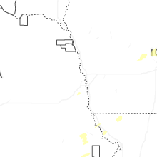


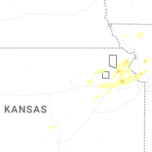


Connect with Interactive Hail Maps