

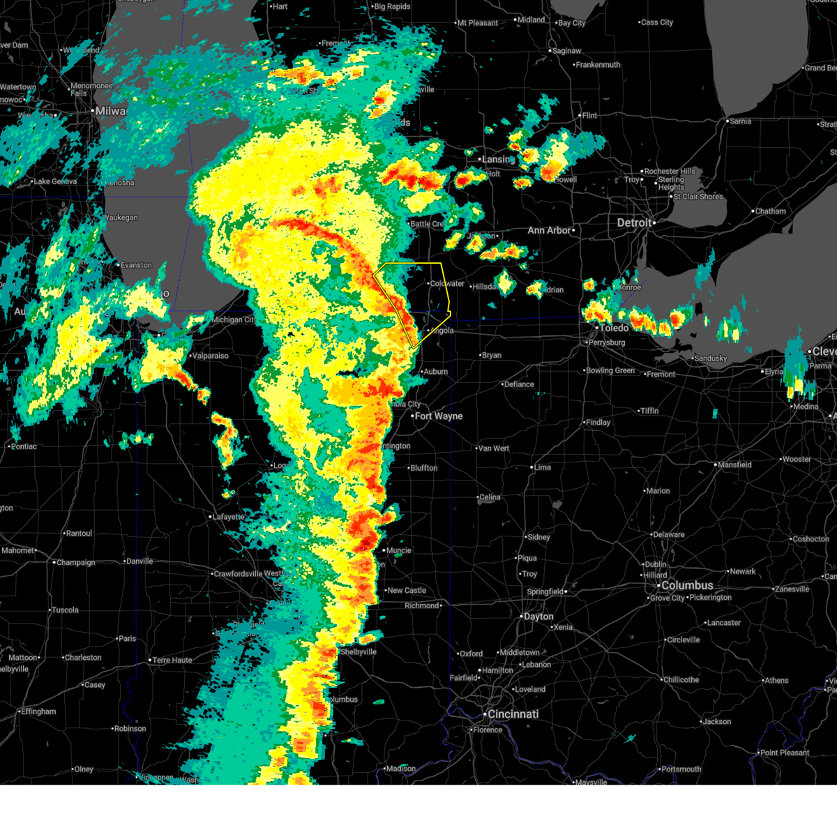
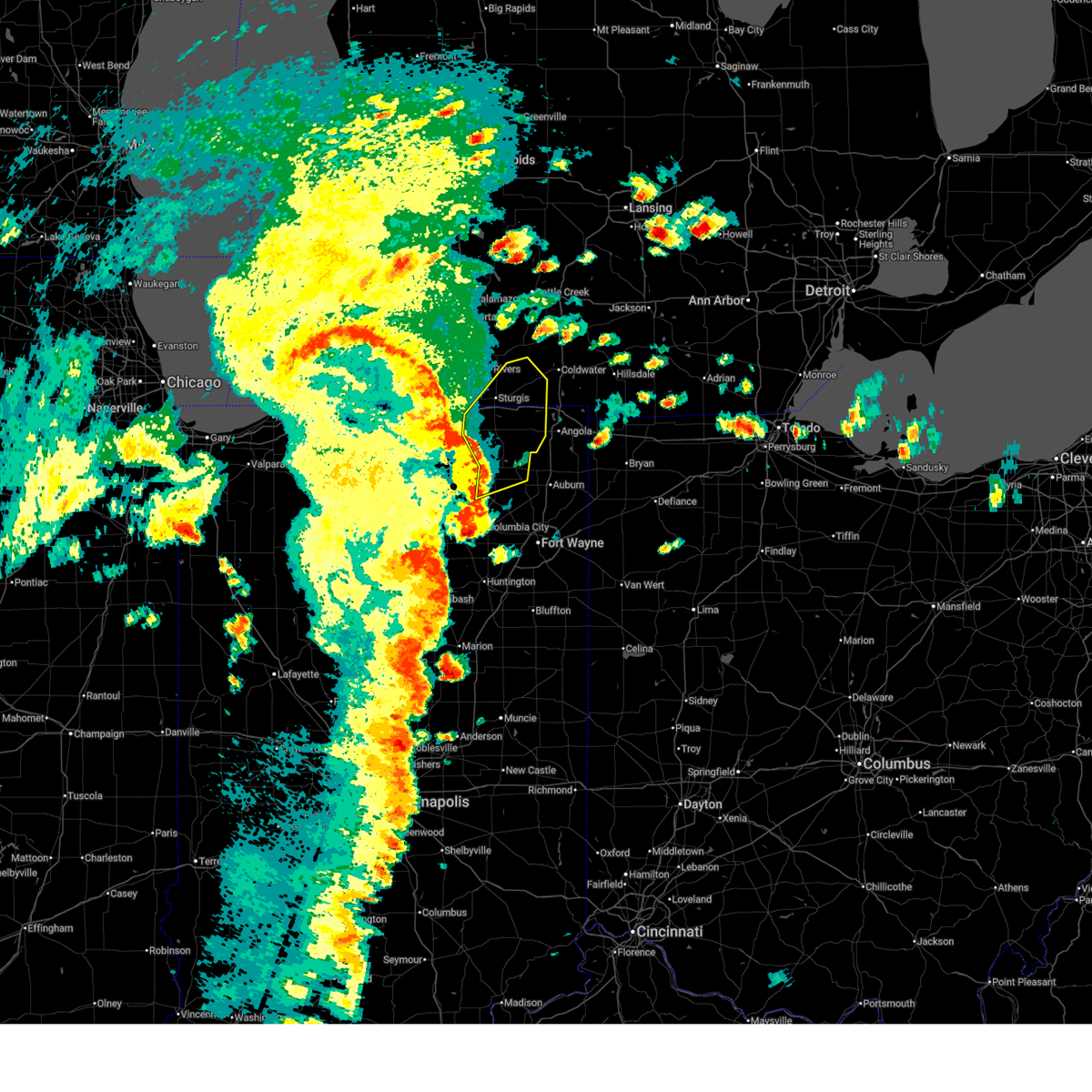
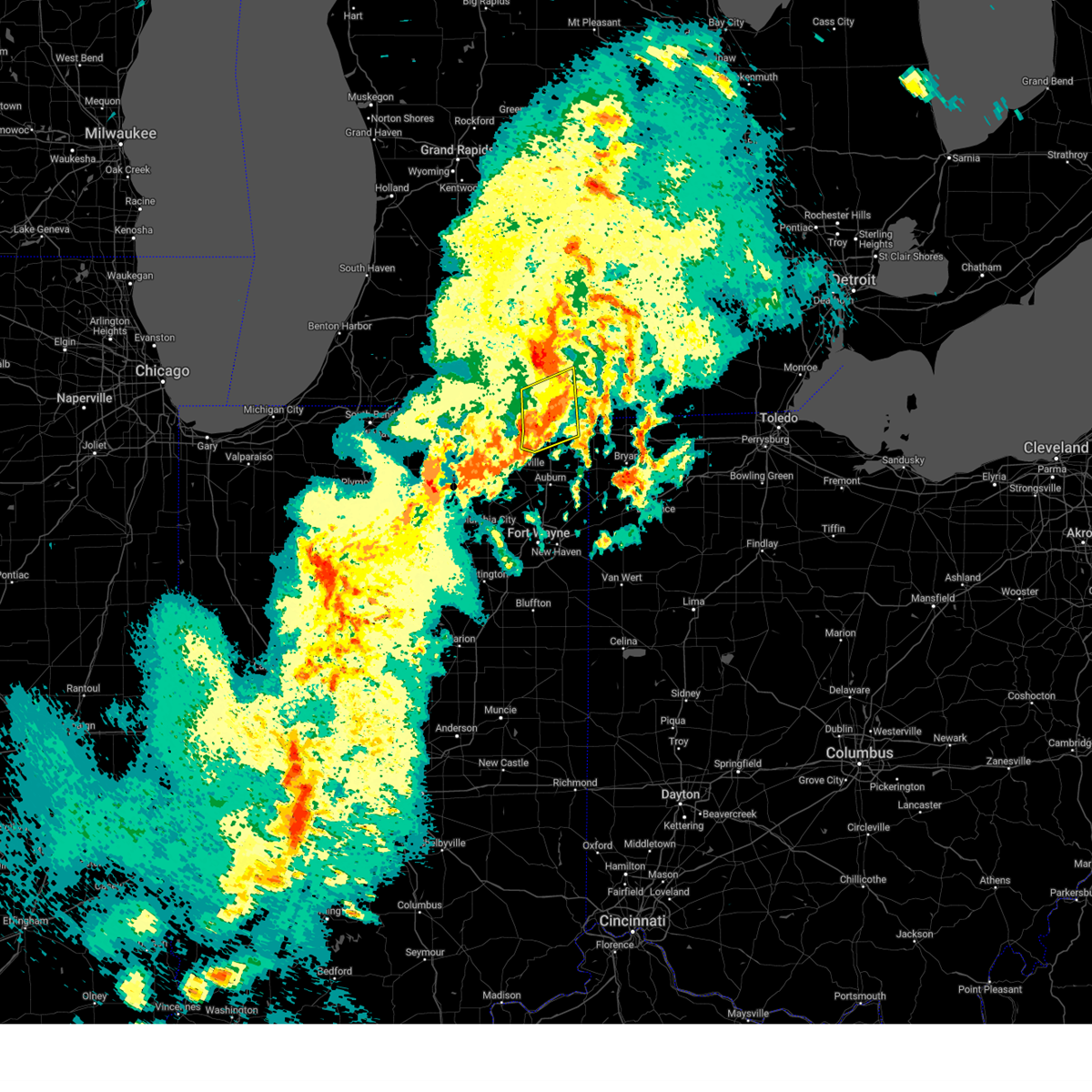
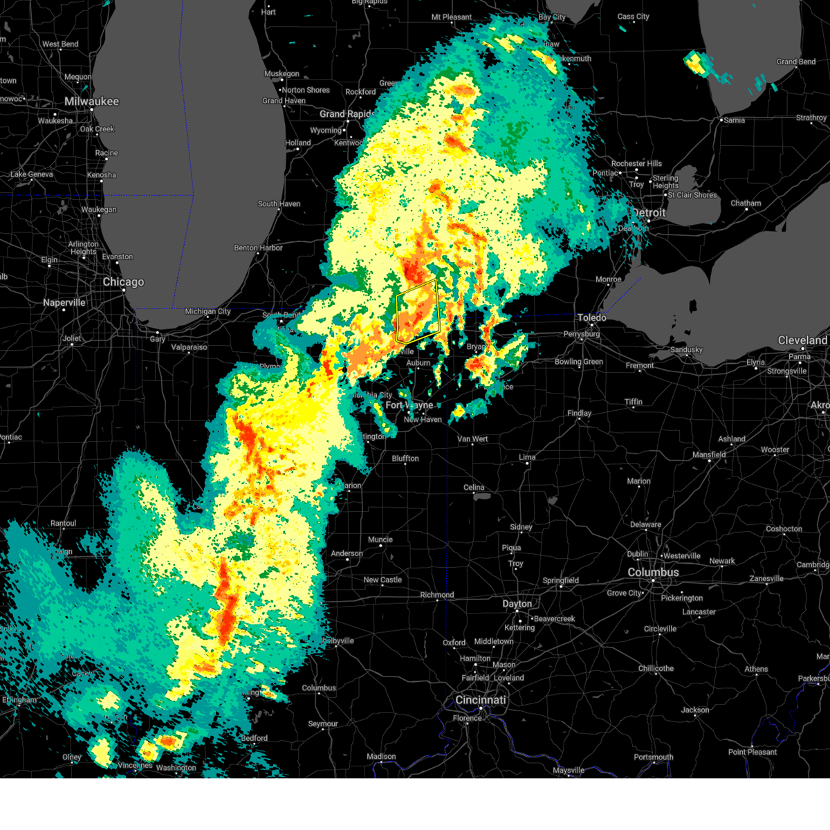
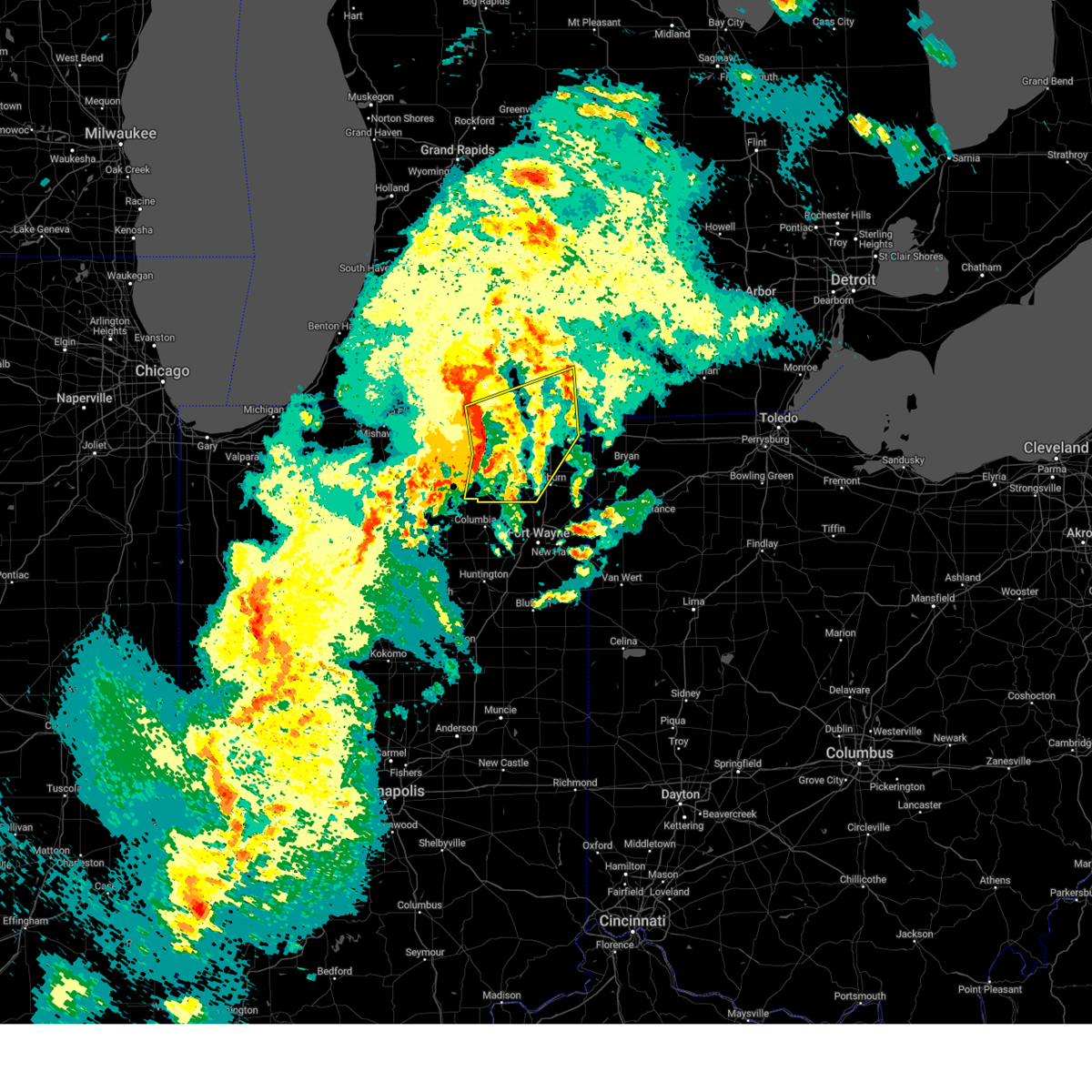
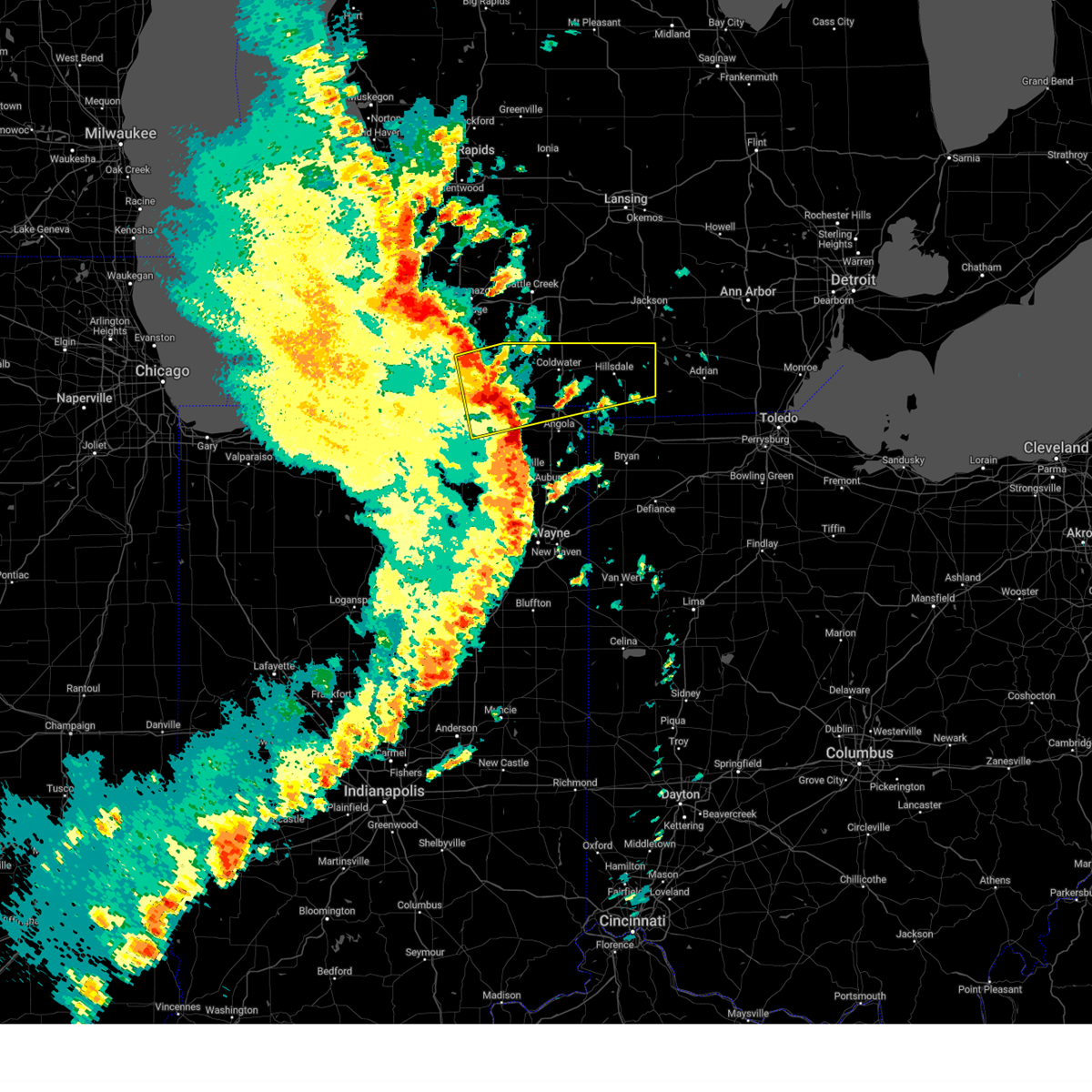
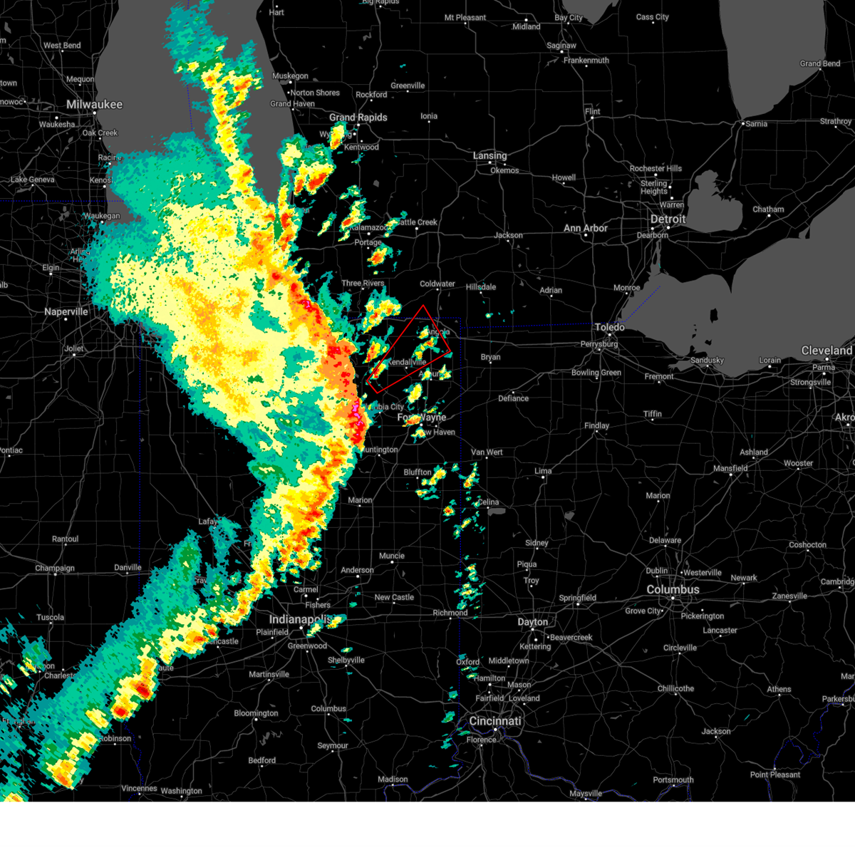
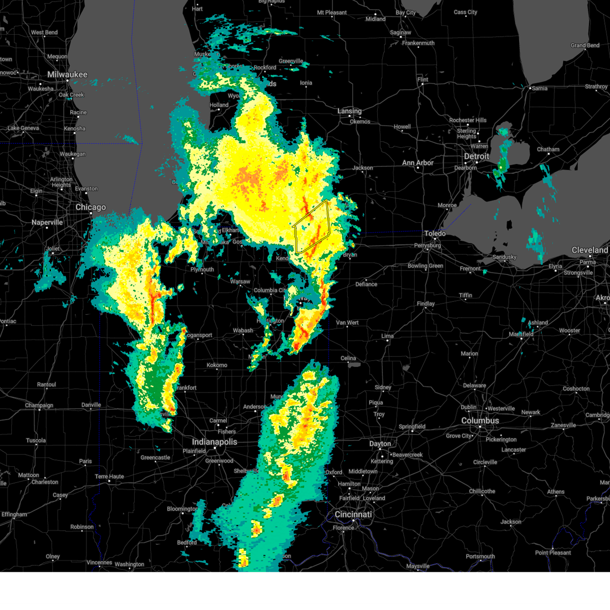
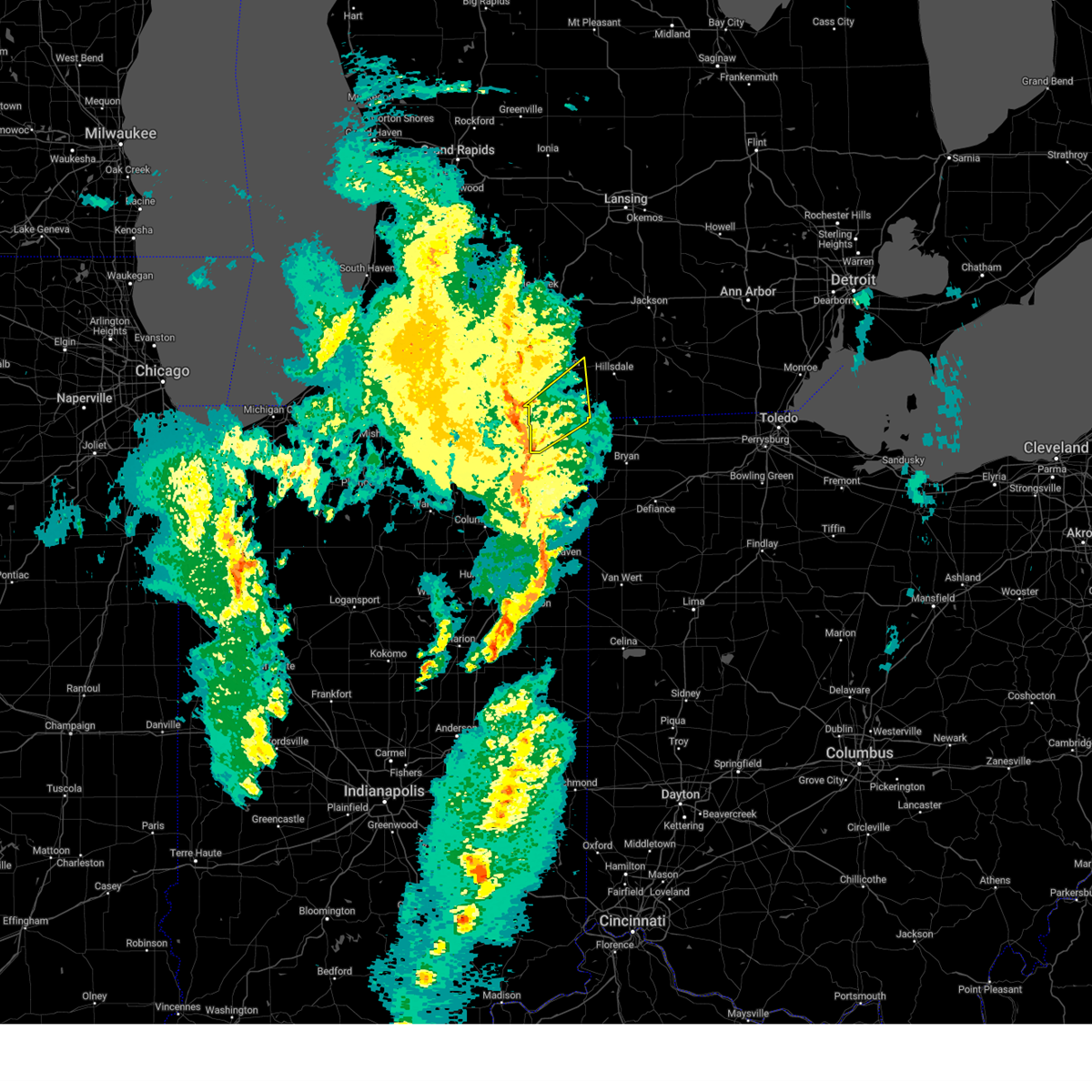
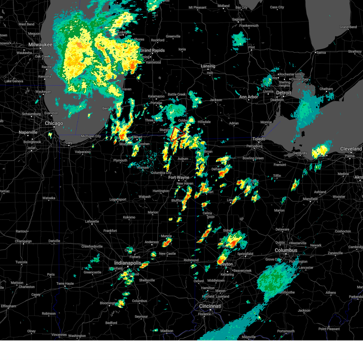
Hail Map for Orland, IN
The Orland, IN area has had 0 reports of on-the-ground hail by trained spotters, and has been under severe weather warnings 21 times during the past 12 months. Doppler radar has detected hail at or near Orland, IN on 29 occasions, including 1 occasion during the past year.
| Name: | Orland, IN |
| Where Located: | 45.5 miles N of Fort Wayne, IN |
| Map: | Google Map for Orland, IN |
| Population: | 434 |
| Housing Units: | 190 |
| More Info: | Search Google for Orland, IN |
1
The Top Recent Hail Date for Orland, IN is Monday, July 15, 2024 (7th out of 29)

Hail and Wind Damage Spotted near Orland, IN
| Date / Time | Report Details |
|---|---|
| 6/18/2025 5:25 PM EDT |
 Svriwx the national weather service in northern indiana has issued a * severe thunderstorm warning for, steuben county in northeastern indiana, northeastern lagrange county in northeastern indiana, northeastern st. joseph county in southwestern michigan, branch county in southwestern michigan, * until 615 pm edt. * at 525 pm edt, severe thunderstorms were located along a line extending from 6 miles northwest of colon to near bronson to 8 miles southwest of angola, moving north at 55 mph (trained weather spotters). Hazards include 60 mph wind gusts. expect damage to roofs, siding, and trees Svriwx the national weather service in northern indiana has issued a * severe thunderstorm warning for, steuben county in northeastern indiana, northeastern lagrange county in northeastern indiana, northeastern st. joseph county in southwestern michigan, branch county in southwestern michigan, * until 615 pm edt. * at 525 pm edt, severe thunderstorms were located along a line extending from 6 miles northwest of colon to near bronson to 8 miles southwest of angola, moving north at 55 mph (trained weather spotters). Hazards include 60 mph wind gusts. expect damage to roofs, siding, and trees
|
| 6/18/2025 5:01 PM EDT |
 Svriwx the national weather service in northern indiana has issued a * severe thunderstorm warning for, western steuben county in northeastern indiana, eastern noble county in northeastern indiana, lagrange county in northeastern indiana, southeastern st. joseph county in southwestern michigan, southwestern branch county in southwestern michigan, * until 530 pm edt. * at 501 pm edt, severe thunderstorms were located along a line extending from near middlebury to near rome city to near albion, moving northeast at 60 mph (radar indicated). Hazards include 60 mph wind gusts. expect damage to roofs, siding, and trees Svriwx the national weather service in northern indiana has issued a * severe thunderstorm warning for, western steuben county in northeastern indiana, eastern noble county in northeastern indiana, lagrange county in northeastern indiana, southeastern st. joseph county in southwestern michigan, southwestern branch county in southwestern michigan, * until 530 pm edt. * at 501 pm edt, severe thunderstorms were located along a line extending from near middlebury to near rome city to near albion, moving northeast at 60 mph (radar indicated). Hazards include 60 mph wind gusts. expect damage to roofs, siding, and trees
|
| 4/2/2025 9:16 PM EDT | the severe thunderstorm warning has been cancelled and is no longer in effect |
| 4/2/2025 8:58 PM EDT |
 At 858 pm edt, severe thunderstorms were located along a line extending from near bronson to 9 miles southwest of angola to avilla, moving east at 60 mph (radar indicated). Hazards include 60 mph wind gusts and quarter size hail. Hail damage to vehicles is expected. expect wind damage to roofs, siding, and trees. locations impacted include, angola, flint, nevada mills, lake gauge, pleasant lake, golden lake, big long lake, kinderhook, salem center, lake of the woods, coldwater lake, fremont, big turkey lake, stroh, mongo, indianola, east gilead, orland, crooked lake, and elmira. this includes the following highways, interstate 69 in indiana between mile markers 343 and 357. interstate 69 in michigan between mile markers 1 and 12. Interstate 80 in indiana between mile markers 131 and 151. At 858 pm edt, severe thunderstorms were located along a line extending from near bronson to 9 miles southwest of angola to avilla, moving east at 60 mph (radar indicated). Hazards include 60 mph wind gusts and quarter size hail. Hail damage to vehicles is expected. expect wind damage to roofs, siding, and trees. locations impacted include, angola, flint, nevada mills, lake gauge, pleasant lake, golden lake, big long lake, kinderhook, salem center, lake of the woods, coldwater lake, fremont, big turkey lake, stroh, mongo, indianola, east gilead, orland, crooked lake, and elmira. this includes the following highways, interstate 69 in indiana between mile markers 343 and 357. interstate 69 in michigan between mile markers 1 and 12. Interstate 80 in indiana between mile markers 131 and 151.
|
| 4/2/2025 8:58 PM EDT |
 the severe thunderstorm warning has been cancelled and is no longer in effect the severe thunderstorm warning has been cancelled and is no longer in effect
|
| 4/2/2025 8:48 PM EDT | Trained spotter reports an estimated wind gust of 98.4 mph using an anemomete in steuben county IN, 0.2 miles N of Orland, IN |
| 4/2/2025 8:48 PM EDT | Emergency manager reports a barn with structural damage to the roof at 7640 n 750 w ij orland. time estimated via rada in steuben county IN, 0.2 miles N of Orland, IN |
| 4/2/2025 8:38 PM EDT |
 the severe thunderstorm warning has been cancelled and is no longer in effect the severe thunderstorm warning has been cancelled and is no longer in effect
|
| 4/2/2025 8:38 PM EDT |
 At 837 pm edt, severe thunderstorms were located along a line extending from near centreville to near topeka to near north webster, moving east at 60 mph (radar indicated). Hazards include 70 mph wind gusts and quarter size hail. Hail damage to vehicles is expected. expect considerable tree damage. wind damage is also likely to mobile homes, roofs, and outbuildings. locations impacted include, topeka, angola, fairfield center, waterloo, sturgis, laotto, big long lake, kinderhook, salem center, helmer, swan, howe, plato, coldwater lake, sedan, mongo, lisbon, hudson, orland, and altona. this includes the following highways, interstate 69 in indiana between mile markers 329 and 357. interstate 69 in michigan between mile markers 1 and 12. Interstate 80 in indiana between mile markers 111 and 151. At 837 pm edt, severe thunderstorms were located along a line extending from near centreville to near topeka to near north webster, moving east at 60 mph (radar indicated). Hazards include 70 mph wind gusts and quarter size hail. Hail damage to vehicles is expected. expect considerable tree damage. wind damage is also likely to mobile homes, roofs, and outbuildings. locations impacted include, topeka, angola, fairfield center, waterloo, sturgis, laotto, big long lake, kinderhook, salem center, helmer, swan, howe, plato, coldwater lake, sedan, mongo, lisbon, hudson, orland, and altona. this includes the following highways, interstate 69 in indiana between mile markers 329 and 357. interstate 69 in michigan between mile markers 1 and 12. Interstate 80 in indiana between mile markers 111 and 151.
|
| 4/2/2025 8:15 PM EDT | Svriwx the national weather service in northern indiana has issued a * severe thunderstorm warning for, steuben county in northeastern indiana, eastern elkhart county in north central indiana, noble county in northeastern indiana, northern whitley county in northeastern indiana, western de kalb county in northeastern indiana, northeastern kosciusko county in north central indiana, lagrange county in northeastern indiana, southeastern st. joseph county in southwestern michigan, southern branch county in southwestern michigan, * until 930 pm edt. * at 814 pm edt, severe thunderstorms were located along a line extending from near simonton lake to 6 miles southeast of nappanee to near mentone, moving east at 60 mph (radar indicated). Hazards include 70 mph wind gusts and quarter size hail. Hail damage to vehicles is expected. expect considerable tree damage. Wind damage is also likely to mobile homes, roofs, and outbuildings. |
| 3/30/2025 5:30 PM EDT | At 529 pm edt, severe thunderstorms were located along a line extending from 6 miles west of colon to near sturgis, moving northeast at 75 mph. at 529 pm edt, the public reported trees down and a center pivot flipped and twisted in sturgis (public). Hazards include 60 mph wind gusts and nickel size hail. Expect damage to roofs, siding, and trees. locations impacted include, nottawa, girard, ray, sturgis, leonidas, kinderhook, shadyside, howe, coldwater, matteson lake, hodunk, coldwater lake, camden, mongo, montgomery, orland, burr oak, california, allen, and fairfax. this includes the following highways, interstate 69 in indiana between mile markers 355 and 357. interstate 69 in michigan between mile markers 1 and 21. Interstate 80 in indiana between mile markers 120 and 146. |
| 3/30/2025 5:22 PM EDT |
 The storm which prompted the warning has weakened below severe limits, and no longer appears capable of producing a tornado. therefore, the warning will be allowed to expire. however, gusty winds are still possible with this thunderstorm. a tornado watch remains in effect until 800 pm edt for northeastern indiana, and southwestern michigan. remember, a severe thunderstorm warning still remains in effect. The storm which prompted the warning has weakened below severe limits, and no longer appears capable of producing a tornado. therefore, the warning will be allowed to expire. however, gusty winds are still possible with this thunderstorm. a tornado watch remains in effect until 800 pm edt for northeastern indiana, and southwestern michigan. remember, a severe thunderstorm warning still remains in effect.
|
| 3/30/2025 5:20 PM EDT |
 Svriwx the national weather service in northern indiana has issued a * severe thunderstorm warning for, northern steuben county in northeastern indiana, northern lagrange county in northeastern indiana, st. joseph county in southwestern michigan, branch county in southwestern michigan, hillsdale county in southeastern michigan, * until 615 pm edt. * at 520 pm edt, severe thunderstorms were located along a line extending from three rivers to near white pigeon, moving east at 75 mph (radar indicated). Hazards include 60 mph wind gusts and nickel size hail. expect damage to roofs, siding, and trees Svriwx the national weather service in northern indiana has issued a * severe thunderstorm warning for, northern steuben county in northeastern indiana, northern lagrange county in northeastern indiana, st. joseph county in southwestern michigan, branch county in southwestern michigan, hillsdale county in southeastern michigan, * until 615 pm edt. * at 520 pm edt, severe thunderstorms were located along a line extending from three rivers to near white pigeon, moving east at 75 mph (radar indicated). Hazards include 60 mph wind gusts and nickel size hail. expect damage to roofs, siding, and trees
|
| 3/30/2025 5:15 PM EDT | At 515 pm edt, a severe thunderstorm capable of producing a tornado was located near rome city, or near kendallville, moving northeast at 65 mph (radar indicated rotation). Hazards include tornado and 60 mph wind gusts. Flying debris will be dangerous to those caught without shelter. mobile homes will be damaged or destroyed. damage to roofs, windows, and vehicles will occur. tree damage is likely. this dangerous storm will be near, kendallville and rome city around 520 pm edt. angola around 530 pm edt. other locations impacted by this tornadic thunderstorm include brimfield, flint, fairfield center, nevada mills, lake gauge, brushy prairie, pleasant lake, hamilton lake, golden lake, and big long lake. this includes the following highways, interstate 69 in indiana between mile markers 338 and 353. Interstate 80 in indiana between mile markers 134 and 140. |
| 3/30/2025 5:06 PM EDT |
 Toriwx the national weather service in northern indiana has issued a * tornado warning for, western steuben county in northeastern indiana, central noble county in northeastern indiana, northwestern de kalb county in northeastern indiana, eastern lagrange county in northeastern indiana, south central branch county in southwestern michigan, * until 530 pm edt. * at 506 pm edt, a severe thunderstorm capable of producing a tornado was located near albion, or 8 miles southeast of ligonier, moving northeast at 65 mph (radar indicated rotation). Hazards include tornado. Flying debris will be dangerous to those caught without shelter. mobile homes will be damaged or destroyed. damage to roofs, windows, and vehicles will occur. tree damage is likely. this dangerous storm will be near, albion around 510 pm edt. kendallville and rome city around 515 pm edt. other locations impacted by this tornadic thunderstorm include brimfield, flint, fairfield center, nevada mills, lake gauge, brushy prairie, pleasant lake, hamilton lake, golden lake, and big long lake. this includes the following highways, interstate 69 in indiana between mile markers 337 and 353. Interstate 80 in indiana between mile markers 133 and 140. Toriwx the national weather service in northern indiana has issued a * tornado warning for, western steuben county in northeastern indiana, central noble county in northeastern indiana, northwestern de kalb county in northeastern indiana, eastern lagrange county in northeastern indiana, south central branch county in southwestern michigan, * until 530 pm edt. * at 506 pm edt, a severe thunderstorm capable of producing a tornado was located near albion, or 8 miles southeast of ligonier, moving northeast at 65 mph (radar indicated rotation). Hazards include tornado. Flying debris will be dangerous to those caught without shelter. mobile homes will be damaged or destroyed. damage to roofs, windows, and vehicles will occur. tree damage is likely. this dangerous storm will be near, albion around 510 pm edt. kendallville and rome city around 515 pm edt. other locations impacted by this tornadic thunderstorm include brimfield, flint, fairfield center, nevada mills, lake gauge, brushy prairie, pleasant lake, hamilton lake, golden lake, and big long lake. this includes the following highways, interstate 69 in indiana between mile markers 337 and 353. Interstate 80 in indiana between mile markers 133 and 140.
|
| 3/19/2025 9:35 PM EDT |
 The storms which prompted the warning have weakened below severe limits, and no longer pose an immediate threat to life or property. therefore, the warning will be allowed to expire. however, gusty winds and heavy rain are still possible with these thunderstorms. a severe thunderstorm watch remains in effect until 100 am edt for northeastern indiana, and southeastern and southwestern michigan. The storms which prompted the warning have weakened below severe limits, and no longer pose an immediate threat to life or property. therefore, the warning will be allowed to expire. however, gusty winds and heavy rain are still possible with these thunderstorms. a severe thunderstorm watch remains in effect until 100 am edt for northeastern indiana, and southeastern and southwestern michigan.
|
| 3/19/2025 9:22 PM EDT | Emergency management reported downed powerlines and a broken utility pole on cr 350 n west of sr 32 in steuben county IN, 3 miles N of Orland, IN |
| 3/19/2025 9:20 PM EDT |
 Svriwx the national weather service in northern indiana has issued a * severe thunderstorm warning for, steuben county in northeastern indiana, southeastern branch county in southwestern michigan, southwestern hillsdale county in southeastern michigan, * until 945 pm edt. * at 920 pm edt, severe thunderstorms were located along a line extending from 9 miles south of bronson to 9 miles west of angola to 9 miles northeast of kendallville, moving northeast at 70 mph (radar indicated). Hazards include 60 mph wind gusts. expect damage to roofs, siding, and trees Svriwx the national weather service in northern indiana has issued a * severe thunderstorm warning for, steuben county in northeastern indiana, southeastern branch county in southwestern michigan, southwestern hillsdale county in southeastern michigan, * until 945 pm edt. * at 920 pm edt, severe thunderstorms were located along a line extending from 9 miles south of bronson to 9 miles west of angola to 9 miles northeast of kendallville, moving northeast at 70 mph (radar indicated). Hazards include 60 mph wind gusts. expect damage to roofs, siding, and trees
|
| 9/24/2024 6:11 PM EDT |
 the tornado warning has been cancelled and is no longer in effect the tornado warning has been cancelled and is no longer in effect
|
| 9/24/2024 5:58 PM EDT |
 The tornado warning that was previously in effect has been reissued for northwestern steuben and southeastern branch county until 630 pm edt. please refer to that bulletin for the latest severe weather information. The tornado warning that was previously in effect has been reissued for northwestern steuben and southeastern branch county until 630 pm edt. please refer to that bulletin for the latest severe weather information.
|
| 9/24/2024 5:55 PM EDT |
 Toriwx the national weather service in northern indiana has issued a * tornado warning for, northwestern steuben county in northeastern indiana, southeastern branch county in southwestern michigan, * until 630 pm edt. * at 555 pm edt, a severe thunderstorm capable of producing a tornado was located 8 miles south of bronson, or 11 miles northwest of angola, moving northeast at 20 mph (radar indicated rotation). Hazards include tornado. Flying debris will be dangerous to those caught without shelter. mobile homes will be damaged or destroyed. damage to roofs, windows, and vehicles will occur. tree damage is likely. this tornadic thunderstorm will remain over mainly rural areas of northwestern steuben and southeastern branch counties, including the following locations, orland, lake of the woods, kinderhook, gilead, coldwater lake, and east gilead. this includes the following highways, interstate 69 in michigan between mile markers 2 and 7. Interstate 80 in indiana between mile markers 133 and 139. Toriwx the national weather service in northern indiana has issued a * tornado warning for, northwestern steuben county in northeastern indiana, southeastern branch county in southwestern michigan, * until 630 pm edt. * at 555 pm edt, a severe thunderstorm capable of producing a tornado was located 8 miles south of bronson, or 11 miles northwest of angola, moving northeast at 20 mph (radar indicated rotation). Hazards include tornado. Flying debris will be dangerous to those caught without shelter. mobile homes will be damaged or destroyed. damage to roofs, windows, and vehicles will occur. tree damage is likely. this tornadic thunderstorm will remain over mainly rural areas of northwestern steuben and southeastern branch counties, including the following locations, orland, lake of the woods, kinderhook, gilead, coldwater lake, and east gilead. this includes the following highways, interstate 69 in michigan between mile markers 2 and 7. Interstate 80 in indiana between mile markers 133 and 139.
|
| 9/24/2024 5:41 PM EDT |
 At 540 pm edt, a confirmed tornado was located 10 miles south of bronson, or 12 miles northwest of angola, moving northeast at 20 mph (weather spotters confirmed tornado). Hazards include damaging tornado. Flying debris will be dangerous to those caught without shelter. mobile homes will be damaged or destroyed. damage to roofs, windows, and vehicles will occur. tree damage is likely. locations impacted include, gilead, orland, and east gilead. This includes interstate 80 in indiana between mile markers 131 and 139. At 540 pm edt, a confirmed tornado was located 10 miles south of bronson, or 12 miles northwest of angola, moving northeast at 20 mph (weather spotters confirmed tornado). Hazards include damaging tornado. Flying debris will be dangerous to those caught without shelter. mobile homes will be damaged or destroyed. damage to roofs, windows, and vehicles will occur. tree damage is likely. locations impacted include, gilead, orland, and east gilead. This includes interstate 80 in indiana between mile markers 131 and 139.
|
| 9/24/2024 5:28 PM EDT |
 Toriwx the national weather service in northern indiana has issued a * tornado warning for, northwestern steuben county in northeastern indiana, northeastern lagrange county in northeastern indiana, southwestern branch county in southwestern michigan, * until 600 pm edt. * at 528 pm edt, a severe thunderstorm capable of producing a tornado was located 8 miles east of lagrange, moving northeast at 20 mph. this storm has a history of producing brief tornadoes (radar indicated rotation). Hazards include tornado. Flying debris will be dangerous to those caught without shelter. mobile homes will be damaged or destroyed. damage to roofs, windows, and vehicles will occur. tree damage is likely. this tornadic thunderstorm will remain over mainly rural areas of northwestern steuben, northeastern lagrange and southwestern branch counties, including the following locations, orland, gilead, mongo, and east gilead. This includes interstate 80 in indiana between mile markers 128 and 139. Toriwx the national weather service in northern indiana has issued a * tornado warning for, northwestern steuben county in northeastern indiana, northeastern lagrange county in northeastern indiana, southwestern branch county in southwestern michigan, * until 600 pm edt. * at 528 pm edt, a severe thunderstorm capable of producing a tornado was located 8 miles east of lagrange, moving northeast at 20 mph. this storm has a history of producing brief tornadoes (radar indicated rotation). Hazards include tornado. Flying debris will be dangerous to those caught without shelter. mobile homes will be damaged or destroyed. damage to roofs, windows, and vehicles will occur. tree damage is likely. this tornadic thunderstorm will remain over mainly rural areas of northwestern steuben, northeastern lagrange and southwestern branch counties, including the following locations, orland, gilead, mongo, and east gilead. This includes interstate 80 in indiana between mile markers 128 and 139.
|
| 7/16/2024 12:50 AM EDT |
 Svriwx the national weather service in northern indiana has issued a * severe thunderstorm warning for, steuben county in northeastern indiana, allen county in northeastern indiana, eastern noble county in northeastern indiana, de kalb county in northeastern indiana, eastern lagrange county in northeastern indiana, southern branch county in southwestern michigan, * until 130 am edt. * at 1250 am edt, severe thunderstorms were located along a line extending from near sturgis to near kendallville to near churubusco to 9 miles south of columbia city, moving northeast at 55 mph (radar indicated). Hazards include 60 mph wind gusts. Expect damage to roofs, siding, and trees. severe thunderstorms will be near, kendallville and avilla around 1255 am edt. fort wayne, garrett, huntertown, and bronson around 100 am edt. auburn, angola, and waterloo around 105 am edt. fremont and hamilton around 110 am edt. grabill around 115 am edt. butler and st. joe around 120 am edt. other locations impacted by these severe thunderstorms include yoder, alvarado, fairfield center, saint johns, aboite, edgerton in allen county, ray, hamilton lake, laotto, and zulu. this includes the following highways, interstate 469 between mile markers 0 and 30. interstate 69 in indiana between mile markers 294 and 357. interstate 69 in michigan between mile markers 1 and 10. Interstate 80 in indiana between mile markers 133 and 156. Svriwx the national weather service in northern indiana has issued a * severe thunderstorm warning for, steuben county in northeastern indiana, allen county in northeastern indiana, eastern noble county in northeastern indiana, de kalb county in northeastern indiana, eastern lagrange county in northeastern indiana, southern branch county in southwestern michigan, * until 130 am edt. * at 1250 am edt, severe thunderstorms were located along a line extending from near sturgis to near kendallville to near churubusco to 9 miles south of columbia city, moving northeast at 55 mph (radar indicated). Hazards include 60 mph wind gusts. Expect damage to roofs, siding, and trees. severe thunderstorms will be near, kendallville and avilla around 1255 am edt. fort wayne, garrett, huntertown, and bronson around 100 am edt. auburn, angola, and waterloo around 105 am edt. fremont and hamilton around 110 am edt. grabill around 115 am edt. butler and st. joe around 120 am edt. other locations impacted by these severe thunderstorms include yoder, alvarado, fairfield center, saint johns, aboite, edgerton in allen county, ray, hamilton lake, laotto, and zulu. this includes the following highways, interstate 469 between mile markers 0 and 30. interstate 69 in indiana between mile markers 294 and 357. interstate 69 in michigan between mile markers 1 and 10. Interstate 80 in indiana between mile markers 133 and 156.
|
| 7/26/2023 7:26 PM EDT |
 The severe thunderstorm warning for northwestern steuben, southeastern st. joseph and southern branch counties will expire at 730 pm edt, the storm which prompted the warning has weakened below severe limits, and no longer poses an immediate threat to life or property. therefore, the warning will be allowed to expire. however, heavy rain is still possible with this thunderstorm. a severe thunderstorm watch remains in effect until 1000 pm edt for northeastern indiana. The severe thunderstorm warning for northwestern steuben, southeastern st. joseph and southern branch counties will expire at 730 pm edt, the storm which prompted the warning has weakened below severe limits, and no longer poses an immediate threat to life or property. therefore, the warning will be allowed to expire. however, heavy rain is still possible with this thunderstorm. a severe thunderstorm watch remains in effect until 1000 pm edt for northeastern indiana.
|
| 7/26/2023 7:01 PM EDT |
 At 701 pm edt, a severe thunderstorm was located near bronson, or near sturgis, moving east at 45 mph (radar indicated). Hazards include 60 mph wind gusts. Expect damage to roofs, siding, and trees. this severe storm will be near, bronson around 705 pm edt. other locations impacted by this severe thunderstorm include east gilead, nevada mills, burr oak, california, fawn river, kinderhook, batavia, findley, matteson lake, and marble lake. this includes the following highways, interstate 69 in indiana between mile markers 355 and 357. interstate 69 in michigan between mile markers 1 and 13. interstate 80 in indiana between mile markers 133 and 149. hail threat, radar indicated max hail size, <. 75 in wind threat, radar indicated max wind gust, 60 mph. At 701 pm edt, a severe thunderstorm was located near bronson, or near sturgis, moving east at 45 mph (radar indicated). Hazards include 60 mph wind gusts. Expect damage to roofs, siding, and trees. this severe storm will be near, bronson around 705 pm edt. other locations impacted by this severe thunderstorm include east gilead, nevada mills, burr oak, california, fawn river, kinderhook, batavia, findley, matteson lake, and marble lake. this includes the following highways, interstate 69 in indiana between mile markers 355 and 357. interstate 69 in michigan between mile markers 1 and 13. interstate 80 in indiana between mile markers 133 and 149. hail threat, radar indicated max hail size, <. 75 in wind threat, radar indicated max wind gust, 60 mph.
|
| 7/26/2023 6:45 PM EDT |
 At 645 pm edt, a severe thunderstorm was located near centreville, or 7 miles northwest of sturgis, moving east at 45 mph (radar indicated). Hazards include 60 mph wind gusts and penny size hail. Expect damage to roofs, siding, and trees. this severe thunderstorm will be near, sturgis around 650 pm edt. bronson around 705 pm edt. Other locations impacted by this severe thunderstorm include nottawa, east gilead, nevada mills, burr oak, klinger lake, california, fairfax, fawn river, kinderhook, and batavia. At 645 pm edt, a severe thunderstorm was located near centreville, or 7 miles northwest of sturgis, moving east at 45 mph (radar indicated). Hazards include 60 mph wind gusts and penny size hail. Expect damage to roofs, siding, and trees. this severe thunderstorm will be near, sturgis around 650 pm edt. bronson around 705 pm edt. Other locations impacted by this severe thunderstorm include nottawa, east gilead, nevada mills, burr oak, klinger lake, california, fairfax, fawn river, kinderhook, and batavia.
|
| 7/26/2023 1:44 PM EDT | 24 to 30 inch diameter tree down at the intersection of sr 120 and 900w. time estimated via rada in steuben county IN, 0.2 miles N of Orland, IN |
| 8/29/2022 4:27 PM EDT |
 At 427 pm edt, severe thunderstorms were located along a line extending from near union city to near rome city, moving east at 60 mph (radar indicated). Hazards include 60 mph wind gusts. Expect damage to roofs, siding, and trees. locations impacted include, sturgis, coldwater, kendallville, angola, lagrange, bronson, fremont, quincy, union city, hamilton, rome city, colon, topeka, ray, girard, kinderhook, fawn river, batavia, leonidas and california. this includes the following highways, interstate 69 in indiana between mile markers 335 and 357. interstate 69 in michigan between mile markers 1 and 21. interstate 80 in indiana between mile markers 119 and 156. interstate 80 in ohio near mile marker 0. hail threat, radar indicated max hail size, <. 75 in wind threat, radar indicated max wind gust, 60 mph. At 427 pm edt, severe thunderstorms were located along a line extending from near union city to near rome city, moving east at 60 mph (radar indicated). Hazards include 60 mph wind gusts. Expect damage to roofs, siding, and trees. locations impacted include, sturgis, coldwater, kendallville, angola, lagrange, bronson, fremont, quincy, union city, hamilton, rome city, colon, topeka, ray, girard, kinderhook, fawn river, batavia, leonidas and california. this includes the following highways, interstate 69 in indiana between mile markers 335 and 357. interstate 69 in michigan between mile markers 1 and 21. interstate 80 in indiana between mile markers 119 and 156. interstate 80 in ohio near mile marker 0. hail threat, radar indicated max hail size, <. 75 in wind threat, radar indicated max wind gust, 60 mph.
|
| 8/29/2022 4:07 PM EDT |
 At 407 pm edt, severe thunderstorms were located along a line extending from 6 miles north of centreville to millersburg, moving east at 55 mph (radar indicated). Hazards include 60 mph wind gusts. expect damage to roofs, siding, and trees At 407 pm edt, severe thunderstorms were located along a line extending from 6 miles north of centreville to millersburg, moving east at 55 mph (radar indicated). Hazards include 60 mph wind gusts. expect damage to roofs, siding, and trees
|
| 6/13/2022 9:04 PM EDT |
 At 904 pm edt, a severe thunderstorm was located over angola, moving east at 45 mph (radar indicated). Hazards include 70 mph wind gusts and half dollar size hail. Hail damage to vehicles is expected. expect considerable tree damage. wind damage is also likely to mobile homes, roofs, and outbuildings. locations impacted include, angola, fremont, hamilton, ray, ashley, hudson, orland, clear lake, york, flint, alvarado, lake gauge, nevada mills, pleasant lake, hamilton lake, golden lake, salem center, helmer, metz and big turkey lake. this includes the following highways, interstate 69 in indiana between mile markers 341 and 357. Interstate 80 in indiana between mile markers 134 and 156. At 904 pm edt, a severe thunderstorm was located over angola, moving east at 45 mph (radar indicated). Hazards include 70 mph wind gusts and half dollar size hail. Hail damage to vehicles is expected. expect considerable tree damage. wind damage is also likely to mobile homes, roofs, and outbuildings. locations impacted include, angola, fremont, hamilton, ray, ashley, hudson, orland, clear lake, york, flint, alvarado, lake gauge, nevada mills, pleasant lake, hamilton lake, golden lake, salem center, helmer, metz and big turkey lake. this includes the following highways, interstate 69 in indiana between mile markers 341 and 357. Interstate 80 in indiana between mile markers 134 and 156.
|
| 6/13/2022 8:53 PM EDT |
 At 853 pm edt, a severe thunderstorm was located 8 miles northwest of angola, moving east at 45 mph (radar indicated). Hazards include 60 mph wind gusts and quarter size hail. Hail damage to vehicles is expected. Expect wind damage to roofs, siding, and trees. At 853 pm edt, a severe thunderstorm was located 8 miles northwest of angola, moving east at 45 mph (radar indicated). Hazards include 60 mph wind gusts and quarter size hail. Hail damage to vehicles is expected. Expect wind damage to roofs, siding, and trees.
|
| 8/11/2021 1:57 PM EDT | Tree down on orland road southeast of orland... indian in steuben county IN, 1.4 miles NW of Orland, IN |
| 8/11/2021 1:39 PM EDT |
 At 139 pm edt, severe thunderstorms were located along a line extending from near vicksburg to near bronson to 7 miles northeast of lagrange, moving northeast at 50 mph (radar indicated). Hazards include 60 mph wind gusts. expect damage to roofs, siding, and trees At 139 pm edt, severe thunderstorms were located along a line extending from near vicksburg to near bronson to 7 miles northeast of lagrange, moving northeast at 50 mph (radar indicated). Hazards include 60 mph wind gusts. expect damage to roofs, siding, and trees
|
| 6/10/2020 2:40 PM EDT |
 The national weather service in northern indiana has issued a * severe thunderstorm warning for. steuben county in northeastern indiana. northern allen county in northeastern indiana. eastern noble county in northeastern indiana. Northeastern whitley county in northeastern indiana. The national weather service in northern indiana has issued a * severe thunderstorm warning for. steuben county in northeastern indiana. northern allen county in northeastern indiana. eastern noble county in northeastern indiana. Northeastern whitley county in northeastern indiana.
|
| 6/10/2020 2:40 PM EDT |
 At 239 pm edt, severe thunderstorms were located along a line extending from 9 miles southwest of angola to near churubusco, moving northeast at 65 mph (radar indicated). Hazards include 70 mph wind gusts and quarter size hail. Hail damage to vehicles is expected. expect considerable tree damage. wind damage is also likely to mobile homes, roofs, and outbuildings. severe thunderstorms will be near, angola around 250 pm edt. auburn, waterloo and fremont around 255 pm edt. hamilton around 305 pm edt. reading around 325 pm edt. hillsdale around 330 pm edt. this includes the following highways, interstate 469 between mile markers 22 and 30. interstate 69 in indiana between mile markers 306 and 357. interstate 69 in michigan between mile markers 1 and 10. interstate 80 in indiana between mile markers 134 and 156. Interstate 80 in ohio between mile markers 0 and 12. At 239 pm edt, severe thunderstorms were located along a line extending from 9 miles southwest of angola to near churubusco, moving northeast at 65 mph (radar indicated). Hazards include 70 mph wind gusts and quarter size hail. Hail damage to vehicles is expected. expect considerable tree damage. wind damage is also likely to mobile homes, roofs, and outbuildings. severe thunderstorms will be near, angola around 250 pm edt. auburn, waterloo and fremont around 255 pm edt. hamilton around 305 pm edt. reading around 325 pm edt. hillsdale around 330 pm edt. this includes the following highways, interstate 469 between mile markers 22 and 30. interstate 69 in indiana between mile markers 306 and 357. interstate 69 in michigan between mile markers 1 and 10. interstate 80 in indiana between mile markers 134 and 156. Interstate 80 in ohio between mile markers 0 and 12.
|
| 6/10/2020 2:10 PM EDT | Multiple trees dow in steuben county IN, 3 miles N of Orland, IN |
| 6/10/2020 2:06 PM EDT |
 At 205 pm edt, severe thunderstorms were located along a line extending from near colon to 6 miles northeast of lagrange to near south whitley, moving northeast at 75 mph. these are very dangerous storms (radar indicated). Hazards include 80 mph wind gusts and quarter size hail. Flying debris will be dangerous to those caught without shelter. mobile homes will be heavily damaged. expect considerable damage to roofs, windows, and vehicles. extensive tree damage and power outages are likely. these severe storms will be near, colon around 210 pm edt. bronson around 215 pm edt. tri-lakes around 220 pm edt. coldwater and albion around 225 pm edt. kendallville and rome city around 235 pm edt. Other locations impacted by these severe thunderstorms include nottawa, girard, blue lake, larwill, big long lake, leonidas, howe, plato, matteson lake and hodunk. At 205 pm edt, severe thunderstorms were located along a line extending from near colon to 6 miles northeast of lagrange to near south whitley, moving northeast at 75 mph. these are very dangerous storms (radar indicated). Hazards include 80 mph wind gusts and quarter size hail. Flying debris will be dangerous to those caught without shelter. mobile homes will be heavily damaged. expect considerable damage to roofs, windows, and vehicles. extensive tree damage and power outages are likely. these severe storms will be near, colon around 210 pm edt. bronson around 215 pm edt. tri-lakes around 220 pm edt. coldwater and albion around 225 pm edt. kendallville and rome city around 235 pm edt. Other locations impacted by these severe thunderstorms include nottawa, girard, blue lake, larwill, big long lake, leonidas, howe, plato, matteson lake and hodunk.
|
| 6/10/2020 1:50 PM EDT |
 At 149 pm edt, severe thunderstorms were located along a line extending from near centreville to near north webster, moving northeast at 50 mph. these are very dangerous storms (radar indicated). Hazards include 80 mph wind gusts and quarter size hail. Flying debris will be dangerous to those caught without shelter. mobile homes will be heavily damaged. expect considerable damage to roofs, windows, and vehicles. extensive tree damage and power outages are likely. these severe storms will be near, centreville around 155 pm edt. ligonier around 205 pm edt. topeka and millersburg around 210 pm edt. lagrange around 225 pm edt. sturgis around 235 pm edt. bronson and colon around 245 pm edt. Other locations impacted by these severe thunderstorms include honeyville, nottawa, girard, liberty mills, blue lake, klinger lake, fishers lake, larwill, big long lake and leonidas. At 149 pm edt, severe thunderstorms were located along a line extending from near centreville to near north webster, moving northeast at 50 mph. these are very dangerous storms (radar indicated). Hazards include 80 mph wind gusts and quarter size hail. Flying debris will be dangerous to those caught without shelter. mobile homes will be heavily damaged. expect considerable damage to roofs, windows, and vehicles. extensive tree damage and power outages are likely. these severe storms will be near, centreville around 155 pm edt. ligonier around 205 pm edt. topeka and millersburg around 210 pm edt. lagrange around 225 pm edt. sturgis around 235 pm edt. bronson and colon around 245 pm edt. Other locations impacted by these severe thunderstorms include honeyville, nottawa, girard, liberty mills, blue lake, klinger lake, fishers lake, larwill, big long lake and leonidas.
|
| 6/10/2020 1:41 PM EDT |
 At 140 pm edt, severe thunderstorms were located along a line extending from constantine to near pierceton, moving northeast at 50 mph (radar indicated). Hazards include 70 mph wind gusts and quarter size hail. Hail damage to vehicles is expected. expect considerable tree damage. wind damage is also likely to mobile homes, roofs, and outbuildings. severe thunderstorms will be near, centreville around 150 pm edt. ligonier and millersburg around 205 pm edt. topeka around 210 pm edt. lagrange around 225 pm edt. sturgis around 230 pm edt. other locations impacted by these severe thunderstorms include honeyville, nottawa, girard, liberty mills, blue lake, klinger lake, fishers lake, larwill, big long lake and leonidas. this includes the following highways, interstate 69 in michigan between mile markers 20 and 21. Interstate 80 in indiana between mile markers 110 and 137. At 140 pm edt, severe thunderstorms were located along a line extending from constantine to near pierceton, moving northeast at 50 mph (radar indicated). Hazards include 70 mph wind gusts and quarter size hail. Hail damage to vehicles is expected. expect considerable tree damage. wind damage is also likely to mobile homes, roofs, and outbuildings. severe thunderstorms will be near, centreville around 150 pm edt. ligonier and millersburg around 205 pm edt. topeka around 210 pm edt. lagrange around 225 pm edt. sturgis around 230 pm edt. other locations impacted by these severe thunderstorms include honeyville, nottawa, girard, liberty mills, blue lake, klinger lake, fishers lake, larwill, big long lake and leonidas. this includes the following highways, interstate 69 in michigan between mile markers 20 and 21. Interstate 80 in indiana between mile markers 110 and 137.
|
| 6/9/2020 7:43 PM EDT |
 At 743 pm edt, severe thunderstorms were located along a line extending from near topeka to near lagrange to rome city, moving north at 50 mph (radar indicated). Hazards include 60 mph wind gusts. Expect damage to roofs, siding, and trees. severe thunderstorms will be near, lagrange around 750 pm edt. sturgis around 800 pm edt. other locations impacted by these severe thunderstorms include wolcottville, honeyville, brighton, mongo, indianola, brushy prairie, orland, burr oak, woodruff and klinger lake. This includes interstate 80 in indiana between mile markers 111 and 136. At 743 pm edt, severe thunderstorms were located along a line extending from near topeka to near lagrange to rome city, moving north at 50 mph (radar indicated). Hazards include 60 mph wind gusts. Expect damage to roofs, siding, and trees. severe thunderstorms will be near, lagrange around 750 pm edt. sturgis around 800 pm edt. other locations impacted by these severe thunderstorms include wolcottville, honeyville, brighton, mongo, indianola, brushy prairie, orland, burr oak, woodruff and klinger lake. This includes interstate 80 in indiana between mile markers 111 and 136.
|
| 9/27/2019 11:37 PM EDT |
 The severe thunderstorm warning for western steuben, eastern lagrange and southern branch counties will expire at 1145 pm edt, the storms which prompted the warning have weakened below severe limits, and have exited the warned area. therefore, the warning will be allowed to expire. however gusty winds of 40 to 50 mph and heavy rain are still possible with these thunderstorms. The severe thunderstorm warning for western steuben, eastern lagrange and southern branch counties will expire at 1145 pm edt, the storms which prompted the warning have weakened below severe limits, and have exited the warned area. therefore, the warning will be allowed to expire. however gusty winds of 40 to 50 mph and heavy rain are still possible with these thunderstorms.
|
| 9/27/2019 11:21 PM EDT |
 At 1120 pm edt, severe thunderstorms were located along a line extending from near bronson to 9 miles east of lagrange to near rome city, moving east at 50 mph (radar indicated). Hazards include 60 mph wind gusts. Expect damage to roofs, siding, and trees. Locations impacted include, angola, lagrange, fremont, kinderhook, california, wolcottville, gilead, orland, flint, lake gauge, nevada mills, brushy prairie, golden lake, big long lake, salem center, plato, lake of the woods, coldwater lake, big turkey lake and stroh. At 1120 pm edt, severe thunderstorms were located along a line extending from near bronson to 9 miles east of lagrange to near rome city, moving east at 50 mph (radar indicated). Hazards include 60 mph wind gusts. Expect damage to roofs, siding, and trees. Locations impacted include, angola, lagrange, fremont, kinderhook, california, wolcottville, gilead, orland, flint, lake gauge, nevada mills, brushy prairie, golden lake, big long lake, salem center, plato, lake of the woods, coldwater lake, big turkey lake and stroh.
|
| 9/27/2019 11:05 PM EDT |
 At 1105 pm edt, severe thunderstorms were located along a line extending from 6 miles southwest of sturgis to near lagrange to near topeka, moving east at 45 mph (radar indicated). Hazards include 60 mph wind gusts. expect damage to roofs, siding, and trees At 1105 pm edt, severe thunderstorms were located along a line extending from 6 miles southwest of sturgis to near lagrange to near topeka, moving east at 45 mph (radar indicated). Hazards include 60 mph wind gusts. expect damage to roofs, siding, and trees
|
| 9/12/2019 6:30 PM EDT |
 At 630 pm edt, a severe thunderstorm was located near millersburg, or 7 miles east of goshen, moving northeast at 30 mph (radar indicated). Hazards include 60 mph wind gusts and nickel size hail. expect damage to roofs, siding, and trees At 630 pm edt, a severe thunderstorm was located near millersburg, or 7 miles east of goshen, moving northeast at 30 mph (radar indicated). Hazards include 60 mph wind gusts and nickel size hail. expect damage to roofs, siding, and trees
|
| 6/1/2019 8:58 PM EDT |
 At 858 pm edt, a severe thunderstorm was located near bronson, or 12 miles southwest of coldwater, moving east at 40 mph (radar indicated). Hazards include 60 mph wind gusts and quarter size hail. Hail damage to vehicles is expected. Expect wind damage to roofs, siding, and trees. At 858 pm edt, a severe thunderstorm was located near bronson, or 12 miles southwest of coldwater, moving east at 40 mph (radar indicated). Hazards include 60 mph wind gusts and quarter size hail. Hail damage to vehicles is expected. Expect wind damage to roofs, siding, and trees.
|
| 6/1/2019 5:39 PM EDT |
 At 538 pm edt, a severe thunderstorm was located over lagrange, moving east at 25 mph (radar indicated). Hazards include 60 mph wind gusts and quarter size hail. Hail damage to vehicles is expected. Expect wind damage to roofs, siding, and trees. At 538 pm edt, a severe thunderstorm was located over lagrange, moving east at 25 mph (radar indicated). Hazards include 60 mph wind gusts and quarter size hail. Hail damage to vehicles is expected. Expect wind damage to roofs, siding, and trees.
|
| 5/27/2019 9:03 PM EDT | Tree down on power lines 2-3 miles east of orlan in steuben county IN, 2.6 miles W of Orland, IN |
| 5/23/2019 5:14 AM EDT | Power lines and trees down and trees uprooted and roads closed. orland to pleasant lake are in steuben county IN, 0.2 miles N of Orland, IN |
| 5/23/2019 4:48 AM EDT |
 At 447 am edt, severe thunderstorms were located along a line extending from 6 miles southeast of white pigeon to 6 miles west of tri-lakes to near north manchester, moving east at 65 mph (radar indicated). Hazards include 70 mph wind gusts. Expect considerable tree damage. Damage is likely to mobile homes, roofs, and outbuildings. At 447 am edt, severe thunderstorms were located along a line extending from 6 miles southeast of white pigeon to 6 miles west of tri-lakes to near north manchester, moving east at 65 mph (radar indicated). Hazards include 70 mph wind gusts. Expect considerable tree damage. Damage is likely to mobile homes, roofs, and outbuildings.
|
| 8/6/2018 8:35 PM EDT | Several tree limbs dow in steuben county IN, 0.2 miles N of Orland, IN |
| 5/2/2018 9:20 PM EDT |
 A severe thunderstorm warning remains in effect until 930 pm edt for northern steuben and southern branch counties. at 917 pm edt, a severe thunderstorm was located near reading, or 8 miles southwest of hillsdale, moving east at 55 mph. hazard. 70 mph wind gusts. source. The awos at coldwater reported a 72 mph wind gust at 920 pm. A severe thunderstorm warning remains in effect until 930 pm edt for northern steuben and southern branch counties. at 917 pm edt, a severe thunderstorm was located near reading, or 8 miles southwest of hillsdale, moving east at 55 mph. hazard. 70 mph wind gusts. source. The awos at coldwater reported a 72 mph wind gust at 920 pm.
|
| 5/2/2018 9:20 PM EDT |
 At 917 pm edt, a severe thunderstorm was located near reading, or 8 miles southwest of hillsdale, moving east at 55 mph (the awos at coldwater reported a 72 mph wind gust at 920 pm edt). Hazards include 70 mph wind gusts. Expect considerable tree damage. damage is likely to mobile homes, roofs, and outbuildings. Locations impacted include, coldwater, fremont, batavia, lake gauge, coldwater lake and flint. At 917 pm edt, a severe thunderstorm was located near reading, or 8 miles southwest of hillsdale, moving east at 55 mph (the awos at coldwater reported a 72 mph wind gust at 920 pm edt). Hazards include 70 mph wind gusts. Expect considerable tree damage. damage is likely to mobile homes, roofs, and outbuildings. Locations impacted include, coldwater, fremont, batavia, lake gauge, coldwater lake and flint.
|
| 5/2/2018 8:44 PM EDT |
 At 843 pm edt, a severe thunderstorm was located near sturgis, moving east at 55 mph (radar indicated). Hazards include 70 mph wind gusts. Expect considerable tree damage. Damage is likely to mobile homes, roofs, and outbuildings. At 843 pm edt, a severe thunderstorm was located near sturgis, moving east at 55 mph (radar indicated). Hazards include 70 mph wind gusts. Expect considerable tree damage. Damage is likely to mobile homes, roofs, and outbuildings.
|
| 7/7/2017 5:16 AM EDT |
 At 515 am edt, severe thunderstorms were located along a line extending from 7 miles north of fremont to near millersburg, moving southeast at 45 mph (radar indicated). Hazards include 60 mph wind gusts and penny size hail. Expect damage to roofs, siding, and trees. Locations impacted include, angola, ligonier, lagrange, fremont, rome city, topeka, ray, kinderhook, california, wolcottville, gilead, camden, orland, montgomery, clear lake, york, brimfield, honeyville, flint and nevada mills. At 515 am edt, severe thunderstorms were located along a line extending from 7 miles north of fremont to near millersburg, moving southeast at 45 mph (radar indicated). Hazards include 60 mph wind gusts and penny size hail. Expect damage to roofs, siding, and trees. Locations impacted include, angola, ligonier, lagrange, fremont, rome city, topeka, ray, kinderhook, california, wolcottville, gilead, camden, orland, montgomery, clear lake, york, brimfield, honeyville, flint and nevada mills.
|
| 7/7/2017 5:06 AM EDT |
 At 504 am edt, severe thunderstorms were located along a line extending from near coldwater to near milford, moving southeast at 40 mph (radar indicated). Hazards include 60 mph wind gusts and penny size hail. Expect damage to roofs, siding, and trees. Locations impacted include, goshen, sturgis, coldwater, kendallville, angola, ligonier, syracuse, lagrange, middlebury, albion, bronson, fremont, wakarusa, rome city, topeka, millersburg, new paris, benton and ray. At 504 am edt, severe thunderstorms were located along a line extending from near coldwater to near milford, moving southeast at 40 mph (radar indicated). Hazards include 60 mph wind gusts and penny size hail. Expect damage to roofs, siding, and trees. Locations impacted include, goshen, sturgis, coldwater, kendallville, angola, ligonier, syracuse, lagrange, middlebury, albion, bronson, fremont, wakarusa, rome city, topeka, millersburg, new paris, benton and ray.
|
| 7/7/2017 4:46 AM EDT |
 At 446 am edt, severe thunderstorms were located along a line extending from near union city to near wakarusa, moving southeast at 40 mph (radar indicated). Hazards include 60 mph wind gusts and quarter size hail. Hail damage to vehicles is expected. Expect wind damage to roofs, siding, and trees. At 446 am edt, severe thunderstorms were located along a line extending from near union city to near wakarusa, moving southeast at 40 mph (radar indicated). Hazards include 60 mph wind gusts and quarter size hail. Hail damage to vehicles is expected. Expect wind damage to roofs, siding, and trees.
|
| 3/1/2017 2:06 AM EST |
 At 206 am est, severe thunderstorms were located along a line extending from near sturgis to near north webster to near akron, moving east at 55 mph (radar indicated). Hazards include 70 mph wind gusts and nickel size hail. Expect considerable tree damage. Damage is likely to mobile homes, roofs, and outbuildings. At 206 am est, severe thunderstorms were located along a line extending from near sturgis to near north webster to near akron, moving east at 55 mph (radar indicated). Hazards include 70 mph wind gusts and nickel size hail. Expect considerable tree damage. Damage is likely to mobile homes, roofs, and outbuildings.
|
| 2/28/2017 10:52 PM EST |
 At 1052 pm est, a severe thunderstorm capable of producing a tornado was located 9 miles east of lagrange, moving east at 55 mph (radar indicated rotation). Hazards include tornado and quarter size hail. Flying debris will be dangerous to those caught without shelter. mobile homes will be damaged or destroyed. damage to roofs, windows, and vehicles will occur. tree damage is likely. this dangerous storm will be near, angola around 1105 pm est. fremont around 1110 pm est. Other locations impacted by this tornadic thunderstorm include flint, brighton, york, mongo, lake gauge, brushy prairie, nevada mills, orland, crooked lake and clear lake. At 1052 pm est, a severe thunderstorm capable of producing a tornado was located 9 miles east of lagrange, moving east at 55 mph (radar indicated rotation). Hazards include tornado and quarter size hail. Flying debris will be dangerous to those caught without shelter. mobile homes will be damaged or destroyed. damage to roofs, windows, and vehicles will occur. tree damage is likely. this dangerous storm will be near, angola around 1105 pm est. fremont around 1110 pm est. Other locations impacted by this tornadic thunderstorm include flint, brighton, york, mongo, lake gauge, brushy prairie, nevada mills, orland, crooked lake and clear lake.
|
| 11/18/2016 6:51 PM EST |
 The severe thunderstorm warning for de kalb, steuben, eastern noble, eastern lagrange and southeastern branch counties will expire at 700 pm est, the storms which prompted the warning were moving out of the eastern portion of the warned area. therefore the warning will be allowed to expire as scheduled at 700 pm est. The severe thunderstorm warning for de kalb, steuben, eastern noble, eastern lagrange and southeastern branch counties will expire at 700 pm est, the storms which prompted the warning were moving out of the eastern portion of the warned area. therefore the warning will be allowed to expire as scheduled at 700 pm est.
|
| 11/18/2016 6:15 PM EST |
 At 614 pm est, severe thunderstorms were located along a line extending from near lagrange to near avilla, moving northeast at 70 mph (radar indicated). Hazards include 60 mph wind gusts. Expect damage to roofs. siding. and trees. severe thunderstorms will be near, auburn and waterloo around 630 pm est. fremont and hamilton around 640 pm est. other locations impacted by these severe thunderstorms include hamilton lake, laotto, clear lake, brighton, nevada mills, pleasant lake, lake james, indianola, ari and ashley. this includes the following highways, interstate 69 in indiana between mile markers 322 and 357. interstate 69 in michigan between mile markers 1 and 6. Interstate 80 in indiana between mile markers 131 and 156. At 614 pm est, severe thunderstorms were located along a line extending from near lagrange to near avilla, moving northeast at 70 mph (radar indicated). Hazards include 60 mph wind gusts. Expect damage to roofs. siding. and trees. severe thunderstorms will be near, auburn and waterloo around 630 pm est. fremont and hamilton around 640 pm est. other locations impacted by these severe thunderstorms include hamilton lake, laotto, clear lake, brighton, nevada mills, pleasant lake, lake james, indianola, ari and ashley. this includes the following highways, interstate 69 in indiana between mile markers 322 and 357. interstate 69 in michigan between mile markers 1 and 6. Interstate 80 in indiana between mile markers 131 and 156.
|
| 6/16/2016 2:35 AM EDT |
 At 233 am edt, a severe thunderstorm was located near angola, moving southeast at 35 mph (radar indicated). Hazards include 60 mph wind gusts and quarter size hail. Hail damage to vehicles is expected. expect wind damage to roofs, siding and trees. locations impacted include, angola, fremont, hamilton, ray, orland, clear lake, york, metz, hamilton lake, alvarado, berlien, nevada mills, lake james, crooked lake, lake gauge and flint. this includes the following highways, interstate 69 in indiana between mile markers 346 and 357. Interstate 80 in indiana between mile markers 133 and 156. At 233 am edt, a severe thunderstorm was located near angola, moving southeast at 35 mph (radar indicated). Hazards include 60 mph wind gusts and quarter size hail. Hail damage to vehicles is expected. expect wind damage to roofs, siding and trees. locations impacted include, angola, fremont, hamilton, ray, orland, clear lake, york, metz, hamilton lake, alvarado, berlien, nevada mills, lake james, crooked lake, lake gauge and flint. this includes the following highways, interstate 69 in indiana between mile markers 346 and 357. Interstate 80 in indiana between mile markers 133 and 156.
|
| 6/16/2016 2:16 AM EDT |
 At 216 am edt, a severe thunderstorm was located 7 miles south of bronson, or 10 miles east of sturgis, moving east at 35 mph (radar indicated). Hazards include 60 mph wind gusts and quarter size hail. Hail damage to vehicles is expected. Expect wind damage to roofs, siding and trees. At 216 am edt, a severe thunderstorm was located 7 miles south of bronson, or 10 miles east of sturgis, moving east at 35 mph (radar indicated). Hazards include 60 mph wind gusts and quarter size hail. Hail damage to vehicles is expected. Expect wind damage to roofs, siding and trees.
|
| 3/24/2016 4:21 PM EDT |
 At 420 pm edt, a line of showers producing damaging winds were located along a line extending from near union city to near bronson to 8 miles east of lagrange, moving northeast at 45 mph (radar indicated). Hazards include 60 mph wind gusts. Expect damage to roofs. siding and trees. locations impacted include, coldwater, angola, bronson, fremont, quincy, union city, ray, girard, kinderhook, batavia, california, gilead, orland, clear lake, sherwood, adams lake, marble lake, brighton, nevada mills and lake of the woods. this includes the following highways, interstate 69 in indiana between mile markers 344 and 357. interstate 69 in michigan between mile markers 1 and 21. Interstate 80 in indiana between mile markers 125 and 154. At 420 pm edt, a line of showers producing damaging winds were located along a line extending from near union city to near bronson to 8 miles east of lagrange, moving northeast at 45 mph (radar indicated). Hazards include 60 mph wind gusts. Expect damage to roofs. siding and trees. locations impacted include, coldwater, angola, bronson, fremont, quincy, union city, ray, girard, kinderhook, batavia, california, gilead, orland, clear lake, sherwood, adams lake, marble lake, brighton, nevada mills and lake of the woods. this includes the following highways, interstate 69 in indiana between mile markers 344 and 357. interstate 69 in michigan between mile markers 1 and 21. Interstate 80 in indiana between mile markers 125 and 154.
|
| 3/24/2016 3:55 PM EDT |
 At 354 pm edt, a line of showers producing wind damage were located along a line extending from near schoolcraft to near white pigeon to near millersburg, moving east at 45 mph (radar indicated). Hazards include 60 mph wind gusts. Expect damage to roofs. Siding and trees. At 354 pm edt, a line of showers producing wind damage were located along a line extending from near schoolcraft to near white pigeon to near millersburg, moving east at 45 mph (radar indicated). Hazards include 60 mph wind gusts. Expect damage to roofs. Siding and trees.
|
| 7/18/2015 8:10 PM EDT |
 At 806 pm edt, severe thunderstorms were located along a line extending from near homer to 8 miles west of angola, moving east at 40 mph (trained spotters. at 805 pm edt...trained spotters reported numerous trees down in and near coldwater). Hazards include 60 mph wind gusts. Expect damage to roofs. siding and trees. locations impacted include, coldwater, angola, hillsdale, lagrange, bronson, hudson, jonesville, fremont, quincy, union city, pioneer, litchfield, reading, holiday city, long lake, jerome, somerset, columbia, ray and cambria. this includes the following highways, interstate 69 in indiana between mile markers 346 and 357. interstate 69 in michigan between mile markers 1 and 21. interstate 80 in indiana between mile markers 124 and 156. interstate 80 in ohio between mile markers 0 and 15. A tornado watch remains in effect until midnight edt for northeastern indiana, southern michigan and northwestern ohio. At 806 pm edt, severe thunderstorms were located along a line extending from near homer to 8 miles west of angola, moving east at 40 mph (trained spotters. at 805 pm edt...trained spotters reported numerous trees down in and near coldwater). Hazards include 60 mph wind gusts. Expect damage to roofs. siding and trees. locations impacted include, coldwater, angola, hillsdale, lagrange, bronson, hudson, jonesville, fremont, quincy, union city, pioneer, litchfield, reading, holiday city, long lake, jerome, somerset, columbia, ray and cambria. this includes the following highways, interstate 69 in indiana between mile markers 346 and 357. interstate 69 in michigan between mile markers 1 and 21. interstate 80 in indiana between mile markers 124 and 156. interstate 80 in ohio between mile markers 0 and 15. A tornado watch remains in effect until midnight edt for northeastern indiana, southern michigan and northwestern ohio.
|
| 7/18/2015 7:57 PM EDT |
 At 756 pm edt, severe thunderstorms were located along a line extending from near burlington to 7 miles east of lagrange, moving east at 40 mph (radar indicated). Hazards include 60 mph wind gusts. Expect damage to roofs. Siding and trees. At 756 pm edt, severe thunderstorms were located along a line extending from near burlington to 7 miles east of lagrange, moving east at 40 mph (radar indicated). Hazards include 60 mph wind gusts. Expect damage to roofs. Siding and trees.
|
| 9/5/2014 7:15 PM EDT | 2 ft diameter tree down. took powerlines down with i in steuben county IN, 5.1 miles W of Orland, IN |
| 7/1/2012 4:46 PM EDT | Many 3 inch tree branches down at the intersection of 900w and 50n in steuben county IN, 5.8 miles N of Orland, IN |
| 7/1/2012 4:46 PM EDT | Tree blocking adams r in branch county MI, 3.6 miles SW of Orland, IN |
| 1/1/0001 12:00 AM | Tree onto house in the lake gauge area in steuben county IN, 4.4 miles WNW of Orland, IN |
| 1/1/0001 12:00 AM | Large tree blocking sr 3 just south of town in lagrange county IN, 6.8 miles ENE of Orland, IN |
Hail Maps for Orland, IN


Connect with Interactive Hail Maps