

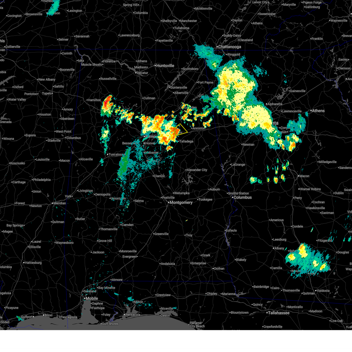
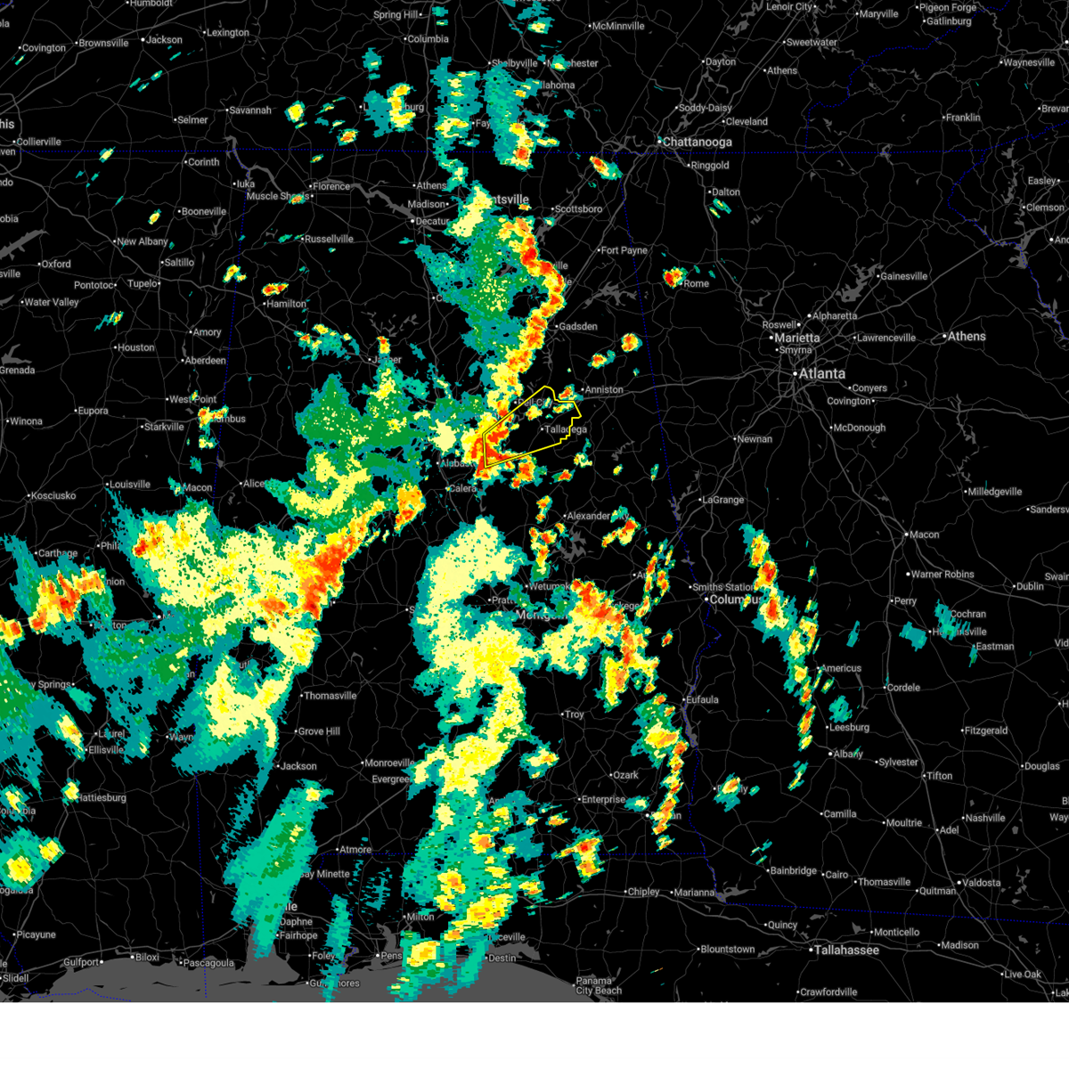
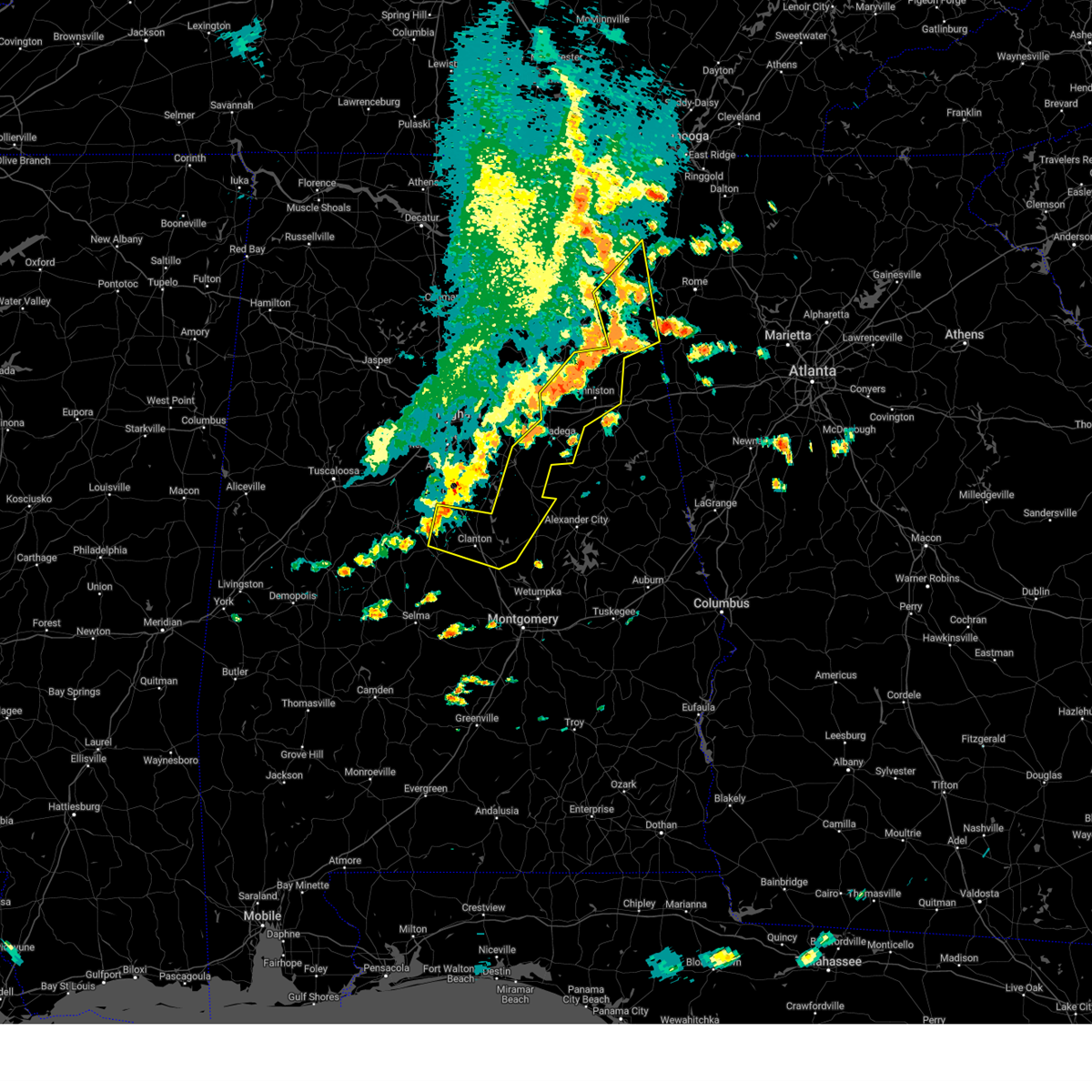
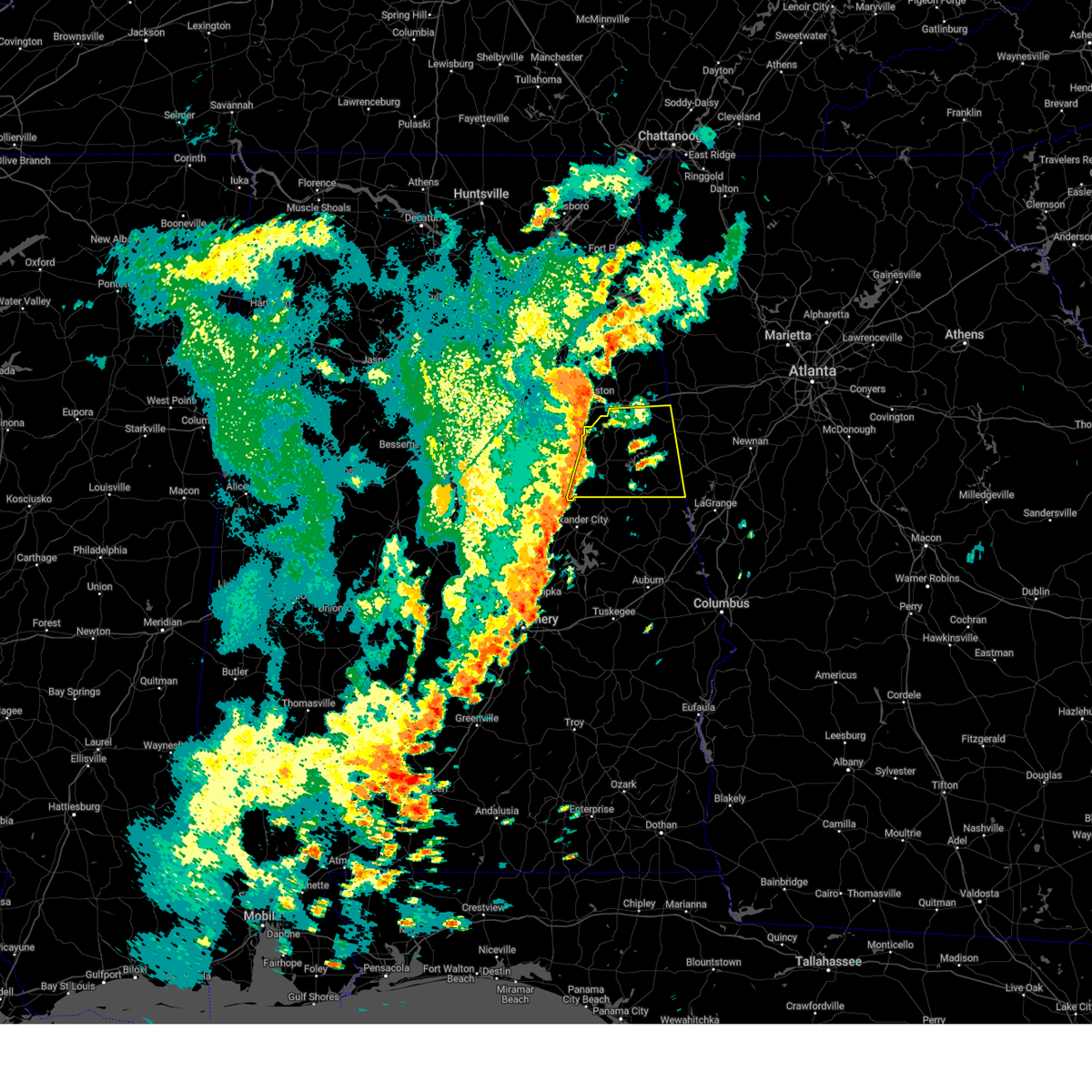
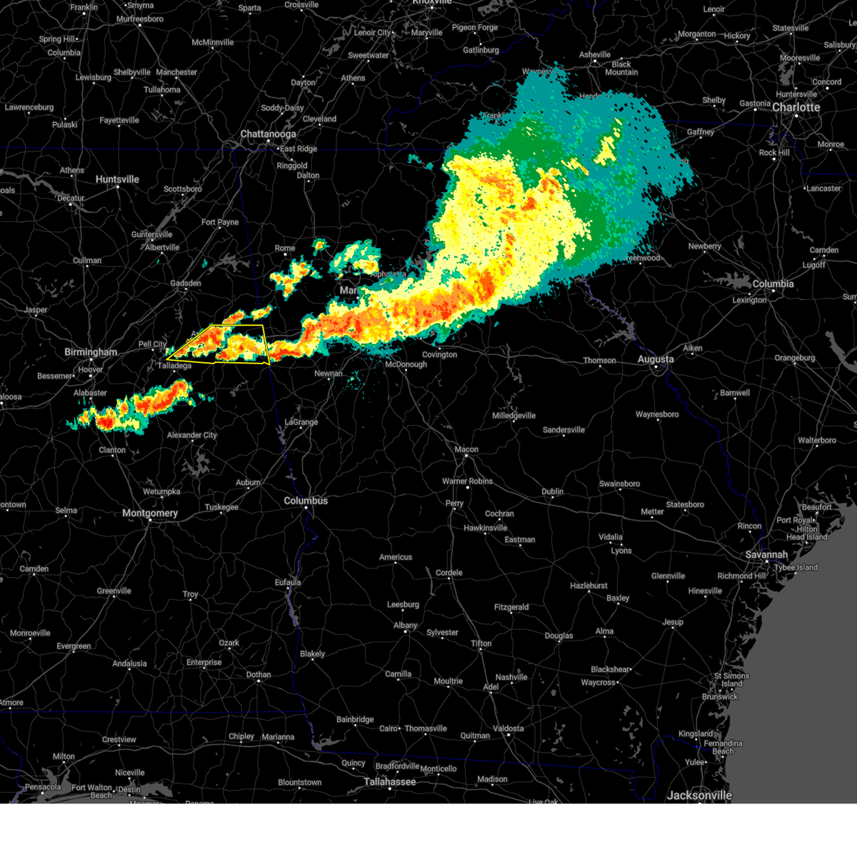
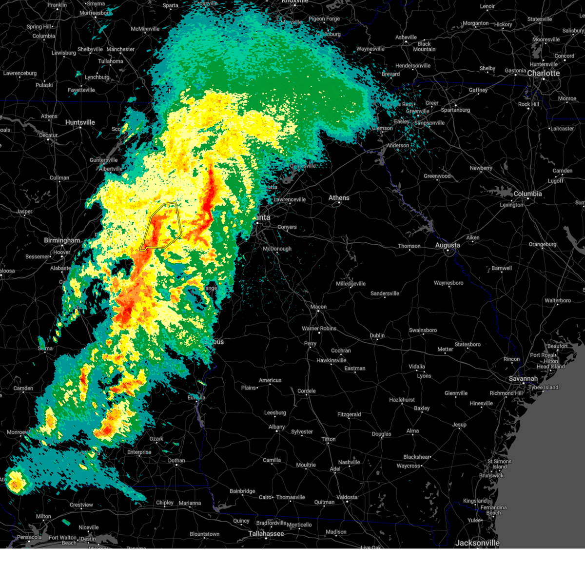
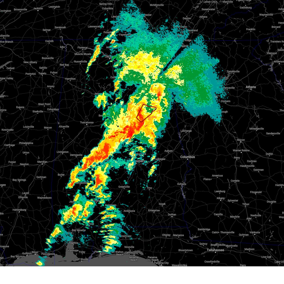
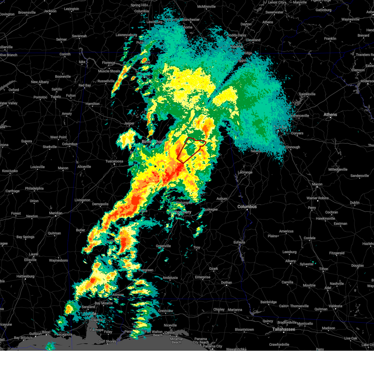
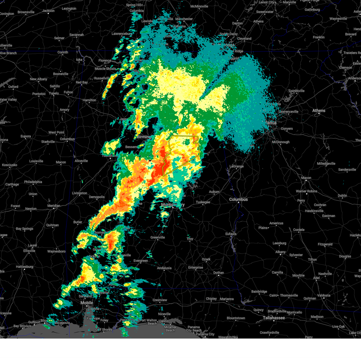
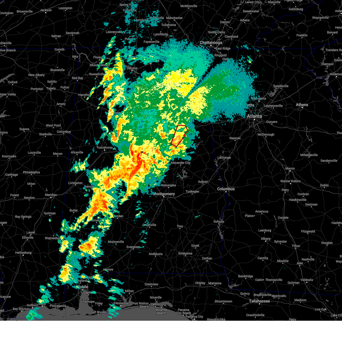
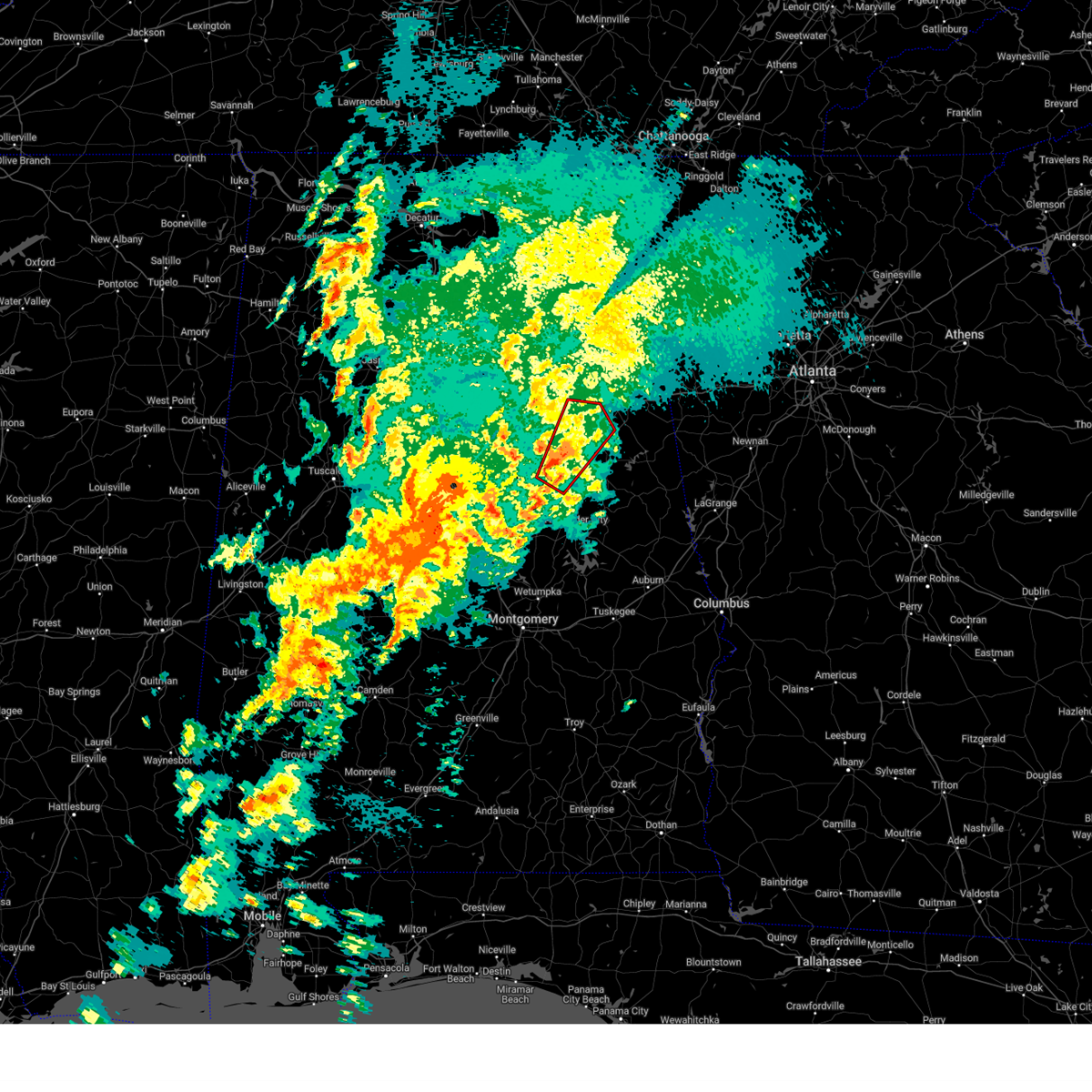
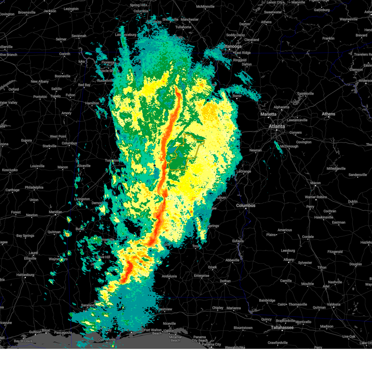
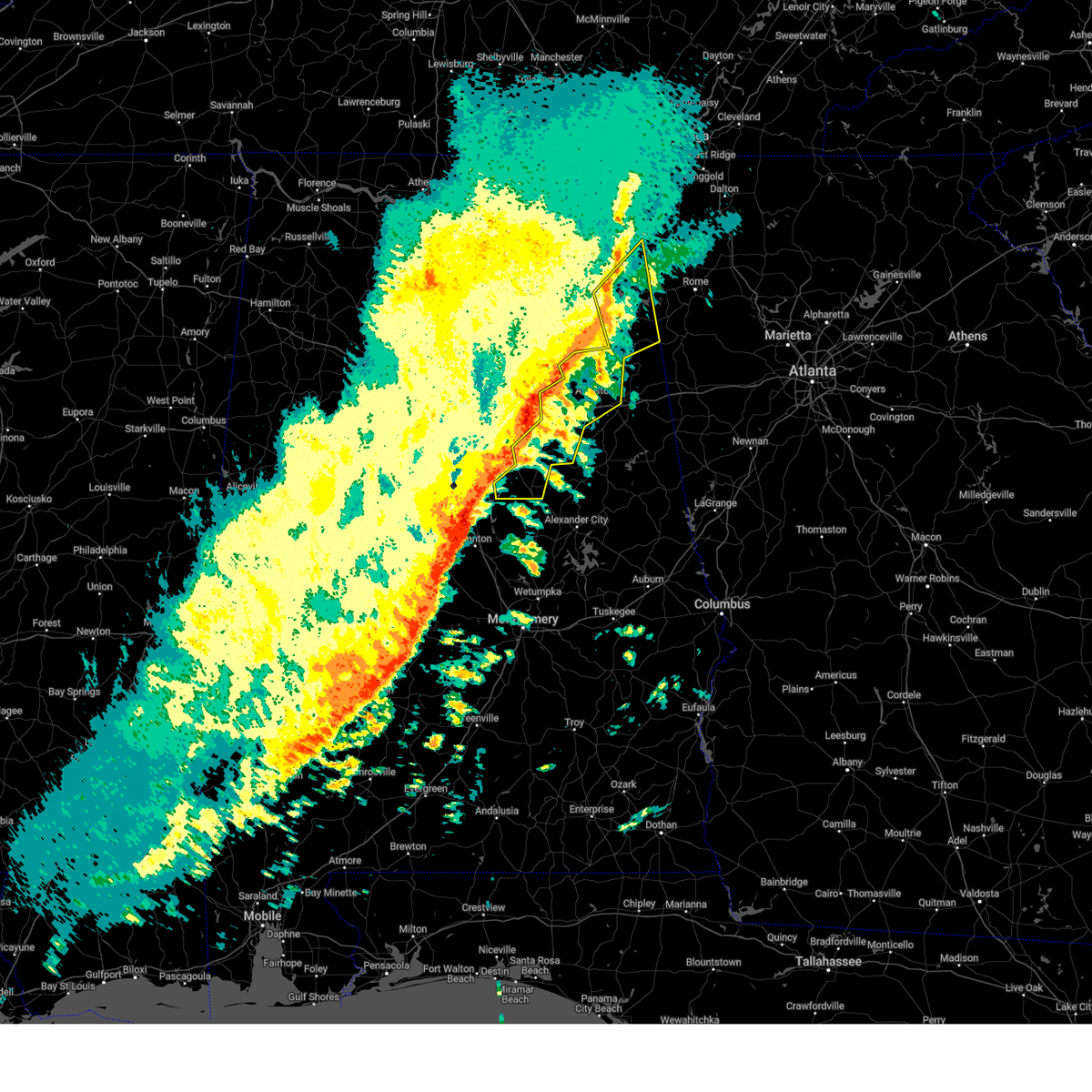
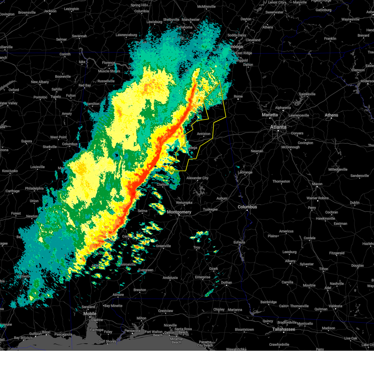
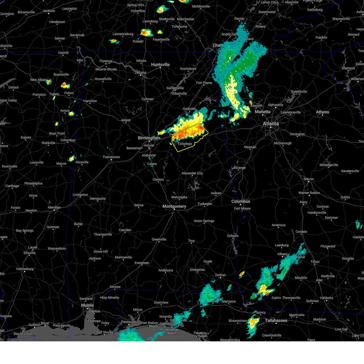
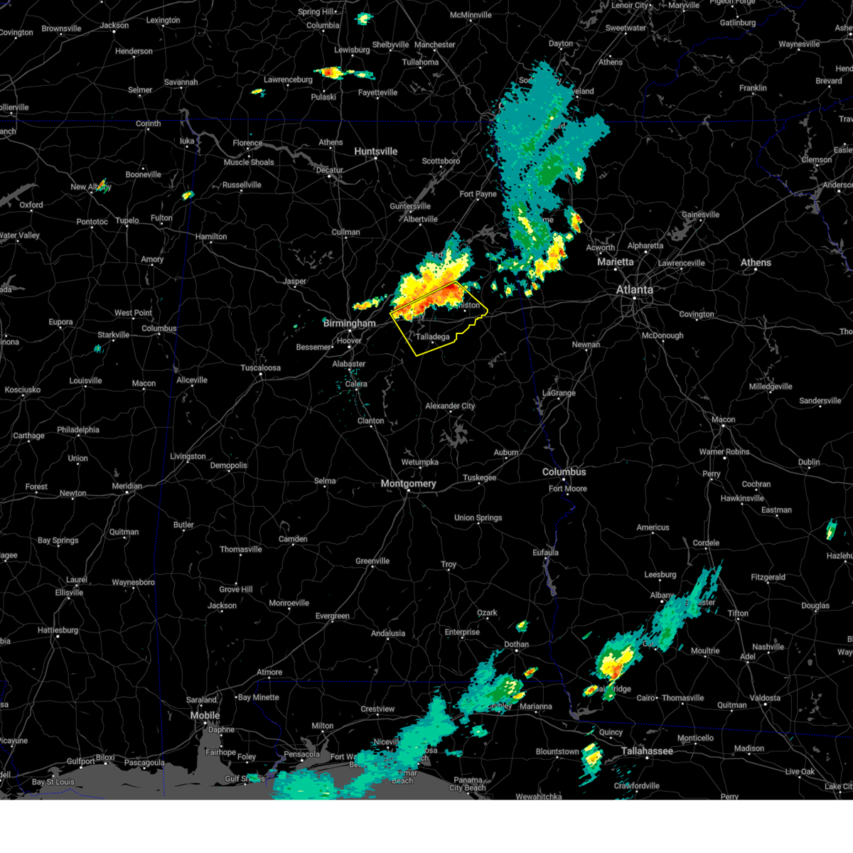
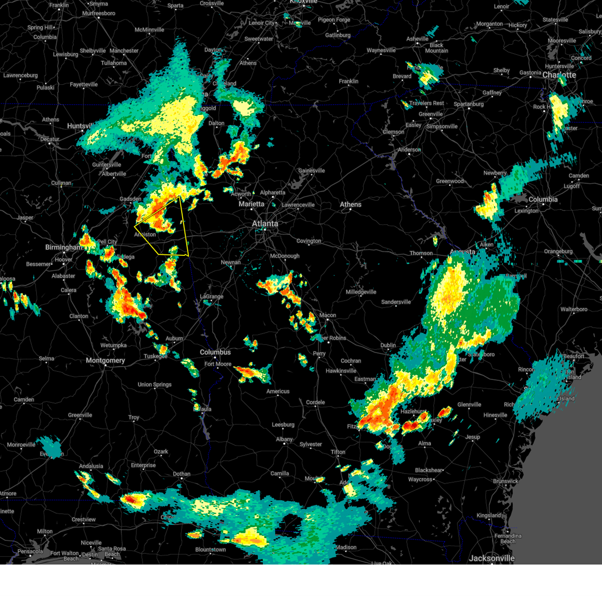
Hail Map for Oxford, AL
The Oxford, AL area has had 11 reports of on-the-ground hail by trained spotters, and has been under severe weather warnings 61 times during the past 12 months. Doppler radar has detected hail at or near Oxford, AL on 95 occasions, including 11 occasions during the past year.
| Name: | Oxford, AL |
| Where Located: | 55.8 miles E of Birmingham, AL |
| Map: | Google Map for Oxford, AL |
| Population: | 21348 |
| Housing Units: | 8806 |
| More Info: | Search Google for Oxford, AL |
2
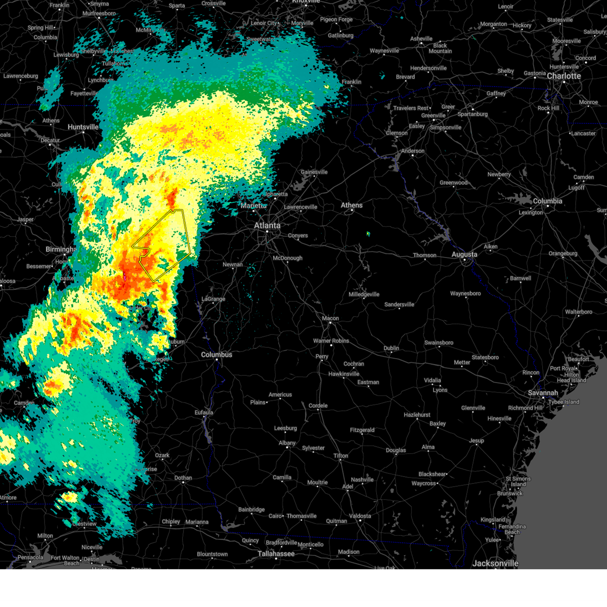
The Top Recent Hail Date for Oxford, AL is Thursday, April 10, 2025 (5th out of 95)

Hail and Wind Damage Spotted near Oxford, AL
| Date / Time | Report Details |
|---|---|
| 6/27/2025 9:15 PM CDT |
 At 915 pm cdt, a severe thunderstorm was located over honda manufacturing of alabama, or 10 miles east of pell city, moving east at 10 mph (radar indicated). Hazards include 60 mph wind gusts and quarter size hail. Hail damage to vehicles is expected. expect wind damage to roofs, siding, and trees. Locations impacted include, lincoln, riverside, talladega superspeedway, honda manufacturing of alabama, bynum, talladega municipal airport, logan martin lake, anniston army depot, jackson shoals, and eastaboga. At 915 pm cdt, a severe thunderstorm was located over honda manufacturing of alabama, or 10 miles east of pell city, moving east at 10 mph (radar indicated). Hazards include 60 mph wind gusts and quarter size hail. Hail damage to vehicles is expected. expect wind damage to roofs, siding, and trees. Locations impacted include, lincoln, riverside, talladega superspeedway, honda manufacturing of alabama, bynum, talladega municipal airport, logan martin lake, anniston army depot, jackson shoals, and eastaboga.
|
| 6/27/2025 9:13 PM CDT |
 Svrbmx the national weather service in birmingham has issued a * severe thunderstorm warning for, north central talladega county in east central alabama, southwestern calhoun county in east central alabama, * until 945 pm cdt. * at 913 pm cdt, a severe thunderstorm was located over honda manufacturing of alabama, or 10 miles northeast of pell city, moving east at 10 mph (radar indicated). Hazards include 60 mph wind gusts and nickel size hail. expect damage to roofs, siding, and trees Svrbmx the national weather service in birmingham has issued a * severe thunderstorm warning for, north central talladega county in east central alabama, southwestern calhoun county in east central alabama, * until 945 pm cdt. * at 913 pm cdt, a severe thunderstorm was located over honda manufacturing of alabama, or 10 miles northeast of pell city, moving east at 10 mph (radar indicated). Hazards include 60 mph wind gusts and nickel size hail. expect damage to roofs, siding, and trees
|
| 6/17/2025 3:40 PM CDT |
 At 339 pm cdt, a severe thunderstorm was located near fort mcclellan, moving northeast at 35 mph (radar indicated). Hazards include 60 mph wind gusts. a 56 mph wind gust was recorded at the anniston airport. Expect damage to roofs, siding, and trees. Locations impacted include, anniston, jacksonville, piedmont, heflin, fort mcclellan, weaver, fruithurst, edwardsville, muscadine, mars hills, jacksonville state university, sweetwater lake, coleman lake and campground, choccolocco, knightens crossroads, liberty hill, oak level, and borden springs. At 339 pm cdt, a severe thunderstorm was located near fort mcclellan, moving northeast at 35 mph (radar indicated). Hazards include 60 mph wind gusts. a 56 mph wind gust was recorded at the anniston airport. Expect damage to roofs, siding, and trees. Locations impacted include, anniston, jacksonville, piedmont, heflin, fort mcclellan, weaver, fruithurst, edwardsville, muscadine, mars hills, jacksonville state university, sweetwater lake, coleman lake and campground, choccolocco, knightens crossroads, liberty hill, oak level, and borden springs.
|
| 6/17/2025 3:27 PM CDT | At 327 pm cdt, a severe thunderstorm was located over anniston, moving northeast at 40 mph (radar indicated). Hazards include 60 mph wind gusts. the anniston airport recently reported a wind gust of 56 mph. Expect damage to roofs, siding, and trees. Locations impacted include, anniston, oxford, jacksonville, piedmont, heflin, cobb town, west end-cobb town, fort mcclellan, saks, glencoe, weaver, ohatchee, hobson city, fruithurst, edwardsville, blue mountain, alexandria, jacksonville state university, muscadine, and oxford lake. |
| 6/17/2025 3:26 PM CDT | The storm which prompted the warning has moved out of the area. therefore, the warning will be allowed to expire. |
| 6/17/2025 3:18 PM CDT |
 the severe thunderstorm warning has been cancelled and is no longer in effect the severe thunderstorm warning has been cancelled and is no longer in effect
|
| 6/17/2025 3:18 PM CDT |
 At 318 pm cdt, a severe thunderstorm was located over bynum, or 7 miles southwest of cobb town, moving northeast at 40 mph (radar indicated). Hazards include 60 mph wind gusts. Expect damage to roofs, siding, and trees. Locations impacted include, oxford, lincoln, munford, talladega superspeedway, grant town, talladega municipal airport, camp mac, jenifer, eastaboga, and jackson shoals. At 318 pm cdt, a severe thunderstorm was located over bynum, or 7 miles southwest of cobb town, moving northeast at 40 mph (radar indicated). Hazards include 60 mph wind gusts. Expect damage to roofs, siding, and trees. Locations impacted include, oxford, lincoln, munford, talladega superspeedway, grant town, talladega municipal airport, camp mac, jenifer, eastaboga, and jackson shoals.
|
| 6/17/2025 3:17 PM CDT |
 At 317 pm cdt, a severe thunderstorm was located over bynum, or near cobb town, moving northeast at 35 mph (radar indicated). Hazards include 60 mph wind gusts. Expect damage to roofs, siding, and trees. Locations impacted include, anniston, oxford, jacksonville, piedmont, heflin, cobb town, west end-cobb town, fort mcclellan, saks, glencoe, weaver, ohatchee, hobson city, fruithurst, edwardsville, blue mountain, alexandria, jacksonville state university, muscadine, and oxford lake. At 317 pm cdt, a severe thunderstorm was located over bynum, or near cobb town, moving northeast at 35 mph (radar indicated). Hazards include 60 mph wind gusts. Expect damage to roofs, siding, and trees. Locations impacted include, anniston, oxford, jacksonville, piedmont, heflin, cobb town, west end-cobb town, fort mcclellan, saks, glencoe, weaver, ohatchee, hobson city, fruithurst, edwardsville, blue mountain, alexandria, jacksonville state university, muscadine, and oxford lake.
|
| 6/17/2025 3:04 PM CDT |
 Svrbmx the national weather service in birmingham has issued a * severe thunderstorm warning for, calhoun county in east central alabama, cleburne county in east central alabama, * until 415 pm cdt. * at 304 pm cdt, a severe thunderstorm was located over talladega superspeedway, or 8 miles north of talladega, moving northeast at 35 mph (radar indicated). Hazards include 60 mph wind gusts. expect damage to roofs, siding, and trees Svrbmx the national weather service in birmingham has issued a * severe thunderstorm warning for, calhoun county in east central alabama, cleburne county in east central alabama, * until 415 pm cdt. * at 304 pm cdt, a severe thunderstorm was located over talladega superspeedway, or 8 miles north of talladega, moving northeast at 35 mph (radar indicated). Hazards include 60 mph wind gusts. expect damage to roofs, siding, and trees
|
| 6/17/2025 2:58 PM CDT |
 At 257 pm cdt, a severe thunderstorm was located near alpine, or near talladega, moving northeast at 35 mph (radar indicated). Hazards include 60 mph wind gusts. Expect damage to roofs, siding, and trees. Locations impacted include, oxford, talladega, pell city, lincoln, munford, waldo, alpine bay resort, winterboro, talladega superspeedway, talladega municipal airport, grant town, alpine, logan martin lake, honda manufacturing of alabama, coosa island, logan martin dam, country club estates, camp mac, jackson shoals, and ironaton. At 257 pm cdt, a severe thunderstorm was located near alpine, or near talladega, moving northeast at 35 mph (radar indicated). Hazards include 60 mph wind gusts. Expect damage to roofs, siding, and trees. Locations impacted include, oxford, talladega, pell city, lincoln, munford, waldo, alpine bay resort, winterboro, talladega superspeedway, talladega municipal airport, grant town, alpine, logan martin lake, honda manufacturing of alabama, coosa island, logan martin dam, country club estates, camp mac, jackson shoals, and ironaton.
|
| 6/17/2025 2:58 PM CDT |
 the severe thunderstorm warning has been cancelled and is no longer in effect the severe thunderstorm warning has been cancelled and is no longer in effect
|
| 6/17/2025 2:40 PM CDT |
 Svrbmx the national weather service in birmingham has issued a * severe thunderstorm warning for, talladega county in east central alabama, east central shelby county in central alabama, south central st. clair county in central alabama, * until 330 pm cdt. * at 240 pm cdt, a severe thunderstorm was located near harpersville, or near childersburg, moving northeast at 35 mph (radar indicated). Hazards include 60 mph wind gusts. expect damage to roofs, siding, and trees Svrbmx the national weather service in birmingham has issued a * severe thunderstorm warning for, talladega county in east central alabama, east central shelby county in central alabama, south central st. clair county in central alabama, * until 330 pm cdt. * at 240 pm cdt, a severe thunderstorm was located near harpersville, or near childersburg, moving northeast at 35 mph (radar indicated). Hazards include 60 mph wind gusts. expect damage to roofs, siding, and trees
|
| 6/7/2025 3:45 PM CDT |
 At 344 pm cdt, severe thunderstorms were located along a line extending from rome to near edwardsville to near winterboro to near verbena, moving east at 45 mph (radar indicated). Hazards include 60 mph wind gusts and penny size hail. Expect damage to roofs, siding, and trees. Locations impacted include, oxford, talladega, sylacauga, clanton, weogufka, stewartville, munford, oak grove, waldo, hanover, lyle, dollar, winterboro, strickland crossroads, bentleyville, moriah, verbena, mitchell lake, unity, and sycamore. At 344 pm cdt, severe thunderstorms were located along a line extending from rome to near edwardsville to near winterboro to near verbena, moving east at 45 mph (radar indicated). Hazards include 60 mph wind gusts and penny size hail. Expect damage to roofs, siding, and trees. Locations impacted include, oxford, talladega, sylacauga, clanton, weogufka, stewartville, munford, oak grove, waldo, hanover, lyle, dollar, winterboro, strickland crossroads, bentleyville, moriah, verbena, mitchell lake, unity, and sycamore.
|
| 6/7/2025 3:45 PM CDT |
 the severe thunderstorm warning has been cancelled and is no longer in effect the severe thunderstorm warning has been cancelled and is no longer in effect
|
| 6/7/2025 3:30 PM CDT |
 At 330 pm cdt, severe thunderstorms were located along a line extending from 9 miles south of summerville to near jacksonville to near logan martin dam to near pooles crossroads, moving east at 40 mph (radar indicated). Hazards include 60 mph wind gusts and penny size hail. Expect damage to roofs, siding, and trees. Locations impacted include, anniston, oxford, talladega, sylacauga, jacksonville, clanton, childersburg, piedmont, jemison, cedar bluff, talladega springs, forney, west end-cobb town, stewartville, weogufka, cobb town, fort mcclellan, saks, weaver, and thorsby. At 330 pm cdt, severe thunderstorms were located along a line extending from 9 miles south of summerville to near jacksonville to near logan martin dam to near pooles crossroads, moving east at 40 mph (radar indicated). Hazards include 60 mph wind gusts and penny size hail. Expect damage to roofs, siding, and trees. Locations impacted include, anniston, oxford, talladega, sylacauga, jacksonville, clanton, childersburg, piedmont, jemison, cedar bluff, talladega springs, forney, west end-cobb town, stewartville, weogufka, cobb town, fort mcclellan, saks, weaver, and thorsby.
|
| 6/7/2025 3:15 PM CDT |
 At 315 pm cdt, severe thunderstorms were located along a line extending from near blanche to near alexandria to bon air to near lawley, moving east at 45 mph (radar indicated). Hazards include 60 mph wind gusts and penny size hail. Expect damage to roofs, siding, and trees. Locations impacted include, anniston, oxford, talladega, sylacauga, jacksonville, clanton, childersburg, piedmont, centre, jemison, cedar bluff, talladega springs, weogufka, cobb town, fort mcclellan, saks, little river canyon national preserve, forney, west end-cobb town, and centre municipal airport. At 315 pm cdt, severe thunderstorms were located along a line extending from near blanche to near alexandria to bon air to near lawley, moving east at 45 mph (radar indicated). Hazards include 60 mph wind gusts and penny size hail. Expect damage to roofs, siding, and trees. Locations impacted include, anniston, oxford, talladega, sylacauga, jacksonville, clanton, childersburg, piedmont, centre, jemison, cedar bluff, talladega springs, weogufka, cobb town, fort mcclellan, saks, little river canyon national preserve, forney, west end-cobb town, and centre municipal airport.
|
| 6/7/2025 3:03 PM CDT |
 At 303 pm cdt, severe thunderstorms were located along a line extending from near fort payne to near ohatchee to near harpersville to talladega national forest, moving east at 45 mph (radar indicated). Hazards include 60 mph wind gusts and penny size hail. Expect damage to roofs, siding, and trees. Locations impacted include, anniston, oxford, talladega, sylacauga, jacksonville, clanton, childersburg, piedmont, centre, jemison, cedar bluff, talladega springs, weogufka, cobb town, fort mcclellan, saks, little river canyon national preserve, forney, west end-cobb town, and centre municipal airport. At 303 pm cdt, severe thunderstorms were located along a line extending from near fort payne to near ohatchee to near harpersville to talladega national forest, moving east at 45 mph (radar indicated). Hazards include 60 mph wind gusts and penny size hail. Expect damage to roofs, siding, and trees. Locations impacted include, anniston, oxford, talladega, sylacauga, jacksonville, clanton, childersburg, piedmont, centre, jemison, cedar bluff, talladega springs, weogufka, cobb town, fort mcclellan, saks, little river canyon national preserve, forney, west end-cobb town, and centre municipal airport.
|
| 6/7/2025 2:46 PM CDT |
 Svrbmx the national weather service in birmingham has issued a * severe thunderstorm warning for, chilton county in central alabama, talladega county in east central alabama, calhoun county in east central alabama, western coosa county in east central alabama, cherokee county in northeastern alabama, * until 400 pm cdt. * at 245 pm cdt, severe thunderstorms were located along a line extending from 6 miles south of section to near ashville to brook highland to near brent, moving east at 45 mph (radar indicated). Hazards include 60 mph wind gusts and penny size hail. expect damage to roofs, siding, and trees Svrbmx the national weather service in birmingham has issued a * severe thunderstorm warning for, chilton county in central alabama, talladega county in east central alabama, calhoun county in east central alabama, western coosa county in east central alabama, cherokee county in northeastern alabama, * until 400 pm cdt. * at 245 pm cdt, severe thunderstorms were located along a line extending from 6 miles south of section to near ashville to brook highland to near brent, moving east at 45 mph (radar indicated). Hazards include 60 mph wind gusts and penny size hail. expect damage to roofs, siding, and trees
|
| 5/27/2025 12:49 PM CDT |
 At 1249 pm cdt, severe thunderstorms were located along a line extending from near delta to near barfield to near goldville, moving east at 45 mph (radar indicated). Hazards include 60 mph wind gusts. Expect damage to roofs, siding, and trees. locations impacted include, roanoke, lineville, ashland, wedowee, lake wedowee, wadley, ranburne, woodland, malone, morrison cross roads, barfield, corinth, fosters cross roads, delta, crystal lake, graham, dickert, newell, r. l. Harris dam, and tennant. At 1249 pm cdt, severe thunderstorms were located along a line extending from near delta to near barfield to near goldville, moving east at 45 mph (radar indicated). Hazards include 60 mph wind gusts. Expect damage to roofs, siding, and trees. locations impacted include, roanoke, lineville, ashland, wedowee, lake wedowee, wadley, ranburne, woodland, malone, morrison cross roads, barfield, corinth, fosters cross roads, delta, crystal lake, graham, dickert, newell, r. l. Harris dam, and tennant.
|
| 5/27/2025 12:33 PM CDT |
 Svrbmx the national weather service in birmingham has issued a * severe thunderstorm warning for, randolph county in east central alabama, southern cleburne county in east central alabama, clay county in east central alabama, * until 130 pm cdt. * at 1232 pm cdt, severe thunderstorms were located along a line extending from near mount cheaha to near ashland to 6 miles northeast of goodwater, moving east at 45 mph (radar indicated). Hazards include 60 mph wind gusts. expect damage to roofs, siding, and trees Svrbmx the national weather service in birmingham has issued a * severe thunderstorm warning for, randolph county in east central alabama, southern cleburne county in east central alabama, clay county in east central alabama, * until 130 pm cdt. * at 1232 pm cdt, severe thunderstorms were located along a line extending from near mount cheaha to near ashland to 6 miles northeast of goodwater, moving east at 45 mph (radar indicated). Hazards include 60 mph wind gusts. expect damage to roofs, siding, and trees
|
| 5/21/2025 1:17 AM CDT |
 the severe thunderstorm warning has been cancelled and is no longer in effect the severe thunderstorm warning has been cancelled and is no longer in effect
|
| 5/21/2025 1:11 AM CDT |
 At 110 am cdt, severe thunderstorms were located along a line extending from near mars hills to near oxford lake, moving east at 45 mph (radar indicated). Hazards include 60 mph wind gusts and quarter size hail. Hail damage to vehicles is expected. expect wind damage to roofs, siding, and trees. Locations impacted include, heflin, ranburne, trickem, lake cleburne, hollis crossroads, micaville, chalafinnee, and camp sequoyah. At 110 am cdt, severe thunderstorms were located along a line extending from near mars hills to near oxford lake, moving east at 45 mph (radar indicated). Hazards include 60 mph wind gusts and quarter size hail. Hail damage to vehicles is expected. expect wind damage to roofs, siding, and trees. Locations impacted include, heflin, ranburne, trickem, lake cleburne, hollis crossroads, micaville, chalafinnee, and camp sequoyah.
|
| 5/21/2025 1:11 AM CDT |
 the severe thunderstorm warning has been cancelled and is no longer in effect the severe thunderstorm warning has been cancelled and is no longer in effect
|
| 5/21/2025 12:59 AM CDT |
 At 1259 am cdt, severe thunderstorms were located along a line extending from near mars hills to near grant town, moving east at 45 mph (radar indicated). Hazards include 60 mph wind gusts and quarter size hail. Hail damage to vehicles is expected. expect wind damage to roofs, siding, and trees. Locations impacted include, anniston, oxford, heflin, munford, hobson city, ranburne, fruithurst, edwardsville, grant town, muscadine, abernathy, anniston regional airport, oxford lake, hollis crossroads, choccolocco, trickem, lake cleburne, dearmanville, i 20 welcome center, and micaville. At 1259 am cdt, severe thunderstorms were located along a line extending from near mars hills to near grant town, moving east at 45 mph (radar indicated). Hazards include 60 mph wind gusts and quarter size hail. Hail damage to vehicles is expected. expect wind damage to roofs, siding, and trees. Locations impacted include, anniston, oxford, heflin, munford, hobson city, ranburne, fruithurst, edwardsville, grant town, muscadine, abernathy, anniston regional airport, oxford lake, hollis crossroads, choccolocco, trickem, lake cleburne, dearmanville, i 20 welcome center, and micaville.
|
| 5/21/2025 12:48 AM CDT |
 Svrbmx the national weather service in birmingham has issued a * severe thunderstorm warning for, northeastern talladega county in east central alabama, southeastern calhoun county in east central alabama, cleburne county in east central alabama, * until 145 am cdt. * at 1247 am cdt, severe thunderstorms were located along a line extending from 6 miles south of piedmont to talladega superspeedway, moving east at 45 mph (radar indicated). Hazards include 60 mph wind gusts and quarter size hail. Hail damage to vehicles is expected. Expect wind damage to roofs, siding, and trees. Svrbmx the national weather service in birmingham has issued a * severe thunderstorm warning for, northeastern talladega county in east central alabama, southeastern calhoun county in east central alabama, cleburne county in east central alabama, * until 145 am cdt. * at 1247 am cdt, severe thunderstorms were located along a line extending from 6 miles south of piedmont to talladega superspeedway, moving east at 45 mph (radar indicated). Hazards include 60 mph wind gusts and quarter size hail. Hail damage to vehicles is expected. Expect wind damage to roofs, siding, and trees.
|
| 5/18/2025 7:14 AM CDT |
 Svrbmx the national weather service in birmingham has issued a * severe thunderstorm warning for, central talladega county in east central alabama, randolph county in east central alabama, southeastern st. clair county in central alabama, northern tallapoosa county in east central alabama, northern chambers county in east central alabama, southern cleburne county in east central alabama, northeastern coosa county in east central alabama, clay county in east central alabama, * until 815 am cdt. * at 714 am cdt, severe thunderstorms were located along a line extending from near logan martin lake to near winterboro to near stewartville, moving east at 70 mph (radar indicated). Hazards include 70 mph wind gusts and quarter size hail. Hail damage to vehicles is expected. expect considerable tree damage. Wind damage is also likely to mobile homes, roofs, and outbuildings. Svrbmx the national weather service in birmingham has issued a * severe thunderstorm warning for, central talladega county in east central alabama, randolph county in east central alabama, southeastern st. clair county in central alabama, northern tallapoosa county in east central alabama, northern chambers county in east central alabama, southern cleburne county in east central alabama, northeastern coosa county in east central alabama, clay county in east central alabama, * until 815 am cdt. * at 714 am cdt, severe thunderstorms were located along a line extending from near logan martin lake to near winterboro to near stewartville, moving east at 70 mph (radar indicated). Hazards include 70 mph wind gusts and quarter size hail. Hail damage to vehicles is expected. expect considerable tree damage. Wind damage is also likely to mobile homes, roofs, and outbuildings.
|
| 5/2/2025 7:21 PM CDT | Trees down blocking ponderosa trail with power lines downe in calhoun county AL, 7 miles E of Oxford, AL |
| 5/2/2025 7:16 PM CDT |
 At 716 pm cdt, severe thunderstorms were located along a line extending from mars hills to near mount cheaha to talladega springs, moving east at 35 mph (radar indicated). Hazards include 60 mph wind gusts and quarter size hail. Hail damage to vehicles is expected. expect wind damage to roofs, siding, and trees. Locations impacted include, graham, cleveland crossroads, dickert, anniston, gantts quarry, coleman lake and campground, choccolocco, tennant, trickem, lake cleburne, heflin, varnons, liberty hill, oak level, hobson city, roanoke municipal airport, corinth, lineville, mellow valley, and mignon. At 716 pm cdt, severe thunderstorms were located along a line extending from mars hills to near mount cheaha to talladega springs, moving east at 35 mph (radar indicated). Hazards include 60 mph wind gusts and quarter size hail. Hail damage to vehicles is expected. expect wind damage to roofs, siding, and trees. Locations impacted include, graham, cleveland crossroads, dickert, anniston, gantts quarry, coleman lake and campground, choccolocco, tennant, trickem, lake cleburne, heflin, varnons, liberty hill, oak level, hobson city, roanoke municipal airport, corinth, lineville, mellow valley, and mignon.
|
| 5/2/2025 6:48 PM CDT |
 Svrbmx the national weather service in birmingham has issued a * severe thunderstorm warning for, talladega county in east central alabama, randolph county in east central alabama, calhoun county in east central alabama, cleburne county in east central alabama, clay county in east central alabama, * until 815 pm cdt. * at 647 pm cdt, severe thunderstorms were located along a line extending from near mars hills to near mount cheaha to near winterboro to bon air to near wilsonville, moving east at 45 mph (radar indicated). Hazards include 60 mph wind gusts and quarter size hail. Hail damage to vehicles is expected. Expect wind damage to roofs, siding, and trees. Svrbmx the national weather service in birmingham has issued a * severe thunderstorm warning for, talladega county in east central alabama, randolph county in east central alabama, calhoun county in east central alabama, cleburne county in east central alabama, clay county in east central alabama, * until 815 pm cdt. * at 647 pm cdt, severe thunderstorms were located along a line extending from near mars hills to near mount cheaha to near winterboro to bon air to near wilsonville, moving east at 45 mph (radar indicated). Hazards include 60 mph wind gusts and quarter size hail. Hail damage to vehicles is expected. Expect wind damage to roofs, siding, and trees.
|
| 5/2/2025 6:33 PM CDT | At 632 pm cdt, severe thunderstorms were located along a line extending from near ball flat to near columbiana, moving east at 45 mph (radar indicated). Hazards include 60 mph wind gusts and quarter size hail. Hail damage to vehicles is expected. expect wind damage to roofs, siding, and trees. Locations impacted include, alpine bay resort, anniston, shelby shores, gantts quarry, childersburg, choccolocco, talladega superspeedway, cobb city, varnons, jackson shoals, hobson city, alexandria, lincoln, talladega municipal airport, jacksonville, west end-cobb town, mignon, wellington, gunthertown, and anniston army depot. |
| 5/2/2025 6:06 PM CDT | Svrbmx the national weather service in birmingham has issued a * severe thunderstorm warning for, talladega county in east central alabama, calhoun county in east central alabama, * until 700 pm cdt. * at 606 pm cdt, severe thunderstorms were located along a line extending from gadsden to near columbiana, moving east at 45 mph (radar indicated). Hazards include 60 mph wind gusts and quarter size hail. Hail damage to vehicles is expected. Expect wind damage to roofs, siding, and trees. |
| 4/10/2025 8:17 PM CDT |
 At 817 pm cdt, a severe thunderstorm was located near grant town, or near oxford, moving southeast at 40 mph (radar indicated). Hazards include 60 mph wind gusts and half dollar size hail. Hail damage to vehicles is expected. expect wind damage to roofs, siding, and trees. Locations impacted include, anniston, munford, choccolocco, talladega superspeedway, anniston regional airport, edwardsville, trickem, lake cleburne, blue mountain, heflin, cobb town, jackson shoals, jenifer, hobson city, alexandria, lincoln, talladega municipal airport, oxford, west end-cobb town, and anniston army depot. At 817 pm cdt, a severe thunderstorm was located near grant town, or near oxford, moving southeast at 40 mph (radar indicated). Hazards include 60 mph wind gusts and half dollar size hail. Hail damage to vehicles is expected. expect wind damage to roofs, siding, and trees. Locations impacted include, anniston, munford, choccolocco, talladega superspeedway, anniston regional airport, edwardsville, trickem, lake cleburne, blue mountain, heflin, cobb town, jackson shoals, jenifer, hobson city, alexandria, lincoln, talladega municipal airport, oxford, west end-cobb town, and anniston army depot.
|
| 4/10/2025 8:01 PM CDT |
 At 800 pm cdt, a severe thunderstorm was located over saks, moving southeast at 45 mph (radar indicated). Hazards include 60 mph wind gusts and half dollar size hail. Hail damage to vehicles is expected. expect wind damage to roofs, siding, and trees. Locations impacted include, anniston, munford, coleman lake and campground, choccolocco, talladega superspeedway, anniston regional airport, edwardsville, trickem, lake cleburne, blue mountain, heflin, cobb town, jackson shoals, sulphur springs, jenifer, hobson city, alexandria, lincoln, talladega municipal airport, and jacksonville. At 800 pm cdt, a severe thunderstorm was located over saks, moving southeast at 45 mph (radar indicated). Hazards include 60 mph wind gusts and half dollar size hail. Hail damage to vehicles is expected. expect wind damage to roofs, siding, and trees. Locations impacted include, anniston, munford, coleman lake and campground, choccolocco, talladega superspeedway, anniston regional airport, edwardsville, trickem, lake cleburne, blue mountain, heflin, cobb town, jackson shoals, sulphur springs, jenifer, hobson city, alexandria, lincoln, talladega municipal airport, and jacksonville.
|
| 4/10/2025 7:40 PM CDT |
 Svrbmx the national weather service in birmingham has issued a * severe thunderstorm warning for, northeastern talladega county in east central alabama, calhoun county in east central alabama, cleburne county in east central alabama, * until 830 pm cdt. * at 740 pm cdt, a severe thunderstorm was located over neely henry lake, or near rainbow city, moving southeast at 45 mph (radar indicated). Hazards include 60 mph wind gusts and quarter size hail. Hail damage to vehicles is expected. Expect wind damage to roofs, siding, and trees. Svrbmx the national weather service in birmingham has issued a * severe thunderstorm warning for, northeastern talladega county in east central alabama, calhoun county in east central alabama, cleburne county in east central alabama, * until 830 pm cdt. * at 740 pm cdt, a severe thunderstorm was located over neely henry lake, or near rainbow city, moving southeast at 45 mph (radar indicated). Hazards include 60 mph wind gusts and quarter size hail. Hail damage to vehicles is expected. Expect wind damage to roofs, siding, and trees.
|
| 3/15/2025 10:41 PM CDT |
 the severe thunderstorm warning has been cancelled and is no longer in effect the severe thunderstorm warning has been cancelled and is no longer in effect
|
| 3/15/2025 10:41 PM CDT |
 At 1040 pm cdt, severe thunderstorms were located along a line extending from 7 miles east of jacksonville to near delta, moving northeast at 65 mph (radar indicated). Hazards include 60 mph wind gusts. Expect damage to roofs, siding, and trees. Locations impacted include, hollis crossroads, muscadine, abernathy, sweetwater lake, coleman lake and campground, choccolocco, edwardsville, trickem, lake cleburne, dearmanville, heflin, i 20 welcome center, liberty hill, micaville, chalafinnee, oak level, fruithurst, borden springs, mars hills, and camp sequoyah. At 1040 pm cdt, severe thunderstorms were located along a line extending from 7 miles east of jacksonville to near delta, moving northeast at 65 mph (radar indicated). Hazards include 60 mph wind gusts. Expect damage to roofs, siding, and trees. Locations impacted include, hollis crossroads, muscadine, abernathy, sweetwater lake, coleman lake and campground, choccolocco, edwardsville, trickem, lake cleburne, dearmanville, heflin, i 20 welcome center, liberty hill, micaville, chalafinnee, oak level, fruithurst, borden springs, mars hills, and camp sequoyah.
|
| 3/15/2025 10:16 PM CDT | Svrbmx the national weather service in birmingham has issued a * severe thunderstorm warning for, northeastern talladega county in east central alabama, southeastern calhoun county in east central alabama, cleburne county in east central alabama, * until 1115 pm cdt. * at 1016 pm cdt, severe thunderstorms were located along a line extending from grant town to 7 miles west of ashland, moving northeast at 65 mph (radar indicated). Hazards include 60 mph wind gusts. expect damage to roofs, siding, and trees |
| 3/15/2025 9:12 PM CDT |
 Svrbmx the national weather service in birmingham has issued a * severe thunderstorm warning for, northwestern randolph county in east central alabama, southeastern calhoun county in east central alabama, cleburne county in east central alabama, northeastern clay county in east central alabama, * until 1015 pm cdt. * at 912 pm cdt, a severe thunderstorm was located near oxford, moving northeast at 55 mph (radar indicated). Hazards include 60 mph wind gusts. expect damage to roofs, siding, and trees Svrbmx the national weather service in birmingham has issued a * severe thunderstorm warning for, northwestern randolph county in east central alabama, southeastern calhoun county in east central alabama, cleburne county in east central alabama, northeastern clay county in east central alabama, * until 1015 pm cdt. * at 912 pm cdt, a severe thunderstorm was located near oxford, moving northeast at 55 mph (radar indicated). Hazards include 60 mph wind gusts. expect damage to roofs, siding, and trees
|
| 3/15/2025 8:57 PM CDT |
 At 856 pm cdt, a severe thunderstorm capable of producing a tornado was located over talladega, moving northeast at 55 mph (radar indicated rotation). Hazards include tornado. Flying debris will be dangerous to those caught without shelter. mobile homes will be damaged or destroyed. damage to roofs, windows, and vehicles will occur. tree damage is likely. Locations impacted include, grant town, munford, eastaboga, talladega superspeedway, camp mac, jackson shoals, talladega, ironaton, jenifer, waldo, lincoln, talladega municipal airport, howells cove, and oxford. At 856 pm cdt, a severe thunderstorm capable of producing a tornado was located over talladega, moving northeast at 55 mph (radar indicated rotation). Hazards include tornado. Flying debris will be dangerous to those caught without shelter. mobile homes will be damaged or destroyed. damage to roofs, windows, and vehicles will occur. tree damage is likely. Locations impacted include, grant town, munford, eastaboga, talladega superspeedway, camp mac, jackson shoals, talladega, ironaton, jenifer, waldo, lincoln, talladega municipal airport, howells cove, and oxford.
|
| 3/15/2025 8:47 PM CDT |
 the severe thunderstorm warning has been cancelled and is no longer in effect the severe thunderstorm warning has been cancelled and is no longer in effect
|
| 3/15/2025 8:47 PM CDT |
 At 847 pm cdt, severe thunderstorms were located along a line extending from near logan martin dam to sycamore to near stewartville, moving northeast at 50 mph (radar indicated). Hazards include 70 mph wind gusts. Expect considerable tree damage. damage is likely to mobile homes, roofs, and outbuildings. Locations impacted include, country club estates, alpine bay resort, munford, winterboro, gantts quarry, bon air, weogufka, strickland crossroads, talladega superspeedway, camp mac, jackson shoals, ironaton, jenifer, talladega municipal airport, ashland, mignon, gunthertown, grant town, sylacauga municipal airport, and overbrook. At 847 pm cdt, severe thunderstorms were located along a line extending from near logan martin dam to sycamore to near stewartville, moving northeast at 50 mph (radar indicated). Hazards include 70 mph wind gusts. Expect considerable tree damage. damage is likely to mobile homes, roofs, and outbuildings. Locations impacted include, country club estates, alpine bay resort, munford, winterboro, gantts quarry, bon air, weogufka, strickland crossroads, talladega superspeedway, camp mac, jackson shoals, ironaton, jenifer, talladega municipal airport, ashland, mignon, gunthertown, grant town, sylacauga municipal airport, and overbrook.
|
| 3/15/2025 8:46 PM CDT |
 At 845 pm cdt, a confirmed tornado was located over winterboro, or 7 miles southwest of talladega, moving northeast at 55 mph (radar confirmed tornado). Hazards include damaging tornado. Flying debris will be dangerous to those caught without shelter. mobile homes will be damaged or destroyed. damage to roofs, windows, and vehicles will occur. tree damage is likely. Locations impacted include, grant town, munford, winterboro, alpine, eastaboga, talladega superspeedway, honda manufacturing of alabama, camp mac, jackson shoals, talladega, ironaton, jenifer, waldo, lincoln, talladega municipal airport, howells cove, oxford, and logan martin lake. At 845 pm cdt, a confirmed tornado was located over winterboro, or 7 miles southwest of talladega, moving northeast at 55 mph (radar confirmed tornado). Hazards include damaging tornado. Flying debris will be dangerous to those caught without shelter. mobile homes will be damaged or destroyed. damage to roofs, windows, and vehicles will occur. tree damage is likely. Locations impacted include, grant town, munford, winterboro, alpine, eastaboga, talladega superspeedway, honda manufacturing of alabama, camp mac, jackson shoals, talladega, ironaton, jenifer, waldo, lincoln, talladega municipal airport, howells cove, oxford, and logan martin lake.
|
| 3/15/2025 8:42 PM CDT |
 Torbmx the national weather service in birmingham has issued a * tornado warning for, central talladega county in east central alabama, * until 915 pm cdt. * at 841 pm cdt, a severe thunderstorm capable of producing a tornado was located over winterboro, or 7 miles east of childersburg, moving northeast at 60 mph (radar indicated rotation). Hazards include tornado. Flying debris will be dangerous to those caught without shelter. mobile homes will be damaged or destroyed. damage to roofs, windows, and vehicles will occur. Tree damage is likely. Torbmx the national weather service in birmingham has issued a * tornado warning for, central talladega county in east central alabama, * until 915 pm cdt. * at 841 pm cdt, a severe thunderstorm capable of producing a tornado was located over winterboro, or 7 miles east of childersburg, moving northeast at 60 mph (radar indicated rotation). Hazards include tornado. Flying debris will be dangerous to those caught without shelter. mobile homes will be damaged or destroyed. damage to roofs, windows, and vehicles will occur. Tree damage is likely.
|
| 3/15/2025 8:26 PM CDT |
 Svrbmx the national weather service in birmingham has issued a * severe thunderstorm warning for, talladega county in east central alabama, south central st. clair county in central alabama, northwestern coosa county in east central alabama, central clay county in east central alabama, * until 930 pm cdt. * at 826 pm cdt, severe thunderstorms were located along a line extending from near columbiana to near talladega springs to near lay lake dam, moving northeast at 60 mph (radar indicated). Hazards include 70 mph wind gusts. Expect considerable tree damage. Damage is likely to mobile homes, roofs, and outbuildings. Svrbmx the national weather service in birmingham has issued a * severe thunderstorm warning for, talladega county in east central alabama, south central st. clair county in central alabama, northwestern coosa county in east central alabama, central clay county in east central alabama, * until 930 pm cdt. * at 826 pm cdt, severe thunderstorms were located along a line extending from near columbiana to near talladega springs to near lay lake dam, moving northeast at 60 mph (radar indicated). Hazards include 70 mph wind gusts. Expect considerable tree damage. Damage is likely to mobile homes, roofs, and outbuildings.
|
| 3/15/2025 8:01 PM CDT |
 the tornado warning has been cancelled and is no longer in effect the tornado warning has been cancelled and is no longer in effect
|
| 3/15/2025 8:01 PM CDT |
 At 800 pm cdt, a severe thunderstorm capable of producing a tornado was located over waldo, or 7 miles southeast of talladega, moving northeast at 45 mph (radar indicated rotation). Hazards include tornado. Flying debris will be dangerous to those caught without shelter. mobile homes will be damaged or destroyed. damage to roofs, windows, and vehicles will occur. tree damage is likely. Locations impacted include, anniston army depot, grant town, munford, eastaboga, anniston regional airport, camp mac, bynum, talladega, chandler springs, ironaton, jenifer, waldo, hobson city, lake chinnabee, oxford, gunthertown, west end-cobb town, and anniston. At 800 pm cdt, a severe thunderstorm capable of producing a tornado was located over waldo, or 7 miles southeast of talladega, moving northeast at 45 mph (radar indicated rotation). Hazards include tornado. Flying debris will be dangerous to those caught without shelter. mobile homes will be damaged or destroyed. damage to roofs, windows, and vehicles will occur. tree damage is likely. Locations impacted include, anniston army depot, grant town, munford, eastaboga, anniston regional airport, camp mac, bynum, talladega, chandler springs, ironaton, jenifer, waldo, hobson city, lake chinnabee, oxford, gunthertown, west end-cobb town, and anniston.
|
| 3/15/2025 7:50 PM CDT |
 Torbmx the national weather service in birmingham has issued a * tornado warning for, eastern talladega county in east central alabama, south central calhoun county in east central alabama, southwestern cleburne county in east central alabama, central clay county in east central alabama, * until 830 pm cdt. * at 750 pm cdt, a severe thunderstorm capable of producing a tornado was located near sycamore, or 11 miles northeast of sylacauga, moving northeast at 45 mph (radar indicated rotation). Hazards include tornado. Flying debris will be dangerous to those caught without shelter. mobile homes will be damaged or destroyed. damage to roofs, windows, and vehicles will occur. Tree damage is likely. Torbmx the national weather service in birmingham has issued a * tornado warning for, eastern talladega county in east central alabama, south central calhoun county in east central alabama, southwestern cleburne county in east central alabama, central clay county in east central alabama, * until 830 pm cdt. * at 750 pm cdt, a severe thunderstorm capable of producing a tornado was located near sycamore, or 11 miles northeast of sylacauga, moving northeast at 45 mph (radar indicated rotation). Hazards include tornado. Flying debris will be dangerous to those caught without shelter. mobile homes will be damaged or destroyed. damage to roofs, windows, and vehicles will occur. Tree damage is likely.
|
| 3/4/2025 11:06 PM CST |
 The storms which prompted the warning have moved out of the warned area. therefore, the warning will be allowed to expire. a severe thunderstorm watch remains in effect until 300 am cst for central, northeastern and east central alabama. The storms which prompted the warning have moved out of the warned area. therefore, the warning will be allowed to expire. a severe thunderstorm watch remains in effect until 300 am cst for central, northeastern and east central alabama.
|
| 3/4/2025 10:30 PM CST |
 At 1030 pm cst, severe thunderstorms were located along a line extending from near mount cheaha to near goldville, moving east at 45 mph (radar indicated). Hazards include 60 mph wind gusts. Expect damage to roofs, siding, and trees. Locations impacted include, grant town, munford, eastaboga, talladega superspeedway, camp mac, jackson shoals, talladega, chandler springs, ironaton, jenifer, waldo, talladega municipal airport, gunthertown, lincoln, and oxford. At 1030 pm cst, severe thunderstorms were located along a line extending from near mount cheaha to near goldville, moving east at 45 mph (radar indicated). Hazards include 60 mph wind gusts. Expect damage to roofs, siding, and trees. Locations impacted include, grant town, munford, eastaboga, talladega superspeedway, camp mac, jackson shoals, talladega, chandler springs, ironaton, jenifer, waldo, talladega municipal airport, gunthertown, lincoln, and oxford.
|
| 3/4/2025 9:59 PM CST |
 Svrbmx the national weather service in birmingham has issued a * severe thunderstorm warning for, calhoun county in east central alabama, * until 1115 pm cst. * at 959 pm cst, severe thunderstorms were located along a line extending from attalla to alpine bay resort, moving east at 40 mph (radar indicated). Hazards include 60 mph wind gusts. expect damage to roofs, siding, and trees Svrbmx the national weather service in birmingham has issued a * severe thunderstorm warning for, calhoun county in east central alabama, * until 1115 pm cst. * at 959 pm cst, severe thunderstorms were located along a line extending from attalla to alpine bay resort, moving east at 40 mph (radar indicated). Hazards include 60 mph wind gusts. expect damage to roofs, siding, and trees
|
| 3/4/2025 9:34 PM CST |
 Svrbmx the national weather service in birmingham has issued a * severe thunderstorm warning for, talladega county in east central alabama, * until 1045 pm cst. * at 933 pm cst, severe thunderstorms were located along a line extending from near leeds to near lay lake, moving east at 45 mph (radar indicated). Hazards include 60 mph wind gusts. expect damage to roofs, siding, and trees Svrbmx the national weather service in birmingham has issued a * severe thunderstorm warning for, talladega county in east central alabama, * until 1045 pm cst. * at 933 pm cst, severe thunderstorms were located along a line extending from near leeds to near lay lake, moving east at 45 mph (radar indicated). Hazards include 60 mph wind gusts. expect damage to roofs, siding, and trees
|
| 2/16/2025 2:25 AM CST | The storms which prompted the warning have moved out of the area. therefore, the warning will be allowed to expire. a tornado watch remains in effect until 600 am cst for northeastern and east central alabama. |
| 2/16/2025 2:16 AM CST |
 At 216 am cst, severe thunderstorms were located along a line extending from cave spring to 6 miles northwest of heflin to near parkdale, moving east at 55 mph (radar indicated). Hazards include 70 mph wind gusts. Expect considerable tree damage. damage is likely to mobile homes, roofs, and outbuildings. Locations impacted include, anniston, oxford, sylacauga, piedmont, forney, munford, hobson city, waldo, anniston regional airport, pleasant gap, oxford lake, eastern weiss lake, overbrook, choccolocco, spring garden, dearmanville, camp mac, chandler springs, ironaton, and gunthertown. At 216 am cst, severe thunderstorms were located along a line extending from cave spring to 6 miles northwest of heflin to near parkdale, moving east at 55 mph (radar indicated). Hazards include 70 mph wind gusts. Expect considerable tree damage. damage is likely to mobile homes, roofs, and outbuildings. Locations impacted include, anniston, oxford, sylacauga, piedmont, forney, munford, hobson city, waldo, anniston regional airport, pleasant gap, oxford lake, eastern weiss lake, overbrook, choccolocco, spring garden, dearmanville, camp mac, chandler springs, ironaton, and gunthertown.
|
| 2/16/2025 2:01 AM CST |
 At 201 am cst, severe thunderstorms were located along a line extending from near summerville to blue mountain to near fayetteville, moving east at 60 mph (radar indicated). Hazards include 70 mph wind gusts. Expect considerable tree damage. damage is likely to mobile homes, roofs, and outbuildings. Locations impacted include, anniston, oxford, talladega, sylacauga, jacksonville, childersburg, piedmont, centre, cedar bluff, talladega springs, forney, west end-cobb town, centre municipal airport, cobb town, fort mcclellan, saks, lincoln, weaver, munford, and hobson city. At 201 am cst, severe thunderstorms were located along a line extending from near summerville to blue mountain to near fayetteville, moving east at 60 mph (radar indicated). Hazards include 70 mph wind gusts. Expect considerable tree damage. damage is likely to mobile homes, roofs, and outbuildings. Locations impacted include, anniston, oxford, talladega, sylacauga, jacksonville, childersburg, piedmont, centre, cedar bluff, talladega springs, forney, west end-cobb town, centre municipal airport, cobb town, fort mcclellan, saks, lincoln, weaver, munford, and hobson city.
|
| 2/16/2025 1:58 AM CST |
 Svrbmx the national weather service in birmingham has issued a * severe thunderstorm warning for, cleburne county in east central alabama, clay county in east central alabama, * until 300 am cst. * at 158 am cst, severe thunderstorms were located along a line extending from near ball flat to fayetteville, moving east at 55 mph (radar indicated). Hazards include 70 mph wind gusts. Expect considerable tree damage. Damage is likely to mobile homes, roofs, and outbuildings. Svrbmx the national weather service in birmingham has issued a * severe thunderstorm warning for, cleburne county in east central alabama, clay county in east central alabama, * until 300 am cst. * at 158 am cst, severe thunderstorms were located along a line extending from near ball flat to fayetteville, moving east at 55 mph (radar indicated). Hazards include 70 mph wind gusts. Expect considerable tree damage. Damage is likely to mobile homes, roofs, and outbuildings.
|
| 2/16/2025 1:44 AM CST |
 At 144 am cst, severe thunderstorms were located along a line extending from near little river falls to near honda manufacturing of alabama to near lay lake, moving east at 45 mph (radar indicated). Hazards include 70 mph wind gusts. Expect considerable tree damage. damage is likely to mobile homes, roofs, and outbuildings. Locations impacted include, anniston, oxford, talladega, sylacauga, jacksonville, childersburg, piedmont, centre, wilsonville, cedar bluff, talladega springs, cobb town, fort mcclellan, saks, little river canyon national preserve, forney, west end-cobb town, centre municipal airport, lincoln, and glencoe. At 144 am cst, severe thunderstorms were located along a line extending from near little river falls to near honda manufacturing of alabama to near lay lake, moving east at 45 mph (radar indicated). Hazards include 70 mph wind gusts. Expect considerable tree damage. damage is likely to mobile homes, roofs, and outbuildings. Locations impacted include, anniston, oxford, talladega, sylacauga, jacksonville, childersburg, piedmont, centre, wilsonville, cedar bluff, talladega springs, cobb town, fort mcclellan, saks, little river canyon national preserve, forney, west end-cobb town, centre municipal airport, lincoln, and glencoe.
|
| 2/16/2025 1:23 AM CST |
 Svrbmx the national weather service in birmingham has issued a * severe thunderstorm warning for, talladega county in east central alabama, calhoun county in east central alabama, cherokee county in northeastern alabama, * until 230 am cst. * at 123 am cst, severe thunderstorms were located along a line extending from fyffe to near odenville to wilton, moving east at 65 mph (radar indicated). Hazards include 70 mph wind gusts. Expect considerable tree damage. Damage is likely to mobile homes, roofs, and outbuildings. Svrbmx the national weather service in birmingham has issued a * severe thunderstorm warning for, talladega county in east central alabama, calhoun county in east central alabama, cherokee county in northeastern alabama, * until 230 am cst. * at 123 am cst, severe thunderstorms were located along a line extending from fyffe to near odenville to wilton, moving east at 65 mph (radar indicated). Hazards include 70 mph wind gusts. Expect considerable tree damage. Damage is likely to mobile homes, roofs, and outbuildings.
|
| 8/2/2024 2:44 PM CDT | Multiple trees and power lines down in the oxford are in calhoun county AL, 1.9 miles SSW of Oxford, AL |
| 8/2/2024 2:37 PM CDT |
 At 237 pm cdt, severe thunderstorms were located along a line extending from fort mcclellan to talladega municipal airport to near pell city, moving southeast at 30 mph (emergency management). Hazards include 60 mph wind gusts. Expect damage to roofs, siding, and trees. Locations impacted include, anniston, oxford, talladega, pell city, cobb town, west end-cobb town, fort mcclellan, saks, lincoln, weaver, riverside, munford, hobson city, waldo, alpine bay resort, talladega superspeedway, anniston regional airport, blue mountain, harrisburg, and alexandria. At 237 pm cdt, severe thunderstorms were located along a line extending from fort mcclellan to talladega municipal airport to near pell city, moving southeast at 30 mph (emergency management). Hazards include 60 mph wind gusts. Expect damage to roofs, siding, and trees. Locations impacted include, anniston, oxford, talladega, pell city, cobb town, west end-cobb town, fort mcclellan, saks, lincoln, weaver, riverside, munford, hobson city, waldo, alpine bay resort, talladega superspeedway, anniston regional airport, blue mountain, harrisburg, and alexandria.
|
| 8/2/2024 2:21 PM CDT |
 Svrbmx the national weather service in birmingham has issued a * severe thunderstorm warning for, northeastern talladega county in east central alabama, southern calhoun county in east central alabama, central st. clair county in central alabama, * until 300 pm cdt. * at 221 pm cdt, severe thunderstorms were located along a line extending from alexandria to riverside to near bald rock, moving southeast at 30 mph (radar indicated). Hazards include 60 mph wind gusts. expect damage to roofs, siding, and trees Svrbmx the national weather service in birmingham has issued a * severe thunderstorm warning for, northeastern talladega county in east central alabama, southern calhoun county in east central alabama, central st. clair county in central alabama, * until 300 pm cdt. * at 221 pm cdt, severe thunderstorms were located along a line extending from alexandria to riverside to near bald rock, moving southeast at 30 mph (radar indicated). Hazards include 60 mph wind gusts. expect damage to roofs, siding, and trees
|
| 7/29/2024 6:27 PM CDT | the severe thunderstorm warning has been cancelled and is no longer in effect |
| 7/29/2024 6:27 PM CDT | At 627 pm cdt, severe thunderstorms were located along a line extending from 6 miles north of mars hills to fort mcclellan, moving southeast at 40 mph (radar indicated). Hazards include 60 mph wind gusts. Expect damage to roofs, siding, and trees. Locations impacted include, anniston, oxford, heflin, fort mcclellan, saks, weaver, ranburne, fruithurst, edwardsville, blue mountain, muscadine, abernathy, mars hills, coleman lake and campground, choccolocco, trickem, lake cleburne, liberty hill, micaville, and oak level. |
| 7/29/2024 6:14 PM CDT |
 Svrbmx the national weather service in birmingham has issued a * severe thunderstorm warning for, eastern calhoun county in east central alabama, cleburne county in east central alabama, southeastern cherokee county in northeastern alabama, * until 715 pm cdt. * at 614 pm cdt, severe thunderstorms were located along a line extending from near forney to near alexandria, moving southeast at 40 mph (radar indicated). Hazards include 60 mph wind gusts. expect damage to roofs, siding, and trees Svrbmx the national weather service in birmingham has issued a * severe thunderstorm warning for, eastern calhoun county in east central alabama, cleburne county in east central alabama, southeastern cherokee county in northeastern alabama, * until 715 pm cdt. * at 614 pm cdt, severe thunderstorms were located along a line extending from near forney to near alexandria, moving southeast at 40 mph (radar indicated). Hazards include 60 mph wind gusts. expect damage to roofs, siding, and trees
|
| 5/27/2024 6:49 AM CDT |
 the severe thunderstorm warning has been cancelled and is no longer in effect the severe thunderstorm warning has been cancelled and is no longer in effect
|
| 5/27/2024 6:49 AM CDT |
 At 649 am cdt, a severe thunderstorm was located over heflin, moving east at 60 mph (radar indicated). Hazards include 60 mph wind gusts. Expect damage to roofs, siding, and trees. Locations impacted include, anniston, oxford, jacksonville, heflin, ranburne, fruithurst, edwardsville, muscadine, abernathy, mars hills, hollis crossroads, sweetwater lake, coleman lake and campground, choccolocco, trickem, lake cleburne, dearmanville, i 20 welcome center, liberty hill, and micaville. At 649 am cdt, a severe thunderstorm was located over heflin, moving east at 60 mph (radar indicated). Hazards include 60 mph wind gusts. Expect damage to roofs, siding, and trees. Locations impacted include, anniston, oxford, jacksonville, heflin, ranburne, fruithurst, edwardsville, muscadine, abernathy, mars hills, hollis crossroads, sweetwater lake, coleman lake and campground, choccolocco, trickem, lake cleburne, dearmanville, i 20 welcome center, liberty hill, and micaville.
|
| 5/27/2024 6:26 AM CDT |
 Svrbmx the national weather service in birmingham has issued a * severe thunderstorm warning for, northeastern talladega county in east central alabama, calhoun county in east central alabama, cleburne county in east central alabama, * until 715 am cdt. * at 626 am cdt, a severe thunderstorm was located over grant town, or 7 miles southwest of oxford, moving east at 60 mph (radar indicated). Hazards include 60 mph wind gusts. expect damage to roofs, siding, and trees Svrbmx the national weather service in birmingham has issued a * severe thunderstorm warning for, northeastern talladega county in east central alabama, calhoun county in east central alabama, cleburne county in east central alabama, * until 715 am cdt. * at 626 am cdt, a severe thunderstorm was located over grant town, or 7 miles southwest of oxford, moving east at 60 mph (radar indicated). Hazards include 60 mph wind gusts. expect damage to roofs, siding, and trees
|
| 5/27/2024 5:49 AM CDT |
 Svrbmx the national weather service in birmingham has issued a * severe thunderstorm warning for, northeastern talladega county in east central alabama, calhoun county in east central alabama, cleburne county in east central alabama, * until 630 am cdt. * at 549 am cdt, severe thunderstorms were located along a line extending from pleasant gap to near riverside, moving southeast at 35 mph (radar indicated). Hazards include 60 mph wind gusts. expect damage to roofs, siding, and trees Svrbmx the national weather service in birmingham has issued a * severe thunderstorm warning for, northeastern talladega county in east central alabama, calhoun county in east central alabama, cleburne county in east central alabama, * until 630 am cdt. * at 549 am cdt, severe thunderstorms were located along a line extending from pleasant gap to near riverside, moving southeast at 35 mph (radar indicated). Hazards include 60 mph wind gusts. expect damage to roofs, siding, and trees
|
| 5/9/2024 9:46 AM CDT |
 Svrbmx the national weather service in birmingham has issued a * severe thunderstorm warning for, randolph county in east central alabama, cleburne county in east central alabama, clay county in east central alabama, * until 1045 am cdt. * at 946 am cdt, severe thunderstorms were located along a line extending from near heflin to near delta to near waldo, moving southeast at 40 mph (radar indicated). Hazards include 60 mph wind gusts and quarter size hail. Hail damage to vehicles is expected. Expect wind damage to roofs, siding, and trees. Svrbmx the national weather service in birmingham has issued a * severe thunderstorm warning for, randolph county in east central alabama, cleburne county in east central alabama, clay county in east central alabama, * until 1045 am cdt. * at 946 am cdt, severe thunderstorms were located along a line extending from near heflin to near delta to near waldo, moving southeast at 40 mph (radar indicated). Hazards include 60 mph wind gusts and quarter size hail. Hail damage to vehicles is expected. Expect wind damage to roofs, siding, and trees.
|
| 5/9/2024 9:34 AM CDT |
 At 934 am cdt, severe thunderstorms were located along a line extending from near anniston to talladega to near vandiver, moving south at 35 mph (radar indicated). Hazards include 60 mph wind gusts and quarter size hail. Hail damage to vehicles is expected. expect wind damage to roofs, siding, and trees. Locations impacted include, hoover, anniston, oxford, talladega, sylacauga, pell city, leeds, chelsea, childersburg, wilsonville, west end-cobb town, cobb town, fort mcclellan, saks, lincoln, weaver, indian springs village, vincent, harpersville, and munford. At 934 am cdt, severe thunderstorms were located along a line extending from near anniston to talladega to near vandiver, moving south at 35 mph (radar indicated). Hazards include 60 mph wind gusts and quarter size hail. Hail damage to vehicles is expected. expect wind damage to roofs, siding, and trees. Locations impacted include, hoover, anniston, oxford, talladega, sylacauga, pell city, leeds, chelsea, childersburg, wilsonville, west end-cobb town, cobb town, fort mcclellan, saks, lincoln, weaver, indian springs village, vincent, harpersville, and munford.
|
| 5/9/2024 8:57 AM CDT |
 Svrbmx the national weather service in birmingham has issued a * severe thunderstorm warning for, talladega county in east central alabama, calhoun county in east central alabama, northeastern shelby county in central alabama, central st. clair county in central alabama, * until 1000 am cdt. * at 856 am cdt, severe thunderstorms were located along a line extending from near ballplay to near neely henry lake to branchville, moving southeast at 50 mph (radar indicated). Hazards include 60 mph wind gusts and quarter size hail. Hail damage to vehicles is expected. Expect wind damage to roofs, siding, and trees. Svrbmx the national weather service in birmingham has issued a * severe thunderstorm warning for, talladega county in east central alabama, calhoun county in east central alabama, northeastern shelby county in central alabama, central st. clair county in central alabama, * until 1000 am cdt. * at 856 am cdt, severe thunderstorms were located along a line extending from near ballplay to near neely henry lake to branchville, moving southeast at 50 mph (radar indicated). Hazards include 60 mph wind gusts and quarter size hail. Hail damage to vehicles is expected. Expect wind damage to roofs, siding, and trees.
|
| 3/15/2024 8:23 AM CDT |
 The storm which prompted the warning has moved out of the area. therefore, the warning will be allowed to expire. however, gusty winds are still possible with this thunderstorm. a severe thunderstorm watch remains in effect until 1000 am cdt for east central alabama. The storm which prompted the warning has moved out of the area. therefore, the warning will be allowed to expire. however, gusty winds are still possible with this thunderstorm. a severe thunderstorm watch remains in effect until 1000 am cdt for east central alabama.
|
| 3/15/2024 8:13 AM CDT |
 At 813 am cdt, a severe thunderstorm was located near heflin, moving east at 35 mph (radar indicated). Hazards include 60 mph wind gusts and nickel size hail. Expect damage to roofs, siding, and trees. Locations impacted include, anniston, oxford, fort mcclellan, dearmanville, and choccolocco. At 813 am cdt, a severe thunderstorm was located near heflin, moving east at 35 mph (radar indicated). Hazards include 60 mph wind gusts and nickel size hail. Expect damage to roofs, siding, and trees. Locations impacted include, anniston, oxford, fort mcclellan, dearmanville, and choccolocco.
|
| 3/15/2024 8:08 AM CDT | Wind gust to 52 knots or 60 mph at kanb aso in calhoun county AL, 0.2 miles SSE of Oxford, AL |
| 3/15/2024 7:40 AM CDT |
 Svrbmx the national weather service in birmingham has issued a * severe thunderstorm warning for, calhoun county in east central alabama, * until 830 am cdt. * at 740 am cdt, a severe thunderstorm was located near ohatchee, or 7 miles northwest of saks, moving east at 35 mph (radar indicated). Hazards include 60 mph wind gusts and nickel size hail. expect damage to roofs, siding, and trees Svrbmx the national weather service in birmingham has issued a * severe thunderstorm warning for, calhoun county in east central alabama, * until 830 am cdt. * at 740 am cdt, a severe thunderstorm was located near ohatchee, or 7 miles northwest of saks, moving east at 35 mph (radar indicated). Hazards include 60 mph wind gusts and nickel size hail. expect damage to roofs, siding, and trees
|
| 12/10/2023 1:40 AM CST |
 At 139 am cst, severe thunderstorms were located along a line extending from ballplay to 6 miles west of piedmont to blue mountain, moving northeast at 40 mph (radar indicated). Hazards include 60 mph wind gusts and nickel size hail. Expect damage to roofs, siding, and trees. locations impacted include, anniston, jacksonville, piedmont, hokes bluff, centre, fort mcclellan, saks, cobb town, west end-cobb town, weaver, tennala, ballplay, blue mountain, jacksonville state university, ball flat, western weiss lake, bynum, alexandria, coloma, and sweetwater lake. hail threat, radar indicated max hail size, 0. 88 in wind threat, radar indicated max wind gust, 60 mph. At 139 am cst, severe thunderstorms were located along a line extending from ballplay to 6 miles west of piedmont to blue mountain, moving northeast at 40 mph (radar indicated). Hazards include 60 mph wind gusts and nickel size hail. Expect damage to roofs, siding, and trees. locations impacted include, anniston, jacksonville, piedmont, hokes bluff, centre, fort mcclellan, saks, cobb town, west end-cobb town, weaver, tennala, ballplay, blue mountain, jacksonville state university, ball flat, western weiss lake, bynum, alexandria, coloma, and sweetwater lake. hail threat, radar indicated max hail size, 0. 88 in wind threat, radar indicated max wind gust, 60 mph.
|
| 12/10/2023 1:36 AM CST |
 At 136 am cst, severe thunderstorms were located along a line extending from near talladega superspeedway to near waldo to 10 miles west of ashland, moving northeast at 45 mph (radar indicated). Hazards include 60 mph wind gusts and penny size hail. Expect damage to roofs, siding, and trees. locations impacted include, oxford, talladega, pell city, lincoln, munford, waldo, grant town, talladega superspeedway, talladega municipal airport, logan martin lake, eastaboga, camp mac, jackson shoals, chandler springs, ironaton, jenifer, and howells cove. hail threat, radar indicated max hail size, 0. 75 in wind threat, radar indicated max wind gust, 60 mph. At 136 am cst, severe thunderstorms were located along a line extending from near talladega superspeedway to near waldo to 10 miles west of ashland, moving northeast at 45 mph (radar indicated). Hazards include 60 mph wind gusts and penny size hail. Expect damage to roofs, siding, and trees. locations impacted include, oxford, talladega, pell city, lincoln, munford, waldo, grant town, talladega superspeedway, talladega municipal airport, logan martin lake, eastaboga, camp mac, jackson shoals, chandler springs, ironaton, jenifer, and howells cove. hail threat, radar indicated max hail size, 0. 75 in wind threat, radar indicated max wind gust, 60 mph.
|
| 12/10/2023 1:20 AM CST |
 At 120 am cst, severe thunderstorms were located along a line extending from near logan martin lake to alpine to near oak grove, moving northeast at 55 mph (radar indicated). Hazards include 60 mph wind gusts and penny size hail. Expect damage to roofs, siding, and trees. locations impacted include, oxford, talladega, sylacauga, pell city, childersburg, talladega springs, lincoln, vincent, harpersville, munford, oak grove, waldo, bon air, alpine bay resort, winterboro, talladega superspeedway, talladega municipal airport, fayetteville, grant town, and alpine. hail threat, radar indicated max hail size, 0. 75 in wind threat, radar indicated max wind gust, 60 mph. At 120 am cst, severe thunderstorms were located along a line extending from near logan martin lake to alpine to near oak grove, moving northeast at 55 mph (radar indicated). Hazards include 60 mph wind gusts and penny size hail. Expect damage to roofs, siding, and trees. locations impacted include, oxford, talladega, sylacauga, pell city, childersburg, talladega springs, lincoln, vincent, harpersville, munford, oak grove, waldo, bon air, alpine bay resort, winterboro, talladega superspeedway, talladega municipal airport, fayetteville, grant town, and alpine. hail threat, radar indicated max hail size, 0. 75 in wind threat, radar indicated max wind gust, 60 mph.
|
| 12/10/2023 1:17 AM CST |
 A severe thunderstorm warning remains in effect until 145 am cst for talladega and northwestern coosa counties. at 116 am cst, severe thunderstorms were located along a line extending from logan martin dam to near bon air to strickland crossroads, moving northeast at 65 mph. hazard. 60 mph wind gusts and penny size hail. A severe thunderstorm warning remains in effect until 145 am cst for talladega and northwestern coosa counties. at 116 am cst, severe thunderstorms were located along a line extending from logan martin dam to near bon air to strickland crossroads, moving northeast at 65 mph. hazard. 60 mph wind gusts and penny size hail.
|
| 12/10/2023 1:16 AM CST |
 At 116 am cst, severe thunderstorms were located along a line extending from near neely henry lake to near talladega municipal airport, moving northeast at 45 mph (radar indicated). Hazards include 60 mph wind gusts and nickel size hail. expect damage to roofs, siding, and trees At 116 am cst, severe thunderstorms were located along a line extending from near neely henry lake to near talladega municipal airport, moving northeast at 45 mph (radar indicated). Hazards include 60 mph wind gusts and nickel size hail. expect damage to roofs, siding, and trees
|
| 12/10/2023 1:03 AM CST |
 At 102 am cst, severe thunderstorms were located along a line extending from near westover to near talladega springs to near gap of the mountain, moving northeast at 65 mph (radar indicated). Hazards include 60 mph wind gusts and penny size hail. expect damage to roofs, siding, and trees At 102 am cst, severe thunderstorms were located along a line extending from near westover to near talladega springs to near gap of the mountain, moving northeast at 65 mph (radar indicated). Hazards include 60 mph wind gusts and penny size hail. expect damage to roofs, siding, and trees
|
| 8/24/2023 6:20 PM CDT |
 At 620 pm cdt, a severe thunderstorm was located near mount cheaha, or 7 miles south of oxford, and is nearly stationary (radar indicated). Hazards include 60 mph wind gusts. Expect damage to roofs, siding, and trees. locations impacted include, oxford, munford, anniston regional airport, grant town, mount cheaha, camp mac, ironaton, jenifer, lake chinnabee and gunthertown. hail threat, radar indicated max hail size, <. 75 in wind threat, radar indicated max wind gust, 60 mph. At 620 pm cdt, a severe thunderstorm was located near mount cheaha, or 7 miles south of oxford, and is nearly stationary (radar indicated). Hazards include 60 mph wind gusts. Expect damage to roofs, siding, and trees. locations impacted include, oxford, munford, anniston regional airport, grant town, mount cheaha, camp mac, ironaton, jenifer, lake chinnabee and gunthertown. hail threat, radar indicated max hail size, <. 75 in wind threat, radar indicated max wind gust, 60 mph.
|
| 8/24/2023 6:10 PM CDT |
 At 609 pm cdt, a severe thunderstorm was located near mount cheaha, or near oxford, and is nearly stationary (radar indicated). Hazards include 60 mph wind gusts. Expect damage to roofs, siding, and trees. locations impacted include, anniston, oxford, cobb town, west end-cobb town, munford, hobson city, grant town, anniston regional airport, oxford lake, mount cheaha, bynum, dearmanville, camp mac, ironaton, jenifer, lake chinnabee and gunthertown. hail threat, radar indicated max hail size, <. 75 in wind threat, radar indicated max wind gust, 60 mph. At 609 pm cdt, a severe thunderstorm was located near mount cheaha, or near oxford, and is nearly stationary (radar indicated). Hazards include 60 mph wind gusts. Expect damage to roofs, siding, and trees. locations impacted include, anniston, oxford, cobb town, west end-cobb town, munford, hobson city, grant town, anniston regional airport, oxford lake, mount cheaha, bynum, dearmanville, camp mac, ironaton, jenifer, lake chinnabee and gunthertown. hail threat, radar indicated max hail size, <. 75 in wind threat, radar indicated max wind gust, 60 mph.
|
| 8/24/2023 5:58 PM CDT |
 At 558 pm cdt, a severe thunderstorm was located near mount cheaha, or near oxford, and is nearly stationary (radar indicated). Hazards include 60 mph wind gusts. expect damage to roofs, siding, and trees At 558 pm cdt, a severe thunderstorm was located near mount cheaha, or near oxford, and is nearly stationary (radar indicated). Hazards include 60 mph wind gusts. expect damage to roofs, siding, and trees
|
| 8/9/2023 7:30 PM CDT |
 At 729 pm cdt, a severe thunderstorm was located near talladega, moving east at 35 mph (radar indicated). Hazards include golf ball size hail and 60 mph wind gusts. People and animals outdoors will be injured. expect hail damage to roofs, siding, windows, and vehicles. expect wind damage to roofs, siding, and trees. locations impacted include, talladega, munford, grant town, jenifer and camp mac. thunderstorm damage threat, considerable hail threat, radar indicated max hail size, 1. 75 in wind threat, radar indicated max wind gust, 60 mph. At 729 pm cdt, a severe thunderstorm was located near talladega, moving east at 35 mph (radar indicated). Hazards include golf ball size hail and 60 mph wind gusts. People and animals outdoors will be injured. expect hail damage to roofs, siding, windows, and vehicles. expect wind damage to roofs, siding, and trees. locations impacted include, talladega, munford, grant town, jenifer and camp mac. thunderstorm damage threat, considerable hail threat, radar indicated max hail size, 1. 75 in wind threat, radar indicated max wind gust, 60 mph.
|
| 8/9/2023 7:15 PM CDT |
 At 715 pm cdt, a severe thunderstorm was located over lincoln, or near pell city, moving east at 25 mph (radar indicated). Hazards include golf ball size hail and 60 mph wind gusts. People and animals outdoors will be injured. expect hail damage to roofs, siding, windows, and vehicles. expect wind damage to roofs, siding, and trees. locations impacted include, oxford, talladega, lincoln, munford, grant town, talladega superspeedway, honda manufacturing of alabama, talladega municipal airport, logan martin lake, eastaboga, camp mac, jackson shoals, jenifer and howells cove. thunderstorm damage threat, considerable hail threat, radar indicated max hail size, 1. 75 in wind threat, radar indicated max wind gust, 60 mph. At 715 pm cdt, a severe thunderstorm was located over lincoln, or near pell city, moving east at 25 mph (radar indicated). Hazards include golf ball size hail and 60 mph wind gusts. People and animals outdoors will be injured. expect hail damage to roofs, siding, windows, and vehicles. expect wind damage to roofs, siding, and trees. locations impacted include, oxford, talladega, lincoln, munford, grant town, talladega superspeedway, honda manufacturing of alabama, talladega municipal airport, logan martin lake, eastaboga, camp mac, jackson shoals, jenifer and howells cove. thunderstorm damage threat, considerable hail threat, radar indicated max hail size, 1. 75 in wind threat, radar indicated max wind gust, 60 mph.
|
| 8/9/2023 7:07 PM CDT |
 At 707 pm cdt, a severe thunderstorm was located over talladega, moving southeast at 25 mph (radar indicated). Hazards include golf ball size hail and 60 mph wind gusts. People and animals outdoors will be injured. expect hail damage to roofs, siding, windows, and vehicles. Expect wind damage to roofs, siding, and trees. At 707 pm cdt, a severe thunderstorm was located over talladega, moving southeast at 25 mph (radar indicated). Hazards include golf ball size hail and 60 mph wind gusts. People and animals outdoors will be injured. expect hail damage to roofs, siding, windows, and vehicles. Expect wind damage to roofs, siding, and trees.
|
| 8/9/2023 7:02 PM CDT |
 At 702 pm cdt, a severe thunderstorm was located over pell city, moving east at 30 mph (radar indicated). Hazards include golf ball size hail and 60 mph wind gusts. People and animals outdoors will be injured. expect hail damage to roofs, siding, windows, and vehicles. expect wind damage to roofs, siding, and trees. locations impacted include, oxford, talladega, pell city, lincoln, munford, grant town, logan martin lake, talladega superspeedway, honda manufacturing of alabama, harrisburg, talladega municipal airport, st. clair county airport, camp mac, jackson shoals, jenifer, cropwell and howells cove. thunderstorm damage threat, considerable hail threat, radar indicated max hail size, 1. 75 in wind threat, radar indicated max wind gust, 60 mph. At 702 pm cdt, a severe thunderstorm was located over pell city, moving east at 30 mph (radar indicated). Hazards include golf ball size hail and 60 mph wind gusts. People and animals outdoors will be injured. expect hail damage to roofs, siding, windows, and vehicles. expect wind damage to roofs, siding, and trees. locations impacted include, oxford, talladega, pell city, lincoln, munford, grant town, logan martin lake, talladega superspeedway, honda manufacturing of alabama, harrisburg, talladega municipal airport, st. clair county airport, camp mac, jackson shoals, jenifer, cropwell and howells cove. thunderstorm damage threat, considerable hail threat, radar indicated max hail size, 1. 75 in wind threat, radar indicated max wind gust, 60 mph.
|
| 8/9/2023 6:33 PM CDT |
 At 633 pm cdt, a severe thunderstorm was located over harrisburg, or over pell city, moving east at 25 mph (radar indicated). Hazards include golf ball size hail and 60 mph wind gusts. People and animals outdoors will be injured. expect hail damage to roofs, siding, windows, and vehicles. Expect wind damage to roofs, siding, and trees. At 633 pm cdt, a severe thunderstorm was located over harrisburg, or over pell city, moving east at 25 mph (radar indicated). Hazards include golf ball size hail and 60 mph wind gusts. People and animals outdoors will be injured. expect hail damage to roofs, siding, windows, and vehicles. Expect wind damage to roofs, siding, and trees.
|
| 8/7/2023 4:07 PM CDT |
 The severe thunderstorm warning for talladega, southwestern calhoun, shelby, jefferson and st. clair counties will expire at 415 pm cdt, the storms which prompted the warning have weakened below severe limits, and have exited the warned area. therefore, the warning will be allowed to expire. however gusty winds are still possible with these thunderstorms. a severe thunderstorm watch remains in effect until 700 pm cdt for central, northeastern, west central and east central alabama. The severe thunderstorm warning for talladega, southwestern calhoun, shelby, jefferson and st. clair counties will expire at 415 pm cdt, the storms which prompted the warning have weakened below severe limits, and have exited the warned area. therefore, the warning will be allowed to expire. however gusty winds are still possible with these thunderstorms. a severe thunderstorm watch remains in effect until 700 pm cdt for central, northeastern, west central and east central alabama.
|
| 8/7/2023 3:57 PM CDT |
 At 356 pm cdt, a severe thunderstorm was located near buchanan, moving east at 45 mph (radar indicated). Hazards include 70 mph wind gusts. Expect considerable tree damage. damage is likely to mobile homes, roofs, and outbuildings. locations impacted include, anniston, oxford, jacksonville, piedmont, heflin, fort mcclellan, saks, glencoe, weaver, ranburne, fruithurst, edwardsville, blue mountain, alexandria, jacksonville state university, muscadine, abernathy, mars hills, mount cheaha and southside. thunderstorm damage threat, considerable hail threat, radar indicated max hail size, <. 75 in wind threat, radar indicated max wind gust, 70 mph. At 356 pm cdt, a severe thunderstorm was located near buchanan, moving east at 45 mph (radar indicated). Hazards include 70 mph wind gusts. Expect considerable tree damage. damage is likely to mobile homes, roofs, and outbuildings. locations impacted include, anniston, oxford, jacksonville, piedmont, heflin, fort mcclellan, saks, glencoe, weaver, ranburne, fruithurst, edwardsville, blue mountain, alexandria, jacksonville state university, muscadine, abernathy, mars hills, mount cheaha and southside. thunderstorm damage threat, considerable hail threat, radar indicated max hail size, <. 75 in wind threat, radar indicated max wind gust, 70 mph.
|
| 8/7/2023 3:41 PM CDT |
 At 341 pm cdt, severe thunderstorms were located along a line extending from hobson city to logan martin dam to hoover metropolitan stadium, moving southeast at 40 mph (radar indicated). Hazards include 60 mph wind gusts. Expect damage to roofs, siding, and trees. locations impacted include, birmingham, hoover, vestavia hills, alabaster, bessemer, homewood, anniston, pelham, oxford, mountain brook, trussville, helena, hueytown, talladega, pell city, irondale, leeds, moody, fairfield and chelsea. hail threat, radar indicated max hail size, <. 75 in wind threat, radar indicated max wind gust, 60 mph. At 341 pm cdt, severe thunderstorms were located along a line extending from hobson city to logan martin dam to hoover metropolitan stadium, moving southeast at 40 mph (radar indicated). Hazards include 60 mph wind gusts. Expect damage to roofs, siding, and trees. locations impacted include, birmingham, hoover, vestavia hills, alabaster, bessemer, homewood, anniston, pelham, oxford, mountain brook, trussville, helena, hueytown, talladega, pell city, irondale, leeds, moody, fairfield and chelsea. hail threat, radar indicated max hail size, <. 75 in wind threat, radar indicated max wind gust, 60 mph.
|
| 8/7/2023 3:41 PM CDT |
 At 341 pm cdt, a severe thunderstorm was located over mars hills, or 13 miles southeast of piedmont, moving east at 45 mph (radar indicated). Hazards include 60 mph wind gusts. Expect damage to roofs, siding, and trees. locations impacted include, anniston, oxford, jacksonville, piedmont, heflin, fort mcclellan, saks, glencoe, weaver, ranburne, fruithurst, edwardsville, blue mountain, alexandria, jacksonville state university, muscadine, abernathy, mars hills, mount cheaha and southside. hail threat, radar indicated max hail size, <. 75 in wind threat, radar indicated max wind gust, 60 mph. At 341 pm cdt, a severe thunderstorm was located over mars hills, or 13 miles southeast of piedmont, moving east at 45 mph (radar indicated). Hazards include 60 mph wind gusts. Expect damage to roofs, siding, and trees. locations impacted include, anniston, oxford, jacksonville, piedmont, heflin, fort mcclellan, saks, glencoe, weaver, ranburne, fruithurst, edwardsville, blue mountain, alexandria, jacksonville state university, muscadine, abernathy, mars hills, mount cheaha and southside. hail threat, radar indicated max hail size, <. 75 in wind threat, radar indicated max wind gust, 60 mph.
|
| 8/7/2023 3:14 PM CDT |
 At 314 pm cdt, a severe thunderstorm was located near jacksonville state university, or near jacksonville, moving east at 45 mph (radar indicated). Hazards include 60 mph wind gusts. expect damage to roofs, siding, and trees At 314 pm cdt, a severe thunderstorm was located near jacksonville state university, or near jacksonville, moving east at 45 mph (radar indicated). Hazards include 60 mph wind gusts. expect damage to roofs, siding, and trees
|
| 8/7/2023 3:06 PM CDT |
 At 305 pm cdt, severe thunderstorms were located along a line extending from near ragland to trussville to 6 miles west of sylvan springs, moving southeast at 40 mph (radar indicated). Hazards include 60 mph wind gusts. expect damage to roofs, siding, and trees At 305 pm cdt, severe thunderstorms were located along a line extending from near ragland to trussville to 6 miles west of sylvan springs, moving southeast at 40 mph (radar indicated). Hazards include 60 mph wind gusts. expect damage to roofs, siding, and trees
|
| 8/6/2023 4:06 PM CDT | Tree on structure. time estimated by rada in calhoun county AL, 2.4 miles E of Oxford, AL |
| 8/6/2023 4:06 PM CDT | Trees across road on cathy ln. time estimated by rada in calhoun county AL, 3.7 miles ESE of Oxford, AL |
| 8/6/2023 4:04 PM CDT |
 At 403 pm cdt, severe thunderstorms were located along a line extending from fort mcclellan to near mount cheaha to goodwater, moving east at 50 mph (radar indicated). Hazards include 60 mph wind gusts. Expect damage to roofs, siding, and trees. locations impacted include, anniston, oxford, heflin, lineville, ashland, cobb town, west end-cobb town, fort mcclellan, saks, new site, hobson city, fruithurst, edwardsville, goldville, barfield, anniston regional airport, blue mountain, oxford lake, bynum and delta. hail threat, radar indicated max hail size, <. 75 in wind threat, radar indicated max wind gust, 60 mph. At 403 pm cdt, severe thunderstorms were located along a line extending from fort mcclellan to near mount cheaha to goodwater, moving east at 50 mph (radar indicated). Hazards include 60 mph wind gusts. Expect damage to roofs, siding, and trees. locations impacted include, anniston, oxford, heflin, lineville, ashland, cobb town, west end-cobb town, fort mcclellan, saks, new site, hobson city, fruithurst, edwardsville, goldville, barfield, anniston regional airport, blue mountain, oxford lake, bynum and delta. hail threat, radar indicated max hail size, <. 75 in wind threat, radar indicated max wind gust, 60 mph.
|
| 8/6/2023 3:51 PM CDT | Trees down on richeytown rd and priebes mill r in talladega county AL, 5.4 miles ENE of Oxford, AL |
| 8/6/2023 3:48 PM CDT |
 At 347 pm cdt, severe thunderstorms were located along a line extending from near alexandria to parkdale, moving east at 35 mph (radar indicated). Hazards include 60 mph wind gusts. Expect damage to roofs, siding, and trees. locations impacted include, anniston, oxford, heflin, lineville, ashland, cobb town, west end-cobb town, fort mcclellan, saks, new site, hobson city, fruithurst, edwardsville, goldville, barfield, anniston regional airport, blue mountain, oxford lake, bynum and delta. hail threat, radar indicated max hail size, <. 75 in wind threat, radar indicated max wind gust, 60 mph. At 347 pm cdt, severe thunderstorms were located along a line extending from near alexandria to parkdale, moving east at 35 mph (radar indicated). Hazards include 60 mph wind gusts. Expect damage to roofs, siding, and trees. locations impacted include, anniston, oxford, heflin, lineville, ashland, cobb town, west end-cobb town, fort mcclellan, saks, new site, hobson city, fruithurst, edwardsville, goldville, barfield, anniston regional airport, blue mountain, oxford lake, bynum and delta. hail threat, radar indicated max hail size, <. 75 in wind threat, radar indicated max wind gust, 60 mph.
|
| 8/6/2023 3:43 PM CDT |
 At 342 pm cdt, severe thunderstorms were located along a line extending from near ragland to near munford to near stewartville, moving east at 30 mph (radar indicated). Hazards include 60 mph wind gusts. Expect damage to roofs, siding, and trees. locations impacted include, talladega, sylacauga, goodwater, weogufka, stewartville, lincoln, riverside, ragland, munford, ohatchee, oak grove, waldo, hanover, bradford, winterboro, talladega superspeedway, hatchet, talladega municipal airport, grant town and alpine. hail threat, radar indicated max hail size, <. 75 in wind threat, radar indicated max wind gust, 60 mph. At 342 pm cdt, severe thunderstorms were located along a line extending from near ragland to near munford to near stewartville, moving east at 30 mph (radar indicated). Hazards include 60 mph wind gusts. Expect damage to roofs, siding, and trees. locations impacted include, talladega, sylacauga, goodwater, weogufka, stewartville, lincoln, riverside, ragland, munford, ohatchee, oak grove, waldo, hanover, bradford, winterboro, talladega superspeedway, hatchet, talladega municipal airport, grant town and alpine. hail threat, radar indicated max hail size, <. 75 in wind threat, radar indicated max wind gust, 60 mph.
|
| 8/6/2023 3:36 PM CDT |
 At 336 pm cdt, severe thunderstorms were located along a line extending from near ohatchee to stewartville, moving east at 35 mph (radar indicated). Hazards include 60 mph wind gusts. expect damage to roofs, siding, and trees At 336 pm cdt, severe thunderstorms were located along a line extending from near ohatchee to stewartville, moving east at 35 mph (radar indicated). Hazards include 60 mph wind gusts. expect damage to roofs, siding, and trees
|
| 8/6/2023 3:24 PM CDT |
 At 324 pm cdt, severe thunderstorms were located along a line extending from near springville to near pell city to lay lake, moving east at 40 mph (radar indicated). Hazards include 60 mph wind gusts. Expect damage to roofs, siding, and trees. locations impacted include, talladega, sylacauga, pell city, childersburg, columbiana, springville, odenville, wilsonville, goodwater, talladega springs, stewartville, weogufka, lincoln, margaret, ashville, riverside, vincent, ragland, harpersville and munford. hail threat, radar indicated max hail size, <. 75 in wind threat, radar indicated max wind gust, 60 mph. At 324 pm cdt, severe thunderstorms were located along a line extending from near springville to near pell city to lay lake, moving east at 40 mph (radar indicated). Hazards include 60 mph wind gusts. Expect damage to roofs, siding, and trees. locations impacted include, talladega, sylacauga, pell city, childersburg, columbiana, springville, odenville, wilsonville, goodwater, talladega springs, stewartville, weogufka, lincoln, margaret, ashville, riverside, vincent, ragland, harpersville and munford. hail threat, radar indicated max hail size, <. 75 in wind threat, radar indicated max wind gust, 60 mph.
|
| 8/6/2023 3:05 PM CDT |
 At 305 pm cdt, severe thunderstorms were located along a line extending from inland lake to near columbiana, moving east at 25 mph (radar indicated). Hazards include 60 mph wind gusts. expect damage to roofs, siding, and trees At 305 pm cdt, severe thunderstorms were located along a line extending from inland lake to near columbiana, moving east at 25 mph (radar indicated). Hazards include 60 mph wind gusts. expect damage to roofs, siding, and trees
|
| 8/3/2023 3:26 PM CDT |
 At 325 pm cdt, severe thunderstorms were located along a line extending from near ashcraft corner to near bull city to near mount laurel to talladega municipal airport, moving south at 25 mph (radar indicated). Hazards include 60 mph wind gusts. Expect damage to roofs, siding, and trees. locations impacted include, birmingham, tuscaloosa, hoover, vestavia hills, alabaster, bessemer, homewood, northport, pelham, oxford, mountain brook, helena, hueytown, talladega, sylacauga, pell city, irondale, leeds, calera and fairfield. hail threat, radar indicated max hail size, <. 75 in wind threat, radar indicated max wind gust, 60 mph. At 325 pm cdt, severe thunderstorms were located along a line extending from near ashcraft corner to near bull city to near mount laurel to talladega municipal airport, moving south at 25 mph (radar indicated). Hazards include 60 mph wind gusts. Expect damage to roofs, siding, and trees. locations impacted include, birmingham, tuscaloosa, hoover, vestavia hills, alabaster, bessemer, homewood, northport, pelham, oxford, mountain brook, helena, hueytown, talladega, sylacauga, pell city, irondale, leeds, calera and fairfield. hail threat, radar indicated max hail size, <. 75 in wind threat, radar indicated max wind gust, 60 mph.
|
| 8/3/2023 3:13 PM CDT |
 At 313 pm cdt, severe thunderstorms were located along a line extending from belk to near bull city to near lake purdy to near talladega municipal airport, moving southeast at 35 mph (radar indicated). Hazards include 60 mph wind gusts. Expect damage to roofs, siding, and trees. locations impacted include, birmingham, tuscaloosa, hoover, vestavia hills, alabaster, bessemer, homewood, northport, pelham, oxford, mountain brook, trussville, helena, hueytown, talladega, sylacauga, irondale, leeds, moody and calera. hail threat, radar indicated max hail size, <. 75 in wind threat, radar indicated max wind gust, 60 mph. At 313 pm cdt, severe thunderstorms were located along a line extending from belk to near bull city to near lake purdy to near talladega municipal airport, moving southeast at 35 mph (radar indicated). Hazards include 60 mph wind gusts. Expect damage to roofs, siding, and trees. locations impacted include, birmingham, tuscaloosa, hoover, vestavia hills, alabaster, bessemer, homewood, northport, pelham, oxford, mountain brook, trussville, helena, hueytown, talladega, sylacauga, irondale, leeds, moody and calera. hail threat, radar indicated max hail size, <. 75 in wind threat, radar indicated max wind gust, 60 mph.
|
| 8/3/2023 3:11 PM CDT |
 At 311 pm cdt, severe thunderstorms were located along a line extending from 6 miles southeast of piedmont to near heflin to bynum, moving southeast at 40 mph (radar indicated). Hazards include 60 mph wind gusts. Expect damage to roofs, siding, and trees. locations impacted include, anniston, oxford, jacksonville, piedmont, fort mcclellan, saks, cobb town, west end-cobb town, weaver, hobson city, oxford lake, blue mountain, bynum, alexandria, anniston army depot, choccolocco and dearmanville. hail threat, radar indicated max hail size, <. 75 in wind threat, radar indicated max wind gust, 60 mph. At 311 pm cdt, severe thunderstorms were located along a line extending from 6 miles southeast of piedmont to near heflin to bynum, moving southeast at 40 mph (radar indicated). Hazards include 60 mph wind gusts. Expect damage to roofs, siding, and trees. locations impacted include, anniston, oxford, jacksonville, piedmont, fort mcclellan, saks, cobb town, west end-cobb town, weaver, hobson city, oxford lake, blue mountain, bynum, alexandria, anniston army depot, choccolocco and dearmanville. hail threat, radar indicated max hail size, <. 75 in wind threat, radar indicated max wind gust, 60 mph.
|
| 8/3/2023 3:01 PM CDT |
 At 301 pm cdt, severe thunderstorms were located along a line extending from blooming grove to near brookside to ragland, moving south at 25 mph (radar indicated). Hazards include 60 mph wind gusts. expect damage to roofs, siding, and trees At 301 pm cdt, severe thunderstorms were located along a line extending from blooming grove to near brookside to ragland, moving south at 25 mph (radar indicated). Hazards include 60 mph wind gusts. expect damage to roofs, siding, and trees
|
| 8/3/2023 2:54 PM CDT |
 At 254 pm cdt, severe thunderstorms were located along a line extending from near piedmont to saks to near honda manufacturing of alabama, moving southeast at 45 mph (radar indicated). Hazards include 60 mph wind gusts. Expect damage to roofs, siding, and trees. locations impacted include, anniston, oxford, jacksonville, piedmont, cobb town, west end-cobb town, fort mcclellan, saks, glencoe, weaver, ohatchee, hobson city, blue mountain, alexandria, jacksonville state university, oxford lake, bynum, neely henry lake, southside and choccolocco. hail threat, radar indicated max hail size, <. 75 in wind threat, radar indicated max wind gust, 60 mph. At 254 pm cdt, severe thunderstorms were located along a line extending from near piedmont to saks to near honda manufacturing of alabama, moving southeast at 45 mph (radar indicated). Hazards include 60 mph wind gusts. Expect damage to roofs, siding, and trees. locations impacted include, anniston, oxford, jacksonville, piedmont, cobb town, west end-cobb town, fort mcclellan, saks, glencoe, weaver, ohatchee, hobson city, blue mountain, alexandria, jacksonville state university, oxford lake, bynum, neely henry lake, southside and choccolocco. hail threat, radar indicated max hail size, <. 75 in wind threat, radar indicated max wind gust, 60 mph.
|
| 8/3/2023 2:39 PM CDT |
 At 239 pm cdt, severe thunderstorms were located along a line extending from hokes bluff to near ohatchee to near ragland, moving southeast at 45 mph (radar indicated). Hazards include 60 mph wind gusts. Expect damage to roofs, siding, and trees. locations impacted include, anniston, oxford, jacksonville, piedmont, cobb town, west end-cobb town, fort mcclellan, saks, glencoe, weaver, ohatchee, hobson city, blue mountain, alexandria, jacksonville state university, oxford lake, bynum, neely henry lake, southside and choccolocco. hail threat, radar indicated max hail size, <. 75 in wind threat, radar indicated max wind gust, 60 mph. At 239 pm cdt, severe thunderstorms were located along a line extending from hokes bluff to near ohatchee to near ragland, moving southeast at 45 mph (radar indicated). Hazards include 60 mph wind gusts. Expect damage to roofs, siding, and trees. locations impacted include, anniston, oxford, jacksonville, piedmont, cobb town, west end-cobb town, fort mcclellan, saks, glencoe, weaver, ohatchee, hobson city, blue mountain, alexandria, jacksonville state university, oxford lake, bynum, neely henry lake, southside and choccolocco. hail threat, radar indicated max hail size, <. 75 in wind threat, radar indicated max wind gust, 60 mph.
|
| 8/3/2023 2:27 PM CDT |
 At 227 pm cdt, severe thunderstorms were located along a line extending from near gadsden to near neely henry lake to near ashville, moving southeast at 40 mph (radar indicated). Hazards include 60 mph wind gusts. expect damage to roofs, siding, and trees At 227 pm cdt, severe thunderstorms were located along a line extending from near gadsden to near neely henry lake to near ashville, moving southeast at 40 mph (radar indicated). Hazards include 60 mph wind gusts. expect damage to roofs, siding, and trees
|
| 7/21/2023 5:44 PM CDT |
 At 544 pm cdt, severe thunderstorms were located along a line extending from near piedmont to saks, moving east at 35 mph (radar indicated). Hazards include 60 mph wind gusts and penny size hail. Expect damage to roofs, siding, and trees. locations impacted include, anniston, oxford, jacksonville, piedmont, cobb town, west end-cobb town, fort mcclellan, saks, lincoln, weaver, munford, hobson city, talladega superspeedway, anniston regional airport, pleasant gap, blue mountain, alexandria, talladega municipal airport, jacksonville state university and grant town. hail threat, radar indicated max hail size, 0. 75 in wind threat, radar indicated max wind gust, 60 mph. At 544 pm cdt, severe thunderstorms were located along a line extending from near piedmont to saks, moving east at 35 mph (radar indicated). Hazards include 60 mph wind gusts and penny size hail. Expect damage to roofs, siding, and trees. locations impacted include, anniston, oxford, jacksonville, piedmont, cobb town, west end-cobb town, fort mcclellan, saks, lincoln, weaver, munford, hobson city, talladega superspeedway, anniston regional airport, pleasant gap, blue mountain, alexandria, talladega municipal airport, jacksonville state university and grant town. hail threat, radar indicated max hail size, 0. 75 in wind threat, radar indicated max wind gust, 60 mph.
|
| 7/21/2023 5:21 PM CDT |
 At 521 pm cdt, severe thunderstorms were located along a line extending from ballplay to near ragland to leeds, moving southeast at 35 mph (radar indicated). Hazards include 60 mph wind gusts and penny size hail. expect damage to roofs, siding, and trees At 521 pm cdt, severe thunderstorms were located along a line extending from ballplay to near ragland to leeds, moving southeast at 35 mph (radar indicated). Hazards include 60 mph wind gusts and penny size hail. expect damage to roofs, siding, and trees
|
| 7/2/2023 2:08 PM CDT |
 At 208 pm cdt, a severe thunderstorm was located over honda manufacturing of alabama, or 10 miles northeast of pell city, moving east at 10 mph (radar indicated). Hazards include 60 mph wind gusts and quarter size hail. Hail damage to vehicles is expected. expect wind damage to roofs, siding, and trees. locations impacted include, oxford, pell city, lincoln, riverside, munford, grant town, logan martin lake, talladega superspeedway, honda manufacturing of alabama, bynum, talladega municipal airport, anniston army depot, st. clair county airport, eastaboga, jackson shoals and jenifer. hail threat, radar indicated max hail size, 1. 00 in wind threat, radar indicated max wind gust, 60 mph. At 208 pm cdt, a severe thunderstorm was located over honda manufacturing of alabama, or 10 miles northeast of pell city, moving east at 10 mph (radar indicated). Hazards include 60 mph wind gusts and quarter size hail. Hail damage to vehicles is expected. expect wind damage to roofs, siding, and trees. locations impacted include, oxford, pell city, lincoln, riverside, munford, grant town, logan martin lake, talladega superspeedway, honda manufacturing of alabama, bynum, talladega municipal airport, anniston army depot, st. clair county airport, eastaboga, jackson shoals and jenifer. hail threat, radar indicated max hail size, 1. 00 in wind threat, radar indicated max wind gust, 60 mph.
|
| 7/2/2023 1:49 PM CDT |
 At 149 pm cdt, a severe thunderstorm was located over riverside, or 7 miles northeast of pell city, moving east at 15 mph (radar indicated). Hazards include 60 mph wind gusts and quarter size hail. Hail damage to vehicles is expected. Expect wind damage to roofs, siding, and trees. At 149 pm cdt, a severe thunderstorm was located over riverside, or 7 miles northeast of pell city, moving east at 15 mph (radar indicated). Hazards include 60 mph wind gusts and quarter size hail. Hail damage to vehicles is expected. Expect wind damage to roofs, siding, and trees.
|
| 7/1/2023 5:08 PM CDT |
 At 508 pm cdt, a severe thunderstorm was located over munford, or 9 miles northeast of talladega, moving east at 20 mph (radar indicated). Hazards include 60 mph wind gusts. Expect damage to roofs, siding, and trees. locations impacted include, talladega, lincoln, munford, talladega superspeedway, honda manufacturing of alabama, talladega municipal airport, jackson shoals, eastaboga and howells cove. hail threat, radar indicated max hail size, <. 75 in wind threat, radar indicated max wind gust, 60 mph. At 508 pm cdt, a severe thunderstorm was located over munford, or 9 miles northeast of talladega, moving east at 20 mph (radar indicated). Hazards include 60 mph wind gusts. Expect damage to roofs, siding, and trees. locations impacted include, talladega, lincoln, munford, talladega superspeedway, honda manufacturing of alabama, talladega municipal airport, jackson shoals, eastaboga and howells cove. hail threat, radar indicated max hail size, <. 75 in wind threat, radar indicated max wind gust, 60 mph.
|
| 7/1/2023 4:54 PM CDT |
 At 454 pm cdt, a severe thunderstorm was located over talladega municipal airport, or 9 miles southwest of west end-cobb town, moving east at 15 mph (radar indicated). Hazards include 60 mph wind gusts and penny size hail. expect damage to roofs, siding, and trees At 454 pm cdt, a severe thunderstorm was located over talladega municipal airport, or 9 miles southwest of west end-cobb town, moving east at 15 mph (radar indicated). Hazards include 60 mph wind gusts and penny size hail. expect damage to roofs, siding, and trees
|
| 7/1/2023 4:39 PM CDT |
 At 438 pm cdt, severe thunderstorms were located along a line extending from near clay to near lincoln, moving east at 10 mph (radar indicated). Hazards include 60 mph wind gusts and penny size hail. Expect damage to roofs, siding, and trees. locations impacted include, talladega, pell city, leeds, moody, springville, odenville, lincoln, margaret, argo, riverside, munford, bald rock, talladega superspeedway, harrisburg, branchville, talladega municipal airport, logan martin lake, honda manufacturing of alabama, country club estates and wattsville. hail threat, radar indicated max hail size, 0. 75 in wind threat, radar indicated max wind gust, 60 mph. At 438 pm cdt, severe thunderstorms were located along a line extending from near clay to near lincoln, moving east at 10 mph (radar indicated). Hazards include 60 mph wind gusts and penny size hail. Expect damage to roofs, siding, and trees. locations impacted include, talladega, pell city, leeds, moody, springville, odenville, lincoln, margaret, argo, riverside, munford, bald rock, talladega superspeedway, harrisburg, branchville, talladega municipal airport, logan martin lake, honda manufacturing of alabama, country club estates and wattsville. hail threat, radar indicated max hail size, 0. 75 in wind threat, radar indicated max wind gust, 60 mph.
|
| 7/1/2023 4:21 PM CDT |
 At 420 pm cdt, severe thunderstorms were located along a line extending from chalkville to logan martin lake, moving east at 15 mph (radar indicated). Hazards include 60 mph wind gusts and quarter size hail. Hail damage to vehicles is expected. Expect wind damage to roofs, siding, and trees. At 420 pm cdt, severe thunderstorms were located along a line extending from chalkville to logan martin lake, moving east at 15 mph (radar indicated). Hazards include 60 mph wind gusts and quarter size hail. Hail damage to vehicles is expected. Expect wind damage to roofs, siding, and trees.
|
| 6/25/2023 6:06 PM CDT |
 The severe thunderstorm warning for northeastern talladega, southwestern calhoun and southwestern cleburne counties will expire at 615 pm cdt, the storms which prompted the warning have moved out of the area. therefore, the warning will be allowed to expire. a severe thunderstorm watch remains in effect until 700 pm cdt for central and east central alabama. The severe thunderstorm warning for northeastern talladega, southwestern calhoun and southwestern cleburne counties will expire at 615 pm cdt, the storms which prompted the warning have moved out of the area. therefore, the warning will be allowed to expire. a severe thunderstorm watch remains in effect until 700 pm cdt for central and east central alabama.
|
| 6/25/2023 5:53 PM CDT |
 At 553 pm cdt, severe thunderstorms were located along a line extending from near bowdon to 6 miles north of delta, moving southeast at 30 mph (radar indicated). Hazards include 70 mph wind gusts. Expect considerable tree damage. damage is likely to mobile homes, roofs, and outbuildings. locations impacted include, anniston, oxford, heflin, ranburne, trickem, lake cleburne, dearmanville, hollis crossroads, chalafinnee and camp sequoyah. thunderstorm damage threat, considerable hail threat, radar indicated max hail size, <. 75 in wind threat, radar indicated max wind gust, 70 mph. At 553 pm cdt, severe thunderstorms were located along a line extending from near bowdon to 6 miles north of delta, moving southeast at 30 mph (radar indicated). Hazards include 70 mph wind gusts. Expect considerable tree damage. damage is likely to mobile homes, roofs, and outbuildings. locations impacted include, anniston, oxford, heflin, ranburne, trickem, lake cleburne, dearmanville, hollis crossroads, chalafinnee and camp sequoyah. thunderstorm damage threat, considerable hail threat, radar indicated max hail size, <. 75 in wind threat, radar indicated max wind gust, 70 mph.
|
| 6/25/2023 5:53 PM CDT |
 At 553 pm cdt, severe thunderstorms were located along a line extending from near oxford lake to near logan martin lake, moving southeast at 20 mph (radar indicated). Hazards include 60 mph wind gusts and quarter size hail. Hail damage to vehicles is expected. expect wind damage to roofs, siding, and trees. locations impacted include, anniston, oxford, talladega, cobb town, west end-cobb town, lincoln, riverside, munford, hobson city, grant town, talladega superspeedway, honda manufacturing of alabama, anniston regional airport, oxford lake, bynum, talladega municipal airport, mount cheaha, logan martin lake, anniston army depot and eastaboga. hail threat, radar indicated max hail size, 1. 00 in wind threat, radar indicated max wind gust, 60 mph. At 553 pm cdt, severe thunderstorms were located along a line extending from near oxford lake to near logan martin lake, moving southeast at 20 mph (radar indicated). Hazards include 60 mph wind gusts and quarter size hail. Hail damage to vehicles is expected. expect wind damage to roofs, siding, and trees. locations impacted include, anniston, oxford, talladega, cobb town, west end-cobb town, lincoln, riverside, munford, hobson city, grant town, talladega superspeedway, honda manufacturing of alabama, anniston regional airport, oxford lake, bynum, talladega municipal airport, mount cheaha, logan martin lake, anniston army depot and eastaboga. hail threat, radar indicated max hail size, 1. 00 in wind threat, radar indicated max wind gust, 60 mph.
|
| 6/25/2023 5:40 PM CDT |
 At 539 pm cdt, severe thunderstorms were located along a line extending from hobson city to honda manufacturing of alabama, moving southeast at 35 mph (radar indicated). Hazards include 60 mph wind gusts and quarter size hail. Hail damage to vehicles is expected. expect wind damage to roofs, siding, and trees. locations impacted include, anniston, oxford, talladega, cobb town, west end-cobb town, lincoln, riverside, munford, hobson city, grant town, talladega superspeedway, honda manufacturing of alabama, anniston regional airport, oxford lake, bynum, talladega municipal airport, mount cheaha, logan martin lake, anniston army depot and eastaboga. hail threat, radar indicated max hail size, 1. 00 in wind threat, radar indicated max wind gust, 60 mph. At 539 pm cdt, severe thunderstorms were located along a line extending from hobson city to honda manufacturing of alabama, moving southeast at 35 mph (radar indicated). Hazards include 60 mph wind gusts and quarter size hail. Hail damage to vehicles is expected. expect wind damage to roofs, siding, and trees. locations impacted include, anniston, oxford, talladega, cobb town, west end-cobb town, lincoln, riverside, munford, hobson city, grant town, talladega superspeedway, honda manufacturing of alabama, anniston regional airport, oxford lake, bynum, talladega municipal airport, mount cheaha, logan martin lake, anniston army depot and eastaboga. hail threat, radar indicated max hail size, 1. 00 in wind threat, radar indicated max wind gust, 60 mph.
|
| 6/25/2023 5:39 PM CDT |
 At 539 pm cdt, severe thunderstorms were located along a line extending from near ranburne to 6 miles northeast of mount cheaha, moving south at 30 mph (radar indicated). Hazards include 70 mph wind gusts. Expect considerable tree damage. damage is likely to mobile homes, roofs, and outbuildings. locations impacted include, anniston, oxford, heflin, fort mcclellan, saks, west end-cobb town, ranburne, fruithurst, edwardsville, muscadine, abernathy, blue mountain, hollis crossroads, sweetwater lake, choccolocco, trickem, lake cleburne, dearmanville, i 20 welcome center and chalafinnee. thunderstorm damage threat, considerable hail threat, radar indicated max hail size, <. 75 in wind threat, radar indicated max wind gust, 70 mph. At 539 pm cdt, severe thunderstorms were located along a line extending from near ranburne to 6 miles northeast of mount cheaha, moving south at 30 mph (radar indicated). Hazards include 70 mph wind gusts. Expect considerable tree damage. damage is likely to mobile homes, roofs, and outbuildings. locations impacted include, anniston, oxford, heflin, fort mcclellan, saks, west end-cobb town, ranburne, fruithurst, edwardsville, muscadine, abernathy, blue mountain, hollis crossroads, sweetwater lake, choccolocco, trickem, lake cleburne, dearmanville, i 20 welcome center and chalafinnee. thunderstorm damage threat, considerable hail threat, radar indicated max hail size, <. 75 in wind threat, radar indicated max wind gust, 70 mph.
|
| 6/25/2023 5:24 PM CDT |
 At 524 pm cdt, severe thunderstorms were located along a line extending from near ragland to near talladega, moving southeast at 25 mph (radar indicated). Hazards include 60 mph wind gusts and quarter size hail. Hail damage to vehicles is expected. expect wind damage to roofs, siding, and trees. locations impacted include, anniston, oxford, talladega, pell city, cobb town, west end-cobb town, saks, lincoln, riverside, ragland, munford, ohatchee, hobson city, talladega superspeedway, anniston regional airport, talladega municipal airport, grant town, honda manufacturing of alabama, oxford lake and bynum. hail threat, radar indicated max hail size, 1. 00 in wind threat, radar indicated max wind gust, 60 mph. At 524 pm cdt, severe thunderstorms were located along a line extending from near ragland to near talladega, moving southeast at 25 mph (radar indicated). Hazards include 60 mph wind gusts and quarter size hail. Hail damage to vehicles is expected. expect wind damage to roofs, siding, and trees. locations impacted include, anniston, oxford, talladega, pell city, cobb town, west end-cobb town, saks, lincoln, riverside, ragland, munford, ohatchee, hobson city, talladega superspeedway, anniston regional airport, talladega municipal airport, grant town, honda manufacturing of alabama, oxford lake and bynum. hail threat, radar indicated max hail size, 1. 00 in wind threat, radar indicated max wind gust, 60 mph.
|
| 6/25/2023 5:21 PM CDT |
 At 520 pm cdt, severe thunderstorms were located along a line extending from near tallapoosa to edwardsville to west end-cobb town, moving southeast at 35 mph (radar indicated). Hazards include 70 mph wind gusts. Expect considerable tree damage. damage is likely to mobile homes, roofs, and outbuildings. locations impacted include, anniston, oxford, jacksonville, heflin, fort mcclellan, saks, weaver, ranburne, fruithurst, edwardsville, blue mountain, alexandria, jacksonville state university, muscadine, abernathy, mars hills, coleman lake and campground, choccolocco, trickem and lake cleburne. thunderstorm damage threat, considerable hail threat, radar indicated max hail size, <. 75 in wind threat, radar indicated max wind gust, 70 mph. At 520 pm cdt, severe thunderstorms were located along a line extending from near tallapoosa to edwardsville to west end-cobb town, moving southeast at 35 mph (radar indicated). Hazards include 70 mph wind gusts. Expect considerable tree damage. damage is likely to mobile homes, roofs, and outbuildings. locations impacted include, anniston, oxford, jacksonville, heflin, fort mcclellan, saks, weaver, ranburne, fruithurst, edwardsville, blue mountain, alexandria, jacksonville state university, muscadine, abernathy, mars hills, coleman lake and campground, choccolocco, trickem and lake cleburne. thunderstorm damage threat, considerable hail threat, radar indicated max hail size, <. 75 in wind threat, radar indicated max wind gust, 70 mph.
|
| 6/25/2023 5:11 PM CDT |
 At 510 pm cdt, severe thunderstorms were located along a line extending from near ragland to near logan martin lake, moving southeast at 30 mph (radar indicated). Hazards include 60 mph wind gusts and quarter size hail. Hail damage to vehicles is expected. Expect wind damage to roofs, siding, and trees. At 510 pm cdt, severe thunderstorms were located along a line extending from near ragland to near logan martin lake, moving southeast at 30 mph (radar indicated). Hazards include 60 mph wind gusts and quarter size hail. Hail damage to vehicles is expected. Expect wind damage to roofs, siding, and trees.
|
| 6/25/2023 4:55 PM CDT |
 At 455 pm cdt, severe thunderstorms were located along a line extending from near pleasant gap to near piedmont to near ohatchee, moving southeast at 35 mph (radar indicated). Hazards include 70 mph wind gusts. Expect considerable tree damage. damage is likely to mobile homes, roofs, and outbuildings. locations impacted include, anniston, oxford, jacksonville, piedmont, heflin, fort mcclellan, saks, glencoe, weaver, ranburne, fruithurst, edwardsville, pleasant gap, blue mountain, alexandria, jacksonville state university, muscadine, abernathy, mars hills and southside. thunderstorm damage threat, considerable hail threat, radar indicated max hail size, <. 75 in wind threat, radar indicated max wind gust, 70 mph. At 455 pm cdt, severe thunderstorms were located along a line extending from near pleasant gap to near piedmont to near ohatchee, moving southeast at 35 mph (radar indicated). Hazards include 70 mph wind gusts. Expect considerable tree damage. damage is likely to mobile homes, roofs, and outbuildings. locations impacted include, anniston, oxford, jacksonville, piedmont, heflin, fort mcclellan, saks, glencoe, weaver, ranburne, fruithurst, edwardsville, pleasant gap, blue mountain, alexandria, jacksonville state university, muscadine, abernathy, mars hills and southside. thunderstorm damage threat, considerable hail threat, radar indicated max hail size, <. 75 in wind threat, radar indicated max wind gust, 70 mph.
|
| 6/25/2023 4:53 PM CDT |
 At 453 pm cdt, severe thunderstorms were located along a line extending from near pleasant gap to near piedmont to near neely henry lake, moving southeast at 30 mph (radar indicated). Hazards include 60 mph wind gusts. Expect damage to roofs, siding, and trees. locations impacted include, anniston, oxford, jacksonville, piedmont, heflin, fort mcclellan, saks, glencoe, weaver, ranburne, fruithurst, edwardsville, pleasant gap, blue mountain, alexandria, jacksonville state university, muscadine, abernathy, mars hills and southside. hail threat, radar indicated max hail size, <. 75 in wind threat, radar indicated max wind gust, 60 mph. At 453 pm cdt, severe thunderstorms were located along a line extending from near pleasant gap to near piedmont to near neely henry lake, moving southeast at 30 mph (radar indicated). Hazards include 60 mph wind gusts. Expect damage to roofs, siding, and trees. locations impacted include, anniston, oxford, jacksonville, piedmont, heflin, fort mcclellan, saks, glencoe, weaver, ranburne, fruithurst, edwardsville, pleasant gap, blue mountain, alexandria, jacksonville state university, muscadine, abernathy, mars hills and southside. hail threat, radar indicated max hail size, <. 75 in wind threat, radar indicated max wind gust, 60 mph.
|
| 6/25/2023 4:37 PM CDT |
 At 437 pm cdt, severe thunderstorms were located along a line extending from centre municipal airport to ballplay to attalla, moving southeast at 35 mph (radar indicated). Hazards include 60 mph wind gusts. expect damage to roofs, siding, and trees At 437 pm cdt, severe thunderstorms were located along a line extending from centre municipal airport to ballplay to attalla, moving southeast at 35 mph (radar indicated). Hazards include 60 mph wind gusts. expect damage to roofs, siding, and trees
|
| 6/25/2023 4:10 PM CDT |
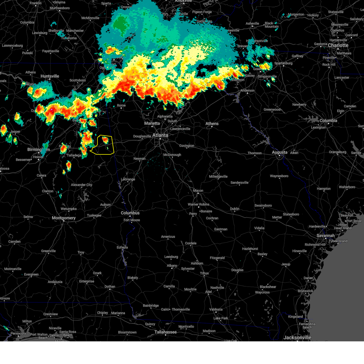 At 410 pm cdt, severe thunderstorms were located along a line extending from near edwardsville to saks, moving east at 35 mph (radar indicated). Hazards include 60 mph wind gusts and quarter size hail. Hail damage to vehicles is expected. expect wind damage to roofs, siding, and trees. locations impacted include, heflin, ranburne, fruithurst, edwardsville, muscadine, abernathy, hollis crossroads, sweetwater lake, coleman lake and campground, trickem, lake cleburne, i 20 welcome center, micaville, chalafinnee and camp sequoyah. hail threat, radar indicated max hail size, 1. 00 in wind threat, radar indicated max wind gust, 60 mph. At 410 pm cdt, severe thunderstorms were located along a line extending from near edwardsville to saks, moving east at 35 mph (radar indicated). Hazards include 60 mph wind gusts and quarter size hail. Hail damage to vehicles is expected. expect wind damage to roofs, siding, and trees. locations impacted include, heflin, ranburne, fruithurst, edwardsville, muscadine, abernathy, hollis crossroads, sweetwater lake, coleman lake and campground, trickem, lake cleburne, i 20 welcome center, micaville, chalafinnee and camp sequoyah. hail threat, radar indicated max hail size, 1. 00 in wind threat, radar indicated max wind gust, 60 mph.
|
| 6/25/2023 4:02 PM CDT |
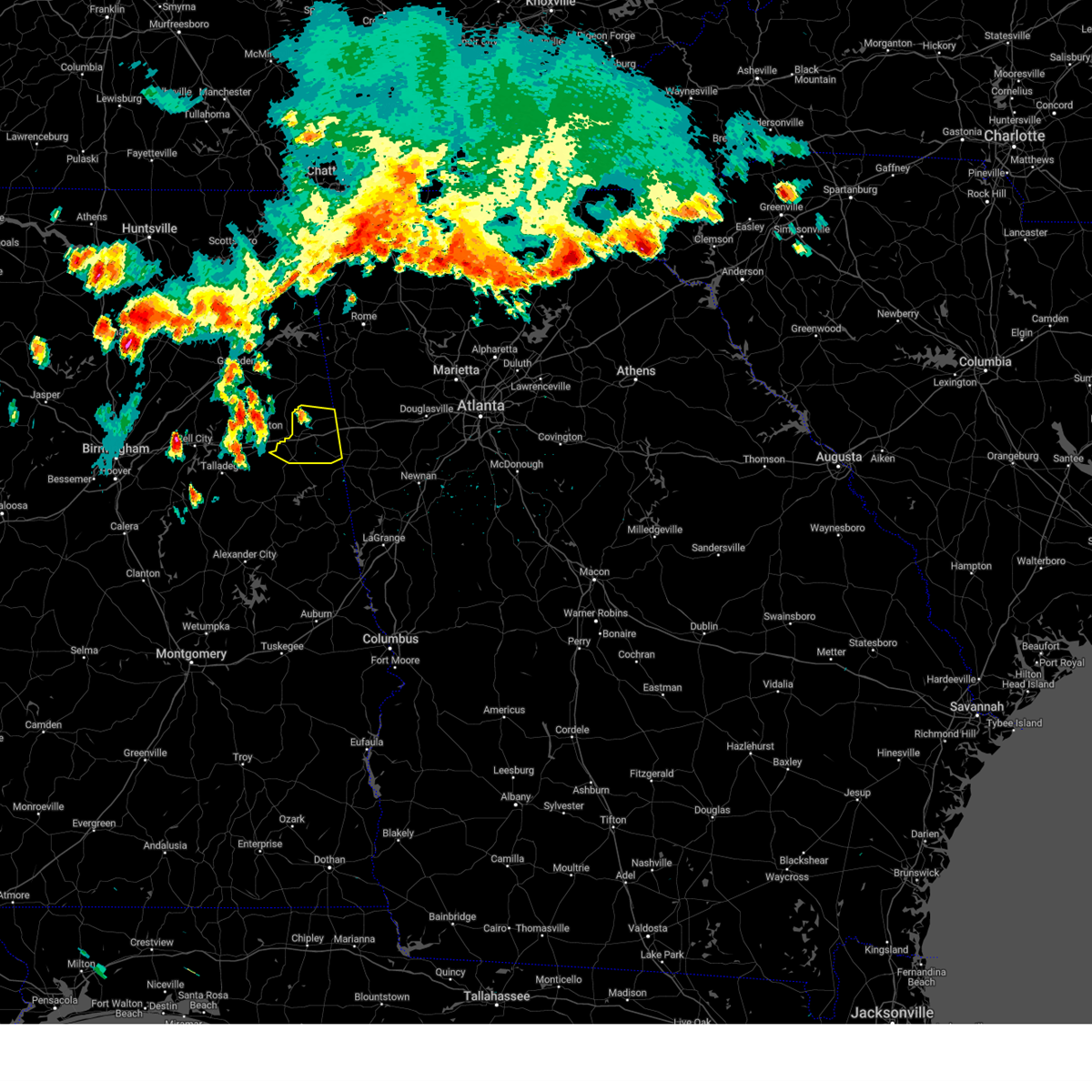 At 402 pm cdt, severe thunderstorms were located along a line extending from 6 miles east of jacksonville to near ohatchee, moving east at 25 mph (radar indicated). Hazards include 60 mph wind gusts and quarter size hail. Hail damage to vehicles is expected. Expect wind damage to roofs, siding, and trees. At 402 pm cdt, severe thunderstorms were located along a line extending from 6 miles east of jacksonville to near ohatchee, moving east at 25 mph (radar indicated). Hazards include 60 mph wind gusts and quarter size hail. Hail damage to vehicles is expected. Expect wind damage to roofs, siding, and trees.
|
| 6/25/2023 3:57 PM CDT |
 At 357 pm cdt, a severe thunderstorm was located over saks, moving east at 25 mph (radar indicated). Hazards include 60 mph wind gusts and quarter size hail. Hail damage to vehicles is expected. Expect wind damage to roofs, siding, and trees. At 357 pm cdt, a severe thunderstorm was located over saks, moving east at 25 mph (radar indicated). Hazards include 60 mph wind gusts and quarter size hail. Hail damage to vehicles is expected. Expect wind damage to roofs, siding, and trees.
|
| 6/14/2023 2:10 PM CDT |
 At 210 pm cdt, severe thunderstorms were located along a line extending from near rainbow city to near harrisburg to near moody, moving east at 70 mph (radar indicated). Hazards include 70 mph wind gusts and quarter size hail. Hail damage to vehicles is expected. expect considerable tree damage. Wind damage is also likely to mobile homes, roofs, and outbuildings. At 210 pm cdt, severe thunderstorms were located along a line extending from near rainbow city to near harrisburg to near moody, moving east at 70 mph (radar indicated). Hazards include 70 mph wind gusts and quarter size hail. Hail damage to vehicles is expected. expect considerable tree damage. Wind damage is also likely to mobile homes, roofs, and outbuildings.
|
| 5/18/2023 5:24 PM CDT |
 At 524 pm cdt, a severe thunderstorm was located over talladega municipal airport, or 9 miles northeast of talladega, moving southeast at 10 mph (radar indicated). Hazards include ping pong ball size hail and 60 mph wind gusts. People and animals outdoors will be injured. expect hail damage to roofs, siding, windows, and vehicles. Expect wind damage to roofs, siding, and trees. At 524 pm cdt, a severe thunderstorm was located over talladega municipal airport, or 9 miles northeast of talladega, moving southeast at 10 mph (radar indicated). Hazards include ping pong ball size hail and 60 mph wind gusts. People and animals outdoors will be injured. expect hail damage to roofs, siding, windows, and vehicles. Expect wind damage to roofs, siding, and trees.
|
| 5/18/2023 5:11 PM CDT |
 At 510 pm cdt, a severe thunderstorm was located over talladega municipal airport, or 10 miles north of talladega, moving southeast at 10 mph (radar indicated). Hazards include ping pong ball size hail and 60 mph wind gusts. People and animals outdoors will be injured. expect hail damage to roofs, siding, windows, and vehicles. expect wind damage to roofs, siding, and trees. locations impacted include, anniston, oxford, lincoln, munford, hobson city, grant town, talladega superspeedway, anniston regional airport, bynum, talladega municipal airport, logan martin lake, anniston army depot, eastaboga, camp mac, jackson shoals and jenifer. hail threat, radar indicated max hail size, 1. 50 in wind threat, radar indicated max wind gust, 60 mph. At 510 pm cdt, a severe thunderstorm was located over talladega municipal airport, or 10 miles north of talladega, moving southeast at 10 mph (radar indicated). Hazards include ping pong ball size hail and 60 mph wind gusts. People and animals outdoors will be injured. expect hail damage to roofs, siding, windows, and vehicles. expect wind damage to roofs, siding, and trees. locations impacted include, anniston, oxford, lincoln, munford, hobson city, grant town, talladega superspeedway, anniston regional airport, bynum, talladega municipal airport, logan martin lake, anniston army depot, eastaboga, camp mac, jackson shoals and jenifer. hail threat, radar indicated max hail size, 1. 50 in wind threat, radar indicated max wind gust, 60 mph.
|
| 5/18/2023 5:02 PM CDT |
 At 502 pm cdt, a severe thunderstorm was located over talladega superspeedway, or 10 miles north of talladega, moving southeast at 10 mph (radar indicated). Hazards include 60 mph wind gusts and quarter size hail. Hail damage to vehicles is expected. Expect wind damage to roofs, siding, and trees. At 502 pm cdt, a severe thunderstorm was located over talladega superspeedway, or 10 miles north of talladega, moving southeast at 10 mph (radar indicated). Hazards include 60 mph wind gusts and quarter size hail. Hail damage to vehicles is expected. Expect wind damage to roofs, siding, and trees.
|
| 1/12/2023 12:30 PM CST |
 At 1230 pm cst, a severe thunderstorm was located near fort mcclellan, moving northeast at 60 mph (radar indicated). Hazards include 60 mph wind gusts and quarter size hail. Hail damage to vehicles is expected. expect wind damage to roofs, siding, and trees. locations impacted include, jacksonville, heflin, fruithurst, edwardsville, muscadine, mars hills, liberty hill, oak level, sweetwater lake, borden springs, coleman lake and campground and choccolocco. hail threat, radar indicated max hail size, 1. 00 in wind threat, radar indicated max wind gust, 60 mph. At 1230 pm cst, a severe thunderstorm was located near fort mcclellan, moving northeast at 60 mph (radar indicated). Hazards include 60 mph wind gusts and quarter size hail. Hail damage to vehicles is expected. expect wind damage to roofs, siding, and trees. locations impacted include, jacksonville, heflin, fruithurst, edwardsville, muscadine, mars hills, liberty hill, oak level, sweetwater lake, borden springs, coleman lake and campground and choccolocco. hail threat, radar indicated max hail size, 1. 00 in wind threat, radar indicated max wind gust, 60 mph.
|
| 1/12/2023 12:23 PM CST |
 At 1223 pm cst, a severe thunderstorm was located over cobb town, moving northeast at 55 mph (radar indicated). Hazards include 60 mph wind gusts and quarter size hail. Hail damage to vehicles is expected. expect wind damage to roofs, siding, and trees. locations impacted include, anniston, oxford, jacksonville, heflin, fort mcclellan, saks, cobb town, west end-cobb town, weaver, hobson city, fruithurst, edwardsville, muscadine, oxford lake, blue mountain, mars hills, alexandria, sweetwater lake, coleman lake and campground and choccolocco. hail threat, radar indicated max hail size, 1. 00 in wind threat, radar indicated max wind gust, 60 mph. At 1223 pm cst, a severe thunderstorm was located over cobb town, moving northeast at 55 mph (radar indicated). Hazards include 60 mph wind gusts and quarter size hail. Hail damage to vehicles is expected. expect wind damage to roofs, siding, and trees. locations impacted include, anniston, oxford, jacksonville, heflin, fort mcclellan, saks, cobb town, west end-cobb town, weaver, hobson city, fruithurst, edwardsville, muscadine, oxford lake, blue mountain, mars hills, alexandria, sweetwater lake, coleman lake and campground and choccolocco. hail threat, radar indicated max hail size, 1. 00 in wind threat, radar indicated max wind gust, 60 mph.
|
| 1/12/2023 12:16 PM CST |
 At 1216 pm cst, a severe thunderstorm was located over bynum, or near cobb town, moving northeast at 55 mph (radar indicated). Hazards include 70 mph wind gusts and quarter size hail. Hail damage to vehicles is expected. expect considerable tree damage. wind damage is also likely to mobile homes, roofs, and outbuildings. locations impacted include, oxford, lincoln, munford, grant town, talladega municipal airport, jenifer and eastaboga. thunderstorm damage threat, considerable hail threat, radar indicated max hail size, 1. 00 in wind threat, radar indicated max wind gust, 70 mph. At 1216 pm cst, a severe thunderstorm was located over bynum, or near cobb town, moving northeast at 55 mph (radar indicated). Hazards include 70 mph wind gusts and quarter size hail. Hail damage to vehicles is expected. expect considerable tree damage. wind damage is also likely to mobile homes, roofs, and outbuildings. locations impacted include, oxford, lincoln, munford, grant town, talladega municipal airport, jenifer and eastaboga. thunderstorm damage threat, considerable hail threat, radar indicated max hail size, 1. 00 in wind threat, radar indicated max wind gust, 70 mph.
|
| 1/12/2023 12:09 PM CST |
 At 1209 pm cst, a severe thunderstorm was located over talladega municipal airport, or 9 miles north of talladega, moving northeast at 55 mph (radar indicated). Hazards include 70 mph wind gusts and quarter size hail. Hail damage to vehicles is expected. expect considerable tree damage. Wind damage is also likely to mobile homes, roofs, and outbuildings. At 1209 pm cst, a severe thunderstorm was located over talladega municipal airport, or 9 miles north of talladega, moving northeast at 55 mph (radar indicated). Hazards include 70 mph wind gusts and quarter size hail. Hail damage to vehicles is expected. expect considerable tree damage. Wind damage is also likely to mobile homes, roofs, and outbuildings.
|
| 1/12/2023 11:58 AM CST |
 At 1158 am cst, a severe thunderstorm was located near logan martin lake, or near pell city, moving northeast at 55 mph (radar indicated). Hazards include golf ball size hail and 70 mph wind gusts. People and animals outdoors will be injured. expect hail damage to roofs, siding, windows, and vehicles. expect considerable tree damage. wind damage is also likely to mobile homes, roofs, and outbuildings. locations impacted include, oxford, talladega, pell city, lincoln, munford, grant town, alpine bay resort, alpine, logan martin lake, talladega superspeedway, honda manufacturing of alabama, talladega municipal airport, country club estates, st. clair county airport, eastaboga, camp mac, jackson shoals, jenifer, cropwell and howells cove. thunderstorm damage threat, considerable hail threat, radar indicated max hail size, 1. 75 in wind threat, radar indicated max wind gust, 70 mph. At 1158 am cst, a severe thunderstorm was located near logan martin lake, or near pell city, moving northeast at 55 mph (radar indicated). Hazards include golf ball size hail and 70 mph wind gusts. People and animals outdoors will be injured. expect hail damage to roofs, siding, windows, and vehicles. expect considerable tree damage. wind damage is also likely to mobile homes, roofs, and outbuildings. locations impacted include, oxford, talladega, pell city, lincoln, munford, grant town, alpine bay resort, alpine, logan martin lake, talladega superspeedway, honda manufacturing of alabama, talladega municipal airport, country club estates, st. clair county airport, eastaboga, camp mac, jackson shoals, jenifer, cropwell and howells cove. thunderstorm damage threat, considerable hail threat, radar indicated max hail size, 1. 75 in wind threat, radar indicated max wind gust, 70 mph.
|
| 1/12/2023 11:50 AM CST |
 At 1150 am cst, a severe thunderstorm was located over alpine bay resort, or 9 miles south of pell city, moving northeast at 55 mph (radar indicated). Hazards include golf ball size hail and 70 mph wind gusts. People and animals outdoors will be injured. expect hail damage to roofs, siding, windows, and vehicles. expect considerable tree damage. wind damage is also likely to mobile homes, roofs, and outbuildings. locations impacted include, oxford, talladega, pell city, lincoln, vincent, munford, grant town, alpine bay resort, alpine, logan martin lake, talladega superspeedway, honda manufacturing of alabama, coosa island, logan martin dam, talladega municipal airport, country club estates, st. clair county airport, eastaboga, camp mac and jackson shoals. thunderstorm damage threat, considerable hail threat, radar indicated max hail size, 1. 75 in wind threat, radar indicated max wind gust, 70 mph. At 1150 am cst, a severe thunderstorm was located over alpine bay resort, or 9 miles south of pell city, moving northeast at 55 mph (radar indicated). Hazards include golf ball size hail and 70 mph wind gusts. People and animals outdoors will be injured. expect hail damage to roofs, siding, windows, and vehicles. expect considerable tree damage. wind damage is also likely to mobile homes, roofs, and outbuildings. locations impacted include, oxford, talladega, pell city, lincoln, vincent, munford, grant town, alpine bay resort, alpine, logan martin lake, talladega superspeedway, honda manufacturing of alabama, coosa island, logan martin dam, talladega municipal airport, country club estates, st. clair county airport, eastaboga, camp mac and jackson shoals. thunderstorm damage threat, considerable hail threat, radar indicated max hail size, 1. 75 in wind threat, radar indicated max wind gust, 70 mph.
|
| 1/12/2023 11:38 AM CST |
 At 1138 am cst, a severe thunderstorm was located over westover, or 7 miles east of chelsea, moving northeast at 55 mph (radar indicated). Hazards include golf ball size hail and 60 mph wind gusts. People and animals outdoors will be injured. expect hail damage to roofs, siding, windows, and vehicles. Expect wind damage to roofs, siding, and trees. At 1138 am cst, a severe thunderstorm was located over westover, or 7 miles east of chelsea, moving northeast at 55 mph (radar indicated). Hazards include golf ball size hail and 60 mph wind gusts. People and animals outdoors will be injured. expect hail damage to roofs, siding, windows, and vehicles. Expect wind damage to roofs, siding, and trees.
|
| 11/30/2022 2:06 AM CST |
 At 206 am cst, severe thunderstorms were located along a line extending from 6 miles west of mars hills to near heflin to near barfield, moving east at 65 mph (radar indicated). Hazards include 60 mph wind gusts. Expect damage to roofs, siding, and trees. locations impacted include, heflin, ranburne, fruithurst, edwardsville, woodland, morrison cross roads, barfield, corinth, muscadine, abernathy, fosters cross roads, delta, mars hills, mount cheaha, graham, newell, coleman lake and campground, trickem, lake cleburne and liberty hill. hail threat, radar indicated max hail size, <. 75 in wind threat, radar indicated max wind gust, 60 mph. At 206 am cst, severe thunderstorms were located along a line extending from 6 miles west of mars hills to near heflin to near barfield, moving east at 65 mph (radar indicated). Hazards include 60 mph wind gusts. Expect damage to roofs, siding, and trees. locations impacted include, heflin, ranburne, fruithurst, edwardsville, woodland, morrison cross roads, barfield, corinth, muscadine, abernathy, fosters cross roads, delta, mars hills, mount cheaha, graham, newell, coleman lake and campground, trickem, lake cleburne and liberty hill. hail threat, radar indicated max hail size, <. 75 in wind threat, radar indicated max wind gust, 60 mph.
|
| 11/30/2022 1:56 AM CST |
 At 156 am cst, severe thunderstorms were located along a line extending from jacksonville state university to near oxford lake to near waldo, moving east at 60 mph (radar indicated). Hazards include 60 mph wind gusts. expect damage to roofs, siding, and trees At 156 am cst, severe thunderstorms were located along a line extending from jacksonville state university to near oxford lake to near waldo, moving east at 60 mph (radar indicated). Hazards include 60 mph wind gusts. expect damage to roofs, siding, and trees
|
| 11/30/2022 1:50 AM CST |
 At 150 am cst, severe thunderstorms were located along a line extending from near jacksonville state university to near grant town to near talladega, moving east at 45 mph (radar indicated). Hazards include 60 mph wind gusts. Expect damage to roofs, siding, and trees. locations impacted include, anniston, oxford, talladega, jacksonville, cobb town, west end-cobb town, fort mcclellan, saks, weaver, munford, hobson city, waldo, anniston regional airport, blue mountain, alexandria, jacksonville state university, grant town, oxford lake, bynum and choccolocco. hail threat, radar indicated max hail size, <. 75 in wind threat, radar indicated max wind gust, 60 mph. At 150 am cst, severe thunderstorms were located along a line extending from near jacksonville state university to near grant town to near talladega, moving east at 45 mph (radar indicated). Hazards include 60 mph wind gusts. Expect damage to roofs, siding, and trees. locations impacted include, anniston, oxford, talladega, jacksonville, cobb town, west end-cobb town, fort mcclellan, saks, weaver, munford, hobson city, waldo, anniston regional airport, blue mountain, alexandria, jacksonville state university, grant town, oxford lake, bynum and choccolocco. hail threat, radar indicated max hail size, <. 75 in wind threat, radar indicated max wind gust, 60 mph.
|
| 11/30/2022 1:35 AM CST |
 At 135 am cst, severe thunderstorms were located along a line extending from ohatchee to lincoln to near logan martin dam, moving east at 60 mph (radar indicated). Hazards include 60 mph wind gusts. Expect damage to roofs, siding, and trees. locations impacted include, anniston, oxford, talladega, jacksonville, cobb town, west end-cobb town, fort mcclellan, saks, lincoln, weaver, riverside, munford, ohatchee, hobson city, waldo, alpine bay resort, talladega superspeedway, anniston regional airport, blue mountain and alexandria. hail threat, radar indicated max hail size, <. 75 in wind threat, radar indicated max wind gust, 60 mph. At 135 am cst, severe thunderstorms were located along a line extending from ohatchee to lincoln to near logan martin dam, moving east at 60 mph (radar indicated). Hazards include 60 mph wind gusts. Expect damage to roofs, siding, and trees. locations impacted include, anniston, oxford, talladega, jacksonville, cobb town, west end-cobb town, fort mcclellan, saks, lincoln, weaver, riverside, munford, ohatchee, hobson city, waldo, alpine bay resort, talladega superspeedway, anniston regional airport, blue mountain and alexandria. hail threat, radar indicated max hail size, <. 75 in wind threat, radar indicated max wind gust, 60 mph.
|
| 11/30/2022 1:34 AM CST |
 At 135 am cst, severe thunderstorms were located along a line extending from ohatchee to lincoln to near logan martin dam, moving east at 60 mph (radar indicated). Hazards include 60 mph wind gusts. Expect damage to roofs, siding, and trees. locations impacted include, anniston, oxford, talladega, jacksonville, cobb town, west end-cobb town, fort mcclellan, saks, lincoln, weaver, riverside, munford, ohatchee, hobson city, waldo, alpine bay resort, talladega superspeedway, anniston regional airport, blue mountain and alexandria. hail threat, radar indicated max hail size, <. 75 in wind threat, radar indicated max wind gust, 60 mph. At 135 am cst, severe thunderstorms were located along a line extending from ohatchee to lincoln to near logan martin dam, moving east at 60 mph (radar indicated). Hazards include 60 mph wind gusts. Expect damage to roofs, siding, and trees. locations impacted include, anniston, oxford, talladega, jacksonville, cobb town, west end-cobb town, fort mcclellan, saks, lincoln, weaver, riverside, munford, ohatchee, hobson city, waldo, alpine bay resort, talladega superspeedway, anniston regional airport, blue mountain and alexandria. hail threat, radar indicated max hail size, <. 75 in wind threat, radar indicated max wind gust, 60 mph.
|
| 7/21/2022 6:04 PM CDT |
 At 604 pm cdt, severe thunderstorms were located along a line extending from near munford to near logan martin dam to shelby county airport to lake view, moving south at 30 mph (radar indicated). Hazards include 60 mph wind gusts. Expect damage to roofs, siding, and trees. locations impacted include, hoover, alabaster, bessemer, pelham, helena, hueytown, talladega, sylacauga, pell city, calera, chelsea, montevallo, childersburg, columbiana, centreville, wilsonville, talladega springs, lincoln, indian springs village and riverside. hail threat, radar indicated max hail size, <. 75 in wind threat, radar indicated max wind gust, 60 mph. At 604 pm cdt, severe thunderstorms were located along a line extending from near munford to near logan martin dam to shelby county airport to lake view, moving south at 30 mph (radar indicated). Hazards include 60 mph wind gusts. Expect damage to roofs, siding, and trees. locations impacted include, hoover, alabaster, bessemer, pelham, helena, hueytown, talladega, sylacauga, pell city, calera, chelsea, montevallo, childersburg, columbiana, centreville, wilsonville, talladega springs, lincoln, indian springs village and riverside. hail threat, radar indicated max hail size, <. 75 in wind threat, radar indicated max wind gust, 60 mph.
|
| 7/21/2022 5:49 PM CDT |
 At 549 pm cdt, severe thunderstorms were located along a line extending from near anniston regional airport to near coosa island to near alabaster to near north johns, moving southeast at 30 mph (radar indicated). Hazards include 60 mph wind gusts. Expect damage to roofs, siding, and trees. locations impacted include, birmingham, hoover, vestavia hills, alabaster, bessemer, homewood, anniston, pelham, oxford, mountain brook, helena, hueytown, talladega, sylacauga, pell city, irondale, leeds, moody, calera and fairfield. hail threat, radar indicated max hail size, <. 75 in wind threat, radar indicated max wind gust, 60 mph. At 549 pm cdt, severe thunderstorms were located along a line extending from near anniston regional airport to near coosa island to near alabaster to near north johns, moving southeast at 30 mph (radar indicated). Hazards include 60 mph wind gusts. Expect damage to roofs, siding, and trees. locations impacted include, birmingham, hoover, vestavia hills, alabaster, bessemer, homewood, anniston, pelham, oxford, mountain brook, helena, hueytown, talladega, sylacauga, pell city, irondale, leeds, moody, calera and fairfield. hail threat, radar indicated max hail size, <. 75 in wind threat, radar indicated max wind gust, 60 mph.
|
| 7/21/2022 5:35 PM CDT |
 At 534 pm cdt, severe thunderstorms were located along a line extending from anniston regional airport to near bald rock to near bessemer to near bankhead lock and dam, moving southeast at 45 mph (radar indicated). Hazards include 70 mph wind gusts. Expect considerable tree damage. damage is likely to mobile homes, roofs, and outbuildings. locations impacted include, birmingham, hoover, vestavia hills, alabaster, bessemer, homewood, anniston, pelham, oxford, mountain brook, trussville, helena, hueytown, talladega, sylacauga, pell city, irondale, leeds, moody and calera. thunderstorm damage threat, considerable hail threat, radar indicated max hail size, <. 75 in wind threat, radar indicated max wind gust, 70 mph. At 534 pm cdt, severe thunderstorms were located along a line extending from anniston regional airport to near bald rock to near bessemer to near bankhead lock and dam, moving southeast at 45 mph (radar indicated). Hazards include 70 mph wind gusts. Expect considerable tree damage. damage is likely to mobile homes, roofs, and outbuildings. locations impacted include, birmingham, hoover, vestavia hills, alabaster, bessemer, homewood, anniston, pelham, oxford, mountain brook, trussville, helena, hueytown, talladega, sylacauga, pell city, irondale, leeds, moody and calera. thunderstorm damage threat, considerable hail threat, radar indicated max hail size, <. 75 in wind threat, radar indicated max wind gust, 70 mph.
|
| 7/21/2022 5:23 PM CDT |
 At 523 pm cdt, severe thunderstorms were located along a line extending from west end-cobb town to 6 miles southwest of bankhead lock and dam, moving south at 30 mph (radar indicated). Hazards include 70 mph wind gusts. Expect considerable tree damage. damage is likely to mobile homes, roofs, and outbuildings. locations impacted include, birmingham, hoover, vestavia hills, alabaster, bessemer, homewood, anniston, pelham, oxford, mountain brook, trussville, helena, hueytown, talladega, gardendale, sylacauga, pell city, irondale, leeds and moody. thunderstorm damage threat, considerable hail threat, radar indicated max hail size, <. 75 in wind threat, radar indicated max wind gust, 70 mph. At 523 pm cdt, severe thunderstorms were located along a line extending from west end-cobb town to 6 miles southwest of bankhead lock and dam, moving south at 30 mph (radar indicated). Hazards include 70 mph wind gusts. Expect considerable tree damage. damage is likely to mobile homes, roofs, and outbuildings. locations impacted include, birmingham, hoover, vestavia hills, alabaster, bessemer, homewood, anniston, pelham, oxford, mountain brook, trussville, helena, hueytown, talladega, gardendale, sylacauga, pell city, irondale, leeds and moody. thunderstorm damage threat, considerable hail threat, radar indicated max hail size, <. 75 in wind threat, radar indicated max wind gust, 70 mph.
|
| 7/21/2022 5:20 PM CDT |
 At 519 pm cdt, severe thunderstorms were located along a line extending from near west end-cobb town to near bankhead lock and dam, moving south at 30 mph (radar indicated). Hazards include 60 mph wind gusts. expect damage to roofs, siding, and trees At 519 pm cdt, severe thunderstorms were located along a line extending from near west end-cobb town to near bankhead lock and dam, moving south at 30 mph (radar indicated). Hazards include 60 mph wind gusts. expect damage to roofs, siding, and trees
|
| 7/21/2022 5:15 PM CDT |
 At 515 pm cdt, severe thunderstorms were located along a line extending from near jacksonville to near bynum to near harrisburg, moving south at 30 mph (radar indicated). Hazards include 60 mph wind gusts. Expect damage to roofs, siding, and trees. locations impacted include, anniston, oxford, pell city, jacksonville, cobb town, west end-cobb town, fort mcclellan, saks, lincoln, weaver, riverside, ragland, munford, ohatchee, hobson city, talladega superspeedway, blue mountain, harrisburg, alexandria and talladega municipal airport. hail threat, radar indicated max hail size, <. 75 in wind threat, radar indicated max wind gust, 60 mph. At 515 pm cdt, severe thunderstorms were located along a line extending from near jacksonville to near bynum to near harrisburg, moving south at 30 mph (radar indicated). Hazards include 60 mph wind gusts. Expect damage to roofs, siding, and trees. locations impacted include, anniston, oxford, pell city, jacksonville, cobb town, west end-cobb town, fort mcclellan, saks, lincoln, weaver, riverside, ragland, munford, ohatchee, hobson city, talladega superspeedway, blue mountain, harrisburg, alexandria and talladega municipal airport. hail threat, radar indicated max hail size, <. 75 in wind threat, radar indicated max wind gust, 60 mph.
|
| 7/21/2022 5:02 PM CDT |
 At 502 pm cdt, severe thunderstorms were located along a line extending from near slackland to near piedmont to 6 miles northwest of bynum to near odenville, moving southeast at 25 mph (radar indicated). Hazards include 60 mph wind gusts. Expect damage to roofs, siding, and trees. locations impacted include, gadsden, anniston, oxford, pell city, jacksonville, rainbow city, piedmont, hokes bluff, west end-cobb town, cobb town, fort mcclellan, saks, lincoln, glencoe, weaver, ashville, riverside, ragland, munford and ohatchee. hail threat, radar indicated max hail size, <. 75 in wind threat, radar indicated max wind gust, 60 mph. At 502 pm cdt, severe thunderstorms were located along a line extending from near slackland to near piedmont to 6 miles northwest of bynum to near odenville, moving southeast at 25 mph (radar indicated). Hazards include 60 mph wind gusts. Expect damage to roofs, siding, and trees. locations impacted include, gadsden, anniston, oxford, pell city, jacksonville, rainbow city, piedmont, hokes bluff, west end-cobb town, cobb town, fort mcclellan, saks, lincoln, glencoe, weaver, ashville, riverside, ragland, munford and ohatchee. hail threat, radar indicated max hail size, <. 75 in wind threat, radar indicated max wind gust, 60 mph.
|
| 7/21/2022 4:53 PM CDT |
 At 453 pm cdt, severe thunderstorms were located along a line extending from cherokee rock village to near piedmont to near ragland to 6 miles northeast of odenville, moving south at 35 mph (radar indicated). Hazards include 60 mph wind gusts. Expect damage to roofs, siding, and trees. locations impacted include, gadsden, anniston, oxford, pell city, jacksonville, rainbow city, piedmont, hokes bluff, west end-cobb town, cobb town, fort mcclellan, saks, lincoln, glencoe, weaver, ashville, riverside, ragland, munford and ohatchee. hail threat, radar indicated max hail size, <. 75 in wind threat, radar indicated max wind gust, 60 mph. At 453 pm cdt, severe thunderstorms were located along a line extending from cherokee rock village to near piedmont to near ragland to 6 miles northeast of odenville, moving south at 35 mph (radar indicated). Hazards include 60 mph wind gusts. Expect damage to roofs, siding, and trees. locations impacted include, gadsden, anniston, oxford, pell city, jacksonville, rainbow city, piedmont, hokes bluff, west end-cobb town, cobb town, fort mcclellan, saks, lincoln, glencoe, weaver, ashville, riverside, ragland, munford and ohatchee. hail threat, radar indicated max hail size, <. 75 in wind threat, radar indicated max wind gust, 60 mph.
|
| 7/21/2022 4:38 PM CDT |
 At 437 pm cdt, severe thunderstorms were located along a line extending from moshat to near hokes bluff to 6 miles northeast of odenville, moving southeast at 25 mph (radar indicated). Hazards include 60 mph wind gusts. Expect damage to roofs, siding, and trees. locations impacted include, gadsden, anniston, oxford, pell city, jacksonville, rainbow city, piedmont, hokes bluff, centre, cedar bluff, forney, west end-cobb town, centre municipal airport, cobb town, fort mcclellan, saks, lincoln, glencoe, weaver and ashville. hail threat, radar indicated max hail size, <. 75 in wind threat, radar indicated max wind gust, 60 mph. At 437 pm cdt, severe thunderstorms were located along a line extending from moshat to near hokes bluff to 6 miles northeast of odenville, moving southeast at 25 mph (radar indicated). Hazards include 60 mph wind gusts. Expect damage to roofs, siding, and trees. locations impacted include, gadsden, anniston, oxford, pell city, jacksonville, rainbow city, piedmont, hokes bluff, centre, cedar bluff, forney, west end-cobb town, centre municipal airport, cobb town, fort mcclellan, saks, lincoln, glencoe, weaver and ashville. hail threat, radar indicated max hail size, <. 75 in wind threat, radar indicated max wind gust, 60 mph.
|
| 7/21/2022 4:23 PM CDT |
 At 423 pm cdt, severe thunderstorms were located along a line extending from western weiss lake to near hokes bluff to near ashville, moving southeast at 25 mph (radar indicated). Hazards include 60 mph wind gusts. expect damage to roofs, siding, and trees At 423 pm cdt, severe thunderstorms were located along a line extending from western weiss lake to near hokes bluff to near ashville, moving southeast at 25 mph (radar indicated). Hazards include 60 mph wind gusts. expect damage to roofs, siding, and trees
|
| 7/21/2022 3:59 PM CDT |
 At 358 pm cdt, severe thunderstorms were located along a line extending from anniston regional airport to near talladega, moving southeast at 20 mph (radar indicated). Hazards include 60 mph wind gusts and quarter size hail. Hail damage to vehicles is expected. Expect wind damage to roofs, siding, and trees. At 358 pm cdt, severe thunderstorms were located along a line extending from anniston regional airport to near talladega, moving southeast at 20 mph (radar indicated). Hazards include 60 mph wind gusts and quarter size hail. Hail damage to vehicles is expected. Expect wind damage to roofs, siding, and trees.
|
| 6/17/2022 2:16 AM CDT |
 At 216 am cdt, a severe thunderstorm was located over lincoln, or 10 miles east of pell city, moving northwest at 10 mph (radar indicated). Hazards include 60 mph wind gusts and half dollar size hail. Hail damage to vehicles is expected. expect wind damage to roofs, siding, and trees. locations impacted include, lincoln, riverside, talladega superspeedway, honda manufacturing of alabama, talladega municipal airport, logan martin lake, jackson shoals and eastaboga. hail threat, radar indicated max hail size, 1. 25 in wind threat, radar indicated max wind gust, 60 mph. At 216 am cdt, a severe thunderstorm was located over lincoln, or 10 miles east of pell city, moving northwest at 10 mph (radar indicated). Hazards include 60 mph wind gusts and half dollar size hail. Hail damage to vehicles is expected. expect wind damage to roofs, siding, and trees. locations impacted include, lincoln, riverside, talladega superspeedway, honda manufacturing of alabama, talladega municipal airport, logan martin lake, jackson shoals and eastaboga. hail threat, radar indicated max hail size, 1. 25 in wind threat, radar indicated max wind gust, 60 mph.
|
| 6/17/2022 2:04 AM CDT |
 At 204 am cdt, a severe thunderstorm was located over honda manufacturing of alabama, or 8 miles east of pell city, moving west at 10 mph (radar indicated). Hazards include 60 mph wind gusts and half dollar size hail. Hail damage to vehicles is expected. expect wind damage to roofs, siding, and trees. locations impacted include, pell city, lincoln, riverside, ragland, talladega superspeedway, honda manufacturing of alabama, logan martin lake, talladega municipal airport, st. clair county airport, wattsville, jackson shoals and eastaboga. hail threat, radar indicated max hail size, 1. 25 in wind threat, radar indicated max wind gust, 60 mph. At 204 am cdt, a severe thunderstorm was located over honda manufacturing of alabama, or 8 miles east of pell city, moving west at 10 mph (radar indicated). Hazards include 60 mph wind gusts and half dollar size hail. Hail damage to vehicles is expected. expect wind damage to roofs, siding, and trees. locations impacted include, pell city, lincoln, riverside, ragland, talladega superspeedway, honda manufacturing of alabama, logan martin lake, talladega municipal airport, st. clair county airport, wattsville, jackson shoals and eastaboga. hail threat, radar indicated max hail size, 1. 25 in wind threat, radar indicated max wind gust, 60 mph.
|
| 6/17/2022 1:51 AM CDT |
 At 151 am cdt, a severe thunderstorm was located over bynum, or near cobb town, moving west at 15 mph (radar indicated). Hazards include 60 mph wind gusts and quarter size hail. Hail damage to vehicles is expected. expect wind damage to roofs, siding, and trees. locations impacted include, anniston, oxford, cobb town, west end-cobb town, saks, munford, hobson city, grant town, anniston regional airport, oxford lake, blue mountain, bynum, anniston army depot and jenifer. hail threat, radar indicated max hail size, 1. 00 in wind threat, radar indicated max wind gust, 60 mph. At 151 am cdt, a severe thunderstorm was located over bynum, or near cobb town, moving west at 15 mph (radar indicated). Hazards include 60 mph wind gusts and quarter size hail. Hail damage to vehicles is expected. expect wind damage to roofs, siding, and trees. locations impacted include, anniston, oxford, cobb town, west end-cobb town, saks, munford, hobson city, grant town, anniston regional airport, oxford lake, blue mountain, bynum, anniston army depot and jenifer. hail threat, radar indicated max hail size, 1. 00 in wind threat, radar indicated max wind gust, 60 mph.
|
| 6/17/2022 1:46 AM CDT |
 At 146 am cdt, a severe thunderstorm was located near honda manufacturing of alabama, or 11 miles west of west end-cobb town, moving northwest at 15 mph (radar indicated). Hazards include 60 mph wind gusts and half dollar size hail. Hail damage to vehicles is expected. Expect wind damage to roofs, siding, and trees. At 146 am cdt, a severe thunderstorm was located near honda manufacturing of alabama, or 11 miles west of west end-cobb town, moving northwest at 15 mph (radar indicated). Hazards include 60 mph wind gusts and half dollar size hail. Hail damage to vehicles is expected. Expect wind damage to roofs, siding, and trees.
|
| 6/17/2022 1:25 AM CDT |
 At 125 am cdt, a severe thunderstorm was located over oxford lake, or over oxford, moving west at 15 mph (radar indicated). Hazards include 60 mph wind gusts and quarter size hail. Hail damage to vehicles is expected. Expect wind damage to roofs, siding, and trees. At 125 am cdt, a severe thunderstorm was located over oxford lake, or over oxford, moving west at 15 mph (radar indicated). Hazards include 60 mph wind gusts and quarter size hail. Hail damage to vehicles is expected. Expect wind damage to roofs, siding, and trees.
|
| 6/17/2022 1:18 AM CDT |
 At 117 am cdt, a severe thunderstorm was located near oxford, moving west at 15 mph (radar indicated). Hazards include 60 mph wind gusts and quarter size hail. Hail damage to vehicles is expected. expect wind damage to roofs, siding, and trees. locations impacted include, anniston, oxford and dearmanville. hail threat, radar indicated max hail size, 1. 00 in wind threat, radar indicated max wind gust, 60 mph. At 117 am cdt, a severe thunderstorm was located near oxford, moving west at 15 mph (radar indicated). Hazards include 60 mph wind gusts and quarter size hail. Hail damage to vehicles is expected. expect wind damage to roofs, siding, and trees. locations impacted include, anniston, oxford and dearmanville. hail threat, radar indicated max hail size, 1. 00 in wind threat, radar indicated max wind gust, 60 mph.
|
| 6/17/2022 1:07 AM CDT |
 At 107 am cdt, a severe thunderstorm was located near oxford lake, or near oxford, moving west at 15 mph (radar indicated). Hazards include ping pong ball size hail and 60 mph wind gusts. People and animals outdoors will be injured. expect hail damage to roofs, siding, windows, and vehicles. expect wind damage to roofs, siding, and trees. locations impacted include, anniston, oxford, mount cheaha, dearmanville, hollis crossroads, chalafinnee and camp sequoyah. hail threat, radar indicated max hail size, 1. 50 in wind threat, radar indicated max wind gust, 60 mph. At 107 am cdt, a severe thunderstorm was located near oxford lake, or near oxford, moving west at 15 mph (radar indicated). Hazards include ping pong ball size hail and 60 mph wind gusts. People and animals outdoors will be injured. expect hail damage to roofs, siding, windows, and vehicles. expect wind damage to roofs, siding, and trees. locations impacted include, anniston, oxford, mount cheaha, dearmanville, hollis crossroads, chalafinnee and camp sequoyah. hail threat, radar indicated max hail size, 1. 50 in wind threat, radar indicated max wind gust, 60 mph.
|
| 6/17/2022 12:52 AM CDT |
 At 1252 am cdt, a severe thunderstorm was located 7 miles northwest of corinth, or 7 miles southwest of heflin, moving west at 15 mph (radar indicated). Hazards include 60 mph wind gusts and quarter size hail. Hail damage to vehicles is expected. Expect wind damage to roofs, siding, and trees. At 1252 am cdt, a severe thunderstorm was located 7 miles northwest of corinth, or 7 miles southwest of heflin, moving west at 15 mph (radar indicated). Hazards include 60 mph wind gusts and quarter size hail. Hail damage to vehicles is expected. Expect wind damage to roofs, siding, and trees.
|
| 6/15/2022 8:44 PM CDT | Kanb measured 44 mph wind gust along outflo in calhoun county AL, 0.2 miles SSE of Oxford, AL |
| 6/15/2022 8:33 PM CDT |
 At 833 pm cdt, severe thunderstorms were located along a line extending from mars hills to 6 miles north of delta, moving west at 15 mph (radar indicated). Hazards include 60 mph wind gusts. expect damage to roofs, siding, and trees At 833 pm cdt, severe thunderstorms were located along a line extending from mars hills to 6 miles north of delta, moving west at 15 mph (radar indicated). Hazards include 60 mph wind gusts. expect damage to roofs, siding, and trees
|
| 6/8/2022 4:26 PM CDT |
 At 425 pm cdt, a severe thunderstorm was located over fort mcclellan, moving northeast at 30 mph (radar indicated). Hazards include 60 mph wind gusts. Expect damage to roofs, siding, and trees. locations impacted include, anniston, oxford, jacksonville, fort mcclellan, weaver, dearmanville and choccolocco. hail threat, radar indicated max hail size, <. 75 in wind threat, radar indicated max wind gust, 60 mph. At 425 pm cdt, a severe thunderstorm was located over fort mcclellan, moving northeast at 30 mph (radar indicated). Hazards include 60 mph wind gusts. Expect damage to roofs, siding, and trees. locations impacted include, anniston, oxford, jacksonville, fort mcclellan, weaver, dearmanville and choccolocco. hail threat, radar indicated max hail size, <. 75 in wind threat, radar indicated max wind gust, 60 mph.
|
| 6/8/2022 4:10 PM CDT |
 At 409 pm cdt, a severe thunderstorm was located over west end-cobb town, moving northeast at 30 mph (radar indicated). Hazards include 60 mph wind gusts. expect damage to roofs, siding, and trees At 409 pm cdt, a severe thunderstorm was located over west end-cobb town, moving northeast at 30 mph (radar indicated). Hazards include 60 mph wind gusts. expect damage to roofs, siding, and trees
|
| 5/4/2022 4:06 PM CDT |
 At 405 pm cdt, a severe thunderstorm was located over alpine, or 8 miles northeast of childersburg, moving east at 25 mph (radar indicated). Hazards include quarter size hail. damage to vehicles is expected At 405 pm cdt, a severe thunderstorm was located over alpine, or 8 miles northeast of childersburg, moving east at 25 mph (radar indicated). Hazards include quarter size hail. damage to vehicles is expected
|
| 8/9/2021 5:05 PM CDT |
 The severe thunderstorm warning for central talladega county will expire at 515 pm cdt, the storm which prompted the warning has weakened below severe limits, and no longer poses an immediate threat to life or property. therefore, the warning will be allowed to expire. The severe thunderstorm warning for central talladega county will expire at 515 pm cdt, the storm which prompted the warning has weakened below severe limits, and no longer poses an immediate threat to life or property. therefore, the warning will be allowed to expire.
|
| 8/9/2021 4:44 PM CDT |
 At 443 pm cdt, a severe thunderstorm was located over talladega, moving northeast at 15 mph (radar indicated). Hazards include 60 mph wind gusts. expect damage to roofs, siding, and trees At 443 pm cdt, a severe thunderstorm was located over talladega, moving northeast at 15 mph (radar indicated). Hazards include 60 mph wind gusts. expect damage to roofs, siding, and trees
|
| 7/31/2021 3:29 PM CDT |
 At 329 pm cdt, a severe thunderstorm was located near honda manufacturing of alabama, or 10 miles northeast of pell city, moving southeast at 20 mph (radar indicated). Hazards include 60 mph wind gusts. Expect damage to roofs, siding, and trees. Locations impacted include, lincoln, talladega superspeedway, honda manufacturing of alabama, bynum, talladega municipal airport, logan martin lake, anniston army depot, jackson shoals and eastaboga. At 329 pm cdt, a severe thunderstorm was located near honda manufacturing of alabama, or 10 miles northeast of pell city, moving southeast at 20 mph (radar indicated). Hazards include 60 mph wind gusts. Expect damage to roofs, siding, and trees. Locations impacted include, lincoln, talladega superspeedway, honda manufacturing of alabama, bynum, talladega municipal airport, logan martin lake, anniston army depot, jackson shoals and eastaboga.
|
| 7/31/2021 3:16 PM CDT |
 At 316 pm cdt, a severe thunderstorm was located over ragland, or 12 miles northeast of pell city, moving southeast at 20 mph (radar indicated). Hazards include 60 mph wind gusts. Expect damage to roofs, siding, and trees. Locations impacted include, lincoln, riverside, ragland, talladega superspeedway, honda manufacturing of alabama, bynum, talladega municipal airport, logan martin lake, anniston army depot, jackson shoals and eastaboga. At 316 pm cdt, a severe thunderstorm was located over ragland, or 12 miles northeast of pell city, moving southeast at 20 mph (radar indicated). Hazards include 60 mph wind gusts. Expect damage to roofs, siding, and trees. Locations impacted include, lincoln, riverside, ragland, talladega superspeedway, honda manufacturing of alabama, bynum, talladega municipal airport, logan martin lake, anniston army depot, jackson shoals and eastaboga.
|
| 7/31/2021 3:04 PM CDT |
 At 304 pm cdt, a severe thunderstorm was located near ragland, or 12 miles northeast of odenville, moving southeast at 20 mph (radar indicated). Hazards include 60 mph wind gusts. expect damage to roofs, siding, and trees At 304 pm cdt, a severe thunderstorm was located near ragland, or 12 miles northeast of odenville, moving southeast at 20 mph (radar indicated). Hazards include 60 mph wind gusts. expect damage to roofs, siding, and trees
|
| 6/9/2021 5:42 PM CDT |
 At 542 pm cdt, severe thunderstorms were located along a line extending from 6 miles northwest of jacksonville state university to 6 miles southeast of fort mcclellan to delta, moving northeast at 35 mph (radar indicated). Hazards include 60 mph wind gusts. Expect damage to roofs, siding, and trees. Locations impacted include, anniston, oxford, heflin, fort mcclellan, saks, fruithurst, edwardsville, muscadine, abernathy, blue mountain, mars hills, hollis crossroads, sweetwater lake, coleman lake and campground, choccolocco, trickem, lake cleburne, dearmanville, i 20 welcome center and liberty hill. At 542 pm cdt, severe thunderstorms were located along a line extending from 6 miles northwest of jacksonville state university to 6 miles southeast of fort mcclellan to delta, moving northeast at 35 mph (radar indicated). Hazards include 60 mph wind gusts. Expect damage to roofs, siding, and trees. Locations impacted include, anniston, oxford, heflin, fort mcclellan, saks, fruithurst, edwardsville, muscadine, abernathy, blue mountain, mars hills, hollis crossroads, sweetwater lake, coleman lake and campground, choccolocco, trickem, lake cleburne, dearmanville, i 20 welcome center and liberty hill.
|
| 6/9/2021 5:22 PM CDT |
 At 522 pm cdt, severe thunderstorms were located along a line extending from ohatchee to anniston regional airport to near ashland, moving northeast at 35 mph (radar indicated). Hazards include 60 mph wind gusts. expect damage to roofs, siding, and trees At 522 pm cdt, severe thunderstorms were located along a line extending from ohatchee to anniston regional airport to near ashland, moving northeast at 35 mph (radar indicated). Hazards include 60 mph wind gusts. expect damage to roofs, siding, and trees
|
| 5/4/2021 12:56 PM CDT |
 At 1255 pm cdt, severe thunderstorms were located along a line extending from 6 miles southwest of ball flat to pell city, moving east at 45 mph (radar indicated). Hazards include 60 mph wind gusts and quarter size hail. Hail damage to vehicles is expected. Expect wind damage to roofs, siding, and trees. At 1255 pm cdt, severe thunderstorms were located along a line extending from 6 miles southwest of ball flat to pell city, moving east at 45 mph (radar indicated). Hazards include 60 mph wind gusts and quarter size hail. Hail damage to vehicles is expected. Expect wind damage to roofs, siding, and trees.
|
| 5/4/2021 12:14 PM CDT |
 At 1214 pm cdt, severe thunderstorms were located along a line extending from near altoona to leeds, moving east at 45 mph (radar indicated). Hazards include 60 mph wind gusts. expect damage to roofs, siding, and trees At 1214 pm cdt, severe thunderstorms were located along a line extending from near altoona to leeds, moving east at 45 mph (radar indicated). Hazards include 60 mph wind gusts. expect damage to roofs, siding, and trees
|
| 4/24/2021 6:32 PM CDT |
 At 632 pm cdt, severe thunderstorms were located along a line extending from 6 miles west of mars hills to near sycamore, moving east at 50 mph (radar indicated). Hazards include 60 mph wind gusts and quarter size hail. Hail damage to vehicles is expected. expect wind damage to roofs, siding, and trees. Locations impacted include, anniston, oxford, talladega, sylacauga, heflin, munford, fruithurst, waldo, edwardsville, muscadine, abernathy, sycamore, delta, mars hills, mount cheaha, coleman lake and campground, choccolocco, lake cleburne, camp mac and ironaton. At 632 pm cdt, severe thunderstorms were located along a line extending from 6 miles west of mars hills to near sycamore, moving east at 50 mph (radar indicated). Hazards include 60 mph wind gusts and quarter size hail. Hail damage to vehicles is expected. expect wind damage to roofs, siding, and trees. Locations impacted include, anniston, oxford, talladega, sylacauga, heflin, munford, fruithurst, waldo, edwardsville, muscadine, abernathy, sycamore, delta, mars hills, mount cheaha, coleman lake and campground, choccolocco, lake cleburne, camp mac and ironaton.
|
| 4/24/2021 6:09 PM CDT |
 At 609 pm cdt, severe thunderstorms were located along a line extending from near weaver to near wilsonville, moving east at 50 mph (radar indicated). Hazards include 60 mph wind gusts and half dollar size hail. Hail damage to vehicles is expected. Expect wind damage to roofs, siding, and trees. At 609 pm cdt, severe thunderstorms were located along a line extending from near weaver to near wilsonville, moving east at 50 mph (radar indicated). Hazards include 60 mph wind gusts and half dollar size hail. Hail damage to vehicles is expected. Expect wind damage to roofs, siding, and trees.
|
| 4/24/2021 5:55 PM CDT |
 At 554 pm cdt, severe thunderstorms were located along a line extending from near ohatchee to near vincent, moving east at 45 mph (radar indicated). Hazards include 60 mph wind gusts and quarter size hail. Hail damage to vehicles is expected. expect wind damage to roofs, siding, and trees. Locations impacted include, anniston, talladega, pell city, saks, west end-cobb town, lincoln, weaver, riverside, vincent, ragland, harpersville, munford, westover, ohatchee, alpine bay resort, talladega superspeedway, talladega municipal airport, alpine, logan martin lake and honda manufacturing of alabama. At 554 pm cdt, severe thunderstorms were located along a line extending from near ohatchee to near vincent, moving east at 45 mph (radar indicated). Hazards include 60 mph wind gusts and quarter size hail. Hail damage to vehicles is expected. expect wind damage to roofs, siding, and trees. Locations impacted include, anniston, talladega, pell city, saks, west end-cobb town, lincoln, weaver, riverside, vincent, ragland, harpersville, munford, westover, ohatchee, alpine bay resort, talladega superspeedway, talladega municipal airport, alpine, logan martin lake and honda manufacturing of alabama.
|
| 4/24/2021 5:40 PM CDT |
 At 540 pm cdt, severe thunderstorms were located along a line extending from near ragland to meadowbrook, moving east at 70 mph (radar indicated). Hazards include 60 mph wind gusts and quarter size hail. Hail damage to vehicles is expected. Expect wind damage to roofs, siding, and trees. At 540 pm cdt, severe thunderstorms were located along a line extending from near ragland to meadowbrook, moving east at 70 mph (radar indicated). Hazards include 60 mph wind gusts and quarter size hail. Hail damage to vehicles is expected. Expect wind damage to roofs, siding, and trees.
|
| 3/28/2021 8:09 AM CDT |
 The severe thunderstorm warning for east central talladega and southeastern calhoun counties will expire at 815 am cdt, the storms which prompted the warning have moved out of the area. therefore, the warning will be allowed to expire. a severe thunderstorm watch remains in effect until 1000 am cdt for east central alabama. The severe thunderstorm warning for east central talladega and southeastern calhoun counties will expire at 815 am cdt, the storms which prompted the warning have moved out of the area. therefore, the warning will be allowed to expire. a severe thunderstorm watch remains in effect until 1000 am cdt for east central alabama.
|
| 3/28/2021 8:06 AM CDT |
 At 806 am cdt, severe thunderstorms were located along a line extending from oxford lake to near grant town, moving east at 55 mph (radar indicated). Hazards include 60 mph wind gusts. Expect damage to roofs, siding, and trees. Locations impacted include, anniston, oxford, munford, oxford lake, dearmanville and camp mac. At 806 am cdt, severe thunderstorms were located along a line extending from oxford lake to near grant town, moving east at 55 mph (radar indicated). Hazards include 60 mph wind gusts. Expect damage to roofs, siding, and trees. Locations impacted include, anniston, oxford, munford, oxford lake, dearmanville and camp mac.
|
| 3/28/2021 8:01 AM CDT |
 At 800 am cdt, severe thunderstorms were located along a line extending from near cobb town to near munford, moving east at 35 mph (radar indicated). Hazards include 60 mph wind gusts. Expect damage to roofs, siding, and trees. Locations impacted include, anniston, oxford, talladega, cobb town, west end-cobb town, saks, munford, hobson city, grant town, anniston regional airport, oxford lake, blue mountain, bynum, choccolocco, dearmanville, camp mac and jenifer. At 800 am cdt, severe thunderstorms were located along a line extending from near cobb town to near munford, moving east at 35 mph (radar indicated). Hazards include 60 mph wind gusts. Expect damage to roofs, siding, and trees. Locations impacted include, anniston, oxford, talladega, cobb town, west end-cobb town, saks, munford, hobson city, grant town, anniston regional airport, oxford lake, blue mountain, bynum, choccolocco, dearmanville, camp mac and jenifer.
|
| 3/28/2021 7:51 AM CDT |
 At 751 am cdt, severe thunderstorms were located along a line extending from near ohatchee to near talladega, moving east at 55 mph (radar indicated). Hazards include 60 mph wind gusts. Expect damage to roofs, siding, and trees. Locations impacted include, anniston, oxford, talladega, cobb town, west end-cobb town, fort mcclellan, saks, lincoln, weaver, munford, hobson city, talladega superspeedway, anniston regional airport, blue mountain, talladega municipal airport, grant town, honda manufacturing of alabama, oxford lake, bynum and alexandria. At 751 am cdt, severe thunderstorms were located along a line extending from near ohatchee to near talladega, moving east at 55 mph (radar indicated). Hazards include 60 mph wind gusts. Expect damage to roofs, siding, and trees. Locations impacted include, anniston, oxford, talladega, cobb town, west end-cobb town, fort mcclellan, saks, lincoln, weaver, munford, hobson city, talladega superspeedway, anniston regional airport, blue mountain, talladega municipal airport, grant town, honda manufacturing of alabama, oxford lake, bynum and alexandria.
|
| 3/28/2021 7:46 AM CDT |
 At 746 am cdt, severe thunderstorms were located along a line extending from near ragland to near logan martin lake, moving east at 55 mph (radar indicated). Hazards include 60 mph wind gusts. Expect damage to roofs, siding, and trees. Locations impacted include, anniston, oxford, talladega, cobb town, west end-cobb town, fort mcclellan, saks, lincoln, weaver, munford, hobson city, alpine bay resort, talladega superspeedway, anniston regional airport, blue mountain, talladega municipal airport, grant town, honda manufacturing of alabama, oxford lake and bynum. At 746 am cdt, severe thunderstorms were located along a line extending from near ragland to near logan martin lake, moving east at 55 mph (radar indicated). Hazards include 60 mph wind gusts. Expect damage to roofs, siding, and trees. Locations impacted include, anniston, oxford, talladega, cobb town, west end-cobb town, fort mcclellan, saks, lincoln, weaver, munford, hobson city, alpine bay resort, talladega superspeedway, anniston regional airport, blue mountain, talladega municipal airport, grant town, honda manufacturing of alabama, oxford lake and bynum.
|
| 3/28/2021 7:37 AM CDT |
 At 737 am cdt, severe thunderstorms were located along a line extending from near ragland to coosa island, moving east at 55 mph (radar indicated). Hazards include 60 mph wind gusts. expect damage to roofs, siding, and trees At 737 am cdt, severe thunderstorms were located along a line extending from near ragland to coosa island, moving east at 55 mph (radar indicated). Hazards include 60 mph wind gusts. expect damage to roofs, siding, and trees
|
| 3/25/2021 2:23 PM CDT |
 At 222 pm cdt, a tornado producing storm was located over riverside, or near pell city, moving northeast at 40 mph (radar confirmed tornado). Hazards include damaging tornado. Flying debris will be dangerous to those caught without shelter. mobile homes will be damaged or destroyed. damage to roofs, windows, and vehicles will occur. Tree damage is likely. At 222 pm cdt, a tornado producing storm was located over riverside, or near pell city, moving northeast at 40 mph (radar confirmed tornado). Hazards include damaging tornado. Flying debris will be dangerous to those caught without shelter. mobile homes will be damaged or destroyed. damage to roofs, windows, and vehicles will occur. Tree damage is likely.
|
| 3/25/2021 2:20 PM CDT |
 At 220 pm cdt, a confirmed tornado was located near riverside, or near pell city, moving northeast at 45 mph (radar confirmed tornado). Hazards include damaging tornado. Flying debris will be dangerous to those caught without shelter. mobile homes will be damaged or destroyed. damage to roofs, windows, and vehicles will occur. tree damage is likely. Locations impacted include, pell city, rainbow city, lincoln, ashville, riverside, ragland, steele, honda manufacturing of alabama, neely henry lake, logan martin lake, alabama international dragway, wattsville, neely henry dam and eastaboga. At 220 pm cdt, a confirmed tornado was located near riverside, or near pell city, moving northeast at 45 mph (radar confirmed tornado). Hazards include damaging tornado. Flying debris will be dangerous to those caught without shelter. mobile homes will be damaged or destroyed. damage to roofs, windows, and vehicles will occur. tree damage is likely. Locations impacted include, pell city, rainbow city, lincoln, ashville, riverside, ragland, steele, honda manufacturing of alabama, neely henry lake, logan martin lake, alabama international dragway, wattsville, neely henry dam and eastaboga.
|
| 3/25/2021 2:07 PM CDT |
 At 207 pm cdt, a severe thunderstorm capable of producing a tornado was located near bald rock, or near moody, moving northeast at 40 mph (radar indicated rotation). Hazards include tornado. Flying debris will be dangerous to those caught without shelter. mobile homes will be damaged or destroyed. damage to roofs, windows, and vehicles will occur. tree damage is likely. locations impacted include, pell city, leeds, moody, rainbow city, odenville, lincoln, margaret, ashville, riverside, ragland, steele, bald rock, honda manufacturing of alabama, branchville, neely henry lake, logan martin lake, alabama international dragway, st. Clair county airport, wattsville and chula vista. At 207 pm cdt, a severe thunderstorm capable of producing a tornado was located near bald rock, or near moody, moving northeast at 40 mph (radar indicated rotation). Hazards include tornado. Flying debris will be dangerous to those caught without shelter. mobile homes will be damaged or destroyed. damage to roofs, windows, and vehicles will occur. tree damage is likely. locations impacted include, pell city, leeds, moody, rainbow city, odenville, lincoln, margaret, ashville, riverside, ragland, steele, bald rock, honda manufacturing of alabama, branchville, neely henry lake, logan martin lake, alabama international dragway, st. Clair county airport, wattsville and chula vista.
|
| 3/25/2021 1:57 PM CDT |
 At 157 pm cdt, a confirmed large and extremely dangerous tornado was located over vandiver, or near leeds, moving northeast at 40 mph. this is a particularly dangerous situation. take cover now! (radar confirmed tornado). Hazards include damaging tornado. You are in a life-threatening situation. flying debris may be deadly to those caught without shelter. mobile homes will be destroyed. considerable damage to homes, businesses, and vehicles is likely and complete destruction is possible. Locations impacted include, pell city, leeds, moody, rainbow city, springville, odenville, lincoln, margaret, argo, ashville, riverside, ragland, steele, bald rock, vandiver, branchville, logan martin lake, honda manufacturing of alabama, neely henry lake and alabama international dragway. At 157 pm cdt, a confirmed large and extremely dangerous tornado was located over vandiver, or near leeds, moving northeast at 40 mph. this is a particularly dangerous situation. take cover now! (radar confirmed tornado). Hazards include damaging tornado. You are in a life-threatening situation. flying debris may be deadly to those caught without shelter. mobile homes will be destroyed. considerable damage to homes, businesses, and vehicles is likely and complete destruction is possible. Locations impacted include, pell city, leeds, moody, rainbow city, springville, odenville, lincoln, margaret, argo, ashville, riverside, ragland, steele, bald rock, vandiver, branchville, logan martin lake, honda manufacturing of alabama, neely henry lake and alabama international dragway.
|
| 3/25/2021 1:46 PM CDT | At 145 pm cdt, a confirmed large and extremely dangerous tornado was located over mount laurel, or near chelsea, moving northeast at 45 mph. this is a particularly dangerous situation. take cover now! (radar confirmed tornado). Hazards include damaging tornado. You are in a life-threatening situation. flying debris may be deadly to those caught without shelter. mobile homes will be destroyed. Considerable damage to homes, businesses, and vehicles is likely and complete destruction is possible. |
| 3/25/2021 12:18 PM CDT |
 At 1218 pm cdt, a severe thunderstorm was located over springville, moving east at 60 mph (radar indicated). Hazards include 60 mph wind gusts and half dollar size hail. Hail damage to vehicles is expected. expect wind damage to roofs, siding, and trees. Locations impacted include, gadsden, anniston, oxford, jacksonville, moody, rainbow city, oneonta, attalla, piedmont, hokes bluff, springville, odenville, west end-cobb town, cobb town, fort mcclellan, saks, lincoln, glencoe, margaret and argo. At 1218 pm cdt, a severe thunderstorm was located over springville, moving east at 60 mph (radar indicated). Hazards include 60 mph wind gusts and half dollar size hail. Hail damage to vehicles is expected. expect wind damage to roofs, siding, and trees. Locations impacted include, gadsden, anniston, oxford, jacksonville, moody, rainbow city, oneonta, attalla, piedmont, hokes bluff, springville, odenville, west end-cobb town, cobb town, fort mcclellan, saks, lincoln, glencoe, margaret and argo.
|
| 3/25/2021 12:03 PM CDT |
 At 1202 pm cdt, a severe thunderstorm was located near center point, or near gardendale, moving east at 60 mph (radar indicated). Hazards include 60 mph wind gusts and half dollar size hail. Hail damage to vehicles is expected. Expect wind damage to roofs, siding, and trees. At 1202 pm cdt, a severe thunderstorm was located near center point, or near gardendale, moving east at 60 mph (radar indicated). Hazards include 60 mph wind gusts and half dollar size hail. Hail damage to vehicles is expected. Expect wind damage to roofs, siding, and trees.
|
| 3/17/2021 11:09 PM CDT |
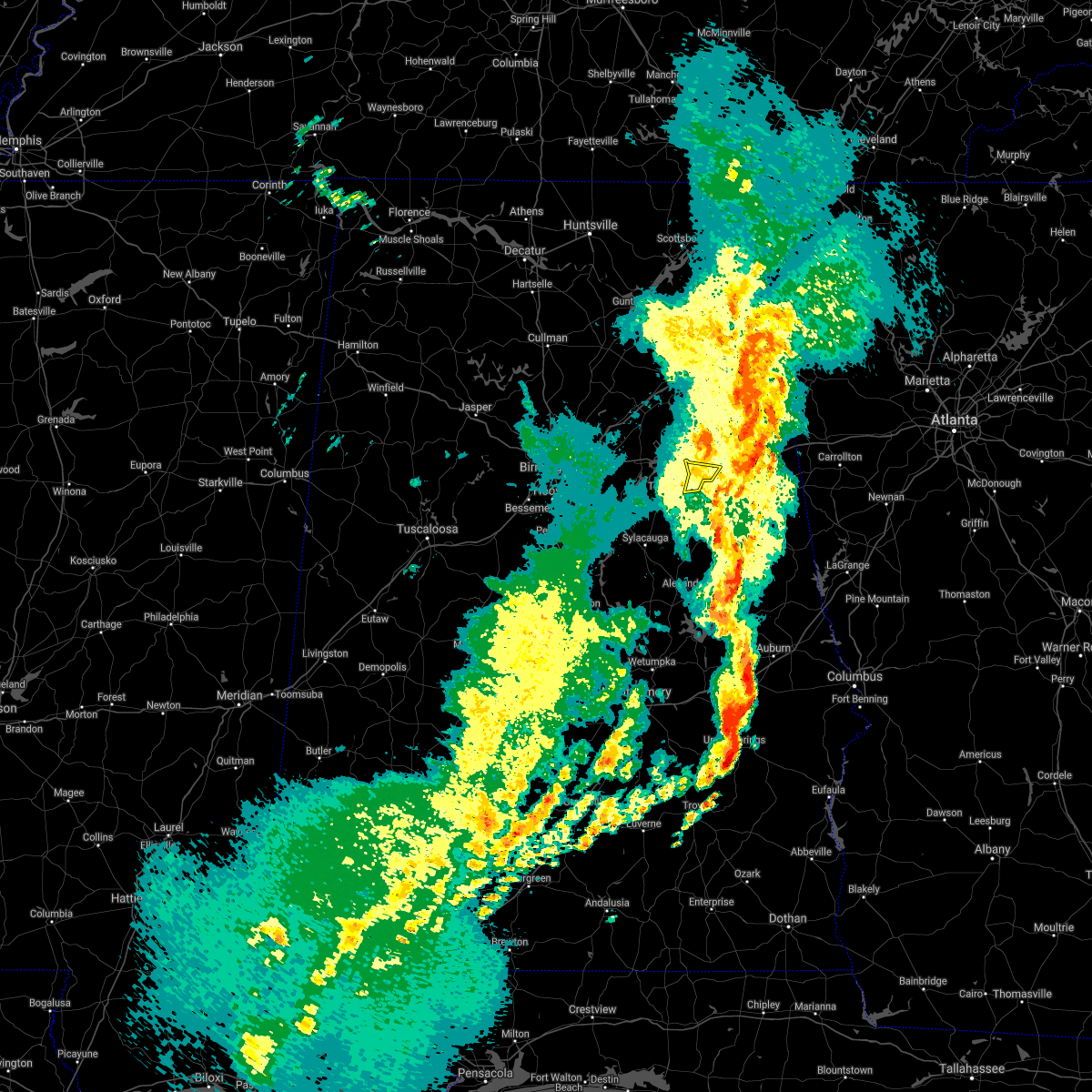 The severe thunderstorm warning for northeastern talladega county will expire at 1115 pm cdt, the storms which prompted the warning have moved out of the area. therefore, the warning will be allowed to expire. a tornado watch remains in effect until 300 am cdt for east central alabama. The severe thunderstorm warning for northeastern talladega county will expire at 1115 pm cdt, the storms which prompted the warning have moved out of the area. therefore, the warning will be allowed to expire. a tornado watch remains in effect until 300 am cdt for east central alabama.
|
| 3/17/2021 11:06 PM CDT |
 At 1106 pm cdt, severe thunderstorms were located along a line extending from near sand rock to 6 miles west of heflin, moving east at 55 mph (radar indicated). Hazards include 60 mph wind gusts. Expect damage to roofs, siding, and trees. Locations impacted include, anniston, oxford, jacksonville, piedmont, centre, cedar bluff, little river canyon national preserve, forney, fort mcclellan, centre municipal airport, saks, weaver, leesburg, hobson city, sand rock, gaylesville, tennala, pleasant gap, cornwall furnace park and blanche. At 1106 pm cdt, severe thunderstorms were located along a line extending from near sand rock to 6 miles west of heflin, moving east at 55 mph (radar indicated). Hazards include 60 mph wind gusts. Expect damage to roofs, siding, and trees. Locations impacted include, anniston, oxford, jacksonville, piedmont, centre, cedar bluff, little river canyon national preserve, forney, fort mcclellan, centre municipal airport, saks, weaver, leesburg, hobson city, sand rock, gaylesville, tennala, pleasant gap, cornwall furnace park and blanche.
|
| 3/17/2021 10:52 PM CDT |
 At 1052 pm cdt, severe thunderstorms were located along a line extending from near ohatchee to grant town to near munford, moving northeast at 45 mph (radar indicated). Hazards include 60 mph wind gusts. Expect damage to roofs, siding, and trees. Locations impacted include, oxford, munford, grant town, jenifer and camp mac. At 1052 pm cdt, severe thunderstorms were located along a line extending from near ohatchee to grant town to near munford, moving northeast at 45 mph (radar indicated). Hazards include 60 mph wind gusts. Expect damage to roofs, siding, and trees. Locations impacted include, oxford, munford, grant town, jenifer and camp mac.
|
| 3/17/2021 10:52 PM CDT |
 At 1052 pm cdt, severe thunderstorms were located along a line extending from near crossville to near hobson city, moving northeast at 60 mph (radar indicated). Hazards include 60 mph wind gusts. Expect damage to roofs, siding, and trees. Locations impacted include, gadsden, anniston, oxford, jacksonville, rainbow city, piedmont, hokes bluff, centre, cedar bluff, little river canyon national preserve, forney, west end-cobb town, centre municipal airport, cobb town, fort mcclellan, saks, glencoe, weaver, ohatchee and leesburg. At 1052 pm cdt, severe thunderstorms were located along a line extending from near crossville to near hobson city, moving northeast at 60 mph (radar indicated). Hazards include 60 mph wind gusts. Expect damage to roofs, siding, and trees. Locations impacted include, gadsden, anniston, oxford, jacksonville, rainbow city, piedmont, hokes bluff, centre, cedar bluff, little river canyon national preserve, forney, west end-cobb town, centre municipal airport, cobb town, fort mcclellan, saks, glencoe, weaver, ohatchee and leesburg.
|
| 3/17/2021 10:43 PM CDT |
 At 1042 pm cdt, severe thunderstorms were located along a line extending from near crossville to near talladega municipal airport, moving east at 50 mph (radar indicated). Hazards include 60 mph wind gusts. Expect damage to roofs, siding, and trees. Locations impacted include, gadsden, anniston, oxford, jacksonville, rainbow city, attalla, piedmont, hokes bluff, centre, cedar bluff, little river canyon national preserve, forney, west end-cobb town, centre municipal airport, cobb town, fort mcclellan, saks, glencoe, weaver and sardis city. At 1042 pm cdt, severe thunderstorms were located along a line extending from near crossville to near talladega municipal airport, moving east at 50 mph (radar indicated). Hazards include 60 mph wind gusts. Expect damage to roofs, siding, and trees. Locations impacted include, gadsden, anniston, oxford, jacksonville, rainbow city, attalla, piedmont, hokes bluff, centre, cedar bluff, little river canyon national preserve, forney, west end-cobb town, centre municipal airport, cobb town, fort mcclellan, saks, glencoe, weaver and sardis city.
|
| 3/17/2021 10:41 PM CDT |
 At 1041 pm cdt, severe thunderstorms were located along a line extending from near ragland to near talladega superspeedway to near winterboro, moving northeast at 45 mph (radar indicated). Hazards include 60 mph wind gusts. Expect damage to roofs, siding, and trees. Locations impacted include, oxford, talladega, lincoln, munford, waldo, grant town, alpine, talladega superspeedway, honda manufacturing of alabama, talladega municipal airport, logan martin lake, camp mac, jackson shoals, ironaton, jenifer, howells cove and eastaboga. At 1041 pm cdt, severe thunderstorms were located along a line extending from near ragland to near talladega superspeedway to near winterboro, moving northeast at 45 mph (radar indicated). Hazards include 60 mph wind gusts. Expect damage to roofs, siding, and trees. Locations impacted include, oxford, talladega, lincoln, munford, waldo, grant town, alpine, talladega superspeedway, honda manufacturing of alabama, talladega municipal airport, logan martin lake, camp mac, jackson shoals, ironaton, jenifer, howells cove and eastaboga.
|
| 3/17/2021 10:31 PM CDT |
 At 1031 pm cdt, severe thunderstorms were located along a line extending from near riverside to near logan martin lake to fayetteville, moving northeast at 45 mph (radar indicated). Hazards include 60 mph wind gusts. Expect damage to roofs, siding, and trees. Locations impacted include, oxford, talladega, sylacauga, pell city, childersburg, talladega springs, lincoln, riverside, munford, waldo, alpine bay resort, winterboro, talladega superspeedway, talladega municipal airport, fayetteville, grant town, alpine, logan martin lake, honda manufacturing of alabama and sycamore. At 1031 pm cdt, severe thunderstorms were located along a line extending from near riverside to near logan martin lake to fayetteville, moving northeast at 45 mph (radar indicated). Hazards include 60 mph wind gusts. Expect damage to roofs, siding, and trees. Locations impacted include, oxford, talladega, sylacauga, pell city, childersburg, talladega springs, lincoln, riverside, munford, waldo, alpine bay resort, winterboro, talladega superspeedway, talladega municipal airport, fayetteville, grant town, alpine, logan martin lake, honda manufacturing of alabama and sycamore.
|
| 3/17/2021 10:23 PM CDT |
 At 1023 pm cdt, severe thunderstorms were located along a line extending from near odenville to alpine bay resort to near talladega springs, moving northeast at 55 mph (radar indicated). Hazards include 60 mph wind gusts. Expect damage to roofs, siding, and trees. Locations impacted include, oxford, talladega, sylacauga, pell city, childersburg, wilsonville, talladega springs, lincoln, riverside, vincent, harpersville, munford, waldo, alpine bay resort, talladega superspeedway, talladega municipal airport, grant town, alpine, coosa island and logan martin dam. At 1023 pm cdt, severe thunderstorms were located along a line extending from near odenville to alpine bay resort to near talladega springs, moving northeast at 55 mph (radar indicated). Hazards include 60 mph wind gusts. Expect damage to roofs, siding, and trees. Locations impacted include, oxford, talladega, sylacauga, pell city, childersburg, wilsonville, talladega springs, lincoln, riverside, vincent, harpersville, munford, waldo, alpine bay resort, talladega superspeedway, talladega municipal airport, grant town, alpine, coosa island and logan martin dam.
|
| 3/17/2021 10:22 PM CDT |
 At 1022 pm cdt, severe thunderstorms were located along a line extending from near albertville to near pell city, moving east at 50 mph (radar indicated). Hazards include 60 mph wind gusts. expect damage to roofs, siding, and trees At 1022 pm cdt, severe thunderstorms were located along a line extending from near albertville to near pell city, moving east at 50 mph (radar indicated). Hazards include 60 mph wind gusts. expect damage to roofs, siding, and trees
|
| 3/17/2021 10:11 PM CDT |
 At 1011 pm cdt, severe thunderstorms were located along a line extending from moody to near columbiana, moving northeast at 45 mph (radar indicated). Hazards include 60 mph wind gusts. Expect damage to roofs, siding, and trees. Locations impacted include, oxford, talladega, sylacauga, pell city, leeds, moody, calera, childersburg, columbiana, wilsonville, talladega springs, lincoln, riverside, vincent, harpersville, munford, westover, waldo, alpine bay resort and talladega superspeedway. At 1011 pm cdt, severe thunderstorms were located along a line extending from moody to near columbiana, moving northeast at 45 mph (radar indicated). Hazards include 60 mph wind gusts. Expect damage to roofs, siding, and trees. Locations impacted include, oxford, talladega, sylacauga, pell city, leeds, moody, calera, childersburg, columbiana, wilsonville, talladega springs, lincoln, riverside, vincent, harpersville, munford, westover, waldo, alpine bay resort and talladega superspeedway.
|
| 3/17/2021 10:06 PM CDT |
 At 1006 pm cdt, severe thunderstorms were located along a line extending from near leeds to near columbiana, moving east at 50 mph (radar indicated). Hazards include 60 mph wind gusts. expect damage to roofs, siding, and trees At 1006 pm cdt, severe thunderstorms were located along a line extending from near leeds to near columbiana, moving east at 50 mph (radar indicated). Hazards include 60 mph wind gusts. expect damage to roofs, siding, and trees
|
| 7/12/2020 1:57 PM CDT |
 The severe thunderstorm warning for central talladega county will expire at 200 pm cdt, the storms which prompted the warning have weakened below severe limits, and no longer pose an immediate threat to life or property. therefore, the warning will be allowed to expire. a severe thunderstorm watch remains in effect until 700 pm cdt for central and east central alabama. to report severe weather, contact your nearest law enforcement agency. they will relay your report to the national weather service birmingham. The severe thunderstorm warning for central talladega county will expire at 200 pm cdt, the storms which prompted the warning have weakened below severe limits, and no longer pose an immediate threat to life or property. therefore, the warning will be allowed to expire. a severe thunderstorm watch remains in effect until 700 pm cdt for central and east central alabama. to report severe weather, contact your nearest law enforcement agency. they will relay your report to the national weather service birmingham.
|
| 7/12/2020 1:43 PM CDT |
 At 143 pm cdt, severe thunderstorms were located along a line extending from near bynum to winterboro, moving southeast at 40 mph (radar indicated). Hazards include 60 mph wind gusts. Expect damage to roofs, siding, and trees. Locations impacted include, oxford, talladega, lincoln, munford, waldo, grant town, alpine bay resort, winterboro, alpine, talladega superspeedway, talladega municipal airport, logan martin lake, eastaboga, camp mac, jackson shoals, ironaton, jenifer and howells cove. At 143 pm cdt, severe thunderstorms were located along a line extending from near bynum to winterboro, moving southeast at 40 mph (radar indicated). Hazards include 60 mph wind gusts. Expect damage to roofs, siding, and trees. Locations impacted include, oxford, talladega, lincoln, munford, waldo, grant town, alpine bay resort, winterboro, alpine, talladega superspeedway, talladega municipal airport, logan martin lake, eastaboga, camp mac, jackson shoals, ironaton, jenifer and howells cove.
|
| 7/12/2020 1:06 PM CDT |
 At 105 pm cdt, severe thunderstorms were located along a line extending from attalla to moody, moving southeast at 35 mph (radar indicated). Hazards include 60 mph wind gusts. expect damage to roofs, siding, and trees At 105 pm cdt, severe thunderstorms were located along a line extending from attalla to moody, moving southeast at 35 mph (radar indicated). Hazards include 60 mph wind gusts. expect damage to roofs, siding, and trees
|
| 6/5/2020 2:39 PM CDT |
 At 238 pm cdt, a severe thunderstorm was located near fort mcclellan, moving southeast at 25 mph (radar indicated). Hazards include 60 mph wind gusts and quarter size hail. Hail damage to vehicles is expected. expect wind damage to roofs, siding, and trees. Locations impacted include, anniston, oxford, heflin, fort mcclellan, west end-cobb town, blue mountain, dearmanville, chalafinnee and choccolocco. At 238 pm cdt, a severe thunderstorm was located near fort mcclellan, moving southeast at 25 mph (radar indicated). Hazards include 60 mph wind gusts and quarter size hail. Hail damage to vehicles is expected. expect wind damage to roofs, siding, and trees. Locations impacted include, anniston, oxford, heflin, fort mcclellan, west end-cobb town, blue mountain, dearmanville, chalafinnee and choccolocco.
|
| 6/5/2020 2:23 PM CDT |
 At 223 pm cdt, a severe thunderstorm was located over fort mcclellan, moving southeast at 25 mph (radar indicated). Hazards include 60 mph wind gusts and quarter size hail. Hail damage to vehicles is expected. Expect wind damage to roofs, siding, and trees. At 223 pm cdt, a severe thunderstorm was located over fort mcclellan, moving southeast at 25 mph (radar indicated). Hazards include 60 mph wind gusts and quarter size hail. Hail damage to vehicles is expected. Expect wind damage to roofs, siding, and trees.
|
| 3/11/2020 3:58 PM CDT |
 At 358 pm cdt, a severe thunderstorm was located over munford, or 8 miles northeast of talladega, moving east at 20 mph (radar indicated). Hazards include 60 mph wind gusts and quarter size hail. Hail damage to vehicles is expected. expect wind damage to roofs, siding, and trees. Locations impacted include, munford, grant town, jenifer and camp mac. At 358 pm cdt, a severe thunderstorm was located over munford, or 8 miles northeast of talladega, moving east at 20 mph (radar indicated). Hazards include 60 mph wind gusts and quarter size hail. Hail damage to vehicles is expected. expect wind damage to roofs, siding, and trees. Locations impacted include, munford, grant town, jenifer and camp mac.
|
| 3/11/2020 3:46 PM CDT |
 At 346 pm cdt, a severe thunderstorm was located over talladega superspeedway, or 7 miles north of talladega, moving east at 20 mph (radar indicated). Hazards include 60 mph wind gusts and quarter size hail. Hail damage to vehicles is expected. Expect wind damage to roofs, siding, and trees. At 346 pm cdt, a severe thunderstorm was located over talladega superspeedway, or 7 miles north of talladega, moving east at 20 mph (radar indicated). Hazards include 60 mph wind gusts and quarter size hail. Hail damage to vehicles is expected. Expect wind damage to roofs, siding, and trees.
|
| 1/11/2020 2:51 PM CST |
 At 250 pm cst, severe thunderstorms were located along a line extending from pleasant gap to near mount cheaha to near eclectic, moving east at 40 mph (radar indicated). Hazards include 70 mph wind gusts. Expect considerable tree damage. damage is likely to mobile homes, roofs, and outbuildings. Locations impacted include, anniston, oxford, piedmont, goodwater, kellyton, equality, cottage grove, highway 9 and highway 22, nixburg, mount cheaha, western lake martin, fishpond, ray, choccolocco and dearmanville. At 250 pm cst, severe thunderstorms were located along a line extending from pleasant gap to near mount cheaha to near eclectic, moving east at 40 mph (radar indicated). Hazards include 70 mph wind gusts. Expect considerable tree damage. damage is likely to mobile homes, roofs, and outbuildings. Locations impacted include, anniston, oxford, piedmont, goodwater, kellyton, equality, cottage grove, highway 9 and highway 22, nixburg, mount cheaha, western lake martin, fishpond, ray, choccolocco and dearmanville.
|
| 1/11/2020 2:29 PM CST |
 At 229 pm cst, severe thunderstorms were located along a line extending from 6 miles southwest of ball flat to waldo to near jordan lake, moving east at 40 mph (radar indicated). Hazards include 70 mph wind gusts. Expect considerable tree damage. damage is likely to mobile homes, roofs, and outbuildings. Locations impacted include, anniston, oxford, talladega, jacksonville, piedmont, goodwater, rockford, kellyton, equality, west end-cobb town, cobb town, fort mcclellan, saks, glencoe, weaver, munford, hobson city, waldo, bradford and bentleyville. At 229 pm cst, severe thunderstorms were located along a line extending from 6 miles southwest of ball flat to waldo to near jordan lake, moving east at 40 mph (radar indicated). Hazards include 70 mph wind gusts. Expect considerable tree damage. damage is likely to mobile homes, roofs, and outbuildings. Locations impacted include, anniston, oxford, talladega, jacksonville, piedmont, goodwater, rockford, kellyton, equality, west end-cobb town, cobb town, fort mcclellan, saks, glencoe, weaver, munford, hobson city, waldo, bradford and bentleyville.
|
| 1/11/2020 2:17 PM CST |
 At 217 pm cst, severe thunderstorms were located along a line extending from near jacksonville state university to near talladega to near deatsville, moving east at 40 mph (radar indicated). Hazards include 70 mph wind gusts. Expect considerable tree damage. damage is likely to mobile homes, roofs, and outbuildings. Locations impacted include, anniston, oxford, talladega, sylacauga, jacksonville, piedmont, goodwater, rockford, kellyton, equality, west end-cobb town, stewartville, weogufka, cobb town, fort mcclellan, saks, lincoln, glencoe, weaver and riverside. At 217 pm cst, severe thunderstorms were located along a line extending from near jacksonville state university to near talladega to near deatsville, moving east at 40 mph (radar indicated). Hazards include 70 mph wind gusts. Expect considerable tree damage. damage is likely to mobile homes, roofs, and outbuildings. Locations impacted include, anniston, oxford, talladega, sylacauga, jacksonville, piedmont, goodwater, rockford, kellyton, equality, west end-cobb town, stewartville, weogufka, cobb town, fort mcclellan, saks, lincoln, glencoe, weaver and riverside.
|
| 1/11/2020 2:04 PM CST |
 At 204 pm cst, severe thunderstorms were located along a line extending from 6 miles south of glencoe to near alpine to near booth, moving east at 40 mph (radar indicated). Hazards include 70 mph wind gusts. Expect considerable tree damage. damage is likely to mobile homes, roofs, and outbuildings. Locations impacted include, anniston, oxford, talladega, sylacauga, jacksonville, childersburg, piedmont, wilsonville, goodwater, rockford, kellyton, talladega springs, equality, west end-cobb town, stewartville, weogufka, cobb town, fort mcclellan, saks and lincoln. At 204 pm cst, severe thunderstorms were located along a line extending from 6 miles south of glencoe to near alpine to near booth, moving east at 40 mph (radar indicated). Hazards include 70 mph wind gusts. Expect considerable tree damage. damage is likely to mobile homes, roofs, and outbuildings. Locations impacted include, anniston, oxford, talladega, sylacauga, jacksonville, childersburg, piedmont, wilsonville, goodwater, rockford, kellyton, talladega springs, equality, west end-cobb town, stewartville, weogufka, cobb town, fort mcclellan, saks and lincoln.
|
| 1/11/2020 1:54 PM CST |
 At 154 pm cst, severe thunderstorms were located along a line extending from near neely henry lake to near childersburg to near vida junction, moving east at 40 mph (radar indicated). Hazards include 60 mph wind gusts. Expect damage to roofs, siding, and trees. Locations impacted include, anniston, oxford, talladega, sylacauga, jacksonville, childersburg, piedmont, wilsonville, goodwater, rockford, kellyton, talladega springs, equality, west end-cobb town, stewartville, weogufka, cobb town, fort mcclellan, saks and lincoln. At 154 pm cst, severe thunderstorms were located along a line extending from near neely henry lake to near childersburg to near vida junction, moving east at 40 mph (radar indicated). Hazards include 60 mph wind gusts. Expect damage to roofs, siding, and trees. Locations impacted include, anniston, oxford, talladega, sylacauga, jacksonville, childersburg, piedmont, wilsonville, goodwater, rockford, kellyton, talladega springs, equality, west end-cobb town, stewartville, weogufka, cobb town, fort mcclellan, saks and lincoln.
|
| 1/11/2020 1:40 PM CST |
 At 140 pm cst, severe thunderstorms were located along a line extending from near ashville to near westover to near mulberry, moving east at 40 mph (radar indicated). Hazards include 60 mph wind gusts. expect damage to roofs, siding, and trees At 140 pm cst, severe thunderstorms were located along a line extending from near ashville to near westover to near mulberry, moving east at 40 mph (radar indicated). Hazards include 60 mph wind gusts. expect damage to roofs, siding, and trees
|
| 8/27/2019 7:18 PM CDT | Trees and power lines down on tanglewood d in calhoun county AL, 1.1 miles SE of Oxford, AL |
| 8/27/2019 7:00 PM CDT | Tree down on easterwood d in calhoun county AL, 2.2 miles W of Oxford, AL |
| 8/27/2019 6:11 PM CDT |
 At 610 pm cdt, a severe thunderstorm was located over ohatchee, or 11 miles south of rainbow city, moving southeast at 40 mph (radar indicated). Hazards include 60 mph wind gusts. expect damage to roofs, siding, and trees At 610 pm cdt, a severe thunderstorm was located over ohatchee, or 11 miles south of rainbow city, moving southeast at 40 mph (radar indicated). Hazards include 60 mph wind gusts. expect damage to roofs, siding, and trees
|
| 7/21/2018 4:01 PM CDT |
 At 400 pm cdt, a severe thunderstorm was located near oxford lake, or 7 miles east of oxford, moving southeast at 25 mph (radar indicated). Hazards include 60 mph wind gusts and half dollar size hail. Hail damage to vehicles is expected. Expect wind damage to roofs, siding, and trees. At 400 pm cdt, a severe thunderstorm was located near oxford lake, or 7 miles east of oxford, moving southeast at 25 mph (radar indicated). Hazards include 60 mph wind gusts and half dollar size hail. Hail damage to vehicles is expected. Expect wind damage to roofs, siding, and trees.
|
| 6/28/2018 2:32 PM CDT |
 At 232 pm cdt, severe thunderstorms were located along a line extending from bald rock to near munford to 6 miles north of fosters cross roads, moving south at 40 mph (emergency management). Hazards include 70 mph wind gusts. Expect considerable tree damage. damage is likely to mobile homes, roofs, and outbuildings. Locations impacted include, anniston, oxford, pell city, jacksonville, leeds, moody, springville, odenville, cobb town, west end-cobb town, fort mcclellan, saks, lincoln, margaret, argo, weaver, ashville, ragland, ohatchee and hobson city. At 232 pm cdt, severe thunderstorms were located along a line extending from bald rock to near munford to 6 miles north of fosters cross roads, moving south at 40 mph (emergency management). Hazards include 70 mph wind gusts. Expect considerable tree damage. damage is likely to mobile homes, roofs, and outbuildings. Locations impacted include, anniston, oxford, pell city, jacksonville, leeds, moody, springville, odenville, cobb town, west end-cobb town, fort mcclellan, saks, lincoln, margaret, argo, weaver, ashville, ragland, ohatchee and hobson city.
|
| 6/28/2018 2:27 PM CDT | Tree down near wvok radio statio in calhoun county AL, 1.6 miles SSW of Oxford, AL |
| 6/28/2018 2:06 PM CDT |
 At 205 pm cdt, severe thunderstorms were located along a line extending from 6 miles northeast of springville to ohatchee to near fort mcclellan, moving south at 40 mph (emergency management). Hazards include 70 mph wind gusts. Expect considerable tree damage. Damage is likely to mobile homes, roofs, and outbuildings. At 205 pm cdt, severe thunderstorms were located along a line extending from 6 miles northeast of springville to ohatchee to near fort mcclellan, moving south at 40 mph (emergency management). Hazards include 70 mph wind gusts. Expect considerable tree damage. Damage is likely to mobile homes, roofs, and outbuildings.
|
| 6/28/2018 1:57 PM CDT |
 At 157 pm cdt, severe thunderstorms were located along a line extending from allgood to neely henry lake to 6 miles south of piedmont, moving south at 40 mph (emergency management). Hazards include 70 mph wind gusts. Expect considerable tree damage. damage is likely to mobile homes, roofs, and outbuildings. Locations impacted include, anniston, oxford, pell city, jacksonville, leeds, moody, rainbow city, piedmont, springville, odenville, west end-cobb town, cobb town, fort mcclellan, saks, lincoln, glencoe, margaret, argo, weaver and ashville. At 157 pm cdt, severe thunderstorms were located along a line extending from allgood to neely henry lake to 6 miles south of piedmont, moving south at 40 mph (emergency management). Hazards include 70 mph wind gusts. Expect considerable tree damage. damage is likely to mobile homes, roofs, and outbuildings. Locations impacted include, anniston, oxford, pell city, jacksonville, leeds, moody, rainbow city, piedmont, springville, odenville, west end-cobb town, cobb town, fort mcclellan, saks, lincoln, glencoe, margaret, argo, weaver and ashville.
|
| 6/28/2018 1:39 PM CDT |
 At 138 pm cdt, severe thunderstorms were located along a line extending from near nectar to near attalla to ball flat, moving south at 40 mph (radar indicated). Hazards include 60 to 70 mph wind gusts. Expect considerable tree damage. Damage is likely to mobile homes, roofs, and outbuildings. At 138 pm cdt, severe thunderstorms were located along a line extending from near nectar to near attalla to ball flat, moving south at 40 mph (radar indicated). Hazards include 60 to 70 mph wind gusts. Expect considerable tree damage. Damage is likely to mobile homes, roofs, and outbuildings.
|
| 6/27/2018 5:05 PM CDT | Tree down near fabarc steel supply inc. winds estimated 40 mph based on radar. time estimated from rada in calhoun county AL, 1.3 miles E of Oxford, AL |
| 4/4/2018 12:38 AM CDT |
 At 1238 am cdt, severe thunderstorms were located along a line extending from 6 miles north of mars hills to 8 miles northwest of fruithurst to near mount cheaha to near winterboro, moving east at 45 mph (radar indicated). Hazards include 60 mph wind gusts. Expect damage to roofs, siding, and trees. Locations impacted include, anniston, oxford, talladega, jacksonville, piedmont, heflin, lineville, west end-cobb town, cobb town, fort mcclellan, saks, lincoln, weaver, munford, hobson city, ranburne, fruithurst, waldo, edwardsville and woodland. At 1238 am cdt, severe thunderstorms were located along a line extending from 6 miles north of mars hills to 8 miles northwest of fruithurst to near mount cheaha to near winterboro, moving east at 45 mph (radar indicated). Hazards include 60 mph wind gusts. Expect damage to roofs, siding, and trees. Locations impacted include, anniston, oxford, talladega, jacksonville, piedmont, heflin, lineville, west end-cobb town, cobb town, fort mcclellan, saks, lincoln, weaver, munford, hobson city, ranburne, fruithurst, waldo, edwardsville and woodland.
|
| 4/4/2018 12:21 AM CDT |
 At 1221 am cdt, severe thunderstorms were located along a line extending from near pleasant gap to near jacksonville state university to near talladega superspeedway to near logan martin dam, moving east at 40 mph (radar indicated). Hazards include 60 mph wind gusts. expect damage to roofs, siding, and trees At 1221 am cdt, severe thunderstorms were located along a line extending from near pleasant gap to near jacksonville state university to near talladega superspeedway to near logan martin dam, moving east at 40 mph (radar indicated). Hazards include 60 mph wind gusts. expect damage to roofs, siding, and trees
|
| 3/19/2018 10:21 PM CDT |
 At 1020 pm cdt, severe thunderstorms were located along a line extending from near fort mcclellan to near oxford, moving east at 50 mph (radar indicated). Hazards include 60 mph wind gusts and quarter size hail. Hail damage to vehicles is expected. expect wind damage to roofs, siding, and trees. locations impacted include, anniston, oxford, fort mcclellan, saks, cobb town, west end-cobb town, weaver, munford, hobson city, grant town, anniston regional airport, oxford lake, blue mountain, choccolocco, dearmanville and jenifer. A tornado watch remains in effect until 1100 pm cdt for east central alabama. At 1020 pm cdt, severe thunderstorms were located along a line extending from near fort mcclellan to near oxford, moving east at 50 mph (radar indicated). Hazards include 60 mph wind gusts and quarter size hail. Hail damage to vehicles is expected. expect wind damage to roofs, siding, and trees. locations impacted include, anniston, oxford, fort mcclellan, saks, cobb town, west end-cobb town, weaver, munford, hobson city, grant town, anniston regional airport, oxford lake, blue mountain, choccolocco, dearmanville and jenifer. A tornado watch remains in effect until 1100 pm cdt for east central alabama.
|
| 3/19/2018 10:20 PM CDT | Quarter sized hail reported 1.9 miles SSW of Oxford, AL |
| 3/19/2018 10:19 PM CDT | Quarter sized hail reported 1.6 miles SSW of Oxford, AL |
| 3/19/2018 10:14 PM CDT |
 At 1014 pm cdt, severe thunderstorms were located along a line extending from fort mcclellan to near grant town, moving east at 50 mph (radar indicated). Hazards include 60 mph wind gusts and quarter size hail. Hail damage to vehicles is expected. expect wind damage to roofs, siding, and trees. locations impacted include, anniston, oxford, fort mcclellan, saks, cobb town, west end-cobb town, weaver, munford, hobson city, grant town, anniston regional airport, oxford lake, blue mountain, choccolocco, dearmanville and jenifer. A tornado watch remains in effect until 1100 pm cdt for east central alabama. At 1014 pm cdt, severe thunderstorms were located along a line extending from fort mcclellan to near grant town, moving east at 50 mph (radar indicated). Hazards include 60 mph wind gusts and quarter size hail. Hail damage to vehicles is expected. expect wind damage to roofs, siding, and trees. locations impacted include, anniston, oxford, fort mcclellan, saks, cobb town, west end-cobb town, weaver, munford, hobson city, grant town, anniston regional airport, oxford lake, blue mountain, choccolocco, dearmanville and jenifer. A tornado watch remains in effect until 1100 pm cdt for east central alabama.
|
| 3/19/2018 10:11 PM CDT | Quarter sized hail reported 4.8 miles E of Oxford, AL, reported on priebes mill road. |
| 3/19/2018 10:06 PM CDT |
 At 1006 pm cdt, severe thunderstorms were located along a line extending from near saks to talladega municipal airport, moving east at 50 mph (radar indicated). Hazards include 60 mph wind gusts and quarter size hail. Hail damage to vehicles is expected. expect wind damage to roofs, siding, and trees. locations impacted include, anniston, oxford, fort mcclellan, saks, cobb town, west end-cobb town, weaver, munford, hobson city, grant town, talladega superspeedway, anniston regional airport, oxford lake, blue mountain, bynum, talladega municipal airport, alexandria, anniston army depot, eastaboga and choccolocco. A tornado watch remains in effect until 1100 pm cdt for east central alabama. At 1006 pm cdt, severe thunderstorms were located along a line extending from near saks to talladega municipal airport, moving east at 50 mph (radar indicated). Hazards include 60 mph wind gusts and quarter size hail. Hail damage to vehicles is expected. expect wind damage to roofs, siding, and trees. locations impacted include, anniston, oxford, fort mcclellan, saks, cobb town, west end-cobb town, weaver, munford, hobson city, grant town, talladega superspeedway, anniston regional airport, oxford lake, blue mountain, bynum, talladega municipal airport, alexandria, anniston army depot, eastaboga and choccolocco. A tornado watch remains in effect until 1100 pm cdt for east central alabama.
|
| 3/19/2018 9:57 PM CDT |
 At 957 pm cdt, severe thunderstorms were located along a line extending from near ohatchee to lincoln, moving east at 50 mph (radar indicated). Hazards include 60 mph wind gusts and quarter size hail. Hail damage to vehicles is expected. expect wind damage to roofs, siding, and trees. locations impacted include, anniston, oxford, cobb town, west end-cobb town, fort mcclellan, saks, lincoln, weaver, riverside, munford, hobson city, talladega superspeedway, anniston regional airport, blue mountain, talladega municipal airport, grant town, honda manufacturing of alabama, oxford lake, bynum and alexandria. A tornado watch remains in effect until 1100 pm cdt for central and east central alabama. At 957 pm cdt, severe thunderstorms were located along a line extending from near ohatchee to lincoln, moving east at 50 mph (radar indicated). Hazards include 60 mph wind gusts and quarter size hail. Hail damage to vehicles is expected. expect wind damage to roofs, siding, and trees. locations impacted include, anniston, oxford, cobb town, west end-cobb town, fort mcclellan, saks, lincoln, weaver, riverside, munford, hobson city, talladega superspeedway, anniston regional airport, blue mountain, talladega municipal airport, grant town, honda manufacturing of alabama, oxford lake, bynum and alexandria. A tornado watch remains in effect until 1100 pm cdt for central and east central alabama.
|
| 3/19/2018 9:46 PM CDT |
 At 946 pm cdt, severe thunderstorms were located along a line extending from ragland to pell city, moving east at 50 mph (radar indicated). Hazards include 60 mph wind gusts and quarter size hail. Hail damage to vehicles is expected. Expect wind damage to roofs, siding, and trees. At 946 pm cdt, severe thunderstorms were located along a line extending from ragland to pell city, moving east at 50 mph (radar indicated). Hazards include 60 mph wind gusts and quarter size hail. Hail damage to vehicles is expected. Expect wind damage to roofs, siding, and trees.
|
| 3/19/2018 9:32 PM CDT |
 At 932 pm cdt, severe thunderstorms were located along a line extending from near heflin to anniston, moving east at 55 mph (radar indicated). Hazards include golf ball size hail and 70 mph wind gusts. People and animals outdoors will be injured. expect hail damage to roofs, siding, windows, and vehicles. expect considerable tree damage. wind damage is also likely to mobile homes, roofs, and outbuildings. locations impacted include, anniston, oxford, heflin, fort mcclellan, cobb town, west end-cobb town, saks, weaver, hobson city, fruithurst, edwardsville, muscadine, abernathy, oxford lake, blue mountain, sweetwater lake, choccolocco, lake cleburne, dearmanville and i 20 welcome center. A tornado watch remains in effect until 1100 pm cdt for east central alabama. At 932 pm cdt, severe thunderstorms were located along a line extending from near heflin to anniston, moving east at 55 mph (radar indicated). Hazards include golf ball size hail and 70 mph wind gusts. People and animals outdoors will be injured. expect hail damage to roofs, siding, windows, and vehicles. expect considerable tree damage. wind damage is also likely to mobile homes, roofs, and outbuildings. locations impacted include, anniston, oxford, heflin, fort mcclellan, cobb town, west end-cobb town, saks, weaver, hobson city, fruithurst, edwardsville, muscadine, abernathy, oxford lake, blue mountain, sweetwater lake, choccolocco, lake cleburne, dearmanville and i 20 welcome center. A tornado watch remains in effect until 1100 pm cdt for east central alabama.
|
| 3/19/2018 9:27 PM CDT |
 At 927 pm cdt, a severe thunderstorm was located over saks, moving east at 50 mph (radar indicated). Hazards include 60 mph wind gusts and quarter size hail. Hail damage to vehicles is expected. Expect wind damage to roofs, siding, and trees. At 927 pm cdt, a severe thunderstorm was located over saks, moving east at 50 mph (radar indicated). Hazards include 60 mph wind gusts and quarter size hail. Hail damage to vehicles is expected. Expect wind damage to roofs, siding, and trees.
|
| 3/19/2018 3:15 PM CDT |
 At 314 pm cdt, a severe thunderstorm was located near oxford, moving east at 35 mph (radar indicated). Hazards include golf ball size hail. People and animals outdoors will be injured. expect damage to roofs, siding, windows, and vehicles. Locations impacted include, anniston, oxford, heflin, ranburne, fruithurst, edwardsville, muscadine, abernathy, mount cheaha, hollis crossroads, trickem, lake cleburne, dearmanville, i 20 welcome center, micaville, chalafinnee and camp sequoyah. At 314 pm cdt, a severe thunderstorm was located near oxford, moving east at 35 mph (radar indicated). Hazards include golf ball size hail. People and animals outdoors will be injured. expect damage to roofs, siding, windows, and vehicles. Locations impacted include, anniston, oxford, heflin, ranburne, fruithurst, edwardsville, muscadine, abernathy, mount cheaha, hollis crossroads, trickem, lake cleburne, dearmanville, i 20 welcome center, micaville, chalafinnee and camp sequoyah.
|
| 3/19/2018 3:04 PM CDT | Quarter sized hail reported 1.6 miles SSW of Oxford, AL, quarter sized hail reported near oxford. |
| 3/19/2018 2:54 PM CDT |
 At 253 pm cdt, a severe thunderstorm was located over munford, or 9 miles northeast of talladega, moving east at 35 mph (radar indicated). Hazards include quarter size hail. damage to vehicles is expected At 253 pm cdt, a severe thunderstorm was located over munford, or 9 miles northeast of talladega, moving east at 35 mph (radar indicated). Hazards include quarter size hail. damage to vehicles is expected
|
| 9/19/2017 4:57 PM CDT |
 At 457 pm cdt, a severe thunderstorm was located near heflin, moving east at 20 mph (radar indicated). Hazards include 60 mph wind gusts and nickel size hail. expect damage to roofs, siding, and trees At 457 pm cdt, a severe thunderstorm was located near heflin, moving east at 20 mph (radar indicated). Hazards include 60 mph wind gusts and nickel size hail. expect damage to roofs, siding, and trees
|
| 7/6/2017 5:36 PM CDT |
 At 536 pm cdt, severe thunderstorms were located along a line extending from near oxford lake to near delta, moving east at 45 mph (radar indicated). Hazards include 60 mph wind gusts and penny size hail. Expect damage to roofs, siding, and trees. Locations impacted include, anniston, oxford, heflin, delta, mount cheaha, dearmanville, hollis crossroads, chalafinnee and camp sequoyah. At 536 pm cdt, severe thunderstorms were located along a line extending from near oxford lake to near delta, moving east at 45 mph (radar indicated). Hazards include 60 mph wind gusts and penny size hail. Expect damage to roofs, siding, and trees. Locations impacted include, anniston, oxford, heflin, delta, mount cheaha, dearmanville, hollis crossroads, chalafinnee and camp sequoyah.
|
| 7/6/2017 5:32 PM CDT |
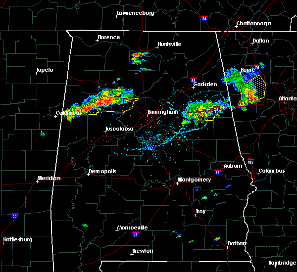 At 532 pm cdt, a severe thunderstorm was located over oxford, moving east at 30 mph (radar indicated). Hazards include 60 mph wind gusts. Expect damage to roofs, siding, and trees. Locations impacted include, oxford. At 532 pm cdt, a severe thunderstorm was located over oxford, moving east at 30 mph (radar indicated). Hazards include 60 mph wind gusts. Expect damage to roofs, siding, and trees. Locations impacted include, oxford.
|
| 7/6/2017 5:30 PM CDT | Trees and power lines reported down in oxford on luttrell stree in calhoun county AL, 1.9 miles SSW of Oxford, AL |
| 7/6/2017 5:27 PM CDT | Trees down at the intersection of mcintosh road and mary drive. time based on rada in talladega county AL, 2.1 miles NNW of Oxford, AL |
| 7/6/2017 5:23 PM CDT |
 At 523 pm cdt, a severe thunderstorm was located over talladega municipal airport, or 9 miles northeast of talladega, moving east at 30 mph (radar indicated). Hazards include 60 mph wind gusts and penny size hail. expect damage to roofs, siding, and trees At 523 pm cdt, a severe thunderstorm was located over talladega municipal airport, or 9 miles northeast of talladega, moving east at 30 mph (radar indicated). Hazards include 60 mph wind gusts and penny size hail. expect damage to roofs, siding, and trees
|
| 7/6/2017 5:19 PM CDT |
 At 519 pm cdt, severe thunderstorms were located along a line extending from bynum to near grant town to waldo, moving east at 30 mph (radar indicated). Hazards include 60 mph wind gusts. Expect damage to roofs, siding, and trees. Locations impacted include, oxford, munford, waldo, grant town, camp mac, ironaton and jenifer. At 519 pm cdt, severe thunderstorms were located along a line extending from bynum to near grant town to waldo, moving east at 30 mph (radar indicated). Hazards include 60 mph wind gusts. Expect damage to roofs, siding, and trees. Locations impacted include, oxford, munford, waldo, grant town, camp mac, ironaton and jenifer.
|
| 7/6/2017 5:13 PM CDT |
 At 513 pm cdt, severe thunderstorms were located along a line extending from bynum to near munford to winterboro, moving east at 30 mph (radar indicated). Hazards include 60 mph wind gusts and penny size hail. Expect damage to roofs, siding, and trees. Locations impacted include, oxford, talladega, munford, waldo, grant town, alpine, talladega municipal airport, camp mac, ironaton, jenifer and eastaboga. At 513 pm cdt, severe thunderstorms were located along a line extending from bynum to near munford to winterboro, moving east at 30 mph (radar indicated). Hazards include 60 mph wind gusts and penny size hail. Expect damage to roofs, siding, and trees. Locations impacted include, oxford, talladega, munford, waldo, grant town, alpine, talladega municipal airport, camp mac, ironaton, jenifer and eastaboga.
|
| 7/6/2017 5:02 PM CDT |
 At 502 pm cdt, severe thunderstorms were located along a line extending from near talladega municipal airport to near talladega superspeedway to near alpine, moving east at 30 mph (radar indicated). Hazards include 60 mph wind gusts and penny size hail. Expect damage to roofs, siding, and trees. Locations impacted include, oxford, talladega, lincoln, munford, waldo, grant town, alpine, talladega superspeedway, honda manufacturing of alabama, talladega municipal airport, eastaboga, camp mac, jackson shoals, ironaton, jenifer and howells cove. At 502 pm cdt, severe thunderstorms were located along a line extending from near talladega municipal airport to near talladega superspeedway to near alpine, moving east at 30 mph (radar indicated). Hazards include 60 mph wind gusts and penny size hail. Expect damage to roofs, siding, and trees. Locations impacted include, oxford, talladega, lincoln, munford, waldo, grant town, alpine, talladega superspeedway, honda manufacturing of alabama, talladega municipal airport, eastaboga, camp mac, jackson shoals, ironaton, jenifer and howells cove.
|
| 7/6/2017 4:55 PM CDT |
 At 455 pm cdt, severe thunderstorms were located along a line extending from near honda manufacturing of alabama to near talladega to near logan martin dam, moving east at 35 mph (radar indicated). Hazards include 60 mph wind gusts and penny size hail. Expect damage to roofs, siding, and trees. Locations impacted include, oxford, talladega, pell city, lincoln, riverside, vincent, munford, waldo, alpine bay resort, talladega superspeedway, talladega municipal airport, grant town, alpine, honda manufacturing of alabama, coosa island, logan martin dam, country club estates, camp mac, jackson shoals and ironaton. At 455 pm cdt, severe thunderstorms were located along a line extending from near honda manufacturing of alabama to near talladega to near logan martin dam, moving east at 35 mph (radar indicated). Hazards include 60 mph wind gusts and penny size hail. Expect damage to roofs, siding, and trees. Locations impacted include, oxford, talladega, pell city, lincoln, riverside, vincent, munford, waldo, alpine bay resort, talladega superspeedway, talladega municipal airport, grant town, alpine, honda manufacturing of alabama, coosa island, logan martin dam, country club estates, camp mac, jackson shoals and ironaton.
|
| 7/6/2017 4:47 PM CDT |
 At 447 pm cdt, severe thunderstorms were located along a line extending from honda manufacturing of alabama to near logan martin dam, moving east at 30 mph (radar indicated). Hazards include 60 mph wind gusts and penny size hail. expect damage to roofs, siding, and trees At 447 pm cdt, severe thunderstorms were located along a line extending from honda manufacturing of alabama to near logan martin dam, moving east at 30 mph (radar indicated). Hazards include 60 mph wind gusts and penny size hail. expect damage to roofs, siding, and trees
|
| 7/4/2017 2:35 PM CDT | Measured gust of 63 mph at kan in calhoun county AL, 0.7 miles ESE of Oxford, AL |
| 6/23/2017 4:54 PM CDT |
 At 454 pm cdt, severe thunderstorms were located along a line extending from near piedmont to 7 miles east of jacksonville to near edwardsville to near heflin, moving northeast at 60 mph (radar indicated). Hazards include 60 mph wind gusts. Expect damage to roofs, siding, and trees. locations impacted include, anniston, oxford, jacksonville, piedmont, heflin, forney, edwardsville, pleasant gap, mars hills, jacksonville state university, sweetwater lake, coleman lake and campground, choccolocco, spring garden, dearmanville, liberty hill, oak level and borden springs. A tornado watch remains in effect until 800 pm cdt for northeastern alabama. At 454 pm cdt, severe thunderstorms were located along a line extending from near piedmont to 7 miles east of jacksonville to near edwardsville to near heflin, moving northeast at 60 mph (radar indicated). Hazards include 60 mph wind gusts. Expect damage to roofs, siding, and trees. locations impacted include, anniston, oxford, jacksonville, piedmont, heflin, forney, edwardsville, pleasant gap, mars hills, jacksonville state university, sweetwater lake, coleman lake and campground, choccolocco, spring garden, dearmanville, liberty hill, oak level and borden springs. A tornado watch remains in effect until 800 pm cdt for northeastern alabama.
|
| 6/23/2017 4:49 PM CDT |
 At 449 pm cdt, severe thunderstorms were located along a line extending from jacksonville to near jacksonville state university to near fort mcclellan to near anniston regional airport, moving northeast at 60 mph (radar indicated). Hazards include 60 mph wind gusts. Expect damage to roofs, siding, and trees. locations impacted include, anniston, oxford, jacksonville, piedmont, heflin, fort mcclellan, forney, saks, weaver, hobson city, edwardsville, pleasant gap, oxford lake, mars hills, jacksonville state university, alexandria, sweetwater lake, coleman lake and campground, choccolocco and spring garden. A tornado watch remains in effect until 800 pm cdt for northeastern alabama. At 449 pm cdt, severe thunderstorms were located along a line extending from jacksonville to near jacksonville state university to near fort mcclellan to near anniston regional airport, moving northeast at 60 mph (radar indicated). Hazards include 60 mph wind gusts. Expect damage to roofs, siding, and trees. locations impacted include, anniston, oxford, jacksonville, piedmont, heflin, fort mcclellan, forney, saks, weaver, hobson city, edwardsville, pleasant gap, oxford lake, mars hills, jacksonville state university, alexandria, sweetwater lake, coleman lake and campground, choccolocco and spring garden. A tornado watch remains in effect until 800 pm cdt for northeastern alabama.
|
| 6/23/2017 4:41 PM CDT |
 At 441 pm cdt, severe thunderstorms were located along a line extending from weaver to fort mcclellan to near anniston to near munford, moving northeast at 60 mph (radar indicated). Hazards include 60 mph wind gusts. Expect damage to roofs, siding, and trees. locations impacted include, anniston, oxford, jacksonville, piedmont, heflin, cobb town, forney, west end-cobb town, fort mcclellan, saks, weaver, hobson city, edwardsville, pleasant gap, blue mountain, alexandria, jacksonville state university, oxford lake, mars hills and coleman lake and campground. A tornado watch remains in effect until 800 pm cdt for northeastern alabama. At 441 pm cdt, severe thunderstorms were located along a line extending from weaver to fort mcclellan to near anniston to near munford, moving northeast at 60 mph (radar indicated). Hazards include 60 mph wind gusts. Expect damage to roofs, siding, and trees. locations impacted include, anniston, oxford, jacksonville, piedmont, heflin, cobb town, forney, west end-cobb town, fort mcclellan, saks, weaver, hobson city, edwardsville, pleasant gap, blue mountain, alexandria, jacksonville state university, oxford lake, mars hills and coleman lake and campground. A tornado watch remains in effect until 800 pm cdt for northeastern alabama.
|
| 6/23/2017 4:35 PM CDT |
 At 434 pm cdt, severe thunderstorms were located along a line extending from saks to blue mountain to oxford lake to near munford, moving northeast at 60 mph (radar indicated). Hazards include 60 mph wind gusts. expect damage to roofs, siding, and trees At 434 pm cdt, severe thunderstorms were located along a line extending from saks to blue mountain to oxford lake to near munford, moving northeast at 60 mph (radar indicated). Hazards include 60 mph wind gusts. expect damage to roofs, siding, and trees
|
| 6/15/2017 4:36 PM CDT |
 At 436 pm cdt, severe thunderstorms were located along a line extending from near bowdon to dexter, moving southeast at 40 mph (radar indicated). Hazards include 60 mph wind gusts. trees continue to be blown down by these storms. Expect damage to roofs, siding, and trees. Locations impacted include, alexander city, roanoke, tallassee, heflin, dadeville, lineville, ashland, goodwater, camp hill, wedowee, rockford, kellyton, weogufka, equality, stewartville, lake wedowee, jacksons` gap, new site, wadley and ranburne. At 436 pm cdt, severe thunderstorms were located along a line extending from near bowdon to dexter, moving southeast at 40 mph (radar indicated). Hazards include 60 mph wind gusts. trees continue to be blown down by these storms. Expect damage to roofs, siding, and trees. Locations impacted include, alexander city, roanoke, tallassee, heflin, dadeville, lineville, ashland, goodwater, camp hill, wedowee, rockford, kellyton, weogufka, equality, stewartville, lake wedowee, jacksons` gap, new site, wadley and ranburne.
|
| 6/15/2017 4:12 PM CDT |
 At 411 pm cdt, severe thunderstorms were located along a line extending from near mars hills to near booth, moving southeast at 50 mph (radar indicated). Hazards include 60 mph wind gusts. trees have been reported blown down by these storms. expect damage to roofs, siding, and trees At 411 pm cdt, severe thunderstorms were located along a line extending from near mars hills to near booth, moving southeast at 50 mph (radar indicated). Hazards include 60 mph wind gusts. trees have been reported blown down by these storms. expect damage to roofs, siding, and trees
|
| 6/15/2017 3:56 PM CDT |
 At 355 pm cdt, severe thunderstorms were located along a line extending from near pleasant gap to near columbiana to lawley, moving southeast at 40 mph (radar indicated). Hazards include 60 mph wind gusts and penny size hail. Expect damage to roofs, siding, and trees. Locations impacted include, alabaster, anniston, pelham, oxford, talladega, sylacauga, pell city, jacksonville, calera, chelsea, clanton, montevallo, childersburg, piedmont, columbiana, jemison, wilsonville, talladega springs, cobb town and fort mcclellan. At 355 pm cdt, severe thunderstorms were located along a line extending from near pleasant gap to near columbiana to lawley, moving southeast at 40 mph (radar indicated). Hazards include 60 mph wind gusts and penny size hail. Expect damage to roofs, siding, and trees. Locations impacted include, alabaster, anniston, pelham, oxford, talladega, sylacauga, pell city, jacksonville, calera, chelsea, clanton, montevallo, childersburg, piedmont, columbiana, jemison, wilsonville, talladega springs, cobb town and fort mcclellan.
|
| 6/15/2017 3:32 PM CDT |
 At 332 pm cdt, severe thunderstorms were located along a line extending from near alexandria to near maylene to near talladega national forest, moving south at 50 mph (radar indicated). Hazards include 60 mph wind gusts and quarter size hail. Hail damage to vehicles is expected. expect wind damage to roofs, siding, and trees. Locations impacted include, birmingham, hoover, gadsden, vestavia hills, alabaster, bessemer, homewood, anniston, pelham, oxford, mountain brook, trussville, helena, hueytown, talladega, gardendale, sylacauga, pell city, jacksonville and irondale. At 332 pm cdt, severe thunderstorms were located along a line extending from near alexandria to near maylene to near talladega national forest, moving south at 50 mph (radar indicated). Hazards include 60 mph wind gusts and quarter size hail. Hail damage to vehicles is expected. expect wind damage to roofs, siding, and trees. Locations impacted include, birmingham, hoover, gadsden, vestavia hills, alabaster, bessemer, homewood, anniston, pelham, oxford, mountain brook, trussville, helena, hueytown, talladega, gardendale, sylacauga, pell city, jacksonville and irondale.
|
| 6/15/2017 3:23 PM CDT |
 At 323 pm cdt, severe thunderstorms were located along a line extending from glencoe to near bessemer to near centreville, moving south at 50 mph (radar indicated). Hazards include 60 mph wind gusts. there have been several reports of trees downed by these storms. Expect damage to roofs, siding, and trees. Locations impacted include, birmingham, hoover, gadsden, vestavia hills, alabaster, bessemer, homewood, anniston, pelham, oxford, mountain brook, trussville, helena, hueytown, talladega, gardendale, sylacauga, pell city, jacksonville and irondale. At 323 pm cdt, severe thunderstorms were located along a line extending from glencoe to near bessemer to near centreville, moving south at 50 mph (radar indicated). Hazards include 60 mph wind gusts. there have been several reports of trees downed by these storms. Expect damage to roofs, siding, and trees. Locations impacted include, birmingham, hoover, gadsden, vestavia hills, alabaster, bessemer, homewood, anniston, pelham, oxford, mountain brook, trussville, helena, hueytown, talladega, gardendale, sylacauga, pell city, jacksonville and irondale.
|
| 6/15/2017 3:15 PM CDT |
 At 315 pm cdt, severe thunderstorms were located along a line extending from near reece city to hueytown to near west blocton, moving south at 50 mph (radar indicated). Hazards include 60 mph wind gusts. expect damage to roofs, siding, and trees At 315 pm cdt, severe thunderstorms were located along a line extending from near reece city to hueytown to near west blocton, moving south at 50 mph (radar indicated). Hazards include 60 mph wind gusts. expect damage to roofs, siding, and trees
|
| 5/28/2017 4:09 AM CDT |
 The severe thunderstorm warning for eastern calhoun and southeastern cherokee counties will expire at 415 am cdt, the storms which prompted the warning have moved out of the area. therefore the warning will be allowed to expire. The severe thunderstorm warning for eastern calhoun and southeastern cherokee counties will expire at 415 am cdt, the storms which prompted the warning have moved out of the area. therefore the warning will be allowed to expire.
|
| 5/28/2017 3:59 AM CDT |
 At 359 am cdt, severe thunderstorms were located along a line extending from near oxford to near cave spring, moving east at 45 mph (radar indicated). Hazards include 60 mph wind gusts. Expect damage to roofs, siding, and trees. Locations impacted include, anniston, oxford, forney, pleasant gap, dearmanville, choccolocco and spring garden. At 359 am cdt, severe thunderstorms were located along a line extending from near oxford to near cave spring, moving east at 45 mph (radar indicated). Hazards include 60 mph wind gusts. Expect damage to roofs, siding, and trees. Locations impacted include, anniston, oxford, forney, pleasant gap, dearmanville, choccolocco and spring garden.
|
| 5/28/2017 3:43 AM CDT |
 At 343 am cdt, severe thunderstorms were located along a line extending from near bynum to moshat, moving east at 45 mph (radar indicated). Hazards include 60 mph wind gusts. Expect damage to roofs, siding, and trees. Locations impacted include, anniston, oxford, jacksonville, piedmont, centre, cobb town, forney, west end-cobb town, fort mcclellan, centre municipal airport, saks, weaver, hobson city, tennala, anniston regional airport, pleasant gap, blue mountain, alexandria, jacksonville state university and oxford lake. At 343 am cdt, severe thunderstorms were located along a line extending from near bynum to moshat, moving east at 45 mph (radar indicated). Hazards include 60 mph wind gusts. Expect damage to roofs, siding, and trees. Locations impacted include, anniston, oxford, jacksonville, piedmont, centre, cobb town, forney, west end-cobb town, fort mcclellan, centre municipal airport, saks, weaver, hobson city, tennala, anniston regional airport, pleasant gap, blue mountain, alexandria, jacksonville state university and oxford lake.
|
| 5/28/2017 3:19 AM CDT |
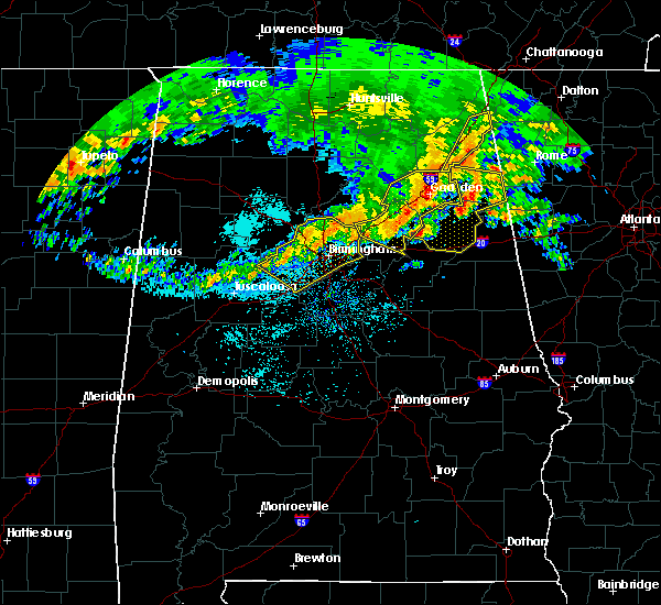 At 319 am cdt, severe thunderstorms were located along a line extending from 6 miles east of odenville to tabor road, moving east at 45 mph (radar indicated). Hazards include 60 mph wind gusts. expect damage to roofs, siding, and trees At 319 am cdt, severe thunderstorms were located along a line extending from 6 miles east of odenville to tabor road, moving east at 45 mph (radar indicated). Hazards include 60 mph wind gusts. expect damage to roofs, siding, and trees
|
| 4/5/2017 6:56 PM CDT |
 At 655 pm cdt, a severe thunderstorm was located near honda manufacturing of alabama, or 11 miles west of cobb town, moving northeast at 55 mph (radar indicated). Hazards include 60 mph wind gusts and quarter size hail. Hail damage to vehicles is expected. expect wind damage to roofs, siding, and trees. locations impacted include, lincoln, talladega superspeedway, honda manufacturing of alabama, talladega municipal airport, eastaboga and jackson shoals. A tornado watch remains in effect until 900 pm cdt for east central alabama. At 655 pm cdt, a severe thunderstorm was located near honda manufacturing of alabama, or 11 miles west of cobb town, moving northeast at 55 mph (radar indicated). Hazards include 60 mph wind gusts and quarter size hail. Hail damage to vehicles is expected. expect wind damage to roofs, siding, and trees. locations impacted include, lincoln, talladega superspeedway, honda manufacturing of alabama, talladega municipal airport, eastaboga and jackson shoals. A tornado watch remains in effect until 900 pm cdt for east central alabama.
|
| 4/5/2017 6:48 PM CDT |
 At 648 pm cdt, a severe thunderstorm was located over lincoln, or near pell city, moving northeast at 55 mph (radar indicated). Hazards include 60 mph wind gusts and quarter size hail. Hail damage to vehicles is expected. expect wind damage to roofs, siding, and trees. locations impacted include, pell city, lincoln, riverside, talladega superspeedway, honda manufacturing of alabama, talladega municipal airport, st. clair county airport, jackson shoals, eastaboga, cropwell and howells cove. A tornado watch remains in effect until 900 pm cdt for east central alabama. At 648 pm cdt, a severe thunderstorm was located over lincoln, or near pell city, moving northeast at 55 mph (radar indicated). Hazards include 60 mph wind gusts and quarter size hail. Hail damage to vehicles is expected. expect wind damage to roofs, siding, and trees. locations impacted include, pell city, lincoln, riverside, talladega superspeedway, honda manufacturing of alabama, talladega municipal airport, st. clair county airport, jackson shoals, eastaboga, cropwell and howells cove. A tornado watch remains in effect until 900 pm cdt for east central alabama.
|
| 4/5/2017 6:40 PM CDT |
 At 640 pm cdt, a severe thunderstorm was located over pell city, moving northeast at 55 mph (radar indicated). Hazards include 60 mph wind gusts and half dollar size hail. Hail damage to vehicles is expected. expect wind damage to roofs, siding, and trees. locations impacted include, pell city, lincoln, riverside, vincent, alpine bay resort, talladega superspeedway, honda manufacturing of alabama, coosa island, logan martin dam, talladega municipal airport, country club estates, st. clair county airport, eastaboga, jackson shoals, cropwell and howells cove. A tornado watch remains in effect until 900 pm cdt for east central alabama. At 640 pm cdt, a severe thunderstorm was located over pell city, moving northeast at 55 mph (radar indicated). Hazards include 60 mph wind gusts and half dollar size hail. Hail damage to vehicles is expected. expect wind damage to roofs, siding, and trees. locations impacted include, pell city, lincoln, riverside, vincent, alpine bay resort, talladega superspeedway, honda manufacturing of alabama, coosa island, logan martin dam, talladega municipal airport, country club estates, st. clair county airport, eastaboga, jackson shoals, cropwell and howells cove. A tornado watch remains in effect until 900 pm cdt for east central alabama.
|
| 4/5/2017 6:32 PM CDT |
 At 632 pm cdt, a severe thunderstorm was located over coosa island, or 9 miles southwest of pell city, moving northeast at 55 mph (radar indicated). Hazards include 60 mph wind gusts and half dollar size hail. Hail damage to vehicles is expected. Expect wind damage to roofs, siding, and trees. At 632 pm cdt, a severe thunderstorm was located over coosa island, or 9 miles southwest of pell city, moving northeast at 55 mph (radar indicated). Hazards include 60 mph wind gusts and half dollar size hail. Hail damage to vehicles is expected. Expect wind damage to roofs, siding, and trees.
|
| 4/5/2017 4:20 PM CDT | Trees blown down on county line roa in talladega county AL, 5.9 miles E of Oxford, AL |
| 4/5/2017 4:05 PM CDT | Half Dollar sized hail reported 1.9 miles SSW of Oxford, AL |
| 4/5/2017 3:48 PM CDT |
 At 348 pm cdt, a severe thunderstorm was located over talladega municipal airport, or 8 miles northeast of talladega, moving east at 35 mph (radar indicated). Hazards include two inch hail and 60 mph wind gusts. People and animals outdoors will be injured. expect hail damage to roofs, siding, windows, and vehicles. Expect wind damage to roofs, siding, and trees. At 348 pm cdt, a severe thunderstorm was located over talladega municipal airport, or 8 miles northeast of talladega, moving east at 35 mph (radar indicated). Hazards include two inch hail and 60 mph wind gusts. People and animals outdoors will be injured. expect hail damage to roofs, siding, windows, and vehicles. Expect wind damage to roofs, siding, and trees.
|
| 4/5/2017 3:45 PM CDT |
 At 344 pm cdt, a severe thunderstorm was located over talladega superspeedway, or 10 miles north of talladega, moving northeast at 35 mph (radar indicated). Hazards include 60 mph wind gusts and quarter size hail. Hail damage to vehicles is expected. expect wind damage to roofs, siding, and trees. locations impacted include, oxford, lincoln, munford, talladega superspeedway, grant town, talladega municipal airport, jackson shoals, jenifer and eastaboga. A tornado watch remains in effect until 900 pm cdt for east central alabama. At 344 pm cdt, a severe thunderstorm was located over talladega superspeedway, or 10 miles north of talladega, moving northeast at 35 mph (radar indicated). Hazards include 60 mph wind gusts and quarter size hail. Hail damage to vehicles is expected. expect wind damage to roofs, siding, and trees. locations impacted include, oxford, lincoln, munford, talladega superspeedway, grant town, talladega municipal airport, jackson shoals, jenifer and eastaboga. A tornado watch remains in effect until 900 pm cdt for east central alabama.
|
| 4/5/2017 3:22 PM CDT |
 At 321 pm cdt, a severe thunderstorm was located over coosa island, or near pell city, moving northeast at 35 mph (radar indicated). Hazards include 60 mph wind gusts and quarter size hail. Hail damage to vehicles is expected. Expect wind damage to roofs, siding, and trees. At 321 pm cdt, a severe thunderstorm was located over coosa island, or near pell city, moving northeast at 35 mph (radar indicated). Hazards include 60 mph wind gusts and quarter size hail. Hail damage to vehicles is expected. Expect wind damage to roofs, siding, and trees.
|
| 4/5/2017 5:49 AM CDT |
 At 549 am cdt, a severe thunderstorm was located 7 miles northwest of edwardsville, or 8 miles north of heflin, moving northeast at 55 mph (radar indicated). Hazards include 60 mph wind gusts and half dollar size hail. Hail damage to vehicles is expected. expect wind damage to roofs, siding, and trees. Locations impacted include, anniston, oxford, jacksonville, piedmont, heflin, weaver, fruithurst, edwardsville, mars hills, jacksonville state university, sweetwater lake, coleman lake and campground, choccolocco, dearmanville, liberty hill, chalafinnee, oak level, borden springs and camp sequoyah. At 549 am cdt, a severe thunderstorm was located 7 miles northwest of edwardsville, or 8 miles north of heflin, moving northeast at 55 mph (radar indicated). Hazards include 60 mph wind gusts and half dollar size hail. Hail damage to vehicles is expected. expect wind damage to roofs, siding, and trees. Locations impacted include, anniston, oxford, jacksonville, piedmont, heflin, weaver, fruithurst, edwardsville, mars hills, jacksonville state university, sweetwater lake, coleman lake and campground, choccolocco, dearmanville, liberty hill, chalafinnee, oak level, borden springs and camp sequoyah.
|
| 4/5/2017 5:37 AM CDT |
 At 537 am cdt, a severe thunderstorm was located near anniston, moving northeast at 55 mph (radar indicated). Hazards include golf ball size hail and 60 mph wind gusts. People and animals outdoors will be injured. expect hail damage to roofs, siding, windows, and vehicles. expect wind damage to roofs, siding, and trees. Locations impacted include, anniston, oxford, jacksonville, piedmont, heflin, cobb town, west end-cobb town, fort mcclellan, saks, weaver, hobson city, fruithurst, edwardsville, blue mountain, jacksonville state university, oxford lake, mars hills, coleman lake and campground, choccolocco and liberty hill. At 537 am cdt, a severe thunderstorm was located near anniston, moving northeast at 55 mph (radar indicated). Hazards include golf ball size hail and 60 mph wind gusts. People and animals outdoors will be injured. expect hail damage to roofs, siding, windows, and vehicles. expect wind damage to roofs, siding, and trees. Locations impacted include, anniston, oxford, jacksonville, piedmont, heflin, cobb town, west end-cobb town, fort mcclellan, saks, weaver, hobson city, fruithurst, edwardsville, blue mountain, jacksonville state university, oxford lake, mars hills, coleman lake and campground, choccolocco and liberty hill.
|
| 4/5/2017 5:34 AM CDT | Golf Ball sized hail reported 1.9 miles SSW of Oxford, AL |
| 4/5/2017 5:27 AM CDT |
 At 527 am cdt, a severe thunderstorm was located over anniston regional airport, or over oxford, moving northeast at 55 mph (radar indicated). Hazards include golf ball size hail and 60 mph wind gusts. People and animals outdoors will be injured. expect hail damage to roofs, siding, windows, and vehicles. expect wind damage to roofs, siding, and trees. Locations impacted include, anniston, oxford, jacksonville, piedmont, heflin, cobb town, west end-cobb town, fort mcclellan, saks, weaver, munford, hobson city, fruithurst, edwardsville, anniston regional airport, blue mountain, jacksonville state university, grant town, oxford lake and mars hills. At 527 am cdt, a severe thunderstorm was located over anniston regional airport, or over oxford, moving northeast at 55 mph (radar indicated). Hazards include golf ball size hail and 60 mph wind gusts. People and animals outdoors will be injured. expect hail damage to roofs, siding, windows, and vehicles. expect wind damage to roofs, siding, and trees. Locations impacted include, anniston, oxford, jacksonville, piedmont, heflin, cobb town, west end-cobb town, fort mcclellan, saks, weaver, munford, hobson city, fruithurst, edwardsville, anniston regional airport, blue mountain, jacksonville state university, grant town, oxford lake and mars hills.
|
| 4/5/2017 5:22 AM CDT |
 At 522 am cdt, a severe thunderstorm was located near grant town, or 7 miles southwest of oxford, moving northeast at 50 mph (radar indicated). Hazards include 60 mph wind gusts and half dollar size hail. Hail damage to vehicles is expected. Expect wind damage to roofs, siding, and trees. At 522 am cdt, a severe thunderstorm was located near grant town, or 7 miles southwest of oxford, moving northeast at 50 mph (radar indicated). Hazards include 60 mph wind gusts and half dollar size hail. Hail damage to vehicles is expected. Expect wind damage to roofs, siding, and trees.
|
| 7/21/2016 8:42 PM CDT |
 At 841 pm cdt, severe thunderstorms were located along a line extending from near anniston to near delta, moving south southwest at 10 mph (radar indicated). Hazards include 60 mph wind gusts and penny size hail. Expect damage to roofs. siding. and trees. Locations impacted include, anniston, oxford, heflin, lineville, oxford lake, barfield, delta, fosters cross roads, mount cheaha, chalafinnee, choccolocco, dearmanville, hollis crossroads and camp sequoyah. At 841 pm cdt, severe thunderstorms were located along a line extending from near anniston to near delta, moving south southwest at 10 mph (radar indicated). Hazards include 60 mph wind gusts and penny size hail. Expect damage to roofs. siding. and trees. Locations impacted include, anniston, oxford, heflin, lineville, oxford lake, barfield, delta, fosters cross roads, mount cheaha, chalafinnee, choccolocco, dearmanville, hollis crossroads and camp sequoyah.
|
| 7/21/2016 8:29 PM CDT |
 At 828 pm cdt, severe thunderstorms were located along a line extending from near heflin to near delta, moving west at 10 mph (radar indicated). Hazards include 60 mph wind gusts and penny size hail. Expect damage to roofs. siding. And trees. At 828 pm cdt, severe thunderstorms were located along a line extending from near heflin to near delta, moving west at 10 mph (radar indicated). Hazards include 60 mph wind gusts and penny size hail. Expect damage to roofs. siding. And trees.
|
| 7/21/2016 8:24 PM CDT |
 At 824 pm cdt, severe thunderstorms were located along a line extending from near heflin to near delta, moving southwest at 10 mph (radar indicated). Hazards include 60 mph wind gusts. Expect damage to roofs. siding. and trees. Locations impacted include, anniston, oxford, heflin, delta, hollis crossroads, camp sequoyah, chalafinnee, dearmanville and micaville. At 824 pm cdt, severe thunderstorms were located along a line extending from near heflin to near delta, moving southwest at 10 mph (radar indicated). Hazards include 60 mph wind gusts. Expect damage to roofs. siding. and trees. Locations impacted include, anniston, oxford, heflin, delta, hollis crossroads, camp sequoyah, chalafinnee, dearmanville and micaville.
|
| 7/21/2016 8:06 PM CDT |
 At 806 pm cdt, severe thunderstorms were located along a line extending from near heflin to near delta, moving southwest at 10 mph (radar indicated). Hazards include 60 mph wind gusts. Expect damage to roofs. siding. And trees. At 806 pm cdt, severe thunderstorms were located along a line extending from near heflin to near delta, moving southwest at 10 mph (radar indicated). Hazards include 60 mph wind gusts. Expect damage to roofs. siding. And trees.
|
| 6/17/2016 3:46 PM CDT |
 At 346 pm cdt, severe thunderstorms were located along a line extending from near westover to near grant town to near ephesus, moving southeast at 25 mph (radar indicated). Hazards include 60 mph wind gusts. Expect damage to roofs. siding. and trees. Locations impacted include, oxford, talladega, sylacauga, roanoke, childersburg, lineville, ashland, wedowee, talladega springs, lake wedowee, vincent, harpersville, munford, wadley, waldo, woodland, morrison cross roads, sycamore, alpine bay resort and alpine. At 346 pm cdt, severe thunderstorms were located along a line extending from near westover to near grant town to near ephesus, moving southeast at 25 mph (radar indicated). Hazards include 60 mph wind gusts. Expect damage to roofs. siding. and trees. Locations impacted include, oxford, talladega, sylacauga, roanoke, childersburg, lineville, ashland, wedowee, talladega springs, lake wedowee, vincent, harpersville, munford, wadley, waldo, woodland, morrison cross roads, sycamore, alpine bay resort and alpine.
|
| 6/17/2016 3:37 PM CDT |
 At 337 pm cdt, severe thunderstorms were located along a line extending from logan martin dam to near grant town to near ephesus, moving southeast at 30 mph (radar indicated). Hazards include 60 mph wind gusts. Expect damage to roofs. siding. and trees. Locations impacted include, oxford, talladega, sylacauga, pell city, roanoke, childersburg, lineville, ashland, wedowee, talladega springs, lake wedowee, lincoln, vincent, harpersville, munford, wadley, waldo, woodland, morrison cross roads and talladega superspeedway. At 337 pm cdt, severe thunderstorms were located along a line extending from logan martin dam to near grant town to near ephesus, moving southeast at 30 mph (radar indicated). Hazards include 60 mph wind gusts. Expect damage to roofs. siding. and trees. Locations impacted include, oxford, talladega, sylacauga, pell city, roanoke, childersburg, lineville, ashland, wedowee, talladega springs, lake wedowee, lincoln, vincent, harpersville, munford, wadley, waldo, woodland, morrison cross roads and talladega superspeedway.
|
| 6/17/2016 3:25 PM CDT |
 At 325 pm cdt, severe thunderstorms were located along a line extending from near moody to grant town to ephesus, moving south at 30 mph (radar indicated). Hazards include 60 mph wind gusts. Expect damage to roofs. siding. and trees. Locations impacted include, anniston, oxford, talladega, sylacauga, pell city, leeds, moody, roanoke, childersburg, odenville, lineville, ashland, wedowee, talladega springs, west end-cobb town, cobb town, lake wedowee, lincoln, margaret and argo. At 325 pm cdt, severe thunderstorms were located along a line extending from near moody to grant town to ephesus, moving south at 30 mph (radar indicated). Hazards include 60 mph wind gusts. Expect damage to roofs. siding. and trees. Locations impacted include, anniston, oxford, talladega, sylacauga, pell city, leeds, moody, roanoke, childersburg, odenville, lineville, ashland, wedowee, talladega springs, west end-cobb town, cobb town, lake wedowee, lincoln, margaret and argo.
|
| 6/17/2016 3:08 PM CDT |
 At 308 pm cdt, severe thunderstorms were located along a line extending from springville to near bynum, moving south at 20 mph (radar indicated). Hazards include 70 mph wind gusts and quarter size hail. Hail damage to vehicles is expected. expect considerable tree damage. wind damage is also likely to mobile homes, roofs, and outbuildings. locations impacted include, anniston, oxford, springville, odenville, cobb town, saks, west end-cobb town, margaret, argo, ashville, ragland, hobson city, blue mountain, wattsville, dearmanville and st. Clair springs. At 308 pm cdt, severe thunderstorms were located along a line extending from springville to near bynum, moving south at 20 mph (radar indicated). Hazards include 70 mph wind gusts and quarter size hail. Hail damage to vehicles is expected. expect considerable tree damage. wind damage is also likely to mobile homes, roofs, and outbuildings. locations impacted include, anniston, oxford, springville, odenville, cobb town, saks, west end-cobb town, margaret, argo, ashville, ragland, hobson city, blue mountain, wattsville, dearmanville and st. Clair springs.
|
| 6/17/2016 2:59 PM CDT |
 At 259 pm cdt, severe thunderstorms were located along a line extending from near dallas to near bowdon, moving south at 35 mph (radar indicated). Hazards include 70 mph wind gusts and quarter size hail. Hail damage to vehicles is expected. expect considerable tree damage. Wind damage is also likely to mobile homes, roofs, and outbuildings. At 259 pm cdt, severe thunderstorms were located along a line extending from near dallas to near bowdon, moving south at 35 mph (radar indicated). Hazards include 70 mph wind gusts and quarter size hail. Hail damage to vehicles is expected. expect considerable tree damage. Wind damage is also likely to mobile homes, roofs, and outbuildings.
|
| 6/17/2016 2:52 PM CDT |
 At 252 pm cdt, severe thunderstorms were located along a line extending from near inland lake to near ohatchee, moving southeast at 25 mph (radar indicated). Hazards include 70 mph wind gusts and quarter size hail. Hail damage to vehicles is expected. expect considerable tree damage. wind damage is also likely to mobile homes, roofs, and outbuildings. Locations impacted include, anniston, oxford, springville, odenville, cobb town, west end-cobb town, saks, margaret, argo, ashville, ragland, ohatchee, hobson city, allgood, inland lake, blue mountain, neely henry lake, alexandria, highland lake and caldwell. At 252 pm cdt, severe thunderstorms were located along a line extending from near inland lake to near ohatchee, moving southeast at 25 mph (radar indicated). Hazards include 70 mph wind gusts and quarter size hail. Hail damage to vehicles is expected. expect considerable tree damage. wind damage is also likely to mobile homes, roofs, and outbuildings. Locations impacted include, anniston, oxford, springville, odenville, cobb town, west end-cobb town, saks, margaret, argo, ashville, ragland, ohatchee, hobson city, allgood, inland lake, blue mountain, neely henry lake, alexandria, highland lake and caldwell.
|
| 6/17/2016 2:40 PM CDT |
 At 240 pm cdt, severe thunderstorms were located along a line extending from near oneonta to near neely henry lake, moving south at 25 mph (radar indicated). Hazards include 60 mph wind gusts and quarter size hail. Hail damage to vehicles is expected. expect wind damage to roofs, siding, and trees. Locations impacted include, anniston, oxford, rainbow city, oneonta, springville, odenville, cleveland, cobb town, west end-cobb town, saks, attalla, glencoe, margaret, argo, ashville, ragland, ohatchee, steele, hobson city and allgood. At 240 pm cdt, severe thunderstorms were located along a line extending from near oneonta to near neely henry lake, moving south at 25 mph (radar indicated). Hazards include 60 mph wind gusts and quarter size hail. Hail damage to vehicles is expected. expect wind damage to roofs, siding, and trees. Locations impacted include, anniston, oxford, rainbow city, oneonta, springville, odenville, cleveland, cobb town, west end-cobb town, saks, attalla, glencoe, margaret, argo, ashville, ragland, ohatchee, steele, hobson city and allgood.
|
| 6/17/2016 2:24 PM CDT |
 At 224 pm cdt, severe thunderstorms were located along a line extending from blountsville to rainbow city, moving southeast at 20 mph (radar indicated). Hazards include 60 mph wind gusts and quarter size hail. Hail damage to vehicles is expected. Expect wind damage to roofs, siding, and trees. At 224 pm cdt, severe thunderstorms were located along a line extending from blountsville to rainbow city, moving southeast at 20 mph (radar indicated). Hazards include 60 mph wind gusts and quarter size hail. Hail damage to vehicles is expected. Expect wind damage to roofs, siding, and trees.
|
| 8/10/2015 6:47 PM CDT |
 At 646 pm cdt, severe thunderstorms were located along a line extending from near edwardsville to near fosters cross roads to near delta to near mount cheaha, moving southeast at 35 mph (radar indicated). Hazards include 60 mph wind gusts. Expect damage to roofs. siding and trees. Locations impacted include, roanoke, heflin, wedowee, lake wedowee, ranburne, edwardsville, woodland, morrison cross roads, delta, crystal lake, fosters cross roads, barfield, abernathy, mount cheaha, corinth, napoleon, hollis crossroads, rock stand, newell and sweetwater lake. At 646 pm cdt, severe thunderstorms were located along a line extending from near edwardsville to near fosters cross roads to near delta to near mount cheaha, moving southeast at 35 mph (radar indicated). Hazards include 60 mph wind gusts. Expect damage to roofs. siding and trees. Locations impacted include, roanoke, heflin, wedowee, lake wedowee, ranburne, edwardsville, woodland, morrison cross roads, delta, crystal lake, fosters cross roads, barfield, abernathy, mount cheaha, corinth, napoleon, hollis crossroads, rock stand, newell and sweetwater lake.
|
| 8/10/2015 6:30 PM CDT |
 At 629 pm cdt, severe thunderstorms were located along a line extending from near heflin to 7 miles east of oxford lake to near oxford to anniston regional airport, moving southeast at 35 mph (radar indicated). Hazards include 60 mph wind gusts. Expect damage to roofs. Siding and trees. At 629 pm cdt, severe thunderstorms were located along a line extending from near heflin to 7 miles east of oxford lake to near oxford to anniston regional airport, moving southeast at 35 mph (radar indicated). Hazards include 60 mph wind gusts. Expect damage to roofs. Siding and trees.
|
| 7/28/2015 5:30 PM CDT |
 At 529 pm cdt, a severe thunderstorm was located over oxford lake, or over oxford, moving south at 15 mph (radar indicated). Hazards include 60 mph wind gusts. Expect damage to roofs. siding and trees. Locations impacted include, anniston, oxford, cobb town, west end-cobb town, munford, hobson city, oxford lake, anniston regional airport, mount cheaha, chalafinnee, choccolocco, dearmanville, camp mac, hollis crossroads and camp sequoyah. At 529 pm cdt, a severe thunderstorm was located over oxford lake, or over oxford, moving south at 15 mph (radar indicated). Hazards include 60 mph wind gusts. Expect damage to roofs. siding and trees. Locations impacted include, anniston, oxford, cobb town, west end-cobb town, munford, hobson city, oxford lake, anniston regional airport, mount cheaha, chalafinnee, choccolocco, dearmanville, camp mac, hollis crossroads and camp sequoyah.
|
| 7/28/2015 5:21 PM CDT | Tree down near alice st and spring st in oxford. reported via social medi in calhoun county AL, 1.6 miles SSW of Oxford, AL |
| 7/28/2015 5:15 PM CDT |
 At 515 pm cdt, a severe thunderstorm was located over blue mountain, or over anniston, moving south at 15 mph (radar indicated). Hazards include 60 mph wind gusts. Expect damage to roofs. Siding and trees. At 515 pm cdt, a severe thunderstorm was located over blue mountain, or over anniston, moving south at 15 mph (radar indicated). Hazards include 60 mph wind gusts. Expect damage to roofs. Siding and trees.
|
| 7/19/2015 1:35 PM CDT |
 The severe thunderstorm warning for southeastern calhoun county will expire at 145 pm cdt, the storm which prompted the warning has weakened below severe limits and exited the warned area. therefore the warning will be allowed to expire. The severe thunderstorm warning for southeastern calhoun county will expire at 145 pm cdt, the storm which prompted the warning has weakened below severe limits and exited the warned area. therefore the warning will be allowed to expire.
|
| 7/19/2015 1:20 PM CDT |
 At 120 pm cdt, a severe thunderstorm was located near fort mcclellan, moving southeast at 25 mph (radar indicated). Hazards include 60 mph wind gusts. Expect damage to roofs. siding and trees. Locations impacted include, anniston, oxford, choccolocco and dearmanville. At 120 pm cdt, a severe thunderstorm was located near fort mcclellan, moving southeast at 25 mph (radar indicated). Hazards include 60 mph wind gusts. Expect damage to roofs. siding and trees. Locations impacted include, anniston, oxford, choccolocco and dearmanville.
|
| 7/19/2015 1:11 PM CDT |
 At 111 pm cdt, a severe thunderstorm was located over fort mcclellan, moving southeast at 20 mph (radar indicated). Hazards include 60 mph wind gusts. Expect damage to roofs. siding and trees. Locations impacted include, anniston, oxford, jacksonville, fort mcclellan, saks, weaver, oxford lake, blue mountain, choccolocco and dearmanville. At 111 pm cdt, a severe thunderstorm was located over fort mcclellan, moving southeast at 20 mph (radar indicated). Hazards include 60 mph wind gusts. Expect damage to roofs. siding and trees. Locations impacted include, anniston, oxford, jacksonville, fort mcclellan, saks, weaver, oxford lake, blue mountain, choccolocco and dearmanville.
|
| 7/19/2015 12:59 PM CDT |
 At 1259 pm cdt, a severe thunderstorm was located over weaver, or near saks, moving southeast at 20 mph (radar indicated). Hazards include 60 mph wind gusts. Expect damage to roofs. Siding and trees. At 1259 pm cdt, a severe thunderstorm was located over weaver, or near saks, moving southeast at 20 mph (radar indicated). Hazards include 60 mph wind gusts. Expect damage to roofs. Siding and trees.
|
| 7/14/2015 8:45 PM CDT |
 At 845 pm cdt, severe thunderstorms were located along a line extending from near cedartown to near jacksonville to anniston regional airport, moving southeast at 40 mph (radar indicated). Hazards include 60 mph wind gusts. Expect damage to roofs. Siding and trees. At 845 pm cdt, severe thunderstorms were located along a line extending from near cedartown to near jacksonville to anniston regional airport, moving southeast at 40 mph (radar indicated). Hazards include 60 mph wind gusts. Expect damage to roofs. Siding and trees.
|
| 7/14/2015 8:39 PM CDT |
 At 838 pm cdt, severe thunderstorms were located along a line extending from near lake wildwood to west blocton to 7 miles northwest of wilton to near calera to near wilsonville to logan martin dam, moving southeast at 65 mph (radar indicated). Hazards include 60 mph wind gusts. Expect damage to roofs. Siding and trees. At 838 pm cdt, severe thunderstorms were located along a line extending from near lake wildwood to west blocton to 7 miles northwest of wilton to near calera to near wilsonville to logan martin dam, moving southeast at 65 mph (radar indicated). Hazards include 60 mph wind gusts. Expect damage to roofs. Siding and trees.
|
| 7/1/2015 3:52 PM CDT |
 At 350 pm cdt, a severe thunderstorm was located near alexandria, or near jacksonville, moving east at 30 mph (radar indicated). Hazards include 60 mph wind gusts and quarter size hail. Hail damage to vehicles is expected. expect wind damage to roofs, siding and trees. Locations impacted include, anniston, jacksonville, piedmont, saks, fort mcclellan, west end-cobb town, weaver, blue mountain, alexandria, jacksonville state university, knightens crossroads, choccolocco, wellington, sulphur springs and dearmanville. At 350 pm cdt, a severe thunderstorm was located near alexandria, or near jacksonville, moving east at 30 mph (radar indicated). Hazards include 60 mph wind gusts and quarter size hail. Hail damage to vehicles is expected. expect wind damage to roofs, siding and trees. Locations impacted include, anniston, jacksonville, piedmont, saks, fort mcclellan, west end-cobb town, weaver, blue mountain, alexandria, jacksonville state university, knightens crossroads, choccolocco, wellington, sulphur springs and dearmanville.
|
| 7/1/2015 3:33 PM CDT |
 At 333 pm cdt, a severe thunderstorm was located near neely henry lake, or 7 miles southeast of rainbow city, moving east at 30 mph (radar indicated). Hazards include 60 mph wind gusts and quarter size hail. Hail damage to vehicles is expected. Expect wind damage to roofs, siding and trees. At 333 pm cdt, a severe thunderstorm was located near neely henry lake, or 7 miles southeast of rainbow city, moving east at 30 mph (radar indicated). Hazards include 60 mph wind gusts and quarter size hail. Hail damage to vehicles is expected. Expect wind damage to roofs, siding and trees.
|
| 6/24/2015 7:58 PM CDT |
 At 757 pm cdt, a severe thunderstorm was located near delta, or 9 miles southeast of oxford, moving southwest at 40 mph (radar indicated). Hazards include 60 mph wind gusts and quarter size hail. Hail damage to vehicles is expected. Expect wind damage to roofs, siding and trees. At 757 pm cdt, a severe thunderstorm was located near delta, or 9 miles southeast of oxford, moving southwest at 40 mph (radar indicated). Hazards include 60 mph wind gusts and quarter size hail. Hail damage to vehicles is expected. Expect wind damage to roofs, siding and trees.
|
| 4/19/2015 9:08 AM CDT | At 908 am cdt, severe thunderstorms were located along a line extending from 9 miles west of summerville to near pleasant gap to near delta, moving east at 35 mph (trained weather spotters). Hazards include 60 mph wind gusts. Expect damage to roofs. siding and trees. locations impacted include, anniston, oxford, jacksonville, piedmont, centre, heflin, cedar bluff, forney, little river canyon national preserve, centre municipal airport, ranburne, fruithurst, edwardsville, gaylesville, tennala, blanche, mars hills, muscadine, pleasant gap and eastern weiss lake. a tornado watch remains in effect until 200 pm cdt for east central alabama. 75in. |
| 4/19/2015 8:52 AM CDT | At 852 am cdt, severe thunderstorms were located along a line extending from 9 miles east of ider to near anniston regional airport, moving east at 55 mph (trained weather spotters). Hazards include 60 mph wind gusts. Expect damage to roofs. Siding and trees. |
| 3/31/2015 5:17 PM CDT | The national weather service in birmingham has issued a * severe thunderstorm warning for. southeastern calhoun county in east central alabama. until 545 pm cdt * at 517 pm cdt. a severe thunderstorm was located over hobson city. or over oxford. Moving east at 20 mph. |
| 3/31/2015 4:49 PM CDT | A severe thunderstorm warning remains in effect until 500 pm cdt for southeastern calhoun county. at 449 pm cdt. a severe thunderstorm was located over fort mcclellan. moving southeast at 40 mph. hazard. 60 mph wind gusts and quarter size hail. source. Radar indicated. |
| 3/31/2015 3:42 PM CST | Quarter sized hail reported 1.4 miles SW of Oxford, AL |
| 3/31/2015 3:36 PM CST | Quarter sized hail reported 4.2 miles E of Oxford, AL, reported near coldwater |
| 3/31/2015 4:36 PM CDT | The national weather service in birmingham has issued a * severe thunderstorm warning for. south central calhoun county in east central alabama. southern cleburne county in east central alabama. east central talladega county in east central alabama. Until 500 pm cdt. |
| 3/31/2015 4:29 PM CDT | The national weather service in birmingham has issued a * severe thunderstorm warning for. central calhoun county in east central alabama. until 500 pm cdt * at 429 pm cdt. a severe thunderstorm was located near ohatchee. or 8 miles southeast of rainbow city. Moving southeast at 40 mph. |
| 3/31/2015 4:08 PM CDT | The national weather service in birmingham has issued a * severe thunderstorm warning for. north talladega county in east central alabama. until 445 pm cdt * at 408 pm cdt. a severe thunderstorm was located over lincoln. or 7 miles east of pell city. Moving east at 35 mph. |
| 8/20/2014 1:57 PM CDT | Trees and powerlines down along mcintosh road...near mellon bridge. estimated winds approximately 50 mp in calhoun county AL, 4.1 miles WNW of Oxford, AL |
| 7/10/2012 6:02 PM CDT | A tree was blown down on fish hatchery roa in calhoun county AL, 10 miles E of Oxford, AL |
| 7/1/2012 6:27 PM CDT | Trees and powerlines down at 712 martin luther king drive in calhoun county AL, 1.6 miles SSW of Oxford, AL |
| 7/1/2012 5:08 PM CDT | Quarter sized hail reported 3.7 miles WSW of Oxford, AL, reported near the oxford exchange. |
| 1/1/0001 12:00 AM | Quarter sized hail reported 1.4 miles SW of Oxford, AL |
| 1/1/0001 12:00 AM | Trees down in oxford near the meadowbrook subdivision. winds of 40 to 50 mph estimated from rada in calhoun county AL, 1.4 miles SW of Oxford, AL |
| 1/1/0001 12:00 AM | Quarter sized hail reported 6.6 miles ESE of Oxford, AL |
| 1/1/0001 12:00 AM | A few trees down in oxfor in calhoun county AL, 1.4 miles SW of Oxford, AL |
| 1/1/0001 12:00 AM | Tree down blocking cedar springs roa in talladega county AL, 10 miles E of Oxford, AL |
| 1/1/0001 12:00 AM | Roof off barn with trees and power lines dow in talladega county AL, 10.5 miles E of Oxford, AL |
| 1/1/0001 12:00 AM | Trees and power lines dow in calhoun county AL, 1.4 miles SW of Oxford, AL |
| 1/1/0001 12:00 AM | Tree down across cheaha road in cleburne county AL, 7.1 miles NNW of Oxford, AL |
Hail Maps for Oxford, AL
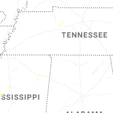
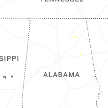
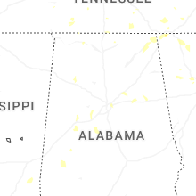
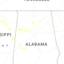
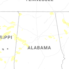


Connect with Interactive Hail Maps