

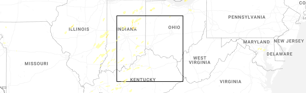
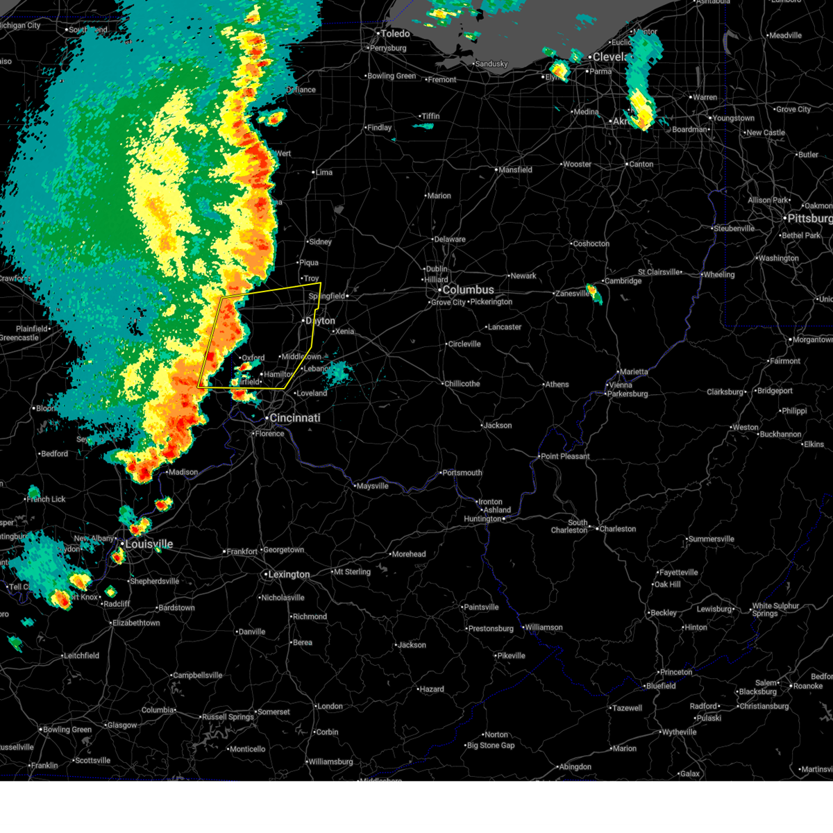
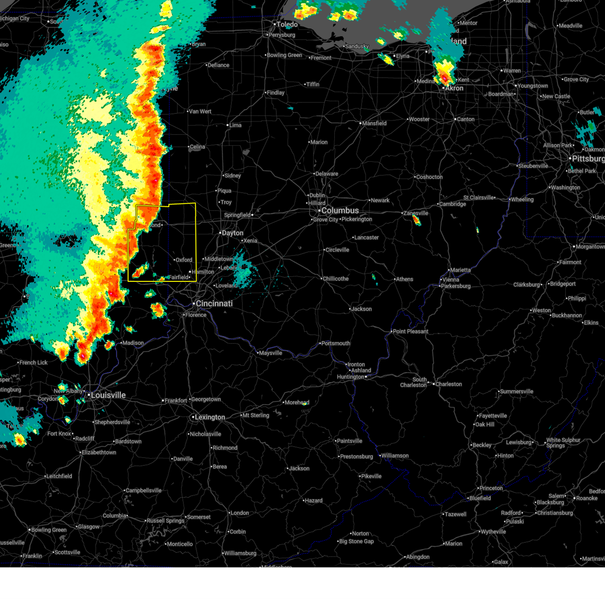
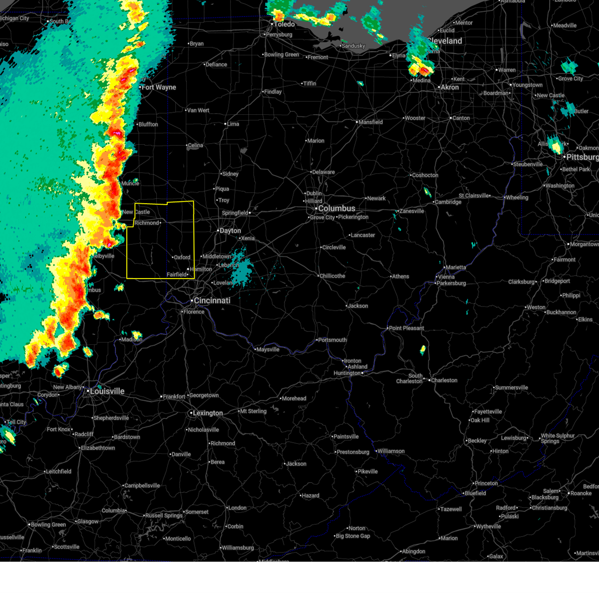
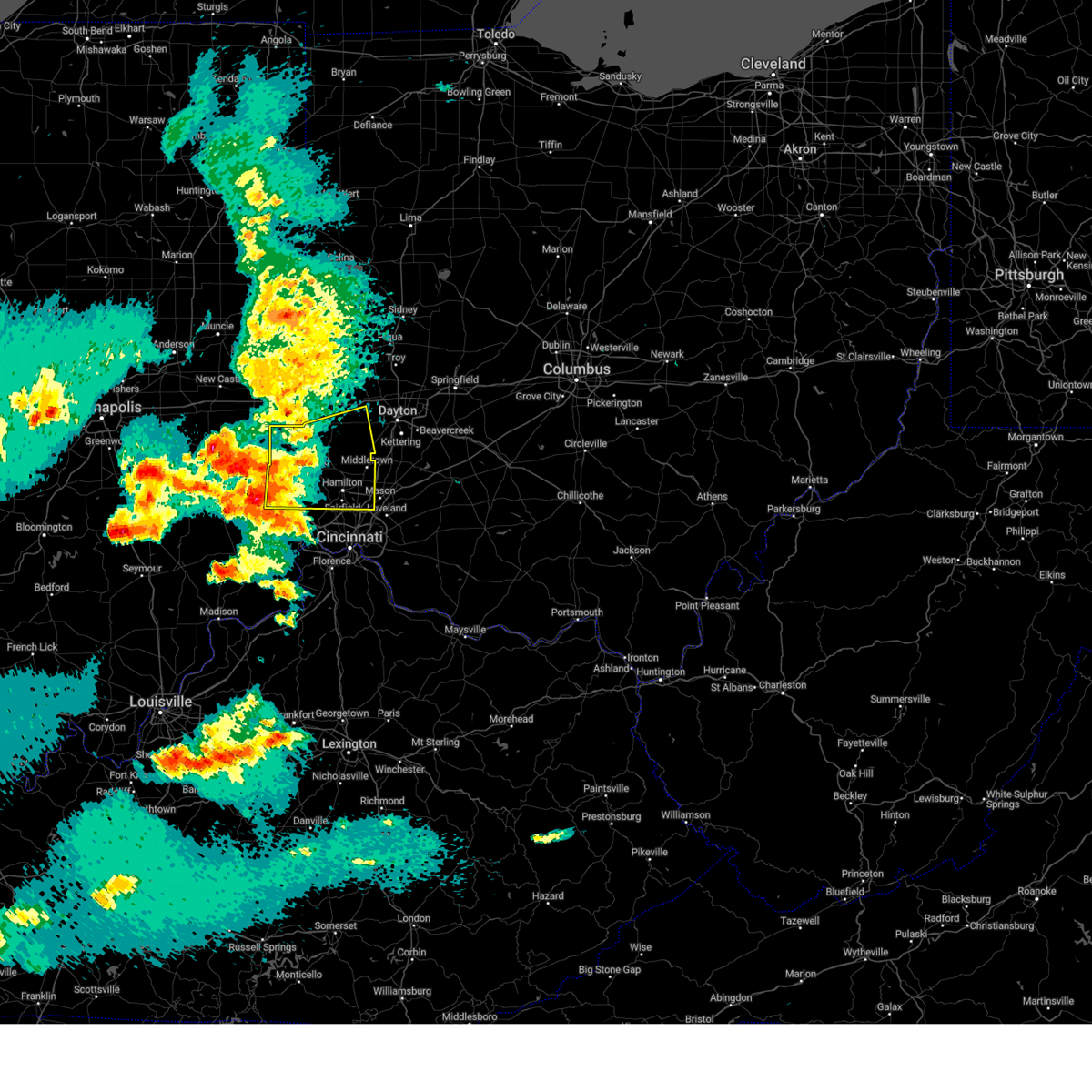
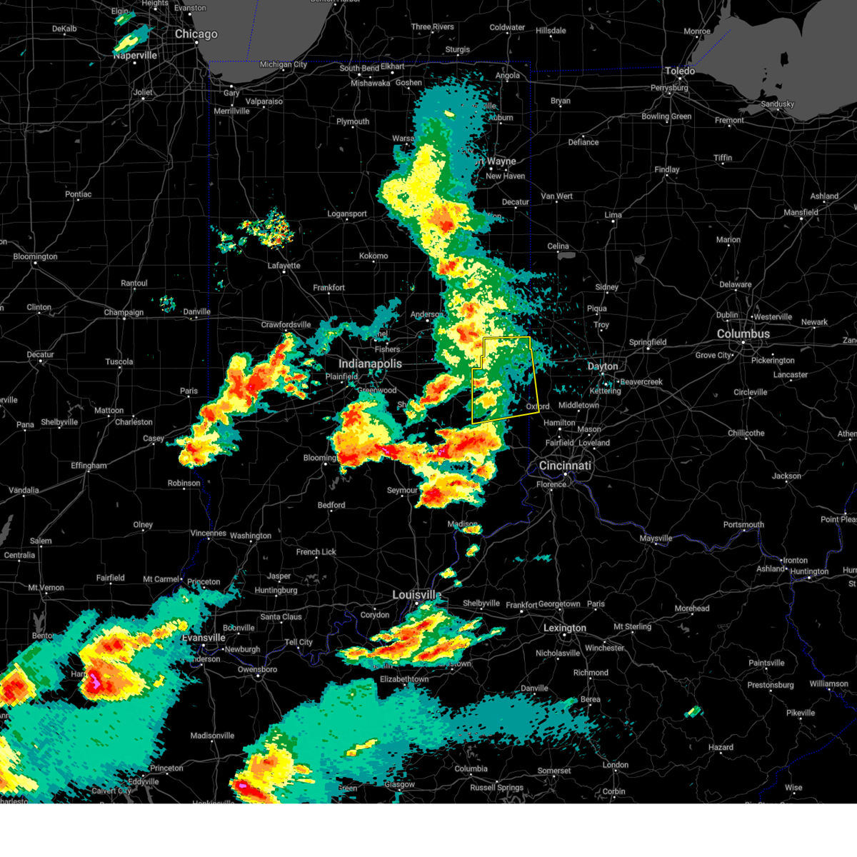
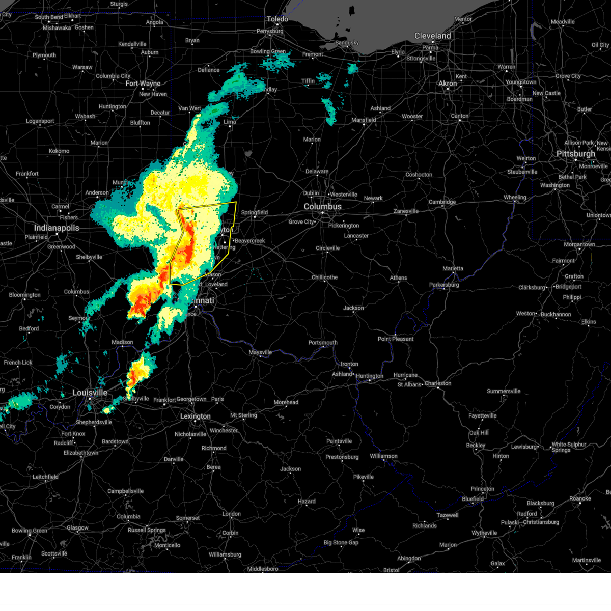
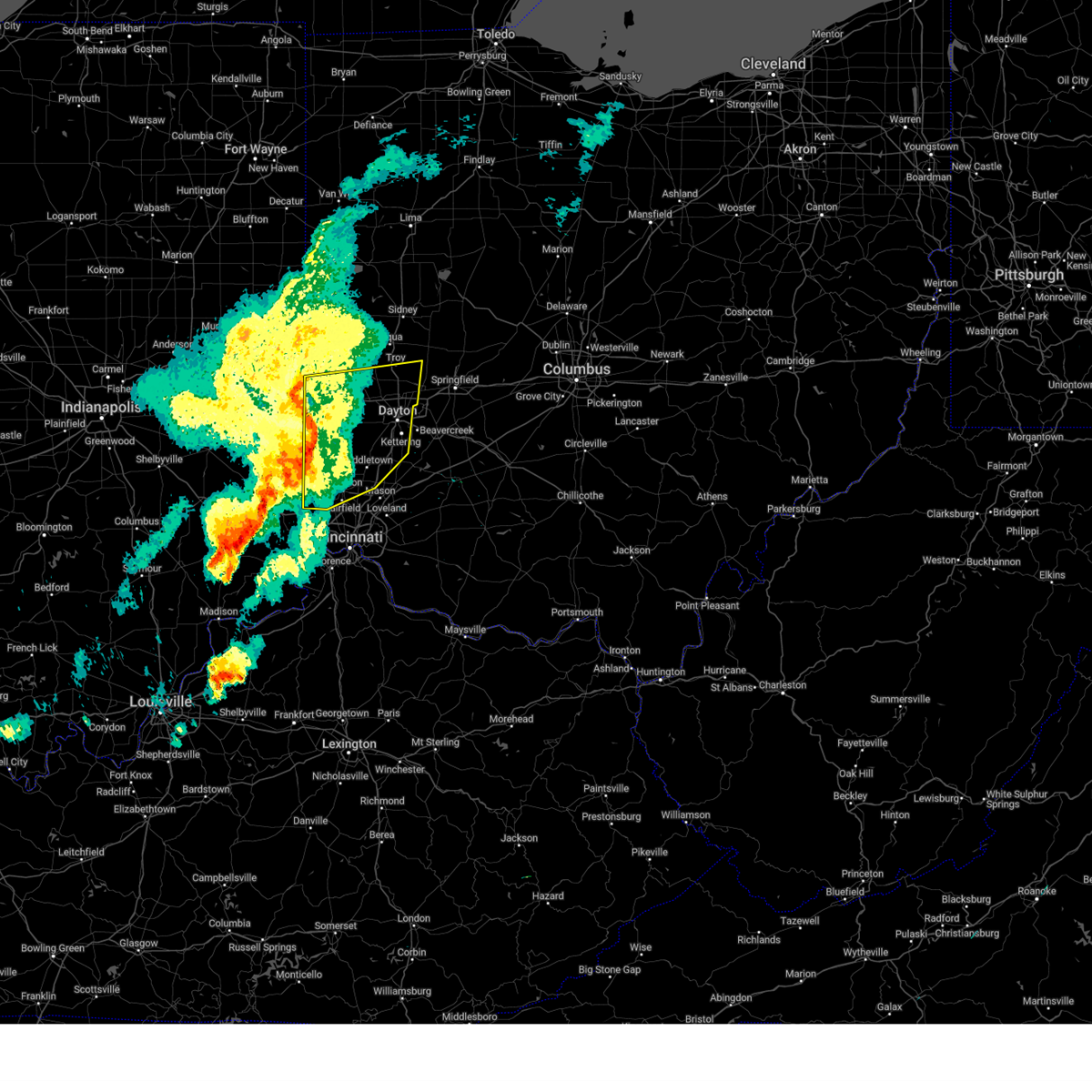
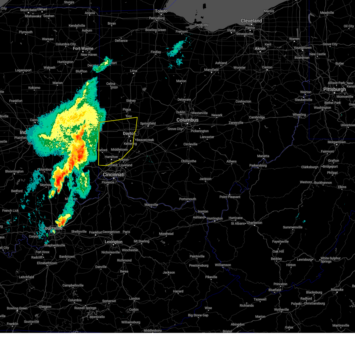
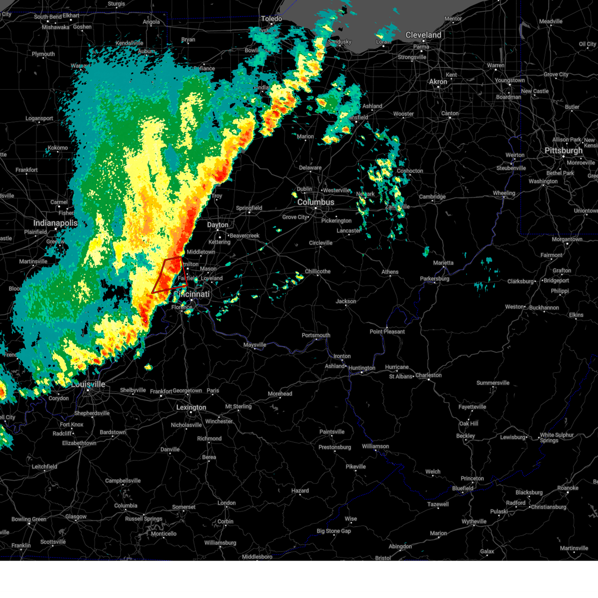
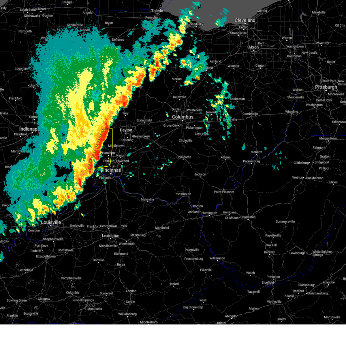
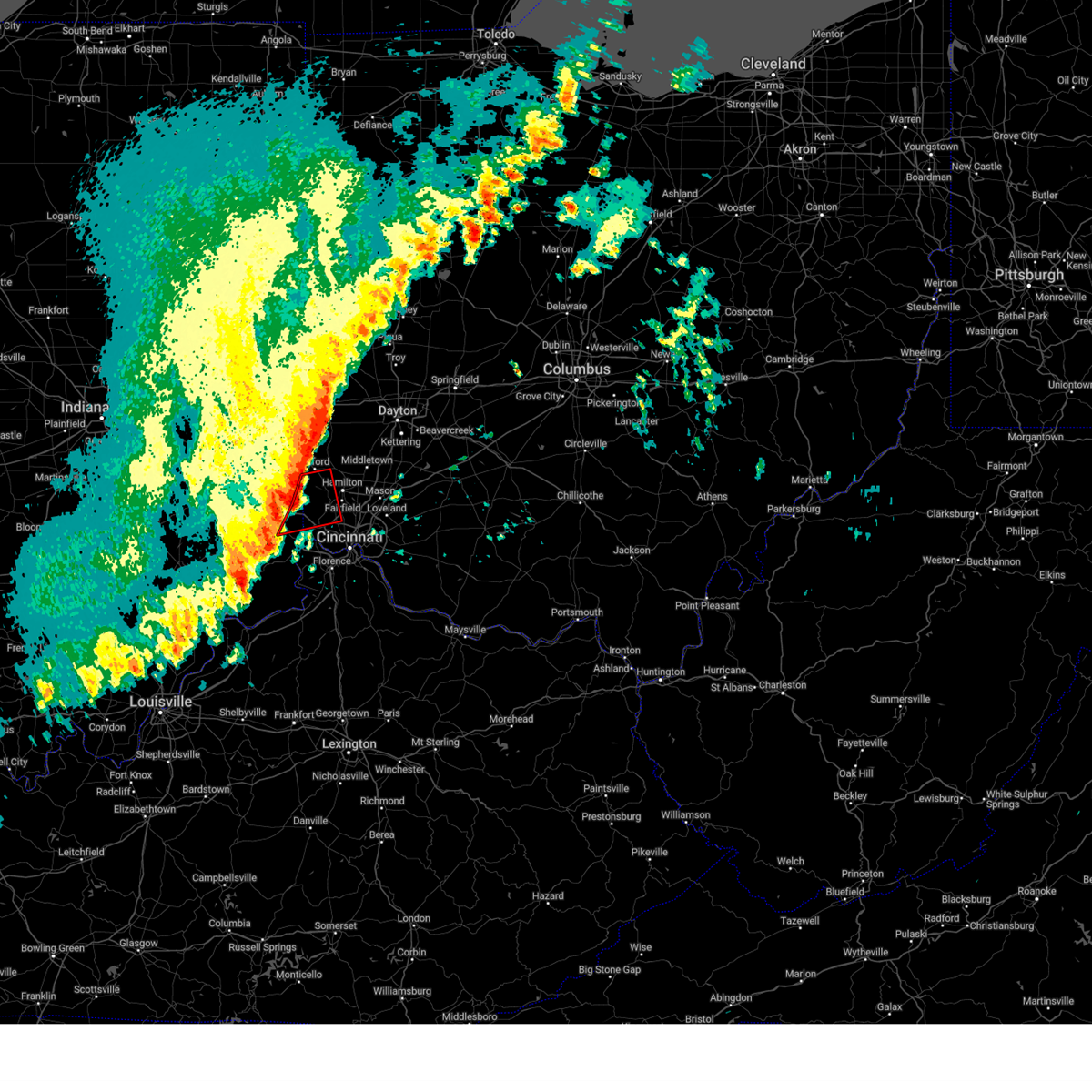
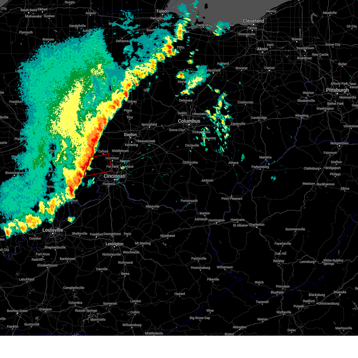
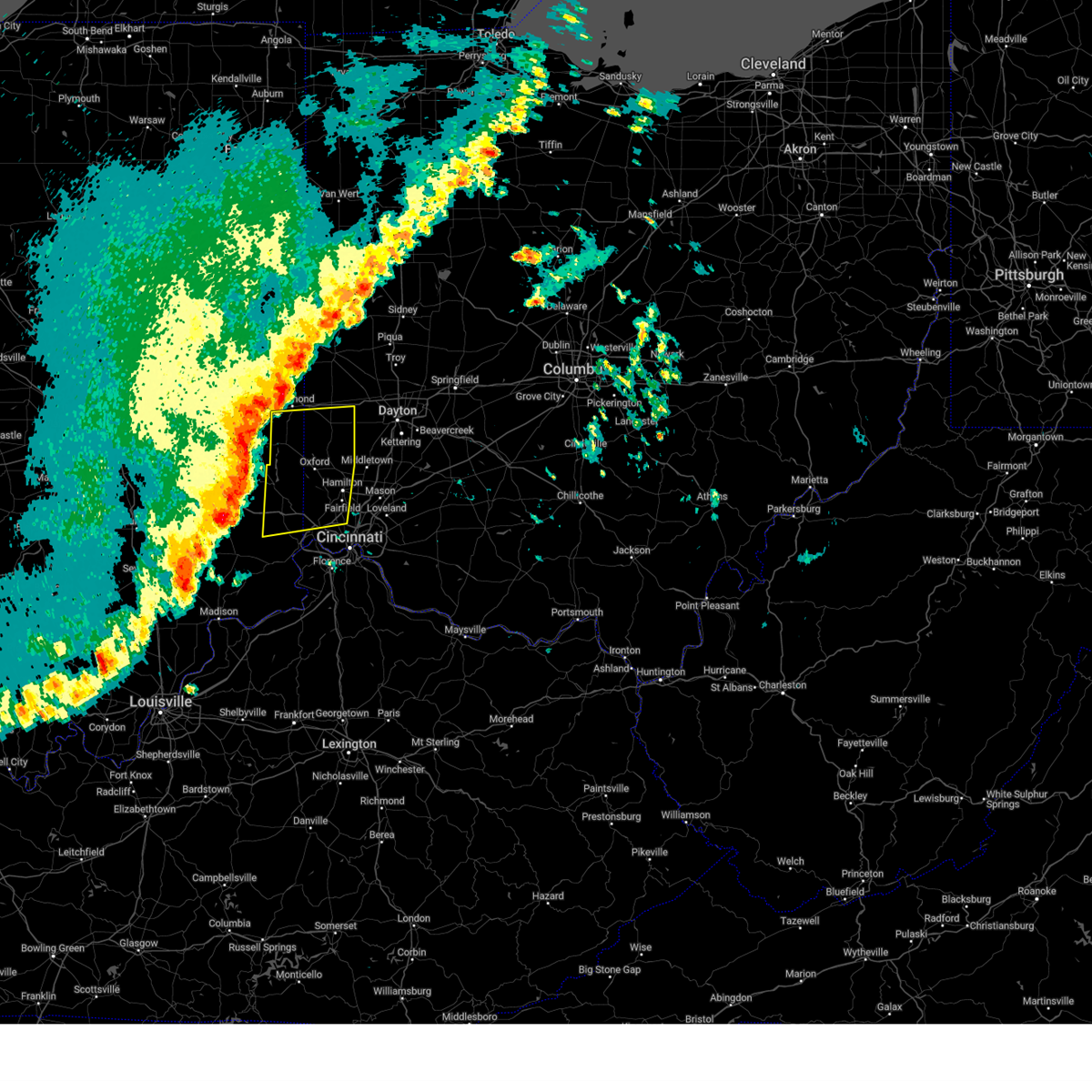
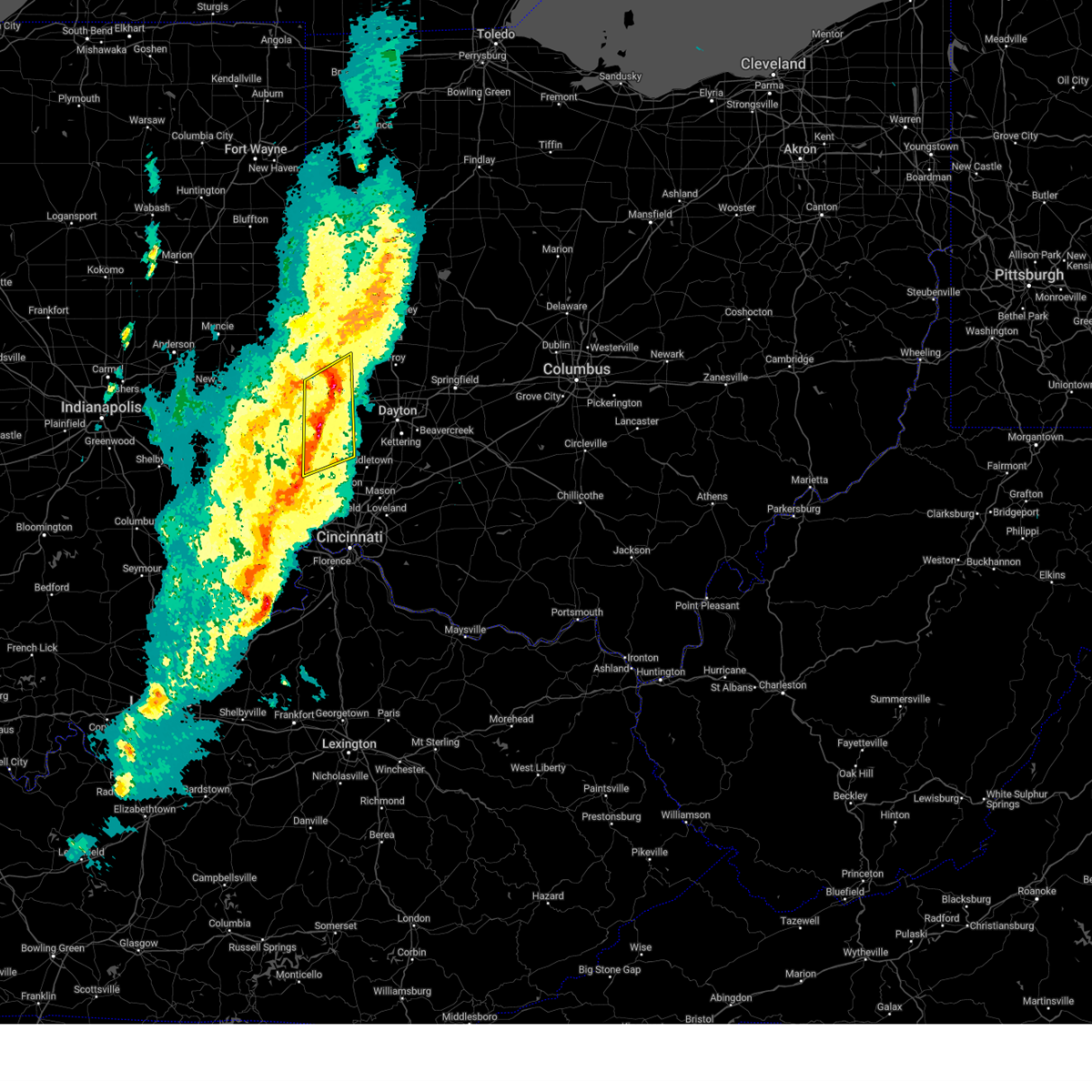
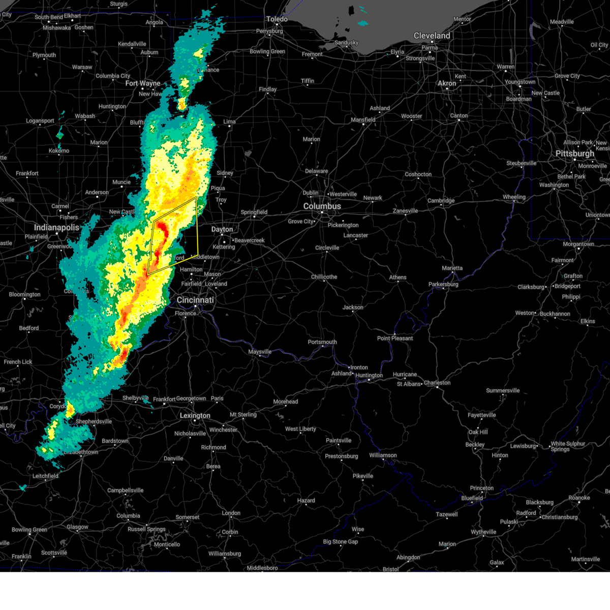
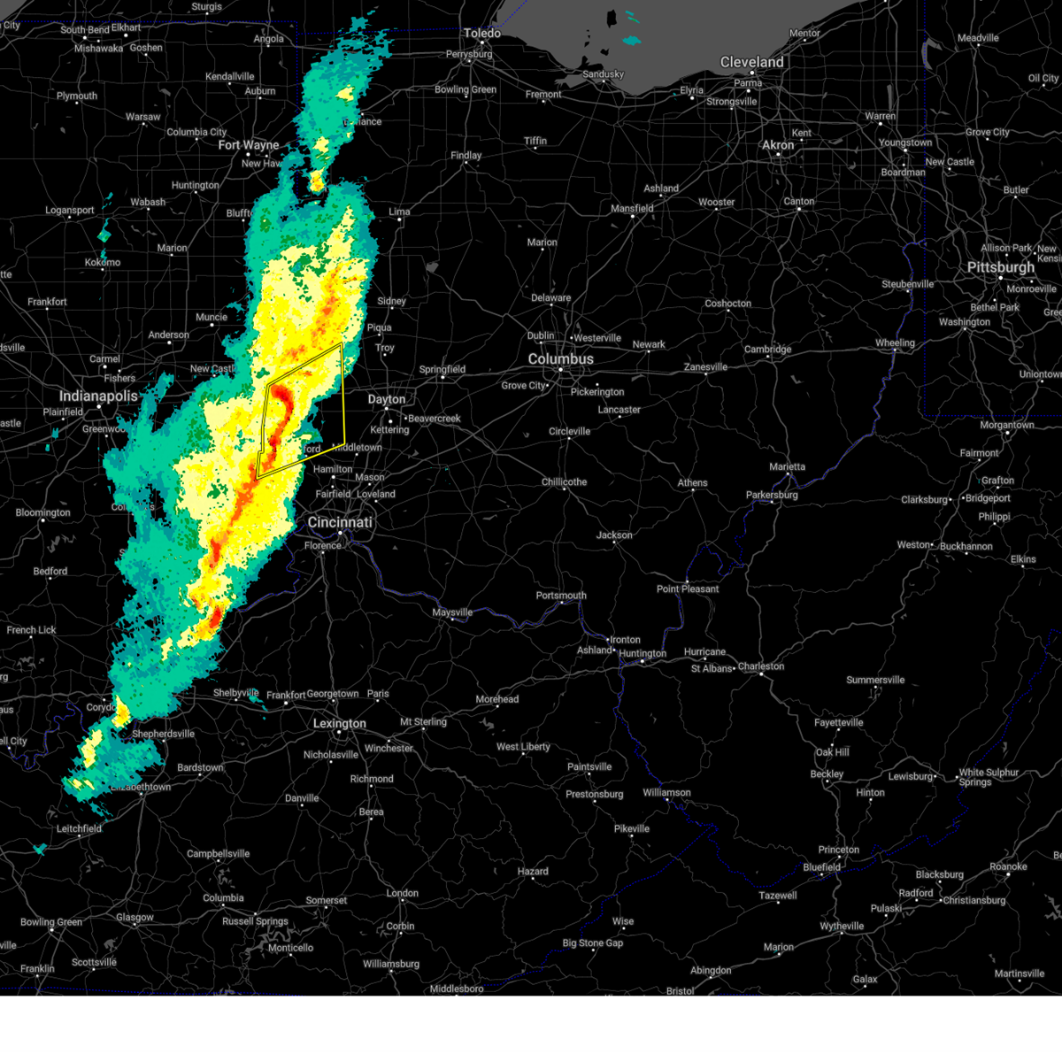
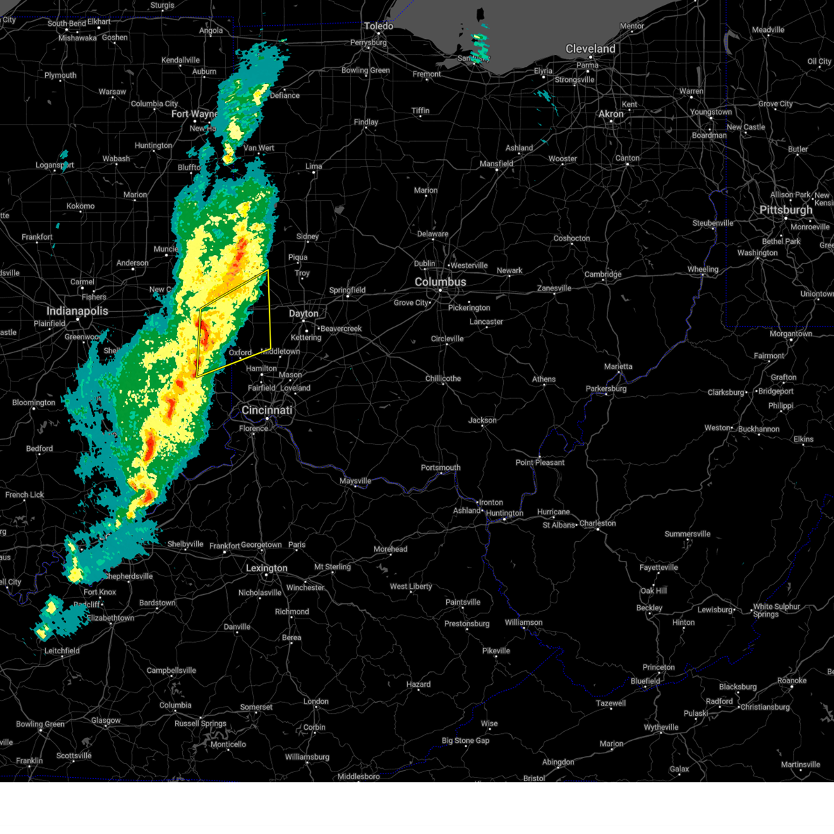
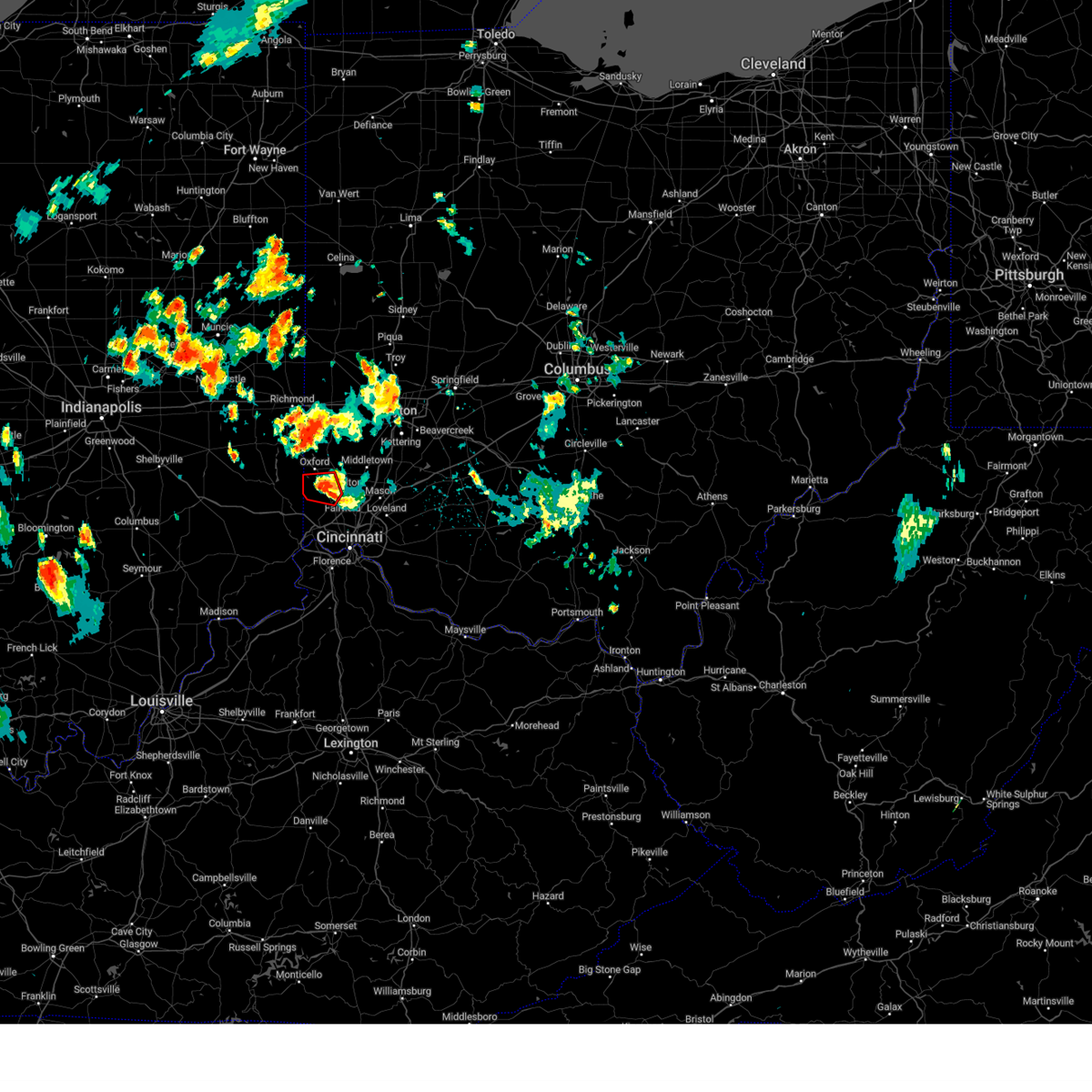
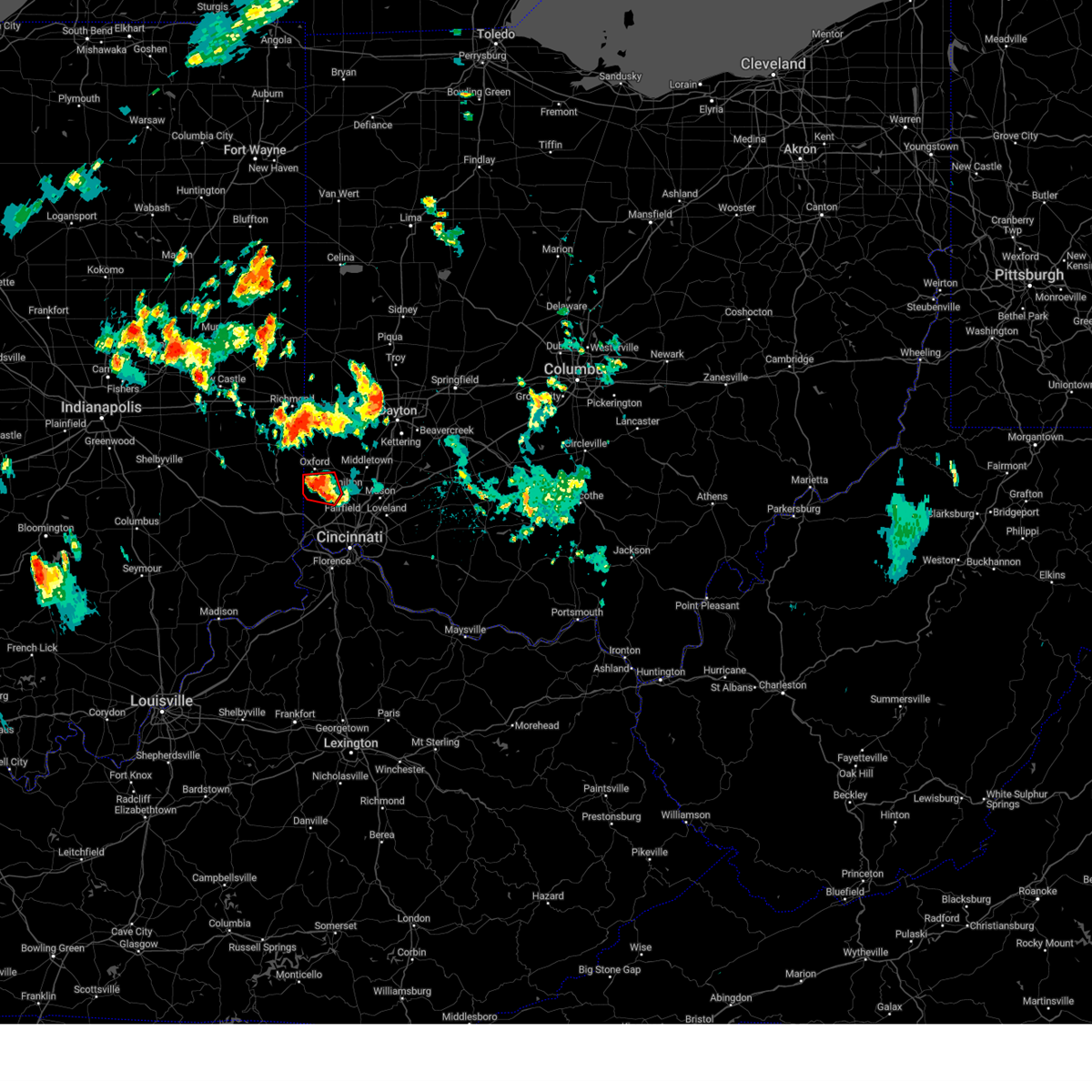
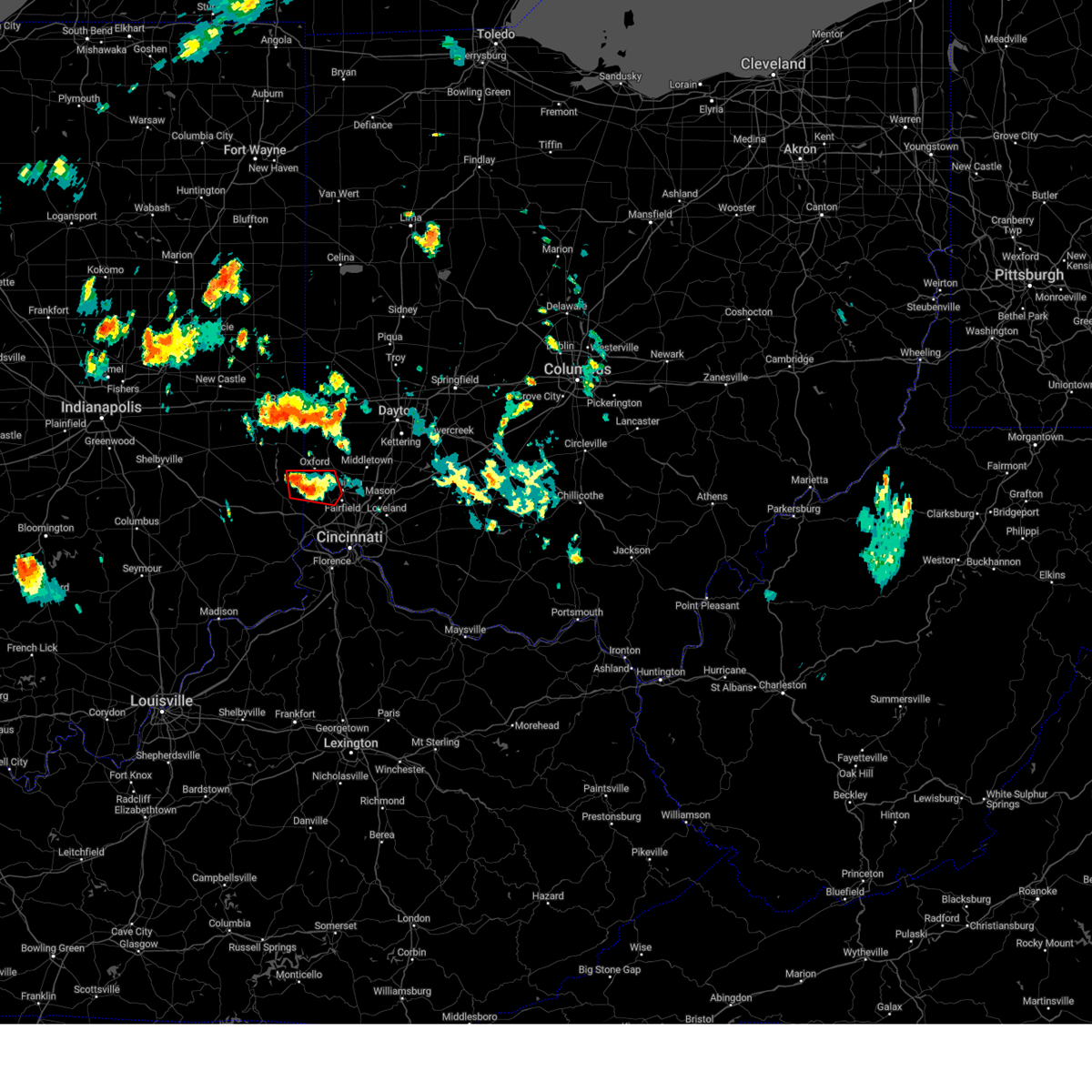
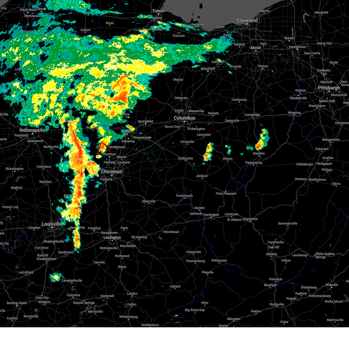
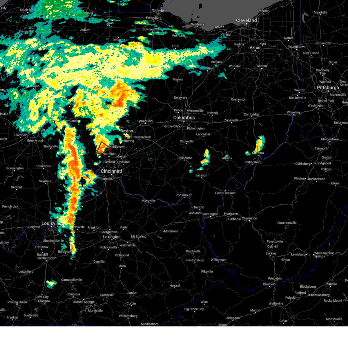
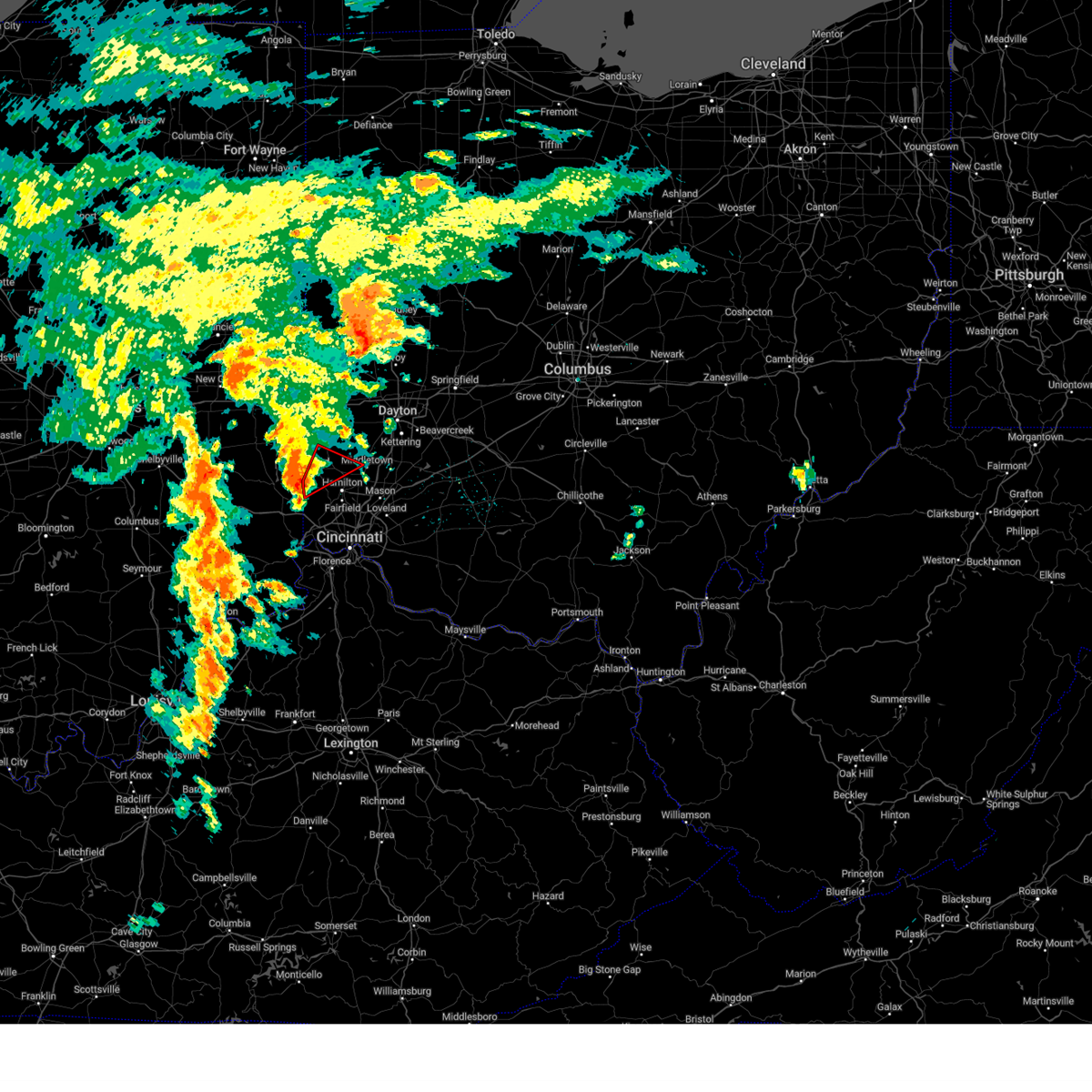
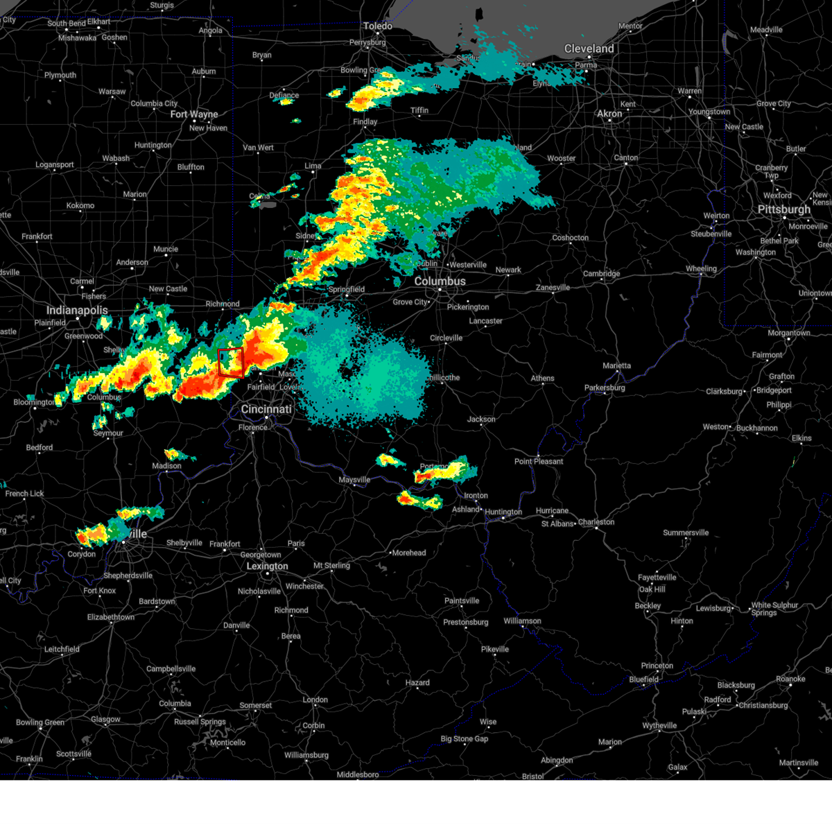
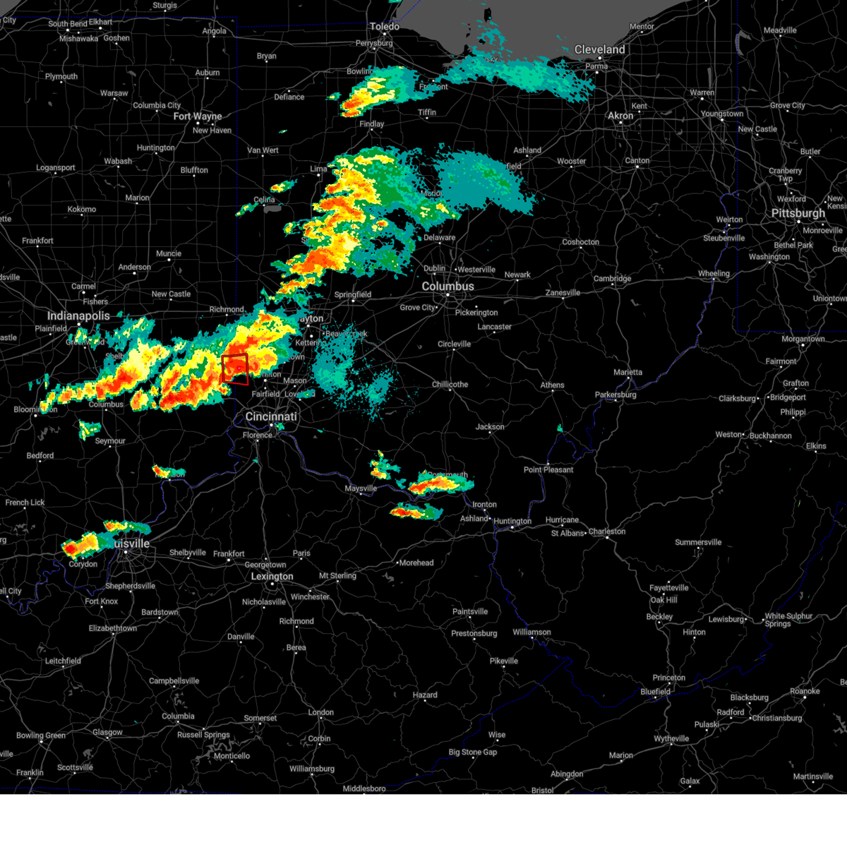
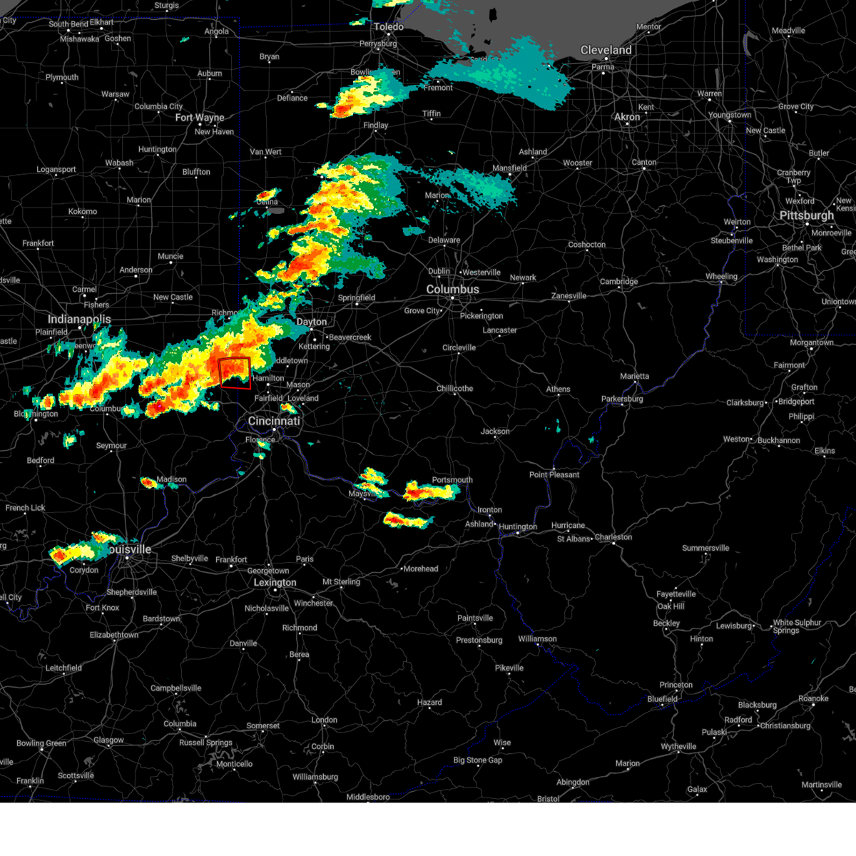
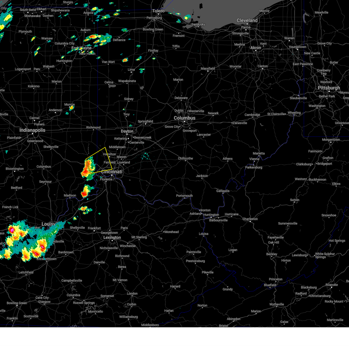
Hail Map for Oxford, OH
The Oxford, OH area has had 10 reports of on-the-ground hail by trained spotters, and has been under severe weather warnings 48 times during the past 12 months. Doppler radar has detected hail at or near Oxford, OH on 57 occasions, including 2 occasions during the past year.
| Name: | Oxford, OH |
| Where Located: | 30.7 miles NNW of Cincinnati, OH |
| Map: | Google Map for Oxford, OH |
| Population: | 21371 |
| Housing Units: | 6622 |
| More Info: | Search Google for Oxford, OH |
0
The Top Recent Hail Date for Oxford, OH is Wednesday, June 18, 2025 (34th out of 57)
Hail and Wind Damage Spotted near Oxford, OH
| Date / Time | Report Details |
|---|---|
| 6/26/2025 3:53 PM EDT |
 the severe thunderstorm warning has been cancelled and is no longer in effect the severe thunderstorm warning has been cancelled and is no longer in effect
|
| 6/26/2025 3:41 PM EDT |
 Svriln the national weather service in wilmington has issued a * severe thunderstorm warning for, butler county in southwestern ohio, * until 415 pm edt. * at 340 pm edt, a severe thunderstorm was located near darrtown, moving east at 15 mph (radar indicated). Hazards include 60 mph wind gusts and penny size hail. expect damage to trees and power lines Svriln the national weather service in wilmington has issued a * severe thunderstorm warning for, butler county in southwestern ohio, * until 415 pm edt. * at 340 pm edt, a severe thunderstorm was located near darrtown, moving east at 15 mph (radar indicated). Hazards include 60 mph wind gusts and penny size hail. expect damage to trees and power lines
|
| 6/18/2025 6:59 PM EDT | At 659 pm edt, severe thunderstorms were located along a line extending from 6 miles east of piqua to near middletown, moving northeast at 70 mph (radar indicated). Hazards include 70 mph wind gusts and quarter size hail. Minor hail damage to vehicles is possible. expect considerable tree damage. wind damage is also likely to mobile homes, roofs, and outbuildings. locations impacted include, dayton, hamilton, kettering, middletown, beavercreek, fairfield, huber heights, mason, trotwood, oxford, miamisburg, lebanon, springboro, vandalia, englewood, monroe, trenton, franklin, springdale, and tipp city. this includes the following interstates, i-70 in ohio between mile markers 17 and 40. I-75 in ohio between mile markers 18 and 70. |
| 6/18/2025 6:59 PM EDT | the severe thunderstorm warning has been cancelled and is no longer in effect |
| 6/18/2025 6:47 PM EDT | the severe thunderstorm warning has been cancelled and is no longer in effect |
| 6/18/2025 6:47 PM EDT | At 646 pm edt, severe thunderstorms were located along a line extending from pleasant hill to near darrtown, moving northeast at 60 mph (radar indicated). Hazards include 70 mph wind gusts and quarter size hail. Minor hail damage to vehicles is possible. expect considerable tree damage. wind damage is also likely to mobile homes, roofs, and outbuildings. locations impacted include, dayton, hamilton, kettering, middletown, beavercreek, fairfield, huber heights, mason, trotwood, oxford, miamisburg, lebanon, forest park, springboro, vandalia, englewood, monroe, trenton, franklin, and springdale. this includes the following interstates, i-70 in ohio between mile markers 4 and 40. I-75 in ohio between mile markers 18 and 70. |
| 6/18/2025 6:23 PM EDT |
 At 623 pm edt, severe thunderstorms were located along a line extending from near arcanum to near oxford, moving east at 60 mph (radar indicated). Hazards include 70 mph wind gusts and quarter size hail. Minor hail damage to vehicles is possible. expect considerable tree damage. wind damage is also likely to mobile homes, roofs, and outbuildings. locations impacted include, hamilton, fairfield, richmond, oxford, connersville, eaton, batesville, brookville, centerville, ross, liberty, arcanum, camden, lewisburg, new paris, west alexandria, new madison, gratis, fountain city, and seven mile. this includes the following interstates, i-70 in indiana between mile markers 145 and 156. i-70 in ohio between mile markers 0 and 17. I-74 in indiana between mile markers 145 and 148. At 623 pm edt, severe thunderstorms were located along a line extending from near arcanum to near oxford, moving east at 60 mph (radar indicated). Hazards include 70 mph wind gusts and quarter size hail. Minor hail damage to vehicles is possible. expect considerable tree damage. wind damage is also likely to mobile homes, roofs, and outbuildings. locations impacted include, hamilton, fairfield, richmond, oxford, connersville, eaton, batesville, brookville, centerville, ross, liberty, arcanum, camden, lewisburg, new paris, west alexandria, new madison, gratis, fountain city, and seven mile. this includes the following interstates, i-70 in indiana between mile markers 145 and 156. i-70 in ohio between mile markers 0 and 17. I-74 in indiana between mile markers 145 and 148.
|
| 6/18/2025 6:21 PM EDT |
 Svriln the national weather service in wilmington has issued a * severe thunderstorm warning for, eastern franklin county in southeastern indiana, southeastern wayne county in east central indiana, union county in east central indiana, preble county in west central ohio, butler county in southwestern ohio, northwestern warren county in southwestern ohio, southern darke county in west central ohio, montgomery county in west central ohio, southern miami county in west central ohio, * until 715 pm edt. * at 620 pm edt, severe thunderstorms were located along a line extending from near new madison to near brookville, moving northeast at 60 mph (radar indicated). Hazards include 70 mph wind gusts and quarter size hail. Minor hail damage to vehicles is possible. expect considerable tree damage. Wind damage is also likely to mobile homes, roofs, and outbuildings. Svriln the national weather service in wilmington has issued a * severe thunderstorm warning for, eastern franklin county in southeastern indiana, southeastern wayne county in east central indiana, union county in east central indiana, preble county in west central ohio, butler county in southwestern ohio, northwestern warren county in southwestern ohio, southern darke county in west central ohio, montgomery county in west central ohio, southern miami county in west central ohio, * until 715 pm edt. * at 620 pm edt, severe thunderstorms were located along a line extending from near new madison to near brookville, moving northeast at 60 mph (radar indicated). Hazards include 70 mph wind gusts and quarter size hail. Minor hail damage to vehicles is possible. expect considerable tree damage. Wind damage is also likely to mobile homes, roofs, and outbuildings.
|
| 6/18/2025 5:57 PM EDT |
 At 557 pm edt, severe thunderstorms were located along a line extending from near fountain city to near lake santee, moving east at 40 mph (trained weather spotters). Hazards include 70 mph wind gusts and penny size hail. Expect considerable tree damage. damage is likely to mobile homes, roofs, and outbuildings. locations impacted include, hamilton, fairfield, richmond, oxford, connersville, eaton, batesville, brookville, centerville, cambridge city, ross, liberty, arcanum, camden, lewisburg, hagerstown, new paris, west alexandria, new madison, and gratis. this includes the following interstates, i-70 in indiana between mile markers 134 and 156. i-70 in ohio between mile markers 0 and 17. I-74 in indiana between mile markers 145 and 148. At 557 pm edt, severe thunderstorms were located along a line extending from near fountain city to near lake santee, moving east at 40 mph (trained weather spotters). Hazards include 70 mph wind gusts and penny size hail. Expect considerable tree damage. damage is likely to mobile homes, roofs, and outbuildings. locations impacted include, hamilton, fairfield, richmond, oxford, connersville, eaton, batesville, brookville, centerville, cambridge city, ross, liberty, arcanum, camden, lewisburg, hagerstown, new paris, west alexandria, new madison, and gratis. this includes the following interstates, i-70 in indiana between mile markers 134 and 156. i-70 in ohio between mile markers 0 and 17. I-74 in indiana between mile markers 145 and 148.
|
| 6/18/2025 5:27 PM EDT |
 Svriln the national weather service in wilmington has issued a * severe thunderstorm warning for, franklin county in southeastern indiana, wayne county in east central indiana, union county in east central indiana, fayette county in east central indiana, preble county in west central ohio, butler county in southwestern ohio, southern darke county in west central ohio, * until 630 pm edt. * at 527 pm edt, severe thunderstorms were located along a line extending from 9 miles northwest of new castle to 10 miles southwest of rushville, moving east at 60 mph (public). Hazards include 70 mph wind gusts and penny size hail. Expect considerable tree damage. Damage is likely to mobile homes, roofs, and outbuildings. Svriln the national weather service in wilmington has issued a * severe thunderstorm warning for, franklin county in southeastern indiana, wayne county in east central indiana, union county in east central indiana, fayette county in east central indiana, preble county in west central ohio, butler county in southwestern ohio, southern darke county in west central ohio, * until 630 pm edt. * at 527 pm edt, severe thunderstorms were located along a line extending from 9 miles northwest of new castle to 10 miles southwest of rushville, moving east at 60 mph (public). Hazards include 70 mph wind gusts and penny size hail. Expect considerable tree damage. Damage is likely to mobile homes, roofs, and outbuildings.
|
| 5/16/2025 8:48 PM EDT | the severe thunderstorm warning has been cancelled and is no longer in effect |
| 5/16/2025 8:48 PM EDT | At 848 pm edt, a severe thunderstorm was located near gratis, moving northeast at 60 mph (radar indicated). Hazards include 60 mph wind gusts and quarter size hail. Minor hail damage to vehicles is possible. expect wind damage to trees and power lines. locations impacted include, hughes, seven mile, west florence, collinsville, beckett ridge, morning sun, west alexandria, south middletown, wheatville, pisgah, muttonville, millville, layhigh, camden, fairhaven, okeana, reily, college corner, poast town heights, and gratis. This includes i-75 in ohio between mile markers 18 and 28. |
| 5/16/2025 8:41 PM EDT | the severe thunderstorm warning has been cancelled and is no longer in effect |
| 5/16/2025 8:41 PM EDT | At 841 pm edt, a severe thunderstorm was located near camden, moving northeast at 60 mph (radar indicated). Hazards include 60 mph wind gusts and quarter size hail. Minor hail damage to vehicles is possible. expect wind damage to trees and power lines. locations impacted include, hughes, seven mile, goodwins corner, west florence, collinsville, brownsville, beckett ridge, morning sun, west alexandria, south middletown, wheatville, pisgah, muttonville, millville, layhigh, camden, fairhaven, okeana, clifton, and reily. This includes i-75 in ohio between mile markers 18 and 27. |
| 5/16/2025 8:31 PM EDT | At 831 pm edt, a severe thunderstorm was located over oxford, moving northeast at 40 mph (radar indicated). Hazards include 60 mph wind gusts and quarter size hail. Minor hail damage to vehicles is possible. expect wind damage to trees and power lines. locations impacted include, hughes, seven mile, goodwins corner, west florence, collinsville, brownsville, beckett ridge, morning sun, west alexandria, south middletown, wheatville, sharptown, pisgah, muttonville, millville, layhigh, camden, fairhaven, billingsville, and okeana. This includes i-75 in ohio between mile markers 18 and 28. |
| 5/16/2025 8:28 PM EDT |
 The storm which prompted the warning has moved out of the area. therefore, the warning will be allowed to expire. however, small hail, gusty winds and heavy rain are still possible with this thunderstorm. a tornado watch remains in effect until 300 am edt for southeastern and east central indiana, and southwestern and west central ohio. please report previous wind damage or hail to the national weather service by going to our website at weather.gov/iln and submitting your report via social media. The storm which prompted the warning has moved out of the area. therefore, the warning will be allowed to expire. however, small hail, gusty winds and heavy rain are still possible with this thunderstorm. a tornado watch remains in effect until 300 am edt for southeastern and east central indiana, and southwestern and west central ohio. please report previous wind damage or hail to the national weather service by going to our website at weather.gov/iln and submitting your report via social media.
|
| 5/16/2025 8:08 PM EDT |
 Svriln the national weather service in wilmington has issued a * severe thunderstorm warning for, eastern franklin county in southeastern indiana, union county in east central indiana, butler county in southwestern ohio, southern preble county in west central ohio, southwestern montgomery county in west central ohio, * until 900 pm edt. * at 808 pm edt, a severe thunderstorm was located over brookville, moving northeast at 55 mph (radar indicated). Hazards include 60 mph wind gusts and quarter size hail. Minor hail damage to vehicles is possible. Expect wind damage to trees and power lines. Svriln the national weather service in wilmington has issued a * severe thunderstorm warning for, eastern franklin county in southeastern indiana, union county in east central indiana, butler county in southwestern ohio, southern preble county in west central ohio, southwestern montgomery county in west central ohio, * until 900 pm edt. * at 808 pm edt, a severe thunderstorm was located over brookville, moving northeast at 55 mph (radar indicated). Hazards include 60 mph wind gusts and quarter size hail. Minor hail damage to vehicles is possible. Expect wind damage to trees and power lines.
|
| 5/16/2025 7:46 PM EDT |
 Svriln the national weather service in wilmington has issued a * severe thunderstorm warning for, northern franklin county in southeastern indiana, wayne county in east central indiana, union county in east central indiana, fayette county in east central indiana, northwestern butler county in southwestern ohio, western preble county in west central ohio, * until 830 pm edt. * at 746 pm edt, a severe thunderstorm was located near rushville, moving east at 55 mph (radar indicated). Hazards include 60 mph wind gusts and penny size hail. expect damage to trees and power lines Svriln the national weather service in wilmington has issued a * severe thunderstorm warning for, northern franklin county in southeastern indiana, wayne county in east central indiana, union county in east central indiana, fayette county in east central indiana, northwestern butler county in southwestern ohio, western preble county in west central ohio, * until 830 pm edt. * at 746 pm edt, a severe thunderstorm was located near rushville, moving east at 55 mph (radar indicated). Hazards include 60 mph wind gusts and penny size hail. expect damage to trees and power lines
|
| 4/29/2025 1:25 PM EDT |
 At 125 pm edt, a severe thunderstorm was located near west alexandria, moving east at 55 mph (radar indicated). Hazards include 70 mph wind gusts and quarter size hail. Minor hail damage to vehicles is possible. expect considerable tree damage. wind damage is also likely to mobile homes, roofs, and outbuildings. locations impacted include, franklin, ginghamsburg, vandalia, hughes, englewood, seven mile, potsdam, collinsville, morning sun, west milton, carlisle, new madison, west alexandria, south middletown, wheatville, interstate 70 at us route 127, muttonville, dayton international airport, millville, and overlook-page mano. this includes the following interstates, i-70 in ohio between mile markers 8 and 40. I-75 in ohio between mile markers 27 and 74. At 125 pm edt, a severe thunderstorm was located near west alexandria, moving east at 55 mph (radar indicated). Hazards include 70 mph wind gusts and quarter size hail. Minor hail damage to vehicles is possible. expect considerable tree damage. wind damage is also likely to mobile homes, roofs, and outbuildings. locations impacted include, franklin, ginghamsburg, vandalia, hughes, englewood, seven mile, potsdam, collinsville, morning sun, west milton, carlisle, new madison, west alexandria, south middletown, wheatville, interstate 70 at us route 127, muttonville, dayton international airport, millville, and overlook-page mano. this includes the following interstates, i-70 in ohio between mile markers 8 and 40. I-75 in ohio between mile markers 27 and 74.
|
| 4/29/2025 1:08 PM EDT |
 At 107 pm edt, a severe thunderstorm was located near camden, moving east at 55 mph (radar indicated). Hazards include 70 mph wind gusts and quarter size hail. Minor hail damage to vehicles is possible. expect considerable tree damage. wind damage is also likely to mobile homes, roofs, and outbuildings. locations impacted include, franklin, englewood, potsdam, west florence, morning sun, west milton, new madison, south middletown, interstate 70 at us route 127, muttonville, camden, hunter, arcanum, new paris, clayton, reily, college corner, brookville, kettering, and drexel. this includes the following interstates, i-70 in ohio between mile markers 1 and 40. I-75 in ohio between mile markers 27 and 74. At 107 pm edt, a severe thunderstorm was located near camden, moving east at 55 mph (radar indicated). Hazards include 70 mph wind gusts and quarter size hail. Minor hail damage to vehicles is possible. expect considerable tree damage. wind damage is also likely to mobile homes, roofs, and outbuildings. locations impacted include, franklin, englewood, potsdam, west florence, morning sun, west milton, new madison, south middletown, interstate 70 at us route 127, muttonville, camden, hunter, arcanum, new paris, clayton, reily, college corner, brookville, kettering, and drexel. this includes the following interstates, i-70 in ohio between mile markers 1 and 40. I-75 in ohio between mile markers 27 and 74.
|
| 4/29/2025 12:50 PM EDT |
 Svriln the national weather service in wilmington has issued a * severe thunderstorm warning for, butler county in southwestern ohio, preble county in west central ohio, northwestern warren county in southwestern ohio, southern darke county in west central ohio, montgomery county in west central ohio, southern miami county in west central ohio, * until 145 pm edt. * at 1249 pm edt, a severe thunderstorm was located near connersville, moving east at 55 mph (radar indicated). Hazards include 70 mph wind gusts and quarter size hail. Minor hail damage to vehicles is possible. expect considerable tree damage. Wind damage is also likely to mobile homes, roofs, and outbuildings. Svriln the national weather service in wilmington has issued a * severe thunderstorm warning for, butler county in southwestern ohio, preble county in west central ohio, northwestern warren county in southwestern ohio, southern darke county in west central ohio, montgomery county in west central ohio, southern miami county in west central ohio, * until 145 pm edt. * at 1249 pm edt, a severe thunderstorm was located near connersville, moving east at 55 mph (radar indicated). Hazards include 70 mph wind gusts and quarter size hail. Minor hail damage to vehicles is possible. expect considerable tree damage. Wind damage is also likely to mobile homes, roofs, and outbuildings.
|
| 4/3/2025 12:38 AM EDT |
 At 1238 am edt, a severe thunderstorm was located over fairfield, moving east at 70 mph (radar indicated). Hazards include 70 mph wind gusts and penny size hail. Expect considerable tree damage. damage is likely to mobile homes, roofs, and outbuildings. locations impacted include, franklin, state route 63 at state route 741, lockland, dent, beckett ridge, cincinnati, pekin, glendale, south middletown, lincoln heights, miami heights, mount healthy, highpoint, remington, plainville, hunter, dry ridge, montgomery, blue jay, and university of cincinnati. this includes the following interstates, i-71 in ohio between mile markers 2 and 29. i-74 in ohio between mile markers 3 and 19. I-75 in ohio between mile markers 1 and 44. At 1238 am edt, a severe thunderstorm was located over fairfield, moving east at 70 mph (radar indicated). Hazards include 70 mph wind gusts and penny size hail. Expect considerable tree damage. damage is likely to mobile homes, roofs, and outbuildings. locations impacted include, franklin, state route 63 at state route 741, lockland, dent, beckett ridge, cincinnati, pekin, glendale, south middletown, lincoln heights, miami heights, mount healthy, highpoint, remington, plainville, hunter, dry ridge, montgomery, blue jay, and university of cincinnati. this includes the following interstates, i-71 in ohio between mile markers 2 and 29. i-74 in ohio between mile markers 3 and 19. I-75 in ohio between mile markers 1 and 44.
|
| 4/3/2025 12:38 AM EDT |
 the severe thunderstorm warning has been cancelled and is no longer in effect the severe thunderstorm warning has been cancelled and is no longer in effect
|
| 4/3/2025 12:29 AM EDT |
 the severe thunderstorm warning has been cancelled and is no longer in effect the severe thunderstorm warning has been cancelled and is no longer in effect
|
| 4/3/2025 12:29 AM EDT |
 At 1229 am edt, a severe thunderstorm was located over ross, moving east at 70 mph (radar indicated). Hazards include 70 mph wind gusts and penny size hail. Expect considerable tree damage. damage is likely to mobile homes, roofs, and outbuildings. locations impacted include, franklin, state route 63 at state route 741, lockland, dent, beckett ridge, cincinnati, bright, pekin, glendale, south middletown, lincoln heights, miami heights, mount healthy, highpoint, remington, plainville, hunter, dry ridge, montgomery, and blue jay. this includes the following interstates, i-71 in ohio between mile markers 2 and 29. i-74 in indiana between mile markers 168 and 171. i-74 in ohio between mile markers 0 and 19. I-75 in ohio between mile markers 1 and 44. At 1229 am edt, a severe thunderstorm was located over ross, moving east at 70 mph (radar indicated). Hazards include 70 mph wind gusts and penny size hail. Expect considerable tree damage. damage is likely to mobile homes, roofs, and outbuildings. locations impacted include, franklin, state route 63 at state route 741, lockland, dent, beckett ridge, cincinnati, bright, pekin, glendale, south middletown, lincoln heights, miami heights, mount healthy, highpoint, remington, plainville, hunter, dry ridge, montgomery, and blue jay. this includes the following interstates, i-71 in ohio between mile markers 2 and 29. i-74 in indiana between mile markers 168 and 171. i-74 in ohio between mile markers 0 and 19. I-75 in ohio between mile markers 1 and 44.
|
| 4/3/2025 12:12 AM EDT | Svriln the national weather service in wilmington has issued a * severe thunderstorm warning for, eastern franklin county in southeastern indiana, southern union county in east central indiana, northeastern dearborn county in southeastern indiana, southeastern fayette county in east central indiana, hamilton county in southwestern ohio, butler county in southwestern ohio, northwestern clermont county in southwestern ohio, western warren county in southwestern ohio, southern montgomery county in west central ohio, * until 100 am edt. * at 1211 am edt, a severe thunderstorm was located near milan, moving east at 70 mph (radar indicated). Hazards include 70 mph wind gusts and penny size hail. Expect considerable tree damage. Damage is likely to mobile homes, roofs, and outbuildings. |
| 4/3/2025 12:05 AM EDT | The storm which prompted the warning has moved out of the area. therefore, the warning will be allowed to expire. a tornado watch remains in effect until 400 am edt for southeastern and east central indiana, and southwestern and west central ohio. please report previous wind damage or hail to the national weather service by going to our website at weather.gov/iln and submitting your report via social media. |
| 4/2/2025 11:46 PM EDT | At 1146 pm edt, a severe thunderstorm was located 7 miles north of brookville, moving northeast at 60 mph (radar indicated). Hazards include 70 mph wind gusts. Expect considerable tree damage. damage is likely to mobile homes, roofs, and outbuildings. Locations impacted include, dunlapsville, whitewater state park, charlottesville, fairhaven, hueston woods state park, goodwins corner, blooming grove, billingsville, mounds state recreation area, cottage grove, alpine, morning sun, liberty, college corner, west college corner, salem, and everton. |
| 4/2/2025 11:30 PM EDT | Svriln the national weather service in wilmington has issued a * severe thunderstorm warning for, franklin county in southeastern indiana, southern union county in east central indiana, southern fayette county in east central indiana, northwestern butler county in southwestern ohio, southwestern preble county in west central ohio, * until 1215 am edt. * at 1130 pm edt, a severe thunderstorm was located over lake santee, moving northeast at 55 mph (radar indicated). Hazards include 60 mph wind gusts. expect damage to trees and power lines |
| 3/30/2025 8:54 PM EDT |
 The storms which prompted the warning have moved out of the area. therefore, the warning will be allowed to expire. however, gusty winds are still possible with these thunderstorms. a tornado watch remains in effect until 100 am edt for southeastern and east central indiana, and southwestern and west central ohio. please report previous wind damage or hail to the national weather service by going to our website at weather.gov/iln and submitting your report via social media. remember, a severe thunderstorm warning still remains in effect for southern hamilton county, eastern hamilton county, and eastern butler county!. The storms which prompted the warning have moved out of the area. therefore, the warning will be allowed to expire. however, gusty winds are still possible with these thunderstorms. a tornado watch remains in effect until 100 am edt for southeastern and east central indiana, and southwestern and west central ohio. please report previous wind damage or hail to the national weather service by going to our website at weather.gov/iln and submitting your report via social media. remember, a severe thunderstorm warning still remains in effect for southern hamilton county, eastern hamilton county, and eastern butler county!.
|
| 3/30/2025 8:38 PM EDT |
 The tornado warning that was previously in effect has been reissued for portions of butler and warren counties and is in effect until 9:00 pm edt. please refer to that bulletin for the latest severe weather information. a tornado watch remains in effect until 100 am edt for southeastern indiana, and southwestern ohio. please report previous tornadoes, wind damage or hail to the national weather service by going to our website at weather.gov/iln and submitting your report via social media. remember, a tornado warning still remains in effect for portions of butler and warren counties and is in effect until 9:00 pm edt. The tornado warning that was previously in effect has been reissued for portions of butler and warren counties and is in effect until 9:00 pm edt. please refer to that bulletin for the latest severe weather information. a tornado watch remains in effect until 100 am edt for southeastern indiana, and southwestern ohio. please report previous tornadoes, wind damage or hail to the national weather service by going to our website at weather.gov/iln and submitting your report via social media. remember, a tornado warning still remains in effect for portions of butler and warren counties and is in effect until 9:00 pm edt.
|
| 3/30/2025 8:31 PM EDT |
 the severe thunderstorm warning has been cancelled and is no longer in effect the severe thunderstorm warning has been cancelled and is no longer in effect
|
| 3/30/2025 8:31 PM EDT |
 At 830 pm edt, severe thunderstorms were located along a line extending from 6 miles northeast of lewisburg to ross, moving east at 60 mph (radar indicated). Hazards include 70 mph wind gusts and quarter size hail. Minor hail damage to vehicles is possible. expect considerable tree damage. wind damage is also likely to mobile homes, roofs, and outbuildings. locations impacted include, seven mile, mount healthy heights, collinsville, new burlington, morning sun, interstate 74 at us route 52, bright, taylor creek, west alexandria, wheatville, west harrison, sharptown, muttonville, mount healthy, millville, layhigh, camden, dry ridge, blue jay, and okeana. this includes the following interstates, i-74 in indiana between mile markers 165 and 171. I-74 in ohio between mile markers 0 and 7, and near mile marker 9. At 830 pm edt, severe thunderstorms were located along a line extending from 6 miles northeast of lewisburg to ross, moving east at 60 mph (radar indicated). Hazards include 70 mph wind gusts and quarter size hail. Minor hail damage to vehicles is possible. expect considerable tree damage. wind damage is also likely to mobile homes, roofs, and outbuildings. locations impacted include, seven mile, mount healthy heights, collinsville, new burlington, morning sun, interstate 74 at us route 52, bright, taylor creek, west alexandria, wheatville, west harrison, sharptown, muttonville, mount healthy, millville, layhigh, camden, dry ridge, blue jay, and okeana. this includes the following interstates, i-74 in indiana between mile markers 165 and 171. I-74 in ohio between mile markers 0 and 7, and near mile marker 9.
|
| 3/30/2025 8:26 PM EDT |
 At 826 pm edt, a severe thunderstorm capable of producing a tornado was located near bright, moving east at 50 mph (radar indicated rotation). Hazards include tornado and quarter size hail. Flying debris will be dangerous to those caught without shelter. mobile homes will be damaged or destroyed. damage to roofs, windows, and vehicles will occur. tree damage is likely. locations impacted include, northbrook, mount healthy heights, interstate 74 at us route 52, bright, rockdale, taylor creek, mcgonigle, new baltimore, west harrison, sharptown, millville, ross, layhigh, dry ridge, pleasant run, blue jay, okeana, northgate, reily, and harrison. this includes the following interstates, i-74 in indiana between mile markers 166 and 171. I-74 in ohio between mile markers 0 and 6. At 826 pm edt, a severe thunderstorm capable of producing a tornado was located near bright, moving east at 50 mph (radar indicated rotation). Hazards include tornado and quarter size hail. Flying debris will be dangerous to those caught without shelter. mobile homes will be damaged or destroyed. damage to roofs, windows, and vehicles will occur. tree damage is likely. locations impacted include, northbrook, mount healthy heights, interstate 74 at us route 52, bright, rockdale, taylor creek, mcgonigle, new baltimore, west harrison, sharptown, millville, ross, layhigh, dry ridge, pleasant run, blue jay, okeana, northgate, reily, and harrison. this includes the following interstates, i-74 in indiana between mile markers 166 and 171. I-74 in ohio between mile markers 0 and 6.
|
| 3/30/2025 8:26 PM EDT |
 the tornado warning has been cancelled and is no longer in effect the tornado warning has been cancelled and is no longer in effect
|
| 3/30/2025 8:15 PM EDT |
 Toriln the national weather service in wilmington has issued a * tornado warning for, southeastern franklin county in southeastern indiana, east central ripley county in southeastern indiana, northern dearborn county in southeastern indiana, northwestern hamilton county in southwestern ohio, southwestern butler county in southwestern ohio, * until 845 pm edt. * at 814 pm edt, a severe thunderstorm capable of producing a tornado was located 9 miles east of batesville, moving east at 50 mph (radar indicated rotation). Hazards include tornado and quarter size hail. Flying debris will be dangerous to those caught without shelter. mobile homes will be damaged or destroyed. damage to roofs, windows, and vehicles will occur. Tree damage is likely. Toriln the national weather service in wilmington has issued a * tornado warning for, southeastern franklin county in southeastern indiana, east central ripley county in southeastern indiana, northern dearborn county in southeastern indiana, northwestern hamilton county in southwestern ohio, southwestern butler county in southwestern ohio, * until 845 pm edt. * at 814 pm edt, a severe thunderstorm capable of producing a tornado was located 9 miles east of batesville, moving east at 50 mph (radar indicated rotation). Hazards include tornado and quarter size hail. Flying debris will be dangerous to those caught without shelter. mobile homes will be damaged or destroyed. damage to roofs, windows, and vehicles will occur. Tree damage is likely.
|
| 3/30/2025 8:00 PM EDT |
 At 759 pm edt, severe thunderstorms were located along a line extending from near centerville to near osgood, moving east at 60 mph (radar indicated). Hazards include 70 mph wind gusts and quarter size hail. Minor hail damage to vehicles is possible. expect considerable tree damage. wind damage is also likely to mobile homes, roofs, and outbuildings. locations impacted include, goodwins corner, west florence, abington, morning sun, bright, st. leon, muttonville, mount healthy, boston, camden, dry ridge, blue jay, reily, college corner, brookville, logan, dunlap, new haven, sugar valley, and lawrenceville. this includes the following interstates, i-74 in indiana between mile markers 157 and 171. I-74 in ohio between mile markers 0 and 7, and near mile marker 9. At 759 pm edt, severe thunderstorms were located along a line extending from near centerville to near osgood, moving east at 60 mph (radar indicated). Hazards include 70 mph wind gusts and quarter size hail. Minor hail damage to vehicles is possible. expect considerable tree damage. wind damage is also likely to mobile homes, roofs, and outbuildings. locations impacted include, goodwins corner, west florence, abington, morning sun, bright, st. leon, muttonville, mount healthy, boston, camden, dry ridge, blue jay, reily, college corner, brookville, logan, dunlap, new haven, sugar valley, and lawrenceville. this includes the following interstates, i-74 in indiana between mile markers 157 and 171. I-74 in ohio between mile markers 0 and 7, and near mile marker 9.
|
| 3/30/2025 7:55 PM EDT |
 Svriln the national weather service in wilmington has issued a * severe thunderstorm warning for, eastern franklin county in southeastern indiana, southeastern wayne county in east central indiana, union county in east central indiana, northern dearborn county in southeastern indiana, northwestern hamilton county in southwestern ohio, butler county in southwestern ohio, preble county in west central ohio, * until 900 pm edt. * at 755 pm edt, severe thunderstorms were located along a line extending from cambridge city to near osgood, moving east at 60 mph (radar indicated). Hazards include 60 mph wind gusts and quarter size hail. Minor hail damage to vehicles is possible. Expect wind damage to trees and power lines. Svriln the national weather service in wilmington has issued a * severe thunderstorm warning for, eastern franklin county in southeastern indiana, southeastern wayne county in east central indiana, union county in east central indiana, northern dearborn county in southeastern indiana, northwestern hamilton county in southwestern ohio, butler county in southwestern ohio, preble county in west central ohio, * until 900 pm edt. * at 755 pm edt, severe thunderstorms were located along a line extending from cambridge city to near osgood, moving east at 60 mph (radar indicated). Hazards include 60 mph wind gusts and quarter size hail. Minor hail damage to vehicles is possible. Expect wind damage to trees and power lines.
|
| 3/19/2025 10:28 PM EDT |
 the severe thunderstorm warning has been cancelled and is no longer in effect the severe thunderstorm warning has been cancelled and is no longer in effect
|
| 3/19/2025 10:28 PM EDT |
 At 1027 pm edt, a severe thunderstorm was located near arcanum, moving northeast at 50 mph (radar indicated). Hazards include 60 mph wind gusts. Expect damage to trees and power lines. locations impacted include, eldorado, oklahoma, west florence, ithaca, morning sun, new madison, west alexandria, wheatville, interstate 70 at us route 127, muttonville, lake lakengren, new hope, somerville, oxford, camden, gordon, west elkton, fairhaven, hueston woods state park, and arcanum. This includes i-70 in ohio between mile markers 1 and 17. At 1027 pm edt, a severe thunderstorm was located near arcanum, moving northeast at 50 mph (radar indicated). Hazards include 60 mph wind gusts. Expect damage to trees and power lines. locations impacted include, eldorado, oklahoma, west florence, ithaca, morning sun, new madison, west alexandria, wheatville, interstate 70 at us route 127, muttonville, lake lakengren, new hope, somerville, oxford, camden, gordon, west elkton, fairhaven, hueston woods state park, and arcanum. This includes i-70 in ohio between mile markers 1 and 17.
|
| 3/19/2025 10:09 PM EDT |
 the severe thunderstorm warning has been cancelled and is no longer in effect the severe thunderstorm warning has been cancelled and is no longer in effect
|
| 3/19/2025 10:09 PM EDT |
 At 1009 pm edt, a severe thunderstorm was located over richmond, moving northeast at 50 mph (radar indicated). Hazards include 60 mph wind gusts. Expect damage to trees and power lines. locations impacted include, goodwins corner, west florence, abington, brownsville, morning sun, new madison, west alexandria, wheatville, interstate 70 at us route 127, muttonville, new hope, boston, camden, fairhaven, billingsville, arcanum, clifton, whitewater, lewisburg, and new paris. this includes the following interstates, i-70 in indiana between mile markers 145 and 156. I-70 in ohio between mile markers 0 and 17. At 1009 pm edt, a severe thunderstorm was located over richmond, moving northeast at 50 mph (radar indicated). Hazards include 60 mph wind gusts. Expect damage to trees and power lines. locations impacted include, goodwins corner, west florence, abington, brownsville, morning sun, new madison, west alexandria, wheatville, interstate 70 at us route 127, muttonville, new hope, boston, camden, fairhaven, billingsville, arcanum, clifton, whitewater, lewisburg, and new paris. this includes the following interstates, i-70 in indiana between mile markers 145 and 156. I-70 in ohio between mile markers 0 and 17.
|
| 3/19/2025 9:58 PM EDT |
 Svriln the national weather service in wilmington has issued a * severe thunderstorm warning for, northeastern franklin county in southeastern indiana, southeastern wayne county in east central indiana, union county in east central indiana, southeastern fayette county in east central indiana, northwestern butler county in southwestern ohio, preble county in west central ohio, southern darke county in west central ohio, * until 1045 pm edt. * at 958 pm edt, a severe thunderstorm was located 7 miles south of centerville, moving northeast at 50 mph (radar indicated). Hazards include 60 mph wind gusts. expect damage to trees and power lines Svriln the national weather service in wilmington has issued a * severe thunderstorm warning for, northeastern franklin county in southeastern indiana, southeastern wayne county in east central indiana, union county in east central indiana, southeastern fayette county in east central indiana, northwestern butler county in southwestern ohio, preble county in west central ohio, southern darke county in west central ohio, * until 1045 pm edt. * at 958 pm edt, a severe thunderstorm was located 7 miles south of centerville, moving northeast at 50 mph (radar indicated). Hazards include 60 mph wind gusts. expect damage to trees and power lines
|
| 7/29/2024 10:29 PM EDT |
 The storm which prompted the warning has weakened below severe limits and no longer appears capable of producing a tornado. therefore, the warning will be allowed to expire. please report previous tornadoes, wind damage or hail to the national weather service by going to our website at weather.gov/iln and submitting your report via social media. The storm which prompted the warning has weakened below severe limits and no longer appears capable of producing a tornado. therefore, the warning will be allowed to expire. please report previous tornadoes, wind damage or hail to the national weather service by going to our website at weather.gov/iln and submitting your report via social media.
|
| 7/29/2024 10:19 PM EDT |
 At 1018 pm edt, a severe thunderstorm capable of producing a tornado was located near reily, moving east at 25 mph (radar indicated rotation). Hazards include tornado. Flying debris will be dangerous to those caught without shelter. mobile homes will be damaged or destroyed. damage to roofs, windows, and vehicles will occur. tree damage is likely. Locations impacted include, hamilton, darrtown, reily, millville, scipio, mcgonigle, saint charles, okeana, and layhigh. At 1018 pm edt, a severe thunderstorm capable of producing a tornado was located near reily, moving east at 25 mph (radar indicated rotation). Hazards include tornado. Flying debris will be dangerous to those caught without shelter. mobile homes will be damaged or destroyed. damage to roofs, windows, and vehicles will occur. tree damage is likely. Locations impacted include, hamilton, darrtown, reily, millville, scipio, mcgonigle, saint charles, okeana, and layhigh.
|
| 7/29/2024 10:19 PM EDT |
 the tornado warning has been cancelled and is no longer in effect the tornado warning has been cancelled and is no longer in effect
|
| 7/29/2024 10:03 PM EDT |
 At 1003 pm edt, a severe thunderstorm capable of producing a tornado was located near mount carmel, moving east at 10 mph (radar indicated rotation). Hazards include tornado. Flying debris will be dangerous to those caught without shelter. mobile homes will be damaged or destroyed. damage to roofs, windows, and vehicles will occur. tree damage is likely. locations impacted include, hamilton, oxford, ross, darrtown, reily, millville, scipio, mount carmel, okeana, mixersville, mcgonigle, sharptown, st. Charles, and layhigh. At 1003 pm edt, a severe thunderstorm capable of producing a tornado was located near mount carmel, moving east at 10 mph (radar indicated rotation). Hazards include tornado. Flying debris will be dangerous to those caught without shelter. mobile homes will be damaged or destroyed. damage to roofs, windows, and vehicles will occur. tree damage is likely. locations impacted include, hamilton, oxford, ross, darrtown, reily, millville, scipio, mount carmel, okeana, mixersville, mcgonigle, sharptown, st. Charles, and layhigh.
|
| 7/29/2024 9:51 PM EDT | Toriln the national weather service in wilmington has issued a * tornado warning for, northeastern franklin county in southeastern indiana, southwestern butler county in southwestern ohio, * until 1030 pm edt. * at 951 pm edt, a severe thunderstorm capable of producing a tornado was located 5 miles west of oxford, moving east at 25 mph (radar indicated rotation). Hazards include tornado. Flying debris will be dangerous to those caught without shelter. mobile homes will be damaged or destroyed. damage to roofs, windows, and vehicles will occur. Tree damage is likely. |
| 7/9/2024 11:26 PM EDT |
 The storm which prompted the warning has weakened below severe limits and no longer appears capable of producing a tornado. therefore, the warning will be allowed to expire. a tornado watch remains in effect until midnight edt for southeastern indiana, and southwestern and west central ohio. please report previous tornadoes, wind damage or hail to the national weather service by going to our website at weather.gov/iln and submitting your report via social media. The storm which prompted the warning has weakened below severe limits and no longer appears capable of producing a tornado. therefore, the warning will be allowed to expire. a tornado watch remains in effect until midnight edt for southeastern indiana, and southwestern and west central ohio. please report previous tornadoes, wind damage or hail to the national weather service by going to our website at weather.gov/iln and submitting your report via social media.
|
| 7/9/2024 11:16 PM EDT |
 At 1116 pm edt, a severe thunderstorm capable of producing a tornado was located over darrtown, moving northeast at 30 mph (radar indicated rotation). Hazards include tornado. Flying debris will be dangerous to those caught without shelter. mobile homes will be damaged or destroyed. damage to roofs, windows, and vehicles will occur. tree damage is likely. Locations impacted include, oxford, darrtown, somerville, and collinsville. At 1116 pm edt, a severe thunderstorm capable of producing a tornado was located over darrtown, moving northeast at 30 mph (radar indicated rotation). Hazards include tornado. Flying debris will be dangerous to those caught without shelter. mobile homes will be damaged or destroyed. damage to roofs, windows, and vehicles will occur. tree damage is likely. Locations impacted include, oxford, darrtown, somerville, and collinsville.
|
| 7/9/2024 11:02 PM EDT |
 Toriln the national weather service in wilmington has issued a * tornado warning for, south central preble county in west central ohio, northern butler county in southwestern ohio, * until 1130 pm edt. * at 1102 pm edt, a severe thunderstorm capable of producing a tornado was located near oxford, moving northeast at 30 mph (radar indicated rotation). Hazards include tornado. Flying debris will be dangerous to those caught without shelter. mobile homes will be damaged or destroyed. damage to roofs, windows, and vehicles will occur. Tree damage is likely. Toriln the national weather service in wilmington has issued a * tornado warning for, south central preble county in west central ohio, northern butler county in southwestern ohio, * until 1130 pm edt. * at 1102 pm edt, a severe thunderstorm capable of producing a tornado was located near oxford, moving northeast at 30 mph (radar indicated rotation). Hazards include tornado. Flying debris will be dangerous to those caught without shelter. mobile homes will be damaged or destroyed. damage to roofs, windows, and vehicles will occur. Tree damage is likely.
|
| 6/29/2024 6:14 PM EDT |
 At 613 pm edt, severe thunderstorms were located along a line extending from near camden to 6 miles northwest of ross to near batesville, moving east at 45 mph (public). Hazards include 60 mph wind gusts. Expect damage to trees and power lines. locations impacted include, hamilton, oxford, harrison, batesville, brookville, bright, ross, liberty, west college corner, taylor creek, blue jay, darrtown, dunlap, dry ridge, salem, logan, reily, new haven, grandview, and blooming grove. this includes the following interstates, i-74 in indiana between mile markers 152 and 171. I-74 in ohio between mile markers 0 and 9. At 613 pm edt, severe thunderstorms were located along a line extending from near camden to 6 miles northwest of ross to near batesville, moving east at 45 mph (public). Hazards include 60 mph wind gusts. Expect damage to trees and power lines. locations impacted include, hamilton, oxford, harrison, batesville, brookville, bright, ross, liberty, west college corner, taylor creek, blue jay, darrtown, dunlap, dry ridge, salem, logan, reily, new haven, grandview, and blooming grove. this includes the following interstates, i-74 in indiana between mile markers 152 and 171. I-74 in ohio between mile markers 0 and 9.
|
| 6/29/2024 6:14 PM EDT |
 the severe thunderstorm warning has been cancelled and is no longer in effect the severe thunderstorm warning has been cancelled and is no longer in effect
|
| 6/29/2024 6:02 PM EDT |
 At 601 pm edt, severe thunderstorms were located along a line extending from near west college corner to 6 miles southeast of brookville to 6 miles southwest of batesville, moving east at 45 mph (public). Hazards include 60 mph wind gusts. Expect damage to trees and power lines. locations impacted include, hamilton, oxford, harrison, batesville, lawrenceburg, greendale, brookville, bright, hidden valley, ross, cleves, liberty, milan, west college corner, oldenburg, shawnee, moores hill, taylor creek, blue jay, and darrtown. this includes the following interstates, i-74 in indiana between mile markers 145 and 171. I-74 in ohio between mile markers 0 and 9. At 601 pm edt, severe thunderstorms were located along a line extending from near west college corner to 6 miles southeast of brookville to 6 miles southwest of batesville, moving east at 45 mph (public). Hazards include 60 mph wind gusts. Expect damage to trees and power lines. locations impacted include, hamilton, oxford, harrison, batesville, lawrenceburg, greendale, brookville, bright, hidden valley, ross, cleves, liberty, milan, west college corner, oldenburg, shawnee, moores hill, taylor creek, blue jay, and darrtown. this includes the following interstates, i-74 in indiana between mile markers 145 and 171. I-74 in ohio between mile markers 0 and 9.
|
| 6/29/2024 5:38 PM EDT |
 Svriln the national weather service in wilmington has issued a * severe thunderstorm warning for, franklin county in southeastern indiana, northern ripley county in southeastern indiana, union county in east central indiana, dearborn county in southeastern indiana, southeastern fayette county in east central indiana, northwestern hamilton county in southwestern ohio, southwestern preble county in west central ohio, western butler county in southwestern ohio, * until 630 pm edt. * at 537 pm edt, severe thunderstorms were located along a line extending from near connersville to 6 miles north of oldenburg to 7 miles southwest of greensburg, moving east at 45 mph (public). Hazards include 70 mph wind gusts and nickel size hail. Expect considerable tree damage. Damage is likely to mobile homes, roofs, and outbuildings. Svriln the national weather service in wilmington has issued a * severe thunderstorm warning for, franklin county in southeastern indiana, northern ripley county in southeastern indiana, union county in east central indiana, dearborn county in southeastern indiana, southeastern fayette county in east central indiana, northwestern hamilton county in southwestern ohio, southwestern preble county in west central ohio, western butler county in southwestern ohio, * until 630 pm edt. * at 537 pm edt, severe thunderstorms were located along a line extending from near connersville to 6 miles north of oldenburg to 7 miles southwest of greensburg, moving east at 45 mph (public). Hazards include 70 mph wind gusts and nickel size hail. Expect considerable tree damage. Damage is likely to mobile homes, roofs, and outbuildings.
|
| 5/7/2024 9:25 PM EDT |
 The storm which prompted the warning has moved out of the area. therefore, the warning will be allowed to expire. a tornado watch remains in effect until 100 am edt for southeastern and east central indiana, and southwestern and west central ohio. please report previous tornadoes, wind damage or hail to the national weather service by going to our website at weather.gov/iln and submitting your report via social media. The storm which prompted the warning has moved out of the area. therefore, the warning will be allowed to expire. a tornado watch remains in effect until 100 am edt for southeastern and east central indiana, and southwestern and west central ohio. please report previous tornadoes, wind damage or hail to the national weather service by going to our website at weather.gov/iln and submitting your report via social media.
|
| 5/7/2024 9:17 PM EDT |
 Toriln the national weather service in wilmington has issued a * tornado warning for, central butler county in southwestern ohio, * until 945 pm edt. * at 917 pm edt, a severe thunderstorm capable of producing a tornado was located over oxford, moving east at 30 mph (radar indicated rotation). Hazards include tornado and quarter size hail. Flying debris will be dangerous to those caught without shelter. mobile homes will be damaged or destroyed. damage to roofs, windows, and vehicles will occur. Tree damage is likely. Toriln the national weather service in wilmington has issued a * tornado warning for, central butler county in southwestern ohio, * until 945 pm edt. * at 917 pm edt, a severe thunderstorm capable of producing a tornado was located over oxford, moving east at 30 mph (radar indicated rotation). Hazards include tornado and quarter size hail. Flying debris will be dangerous to those caught without shelter. mobile homes will be damaged or destroyed. damage to roofs, windows, and vehicles will occur. Tree damage is likely.
|
| 5/7/2024 9:07 PM EDT |
 At 907 pm edt, a severe thunderstorm capable of producing a tornado was located near west college corner, moving east at 30 mph (radar indicated rotation). Hazards include tornado and quarter size hail. Flying debris will be dangerous to those caught without shelter. mobile homes will be damaged or destroyed. damage to roofs, windows, and vehicles will occur. tree damage is likely. locations impacted include, oxford, reily, scipio, college corner, mount carmel, charlottesville, st. Charles, billingsville, and mixersville. At 907 pm edt, a severe thunderstorm capable of producing a tornado was located near west college corner, moving east at 30 mph (radar indicated rotation). Hazards include tornado and quarter size hail. Flying debris will be dangerous to those caught without shelter. mobile homes will be damaged or destroyed. damage to roofs, windows, and vehicles will occur. tree damage is likely. locations impacted include, oxford, reily, scipio, college corner, mount carmel, charlottesville, st. Charles, billingsville, and mixersville.
|
| 5/7/2024 9:01 PM EDT |
 At 901 pm edt, a large and extremely dangerous tornado was located in thunderstorms near brookville, moving east at 30 mph. this is a particularly dangerous situation. take cover now! (radar indicated rotation). Hazards include damaging tornado. You are in a life-threatening situation. flying debris may be deadly to those caught without shelter. mobile homes will be destroyed. considerable damage to homes, businesses, and vehicles is likely and complete destruction is possible. locations impacted include, oxford, west college corner, reily, scipio, college corner, mount carmel, charlottesville, st. Charles, billingsville, and mixersville. At 901 pm edt, a large and extremely dangerous tornado was located in thunderstorms near brookville, moving east at 30 mph. this is a particularly dangerous situation. take cover now! (radar indicated rotation). Hazards include damaging tornado. You are in a life-threatening situation. flying debris may be deadly to those caught without shelter. mobile homes will be destroyed. considerable damage to homes, businesses, and vehicles is likely and complete destruction is possible. locations impacted include, oxford, west college corner, reily, scipio, college corner, mount carmel, charlottesville, st. Charles, billingsville, and mixersville.
|
| 5/7/2024 8:54 PM EDT |
 Toriln the national weather service in wilmington has issued a * tornado warning for, northeastern franklin county in southeastern indiana, southern union county in east central indiana, northwestern butler county in southwestern ohio, * until 930 pm edt. * at 854 pm edt, a severe thunderstorm capable of producing a tornado was located near brookville, moving east at 30 mph (radar indicated rotation). Hazards include tornado and quarter size hail. Flying debris will be dangerous to those caught without shelter. mobile homes will be damaged or destroyed. damage to roofs, windows, and vehicles will occur. Tree damage is likely. Toriln the national weather service in wilmington has issued a * tornado warning for, northeastern franklin county in southeastern indiana, southern union county in east central indiana, northwestern butler county in southwestern ohio, * until 930 pm edt. * at 854 pm edt, a severe thunderstorm capable of producing a tornado was located near brookville, moving east at 30 mph (radar indicated rotation). Hazards include tornado and quarter size hail. Flying debris will be dangerous to those caught without shelter. mobile homes will be damaged or destroyed. damage to roofs, windows, and vehicles will occur. Tree damage is likely.
|
| 4/2/2024 5:36 AM EDT |
 At 535 am edt, a severe thunderstorm was located near seven mile, moving east at 50 mph (radar indicated). Hazards include 60 mph wind gusts and penny size hail. Expect damage to trees and power lines. locations impacted include, dayton, hamilton, middletown, mason, oxford, miamisburg, springboro, monroe, trenton, franklin, moraine, carlisle, south middletown, west carrollton, camden, gratis, seven mile, williamsdale, four bridges, and hunter. This includes i-75 in ohio between mile markers 25 and 39. At 535 am edt, a severe thunderstorm was located near seven mile, moving east at 50 mph (radar indicated). Hazards include 60 mph wind gusts and penny size hail. Expect damage to trees and power lines. locations impacted include, dayton, hamilton, middletown, mason, oxford, miamisburg, springboro, monroe, trenton, franklin, moraine, carlisle, south middletown, west carrollton, camden, gratis, seven mile, williamsdale, four bridges, and hunter. This includes i-75 in ohio between mile markers 25 and 39.
|
| 4/2/2024 5:25 AM EDT |
 At 525 am edt, a severe thunderstorm was located near west college corner, moving east at 50 mph (radar indicated). Hazards include 60 mph wind gusts and quarter size hail. Minor hail damage to vehicles is possible. expect wind damage to trees and power lines. locations impacted include, dayton, hamilton, middletown, mason, oxford, miamisburg, springboro, monroe, trenton, franklin, moraine, carlisle, south middletown, west carrollton, camden, gratis, seven mile, williamsdale, four bridges, and hunter. This includes i-75 in ohio between mile markers 25 and 39. At 525 am edt, a severe thunderstorm was located near west college corner, moving east at 50 mph (radar indicated). Hazards include 60 mph wind gusts and quarter size hail. Minor hail damage to vehicles is possible. expect wind damage to trees and power lines. locations impacted include, dayton, hamilton, middletown, mason, oxford, miamisburg, springboro, monroe, trenton, franklin, moraine, carlisle, south middletown, west carrollton, camden, gratis, seven mile, williamsdale, four bridges, and hunter. This includes i-75 in ohio between mile markers 25 and 39.
|
| 4/2/2024 5:15 AM EDT |
 Svriln the national weather service in wilmington has issued a * severe thunderstorm warning for, southern preble county in west central ohio, butler county in southwestern ohio, northwestern warren county in southwestern ohio, southwestern montgomery county in west central ohio, * until 615 am edt. * at 515 am edt, a severe thunderstorm was located 7 miles north of brookville, moving east at 50 mph (radar indicated). Hazards include 60 mph wind gusts and quarter size hail. Minor hail damage to vehicles is possible. Expect wind damage to trees and power lines. Svriln the national weather service in wilmington has issued a * severe thunderstorm warning for, southern preble county in west central ohio, butler county in southwestern ohio, northwestern warren county in southwestern ohio, southwestern montgomery county in west central ohio, * until 615 am edt. * at 515 am edt, a severe thunderstorm was located 7 miles north of brookville, moving east at 50 mph (radar indicated). Hazards include 60 mph wind gusts and quarter size hail. Minor hail damage to vehicles is possible. Expect wind damage to trees and power lines.
|
| 7/29/2023 4:57 AM EDT |
 The severe thunderstorm warning for southern butler county will expire at 500 am edt, the storm which prompted the warning has moved out of the area. therefore, the warning will be allowed to expire. a severe thunderstorm watch remains in effect until 1100 am edt for southwestern and west central ohio. please report previous wind damage or hail to the national weather service by going to our website at weather.gov/iln and submitting your report via social media. The severe thunderstorm warning for southern butler county will expire at 500 am edt, the storm which prompted the warning has moved out of the area. therefore, the warning will be allowed to expire. a severe thunderstorm watch remains in effect until 1100 am edt for southwestern and west central ohio. please report previous wind damage or hail to the national weather service by going to our website at weather.gov/iln and submitting your report via social media.
|
| 7/29/2023 4:29 AM EDT |
 At 429 am edt, a severe thunderstorm was located 7 miles south of oxford, moving east at 45 mph (radar indicated). Hazards include 60 mph wind gusts and penny size hail. Expect damage to trees and power lines. locations impacted include, hamilton, oxford, monroe, trenton, seven mile, williamsdale, darrtown, reily, new miami, millville, college corner, okeana, mcgonigle, st. charles, alert and layhigh. hail threat, radar indicated max hail size, 0. 75 in wind threat, radar indicated max wind gust, 60 mph. At 429 am edt, a severe thunderstorm was located 7 miles south of oxford, moving east at 45 mph (radar indicated). Hazards include 60 mph wind gusts and penny size hail. Expect damage to trees and power lines. locations impacted include, hamilton, oxford, monroe, trenton, seven mile, williamsdale, darrtown, reily, new miami, millville, college corner, okeana, mcgonigle, st. charles, alert and layhigh. hail threat, radar indicated max hail size, 0. 75 in wind threat, radar indicated max wind gust, 60 mph.
|
| 7/29/2023 4:19 AM EDT |
 At 419 am edt, a severe thunderstorm was located near brookville, moving east at 45 mph (radar indicated). Hazards include 60 mph wind gusts and penny size hail. expect damage to trees and power lines At 419 am edt, a severe thunderstorm was located near brookville, moving east at 45 mph (radar indicated). Hazards include 60 mph wind gusts and penny size hail. expect damage to trees and power lines
|
| 7/17/2023 8:50 PM EDT |
 The severe thunderstorm warning for northeastern dearborn, northwestern hamilton and western butler counties will expire at 900 pm edt, the storm which prompted the warning has weakened below severe limits, and has exited the warned area. therefore, the warning will be allowed to expire. these storms are still capable of producing winds to 50 mph. a severe thunderstorm watch remains in effect until midnight edt for southeastern indiana, and southwestern and west central ohio. please report previous wind damage or hail to the national weather service by going to our website at weather.gov/iln and submitting your report via social media. The severe thunderstorm warning for northeastern dearborn, northwestern hamilton and western butler counties will expire at 900 pm edt, the storm which prompted the warning has weakened below severe limits, and has exited the warned area. therefore, the warning will be allowed to expire. these storms are still capable of producing winds to 50 mph. a severe thunderstorm watch remains in effect until midnight edt for southeastern indiana, and southwestern and west central ohio. please report previous wind damage or hail to the national weather service by going to our website at weather.gov/iln and submitting your report via social media.
|
| 7/17/2023 8:34 PM EDT |
 At 834 pm edt, a severe thunderstorm was located near ross, moving east at 35 mph (radar indicated). Hazards include 60 mph wind gusts. Expect damage to trees and power lines. locations impacted include, hamilton, fairfield, oxford, forest park, springdale, harrison, bright, ross, seven mile, taylor creek, dry ridge, blue jay, dunlap, colerain township, darrtown, greenhills, logan, reily, new haven and new miami. this includes the following interstates, i-74 in indiana between mile markers 168 and 171. i-74 in ohio between mile markers 0 and 6. hail threat, radar indicated max hail size, <. 75 in wind threat, radar indicated max wind gust, 60 mph. At 834 pm edt, a severe thunderstorm was located near ross, moving east at 35 mph (radar indicated). Hazards include 60 mph wind gusts. Expect damage to trees and power lines. locations impacted include, hamilton, fairfield, oxford, forest park, springdale, harrison, bright, ross, seven mile, taylor creek, dry ridge, blue jay, dunlap, colerain township, darrtown, greenhills, logan, reily, new haven and new miami. this includes the following interstates, i-74 in indiana between mile markers 168 and 171. i-74 in ohio between mile markers 0 and 6. hail threat, radar indicated max hail size, <. 75 in wind threat, radar indicated max wind gust, 60 mph.
|
| 7/17/2023 8:24 PM EDT |
 At 824 pm edt, a severe thunderstorm was located near ross, moving southeast at 40 mph (radar indicated). Hazards include 60 mph wind gusts and penny size hail. Expect damage to trees and power lines. locations impacted include, hamilton, fairfield, oxford, forest park, springdale, harrison, bright, ross, seven mile, taylor creek, dry ridge, blue jay, dunlap, colerain township, darrtown, greenhills, logan, reily, new haven and new miami. this includes the following interstates, i-74 in indiana between mile markers 168 and 171. i-74 in ohio between mile markers 0 and 6. hail threat, radar indicated max hail size, 0. 75 in wind threat, radar indicated max wind gust, 60 mph. At 824 pm edt, a severe thunderstorm was located near ross, moving southeast at 40 mph (radar indicated). Hazards include 60 mph wind gusts and penny size hail. Expect damage to trees and power lines. locations impacted include, hamilton, fairfield, oxford, forest park, springdale, harrison, bright, ross, seven mile, taylor creek, dry ridge, blue jay, dunlap, colerain township, darrtown, greenhills, logan, reily, new haven and new miami. this includes the following interstates, i-74 in indiana between mile markers 168 and 171. i-74 in ohio between mile markers 0 and 6. hail threat, radar indicated max hail size, 0. 75 in wind threat, radar indicated max wind gust, 60 mph.
|
| 7/17/2023 8:12 PM EDT |
 At 812 pm edt, a severe thunderstorm was located 7 miles east of brookville, moving southeast at 40 mph (radar indicated). Hazards include 60 mph wind gusts and quarter size hail. Minor hail damage to vehicles is possible. Expect wind damage to trees and power lines. At 812 pm edt, a severe thunderstorm was located 7 miles east of brookville, moving southeast at 40 mph (radar indicated). Hazards include 60 mph wind gusts and quarter size hail. Minor hail damage to vehicles is possible. Expect wind damage to trees and power lines.
|
| 7/2/2023 5:56 PM EDT |
 At 556 pm edt, severe thunderstorms were located along a line extending from near lewisburg to seven mile, moving east at 50 mph (radar indicated). Hazards include 60 mph wind gusts. Expect damage to trees and power lines. locations impacted include, hamilton, oxford, trenton, eaton, camden, west alexandria, gratis, seven mile, west college corner, williamsdale, darrtown, college corner, somerville, west elkton, jacksonburg, oklahoma, west florence, collinsville, morning sun and wheatville. this includes i-70 in ohio between mile markers 1 and 4. hail threat, radar indicated max hail size, <. 75 in wind threat, radar indicated max wind gust, 60 mph. At 556 pm edt, severe thunderstorms were located along a line extending from near lewisburg to seven mile, moving east at 50 mph (radar indicated). Hazards include 60 mph wind gusts. Expect damage to trees and power lines. locations impacted include, hamilton, oxford, trenton, eaton, camden, west alexandria, gratis, seven mile, west college corner, williamsdale, darrtown, college corner, somerville, west elkton, jacksonburg, oklahoma, west florence, collinsville, morning sun and wheatville. this includes i-70 in ohio between mile markers 1 and 4. hail threat, radar indicated max hail size, <. 75 in wind threat, radar indicated max wind gust, 60 mph.
|
| 7/2/2023 5:45 PM EDT | 6 inch diameter tree limb dow in butler county OH, 0.6 miles WSW of Oxford, OH |
| 7/2/2023 5:28 PM EDT |
 At 528 pm edt, severe thunderstorms were located along a line extending from near dublin to near lake santee, moving east at 50 mph (radar indicated). Hazards include 60 mph wind gusts and penny size hail. expect damage to trees and power lines At 528 pm edt, severe thunderstorms were located along a line extending from near dublin to near lake santee, moving east at 50 mph (radar indicated). Hazards include 60 mph wind gusts and penny size hail. expect damage to trees and power lines
|
| 7/2/2023 3:06 PM EDT |
 At 306 pm edt, a severe thunderstorm was located near harrison, moving northeast at 35 mph (radar indicated). Hazards include 60 mph wind gusts and quarter size hail. Minor hail damage to vehicles is possible. expect wind damage to trees and power lines. locations impacted include, cincinnati, hamilton, fairfield, oxford, forest park, harrison, north college hill, mount healthy, greendale, bright, hidden valley, finneytown, ross, cleves, shawnee, taylor creek, miami heights, dry ridge, blue jay and dunlap. this includes the following interstates, i-74 in indiana between mile markers 165 and 171. i-74 in ohio between mile markers 0 and 14. hail threat, radar indicated max hail size, 1. 00 in wind threat, radar indicated max wind gust, 60 mph. At 306 pm edt, a severe thunderstorm was located near harrison, moving northeast at 35 mph (radar indicated). Hazards include 60 mph wind gusts and quarter size hail. Minor hail damage to vehicles is possible. expect wind damage to trees and power lines. locations impacted include, cincinnati, hamilton, fairfield, oxford, forest park, harrison, north college hill, mount healthy, greendale, bright, hidden valley, finneytown, ross, cleves, shawnee, taylor creek, miami heights, dry ridge, blue jay and dunlap. this includes the following interstates, i-74 in indiana between mile markers 165 and 171. i-74 in ohio between mile markers 0 and 14. hail threat, radar indicated max hail size, 1. 00 in wind threat, radar indicated max wind gust, 60 mph.
|
| 7/2/2023 2:48 PM EDT |
 At 248 pm edt, a severe thunderstorm was located near bright, moving northeast at 35 mph (radar indicated). Hazards include 60 mph wind gusts and quarter size hail. Minor hail damage to vehicles is possible. Expect wind damage to trees and power lines. At 248 pm edt, a severe thunderstorm was located near bright, moving northeast at 35 mph (radar indicated). Hazards include 60 mph wind gusts and quarter size hail. Minor hail damage to vehicles is possible. Expect wind damage to trees and power lines.
|
| 6/25/2023 7:41 PM EDT |
 The severe thunderstorm warning for southeastern franklin and western butler counties will expire at 745 pm edt, the storm which prompted the warning has weakened below severe limits, and no longer poses an immediate threat to life or property. therefore, the warning will be allowed to expire. however small hail is still possible with this thunderstorm. a tornado watch remains in effect until 1100 pm edt for southeastern and east central indiana, and southwestern and west central ohio. please report previous wind damage or hail to the national weather service by going to our website at weather.gov/iln and submitting your report via social media. The severe thunderstorm warning for southeastern franklin and western butler counties will expire at 745 pm edt, the storm which prompted the warning has weakened below severe limits, and no longer poses an immediate threat to life or property. therefore, the warning will be allowed to expire. however small hail is still possible with this thunderstorm. a tornado watch remains in effect until 1100 pm edt for southeastern and east central indiana, and southwestern and west central ohio. please report previous wind damage or hail to the national weather service by going to our website at weather.gov/iln and submitting your report via social media.
|
| 6/25/2023 7:41 PM EDT |
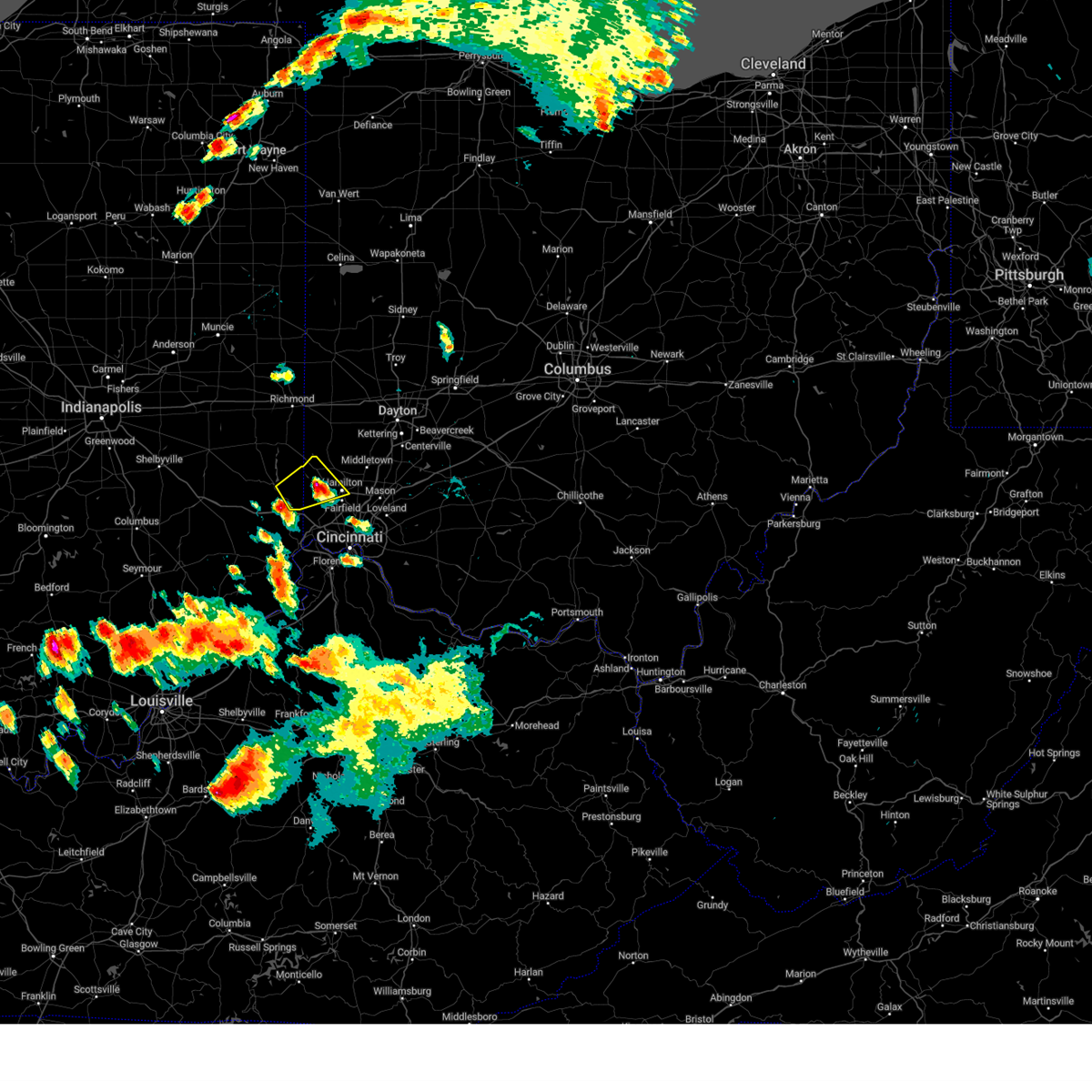 The severe thunderstorm warning for southeastern franklin and western butler counties will expire at 745 pm edt, the storm which prompted the warning has weakened below severe limits, and no longer poses an immediate threat to life or property. therefore, the warning will be allowed to expire. however small hail is still possible with this thunderstorm. a tornado watch remains in effect until 1100 pm edt for southeastern and east central indiana, and southwestern and west central ohio. please report previous wind damage or hail to the national weather service by going to our website at weather.gov/iln and submitting your report via social media. The severe thunderstorm warning for southeastern franklin and western butler counties will expire at 745 pm edt, the storm which prompted the warning has weakened below severe limits, and no longer poses an immediate threat to life or property. therefore, the warning will be allowed to expire. however small hail is still possible with this thunderstorm. a tornado watch remains in effect until 1100 pm edt for southeastern and east central indiana, and southwestern and west central ohio. please report previous wind damage or hail to the national weather service by going to our website at weather.gov/iln and submitting your report via social media.
|
| 6/25/2023 7:33 PM EDT |
 At 732 pm edt, a severe thunderstorm was located near oxford, moving northeast at 50 mph (radar indicated). Hazards include quarter size hail. Minor damage to vehicles is possible. locations impacted include, hamilton, oxford, darrtown, reily, millville, scipio, cedar grove, mount carmel, okeana, rockdale, mixersville, mcgonigle, sharptown, st. charles, new trenton, alert and layhigh. hail threat, radar indicated max hail size, 1. 00 in wind threat, radar indicated max wind gust, <50 mph. At 732 pm edt, a severe thunderstorm was located near oxford, moving northeast at 50 mph (radar indicated). Hazards include quarter size hail. Minor damage to vehicles is possible. locations impacted include, hamilton, oxford, darrtown, reily, millville, scipio, cedar grove, mount carmel, okeana, rockdale, mixersville, mcgonigle, sharptown, st. charles, new trenton, alert and layhigh. hail threat, radar indicated max hail size, 1. 00 in wind threat, radar indicated max wind gust, <50 mph.
|
| 6/25/2023 7:33 PM EDT |
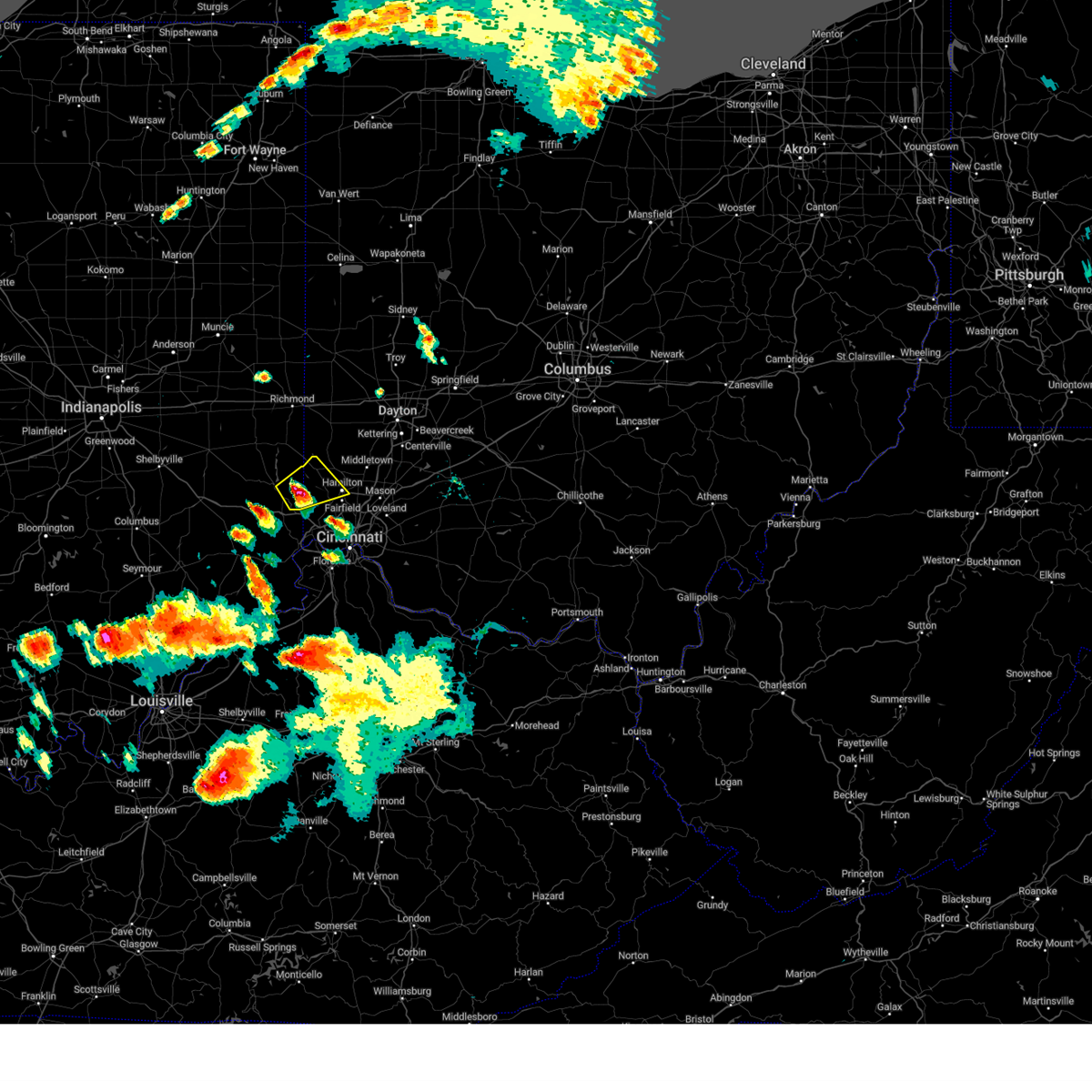 At 732 pm edt, a severe thunderstorm was located near oxford, moving northeast at 50 mph (radar indicated). Hazards include quarter size hail. Minor damage to vehicles is possible. locations impacted include, hamilton, oxford, darrtown, reily, millville, scipio, cedar grove, mount carmel, okeana, rockdale, mixersville, mcgonigle, sharptown, st. charles, new trenton, alert and layhigh. hail threat, radar indicated max hail size, 1. 00 in wind threat, radar indicated max wind gust, <50 mph. At 732 pm edt, a severe thunderstorm was located near oxford, moving northeast at 50 mph (radar indicated). Hazards include quarter size hail. Minor damage to vehicles is possible. locations impacted include, hamilton, oxford, darrtown, reily, millville, scipio, cedar grove, mount carmel, okeana, rockdale, mixersville, mcgonigle, sharptown, st. charles, new trenton, alert and layhigh. hail threat, radar indicated max hail size, 1. 00 in wind threat, radar indicated max wind gust, <50 mph.
|
| 6/25/2023 7:25 PM EDT |
 At 725 pm edt, a severe thunderstorm was located near brookville, moving northeast at 55 mph (radar indicated). Hazards include quarter size hail. Minor damage to vehicles is possible. locations impacted include, hamilton, oxford, brookville, west college corner, darrtown, reily, millville, st. leon, scipio, college corner, cedar grove, mount carmel, mounds state recreation area, cottage grove, rockdale, mcgonigle, sharptown, layhigh, charlottesville and hueston woods state park. hail threat, radar indicated max hail size, 1. 00 in wind threat, radar indicated max wind gust, <50 mph. At 725 pm edt, a severe thunderstorm was located near brookville, moving northeast at 55 mph (radar indicated). Hazards include quarter size hail. Minor damage to vehicles is possible. locations impacted include, hamilton, oxford, brookville, west college corner, darrtown, reily, millville, st. leon, scipio, college corner, cedar grove, mount carmel, mounds state recreation area, cottage grove, rockdale, mcgonigle, sharptown, layhigh, charlottesville and hueston woods state park. hail threat, radar indicated max hail size, 1. 00 in wind threat, radar indicated max wind gust, <50 mph.
|
| 6/25/2023 7:25 PM EDT |
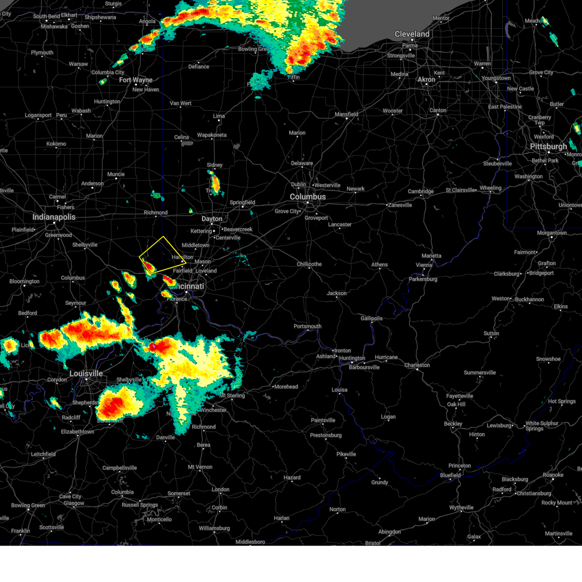 At 725 pm edt, a severe thunderstorm was located near brookville, moving northeast at 55 mph (radar indicated). Hazards include quarter size hail. Minor damage to vehicles is possible. locations impacted include, hamilton, oxford, brookville, west college corner, darrtown, reily, millville, st. leon, scipio, college corner, cedar grove, mount carmel, mounds state recreation area, cottage grove, rockdale, mcgonigle, sharptown, layhigh, charlottesville and hueston woods state park. hail threat, radar indicated max hail size, 1. 00 in wind threat, radar indicated max wind gust, <50 mph. At 725 pm edt, a severe thunderstorm was located near brookville, moving northeast at 55 mph (radar indicated). Hazards include quarter size hail. Minor damage to vehicles is possible. locations impacted include, hamilton, oxford, brookville, west college corner, darrtown, reily, millville, st. leon, scipio, college corner, cedar grove, mount carmel, mounds state recreation area, cottage grove, rockdale, mcgonigle, sharptown, layhigh, charlottesville and hueston woods state park. hail threat, radar indicated max hail size, 1. 00 in wind threat, radar indicated max wind gust, <50 mph.
|
| 6/25/2023 7:19 PM EDT |
 At 719 pm edt, a severe thunderstorm was located near brookville, moving northeast at 55 mph (radar indicated). Hazards include quarter size hail. minor damage to vehicles is possible At 719 pm edt, a severe thunderstorm was located near brookville, moving northeast at 55 mph (radar indicated). Hazards include quarter size hail. minor damage to vehicles is possible
|
| 2/27/2023 2:27 PM EST |
 At 226 pm est, a severe thunderstorm capable of producing a tornado was located over darrtown, moving northeast at 55 mph (radar indicated rotation). Hazards include tornado and quarter size hail. Flying debris will be dangerous to those caught without shelter. mobile homes will be damaged or destroyed. damage to roofs, windows, and vehicles will occur. tree damage is likely. Locations impacted include, oxford, gratis, seven mile, darrtown, somerville, west elkton, jacksonburg and collinsville. At 226 pm est, a severe thunderstorm capable of producing a tornado was located over darrtown, moving northeast at 55 mph (radar indicated rotation). Hazards include tornado and quarter size hail. Flying debris will be dangerous to those caught without shelter. mobile homes will be damaged or destroyed. damage to roofs, windows, and vehicles will occur. tree damage is likely. Locations impacted include, oxford, gratis, seven mile, darrtown, somerville, west elkton, jacksonburg and collinsville.
|
| 2/27/2023 2:21 PM EST |
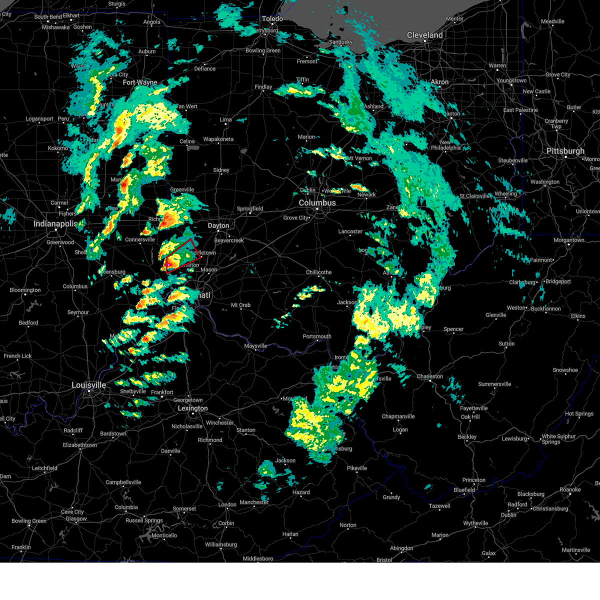 At 220 pm est, a severe thunderstorm capable of producing a tornado was located near oxford, moving northeast at 55 mph (radar indicated rotation). Hazards include tornado and quarter size hail. Flying debris will be dangerous to those caught without shelter. mobile homes will be damaged or destroyed. damage to roofs, windows, and vehicles will occur. tree damage is likely. locations impacted include, hamilton, oxford, trenton, gratis, seven mile, darrtown, reily, scipio, somerville, west elkton, jacksonburg, collinsville, mcgonigle and st. Charles. At 220 pm est, a severe thunderstorm capable of producing a tornado was located near oxford, moving northeast at 55 mph (radar indicated rotation). Hazards include tornado and quarter size hail. Flying debris will be dangerous to those caught without shelter. mobile homes will be damaged or destroyed. damage to roofs, windows, and vehicles will occur. tree damage is likely. locations impacted include, hamilton, oxford, trenton, gratis, seven mile, darrtown, reily, scipio, somerville, west elkton, jacksonburg, collinsville, mcgonigle and st. Charles.
|
| 2/27/2023 2:17 PM EST | Half Dollar sized hail reported 4.2 miles NE of Oxford, OH, photo verified. time estimated from radar. |
| 2/27/2023 2:12 PM EST |
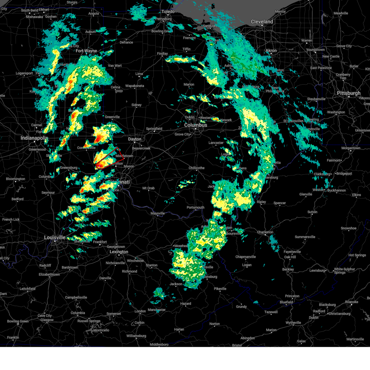 At 212 pm est, a severe thunderstorm capable of producing a tornado was located near brookville, moving northeast at 55 mph (radar indicated rotation). Hazards include tornado and quarter size hail. Flying debris will be dangerous to those caught without shelter. mobile homes will be damaged or destroyed. damage to roofs, windows, and vehicles will occur. Tree damage is likely. At 212 pm est, a severe thunderstorm capable of producing a tornado was located near brookville, moving northeast at 55 mph (radar indicated rotation). Hazards include tornado and quarter size hail. Flying debris will be dangerous to those caught without shelter. mobile homes will be damaged or destroyed. damage to roofs, windows, and vehicles will occur. Tree damage is likely.
|
| 9/21/2022 6:38 PM EDT |
 At 638 pm edt, a severe thunderstorm was located near oxford, moving east at 20 mph (radar indicated). Hazards include 60 mph wind gusts and quarter size hail. Minor hail damage to vehicles is possible. expect wind damage to trees and power lines. locations impacted include, hamilton, fairfield, oxford, seven mile, williamsdale, darrtown, reily, new miami, millville, scipio, collinsville, mcgonigle, st. charles and layhigh. hail threat, radar indicated max hail size, 1. 00 in wind threat, radar indicated max wind gust, 60 mph. At 638 pm edt, a severe thunderstorm was located near oxford, moving east at 20 mph (radar indicated). Hazards include 60 mph wind gusts and quarter size hail. Minor hail damage to vehicles is possible. expect wind damage to trees and power lines. locations impacted include, hamilton, fairfield, oxford, seven mile, williamsdale, darrtown, reily, new miami, millville, scipio, collinsville, mcgonigle, st. charles and layhigh. hail threat, radar indicated max hail size, 1. 00 in wind threat, radar indicated max wind gust, 60 mph.
|
| 9/21/2022 6:28 PM EDT |
 At 628 pm edt, a severe thunderstorm was located 7 miles east of brookville, moving east at 20 mph (radar indicated). Hazards include 60 mph wind gusts and quarter size hail. Minor hail damage to vehicles is possible. Expect wind damage to trees and power lines. At 628 pm edt, a severe thunderstorm was located 7 miles east of brookville, moving east at 20 mph (radar indicated). Hazards include 60 mph wind gusts and quarter size hail. Minor hail damage to vehicles is possible. Expect wind damage to trees and power lines.
|
| 7/6/2022 2:21 PM EDT |
 At 221 pm edt, a severe thunderstorm was located over darrtown, moving east at 40 mph (radar indicated). Hazards include 60 mph wind gusts. Expect damage to trees and power lines. locations impacted include, hamilton, middletown, fairfield, oxford, monroe, trenton, camden, gratis, seven mile, williamsdale, darrtown, germantown, reily, new miami, millville, college corner, somerville, west elkton, jacksonburg and collinsville. hail threat, radar indicated max hail size, <. 75 in wind threat, radar indicated max wind gust, 60 mph. At 221 pm edt, a severe thunderstorm was located over darrtown, moving east at 40 mph (radar indicated). Hazards include 60 mph wind gusts. Expect damage to trees and power lines. locations impacted include, hamilton, middletown, fairfield, oxford, monroe, trenton, camden, gratis, seven mile, williamsdale, darrtown, germantown, reily, new miami, millville, college corner, somerville, west elkton, jacksonburg and collinsville. hail threat, radar indicated max hail size, <. 75 in wind threat, radar indicated max wind gust, 60 mph.
|
| 7/6/2022 2:01 PM EDT |
 At 201 pm edt, a severe thunderstorm was located near liberty, moving southeast at 40 mph (radar indicated). Hazards include 60 mph wind gusts. expect damage to trees and power lines At 201 pm edt, a severe thunderstorm was located near liberty, moving southeast at 40 mph (radar indicated). Hazards include 60 mph wind gusts. expect damage to trees and power lines
|
| 6/13/2022 5:30 PM EDT |
 At 529 pm edt, a severe thunderstorm was located over darrtown, moving east at 35 mph (radar indicated). Hazards include 70 mph wind gusts and nickel size hail. Expect considerable tree damage. damage is likely to mobile homes, roofs, and outbuildings. locations impacted include, hamilton, fairfield, oxford, eaton, ross, camden, west alexandria, gratis, seven mile, darrtown, dunlap, reily, millville, scipio, college corner, somerville, west elkton, jacksonburg, collinsville and morning sun. thunderstorm damage threat, considerable hail threat, radar indicated max hail size, 0. 88 in wind threat, radar indicated max wind gust, 70 mph. At 529 pm edt, a severe thunderstorm was located over darrtown, moving east at 35 mph (radar indicated). Hazards include 70 mph wind gusts and nickel size hail. Expect considerable tree damage. damage is likely to mobile homes, roofs, and outbuildings. locations impacted include, hamilton, fairfield, oxford, eaton, ross, camden, west alexandria, gratis, seven mile, darrtown, dunlap, reily, millville, scipio, college corner, somerville, west elkton, jacksonburg, collinsville and morning sun. thunderstorm damage threat, considerable hail threat, radar indicated max hail size, 0. 88 in wind threat, radar indicated max wind gust, 70 mph.
|
| 6/13/2022 5:08 PM EDT |
 At 508 pm edt, a severe thunderstorm was located near liberty, moving east at 20 mph (radar indicated). Hazards include 60 mph wind gusts and penny size hail. expect damage to trees and power lines At 508 pm edt, a severe thunderstorm was located near liberty, moving east at 20 mph (radar indicated). Hazards include 60 mph wind gusts and penny size hail. expect damage to trees and power lines
|
| 6/8/2022 5:27 PM EDT |
 At 526 pm edt, a severe thunderstorm was located over liberty, moving east at 30 mph (radar indicated). Hazards include 60 mph wind gusts. Expect damage to trees and power lines. locations impacted include, oxford, liberty, camden, west college corner, salem, college corner, somerville, west elkton, whitewater state park, charlottesville, fairhaven, hueston woods state park, goodwins corner, billingsville, collinsville, cottage grove, clifton, morning sun, wheatville and kitchel. hail threat, radar indicated max hail size, <. 75 in wind threat, radar indicated max wind gust, 60 mph. At 526 pm edt, a severe thunderstorm was located over liberty, moving east at 30 mph (radar indicated). Hazards include 60 mph wind gusts. Expect damage to trees and power lines. locations impacted include, oxford, liberty, camden, west college corner, salem, college corner, somerville, west elkton, whitewater state park, charlottesville, fairhaven, hueston woods state park, goodwins corner, billingsville, collinsville, cottage grove, clifton, morning sun, wheatville and kitchel. hail threat, radar indicated max hail size, <. 75 in wind threat, radar indicated max wind gust, 60 mph.
|
| 6/8/2022 5:17 PM EDT |
 At 517 pm edt, a severe thunderstorm was located near liberty, moving east at 30 mph (radar indicated). Hazards include 60 mph wind gusts and penny size hail. expect damage to trees and power lines At 517 pm edt, a severe thunderstorm was located near liberty, moving east at 30 mph (radar indicated). Hazards include 60 mph wind gusts and penny size hail. expect damage to trees and power lines
|
| 6/6/2022 4:11 PM EDT |
 The severe thunderstorm warning for eastern franklin county in southeastern indiana, southeastern union county in east central indiana, north central dearborn county in southeastern indiana, southwestern preble county in west central ohio and northwestern butler counties in southwestern ohio will expire at 415 pm edt, the severe thunderstorm which prompted the warning has weakened. therefore, the warning will be allowed to expire. however gusty winds and heavy rain are still possible with this thunderstorm. please report previous wind damage or hail to the national weather service by going to our website at weather.gov/iln and submitting your report via social media. The severe thunderstorm warning for eastern franklin county in southeastern indiana, southeastern union county in east central indiana, north central dearborn county in southeastern indiana, southwestern preble county in west central ohio and northwestern butler counties in southwestern ohio will expire at 415 pm edt, the severe thunderstorm which prompted the warning has weakened. therefore, the warning will be allowed to expire. however gusty winds and heavy rain are still possible with this thunderstorm. please report previous wind damage or hail to the national weather service by going to our website at weather.gov/iln and submitting your report via social media.
|
| 6/6/2022 4:11 PM EDT |
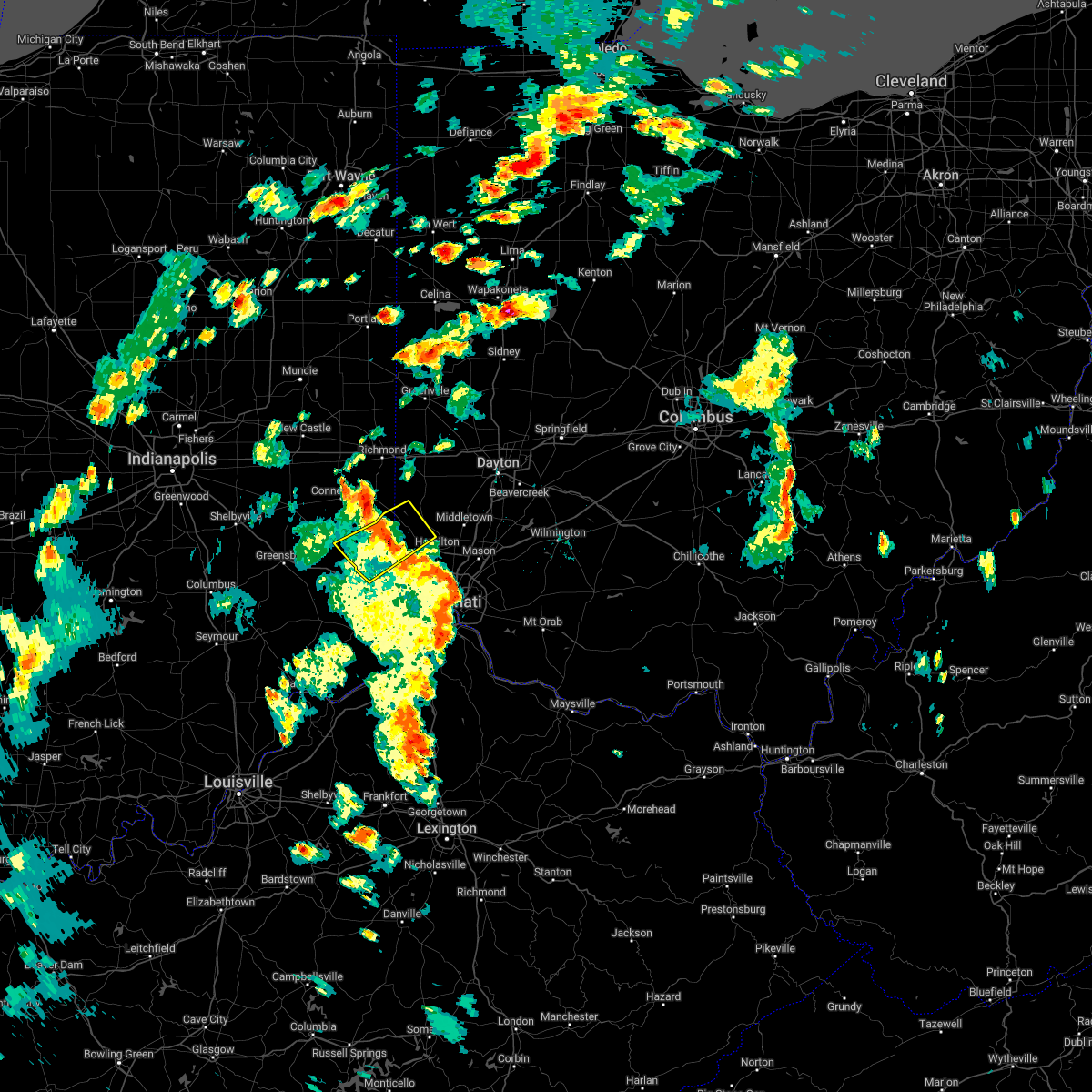 The severe thunderstorm warning for eastern franklin county in southeastern indiana, southeastern union county in east central indiana, north central dearborn county in southeastern indiana, southwestern preble county in west central ohio and northwestern butler counties in southwestern ohio will expire at 415 pm edt, the severe thunderstorm which prompted the warning has weakened. therefore, the warning will be allowed to expire. however gusty winds and heavy rain are still possible with this thunderstorm. please report previous wind damage or hail to the national weather service by going to our website at weather.gov/iln and submitting your report via social media. The severe thunderstorm warning for eastern franklin county in southeastern indiana, southeastern union county in east central indiana, north central dearborn county in southeastern indiana, southwestern preble county in west central ohio and northwestern butler counties in southwestern ohio will expire at 415 pm edt, the severe thunderstorm which prompted the warning has weakened. therefore, the warning will be allowed to expire. however gusty winds and heavy rain are still possible with this thunderstorm. please report previous wind damage or hail to the national weather service by going to our website at weather.gov/iln and submitting your report via social media.
|
| 6/6/2022 3:50 PM EDT |
 At 350 pm edt, a severe thunderstorm was located near brookville, moving northeast at 45 mph (radar indicated). Hazards include 60 mph wind gusts. Expect damage to trees and power lines. locations impacted include, hamilton, oxford, brookville, west college corner, oldenburg, darrtown, reily, metamora, st. leon, scipio, college corner, cedar grove, mount carmel, mounds state recreation area, morning sun, rockdale, peppertown, mcgonigle, sharptown and saint peter. this includes i-74 in indiana between mile markers 158 and 165. hail threat, radar indicated max hail size, <. 75 in wind threat, radar indicated max wind gust, 60 mph. At 350 pm edt, a severe thunderstorm was located near brookville, moving northeast at 45 mph (radar indicated). Hazards include 60 mph wind gusts. Expect damage to trees and power lines. locations impacted include, hamilton, oxford, brookville, west college corner, oldenburg, darrtown, reily, metamora, st. leon, scipio, college corner, cedar grove, mount carmel, mounds state recreation area, morning sun, rockdale, peppertown, mcgonigle, sharptown and saint peter. this includes i-74 in indiana between mile markers 158 and 165. hail threat, radar indicated max hail size, <. 75 in wind threat, radar indicated max wind gust, 60 mph.
|
| 6/6/2022 3:32 PM EDT |
 At 332 pm edt, a severe thunderstorm was located near batesville, moving northeast at 45 mph (radar indicated). Hazards include 60 mph wind gusts. expect damage to trees and power lines At 332 pm edt, a severe thunderstorm was located near batesville, moving northeast at 45 mph (radar indicated). Hazards include 60 mph wind gusts. expect damage to trees and power lines
|
| 5/21/2022 5:26 PM EDT |
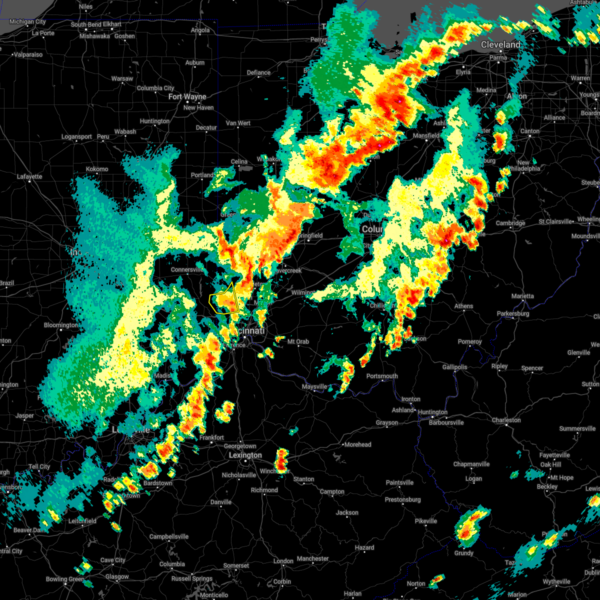 The severe thunderstorm warning for east central franklin and western butler counties will expire at 530 pm edt, the storm which prompted the warning has weakened below severe limits, and no longer poses an immediate threat to life or property. therefore, the warning will be allowed to expire. however heavy rain is still possible with this thunderstorm. a severe thunderstorm watch remains in effect until 700 pm edt for southeastern indiana, and southwestern and west central ohio. please report previous wind damage or hail to the national weather service by going to our website at weather.gov/iln and submitting your report via social media. The severe thunderstorm warning for east central franklin and western butler counties will expire at 530 pm edt, the storm which prompted the warning has weakened below severe limits, and no longer poses an immediate threat to life or property. therefore, the warning will be allowed to expire. however heavy rain is still possible with this thunderstorm. a severe thunderstorm watch remains in effect until 700 pm edt for southeastern indiana, and southwestern and west central ohio. please report previous wind damage or hail to the national weather service by going to our website at weather.gov/iln and submitting your report via social media.
|
| 5/21/2022 5:14 PM EDT |
 At 514 pm edt, a severe thunderstorm was located near darrtown, moving east at 50 mph (radar indicated). Hazards include 60 mph wind gusts and quarter size hail. Minor hail damage to vehicles is possible. expect wind damage to trees and power lines. locations impacted include, hamilton, fairfield, oxford, ross, darrtown, reily, millville, scipio, mount carmel, okeana, mcgonigle, st. charles, alert and layhigh. hail threat, radar indicated max hail size, 1. 00 in wind threat, radar indicated max wind gust, 60 mph. At 514 pm edt, a severe thunderstorm was located near darrtown, moving east at 50 mph (radar indicated). Hazards include 60 mph wind gusts and quarter size hail. Minor hail damage to vehicles is possible. expect wind damage to trees and power lines. locations impacted include, hamilton, fairfield, oxford, ross, darrtown, reily, millville, scipio, mount carmel, okeana, mcgonigle, st. charles, alert and layhigh. hail threat, radar indicated max hail size, 1. 00 in wind threat, radar indicated max wind gust, 60 mph.
|
| 5/21/2022 5:14 PM EDT |
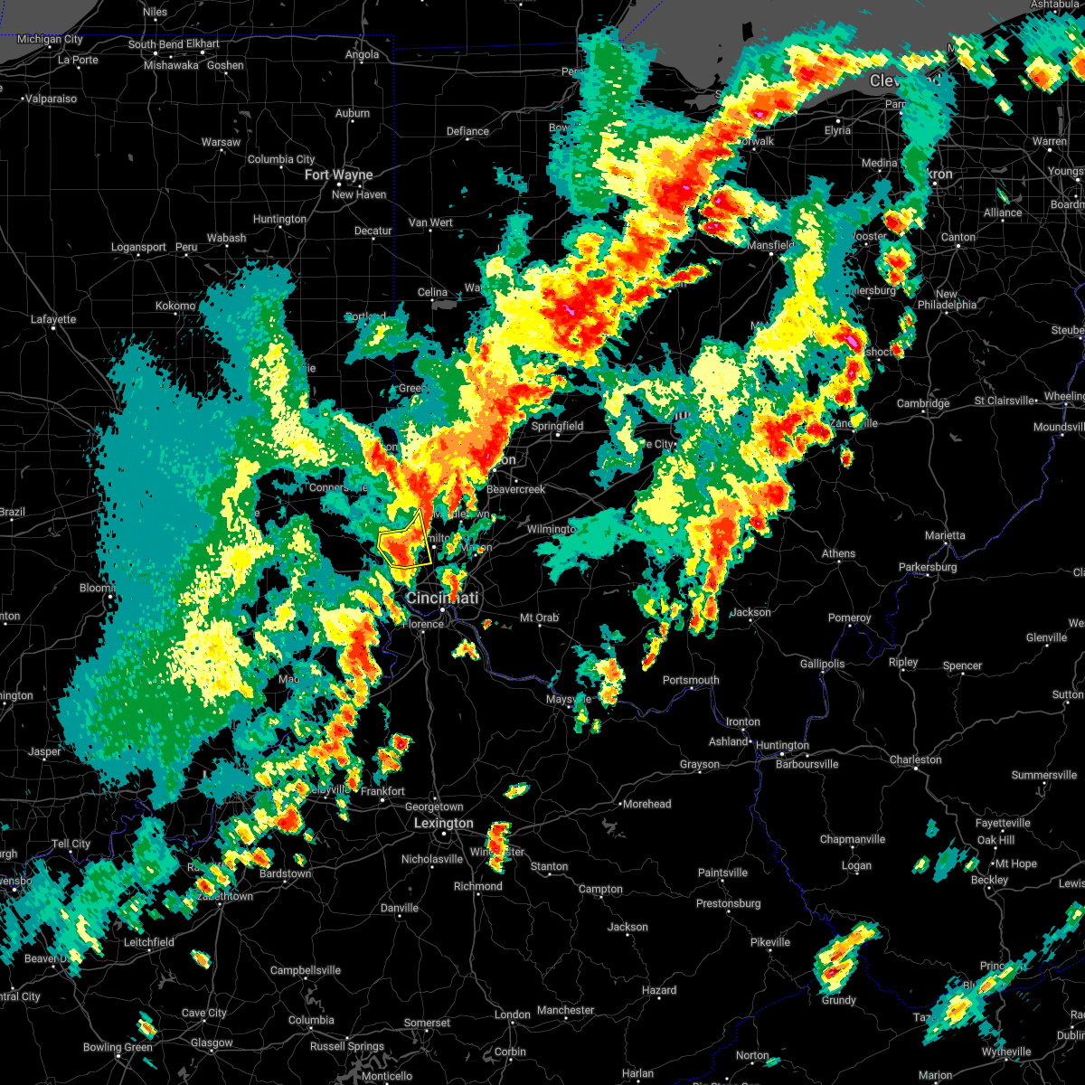 At 514 pm edt, a severe thunderstorm was located near darrtown, moving east at 50 mph (radar indicated). Hazards include 60 mph wind gusts and quarter size hail. Minor hail damage to vehicles is possible. expect wind damage to trees and power lines. locations impacted include, hamilton, fairfield, oxford, ross, darrtown, reily, millville, scipio, mount carmel, okeana, mcgonigle, st. charles, alert and layhigh. hail threat, radar indicated max hail size, 1. 00 in wind threat, radar indicated max wind gust, 60 mph. At 514 pm edt, a severe thunderstorm was located near darrtown, moving east at 50 mph (radar indicated). Hazards include 60 mph wind gusts and quarter size hail. Minor hail damage to vehicles is possible. expect wind damage to trees and power lines. locations impacted include, hamilton, fairfield, oxford, ross, darrtown, reily, millville, scipio, mount carmel, okeana, mcgonigle, st. charles, alert and layhigh. hail threat, radar indicated max hail size, 1. 00 in wind threat, radar indicated max wind gust, 60 mph.
|
| 5/21/2022 5:02 PM EDT |
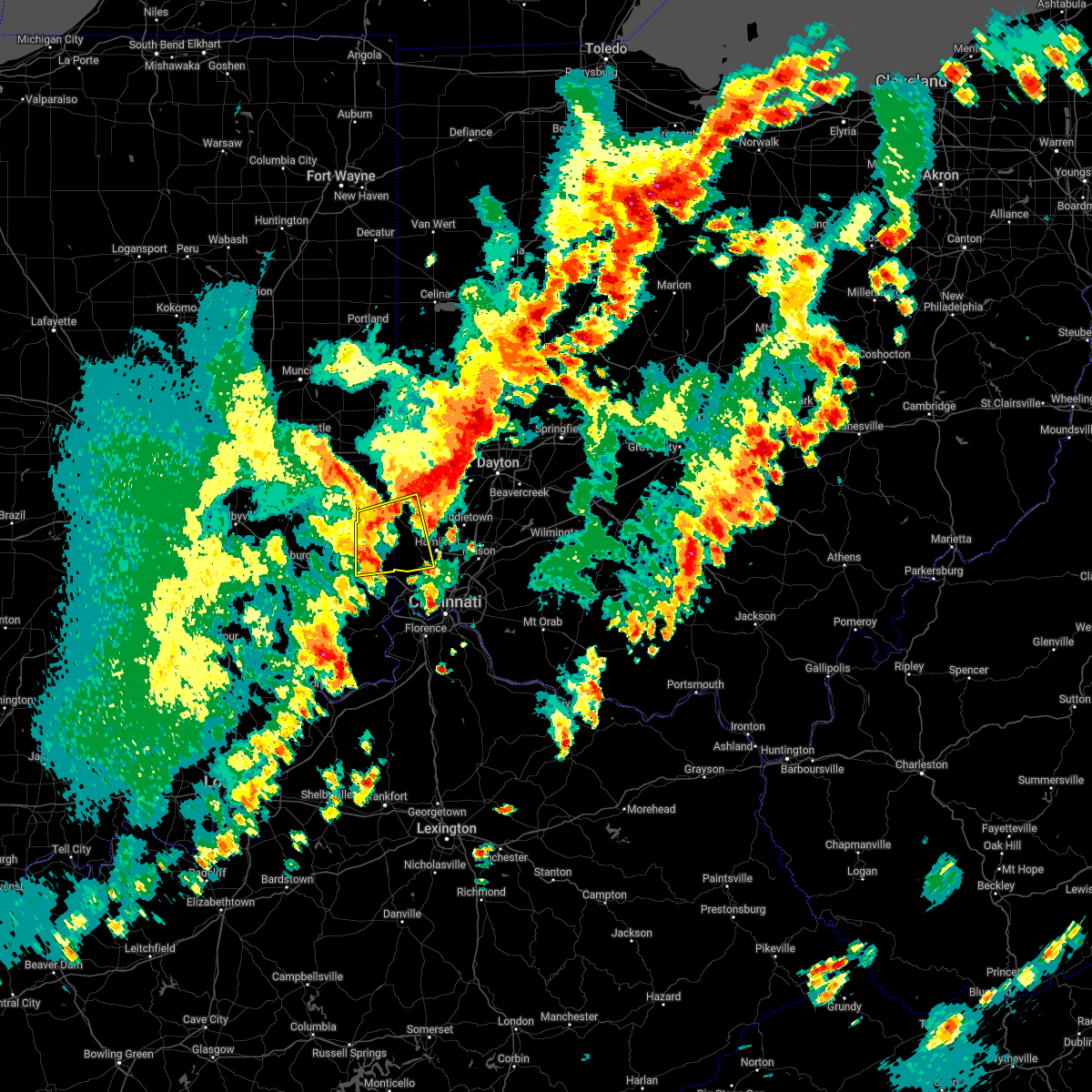 At 501 pm edt, a severe thunderstorm was located near oxford, moving east at 45 mph (radar indicated). Hazards include 60 mph wind gusts and quarter size hail. Minor hail damage to vehicles is possible. expect wind damage to trees and power lines. locations impacted include, hamilton, fairfield, oxford, brookville, ross, west college corner, darrtown, salem, reily, millville, st. leon, scipio, college corner, cedar grove, mount carmel, mounds state recreation area, cottage grove, morning sun, rockdale and mcgonigle. this includes i-74 in indiana between mile markers 159 and 162. hail threat, radar indicated max hail size, 1. 00 in wind threat, radar indicated max wind gust, 60 mph. At 501 pm edt, a severe thunderstorm was located near oxford, moving east at 45 mph (radar indicated). Hazards include 60 mph wind gusts and quarter size hail. Minor hail damage to vehicles is possible. expect wind damage to trees and power lines. locations impacted include, hamilton, fairfield, oxford, brookville, ross, west college corner, darrtown, salem, reily, millville, st. leon, scipio, college corner, cedar grove, mount carmel, mounds state recreation area, cottage grove, morning sun, rockdale and mcgonigle. this includes i-74 in indiana between mile markers 159 and 162. hail threat, radar indicated max hail size, 1. 00 in wind threat, radar indicated max wind gust, 60 mph.
|
| 5/21/2022 4:47 PM EDT |
 At 447 pm edt, a severe thunderstorm was located over brookville, moving east at 40 mph (radar indicated). Hazards include 70 mph wind gusts and quarter size hail. Minor hail damage to vehicles is possible. expect considerable tree damage. wind damage is also likely to mobile homes, roofs, and outbuildings. locations impacted include, hamilton, fairfield, oxford, batesville, brookville, ross, west college corner, oldenburg, darrtown, lake santee, salem, reily, blooming grove, metamora, millville, st. leon, laurel, scipio, college corner and cedar grove. this includes i-74 in indiana between mile markers 145 and 162. thunderstorm damage threat, considerable hail threat, radar indicated max hail size, 1. 00 in wind threat, radar indicated max wind gust, 70 mph. At 447 pm edt, a severe thunderstorm was located over brookville, moving east at 40 mph (radar indicated). Hazards include 70 mph wind gusts and quarter size hail. Minor hail damage to vehicles is possible. expect considerable tree damage. wind damage is also likely to mobile homes, roofs, and outbuildings. locations impacted include, hamilton, fairfield, oxford, batesville, brookville, ross, west college corner, oldenburg, darrtown, lake santee, salem, reily, blooming grove, metamora, millville, st. leon, laurel, scipio, college corner and cedar grove. this includes i-74 in indiana between mile markers 145 and 162. thunderstorm damage threat, considerable hail threat, radar indicated max hail size, 1. 00 in wind threat, radar indicated max wind gust, 70 mph.
|
| 5/21/2022 4:39 PM EDT |
 At 439 pm edt, a severe thunderstorm was located over lake santee, moving east at 45 mph (radar indicated). Hazards include 60 mph wind gusts and quarter size hail. Minor hail damage to vehicles is possible. Expect wind damage to trees and power lines. At 439 pm edt, a severe thunderstorm was located over lake santee, moving east at 45 mph (radar indicated). Hazards include 60 mph wind gusts and quarter size hail. Minor hail damage to vehicles is possible. Expect wind damage to trees and power lines.
|
| 3/23/2022 2:44 PM EDT |
 At 244 pm edt, a severe thunderstorm was located near camden, moving northeast at 45 mph (radar indicated). Hazards include 60 mph wind gusts and penny size hail. expect damage to trees and power lines At 244 pm edt, a severe thunderstorm was located near camden, moving northeast at 45 mph (radar indicated). Hazards include 60 mph wind gusts and penny size hail. expect damage to trees and power lines
|
| 6/18/2021 8:39 PM EDT |
 At 839 pm edt, severe thunderstorms were located along a line extending from near camden to ross, moving east at 35 mph (radar indicated). Hazards include 60 mph wind gusts. expect damage to trees and power lines At 839 pm edt, severe thunderstorms were located along a line extending from near camden to ross, moving east at 35 mph (radar indicated). Hazards include 60 mph wind gusts. expect damage to trees and power lines
|
| 6/3/2020 8:56 PM EDT | Storm damage reported in butler county OH, 1.7 miles ENE of Oxford, OH |
| 6/3/2020 8:52 PM EDT |
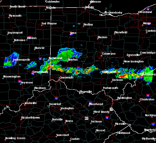 At 850 pm edt, a severe thunderstorm was located over west college corner, moving east at 25 mph (radar indicated). Hazards include 60 mph wind gusts and quarter size hail. Minor hail damage to vehicles is possible. Expect wind damage to trees and power lines. At 850 pm edt, a severe thunderstorm was located over west college corner, moving east at 25 mph (radar indicated). Hazards include 60 mph wind gusts and quarter size hail. Minor hail damage to vehicles is possible. Expect wind damage to trees and power lines.
|
| 6/3/2020 7:36 PM EDT |
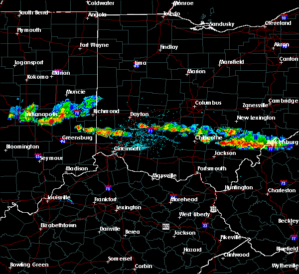 At 736 pm edt, a severe thunderstorm was located over oxford, moving east at 25 mph (radar indicated). Hazards include 60 mph wind gusts and quarter size hail. Minor hail damage to vehicles is possible. expect wind damage to trees and power lines. Locations impacted include, oxford, darrtown, college corner, collinsville and mcgonigle. At 736 pm edt, a severe thunderstorm was located over oxford, moving east at 25 mph (radar indicated). Hazards include 60 mph wind gusts and quarter size hail. Minor hail damage to vehicles is possible. expect wind damage to trees and power lines. Locations impacted include, oxford, darrtown, college corner, collinsville and mcgonigle.
|
| 6/3/2020 7:22 PM EDT |
 At 722 pm edt, a severe thunderstorm was located over west college corner, moving east at 25 mph (radar indicated). Hazards include 60 mph wind gusts and quarter size hail. Minor hail damage to vehicles is possible. Expect wind damage to trees and power lines. At 722 pm edt, a severe thunderstorm was located over west college corner, moving east at 25 mph (radar indicated). Hazards include 60 mph wind gusts and quarter size hail. Minor hail damage to vehicles is possible. Expect wind damage to trees and power lines.
|
| 6/3/2020 7:22 PM EDT |
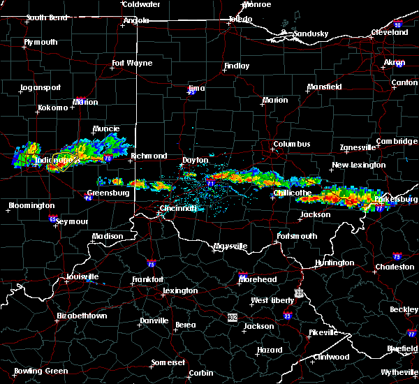 At 722 pm edt, a severe thunderstorm was located over west college corner, moving east at 25 mph (radar indicated). Hazards include 60 mph wind gusts and quarter size hail. Minor hail damage to vehicles is possible. Expect wind damage to trees and power lines. At 722 pm edt, a severe thunderstorm was located over west college corner, moving east at 25 mph (radar indicated). Hazards include 60 mph wind gusts and quarter size hail. Minor hail damage to vehicles is possible. Expect wind damage to trees and power lines.
|
| 5/10/2020 3:20 PM EDT |
 At 320 pm edt, severe thunderstorms were located along a line extending from near pleasant hill to darrtown, moving northeast at 60 mph (radar indicated). Hazards include 60 mph wind gusts and penny size hail. Expect damage to trees and power lines. Locations impacted include, dayton, hamilton, trotwood, oxford, trenton, eaton, camden, west alexandria, gratis, seven mile, williamsdale, darrtown, germantown, new lebanon, new miami, farmersville, somerville, west elkton, jacksonburg and collinsville. At 320 pm edt, severe thunderstorms were located along a line extending from near pleasant hill to darrtown, moving northeast at 60 mph (radar indicated). Hazards include 60 mph wind gusts and penny size hail. Expect damage to trees and power lines. Locations impacted include, dayton, hamilton, trotwood, oxford, trenton, eaton, camden, west alexandria, gratis, seven mile, williamsdale, darrtown, germantown, new lebanon, new miami, farmersville, somerville, west elkton, jacksonburg and collinsville.
|
| 5/10/2020 3:08 PM EDT |
 At 307 pm edt, severe thunderstorms were located along a line extending from near arcanum to 7 miles southwest of oxford, moving northeast at 55 mph (radar indicated). Hazards include 60 mph wind gusts and penny size hail. Expect damage to trees and power lines. Locations impacted include, dayton, hamilton, trotwood, oxford, trenton, eaton, camden, west alexandria, gratis, seven mile, west college corner, williamsdale, darrtown, germantown, new lebanon, reily, new miami, farmersville, college corner and somerville. At 307 pm edt, severe thunderstorms were located along a line extending from near arcanum to 7 miles southwest of oxford, moving northeast at 55 mph (radar indicated). Hazards include 60 mph wind gusts and penny size hail. Expect damage to trees and power lines. Locations impacted include, dayton, hamilton, trotwood, oxford, trenton, eaton, camden, west alexandria, gratis, seven mile, west college corner, williamsdale, darrtown, germantown, new lebanon, reily, new miami, farmersville, college corner and somerville.
|
| 5/10/2020 2:55 PM EDT | Large tree broken in hal in butler county OH, 2.6 miles E of Oxford, OH |
| 5/10/2020 2:52 PM EDT |
 At 251 pm edt, severe thunderstorms were located along a line extending from near richmond to near brookville, moving northeast at 60 mph (radar indicated). Hazards include 60 mph wind gusts and penny size hail. expect damage to trees and power lines At 251 pm edt, severe thunderstorms were located along a line extending from near richmond to near brookville, moving northeast at 60 mph (radar indicated). Hazards include 60 mph wind gusts and penny size hail. expect damage to trees and power lines
|
| 4/8/2020 10:18 PM EDT |
 At 1018 pm edt, a severe thunderstorm was located over williamsdale, moving east at 55 mph (radar indicated). Hazards include 70 mph wind gusts and quarter size hail. Minor hail damage to vehicles is possible. expect considerable tree damage. wind damage is also likely to mobile homes, roofs, and outbuildings. locations impacted include, hamilton, fairfield, trotwood, oxford, forest park, monroe, trenton, springdale, eaton, ross, camden, lewisburg, west alexandria, gratis, seven mile, darrtown, williamsdale, dunlap, clayton and union. this includes i-70 in ohio between mile markers 12 and 25. A tornado watch remains in effect until 200 am edt for southeastern indiana, and southwestern and west central ohio. At 1018 pm edt, a severe thunderstorm was located over williamsdale, moving east at 55 mph (radar indicated). Hazards include 70 mph wind gusts and quarter size hail. Minor hail damage to vehicles is possible. expect considerable tree damage. wind damage is also likely to mobile homes, roofs, and outbuildings. locations impacted include, hamilton, fairfield, trotwood, oxford, forest park, monroe, trenton, springdale, eaton, ross, camden, lewisburg, west alexandria, gratis, seven mile, darrtown, williamsdale, dunlap, clayton and union. this includes i-70 in ohio between mile markers 12 and 25. A tornado watch remains in effect until 200 am edt for southeastern indiana, and southwestern and west central ohio.
|
| 4/8/2020 10:03 PM EDT |
 At 1003 pm edt, a severe thunderstorm was located near camden, moving east at 55 mph (radar indicated). Hazards include 70 mph wind gusts and quarter size hail. Minor hail damage to vehicles is possible. expect considerable tree damage. wind damage is also likely to mobile homes, roofs, and outbuildings. locations impacted include, hamilton, fairfield, trotwood, oxford, forest park, monroe, trenton, springdale, eaton, ross, camden, lewisburg, new paris, west alexandria, gratis, seven mile, west college corner, darrtown, williamsdale and dunlap. this includes i-70 in ohio between mile markers 1 and 25. A tornado watch remains in effect until 200 am edt for southeastern and east central indiana, and southwestern and west central ohio. At 1003 pm edt, a severe thunderstorm was located near camden, moving east at 55 mph (radar indicated). Hazards include 70 mph wind gusts and quarter size hail. Minor hail damage to vehicles is possible. expect considerable tree damage. wind damage is also likely to mobile homes, roofs, and outbuildings. locations impacted include, hamilton, fairfield, trotwood, oxford, forest park, monroe, trenton, springdale, eaton, ross, camden, lewisburg, new paris, west alexandria, gratis, seven mile, west college corner, darrtown, williamsdale and dunlap. this includes i-70 in ohio between mile markers 1 and 25. A tornado watch remains in effect until 200 am edt for southeastern and east central indiana, and southwestern and west central ohio.
|
| 4/8/2020 9:42 PM EDT |
 At 942 pm edt, a severe thunderstorm was located near connersville, moving east at 50 mph (radar indicated). Hazards include 70 mph wind gusts and quarter size hail. Minor hail damage to vehicles is possible. expect considerable tree damage. Wind damage is also likely to mobile homes, roofs, and outbuildings. At 942 pm edt, a severe thunderstorm was located near connersville, moving east at 50 mph (radar indicated). Hazards include 70 mph wind gusts and quarter size hail. Minor hail damage to vehicles is possible. expect considerable tree damage. Wind damage is also likely to mobile homes, roofs, and outbuildings.
|
| 3/20/2020 3:35 AM EDT |
 At 335 am edt, a severe thunderstorm was located near camden, moving east at 55 mph (radar indicated). Hazards include ping pong ball size hail and 60 mph wind gusts. People and animals outdoors will be injured. expect hail damage to roofs, siding, windows, and vehicles. expect wind damage to trees and power lines. Locations impacted include, camden, west alexandria, gratis, seven mile, darrtown, somerville, west elkton, jacksonburg, wheatville, muttonville, collinsville and lake lakengren. At 335 am edt, a severe thunderstorm was located near camden, moving east at 55 mph (radar indicated). Hazards include ping pong ball size hail and 60 mph wind gusts. People and animals outdoors will be injured. expect hail damage to roofs, siding, windows, and vehicles. expect wind damage to trees and power lines. Locations impacted include, camden, west alexandria, gratis, seven mile, darrtown, somerville, west elkton, jacksonburg, wheatville, muttonville, collinsville and lake lakengren.
|
| 3/20/2020 3:30 AM EDT |
 At 329 am edt, a severe thunderstorm was located near darrtown, moving east at 40 mph (radar indicated). Hazards include ping pong ball size hail and 60 mph wind gusts. People and animals outdoors will be injured. expect hail damage to roofs, siding, windows, and vehicles. expect wind damage to trees and power lines. Locations impacted include, oxford, eaton, camden, west alexandria, gratis, seven mile, darrtown, somerville, west elkton, jacksonburg, fairhaven, hueston woods state park, collinsville, morning sun, wheatville, muttonville, sugar valley and lake lakengren. At 329 am edt, a severe thunderstorm was located near darrtown, moving east at 40 mph (radar indicated). Hazards include ping pong ball size hail and 60 mph wind gusts. People and animals outdoors will be injured. expect hail damage to roofs, siding, windows, and vehicles. expect wind damage to trees and power lines. Locations impacted include, oxford, eaton, camden, west alexandria, gratis, seven mile, darrtown, somerville, west elkton, jacksonburg, fairhaven, hueston woods state park, collinsville, morning sun, wheatville, muttonville, sugar valley and lake lakengren.
|
| 3/20/2020 3:16 AM EDT |
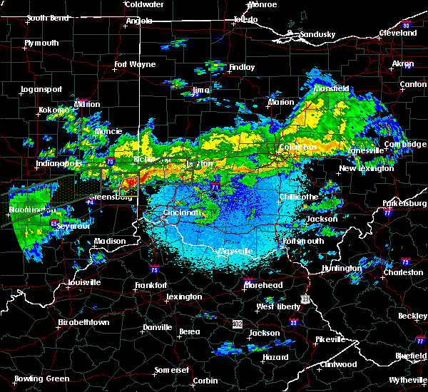 At 316 am edt, a severe thunderstorm was located over west college corner, moving east at 55 mph (radar indicated). Hazards include ping pong ball size hail and 60 mph wind gusts. People and animals outdoors will be injured. expect hail damage to roofs, siding, windows, and vehicles. Expect wind damage to trees and power lines. At 316 am edt, a severe thunderstorm was located over west college corner, moving east at 55 mph (radar indicated). Hazards include ping pong ball size hail and 60 mph wind gusts. People and animals outdoors will be injured. expect hail damage to roofs, siding, windows, and vehicles. Expect wind damage to trees and power lines.
|
| 7/21/2019 5:55 PM EDT | Several reports of trees down on brookville road and stillwell-beckett road. time estimated from rada in butler county OH, 2.4 miles ENE of Oxford, OH |
| 6/5/2019 6:11 PM EDT |
 The severe thunderstorm warning for east central franklin and western butler counties will expire at 615 pm edt, the storm which prompted the warning has weakened below severe limits, and has exited the warned area. therefore, the warning will be allowed to expire. a severe thunderstorm watch remains in effect until 900 pm edt for southeastern indiana, and southwestern and west central ohio. please report previous wind damage or hail to the national weather service by going to our website at weather.gov/iln and submitting your report via social media. The severe thunderstorm warning for east central franklin and western butler counties will expire at 615 pm edt, the storm which prompted the warning has weakened below severe limits, and has exited the warned area. therefore, the warning will be allowed to expire. a severe thunderstorm watch remains in effect until 900 pm edt for southeastern indiana, and southwestern and west central ohio. please report previous wind damage or hail to the national weather service by going to our website at weather.gov/iln and submitting your report via social media.
|
| 6/5/2019 6:11 PM EDT |
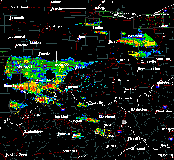 The severe thunderstorm warning for east central franklin and western butler counties will expire at 615 pm edt, the storm which prompted the warning has weakened below severe limits, and has exited the warned area. therefore, the warning will be allowed to expire. a severe thunderstorm watch remains in effect until 900 pm edt for southeastern indiana, and southwestern and west central ohio. please report previous wind damage or hail to the national weather service by going to our website at weather.gov/iln and submitting your report via social media. The severe thunderstorm warning for east central franklin and western butler counties will expire at 615 pm edt, the storm which prompted the warning has weakened below severe limits, and has exited the warned area. therefore, the warning will be allowed to expire. a severe thunderstorm watch remains in effect until 900 pm edt for southeastern indiana, and southwestern and west central ohio. please report previous wind damage or hail to the national weather service by going to our website at weather.gov/iln and submitting your report via social media.
|
| 6/5/2019 5:55 PM EDT |
 At 554 pm edt, a severe thunderstorm was located over darrtown, moving east at 45 mph (radar indicated). Hazards include 60 mph wind gusts and half dollar size hail. Minor hail damage to vehicles is possible. expect wind damage to trees and power lines. locations impacted include, hamilton, oxford, ross, seven mile, darrtown, dunlap, reily, millville, scipio, college corner, somerville, cedar grove, mount carmel, collinsville, okeana, mixersville, mcgonigle, sharptown, st. Charles and alert. At 554 pm edt, a severe thunderstorm was located over darrtown, moving east at 45 mph (radar indicated). Hazards include 60 mph wind gusts and half dollar size hail. Minor hail damage to vehicles is possible. expect wind damage to trees and power lines. locations impacted include, hamilton, oxford, ross, seven mile, darrtown, dunlap, reily, millville, scipio, college corner, somerville, cedar grove, mount carmel, collinsville, okeana, mixersville, mcgonigle, sharptown, st. Charles and alert.
|
| 6/5/2019 5:55 PM EDT |
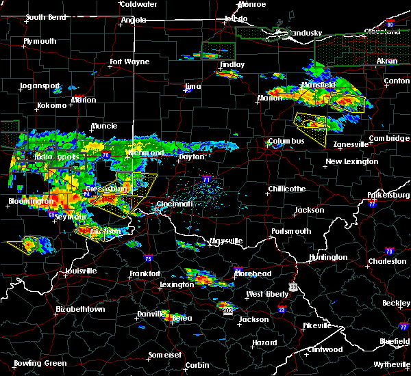 At 554 pm edt, a severe thunderstorm was located over darrtown, moving east at 45 mph (radar indicated). Hazards include 60 mph wind gusts and half dollar size hail. Minor hail damage to vehicles is possible. expect wind damage to trees and power lines. locations impacted include, hamilton, oxford, ross, seven mile, darrtown, dunlap, reily, millville, scipio, college corner, somerville, cedar grove, mount carmel, collinsville, okeana, mixersville, mcgonigle, sharptown, st. Charles and alert. At 554 pm edt, a severe thunderstorm was located over darrtown, moving east at 45 mph (radar indicated). Hazards include 60 mph wind gusts and half dollar size hail. Minor hail damage to vehicles is possible. expect wind damage to trees and power lines. locations impacted include, hamilton, oxford, ross, seven mile, darrtown, dunlap, reily, millville, scipio, college corner, somerville, cedar grove, mount carmel, collinsville, okeana, mixersville, mcgonigle, sharptown, st. Charles and alert.
|
| 6/5/2019 5:43 PM EDT |
 At 543 pm edt, a severe thunderstorm was located near west college corner, moving east at 45 mph (radar indicated). Hazards include 60 mph wind gusts and half dollar size hail. Minor hail damage to vehicles is possible. expect wind damage to trees and power lines. Locations impacted include, hamilton, oxford, brookville, ross, liberty, camden, seven mile, west college corner, darrtown, dunlap, salem, reily, blooming grove, metamora, millville, scipio, college corner, somerville, west elkton and cedar grove. At 543 pm edt, a severe thunderstorm was located near west college corner, moving east at 45 mph (radar indicated). Hazards include 60 mph wind gusts and half dollar size hail. Minor hail damage to vehicles is possible. expect wind damage to trees and power lines. Locations impacted include, hamilton, oxford, brookville, ross, liberty, camden, seven mile, west college corner, darrtown, dunlap, salem, reily, blooming grove, metamora, millville, scipio, college corner, somerville, west elkton and cedar grove.
|
| 6/5/2019 5:28 PM EDT |
 At 528 pm edt, a severe thunderstorm was located 7 miles southeast of connersville, moving east at 40 mph (radar indicated). Hazards include 70 mph wind gusts and half dollar size hail. Minor hail damage to vehicles is possible. expect considerable tree damage. Wind damage is also likely to mobile homes, roofs, and outbuildings. At 528 pm edt, a severe thunderstorm was located 7 miles southeast of connersville, moving east at 40 mph (radar indicated). Hazards include 70 mph wind gusts and half dollar size hail. Minor hail damage to vehicles is possible. expect considerable tree damage. Wind damage is also likely to mobile homes, roofs, and outbuildings.
|
| 5/1/2019 6:40 PM EDT |
 The severe thunderstorm warning for eastern franklin county in southeastern indiana, southeastern union county in east central indiana and northwestern butler counties in southwestern ohio will expire at 645 pm edt, the storm which prompted the warning has weakened below severe limits, and no longer poses an immediate threat to life or property. therefore, the warning will be allowed to expire. please report previous wind damage or hail to the national weather service by going to our website at weather.gov/iln and submitting your report via social media. The severe thunderstorm warning for eastern franklin county in southeastern indiana, southeastern union county in east central indiana and northwestern butler counties in southwestern ohio will expire at 645 pm edt, the storm which prompted the warning has weakened below severe limits, and no longer poses an immediate threat to life or property. therefore, the warning will be allowed to expire. please report previous wind damage or hail to the national weather service by going to our website at weather.gov/iln and submitting your report via social media.
|
| 5/1/2019 6:40 PM EDT |
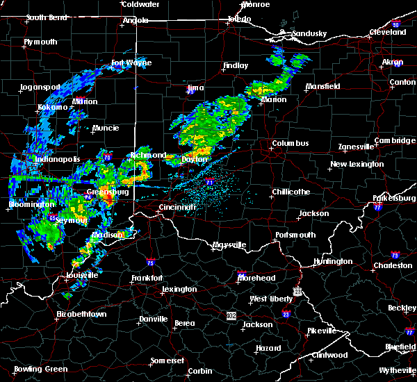 The severe thunderstorm warning for eastern franklin county in southeastern indiana, southeastern union county in east central indiana and northwestern butler counties in southwestern ohio will expire at 645 pm edt, the storm which prompted the warning has weakened below severe limits, and no longer poses an immediate threat to life or property. therefore, the warning will be allowed to expire. please report previous wind damage or hail to the national weather service by going to our website at weather.gov/iln and submitting your report via social media. The severe thunderstorm warning for eastern franklin county in southeastern indiana, southeastern union county in east central indiana and northwestern butler counties in southwestern ohio will expire at 645 pm edt, the storm which prompted the warning has weakened below severe limits, and no longer poses an immediate threat to life or property. therefore, the warning will be allowed to expire. please report previous wind damage or hail to the national weather service by going to our website at weather.gov/iln and submitting your report via social media.
|
| 5/1/2019 6:27 PM EDT |
 At 626 pm edt, a severe thunderstorm was located over brookville, moving northeast at 40 mph (radar indicated). Hazards include 60 mph wind gusts and quarter size hail. Minor hail damage to vehicles is possible. expect wind damage to trees and power lines. locations impacted include, hamilton, oxford, brookville, west college corner, darrtown, reily, mcgonigle, sharptown, st. Charles and saint peter. At 626 pm edt, a severe thunderstorm was located over brookville, moving northeast at 40 mph (radar indicated). Hazards include 60 mph wind gusts and quarter size hail. Minor hail damage to vehicles is possible. expect wind damage to trees and power lines. locations impacted include, hamilton, oxford, brookville, west college corner, darrtown, reily, mcgonigle, sharptown, st. Charles and saint peter.
|
| 5/1/2019 6:15 PM EDT |
 At 615 pm edt, a severe thunderstorm was located near oldenburg, moving northeast at 40 mph (radar indicated). Hazards include 60 mph wind gusts and quarter size hail. Minor hail damage to vehicles is possible. Expect wind damage to trees and power lines. At 615 pm edt, a severe thunderstorm was located near oldenburg, moving northeast at 40 mph (radar indicated). Hazards include 60 mph wind gusts and quarter size hail. Minor hail damage to vehicles is possible. Expect wind damage to trees and power lines.
|
| 5/31/2018 3:36 PM EDT |
 A severe thunderstorm warning remains in effect until 400 pm edt for ohio. eastern franklin. dearborn. northeastern switzerland. kenton. campbell. boone. gallatin. hamilton and butler counties. At 335 pm edt, severe thunderstorms were located along a line extending from near brookville to near lawrenceburg to near patriot,. A severe thunderstorm warning remains in effect until 400 pm edt for ohio. eastern franklin. dearborn. northeastern switzerland. kenton. campbell. boone. gallatin. hamilton and butler counties. At 335 pm edt, severe thunderstorms were located along a line extending from near brookville to near lawrenceburg to near patriot,.
|
| 5/31/2018 3:36 PM EDT |
 At 335 pm edt, severe thunderstorms were located along a line extending from near brookville to near lawrenceburg to near patriot, moving northeast at 45 mph (radar indicated). Hazards include 70 mph wind gusts. Expect considerable tree damage. damage is likely to mobile homes, roofs, and outbuildings. locations impacted include, cincinnati, hamilton, fairfield, covington, florence, independence, oxford, norwood, forest park, erlanger, fort thomas, newport, sharonville, blue ash, springdale, reading, harrison, north college hill, madeira and edgewood. this includes the following interstates, i-71 in kentucky between mile markers 55 and 77. i-71 in ohio between mile markers 0 and 12. i-74 in indiana between mile markers 158 and 171. i-74 in ohio between mile markers 0 and 19. i-75 in kentucky between mile markers 167 and 191. I-75 in ohio between mile markers 0 and 18. At 335 pm edt, severe thunderstorms were located along a line extending from near brookville to near lawrenceburg to near patriot, moving northeast at 45 mph (radar indicated). Hazards include 70 mph wind gusts. Expect considerable tree damage. damage is likely to mobile homes, roofs, and outbuildings. locations impacted include, cincinnati, hamilton, fairfield, covington, florence, independence, oxford, norwood, forest park, erlanger, fort thomas, newport, sharonville, blue ash, springdale, reading, harrison, north college hill, madeira and edgewood. this includes the following interstates, i-71 in kentucky between mile markers 55 and 77. i-71 in ohio between mile markers 0 and 12. i-74 in indiana between mile markers 158 and 171. i-74 in ohio between mile markers 0 and 19. i-75 in kentucky between mile markers 167 and 191. I-75 in ohio between mile markers 0 and 18.
|
| 5/31/2018 3:13 PM EDT |
 At 313 pm edt, severe thunderstorms were located along a line extending from near batesville to near dillsboro to near vevay, moving northeast at 45 mph (radar indicated). Hazards include 70 mph wind gusts. Expect considerable tree damage. Damage is likely to mobile homes, roofs, and outbuildings. At 313 pm edt, severe thunderstorms were located along a line extending from near batesville to near dillsboro to near vevay, moving northeast at 45 mph (radar indicated). Hazards include 70 mph wind gusts. Expect considerable tree damage. Damage is likely to mobile homes, roofs, and outbuildings.
|
| 5/31/2018 3:13 PM EDT |
 The national weather service in wilmington has issued a * severe thunderstorm warning for. ohio county in southeastern indiana. franklin county in southeastern indiana. ripley county in southeastern indiana. Dearborn county in southeastern indiana. The national weather service in wilmington has issued a * severe thunderstorm warning for. ohio county in southeastern indiana. franklin county in southeastern indiana. ripley county in southeastern indiana. Dearborn county in southeastern indiana.
|
| 5/31/2018 3:13 PM EDT |
 At 313 pm edt, severe thunderstorms were located along a line extending from near batesville to near dillsboro to near vevay, moving northeast at 45 mph (radar indicated). Hazards include 70 mph wind gusts. Expect considerable tree damage. Damage is likely to mobile homes, roofs, and outbuildings. At 313 pm edt, severe thunderstorms were located along a line extending from near batesville to near dillsboro to near vevay, moving northeast at 45 mph (radar indicated). Hazards include 70 mph wind gusts. Expect considerable tree damage. Damage is likely to mobile homes, roofs, and outbuildings.
|
| 5/13/2018 8:44 PM EDT |
 At 844 pm edt, a severe thunderstorm was located over darrtown, moving east at 25 mph (radar indicated). Hazards include 60 mph wind gusts and quarter size hail. Minor hail damage to vehicles is possible. expect wind damage to trees and power lines. Locations impacted include, hamilton, fairfield, oxford, monroe, trenton, seven mile, williamsdale, darrtown, reily, new miami, millville, somerville, west elkton, jacksonburg, collinsville, maustown and mcgonigle. At 844 pm edt, a severe thunderstorm was located over darrtown, moving east at 25 mph (radar indicated). Hazards include 60 mph wind gusts and quarter size hail. Minor hail damage to vehicles is possible. expect wind damage to trees and power lines. Locations impacted include, hamilton, fairfield, oxford, monroe, trenton, seven mile, williamsdale, darrtown, reily, new miami, millville, somerville, west elkton, jacksonburg, collinsville, maustown and mcgonigle.
|
| 5/13/2018 8:36 PM EDT | One small tree down on nichols road and us 27 in butler county OH, 3.4 miles NW of Oxford, OH |
| 5/13/2018 8:35 PM EDT |
 At 835 pm edt, a severe thunderstorm was located over oxford, moving east at 25 mph (radar indicated). Hazards include 60 mph wind gusts and quarter size hail. Minor hail damage to vehicles is possible. expect wind damage to trees and power lines. Locations impacted include, hamilton, fairfield, oxford, monroe, trenton, seven mile, williamsdale, darrtown, reily, new miami, millville, somerville, west elkton, jacksonburg, hueston woods state park, collinsville, maustown and mcgonigle. At 835 pm edt, a severe thunderstorm was located over oxford, moving east at 25 mph (radar indicated). Hazards include 60 mph wind gusts and quarter size hail. Minor hail damage to vehicles is possible. expect wind damage to trees and power lines. Locations impacted include, hamilton, fairfield, oxford, monroe, trenton, seven mile, williamsdale, darrtown, reily, new miami, millville, somerville, west elkton, jacksonburg, hueston woods state park, collinsville, maustown and mcgonigle.
|
| 5/13/2018 8:33 PM EDT |
 At 835 pm edt, a severe thunderstorm was located over oxford, moving east at 25 mph (radar indicated). Hazards include 60 mph wind gusts and quarter size hail. Minor hail damage to vehicles is possible. expect wind damage to trees and power lines. Locations impacted include, hamilton, fairfield, oxford, monroe, trenton, seven mile, williamsdale, darrtown, reily, new miami, millville, somerville, west elkton, jacksonburg, hueston woods state park, collinsville, maustown and mcgonigle. At 835 pm edt, a severe thunderstorm was located over oxford, moving east at 25 mph (radar indicated). Hazards include 60 mph wind gusts and quarter size hail. Minor hail damage to vehicles is possible. expect wind damage to trees and power lines. Locations impacted include, hamilton, fairfield, oxford, monroe, trenton, seven mile, williamsdale, darrtown, reily, new miami, millville, somerville, west elkton, jacksonburg, hueston woods state park, collinsville, maustown and mcgonigle.
|
| 4/3/2018 3:53 PM EDT |
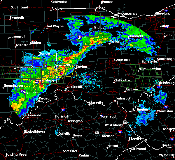 The severe thunderstorm warning for northeastern franklin county in southeastern indiana, southeastern union county in east central indiana, southwestern preble county in west central ohio and northwestern butler counties in southwestern ohio will expire at 400 pm edt, the storm which prompted the warning has moved out of the area. therefore, the warning will be allowed to expire. severe thunderstorm warning 7 remains in effect downstream of the storm. a tornado watch remains in effect until 800 pm edt for southeastern and east central indiana, and southwestern and west central ohio. please report previous wind damage or hail to the national weather service by going to our website at weather.gov/iln and submitting your report via social media. The severe thunderstorm warning for northeastern franklin county in southeastern indiana, southeastern union county in east central indiana, southwestern preble county in west central ohio and northwestern butler counties in southwestern ohio will expire at 400 pm edt, the storm which prompted the warning has moved out of the area. therefore, the warning will be allowed to expire. severe thunderstorm warning 7 remains in effect downstream of the storm. a tornado watch remains in effect until 800 pm edt for southeastern and east central indiana, and southwestern and west central ohio. please report previous wind damage or hail to the national weather service by going to our website at weather.gov/iln and submitting your report via social media.
|
| 4/3/2018 3:45 PM EDT |
 At 345 pm edt, a severe thunderstorm was located near west college corner, moving northeast at 60 mph (radar indicated). Hazards include two inch hail and 60 mph wind gusts. People and animals outdoors will be injured. expect hail damage to roofs, siding, windows, and vehicles. Expect wind damage to trees and power lines. At 345 pm edt, a severe thunderstorm was located near west college corner, moving northeast at 60 mph (radar indicated). Hazards include two inch hail and 60 mph wind gusts. People and animals outdoors will be injured. expect hail damage to roofs, siding, windows, and vehicles. Expect wind damage to trees and power lines.
|
| 4/3/2018 3:39 PM EDT |
 At 339 pm edt, a severe thunderstorm was located over west college corner, moving northeast at 50 mph (radar indicated). Hazards include golf ball size hail and 60 mph wind gusts. People and animals outdoors will be injured. expect hail damage to roofs, siding, windows, and vehicles. expect wind damage to trees and power lines. locations impacted include, oxford, west college corner, darrtown, salem, college corner, charlottesville, fairhaven, hueston woods state park, goodwins corner, billingsville, cottage grove, morning sun, mixersville, sugar valley and lake lakengren. A tornado watch remains in effect until 800 pm edt for southeastern and east central indiana, and southwestern and west central ohio. At 339 pm edt, a severe thunderstorm was located over west college corner, moving northeast at 50 mph (radar indicated). Hazards include golf ball size hail and 60 mph wind gusts. People and animals outdoors will be injured. expect hail damage to roofs, siding, windows, and vehicles. expect wind damage to trees and power lines. locations impacted include, oxford, west college corner, darrtown, salem, college corner, charlottesville, fairhaven, hueston woods state park, goodwins corner, billingsville, cottage grove, morning sun, mixersville, sugar valley and lake lakengren. A tornado watch remains in effect until 800 pm edt for southeastern and east central indiana, and southwestern and west central ohio.
|
| 4/3/2018 3:39 PM EDT |
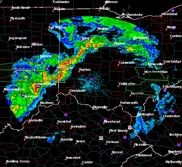 At 339 pm edt, a severe thunderstorm was located over west college corner, moving northeast at 50 mph (radar indicated). Hazards include golf ball size hail and 60 mph wind gusts. People and animals outdoors will be injured. expect hail damage to roofs, siding, windows, and vehicles. expect wind damage to trees and power lines. locations impacted include, oxford, west college corner, darrtown, salem, college corner, charlottesville, fairhaven, hueston woods state park, goodwins corner, billingsville, cottage grove, morning sun, mixersville, sugar valley and lake lakengren. A tornado watch remains in effect until 800 pm edt for southeastern and east central indiana, and southwestern and west central ohio. At 339 pm edt, a severe thunderstorm was located over west college corner, moving northeast at 50 mph (radar indicated). Hazards include golf ball size hail and 60 mph wind gusts. People and animals outdoors will be injured. expect hail damage to roofs, siding, windows, and vehicles. expect wind damage to trees and power lines. locations impacted include, oxford, west college corner, darrtown, salem, college corner, charlottesville, fairhaven, hueston woods state park, goodwins corner, billingsville, cottage grove, morning sun, mixersville, sugar valley and lake lakengren. A tornado watch remains in effect until 800 pm edt for southeastern and east central indiana, and southwestern and west central ohio.
|
| 4/3/2018 3:31 PM EDT |
 At 330 pm edt, a severe thunderstorm was located near brookville, moving northeast at 50 mph (radar indicated). Hazards include 60 mph wind gusts and half dollar size hail. Minor hail damage to vehicles is possible. expect wind damage to trees and power lines. locations impacted include, oxford, brookville, liberty, west college corner, darrtown, salem, reily, college corner, charlottesville, fairhaven, hueston woods state park, goodwins corner, mounds state recreation area, billingsville, cottage grove, morning sun, mixersville, mcgonigle, sugar valley and lake lakengren. A tornado watch remains in effect until 800 pm edt for southeastern and east central indiana, and southwestern and west central ohio. At 330 pm edt, a severe thunderstorm was located near brookville, moving northeast at 50 mph (radar indicated). Hazards include 60 mph wind gusts and half dollar size hail. Minor hail damage to vehicles is possible. expect wind damage to trees and power lines. locations impacted include, oxford, brookville, liberty, west college corner, darrtown, salem, reily, college corner, charlottesville, fairhaven, hueston woods state park, goodwins corner, mounds state recreation area, billingsville, cottage grove, morning sun, mixersville, mcgonigle, sugar valley and lake lakengren. A tornado watch remains in effect until 800 pm edt for southeastern and east central indiana, and southwestern and west central ohio.
|
| 4/3/2018 3:19 PM EDT |
 At 318 pm edt, a severe thunderstorm was located near oldenburg, moving northeast at 50 mph (radar indicated). Hazards include 60 mph wind gusts and quarter size hail. Minor hail damage to vehicles is possible. Expect wind damage to trees and power lines. At 318 pm edt, a severe thunderstorm was located near oldenburg, moving northeast at 50 mph (radar indicated). Hazards include 60 mph wind gusts and quarter size hail. Minor hail damage to vehicles is possible. Expect wind damage to trees and power lines.
|
| 7/11/2017 2:50 PM EDT | Large oak tree branch down on house on south college avenue. photo verified. time estimated from rada in butler county OH, 0.1 miles SSW of Oxford, OH |
| 7/11/2017 2:28 PM EDT |
 At 227 pm edt, showers and embedded severe thunderstorms were located along a line extending from near new madison to near darrtown, moving east at 60 mph (radar indicated). Hazards include 60 mph wind gusts. expect damage to trees and power lines At 227 pm edt, showers and embedded severe thunderstorms were located along a line extending from near new madison to near darrtown, moving east at 60 mph (radar indicated). Hazards include 60 mph wind gusts. expect damage to trees and power lines
|
| 7/11/2017 2:25 PM EDT | Several trees down in the oxford area. time estimate in butler county OH, 0.1 miles SSW of Oxford, OH |
| 7/7/2017 5:49 PM EDT | Numerous trees and power poles down in college corner pik in butler county OH, 1.6 miles SSE of Oxford, OH |
| 7/7/2017 5:43 PM EDT |
 At 543 pm edt, a severe thunderstorm was located near darrtown, moving southeast at 45 mph (radar indicated). Hazards include 60 mph wind gusts and quarter size hail. Minor hail damage to vehicles is possible. expect wind damage to trees and power lines. locations impacted include, hamilton, fairfield, oxford, monroe, trenton, west chester, ross, seven mile, williamsdale, olde west chester, four bridges, wetherington, darrtown, dunlap, reily, new miami, millville, scipio, college corner and hughes. This includes i-75 in ohio between mile markers 18 and 28. At 543 pm edt, a severe thunderstorm was located near darrtown, moving southeast at 45 mph (radar indicated). Hazards include 60 mph wind gusts and quarter size hail. Minor hail damage to vehicles is possible. expect wind damage to trees and power lines. locations impacted include, hamilton, fairfield, oxford, monroe, trenton, west chester, ross, seven mile, williamsdale, olde west chester, four bridges, wetherington, darrtown, dunlap, reily, new miami, millville, scipio, college corner and hughes. This includes i-75 in ohio between mile markers 18 and 28.
|
| 7/7/2017 5:28 PM EDT |
 At 528 pm edt, a severe thunderstorm was located over west college corner, moving southeast at 50 mph (radar indicated). Hazards include 60 mph wind gusts and quarter size hail. Minor hail damage to vehicles is possible. Expect wind damage to trees and power lines. At 528 pm edt, a severe thunderstorm was located over west college corner, moving southeast at 50 mph (radar indicated). Hazards include 60 mph wind gusts and quarter size hail. Minor hail damage to vehicles is possible. Expect wind damage to trees and power lines.
|
| 6/13/2017 12:31 PM EDT | Wires down on riggs road. time estimated by rada in butler county OH, 2.1 miles E of Oxford, OH |
| 6/13/2017 12:29 PM EDT | Quarter sized hail reported 1.1 miles W of Oxford, OH |
| 6/5/2017 3:01 PM EDT |
 At 300 pm edt, a severe thunderstorm was located over seven mile, moving south at 25 mph (radar indicated). Hazards include 60 mph wind gusts. expect damage to roofs, siding, and trees At 300 pm edt, a severe thunderstorm was located over seven mile, moving south at 25 mph (radar indicated). Hazards include 60 mph wind gusts. expect damage to roofs, siding, and trees
|
| 4/5/2017 5:51 PM EDT |
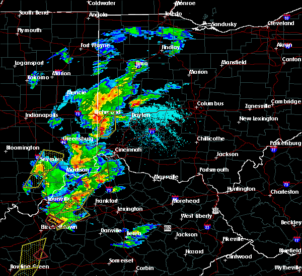 At 551 pm edt, a severe thunderstorm was located over camden, moving northeast at 45 mph (radar indicated). Hazards include 60 mph wind gusts and half dollar size hail. Hail damage to vehicles is expected. expect wind damage to roofs, siding, and trees. locations impacted include, oxford, eaton, camden, lewisburg, west alexandria, gratis, seven mile, darrtown, verona, somerville, west elkton, fairhaven, hueston woods state park, oklahoma, collinsville, morning sun, wheatville, mcgonigle, interstate 70 at us route 127 and muttonville. This includes i-70 in ohio between mile markers 9 and 17. At 551 pm edt, a severe thunderstorm was located over camden, moving northeast at 45 mph (radar indicated). Hazards include 60 mph wind gusts and half dollar size hail. Hail damage to vehicles is expected. expect wind damage to roofs, siding, and trees. locations impacted include, oxford, eaton, camden, lewisburg, west alexandria, gratis, seven mile, darrtown, verona, somerville, west elkton, fairhaven, hueston woods state park, oklahoma, collinsville, morning sun, wheatville, mcgonigle, interstate 70 at us route 127 and muttonville. This includes i-70 in ohio between mile markers 9 and 17.
|
| 4/5/2017 5:44 PM EDT | Numerous trees down in oxford township. time estimated from rada in butler county OH, 0.1 miles SSW of Oxford, OH |
| 4/5/2017 5:40 PM EDT |
 At 540 pm edt, a severe thunderstorm was located near oxford, moving northeast at 45 mph (radar indicated). Hazards include 60 mph wind gusts and quarter size hail. Hail damage to vehicles is expected. Expect wind damage to roofs, siding, and trees. At 540 pm edt, a severe thunderstorm was located near oxford, moving northeast at 45 mph (radar indicated). Hazards include 60 mph wind gusts and quarter size hail. Hail damage to vehicles is expected. Expect wind damage to roofs, siding, and trees.
|
| 4/5/2017 5:38 PM EDT |
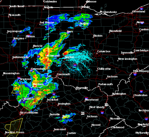 At 538 pm edt, a severe thunderstorm was located near oxford, moving northeast at 50 mph (radar indicated). Hazards include 60 mph wind gusts and quarter size hail. Hail damage to vehicles is expected. expect wind damage to roofs, siding, and trees. Locations impacted include, oxford, west college corner, salem, reily, college corner, mount carmel, charlottesville, fairhaven, hueston woods state park, goodwins corner, cottage grove, morning sun, mixersville and kitchel. At 538 pm edt, a severe thunderstorm was located near oxford, moving northeast at 50 mph (radar indicated). Hazards include 60 mph wind gusts and quarter size hail. Hail damage to vehicles is expected. expect wind damage to roofs, siding, and trees. Locations impacted include, oxford, west college corner, salem, reily, college corner, mount carmel, charlottesville, fairhaven, hueston woods state park, goodwins corner, cottage grove, morning sun, mixersville and kitchel.
|
| 4/5/2017 5:25 PM EDT |
 At 524 pm edt, a severe thunderstorm was located near brookville, moving northeast at 55 mph (radar indicated). Hazards include 60 mph wind gusts and quarter size hail. Hail damage to vehicles is expected. Expect wind damage to roofs, siding, and trees. At 524 pm edt, a severe thunderstorm was located near brookville, moving northeast at 55 mph (radar indicated). Hazards include 60 mph wind gusts and quarter size hail. Hail damage to vehicles is expected. Expect wind damage to roofs, siding, and trees.
|
| 3/1/2017 6:30 AM EST |
 At 629 am est, severe thunderstorms were located along a line extending from near oxford to near harrison to near moores hill, moving east at 65 mph (radar indicated). Hazards include 60 mph wind gusts and half dollar size hail. Hail damage to vehicles is expected. Expect wind damage to roofs, siding, and trees. At 629 am est, severe thunderstorms were located along a line extending from near oxford to near harrison to near moores hill, moving east at 65 mph (radar indicated). Hazards include 60 mph wind gusts and half dollar size hail. Hail damage to vehicles is expected. Expect wind damage to roofs, siding, and trees.
|
| 2/24/2017 6:34 PM EST |
 At 634 pm est, a severe thunderstorm was located near camden, moving northeast at 45 mph (radar indicated). Hazards include 60 mph wind gusts and quarter size hail. Hail damage to vehicles is expected. expect wind damage to roofs, siding, and trees. locations impacted include, richmond, oxford, eaton, camden, lewisburg, new paris, west alexandria, gratis, west college corner, darrtown, eldorado, west manchester, college corner, somerville, west elkton, boston, richmond municipal airport, goodwins corner, oklahoma and west florence. this includes the following interstates, i-70 in indiana between mile markers 155 and 156. I-70 in ohio between mile markers 0 and 17. At 634 pm est, a severe thunderstorm was located near camden, moving northeast at 45 mph (radar indicated). Hazards include 60 mph wind gusts and quarter size hail. Hail damage to vehicles is expected. expect wind damage to roofs, siding, and trees. locations impacted include, richmond, oxford, eaton, camden, lewisburg, new paris, west alexandria, gratis, west college corner, darrtown, eldorado, west manchester, college corner, somerville, west elkton, boston, richmond municipal airport, goodwins corner, oklahoma and west florence. this includes the following interstates, i-70 in indiana between mile markers 155 and 156. I-70 in ohio between mile markers 0 and 17.
|
| 2/24/2017 6:19 PM EST |
 At 619 pm est, a severe thunderstorm was located over liberty, moving northeast at 45 mph (radar indicated). Hazards include 60 mph wind gusts and quarter size hail. Hail damage to vehicles is expected. Expect wind damage to roofs, siding, and trees. At 619 pm est, a severe thunderstorm was located over liberty, moving northeast at 45 mph (radar indicated). Hazards include 60 mph wind gusts and quarter size hail. Hail damage to vehicles is expected. Expect wind damage to roofs, siding, and trees.
|
| 1/10/2017 9:14 PM EST |
 At 912 pm est, severe thunderstorms were located along a line extending from near west alexandria to 7 miles west of bright to 12 miles east of vernon, moving southeast at 45 mph. strong to severe winds can be expected to continue for 20 minutes after the rain ends (radar indicated). Hazards include 60 mph wind gusts. Expect damage to roofs, siding, and trees. locations impacted include, dayton, hamilton, huber heights, richmond, trotwood, oxford, vandalia, englewood, trenton, harrison, eaton, batesville, moraine, lawrenceburg, greendale, aurora, bright, hidden valley, ross and cleves. this includes the following interstates, i-70 in indiana between mile markers 154 and 156. i-70 in ohio between mile markers 0 and 36. i-74 in indiana between mile markers 145 and 171. i-74 in ohio between mile markers 0 and 7. I-75 in ohio between mile markers 58 and 61. At 912 pm est, severe thunderstorms were located along a line extending from near west alexandria to 7 miles west of bright to 12 miles east of vernon, moving southeast at 45 mph. strong to severe winds can be expected to continue for 20 minutes after the rain ends (radar indicated). Hazards include 60 mph wind gusts. Expect damage to roofs, siding, and trees. locations impacted include, dayton, hamilton, huber heights, richmond, trotwood, oxford, vandalia, englewood, trenton, harrison, eaton, batesville, moraine, lawrenceburg, greendale, aurora, bright, hidden valley, ross and cleves. this includes the following interstates, i-70 in indiana between mile markers 154 and 156. i-70 in ohio between mile markers 0 and 36. i-74 in indiana between mile markers 145 and 171. i-74 in ohio between mile markers 0 and 7. I-75 in ohio between mile markers 58 and 61.
|
| 1/10/2017 9:09 PM EST |
 At 908 pm est, severe thunderstorms were located along a line extending from west alexandria to 9 miles east of batesville to 9 miles east of vernon, moving southeast at 45 mph. strong to severe winds can be expected to continue for 20 minutes after the rain ends (radar indicated). Hazards include 60 mph wind gusts. Expect damage to roofs, siding, and trees. locations impacted include, dayton, hamilton, huber heights, richmond, trotwood, oxford, vandalia, englewood, trenton, harrison, eaton, batesville, moraine, lawrenceburg, greendale, aurora, bright, hidden valley, ross and cleves. this includes the following interstates, i-70 in indiana between mile markers 154 and 156. i-70 in ohio between mile markers 0 and 36. i-74 in indiana between mile markers 145 and 171. i-74 in ohio between mile markers 0 and 7. I-75 in ohio between mile markers 58 and 61. At 908 pm est, severe thunderstorms were located along a line extending from west alexandria to 9 miles east of batesville to 9 miles east of vernon, moving southeast at 45 mph. strong to severe winds can be expected to continue for 20 minutes after the rain ends (radar indicated). Hazards include 60 mph wind gusts. Expect damage to roofs, siding, and trees. locations impacted include, dayton, hamilton, huber heights, richmond, trotwood, oxford, vandalia, englewood, trenton, harrison, eaton, batesville, moraine, lawrenceburg, greendale, aurora, bright, hidden valley, ross and cleves. this includes the following interstates, i-70 in indiana between mile markers 154 and 156. i-70 in ohio between mile markers 0 and 36. i-74 in indiana between mile markers 145 and 171. i-74 in ohio between mile markers 0 and 7. I-75 in ohio between mile markers 58 and 61.
|
| 1/10/2017 8:44 PM EST |
 At 844 pm est, severe thunderstorms were located along a line extending from new paris to lake santee to near north vernon, moving southeast at 45 mph (radar indicated). Hazards include 60 mph wind gusts. expect damage to roofs, siding, and trees At 844 pm est, severe thunderstorms were located along a line extending from new paris to lake santee to near north vernon, moving southeast at 45 mph (radar indicated). Hazards include 60 mph wind gusts. expect damage to roofs, siding, and trees
|
| 1/10/2017 8:36 PM EST |
 At 836 pm est, severe thunderstorms were located along a line extending from near new madison to near connersville to greensburg, moving east at 55 mph (radar indicated). Hazards include 60 mph wind gusts. Expect damage to roofs, siding, and trees. locations impacted include, richmond, oxford, connersville, greenville, eaton, batesville, west milton, brookville, centerville, liberty, arcanum, versailles, camden, milan, lewisburg, new paris, osgood, west alexandria, new madison and fountain city. this includes the following interstates, i-70 in indiana between mile markers 140 and 156. i-70 in ohio between mile markers 0 and 20. I-74 in indiana between mile markers 145 and 164. At 836 pm est, severe thunderstorms were located along a line extending from near new madison to near connersville to greensburg, moving east at 55 mph (radar indicated). Hazards include 60 mph wind gusts. Expect damage to roofs, siding, and trees. locations impacted include, richmond, oxford, connersville, greenville, eaton, batesville, west milton, brookville, centerville, liberty, arcanum, versailles, camden, milan, lewisburg, new paris, osgood, west alexandria, new madison and fountain city. this includes the following interstates, i-70 in indiana between mile markers 140 and 156. i-70 in ohio between mile markers 0 and 20. I-74 in indiana between mile markers 145 and 164.
|
| 1/10/2017 8:06 PM EST |
 At 805 pm est, severe thunderstorms were located along a line extending from 9 miles east of muncie to 9 miles southwest of shelbyville, moving east at 50 mph (radar indicated). Hazards include 60 mph wind gusts. expect damage to roofs, siding, and trees At 805 pm est, severe thunderstorms were located along a line extending from 9 miles east of muncie to 9 miles southwest of shelbyville, moving east at 50 mph (radar indicated). Hazards include 60 mph wind gusts. expect damage to roofs, siding, and trees
|
| 8/27/2016 2:17 PM EDT |
 At 216 pm edt, a severe thunderstorm was located near seven mile, moving northeast at 35 mph (radar indicated). Hazards include 60 mph wind gusts and penny size hail. Expect damage to roofs. siding. and trees. locations impacted include, hamilton, fairfield, oxford, ross, darrtown, dunlap, reily, millville, st. Charles, mcgonigle, mixersville and layhigh. At 216 pm edt, a severe thunderstorm was located near seven mile, moving northeast at 35 mph (radar indicated). Hazards include 60 mph wind gusts and penny size hail. Expect damage to roofs. siding. and trees. locations impacted include, hamilton, fairfield, oxford, ross, darrtown, dunlap, reily, millville, st. Charles, mcgonigle, mixersville and layhigh.
|
| 8/27/2016 2:15 PM EDT |
 At 215 pm edt, a severe thunderstorm was located near seven mile, moving northeast at 30 mph (radar indicated). Hazards include 60 mph wind gusts and penny size hail. Expect damage to roofs. siding. And trees. At 215 pm edt, a severe thunderstorm was located near seven mile, moving northeast at 30 mph (radar indicated). Hazards include 60 mph wind gusts and penny size hail. Expect damage to roofs. siding. And trees.
|
| 8/27/2016 2:00 PM EDT |
 At 159 pm edt, a severe thunderstorm was located near liberty, moving northeast at 30 mph (radar indicated). Hazards include 60 mph wind gusts. Expect damage to roofs. siding. And trees. At 159 pm edt, a severe thunderstorm was located near liberty, moving northeast at 30 mph (radar indicated). Hazards include 60 mph wind gusts. Expect damage to roofs. siding. And trees.
|
| 8/27/2016 1:55 PM EDT |
 At 154 pm edt, a severe thunderstorm was located 8 miles north of harrison, moving northeast at 35 mph (radar indicated). Hazards include 60 mph wind gusts. Expect damage to roofs. siding. And trees. At 154 pm edt, a severe thunderstorm was located 8 miles north of harrison, moving northeast at 35 mph (radar indicated). Hazards include 60 mph wind gusts. Expect damage to roofs. siding. And trees.
|
| 8/27/2016 1:55 PM EDT |
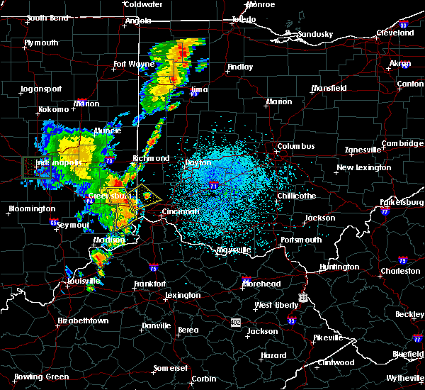 At 154 pm edt, a severe thunderstorm was located 8 miles north of harrison, moving northeast at 35 mph (radar indicated). Hazards include 60 mph wind gusts. Expect damage to roofs. siding. And trees. At 154 pm edt, a severe thunderstorm was located 8 miles north of harrison, moving northeast at 35 mph (radar indicated). Hazards include 60 mph wind gusts. Expect damage to roofs. siding. And trees.
|
| 6/23/2016 4:33 AM EDT |
 At 433 am edt, a severe thunderstorm was located over colerain township, moving southeast at 55 mph (radar indicated). Hazards include 70 mph wind gusts. Expect considerable tree damage. damage is likely to mobile homes, roofs, and outbuildings. locations impacted include, cincinnati, hamilton, fairfield, mason, oxford, norwood, forest park, sharonville, monroe, blue ash, springdale, reading, montgomery, harrison, north college hill, madeira, wyoming, cheviot, mount healthy and deer park. A tornado watch remains in effect until 500 am edt for southeastern indiana, northern kentucky, and southwestern ohio. At 433 am edt, a severe thunderstorm was located over colerain township, moving southeast at 55 mph (radar indicated). Hazards include 70 mph wind gusts. Expect considerable tree damage. damage is likely to mobile homes, roofs, and outbuildings. locations impacted include, cincinnati, hamilton, fairfield, mason, oxford, norwood, forest park, sharonville, monroe, blue ash, springdale, reading, montgomery, harrison, north college hill, madeira, wyoming, cheviot, mount healthy and deer park. A tornado watch remains in effect until 500 am edt for southeastern indiana, northern kentucky, and southwestern ohio.
|
| 6/23/2016 4:28 AM EDT |
 At 428 am edt, a severe thunderstorm was located over ross, moving southeast at 55 mph (radar indicated). Hazards include 70 mph wind gusts. Expect considerable tree damage. damage is likely to mobile homes, roofs, and outbuildings. locations impacted include, cincinnati, hamilton, fairfield, mason, oxford, norwood, forest park, sharonville, monroe, blue ash, springdale, reading, montgomery, harrison, north college hill, madeira, wyoming, cheviot, mount healthy and deer park. A tornado watch remains in effect until 500 am edt for southeastern indiana, northern kentucky, and southwestern ohio. At 428 am edt, a severe thunderstorm was located over ross, moving southeast at 55 mph (radar indicated). Hazards include 70 mph wind gusts. Expect considerable tree damage. damage is likely to mobile homes, roofs, and outbuildings. locations impacted include, cincinnati, hamilton, fairfield, mason, oxford, norwood, forest park, sharonville, monroe, blue ash, springdale, reading, montgomery, harrison, north college hill, madeira, wyoming, cheviot, mount healthy and deer park. A tornado watch remains in effect until 500 am edt for southeastern indiana, northern kentucky, and southwestern ohio.
|
| 6/23/2016 4:15 AM EDT |
 At 415 am edt, a severe thunderstorm was located near brookville, moving southeast at 55 mph (radar indicated). Hazards include 60 mph wind gusts. Expect damage to roofs. siding. And trees. At 415 am edt, a severe thunderstorm was located near brookville, moving southeast at 55 mph (radar indicated). Hazards include 60 mph wind gusts. Expect damage to roofs. siding. And trees.
|
| 6/23/2016 2:55 AM EDT | Large tree and numerous large branches down. time estimate in butler county OH, 0.1 miles SSW of Oxford, OH |
| 6/23/2016 2:44 AM EDT |
 At 244 am edt, severe thunderstorms were located along a line extending from fairborn to near oxford, moving southeast at 60 mph (radar indicated). Hazards include 70 mph wind gusts and penny size hail. Expect considerable tree damage. damage is likely to mobile homes, roofs, and outbuildings. locations impacted include, dayton, hamilton, kettering, middletown, beavercreek, huber heights, richmond, fairborn, xenia, trotwood, oxford, miamisburg, springboro, vandalia, connersville, englewood, monroe, trenton, franklin and eaton. A tornado watch remains in effect until 500 am edt for southeastern and east central indiana, and west central and southwestern ohio. At 244 am edt, severe thunderstorms were located along a line extending from fairborn to near oxford, moving southeast at 60 mph (radar indicated). Hazards include 70 mph wind gusts and penny size hail. Expect considerable tree damage. damage is likely to mobile homes, roofs, and outbuildings. locations impacted include, dayton, hamilton, kettering, middletown, beavercreek, huber heights, richmond, fairborn, xenia, trotwood, oxford, miamisburg, springboro, vandalia, connersville, englewood, monroe, trenton, franklin and eaton. A tornado watch remains in effect until 500 am edt for southeastern and east central indiana, and west central and southwestern ohio.
|
| 6/23/2016 2:23 AM EDT |
 At 222 am edt, severe thunderstorms were located along a line extending from near west milton to near connersville, moving southeast at 60 mph (radar indicated). Hazards include 60 mph wind gusts and penny size hail. Expect damage to roofs. siding. And trees. At 222 am edt, severe thunderstorms were located along a line extending from near west milton to near connersville, moving southeast at 60 mph (radar indicated). Hazards include 60 mph wind gusts and penny size hail. Expect damage to roofs. siding. And trees.
|
| 4/26/2016 6:19 PM EDT |
 At 619 pm edt, severe thunderstorms were located along a line extending from eaton to 6 miles east of greensburg, moving east at 45 mph (radar indicated). Hazards include 60 mph wind gusts and quarter size hail. Hail damage to vehicles is expected. expect wind damage to roofs, siding, and trees. Locations impacted include, dayton, hamilton, kettering, trotwood, oxford, miamisburg, trenton, eaton, batesville, moraine, carlisle, oakwood, brookville, west carrollton, liberty, camden, west alexandria, gratis, seven mile and west college corner. At 619 pm edt, severe thunderstorms were located along a line extending from eaton to 6 miles east of greensburg, moving east at 45 mph (radar indicated). Hazards include 60 mph wind gusts and quarter size hail. Hail damage to vehicles is expected. expect wind damage to roofs, siding, and trees. Locations impacted include, dayton, hamilton, kettering, trotwood, oxford, miamisburg, trenton, eaton, batesville, moraine, carlisle, oakwood, brookville, west carrollton, liberty, camden, west alexandria, gratis, seven mile and west college corner.
|
| 4/26/2016 6:08 PM EDT |
 At 608 pm edt, severe thunderstorms were located along a line extending from near eaton to near greensburg, moving east at 50 mph (radar indicated). Hazards include 60 mph wind gusts and quarter size hail. Hail damage to vehicles is expected. Expect wind damage to roofs, siding, and trees. At 608 pm edt, severe thunderstorms were located along a line extending from near eaton to near greensburg, moving east at 50 mph (radar indicated). Hazards include 60 mph wind gusts and quarter size hail. Hail damage to vehicles is expected. Expect wind damage to roofs, siding, and trees.
|
| 12/23/2015 5:19 PM EST | Storm damage reported in butler county OH, 1.7 miles ENE of Oxford, OH |
| 12/23/2015 4:54 PM EST | Storm damage reported in butler county OH, 1.7 miles ENE of Oxford, OH |
| 12/23/2015 4:49 PM EST | At 449 pm est, radar indicated severe thunderstorms located along a line extending from richmond to near moores hill, moving east at 50 mph. storm hazards include, winds to 60 mph,. |
| 8/3/2015 6:07 PM EDT |
 The severe thunderstorm warning for western butler county will expire at 615 pm edt, the storm which prompted the warning has moved out of the area. therefore the warning will be allowed to expire. please report previous wind damage or hail to the national weather service by going to our website at weather.gov/iln and submit your report via social media. The severe thunderstorm warning for western butler county will expire at 615 pm edt, the storm which prompted the warning has moved out of the area. therefore the warning will be allowed to expire. please report previous wind damage or hail to the national weather service by going to our website at weather.gov/iln and submit your report via social media.
|
| 8/3/2015 5:41 PM EDT |
 At 541 pm edt, radar indicated a severe thunderstorm located over oxford, moving southeast at 25 mph. storm hazards include, winds to 60 mph, half dollar size hail, locations impacted include, hamilton, fairfield, oxford, trenton, ross, seven mile, reily, new miami, millville, college corner, mcgonigle, layhigh, st. charles and collinsville. At 541 pm edt, radar indicated a severe thunderstorm located over oxford, moving southeast at 25 mph. storm hazards include, winds to 60 mph, half dollar size hail, locations impacted include, hamilton, fairfield, oxford, trenton, ross, seven mile, reily, new miami, millville, college corner, mcgonigle, layhigh, st. charles and collinsville.
|
| 8/3/2015 5:30 PM EDT | Quarter sized hail reported 0.1 miles SSW of Oxford, OH |
| 8/3/2015 5:23 PM EDT |
 At 523 pm edt, radar indicated a severe thunderstorm located near west college corner, moving southeast at 20 mph. storm hazards include, winds to 60 mph, half dollar size hail,. At 523 pm edt, radar indicated a severe thunderstorm located near west college corner, moving southeast at 20 mph. storm hazards include, winds to 60 mph, half dollar size hail,.
|
| 8/3/2015 5:23 PM EDT |
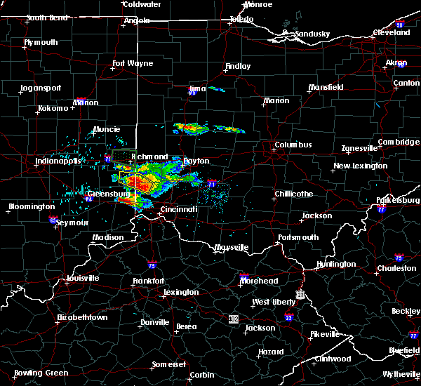 At 523 pm edt, radar indicated a severe thunderstorm located near west college corner, moving southeast at 20 mph. storm hazards include, winds to 60 mph, half dollar size hail,. At 523 pm edt, radar indicated a severe thunderstorm located near west college corner, moving southeast at 20 mph. storm hazards include, winds to 60 mph, half dollar size hail,.
|
| 8/3/2015 5:05 PM EDT |
 At 505 pm edt, radar indicated a severe thunderstorm located over liberty. this storm was nearly stationary. storm hazards include, winds to 60 mph, half dollar size hail, frequent cloud to ground lightning, very heavy rain which may cause minor flooding, locations impacted include, oxford, liberty, west college corner, salem, brownsville, college corner, somerville, fairhaven, dunlapsville, mcgonigle, kitchel, cottage grove, charlottesville, clifton, collinsville, hueston woods state park, morning sun, goodwins corner, mixersville and billingsville. At 505 pm edt, radar indicated a severe thunderstorm located over liberty. this storm was nearly stationary. storm hazards include, winds to 60 mph, half dollar size hail, frequent cloud to ground lightning, very heavy rain which may cause minor flooding, locations impacted include, oxford, liberty, west college corner, salem, brownsville, college corner, somerville, fairhaven, dunlapsville, mcgonigle, kitchel, cottage grove, charlottesville, clifton, collinsville, hueston woods state park, morning sun, goodwins corner, mixersville and billingsville.
|
| 8/3/2015 4:44 PM EDT |
 At 444 pm edt, radar indicated a severe thunderstorm located near connersville, moving east at 25 mph. storm hazards include, winds to 60 mph, quarter size hail, frequent cloud to ground lightning, very heavy rain which may cause minor flooding,. At 444 pm edt, radar indicated a severe thunderstorm located near connersville, moving east at 25 mph. storm hazards include, winds to 60 mph, quarter size hail, frequent cloud to ground lightning, very heavy rain which may cause minor flooding,.
|
| 7/13/2015 1:02 PM EDT |
 At 102 pm edt, radar indicated severe thunderstorms located along a line extending from miamisburg to near oldenburg, moving southeast at 35 mph. storm hazards include, winds to 60 mph, penny size hail, frequent cloud to ground lightning, very heavy rain which may cause minor flooding, locations impacted include, trotwood, oxford, miamisburg, springboro, moraine, carlisle, brookville, liberty, camden, west alexandria, gratis, west college corner, oldenburg, west carrollton city, salem, germantown, new lebanon, blooming grove, farmersville and metamora. At 102 pm edt, radar indicated severe thunderstorms located along a line extending from miamisburg to near oldenburg, moving southeast at 35 mph. storm hazards include, winds to 60 mph, penny size hail, frequent cloud to ground lightning, very heavy rain which may cause minor flooding, locations impacted include, trotwood, oxford, miamisburg, springboro, moraine, carlisle, brookville, liberty, camden, west alexandria, gratis, west college corner, oldenburg, west carrollton city, salem, germantown, new lebanon, blooming grove, farmersville and metamora.
|
| 7/13/2015 12:57 PM EDT |
 At 1257 pm edt, radar indicated severe thunderstorms located along a line extending from near carlisle to near oldenburg, moving southeast at 40 mph. storm hazards include, winds to 60 mph, penny size hail, frequent cloud to ground lightning, very heavy rain which may cause minor flooding,. At 1257 pm edt, radar indicated severe thunderstorms located along a line extending from near carlisle to near oldenburg, moving southeast at 40 mph. storm hazards include, winds to 60 mph, penny size hail, frequent cloud to ground lightning, very heavy rain which may cause minor flooding,.
|
| 7/13/2015 12:44 PM EDT |
 At 1244 pm edt, radar indicated severe thunderstorms located along a line extending from near west carrollton to 9 miles south of glenwood, moving south at 45 mph. storm hazards include, winds to 60 mph, penny size hail, frequent cloud to ground lightning, very heavy rain which may cause minor flooding, locations impacted include, richmond, trotwood, oxford, miamisburg, springboro, connersville, eaton, moraine, carlisle, brookville, liberty, camden, lewisburg, west alexandria, gratis, west college corner, oldenburg, glenwood, west carrollton city and salem. At 1244 pm edt, radar indicated severe thunderstorms located along a line extending from near west carrollton to 9 miles south of glenwood, moving south at 45 mph. storm hazards include, winds to 60 mph, penny size hail, frequent cloud to ground lightning, very heavy rain which may cause minor flooding, locations impacted include, richmond, trotwood, oxford, miamisburg, springboro, connersville, eaton, moraine, carlisle, brookville, liberty, camden, lewisburg, west alexandria, gratis, west college corner, oldenburg, glenwood, west carrollton city and salem.
|
| 7/13/2015 12:25 PM EDT |
 At 1225 pm edt, radar indicated severe thunderstorms located along a line extending from near lewisburg to near dublin, moving southeast at 40 mph. storm hazards include, winds to 60 mph, frequent cloud to ground lightning, very heavy rain which may cause minor flooding,. At 1225 pm edt, radar indicated severe thunderstorms located along a line extending from near lewisburg to near dublin, moving southeast at 40 mph. storm hazards include, winds to 60 mph, frequent cloud to ground lightning, very heavy rain which may cause minor flooding,.
|
| 5/11/2015 2:56 PM EDT | The severe thunderstorm warning for preble, western montgomery and northern butler counties will expire at 300 pm edt, the storms have weakened below severe limits, therefore the severe thunderstorm warning will be allowed to expire. please report previous wind damage or hail to the national weather service by going to our website at weather.gov/iln and submitting your report via social media. |
| 5/11/2015 2:47 PM EDT | At 244 pm edt, radar continued to indicate severe thunderstorms located along a line extending from oklahoma to somerville, moving east at 45 mph. storm hazards include, winds to 60 mph, locations impacted include, lewisburg and trotwood. in addition, somerville, wheatville, west alexandria, gratis, pyrmont, jacksonburg, west elkton and brookville are near the path of these storms. this includes the following interstate, i-70 between mile markers 13 and 27, , <0.75in. |
| 5/11/2015 2:38 PM EDT | At 236 pm edt, radar continued to indicate severe thunderstorms located along a line extending from new hope to oxford, moving east at 45 mph. storm hazards include, winds to 60 mph, locations impacted include, eaton, camden, hamilton, lewisburg, trotwood, monroe and middletown. in addition, mcgonigle, oklahoma, millville, somerville, wheatville, collinsville, west alexandria and new miami are near the path of these storms. this includes the following interstate, i-70 between mile markers 9 and 27, , <0.75in. |
| 5/11/2015 2:31 PM EDT | At 230 pm edt, radar indicated severe thunderstorms located along a line extending from west florence to reily, moving east at 45 mph. storm hazards include, winds to 60 mph,. |
| 5/11/2015 2:31 PM EDT | At 230 pm edt, radar indicated severe thunderstorms located along a line extending from west florence to reily, moving east at 45 mph. storm hazards include, winds to 60 mph,. |
| 4/10/2015 2:59 AM EDT | The national weather service in wilmington has issued a * severe thunderstorm warning for. northwestern clermont county in southwest ohio. western warren county in southwest ohio. hamilton county in southwest ohio. Butler county in southwest ohio. |
| 4/10/2015 2:59 AM EDT | The national weather service in wilmington has issued a * severe thunderstorm warning for. northwestern clermont county in southwest ohio. western warren county in southwest ohio. hamilton county in southwest ohio. Butler county in southwest ohio. |
| 4/9/2015 6:27 PM EDT | The severe thunderstorm warning for hamilton. butler. campbell. boone and kenton counties will expire at 630 pm edt. additional severe thunderstorm warnings have been issued for parts of hamilton. campbell. and butler counties. please report previous wind damage or hail to the national weather service by going to our website at weather. Gov/iln and submitting. |
| 4/9/2015 6:27 PM EDT | The severe thunderstorm warning for hamilton. butler. campbell. boone and kenton counties will expire at 630 pm edt. additional severe thunderstorm warnings have been issued for parts of hamilton. campbell. and butler counties. please report previous wind damage or hail to the national weather service by going to our website at weather. Gov/iln and submitting. |
| 4/9/2015 6:13 PM EDT | A severe thunderstorm warning remains in effect until 630 pm edt for hamilton. butler. campbell. boone and kenton counties. at 608 pm edt. radar continued to indicate a severe thunderstorm located 2 miles northeast of hebron. this storm remains capable of producing golf ball size hail and winds to 60 mph. this storm will affect southern hamilton county. Including downtown. |
| 4/9/2015 6:13 PM EDT | A severe thunderstorm warning remains in effect until 630 pm edt for hamilton. butler. campbell. boone and kenton counties. at 608 pm edt. radar continued to indicate a severe thunderstorm located 2 miles northeast of hebron. this storm remains capable of producing golf ball size hail and winds to 60 mph. this storm will affect southern hamilton county. Including downtown. |
| 4/9/2015 6:07 PM EDT | A severe thunderstorm warning remains in effect until 630 pm edt for hamilton. butler. campbell. boone and kenton counties. at 603 pm edt. radar continued to indicate a severe thunderstorm located near hebron. this storm has strengthened. and is now capable of producing golf ball size hail and 60 mph winds. another severe thunderstorm is located 6 miles west of hamilton. Capable of. |
| 4/9/2015 6:07 PM EDT | A severe thunderstorm warning remains in effect until 630 pm edt for hamilton. butler. campbell. boone and kenton counties. at 603 pm edt. radar continued to indicate a severe thunderstorm located near hebron. this storm has strengthened. and is now capable of producing golf ball size hail and 60 mph winds. another severe thunderstorm is located 6 miles west of hamilton. Capable of. |
| 4/9/2015 5:57 PM EDT | The national weather service in wilmington has issued a * severe thunderstorm warning for. hamilton county in southwest ohio. butler county in southwest ohio. campbell county in northern kentucky. Boone county in northern kentucky. |
| 4/9/2015 5:57 PM EDT | The national weather service in wilmington has issued a * severe thunderstorm warning for. hamilton county in southwest ohio. butler county in southwest ohio. campbell county in northern kentucky. Boone county in northern kentucky. |
| 4/9/2015 5:57 PM EDT | The national weather service in wilmington has issued a * severe thunderstorm warning for. hamilton county in southwest ohio. butler county in southwest ohio. campbell county in northern kentucky. Boone county in northern kentucky. |
| 4/8/2015 10:18 AM EDT | The national weather service in wilmington has issued a * severe thunderstorm warning for. northern warren county in southwest ohio. southwestern greene county in west central ohio. northern butler county in southwest ohio. Until 1100 am edt. |
| 7/7/2014 6:48 PM EDT | Quarter sized hail reported 0.1 miles SSW of Oxford, OH |
| 9/10/2013 5:15 PM EDT | Large tree limbs down at marshall elemetary school yard. winds estimated at 50 mph. time is estimate in butler county OH, 3.8 miles NW of Oxford, OH |
| 9/10/2013 4:23 PM EDT | Large tree limbs down at marshall elemetary school yard. winds estimated at 50 mph. time is estimated. corrected tim in butler county OH, 3.8 miles NW of Oxford, OH |
| 7/23/2013 4:20 PM EDT | Golf Ball sized hail reported 5.4 miles N of Oxford, OH |
| 8/9/2012 7:25 PM EDT | Quarter sized hail reported 0.1 miles SSW of Oxford, OH |
| 3/15/2012 6:45 PM EDT | Quarter sized hail reported 0.1 miles SSW of Oxford, OH |
| 3/15/2012 6:30 PM EDT | Quarter sized hail reported 0.1 miles SSW of Oxford, OH, time estimated by radar. |
| 3/15/2012 6:30 PM EDT | Quarter sized hail reported 5.4 miles N of Oxford, OH |
| 1/1/0001 12:00 AM | Quarter sized hail reported 0.1 miles SSW of Oxford, OH |
Hail Maps for Oxford, OH


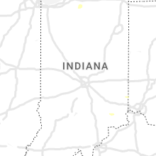


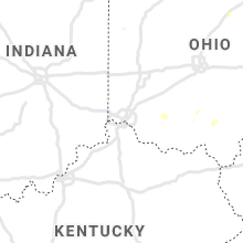


Connect with Interactive Hail Maps