

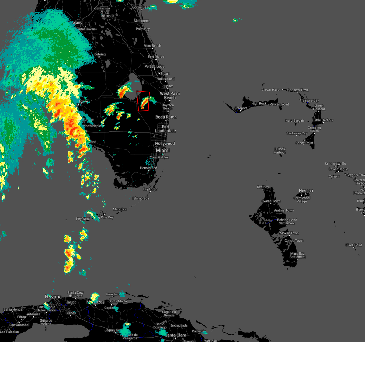
Hail Map for Pahokee, FL
The Pahokee, FL area has had 0 reports of on-the-ground hail by trained spotters, and has been under severe weather warnings 12 times during the past 12 months. Doppler radar has detected hail at or near Pahokee, FL on 44 occasions, including 3 occasions during the past year.
| Name: | Pahokee, FL |
| Where Located: | 36.1 miles SSW of Port Saint Lucie, FL |
| Map: | Google Map for Pahokee, FL |
| Population: | 5649 |
| Housing Units: | 2002 |
| More Info: | Search Google for Pahokee, FL |
0
The Top Recent Hail Date for Pahokee, FL is Friday, July 11, 2025 (37th out of 44)

Hail and Wind Damage Spotted near Pahokee, FL
| Date / Time | Report Details |
|---|---|
| 7/11/2025 3:30 PM EDT | A thunderstorm wind gust of 63 mph/55 knots was recorded at sfwmd site lz40 lake okeechobee center. winds gusted between 50 and 62 mph between 3:15 pm and 4 p in amz610 county FL, 9.4 miles SE of Pahokee, FL |
| 5/26/2025 6:26 PM EDT |
 The storms which prompted the warning have moved out of the area. therefore, the warning will be allowed to expire. The storms which prompted the warning have moved out of the area. therefore, the warning will be allowed to expire.
|
| 5/26/2025 5:52 PM EDT |
 Svrmfl the national weather service in miami has issued a * severe thunderstorm warning for, southwestern palm beach county in southeastern florida, * until 630 pm edt. * at 552 pm edt, severe thunderstorms were located along a line extending from near lake harbor to near okeelanta to 8 miles north of rotenberger wildlife refuge to holey land wildlife refuge, moving northeast at 15 mph (radar indicated). Hazards include 60 mph wind gusts and quarter size hail. Hail damage to vehicles is expected. Expect wind damage to roofs, siding, and trees. Svrmfl the national weather service in miami has issued a * severe thunderstorm warning for, southwestern palm beach county in southeastern florida, * until 630 pm edt. * at 552 pm edt, severe thunderstorms were located along a line extending from near lake harbor to near okeelanta to 8 miles north of rotenberger wildlife refuge to holey land wildlife refuge, moving northeast at 15 mph (radar indicated). Hazards include 60 mph wind gusts and quarter size hail. Hail damage to vehicles is expected. Expect wind damage to roofs, siding, and trees.
|
| 10/9/2024 3:56 PM EDT |
 The storm which prompted the warning has moved over lake okeechobee. therefore, the warning will be allowed to expire. a tornado watch remains in effect until 900 pm edt for southeastern florida. remember, a tornado warning still remains in effect for southcentral palm beach county along us 27 until 415 pm edt. The storm which prompted the warning has moved over lake okeechobee. therefore, the warning will be allowed to expire. a tornado watch remains in effect until 900 pm edt for southeastern florida. remember, a tornado warning still remains in effect for southcentral palm beach county along us 27 until 415 pm edt.
|
| 10/9/2024 3:48 PM EDT |
 At 348 pm edt, a severe thunderstorm capable of producing a tornado was located near fremd village-padgett island, or near pahokee, moving north at 40 mph (radar indicated rotation). Hazards include tornado. Flying debris will be dangerous to those caught without shelter. mobile homes will be damaged or destroyed. damage to roofs, windows, and vehicles will occur. tree damage is likely. Locations impacted include, pahokee, canal point, and fremd village-padgett island. At 348 pm edt, a severe thunderstorm capable of producing a tornado was located near fremd village-padgett island, or near pahokee, moving north at 40 mph (radar indicated rotation). Hazards include tornado. Flying debris will be dangerous to those caught without shelter. mobile homes will be damaged or destroyed. damage to roofs, windows, and vehicles will occur. tree damage is likely. Locations impacted include, pahokee, canal point, and fremd village-padgett island.
|
| 10/9/2024 3:39 PM EDT |
 Tormfl the national weather service in miami has issued a * tornado warning for, northwestern palm beach county in southeastern florida, * until 400 pm edt. * at 339 pm edt, a severe thunderstorm capable of producing a tornado was located over south bay, moving north at 40 mph (radar indicated rotation). Hazards include tornado. Flying debris will be dangerous to those caught without shelter. mobile homes will be damaged or destroyed. damage to roofs, windows, and vehicles will occur. Tree damage is likely. Tormfl the national weather service in miami has issued a * tornado warning for, northwestern palm beach county in southeastern florida, * until 400 pm edt. * at 339 pm edt, a severe thunderstorm capable of producing a tornado was located over south bay, moving north at 40 mph (radar indicated rotation). Hazards include tornado. Flying debris will be dangerous to those caught without shelter. mobile homes will be damaged or destroyed. damage to roofs, windows, and vehicles will occur. Tree damage is likely.
|
| 10/9/2024 12:13 PM EDT |
 the tornado warning has been cancelled and is no longer in effect the tornado warning has been cancelled and is no longer in effect
|
| 10/9/2024 11:44 AM EDT |
 The tornado warning that was previously in effect has been reissued for palm beach counties and is in effect until 12:30 pm edt. please refer to that bulletin for the latest severe weather information. a tornado watch remains in effect until 900 pm edt for southeastern florida. remember, a tornado warning still remains in effect for palm beach county. The tornado warning that was previously in effect has been reissued for palm beach counties and is in effect until 12:30 pm edt. please refer to that bulletin for the latest severe weather information. a tornado watch remains in effect until 900 pm edt for southeastern florida. remember, a tornado warning still remains in effect for palm beach county.
|
| 10/9/2024 11:42 AM EDT |
 Tormfl the national weather service in miami has issued a * tornado warning for, north central palm beach county in southeastern florida, * until 1230 pm edt. * at 1142 am edt, a severe thunderstorm capable of producing a tornado was located near fremd village-padgett island, or near pahokee, moving north at 20 mph (radar indicated rotation). Hazards include tornado. Flying debris will be dangerous to those caught without shelter. mobile homes will be damaged or destroyed. damage to roofs, windows, and vehicles will occur. Tree damage is likely. Tormfl the national weather service in miami has issued a * tornado warning for, north central palm beach county in southeastern florida, * until 1230 pm edt. * at 1142 am edt, a severe thunderstorm capable of producing a tornado was located near fremd village-padgett island, or near pahokee, moving north at 20 mph (radar indicated rotation). Hazards include tornado. Flying debris will be dangerous to those caught without shelter. mobile homes will be damaged or destroyed. damage to roofs, windows, and vehicles will occur. Tree damage is likely.
|
| 10/9/2024 11:15 AM EDT |
 Tormfl the national weather service in miami has issued a * tornado warning for, northwestern palm beach county in southeastern florida, * until 1145 am edt. * at 1114 am edt, a severe thunderstorm capable of producing a tornado was located 7 miles east of belle glade camp, or 7 miles southeast of belle glade, moving north at 35 mph (radar indicated rotation). Hazards include tornado. Expect damage to mobile homes, roofs, and vehicles. Tree damage is likely. Tormfl the national weather service in miami has issued a * tornado warning for, northwestern palm beach county in southeastern florida, * until 1145 am edt. * at 1114 am edt, a severe thunderstorm capable of producing a tornado was located 7 miles east of belle glade camp, or 7 miles southeast of belle glade, moving north at 35 mph (radar indicated rotation). Hazards include tornado. Expect damage to mobile homes, roofs, and vehicles. Tree damage is likely.
|
| 9/26/2024 3:42 AM EDT |
 At 341 am edt, a severe thunderstorm capable of producing a tornado was located near lake harbor, moving north at 35 mph (radar indicated rotation). Hazards include tornado. Flying debris will be dangerous to those caught without shelter. mobile homes will be damaged or destroyed. damage to roofs, windows, and vehicles will occur. tree damage is likely. Locations impacted include, belle glade, clewiston, pahokee, south bay, lake harbor, okeelanta, and harlem. At 341 am edt, a severe thunderstorm capable of producing a tornado was located near lake harbor, moving north at 35 mph (radar indicated rotation). Hazards include tornado. Flying debris will be dangerous to those caught without shelter. mobile homes will be damaged or destroyed. damage to roofs, windows, and vehicles will occur. tree damage is likely. Locations impacted include, belle glade, clewiston, pahokee, south bay, lake harbor, okeelanta, and harlem.
|
| 9/26/2024 3:31 AM EDT |
 At 330 am edt, a severe thunderstorm capable of producing a tornado was located 7 miles southwest of okeelanta, or 10 miles south of lake harbor, moving north at 40 mph (radar indicated rotation). Hazards include tornado. Flying debris will be dangerous to those caught without shelter. mobile homes will be damaged or destroyed. damage to roofs, windows, and vehicles will occur. tree damage is likely. Locations impacted include, belle glade, clewiston, pahokee, south bay, lake harbor, okeelanta, belle glade camp, and harlem. At 330 am edt, a severe thunderstorm capable of producing a tornado was located 7 miles southwest of okeelanta, or 10 miles south of lake harbor, moving north at 40 mph (radar indicated rotation). Hazards include tornado. Flying debris will be dangerous to those caught without shelter. mobile homes will be damaged or destroyed. damage to roofs, windows, and vehicles will occur. tree damage is likely. Locations impacted include, belle glade, clewiston, pahokee, south bay, lake harbor, okeelanta, belle glade camp, and harlem.
|
| 9/26/2024 3:19 AM EDT |
 Tormfl the national weather service in miami has issued a * tornado warning for, northeastern hendry county in southern florida, western palm beach county in southeastern florida, southern glades county in southern florida, * until 400 am edt. * at 319 am edt, a severe thunderstorm capable of producing a tornado was located near rotenberger wildlife refuge, or 17 miles south of south bay, moving north at 40 mph (radar indicated rotation). Hazards include tornado. Flying debris will be dangerous to those caught without shelter. mobile homes will be damaged or destroyed. damage to roofs, windows, and vehicles will occur. Tree damage is likely. Tormfl the national weather service in miami has issued a * tornado warning for, northeastern hendry county in southern florida, western palm beach county in southeastern florida, southern glades county in southern florida, * until 400 am edt. * at 319 am edt, a severe thunderstorm capable of producing a tornado was located near rotenberger wildlife refuge, or 17 miles south of south bay, moving north at 40 mph (radar indicated rotation). Hazards include tornado. Flying debris will be dangerous to those caught without shelter. mobile homes will be damaged or destroyed. damage to roofs, windows, and vehicles will occur. Tree damage is likely.
|
| 5/19/2024 5:27 PM EDT |
 Svrmfl the national weather service in miami has issued a * severe thunderstorm warning for, north central palm beach county in southeastern florida, * until 600 pm edt. * at 527 pm edt, a severe thunderstorm was located near fremd village-padgett island, or near pahokee, moving east at 15 mph (radar indicated). Hazards include ping pong ball size hail and 60 mph wind gusts. People and animals outdoors will be injured. expect hail damage to roofs, siding, windows, and vehicles. expect wind damage to roofs, siding, and trees. This severe thunderstorm will remain over mainly rural areas of north central palm beach county. Svrmfl the national weather service in miami has issued a * severe thunderstorm warning for, north central palm beach county in southeastern florida, * until 600 pm edt. * at 527 pm edt, a severe thunderstorm was located near fremd village-padgett island, or near pahokee, moving east at 15 mph (radar indicated). Hazards include ping pong ball size hail and 60 mph wind gusts. People and animals outdoors will be injured. expect hail damage to roofs, siding, windows, and vehicles. expect wind damage to roofs, siding, and trees. This severe thunderstorm will remain over mainly rural areas of north central palm beach county.
|
| 2/4/2024 11:43 AM EST |
 The severe thunderstorm warning for northwestern palm beach county will expire at 1145 am est, the storms which prompted the warning have weakened below severe limits, and have exited the warned area. therefore, the warning will be allowed to expire. a tornado watch remains in effect until 200 pm est for southeastern florida. The severe thunderstorm warning for northwestern palm beach county will expire at 1145 am est, the storms which prompted the warning have weakened below severe limits, and have exited the warned area. therefore, the warning will be allowed to expire. a tornado watch remains in effect until 200 pm est for southeastern florida.
|
| 2/4/2024 11:10 AM EST |
 At 1110 am est, severe thunderstorms were located along a line extending from 9 miles north of lake harbor to 6 miles southwest of pahokee to south bay, moving northeast at 35 mph (radar indicated). Hazards include 60 mph wind gusts. expect damage to roofs, siding, and trees At 1110 am est, severe thunderstorms were located along a line extending from 9 miles north of lake harbor to 6 miles southwest of pahokee to south bay, moving northeast at 35 mph (radar indicated). Hazards include 60 mph wind gusts. expect damage to roofs, siding, and trees
|
| 9/8/2023 5:26 PM EDT |
 At 526 pm edt, a severe thunderstorm was located over canal point, moving southwest at 5 mph (radar indicated). Hazards include 60 mph wind gusts and quarter size hail. Hail damage to vehicles is expected. Expect wind damage to roofs, siding, and trees. At 526 pm edt, a severe thunderstorm was located over canal point, moving southwest at 5 mph (radar indicated). Hazards include 60 mph wind gusts and quarter size hail. Hail damage to vehicles is expected. Expect wind damage to roofs, siding, and trees.
|
| 8/29/2023 6:36 PM EDT |
 The severe thunderstorm warning for northern broward and central palm beach counties will expire at 645 pm edt, the storms which prompted the warning have weakened below severe limits, and no longer pose an immediate threat to life or property. therefore, the warning will be allowed to expire. however gusty winds are still possible with these thunderstorms, so a special weather statement is in place for winds up to 30 kts through 7 pm et. The severe thunderstorm warning for northern broward and central palm beach counties will expire at 645 pm edt, the storms which prompted the warning have weakened below severe limits, and no longer pose an immediate threat to life or property. therefore, the warning will be allowed to expire. however gusty winds are still possible with these thunderstorms, so a special weather statement is in place for winds up to 30 kts through 7 pm et.
|
| 8/29/2023 6:10 PM EDT |
 At 609 pm edt, severe thunderstorms were located along a line extending from 6 miles southeast of okeelanta to near loxahatchee nwr to deerfield beach, moving north at 40 mph (radar indicated). Hazards include 60 mph wind gusts. expect damage to roofs, siding, and trees At 609 pm edt, severe thunderstorms were located along a line extending from 6 miles southeast of okeelanta to near loxahatchee nwr to deerfield beach, moving north at 40 mph (radar indicated). Hazards include 60 mph wind gusts. expect damage to roofs, siding, and trees
|
| 8/1/2023 3:58 PM EDT |
 At 358 pm edt, a severe thunderstorm was located near okeelanta, or near south bay, moving northeast at 15 mph (radar indicated). Hazards include 60 mph wind gusts and penny size hail. expect damage to roofs, siding, and trees At 358 pm edt, a severe thunderstorm was located near okeelanta, or near south bay, moving northeast at 15 mph (radar indicated). Hazards include 60 mph wind gusts and penny size hail. expect damage to roofs, siding, and trees
|
| 7/31/2023 4:51 PM EDT |
 At 451 pm edt, a severe thunderstorm was located over pahokee, moving northeast at 10 mph (radar indicated). Hazards include 60 mph wind gusts and penny size hail. Expect damage to roofs, siding, and trees. locations impacted include, pahokee, canal point and fremd village-padgett island. hail threat, radar indicated max hail size, 0. 75 in wind threat, radar indicated max wind gust, 60 mph. At 451 pm edt, a severe thunderstorm was located over pahokee, moving northeast at 10 mph (radar indicated). Hazards include 60 mph wind gusts and penny size hail. Expect damage to roofs, siding, and trees. locations impacted include, pahokee, canal point and fremd village-padgett island. hail threat, radar indicated max hail size, 0. 75 in wind threat, radar indicated max wind gust, 60 mph.
|
| 7/31/2023 4:37 PM EDT |
 At 437 pm edt, a severe thunderstorm was located near fremd village-padgett island, or near canal point, moving northwest at 10 mph (radar indicated). Hazards include 60 mph wind gusts and penny size hail. expect damage to roofs, siding, and trees At 437 pm edt, a severe thunderstorm was located near fremd village-padgett island, or near canal point, moving northwest at 10 mph (radar indicated). Hazards include 60 mph wind gusts and penny size hail. expect damage to roofs, siding, and trees
|
| 7/16/2023 3:44 PM EDT | Lake oke south end sfwm in amz610 county FL, 7.1 miles E of Pahokee, FL |
| 6/17/2023 4:19 PM EDT |
 At 419 pm edt, a severe thunderstorm was located over canal point, moving east at 20 mph (radar indicated). Hazards include 60 mph wind gusts and quarter size hail. Hail damage to vehicles is expected. expect wind damage to roofs, siding, and trees. Locations impacted include, pahokee, canal point, fremd village-padgett island and port mayaca. At 419 pm edt, a severe thunderstorm was located over canal point, moving east at 20 mph (radar indicated). Hazards include 60 mph wind gusts and quarter size hail. Hail damage to vehicles is expected. expect wind damage to roofs, siding, and trees. Locations impacted include, pahokee, canal point, fremd village-padgett island and port mayaca.
|
| 6/17/2023 4:01 PM EDT |
 At 400 pm edt, a severe thunderstorm was located 8 miles northwest of canal point, moving east at 20 mph (radar indicated). Hazards include 60 mph wind gusts and quarter size hail. Hail damage to vehicles is expected. Expect wind damage to roofs, siding, and trees. At 400 pm edt, a severe thunderstorm was located 8 miles northwest of canal point, moving east at 20 mph (radar indicated). Hazards include 60 mph wind gusts and quarter size hail. Hail damage to vehicles is expected. Expect wind damage to roofs, siding, and trees.
|
| 5/24/2023 4:59 PM EDT |
 At 459 pm edt, a severe thunderstorm was located over belle glade, moving southeast at 30 mph (radar indicated). Hazards include 60 mph wind gusts and quarter size hail. Hail damage to vehicles is expected. Expect wind damage to roofs, siding, and trees. At 459 pm edt, a severe thunderstorm was located over belle glade, moving southeast at 30 mph (radar indicated). Hazards include 60 mph wind gusts and quarter size hail. Hail damage to vehicles is expected. Expect wind damage to roofs, siding, and trees.
|
| 4/30/2023 8:31 AM EDT |
 At 831 am edt, a severe thunderstorm was located 9 miles southwest of lake harbor, moving northeast at 45 mph (radar indicated). Hazards include 60 mph wind gusts and penny size hail. expect damage to roofs, siding, and trees At 831 am edt, a severe thunderstorm was located 9 miles southwest of lake harbor, moving northeast at 45 mph (radar indicated). Hazards include 60 mph wind gusts and penny size hail. expect damage to roofs, siding, and trees
|
| 4/18/2022 6:14 PM EDT |
 At 613 pm edt, a severe thunderstorm was located near canal point, moving southeast at 20 mph (radar indicated). Hazards include 60 mph wind gusts and half dollar size hail. Hail damage to vehicles is expected. Expect wind damage to roofs, siding, and trees. At 613 pm edt, a severe thunderstorm was located near canal point, moving southeast at 20 mph (radar indicated). Hazards include 60 mph wind gusts and half dollar size hail. Hail damage to vehicles is expected. Expect wind damage to roofs, siding, and trees.
|
| 4/18/2022 5:52 PM EDT |
 At 551 pm edt, a severe thunderstorm was located near canal point, moving southeast at 20 mph (radar indicated). Hazards include 60 mph wind gusts and half dollar size hail. Hail damage to vehicles is expected. expect wind damage to roofs, siding, and trees. locations impacted include, pahokee, canal point and fremd village-padgett island. hail threat, radar indicated max hail size, 1. 25 in wind threat, radar indicated max wind gust, 60 mph. At 551 pm edt, a severe thunderstorm was located near canal point, moving southeast at 20 mph (radar indicated). Hazards include 60 mph wind gusts and half dollar size hail. Hail damage to vehicles is expected. expect wind damage to roofs, siding, and trees. locations impacted include, pahokee, canal point and fremd village-padgett island. hail threat, radar indicated max hail size, 1. 25 in wind threat, radar indicated max wind gust, 60 mph.
|
| 4/18/2022 5:43 PM EDT |
 At 543 pm edt, a severe thunderstorm was located near j and s fish camp, moving southeast at 20 mph (radar indicated). Hazards include 60 mph wind gusts and quarter size hail. Hail damage to vehicles is expected. Expect wind damage to roofs, siding, and trees. At 543 pm edt, a severe thunderstorm was located near j and s fish camp, moving southeast at 20 mph (radar indicated). Hazards include 60 mph wind gusts and quarter size hail. Hail damage to vehicles is expected. Expect wind damage to roofs, siding, and trees.
|
| 4/4/2022 3:30 PM EDT |
 At 330 pm edt, a severe thunderstorm was located near fremd village-padgett island, or near pahokee, moving northeast at 20 mph (radar indicated). Hazards include 60 mph wind gusts and quarter size hail. Hail damage to vehicles is expected. Expect wind damage to roofs, siding, and trees. At 330 pm edt, a severe thunderstorm was located near fremd village-padgett island, or near pahokee, moving northeast at 20 mph (radar indicated). Hazards include 60 mph wind gusts and quarter size hail. Hail damage to vehicles is expected. Expect wind damage to roofs, siding, and trees.
|
| 4/4/2022 3:05 PM EDT | At 304 pm edt, a severe thunderstorm was located over south bay, moving east at 5 mph (radar indicated). Hazards include 60 mph wind gusts and quarter size hail. Hail damage to vehicles is expected. Expect wind damage to roofs, siding, and trees. |
| 1/16/2022 11:45 AM EST |
 At 1145 am est, a severe thunderstorm capable of producing a tornado was located over fremd village-padgett island, or over pahokee, moving northeast at 35 mph (radar indicated rotation). Hazards include tornado. Flying debris will be dangerous to those caught without shelter. mobile homes will be damaged or destroyed. damage to roofs, windows, and vehicles will occur. tree damage is likely. This tornadic thunderstorm will remain over mainly rural areas of northwestern palm beach county, including the following locations, caloosa. At 1145 am est, a severe thunderstorm capable of producing a tornado was located over fremd village-padgett island, or over pahokee, moving northeast at 35 mph (radar indicated rotation). Hazards include tornado. Flying debris will be dangerous to those caught without shelter. mobile homes will be damaged or destroyed. damage to roofs, windows, and vehicles will occur. tree damage is likely. This tornadic thunderstorm will remain over mainly rural areas of northwestern palm beach county, including the following locations, caloosa.
|
| 1/16/2022 11:29 AM EST |
 At 1129 am est, a severe thunderstorm capable of producing a tornado was located near lake harbor, moving northeast at 35 mph (radar indicated rotation). Hazards include tornado. Flying debris will be dangerous to those caught without shelter. mobile homes will be damaged or destroyed. damage to roofs, windows, and vehicles will occur. tree damage is likely. this dangerous storm will be near, belle glade around 1140 am est. fremd village-padgett island around 1145 am est. Pahokee and canal point around 1150 am est. At 1129 am est, a severe thunderstorm capable of producing a tornado was located near lake harbor, moving northeast at 35 mph (radar indicated rotation). Hazards include tornado. Flying debris will be dangerous to those caught without shelter. mobile homes will be damaged or destroyed. damage to roofs, windows, and vehicles will occur. tree damage is likely. this dangerous storm will be near, belle glade around 1140 am est. fremd village-padgett island around 1145 am est. Pahokee and canal point around 1150 am est.
|
| 1/16/2022 11:13 AM EST |
 At 1113 am est, a severe thunderstorm capable of producing a tornado was located near lake harbor, moving northeast at 35 mph (radar indicated rotation). Hazards include tornado. Flying debris will be dangerous to those caught without shelter. mobile homes will be damaged or destroyed. damage to roofs, windows, and vehicles will occur. tree damage is likely. this dangerous storm will be near, lake harbor around 1125 am est. south bay around 1130 am est. belle glade camp around 1135 am est. belle glade around 1140 am est. pahokee, canal point and fremd village-padgett island around 1145 am est. Other locations impacted by this tornadic thunderstorm include harlem. At 1113 am est, a severe thunderstorm capable of producing a tornado was located near lake harbor, moving northeast at 35 mph (radar indicated rotation). Hazards include tornado. Flying debris will be dangerous to those caught without shelter. mobile homes will be damaged or destroyed. damage to roofs, windows, and vehicles will occur. tree damage is likely. this dangerous storm will be near, lake harbor around 1125 am est. south bay around 1130 am est. belle glade camp around 1135 am est. belle glade around 1140 am est. pahokee, canal point and fremd village-padgett island around 1145 am est. Other locations impacted by this tornadic thunderstorm include harlem.
|
| 1/16/2022 10:58 AM EST |
 At 1058 am est, severe thunderstorms were located along a line extending from near montura to 7 miles southeast of ave maria, moving northeast at 35 mph (radar indicated). Hazards include 60 mph wind gusts. expect damage to roofs, siding, and trees At 1058 am est, severe thunderstorms were located along a line extending from near montura to 7 miles southeast of ave maria, moving northeast at 35 mph (radar indicated). Hazards include 60 mph wind gusts. expect damage to roofs, siding, and trees
|
| 7/12/2021 3:37 PM EDT |
 At 336 pm edt, a severe thunderstorm was located near canal point, moving northwest at 25 mph (radar indicated). Hazards include 60 mph wind gusts and penny size hail. Expect damage to roofs, siding, and trees. Locations impacted include, pahokee, canal point and fremd village-padgett island. At 336 pm edt, a severe thunderstorm was located near canal point, moving northwest at 25 mph (radar indicated). Hazards include 60 mph wind gusts and penny size hail. Expect damage to roofs, siding, and trees. Locations impacted include, pahokee, canal point and fremd village-padgett island.
|
| 7/12/2021 3:05 PM EDT |
 At 305 pm edt, a severe thunderstorm was located 8 miles southeast of canal point, moving northwest at 25 mph (radar indicated). Hazards include 60 mph wind gusts and penny size hail. expect damage to roofs, siding, and trees At 305 pm edt, a severe thunderstorm was located 8 miles southeast of canal point, moving northwest at 25 mph (radar indicated). Hazards include 60 mph wind gusts and penny size hail. expect damage to roofs, siding, and trees
|
| 5/30/2021 7:59 PM EDT |
 At 759 pm edt, a severe thunderstorm was located over pahokee, moving southeast at 20 mph (radar indicated). Hazards include 60 mph wind gusts and quarter size hail. Hail damage to vehicles is expected. Expect wind damage to roofs, siding, and trees. At 759 pm edt, a severe thunderstorm was located over pahokee, moving southeast at 20 mph (radar indicated). Hazards include 60 mph wind gusts and quarter size hail. Hail damage to vehicles is expected. Expect wind damage to roofs, siding, and trees.
|
| 5/6/2021 6:16 PM EDT |
 At 615 pm edt, a severe thunderstorm was located near belle glade, moving east at 15 mph (radar indicated). Hazards include 60 mph wind gusts and quarter size hail. Hail damage to vehicles is expected. expect wind damage to roofs, siding, and trees. Locations impacted include, belle glade, pahokee, south bay, canal point and belle glade camp. At 615 pm edt, a severe thunderstorm was located near belle glade, moving east at 15 mph (radar indicated). Hazards include 60 mph wind gusts and quarter size hail. Hail damage to vehicles is expected. expect wind damage to roofs, siding, and trees. Locations impacted include, belle glade, pahokee, south bay, canal point and belle glade camp.
|
| 5/6/2021 5:53 PM EDT |
 At 553 pm edt, a severe thunderstorm was located near south bay, moving east at 15 mph (radar indicated). Hazards include 60 mph wind gusts and quarter size hail. Hail damage to vehicles is expected. Expect wind damage to roofs, siding, and trees. At 553 pm edt, a severe thunderstorm was located near south bay, moving east at 15 mph (radar indicated). Hazards include 60 mph wind gusts and quarter size hail. Hail damage to vehicles is expected. Expect wind damage to roofs, siding, and trees.
|
| 4/11/2021 3:19 PM EDT |
 At 239 pm edt, severe thunderstorms were located along a line extending from jensen beach to 6 miles west of pahokee, moving southeast at 30 mph (radar indicated). Hazards include 70 mph wind gusts and quarter size hail. Hail damage to vehicles is expected. expect considerable tree damage. Wind damage is also likely to mobile homes, roofs, and outbuildings. At 239 pm edt, severe thunderstorms were located along a line extending from jensen beach to 6 miles west of pahokee, moving southeast at 30 mph (radar indicated). Hazards include 70 mph wind gusts and quarter size hail. Hail damage to vehicles is expected. expect considerable tree damage. Wind damage is also likely to mobile homes, roofs, and outbuildings.
|
| 4/11/2021 2:39 PM EDT |
 At 239 pm edt, severe thunderstorms were located along a line extending from jensen beach to 6 miles west of pahokee, moving southeast at 30 mph (radar indicated). Hazards include 70 mph wind gusts and quarter size hail. Hail damage to vehicles is expected. expect considerable tree damage. Wind damage is also likely to mobile homes, roofs, and outbuildings. At 239 pm edt, severe thunderstorms were located along a line extending from jensen beach to 6 miles west of pahokee, moving southeast at 30 mph (radar indicated). Hazards include 70 mph wind gusts and quarter size hail. Hail damage to vehicles is expected. expect considerable tree damage. Wind damage is also likely to mobile homes, roofs, and outbuildings.
|
| 8/19/2020 2:37 PM EDT |
 The severe thunderstorm warning for northwestern palm beach county will expire at 245 pm edt, the storm which prompted the warning has weakened below severe limits, and no longer poses an immediate threat to life or property. therefore, the warning will be allowed to expire. however gusty winds are still possible with this thunderstorm. The severe thunderstorm warning for northwestern palm beach county will expire at 245 pm edt, the storm which prompted the warning has weakened below severe limits, and no longer poses an immediate threat to life or property. therefore, the warning will be allowed to expire. however gusty winds are still possible with this thunderstorm.
|
| 8/19/2020 2:21 PM EDT |
 At 220 pm edt, a severe thunderstorm was located near pahokee, moving northeast at 20 mph (radar indicated). Hazards include 60 mph wind gusts. Expect damage to roofs, siding, and trees. Locations impacted include, belle glade, pahokee, south bay, canal point and lake harbor. At 220 pm edt, a severe thunderstorm was located near pahokee, moving northeast at 20 mph (radar indicated). Hazards include 60 mph wind gusts. Expect damage to roofs, siding, and trees. Locations impacted include, belle glade, pahokee, south bay, canal point and lake harbor.
|
| 8/19/2020 2:07 PM EDT |
 At 207 pm edt, a severe thunderstorm was located near clewiston, moving northeast at 20 mph (radar indicated). Hazards include 60 mph wind gusts. expect damage to roofs, siding, and trees At 207 pm edt, a severe thunderstorm was located near clewiston, moving northeast at 20 mph (radar indicated). Hazards include 60 mph wind gusts. expect damage to roofs, siding, and trees
|
| 7/27/2020 8:35 PM EDT |
 The severe thunderstorm warning for central palm beach county will expire at 845 pm edt, the storms which prompted the warning have weakened below severe limits, and no longer pose an immediate threat to life or property. therefore, the warning will be allowed to expire. however gusty winds are still possible with these thunderstorms. The severe thunderstorm warning for central palm beach county will expire at 845 pm edt, the storms which prompted the warning have weakened below severe limits, and no longer pose an immediate threat to life or property. therefore, the warning will be allowed to expire. however gusty winds are still possible with these thunderstorms.
|
| 7/27/2020 8:11 PM EDT |
 At 748 pm edt, severe thunderstorms were located along a line extending from near lake harbor to near okeelanta to near holey land wildlife refuge, moving east at 20 mph (radar indicated). Hazards include 60 mph wind gusts. expect damage to roofs, siding, and trees At 748 pm edt, severe thunderstorms were located along a line extending from near lake harbor to near okeelanta to near holey land wildlife refuge, moving east at 20 mph (radar indicated). Hazards include 60 mph wind gusts. expect damage to roofs, siding, and trees
|
| 7/27/2020 7:49 PM EDT |
 At 748 pm edt, severe thunderstorms were located along a line extending from near lake harbor to near okeelanta to near holey land wildlife refuge, moving east at 20 mph (radar indicated). Hazards include 60 mph wind gusts. expect damage to roofs, siding, and trees At 748 pm edt, severe thunderstorms were located along a line extending from near lake harbor to near okeelanta to near holey land wildlife refuge, moving east at 20 mph (radar indicated). Hazards include 60 mph wind gusts. expect damage to roofs, siding, and trees
|
| 7/23/2020 9:08 AM EDT |
 The severe thunderstorm warning for northern palm beach county will expire at 915 am edt, the storm which prompted the warning has weakened below severe limits, and no longer poses an immediate threat to life or property. therefore, the warning will be allowed to expire. The severe thunderstorm warning for northern palm beach county will expire at 915 am edt, the storm which prompted the warning has weakened below severe limits, and no longer poses an immediate threat to life or property. therefore, the warning will be allowed to expire.
|
| 7/23/2020 8:42 AM EDT |
 At 842 am edt, a severe thunderstorm was located over lion country safari park, or 9 miles west of wellington, moving northwest at 30 mph (radar indicated). Hazards include 60 mph wind gusts. expect damage to roofs, siding, and trees At 842 am edt, a severe thunderstorm was located over lion country safari park, or 9 miles west of wellington, moving northwest at 30 mph (radar indicated). Hazards include 60 mph wind gusts. expect damage to roofs, siding, and trees
|
| 6/23/2020 9:22 PM EDT |
 The severe thunderstorm warning for north central palm beach county will expire at 930 pm edt, the storm which prompted the warning has weakened below severe limits, and no longer poses an immediate threat to life or property. therefore, the warning will be allowed to expire. The severe thunderstorm warning for north central palm beach county will expire at 930 pm edt, the storm which prompted the warning has weakened below severe limits, and no longer poses an immediate threat to life or property. therefore, the warning will be allowed to expire.
|
| 6/23/2020 8:55 PM EDT |
 At 855 pm edt, a severe thunderstorm was located near canal point, moving east at 15 mph (radar indicated). Hazards include 60 mph wind gusts and quarter size hail. Hail damage to vehicles is expected. Expect wind damage to roofs, siding, and trees. At 855 pm edt, a severe thunderstorm was located near canal point, moving east at 15 mph (radar indicated). Hazards include 60 mph wind gusts and quarter size hail. Hail damage to vehicles is expected. Expect wind damage to roofs, siding, and trees.
|
| 5/18/2020 4:08 PM EDT |
 At 407 pm edt, severe thunderstorms were located along a line extending from pahokee to 7 miles southeast of okeelanta, moving north at 20 mph (radar indicated). Hazards include 60 mph wind gusts and nickel size hail. Expect damage to roofs, siding, and trees. Locations impacted include, belle glade, pahokee, canal point, mile marker 30 on alligator alley and intersection alligator alley and miami canal. At 407 pm edt, severe thunderstorms were located along a line extending from pahokee to 7 miles southeast of okeelanta, moving north at 20 mph (radar indicated). Hazards include 60 mph wind gusts and nickel size hail. Expect damage to roofs, siding, and trees. Locations impacted include, belle glade, pahokee, canal point, mile marker 30 on alligator alley and intersection alligator alley and miami canal.
|
| 5/18/2020 3:40 PM EDT |
 At 340 pm edt, severe thunderstorms were located along a line extending from belle glade to near holey land wildlife refuge, moving north at 20 mph (radar indicated). Hazards include 60 mph wind gusts and nickel size hail. Expect damage to roofs, siding, and trees. Locations impacted include, belle glade, pahokee, south bay, canal point and okeelanta. At 340 pm edt, severe thunderstorms were located along a line extending from belle glade to near holey land wildlife refuge, moving north at 20 mph (radar indicated). Hazards include 60 mph wind gusts and nickel size hail. Expect damage to roofs, siding, and trees. Locations impacted include, belle glade, pahokee, south bay, canal point and okeelanta.
|
| 5/18/2020 3:19 PM EDT |
 At 318 pm edt, severe thunderstorms were located along a line extending from okeelanta to 9 miles northwest of intersection alligator alley and miami canal, moving north at 20 mph (radar indicated). Hazards include 60 mph wind gusts and quarter size hail. Hail damage to vehicles is expected. expect wind damage to roofs, siding, and trees. Locations impacted include, belle glade, pahokee, south bay, canal point and lake harbor. At 318 pm edt, severe thunderstorms were located along a line extending from okeelanta to 9 miles northwest of intersection alligator alley and miami canal, moving north at 20 mph (radar indicated). Hazards include 60 mph wind gusts and quarter size hail. Hail damage to vehicles is expected. expect wind damage to roofs, siding, and trees. Locations impacted include, belle glade, pahokee, south bay, canal point and lake harbor.
|
| 5/18/2020 2:56 PM EDT |
 At 255 pm edt, severe thunderstorms were located along a line extending from near holey land wildlife refuge to 6 miles west of intersection alligator alley and miami canal, moving north at 20 mph (radar indicated). Hazards include 60 mph wind gusts and quarter size hail. Hail damage to vehicles is expected. Expect wind damage to roofs, siding, and trees. At 255 pm edt, severe thunderstorms were located along a line extending from near holey land wildlife refuge to 6 miles west of intersection alligator alley and miami canal, moving north at 20 mph (radar indicated). Hazards include 60 mph wind gusts and quarter size hail. Hail damage to vehicles is expected. Expect wind damage to roofs, siding, and trees.
|
| 5/18/2020 2:53 PM EDT |
 At 253 pm edt, severe thunderstorms were located along a line extending from near holey land wildlife refuge to 6 miles west of intersection alligator alley and miami canal, moving north at 20 mph (radar indicated). Hazards include 60 mph wind gusts and quarter size hail. Hail damage to vehicles is expected. Expect wind damage to roofs, siding, and trees. At 253 pm edt, severe thunderstorms were located along a line extending from near holey land wildlife refuge to 6 miles west of intersection alligator alley and miami canal, moving north at 20 mph (radar indicated). Hazards include 60 mph wind gusts and quarter size hail. Hail damage to vehicles is expected. Expect wind damage to roofs, siding, and trees.
|
| 5/17/2020 6:35 PM EDT |
 At 635 pm edt, severe thunderstorms were located along a line extending from 8 miles northwest of lion country safari park to near wellington, moving northeast at 15 mph (radar indicated). Hazards include 60 mph wind gusts and quarter size hail. Hail damage to vehicles is expected. expect wind damage to roofs, siding, and trees. Locations impacted include, west palm beach, boynton beach, wellington, jupiter and palm beach gardens. At 635 pm edt, severe thunderstorms were located along a line extending from 8 miles northwest of lion country safari park to near wellington, moving northeast at 15 mph (radar indicated). Hazards include 60 mph wind gusts and quarter size hail. Hail damage to vehicles is expected. expect wind damage to roofs, siding, and trees. Locations impacted include, west palm beach, boynton beach, wellington, jupiter and palm beach gardens.
|
| 5/17/2020 6:11 PM EDT |
 At 611 pm edt, severe thunderstorms were located along a line extending from 10 miles east of fremd village-padgett island to near lion country safari park, moving east at 20 mph (radar indicated). Hazards include 60 mph wind gusts and quarter size hail. Hail damage to vehicles is expected. Expect wind damage to roofs, siding, and trees. At 611 pm edt, severe thunderstorms were located along a line extending from 10 miles east of fremd village-padgett island to near lion country safari park, moving east at 20 mph (radar indicated). Hazards include 60 mph wind gusts and quarter size hail. Hail damage to vehicles is expected. Expect wind damage to roofs, siding, and trees.
|
| 4/26/2020 12:29 PM EDT |
 At 1228 pm edt, a severe thunderstorm was located near canal point, moving east at 25 mph (radar indicated). Hazards include 60 mph wind gusts and quarter size hail. Hail damage to vehicles is expected. Expect wind damage to roofs, siding, and trees. At 1228 pm edt, a severe thunderstorm was located near canal point, moving east at 25 mph (radar indicated). Hazards include 60 mph wind gusts and quarter size hail. Hail damage to vehicles is expected. Expect wind damage to roofs, siding, and trees.
|
| 10/19/2019 5:12 PM EDT |
 At 512 pm edt, severe thunderstorms were located along a line extending from 9 miles northwest of lion country safari park to near canal point, moving northeast at 35 mph (radar indicated). Hazards include 60 mph wind gusts. Expect damage to roofs, siding, and trees. Locations impacted include, pahokee, canal point and fremd village-padgett island. At 512 pm edt, severe thunderstorms were located along a line extending from 9 miles northwest of lion country safari park to near canal point, moving northeast at 35 mph (radar indicated). Hazards include 60 mph wind gusts. Expect damage to roofs, siding, and trees. Locations impacted include, pahokee, canal point and fremd village-padgett island.
|
| 10/19/2019 5:02 PM EDT |
 At 502 pm edt, severe thunderstorms were located along a line extending from 8 miles southeast of canal point to belle glade, moving northeast at 25 mph (radar indicated). Hazards include 60 mph wind gusts. Expect damage to roofs, siding, and trees. Locations impacted include, belle glade, pahokee, canal point and fremd village-padgett island. At 502 pm edt, severe thunderstorms were located along a line extending from 8 miles southeast of canal point to belle glade, moving northeast at 25 mph (radar indicated). Hazards include 60 mph wind gusts. Expect damage to roofs, siding, and trees. Locations impacted include, belle glade, pahokee, canal point and fremd village-padgett island.
|
| 10/19/2019 4:37 PM EDT |
 At 437 pm edt, severe thunderstorms were located along a line extending from near indiantown to near belle glade, moving northeast at 30 mph (radar indicated). Hazards include 60 mph wind gusts. expect damage to roofs, siding, and trees At 437 pm edt, severe thunderstorms were located along a line extending from near indiantown to near belle glade, moving northeast at 30 mph (radar indicated). Hazards include 60 mph wind gusts. expect damage to roofs, siding, and trees
|
| 6/28/2019 6:15 PM EDT | L006 reported a wind gust of 55 knots with a severe thunderstorm moving through southern waters of lake okeechbe in amz610 county FL, 7.1 miles E of Pahokee, FL |
| 6/3/2019 9:15 PM EDT | A marine thunderstorm wind gust of 62 mph / 54 knots was recorded by the sfwmd site l006 located over the southern end of lake okeechobe in amz610 county FL, 7.1 miles E of Pahokee, FL |
| 8/9/2018 9:12 PM EDT |
 At 912 pm edt, a severe thunderstorm was located near canal point, and is nearly stationary (radar indicated). Hazards include 60 mph wind gusts and nickel size hail. Expect damage to roofs, siding, and trees. Locations impacted include, pahokee, canal point and fremd village-padgett island. At 912 pm edt, a severe thunderstorm was located near canal point, and is nearly stationary (radar indicated). Hazards include 60 mph wind gusts and nickel size hail. Expect damage to roofs, siding, and trees. Locations impacted include, pahokee, canal point and fremd village-padgett island.
|
| 8/9/2018 8:54 PM EDT |
 At 854 pm edt, a severe thunderstorm was located near canal point, and is nearly stationary (radar indicated). Hazards include 70 mph wind gusts and nickel size hail. Expect considerable tree damage. Damage is likely to mobile homes, roofs, and outbuildings. At 854 pm edt, a severe thunderstorm was located near canal point, and is nearly stationary (radar indicated). Hazards include 70 mph wind gusts and nickel size hail. Expect considerable tree damage. Damage is likely to mobile homes, roofs, and outbuildings.
|
| 4/15/2018 7:30 PM EDT | L-6 tower on southern lake okeechobee reported a 59 kt / 68 mph wind gust at 730 p in amz610 county FL, 7.1 miles E of Pahokee, FL |
| 3/20/2018 7:51 PM EDT |
 At 751 pm edt, a severe thunderstorm was located near canal point, moving east at 50 mph (radar indicated). Hazards include 60 mph wind gusts and nickel size hail. expect damage to roofs, siding, and trees At 751 pm edt, a severe thunderstorm was located near canal point, moving east at 50 mph (radar indicated). Hazards include 60 mph wind gusts and nickel size hail. expect damage to roofs, siding, and trees
|
| 6/6/2017 6:28 PM EDT |
 At 628 pm edt, a severe thunderstorm was located near fremd village-padgett island, or near pahokee, moving east at 30 mph (radar indicated). Hazards include 60 mph wind gusts. expect damage to roofs, siding, and trees At 628 pm edt, a severe thunderstorm was located near fremd village-padgett island, or near pahokee, moving east at 30 mph (radar indicated). Hazards include 60 mph wind gusts. expect damage to roofs, siding, and trees
|
| 1/23/2017 12:46 AM EST |
 At 1246 am est, severe thunderstorms were located along a line extending from near canal point to 10 miles northwest of rotenberger wildlife refuge, moving east at 80 mph (radar indicated). Hazards include 60 mph wind gusts. Expect damage to roofs, siding, and trees. locations impacted include, belle glade, pahokee, south bay, canal point and lake harbor. A tornado watch remains in effect until 600 am est for southern and southeastern florida. At 1246 am est, severe thunderstorms were located along a line extending from near canal point to 10 miles northwest of rotenberger wildlife refuge, moving east at 80 mph (radar indicated). Hazards include 60 mph wind gusts. Expect damage to roofs, siding, and trees. locations impacted include, belle glade, pahokee, south bay, canal point and lake harbor. A tornado watch remains in effect until 600 am est for southern and southeastern florida.
|
| 1/23/2017 12:25 AM EST |
 At 1225 am est, severe thunderstorms were located along a line extending from near clewiston to 8 miles southwest of devils garden, moving east at 30 mph (radar indicated). Hazards include 60 mph wind gusts. expect damage to roofs, siding, and trees At 1225 am est, severe thunderstorms were located along a line extending from near clewiston to 8 miles southwest of devils garden, moving east at 30 mph (radar indicated). Hazards include 60 mph wind gusts. expect damage to roofs, siding, and trees
|
| 6/16/2016 3:28 PM EDT |
 At 328 pm edt, a severe thunderstorm was located near south bay, moving east at 35 mph (radar indicated). Hazards include 60 mph wind gusts. Expect damage to roofs. siding. and trees. Locations impacted include, belle glade, pahokee, south bay, lake harbor and canal point. At 328 pm edt, a severe thunderstorm was located near south bay, moving east at 35 mph (radar indicated). Hazards include 60 mph wind gusts. Expect damage to roofs. siding. and trees. Locations impacted include, belle glade, pahokee, south bay, lake harbor and canal point.
|
| 6/16/2016 3:21 PM EDT |
 At 321 pm edt, a severe thunderstorm was located over lake harbor, moving east at 30 mph (radar indicated). Hazards include 60 mph wind gusts. Expect damage to roofs. siding. And trees. At 321 pm edt, a severe thunderstorm was located over lake harbor, moving east at 30 mph (radar indicated). Hazards include 60 mph wind gusts. Expect damage to roofs. siding. And trees.
|
| 6/6/2016 5:15 PM EDT | A thunderstorm produced a wind gust of 59 mph at mesonet site lz40 over lake okeechobee. this sensor was located at an elevation of 49 fee in amz610 county FL, 9.4 miles SE of Pahokee, FL |
| 2/16/2016 5:15 AM EST | Mesonet site l006 on lake okeechobee recorded a wind gust to 56 knots 64 mph from the southeast in amz610 county FL, 7.1 miles E of Pahokee, FL |
| 1/17/2016 6:41 AM EST | The tornado warning for northwestern palm beach, southeastern glades and northeastern hendry counties will expire at 645 am est, the storm which prompted the warning has weakened below severe limits, and no longer appears capable of producing a tornado. therefore the warning will be allowed to expire. however gusty winds of 45 to 55 mph are still possible with this thunderstorm and therefore a significant weather advisory remains in effect. a tornado watch remains in effect until 800 am est for southeastern florida. |
| 1/17/2016 6:24 AM EST |
 A tornado warning remains in effect until 645 am est for northwestern palm beach. southeastern glades and northeastern hendry counties. at 624 am est. a severe thunderstorm capable of producing a tornado was located near clewiston. moving northeast at 65 mph. hazard. Tornado. A tornado warning remains in effect until 645 am est for northwestern palm beach. southeastern glades and northeastern hendry counties. at 624 am est. a severe thunderstorm capable of producing a tornado was located near clewiston. moving northeast at 65 mph. hazard. Tornado.
|
| 1/17/2016 6:12 AM EST |
 At 611 am est, a severe thunderstorm capable of producing a tornado was located near montura, moving northeast at 65 mph (radar indicated rotation). Hazards include tornado. Flying debris will be dangerous to those caught without shelter. mobile homes will be damaged or destroyed. damage to roofs, windows and vehicles will occur. Tree damage is likely. At 611 am est, a severe thunderstorm capable of producing a tornado was located near montura, moving northeast at 65 mph (radar indicated rotation). Hazards include tornado. Flying debris will be dangerous to those caught without shelter. mobile homes will be damaged or destroyed. damage to roofs, windows and vehicles will occur. Tree damage is likely.
|
| 8/2/2015 3:40 PM EDT | Storm damage reported in amz610 county FL, 9.4 miles SE of Pahokee, FL |
| 6/29/2015 4:07 PM EDT |
 At 406 pm edt, doppler radar indicated a severe thunderstorm capable of producing damaging winds in excess of 60 mph. this storm was located near lake harbor, and moving southeast at 20 mph. nickel size hail may also accompany the damaging winds. At 406 pm edt, doppler radar indicated a severe thunderstorm capable of producing damaging winds in excess of 60 mph. this storm was located near lake harbor, and moving southeast at 20 mph. nickel size hail may also accompany the damaging winds.
|
| 4/28/2015 1:36 PM EDT | At 136 pm edt, doppler radar indicated a severe thunderstorm capable of producing damaging winds in excess of 60 mph. this storm was located near jupiter, moving east at 20 mph. locations impacted include, jupiter, palm beach gardens, pahokee, tequesta and juno beach. |
| 4/28/2015 1:22 PM EDT | At 121 pm edt, doppler radar indicated a severe thunderstorm capable of producing damaging winds in excess of 60 mph. this storm was located near north county airport, or 11 miles west of tequesta, moving east at 20 mph. locations impacted include, jupiter, palm beach gardens, pahokee, tequesta and juno beach. |
| 4/28/2015 1:08 PM EDT | At 107 pm edt, doppler radar indicated a severe thunderstorm capable of producing damaging winds in excess of 60 mph. this storm was located near canal point, and moving northeast at 25 mph. |
| 4/23/2015 2:15 PM EDT | Storm damage reported in amz610 county FL, 9.4 miles SE of Pahokee, FL |
| 3/27/2015 5:10 PM EDT | The national weather service in miami has issued a * severe thunderstorm warning for. northwestern broward county in southeastern florida. palm beach county in southeastern florida. until 615 pm edt * at 510 pm edt. Doppler radar indicated a line of severe. |
| 8/16/2014 3:30 PM EDT | Sfwmd mesonet site near the center of lake okeechobee reported a northwest wind gust of 58 kts...or 67 mph...at 330 pm edt. winds were sustained at 35 kts...or 40 mp in amz610 county FL, 9.4 miles SE of Pahokee, FL |
| 8/16/2014 3:15 PM EDT | Sfwmd mesonet site near the center of lake okeechobee reported a northwest wind gust of 50 kts...or 58 mph...at 315 pm ed in amz610 county FL, 9.4 miles SE of Pahokee, FL |
| 5/10/2013 6:00 PM EDT | Storm damage reported in amz610 county FL, 9.3 miles SE of Pahokee, FL |
| 6/6/2012 5:30 AM EDT | A mesonet site located near the center of lake okeechobee reported a wind gust of 54 kts...or 62 mph...at 530 am ed in amz610 county FL, 9.4 miles SE of Pahokee, FL |
| 6/6/2012 5:17 AM EDT | A mesonet site located in the southern portion of lake okeechobee reported a wind gust of 56 kts...or 64 mph...at 517 am ed in amz610 county FL, 6.5 miles E of Pahokee, FL |
| 1/1/0001 12:00 AM | Law enforcement officials reported a downed palm tree in pahoke in palm beach county FL, 0.4 miles NW of Pahokee, FL |
Hail Maps for Pahokee, FL


Connect with Interactive Hail Maps