

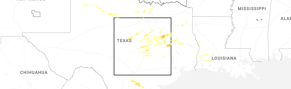
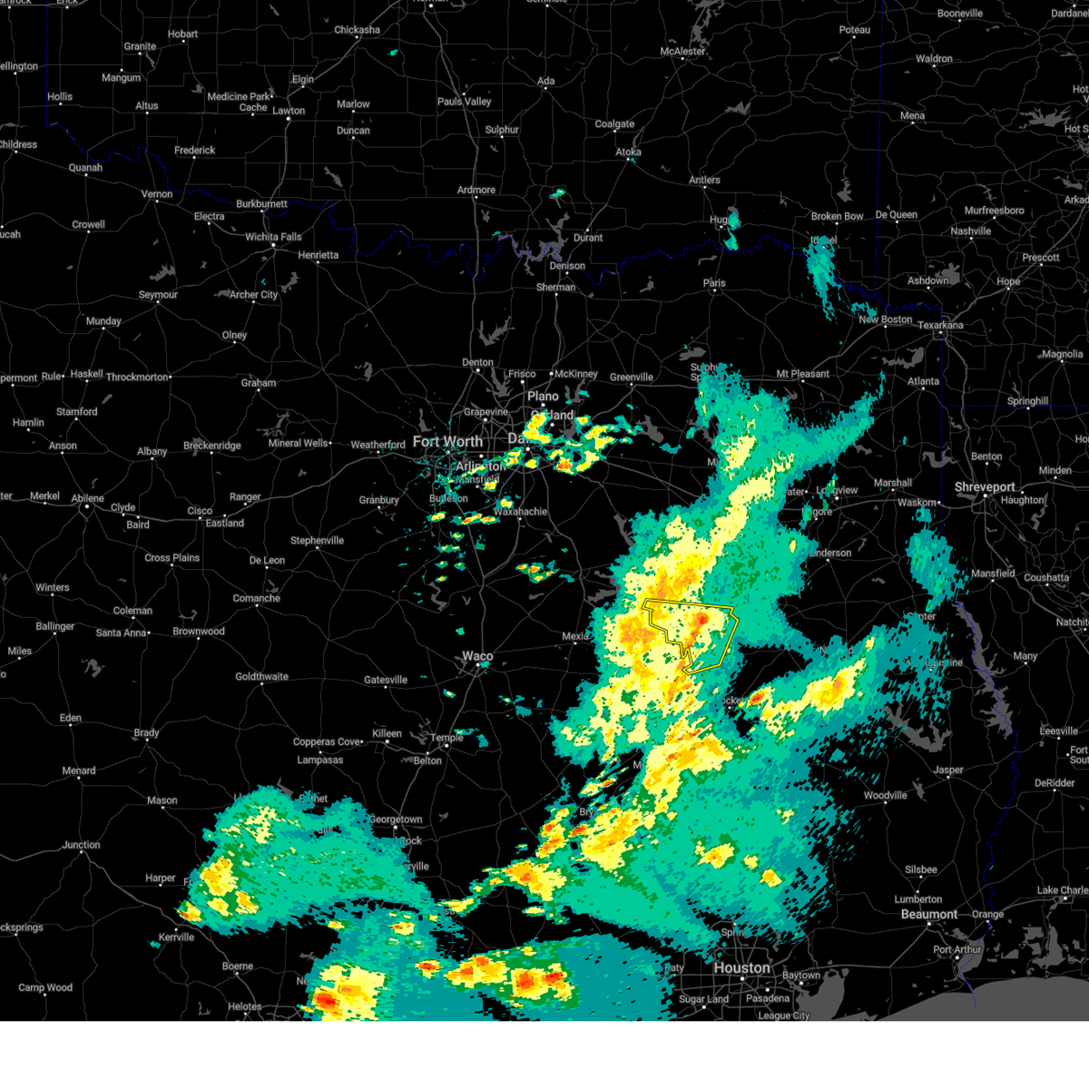
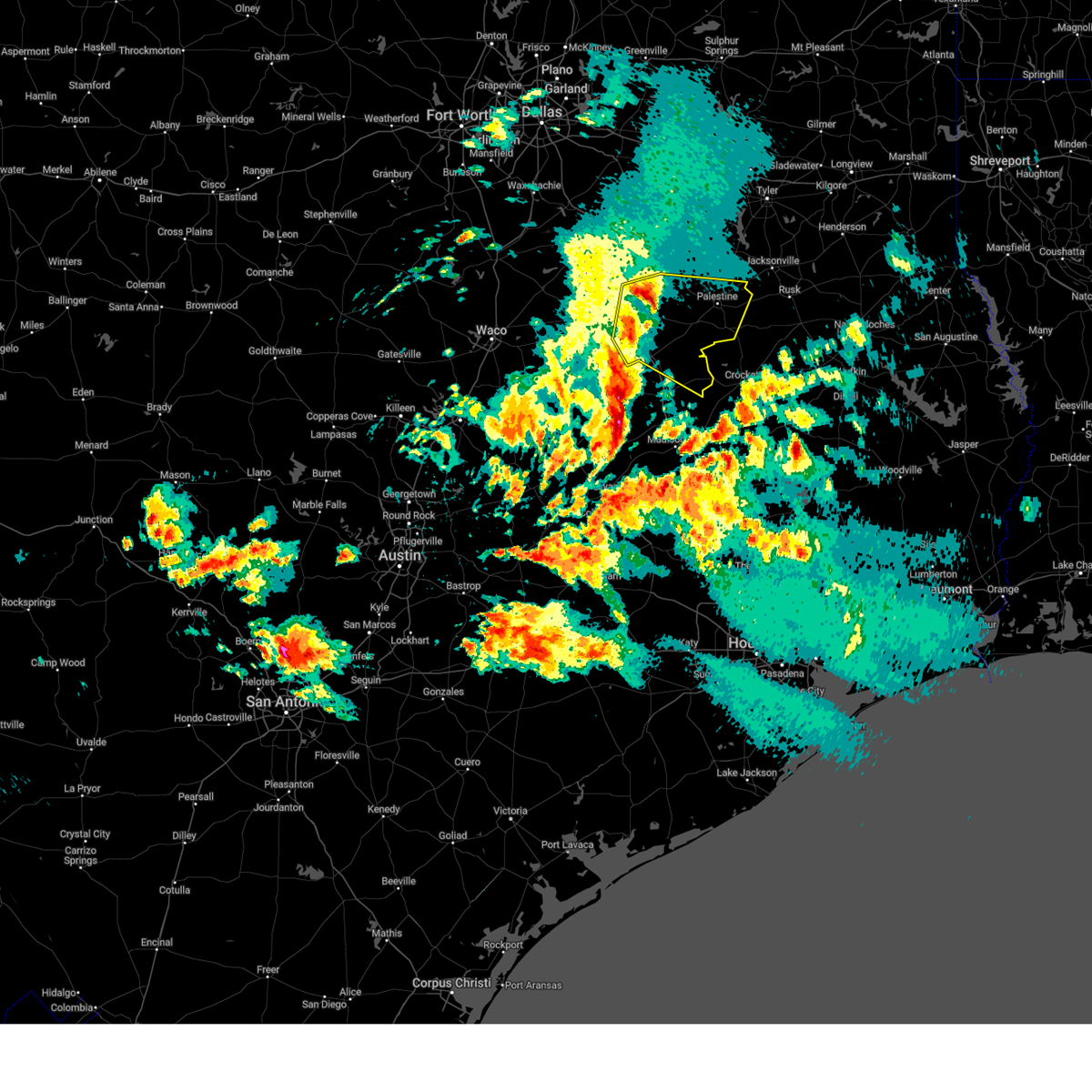
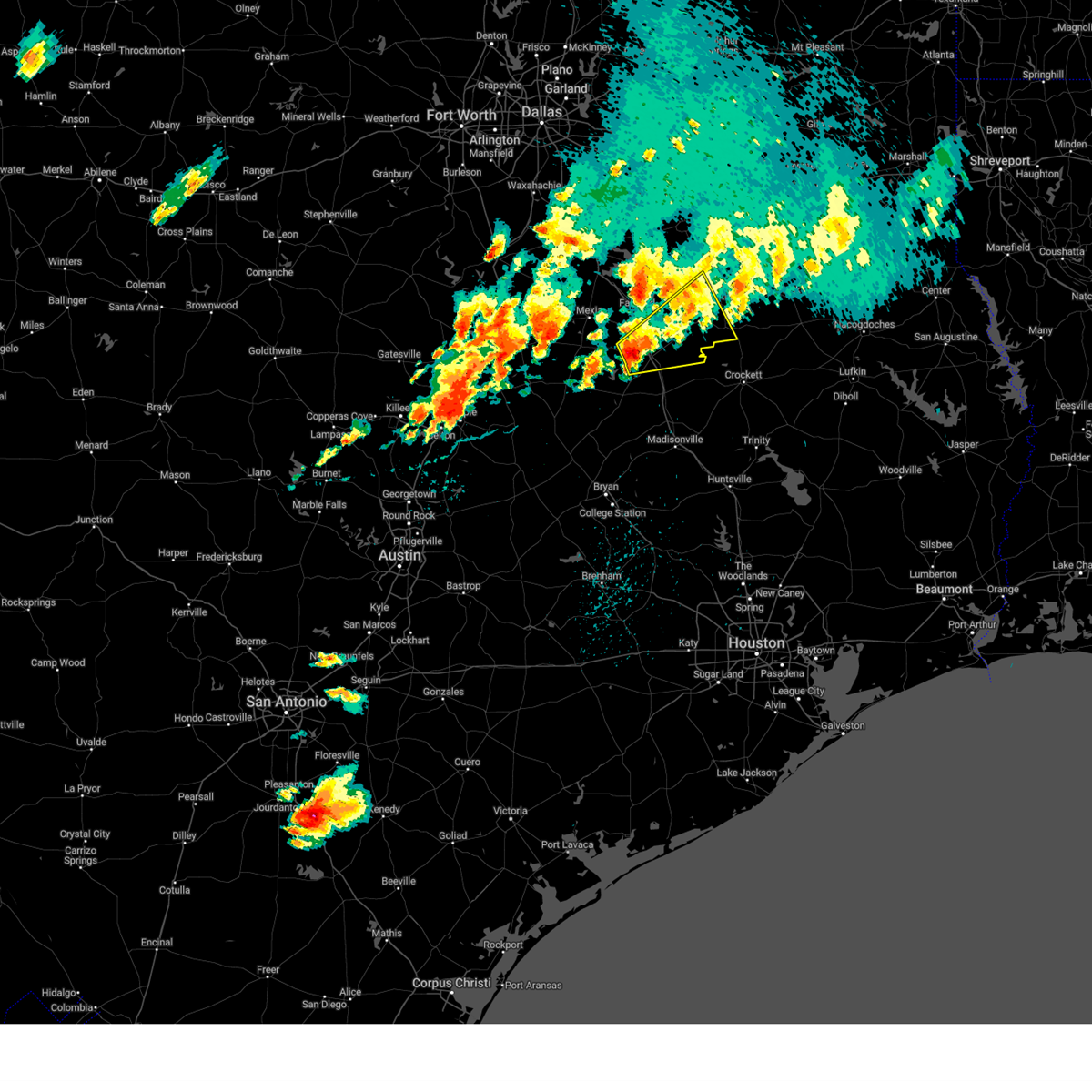
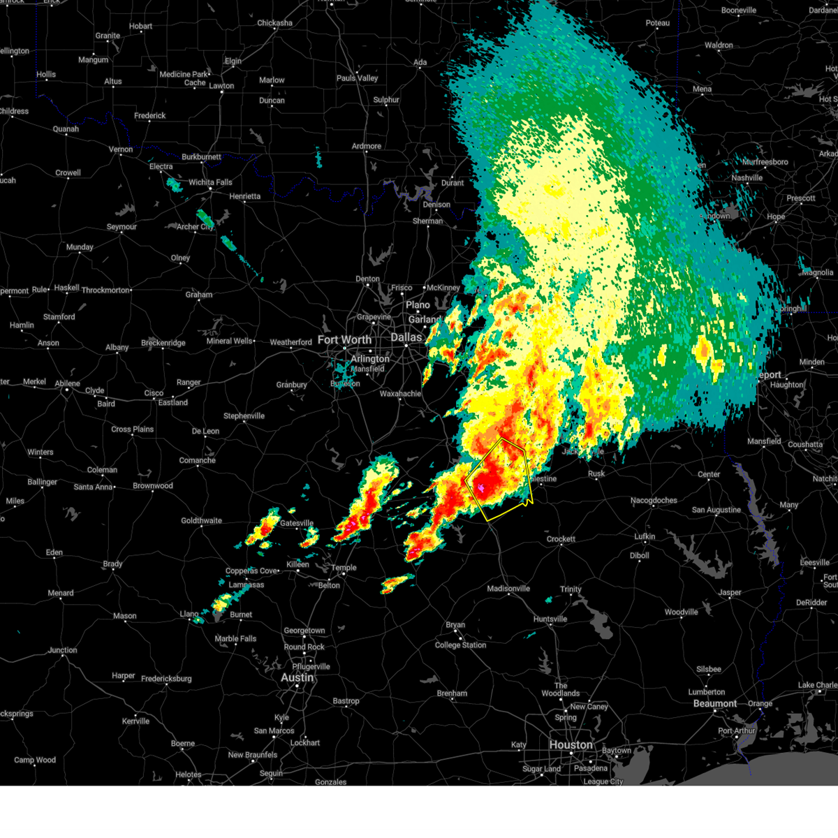
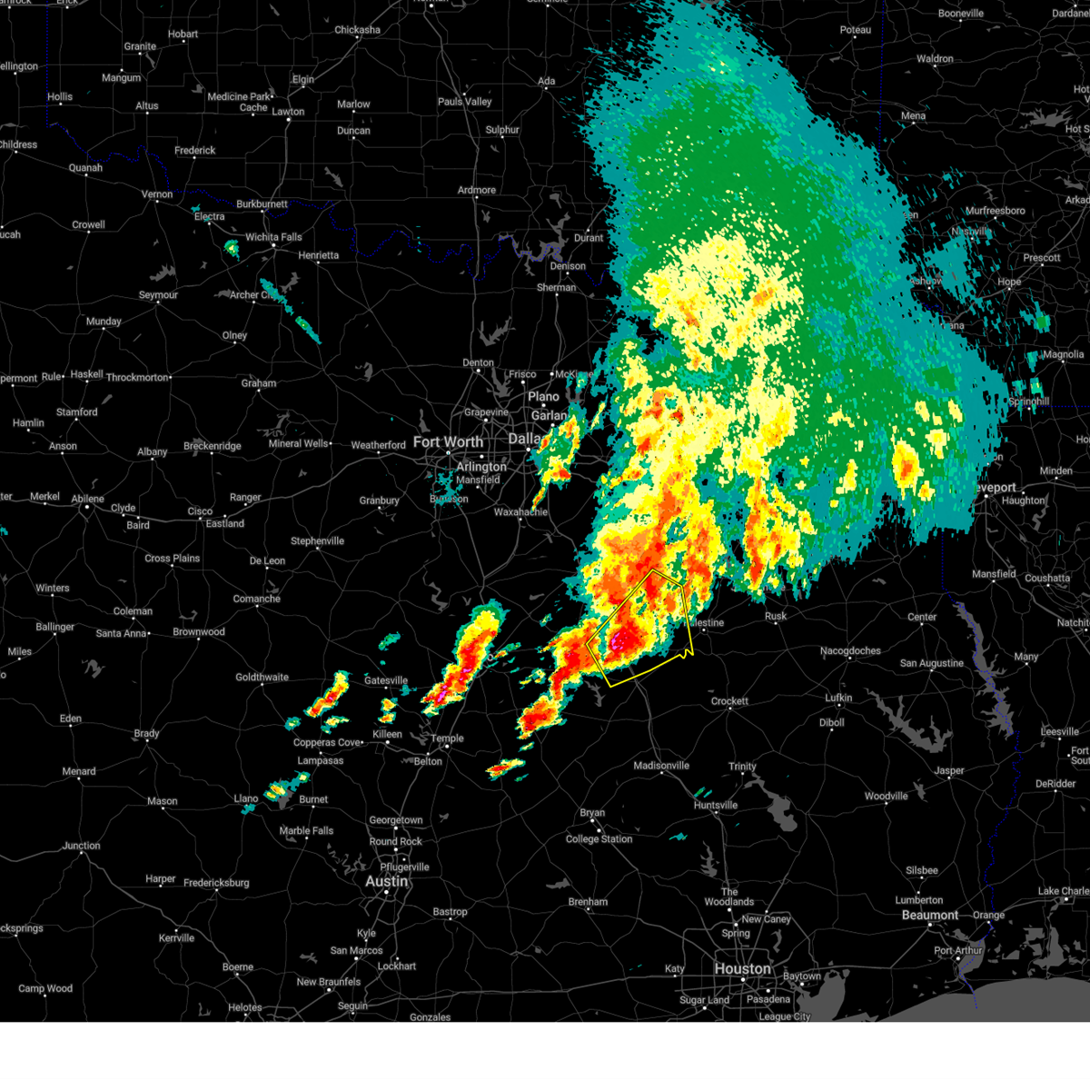
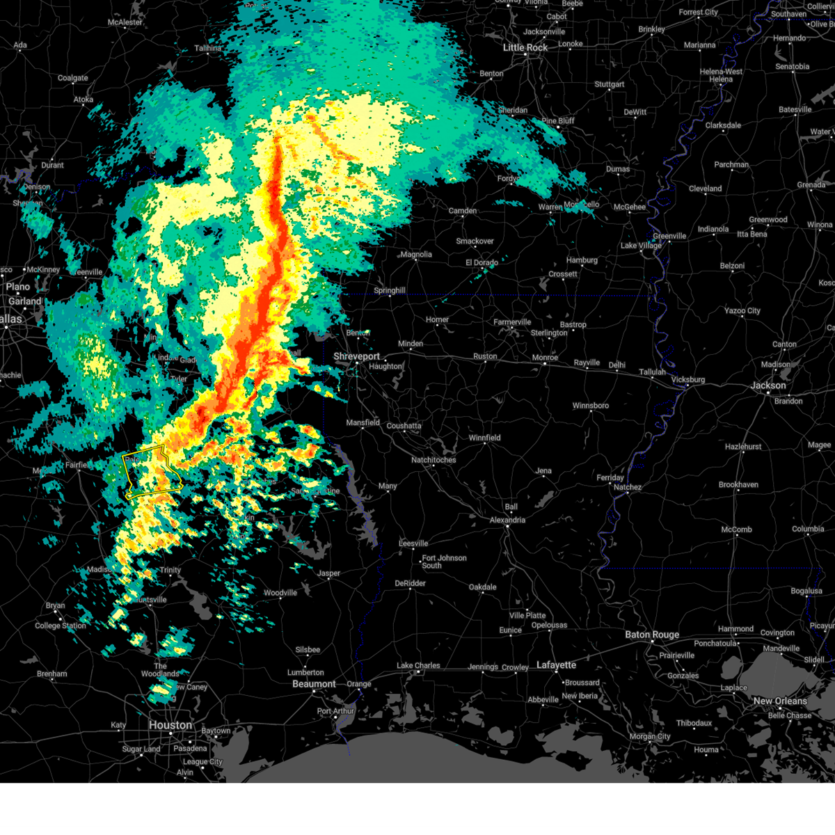
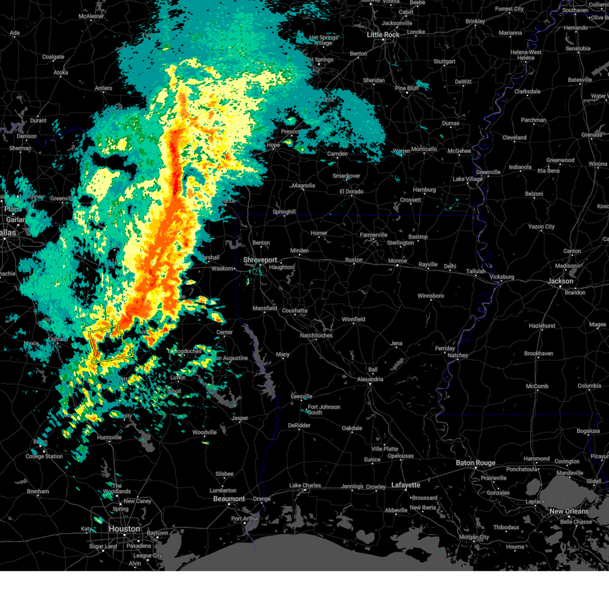
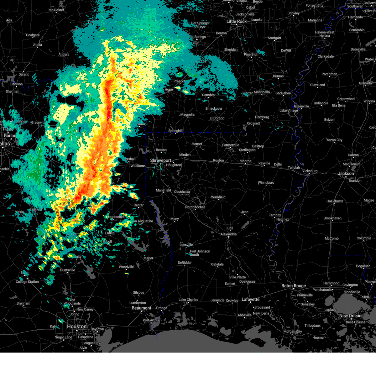
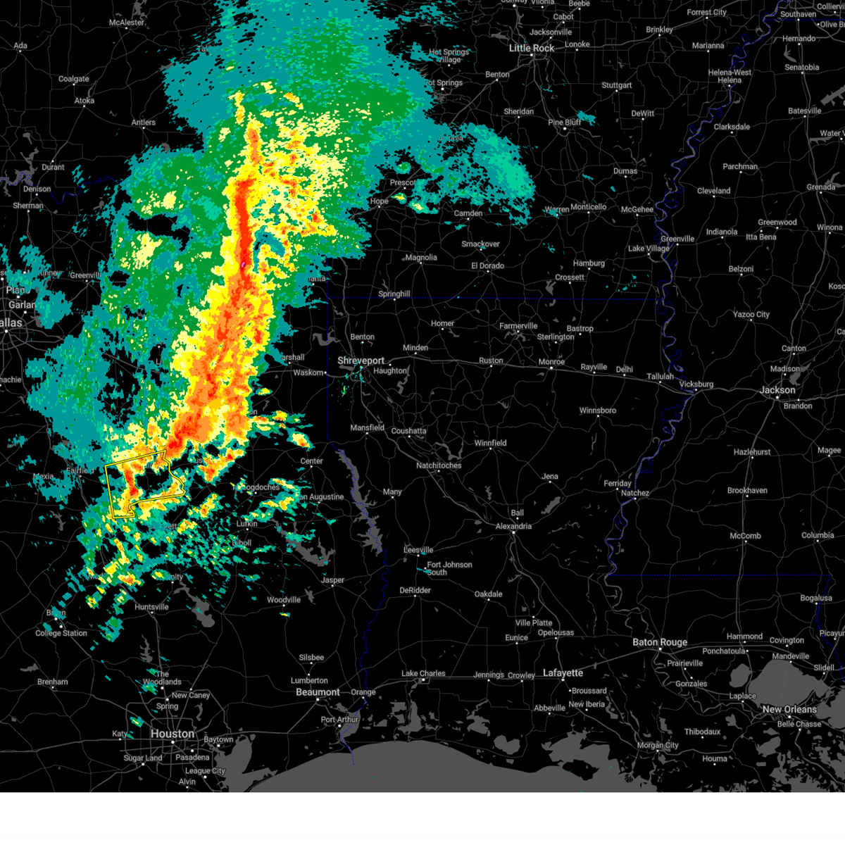
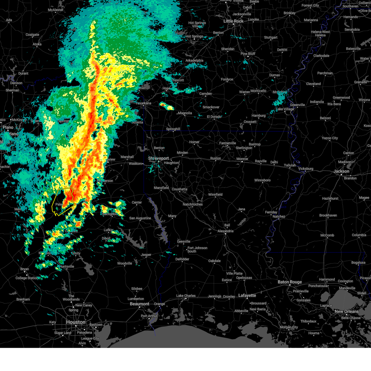
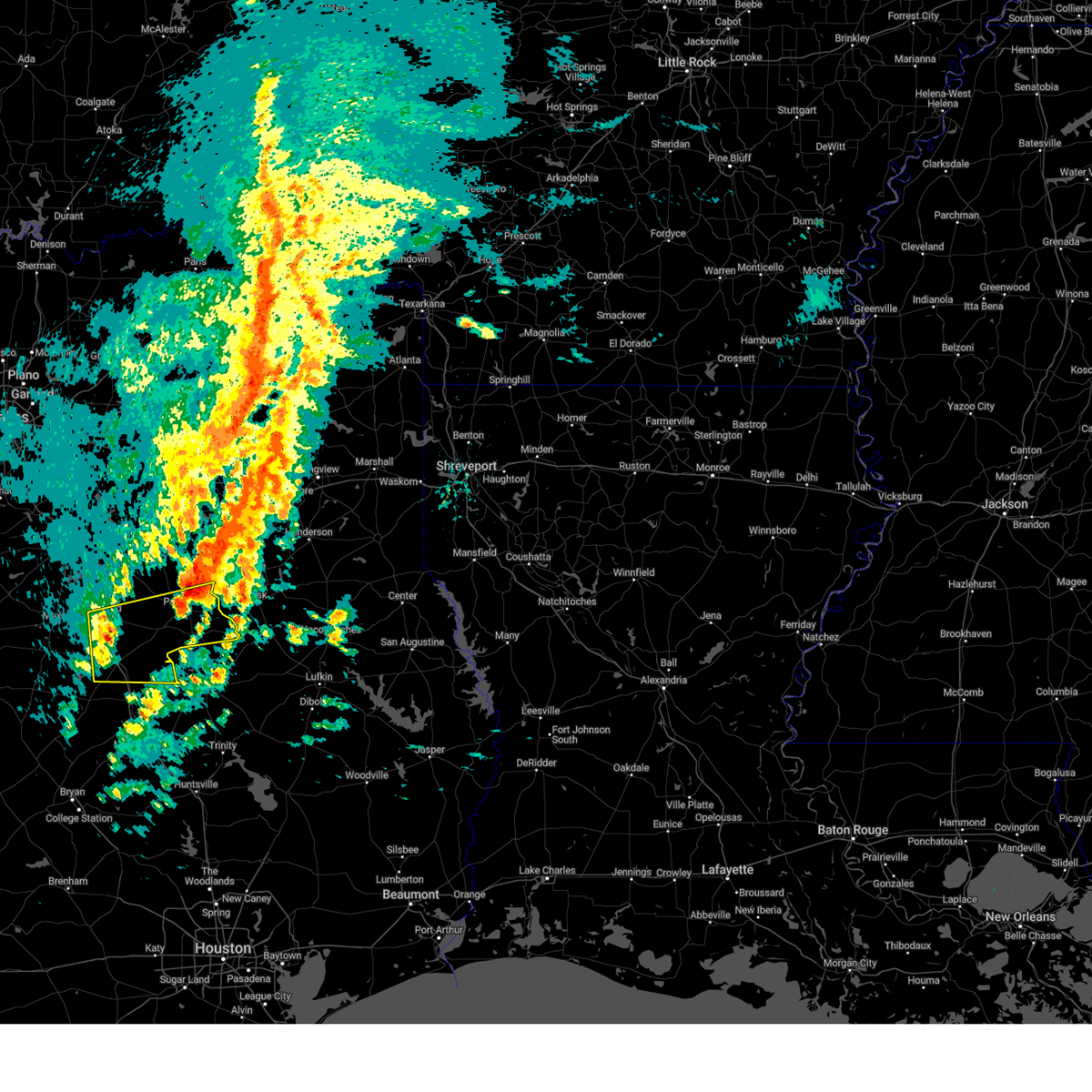
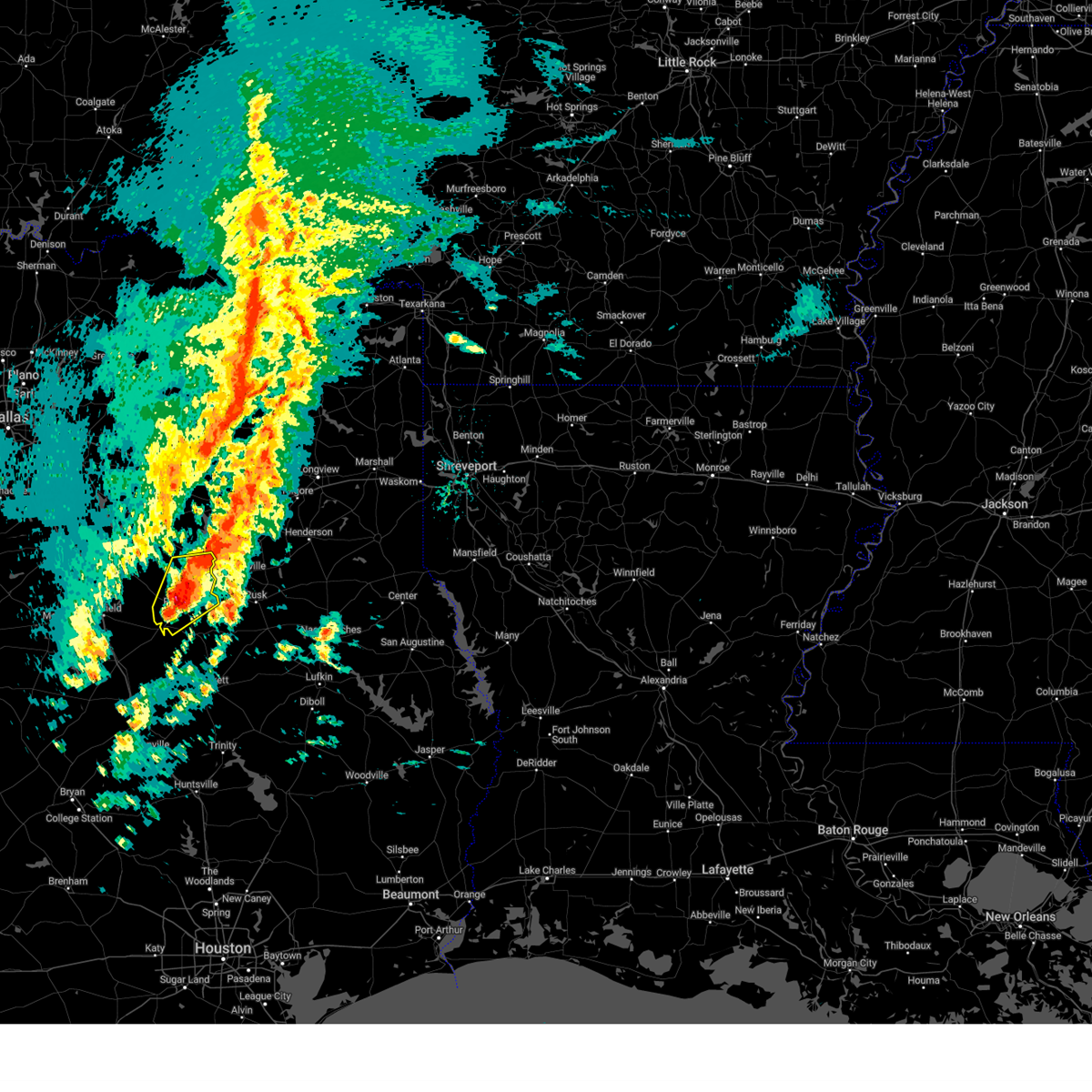
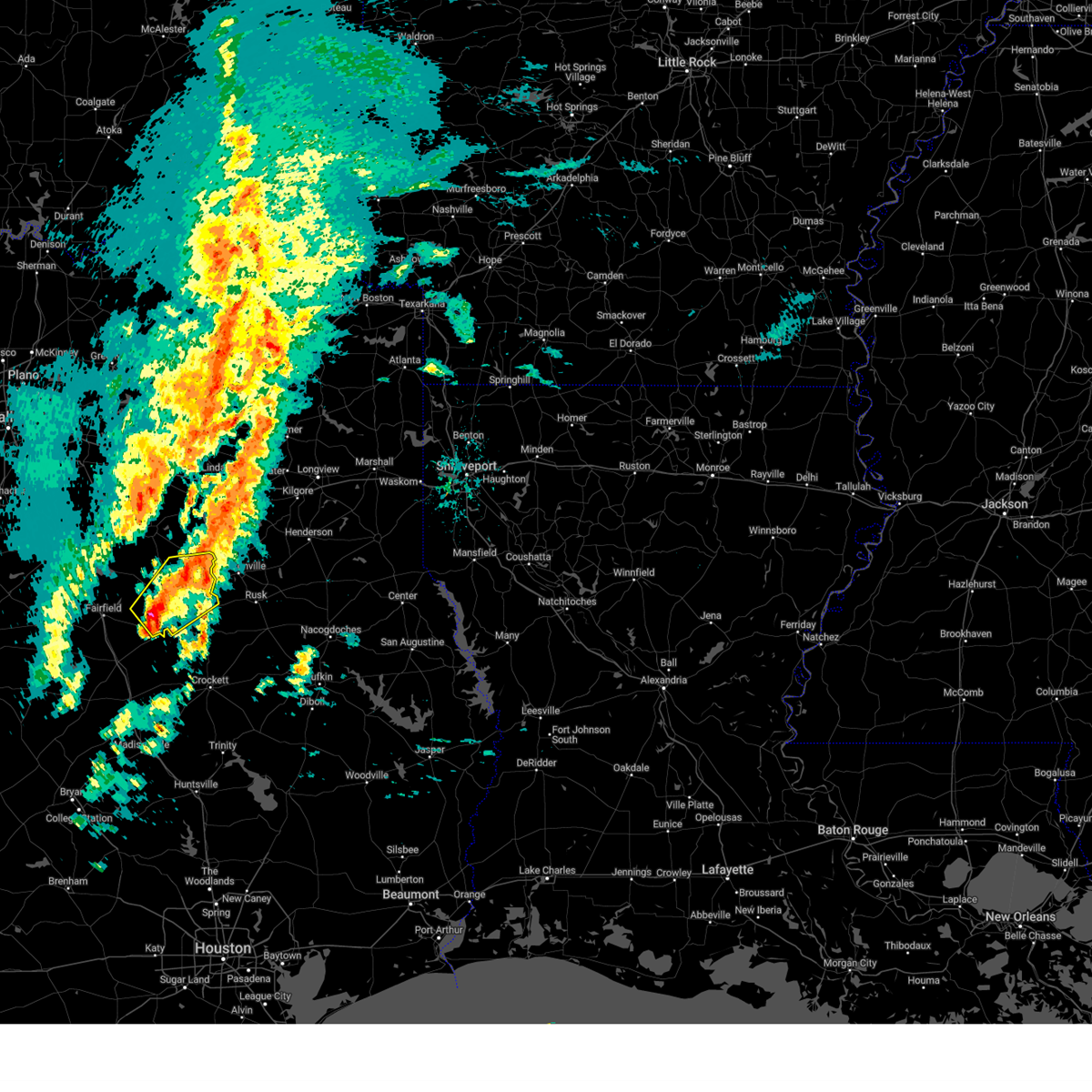
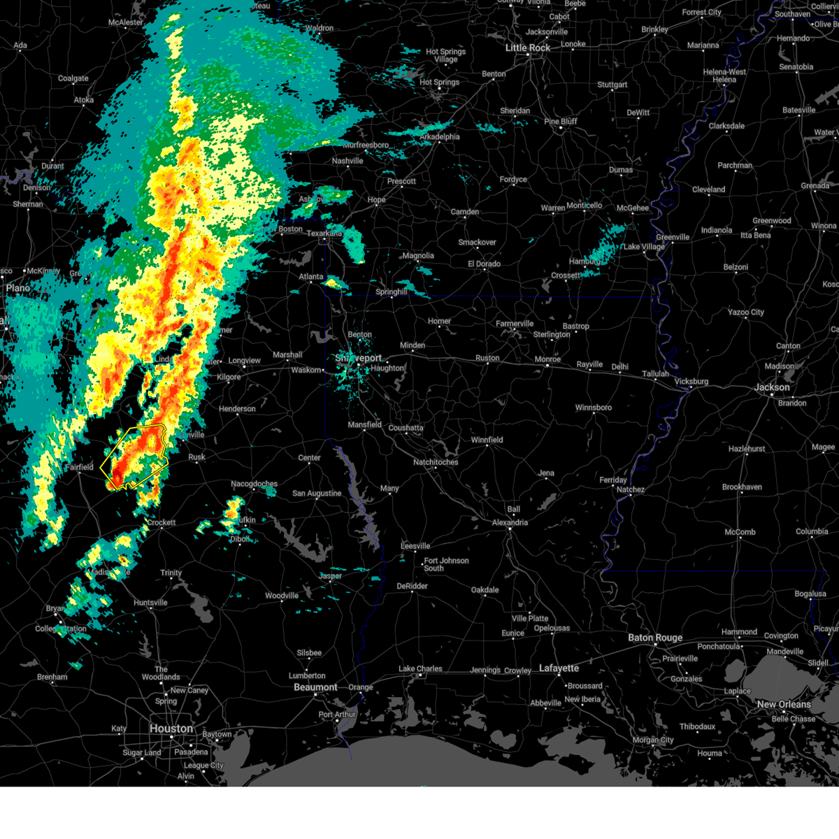
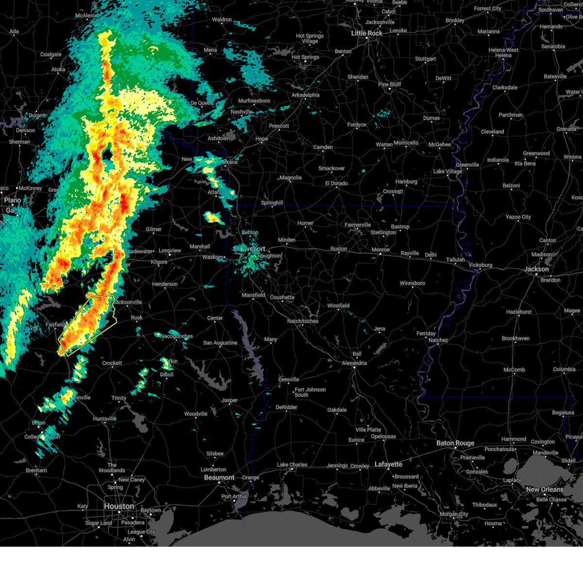
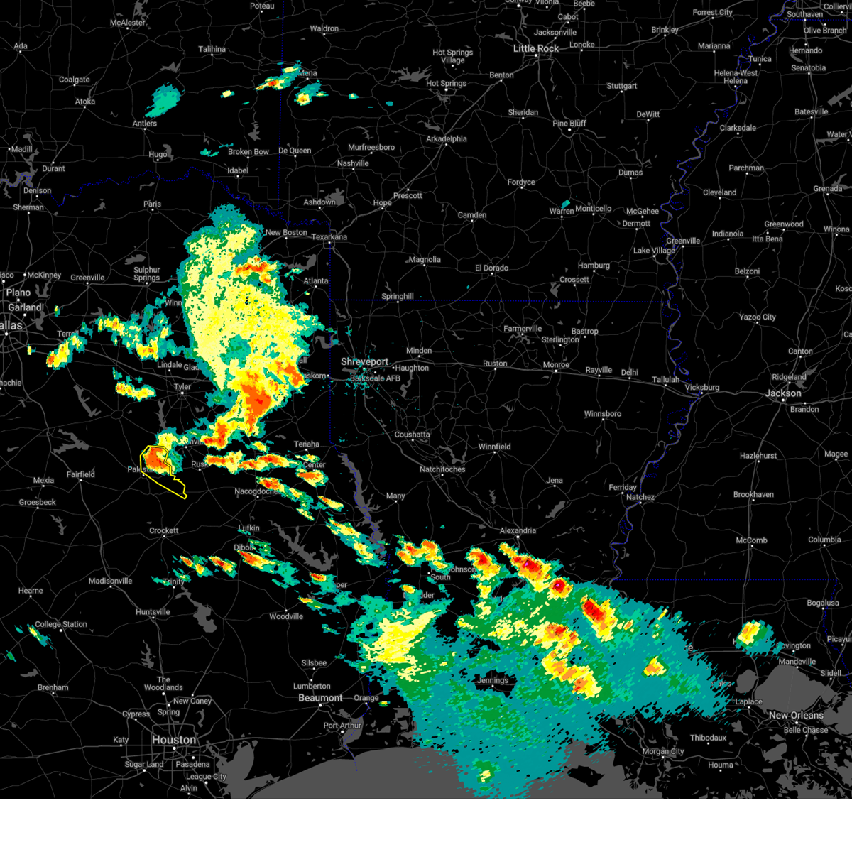
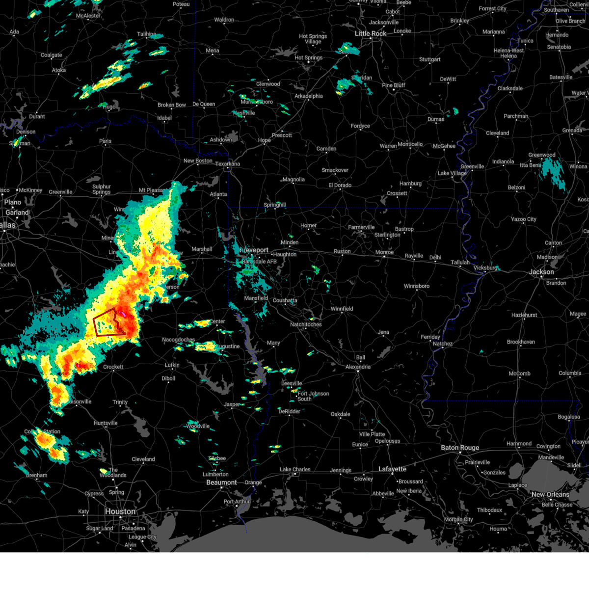
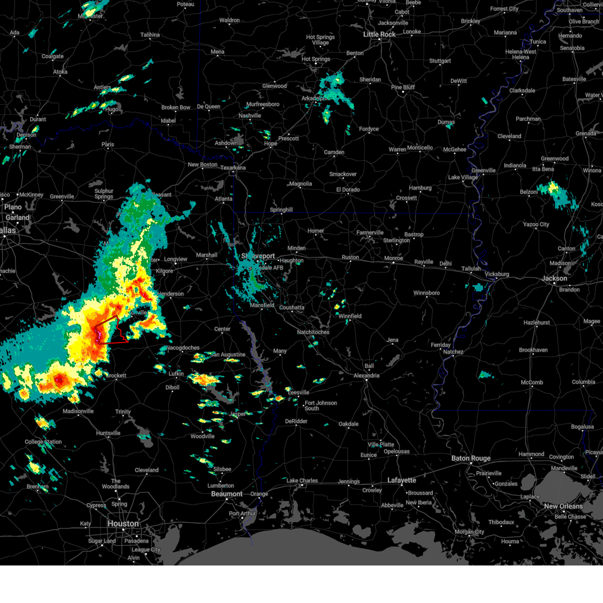
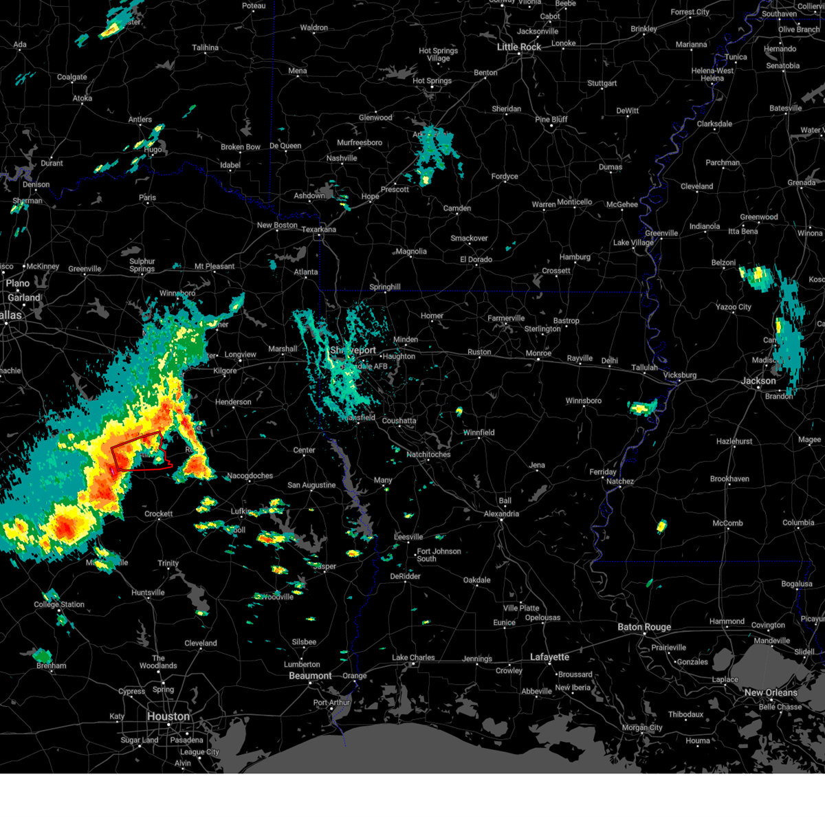
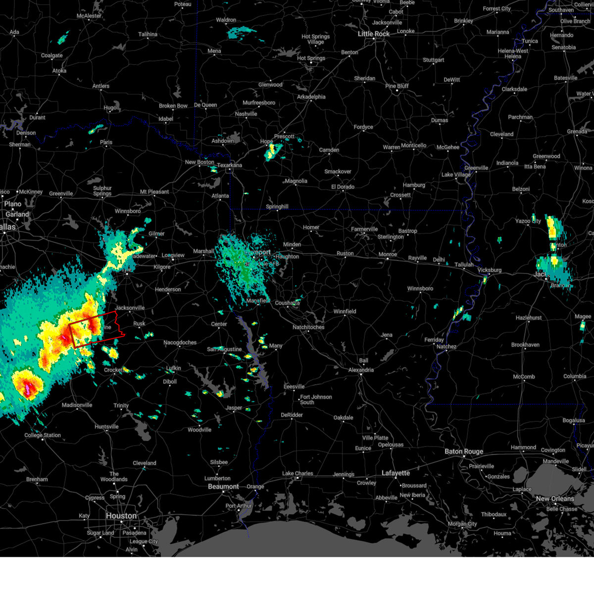
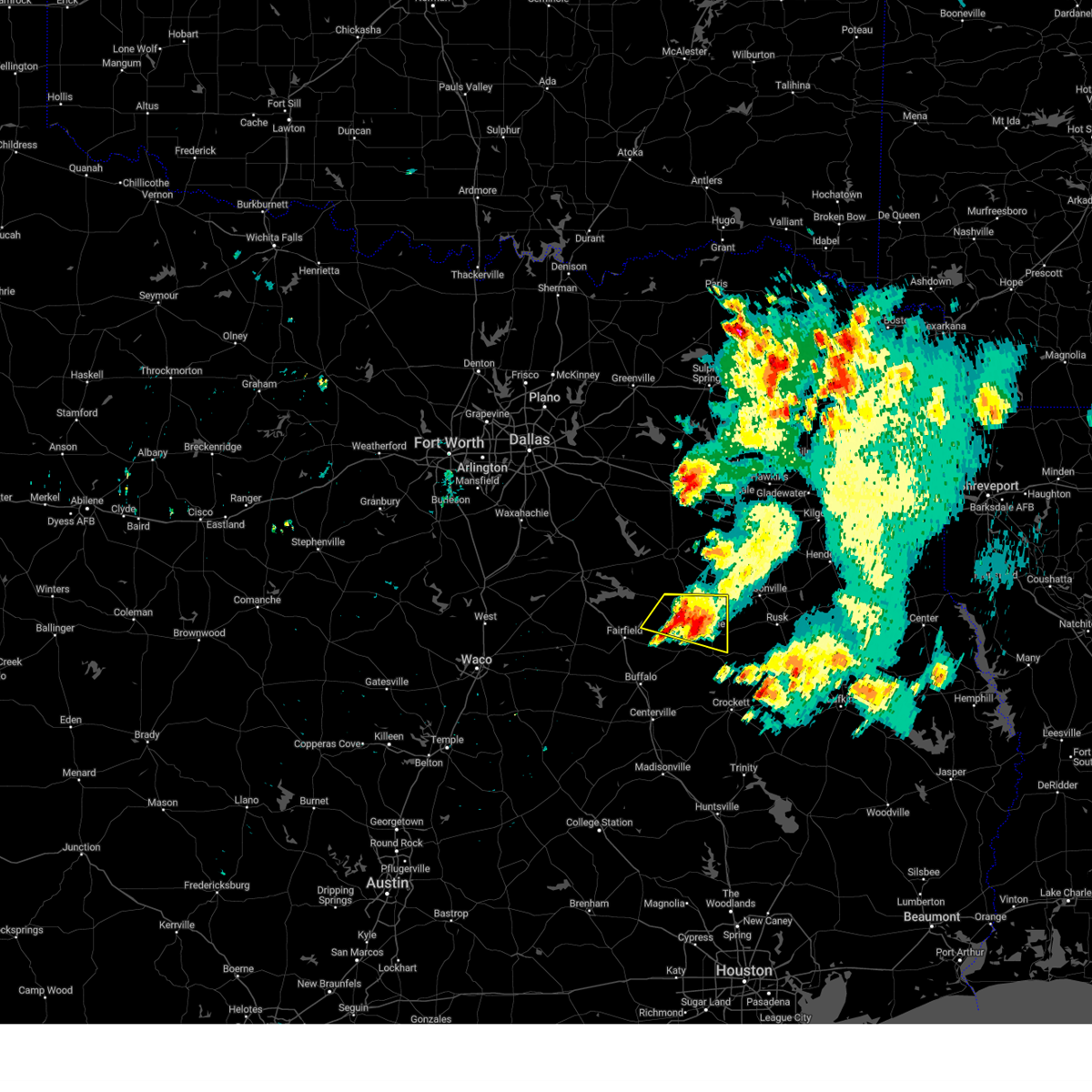
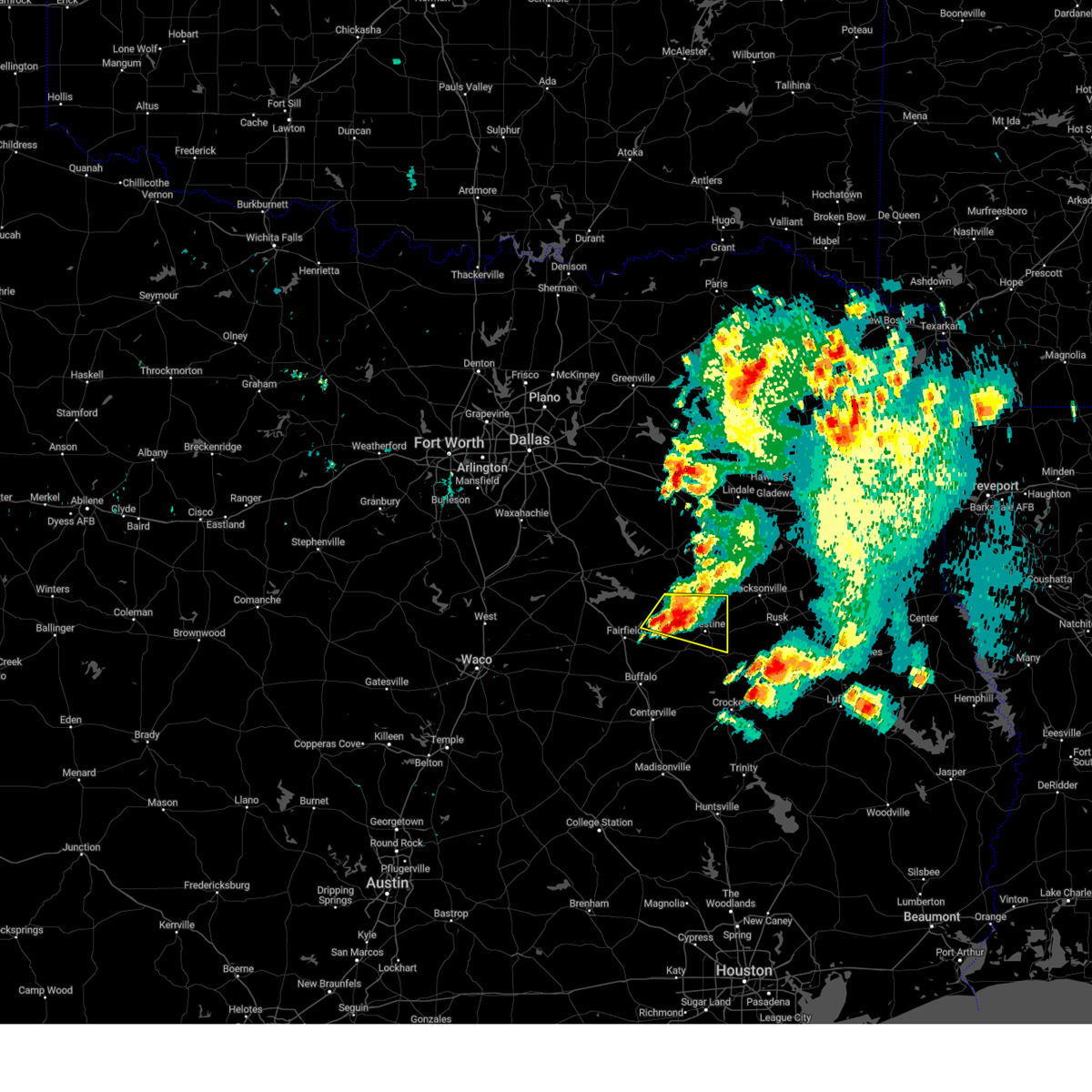
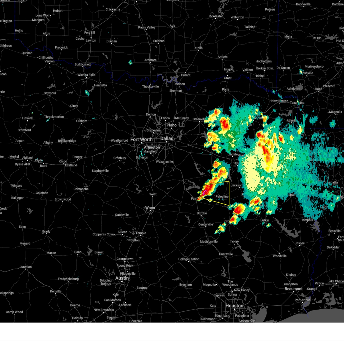
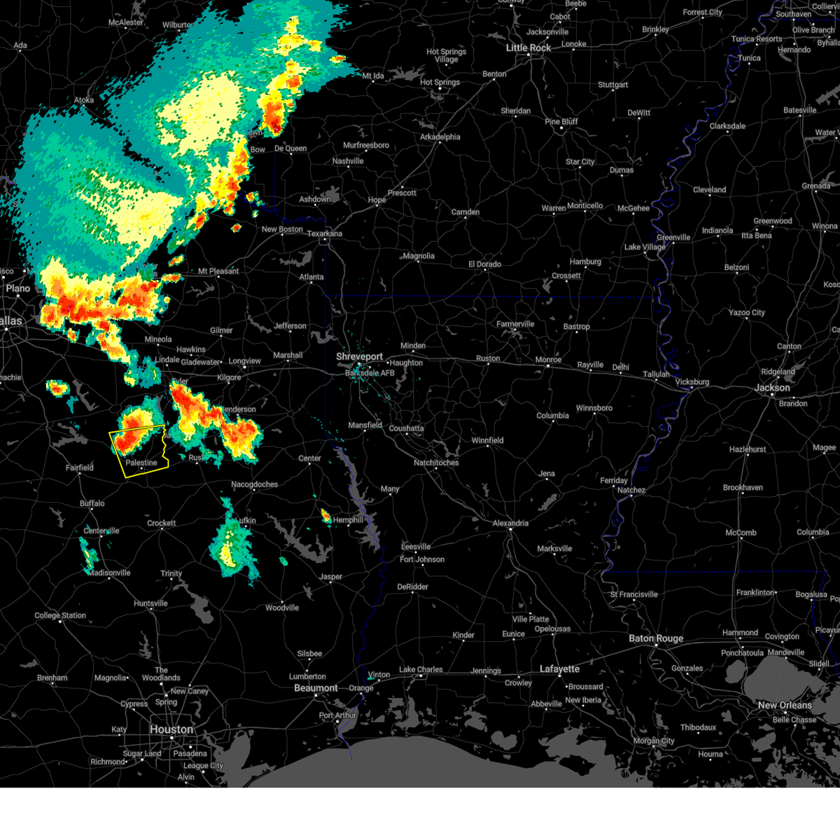
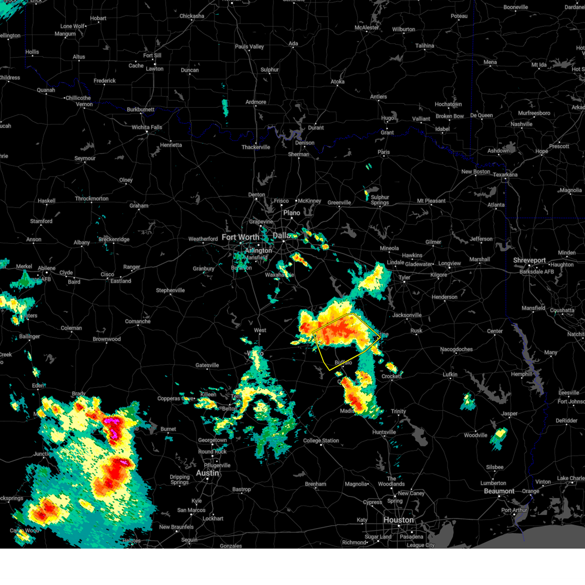
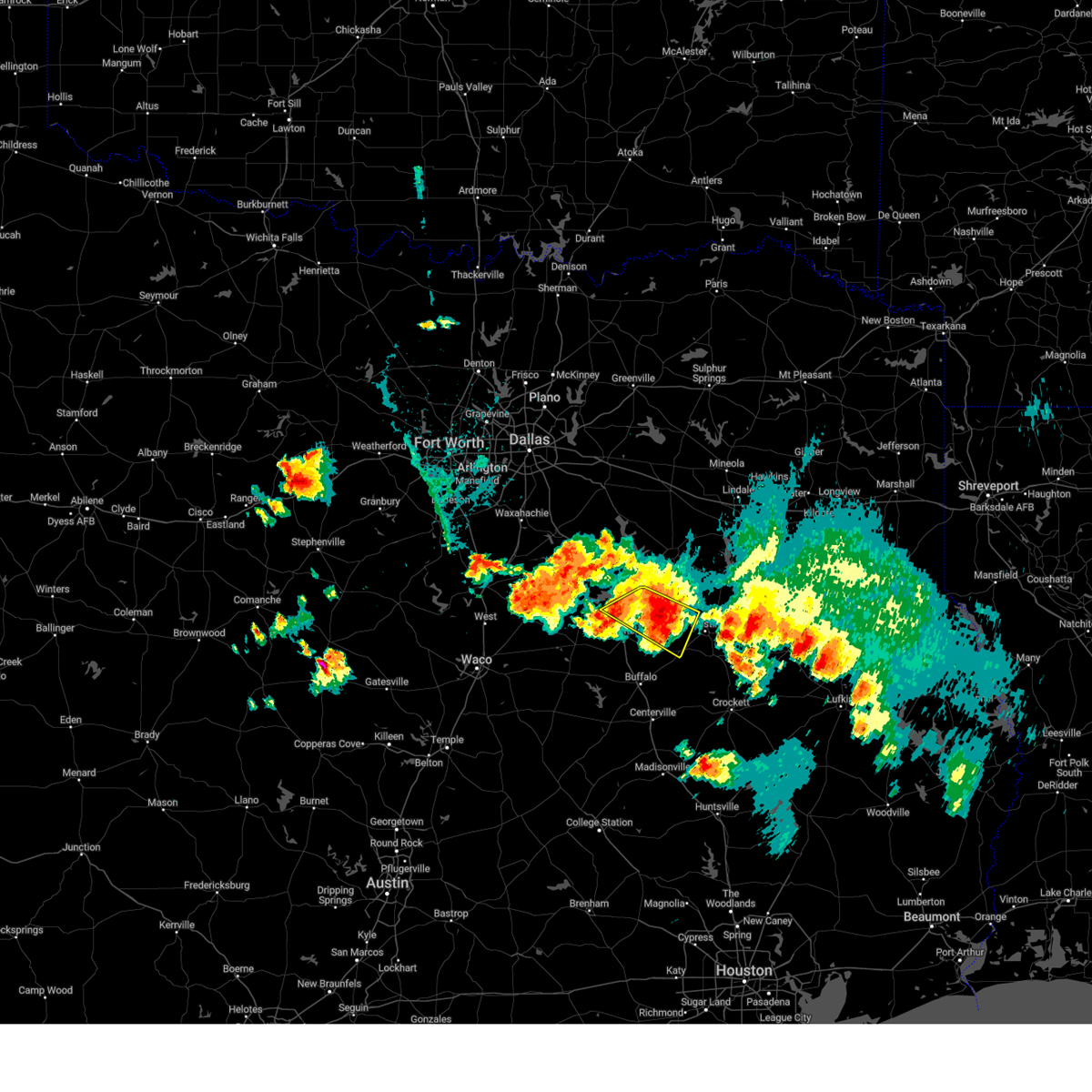
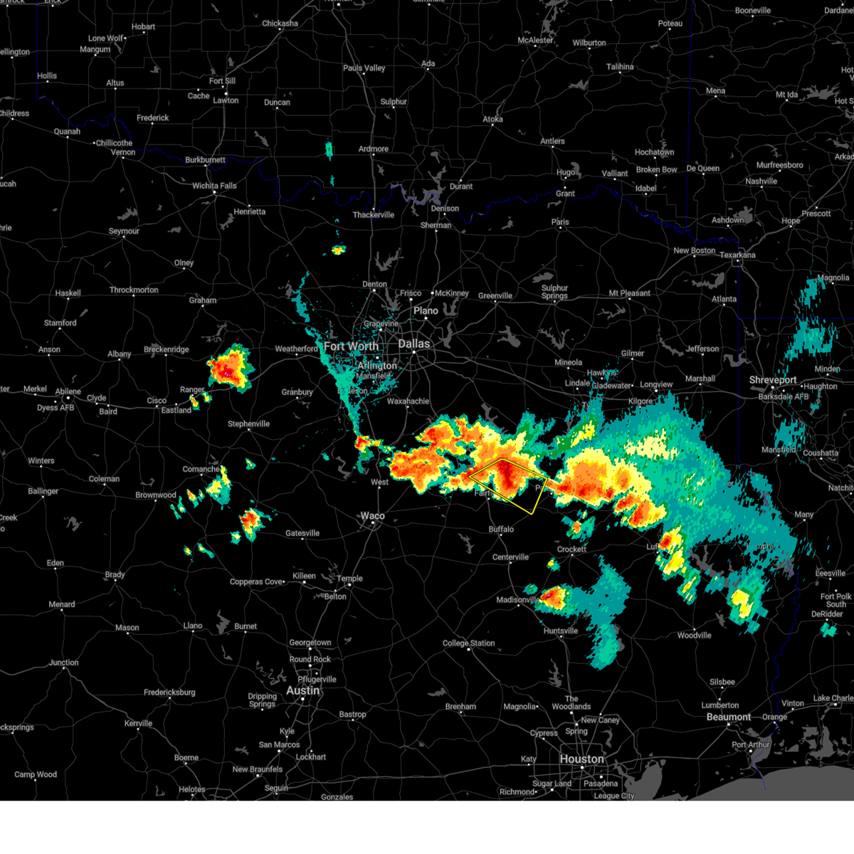
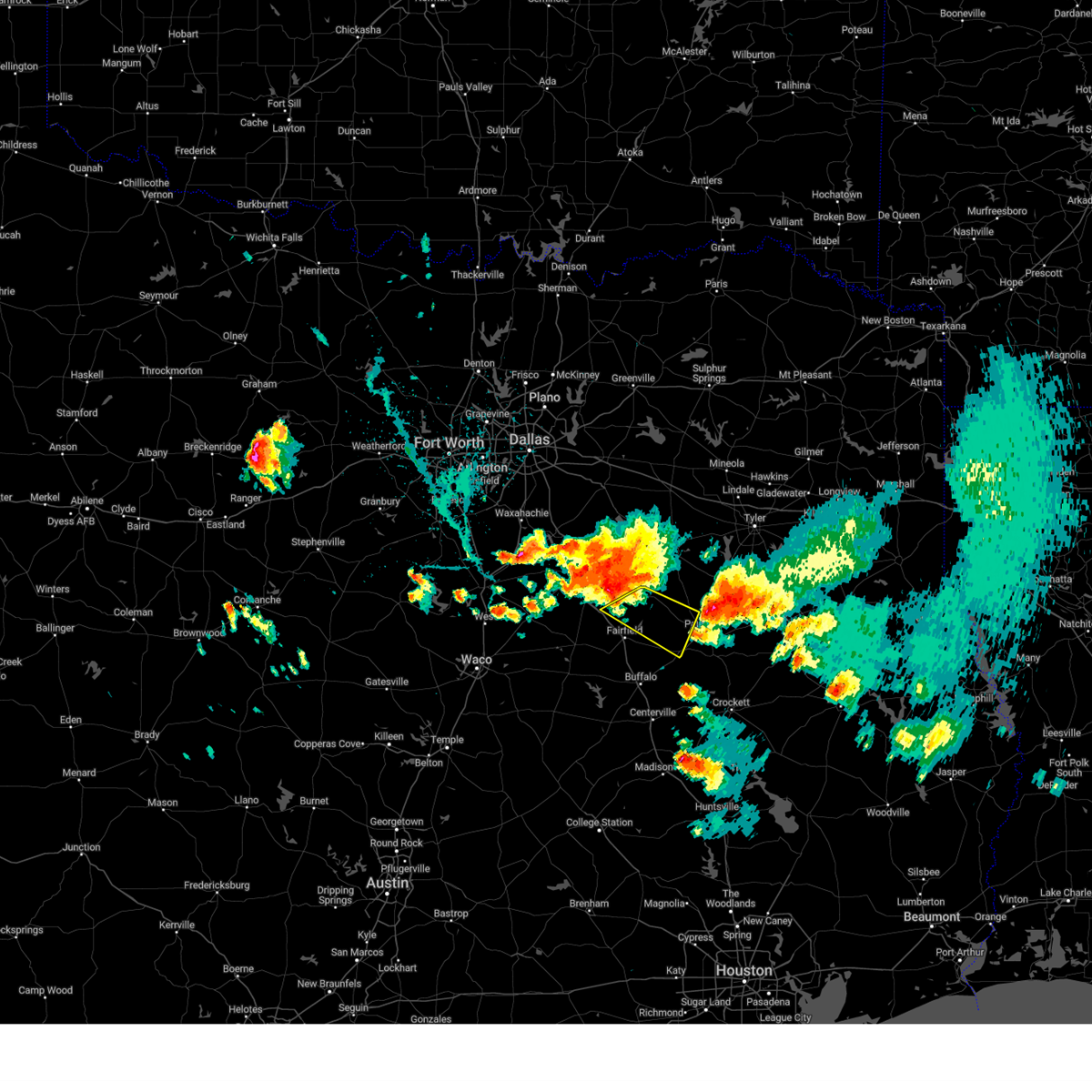
Hail Map for Palestine, TX
The Palestine, TX area has had 32 reports of on-the-ground hail by trained spotters, and has been under severe weather warnings 36 times during the past 12 months. Doppler radar has detected hail at or near Palestine, TX on 90 occasions, including 7 occasions during the past year.
| Name: | Palestine, TX |
| Where Located: | 61.8 miles WNW of Lufkin, TX |
| Map: | Google Map for Palestine, TX |
| Population: | 18712 |
| Housing Units: | 7912 |
| More Info: | Search Google for Palestine, TX |
2
The Top Recent Hail Date for Palestine, TX is Wednesday, April 30, 2025 (16th out of 90)
Hail and Wind Damage Spotted near Palestine, TX
| Date / Time | Report Details |
|---|---|
| 6/9/2025 1:30 AM CDT |
 the severe thunderstorm warning has been cancelled and is no longer in effect the severe thunderstorm warning has been cancelled and is no longer in effect
|
| 6/9/2025 1:17 AM CDT |
 the severe thunderstorm warning has been cancelled and is no longer in effect the severe thunderstorm warning has been cancelled and is no longer in effect
|
| 6/9/2025 1:17 AM CDT |
 At 116 am cdt, severe thunderstorms were located along a line extending from near lake palestine to near trinidad lake to 8 miles south of richland-chambers reservoir to near west, moving southeast at 30 mph (radar indicated). Hazards include 60 mph wind gusts and nickel size hail. Expect damage to roofs, siding, and trees. Locations impacted include, bradford, malakoff, streetman, donie, richland, poynor, fairfield lake, cayuga, lake mexia, cross roads, trinidad, oletha, bethel, kirvin, purdon, lanely, brushy creek, richland-chambers reservoir, fort parker state park, and mount calm. At 116 am cdt, severe thunderstorms were located along a line extending from near lake palestine to near trinidad lake to 8 miles south of richland-chambers reservoir to near west, moving southeast at 30 mph (radar indicated). Hazards include 60 mph wind gusts and nickel size hail. Expect damage to roofs, siding, and trees. Locations impacted include, bradford, malakoff, streetman, donie, richland, poynor, fairfield lake, cayuga, lake mexia, cross roads, trinidad, oletha, bethel, kirvin, purdon, lanely, brushy creek, richland-chambers reservoir, fort parker state park, and mount calm.
|
| 6/9/2025 1:02 AM CDT |
 Svrfwd the national weather service in fort worth has issued a * severe thunderstorm warning for, freestone county in central texas, southern kaufman county in north central texas, southern van zandt county in north central texas, northwestern leon county in central texas, henderson county in central texas, limestone county in central texas, southeastern hill county in central texas, anderson county in central texas, navarro county in north central texas, * until 215 am cdt. * at 102 am cdt, severe thunderstorms were located along a line extending from near kemp to near kerens to 8 miles northeast of wortham to 7 miles west of west, moving southeast at 45 mph (radar indicated). Hazards include 70 mph wind gusts and nickel size hail. Expect considerable tree damage. Damage is likely to mobile homes, roofs, and outbuildings. Svrfwd the national weather service in fort worth has issued a * severe thunderstorm warning for, freestone county in central texas, southern kaufman county in north central texas, southern van zandt county in north central texas, northwestern leon county in central texas, henderson county in central texas, limestone county in central texas, southeastern hill county in central texas, anderson county in central texas, navarro county in north central texas, * until 215 am cdt. * at 102 am cdt, severe thunderstorms were located along a line extending from near kemp to near kerens to 8 miles northeast of wortham to 7 miles west of west, moving southeast at 45 mph (radar indicated). Hazards include 70 mph wind gusts and nickel size hail. Expect considerable tree damage. Damage is likely to mobile homes, roofs, and outbuildings.
|
| 5/6/2025 1:57 PM CDT | Several trees down on fm 837 blocking the road between hwy 19 and hwy 155. reported via vf in anderson county TX, 15.9 miles S of Palestine, TX |
| 5/6/2025 1:56 PM CDT |
 the severe thunderstorm warning has been cancelled and is no longer in effect the severe thunderstorm warning has been cancelled and is no longer in effect
|
| 5/6/2025 1:56 PM CDT |
 At 155 pm cdt, severe thunderstorms were located along a line extending from near montalba to near elkhart to fort boggy state park, moving northeast at 50 mph (radar indicated). Hazards include 60 mph wind gusts and quarter size hail. Hail damage to vehicles is expected. expect wind damage to roofs, siding, and trees. Locations impacted include, tucker, montalba, brushy creek, salmon, cedar creek, slocum, palestine, eunice, broom city, elkhart, pert, redtown, frankston, denson spring, crystal lake, centerview, todd city, neches, berryville, and mound city. At 155 pm cdt, severe thunderstorms were located along a line extending from near montalba to near elkhart to fort boggy state park, moving northeast at 50 mph (radar indicated). Hazards include 60 mph wind gusts and quarter size hail. Hail damage to vehicles is expected. expect wind damage to roofs, siding, and trees. Locations impacted include, tucker, montalba, brushy creek, salmon, cedar creek, slocum, palestine, eunice, broom city, elkhart, pert, redtown, frankston, denson spring, crystal lake, centerview, todd city, neches, berryville, and mound city.
|
| 5/6/2025 1:36 PM CDT | Svrfwd the national weather service in fort worth has issued a * severe thunderstorm warning for, eastern freestone county in central texas, leon county in central texas, anderson county in central texas, * until 230 pm cdt. * at 136 pm cdt, severe thunderstorms were located along a line extending from fairfield lake to buffalo to fort boggy state park, moving east at 50 mph (radar indicated). Hazards include 60 mph wind gusts and quarter size hail. Hail damage to vehicles is expected. expect wind damage to roofs, siding, and trees. severe thunderstorms will be near, centerville and fort boggy state park around 140 pm cdt. palestine around 145 pm cdt. montalba and elkhart around 150 pm cdt. other locations impacted by these severe thunderstorms include tucker, bradford, flo, bois d'arc, oakwood, eunice, cayuga, redland, redtown, and bethel. This includes interstate 45 between mile markers 152 and 171. |
| 5/2/2025 5:12 PM CDT |
 the severe thunderstorm warning has been cancelled and is no longer in effect the severe thunderstorm warning has been cancelled and is no longer in effect
|
| 5/2/2025 5:03 PM CDT | At 503 pm cdt, a severe thunderstorm was located over palestine, moving east at 35 mph (radar indicated). Hazards include 60 mph wind gusts and nickel size hail. Expect damage to roofs, siding, and trees. this severe storm will be near, palestine around 510 pm cdt. Other locations impacted by this severe thunderstorm include tucker, johnson, redtown, yard, cedar creek, crystal lake, bethel, neches, massey lake, and tennessee colony. |
| 5/2/2025 5:03 PM CDT | the severe thunderstorm warning has been cancelled and is no longer in effect |
| 5/2/2025 4:26 PM CDT |
 Svrfwd the national weather service in fort worth has issued a * severe thunderstorm warning for, freestone county in central texas, northern leon county in central texas, central anderson county in central texas, * until 530 pm cdt. * at 425 pm cdt, a severe thunderstorm was located over fairfield lake, or 7 miles northeast of fairfield, moving east at 30 mph (radar indicated). Hazards include 60 mph wind gusts and half dollar size hail. Hail damage to vehicles is expected. expect wind damage to roofs, siding, and trees. this severe thunderstorm will be near, fairfield lake state park and fairfield lake around 430 pm cdt. palestine around 500 pm cdt. other locations impacted by this severe thunderstorm include tucker, johnson, lanely, cedar creek, flo, stewards mill, oakwood, donie, freestone, and eunice. This includes interstate 45 between mile markers 173 and 206. Svrfwd the national weather service in fort worth has issued a * severe thunderstorm warning for, freestone county in central texas, northern leon county in central texas, central anderson county in central texas, * until 530 pm cdt. * at 425 pm cdt, a severe thunderstorm was located over fairfield lake, or 7 miles northeast of fairfield, moving east at 30 mph (radar indicated). Hazards include 60 mph wind gusts and half dollar size hail. Hail damage to vehicles is expected. expect wind damage to roofs, siding, and trees. this severe thunderstorm will be near, fairfield lake state park and fairfield lake around 430 pm cdt. palestine around 500 pm cdt. other locations impacted by this severe thunderstorm include tucker, johnson, lanely, cedar creek, flo, stewards mill, oakwood, donie, freestone, and eunice. This includes interstate 45 between mile markers 173 and 206.
|
| 4/30/2025 7:25 PM CDT | At 725 pm cdt, a severe thunderstorm was located 14 miles west of elkhart, or 15 miles southwest of palestine, moving northeast at 30 mph. another storm was located to the northwest of buffalo (radar indicated). Hazards include quarter size hail. Damage to vehicles is possible. this severe storm will be near, elkhart around 745 pm cdt. Other locations impacted by this severe thunderstorm include tucker, johnson, lanely, cedar creek, flo, oakwood, donie, freestone, redtown, and dew. |
| 4/30/2025 6:45 PM CDT |
 Svrfwd the national weather service in fort worth has issued a * severe thunderstorm warning for, southeastern freestone county in central texas, northern leon county in central texas, southwestern anderson county in central texas, * until 745 pm cdt. * at 645 pm cdt, a severe thunderstorm was located near buffalo, or 12 miles southeast of teague, moving northeast at 35 mph (radar indicated). Hazards include ping pong ball size hail. People and animals outdoors will be injured. expect damage to roofs, siding, windows, and vehicles. this severe thunderstorm will be near, buffalo around 650 pm cdt. palestine around 730 pm cdt. other locations impacted by this severe thunderstorm include tucker, johnson, lanely, cedar creek, flo, oakwood, donie, freestone, redtown, and dew. This includes interstate 45 between mile markers 174 and 191. Svrfwd the national weather service in fort worth has issued a * severe thunderstorm warning for, southeastern freestone county in central texas, northern leon county in central texas, southwestern anderson county in central texas, * until 745 pm cdt. * at 645 pm cdt, a severe thunderstorm was located near buffalo, or 12 miles southeast of teague, moving northeast at 35 mph (radar indicated). Hazards include ping pong ball size hail. People and animals outdoors will be injured. expect damage to roofs, siding, windows, and vehicles. this severe thunderstorm will be near, buffalo around 650 pm cdt. palestine around 730 pm cdt. other locations impacted by this severe thunderstorm include tucker, johnson, lanely, cedar creek, flo, oakwood, donie, freestone, redtown, and dew. This includes interstate 45 between mile markers 174 and 191.
|
| 4/30/2025 4:56 PM CDT |
 At 456 pm cdt, a severe thunderstorm was located near fairfield lake state park, or near fairfield, moving northeast at 35 mph (radar indicated). Hazards include ping pong ball size hail and 60 mph wind gusts. People and animals outdoors will be injured. expect hail damage to roofs, siding, windows, and vehicles. expect wind damage to roofs, siding, and trees. this severe storm will be near, fairfield lake state park and fairfield lake around 500 pm cdt. Other locations impacted by this severe thunderstorm include tucker, johnson, lanely, stewards mill, blackfoot, cayuga, cross roads, yard, springfield, and dew. At 456 pm cdt, a severe thunderstorm was located near fairfield lake state park, or near fairfield, moving northeast at 35 mph (radar indicated). Hazards include ping pong ball size hail and 60 mph wind gusts. People and animals outdoors will be injured. expect hail damage to roofs, siding, windows, and vehicles. expect wind damage to roofs, siding, and trees. this severe storm will be near, fairfield lake state park and fairfield lake around 500 pm cdt. Other locations impacted by this severe thunderstorm include tucker, johnson, lanely, stewards mill, blackfoot, cayuga, cross roads, yard, springfield, and dew.
|
| 4/30/2025 4:44 PM CDT |
 Svrfwd the national weather service in fort worth has issued a * severe thunderstorm warning for, freestone county in central texas, south central henderson county in central texas, western anderson county in central texas, * until 545 pm cdt. * at 444 pm cdt, a severe thunderstorm was located near fairfield, moving northeast at 30 mph (radar indicated). Hazards include golf ball size hail and 60 mph wind gusts. People and animals outdoors will be injured. expect hail damage to roofs, siding, windows, and vehicles. expect wind damage to roofs, siding, and trees. this severe thunderstorm will be near, fairfield around 450 pm cdt. fairfield lake state park and fairfield lake around 455 pm cdt. other locations impacted by this severe thunderstorm include tucker, johnson, lanely, stewards mill, donie, blackfoot, freestone, cayuga, cotton gin, and cross roads. This includes interstate 45 between mile markers 182 and 206. Svrfwd the national weather service in fort worth has issued a * severe thunderstorm warning for, freestone county in central texas, south central henderson county in central texas, western anderson county in central texas, * until 545 pm cdt. * at 444 pm cdt, a severe thunderstorm was located near fairfield, moving northeast at 30 mph (radar indicated). Hazards include golf ball size hail and 60 mph wind gusts. People and animals outdoors will be injured. expect hail damage to roofs, siding, windows, and vehicles. expect wind damage to roofs, siding, and trees. this severe thunderstorm will be near, fairfield around 450 pm cdt. fairfield lake state park and fairfield lake around 455 pm cdt. other locations impacted by this severe thunderstorm include tucker, johnson, lanely, stewards mill, donie, blackfoot, freestone, cayuga, cotton gin, and cross roads. This includes interstate 45 between mile markers 182 and 206.
|
| 4/24/2025 4:40 PM CDT |
 The storm which prompted the warning has weakened below severe limits, and has exited the warned area. therefore, the warning will be allowed to expire. a severe thunderstorm watch remains in effect until 800 pm cdt for central texas. The storm which prompted the warning has weakened below severe limits, and has exited the warned area. therefore, the warning will be allowed to expire. a severe thunderstorm watch remains in effect until 800 pm cdt for central texas.
|
| 4/24/2025 4:28 PM CDT |
 the severe thunderstorm warning has been cancelled and is no longer in effect the severe thunderstorm warning has been cancelled and is no longer in effect
|
| 4/24/2025 4:28 PM CDT |
 At 427 pm cdt, a severe thunderstorm was located near elkhart, or 14 miles south of palestine, moving northeast at 20 mph (radar indicated). Hazards include 60 mph wind gusts and quarter size hail. Hail damage to vehicles is expected. expect wind damage to roofs, siding, and trees. this severe storm will be near, elkhart around 435 pm cdt. Other locations impacted by this severe thunderstorm include redtown, mound city, denson spring, salmon, cedar creek, crystal lake, slocum, and broom city. At 427 pm cdt, a severe thunderstorm was located near elkhart, or 14 miles south of palestine, moving northeast at 20 mph (radar indicated). Hazards include 60 mph wind gusts and quarter size hail. Hail damage to vehicles is expected. expect wind damage to roofs, siding, and trees. this severe storm will be near, elkhart around 435 pm cdt. Other locations impacted by this severe thunderstorm include redtown, mound city, denson spring, salmon, cedar creek, crystal lake, slocum, and broom city.
|
| 4/24/2025 3:40 PM CDT |
 Svrfwd the national weather service in fort worth has issued a * severe thunderstorm warning for, southeastern freestone county in central texas, northeastern leon county in central texas, anderson county in central texas, * until 445 pm cdt. * at 339 pm cdt, a severe thunderstorm was located 11 miles east of buffalo, or 21 miles southeast of fairfield, moving northeast at 35 mph (radar indicated). Hazards include 60 mph wind gusts and quarter size hail. Hail damage to vehicles is expected. expect wind damage to roofs, siding, and trees. this severe thunderstorm will be near, palestine around 405 pm cdt. elkhart around 410 pm cdt. Other locations impacted by this severe thunderstorm include tucker, johnson, redtown, mound city, denson spring, salmon, cedar creek, crystal lake, flo, and oakwood. Svrfwd the national weather service in fort worth has issued a * severe thunderstorm warning for, southeastern freestone county in central texas, northeastern leon county in central texas, anderson county in central texas, * until 445 pm cdt. * at 339 pm cdt, a severe thunderstorm was located 11 miles east of buffalo, or 21 miles southeast of fairfield, moving northeast at 35 mph (radar indicated). Hazards include 60 mph wind gusts and quarter size hail. Hail damage to vehicles is expected. expect wind damage to roofs, siding, and trees. this severe thunderstorm will be near, palestine around 405 pm cdt. elkhart around 410 pm cdt. Other locations impacted by this severe thunderstorm include tucker, johnson, redtown, mound city, denson spring, salmon, cedar creek, crystal lake, flo, and oakwood.
|
| 3/30/2025 6:44 PM CDT | Svrfwd the national weather service in fort worth has issued a * severe thunderstorm warning for, northeastern anderson county in central texas, * until 745 pm cdt. * at 644 pm cdt, a severe thunderstorm was located 9 miles east of montalba, or 10 miles northeast of palestine, moving east at 30 mph (radar indicated). Hazards include 60 mph wind gusts and quarter size hail. Hail damage to vehicles is expected. expect wind damage to roofs, siding, and trees. This severe thunderstorm will remain over mainly rural areas of northeastern anderson county, including the following locations, pert, brushy creek, todd city, and neches. |
| 3/4/2025 8:11 AM CST |
 the severe thunderstorm warning has been cancelled and is no longer in effect the severe thunderstorm warning has been cancelled and is no longer in effect
|
| 3/4/2025 7:58 AM CST |
 At 757 am cst, severe thunderstorms were located along a line extending from palestine to 6 miles southwest of elkhart, moving east at 60 mph (radar indicated). Hazards include 60 mph wind gusts and penny size hail. Expect damage to roofs, siding, and trees. Locations impacted include, elkhart, redtown, mound city, denson spring, salmon, cedar creek, crystal lake, neches, slocum, palestine, and broom city. At 757 am cst, severe thunderstorms were located along a line extending from palestine to 6 miles southwest of elkhart, moving east at 60 mph (radar indicated). Hazards include 60 mph wind gusts and penny size hail. Expect damage to roofs, siding, and trees. Locations impacted include, elkhart, redtown, mound city, denson spring, salmon, cedar creek, crystal lake, neches, slocum, palestine, and broom city.
|
| 3/4/2025 7:58 AM CST |
 the severe thunderstorm warning has been cancelled and is no longer in effect the severe thunderstorm warning has been cancelled and is no longer in effect
|
| 3/4/2025 7:50 AM CST |
 At 748 am cst, severe thunderstorms were located along the trinity river, moving east at 55 mph (radar indicated). Hazards include 60 mph wind gusts and penny size hail. Expect damage to roofs, siding, and trees. Locations impacted include, tucker, johnson, mound city, salmon, cedar creek, oakwood, slocum, palestine, broom city, elkhart, redtown, denson spring, crystal lake, neches, massey lake, and tennessee colony. At 748 am cst, severe thunderstorms were located along the trinity river, moving east at 55 mph (radar indicated). Hazards include 60 mph wind gusts and penny size hail. Expect damage to roofs, siding, and trees. Locations impacted include, tucker, johnson, mound city, salmon, cedar creek, oakwood, slocum, palestine, broom city, elkhart, redtown, denson spring, crystal lake, neches, massey lake, and tennessee colony.
|
| 3/4/2025 7:37 AM CST |
 At 737 am cst, a severe thunderstorm was located near neches, moving northeast at 55 mph (radar indicated). Hazards include 60 mph wind gusts and quarter size hail. Hail damage to vehicles is expected. expect wind damage to roofs, siding, and trees. Locations impacted include, tucker, montalba, pert, johnson, brushy creek, frankston, crystal lake, bois d'arc, todd city, neches, palestine, and cedar creek. At 737 am cst, a severe thunderstorm was located near neches, moving northeast at 55 mph (radar indicated). Hazards include 60 mph wind gusts and quarter size hail. Hail damage to vehicles is expected. expect wind damage to roofs, siding, and trees. Locations impacted include, tucker, montalba, pert, johnson, brushy creek, frankston, crystal lake, bois d'arc, todd city, neches, palestine, and cedar creek.
|
| 3/4/2025 7:28 AM CST |
 Svrfwd the national weather service in fort worth has issued a * severe thunderstorm warning for, southeastern freestone county in central texas, northern leon county in central texas, southern anderson county in central texas, * until 830 am cst. * at 728 am cst, a severe thunderstorm was located over buffalo, moving east at 60 mph (radar indicated). Hazards include 60 mph wind gusts. Expect damage to roofs, siding, and trees. this severe thunderstorm will remain over mainly rural areas of southeastern freestone, northern leon and southern anderson counties, including the following locations, tucker, johnson, lanely, mound city, jewett, salmon, cedar creek, flo, oakwood, and donie. This includes interstate 45 between mile markers 171 and 200. Svrfwd the national weather service in fort worth has issued a * severe thunderstorm warning for, southeastern freestone county in central texas, northern leon county in central texas, southern anderson county in central texas, * until 830 am cst. * at 728 am cst, a severe thunderstorm was located over buffalo, moving east at 60 mph (radar indicated). Hazards include 60 mph wind gusts. Expect damage to roofs, siding, and trees. this severe thunderstorm will remain over mainly rural areas of southeastern freestone, northern leon and southern anderson counties, including the following locations, tucker, johnson, lanely, mound city, jewett, salmon, cedar creek, flo, oakwood, and donie. This includes interstate 45 between mile markers 171 and 200.
|
| 3/4/2025 7:26 AM CST | Roof damage was reported in the elmwood area near acr 445. time estimated via rada in anderson county TX, 12.4 miles S of Palestine, TX |
| 3/4/2025 7:21 AM CST |
 At 721 am cst, a severe thunderstorm was located near palestine, moving northeast at 50 mph (radar indicated). Hazards include 70 mph wind gusts and ping pong ball size hail. People and animals outdoors will be injured. expect hail damage to roofs, siding, windows, and vehicles. expect considerable tree damage. wind damage is also likely to mobile homes, roofs, and outbuildings. Other locations impacted by this severe thunderstorm include tucker, pert, johnson, brushy creek, crystal lake, bois d'arc, todd city, neches, and cedar creek. At 721 am cst, a severe thunderstorm was located near palestine, moving northeast at 50 mph (radar indicated). Hazards include 70 mph wind gusts and ping pong ball size hail. People and animals outdoors will be injured. expect hail damage to roofs, siding, windows, and vehicles. expect considerable tree damage. wind damage is also likely to mobile homes, roofs, and outbuildings. Other locations impacted by this severe thunderstorm include tucker, pert, johnson, brushy creek, crystal lake, bois d'arc, todd city, neches, and cedar creek.
|
| 3/4/2025 7:21 AM CST |
 the severe thunderstorm warning has been cancelled and is no longer in effect the severe thunderstorm warning has been cancelled and is no longer in effect
|
| 3/4/2025 7:10 AM CST |
 At 710 am cst, a severe thunderstorm was located 8 miles west of palestine, moving northeast at 70 mph (radar indicated). Hazards include ping pong ball size hail and 65 mph wind gusts. People and animals outdoors will be injured. expect hail damage to roofs, siding, windows, and vehicles. expect wind damage to roofs, siding, and trees. this severe storm will be near, palestine around 715 am cst. lake palestine and frankston around 735 am cst. Other locations impacted by this severe thunderstorm include tucker, pert, johnson, brushy creek, bradford, crystal lake, bois d'arc, todd city, neches, and massey lake. At 710 am cst, a severe thunderstorm was located 8 miles west of palestine, moving northeast at 70 mph (radar indicated). Hazards include ping pong ball size hail and 65 mph wind gusts. People and animals outdoors will be injured. expect hail damage to roofs, siding, windows, and vehicles. expect wind damage to roofs, siding, and trees. this severe storm will be near, palestine around 715 am cst. lake palestine and frankston around 735 am cst. Other locations impacted by this severe thunderstorm include tucker, pert, johnson, brushy creek, bradford, crystal lake, bois d'arc, todd city, neches, and massey lake.
|
| 3/4/2025 7:10 AM CST |
 the severe thunderstorm warning has been cancelled and is no longer in effect the severe thunderstorm warning has been cancelled and is no longer in effect
|
| 3/4/2025 6:56 AM CST |
 Svrfwd the national weather service in fort worth has issued a * severe thunderstorm warning for, southeastern freestone county in central texas, north central leon county in central texas, anderson county in central texas, * until 800 am cst. * at 655 am cst, a severe thunderstorm was located near buffalo, moving northeast at 50 mph (radar indicated). Hazards include 60 mph wind gusts and quarter size hail. Hail damage to vehicles is expected. expect wind damage to roofs, siding, and trees. this severe thunderstorm will be near, palestine around 720 am cst. Other locations impacted by this severe thunderstorm include tucker, johnson, lanely, brushy creek, bradford, bois d'arc, oakwood, pert, crystal lake, and todd city. Svrfwd the national weather service in fort worth has issued a * severe thunderstorm warning for, southeastern freestone county in central texas, north central leon county in central texas, anderson county in central texas, * until 800 am cst. * at 655 am cst, a severe thunderstorm was located near buffalo, moving northeast at 50 mph (radar indicated). Hazards include 60 mph wind gusts and quarter size hail. Hail damage to vehicles is expected. expect wind damage to roofs, siding, and trees. this severe thunderstorm will be near, palestine around 720 am cst. Other locations impacted by this severe thunderstorm include tucker, johnson, lanely, brushy creek, bradford, bois d'arc, oakwood, pert, crystal lake, and todd city.
|
| 12/24/2024 7:26 PM CST |
 The storm which prompted the warning has weakened below severe limits. therefore the warning will be allowed to expire. however small hail and heavy rain are still possible with this thunderstorm. a severe thunderstorm watch remains in effect until midnight cst for central texas. The storm which prompted the warning has weakened below severe limits. therefore the warning will be allowed to expire. however small hail and heavy rain are still possible with this thunderstorm. a severe thunderstorm watch remains in effect until midnight cst for central texas.
|
| 12/24/2024 7:07 PM CST |
 the severe thunderstorm warning has been cancelled and is no longer in effect the severe thunderstorm warning has been cancelled and is no longer in effect
|
| 12/24/2024 7:07 PM CST |
 At 707 pm cst, a severe thunderstorm was located 12 miles east of fairfield lake state park, or 13 miles west of palestine, moving east at 15 mph (radar indicated). Hazards include quarter size hail. Damage to vehicles is possible. Locations impacted include, palestine, tucker, and johnson. At 707 pm cst, a severe thunderstorm was located 12 miles east of fairfield lake state park, or 13 miles west of palestine, moving east at 15 mph (radar indicated). Hazards include quarter size hail. Damage to vehicles is possible. Locations impacted include, palestine, tucker, and johnson.
|
| 12/24/2024 6:51 PM CST |
 At 651 pm cst, a severe thunderstorm was located 9 miles southeast of fairfield lake state park, or 13 miles east of fairfield, moving northeast at 20 mph (radar indicated). Hazards include quarter size hail. Damage to vehicles is possible. Locations impacted include, palestine, tucker, johnson, massey lake, tennessee colony, and red lake. At 651 pm cst, a severe thunderstorm was located 9 miles southeast of fairfield lake state park, or 13 miles east of fairfield, moving northeast at 20 mph (radar indicated). Hazards include quarter size hail. Damage to vehicles is possible. Locations impacted include, palestine, tucker, johnson, massey lake, tennessee colony, and red lake.
|
| 12/24/2024 6:32 PM CST |
 Svrfwd the national weather service in fort worth has issued a * severe thunderstorm warning for, east central freestone county in central texas, southwestern anderson county in central texas, * until 730 pm cst. * at 632 pm cst, a severe thunderstorm was located 8 miles southeast of fairfield, moving east at 15 mph (radar indicated). Hazards include quarter size hail. Damage to vehicles is possible. This severe thunderstorm will remain over mainly rural areas of east central freestone and southwestern anderson counties, including the following locations, tucker, lanely, johnson, massey lake, tennessee colony, and red lake. Svrfwd the national weather service in fort worth has issued a * severe thunderstorm warning for, east central freestone county in central texas, southwestern anderson county in central texas, * until 730 pm cst. * at 632 pm cst, a severe thunderstorm was located 8 miles southeast of fairfield, moving east at 15 mph (radar indicated). Hazards include quarter size hail. Damage to vehicles is possible. This severe thunderstorm will remain over mainly rural areas of east central freestone and southwestern anderson counties, including the following locations, tucker, lanely, johnson, massey lake, tennessee colony, and red lake.
|
| 6/1/2024 5:29 PM CDT |
 The storm that prompted the warning is crossing the neches river into cherokee county. therefore, the warning will be allowed to expire on time. however, small hail, gusty winds, and heavy rain are all still possible with this thunderstorm before it finally exits the county. The storm that prompted the warning is crossing the neches river into cherokee county. therefore, the warning will be allowed to expire on time. however, small hail, gusty winds, and heavy rain are all still possible with this thunderstorm before it finally exits the county.
|
| 6/1/2024 5:13 PM CDT |
 At 512 pm cdt, a severe thunderstorm was located near neches, or 11 miles northeast of palestine, moving southeast at 30 mph (radar indicated). Hazards include 60 mph wind gusts and quarter size hail. Hail damage to vehicles is expected. expect wind damage to roofs, siding, and trees. this severe thunderstorm will remain over mainly rural areas of eastern anderson county, including crystal lake, pert, and todd city. The storm will remain east of the city of palestine. At 512 pm cdt, a severe thunderstorm was located near neches, or 11 miles northeast of palestine, moving southeast at 30 mph (radar indicated). Hazards include 60 mph wind gusts and quarter size hail. Hail damage to vehicles is expected. expect wind damage to roofs, siding, and trees. this severe thunderstorm will remain over mainly rural areas of eastern anderson county, including crystal lake, pert, and todd city. The storm will remain east of the city of palestine.
|
| 6/1/2024 5:00 PM CDT | Golf Ball sized hail reported 10.1 miles SSE of Palestine, TX, montalba vfd reports golf ball hail. relayed by emergency management. |
| 6/1/2024 5:00 PM CDT |
 At 459 pm cdt, a severe thunderstorm was located near montalba, or 10 miles north of palestine, moving southeast at 30 mph (radar indicated). Hazards include ping pong ball size hail and 65 mph wind gusts. People and animals outdoors will be injured. expect hail damage to roofs, siding, windows, and vehicles. expect wind damage to roofs, siding, and trees. This severe storm will be, northeast of palestine around 505 pm cdt. At 459 pm cdt, a severe thunderstorm was located near montalba, or 10 miles north of palestine, moving southeast at 30 mph (radar indicated). Hazards include ping pong ball size hail and 65 mph wind gusts. People and animals outdoors will be injured. expect hail damage to roofs, siding, windows, and vehicles. expect wind damage to roofs, siding, and trees. This severe storm will be, northeast of palestine around 505 pm cdt.
|
| 6/1/2024 4:43 PM CDT |
 At 439 pm cdt, a severe thunderstorm was located near bradford, moving southeast at 25 mph (radar indicated). Hazards include golf ball size hail and 65 mph wind gusts. People and animals outdoors will be injured. expect hail damage to roofs, siding, windows, and vehicles. expect wind damage to roofs, siding, and trees. this severe storm will be near, montalba around 455 pm cdt. Palestine around 510 pm cdt. At 439 pm cdt, a severe thunderstorm was located near bradford, moving southeast at 25 mph (radar indicated). Hazards include golf ball size hail and 65 mph wind gusts. People and animals outdoors will be injured. expect hail damage to roofs, siding, windows, and vehicles. expect wind damage to roofs, siding, and trees. this severe storm will be near, montalba around 455 pm cdt. Palestine around 510 pm cdt.
|
| 6/1/2024 4:20 PM CDT |
 Svrfwd the national weather service in fort worth has issued a * severe thunderstorm warning for, anderson county in central texas, * until 530 pm cdt. * at 419 pm cdt, a severe thunderstorm was located over coon creek lake in henderson county, or 10 miles south of athens, moving southeast at 40 mph (radar indicated). Hazards include ping pong ball size hail and 65 mph wind gusts. People and animals outdoors will be injured. expect hail damage to roofs, siding, windows, and vehicles. expect wind damage to roofs, siding, and trees. this severe thunderstorm will be near, montalba around 435 pm cdt. Palestine around 445 pm cdt. Svrfwd the national weather service in fort worth has issued a * severe thunderstorm warning for, anderson county in central texas, * until 530 pm cdt. * at 419 pm cdt, a severe thunderstorm was located over coon creek lake in henderson county, or 10 miles south of athens, moving southeast at 40 mph (radar indicated). Hazards include ping pong ball size hail and 65 mph wind gusts. People and animals outdoors will be injured. expect hail damage to roofs, siding, windows, and vehicles. expect wind damage to roofs, siding, and trees. this severe thunderstorm will be near, montalba around 435 pm cdt. Palestine around 445 pm cdt.
|
| 5/31/2024 5:57 AM CDT |
 The storm which prompted the warning has moved out of the area. therefore the warning will be allowed to expire. however gusty winds are still possible with this thunderstorm. The storm which prompted the warning has moved out of the area. therefore the warning will be allowed to expire. however gusty winds are still possible with this thunderstorm.
|
| 5/31/2024 5:19 AM CDT |
 Svrfwd the national weather service in fort worth has issued a * severe thunderstorm warning for, southeastern freestone county in central texas, northeastern leon county in central texas, southeastern anderson county in central texas, * until 600 am cdt. * at 519 am cdt, a severe thunderstorm was located 11 miles east of buffalo, or 21 miles northwest of austonio, moving east at 45 mph (radar indicated). Hazards include 60 mph wind gusts and penny size hail. Expect damage to roofs, siding, and trees. this severe thunderstorm will remain over mainly rural areas of southeastern freestone, northeastern leon and southeastern anderson counties, including the following locations, tucker, pleasant springs, lanely, mound city, salmon, cedar creek, flo, oakwood, slocum, and broom city. This includes interstate 45 between mile markers 160 and 179. Svrfwd the national weather service in fort worth has issued a * severe thunderstorm warning for, southeastern freestone county in central texas, northeastern leon county in central texas, southeastern anderson county in central texas, * until 600 am cdt. * at 519 am cdt, a severe thunderstorm was located 11 miles east of buffalo, or 21 miles northwest of austonio, moving east at 45 mph (radar indicated). Hazards include 60 mph wind gusts and penny size hail. Expect damage to roofs, siding, and trees. this severe thunderstorm will remain over mainly rural areas of southeastern freestone, northeastern leon and southeastern anderson counties, including the following locations, tucker, pleasant springs, lanely, mound city, salmon, cedar creek, flo, oakwood, slocum, and broom city. This includes interstate 45 between mile markers 160 and 179.
|
| 5/30/2024 5:54 PM CDT |
 the severe thunderstorm warning has been cancelled and is no longer in effect the severe thunderstorm warning has been cancelled and is no longer in effect
|
| 5/30/2024 5:44 PM CDT |
 the severe thunderstorm warning has been cancelled and is no longer in effect the severe thunderstorm warning has been cancelled and is no longer in effect
|
| 5/30/2024 5:44 PM CDT |
 At 544 pm cdt, a severe thunderstorm was located over elkhart, or 10 miles southeast of palestine, moving southeast at 40 mph (radar indicated). Hazards include 60 mph wind gusts and quarter size hail. Hail damage to vehicles is expected. expect wind damage to roofs, siding, and trees. This severe thunderstorm will remain over mainly rural areas of southeastern anderson county, including the following locations, tucker, johnson, denson spring, cedar creek, crystal lake, slocum, neches, and broom city. At 544 pm cdt, a severe thunderstorm was located over elkhart, or 10 miles southeast of palestine, moving southeast at 40 mph (radar indicated). Hazards include 60 mph wind gusts and quarter size hail. Hail damage to vehicles is expected. expect wind damage to roofs, siding, and trees. This severe thunderstorm will remain over mainly rural areas of southeastern anderson county, including the following locations, tucker, johnson, denson spring, cedar creek, crystal lake, slocum, neches, and broom city.
|
| 5/30/2024 5:09 PM CDT |
 Svrfwd the national weather service in fort worth has issued a * severe thunderstorm warning for, northeastern freestone county in central texas, anderson county in central texas, * until 615 pm cdt. * at 508 pm cdt, a severe thunderstorm was located near fairfield lake, or 11 miles east of fairfield, moving east at 35 mph (radar indicated). Hazards include 60 mph wind gusts and nickel size hail. Expect damage to roofs, siding, and trees. this severe thunderstorm will be near, palestine around 535 pm cdt. Other locations impacted by this severe thunderstorm include tucker, johnson, brushy creek, bradford, cedar creek, bois d'arc, slocum, blackfoot, broom city, and cayuga. Svrfwd the national weather service in fort worth has issued a * severe thunderstorm warning for, northeastern freestone county in central texas, anderson county in central texas, * until 615 pm cdt. * at 508 pm cdt, a severe thunderstorm was located near fairfield lake, or 11 miles east of fairfield, moving east at 35 mph (radar indicated). Hazards include 60 mph wind gusts and nickel size hail. Expect damage to roofs, siding, and trees. this severe thunderstorm will be near, palestine around 535 pm cdt. Other locations impacted by this severe thunderstorm include tucker, johnson, brushy creek, bradford, cedar creek, bois d'arc, slocum, blackfoot, broom city, and cayuga.
|
| 5/28/2024 11:42 AM CDT |
 The storm which prompted the warning has moved out of the area. therefore, the warning will be allowed to expire. however, gusty winds are still possible with this thunderstorm. a severe thunderstorm watch remains in effect until noon cdt for central texas. The storm which prompted the warning has moved out of the area. therefore, the warning will be allowed to expire. however, gusty winds are still possible with this thunderstorm. a severe thunderstorm watch remains in effect until noon cdt for central texas.
|
| 5/28/2024 11:07 AM CDT |
 Svrfwd the national weather service in fort worth has issued a * severe thunderstorm warning for, eastern anderson county in central texas, * until 1145 am cdt. * at 1106 am cdt, a severe thunderstorm was located near elkhart, or 8 miles southeast of palestine, moving southeast at 45 mph (radar indicated). Hazards include 60 mph wind gusts and quarter size hail. Hail damage to vehicles is expected. expect wind damage to roofs, siding, and trees. This severe thunderstorm will remain over mainly rural areas of eastern anderson county, including the following locations, tucker, pert, mound city, salmon, denson spring, cedar creek, crystal lake, slocum, todd city, and neches. Svrfwd the national weather service in fort worth has issued a * severe thunderstorm warning for, eastern anderson county in central texas, * until 1145 am cdt. * at 1106 am cdt, a severe thunderstorm was located near elkhart, or 8 miles southeast of palestine, moving southeast at 45 mph (radar indicated). Hazards include 60 mph wind gusts and quarter size hail. Hail damage to vehicles is expected. expect wind damage to roofs, siding, and trees. This severe thunderstorm will remain over mainly rural areas of eastern anderson county, including the following locations, tucker, pert, mound city, salmon, denson spring, cedar creek, crystal lake, slocum, todd city, and neches.
|
| 5/22/2024 9:02 PM CDT |
 the severe thunderstorm warning has been cancelled and is no longer in effect the severe thunderstorm warning has been cancelled and is no longer in effect
|
| 5/22/2024 8:35 PM CDT |
 At 835 pm cdt, a severe thunderstorm was located near elkhart, or 10 miles southeast of palestine, moving northeast at 50 mph (radar indicated). Hazards include 65 mph wind gusts. Expect damage to roofs, siding, and trees. This severe thunderstorm will remain over mainly rural areas of anderson county, including the following locations, tucker, johnson, salmon, cedar creek, slocum, broom city, pert, redtown, yard, and denson spring. At 835 pm cdt, a severe thunderstorm was located near elkhart, or 10 miles southeast of palestine, moving northeast at 50 mph (radar indicated). Hazards include 65 mph wind gusts. Expect damage to roofs, siding, and trees. This severe thunderstorm will remain over mainly rural areas of anderson county, including the following locations, tucker, johnson, salmon, cedar creek, slocum, broom city, pert, redtown, yard, and denson spring.
|
| 5/22/2024 8:15 PM CDT |
 Svrfwd the national weather service in fort worth has issued a * severe thunderstorm warning for, anderson county in central texas, * until 915 pm cdt. * at 815 pm cdt, a severe thunderstorm was located 15 miles southwest of palestine, moving northeast at 50 mph (radar indicated). Hazards include 65 mph wind gusts and nickel size hail. Expect damage to roofs, siding, and trees. this severe thunderstorm will be near, palestine around 820 pm cdt. Other locations impacted by this severe thunderstorm include tucker, johnson, brushy creek, salmon, bradford, cedar creek, bois d'arc, slocum, blackfoot, and broom city. Svrfwd the national weather service in fort worth has issued a * severe thunderstorm warning for, anderson county in central texas, * until 915 pm cdt. * at 815 pm cdt, a severe thunderstorm was located 15 miles southwest of palestine, moving northeast at 50 mph (radar indicated). Hazards include 65 mph wind gusts and nickel size hail. Expect damage to roofs, siding, and trees. this severe thunderstorm will be near, palestine around 820 pm cdt. Other locations impacted by this severe thunderstorm include tucker, johnson, brushy creek, salmon, bradford, cedar creek, bois d'arc, slocum, blackfoot, and broom city.
|
| 4/28/2024 6:25 PM CDT |
 The storms which prompted the warning have moved out of the area. therefore the warning will be allowed to expire. a tornado watch remains in effect until 900 pm cdt for central texas. The storms which prompted the warning have moved out of the area. therefore the warning will be allowed to expire. a tornado watch remains in effect until 900 pm cdt for central texas.
|
| 4/28/2024 5:59 PM CDT |
 At 558 pm cdt, severe thunderstorms were located along a line extending from near elkhart to 7 miles northwest of madisonville, moving northeast at 40 mph (radar indicated). Hazards include 60 mph wind gusts and half dollar size hail. Hail damage to vehicles is expected. expect wind damage to roofs, siding, and trees. these severe storms will be near, elkhart around 605 pm cdt. Other locations impacted by these severe thunderstorms include tucker, pleasant springs, redtown, leona, cedar creek, flo, centerview, oakwood, and eunice. At 558 pm cdt, severe thunderstorms were located along a line extending from near elkhart to 7 miles northwest of madisonville, moving northeast at 40 mph (radar indicated). Hazards include 60 mph wind gusts and half dollar size hail. Hail damage to vehicles is expected. expect wind damage to roofs, siding, and trees. these severe storms will be near, elkhart around 605 pm cdt. Other locations impacted by these severe thunderstorms include tucker, pleasant springs, redtown, leona, cedar creek, flo, centerview, oakwood, and eunice.
|
| 4/28/2024 5:59 PM CDT |
 the severe thunderstorm warning has been cancelled and is no longer in effect the severe thunderstorm warning has been cancelled and is no longer in effect
|
| 4/28/2024 5:39 PM CDT |
 Svrfwd the national weather service in fort worth has issued a * severe thunderstorm warning for, southeastern freestone county in central texas, leon county in central texas, south central anderson county in central texas, * until 630 pm cdt. * at 539 pm cdt, severe thunderstorms were located along a line extending from near buffalo to 7 miles northwest of madisonville, moving east at 40 mph (radar indicated). Hazards include 60 mph wind gusts and half dollar size hail. Hail damage to vehicles is expected. expect wind damage to roofs, siding, and trees. severe thunderstorms will be near, buffalo, centerville, and fort boggy state park around 545 pm cdt. other locations impacted by these severe thunderstorms include tucker, pleasant springs, jewett, cedar creek, flo, oakwood, robbins, eunice, redland, and redtown. This includes interstate 45 between mile markers 152 and 184. Svrfwd the national weather service in fort worth has issued a * severe thunderstorm warning for, southeastern freestone county in central texas, leon county in central texas, south central anderson county in central texas, * until 630 pm cdt. * at 539 pm cdt, severe thunderstorms were located along a line extending from near buffalo to 7 miles northwest of madisonville, moving east at 40 mph (radar indicated). Hazards include 60 mph wind gusts and half dollar size hail. Hail damage to vehicles is expected. expect wind damage to roofs, siding, and trees. severe thunderstorms will be near, buffalo, centerville, and fort boggy state park around 545 pm cdt. other locations impacted by these severe thunderstorms include tucker, pleasant springs, jewett, cedar creek, flo, oakwood, robbins, eunice, redland, and redtown. This includes interstate 45 between mile markers 152 and 184.
|
| 4/28/2024 5:23 PM CDT |
 The storm which prompted the warning has moved out of the area. therefore the warning will be allowed to expire. a tornado watch remains in effect until 900 pm cdt for central texas. The storm which prompted the warning has moved out of the area. therefore the warning will be allowed to expire. a tornado watch remains in effect until 900 pm cdt for central texas.
|
| 4/28/2024 4:55 PM CDT |
 Torfwd the national weather service in fort worth has issued a * tornado warning for, northeastern anderson county in central texas, * until 530 pm cdt. * at 455 pm cdt, a severe thunderstorm capable of producing a tornado was located near palestine, moving east at 35 mph (radar indicated rotation). Hazards include tornado and half dollar size hail. Flying debris will be dangerous to those caught without shelter. mobile homes will be damaged or destroyed. damage to roofs, windows, and vehicles will occur. tree damage is likely. This tornadic thunderstorm will remain over mainly rural areas of northeastern anderson county, including the following locations, crystal lake, pert, todd city, and neches. Torfwd the national weather service in fort worth has issued a * tornado warning for, northeastern anderson county in central texas, * until 530 pm cdt. * at 455 pm cdt, a severe thunderstorm capable of producing a tornado was located near palestine, moving east at 35 mph (radar indicated rotation). Hazards include tornado and half dollar size hail. Flying debris will be dangerous to those caught without shelter. mobile homes will be damaged or destroyed. damage to roofs, windows, and vehicles will occur. tree damage is likely. This tornadic thunderstorm will remain over mainly rural areas of northeastern anderson county, including the following locations, crystal lake, pert, todd city, and neches.
|
| 4/28/2024 4:36 PM CDT |
 the tornado warning has been cancelled and is no longer in effect the tornado warning has been cancelled and is no longer in effect
|
| 4/28/2024 4:36 PM CDT |
 At 436 pm cdt, a severe thunderstorm capable of producing a tornado was located near palestine, moving east at 25 mph (radar indicated rotation). Hazards include tornado and quarter size hail. Flying debris will be dangerous to those caught without shelter. mobile homes will be damaged or destroyed. damage to roofs, windows, and vehicles will occur. tree damage is likely. this dangerous storm will be near, palestine around 440 pm cdt. Other locations impacted by this tornadic thunderstorm include crystal lake, pert, johnson, todd city, neches, and tennessee colony. At 436 pm cdt, a severe thunderstorm capable of producing a tornado was located near palestine, moving east at 25 mph (radar indicated rotation). Hazards include tornado and quarter size hail. Flying debris will be dangerous to those caught without shelter. mobile homes will be damaged or destroyed. damage to roofs, windows, and vehicles will occur. tree damage is likely. this dangerous storm will be near, palestine around 440 pm cdt. Other locations impacted by this tornadic thunderstorm include crystal lake, pert, johnson, todd city, neches, and tennessee colony.
|
| 4/28/2024 4:00 PM CDT |
 Torfwd the national weather service in fort worth has issued a * tornado warning for, east central freestone county in central texas, central anderson county in central texas, * until 500 pm cdt. * at 400 pm cdt, a severe thunderstorm capable of producing a tornado was located 10 miles southeast of fairfield lake state park, or 10 miles east of fairfield, moving east at 40 mph (radar indicated rotation). Hazards include tornado and quarter size hail. Flying debris will be dangerous to those caught without shelter. mobile homes will be damaged or destroyed. damage to roofs, windows, and vehicles will occur. tree damage is likely. this dangerous storm will be near, palestine around 415 pm cdt. Other locations impacted by this tornadic thunderstorm include tucker, pert, johnson, crystal lake, todd city, neches, massey lake, tennessee colony, red lake, and cedar creek. Torfwd the national weather service in fort worth has issued a * tornado warning for, east central freestone county in central texas, central anderson county in central texas, * until 500 pm cdt. * at 400 pm cdt, a severe thunderstorm capable of producing a tornado was located 10 miles southeast of fairfield lake state park, or 10 miles east of fairfield, moving east at 40 mph (radar indicated rotation). Hazards include tornado and quarter size hail. Flying debris will be dangerous to those caught without shelter. mobile homes will be damaged or destroyed. damage to roofs, windows, and vehicles will occur. tree damage is likely. this dangerous storm will be near, palestine around 415 pm cdt. Other locations impacted by this tornadic thunderstorm include tucker, pert, johnson, crystal lake, todd city, neches, massey lake, tennessee colony, red lake, and cedar creek.
|
| 3/5/2024 6:36 AM CST |
 The storm which prompted the warning has weakened below severe limits. therefore the warning will be allowed to expire. however, small hail and gusty winds are still possible with this thunderstorm. The storm which prompted the warning has weakened below severe limits. therefore the warning will be allowed to expire. however, small hail and gusty winds are still possible with this thunderstorm.
|
| 3/5/2024 6:20 AM CST |
 At 619 am cst, a severe thunderstorm was located near montalba, or 7 miles northwest of palestine, moving southeast at 20 mph (radar indicated). Hazards include 60 mph wind gusts and quarter size hail. Hail damage to vehicles is expected. expect wind damage to roofs, siding, and trees. this severe storm will be near, palestine around 625 am cst. Other locations impacted by this severe thunderstorm include pert, yard, johnson, brushy creek, crystal lake, bois d'arc, bethel, neches, blackfoot, and massey lake. At 619 am cst, a severe thunderstorm was located near montalba, or 7 miles northwest of palestine, moving southeast at 20 mph (radar indicated). Hazards include 60 mph wind gusts and quarter size hail. Hail damage to vehicles is expected. expect wind damage to roofs, siding, and trees. this severe storm will be near, palestine around 625 am cst. Other locations impacted by this severe thunderstorm include pert, yard, johnson, brushy creek, crystal lake, bois d'arc, bethel, neches, blackfoot, and massey lake.
|
| 3/5/2024 5:48 AM CST |
 Svrfwd the national weather service in fort worth has issued a * severe thunderstorm warning for, northeastern freestone county in central texas, anderson county in central texas, * until 645 am cst. * at 547 am cst, a severe thunderstorm was located 9 miles northeast of fairfield lake, or 17 miles northeast of fairfield, moving southeast at 20 mph (radar indicated). Hazards include quarter size hail. Damage to vehicles is possible. this severe thunderstorm will be near, palestine around 620 am cst. Other locations impacted by this severe thunderstorm include johnson, brushy creek, bradford, bois d'arc, blackfoot, cayuga, pert, yard, springfield, and crystal lake. Svrfwd the national weather service in fort worth has issued a * severe thunderstorm warning for, northeastern freestone county in central texas, anderson county in central texas, * until 645 am cst. * at 547 am cst, a severe thunderstorm was located 9 miles northeast of fairfield lake, or 17 miles northeast of fairfield, moving southeast at 20 mph (radar indicated). Hazards include quarter size hail. Damage to vehicles is possible. this severe thunderstorm will be near, palestine around 620 am cst. Other locations impacted by this severe thunderstorm include johnson, brushy creek, bradford, bois d'arc, blackfoot, cayuga, pert, yard, springfield, and crystal lake.
|
| 3/5/2024 3:48 AM CST |
 Svrfwd the national weather service in fort worth has issued a * severe thunderstorm warning for, southeastern anderson county in central texas, * until 415 am cst. * at 347 am cst, a severe thunderstorm was located near palestine, moving northeast at 40 mph (radar indicated). Hazards include quarter size hail. Damage to vehicles is possible. This severe thunderstorm will remain over mainly rural areas of southeastern anderson county, including the following locations, crystal lake, slocum, broom city, cedar creek, and denson spring. Svrfwd the national weather service in fort worth has issued a * severe thunderstorm warning for, southeastern anderson county in central texas, * until 415 am cst. * at 347 am cst, a severe thunderstorm was located near palestine, moving northeast at 40 mph (radar indicated). Hazards include quarter size hail. Damage to vehicles is possible. This severe thunderstorm will remain over mainly rural areas of southeastern anderson county, including the following locations, crystal lake, slocum, broom city, cedar creek, and denson spring.
|
| 2/11/2024 7:43 AM CST |
 At 742 am cst, a severe thunderstorm was located over elkhart, or 10 miles southeast of palestine, moving east at 50 mph (radar indicated). Hazards include 60 mph wind gusts and half dollar size hail. Hail damage to vehicles is expected. expect wind damage to roofs, siding, and trees. this severe thunderstorm will remain over mainly rural areas of northeastern leon and southeastern anderson counties, including the following locations, tucker, redtown, mound city, salmon, denson spring, cedar creek, crystal lake, slocum, neches, and broom city. hail threat, radar indicated max hail size, 1. 25 in wind threat, radar indicated max wind gust, 60 mph. At 742 am cst, a severe thunderstorm was located over elkhart, or 10 miles southeast of palestine, moving east at 50 mph (radar indicated). Hazards include 60 mph wind gusts and half dollar size hail. Hail damage to vehicles is expected. expect wind damage to roofs, siding, and trees. this severe thunderstorm will remain over mainly rural areas of northeastern leon and southeastern anderson counties, including the following locations, tucker, redtown, mound city, salmon, denson spring, cedar creek, crystal lake, slocum, neches, and broom city. hail threat, radar indicated max hail size, 1. 25 in wind threat, radar indicated max wind gust, 60 mph.
|
| 2/11/2024 7:15 AM CST |
 At 714 am cst, a severe thunderstorm was located near buffalo, or 20 miles southeast of fairfield, moving northeast at 55 mph (radar indicated). Hazards include 60 mph wind gusts and half dollar size hail. Hail damage to vehicles is expected. expect wind damage to roofs, siding, and trees. this severe thunderstorm will be near, elkhart around 735 am cst. other locations impacted by this severe thunderstorm include tucker, johnson, mound city, salmon, cedar creek, flo, oakwood, slocum, broom city, and redtown. hail threat, radar indicated max hail size, 1. 25 in wind threat, radar indicated max wind gust, 60 mph. At 714 am cst, a severe thunderstorm was located near buffalo, or 20 miles southeast of fairfield, moving northeast at 55 mph (radar indicated). Hazards include 60 mph wind gusts and half dollar size hail. Hail damage to vehicles is expected. expect wind damage to roofs, siding, and trees. this severe thunderstorm will be near, elkhart around 735 am cst. other locations impacted by this severe thunderstorm include tucker, johnson, mound city, salmon, cedar creek, flo, oakwood, slocum, broom city, and redtown. hail threat, radar indicated max hail size, 1. 25 in wind threat, radar indicated max wind gust, 60 mph.
|
| 10/5/2023 1:35 AM CDT |
 At 134 am cdt, severe thunderstorms were located along a line extending from 6 miles west of maydelle to near elkhart, moving southeast at 30 mph (radar indicated). Hazards include 60 mph wind gusts. expect damage to roofs, siding, and trees At 134 am cdt, severe thunderstorms were located along a line extending from 6 miles west of maydelle to near elkhart, moving southeast at 30 mph (radar indicated). Hazards include 60 mph wind gusts. expect damage to roofs, siding, and trees
|
| 10/5/2023 12:21 AM CDT |
 At 1220 am cdt, severe thunderstorms were located along a line extending from near cross roads to fairfield lake state park, moving east at 35 mph (radar indicated). Hazards include 60 mph wind gusts. Expect damage to roofs, siding, and trees. locations impacted include, palestine, fairfield, trinidad, montalba, coon creek lake, trinidad lake, fairfield lake, fairfield lake state park, richland-chambers reservoir, cross roads, tucker, johnson, bradford, bois d`arc, stewards mill, blackfoot, cayuga, yard, springfield and bethel. hail threat, radar indicated max hail size, <. 75 in wind threat, radar indicated max wind gust, 60 mph. At 1220 am cdt, severe thunderstorms were located along a line extending from near cross roads to fairfield lake state park, moving east at 35 mph (radar indicated). Hazards include 60 mph wind gusts. Expect damage to roofs, siding, and trees. locations impacted include, palestine, fairfield, trinidad, montalba, coon creek lake, trinidad lake, fairfield lake, fairfield lake state park, richland-chambers reservoir, cross roads, tucker, johnson, bradford, bois d`arc, stewards mill, blackfoot, cayuga, yard, springfield and bethel. hail threat, radar indicated max hail size, <. 75 in wind threat, radar indicated max wind gust, 60 mph.
|
| 10/4/2023 11:52 PM CDT |
 At 1151 pm cdt, severe thunderstorms were located along a line extending from near kerens to streetman, moving east at 35 mph (radar indicated). Hazards include 60 mph wind gusts. expect damage to roofs, siding, and trees At 1151 pm cdt, severe thunderstorms were located along a line extending from near kerens to streetman, moving east at 35 mph (radar indicated). Hazards include 60 mph wind gusts. expect damage to roofs, siding, and trees
|
| 9/24/2023 7:36 PM CDT |
 At 736 pm cdt, a severe thunderstorm was located near elkhart, or near palestine, moving southeast at 25 mph (law enforcement). Hazards include 60 mph wind gusts and half dollar size hail. Hail damage to vehicles is expected. expect wind damage to roofs, siding, and trees. locations impacted include, palestine, elkhart, mound city, denson spring, salmon, cedar creek, crystal lake, slocum, and broom city. hail threat, radar indicated max hail size, 1. 25 in wind threat, radar indicated max wind gust, 60 mph. At 736 pm cdt, a severe thunderstorm was located near elkhart, or near palestine, moving southeast at 25 mph (law enforcement). Hazards include 60 mph wind gusts and half dollar size hail. Hail damage to vehicles is expected. expect wind damage to roofs, siding, and trees. locations impacted include, palestine, elkhart, mound city, denson spring, salmon, cedar creek, crystal lake, slocum, and broom city. hail threat, radar indicated max hail size, 1. 25 in wind threat, radar indicated max wind gust, 60 mph.
|
| 9/24/2023 7:18 PM CDT |
 At 718 pm cdt, a severe thunderstorm was located over palestine, moving southeast at 20 mph (law enforcement). Hazards include golf ball size hail and 60 mph wind gusts. People and animals outdoors will be injured. expect hail damage to roofs, siding, windows, and vehicles. expect wind damage to roofs, siding, and trees. locations impacted include, palestine, elkhart, mound city, denson spring, salmon, cedar creek, crystal lake, slocum, and broom city. thunderstorm damage threat, considerable hail threat, radar indicated max hail size, 1. 75 in wind threat, radar indicated max wind gust, 60 mph. At 718 pm cdt, a severe thunderstorm was located over palestine, moving southeast at 20 mph (law enforcement). Hazards include golf ball size hail and 60 mph wind gusts. People and animals outdoors will be injured. expect hail damage to roofs, siding, windows, and vehicles. expect wind damage to roofs, siding, and trees. locations impacted include, palestine, elkhart, mound city, denson spring, salmon, cedar creek, crystal lake, slocum, and broom city. thunderstorm damage threat, considerable hail threat, radar indicated max hail size, 1. 75 in wind threat, radar indicated max wind gust, 60 mph.
|
| 9/24/2023 7:17 PM CDT | Golf Ball sized hail reported 4.5 miles ESE of Palestine, TX, golf ball hail reported on fm 3224 near balloon facility. |
| 9/24/2023 6:55 PM CDT |
 At 654 pm cdt, a severe thunderstorm was located near montalba, or near palestine, moving southeast at 20 mph (radar indicated). Hazards include 60 mph wind gusts and quarter size hail. Hail damage to vehicles is expected. Expect wind damage to roofs, siding, and trees. At 654 pm cdt, a severe thunderstorm was located near montalba, or near palestine, moving southeast at 20 mph (radar indicated). Hazards include 60 mph wind gusts and quarter size hail. Hail damage to vehicles is expected. Expect wind damage to roofs, siding, and trees.
|
| 9/9/2023 3:08 AM CDT |
 The severe thunderstorm warning for southeastern anderson county will expire at 315 am cdt, the storms which prompted the warning have moved out of the area. therefore the warning will be allowed to expire. however gusty winds are still possible with these thunderstorms. The severe thunderstorm warning for southeastern anderson county will expire at 315 am cdt, the storms which prompted the warning have moved out of the area. therefore the warning will be allowed to expire. however gusty winds are still possible with these thunderstorms.
|
| 9/9/2023 2:53 AM CDT |
 At 253 am cdt, severe thunderstorms were located along a line extending from near rusk to 9 miles southwest of palestine, moving southeast at 30 mph (radar indicated). Hazards include 60 mph wind gusts. Expect damage to roofs, siding, and trees. locations impacted include, palestine, elkhart, tucker, redtown, denson spring, salmon, cedar creek, crystal lake, slocum, broom city, and mound city. hail threat, radar indicated max hail size, <. 75 in wind threat, radar indicated max wind gust, 60 mph. At 253 am cdt, severe thunderstorms were located along a line extending from near rusk to 9 miles southwest of palestine, moving southeast at 30 mph (radar indicated). Hazards include 60 mph wind gusts. Expect damage to roofs, siding, and trees. locations impacted include, palestine, elkhart, tucker, redtown, denson spring, salmon, cedar creek, crystal lake, slocum, broom city, and mound city. hail threat, radar indicated max hail size, <. 75 in wind threat, radar indicated max wind gust, 60 mph.
|
| 9/9/2023 2:20 AM CDT |
 At 219 am cdt, severe thunderstorms were located along a line extending from near reese to near fairfield lake, moving southeast at 25 mph (radar indicated). Hazards include 60 mph wind gusts. expect damage to roofs, siding, and trees At 219 am cdt, severe thunderstorms were located along a line extending from near reese to near fairfield lake, moving southeast at 25 mph (radar indicated). Hazards include 60 mph wind gusts. expect damage to roofs, siding, and trees
|
| 9/3/2023 9:15 PM CDT | Half Dollar sized hail reported 9.6 miles SSW of Palestine, TX, report from mping: half dollar (1.25 in.). |
| 9/3/2023 9:10 PM CDT | Quarter sized hail reported 10.6 miles SW of Palestine, TX, report from mping: quarter (1.00 in.). |
| 6/23/2023 5:34 PM CDT |
 At 534 pm cdt, a severe thunderstorm was located near montalba, or 12 miles northwest of palestine, moving south at 25 mph (radar indicated). Hazards include 60 mph wind gusts and quarter size hail. Hail damage to vehicles is expected. expect wind damage to roofs, siding, and trees. locations impacted include, palestine, frankston, montalba, lake palestine, brushy creek, johnson, bradford, bois d`arc, blackfoot, pert, springfield, todd city, neches and tennessee colony. hail threat, radar indicated max hail size, 1. 00 in wind threat, radar indicated max wind gust, 60 mph. At 534 pm cdt, a severe thunderstorm was located near montalba, or 12 miles northwest of palestine, moving south at 25 mph (radar indicated). Hazards include 60 mph wind gusts and quarter size hail. Hail damage to vehicles is expected. expect wind damage to roofs, siding, and trees. locations impacted include, palestine, frankston, montalba, lake palestine, brushy creek, johnson, bradford, bois d`arc, blackfoot, pert, springfield, todd city, neches and tennessee colony. hail threat, radar indicated max hail size, 1. 00 in wind threat, radar indicated max wind gust, 60 mph.
|
| 6/23/2023 5:12 PM CDT |
 At 512 pm cdt, a severe thunderstorm was located over coon creek lake, or 9 miles south of athens, moving southeast at 20 mph (radar indicated). Hazards include 60 mph wind gusts and quarter size hail. Hail damage to vehicles is expected. Expect wind damage to roofs, siding, and trees. At 512 pm cdt, a severe thunderstorm was located over coon creek lake, or 9 miles south of athens, moving southeast at 20 mph (radar indicated). Hazards include 60 mph wind gusts and quarter size hail. Hail damage to vehicles is expected. Expect wind damage to roofs, siding, and trees.
|
| 6/21/2023 6:14 PM CDT |
 At 613 pm cdt, severe thunderstorms were located along a line extending from 7 miles south of montalba to 8 miles north of buffalo to groesbeck, moving southeast at 45 mph (radar indicated). Hazards include 70 mph wind gusts and quarter size hail. Hail damage to vehicles is expected. expect considerable tree damage. Wind damage is also likely to mobile homes, roofs, and outbuildings. At 613 pm cdt, severe thunderstorms were located along a line extending from 7 miles south of montalba to 8 miles north of buffalo to groesbeck, moving southeast at 45 mph (radar indicated). Hazards include 70 mph wind gusts and quarter size hail. Hail damage to vehicles is expected. expect considerable tree damage. Wind damage is also likely to mobile homes, roofs, and outbuildings.
|
| 6/21/2023 6:03 PM CDT |
 At 602 pm cdt, severe thunderstorms were located along a line extending from near montalba to near fairfield lake to 8 miles northwest of fairfield, moving southeast at 35 mph (radar indicated). Hazards include 70 mph wind gusts and quarter size hail. Hail damage to vehicles is expected. expect considerable tree damage. wind damage is also likely to mobile homes, roofs, and outbuildings. locations impacted include, palestine, teague, fairfield, fairfield lake, fairfield lake state park, montalba, richland-chambers reservoir, streetman, kirvin, tucker, johnson, lanely, stewards mill, donie, blackfoot, freestone, cayuga, cotton gin, yard and dew. thunderstorm damage threat, considerable hail threat, radar indicated max hail size, 1. 00 in wind threat, radar indicated max wind gust, 70 mph. At 602 pm cdt, severe thunderstorms were located along a line extending from near montalba to near fairfield lake to 8 miles northwest of fairfield, moving southeast at 35 mph (radar indicated). Hazards include 70 mph wind gusts and quarter size hail. Hail damage to vehicles is expected. expect considerable tree damage. wind damage is also likely to mobile homes, roofs, and outbuildings. locations impacted include, palestine, teague, fairfield, fairfield lake, fairfield lake state park, montalba, richland-chambers reservoir, streetman, kirvin, tucker, johnson, lanely, stewards mill, donie, blackfoot, freestone, cayuga, cotton gin, yard and dew. thunderstorm damage threat, considerable hail threat, radar indicated max hail size, 1. 00 in wind threat, radar indicated max wind gust, 70 mph.
|
| 6/21/2023 5:29 PM CDT |
 At 529 pm cdt, severe thunderstorms were located along a line extending from near malakoff to near richland-chambers reservoir to angus, moving southeast at 35 mph (radar indicated). Hazards include 70 mph wind gusts and quarter size hail. Hail damage to vehicles is expected. expect considerable tree damage. Wind damage is also likely to mobile homes, roofs, and outbuildings. At 529 pm cdt, severe thunderstorms were located along a line extending from near malakoff to near richland-chambers reservoir to angus, moving southeast at 35 mph (radar indicated). Hazards include 70 mph wind gusts and quarter size hail. Hail damage to vehicles is expected. expect considerable tree damage. Wind damage is also likely to mobile homes, roofs, and outbuildings.
|
| 6/10/2023 6:00 PM CDT | Quarter sized hail reported 6.2 miles NE of Palestine, TX, report from mping: quarter (1.00 in.). |
| 6/10/2023 5:55 PM CDT | Palestine asos measured 55 kt wind gus in anderson county TX, 3.5 miles SE of Palestine, TX |
| 6/10/2023 5:41 PM CDT |
 At 540 pm cdt, a severe thunderstorm was located 9 miles west of palestine, moving southeast at 25 mph (radar indicated). Hazards include 65 mph wind gusts and quarter size hail. Hail damage to vehicles is expected. Expect wind damage to roofs, siding, and trees. At 540 pm cdt, a severe thunderstorm was located 9 miles west of palestine, moving southeast at 25 mph (radar indicated). Hazards include 65 mph wind gusts and quarter size hail. Hail damage to vehicles is expected. Expect wind damage to roofs, siding, and trees.
|
| 6/10/2023 5:36 PM CDT |
 At 536 pm cdt, a severe thunderstorm was located near fairfield lake, or 14 miles northeast of fairfield, moving southeast at 15 mph (radar indicated). Hazards include 65 mph wind gusts and quarter size hail. Hail damage to vehicles is expected. expect wind damage to roofs, siding, and trees. locations impacted include, montalba, fairfield lake state park, fairfield lake, richland-chambers reservoir, streetman, cayuga, johnson, yard, stewards mill, bethel, massey lake and tennessee colony. hail threat, radar indicated max hail size, 1. 00 in wind threat, radar indicated max wind gust, 65 mph. At 536 pm cdt, a severe thunderstorm was located near fairfield lake, or 14 miles northeast of fairfield, moving southeast at 15 mph (radar indicated). Hazards include 65 mph wind gusts and quarter size hail. Hail damage to vehicles is expected. expect wind damage to roofs, siding, and trees. locations impacted include, montalba, fairfield lake state park, fairfield lake, richland-chambers reservoir, streetman, cayuga, johnson, yard, stewards mill, bethel, massey lake and tennessee colony. hail threat, radar indicated max hail size, 1. 00 in wind threat, radar indicated max wind gust, 65 mph.
|
| 6/10/2023 5:30 PM CDT |
 At 530 pm cdt, a severe thunderstorm was located near fairfield lake, or 14 miles northeast of fairfield, moving southeast at 15 mph (radar indicated). Hazards include 70 mph wind gusts and ping pong ball size hail. People and animals outdoors will be injured. expect hail damage to roofs, siding, windows, and vehicles. expect considerable tree damage. wind damage is also likely to mobile homes, roofs, and outbuildings. locations impacted include, montalba, fairfield lake state park, fairfield lake, richland-chambers reservoir, streetman, cayuga, johnson, yard, stewards mill, bethel, massey lake and tennessee colony. thunderstorm damage threat, considerable hail threat, radar indicated max hail size, 1. 50 in wind threat, radar indicated max wind gust, 70 mph. At 530 pm cdt, a severe thunderstorm was located near fairfield lake, or 14 miles northeast of fairfield, moving southeast at 15 mph (radar indicated). Hazards include 70 mph wind gusts and ping pong ball size hail. People and animals outdoors will be injured. expect hail damage to roofs, siding, windows, and vehicles. expect considerable tree damage. wind damage is also likely to mobile homes, roofs, and outbuildings. locations impacted include, montalba, fairfield lake state park, fairfield lake, richland-chambers reservoir, streetman, cayuga, johnson, yard, stewards mill, bethel, massey lake and tennessee colony. thunderstorm damage threat, considerable hail threat, radar indicated max hail size, 1. 50 in wind threat, radar indicated max wind gust, 70 mph.
|
| 6/10/2023 4:57 PM CDT |
 At 456 pm cdt, a severe thunderstorm was located 8 miles southeast of richland-chambers reservoir, or 13 miles north of fairfield, moving southeast at 15 mph (radar indicated). Hazards include golf ball size hail and 70 mph wind gusts. People and animals outdoors will be injured. expect hail damage to roofs, siding, windows, and vehicles. expect considerable tree damage. Wind damage is also likely to mobile homes, roofs, and outbuildings. At 456 pm cdt, a severe thunderstorm was located 8 miles southeast of richland-chambers reservoir, or 13 miles north of fairfield, moving southeast at 15 mph (radar indicated). Hazards include golf ball size hail and 70 mph wind gusts. People and animals outdoors will be injured. expect hail damage to roofs, siding, windows, and vehicles. expect considerable tree damage. Wind damage is also likely to mobile homes, roofs, and outbuildings.
|
| 5/4/2023 11:59 PM CDT | Quarter sized hail reported 3.5 miles SSW of Palestine, TX, public report of 1 hail just north of palestine. |
| 5/4/2023 11:27 PM CDT |
 At 1126 pm cdt, severe thunderstorms were located along a line extending from edom to 8 miles southwest of montalba, moving east at 45 mph (radar indicated). Hazards include 60 mph wind gusts and penny size hail. Expect damage to roofs, siding, and trees. locations impacted include, palestine, athens, chandler, frankston, brownsboro, berryville, lake palestine, montalba, coon creek lake, brushy creek, murchison, poynor, coffee city, moore station, bradford, bois d`arc, bethel, tennessee colony, new york and blackfoot. hail threat, radar indicated max hail size, 0. 75 in wind threat, radar indicated max wind gust, 60 mph. At 1126 pm cdt, severe thunderstorms were located along a line extending from edom to 8 miles southwest of montalba, moving east at 45 mph (radar indicated). Hazards include 60 mph wind gusts and penny size hail. Expect damage to roofs, siding, and trees. locations impacted include, palestine, athens, chandler, frankston, brownsboro, berryville, lake palestine, montalba, coon creek lake, brushy creek, murchison, poynor, coffee city, moore station, bradford, bois d`arc, bethel, tennessee colony, new york and blackfoot. hail threat, radar indicated max hail size, 0. 75 in wind threat, radar indicated max wind gust, 60 mph.
|
| 5/4/2023 11:01 PM CDT |
 At 1101 pm cdt, severe thunderstorms were located along a line extending from 10 miles north of athens to 6 miles northwest of fairfield lake, moving east at 50 mph (radar indicated). Hazards include 60 mph wind gusts and quarter size hail. Hail damage to vehicles is expected. Expect wind damage to roofs, siding, and trees. At 1101 pm cdt, severe thunderstorms were located along a line extending from 10 miles north of athens to 6 miles northwest of fairfield lake, moving east at 50 mph (radar indicated). Hazards include 60 mph wind gusts and quarter size hail. Hail damage to vehicles is expected. Expect wind damage to roofs, siding, and trees.
|
| 4/2/2023 7:40 PM CDT | Quarter sized hail reported 11.4 miles WNW of Palestine, TX, emergency management reporting quarter size hail. |
| 4/2/2023 6:59 PM CDT |
 At 659 pm cdt, a severe thunderstorm capable of producing a tornado was located 11 miles southwest of elkhart, or 15 miles southwest of palestine, moving northeast at 40 mph (radar indicated rotation). Hazards include tornado and quarter size hail. Flying debris will be dangerous to those caught without shelter. mobile homes will be damaged or destroyed. damage to roofs, windows, and vehicles will occur. tree damage is likely. this dangerous storm will be near, elkhart around 720 pm cdt. Other locations impacted by this tornadic thunderstorm include redtown, mound city, denson spring, salmon, cedar creek, crystal lake, slocum, broom city, tucker and oakwood. At 659 pm cdt, a severe thunderstorm capable of producing a tornado was located 11 miles southwest of elkhart, or 15 miles southwest of palestine, moving northeast at 40 mph (radar indicated rotation). Hazards include tornado and quarter size hail. Flying debris will be dangerous to those caught without shelter. mobile homes will be damaged or destroyed. damage to roofs, windows, and vehicles will occur. tree damage is likely. this dangerous storm will be near, elkhart around 720 pm cdt. Other locations impacted by this tornadic thunderstorm include redtown, mound city, denson spring, salmon, cedar creek, crystal lake, slocum, broom city, tucker and oakwood.
|
| 3/16/2023 10:25 PM CDT |
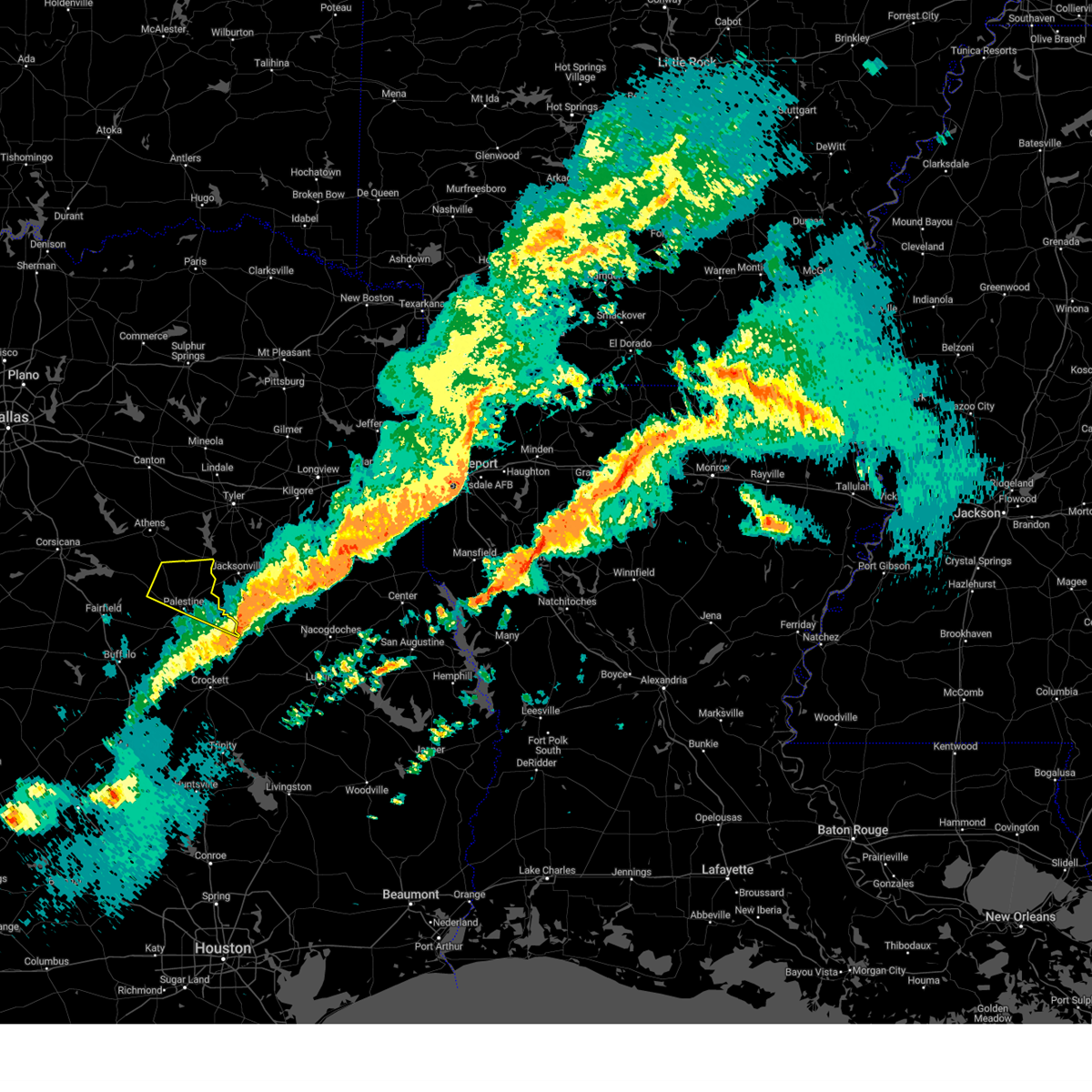 The severe thunderstorm warning for central anderson county will expire at 1030 pm cdt, the storm which prompted the warning has moved out of the area. therefore the warning will be allowed to expire. a tornado watch remains in effect until 100 am cdt for central texas. The severe thunderstorm warning for central anderson county will expire at 1030 pm cdt, the storm which prompted the warning has moved out of the area. therefore the warning will be allowed to expire. a tornado watch remains in effect until 100 am cdt for central texas.
|
| 3/16/2023 10:25 PM CDT |
 The severe thunderstorm warning for southeastern anderson county will expire at 1030 pm cdt, the storm which prompted the warning has moved out of the area. therefore the warning will be allowed to expire. a tornado watch remains in effect until 100 am cdt for central texas. The severe thunderstorm warning for southeastern anderson county will expire at 1030 pm cdt, the storm which prompted the warning has moved out of the area. therefore the warning will be allowed to expire. a tornado watch remains in effect until 100 am cdt for central texas.
|
| 3/16/2023 10:02 PM CDT |
 At 1002 pm cdt, a severe thunderstorm was located over elkhart, or 9 miles south of palestine, moving east at 40 mph (radar indicated). Hazards include 60 mph wind gusts and quarter size hail. Hail damage to vehicles is expected. Expect wind damage to roofs, siding, and trees. At 1002 pm cdt, a severe thunderstorm was located over elkhart, or 9 miles south of palestine, moving east at 40 mph (radar indicated). Hazards include 60 mph wind gusts and quarter size hail. Hail damage to vehicles is expected. Expect wind damage to roofs, siding, and trees.
|
| 3/16/2023 9:25 PM CDT |
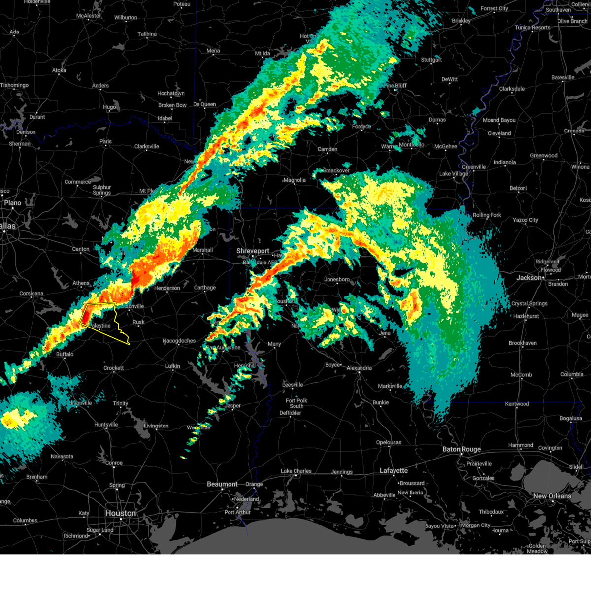 At 925 pm cdt, a severe thunderstorm was located over montalba, or 12 miles northwest of palestine, moving east at 35 mph (radar indicated). Hazards include ping pong ball size hail and 65 mph wind gusts. People and animals outdoors will be injured. expect hail damage to roofs, siding, windows, and vehicles. Expect wind damage to roofs, siding, and trees. At 925 pm cdt, a severe thunderstorm was located over montalba, or 12 miles northwest of palestine, moving east at 35 mph (radar indicated). Hazards include ping pong ball size hail and 65 mph wind gusts. People and animals outdoors will be injured. expect hail damage to roofs, siding, windows, and vehicles. Expect wind damage to roofs, siding, and trees.
|
| 3/16/2023 9:11 PM CDT |
 At 910 pm cdt, a severe thunderstorm was located 8 miles south of coon creek lake, or 17 miles northwest of palestine, moving southeast at 35 mph (radar indicated). Hazards include 65 mph wind gusts and half dollar size hail. Hail damage to vehicles is expected. expect wind damage to roofs, siding, and trees. locations impacted include, palestine, montalba, lake palestine, coon creek lake, brushy creek, poynor, coffee city, moore station, tucker, new york, johnson, bradford, bois d`arc, blackfoot, cayuga, larue, yard, springfield, bethel and massey lake. hail threat, radar indicated max hail size, 1. 25 in wind threat, radar indicated max wind gust, 65 mph. At 910 pm cdt, a severe thunderstorm was located 8 miles south of coon creek lake, or 17 miles northwest of palestine, moving southeast at 35 mph (radar indicated). Hazards include 65 mph wind gusts and half dollar size hail. Hail damage to vehicles is expected. expect wind damage to roofs, siding, and trees. locations impacted include, palestine, montalba, lake palestine, coon creek lake, brushy creek, poynor, coffee city, moore station, tucker, new york, johnson, bradford, bois d`arc, blackfoot, cayuga, larue, yard, springfield, bethel and massey lake. hail threat, radar indicated max hail size, 1. 25 in wind threat, radar indicated max wind gust, 65 mph.
|
| 3/16/2023 8:27 PM CDT |
 At 827 pm cdt, a severe thunderstorm was located over kerens, or 12 miles south of gun barrel city, moving southeast at 40 mph (radar indicated). Hazards include 65 mph wind gusts and half dollar size hail. Hail damage to vehicles is expected. Expect wind damage to roofs, siding, and trees. At 827 pm cdt, a severe thunderstorm was located over kerens, or 12 miles south of gun barrel city, moving southeast at 40 mph (radar indicated). Hazards include 65 mph wind gusts and half dollar size hail. Hail damage to vehicles is expected. Expect wind damage to roofs, siding, and trees.
|
| 3/9/2023 7:20 PM CST | Vfd confirmed downed trees and damage to a well house on anderson county road 485 just south of the henderson county lin in anderson county TX, 20.7 miles S of Palestine, TX |
| 3/2/2023 10:21 PM CST |
 The severe thunderstorm warning for southeastern anderson county will expire at 1030 pm cst, the storms which prompted the warning have moved out of the area. therefore the warning will be allowed to expire. The severe thunderstorm warning for southeastern anderson county will expire at 1030 pm cst, the storms which prompted the warning have moved out of the area. therefore the warning will be allowed to expire.
|
| 3/2/2023 10:05 PM CST |
 At 1004 pm cst, severe thunderstorms were located along a line extending from near palestine to near austonio, moving east at 50 mph (radar indicated). Hazards include 60 mph wind gusts. Expect damage to roofs, siding, and trees. locations impacted include, elkhart, denson spring, salmon, crystal lake, slocum, broom city and mound city. hail threat, radar indicated max hail size, <. 75 in wind threat, radar indicated max wind gust, 60 mph. At 1004 pm cst, severe thunderstorms were located along a line extending from near palestine to near austonio, moving east at 50 mph (radar indicated). Hazards include 60 mph wind gusts. Expect damage to roofs, siding, and trees. locations impacted include, elkhart, denson spring, salmon, crystal lake, slocum, broom city and mound city. hail threat, radar indicated max hail size, <. 75 in wind threat, radar indicated max wind gust, 60 mph.
|
| 3/2/2023 9:52 PM CST |
 At 951 pm cst, severe thunderstorms were located along a line extending from elkhart to 9 miles southeast of fort boggy state park, moving east at 50 mph (radar indicated). Hazards include 60 mph wind gusts. Expect damage to roofs, siding, and trees. locations impacted include, palestine, elkhart, tucker, salmon, cedar creek, slocum, eunice, broom city, redtown, denson spring, crystal lake, centerview and mound city. hail threat, radar indicated max hail size, <. 75 in wind threat, radar indicated max wind gust, 60 mph. At 951 pm cst, severe thunderstorms were located along a line extending from elkhart to 9 miles southeast of fort boggy state park, moving east at 50 mph (radar indicated). Hazards include 60 mph wind gusts. Expect damage to roofs, siding, and trees. locations impacted include, palestine, elkhart, tucker, salmon, cedar creek, slocum, eunice, broom city, redtown, denson spring, crystal lake, centerview and mound city. hail threat, radar indicated max hail size, <. 75 in wind threat, radar indicated max wind gust, 60 mph.
|
| 3/2/2023 9:42 PM CST |
 At 942 pm cst, severe thunderstorms were located along a line extending from near tucker to leona, moving east at 40 mph (radar indicated). Hazards include 60 mph wind gusts. Expect damage to roofs, siding, and trees. locations impacted include, palestine, elkhart, centerville, fort boggy state park, oakwood, leona, tucker, pleasant springs, johnson, salmon, cedar creek, flo, slocum, eunice, broom city, redtown, denson spring, crystal lake, centerview and red lake. hail threat, radar indicated max hail size, <. 75 in wind threat, radar indicated max wind gust, 60 mph. At 942 pm cst, severe thunderstorms were located along a line extending from near tucker to leona, moving east at 40 mph (radar indicated). Hazards include 60 mph wind gusts. Expect damage to roofs, siding, and trees. locations impacted include, palestine, elkhart, centerville, fort boggy state park, oakwood, leona, tucker, pleasant springs, johnson, salmon, cedar creek, flo, slocum, eunice, broom city, redtown, denson spring, crystal lake, centerview and red lake. hail threat, radar indicated max hail size, <. 75 in wind threat, radar indicated max wind gust, 60 mph.
|
| 3/2/2023 9:26 PM CST |
 At 925 pm cst, severe thunderstorms were located along a line extending from near buffalo to flo to near centerville to near normangee, moving east at 55 mph (radar indicated). Hazards include 60 mph wind gusts and penny size hail. expect damage to roofs, siding, and trees At 925 pm cst, severe thunderstorms were located along a line extending from near buffalo to flo to near centerville to near normangee, moving east at 55 mph (radar indicated). Hazards include 60 mph wind gusts and penny size hail. expect damage to roofs, siding, and trees
|
| 3/2/2023 9:18 PM CST |
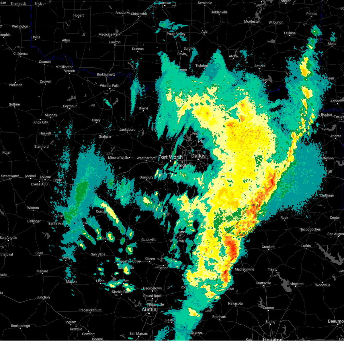 At 917 pm cst, severe thunderstorms were located along a line extending from montalba to near buffalo, moving east at 40 mph (radar indicated). Hazards include 60 mph wind gusts. Expect damage to roofs, siding, and trees. locations impacted include, palestine, montalba, tucker, lanely, johnson, bradford, bois d`arc, blackfoot, freestone, springfield, dew, massey lake, tennessee colony, red lake and bethel. hail threat, radar indicated max hail size, <. 75 in wind threat, radar indicated max wind gust, 60 mph. At 917 pm cst, severe thunderstorms were located along a line extending from montalba to near buffalo, moving east at 40 mph (radar indicated). Hazards include 60 mph wind gusts. Expect damage to roofs, siding, and trees. locations impacted include, palestine, montalba, tucker, lanely, johnson, bradford, bois d`arc, blackfoot, freestone, springfield, dew, massey lake, tennessee colony, red lake and bethel. hail threat, radar indicated max hail size, <. 75 in wind threat, radar indicated max wind gust, 60 mph.
|
| 3/2/2023 8:56 PM CST |
 At 855 pm cst, severe thunderstorms were located along a line extending from near edom to tennessee colony to dew, moving east at 45 mph (radar indicated). Hazards include 60 mph wind gusts. Expect damage to roofs, siding, and trees. locations impacted include, palestine, athens, gun barrel city, groesbeck, teague, fairfield, malakoff, eustace, edom, caney city, fairfield lake, forest grove reservoir, purtis creek state park, montalba, coon creek lake, fairfield lake state park, cedar creek reservoir, richland-chambers reservoir, cross roads and payne springs. hail threat, radar indicated max hail size, <. 75 in wind threat, radar indicated max wind gust, 60 mph. At 855 pm cst, severe thunderstorms were located along a line extending from near edom to tennessee colony to dew, moving east at 45 mph (radar indicated). Hazards include 60 mph wind gusts. Expect damage to roofs, siding, and trees. locations impacted include, palestine, athens, gun barrel city, groesbeck, teague, fairfield, malakoff, eustace, edom, caney city, fairfield lake, forest grove reservoir, purtis creek state park, montalba, coon creek lake, fairfield lake state park, cedar creek reservoir, richland-chambers reservoir, cross roads and payne springs. hail threat, radar indicated max hail size, <. 75 in wind threat, radar indicated max wind gust, 60 mph.
|
| 3/2/2023 8:44 PM CST |
 At 844 pm cst, severe thunderstorms were located along a line extending from athens to fairfield to teague, moving east at 55 mph (radar indicated). Hazards include 70 mph wind gusts. Expect considerable tree damage. damage is likely to mobile homes, roofs, and outbuildings. locations impacted include, palestine, athens, mexia, gun barrel city, groesbeck, teague, fairfield, mabank, malakoff, tool, wortham, eustace, trinidad, edom, enchanted oaks, caney city, fairfield lake, lake mexia, purtis creek state park and fort parker state park. thunderstorm damage threat, considerable hail threat, radar indicated max hail size, <. 75 in wind threat, radar indicated max wind gust, 70 mph. At 844 pm cst, severe thunderstorms were located along a line extending from athens to fairfield to teague, moving east at 55 mph (radar indicated). Hazards include 70 mph wind gusts. Expect considerable tree damage. damage is likely to mobile homes, roofs, and outbuildings. locations impacted include, palestine, athens, mexia, gun barrel city, groesbeck, teague, fairfield, mabank, malakoff, tool, wortham, eustace, trinidad, edom, enchanted oaks, caney city, fairfield lake, lake mexia, purtis creek state park and fort parker state park. thunderstorm damage threat, considerable hail threat, radar indicated max hail size, <. 75 in wind threat, radar indicated max wind gust, 70 mph.
|
| 3/2/2023 8:08 PM CST |
 At 808 pm cst, severe thunderstorms were located along a line extending from near kemp to fort parker state park, moving east at 30 mph (radar indicated). Hazards include 70 mph wind gusts and penny size hail. Expect considerable tree damage. Damage is likely to mobile homes, roofs, and outbuildings. At 808 pm cst, severe thunderstorms were located along a line extending from near kemp to fort parker state park, moving east at 30 mph (radar indicated). Hazards include 70 mph wind gusts and penny size hail. Expect considerable tree damage. Damage is likely to mobile homes, roofs, and outbuildings.
|
| 10/24/2022 10:55 PM CDT | Measured gust to 59 mph at palestine awo in anderson county TX, 3.5 miles SE of Palestine, TX |
| 5/21/2022 10:08 PM CDT |
 The severe thunderstorm warning for southeastern henderson and anderson counties will expire at 1015 pm cdt, the storms which prompted the warning have moved out of the warned area. therefore, the warning will be allowed to expire. however gusty winds are still possible with these thunderstorms. a severe thunderstorm watch remains in effect until 100 am cdt for central texas. The severe thunderstorm warning for southeastern henderson and anderson counties will expire at 1015 pm cdt, the storms which prompted the warning have moved out of the warned area. therefore, the warning will be allowed to expire. however gusty winds are still possible with these thunderstorms. a severe thunderstorm watch remains in effect until 100 am cdt for central texas.
|
| 5/21/2022 9:41 PM CDT |
 At 940 pm cdt, severe thunderstorms were located along a line extending from near athens to neches to elkhart, moving east at 40 mph. tree damage and near 60 mph winds were reported in palestine with these storms (radar indicated). Hazards include 65 mph wind gusts and nickel size hail. Expect damage to roofs, siding, and trees. locations impacted include, palestine, elkhart, frankston, berryville, coffee city and poynor. hail threat, radar indicated max hail size, 0. 88 in wind threat, observed max wind gust, 65 mph. At 940 pm cdt, severe thunderstorms were located along a line extending from near athens to neches to elkhart, moving east at 40 mph. tree damage and near 60 mph winds were reported in palestine with these storms (radar indicated). Hazards include 65 mph wind gusts and nickel size hail. Expect damage to roofs, siding, and trees. locations impacted include, palestine, elkhart, frankston, berryville, coffee city and poynor. hail threat, radar indicated max hail size, 0. 88 in wind threat, observed max wind gust, 65 mph.
|
| 5/21/2022 9:20 PM CDT | Report from mping: 3-inch tree limbs broken; power poles broke in anderson county TX, 3.5 miles NE of Palestine, TX |
| 5/21/2022 9:17 PM CDT |
 At 916 pm cdt, severe thunderstorms were located along a line extending from cross ranch to tennessee colony to tucker to oakwood, moving east at 50 mph. at 915pm, 60 mph winds were observed in tucker (radar indicated). Hazards include 65 mph wind gusts and nickel size hail. Expect damage to roofs, siding, and trees. locations impacted include, palestine, buffalo, elkhart, frankston, berryville, coffee city, fairfield lake state park, oakwood, poynor and moore station. hail threat, radar indicated max hail size, 0. 88 in wind threat, observed max wind gust, 65 mph. At 916 pm cdt, severe thunderstorms were located along a line extending from cross ranch to tennessee colony to tucker to oakwood, moving east at 50 mph. at 915pm, 60 mph winds were observed in tucker (radar indicated). Hazards include 65 mph wind gusts and nickel size hail. Expect damage to roofs, siding, and trees. locations impacted include, palestine, buffalo, elkhart, frankston, berryville, coffee city, fairfield lake state park, oakwood, poynor and moore station. hail threat, radar indicated max hail size, 0. 88 in wind threat, observed max wind gust, 65 mph.
|
| 5/21/2022 9:15 PM CDT | Measured 60 mph wind gust at walmart distribution center southwest of palestin in anderson county TX, 5.7 miles NE of Palestine, TX |
| 5/21/2022 9:01 PM CDT |
 At 900 pm cdt, severe thunderstorms were located along a line extending from eureka to fairfield to buffalo, moving east at 45 mph (radar indicated). Hazards include 65 mph wind gusts and nickel size hail. expect damage to roofs, siding, and trees At 900 pm cdt, severe thunderstorms were located along a line extending from eureka to fairfield to buffalo, moving east at 45 mph (radar indicated). Hazards include 65 mph wind gusts and nickel size hail. expect damage to roofs, siding, and trees
|
| 5/5/2022 2:33 PM CDT |
 At 232 pm cdt, severe thunderstorms were located along a line extending from near frankston to 9 miles east of fairfield lake state park, moving east at 45 mph (radar indicated). Hazards include 60 mph wind gusts and quarter size hail. Hail damage to vehicles is expected. Expect wind damage to roofs, siding, and trees. At 232 pm cdt, severe thunderstorms were located along a line extending from near frankston to 9 miles east of fairfield lake state park, moving east at 45 mph (radar indicated). Hazards include 60 mph wind gusts and quarter size hail. Hail damage to vehicles is expected. Expect wind damage to roofs, siding, and trees.
|
| 4/30/2022 6:36 PM CDT | Half Dollar sized hail reported 6.8 miles NE of Palestine, TX |
| 4/30/2022 5:48 PM CDT |
 At 548 pm cdt, a severe thunderstorm was located near palestine, moving southeast at 10 mph (radar indicated). Hazards include 60 mph wind gusts and quarter size hail. Hail damage to vehicles is expected. Expect wind damage to roofs, siding, and trees. At 548 pm cdt, a severe thunderstorm was located near palestine, moving southeast at 10 mph (radar indicated). Hazards include 60 mph wind gusts and quarter size hail. Hail damage to vehicles is expected. Expect wind damage to roofs, siding, and trees.
|
| 4/12/2022 8:15 PM CDT |
 At 814 pm cdt, severe thunderstorms were located along a line extending from near palestine, moving east at 30 mph (radar indicated). Hazards include 60 mph wind gusts. expect damage to roofs, siding, and trees At 814 pm cdt, severe thunderstorms were located along a line extending from near palestine, moving east at 30 mph (radar indicated). Hazards include 60 mph wind gusts. expect damage to roofs, siding, and trees
|
| 3/14/2022 8:20 PM CDT |
 At 820 pm cdt, a severe thunderstorm was located near reese, or 7 miles west of jacksonville, moving east at 40 mph (radar indicated). Hazards include quarter size hail. Damage to vehicles is possible. locations impacted include, palestine. hail threat, radar indicated max hail size, 1. 00 in wind threat, radar indicated max wind gust, <50 mph. At 820 pm cdt, a severe thunderstorm was located near reese, or 7 miles west of jacksonville, moving east at 40 mph (radar indicated). Hazards include quarter size hail. Damage to vehicles is possible. locations impacted include, palestine. hail threat, radar indicated max hail size, 1. 00 in wind threat, radar indicated max wind gust, <50 mph.
|
| 3/14/2022 8:03 PM CDT |
 At 802 pm cdt, a severe thunderstorm was located 8 miles southwest of frankston, or 14 miles north of palestine, moving east at 40 mph (radar indicated). Hazards include 60 mph wind gusts and quarter size hail. Hail damage to vehicles is expected. expect wind damage to roofs, siding, and trees. locations impacted include, palestine, athens, chandler, frankston, brownsboro, berryville, edom, coffee city, murchison, poynor and moore station. hail threat, radar indicated max hail size, 1. 00 in wind threat, radar indicated max wind gust, 60 mph. At 802 pm cdt, a severe thunderstorm was located 8 miles southwest of frankston, or 14 miles north of palestine, moving east at 40 mph (radar indicated). Hazards include 60 mph wind gusts and quarter size hail. Hail damage to vehicles is expected. expect wind damage to roofs, siding, and trees. locations impacted include, palestine, athens, chandler, frankston, brownsboro, berryville, edom, coffee city, murchison, poynor and moore station. hail threat, radar indicated max hail size, 1. 00 in wind threat, radar indicated max wind gust, 60 mph.
|
| 3/14/2022 7:45 PM CDT |
 At 745 pm cdt, a severe thunderstorm was located 16 miles south of athens, moving east at 40 mph (radar indicated). Hazards include 60 mph wind gusts and quarter size hail. Hail damage to vehicles is expected. Expect wind damage to roofs, siding, and trees. At 745 pm cdt, a severe thunderstorm was located 16 miles south of athens, moving east at 40 mph (radar indicated). Hazards include 60 mph wind gusts and quarter size hail. Hail damage to vehicles is expected. Expect wind damage to roofs, siding, and trees.
|
| 6/8/2021 9:55 AM CDT | Public report: 3-inch tree limbs broken; power poles broke in anderson county TX, 3.1 miles W of Palestine, TX |
| 6/8/2021 9:33 AM CDT |
 At 932 am cdt, severe thunderstorms were located along a line extending from 11 miles southeast of athens to 12 miles northwest of palestine to 13 miles west of elkhart to 6 miles southeast of buffalo, moving east at 40 mph (radar indicated). Hazards include 60 mph wind gusts. Expect damage to roofs, siding, and trees. Locations impacted include, palestine, buffalo and oakwood. At 932 am cdt, severe thunderstorms were located along a line extending from 11 miles southeast of athens to 12 miles northwest of palestine to 13 miles west of elkhart to 6 miles southeast of buffalo, moving east at 40 mph (radar indicated). Hazards include 60 mph wind gusts. Expect damage to roofs, siding, and trees. Locations impacted include, palestine, buffalo and oakwood.
|
| 6/8/2021 8:54 AM CDT |
 At 854 am cdt, severe thunderstorms were located along a line extending from 9 miles south of trinidad to 7 miles south of teague, moving east at 40 mph (radar indicated). Hazards include 60 mph wind gusts. expect damage to roofs, siding, and trees At 854 am cdt, severe thunderstorms were located along a line extending from 9 miles south of trinidad to 7 miles south of teague, moving east at 40 mph (radar indicated). Hazards include 60 mph wind gusts. expect damage to roofs, siding, and trees
|
| 5/9/2021 6:09 PM CDT |
 At 533 pm cdt, a severe thunderstorm was located 8 miles northwest of buffalo, or 9 miles southeast of teague, moving east at 45 mph (radar indicated). Hazards include 60 mph wind gusts and quarter size hail. Hail damage to vehicles is expected. Expect wind damage to roofs, siding, and trees. At 533 pm cdt, a severe thunderstorm was located 8 miles northwest of buffalo, or 9 miles southeast of teague, moving east at 45 mph (radar indicated). Hazards include 60 mph wind gusts and quarter size hail. Hail damage to vehicles is expected. Expect wind damage to roofs, siding, and trees.
|
| 5/9/2021 5:33 PM CDT |
 At 533 pm cdt, a severe thunderstorm was located 8 miles northwest of buffalo, or 9 miles southeast of teague, moving east at 45 mph (radar indicated). Hazards include 60 mph wind gusts and quarter size hail. Hail damage to vehicles is expected. Expect wind damage to roofs, siding, and trees. At 533 pm cdt, a severe thunderstorm was located 8 miles northwest of buffalo, or 9 miles southeast of teague, moving east at 45 mph (radar indicated). Hazards include 60 mph wind gusts and quarter size hail. Hail damage to vehicles is expected. Expect wind damage to roofs, siding, and trees.
|
| 4/9/2021 10:29 PM CDT |
 At 1029 pm cdt, a severe thunderstorm was located over elkhart, or 10 miles southeast of palestine, moving southeast at 25 mph (radar indicated). Hazards include golf ball size hail and 60 mph wind gusts. People and animals outdoors will be injured. expect hail damage to roofs, siding, windows, and vehicles. expect wind damage to roofs, siding, and trees. Locations impacted include, palestine and elkhart. At 1029 pm cdt, a severe thunderstorm was located over elkhart, or 10 miles southeast of palestine, moving southeast at 25 mph (radar indicated). Hazards include golf ball size hail and 60 mph wind gusts. People and animals outdoors will be injured. expect hail damage to roofs, siding, windows, and vehicles. expect wind damage to roofs, siding, and trees. Locations impacted include, palestine and elkhart.
|
| 4/9/2021 10:19 PM CDT |
 At 1018 pm cdt, a severe thunderstorm was located near elkhart, or near palestine, moving southeast at 30 mph (radar indicated). Hazards include 60 mph wind gusts and half dollar size hail. Hail damage to vehicles is expected. expect wind damage to roofs, siding, and trees. Locations impacted include, palestine and elkhart. At 1018 pm cdt, a severe thunderstorm was located near elkhart, or near palestine, moving southeast at 30 mph (radar indicated). Hazards include 60 mph wind gusts and half dollar size hail. Hail damage to vehicles is expected. expect wind damage to roofs, siding, and trees. Locations impacted include, palestine and elkhart.
|
| 4/9/2021 10:14 PM CDT | Quarter sized hail reported 1.7 miles NE of Palestine, TX |
| 4/9/2021 10:00 PM CDT |
 At 1000 pm cdt, a severe thunderstorm was located near palestine, moving southeast at 25 mph (radar indicated). Hazards include 60 mph wind gusts and half dollar size hail. Hail damage to vehicles is expected. Expect wind damage to roofs, siding, and trees. At 1000 pm cdt, a severe thunderstorm was located near palestine, moving southeast at 25 mph (radar indicated). Hazards include 60 mph wind gusts and half dollar size hail. Hail damage to vehicles is expected. Expect wind damage to roofs, siding, and trees.
|
| 4/9/2021 9:58 PM CDT |
 At 958 pm cdt, a severe thunderstorm was located near palestine, moving southeast at 25 mph (radar indicated). Hazards include 60 mph wind gusts and half dollar size hail. Hail damage to vehicles is expected. expect wind damage to roofs, siding, and trees. Locations impacted include, palestine. At 958 pm cdt, a severe thunderstorm was located near palestine, moving southeast at 25 mph (radar indicated). Hazards include 60 mph wind gusts and half dollar size hail. Hail damage to vehicles is expected. expect wind damage to roofs, siding, and trees. Locations impacted include, palestine.
|
| 4/9/2021 9:43 PM CDT | Half Dollar sized hail reported 10.8 miles ESE of Palestine, TX, report from mping: half dollar (1.25 in.). |
| 4/9/2021 9:40 PM CDT |
 At 939 pm cdt, a severe thunderstorm was located near tennessee colony or 10 miles northwest of palestine, moving southeast at 15 mph (radar indicated). Hazards include 60 mph wind gusts and half dollar size hail. Hail damage to vehicles is expected. expect wind damage to roofs, siding, and trees. Locations impacted include, palestine. At 939 pm cdt, a severe thunderstorm was located near tennessee colony or 10 miles northwest of palestine, moving southeast at 15 mph (radar indicated). Hazards include 60 mph wind gusts and half dollar size hail. Hail damage to vehicles is expected. expect wind damage to roofs, siding, and trees. Locations impacted include, palestine.
|
| 4/9/2021 9:19 PM CDT | Quarter sized hail reported 10.1 miles SSE of Palestine, TX |
| 4/9/2021 9:11 PM CDT | Quarter sized hail reported 19.6 miles SE of Palestine, TX, time estimated via radar. |
| 4/9/2021 9:04 PM CDT |
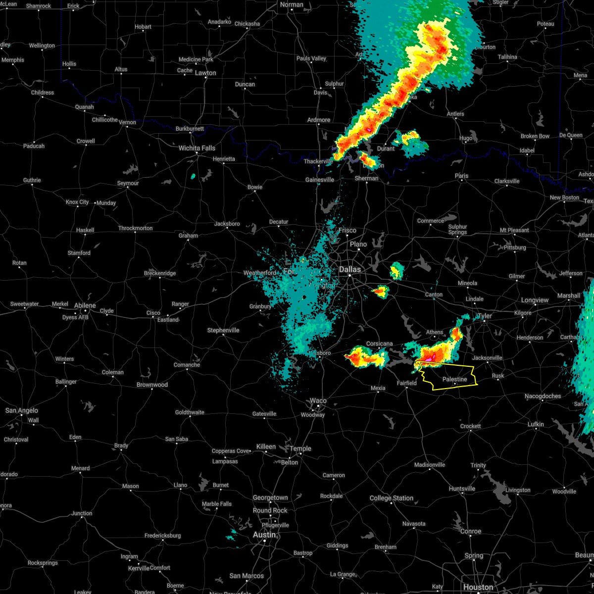 At 903 pm cdt, a severe thunderstorm was located near cayuga, moving southeast at 15 mph (radar indicated). Hazards include two inch hail and 65 mph wind gusts. People and animals outdoors will be injured. expect hail damage to roofs, siding, windows, and vehicles. Expect wind damage to roofs, siding, and trees. At 903 pm cdt, a severe thunderstorm was located near cayuga, moving southeast at 15 mph (radar indicated). Hazards include two inch hail and 65 mph wind gusts. People and animals outdoors will be injured. expect hail damage to roofs, siding, windows, and vehicles. Expect wind damage to roofs, siding, and trees.
|
| 4/7/2021 2:39 PM CDT |
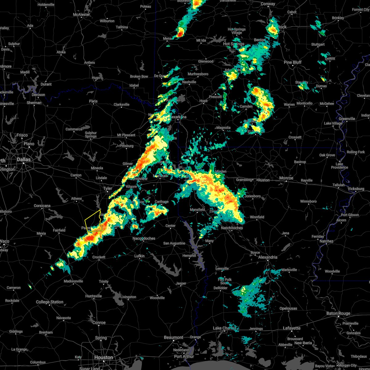 The severe thunderstorm warning for central anderson county will expire at 245 pm cdt, the storm which prompted the warning has moved out of the area. therefore the warning will be allowed to expire. The severe thunderstorm warning for central anderson county will expire at 245 pm cdt, the storm which prompted the warning has moved out of the area. therefore the warning will be allowed to expire.
|
| 4/7/2021 2:09 PM CDT |
 At 208 pm cdt, a severe thunderstorm was located 7 miles north of palestine, moving east at 40 mph (radar indicated). Hazards include 60 mph wind gusts and quarter size hail. Hail damage to vehicles is expected. Expect wind damage to roofs, siding, and trees. At 208 pm cdt, a severe thunderstorm was located 7 miles north of palestine, moving east at 40 mph (radar indicated). Hazards include 60 mph wind gusts and quarter size hail. Hail damage to vehicles is expected. Expect wind damage to roofs, siding, and trees.
|
| 3/23/2021 12:52 AM CDT |
 The severe thunderstorm warning for eastern henderson and northeastern anderson counties will expire at 100 am cdt, the storms which prompted the warning have moved out of the area. therefore the warning will be allowed to expire. however gusty winds are still possible with these thunderstorms. The severe thunderstorm warning for eastern henderson and northeastern anderson counties will expire at 100 am cdt, the storms which prompted the warning have moved out of the area. therefore the warning will be allowed to expire. however gusty winds are still possible with these thunderstorms.
|
| 3/23/2021 12:34 AM CDT |
 At 1234 am cdt, severe thunderstorms were located along a line extending from chandler to reese to 11 miles south of frankston, moving east at 50 mph (radar indicated). Hazards include 60 mph wind gusts and quarter size hail. Hail damage to vehicles is expected. expect wind damage to roofs, siding, and trees. Locations impacted include, palestine, chandler, frankston, brownsboro, berryville, coffee city, poynor and moore station. At 1234 am cdt, severe thunderstorms were located along a line extending from chandler to reese to 11 miles south of frankston, moving east at 50 mph (radar indicated). Hazards include 60 mph wind gusts and quarter size hail. Hail damage to vehicles is expected. expect wind damage to roofs, siding, and trees. Locations impacted include, palestine, chandler, frankston, brownsboro, berryville, coffee city, poynor and moore station.
|
| 3/23/2021 12:08 AM CDT |
 At 1208 am cdt, severe thunderstorms were located along a line extending from near athens to brushy creek to montalba to tennessee colony, moving east at 45 mph (radar indicated). Hazards include 70 mph wind gusts and quarter size hail. Hail damage to vehicles is expected. expect considerable tree damage. Wind damage is also likely to mobile homes, roofs, and outbuildings. At 1208 am cdt, severe thunderstorms were located along a line extending from near athens to brushy creek to montalba to tennessee colony, moving east at 45 mph (radar indicated). Hazards include 70 mph wind gusts and quarter size hail. Hail damage to vehicles is expected. expect considerable tree damage. Wind damage is also likely to mobile homes, roofs, and outbuildings.
|
| 3/22/2021 11:39 PM CDT |
 At 1137 pm cdt, severe thunderstorms were located along a line extending from near enchanted oaks to cayuga, moving east at 40 mph. the strongest winds will move over eustace and cayuga shortly (radar indicated). Hazards include 60 mph wind gusts and quarter size hail. Hail damage to vehicles is expected. expect wind damage to roofs, siding, and trees. Locations impacted include, palestine, athens, gun barrel city, fairfield, mabank, chandler, malakoff, tool, seven points, frankston, brownsboro, eustace, berryville, trinidad, enchanted oaks, coffee city, caney city, fairfield lake state park, payne springs and log cabin. At 1137 pm cdt, severe thunderstorms were located along a line extending from near enchanted oaks to cayuga, moving east at 40 mph. the strongest winds will move over eustace and cayuga shortly (radar indicated). Hazards include 60 mph wind gusts and quarter size hail. Hail damage to vehicles is expected. expect wind damage to roofs, siding, and trees. Locations impacted include, palestine, athens, gun barrel city, fairfield, mabank, chandler, malakoff, tool, seven points, frankston, brownsboro, eustace, berryville, trinidad, enchanted oaks, coffee city, caney city, fairfield lake state park, payne springs and log cabin.
|
| 3/22/2021 11:26 PM CDT |
 At 1125 pm cdt, severe thunderstorms were located along a line extending from near kerens to the area north of fairfield, moving east at 40 mph (radar indicated). Hazards include 60 mph wind gusts and quarter size hail. Hail damage to vehicles is expected. expect wind damage to roofs, siding, and trees. Locations impacted include, palestine, athens, gun barrel city, fairfield, mabank, chandler, malakoff, tool, kerens, seven points, frankston, brownsboro, eustace, berryville, trinidad, enchanted oaks, coffee city, caney city, fairfield lake state park and payne springs. At 1125 pm cdt, severe thunderstorms were located along a line extending from near kerens to the area north of fairfield, moving east at 40 mph (radar indicated). Hazards include 60 mph wind gusts and quarter size hail. Hail damage to vehicles is expected. expect wind damage to roofs, siding, and trees. Locations impacted include, palestine, athens, gun barrel city, fairfield, mabank, chandler, malakoff, tool, kerens, seven points, frankston, brownsboro, eustace, berryville, trinidad, enchanted oaks, coffee city, caney city, fairfield lake state park and payne springs.
|
| 3/22/2021 11:05 PM CDT |
 At 1104 pm cdt, severe thunderstorms were located along a line extending from rice to near navarro to near wortham, moving east at 45 mph (radar indicated). Hazards include 65 mph wind gusts and quarter size hail. Hail damage to vehicles is expected. Expect wind damage to roofs, siding, and trees. At 1104 pm cdt, severe thunderstorms were located along a line extending from rice to near navarro to near wortham, moving east at 45 mph (radar indicated). Hazards include 65 mph wind gusts and quarter size hail. Hail damage to vehicles is expected. Expect wind damage to roofs, siding, and trees.
|
| 4/29/2020 2:12 AM CDT |
 At 212 am cdt, severe thunderstorms were located along a line extending from 10 miles south of maydelle to 13 miles west of elkhart to 6 miles south of hubbard, moving southeast at 30 mph (radar indicated). Hazards include 65 mph wind gusts and quarter size hail. Hail damage to vehicles is expected. expect wind damage to roofs, siding, and trees. Locations impacted include, palestine, hillsboro, mexia, groesbeck, teague, fairfield, mart, hubbard, elkhart, wortham, coolidge, dawson, angus, bynum, carl`s corner, fort parker state park, fairfield lake state park, thornton, oakwood and kosse. At 212 am cdt, severe thunderstorms were located along a line extending from 10 miles south of maydelle to 13 miles west of elkhart to 6 miles south of hubbard, moving southeast at 30 mph (radar indicated). Hazards include 65 mph wind gusts and quarter size hail. Hail damage to vehicles is expected. expect wind damage to roofs, siding, and trees. Locations impacted include, palestine, hillsboro, mexia, groesbeck, teague, fairfield, mart, hubbard, elkhart, wortham, coolidge, dawson, angus, bynum, carl`s corner, fort parker state park, fairfield lake state park, thornton, oakwood and kosse.
|
| 4/29/2020 1:35 AM CDT |
 At 133 am cdt, severe thunderstorms were located along a line extending from near dawson to palestine, moving southeast at 50 mph. strong winds to 70 mph will be possible in the wortham and kirvin areas in the next few minutes (radar indicated). Hazards include 70 mph wind gusts and quarter size hail. Hail damage to vehicles is expected. expect considerable tree damage. wind damage is also likely to mobile homes, roofs, and outbuildings. Locations impacted include, corsicana, palestine, athens, hillsboro, mexia, groesbeck, teague, fairfield, malakoff, mart, kerens, hubbard, elkhart, frankston, wortham, berryville, coolidge, trinidad, blooming grove and dawson. At 133 am cdt, severe thunderstorms were located along a line extending from near dawson to palestine, moving southeast at 50 mph. strong winds to 70 mph will be possible in the wortham and kirvin areas in the next few minutes (radar indicated). Hazards include 70 mph wind gusts and quarter size hail. Hail damage to vehicles is expected. expect considerable tree damage. wind damage is also likely to mobile homes, roofs, and outbuildings. Locations impacted include, corsicana, palestine, athens, hillsboro, mexia, groesbeck, teague, fairfield, malakoff, mart, kerens, hubbard, elkhart, frankston, wortham, berryville, coolidge, trinidad, blooming grove and dawson.
|
| 4/29/2020 1:12 AM CDT |
 At 111 am cdt, severe thunderstorms were located along a line extending from bynum to oak valley to kerens to athens, moving southeast at 50 mph (radar indicated). Hazards include 70 mph wind gusts and quarter size hail. Hail damage to vehicles is expected. expect considerable tree damage. Wind damage is also likely to mobile homes, roofs, and outbuildings. At 111 am cdt, severe thunderstorms were located along a line extending from bynum to oak valley to kerens to athens, moving southeast at 50 mph (radar indicated). Hazards include 70 mph wind gusts and quarter size hail. Hail damage to vehicles is expected. expect considerable tree damage. Wind damage is also likely to mobile homes, roofs, and outbuildings.
|
| 4/22/2020 2:46 PM CDT |
 At 245 pm cdt, a severe thunderstorm was located 7 miles east of elkhart, or 13 miles southeast of palestine, moving northeast at 35 mph (radar indicated). Hazards include 70 mph wind gusts and quarter size hail. Hail damage to vehicles is expected. expect considerable tree damage. wind damage is also likely to mobile homes, roofs, and outbuildings. locations impacted include, palestine and elkhart. A tornado watch remains in effect until 500 pm cdt for central texas. At 245 pm cdt, a severe thunderstorm was located 7 miles east of elkhart, or 13 miles southeast of palestine, moving northeast at 35 mph (radar indicated). Hazards include 70 mph wind gusts and quarter size hail. Hail damage to vehicles is expected. expect considerable tree damage. wind damage is also likely to mobile homes, roofs, and outbuildings. locations impacted include, palestine and elkhart. A tornado watch remains in effect until 500 pm cdt for central texas.
|
| 4/22/2020 2:38 PM CDT |
 At 237 pm cdt, a severe thunderstorm was located over elkhart, or 12 miles southeast of palestine, moving east at 30 mph (radar indicated). Hazards include 70 mph wind gusts and quarter size hail. Hail damage to vehicles is expected. expect considerable tree damage. wind damage is also likely to mobile homes, roofs, and outbuildings. locations impacted include, palestine and elkhart. A tornado watch remains in effect until 500 pm cdt for central texas. At 237 pm cdt, a severe thunderstorm was located over elkhart, or 12 miles southeast of palestine, moving east at 30 mph (radar indicated). Hazards include 70 mph wind gusts and quarter size hail. Hail damage to vehicles is expected. expect considerable tree damage. wind damage is also likely to mobile homes, roofs, and outbuildings. locations impacted include, palestine and elkhart. A tornado watch remains in effect until 500 pm cdt for central texas.
|
| 4/22/2020 2:28 PM CDT |
 At 226 pm cdt, a severe thunderstorm was located 10 miles southwest of elkhart, or 15 miles south of palestine, moving east at 40 mph (radar indicated). Hazards include 65 mph wind gusts and quarter size hail. Hail damage to vehicles is expected. expect wind damage to roofs, siding, and trees. locations impacted include, palestine, elkhart and oakwood. a tornado watch remains in effect until 500 pm cdt for central texas. heavy rainfall is occurring with this storm, and may lead to flash flooding. Do not drive your vehicle through flooded roadways. At 226 pm cdt, a severe thunderstorm was located 10 miles southwest of elkhart, or 15 miles south of palestine, moving east at 40 mph (radar indicated). Hazards include 65 mph wind gusts and quarter size hail. Hail damage to vehicles is expected. expect wind damage to roofs, siding, and trees. locations impacted include, palestine, elkhart and oakwood. a tornado watch remains in effect until 500 pm cdt for central texas. heavy rainfall is occurring with this storm, and may lead to flash flooding. Do not drive your vehicle through flooded roadways.
|
| 4/22/2020 2:08 PM CDT |
 At 208 pm cdt, a severe thunderstorm was located 7 miles east of buffalo moving northeast at 35 mph (radar indicated). Hazards include 65 mph wind gusts and quarter size hail. Hail damage to vehicles is expected. expect wind damage to roofs, siding, and trees. locations impacted include, palestine, buffalo, elkhart and oakwood. A tornado watch remains in effect until 500 pm cdt for central texas. At 208 pm cdt, a severe thunderstorm was located 7 miles east of buffalo moving northeast at 35 mph (radar indicated). Hazards include 65 mph wind gusts and quarter size hail. Hail damage to vehicles is expected. expect wind damage to roofs, siding, and trees. locations impacted include, palestine, buffalo, elkhart and oakwood. A tornado watch remains in effect until 500 pm cdt for central texas.
|
| 4/22/2020 1:55 PM CDT |
 At 155 pm cdt, a severe thunderstorm was located near buffalo, or 20 miles southeast of teague, moving northeast at 35 mph (radar indicated). Hazards include 65 mph wind gusts and quarter size hail. Hail damage to vehicles is expected. Expect wind damage to roofs, siding, and trees. At 155 pm cdt, a severe thunderstorm was located near buffalo, or 20 miles southeast of teague, moving northeast at 35 mph (radar indicated). Hazards include 65 mph wind gusts and quarter size hail. Hail damage to vehicles is expected. Expect wind damage to roofs, siding, and trees.
|
| 4/22/2020 11:55 AM CDT |
 At 1155 am cdt, a severe thunderstorm was located 8 miles southeast of fairfield lake state park, or 9 miles southeast of fairfield, moving northeast at 50 mph (radar indicated). Hazards include quarter size hail. Damage to vehicles is possible. locations impacted include, palestine. A tornado watch remains in effect until 500 pm cdt for central texas. At 1155 am cdt, a severe thunderstorm was located 8 miles southeast of fairfield lake state park, or 9 miles southeast of fairfield, moving northeast at 50 mph (radar indicated). Hazards include quarter size hail. Damage to vehicles is possible. locations impacted include, palestine. A tornado watch remains in effect until 500 pm cdt for central texas.
|
| 4/22/2020 11:47 AM CDT |
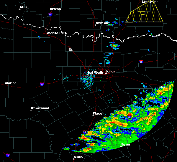 At 1147 am cdt, a severe thunderstorm was located 9 miles south of fairfield, moving northeast at 40 mph (radar indicated). Hazards include quarter size hail. damage to vehicles is possible At 1147 am cdt, a severe thunderstorm was located 9 miles south of fairfield, moving northeast at 40 mph (radar indicated). Hazards include quarter size hail. damage to vehicles is possible
|
| 4/19/2020 12:05 PM CDT |
 The severe thunderstorm warning for northeastern anderson county will expire at 1215 pm cdt, the storm which prompted the warning has weakened below severe limits, and has exited the warned area. therefore, the warning will be allowed to expire. a tornado watch remains in effect until 300 pm cdt for central texas. The severe thunderstorm warning for northeastern anderson county will expire at 1215 pm cdt, the storm which prompted the warning has weakened below severe limits, and has exited the warned area. therefore, the warning will be allowed to expire. a tornado watch remains in effect until 300 pm cdt for central texas.
|
| 4/19/2020 11:49 AM CDT |
 At 1148 am cdt, a severe thunderstorm was located 8 miles southwest of reese, or 12 miles west of jacksonville, moving east at 45 mph (radar indicated). Hazards include quarter size hail. Damage to vehicles is possible. locations impacted include, palestine. A tornado watch remains in effect until 300 pm cdt for central texas. At 1148 am cdt, a severe thunderstorm was located 8 miles southwest of reese, or 12 miles west of jacksonville, moving east at 45 mph (radar indicated). Hazards include quarter size hail. Damage to vehicles is possible. locations impacted include, palestine. A tornado watch remains in effect until 300 pm cdt for central texas.
|
| 4/19/2020 11:35 AM CDT | Quarter sized hail reported 11.6 miles SSE of Palestine, TX |
| 4/19/2020 11:34 AM CDT |
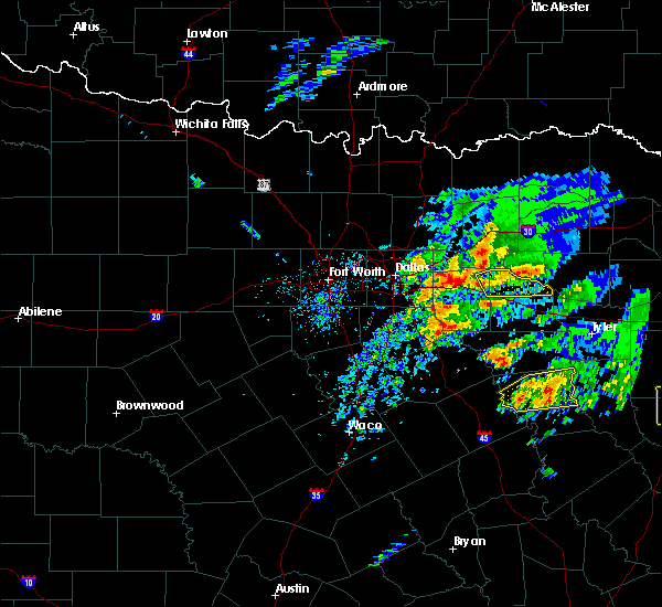 At 1133 am cdt, a severe thunderstorm was located 9 miles north of palestine, moving east at 45 mph (radar indicated). Hazards include quarter size hail. Damage to vehicles is possible. locations impacted include, palestine and frankston. A tornado watch remains in effect until 300 pm cdt for central texas. At 1133 am cdt, a severe thunderstorm was located 9 miles north of palestine, moving east at 45 mph (radar indicated). Hazards include quarter size hail. Damage to vehicles is possible. locations impacted include, palestine and frankston. A tornado watch remains in effect until 300 pm cdt for central texas.
|
| 4/19/2020 11:19 AM CDT |
 At 1118 am cdt, a severe thunderstorm was located 11 miles northeast of fairfield lake state park, or 15 miles northwest of palestine, moving east at 50 mph (radar indicated). Hazards include quarter size hail. damage to vehicles is possible At 1118 am cdt, a severe thunderstorm was located 11 miles northeast of fairfield lake state park, or 15 miles northwest of palestine, moving east at 50 mph (radar indicated). Hazards include quarter size hail. damage to vehicles is possible
|
| 4/19/2020 10:11 AM CDT | Quarter sized hail reported 2.1 miles NE of Palestine, TX, quarter hail southwest of palestine. |
| 4/19/2020 10:05 AM CDT |
 At 1005 am cdt, a severe thunderstorm was located near palestine, moving east at 45 mph. at 1000 am cdt, golf ball size hail was reported with this storm (emergency management). Hazards include golf ball size hail. People and animals outdoors will be injured. Expect damage to roofs, siding, windows, and vehicles. At 1005 am cdt, a severe thunderstorm was located near palestine, moving east at 45 mph. at 1000 am cdt, golf ball size hail was reported with this storm (emergency management). Hazards include golf ball size hail. People and animals outdoors will be injured. Expect damage to roofs, siding, windows, and vehicles.
|
| 4/19/2020 9:58 AM CDT | Golf Ball sized hail reported 6.4 miles ENE of Palestine, TX, golf ball size hail at fm 645 and acr 2908. |
| 4/19/2020 9:53 AM CDT |
 At 953 am cdt, a severe thunderstorm was located 7 miles west of palestine, moving east at 40 mph (radar indicated). Hazards include golf ball size hail. People and animals outdoors will be injured. expect damage to roofs, siding, windows, and vehicles. locations impacted include, palestine and elkhart. A tornado watch remains in effect until 300 pm cdt for central texas. At 953 am cdt, a severe thunderstorm was located 7 miles west of palestine, moving east at 40 mph (radar indicated). Hazards include golf ball size hail. People and animals outdoors will be injured. expect damage to roofs, siding, windows, and vehicles. locations impacted include, palestine and elkhart. A tornado watch remains in effect until 300 pm cdt for central texas.
|
| 4/19/2020 9:43 AM CDT |
 At 943 am cdt, a severe thunderstorm was located 11 miles southeast of fairfield lake state park, or 15 miles west of palestine, moving east at 40 mph (radar indicated). Hazards include ping pong ball size hail. People and animals outdoors will be injured. expect damage to roofs, siding, windows, and vehicles. locations impacted include, palestine, fairfield, elkhart and fairfield lake state park. A tornado watch remains in effect until 300 pm cdt for central texas. At 943 am cdt, a severe thunderstorm was located 11 miles southeast of fairfield lake state park, or 15 miles west of palestine, moving east at 40 mph (radar indicated). Hazards include ping pong ball size hail. People and animals outdoors will be injured. expect damage to roofs, siding, windows, and vehicles. locations impacted include, palestine, fairfield, elkhart and fairfield lake state park. A tornado watch remains in effect until 300 pm cdt for central texas.
|
| 4/19/2020 9:30 AM CDT |
 At 929 am cdt, a severe thunderstorm was located 8 miles southeast of fairfield, moving east at 45 mph (radar indicated). Hazards include ping pong ball size hail. People and animals outdoors will be injured. expect damage to roofs, siding, windows, and vehicles. locations impacted include, palestine, teague, fairfield, elkhart and fairfield lake state park. A tornado watch remains in effect until 300 pm cdt for central texas. At 929 am cdt, a severe thunderstorm was located 8 miles southeast of fairfield, moving east at 45 mph (radar indicated). Hazards include ping pong ball size hail. People and animals outdoors will be injured. expect damage to roofs, siding, windows, and vehicles. locations impacted include, palestine, teague, fairfield, elkhart and fairfield lake state park. A tornado watch remains in effect until 300 pm cdt for central texas.
|
| 4/19/2020 9:16 AM CDT |
 At 916 am cdt, a severe thunderstorm was located over teague, moving east at 45 mph (radar indicated). Hazards include quarter size hail. damage to vehicles is possible At 916 am cdt, a severe thunderstorm was located over teague, moving east at 45 mph (radar indicated). Hazards include quarter size hail. damage to vehicles is possible
|
| 4/12/2020 7:43 AM CDT |
 At 743 am cdt, a severe thunderstorm was located near elkhart, or near palestine, moving east at 45 mph (radar indicated). Hazards include 70 mph wind gusts and quarter size hail. Hail damage to vehicles is expected. expect considerable tree damage. wind damage is also likely to mobile homes, roofs, and outbuildings. locations impacted include, palestine, buffalo, elkhart and oakwood. A tornado watch remains in effect until noon cdt for central texas. At 743 am cdt, a severe thunderstorm was located near elkhart, or near palestine, moving east at 45 mph (radar indicated). Hazards include 70 mph wind gusts and quarter size hail. Hail damage to vehicles is expected. expect considerable tree damage. wind damage is also likely to mobile homes, roofs, and outbuildings. locations impacted include, palestine, buffalo, elkhart and oakwood. A tornado watch remains in effect until noon cdt for central texas.
|
| 4/12/2020 7:16 AM CDT |
 At 716 am cdt, a severe thunderstorm was located near buffalo, or 17 miles southeast of fairfield, moving east at 40 mph. another severe storm was located just north of palestine, moving east and southeast at 40 mph (radar indicated). Hazards include 70 mph wind gusts and quarter size hail. Hail damage to vehicles is expected. expect considerable tree damage. Wind damage is also likely to mobile homes, roofs, and outbuildings. At 716 am cdt, a severe thunderstorm was located near buffalo, or 17 miles southeast of fairfield, moving east at 40 mph. another severe storm was located just north of palestine, moving east and southeast at 40 mph (radar indicated). Hazards include 70 mph wind gusts and quarter size hail. Hail damage to vehicles is expected. expect considerable tree damage. Wind damage is also likely to mobile homes, roofs, and outbuildings.
|
| 2/9/2020 8:09 PM CST |
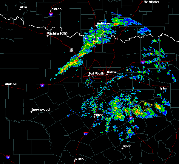 At 808 pm cst, a severe thunderstorm was located 7 miles east of fairfield lake state park, or 12 miles east of fairfield, moving northeast at 45 mph (radar indicated). Hazards include quarter size hail and wind gusts up to 40 mph. Damage to vehicles is possible. Locations impacted include, palestine and fairfield lake state park. At 808 pm cst, a severe thunderstorm was located 7 miles east of fairfield lake state park, or 12 miles east of fairfield, moving northeast at 45 mph (radar indicated). Hazards include quarter size hail and wind gusts up to 40 mph. Damage to vehicles is possible. Locations impacted include, palestine and fairfield lake state park.
|
| 2/9/2020 7:47 PM CST |
 At 746 pm cst, a severe thunderstorm was located 7 miles south of fairfield, moving northeast at 45 mph (radar indicated). Hazards include half dollar size hail and wind gusts up to 40 mph. Damage to vehicles is possible. Locations impacted include, palestine, teague, fairfield and fairfield lake state park. At 746 pm cst, a severe thunderstorm was located 7 miles south of fairfield, moving northeast at 45 mph (radar indicated). Hazards include half dollar size hail and wind gusts up to 40 mph. Damage to vehicles is possible. Locations impacted include, palestine, teague, fairfield and fairfield lake state park.
|
| 2/9/2020 7:37 PM CST |
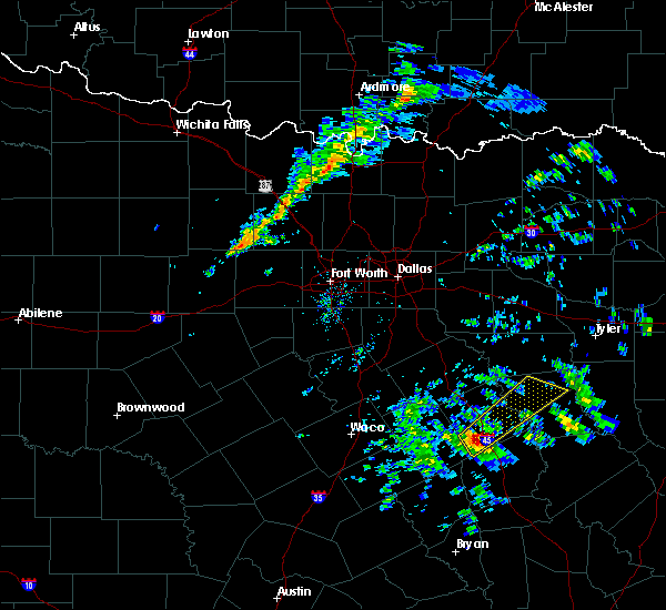 At 736 pm cst, a severe thunderstorm was located 7 miles south of teague, moving northeast at 45 mph (radar indicated). Hazards include quarter size hail and wind gusts up to 40 mph. damage to vehicles is possible At 736 pm cst, a severe thunderstorm was located 7 miles south of teague, moving northeast at 45 mph (radar indicated). Hazards include quarter size hail and wind gusts up to 40 mph. damage to vehicles is possible
|
| 1/10/2020 10:30 PM CST | Power poles snapped and room damage in palestin in anderson county TX, 1.3 miles W of Palestine, TX |
| 6/9/2019 3:50 PM CDT |
 At 349 pm cdt, a severe thunderstorm was located near fairfield, moving south at 40 mph (radar indicated). Hazards include 60 mph wind gusts and half dollar size hail. Hail damage to vehicles is expected. expect wind damage to roofs, siding, and trees. Locations impacted include, palestine, teague, fairfield, wortham, fairfield lake state park, oakwood, streetman and kirvin. At 349 pm cdt, a severe thunderstorm was located near fairfield, moving south at 40 mph (radar indicated). Hazards include 60 mph wind gusts and half dollar size hail. Hail damage to vehicles is expected. expect wind damage to roofs, siding, and trees. Locations impacted include, palestine, teague, fairfield, wortham, fairfield lake state park, oakwood, streetman and kirvin.
|
| 6/9/2019 3:25 PM CDT |
 At 324 pm cdt, a severe thunderstorm was located 11 miles east of navarro, or 16 miles north of fairfield, moving south at 40 mph (radar indicated). Hazards include 60 mph wind gusts and half dollar size hail. Hail damage to vehicles is expected. Expect wind damage to roofs, siding, and trees. At 324 pm cdt, a severe thunderstorm was located 11 miles east of navarro, or 16 miles north of fairfield, moving south at 40 mph (radar indicated). Hazards include 60 mph wind gusts and half dollar size hail. Hail damage to vehicles is expected. Expect wind damage to roofs, siding, and trees.
|
| 5/18/2019 7:16 PM CDT |
 At 716 pm cdt, a severe thunderstorm was located 7 miles northwest of maydelle, or 11 miles southwest of jacksonville, moving northeast at 35 mph (radar indicated). Hazards include golf ball size hail and 65 mph wind gusts. People and animals outdoors will be injured. expect hail damage to roofs, siding, windows, and vehicles. expect wind damage to roofs, siding, and trees. locations impacted include, palestine, elkhart, frankston, berryville and poynor. A tornado watch remains in effect until 800 pm cdt for central texas. At 716 pm cdt, a severe thunderstorm was located 7 miles northwest of maydelle, or 11 miles southwest of jacksonville, moving northeast at 35 mph (radar indicated). Hazards include golf ball size hail and 65 mph wind gusts. People and animals outdoors will be injured. expect hail damage to roofs, siding, windows, and vehicles. expect wind damage to roofs, siding, and trees. locations impacted include, palestine, elkhart, frankston, berryville and poynor. A tornado watch remains in effect until 800 pm cdt for central texas.
|
| 5/18/2019 6:55 PM CDT |
 At 655 pm cdt, a severe thunderstorm was located over palestine, moving northeast at 35 mph (radar indicated). Hazards include 65 mph wind gusts and half dollar size hail. Hail damage to vehicles is expected. expect wind damage to roofs, siding, and trees. locations impacted include, palestine, elkhart, frankston, berryville and poynor. A tornado watch remains in effect until 800 pm cdt for central texas. At 655 pm cdt, a severe thunderstorm was located over palestine, moving northeast at 35 mph (radar indicated). Hazards include 65 mph wind gusts and half dollar size hail. Hail damage to vehicles is expected. expect wind damage to roofs, siding, and trees. locations impacted include, palestine, elkhart, frankston, berryville and poynor. A tornado watch remains in effect until 800 pm cdt for central texas.
|
| 5/18/2019 6:40 PM CDT |
 The national weather service in fort worth has issued a * severe thunderstorm warning for. anderson county in central texas. until 745 pm cdt. At 640 pm cdt, a severe thunderstorm was located near palestine, moving northeast at 35 mph. The national weather service in fort worth has issued a * severe thunderstorm warning for. anderson county in central texas. until 745 pm cdt. At 640 pm cdt, a severe thunderstorm was located near palestine, moving northeast at 35 mph.
|
| 5/18/2019 5:59 PM CDT |
 At 559 pm cdt, a severe thunderstorm was located over fort parker state park, or near groesbeck, moving northeast at 40 mph (radar indicated). Hazards include 60 mph wind gusts and quarter size hail. Hail damage to vehicles is expected. Expect wind damage to roofs, siding, and trees. At 559 pm cdt, a severe thunderstorm was located over fort parker state park, or near groesbeck, moving northeast at 40 mph (radar indicated). Hazards include 60 mph wind gusts and quarter size hail. Hail damage to vehicles is expected. Expect wind damage to roofs, siding, and trees.
|
| 5/18/2019 5:29 PM CDT |
 The national weather service in fort worth has issued a * severe thunderstorm warning for. eastern henderson county in central texas. northern anderson county in central texas. until 630 pm cdt. At 529 pm cdt, a severe thunderstorm was located 15 miles west of. The national weather service in fort worth has issued a * severe thunderstorm warning for. eastern henderson county in central texas. northern anderson county in central texas. until 630 pm cdt. At 529 pm cdt, a severe thunderstorm was located 15 miles west of.
|
| 4/18/2019 2:57 AM CDT |
 The severe thunderstorm warning for anderson county will expire at 300 am cdt. the storms which prompted the warning have moved out of the area. Therefore the warning will be allowed to expire. The severe thunderstorm warning for anderson county will expire at 300 am cdt. the storms which prompted the warning have moved out of the area. Therefore the warning will be allowed to expire.
|
| 4/18/2019 2:33 AM CDT | Mping report of wind damage in anderson county TX, 2 miles WSW of Palestine, TX |
| 4/18/2019 2:30 AM CDT |
 At 230 am cdt, severe thunderstorms were located along a line extending from 14 miles southwest of frankston to near palestine to near elkhart, moving east at 45 mph (radar indicated). Hazards include 65 mph wind gusts and nickel size hail. Expect damage to roofs, siding, and trees. Locations impacted include, palestine, elkhart and frankston. At 230 am cdt, severe thunderstorms were located along a line extending from 14 miles southwest of frankston to near palestine to near elkhart, moving east at 45 mph (radar indicated). Hazards include 65 mph wind gusts and nickel size hail. Expect damage to roofs, siding, and trees. Locations impacted include, palestine, elkhart and frankston.
|
| 4/18/2019 2:02 AM CDT |
 At 201 am cdt, severe thunderstorms were located along a line extending from 6 miles north of fairfield lake state park to 13 miles east of fairfield to 13 miles northeast of buffalo, moving northeast at 45 mph (radar indicated). Hazards include 65 mph wind gusts and quarter size hail. Hail damage to vehicles is expected. Expect wind damage to roofs, siding, and trees. At 201 am cdt, severe thunderstorms were located along a line extending from 6 miles north of fairfield lake state park to 13 miles east of fairfield to 13 miles northeast of buffalo, moving northeast at 45 mph (radar indicated). Hazards include 65 mph wind gusts and quarter size hail. Hail damage to vehicles is expected. Expect wind damage to roofs, siding, and trees.
|
| 4/13/2019 1:51 PM CDT | Trees down on fm 31 in anderson county TX, 11.8 miles S of Palestine, TX |
| 4/13/2019 1:51 PM CDT | Tree across the road on 84(east) near cr 39 in anderson county TX, 13.1 miles W of Palestine, TX |
| 4/13/2019 1:50 PM CDT | Trees down on fm 315 elmwood area... and along 84e near cr 391... where a tree was across the roa in anderson county TX, 10.3 miles ESE of Palestine, TX |
| 4/13/2019 12:50 PM CDT |
 At 1250 pm cdt, a severe thunderstorm capable of producing a tornado was located 12 miles southwest of palestine, moving northeast at 45 mph (radar indicated rotation). Hazards include tornado and quarter size hail. Flying debris will be dangerous to those caught without shelter. mobile homes will be damaged or destroyed. damage to roofs, windows, and vehicles will occur. tree damage is likely. Locations impacted include, palestine, elkhart and oakwood. At 1250 pm cdt, a severe thunderstorm capable of producing a tornado was located 12 miles southwest of palestine, moving northeast at 45 mph (radar indicated rotation). Hazards include tornado and quarter size hail. Flying debris will be dangerous to those caught without shelter. mobile homes will be damaged or destroyed. damage to roofs, windows, and vehicles will occur. tree damage is likely. Locations impacted include, palestine, elkhart and oakwood.
|
| 4/13/2019 12:28 PM CDT |
 At 1228 pm cdt, a tornado producing storm was located near buffalo, or 19 miles southeast of fairfield, moving northeast at 40 mph (radar confirmed tornado). Hazards include damaging tornado and half dollar size hail. Flying debris will be dangerous to those caught without shelter. mobile homes will be damaged or destroyed. damage to roofs, windows, and vehicles will occur. Tree damage is likely. At 1228 pm cdt, a tornado producing storm was located near buffalo, or 19 miles southeast of fairfield, moving northeast at 40 mph (radar confirmed tornado). Hazards include damaging tornado and half dollar size hail. Flying debris will be dangerous to those caught without shelter. mobile homes will be damaged or destroyed. damage to roofs, windows, and vehicles will occur. Tree damage is likely.
|
| 4/6/2019 4:27 PM CDT | Golf Ball sized hail reported 9.1 miles SSW of Palestine, TX |
| 4/6/2019 3:42 PM CDT |
 At 342 pm cdt, a severe thunderstorm was located 14 miles west of elkhart, or 15 miles southwest of palestine, moving east at 30 mph (radar indicated). Hazards include 60 mph wind gusts and nickel size hail. expect damage to roofs, siding, and trees At 342 pm cdt, a severe thunderstorm was located 14 miles west of elkhart, or 15 miles southwest of palestine, moving east at 30 mph (radar indicated). Hazards include 60 mph wind gusts and nickel size hail. expect damage to roofs, siding, and trees
|
| 4/13/2018 9:52 PM CDT |
 At 952 pm cdt, severe thunderstorms were located along a line extending from 8 miles west of frankston to near palestine, moving east at 35 mph (radar indicated). Hazards include 65 mph wind gusts. expect damage to roofs, siding, and trees At 952 pm cdt, severe thunderstorms were located along a line extending from 8 miles west of frankston to near palestine, moving east at 35 mph (radar indicated). Hazards include 65 mph wind gusts. expect damage to roofs, siding, and trees
|
| 4/13/2018 9:48 PM CDT |
 At 947 pm cdt, severe thunderstorms were located along a line extending from 7 miles east of athens to 14 miles west of frankston to 13 miles northeast of fairfield lake state park, moving east at 40 mph (radar indicated). Hazards include 65 mph wind gusts. Expect damage to roofs, siding, and trees. locations impacted include, palestine, athens, malakoff and murchison. A tornado watch remains in effect until 1000 pm cdt for central texas. At 947 pm cdt, severe thunderstorms were located along a line extending from 7 miles east of athens to 14 miles west of frankston to 13 miles northeast of fairfield lake state park, moving east at 40 mph (radar indicated). Hazards include 65 mph wind gusts. Expect damage to roofs, siding, and trees. locations impacted include, palestine, athens, malakoff and murchison. A tornado watch remains in effect until 1000 pm cdt for central texas.
|
| 4/13/2018 9:15 PM CDT |
 At 913 pm cdt, severe thunderstorms were located along a line extending from near trinidad to 13 miles southeast of kerens to near fairfield, moving east at 40 mph (radar indicated). Hazards include 65 mph wind gusts and quarter size hail. Hail damage to vehicles is expected. Expect wind damage to roofs, siding, and trees. At 913 pm cdt, severe thunderstorms were located along a line extending from near trinidad to 13 miles southeast of kerens to near fairfield, moving east at 40 mph (radar indicated). Hazards include 65 mph wind gusts and quarter size hail. Hail damage to vehicles is expected. Expect wind damage to roofs, siding, and trees.
|
| 7/9/2017 3:00 PM CDT | Spotter reported wind gust around 50 k in henderson county TX, 18.1 miles S of Palestine, TX |
| 7/9/2017 2:45 PM CDT |
 At 245 pm cdt, a severe thunderstorm was located 10 miles southwest of frankston, or 15 miles north of palestine, moving north at 15 mph (radar indicated). Hazards include 60 mph wind gusts and nickel size hail. Expect damage to roofs, siding, and trees. this severe thunderstorm will be near, frankston around 325 pm cdt. berryville and coffee city around 330 pm cdt. Other locations impacted by this severe thunderstorm include poynor and moore station. At 245 pm cdt, a severe thunderstorm was located 10 miles southwest of frankston, or 15 miles north of palestine, moving north at 15 mph (radar indicated). Hazards include 60 mph wind gusts and nickel size hail. Expect damage to roofs, siding, and trees. this severe thunderstorm will be near, frankston around 325 pm cdt. berryville and coffee city around 330 pm cdt. Other locations impacted by this severe thunderstorm include poynor and moore station.
|
| 5/28/2017 4:49 PM CDT | Quarter sized hail reported 10 miles SW of Palestine, TX, quarter size hail reported 9 mi ne of palestine via mping |
| 5/28/2017 4:43 PM CDT |
 At 441 pm cdt, a severe thunderstorm was located 8 miles east of palestine, moving northeast at 30 mph (radar indicated). Hazards include 60 mph wind gusts and half dollar size hail. Hail damage to vehicles is expected. expect wind damage to roofs, siding, and trees. Locations impacted include, palestine and neches along highway 84. At 441 pm cdt, a severe thunderstorm was located 8 miles east of palestine, moving northeast at 30 mph (radar indicated). Hazards include 60 mph wind gusts and half dollar size hail. Hail damage to vehicles is expected. expect wind damage to roofs, siding, and trees. Locations impacted include, palestine and neches along highway 84.
|
| 5/28/2017 4:26 PM CDT |
 At 426 pm cdt, a severe thunderstorm was located 7 miles east of palestine, moving northeast at 30 mph (radar indicated). Hazards include 60 mph wind gusts and half dollar size hail. Hail damage to vehicles is expected. Expect wind damage to roofs, siding, and trees. At 426 pm cdt, a severe thunderstorm was located 7 miles east of palestine, moving northeast at 30 mph (radar indicated). Hazards include 60 mph wind gusts and half dollar size hail. Hail damage to vehicles is expected. Expect wind damage to roofs, siding, and trees.
|
| 4/26/2017 2:06 PM CDT |
 The severe thunderstorm warning for northeastern freestone and northwestern anderson counties will expire at 215 pm cdt, the storm which prompted the warning has weakened below severe limits. therefore the warning will be allowed to expire. however small hail is still possible with this thunderstorm. The severe thunderstorm warning for northeastern freestone and northwestern anderson counties will expire at 215 pm cdt, the storm which prompted the warning has weakened below severe limits. therefore the warning will be allowed to expire. however small hail is still possible with this thunderstorm.
|
| 4/26/2017 1:21 PM CDT |
 At 120 pm cdt, a severe thunderstorm was located near fairfield lake state park, or 10 miles north of fairfield, moving east at 20 mph (radar indicated). Hazards include quarter size hail. damage to vehicles is possible At 120 pm cdt, a severe thunderstorm was located near fairfield lake state park, or 10 miles north of fairfield, moving east at 20 mph (radar indicated). Hazards include quarter size hail. damage to vehicles is possible
|
| 1/2/2017 6:55 AM CST |
 The severe thunderstorm warning for anderson county will expire at 700 am cst, the storms which prompted the warning have moved out of the area. therefore the warning will be allowed to expire. however gusty winds are still possible with these thunderstorms. a severe thunderstorm watch remains in effect until 900 am cst for central texas. The severe thunderstorm warning for anderson county will expire at 700 am cst, the storms which prompted the warning have moved out of the area. therefore the warning will be allowed to expire. however gusty winds are still possible with these thunderstorms. a severe thunderstorm watch remains in effect until 900 am cst for central texas.
|
| 1/2/2017 6:40 AM CST | Trees of various sizes down in anderson county TX, 1.3 miles W of Palestine, TX |
| 1/2/2017 6:09 AM CST |
 At 607 am cst, severe thunderstorms were located along a line extending from 12 miles southeast of trinidad to near buffalo, moving east at 50 mph (radar indicated). Hazards include 60 mph wind gusts. Expect damage to roofs, siding, and trees. These severe thunderstorms will move over much of anderson county, including the cities of palestine, frankston, elkhart and poynor. At 607 am cst, severe thunderstorms were located along a line extending from 12 miles southeast of trinidad to near buffalo, moving east at 50 mph (radar indicated). Hazards include 60 mph wind gusts. Expect damage to roofs, siding, and trees. These severe thunderstorms will move over much of anderson county, including the cities of palestine, frankston, elkhart and poynor.
|
| 5/2/2016 12:12 AM CDT | Quarter sized hail reported 1.3 miles W of Palestine, TX, quarter size hail near the airport in palestine |
| 5/2/2016 12:10 AM CDT |
 At 1210 am cdt, a severe thunderstorm was located near palestine, moving north at 30 mph (radar indicated). Hazards include 60 mph wind gusts and quarter size hail. Hail damage to vehicles is expected. expect wind damage to roofs, siding, and trees. This severe thunderstorm will be near, frankston around 1250 am cdt. At 1210 am cdt, a severe thunderstorm was located near palestine, moving north at 30 mph (radar indicated). Hazards include 60 mph wind gusts and quarter size hail. Hail damage to vehicles is expected. expect wind damage to roofs, siding, and trees. This severe thunderstorm will be near, frankston around 1250 am cdt.
|
| 4/30/2016 1:26 AM CDT |
 The severe thunderstorm warning for central anderson county will expire at 130 am cdt, the storm which prompted the warning has weakened below severe limits and exited the warned area, therefore the warning will be allowed to expire. however, gusty winds and heavy rain are still possible with this thunderstorm. a severe thunderstorm watch remains in effect until 500 am cdt for central texas. The severe thunderstorm warning for central anderson county will expire at 130 am cdt, the storm which prompted the warning has weakened below severe limits and exited the warned area, therefore the warning will be allowed to expire. however, gusty winds and heavy rain are still possible with this thunderstorm. a severe thunderstorm watch remains in effect until 500 am cdt for central texas.
|
| 4/30/2016 1:06 AM CDT |
 At 105 am cdt, a severe thunderstorm was located near palestine, moving northeast at 30 mph (radar indicated). Hazards include 60 mph wind gusts and quarter size hail. Hail damage to vehicles is expected. expect wind damage to roofs, siding, and trees. This severe thunderstorm will remain over mainly rural areas of central anderson county. At 105 am cdt, a severe thunderstorm was located near palestine, moving northeast at 30 mph (radar indicated). Hazards include 60 mph wind gusts and quarter size hail. Hail damage to vehicles is expected. expect wind damage to roofs, siding, and trees. This severe thunderstorm will remain over mainly rural areas of central anderson county.
|
| 4/30/2016 12:53 AM CDT |
 At 1253 am cdt, a severe thunderstorm was located near elkhart, or 9 miles south of palestine, moving northeast at 20 mph (radar indicated). Hazards include 60 mph wind gusts and quarter size hail. Hail damage to vehicles is expected. expect wind damage to roofs, siding, and trees. this severe storm will be near, elkhart around 105 am cdt. palestine around 120 am cdt. Other locations impacted by this severe thunderstorm include oakwood. At 1253 am cdt, a severe thunderstorm was located near elkhart, or 9 miles south of palestine, moving northeast at 20 mph (radar indicated). Hazards include 60 mph wind gusts and quarter size hail. Hail damage to vehicles is expected. expect wind damage to roofs, siding, and trees. this severe storm will be near, elkhart around 105 am cdt. palestine around 120 am cdt. Other locations impacted by this severe thunderstorm include oakwood.
|
| 4/30/2016 12:26 AM CDT |
 At 1225 am cdt, a severe thunderstorm was located 10 miles west of elkhart, or 12 miles southwest of palestine, moving northeast at 20 mph (radar indicated). Hazards include 60 mph wind gusts and quarter size hail. Hail damage to vehicles is expected. expect wind damage to roofs, siding, and trees. this severe thunderstorm will be near, elkhart around 1250 am cdt. palestine around 110 am cdt. Other locations impacted by this severe thunderstorm include oakwood. At 1225 am cdt, a severe thunderstorm was located 10 miles west of elkhart, or 12 miles southwest of palestine, moving northeast at 20 mph (radar indicated). Hazards include 60 mph wind gusts and quarter size hail. Hail damage to vehicles is expected. expect wind damage to roofs, siding, and trees. this severe thunderstorm will be near, elkhart around 1250 am cdt. palestine around 110 am cdt. Other locations impacted by this severe thunderstorm include oakwood.
|
| 4/29/2016 4:10 PM CDT |
 The severe thunderstorm warning for anderson and freestone counties will expire at 415 pm cdt, the storm which prompted the warning has moved out of the area. therefore the warning will be allowed to expire. a tornado watch remains in effect until 1000 pm cdt for central texas. The severe thunderstorm warning for anderson and freestone counties will expire at 415 pm cdt, the storm which prompted the warning has moved out of the area. therefore the warning will be allowed to expire. a tornado watch remains in effect until 1000 pm cdt for central texas.
|
| 4/29/2016 3:11 PM CDT |
 At 311 pm cdt, a severe thunderstorm was located near fairfield, moving northeast at 40 mph (radar indicated). Hazards include quarter size hail. Damage to vehicles is possible. this severe thunderstorm will be near, fairfield around 320 pm cdt. fairfield lake state park around 330 pm cdt. other locations impacted by this severe thunderstorm include kirvin and oakwood. this includes interstate 45 between mile markers 182 and 206. A tornado watch remains in effect until 1000 pm cdt for central texas. At 311 pm cdt, a severe thunderstorm was located near fairfield, moving northeast at 40 mph (radar indicated). Hazards include quarter size hail. Damage to vehicles is possible. this severe thunderstorm will be near, fairfield around 320 pm cdt. fairfield lake state park around 330 pm cdt. other locations impacted by this severe thunderstorm include kirvin and oakwood. this includes interstate 45 between mile markers 182 and 206. A tornado watch remains in effect until 1000 pm cdt for central texas.
|
| 4/29/2016 2:53 PM CDT |
 The severe thunderstorm warning for anderson and freestone counties will expire at 300 pm cdt, the storm which prompted the warning has weakened below severe limits. therefore the warning will be allowed to expire. however gusty winds and heavy rain are still possible with this thunderstorm. a tornado watch remains in effect until 1000 pm cdt for north central texas. The severe thunderstorm warning for anderson and freestone counties will expire at 300 pm cdt, the storm which prompted the warning has weakened below severe limits. therefore the warning will be allowed to expire. however gusty winds and heavy rain are still possible with this thunderstorm. a tornado watch remains in effect until 1000 pm cdt for north central texas.
|
| 4/29/2016 2:06 PM CDT |
 At 206 pm cdt, a severe thunderstorm was located 7 miles northwest of buffalo, or 9 miles southeast of teague, moving northeast at 45 mph (radar indicated). Hazards include half dollar size hail. Damage to vehicles is possible. this severe thunderstorm will be near, fairfield lake state park around 225 pm cdt. other locations impacted by this severe thunderstorm include streetman, kirvin and poynor. this includes interstate 45 between mile markers 181 and 212. A tornado watch remains in effect until 1000 pm cdt for north central texas. At 206 pm cdt, a severe thunderstorm was located 7 miles northwest of buffalo, or 9 miles southeast of teague, moving northeast at 45 mph (radar indicated). Hazards include half dollar size hail. Damage to vehicles is possible. this severe thunderstorm will be near, fairfield lake state park around 225 pm cdt. other locations impacted by this severe thunderstorm include streetman, kirvin and poynor. this includes interstate 45 between mile markers 181 and 212. A tornado watch remains in effect until 1000 pm cdt for north central texas.
|
| 4/29/2016 1:33 PM CDT |
 At 132 pm cdt, a severe thunderstorm was located near fairfield lake state park, or 10 miles east of fairfield, moving northeast at 60 mph (radar indicated). Hazards include 60 mph wind gusts and quarter size hail. Hail damage to vehicles is possible. expect wind damage to roofs, siding, and trees. this severe storm will be near, athens around 205 pm cdt. brownsboro around 215 pm cdt. other locations impacted by this severe thunderstorm include murchison, poynor and moore station. A tornado watch remains in effect until 1000 pm cdt for north central texas. At 132 pm cdt, a severe thunderstorm was located near fairfield lake state park, or 10 miles east of fairfield, moving northeast at 60 mph (radar indicated). Hazards include 60 mph wind gusts and quarter size hail. Hail damage to vehicles is possible. expect wind damage to roofs, siding, and trees. this severe storm will be near, athens around 205 pm cdt. brownsboro around 215 pm cdt. other locations impacted by this severe thunderstorm include murchison, poynor and moore station. A tornado watch remains in effect until 1000 pm cdt for north central texas.
|
| 4/29/2016 1:09 PM CDT |
 At 108 pm cdt, a severe thunderstorm was located near fairfield lake state park, or near fairfield, moving northeast at 40 mph (radar indicated). Hazards include 60 mph wind gusts and quarter size hail. Hail damage to vehicles is expected. expect wind damage to roofs, siding, and trees. this severe thunderstorm will be near, athens around 200 pm cdt. brownsboro around 215 pm cdt. other locations impacted by this severe thunderstorm include murchison, moore station, kirvin and poynor. this includes interstate 45 between mile markers 193 and 208. A tornado watch remains in effect until 1000 pm cdt for north central texas. At 108 pm cdt, a severe thunderstorm was located near fairfield lake state park, or near fairfield, moving northeast at 40 mph (radar indicated). Hazards include 60 mph wind gusts and quarter size hail. Hail damage to vehicles is expected. expect wind damage to roofs, siding, and trees. this severe thunderstorm will be near, athens around 200 pm cdt. brownsboro around 215 pm cdt. other locations impacted by this severe thunderstorm include murchison, moore station, kirvin and poynor. this includes interstate 45 between mile markers 193 and 208. A tornado watch remains in effect until 1000 pm cdt for north central texas.
|
| 5/25/2015 6:24 PM CDT | Large trees down on hwy 79 in anderson county TX, 13.5 miles SW of Palestine, TX |
| 5/25/2015 6:22 PM CDT | The severe thunderstorm warning for central anderson county will expire at 630 pm cdt, the storms which prompted the warning have weakened below severe limits, and exited the warned area. therefore the warning will be allowed to expire. however gusty winds and heavy rain are still possible with these thunderstorms. a tornado watch remains in effect until 1000 pm cdt for central texas. |
| 5/25/2015 6:15 PM CDT | At 614 pm cdt, severe thunderstorms were located along a line extending from near frankston to 9 miles southwest of maydelle, moving northeast at 40 mph (radar indicated). Hazards include 60 mph wind gusts and penny size hail. Expect damage to roofs. siding and trees. locations impacted include, palestine, elkhart, frankston, berryville and poynor. A tornado watch remains in effect until 1000 pm cdt for central texas. |
| 5/25/2015 6:03 PM CDT | At 602 pm cdt, severe thunderstorms were located along a line extending from 10 miles west of frankston to near elkhart, moving east at 40 mph (radar indicated). Hazards include 60 mph wind gusts. Expect damage to roofs. siding and trees. locations impacted include, palestine, elkhart, frankston, berryville and poynor. A tornado watch remains in effect until 1000 pm cdt for central texas. |
| 5/25/2015 5:17 PM CDT | At 517 pm cdt, severe thunderstorms were located along a line extending from 11 miles south of trinidad to near buffalo, moving northeast at 40 mph (radar indicated). Hazards include 60 mph wind gusts. Expect damage to roofs. Siding and trees. |
| 5/14/2015 5:22 PM CDT | At 522 pm cdt, a severe thunderstorm was located near palestine, moving north at 15 mph (radar indicated). Hazards include 60 mph wind gusts and quarter size hail. Hail damage to vehicles is expected. Expect wind damage to roofs, siding and trees. |
| 5/11/2015 2:41 AM CDT | At 240 am cdt, a severe thunderstorm was located 10 miles southwest of palestine, moving northeast at 35 mph (radar indicated). Hazards include 60 mph wind gusts and quarter size hail. Hail damage to vehicles is expected. Expect wind damage to roofs, siding and trees. |
| 5/11/2015 2:08 AM CDT | At 207 am cdt, a severe thunderstorm capable of producing a tornado was located near buffalo, or 11 miles southeast of teague, moving northeast at 45 mph (radar indicated rotation). Hazards include tornado and quarter size hail. Flying debris will be dangerous to those caught without shelter. mobile homes will be damaged or destroyed. damage to roofs, windows and vehicles will occur. tree damage is likely. this dangerous storm will be near, palestine around 245 am cdt. this includes interstate 45 between mile markers 181 and 190. Radar indicated. |
| 5/11/2015 12:42 AM CDT | The tornado warning for eastern anderson county will expire at 1245 am cdt, the storm which prompted the warning has moved out of the area. therefore the warning will be allowed to expire. |
| 5/11/2015 12:28 AM CDT | At 1227 am cdt, a severe thunderstorm capable of producing a tornado was located 7 miles northeast of elkhart, or 9 miles southeast of palestine, moving northeast at 40 mph (radar indicated rotation). Hazards include tornado and half dollar size hail. Flying debris will be dangerous to those caught without shelter. mobile homes will be damaged or destroyed. damage to roofs, windows and vehicles will occur. tree damage is likely. locations impacted include, elkhart. Radar indicated. |
| 5/11/2015 12:14 AM CDT | At 1213 am cdt, a severe thunderstorm capable of producing a tornado was located near elkhart, or 12 miles south of palestine, moving northeast at 35 mph (radar indicated rotation). Hazards include tornado. Flying debris will be dangerous to those caught without shelter. mobile homes will be damaged or destroyed. damage to roofs, windows and vehicles will occur. tree damage is likely. this tornadic thunderstorm will remain over mainly rural areas of eastern anderson county. Radar indicated. |
| 4/27/2015 3:39 AM CDT | At 338 am cdt, a severe thunderstorm was located 10 miles southwest of maydelle, or 16 miles southeast of palestine, moving east at 30 mph (radar indicated). Hazards include 60 mph wind gusts and quarter size hail. Hail damage to vehicles is expected. expect wind damage to roofs, siding and trees. locations impacted include, rural southeastern anderson county. a tornado watch remains in effect until 500 am cdt for central texas. 1. 00in. |
| 4/27/2015 3:15 AM CDT | At 314 am cdt, a severe thunderstorm was located near elkhart, or near palestine, moving east at 45 mph (radar indicated). Hazards include 60 mph wind gusts and quarter size hail. Hail damage to vehicles is expected. Expect wind damage to roofs, siding and trees. |
| 4/13/2015 6:25 PM CDT | The severe thunderstorm warning for northeastern limestone. freestone and northwestern anderson counties will expire at 630 pm cdt. the severe thunderstorms that prompted the warning have weakened. therefore the warning will be allowed to expire. Lightning and moderate to heavy rainfall will continue to occur with these storms. |
| 4/13/2015 6:04 PM CDT | A severe thunderstorm warning remains in effect until 630 pm cdt for northeastern limestone. freestone and northwestern anderson counties. at 602 pm cdt. a severe thunderstorm was located near fairfield lake state park. or 12 miles east of fairfield. moving east at 30 mph. Another severe storm was located between teague and. |
| 4/13/2015 5:40 PM CDT | The national weather service in fort worth has issued a * severe thunderstorm warning for. central limestone county in north central texas. freestone county in north central texas. northwestern anderson county in northeastern texas. Until 630 pm cdt. |
| 10/6/2014 8:40 AM CDT | Quarter sized hail reported 0.5 miles E of Palestine, TX, delayed report of nickel to quarter sized hail near bassett rd. and loop 256. |
| 7/23/2014 10:36 PM CDT | In palestine - 10 large trees down... 4 ultility poles down and numerous power lines dow in anderson county TX, 1.3 miles W of Palestine, TX |
| 5/9/2014 5:50 PM CDT | Quarter sized hail reported 1.3 miles W of Palestine, TX, nickel to quarter at palestine high school |
| 5/9/2014 5:40 PM CDT | Quarter sized hail reported 2.8 miles E of Palestine, TX, nickel to quarter fm 320 and 425 |
| 1/29/2013 7:05 PM CST | A section of metal roofing was blown off of a walmart ware in anderson county TX, 2 miles WNW of Palestine, TX |
| 1/29/2013 7:01 PM CST | Numerous reports of straight line wind damage in palestine. mainly trees d in anderson county TX, 1.3 miles W of Palestine, TX |
| 12/19/2012 11:40 PM CST | Trees down off fm19 near neches. time estimate in anderson county TX, 12.2 miles SW of Palestine, TX |
| 11/3/2012 3:55 PM CDT | Quarter sized hail reported 11.8 miles ESE of Palestine, TX, quarter hail reported at cr2304 and cr2311 |
| 8/8/2012 4:30 PM CDT | Large limbs blocked highway 84 8 miles east of palestin in anderson county TX, 9.6 miles W of Palestine, TX |
| 4/8/2012 6:00 PM CDT | Grapefruit sized hail reported 11.8 miles ESE of Palestine, TX, near tennesse colony |
| 4/3/2012 8:19 PM CDT | Quarter sized hail reported 1.3 miles W of Palestine, TX, west side of palestine |
| 4/3/2012 7:52 PM CDT | Quarter sized hail reported 9.8 miles NE of Palestine, TX |
| 4/3/2012 7:50 PM CDT | Ping Pong Ball sized hail reported 6.6 miles NE of Palestine, TX |
| 1/1/0001 12:00 AM | Trees and power lines blown down near county road 444 and fm 315 in anderson county TX, 6.6 miles SSW of Palestine, TX |
| 1/1/0001 12:00 AM | Several powerlines down in the county due to tstm winds. lightning caused 11 fires to develop throughout the c in anderson county TX, 1.3 miles W of Palestine, TX |
| 1/1/0001 12:00 AM | Large pine tree down across fm 645 roughly 2-3 miles south of tennessee colony in anderson county TX, 12 miles ESE of Palestine, TX |
| 1/1/0001 12:00 AM | Trees were blown down about 10 miles north of palestine along fm 315. one of the trees was 15" in diamete in anderson county TX, 9.7 miles S of Palestine, TX |
| 1/1/0001 12:00 AM | Trees downed in montalba in anderson county TX, 9.4 miles SSE of Palestine, TX |
| 1/1/0001 12:00 AM | Roof blown off a mobile home west of tennessee colony in anderson county TX, 14.5 miles ESE of Palestine, TX |
| 1/1/0001 12:00 AM | Many trees were knocked down in the northern part of the county...including along hwys 19 and 287 in anderson county TX, 9.4 miles SSE of Palestine, TX |
| 1/1/0001 12:00 AM | Large tree down across 1 lane of hwy 84. tree diameter 2.5-3 ft in anderson county TX, 1.3 miles W of Palestine, TX |
| 1/1/0001 12:00 AM | Very large mature tree uprooted and laying across 1 lane of hwy 84 in anderson county TX, 1.3 miles W of Palestine, TX |
| 1/1/0001 12:00 AM | Quarter sized hail reported 2.8 miles WNW of Palestine, TX, quarter size hail at fm84 and acr 385 se of palestine. |
| 1/1/0001 12:00 AM | Trees down 6 miles north of palestine in anderson county TX, 5.6 miles S of Palestine, TX |
| 1/1/0001 12:00 AM | Golf Ball sized hail reported 16.2 miles SE of Palestine, TX, report of golfball hail just ne of blackfoot. |
| 1/1/0001 12:00 AM | Golf Ball sized hail reported 7.7 miles NW of Palestine, TX, 7 se of palestine on fm 323 |
| 1/1/0001 12:00 AM | Quarter sized hail reported 6.4 miles NNE of Palestine, TX, 7 ssw of palestine at cr 2101 & 2107 |
| 1/1/0001 12:00 AM | Quarter sized hail reported 2.8 miles WSW of Palestine, TX, 2 ne of palestine |
| 2/10/2009 11:12 PM CST | Penny sized hail reported 8.3 miles S of Palestine, TX |
Hail Maps for Palestine, TX


Connect with Interactive Hail Maps