

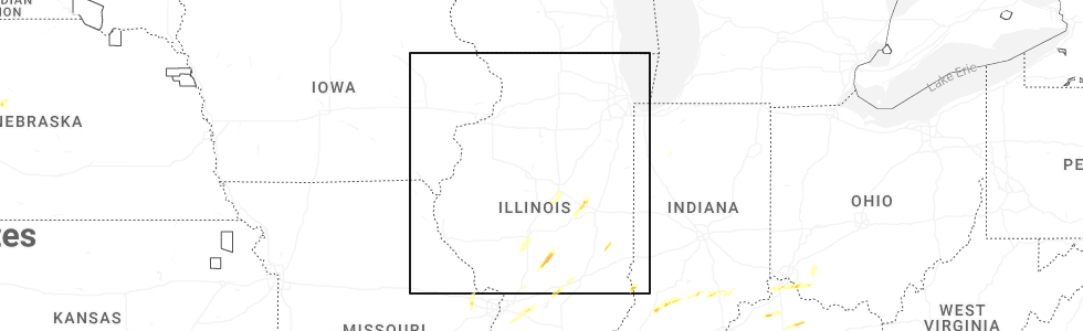
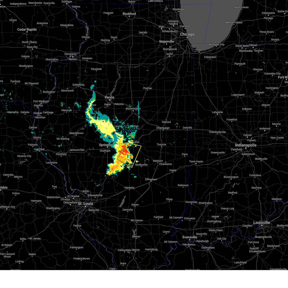
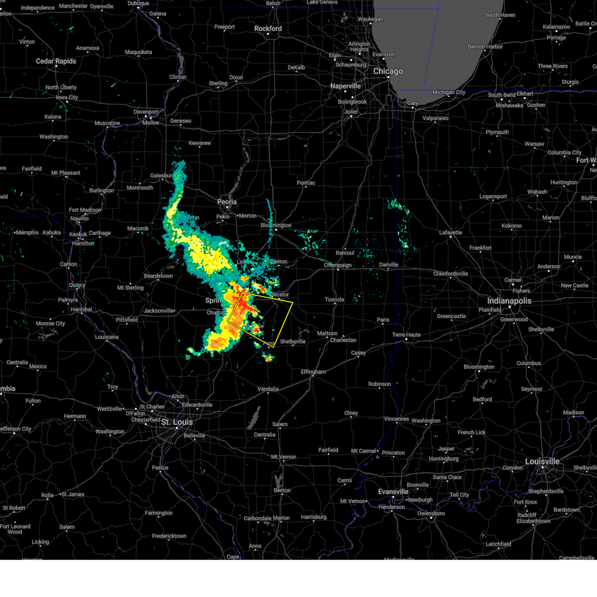
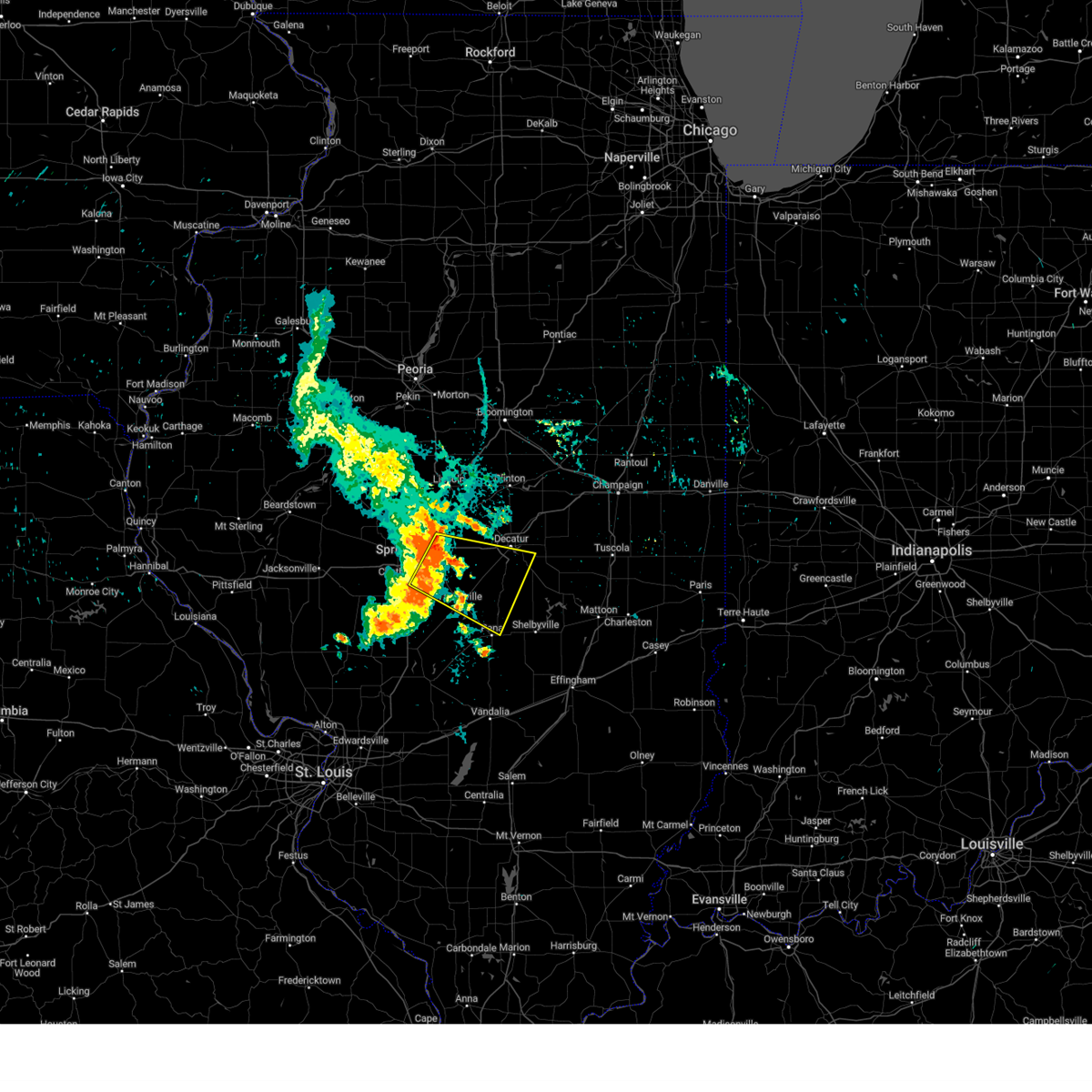
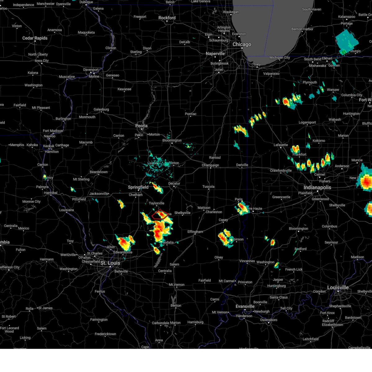
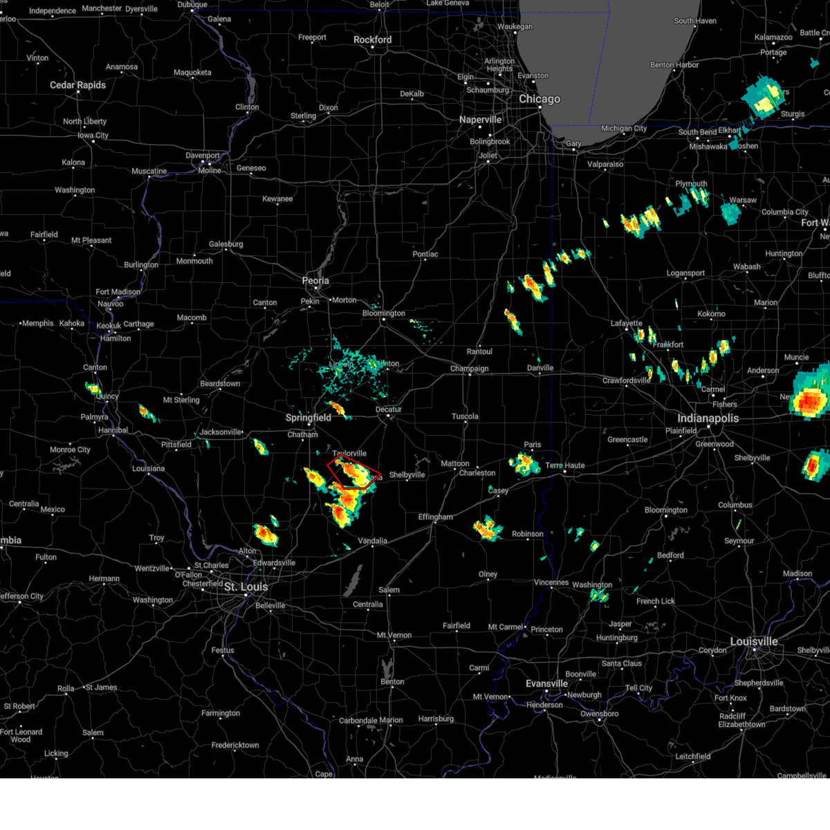
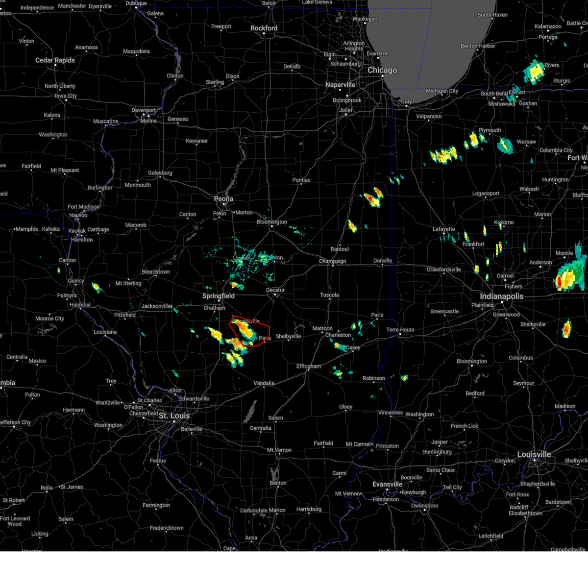
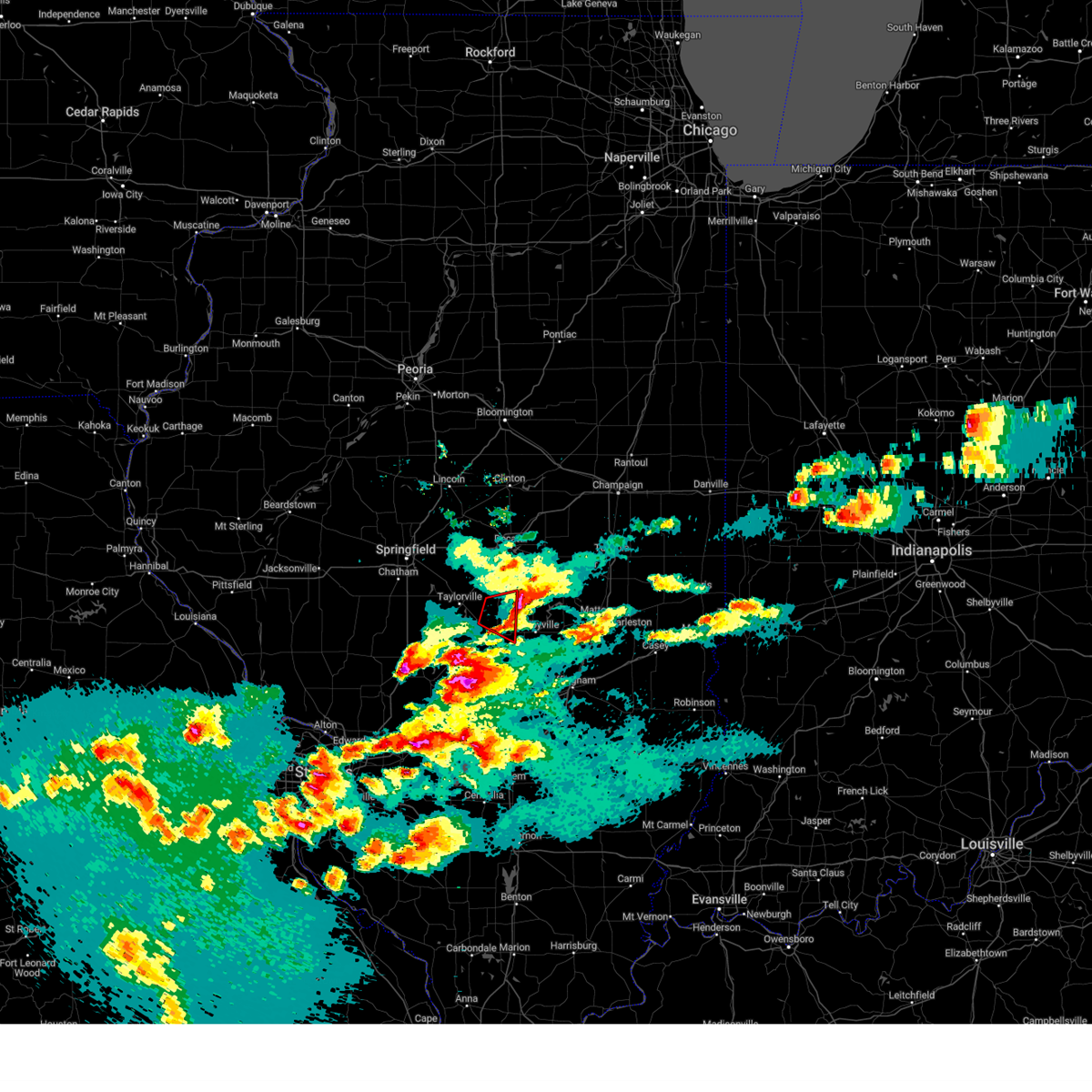
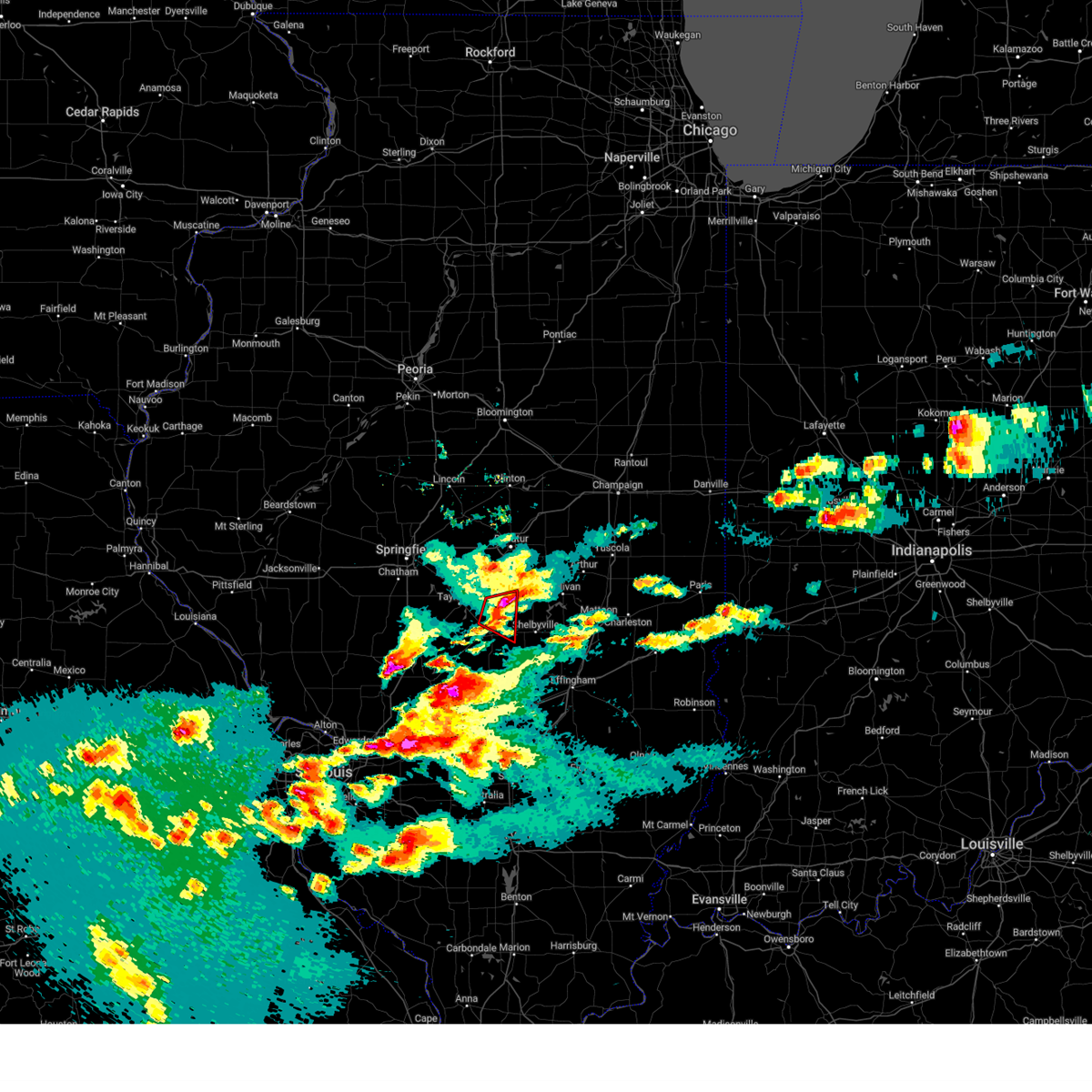
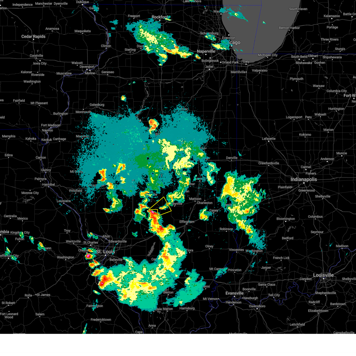
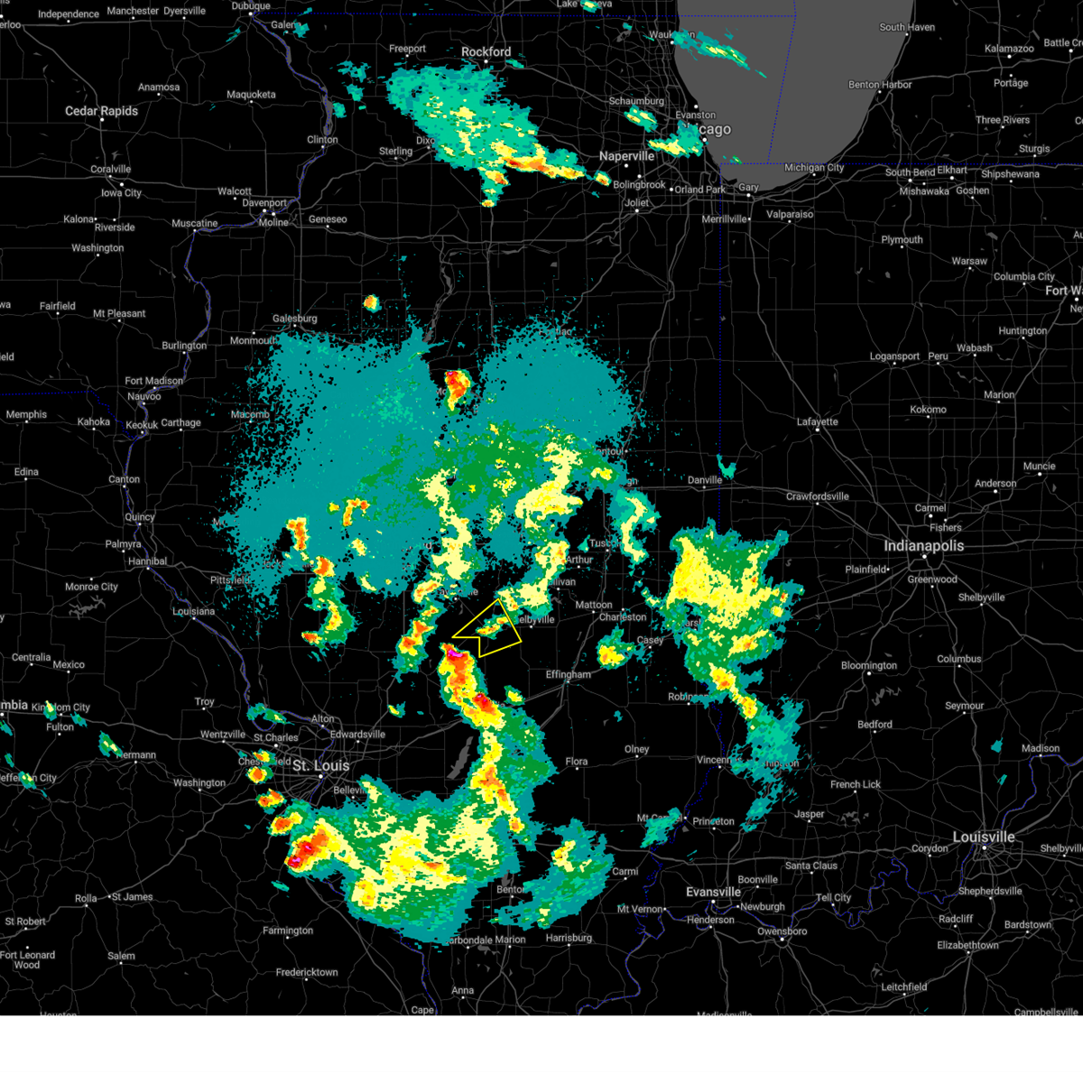
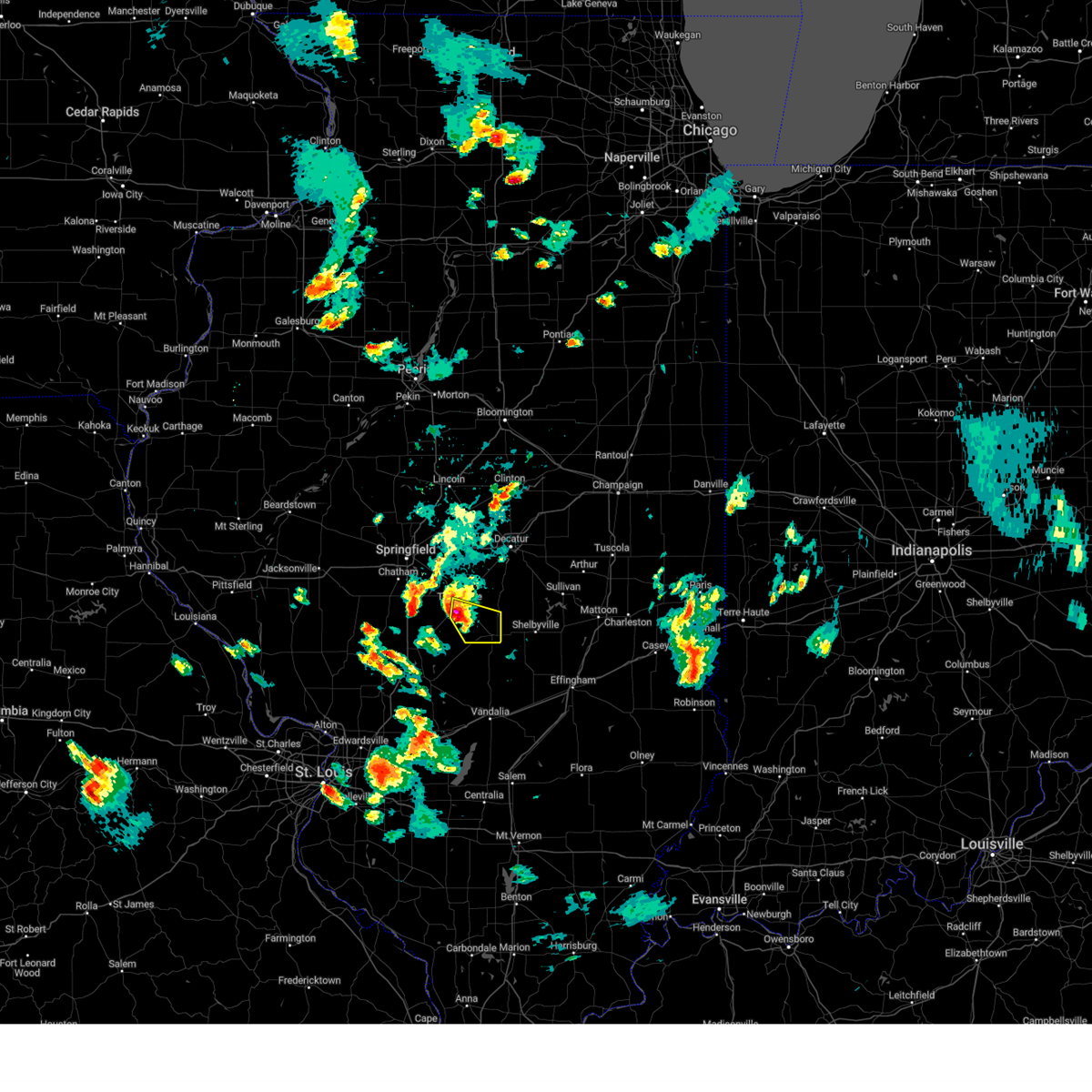
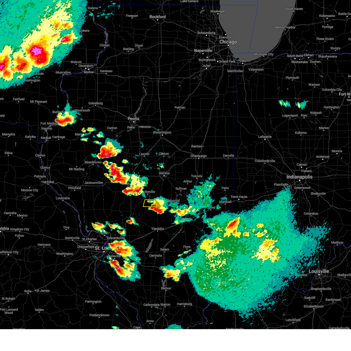
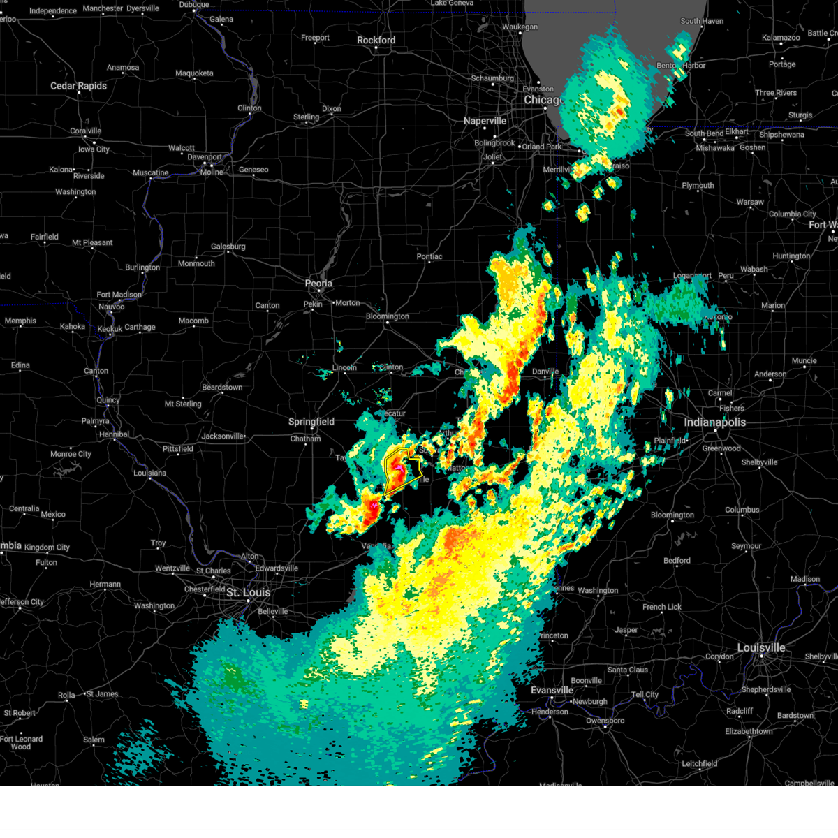
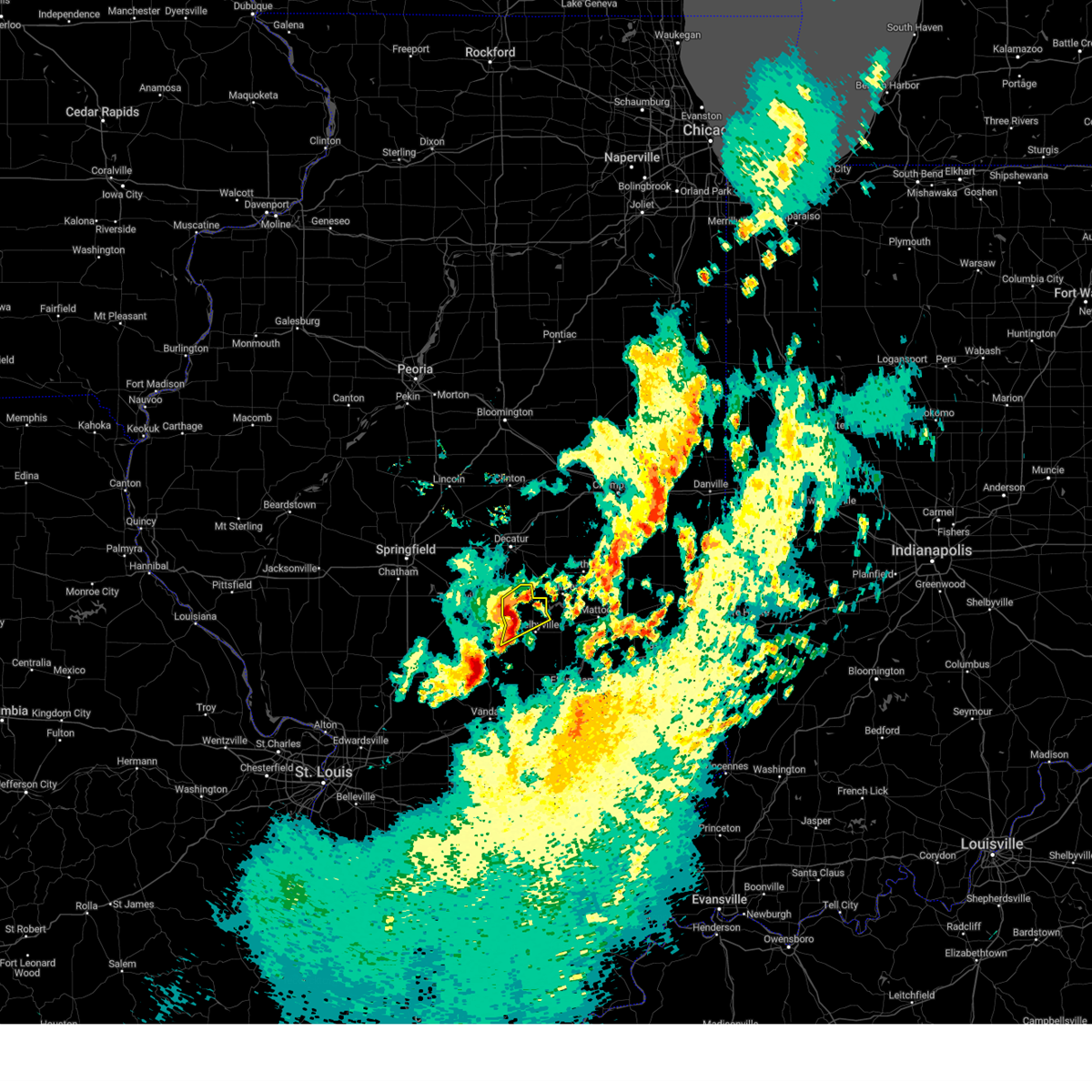
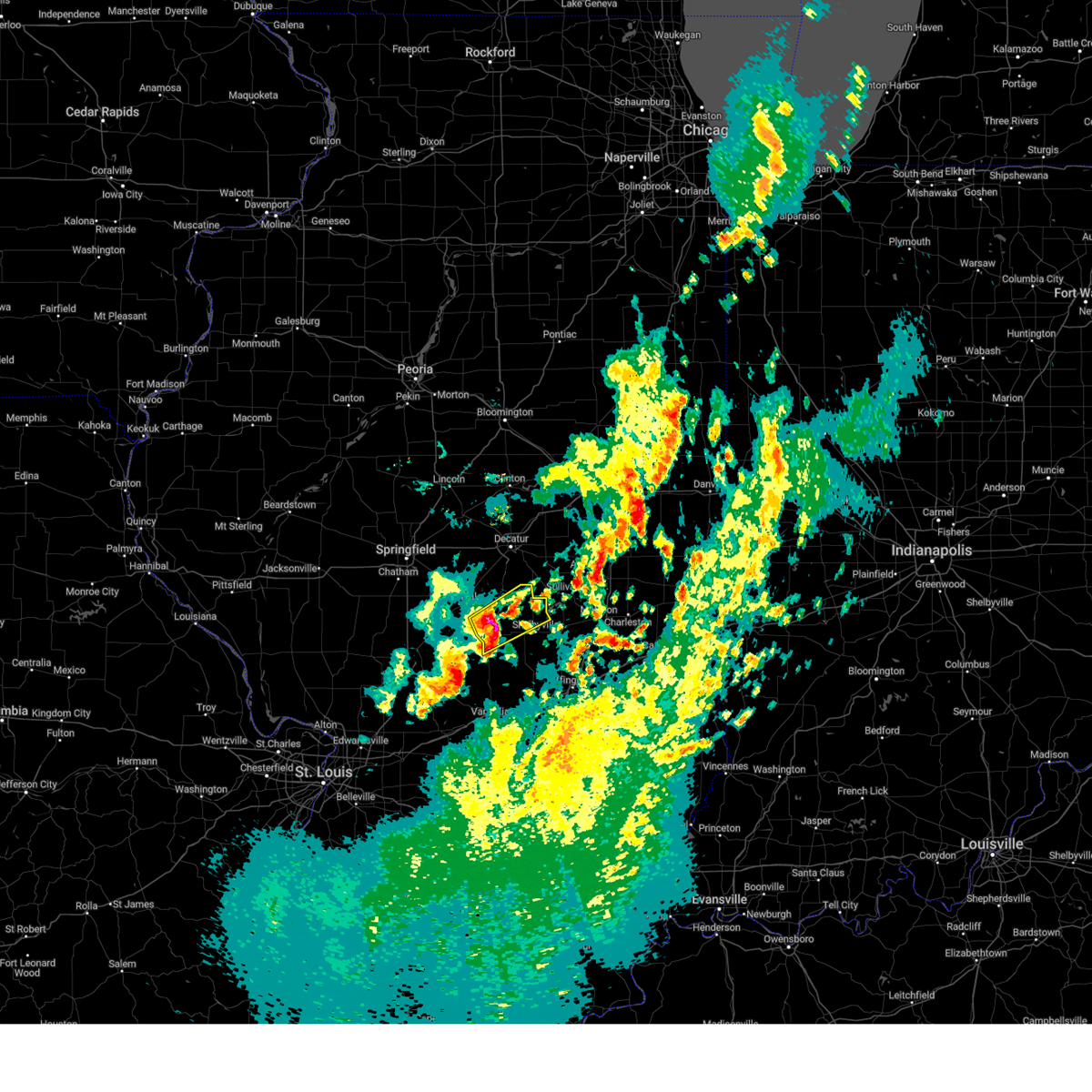
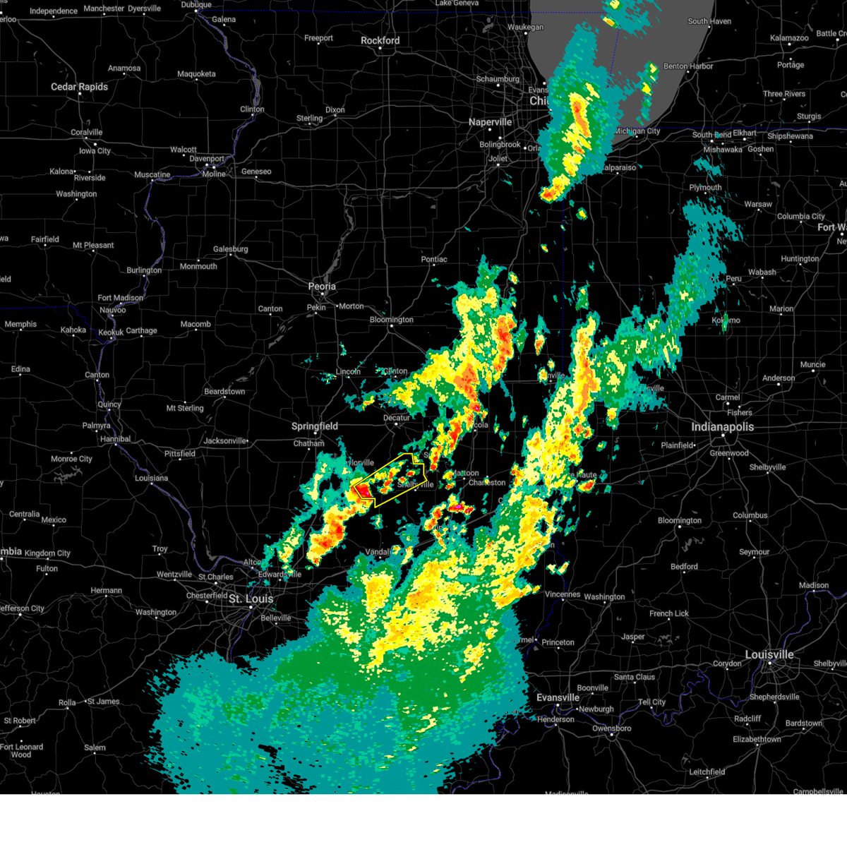
Hail Map for Pana, IL
The Pana, IL area has had 6 reports of on-the-ground hail by trained spotters, and has been under severe weather warnings 18 times during the past 12 months. Doppler radar has detected hail at or near Pana, IL on 66 occasions, including 2 occasions during the past year.
| Name: | Pana, IL |
| Where Located: | 37.1 miles W of Mattoon, IL |
| Map: | Google Map for Pana, IL |
| Population: | 5847 |
| Housing Units: | 3084 |
| More Info: | Search Google for Pana, IL |
0
The Top Recent Hail Date for Pana, IL is Wednesday, April 30, 2025 (50th out of 66)
Hail and Wind Damage Spotted near Pana, IL
| Date / Time | Report Details |
|---|---|
| 5/16/2025 4:10 PM CDT | The storm which prompted the warning has moved out of the area. therefore, the warning will be allowed to expire. a tornado watch remains in effect until 1000 pm cdt for central illinois. |
| 5/16/2025 3:32 PM CDT | Svrilx the national weather service in lincoln has issued a * severe thunderstorm warning for, christian county in central illinois, south central sangamon county in central illinois, northwestern shelby county in central illinois, southwestern macon county in central illinois, * until 415 pm cdt. * at 332 pm cdt, a severe thunderstorm was located near farmersville, or 11 miles southeast of virden, moving northeast at 55 mph (radar indicated). Hazards include 60 mph wind gusts and quarter size hail. Hail damage to vehicles is expected. expect wind damage to roofs, siding, and trees. this severe thunderstorm will be near, morrisonville around 340 pm cdt. taylorville, kincaid, and jeisyville around 345 pm cdt. other locations in the path of this severe thunderstorm include stonington, blue mound and macon. this includes the following highways, interstate 55 between mile markers 77 and 80. Interstate 72 between mile markers 128 and 131. |
| 4/30/2025 8:34 PM CDT | Quarter sized hail reported 5 miles E of Pana, IL |
| 4/30/2025 7:57 PM CDT |
 Svrilx the national weather service in lincoln has issued a * severe thunderstorm warning for, south central christian county in central illinois, * until 830 pm cdt. * at 757 pm cdt, a severe thunderstorm was located over nokomis, moving northeast at 25 mph (radar indicated). Hazards include quarter size hail. Damage to vehicles is expected. This severe thunderstorm will remain over mainly rural areas of south central christian county, including the following locations, ohlman and rosamond. Svrilx the national weather service in lincoln has issued a * severe thunderstorm warning for, south central christian county in central illinois, * until 830 pm cdt. * at 757 pm cdt, a severe thunderstorm was located over nokomis, moving northeast at 25 mph (radar indicated). Hazards include quarter size hail. Damage to vehicles is expected. This severe thunderstorm will remain over mainly rural areas of south central christian county, including the following locations, ohlman and rosamond.
|
| 4/2/2025 5:40 PM CDT | 3 inch tree limbs broken by high wind in shelby county IL, 3.1 miles W of Pana, IL |
| 4/2/2025 5:34 PM CDT | Svrilx the national weather service in lincoln has issued a * severe thunderstorm warning for, southeastern christian county in central illinois, central shelby county in central illinois, * until 615 pm cdt. * at 534 pm cdt, a severe thunderstorm was located near nokomis, moving northeast at 55 mph (radar indicated). Hazards include 60 mph wind gusts and quarter size hail. Hail damage to vehicles is expected. expect wind damage to roofs, siding, and trees. this severe thunderstorm will be near, pana around 540 pm cdt. Assumption around 550 pm cdt. |
| 3/30/2025 12:33 PM CDT |
 Svrilx the national weather service in lincoln has issued a * severe thunderstorm warning for, western coles county in east central illinois, southeastern christian county in central illinois, moultrie county in central illinois, shelby county in central illinois, southeastern piatt county in central illinois, western douglas county in east central illinois, southeastern macon county in central illinois, * until 115 pm cdt. * at 1233 pm cdt, severe thunderstorms were located along a line extending from dalton city to near herrick, moving east at 45 mph (radar indicated). Hazards include 60 mph wind gusts and quarter size hail. Hail damage to vehicles is expected. expect wind damage to roofs, siding, and trees. severe thunderstorms will be near, cowden, bethany, shelbyville, lovington, findlay, and herrick around 1240 pm cdt. sullivan and hammond around 1245 pm cdt. other locations in the path of these severe thunderstorms include allenville, arthur, atwood and windsor. This includes interstate 57 between mile markers 169 and 172, and between mile markers 180 and 215. Svrilx the national weather service in lincoln has issued a * severe thunderstorm warning for, western coles county in east central illinois, southeastern christian county in central illinois, moultrie county in central illinois, shelby county in central illinois, southeastern piatt county in central illinois, western douglas county in east central illinois, southeastern macon county in central illinois, * until 115 pm cdt. * at 1233 pm cdt, severe thunderstorms were located along a line extending from dalton city to near herrick, moving east at 45 mph (radar indicated). Hazards include 60 mph wind gusts and quarter size hail. Hail damage to vehicles is expected. expect wind damage to roofs, siding, and trees. severe thunderstorms will be near, cowden, bethany, shelbyville, lovington, findlay, and herrick around 1240 pm cdt. sullivan and hammond around 1245 pm cdt. other locations in the path of these severe thunderstorms include allenville, arthur, atwood and windsor. This includes interstate 57 between mile markers 169 and 172, and between mile markers 180 and 215.
|
| 3/19/2025 5:43 PM CDT |
 Svrilx the national weather service in lincoln has issued a * severe thunderstorm warning for, southeastern christian county in central illinois, western shelby county in central illinois, * until 630 pm cdt. * at 542 pm cdt, a severe thunderstorm was located near nokomis, moving northeast at 45 mph (radar indicated). Hazards include 60 mph wind gusts and quarter size hail. Hail damage to vehicles is expected. expect wind damage to roofs, siding, and trees. this severe thunderstorm will be near, pana around 550 pm cdt. Tower hill around 600 pm cdt. Svrilx the national weather service in lincoln has issued a * severe thunderstorm warning for, southeastern christian county in central illinois, western shelby county in central illinois, * until 630 pm cdt. * at 542 pm cdt, a severe thunderstorm was located near nokomis, moving northeast at 45 mph (radar indicated). Hazards include 60 mph wind gusts and quarter size hail. Hail damage to vehicles is expected. expect wind damage to roofs, siding, and trees. this severe thunderstorm will be near, pana around 550 pm cdt. Tower hill around 600 pm cdt.
|
| 3/14/2025 11:11 PM CDT | Torilx the national weather service in lincoln has issued a * tornado warning for, shelby county in central illinois, * until midnight cdt. * at 1111 pm cdt, a severe thunderstorm capable of producing a tornado was located over herrick, or 12 miles south of pana, moving northeast at 50 mph (radar indicated rotation). Hazards include tornado and ping pong ball size hail. Flying debris will be dangerous to those caught without shelter. mobile homes will be damaged or destroyed. damage to roofs, windows, and vehicles will occur. tree damage is likely. this dangerous storm will be near, herrick around 1115 pm cdt. Shelbyville around 1125 pm cdt. |
| 3/14/2025 10:41 PM CDT | Svrilx the national weather service in lincoln has issued a * severe thunderstorm warning for, christian county in central illinois, eastern sangamon county in central illinois, western shelby county in central illinois, macon county in central illinois, * until 1145 pm cdt. * at 1041 pm cdt, severe thunderstorms were located along a line extending from near cornland to near white oak to near van burensburg, moving northeast at 60 mph (radar indicated). Hazards include 70 mph wind gusts. Expect considerable tree damage. damage is likely to mobile homes, roofs, and outbuildings. severe thunderstorms will be near, edinburg, morrisonville, mechanicsburg, jeisyville, buffalo, and kincaid around 1045 pm cdt. mount auburn, taylorville, and illiopolis around 1050 pm cdt. owaneco and niantic around 1055 pm cdt. stonington and pana around 1100 pm cdt. other locations in the path of these severe thunderstorms include blue mound, warrensburg, harristown, herrick, assumption, tower hill, decatur, cowden, moweaqua, forsyth, macon and shelbyville. This includes interstate 72 between mile markers 112 and 148. |
| 7/30/2024 8:36 AM CDT |
 Svrilx the national weather service in lincoln has issued a * severe thunderstorm warning for, western coles county in east central illinois, southeastern christian county in central illinois, moultrie county in central illinois, shelby county in central illinois, western cumberland county in east central illinois, northeastern effingham county in south central illinois, southeastern macon county in central illinois, * until 900 am cdt. * at 835 am cdt, severe thunderstorms were located along a line extending from near macon to near herrick, moving southeast at 70 mph (radar indicated). Hazards include 60 mph wind gusts. Expect damage to roofs, siding, and trees. severe thunderstorms will be near, cowden and tower hill around 840 am cdt. shelbyville and findlay around 845 am cdt. shumway around 855 am cdt. this includes the following highways, interstate 57 between mile markers 162 and 187. Interstate 70 between mile markers 96 and 105. Svrilx the national weather service in lincoln has issued a * severe thunderstorm warning for, western coles county in east central illinois, southeastern christian county in central illinois, moultrie county in central illinois, shelby county in central illinois, western cumberland county in east central illinois, northeastern effingham county in south central illinois, southeastern macon county in central illinois, * until 900 am cdt. * at 835 am cdt, severe thunderstorms were located along a line extending from near macon to near herrick, moving southeast at 70 mph (radar indicated). Hazards include 60 mph wind gusts. Expect damage to roofs, siding, and trees. severe thunderstorms will be near, cowden and tower hill around 840 am cdt. shelbyville and findlay around 845 am cdt. shumway around 855 am cdt. this includes the following highways, interstate 57 between mile markers 162 and 187. Interstate 70 between mile markers 96 and 105.
|
| 7/30/2024 8:27 AM CDT |
 the severe thunderstorm warning has been cancelled and is no longer in effect the severe thunderstorm warning has been cancelled and is no longer in effect
|
| 7/30/2024 8:27 AM CDT |
 At 826 am cdt, a severe thunderstorm was located near blue mound, or 14 miles northeast of taylorville, moving east at 45 mph (trained weather spotters). Hazards include 60 mph wind gusts. Expect damage to roofs, siding, and trees. this severe storm will be near, moweaqua around 830 am cdt. other locations impacted by this severe thunderstorm include boody, willeys, hervey city, sharpsburg, taylorville municipal airport, elwin, and langleyville. This includes interstate 72 between mile markers 127 and 134. At 826 am cdt, a severe thunderstorm was located near blue mound, or 14 miles northeast of taylorville, moving east at 45 mph (trained weather spotters). Hazards include 60 mph wind gusts. Expect damage to roofs, siding, and trees. this severe storm will be near, moweaqua around 830 am cdt. other locations impacted by this severe thunderstorm include boody, willeys, hervey city, sharpsburg, taylorville municipal airport, elwin, and langleyville. This includes interstate 72 between mile markers 127 and 134.
|
| 7/30/2024 8:14 AM CDT |
 At 813 am cdt, a severe thunderstorm was located near mount auburn, or 13 miles north of taylorville, moving east at 45 mph (trained weather spotters. at 745 am, springfield reported wind gusts over 55 mph and broken tree branches). Hazards include 60 mph wind gusts. Expect damage to roofs, siding, and trees. this severe storm will be near, blue mound and stonington around 820 am cdt. moweaqua around 825 am cdt. other locations impacted by this severe thunderstorm include sangchris lake state park, boody, willeys, hervey city, sharpsburg, taylorville municipal airport, elwin, bulpitt, langleyville, and tovey. This includes interstate 72 between mile markers 113 and 134. At 813 am cdt, a severe thunderstorm was located near mount auburn, or 13 miles north of taylorville, moving east at 45 mph (trained weather spotters. at 745 am, springfield reported wind gusts over 55 mph and broken tree branches). Hazards include 60 mph wind gusts. Expect damage to roofs, siding, and trees. this severe storm will be near, blue mound and stonington around 820 am cdt. moweaqua around 825 am cdt. other locations impacted by this severe thunderstorm include sangchris lake state park, boody, willeys, hervey city, sharpsburg, taylorville municipal airport, elwin, bulpitt, langleyville, and tovey. This includes interstate 72 between mile markers 113 and 134.
|
| 7/30/2024 8:05 AM CDT |
 Svrilx the national weather service in lincoln has issued a * severe thunderstorm warning for, christian county in central illinois, eastern sangamon county in central illinois, northwestern shelby county in central illinois, southern macon county in central illinois, * until 845 am cdt. * at 804 am cdt, a severe thunderstorm was located near mechanicsburg, or 14 miles east of springfield, moving east at 45 mph (radar indicated). Hazards include 60 mph wind gusts. Expect damage to roofs, siding, and trees. this severe thunderstorm will be near, mount auburn around 810 am cdt. blue mound and stonington around 820 am cdt. other locations in the path of this severe thunderstorm include moweaqua and macon. This includes interstate 72 between mile markers 110 and 134. Svrilx the national weather service in lincoln has issued a * severe thunderstorm warning for, christian county in central illinois, eastern sangamon county in central illinois, northwestern shelby county in central illinois, southern macon county in central illinois, * until 845 am cdt. * at 804 am cdt, a severe thunderstorm was located near mechanicsburg, or 14 miles east of springfield, moving east at 45 mph (radar indicated). Hazards include 60 mph wind gusts. Expect damage to roofs, siding, and trees. this severe thunderstorm will be near, mount auburn around 810 am cdt. blue mound and stonington around 820 am cdt. other locations in the path of this severe thunderstorm include moweaqua and macon. This includes interstate 72 between mile markers 110 and 134.
|
| 7/29/2024 8:30 PM CDT |
 the tornado warning has been cancelled and is no longer in effect the tornado warning has been cancelled and is no longer in effect
|
| 7/29/2024 8:07 PM CDT |
 Torilx the national weather service in lincoln has issued a * tornado warning for, southeastern christian county in central illinois, southwestern shelby county in central illinois, * until 900 pm cdt. * at 807 pm cdt, a severe thunderstorm capable of producing a tornado was located near pana, moving southeast at 15 mph (radar indicated rotation). Hazards include tornado and quarter size hail. Flying debris will be dangerous to those caught without shelter. mobile homes will be damaged or destroyed. damage to roofs, windows, and vehicles will occur. tree damage is likely. This dangerous storm will be near, pana around 820 pm cdt. Torilx the national weather service in lincoln has issued a * tornado warning for, southeastern christian county in central illinois, southwestern shelby county in central illinois, * until 900 pm cdt. * at 807 pm cdt, a severe thunderstorm capable of producing a tornado was located near pana, moving southeast at 15 mph (radar indicated rotation). Hazards include tornado and quarter size hail. Flying debris will be dangerous to those caught without shelter. mobile homes will be damaged or destroyed. damage to roofs, windows, and vehicles will occur. tree damage is likely. This dangerous storm will be near, pana around 820 pm cdt.
|
| 7/29/2024 8:02 PM CDT |
 At 802 pm cdt, a severe thunderstorm capable of producing a tornado was located near owaneco, or 7 miles north of nokomis, moving southeast at 20 mph (radar indicated rotation). Hazards include tornado and quarter size hail. Flying debris will be dangerous to those caught without shelter. mobile homes will be damaged or destroyed. damage to roofs, windows, and vehicles will occur. tree damage is likely. This tornadic thunderstorm will remain over mainly rural areas of southeastern christian county, including the following locations, rosamond. At 802 pm cdt, a severe thunderstorm capable of producing a tornado was located near owaneco, or 7 miles north of nokomis, moving southeast at 20 mph (radar indicated rotation). Hazards include tornado and quarter size hail. Flying debris will be dangerous to those caught without shelter. mobile homes will be damaged or destroyed. damage to roofs, windows, and vehicles will occur. tree damage is likely. This tornadic thunderstorm will remain over mainly rural areas of southeastern christian county, including the following locations, rosamond.
|
| 7/29/2024 7:42 PM CDT |
 At 741 pm cdt, a severe thunderstorm capable of producing a tornado was located southwest of taylorville, moving southeast at 15 mph (radar indicated rotation). Hazards include tornado and quarter size hail. Flying debris will be dangerous to those caught without shelter. mobile homes will be damaged or destroyed. damage to roofs, windows, and vehicles will occur. tree damage is likely. this dangerous storm will be near, taylorville around 745 pm cdt. Other locations impacted by this tornadic thunderstorm include taylorville municipal airport, rosamond, palmer, and langleyville. At 741 pm cdt, a severe thunderstorm capable of producing a tornado was located southwest of taylorville, moving southeast at 15 mph (radar indicated rotation). Hazards include tornado and quarter size hail. Flying debris will be dangerous to those caught without shelter. mobile homes will be damaged or destroyed. damage to roofs, windows, and vehicles will occur. tree damage is likely. this dangerous storm will be near, taylorville around 745 pm cdt. Other locations impacted by this tornadic thunderstorm include taylorville municipal airport, rosamond, palmer, and langleyville.
|
| 7/29/2024 7:25 PM CDT |
 Torilx the national weather service in lincoln has issued a * tornado warning for, southern christian county in central illinois, * until 815 pm cdt. * at 724 pm cdt, a severe thunderstorm capable of producing a tornado was located over jeisyville, or 8 miles west of taylorville, moving southeast at 15 mph (radar indicated rotation). Hazards include tornado and quarter size hail. Flying debris will be dangerous to those caught without shelter. mobile homes will be damaged or destroyed. damage to roofs, windows, and vehicles will occur. tree damage is likely. This dangerous storm will be near, taylorville around 735 pm cdt. Torilx the national weather service in lincoln has issued a * tornado warning for, southern christian county in central illinois, * until 815 pm cdt. * at 724 pm cdt, a severe thunderstorm capable of producing a tornado was located over jeisyville, or 8 miles west of taylorville, moving southeast at 15 mph (radar indicated rotation). Hazards include tornado and quarter size hail. Flying debris will be dangerous to those caught without shelter. mobile homes will be damaged or destroyed. damage to roofs, windows, and vehicles will occur. tree damage is likely. This dangerous storm will be near, taylorville around 735 pm cdt.
|
| 4/18/2024 7:32 PM CDT |
 The storms which prompted the warning have moved out of the area. therefore, the warning will be allowed to expire. however, gusty winds and heavy rain are still possible with these thunderstorms. a severe thunderstorm watch remains in effect until 800 pm cdt for central illinois. The storms which prompted the warning have moved out of the area. therefore, the warning will be allowed to expire. however, gusty winds and heavy rain are still possible with these thunderstorms. a severe thunderstorm watch remains in effect until 800 pm cdt for central illinois.
|
| 4/18/2024 7:08 PM CDT |
 At 708 pm cdt, a severe squall line capable of producing both tornadoes and extensive straight line wind damage was located along a line extending from near tower hill to near brownstown, moving east at 45 mph (radar indicated rotation). Hazards include tornado and quarter size hail. Flying debris will be dangerous to those caught without shelter. mobile homes will be damaged or destroyed. damage to roofs, windows, and vehicles will occur. tree damage is likely. these dangerous storms will be near, shelbyville and cowden around 715 pm cdt. Other locations impacted by these tornadic storms include oconee and lakewood. At 708 pm cdt, a severe squall line capable of producing both tornadoes and extensive straight line wind damage was located along a line extending from near tower hill to near brownstown, moving east at 45 mph (radar indicated rotation). Hazards include tornado and quarter size hail. Flying debris will be dangerous to those caught without shelter. mobile homes will be damaged or destroyed. damage to roofs, windows, and vehicles will occur. tree damage is likely. these dangerous storms will be near, shelbyville and cowden around 715 pm cdt. Other locations impacted by these tornadic storms include oconee and lakewood.
|
| 4/18/2024 7:08 PM CDT |
 the tornado warning has been cancelled and is no longer in effect the tornado warning has been cancelled and is no longer in effect
|
| 4/18/2024 6:42 PM CDT |
 Torilx the national weather service in lincoln has issued a * tornado warning for, southeastern christian county in central illinois, southwestern shelby county in central illinois, * until 730 pm cdt. * at 641 pm cdt, severe thunderstorms capable of producing both tornadoes and extensive straight line wind damage were located along a line extending from near nokomis to near woburn, moving east at 45 mph (radar indicated rotation). Hazards include tornado and quarter size hail. Flying debris will be dangerous to those caught without shelter. mobile homes will be damaged or destroyed. damage to roofs, windows, and vehicles will occur. tree damage is likely. these dangerous storms will be near, pana around 655 pm cdt. Other locations in the path of these tornadic storms include tower hill, herrick, cowden and shelbyville. Torilx the national weather service in lincoln has issued a * tornado warning for, southeastern christian county in central illinois, southwestern shelby county in central illinois, * until 730 pm cdt. * at 641 pm cdt, severe thunderstorms capable of producing both tornadoes and extensive straight line wind damage were located along a line extending from near nokomis to near woburn, moving east at 45 mph (radar indicated rotation). Hazards include tornado and quarter size hail. Flying debris will be dangerous to those caught without shelter. mobile homes will be damaged or destroyed. damage to roofs, windows, and vehicles will occur. tree damage is likely. these dangerous storms will be near, pana around 655 pm cdt. Other locations in the path of these tornadic storms include tower hill, herrick, cowden and shelbyville.
|
| 3/14/2024 6:27 PM CDT |
 The storms which prompted the warning have moved out of the area. therefore, the warning will be allowed to expire. a tornado watch remains in effect until 900 pm cdt for central and east central illinois. remember, a severe thunderstorm warning still remains in effect for shelby and cumberland counties until 715 pm cdt. The storms which prompted the warning have moved out of the area. therefore, the warning will be allowed to expire. a tornado watch remains in effect until 900 pm cdt for central and east central illinois. remember, a severe thunderstorm warning still remains in effect for shelby and cumberland counties until 715 pm cdt.
|
| 3/14/2024 6:16 PM CDT |
 At 616 pm cdt, severe thunderstorms were located along a line extending from tower hill to near cowden, moving east at 50 mph (radar indicated). Hazards include 60 mph wind gusts and quarter size hail. Hail damage to vehicles is expected. expect wind damage to roofs, siding, and trees. these severe storms will be near, stewardson around 625 pm cdt. other locations impacted by these severe thunderstorms include sigel, trowbridge, clarksburg, oconee, mode, and lakewood. This includes interstate 57 between mile markers 169 and 175. At 616 pm cdt, severe thunderstorms were located along a line extending from tower hill to near cowden, moving east at 50 mph (radar indicated). Hazards include 60 mph wind gusts and quarter size hail. Hail damage to vehicles is expected. expect wind damage to roofs, siding, and trees. these severe storms will be near, stewardson around 625 pm cdt. other locations impacted by these severe thunderstorms include sigel, trowbridge, clarksburg, oconee, mode, and lakewood. This includes interstate 57 between mile markers 169 and 175.
|
| 3/14/2024 6:16 PM CDT |
 the severe thunderstorm warning has been cancelled and is no longer in effect the severe thunderstorm warning has been cancelled and is no longer in effect
|
| 3/14/2024 5:51 PM CDT |
 The storm which prompted the warning has moved out of the area. therefore, the warning will be allowed to expire. a tornado watch remains in effect until 900 pm cdt for central illinois. The storm which prompted the warning has moved out of the area. therefore, the warning will be allowed to expire. a tornado watch remains in effect until 900 pm cdt for central illinois.
|
| 3/14/2024 5:51 PM CDT |
 Svrilx the national weather service in lincoln has issued a * severe thunderstorm warning for, southeastern christian county in central illinois, southern shelby county in central illinois, west central cumberland county in east central illinois, northwestern effingham county in south central illinois, * until 630 pm cdt. * at 550 pm cdt, severe thunderstorms were located along a line extending from nokomis to near ramsey, moving east at 50 mph (radar indicated). Hazards include ping pong ball size hail and 60 mph wind gusts. People and animals outdoors will be injured. expect hail damage to roofs, siding, windows, and vehicles. expect wind damage to roofs, siding, and trees. severe thunderstorms will be near, pana and herrick around 600 pm cdt. cowden and tower hill around 610 pm cdt. other locations in the path of these severe thunderstorms include beecher city. This includes interstate 57 between mile markers 167 and 175. Svrilx the national weather service in lincoln has issued a * severe thunderstorm warning for, southeastern christian county in central illinois, southern shelby county in central illinois, west central cumberland county in east central illinois, northwestern effingham county in south central illinois, * until 630 pm cdt. * at 550 pm cdt, severe thunderstorms were located along a line extending from nokomis to near ramsey, moving east at 50 mph (radar indicated). Hazards include ping pong ball size hail and 60 mph wind gusts. People and animals outdoors will be injured. expect hail damage to roofs, siding, windows, and vehicles. expect wind damage to roofs, siding, and trees. severe thunderstorms will be near, pana and herrick around 600 pm cdt. cowden and tower hill around 610 pm cdt. other locations in the path of these severe thunderstorms include beecher city. This includes interstate 57 between mile markers 167 and 175.
|
| 3/14/2024 5:39 PM CDT |
 At 538 pm cdt, a severe thunderstorm capable of producing a tornado was located over assumption, or 7 miles north of pana, moving east at 45 mph (radar indicated rotation). Hazards include tornado and half dollar size hail. Flying debris will be dangerous to those caught without shelter. mobile homes will be damaged or destroyed. damage to roofs, windows, and vehicles will occur. tree damage is likely. This tornadic thunderstorm will remain over mainly rural areas of southeastern christian and northwestern shelby counties. At 538 pm cdt, a severe thunderstorm capable of producing a tornado was located over assumption, or 7 miles north of pana, moving east at 45 mph (radar indicated rotation). Hazards include tornado and half dollar size hail. Flying debris will be dangerous to those caught without shelter. mobile homes will be damaged or destroyed. damage to roofs, windows, and vehicles will occur. tree damage is likely. This tornadic thunderstorm will remain over mainly rural areas of southeastern christian and northwestern shelby counties.
|
| 3/14/2024 5:25 PM CDT |
 Torilx the national weather service in lincoln has issued a * tornado warning for, southeastern christian county in central illinois, northwestern shelby county in central illinois, * until 600 pm cdt. * at 524 pm cdt, a severe thunderstorm capable of producing a tornado was located over taylorville, moving east at 45 mph (radar indicated rotation). Hazards include tornado and half dollar size hail. Flying debris will be dangerous to those caught without shelter. mobile homes will be damaged or destroyed. damage to roofs, windows, and vehicles will occur. tree damage is likely. this dangerous storm will be near, owaneco around 530 pm cdt. Assumption around 535 pm cdt. Torilx the national weather service in lincoln has issued a * tornado warning for, southeastern christian county in central illinois, northwestern shelby county in central illinois, * until 600 pm cdt. * at 524 pm cdt, a severe thunderstorm capable of producing a tornado was located over taylorville, moving east at 45 mph (radar indicated rotation). Hazards include tornado and half dollar size hail. Flying debris will be dangerous to those caught without shelter. mobile homes will be damaged or destroyed. damage to roofs, windows, and vehicles will occur. tree damage is likely. this dangerous storm will be near, owaneco around 530 pm cdt. Assumption around 535 pm cdt.
|
| 3/14/2024 8:57 AM CDT |
 The storms which prompted the warning have moved out of the area. therefore, the warning will be allowed to expire. however, gusty winds are still possible with these thunderstorms. a severe thunderstorm watch remains in effect until 1000 am cdt for central illinois. a severe thunderstorm watch also remains in effect until noon cdt for central illinois. The storms which prompted the warning have moved out of the area. therefore, the warning will be allowed to expire. however, gusty winds are still possible with these thunderstorms. a severe thunderstorm watch remains in effect until 1000 am cdt for central illinois. a severe thunderstorm watch also remains in effect until noon cdt for central illinois.
|
| 3/14/2024 8:34 AM CDT |
 At 834 am cdt, severe thunderstorms were located along a line extending from near illiopolis to near taylorville, moving east at 40 mph (radar indicated). Hazards include 60 mph wind gusts and quarter size hail. Hail damage to vehicles is expected. expect wind damage to roofs, siding, and trees. these severe storms will be near, taylorville, blue mound, stonington, and niantic around 840 am cdt. harristown and owaneco around 845 am cdt. decatur around 850 am cdt. moweaqua and assumption around 855 am cdt. other locations impacted by these severe thunderstorms include boody, willeys, palmer, oconee, sharpsburg, rosamond, taylorville municipal airport, bulpitt, langleyville, and tovey. This includes interstate 72 between mile markers 116 and 137. At 834 am cdt, severe thunderstorms were located along a line extending from near illiopolis to near taylorville, moving east at 40 mph (radar indicated). Hazards include 60 mph wind gusts and quarter size hail. Hail damage to vehicles is expected. expect wind damage to roofs, siding, and trees. these severe storms will be near, taylorville, blue mound, stonington, and niantic around 840 am cdt. harristown and owaneco around 845 am cdt. decatur around 850 am cdt. moweaqua and assumption around 855 am cdt. other locations impacted by these severe thunderstorms include boody, willeys, palmer, oconee, sharpsburg, rosamond, taylorville municipal airport, bulpitt, langleyville, and tovey. This includes interstate 72 between mile markers 116 and 137.
|
| 3/14/2024 8:13 AM CDT |
 Svrilx the national weather service in lincoln has issued a * severe thunderstorm warning for, christian county in central illinois, central sangamon county in central illinois, western shelby county in central illinois, southwestern macon county in central illinois, * until 900 am cdt. * at 812 am cdt, severe thunderstorms were located along a line extending from riverton to near farmersville, moving east at 40 mph (radar indicated). Hazards include 60 mph wind gusts and quarter size hail. Hail damage to vehicles is expected. expect wind damage to roofs, siding, and trees. severe thunderstorms will be near, kincaid, edinburg, mechanicsburg, dawson, and buffalo around 820 am cdt. jeisyville around 825 am cdt. taylorville, illiopolis, and mount auburn around 830 am cdt. other locations in the path of these severe thunderstorms include blue mound, stonington, niantic, harristown and owaneco. this includes the following highways, interstate 55 between mile markers 77 and 102. Interstate 72 between mile markers 98 and 137. Svrilx the national weather service in lincoln has issued a * severe thunderstorm warning for, christian county in central illinois, central sangamon county in central illinois, western shelby county in central illinois, southwestern macon county in central illinois, * until 900 am cdt. * at 812 am cdt, severe thunderstorms were located along a line extending from riverton to near farmersville, moving east at 40 mph (radar indicated). Hazards include 60 mph wind gusts and quarter size hail. Hail damage to vehicles is expected. expect wind damage to roofs, siding, and trees. severe thunderstorms will be near, kincaid, edinburg, mechanicsburg, dawson, and buffalo around 820 am cdt. jeisyville around 825 am cdt. taylorville, illiopolis, and mount auburn around 830 am cdt. other locations in the path of these severe thunderstorms include blue mound, stonington, niantic, harristown and owaneco. this includes the following highways, interstate 55 between mile markers 77 and 102. Interstate 72 between mile markers 98 and 137.
|
| 9/27/2023 12:13 AM CDT |
 At 1212 am cdt, a severe thunderstorm was located near pana, or 10 miles northeast of nokomis, moving northeast at 25 mph (radar indicated). Hazards include quarter size hail. Damage to vehicles is expected. this severe thunderstorm will be near, pana around 1215 am cdt. hail threat, radar indicated max hail size, 1. 00 in wind threat, radar indicated max wind gust, <50 mph. At 1212 am cdt, a severe thunderstorm was located near pana, or 10 miles northeast of nokomis, moving northeast at 25 mph (radar indicated). Hazards include quarter size hail. Damage to vehicles is expected. this severe thunderstorm will be near, pana around 1215 am cdt. hail threat, radar indicated max hail size, 1. 00 in wind threat, radar indicated max wind gust, <50 mph.
|
| 9/27/2023 12:02 AM CDT |
 At 1201 am cdt, a severe thunderstorm was located near pana, or 7 miles northeast of nokomis, moving northeast at 25 mph (radar indicated). Hazards include quarter size hail. Damage to vehicles is expected. this severe storm will be near, pana around 1205 am cdt. tower hill around 1220 am cdt. other locations impacted by this severe thunderstorm include rosamond and oconee. hail threat, radar indicated max hail size, 1. 00 in wind threat, radar indicated max wind gust, <50 mph. At 1201 am cdt, a severe thunderstorm was located near pana, or 7 miles northeast of nokomis, moving northeast at 25 mph (radar indicated). Hazards include quarter size hail. Damage to vehicles is expected. this severe storm will be near, pana around 1205 am cdt. tower hill around 1220 am cdt. other locations impacted by this severe thunderstorm include rosamond and oconee. hail threat, radar indicated max hail size, 1. 00 in wind threat, radar indicated max wind gust, <50 mph.
|
| 9/26/2023 11:45 PM CDT |
 At 1145 pm cdt, a severe thunderstorm was located over nokomis, moving northeast at 35 mph (radar indicated). Hazards include quarter size hail. Damage to vehicles is expected. this severe thunderstorm will be near, pana around 1200 am cdt. hail threat, radar indicated max hail size, 1. 00 in wind threat, radar indicated max wind gust, <50 mph. At 1145 pm cdt, a severe thunderstorm was located over nokomis, moving northeast at 35 mph (radar indicated). Hazards include quarter size hail. Damage to vehicles is expected. this severe thunderstorm will be near, pana around 1200 am cdt. hail threat, radar indicated max hail size, 1. 00 in wind threat, radar indicated max wind gust, <50 mph.
|
| 9/26/2023 7:07 PM CDT |
 At 707 pm cdt, a severe thunderstorm was located near taylorville, moving southeast at 30 mph (radar indicated). Hazards include 60 mph wind gusts and quarter size hail. Hail damage to vehicles is expected. expect wind damage to roofs, siding, and trees. this severe storm will be near, taylorville around 710 pm cdt. pana around 720 pm cdt. other locations impacted by this severe thunderstorm include rosamond, owaneco, taylorville airport, and vanderville. hail threat, radar indicated max hail size, 1. 00 in wind threat, radar indicated max wind gust, 60 mph. At 707 pm cdt, a severe thunderstorm was located near taylorville, moving southeast at 30 mph (radar indicated). Hazards include 60 mph wind gusts and quarter size hail. Hail damage to vehicles is expected. expect wind damage to roofs, siding, and trees. this severe storm will be near, taylorville around 710 pm cdt. pana around 720 pm cdt. other locations impacted by this severe thunderstorm include rosamond, owaneco, taylorville airport, and vanderville. hail threat, radar indicated max hail size, 1. 00 in wind threat, radar indicated max wind gust, 60 mph.
|
| 9/26/2023 6:53 PM CDT |
 At 653 pm cdt, a severe thunderstorm was located near taylorville, moving southeast at 30 mph (radar indicated). Hazards include 60 mph wind gusts and quarter size hail. Hail damage to vehicles is expected. expect wind damage to roofs, siding, and trees. this severe thunderstorm will be near, taylorville around 700 pm cdt. other locations in the path of this severe thunderstorm include pana. hail threat, radar indicated max hail size, 1. 00 in wind threat, radar indicated max wind gust, 60 mph. At 653 pm cdt, a severe thunderstorm was located near taylorville, moving southeast at 30 mph (radar indicated). Hazards include 60 mph wind gusts and quarter size hail. Hail damage to vehicles is expected. expect wind damage to roofs, siding, and trees. this severe thunderstorm will be near, taylorville around 700 pm cdt. other locations in the path of this severe thunderstorm include pana. hail threat, radar indicated max hail size, 1. 00 in wind threat, radar indicated max wind gust, 60 mph.
|
| 8/6/2023 7:33 PM CDT |
 At 733 pm cdt, a severe thunderstorm was located over shelbyville, moving east at 40 mph (radar indicated). Hazards include 60 mph wind gusts. Expect damage to roofs, siding, and trees. Locations impacted include, shelbyville, windsor, stewardson, findlay, tower hill, westervelt, strasburg, clarksburg, gays, wolf creek state park and eagle creek state park. At 733 pm cdt, a severe thunderstorm was located over shelbyville, moving east at 40 mph (radar indicated). Hazards include 60 mph wind gusts. Expect damage to roofs, siding, and trees. Locations impacted include, shelbyville, windsor, stewardson, findlay, tower hill, westervelt, strasburg, clarksburg, gays, wolf creek state park and eagle creek state park.
|
| 8/6/2023 7:26 PM CDT |
 At 725 pm cdt, a severe thunderstorm was located over westervelt, or near shelbyville, moving east at 40 mph (radar indicated). Hazards include 60 mph wind gusts. expect damage to roofs, siding, and trees At 725 pm cdt, a severe thunderstorm was located over westervelt, or near shelbyville, moving east at 40 mph (radar indicated). Hazards include 60 mph wind gusts. expect damage to roofs, siding, and trees
|
| 7/25/2023 9:15 PM CDT |
 At 915 pm cdt, a severe thunderstorm was located near findlay, or 8 miles north of shelbyville, moving east at 20 mph (radar indicated). Hazards include 60 mph wind gusts and quarter size hail. Hail damage to vehicles is expected. expect wind damage to roofs, siding, and trees. this severe thunderstorm will be near, findlay around 920 pm cdt. other locations in the path of this severe thunderstorm include sullivan, windsor and allenville. hail threat, radar indicated max hail size, 1. 00 in wind threat, radar indicated max wind gust, 60 mph. At 915 pm cdt, a severe thunderstorm was located near findlay, or 8 miles north of shelbyville, moving east at 20 mph (radar indicated). Hazards include 60 mph wind gusts and quarter size hail. Hail damage to vehicles is expected. expect wind damage to roofs, siding, and trees. this severe thunderstorm will be near, findlay around 920 pm cdt. other locations in the path of this severe thunderstorm include sullivan, windsor and allenville. hail threat, radar indicated max hail size, 1. 00 in wind threat, radar indicated max wind gust, 60 mph.
|
| 7/25/2023 9:06 PM CDT |
 At 905 pm cdt, a severe thunderstorm was located near westervelt, or 9 miles northwest of shelbyville, moving east at 25 mph (radar indicated). Hazards include 60 mph wind gusts and quarter size hail. Hail damage to vehicles is expected. expect wind damage to roofs, siding, and trees. locations impacted include, findlay. hail threat, radar indicated max hail size, 1. 00 in wind threat, radar indicated max wind gust, 60 mph. At 905 pm cdt, a severe thunderstorm was located near westervelt, or 9 miles northwest of shelbyville, moving east at 25 mph (radar indicated). Hazards include 60 mph wind gusts and quarter size hail. Hail damage to vehicles is expected. expect wind damage to roofs, siding, and trees. locations impacted include, findlay. hail threat, radar indicated max hail size, 1. 00 in wind threat, radar indicated max wind gust, 60 mph.
|
| 7/25/2023 8:48 PM CDT |
 At 848 pm cdt, a severe thunderstorm was located near assumption, or 14 miles northwest of shelbyville, moving east at 25 mph (radar indicated). Hazards include 60 mph wind gusts and quarter size hail. Hail damage to vehicles is expected. expect wind damage to roofs, siding, and trees. this severe thunderstorm will be near, westervelt around 905 pm cdt. other locations in the path of this severe thunderstorm include bethany and findlay. hail threat, radar indicated max hail size, 1. 00 in wind threat, radar indicated max wind gust, 60 mph. At 848 pm cdt, a severe thunderstorm was located near assumption, or 14 miles northwest of shelbyville, moving east at 25 mph (radar indicated). Hazards include 60 mph wind gusts and quarter size hail. Hail damage to vehicles is expected. expect wind damage to roofs, siding, and trees. this severe thunderstorm will be near, westervelt around 905 pm cdt. other locations in the path of this severe thunderstorm include bethany and findlay. hail threat, radar indicated max hail size, 1. 00 in wind threat, radar indicated max wind gust, 60 mph.
|
| 7/5/2023 4:02 PM CDT |
 At 401 pm cdt, a severe thunderstorm was located near taylorville, moving east at 25 mph (radar indicated). Hazards include 60 mph wind gusts and quarter size hail. Hail damage to vehicles is expected. Expect wind damage to roofs, siding, and trees. At 401 pm cdt, a severe thunderstorm was located near taylorville, moving east at 25 mph (radar indicated). Hazards include 60 mph wind gusts and quarter size hail. Hail damage to vehicles is expected. Expect wind damage to roofs, siding, and trees.
|
| 6/29/2023 1:16 PM CDT |
 At 114 pm cdt, severe thunderstorms were located along a line extending from near lake of the woods to near tuscola to near windsor, moving east at 80 mph. these are destructive storms for champaign and tuscola (emergency management). Hazards include 80 mph wind gusts and half dollar size hail. Flying debris will be dangerous to those caught without shelter. mobile homes will be heavily damaged. expect considerable damage to roofs, windows, and vehicles. extensive tree damage and power outages are likely. locations impacted include, champaign, urbana, villa grove, thomasboro, camargo, toledo, st. joseph, gifford, janesville, newman, ogden, broadlands and allerton. this includes the following highways, interstate 57 between mile markers 168 and 249. interstate 70 between mile markers 108 and 124. interstate 72 between mile markers 153 and 182. Interstate 74 between mile markers 159 and 200. At 114 pm cdt, severe thunderstorms were located along a line extending from near lake of the woods to near tuscola to near windsor, moving east at 80 mph. these are destructive storms for champaign and tuscola (emergency management). Hazards include 80 mph wind gusts and half dollar size hail. Flying debris will be dangerous to those caught without shelter. mobile homes will be heavily damaged. expect considerable damage to roofs, windows, and vehicles. extensive tree damage and power outages are likely. locations impacted include, champaign, urbana, villa grove, thomasboro, camargo, toledo, st. joseph, gifford, janesville, newman, ogden, broadlands and allerton. this includes the following highways, interstate 57 between mile markers 168 and 249. interstate 70 between mile markers 108 and 124. interstate 72 between mile markers 153 and 182. Interstate 74 between mile markers 159 and 200.
|
| 6/29/2023 12:55 PM CDT | Report from mping: 3-inch tree limbs broke in christian county IL, 1.7 miles SE of Pana, IL |
| 6/29/2023 12:55 PM CDT | Several large tree branches dow in christian county IL, 1.3 miles ESE of Pana, IL |
| 6/29/2023 12:51 PM CDT |
 At 1250 pm cdt, severe thunderstorms were located along a line extending from near wapella to near pana, moving east at 65 mph. these are destructive storms for eastern de witt and northern piatt county (radar indicated). Hazards include 80 mph wind gusts and half dollar size hail. Flying debris will be dangerous to those caught without shelter. mobile homes will be heavily damaged. expect considerable damage to roofs, windows, and vehicles. extensive tree damage and power outages are likely. severe thunderstorms will be near, weldon around 1255 pm cdt. farmer city and de land around 100 pm cdt. shelbyville and cowden around 105 pm cdt. mansfield and seymour around 110 pm cdt. other locations in the path of these severe thunderstorms include mahomet, fisher, windsor, stewardson, bondville, lake of the woods, champaign, urbana, mattoon, rantoul, neoga, thomasboro, toledo, st. joseph, gifford, lerna and janesville. this includes the following highways, interstate 57 between mile markers 168 and 250. interstate 70 between mile markers 108 and 124. interstate 72 between mile markers 133 and 182. Interstate 74 between mile markers 155 and 200. At 1250 pm cdt, severe thunderstorms were located along a line extending from near wapella to near pana, moving east at 65 mph. these are destructive storms for eastern de witt and northern piatt county (radar indicated). Hazards include 80 mph wind gusts and half dollar size hail. Flying debris will be dangerous to those caught without shelter. mobile homes will be heavily damaged. expect considerable damage to roofs, windows, and vehicles. extensive tree damage and power outages are likely. severe thunderstorms will be near, weldon around 1255 pm cdt. farmer city and de land around 100 pm cdt. shelbyville and cowden around 105 pm cdt. mansfield and seymour around 110 pm cdt. other locations in the path of these severe thunderstorms include mahomet, fisher, windsor, stewardson, bondville, lake of the woods, champaign, urbana, mattoon, rantoul, neoga, thomasboro, toledo, st. joseph, gifford, lerna and janesville. this includes the following highways, interstate 57 between mile markers 168 and 250. interstate 70 between mile markers 108 and 124. interstate 72 between mile markers 133 and 182. Interstate 74 between mile markers 155 and 200.
|
| 6/29/2023 12:32 PM CDT |
 At 1231 pm cdt, a severe thunderstorm capable of producing a tornado was located near jeisyville, or 7 miles west of taylorville, moving east at 60 mph (radar indicated rotation). Hazards include tornado and half dollar size hail. Flying debris will be dangerous to those caught without shelter. mobile homes will be damaged or destroyed. damage to roofs, windows, and vehicles will occur. tree damage is likely. this dangerous storm will be near, taylorville around 1235 pm cdt. Pana and assumption around 1250 pm cdt. At 1231 pm cdt, a severe thunderstorm capable of producing a tornado was located near jeisyville, or 7 miles west of taylorville, moving east at 60 mph (radar indicated rotation). Hazards include tornado and half dollar size hail. Flying debris will be dangerous to those caught without shelter. mobile homes will be damaged or destroyed. damage to roofs, windows, and vehicles will occur. tree damage is likely. this dangerous storm will be near, taylorville around 1235 pm cdt. Pana and assumption around 1250 pm cdt.
|
| 5/7/2023 6:16 PM CDT |
 At 616 pm cdt, a severe thunderstorm was located near jeisyville, or 9 miles west of taylorville, moving east at 20 mph (radar indicated). Hazards include ping pong ball size hail. People and animals outdoors will be injured. expect damage to roofs, siding, windows, and vehicles. this severe thunderstorm will be near, jeisyville around 620 pm cdt. morrisonville around 625 pm cdt. taylorville around 630 pm cdt. other locations in the path of this severe thunderstorm include pana and assumption. hail threat, radar indicated max hail size, 1. 50 in wind threat, radar indicated max wind gust, <50 mph. At 616 pm cdt, a severe thunderstorm was located near jeisyville, or 9 miles west of taylorville, moving east at 20 mph (radar indicated). Hazards include ping pong ball size hail. People and animals outdoors will be injured. expect damage to roofs, siding, windows, and vehicles. this severe thunderstorm will be near, jeisyville around 620 pm cdt. morrisonville around 625 pm cdt. taylorville around 630 pm cdt. other locations in the path of this severe thunderstorm include pana and assumption. hail threat, radar indicated max hail size, 1. 50 in wind threat, radar indicated max wind gust, <50 mph.
|
| 5/7/2023 5:21 PM CDT |
 The severe thunderstorm warning for southeastern christian county will expire at 530 pm cdt, the storm which prompted the warning has moved out of the area. therefore, the warning will be allowed to expire. a severe thunderstorm watch remains in effect until 900 pm cdt for central illinois. to report severe weather, contact your nearest law enforcement agency. they will relay your report to the national weather service lincoln. The severe thunderstorm warning for southeastern christian county will expire at 530 pm cdt, the storm which prompted the warning has moved out of the area. therefore, the warning will be allowed to expire. a severe thunderstorm watch remains in effect until 900 pm cdt for central illinois. to report severe weather, contact your nearest law enforcement agency. they will relay your report to the national weather service lincoln.
|
| 5/7/2023 4:50 PM CDT |
 At 450 pm cdt, a severe thunderstorm was located near nokomis, moving east at 20 mph (radar indicated). Hazards include quarter size hail. Damage to vehicles is expected. locations impacted include, pana, rosamond and vanderville. hail threat, radar indicated max hail size, 1. 00 in wind threat, radar indicated max wind gust, <50 mph. At 450 pm cdt, a severe thunderstorm was located near nokomis, moving east at 20 mph (radar indicated). Hazards include quarter size hail. Damage to vehicles is expected. locations impacted include, pana, rosamond and vanderville. hail threat, radar indicated max hail size, 1. 00 in wind threat, radar indicated max wind gust, <50 mph.
|
| 5/7/2023 4:32 PM CDT |
 At 432 pm cdt, a severe thunderstorm was located near morrisonville, or 9 miles southwest of taylorville, moving east at 15 mph (radar indicated). Hazards include quarter size hail. damage to vehicles is expected At 432 pm cdt, a severe thunderstorm was located near morrisonville, or 9 miles southwest of taylorville, moving east at 15 mph (radar indicated). Hazards include quarter size hail. damage to vehicles is expected
|
| 5/7/2023 5:30 AM CDT |
 At 530 am cdt, severe thunderstorms were located along a line extending from near dennison to near morrisonville, moving south at 20 mph (radar indicated). Hazards include 60 mph wind gusts and penny size hail. Expect damage to roofs, siding, and trees. severe thunderstorms will be near, morrisonville around 535 am cdt. other locations in the path of these severe thunderstorms include west union. this includes the following highways, interstate 57 between mile markers 169 and 191. interstate 70 between mile markers 106 and 154. hail threat, radar indicated max hail size, 0. 75 in wind threat, radar indicated max wind gust, 60 mph. At 530 am cdt, severe thunderstorms were located along a line extending from near dennison to near morrisonville, moving south at 20 mph (radar indicated). Hazards include 60 mph wind gusts and penny size hail. Expect damage to roofs, siding, and trees. severe thunderstorms will be near, morrisonville around 535 am cdt. other locations in the path of these severe thunderstorms include west union. this includes the following highways, interstate 57 between mile markers 169 and 191. interstate 70 between mile markers 106 and 154. hail threat, radar indicated max hail size, 0. 75 in wind threat, radar indicated max wind gust, 60 mph.
|
| 4/20/2023 7:56 PM CDT |
 The severe thunderstorm warning for northwestern shelby county will expire at 800 pm cdt, the storm which prompted the warning has weakened below severe limits, and no longer poses an immediate threat to life or property. therefore, the warning will be allowed to expire. a severe thunderstorm watch remains in effect until 800 pm cdt for central illinois. The severe thunderstorm warning for northwestern shelby county will expire at 800 pm cdt, the storm which prompted the warning has weakened below severe limits, and no longer poses an immediate threat to life or property. therefore, the warning will be allowed to expire. a severe thunderstorm watch remains in effect until 800 pm cdt for central illinois.
|
| 4/20/2023 7:48 PM CDT |
 At 747 pm cdt, a severe thunderstorm was located over westervelt, or 7 miles northwest of shelbyville, moving northeast at 50 mph (radar indicated). Hazards include 60 mph wind gusts and quarter size hail. Hail damage to vehicles is expected. expect wind damage to roofs, siding, and trees. this severe storm will be near, findlay around 755 pm cdt. hail threat, radar indicated max hail size, 1. 00 in wind threat, radar indicated max wind gust, 60 mph. At 747 pm cdt, a severe thunderstorm was located over westervelt, or 7 miles northwest of shelbyville, moving northeast at 50 mph (radar indicated). Hazards include 60 mph wind gusts and quarter size hail. Hail damage to vehicles is expected. expect wind damage to roofs, siding, and trees. this severe storm will be near, findlay around 755 pm cdt. hail threat, radar indicated max hail size, 1. 00 in wind threat, radar indicated max wind gust, 60 mph.
|
| 4/20/2023 7:37 PM CDT | Quarter sized hail reported 1.3 miles ESE of Pana, IL |
| 4/20/2023 7:37 PM CDT |
 At 736 pm cdt, a severe thunderstorm was located near assumption, or 13 miles west of shelbyville, moving northeast at 50 mph (radar indicated). Hazards include 60 mph wind gusts and quarter size hail. Hail damage to vehicles is expected. expect wind damage to roofs, siding, and trees. this severe storm will be near, westervelt around 745 pm cdt. other locations in the path of this severe thunderstorm include findlay. hail threat, radar indicated max hail size, 1. 00 in wind threat, radar indicated max wind gust, 60 mph. At 736 pm cdt, a severe thunderstorm was located near assumption, or 13 miles west of shelbyville, moving northeast at 50 mph (radar indicated). Hazards include 60 mph wind gusts and quarter size hail. Hail damage to vehicles is expected. expect wind damage to roofs, siding, and trees. this severe storm will be near, westervelt around 745 pm cdt. other locations in the path of this severe thunderstorm include findlay. hail threat, radar indicated max hail size, 1. 00 in wind threat, radar indicated max wind gust, 60 mph.
|
| 4/20/2023 7:34 PM CDT | Quarter sized hail reported 2.1 miles ESE of Pana, IL, report from mping: quarter (1.00 in.). |
| 4/20/2023 7:28 PM CDT |
 At 728 pm cdt, a severe thunderstorm was located near pana, or 9 miles northeast of nokomis, moving northeast at 50 mph (radar indicated). Hazards include quarter size hail. Damage to vehicles is expected. this severe thunderstorm will be near, assumption and tower hill around 740 pm cdt. westervelt around 745 pm cdt. other locations in the path of this severe thunderstorm include findlay. hail threat, radar indicated max hail size, 1. 00 in wind threat, radar indicated max wind gust, <50 mph. At 728 pm cdt, a severe thunderstorm was located near pana, or 9 miles northeast of nokomis, moving northeast at 50 mph (radar indicated). Hazards include quarter size hail. Damage to vehicles is expected. this severe thunderstorm will be near, assumption and tower hill around 740 pm cdt. westervelt around 745 pm cdt. other locations in the path of this severe thunderstorm include findlay. hail threat, radar indicated max hail size, 1. 00 in wind threat, radar indicated max wind gust, <50 mph.
|
| 4/15/2023 8:45 PM CDT | Large tree branch down across route 51. relayed via social media photo. time estimated from rada in christian county IL, 1.3 miles ESE of Pana, IL |
| 2/22/2023 3:18 PM CST |
 At 317 pm cst, severe thunderstorms were located along a line extending from assumption to 6 miles south of tower hill, moving east at 45 mph (radar indicated). Hazards include 60 mph wind gusts. Expect damage to roofs, siding, and trees. locations impacted include, shelbyville, westervelt, findlay, bethany, stewardson, sullivan, lovington, windsor and allenville. hail threat, radar indicated max hail size, <. 75 in wind threat, radar indicated max wind gust, 60 mph. At 317 pm cst, severe thunderstorms were located along a line extending from assumption to 6 miles south of tower hill, moving east at 45 mph (radar indicated). Hazards include 60 mph wind gusts. Expect damage to roofs, siding, and trees. locations impacted include, shelbyville, westervelt, findlay, bethany, stewardson, sullivan, lovington, windsor and allenville. hail threat, radar indicated max hail size, <. 75 in wind threat, radar indicated max wind gust, 60 mph.
|
| 2/22/2023 3:08 PM CST |
 At 307 pm cst, severe thunderstorms were located along a line extending from 6 miles southeast of taylorville to 7 miles north of ramsey, moving east at 45 mph (radar indicated). Hazards include 60 mph wind gusts. Expect damage to roofs, siding, and trees. severe thunderstorms will be near, assumption around 315 pm cst. tower hill around 320 pm cst. cowden around 325 pm cst. other locations in the path of these severe thunderstorms include shelbyville, westervelt, findlay, bethany, stewardson, sullivan, lovington, windsor and allenville. hail threat, radar indicated max hail size, <. 75 in wind threat, radar indicated max wind gust, 60 mph. At 307 pm cst, severe thunderstorms were located along a line extending from 6 miles southeast of taylorville to 7 miles north of ramsey, moving east at 45 mph (radar indicated). Hazards include 60 mph wind gusts. Expect damage to roofs, siding, and trees. severe thunderstorms will be near, assumption around 315 pm cst. tower hill around 320 pm cst. cowden around 325 pm cst. other locations in the path of these severe thunderstorms include shelbyville, westervelt, findlay, bethany, stewardson, sullivan, lovington, windsor and allenville. hail threat, radar indicated max hail size, <. 75 in wind threat, radar indicated max wind gust, 60 mph.
|
| 6/17/2022 5:57 AM CDT |
 At 557 am cdt, severe thunderstorms were located along a line extending from near westervelt to near st. elmo, moving east at 25 mph (radar indicated). Hazards include 60 mph wind gusts. Expect damage to roofs, siding, and trees. locations impacted include, shelbyville, altamont, moweaqua, bethany, findlay, cowden, tower hill, beecher city, westervelt, moccasin, herrick, clarksburg, mode, eagle creek state park and altamont reservoir. this includes interstate 70 between mile markers 79 and 84. hail threat, radar indicated max hail size, <. 75 in wind threat, radar indicated max wind gust, 60 mph. At 557 am cdt, severe thunderstorms were located along a line extending from near westervelt to near st. elmo, moving east at 25 mph (radar indicated). Hazards include 60 mph wind gusts. Expect damage to roofs, siding, and trees. locations impacted include, shelbyville, altamont, moweaqua, bethany, findlay, cowden, tower hill, beecher city, westervelt, moccasin, herrick, clarksburg, mode, eagle creek state park and altamont reservoir. this includes interstate 70 between mile markers 79 and 84. hail threat, radar indicated max hail size, <. 75 in wind threat, radar indicated max wind gust, 60 mph.
|
| 6/17/2022 5:43 AM CDT |
 At 542 am cdt, severe thunderstorms were located along a line extending from moweaqua to near brownstown, moving east at 25 mph (radar indicated). Hazards include 60 mph wind gusts. expect damage to roofs, siding, and trees At 542 am cdt, severe thunderstorms were located along a line extending from moweaqua to near brownstown, moving east at 25 mph (radar indicated). Hazards include 60 mph wind gusts. expect damage to roofs, siding, and trees
|
| 3/6/2022 12:21 AM CST |
 The severe thunderstorm warning for southern shelby county will expire at 1230 am cst, the storm which prompted the warning has weakened below severe limits, and no longer poses an immediate threat to life or property. therefore, the warning will be allowed to expire. a severe thunderstorm watch remains in effect until 200 am cst for central and east central illinois. to report severe weather, contact your nearest law enforcement agency. they will relay your report to the national weather service lincoln. The severe thunderstorm warning for southern shelby county will expire at 1230 am cst, the storm which prompted the warning has weakened below severe limits, and no longer poses an immediate threat to life or property. therefore, the warning will be allowed to expire. a severe thunderstorm watch remains in effect until 200 am cst for central and east central illinois. to report severe weather, contact your nearest law enforcement agency. they will relay your report to the national weather service lincoln.
|
| 3/6/2022 12:10 AM CST |
 The severe thunderstorm warning for moultrie, central shelby and southeastern piatt counties will expire at 1215 am cst, the storm which prompted the warning has moved out of the area. therefore, the warning will be allowed to expire. a severe thunderstorm watch remains in effect until 200 am cst for central and east central illinois. to report severe weather, contact your nearest law enforcement agency. they will relay your report to the national weather service lincoln. The severe thunderstorm warning for moultrie, central shelby and southeastern piatt counties will expire at 1215 am cst, the storm which prompted the warning has moved out of the area. therefore, the warning will be allowed to expire. a severe thunderstorm watch remains in effect until 200 am cst for central and east central illinois. to report severe weather, contact your nearest law enforcement agency. they will relay your report to the national weather service lincoln.
|
| 3/5/2022 11:52 PM CST |
 At 1152 pm cst, a severe thunderstorm was located over sullivan, moving east at 60 mph (radar indicated). Hazards include 70 mph wind gusts. Expect considerable tree damage. damage is likely to mobile homes, roofs, and outbuildings. Locations impacted include, allenville and arthur. At 1152 pm cst, a severe thunderstorm was located over sullivan, moving east at 60 mph (radar indicated). Hazards include 70 mph wind gusts. Expect considerable tree damage. damage is likely to mobile homes, roofs, and outbuildings. Locations impacted include, allenville and arthur.
|
| 3/5/2022 11:49 PM CST |
 At 1149 pm cst, a severe thunderstorm was located near nokomis, moving east at 60 mph (radar indicated). Hazards include 70 mph wind gusts. Expect considerable tree damage. damage is likely to mobile homes, roofs, and outbuildings. this severe thunderstorm will be near, cowden and tower hill around 1205 am cst. other locations in the path of this severe thunderstorm include shelbyville. this includes interstate 57 between mile markers 169 and 172. thunderstorm damage threat, considerable hail threat, radar indicated max hail size, <. 75 in wind threat, radar indicated max wind gust, 70 mph. At 1149 pm cst, a severe thunderstorm was located near nokomis, moving east at 60 mph (radar indicated). Hazards include 70 mph wind gusts. Expect considerable tree damage. damage is likely to mobile homes, roofs, and outbuildings. this severe thunderstorm will be near, cowden and tower hill around 1205 am cst. other locations in the path of this severe thunderstorm include shelbyville. this includes interstate 57 between mile markers 169 and 172. thunderstorm damage threat, considerable hail threat, radar indicated max hail size, <. 75 in wind threat, radar indicated max wind gust, 70 mph.
|
| 3/5/2022 11:31 PM CST |
 At 1131 pm cst, a severe thunderstorm was located over moweaqua, or 14 miles northeast of taylorville, moving east at 65 mph (radar indicated). Hazards include 60 mph wind gusts. Expect damage to roofs, siding, and trees. this severe thunderstorm will be near, bethany and dalton city around 1145 pm cst. lovington around 1150 pm cst. Other locations in the path of this severe thunderstorm include hammond, arthur and atwood. At 1131 pm cst, a severe thunderstorm was located over moweaqua, or 14 miles northeast of taylorville, moving east at 65 mph (radar indicated). Hazards include 60 mph wind gusts. Expect damage to roofs, siding, and trees. this severe thunderstorm will be near, bethany and dalton city around 1145 pm cst. lovington around 1150 pm cst. Other locations in the path of this severe thunderstorm include hammond, arthur and atwood.
|
| 10/7/2021 3:00 PM CDT | Quarter sized hail reported 6 miles S of Pana, IL, minor leaf damage with shredded leaves. hail was pea to quarter size and lasted 7 minutes. |
| 8/26/2021 3:15 PM CDT | Several large trees down around town. time estimated. via social medi in christian county IL, 1.3 miles ESE of Pana, IL |
| 8/12/2021 3:13 PM CDT |
 At 313 pm cdt, a severe thunderstorm was located over taylorville, moving southeast at 45 mph (radar indicated). Hazards include 70 mph wind gusts and penny size hail. Expect considerable tree damage. damage is likely to mobile homes, roofs, and outbuildings. locations impacted include, taylorville, shelbyville, pana, moweaqua, bethany, assumption, blue mound, macon, stonington, findlay, tower hill, westervelt, herrick, rosamond, owaneco, oconee, kirksville and vanderville. thunderstorm damage threat, considerable hail threat, radar indicated max hail size, 0. 75 in wind threat, radar indicated max wind gust, 70 mph. At 313 pm cdt, a severe thunderstorm was located over taylorville, moving southeast at 45 mph (radar indicated). Hazards include 70 mph wind gusts and penny size hail. Expect considerable tree damage. damage is likely to mobile homes, roofs, and outbuildings. locations impacted include, taylorville, shelbyville, pana, moweaqua, bethany, assumption, blue mound, macon, stonington, findlay, tower hill, westervelt, herrick, rosamond, owaneco, oconee, kirksville and vanderville. thunderstorm damage threat, considerable hail threat, radar indicated max hail size, 0. 75 in wind threat, radar indicated max wind gust, 70 mph.
|
| 8/12/2021 3:08 PM CDT |
 At 307 pm cdt, a severe thunderstorm was located near taylorville, moving southeast at 45 mph (radar indicated). Hazards include 60 mph wind gusts and penny size hail. expect damage to roofs, siding, and trees At 307 pm cdt, a severe thunderstorm was located near taylorville, moving southeast at 45 mph (radar indicated). Hazards include 60 mph wind gusts and penny size hail. expect damage to roofs, siding, and trees
|
| 7/10/2021 12:05 AM CDT |
 At 1205 am cdt, a severe thunderstorm was located over assumption, or 12 miles northwest of shelbyville, moving east at 25 mph (radar indicated). Hazards include 60 mph wind gusts. Expect damage to roofs, siding, and trees. Locations impacted include, tower hill, westervelt, shelbyville and findlay. At 1205 am cdt, a severe thunderstorm was located over assumption, or 12 miles northwest of shelbyville, moving east at 25 mph (radar indicated). Hazards include 60 mph wind gusts. Expect damage to roofs, siding, and trees. Locations impacted include, tower hill, westervelt, shelbyville and findlay.
|
| 7/9/2021 11:43 PM CDT |
 At 1143 pm cdt, a severe thunderstorm was located near taylorville, moving east at 45 mph (radar indicated. at 1135 pm cdt 60 mph wind was reported at the taylorville airport). Hazards include 60 mph wind gusts. Expect damage to roofs, siding, and trees. this severe thunderstorm will be near, pana around 1150 pm cdt. assumption around 1155 pm cdt. tower hill around 1200 am cdt. Other locations in the path of this severe thunderstorm include westervelt, shelbyville and findlay. At 1143 pm cdt, a severe thunderstorm was located near taylorville, moving east at 45 mph (radar indicated. at 1135 pm cdt 60 mph wind was reported at the taylorville airport). Hazards include 60 mph wind gusts. Expect damage to roofs, siding, and trees. this severe thunderstorm will be near, pana around 1150 pm cdt. assumption around 1155 pm cdt. tower hill around 1200 am cdt. Other locations in the path of this severe thunderstorm include westervelt, shelbyville and findlay.
|
| 6/12/2021 6:50 PM CDT |
 At 649 pm cdt, a severe thunderstorm was located near pana, or 11 miles east of nokomis, moving southeast at 15 mph (trained weather spotters reported tree damage in pana). Hazards include 60 mph wind gusts and quarter size hail. Hail damage to vehicles is expected. expect wind damage to roofs, siding, and trees. Locations impacted include, pana, herrick and oconee. At 649 pm cdt, a severe thunderstorm was located near pana, or 11 miles east of nokomis, moving southeast at 15 mph (trained weather spotters reported tree damage in pana). Hazards include 60 mph wind gusts and quarter size hail. Hail damage to vehicles is expected. expect wind damage to roofs, siding, and trees. Locations impacted include, pana, herrick and oconee.
|
| 6/12/2021 6:41 PM CDT |
 The national weather service in lincoln has issued a * severe thunderstorm warning for. southeastern christian county in central illinois. southwestern shelby county in central illinois. until 730 pm cdt. At 641 pm cdt, a severe thunderstorm was located near pana, or 10. The national weather service in lincoln has issued a * severe thunderstorm warning for. southeastern christian county in central illinois. southwestern shelby county in central illinois. until 730 pm cdt. At 641 pm cdt, a severe thunderstorm was located near pana, or 10.
|
| 6/12/2021 6:40 PM CDT | Several 2-3 inch tree limbs reported dow in christian county IL, 1.3 miles ESE of Pana, IL |
| 5/27/2021 1:55 PM CDT |
 The severe thunderstorm warning for southeastern christian, northwestern shelby and central macon counties will expire at 200 pm cdt, the storms which prompted the warning have weakened below severe limits, and no longer pose an immediate threat to life or property. therefore, the warning will be allowed to expire. a severe thunderstorm watch remains in effect until 700 pm cdt for central illinois. The severe thunderstorm warning for southeastern christian, northwestern shelby and central macon counties will expire at 200 pm cdt, the storms which prompted the warning have weakened below severe limits, and no longer pose an immediate threat to life or property. therefore, the warning will be allowed to expire. a severe thunderstorm watch remains in effect until 700 pm cdt for central illinois.
|
| 5/27/2021 1:41 PM CDT |
 At 141 pm cdt, severe thunderstorms were located along a line extending from maroa to near mount zion to near pana, moving east at 40 mph (radar indicated). Hazards include 60 mph wind gusts and quarter size hail. Hail damage to vehicles is expected. expect wind damage to roofs, siding, and trees. these severe storms will be near, mount zion, maroa and long creek around 145 pm cdt. assumption around 150 pm cdt. shelbyville and westervelt around 205 pm cdt. other locations impacted by these severe thunderstorms include rosamond, elwin, hervey city, decatur airport and owaneco. This includes interstate 72 between mile markers 137 and 146. At 141 pm cdt, severe thunderstorms were located along a line extending from maroa to near mount zion to near pana, moving east at 40 mph (radar indicated). Hazards include 60 mph wind gusts and quarter size hail. Hail damage to vehicles is expected. expect wind damage to roofs, siding, and trees. these severe storms will be near, mount zion, maroa and long creek around 145 pm cdt. assumption around 150 pm cdt. shelbyville and westervelt around 205 pm cdt. other locations impacted by these severe thunderstorms include rosamond, elwin, hervey city, decatur airport and owaneco. This includes interstate 72 between mile markers 137 and 146.
|
| 5/27/2021 1:28 PM CDT |
 At 127 pm cdt, severe thunderstorms were located along a line extending from near kenney to near macon to near nokomis, moving east at 40 mph (radar indicated). Hazards include 60 mph wind gusts and quarter size hail. Hail damage to vehicles is expected. expect wind damage to roofs, siding, and trees. these severe storms will be near, moweaqua, warrensburg, macon and kenney around 135 pm cdt. forsyth and maroa around 140 pm cdt. mount zion, long creek and oreana around 145 pm cdt. assumption around 150 pm cdt. tower hill around 155 pm cdt. westervelt around 205 pm cdt. shelbyville around 210 pm cdt. other locations impacted by these severe thunderstorms include boody, hervey city, weldon springs state park, vanderville, rosamond, rowell, elwin, owaneco and decatur airport. This includes interstate 72 between mile markers 126 and 146. At 127 pm cdt, severe thunderstorms were located along a line extending from near kenney to near macon to near nokomis, moving east at 40 mph (radar indicated). Hazards include 60 mph wind gusts and quarter size hail. Hail damage to vehicles is expected. expect wind damage to roofs, siding, and trees. these severe storms will be near, moweaqua, warrensburg, macon and kenney around 135 pm cdt. forsyth and maroa around 140 pm cdt. mount zion, long creek and oreana around 145 pm cdt. assumption around 150 pm cdt. tower hill around 155 pm cdt. westervelt around 205 pm cdt. shelbyville around 210 pm cdt. other locations impacted by these severe thunderstorms include boody, hervey city, weldon springs state park, vanderville, rosamond, rowell, elwin, owaneco and decatur airport. This includes interstate 72 between mile markers 126 and 146.
|
| 5/27/2021 1:05 PM CDT |
 At 103 pm cdt, severe thunderstorms were located along a line extending from near cornland to near edinburg to near nokomis, moving east at 40 mph (radar indicated). Hazards include 60 mph wind gusts and quarter size hail. Hail damage to vehicles is expected. expect wind damage to roofs, siding, and trees. severe thunderstorms will be near, mount auburn around 110 pm cdt. mount pulaski and stonington around 115 pm cdt. blue mound, latham and chestnut around 120 pm cdt. pana and moweaqua around 125 pm cdt. warrensburg, macon and kenney around 130 pm cdt. mount zion and tower hill around 135 pm cdt. forsyth, maroa and long creek around 140 pm cdt. shelbyville, oreana and westervelt around 145 pm cdt. other locations impacted by these severe thunderstorms include boody, willeys, weldon springs state park, sharpsburg, rowell, elwin, decatur airport, roby, hervey city and vanderville. This includes interstate 72 between mile markers 113 and 146. At 103 pm cdt, severe thunderstorms were located along a line extending from near cornland to near edinburg to near nokomis, moving east at 40 mph (radar indicated). Hazards include 60 mph wind gusts and quarter size hail. Hail damage to vehicles is expected. expect wind damage to roofs, siding, and trees. severe thunderstorms will be near, mount auburn around 110 pm cdt. mount pulaski and stonington around 115 pm cdt. blue mound, latham and chestnut around 120 pm cdt. pana and moweaqua around 125 pm cdt. warrensburg, macon and kenney around 130 pm cdt. mount zion and tower hill around 135 pm cdt. forsyth, maroa and long creek around 140 pm cdt. shelbyville, oreana and westervelt around 145 pm cdt. other locations impacted by these severe thunderstorms include boody, willeys, weldon springs state park, sharpsburg, rowell, elwin, decatur airport, roby, hervey city and vanderville. This includes interstate 72 between mile markers 113 and 146.
|
| 5/16/2021 10:40 PM CDT |
 At 1040 pm cdt, a severe thunderstorm was located near nokomis, moving east at 30 mph (radar indicated). Hazards include 60 mph wind gusts and nickel size hail. expect damage to roofs, siding, and trees At 1040 pm cdt, a severe thunderstorm was located near nokomis, moving east at 30 mph (radar indicated). Hazards include 60 mph wind gusts and nickel size hail. expect damage to roofs, siding, and trees
|
| 5/6/2021 2:17 PM CDT |
 At 216 pm cdt, a confirmed tornado was located over pana, or 12 miles east of nokomis, moving southeast at 25 mph (weather spotters confirmed tornado). Hazards include tornado. Expect damage to mobile homes, roofs, and vehicles. the tornado will be near, tower hill around 220 pm cdt. cowden around 245 pm cdt. Other locations impacted by this tornadic thunderstorm include herrick and oconee. At 216 pm cdt, a confirmed tornado was located over pana, or 12 miles east of nokomis, moving southeast at 25 mph (weather spotters confirmed tornado). Hazards include tornado. Expect damage to mobile homes, roofs, and vehicles. the tornado will be near, tower hill around 220 pm cdt. cowden around 245 pm cdt. Other locations impacted by this tornadic thunderstorm include herrick and oconee.
|
| 5/3/2021 8:08 PM CDT |
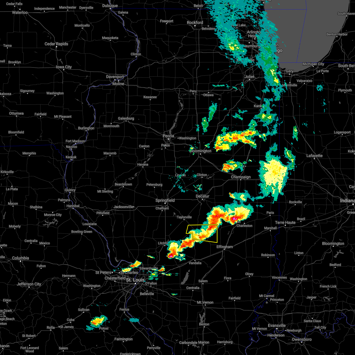 The severe thunderstorm warning for southeastern christian and southwestern shelby counties will expire at 815 pm cdt, the storm which prompted the warning has weakened below severe limits, and no longer poses an immediate threat to life or property. therefore, the warning will be allowed to expire. however gusty winds are still possible with this thunderstorm. a severe thunderstorm watch remains in effect until 900 pm cdt for central illinois. The severe thunderstorm warning for southeastern christian and southwestern shelby counties will expire at 815 pm cdt, the storm which prompted the warning has weakened below severe limits, and no longer poses an immediate threat to life or property. therefore, the warning will be allowed to expire. however gusty winds are still possible with this thunderstorm. a severe thunderstorm watch remains in effect until 900 pm cdt for central illinois.
|
| 5/3/2021 7:40 PM CDT |
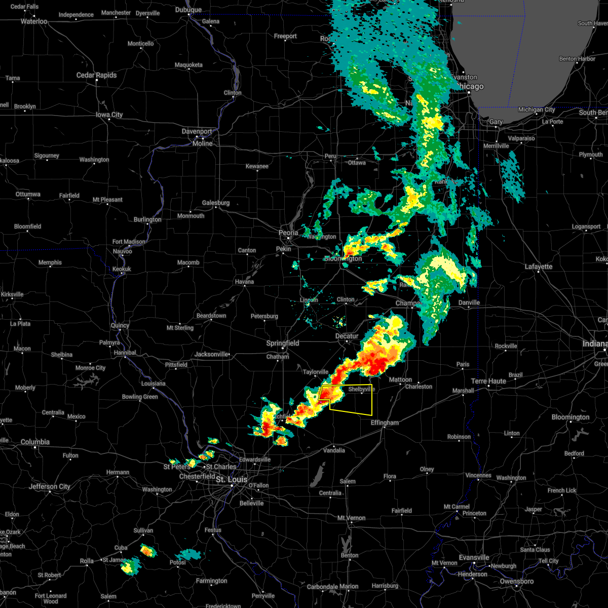 At 739 pm cdt, a severe thunderstorm was located near pana, or 9 miles northeast of nokomis, moving east at 35 mph (trained weather spotters). Hazards include two inch hail and 60 mph wind gusts. People and animals outdoors will be injured. expect hail damage to roofs, siding, windows, and vehicles. expect wind damage to roofs, siding, and trees. Locations impacted include, shelbyville, pana, cowden, tower hill, rosamond, clarksburg, oconee, wolf creek state park and mode. At 739 pm cdt, a severe thunderstorm was located near pana, or 9 miles northeast of nokomis, moving east at 35 mph (trained weather spotters). Hazards include two inch hail and 60 mph wind gusts. People and animals outdoors will be injured. expect hail damage to roofs, siding, windows, and vehicles. expect wind damage to roofs, siding, and trees. Locations impacted include, shelbyville, pana, cowden, tower hill, rosamond, clarksburg, oconee, wolf creek state park and mode.
|
| 5/3/2021 7:33 PM CDT |
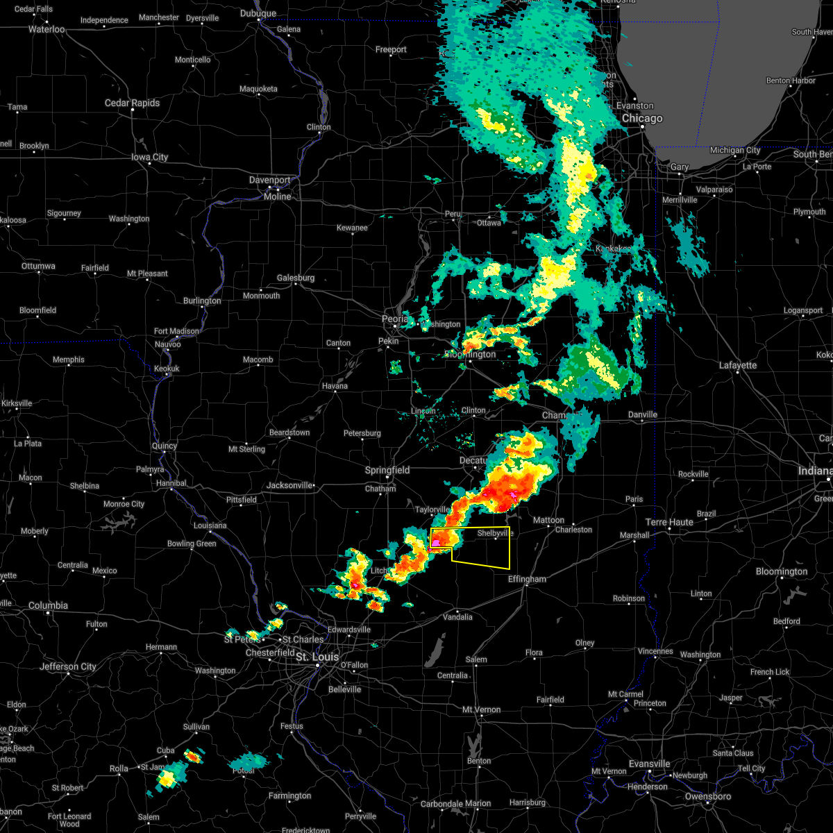 At 733 pm cdt, a severe thunderstorm was located near pana, or near nokomis, moving east at 35 mph (trained weather spotters). Hazards include golf ball size hail and 60 mph wind gusts. People and animals outdoors will be injured. expect hail damage to roofs, siding, windows, and vehicles. Expect wind damage to roofs, siding, and trees. At 733 pm cdt, a severe thunderstorm was located near pana, or near nokomis, moving east at 35 mph (trained weather spotters). Hazards include golf ball size hail and 60 mph wind gusts. People and animals outdoors will be injured. expect hail damage to roofs, siding, windows, and vehicles. Expect wind damage to roofs, siding, and trees.
|
| 8/10/2020 4:57 PM CDT |
 At 457 pm cdt, severe thunderstorms were located along a line extending from near redmon to 7 miles south of tower hill, moving east at 70 mph (radar indicated). Hazards include 70 mph wind gusts. Expect considerable tree damage. damage is likely to mobile homes, roofs, and outbuildings. locations impacted include, charleston, mattoon, shelbyville, sullivan, arcola, oakland, windsor, stewardson, findlay, cowden, tower hill, humboldt, hindsboro, lerna, allenville, cooks mill, rardin, westervelt, coles and paradise. This includes interstate 57 between mile markers 182 and 203. At 457 pm cdt, severe thunderstorms were located along a line extending from near redmon to 7 miles south of tower hill, moving east at 70 mph (radar indicated). Hazards include 70 mph wind gusts. Expect considerable tree damage. damage is likely to mobile homes, roofs, and outbuildings. locations impacted include, charleston, mattoon, shelbyville, sullivan, arcola, oakland, windsor, stewardson, findlay, cowden, tower hill, humboldt, hindsboro, lerna, allenville, cooks mill, rardin, westervelt, coles and paradise. This includes interstate 57 between mile markers 182 and 203.
|
| 8/10/2020 4:40 PM CDT |
 At 439 pm cdt, severe thunderstorms were located along a line extending from camargo to near nokomis, moving southeast at 40 mph (radar indicated). Hazards include 70 mph wind gusts. Expect considerable tree damage. damage is likely to mobile homes, roofs, and outbuildings. locations impacted include, charleston, mattoon, taylorville, shelbyville, tuscola, sullivan, pana, arcola, arthur, bethany, assumption, morrisonville, oakland, windsor, stewardson, findlay, cowden, tower hill, camargo and humboldt. This includes interstate 57 between mile markers 182 and 212. At 439 pm cdt, severe thunderstorms were located along a line extending from camargo to near nokomis, moving southeast at 40 mph (radar indicated). Hazards include 70 mph wind gusts. Expect considerable tree damage. damage is likely to mobile homes, roofs, and outbuildings. locations impacted include, charleston, mattoon, taylorville, shelbyville, tuscola, sullivan, pana, arcola, arthur, bethany, assumption, morrisonville, oakland, windsor, stewardson, findlay, cowden, tower hill, camargo and humboldt. This includes interstate 57 between mile markers 182 and 212.
|
| 8/10/2020 4:29 PM CDT |
 At 429 pm cdt, severe thunderstorms were located along a line extending from allerton to near assumption, moving east at 70 mph (radar indicated). Hazards include 70 mph wind gusts. Expect considerable tree damage. Damage is likely to mobile homes, roofs, and outbuildings. At 429 pm cdt, severe thunderstorms were located along a line extending from allerton to near assumption, moving east at 70 mph (radar indicated). Hazards include 70 mph wind gusts. Expect considerable tree damage. Damage is likely to mobile homes, roofs, and outbuildings.
|
| 7/15/2020 5:40 PM CDT |
 At 540 pm cdt, a severe thunderstorm was located 7 miles northeast of ramsey, or 14 miles east of nokomis, moving northeast at 50 mph (radar indicated). Hazards include 70 mph wind gusts and penny size hail. Expect considerable tree damage. Damage is likely to mobile homes, roofs, and outbuildings. At 540 pm cdt, a severe thunderstorm was located 7 miles northeast of ramsey, or 14 miles east of nokomis, moving northeast at 50 mph (radar indicated). Hazards include 70 mph wind gusts and penny size hail. Expect considerable tree damage. Damage is likely to mobile homes, roofs, and outbuildings.
|
| 5/2/2020 10:26 PM CDT |
 At 1026 pm cdt, severe thunderstorms were located along a line extending from near bethany to 6 miles southwest of pana, moving east at 60 mph (radar indicated). Hazards include 60 mph wind gusts and penny size hail. Expect damage to roofs, siding, and trees. Locations impacted include, taylorville, shelbyville, pana, moweaqua, bethany, assumption, findlay, tower hill, westervelt, rosamond, owaneco and vanderville. At 1026 pm cdt, severe thunderstorms were located along a line extending from near bethany to 6 miles southwest of pana, moving east at 60 mph (radar indicated). Hazards include 60 mph wind gusts and penny size hail. Expect damage to roofs, siding, and trees. Locations impacted include, taylorville, shelbyville, pana, moweaqua, bethany, assumption, findlay, tower hill, westervelt, rosamond, owaneco and vanderville.
|
| 5/2/2020 10:07 PM CDT |
 At 1006 pm cdt, severe thunderstorms were located along a line extending from near macon to near morrisonville, moving east at 60 mph (radar indicated. at 1006 pm, a 52 mph wind gust was reported at the taylorville airport). Hazards include 60 mph wind gusts and penny size hail. expect damage to roofs, siding, and trees At 1006 pm cdt, severe thunderstorms were located along a line extending from near macon to near morrisonville, moving east at 60 mph (radar indicated. at 1006 pm, a 52 mph wind gust was reported at the taylorville airport). Hazards include 60 mph wind gusts and penny size hail. expect damage to roofs, siding, and trees
|
| 4/28/2020 8:25 PM CDT |
 The severe thunderstorm warning for southern christian county will expire at 830 pm cdt, the storm which prompted the warning has weakened below severe limits, and no longer poses an immediate threat to life or property. therefore, the warning will be allowed to expire. a severe thunderstorm watch remains in effect until 1100 pm cdt for central illinois. The severe thunderstorm warning for southern christian county will expire at 830 pm cdt, the storm which prompted the warning has weakened below severe limits, and no longer poses an immediate threat to life or property. therefore, the warning will be allowed to expire. a severe thunderstorm watch remains in effect until 1100 pm cdt for central illinois.
|
| 4/28/2020 7:54 PM CDT |
 At 754 pm cdt, a severe thunderstorm was located near morrisonville, or 9 miles southwest of taylorville, moving east at 35 mph (radar indicated). Hazards include 60 mph wind gusts and quarter size hail. Hail damage to vehicles is expected. Expect wind damage to roofs, siding, and trees. At 754 pm cdt, a severe thunderstorm was located near morrisonville, or 9 miles southwest of taylorville, moving east at 35 mph (radar indicated). Hazards include 60 mph wind gusts and quarter size hail. Hail damage to vehicles is expected. Expect wind damage to roofs, siding, and trees.
|
| 4/8/2020 6:33 PM CDT |
 At 633 pm cdt, severe thunderstorms were located along a line extending from near arcola to near windsor to 7 miles north of ramsey, moving southeast at 60 mph (radar indicated). Hazards include 70 mph wind gusts and half dollar size hail. Hail damage to vehicles is expected. expect considerable tree damage. Wind damage is also likely to mobile homes, roofs, and outbuildings. At 633 pm cdt, severe thunderstorms were located along a line extending from near arcola to near windsor to 7 miles north of ramsey, moving southeast at 60 mph (radar indicated). Hazards include 70 mph wind gusts and half dollar size hail. Hail damage to vehicles is expected. expect considerable tree damage. Wind damage is also likely to mobile homes, roofs, and outbuildings.
|
| 8/12/2019 11:00 PM CDT |
 At 1100 pm cdt, a severe thunderstorm was located over tower hill, or 9 miles southwest of shelbyville, moving east at 30 mph (radar indicated). Hazards include 60 mph wind gusts and quarter size hail. Hail damage to vehicles is expected. expect wind damage to roofs, siding, and trees. Locations impacted include, shelbyville, pana, cowden, tower hill, herrick, rosamond, clarksburg and oconee. At 1100 pm cdt, a severe thunderstorm was located over tower hill, or 9 miles southwest of shelbyville, moving east at 30 mph (radar indicated). Hazards include 60 mph wind gusts and quarter size hail. Hail damage to vehicles is expected. expect wind damage to roofs, siding, and trees. Locations impacted include, shelbyville, pana, cowden, tower hill, herrick, rosamond, clarksburg and oconee.
|
| 8/12/2019 10:35 PM CDT |
 At 1035 pm cdt, a severe thunderstorm was located 7 miles west of pana, or 8 miles south of taylorville, moving east at 30 mph (radar indicated). Hazards include 60 mph wind gusts and quarter size hail. Hail damage to vehicles is expected. Expect wind damage to roofs, siding, and trees. At 1035 pm cdt, a severe thunderstorm was located 7 miles west of pana, or 8 miles south of taylorville, moving east at 30 mph (radar indicated). Hazards include 60 mph wind gusts and quarter size hail. Hail damage to vehicles is expected. Expect wind damage to roofs, siding, and trees.
|
| 8/12/2019 9:29 PM CDT |
 At 927 pm cdt, a severe thunderstorm capable of producing a tornado was located south of stonington moving southeast at 25 mph. this storm has a history of producing a tornado (radar indicated rotation). Hazards include tornado and quarter size hail. Flying debris will be dangerous to those caught without shelter. mobile homes will be damaged or destroyed. damage to roofs, windows, and vehicles will occur. tree damage is likely. This dangerous storm will be near, assumption around 950 pm cdt. At 927 pm cdt, a severe thunderstorm capable of producing a tornado was located south of stonington moving southeast at 25 mph. this storm has a history of producing a tornado (radar indicated rotation). Hazards include tornado and quarter size hail. Flying debris will be dangerous to those caught without shelter. mobile homes will be damaged or destroyed. damage to roofs, windows, and vehicles will occur. tree damage is likely. This dangerous storm will be near, assumption around 950 pm cdt.
|
| 6/21/2019 1:08 PM CDT |
 At 108 pm cdt, severe thunderstorms were located along a line extending from owaneco to pana to 6 miles north of ramsey, moving east at 35 mph (radar indicated). Hazards include 60 mph wind gusts and penny size hail. Expect damage to roofs, siding, and trees. Locations impacted include, shelbyville, pana, assumption, tower hill, westervelt, herrick and oconee. At 108 pm cdt, severe thunderstorms were located along a line extending from owaneco to pana to 6 miles north of ramsey, moving east at 35 mph (radar indicated). Hazards include 60 mph wind gusts and penny size hail. Expect damage to roofs, siding, and trees. Locations impacted include, shelbyville, pana, assumption, tower hill, westervelt, herrick and oconee.
|
| 6/21/2019 12:48 PM CDT |
 At 1247 pm cdt, severe thunderstorms were located along a line extending from near jeisyville to near nokomis to witt, moving east at 45 mph (radar indicated). Hazards include 60 mph wind gusts and penny size hail. Expect damage to roofs, siding, and trees. Locations impacted include, taylorville, shelbyville, pana, assumption, tower hill, westervelt, herrick, rosamond, owaneco, palmer, oconee, vanderville and taylorville airport. At 1247 pm cdt, severe thunderstorms were located along a line extending from near jeisyville to near nokomis to witt, moving east at 45 mph (radar indicated). Hazards include 60 mph wind gusts and penny size hail. Expect damage to roofs, siding, and trees. Locations impacted include, taylorville, shelbyville, pana, assumption, tower hill, westervelt, herrick, rosamond, owaneco, palmer, oconee, vanderville and taylorville airport.
|
| 6/21/2019 12:27 PM CDT |
 At 1226 pm cdt, severe thunderstorms were located along a line extending from near divernon to near raymond to near litchfield, moving east at 40 mph (radar indicated). Hazards include 60 mph wind gusts and penny size hail. expect damage to roofs, siding, and trees At 1226 pm cdt, severe thunderstorms were located along a line extending from near divernon to near raymond to near litchfield, moving east at 40 mph (radar indicated). Hazards include 60 mph wind gusts and penny size hail. expect damage to roofs, siding, and trees
|
| 6/5/2019 5:27 PM CDT |
 At 526 pm cdt, severe thunderstorms were located along a line extending from west of neoga through stewardson to near wrights corner, moving southeast at 30 mph (radar indicated). Hazards include 60 mph wind gusts. Expect damage to roofs, siding, and trees. locations impacted include, shelbyville, altamont, windsor, stewardson, cowden, tower hill, beecher city, shumway, moccasin, strasburg, herrick, clarksburg, oconee, trowbridge, mode, lake sara and altamont reservoir. This includes interstate 70 between mile markers 79 and 87. At 526 pm cdt, severe thunderstorms were located along a line extending from west of neoga through stewardson to near wrights corner, moving southeast at 30 mph (radar indicated). Hazards include 60 mph wind gusts. Expect damage to roofs, siding, and trees. locations impacted include, shelbyville, altamont, windsor, stewardson, cowden, tower hill, beecher city, shumway, moccasin, strasburg, herrick, clarksburg, oconee, trowbridge, mode, lake sara and altamont reservoir. This includes interstate 70 between mile markers 79 and 87.
|
| 6/5/2019 5:03 PM CDT |
 At 502 pm cdt, severe thunderstorms were located along a line extending from shelbyville to 6 miles north of ramsey, moving east at 30 mph (radar indicated). Hazards include 60 mph wind gusts. expect damage to roofs, siding, and trees At 502 pm cdt, severe thunderstorms were located along a line extending from shelbyville to 6 miles north of ramsey, moving east at 30 mph (radar indicated). Hazards include 60 mph wind gusts. expect damage to roofs, siding, and trees
|
| 6/5/2019 5:01 PM CDT | Large tree branch down at kitchell park in christian county IL, 1.3 miles ESE of Pana, IL |
| 6/5/2019 4:55 PM CDT |
 At 454 pm cdt, severe thunderstorms were located along a line extending from near assumption to near nokomis, moving southeast at 35 mph (radar indicated. at 438 pm a wind gust of 63 mph was reported at the taylorville airport). Hazards include 60 mph wind gusts. Expect damage to roofs, siding, and trees. Locations impacted include, taylorville, pana, assumption, morrisonville, tower hill, rosamond, owaneco, palmer and vanderville. At 454 pm cdt, severe thunderstorms were located along a line extending from near assumption to near nokomis, moving southeast at 35 mph (radar indicated. at 438 pm a wind gust of 63 mph was reported at the taylorville airport). Hazards include 60 mph wind gusts. Expect damage to roofs, siding, and trees. Locations impacted include, taylorville, pana, assumption, morrisonville, tower hill, rosamond, owaneco, palmer and vanderville.
|
| 6/5/2019 4:27 PM CDT |
 At 427 pm cdt, a severe thunderstorm was located near taylorville, moving southeast at 30 mph (radar indicated). Hazards include 60 mph wind gusts and quarter size hail. Hail damage to vehicles is expected. Expect wind damage to roofs, siding, and trees. At 427 pm cdt, a severe thunderstorm was located near taylorville, moving southeast at 30 mph (radar indicated). Hazards include 60 mph wind gusts and quarter size hail. Hail damage to vehicles is expected. Expect wind damage to roofs, siding, and trees.
|
| 5/23/2019 2:01 AM CDT |
 A severe thunderstorm warning remains in effect until 215 am cdt for moultrie. central shelby. western douglas and southeastern macon counties. at 200 am cdt, a severe thunderstorm was located near arcola, or 8 miles southwest of tuscola, moving east at 35 mph. hazard. 60 mph wind gusts. Brief tornados are possible with this. A severe thunderstorm warning remains in effect until 215 am cdt for moultrie. central shelby. western douglas and southeastern macon counties. at 200 am cdt, a severe thunderstorm was located near arcola, or 8 miles southwest of tuscola, moving east at 35 mph. hazard. 60 mph wind gusts. Brief tornados are possible with this.
|
| 5/23/2019 1:48 AM CDT |
 At 146 am cdt, a severe thunderstorm was located over arthur to pana, moving east at 35 mph (radar indicated). Hazards include 60 mph wind gusts. brief tornados are possible with this storm. Expect damage to roofs, siding, and trees. locations impacted include, decatur, taylorville, shelbyville, tuscola, sullivan, pana, mount zion, arcola, villa grove, arthur, moweaqua, cerro gordo, bethany, long creek, atwood, assumption, macon, lovington, morrisonville and stonington. This includes interstate 57 between mile markers 204 and 217. At 146 am cdt, a severe thunderstorm was located over arthur to pana, moving east at 35 mph (radar indicated). Hazards include 60 mph wind gusts. brief tornados are possible with this storm. Expect damage to roofs, siding, and trees. locations impacted include, decatur, taylorville, shelbyville, tuscola, sullivan, pana, mount zion, arcola, villa grove, arthur, moweaqua, cerro gordo, bethany, long creek, atwood, assumption, macon, lovington, morrisonville and stonington. This includes interstate 57 between mile markers 204 and 217.
|
| 5/23/2019 1:25 AM CDT |
 At 125 am cdt, a severe thunderstorm was located near dalton city, or 12 miles northwest of sullivan, moving east at 35 mph (radar indicated). Hazards include 60 mph wind gusts. expect damage to roofs, siding, and trees At 125 am cdt, a severe thunderstorm was located near dalton city, or 12 miles northwest of sullivan, moving east at 35 mph (radar indicated). Hazards include 60 mph wind gusts. expect damage to roofs, siding, and trees
|
| 5/21/2019 3:53 PM CDT |
 At 853 pm cdt, severe thunderstorms were located along a line extending from near nokomis to near ramsey to near mulberry grove, moving northeast at 60 mph (radar indicated). Hazards include 60 mph wind gusts and quarter size hail. Hail damage to vehicles is expected. Expect wind damage to roofs, siding, and trees. At 853 pm cdt, severe thunderstorms were located along a line extending from near nokomis to near ramsey to near mulberry grove, moving northeast at 60 mph (radar indicated). Hazards include 60 mph wind gusts and quarter size hail. Hail damage to vehicles is expected. Expect wind damage to roofs, siding, and trees.
|
| 7/19/2018 11:51 PM CDT |
 At 1150 pm cdt, a severe thunderstorm was located over shelbyville, moving east at 35 mph (radar indicated). Hazards include 60 mph wind gusts. Expect damage to roofs, siding, and trees. Locations impacted include, shelbyville, cowden, tower hill, westervelt, herrick, clarksburg, oconee, wolf creek state park, eagle creek state park and mode. At 1150 pm cdt, a severe thunderstorm was located over shelbyville, moving east at 35 mph (radar indicated). Hazards include 60 mph wind gusts. Expect damage to roofs, siding, and trees. Locations impacted include, shelbyville, cowden, tower hill, westervelt, herrick, clarksburg, oconee, wolf creek state park, eagle creek state park and mode.
|
| 7/19/2018 11:26 PM CDT |
 The severe thunderstorm warning for southern christian county will expire at 1130 pm cdt. the storm which prompted the warning has moved out of the area. therefore, the warning will be allowed to expire. however gusty winds are still possible with this thunderstorm. A severe thunderstorm watch remains in effect until 200 am cdt for. The severe thunderstorm warning for southern christian county will expire at 1130 pm cdt. the storm which prompted the warning has moved out of the area. therefore, the warning will be allowed to expire. however gusty winds are still possible with this thunderstorm. A severe thunderstorm watch remains in effect until 200 am cdt for.
|
| 7/19/2018 11:23 PM CDT |
 At 1122 pm cdt, a severe thunderstorm was located near pana, or 12 miles southeast of taylorville, moving east at 35 mph (radar indicated). Hazards include 60 mph wind gusts. expect damage to roofs, siding, and trees At 1122 pm cdt, a severe thunderstorm was located near pana, or 12 miles southeast of taylorville, moving east at 35 mph (radar indicated). Hazards include 60 mph wind gusts. expect damage to roofs, siding, and trees
|
| 7/19/2018 11:14 PM CDT |
 At 1114 pm cdt, a severe thunderstorm was located near pana, or 9 miles northeast of nokomis, moving southeast at 40 mph (radar indicated). Hazards include 60 mph wind gusts. Expect damage to roofs, siding, and trees. Locations impacted include, taylorville, pana, assumption, morrisonville, rosamond, owaneco, palmer, ohlman, sharpsburg, vanderville and taylorville airport. At 1114 pm cdt, a severe thunderstorm was located near pana, or 9 miles northeast of nokomis, moving southeast at 40 mph (radar indicated). Hazards include 60 mph wind gusts. Expect damage to roofs, siding, and trees. Locations impacted include, taylorville, pana, assumption, morrisonville, rosamond, owaneco, palmer, ohlman, sharpsburg, vanderville and taylorville airport.
|
| 7/19/2018 10:46 PM CDT |
 The national weather service in lincoln has issued a * severe thunderstorm warning for. christian county in central illinois. until 1130 pm cdt. At 1045 pm cdt, a severe thunderstorm was located near jeisyville, or 10 miles west of taylorville, moving southeast at 40 mph. The national weather service in lincoln has issued a * severe thunderstorm warning for. christian county in central illinois. until 1130 pm cdt. At 1045 pm cdt, a severe thunderstorm was located near jeisyville, or 10 miles west of taylorville, moving southeast at 40 mph.
|
| 7/1/2018 8:07 PM CDT |
 The severe thunderstorm warning for southern shelby county will expire at 815 pm cdt, the storm which prompted the warning has weakened below severe limits, and has exited the warned area. therefore, the warning will be allowed to expire. however gusty winds and heavy rain are still possible with this thunderstorm. The severe thunderstorm warning for southern shelby county will expire at 815 pm cdt, the storm which prompted the warning has weakened below severe limits, and has exited the warned area. therefore, the warning will be allowed to expire. however gusty winds and heavy rain are still possible with this thunderstorm.
|
| 7/1/2018 7:40 PM CDT |
 At 739 pm cdt, a severe thunderstorm was located near shelbyville, moving east at 25 mph (radar indicated). Hazards include 60 mph wind gusts. Expect damage to roofs, siding, and trees. locations impacted include, shelbyville, stewardson, cowden, tower hill, strasburg, herrick, clarksburg, sigel, trowbridge and mode. This includes interstate 57 between mile markers 169 and 172. At 739 pm cdt, a severe thunderstorm was located near shelbyville, moving east at 25 mph (radar indicated). Hazards include 60 mph wind gusts. Expect damage to roofs, siding, and trees. locations impacted include, shelbyville, stewardson, cowden, tower hill, strasburg, herrick, clarksburg, sigel, trowbridge and mode. This includes interstate 57 between mile markers 169 and 172.
|
| 7/1/2018 7:27 PM CDT |
 At 726 pm cdt, a severe thunderstorm was located near cowden, or 7 miles southwest of shelbyville, moving east at 25 mph (radar indicated). Hazards include 60 mph wind gusts. Expect damage to roofs, siding, and trees. locations impacted include, shelbyville, stewardson, cowden, tower hill, strasburg, herrick, clarksburg, sigel, oconee, trowbridge and mode. This includes interstate 57 between mile markers 169 and 172. At 726 pm cdt, a severe thunderstorm was located near cowden, or 7 miles southwest of shelbyville, moving east at 25 mph (radar indicated). Hazards include 60 mph wind gusts. Expect damage to roofs, siding, and trees. locations impacted include, shelbyville, stewardson, cowden, tower hill, strasburg, herrick, clarksburg, sigel, oconee, trowbridge and mode. This includes interstate 57 between mile markers 169 and 172.
|
| 7/1/2018 7:18 PM CDT |
 At 718 pm cdt, a severe thunderstorm was located near tower hill, or 9 miles southwest of shelbyville, moving east at 25 mph (radar indicated). Hazards include 60 mph wind gusts. expect damage to roofs, siding, and trees At 718 pm cdt, a severe thunderstorm was located near tower hill, or 9 miles southwest of shelbyville, moving east at 25 mph (radar indicated). Hazards include 60 mph wind gusts. expect damage to roofs, siding, and trees
|
| 6/28/2018 5:35 PM CDT | Tree limbs down in kitchell park. report via social media in christian county IL, 1.3 miles ESE of Pana, IL |
| 6/28/2018 5:35 PM CDT |
 At 535 pm cdt, severe thunderstorms were located along a line extending from mount zion to near assumption to near pana, moving east at 50 mph (radar indicated). Hazards include 70 mph wind gusts. Expect considerable tree damage. damage is likely to mobile homes, roofs, and outbuildings. locations impacted include, decatur, shelbyville, pana, mount zion, forsyth, moweaqua, cerro gordo, harristown, bethany, long creek, warrensburg, assumption, macon, argenta, oreana, findlay, cowden, tower hill, dalton city and westervelt. This includes interstate 72 between mile markers 131 and 156. At 535 pm cdt, severe thunderstorms were located along a line extending from mount zion to near assumption to near pana, moving east at 50 mph (radar indicated). Hazards include 70 mph wind gusts. Expect considerable tree damage. damage is likely to mobile homes, roofs, and outbuildings. locations impacted include, decatur, shelbyville, pana, mount zion, forsyth, moweaqua, cerro gordo, harristown, bethany, long creek, warrensburg, assumption, macon, argenta, oreana, findlay, cowden, tower hill, dalton city and westervelt. This includes interstate 72 between mile markers 131 and 156.
|
| 6/28/2018 5:27 PM CDT |
 At 526 pm cdt, severe thunderstorms were located along a line extending from near decatur to near assumption to 6 miles northeast of nokomis, moving southeast at 45 mph (radar indicated). Hazards include 70 mph wind gusts. Expect considerable tree damage. damage is likely to mobile homes, roofs, and outbuildings. locations impacted include, decatur, shelbyville, pana, mount zion, forsyth, moweaqua, cerro gordo, harristown, bethany, long creek, warrensburg, assumption, blue mound, macon, argenta, oreana, findlay, cowden, tower hill and dalton city. This includes interstate 72 between mile markers 129 and 156. At 526 pm cdt, severe thunderstorms were located along a line extending from near decatur to near assumption to 6 miles northeast of nokomis, moving southeast at 45 mph (radar indicated). Hazards include 70 mph wind gusts. Expect considerable tree damage. damage is likely to mobile homes, roofs, and outbuildings. locations impacted include, decatur, shelbyville, pana, mount zion, forsyth, moweaqua, cerro gordo, harristown, bethany, long creek, warrensburg, assumption, blue mound, macon, argenta, oreana, findlay, cowden, tower hill and dalton city. This includes interstate 72 between mile markers 129 and 156.
|
| 6/28/2018 5:14 PM CDT |
 At 514 pm cdt, severe thunderstorms were located along a line extending from harristown to near stonington to 7 miles north of nokomis, moving east at 60 mph (radar indicated). Hazards include 70 mph wind gusts. Expect considerable tree damage. Damage is likely to mobile homes, roofs, and outbuildings. At 514 pm cdt, severe thunderstorms were located along a line extending from harristown to near stonington to 7 miles north of nokomis, moving east at 60 mph (radar indicated). Hazards include 70 mph wind gusts. Expect considerable tree damage. Damage is likely to mobile homes, roofs, and outbuildings.
|
| 6/10/2018 5:39 PM CDT |
 At 539 pm cdt, a severe thunderstorm was located over taylorville, moving southeast at 35 mph (radar indicated). Hazards include 60 mph wind gusts and quarter size hail. Hail damage to vehicles is expected. Expect wind damage to roofs, siding, and trees. At 539 pm cdt, a severe thunderstorm was located over taylorville, moving southeast at 35 mph (radar indicated). Hazards include 60 mph wind gusts and quarter size hail. Hail damage to vehicles is expected. Expect wind damage to roofs, siding, and trees.
|
| 6/9/2018 10:32 AM CDT |
 At 1032 am cdt, a severe thunderstorm was located near assumption, or 7 miles east of taylorville, moving southeast at 35 mph (radar indicated). Hazards include 60 mph wind gusts and quarter size hail. Hail damage to vehicles is expected. Expect wind damage to roofs, siding, and trees. At 1032 am cdt, a severe thunderstorm was located near assumption, or 7 miles east of taylorville, moving southeast at 35 mph (radar indicated). Hazards include 60 mph wind gusts and quarter size hail. Hail damage to vehicles is expected. Expect wind damage to roofs, siding, and trees.
|
| 5/15/2018 5:20 PM CDT |
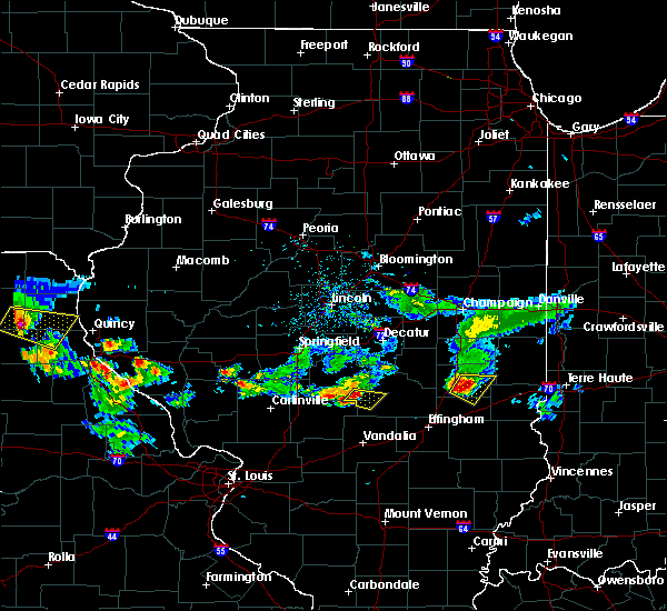 At 509 pm cdt, a severe thunderstorm was located 7 miles south of taylorville, moving southeast at 20 mph (radar indicated). Hazards include 60 mph wind gusts and half dollar size hail. Hail damage to vehicles is expected. Expect wind damage to roofs, siding, and trees. At 509 pm cdt, a severe thunderstorm was located 7 miles south of taylorville, moving southeast at 20 mph (radar indicated). Hazards include 60 mph wind gusts and half dollar size hail. Hail damage to vehicles is expected. Expect wind damage to roofs, siding, and trees.
|
| 5/15/2018 5:09 PM CDT |
 At 509 pm cdt, a severe thunderstorm was located 7 miles south of taylorville, moving southeast at 20 mph (radar indicated). Hazards include 60 mph wind gusts and half dollar size hail. Hail damage to vehicles is expected. Expect wind damage to roofs, siding, and trees. At 509 pm cdt, a severe thunderstorm was located 7 miles south of taylorville, moving southeast at 20 mph (radar indicated). Hazards include 60 mph wind gusts and half dollar size hail. Hail damage to vehicles is expected. Expect wind damage to roofs, siding, and trees.
|
| 11/5/2017 4:08 PM CDT |
 At 307 pm cst, a severe thunderstorm was located 13 miles southwest of shelbyville, moving east at 50 mph (radar indicated). Hazards include 60 mph wind gusts and quarter size hail. Hail damage to vehicles is expected. expect wind damage to roofs, siding, and trees. locations impacted include, shelbyville, pana, windsor, stewardson, cowden, tower hill, allenville, strasburg, herrick, clarksburg, sigel, gays, oconee, trowbridge, wolf creek state park, mode and eagle creek state park. this includes interstate 57 between mile markers 169 and 172. A tornado watch remains in effect until 700 pm cst for central and east central illinois. At 307 pm cst, a severe thunderstorm was located 13 miles southwest of shelbyville, moving east at 50 mph (radar indicated). Hazards include 60 mph wind gusts and quarter size hail. Hail damage to vehicles is expected. expect wind damage to roofs, siding, and trees. locations impacted include, shelbyville, pana, windsor, stewardson, cowden, tower hill, allenville, strasburg, herrick, clarksburg, sigel, gays, oconee, trowbridge, wolf creek state park, mode and eagle creek state park. this includes interstate 57 between mile markers 169 and 172. A tornado watch remains in effect until 700 pm cst for central and east central illinois.
|
| 11/5/2017 3:49 PM CDT |
 At 249 pm cst, a severe thunderstorm was located near nokomis, moving east at 50 mph (radar indicated). Hazards include 60 mph wind gusts and quarter size hail. Hail damage to vehicles is expected. Expect wind damage to roofs, siding, and trees. At 249 pm cst, a severe thunderstorm was located near nokomis, moving east at 50 mph (radar indicated). Hazards include 60 mph wind gusts and quarter size hail. Hail damage to vehicles is expected. Expect wind damage to roofs, siding, and trees.
|
| 7/10/2017 10:46 PM CDT |
 At 1045 pm cdt, severe thunderstorms were located along a line extending from assumption to near pana to near morrisonville, moving southeast at 55 mph (radar indicated). Hazards include 70 mph wind gusts. Expect considerable tree damage. damage is likely to mobile homes, roofs, and outbuildings. Locations impacted include, taylorville, pana, kincaid, assumption, morrisonville, stonington, bulpitt, jeisyville, tovey, rosamond, owaneco, palmer, willeys, sharpsburg, vanderville and taylorville airport. At 1045 pm cdt, severe thunderstorms were located along a line extending from assumption to near pana to near morrisonville, moving southeast at 55 mph (radar indicated). Hazards include 70 mph wind gusts. Expect considerable tree damage. damage is likely to mobile homes, roofs, and outbuildings. Locations impacted include, taylorville, pana, kincaid, assumption, morrisonville, stonington, bulpitt, jeisyville, tovey, rosamond, owaneco, palmer, willeys, sharpsburg, vanderville and taylorville airport.
|
| 7/10/2017 10:41 PM CDT |
 At 1041 pm cdt, severe thunderstorms were located along a line extending from near moweaqua to near pana to near raymond, moving southeast at 60 mph (radar indicated). Hazards include 70 mph wind gusts. Expect considerable tree damage. Damage is likely to mobile homes, roofs, and outbuildings. At 1041 pm cdt, severe thunderstorms were located along a line extending from near moweaqua to near pana to near raymond, moving southeast at 60 mph (radar indicated). Hazards include 70 mph wind gusts. Expect considerable tree damage. Damage is likely to mobile homes, roofs, and outbuildings.
|
| 7/10/2017 10:40 PM CDT | Trees blown down on several properties in rosamond. an awning blown dow in christian county IL, 5.5 miles E of Pana, IL |
| 7/10/2017 10:14 PM CDT |
 At 1014 pm cdt, severe thunderstorms were located along a line extending from near mechanicsburg to near rochester to near loami, moving southeast at 45 mph (radar indicated). Hazards include 70 mph wind gusts. Expect considerable tree damage. Damage is likely to mobile homes, roofs, and outbuildings. At 1014 pm cdt, severe thunderstorms were located along a line extending from near mechanicsburg to near rochester to near loami, moving southeast at 45 mph (radar indicated). Hazards include 70 mph wind gusts. Expect considerable tree damage. Damage is likely to mobile homes, roofs, and outbuildings.
|
| 4/29/2017 5:26 PM CDT |
 At 526 pm cdt, severe thunderstorms were located along a line extending from mount auburn to 8 miles north of ramsey, moving northeast at 50 mph (trained weather spotters). Hazards include 60 mph wind gusts and quarter size hail. Hail damage to vehicles is expected. Expect wind damage to roofs, siding, and trees. At 526 pm cdt, severe thunderstorms were located along a line extending from mount auburn to 8 miles north of ramsey, moving northeast at 50 mph (trained weather spotters). Hazards include 60 mph wind gusts and quarter size hail. Hail damage to vehicles is expected. Expect wind damage to roofs, siding, and trees.
|
| 4/29/2017 5:02 PM CDT |
 At 502 pm cdt, severe thunderstorms were located along a line extending from near pawnee to near witt to near reno, moving northeast at 50 mph (trained weather spotters). Hazards include 60 mph wind gusts and quarter size hail. Hail damage to vehicles is expected. expect wind damage to roofs, siding, and trees. locations impacted include, decatur, taylorville, pana, moweaqua, kincaid, harristown, warrensburg, assumption, blue mound, macon, edinburg, morrisonville, stonington, niantic, tower hill, mount auburn, bulpitt, jeisyville, tovey and herrick. This includes interstate 72 between mile markers 125 and 139. At 502 pm cdt, severe thunderstorms were located along a line extending from near pawnee to near witt to near reno, moving northeast at 50 mph (trained weather spotters). Hazards include 60 mph wind gusts and quarter size hail. Hail damage to vehicles is expected. expect wind damage to roofs, siding, and trees. locations impacted include, decatur, taylorville, pana, moweaqua, kincaid, harristown, warrensburg, assumption, blue mound, macon, edinburg, morrisonville, stonington, niantic, tower hill, mount auburn, bulpitt, jeisyville, tovey and herrick. This includes interstate 72 between mile markers 125 and 139.
|
| 4/29/2017 4:46 PM CDT |
 At 445 pm cdt, severe thunderstorms were located along a line extending from near virden to litchfield to near alhambra, moving northeast at 50 mph (radar indicated). Hazards include 60 mph wind gusts and quarter size hail. Hail damage to vehicles is expected. Expect wind damage to roofs, siding, and trees. At 445 pm cdt, severe thunderstorms were located along a line extending from near virden to litchfield to near alhambra, moving northeast at 50 mph (radar indicated). Hazards include 60 mph wind gusts and quarter size hail. Hail damage to vehicles is expected. Expect wind damage to roofs, siding, and trees.
|
| 3/17/2017 7:18 AM CDT |
 At 717 am cdt, a severe thunderstorm was located over tower hill, or near shelbyville, moving southeast at 50 mph (radar indicated). Hazards include 60 mph wind gusts and half dollar size hail. Hail damage to vehicles is expected. expect wind damage to roofs, siding, and trees. Locations impacted include, shelbyville, pana, tower hill, westervelt and rosamond. At 717 am cdt, a severe thunderstorm was located over tower hill, or near shelbyville, moving southeast at 50 mph (radar indicated). Hazards include 60 mph wind gusts and half dollar size hail. Hail damage to vehicles is expected. expect wind damage to roofs, siding, and trees. Locations impacted include, shelbyville, pana, tower hill, westervelt and rosamond.
|
| 3/17/2017 6:53 AM CDT |
 At 653 am cdt, a severe thunderstorm was located over taylorville, moving southeast at 50 mph (radar indicated). Hazards include 60 mph wind gusts and half dollar size hail. Hail damage to vehicles is expected. Expect wind damage to roofs, siding, and trees. At 653 am cdt, a severe thunderstorm was located over taylorville, moving southeast at 50 mph (radar indicated). Hazards include 60 mph wind gusts and half dollar size hail. Hail damage to vehicles is expected. Expect wind damage to roofs, siding, and trees.
|
| 3/7/2017 1:16 AM CST |
 At 115 am cst, severe thunderstorms were located along a line extending from de land to 7 miles northeast of nokomis, moving east at 75 mph (radar indicated). Hazards include 60 mph wind gusts and quarter size hail. Hail damage to vehicles is expected. Expect wind damage to roofs, siding, and trees. At 115 am cst, severe thunderstorms were located along a line extending from de land to 7 miles northeast of nokomis, moving east at 75 mph (radar indicated). Hazards include 60 mph wind gusts and quarter size hail. Hail damage to vehicles is expected. Expect wind damage to roofs, siding, and trees.
|
| 7/13/2016 4:47 PM CDT |
 At 447 pm cdt, severe thunderstorms were located along a line extending from near latham to near moweaqua to near nokomis, moving east at 50 mph (radar indicated). Hazards include 60 mph wind gusts. Expect damage to roofs. siding. and trees. locations impacted include, decatur, taylorville, shelbyville, pana, mount zion, forsyth, moweaqua, harristown, long creek, warrensburg, assumption, blue mound, macon, edinburg, stonington, illiopolis, niantic, cowden, tower hill and mechanicsburg. This includes interstate 72 between mile markers 112 and 145. At 447 pm cdt, severe thunderstorms were located along a line extending from near latham to near moweaqua to near nokomis, moving east at 50 mph (radar indicated). Hazards include 60 mph wind gusts. Expect damage to roofs. siding. and trees. locations impacted include, decatur, taylorville, shelbyville, pana, mount zion, forsyth, moweaqua, harristown, long creek, warrensburg, assumption, blue mound, macon, edinburg, stonington, illiopolis, niantic, cowden, tower hill and mechanicsburg. This includes interstate 72 between mile markers 112 and 145.
|
| 7/13/2016 4:24 PM CDT |
 At 423 pm cdt, severe thunderstorms were located along a line extending from near riverton to near pawnee to near litchfield, moving east at 45 mph (radar indicated). Hazards include 60 mph wind gusts. Expect damage to roofs. siding. And trees. At 423 pm cdt, severe thunderstorms were located along a line extending from near riverton to near pawnee to near litchfield, moving east at 45 mph (radar indicated). Hazards include 60 mph wind gusts. Expect damage to roofs. siding. And trees.
|
| 5/26/2016 8:14 AM CDT |
 At 813 am cdt, a severe thunderstorm was located near ramsey, or 11 miles southeast of nokomis, moving east at 40 mph (radar indicated). Hazards include 60 mph wind gusts and quarter size hail. Hail damage to vehicles is expected. Expect wind damage to roofs, siding, and trees. At 813 am cdt, a severe thunderstorm was located near ramsey, or 11 miles southeast of nokomis, moving east at 40 mph (radar indicated). Hazards include 60 mph wind gusts and quarter size hail. Hail damage to vehicles is expected. Expect wind damage to roofs, siding, and trees.
|
| 5/13/2016 8:51 PM CDT |
 The severe thunderstorm warning for southeastern christian county will expire at 900 pm cdt, the severe thunderstorm which prompted the warning has moved out of the warned area. therefore the warning will be allowed to expire. gusty winds and heavy rain will still be possible over the next hour or so as additional thunderstorms move across the area. The severe thunderstorm warning for southeastern christian county will expire at 900 pm cdt, the severe thunderstorm which prompted the warning has moved out of the warned area. therefore the warning will be allowed to expire. gusty winds and heavy rain will still be possible over the next hour or so as additional thunderstorms move across the area.
|
| 5/13/2016 8:44 PM CDT |
 At 844 pm cdt, a severe thunderstorm was located near nokomis, moving east at 40 mph (radar indicated). Hazards include 60 mph wind gusts. Expect damage to roofs. siding. and trees. Locations impacted include, pana, rosamond and vanderville. At 844 pm cdt, a severe thunderstorm was located near nokomis, moving east at 40 mph (radar indicated). Hazards include 60 mph wind gusts. Expect damage to roofs. siding. and trees. Locations impacted include, pana, rosamond and vanderville.
|
| 5/13/2016 8:30 PM CDT |
 At 830 pm cdt, a severe thunderstorm was located near morrisonville, or 7 miles northwest of nokomis, moving east at 40 mph (radar indicated). Hazards include 60 mph wind gusts. Expect damage to roofs. siding. And trees. At 830 pm cdt, a severe thunderstorm was located near morrisonville, or 7 miles northwest of nokomis, moving east at 40 mph (radar indicated). Hazards include 60 mph wind gusts. Expect damage to roofs. siding. And trees.
|
| 4/27/2016 7:57 PM CDT | The tornado warning for south central christian county will expire at 800 pm cdt, the storm which prompted the warning has weakened below severe limits, and no longer appears capable of producing a tornado. therefore the warning will be allowed to expire. however gusty winds are still possible with this thunderstorm. |
| 4/27/2016 7:42 PM CDT |
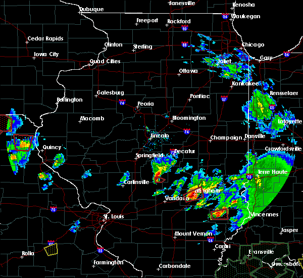 At 742 pm cdt, a severe thunderstorm capable of producing a tornado was located 6 miles northeast of nokomis, moving east at 15 mph (radar indicated rotation). Hazards include tornado. Flying debris will be dangerous to those caught without shelter. mobile homes will be damaged or destroyed. damage to roofs, windows, and vehicles will occur. tree damage is likely. This tornadic thunderstorm will remain over mainly rural areas of south central christian county, including the following locations: vanderville and rosamond. At 742 pm cdt, a severe thunderstorm capable of producing a tornado was located 6 miles northeast of nokomis, moving east at 15 mph (radar indicated rotation). Hazards include tornado. Flying debris will be dangerous to those caught without shelter. mobile homes will be damaged or destroyed. damage to roofs, windows, and vehicles will occur. tree damage is likely. This tornadic thunderstorm will remain over mainly rural areas of south central christian county, including the following locations: vanderville and rosamond.
|
| 4/27/2016 7:33 PM CDT |
 At 733 pm cdt, a severe thunderstorm capable of producing a tornado was located near nokomis, moving east at 15 mph (radar indicated rotation). Hazards include tornado. Flying debris will be dangerous to those caught without shelter. mobile homes will be damaged or destroyed. damage to roofs, windows, and vehicles will occur. tree damage is likely. this dangerous storm will be near, pana around 800 pm cdt. Other locations impacted by this tornadic thunderstorm include vanderville and rosamond. At 733 pm cdt, a severe thunderstorm capable of producing a tornado was located near nokomis, moving east at 15 mph (radar indicated rotation). Hazards include tornado. Flying debris will be dangerous to those caught without shelter. mobile homes will be damaged or destroyed. damage to roofs, windows, and vehicles will occur. tree damage is likely. this dangerous storm will be near, pana around 800 pm cdt. Other locations impacted by this tornadic thunderstorm include vanderville and rosamond.
|
| 4/27/2016 7:24 PM CDT |
 At 723 pm cdt, a severe thunderstorm capable of producing a tornado was located near nokomis, moving east at 15 mph (radar indicated rotation). Hazards include tornado. Flying debris will be dangerous to those caught without shelter. mobile homes will be damaged or destroyed. damage to roofs, windows, and vehicles will occur. tree damage is likely. this dangerous storm will be near, pana around 800 pm cdt. Other locations impacted by this tornadic thunderstorm include vanderville and rosamond. At 723 pm cdt, a severe thunderstorm capable of producing a tornado was located near nokomis, moving east at 15 mph (radar indicated rotation). Hazards include tornado. Flying debris will be dangerous to those caught without shelter. mobile homes will be damaged or destroyed. damage to roofs, windows, and vehicles will occur. tree damage is likely. this dangerous storm will be near, pana around 800 pm cdt. Other locations impacted by this tornadic thunderstorm include vanderville and rosamond.
|
| 4/27/2016 7:12 PM CDT |
 At 712 pm cdt, a severe thunderstorm capable of producing a tornado was located 5 miles northwest of nokomis, moving northeast at 15 mph (radar indicated rotation). Hazards include tornado. Flying debris will be dangerous to those caught without shelter. mobile homes will be damaged or destroyed. damage to roofs, windows, and vehicles will occur. tree damage is likely. this dangerous storm will be near, pana around 800 pm cdt. Other locations impacted by this tornadic thunderstorm include vanderville and rosamond. At 712 pm cdt, a severe thunderstorm capable of producing a tornado was located 5 miles northwest of nokomis, moving northeast at 15 mph (radar indicated rotation). Hazards include tornado. Flying debris will be dangerous to those caught without shelter. mobile homes will be damaged or destroyed. damage to roofs, windows, and vehicles will occur. tree damage is likely. this dangerous storm will be near, pana around 800 pm cdt. Other locations impacted by this tornadic thunderstorm include vanderville and rosamond.
|
| 6/28/2015 8:08 PM CDT |
 At 808 pm cdt, a severe thunderstorm was located over taylorville, moving southeast at 30 mph (radar indicated). Hazards include quarter size hail. Damage to vehicles is expected. Locations impacted include, taylorville, pana, kincaid, assumption, jeisyville, rosamond, owaneco, palmer and taylorville airport. At 808 pm cdt, a severe thunderstorm was located over taylorville, moving southeast at 30 mph (radar indicated). Hazards include quarter size hail. Damage to vehicles is expected. Locations impacted include, taylorville, pana, kincaid, assumption, jeisyville, rosamond, owaneco, palmer and taylorville airport.
|
| 6/28/2015 7:58 PM CDT |
 At 758 pm cdt, a severe thunderstorm was located over taylorville, moving southeast at 20 mph (radar indicated). Hazards include half dollar size hail. Damage to vehicles is expected. Locations impacted include, taylorville, pana, kincaid, assumption, jeisyville, rosamond, owaneco, palmer and taylorville airport. At 758 pm cdt, a severe thunderstorm was located over taylorville, moving southeast at 20 mph (radar indicated). Hazards include half dollar size hail. Damage to vehicles is expected. Locations impacted include, taylorville, pana, kincaid, assumption, jeisyville, rosamond, owaneco, palmer and taylorville airport.
|
| 6/28/2015 7:45 PM CDT |
 At 745 pm cdt, a severe thunderstorm was located over jeisyville, or 6 miles northwest of taylorville, moving southeast at 25 mph (radar indicated). Hazards include ping pong ball size hail. People and animals outdoors will be injured. Expect damage to roofs, siding, windows and vehicles. At 745 pm cdt, a severe thunderstorm was located over jeisyville, or 6 miles northwest of taylorville, moving southeast at 25 mph (radar indicated). Hazards include ping pong ball size hail. People and animals outdoors will be injured. Expect damage to roofs, siding, windows and vehicles.
|
| 6/20/2015 10:46 PM CDT |
 At 1046 pm cdt, severe thunderstorms were located along a line extending from argenta to near moweaqua to 10 miles west of pana, moving east at 45 mph (trained weather spotters). Hazards include 60 mph wind gusts. Expect damage to roofs. Siding and trees. At 1046 pm cdt, severe thunderstorms were located along a line extending from argenta to near moweaqua to 10 miles west of pana, moving east at 45 mph (trained weather spotters). Hazards include 60 mph wind gusts. Expect damage to roofs. Siding and trees.
|
| 6/20/2015 10:32 PM CDT |
 At 1032 pm cdt, severe thunderstorms were located along a line extending from near warrensburg to near stonington to 5 miles northeast of morrisonville, moving east at 45 mph (trained weather spotters). Hazards include 60 mph wind gusts. Expect damage to roofs. siding and trees. locations impacted include, decatur, taylorville, pana, mount zion, forsyth, moweaqua, maroa, harristown, long creek, warrensburg, assumption, blue mound, macon, morrisonville, argenta, stonington, oreana, niantic, dalton city and oakley. this includes interstate 72 between mile markers 127 and 156. A tornado watch remains in effect until 1100 pm cdt for central illinois. At 1032 pm cdt, severe thunderstorms were located along a line extending from near warrensburg to near stonington to 5 miles northeast of morrisonville, moving east at 45 mph (trained weather spotters). Hazards include 60 mph wind gusts. Expect damage to roofs. siding and trees. locations impacted include, decatur, taylorville, pana, mount zion, forsyth, moweaqua, maroa, harristown, long creek, warrensburg, assumption, blue mound, macon, morrisonville, argenta, stonington, oreana, niantic, dalton city and oakley. this includes interstate 72 between mile markers 127 and 156. A tornado watch remains in effect until 1100 pm cdt for central illinois.
|
| 6/20/2015 10:16 PM CDT |
 At 1016 pm cdt, severe thunderstorms were located along a line extending from near chestnut to near edinburg to 4 miles south of pawnee, moving east at 40 mph (trained weather spotters). Hazards include 60 mph wind gusts. Expect damage to roofs. Siding and trees. At 1016 pm cdt, severe thunderstorms were located along a line extending from near chestnut to near edinburg to 4 miles south of pawnee, moving east at 40 mph (trained weather spotters). Hazards include 60 mph wind gusts. Expect damage to roofs. Siding and trees.
|
| 6/7/2015 9:45 PM CDT | At 945 pm cdt, severe thunderstorms were located along a line extending from near cooks mills to near shelbyville to 5 miles southeast of morrisonville, moving southeast at 55 mph (radar indicated). Hazards include 60 mph wind gusts and quarter size hail. Hail damage to vehicles is expected. expect wind damage to roofs, siding and trees. locations impacted include, taylorville, shelbyville, sullivan, pana, lakewood, moweaqua, kincaid, bethany, assumption, blue mound, macon, edinburg, morrisonville, stonington, windsor, stewardson, findlay, cowden, tower hill and dalton city. This includes interstate 57 between mile markers 169 and 170. |
| 6/7/2015 9:15 PM CDT | At 915 pm cdt, severe thunderstorms were located along a line extending from 6 miles southwest of dalton city to 6 miles southwest of auburn, moving southeast at 35 mph (radar indicated). Hazards include 60 mph wind gusts and quarter size hail. Hail damage to vehicles is expected. Expect wind damage to roofs, siding and trees. |
| 5/24/2015 11:31 PM CDT | At 1131 pm cdt, a severe thunderstorm was located over mount auburn, or 14 miles north of taylorville, moving north at 50 mph (radar indicated). Hazards include 60 mph wind gusts. Expect damage to roofs. siding and trees. locations impacted include, taylorville, pana, moweaqua, kincaid, assumption, edinburg, morrisonville, stonington, illiopolis, mechanicsburg, mount auburn, bulpitt, jeisyville, tovey, dawson, buffalo, rosamond, berry, owaneco and palmer. this includes interstate 72 between mile markers 110 and 124. A tornado watch remains in effect until 100 am cdt for central illinois. |
| 5/24/2015 11:03 PM CDT | At 1102 pm cdt, a severe thunderstorm was located near morrisonville, or near nokomis, moving north at 55 mph (radar indicated). Hazards include 60 mph wind gusts. Expect damage to roofs. Siding and trees. |
| 5/10/2015 7:00 PM CDT | At 659 pm cdt, severe thunderstorms were located along a line extending from near edinburg to near taylorville to near nokomis, moving northeast at 50 mph (radar indicated). Hazards include 60 mph wind gusts and penny size hail. Expect damage to roofs. siding and trees. locations impacted include, taylorville, pana, lakewood, moweaqua, kincaid, assumption, blue mound, edinburg, morrisonville, stonington, tower hill, bulpitt, jeisyville, tovey, rosamond, owaneco, palmer, oconee, sharpsburg and taylorville airport. 0. 75in. |
| 5/10/2015 6:35 PM CDT | At 635 pm cdt, severe thunderstorms were located along a line extending from near divernon to taylor springs, moving northeast at 50 mph (radar indicated). Hazards include 60 mph wind gusts and penny size hail. Expect damage to roofs. Siding and trees. |
| 2/20/2014 4:24 PM CST | House damaged and outbuildings destroye in shelby county IL, 2 miles WSW of Pana, IL |
| 2/20/2014 4:20 PM CST | Trees and power lines down near town in christian county IL, 1.3 miles ESE of Pana, IL |
| 8/16/2012 3:32 PM CDT | 12 to 18 inch trees down and numerous power lines down across cit in christian county IL, 1.3 miles ESE of Pana, IL |
| 8/16/2012 3:32 PM CDT | 18 inch diameter tree down in city in christian county IL, 1.3 miles ESE of Pana, IL |
| 8/16/2012 3:20 PM CDT | Widespread trees down across town and rural areas around pana...ranging from large trees and small branche in christian county IL, 1.3 miles ESE of Pana, IL |
| 5/29/2012 1:32 AM CDT | Ping Pong Ball sized hail reported 5.5 miles E of Pana, IL |
| 5/29/2012 1:25 AM CDT | Quarter sized hail reported 5.5 miles E of Pana, IL |
Hail Maps for Pana, IL
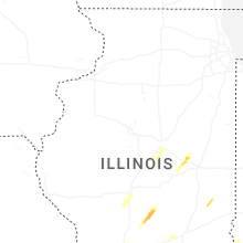


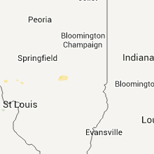


Connect with Interactive Hail Maps