

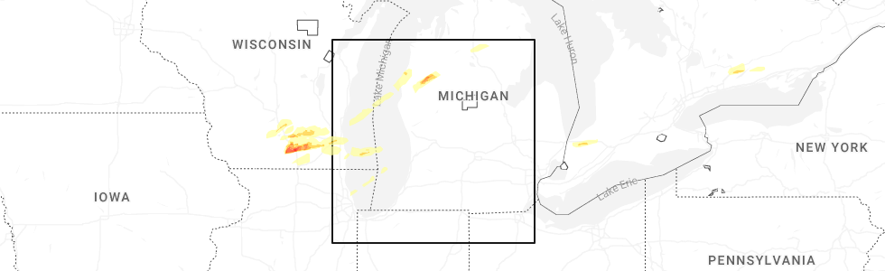
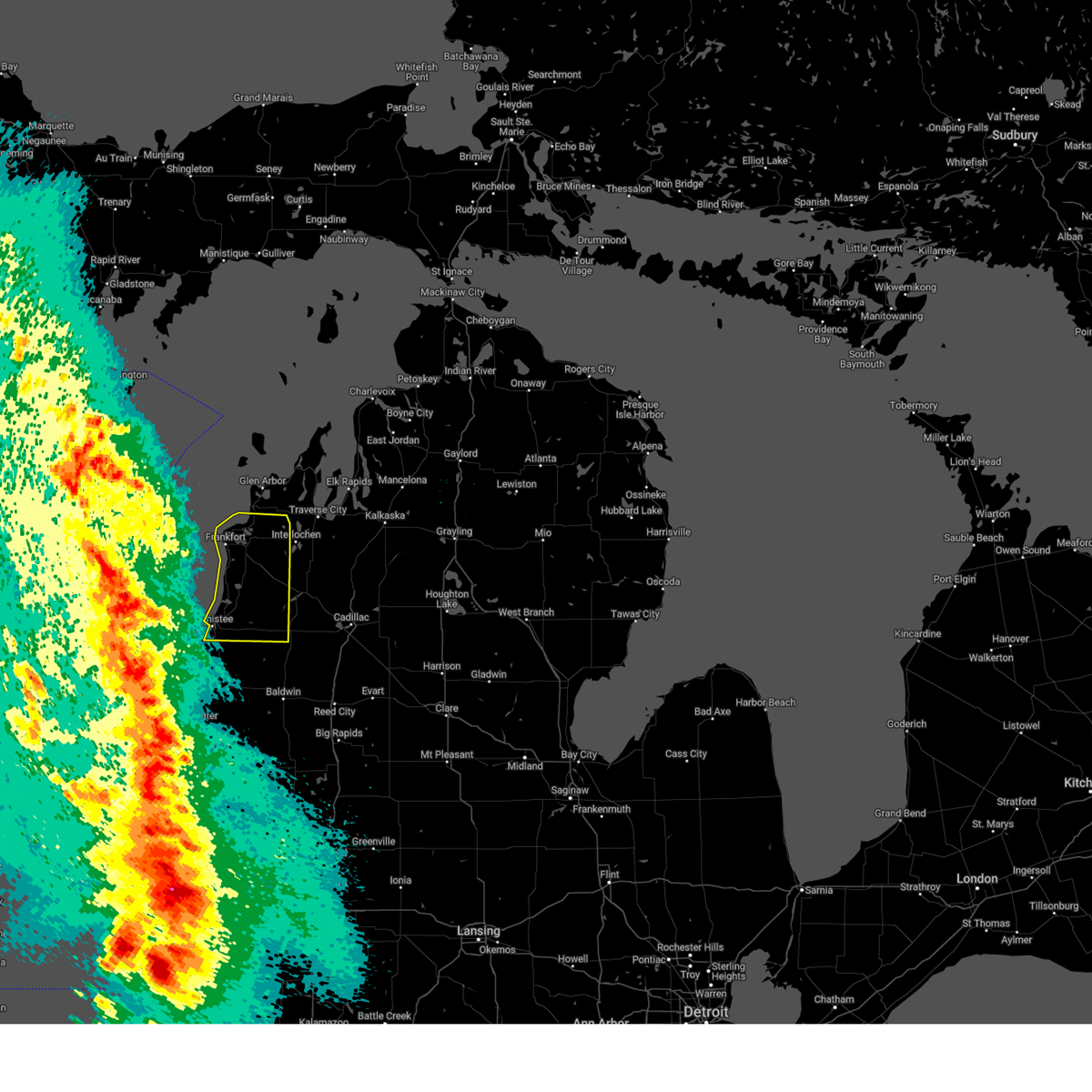
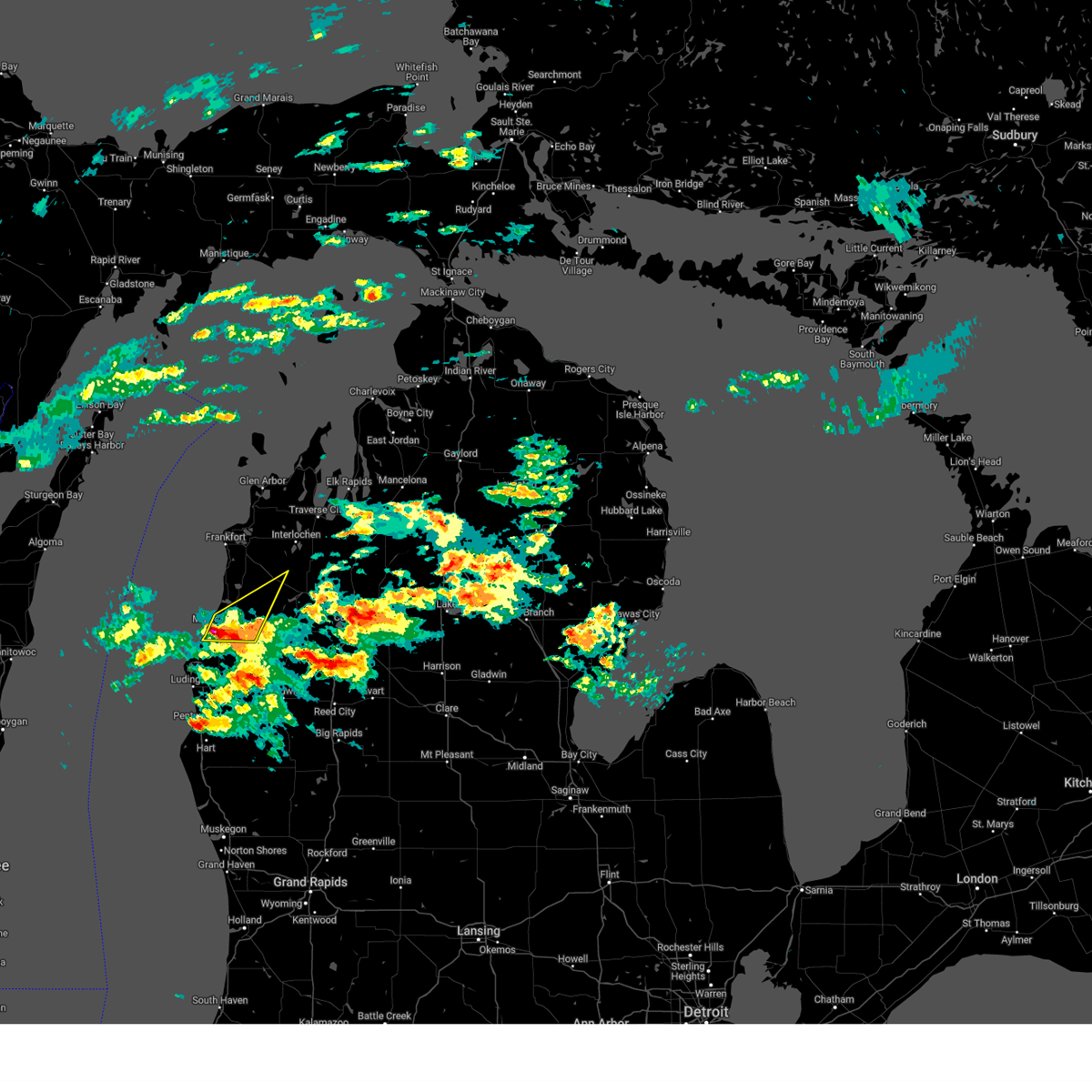
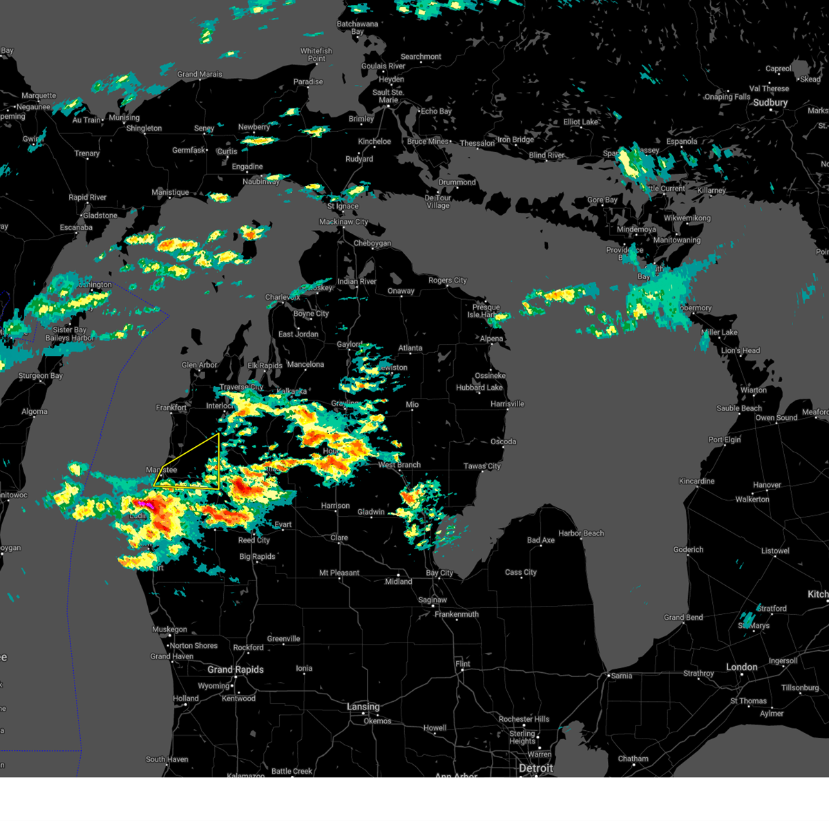
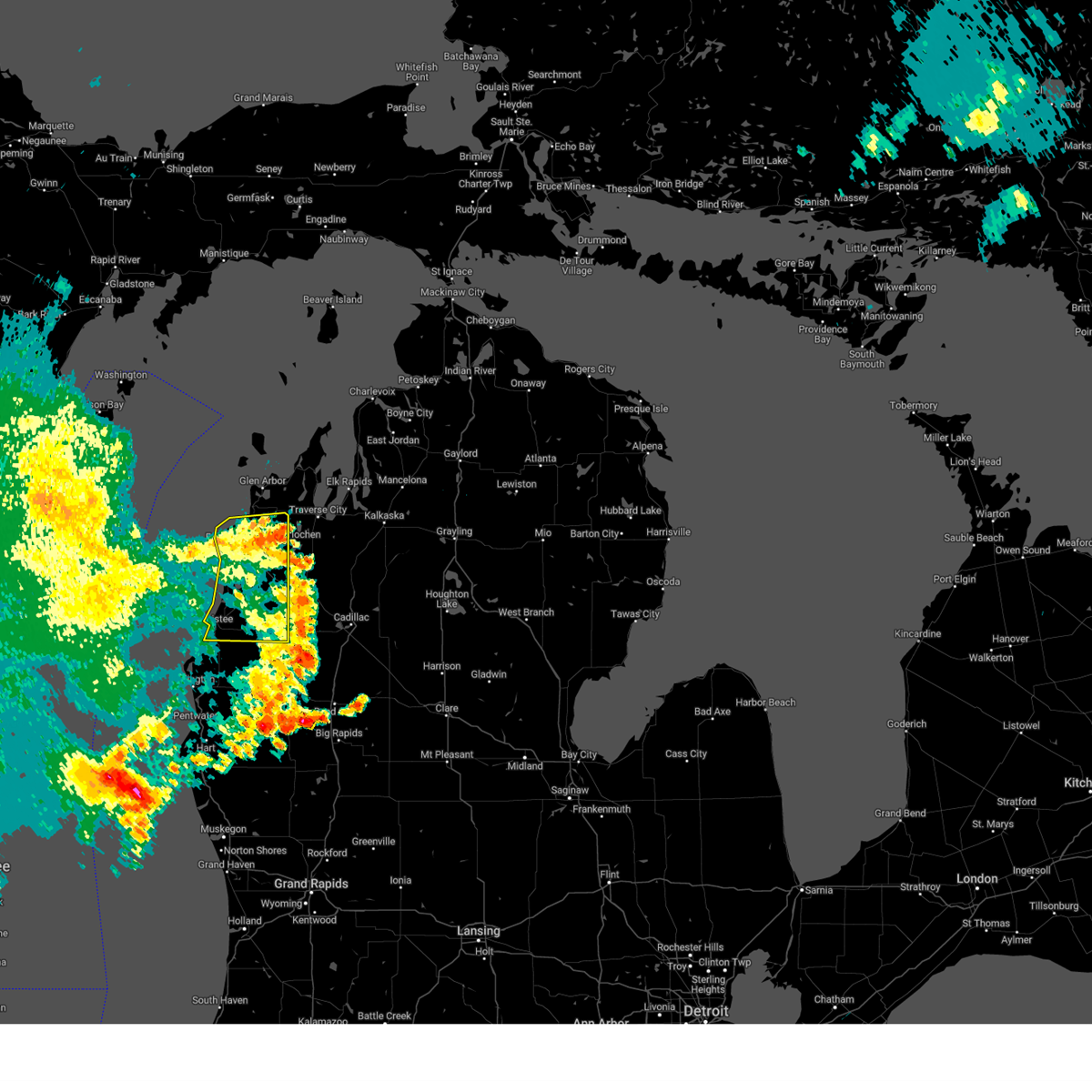
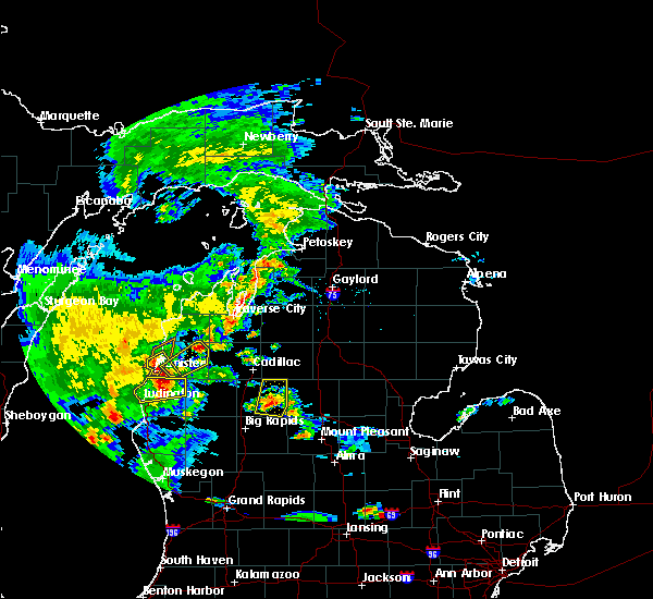
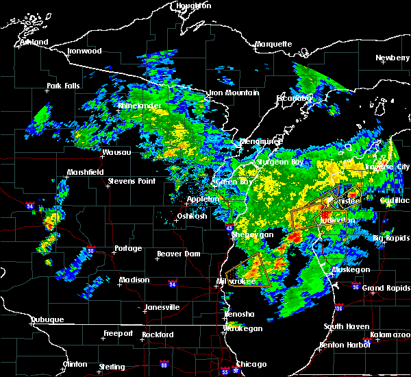
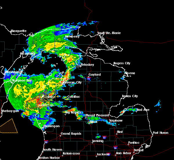
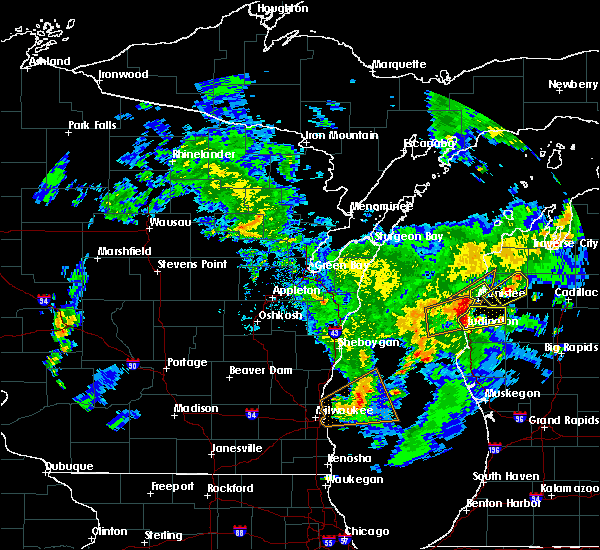
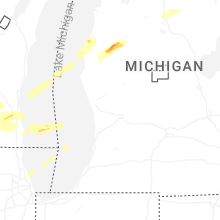
Hail Map for Parkdale, MI
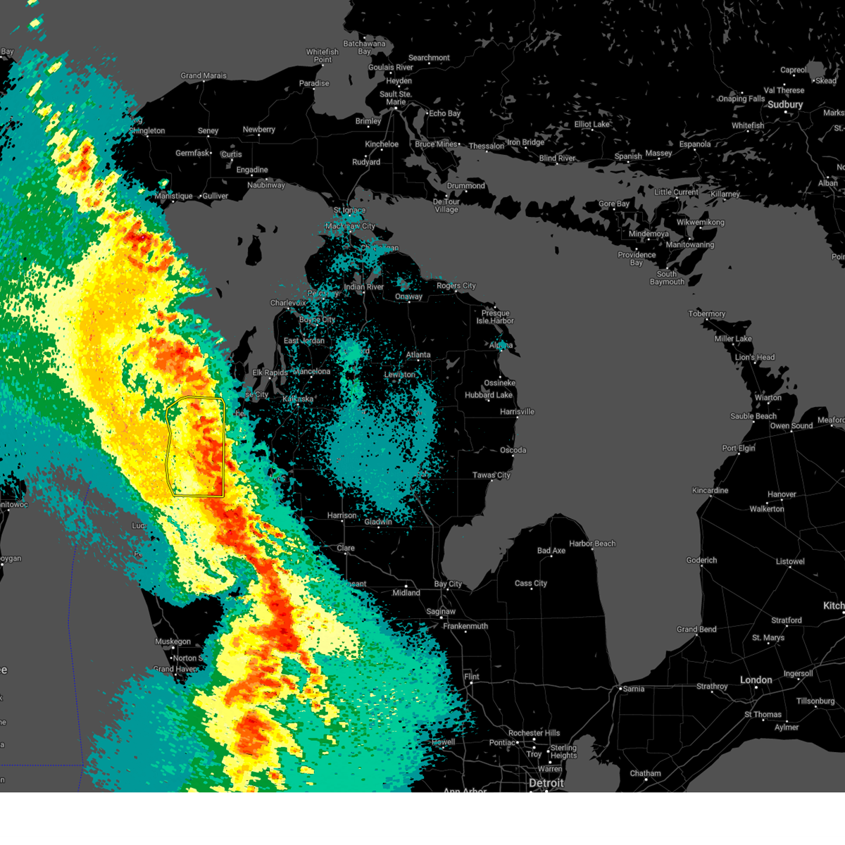
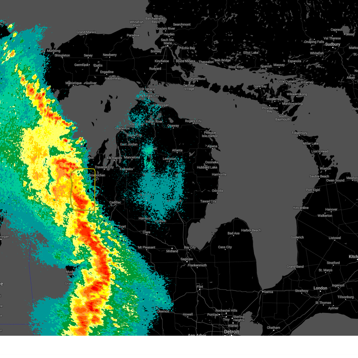
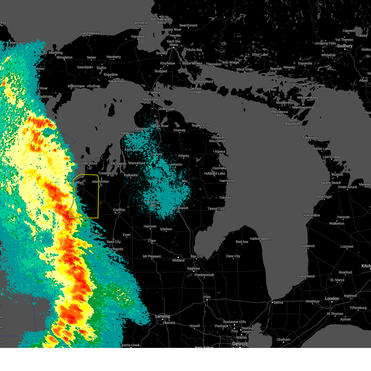
The Parkdale, MI area has had 0 reports of on-the-ground hail by trained spotters, and has been under severe weather warnings 9 times during the past 12 months. Doppler radar has detected hail at or near Parkdale, MI on 23 occasions, including 1 occasion during the past year.
| Name: | Parkdale, MI |
| Where Located: | 47.2 miles SW of Traverse City, MI |
| Map: | Google Map for Parkdale, MI |
| Population: | 704 |
| Housing Units: | 299 |
| More Info: | Search Google for Parkdale, MI |
1
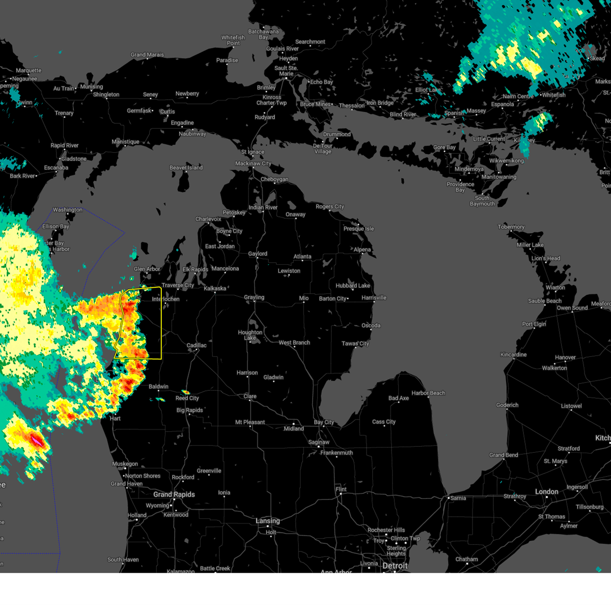
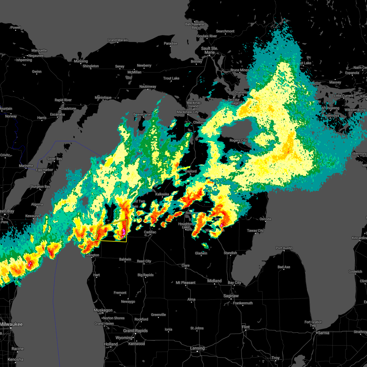
The Top Recent Hail Date for Parkdale, MI is Friday, April 18, 2025 (8th out of 23)
Hail and Wind Damage Spotted near Parkdale, MI
| Date / Time | Report Details |
|---|---|
| 5/15/2025 10:50 PM EDT |
 The storms which prompted the warning have moved out of the area. therefore, the warning has been allowed to expire. a tornado watch remains in effect until 300 am edt for northern michigan. The storms which prompted the warning have moved out of the area. therefore, the warning has been allowed to expire. a tornado watch remains in effect until 300 am edt for northern michigan.
|
| 5/15/2025 10:27 PM EDT |
 At 1027 pm edt, severe thunderstorms were located along a line extending from 24 miles west of sleeping bear point to near empire to 10 miles southeast of baldwin, moving northeast at 40 mph (radar indicated). Hazards include 60 mph wind gusts and penny size hail. Expect damage to roofs, siding, and trees. these severe storms will be near, thompsonville, platte township, honor, and copemish around 1030 pm edt. bendon and lake ann around 1035 pm edt. Other locations impacted by these severe thunderstorms include wallin, blaine township, star crossing, and pere marquette state forest. At 1027 pm edt, severe thunderstorms were located along a line extending from 24 miles west of sleeping bear point to near empire to 10 miles southeast of baldwin, moving northeast at 40 mph (radar indicated). Hazards include 60 mph wind gusts and penny size hail. Expect damage to roofs, siding, and trees. these severe storms will be near, thompsonville, platte township, honor, and copemish around 1030 pm edt. bendon and lake ann around 1035 pm edt. Other locations impacted by these severe thunderstorms include wallin, blaine township, star crossing, and pere marquette state forest.
|
| 5/15/2025 9:55 PM EDT |
 At 955 pm edt, severe thunderstorms were located along a line extending from 22 miles southeast of jacksonport to 11 miles west of arcadia to near hesperia, moving northeast at 40 mph (radar indicated). Hazards include 60 mph wind gusts and penny size hail. Expect damage to roofs, siding, and trees. these severe storms will be near, eastlake, parkdale, manistee, and orchard beach state park around 1000 pm edt. pierport and onekama around 1005 pm edt. norwalk and arcadia around 1010 pm edt. frankfort, wildwood, bear lake, and elberta around 1015 pm edt. brethren around 1025 pm edt. beulah, kaleva, dublin, wellston, and benzonia around 1030 pm edt. thompsonville, honor, and copemish around 1040 pm edt. platte township around 1045 pm edt. Other locations impacted by these severe thunderstorms include wallin, blaine township, star crossing, and pere marquette state forest. At 955 pm edt, severe thunderstorms were located along a line extending from 22 miles southeast of jacksonport to 11 miles west of arcadia to near hesperia, moving northeast at 40 mph (radar indicated). Hazards include 60 mph wind gusts and penny size hail. Expect damage to roofs, siding, and trees. these severe storms will be near, eastlake, parkdale, manistee, and orchard beach state park around 1000 pm edt. pierport and onekama around 1005 pm edt. norwalk and arcadia around 1010 pm edt. frankfort, wildwood, bear lake, and elberta around 1015 pm edt. brethren around 1025 pm edt. beulah, kaleva, dublin, wellston, and benzonia around 1030 pm edt. thompsonville, honor, and copemish around 1040 pm edt. platte township around 1045 pm edt. Other locations impacted by these severe thunderstorms include wallin, blaine township, star crossing, and pere marquette state forest.
|
| 5/15/2025 9:29 PM EDT |
 Svrapx the national weather service in gaylord has issued a * severe thunderstorm warning for, benzie county in northern michigan, manistee county in northern michigan, * until 1045 pm edt. * at 928 pm edt, severe thunderstorms were located along a line extending from 9 miles east of sturgeon bay to 27 miles northwest of orchard beach state park to near montague, moving northeast at 60 mph (radar indicated). Hazards include 60 mph wind gusts and penny size hail. Expect damage to roofs, siding, and trees. severe thunderstorms will be near, eastlake, manistee, and orchard beach state park around 945 pm edt. parkdale around 950 pm edt. norwalk, pierport, arcadia, and onekama around 955 pm edt. frankfort, wildwood, bear lake, and elberta around 1000 pm edt. beulah, kaleva, benzonia, and brethren around 1005 pm edt. dublin, wellston, and honor around 1010 pm edt. thompsonville, platte township, and copemish around 1015 pm edt. bendon and lake ann around 1025 pm edt. Other locations impacted by these severe thunderstorms include wallin, blaine township, star crossing, and pere marquette state forest. Svrapx the national weather service in gaylord has issued a * severe thunderstorm warning for, benzie county in northern michigan, manistee county in northern michigan, * until 1045 pm edt. * at 928 pm edt, severe thunderstorms were located along a line extending from 9 miles east of sturgeon bay to 27 miles northwest of orchard beach state park to near montague, moving northeast at 60 mph (radar indicated). Hazards include 60 mph wind gusts and penny size hail. Expect damage to roofs, siding, and trees. severe thunderstorms will be near, eastlake, manistee, and orchard beach state park around 945 pm edt. parkdale around 950 pm edt. norwalk, pierport, arcadia, and onekama around 955 pm edt. frankfort, wildwood, bear lake, and elberta around 1000 pm edt. beulah, kaleva, benzonia, and brethren around 1005 pm edt. dublin, wellston, and honor around 1010 pm edt. thompsonville, platte township, and copemish around 1015 pm edt. bendon and lake ann around 1025 pm edt. Other locations impacted by these severe thunderstorms include wallin, blaine township, star crossing, and pere marquette state forest.
|
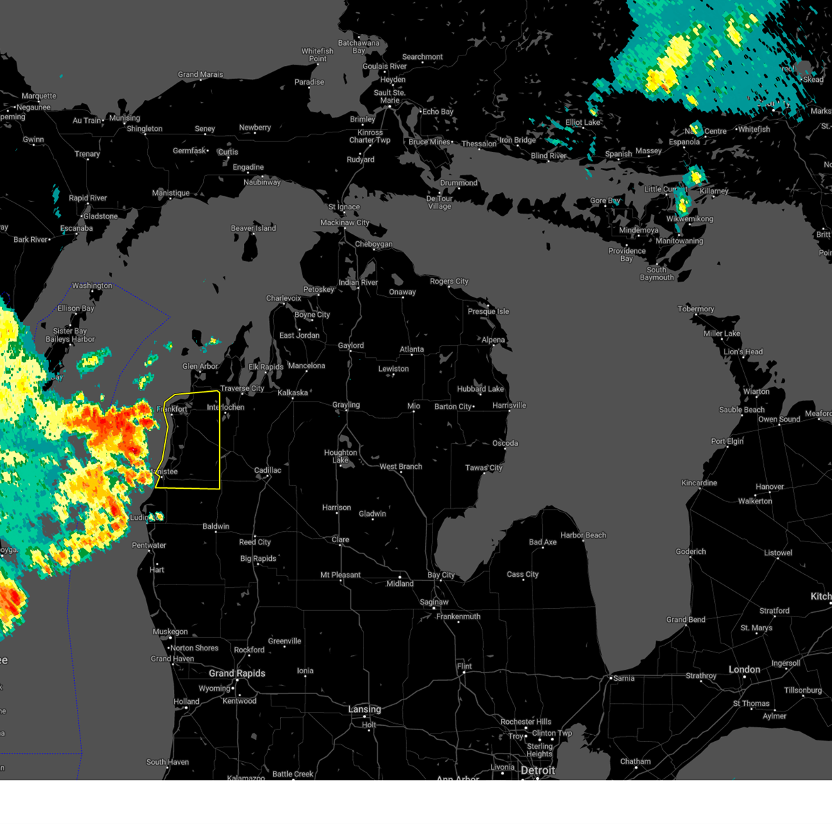
| 4/18/2025 10:34 PM EDT |
 At 1033 pm edt, a severe thunderstorm was located over manistee, moving northeast at 60 mph (radar indicated). Hazards include 60 mph wind gusts and quarter size hail. Hail damage to vehicles is expected. expect wind damage to roofs, siding, and trees. this severe storm will be near, kaleva, norwalk, and brethren around 1040 pm edt. Other locations impacted by this severe thunderstorm include star crossing. At 1033 pm edt, a severe thunderstorm was located over manistee, moving northeast at 60 mph (radar indicated). Hazards include 60 mph wind gusts and quarter size hail. Hail damage to vehicles is expected. expect wind damage to roofs, siding, and trees. this severe storm will be near, kaleva, norwalk, and brethren around 1040 pm edt. Other locations impacted by this severe thunderstorm include star crossing.
|
| 4/18/2025 10:21 PM EDT |
 Svrapx the national weather service in gaylord has issued a * severe thunderstorm warning for, manistee county in northern michigan, * until 1100 pm edt. * at 1021 pm edt, a severe thunderstorm was located near free soil, or 8 miles south of manistee, moving northeast at 55 mph (radar indicated). Hazards include 60 mph wind gusts and quarter size hail. Hail damage to vehicles is expected. expect wind damage to roofs, siding, and trees. this severe thunderstorm will be near, eastlake, parkdale, and manistee around 1025 pm edt. wellston and brethren around 1030 pm edt. kaleva and dublin around 1035 pm edt. Other locations impacted by this severe thunderstorm include star crossing. Svrapx the national weather service in gaylord has issued a * severe thunderstorm warning for, manistee county in northern michigan, * until 1100 pm edt. * at 1021 pm edt, a severe thunderstorm was located near free soil, or 8 miles south of manistee, moving northeast at 55 mph (radar indicated). Hazards include 60 mph wind gusts and quarter size hail. Hail damage to vehicles is expected. expect wind damage to roofs, siding, and trees. this severe thunderstorm will be near, eastlake, parkdale, and manistee around 1025 pm edt. wellston and brethren around 1030 pm edt. kaleva and dublin around 1035 pm edt. Other locations impacted by this severe thunderstorm include star crossing.
|
| 8/27/2024 2:23 PM EDT |
 The storms which prompted the warning have moved out of the area. therefore, the warning will be allowed to expire. a severe thunderstorm watch remains in effect until 800 pm edt for northern michigan. The storms which prompted the warning have moved out of the area. therefore, the warning will be allowed to expire. a severe thunderstorm watch remains in effect until 800 pm edt for northern michigan.
|
| 8/27/2024 2:00 PM EDT |
 At 159 pm edt, severe thunderstorms were located along a line extending from near honor to near bear lake to 7 miles south of norwalk, moving east at 50 mph (radar indicated). Hazards include 60 mph wind gusts and penny size hail. Expect damage to roofs, siding, and trees. these severe storms will be near, thompsonville, kaleva, honor, copemish, dublin, wellston, and brethren around 205 pm edt. lake ann and bendon around 210 pm edt. Other locations impacted by these severe thunderstorms include wallin, blaine township, star crossing, and pere marquette state forest. At 159 pm edt, severe thunderstorms were located along a line extending from near honor to near bear lake to 7 miles south of norwalk, moving east at 50 mph (radar indicated). Hazards include 60 mph wind gusts and penny size hail. Expect damage to roofs, siding, and trees. these severe storms will be near, thompsonville, kaleva, honor, copemish, dublin, wellston, and brethren around 205 pm edt. lake ann and bendon around 210 pm edt. Other locations impacted by these severe thunderstorms include wallin, blaine township, star crossing, and pere marquette state forest.
|
| 8/27/2024 1:34 PM EDT |
 Svrapx the national weather service in gaylord has issued a * severe thunderstorm warning for, benzie county in northern michigan, manistee county in northern michigan, * until 230 pm edt. * at 133 pm edt, severe thunderstorms were located along a line extending from 13 miles west of frankfort to 11 miles west of pierport to 11 miles west of manistee, moving east at 45 mph (radar indicated). Hazards include 60 mph wind gusts and penny size hail. Expect damage to roofs, siding, and trees. severe thunderstorms will be near, manistee, eastlake, parkdale, and orchard beach state park around 140 pm edt. frankfort, arcadia, onekama, elberta, and pierport around 145 pm edt. bear lake, wildwood, and norwalk around 150 pm edt. beulah and benzonia around 155 pm edt. thompsonville, kaleva, honor, and brethren around 200 pm edt. copemish and platte township around 205 pm edt. lake ann, dublin, wellston, and bendon around 210 pm edt. Other locations impacted by these severe thunderstorms include wallin, blaine township, star crossing, and pere marquette state forest. Svrapx the national weather service in gaylord has issued a * severe thunderstorm warning for, benzie county in northern michigan, manistee county in northern michigan, * until 230 pm edt. * at 133 pm edt, severe thunderstorms were located along a line extending from 13 miles west of frankfort to 11 miles west of pierport to 11 miles west of manistee, moving east at 45 mph (radar indicated). Hazards include 60 mph wind gusts and penny size hail. Expect damage to roofs, siding, and trees. severe thunderstorms will be near, manistee, eastlake, parkdale, and orchard beach state park around 140 pm edt. frankfort, arcadia, onekama, elberta, and pierport around 145 pm edt. bear lake, wildwood, and norwalk around 150 pm edt. beulah and benzonia around 155 pm edt. thompsonville, kaleva, honor, and brethren around 200 pm edt. copemish and platte township around 205 pm edt. lake ann, dublin, wellston, and bendon around 210 pm edt. Other locations impacted by these severe thunderstorms include wallin, blaine township, star crossing, and pere marquette state forest.
|
| 4/27/2024 9:08 PM EDT |
 Svrapx the national weather service in gaylord has issued a * severe thunderstorm warning for, southeastern benzie county in northern michigan, northwestern wexford county in northern michigan, southwestern grand traverse county in northern michigan, central manistee county in northern michigan, * until 945 pm edt. * at 908 pm edt, a severe thunderstorm was located over orchard beach state park, or near manistee, moving east at 45 mph (radar indicated). Hazards include 60 mph wind gusts and half dollar size hail. Hail damage to vehicles is expected. expect wind damage to roofs, siding, and trees. this severe thunderstorm will be near, kaleva, onekama, bear lake, wildwood, norwalk, and pierport around 915 pm edt. copemish around 920 pm edt. thompsonville around 925 pm edt. sherman, buckley, and mesick around 930 pm edt. Other locations impacted by this severe thunderstorm include wallin and pere marquette state forest. Svrapx the national weather service in gaylord has issued a * severe thunderstorm warning for, southeastern benzie county in northern michigan, northwestern wexford county in northern michigan, southwestern grand traverse county in northern michigan, central manistee county in northern michigan, * until 945 pm edt. * at 908 pm edt, a severe thunderstorm was located over orchard beach state park, or near manistee, moving east at 45 mph (radar indicated). Hazards include 60 mph wind gusts and half dollar size hail. Hail damage to vehicles is expected. expect wind damage to roofs, siding, and trees. this severe thunderstorm will be near, kaleva, onekama, bear lake, wildwood, norwalk, and pierport around 915 pm edt. copemish around 920 pm edt. thompsonville around 925 pm edt. sherman, buckley, and mesick around 930 pm edt. Other locations impacted by this severe thunderstorm include wallin and pere marquette state forest.
|
| 6/25/2023 4:53 PM EDT |
 At 452 pm edt, severe thunderstorms were located along a line extending from 6 miles southwest of manistee to near free soil to baldwin, moving northeast at 45 mph (radar indicated). Hazards include 60 mph wind gusts and quarter size hail. Hail damage to vehicles is expected. Expect wind damage to roofs, siding, and trees. At 452 pm edt, severe thunderstorms were located along a line extending from 6 miles southwest of manistee to near free soil to baldwin, moving northeast at 45 mph (radar indicated). Hazards include 60 mph wind gusts and quarter size hail. Hail damage to vehicles is expected. Expect wind damage to roofs, siding, and trees.
|
| 8/3/2022 10:25 AM EDT |
 The severe thunderstorm warning for south central leelanau, benzie, northwestern wexford, southwestern grand traverse and manistee counties will expire at 1030 am edt, the storm which prompted the warning has weakened below severe limits, and no longer poses an immediate threat to life or property. therefore, the warning will be allowed to expire. however gusty winds and heavy rain are still possible with this thunderstorm. The severe thunderstorm warning for south central leelanau, benzie, northwestern wexford, southwestern grand traverse and manistee counties will expire at 1030 am edt, the storm which prompted the warning has weakened below severe limits, and no longer poses an immediate threat to life or property. therefore, the warning will be allowed to expire. however gusty winds and heavy rain are still possible with this thunderstorm.
|
| 8/3/2022 9:46 AM EDT |
 At 945 am edt, a severe thunderstorm was located 15 miles northwest of orchard beach state park, or 16 miles northwest of manistee, moving east at 60 mph (radar indicated. this storm has a history of producing wind damage in northeast wisconsin). Hazards include 60 mph wind gusts and penny size hail. Expect damage to roofs, siding, and trees. this severe thunderstorm will be near, onekama and pierport around 1000 am edt. arcadia, bear lake and wildwood around 1005 am edt. other locations in the path of this severe thunderstorm include thompsonville, copemish, karlin, bendon, interlochen state park and interlochen. hail threat, radar indicated max hail size, 0. 75 in wind threat, radar indicated max wind gust, 60 mph. At 945 am edt, a severe thunderstorm was located 15 miles northwest of orchard beach state park, or 16 miles northwest of manistee, moving east at 60 mph (radar indicated. this storm has a history of producing wind damage in northeast wisconsin). Hazards include 60 mph wind gusts and penny size hail. Expect damage to roofs, siding, and trees. this severe thunderstorm will be near, onekama and pierport around 1000 am edt. arcadia, bear lake and wildwood around 1005 am edt. other locations in the path of this severe thunderstorm include thompsonville, copemish, karlin, bendon, interlochen state park and interlochen. hail threat, radar indicated max hail size, 0. 75 in wind threat, radar indicated max wind gust, 60 mph.
|
| 9/7/2021 12:00 PM EDT |
 At 1200 pm edt, a severe thunderstorm was located over eastlake, or near manistee, moving east at 55 mph (radar indicated). Hazards include ping pong ball size hail and 60 mph wind gusts. People and animals outdoors will be injured. expect hail damage to roofs, siding, windows, and vehicles. expect wind damage to roofs, siding, and trees. this severe thunderstorm will be near, norwalk around 1205 pm edt. kaleva, brethren, wellston and dublin around 1215 pm edt. hail threat, radar indicated max hail size, 1. 50 in wind threat, radar indicated max wind gust, 60 mph. At 1200 pm edt, a severe thunderstorm was located over eastlake, or near manistee, moving east at 55 mph (radar indicated). Hazards include ping pong ball size hail and 60 mph wind gusts. People and animals outdoors will be injured. expect hail damage to roofs, siding, windows, and vehicles. expect wind damage to roofs, siding, and trees. this severe thunderstorm will be near, norwalk around 1205 pm edt. kaleva, brethren, wellston and dublin around 1215 pm edt. hail threat, radar indicated max hail size, 1. 50 in wind threat, radar indicated max wind gust, 60 mph.
|
| 9/7/2021 11:24 AM EDT |
 At 1124 am edt, severe thunderstorms were located along a line extending from 12 miles west of arcadia to 11 miles northwest of orchard beach state park to 6 miles west of manistee to 10 miles west of eastlake, moving east at 45 mph (radar indicated). Hazards include 60 mph wind gusts and quarter size hail. Hail damage to vehicles is expected. expect wind damage to roofs, siding, and trees. severe thunderstorms will be near, manistee, eastlake, parkdale and orchard beach state park around 1135 am edt. arcadia and pierport around 1140 am edt. other locations in the path of these severe thunderstorms include onekama, norwalk, wildwood, bear lake, kaleva, wellston, brethren, thompsonville, copemish and dublin. hail threat, radar indicated max hail size, 1. 00 in wind threat, radar indicated max wind gust, 60 mph. At 1124 am edt, severe thunderstorms were located along a line extending from 12 miles west of arcadia to 11 miles northwest of orchard beach state park to 6 miles west of manistee to 10 miles west of eastlake, moving east at 45 mph (radar indicated). Hazards include 60 mph wind gusts and quarter size hail. Hail damage to vehicles is expected. expect wind damage to roofs, siding, and trees. severe thunderstorms will be near, manistee, eastlake, parkdale and orchard beach state park around 1135 am edt. arcadia and pierport around 1140 am edt. other locations in the path of these severe thunderstorms include onekama, norwalk, wildwood, bear lake, kaleva, wellston, brethren, thompsonville, copemish and dublin. hail threat, radar indicated max hail size, 1. 00 in wind threat, radar indicated max wind gust, 60 mph.
|
| 9/7/2021 9:29 AM EDT |
 At 928 am edt, severe thunderstorms were located along a line extending from interlochen state park to near norwalk, moving east at 45 mph (radar indicated. at 913 em edt, penny size hail was reported 1 mile east of beulah). Hazards include 60 mph wind gusts and quarter size hail. Hail damage to vehicles is expected. expect wind damage to roofs, siding, and trees. severe thunderstorms will be near, grawn, interlochen, interlochen state park and karlin around 935 am edt. traverse city, buckley and hannah around 940 am edt. kingsley around 945 am edt. other locations in the path of these severe thunderstorms include yuma, spider lake, sherman, mesick, harrietta, boon, fife lake, south boardman, meauwataka, cadillac, sharon, mitchell state park and jennings. hail threat, radar indicated max hail size, 1. 00 in wind threat, radar indicated max wind gust, 60 mph. At 928 am edt, severe thunderstorms were located along a line extending from interlochen state park to near norwalk, moving east at 45 mph (radar indicated. at 913 em edt, penny size hail was reported 1 mile east of beulah). Hazards include 60 mph wind gusts and quarter size hail. Hail damage to vehicles is expected. expect wind damage to roofs, siding, and trees. severe thunderstorms will be near, grawn, interlochen, interlochen state park and karlin around 935 am edt. traverse city, buckley and hannah around 940 am edt. kingsley around 945 am edt. other locations in the path of these severe thunderstorms include yuma, spider lake, sherman, mesick, harrietta, boon, fife lake, south boardman, meauwataka, cadillac, sharon, mitchell state park and jennings. hail threat, radar indicated max hail size, 1. 00 in wind threat, radar indicated max wind gust, 60 mph.
|
| 9/7/2021 9:18 AM EDT |
 At 917 am edt, severe thunderstorms were located along a line extending from near honor to near onekama, moving east at 50 mph (radar indicated. at 913 am edt, penny size hail was reported 1 mile east of beulah). Hazards include 60 mph wind gusts and quarter size hail. Hail damage to vehicles is expected. expect wind damage to roofs, siding, and trees. locations impacted include, thompsonville, honor, wildwood, bear lake, bendon, kaleva, karlin, interlochen state park, interlochen and brethren. hail threat, radar indicated max hail size, 1. 00 in wind threat, radar indicated max wind gust, 60 mph. At 917 am edt, severe thunderstorms were located along a line extending from near honor to near onekama, moving east at 50 mph (radar indicated. at 913 am edt, penny size hail was reported 1 mile east of beulah). Hazards include 60 mph wind gusts and quarter size hail. Hail damage to vehicles is expected. expect wind damage to roofs, siding, and trees. locations impacted include, thompsonville, honor, wildwood, bear lake, bendon, kaleva, karlin, interlochen state park, interlochen and brethren. hail threat, radar indicated max hail size, 1. 00 in wind threat, radar indicated max wind gust, 60 mph.
|
| 9/7/2021 8:57 AM EDT |
 At 857 am edt, severe thunderstorms were located along a line extending from frankfort to 13 miles northwest of orchard beach state park, moving east at 55 mph (radar indicated). Hazards include 60 mph wind gusts and quarter size hail. Hail damage to vehicles is expected. expect wind damage to roofs, siding, and trees. severe thunderstorms will be near, frankfort and elberta around 900 am edt. beulah and benzonia around 905 am edt. honor, pierport and orchard beach state park around 910 am edt. thompsonville, onekama, bear lake, norwalk and wildwood around 915 am edt. other locations in the path of these severe thunderstorms include bendon, kaleva, interlochen state park, karlin, brethren and interlochen. hail threat, radar indicated max hail size, 1. 00 in wind threat, radar indicated max wind gust, 60 mph. At 857 am edt, severe thunderstorms were located along a line extending from frankfort to 13 miles northwest of orchard beach state park, moving east at 55 mph (radar indicated). Hazards include 60 mph wind gusts and quarter size hail. Hail damage to vehicles is expected. expect wind damage to roofs, siding, and trees. severe thunderstorms will be near, frankfort and elberta around 900 am edt. beulah and benzonia around 905 am edt. honor, pierport and orchard beach state park around 910 am edt. thompsonville, onekama, bear lake, norwalk and wildwood around 915 am edt. other locations in the path of these severe thunderstorms include bendon, kaleva, interlochen state park, karlin, brethren and interlochen. hail threat, radar indicated max hail size, 1. 00 in wind threat, radar indicated max wind gust, 60 mph.
|
| 11/10/2020 7:22 PM EST |
 At 721 pm est, severe thunderstorms were located along a line extending from 12 miles northwest of ludington sp to near ludington, moving northeast at 60 mph (radar indicated). Hazards include 60 mph wind gusts. expect damage to roofs, siding, and trees At 721 pm est, severe thunderstorms were located along a line extending from 12 miles northwest of ludington sp to near ludington, moving northeast at 60 mph (radar indicated). Hazards include 60 mph wind gusts. expect damage to roofs, siding, and trees
|
| 4/7/2020 6:03 PM EDT |
 At 602 pm edt, a severe thunderstorm was located near pierport, or 10 miles southwest of thompsonville, moving southeast at 55 mph (radar indicated). Hazards include ping pong ball size hail and 60 mph wind gusts. People and animals outdoors will be injured. expect hail damage to roofs, siding, windows, and vehicles. expect wind damage to roofs, siding, and trees. this severe storm will be near, bear lake, copemish and brethren around 610 pm edt. Other locations impacted by this severe thunderstorm include star crossing and pere marquette state forest. At 602 pm edt, a severe thunderstorm was located near pierport, or 10 miles southwest of thompsonville, moving southeast at 55 mph (radar indicated). Hazards include ping pong ball size hail and 60 mph wind gusts. People and animals outdoors will be injured. expect hail damage to roofs, siding, windows, and vehicles. expect wind damage to roofs, siding, and trees. this severe storm will be near, bear lake, copemish and brethren around 610 pm edt. Other locations impacted by this severe thunderstorm include star crossing and pere marquette state forest.
|
| 4/7/2020 5:51 PM EDT |
 At 550 pm edt, a severe thunderstorm was located near arcadia, or 10 miles southwest of frankfort, moving southeast at 55 mph (radar indicated). Hazards include 60 mph wind gusts and quarter size hail. Hail damage to vehicles is expected. expect wind damage to roofs, siding, and trees. this severe thunderstorm will be near, pierport around 555 pm edt. onekama, bear lake and wildwood around 600 pm edt. norwalk around 605 pm edt. kaleva, copemish and brethren around 610 pm edt. Other locations impacted by this severe thunderstorm include blaine township, star crossing and pere marquette state forest. At 550 pm edt, a severe thunderstorm was located near arcadia, or 10 miles southwest of frankfort, moving southeast at 55 mph (radar indicated). Hazards include 60 mph wind gusts and quarter size hail. Hail damage to vehicles is expected. expect wind damage to roofs, siding, and trees. this severe thunderstorm will be near, pierport around 555 pm edt. onekama, bear lake and wildwood around 600 pm edt. norwalk around 605 pm edt. kaleva, copemish and brethren around 610 pm edt. Other locations impacted by this severe thunderstorm include blaine township, star crossing and pere marquette state forest.
|
| 4/7/2020 5:30 PM EDT |
 At 529 pm edt, a severe thunderstorm was located over kaleva, or 9 miles southwest of thompsonville, moving east at 60 mph (radar indicated. at 529 pm edt...half inch size hail was reported in bear lake in manistee county). Hazards include 60 mph wind gusts and quarter size hail. Hail damage to vehicles is expected. expect wind damage to roofs, siding, and trees. Locations impacted include, kaleva, onekama, copemish, brethren, norwalk, pierport, orchard beach state park and pere marquette state forest. At 529 pm edt, a severe thunderstorm was located over kaleva, or 9 miles southwest of thompsonville, moving east at 60 mph (radar indicated. at 529 pm edt...half inch size hail was reported in bear lake in manistee county). Hazards include 60 mph wind gusts and quarter size hail. Hail damage to vehicles is expected. expect wind damage to roofs, siding, and trees. Locations impacted include, kaleva, onekama, copemish, brethren, norwalk, pierport, orchard beach state park and pere marquette state forest.
|
| 4/7/2020 5:12 PM EDT |
 At 512 pm edt, a severe thunderstorm was located near pierport, or 13 miles southwest of frankfort, moving east at 55 mph (radar indicated). Hazards include quarter size hail. damage to vehicles is expected At 512 pm edt, a severe thunderstorm was located near pierport, or 13 miles southwest of frankfort, moving east at 55 mph (radar indicated). Hazards include quarter size hail. damage to vehicles is expected
|
| 7/20/2019 2:39 PM EDT |
 The severe thunderstorm warning for manistee county will expire at 245 pm edt, the storms which prompted the warning have weakened below severe limits, and no longer pose an immediate threat to life or property. therefore, the warning will be allowed to expire. however gusty winds are still possible with these thunderstorms. a severe thunderstorm watch remains in effect until 1000 pm edt for northern michigan. The severe thunderstorm warning for manistee county will expire at 245 pm edt, the storms which prompted the warning have weakened below severe limits, and no longer pose an immediate threat to life or property. therefore, the warning will be allowed to expire. however gusty winds are still possible with these thunderstorms. a severe thunderstorm watch remains in effect until 1000 pm edt for northern michigan.
|
| 7/20/2019 2:16 PM EDT |
 At 216 pm edt, severe thunderstorms were located along a line extending from 8 miles west of pierport to near free soil to 9 miles southwest of silver lake sp, moving east at 70 mph (radar indicated). Hazards include 60 mph wind gusts and penny size hail. Expect damage to roofs, siding, and trees. Locations impacted include, manistee, thompsonville, arcadia, eastlake, kaleva, onekama, copemish, wellston, pierport, dublin, brethren, norwalk, parkdale, orchard beach state park, pere marquette state forest and star crossing. At 216 pm edt, severe thunderstorms were located along a line extending from 8 miles west of pierport to near free soil to 9 miles southwest of silver lake sp, moving east at 70 mph (radar indicated). Hazards include 60 mph wind gusts and penny size hail. Expect damage to roofs, siding, and trees. Locations impacted include, manistee, thompsonville, arcadia, eastlake, kaleva, onekama, copemish, wellston, pierport, dublin, brethren, norwalk, parkdale, orchard beach state park, pere marquette state forest and star crossing.
|
| 7/20/2019 1:52 PM EDT |
 At 151 pm edt, severe thunderstorms were located along a line extending from 24 miles southeast of algoma to 10 miles northwest of ludington state park to 24 miles east of sheboygan, moving east at 70 mph (radar indicated). Hazards include 60 mph wind gusts and penny size hail. expect damage to roofs, siding, and trees At 151 pm edt, severe thunderstorms were located along a line extending from 24 miles southeast of algoma to 10 miles northwest of ludington state park to 24 miles east of sheboygan, moving east at 70 mph (radar indicated). Hazards include 60 mph wind gusts and penny size hail. expect damage to roofs, siding, and trees
|
| 7/20/2019 12:57 AM EDT |
 The severe thunderstorm warning for leelanau, benzie, wexford, grand traverse and manistee counties will expire at 100 am edt, the storms which prompted the warning have weakened below severe limits, and no longer pose an immediate threat to life or property. therefore, the warning will be allowed to expire. however gusty winds are still possible with these thunderstorms as they track into kalkaska and missaukee counties. a severe thunderstorm watch remains in effect until 600 am edt for northern michigan. The severe thunderstorm warning for leelanau, benzie, wexford, grand traverse and manistee counties will expire at 100 am edt, the storms which prompted the warning have weakened below severe limits, and no longer pose an immediate threat to life or property. therefore, the warning will be allowed to expire. however gusty winds are still possible with these thunderstorms as they track into kalkaska and missaukee counties. a severe thunderstorm watch remains in effect until 600 am edt for northern michigan.
|
| 7/20/2019 12:34 AM EDT |
 At 1232 am edt, severe thunderstorms were located along a line extending from 7 miles northwest of sleeping bear point to mesick to near dublin to near mears state park, moving east at 55 mph (radar indicated). Hazards include 70 mph wind gusts and penny size hail. Expect considerable tree damage. damage is likely to mobile homes, roofs, and outbuildings. several reports of downed trees have been reported across benzie county. wind gusts over 50 mph have also been reported with this line of thunderstorms. Locations impacted include, traverse city, cadillac, manistee, leland, elk rapids, frankfort, thompsonville, empire, beulah, grand traverse light, sleeping bear point, arcadia, bingham, kingsley, manton, sherman, glen arbor, buckley, boon and suttons bay. At 1232 am edt, severe thunderstorms were located along a line extending from 7 miles northwest of sleeping bear point to mesick to near dublin to near mears state park, moving east at 55 mph (radar indicated). Hazards include 70 mph wind gusts and penny size hail. Expect considerable tree damage. damage is likely to mobile homes, roofs, and outbuildings. several reports of downed trees have been reported across benzie county. wind gusts over 50 mph have also been reported with this line of thunderstorms. Locations impacted include, traverse city, cadillac, manistee, leland, elk rapids, frankfort, thompsonville, empire, beulah, grand traverse light, sleeping bear point, arcadia, bingham, kingsley, manton, sherman, glen arbor, buckley, boon and suttons bay.
|
| 7/20/2019 12:15 AM EDT |
 At 1214 am edt, severe thunderstorms were located along a line extending from 21 miles west of sleeping bear point to near copemish to near free soil to 12 miles southwest of ludington, moving east at 55 mph (radar indicated). Hazards include 70 mph wind gusts and penny size hail. Expect considerable tree damage. damage is likely to mobile homes, roofs, and outbuildings. at 1202 am, a 51 mph wind gust was reported in manistee. Locations impacted include, traverse city, cadillac, manistee, leland, elk rapids, frankfort, thompsonville, empire, beulah, grand traverse light, sleeping bear point, arcadia, bingham, kingsley, manton, sherman, glen arbor, buckley, boon and suttons bay. At 1214 am edt, severe thunderstorms were located along a line extending from 21 miles west of sleeping bear point to near copemish to near free soil to 12 miles southwest of ludington, moving east at 55 mph (radar indicated). Hazards include 70 mph wind gusts and penny size hail. Expect considerable tree damage. damage is likely to mobile homes, roofs, and outbuildings. at 1202 am, a 51 mph wind gust was reported in manistee. Locations impacted include, traverse city, cadillac, manistee, leland, elk rapids, frankfort, thompsonville, empire, beulah, grand traverse light, sleeping bear point, arcadia, bingham, kingsley, manton, sherman, glen arbor, buckley, boon and suttons bay.
|
| 7/19/2019 11:57 PM EDT |
 At 1156 pm edt, severe thunderstorms were located along a line extending from 18 miles southeast of newport state park to near arcadia to 7 miles west of manistee to 23 miles west of ludington state park, moving east at 50 mph (radar indicated). Hazards include 70 mph wind gusts and penny size hail. Expect considerable tree damage. damage is likely to mobile homes, roofs, and outbuildings. Locations impacted include, traverse city, cadillac, manistee, leland, elk rapids, frankfort, thompsonville, empire, beulah, grand traverse light, sleeping bear point, arcadia, bingham, kingsley, manton, sherman, glen arbor, buckley, boon and suttons bay. At 1156 pm edt, severe thunderstorms were located along a line extending from 18 miles southeast of newport state park to near arcadia to 7 miles west of manistee to 23 miles west of ludington state park, moving east at 50 mph (radar indicated). Hazards include 70 mph wind gusts and penny size hail. Expect considerable tree damage. damage is likely to mobile homes, roofs, and outbuildings. Locations impacted include, traverse city, cadillac, manistee, leland, elk rapids, frankfort, thompsonville, empire, beulah, grand traverse light, sleeping bear point, arcadia, bingham, kingsley, manton, sherman, glen arbor, buckley, boon and suttons bay.
|
| 7/19/2019 11:40 PM EDT |
 At 1139 pm edt, severe thunderstorms were located along a line extending from 7 miles southeast of newport state park to 16 miles west of frankfort to 20 miles west of manistee to 22 miles east of manitowoc, moving east at 55 mph (radar indicated). Hazards include 70 mph wind gusts. Expect considerable tree damage. Damage is likely to mobile homes, roofs, and outbuildings. At 1139 pm edt, severe thunderstorms were located along a line extending from 7 miles southeast of newport state park to 16 miles west of frankfort to 20 miles west of manistee to 22 miles east of manitowoc, moving east at 55 mph (radar indicated). Hazards include 70 mph wind gusts. Expect considerable tree damage. Damage is likely to mobile homes, roofs, and outbuildings.
|
| 8/28/2018 6:46 PM EDT |
 At 646 pm edt, severe thunderstorms were located along a line extending from near thompsonville to near manistee, moving east at 45 mph (radar indicated). Hazards include 60 mph wind gusts. expect damage to roofs, siding, and trees At 646 pm edt, severe thunderstorms were located along a line extending from near thompsonville to near manistee, moving east at 45 mph (radar indicated). Hazards include 60 mph wind gusts. expect damage to roofs, siding, and trees
|
| 8/28/2018 1:17 AM EDT |
 At 117 am edt, severe thunderstorms were located along a line extending from near grand traverse light to near fouch to near eastlake, moving east at 60 mph (radar indicated. at 110 am, leland harbor reported a wind gust of 65 mph). Hazards include 70 mph wind gusts. Expect considerable tree damage. damage is likely to mobile homes, roofs, and outbuildings. Locations impacted include, traverse city, manistee, frankfort, thompsonville, empire, beulah, sleeping bear point, arcadia, bingham, glen arbor, suttons bay, northport, eastlake, benzonia, kaleva, cedar, onekama, elberta, honor and lake ann. At 117 am edt, severe thunderstorms were located along a line extending from near grand traverse light to near fouch to near eastlake, moving east at 60 mph (radar indicated. at 110 am, leland harbor reported a wind gust of 65 mph). Hazards include 70 mph wind gusts. Expect considerable tree damage. damage is likely to mobile homes, roofs, and outbuildings. Locations impacted include, traverse city, manistee, frankfort, thompsonville, empire, beulah, sleeping bear point, arcadia, bingham, glen arbor, suttons bay, northport, eastlake, benzonia, kaleva, cedar, onekama, elberta, honor and lake ann.
|
| 8/28/2018 1:06 AM EDT |
 At 105 am edt, severe thunderstorms were located along a line extending from 12 miles northwest of leelanau state park to near platte township to 8 miles west of manistee, moving east at 45 mph (radar indicated). Hazards include 60 mph wind gusts. Expect damage to roofs, siding, and trees. Locations impacted include, traverse city, manistee, frankfort, thompsonville, empire, beulah, sleeping bear point, arcadia, bingham, glen arbor, suttons bay, northport, eastlake, benzonia, kaleva, cedar, onekama, elberta, honor and lake ann. At 105 am edt, severe thunderstorms were located along a line extending from 12 miles northwest of leelanau state park to near platte township to 8 miles west of manistee, moving east at 45 mph (radar indicated). Hazards include 60 mph wind gusts. Expect damage to roofs, siding, and trees. Locations impacted include, traverse city, manistee, frankfort, thompsonville, empire, beulah, sleeping bear point, arcadia, bingham, glen arbor, suttons bay, northport, eastlake, benzonia, kaleva, cedar, onekama, elberta, honor and lake ann.
|
| 8/28/2018 12:26 AM EDT |
 At 1224 am edt, severe thunderstorms were located along a line extending from 29 miles south of garden to 27 miles northwest of ludington sp, moving east at 65 mph (radar indicated). Hazards include 60 mph wind gusts. expect damage to roofs, siding, and trees At 1224 am edt, severe thunderstorms were located along a line extending from 29 miles south of garden to 27 miles northwest of ludington sp, moving east at 65 mph (radar indicated). Hazards include 60 mph wind gusts. expect damage to roofs, siding, and trees
|
| 8/3/2017 5:59 PM EDT |
 At 559 pm edt, a severe thunderstorm was located near eastlake, or near manistee, moving northeast at 25 mph (radar indicated). Hazards include 60 mph wind gusts and penny size hail. Expect damage to roofs, siding, and trees. Locations impacted include, manistee, eastlake, onekama, orchard beach state park and parkdale. At 559 pm edt, a severe thunderstorm was located near eastlake, or near manistee, moving northeast at 25 mph (radar indicated). Hazards include 60 mph wind gusts and penny size hail. Expect damage to roofs, siding, and trees. Locations impacted include, manistee, eastlake, onekama, orchard beach state park and parkdale.
|
| 8/3/2017 5:51 PM EDT |
 At 550 pm edt, a severe thunderstorm was located over copemish, moving northeast at 20 mph (radar indicated). Hazards include quarter size hail. Damage to vehicles is expected. Locations impacted include, thompsonville, kaleva, copemish, brethren, norwalk and star crossing. At 550 pm edt, a severe thunderstorm was located over copemish, moving northeast at 20 mph (radar indicated). Hazards include quarter size hail. Damage to vehicles is expected. Locations impacted include, thompsonville, kaleva, copemish, brethren, norwalk and star crossing.
|
| 8/3/2017 5:40 PM EDT |
 At 539 pm edt, a severe thunderstorm was located over manistee, moving northeast at 20 mph (radar indicated). Hazards include 60 mph wind gusts and quarter size hail. Hail damage to vehicles is expected. expect wind damage to roofs, siding, and trees. Locations impacted include, manistee, eastlake, onekama, orchard beach state park and parkdale. At 539 pm edt, a severe thunderstorm was located over manistee, moving northeast at 20 mph (radar indicated). Hazards include 60 mph wind gusts and quarter size hail. Hail damage to vehicles is expected. expect wind damage to roofs, siding, and trees. Locations impacted include, manistee, eastlake, onekama, orchard beach state park and parkdale.
|
| 8/3/2017 5:34 PM EDT |
 At 533 pm edt, a severe thunderstorm was located over kaleva, or 10 miles south of thompsonville, moving northeast at 25 mph (radar indicated). Hazards include 60 mph wind gusts and quarter size hail. Hail damage to vehicles is expected. expect wind damage to roofs, siding, and trees. Locations impacted include, thompsonville, kaleva, copemish, brethren, norwalk and star crossing. At 533 pm edt, a severe thunderstorm was located over kaleva, or 10 miles south of thompsonville, moving northeast at 25 mph (radar indicated). Hazards include 60 mph wind gusts and quarter size hail. Hail damage to vehicles is expected. expect wind damage to roofs, siding, and trees. Locations impacted include, thompsonville, kaleva, copemish, brethren, norwalk and star crossing.
|
| 8/3/2017 5:27 PM EDT |
 At 526 pm edt, a severe thunderstorm was located 4 miles west of near manistee, moving northeast at 20 mph (radar indicated). Hazards include 60 mph wind gusts and half dollar size hail. Hail damage to vehicles is expected. Expect wind damage to roofs, siding, and trees. At 526 pm edt, a severe thunderstorm was located 4 miles west of near manistee, moving northeast at 20 mph (radar indicated). Hazards include 60 mph wind gusts and half dollar size hail. Hail damage to vehicles is expected. Expect wind damage to roofs, siding, and trees.
|
| 8/3/2017 5:22 PM EDT |
 At 521 pm edt, a severe thunderstorm was located over brethren, or 13 miles east of manistee, moving northeast at 20 mph (radar indicated). Hazards include ping pong ball size hail and 60 mph wind gusts. People and animals outdoors will be injured. expect hail damage to roofs, siding, windows, and vehicles. expect wind damage to roofs, siding, and trees. Locations impacted include, thompsonville, kaleva, copemish, brethren, norwalk and star crossing. At 521 pm edt, a severe thunderstorm was located over brethren, or 13 miles east of manistee, moving northeast at 20 mph (radar indicated). Hazards include ping pong ball size hail and 60 mph wind gusts. People and animals outdoors will be injured. expect hail damage to roofs, siding, windows, and vehicles. expect wind damage to roofs, siding, and trees. Locations impacted include, thompsonville, kaleva, copemish, brethren, norwalk and star crossing.
|
| 8/3/2017 5:08 PM EDT |
 At 508 pm edt, a severe thunderstorm was located near norwalk, or 9 miles east of manistee, moving northeast at 20 mph (radar indicated). Hazards include golf ball size hail and 60 mph wind gusts. People and animals outdoors will be injured. expect hail damage to roofs, siding, windows, and vehicles. Expect wind damage to roofs, siding, and trees. At 508 pm edt, a severe thunderstorm was located near norwalk, or 9 miles east of manistee, moving northeast at 20 mph (radar indicated). Hazards include golf ball size hail and 60 mph wind gusts. People and animals outdoors will be injured. expect hail damage to roofs, siding, windows, and vehicles. Expect wind damage to roofs, siding, and trees.
|
| 6/14/2017 7:53 PM EDT |
 At 750 pm edt, severe thunderstorms moving north-northeast at 30 mph continue across parts of the warned area with additional thunderstorms moving from mason into southern manistee county over the next 20 minutes (radar indicated). Hazards include 60 mph wind gusts and quarter size hail. Hail damage to vehicles is expected. expect wind damage to roofs, siding, and trees. Locations impacted include, manistee, frankfort, thompsonville, empire, beulah, sleeping bear point, arcadia, glen arbor, eastlake, benzonia, kaleva, onekama, elberta, honor, lake ann, copemish, dublin, brethren, bendon and orchard beach state park. At 750 pm edt, severe thunderstorms moving north-northeast at 30 mph continue across parts of the warned area with additional thunderstorms moving from mason into southern manistee county over the next 20 minutes (radar indicated). Hazards include 60 mph wind gusts and quarter size hail. Hail damage to vehicles is expected. expect wind damage to roofs, siding, and trees. Locations impacted include, manistee, frankfort, thompsonville, empire, beulah, sleeping bear point, arcadia, glen arbor, eastlake, benzonia, kaleva, onekama, elberta, honor, lake ann, copemish, dublin, brethren, bendon and orchard beach state park.
|
| 6/14/2017 7:17 PM EDT |
 At 713 pm edt, severe thunderstorms continue across northern manistee, benzie and leelanau counties, moving north at 30 mph. additional strong thunderstorms developing across mason county will enter the warned area over the 20 minutes (radar indicated). Hazards include 60 mph wind gusts and quarter size hail. Hail damage to vehicles is expected. expect wind damage to roofs, siding, and trees. Locations impacted include, manistee, frankfort, thompsonville, empire, beulah, sleeping bear point, arcadia, glen arbor, eastlake, benzonia, kaleva, onekama, elberta, honor, lake ann, copemish, dublin, brethren, bendon and orchard beach state park. At 713 pm edt, severe thunderstorms continue across northern manistee, benzie and leelanau counties, moving north at 30 mph. additional strong thunderstorms developing across mason county will enter the warned area over the 20 minutes (radar indicated). Hazards include 60 mph wind gusts and quarter size hail. Hail damage to vehicles is expected. expect wind damage to roofs, siding, and trees. Locations impacted include, manistee, frankfort, thompsonville, empire, beulah, sleeping bear point, arcadia, glen arbor, eastlake, benzonia, kaleva, onekama, elberta, honor, lake ann, copemish, dublin, brethren, bendon and orchard beach state park.
|
| 6/14/2017 7:01 PM EDT |
 At 700 pm edt, several severe thunderstorms were located across manistee, benzie, and leelanau counties moving north at 30 mph (radar indicated). Hazards include 60 mph wind gusts and quarter size hail. Hail damage to vehicles is expected. Expect wind damage to roofs, siding, and trees. At 700 pm edt, several severe thunderstorms were located across manistee, benzie, and leelanau counties moving north at 30 mph (radar indicated). Hazards include 60 mph wind gusts and quarter size hail. Hail damage to vehicles is expected. Expect wind damage to roofs, siding, and trees.
|
| 6/12/2017 10:34 PM EDT |
 At 1034 pm edt, severe thunderstorms were located along a line extending from 21 miles west of frankfort to 10 miles west of pierport to near manistee, moving east at 60 mph (radar indicated). Hazards include 60 mph wind gusts and nickel size hail. expect damage to roofs, siding, and trees At 1034 pm edt, severe thunderstorms were located along a line extending from 21 miles west of frankfort to 10 miles west of pierport to near manistee, moving east at 60 mph (radar indicated). Hazards include 60 mph wind gusts and nickel size hail. expect damage to roofs, siding, and trees
|
| 8/2/2015 6:22 PM EDT |
 At 620 pm edt, severe thunderstorms were located along a line extending from near copemish to 6 miles north of ludington, moving east at 55 mph (trained weather spotters. at 614 pm...train spotters reported trees down and estimated wind gusts to 60 mph in the city of manistee). Hazards include 60 mph wind gusts and quarter size hail. Hail damage to vehicles is expected. expect wind damage to roofs, siding and trees. Locations impacted include, manistee, thompsonville, eastlake, kaleva, onekama, copemish, brethren, norwalk, parkdale, wellston, dublin, wallin, star crossing and pere marquette state forest. At 620 pm edt, severe thunderstorms were located along a line extending from near copemish to 6 miles north of ludington, moving east at 55 mph (trained weather spotters. at 614 pm...train spotters reported trees down and estimated wind gusts to 60 mph in the city of manistee). Hazards include 60 mph wind gusts and quarter size hail. Hail damage to vehicles is expected. expect wind damage to roofs, siding and trees. Locations impacted include, manistee, thompsonville, eastlake, kaleva, onekama, copemish, brethren, norwalk, parkdale, wellston, dublin, wallin, star crossing and pere marquette state forest.
|
| 8/2/2015 5:58 PM EDT |
 At 558 pm edt, severe thunderstorms were located along a line extending from near arcadia to 19 miles northwest of ludington, moving east at 35 mph (radar indicated). Hazards include 60 mph wind gusts and quarter size hail. Hail damage to vehicles is expected. Expect wind damage to roofs, siding and trees. At 558 pm edt, severe thunderstorms were located along a line extending from near arcadia to 19 miles northwest of ludington, moving east at 35 mph (radar indicated). Hazards include 60 mph wind gusts and quarter size hail. Hail damage to vehicles is expected. Expect wind damage to roofs, siding and trees.
|
| 8/2/2015 4:44 PM EDT |
 At 440 pm edt, severe thunderstorms were located along a line extending from 18 miles northwest of sleeping bear point to 20 miles east of algoma, and are nearly stationary (radar indicated. at 426pm and later 60 mph winds were reported in leelanau and grand traverse counties). Hazards include 70 mph wind gusts and quarter size hail. Hail damage to vehicles is expected. expect considerable tree damage. wind damage is also likely to mobile homes, roofs and outbuildings. Locations impacted include, traverse city, cadillac, manistee, elk rapids, thompsonville, empire, beulah, sleeping bear point, bingham, kingsley, manton, sherman, glen arbor, buckley, boon, suttons bay, northport, eastlake, benzonia and kaleva. At 440 pm edt, severe thunderstorms were located along a line extending from 18 miles northwest of sleeping bear point to 20 miles east of algoma, and are nearly stationary (radar indicated. at 426pm and later 60 mph winds were reported in leelanau and grand traverse counties). Hazards include 70 mph wind gusts and quarter size hail. Hail damage to vehicles is expected. expect considerable tree damage. wind damage is also likely to mobile homes, roofs and outbuildings. Locations impacted include, traverse city, cadillac, manistee, elk rapids, thompsonville, empire, beulah, sleeping bear point, bingham, kingsley, manton, sherman, glen arbor, buckley, boon, suttons bay, northport, eastlake, benzonia and kaleva.
|
| 8/2/2015 4:16 PM EDT |
 At 416 pm edt, severe thunderstorms were located along a line extending from 18 miles northwest of sleeping bear point to 20 miles east of algoma, and are nearly stationary (radar indicated). Hazards include 70 mph wind gusts and penny size hail. Expect considerable tree damage. damage is likely to mobile homes, roofs and outbuildings. Locations impacted include, traverse city, cadillac, manistee, elk rapids, thompsonville, empire, beulah, sleeping bear point, bingham, kingsley, manton, sherman, glen arbor, buckley, boon, suttons bay, northport, eastlake, benzonia and kaleva. At 416 pm edt, severe thunderstorms were located along a line extending from 18 miles northwest of sleeping bear point to 20 miles east of algoma, and are nearly stationary (radar indicated). Hazards include 70 mph wind gusts and penny size hail. Expect considerable tree damage. damage is likely to mobile homes, roofs and outbuildings. Locations impacted include, traverse city, cadillac, manistee, elk rapids, thompsonville, empire, beulah, sleeping bear point, bingham, kingsley, manton, sherman, glen arbor, buckley, boon, suttons bay, northport, eastlake, benzonia and kaleva.
|
| 8/2/2015 3:57 PM EDT |
 At 356 pm edt, severe thunderstorms were located along a line extending from 18 miles northwest of sleeping bear point to 20 miles east of algoma, moving southeast at 45 mph (radar indicated). Hazards include 70 mph wind gusts and penny size hail. Expect considerable tree damage. Damage is likely to mobile homes, roofs and outbuildings. At 356 pm edt, severe thunderstorms were located along a line extending from 18 miles northwest of sleeping bear point to 20 miles east of algoma, moving southeast at 45 mph (radar indicated). Hazards include 70 mph wind gusts and penny size hail. Expect considerable tree damage. Damage is likely to mobile homes, roofs and outbuildings.
|
| 8/2/2015 11:40 AM EDT |
 At 1139 am edt, a severe thunderstorm was located over manistee, moving east at 55 mph (radar indicated). Hazards include 60 mph wind gusts and quarter size hail. Hail damage to vehicles is expected. Expect wind damage to roofs, siding and trees. At 1139 am edt, a severe thunderstorm was located over manistee, moving east at 55 mph (radar indicated). Hazards include 60 mph wind gusts and quarter size hail. Hail damage to vehicles is expected. Expect wind damage to roofs, siding and trees.
|
| 1/1/0001 12:00 AM | Manistee blacker airport in manistee county MI, 2.5 miles W of Parkdale, MI |
Hail Maps for Parkdale, MI


Connect with Interactive Hail Maps