

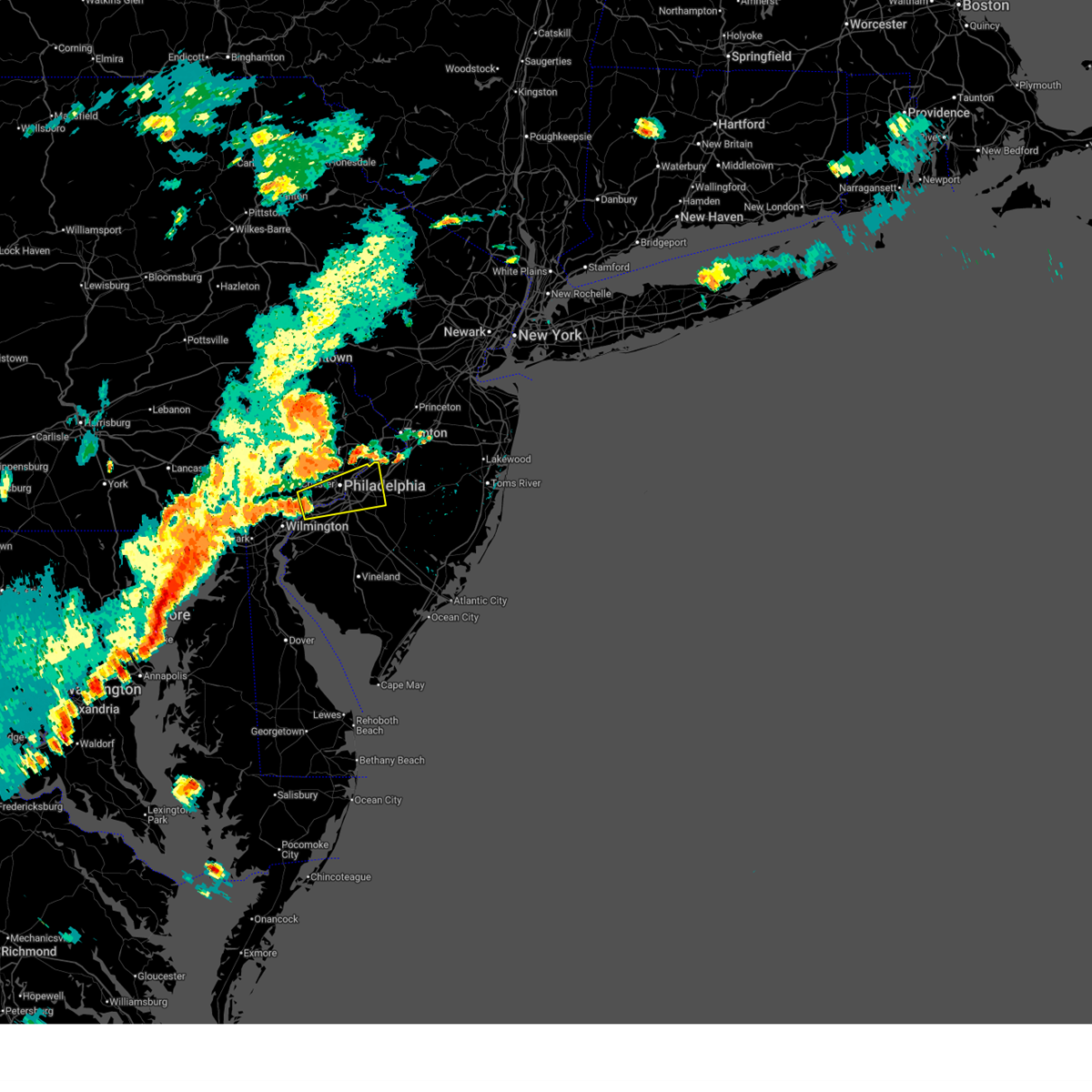
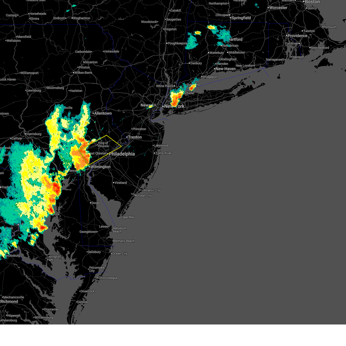
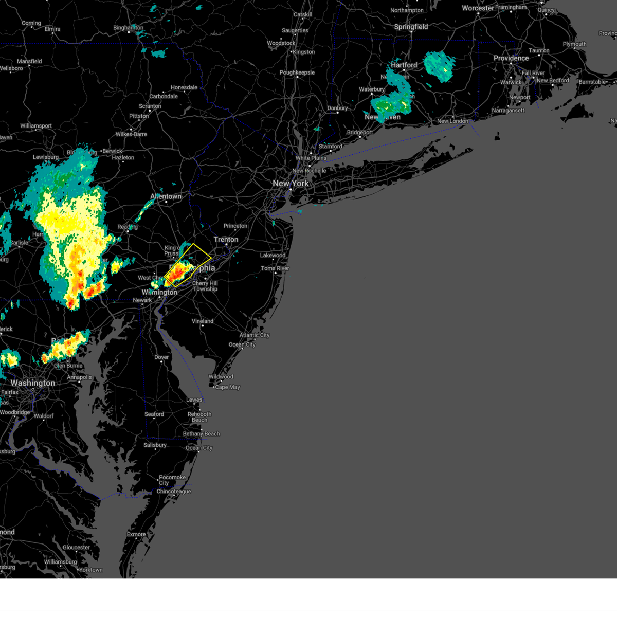
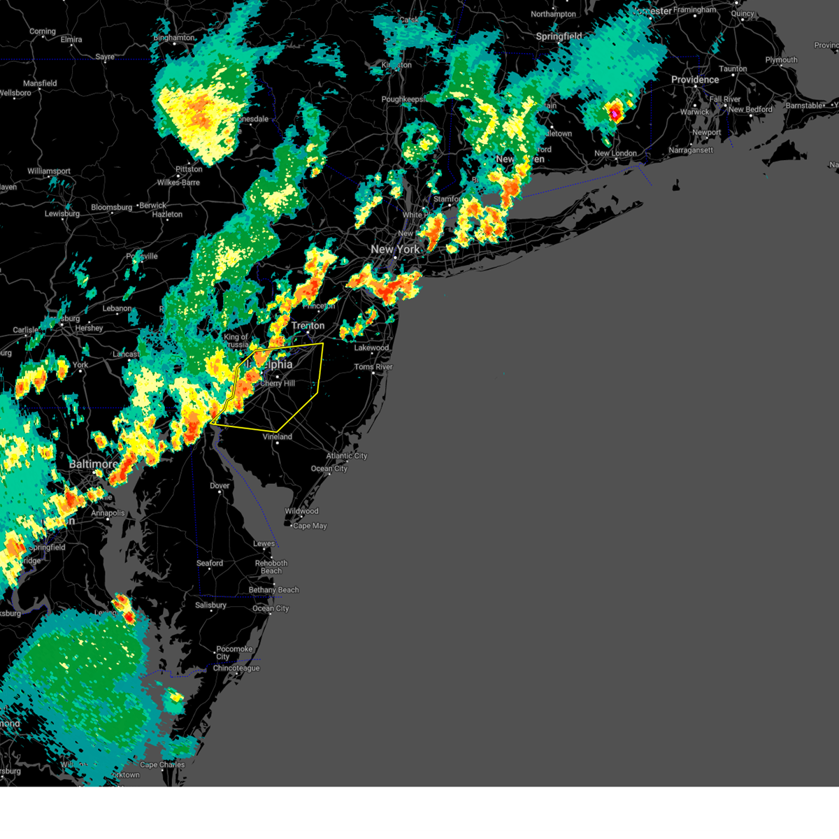
Hail Map for Parkside, PA
The Parkside, PA area has had 0 reports of on-the-ground hail by trained spotters, and has been under severe weather warnings 33 times during the past 12 months. Doppler radar has detected hail at or near Parkside, PA on 22 occasions, including 1 occasion during the past year.
| Name: | Parkside, PA |
| Where Located: | 76.8 miles ENE of Baltimore, MD |
| Map: | Google Map for Parkside, PA |
| Population: | 2328 |
| Housing Units: | 912 |
| More Info: | Search Google for Parkside, PA |
0
The Top Recent Hail Date for Parkside, PA is Thursday, June 19, 2025 (22nd out of 22)

Hail and Wind Damage Spotted near Parkside, PA
| Date / Time | Report Details |
|---|---|
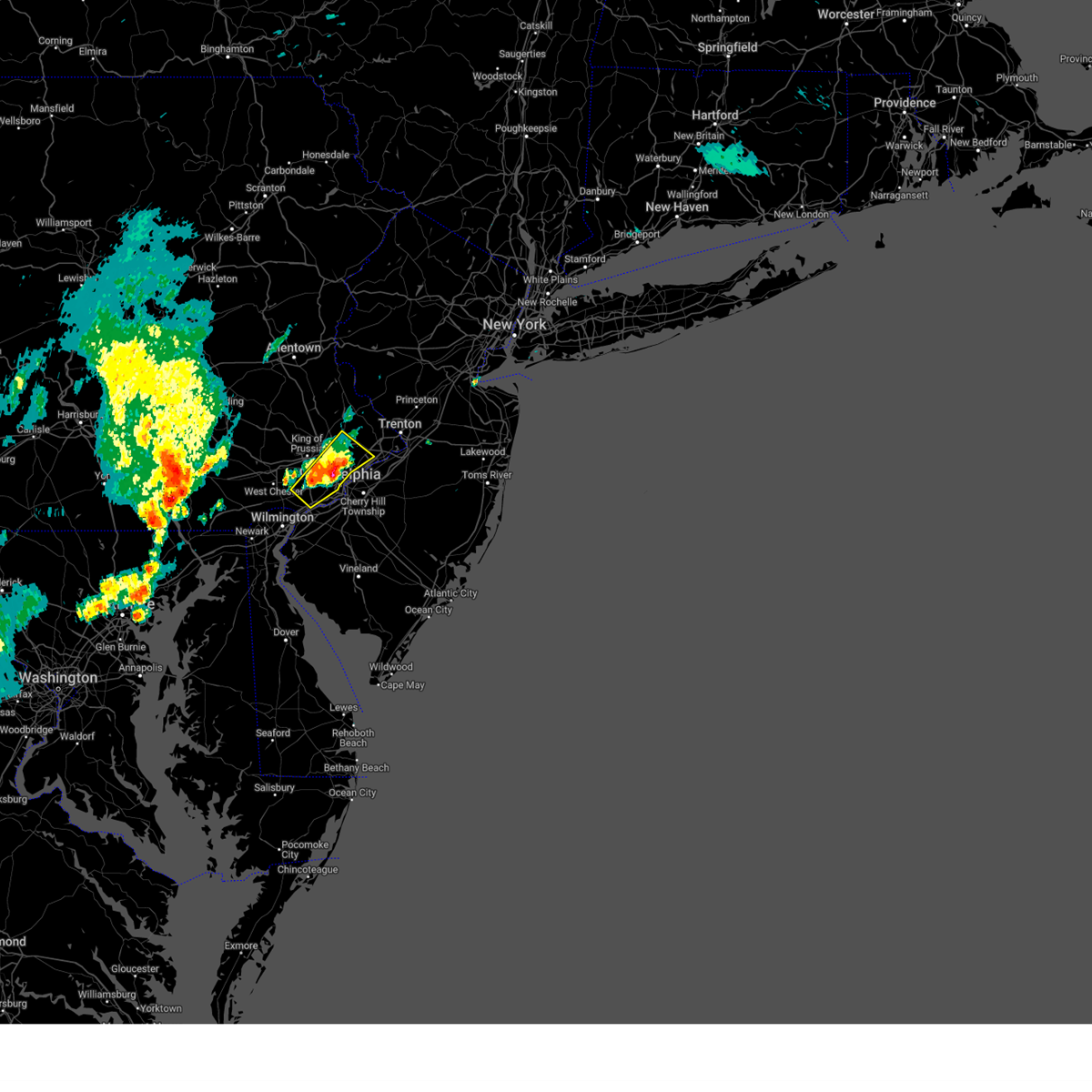
| 7/8/2025 5:46 PM EDT |
 Svrphi the national weather service in mount holly nj has issued a * severe thunderstorm warning for, northwestern camden county in southern new jersey, northwestern gloucester county in southern new jersey, northwestern burlington county in southern new jersey, central philadelphia county in southeastern pennsylvania, southeastern delaware county in southeastern pennsylvania, * until 630 pm edt. * at 546 pm edt, a severe thunderstorm was located over chester, or 12 miles northeast of wilmington, moving east at 35 mph (radar indicated). Hazards include 60 mph wind gusts and penny size hail. damage to roofs, siding, trees, and power lines is possible Svrphi the national weather service in mount holly nj has issued a * severe thunderstorm warning for, northwestern camden county in southern new jersey, northwestern gloucester county in southern new jersey, northwestern burlington county in southern new jersey, central philadelphia county in southeastern pennsylvania, southeastern delaware county in southeastern pennsylvania, * until 630 pm edt. * at 546 pm edt, a severe thunderstorm was located over chester, or 12 miles northeast of wilmington, moving east at 35 mph (radar indicated). Hazards include 60 mph wind gusts and penny size hail. damage to roofs, siding, trees, and power lines is possible
|
| 6/30/2025 1:50 PM EDT |
 At 150 pm edt, a severe thunderstorm was located over greenville, or near wilmington, moving northeast at 10 mph (radar indicated). Hazards include 60 mph wind gusts. Damage to roofs, siding, trees, and power lines is possible. Locations impacted include, wilmington, west chester, chester, pennsville, yeadon, westtown, carneys point, swarthmore, elsmere, new castle, penns grove, east lansdowne, newport, arden, stanton, cheyney, talleyville, elam, chelsea, and gradyville. At 150 pm edt, a severe thunderstorm was located over greenville, or near wilmington, moving northeast at 10 mph (radar indicated). Hazards include 60 mph wind gusts. Damage to roofs, siding, trees, and power lines is possible. Locations impacted include, wilmington, west chester, chester, pennsville, yeadon, westtown, carneys point, swarthmore, elsmere, new castle, penns grove, east lansdowne, newport, arden, stanton, cheyney, talleyville, elam, chelsea, and gradyville.
|
| 6/30/2025 1:28 PM EDT |
 Svrphi the national weather service in mount holly nj has issued a * severe thunderstorm warning for, northern new castle county in northern delaware, northwestern salem county in southern new jersey, northwestern gloucester county in southern new jersey, southeastern chester county in southeastern pennsylvania, delaware county in southeastern pennsylvania, * until 215 pm edt. * at 128 pm edt, a severe thunderstorm was located over newport, or near wilmington, moving northeast at 20 mph (radar indicated). Hazards include 60 mph wind gusts. damage to roofs, siding, trees, and power lines is possible Svrphi the national weather service in mount holly nj has issued a * severe thunderstorm warning for, northern new castle county in northern delaware, northwestern salem county in southern new jersey, northwestern gloucester county in southern new jersey, southeastern chester county in southeastern pennsylvania, delaware county in southeastern pennsylvania, * until 215 pm edt. * at 128 pm edt, a severe thunderstorm was located over newport, or near wilmington, moving northeast at 20 mph (radar indicated). Hazards include 60 mph wind gusts. damage to roofs, siding, trees, and power lines is possible
|
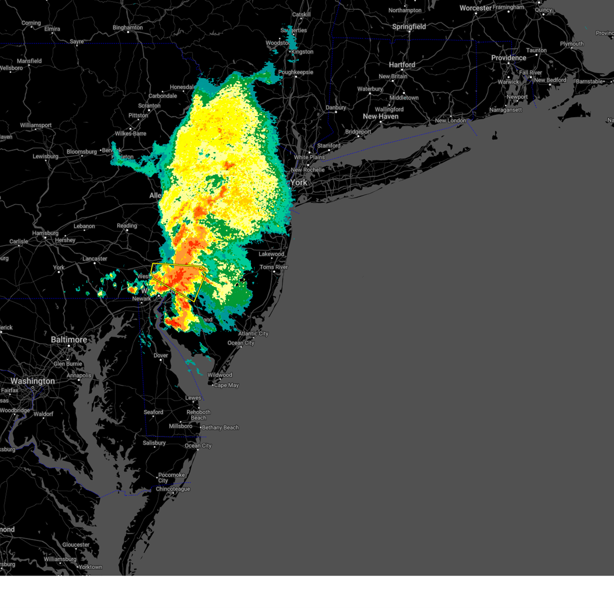
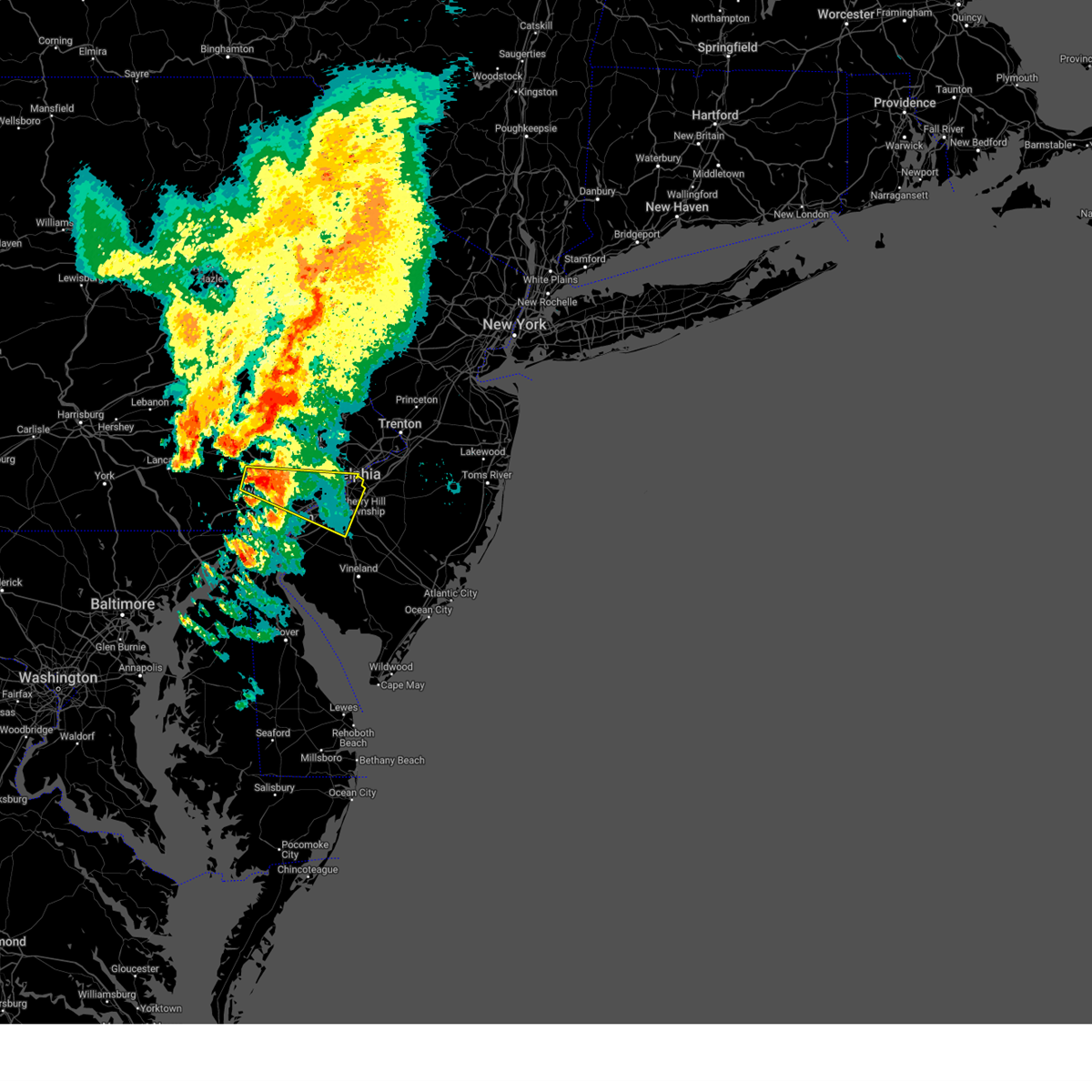
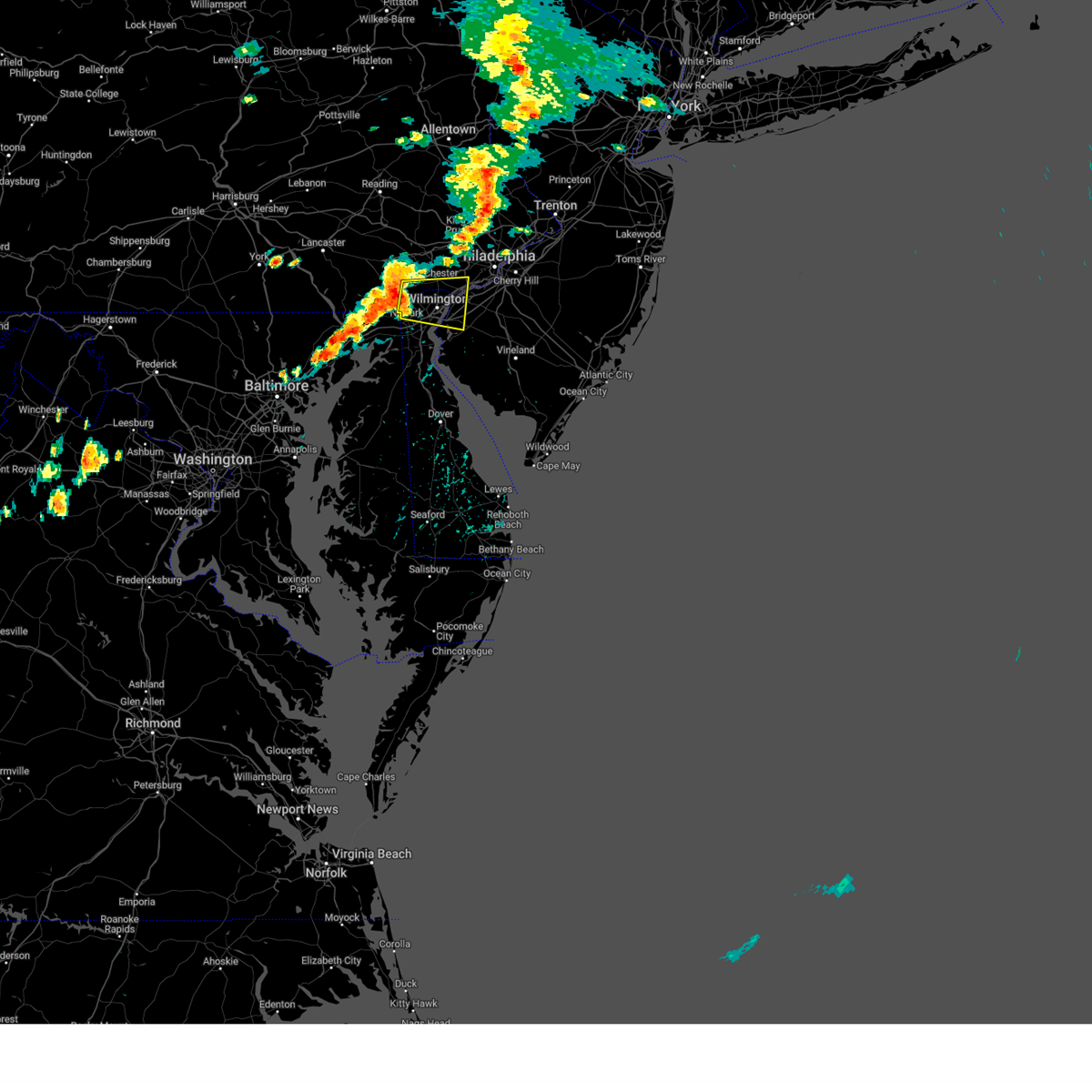
| 6/19/2025 5:23 PM EDT |
 Svrphi the national weather service in mount holly nj has issued a * severe thunderstorm warning for, northeastern new castle county in northern delaware, northwestern salem county in southern new jersey, northwestern camden county in southern new jersey, northwestern gloucester county in southern new jersey, northwestern burlington county in southern new jersey, central philadelphia county in southeastern pennsylvania, southeastern delaware county in southeastern pennsylvania, * until 615 pm edt. * at 523 pm edt, a severe thunderstorm was located near penns grove, or near wilmington, moving northeast at 55 mph (radar indicated). Hazards include 60 mph wind gusts and penny size hail. damage to roofs, siding, trees, and power lines is possible Svrphi the national weather service in mount holly nj has issued a * severe thunderstorm warning for, northeastern new castle county in northern delaware, northwestern salem county in southern new jersey, northwestern camden county in southern new jersey, northwestern gloucester county in southern new jersey, northwestern burlington county in southern new jersey, central philadelphia county in southeastern pennsylvania, southeastern delaware county in southeastern pennsylvania, * until 615 pm edt. * at 523 pm edt, a severe thunderstorm was located near penns grove, or near wilmington, moving northeast at 55 mph (radar indicated). Hazards include 60 mph wind gusts and penny size hail. damage to roofs, siding, trees, and power lines is possible
|
| 6/19/2025 5:13 PM EDT |
 Svrphi the national weather service in mount holly nj has issued a * severe thunderstorm warning for, north central new castle county in northern delaware, northwestern burlington county in southern new jersey, southeastern montgomery county in southeastern pennsylvania, south central bucks county in southeastern pennsylvania, southeastern chester county in southeastern pennsylvania, philadelphia county in southeastern pennsylvania, delaware county in southeastern pennsylvania, * until 600 pm edt. * at 513 pm edt, a severe thunderstorm was located over westtown, or over west chester, moving northeast at 55 mph (radar indicated). Hazards include 70 mph wind gusts and quarter size hail. Minor damage to vehicles is possible. expect considerable tree damage. Wind damage is also likely to mobile homes, roofs, and outbuildings. Svrphi the national weather service in mount holly nj has issued a * severe thunderstorm warning for, north central new castle county in northern delaware, northwestern burlington county in southern new jersey, southeastern montgomery county in southeastern pennsylvania, south central bucks county in southeastern pennsylvania, southeastern chester county in southeastern pennsylvania, philadelphia county in southeastern pennsylvania, delaware county in southeastern pennsylvania, * until 600 pm edt. * at 513 pm edt, a severe thunderstorm was located over westtown, or over west chester, moving northeast at 55 mph (radar indicated). Hazards include 70 mph wind gusts and quarter size hail. Minor damage to vehicles is possible. expect considerable tree damage. Wind damage is also likely to mobile homes, roofs, and outbuildings.
|
| 5/16/2025 12:07 PM EDT |
 The storm which prompted the warning has weakened below severe limits, and no longer poses an immediate threat to life or property. therefore, the warning will be allowed to expire. however gusty winds and heavy rainfall leading to flash flooding are still possible with this thunderstorm. a flash flood warning remains in effect until 330 pm edt for much of this area. a severe thunderstorm watch remains in effect until 500 pm edt for southern new jersey, and southeastern pennsylvania. to report severe weather, contact your nearest law enforcement agency. they will relay your report to the national weather service mount holly nj. The storm which prompted the warning has weakened below severe limits, and no longer poses an immediate threat to life or property. therefore, the warning will be allowed to expire. however gusty winds and heavy rainfall leading to flash flooding are still possible with this thunderstorm. a flash flood warning remains in effect until 330 pm edt for much of this area. a severe thunderstorm watch remains in effect until 500 pm edt for southern new jersey, and southeastern pennsylvania. to report severe weather, contact your nearest law enforcement agency. they will relay your report to the national weather service mount holly nj.
|
| 5/16/2025 11:34 AM EDT | At 1133 am edt, a severe thunderstorm was located over gradyville, or near west chester, moving east at 35 mph (radar indicated). Hazards include 60 mph wind gusts and quarter size hail. Minor damage to vehicles is possible. wind damage to roofs, siding, trees, and power lines is possible. Locations impacted include, philadelphia, camden, west chester, gloucester city, chester, deptford, west deptford, glassboro, bellmawr, yeadon, westtown, woodbury, pitman, palmyra, folcroft, swarthmore, paulsboro, magnolia, westville, and narberth. |
| 5/16/2025 11:34 AM EDT | the severe thunderstorm warning has been cancelled and is no longer in effect |
| 5/16/2025 11:16 AM EDT |
 Svrphi the national weather service in mount holly nj has issued a * severe thunderstorm warning for, northeastern new castle county in northern delaware, northwestern camden county in southern new jersey, northwestern gloucester county in southern new jersey, southeastern montgomery county in southeastern pennsylvania, central chester county in southeastern pennsylvania, southwestern philadelphia county in southeastern pennsylvania, delaware county in southeastern pennsylvania, * until 1215 pm edt. * at 1116 am edt, a severe thunderstorm was located over marshallton, or near west chester, moving east at 35 mph (radar indicated). Hazards include 60 mph wind gusts and quarter size hail. Minor damage to vehicles is possible. Wind damage to roofs, siding, trees, and power lines is possible. Svrphi the national weather service in mount holly nj has issued a * severe thunderstorm warning for, northeastern new castle county in northern delaware, northwestern camden county in southern new jersey, northwestern gloucester county in southern new jersey, southeastern montgomery county in southeastern pennsylvania, central chester county in southeastern pennsylvania, southwestern philadelphia county in southeastern pennsylvania, delaware county in southeastern pennsylvania, * until 1215 pm edt. * at 1116 am edt, a severe thunderstorm was located over marshallton, or near west chester, moving east at 35 mph (radar indicated). Hazards include 60 mph wind gusts and quarter size hail. Minor damage to vehicles is possible. Wind damage to roofs, siding, trees, and power lines is possible.
|
| 5/3/2025 8:11 PM EDT |
 The storm which prompted the warning has moved out of the area. therefore, the warning will be allowed to expire. however gusty winds are still possible with this thunderstorm. a severe thunderstorm watch remains in effect until 1100 pm edt for southeastern pennsylvania. a new severe thunderstorm warning still remains in effect for philadelphia, bucks, and montgomery county until 900 pm edt. The storm which prompted the warning has moved out of the area. therefore, the warning will be allowed to expire. however gusty winds are still possible with this thunderstorm. a severe thunderstorm watch remains in effect until 1100 pm edt for southeastern pennsylvania. a new severe thunderstorm warning still remains in effect for philadelphia, bucks, and montgomery county until 900 pm edt.
|
| 5/3/2025 7:51 PM EDT |
 At 751 pm edt, a severe thunderstorm was located over drexel hill, or 12 miles southwest of philadelphia, moving northeast at 15 mph (radar indicated). Hazards include 60 mph wind gusts and quarter size hail. Minor damage to vehicles is possible. wind damage to roofs, siding, trees, and power lines is possible. locations impacted include, clifton heights, collingdale, darby township, abington, eddystone, rockledge, morris park, fort washington, maple glen, hatboro, bryn mawr, flourtown, brookhaven, trout lake, radnor township, prospect park, aldan, ridley park, gradyville, and penn wynne. this includes the following highways, pennsylvania turnpike between mile markers 334 and 348. interstate 95 in pennsylvania between mile markers 5 and 9. interstate 76 in pennsylvania between mile markers 331 and 347. interstate 676 in pennsylvania between mile markers 0 and 1. Interstate 476 in pennsylvania between mile markers 0 and 17, and near mile marker 19. At 751 pm edt, a severe thunderstorm was located over drexel hill, or 12 miles southwest of philadelphia, moving northeast at 15 mph (radar indicated). Hazards include 60 mph wind gusts and quarter size hail. Minor damage to vehicles is possible. wind damage to roofs, siding, trees, and power lines is possible. locations impacted include, clifton heights, collingdale, darby township, abington, eddystone, rockledge, morris park, fort washington, maple glen, hatboro, bryn mawr, flourtown, brookhaven, trout lake, radnor township, prospect park, aldan, ridley park, gradyville, and penn wynne. this includes the following highways, pennsylvania turnpike between mile markers 334 and 348. interstate 95 in pennsylvania between mile markers 5 and 9. interstate 76 in pennsylvania between mile markers 331 and 347. interstate 676 in pennsylvania between mile markers 0 and 1. Interstate 476 in pennsylvania between mile markers 0 and 17, and near mile marker 19.
|
| 5/3/2025 7:34 PM EDT |
 Svrphi the national weather service in mount holly nj has issued a * severe thunderstorm warning for, southeastern montgomery county in southeastern pennsylvania, south central bucks county in southeastern pennsylvania, philadelphia county in southeastern pennsylvania, delaware county in southeastern pennsylvania, * until 815 pm edt. * at 734 pm edt, a severe thunderstorm was located over nether providence township, or 13 miles east of west chester, moving northeast at 25 mph (radar indicated). Hazards include 60 mph wind gusts and quarter size hail. Minor damage to vehicles is possible. Wind damage to roofs, siding, trees, and power lines is possible. Svrphi the national weather service in mount holly nj has issued a * severe thunderstorm warning for, southeastern montgomery county in southeastern pennsylvania, south central bucks county in southeastern pennsylvania, philadelphia county in southeastern pennsylvania, delaware county in southeastern pennsylvania, * until 815 pm edt. * at 734 pm edt, a severe thunderstorm was located over nether providence township, or 13 miles east of west chester, moving northeast at 25 mph (radar indicated). Hazards include 60 mph wind gusts and quarter size hail. Minor damage to vehicles is possible. Wind damage to roofs, siding, trees, and power lines is possible.
|
| 4/4/2025 4:51 AM EDT |
 At 450 am edt, a severe thunderstorm was located over swarthmore, or 11 miles west of gloucester city, moving east at 55 mph (radar indicated). Hazards include 60 mph wind gusts and quarter size hail. Minor damage to vehicles is possible. wind damage to roofs, siding, trees, and power lines is possible. locations impacted include, oak valley, merchantville, trainer, eddystone, village green-green ridge, collingswood, chesilhurst, golden triangle, pine hill, prospect park, camden, broomall, haddonfield, magnolia, gloucester city, mount ephraim, chester, chester township, rutledge, and clementon. this includes the following highways, new jersey turnpike between exits 3 and 4. interstate 95 in pennsylvania between mile markers 1 and 25. interstate 76 in pennsylvania between mile markers 341 and 351. interstate 76 in new jersey between mile markers 0 and 3. interstate 295 in new jersey between mile markers 12 and 42. interstate 676 in pennsylvania between mile markers 0 and 1. interstate 676 in new jersey between mile markers 0 and 4. interstate 476 in pennsylvania between mile markers 0 and 11. Atlantic city expressway between mile markers 31 and 44. At 450 am edt, a severe thunderstorm was located over swarthmore, or 11 miles west of gloucester city, moving east at 55 mph (radar indicated). Hazards include 60 mph wind gusts and quarter size hail. Minor damage to vehicles is possible. wind damage to roofs, siding, trees, and power lines is possible. locations impacted include, oak valley, merchantville, trainer, eddystone, village green-green ridge, collingswood, chesilhurst, golden triangle, pine hill, prospect park, camden, broomall, haddonfield, magnolia, gloucester city, mount ephraim, chester, chester township, rutledge, and clementon. this includes the following highways, new jersey turnpike between exits 3 and 4. interstate 95 in pennsylvania between mile markers 1 and 25. interstate 76 in pennsylvania between mile markers 341 and 351. interstate 76 in new jersey between mile markers 0 and 3. interstate 295 in new jersey between mile markers 12 and 42. interstate 676 in pennsylvania between mile markers 0 and 1. interstate 676 in new jersey between mile markers 0 and 4. interstate 476 in pennsylvania between mile markers 0 and 11. Atlantic city expressway between mile markers 31 and 44.
|
| 4/4/2025 4:51 AM EDT |
 the severe thunderstorm warning has been cancelled and is no longer in effect the severe thunderstorm warning has been cancelled and is no longer in effect
|
| 4/4/2025 4:40 AM EDT |
 Svrphi the national weather service in mount holly nj has issued a * severe thunderstorm warning for, northeastern new castle county in northern delaware, northwestern salem county in southern new jersey, camden county in southern new jersey, gloucester county in southern new jersey, west central burlington county in southern new jersey, southeastern montgomery county in southeastern pennsylvania, southeastern chester county in southeastern pennsylvania, southwestern philadelphia county in southeastern pennsylvania, delaware county in southeastern pennsylvania, * until 530 am edt. * at 439 am edt, a severe thunderstorm was located over concordville, or near west chester, moving east at 55 mph (radar indicated). Hazards include 60 mph wind gusts and quarter size hail. Minor damage to vehicles is possible. Wind damage to roofs, siding, trees, and power lines is possible. Svrphi the national weather service in mount holly nj has issued a * severe thunderstorm warning for, northeastern new castle county in northern delaware, northwestern salem county in southern new jersey, camden county in southern new jersey, gloucester county in southern new jersey, west central burlington county in southern new jersey, southeastern montgomery county in southeastern pennsylvania, southeastern chester county in southeastern pennsylvania, southwestern philadelphia county in southeastern pennsylvania, delaware county in southeastern pennsylvania, * until 530 am edt. * at 439 am edt, a severe thunderstorm was located over concordville, or near west chester, moving east at 55 mph (radar indicated). Hazards include 60 mph wind gusts and quarter size hail. Minor damage to vehicles is possible. Wind damage to roofs, siding, trees, and power lines is possible.
|
| 8/3/2024 6:40 PM EDT |
 At 640 pm edt, severe thunderstorms were located along a line extending from tacony to woodbury heights to woodstown, moving east at 45 mph (radar indicated). Hazards include 60 mph wind gusts and quarter size hail. Minor damage to vehicles is possible. wind damage to roofs, siding, trees, and power lines is possible. locations impacted include, philadelphia, camden, gloucester city, cherry hill, bensalem, evesham, mount laurel, chester, willingboro, deptford, voorhees, medford, west deptford, glassboro, lindenwold, pennsville, lumberton, florence, bellmawr, and yeadon. this includes the following highways, new jersey turnpike between exits 1 and 7a. pennsylvania turnpike between mile markers 356 and 359. interstate 95 in pennsylvania between mile markers 4 and 40. interstate 76 in pennsylvania between mile markers 335 and 351. interstate 76 in new jersey between mile markers 0 and 3. interstate 295 in new jersey between mile markers 0 and 57. interstate 676 in pennsylvania between mile markers 0 and 1. interstate 676 in new jersey between mile markers 0 and 4. interstate 476 in pennsylvania between mile markers 0 and 10. Atlantic city expressway between mile markers 33 and 44. At 640 pm edt, severe thunderstorms were located along a line extending from tacony to woodbury heights to woodstown, moving east at 45 mph (radar indicated). Hazards include 60 mph wind gusts and quarter size hail. Minor damage to vehicles is possible. wind damage to roofs, siding, trees, and power lines is possible. locations impacted include, philadelphia, camden, gloucester city, cherry hill, bensalem, evesham, mount laurel, chester, willingboro, deptford, voorhees, medford, west deptford, glassboro, lindenwold, pennsville, lumberton, florence, bellmawr, and yeadon. this includes the following highways, new jersey turnpike between exits 1 and 7a. pennsylvania turnpike between mile markers 356 and 359. interstate 95 in pennsylvania between mile markers 4 and 40. interstate 76 in pennsylvania between mile markers 335 and 351. interstate 76 in new jersey between mile markers 0 and 3. interstate 295 in new jersey between mile markers 0 and 57. interstate 676 in pennsylvania between mile markers 0 and 1. interstate 676 in new jersey between mile markers 0 and 4. interstate 476 in pennsylvania between mile markers 0 and 10. Atlantic city expressway between mile markers 33 and 44.
|
| 8/3/2024 6:16 PM EDT |
 Svrphi the national weather service in mount holly nj has issued a * severe thunderstorm warning for, northern salem county in southern new jersey, camden county in southern new jersey, gloucester county in southern new jersey, northwestern burlington county in southern new jersey, southeastern montgomery county in southeastern pennsylvania, southeastern bucks county in southeastern pennsylvania, philadelphia county in southeastern pennsylvania, delaware county in southeastern pennsylvania, * until 715 pm edt. * at 616 pm edt, severe thunderstorms were located along a line extending from newtown square to chester township to newport, moving east at 40 mph (radar indicated). Hazards include 60 mph wind gusts and quarter size hail. Minor damage to vehicles is possible. Wind damage to roofs, siding, trees, and power lines is possible. Svrphi the national weather service in mount holly nj has issued a * severe thunderstorm warning for, northern salem county in southern new jersey, camden county in southern new jersey, gloucester county in southern new jersey, northwestern burlington county in southern new jersey, southeastern montgomery county in southeastern pennsylvania, southeastern bucks county in southeastern pennsylvania, philadelphia county in southeastern pennsylvania, delaware county in southeastern pennsylvania, * until 715 pm edt. * at 616 pm edt, severe thunderstorms were located along a line extending from newtown square to chester township to newport, moving east at 40 mph (radar indicated). Hazards include 60 mph wind gusts and quarter size hail. Minor damage to vehicles is possible. Wind damage to roofs, siding, trees, and power lines is possible.
|
| 8/2/2024 9:12 PM EDT |
 Svrphi the national weather service in mount holly nj has issued a * severe thunderstorm warning for, northeastern new castle county in northern delaware, northwestern salem county in southern new jersey, northwestern camden county in southern new jersey, northwestern gloucester county in southern new jersey, southwestern philadelphia county in southeastern pennsylvania, southeastern delaware county in southeastern pennsylvania, * until 1000 pm edt. * at 912 pm edt, a severe thunderstorm was located over wilmington, moving northeast at 25 mph (radar indicated). Hazards include 60 mph wind gusts. damage to roofs, siding, trees, and power lines is possible Svrphi the national weather service in mount holly nj has issued a * severe thunderstorm warning for, northeastern new castle county in northern delaware, northwestern salem county in southern new jersey, northwestern camden county in southern new jersey, northwestern gloucester county in southern new jersey, southwestern philadelphia county in southeastern pennsylvania, southeastern delaware county in southeastern pennsylvania, * until 1000 pm edt. * at 912 pm edt, a severe thunderstorm was located over wilmington, moving northeast at 25 mph (radar indicated). Hazards include 60 mph wind gusts. damage to roofs, siding, trees, and power lines is possible
|
| 8/2/2024 4:56 PM EDT |
 the severe thunderstorm warning has been cancelled and is no longer in effect the severe thunderstorm warning has been cancelled and is no longer in effect
|
| 8/2/2024 4:32 PM EDT |
 Svrphi the national weather service in mount holly nj has issued a * severe thunderstorm warning for, northern new castle county in northern delaware, northwestern salem county in southern new jersey, northwestern gloucester county in southern new jersey, south central chester county in southeastern pennsylvania, southwestern delaware county in southeastern pennsylvania, * until 515 pm edt. * at 432 pm edt, a severe thunderstorm was located over landenberg, or 8 miles north of newark, moving east at 20 mph (radar indicated). Hazards include 60 mph wind gusts. damage to roofs, siding, trees, and power lines is possible Svrphi the national weather service in mount holly nj has issued a * severe thunderstorm warning for, northern new castle county in northern delaware, northwestern salem county in southern new jersey, northwestern gloucester county in southern new jersey, south central chester county in southeastern pennsylvania, southwestern delaware county in southeastern pennsylvania, * until 515 pm edt. * at 432 pm edt, a severe thunderstorm was located over landenberg, or 8 miles north of newark, moving east at 20 mph (radar indicated). Hazards include 60 mph wind gusts. damage to roofs, siding, trees, and power lines is possible
|
| 7/17/2024 3:44 PM EDT |
 the severe thunderstorm warning has been cancelled and is no longer in effect the severe thunderstorm warning has been cancelled and is no longer in effect
|
| 7/17/2024 3:35 PM EDT |
 At 335 pm edt, a severe thunderstorm was located over chestnut hill, or near philadelphia, moving east at 35 mph (trained weather spotters). Hazards include 60 mph wind gusts and quarter size hail. Minor damage to vehicles is possible. wind damage to roofs, siding, trees, and power lines is possible. locations impacted include, philadelphia, camden, gloucester city, cherry hill, bensalem, evesham, mount laurel, norristown, chester, voorhees, lindenwold, lansdale, west norriton, east norriton, bellmawr, yeadon, woodbury, riverside, conshohocken, and palmyra. this includes the following highways, new jersey turnpike between exits 3 and 4. pennsylvania turnpike between mile markers 320 and 354. northeast extension between mile markers 21 and 29. interstate 95 in pennsylvania between mile markers 6 and 38. interstate 76 in pennsylvania between mile markers 327 and 351. interstate 76 in new jersey between mile markers 0 and 3. interstate 295 in new jersey between mile markers 22 and 41. interstate 676 in pennsylvania between mile markers 0 and 1. interstate 676 in new jersey between mile markers 0 and 4. Interstate 476 in pennsylvania between mile markers 0 and 19. At 335 pm edt, a severe thunderstorm was located over chestnut hill, or near philadelphia, moving east at 35 mph (trained weather spotters). Hazards include 60 mph wind gusts and quarter size hail. Minor damage to vehicles is possible. wind damage to roofs, siding, trees, and power lines is possible. locations impacted include, philadelphia, camden, gloucester city, cherry hill, bensalem, evesham, mount laurel, norristown, chester, voorhees, lindenwold, lansdale, west norriton, east norriton, bellmawr, yeadon, woodbury, riverside, conshohocken, and palmyra. this includes the following highways, new jersey turnpike between exits 3 and 4. pennsylvania turnpike between mile markers 320 and 354. northeast extension between mile markers 21 and 29. interstate 95 in pennsylvania between mile markers 6 and 38. interstate 76 in pennsylvania between mile markers 327 and 351. interstate 76 in new jersey between mile markers 0 and 3. interstate 295 in new jersey between mile markers 22 and 41. interstate 676 in pennsylvania between mile markers 0 and 1. interstate 676 in new jersey between mile markers 0 and 4. Interstate 476 in pennsylvania between mile markers 0 and 19.
|
| 7/17/2024 3:22 PM EDT |
 At 321 pm edt, a severe thunderstorm was located over king of prussia, or 12 miles northwest of philadelphia, moving east at 35 mph. this storm has a history of producing wind damage in chester county (trained weather spotters). Hazards include 60 mph wind gusts and quarter size hail. Minor damage to vehicles is possible. wind damage to roofs, siding, trees, and power lines is possible. locations impacted include, philadelphia, camden, west chester, gloucester city, cherry hill, bensalem, evesham, mount laurel, norristown, chester, voorhees, lindenwold, phoenixville, lansdale, west norriton, east norriton, bellmawr, yeadon, westtown, and woodbury. this includes the following highways, new jersey turnpike between exits 3 and 4. pennsylvania turnpike between mile markers 313 and 354. northeast extension between mile markers 21 and 30. interstate 95 in pennsylvania between mile markers 6 and 38. interstate 76 in pennsylvania between mile markers 327 and 351. interstate 76 in new jersey between mile markers 0 and 3. interstate 295 in new jersey between mile markers 21 and 41. interstate 676 in pennsylvania between mile markers 0 and 1. interstate 676 in new jersey between mile markers 0 and 4. Interstate 476 in pennsylvania between mile markers 0 and 19. At 321 pm edt, a severe thunderstorm was located over king of prussia, or 12 miles northwest of philadelphia, moving east at 35 mph. this storm has a history of producing wind damage in chester county (trained weather spotters). Hazards include 60 mph wind gusts and quarter size hail. Minor damage to vehicles is possible. wind damage to roofs, siding, trees, and power lines is possible. locations impacted include, philadelphia, camden, west chester, gloucester city, cherry hill, bensalem, evesham, mount laurel, norristown, chester, voorhees, lindenwold, phoenixville, lansdale, west norriton, east norriton, bellmawr, yeadon, westtown, and woodbury. this includes the following highways, new jersey turnpike between exits 3 and 4. pennsylvania turnpike between mile markers 313 and 354. northeast extension between mile markers 21 and 30. interstate 95 in pennsylvania between mile markers 6 and 38. interstate 76 in pennsylvania between mile markers 327 and 351. interstate 76 in new jersey between mile markers 0 and 3. interstate 295 in new jersey between mile markers 21 and 41. interstate 676 in pennsylvania between mile markers 0 and 1. interstate 676 in new jersey between mile markers 0 and 4. Interstate 476 in pennsylvania between mile markers 0 and 19.
|
| 7/17/2024 3:05 PM EDT |
 Svrphi the national weather service in mount holly nj has issued a * severe thunderstorm warning for, northwestern camden county in southern new jersey, north central gloucester county in southern new jersey, northwestern burlington county in southern new jersey, southern montgomery county in southeastern pennsylvania, south central bucks county in southeastern pennsylvania, northeastern chester county in southeastern pennsylvania, philadelphia county in southeastern pennsylvania, delaware county in southeastern pennsylvania, * until 400 pm edt. * at 305 pm edt, a severe thunderstorm was located near paoli, or 8 miles northeast of west chester, moving east at 35 mph (radar indicated). Hazards include 60 mph wind gusts and quarter size hail. Minor damage to vehicles is possible. Wind damage to roofs, siding, trees, and power lines is possible. Svrphi the national weather service in mount holly nj has issued a * severe thunderstorm warning for, northwestern camden county in southern new jersey, north central gloucester county in southern new jersey, northwestern burlington county in southern new jersey, southern montgomery county in southeastern pennsylvania, south central bucks county in southeastern pennsylvania, northeastern chester county in southeastern pennsylvania, philadelphia county in southeastern pennsylvania, delaware county in southeastern pennsylvania, * until 400 pm edt. * at 305 pm edt, a severe thunderstorm was located near paoli, or 8 miles northeast of west chester, moving east at 35 mph (radar indicated). Hazards include 60 mph wind gusts and quarter size hail. Minor damage to vehicles is possible. Wind damage to roofs, siding, trees, and power lines is possible.
|
| 7/16/2024 9:28 PM EDT |
 The storms which prompted the warning have moved out of the area into new jersey and delaware. therefore, the warning will be allowed to expire. a severe thunderstorm watch remains in effect until 1000 pm edt for northern delaware, southern and central new jersey, and southeastern pennsylvania. to report severe weather, contact your nearest law enforcement agency. they will relay your report to the national weather service mount holly nj. The storms which prompted the warning have moved out of the area into new jersey and delaware. therefore, the warning will be allowed to expire. a severe thunderstorm watch remains in effect until 1000 pm edt for northern delaware, southern and central new jersey, and southeastern pennsylvania. to report severe weather, contact your nearest law enforcement agency. they will relay your report to the national weather service mount holly nj.
|
| 7/16/2024 9:08 PM EDT |
 At 908 pm edt, severe thunderstorms were located along a line extending from burlington to paulsboro to near elsmere, moving east at 45 mph (radar indicated). Hazards include 60 mph wind gusts and quarter size hail. Minor damage to vehicles is possible. wind damage to roofs, siding, trees, and power lines is possible. locations impacted include, philadelphia, trenton, camden, wilmington, newark, bensalem, ewing, chester, pennsville, yeadon, bristol, carneys point, folcroft, swarthmore, elsmere, new castle, penns grove, jenkintown, narberth, and national park. this includes the following highways, pennsylvania turnpike between mile markers 344 and 358. interstate 95 in pennsylvania between mile markers 0 and 40. interstate 95 in delaware between mile markers 0 and 23. interstate 76 in pennsylvania between mile markers 334 and 351. interstate 195 in new jersey between mile markers 0 and 3. interstate 295 in new jersey near mile marker 0, and between mile markers 59 and 64. interstate 676 in pennsylvania between mile markers 0 and 1. Interstate 476 in pennsylvania between mile markers 0 and 13. At 908 pm edt, severe thunderstorms were located along a line extending from burlington to paulsboro to near elsmere, moving east at 45 mph (radar indicated). Hazards include 60 mph wind gusts and quarter size hail. Minor damage to vehicles is possible. wind damage to roofs, siding, trees, and power lines is possible. locations impacted include, philadelphia, trenton, camden, wilmington, newark, bensalem, ewing, chester, pennsville, yeadon, bristol, carneys point, folcroft, swarthmore, elsmere, new castle, penns grove, jenkintown, narberth, and national park. this includes the following highways, pennsylvania turnpike between mile markers 344 and 358. interstate 95 in pennsylvania between mile markers 0 and 40. interstate 95 in delaware between mile markers 0 and 23. interstate 76 in pennsylvania between mile markers 334 and 351. interstate 195 in new jersey between mile markers 0 and 3. interstate 295 in new jersey near mile marker 0, and between mile markers 59 and 64. interstate 676 in pennsylvania between mile markers 0 and 1. Interstate 476 in pennsylvania between mile markers 0 and 13.
|
| 7/16/2024 8:29 PM EDT |
 At 828 pm edt, severe thunderstorms were located along a line extending from norristown to marshallton to near homeville, moving east at 25 mph. these storms have a history of producing extensive damage to trees and power lines in chester county (radar indicated. at 8:16 pm edt, emergency management reported numerous trees and wires down across western chester county). Hazards include 60 mph wind gusts and quarter size hail. Minor damage to vehicles is possible. wind damage to roofs, siding, trees, and power lines is possible. locations impacted include, philadelphia, trenton, camden, wilmington, newark, bensalem, ewing, chester, pennsville, yeadon, bristol, carneys point, conshohocken, hatboro, folcroft, ambler, swarthmore, elsmere, new castle, and penns grove. this includes the following highways, pennsylvania turnpike between mile markers 332 and 358. northeast extension between mile markers 21 and 22. interstate 95 in pennsylvania between mile markers 0 and 40. interstate 95 in delaware between mile markers 0 and 23. interstate 76 in pennsylvania between mile markers 330 and 351. interstate 195 in new jersey between mile markers 0 and 3. interstate 295 in new jersey near mile marker 0, and between mile markers 59 and 64. interstate 676 in pennsylvania between mile markers 0 and 1. Interstate 476 in pennsylvania between mile markers 0 and 19. At 828 pm edt, severe thunderstorms were located along a line extending from norristown to marshallton to near homeville, moving east at 25 mph. these storms have a history of producing extensive damage to trees and power lines in chester county (radar indicated. at 8:16 pm edt, emergency management reported numerous trees and wires down across western chester county). Hazards include 60 mph wind gusts and quarter size hail. Minor damage to vehicles is possible. wind damage to roofs, siding, trees, and power lines is possible. locations impacted include, philadelphia, trenton, camden, wilmington, newark, bensalem, ewing, chester, pennsville, yeadon, bristol, carneys point, conshohocken, hatboro, folcroft, ambler, swarthmore, elsmere, new castle, and penns grove. this includes the following highways, pennsylvania turnpike between mile markers 332 and 358. northeast extension between mile markers 21 and 22. interstate 95 in pennsylvania between mile markers 0 and 40. interstate 95 in delaware between mile markers 0 and 23. interstate 76 in pennsylvania between mile markers 330 and 351. interstate 195 in new jersey between mile markers 0 and 3. interstate 295 in new jersey near mile marker 0, and between mile markers 59 and 64. interstate 676 in pennsylvania between mile markers 0 and 1. Interstate 476 in pennsylvania between mile markers 0 and 19.
|
| 7/16/2024 8:23 PM EDT |
 Svrphi the national weather service in mount holly nj has issued a * severe thunderstorm warning for, northern new castle county in northern delaware, northwestern salem county in southern new jersey, southwestern mercer county in central new jersey, southeastern montgomery county in southeastern pennsylvania, southeastern bucks county in southeastern pennsylvania, philadelphia county in southeastern pennsylvania, delaware county in southeastern pennsylvania, * until 930 pm edt. * at 823 pm edt, severe thunderstorms were located along a line extending from lansdale to king of prussia to near west grove, moving east at 30 mph (radar indicated). Hazards include 60 mph wind gusts and quarter size hail. Minor damage to vehicles is possible. Wind damage to roofs, siding, trees, and power lines is possible. Svrphi the national weather service in mount holly nj has issued a * severe thunderstorm warning for, northern new castle county in northern delaware, northwestern salem county in southern new jersey, southwestern mercer county in central new jersey, southeastern montgomery county in southeastern pennsylvania, southeastern bucks county in southeastern pennsylvania, philadelphia county in southeastern pennsylvania, delaware county in southeastern pennsylvania, * until 930 pm edt. * at 823 pm edt, severe thunderstorms were located along a line extending from lansdale to king of prussia to near west grove, moving east at 30 mph (radar indicated). Hazards include 60 mph wind gusts and quarter size hail. Minor damage to vehicles is possible. Wind damage to roofs, siding, trees, and power lines is possible.
|
| 7/14/2024 4:13 PM EDT |
 Svrphi the national weather service in mount holly nj has issued a * severe thunderstorm warning for, northwestern camden county in southern new jersey, northwestern gloucester county in southern new jersey, southwestern philadelphia county in southeastern pennsylvania, southeastern delaware county in southeastern pennsylvania, * until 500 pm edt. * at 413 pm edt, a severe thunderstorm was located over darby township, or 7 miles west of gloucester city, moving east at 10 mph (radar indicated). Hazards include 60 mph wind gusts. damage to roofs, siding, trees, and power lines is possible Svrphi the national weather service in mount holly nj has issued a * severe thunderstorm warning for, northwestern camden county in southern new jersey, northwestern gloucester county in southern new jersey, southwestern philadelphia county in southeastern pennsylvania, southeastern delaware county in southeastern pennsylvania, * until 500 pm edt. * at 413 pm edt, a severe thunderstorm was located over darby township, or 7 miles west of gloucester city, moving east at 10 mph (radar indicated). Hazards include 60 mph wind gusts. damage to roofs, siding, trees, and power lines is possible
|
| 7/14/2024 3:21 PM EDT |
 The severe thunderstorm which prompted the warning has weakened. therefore, the warning will be allowed to expire. however gusty winds are still possible with this thunderstorm. to report severe weather, contact your nearest law enforcement agency. they will relay your report to the national weather service mount holly nj. remember, a severe thunderstorm warning still remains in effect for portions fo chester county. refer to that bulletin with the updated information. The severe thunderstorm which prompted the warning has weakened. therefore, the warning will be allowed to expire. however gusty winds are still possible with this thunderstorm. to report severe weather, contact your nearest law enforcement agency. they will relay your report to the national weather service mount holly nj. remember, a severe thunderstorm warning still remains in effect for portions fo chester county. refer to that bulletin with the updated information.
|
| 7/14/2024 3:14 PM EDT |
 the severe thunderstorm warning has been cancelled and is no longer in effect the severe thunderstorm warning has been cancelled and is no longer in effect
|
| 7/14/2024 3:14 PM EDT |
 At 314 pm edt, a severe thunderstorm was located near lionville-marchwood, or near west chester, moving southeast at 15 mph (radar indicated). Hazards include 60 mph wind gusts and penny size hail. Damage to roofs, siding, trees, and power lines is possible. locations impacted include, west chester, chester, phoenixville, yeadon, westtown, downingtown, folcroft, swarthmore, east lansdowne, darby township, cheyney, trout lake, chelsea, radnor township, gradyville, broomall, newtown square, chester township, drexel hill, and tinicum township. this includes the following highways, pennsylvania turnpike between mile markers 310 and 324. interstate 95 in pennsylvania between mile markers 1 and 11. Interstate 476 in pennsylvania between mile markers 0 and 12. At 314 pm edt, a severe thunderstorm was located near lionville-marchwood, or near west chester, moving southeast at 15 mph (radar indicated). Hazards include 60 mph wind gusts and penny size hail. Damage to roofs, siding, trees, and power lines is possible. locations impacted include, west chester, chester, phoenixville, yeadon, westtown, downingtown, folcroft, swarthmore, east lansdowne, darby township, cheyney, trout lake, chelsea, radnor township, gradyville, broomall, newtown square, chester township, drexel hill, and tinicum township. this includes the following highways, pennsylvania turnpike between mile markers 310 and 324. interstate 95 in pennsylvania between mile markers 1 and 11. Interstate 476 in pennsylvania between mile markers 0 and 12.
|
| 7/14/2024 2:52 PM EDT |
 Svrphi the national weather service in mount holly nj has issued a * severe thunderstorm warning for, south central montgomery county in southeastern pennsylvania, northeastern chester county in southeastern pennsylvania, delaware county in southeastern pennsylvania, * until 330 pm edt. * at 252 pm edt, a severe thunderstorm was located over chester springs, or 9 miles north of west chester, moving southeast at 25 mph (radar indicated). Hazards include 60 mph wind gusts and penny size hail. damage to roofs, siding, trees, and power lines is possible Svrphi the national weather service in mount holly nj has issued a * severe thunderstorm warning for, south central montgomery county in southeastern pennsylvania, northeastern chester county in southeastern pennsylvania, delaware county in southeastern pennsylvania, * until 330 pm edt. * at 252 pm edt, a severe thunderstorm was located over chester springs, or 9 miles north of west chester, moving southeast at 25 mph (radar indicated). Hazards include 60 mph wind gusts and penny size hail. damage to roofs, siding, trees, and power lines is possible
|
| 6/30/2024 5:53 PM EDT |
 The storm which prompted the warning has moved out of the area. therefore, the warning will be allowed to expire. however gusty winds are still possible with this thunderstorm. a severe thunderstorm watch remains in effect until 700 pm edt for northern delaware, southern new jersey, and southeastern pennsylvania. a new severe thunderstorm warning was issued for portions of new castle county, de and delaware county, pa. refer to to that bulletin for the updated information. The storm which prompted the warning has moved out of the area. therefore, the warning will be allowed to expire. however gusty winds are still possible with this thunderstorm. a severe thunderstorm watch remains in effect until 700 pm edt for northern delaware, southern new jersey, and southeastern pennsylvania. a new severe thunderstorm warning was issued for portions of new castle county, de and delaware county, pa. refer to to that bulletin for the updated information.
|
| 6/30/2024 5:51 PM EDT |
 Svrphi the national weather service in mount holly nj has issued a * severe thunderstorm warning for, northern new castle county in northern delaware, northwestern salem county in southern new jersey, northwestern camden county in southern new jersey, northwestern gloucester county in southern new jersey, west central burlington county in southern new jersey, southwestern philadelphia county in southeastern pennsylvania, southeastern delaware county in southeastern pennsylvania, * until 630 pm edt. * at 551 pm edt, severe thunderstorms were located along a line extending from camden to kemblesville, moving east at 25 mph (radar indicated). Hazards include 60 mph wind gusts and quarter size hail. Minor damage to vehicles is possible. Wind damage to roofs, siding, trees, and power lines is possible. Svrphi the national weather service in mount holly nj has issued a * severe thunderstorm warning for, northern new castle county in northern delaware, northwestern salem county in southern new jersey, northwestern camden county in southern new jersey, northwestern gloucester county in southern new jersey, west central burlington county in southern new jersey, southwestern philadelphia county in southeastern pennsylvania, southeastern delaware county in southeastern pennsylvania, * until 630 pm edt. * at 551 pm edt, severe thunderstorms were located along a line extending from camden to kemblesville, moving east at 25 mph (radar indicated). Hazards include 60 mph wind gusts and quarter size hail. Minor damage to vehicles is possible. Wind damage to roofs, siding, trees, and power lines is possible.
|
| 6/30/2024 5:20 PM EDT |
 Svrphi the national weather service in mount holly nj has issued a * severe thunderstorm warning for, northern new castle county in northern delaware, southern chester county in southeastern pennsylvania, delaware county in southeastern pennsylvania, * until 600 pm edt. * at 520 pm edt, a severe thunderstorm was located over west chester, moving east at 35 mph (radar indicated). Hazards include 60 mph wind gusts and quarter size hail. Minor damage to vehicles is possible. Wind damage to roofs, siding, trees, and power lines is possible. Svrphi the national weather service in mount holly nj has issued a * severe thunderstorm warning for, northern new castle county in northern delaware, southern chester county in southeastern pennsylvania, delaware county in southeastern pennsylvania, * until 600 pm edt. * at 520 pm edt, a severe thunderstorm was located over west chester, moving east at 35 mph (radar indicated). Hazards include 60 mph wind gusts and quarter size hail. Minor damage to vehicles is possible. Wind damage to roofs, siding, trees, and power lines is possible.
|
| 6/30/2024 4:43 PM EDT |
 At 443 pm edt, severe thunderstorms were located along a line extending from ambler to germantown to swarthmore, moving southeast at 35 mph (radar indicated). Hazards include 60 mph wind gusts. Damage to roofs, siding, trees, and power lines is possible. locations impacted include, philadelphia, camden, gloucester city, cherry hill, bensalem, evesham, mount laurel, chester, willingboro, deptford, voorhees, west deptford, lindenwold, lumberton, bellmawr, yeadon, woodbury, burlington, bristol, and mount holly. this includes the following highways, new jersey turnpike between exits 3 and 5. pennsylvania turnpike between mile markers 337 and 355. interstate 95 in pennsylvania between mile markers 6 and 40. interstate 76 in pennsylvania between mile markers 335 and 351. interstate 76 in new jersey between mile markers 0 and 3. interstate 295 in new jersey between mile markers 18 and 52. interstate 676 in pennsylvania between mile markers 0 and 1. interstate 676 in new jersey between mile markers 0 and 4. interstate 476 in pennsylvania between mile markers 0 and 10. Atlantic city expressway between mile markers 43 and 44. At 443 pm edt, severe thunderstorms were located along a line extending from ambler to germantown to swarthmore, moving southeast at 35 mph (radar indicated). Hazards include 60 mph wind gusts. Damage to roofs, siding, trees, and power lines is possible. locations impacted include, philadelphia, camden, gloucester city, cherry hill, bensalem, evesham, mount laurel, chester, willingboro, deptford, voorhees, west deptford, lindenwold, lumberton, bellmawr, yeadon, woodbury, burlington, bristol, and mount holly. this includes the following highways, new jersey turnpike between exits 3 and 5. pennsylvania turnpike between mile markers 337 and 355. interstate 95 in pennsylvania between mile markers 6 and 40. interstate 76 in pennsylvania between mile markers 335 and 351. interstate 76 in new jersey between mile markers 0 and 3. interstate 295 in new jersey between mile markers 18 and 52. interstate 676 in pennsylvania between mile markers 0 and 1. interstate 676 in new jersey between mile markers 0 and 4. interstate 476 in pennsylvania between mile markers 0 and 10. Atlantic city expressway between mile markers 43 and 44.
|
| 6/30/2024 4:37 PM EDT |
 the severe thunderstorm warning has been cancelled and is no longer in effect the severe thunderstorm warning has been cancelled and is no longer in effect
|
| 6/30/2024 4:37 PM EDT |
 At 436 pm edt, severe thunderstorms were located along a line extending from ambler to chestnut hill to near lima, moving southeast at 35 mph (radar indicated). Hazards include 60 mph wind gusts. Damage to roofs, siding, trees, and power lines is possible. locations impacted include, philadelphia, camden, gloucester city, cherry hill, bensalem, evesham, mount laurel, norristown, chester, willingboro, deptford, voorhees, west deptford, lindenwold, east norriton, lumberton, bellmawr, yeadon, woodbury, and burlington. this includes the following highways, new jersey turnpike between exits 3 and 5. pennsylvania turnpike between mile markers 329 and 356. northeast extension between mile markers 21 and 23. interstate 95 in pennsylvania between mile markers 6 and 40. interstate 76 in pennsylvania between mile markers 329 and 351. interstate 76 in new jersey between mile markers 0 and 3. interstate 295 in new jersey between mile markers 18 and 52. interstate 676 in pennsylvania between mile markers 0 and 1. interstate 676 in new jersey between mile markers 0 and 4. interstate 476 in pennsylvania between mile markers 0 and 19. Atlantic city expressway between mile markers 43 and 44. At 436 pm edt, severe thunderstorms were located along a line extending from ambler to chestnut hill to near lima, moving southeast at 35 mph (radar indicated). Hazards include 60 mph wind gusts. Damage to roofs, siding, trees, and power lines is possible. locations impacted include, philadelphia, camden, gloucester city, cherry hill, bensalem, evesham, mount laurel, norristown, chester, willingboro, deptford, voorhees, west deptford, lindenwold, east norriton, lumberton, bellmawr, yeadon, woodbury, and burlington. this includes the following highways, new jersey turnpike between exits 3 and 5. pennsylvania turnpike between mile markers 329 and 356. northeast extension between mile markers 21 and 23. interstate 95 in pennsylvania between mile markers 6 and 40. interstate 76 in pennsylvania between mile markers 329 and 351. interstate 76 in new jersey between mile markers 0 and 3. interstate 295 in new jersey between mile markers 18 and 52. interstate 676 in pennsylvania between mile markers 0 and 1. interstate 676 in new jersey between mile markers 0 and 4. interstate 476 in pennsylvania between mile markers 0 and 19. Atlantic city expressway between mile markers 43 and 44.
|
| 6/30/2024 4:25 PM EDT |
 Svrphi the national weather service in mount holly nj has issued a * severe thunderstorm warning for, northwestern camden county in southern new jersey, north central gloucester county in southern new jersey, northwestern burlington county in southern new jersey, southeastern montgomery county in southeastern pennsylvania, southern bucks county in southeastern pennsylvania, east central chester county in southeastern pennsylvania, philadelphia county in southeastern pennsylvania, delaware county in southeastern pennsylvania, * until 515 pm edt. * at 424 pm edt, severe thunderstorms were located along a line extending from souderton to norristown to near gradyville, moving southeast at 35 mph (radar indicated). Hazards include 60 mph wind gusts. damage to roofs, siding, trees, and power lines is possible Svrphi the national weather service in mount holly nj has issued a * severe thunderstorm warning for, northwestern camden county in southern new jersey, north central gloucester county in southern new jersey, northwestern burlington county in southern new jersey, southeastern montgomery county in southeastern pennsylvania, southern bucks county in southeastern pennsylvania, east central chester county in southeastern pennsylvania, philadelphia county in southeastern pennsylvania, delaware county in southeastern pennsylvania, * until 515 pm edt. * at 424 pm edt, severe thunderstorms were located along a line extending from souderton to norristown to near gradyville, moving southeast at 35 mph (radar indicated). Hazards include 60 mph wind gusts. damage to roofs, siding, trees, and power lines is possible
|
| 6/23/2024 9:22 PM EDT |
 The storm which prompted the warning has weakened below severe limits, and is exiting the warned area. therefore, the warning will be allowed to expire. however gusty winds and heavy rain are still possible with this thunderstorm. a severe thunderstorm watch remains in effect until 1000 pm edt for southern new jersey, and southeastern pennsylvania. to report severe weather, contact your nearest law enforcement agency. they will relay your report to the national weather service mount holly nj. The storm which prompted the warning has weakened below severe limits, and is exiting the warned area. therefore, the warning will be allowed to expire. however gusty winds and heavy rain are still possible with this thunderstorm. a severe thunderstorm watch remains in effect until 1000 pm edt for southern new jersey, and southeastern pennsylvania. to report severe weather, contact your nearest law enforcement agency. they will relay your report to the national weather service mount holly nj.
|
| 6/23/2024 9:14 PM EDT |
 At 914 pm edt, a severe thunderstorm was located near alloway, or 11 miles southeast of wilmington, moving northeast at 45 mph (radar indicated). Hazards include 60 mph wind gusts. Damage to roofs, siding, trees, and power lines is possible. locations impacted include, wilmington, chester, pennsville, carneys point, elsmere, new castle, penns grove, salem, woodstown, alloway, quinton, swedesboro, delaware city, elmer, newport, shiloh, arden, stanton, hancocks bridge, and port penn. this includes the following highways, new jersey turnpike near exit 1. interstate 95 in pennsylvania between mile markers 0 and 6. interstate 95 in delaware between mile markers 7 and 23. Interstate 295 in new jersey between mile markers 0 and 14. At 914 pm edt, a severe thunderstorm was located near alloway, or 11 miles southeast of wilmington, moving northeast at 45 mph (radar indicated). Hazards include 60 mph wind gusts. Damage to roofs, siding, trees, and power lines is possible. locations impacted include, wilmington, chester, pennsville, carneys point, elsmere, new castle, penns grove, salem, woodstown, alloway, quinton, swedesboro, delaware city, elmer, newport, shiloh, arden, stanton, hancocks bridge, and port penn. this includes the following highways, new jersey turnpike near exit 1. interstate 95 in pennsylvania between mile markers 0 and 6. interstate 95 in delaware between mile markers 7 and 23. Interstate 295 in new jersey between mile markers 0 and 14.
|
| 6/23/2024 9:01 PM EDT |
 At 901 pm edt, a severe thunderstorm was located over port penn, or 9 miles northeast of middletown, moving east at 45 mph (radar indicated). Hazards include 60 mph wind gusts. Damage to roofs, siding, trees, and power lines is possible. locations impacted include, wilmington, newark, middletown, chester, pennsville, carneys point, elsmere, new castle, penns grove, salem, woodstown, alloway, quinton, swedesboro, delaware city, elmer, newport, shiloh, arden, and stanton. this includes the following highways, new jersey turnpike near exit 1. interstate 95 in pennsylvania between mile markers 0 and 6. interstate 95 in delaware between mile markers 0 and 23. Interstate 295 in new jersey between mile markers 0 and 14. At 901 pm edt, a severe thunderstorm was located over port penn, or 9 miles northeast of middletown, moving east at 45 mph (radar indicated). Hazards include 60 mph wind gusts. Damage to roofs, siding, trees, and power lines is possible. locations impacted include, wilmington, newark, middletown, chester, pennsville, carneys point, elsmere, new castle, penns grove, salem, woodstown, alloway, quinton, swedesboro, delaware city, elmer, newport, shiloh, arden, and stanton. this includes the following highways, new jersey turnpike near exit 1. interstate 95 in pennsylvania between mile markers 0 and 6. interstate 95 in delaware between mile markers 0 and 23. Interstate 295 in new jersey between mile markers 0 and 14.
|
| 6/23/2024 8:42 PM EDT |
 Svrphi the national weather service in mount holly nj has issued a * severe thunderstorm warning for, new castle county in northern delaware, northwestern cumberland county in southern new jersey, salem county in southern new jersey, northwestern gloucester county in southern new jersey, south central delaware county in southeastern pennsylvania, * until 930 pm edt. * at 842 pm edt, a severe thunderstorm was located over cayots, or near middletown, moving northeast at 45 mph (radar indicated). Hazards include 60 mph wind gusts. damage to roofs, siding, trees, and power lines is possible Svrphi the national weather service in mount holly nj has issued a * severe thunderstorm warning for, new castle county in northern delaware, northwestern cumberland county in southern new jersey, salem county in southern new jersey, northwestern gloucester county in southern new jersey, south central delaware county in southeastern pennsylvania, * until 930 pm edt. * at 842 pm edt, a severe thunderstorm was located over cayots, or near middletown, moving northeast at 45 mph (radar indicated). Hazards include 60 mph wind gusts. damage to roofs, siding, trees, and power lines is possible
|
| 6/23/2024 7:24 PM EDT |
 Svrphi the national weather service in mount holly nj has issued a * severe thunderstorm warning for, northeastern new castle county in northern delaware, north central salem county in southern new jersey, camden county in southern new jersey, northwestern gloucester county in southern new jersey, northwestern burlington county in southern new jersey, southeastern montgomery county in southeastern pennsylvania, philadelphia county in southeastern pennsylvania, southern delaware county in southeastern pennsylvania, * until 815 pm edt. * at 724 pm edt, a severe thunderstorm was located over beckett, or 10 miles northeast of wilmington, moving east at 45 mph (radar indicated). Hazards include 60 mph wind gusts. damage to roofs, siding, trees, and power lines is possible Svrphi the national weather service in mount holly nj has issued a * severe thunderstorm warning for, northeastern new castle county in northern delaware, north central salem county in southern new jersey, camden county in southern new jersey, northwestern gloucester county in southern new jersey, northwestern burlington county in southern new jersey, southeastern montgomery county in southeastern pennsylvania, philadelphia county in southeastern pennsylvania, southern delaware county in southeastern pennsylvania, * until 815 pm edt. * at 724 pm edt, a severe thunderstorm was located over beckett, or 10 miles northeast of wilmington, moving east at 45 mph (radar indicated). Hazards include 60 mph wind gusts. damage to roofs, siding, trees, and power lines is possible
|
| 6/23/2024 5:50 PM EDT |
 At 550 pm edt, a severe thunderstorm was located over tinicum township, or 7 miles west of gloucester city, moving east at 35 mph (radar indicated). Hazards include 60 mph wind gusts. Damage to roofs, siding, trees, and power lines is possible. locations impacted include, philadelphia, camden, gloucester city, chester, deptford, west deptford, glassboro, bellmawr, yeadon, woodbury, pitman, clayton, folcroft, swarthmore, paulsboro, westville, narberth, woodbury heights, national park, and east lansdowne. this includes the following highways, new jersey turnpike between exits 2 and 3. interstate 95 in pennsylvania between mile markers 3 and 25. interstate 76 in pennsylvania between mile markers 337 and 351. interstate 76 in new jersey between mile markers 0 and 3. interstate 295 in new jersey between mile markers 9 and 29. interstate 676 in pennsylvania between mile markers 0 and 1. interstate 676 in new jersey between mile markers 0 and 4. Interstate 476 in pennsylvania between mile markers 0 and 10. At 550 pm edt, a severe thunderstorm was located over tinicum township, or 7 miles west of gloucester city, moving east at 35 mph (radar indicated). Hazards include 60 mph wind gusts. Damage to roofs, siding, trees, and power lines is possible. locations impacted include, philadelphia, camden, gloucester city, chester, deptford, west deptford, glassboro, bellmawr, yeadon, woodbury, pitman, clayton, folcroft, swarthmore, paulsboro, westville, narberth, woodbury heights, national park, and east lansdowne. this includes the following highways, new jersey turnpike between exits 2 and 3. interstate 95 in pennsylvania between mile markers 3 and 25. interstate 76 in pennsylvania between mile markers 337 and 351. interstate 76 in new jersey between mile markers 0 and 3. interstate 295 in new jersey between mile markers 9 and 29. interstate 676 in pennsylvania between mile markers 0 and 1. interstate 676 in new jersey between mile markers 0 and 4. Interstate 476 in pennsylvania between mile markers 0 and 10.
|
| 6/23/2024 5:50 PM EDT |
 the severe thunderstorm warning has been cancelled and is no longer in effect the severe thunderstorm warning has been cancelled and is no longer in effect
|
| 6/23/2024 5:38 PM EDT |
 At 537 pm edt, a severe thunderstorm was located over chester township, or 9 miles northeast of wilmington, moving east at 35 mph (radar indicated). Hazards include 60 mph wind gusts. Damage to roofs, siding, trees, and power lines is possible. locations impacted include, philadelphia, camden, wilmington, gloucester city, chester, deptford, west deptford, glassboro, bellmawr, yeadon, woodbury, pitman, clayton, carneys point, folcroft, swarthmore, paulsboro, penns grove, westville, and narberth. this includes the following highways, new jersey turnpike between exits 2 and 3. interstate 95 in pennsylvania between mile markers 0 and 25. interstate 95 in delaware between mile markers 18 and 23. interstate 76 in pennsylvania between mile markers 336 and 351. interstate 76 in new jersey between mile markers 0 and 3. interstate 295 in new jersey between mile markers 4 and 29. interstate 676 in pennsylvania between mile markers 0 and 1. interstate 676 in new jersey between mile markers 0 and 4. Interstate 476 in pennsylvania between mile markers 0 and 12. At 537 pm edt, a severe thunderstorm was located over chester township, or 9 miles northeast of wilmington, moving east at 35 mph (radar indicated). Hazards include 60 mph wind gusts. Damage to roofs, siding, trees, and power lines is possible. locations impacted include, philadelphia, camden, wilmington, gloucester city, chester, deptford, west deptford, glassboro, bellmawr, yeadon, woodbury, pitman, clayton, carneys point, folcroft, swarthmore, paulsboro, penns grove, westville, and narberth. this includes the following highways, new jersey turnpike between exits 2 and 3. interstate 95 in pennsylvania between mile markers 0 and 25. interstate 95 in delaware between mile markers 18 and 23. interstate 76 in pennsylvania between mile markers 336 and 351. interstate 76 in new jersey between mile markers 0 and 3. interstate 295 in new jersey between mile markers 4 and 29. interstate 676 in pennsylvania between mile markers 0 and 1. interstate 676 in new jersey between mile markers 0 and 4. Interstate 476 in pennsylvania between mile markers 0 and 12.
|
| 6/23/2024 5:38 PM EDT |
 the severe thunderstorm warning has been cancelled and is no longer in effect the severe thunderstorm warning has been cancelled and is no longer in effect
|
| 6/23/2024 5:37 PM EDT |
 At 533 pm edt, a severe thunderstorm was located over chelsea, or 8 miles northeast of wilmington, moving east at 35 mph (radar indicated). Hazards include 60 mph wind gusts. Damage to roofs, siding, trees, and power lines is possible. locations impacted include, philadelphia, camden, wilmington, gloucester city, chester, deptford, west deptford, glassboro, bellmawr, yeadon, woodbury, pitman, clayton, carneys point, folcroft, swarthmore, paulsboro, penns grove, westville, and narberth. this includes the following highways, new jersey turnpike between exits 2 and 3. interstate 95 in pennsylvania between mile markers 0 and 25. interstate 95 in delaware between mile markers 13 and 23. interstate 76 in pennsylvania between mile markers 336 and 351. interstate 76 in new jersey between mile markers 0 and 3. interstate 295 in new jersey between mile markers 3 and 29. interstate 676 in pennsylvania between mile markers 0 and 1. interstate 676 in new jersey between mile markers 0 and 4. Interstate 476 in pennsylvania between mile markers 0 and 12. At 533 pm edt, a severe thunderstorm was located over chelsea, or 8 miles northeast of wilmington, moving east at 35 mph (radar indicated). Hazards include 60 mph wind gusts. Damage to roofs, siding, trees, and power lines is possible. locations impacted include, philadelphia, camden, wilmington, gloucester city, chester, deptford, west deptford, glassboro, bellmawr, yeadon, woodbury, pitman, clayton, carneys point, folcroft, swarthmore, paulsboro, penns grove, westville, and narberth. this includes the following highways, new jersey turnpike between exits 2 and 3. interstate 95 in pennsylvania between mile markers 0 and 25. interstate 95 in delaware between mile markers 13 and 23. interstate 76 in pennsylvania between mile markers 336 and 351. interstate 76 in new jersey between mile markers 0 and 3. interstate 295 in new jersey between mile markers 3 and 29. interstate 676 in pennsylvania between mile markers 0 and 1. interstate 676 in new jersey between mile markers 0 and 4. Interstate 476 in pennsylvania between mile markers 0 and 12.
|
| 6/23/2024 5:22 PM EDT |
 Svrphi the national weather service in mount holly nj has issued a * severe thunderstorm warning for, northern new castle county in northern delaware, northwestern salem county in southern new jersey, northwestern camden county in southern new jersey, gloucester county in southern new jersey, southeastern montgomery county in southeastern pennsylvania, southeastern chester county in southeastern pennsylvania, philadelphia county in southeastern pennsylvania, delaware county in southeastern pennsylvania, * until 615 pm edt. * at 522 pm edt, a severe thunderstorm was located over talleyville, or 7 miles north of wilmington, moving east at 35 mph (radar indicated). Hazards include 60 mph wind gusts and penny size hail. damage to roofs, siding, trees, and power lines is possible Svrphi the national weather service in mount holly nj has issued a * severe thunderstorm warning for, northern new castle county in northern delaware, northwestern salem county in southern new jersey, northwestern camden county in southern new jersey, gloucester county in southern new jersey, southeastern montgomery county in southeastern pennsylvania, southeastern chester county in southeastern pennsylvania, philadelphia county in southeastern pennsylvania, delaware county in southeastern pennsylvania, * until 615 pm edt. * at 522 pm edt, a severe thunderstorm was located over talleyville, or 7 miles north of wilmington, moving east at 35 mph (radar indicated). Hazards include 60 mph wind gusts and penny size hail. damage to roofs, siding, trees, and power lines is possible
|
| 9/8/2023 10:58 PM EDT |
 At 1058 pm edt, a severe thunderstorm was located over newtown square, or 11 miles east of west chester, moving northeast at 30 mph (radar indicated). Hazards include 60 mph wind gusts and quarter size hail. Minor damage to vehicles is possible. Wind damage to roofs, siding, trees, and power lines is possible. At 1058 pm edt, a severe thunderstorm was located over newtown square, or 11 miles east of west chester, moving northeast at 30 mph (radar indicated). Hazards include 60 mph wind gusts and quarter size hail. Minor damage to vehicles is possible. Wind damage to roofs, siding, trees, and power lines is possible.
|
| 9/8/2023 10:43 PM EDT |
 At 1043 pm edt, a severe thunderstorm was located over gradyville, or 8 miles east of west chester, moving northeast at 25 mph (radar indicated). Hazards include 60 mph wind gusts and half dollar size hail. Minor damage to vehicles is possible. wind damage to roofs, siding, trees, and power lines is possible. locations impacted include, philadelphia, wilmington, west chester, chester, yeadon, westtown, carneys point, downingtown, folcroft, swarthmore, paulsboro, kennett square, penns grove, national park, east lansdowne, swedesboro, arden, darby township, cheyney and talleyville. this includes the following highways, pennsylvania turnpike between mile markers 312 and 318. interstate 95 in pennsylvania between mile markers 0 and 15. interstate 95 in delaware between mile markers 16 and 23. interstate 76 in pennsylvania between mile markers 345 and 349. interstate 295 in new jersey between mile markers 5 and 18. interstate 476 in pennsylvania between mile markers 0 and 11. hail threat, radar indicated max hail size, 1. 25 in wind threat, radar indicated max wind gust, 60 mph. At 1043 pm edt, a severe thunderstorm was located over gradyville, or 8 miles east of west chester, moving northeast at 25 mph (radar indicated). Hazards include 60 mph wind gusts and half dollar size hail. Minor damage to vehicles is possible. wind damage to roofs, siding, trees, and power lines is possible. locations impacted include, philadelphia, wilmington, west chester, chester, yeadon, westtown, carneys point, downingtown, folcroft, swarthmore, paulsboro, kennett square, penns grove, national park, east lansdowne, swedesboro, arden, darby township, cheyney and talleyville. this includes the following highways, pennsylvania turnpike between mile markers 312 and 318. interstate 95 in pennsylvania between mile markers 0 and 15. interstate 95 in delaware between mile markers 16 and 23. interstate 76 in pennsylvania between mile markers 345 and 349. interstate 295 in new jersey between mile markers 5 and 18. interstate 476 in pennsylvania between mile markers 0 and 11. hail threat, radar indicated max hail size, 1. 25 in wind threat, radar indicated max wind gust, 60 mph.
|
| 9/8/2023 10:32 PM EDT |
 At 1032 pm edt, a severe thunderstorm was located over talleyville, or 7 miles northwest of wilmington, moving northeast at 15 mph (radar indicated). Hazards include 60 mph wind gusts and nickel size hail. Damage to roofs, siding, trees, and power lines is possible. locations impacted include, philadelphia, wilmington, west chester, chester, yeadon, westtown, carneys point, downingtown, folcroft, swarthmore, paulsboro, kennett square, penns grove, national park, east lansdowne, swedesboro, arden, darby township, cheyney and talleyville. this includes the following highways, pennsylvania turnpike between mile markers 310 and 318. interstate 95 in pennsylvania between mile markers 0 and 15. interstate 95 in delaware between mile markers 14 and 23. interstate 76 in pennsylvania between mile markers 345 and 349. interstate 295 in new jersey between mile markers 4 and 18. interstate 476 in pennsylvania between mile markers 0 and 11. hail threat, radar indicated max hail size, 0. 88 in wind threat, radar indicated max wind gust, 60 mph. At 1032 pm edt, a severe thunderstorm was located over talleyville, or 7 miles northwest of wilmington, moving northeast at 15 mph (radar indicated). Hazards include 60 mph wind gusts and nickel size hail. Damage to roofs, siding, trees, and power lines is possible. locations impacted include, philadelphia, wilmington, west chester, chester, yeadon, westtown, carneys point, downingtown, folcroft, swarthmore, paulsboro, kennett square, penns grove, national park, east lansdowne, swedesboro, arden, darby township, cheyney and talleyville. this includes the following highways, pennsylvania turnpike between mile markers 310 and 318. interstate 95 in pennsylvania between mile markers 0 and 15. interstate 95 in delaware between mile markers 14 and 23. interstate 76 in pennsylvania between mile markers 345 and 349. interstate 295 in new jersey between mile markers 4 and 18. interstate 476 in pennsylvania between mile markers 0 and 11. hail threat, radar indicated max hail size, 0. 88 in wind threat, radar indicated max wind gust, 60 mph.
|
| 9/8/2023 10:17 PM EDT |
 At 1017 pm edt, a severe thunderstorm was located over greenville, or near wilmington, moving northeast at 15 mph (radar indicated). Hazards include 60 mph wind gusts and nickel size hail. damage to roofs, siding, trees, and power lines is possible At 1017 pm edt, a severe thunderstorm was located over greenville, or near wilmington, moving northeast at 15 mph (radar indicated). Hazards include 60 mph wind gusts and nickel size hail. damage to roofs, siding, trees, and power lines is possible
|
| 8/12/2023 4:37 PM EDT |
 At 437 pm edt, a severe thunderstorm was located over marshallton, or near west chester, moving southeast at 20 mph (radar indicated). Hazards include 60 mph wind gusts and quarter size hail. Minor damage to vehicles is possible. Wind damage to roofs, siding, trees, and power lines is possible. At 437 pm edt, a severe thunderstorm was located over marshallton, or near west chester, moving southeast at 20 mph (radar indicated). Hazards include 60 mph wind gusts and quarter size hail. Minor damage to vehicles is possible. Wind damage to roofs, siding, trees, and power lines is possible.
|
| 8/7/2023 6:52 PM EDT |
 At 651 pm edt, severe thunderstorms were located along a line extending from spring mount to germantown to alloway, moving northeast at 55 mph (emergency management). Hazards include 70 mph wind gusts and nickel size hail. Expect considerable tree damage. damage is likely to mobile homes, roofs, and outbuildings. locations impacted include, philadelphia, trenton, camden, middletown, gloucester city, cherry hill, bensalem, evesham, mount laurel, ewing, norristown, chester, willingboro, deptford, voorhees, medford, pottstown, west deptford, glassboro and lindenwold. this includes the following highways, new jersey turnpike between exits 1 and 8. pennsylvania turnpike between mile markers 321 and 359. northeast extension between mile markers 21 and 39. interstate 95 in pennsylvania between mile markers 5 and 40. interstate 76 in pennsylvania between mile markers 327 and 351. interstate 76 in new jersey between mile markers 0 and 3. interstate 195 in new jersey between mile markers 0 and 7. interstate 295 in new jersey between mile markers 6 and 76. interstate 676 in pennsylvania between mile markers 0 and 1. interstate 676 in new jersey between mile markers 0 and 4. interstate 476 in pennsylvania between mile markers 0 and 4, and between mile markers 6 and 19. interstate 176 in pennsylvania near mile marker 3. atlantic city expressway between mile markers 32 and 44. thunderstorm damage threat, considerable hail threat, radar indicated max hail size, 0. 88 in wind threat, observed max wind gust, 70 mph. At 651 pm edt, severe thunderstorms were located along a line extending from spring mount to germantown to alloway, moving northeast at 55 mph (emergency management). Hazards include 70 mph wind gusts and nickel size hail. Expect considerable tree damage. damage is likely to mobile homes, roofs, and outbuildings. locations impacted include, philadelphia, trenton, camden, middletown, gloucester city, cherry hill, bensalem, evesham, mount laurel, ewing, norristown, chester, willingboro, deptford, voorhees, medford, pottstown, west deptford, glassboro and lindenwold. this includes the following highways, new jersey turnpike between exits 1 and 8. pennsylvania turnpike between mile markers 321 and 359. northeast extension between mile markers 21 and 39. interstate 95 in pennsylvania between mile markers 5 and 40. interstate 76 in pennsylvania between mile markers 327 and 351. interstate 76 in new jersey between mile markers 0 and 3. interstate 195 in new jersey between mile markers 0 and 7. interstate 295 in new jersey between mile markers 6 and 76. interstate 676 in pennsylvania between mile markers 0 and 1. interstate 676 in new jersey between mile markers 0 and 4. interstate 476 in pennsylvania between mile markers 0 and 4, and between mile markers 6 and 19. interstate 176 in pennsylvania near mile marker 3. atlantic city expressway between mile markers 32 and 44. thunderstorm damage threat, considerable hail threat, radar indicated max hail size, 0. 88 in wind threat, observed max wind gust, 70 mph.
|
| 8/7/2023 6:21 PM EDT |
 At 620 pm edt, severe thunderstorms were located along a line extending from near honey brook to near kennett square to near cecilton, moving northeast at 55 mph (emergency management). Hazards include 70 mph wind gusts and nickel size hail. Expect considerable tree damage. Damage is likely to mobile homes, roofs, and outbuildings. At 620 pm edt, severe thunderstorms were located along a line extending from near honey brook to near kennett square to near cecilton, moving northeast at 55 mph (emergency management). Hazards include 70 mph wind gusts and nickel size hail. Expect considerable tree damage. Damage is likely to mobile homes, roofs, and outbuildings.
|
| 8/7/2023 5:59 PM EDT |
 At 559 pm edt, severe thunderstorms were located along a line extending from near oxford to near newtown, moving east at 55 mph (radar indicated). Hazards include 70 mph wind gusts and nickel size hail. Expect considerable tree damage. damage is likely to mobile homes, roofs, and outbuildings. locations impacted include, wilmington, newark, middletown, chester, pennsville, yeadon, carneys point, folcroft, swarthmore, elsmere, new castle, penns grove, salem, alloway, quinton, delaware city, newport, arden, betterton and stanton. this includes the following highways, new jersey turnpike near exit 1. interstate 95 in pennsylvania between mile markers 0 and 9. interstate 95 in delaware between mile markers 1 and 23. interstate 295 in new jersey between mile markers 0 and 8. interstate 476 in pennsylvania between mile markers 0 and 14. thunderstorm damage threat, considerable hail threat, radar indicated max hail size, 0. 88 in wind threat, radar indicated max wind gust, 70 mph. At 559 pm edt, severe thunderstorms were located along a line extending from near oxford to near newtown, moving east at 55 mph (radar indicated). Hazards include 70 mph wind gusts and nickel size hail. Expect considerable tree damage. damage is likely to mobile homes, roofs, and outbuildings. locations impacted include, wilmington, newark, middletown, chester, pennsville, yeadon, carneys point, folcroft, swarthmore, elsmere, new castle, penns grove, salem, alloway, quinton, delaware city, newport, arden, betterton and stanton. this includes the following highways, new jersey turnpike near exit 1. interstate 95 in pennsylvania between mile markers 0 and 9. interstate 95 in delaware between mile markers 1 and 23. interstate 295 in new jersey between mile markers 0 and 8. interstate 476 in pennsylvania between mile markers 0 and 14. thunderstorm damage threat, considerable hail threat, radar indicated max hail size, 0. 88 in wind threat, radar indicated max wind gust, 70 mph.
|
| 8/7/2023 5:37 PM EDT |
 At 537 pm edt, severe thunderstorms were located along a line extending from near delta to essex, moving east at 55 mph (radar indicated). Hazards include 70 mph wind gusts and nickel size hail. Expect considerable tree damage. Damage is likely to mobile homes, roofs, and outbuildings. At 537 pm edt, severe thunderstorms were located along a line extending from near delta to essex, moving east at 55 mph (radar indicated). Hazards include 70 mph wind gusts and nickel size hail. Expect considerable tree damage. Damage is likely to mobile homes, roofs, and outbuildings.
|
| 7/29/2023 7:04 PM EDT |
 At 703 pm edt, a severe thunderstorm was located over bryn mawr, or 9 miles west of philadelphia, moving east at 40 mph (radar indicated). Hazards include 60 mph wind gusts and penny size hail. Damage to roofs, siding, trees, and power lines is possible. locations impacted include, philadelphia, camden, gloucester city, cherry hill, norristown, chester, willingboro, deptford, west deptford, lindenwold, west norriton, east norriton, bellmawr, yeadon, westtown, woodbury, burlington, pitman, riverside and conshohocken. this includes the following highways, new jersey turnpike between exits 3 and 4. pennsylvania turnpike between mile markers 327 and 337. northeast extension near mile marker 21. interstate 95 in pennsylvania between mile markers 5 and 36. interstate 76 in pennsylvania between mile markers 327 and 351. interstate 76 in new jersey between mile markers 0 and 3. interstate 295 in new jersey between mile markers 16 and 39. interstate 676 in pennsylvania between mile markers 0 and 1. interstate 676 in new jersey between mile markers 0 and 4. interstate 476 in pennsylvania between mile markers 0 and 19. atlantic city expressway near mile marker 44. hail threat, radar indicated max hail size, 0. 75 in wind threat, radar indicated max wind gust, 60 mph. At 703 pm edt, a severe thunderstorm was located over bryn mawr, or 9 miles west of philadelphia, moving east at 40 mph (radar indicated). Hazards include 60 mph wind gusts and penny size hail. Damage to roofs, siding, trees, and power lines is possible. locations impacted include, philadelphia, camden, gloucester city, cherry hill, norristown, chester, willingboro, deptford, west deptford, lindenwold, west norriton, east norriton, bellmawr, yeadon, westtown, woodbury, burlington, pitman, riverside and conshohocken. this includes the following highways, new jersey turnpike between exits 3 and 4. pennsylvania turnpike between mile markers 327 and 337. northeast extension near mile marker 21. interstate 95 in pennsylvania between mile markers 5 and 36. interstate 76 in pennsylvania between mile markers 327 and 351. interstate 76 in new jersey between mile markers 0 and 3. interstate 295 in new jersey between mile markers 16 and 39. interstate 676 in pennsylvania between mile markers 0 and 1. interstate 676 in new jersey between mile markers 0 and 4. interstate 476 in pennsylvania between mile markers 0 and 19. atlantic city expressway near mile marker 44. hail threat, radar indicated max hail size, 0. 75 in wind threat, radar indicated max wind gust, 60 mph.
|
| 7/29/2023 6:46 PM EDT |
 At 645 pm edt, a severe thunderstorm was located over paoli, or 7 miles northeast of west chester, moving east at 40 mph (radar indicated). Hazards include 60 mph wind gusts and penny size hail. damage to roofs, siding, trees, and power lines is possible At 645 pm edt, a severe thunderstorm was located over paoli, or 7 miles northeast of west chester, moving east at 40 mph (radar indicated). Hazards include 60 mph wind gusts and penny size hail. damage to roofs, siding, trees, and power lines is possible
|
| 7/29/2023 6:36 PM EDT |
 At 635 pm edt, a severe thunderstorm was located over philadelphia international airport, or near gloucester city, moving east at 40 mph (radar indicated). Hazards include 60 mph wind gusts and penny size hail. Damage to roofs, siding, trees, and power lines is possible. locations impacted include, philadelphia, camden, gloucester city, cherry hill, evesham, mount laurel, chester, willingboro, deptford, voorhees, west deptford, lindenwold, bellmawr, yeadon, woodbury, berlin, palmyra, folcroft, swarthmore and paulsboro. this includes the following highways, new jersey turnpike between exits 2 and 4. interstate 95 in pennsylvania between mile markers 3 and 26. interstate 76 in pennsylvania between mile markers 343 and 351. interstate 76 in new jersey between mile markers 0 and 3. interstate 295 in new jersey between mile markers 10 and 47. interstate 676 in pennsylvania between mile markers 0 and 1. interstate 676 in new jersey between mile markers 0 and 4. interstate 476 in pennsylvania between mile markers 0 and 7. atlantic city expressway between mile markers 42 and 44. hail threat, radar indicated max hail size, 0. 75 in wind threat, radar indicated max wind gust, 60 mph. At 635 pm edt, a severe thunderstorm was located over philadelphia international airport, or near gloucester city, moving east at 40 mph (radar indicated). Hazards include 60 mph wind gusts and penny size hail. Damage to roofs, siding, trees, and power lines is possible. locations impacted include, philadelphia, camden, gloucester city, cherry hill, evesham, mount laurel, chester, willingboro, deptford, voorhees, west deptford, lindenwold, bellmawr, yeadon, woodbury, berlin, palmyra, folcroft, swarthmore and paulsboro. this includes the following highways, new jersey turnpike between exits 2 and 4. interstate 95 in pennsylvania between mile markers 3 and 26. interstate 76 in pennsylvania between mile markers 343 and 351. interstate 76 in new jersey between mile markers 0 and 3. interstate 295 in new jersey between mile markers 10 and 47. interstate 676 in pennsylvania between mile markers 0 and 1. interstate 676 in new jersey between mile markers 0 and 4. interstate 476 in pennsylvania between mile markers 0 and 7. atlantic city expressway between mile markers 42 and 44. hail threat, radar indicated max hail size, 0. 75 in wind threat, radar indicated max wind gust, 60 mph.
|
| 7/29/2023 6:26 PM EDT |
 At 625 pm edt, a severe thunderstorm was located over chester, or 12 miles northeast of wilmington, moving east at 40 mph (radar indicated). Hazards include 60 mph wind gusts and penny size hail. damage to roofs, siding, trees, and power lines is possible At 625 pm edt, a severe thunderstorm was located over chester, or 12 miles northeast of wilmington, moving east at 40 mph (radar indicated). Hazards include 60 mph wind gusts and penny size hail. damage to roofs, siding, trees, and power lines is possible
|
| 7/29/2023 4:55 PM EDT |
 At 455 pm edt, a severe thunderstorm was located over pike creek, or over newark, moving east at 40 mph (radar indicated). Hazards include 60 mph wind gusts and quarter size hail. Minor damage to vehicles is possible. Wind damage to roofs, siding, trees, and power lines is possible. At 455 pm edt, a severe thunderstorm was located over pike creek, or over newark, moving east at 40 mph (radar indicated). Hazards include 60 mph wind gusts and quarter size hail. Minor damage to vehicles is possible. Wind damage to roofs, siding, trees, and power lines is possible.
|
| 7/25/2023 3:58 PM EDT |
 At 358 pm edt, severe thunderstorms were located along a line extending from ambler to near newtown square to near kennett square, moving southeast at 10 mph (radar indicated). Hazards include 60 mph wind gusts and quarter size hail. Minor damage to vehicles is possible. Wind damage to roofs, siding, trees, and power lines is possible. At 358 pm edt, severe thunderstorms were located along a line extending from ambler to near newtown square to near kennett square, moving southeast at 10 mph (radar indicated). Hazards include 60 mph wind gusts and quarter size hail. Minor damage to vehicles is possible. Wind damage to roofs, siding, trees, and power lines is possible.
|
| 7/25/2023 3:47 PM EDT |
 At 347 pm edt, severe thunderstorms were located along a line extending from near east norriton to near paoli to near kennett square, moving southeast at 10 mph (radar indicated). Hazards include 60 mph wind gusts and quarter size hail. Minor damage to vehicles is possible. wind damage to roofs, siding, trees, and power lines is possible. locations impacted include, philadelphia, west chester, norristown, chester, phoenixville, west norriton, east norriton, coatesville, yeadon, westtown, downingtown, conshohocken, swarthmore, kennett square, collegeville, narberth, trappe, east lansdowne, arden and talleyville. this includes the following highways, pennsylvania turnpike between mile markers 311 and 337. northeast extension between mile markers 21 and 31. interstate 95 in pennsylvania between mile markers 0 and 7. interstate 95 in delaware near mile marker 23. interstate 76 in pennsylvania between mile markers 327 and 342. interstate 476 in pennsylvania between mile markers 0 and 19. hail threat, radar indicated max hail size, 1. 00 in wind threat, radar indicated max wind gust, 60 mph. At 347 pm edt, severe thunderstorms were located along a line extending from near east norriton to near paoli to near kennett square, moving southeast at 10 mph (radar indicated). Hazards include 60 mph wind gusts and quarter size hail. Minor damage to vehicles is possible. wind damage to roofs, siding, trees, and power lines is possible. locations impacted include, philadelphia, west chester, norristown, chester, phoenixville, west norriton, east norriton, coatesville, yeadon, westtown, downingtown, conshohocken, swarthmore, kennett square, collegeville, narberth, trappe, east lansdowne, arden and talleyville. this includes the following highways, pennsylvania turnpike between mile markers 311 and 337. northeast extension between mile markers 21 and 31. interstate 95 in pennsylvania between mile markers 0 and 7. interstate 95 in delaware near mile marker 23. interstate 76 in pennsylvania between mile markers 327 and 342. interstate 476 in pennsylvania between mile markers 0 and 19. hail threat, radar indicated max hail size, 1. 00 in wind threat, radar indicated max wind gust, 60 mph.
|
| 7/25/2023 3:21 PM EDT |
 At 321 pm edt, severe thunderstorms were located along a line extending from near lansdale to near paoli to near coatesville, moving southeast at 10 mph (radar indicated). Hazards include 60 mph wind gusts and quarter size hail. Minor damage to vehicles is possible. Wind damage to roofs, siding, trees, and power lines is possible. At 321 pm edt, severe thunderstorms were located along a line extending from near lansdale to near paoli to near coatesville, moving southeast at 10 mph (radar indicated). Hazards include 60 mph wind gusts and quarter size hail. Minor damage to vehicles is possible. Wind damage to roofs, siding, trees, and power lines is possible.
|
| 7/3/2023 9:01 PM EDT |
 At 901 pm edt, a severe thunderstorm was located over carneys point, or near wilmington, moving east at 30 mph (radar indicated). Hazards include 60 mph wind gusts and nickel size hail. Damage to roofs, siding, trees, and power lines is possible. locations impacted include, wilmington, newark, chester, pennsville, carneys point, elsmere, new castle, penns grove, salem, woodstown, alloway, quinton, swedesboro, delaware city, newport, arden, stanton, glasgow, talleyville and elam. this includes the following highways, new jersey turnpike near exit 1. interstate 95 in pennsylvania between mile markers 0 and 5. interstate 95 in delaware between mile markers 0 and 23. interstate 295 in new jersey between mile markers 0 and 13. hail threat, radar indicated max hail size, 0. 88 in wind threat, radar indicated max wind gust, 60 mph. At 901 pm edt, a severe thunderstorm was located over carneys point, or near wilmington, moving east at 30 mph (radar indicated). Hazards include 60 mph wind gusts and nickel size hail. Damage to roofs, siding, trees, and power lines is possible. locations impacted include, wilmington, newark, chester, pennsville, carneys point, elsmere, new castle, penns grove, salem, woodstown, alloway, quinton, swedesboro, delaware city, newport, arden, stanton, glasgow, talleyville and elam. this includes the following highways, new jersey turnpike near exit 1. interstate 95 in pennsylvania between mile markers 0 and 5. interstate 95 in delaware between mile markers 0 and 23. interstate 295 in new jersey between mile markers 0 and 13. hail threat, radar indicated max hail size, 0. 88 in wind threat, radar indicated max wind gust, 60 mph.
|
| 7/3/2023 8:41 PM EDT |
 At 840 pm edt, a severe thunderstorm was located over bear, or near newark, moving east at 30 mph (radar indicated). Hazards include 60 mph wind gusts and nickel size hail. damage to roofs, siding, trees, and power lines is possible At 840 pm edt, a severe thunderstorm was located over bear, or near newark, moving east at 30 mph (radar indicated). Hazards include 60 mph wind gusts and nickel size hail. damage to roofs, siding, trees, and power lines is possible
|
| 6/26/2023 10:55 PM EDT |
 At 1053 pm edt, a cluster of severe thunderstorms was centered along interstate 95 from northern new castle county, delaware through philadelphia, moving northeast at 35 mph (radar indicated). Hazards include 60 mph wind gusts. Damage to roofs, siding, trees, and power lines is possible. locations impacted include, philadelphia, camden, wilmington, gloucester city, cherry hill, bensalem, mount laurel, chester, willingboro, deptford, west deptford, lindenwold, pennsville, lumberton, florence, bellmawr, yeadon, woodbury, burlington and bristol. this includes the following highways, new jersey turnpike between exits 1 and 6a. pennsylvania turnpike between mile markers 332 and 359. northeast extension near mile marker 21. interstate 95 in pennsylvania between mile markers 0 and 40. interstate 95 in delaware between mile markers 10 and 23. interstate 76 in pennsylvania between mile markers 330 and 351. interstate 76 in new jersey between mile markers 0 and 3. interstate 295 in new jersey between mile markers 0 and 55. interstate 676 in pennsylvania between mile markers 0 and 1. interstate 676 in new jersey between mile markers 0 and 4. interstate 476 in pennsylvania between mile markers 0 and 19. hail threat, radar indicated max hail size, <. 75 in wind threat, radar indicated max wind gust, 60 mph. At 1053 pm edt, a cluster of severe thunderstorms was centered along interstate 95 from northern new castle county, delaware through philadelphia, moving northeast at 35 mph (radar indicated). Hazards include 60 mph wind gusts. Damage to roofs, siding, trees, and power lines is possible. locations impacted include, philadelphia, camden, wilmington, gloucester city, cherry hill, bensalem, mount laurel, chester, willingboro, deptford, west deptford, lindenwold, pennsville, lumberton, florence, bellmawr, yeadon, woodbury, burlington and bristol. this includes the following highways, new jersey turnpike between exits 1 and 6a. pennsylvania turnpike between mile markers 332 and 359. northeast extension near mile marker 21. interstate 95 in pennsylvania between mile markers 0 and 40. interstate 95 in delaware between mile markers 10 and 23. interstate 76 in pennsylvania between mile markers 330 and 351. interstate 76 in new jersey between mile markers 0 and 3. interstate 295 in new jersey between mile markers 0 and 55. interstate 676 in pennsylvania between mile markers 0 and 1. interstate 676 in new jersey between mile markers 0 and 4. interstate 476 in pennsylvania between mile markers 0 and 19. hail threat, radar indicated max hail size, <. 75 in wind threat, radar indicated max wind gust, 60 mph.
|
| 6/26/2023 10:33 PM EDT |
 At 1031 pm edt, a cluster of severe thunderstorms were located from northern new castle county, delaware northeastward into philadelphia, moving northeast at 30 mph (radar indicated. wind damage has occurred in northern new castle county, delaware). Hazards include 60 mph wind gusts and penny size hail. damage to roofs, siding, trees, and power lines is possible At 1031 pm edt, a cluster of severe thunderstorms were located from northern new castle county, delaware northeastward into philadelphia, moving northeast at 30 mph (radar indicated. wind damage has occurred in northern new castle county, delaware). Hazards include 60 mph wind gusts and penny size hail. damage to roofs, siding, trees, and power lines is possible
|
| 6/26/2023 10:27 PM EDT |
 At 1027 pm edt, a severe thunderstorm was located over east lansdowne, or near philadelphia, moving northeast at 35 mph (radar indicated). Hazards include 60 mph wind gusts and penny size hail. Damage to roofs, siding, trees, and power lines is possible. locations impacted include, philadelphia, wilmington, chester, deptford, west deptford, pennsville, yeadon, woodbury, pitman, carneys point, folcroft, swarthmore, elsmere, paulsboro, new castle, penns grove, salem, westville, woodstown and woodbury heights. this includes the following highways, new jersey turnpike between exits 1 and 2. interstate 95 in pennsylvania between mile markers 0 and 16. interstate 95 in delaware between mile markers 11 and 23. interstate 76 in pennsylvania between mile markers 347 and 349. interstate 295 in new jersey between mile markers 0 and 25. interstate 476 in pennsylvania between mile markers 0 and 14. hail threat, radar indicated max hail size, 0. 75 in wind threat, radar indicated max wind gust, 60 mph. At 1027 pm edt, a severe thunderstorm was located over east lansdowne, or near philadelphia, moving northeast at 35 mph (radar indicated). Hazards include 60 mph wind gusts and penny size hail. Damage to roofs, siding, trees, and power lines is possible. locations impacted include, philadelphia, wilmington, chester, deptford, west deptford, pennsville, yeadon, woodbury, pitman, carneys point, folcroft, swarthmore, elsmere, paulsboro, new castle, penns grove, salem, westville, woodstown and woodbury heights. this includes the following highways, new jersey turnpike between exits 1 and 2. interstate 95 in pennsylvania between mile markers 0 and 16. interstate 95 in delaware between mile markers 11 and 23. interstate 76 in pennsylvania between mile markers 347 and 349. interstate 295 in new jersey between mile markers 0 and 25. interstate 476 in pennsylvania between mile markers 0 and 14. hail threat, radar indicated max hail size, 0. 75 in wind threat, radar indicated max wind gust, 60 mph.
|
| 6/26/2023 10:06 PM EDT |
 At 1006 pm edt, a severe thunderstorm was located near chester township, or 7 miles northeast of wilmington, moving northeast at 30 mph (radar indicated). Hazards include 60 mph wind gusts. Damage to roofs, siding, trees, and power lines is possible. locations impacted include, philadelphia, wilmington, chester, deptford, west deptford, pennsville, yeadon, woodbury, pitman, carneys point, folcroft, swarthmore, elsmere, paulsboro, new castle, penns grove, salem, westville, woodstown and woodbury heights. this includes the following highways, new jersey turnpike between exits 1 and 2. interstate 95 in pennsylvania between mile markers 0 and 16. interstate 95 in delaware between mile markers 11 and 23. interstate 76 in pennsylvania between mile markers 347 and 349. interstate 295 in new jersey between mile markers 0 and 25. interstate 476 in pennsylvania between mile markers 0 and 14. hail threat, radar indicated max hail size, <. 75 in wind threat, radar indicated max wind gust, 60 mph. At 1006 pm edt, a severe thunderstorm was located near chester township, or 7 miles northeast of wilmington, moving northeast at 30 mph (radar indicated). Hazards include 60 mph wind gusts. Damage to roofs, siding, trees, and power lines is possible. locations impacted include, philadelphia, wilmington, chester, deptford, west deptford, pennsville, yeadon, woodbury, pitman, carneys point, folcroft, swarthmore, elsmere, paulsboro, new castle, penns grove, salem, westville, woodstown and woodbury heights. this includes the following highways, new jersey turnpike between exits 1 and 2. interstate 95 in pennsylvania between mile markers 0 and 16. interstate 95 in delaware between mile markers 11 and 23. interstate 76 in pennsylvania between mile markers 347 and 349. interstate 295 in new jersey between mile markers 0 and 25. interstate 476 in pennsylvania between mile markers 0 and 14. hail threat, radar indicated max hail size, <. 75 in wind threat, radar indicated max wind gust, 60 mph.
|
| 6/26/2023 9:51 PM EDT |
 At 951 pm edt, a severe thunderstorm was located over penns grove, or near wilmington, moving northeast at 30 mph (radar indicated). Hazards include 60 mph wind gusts and penny size hail. damage to roofs, siding, trees, and power lines is possible At 951 pm edt, a severe thunderstorm was located over penns grove, or near wilmington, moving northeast at 30 mph (radar indicated). Hazards include 60 mph wind gusts and penny size hail. damage to roofs, siding, trees, and power lines is possible
|
| 6/16/2023 12:09 PM EDT |
 At 1209 pm edt, severe thunderstorms were located along a line extending from chester to near beckett to quinton, moving east at 35 mph (radar indicated). Hazards include 60 mph wind gusts and quarter size hail. Minor damage to vehicles is possible. wind damage to roofs, siding, trees, and power lines is possible. locations impacted include, philadelphia, camden, wilmington, gloucester city, chester, deptford, west deptford, glassboro, pennsville, bellmawr, woodbury, pitman, clayton, carneys point, folcroft, paulsboro, penns grove, salem, westville and woodstown. this includes the following highways, new jersey turnpike between exits 1 and 3. interstate 95 in pennsylvania between mile markers 0 and 20. interstate 95 in delaware between mile markers 20 and 23. interstate 76 in pennsylvania between mile markers 348 and 351. interstate 76 in new jersey between mile markers 0 and 3. interstate 295 in new jersey between mile markers 0 and 29. interstate 676 in new jersey between mile markers 0 and 3. interstate 476 in pennsylvania between mile markers 0 and 1. hail threat, radar indicated max hail size, 1. 00 in wind threat, radar indicated max wind gust, 60 mph. At 1209 pm edt, severe thunderstorms were located along a line extending from chester to near beckett to quinton, moving east at 35 mph (radar indicated). Hazards include 60 mph wind gusts and quarter size hail. Minor damage to vehicles is possible. wind damage to roofs, siding, trees, and power lines is possible. locations impacted include, philadelphia, camden, wilmington, gloucester city, chester, deptford, west deptford, glassboro, pennsville, bellmawr, woodbury, pitman, clayton, carneys point, folcroft, paulsboro, penns grove, salem, westville and woodstown. this includes the following highways, new jersey turnpike between exits 1 and 3. interstate 95 in pennsylvania between mile markers 0 and 20. interstate 95 in delaware between mile markers 20 and 23. interstate 76 in pennsylvania between mile markers 348 and 351. interstate 76 in new jersey between mile markers 0 and 3. interstate 295 in new jersey between mile markers 0 and 29. interstate 676 in new jersey between mile markers 0 and 3. interstate 476 in pennsylvania between mile markers 0 and 1. hail threat, radar indicated max hail size, 1. 00 in wind threat, radar indicated max wind gust, 60 mph.
|
| 6/16/2023 11:58 AM EDT |
 At 1157 am edt, severe thunderstorms were located along a line extending from green lane to near conshohocken to near penns grove, moving east at 45 mph (radar indicated). Hazards include 60 mph wind gusts and quarter size hail. Minor damage to vehicles is possible. Wind damage to roofs, siding, trees, and power lines is possible. At 1157 am edt, severe thunderstorms were located along a line extending from green lane to near conshohocken to near penns grove, moving east at 45 mph (radar indicated). Hazards include 60 mph wind gusts and quarter size hail. Minor damage to vehicles is possible. Wind damage to roofs, siding, trees, and power lines is possible.
|
| 6/16/2023 11:46 AM EDT |
 At 1146 am edt, severe thunderstorms were located along a line extending from greenville to near bear, moving east at 30 mph (radar indicated). Hazards include 60 mph wind gusts and quarter size hail. Minor damage to vehicles is possible. Wind damage to roofs, siding, trees, and power lines is possible. At 1146 am edt, severe thunderstorms were located along a line extending from greenville to near bear, moving east at 30 mph (radar indicated). Hazards include 60 mph wind gusts and quarter size hail. Minor damage to vehicles is possible. Wind damage to roofs, siding, trees, and power lines is possible.
|
| 6/16/2023 11:41 AM EDT |
 At 1141 am edt, severe thunderstorms were located along a line extending from pughtown to near west chester to near hockessin, moving east at 35 mph (radar indicated). Hazards include 60 mph wind gusts and quarter size hail. Minor damage to vehicles is possible. wind damage to roofs, siding, trees, and power lines is possible. locations impacted include, wilmington, west chester, norristown, chester, pottstown, phoenixville, west norriton, east norriton, westtown, downingtown, conshohocken, folcroft, swarthmore, kennett square, birdsboro, collegeville, royersford, narberth, trappe and schwenksville. this includes the following highways, pennsylvania turnpike between mile markers 306 and 335. northeast extension between mile markers 21 and 25. interstate 95 in pennsylvania between mile markers 0 and 10. interstate 95 in delaware between mile markers 15 and 23. interstate 76 in pennsylvania between mile markers 327 and 335. interstate 295 in new jersey between mile markers 10 and 15. Interstate 476 in pennsylvania between mile markers 0 and 19. At 1141 am edt, severe thunderstorms were located along a line extending from pughtown to near west chester to near hockessin, moving east at 35 mph (radar indicated). Hazards include 60 mph wind gusts and quarter size hail. Minor damage to vehicles is possible. wind damage to roofs, siding, trees, and power lines is possible. locations impacted include, wilmington, west chester, norristown, chester, pottstown, phoenixville, west norriton, east norriton, westtown, downingtown, conshohocken, folcroft, swarthmore, kennett square, birdsboro, collegeville, royersford, narberth, trappe and schwenksville. this includes the following highways, pennsylvania turnpike between mile markers 306 and 335. northeast extension between mile markers 21 and 25. interstate 95 in pennsylvania between mile markers 0 and 10. interstate 95 in delaware between mile markers 15 and 23. interstate 76 in pennsylvania between mile markers 327 and 335. interstate 295 in new jersey between mile markers 10 and 15. Interstate 476 in pennsylvania between mile markers 0 and 19.
|
| 6/16/2023 11:20 AM EDT |
 At 1119 am edt, severe thunderstorms were located along a line extending from elverson to near coatesville to near kemblesville, moving east at 35 mph (radar indicated). Hazards include 60 mph wind gusts and quarter size hail. Minor damage to vehicles is possible. Wind damage to roofs, siding, trees, and power lines is possible. At 1119 am edt, severe thunderstorms were located along a line extending from elverson to near coatesville to near kemblesville, moving east at 35 mph (radar indicated). Hazards include 60 mph wind gusts and quarter size hail. Minor damage to vehicles is possible. Wind damage to roofs, siding, trees, and power lines is possible.
|
| 4/1/2023 6:37 PM EDT |
 At 637 pm edt, severe thunderstorms were located along a line extending from doylestown to plymouth meeting to near west chester, moving east at 50 mph (radar indicated). Hazards include 70 mph wind gusts and penny size hail. Expect considerable tree damage. Damage is likely to mobile homes, roofs, and outbuildings. At 637 pm edt, severe thunderstorms were located along a line extending from doylestown to plymouth meeting to near west chester, moving east at 50 mph (radar indicated). Hazards include 70 mph wind gusts and penny size hail. Expect considerable tree damage. Damage is likely to mobile homes, roofs, and outbuildings.
|
| 7/28/2022 8:53 PM EDT |
 The severe thunderstorm warning for northeastern new castle, northwestern salem, northwestern camden, northwestern gloucester, west central burlington, southeastern montgomery, philadelphia and southeastern delaware counties will expire at 900 pm edt, the storms which prompted the warning have weakened below severe limits, and no longer pose an immediate threat to life or property. therefore, the warning will be allowed to expire. The severe thunderstorm warning for northeastern new castle, northwestern salem, northwestern camden, northwestern gloucester, west central burlington, southeastern montgomery, philadelphia and southeastern delaware counties will expire at 900 pm edt, the storms which prompted the warning have weakened below severe limits, and no longer pose an immediate threat to life or property. therefore, the warning will be allowed to expire.
|
| 7/28/2022 8:45 PM EDT |
 At 845 pm edt, severe thunderstorms were located along a line extending from philadelphia to near ben franklin bridge to near beckett, moving east at 35 mph (radar indicated). Hazards include 60 mph wind gusts. Damage to roofs, siding, trees, and power lines is possible. locations impacted include, philadelphia, camden, wilmington, gloucester city, cherry hill, chester, deptford, west deptford, bellmawr, yeadon, woodbury, carneys point, palmyra, folcroft, swarthmore, elsmere, paulsboro, penns grove, westville and woodbury heights. this includes the following highways, new jersey turnpike between exits 2 and 3. interstate 95 in pennsylvania between mile markers 0 and 33. interstate 95 in delaware between mile markers 13 and 23. interstate 76 in pennsylvania between mile markers 339 and 351. interstate 76 in new jersey between mile markers 0 and 3. interstate 295 in new jersey between mile markers 4 and 30. interstate 676 in pennsylvania between mile markers 0 and 1. interstate 676 in new jersey between mile markers 0 and 4. interstate 476 in pennsylvania between mile markers 0 and 4. hail threat, radar indicated max hail size, <. 75 in wind threat, radar indicated max wind gust, 60 mph. At 845 pm edt, severe thunderstorms were located along a line extending from philadelphia to near ben franklin bridge to near beckett, moving east at 35 mph (radar indicated). Hazards include 60 mph wind gusts. Damage to roofs, siding, trees, and power lines is possible. locations impacted include, philadelphia, camden, wilmington, gloucester city, cherry hill, chester, deptford, west deptford, bellmawr, yeadon, woodbury, carneys point, palmyra, folcroft, swarthmore, elsmere, paulsboro, penns grove, westville and woodbury heights. this includes the following highways, new jersey turnpike between exits 2 and 3. interstate 95 in pennsylvania between mile markers 0 and 33. interstate 95 in delaware between mile markers 13 and 23. interstate 76 in pennsylvania between mile markers 339 and 351. interstate 76 in new jersey between mile markers 0 and 3. interstate 295 in new jersey between mile markers 4 and 30. interstate 676 in pennsylvania between mile markers 0 and 1. interstate 676 in new jersey between mile markers 0 and 4. interstate 476 in pennsylvania between mile markers 0 and 4. hail threat, radar indicated max hail size, <. 75 in wind threat, radar indicated max wind gust, 60 mph.
|
| 7/28/2022 8:29 PM EDT |
 At 829 pm edt, severe thunderstorms were located along a line extending from bryn mawr to drexel hill to talleyville, moving east at 35 mph (radar indicated). Hazards include 60 mph wind gusts. Damage to roofs, siding, trees, and power lines is possible. locations impacted include, philadelphia, camden, wilmington, gloucester city, cherry hill, chester, deptford, west deptford, bellmawr, yeadon, westtown, woodbury, carneys point, conshohocken, palmyra, folcroft, swarthmore, elsmere, paulsboro and penns grove. this includes the following highways, new jersey turnpike between exits 2 and 3. interstate 95 in pennsylvania between mile markers 0 and 33. interstate 95 in delaware between mile markers 13 and 23. interstate 76 in pennsylvania between mile markers 329 and 351. interstate 76 in new jersey between mile markers 0 and 3. interstate 295 in new jersey between mile markers 4 and 30. interstate 676 in pennsylvania between mile markers 0 and 1. interstate 676 in new jersey between mile markers 0 and 4. interstate 476 in pennsylvania between mile markers 0 and 16. hail threat, radar indicated max hail size, <. 75 in wind threat, radar indicated max wind gust, 60 mph. At 829 pm edt, severe thunderstorms were located along a line extending from bryn mawr to drexel hill to talleyville, moving east at 35 mph (radar indicated). Hazards include 60 mph wind gusts. Damage to roofs, siding, trees, and power lines is possible. locations impacted include, philadelphia, camden, wilmington, gloucester city, cherry hill, chester, deptford, west deptford, bellmawr, yeadon, westtown, woodbury, carneys point, conshohocken, palmyra, folcroft, swarthmore, elsmere, paulsboro and penns grove. this includes the following highways, new jersey turnpike between exits 2 and 3. interstate 95 in pennsylvania between mile markers 0 and 33. interstate 95 in delaware between mile markers 13 and 23. interstate 76 in pennsylvania between mile markers 329 and 351. interstate 76 in new jersey between mile markers 0 and 3. interstate 295 in new jersey between mile markers 4 and 30. interstate 676 in pennsylvania between mile markers 0 and 1. interstate 676 in new jersey between mile markers 0 and 4. interstate 476 in pennsylvania between mile markers 0 and 16. hail threat, radar indicated max hail size, <. 75 in wind threat, radar indicated max wind gust, 60 mph.
|
| 7/28/2022 8:07 PM EDT |
 At 807 pm edt, severe thunderstorms were located along a line extending from near paoli to near westtown to near landenberg, moving east at 35 mph (radar indicated). Hazards include 60 mph wind gusts. damage to roofs, siding, trees, and power lines is possible At 807 pm edt, severe thunderstorms were located along a line extending from near paoli to near westtown to near landenberg, moving east at 35 mph (radar indicated). Hazards include 60 mph wind gusts. damage to roofs, siding, trees, and power lines is possible
|
| 6/14/2022 7:51 AM EDT |
 The severe thunderstorm warning for northeastern new castle, northwestern salem, northwestern gloucester and southern delaware counties will expire at 800 am edt, the storm which prompted the warning has weakened below severe limits, and no longer poses an immediate threat to life or property. therefore, the warning will be allowed to expire. however, gusty winds are still possible with this thunderstorm. to report severe weather, contact your nearest law enforcement agency. they will relay your report to the national weather service mount holly nj. The severe thunderstorm warning for northeastern new castle, northwestern salem, northwestern gloucester and southern delaware counties will expire at 800 am edt, the storm which prompted the warning has weakened below severe limits, and no longer poses an immediate threat to life or property. therefore, the warning will be allowed to expire. however, gusty winds are still possible with this thunderstorm. to report severe weather, contact your nearest law enforcement agency. they will relay your report to the national weather service mount holly nj.
|
| 6/14/2022 7:31 AM EDT |
 At 731 am edt, a severe thunderstorm was located near penns grove, or near wilmington, moving east at 40 mph (radar indicated). Hazards include 60 mph wind gusts and penny size hail. Damage to roofs, siding, trees, and power lines is possible. locations impacted include, wilmington, chester, deptford, west deptford, glassboro, pennsville, bellmawr, woodbury, pitman, carneys point, paulsboro, new castle, penns grove, westville, woodbury heights, national park, swedesboro, arden, elam and beckett. this includes the following highways, new jersey turnpike near exit 2. interstate 95 in pennsylvania between mile markers 0 and 6. interstate 95 in delaware between mile markers 16 and 23. Interstate 295 in new jersey near mile marker 0, and between mile markers 2 and 25. At 731 am edt, a severe thunderstorm was located near penns grove, or near wilmington, moving east at 40 mph (radar indicated). Hazards include 60 mph wind gusts and penny size hail. Damage to roofs, siding, trees, and power lines is possible. locations impacted include, wilmington, chester, deptford, west deptford, glassboro, pennsville, bellmawr, woodbury, pitman, carneys point, paulsboro, new castle, penns grove, westville, woodbury heights, national park, swedesboro, arden, elam and beckett. this includes the following highways, new jersey turnpike near exit 2. interstate 95 in pennsylvania between mile markers 0 and 6. interstate 95 in delaware between mile markers 16 and 23. Interstate 295 in new jersey near mile marker 0, and between mile markers 2 and 25.
|
| 6/14/2022 7:31 AM EDT |
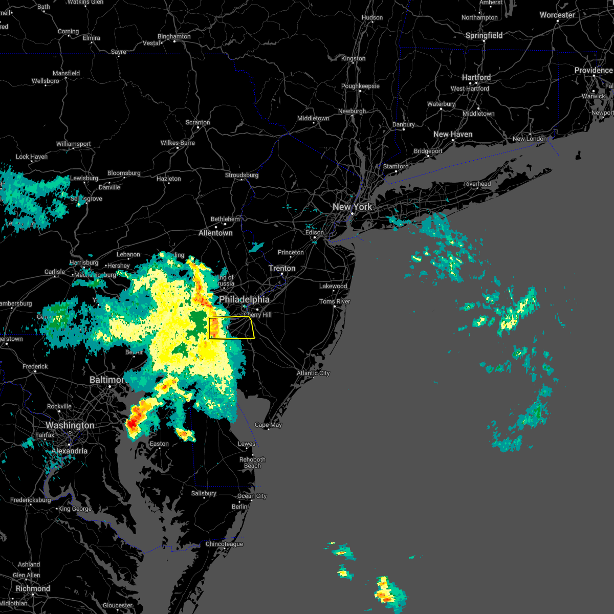 At 731 am edt, a severe thunderstorm was located near penns grove, or near wilmington, moving east at 40 mph (radar indicated). Hazards include 60 mph wind gusts and penny size hail. Damage to roofs, siding, trees, and power lines is possible. locations impacted include, wilmington, chester, deptford, west deptford, glassboro, pennsville, bellmawr, woodbury, pitman, carneys point, paulsboro, new castle, penns grove, westville, woodbury heights, national park, swedesboro, arden, elam and beckett. this includes the following highways, new jersey turnpike near exit 2. interstate 95 in pennsylvania between mile markers 0 and 6. interstate 95 in delaware between mile markers 16 and 23. Interstate 295 in new jersey near mile marker 0, and between mile markers 2 and 25. At 731 am edt, a severe thunderstorm was located near penns grove, or near wilmington, moving east at 40 mph (radar indicated). Hazards include 60 mph wind gusts and penny size hail. Damage to roofs, siding, trees, and power lines is possible. locations impacted include, wilmington, chester, deptford, west deptford, glassboro, pennsville, bellmawr, woodbury, pitman, carneys point, paulsboro, new castle, penns grove, westville, woodbury heights, national park, swedesboro, arden, elam and beckett. this includes the following highways, new jersey turnpike near exit 2. interstate 95 in pennsylvania between mile markers 0 and 6. interstate 95 in delaware between mile markers 16 and 23. Interstate 295 in new jersey near mile marker 0, and between mile markers 2 and 25.
|
| 6/14/2022 7:14 AM EDT |
 At 714 am edt, a severe thunderstorm was located over hockessin, or 7 miles west of wilmington, moving east at 45 mph (radar indicated). Hazards include 60 mph wind gusts and penny size hail. damage to roofs, siding, trees, and power lines is possible At 714 am edt, a severe thunderstorm was located over hockessin, or 7 miles west of wilmington, moving east at 45 mph (radar indicated). Hazards include 60 mph wind gusts and penny size hail. damage to roofs, siding, trees, and power lines is possible
|
| 5/22/2022 6:17 PM EDT |
 At 617 pm edt, severe thunderstorms were located along a line extending from near roxborough to philadelphia international arpt to near newark, moving east at 20 mph (radar indicated). Hazards include 60 mph wind gusts and nickel size hail. Damage to roofs, siding, trees, and power lines is possible. locations impacted include, wilmington, newark, chester, westtown, folcroft, swarthmore, elsmere, kennett square, new castle, newport, arden, darby township, stanton, cheyney, glasgow, talleyville, elam, chelsea, greenville and landenberg. this includes the following highways, interstate 95 in pennsylvania between mile markers 0 and 11. interstate 95 in delaware between mile markers 1 and 23. interstate 476 in pennsylvania between mile markers 0 and 3. hail threat, radar indicated max hail size, 0. 88 in wind threat, radar indicated max wind gust, 60 mph. At 617 pm edt, severe thunderstorms were located along a line extending from near roxborough to philadelphia international arpt to near newark, moving east at 20 mph (radar indicated). Hazards include 60 mph wind gusts and nickel size hail. Damage to roofs, siding, trees, and power lines is possible. locations impacted include, wilmington, newark, chester, westtown, folcroft, swarthmore, elsmere, kennett square, new castle, newport, arden, darby township, stanton, cheyney, glasgow, talleyville, elam, chelsea, greenville and landenberg. this includes the following highways, interstate 95 in pennsylvania between mile markers 0 and 11. interstate 95 in delaware between mile markers 1 and 23. interstate 476 in pennsylvania between mile markers 0 and 3. hail threat, radar indicated max hail size, 0. 88 in wind threat, radar indicated max wind gust, 60 mph.
|
| 5/22/2022 5:55 PM EDT |
 At 554 pm edt, severe thunderstorms were located along a line extending from gradyville to near elam to farmington, moving east at 30 mph (radar indicated). Hazards include 60 mph wind gusts and nickel size hail. damage to roofs, siding, trees, and power lines is possible At 554 pm edt, severe thunderstorms were located along a line extending from gradyville to near elam to farmington, moving east at 30 mph (radar indicated). Hazards include 60 mph wind gusts and nickel size hail. damage to roofs, siding, trees, and power lines is possible
|
| 5/20/2022 4:00 PM EDT |
 At 400 pm edt, severe thunderstorms were located along a line extending from near lansdale to germantown to philadelphia international arpt, moving east at 45 mph (radar indicated). Hazards include 60 mph wind gusts and half dollar size hail. Minor damage to vehicles is possible. wind damage to roofs, siding, trees, and power lines is possible. locations impacted include, philadelphia, trenton, camden, gloucester city, cherry hill, bensalem, mount laurel, ewing, norristown, chester, willingboro, deptford, voorhees, west deptford, glassboro, lindenwold, lansdale, west norriton, east norriton and princeton. this includes the following highways, new jersey turnpike between exits 3 and 6a. pennsylvania turnpike between mile markers 330 and 359. northeast extension between mile markers 21 and 32. interstate 95 in pennsylvania between mile markers 4 and 40. interstate 76 in pennsylvania between mile markers 330 and 351. interstate 76 in new jersey between mile markers 0 and 3. interstate 295 in new jersey between mile markers 14 and 51, and between mile markers 65 and 76. interstate 676 in pennsylvania between mile markers 0 and 1. interstate 676 in new jersey between mile markers 0 and 4. interstate 476 in pennsylvania between mile markers 0 and 19. atlantic city expressway between mile markers 41 and 44. hail threat, radar indicated max hail size, 1. 25 in wind threat, radar indicated max wind gust, 60 mph. At 400 pm edt, severe thunderstorms were located along a line extending from near lansdale to germantown to philadelphia international arpt, moving east at 45 mph (radar indicated). Hazards include 60 mph wind gusts and half dollar size hail. Minor damage to vehicles is possible. wind damage to roofs, siding, trees, and power lines is possible. locations impacted include, philadelphia, trenton, camden, gloucester city, cherry hill, bensalem, mount laurel, ewing, norristown, chester, willingboro, deptford, voorhees, west deptford, glassboro, lindenwold, lansdale, west norriton, east norriton and princeton. this includes the following highways, new jersey turnpike between exits 3 and 6a. pennsylvania turnpike between mile markers 330 and 359. northeast extension between mile markers 21 and 32. interstate 95 in pennsylvania between mile markers 4 and 40. interstate 76 in pennsylvania between mile markers 330 and 351. interstate 76 in new jersey between mile markers 0 and 3. interstate 295 in new jersey between mile markers 14 and 51, and between mile markers 65 and 76. interstate 676 in pennsylvania between mile markers 0 and 1. interstate 676 in new jersey between mile markers 0 and 4. interstate 476 in pennsylvania between mile markers 0 and 19. atlantic city expressway between mile markers 41 and 44. hail threat, radar indicated max hail size, 1. 25 in wind threat, radar indicated max wind gust, 60 mph.
|
| 5/20/2022 3:37 PM EDT |
 At 337 pm edt, severe thunderstorms were located along a line extending from near east norriton to newtown square to talleyville, moving east at 45 mph (radar indicated). Hazards include 60 mph wind gusts and quarter size hail. Minor damage to vehicles is possible. Wind damage to roofs, siding, trees, and power lines is possible. At 337 pm edt, severe thunderstorms were located along a line extending from near east norriton to newtown square to talleyville, moving east at 45 mph (radar indicated). Hazards include 60 mph wind gusts and quarter size hail. Minor damage to vehicles is possible. Wind damage to roofs, siding, trees, and power lines is possible.
|
| 5/20/2022 2:46 PM EDT |
 At 245 pm edt, a severe thunderstorm was located over chester township, or 8 miles northeast of wilmington, moving east at 35 mph (radar indicated). Hazards include 60 mph wind gusts and nickel size hail. Damage to roofs, siding, trees, and power lines is possible. locations impacted include, philadelphia, chester, yeadon, folcroft, swarthmore, paulsboro, westville, national park, brooklawn, arden, darby township, chelsea, chester township, tinicum township, lima, south philadelphia, nether providence township, philadelphia international arpt, philadelphia international airport and concordville. this includes the following highways, interstate 95 in pennsylvania between mile markers 0 and 19. interstate 95 in delaware between mile markers 18 and 23. interstate 76 in pennsylvania between mile markers 346 and 351. interstate 476 in pennsylvania between mile markers 0 and 4. hail threat, radar indicated max hail size, 0. 88 in wind threat, radar indicated max wind gust, 60 mph. At 245 pm edt, a severe thunderstorm was located over chester township, or 8 miles northeast of wilmington, moving east at 35 mph (radar indicated). Hazards include 60 mph wind gusts and nickel size hail. Damage to roofs, siding, trees, and power lines is possible. locations impacted include, philadelphia, chester, yeadon, folcroft, swarthmore, paulsboro, westville, national park, brooklawn, arden, darby township, chelsea, chester township, tinicum township, lima, south philadelphia, nether providence township, philadelphia international arpt, philadelphia international airport and concordville. this includes the following highways, interstate 95 in pennsylvania between mile markers 0 and 19. interstate 95 in delaware between mile markers 18 and 23. interstate 76 in pennsylvania between mile markers 346 and 351. interstate 476 in pennsylvania between mile markers 0 and 4. hail threat, radar indicated max hail size, 0. 88 in wind threat, radar indicated max wind gust, 60 mph.
|
| 5/20/2022 2:27 PM EDT |
 At 227 pm edt, a severe thunderstorm was located over ashland, or 8 miles northwest of wilmington, moving northeast at 25 mph (radar indicated). Hazards include 60 mph wind gusts and nickel size hail. damage to roofs, siding, trees, and power lines is possible At 227 pm edt, a severe thunderstorm was located over ashland, or 8 miles northwest of wilmington, moving northeast at 25 mph (radar indicated). Hazards include 60 mph wind gusts and nickel size hail. damage to roofs, siding, trees, and power lines is possible
|
| 4/14/2022 5:20 PM EDT |
 At 520 pm edt, severe thunderstorms were located along a line extending from near ambler to swedesboro, moving east at 40 mph (radar indicated). Hazards include 60 mph wind gusts. Damage to roofs, siding, trees, and power lines is possible. locations impacted include, philadelphia, camden, norristown, chester, deptford, west deptford, west norriton, east norriton, bellmawr, yeadon, woodbury, pitman, conshohocken, folcroft, ambler, swarthmore, paulsboro, westville, narberth and woodbury heights. this includes the following highways, new jersey turnpike near exit 2. pennsylvania turnpike between mile markers 326 and 339. northeast extension between mile markers 21 and 26. interstate 95 in pennsylvania between mile markers 1 and 22. interstate 76 in pennsylvania between mile markers 327 and 351. interstate 295 in new jersey between mile markers 9 and 25. interstate 676 in pennsylvania between mile markers 0 and 1. interstate 476 in pennsylvania between mile markers 0 and 19. hail threat, radar indicated max hail size, <. 75 in wind threat, radar indicated max wind gust, 60 mph. At 520 pm edt, severe thunderstorms were located along a line extending from near ambler to swedesboro, moving east at 40 mph (radar indicated). Hazards include 60 mph wind gusts. Damage to roofs, siding, trees, and power lines is possible. locations impacted include, philadelphia, camden, norristown, chester, deptford, west deptford, west norriton, east norriton, bellmawr, yeadon, woodbury, pitman, conshohocken, folcroft, ambler, swarthmore, paulsboro, westville, narberth and woodbury heights. this includes the following highways, new jersey turnpike near exit 2. pennsylvania turnpike between mile markers 326 and 339. northeast extension between mile markers 21 and 26. interstate 95 in pennsylvania between mile markers 1 and 22. interstate 76 in pennsylvania between mile markers 327 and 351. interstate 295 in new jersey between mile markers 9 and 25. interstate 676 in pennsylvania between mile markers 0 and 1. interstate 476 in pennsylvania between mile markers 0 and 19. hail threat, radar indicated max hail size, <. 75 in wind threat, radar indicated max wind gust, 60 mph.
|
| 4/14/2022 5:01 PM EDT |
 At 501 pm edt, severe thunderstorms were located along a line extending from valley forge to delaware memorial bridge, moving east at 35 mph (radar indicated). Hazards include 60 mph wind gusts. Damage to roofs, siding, trees, and power lines is possible. locations impacted include, philadelphia, camden, wilmington, west chester, norristown, chester, deptford, west deptford, phoenixville, west norriton, east norriton, pennsville, bellmawr, yeadon, westtown, woodbury, pitman, carneys point, conshohocken and folcroft. this includes the following highways, new jersey turnpike between exits 1 and 2. pennsylvania turnpike between mile markers 316 and 339. northeast extension between mile markers 21 and 26. interstate 95 in pennsylvania between mile markers 0 and 22. interstate 95 in delaware between mile markers 12 and 23. interstate 76 in pennsylvania between mile markers 327 and 351. interstate 295 in new jersey between mile markers 0 and 25. interstate 676 in pennsylvania between mile markers 0 and 1. interstate 476 in pennsylvania between mile markers 0 and 19. hail threat, radar indicated max hail size, <. 75 in wind threat, radar indicated max wind gust, 60 mph. At 501 pm edt, severe thunderstorms were located along a line extending from valley forge to delaware memorial bridge, moving east at 35 mph (radar indicated). Hazards include 60 mph wind gusts. Damage to roofs, siding, trees, and power lines is possible. locations impacted include, philadelphia, camden, wilmington, west chester, norristown, chester, deptford, west deptford, phoenixville, west norriton, east norriton, pennsville, bellmawr, yeadon, westtown, woodbury, pitman, carneys point, conshohocken and folcroft. this includes the following highways, new jersey turnpike between exits 1 and 2. pennsylvania turnpike between mile markers 316 and 339. northeast extension between mile markers 21 and 26. interstate 95 in pennsylvania between mile markers 0 and 22. interstate 95 in delaware between mile markers 12 and 23. interstate 76 in pennsylvania between mile markers 327 and 351. interstate 295 in new jersey between mile markers 0 and 25. interstate 676 in pennsylvania between mile markers 0 and 1. interstate 476 in pennsylvania between mile markers 0 and 19. hail threat, radar indicated max hail size, <. 75 in wind threat, radar indicated max wind gust, 60 mph.
|
| 4/14/2022 4:42 PM EDT |
 At 442 pm edt, severe thunderstorms were located along a line extending from lionville-marchwood to bear, moving east at 40 mph (radar indicated). Hazards include 60 mph wind gusts. damage to roofs, siding, trees, and power lines is possible At 442 pm edt, severe thunderstorms were located along a line extending from lionville-marchwood to bear, moving east at 40 mph (radar indicated). Hazards include 60 mph wind gusts. damage to roofs, siding, trees, and power lines is possible
|
| 3/31/2022 10:23 PM EDT |
 At 1022 pm edt, severe thunderstorms were located along a line extending from near new hope to elam, moving east at 35 mph (radar indicated). Hazards include 60 mph wind gusts. damage to roofs, siding, trees, and power lines is possible At 1022 pm edt, severe thunderstorms were located along a line extending from near new hope to elam, moving east at 35 mph (radar indicated). Hazards include 60 mph wind gusts. damage to roofs, siding, trees, and power lines is possible
|
| 3/31/2022 10:03 PM EDT |
 At 1003 pm edt, severe thunderstorms were located along a line extending from near califon to stockton to east norriton to kennett square, moving northeast at 45 mph (radar indicated). Hazards include 60 mph wind gusts and penny size hail. Damage to roofs, siding, trees, and power lines is possible. locations impacted include, philadelphia, trenton, camden, west chester, bensalem, bridgewater, ewing, norristown, dover, phoenixville, lansdale, west norriton, east norriton, yeadon, westtown, perkasie, doylestown, byram, downingtown and conshohocken. this includes the following highways, pennsylvania turnpike between mile markers 312 and 354. northeast extension between mile markers 21 and 33. interstate 95 in pennsylvania between mile markers 2 and 14, and between mile markers 21 and 28. interstate 76 in pennsylvania between mile markers 327 and 349. interstate 78 in new jersey between mile markers 7 and 32. interstate 295 in new jersey between mile markers 71 and 76. interstate 287 in new jersey between mile markers 19 and 24. interstate 676 in pennsylvania between mile markers 0 and 1. interstate 476 in pennsylvania between mile markers 0 and 19. hail threat, radar indicated max hail size, 0. 75 in wind threat, radar indicated max wind gust, 60 mph. At 1003 pm edt, severe thunderstorms were located along a line extending from near califon to stockton to east norriton to kennett square, moving northeast at 45 mph (radar indicated). Hazards include 60 mph wind gusts and penny size hail. Damage to roofs, siding, trees, and power lines is possible. locations impacted include, philadelphia, trenton, camden, west chester, bensalem, bridgewater, ewing, norristown, dover, phoenixville, lansdale, west norriton, east norriton, yeadon, westtown, perkasie, doylestown, byram, downingtown and conshohocken. this includes the following highways, pennsylvania turnpike between mile markers 312 and 354. northeast extension between mile markers 21 and 33. interstate 95 in pennsylvania between mile markers 2 and 14, and between mile markers 21 and 28. interstate 76 in pennsylvania between mile markers 327 and 349. interstate 78 in new jersey between mile markers 7 and 32. interstate 295 in new jersey between mile markers 71 and 76. interstate 287 in new jersey between mile markers 19 and 24. interstate 676 in pennsylvania between mile markers 0 and 1. interstate 476 in pennsylvania between mile markers 0 and 19. hail threat, radar indicated max hail size, 0. 75 in wind threat, radar indicated max wind gust, 60 mph.
|
| 3/31/2022 9:36 PM EDT |
 At 935 pm edt, severe thunderstorms were located along a line extending from old orchard to souderton to near lionville-marchwood to near oxford, moving east at 45 mph (radar indicated). Hazards include 60 mph wind gusts and penny size hail. damage to roofs, siding, trees, and power lines is possible At 935 pm edt, severe thunderstorms were located along a line extending from old orchard to souderton to near lionville-marchwood to near oxford, moving east at 45 mph (radar indicated). Hazards include 60 mph wind gusts and penny size hail. damage to roofs, siding, trees, and power lines is possible
|
| 3/7/2022 9:03 PM EST |
 At 903 pm est, severe showers and embedded thunderstorms were located along a line extending from near hatboro to near stanton, moving east at 55 mph. this line has a history of producing areas of wind damage (radar indicated). Hazards include 70 mph wind gusts. Expect considerable tree damage. damage is likely to mobile homes, roofs, and outbuildings. locations impacted include, philadelphia, camden, wilmington, bensalem, norristown, chester, west norriton, east norriton, yeadon, westtown, carneys point, conshohocken, palmyra, hatboro, folcroft, ambler, swarthmore, elsmere, paulsboro and penns grove. this includes the following highways, pennsylvania turnpike between mile markers 322 and 352. northeast extension between mile markers 21 and 25. interstate 95 in pennsylvania between mile markers 0 and 16, and between mile markers 19 and 35. interstate 95 in delaware between mile markers 12 and 23. interstate 76 in pennsylvania between mile markers 327 and 350. interstate 676 in pennsylvania between mile markers 0 and 1. interstate 476 in pennsylvania between mile markers 0 and 19. thunderstorm damage threat, considerable hail threat, radar indicated max hail size, <. 75 in wind threat, radar indicated max wind gust, 70 mph. At 903 pm est, severe showers and embedded thunderstorms were located along a line extending from near hatboro to near stanton, moving east at 55 mph. this line has a history of producing areas of wind damage (radar indicated). Hazards include 70 mph wind gusts. Expect considerable tree damage. damage is likely to mobile homes, roofs, and outbuildings. locations impacted include, philadelphia, camden, wilmington, bensalem, norristown, chester, west norriton, east norriton, yeadon, westtown, carneys point, conshohocken, palmyra, hatboro, folcroft, ambler, swarthmore, elsmere, paulsboro and penns grove. this includes the following highways, pennsylvania turnpike between mile markers 322 and 352. northeast extension between mile markers 21 and 25. interstate 95 in pennsylvania between mile markers 0 and 16, and between mile markers 19 and 35. interstate 95 in delaware between mile markers 12 and 23. interstate 76 in pennsylvania between mile markers 327 and 350. interstate 676 in pennsylvania between mile markers 0 and 1. interstate 476 in pennsylvania between mile markers 0 and 19. thunderstorm damage threat, considerable hail threat, radar indicated max hail size, <. 75 in wind threat, radar indicated max wind gust, 70 mph.
|
| 3/7/2022 9:02 PM EST |
 At 900 pm est, severe showers and embedded thunderstorms were located along a line extending from near chalfont to stanton, moving east at 65 mph. this line has a history of producing areas of wind damage (radar indicated). Hazards include 70 mph wind gusts. Expect considerable tree damage. Damage is likely to mobile homes, roofs, and outbuildings. At 900 pm est, severe showers and embedded thunderstorms were located along a line extending from near chalfont to stanton, moving east at 65 mph. this line has a history of producing areas of wind damage (radar indicated). Hazards include 70 mph wind gusts. Expect considerable tree damage. Damage is likely to mobile homes, roofs, and outbuildings.
|
| 3/7/2022 8:48 PM EST |
 At 847 pm est, severe showers and embedded thunderstorms were located along a line extending from near collegeville to pleasant hill, moving east at 50 mph. this line has a history or producing areas of wind damage (radar indicated). Hazards include 70 mph wind gusts. Expect considerable tree damage. damage is likely to mobile homes, roofs, and outbuildings. locations impacted include, philadelphia, camden, wilmington, west chester, bensalem, norristown, chester, phoenixville, west norriton, east norriton, coatesville, yeadon, westtown, carneys point, downingtown, conshohocken, palmyra, hatboro, folcroft and ambler. this includes the following highways, pennsylvania turnpike between mile markers 306 and 352. northeast extension between mile markers 21 and 25. interstate 95 in pennsylvania between mile markers 0 and 16, and between mile markers 19 and 35. interstate 95 in delaware between mile markers 12 and 23. interstate 76 in pennsylvania between mile markers 327 and 350. interstate 676 in pennsylvania between mile markers 0 and 1. interstate 476 in pennsylvania between mile markers 0 and 19. thunderstorm damage threat, considerable hail threat, radar indicated max hail size, <. 75 in wind threat, radar indicated max wind gust, 70 mph. At 847 pm est, severe showers and embedded thunderstorms were located along a line extending from near collegeville to pleasant hill, moving east at 50 mph. this line has a history or producing areas of wind damage (radar indicated). Hazards include 70 mph wind gusts. Expect considerable tree damage. damage is likely to mobile homes, roofs, and outbuildings. locations impacted include, philadelphia, camden, wilmington, west chester, bensalem, norristown, chester, phoenixville, west norriton, east norriton, coatesville, yeadon, westtown, carneys point, downingtown, conshohocken, palmyra, hatboro, folcroft and ambler. this includes the following highways, pennsylvania turnpike between mile markers 306 and 352. northeast extension between mile markers 21 and 25. interstate 95 in pennsylvania between mile markers 0 and 16, and between mile markers 19 and 35. interstate 95 in delaware between mile markers 12 and 23. interstate 76 in pennsylvania between mile markers 327 and 350. interstate 676 in pennsylvania between mile markers 0 and 1. interstate 476 in pennsylvania between mile markers 0 and 19. thunderstorm damage threat, considerable hail threat, radar indicated max hail size, <. 75 in wind threat, radar indicated max wind gust, 70 mph.
|
| 3/7/2022 8:21 PM EST |
 At 820 pm est, severe showers and embedded thunderstorms were located along a line extending from near lyons to near delta, moving east at 60 mph. this line has had a history of producing areas of wind damage (radar indicated). Hazards include 60 mph wind gusts. damage to roofs, siding, trees, and power lines is possible At 820 pm est, severe showers and embedded thunderstorms were located along a line extending from near lyons to near delta, moving east at 60 mph. this line has had a history of producing areas of wind damage (radar indicated). Hazards include 60 mph wind gusts. damage to roofs, siding, trees, and power lines is possible
|
| 2/18/2022 6:17 AM EST |
 At 616 am est, severe thunderstorms were located along a line extending from kingston to near port penn, moving east at 55 mph (radar indicated. a few measured wind gusts near 60 mph). Hazards include 60 mph wind gusts. damage to roofs, siding, trees, and power lines is possible At 616 am est, severe thunderstorms were located along a line extending from kingston to near port penn, moving east at 55 mph (radar indicated. a few measured wind gusts near 60 mph). Hazards include 60 mph wind gusts. damage to roofs, siding, trees, and power lines is possible
|
| 12/11/2021 9:29 PM EST |
 At 929 pm est, severe thunderstorms were located along a line extending from annandale to glen westover, moving east at 35 mph (public). Hazards include 60 mph wind gusts. Damage to roofs, siding, trees, and power lines is possible. locations impacted include, philadelphia, wilmington, newark, west chester, norristown, chester, phoenixville, lansdale, west norriton, east norriton, pennsville, yeadon, westtown, perkasie, doylestown, byram, downingtown, conshohocken, hatboro and souderton. this includes the following highways, pennsylvania turnpike between mile markers 312 and 350. northeast extension between mile markers 21 and 37. interstate 95 in pennsylvania between mile markers 0 and 11. interstate 95 in delaware between mile markers 7 and 23. interstate 76 in pennsylvania between mile markers 327 and 346. interstate 295 in new jersey near mile marker 0. interstate 676 in pennsylvania near mile marker 0. Interstate 476 in pennsylvania between mile markers 0 and 19. At 929 pm est, severe thunderstorms were located along a line extending from annandale to glen westover, moving east at 35 mph (public). Hazards include 60 mph wind gusts. Damage to roofs, siding, trees, and power lines is possible. locations impacted include, philadelphia, wilmington, newark, west chester, norristown, chester, phoenixville, lansdale, west norriton, east norriton, pennsville, yeadon, westtown, perkasie, doylestown, byram, downingtown, conshohocken, hatboro and souderton. this includes the following highways, pennsylvania turnpike between mile markers 312 and 350. northeast extension between mile markers 21 and 37. interstate 95 in pennsylvania between mile markers 0 and 11. interstate 95 in delaware between mile markers 7 and 23. interstate 76 in pennsylvania between mile markers 327 and 346. interstate 295 in new jersey near mile marker 0. interstate 676 in pennsylvania near mile marker 0. Interstate 476 in pennsylvania between mile markers 0 and 19.
|
| 12/11/2021 9:01 PM EST |
 At 900 pm est, severe thunderstorms were located along a line extending from alpha to rising sun, moving east at 35 mph (radar indicated). Hazards include 60 mph wind gusts. damage to roofs, siding, trees, and power lines is possible At 900 pm est, severe thunderstorms were located along a line extending from alpha to rising sun, moving east at 35 mph (radar indicated). Hazards include 60 mph wind gusts. damage to roofs, siding, trees, and power lines is possible
|
| 9/28/2021 7:51 PM EDT |
 At 751 pm edt, a severe thunderstorm was located over beckett, or 10 miles east of wilmington, moving southeast at 25 mph (radar indicated). Hazards include 60 mph wind gusts and quarter size hail. Minor damage to vehicles is possible. wind damage to roofs, siding, trees, and power lines is possible. locations impacted include, chester, deptford, west deptford, glassboro, woodbury, pitman, folcroft, swarthmore, paulsboro, woodstown, woodbury heights, swedesboro, arden, chelsea, beckett, nether providence township, chester township, philadelphia international arpt, mullica hill and gibbstown. this includes the following highways, new jersey turnpike near exit 2. interstate 95 in pennsylvania between mile markers 0 and 10. interstate 95 in delaware between mile markers 20 and 23. interstate 295 in new jersey between mile markers 7 and 21. interstate 476 in pennsylvania between mile markers 0 and 2. hail threat, radar indicated max hail size, 1. 00 in wind threat, radar indicated max wind gust, 60 mph. At 751 pm edt, a severe thunderstorm was located over beckett, or 10 miles east of wilmington, moving southeast at 25 mph (radar indicated). Hazards include 60 mph wind gusts and quarter size hail. Minor damage to vehicles is possible. wind damage to roofs, siding, trees, and power lines is possible. locations impacted include, chester, deptford, west deptford, glassboro, woodbury, pitman, folcroft, swarthmore, paulsboro, woodstown, woodbury heights, swedesboro, arden, chelsea, beckett, nether providence township, chester township, philadelphia international arpt, mullica hill and gibbstown. this includes the following highways, new jersey turnpike near exit 2. interstate 95 in pennsylvania between mile markers 0 and 10. interstate 95 in delaware between mile markers 20 and 23. interstate 295 in new jersey between mile markers 7 and 21. interstate 476 in pennsylvania between mile markers 0 and 2. hail threat, radar indicated max hail size, 1. 00 in wind threat, radar indicated max wind gust, 60 mph.
|
| 9/28/2021 7:29 PM EDT |
 At 729 pm edt, a severe thunderstorm was located over chelsea, or 10 miles southeast of west chester, moving southeast at 30 mph (radar indicated). Hazards include 60 mph wind gusts and quarter size hail. Minor damage to vehicles is possible. Wind damage to roofs, siding, trees, and power lines is possible. At 729 pm edt, a severe thunderstorm was located over chelsea, or 10 miles southeast of west chester, moving southeast at 30 mph (radar indicated). Hazards include 60 mph wind gusts and quarter size hail. Minor damage to vehicles is possible. Wind damage to roofs, siding, trees, and power lines is possible.
|
| 9/23/2021 12:45 PM EDT |
 At 1245 pm edt, severe thunderstorms were located along a line extending from near gilbertsville to near spring mount to narberth, moving north at 45 mph (radar indicated). Hazards include 60 mph wind gusts. Damage to roofs, siding, trees, and power lines is possible. locations impacted include, philadelphia, norristown, chester, pottstown, phoenixville, west norriton, east norriton, yeadon, conshohocken, folcroft, swarthmore, collegeville, royersford, narberth, trappe, east lansdowne, schwenksville, green lane, darby township and morris park. this includes the following highways, pennsylvania turnpike between mile markers 326 and 337. northeast extension between mile markers 21 and 38. interstate 95 in pennsylvania between mile markers 1 and 9. interstate 76 in pennsylvania between mile markers 327 and 340. interstate 295 in new jersey between mile markers 10 and 11. Interstate 476 in pennsylvania between mile markers 0 and 11, and between mile markers 13 and 19. At 1245 pm edt, severe thunderstorms were located along a line extending from near gilbertsville to near spring mount to narberth, moving north at 45 mph (radar indicated). Hazards include 60 mph wind gusts. Damage to roofs, siding, trees, and power lines is possible. locations impacted include, philadelphia, norristown, chester, pottstown, phoenixville, west norriton, east norriton, yeadon, conshohocken, folcroft, swarthmore, collegeville, royersford, narberth, trappe, east lansdowne, schwenksville, green lane, darby township and morris park. this includes the following highways, pennsylvania turnpike between mile markers 326 and 337. northeast extension between mile markers 21 and 38. interstate 95 in pennsylvania between mile markers 1 and 9. interstate 76 in pennsylvania between mile markers 327 and 340. interstate 295 in new jersey between mile markers 10 and 11. Interstate 476 in pennsylvania between mile markers 0 and 11, and between mile markers 13 and 19.
|
| 9/23/2021 12:34 PM EDT |
 At 1234 pm edt, severe thunderstorms were located along a line extending from near pughtown to collegeville to darby township, moving north at 45 mph (radar indicated). Hazards include 60 mph wind gusts. Damage to roofs, siding, trees, and power lines is possible. locations impacted include, philadelphia, norristown, chester, pottstown, phoenixville, west norriton, east norriton, yeadon, carneys point, conshohocken, folcroft, swarthmore, collegeville, royersford, narberth, trappe, east lansdowne, schwenksville, green lane and pughtown. this includes the following highways, pennsylvania turnpike between mile markers 316 and 337. northeast extension between mile markers 21 and 38. interstate 95 in pennsylvania between mile markers 1 and 9. interstate 76 in pennsylvania between mile markers 327 and 340. interstate 295 in new jersey between mile markers 4 and 10. Interstate 476 in pennsylvania between mile markers 0 and 19. At 1234 pm edt, severe thunderstorms were located along a line extending from near pughtown to collegeville to darby township, moving north at 45 mph (radar indicated). Hazards include 60 mph wind gusts. Damage to roofs, siding, trees, and power lines is possible. locations impacted include, philadelphia, norristown, chester, pottstown, phoenixville, west norriton, east norriton, yeadon, carneys point, conshohocken, folcroft, swarthmore, collegeville, royersford, narberth, trappe, east lansdowne, schwenksville, green lane and pughtown. this includes the following highways, pennsylvania turnpike between mile markers 316 and 337. northeast extension between mile markers 21 and 38. interstate 95 in pennsylvania between mile markers 1 and 9. interstate 76 in pennsylvania between mile markers 327 and 340. interstate 295 in new jersey between mile markers 4 and 10. Interstate 476 in pennsylvania between mile markers 0 and 19.
|
| 9/23/2021 12:22 PM EDT |
 At 1221 pm edt, severe thunderstorms were located along a line extending from downingtown to near paoli to near chester township, moving northeast at 45 mph (radar indicated). Hazards include 60 mph wind gusts. Damage to roofs, siding, trees, and power lines is possible. locations impacted include, philadelphia, wilmington, west chester, norristown, chester, pottstown, phoenixville, lansdale, west norriton, east norriton, pennsville, yeadon, westtown, carneys point, downingtown, conshohocken, folcroft, swarthmore, penns grove and collegeville. this includes the following highways, pennsylvania turnpike between mile markers 309 and 337. northeast extension between mile markers 21 and 38. interstate 95 in pennsylvania between mile markers 0 and 9. interstate 95 in delaware between mile markers 17 and 23. interstate 76 in pennsylvania between mile markers 327 and 340. interstate 295 in new jersey between mile markers 2 and 10. Interstate 476 in pennsylvania between mile markers 0 and 19. At 1221 pm edt, severe thunderstorms were located along a line extending from downingtown to near paoli to near chester township, moving northeast at 45 mph (radar indicated). Hazards include 60 mph wind gusts. Damage to roofs, siding, trees, and power lines is possible. locations impacted include, philadelphia, wilmington, west chester, norristown, chester, pottstown, phoenixville, lansdale, west norriton, east norriton, pennsville, yeadon, westtown, carneys point, downingtown, conshohocken, folcroft, swarthmore, penns grove and collegeville. this includes the following highways, pennsylvania turnpike between mile markers 309 and 337. northeast extension between mile markers 21 and 38. interstate 95 in pennsylvania between mile markers 0 and 9. interstate 95 in delaware between mile markers 17 and 23. interstate 76 in pennsylvania between mile markers 327 and 340. interstate 295 in new jersey between mile markers 2 and 10. Interstate 476 in pennsylvania between mile markers 0 and 19.
|
| 9/23/2021 12:12 PM EDT |
 At 1212 pm edt, severe thunderstorms were located along a line extending from near marshallton to westtown to penns grove, moving north at 45 mph (radar indicated). Hazards include 60 mph wind gusts. damage to roofs, siding, trees, and power lines is possible At 1212 pm edt, severe thunderstorms were located along a line extending from near marshallton to westtown to penns grove, moving north at 45 mph (radar indicated). Hazards include 60 mph wind gusts. damage to roofs, siding, trees, and power lines is possible
|
| 9/1/2021 5:54 PM EDT |
 The severe thunderstorm warning for south central hunterdon, southwestern mercer, montgomery, southern bucks, northeastern chester, philadelphia and eastern delaware counties will expire at 600 pm edt, the storm which prompted the warning has weakened below severe limits, and no longer poses an immediate threat to life or property. therefore, the warning will be allowed to expire. a tornado watch remains in effect until 1000 pm edt for northern delaware, southern, central and northwestern new jersey, and southeastern pennsylvania. The severe thunderstorm warning for south central hunterdon, southwestern mercer, montgomery, southern bucks, northeastern chester, philadelphia and eastern delaware counties will expire at 600 pm edt, the storm which prompted the warning has weakened below severe limits, and no longer poses an immediate threat to life or property. therefore, the warning will be allowed to expire. a tornado watch remains in effect until 1000 pm edt for northern delaware, southern, central and northwestern new jersey, and southeastern pennsylvania.
|
| 9/1/2021 5:29 PM EDT |
 At 529 pm edt, a severe thunderstorm was located over jenkintown, or near philadelphia, moving northeast at 55 mph (radar indicated). Hazards include 60 mph wind gusts. Damage to roofs, siding, trees, and power lines is possible. locations impacted include, philadelphia, trenton, camden, bensalem, ewing, norristown, chester, phoenixville, lansdale, west norriton, east norriton, yeadon, bristol, doylestown, byram, conshohocken, palmyra, hatboro, souderton and folcroft. this includes the following highways, pennsylvania turnpike between mile markers 326 and 359. northeast extension between mile markers 21 and 33. interstate 95 in pennsylvania between mile markers 0 and 40. interstate 76 in pennsylvania between mile markers 327 and 351. interstate 195 in new jersey near mile marker 0. interstate 295 in new jersey near mile marker 60, and between mile markers 75 and 76. interstate 676 in pennsylvania between mile markers 0 and 1. Interstate 476 in pennsylvania between mile markers 0 and 19. At 529 pm edt, a severe thunderstorm was located over jenkintown, or near philadelphia, moving northeast at 55 mph (radar indicated). Hazards include 60 mph wind gusts. Damage to roofs, siding, trees, and power lines is possible. locations impacted include, philadelphia, trenton, camden, bensalem, ewing, norristown, chester, phoenixville, lansdale, west norriton, east norriton, yeadon, bristol, doylestown, byram, conshohocken, palmyra, hatboro, souderton and folcroft. this includes the following highways, pennsylvania turnpike between mile markers 326 and 359. northeast extension between mile markers 21 and 33. interstate 95 in pennsylvania between mile markers 0 and 40. interstate 76 in pennsylvania between mile markers 327 and 351. interstate 195 in new jersey near mile marker 0. interstate 295 in new jersey near mile marker 60, and between mile markers 75 and 76. interstate 676 in pennsylvania between mile markers 0 and 1. Interstate 476 in pennsylvania between mile markers 0 and 19.
|
| 9/1/2021 5:15 PM EDT |
 At 515 pm edt, a severe thunderstorm capable of producing a tornado was located over folcroft, or 10 miles west of gloucester city, moving northeast at 50 mph (radar indicated rotation). Hazards include tornado. Flying debris will be dangerous to those caught without shelter. mobile homes will be damaged or destroyed. damage to roofs, windows, and vehicles will occur. Tree damage is likely. At 515 pm edt, a severe thunderstorm capable of producing a tornado was located over folcroft, or 10 miles west of gloucester city, moving northeast at 50 mph (radar indicated rotation). Hazards include tornado. Flying debris will be dangerous to those caught without shelter. mobile homes will be damaged or destroyed. damage to roofs, windows, and vehicles will occur. Tree damage is likely.
|
| 9/1/2021 5:13 PM EDT |
 At 513 pm edt, a severe thunderstorm was located over newtown square, or 12 miles east of west chester, moving northeast at 55 mph (radar indicated). Hazards include 60 mph wind gusts. damage to roofs, siding, trees, and power lines is possible At 513 pm edt, a severe thunderstorm was located over newtown square, or 12 miles east of west chester, moving northeast at 55 mph (radar indicated). Hazards include 60 mph wind gusts. damage to roofs, siding, trees, and power lines is possible
|
| 8/11/2021 7:46 PM EDT |
 At 746 pm edt, severe thunderstorms were located along a line extending from near northeast philadelphia to mullica hill, moving east at 30 mph (radar indicated). Hazards include 60 mph wind gusts. Damage to roofs, siding, trees, and power lines is possible. locations impacted include, philadelphia, camden, gloucester city, bensalem, chester, deptford, west deptford, glassboro, bellmawr, yeadon, woodbury, pitman, doylestown, clayton, riverside, conshohocken, palmyra, hatboro, folcroft and ambler. this includes the following highways, new jersey turnpike between exits 2 and 3. pennsylvania turnpike between mile markers 332 and 354. northeast extension between mile markers 21 and 22. interstate 95 in pennsylvania between mile markers 1 and 36. interstate 76 in pennsylvania between mile markers 331 and 351. interstate 76 in new jersey between mile markers 0 and 3. interstate 295 in new jersey between mile markers 9 and 31. interstate 676 in pennsylvania between mile markers 0 and 1. interstate 676 in new jersey between mile markers 0 and 4. interstate 476 in pennsylvania between mile markers 0 and 11, and between mile markers 15 and 19. hail threat, radar indicated max hail size, <. 75 in wind threat, observed max wind gust, 60 mph. At 746 pm edt, severe thunderstorms were located along a line extending from near northeast philadelphia to mullica hill, moving east at 30 mph (radar indicated). Hazards include 60 mph wind gusts. Damage to roofs, siding, trees, and power lines is possible. locations impacted include, philadelphia, camden, gloucester city, bensalem, chester, deptford, west deptford, glassboro, bellmawr, yeadon, woodbury, pitman, doylestown, clayton, riverside, conshohocken, palmyra, hatboro, folcroft and ambler. this includes the following highways, new jersey turnpike between exits 2 and 3. pennsylvania turnpike between mile markers 332 and 354. northeast extension between mile markers 21 and 22. interstate 95 in pennsylvania between mile markers 1 and 36. interstate 76 in pennsylvania between mile markers 331 and 351. interstate 76 in new jersey between mile markers 0 and 3. interstate 295 in new jersey between mile markers 9 and 31. interstate 676 in pennsylvania between mile markers 0 and 1. interstate 676 in new jersey between mile markers 0 and 4. interstate 476 in pennsylvania between mile markers 0 and 11, and between mile markers 15 and 19. hail threat, radar indicated max hail size, <. 75 in wind threat, observed max wind gust, 60 mph.
|
| 8/11/2021 7:25 PM EDT |
 At 725 pm edt, severe thunderstorms were located along a line extending from near willow grove to beckett, moving east at 30 mph (radar indicated). Hazards include 60 mph wind gusts. Damage to roofs, siding, trees, and power lines is possible. locations impacted include, philadelphia, camden, wilmington, west chester, gloucester city, bensalem, norristown, chester, deptford, west deptford, glassboro, phoenixville, lansdale, west norriton, east norriton, bellmawr, yeadon, westtown, woodbury and pitman. this includes the following highways, new jersey turnpike between exits 2 and 3. pennsylvania turnpike between mile markers 316 and 354. northeast extension between mile markers 21 and 34. interstate 95 in pennsylvania between mile markers 0 and 36. interstate 95 in delaware between mile markers 16 and 23. interstate 76 in pennsylvania between mile markers 327 and 351. interstate 76 in new jersey between mile markers 0 and 3. interstate 295 in new jersey between mile markers 9 and 31. interstate 676 in pennsylvania between mile markers 0 and 1. interstate 676 in new jersey between mile markers 0 and 4. interstate 476 in pennsylvania between mile markers 0 and 19. hail threat, radar indicated max hail size, <. 75 in wind threat, observed max wind gust, 60 mph. At 725 pm edt, severe thunderstorms were located along a line extending from near willow grove to beckett, moving east at 30 mph (radar indicated). Hazards include 60 mph wind gusts. Damage to roofs, siding, trees, and power lines is possible. locations impacted include, philadelphia, camden, wilmington, west chester, gloucester city, bensalem, norristown, chester, deptford, west deptford, glassboro, phoenixville, lansdale, west norriton, east norriton, bellmawr, yeadon, westtown, woodbury and pitman. this includes the following highways, new jersey turnpike between exits 2 and 3. pennsylvania turnpike between mile markers 316 and 354. northeast extension between mile markers 21 and 34. interstate 95 in pennsylvania between mile markers 0 and 36. interstate 95 in delaware between mile markers 16 and 23. interstate 76 in pennsylvania between mile markers 327 and 351. interstate 76 in new jersey between mile markers 0 and 3. interstate 295 in new jersey between mile markers 9 and 31. interstate 676 in pennsylvania between mile markers 0 and 1. interstate 676 in new jersey between mile markers 0 and 4. interstate 476 in pennsylvania between mile markers 0 and 19. hail threat, radar indicated max hail size, <. 75 in wind threat, observed max wind gust, 60 mph.
|
| 8/11/2021 7:11 PM EDT |
 At 711 pm edt, severe thunderstorms were located along a line extending from near ambler to near arden, moving east at 30 mph (radar indicated. also, these storms have a history of producing wind damage in chester county). Hazards include 60 mph wind gusts and penny size hail. damage to roofs, siding, trees, and power lines is possible At 711 pm edt, severe thunderstorms were located along a line extending from near ambler to near arden, moving east at 30 mph (radar indicated. also, these storms have a history of producing wind damage in chester county). Hazards include 60 mph wind gusts and penny size hail. damage to roofs, siding, trees, and power lines is possible
|
| 8/10/2021 8:46 PM EDT |
 At 845 pm edt, a severe thunderstorm was located over arden, or near wilmington, moving east at 15 mph (radar indicated). Hazards include 60 mph wind gusts and penny size hail. Damage to roofs, siding, trees, and power lines is possible. locations impacted include, wilmington, west chester, chester, pennsville, westtown, carneys point, conshohocken, swarthmore, elsmere, new castle, penns grove, salem, narberth, alloway, quinton, newport, arden, stanton, cheyney and talleyville. this includes the following highways, new jersey turnpike near exit 1. interstate 95 in pennsylvania between mile markers 0 and 8. interstate 95 in delaware between mile markers 6 and 23. interstate 76 in pennsylvania between mile markers 329 and 335. interstate 295 in new jersey between mile markers 0 and 13. interstate 476 in pennsylvania between mile markers 0 and 19. hail threat, radar indicated max hail size, 0. 75 in wind threat, radar indicated max wind gust, 60 mph. At 845 pm edt, a severe thunderstorm was located over arden, or near wilmington, moving east at 15 mph (radar indicated). Hazards include 60 mph wind gusts and penny size hail. Damage to roofs, siding, trees, and power lines is possible. locations impacted include, wilmington, west chester, chester, pennsville, westtown, carneys point, conshohocken, swarthmore, elsmere, new castle, penns grove, salem, narberth, alloway, quinton, newport, arden, stanton, cheyney and talleyville. this includes the following highways, new jersey turnpike near exit 1. interstate 95 in pennsylvania between mile markers 0 and 8. interstate 95 in delaware between mile markers 6 and 23. interstate 76 in pennsylvania between mile markers 329 and 335. interstate 295 in new jersey between mile markers 0 and 13. interstate 476 in pennsylvania between mile markers 0 and 19. hail threat, radar indicated max hail size, 0. 75 in wind threat, radar indicated max wind gust, 60 mph.
|
| 8/10/2021 8:18 PM EDT |
 At 818 pm edt, a severe thunderstorm was located over talleyville, or near wilmington, moving east at 15 mph (radar indicated). Hazards include 60 mph wind gusts and penny size hail. damage to roofs, siding, trees, and power lines is possible At 818 pm edt, a severe thunderstorm was located over talleyville, or near wilmington, moving east at 15 mph (radar indicated). Hazards include 60 mph wind gusts and penny size hail. damage to roofs, siding, trees, and power lines is possible
|
| 8/10/2021 8:02 PM EDT |
 At 801 pm edt, a severe thunderstorm was located over gibbstown, or 12 miles northeast of wilmington, moving northeast at 20 mph (radar indicated). Hazards include 60 mph wind gusts and nickel size hail. damage to roofs, siding, trees, and power lines is possible At 801 pm edt, a severe thunderstorm was located over gibbstown, or 12 miles northeast of wilmington, moving northeast at 20 mph (radar indicated). Hazards include 60 mph wind gusts and nickel size hail. damage to roofs, siding, trees, and power lines is possible
|
| 7/21/2021 3:46 PM EDT |
 At 345 pm edt, a severe thunderstorm was located over philadelphia international arpt, or 10 miles west of gloucester city, moving east at 40 mph (radar indicated). Hazards include 60 mph wind gusts and quarter size hail. Minor damage to vehicles is possible. wind damage to roofs, siding, trees, and power lines is possible. locations impacted include, philadelphia, camden, gloucester city, chester, deptford, west deptford, glassboro, bellmawr, yeadon, woodbury, pitman, clayton, folcroft, swarthmore, paulsboro, magnolia, westville, woodbury heights, national park and east lansdowne. this includes the following highways, new jersey turnpike between exits 2 and 3. interstate 95 in pennsylvania between mile markers 0 and 20. interstate 76 in pennsylvania between mile markers 345 and 351. interstate 76 in new jersey between mile markers 0 and 3. interstate 295 in new jersey between mile markers 12 and 30. interstate 676 in new jersey between mile markers 0 and 3. Interstate 476 in pennsylvania between mile markers 0 and 7. At 345 pm edt, a severe thunderstorm was located over philadelphia international arpt, or 10 miles west of gloucester city, moving east at 40 mph (radar indicated). Hazards include 60 mph wind gusts and quarter size hail. Minor damage to vehicles is possible. wind damage to roofs, siding, trees, and power lines is possible. locations impacted include, philadelphia, camden, gloucester city, chester, deptford, west deptford, glassboro, bellmawr, yeadon, woodbury, pitman, clayton, folcroft, swarthmore, paulsboro, magnolia, westville, woodbury heights, national park and east lansdowne. this includes the following highways, new jersey turnpike between exits 2 and 3. interstate 95 in pennsylvania between mile markers 0 and 20. interstate 76 in pennsylvania between mile markers 345 and 351. interstate 76 in new jersey between mile markers 0 and 3. interstate 295 in new jersey between mile markers 12 and 30. interstate 676 in new jersey between mile markers 0 and 3. Interstate 476 in pennsylvania between mile markers 0 and 7.
|
| 7/21/2021 3:27 PM EDT |
 At 326 pm edt, a severe thunderstorm was located over concordville, or near west chester, moving east at 40 mph (radar indicated). Hazards include 60 mph wind gusts and quarter size hail. Minor damage to vehicles is possible. Wind damage to roofs, siding, trees, and power lines is possible. At 326 pm edt, a severe thunderstorm was located over concordville, or near west chester, moving east at 40 mph (radar indicated). Hazards include 60 mph wind gusts and quarter size hail. Minor damage to vehicles is possible. Wind damage to roofs, siding, trees, and power lines is possible.
|
| 7/21/2021 3:17 PM EDT |
 At 317 pm edt, a severe thunderstorm was located near west chester, moving east at 40 mph (radar indicated). Hazards include 60 mph wind gusts and quarter size hail. Minor damage to vehicles is possible. wind damage to roofs, siding, trees, and power lines is possible. locations impacted include, west chester, chester, westtown, downingtown, cheyney, elam, marshallton, lima, chelsea, radnor township, lionville-marchwood, gradyville, paoli, newtown square, chester township, lionville, concordville, nether providence township, broomall and west goshen. this includes the following highways, interstate 95 in pennsylvania between mile markers 1 and 4. Interstate 476 in pennsylvania between mile markers 12 and 13. At 317 pm edt, a severe thunderstorm was located near west chester, moving east at 40 mph (radar indicated). Hazards include 60 mph wind gusts and quarter size hail. Minor damage to vehicles is possible. wind damage to roofs, siding, trees, and power lines is possible. locations impacted include, west chester, chester, westtown, downingtown, cheyney, elam, marshallton, lima, chelsea, radnor township, lionville-marchwood, gradyville, paoli, newtown square, chester township, lionville, concordville, nether providence township, broomall and west goshen. this includes the following highways, interstate 95 in pennsylvania between mile markers 1 and 4. Interstate 476 in pennsylvania between mile markers 12 and 13.
|
| 7/21/2021 2:52 PM EDT |
 At 251 pm edt, a severe thunderstorm was located over parkesburg, or 12 miles southeast of new holland, moving east at 30 mph (radar indicated). Hazards include 60 mph wind gusts and quarter size hail. Minor damage to vehicles is possible. Wind damage to roofs, siding, trees, and power lines is possible. At 251 pm edt, a severe thunderstorm was located over parkesburg, or 12 miles southeast of new holland, moving east at 30 mph (radar indicated). Hazards include 60 mph wind gusts and quarter size hail. Minor damage to vehicles is possible. Wind damage to roofs, siding, trees, and power lines is possible.
|
| 7/17/2021 10:02 PM EDT |
 At 1002 pm edt, severe thunderstorms were located along a line extending from northeast philadelphia to golden triangle to near woodstown, moving northeast at 35 mph (radar indicated). Hazards include 60 mph wind gusts and quarter size hail. Minor damage to vehicles is possible. wind damage to roofs, siding, trees, and power lines is possible. locations impacted include, philadelphia, camden, wilmington, chester, west deptford, pennsville, yeadon, carneys point, hatboro, folcroft, ambler, swarthmore, paulsboro, penns grove, salem, jenkintown, narberth, woodstown, national park and east lansdowne. this includes the following highways, new jersey turnpike between exits 1 and 2. pennsylvania turnpike between mile markers 335 and 345. interstate 95 in pennsylvania between mile markers 2 and 16, and between mile markers 21 and 23. interstate 76 in pennsylvania between mile markers 334 and 350. interstate 295 in new jersey between mile markers 0 and 21. interstate 676 in pennsylvania between mile markers 0 and 1. Interstate 476 in pennsylvania between mile markers 0 and 3, and near mile marker 7. At 1002 pm edt, severe thunderstorms were located along a line extending from northeast philadelphia to golden triangle to near woodstown, moving northeast at 35 mph (radar indicated). Hazards include 60 mph wind gusts and quarter size hail. Minor damage to vehicles is possible. wind damage to roofs, siding, trees, and power lines is possible. locations impacted include, philadelphia, camden, wilmington, chester, west deptford, pennsville, yeadon, carneys point, hatboro, folcroft, ambler, swarthmore, paulsboro, penns grove, salem, jenkintown, narberth, woodstown, national park and east lansdowne. this includes the following highways, new jersey turnpike between exits 1 and 2. pennsylvania turnpike between mile markers 335 and 345. interstate 95 in pennsylvania between mile markers 2 and 16, and between mile markers 21 and 23. interstate 76 in pennsylvania between mile markers 334 and 350. interstate 295 in new jersey between mile markers 0 and 21. interstate 676 in pennsylvania between mile markers 0 and 1. Interstate 476 in pennsylvania between mile markers 0 and 3, and near mile marker 7.
|
| 7/17/2021 10:02 PM EDT |
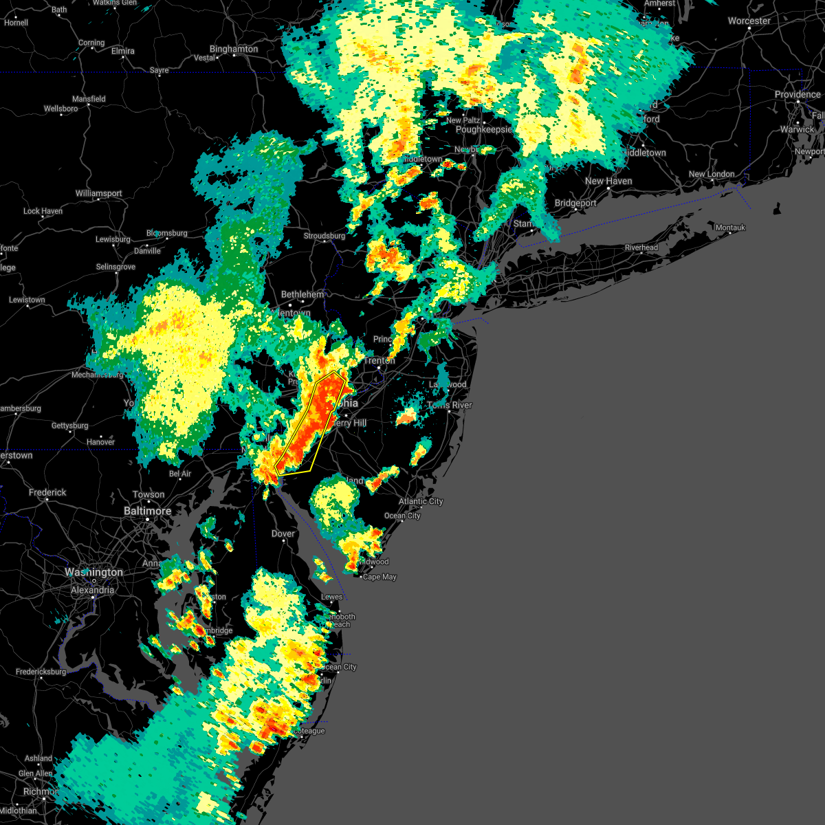 At 1002 pm edt, severe thunderstorms were located along a line extending from northeast philadelphia to golden triangle to near woodstown, moving northeast at 35 mph (radar indicated). Hazards include 60 mph wind gusts and quarter size hail. Minor damage to vehicles is possible. wind damage to roofs, siding, trees, and power lines is possible. locations impacted include, philadelphia, camden, wilmington, chester, west deptford, pennsville, yeadon, carneys point, hatboro, folcroft, ambler, swarthmore, paulsboro, penns grove, salem, jenkintown, narberth, woodstown, national park and east lansdowne. this includes the following highways, new jersey turnpike between exits 1 and 2. pennsylvania turnpike between mile markers 335 and 345. interstate 95 in pennsylvania between mile markers 2 and 16, and between mile markers 21 and 23. interstate 76 in pennsylvania between mile markers 334 and 350. interstate 295 in new jersey between mile markers 0 and 21. interstate 676 in pennsylvania between mile markers 0 and 1. Interstate 476 in pennsylvania between mile markers 0 and 3, and near mile marker 7. At 1002 pm edt, severe thunderstorms were located along a line extending from northeast philadelphia to golden triangle to near woodstown, moving northeast at 35 mph (radar indicated). Hazards include 60 mph wind gusts and quarter size hail. Minor damage to vehicles is possible. wind damage to roofs, siding, trees, and power lines is possible. locations impacted include, philadelphia, camden, wilmington, chester, west deptford, pennsville, yeadon, carneys point, hatboro, folcroft, ambler, swarthmore, paulsboro, penns grove, salem, jenkintown, narberth, woodstown, national park and east lansdowne. this includes the following highways, new jersey turnpike between exits 1 and 2. pennsylvania turnpike between mile markers 335 and 345. interstate 95 in pennsylvania between mile markers 2 and 16, and between mile markers 21 and 23. interstate 76 in pennsylvania between mile markers 334 and 350. interstate 295 in new jersey between mile markers 0 and 21. interstate 676 in pennsylvania between mile markers 0 and 1. Interstate 476 in pennsylvania between mile markers 0 and 3, and near mile marker 7.
|
| 7/17/2021 9:46 PM EDT |
 At 946 pm edt, severe thunderstorms were located along a line extending from roxborough to philadelphia international airport to near pennsville, moving east at 35 mph (radar indicated). Hazards include 60 mph wind gusts and quarter size hail. Minor damage to vehicles is possible. wind damage to roofs, siding, trees, and power lines is possible. locations impacted include, philadelphia, camden, wilmington, newark, chester, west deptford, pennsville, yeadon, carneys point, conshohocken, hatboro, folcroft, ambler, swarthmore, elsmere, paulsboro, new castle, penns grove, salem and jenkintown. this includes the following highways, new jersey turnpike between exits 1 and 2. pennsylvania turnpike between mile markers 333 and 345. interstate 95 in pennsylvania between mile markers 0 and 16, and between mile markers 21 and 23. interstate 95 in delaware between mile markers 3 and 23. interstate 76 in pennsylvania between mile markers 330 and 350. interstate 295 in new jersey between mile markers 0 and 21. interstate 676 in pennsylvania between mile markers 0 and 1. Interstate 476 in pennsylvania between mile markers 0 and 19. At 946 pm edt, severe thunderstorms were located along a line extending from roxborough to philadelphia international airport to near pennsville, moving east at 35 mph (radar indicated). Hazards include 60 mph wind gusts and quarter size hail. Minor damage to vehicles is possible. wind damage to roofs, siding, trees, and power lines is possible. locations impacted include, philadelphia, camden, wilmington, newark, chester, west deptford, pennsville, yeadon, carneys point, conshohocken, hatboro, folcroft, ambler, swarthmore, elsmere, paulsboro, new castle, penns grove, salem and jenkintown. this includes the following highways, new jersey turnpike between exits 1 and 2. pennsylvania turnpike between mile markers 333 and 345. interstate 95 in pennsylvania between mile markers 0 and 16, and between mile markers 21 and 23. interstate 95 in delaware between mile markers 3 and 23. interstate 76 in pennsylvania between mile markers 330 and 350. interstate 295 in new jersey between mile markers 0 and 21. interstate 676 in pennsylvania between mile markers 0 and 1. Interstate 476 in pennsylvania between mile markers 0 and 19.
|
| 7/17/2021 9:27 PM EDT |
 At 927 pm edt, severe thunderstorms were located along a line extending from newtown square to new castle, moving northeast at 30 mph (radar indicated). Hazards include 60 mph wind gusts and quarter size hail. Minor damage to vehicles is possible. Wind damage to roofs, siding, trees, and power lines is possible. At 927 pm edt, severe thunderstorms were located along a line extending from newtown square to new castle, moving northeast at 30 mph (radar indicated). Hazards include 60 mph wind gusts and quarter size hail. Minor damage to vehicles is possible. Wind damage to roofs, siding, trees, and power lines is possible.
|
| 7/8/2021 5:21 PM EDT |
 At 521 pm edt, a severe thunderstorm was located over concordville, or 8 miles southeast of west chester, moving northeast at 35 mph (radar indicated). Hazards include 60 mph wind gusts and penny size hail. damage to roofs, siding, trees, and power lines is possible At 521 pm edt, a severe thunderstorm was located over concordville, or 8 miles southeast of west chester, moving northeast at 35 mph (radar indicated). Hazards include 60 mph wind gusts and penny size hail. damage to roofs, siding, trees, and power lines is possible
|
| 7/1/2021 4:49 PM EDT |
 At 448 pm edt, severe thunderstorms were located along a line extending from hopewell to near langhorn to near roxborough to near alloway, moving east at 30 mph (radar indicated). Hazards include 60 mph wind gusts. Damage to roofs, siding, trees, and power lines is possible. locations impacted include, philadelphia, trenton, camden, gloucester city, bensalem, ewing, chester, willingboro, deptford, west deptford, glassboro, princeton, florence, bellmawr, yeadon, woodbury, burlington, bristol, pitman and riverside. people at the welcome america events should seek safe shelter immediately! this includes the following highways, new jersey turnpike between exits 1 and 3, and between exits 6 and 6a. pennsylvania turnpike between mile markers 342 and 359. interstate 95 in pennsylvania between mile markers 4 and 40. interstate 76 in pennsylvania between mile markers 335 and 351. interstate 76 in new jersey between mile markers 0 and 3. interstate 195 in new jersey between mile markers 0 and 3. interstate 295 in new jersey between mile markers 5 and 30, and between mile markers 55 and 76. interstate 676 in pennsylvania between mile markers 0 and 1. interstate 676 in new jersey between mile markers 0 and 4. Interstate 476 in pennsylvania between mile markers 0 and 3, and between mile markers 6 and 8. At 448 pm edt, severe thunderstorms were located along a line extending from hopewell to near langhorn to near roxborough to near alloway, moving east at 30 mph (radar indicated). Hazards include 60 mph wind gusts. Damage to roofs, siding, trees, and power lines is possible. locations impacted include, philadelphia, trenton, camden, gloucester city, bensalem, ewing, chester, willingboro, deptford, west deptford, glassboro, princeton, florence, bellmawr, yeadon, woodbury, burlington, bristol, pitman and riverside. people at the welcome america events should seek safe shelter immediately! this includes the following highways, new jersey turnpike between exits 1 and 3, and between exits 6 and 6a. pennsylvania turnpike between mile markers 342 and 359. interstate 95 in pennsylvania between mile markers 4 and 40. interstate 76 in pennsylvania between mile markers 335 and 351. interstate 76 in new jersey between mile markers 0 and 3. interstate 195 in new jersey between mile markers 0 and 3. interstate 295 in new jersey between mile markers 5 and 30, and between mile markers 55 and 76. interstate 676 in pennsylvania between mile markers 0 and 1. interstate 676 in new jersey between mile markers 0 and 4. Interstate 476 in pennsylvania between mile markers 0 and 3, and between mile markers 6 and 8.
|
| 7/1/2021 4:27 PM EDT |
 At 426 pm edt, severe thunderstorms were located along a line extending from new hope to bryn athyn to near newtown square to delaware city, moving east at 25 mph (law enforcement). Hazards include 60 mph wind gusts. damage to roofs, siding, trees, and power lines is possible At 426 pm edt, severe thunderstorms were located along a line extending from new hope to bryn athyn to near newtown square to delaware city, moving east at 25 mph (law enforcement). Hazards include 60 mph wind gusts. damage to roofs, siding, trees, and power lines is possible
|
| 7/1/2021 4:14 PM EDT |
 At 413 pm edt, severe thunderstorms were located along a line extending from gardenville to ambler to near bear, moving east at 30 mph (law enforcement. several reports of wind damage have been received from chester county). Hazards include 60 mph wind gusts. Damage to roofs, siding, trees, and power lines is possible. locations impacted include, philadelphia, wilmington, newark, west chester, norristown, chester, lansdale, west norriton, east norriton, pennsville, yeadon, westtown, doylestown, conshohocken, hatboro, folcroft, ambler, swarthmore, elsmere and new castle. this includes the following highways, pennsylvania turnpike between mile markers 322 and 348. northeast extension between mile markers 21 and 29. interstate 95 in pennsylvania between mile markers 0 and 10. interstate 95 in delaware between mile markers 1 and 23. interstate 76 in pennsylvania between mile markers 327 and 343. interstate 295 in new jersey near mile marker 0. Interstate 476 in pennsylvania between mile markers 0 and 19. At 413 pm edt, severe thunderstorms were located along a line extending from gardenville to ambler to near bear, moving east at 30 mph (law enforcement. several reports of wind damage have been received from chester county). Hazards include 60 mph wind gusts. Damage to roofs, siding, trees, and power lines is possible. locations impacted include, philadelphia, wilmington, newark, west chester, norristown, chester, lansdale, west norriton, east norriton, pennsville, yeadon, westtown, doylestown, conshohocken, hatboro, folcroft, ambler, swarthmore, elsmere and new castle. this includes the following highways, pennsylvania turnpike between mile markers 322 and 348. northeast extension between mile markers 21 and 29. interstate 95 in pennsylvania between mile markers 0 and 10. interstate 95 in delaware between mile markers 1 and 23. interstate 76 in pennsylvania between mile markers 327 and 343. interstate 295 in new jersey near mile marker 0. Interstate 476 in pennsylvania between mile markers 0 and 19.
|
| 7/1/2021 3:50 PM EDT |
 At 350 pm edt, severe thunderstorms were located along a line extending from perkasie to near valley forge to near pleasant hill, moving east at 30 mph (law enforcement). Hazards include 60 mph wind gusts. damage to roofs, siding, trees, and power lines is possible At 350 pm edt, severe thunderstorms were located along a line extending from perkasie to near valley forge to near pleasant hill, moving east at 30 mph (law enforcement). Hazards include 60 mph wind gusts. damage to roofs, siding, trees, and power lines is possible
|
| 6/21/2021 7:51 PM EDT |
 The severe thunderstorm warning for northern new castle, northern cumberland, salem, camden, gloucester, west central burlington, southeastern montgomery, southeastern chester, philadelphia and delaware counties will expire at 800 pm edt, the stormd which prompted the warning habr weakened below severe limits, and no longer poses an immediate threat to life or property. therefore, the warning will be allowed to expire. however gusty winds are still possible with these thunderstorms. a severe thunderstorm watch remains in effect until midnight edt for northern delaware, southern new jersey, and southeastern pennsylvania. to report severe weather, contact your nearest law enforcement agency. they will relay your report to the national weather service mount holly nj. The severe thunderstorm warning for northern new castle, northern cumberland, salem, camden, gloucester, west central burlington, southeastern montgomery, southeastern chester, philadelphia and delaware counties will expire at 800 pm edt, the stormd which prompted the warning habr weakened below severe limits, and no longer poses an immediate threat to life or property. therefore, the warning will be allowed to expire. however gusty winds are still possible with these thunderstorms. a severe thunderstorm watch remains in effect until midnight edt for northern delaware, southern new jersey, and southeastern pennsylvania. to report severe weather, contact your nearest law enforcement agency. they will relay your report to the national weather service mount holly nj.
|
| 6/21/2021 7:12 PM EDT |
 At 711 pm edt, a cluster of severe thunderstorms were located over western chester county near kennett square, moving east at 40 mph (radar indicated). Hazards include 60 mph wind gusts. damage to roofs, siding, trees, and power lines is possible At 711 pm edt, a cluster of severe thunderstorms were located over western chester county near kennett square, moving east at 40 mph (radar indicated). Hazards include 60 mph wind gusts. damage to roofs, siding, trees, and power lines is possible
|
| 6/14/2021 9:25 PM EDT |
 At 925 pm edt, a severe thunderstorm was located over philadelphia international arpt, or 9 miles west of gloucester city, moving east at 25 mph (radar indicated). Hazards include 60 mph wind gusts and quarter size hail. Minor damage to vehicles is possible. wind damage to roofs, siding, trees, and power lines is possible. locations impacted include, philadelphia, chester, west deptford, yeadon, folcroft, swarthmore, paulsboro, national park, swedesboro, arden, darby township, chelsea, chester township, gibbstown, tinicum township, south philadelphia, beckett, nether providence township, philadelphia international arpt and philadelphia international airport. this includes the following highways, new jersey turnpike near exit 2. interstate 95 in pennsylvania between mile markers 0 and 17. interstate 95 in delaware between mile markers 21 and 23. interstate 76 in pennsylvania between mile markers 347 and 350. interstate 295 in new jersey between mile markers 10 and 20. Interstate 476 in pennsylvania between mile markers 0 and 4. At 925 pm edt, a severe thunderstorm was located over philadelphia international arpt, or 9 miles west of gloucester city, moving east at 25 mph (radar indicated). Hazards include 60 mph wind gusts and quarter size hail. Minor damage to vehicles is possible. wind damage to roofs, siding, trees, and power lines is possible. locations impacted include, philadelphia, chester, west deptford, yeadon, folcroft, swarthmore, paulsboro, national park, swedesboro, arden, darby township, chelsea, chester township, gibbstown, tinicum township, south philadelphia, beckett, nether providence township, philadelphia international arpt and philadelphia international airport. this includes the following highways, new jersey turnpike near exit 2. interstate 95 in pennsylvania between mile markers 0 and 17. interstate 95 in delaware between mile markers 21 and 23. interstate 76 in pennsylvania between mile markers 347 and 350. interstate 295 in new jersey between mile markers 10 and 20. Interstate 476 in pennsylvania between mile markers 0 and 4.
|
| 6/14/2021 9:12 PM EDT |
 At 912 pm edt, a severe thunderstorm was located over chester township, or 12 miles northeast of wilmington, moving east at 20 mph (radar indicated). Hazards include 60 mph wind gusts and quarter size hail. Minor damage to vehicles is possible. wind damage to roofs, siding, trees, and power lines is possible. locations impacted include, philadelphia, chester, west deptford, yeadon, folcroft, swarthmore, paulsboro, national park, swedesboro, arden, darby township, elam, chelsea, chester township, gibbstown, tinicum township, lima, south philadelphia, beckett and nether providence township. this includes the following highways, new jersey turnpike near exit 2. interstate 95 in pennsylvania between mile markers 0 and 17. interstate 95 in delaware between mile markers 21 and 23. interstate 76 in pennsylvania between mile markers 347 and 350. interstate 295 in new jersey between mile markers 10 and 20. Interstate 476 in pennsylvania between mile markers 0 and 4. At 912 pm edt, a severe thunderstorm was located over chester township, or 12 miles northeast of wilmington, moving east at 20 mph (radar indicated). Hazards include 60 mph wind gusts and quarter size hail. Minor damage to vehicles is possible. wind damage to roofs, siding, trees, and power lines is possible. locations impacted include, philadelphia, chester, west deptford, yeadon, folcroft, swarthmore, paulsboro, national park, swedesboro, arden, darby township, elam, chelsea, chester township, gibbstown, tinicum township, lima, south philadelphia, beckett and nether providence township. this includes the following highways, new jersey turnpike near exit 2. interstate 95 in pennsylvania between mile markers 0 and 17. interstate 95 in delaware between mile markers 21 and 23. interstate 76 in pennsylvania between mile markers 347 and 350. interstate 295 in new jersey between mile markers 10 and 20. Interstate 476 in pennsylvania between mile markers 0 and 4.
|
| 6/14/2021 8:55 PM EDT |
 At 855 pm edt, a severe thunderstorm was located over concordville, or near west chester, moving east at 25 mph (radar indicated). Hazards include 60 mph wind gusts and quarter size hail. Minor damage to vehicles is possible. Wind damage to roofs, siding, trees, and power lines is possible. At 855 pm edt, a severe thunderstorm was located over concordville, or near west chester, moving east at 25 mph (radar indicated). Hazards include 60 mph wind gusts and quarter size hail. Minor damage to vehicles is possible. Wind damage to roofs, siding, trees, and power lines is possible.
|
| 4/29/2021 7:45 PM EDT |
 At 744 pm edt, a severe thunderstorm was located over nether providence township, or 12 miles west of gloucester city, moving east at 45 mph (radar indicated). Hazards include 60 mph wind gusts. damage to roofs, siding, trees, and power lines is possible At 744 pm edt, a severe thunderstorm was located over nether providence township, or 12 miles west of gloucester city, moving east at 45 mph (radar indicated). Hazards include 60 mph wind gusts. damage to roofs, siding, trees, and power lines is possible
|
| 4/21/2021 1:31 PM EDT |
 At 131 pm edt, severe thunderstorms were located along a line extending from near jenkintown to gibbstown, moving northeast at 60 mph (radar indicated). Hazards include 60 mph wind gusts and quarter size hail. Minor damage to vehicles is possible. wind damage to roofs, siding, trees, and power lines is possible. locations impacted include, philadelphia, trenton, camden, gloucester city, cherry hill, bensalem, mount laurel, ewing, chester, willingboro, west deptford, princeton, florence, bellmawr, yeadon, woodbury, burlington, bristol, riverside and conshohocken. people at the esperanza community vaccination site, burlington county mega site, and pennsylvania convention center vaccination site should seek safe shelter immediately! this includes the following highways, new jersey turnpike between exits 3 and 6a. pennsylvania turnpike between mile markers 337 and 359. interstate 95 in pennsylvania between mile markers 0 and 40. interstate 95 in delaware between mile markers 18 and 23. interstate 76 in pennsylvania between mile markers 331 and 351. interstate 76 in new jersey between mile markers 0 and 3. interstate 295 in new jersey between mile markers 14 and 50, and between mile markers 68 and 76. interstate 676 in pennsylvania between mile markers 0 and 1. interstate 676 in new jersey between mile markers 0 and 4. Interstate 476 in pennsylvania between mile markers 0 and 17. At 131 pm edt, severe thunderstorms were located along a line extending from near jenkintown to gibbstown, moving northeast at 60 mph (radar indicated). Hazards include 60 mph wind gusts and quarter size hail. Minor damage to vehicles is possible. wind damage to roofs, siding, trees, and power lines is possible. locations impacted include, philadelphia, trenton, camden, gloucester city, cherry hill, bensalem, mount laurel, ewing, chester, willingboro, west deptford, princeton, florence, bellmawr, yeadon, woodbury, burlington, bristol, riverside and conshohocken. people at the esperanza community vaccination site, burlington county mega site, and pennsylvania convention center vaccination site should seek safe shelter immediately! this includes the following highways, new jersey turnpike between exits 3 and 6a. pennsylvania turnpike between mile markers 337 and 359. interstate 95 in pennsylvania between mile markers 0 and 40. interstate 95 in delaware between mile markers 18 and 23. interstate 76 in pennsylvania between mile markers 331 and 351. interstate 76 in new jersey between mile markers 0 and 3. interstate 295 in new jersey between mile markers 14 and 50, and between mile markers 68 and 76. interstate 676 in pennsylvania between mile markers 0 and 1. interstate 676 in new jersey between mile markers 0 and 4. Interstate 476 in pennsylvania between mile markers 0 and 17.
|
| 4/21/2021 1:10 PM EDT |
 At 109 pm edt, severe thunderstorms were located along a line extending from near cheyney to near stanton, moving northeast at 60 mph (radar indicated). Hazards include 60 mph wind gusts and quarter size hail. Minor damage to vehicles is possible. Wind damage to roofs, siding, trees, and power lines is possible. At 109 pm edt, severe thunderstorms were located along a line extending from near cheyney to near stanton, moving northeast at 60 mph (radar indicated). Hazards include 60 mph wind gusts and quarter size hail. Minor damage to vehicles is possible. Wind damage to roofs, siding, trees, and power lines is possible.
|
| 3/28/2021 6:47 PM EDT |
 At 646 pm edt, severe thunderstorms were located along a line extending from norristown to arden to pennsville, moving east at 55 mph. this line of storms has a history of producing wind damage (public). Hazards include 60 mph wind gusts. damage to roofs, siding, trees, and power lines is possible At 646 pm edt, severe thunderstorms were located along a line extending from norristown to arden to pennsville, moving east at 55 mph. this line of storms has a history of producing wind damage (public). Hazards include 60 mph wind gusts. damage to roofs, siding, trees, and power lines is possible
|
| 11/30/2020 3:39 PM EST |
 The severe thunderstorm warning for northern new castle, northwestern salem, northwestern gloucester, southeastern montgomery, southeastern chester, philadelphia and delaware counties will expire at 345 pm est, the storm which prompted the warning has weakened below severe limits, and no longer poses an immediate threat to life or property. therefore, the warning will be allowed to expire. however gusty winds are still possible with this thunderstorm. a tornado watch remains in effect until 700 pm est for northern delaware, southern new jersey, and southeastern pennsylvania. The severe thunderstorm warning for northern new castle, northwestern salem, northwestern gloucester, southeastern montgomery, southeastern chester, philadelphia and delaware counties will expire at 345 pm est, the storm which prompted the warning has weakened below severe limits, and no longer poses an immediate threat to life or property. therefore, the warning will be allowed to expire. however gusty winds are still possible with this thunderstorm. a tornado watch remains in effect until 700 pm est for northern delaware, southern new jersey, and southeastern pennsylvania.
|
| 11/30/2020 3:28 PM EST |
 At 327 pm est, a severe thunderstorm was located over lima, or 10 miles east of west chester, moving northeast at 70 mph (radar indicated). Hazards include 60 mph wind gusts. Damage to roofs, siding, trees, and power lines is possible. locations impacted include, philadelphia, camden, wilmington, newark, middletown, west chester, norristown, chester, west norriton, east norriton, pennsville, yeadon, westtown, carneys point, conshohocken, folcroft, ambler, swarthmore, elsmere and paulsboro. this includes the following highways, pennsylvania turnpike between mile markers 320 and 340. northeast extension between mile markers 21 and 26. interstate 95 in pennsylvania between mile markers 0 and 15, and between mile markers 20 and 29. interstate 95 in delaware between mile markers 1 and 23. interstate 76 in pennsylvania between mile markers 327 and 349. interstate 295 in new jersey between mile markers 0 and 14. interstate 676 in pennsylvania between mile markers 0 and 1. Interstate 476 in pennsylvania between mile markers 0 and 19. At 327 pm est, a severe thunderstorm was located over lima, or 10 miles east of west chester, moving northeast at 70 mph (radar indicated). Hazards include 60 mph wind gusts. Damage to roofs, siding, trees, and power lines is possible. locations impacted include, philadelphia, camden, wilmington, newark, middletown, west chester, norristown, chester, west norriton, east norriton, pennsville, yeadon, westtown, carneys point, conshohocken, folcroft, ambler, swarthmore, elsmere and paulsboro. this includes the following highways, pennsylvania turnpike between mile markers 320 and 340. northeast extension between mile markers 21 and 26. interstate 95 in pennsylvania between mile markers 0 and 15, and between mile markers 20 and 29. interstate 95 in delaware between mile markers 1 and 23. interstate 76 in pennsylvania between mile markers 327 and 349. interstate 295 in new jersey between mile markers 0 and 14. interstate 676 in pennsylvania between mile markers 0 and 1. Interstate 476 in pennsylvania between mile markers 0 and 19.
|
| 11/30/2020 3:01 PM EST |
 At 301 pm est, a severe thunderstorm was located over elkton, moving northeast at 70 mph (radar indicated). Hazards include 60 mph wind gusts. damage to roofs, siding, trees, and power lines is possible At 301 pm est, a severe thunderstorm was located over elkton, moving northeast at 70 mph (radar indicated). Hazards include 60 mph wind gusts. damage to roofs, siding, trees, and power lines is possible
|
| 11/30/2020 2:41 PM EST |
 At 241 pm est, a severe thunderstorm was located over west nottingham, or 7 miles north of havre de grace, moving northeast at 55 mph (radar indicated). Hazards include 60 mph wind gusts. damage to roofs, siding, trees, and power lines is possible At 241 pm est, a severe thunderstorm was located over west nottingham, or 7 miles north of havre de grace, moving northeast at 55 mph (radar indicated). Hazards include 60 mph wind gusts. damage to roofs, siding, trees, and power lines is possible
|
| 11/15/2020 7:50 PM EST |
 At 749 pm est, intense showers and embedded severe thunderstorms were located along a line extending from near chalfont to chelsea to port penn to morgnec, moving northeast at 65 mph. this line may contain little or no lightning. do not wait until you hear thunder before taking cover (trained weather spotters). Hazards include 60 mph wind gusts. damage to roofs, siding, trees, and power lines is possible At 749 pm est, intense showers and embedded severe thunderstorms were located along a line extending from near chalfont to chelsea to port penn to morgnec, moving northeast at 65 mph. this line may contain little or no lightning. do not wait until you hear thunder before taking cover (trained weather spotters). Hazards include 60 mph wind gusts. damage to roofs, siding, trees, and power lines is possible
|
| 11/15/2020 7:25 PM EST |
 At 724 pm est, intense showers and some embedded severe thunderstorms were located along a line extending from near schwenksville to west nottingham, moving east at 55 mph. this line may contain little or no lightning. do not wait until you hear thunder before taking cover (trained weather spotters). Hazards include 60 mph wind gusts. Damage to roofs, siding, trees, and power lines is possible. locations impacted include, philadelphia, camden, wilmington, newark, middletown, west chester, gloucester city, norristown, chester, deptford, pottstown, west deptford, phoenixville, west norriton, east norriton, pennsville, coatesville, bellmawr, yeadon and westtown. this includes the following highways, new jersey turnpike between exits 1 and 2. pennsylvania turnpike between mile markers 304 and 346. northeast extension between mile markers 21 and 23. interstate 95 in pennsylvania between mile markers 0 and 33. interstate 95 in delaware between mile markers 1 and 23. interstate 76 in pennsylvania between mile markers 327 and 351. interstate 76 in new jersey between mile markers 1 and 3. interstate 295 in new jersey between mile markers 0 and 27. interstate 676 in pennsylvania between mile markers 0 and 1. interstate 676 in new jersey between mile markers 0 and 4. Interstate 476 in pennsylvania between mile markers 0 and 19. At 724 pm est, intense showers and some embedded severe thunderstorms were located along a line extending from near schwenksville to west nottingham, moving east at 55 mph. this line may contain little or no lightning. do not wait until you hear thunder before taking cover (trained weather spotters). Hazards include 60 mph wind gusts. Damage to roofs, siding, trees, and power lines is possible. locations impacted include, philadelphia, camden, wilmington, newark, middletown, west chester, gloucester city, norristown, chester, deptford, pottstown, west deptford, phoenixville, west norriton, east norriton, pennsville, coatesville, bellmawr, yeadon and westtown. this includes the following highways, new jersey turnpike between exits 1 and 2. pennsylvania turnpike between mile markers 304 and 346. northeast extension between mile markers 21 and 23. interstate 95 in pennsylvania between mile markers 0 and 33. interstate 95 in delaware between mile markers 1 and 23. interstate 76 in pennsylvania between mile markers 327 and 351. interstate 76 in new jersey between mile markers 1 and 3. interstate 295 in new jersey between mile markers 0 and 27. interstate 676 in pennsylvania between mile markers 0 and 1. interstate 676 in new jersey between mile markers 0 and 4. Interstate 476 in pennsylvania between mile markers 0 and 19.
|
| 11/15/2020 6:53 PM EST |
 At 652 pm est, intense showers and some embedded severe thunderstorms were located along a line extending from near bechtelsville to near randallstown, moving east at 50 mph. this line may contain little or no lightning. do not wait until you hear thunder before taking cover (radar indicated). Hazards include 60 mph wind gusts. damage to roofs, siding, trees, and power lines is possible At 652 pm est, intense showers and some embedded severe thunderstorms were located along a line extending from near bechtelsville to near randallstown, moving east at 50 mph. this line may contain little or no lightning. do not wait until you hear thunder before taking cover (radar indicated). Hazards include 60 mph wind gusts. damage to roofs, siding, trees, and power lines is possible
|
| 8/28/2020 4:39 PM EDT |
 At 437 pm edt, severe thunderstorms were located along a line extending from broomall to near ashland to newark to near hollywood beach, moving southeast at 35 mph (radar indicated). Hazards include 60 mph wind gusts and penny size hail. damage to roofs, siding, trees, and power lines is possible At 437 pm edt, severe thunderstorms were located along a line extending from broomall to near ashland to newark to near hollywood beach, moving southeast at 35 mph (radar indicated). Hazards include 60 mph wind gusts and penny size hail. damage to roofs, siding, trees, and power lines is possible
|
| 8/28/2020 4:10 PM EDT |
 At 410 pm edt, severe thunderstorms were located along a line extending from near elam to near salem to near hancocks bridge, moving east at 30 mph (radar indicated). Hazards include 60 mph wind gusts and quarter size hail. Minor damage to vehicles is possible. wind damage to roofs, siding, trees, and power lines is possible. locations impacted include, wilmington, chester, pennsville, carneys point, folcroft, swarthmore, elsmere, paulsboro, new castle, penns grove, salem, woodstown, alloway, quinton, swedesboro, delaware city, elmer, newport, arden and darby township. this includes the following highways, new jersey turnpike between exits 1 and 2. interstate 95 in pennsylvania between mile markers 0 and 10. interstate 95 in delaware between mile markers 9 and 23. interstate 295 in new jersey between mile markers 0 and 17. Interstate 476 in pennsylvania between mile markers 0 and 4. At 410 pm edt, severe thunderstorms were located along a line extending from near elam to near salem to near hancocks bridge, moving east at 30 mph (radar indicated). Hazards include 60 mph wind gusts and quarter size hail. Minor damage to vehicles is possible. wind damage to roofs, siding, trees, and power lines is possible. locations impacted include, wilmington, chester, pennsville, carneys point, folcroft, swarthmore, elsmere, paulsboro, new castle, penns grove, salem, woodstown, alloway, quinton, swedesboro, delaware city, elmer, newport, arden and darby township. this includes the following highways, new jersey turnpike between exits 1 and 2. interstate 95 in pennsylvania between mile markers 0 and 10. interstate 95 in delaware between mile markers 9 and 23. interstate 295 in new jersey between mile markers 0 and 17. Interstate 476 in pennsylvania between mile markers 0 and 4.
|
| 8/28/2020 3:52 PM EDT |
 At 352 pm edt, severe thunderstorms were located along a line extending from kennett square to near bear to hope creek, moving east at 30 mph (radar indicated). Hazards include 60 mph wind gusts and quarter size hail. Minor damage to vehicles is possible. Wind damage to roofs, siding, trees, and power lines is possible. At 352 pm edt, severe thunderstorms were located along a line extending from kennett square to near bear to hope creek, moving east at 30 mph (radar indicated). Hazards include 60 mph wind gusts and quarter size hail. Minor damage to vehicles is possible. Wind damage to roofs, siding, trees, and power lines is possible.
|
| 8/12/2020 2:16 PM EDT |
 At 216 pm edt, severe thunderstorms were located along a line extending from voorhees to elam, moving south at 10 mph (law enforcement. this storm downed trees in west goshen township in chester county). Hazards include 60 mph wind gusts. Damage to roofs, siding, trees, and power lines is possible. locations impacted include, philadelphia, camden, wilmington, west chester, gloucester city, cherry hill, evesham, mount laurel, chester, deptford, voorhees, medford, west deptford, lindenwold, bellmawr, yeadon, westtown, woodbury, downingtown and berlin. this includes the following highways, new jersey turnpike between exits 3 and 4. interstate 95 in pennsylvania between mile markers 0 and 25. interstate 95 in delaware between mile markers 15 and 23. interstate 76 in pennsylvania between mile markers 341 and 351. interstate 76 in new jersey between mile markers 0 and 3. interstate 295 in new jersey between mile markers 11 and 40. interstate 676 in pennsylvania between mile markers 0 and 1. interstate 676 in new jersey between mile markers 0 and 4. Interstate 476 in pennsylvania between mile markers 0 and 12. At 216 pm edt, severe thunderstorms were located along a line extending from voorhees to elam, moving south at 10 mph (law enforcement. this storm downed trees in west goshen township in chester county). Hazards include 60 mph wind gusts. Damage to roofs, siding, trees, and power lines is possible. locations impacted include, philadelphia, camden, wilmington, west chester, gloucester city, cherry hill, evesham, mount laurel, chester, deptford, voorhees, medford, west deptford, lindenwold, bellmawr, yeadon, westtown, woodbury, downingtown and berlin. this includes the following highways, new jersey turnpike between exits 3 and 4. interstate 95 in pennsylvania between mile markers 0 and 25. interstate 95 in delaware between mile markers 15 and 23. interstate 76 in pennsylvania between mile markers 341 and 351. interstate 76 in new jersey between mile markers 0 and 3. interstate 295 in new jersey between mile markers 11 and 40. interstate 676 in pennsylvania between mile markers 0 and 1. interstate 676 in new jersey between mile markers 0 and 4. Interstate 476 in pennsylvania between mile markers 0 and 12.
|
| 8/12/2020 1:54 PM EDT |
 At 153 pm edt, severe thunderstorms were located along a line extending from evesham to westtown, moving southwest at 10 mph (law enforcement. these storms have downed several power lines in burlington county). Hazards include 60 mph wind gusts. damage to roofs, siding, trees, and power lines is possible At 153 pm edt, severe thunderstorms were located along a line extending from evesham to westtown, moving southwest at 10 mph (law enforcement. these storms have downed several power lines in burlington county). Hazards include 60 mph wind gusts. damage to roofs, siding, trees, and power lines is possible
|
| 8/12/2020 1:49 PM EDT |
 At 148 pm edt, severe thunderstorms were located along a line extending from medford to cherry hill to gradyville, moving southwest at 10 mph (law enforcement. several reports of wires down have been received from moorestown and maple shade). Hazards include 60 mph wind gusts. Damage to roofs, siding, trees, and power lines is possible. locations impacted include, philadelphia, camden, gloucester city, cherry hill, evesham, mount laurel, chester, deptford, voorhees, medford, west deptford, lindenwold, bellmawr, yeadon, woodbury, berlin, palmyra, folcroft, swarthmore and paulsboro. this includes the following highways, new jersey turnpike between exits 3 and 4. interstate 95 in pennsylvania between mile markers 2 and 28. interstate 76 in pennsylvania between mile markers 337 and 351. interstate 76 in new jersey between mile markers 0 and 3. interstate 295 in new jersey between mile markers 18 and 43. interstate 676 in pennsylvania between mile markers 0 and 1. interstate 676 in new jersey between mile markers 0 and 4. Interstate 476 in pennsylvania between mile markers 0 and 14. At 148 pm edt, severe thunderstorms were located along a line extending from medford to cherry hill to gradyville, moving southwest at 10 mph (law enforcement. several reports of wires down have been received from moorestown and maple shade). Hazards include 60 mph wind gusts. Damage to roofs, siding, trees, and power lines is possible. locations impacted include, philadelphia, camden, gloucester city, cherry hill, evesham, mount laurel, chester, deptford, voorhees, medford, west deptford, lindenwold, bellmawr, yeadon, woodbury, berlin, palmyra, folcroft, swarthmore and paulsboro. this includes the following highways, new jersey turnpike between exits 3 and 4. interstate 95 in pennsylvania between mile markers 2 and 28. interstate 76 in pennsylvania between mile markers 337 and 351. interstate 76 in new jersey between mile markers 0 and 3. interstate 295 in new jersey between mile markers 18 and 43. interstate 676 in pennsylvania between mile markers 0 and 1. interstate 676 in new jersey between mile markers 0 and 4. Interstate 476 in pennsylvania between mile markers 0 and 14.
|
| 8/12/2020 1:32 PM EDT |
 At 131 pm edt, severe thunderstorms were located along a line extending from pemberton to marlton to gradyville, moving south at 5 mph (law enforcement. several reports of wires down have been received from the willingboro and moorestown area from these storms). Hazards include 60 mph wind gusts. Damage to roofs, siding, trees, and power lines is possible. locations impacted include, philadelphia, camden, gloucester city, cherry hill, evesham, mount laurel, chester, deptford, voorhees, medford, west deptford, lindenwold, lumberton, bellmawr, yeadon, woodbury, mount holly, berlin, palmyra and tabernacle. this includes the following highways, new jersey turnpike between exits 3 and 4. interstate 95 in pennsylvania between mile markers 2 and 28. interstate 76 in pennsylvania between mile markers 337 and 351. interstate 76 in new jersey between mile markers 0 and 3. interstate 295 in new jersey between mile markers 18 and 43. interstate 676 in pennsylvania between mile markers 0 and 1. interstate 676 in new jersey between mile markers 0 and 4. Interstate 476 in pennsylvania between mile markers 0 and 14. At 131 pm edt, severe thunderstorms were located along a line extending from pemberton to marlton to gradyville, moving south at 5 mph (law enforcement. several reports of wires down have been received from the willingboro and moorestown area from these storms). Hazards include 60 mph wind gusts. Damage to roofs, siding, trees, and power lines is possible. locations impacted include, philadelphia, camden, gloucester city, cherry hill, evesham, mount laurel, chester, deptford, voorhees, medford, west deptford, lindenwold, lumberton, bellmawr, yeadon, woodbury, mount holly, berlin, palmyra and tabernacle. this includes the following highways, new jersey turnpike between exits 3 and 4. interstate 95 in pennsylvania between mile markers 2 and 28. interstate 76 in pennsylvania between mile markers 337 and 351. interstate 76 in new jersey between mile markers 0 and 3. interstate 295 in new jersey between mile markers 18 and 43. interstate 676 in pennsylvania between mile markers 0 and 1. interstate 676 in new jersey between mile markers 0 and 4. Interstate 476 in pennsylvania between mile markers 0 and 14.
|
| 8/12/2020 1:12 PM EDT |
 At 112 pm edt, severe thunderstorms were located along a line extending from near pemberton to near mount laurel to gradyville, moving south at 5 mph (law enforcement). Hazards include 60 mph wind gusts. damage to roofs, siding, trees, and power lines is possible At 112 pm edt, severe thunderstorms were located along a line extending from near pemberton to near mount laurel to gradyville, moving south at 5 mph (law enforcement). Hazards include 60 mph wind gusts. damage to roofs, siding, trees, and power lines is possible
|
| 8/7/2020 6:24 PM EDT |
 At 624 pm edt, a severe thunderstorm was located over mullica hill, or 14 miles southwest of gloucester city, moving east at 30 mph (radar indicated. greenville delaware deos site had a measured 54 mph wind gust). Hazards include 60 mph wind gusts. Damage to roofs, siding, trees, and power lines is possible. locations impacted include, philadelphia, wilmington, vineland, millville, bridgeton, gloucester city, chester, deptford, voorhees, west deptford, glassboro, lindenwold, pennsville, bellmawr, yeadon, woodbury, pitman, clayton, carneys point and berlin. this includes the following highways, new jersey turnpike between exits 1 and 3. interstate 95 in pennsylvania between mile markers 0 and 17. interstate 95 in delaware between mile markers 15 and 23. interstate 76 in new jersey between mile markers 0 and 1. interstate 295 in new jersey between mile markers 0 and 29. interstate 476 in pennsylvania between mile markers 0 and 5. Atlantic city expressway between mile markers 33 and 44. At 624 pm edt, a severe thunderstorm was located over mullica hill, or 14 miles southwest of gloucester city, moving east at 30 mph (radar indicated. greenville delaware deos site had a measured 54 mph wind gust). Hazards include 60 mph wind gusts. Damage to roofs, siding, trees, and power lines is possible. locations impacted include, philadelphia, wilmington, vineland, millville, bridgeton, gloucester city, chester, deptford, voorhees, west deptford, glassboro, lindenwold, pennsville, bellmawr, yeadon, woodbury, pitman, clayton, carneys point and berlin. this includes the following highways, new jersey turnpike between exits 1 and 3. interstate 95 in pennsylvania between mile markers 0 and 17. interstate 95 in delaware between mile markers 15 and 23. interstate 76 in new jersey between mile markers 0 and 1. interstate 295 in new jersey between mile markers 0 and 29. interstate 476 in pennsylvania between mile markers 0 and 5. Atlantic city expressway between mile markers 33 and 44.
|
| 8/7/2020 6:14 PM EDT |
 At 614 pm edt, a severe thunderstorm was located over arden, or near wilmington, moving east at 20 mph (radar indicated). Hazards include 60 mph wind gusts and quarter size hail. Minor damage to vehicles is possible. wind damage to roofs, siding, trees, and power lines is possible. locations impacted include, philadelphia, wilmington, chester, pennsville, carneys point, conshohocken, swarthmore, elsmere, new castle, penns grove, narberth, newport, arden, stanton, cheyney, talleyville, elam, bryn mawr, trout lake and chelsea. this includes the following highways, interstate 95 in pennsylvania between mile markers 0 and 3. interstate 95 in delaware between mile markers 8 and 23. interstate 76 in pennsylvania between mile markers 328 and 336. Interstate 476 in pennsylvania between mile markers 2 and 17. At 614 pm edt, a severe thunderstorm was located over arden, or near wilmington, moving east at 20 mph (radar indicated). Hazards include 60 mph wind gusts and quarter size hail. Minor damage to vehicles is possible. wind damage to roofs, siding, trees, and power lines is possible. locations impacted include, philadelphia, wilmington, chester, pennsville, carneys point, conshohocken, swarthmore, elsmere, new castle, penns grove, narberth, newport, arden, stanton, cheyney, talleyville, elam, bryn mawr, trout lake and chelsea. this includes the following highways, interstate 95 in pennsylvania between mile markers 0 and 3. interstate 95 in delaware between mile markers 8 and 23. interstate 76 in pennsylvania between mile markers 328 and 336. Interstate 476 in pennsylvania between mile markers 2 and 17.
|
| 8/7/2020 5:57 PM EDT |
 At 557 pm edt, a severe thunderstorm was located over arden, or near wilmington, moving east at 30 mph (radar indicated). Hazards include 70 mph wind gusts. Expect considerable tree damage. Damage is likely to mobile homes, roofs, and outbuildings. At 557 pm edt, a severe thunderstorm was located over arden, or near wilmington, moving east at 30 mph (radar indicated). Hazards include 70 mph wind gusts. Expect considerable tree damage. Damage is likely to mobile homes, roofs, and outbuildings.
|
| 8/7/2020 5:38 PM EDT |
 At 538 pm edt, a severe thunderstorm was located over kennett square, or 7 miles southwest of west chester, moving east at 20 mph (radar indicated). Hazards include 60 mph wind gusts and quarter size hail. Minor damage to vehicles is possible. Wind damage to roofs, siding, trees, and power lines is possible. At 538 pm edt, a severe thunderstorm was located over kennett square, or 7 miles southwest of west chester, moving east at 20 mph (radar indicated). Hazards include 60 mph wind gusts and quarter size hail. Minor damage to vehicles is possible. Wind damage to roofs, siding, trees, and power lines is possible.
|
| 7/30/2020 11:06 PM EDT |
 At 1105 pm edt, severe thunderstorms were located along a line extending from near broomall to near millville, moving northeast at 30 mph (radar indicated). Hazards include 60 mph wind gusts. damage to roofs, siding, trees, and power lines is possible At 1105 pm edt, severe thunderstorms were located along a line extending from near broomall to near millville, moving northeast at 30 mph (radar indicated). Hazards include 60 mph wind gusts. damage to roofs, siding, trees, and power lines is possible
|
| 7/30/2020 11:06 PM EDT |
 The national weather service in mount holly nj has issued a * severe thunderstorm warning for. northwestern atlantic county in southern new jersey. north central cumberland county in southern new jersey. east central salem county in southern new jersey. Camden county in southern new jersey. The national weather service in mount holly nj has issued a * severe thunderstorm warning for. northwestern atlantic county in southern new jersey. north central cumberland county in southern new jersey. east central salem county in southern new jersey. Camden county in southern new jersey.
|
| 7/23/2020 11:35 PM EDT |
 At 1134 pm edt, a severe thunderstorm was located over bear, or near newark, moving east at 10 mph (radar indicated). Hazards include 60 mph wind gusts and penny size hail. Damage to roofs, siding, trees, and power lines is possible. locations impacted include, wilmington, newark, chester, pennsville, carneys point, elsmere, new castle, penns grove, salem, woodstown, swedesboro, delaware city, newport, arden, stanton, cheyney, glasgow, talleyville, elam and chelsea. this includes the following highways, new jersey turnpike near exit 1. interstate 95 in pennsylvania between mile markers 0 and 5. interstate 95 in delaware between mile markers 1 and 23. Interstate 295 in new jersey between mile markers 0 and 13. At 1134 pm edt, a severe thunderstorm was located over bear, or near newark, moving east at 10 mph (radar indicated). Hazards include 60 mph wind gusts and penny size hail. Damage to roofs, siding, trees, and power lines is possible. locations impacted include, wilmington, newark, chester, pennsville, carneys point, elsmere, new castle, penns grove, salem, woodstown, swedesboro, delaware city, newport, arden, stanton, cheyney, glasgow, talleyville, elam and chelsea. this includes the following highways, new jersey turnpike near exit 1. interstate 95 in pennsylvania between mile markers 0 and 5. interstate 95 in delaware between mile markers 1 and 23. Interstate 295 in new jersey between mile markers 0 and 13.
|
| 7/23/2020 11:16 PM EDT |
 At 1116 pm edt, a severe thunderstorm was located near newark, moving northeast at 10 mph (radar indicated). Hazards include 60 mph wind gusts. damage to roofs, siding, trees, and power lines is possible At 1116 pm edt, a severe thunderstorm was located near newark, moving northeast at 10 mph (radar indicated). Hazards include 60 mph wind gusts. damage to roofs, siding, trees, and power lines is possible
|
| 7/22/2020 6:20 PM EDT |
 The severe thunderstorm warning for northern new castle, northwestern gloucester, southeastern montgomery, western philadelphia and delaware counties will expire at 630 pm edt, the storms which prompted the warning have moved out of the area. therefore, the warning will be allowed to expire. a severe thunderstorm watch remains in effect until 1000 pm edt for northern delaware, southern new jersey, and southeastern pennsylvania. to report severe weather, contact your nearest law enforcement agency. they will relay your report to the national weather service mount holly nj. The severe thunderstorm warning for northern new castle, northwestern gloucester, southeastern montgomery, western philadelphia and delaware counties will expire at 630 pm edt, the storms which prompted the warning have moved out of the area. therefore, the warning will be allowed to expire. a severe thunderstorm watch remains in effect until 1000 pm edt for northern delaware, southern new jersey, and southeastern pennsylvania. to report severe weather, contact your nearest law enforcement agency. they will relay your report to the national weather service mount holly nj.
|
| 7/22/2020 6:06 PM EDT |
 At 606 pm edt, severe thunderstorms were located along a line extending from bryn mawr to near lima to near pike creek, moving east at 20 mph (radar indicated). Hazards include 60 mph wind gusts and penny size hail. Damage to roofs, siding, trees, and power lines is possible. locations impacted include, philadelphia, wilmington, newark, chester, yeadon, folcroft, swarthmore, elsmere, narberth, east lansdowne, rockledge, newport, arden, darby township, stanton, morris park, talleyville, elam, bryn mawr and trout lake. this includes the following highways, interstate 95 in pennsylvania between mile markers 0 and 14, and near mile marker 22. interstate 95 in delaware between mile markers 3 and 23. interstate 76 in pennsylvania between mile markers 335 and 349. interstate 676 in pennsylvania between mile markers 0 and 1. Interstate 476 in pennsylvania between mile markers 0 and 13. At 606 pm edt, severe thunderstorms were located along a line extending from bryn mawr to near lima to near pike creek, moving east at 20 mph (radar indicated). Hazards include 60 mph wind gusts and penny size hail. Damage to roofs, siding, trees, and power lines is possible. locations impacted include, philadelphia, wilmington, newark, chester, yeadon, folcroft, swarthmore, elsmere, narberth, east lansdowne, rockledge, newport, arden, darby township, stanton, morris park, talleyville, elam, bryn mawr and trout lake. this includes the following highways, interstate 95 in pennsylvania between mile markers 0 and 14, and near mile marker 22. interstate 95 in delaware between mile markers 3 and 23. interstate 76 in pennsylvania between mile markers 335 and 349. interstate 676 in pennsylvania between mile markers 0 and 1. Interstate 476 in pennsylvania between mile markers 0 and 13.
|
| 7/22/2020 5:33 PM EDT |
 At 533 pm edt, severe thunderstorms were located along a line extending from paoli to near kennett square to pleasant hill, moving east at 25 mph (radar indicated). Hazards include 60 mph wind gusts and penny size hail. damage to roofs, siding, trees, and power lines is possible At 533 pm edt, severe thunderstorms were located along a line extending from paoli to near kennett square to pleasant hill, moving east at 25 mph (radar indicated). Hazards include 60 mph wind gusts and penny size hail. damage to roofs, siding, trees, and power lines is possible
|
| 6/28/2020 5:37 PM EDT |
 The severe thunderstorm warning for east central chester and delaware counties will expire at 545 pm edt, the storm which prompted the warning has weakened below severe limits, and no longer poses an immediate threat to life or property. therefore, the warning will be allowed to expire. however gusty winds are still possible with this thunderstorm. The severe thunderstorm warning for east central chester and delaware counties will expire at 545 pm edt, the storm which prompted the warning has weakened below severe limits, and no longer poses an immediate threat to life or property. therefore, the warning will be allowed to expire. however gusty winds are still possible with this thunderstorm.
|
| 6/28/2020 5:20 PM EDT |
 At 520 pm edt, a severe thunderstorm was located over west chester, moving east at 35 mph (radar indicated). Hazards include 60 mph wind gusts and half dollar size hail. Minor damage to vehicles is possible. wind damage to roofs, siding, trees, and power lines is possible. locations impacted include, west chester, chester, westtown, downingtown, swarthmore, cheyney, elam, marshallton, lima, trout lake, chelsea, radnor township, gradyville, nether providence township, broomall, newtown square, chester township, concordville, bryn mawr and drexel hill. this includes the following highways, interstate 95 in pennsylvania between mile markers 2 and 6. Interstate 476 in pennsylvania between mile markers 0 and 13. At 520 pm edt, a severe thunderstorm was located over west chester, moving east at 35 mph (radar indicated). Hazards include 60 mph wind gusts and half dollar size hail. Minor damage to vehicles is possible. wind damage to roofs, siding, trees, and power lines is possible. locations impacted include, west chester, chester, westtown, downingtown, swarthmore, cheyney, elam, marshallton, lima, trout lake, chelsea, radnor township, gradyville, nether providence township, broomall, newtown square, chester township, concordville, bryn mawr and drexel hill. this includes the following highways, interstate 95 in pennsylvania between mile markers 2 and 6. Interstate 476 in pennsylvania between mile markers 0 and 13.
|
| 6/28/2020 5:09 PM EDT |
 At 509 pm edt, a severe thunderstorm was located over marshallton, or near west chester, moving east at 35 mph (radar indicated). Hazards include 60 mph wind gusts and half dollar size hail. Minor damage to vehicles is possible. Wind damage to roofs, siding, trees, and power lines is possible. At 509 pm edt, a severe thunderstorm was located over marshallton, or near west chester, moving east at 35 mph (radar indicated). Hazards include 60 mph wind gusts and half dollar size hail. Minor damage to vehicles is possible. Wind damage to roofs, siding, trees, and power lines is possible.
|
| 6/4/2020 10:55 PM EDT |
 At 1054 pm edt, severe thunderstorms were located along a line extending from near hatfield to near chestnut hill to tinicum township, moving east at 40 mph (radar indicated). Hazards include 60 mph wind gusts. Damage to roofs, siding, trees, and power lines is possible. locations impacted include, philadelphia, camden, gloucester city, cherry hill, bensalem, mount laurel, norristown, chester, willingboro, lansdale, west norriton, east norriton, lumberton, florence, bellmawr, yeadon, woodbury, burlington, bristol and mount holly. this includes the following highways, interstate 295 in new jersey between mile markers 20 and 55. interstate 95 in pennsylvania between mile markers 2 and 40. new jersey turnpike between exits 4 and 6a. interstate 476 in pennsylvania between mile markers 0 and 19. pennsylvania turnpike between exits 326 and 353. northeast extension between exits a20 and a31. interstate 676 in new jersey between mile markers 0 and 4. interstate 676 in pennsylvania between mile markers 0 and 1. interstate 76 in new jersey between mile markers 0 and 3. Interstate 76 in pennsylvania between mile markers 327 and 351. At 1054 pm edt, severe thunderstorms were located along a line extending from near hatfield to near chestnut hill to tinicum township, moving east at 40 mph (radar indicated). Hazards include 60 mph wind gusts. Damage to roofs, siding, trees, and power lines is possible. locations impacted include, philadelphia, camden, gloucester city, cherry hill, bensalem, mount laurel, norristown, chester, willingboro, lansdale, west norriton, east norriton, lumberton, florence, bellmawr, yeadon, woodbury, burlington, bristol and mount holly. this includes the following highways, interstate 295 in new jersey between mile markers 20 and 55. interstate 95 in pennsylvania between mile markers 2 and 40. new jersey turnpike between exits 4 and 6a. interstate 476 in pennsylvania between mile markers 0 and 19. pennsylvania turnpike between exits 326 and 353. northeast extension between exits a20 and a31. interstate 676 in new jersey between mile markers 0 and 4. interstate 676 in pennsylvania between mile markers 0 and 1. interstate 76 in new jersey between mile markers 0 and 3. Interstate 76 in pennsylvania between mile markers 327 and 351.
|
| 6/4/2020 10:44 PM EDT |
 At 1043 pm edt, severe thunderstorms were located along a line extending from near spring mount to near valley forge to chester township, moving northeast at 40 mph. radar data shows an area of more focused damaging winds moving into far northern delaware county (radar indicated). Hazards include 60 mph wind gusts. Damage to roofs, siding, trees, and power lines is possible. locations impacted include, philadelphia, camden, wilmington, gloucester city, cherry hill, bensalem, mount laurel, norristown, chester, willingboro, pottstown, west deptford, phoenixville, lansdale, west norriton, east norriton, lumberton, florence, bellmawr and yeadon. this includes the following highways, interstate 295 in new jersey between mile markers 20 and 55. interstate 95 in pennsylvania between mile markers 0 and 40. new jersey turnpike between exits 4 and 6a. interstate 95 in delaware between mile markers 15 and 23. interstate 476 in pennsylvania between mile markers 0 and 19. pennsylvania turnpike between exits 320 and 353. northeast extension between exits a20 and a31. interstate 676 in new jersey between mile markers 0 and 4. interstate 676 in pennsylvania between mile markers 0 and 1. interstate 76 in new jersey between mile markers 0 and 3. Interstate 76 in pennsylvania between mile markers 327 and 351. At 1043 pm edt, severe thunderstorms were located along a line extending from near spring mount to near valley forge to chester township, moving northeast at 40 mph. radar data shows an area of more focused damaging winds moving into far northern delaware county (radar indicated). Hazards include 60 mph wind gusts. Damage to roofs, siding, trees, and power lines is possible. locations impacted include, philadelphia, camden, wilmington, gloucester city, cherry hill, bensalem, mount laurel, norristown, chester, willingboro, pottstown, west deptford, phoenixville, lansdale, west norriton, east norriton, lumberton, florence, bellmawr and yeadon. this includes the following highways, interstate 295 in new jersey between mile markers 20 and 55. interstate 95 in pennsylvania between mile markers 0 and 40. new jersey turnpike between exits 4 and 6a. interstate 95 in delaware between mile markers 15 and 23. interstate 476 in pennsylvania between mile markers 0 and 19. pennsylvania turnpike between exits 320 and 353. northeast extension between exits a20 and a31. interstate 676 in new jersey between mile markers 0 and 4. interstate 676 in pennsylvania between mile markers 0 and 1. interstate 76 in new jersey between mile markers 0 and 3. Interstate 76 in pennsylvania between mile markers 327 and 351.
|
| 6/4/2020 10:44 PM EDT |
 At 1030 pm edt, severe thunderstorms were located along a line extending from near cedarville to near west chester to near talleyville, moving northeast at 40 mph (radar indicated). Hazards include 60 mph wind gusts. damage to roofs, siding, trees, and power lines is possible At 1030 pm edt, severe thunderstorms were located along a line extending from near cedarville to near west chester to near talleyville, moving northeast at 40 mph (radar indicated). Hazards include 60 mph wind gusts. damage to roofs, siding, trees, and power lines is possible
|
| 6/4/2020 10:31 PM EDT |
 At 1030 pm edt, severe thunderstorms were located along a line extending from near cedarville to near west chester to near talleyville, moving northeast at 40 mph (radar indicated). Hazards include 60 mph wind gusts. damage to roofs, siding, trees, and power lines is possible At 1030 pm edt, severe thunderstorms were located along a line extending from near cedarville to near west chester to near talleyville, moving northeast at 40 mph (radar indicated). Hazards include 60 mph wind gusts. damage to roofs, siding, trees, and power lines is possible
|
| 6/3/2020 7:33 PM EDT |
 At 731 pm edt, severe thunderstorms were located along a line extending from near chester to national park to wissinoming, moving southeast at 45 mph. these are very dangerous storms (emergency management). Hazards include 80 mph wind gusts and quarter size hail. Flying debris will be dangerous to those caught without shelter. mobile homes will be heavily damaged. expect considerable damage to roofs, windows, and vehicles. extensive tree damage and power outages are likely. locations impacted include, philadelphia, camden, wilmington, vineland, gloucester city, cherry hill, evesham, mount laurel, chester, deptford, voorhees, medford, west deptford, glassboro, lindenwold, bellmawr, yeadon, woodbury, pitman and clayton. this includes the following highways, atlantic city expressway between mile markers 31 and 44. interstate 295 in new jersey between mile markers 4 and 42. interstate 95 in pennsylvania between mile markers 0 and 31. new jersey turnpike between exits 1 and 4. interstate 95 in delaware between mile markers 16 and 23. interstate 476 in pennsylvania between mile markers 0 and 12. pennsylvania turnpike near exit 339. interstate 676 in new jersey between mile markers 0 and 4. interstate 676 in pennsylvania between mile markers 0 and 1. interstate 76 in new jersey between mile markers 0 and 3. Interstate 76 in pennsylvania between mile markers 333 and 351. At 731 pm edt, severe thunderstorms were located along a line extending from near chester to national park to wissinoming, moving southeast at 45 mph. these are very dangerous storms (emergency management). Hazards include 80 mph wind gusts and quarter size hail. Flying debris will be dangerous to those caught without shelter. mobile homes will be heavily damaged. expect considerable damage to roofs, windows, and vehicles. extensive tree damage and power outages are likely. locations impacted include, philadelphia, camden, wilmington, vineland, gloucester city, cherry hill, evesham, mount laurel, chester, deptford, voorhees, medford, west deptford, glassboro, lindenwold, bellmawr, yeadon, woodbury, pitman and clayton. this includes the following highways, atlantic city expressway between mile markers 31 and 44. interstate 295 in new jersey between mile markers 4 and 42. interstate 95 in pennsylvania between mile markers 0 and 31. new jersey turnpike between exits 1 and 4. interstate 95 in delaware between mile markers 16 and 23. interstate 476 in pennsylvania between mile markers 0 and 12. pennsylvania turnpike near exit 339. interstate 676 in new jersey between mile markers 0 and 4. interstate 676 in pennsylvania between mile markers 0 and 1. interstate 76 in new jersey between mile markers 0 and 3. Interstate 76 in pennsylvania between mile markers 333 and 351.
|
| 6/3/2020 7:08 PM EDT |
 At 707 pm edt, severe thunderstorms were located along a line extending from near westtown to gradyville to norristown, moving southeast at 50 mph. these are very dangerous storms (emergency management). Hazards include 80 mph wind gusts and quarter size hail. Flying debris will be dangerous to those caught without shelter. mobile homes will be heavily damaged. expect considerable damage to roofs, windows, and vehicles. extensive tree damage and power outages are likely. locations impacted include, philadelphia, camden, wilmington, vineland, west chester, gloucester city, cherry hill, evesham, mount laurel, norristown, chester, deptford, voorhees, medford, west deptford, glassboro, lindenwold, phoenixville, west norriton and east norriton. this includes the following highways, atlantic city expressway between mile markers 30 and 44. interstate 295 in new jersey between mile markers 4 and 42. interstate 95 in pennsylvania between mile markers 0 and 32. new jersey turnpike between exits 1 and 4. interstate 95 in delaware between mile markers 15 and 23. interstate 476 in pennsylvania between mile markers 0 and 19. pennsylvania turnpike between exits 312 and 340. northeast extension near exit a20. interstate 676 in new jersey between mile markers 0 and 4. interstate 676 in pennsylvania between mile markers 0 and 1. interstate 76 in new jersey between mile markers 0 and 3. Interstate 76 in pennsylvania between mile markers 327 and 351. At 707 pm edt, severe thunderstorms were located along a line extending from near westtown to gradyville to norristown, moving southeast at 50 mph. these are very dangerous storms (emergency management). Hazards include 80 mph wind gusts and quarter size hail. Flying debris will be dangerous to those caught without shelter. mobile homes will be heavily damaged. expect considerable damage to roofs, windows, and vehicles. extensive tree damage and power outages are likely. locations impacted include, philadelphia, camden, wilmington, vineland, west chester, gloucester city, cherry hill, evesham, mount laurel, norristown, chester, deptford, voorhees, medford, west deptford, glassboro, lindenwold, phoenixville, west norriton and east norriton. this includes the following highways, atlantic city expressway between mile markers 30 and 44. interstate 295 in new jersey between mile markers 4 and 42. interstate 95 in pennsylvania between mile markers 0 and 32. new jersey turnpike between exits 1 and 4. interstate 95 in delaware between mile markers 15 and 23. interstate 476 in pennsylvania between mile markers 0 and 19. pennsylvania turnpike between exits 312 and 340. northeast extension near exit a20. interstate 676 in new jersey between mile markers 0 and 4. interstate 676 in pennsylvania between mile markers 0 and 1. interstate 76 in new jersey between mile markers 0 and 3. Interstate 76 in pennsylvania between mile markers 327 and 351.
|
| 6/3/2020 7:02 PM EDT |
 At 701 pm edt, severe thunderstorms were located along a line extending from marshallton to near paoli to near west norriton, moving southeast at 50 mph (emergency management). Hazards include 70 mph wind gusts and quarter size hail. Minor damage to vehicles is possible. expect considerable tree damage. Wind damage is also likely to mobile homes, roofs, and outbuildings. At 701 pm edt, severe thunderstorms were located along a line extending from marshallton to near paoli to near west norriton, moving southeast at 50 mph (emergency management). Hazards include 70 mph wind gusts and quarter size hail. Minor damage to vehicles is possible. expect considerable tree damage. Wind damage is also likely to mobile homes, roofs, and outbuildings.
|
| 6/3/2020 12:41 PM EDT |
 The severe thunderstorm warning for northern new castle, northeastern cecil, northwestern salem, west central camden, northwestern gloucester, southern chester, southwestern philadelphia and delaware counties will expire at 1245 pm edt, the storms which prompted the warning have moved out of the area. therefore, the warning will be allowed to expire. a severe thunderstorm watch remains in effect until 300 pm edt for northern delaware, northeastern maryland, southern new jersey, and southeastern pennsylvania. The severe thunderstorm warning for northern new castle, northeastern cecil, northwestern salem, west central camden, northwestern gloucester, southern chester, southwestern philadelphia and delaware counties will expire at 1245 pm edt, the storms which prompted the warning have moved out of the area. therefore, the warning will be allowed to expire. a severe thunderstorm watch remains in effect until 300 pm edt for northern delaware, northeastern maryland, southern new jersey, and southeastern pennsylvania.
|
| 6/3/2020 12:27 PM EDT |
 At 1225 pm edt, severe thunderstorms were located along a line extending from swarthmore to near chelsea to newark, moving east at 70 mph (radar indicated). Hazards include 70 mph wind gusts and penny size hail. Expect considerable tree damage. damage is likely to mobile homes, roofs, and outbuildings. locations impacted include, philadelphia, wilmington, newark, west chester, gloucester city, calvert, chester, deptford, voorhees, west deptford, glassboro, lindenwold, pennsville, coatesville, bellmawr, yeadon, westtown, woodbury, pitman and carneys point. this includes the following highways, atlantic city expressway between mile markers 42 and 44. interstate 295 in new jersey between mile markers 0 and 32. interstate 95 in pennsylvania between mile markers 0 and 18. new jersey turnpike between exits 1 and 3. interstate 95 in delaware between mile markers 2 and 23. interstate 476 in pennsylvania between mile markers 0 and 6. interstate 676 in new jersey near mile marker 0. interstate 76 in new jersey between mile markers 0 and 3. Interstate 76 in pennsylvania between mile markers 349 and 351. At 1225 pm edt, severe thunderstorms were located along a line extending from swarthmore to near chelsea to newark, moving east at 70 mph (radar indicated). Hazards include 70 mph wind gusts and penny size hail. Expect considerable tree damage. damage is likely to mobile homes, roofs, and outbuildings. locations impacted include, philadelphia, wilmington, newark, west chester, gloucester city, calvert, chester, deptford, voorhees, west deptford, glassboro, lindenwold, pennsville, coatesville, bellmawr, yeadon, westtown, woodbury, pitman and carneys point. this includes the following highways, atlantic city expressway between mile markers 42 and 44. interstate 295 in new jersey between mile markers 0 and 32. interstate 95 in pennsylvania between mile markers 0 and 18. new jersey turnpike between exits 1 and 3. interstate 95 in delaware between mile markers 2 and 23. interstate 476 in pennsylvania between mile markers 0 and 6. interstate 676 in new jersey near mile marker 0. interstate 76 in new jersey between mile markers 0 and 3. Interstate 76 in pennsylvania between mile markers 349 and 351.
|
| 6/3/2020 12:06 PM EDT |
 At 1206 pm edt, severe thunderstorms were located along a line extending from near glenmoore to near coatesville to wakefield, moving east at 60 mph (radar indicated). Hazards include 70 mph wind gusts and penny size hail. Expect considerable tree damage. Damage is likely to mobile homes, roofs, and outbuildings. At 1206 pm edt, severe thunderstorms were located along a line extending from near glenmoore to near coatesville to wakefield, moving east at 60 mph (radar indicated). Hazards include 70 mph wind gusts and penny size hail. Expect considerable tree damage. Damage is likely to mobile homes, roofs, and outbuildings.
|
| 4/21/2020 2:12 PM EDT |
 At 210 pm edt, a severe thunderstorm was located over glasgow, or near newark, moving east at 55 mph (radar indicated). Hazards include 60 mph wind gusts and penny size hail. Damage to roofs, siding, trees, and power lines is possible. locations impacted include, philadelphia, camden, wilmington, vineland, newark, millville, bridgeton, middletown, elkton, gloucester city, cumberland, cherry hill, evesham, mount laurel, chester, deptford, voorhees, west deptford, glassboro and lindenwold. people attending covid-19 drive through testing should seek safe shelter immediately! this includes the following highways, atlantic city expressway between mile markers 33 and 44. interstate 295 in new jersey between mile markers 0 and 41. interstate 95 in pennsylvania between mile markers 0 and 25. interstate 95 in maryland between mile markers 107 and 109. new jersey turnpike between exits 1 and 4. interstate 95 in delaware between mile markers 0 and 23. interstate 476 in pennsylvania between mile markers 0 and 7. interstate 676 in new jersey between mile markers 0 and 4. interstate 676 in pennsylvania between mile markers 0 and 1. interstate 76 in new jersey between mile markers 0 and 3. Interstate 76 in pennsylvania between mile markers 341 and 351. At 210 pm edt, a severe thunderstorm was located over glasgow, or near newark, moving east at 55 mph (radar indicated). Hazards include 60 mph wind gusts and penny size hail. Damage to roofs, siding, trees, and power lines is possible. locations impacted include, philadelphia, camden, wilmington, vineland, newark, millville, bridgeton, middletown, elkton, gloucester city, cumberland, cherry hill, evesham, mount laurel, chester, deptford, voorhees, west deptford, glassboro and lindenwold. people attending covid-19 drive through testing should seek safe shelter immediately! this includes the following highways, atlantic city expressway between mile markers 33 and 44. interstate 295 in new jersey between mile markers 0 and 41. interstate 95 in pennsylvania between mile markers 0 and 25. interstate 95 in maryland between mile markers 107 and 109. new jersey turnpike between exits 1 and 4. interstate 95 in delaware between mile markers 0 and 23. interstate 476 in pennsylvania between mile markers 0 and 7. interstate 676 in new jersey between mile markers 0 and 4. interstate 676 in pennsylvania between mile markers 0 and 1. interstate 76 in new jersey between mile markers 0 and 3. Interstate 76 in pennsylvania between mile markers 341 and 351.
|
| 4/21/2020 1:49 PM EDT |
 At 149 pm edt, a severe thunderstorm was located over talleyville, or near wilmington, moving east at 55 mph (radar indicated). Hazards include 60 mph wind gusts and penny size hail. damage to roofs, siding, trees, and power lines is possible At 149 pm edt, a severe thunderstorm was located over talleyville, or near wilmington, moving east at 55 mph (radar indicated). Hazards include 60 mph wind gusts and penny size hail. damage to roofs, siding, trees, and power lines is possible
|
| 4/13/2020 3:43 PM EDT |
 The severe thunderstorm warning for new castle, cecil, western salem, northwestern gloucester, southeastern chester and delaware counties will expire at 345 pm edt, the storms which prompted the warning have exited the warned area. therefore, the warning will be allowed to expire. however, gusty winds and heavy rain are still possible with these thunderstorms. a tornado watch remains in effect until 600 pm edt for central and northern delaware, northeastern maryland, southern new jersey, and southeastern pennsylvania. The severe thunderstorm warning for new castle, cecil, western salem, northwestern gloucester, southeastern chester and delaware counties will expire at 345 pm edt, the storms which prompted the warning have exited the warned area. therefore, the warning will be allowed to expire. however, gusty winds and heavy rain are still possible with these thunderstorms. a tornado watch remains in effect until 600 pm edt for central and northern delaware, northeastern maryland, southern new jersey, and southeastern pennsylvania.
|
| 4/13/2020 3:19 PM EDT |
 At 318 pm edt, severe thunderstorms were located along a line extending from near paoli to overton, moving east at 40 mph (radar indicated). Hazards include 60 mph wind gusts. Damage to roofs, siding, trees, and power lines is possible. locations impacted include, wilmington, newark, middletown, west chester, elkton, chester, pennsville, westtown, smyrna, carneys point, folcroft, swarthmore, elsmere, paulsboro, kennett square, new castle, penns grove, salem, north east and woodstown. people attending covid-19 drive through testing should seek safe shelter immediately! this includes the following highways, interstate 295 in new jersey between mile markers 0 and 17. interstate 95 in pennsylvania between mile markers 0 and 11. interstate 95 in maryland between mile markers 101 and 109. new jersey turnpike near exit 1. interstate 95 in delaware between mile markers 0 and 23. Interstate 476 in pennsylvania between mile markers 0 and 7. At 318 pm edt, severe thunderstorms were located along a line extending from near paoli to overton, moving east at 40 mph (radar indicated). Hazards include 60 mph wind gusts. Damage to roofs, siding, trees, and power lines is possible. locations impacted include, wilmington, newark, middletown, west chester, elkton, chester, pennsville, westtown, smyrna, carneys point, folcroft, swarthmore, elsmere, paulsboro, kennett square, new castle, penns grove, salem, north east and woodstown. people attending covid-19 drive through testing should seek safe shelter immediately! this includes the following highways, interstate 295 in new jersey between mile markers 0 and 17. interstate 95 in pennsylvania between mile markers 0 and 11. interstate 95 in maryland between mile markers 101 and 109. new jersey turnpike near exit 1. interstate 95 in delaware between mile markers 0 and 23. Interstate 476 in pennsylvania between mile markers 0 and 7.
|
| 4/13/2020 2:41 PM EDT |
 At 239 pm edt, severe thunderstorms were located along a line extending from churchtown to severn, moving east at 40 mph (radar indicated). Hazards include 60 mph wind gusts. damage to roofs, siding, trees, and power lines is possible At 239 pm edt, severe thunderstorms were located along a line extending from churchtown to severn, moving east at 40 mph (radar indicated). Hazards include 60 mph wind gusts. damage to roofs, siding, trees, and power lines is possible
|
| 4/10/2020 12:10 AM EDT |
 At 1209 am edt, severe thunderstorms were located along a line extending from chester township to delaware city to near hollywood beach, moving east at 60 mph (radar indicated). Hazards include 70 mph wind gusts. Expect considerable tree damage. damage is likely to mobile homes, roofs, and outbuildings. locations impacted include, philadelphia, wilmington, vineland, millville, bridgeton, middletown, chester, deptford, west deptford, glassboro, lindenwold, pennsville, bellmawr, woodbury, smyrna, pitman, carneys point, berlin, folcroft and swarthmore. this includes the following highways, atlantic city expressway between mile markers 38 and 44. interstate 295 in new jersey between mile markers 0 and 26. interstate 95 in pennsylvania between mile markers 0 and 13. new jersey turnpike between exits 1 and 2. interstate 95 in delaware between mile markers 11 and 23. Interstate 476 in pennsylvania between mile markers 0 and 3. At 1209 am edt, severe thunderstorms were located along a line extending from chester township to delaware city to near hollywood beach, moving east at 60 mph (radar indicated). Hazards include 70 mph wind gusts. Expect considerable tree damage. damage is likely to mobile homes, roofs, and outbuildings. locations impacted include, philadelphia, wilmington, vineland, millville, bridgeton, middletown, chester, deptford, west deptford, glassboro, lindenwold, pennsville, bellmawr, woodbury, smyrna, pitman, carneys point, berlin, folcroft and swarthmore. this includes the following highways, atlantic city expressway between mile markers 38 and 44. interstate 295 in new jersey between mile markers 0 and 26. interstate 95 in pennsylvania between mile markers 0 and 13. new jersey turnpike between exits 1 and 2. interstate 95 in delaware between mile markers 11 and 23. Interstate 476 in pennsylvania between mile markers 0 and 3.
|
| 4/9/2020 11:49 PM EDT |
 At 1148 pm edt, severe thunderstorms were located along a line extending from near coatesville to pleasant hill to near bel air south, moving east at 60 mph (radar indicated). Hazards include 60 mph wind gusts and small hail. damage to roofs, siding, trees, and power lines is possible At 1148 pm edt, severe thunderstorms were located along a line extending from near coatesville to pleasant hill to near bel air south, moving east at 60 mph (radar indicated). Hazards include 60 mph wind gusts and small hail. damage to roofs, siding, trees, and power lines is possible
|
| 4/9/2020 2:07 PM EDT |
 The severe thunderstorm warning for montgomery, south central bucks, northeastern chester, western philadelphia and delaware counties will expire at 215 pm edt, the storm which prompted the warning has moved out of the area. therefore, the warning will be allowed to expire. however gusty winds are still possible and a wind advisory remains in effect. a severe thunderstorm watch remains in effect until 400 pm edt for southern new jersey, and southeastern pennsylvania. The severe thunderstorm warning for montgomery, south central bucks, northeastern chester, western philadelphia and delaware counties will expire at 215 pm edt, the storm which prompted the warning has moved out of the area. therefore, the warning will be allowed to expire. however gusty winds are still possible and a wind advisory remains in effect. a severe thunderstorm watch remains in effect until 400 pm edt for southern new jersey, and southeastern pennsylvania.
|
| 4/9/2020 1:50 PM EDT |
 At 149 pm edt, a severe thunderstorm was located over king of prussia, or 12 miles west of philadelphia, moving east at 55 mph (radar indicated). Hazards include 60 mph wind gusts. Damage to roofs, siding, trees, and power lines is possible. locations impacted include, philadelphia, west chester, norristown, chester, pottstown, phoenixville, lansdale, west norriton, east norriton, yeadon, westtown, downingtown, conshohocken, hatboro, folcroft, ambler, swarthmore, collegeville, royersford and jenkintown. people attending covid-19 drive through testing should seek safe shelter immediately! this includes the following highways, interstate 95 in pennsylvania between mile markers 7 and 16, and near mile marker 22. interstate 476 in pennsylvania between mile markers 0 and 19. pennsylvania turnpike between exits 312 and 343. northeast extension between exits a20 and a31. interstate 676 in pennsylvania between mile markers 0 and 1. Interstate 76 in pennsylvania between mile markers 327 and 350. At 149 pm edt, a severe thunderstorm was located over king of prussia, or 12 miles west of philadelphia, moving east at 55 mph (radar indicated). Hazards include 60 mph wind gusts. Damage to roofs, siding, trees, and power lines is possible. locations impacted include, philadelphia, west chester, norristown, chester, pottstown, phoenixville, lansdale, west norriton, east norriton, yeadon, westtown, downingtown, conshohocken, hatboro, folcroft, ambler, swarthmore, collegeville, royersford and jenkintown. people attending covid-19 drive through testing should seek safe shelter immediately! this includes the following highways, interstate 95 in pennsylvania between mile markers 7 and 16, and near mile marker 22. interstate 476 in pennsylvania between mile markers 0 and 19. pennsylvania turnpike between exits 312 and 343. northeast extension between exits a20 and a31. interstate 676 in pennsylvania between mile markers 0 and 1. Interstate 76 in pennsylvania between mile markers 327 and 350.
|
| 4/9/2020 1:37 PM EDT |
 At 137 pm edt, a severe thunderstorm was located near chester springs, or 9 miles north of west chester, moving east at 55 mph (radar indicated). Hazards include 60 mph wind gusts. Damage to roofs, siding, trees, and power lines is possible. locations impacted include, philadelphia, west chester, norristown, chester, pottstown, phoenixville, lansdale, west norriton, east norriton, coatesville, yeadon, westtown, downingtown, conshohocken, hatboro, folcroft, ambler, swarthmore, collegeville and royersford. people attending covid-19 drive through testing should seek safe shelter immediately! this includes the following highways, interstate 95 in pennsylvania between mile markers 7 and 16, and near mile marker 22. interstate 476 in pennsylvania between mile markers 0 and 19. pennsylvania turnpike between exits 312 and 343. northeast extension between exits a20 and a31. interstate 676 in pennsylvania between mile markers 0 and 1. Interstate 76 in pennsylvania between mile markers 327 and 350. At 137 pm edt, a severe thunderstorm was located near chester springs, or 9 miles north of west chester, moving east at 55 mph (radar indicated). Hazards include 60 mph wind gusts. Damage to roofs, siding, trees, and power lines is possible. locations impacted include, philadelphia, west chester, norristown, chester, pottstown, phoenixville, lansdale, west norriton, east norriton, coatesville, yeadon, westtown, downingtown, conshohocken, hatboro, folcroft, ambler, swarthmore, collegeville and royersford. people attending covid-19 drive through testing should seek safe shelter immediately! this includes the following highways, interstate 95 in pennsylvania between mile markers 7 and 16, and near mile marker 22. interstate 476 in pennsylvania between mile markers 0 and 19. pennsylvania turnpike between exits 312 and 343. northeast extension between exits a20 and a31. interstate 676 in pennsylvania between mile markers 0 and 1. Interstate 76 in pennsylvania between mile markers 327 and 350.
|
| 4/9/2020 1:37 PM EDT |
 The severe thunderstorm warning for southern morris, southeastern hunterdon, northwestern mercer, somerset, northwestern middlesex, southeastern montgomery, southeastern bucks, philadelphia and eastern delaware counties will expire at 145 pm edt, the storms which prompted the warning have moved out of the area. therefore, the warning will be allowed to expire. however gusty winds are still possible with these thunderstorms. a severe thunderstorm watch remains in effect until 400 pm edt for central, northern and northwestern new jersey, and southeastern pennsylvania. to report severe weather, contact your nearest law enforcement agency. they will relay your report to the national weather service mount holly nj. The severe thunderstorm warning for southern morris, southeastern hunterdon, northwestern mercer, somerset, northwestern middlesex, southeastern montgomery, southeastern bucks, philadelphia and eastern delaware counties will expire at 145 pm edt, the storms which prompted the warning have moved out of the area. therefore, the warning will be allowed to expire. however gusty winds are still possible with these thunderstorms. a severe thunderstorm watch remains in effect until 400 pm edt for central, northern and northwestern new jersey, and southeastern pennsylvania. to report severe weather, contact your nearest law enforcement agency. they will relay your report to the national weather service mount holly nj.
|
| 4/9/2020 1:26 PM EDT |
 At 125 pm edt, a severe thunderstorm was located over glenmoore, or 12 miles northwest of west chester, moving east at 55 mph (radar indicated). Hazards include 60 mph wind gusts. damage to roofs, siding, trees, and power lines is possible At 125 pm edt, a severe thunderstorm was located over glenmoore, or 12 miles northwest of west chester, moving east at 55 mph (radar indicated). Hazards include 60 mph wind gusts. damage to roofs, siding, trees, and power lines is possible
|
| 4/9/2020 1:20 PM EDT |
 At 119 pm edt, severe thunderstorms were located along a line extending from near white house station to near washington crossing to nether providence township, moving east at 60 mph (radar indicated). Hazards include 60 mph wind gusts and penny size hail. Damage to roofs, siding, trees, and power lines is possible. locations impacted include, philadelphia, trenton, somerville, bensalem, bridgewater, ewing, chester, middlesex, princeton, yeadon, bound brook, manville, hatboro, folcroft, swarthmore, flemington, jenkintown, narberth, east lansdowne and pennington. this includes the following highways, interstate 287 in new jersey between mile markers 8 and 27. interstate 295 in new jersey between mile markers 68 and 76. interstate 78 in new jersey between mile markers 23 and 43. interstate 95 in pennsylvania between mile markers 6 and 10. interstate 476 in pennsylvania between mile markers 0 and 9. pennsylvania turnpike between exits 340 and 353. interstate 676 in pennsylvania between mile markers 0 and 1. Interstate 76 in pennsylvania between mile markers 335 and 347. At 119 pm edt, severe thunderstorms were located along a line extending from near white house station to near washington crossing to nether providence township, moving east at 60 mph (radar indicated). Hazards include 60 mph wind gusts and penny size hail. Damage to roofs, siding, trees, and power lines is possible. locations impacted include, philadelphia, trenton, somerville, bensalem, bridgewater, ewing, chester, middlesex, princeton, yeadon, bound brook, manville, hatboro, folcroft, swarthmore, flemington, jenkintown, narberth, east lansdowne and pennington. this includes the following highways, interstate 287 in new jersey between mile markers 8 and 27. interstate 295 in new jersey between mile markers 68 and 76. interstate 78 in new jersey between mile markers 23 and 43. interstate 95 in pennsylvania between mile markers 6 and 10. interstate 476 in pennsylvania between mile markers 0 and 9. pennsylvania turnpike between exits 340 and 353. interstate 676 in pennsylvania between mile markers 0 and 1. Interstate 76 in pennsylvania between mile markers 335 and 347.
|
| 4/9/2020 1:12 PM EDT |
 At 111 pm edt, severe thunderstorms were located along a line extending from westtown to pike creek to near charlestown, moving east at 45 mph (radar indicated). Hazards include 60 mph wind gusts and penny size hail. damage to roofs, siding, trees, and power lines is possible At 111 pm edt, severe thunderstorms were located along a line extending from westtown to pike creek to near charlestown, moving east at 45 mph (radar indicated). Hazards include 60 mph wind gusts and penny size hail. damage to roofs, siding, trees, and power lines is possible
|
| 4/9/2020 1:00 PM EDT |
 At 100 pm edt, severe thunderstorms were located along a line extending from near bloomsbury to near fricks to marshallton, moving east at 45 mph (radar indicated). Hazards include 60 mph wind gusts and penny size hail. damage to roofs, siding, trees, and power lines is possible At 100 pm edt, severe thunderstorms were located along a line extending from near bloomsbury to near fricks to marshallton, moving east at 45 mph (radar indicated). Hazards include 60 mph wind gusts and penny size hail. damage to roofs, siding, trees, and power lines is possible
|
| 4/8/2020 2:30 AM EDT |
 At 230 am edt, a severe thunderstorm was located over paoli, or 8 miles northeast of west chester, moving east at 40 mph (radar indicated). Hazards include quarter size hail. minor damage to vehicles is possible At 230 am edt, a severe thunderstorm was located over paoli, or 8 miles northeast of west chester, moving east at 40 mph (radar indicated). Hazards include quarter size hail. minor damage to vehicles is possible
|
| 3/3/2020 9:26 PM EST |
 At 926 pm est, severe thunderstorms were located along a line extending from near long valley to ivyland to bear, moving southeast at 40 mph (radar indicated). Hazards include 60 mph wind gusts. Damage to roofs, siding, trees, and power lines is possible. locations impacted include, philadelphia, trenton, camden, wilmington, newark, west chester, gloucester city, cherry hill, bensalem, evesham, mount laurel, ewing, norristown, chester, willingboro, deptford, voorhees, west deptford, glassboro and lindenwold. this includes the following highways, atlantic city expressway between mile markers 42 and 44. interstate 195 in new jersey between mile markers 0 and 6. interstate 295 in new jersey between mile markers 0 and 76. interstate 95 in pennsylvania between mile markers 0 and 40. interstate 95 in maryland near mile marker 109. new jersey turnpike between exits 1 and 7a. interstate 95 in delaware between mile markers 0 and 23. interstate 476 in pennsylvania between mile markers 0 and 19. pennsylvania turnpike between exits 326 and 353. northeast extension near exit a20. interstate 676 in new jersey between mile markers 0 and 4. interstate 676 in pennsylvania between mile markers 0 and 1. interstate 76 in new jersey between mile markers 0 and 3. Interstate 76 in pennsylvania between mile markers 327 and 351. At 926 pm est, severe thunderstorms were located along a line extending from near long valley to ivyland to bear, moving southeast at 40 mph (radar indicated). Hazards include 60 mph wind gusts. Damage to roofs, siding, trees, and power lines is possible. locations impacted include, philadelphia, trenton, camden, wilmington, newark, west chester, gloucester city, cherry hill, bensalem, evesham, mount laurel, ewing, norristown, chester, willingboro, deptford, voorhees, west deptford, glassboro and lindenwold. this includes the following highways, atlantic city expressway between mile markers 42 and 44. interstate 195 in new jersey between mile markers 0 and 6. interstate 295 in new jersey between mile markers 0 and 76. interstate 95 in pennsylvania between mile markers 0 and 40. interstate 95 in maryland near mile marker 109. new jersey turnpike between exits 1 and 7a. interstate 95 in delaware between mile markers 0 and 23. interstate 476 in pennsylvania between mile markers 0 and 19. pennsylvania turnpike between exits 326 and 353. northeast extension near exit a20. interstate 676 in new jersey between mile markers 0 and 4. interstate 676 in pennsylvania between mile markers 0 and 1. interstate 76 in new jersey between mile markers 0 and 3. Interstate 76 in pennsylvania between mile markers 327 and 351.
|
| 3/3/2020 9:09 PM EST |
 At 908 pm est, severe thunderstorms were located along a line extending from great meadows-vienna to chalfont to fair hill, moving southeast at 40 mph (radar indicated). Hazards include 60 mph wind gusts. damage to roofs, siding, trees, and power lines is possible At 908 pm est, severe thunderstorms were located along a line extending from great meadows-vienna to chalfont to fair hill, moving southeast at 40 mph (radar indicated). Hazards include 60 mph wind gusts. damage to roofs, siding, trees, and power lines is possible
|
| 2/7/2020 10:02 AM EST |
 At 1001 am est, severe thunderstorms were located along a line extending from king of prussia to penns grove to near middletown, moving northeast at 50 mph (radar indicated). Hazards include 70 mph wind gusts and penny size hail. Expect considerable tree damage. damage is likely to mobile homes, roofs, and outbuildings. locations impacted include, philadelphia, camden, wilmington, middletown, west chester, norristown, chester, west deptford, west norriton, east norriton, pennsville, yeadon, westtown, woodbury, carneys point, conshohocken, hatboro, folcroft, ambler and swarthmore. this includes the following highways, interstate 295 in new jersey between mile markers 0 and 23. interstate 95 in pennsylvania between mile markers 0 and 23. new jersey turnpike between exits 1 and 2. interstate 95 in delaware between mile markers 9 and 23. interstate 476 in pennsylvania between mile markers 0 and 19. pennsylvania turnpike between exits 326 and 343. northeast extension near exit a20. interstate 676 in pennsylvania between mile markers 0 and 1. Interstate 76 in pennsylvania between mile markers 327 and 351. At 1001 am est, severe thunderstorms were located along a line extending from king of prussia to penns grove to near middletown, moving northeast at 50 mph (radar indicated). Hazards include 70 mph wind gusts and penny size hail. Expect considerable tree damage. damage is likely to mobile homes, roofs, and outbuildings. locations impacted include, philadelphia, camden, wilmington, middletown, west chester, norristown, chester, west deptford, west norriton, east norriton, pennsville, yeadon, westtown, woodbury, carneys point, conshohocken, hatboro, folcroft, ambler and swarthmore. this includes the following highways, interstate 295 in new jersey between mile markers 0 and 23. interstate 95 in pennsylvania between mile markers 0 and 23. new jersey turnpike between exits 1 and 2. interstate 95 in delaware between mile markers 9 and 23. interstate 476 in pennsylvania between mile markers 0 and 19. pennsylvania turnpike between exits 326 and 343. northeast extension near exit a20. interstate 676 in pennsylvania between mile markers 0 and 1. Interstate 76 in pennsylvania between mile markers 327 and 351.
|
| 2/7/2020 9:36 AM EST |
 At 936 am est, severe thunderstorms were located along a line extending from marshallton to elkton to kennedyville, moving northeast at 50 mph (radar indicated). Hazards include 70 mph wind gusts and penny size hail. Expect considerable tree damage. Damage is likely to mobile homes, roofs, and outbuildings. At 936 am est, severe thunderstorms were located along a line extending from marshallton to elkton to kennedyville, moving northeast at 50 mph (radar indicated). Hazards include 70 mph wind gusts and penny size hail. Expect considerable tree damage. Damage is likely to mobile homes, roofs, and outbuildings.
|
| 10/31/2019 11:15 PM EDT |
 At 1114 pm edt, severe thunderstorms were located along a line extending from riegelsville to newark, moving northeast at 60 mph (radar indicated). Hazards include 60 mph wind gusts. damage to roofs, siding, trees, and power lines is possible At 1114 pm edt, severe thunderstorms were located along a line extending from riegelsville to newark, moving northeast at 60 mph (radar indicated). Hazards include 60 mph wind gusts. damage to roofs, siding, trees, and power lines is possible
|
| 9/4/2019 6:02 PM EDT |
 The national weather service in mount holly nj has issued a * severe thunderstorm warning for. northwestern camden county in southern new jersey. north central gloucester county in southern new jersey. west central burlington county in southern new jersey. South central montgomery county in southeastern pennsylvania. The national weather service in mount holly nj has issued a * severe thunderstorm warning for. northwestern camden county in southern new jersey. north central gloucester county in southern new jersey. west central burlington county in southern new jersey. South central montgomery county in southeastern pennsylvania.
|
| 9/4/2019 6:02 PM EDT |
 At 602 pm edt, a severe thunderstorm was located over newtown square, or 11 miles east of west chester, moving southeast at 25 mph (radar indicated). Hazards include 60 mph wind gusts and quarter size hail. Minor damage to vehicles is possible. Wind damage to roofs, siding, trees, and power lines is possible. At 602 pm edt, a severe thunderstorm was located over newtown square, or 11 miles east of west chester, moving southeast at 25 mph (radar indicated). Hazards include 60 mph wind gusts and quarter size hail. Minor damage to vehicles is possible. Wind damage to roofs, siding, trees, and power lines is possible.
|
| 8/7/2019 5:16 PM EDT |
 At 515 pm edt, severe thunderstorms with a history of producing wind damage were located along a line extending from washington crossing to germantown to chester, moving northeast at 30 mph (radar indicated). Hazards include 60 mph wind gusts and penny size hail. damage to roofs, siding, trees, and power lines is possible At 515 pm edt, severe thunderstorms with a history of producing wind damage were located along a line extending from washington crossing to germantown to chester, moving northeast at 30 mph (radar indicated). Hazards include 60 mph wind gusts and penny size hail. damage to roofs, siding, trees, and power lines is possible
|
| 8/7/2019 4:52 PM EDT |
 At 452 pm edt, severe thunderstorms were located along a line extending from near ambler to near lima to elsmere, moving northeast at 30 mph (radar indicated). Hazards include 60 mph wind gusts and penny size hail. Damage to roofs, siding, trees, and power lines is possible. locations impacted include, philadelphia, wilmington, norristown, chester, west norriton, east norriton, pennsville, yeadon, carneys point, conshohocken, folcroft, swarthmore, elsmere, new castle, penns grove, jenkintown, narberth, east lansdowne, abington and newport. This includes interstate 295 in new jersey between mile markers 1 and 14. At 452 pm edt, severe thunderstorms were located along a line extending from near ambler to near lima to elsmere, moving northeast at 30 mph (radar indicated). Hazards include 60 mph wind gusts and penny size hail. Damage to roofs, siding, trees, and power lines is possible. locations impacted include, philadelphia, wilmington, norristown, chester, west norriton, east norriton, pennsville, yeadon, carneys point, conshohocken, folcroft, swarthmore, elsmere, new castle, penns grove, jenkintown, narberth, east lansdowne, abington and newport. This includes interstate 295 in new jersey between mile markers 1 and 14.
|
| 8/7/2019 4:27 PM EDT |
 At 427 pm edt, severe thunderstorms were located along a line extending from newtown square to stanton, moving northeast at 35 mph (radar indicated). Hazards include 60 mph wind gusts and penny size hail. damage to roofs, siding, trees, and power lines is possible At 427 pm edt, severe thunderstorms were located along a line extending from newtown square to stanton, moving northeast at 35 mph (radar indicated). Hazards include 60 mph wind gusts and penny size hail. damage to roofs, siding, trees, and power lines is possible
|
| 7/22/2019 6:13 PM EDT |
 The severe thunderstorm warning for west central atlantic, northern cumberland, salem, camden, gloucester, northwestern burlington, southeastern montgomery, southeastern bucks, philadelphia and delaware counties will expire at 615 pm edt, the storms which prompted the warning have moved out of the area. therefore, the warning will be allowed to expire. a severe thunderstorm watch remains in effect until 1000 pm edt for northern delaware, southern new jersey, and southeastern pennsylvania. remember, a severe thunderstorm warning still remains in effect for portions of the warned area. The severe thunderstorm warning for west central atlantic, northern cumberland, salem, camden, gloucester, northwestern burlington, southeastern montgomery, southeastern bucks, philadelphia and delaware counties will expire at 615 pm edt, the storms which prompted the warning have moved out of the area. therefore, the warning will be allowed to expire. a severe thunderstorm watch remains in effect until 1000 pm edt for northern delaware, southern new jersey, and southeastern pennsylvania. remember, a severe thunderstorm warning still remains in effect for portions of the warned area.
|
| 7/22/2019 5:41 PM EDT |
 The severe thunderstorm warning for northwestern camden, northwestern gloucester, west central burlington, southeastern montgomery, east central chester, philadelphia and delaware counties will expire at 545 pm edt, the storm which prompted the warning has moved out of the area. therefore, the warning will be allowed to expire. a severe thunderstorm watch remains in effect until 1000 pm edt for northern delaware, southern new jersey, and southeastern pennsylvania. remember, a severe thunderstorm warning still remains in effect for portions of the warned area. The severe thunderstorm warning for northwestern camden, northwestern gloucester, west central burlington, southeastern montgomery, east central chester, philadelphia and delaware counties will expire at 545 pm edt, the storm which prompted the warning has moved out of the area. therefore, the warning will be allowed to expire. a severe thunderstorm watch remains in effect until 1000 pm edt for northern delaware, southern new jersey, and southeastern pennsylvania. remember, a severe thunderstorm warning still remains in effect for portions of the warned area.
|
| 7/22/2019 5:37 PM EDT |
 At 535 pm edt, severe thunderstorms were located along a line extending from roxborough to near mullica hill to near newport meadows, moving east at 45 mph. these are very dangerous storms (radar indicated. at 504 pm edt, a wind gust of 78 mph was reported at the new castle county airport near wilmington, delaware). Hazards include 80 mph wind gusts. Flying debris will be dangerous to those caught without shelter. mobile homes will be heavily damaged. expect considerable damage to roofs, windows, and vehicles. extensive tree damage and power outages are likely. Locations impacted include, philadelphia, camden, wilmington, vineland, millville, bridgeton, gloucester city, cherry hill, bensalem, evesham, mount laurel, norristown, chester, willingboro, deptford, voorhees, medford, west deptford, glassboro and lindenwold. At 535 pm edt, severe thunderstorms were located along a line extending from roxborough to near mullica hill to near newport meadows, moving east at 45 mph. these are very dangerous storms (radar indicated. at 504 pm edt, a wind gust of 78 mph was reported at the new castle county airport near wilmington, delaware). Hazards include 80 mph wind gusts. Flying debris will be dangerous to those caught without shelter. mobile homes will be heavily damaged. expect considerable damage to roofs, windows, and vehicles. extensive tree damage and power outages are likely. Locations impacted include, philadelphia, camden, wilmington, vineland, millville, bridgeton, gloucester city, cherry hill, bensalem, evesham, mount laurel, norristown, chester, willingboro, deptford, voorhees, medford, west deptford, glassboro and lindenwold.
|
| 7/22/2019 5:14 PM EDT |
 At 512 pm edt, severe thunderstorms were located along a line extending from gradyville to carneys point to near green spring, moving east at 45 mph. these are very dangerous storms (at 504 pm edt, a wind gust of 78 mph was reported at the new castle county airport near wilmington, delaware). Hazards include 80 mph wind gusts. Flying debris will be dangerous to those caught without shelter. mobile homes will be heavily damaged. expect considerable damage to roofs, windows, and vehicles. Extensive tree damage and power outages are likely. At 512 pm edt, severe thunderstorms were located along a line extending from gradyville to carneys point to near green spring, moving east at 45 mph. these are very dangerous storms (at 504 pm edt, a wind gust of 78 mph was reported at the new castle county airport near wilmington, delaware). Hazards include 80 mph wind gusts. Flying debris will be dangerous to those caught without shelter. mobile homes will be heavily damaged. expect considerable damage to roofs, windows, and vehicles. Extensive tree damage and power outages are likely.
|
| 7/22/2019 5:04 PM EDT |
 At 503 pm edt, a severe thunderstorm was located over nether providence township, or 13 miles west of gloucester city, moving east at 30 mph (radar indicated). Hazards include 60 mph wind gusts. damage to roofs, siding, trees, and power lines is possible At 503 pm edt, a severe thunderstorm was located over nether providence township, or 13 miles west of gloucester city, moving east at 30 mph (radar indicated). Hazards include 60 mph wind gusts. damage to roofs, siding, trees, and power lines is possible
|
| 7/21/2019 10:54 PM EDT |
 At 1053 pm edt, a severe thunderstorm was located over delaware memorial bridge, or near wilmington, moving northeast at 15 mph (radar indicated). Hazards include 60 mph wind gusts and quarter size hail. Minor damage to vehicles is possible. Wind damage to roofs, siding, trees, and power lines is possible. At 1053 pm edt, a severe thunderstorm was located over delaware memorial bridge, or near wilmington, moving northeast at 15 mph (radar indicated). Hazards include 60 mph wind gusts and quarter size hail. Minor damage to vehicles is possible. Wind damage to roofs, siding, trees, and power lines is possible.
|
| 7/17/2019 7:53 PM EDT |
 The severe thunderstorm warning for northeastern new castle, northwestern salem, northwestern gloucester, western montgomery, eastern chester and delaware counties will expire at 800 pm edt, the storms which prompted the warning have weakened below severe limits, and no longer pose an immediate threat to life or property. therefore, the warning will be allowed to expire. however gusty winds up to 40 mph and heavy rain are still possible with these thunderstorms. a severe thunderstorm watch remains in effect until 1000 pm edt for southern new jersey, and southeastern pennsylvania. a severe thunderstorm watch also remains in effect until midnight edt for northern delaware, and southern new jersey. The severe thunderstorm warning for northeastern new castle, northwestern salem, northwestern gloucester, western montgomery, eastern chester and delaware counties will expire at 800 pm edt, the storms which prompted the warning have weakened below severe limits, and no longer pose an immediate threat to life or property. therefore, the warning will be allowed to expire. however gusty winds up to 40 mph and heavy rain are still possible with these thunderstorms. a severe thunderstorm watch remains in effect until 1000 pm edt for southern new jersey, and southeastern pennsylvania. a severe thunderstorm watch also remains in effect until midnight edt for northern delaware, and southern new jersey.
|
| 7/17/2019 7:39 PM EDT |
 At 715 pm edt, severe thunderstorms were located along a line extending from near elverson to near glasgow, moving northeast at 30 mph (radar indicated). Hazards include 70 mph wind gusts. Expect considerable tree damage. Damage is likely to mobile homes, roofs, and outbuildings. At 715 pm edt, severe thunderstorms were located along a line extending from near elverson to near glasgow, moving northeast at 30 mph (radar indicated). Hazards include 70 mph wind gusts. Expect considerable tree damage. Damage is likely to mobile homes, roofs, and outbuildings.
|
| 7/17/2019 7:39 PM EDT |
 At 738 pm edt, severe thunderstorms were located along a line extending from royersford to near carneys point, moving northeast at 35 mph. this storm has a history of producing wind damage (law enforcement). Hazards include 70 mph wind gusts. Expect considerable tree damage. damage is likely to mobile homes, roofs, and outbuildings. Locations impacted include, wilmington, west chester, norristown, chester, pottstown, phoenixville, west norriton, east norriton, pennsville, westtown, carneys point, downingtown, folcroft, swarthmore, elsmere, paulsboro, kennett square, new castle, penns grove and collegeville. At 738 pm edt, severe thunderstorms were located along a line extending from royersford to near carneys point, moving northeast at 35 mph. this storm has a history of producing wind damage (law enforcement). Hazards include 70 mph wind gusts. Expect considerable tree damage. damage is likely to mobile homes, roofs, and outbuildings. Locations impacted include, wilmington, west chester, norristown, chester, pottstown, phoenixville, west norriton, east norriton, pennsville, westtown, carneys point, downingtown, folcroft, swarthmore, elsmere, paulsboro, kennett square, new castle, penns grove and collegeville.
|
| 7/17/2019 7:15 PM EDT |
 At 715 pm edt, severe thunderstorms were located along a line extending from near elverson to near glasgow, moving northeast at 30 mph (radar indicated). Hazards include 70 mph wind gusts. Expect considerable tree damage. Damage is likely to mobile homes, roofs, and outbuildings. At 715 pm edt, severe thunderstorms were located along a line extending from near elverson to near glasgow, moving northeast at 30 mph (radar indicated). Hazards include 70 mph wind gusts. Expect considerable tree damage. Damage is likely to mobile homes, roofs, and outbuildings.
|
| 7/11/2019 6:49 PM EDT |
 At 649 pm edt, severe thunderstorms were located along a line extending from near jenkintown to woodstown, moving east at 25 mph (radar indicated). Hazards include 60 mph wind gusts and penny size hail. Damage to roofs, siding, trees, and power lines is possible. Locations impacted include, philadelphia, camden, gloucester city, chester, deptford, west deptford, glassboro, pennsville, bellmawr, yeadon, woodbury, pitman, carneys point, conshohocken, palmyra, folcroft, swarthmore, paulsboro, penns grove and salem. At 649 pm edt, severe thunderstorms were located along a line extending from near jenkintown to woodstown, moving east at 25 mph (radar indicated). Hazards include 60 mph wind gusts and penny size hail. Damage to roofs, siding, trees, and power lines is possible. Locations impacted include, philadelphia, camden, gloucester city, chester, deptford, west deptford, glassboro, pennsville, bellmawr, yeadon, woodbury, pitman, carneys point, conshohocken, palmyra, folcroft, swarthmore, paulsboro, penns grove and salem.
|
| 7/11/2019 6:14 PM EDT |
 At 614 pm edt, severe thunderstorms were located along a line extending from near paoli to delaware city, moving east at 25 mph (radar indicated). Hazards include 60 mph wind gusts and penny size hail. damage to roofs, siding, trees, and power lines is possible At 614 pm edt, severe thunderstorms were located along a line extending from near paoli to delaware city, moving east at 25 mph (radar indicated). Hazards include 60 mph wind gusts and penny size hail. damage to roofs, siding, trees, and power lines is possible
|
| 7/11/2019 6:14 PM EDT |
 The national weather service in mount holly nj has issued a * severe thunderstorm warning for. northeastern new castle county in northern delaware. northern salem county in southern new jersey. northwestern camden county in southern new jersey. Gloucester county in southern new jersey. The national weather service in mount holly nj has issued a * severe thunderstorm warning for. northeastern new castle county in northern delaware. northern salem county in southern new jersey. northwestern camden county in southern new jersey. Gloucester county in southern new jersey.
|
| 7/11/2019 2:14 PM EDT |
 A severe thunderstorm warning remains in effect until 245 pm edt for northeastern new castle. northwestern cumberland. salem. northwestern gloucester. south central montgomery. western philadelphia and delaware counties. At 214 pm edt, severe thunderstorms were located along a line extending from near gradyville to near hancocks bridge, moving. A severe thunderstorm warning remains in effect until 245 pm edt for northeastern new castle. northwestern cumberland. salem. northwestern gloucester. south central montgomery. western philadelphia and delaware counties. At 214 pm edt, severe thunderstorms were located along a line extending from near gradyville to near hancocks bridge, moving.
|
| 7/11/2019 2:14 PM EDT |
 At 214 pm edt, severe thunderstorms were located along a line extending from near gradyville to near hancocks bridge, moving northeast at 25 mph (radar indicated). Hazards include 60 mph wind gusts and penny size hail. Damage to roofs, siding, trees, and power lines is possible. Locations impacted include, philadelphia, wilmington, bridgeton, chester, west deptford, glassboro, pennsville, yeadon, woodbury, carneys point, conshohocken, folcroft, ambler, swarthmore, paulsboro, penns grove, salem, narberth, woodstown and alloway. At 214 pm edt, severe thunderstorms were located along a line extending from near gradyville to near hancocks bridge, moving northeast at 25 mph (radar indicated). Hazards include 60 mph wind gusts and penny size hail. Damage to roofs, siding, trees, and power lines is possible. Locations impacted include, philadelphia, wilmington, bridgeton, chester, west deptford, glassboro, pennsville, yeadon, woodbury, carneys point, conshohocken, folcroft, ambler, swarthmore, paulsboro, penns grove, salem, narberth, woodstown and alloway.
|
| 7/11/2019 1:44 PM EDT |
 The national weather service in mount holly nj has issued a * severe thunderstorm warning for. central new castle county in northern delaware. northwestern cumberland county in southern new jersey. salem county in southern new jersey. Northwestern gloucester county in southern new jersey. The national weather service in mount holly nj has issued a * severe thunderstorm warning for. central new castle county in northern delaware. northwestern cumberland county in southern new jersey. salem county in southern new jersey. Northwestern gloucester county in southern new jersey.
|
| 7/11/2019 1:44 PM EDT |
 At 144 pm edt, severe thunderstorms were located along a line extending from ashland to smyrna, moving northeast at 25 mph (radar indicated). Hazards include 60 mph wind gusts and penny size hail. damage to roofs, siding, trees, and power lines is possible At 144 pm edt, severe thunderstorms were located along a line extending from ashland to smyrna, moving northeast at 25 mph (radar indicated). Hazards include 60 mph wind gusts and penny size hail. damage to roofs, siding, trees, and power lines is possible
|
| 7/11/2019 1:44 PM EDT |
 The national weather service in mount holly nj has issued a * severe thunderstorm warning for. central new castle county in northern delaware. northwestern cumberland county in southern new jersey. salem county in southern new jersey. Northwestern gloucester county in southern new jersey. The national weather service in mount holly nj has issued a * severe thunderstorm warning for. central new castle county in northern delaware. northwestern cumberland county in southern new jersey. salem county in southern new jersey. Northwestern gloucester county in southern new jersey.
|
| 7/6/2019 6:42 PM EDT |
 At 642 pm edt, a severe thunderstorm was located over paoli, or 8 miles northeast of west chester, moving southeast at 20 mph (radar indicated). Hazards include 60 mph wind gusts and penny size hail. damage to roofs, siding, trees, and power lines is possible At 642 pm edt, a severe thunderstorm was located over paoli, or 8 miles northeast of west chester, moving southeast at 20 mph (radar indicated). Hazards include 60 mph wind gusts and penny size hail. damage to roofs, siding, trees, and power lines is possible
|
| 7/6/2019 5:04 PM EDT |
 The national weather service in mount holly nj has issued a * severe thunderstorm warning for. northeastern new castle county in northern delaware. north central salem county in southern new jersey. northwestern gloucester county in southern new jersey. Southeastern delaware county in southeastern pennsylvania. The national weather service in mount holly nj has issued a * severe thunderstorm warning for. northeastern new castle county in northern delaware. north central salem county in southern new jersey. northwestern gloucester county in southern new jersey. Southeastern delaware county in southeastern pennsylvania.
|
| 7/6/2019 5:04 PM EDT |
 At 503 pm edt, a severe thunderstorm was located over chester township, or 9 miles northeast of wilmington, moving east at 15 mph (radar indicated). Hazards include 60 mph wind gusts. damage to roofs, siding, trees, and power lines is possible At 503 pm edt, a severe thunderstorm was located over chester township, or 9 miles northeast of wilmington, moving east at 15 mph (radar indicated). Hazards include 60 mph wind gusts. damage to roofs, siding, trees, and power lines is possible
|
| 7/6/2019 3:55 PM EDT |
 At 355 pm edt, a severe thunderstorm capable of producing a tornado was located over chester, or 11 miles northeast of wilmington, moving east at 20 mph (radar indicated rotation). Hazards include tornado. Flying debris will be dangerous to those caught without shelter. mobile homes will be damaged or destroyed. damage to roofs, windows, and vehicles will occur. Tree damage is likely. At 355 pm edt, a severe thunderstorm capable of producing a tornado was located over chester, or 11 miles northeast of wilmington, moving east at 20 mph (radar indicated rotation). Hazards include tornado. Flying debris will be dangerous to those caught without shelter. mobile homes will be damaged or destroyed. damage to roofs, windows, and vehicles will occur. Tree damage is likely.
|
| 7/2/2019 8:26 PM EDT |
 The severe thunderstorm warning for southwestern montgomery, northeastern chester, southwestern philadelphia and delaware counties will expire at 830 pm edt, the storm which prompted the warning has weakened below severe limits, and has exited the warned area. therefore, the warning will be allowed to expire. however gusty winds and heavy rain are still possible with this thunderstorm. remember, a severe thunderstorm warning still remains in effect for portions of the area. The severe thunderstorm warning for southwestern montgomery, northeastern chester, southwestern philadelphia and delaware counties will expire at 830 pm edt, the storm which prompted the warning has weakened below severe limits, and has exited the warned area. therefore, the warning will be allowed to expire. however gusty winds and heavy rain are still possible with this thunderstorm. remember, a severe thunderstorm warning still remains in effect for portions of the area.
|
| 7/2/2019 8:10 PM EDT |
 At 809 pm edt, severe thunderstorms were located along a line extending from near newtown square to near arden, moving east at 40 mph (radar indicated. this storm also has a history of producing wind damage). Hazards include 70 mph wind gusts and quarter size hail. Minor damage to vehicles is possible. expect considerable tree damage. Wind damage is also likely to mobile homes, roofs, and outbuildings. At 809 pm edt, severe thunderstorms were located along a line extending from near newtown square to near arden, moving east at 40 mph (radar indicated. this storm also has a history of producing wind damage). Hazards include 70 mph wind gusts and quarter size hail. Minor damage to vehicles is possible. expect considerable tree damage. Wind damage is also likely to mobile homes, roofs, and outbuildings.
|
| 7/2/2019 7:57 PM EDT |
 At 755 pm edt, severe thunderstorms were located along a line extending from near paoli to glasgow, moving east at 35 mph (radar indicated). Hazards include 70 mph wind gusts and quarter size hail. Damage to vehicles is possible. expect considerable tree damage. wind damage is also likely to mobile homes, roofs, and outbuildings. Locations impacted include, wilmington, newark, middletown, west chester, elkton, calvert, chester, pennsville, coatesville, westtown, carneys point, downingtown, swarthmore, elsmere, kennett square, new castle, penns grove, salem, north east and west grove. At 755 pm edt, severe thunderstorms were located along a line extending from near paoli to glasgow, moving east at 35 mph (radar indicated). Hazards include 70 mph wind gusts and quarter size hail. Damage to vehicles is possible. expect considerable tree damage. wind damage is also likely to mobile homes, roofs, and outbuildings. Locations impacted include, wilmington, newark, middletown, west chester, elkton, calvert, chester, pennsville, coatesville, westtown, carneys point, downingtown, swarthmore, elsmere, kennett square, new castle, penns grove, salem, north east and west grove.
|
| 7/2/2019 7:52 PM EDT |
 At 752 pm edt, a severe thunderstorm was located over paoli, or 8 miles northeast of west chester, moving southeast at 30 mph (radar indicated). Hazards include 60 mph wind gusts. Damage to roofs, siding, trees, and power lines is possible. Locations impacted include, philadelphia, camden, west chester, chester, phoenixville, west norriton, yeadon, westtown, conshohocken, folcroft, swarthmore, paulsboro, royersford, narberth, east lansdowne, darby township, cheyney, morris park, bryn mawr and trout lake. At 752 pm edt, a severe thunderstorm was located over paoli, or 8 miles northeast of west chester, moving southeast at 30 mph (radar indicated). Hazards include 60 mph wind gusts. Damage to roofs, siding, trees, and power lines is possible. Locations impacted include, philadelphia, camden, west chester, chester, phoenixville, west norriton, yeadon, westtown, conshohocken, folcroft, swarthmore, paulsboro, royersford, narberth, east lansdowne, darby township, cheyney, morris park, bryn mawr and trout lake.
|
| 7/2/2019 7:51 PM EDT |
 The severe thunderstorm warning for southeastern berks, southern montgomery, northeastern chester, philadelphia and delaware counties will expire at 800 pm edt, the storm which prompted the warning has weakened below severe limits, and no longer poses an immediate threat to life or property. therefore, the warning will be allowed to expire. however heavy rain is still possible with this thunderstorm. The severe thunderstorm warning for southeastern berks, southern montgomery, northeastern chester, philadelphia and delaware counties will expire at 800 pm edt, the storm which prompted the warning has weakened below severe limits, and no longer poses an immediate threat to life or property. therefore, the warning will be allowed to expire. however heavy rain is still possible with this thunderstorm.
|
| 7/2/2019 7:50 PM EDT |
 At 750 pm edt, a severe thunderstorm was located over drexel hill, or 10 miles southwest of philadelphia, moving southeast at 40 mph (radar indicated). Hazards include 60 mph wind gusts. damage to roofs, siding, trees, and power lines is possible At 750 pm edt, a severe thunderstorm was located over drexel hill, or 10 miles southwest of philadelphia, moving southeast at 40 mph (radar indicated). Hazards include 60 mph wind gusts. damage to roofs, siding, trees, and power lines is possible
|
| 7/2/2019 7:27 PM EDT |
 At 726 pm edt, severe thunderstorms were located along a line extending from near glenmoore to near farmington, moving east at 35 mph (radar indicated). Hazards include 60 mph wind gusts and penny size hail. damage to roofs, siding, trees, and power lines is possible At 726 pm edt, severe thunderstorms were located along a line extending from near glenmoore to near farmington, moving east at 35 mph (radar indicated). Hazards include 60 mph wind gusts and penny size hail. damage to roofs, siding, trees, and power lines is possible
|
| 7/2/2019 7:12 PM EDT |
 At 711 pm edt, a severe thunderstorm was located over pughtown, or 14 miles north of west chester, moving southeast at 40 mph (radar indicated). Hazards include 70 mph wind gusts. Expect considerable tree damage. Damage is likely to mobile homes, roofs, and outbuildings. At 711 pm edt, a severe thunderstorm was located over pughtown, or 14 miles north of west chester, moving southeast at 40 mph (radar indicated). Hazards include 70 mph wind gusts. Expect considerable tree damage. Damage is likely to mobile homes, roofs, and outbuildings.
|
| 6/29/2019 4:39 PM EDT |
 The severe thunderstorm warning for southeastern montgomery, southeastern chester, philadelphia and delaware counties will expire at 445 pm edt, the storms which prompted the warning have moved out of the area. therefore, the warning will be allowed to expire. a severe thunderstorm watch remains in effect until 700 pm edt for northern delaware, southern new jersey, and southeastern pennsylvania. to report severe weather, contact your nearest law enforcement agency. they will relay your report to the national weather service mount holly nj. The severe thunderstorm warning for southeastern montgomery, southeastern chester, philadelphia and delaware counties will expire at 445 pm edt, the storms which prompted the warning have moved out of the area. therefore, the warning will be allowed to expire. a severe thunderstorm watch remains in effect until 700 pm edt for northern delaware, southern new jersey, and southeastern pennsylvania. to report severe weather, contact your nearest law enforcement agency. they will relay your report to the national weather service mount holly nj.
|
| 6/29/2019 4:24 PM EDT |
 At 423 pm edt, severe thunderstorms were located along a line extending from near ambler to near arden, moving southeast at 45 mph. the most dangerous part of the storm was near king of prussia (public. numerous reports of wind damage have been received from chester and montgomery counties). Hazards include 70 mph wind gusts and quarter size hail. Minor damage to vehicles is possible. expect considerable tree damage. wind damage is also likely to mobile homes, roofs, and outbuildings. Locations impacted include, philadelphia, camden, norristown, chester, lansdale, west norriton, east norriton, yeadon, westtown, conshohocken, hatboro, souderton, folcroft, ambler, swarthmore, paulsboro, jenkintown, narberth, hatfield and east lansdowne. At 423 pm edt, severe thunderstorms were located along a line extending from near ambler to near arden, moving southeast at 45 mph. the most dangerous part of the storm was near king of prussia (public. numerous reports of wind damage have been received from chester and montgomery counties). Hazards include 70 mph wind gusts and quarter size hail. Minor damage to vehicles is possible. expect considerable tree damage. wind damage is also likely to mobile homes, roofs, and outbuildings. Locations impacted include, philadelphia, camden, norristown, chester, lansdale, west norriton, east norriton, yeadon, westtown, conshohocken, hatboro, souderton, folcroft, ambler, swarthmore, paulsboro, jenkintown, narberth, hatfield and east lansdowne.
|
| 6/29/2019 4:09 PM EDT |
 At 408 pm edt, severe thunderstorms were located along a line extending from near east norriton to near kennett square, moving southeast at 45 mph (public. widespread wind damage is occurring with these storms). Hazards include 70 mph wind gusts and quarter size hail. Minor damage to vehicles is possible. expect considerable tree damage. wind damage is also likely to mobile homes, roofs, and outbuildings. Locations impacted include, philadelphia, camden, west chester, norristown, chester, phoenixville, lansdale, west norriton, east norriton, yeadon, westtown, downingtown, conshohocken, hatboro, souderton, folcroft, ambler, swarthmore, paulsboro and kennett square. At 408 pm edt, severe thunderstorms were located along a line extending from near east norriton to near kennett square, moving southeast at 45 mph (public. widespread wind damage is occurring with these storms). Hazards include 70 mph wind gusts and quarter size hail. Minor damage to vehicles is possible. expect considerable tree damage. wind damage is also likely to mobile homes, roofs, and outbuildings. Locations impacted include, philadelphia, camden, west chester, norristown, chester, phoenixville, lansdale, west norriton, east norriton, yeadon, westtown, downingtown, conshohocken, hatboro, souderton, folcroft, ambler, swarthmore, paulsboro and kennett square.
|
| 6/29/2019 3:52 PM EDT |
 At 352 pm edt, severe thunderstorms were located along a line extending from near spring mount to near coatesville, moving southeast at 45 mph (public. several reports of wind damage and hail have been received from berks and chester counties in association with these storms). Hazards include 70 mph wind gusts and quarter size hail. Minor damage to vehicles is possible. expect considerable tree damage. Wind damage is also likely to mobile homes, roofs, and outbuildings. At 352 pm edt, severe thunderstorms were located along a line extending from near spring mount to near coatesville, moving southeast at 45 mph (public. several reports of wind damage and hail have been received from berks and chester counties in association with these storms). Hazards include 70 mph wind gusts and quarter size hail. Minor damage to vehicles is possible. expect considerable tree damage. Wind damage is also likely to mobile homes, roofs, and outbuildings.
|
| 6/20/2019 3:16 PM EDT |
 At 258 pm edt, severe thunderstorms were located along a line extending from bryn mawr to talleyville, moving east at 30 mph (radar indicated). Hazards include 60 mph wind gusts and penny size hail. Damage to roofs, siding, trees, and power lines is possible. Locations impacted include, philadelphia, wilmington, newark, west chester, norristown, chester, west norriton, east norriton, pennsville, yeadon, westtown, carneys point, conshohocken, hatboro, folcroft, ambler, swarthmore, elsmere, paulsboro and new castle. At 258 pm edt, severe thunderstorms were located along a line extending from bryn mawr to talleyville, moving east at 30 mph (radar indicated). Hazards include 60 mph wind gusts and penny size hail. Damage to roofs, siding, trees, and power lines is possible. Locations impacted include, philadelphia, wilmington, newark, west chester, norristown, chester, west norriton, east norriton, pennsville, yeadon, westtown, carneys point, conshohocken, hatboro, folcroft, ambler, swarthmore, elsmere, paulsboro and new castle.
|
| 6/20/2019 3:16 PM EDT |
 At 314 pm edt, severe thunderstorms were located along a line extending from germantown to beckett, moving east at 30 mph (radar indicated). Hazards include 60 mph wind gusts and penny size hail. Damage to roofs, siding, trees, and power lines is possible. Locations impacted include, philadelphia, wilmington, norristown, chester, east norriton, pennsville, yeadon, carneys point, conshohocken, hatboro, folcroft, ambler, swarthmore, paulsboro, new castle, penns grove, jenkintown, narberth, woodstown and national park. At 314 pm edt, severe thunderstorms were located along a line extending from germantown to beckett, moving east at 30 mph (radar indicated). Hazards include 60 mph wind gusts and penny size hail. Damage to roofs, siding, trees, and power lines is possible. Locations impacted include, philadelphia, wilmington, norristown, chester, east norriton, pennsville, yeadon, carneys point, conshohocken, hatboro, folcroft, ambler, swarthmore, paulsboro, new castle, penns grove, jenkintown, narberth, woodstown and national park.
|
| 6/20/2019 2:59 PM EDT |
 At 258 pm edt, severe thunderstorms were located along a line extending from bryn mawr to talleyville, moving east at 30 mph (radar indicated). Hazards include 60 mph wind gusts and penny size hail. Damage to roofs, siding, trees, and power lines is possible. Locations impacted include, philadelphia, wilmington, newark, west chester, norristown, chester, west norriton, east norriton, pennsville, yeadon, westtown, carneys point, conshohocken, hatboro, folcroft, ambler, swarthmore, elsmere, paulsboro and new castle. At 258 pm edt, severe thunderstorms were located along a line extending from bryn mawr to talleyville, moving east at 30 mph (radar indicated). Hazards include 60 mph wind gusts and penny size hail. Damage to roofs, siding, trees, and power lines is possible. Locations impacted include, philadelphia, wilmington, newark, west chester, norristown, chester, west norriton, east norriton, pennsville, yeadon, westtown, carneys point, conshohocken, hatboro, folcroft, ambler, swarthmore, elsmere, paulsboro and new castle.
|
| 6/20/2019 2:59 PM EDT |
 At 232 pm edt, severe thunderstorms were located along a line extending from lionville to kemblesville, moving east at 30 mph (radar indicated). Hazards include 60 mph wind gusts and penny size hail. damage to roofs, siding, trees, and power lines is possible At 232 pm edt, severe thunderstorms were located along a line extending from lionville to kemblesville, moving east at 30 mph (radar indicated). Hazards include 60 mph wind gusts and penny size hail. damage to roofs, siding, trees, and power lines is possible
|
| 6/20/2019 2:59 PM EDT |
 At 258 pm edt, severe thunderstorms were located along a line extending from bryn mawr to talleyville, moving east at 30 mph (radar indicated). Hazards include 60 mph wind gusts and penny size hail. Damage to roofs, siding, trees, and power lines is possible. Locations impacted include, philadelphia, wilmington, newark, west chester, norristown, chester, west norriton, east norriton, pennsville, yeadon, westtown, carneys point, conshohocken, hatboro, folcroft, ambler, swarthmore, elsmere, paulsboro and new castle. At 258 pm edt, severe thunderstorms were located along a line extending from bryn mawr to talleyville, moving east at 30 mph (radar indicated). Hazards include 60 mph wind gusts and penny size hail. Damage to roofs, siding, trees, and power lines is possible. Locations impacted include, philadelphia, wilmington, newark, west chester, norristown, chester, west norriton, east norriton, pennsville, yeadon, westtown, carneys point, conshohocken, hatboro, folcroft, ambler, swarthmore, elsmere, paulsboro and new castle.
|
| 6/20/2019 2:33 PM EDT |
 At 232 pm edt, severe thunderstorms were located along a line extending from lionville to kemblesville, moving east at 30 mph (radar indicated). Hazards include 60 mph wind gusts and penny size hail. damage to roofs, siding, trees, and power lines is possible At 232 pm edt, severe thunderstorms were located along a line extending from lionville to kemblesville, moving east at 30 mph (radar indicated). Hazards include 60 mph wind gusts and penny size hail. damage to roofs, siding, trees, and power lines is possible
|
| 6/2/2019 7:02 PM EDT |
 At 702 pm edt, a severe thunderstorm was located over penns grove, or near wilmington, moving east at 25 mph (trained weather spotters). Hazards include 60 mph wind gusts and quarter size hail. Minor damage to vehicles is possible. wind damage to roofs, siding, trees, and power lines is possible. Locations impacted include, wilmington, chester, deptford, west deptford, glassboro, pennsville, woodbury, pitman, carneys point, folcroft, swarthmore, paulsboro, new castle, penns grove, woodstown, alloway, woodbury heights, national park, swedesboro and arden. At 702 pm edt, a severe thunderstorm was located over penns grove, or near wilmington, moving east at 25 mph (trained weather spotters). Hazards include 60 mph wind gusts and quarter size hail. Minor damage to vehicles is possible. wind damage to roofs, siding, trees, and power lines is possible. Locations impacted include, wilmington, chester, deptford, west deptford, glassboro, pennsville, woodbury, pitman, carneys point, folcroft, swarthmore, paulsboro, new castle, penns grove, woodstown, alloway, woodbury heights, national park, swedesboro and arden.
|
| 6/2/2019 6:49 PM EDT |
 At 649 pm edt, a severe thunderstorm was located over wilmington, moving east at 25 mph (trained weather spotters). Hazards include quarter size hail and 60 mph winds. Minor damage to vehicles is possible. wind damage to roofs, siding, trees, and power lines is possible. Locations impacted include, wilmington, chester, deptford, west deptford, glassboro, pennsville, westtown, woodbury, pitman, carneys point, folcroft, swarthmore, elsmere, paulsboro, new castle, penns grove, woodstown, alloway, woodbury heights and national park. At 649 pm edt, a severe thunderstorm was located over wilmington, moving east at 25 mph (trained weather spotters). Hazards include quarter size hail and 60 mph winds. Minor damage to vehicles is possible. wind damage to roofs, siding, trees, and power lines is possible. Locations impacted include, wilmington, chester, deptford, west deptford, glassboro, pennsville, westtown, woodbury, pitman, carneys point, folcroft, swarthmore, elsmere, paulsboro, new castle, penns grove, woodstown, alloway, woodbury heights and national park.
|
| 6/2/2019 6:43 PM EDT |
 At 643 pm edt, a severe thunderstorm was located over elsmere, or over wilmington, moving east at 25 mph (radar indicated). Hazards include 60 mph wind gusts and quarter size hail. Minor damage to vehicles is possible. Wind damage to roofs, siding, trees, and power lines is possible. At 643 pm edt, a severe thunderstorm was located over elsmere, or over wilmington, moving east at 25 mph (radar indicated). Hazards include 60 mph wind gusts and quarter size hail. Minor damage to vehicles is possible. Wind damage to roofs, siding, trees, and power lines is possible.
|
| 6/2/2019 3:51 PM EDT |
 The severe thunderstorm warning for northeastern new castle, south central montgomery, eastern chester, western philadelphia and delaware counties will expire at 400 pm edt, the storm which prompted the warning has weakened below severe limits, and no longer poses an immediate threat to life or property. therefore, the warning will be allowed to expire. however small hail and heavy rain are still possible with this thunderstorm. a severe thunderstorm watch remains in effect until 1000 pm edt for northern delaware, southern new jersey, and southeastern pennsylvania. The severe thunderstorm warning for northeastern new castle, south central montgomery, eastern chester, western philadelphia and delaware counties will expire at 400 pm edt, the storm which prompted the warning has weakened below severe limits, and no longer poses an immediate threat to life or property. therefore, the warning will be allowed to expire. however small hail and heavy rain are still possible with this thunderstorm. a severe thunderstorm watch remains in effect until 1000 pm edt for northern delaware, southern new jersey, and southeastern pennsylvania.
|
| 6/2/2019 3:34 PM EDT |
 At 334 pm edt, a severe thunderstorm was located over cheyney, or near west chester, moving east at 30 mph (radar indicated). Hazards include 60 mph wind gusts and quarter size hail. Minor damage to vehicles is possible. wind damage to roofs, siding, trees, and power lines is possible. Locations impacted include, philadelphia, west chester, norristown, chester, phoenixville, west norriton, east norriton, yeadon, westtown, conshohocken, folcroft, ambler, swarthmore, paulsboro, narberth, east lansdowne, arden, talleyville, elam and bryn mawr. At 334 pm edt, a severe thunderstorm was located over cheyney, or near west chester, moving east at 30 mph (radar indicated). Hazards include 60 mph wind gusts and quarter size hail. Minor damage to vehicles is possible. wind damage to roofs, siding, trees, and power lines is possible. Locations impacted include, philadelphia, west chester, norristown, chester, phoenixville, west norriton, east norriton, yeadon, westtown, conshohocken, folcroft, ambler, swarthmore, paulsboro, narberth, east lansdowne, arden, talleyville, elam and bryn mawr.
|
| 6/2/2019 3:18 PM EDT |
 At 318 pm edt, a severe thunderstorm was located over marshallton, or near west chester, moving east at 25 mph (radar indicated). Hazards include 60 mph wind gusts and half dollar size hail. Minor damage to vehicles is possible. Wind damage to roofs, siding, trees, and power lines is possible. At 318 pm edt, a severe thunderstorm was located over marshallton, or near west chester, moving east at 25 mph (radar indicated). Hazards include 60 mph wind gusts and half dollar size hail. Minor damage to vehicles is possible. Wind damage to roofs, siding, trees, and power lines is possible.
|
| 6/2/2019 2:52 PM EDT |
 At 252 pm edt, a severe thunderstorm was located near elam, or near west chester, moving northeast at 25 mph (radar indicated). Hazards include 60 mph wind gusts and quarter size hail. Minor damage to vehicles is possible. wind damage to roofs, siding, trees, and power lines is possible. Locations impacted include, wilmington, west chester, chester, westtown, kennett square, arden, cheyney, talleyville, elam, marshallton, lima, chelsea, ashland, gradyville, greenville, paoli, chester township, concordville, hockessin and nether providence township. At 252 pm edt, a severe thunderstorm was located near elam, or near west chester, moving northeast at 25 mph (radar indicated). Hazards include 60 mph wind gusts and quarter size hail. Minor damage to vehicles is possible. wind damage to roofs, siding, trees, and power lines is possible. Locations impacted include, wilmington, west chester, chester, westtown, kennett square, arden, cheyney, talleyville, elam, marshallton, lima, chelsea, ashland, gradyville, greenville, paoli, chester township, concordville, hockessin and nether providence township.
|
| 6/2/2019 2:40 PM EDT |
 At 239 pm edt, a severe thunderstorm was located over kennett square, or 10 miles southwest of west chester, moving northeast at 25 mph (radar indicated). Hazards include 60 mph wind gusts and quarter size hail. Minor damage to vehicles is possible. Wind damage to roofs, siding, trees, and power lines is possible. At 239 pm edt, a severe thunderstorm was located over kennett square, or 10 miles southwest of west chester, moving northeast at 25 mph (radar indicated). Hazards include 60 mph wind gusts and quarter size hail. Minor damage to vehicles is possible. Wind damage to roofs, siding, trees, and power lines is possible.
|
| 5/29/2019 7:09 PM EDT |
 The severe thunderstorm warning for northern new castle, cecil, southeastern montgomery, chester, philadelphia and delaware counties will expire at 715 pm edt, the storms which prompted the warning have moved out of the area. therefore, the warning will be allowed to expire. a tornado watch remains in effect until 800 pm edt for northern delaware, northeastern maryland, southern new jersey, and southeastern pennsylvania. to report severe weather, contact your nearest law enforcement agency. they will relay your report to the national weather service mount holly nj. The severe thunderstorm warning for northern new castle, cecil, southeastern montgomery, chester, philadelphia and delaware counties will expire at 715 pm edt, the storms which prompted the warning have moved out of the area. therefore, the warning will be allowed to expire. a tornado watch remains in effect until 800 pm edt for northern delaware, northeastern maryland, southern new jersey, and southeastern pennsylvania. to report severe weather, contact your nearest law enforcement agency. they will relay your report to the national weather service mount holly nj.
|
| 5/29/2019 6:22 PM EDT |
 At 621 pm edt, severe thunderstorms were located along a line extending from strasburg to near bel air north, moving east at 60 mph (radar indicated). Hazards include 60 mph wind gusts and quarter size hail. Minor damage to vehicles is possible. Wind damage to roofs, siding, trees, and power lines is possible. At 621 pm edt, severe thunderstorms were located along a line extending from strasburg to near bel air north, moving east at 60 mph (radar indicated). Hazards include 60 mph wind gusts and quarter size hail. Minor damage to vehicles is possible. Wind damage to roofs, siding, trees, and power lines is possible.
|
| 5/29/2019 5:49 PM EDT |
 The national weather service in mount holly nj has issued a * severe thunderstorm warning for. northeastern new castle county in northern delaware. southeastern berks county in eastern pennsylvania. southern montgomery county in southeastern pennsylvania. Chester county in southeastern pennsylvania. The national weather service in mount holly nj has issued a * severe thunderstorm warning for. northeastern new castle county in northern delaware. southeastern berks county in eastern pennsylvania. southern montgomery county in southeastern pennsylvania. Chester county in southeastern pennsylvania.
|
| 5/28/2019 7:10 PM EDT |
 At 709 pm edt, severe thunderstorms were located along a line extending from ben franklin bridge to swedesboro to carneys point to north star, moving southeast at 45 mph (radar indicated). Hazards include 60 mph wind gusts and quarter size hail. Minor damage to vehicles is possible. wind damage to roofs, siding, trees, and power lines is possible. Locations impacted include, philadelphia, camden, wilmington, gloucester city, chester, deptford, voorhees, west deptford, glassboro, lindenwold, pennsville, bellmawr, yeadon, woodbury, pitman, clayton, carneys point, berlin, folcroft and swarthmore. At 709 pm edt, severe thunderstorms were located along a line extending from ben franklin bridge to swedesboro to carneys point to north star, moving southeast at 45 mph (radar indicated). Hazards include 60 mph wind gusts and quarter size hail. Minor damage to vehicles is possible. wind damage to roofs, siding, trees, and power lines is possible. Locations impacted include, philadelphia, camden, wilmington, gloucester city, chester, deptford, voorhees, west deptford, glassboro, lindenwold, pennsville, bellmawr, yeadon, woodbury, pitman, clayton, carneys point, berlin, folcroft and swarthmore.
|
| 5/28/2019 6:54 PM EDT |
 At 653 pm edt, severe thunderstorms were located along a line extending from drexel hill to chelsea to hockessin to near oxford, moving east at 45 mph (radar indicated). Hazards include 60 mph wind gusts and quarter size hail. Minor damage to vehicles is possible. wind damage to roofs, siding, trees, and power lines is possible. Locations impacted include, wilmington, west chester, chester, westtown, carneys point, swarthmore, elsmere, kennett square, west grove, arden, cheyney, talleyville, elam, bryn mawr, trout lake, chelsea, radnor township, gradyville, greenville and broomall. At 653 pm edt, severe thunderstorms were located along a line extending from drexel hill to chelsea to hockessin to near oxford, moving east at 45 mph (radar indicated). Hazards include 60 mph wind gusts and quarter size hail. Minor damage to vehicles is possible. wind damage to roofs, siding, trees, and power lines is possible. Locations impacted include, wilmington, west chester, chester, westtown, carneys point, swarthmore, elsmere, kennett square, west grove, arden, cheyney, talleyville, elam, bryn mawr, trout lake, chelsea, radnor township, gradyville, greenville and broomall.
|
| 5/28/2019 6:52 PM EDT |
 At 651 pm edt, severe thunderstorms were located along a line extending from bryn mawr to arden to ashland to near oxford, moving southeast at 45 mph (radar indicated). Hazards include 60 mph wind gusts and quarter size hail. Minor damage to vehicles is possible. Wind damage to roofs, siding, trees, and power lines is possible. At 651 pm edt, severe thunderstorms were located along a line extending from bryn mawr to arden to ashland to near oxford, moving southeast at 45 mph (radar indicated). Hazards include 60 mph wind gusts and quarter size hail. Minor damage to vehicles is possible. Wind damage to roofs, siding, trees, and power lines is possible.
|
| 5/28/2019 6:43 PM EDT |
 At 643 pm edt, severe thunderstorms were located along a line extending from near newtown square to near westtown to near west grove to near homeville, moving southeast at 50 mph (radar indicated). Hazards include 60 mph wind gusts and quarter size hail. Minor damage to vehicles is possible. wind damage to roofs, siding, trees, and power lines is possible. Locations impacted include, wilmington, west chester, chester, coatesville, westtown, carneys point, downingtown, swarthmore, elsmere, kennett square, parkesburg, west grove, arden, cheyney, talleyville, elam, bryn mawr, marshallton, trout lake and chelsea. At 643 pm edt, severe thunderstorms were located along a line extending from near newtown square to near westtown to near west grove to near homeville, moving southeast at 50 mph (radar indicated). Hazards include 60 mph wind gusts and quarter size hail. Minor damage to vehicles is possible. wind damage to roofs, siding, trees, and power lines is possible. Locations impacted include, wilmington, west chester, chester, coatesville, westtown, carneys point, downingtown, swarthmore, elsmere, kennett square, parkesburg, west grove, arden, cheyney, talleyville, elam, bryn mawr, marshallton, trout lake and chelsea.
|
| 5/28/2019 6:24 PM EDT |
 At 622 pm edt, a cluster of severe thunderstorms were across chester county to lancaster county, moving east at 45 mph (radar indicated). Hazards include 60 mph wind gusts and half dollar size hail. Minor damage to vehicles is possible. wind damage to roofs, siding, trees, and power lines is possible. These storms have had a history of producing large hail. At 622 pm edt, a cluster of severe thunderstorms were across chester county to lancaster county, moving east at 45 mph (radar indicated). Hazards include 60 mph wind gusts and half dollar size hail. Minor damage to vehicles is possible. wind damage to roofs, siding, trees, and power lines is possible. These storms have had a history of producing large hail.
|
| 5/26/2019 5:49 PM EDT |
 At 524 pm edt, severe thunderstorms were located along a line extending from near phoenixville to honey brook, moving east at 50 mph (radar indicated). Hazards include 60 mph wind gusts and quarter size hail. Minor damage to vehicles is possible. Wind damage to roofs, siding, trees, and power lines is possible. At 524 pm edt, severe thunderstorms were located along a line extending from near phoenixville to honey brook, moving east at 50 mph (radar indicated). Hazards include 60 mph wind gusts and quarter size hail. Minor damage to vehicles is possible. Wind damage to roofs, siding, trees, and power lines is possible.
|
| 5/26/2019 5:25 PM EDT |
 At 524 pm edt, severe thunderstorms were located along a line extending from near phoenixville to honey brook, moving east at 50 mph (radar indicated). Hazards include 60 mph wind gusts and quarter size hail. Minor damage to vehicles is possible. Wind damage to roofs, siding, trees, and power lines is possible. At 524 pm edt, severe thunderstorms were located along a line extending from near phoenixville to honey brook, moving east at 50 mph (radar indicated). Hazards include 60 mph wind gusts and quarter size hail. Minor damage to vehicles is possible. Wind damage to roofs, siding, trees, and power lines is possible.
|
| 5/23/2019 11:55 PM EDT |
 The severe thunderstorm warning for northeastern new castle, north central salem, west central camden, northwestern gloucester, southwestern philadelphia and delaware counties will expire at midnight edt, the storm which prompted the warning has weakened below severe limits, and no longer poses an immediate threat to life or property. therefore, the warning will be allowed to expire. however heavy rain is still possible with this thunderstorm. to report severe weather, contact your nearest law enforcement agency. they will relay your report to the national weather service mount holly nj. The severe thunderstorm warning for northeastern new castle, north central salem, west central camden, northwestern gloucester, southwestern philadelphia and delaware counties will expire at midnight edt, the storm which prompted the warning has weakened below severe limits, and no longer poses an immediate threat to life or property. therefore, the warning will be allowed to expire. however heavy rain is still possible with this thunderstorm. to report severe weather, contact your nearest law enforcement agency. they will relay your report to the national weather service mount holly nj.
|
| 5/23/2019 11:43 PM EDT |
 At 1142 pm edt, a severe thunderstorm was located over chester township, or 11 miles southeast of west chester, moving southeast at 45 mph (radar indicated). Hazards include 60 mph wind gusts and quarter size hail. Minor damage to vehicles is possible. wind damage to roofs, siding, trees, and power lines is possible. Locations impacted include, philadelphia, camden, gloucester city, chester, deptford, west deptford, bellmawr, yeadon, woodbury, folcroft, swarthmore, paulsboro, westville, woodbury heights, national park, east lansdowne, swedesboro, brooklawn, audubon park and arden. At 1142 pm edt, a severe thunderstorm was located over chester township, or 11 miles southeast of west chester, moving southeast at 45 mph (radar indicated). Hazards include 60 mph wind gusts and quarter size hail. Minor damage to vehicles is possible. wind damage to roofs, siding, trees, and power lines is possible. Locations impacted include, philadelphia, camden, gloucester city, chester, deptford, west deptford, bellmawr, yeadon, woodbury, folcroft, swarthmore, paulsboro, westville, woodbury heights, national park, east lansdowne, swedesboro, brooklawn, audubon park and arden.
|
| 5/23/2019 11:22 PM EDT |
 At 1121 pm edt, a severe thunderstorm was located over marshallton, or over west chester, moving southeast at 45 mph (radar indicated). Hazards include 60 mph wind gusts and quarter size hail. Minor damage to vehicles is possible. Wind damage to roofs, siding, trees, and power lines is possible. At 1121 pm edt, a severe thunderstorm was located over marshallton, or over west chester, moving southeast at 45 mph (radar indicated). Hazards include 60 mph wind gusts and quarter size hail. Minor damage to vehicles is possible. Wind damage to roofs, siding, trees, and power lines is possible.
|
| 4/26/2019 5:12 PM EDT |
 At 511 pm edt, a severe thunderstorm was located over lima, or 9 miles east of west chester, moving east at 50 mph (radar indicated). Hazards include 60 mph wind gusts. Damage to roofs, siding, trees, and power lines is possible. locations impacted include, chester, yeadon, folcroft, swarthmore, paulsboro, east lansdowne, darby township, cheyney, trout lake, chelsea, radnor township, gradyville, broomall, newtown square, chester township, drexel hill, lima, and nether providence township. A tornado watch remains in effect until 900 pm edt for northern delaware, southern new jersey, and southeastern pennsylvania. At 511 pm edt, a severe thunderstorm was located over lima, or 9 miles east of west chester, moving east at 50 mph (radar indicated). Hazards include 60 mph wind gusts. Damage to roofs, siding, trees, and power lines is possible. locations impacted include, chester, yeadon, folcroft, swarthmore, paulsboro, east lansdowne, darby township, cheyney, trout lake, chelsea, radnor township, gradyville, broomall, newtown square, chester township, drexel hill, lima, and nether providence township. A tornado watch remains in effect until 900 pm edt for northern delaware, southern new jersey, and southeastern pennsylvania.
|
| 4/26/2019 4:53 PM EDT |
 At 452 pm edt, a severe thunderstorm was located near ashland, or 7 miles south of west chester, moving northeast at 40 mph (radar indicated). Hazards include 60 mph wind gusts. damage to roofs, siding, trees, and power lines is possible At 452 pm edt, a severe thunderstorm was located near ashland, or 7 miles south of west chester, moving northeast at 40 mph (radar indicated). Hazards include 60 mph wind gusts. damage to roofs, siding, trees, and power lines is possible
|
| 4/15/2019 3:37 AM EDT |
 The tornado warning for northeastern new castle, north central salem, northwestern camden, northwestern gloucester, northwestern burlington, southeastern montgomery, philadelphia and delaware counties will expire at 345 am edt, the storm which prompted the warning has moved out of the area. therefore, the warning will be allowed to expire. however gusty winds and heavy rain are still possible with this thunderstorm. a tornado watch remains in effect until 700 am edt for northern delaware, southern new jersey, and southeastern pennsylvania. to report severe weather, contact your nearest law enforcement agency. they will relay your report to the national weather service in mount holly nj. The tornado warning for northeastern new castle, north central salem, northwestern camden, northwestern gloucester, northwestern burlington, southeastern montgomery, philadelphia and delaware counties will expire at 345 am edt, the storm which prompted the warning has moved out of the area. therefore, the warning will be allowed to expire. however gusty winds and heavy rain are still possible with this thunderstorm. a tornado watch remains in effect until 700 am edt for northern delaware, southern new jersey, and southeastern pennsylvania. to report severe weather, contact your nearest law enforcement agency. they will relay your report to the national weather service in mount holly nj.
|
| 4/15/2019 3:25 AM EDT |
 The severe thunderstorm warning for central new castle, southeastern cecil, northwestern salem, west central gloucester and south central delaware counties will expire at 330 am edt, the storm which prompted the warning has moved out of the area. therefore, the warning will be allowed to expire. however gusty winds and heavy rain are still possible with this thunderstorm. a tornado watch remains in effect until 700 am edt for northern delaware, northeastern maryland, southern new jersey, and southeastern pennsylvania. to report severe weather, contact your nearest law enforcement agency. they will relay your report to the national weather service in mount holly nj. remember, a severe thunderstorm warning still remains in effect for portions of new castle, cecil, salem, gloucester, and delaware counties until 3:45 am. remember, a tornado warning still remains in effect for portions of new castle, salem and gloucester counties until 3:45 am. The severe thunderstorm warning for central new castle, southeastern cecil, northwestern salem, west central gloucester and south central delaware counties will expire at 330 am edt, the storm which prompted the warning has moved out of the area. therefore, the warning will be allowed to expire. however gusty winds and heavy rain are still possible with this thunderstorm. a tornado watch remains in effect until 700 am edt for northern delaware, northeastern maryland, southern new jersey, and southeastern pennsylvania. to report severe weather, contact your nearest law enforcement agency. they will relay your report to the national weather service in mount holly nj. remember, a severe thunderstorm warning still remains in effect for portions of new castle, cecil, salem, gloucester, and delaware counties until 3:45 am. remember, a tornado warning still remains in effect for portions of new castle, salem and gloucester counties until 3:45 am.
|
| 4/15/2019 3:19 AM EDT |
 At 318 am edt, a severe thunderstorm capable of producing a tornado was located near chester township, or 8 miles northeast of wilmington, moving northeast at 55 mph (radar indicated rotation). Hazards include tornado. Flying debris will be dangerous to those caught without shelter. mobile homes will be damaged or destroyed. damage to roofs, windows, and vehicles will occur. Tree damage is likely. At 318 am edt, a severe thunderstorm capable of producing a tornado was located near chester township, or 8 miles northeast of wilmington, moving northeast at 55 mph (radar indicated rotation). Hazards include tornado. Flying debris will be dangerous to those caught without shelter. mobile homes will be damaged or destroyed. damage to roofs, windows, and vehicles will occur. Tree damage is likely.
|
| 4/15/2019 2:46 AM EDT |
 At 246 am edt, a severe thunderstorm was located over brantwood, or over elkton, moving northeast at 45 mph (radar indicated). Hazards include 60 mph wind gusts. damage to roofs, siding, trees, and power lines is possible At 246 am edt, a severe thunderstorm was located over brantwood, or over elkton, moving northeast at 45 mph (radar indicated). Hazards include 60 mph wind gusts. damage to roofs, siding, trees, and power lines is possible
|
| 11/2/2018 11:14 PM EDT |
 At 1114 pm edt, severe thunderstorms were located along a line extending from near green lane to north star, moving northeast at 35 mph (radar indicated). Hazards include 60 mph wind gusts and penny size hail. Damage to roofs, siding, trees, and power lines is possible. Locations impacted include, philadelphia, wilmington, newark, west chester, norristown, chester, pottstown, phoenixville, lansdale, west norriton, east norriton, yeadon, westtown, quakertown, perkasie, doylestown, byram, downingtown, conshohocken and souderton. At 1114 pm edt, severe thunderstorms were located along a line extending from near green lane to north star, moving northeast at 35 mph (radar indicated). Hazards include 60 mph wind gusts and penny size hail. Damage to roofs, siding, trees, and power lines is possible. Locations impacted include, philadelphia, wilmington, newark, west chester, norristown, chester, pottstown, phoenixville, lansdale, west norriton, east norriton, yeadon, westtown, quakertown, perkasie, doylestown, byram, downingtown, conshohocken and souderton.
|
| 11/2/2018 10:53 PM EDT |
 At 1052 pm edt, severe thunderstorms were located along a line extending from near pottstown to pleasant hill, moving northeast at 35 mph (radar indicated). Hazards include 60 mph wind gusts and penny size hail. damage to roofs, siding, trees, and power lines is possible At 1052 pm edt, severe thunderstorms were located along a line extending from near pottstown to pleasant hill, moving northeast at 35 mph (radar indicated). Hazards include 60 mph wind gusts and penny size hail. damage to roofs, siding, trees, and power lines is possible
|
| 8/11/2018 2:23 PM EDT |
 At 209 pm edt, severe thunderstorms were located along a line extending from near ambler to germantown to nether providence township, moving northeast at 30 mph (radar indicated). Hazards include 60 mph wind gusts. Damage to roofs, siding, trees, and power lines is possible. Locations impacted include, philadelphia, camden, gloucester city, bensalem, chester, yeadon, bristol, riverside, conshohocken, palmyra, hatboro, folcroft, ambler, swarthmore, jenkintown, narberth, east lansdowne, beverly, rockledge and newtown. At 209 pm edt, severe thunderstorms were located along a line extending from near ambler to germantown to nether providence township, moving northeast at 30 mph (radar indicated). Hazards include 60 mph wind gusts. Damage to roofs, siding, trees, and power lines is possible. Locations impacted include, philadelphia, camden, gloucester city, bensalem, chester, yeadon, bristol, riverside, conshohocken, palmyra, hatboro, folcroft, ambler, swarthmore, jenkintown, narberth, east lansdowne, beverly, rockledge and newtown.
|
| 8/11/2018 2:23 PM EDT |
 The severe thunderstorm warning for northwestern camden, northwestern burlington, southeastern montgomery, south central bucks, philadelphia and eastern delaware counties will expire at 230 pm edt, the storms which prompted the warning have weakened below severe limits, and no longer pose an immediate threat to life or property. therefore, the warning will be allowed to expire. however gusty winds and heavy rain are still occurring with these thunderstorms. The severe thunderstorm warning for northwestern camden, northwestern burlington, southeastern montgomery, south central bucks, philadelphia and eastern delaware counties will expire at 230 pm edt, the storms which prompted the warning have weakened below severe limits, and no longer pose an immediate threat to life or property. therefore, the warning will be allowed to expire. however gusty winds and heavy rain are still occurring with these thunderstorms.
|
| 8/11/2018 2:09 PM EDT |
 At 209 pm edt, severe thunderstorms were located along a line extending from near ambler to germantown to nether providence township, moving northeast at 30 mph (radar indicated). Hazards include 60 mph wind gusts. Damage to roofs, siding, trees, and power lines is possible. Locations impacted include, philadelphia, camden, gloucester city, bensalem, chester, yeadon, bristol, riverside, conshohocken, palmyra, hatboro, folcroft, ambler, swarthmore, jenkintown, narberth, east lansdowne, beverly, rockledge and newtown. At 209 pm edt, severe thunderstorms were located along a line extending from near ambler to germantown to nether providence township, moving northeast at 30 mph (radar indicated). Hazards include 60 mph wind gusts. Damage to roofs, siding, trees, and power lines is possible. Locations impacted include, philadelphia, camden, gloucester city, bensalem, chester, yeadon, bristol, riverside, conshohocken, palmyra, hatboro, folcroft, ambler, swarthmore, jenkintown, narberth, east lansdowne, beverly, rockledge and newtown.
|
| 8/11/2018 2:09 PM EDT |
 A severe thunderstorm warning remains in effect until 230 pm edt for northwestern camden. northwestern burlington. southeastern montgomery. south central bucks. philadelphia and eastern delaware counties. At 209 pm edt, severe thunderstorms were located along a line extending from near ambler to germantown to nether providence. A severe thunderstorm warning remains in effect until 230 pm edt for northwestern camden. northwestern burlington. southeastern montgomery. south central bucks. philadelphia and eastern delaware counties. At 209 pm edt, severe thunderstorms were located along a line extending from near ambler to germantown to nether providence.
|
| 8/11/2018 1:51 PM EDT |
 At 150 pm edt, a severe thunderstorm was located over broomall, or 11 miles west of philadelphia, moving northeast at 25 mph (radar indicated). Hazards include 60 mph wind gusts. damage to roofs, siding, trees, and power lines is possible At 150 pm edt, a severe thunderstorm was located over broomall, or 11 miles west of philadelphia, moving northeast at 25 mph (radar indicated). Hazards include 60 mph wind gusts. damage to roofs, siding, trees, and power lines is possible
|
| 5/15/2018 5:38 PM EDT |
 At 537 pm edt, a severe thunderstorm was located over yeadon, or near camden, moving east at 55 mph (radar indicated). Hazards include 60 mph wind gusts and penny size hail. strong winds precede the heavy rains and thunder. damage to roofs, siding, trees, and power lines is possible At 537 pm edt, a severe thunderstorm was located over yeadon, or near camden, moving east at 55 mph (radar indicated). Hazards include 60 mph wind gusts and penny size hail. strong winds precede the heavy rains and thunder. damage to roofs, siding, trees, and power lines is possible
|
| 5/12/2018 8:11 PM EDT |
 The severe thunderstorm warning for northern new castle, northwestern salem, west central gloucester, southeastern chester and southwestern delaware counties will expire at 815 pm edt, the storm which prompted the warning has moved out of the area. therefore, the warning will be allowed to expire. a tornado watch remains in effect until 100 am edt for northern delaware, southern new jersey, and southeastern pennsylvania. The severe thunderstorm warning for northern new castle, northwestern salem, west central gloucester, southeastern chester and southwestern delaware counties will expire at 815 pm edt, the storm which prompted the warning has moved out of the area. therefore, the warning will be allowed to expire. a tornado watch remains in effect until 100 am edt for northern delaware, southern new jersey, and southeastern pennsylvania.
|
| 5/12/2018 8:11 PM EDT |
 At 747 pm edt, a severe thunderstorm was located over chester township, or 10 miles northeast of wilmington, moving east at 40 mph (trained weather spotters). Hazards include 60 mph wind gusts and quarter size hail. Minor damage to vehicles is possible. wind damage to roofs, siding, trees, and power lines is possible. locations impacted include, wilmington, chester, pennsville, westtown, carneys point, swarthmore, elsmere, new castle, penns grove, newport, arden, stanton, cheyney, talleyville, elam, chelsea, gradyville, greenville, broomall and chester township. A tornado watch remains in effect until 100 am edt for northern delaware, southern new jersey, and southeastern pennsylvania. At 747 pm edt, a severe thunderstorm was located over chester township, or 10 miles northeast of wilmington, moving east at 40 mph (trained weather spotters). Hazards include 60 mph wind gusts and quarter size hail. Minor damage to vehicles is possible. wind damage to roofs, siding, trees, and power lines is possible. locations impacted include, wilmington, chester, pennsville, westtown, carneys point, swarthmore, elsmere, new castle, penns grove, newport, arden, stanton, cheyney, talleyville, elam, chelsea, gradyville, greenville, broomall and chester township. A tornado watch remains in effect until 100 am edt for northern delaware, southern new jersey, and southeastern pennsylvania.
|
| 5/12/2018 7:48 PM EDT |
 At 747 pm edt, a severe thunderstorm was located over chester township, or 10 miles northeast of wilmington, moving east at 40 mph (trained weather spotters). Hazards include 60 mph wind gusts and quarter size hail. Minor damage to vehicles is possible. wind damage to roofs, siding, trees, and power lines is possible. locations impacted include, wilmington, chester, pennsville, westtown, carneys point, swarthmore, elsmere, new castle, penns grove, newport, arden, stanton, cheyney, talleyville, elam, chelsea, gradyville, greenville, broomall and chester township. A tornado watch remains in effect until 100 am edt for northern delaware, southern new jersey, and southeastern pennsylvania. At 747 pm edt, a severe thunderstorm was located over chester township, or 10 miles northeast of wilmington, moving east at 40 mph (trained weather spotters). Hazards include 60 mph wind gusts and quarter size hail. Minor damage to vehicles is possible. wind damage to roofs, siding, trees, and power lines is possible. locations impacted include, wilmington, chester, pennsville, westtown, carneys point, swarthmore, elsmere, new castle, penns grove, newport, arden, stanton, cheyney, talleyville, elam, chelsea, gradyville, greenville, broomall and chester township. A tornado watch remains in effect until 100 am edt for northern delaware, southern new jersey, and southeastern pennsylvania.
|
| 5/12/2018 7:45 PM EDT |
 At 744 pm edt, severe thunderstorms were located along a line extending from broomall to wilmington to brantwood, moving southeast at 40 mph (trained weather spotters). Hazards include 60 mph wind gusts and quarter size hail. Minor damage to vehicles is possible. Wind damage to roofs, siding, trees, and power lines is possible. At 744 pm edt, severe thunderstorms were located along a line extending from broomall to wilmington to brantwood, moving southeast at 40 mph (trained weather spotters). Hazards include 60 mph wind gusts and quarter size hail. Minor damage to vehicles is possible. Wind damage to roofs, siding, trees, and power lines is possible.
|
| 5/12/2018 7:30 PM EDT |
 At 729 pm edt, a severe thunderstorm was located near kennett square, or near west chester, moving east at 45 mph (radar indicated). Hazards include golf ball size hail and 60 mph wind gusts. People and animals outdoors will be injured. expect hail damage to roofs, siding, windows, and vehicles. Wind damage to roofs, siding, trees, and power lines is possible. At 729 pm edt, a severe thunderstorm was located near kennett square, or near west chester, moving east at 45 mph (radar indicated). Hazards include golf ball size hail and 60 mph wind gusts. People and animals outdoors will be injured. expect hail damage to roofs, siding, windows, and vehicles. Wind damage to roofs, siding, trees, and power lines is possible.
|
| 5/12/2018 7:00 PM EDT |
 At 658 pm edt, a severe thunderstorm was located near paradise, or 9 miles east of willow street, moving east at 40 mph (trained weather spotters reported nickel sized hail in york pennsylvania). Hazards include 60 mph wind gusts and quarter size hail. Minor damage to vehicles is possible. Wind damage to roofs, siding, trees, and power lines is possible. At 658 pm edt, a severe thunderstorm was located near paradise, or 9 miles east of willow street, moving east at 40 mph (trained weather spotters reported nickel sized hail in york pennsylvania). Hazards include 60 mph wind gusts and quarter size hail. Minor damage to vehicles is possible. Wind damage to roofs, siding, trees, and power lines is possible.
|
| 5/12/2018 7:00 PM EDT |
 The national weather service in mount holly nj has issued a * severe thunderstorm warning for. northern new castle county in northern delaware. northwestern salem county in southern new jersey. west central gloucester county in southern new jersey. Southern chester county in southeastern pennsylvania. The national weather service in mount holly nj has issued a * severe thunderstorm warning for. northern new castle county in northern delaware. northwestern salem county in southern new jersey. west central gloucester county in southern new jersey. Southern chester county in southeastern pennsylvania.
|
| 5/12/2018 7:00 PM EDT |
 At 658 pm edt, a severe thunderstorm was located near paradise, or 9 miles east of willow street, moving east at 40 mph (trained weather spotters reported nickel sized hail in york pennsylvania). Hazards include 60 mph wind gusts and quarter size hail. Minor damage to vehicles is possible. Wind damage to roofs, siding, trees, and power lines is possible. At 658 pm edt, a severe thunderstorm was located near paradise, or 9 miles east of willow street, moving east at 40 mph (trained weather spotters reported nickel sized hail in york pennsylvania). Hazards include 60 mph wind gusts and quarter size hail. Minor damage to vehicles is possible. Wind damage to roofs, siding, trees, and power lines is possible.
|
| 4/4/2018 12:39 PM EDT |
 At 1239 pm edt, severe thunderstorms were located along a line extending from near richboro to chestnut hill to near wilmington, moving east at 50 mph (radar indicated). Hazards include 60 mph wind gusts. expect damage to trees and power lines At 1239 pm edt, severe thunderstorms were located along a line extending from near richboro to chestnut hill to near wilmington, moving east at 50 mph (radar indicated). Hazards include 60 mph wind gusts. expect damage to trees and power lines
|
| 8/23/2017 12:11 AM EDT |
 At 1210 am edt, severe thunderstorms were located along a line extending from marlton to audubon park to near chester to wilmington, moving east at 40 mph (radar indicated). Hazards include 60 mph wind gusts. Expect damage to trees and power lines. Locations impacted include, philadelphia, camden, wilmington, newark, gloucester city, cherry hill, evesham, mount laurel, chester, deptford, voorhees, medford, west deptford, glassboro, lindenwold, hammonton, pennsville, lumberton, bellmawr and yeadon. At 1210 am edt, severe thunderstorms were located along a line extending from marlton to audubon park to near chester to wilmington, moving east at 40 mph (radar indicated). Hazards include 60 mph wind gusts. Expect damage to trees and power lines. Locations impacted include, philadelphia, camden, wilmington, newark, gloucester city, cherry hill, evesham, mount laurel, chester, deptford, voorhees, medford, west deptford, glassboro, lindenwold, hammonton, pennsville, lumberton, bellmawr and yeadon.
|
| 8/22/2017 11:46 PM EDT |
 At 1146 pm edt, severe thunderstorms were located along a line extending from near medford to near lindenwold to chester township to fair hill, moving east at 30 mph (radar indicated). Hazards include 60 mph wind gusts. expect damage to trees and power lines At 1146 pm edt, severe thunderstorms were located along a line extending from near medford to near lindenwold to chester township to fair hill, moving east at 30 mph (radar indicated). Hazards include 60 mph wind gusts. expect damage to trees and power lines
|
| 8/22/2017 11:16 PM EDT |
 At 1115 pm edt, severe thunderstorms were located along a line extending from newtown to near mullica hill to near mount pleasant, moving east at 45 mph. a trained weather spotter reported several large tree branches in wilmington as these storms passed (trained weather spotters). Hazards include 60 mph wind gusts and nickel size hail. Expect damage to trees and power lines. Locations impacted include, philadelphia, trenton, camden, wilmington, vineland, millville, bridgeton, middletown, gloucester city, cherry hill, bensalem, evesham, mount laurel, ewing, norristown, chester, willingboro, deptford, voorhees and medford. At 1115 pm edt, severe thunderstorms were located along a line extending from newtown to near mullica hill to near mount pleasant, moving east at 45 mph. a trained weather spotter reported several large tree branches in wilmington as these storms passed (trained weather spotters). Hazards include 60 mph wind gusts and nickel size hail. Expect damage to trees and power lines. Locations impacted include, philadelphia, trenton, camden, wilmington, vineland, millville, bridgeton, middletown, gloucester city, cherry hill, bensalem, evesham, mount laurel, ewing, norristown, chester, willingboro, deptford, voorhees and medford.
|
| 8/22/2017 10:58 PM EDT |
 At 1058 pm edt, severe thunderstorms were located along a line extending from pipersville to hollywood beach, moving east at 40 mph (radar indicated). Hazards include 60 mph wind gusts and quarter size hail. Minor damage to vehicles is possible. Expect damage to trees and power lines. At 1058 pm edt, severe thunderstorms were located along a line extending from pipersville to hollywood beach, moving east at 40 mph (radar indicated). Hazards include 60 mph wind gusts and quarter size hail. Minor damage to vehicles is possible. Expect damage to trees and power lines.
|
| 8/22/2017 10:42 PM EDT |
 At 1042 pm edt, severe thunderstorms were located along a line extending from near schwenksville to charlestown, moving east at 45 mph (radar indicated). Hazards include 60 mph wind gusts and quarter size hail. Minor damage to vehicles is possible. expect damage to trees and power lines. Locations impacted include, philadelphia, camden, wilmington, newark, middletown, west chester, elkton, gloucester city, calvert, bensalem, ewing, norristown, chester, deptford, pottstown, west deptford, phoenixville, lansdale, west norriton and east norriton. At 1042 pm edt, severe thunderstorms were located along a line extending from near schwenksville to charlestown, moving east at 45 mph (radar indicated). Hazards include 60 mph wind gusts and quarter size hail. Minor damage to vehicles is possible. expect damage to trees and power lines. Locations impacted include, philadelphia, camden, wilmington, newark, middletown, west chester, elkton, gloucester city, calvert, bensalem, ewing, norristown, chester, deptford, pottstown, west deptford, phoenixville, lansdale, west norriton and east norriton.
|
| 8/22/2017 10:07 PM EDT |
 At 1007 pm edt, severe thunderstorms were located along a line extending from near elverson to near pleasant hills, moving east at 55 mph (radar indicated). Hazards include 60 mph wind gusts and quarter size hail. Minor damage to vehicles is possible. Expect damage to trees and power lines. At 1007 pm edt, severe thunderstorms were located along a line extending from near elverson to near pleasant hills, moving east at 55 mph (radar indicated). Hazards include 60 mph wind gusts and quarter size hail. Minor damage to vehicles is possible. Expect damage to trees and power lines.
|
| 8/18/2017 6:39 PM EDT |
 The severe thunderstorm warning for new castle, kent, cecil, northwestern salem, northwestern camden, northwestern gloucester, northwestern burlington, southeastern chester, philadelphia and delaware counties will expire at 645 pm edt, the storms which prompted the warning have weakened below severe limits, and no longer pose an immediate threat to life or property. therefore the warning will be allowed to expire. however gusty winds and heavy rain are still possible with these thunderstorms. a severe thunderstorm watch remains in effect until 900 pm edt for central and northern delaware, northeastern maryland, southern new jersey, and southeastern pennsylvania. The severe thunderstorm warning for new castle, kent, cecil, northwestern salem, northwestern camden, northwestern gloucester, northwestern burlington, southeastern chester, philadelphia and delaware counties will expire at 645 pm edt, the storms which prompted the warning have weakened below severe limits, and no longer pose an immediate threat to life or property. therefore the warning will be allowed to expire. however gusty winds and heavy rain are still possible with these thunderstorms. a severe thunderstorm watch remains in effect until 900 pm edt for central and northern delaware, northeastern maryland, southern new jersey, and southeastern pennsylvania.
|
| 8/18/2017 6:39 PM EDT |
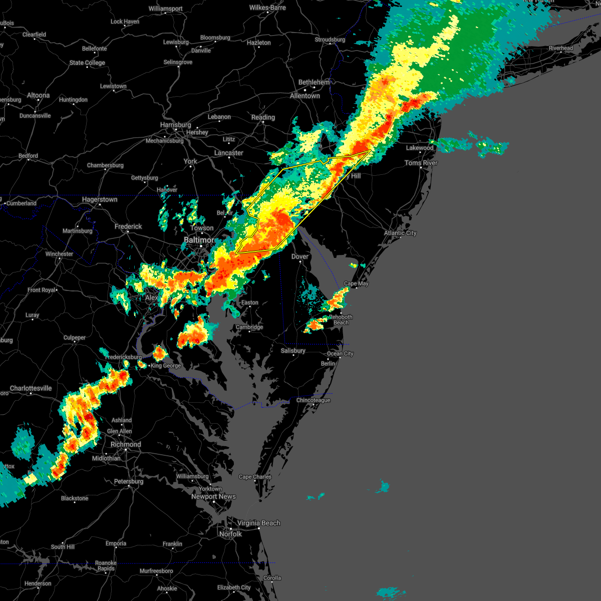 The severe thunderstorm warning for new castle, kent, cecil, northwestern salem, northwestern camden, northwestern gloucester, northwestern burlington, southeastern chester, philadelphia and delaware counties will expire at 645 pm edt, the storms which prompted the warning have weakened below severe limits, and no longer pose an immediate threat to life or property. therefore the warning will be allowed to expire. however gusty winds and heavy rain are still possible with these thunderstorms. a severe thunderstorm watch remains in effect until 900 pm edt for central and northern delaware, northeastern maryland, southern new jersey, and southeastern pennsylvania. The severe thunderstorm warning for new castle, kent, cecil, northwestern salem, northwestern camden, northwestern gloucester, northwestern burlington, southeastern chester, philadelphia and delaware counties will expire at 645 pm edt, the storms which prompted the warning have weakened below severe limits, and no longer pose an immediate threat to life or property. therefore the warning will be allowed to expire. however gusty winds and heavy rain are still possible with these thunderstorms. a severe thunderstorm watch remains in effect until 900 pm edt for central and northern delaware, northeastern maryland, southern new jersey, and southeastern pennsylvania.
|
| 8/18/2017 6:05 PM EDT |
 At 605 pm edt, severe thunderstorms were located along a line extending from near lima to near newtown, moving east at 30 mph (radar indicated). Hazards include 60 mph wind gusts and quarter size hail. Minor damage to vehicles is possible. expect damage to trees and power lines. Locations impacted include, philadelphia, camden, wilmington, newark, middletown, west chester, elkton, gloucester city, calvert, chester, willingboro, deptford, west deptford, pennsville, bellmawr, yeadon, westtown, woodbury, burlington and riverside. At 605 pm edt, severe thunderstorms were located along a line extending from near lima to near newtown, moving east at 30 mph (radar indicated). Hazards include 60 mph wind gusts and quarter size hail. Minor damage to vehicles is possible. expect damage to trees and power lines. Locations impacted include, philadelphia, camden, wilmington, newark, middletown, west chester, elkton, gloucester city, calvert, chester, willingboro, deptford, west deptford, pennsville, bellmawr, yeadon, westtown, woodbury, burlington and riverside.
|
| 8/18/2017 5:39 PM EDT |
 At 539 pm edt, severe thunderstorms were located along a line extending from near kennett square to back river, moving east at 30 mph (radar indicated). Hazards include 60 mph wind gusts and quarter size hail. Minor damage to vehicles is possible. Expect damage to trees and power lines. At 539 pm edt, severe thunderstorms were located along a line extending from near kennett square to back river, moving east at 30 mph (radar indicated). Hazards include 60 mph wind gusts and quarter size hail. Minor damage to vehicles is possible. Expect damage to trees and power lines.
|
| 7/24/2017 8:42 PM EDT |
 At 842 pm edt, severe thunderstorms were located along a line extending from near jenkintown to cecilton, moving east at 35 mph (radar indicated). Hazards include 60 mph wind gusts. Expect damage to trees and power lines. Locations impacted include, wilmington, newark, middletown, elkton, chester, pennsville, yeadon, westtown, folcroft, swarthmore, elsmere, kennett square, new castle, north east, east lansdowne, delaware city, charlestown, newport, cecilton and arden. At 842 pm edt, severe thunderstorms were located along a line extending from near jenkintown to cecilton, moving east at 35 mph (radar indicated). Hazards include 60 mph wind gusts. Expect damage to trees and power lines. Locations impacted include, wilmington, newark, middletown, elkton, chester, pennsville, yeadon, westtown, folcroft, swarthmore, elsmere, kennett square, new castle, north east, east lansdowne, delaware city, charlestown, newport, cecilton and arden.
|
| 7/24/2017 8:08 PM EDT |
 At 807 pm edt, severe thunderstorms were located along a line extending from near phoenixville to near riverside, moving east at 35 mph (radar indicated). Hazards include 60 mph wind gusts. expect damage to trees and power lines At 807 pm edt, severe thunderstorms were located along a line extending from near phoenixville to near riverside, moving east at 35 mph (radar indicated). Hazards include 60 mph wind gusts. expect damage to trees and power lines
|
| 7/24/2017 2:55 AM EDT |
 At 254 am edt, severe thunderstorms were located along a line extending from swarthmore to newport meadows to 6 miles southwest of cedarville, moving northeast at 30 mph (radar indicated). Hazards include 60 mph wind gusts. Expect damage to trees and power lines. Locations impacted include, philadelphia, camden, vineland, millville, bridgeton, gloucester city, cherry hill, evesham, mount laurel, chester, willingboro, deptford, voorhees, medford, west deptford, glassboro, lindenwold, pennsville, lumberton and bellmawr. At 254 am edt, severe thunderstorms were located along a line extending from swarthmore to newport meadows to 6 miles southwest of cedarville, moving northeast at 30 mph (radar indicated). Hazards include 60 mph wind gusts. Expect damage to trees and power lines. Locations impacted include, philadelphia, camden, vineland, millville, bridgeton, gloucester city, cherry hill, evesham, mount laurel, chester, willingboro, deptford, voorhees, medford, west deptford, glassboro, lindenwold, pennsville, lumberton and bellmawr.
|
| 7/24/2017 2:34 AM EDT |
 At 233 am edt, severe thunderstorms were located along a line extending from arden to green spring, moving east at 35 mph (radar indicated). Hazards include 60 mph wind gusts. expect damage to trees and power lines At 233 am edt, severe thunderstorms were located along a line extending from arden to green spring, moving east at 35 mph (radar indicated). Hazards include 60 mph wind gusts. expect damage to trees and power lines
|
| 7/22/2017 5:53 PM EDT |
 At 552 pm edt, severe thunderstorms were located along a line extending from near west norriton to westtown, moving east at 35 mph (radar indicated). Hazards include 60 mph wind gusts. Expect damage to trees and power lines. Locations impacted include, philadelphia, west chester, norristown, chester, west norriton, westtown, conshohocken, swarthmore, jenkintown, narberth, east lansdowne, cheyney, morris park, bryn mawr, trout lake, radnor township, gradyville, broomall, newtown square and chester township. At 552 pm edt, severe thunderstorms were located along a line extending from near west norriton to westtown, moving east at 35 mph (radar indicated). Hazards include 60 mph wind gusts. Expect damage to trees and power lines. Locations impacted include, philadelphia, west chester, norristown, chester, west norriton, westtown, conshohocken, swarthmore, jenkintown, narberth, east lansdowne, cheyney, morris park, bryn mawr, trout lake, radnor township, gradyville, broomall, newtown square and chester township.
|
| 7/22/2017 5:50 PM EDT |
 At 549 pm edt, severe thunderstorms were located along a line extending from valley forge to near westtown, moving east at 35 mph (radar indicated). Hazards include 60 mph wind gusts. expect damage to trees and power lines At 549 pm edt, severe thunderstorms were located along a line extending from valley forge to near westtown, moving east at 35 mph (radar indicated). Hazards include 60 mph wind gusts. expect damage to trees and power lines
|
| 7/22/2017 5:41 PM EDT |
 At 541 pm edt, severe thunderstorms were located along a line extending from near phoenixville to marshallton, moving east at 35 mph (radar indicated). Hazards include 60 mph wind gusts. Expect damage to trees and power lines. Locations impacted include, philadelphia, west chester, norristown, chester, phoenixville, west norriton, westtown, downingtown, conshohocken, swarthmore, jenkintown, narberth, east lansdowne, arden, cheyney, morris park, elam, bryn mawr, marshallton and trout lake. At 541 pm edt, severe thunderstorms were located along a line extending from near phoenixville to marshallton, moving east at 35 mph (radar indicated). Hazards include 60 mph wind gusts. Expect damage to trees and power lines. Locations impacted include, philadelphia, west chester, norristown, chester, phoenixville, west norriton, westtown, downingtown, conshohocken, swarthmore, jenkintown, narberth, east lansdowne, arden, cheyney, morris park, elam, bryn mawr, marshallton and trout lake.
|
| 7/22/2017 5:18 PM EDT |
 At 516 pm edt, severe thunderstorms were located along a line extending from near elverson to near parkesburg, moving southeast at 30 mph (doppler radar and emergency management. lancaster county 911 center reported downed trees when the storm moved through ephrata and new holland). Hazards include 60 mph wind gusts. expect damage to trees and power lines At 516 pm edt, severe thunderstorms were located along a line extending from near elverson to near parkesburg, moving southeast at 30 mph (doppler radar and emergency management. lancaster county 911 center reported downed trees when the storm moved through ephrata and new holland). Hazards include 60 mph wind gusts. expect damage to trees and power lines
|
| 7/14/2017 3:23 PM EDT |
 At 322 pm edt, severe thunderstorms were located along a line extending from arden to bear to near bay view, moving southeast at 30 mph (radar indicated). Hazards include 60 mph wind gusts and quarter size hail. Minor damage to vehicles is possible. Expect damage to trees and power lines. At 322 pm edt, severe thunderstorms were located along a line extending from arden to bear to near bay view, moving southeast at 30 mph (radar indicated). Hazards include 60 mph wind gusts and quarter size hail. Minor damage to vehicles is possible. Expect damage to trees and power lines.
|
| 7/14/2017 3:18 PM EDT |
 At 316 pm edt, severe thunderstorms were located along a line extending from elam to near newark to woodlawn, moving southeast at 30 mph (radar indicated). Hazards include 60 mph wind gusts and quarter size hail. Minor damage to vehicles is possible. expect damage to trees and power lines. severe thunderstorms will be near, wilmington, arden, bear, glasgow, chelsea, elam, talleyville, concordville, stanton and greenville around 320 pm edt. newport around 325 pm edt. chester, new castle, penns grove, swedesboro, delaware city, beckett, saint georges, chester township, wilmington manor and cherry hill around 330 pm edt. Other locations impacted by these severe thunderstorms include perryville, chesapeake city, edgemoor, marcus hook, boothwyn, trainer, chester heights, village green-green ridge, bellefonte and upland. At 316 pm edt, severe thunderstorms were located along a line extending from elam to near newark to woodlawn, moving southeast at 30 mph (radar indicated). Hazards include 60 mph wind gusts and quarter size hail. Minor damage to vehicles is possible. expect damage to trees and power lines. severe thunderstorms will be near, wilmington, arden, bear, glasgow, chelsea, elam, talleyville, concordville, stanton and greenville around 320 pm edt. newport around 325 pm edt. chester, new castle, penns grove, swedesboro, delaware city, beckett, saint georges, chester township, wilmington manor and cherry hill around 330 pm edt. Other locations impacted by these severe thunderstorms include perryville, chesapeake city, edgemoor, marcus hook, boothwyn, trainer, chester heights, village green-green ridge, bellefonte and upland.
|
| 7/14/2017 3:04 PM EDT |
 At 303 pm edt, severe thunderstorms were located along a line extending from near elam to fair hill to conowingo, moving southeast at 25 mph (radar indicated). Hazards include 60 mph wind gusts and penny size hail. Expect damage to trees and power lines. these severe storms will be near, westtown, kennett square, barksdale, appleton, elam, cherry hill, glen westover, greenville, concordville and ashland around 310 pm edt. newark, elkton, elsmere and talleyville around 315 pm edt. arden and chelsea around 320 pm edt. wilmington, brantwood, chester township and stanton around 325 pm edt. pennsville, charlestown, glasgow, bear and delaware memorial bridge around 330 pm edt. Other locations impacted by these severe thunderstorms include perryville, chesapeake city, edgemoor, marcus hook, boothwyn, trainer, chester heights, village green-green ridge, bellefonte and upland. At 303 pm edt, severe thunderstorms were located along a line extending from near elam to fair hill to conowingo, moving southeast at 25 mph (radar indicated). Hazards include 60 mph wind gusts and penny size hail. Expect damage to trees and power lines. these severe storms will be near, westtown, kennett square, barksdale, appleton, elam, cherry hill, glen westover, greenville, concordville and ashland around 310 pm edt. newark, elkton, elsmere and talleyville around 315 pm edt. arden and chelsea around 320 pm edt. wilmington, brantwood, chester township and stanton around 325 pm edt. pennsville, charlestown, glasgow, bear and delaware memorial bridge around 330 pm edt. Other locations impacted by these severe thunderstorms include perryville, chesapeake city, edgemoor, marcus hook, boothwyn, trainer, chester heights, village green-green ridge, bellefonte and upland.
|
| 7/14/2017 2:42 PM EDT |
 At 241 pm edt, severe thunderstorms were located along a line extending from near marshallton to oxford to conowingo, moving southeast at 30 mph (radar indicated). Hazards include 60 mph wind gusts and penny size hail. Expect damage to trees and power lines. these severe storms will be near, downingtown and marshallton around 245 pm edt. west chester, calvert, kennett square, west grove, lombard and zion around 250 pm edt. westtown, blake, hockessin and north star around 255 pm edt. andora, fair hill, pleasant hill, kemblesville, ashland, bay view, ladenberg and pike creek around 300 pm edt. north east, charlestown, barksdale, talleyville, cherry hill, elam, appleton, glen westover, greenville and concordville around 305 pm edt. newark, elkton, elsmere, newport, arden and chelsea around 310 pm edt. wilmington, brantwood, chester township and wilmington manor around 315 pm edt. hollywood beach, glasgow, bear and delaware memorial bridge around 320 pm edt. Other locations impacted by these severe thunderstorms include perryville, chesapeake city, south coatesville, modena, edgemoor, marcus hook, boothwyn, trainer, thorndale and chester heights. At 241 pm edt, severe thunderstorms were located along a line extending from near marshallton to oxford to conowingo, moving southeast at 30 mph (radar indicated). Hazards include 60 mph wind gusts and penny size hail. Expect damage to trees and power lines. these severe storms will be near, downingtown and marshallton around 245 pm edt. west chester, calvert, kennett square, west grove, lombard and zion around 250 pm edt. westtown, blake, hockessin and north star around 255 pm edt. andora, fair hill, pleasant hill, kemblesville, ashland, bay view, ladenberg and pike creek around 300 pm edt. north east, charlestown, barksdale, talleyville, cherry hill, elam, appleton, glen westover, greenville and concordville around 305 pm edt. newark, elkton, elsmere, newport, arden and chelsea around 310 pm edt. wilmington, brantwood, chester township and wilmington manor around 315 pm edt. hollywood beach, glasgow, bear and delaware memorial bridge around 320 pm edt. Other locations impacted by these severe thunderstorms include perryville, chesapeake city, south coatesville, modena, edgemoor, marcus hook, boothwyn, trainer, thorndale and chester heights.
|
| 7/14/2017 2:31 PM EDT |
 At 231 pm edt, severe thunderstorms were located along a line extending from near coatesville to near mount vernon to near rock springs, moving southeast at 25 mph (radar indicated). Hazards include 60 mph wind gusts and penny size hail. Expect damage to trees and power lines. severe thunderstorms will be near, coatesville and downingtown around 235 pm edt. oxford, rising sun and marshallton around 245 pm edt. west chester, kennett square and west nottingham around 250 pm edt. calvert, west grove, woodlawn, lombard, hockessin, farmington and north star around 255 pm edt. westtown, blake, zion, ashland and pike creek around 300 pm edt. fair hill, andora, elam, pleasant hill, kemblesville, greenville, concordville, bay view and ladenberg around 305 pm edt. elsmere, north east, charlestown, newport, talleyville, appleton, cherry hill, glen westover and chelsea around 310 pm edt. wilmington, newark, arden and barksdale around 315 pm edt. Other locations impacted by these severe thunderstorms include perryville, chesapeake city, south coatesville, modena, edgemoor, marcus hook, boothwyn, trainer, thorndale and chester heights. At 231 pm edt, severe thunderstorms were located along a line extending from near coatesville to near mount vernon to near rock springs, moving southeast at 25 mph (radar indicated). Hazards include 60 mph wind gusts and penny size hail. Expect damage to trees and power lines. severe thunderstorms will be near, coatesville and downingtown around 235 pm edt. oxford, rising sun and marshallton around 245 pm edt. west chester, kennett square and west nottingham around 250 pm edt. calvert, west grove, woodlawn, lombard, hockessin, farmington and north star around 255 pm edt. westtown, blake, zion, ashland and pike creek around 300 pm edt. fair hill, andora, elam, pleasant hill, kemblesville, greenville, concordville, bay view and ladenberg around 305 pm edt. elsmere, north east, charlestown, newport, talleyville, appleton, cherry hill, glen westover and chelsea around 310 pm edt. wilmington, newark, arden and barksdale around 315 pm edt. Other locations impacted by these severe thunderstorms include perryville, chesapeake city, south coatesville, modena, edgemoor, marcus hook, boothwyn, trainer, thorndale and chester heights.
|
| 7/1/2017 5:35 PM EDT |
 At 535 pm edt, severe thunderstorms were located along a line extending from near doylestown to near gibbstown, moving east at 20 mph (radar indicated). Hazards include 60 mph wind gusts and penny size hail. expect damage to trees and power lines At 535 pm edt, severe thunderstorms were located along a line extending from near doylestown to near gibbstown, moving east at 20 mph (radar indicated). Hazards include 60 mph wind gusts and penny size hail. expect damage to trees and power lines
|
| 7/1/2017 5:24 PM EDT |
 At 524 pm edt, severe thunderstorms were located along a line extending from near lansdale to delaware memorial bridge, moving east at 35 mph (trained weather spotters). Hazards include 60 mph wind gusts and penny size hail. Expect damage to trees and power lines. Locations impacted include, philadelphia, trenton, camden, wilmington, newark, west chester, gloucester city, cherry hill, bensalem, ewing, norristown, chester, deptford, west deptford, glassboro, lindenwold, phoenixville, lansdale, west norriton and east norriton. At 524 pm edt, severe thunderstorms were located along a line extending from near lansdale to delaware memorial bridge, moving east at 35 mph (trained weather spotters). Hazards include 60 mph wind gusts and penny size hail. Expect damage to trees and power lines. Locations impacted include, philadelphia, trenton, camden, wilmington, newark, west chester, gloucester city, cherry hill, bensalem, ewing, norristown, chester, deptford, west deptford, glassboro, lindenwold, phoenixville, lansdale, west norriton and east norriton.
|
| 7/1/2017 5:01 PM EDT |
 At 500 pm edt, severe thunderstorms were located along a line extending from spring mount to glen westover, moving east at 40 mph (radar indicated). Hazards include 60 mph wind gusts and nickel size hail. expect damage to trees and power lines At 500 pm edt, severe thunderstorms were located along a line extending from spring mount to glen westover, moving east at 40 mph (radar indicated). Hazards include 60 mph wind gusts and nickel size hail. expect damage to trees and power lines
|
| 6/19/2017 4:47 PM EDT |
 At 446 pm edt, severe thunderstorms were located along a line extending from norristown to drexel hill to near penns grove, moving east at 50 mph (radar indicated). Hazards include 60 mph wind gusts. Expect damage to trees and power lines. these severe storms will be near, yeadon, conshohocken, folcroft, paulsboro, narberth, east lansdowne, morris park, roxborough, darby township and philadelphia international airport around 450 pm edt. ambler, westville, national park, plymouth meeting, chestnut hill, south philadelphia, germantown and gibbstown around 455 pm edt. camden, gloucester city, west deptford, bellmawr, jenkintown, brooklawn, abington, audubon park, mullica hill and kensington around 500 pm edt. deptford, woodbury, pitman, palmyra, hatboro, woodbury heights, rockledge, bryn athyn, ivyland and cherry hill mall around 505 pm edt. philadelphia, feasterville, feasterville-trevose, northeast philadelphia and richboro around 510 pm edt. newtown around 515 pm edt. Other locations impacted by these severe thunderstorms include oak valley, clifton heights, collingdale, churchville, merchantville, marcus hook, trainer, eddystone, village green-green ridge and pennsauken. At 446 pm edt, severe thunderstorms were located along a line extending from norristown to drexel hill to near penns grove, moving east at 50 mph (radar indicated). Hazards include 60 mph wind gusts. Expect damage to trees and power lines. these severe storms will be near, yeadon, conshohocken, folcroft, paulsboro, narberth, east lansdowne, morris park, roxborough, darby township and philadelphia international airport around 450 pm edt. ambler, westville, national park, plymouth meeting, chestnut hill, south philadelphia, germantown and gibbstown around 455 pm edt. camden, gloucester city, west deptford, bellmawr, jenkintown, brooklawn, abington, audubon park, mullica hill and kensington around 500 pm edt. deptford, woodbury, pitman, palmyra, hatboro, woodbury heights, rockledge, bryn athyn, ivyland and cherry hill mall around 505 pm edt. philadelphia, feasterville, feasterville-trevose, northeast philadelphia and richboro around 510 pm edt. newtown around 515 pm edt. Other locations impacted by these severe thunderstorms include oak valley, clifton heights, collingdale, churchville, merchantville, marcus hook, trainer, eddystone, village green-green ridge and pennsauken.
|
| 6/19/2017 4:41 PM EDT |
 The severe thunderstorm warning for northern new castle, northeastern cecil, northern salem, northwestern gloucester and southern delaware counties will expire at 445 pm edt, the storm which prompted the warning has moved out of the area. therefore the warning will be allowed to expire. however gusty winds and heavy rain are still possible with this thunderstorm. a severe thunderstorm watch remains in effect until 800 pm edt for northern delaware, northeastern maryland, southern new jersey, and southeastern pennsylvania. The severe thunderstorm warning for northern new castle, northeastern cecil, northern salem, northwestern gloucester and southern delaware counties will expire at 445 pm edt, the storm which prompted the warning has moved out of the area. therefore the warning will be allowed to expire. however gusty winds and heavy rain are still possible with this thunderstorm. a severe thunderstorm watch remains in effect until 800 pm edt for northern delaware, northeastern maryland, southern new jersey, and southeastern pennsylvania.
|
| 6/19/2017 4:34 PM EDT |
 At 433 pm edt, severe thunderstorms were located along a line extending from valley forge to near paoli to stanton, moving northeast at 35 mph (radar indicated). Hazards include 60 mph wind gusts. Expect damage to trees and power lines. severe thunderstorms will be near, phoenixville, valley forge, paoli, newtown square, gradyville, lima and nether providence township around 440 pm edt. west norriton, king of prussia, trout lake and broomall around 445 pm edt. norristown, east norriton, radnor township, bryn mawr, elam, morris park and drexel hill around 450 pm edt. conshohocken, narberth, chelsea and roxborough around 455 pm edt. ambler, plymouth meeting, chestnut hill, beckett, chester township and germantown around 500 pm edt. chester and swedesboro around 505 pm edt. swarthmore, jenkintown, abington, gibbstown, philadelphia international arpt and mullica hill around 510 pm edt. philadelphia, gloucester city, deptford, west deptford, bellmawr, yeadon, woodbury, hatboro, folcroft and paulsboro around 515 pm edt. Other locations impacted by these severe thunderstorms include oak valley, clifton heights, collingdale, churchville, merchantville, marcus hook, trainer, eddystone, village green-green ridge and pennsauken. At 433 pm edt, severe thunderstorms were located along a line extending from valley forge to near paoli to stanton, moving northeast at 35 mph (radar indicated). Hazards include 60 mph wind gusts. Expect damage to trees and power lines. severe thunderstorms will be near, phoenixville, valley forge, paoli, newtown square, gradyville, lima and nether providence township around 440 pm edt. west norriton, king of prussia, trout lake and broomall around 445 pm edt. norristown, east norriton, radnor township, bryn mawr, elam, morris park and drexel hill around 450 pm edt. conshohocken, narberth, chelsea and roxborough around 455 pm edt. ambler, plymouth meeting, chestnut hill, beckett, chester township and germantown around 500 pm edt. chester and swedesboro around 505 pm edt. swarthmore, jenkintown, abington, gibbstown, philadelphia international arpt and mullica hill around 510 pm edt. philadelphia, gloucester city, deptford, west deptford, bellmawr, yeadon, woodbury, hatboro, folcroft and paulsboro around 515 pm edt. Other locations impacted by these severe thunderstorms include oak valley, clifton heights, collingdale, churchville, merchantville, marcus hook, trainer, eddystone, village green-green ridge and pennsauken.
|
| 6/19/2017 4:07 PM EDT |
 At 407 pm edt, a severe thunderstorm was located over pleasant hill, or 7 miles northwest of elkton, moving east at 50 mph (radar indicated). Hazards include 60 mph wind gusts. expect damage to trees and power lines At 407 pm edt, a severe thunderstorm was located over pleasant hill, or 7 miles northwest of elkton, moving east at 50 mph (radar indicated). Hazards include 60 mph wind gusts. expect damage to trees and power lines
|
| 2/25/2017 5:04 PM EST |
 At 504 pm est, severe thunderstorms were located along a line extending from drexel hill to hancocks bridge to dover base housing, moving northeast at 45 mph (radar indicated). Hazards include 60 mph wind gusts and nickel size hail. Expect damage to roofs, siding, and trees. these severe storms will be near, yeadon, folcroft, narberth, east lansdowne, roxborough, morris park, drexel hill, south philadelphia, darby township and broomall around 510 pm est. bridgeton, kensington, center city and ben franklin bridge around 515 pm est. camden, woodstown, wissinoming, seabrook farms and golden triangle around 520 pm est. palmyra, elmer, fortesque, olivet, tacony and rosenhayn around 525 pm est. philadelphia, glassboro, clayton, dividing creek, newport and cedarville around 530 pm est. Other locations impacted by these severe thunderstorms include oak valley, clifton heights, collingdale, merchantville, marcus hook, trainer, eddystone, village green-green ridge, pennsauken and collingswood. At 504 pm est, severe thunderstorms were located along a line extending from drexel hill to hancocks bridge to dover base housing, moving northeast at 45 mph (radar indicated). Hazards include 60 mph wind gusts and nickel size hail. Expect damage to roofs, siding, and trees. these severe storms will be near, yeadon, folcroft, narberth, east lansdowne, roxborough, morris park, drexel hill, south philadelphia, darby township and broomall around 510 pm est. bridgeton, kensington, center city and ben franklin bridge around 515 pm est. camden, woodstown, wissinoming, seabrook farms and golden triangle around 520 pm est. palmyra, elmer, fortesque, olivet, tacony and rosenhayn around 525 pm est. philadelphia, glassboro, clayton, dividing creek, newport and cedarville around 530 pm est. Other locations impacted by these severe thunderstorms include oak valley, clifton heights, collingdale, merchantville, marcus hook, trainer, eddystone, village green-green ridge, pennsauken and collingswood.
|
| 2/25/2017 4:40 PM EST |
 At 439 pm est, severe thunderstorms were located along a line extending from concordville to near warwick to near hartly, moving northeast at 45 mph (radar indicated). Hazards include 60 mph wind gusts and nickel size hail. Expect damage to roofs, siding, and trees. severe thunderstorms will be near, chester, lima, chelsea, concordville, chester township and elam around 445 pm est. swarthmore, nether providence township, broomall and philadelphia international arpt around 450 pm est. yeadon, folcroft, east lansdowne, hope creek, drexel hill, port penn, darby township, tinicum township and philadelphia international airport around 455 pm est. narberth, roxborough, morris park, hancocks bridge and south philadelphia around 500 pm est. salem, quinton, kensington, center city, newport meadows and ben franklin bridge around 505 pm est. camden, alloway, shiloh, wissinoming and golden triangle around 510 pm est. bridgeton, palmyra and tacony around 515 pm est. philadelphia, newport, olivet, fortesque, seabrook farms, cedarville and rosenhayn around 520 pm est. Other locations impacted by these severe thunderstorms include oak valley, clifton heights, collingdale, wyoming, merchantville, marcus hook, trainer, eddystone, village green-green ridge and odessa. At 439 pm est, severe thunderstorms were located along a line extending from concordville to near warwick to near hartly, moving northeast at 45 mph (radar indicated). Hazards include 60 mph wind gusts and nickel size hail. Expect damage to roofs, siding, and trees. severe thunderstorms will be near, chester, lima, chelsea, concordville, chester township and elam around 445 pm est. swarthmore, nether providence township, broomall and philadelphia international arpt around 450 pm est. yeadon, folcroft, east lansdowne, hope creek, drexel hill, port penn, darby township, tinicum township and philadelphia international airport around 455 pm est. narberth, roxborough, morris park, hancocks bridge and south philadelphia around 500 pm est. salem, quinton, kensington, center city, newport meadows and ben franklin bridge around 505 pm est. camden, alloway, shiloh, wissinoming and golden triangle around 510 pm est. bridgeton, palmyra and tacony around 515 pm est. philadelphia, newport, olivet, fortesque, seabrook farms, cedarville and rosenhayn around 520 pm est. Other locations impacted by these severe thunderstorms include oak valley, clifton heights, collingdale, wyoming, merchantville, marcus hook, trainer, eddystone, village green-green ridge and odessa.
|
| 2/12/2017 11:38 PM EST |
 At 1135 pm est, severe thunderstorms were located along a line extending from cherry hill mall to alloway to warwick, moving east at 70 mph (radar indicated. this line has also had a history of producing wind damage and gusts near 60 mph across southern pennsylvania, central maryland and northern virginia). Hazards include 60 mph wind gusts. Expect damage to roofs, siding, and trees. Locations impacted include, philadelphia, camden, wilmington, vineland, newark, millville, bridgeton, middletown, elkton, gloucester city, cumberland, cherry hill, evesham, mount laurel, chester, willingboro, deptford, voorhees, medford and west deptford. At 1135 pm est, severe thunderstorms were located along a line extending from cherry hill mall to alloway to warwick, moving east at 70 mph (radar indicated. this line has also had a history of producing wind damage and gusts near 60 mph across southern pennsylvania, central maryland and northern virginia). Hazards include 60 mph wind gusts. Expect damage to roofs, siding, and trees. Locations impacted include, philadelphia, camden, wilmington, vineland, newark, millville, bridgeton, middletown, elkton, gloucester city, cumberland, cherry hill, evesham, mount laurel, chester, willingboro, deptford, voorhees, medford and west deptford.
|
| 2/12/2017 11:10 PM EST |
 At 1108 pm est, severe thunderstorms were located along a line extending from near plymouth meeting to near bel air north, moving east at 60 mph (radar indicated). Hazards include 60 mph wind gusts. expect damage to roofs, siding, and trees At 1108 pm est, severe thunderstorms were located along a line extending from near plymouth meeting to near bel air north, moving east at 60 mph (radar indicated). Hazards include 60 mph wind gusts. expect damage to roofs, siding, and trees
|
| 10/30/2016 6:24 PM EDT |
 The severe thunderstorm warning for northeastern new castle, northwestern camden, northwestern gloucester, north central salem, northwestern burlington, southeastern bucks, delaware, southeastern montgomery and philadelphia counties will expire at 630 pm edt, the storms which prompted the warning have weakened below severe limits, and no longer pose an immediate threat to life or property. therefore the warning will be allowed to expire. however gusty winds and heavy rain are still possible with these thunderstorms. to report severe weather, contact your nearest law enforcement agency. they will relay your report to the national weather service mount holly nj. The severe thunderstorm warning for northeastern new castle, northwestern camden, northwestern gloucester, north central salem, northwestern burlington, southeastern bucks, delaware, southeastern montgomery and philadelphia counties will expire at 630 pm edt, the storms which prompted the warning have weakened below severe limits, and no longer pose an immediate threat to life or property. therefore the warning will be allowed to expire. however gusty winds and heavy rain are still possible with these thunderstorms. to report severe weather, contact your nearest law enforcement agency. they will relay your report to the national weather service mount holly nj.
|
| 10/30/2016 6:06 PM EDT |
 At 605 pm edt, severe thunderstorms were located along a line extending from willow grove to east lansdowne to near wilmington, moving east at 45 mph (radar indicated). Hazards include 60 mph wind gusts. Expect damage to roofs. siding. and trees. these severe storms will be near, philadelphia, west deptford, hatboro, paulsboro, jenkintown, national park, rockledge, abington, bryn athyn and ivyland around 610 pm edt. camden, gloucester city, bensalem, deptford, bellmawr, woodbury, riverside, westville, woodbury heights and brooklawn around 615 pm edt. willingboro, palmyra, magnolia, beverly, audubon park, golden triangle, cherry hill mall, levittown and gibbstown around 620 pm edt. cherry hill, burlington, bristol, tullytown, springdale, ashland, greentree, mullica hill, barclay-kingston and florence-roebling around 625 pm edt. marlton around 630 pm edt. Other locations impacted by these severe thunderstorms include oreland, marcus hook, lawnside, barrington, woodlyn, boothwyn, trainer, springfield, west conshohocken and edgewater park. At 605 pm edt, severe thunderstorms were located along a line extending from willow grove to east lansdowne to near wilmington, moving east at 45 mph (radar indicated). Hazards include 60 mph wind gusts. Expect damage to roofs. siding. and trees. these severe storms will be near, philadelphia, west deptford, hatboro, paulsboro, jenkintown, national park, rockledge, abington, bryn athyn and ivyland around 610 pm edt. camden, gloucester city, bensalem, deptford, bellmawr, woodbury, riverside, westville, woodbury heights and brooklawn around 615 pm edt. willingboro, palmyra, magnolia, beverly, audubon park, golden triangle, cherry hill mall, levittown and gibbstown around 620 pm edt. cherry hill, burlington, bristol, tullytown, springdale, ashland, greentree, mullica hill, barclay-kingston and florence-roebling around 625 pm edt. marlton around 630 pm edt. Other locations impacted by these severe thunderstorms include oreland, marcus hook, lawnside, barrington, woodlyn, boothwyn, trainer, springfield, west conshohocken and edgewater park.
|
| 10/30/2016 5:48 PM EDT |
 At 547 pm edt, severe thunderstorms were located along a line extending from collegeville to west chester to kennett square, moving east at 40 mph (radar indicated). Hazards include 60 mph wind gusts. Expect damage to roofs. siding. and trees. severe thunderstorms will be near, west norriton, collegeville, trappe, cheyney and valley forge around 550 pm edt. norristown, lansdale, east norriton, conshohocken, gradyville, lima, king of prussia and paoli around 555 pm edt. newtown square, broomall, plymouth meeting and concordville around 600 pm edt. wilmington, ambler, swarthmore, penns grove, arden, nether providence township, trout lake, chelsea, bryn mawr and radnor township around 605 pm edt. yeadon, hatboro, folcroft, jenkintown, narberth, east lansdowne, abington, willow grove, drexel hill and morris park around 610 pm edt. chester, national park, rockledge, bryn athyn, ivyland, south philadelphia, beckett, roxborough and germantown around 615 pm edt. philadelphia, westville, swedesboro, brooklawn, feasterville- trevose, feasterville, ben franklin bridge, gibbstown, center city and kensington around 620 pm edt. camden, gloucester city, bensalem, west deptford, bellmawr, paulsboro, beverly, newtown, langhorne and audubon park around 625 pm edt. Other locations impacted by these severe thunderstorms include oreland, marcus hook, lawnside, barrington, woodlyn, boothwyn, trainer, springfield, west conshohocken and edgewater park. At 547 pm edt, severe thunderstorms were located along a line extending from collegeville to west chester to kennett square, moving east at 40 mph (radar indicated). Hazards include 60 mph wind gusts. Expect damage to roofs. siding. and trees. severe thunderstorms will be near, west norriton, collegeville, trappe, cheyney and valley forge around 550 pm edt. norristown, lansdale, east norriton, conshohocken, gradyville, lima, king of prussia and paoli around 555 pm edt. newtown square, broomall, plymouth meeting and concordville around 600 pm edt. wilmington, ambler, swarthmore, penns grove, arden, nether providence township, trout lake, chelsea, bryn mawr and radnor township around 605 pm edt. yeadon, hatboro, folcroft, jenkintown, narberth, east lansdowne, abington, willow grove, drexel hill and morris park around 610 pm edt. chester, national park, rockledge, bryn athyn, ivyland, south philadelphia, beckett, roxborough and germantown around 615 pm edt. philadelphia, westville, swedesboro, brooklawn, feasterville- trevose, feasterville, ben franklin bridge, gibbstown, center city and kensington around 620 pm edt. camden, gloucester city, bensalem, west deptford, bellmawr, paulsboro, beverly, newtown, langhorne and audubon park around 625 pm edt. Other locations impacted by these severe thunderstorms include oreland, marcus hook, lawnside, barrington, woodlyn, boothwyn, trainer, springfield, west conshohocken and edgewater park.
|
| 7/28/2016 3:01 PM EDT |
 At 259 pm edt, a severe thunderstorm was located over kensington, in philadelphia, moving northeast at 25 mph (radar indicated). Hazards include 60 mph wind gusts. Expect damage to roofs. siding. and trees. Locations impacted include, philadelphia, camden, gloucester city, cherry hill, evesham, mount laurel, chester, willingboro, deptford, voorhees, medford, west deptford, glassboro, lindenwold, lumberton, bellmawr, yeadon, woodbury, burlington and mount holly. At 259 pm edt, a severe thunderstorm was located over kensington, in philadelphia, moving northeast at 25 mph (radar indicated). Hazards include 60 mph wind gusts. Expect damage to roofs. siding. and trees. Locations impacted include, philadelphia, camden, gloucester city, cherry hill, evesham, mount laurel, chester, willingboro, deptford, voorhees, medford, west deptford, glassboro, lindenwold, lumberton, bellmawr, yeadon, woodbury, burlington and mount holly.
|
| 7/28/2016 2:30 PM EDT |
 At 229 pm edt, a severe thunderstorm was located over chester, or 11 miles west of gloucester city, moving northeast at 25 mph. other thunderstorms are developing over the area (radar indicated). Hazards include 60 mph wind gusts. Expect damage to roofs. siding. And trees. At 229 pm edt, a severe thunderstorm was located over chester, or 11 miles west of gloucester city, moving northeast at 25 mph. other thunderstorms are developing over the area (radar indicated). Hazards include 60 mph wind gusts. Expect damage to roofs. siding. And trees.
|
| 7/28/2016 2:01 PM EDT |
 At 159 pm edt, a severe thunderstorm was located over concordville, or 8 miles southeast of west chester, moving east at 20 mph (radar indicated). Hazards include 60 mph wind gusts. Expect damage to roofs. siding. and trees. Locations impacted include, wilmington, west chester, chester, westtown, swarthmore, arden, marshallton, nether providence township, chelsea, elam, cheyney, drexel hill, talleyville, lima, chester township, concordville, gradyville, broomall, west goshen and lansdowne. At 159 pm edt, a severe thunderstorm was located over concordville, or 8 miles southeast of west chester, moving east at 20 mph (radar indicated). Hazards include 60 mph wind gusts. Expect damage to roofs. siding. and trees. Locations impacted include, wilmington, west chester, chester, westtown, swarthmore, arden, marshallton, nether providence township, chelsea, elam, cheyney, drexel hill, talleyville, lima, chester township, concordville, gradyville, broomall, west goshen and lansdowne.
|
| 7/28/2016 1:24 PM EDT |
 At 124 pm edt, a severe thunderstorm was located over marshallton, or near west chester, moving east at 20 mph (radar indicated). Hazards include 60 mph wind gusts. Expect damage to roofs. siding. And trees. At 124 pm edt, a severe thunderstorm was located over marshallton, or near west chester, moving east at 20 mph (radar indicated). Hazards include 60 mph wind gusts. Expect damage to roofs. siding. And trees.
|
| 7/9/2016 3:55 PM EDT |
 At 355 pm edt, a severe thunderstorm was located near ashland, or 7 miles south of west chester, moving southeast at 20 mph (radar indicated). Hazards include 60 mph wind gusts and quarter size hail. Hail damage to vehicles is expected. Expect wind damage to roofs, siding, and trees. At 355 pm edt, a severe thunderstorm was located near ashland, or 7 miles south of west chester, moving southeast at 20 mph (radar indicated). Hazards include 60 mph wind gusts and quarter size hail. Hail damage to vehicles is expected. Expect wind damage to roofs, siding, and trees.
|
| 6/8/2016 11:50 AM EDT |
 At 1148 am edt, severe thunderstorms were located along a line extending from near willow grove to south philadelphia to swedesboro, moving east at 45 mph (asos and public reported). Hazards include 60 mph wind gusts. Expect damage to roofs. siding. and trees. these severe storms will be near, gloucester city, bellmawr, hatboro, westville, rockledge, brooklawn, bryn athyn, ivyland and ben franklin bridge around 1155 am edt. camden, palmyra, magnolia, woodbury heights, audubon park, feasterville, feasterville-trevose, golden triangle, cherry hill mall and northeast philadelphia around 1200 pm edt. cherry hill, bensalem, glassboro, lindenwold, pitman, riverside, beverly, langhorne, springdale and greentree around 1205 pm edt. evesham, mount laurel, willingboro, voorhees, burlington, bristol, clayton, marlton, turnersville and levittown around 1210 pm edt. medford, lumberton, florence, berlin, tullytown, florence-roebling, sicklerville, williamstown, monroe township and atco around 1215 pm edt. Other locations impacted by these severe thunderstorms include oreland, marcus hook, lawnside, barrington, woodlyn, trainer, springfield, west conshohocken, edgewater park and colwyn. At 1148 am edt, severe thunderstorms were located along a line extending from near willow grove to south philadelphia to swedesboro, moving east at 45 mph (asos and public reported). Hazards include 60 mph wind gusts. Expect damage to roofs. siding. and trees. these severe storms will be near, gloucester city, bellmawr, hatboro, westville, rockledge, brooklawn, bryn athyn, ivyland and ben franklin bridge around 1155 am edt. camden, palmyra, magnolia, woodbury heights, audubon park, feasterville, feasterville-trevose, golden triangle, cherry hill mall and northeast philadelphia around 1200 pm edt. cherry hill, bensalem, glassboro, lindenwold, pitman, riverside, beverly, langhorne, springdale and greentree around 1205 pm edt. evesham, mount laurel, willingboro, voorhees, burlington, bristol, clayton, marlton, turnersville and levittown around 1210 pm edt. medford, lumberton, florence, berlin, tullytown, florence-roebling, sicklerville, williamstown, monroe township and atco around 1215 pm edt. Other locations impacted by these severe thunderstorms include oreland, marcus hook, lawnside, barrington, woodlyn, trainer, springfield, west conshohocken, edgewater park and colwyn.
|
| 6/8/2016 11:27 AM EDT |
 At 1127 am edt, severe thunderstorms were located along a line extending from collegeville to near gradyville to greenville, moving east at 45 mph (radar indicated). Hazards include 60 mph wind gusts. Expect damage to roofs. siding. and trees. severe thunderstorms will be near, norristown, west norriton, east norriton, newtown square, broomall, king of prussia, chester township and radnor township around 1135 am edt. chester, conshohocken, swarthmore, nether providence township, plymouth meeting, trout lake and bryn mawr around 1140 am edt. yeadon, folcroft, ambler, paulsboro, narberth, east lansdowne, beckett, darby township, drexel hill and morris park around 1145 am edt. jenkintown, national park, swedesboro, abington, willow grove, south philadelphia, gibbstown and germantown around 1150 am edt. camden, gloucester city, west deptford, bellmawr, woodbury, hatboro, westville, rockledge, brooklawn and bryn athyn around 1155 am edt. philadelphia, deptford, palmyra, magnolia, woodbury heights, feasterville, ashland, feasterville-trevose, erlton-ellisburg and golden triangle around 1200 pm edt. cherry hill, bensalem, voorhees, glassboro, lindenwold, pitman, riverside, beverly, langhorne and springdale around 1205 pm edt. evesham, mount laurel, willingboro, burlington, bristol, clayton, marlton, levittown and marlton lakes around 1210 pm edt. Other locations impacted by these severe thunderstorms include oreland, springfield, west conshohocken, colwyn, glenolden, cornwells heights-eddington, collingswood, darby, trooper and nws office. At 1127 am edt, severe thunderstorms were located along a line extending from collegeville to near gradyville to greenville, moving east at 45 mph (radar indicated). Hazards include 60 mph wind gusts. Expect damage to roofs. siding. and trees. severe thunderstorms will be near, norristown, west norriton, east norriton, newtown square, broomall, king of prussia, chester township and radnor township around 1135 am edt. chester, conshohocken, swarthmore, nether providence township, plymouth meeting, trout lake and bryn mawr around 1140 am edt. yeadon, folcroft, ambler, paulsboro, narberth, east lansdowne, beckett, darby township, drexel hill and morris park around 1145 am edt. jenkintown, national park, swedesboro, abington, willow grove, south philadelphia, gibbstown and germantown around 1150 am edt. camden, gloucester city, west deptford, bellmawr, woodbury, hatboro, westville, rockledge, brooklawn and bryn athyn around 1155 am edt. philadelphia, deptford, palmyra, magnolia, woodbury heights, feasterville, ashland, feasterville-trevose, erlton-ellisburg and golden triangle around 1200 pm edt. cherry hill, bensalem, voorhees, glassboro, lindenwold, pitman, riverside, beverly, langhorne and springdale around 1205 pm edt. evesham, mount laurel, willingboro, burlington, bristol, clayton, marlton, levittown and marlton lakes around 1210 pm edt. Other locations impacted by these severe thunderstorms include oreland, springfield, west conshohocken, colwyn, glenolden, cornwells heights-eddington, collingswood, darby, trooper and nws office.
|
| 6/5/2016 5:46 PM EDT |
 At 545 pm edt, severe thunderstorms were located along a line extending from chalfont to lima to near salem, moving southeast at 40 mph (radar indicated). Hazards include 60 mph wind gusts. Expect damage to roofs. siding. and trees. Locations impacted include, philadelphia, camden, wilmington, west chester, gloucester city, cherry hill, bensalem, norristown, chester, deptford, west deptford, glassboro, lindenwold, lansdale, west norriton, east norriton, pennsville, bellmawr, yeadon and westtown. At 545 pm edt, severe thunderstorms were located along a line extending from chalfont to lima to near salem, moving southeast at 40 mph (radar indicated). Hazards include 60 mph wind gusts. Expect damage to roofs. siding. and trees. Locations impacted include, philadelphia, camden, wilmington, west chester, gloucester city, cherry hill, bensalem, norristown, chester, deptford, west deptford, glassboro, lindenwold, lansdale, west norriton, east norriton, pennsville, bellmawr, yeadon and westtown.
|
| 6/5/2016 5:23 PM EDT |
 At 522 pm edt, severe thunderstorms were located along a line extending from near geryville to lionville to north star, moving east at 55 mph (radar indicated). Hazards include 60 mph wind gusts. Expect damage to roofs. siding. And trees. At 522 pm edt, severe thunderstorms were located along a line extending from near geryville to lionville to north star, moving east at 55 mph (radar indicated). Hazards include 60 mph wind gusts. Expect damage to roofs. siding. And trees.
|
| 4/26/2016 6:26 PM EDT | The severe thunderstorm warning for east central chester, delaware and south central montgomery counties will expire at 630 pm edt, the storm which prompted the warning has weakened below severe limits, and no longer pose an immediate threat to life or property. therefore the warning will be allowed to expire. a severe thunderstorm watch remains in effect until 900 pm edt for southern new jersey, and southeastern pennsylvania. |
| 4/26/2016 6:08 PM EDT |
 At 607 pm edt, a severe thunderstorm was located near cheyney, or near west chester, moving east at 40 mph (radar indicated). Hazards include 60 mph wind gusts. Expect damage to roofs. siding. and trees. Locations impacted include, west chester, chester, westtown, conshohocken, swarthmore, narberth, radnor township, trout lake, broomall, paoli, nether providence township, chelsea, bryn mawr, cheyney, drexel hill, lima, chester township, concordville, gradyville and newtown square. At 607 pm edt, a severe thunderstorm was located near cheyney, or near west chester, moving east at 40 mph (radar indicated). Hazards include 60 mph wind gusts. Expect damage to roofs. siding. and trees. Locations impacted include, west chester, chester, westtown, conshohocken, swarthmore, narberth, radnor township, trout lake, broomall, paoli, nether providence township, chelsea, bryn mawr, cheyney, drexel hill, lima, chester township, concordville, gradyville and newtown square.
|
| 4/26/2016 5:49 PM EDT |
 At 548 pm edt, a severe thunderstorm was located over downingtown, or 8 miles northwest of west chester, moving east at 40 mph (radar indicated). Hazards include 60 mph wind gusts. Expect damage to roofs. siding. And trees. At 548 pm edt, a severe thunderstorm was located over downingtown, or 8 miles northwest of west chester, moving east at 40 mph (radar indicated). Hazards include 60 mph wind gusts. Expect damage to roofs. siding. And trees.
|
| 4/7/2016 12:38 PM EDT |
 The severe thunderstorm warning for northern new castle, northwestern cecil, chester and delaware counties will expire at 1245 pm edt, the storms which prompted the warning have weakened below severe limits, and no longer poses an immediate threat to life or property. therefore the warning will be allowed to expire. however gusty winds and heavy rain are still possible with these thunderstorms. The severe thunderstorm warning for northern new castle, northwestern cecil, chester and delaware counties will expire at 1245 pm edt, the storms which prompted the warning have weakened below severe limits, and no longer poses an immediate threat to life or property. therefore the warning will be allowed to expire. however gusty winds and heavy rain are still possible with these thunderstorms.
|
| 4/7/2016 12:08 PM EDT |
 At 1206 pm edt, doppler radar indicated a line of severe thunderstorms capable of producing damaging winds in excess of 60 mph. these storms were located along a line extending from gap to near cochranville to lombard, and moving east at 50 mph. heavy rain is accompanying this line of storms and may quickly drop one quarter to one half of an inch of rain, which may cause ponding of water in low lying and poor drainage areas. * severe thunderstorms will be near, west grove around 1210 pm edt. parkesburg and kemblesville around 1215 pm edt. coatesville, kennett square and ladenberg around 1220 pm edt. pike creek, north star, hockessin, glenmoore and marshallton around 1225 pm edt. westtown, downingtown, elsmere, greenville, elam and ashland around 1230 pm edt. wilmington, west chester, concordville, lionville-marchwood, lionville, chelsea, cheyney, talleyville, gradyville and chester springs around 1235 pm edt. phoenixville, arden, lima and chester township around 1240 pm edt. chester, yeadon, folcroft, swarthmore, east lansdowne, paoli, nether providence township, valley forge, tinicum township and philadelphia international arpt around 1245 pm edt. other locations impacted by these severe thunderstorms include clifton heights, marcus hook, woodlyn, rose valley, boothwyn, trainer, springfield, south coatesville, sharon hill and colwyn. At 1206 pm edt, doppler radar indicated a line of severe thunderstorms capable of producing damaging winds in excess of 60 mph. these storms were located along a line extending from gap to near cochranville to lombard, and moving east at 50 mph. heavy rain is accompanying this line of storms and may quickly drop one quarter to one half of an inch of rain, which may cause ponding of water in low lying and poor drainage areas. * severe thunderstorms will be near, west grove around 1210 pm edt. parkesburg and kemblesville around 1215 pm edt. coatesville, kennett square and ladenberg around 1220 pm edt. pike creek, north star, hockessin, glenmoore and marshallton around 1225 pm edt. westtown, downingtown, elsmere, greenville, elam and ashland around 1230 pm edt. wilmington, west chester, concordville, lionville-marchwood, lionville, chelsea, cheyney, talleyville, gradyville and chester springs around 1235 pm edt. phoenixville, arden, lima and chester township around 1240 pm edt. chester, yeadon, folcroft, swarthmore, east lansdowne, paoli, nether providence township, valley forge, tinicum township and philadelphia international arpt around 1245 pm edt. other locations impacted by these severe thunderstorms include clifton heights, marcus hook, woodlyn, rose valley, boothwyn, trainer, springfield, south coatesville, sharon hill and colwyn.
|
| 4/2/2016 11:35 PM EDT |
 At 1134 pm edt, doppler radar indicated a line of severe thunderstorms capable of producing damaging winds in excess of 60 mph. these storms were located along a line extending from rockledge to west deptford, moving northeast at 70 mph. penny size hail may also accompany the damaging winds. these severe storms will be near, bensalem, burlington, beverly, newtown, langhorne, bryn athyn, langhorn, feasterville-trevose, feasterville and andalusia around 1140 pm edt. evesham, mount laurel, bristol, palmyra, yardley, levittown, marlton, ramblewood, woodside and washington crossing around 1145 pm edt. ewing, willingboro and riverside around 1150 pm edt. other locations impacted by these severe thunderstorms include oreland, marcus hook, lawnside, barrington, woodlyn, trainer, edgewater park, colwyn, glenolden and delanco. At 1134 pm edt, doppler radar indicated a line of severe thunderstorms capable of producing damaging winds in excess of 60 mph. these storms were located along a line extending from rockledge to west deptford, moving northeast at 70 mph. penny size hail may also accompany the damaging winds. these severe storms will be near, bensalem, burlington, beverly, newtown, langhorne, bryn athyn, langhorn, feasterville-trevose, feasterville and andalusia around 1140 pm edt. evesham, mount laurel, bristol, palmyra, yardley, levittown, marlton, ramblewood, woodside and washington crossing around 1145 pm edt. ewing, willingboro and riverside around 1150 pm edt. other locations impacted by these severe thunderstorms include oreland, marcus hook, lawnside, barrington, woodlyn, trainer, edgewater park, colwyn, glenolden and delanco.
|
| 4/2/2016 11:09 PM EDT |
 At 1108 pm edt, doppler radar indicated a line of severe thunderstorms capable of producing damaging winds in excess of 60 mph. these storms were located along a line extending from near marshallton to near glasgow, and moving northeast at 60 to 70 mph. half inch diameter hail may also accompany the damaging winds. * severe thunderstorms will be near, west chester, westtown, gradyville, cheyney and lima around 1115 pm edt. carneys point, penns grove, paoli, newtown square, trout lake, broomall and talleyville around 1120 pm edt. norristown, west norriton, east norriton, conshohocken, narberth, arden, king of prussia, radnor township, bryn mawr and chelsea around 1125 pm edt. chester, ambler, swarthmore, swedesboro, plymouth meeting, gibbstown, beckett, philadelphia international arpt, chestnut hill and chester township around 1130 pm edt. deptford, west deptford, yeadon, folcroft, paulsboro, jenkintown, woodbury heights, national park, east lansdowne and rockledge around 1135 pm edt. philadelphia, gloucester city, bellmawr, woodbury, hatboro, westville, brooklawn, bryn athyn, ivyland and audubon park around 1140 pm edt. camden, cherry hill, voorhees, lindenwold, magnolia, newtown, langhorne, richboro, erlton-ellisburg and ashland around 1145 pm edt. evesham, mount laurel, riverside, palmyra, yardley, ramblewood, washington crossing, washington crossing, greentree and woodside around 1150 pm edt. other locations impacted by these severe thunderstorms include oreland, marcus hook, lawnside, barrington, woodlyn, boothwyn, trainer, springfield, west conshohocken and edgewater park. At 1108 pm edt, doppler radar indicated a line of severe thunderstorms capable of producing damaging winds in excess of 60 mph. these storms were located along a line extending from near marshallton to near glasgow, and moving northeast at 60 to 70 mph. half inch diameter hail may also accompany the damaging winds. * severe thunderstorms will be near, west chester, westtown, gradyville, cheyney and lima around 1115 pm edt. carneys point, penns grove, paoli, newtown square, trout lake, broomall and talleyville around 1120 pm edt. norristown, west norriton, east norriton, conshohocken, narberth, arden, king of prussia, radnor township, bryn mawr and chelsea around 1125 pm edt. chester, ambler, swarthmore, swedesboro, plymouth meeting, gibbstown, beckett, philadelphia international arpt, chestnut hill and chester township around 1130 pm edt. deptford, west deptford, yeadon, folcroft, paulsboro, jenkintown, woodbury heights, national park, east lansdowne and rockledge around 1135 pm edt. philadelphia, gloucester city, bellmawr, woodbury, hatboro, westville, brooklawn, bryn athyn, ivyland and audubon park around 1140 pm edt. camden, cherry hill, voorhees, lindenwold, magnolia, newtown, langhorne, richboro, erlton-ellisburg and ashland around 1145 pm edt. evesham, mount laurel, riverside, palmyra, yardley, ramblewood, washington crossing, washington crossing, greentree and woodside around 1150 pm edt. other locations impacted by these severe thunderstorms include oreland, marcus hook, lawnside, barrington, woodlyn, boothwyn, trainer, springfield, west conshohocken and edgewater park.
|
| 2/16/2016 12:29 PM EST |
 At 1228 pm est, doppler radar indicated a line of severe thunderstorms capable of producing damaging winds in excess of 60 mph. these storms were located along a line extending from royersford to elmer to near laurel lake, and moving north at 75 mph. At 1228 pm est, doppler radar indicated a line of severe thunderstorms capable of producing damaging winds in excess of 60 mph. these storms were located along a line extending from royersford to elmer to near laurel lake, and moving north at 75 mph.
|
| 8/4/2015 4:47 AM EDT |
 At 446 am edt, doppler radar indicated a severe thunderstorm capable of producing quarter size hail and damaging winds in excess of 60 mph. this storm was located over kemblesville, or 7 miles northwest of newark. this storm was nearly stationary. locations impacted include, wilmington, chester, yeadon, folcroft, swarthmore, paulsboro, kennett square, swedesboro, arden, gibbstown, philadelphia international airport, philadelphia international arpt, elam, talleyville, nether providence township, chelsea, greenville, lima, chester township and concordville. At 446 am edt, doppler radar indicated a severe thunderstorm capable of producing quarter size hail and damaging winds in excess of 60 mph. this storm was located over kemblesville, or 7 miles northwest of newark. this storm was nearly stationary. locations impacted include, wilmington, chester, yeadon, folcroft, swarthmore, paulsboro, kennett square, swedesboro, arden, gibbstown, philadelphia international airport, philadelphia international arpt, elam, talleyville, nether providence township, chelsea, greenville, lima, chester township and concordville.
|
| 8/4/2015 4:20 AM EDT |
 At 419 am edt, doppler radar indicated a severe thunderstorm capable of producing quarter size hail and damaging winds in excess of 60 mph. this storm was located over wakefield, or 17 miles north of aberdeen, and moving east at 40 mph. At 419 am edt, doppler radar indicated a severe thunderstorm capable of producing quarter size hail and damaging winds in excess of 60 mph. this storm was located over wakefield, or 17 miles north of aberdeen, and moving east at 40 mph.
|
| 7/15/2015 4:40 AM EDT |
 The severe thunderstorm warning for delaware, east central chester, southwestern philadelphia and south central montgomery counties will expire at 445 am edt,. The severe thunderstorm warning for delaware, east central chester, southwestern philadelphia and south central montgomery counties will expire at 445 am edt,.
|
| 7/15/2015 4:04 AM EDT |
 At 403 am edt, doppler radar indicated a severe thunderstorm capable of producing damaging winds in excess of 60 mph. this storm was located over lima, or 9 miles east of west chester, moving northeast at 25 mph. locations impacted include, philadelphia, norristown, chester, west norriton, east norriton, yeadon, westtown, conshohocken, folcroft, swarthmore, narberth, east lansdowne, morris park, south philadelphia, roxborough, radnor township, trout lake, broomall, paoli and nether providence township. At 403 am edt, doppler radar indicated a severe thunderstorm capable of producing damaging winds in excess of 60 mph. this storm was located over lima, or 9 miles east of west chester, moving northeast at 25 mph. locations impacted include, philadelphia, norristown, chester, west norriton, east norriton, yeadon, westtown, conshohocken, folcroft, swarthmore, narberth, east lansdowne, morris park, south philadelphia, roxborough, radnor township, trout lake, broomall, paoli and nether providence township.
|
| 7/15/2015 3:39 AM EDT |
 At 338 am edt, doppler radar indicated a severe thunderstorm capable of producing damaging winds in excess of 60 mph. this storm was located near elam, or near west chester, and moving northeast at 25 mph. At 338 am edt, doppler radar indicated a severe thunderstorm capable of producing damaging winds in excess of 60 mph. this storm was located near elam, or near west chester, and moving northeast at 25 mph.
|
| 7/9/2015 8:08 PM EDT |
 At 805 pm edt, doppler radar indicated a line of severe thunderstorms capable of producing damaging winds in excess of 60 mph. these storms were located along a line extending from near cloverhill to yardley to burlington to folcroft, moving east at 45 mph. an area of strong wind indicated by doppler radar is moving across lower bucks county and into burlington county, with another area of strong winds moving across delaware county toward philadelphia. locations impacted include, philadelphia, trenton, camden, gloucester city, cherry hill, bensalem, mount laurel, ewing, chester, willingboro, lansdale, east norriton, lumberton, princeton, florence, bellmawr, yeadon, burlington, bristol and mount holly. At 805 pm edt, doppler radar indicated a line of severe thunderstorms capable of producing damaging winds in excess of 60 mph. these storms were located along a line extending from near cloverhill to yardley to burlington to folcroft, moving east at 45 mph. an area of strong wind indicated by doppler radar is moving across lower bucks county and into burlington county, with another area of strong winds moving across delaware county toward philadelphia. locations impacted include, philadelphia, trenton, camden, gloucester city, cherry hill, bensalem, mount laurel, ewing, chester, willingboro, lansdale, east norriton, lumberton, princeton, florence, bellmawr, yeadon, burlington, bristol and mount holly.
|
| 7/9/2015 7:39 PM EDT |
 At 738 pm edt, doppler radar indicated a line of severe thunderstorms capable of producing damaging winds in excess of 60 mph. these storms were located along a line extending from revere to doylestown to near ambler to near paoli, and moving east at 45 mph. At 738 pm edt, doppler radar indicated a line of severe thunderstorms capable of producing damaging winds in excess of 60 mph. these storms were located along a line extending from revere to doylestown to near ambler to near paoli, and moving east at 45 mph.
|
| 7/1/2015 2:39 AM EDT |
 At 238 am edt, doppler radar indicated a severe thunderstorm capable of producing damaging winds up to 50 to 60 mph. this storm was located over chelsea, or 9 miles southeast of west chester, moving northeast at 45 mph. penny size hail may also accompany the winds. locations impacted include, chester, carneys point, swarthmore, swedesboro, nether providence township, chelsea, elam, cheyney, lima, chester township, concordville, gradyville, beckett, gibbstown, brookhaven, ridley park, media, upland, chester heights and eddystone. At 238 am edt, doppler radar indicated a severe thunderstorm capable of producing damaging winds up to 50 to 60 mph. this storm was located over chelsea, or 9 miles southeast of west chester, moving northeast at 45 mph. penny size hail may also accompany the winds. locations impacted include, chester, carneys point, swarthmore, swedesboro, nether providence township, chelsea, elam, cheyney, lima, chester township, concordville, gradyville, beckett, gibbstown, brookhaven, ridley park, media, upland, chester heights and eddystone.
|
| 7/1/2015 2:17 AM EDT |
 At 216 am edt, doppler radar indicated a severe thunderstorm capable of producing quarter size hail and damaging winds in excess of 60 mph. this storm was located over pike creek, or near newark, and moving northeast at 45 mph. At 216 am edt, doppler radar indicated a severe thunderstorm capable of producing quarter size hail and damaging winds in excess of 60 mph. this storm was located over pike creek, or near newark, and moving northeast at 45 mph.
|
| 6/30/2015 4:05 PM EDT |
 At 405 pm edt, doppler radar indicated a severe thunderstorm capable of producing quarter size hail and damaging winds in excess of 60 mph. this storm was located over talleyville, or near wilmington, moving northeast at 30 mph. locations impacted include, wilmington, chester, westtown, folcroft, swarthmore, elsmere, paulsboro, arden, philadelphia international airport, philadelphia international arpt, elam, talleyville, broomall, nether providence township, chelsea, cheyney, greenville, lima, chester township and concordville. At 405 pm edt, doppler radar indicated a severe thunderstorm capable of producing quarter size hail and damaging winds in excess of 60 mph. this storm was located over talleyville, or near wilmington, moving northeast at 30 mph. locations impacted include, wilmington, chester, westtown, folcroft, swarthmore, elsmere, paulsboro, arden, philadelphia international airport, philadelphia international arpt, elam, talleyville, broomall, nether providence township, chelsea, cheyney, greenville, lima, chester township and concordville.
|
| 6/30/2015 3:43 PM EDT |
 At 343 pm edt, doppler radar indicated a severe thunderstorm capable of producing quarter size hail and damaging winds in excess of 60 mph. this storm was located over hockessin, or 7 miles north of newark, and moving northeast at 30 mph. At 343 pm edt, doppler radar indicated a severe thunderstorm capable of producing quarter size hail and damaging winds in excess of 60 mph. this storm was located over hockessin, or 7 miles north of newark, and moving northeast at 30 mph.
|
| 6/23/2015 6:08 PM EDT |
 At 607 pm edt, doppler radar indicated a line of severe thunderstorms capable of producing destructive winds in excess of 70 mph. these storms were located along a line extending from feasterville-trevose to near south philadelphia to hollywood beach, moving east at 45 mph. a wind gust of 71 mph occurred at the philadelphia international airport. locations impacted include, philadelphia, camden, wilmington, newark, bridgeton, middletown, elkton, gloucester city, cherry hill, bensalem, evesham, mount laurel, chester, willingboro, deptford, voorhees, medford, west deptford, glassboro and lindenwold. At 607 pm edt, doppler radar indicated a line of severe thunderstorms capable of producing destructive winds in excess of 70 mph. these storms were located along a line extending from feasterville-trevose to near south philadelphia to hollywood beach, moving east at 45 mph. a wind gust of 71 mph occurred at the philadelphia international airport. locations impacted include, philadelphia, camden, wilmington, newark, bridgeton, middletown, elkton, gloucester city, cherry hill, bensalem, evesham, mount laurel, chester, willingboro, deptford, voorhees, medford, west deptford, glassboro and lindenwold.
|
| 6/23/2015 5:38 PM EDT |
 At 537 pm edt, doppler radar indicated a line of severe thunderstorms capable of producing destructive winds in excess of 70 mph. these storms were located along a line extending from near east norriton to near westtown to near aberdeen, and moving east at 45 mph. this line has had a history of damaging winds. please take this warning seriously. At 537 pm edt, doppler radar indicated a line of severe thunderstorms capable of producing destructive winds in excess of 70 mph. these storms were located along a line extending from near east norriton to near westtown to near aberdeen, and moving east at 45 mph. this line has had a history of damaging winds. please take this warning seriously.
|
| 5/27/2015 5:58 PM EDT | At 556 pm edt, doppler radar indicated a severe thunderstorm capable of producing damaging winds in excess of 60 mph. this storm was located over eastern delaware county, moving northeast at 40 mph. locations impacted include, philadelphia, camden, gloucester city, bensalem, chester, willingboro, florence, yeadon, burlington, bristol, riverside, conshohocken, palmyra, hatboro, folcroft, swarthmore, paulsboro, jenkintown, westville and narberth. |
| 5/27/2015 5:58 PM EDT | At 556 pm edt, doppler radar indicated a severe thunderstorm capable of producing damaging winds in excess of 60 mph. this storm was located over eastern delaware county, moving northeast at 40 mph. locations impacted include, philadelphia, camden, gloucester city, bensalem, chester, willingboro, florence, yeadon, burlington, bristol, riverside, conshohocken, palmyra, hatboro, folcroft, swarthmore, paulsboro, jenkintown, westville and narberth. |
| 5/27/2015 5:25 PM EDT | At 524 pm edt, doppler radar indicated a severe thunderstorm capable of producing damaging winds in excess of 60 mph. this storm was located over gradyville, pennsylvania, and moving northeast at 40 mph. |
| 5/27/2015 5:25 PM EDT | At 524 pm edt, doppler radar indicated a severe thunderstorm capable of producing damaging winds in excess of 60 mph. this storm was located over gradyville, pennsylvania, and moving northeast at 40 mph. |
| 5/27/2015 5:25 PM EDT | At 524 pm edt, doppler radar indicated a severe thunderstorm capable of producing damaging winds in excess of 60 mph. this storm was located over gradyville, pennsylvania, and moving northeast at 40 mph. |
Hail Maps for Parkside, PA
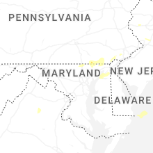


Connect with Interactive Hail Maps