

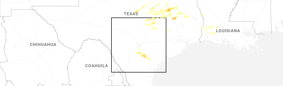
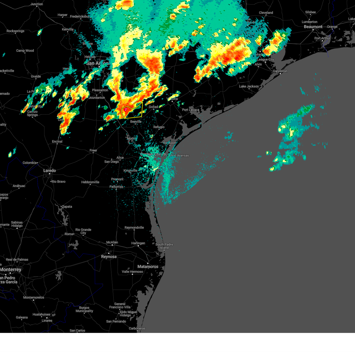
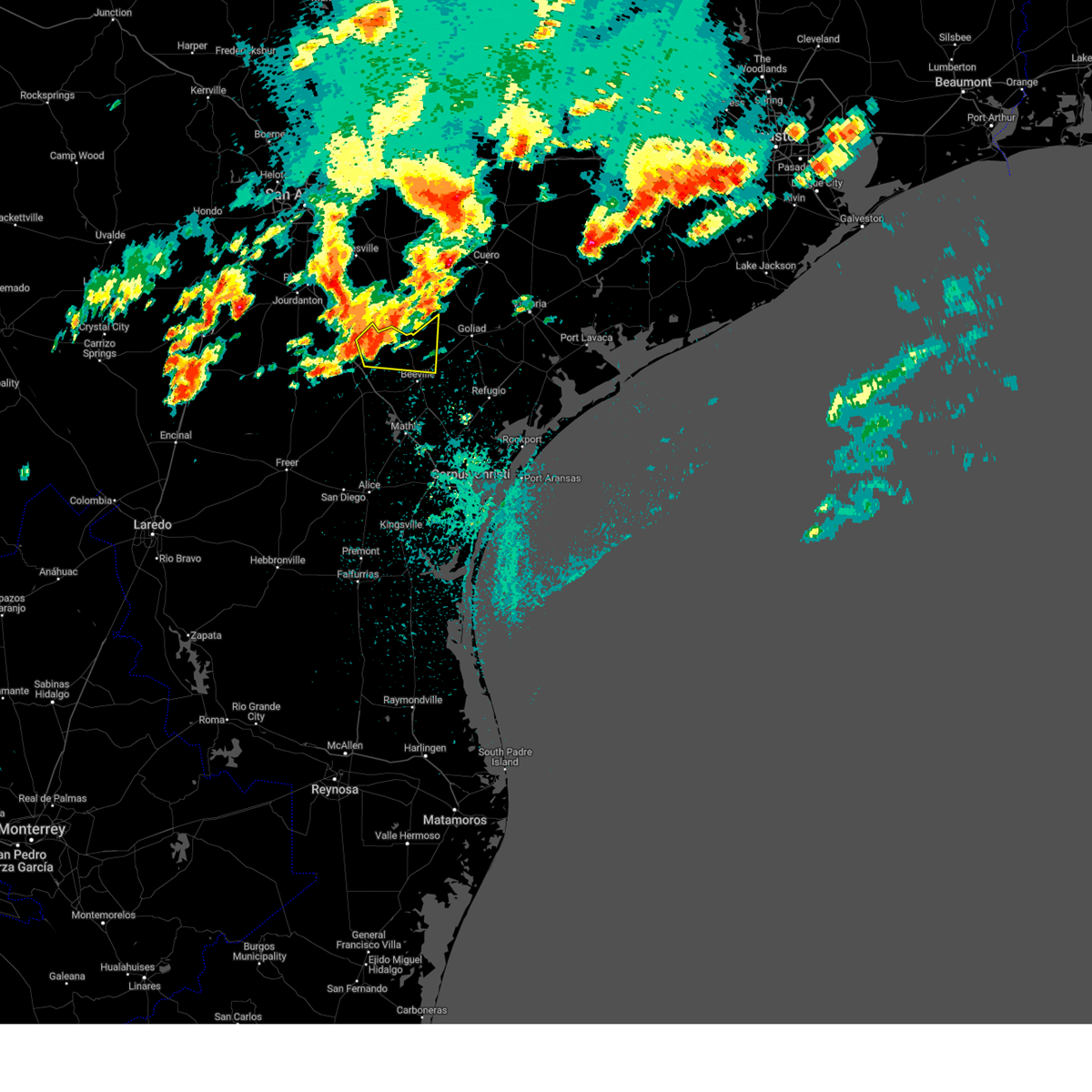
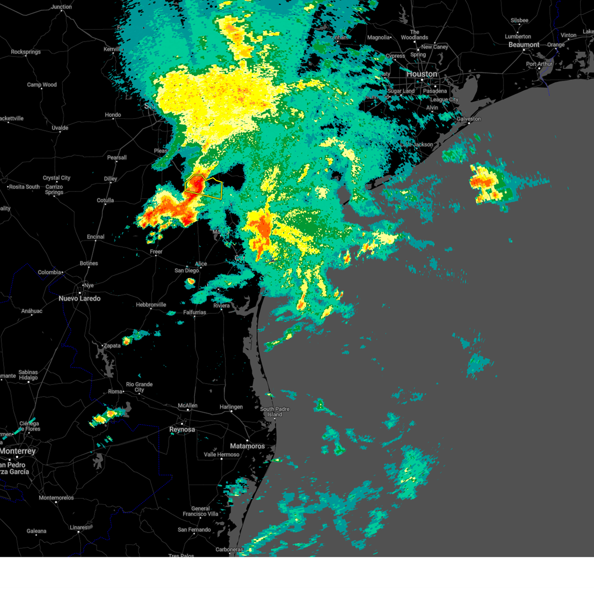
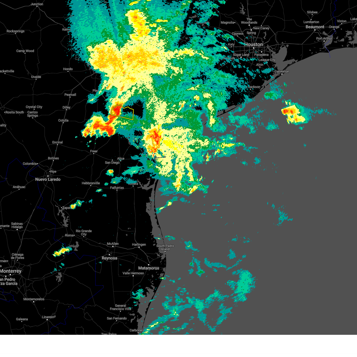
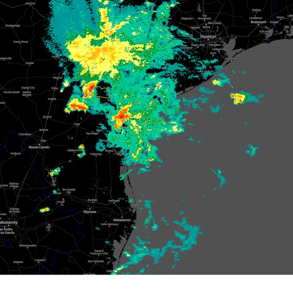
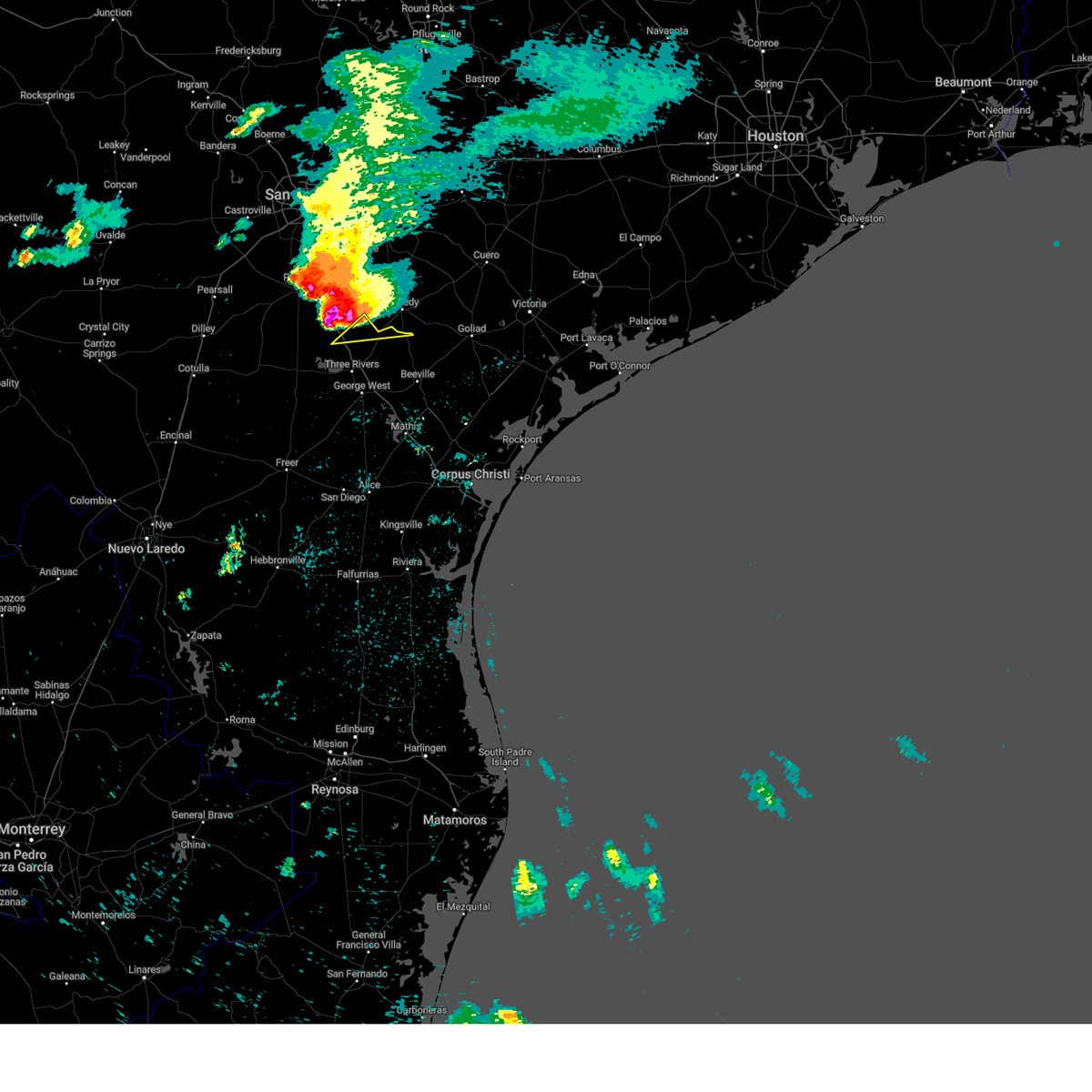
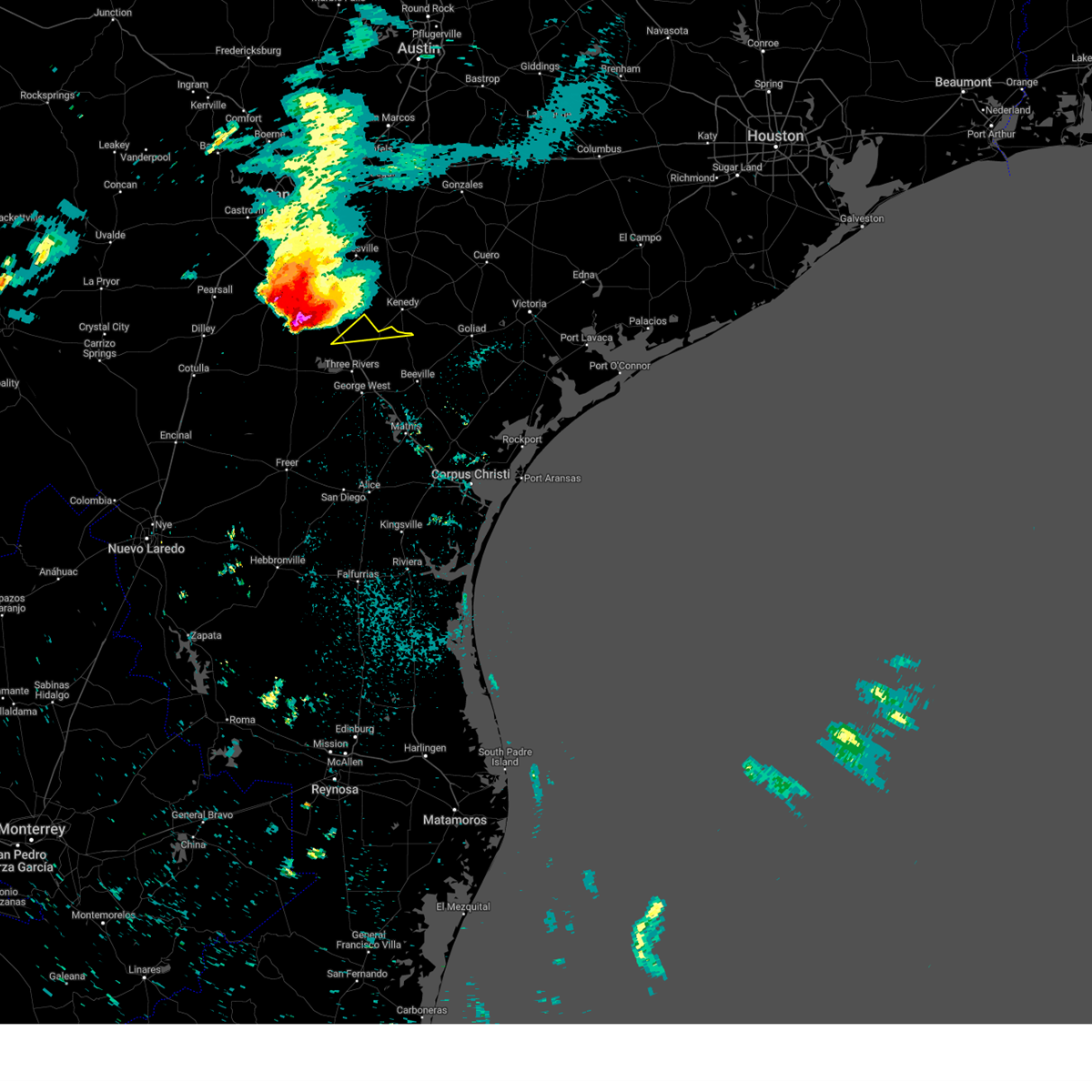
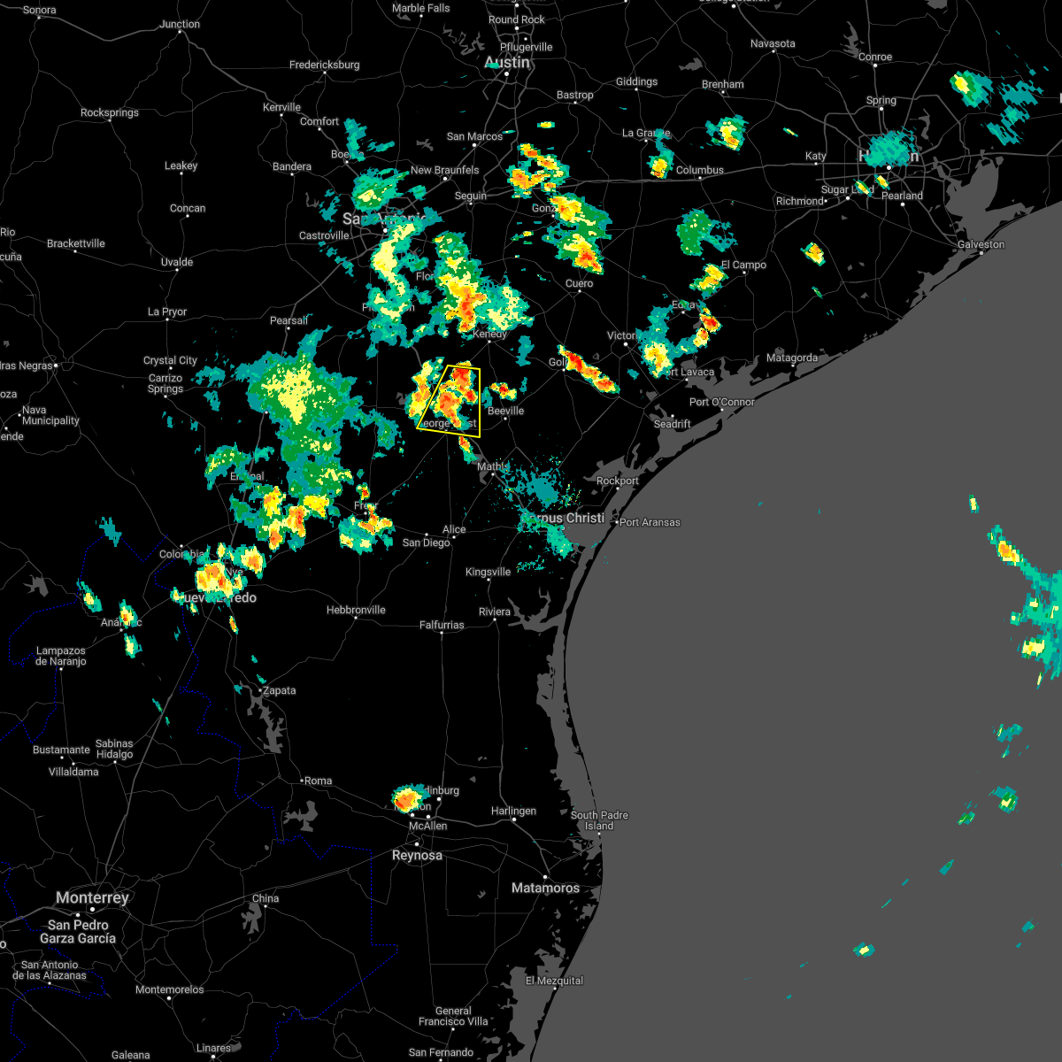
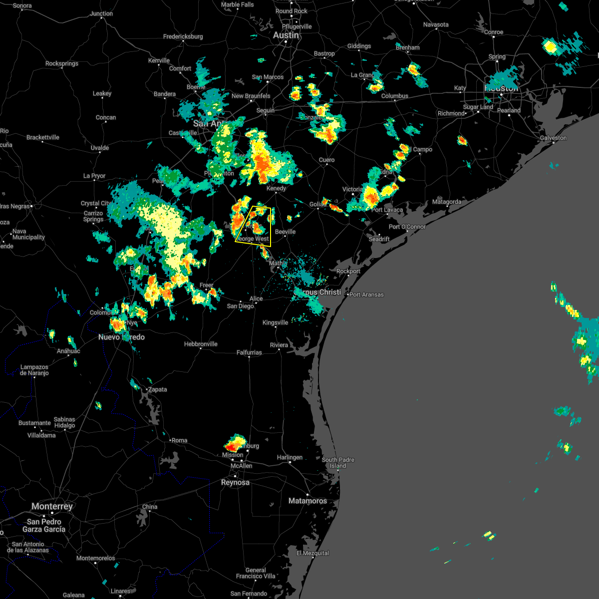
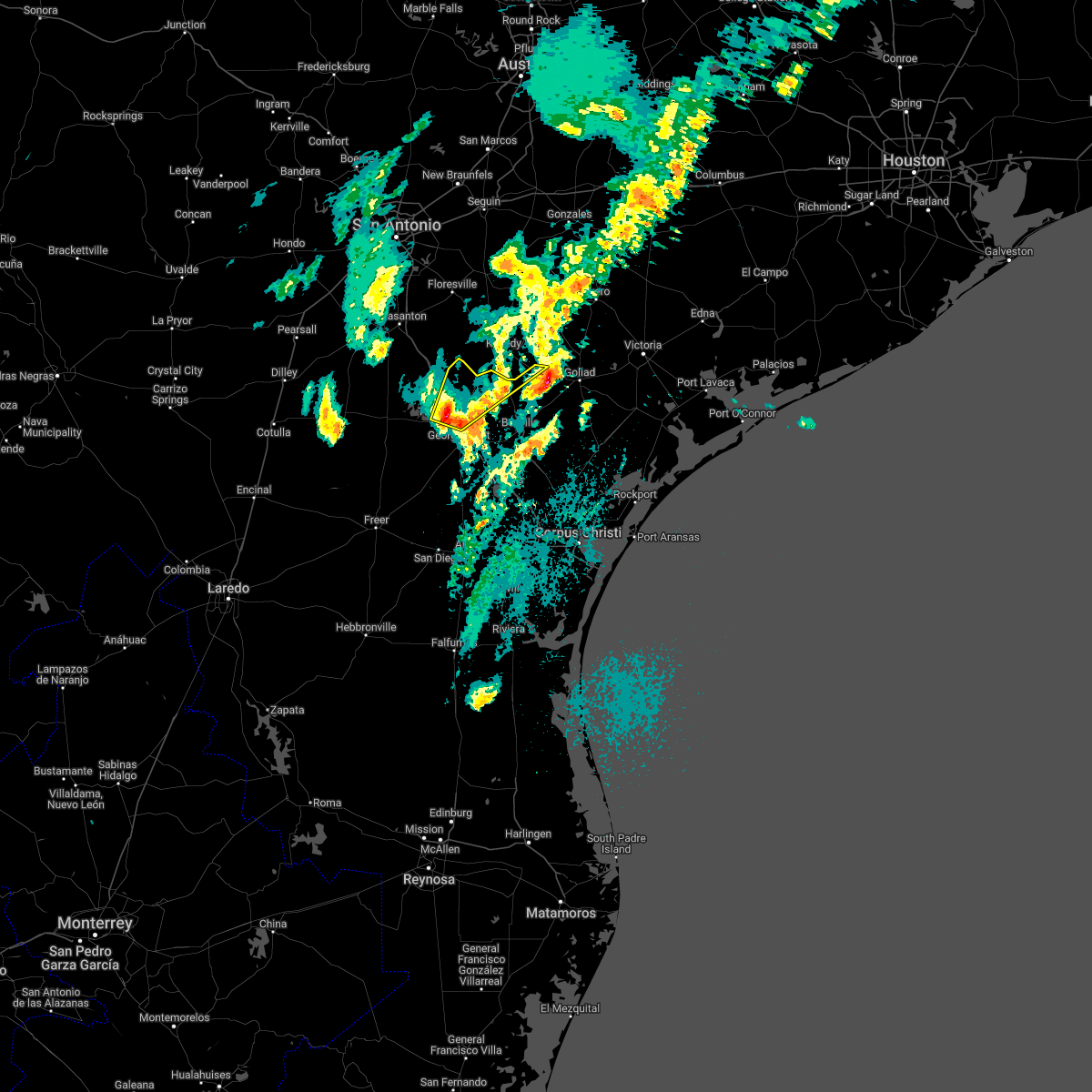
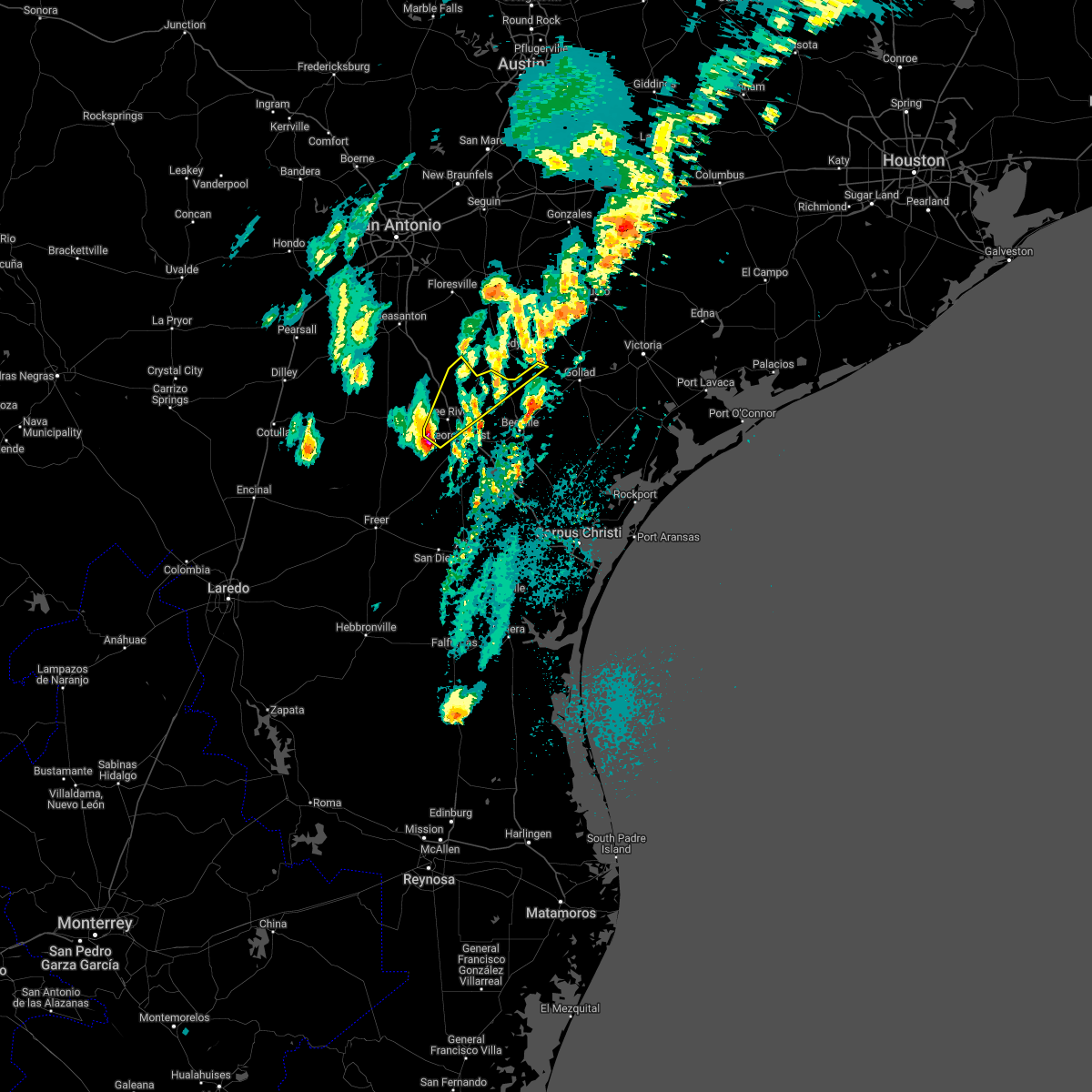
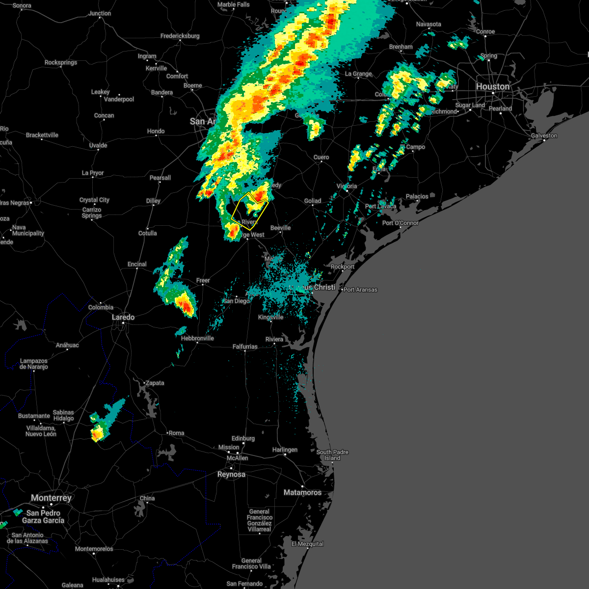
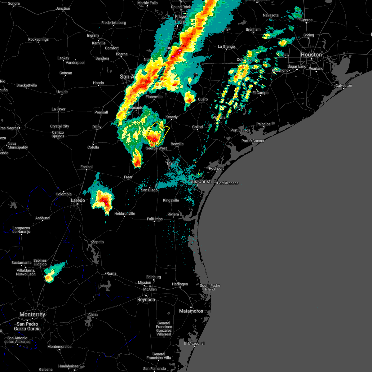
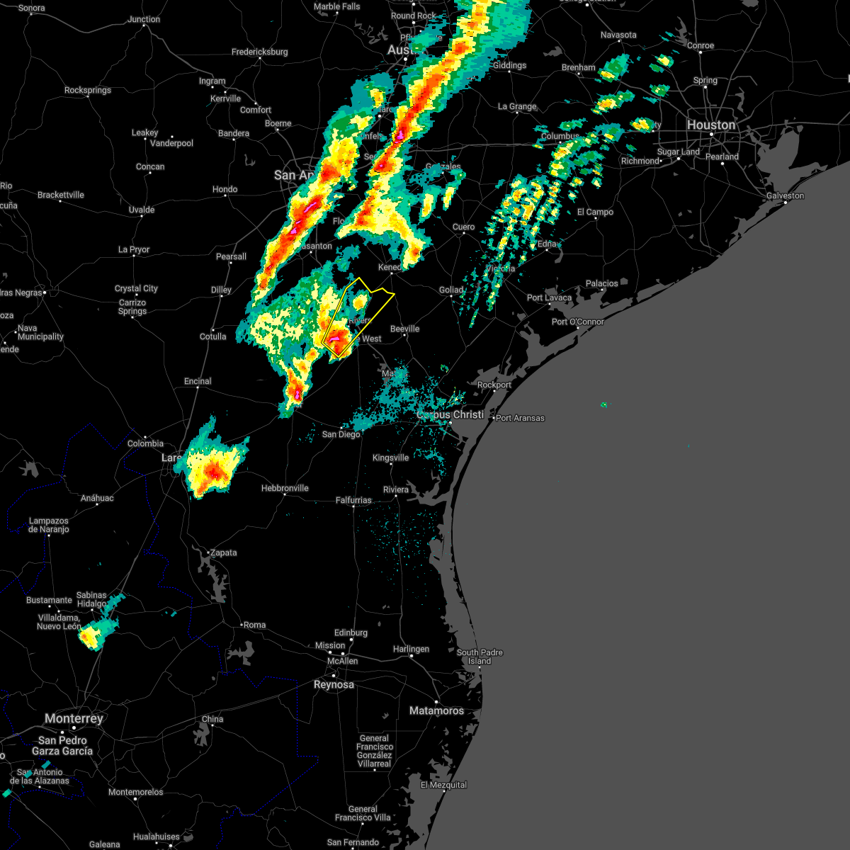
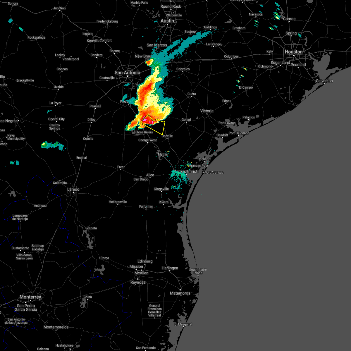
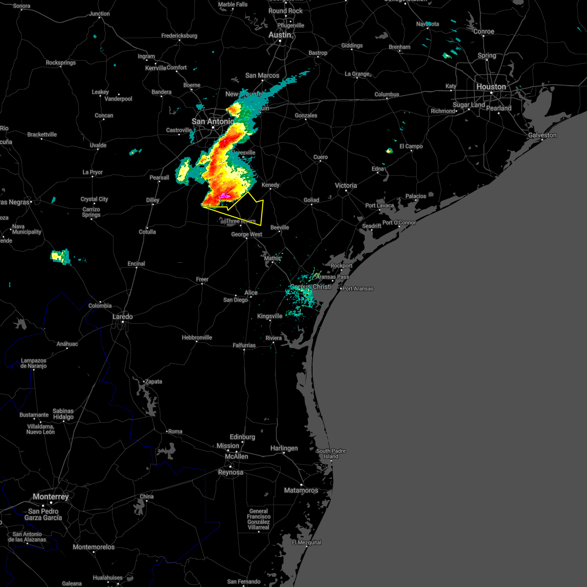
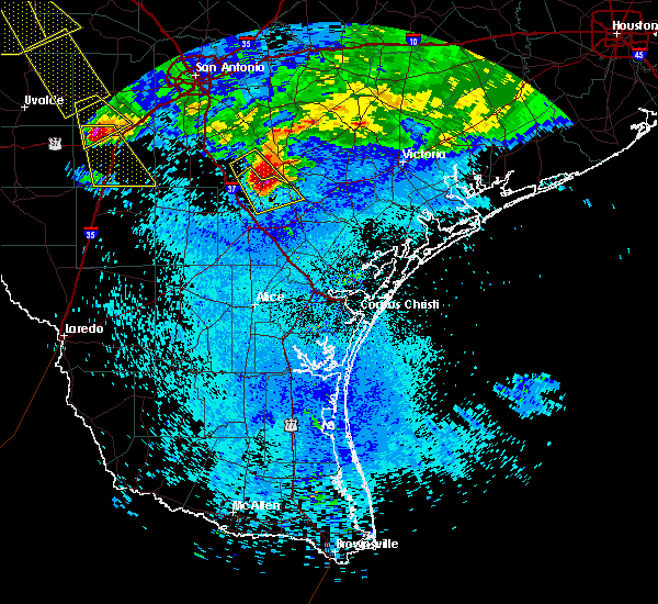
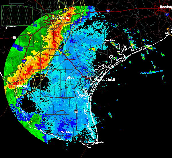
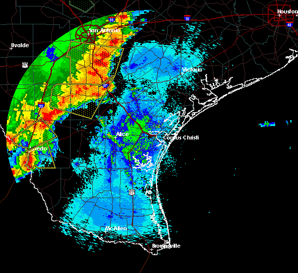
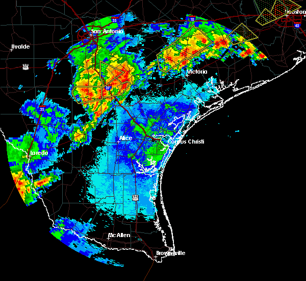
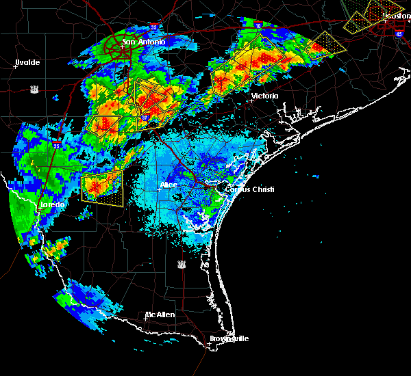
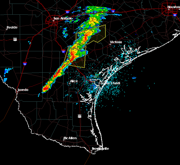
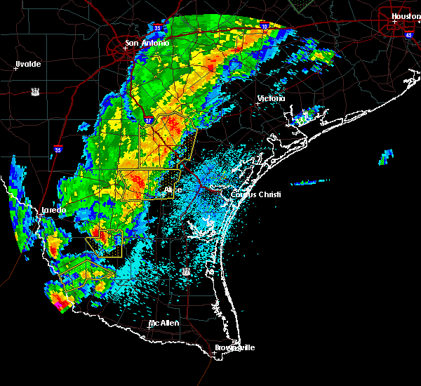
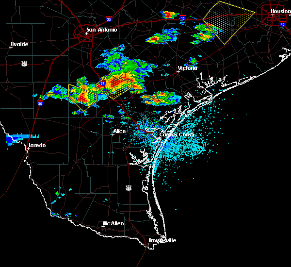
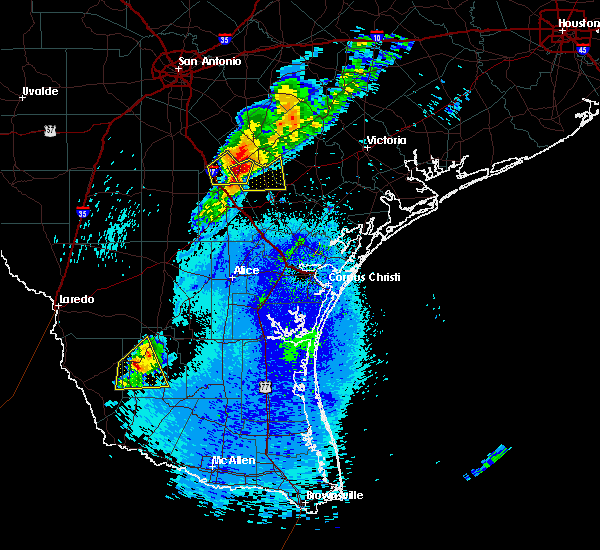
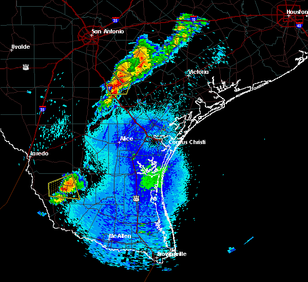
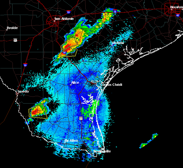
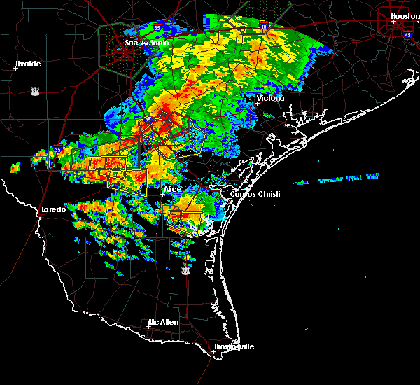
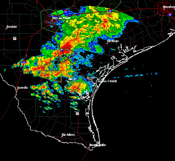
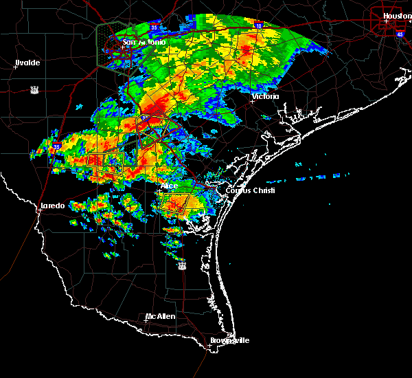
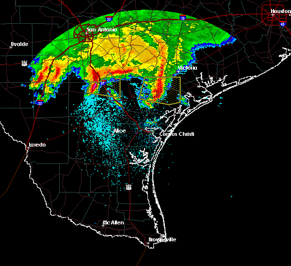
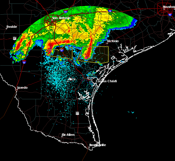
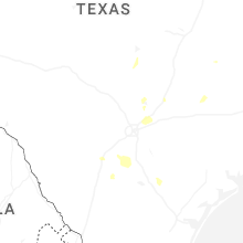
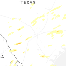
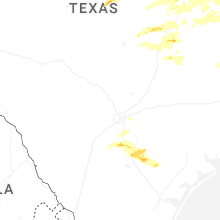
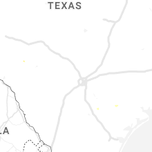
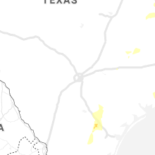
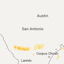
Hail Map for Pawnee, TX
The Pawnee, TX area has had 3 reports of on-the-ground hail by trained spotters, and has been under severe weather warnings 5 times during the past 12 months. Doppler radar has detected hail at or near Pawnee, TX on 33 occasions, including 3 occasions during the past year.
| Name: | Pawnee, TX |
| Where Located: | 60.7 miles SSE of San Antonio, TX |
| Map: | Google Map for Pawnee, TX |
| Population: | 166 |
| Housing Units: | 77 |
| More Info: | Search Google for Pawnee, TX |
2
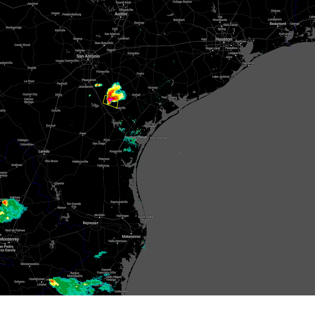
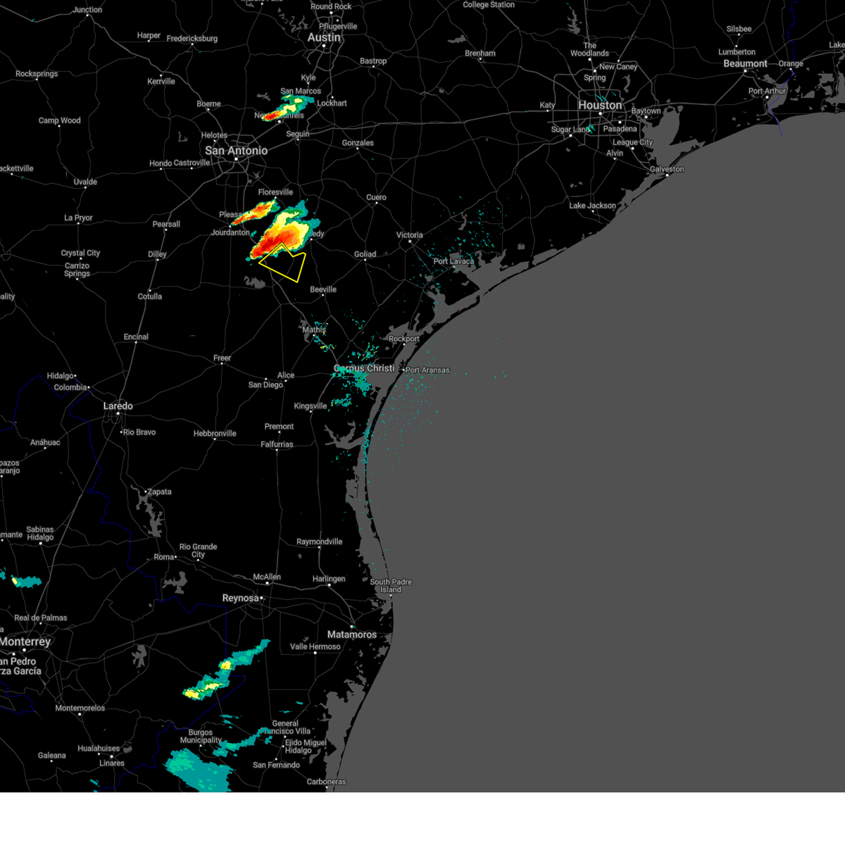
The Top Recent Hail Date for Pawnee, TX is Wednesday, April 30, 2025 (5th out of 33)
Hail and Wind Damage Spotted near Pawnee, TX
| Date / Time | Report Details |
|---|---|
| 4/30/2025 8:19 PM CDT |
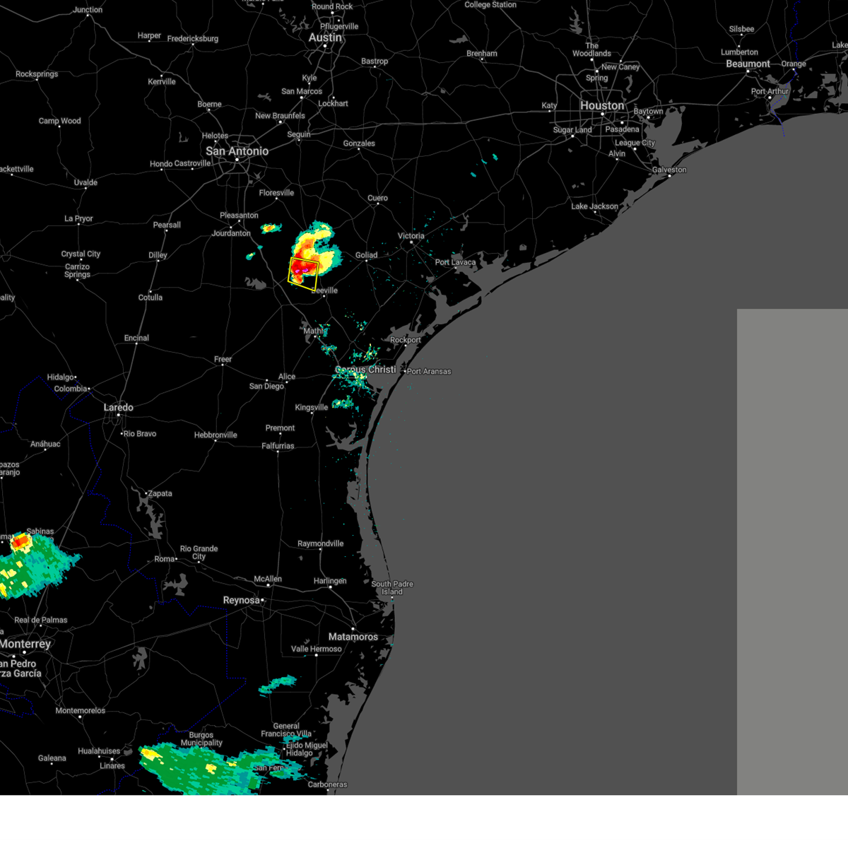 At 818 pm cdt, a severe thunderstorm was located near pawnee, or 13 miles northeast of three rivers, moving east at 20 mph (law enforcement). Hazards include tennis ball size hail and 60 mph wind gusts. People and animals outdoors will be injured. expect hail damage to roofs, siding, windows, and vehicles. expect wind damage to roofs, siding, and trees. locations impacted include, mineral, pettus, pawnee, tulsita, and tuleta. This includes us highway 181 mile marker 574 and near mile marker 578. At 818 pm cdt, a severe thunderstorm was located near pawnee, or 13 miles northeast of three rivers, moving east at 20 mph (law enforcement). Hazards include tennis ball size hail and 60 mph wind gusts. People and animals outdoors will be injured. expect hail damage to roofs, siding, windows, and vehicles. expect wind damage to roofs, siding, and trees. locations impacted include, mineral, pettus, pawnee, tulsita, and tuleta. This includes us highway 181 mile marker 574 and near mile marker 578.
|
| 4/30/2025 8:08 PM CDT |
 At 808 pm cdt, a severe thunderstorm was located near pawnee, or 11 miles northeast of three rivers, moving east at 20 mph (law enforcement). Hazards include tennis ball size hail and 60 mph wind gusts. People and animals outdoors will be injured. expect hail damage to roofs, siding, windows, and vehicles. expect wind damage to roofs, siding, and trees. locations impacted include, mineral, pettus, pawnee, tulsita, and tuleta. This includes us highway 181 mile marker 574 and near mile marker 578. At 808 pm cdt, a severe thunderstorm was located near pawnee, or 11 miles northeast of three rivers, moving east at 20 mph (law enforcement). Hazards include tennis ball size hail and 60 mph wind gusts. People and animals outdoors will be injured. expect hail damage to roofs, siding, windows, and vehicles. expect wind damage to roofs, siding, and trees. locations impacted include, mineral, pettus, pawnee, tulsita, and tuleta. This includes us highway 181 mile marker 574 and near mile marker 578.
|
| 4/30/2025 8:05 PM CDT | Baseball sized hail reported 0.7 miles WNW of Pawnee, TX, photos showing windows completely broken out on all sides of police vehicle from very large hail while officer was in vehicle. |
| 4/30/2025 8:01 PM CDT | Golf Ball sized hail reported 0.7 miles WNW of Pawnee, TX |
| 4/30/2025 8:00 PM CDT | Svrcrp the national weather service in corpus christi has issued a * severe thunderstorm warning for, northwestern live oak county in south central texas, northwestern bee county in south central texas, * until 830 pm cdt. * at 800 pm cdt, a severe thunderstorm was located near pawnee, or 10 miles northeast of three rivers, moving east at 20 mph (law enforcement). Hazards include golf ball size hail and 60 mph wind gusts. People and animals outdoors will be injured. expect hail damage to roofs, siding, windows, and vehicles. Expect wind damage to roofs, siding, and trees. |
| 4/30/2025 7:24 PM CDT |
 At 723 pm cdt, a severe thunderstorm was located near esseville, or 8 miles east of campbellton, moving east at 20 mph (radar indicated). Hazards include two inch hail and 70 mph wind gusts. People and animals outdoors will be injured. expect hail damage to roofs, siding, windows, and vehicles. expect considerable tree damage. wind damage is also likely to mobile homes, roofs, and outbuildings. locations impacted include, pawnee, nell, esseville, and whitsett. This includes interstate 37 between mile markers 80 and 83. At 723 pm cdt, a severe thunderstorm was located near esseville, or 8 miles east of campbellton, moving east at 20 mph (radar indicated). Hazards include two inch hail and 70 mph wind gusts. People and animals outdoors will be injured. expect hail damage to roofs, siding, windows, and vehicles. expect considerable tree damage. wind damage is also likely to mobile homes, roofs, and outbuildings. locations impacted include, pawnee, nell, esseville, and whitsett. This includes interstate 37 between mile markers 80 and 83.
|
| 4/30/2025 7:13 PM CDT |
 Svrcrp the national weather service in corpus christi has issued a * severe thunderstorm warning for, northwestern live oak county in south central texas, northwestern bee county in south central texas, * until 800 pm cdt. * at 713 pm cdt, a severe thunderstorm was located over esseville, or near campbellton, moving east at 20 mph (radar indicated). Hazards include 60 mph wind gusts and half dollar size hail. Hail damage to vehicles is expected. Expect wind damage to roofs, siding, and trees. Svrcrp the national weather service in corpus christi has issued a * severe thunderstorm warning for, northwestern live oak county in south central texas, northwestern bee county in south central texas, * until 800 pm cdt. * at 713 pm cdt, a severe thunderstorm was located over esseville, or near campbellton, moving east at 20 mph (radar indicated). Hazards include 60 mph wind gusts and half dollar size hail. Hail damage to vehicles is expected. Expect wind damage to roofs, siding, and trees.
|
| 5/13/2024 1:36 PM CDT |
 the severe thunderstorm warning has been cancelled and is no longer in effect the severe thunderstorm warning has been cancelled and is no longer in effect
|
| 5/13/2024 1:36 PM CDT |
 At 136 pm cdt, a severe thunderstorm was located near mineral, or 15 miles northwest of beeville, moving east at 35 mph (radar indicated). Hazards include golf ball size hail. People and animals outdoors will be injured. expect damage to roofs, siding, windows, and vehicles. locations impacted include, mineral, tulsita, normanna, pettus, pawnee, tuleta, and charco. This includes us highway 181 between mile markers 572 and 582. At 136 pm cdt, a severe thunderstorm was located near mineral, or 15 miles northwest of beeville, moving east at 35 mph (radar indicated). Hazards include golf ball size hail. People and animals outdoors will be injured. expect damage to roofs, siding, windows, and vehicles. locations impacted include, mineral, tulsita, normanna, pettus, pawnee, tuleta, and charco. This includes us highway 181 between mile markers 572 and 582.
|
| 5/13/2024 1:24 PM CDT |
 Svrcrp the national weather service in corpus christi has issued a * severe thunderstorm warning for, west central goliad county in south central texas, north central live oak county in south central texas, northwestern bee county in south central texas, * until 215 pm cdt. * at 124 pm cdt, a severe thunderstorm was located near karon, or 12 miles northeast of three rivers, moving east at 30 mph (radar indicated). Hazards include half dollar size hail. damage to vehicles is expected Svrcrp the national weather service in corpus christi has issued a * severe thunderstorm warning for, west central goliad county in south central texas, north central live oak county in south central texas, northwestern bee county in south central texas, * until 215 pm cdt. * at 124 pm cdt, a severe thunderstorm was located near karon, or 12 miles northeast of three rivers, moving east at 30 mph (radar indicated). Hazards include half dollar size hail. damage to vehicles is expected
|
| 3/17/2024 3:07 AM CDT |
 the severe thunderstorm warning has been cancelled and is no longer in effect the severe thunderstorm warning has been cancelled and is no longer in effect
|
| 3/17/2024 2:54 AM CDT |
 At 252 am cdt, a severe thunderstorm was located near esseville, or 12 miles southeast of campbellton, moving east at 25 mph (radar indicated). Hazards include 60 mph wind gusts and quarter size hail. Hail damage to vehicles is expected. expect wind damage to roofs, siding, and trees. locations impacted include, mineral, pawnee, nell, tulsita, esseville, and pettus. this includes the following highways, interstate 37 between mile markers 76 and 83. Us highway 181 between mile markers 572 and 574. At 252 am cdt, a severe thunderstorm was located near esseville, or 12 miles southeast of campbellton, moving east at 25 mph (radar indicated). Hazards include 60 mph wind gusts and quarter size hail. Hail damage to vehicles is expected. expect wind damage to roofs, siding, and trees. locations impacted include, mineral, pawnee, nell, tulsita, esseville, and pettus. this includes the following highways, interstate 37 between mile markers 76 and 83. Us highway 181 between mile markers 572 and 574.
|
| 3/17/2024 2:39 AM CDT |
 Svrcrp the national weather service in corpus christi has issued a * severe thunderstorm warning for, northwestern live oak county in south central texas, northwestern bee county in south central texas, * until 330 am cdt. * at 239 am cdt, a severe thunderstorm was located over esseville, or 7 miles southeast of campbellton, moving east at 25 mph (radar indicated). Hazards include 60 mph wind gusts and quarter size hail. Hail damage to vehicles is expected. Expect wind damage to roofs, siding, and trees. Svrcrp the national weather service in corpus christi has issued a * severe thunderstorm warning for, northwestern live oak county in south central texas, northwestern bee county in south central texas, * until 330 am cdt. * at 239 am cdt, a severe thunderstorm was located over esseville, or 7 miles southeast of campbellton, moving east at 25 mph (radar indicated). Hazards include 60 mph wind gusts and quarter size hail. Hail damage to vehicles is expected. Expect wind damage to roofs, siding, and trees.
|
| 3/1/2023 11:58 PM CST |
 At 1158 pm cst, a severe thunderstorm was located near nell, or 9 miles southwest of kenedy, moving east at 50 mph (radar indicated). Hazards include 60 mph wind gusts and quarter size hail. Hail damage to vehicles is expected. expect wind damage to roofs, siding, and trees. this severe thunderstorm will remain over mainly rural areas of northwestern live oak and northwestern bee counties. this includes the following highways, interstate 37 between mile markers 81 and 83. us highway 181 near mile marker 572. hail threat, radar indicated max hail size, 1. 00 in wind threat, radar indicated max wind gust, 60 mph. At 1158 pm cst, a severe thunderstorm was located near nell, or 9 miles southwest of kenedy, moving east at 50 mph (radar indicated). Hazards include 60 mph wind gusts and quarter size hail. Hail damage to vehicles is expected. expect wind damage to roofs, siding, and trees. this severe thunderstorm will remain over mainly rural areas of northwestern live oak and northwestern bee counties. this includes the following highways, interstate 37 between mile markers 81 and 83. us highway 181 near mile marker 572. hail threat, radar indicated max hail size, 1. 00 in wind threat, radar indicated max wind gust, 60 mph.
|
| 3/1/2023 11:35 PM CST |
 At 1135 pm cst, a severe thunderstorm was located over campbellton, moving east at 50 mph (radar indicated). Hazards include 60 mph wind gusts and quarter size hail. Hail damage to vehicles is expected. expect wind damage to roofs, siding, and trees. this severe thunderstorm will be near, esseville around 1140 pm cst. nell around 1150 pm cst. pawnee around 1155 pm cst. this includes the following highways, interstate 37 between mile markers 81 and 83. us highway 181 near mile marker 572. hail threat, radar indicated max hail size, 1. 00 in wind threat, radar indicated max wind gust, 60 mph. At 1135 pm cst, a severe thunderstorm was located over campbellton, moving east at 50 mph (radar indicated). Hazards include 60 mph wind gusts and quarter size hail. Hail damage to vehicles is expected. expect wind damage to roofs, siding, and trees. this severe thunderstorm will be near, esseville around 1140 pm cst. nell around 1150 pm cst. pawnee around 1155 pm cst. this includes the following highways, interstate 37 between mile markers 81 and 83. us highway 181 near mile marker 572. hail threat, radar indicated max hail size, 1. 00 in wind threat, radar indicated max wind gust, 60 mph.
|
| 8/11/2022 7:17 PM CDT |
 At 717 pm cdt, a severe thunderstorm was located near ray point, or 10 miles northeast of three rivers, moving south at 15 mph (radar indicated). Hazards include quarter size hail. Damage to vehicles is expected. locations impacted include, george west, three rivers, oakville, pawnee, ray point and karon. this includes the following highways, interstate 37 between mile markers 54 and 74. us highway 281 between mile markers 618 and 630. us highway 59 between mile markers 710 and 722. hail threat, radar indicated max hail size, 1. 00 in wind threat, radar indicated max wind gust, <50 mph. At 717 pm cdt, a severe thunderstorm was located near ray point, or 10 miles northeast of three rivers, moving south at 15 mph (radar indicated). Hazards include quarter size hail. Damage to vehicles is expected. locations impacted include, george west, three rivers, oakville, pawnee, ray point and karon. this includes the following highways, interstate 37 between mile markers 54 and 74. us highway 281 between mile markers 618 and 630. us highway 59 between mile markers 710 and 722. hail threat, radar indicated max hail size, 1. 00 in wind threat, radar indicated max wind gust, <50 mph.
|
| 8/11/2022 7:03 PM CDT |
 At 703 pm cdt, a severe thunderstorm was located over pawnee, or 13 miles northeast of three rivers, moving south at 20 mph (radar indicated). Hazards include 60 mph wind gusts and quarter size hail. Hail damage to vehicles is expected. Expect wind damage to roofs, siding, and trees. At 703 pm cdt, a severe thunderstorm was located over pawnee, or 13 miles northeast of three rivers, moving south at 20 mph (radar indicated). Hazards include 60 mph wind gusts and quarter size hail. Hail damage to vehicles is expected. Expect wind damage to roofs, siding, and trees.
|
| 3/22/2022 3:14 AM CDT |
 At 313 am cdt, a severe thunderstorm was located over ray point, or near three rivers, moving northeast at 55 mph (radar indicated). Hazards include 60 mph wind gusts and penny size hail. Expect damage to roofs, siding, and trees. locations impacted include, three rivers, mineral, nell, tulsita, karon, oakville, pettus, pawnee, ray point, charco and tuleta. this includes the following highways, interstate 37 between mile markers 63 and 79. us highway 281 between mile markers 618 and 624. us highway 181 between mile markers 572 and 578. hail threat, radar indicated max hail size, 0. 75 in wind threat, radar indicated max wind gust, 60 mph. At 313 am cdt, a severe thunderstorm was located over ray point, or near three rivers, moving northeast at 55 mph (radar indicated). Hazards include 60 mph wind gusts and penny size hail. Expect damage to roofs, siding, and trees. locations impacted include, three rivers, mineral, nell, tulsita, karon, oakville, pettus, pawnee, ray point, charco and tuleta. this includes the following highways, interstate 37 between mile markers 63 and 79. us highway 281 between mile markers 618 and 624. us highway 181 between mile markers 572 and 578. hail threat, radar indicated max hail size, 0. 75 in wind threat, radar indicated max wind gust, 60 mph.
|
| 3/22/2022 3:04 AM CDT |
 At 303 am cdt, a severe thunderstorm was located near three rivers, moving northeast at 50 mph (radar indicated). Hazards include 60 mph wind gusts and quarter size hail. Hail damage to vehicles is expected. Expect wind damage to roofs, siding, and trees. At 303 am cdt, a severe thunderstorm was located near three rivers, moving northeast at 50 mph (radar indicated). Hazards include 60 mph wind gusts and quarter size hail. Hail damage to vehicles is expected. Expect wind damage to roofs, siding, and trees.
|
| 3/22/2022 12:35 AM CDT |
 The severe thunderstorm warning for northwestern live oak and northwestern bee counties will expire at 1245 am cdt, the storm which prompted the warning has weakened below severe limits, and has exited the warned area. therefore, the warning will be allowed to expire. The severe thunderstorm warning for northwestern live oak and northwestern bee counties will expire at 1245 am cdt, the storm which prompted the warning has weakened below severe limits, and has exited the warned area. therefore, the warning will be allowed to expire.
|
| 3/22/2022 12:13 AM CDT |
 At 1212 am cdt, a severe thunderstorm was located near pawnee, or 12 miles northeast of three rivers, moving northeast at 35 mph (radar indicated). Hazards include 60 mph wind gusts and nickel size hail. Expect damage to roofs, siding, and trees. locations impacted include, three rivers, oakville, pawnee, nell, ray point and esseville. this includes the following highways, interstate 37 between mile markers 64 and 81. us highway 281 between mile markers 618 and 620. hail threat, radar indicated max hail size, 0. 88 in wind threat, radar indicated max wind gust, 60 mph. At 1212 am cdt, a severe thunderstorm was located near pawnee, or 12 miles northeast of three rivers, moving northeast at 35 mph (radar indicated). Hazards include 60 mph wind gusts and nickel size hail. Expect damage to roofs, siding, and trees. locations impacted include, three rivers, oakville, pawnee, nell, ray point and esseville. this includes the following highways, interstate 37 between mile markers 64 and 81. us highway 281 between mile markers 618 and 620. hail threat, radar indicated max hail size, 0. 88 in wind threat, radar indicated max wind gust, 60 mph.
|
| 3/21/2022 11:59 PM CDT |
 At 1158 pm cdt, a severe thunderstorm was located over three rivers, moving northeast at 55 mph (radar indicated). Hazards include 60 mph wind gusts and quarter size hail. Hail damage to vehicles is expected. Expect wind damage to roofs, siding, and trees. At 1158 pm cdt, a severe thunderstorm was located over three rivers, moving northeast at 55 mph (radar indicated). Hazards include 60 mph wind gusts and quarter size hail. Hail damage to vehicles is expected. Expect wind damage to roofs, siding, and trees.
|
| 5/19/2021 1:13 AM CDT |
 At 113 am cdt, severe thunderstorms were located along a line extending from near crowther to near annarose, moving east at 35 mph (radar indicated). Hazards include 60 mph wind gusts and quarter size hail. Hail damage to vehicles is expected. expect wind damage to roofs, siding, and trees. locations impacted include, beeville, mathis, george west, three rivers, tilden, choke canyon, skidmore, lake city, midway, cross, river creek acres, tynan, calliham, annarose, argenta, karon, rancho de la parita, mount lucas, pawnee and simmons. this includes the following highways, interstate 37 between mile markers 36 and 83. us highway 281 between mile markers 618 and 656. Us highway 59 between mile markers 698 and 752. At 113 am cdt, severe thunderstorms were located along a line extending from near crowther to near annarose, moving east at 35 mph (radar indicated). Hazards include 60 mph wind gusts and quarter size hail. Hail damage to vehicles is expected. expect wind damage to roofs, siding, and trees. locations impacted include, beeville, mathis, george west, three rivers, tilden, choke canyon, skidmore, lake city, midway, cross, river creek acres, tynan, calliham, annarose, argenta, karon, rancho de la parita, mount lucas, pawnee and simmons. this includes the following highways, interstate 37 between mile markers 36 and 83. us highway 281 between mile markers 618 and 656. Us highway 59 between mile markers 698 and 752.
|
| 5/19/2021 1:01 AM CDT |
 At 1257 am cdt, severe thunderstorms were located along a line extending from cross to 9 miles east of seven sisters, moving northeast at 70 mph (radar indicated). Hazards include ping pong ball size hail and 60 mph wind gusts. People and animals outdoors will be injured. expect hail damage to roofs, siding, windows, and vehicles. Expect wind damage to roofs, siding, and trees. At 1257 am cdt, severe thunderstorms were located along a line extending from cross to 9 miles east of seven sisters, moving northeast at 70 mph (radar indicated). Hazards include ping pong ball size hail and 60 mph wind gusts. People and animals outdoors will be injured. expect hail damage to roofs, siding, windows, and vehicles. Expect wind damage to roofs, siding, and trees.
|
| 5/19/2021 12:58 AM CDT |
 At 1257 am cdt, severe thunderstorms were located along a line extending from cross to 9 miles east of seven sisters, moving northeast at 70 mph (radar indicated). Hazards include ping pong ball size hail and 60 mph wind gusts. People and animals outdoors will be injured. expect hail damage to roofs, siding, windows, and vehicles. Expect wind damage to roofs, siding, and trees. At 1257 am cdt, severe thunderstorms were located along a line extending from cross to 9 miles east of seven sisters, moving northeast at 70 mph (radar indicated). Hazards include ping pong ball size hail and 60 mph wind gusts. People and animals outdoors will be injured. expect hail damage to roofs, siding, windows, and vehicles. Expect wind damage to roofs, siding, and trees.
|
| 4/23/2021 8:00 PM CDT |
 At 759 pm cdt, a severe thunderstorm was located near esseville, or 9 miles east of campbellton, moving east at 35 mph (radar indicated). Hazards include golf ball size hail and 60 mph wind gusts. People and animals outdoors will be injured. expect hail damage to roofs, siding, windows, and vehicles. Expect wind damage to roofs, siding, and trees. At 759 pm cdt, a severe thunderstorm was located near esseville, or 9 miles east of campbellton, moving east at 35 mph (radar indicated). Hazards include golf ball size hail and 60 mph wind gusts. People and animals outdoors will be injured. expect hail damage to roofs, siding, windows, and vehicles. Expect wind damage to roofs, siding, and trees.
|
| 4/23/2021 7:48 PM CDT | Power lines and tree limbs down between ih-37 and essevill in live oak county TX, 13.9 miles E of Pawnee, TX |
| 4/23/2021 7:33 PM CDT |
 At 732 pm cdt, a severe thunderstorm was located near campbellton, moving east at 50 mph (radar indicated). Hazards include golf ball size hail and 60 mph wind gusts. People and animals outdoors will be injured. expect hail damage to roofs, siding, windows, and vehicles. Expect wind damage to roofs, siding, and trees. At 732 pm cdt, a severe thunderstorm was located near campbellton, moving east at 50 mph (radar indicated). Hazards include golf ball size hail and 60 mph wind gusts. People and animals outdoors will be injured. expect hail damage to roofs, siding, windows, and vehicles. Expect wind damage to roofs, siding, and trees.
|
| 5/27/2020 11:24 PM CDT |
 At 1124 pm cdt, a severe thunderstorm was located near mineral, or 15 miles south of kenedy, moving southeast at 35 mph (radar indicated). Hazards include 60 mph wind gusts and quarter size hail. Hail damage to vehicles is expected. Expect wind damage to roofs, siding, and trees. At 1124 pm cdt, a severe thunderstorm was located near mineral, or 15 miles south of kenedy, moving southeast at 35 mph (radar indicated). Hazards include 60 mph wind gusts and quarter size hail. Hail damage to vehicles is expected. Expect wind damage to roofs, siding, and trees.
|
| 5/27/2020 11:15 PM CDT |
 At 1115 pm cdt, a severe thunderstorm was located over pawnee, or 13 miles southwest of kenedy, moving southeast at 40 mph (radar indicated). Hazards include ping pong ball size hail and 60 mph wind gusts. People and animals outdoors will be injured. expect hail damage to roofs, siding, windows, and vehicles. expect wind damage to roofs, siding, and trees. Locations impacted include, mineral, nell, tulsita, karon, normanna, pettus, pawnee and tuleta. At 1115 pm cdt, a severe thunderstorm was located over pawnee, or 13 miles southwest of kenedy, moving southeast at 40 mph (radar indicated). Hazards include ping pong ball size hail and 60 mph wind gusts. People and animals outdoors will be injured. expect hail damage to roofs, siding, windows, and vehicles. expect wind damage to roofs, siding, and trees. Locations impacted include, mineral, nell, tulsita, karon, normanna, pettus, pawnee and tuleta.
|
| 5/27/2020 10:54 PM CDT |
 At 1053 pm cdt, a severe thunderstorm was located near nell, or 13 miles east of campbellton, moving southeast at 45 mph (radar indicated). Hazards include ping pong ball size hail and 60 mph wind gusts. People and animals outdoors will be injured. expect hail damage to roofs, siding, windows, and vehicles. Expect wind damage to roofs, siding, and trees. At 1053 pm cdt, a severe thunderstorm was located near nell, or 13 miles east of campbellton, moving southeast at 45 mph (radar indicated). Hazards include ping pong ball size hail and 60 mph wind gusts. People and animals outdoors will be injured. expect hail damage to roofs, siding, windows, and vehicles. Expect wind damage to roofs, siding, and trees.
|
| 5/24/2020 10:00 PM CDT |
 At 1000 pm cdt, severe thunderstorms were located along a line extending from whitsett to near loma alta to 16 miles northeast of ranchitos las lomas, moving east at 50 mph (radar indicated). Hazards include 60 mph wind gusts. expect damage to roofs, siding, and trees At 1000 pm cdt, severe thunderstorms were located along a line extending from whitsett to near loma alta to 16 miles northeast of ranchitos las lomas, moving east at 50 mph (radar indicated). Hazards include 60 mph wind gusts. expect damage to roofs, siding, and trees
|
| 5/15/2020 11:57 PM CDT |
 At 1157 pm cdt, severe thunderstorms were located along a line extending from 7 miles northwest of nell to near whitsett to 12 miles northeast of fort ewell site, moving east at 30 mph (radar indicated). Hazards include 60 mph wind gusts and penny size hail. expect damage to roofs, siding, and trees At 1157 pm cdt, severe thunderstorms were located along a line extending from 7 miles northwest of nell to near whitsett to 12 miles northeast of fort ewell site, moving east at 30 mph (radar indicated). Hazards include 60 mph wind gusts and penny size hail. expect damage to roofs, siding, and trees
|
| 4/9/2020 8:36 PM CDT |
 At 836 pm cdt, a severe thunderstorm was located near pettus, or 15 miles north of beeville, moving east at 30 mph (radar indicated). Hazards include two inch hail and 60 mph wind gusts. People and animals outdoors will be injured. expect hail damage to roofs, siding, windows, and vehicles. expect wind damage to roofs, siding, and trees. Locations impacted include, beeville, goliad, mineral, berclair, tulsita, normanna, pettus, tuleta, charco and pawnee. At 836 pm cdt, a severe thunderstorm was located near pettus, or 15 miles north of beeville, moving east at 30 mph (radar indicated). Hazards include two inch hail and 60 mph wind gusts. People and animals outdoors will be injured. expect hail damage to roofs, siding, windows, and vehicles. expect wind damage to roofs, siding, and trees. Locations impacted include, beeville, goliad, mineral, berclair, tulsita, normanna, pettus, tuleta, charco and pawnee.
|
| 4/9/2020 8:24 PM CDT |
 At 824 pm cdt, a severe thunderstorm was located over tulsita, or 11 miles south of kenedy, moving east at 30 mph (radar indicated). Hazards include ping pong ball size hail and 60 mph wind gusts. People and animals outdoors will be injured. expect hail damage to roofs, siding, windows, and vehicles. Expect wind damage to roofs, siding, and trees. At 824 pm cdt, a severe thunderstorm was located over tulsita, or 11 miles south of kenedy, moving east at 30 mph (radar indicated). Hazards include ping pong ball size hail and 60 mph wind gusts. People and animals outdoors will be injured. expect hail damage to roofs, siding, windows, and vehicles. Expect wind damage to roofs, siding, and trees.
|
| 5/9/2019 9:44 PM CDT |
 At 943 pm cdt, severe thunderstorms were located along a line extending from near runge to near whitsett, moving northeast at 35 mph (radar indicated). Hazards include 60 mph wind gusts and nickel size hail. Expect damage to roofs, siding, and trees. Locations impacted include, george west, three rivers, mineral, river creek acres, nell, tulsita, karon, oakville, normanna, pettus, pawnee, simmons, ray point, tuleta, whitsett, esseville and charco. At 943 pm cdt, severe thunderstorms were located along a line extending from near runge to near whitsett, moving northeast at 35 mph (radar indicated). Hazards include 60 mph wind gusts and nickel size hail. Expect damage to roofs, siding, and trees. Locations impacted include, george west, three rivers, mineral, river creek acres, nell, tulsita, karon, oakville, normanna, pettus, pawnee, simmons, ray point, tuleta, whitsett, esseville and charco.
|
| 5/9/2019 9:24 PM CDT |
 At 924 pm cdt, severe thunderstorms were located along a line extending from near kenedy to near crowther, moving northeast at 35 mph (radar indicated). Hazards include 60 mph wind gusts and quarter size hail. Hail damage to vehicles is expected. expect wind damage to roofs, siding, and trees. Locations impacted include, george west, three rivers, choke canyon, mineral, river creek acres, calliham, nell, tulsita, karon, oakville, normanna, pettus, crowther, pawnee, simmons, ray point, tuleta, whitsett, esseville and charco. At 924 pm cdt, severe thunderstorms were located along a line extending from near kenedy to near crowther, moving northeast at 35 mph (radar indicated). Hazards include 60 mph wind gusts and quarter size hail. Hail damage to vehicles is expected. expect wind damage to roofs, siding, and trees. Locations impacted include, george west, three rivers, choke canyon, mineral, river creek acres, calliham, nell, tulsita, karon, oakville, normanna, pettus, crowther, pawnee, simmons, ray point, tuleta, whitsett, esseville and charco.
|
| 5/9/2019 9:11 PM CDT |
 At 910 pm cdt, severe thunderstorms were located along a line extending from near pawnee to near tilden, moving northeast at 35 mph (radar indicated). Hazards include 60 mph wind gusts and quarter size hail. Hail damage to vehicles is expected. Expect wind damage to roofs, siding, and trees. At 910 pm cdt, severe thunderstorms were located along a line extending from near pawnee to near tilden, moving northeast at 35 mph (radar indicated). Hazards include 60 mph wind gusts and quarter size hail. Hail damage to vehicles is expected. Expect wind damage to roofs, siding, and trees.
|
| 5/9/2019 8:58 PM CDT |
 At 857 pm cdt, a severe thunderstorm was located over esseville, or 7 miles east of campbellton, moving north at 15 mph (radar indicated). Hazards include 60 mph wind gusts and quarter size hail. Hail damage to vehicles is expected. expect wind damage to roofs, siding, and trees. Locations impacted include, choke canyon, pawnee, nell, ray point, whitsett and esseville. At 857 pm cdt, a severe thunderstorm was located over esseville, or 7 miles east of campbellton, moving north at 15 mph (radar indicated). Hazards include 60 mph wind gusts and quarter size hail. Hail damage to vehicles is expected. expect wind damage to roofs, siding, and trees. Locations impacted include, choke canyon, pawnee, nell, ray point, whitsett and esseville.
|
| 5/9/2019 8:38 PM CDT |
 At 838 pm cdt, a severe thunderstorm was located near esseville, or 9 miles southeast of campbellton, moving north at 20 mph (radar indicated). Hazards include 60 mph wind gusts and quarter size hail. Hail damage to vehicles is expected. Expect wind damage to roofs, siding, and trees. At 838 pm cdt, a severe thunderstorm was located near esseville, or 9 miles southeast of campbellton, moving north at 20 mph (radar indicated). Hazards include 60 mph wind gusts and quarter size hail. Hail damage to vehicles is expected. Expect wind damage to roofs, siding, and trees.
|
| 5/3/2019 10:41 PM CDT |
 At 1041 pm cdt, severe thunderstorms were located along a line extending from near telferner to george west, moving southeast at 30 mph (radar indicated). Hazards include 60 mph wind gusts and quarter size hail. Hail damage to vehicles is expected. Expect wind damage to roofs, siding, and trees. At 1041 pm cdt, severe thunderstorms were located along a line extending from near telferner to george west, moving southeast at 30 mph (radar indicated). Hazards include 60 mph wind gusts and quarter size hail. Hail damage to vehicles is expected. Expect wind damage to roofs, siding, and trees.
|
| 5/3/2019 10:26 PM CDT |
 At 1026 pm cdt, severe thunderstorms were located along a line extending from 7 miles northeast of salem to near simmons, moving southeast at 35 mph (radar indicated). Hazards include 60 mph wind gusts and nickel size hail. Expect damage to roofs, siding, and trees. Locations impacted include, victoria, beeville, george west, goliad, three rivers, guadalupe, fannin, victoria colony creek country club, weesatche, river creek acres, weser, nursery, victoria riverside park, victoria college, victoria mall, saxet lakes, karon, inez, salem and normanna. At 1026 pm cdt, severe thunderstorms were located along a line extending from 7 miles northeast of salem to near simmons, moving southeast at 35 mph (radar indicated). Hazards include 60 mph wind gusts and nickel size hail. Expect damage to roofs, siding, and trees. Locations impacted include, victoria, beeville, george west, goliad, three rivers, guadalupe, fannin, victoria colony creek country club, weesatche, river creek acres, weser, nursery, victoria riverside park, victoria college, victoria mall, saxet lakes, karon, inez, salem and normanna.
|
| 5/3/2019 9:53 PM CDT |
 At 952 pm cdt, severe thunderstorms were located along a line extending from 6 miles west of ezzell to near crowther, moving southeast at 35 mph (radar indicated). Hazards include 60 mph wind gusts and penny size hail. expect damage to roofs, siding, and trees At 952 pm cdt, severe thunderstorms were located along a line extending from 6 miles west of ezzell to near crowther, moving southeast at 35 mph (radar indicated). Hazards include 60 mph wind gusts and penny size hail. expect damage to roofs, siding, and trees
|
| 4/24/2019 5:53 PM CDT |
 At 552 pm cdt, severe thunderstorms were located along a line extending from near tulsita to near dinero, moving east at 30 mph (radar indicated). Hazards include 60 mph wind gusts and quarter size hail. Hail damage to vehicles is expected. expect wind damage to roofs, siding, and trees. Locations impacted include, beeville, skidmore, mineral, tulsita, karon, normanna, pettus, pawnee and tuleta. At 552 pm cdt, severe thunderstorms were located along a line extending from near tulsita to near dinero, moving east at 30 mph (radar indicated). Hazards include 60 mph wind gusts and quarter size hail. Hail damage to vehicles is expected. expect wind damage to roofs, siding, and trees. Locations impacted include, beeville, skidmore, mineral, tulsita, karon, normanna, pettus, pawnee and tuleta.
|
| 4/24/2019 5:44 PM CDT |
 At 543 pm cdt, severe thunderstorms were located along a line extending from near pawnee to near river creek acres, moving east at 30 mph (radar indicated). Hazards include 60 mph wind gusts and half dollar size hail. Hail damage to vehicles is expected. Expect wind damage to roofs, siding, and trees. At 543 pm cdt, severe thunderstorms were located along a line extending from near pawnee to near river creek acres, moving east at 30 mph (radar indicated). Hazards include 60 mph wind gusts and half dollar size hail. Hail damage to vehicles is expected. Expect wind damage to roofs, siding, and trees.
|
| 3/29/2018 12:14 AM CDT |
 At 1213 am cdt, severe thunderstorms were located along a line extending from near charco to near sandia to near benavides, moving east at 45 mph (radar indicated). Hazards include 70 mph wind gusts. Expect considerable tree damage. Damage is likely to mobile homes, roofs, and outbuildings. At 1213 am cdt, severe thunderstorms were located along a line extending from near charco to near sandia to near benavides, moving east at 45 mph (radar indicated). Hazards include 70 mph wind gusts. Expect considerable tree damage. Damage is likely to mobile homes, roofs, and outbuildings.
|
| 3/29/2018 12:03 AM CDT |
 At 1202 am cdt, severe thunderstorms were located along a line extending from 7 miles east of kenedy to near annarose, moving east at 50 mph (radar indicated). Hazards include 70 mph wind gusts and penny size hail. Expect considerable tree damage. damage is likely to mobile homes, roofs, and outbuildings. Locations impacted include, beeville, george west, three rivers, choke canyon, skidmore, mineral, lagarto, river creek acres, tynan, tulsita, annarose, argenta, karon, mount lucas, normanna, oakville, pettus, pawnee, simmons and ray point. At 1202 am cdt, severe thunderstorms were located along a line extending from 7 miles east of kenedy to near annarose, moving east at 50 mph (radar indicated). Hazards include 70 mph wind gusts and penny size hail. Expect considerable tree damage. damage is likely to mobile homes, roofs, and outbuildings. Locations impacted include, beeville, george west, three rivers, choke canyon, skidmore, mineral, lagarto, river creek acres, tynan, tulsita, annarose, argenta, karon, mount lucas, normanna, oakville, pettus, pawnee, simmons and ray point.
|
| 3/28/2018 11:45 PM CDT |
 At 1122 pm cdt, severe thunderstorms were located along a line extending from near campbellton to near loma alta, moving east at 50 mph. in addition to this severe thunderstorm warning, a tornado warning is also currently in effect for souther mcmullen county (radar indicated). Hazards include ping pong ball size hail and 60 mph wind gusts. People and animals outdoors will be injured. expect hail damage to roofs, siding, windows, and vehicles. Expect wind damage to roofs, siding, and trees. At 1122 pm cdt, severe thunderstorms were located along a line extending from near campbellton to near loma alta, moving east at 50 mph. in addition to this severe thunderstorm warning, a tornado warning is also currently in effect for souther mcmullen county (radar indicated). Hazards include ping pong ball size hail and 60 mph wind gusts. People and animals outdoors will be injured. expect hail damage to roofs, siding, windows, and vehicles. Expect wind damage to roofs, siding, and trees.
|
| 3/28/2018 11:24 PM CDT |
 At 1122 pm cdt, severe thunderstorms were located along a line extending from near campbellton to near loma alta, moving east at 50 mph. in addition to this severe thunderstorm warning, a tornado warning is also currently in effect for souther mcmullen county (radar indicated). Hazards include ping pong ball size hail and 60 mph wind gusts. People and animals outdoors will be injured. expect hail damage to roofs, siding, windows, and vehicles. Expect wind damage to roofs, siding, and trees. At 1122 pm cdt, severe thunderstorms were located along a line extending from near campbellton to near loma alta, moving east at 50 mph. in addition to this severe thunderstorm warning, a tornado warning is also currently in effect for souther mcmullen county (radar indicated). Hazards include ping pong ball size hail and 60 mph wind gusts. People and animals outdoors will be injured. expect hail damage to roofs, siding, windows, and vehicles. Expect wind damage to roofs, siding, and trees.
|
| 5/23/2017 6:58 PM CDT |
 At 658 pm cdt, a severe thunderstorm was located near pawnee, or 12 miles northeast of three rivers, moving southeast at 40 mph (radar indicated). Hazards include 70 mph wind gusts and quarter size hail. Hail damage to vehicles is expected. expect considerable tree damage. wind damage is also likely to mobile homes, roofs, and outbuildings. Locations impacted include, three rivers, mineral, nell, tulsita, karon, normanna, oakville, pettus, pawnee, ray point, tuleta, whitsett and esseville. At 658 pm cdt, a severe thunderstorm was located near pawnee, or 12 miles northeast of three rivers, moving southeast at 40 mph (radar indicated). Hazards include 70 mph wind gusts and quarter size hail. Hail damage to vehicles is expected. expect considerable tree damage. wind damage is also likely to mobile homes, roofs, and outbuildings. Locations impacted include, three rivers, mineral, nell, tulsita, karon, normanna, oakville, pettus, pawnee, ray point, tuleta, whitsett and esseville.
|
| 5/23/2017 6:41 PM CDT |
 At 641 pm cdt, a severe thunderstorm was located near esseville, or 7 miles east of campbellton, moving southeast at 35 mph (radar indicated). Hazards include 60 mph wind gusts and quarter size hail. Hail damage to vehicles is expected. Expect wind damage to roofs, siding, and trees. At 641 pm cdt, a severe thunderstorm was located near esseville, or 7 miles east of campbellton, moving southeast at 35 mph (radar indicated). Hazards include 60 mph wind gusts and quarter size hail. Hail damage to vehicles is expected. Expect wind damage to roofs, siding, and trees.
|
| 4/29/2017 10:21 PM CDT |
 At 1020 pm cdt, a severe thunderstorm was located over pawnee, or 14 miles northeast of three rivers, moving east at 30 mph (radar indicated). Hazards include golf ball size hail and 60 mph wind gusts. People and animals outdoors will be injured. expect hail damage to roofs, siding, windows, and vehicles. Expect wind damage to roofs, siding, and trees. At 1020 pm cdt, a severe thunderstorm was located over pawnee, or 14 miles northeast of three rivers, moving east at 30 mph (radar indicated). Hazards include golf ball size hail and 60 mph wind gusts. People and animals outdoors will be injured. expect hail damage to roofs, siding, windows, and vehicles. Expect wind damage to roofs, siding, and trees.
|
| 4/29/2017 10:06 PM CDT |
 At 1006 pm cdt, a severe thunderstorm was located near esseville, or 10 miles north of three rivers, moving east at 25 mph (radar indicated). Hazards include 60 mph wind gusts and quarter size hail. Hail damage to vehicles is expected. expect wind damage to roofs, siding, and trees. Locations impacted include, esseville, pawnee and nell. At 1006 pm cdt, a severe thunderstorm was located near esseville, or 10 miles north of three rivers, moving east at 25 mph (radar indicated). Hazards include 60 mph wind gusts and quarter size hail. Hail damage to vehicles is expected. expect wind damage to roofs, siding, and trees. Locations impacted include, esseville, pawnee and nell.
|
| 4/29/2017 9:50 PM CDT |
 At 949 pm cdt, a severe thunderstorm was located over whitsett, or 7 miles south of campbellton, moving east at 15 mph (radar indicated). Hazards include 60 mph wind gusts and quarter size hail. Hail damage to vehicles is expected. Expect wind damage to roofs, siding, and trees. At 949 pm cdt, a severe thunderstorm was located over whitsett, or 7 miles south of campbellton, moving east at 15 mph (radar indicated). Hazards include 60 mph wind gusts and quarter size hail. Hail damage to vehicles is expected. Expect wind damage to roofs, siding, and trees.
|
| 5/31/2016 6:36 PM CDT |
 The severe thunderstorm warning for central live oak and bee counties will expire at 645 pm cdt, the storms which prompted the warning have weakened below severe limits, and no longer pose an immediate threat to life or property. therefore the warning will be allowed to expire. however small hail and gusty winds are still possible with these thunderstorms. The severe thunderstorm warning for central live oak and bee counties will expire at 645 pm cdt, the storms which prompted the warning have weakened below severe limits, and no longer pose an immediate threat to life or property. therefore the warning will be allowed to expire. however small hail and gusty winds are still possible with these thunderstorms.
|
| 5/31/2016 6:12 PM CDT |
 At 601 pm cdt, a severe thunderstorm capable of producing a tornado was located over pawnee, or 13 miles southwest of kenedy, moving east at 20 mph (radar indicated rotation). Hazards include tornado and half dollar size hail. Flying debris will be dangerous to those caught without shelter. mobile homes will be damaged or destroyed. damage to roofs, windows, and vehicles will occur. tree damage is likely. this dangerous storm will be near, mineral around 620 pm cdt. Tulsita, pettus, tuleta and normanna around 630 pm cdt. At 601 pm cdt, a severe thunderstorm capable of producing a tornado was located over pawnee, or 13 miles southwest of kenedy, moving east at 20 mph (radar indicated rotation). Hazards include tornado and half dollar size hail. Flying debris will be dangerous to those caught without shelter. mobile homes will be damaged or destroyed. damage to roofs, windows, and vehicles will occur. tree damage is likely. this dangerous storm will be near, mineral around 620 pm cdt. Tulsita, pettus, tuleta and normanna around 630 pm cdt.
|
| 5/31/2016 6:07 PM CDT |
 At 606 pm cdt, severe thunderstorms were located along a line extending from near pawnee to near mineral to oakville, moving southeast at 35 mph (radar indicated). Hazards include 60 mph wind gusts and quarter size hail. Hail damage to vehicles is expected. Expect wind damage to roofs, siding, and trees. At 606 pm cdt, severe thunderstorms were located along a line extending from near pawnee to near mineral to oakville, moving southeast at 35 mph (radar indicated). Hazards include 60 mph wind gusts and quarter size hail. Hail damage to vehicles is expected. Expect wind damage to roofs, siding, and trees.
|
| 5/31/2016 6:02 PM CDT |
 At 601 pm cdt, a severe thunderstorm capable of producing a tornado was located over pawnee, or 13 miles southwest of kenedy, moving east at 20 mph (radar indicated rotation). Hazards include tornado and half dollar size hail. Flying debris will be dangerous to those caught without shelter. mobile homes will be damaged or destroyed. damage to roofs, windows, and vehicles will occur. tree damage is likely. this dangerous storm will be near, mineral around 620 pm cdt. Tulsita, pettus, tuleta and normanna around 630 pm cdt. At 601 pm cdt, a severe thunderstorm capable of producing a tornado was located over pawnee, or 13 miles southwest of kenedy, moving east at 20 mph (radar indicated rotation). Hazards include tornado and half dollar size hail. Flying debris will be dangerous to those caught without shelter. mobile homes will be damaged or destroyed. damage to roofs, windows, and vehicles will occur. tree damage is likely. this dangerous storm will be near, mineral around 620 pm cdt. Tulsita, pettus, tuleta and normanna around 630 pm cdt.
|
| 5/31/2016 5:54 PM CDT |
 At 553 pm cdt, a severe thunderstorm capable of producing a tornado was located over pawnee, or 15 miles southwest of kenedy, moving southeast at 30 mph. the rotation with the storm northwest of three rivers appears to have weakened (radar indicated rotation). Hazards include tornado and half dollar size hail. Flying debris will be dangerous to those caught without shelter. mobile homes will be damaged or destroyed. damage to roofs, windows, and vehicles will occur. tree damage is likely. This dangerous storm will be near, mineral around 615 pm cdt. At 553 pm cdt, a severe thunderstorm capable of producing a tornado was located over pawnee, or 15 miles southwest of kenedy, moving southeast at 30 mph. the rotation with the storm northwest of three rivers appears to have weakened (radar indicated rotation). Hazards include tornado and half dollar size hail. Flying debris will be dangerous to those caught without shelter. mobile homes will be damaged or destroyed. damage to roofs, windows, and vehicles will occur. tree damage is likely. This dangerous storm will be near, mineral around 615 pm cdt.
|
| 5/31/2016 5:47 PM CDT |
 At 546 pm cdt, spotter reported a tornado 5 miles northwest of three rivers, moving southeast at 25 mph. another possible tornado could form southwest of nell, moving southeast at 20 mph (weather spotters confirmed tornado). Hazards include damaging tornado and quarter size hail. Flying debris will be dangerous to those caught without shelter. mobile homes will be damaged or destroyed. damage to roofs, windows, and vehicles will occur. tree damage is likely. the tornado will be near, ray point around 550 pm cdt. three rivers and simmons around 555 pm cdt. Oakville around 600 pm cdt. At 546 pm cdt, spotter reported a tornado 5 miles northwest of three rivers, moving southeast at 25 mph. another possible tornado could form southwest of nell, moving southeast at 20 mph (weather spotters confirmed tornado). Hazards include damaging tornado and quarter size hail. Flying debris will be dangerous to those caught without shelter. mobile homes will be damaged or destroyed. damage to roofs, windows, and vehicles will occur. tree damage is likely. the tornado will be near, ray point around 550 pm cdt. three rivers and simmons around 555 pm cdt. Oakville around 600 pm cdt.
|
| 2/23/2016 3:14 AM CST |
 At 313 am cst, severe thunderstorms were located along a line extending from near pawnee to near george west, moving east at 50 mph (radar indicated). Hazards include 60 mph wind gusts and quarter size hail. Hail damage to vehicles is expected. Expect wind damage to roofs, siding, and trees. At 313 am cst, severe thunderstorms were located along a line extending from near pawnee to near george west, moving east at 50 mph (radar indicated). Hazards include 60 mph wind gusts and quarter size hail. Hail damage to vehicles is expected. Expect wind damage to roofs, siding, and trees.
|
| 2/23/2016 2:53 AM CST |
 At 253 am cst, a severe thunderstorm was located near choke canyon, moving east at 45 mph (radar indicated). Hazards include 60 mph wind gusts and quarter size hail. Hail damage to vehicles is expected. expect wind damage to roofs, siding, and trees. Locations impacted include, three rivers, choke canyon, oakville, crowther, ray point, nell, pawnee, calliham, karon, esseville and whitsett. At 253 am cst, a severe thunderstorm was located near choke canyon, moving east at 45 mph (radar indicated). Hazards include 60 mph wind gusts and quarter size hail. Hail damage to vehicles is expected. expect wind damage to roofs, siding, and trees. Locations impacted include, three rivers, choke canyon, oakville, crowther, ray point, nell, pawnee, calliham, karon, esseville and whitsett.
|
| 2/23/2016 2:38 AM CST |
 At 238 am cst, a severe thunderstorm was located over cross, or 8 miles north of tilden, moving east at 45 mph (radar indicated). Hazards include 60 mph wind gusts and half dollar size hail. Hail damage to vehicles is expected. Expect wind damage to roofs, siding, and trees. At 238 am cst, a severe thunderstorm was located over cross, or 8 miles north of tilden, moving east at 45 mph (radar indicated). Hazards include 60 mph wind gusts and half dollar size hail. Hail damage to vehicles is expected. Expect wind damage to roofs, siding, and trees.
|
| 5/25/2015 9:59 PM CDT | At 959 pm cdt, doppler radar indicated a line of severe thunderstorms capable of producing quarter size hail and damaging winds in excess of 60 mph. these storms were located along a line extending from near weesatche to near pawnee, moving east at 15 mph. locations impacted include, weser, tulsita, charco, weesatche, pettus and ander. a tornado watch remains in effect until 200 am cdt for south central texas. |
| 5/25/2015 9:28 PM CDT | At 927 pm cdt, doppler radar indicated a line of severe thunderstorms capable of producing quarter size hail and damaging winds in excess of 60 mph. these storms were located along a line extending from 6 miles west of charco to pawnee, and moving east at 25 mph. |
| 5/15/2015 10:53 AM CDT | The severe thunderstorm warning for northwestern bee and central live oak counties will expire at 1100 am cdt, the storm which prompted the warning has weakened below severe limits, and no longer poses an immediate threat to life or property. therefore the warning will be allowed to expire. however gusty winds of 40 mph are still possible with this thunderstorm. |
| 5/15/2015 10:14 AM CDT | At 1014 am cdt, doppler radar indicated a severe thunderstorm capable of producing quarter size hail and damaging winds in excess of 60 mph. this storm was located near karon, or 8 miles east of three rivers, and moving east at 45 mph. |
| 5/11/2015 5:37 PM CDT | At 536 pm cdt, doppler radar indicated a severe thunderstorm capable of producing large hail up to ping pong ball size. this storm was located over nell, or 13 miles southwest of kenedy, and moving southeast at 10 mph. |
| 4/17/2015 4:33 PM CDT | At 432 pm cdt, doppler radar indicated a severe thunderstorm capable of producing half dollar size hail and damaging winds in excess of 60 mph. this storm was located over pawnee, or 13 miles southwest of kenedy, moving northeast at 30 mph. locations impacted include, oakville, tuleta, ray point, pettus, mineral, nell, tulsita, normanna, pawnee, karon and esseville. |
| 4/17/2015 4:11 PM CDT | At 409 pm cdt, doppler radar indicated a line of severe thunderstorms capable of producing quarter size hail and damaging winds in excess of 60 mph. these storms were located along a line extending from near pawnee to near three rivers, moving east at 30 mph. locations impacted include, three rivers, oakville, tuleta, ray point, nell, tulsita, normanna, pawnee, karon, whitsett, pettus, mineral and esseville. |
| 4/17/2015 3:54 PM CDT | At 353 pm cdt, doppler radar indicated a severe thunderstorm capable of producing quarter size hail and destructive winds in excess of 70 mph. this storm was located near three rivers, and moving east at 35 mph. |
| 4/29/2013 4:42 PM CDT | Quarter sized hail reported 15.1 miles E of Pawnee, TX, coop observer reported quarter size hail around 410 pm. |
| 9/29/2012 2:55 AM CDT | Large tree down near intersection of fm 2049 and cr 24 in live oak county TX, 7.8 miles NE of Pawnee, TX |
| 6/26/2012 7:38 PM CDT | Marble size hail and several trees limbs blown dow in karnes county TX, 4.7 miles SSW of Pawnee, TX |
| 6/26/2012 7:38 PM CDT | Marble size hail and several trees limbs blown dow in karnes county TX, 7.5 miles S of Pawnee, TX |
| 6/26/2012 7:38 PM CDT | Marble size hail and several trees limbs blown dow in karnes county TX, 12.1 miles SSE of Pawnee, TX |
Hail Maps for Pawnee, TX


Connect with Interactive Hail Maps