

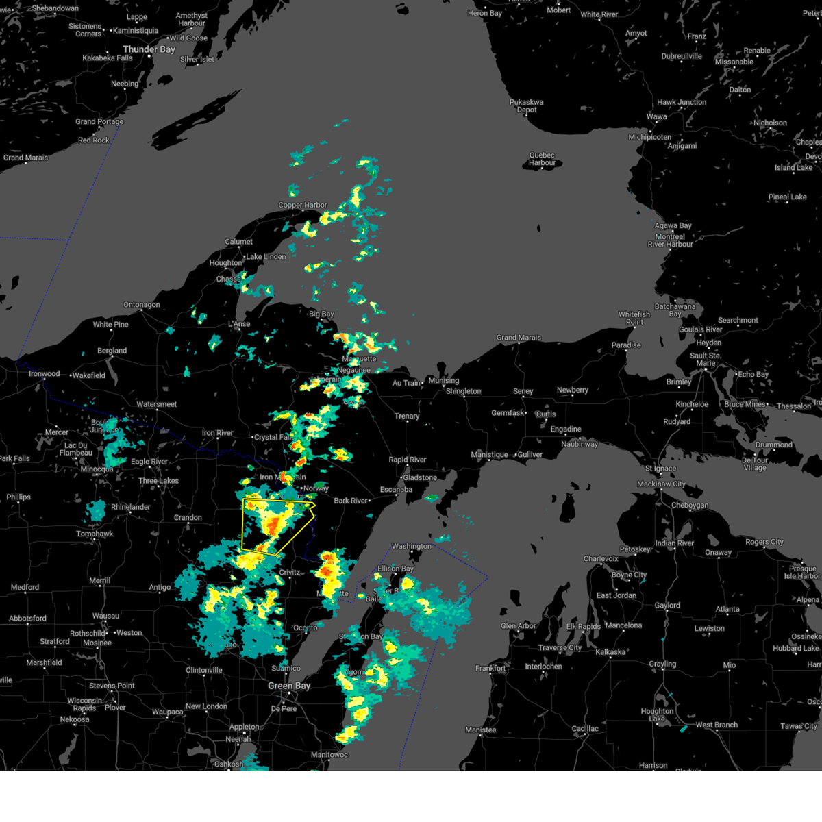
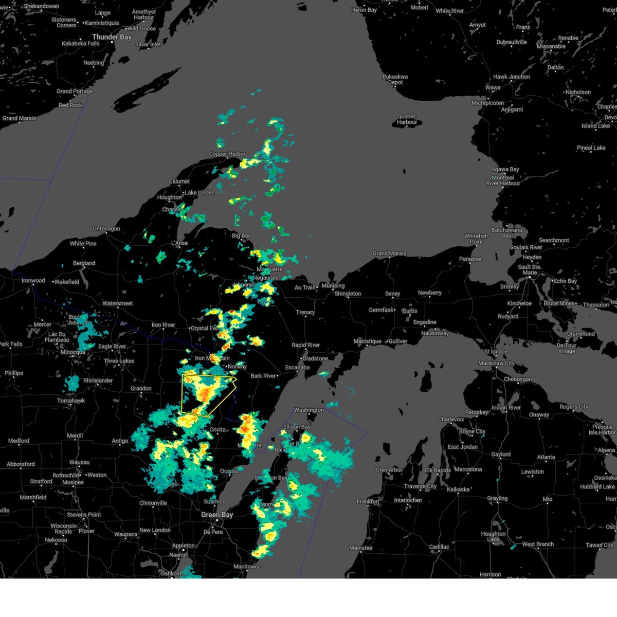
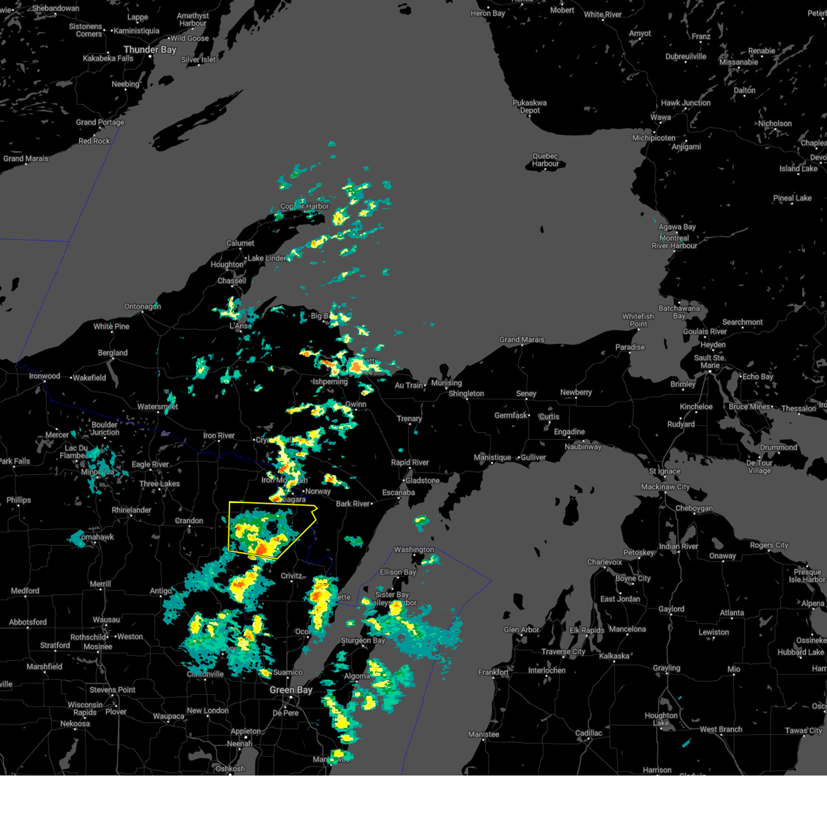
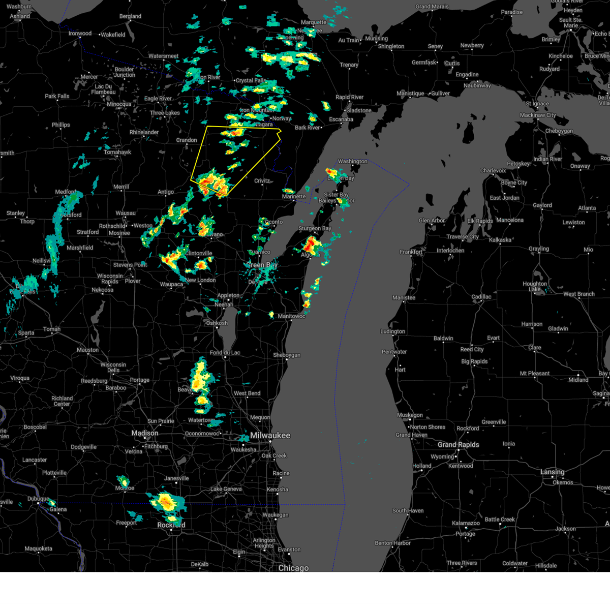
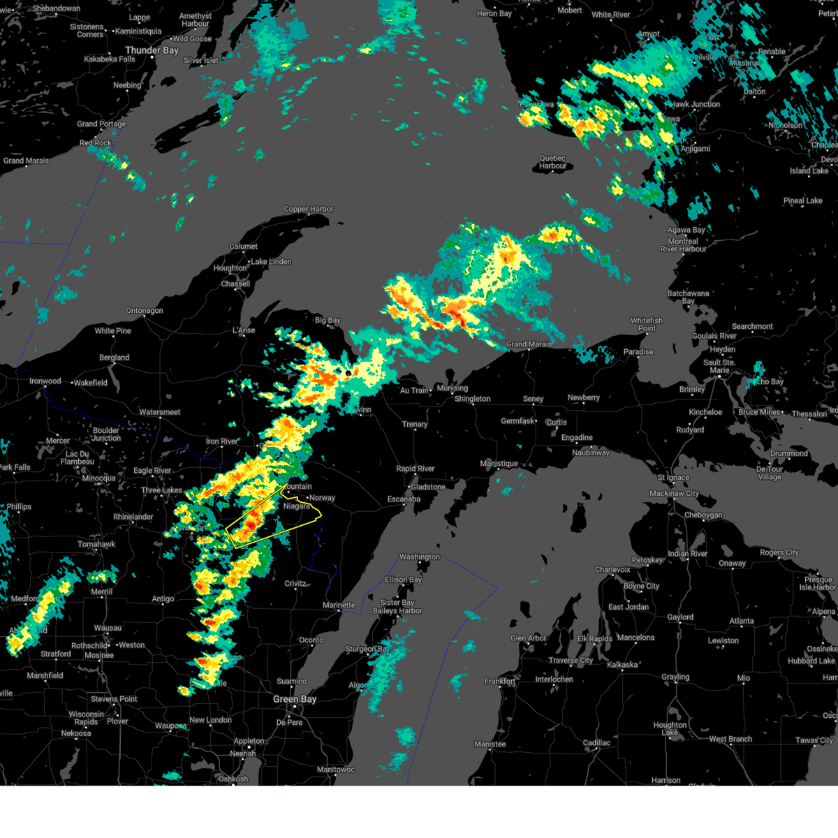
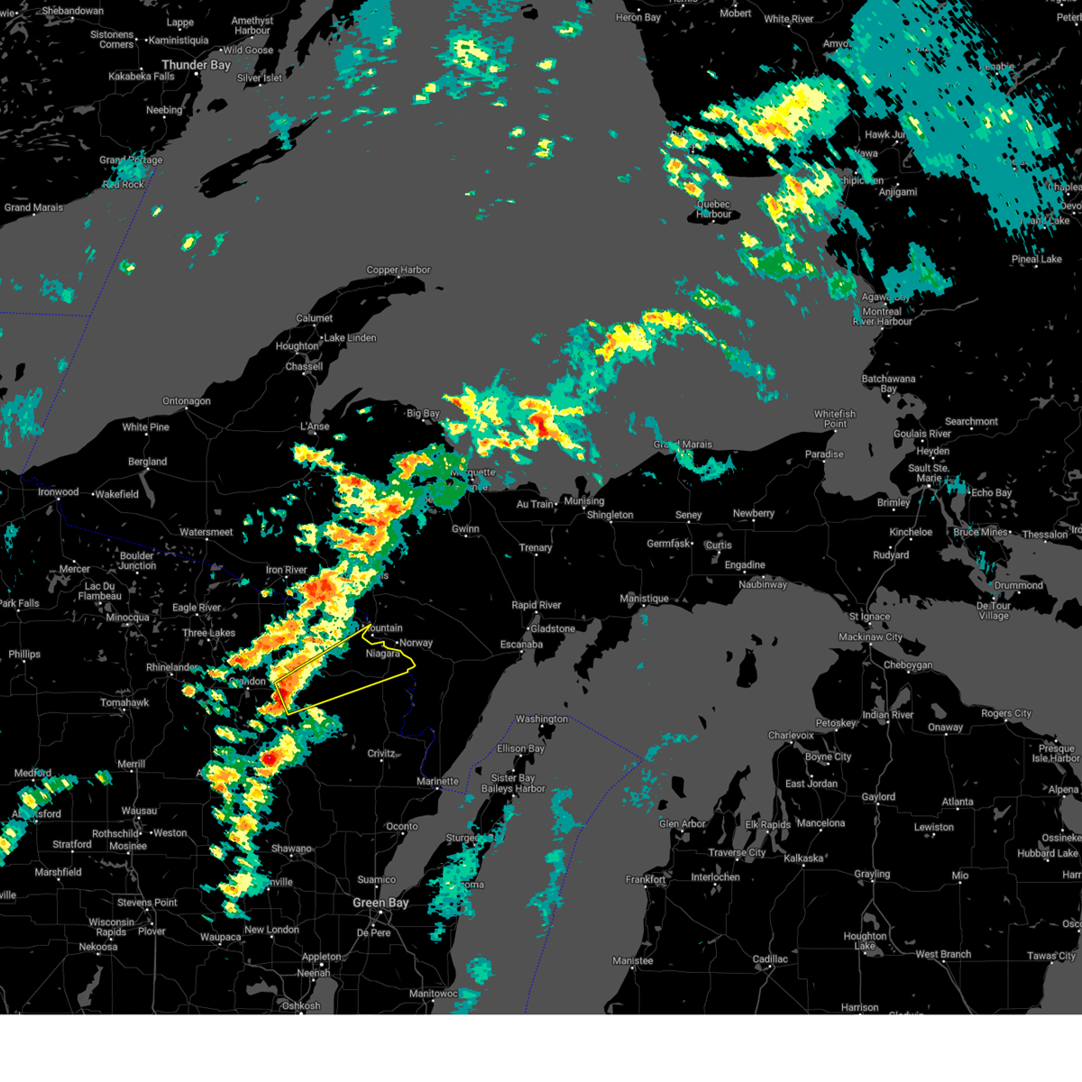
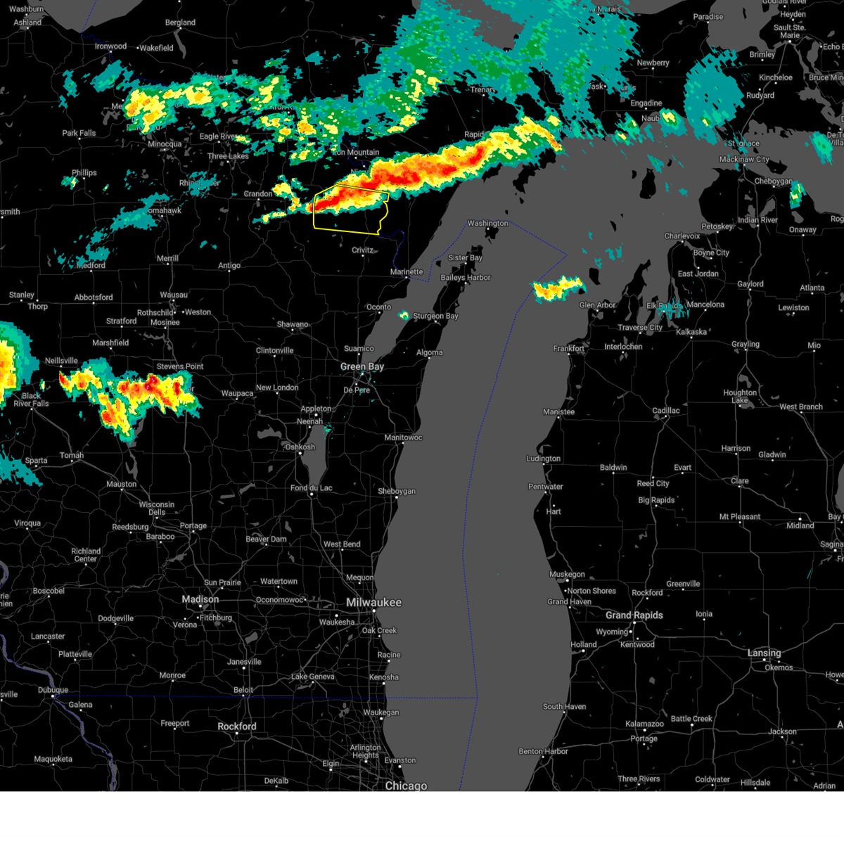
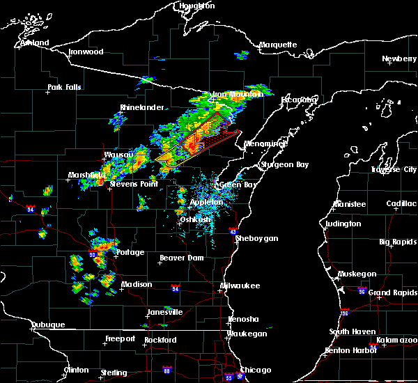
Hail Map for Pembine, WI
The Pembine, WI area has had 2 reports of on-the-ground hail by trained spotters, and has been under severe weather warnings 21 times during the past 12 months. Doppler radar has detected hail at or near Pembine, WI on 28 occasions, including 1 occasion during the past year.
| Name: | Pembine, WI |
| Where Located: | 68.7 miles SSW of Marquette, MI |
| Map: | Google Map for Pembine, WI |
| Population: | 193 |
| Housing Units: | 111 |
| More Info: | Search Google for Pembine, WI |
5
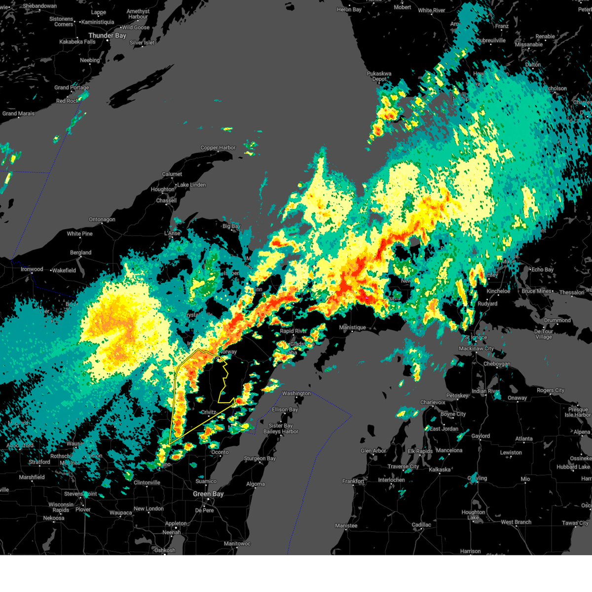
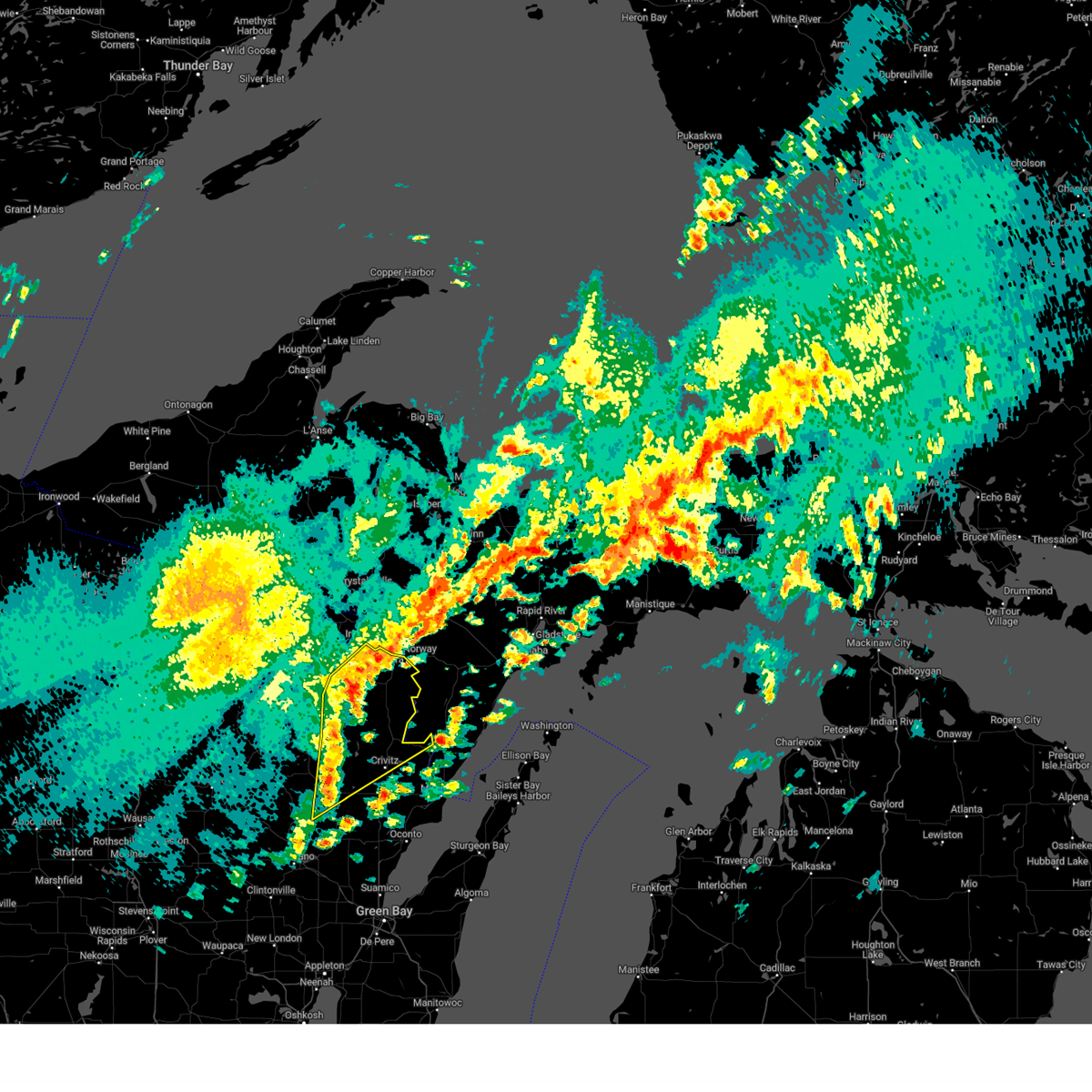
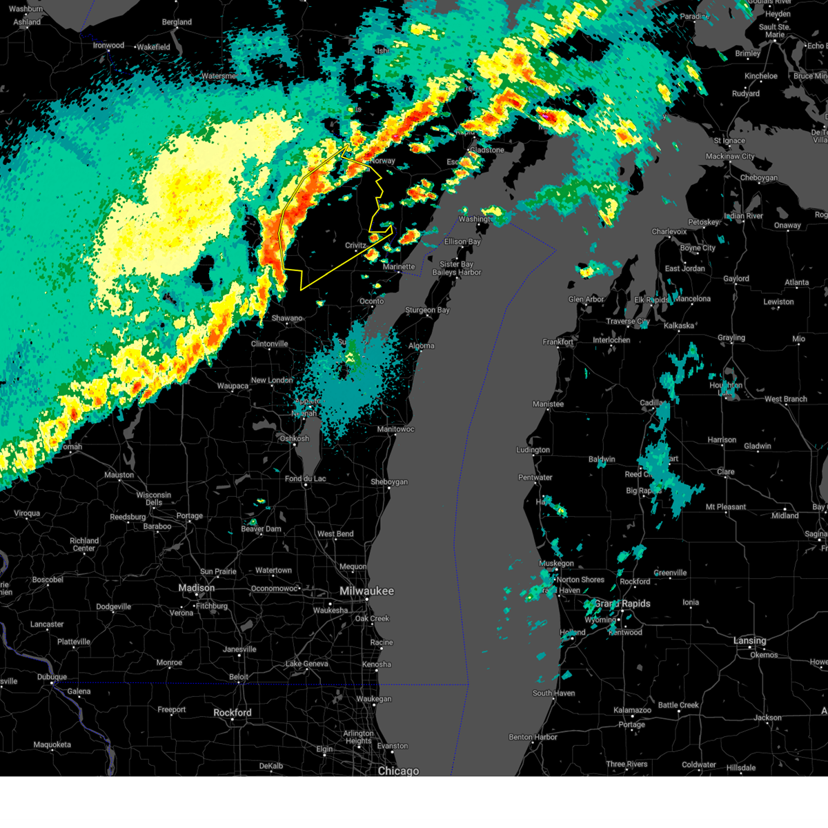
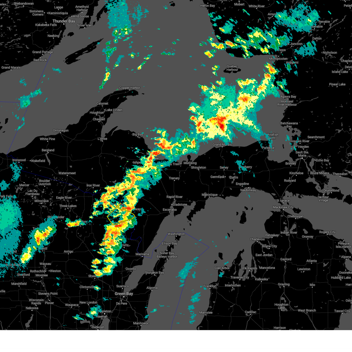
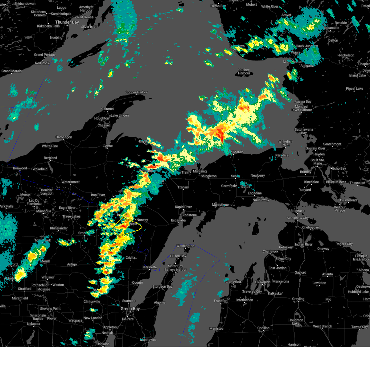
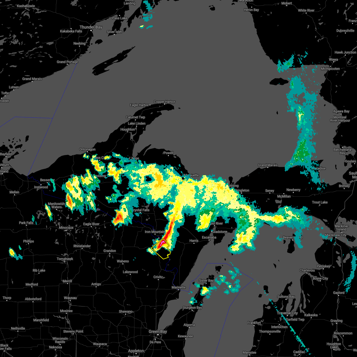
The Top Recent Hail Date for Pembine, WI is Tuesday, July 8, 2025 (1st out of 28)
Hail and Wind Damage Spotted near Pembine, WI
| Date / Time | Report Details |
|---|---|
| 7/8/2025 4:25 PM CDT |
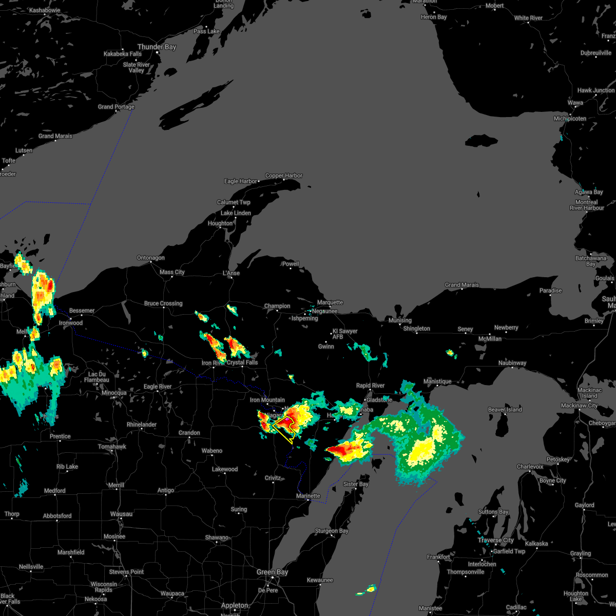
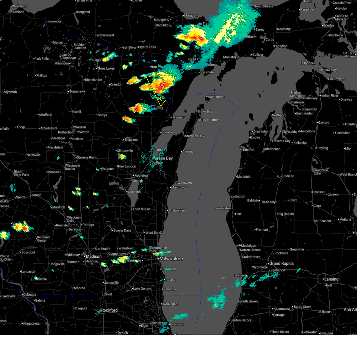 The storm which prompted the warning has weakened and will be exiting the warned area into michigan around 430 pm. therefore, the warning will be allowed to expire. however, small hail and gusty winds are still possible with western edge of this thunderstorm. The storm which prompted the warning has weakened and will be exiting the warned area into michigan around 430 pm. therefore, the warning will be allowed to expire. however, small hail and gusty winds are still possible with western edge of this thunderstorm.
|
| 7/8/2025 4:00 PM CDT |
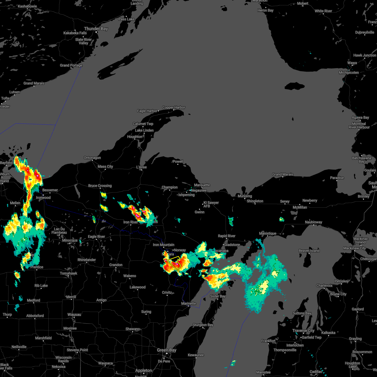
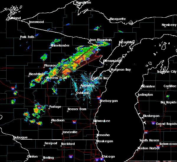
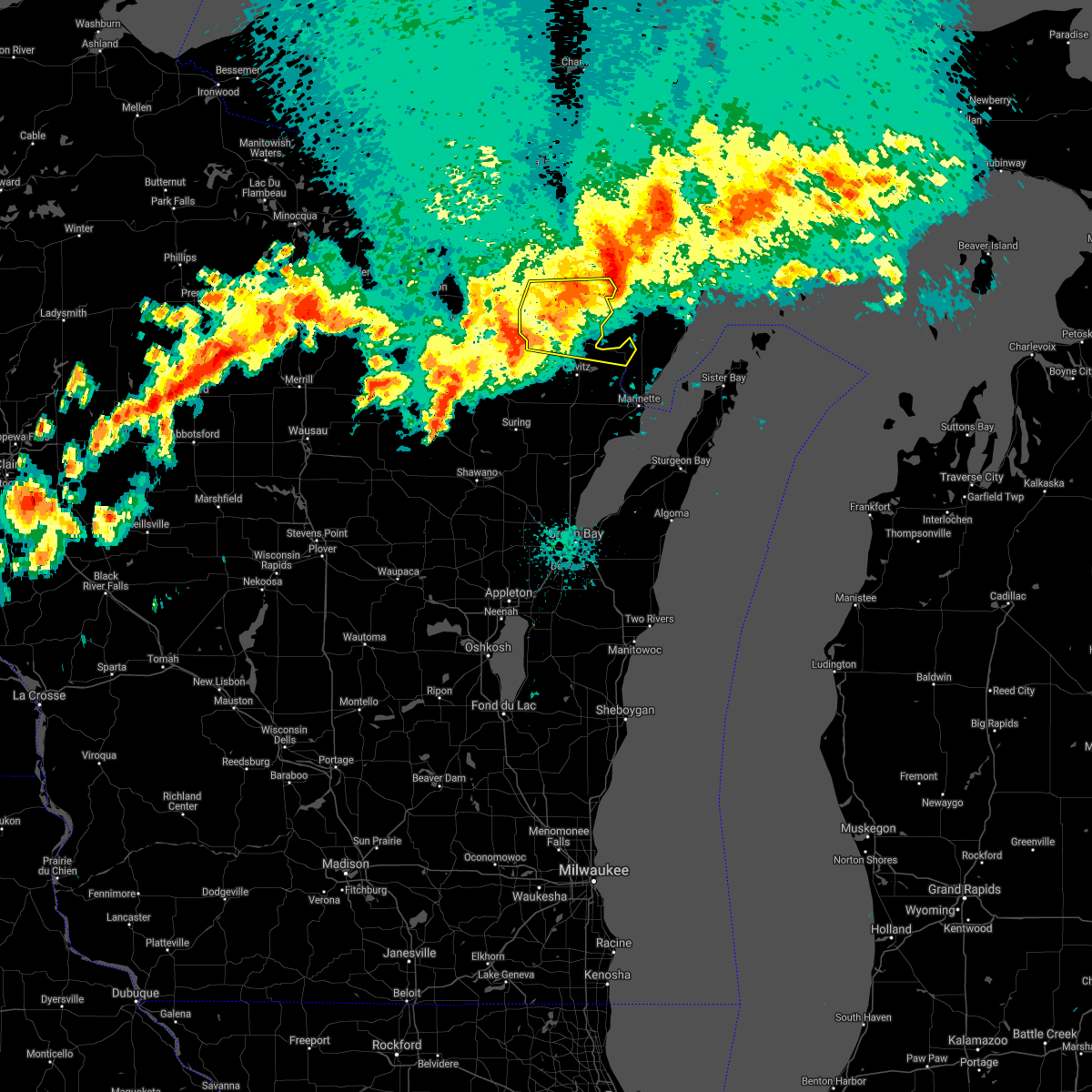
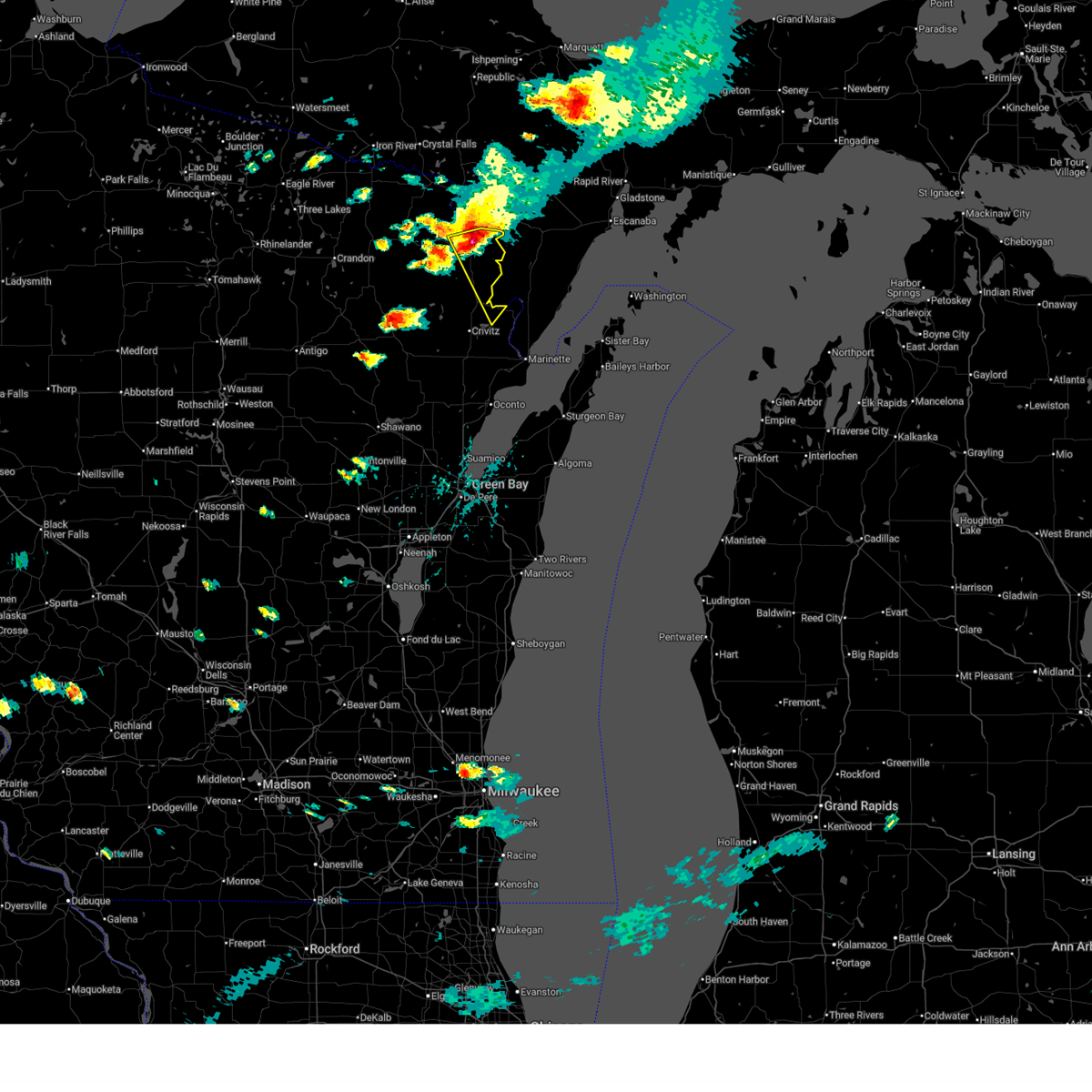 At 359 pm cdt, a severe thunderstorm was located near pembine, or 17 miles south of iron mountain, moving southeast at 30 mph (radar indicated). Hazards include golf ball size hail and 60 mph wind gusts. People and animals outdoors will be injured. expect hail damage to roofs, siding, windows, and vehicles. expect wind damage to roofs, siding, and trees. This severe thunderstorm will remain over mainly rural areas of northern marinette county, including the following locations, cedarville, miscauno island, kremlin, amberg, and beecher. At 359 pm cdt, a severe thunderstorm was located near pembine, or 17 miles south of iron mountain, moving southeast at 30 mph (radar indicated). Hazards include golf ball size hail and 60 mph wind gusts. People and animals outdoors will be injured. expect hail damage to roofs, siding, windows, and vehicles. expect wind damage to roofs, siding, and trees. This severe thunderstorm will remain over mainly rural areas of northern marinette county, including the following locations, cedarville, miscauno island, kremlin, amberg, and beecher.
|
| 7/8/2025 3:49 PM CDT |
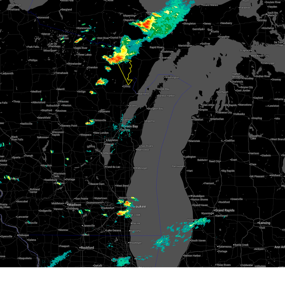 Svrgrb the national weather service in green bay has issued a * severe thunderstorm warning for, northern marinette county in northeastern wisconsin, * until 430 pm cdt. * at 349 pm cdt, a severe thunderstorm was located over pembine, or 12 miles south of iron mountain, moving southeast at 35 mph (radar indicated). Hazards include 60 mph wind gusts and quarter size hail. Hail damage to vehicles is expected. expect wind damage to roofs, siding, and trees. this severe thunderstorm will be near, pembine around 355 pm cdt. Other locations impacted by this severe thunderstorm include cedarville, miscauno island, kremlin, amberg, and beecher. Svrgrb the national weather service in green bay has issued a * severe thunderstorm warning for, northern marinette county in northeastern wisconsin, * until 430 pm cdt. * at 349 pm cdt, a severe thunderstorm was located over pembine, or 12 miles south of iron mountain, moving southeast at 35 mph (radar indicated). Hazards include 60 mph wind gusts and quarter size hail. Hail damage to vehicles is expected. expect wind damage to roofs, siding, and trees. this severe thunderstorm will be near, pembine around 355 pm cdt. Other locations impacted by this severe thunderstorm include cedarville, miscauno island, kremlin, amberg, and beecher.
|
| 5/16/2025 3:25 PM CDT | The storms which prompted the warning have weakened below severe limits, and no longer pose an immediate threat to life or property. therefore, the severe thunderstorm warning will be allowed to expire. however, gusty winds are still possible with these thunderstorms. |
| 5/16/2025 3:16 PM CDT |
 the severe thunderstorm warning has been cancelled and is no longer in effect the severe thunderstorm warning has been cancelled and is no longer in effect
|
| 5/16/2025 3:16 PM CDT |
 At 316 pm cdt, severe thunderstorms were located along a line extending from near goodman to 11 miles southwest of pembine, moving northeast at 45 mph (radar indicated). Hazards include 60 mph wind gusts and quarter size hail. Hail damage to vehicles is expected. expect wind damage to roofs, siding, and trees. Locations impacted include, pembine, goodman, dunbar, amberg, beecher, athelstane, silver cliff, goodman county park, mcclintock county park, and kremlin. At 316 pm cdt, severe thunderstorms were located along a line extending from near goodman to 11 miles southwest of pembine, moving northeast at 45 mph (radar indicated). Hazards include 60 mph wind gusts and quarter size hail. Hail damage to vehicles is expected. expect wind damage to roofs, siding, and trees. Locations impacted include, pembine, goodman, dunbar, amberg, beecher, athelstane, silver cliff, goodman county park, mcclintock county park, and kremlin.
|
| 5/16/2025 3:12 PM CDT | At 311 pm cdt, severe thunderstorms were located along a line extending from near goodman to 13 miles southwest of pembine, moving northeast at 60 mph (radar indicated). Hazards include 60 mph wind gusts and quarter size hail. Hail damage to vehicles is expected. expect wind damage to roofs, siding, and trees. Locations impacted include, pembine, goodman, dunbar, amberg, beecher, athelstane, silver cliff, armstrong creek, goodman county park, and mcclintock county park. |
| 5/16/2025 3:08 PM CDT |
 At 308 pm cdt, severe thunderstorms were located along a line extending from 8 miles north of carter to 9 miles east of mccaslin mountain natural area, moving northeast at 45 mph (radar indicated). Hazards include 60 mph wind gusts and quarter size hail. Hail damage to vehicles is expected. expect wind damage to roofs, siding, and trees. Locations impacted include, pembine, goodman, dunbar, amberg, beecher, athelstane, silver cliff, armstrong creek, goodman county park, mcclintock county park, bear lake campground, deer mountain natural area, and kremlin. At 308 pm cdt, severe thunderstorms were located along a line extending from 8 miles north of carter to 9 miles east of mccaslin mountain natural area, moving northeast at 45 mph (radar indicated). Hazards include 60 mph wind gusts and quarter size hail. Hail damage to vehicles is expected. expect wind damage to roofs, siding, and trees. Locations impacted include, pembine, goodman, dunbar, amberg, beecher, athelstane, silver cliff, armstrong creek, goodman county park, mcclintock county park, bear lake campground, deer mountain natural area, and kremlin.
|
| 5/16/2025 3:08 PM CDT |
 the severe thunderstorm warning has been cancelled and is no longer in effect the severe thunderstorm warning has been cancelled and is no longer in effect
|
| 5/16/2025 3:01 PM CDT | the severe thunderstorm warning has been cancelled and is no longer in effect |
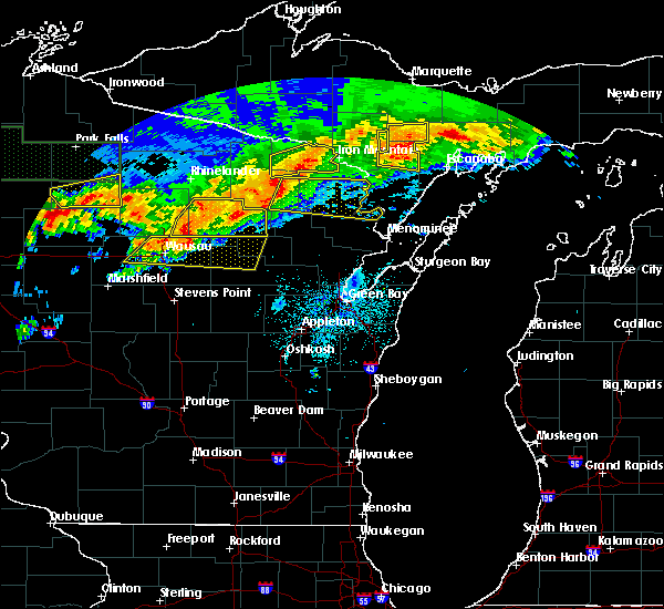
| 5/16/2025 3:01 PM CDT | At 301 pm cdt, severe thunderstorms were located along a line extending from near carter to 6 miles east of mccaslin mountain natural area, moving northeast at 45 mph (radar indicated). Hazards include 60 mph wind gusts and quarter size hail. Hail damage to vehicles is expected. expect wind damage to roofs, siding, and trees. Locations impacted include, pembine, goodman, carter, mccaslin mountain natural area, wabeno, dunbar, amberg, beecher, athelstane, silver cliff, armstrong creek, blackwell, caldron falls rese, governor thompson state park, goodman county park, mcclintock county park, caldron falls reservoir, bear lake campground, deer mountain natural area, and kremlin. |
| 5/16/2025 2:41 PM CDT |
 Svrgrb the national weather service in green bay has issued a * severe thunderstorm warning for, southeastern forest county in northeastern wisconsin, northwestern marinette county in northeastern wisconsin, northwestern oconto county in northeastern wisconsin, east central langlade county in north central wisconsin, * until 330 pm cdt. * at 241 pm cdt, severe thunderstorms were located along a line extending from 8 miles southwest of carter to bear paw scout camp, moving northeast at 45 mph (radar indicated). Hazards include 60 mph wind gusts and quarter size hail. Hail damage to vehicles is expected. Expect wind damage to roofs, siding, and trees. Svrgrb the national weather service in green bay has issued a * severe thunderstorm warning for, southeastern forest county in northeastern wisconsin, northwestern marinette county in northeastern wisconsin, northwestern oconto county in northeastern wisconsin, east central langlade county in north central wisconsin, * until 330 pm cdt. * at 241 pm cdt, severe thunderstorms were located along a line extending from 8 miles southwest of carter to bear paw scout camp, moving northeast at 45 mph (radar indicated). Hazards include 60 mph wind gusts and quarter size hail. Hail damage to vehicles is expected. Expect wind damage to roofs, siding, and trees.
|
| 4/28/2025 10:47 PM CDT |
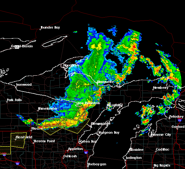
 At 1046 pm cdt, severe thunderstorms were located along a line extending from kingsford to 7 miles west of pembine to near goodman to near bear paw scout camp, moving northeast at 60 mph (radar indicated). Hazards include 60 mph wind gusts and penny size hail. Expect damage to roofs, siding, and trees. these severe storms will be near, pembine and wausaukee around 1105 pm cdt. Other locations impacted by these severe thunderstorms include caldron falls rese, breed, middle inlet, beecher, governor thompson state park, silver cliff, crooked lake, high falls reservoir, aurora, and goodman county park. At 1046 pm cdt, severe thunderstorms were located along a line extending from kingsford to 7 miles west of pembine to near goodman to near bear paw scout camp, moving northeast at 60 mph (radar indicated). Hazards include 60 mph wind gusts and penny size hail. Expect damage to roofs, siding, and trees. these severe storms will be near, pembine and wausaukee around 1105 pm cdt. Other locations impacted by these severe thunderstorms include caldron falls rese, breed, middle inlet, beecher, governor thompson state park, silver cliff, crooked lake, high falls reservoir, aurora, and goodman county park.
|
| 4/28/2025 10:47 PM CDT |
 the severe thunderstorm warning has been cancelled and is no longer in effect the severe thunderstorm warning has been cancelled and is no longer in effect
|
| 4/28/2025 10:27 PM CDT |
 Svrgrb the national weather service in green bay has issued a * severe thunderstorm warning for, southeastern forest county in northeastern wisconsin, southeastern florence county in northeastern wisconsin, marinette county in northeastern wisconsin, northern oconto county in northeastern wisconsin, * until 1130 pm cdt. * at 1027 pm cdt, severe thunderstorms were located along a line extending from goodman to near mccaslin mountain natural area to carter to big smokey falls, moving northeast at 60 mph (radar indicated). Hazards include 60 mph wind gusts and penny size hail. Expect damage to roofs, siding, and trees. severe thunderstorms will be near, mountain, goodman, mccaslin mountain natural area, and bear paw scout camp around 1035 pm cdt. pembine around 1050 pm cdt. wausaukee around 1105 pm cdt. Other locations impacted by these severe thunderstorms include boot lake campground, breed, middle inlet, blackwell, beecher, silver cliff, high falls reservoir, aurora, caldron falls reservoir, and mcclintock county park. Svrgrb the national weather service in green bay has issued a * severe thunderstorm warning for, southeastern forest county in northeastern wisconsin, southeastern florence county in northeastern wisconsin, marinette county in northeastern wisconsin, northern oconto county in northeastern wisconsin, * until 1130 pm cdt. * at 1027 pm cdt, severe thunderstorms were located along a line extending from goodman to near mccaslin mountain natural area to carter to big smokey falls, moving northeast at 60 mph (radar indicated). Hazards include 60 mph wind gusts and penny size hail. Expect damage to roofs, siding, and trees. severe thunderstorms will be near, mountain, goodman, mccaslin mountain natural area, and bear paw scout camp around 1035 pm cdt. pembine around 1050 pm cdt. wausaukee around 1105 pm cdt. Other locations impacted by these severe thunderstorms include boot lake campground, breed, middle inlet, blackwell, beecher, silver cliff, high falls reservoir, aurora, caldron falls reservoir, and mcclintock county park.
|
| 4/28/2025 7:55 PM CDT |
 The storm which prompted the warning has weakened below severe limits, and no longer poses an immediate threat to life or property. therefore, the warning will be allowed to expire. a tornado watch remains in effect until 200 am cdt for northeastern wisconsin. The storm which prompted the warning has weakened below severe limits, and no longer poses an immediate threat to life or property. therefore, the warning will be allowed to expire. a tornado watch remains in effect until 200 am cdt for northeastern wisconsin.
|
| 4/28/2025 7:46 PM CDT |
 At 746 pm cdt, a severe thunderstorm was located near pembine, or 9 miles south of iron mountain, moving east at 60 mph (radar indicated). Hazards include 60 mph wind gusts. Expect damage to roofs, siding, and trees. Locations impacted include, pembine, homestead, niagara, dunbar, aurora, and kremlin. At 746 pm cdt, a severe thunderstorm was located near pembine, or 9 miles south of iron mountain, moving east at 60 mph (radar indicated). Hazards include 60 mph wind gusts. Expect damage to roofs, siding, and trees. Locations impacted include, pembine, homestead, niagara, dunbar, aurora, and kremlin.
|
| 4/28/2025 7:46 PM CDT |
 the severe thunderstorm warning has been cancelled and is no longer in effect the severe thunderstorm warning has been cancelled and is no longer in effect
|
| 4/28/2025 7:31 PM CDT |
 At 731 pm cdt, a severe thunderstorm was located over goodman, or 19 miles southwest of iron mountain, moving east at 60 mph (radar indicated). Hazards include 60 mph wind gusts and quarter size hail. Hail damage to vehicles is expected. expect wind damage to roofs, siding, and trees. This severe thunderstorm will remain over mainly rural areas of east central forest, southeastern florence and northern marinette counties, including the following locations, aurora, armstrong creek, bear lake campground, dunbar, kremlin, and niagara. At 731 pm cdt, a severe thunderstorm was located over goodman, or 19 miles southwest of iron mountain, moving east at 60 mph (radar indicated). Hazards include 60 mph wind gusts and quarter size hail. Hail damage to vehicles is expected. expect wind damage to roofs, siding, and trees. This severe thunderstorm will remain over mainly rural areas of east central forest, southeastern florence and northern marinette counties, including the following locations, aurora, armstrong creek, bear lake campground, dunbar, kremlin, and niagara.
|
| 4/28/2025 7:17 PM CDT |
 Svrgrb the national weather service in green bay has issued a * severe thunderstorm warning for, southeastern forest county in northeastern wisconsin, southeastern florence county in northeastern wisconsin, northern marinette county in northeastern wisconsin, * until 800 pm cdt. * at 716 pm cdt, a severe thunderstorm was located 9 miles southeast of north otter creek natural area, or 13 miles east of crandon, moving east at 60 mph (radar indicated). Hazards include 60 mph wind gusts and quarter size hail. Hail damage to vehicles is expected. expect wind damage to roofs, siding, and trees. this severe thunderstorm will be near, goodman around 730 pm cdt. Other locations impacted by this severe thunderstorm include laona, aurora, niagara, blackwell, armstrong creek, bear lake campground, dunbar, and kremlin. Svrgrb the national weather service in green bay has issued a * severe thunderstorm warning for, southeastern forest county in northeastern wisconsin, southeastern florence county in northeastern wisconsin, northern marinette county in northeastern wisconsin, * until 800 pm cdt. * at 716 pm cdt, a severe thunderstorm was located 9 miles southeast of north otter creek natural area, or 13 miles east of crandon, moving east at 60 mph (radar indicated). Hazards include 60 mph wind gusts and quarter size hail. Hail damage to vehicles is expected. expect wind damage to roofs, siding, and trees. this severe thunderstorm will be near, goodman around 730 pm cdt. Other locations impacted by this severe thunderstorm include laona, aurora, niagara, blackwell, armstrong creek, bear lake campground, dunbar, and kremlin.
|
| 3/28/2025 7:33 PM CDT |
 Svrgrb the national weather service in green bay has issued a * severe thunderstorm warning for, northern marinette county in northeastern wisconsin, * until 815 pm cdt. * at 732 pm cdt, a severe thunderstorm was located near goodman, or 22 miles southwest of iron mountain, moving east at 45 mph (radar indicated). Hazards include quarter size hail. damage to vehicles is expected Svrgrb the national weather service in green bay has issued a * severe thunderstorm warning for, northern marinette county in northeastern wisconsin, * until 815 pm cdt. * at 732 pm cdt, a severe thunderstorm was located near goodman, or 22 miles southwest of iron mountain, moving east at 45 mph (radar indicated). Hazards include quarter size hail. damage to vehicles is expected
|
| 5/18/2024 8:03 PM CDT | Quarter sized hail reported 5.9 miles N of Pembine, WI |
| 5/10/2022 5:55 PM CDT |
 The severe thunderstorm warning for southeastern forest and northern marinette counties will expire at 600 pm cdt, the storm which prompted the warning has weakened below severe limits, and no longer poses an immediate threat to life or property. therefore, the warning will be allowed to expire. however penny sized hail and gusty winds remain possible with this thunderstorm. a tornado watch remains in effect until 900 pm cdt for northeastern wisconsin. The severe thunderstorm warning for southeastern forest and northern marinette counties will expire at 600 pm cdt, the storm which prompted the warning has weakened below severe limits, and no longer poses an immediate threat to life or property. therefore, the warning will be allowed to expire. however penny sized hail and gusty winds remain possible with this thunderstorm. a tornado watch remains in effect until 900 pm cdt for northeastern wisconsin.
|
| 5/10/2022 5:49 PM CDT |
 At 549 pm cdt, a severe thunderstorm was located 9 miles southwest of pembine, or 18 miles south of kingsford, moving east at 45 mph (radar indicated). Hazards include 60 mph wind gusts and half dollar size hail. Hail damage to vehicles is expected. expect wind damage to roofs, siding, and trees. locations impacted include, pembine, wausaukee, niagara, dunbar, amberg, beecher, athelstane, silver cliff, goodman county park and mcclintock county park. hail threat, radar indicated max hail size, 1. 25 in wind threat, radar indicated max wind gust, 60 mph. At 549 pm cdt, a severe thunderstorm was located 9 miles southwest of pembine, or 18 miles south of kingsford, moving east at 45 mph (radar indicated). Hazards include 60 mph wind gusts and half dollar size hail. Hail damage to vehicles is expected. expect wind damage to roofs, siding, and trees. locations impacted include, pembine, wausaukee, niagara, dunbar, amberg, beecher, athelstane, silver cliff, goodman county park and mcclintock county park. hail threat, radar indicated max hail size, 1. 25 in wind threat, radar indicated max wind gust, 60 mph.
|
| 5/10/2022 5:35 PM CDT |
 At 535 pm cdt, a severe thunderstorm was located near goodman, or 21 miles southwest of kingsford, moving east at 30 mph (radar indicated). Hazards include ping pong ball size hail and 60 mph wind gusts. People and animals outdoors will be injured. expect hail damage to roofs, siding, windows, and vehicles. expect wind damage to roofs, siding, and trees. locations impacted include, pembine, goodman, wausaukee, niagara, dunbar, amberg, beecher, athelstane, silver cliff and armstrong creek. hail threat, radar indicated max hail size, 1. 50 in wind threat, radar indicated max wind gust, 60 mph. At 535 pm cdt, a severe thunderstorm was located near goodman, or 21 miles southwest of kingsford, moving east at 30 mph (radar indicated). Hazards include ping pong ball size hail and 60 mph wind gusts. People and animals outdoors will be injured. expect hail damage to roofs, siding, windows, and vehicles. expect wind damage to roofs, siding, and trees. locations impacted include, pembine, goodman, wausaukee, niagara, dunbar, amberg, beecher, athelstane, silver cliff and armstrong creek. hail threat, radar indicated max hail size, 1. 50 in wind threat, radar indicated max wind gust, 60 mph.
|
| 5/10/2022 5:19 PM CDT |
 At 519 pm cdt, a severe thunderstorm was located 10 miles north of mccaslin mountain natural area, or 18 miles east of crandon, moving east at 40 mph (radar indicated). Hazards include 60 mph wind gusts and quarter size hail. Hail damage to vehicles is expected. expect wind damage to roofs, siding, and trees. locations impacted include, pembine, goodman, wausaukee, carter, niagara, laona, dunbar, amberg, beecher and athelstane. hail threat, radar indicated max hail size, 1. 00 in wind threat, radar indicated max wind gust, 60 mph. At 519 pm cdt, a severe thunderstorm was located 10 miles north of mccaslin mountain natural area, or 18 miles east of crandon, moving east at 40 mph (radar indicated). Hazards include 60 mph wind gusts and quarter size hail. Hail damage to vehicles is expected. expect wind damage to roofs, siding, and trees. locations impacted include, pembine, goodman, wausaukee, carter, niagara, laona, dunbar, amberg, beecher and athelstane. hail threat, radar indicated max hail size, 1. 00 in wind threat, radar indicated max wind gust, 60 mph.
|
| 5/10/2022 5:04 PM CDT |
 At 503 pm cdt, a severe thunderstorm was located 9 miles north of carter, or 13 miles east of crandon, moving east at 50 mph (radar indicated. this storm has a history of producing large hail, with golf ball sized hail reported about 25 minutes ago near mole lake). Hazards include ping pong ball size hail and 60 mph wind gusts. People and animals outdoors will be injured. expect hail damage to roofs, siding, windows, and vehicles. expect wind damage to roofs, siding, and trees. locations impacted include, pembine, goodman, wausaukee, carter, north otter creek natural area, niagara, laona, wabeno, dunbar and amberg. hail threat, radar indicated max hail size, 1. 50 in wind threat, radar indicated max wind gust, 60 mph. At 503 pm cdt, a severe thunderstorm was located 9 miles north of carter, or 13 miles east of crandon, moving east at 50 mph (radar indicated. this storm has a history of producing large hail, with golf ball sized hail reported about 25 minutes ago near mole lake). Hazards include ping pong ball size hail and 60 mph wind gusts. People and animals outdoors will be injured. expect hail damage to roofs, siding, windows, and vehicles. expect wind damage to roofs, siding, and trees. locations impacted include, pembine, goodman, wausaukee, carter, north otter creek natural area, niagara, laona, wabeno, dunbar and amberg. hail threat, radar indicated max hail size, 1. 50 in wind threat, radar indicated max wind gust, 60 mph.
|
| 5/10/2022 4:55 PM CDT |
 At 454 pm cdt, a severe thunderstorm was located near woodlawn, or near crandon, moving east at 50 mph (radar indicated). Hazards include ping pong ball size hail and 60 mph wind gusts. People and animals outdoors will be injured. expect hail damage to roofs, siding, windows, and vehicles. Expect wind damage to roofs, siding, and trees. At 454 pm cdt, a severe thunderstorm was located near woodlawn, or near crandon, moving east at 50 mph (radar indicated). Hazards include ping pong ball size hail and 60 mph wind gusts. People and animals outdoors will be injured. expect hail damage to roofs, siding, windows, and vehicles. Expect wind damage to roofs, siding, and trees.
|
| 6/13/2021 7:11 PM CDT | Tree down near amberg in marinette county WI, 6.5 miles NNW of Pembine, WI |
| 6/13/2021 7:05 PM CDT |
 At 705 pm cdt, severe thunderstorms were located along a line extending from 9 miles southwest of la branche to 6 miles southwest of hermansville to pembine, moving southeast at 60 mph (radar indicated). Hazards include 60 mph wind gusts and penny size hail. Expect damage to roofs, siding, and trees. Locations impacted include, pembine, beecher, miscauno island and kremlin. At 705 pm cdt, severe thunderstorms were located along a line extending from 9 miles southwest of la branche to 6 miles southwest of hermansville to pembine, moving southeast at 60 mph (radar indicated). Hazards include 60 mph wind gusts and penny size hail. Expect damage to roofs, siding, and trees. Locations impacted include, pembine, beecher, miscauno island and kremlin.
|
| 6/13/2021 6:53 PM CDT |
 At 653 pm cdt, severe thunderstorms were located along a line extending from near foster city to near norway to near homestead, moving southeast at 60 mph (radar indicated). Hazards include 60 mph wind gusts and half inch hail. Expect damage to roofs, siding, and trees. These severe thunderstorms will remain over mainly rural areas of southeastern florence and north central marinette counties, including the following locations, aurora, miscauno island, kremlin, beecher, spread eagle and niagara. At 653 pm cdt, severe thunderstorms were located along a line extending from near foster city to near norway to near homestead, moving southeast at 60 mph (radar indicated). Hazards include 60 mph wind gusts and half inch hail. Expect damage to roofs, siding, and trees. These severe thunderstorms will remain over mainly rural areas of southeastern florence and north central marinette counties, including the following locations, aurora, miscauno island, kremlin, beecher, spread eagle and niagara.
|
| 6/13/2021 6:42 PM CDT |
 At 641 pm cdt, severe thunderstorms were located along a line extending from 6 miles southeast of channing to near iron mountain to fern, moving southeast at 60 mph (radar indicated). Hazards include 60 mph wind gusts and penny size hail. Expect damage to roofs, siding, and trees. these severe storms will be near, kingsford around 655 pm cdt. pembine around 705 pm cdt. Other locations impacted by these severe thunderstorms include aurora, west bass lake campground, commonwealth, lasalle falls, beecher, spread eagle, lost lake campground, miscauno island, kremlin and niagara. At 641 pm cdt, severe thunderstorms were located along a line extending from 6 miles southeast of channing to near iron mountain to fern, moving southeast at 60 mph (radar indicated). Hazards include 60 mph wind gusts and penny size hail. Expect damage to roofs, siding, and trees. these severe storms will be near, kingsford around 655 pm cdt. pembine around 705 pm cdt. Other locations impacted by these severe thunderstorms include aurora, west bass lake campground, commonwealth, lasalle falls, beecher, spread eagle, lost lake campground, miscauno island, kremlin and niagara.
|
| 6/13/2021 6:25 PM CDT |
 At 622 pm cdt, severe thunderstorms were located along a line extending from 7 miles west of channing to near crystal falls to near wisconsin slough natural area, moving southeast at 60 mph (radar indicated). Hazards include 60 mph wind gusts and penny size hail. Expect damage to roofs, siding, and trees. severe thunderstorms will be near, florence around 635 pm cdt. fern around 640 pm cdt. kingsford and homestead around 650 pm cdt. pembine around 705 pm cdt. Other locations impacted by these severe thunderstorms include aurora, west bass lake campground, commonwealth, lasalle falls, beecher, spread eagle, lost lake campground, dunbar, miscauno island and kremlin. At 622 pm cdt, severe thunderstorms were located along a line extending from 7 miles west of channing to near crystal falls to near wisconsin slough natural area, moving southeast at 60 mph (radar indicated). Hazards include 60 mph wind gusts and penny size hail. Expect damage to roofs, siding, and trees. severe thunderstorms will be near, florence around 635 pm cdt. fern around 640 pm cdt. kingsford and homestead around 650 pm cdt. pembine around 705 pm cdt. Other locations impacted by these severe thunderstorms include aurora, west bass lake campground, commonwealth, lasalle falls, beecher, spread eagle, lost lake campground, dunbar, miscauno island and kremlin.
|
| 6/8/2021 7:08 PM CDT |
 The severe thunderstorm warning for northern marinette county will expire at 715 pm cdt, the storms which prompted the warning have weakened below severe limits, and no longer pose an immediate threat to life or property. therefore, the warning will be allowed to expire. however gusty winds and heavy rain are still possible with these thunderstorms. The severe thunderstorm warning for northern marinette county will expire at 715 pm cdt, the storms which prompted the warning have weakened below severe limits, and no longer pose an immediate threat to life or property. therefore, the warning will be allowed to expire. however gusty winds and heavy rain are still possible with these thunderstorms.
|
| 6/8/2021 6:50 PM CDT |
 At 650 pm cdt, severe thunderstorms were located along a line extending from 7 miles east of pembine to goodman, moving south at 30 mph (radar indicated). Hazards include 60 mph wind gusts and quarter size hail. Hail damage to vehicles is expected. expect wind damage to roofs, siding, and trees. Locations impacted include, pembine, goodman, wausaukee, niagara, dunbar, amberg, beecher, athelstane, silver cliff and caldron falls rese. At 650 pm cdt, severe thunderstorms were located along a line extending from 7 miles east of pembine to goodman, moving south at 30 mph (radar indicated). Hazards include 60 mph wind gusts and quarter size hail. Hail damage to vehicles is expected. expect wind damage to roofs, siding, and trees. Locations impacted include, pembine, goodman, wausaukee, niagara, dunbar, amberg, beecher, athelstane, silver cliff and caldron falls rese.
|
| 6/8/2021 6:42 PM CDT | Several trees over county road o. time estimated via radar in marinette county WI, 3.8 miles SE of Pembine, WI |
| 6/8/2021 6:38 PM CDT |
 At 637 pm cdt, severe thunderstorms were located along a line extending from 9 miles southeast of norway to near pembine to near goodman, moving south at 30 mph (radar indicated). Hazards include 60 mph wind gusts and quarter size hail. Hail damage to vehicles is expected. Expect wind damage to roofs, siding, and trees. At 637 pm cdt, severe thunderstorms were located along a line extending from 9 miles southeast of norway to near pembine to near goodman, moving south at 30 mph (radar indicated). Hazards include 60 mph wind gusts and quarter size hail. Hail damage to vehicles is expected. Expect wind damage to roofs, siding, and trees.
|
| 8/21/2020 5:33 PM CDT |
 At 533 pm cdt, a severe thunderstorm was located 9 miles east of pembine, or 18 miles southeast of iron mountain, moving southeast at 20 mph (radar indicated). Hazards include 60 mph wind gusts and quarter size hail. Hail damage to vehicles is expected. expect wind damage to roofs, siding, and trees. Locations impacted include, kremlin and miscauno island. At 533 pm cdt, a severe thunderstorm was located 9 miles east of pembine, or 18 miles southeast of iron mountain, moving southeast at 20 mph (radar indicated). Hazards include 60 mph wind gusts and quarter size hail. Hail damage to vehicles is expected. expect wind damage to roofs, siding, and trees. Locations impacted include, kremlin and miscauno island.
|
| 8/21/2020 5:18 PM CDT |
 At 517 pm cdt, a severe thunderstorm was located 7 miles northeast of pembine, or 13 miles southeast of iron mountain, moving southeast at 20 mph (radar indicated). Hazards include 60 mph wind gusts and quarter size hail. Hail damage to vehicles is expected. Expect wind damage to roofs, siding, and trees. At 517 pm cdt, a severe thunderstorm was located 7 miles northeast of pembine, or 13 miles southeast of iron mountain, moving southeast at 20 mph (radar indicated). Hazards include 60 mph wind gusts and quarter size hail. Hail damage to vehicles is expected. Expect wind damage to roofs, siding, and trees.
|
| 7/19/2020 2:52 AM CDT |
 The severe thunderstorm warning for southern forest, northern marinette, northern oconto and northeastern langlade counties will expire at 300 am cdt, the storms which prompted the warning have weakened below severe limits, and have exited the warned area. therefore, the warning will be allowed to expire. however small hail, gusty winds and heavy rain are still possible with these thunderstorms. a severe thunderstorm watch remains in effect until 500 am cdt for north central and northeastern wisconsin. to report severe weather, contact your nearest law enforcement agency. they will relay your report to the national weather service green bay. The severe thunderstorm warning for southern forest, northern marinette, northern oconto and northeastern langlade counties will expire at 300 am cdt, the storms which prompted the warning have weakened below severe limits, and have exited the warned area. therefore, the warning will be allowed to expire. however small hail, gusty winds and heavy rain are still possible with these thunderstorms. a severe thunderstorm watch remains in effect until 500 am cdt for north central and northeastern wisconsin. to report severe weather, contact your nearest law enforcement agency. they will relay your report to the national weather service green bay.
|
| 7/19/2020 2:28 AM CDT |
 At 227 am cdt, severe thunderstorms were located along a line extending from near homestead to near pembine to 12 miles southeast of goodman, moving east at 50 mph (radar indicated). Hazards include 60 mph wind gusts and quarter size hail. Hail damage to vehicles is expected. expect wind damage to roofs, siding, and trees. Locations impacted include, pembine, wausaukee, carter, mccaslin mountain natural area, pearson, woodlawn, ma ka ja wan scout reservation, niagara, wabeno and townsend. At 227 am cdt, severe thunderstorms were located along a line extending from near homestead to near pembine to 12 miles southeast of goodman, moving east at 50 mph (radar indicated). Hazards include 60 mph wind gusts and quarter size hail. Hail damage to vehicles is expected. expect wind damage to roofs, siding, and trees. Locations impacted include, pembine, wausaukee, carter, mccaslin mountain natural area, pearson, woodlawn, ma ka ja wan scout reservation, niagara, wabeno and townsend.
|
| 7/19/2020 2:12 AM CDT |
 At 212 am cdt, severe thunderstorms were located along a line extending from near goodman to 15 miles west of pembine to 6 miles northeast of mccaslin mountain natural area, moving east at 35 mph (radar indicated). Hazards include 60 mph wind gusts and quarter size hail. Hail damage to vehicles is expected. expect wind damage to roofs, siding, and trees. Locations impacted include, kingsford, pembine, goodman, wausaukee, homestead, carter, mccaslin mountain natural area, pearson, woodlawn and ma ka ja wan scout reservation. At 212 am cdt, severe thunderstorms were located along a line extending from near goodman to 15 miles west of pembine to 6 miles northeast of mccaslin mountain natural area, moving east at 35 mph (radar indicated). Hazards include 60 mph wind gusts and quarter size hail. Hail damage to vehicles is expected. expect wind damage to roofs, siding, and trees. Locations impacted include, kingsford, pembine, goodman, wausaukee, homestead, carter, mccaslin mountain natural area, pearson, woodlawn and ma ka ja wan scout reservation.
|
| 7/19/2020 1:59 AM CDT |
 At 140 am cdt, a severe thunderstorm was located over north otter creek natural area, or 7 miles east of crandon, moving east at 50 mph (radar indicated). Hazards include 60 mph wind gusts and quarter size hail. Hail damage to vehicles is expected. Expect wind damage to roofs, siding, and trees. At 140 am cdt, a severe thunderstorm was located over north otter creek natural area, or 7 miles east of crandon, moving east at 50 mph (radar indicated). Hazards include 60 mph wind gusts and quarter size hail. Hail damage to vehicles is expected. Expect wind damage to roofs, siding, and trees.
|
| 7/19/2020 1:40 AM CDT |
 At 140 am cdt, a severe thunderstorm was located over north otter creek natural area, or 7 miles east of crandon, moving east at 50 mph (radar indicated). Hazards include 60 mph wind gusts and quarter size hail. Hail damage to vehicles is expected. Expect wind damage to roofs, siding, and trees. At 140 am cdt, a severe thunderstorm was located over north otter creek natural area, or 7 miles east of crandon, moving east at 50 mph (radar indicated). Hazards include 60 mph wind gusts and quarter size hail. Hail damage to vehicles is expected. Expect wind damage to roofs, siding, and trees.
|
| 8/5/2019 2:32 PM CDT |
 At 229 pm cdt, severe thunderstorms were located along a line extending from 9 miles south of channing to near pembine to 9 miles north of wausaukee to 12 miles northwest of crivitz, moving east at 55 mph. a wind gust to 44 mph was reported at iron mountain (radar indicated). Hazards include 60 mph wind gusts. Expect damage to roofs, siding, and trees. Locations impacted include, kingsford, crivitz, pembine, wausaukee, homestead, carter, mccaslin mountain natural area, dunbar, aurora and townsend. At 229 pm cdt, severe thunderstorms were located along a line extending from 9 miles south of channing to near pembine to 9 miles north of wausaukee to 12 miles northwest of crivitz, moving east at 55 mph. a wind gust to 44 mph was reported at iron mountain (radar indicated). Hazards include 60 mph wind gusts. Expect damage to roofs, siding, and trees. Locations impacted include, kingsford, crivitz, pembine, wausaukee, homestead, carter, mccaslin mountain natural area, dunbar, aurora and townsend.
|
| 8/5/2019 2:11 PM CDT |
 At 210 pm cdt, severe thunderstorms were located along a line extending from near crystal falls to 6 miles south of homestead to 8 miles south of goodman to near mccaslin mountain natural area, moving east at 55 mph (radar indicated). Hazards include 60 mph wind gusts. Expect damage to roofs, siding, and trees. Locations impacted include, kingsford, florence, crivitz, pembine, goodman, wausaukee, homestead, fern, carter and mccaslin mountain natural area. At 210 pm cdt, severe thunderstorms were located along a line extending from near crystal falls to 6 miles south of homestead to 8 miles south of goodman to near mccaslin mountain natural area, moving east at 55 mph (radar indicated). Hazards include 60 mph wind gusts. Expect damage to roofs, siding, and trees. Locations impacted include, kingsford, florence, crivitz, pembine, goodman, wausaukee, homestead, fern, carter and mccaslin mountain natural area.
|
| 8/5/2019 1:57 PM CDT |
 At 157 pm cdt, severe thunderstorms were located along a line extending from near stambaugh to 8 miles northwest of goodman to 9 miles northeast of carter to near woodlawn, moving east at 50 mph (radar indicated). Hazards include 60 mph wind gusts. Expect damage to roofs, siding, and trees. Locations impacted include, kingsford, florence, crivitz, pembine, goodman, wausaukee, homestead, fern, tipler and popple river. At 157 pm cdt, severe thunderstorms were located along a line extending from near stambaugh to 8 miles northwest of goodman to 9 miles northeast of carter to near woodlawn, moving east at 50 mph (radar indicated). Hazards include 60 mph wind gusts. Expect damage to roofs, siding, and trees. Locations impacted include, kingsford, florence, crivitz, pembine, goodman, wausaukee, homestead, fern, tipler and popple river.
|
| 8/5/2019 1:40 PM CDT |
 At 139 pm cdt, severe thunderstorms were located along a line extending from 10 miles northeast of phelps to near popple river to near ma ka ja wan scout reservation, moving east at 55 mph (radar indicated). Hazards include 60 mph wind gusts. expect damage to roofs, siding, and trees At 139 pm cdt, severe thunderstorms were located along a line extending from 10 miles northeast of phelps to near popple river to near ma ka ja wan scout reservation, moving east at 55 mph (radar indicated). Hazards include 60 mph wind gusts. expect damage to roofs, siding, and trees
|
| 7/1/2018 1:24 PM CDT |
 The tornado warning for central marinette and north central oconto counties will expire at 130 pm cdt, tornado warning has been cancelled. however, large hail and damaging winds remain likely and a severe thunderstorm warning remains in effect for the area. a tornado watch remains in effect until 700 pm cdt for northeastern wisconsin. The tornado warning for central marinette and north central oconto counties will expire at 130 pm cdt, tornado warning has been cancelled. however, large hail and damaging winds remain likely and a severe thunderstorm warning remains in effect for the area. a tornado watch remains in effect until 700 pm cdt for northeastern wisconsin.
|
| 7/1/2018 1:13 PM CDT |
 At 112 pm cdt, a severe thunderstorm capable of producing a tornado was located near crivitz, or 24 miles west of menominee, moving northeast at 40 mph (radar indicated rotation). Hazards include tornado and two inch hail. Flying debris will be dangerous to those caught without shelter. mobile homes will be damaged or destroyed. damage to roofs, windows, and vehicles will occur. tree damage is likely. Locations impacted include, crivitz, pembine, wausaukee, middle inlet, amberg, beecher, athelstane, caldron falls rese, governor thompson state park and high falls reservoir. At 112 pm cdt, a severe thunderstorm capable of producing a tornado was located near crivitz, or 24 miles west of menominee, moving northeast at 40 mph (radar indicated rotation). Hazards include tornado and two inch hail. Flying debris will be dangerous to those caught without shelter. mobile homes will be damaged or destroyed. damage to roofs, windows, and vehicles will occur. tree damage is likely. Locations impacted include, crivitz, pembine, wausaukee, middle inlet, amberg, beecher, athelstane, caldron falls rese, governor thompson state park and high falls reservoir.
|
| 7/1/2018 12:58 PM CDT |
 At 1257 pm cdt, a severe thunderstorm capable of producing a tornado was located 10 miles west of crivitz, or 30 miles west of menominee, moving northeast at 40 mph (radar indicated rotation). Hazards include tornado and two inch hail. Flying debris will be dangerous to those caught without shelter. mobile homes will be damaged or destroyed. damage to roofs, windows, and vehicles will occur. tree damage is likely. Locations impacted include, crivitz, pembine, mountain, wausaukee, middle inlet, amberg, beecher, athelstane, caldron falls rese and governor thompson state park. At 1257 pm cdt, a severe thunderstorm capable of producing a tornado was located 10 miles west of crivitz, or 30 miles west of menominee, moving northeast at 40 mph (radar indicated rotation). Hazards include tornado and two inch hail. Flying debris will be dangerous to those caught without shelter. mobile homes will be damaged or destroyed. damage to roofs, windows, and vehicles will occur. tree damage is likely. Locations impacted include, crivitz, pembine, mountain, wausaukee, middle inlet, amberg, beecher, athelstane, caldron falls rese and governor thompson state park.
|
| 7/1/2018 12:43 PM CDT |
 At 1243 pm cdt, a severe thunderstorm capable of producing a tornado was located near mountain, or 26 miles northeast of shawano, moving northeast at 40 mph (radar indicated rotation). Hazards include tornado and hail up to two inches in diameter. Flying debris will be dangerous to those caught without shelter. mobile homes will be damaged or destroyed. damage to roofs, windows, and vehicles will occur. tree damage is likely. this dangerous storm will be near, wausaukee around 125 pm cdt. Other locations impacted by this tornadic thunderstorm include caldron falls rese, breed, middle inlet, beecher, governor thompson state park, crooked lake, high falls reservoir, caldron falls reservoir, athelstane and white potato lake. At 1243 pm cdt, a severe thunderstorm capable of producing a tornado was located near mountain, or 26 miles northeast of shawano, moving northeast at 40 mph (radar indicated rotation). Hazards include tornado and hail up to two inches in diameter. Flying debris will be dangerous to those caught without shelter. mobile homes will be damaged or destroyed. damage to roofs, windows, and vehicles will occur. tree damage is likely. this dangerous storm will be near, wausaukee around 125 pm cdt. Other locations impacted by this tornadic thunderstorm include caldron falls rese, breed, middle inlet, beecher, governor thompson state park, crooked lake, high falls reservoir, caldron falls reservoir, athelstane and white potato lake.
|
| 5/25/2018 7:41 PM CDT |
 The severe thunderstorm warning for southeastern forest, southeastern florence and northern marinette counties will expire at 745 pm cdt, the storm which prompted the warning has weakened below severe limits, and no longer poses an immediate threat to life or property. therefore, the warning will be allowed to expire. however small hail, gusty winds and heavy rain are still possible with this thunderstorm. if you experienced severe weather earlier, contact your nearest law enforcement agency to report it. they will relay your report to the national weather service green bay. The severe thunderstorm warning for southeastern forest, southeastern florence and northern marinette counties will expire at 745 pm cdt, the storm which prompted the warning has weakened below severe limits, and no longer poses an immediate threat to life or property. therefore, the warning will be allowed to expire. however small hail, gusty winds and heavy rain are still possible with this thunderstorm. if you experienced severe weather earlier, contact your nearest law enforcement agency to report it. they will relay your report to the national weather service green bay.
|
| 5/25/2018 7:19 PM CDT |
 At 718 pm cdt, a severe thunderstorm was located 5 miles southwest of goodman, or 22 miles southwest of kingsford, moving east at 15 mph (radar indicated). Hazards include 60 mph wind gusts and quarter size hail. Hail damage to vehicles is expected. expect wind damage to roofs, siding, and trees. Locations impacted include, kingsford, pembine, goodman, homestead, niagara, dunbar, aurora, beecher, armstrong creek and blackwell. At 718 pm cdt, a severe thunderstorm was located 5 miles southwest of goodman, or 22 miles southwest of kingsford, moving east at 15 mph (radar indicated). Hazards include 60 mph wind gusts and quarter size hail. Hail damage to vehicles is expected. expect wind damage to roofs, siding, and trees. Locations impacted include, kingsford, pembine, goodman, homestead, niagara, dunbar, aurora, beecher, armstrong creek and blackwell.
|
| 5/25/2018 7:10 PM CDT | Tree down on county hwy o in marinette county WI, 3.2 miles ESE of Pembine, WI |
| 5/25/2018 7:03 PM CDT |
 At 702 pm cdt, a severe thunderstorm was located near homestead, or 9 miles southwest of kingsford, moving east at 25 mph. another severe thunderstorm was located east of blackwell in southeast forest county (radar indicated). Hazards include 60 mph wind gusts and quarter size hail. Hail damage to vehicles is expected. expect wind damage to roofs, siding, and trees. Locations impacted include, kingsford, pembine, goodman, homestead, niagara, dunbar, aurora, beecher, armstrong creek and blackwell. At 702 pm cdt, a severe thunderstorm was located near homestead, or 9 miles southwest of kingsford, moving east at 25 mph. another severe thunderstorm was located east of blackwell in southeast forest county (radar indicated). Hazards include 60 mph wind gusts and quarter size hail. Hail damage to vehicles is expected. expect wind damage to roofs, siding, and trees. Locations impacted include, kingsford, pembine, goodman, homestead, niagara, dunbar, aurora, beecher, armstrong creek and blackwell.
|
| 5/25/2018 6:44 PM CDT |
 At 643 pm cdt, severe thunderstorms were located 11 miles west of goodman, or 16 miles east of crandon, moving east at 30 mph (radar indicated). Hazards include 60 mph wind gusts and quarter size hail. Hail damage to vehicles is expected. expect wind damage to roofs, siding, and trees. this severe thunderstorm will be near, goodman around 710 pm cdt. homestead around 730 pm cdt. pembine around 740 pm cdt. Other locations impacted by this severe thunderstorm include aurora, goodman county park, mcclintock county park, niagara, cavour, blackwell, beecher, armstrong creek, bear lake campground and dunbar. At 643 pm cdt, severe thunderstorms were located 11 miles west of goodman, or 16 miles east of crandon, moving east at 30 mph (radar indicated). Hazards include 60 mph wind gusts and quarter size hail. Hail damage to vehicles is expected. expect wind damage to roofs, siding, and trees. this severe thunderstorm will be near, goodman around 710 pm cdt. homestead around 730 pm cdt. pembine around 740 pm cdt. Other locations impacted by this severe thunderstorm include aurora, goodman county park, mcclintock county park, niagara, cavour, blackwell, beecher, armstrong creek, bear lake campground and dunbar.
|
| 7/12/2017 7:31 PM CDT |
 At 730 pm cdt, a severe thunderstorm was located 7 miles west of pembine, or 12 miles south of kingsford, moving southeast at 30 mph (radar indicated). Hazards include 60 mph wind gusts and quarter size hail. Hail damage to vehicles is expected. expect wind damage to roofs, siding, and trees. Locations impacted include, pembine, goodman, dunbar, amberg, beecher, goodman county park, kremlin, miscauno island and cedarville. At 730 pm cdt, a severe thunderstorm was located 7 miles west of pembine, or 12 miles south of kingsford, moving southeast at 30 mph (radar indicated). Hazards include 60 mph wind gusts and quarter size hail. Hail damage to vehicles is expected. expect wind damage to roofs, siding, and trees. Locations impacted include, pembine, goodman, dunbar, amberg, beecher, goodman county park, kremlin, miscauno island and cedarville.
|
| 7/12/2017 7:16 PM CDT |
 At 715 pm cdt, a severe thunderstorm was located near goodman, or 12 miles southwest of kingsford, moving southeast at 30 mph (radar indicated). Hazards include 60 mph wind gusts and half dollar size hail. Hail damage to vehicles is expected. Expect wind damage to roofs, siding, and trees. At 715 pm cdt, a severe thunderstorm was located near goodman, or 12 miles southwest of kingsford, moving southeast at 30 mph (radar indicated). Hazards include 60 mph wind gusts and half dollar size hail. Hail damage to vehicles is expected. Expect wind damage to roofs, siding, and trees.
|
| 7/6/2017 8:41 PM CDT |
 At 840 pm cdt, severe thunderstorms were located along a line extending from 8 miles southwest of hermansville to near goodman, moving southeast at 25 mph (radar indicated). Hazards include 60 mph wind gusts and quarter size hail. Hail damage to vehicles is expected. expect wind damage to roofs, siding, and trees. These severe thunderstorms will remain over mainly rural areas of east central forest and northern marinette counties, including the following locations: caldron falls rese, beecher, silver cliff, goodman county park, mcclintock county park, caldron falls reservoir, niagara, athelstane, armstrong creek and dunbar. At 840 pm cdt, severe thunderstorms were located along a line extending from 8 miles southwest of hermansville to near goodman, moving southeast at 25 mph (radar indicated). Hazards include 60 mph wind gusts and quarter size hail. Hail damage to vehicles is expected. expect wind damage to roofs, siding, and trees. These severe thunderstorms will remain over mainly rural areas of east central forest and northern marinette counties, including the following locations: caldron falls rese, beecher, silver cliff, goodman county park, mcclintock county park, caldron falls reservoir, niagara, athelstane, armstrong creek and dunbar.
|
| 7/6/2017 8:26 PM CDT |
 At 826 pm cdt, severe thunderstorms were located along a line extending from 7 miles southeast of norway to near goodman, moving southeast at 55 mph (radar indicated). Hazards include 60 mph wind gusts and half dollar size hail. Hail damage to vehicles is expected. expect wind damage to roofs, siding, and trees. these severe storms will be near, wausaukee around 900 pm cdt. Other locations impacted by these severe thunderstorms include caldron falls rese, lasalle falls, beecher, silver cliff, aurora, goodman county park, mcclintock county park, caldron falls reservoir, niagara and athelstane. At 826 pm cdt, severe thunderstorms were located along a line extending from 7 miles southeast of norway to near goodman, moving southeast at 55 mph (radar indicated). Hazards include 60 mph wind gusts and half dollar size hail. Hail damage to vehicles is expected. expect wind damage to roofs, siding, and trees. these severe storms will be near, wausaukee around 900 pm cdt. Other locations impacted by these severe thunderstorms include caldron falls rese, lasalle falls, beecher, silver cliff, aurora, goodman county park, mcclintock county park, caldron falls reservoir, niagara and athelstane.
|
| 7/6/2017 8:13 PM CDT |
 At 813 pm cdt, severe thunderstorms were located along a line extending from near homestead to 8 miles northwest of goodman, moving southeast at 40 mph (radar indicated). Hazards include 60 mph wind gusts and quarter size hail. Hail damage to vehicles is expected. expect wind damage to roofs, siding, and trees. severe thunderstorms will be near, kingsford and homestead around 820 pm cdt. goodman around 825 pm cdt. pembine around 840 pm cdt. wausaukee around 910 pm cdt. Other locations impacted by these severe thunderstorms include caldron falls rese, lasalle falls, spread eagle, beecher, silver cliff, aurora, goodman county park, mcclintock county park, caldron falls reservoir and commonwealth. At 813 pm cdt, severe thunderstorms were located along a line extending from near homestead to 8 miles northwest of goodman, moving southeast at 40 mph (radar indicated). Hazards include 60 mph wind gusts and quarter size hail. Hail damage to vehicles is expected. expect wind damage to roofs, siding, and trees. severe thunderstorms will be near, kingsford and homestead around 820 pm cdt. goodman around 825 pm cdt. pembine around 840 pm cdt. wausaukee around 910 pm cdt. Other locations impacted by these severe thunderstorms include caldron falls rese, lasalle falls, spread eagle, beecher, silver cliff, aurora, goodman county park, mcclintock county park, caldron falls reservoir and commonwealth.
|
| 6/11/2017 9:57 PM CDT |
 The severe thunderstorm warning for central marinette county will expire at 1000 pm cdt, the storm which prompted the warning has moved out of the area. therefore the warning will be allowed to expire. a severe thunderstorm watch remains in effect until 300 am cdt for northeastern wisconsin. The severe thunderstorm warning for central marinette county will expire at 1000 pm cdt, the storm which prompted the warning has moved out of the area. therefore the warning will be allowed to expire. a severe thunderstorm watch remains in effect until 300 am cdt for northeastern wisconsin.
|
| 6/11/2017 9:44 PM CDT |
 At 944 pm cdt, a severe thunderstorm was located 11 miles northwest of wausaukee, or 24 miles south of kingsford, moving east at 55 mph (radar indicated). Hazards include 60 mph wind gusts and penny size hail. Expect damage to roofs, siding, and trees. Locations impacted include, pembine, wausaukee, amberg, beecher, athelstane, silver cliff, caldron falls rese, mcallister, governor thompson state park and goodman county park. At 944 pm cdt, a severe thunderstorm was located 11 miles northwest of wausaukee, or 24 miles south of kingsford, moving east at 55 mph (radar indicated). Hazards include 60 mph wind gusts and penny size hail. Expect damage to roofs, siding, and trees. Locations impacted include, pembine, wausaukee, amberg, beecher, athelstane, silver cliff, caldron falls rese, mcallister, governor thompson state park and goodman county park.
|
| 6/11/2017 9:32 PM CDT |
 At 931 pm cdt, a severe thunderstorm was located 14 miles south of goodman, or 26 miles south of kingsford, moving east at 60 mph (radar indicated). Hazards include 60 mph wind gusts and penny size hail. Expect damage to roofs, siding, and trees. Locations impacted include, pembine, wausaukee, amberg, beecher, athelstane, silver cliff, caldron falls rese, mcallister, governor thompson state park and goodman county park. At 931 pm cdt, a severe thunderstorm was located 14 miles south of goodman, or 26 miles south of kingsford, moving east at 60 mph (radar indicated). Hazards include 60 mph wind gusts and penny size hail. Expect damage to roofs, siding, and trees. Locations impacted include, pembine, wausaukee, amberg, beecher, athelstane, silver cliff, caldron falls rese, mcallister, governor thompson state park and goodman county park.
|
| 6/11/2017 9:18 PM CDT |
 At 918 pm cdt, a severe thunderstorm was located 7 miles northeast of carter, or 19 miles east of crandon, moving east at 60 mph (radar indicated). Hazards include 60 mph wind gusts and penny size hail. expect damage to roofs, siding, and trees At 918 pm cdt, a severe thunderstorm was located 7 miles northeast of carter, or 19 miles east of crandon, moving east at 60 mph (radar indicated). Hazards include 60 mph wind gusts and penny size hail. expect damage to roofs, siding, and trees
|
| 6/11/2017 1:27 PM CDT |
 The severe thunderstorm warning for southeastern florence and northern marinette counties will expire at 130 pm cdt, the storms which prompted the warning are moving out of the area. therefore the warning will be allowed to expire. however gusty winds are still possible with these thunderstorms. a severe thunderstorm watch remains in effect until 400 pm cdt for northeastern wisconsin. remember, a severe thunderstorm warning still remains in effect for southern marinette county until 145 pm cdt!. The severe thunderstorm warning for southeastern florence and northern marinette counties will expire at 130 pm cdt, the storms which prompted the warning are moving out of the area. therefore the warning will be allowed to expire. however gusty winds are still possible with these thunderstorms. a severe thunderstorm watch remains in effect until 400 pm cdt for northeastern wisconsin. remember, a severe thunderstorm warning still remains in effect for southern marinette county until 145 pm cdt!.
|
| 6/11/2017 1:14 PM CDT |
 At 113 pm cdt, severe thunderstorms were located along a line extending from 9 miles north of iron mountain to near pembine to 7 miles northwest of wausaukee, moving east at 60 mph (radar indicated). Hazards include 60 mph wind gusts and quarter size hail. Hail damage to vehicles is expected. expect wind damage to roofs, siding, and trees. Locations impacted include, kingsford, pembine, goodman, homestead, niagara, dunbar, aurora, amberg, beecher and athelstane. At 113 pm cdt, severe thunderstorms were located along a line extending from 9 miles north of iron mountain to near pembine to 7 miles northwest of wausaukee, moving east at 60 mph (radar indicated). Hazards include 60 mph wind gusts and quarter size hail. Hail damage to vehicles is expected. expect wind damage to roofs, siding, and trees. Locations impacted include, kingsford, pembine, goodman, homestead, niagara, dunbar, aurora, amberg, beecher and athelstane.
|
| 6/11/2017 12:52 PM CDT |
 At 1251 pm cdt, severe thunderstorms were located along a line extending from near stambaugh to 9 miles northwest of goodman to near carter, moving east at 60 mph (radar indicated). Hazards include 60 mph wind gusts and quarter size hail. Hail damage to vehicles is expected. expect wind damage to roofs, siding, and trees. Locations impacted include, kingsford, florence, pembine, goodman, homestead, tipler, popple river, carter, niagara and laona. At 1251 pm cdt, severe thunderstorms were located along a line extending from near stambaugh to 9 miles northwest of goodman to near carter, moving east at 60 mph (radar indicated). Hazards include 60 mph wind gusts and quarter size hail. Hail damage to vehicles is expected. expect wind damage to roofs, siding, and trees. Locations impacted include, kingsford, florence, pembine, goodman, homestead, tipler, popple river, carter, niagara and laona.
|
| 6/11/2017 12:38 PM CDT |
 At 1237 pm cdt, severe thunderstorms were located along a line extending from 6 miles northeast of phelps to 7 miles east of crandon to near wittenberg, moving east at 55 mph (radar indicated). Hazards include 60 mph wind gusts and quarter size hail. Hail damage to vehicles is expected. expect wind damage to roofs, siding, and trees. severe thunderstorms will be near, goodman around 100 pm cdt. pembine around 115 pm cdt. Other locations impacted by these severe thunderstorms include blackwell, beecher, silver cliff, aurora, argonne, mcclintock county park, wabeno, commonwealth, bear lake campground and lost lake campground. At 1237 pm cdt, severe thunderstorms were located along a line extending from 6 miles northeast of phelps to 7 miles east of crandon to near wittenberg, moving east at 55 mph (radar indicated). Hazards include 60 mph wind gusts and quarter size hail. Hail damage to vehicles is expected. expect wind damage to roofs, siding, and trees. severe thunderstorms will be near, goodman around 100 pm cdt. pembine around 115 pm cdt. Other locations impacted by these severe thunderstorms include blackwell, beecher, silver cliff, aurora, argonne, mcclintock county park, wabeno, commonwealth, bear lake campground and lost lake campground.
|
| 6/3/2017 6:07 PM CDT |
 At 606 pm cdt, severe thunderstorms were located along a line extending from 6 miles southeast of pembine to near goodman to 19 miles southeast of popple river to 9 miles north of carter, moving southeast at 35 mph (radar indicated). Hazards include 60 mph wind gusts and quarter size hail. Hail damage to vehicles is expected. expect wind damage to roofs, siding, and trees. Locations impacted include, crandon, kingsford, pembine, goodman, wausaukee, homestead, popple river, carter, niagara and laona. At 606 pm cdt, severe thunderstorms were located along a line extending from 6 miles southeast of pembine to near goodman to 19 miles southeast of popple river to 9 miles north of carter, moving southeast at 35 mph (radar indicated). Hazards include 60 mph wind gusts and quarter size hail. Hail damage to vehicles is expected. expect wind damage to roofs, siding, and trees. Locations impacted include, crandon, kingsford, pembine, goodman, wausaukee, homestead, popple river, carter, niagara and laona.
|
| 6/3/2017 5:48 PM CDT |
 At 547 pm cdt, severe thunderstorms were located along a line extending from near kingsford to near goodman to 11 miles southeast of popple river to near crandon, moving east at 30 mph (radar indicated). Hazards include 60 mph wind gusts and quarter size hail. Hail damage to vehicles is expected. expect wind damage to roofs, siding, and trees. Locations impacted include, crandon, kingsford, pembine, goodman, wausaukee, homestead, popple river, carter, niagara and laona. At 547 pm cdt, severe thunderstorms were located along a line extending from near kingsford to near goodman to 11 miles southeast of popple river to near crandon, moving east at 30 mph (radar indicated). Hazards include 60 mph wind gusts and quarter size hail. Hail damage to vehicles is expected. expect wind damage to roofs, siding, and trees. Locations impacted include, crandon, kingsford, pembine, goodman, wausaukee, homestead, popple river, carter, niagara and laona.
|
| 6/3/2017 5:34 PM CDT |
 At 534 pm cdt, severe thunderstorms were located along a line extending from near kingsford to 9 miles southeast of popple river, moving east at 30 mph (radar indicated). Hazards include 60 mph wind gusts and quarter size hail. Hail damage to vehicles is expected. Expect wind damage to roofs, siding, and trees. At 534 pm cdt, severe thunderstorms were located along a line extending from near kingsford to 9 miles southeast of popple river, moving east at 30 mph (radar indicated). Hazards include 60 mph wind gusts and quarter size hail. Hail damage to vehicles is expected. Expect wind damage to roofs, siding, and trees.
|
| 7/21/2016 7:24 AM CDT |
 At 723 am cdt, severe thunderstorms were located along a line extending from 6 miles east of norway to 7 miles southeast of pembine to 7 miles northwest of mountain, moving southeast at 50 mph (radar indicated). Hazards include 70 mph wind gusts and nickel size hail. Expect considerable tree damage. damage is likely to mobile homes, roofs, and outbuildings. these severe storms will be near, pound around 755 am cdt. Other locations impacted by these severe thunderstorms include athelstane, peshtigo, mcallister, caldron falls reservoir, governor thompson state park, harmony, kremlin, high falls reservoir, silver cliff and coleman. At 723 am cdt, severe thunderstorms were located along a line extending from 6 miles east of norway to 7 miles southeast of pembine to 7 miles northwest of mountain, moving southeast at 50 mph (radar indicated). Hazards include 70 mph wind gusts and nickel size hail. Expect considerable tree damage. damage is likely to mobile homes, roofs, and outbuildings. these severe storms will be near, pound around 755 am cdt. Other locations impacted by these severe thunderstorms include athelstane, peshtigo, mcallister, caldron falls reservoir, governor thompson state park, harmony, kremlin, high falls reservoir, silver cliff and coleman.
|
| 7/21/2016 7:15 AM CDT | Few trees down in pembine in marinette county WI, 0.8 miles ENE of Pembine, WI |
| 7/21/2016 6:54 AM CDT |
 At 654 am cdt, severe thunderstorms were located along a line extending from near florence to near goodman to 7 miles east of crandon, moving southeast at 50 mph (radar indicated). Hazards include 70 mph wind gusts and nickel size hail. Expect considerable tree damage. damage is likely to mobile homes, roofs, and outbuildings. severe thunderstorms will be near, goodman around 700 am cdt. pembine around 715 am cdt. crivitz around 740 am cdt. marinette and menominee around 805 am cdt. Other locations impacted by these severe thunderstorms include athelstane, peshtigo, mcallister, caldron falls reservoir, governor thompson state park, harmony, kremlin, high falls reservoir, silver cliff and coleman. At 654 am cdt, severe thunderstorms were located along a line extending from near florence to near goodman to 7 miles east of crandon, moving southeast at 50 mph (radar indicated). Hazards include 70 mph wind gusts and nickel size hail. Expect considerable tree damage. damage is likely to mobile homes, roofs, and outbuildings. severe thunderstorms will be near, goodman around 700 am cdt. pembine around 715 am cdt. crivitz around 740 am cdt. marinette and menominee around 805 am cdt. Other locations impacted by these severe thunderstorms include athelstane, peshtigo, mcallister, caldron falls reservoir, governor thompson state park, harmony, kremlin, high falls reservoir, silver cliff and coleman.
|
| 6/25/2016 10:40 PM CDT |
 The severe thunderstorm warning for southeastern forest, southeastern florence and northern marinette counties will expire at 1045 pm cdt, the storms which prompted the warning have weakened below severe limits, and no longer pose an immediate threat to life or property. therefore the warning will be allowed to expire. however gusty winds and heavy rain are still possible with these thunderstorms. a severe thunderstorm watch remains in effect until 100 am cdt for northeastern wisconsin. The severe thunderstorm warning for southeastern forest, southeastern florence and northern marinette counties will expire at 1045 pm cdt, the storms which prompted the warning have weakened below severe limits, and no longer pose an immediate threat to life or property. therefore the warning will be allowed to expire. however gusty winds and heavy rain are still possible with these thunderstorms. a severe thunderstorm watch remains in effect until 100 am cdt for northeastern wisconsin.
|
| 6/25/2016 10:32 PM CDT |
 At 1032 pm cdt, severe thunderstorms were located along a line extending from 7 miles east of norway to 8 miles northeast of carter, moving southeast at 35 mph (radar indicated). Hazards include 60 mph wind gusts. Expect damage to roofs. siding. and trees. These severe thunderstorms will remain over mainly rural areas of southeastern forest, southeastern florence and northern marinette counties, including the following locations: beecher, amberg, goodman county park, mcclintock county park, aurora, dunbar, kremlin, bear lake campground, miscauno island and niagara. At 1032 pm cdt, severe thunderstorms were located along a line extending from 7 miles east of norway to 8 miles northeast of carter, moving southeast at 35 mph (radar indicated). Hazards include 60 mph wind gusts. Expect damage to roofs. siding. and trees. These severe thunderstorms will remain over mainly rural areas of southeastern forest, southeastern florence and northern marinette counties, including the following locations: beecher, amberg, goodman county park, mcclintock county park, aurora, dunbar, kremlin, bear lake campground, miscauno island and niagara.
|
| 6/25/2016 10:15 PM CDT |
 At 1014 pm cdt, severe thunderstorms were located along a line extending from 6 miles northeast of iron mountain to 8 miles north of carter, moving east at 25 mph (radar indicated). Hazards include 60 mph wind gusts. Expect damage to roofs. siding. and trees. These severe thunderstorms will remain over mainly rural areas of southeastern forest, southeastern florence and northern marinette counties, including the following locations: lasalle falls, armstrong creek, kremlin, commonwealth, bear lake campground, niagara, morgan lake campground, cavour, beecher and spread eagle. At 1014 pm cdt, severe thunderstorms were located along a line extending from 6 miles northeast of iron mountain to 8 miles north of carter, moving east at 25 mph (radar indicated). Hazards include 60 mph wind gusts. Expect damage to roofs. siding. and trees. These severe thunderstorms will remain over mainly rural areas of southeastern forest, southeastern florence and northern marinette counties, including the following locations: lasalle falls, armstrong creek, kremlin, commonwealth, bear lake campground, niagara, morgan lake campground, cavour, beecher and spread eagle.
|
| 6/25/2016 9:58 PM CDT |
 At 958 pm cdt, severe thunderstorms were located along a line extending from 7 miles southeast of channing to 7 miles northeast of pearson, moving east at 45 mph (radar indicated). Hazards include 60 mph wind gusts. Expect damage to roofs. siding. and trees. These severe thunderstorms will remain over mainly rural areas of southern forest, florence and northern marinette counties, including the following locations: lasalle falls, armstrong creek, kremlin, commonwealth, bear lake campground, newald, mole lake, niagara, morgan lake campground and cavour. At 958 pm cdt, severe thunderstorms were located along a line extending from 7 miles southeast of channing to 7 miles northeast of pearson, moving east at 45 mph (radar indicated). Hazards include 60 mph wind gusts. Expect damage to roofs. siding. and trees. These severe thunderstorms will remain over mainly rural areas of southern forest, florence and northern marinette counties, including the following locations: lasalle falls, armstrong creek, kremlin, commonwealth, bear lake campground, newald, mole lake, niagara, morgan lake campground and cavour.
|
| 6/10/2016 6:04 PM CDT |
 At 604 pm cdt, severe thunderstorms were located along a line extending from near norway to 7 miles northeast of mountain, moving southeast at 60 mph (radar indicated). Hazards include 60 mph wind gusts. Expect damage to roofs. siding. and trees. Locations impacted include, pembine, amberg, beecher, athelstane, kremlin and cedarville. At 604 pm cdt, severe thunderstorms were located along a line extending from near norway to 7 miles northeast of mountain, moving southeast at 60 mph (radar indicated). Hazards include 60 mph wind gusts. Expect damage to roofs. siding. and trees. Locations impacted include, pembine, amberg, beecher, athelstane, kremlin and cedarville.
|
| 6/10/2016 5:55 PM CDT |
 At 555 pm cdt, severe thunderstorms were located along a line extending from near iron mountain to 7 miles north of mountain, moving southeast at 60 mph (radar indicated). Hazards include 60 mph wind gusts. Expect damage to roofs. siding. and trees. locations impacted include, kingsford, pembine, niagara, dunbar, aurora, amberg, beecher, athelstane, silver cliff and caldron falls reservoir. A tornado watch remains in effect until 900 pm cdt for northeastern wisconsin. At 555 pm cdt, severe thunderstorms were located along a line extending from near iron mountain to 7 miles north of mountain, moving southeast at 60 mph (radar indicated). Hazards include 60 mph wind gusts. Expect damage to roofs. siding. and trees. locations impacted include, kingsford, pembine, niagara, dunbar, aurora, amberg, beecher, athelstane, silver cliff and caldron falls reservoir. A tornado watch remains in effect until 900 pm cdt for northeastern wisconsin.
|
| 6/10/2016 5:44 PM CDT |
 At 543 pm cdt, severe thunderstorms were located along a line extending from near florence to near carter, moving southeast at 60 mph (radar indicated). Hazards include 60 mph wind gusts. Expect damage to roofs. siding. and trees. locations impacted include, kingsford, florence, pembine, goodman, homestead, niagara, dunbar, aurora, amberg and beecher. A tornado watch remains in effect until 900 pm cdt for northeastern wisconsin. At 543 pm cdt, severe thunderstorms were located along a line extending from near florence to near carter, moving southeast at 60 mph (radar indicated). Hazards include 60 mph wind gusts. Expect damage to roofs. siding. and trees. locations impacted include, kingsford, florence, pembine, goodman, homestead, niagara, dunbar, aurora, amberg and beecher. A tornado watch remains in effect until 900 pm cdt for northeastern wisconsin.
|
| 6/10/2016 5:35 PM CDT | Trees and powerlines down in the pembine and amberg areas. time estimated from rada in marinette county WI, 0.8 miles ENE of Pembine, WI |
| 6/10/2016 5:28 PM CDT |
 At 527 pm cdt, severe thunderstorms were located along a line extending from 8 miles northeast of tipler to 6 miles north of pearson, moving southeast at 60 mph (radar indicated). Hazards include 60 mph wind gusts. Expect damage to roofs. siding. And trees. At 527 pm cdt, severe thunderstorms were located along a line extending from 8 miles northeast of tipler to 6 miles north of pearson, moving southeast at 60 mph (radar indicated). Hazards include 60 mph wind gusts. Expect damage to roofs. siding. And trees.
|
| 6/10/2016 5:16 PM CDT |
 At 515 pm cdt, severe thunderstorms were located along a line extending from 6 miles southwest of witch lake to 8 miles northeast of pearson, moving east at 55 mph (radar indicated). Hazards include 70 mph wind gusts. Expect considerable tree damage. damage is likely to mobile homes, roofs, and outbuildings. locations impacted include, crandon, kingsford, florence, goodman, homestead, tipler, popple river, niagara, laona and dunbar. A tornado watch remains in effect until 900 pm cdt for northeastern wisconsin. At 515 pm cdt, severe thunderstorms were located along a line extending from 6 miles southwest of witch lake to 8 miles northeast of pearson, moving east at 55 mph (radar indicated). Hazards include 70 mph wind gusts. Expect considerable tree damage. damage is likely to mobile homes, roofs, and outbuildings. locations impacted include, crandon, kingsford, florence, goodman, homestead, tipler, popple river, niagara, laona and dunbar. A tornado watch remains in effect until 900 pm cdt for northeastern wisconsin.
|
| 6/10/2016 5:04 PM CDT |
 At 503 pm cdt, severe thunderstorms were located along a line extending from near amasa to 7 miles north of pearson, moving east at 70 mph (radar indicated). Hazards include 70 mph wind gusts. Expect considerable tree damage. damage is likely to mobile homes, roofs, and outbuildings. locations impacted include, crandon, kingsford, florence, goodman, homestead, tipler, popple river, three lakes, niagara and laona. A tornado watch remains in effect until 900 pm cdt for northeastern wisconsin. At 503 pm cdt, severe thunderstorms were located along a line extending from near amasa to 7 miles north of pearson, moving east at 70 mph (radar indicated). Hazards include 70 mph wind gusts. Expect considerable tree damage. damage is likely to mobile homes, roofs, and outbuildings. locations impacted include, crandon, kingsford, florence, goodman, homestead, tipler, popple river, three lakes, niagara and laona. A tornado watch remains in effect until 900 pm cdt for northeastern wisconsin.
|
| 6/10/2016 4:49 PM CDT |
 At 448 pm cdt, severe thunderstorms were located along a line extending from 13 miles west of amasa to 6 miles north of parrish, moving east at 50 mph (radar indicated). Hazards include 70 mph wind gusts and penny size hail. Expect considerable tree damage. damage is likely to mobile homes, roofs, and outbuildings. these severe thunderstorms will remain over mainly rural areas of southeastern vilas, eastern oneida, forest, florence and northern marinette counties, including the following locations: monico, lennox, anvil lake campground, commonwealth, alvin, mole lake, franklin lake campground, starks, lost lake campground and stevens lake campground. A tornado watch remains in effect until 900 pm cdt for northeastern wisconsin. At 448 pm cdt, severe thunderstorms were located along a line extending from 13 miles west of amasa to 6 miles north of parrish, moving east at 50 mph (radar indicated). Hazards include 70 mph wind gusts and penny size hail. Expect considerable tree damage. damage is likely to mobile homes, roofs, and outbuildings. these severe thunderstorms will remain over mainly rural areas of southeastern vilas, eastern oneida, forest, florence and northern marinette counties, including the following locations: monico, lennox, anvil lake campground, commonwealth, alvin, mole lake, franklin lake campground, starks, lost lake campground and stevens lake campground. A tornado watch remains in effect until 900 pm cdt for northeastern wisconsin.
|
| 6/10/2016 4:45 PM CDT |
 At 445 pm cdt, severe thunderstorms were located along a line extending from 13 miles north of iron river to 8 miles southeast of rhinelander, moving east at 75 mph (radar indicated). Hazards include 70 mph wind gusts and penny size hail. Expect considerable tree damage. damage is likely to mobile homes, roofs, and outbuildings. severe thunderstorms will be near, crandon around 500 pm cdt. other locations impacted by these severe thunderstorms include monico, lennox, anvil lake campground, commonwealth, alvin, mole lake, franklin lake campground, starks, lost lake campground and stevens lake campground. A tornado watch remains in effect until 900 pm cdt for northeastern wisconsin. At 445 pm cdt, severe thunderstorms were located along a line extending from 13 miles north of iron river to 8 miles southeast of rhinelander, moving east at 75 mph (radar indicated). Hazards include 70 mph wind gusts and penny size hail. Expect considerable tree damage. damage is likely to mobile homes, roofs, and outbuildings. severe thunderstorms will be near, crandon around 500 pm cdt. other locations impacted by these severe thunderstorms include monico, lennox, anvil lake campground, commonwealth, alvin, mole lake, franklin lake campground, starks, lost lake campground and stevens lake campground. A tornado watch remains in effect until 900 pm cdt for northeastern wisconsin.
|
| 5/24/2016 8:14 PM CDT |
 At 814 pm cdt, a severe thunderstorm was located near pembine, or 10 miles southeast of kingsford, moving southeast at 25 mph (radar indicated). Hazards include 60 mph wind gusts and quarter size hail. Hail damage to vehicles is expected. Expect wind damage to roofs, siding, and trees. At 814 pm cdt, a severe thunderstorm was located near pembine, or 10 miles southeast of kingsford, moving southeast at 25 mph (radar indicated). Hazards include 60 mph wind gusts and quarter size hail. Hail damage to vehicles is expected. Expect wind damage to roofs, siding, and trees.
|
| 7/30/2012 4:20 PM CDT | Quarter sized hail reported 8 miles S of Pembine, WI, mostly 1/4 to 1/2 inch hail. a few hail stones reached the size of quarters. |
Hail Maps for Pembine, WI
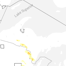

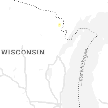


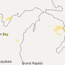


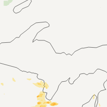

Connect with Interactive Hail Maps