

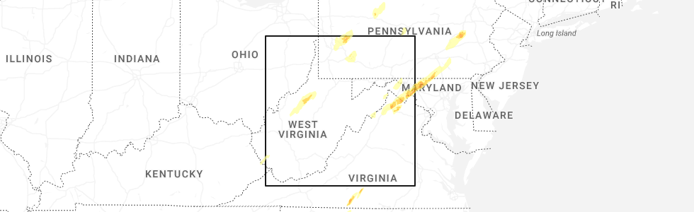
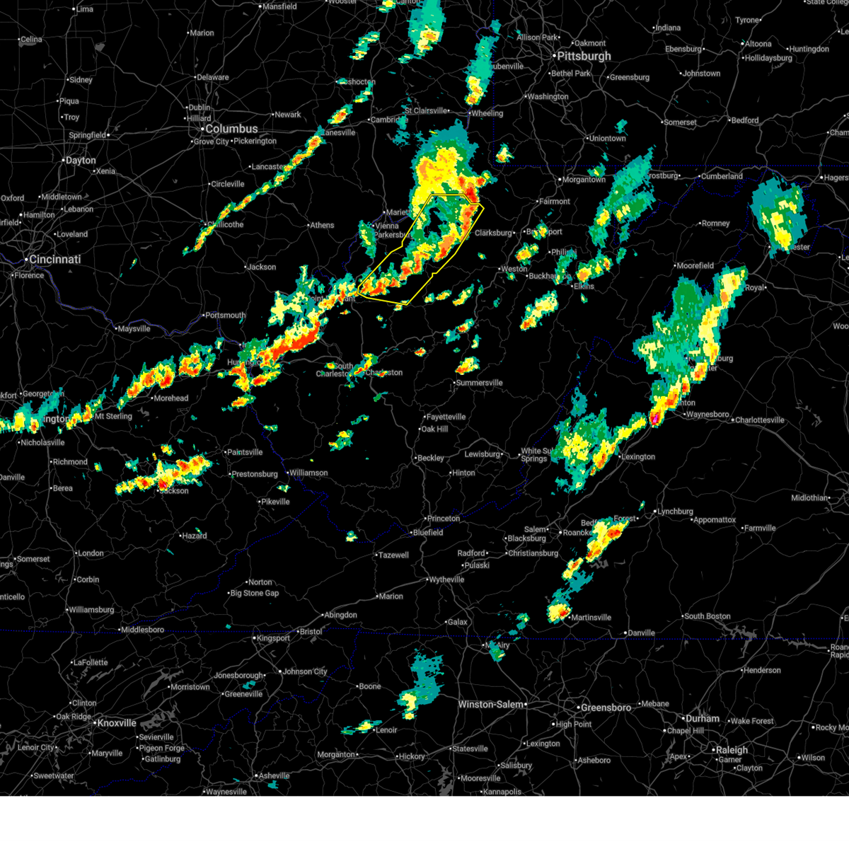
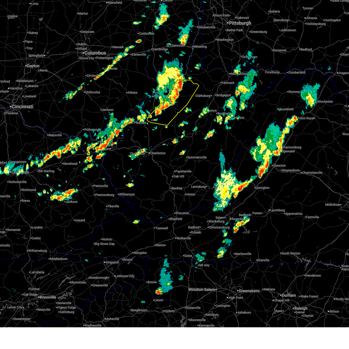
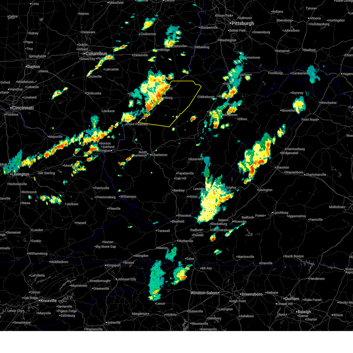
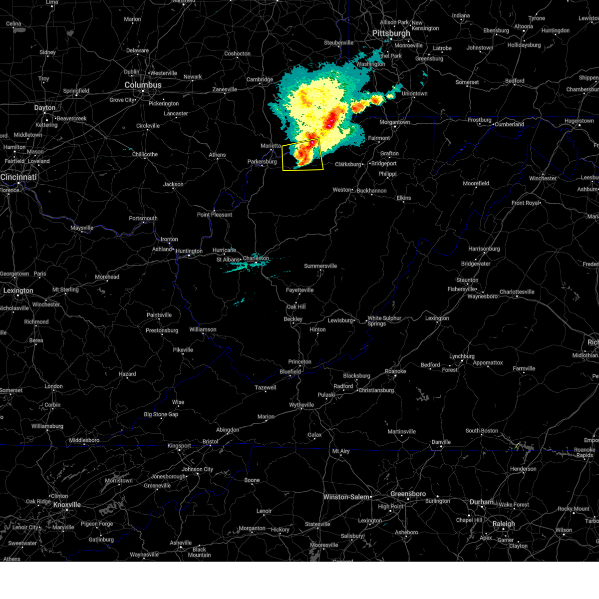
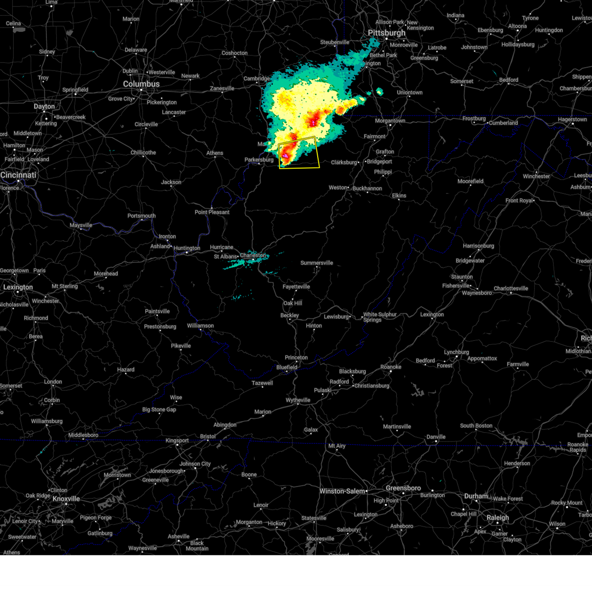
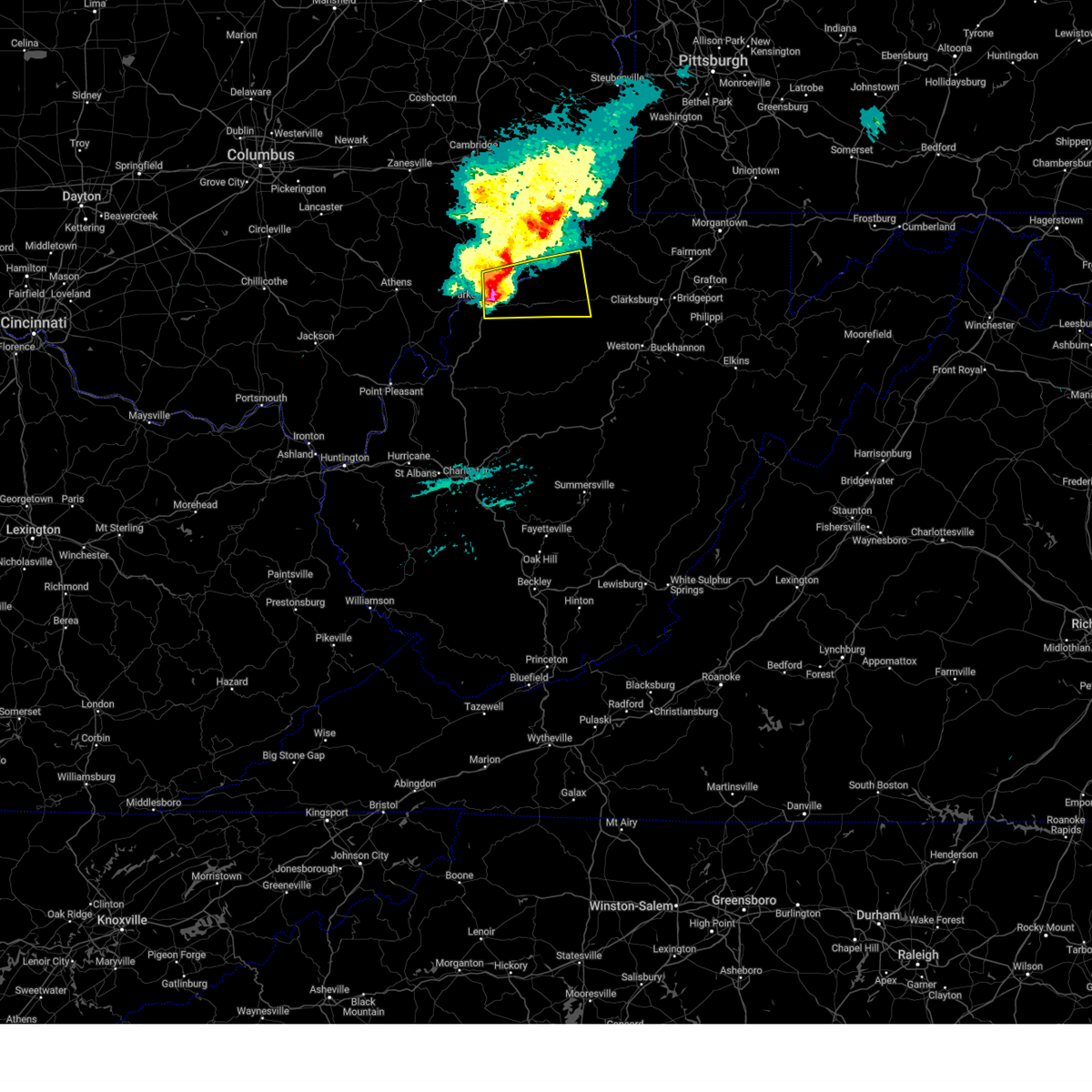
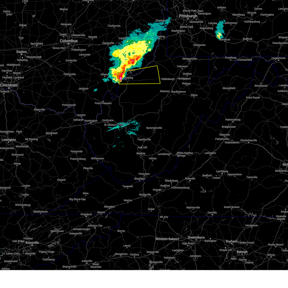
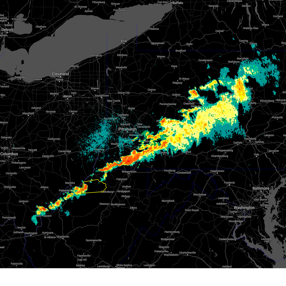
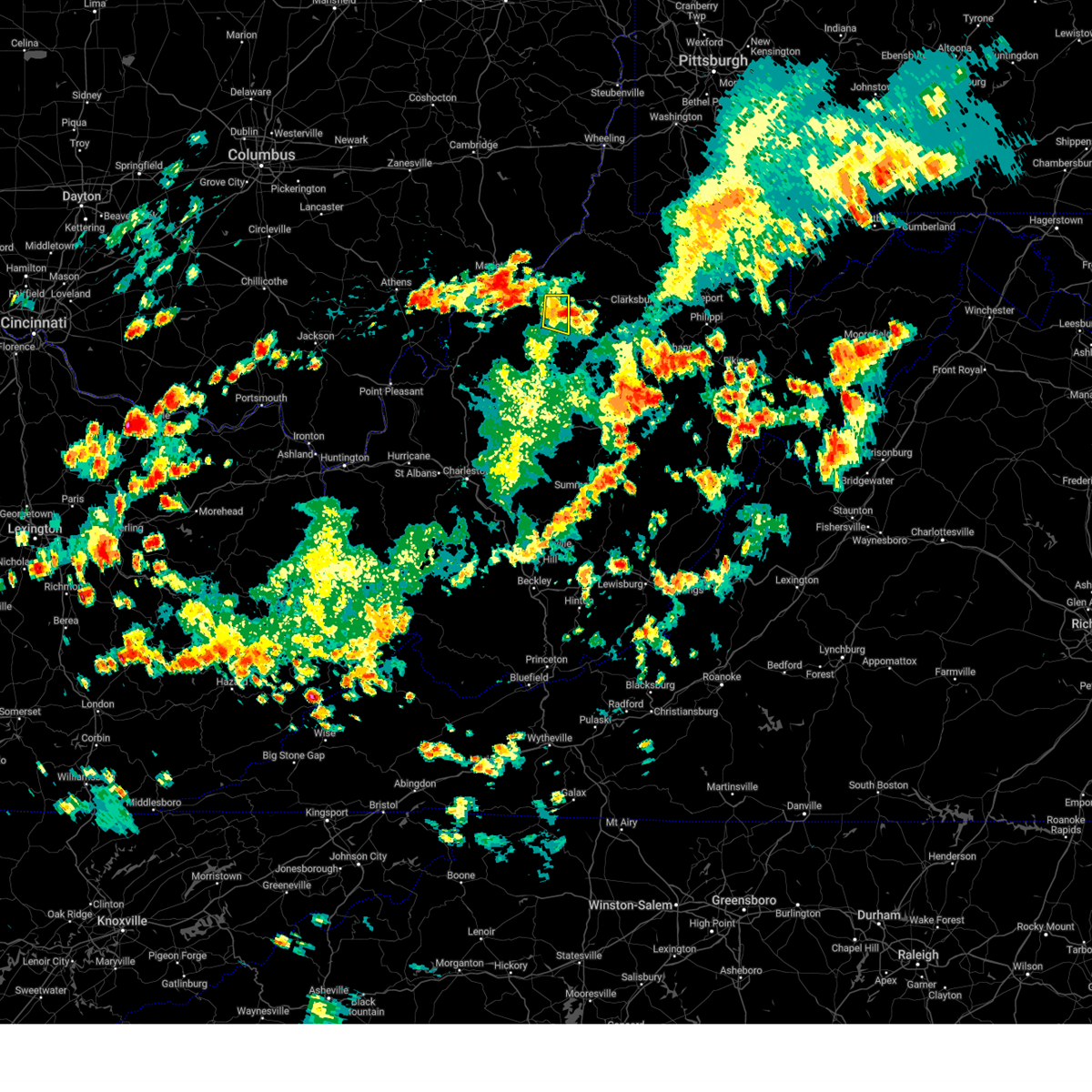
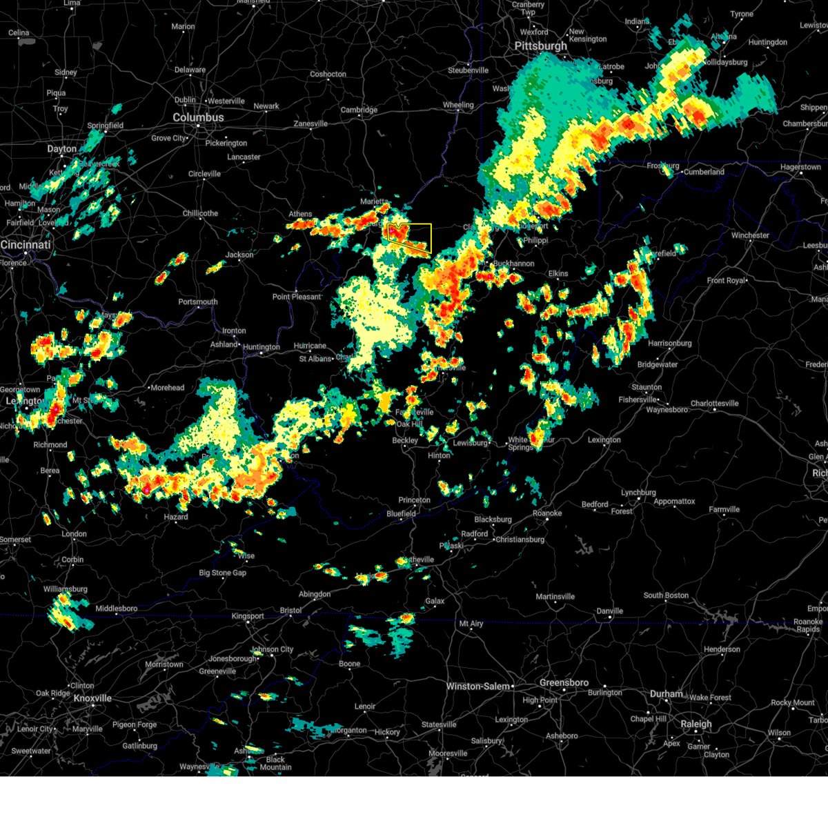
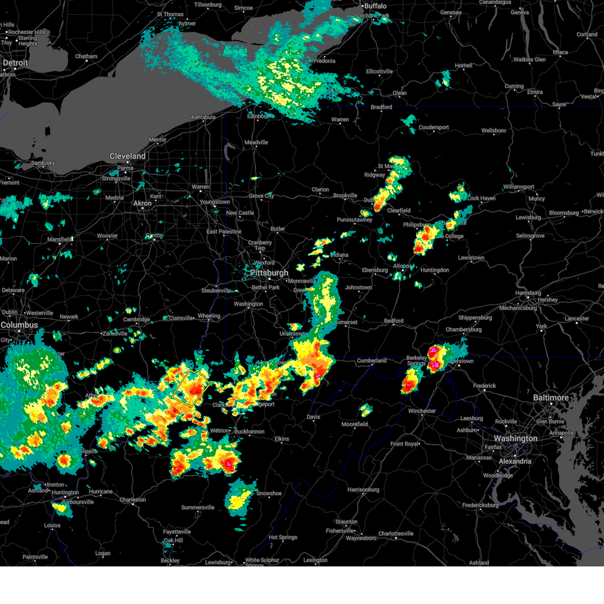
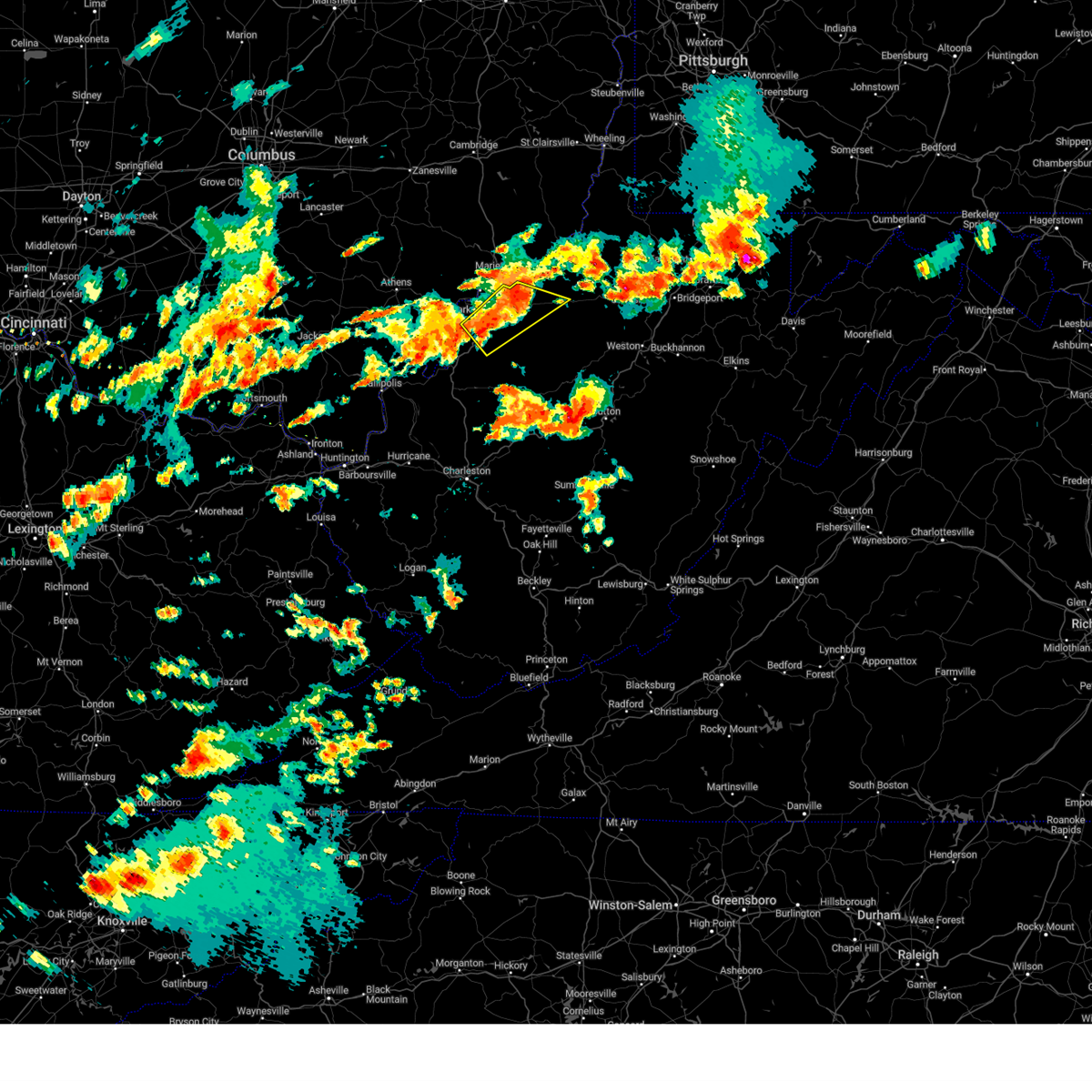
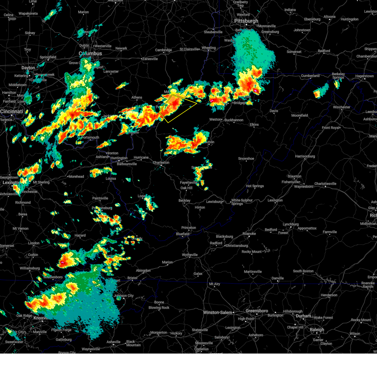
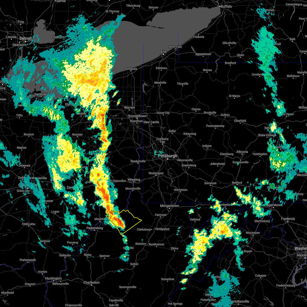
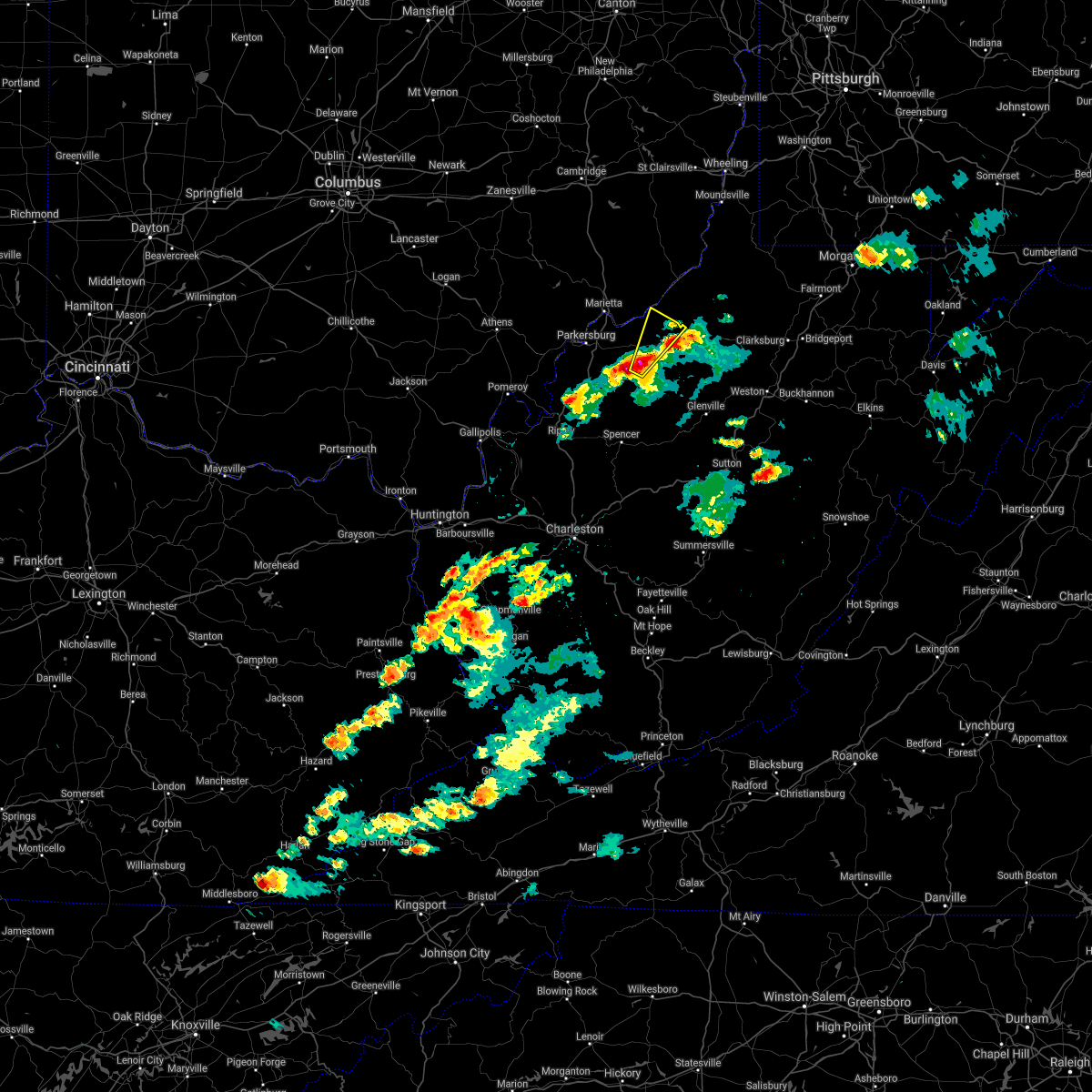
Hail Map for Pennsboro, WV
The Pennsboro, WV area has had 3 reports of on-the-ground hail by trained spotters, and has been under severe weather warnings 23 times during the past 12 months. Doppler radar has detected hail at or near Pennsboro, WV on 38 occasions, including 2 occasions during the past year.
| Name: | Pennsboro, WV |
| Where Located: | 66 miles WNW of Elkins, WV |
| Map: | Google Map for Pennsboro, WV |
| Population: | 1171 |
| Housing Units: | 590 |
| More Info: | Search Google for Pennsboro, WV |
3
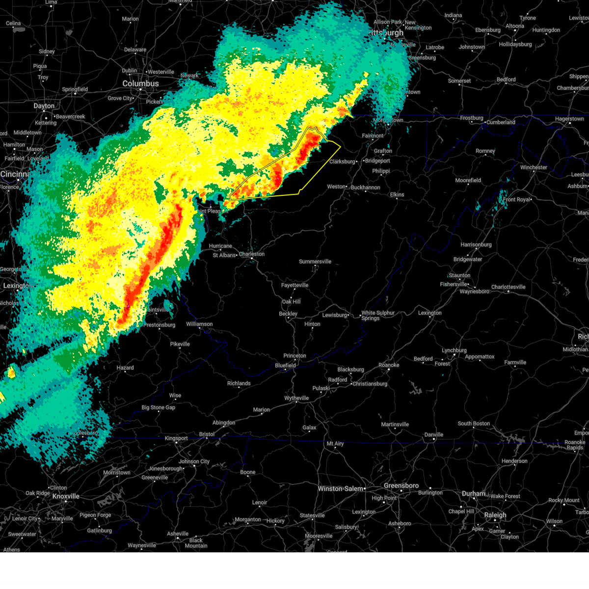
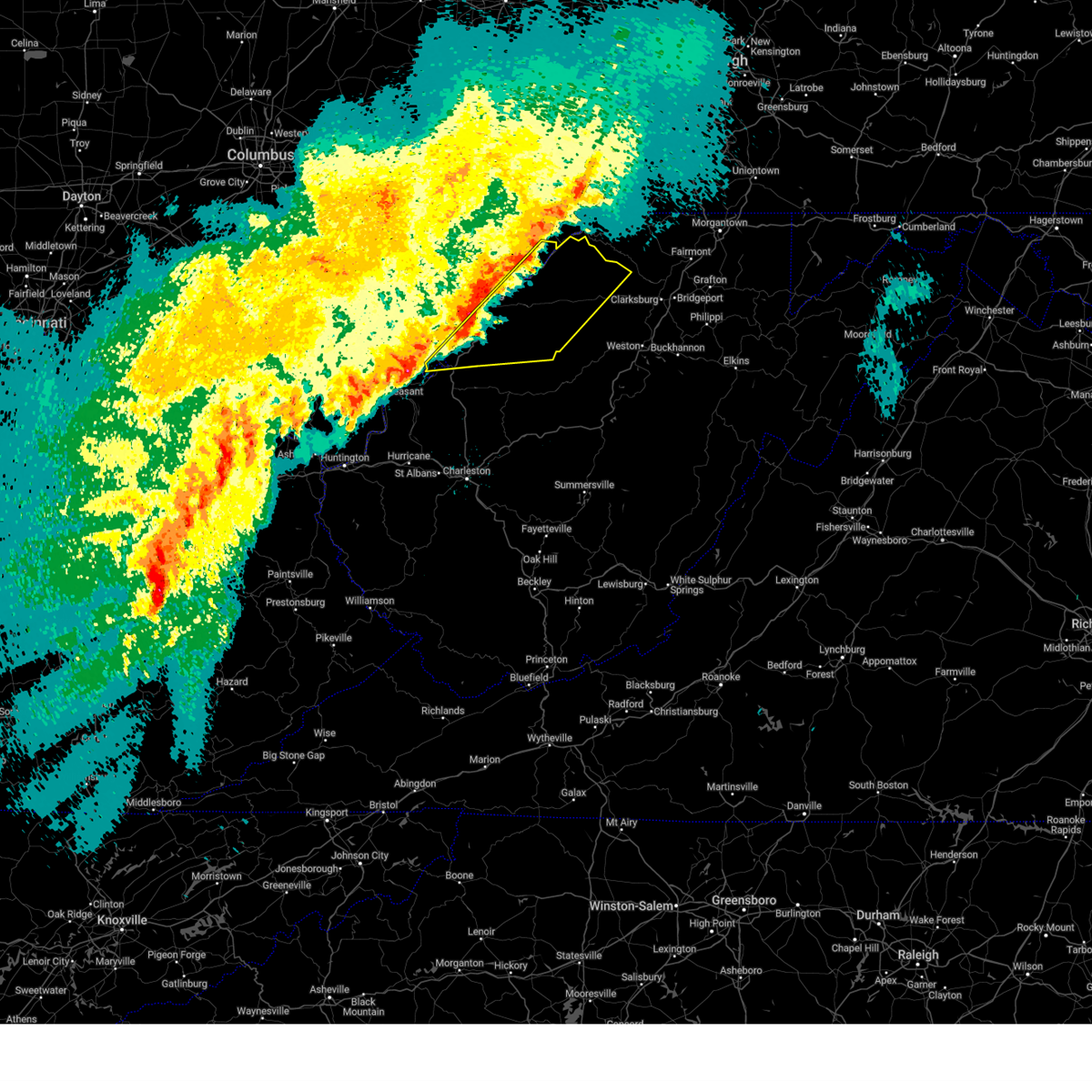
The Top Recent Hail Date for Pennsboro, WV is Sunday, March 16, 2025 (5th out of 38)
Hail and Wind Damage Spotted near Pennsboro, WV
| Date / Time | Report Details |
|---|---|
| 6/19/2025 2:27 PM EDT |
 The storms which prompted the warning have weakened below severe limits, and have exited the warned area. therefore, the warning will be allowed to expire. however, gusty winds are still possible with these thunderstorms. The storms which prompted the warning have weakened below severe limits, and have exited the warned area. therefore, the warning will be allowed to expire. however, gusty winds are still possible with these thunderstorms.
|
| 6/19/2025 2:09 PM EDT |
 At 209 pm edt, severe thunderstorms were located along a line extending from near middlebourne to near north bend state park to 8 miles east of sandyville, moving east at 40 mph (radar indicated). Hazards include 60 mph wind gusts. Expect damage to roofs, siding, and trees. Locations impacted include, harrisville, elizabeth, middlebourne, pennsboro, west union, sandyville, north bend state park, ellenboro, cairo, reedy, pullman, friendly, alma, cherry, smithville, maxwell, lucille, mountain, lima, and hebron. At 209 pm edt, severe thunderstorms were located along a line extending from near middlebourne to near north bend state park to 8 miles east of sandyville, moving east at 40 mph (radar indicated). Hazards include 60 mph wind gusts. Expect damage to roofs, siding, and trees. Locations impacted include, harrisville, elizabeth, middlebourne, pennsboro, west union, sandyville, north bend state park, ellenboro, cairo, reedy, pullman, friendly, alma, cherry, smithville, maxwell, lucille, mountain, lima, and hebron.
|
| 6/19/2025 2:09 PM EDT |
 the severe thunderstorm warning has been cancelled and is no longer in effect the severe thunderstorm warning has been cancelled and is no longer in effect
|
| 6/19/2025 1:47 PM EDT |
 Svrrlx the national weather service in charleston west virginia has issued a * severe thunderstorm warning for, east central washington county in southeastern ohio, pleasants county in northwestern west virginia, northwestern calhoun county in north central west virginia, ritchie county in northwestern west virginia, western doddridge county in northern west virginia, wirt county in northwestern west virginia, tyler county in northern west virginia, northwestern roane county in central west virginia, northern jackson county in northwestern west virginia, central wood county in northwestern west virginia, * until 230 pm edt. * at 147 pm edt, severe thunderstorms were located along a line extending from near st. marys to near mineralwells to near ravenswood, moving east at 40 mph (radar indicated). Hazards include 60 mph wind gusts. expect damage to roofs, siding, and trees Svrrlx the national weather service in charleston west virginia has issued a * severe thunderstorm warning for, east central washington county in southeastern ohio, pleasants county in northwestern west virginia, northwestern calhoun county in north central west virginia, ritchie county in northwestern west virginia, western doddridge county in northern west virginia, wirt county in northwestern west virginia, tyler county in northern west virginia, northwestern roane county in central west virginia, northern jackson county in northwestern west virginia, central wood county in northwestern west virginia, * until 230 pm edt. * at 147 pm edt, severe thunderstorms were located along a line extending from near st. marys to near mineralwells to near ravenswood, moving east at 40 mph (radar indicated). Hazards include 60 mph wind gusts. expect damage to roofs, siding, and trees
|
| 5/30/2025 3:37 PM EDT | Tree down. time estimated based on rada in ritchie county WV, 2.8 miles WNW of Pennsboro, WV |
| 5/30/2025 3:14 PM EDT | Tree fell on wires. time estimated based on rada in ritchie county WV, 2.9 miles NNE of Pennsboro, WV |
| 5/30/2025 2:42 PM EDT | Tree down blocking road. time estimated based on rada in ritchie county WV, 1.7 miles NE of Pennsboro, WV |
| 4/19/2025 7:45 PM EDT |
 The storm which prompted the warning has weakened below severe limits, and no longer poses an immediate threat to life or property. therefore, the warning has been allowed to expire. however, gusty winds are still possible with this thunderstorm. to report severe weather, contact your nearest law enforcement agency. they will relay your report to the national weather service charleston west virginia. The storm which prompted the warning has weakened below severe limits, and no longer poses an immediate threat to life or property. therefore, the warning has been allowed to expire. however, gusty winds are still possible with this thunderstorm. to report severe weather, contact your nearest law enforcement agency. they will relay your report to the national weather service charleston west virginia.
|
| 4/19/2025 7:36 PM EDT |
 At 735 pm edt, a severe thunderstorm was located near st. marys, moving east at 65 mph (radar indicated). Hazards include 60 mph wind gusts and penny size hail. Expect damage to roofs, siding, and trees. locations impacted include, newport, greenwood, willow island, belmont, nutter farm, maxwell, schultz, arvilla, point lookout, wick, mountain, pennsboro, hebron, pike, st. Marys, highland, middlebourne, ellenboro, and north bend state park. At 735 pm edt, a severe thunderstorm was located near st. marys, moving east at 65 mph (radar indicated). Hazards include 60 mph wind gusts and penny size hail. Expect damage to roofs, siding, and trees. locations impacted include, newport, greenwood, willow island, belmont, nutter farm, maxwell, schultz, arvilla, point lookout, wick, mountain, pennsboro, hebron, pike, st. Marys, highland, middlebourne, ellenboro, and north bend state park.
|
| 4/19/2025 7:25 PM EDT |
 At 725 pm edt, a severe thunderstorm was located near boaz, or 7 miles south of marietta, moving east at 65 mph (radar indicated). Hazards include 60 mph wind gusts and penny size hail. Expect damage to roofs, siding, and trees. locations impacted include, newport, belmont, maxwell, schultz, north bend state park, mountain, pennsboro, hebron, pike, st. Marys, davisville, highland, middlebourne, ellenboro, north hills, greenwood, williamstown, willow island, nutter farm, and harrisville. At 725 pm edt, a severe thunderstorm was located near boaz, or 7 miles south of marietta, moving east at 65 mph (radar indicated). Hazards include 60 mph wind gusts and penny size hail. Expect damage to roofs, siding, and trees. locations impacted include, newport, belmont, maxwell, schultz, north bend state park, mountain, pennsboro, hebron, pike, st. Marys, davisville, highland, middlebourne, ellenboro, north hills, greenwood, williamstown, willow island, nutter farm, and harrisville.
|
| 4/19/2025 7:12 PM EDT |
 Svrrlx the national weather service in charleston west virginia has issued a * severe thunderstorm warning for, central washington county in southeastern ohio, pleasants county in northwestern west virginia, northern ritchie county in northwestern west virginia, northwestern doddridge county in northern west virginia, tyler county in northern west virginia, wood county in northwestern west virginia, * until 745 pm edt. * at 711 pm edt, a severe thunderstorm was located over belpre, moving east at 65 mph (radar indicated). Hazards include 60 mph wind gusts and quarter size hail. Hail damage to vehicles is expected. Expect wind damage to roofs, siding, and trees. Svrrlx the national weather service in charleston west virginia has issued a * severe thunderstorm warning for, central washington county in southeastern ohio, pleasants county in northwestern west virginia, northern ritchie county in northwestern west virginia, northwestern doddridge county in northern west virginia, tyler county in northern west virginia, wood county in northwestern west virginia, * until 745 pm edt. * at 711 pm edt, a severe thunderstorm was located over belpre, moving east at 65 mph (radar indicated). Hazards include 60 mph wind gusts and quarter size hail. Hail damage to vehicles is expected. Expect wind damage to roofs, siding, and trees.
|
| 4/3/2025 4:52 AM EDT | The storm which prompted the warning has weakened below severe limits, and has exited the warned area. therefore, the warning will be allowed to expire. a severe thunderstorm watch remains in effect until 700 am edt for northern and northwestern west virginia. |
| 4/3/2025 4:43 AM EDT | Svrrlx the national weather service in charleston west virginia has issued a * severe thunderstorm warning for, southeastern pleasants county in northwestern west virginia, north central calhoun county in north central west virginia, ritchie county in northwestern west virginia, doddridge county in northern west virginia, northwestern taylor county in northern west virginia, northwestern gilmer county in north central west virginia, northwestern lewis county in northern west virginia, east central wirt county in northwestern west virginia, central tyler county in northern west virginia, harrison county in northern west virginia, * until 530 am edt. * at 442 am edt, severe thunderstorms were located along a line extending from near jacksonburg to near west union to 9 miles south of harrisville, moving east at 65 mph (radar indicated). Hazards include 60 mph wind gusts. expect damage to roofs, siding, and trees |
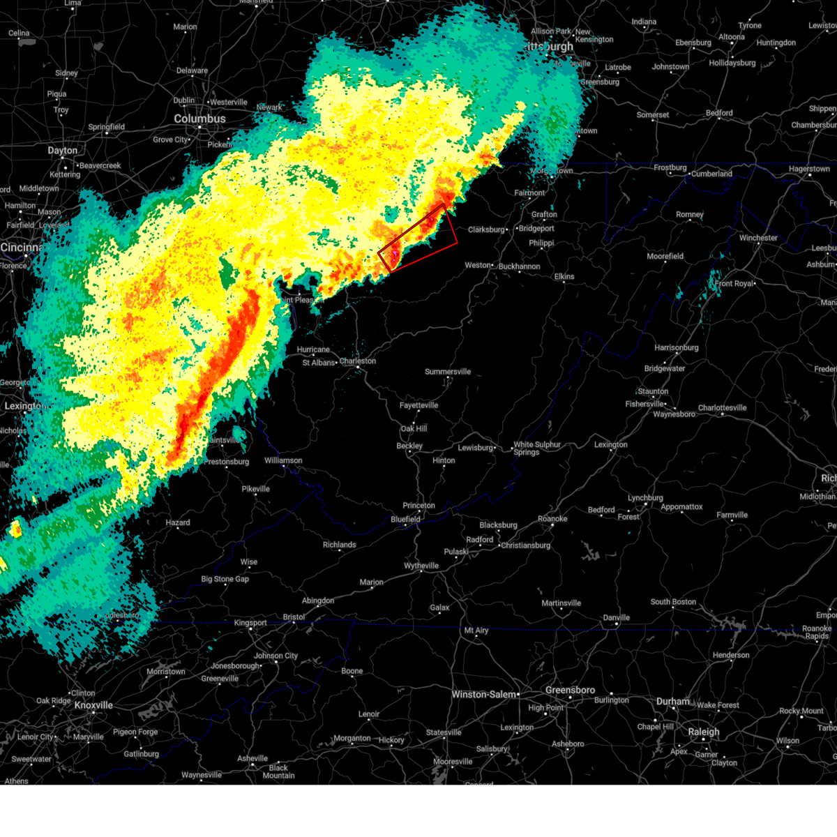
| 4/3/2025 4:38 AM EDT | At 438 am edt, a severe thunderstorm capable of producing a tornado was located over north bend state park, or over harrisville, moving northeast at 65 mph (radar indicated rotation). Hazards include tornado. Flying debris will be dangerous to those caught without shelter. mobile homes will be damaged or destroyed. damage to roofs, windows, and vehicles will occur. tree damage is likely. this dangerous storm will be near, pennsboro around 445 am edt. Other locations impacted by this tornadic thunderstorm include mountain, cairo, greenwood, pike, berea, pullman, highland, and ellenboro. |
| 4/3/2025 4:38 AM EDT | the tornado warning has been cancelled and is no longer in effect |
| 4/3/2025 4:32 AM EDT |
 the severe thunderstorm warning has been cancelled and is no longer in effect the severe thunderstorm warning has been cancelled and is no longer in effect
|
| 4/3/2025 4:32 AM EDT |
 At 432 am edt, severe thunderstorms were located along a line extending from near pine grove to near elizabeth, moving east at 55 mph (radar indicated). Hazards include 60 mph wind gusts. Expect damage to roofs, siding, and trees. Locations impacted include, alma, portland, cherry, smithville, maxwell, mineralwells, schultz, north bend state park, mountain, lima, pennsboro, hebron, pike, center point, davisville, big springs, berea, brohard, macfarlan, and highland. At 432 am edt, severe thunderstorms were located along a line extending from near pine grove to near elizabeth, moving east at 55 mph (radar indicated). Hazards include 60 mph wind gusts. Expect damage to roofs, siding, and trees. Locations impacted include, alma, portland, cherry, smithville, maxwell, mineralwells, schultz, north bend state park, mountain, lima, pennsboro, hebron, pike, center point, davisville, big springs, berea, brohard, macfarlan, and highland.
|
| 4/3/2025 4:27 AM EDT |
 Torrlx the national weather service in charleston west virginia has issued a * tornado warning for, southeastern pleasants county in northwestern west virginia, ritchie county in northwestern west virginia, southwestern doddridge county in northern west virginia, central wirt county in northwestern west virginia, southwestern tyler county in northern west virginia, east central wood county in northwestern west virginia, * until 500 am edt. * at 427 am edt, a severe thunderstorm capable of producing a tornado was located near elizabeth, moving northeast at 65 mph (radar indicated rotation). Hazards include tornado. Flying debris will be dangerous to those caught without shelter. mobile homes will be damaged or destroyed. damage to roofs, windows, and vehicles will occur. tree damage is likely. this dangerous storm will be near, harrisville and north bend state park around 435 am edt. pennsboro around 440 am edt. Other locations impacted by this tornadic thunderstorm include cherry, greenwood, nutter farm, pullman, petroleum, mountain, cairo, hebron, pike, and freeport. Torrlx the national weather service in charleston west virginia has issued a * tornado warning for, southeastern pleasants county in northwestern west virginia, ritchie county in northwestern west virginia, southwestern doddridge county in northern west virginia, central wirt county in northwestern west virginia, southwestern tyler county in northern west virginia, east central wood county in northwestern west virginia, * until 500 am edt. * at 427 am edt, a severe thunderstorm capable of producing a tornado was located near elizabeth, moving northeast at 65 mph (radar indicated rotation). Hazards include tornado. Flying debris will be dangerous to those caught without shelter. mobile homes will be damaged or destroyed. damage to roofs, windows, and vehicles will occur. tree damage is likely. this dangerous storm will be near, harrisville and north bend state park around 435 am edt. pennsboro around 440 am edt. Other locations impacted by this tornadic thunderstorm include cherry, greenwood, nutter farm, pullman, petroleum, mountain, cairo, hebron, pike, and freeport.
|
| 4/3/2025 4:02 AM EDT |
 Svrrlx the national weather service in charleston west virginia has issued a * severe thunderstorm warning for, southeastern meigs county in southeastern ohio, east central washington county in southeastern ohio, pleasants county in northwestern west virginia, northwestern calhoun county in north central west virginia, ritchie county in northwestern west virginia, central doddridge county in northern west virginia, wirt county in northwestern west virginia, tyler county in northern west virginia, northern jackson county in northwestern west virginia, wood county in northwestern west virginia, * until 445 am edt. * at 401 am edt, severe thunderstorms were located along a line extending from near sistersville to near ravenswood, moving east at 110 mph (radar indicated). Hazards include 60 mph wind gusts. expect damage to roofs, siding, and trees Svrrlx the national weather service in charleston west virginia has issued a * severe thunderstorm warning for, southeastern meigs county in southeastern ohio, east central washington county in southeastern ohio, pleasants county in northwestern west virginia, northwestern calhoun county in north central west virginia, ritchie county in northwestern west virginia, central doddridge county in northern west virginia, wirt county in northwestern west virginia, tyler county in northern west virginia, northern jackson county in northwestern west virginia, wood county in northwestern west virginia, * until 445 am edt. * at 401 am edt, severe thunderstorms were located along a line extending from near sistersville to near ravenswood, moving east at 110 mph (radar indicated). Hazards include 60 mph wind gusts. expect damage to roofs, siding, and trees
|
| 3/16/2025 11:41 AM EDT | Multiple trees dow in doddridge county WV, 7.1 miles W of Pennsboro, WV |
| 3/16/2025 11:23 AM EDT |
 Svrrlx the national weather service in charleston west virginia has issued a * severe thunderstorm warning for, eastern washington county in southeastern ohio, eastern pleasants county in northwestern west virginia, central ritchie county in northwestern west virginia, central doddridge county in northern west virginia, central tyler county in northern west virginia, * until noon edt. * at 1123 am edt, a severe thunderstorm was located over pennsboro, or near harrisville, moving east at 40 mph (radar indicated). Hazards include 60 mph wind gusts. expect damage to roofs, siding, and trees Svrrlx the national weather service in charleston west virginia has issued a * severe thunderstorm warning for, eastern washington county in southeastern ohio, eastern pleasants county in northwestern west virginia, central ritchie county in northwestern west virginia, central doddridge county in northern west virginia, central tyler county in northern west virginia, * until noon edt. * at 1123 am edt, a severe thunderstorm was located over pennsboro, or near harrisville, moving east at 40 mph (radar indicated). Hazards include 60 mph wind gusts. expect damage to roofs, siding, and trees
|
| 10/6/2024 10:24 PM EDT | Tree blocking cunningham run r in ritchie county WV, 1.7 miles NE of Pennsboro, WV |
| 10/6/2024 10:19 PM EDT |
 Svrrlx the national weather service in charleston west virginia has issued a * severe thunderstorm warning for, eastern pleasants county in northwestern west virginia, northeastern ritchie county in northwestern west virginia, northern doddridge county in northern west virginia, tyler county in northern west virginia, * until 1045 pm edt. * at 1018 pm edt, a severe thunderstorm was located 7 miles north of pennsboro, or 8 miles south of middlebourne, moving east at 50 mph (radar indicated). Hazards include 60 mph wind gusts and quarter size hail. Hail damage to vehicles is expected. Expect wind damage to roofs, siding, and trees. Svrrlx the national weather service in charleston west virginia has issued a * severe thunderstorm warning for, eastern pleasants county in northwestern west virginia, northeastern ritchie county in northwestern west virginia, northern doddridge county in northern west virginia, tyler county in northern west virginia, * until 1045 pm edt. * at 1018 pm edt, a severe thunderstorm was located 7 miles north of pennsboro, or 8 miles south of middlebourne, moving east at 50 mph (radar indicated). Hazards include 60 mph wind gusts and quarter size hail. Hail damage to vehicles is expected. Expect wind damage to roofs, siding, and trees.
|
| 8/31/2024 3:31 PM EDT |
 The storm which prompted the warning has weakened below severe limits, and no longer poses an immediate threat to life or property. therefore, the warning has been allowed to expire. however, heavy rain is still possible with this thunderstorm. a severe thunderstorm watch remains in effect until 700 pm edt for northwestern west virginia. The storm which prompted the warning has weakened below severe limits, and no longer poses an immediate threat to life or property. therefore, the warning has been allowed to expire. however, heavy rain is still possible with this thunderstorm. a severe thunderstorm watch remains in effect until 700 pm edt for northwestern west virginia.
|
| 8/31/2024 3:20 PM EDT | One tree fell in front of residence and was blocking roadway. time estimated from rada in ritchie county WV, 4.4 miles NNE of Pennsboro, WV |
| 8/31/2024 3:20 PM EDT |
 At 319 pm edt, a severe thunderstorm was located over harrisville, moving east at 25 mph (radar indicated). Hazards include 60 mph wind gusts and quarter size hail. Hail damage to vehicles is expected. expect wind damage to roofs, siding, and trees. Locations impacted include, harrisville, pennsboro, north bend state park, ellenboro, and pike. At 319 pm edt, a severe thunderstorm was located over harrisville, moving east at 25 mph (radar indicated). Hazards include 60 mph wind gusts and quarter size hail. Hail damage to vehicles is expected. expect wind damage to roofs, siding, and trees. Locations impacted include, harrisville, pennsboro, north bend state park, ellenboro, and pike.
|
| 8/31/2024 3:20 PM EDT |
 the severe thunderstorm warning has been cancelled and is no longer in effect the severe thunderstorm warning has been cancelled and is no longer in effect
|
| 8/31/2024 3:00 PM EDT |
 Svrrlx the national weather service in charleston west virginia has issued a * severe thunderstorm warning for, central ritchie county in northwestern west virginia, east central wood county in northwestern west virginia, * until 330 pm edt. * at 300 pm edt, a severe thunderstorm was located 8 miles south of belmont, or 11 miles southwest of st. marys, moving east at 25 mph (radar indicated). Hazards include 60 mph wind gusts and quarter size hail. Hail damage to vehicles is expected. Expect wind damage to roofs, siding, and trees. Svrrlx the national weather service in charleston west virginia has issued a * severe thunderstorm warning for, central ritchie county in northwestern west virginia, east central wood county in northwestern west virginia, * until 330 pm edt. * at 300 pm edt, a severe thunderstorm was located 8 miles south of belmont, or 11 miles southwest of st. marys, moving east at 25 mph (radar indicated). Hazards include 60 mph wind gusts and quarter size hail. Hail damage to vehicles is expected. Expect wind damage to roofs, siding, and trees.
|
| 7/5/2024 7:32 PM EDT | Treed down across the road between haddox run and burton ru in ritchie county WV, 4.3 miles SW of Pennsboro, WV |
| 7/5/2024 7:30 PM EDT | Tree down on mountain driv in ritchie county WV, 3.9 miles SW of Pennsboro, WV |
| 7/5/2024 7:04 PM EDT |
 Svrrlx the national weather service in charleston west virginia has issued a * severe thunderstorm warning for, east central washington county in southeastern ohio, pleasants county in northwestern west virginia, northwestern ritchie county in northwestern west virginia, southwestern tyler county in northern west virginia, northeastern wood county in northwestern west virginia, * until 745 pm edt. * at 703 pm edt, a severe thunderstorm was located near belmont, or 9 miles southeast of marietta, moving east at 25 mph (radar indicated). Hazards include 60 mph wind gusts. expect damage to roofs, siding, and trees Svrrlx the national weather service in charleston west virginia has issued a * severe thunderstorm warning for, east central washington county in southeastern ohio, pleasants county in northwestern west virginia, northwestern ritchie county in northwestern west virginia, southwestern tyler county in northern west virginia, northeastern wood county in northwestern west virginia, * until 745 pm edt. * at 703 pm edt, a severe thunderstorm was located near belmont, or 9 miles southeast of marietta, moving east at 25 mph (radar indicated). Hazards include 60 mph wind gusts. expect damage to roofs, siding, and trees
|
| 6/29/2024 6:58 PM EDT |
 Svrrlx the national weather service in charleston west virginia has issued a * severe thunderstorm warning for, southeastern ritchie county in northwestern west virginia, doddridge county in northern west virginia, north central gilmer county in north central west virginia, northwestern lewis county in northern west virginia, southeastern tyler county in northern west virginia, * until 730 pm edt. * at 657 pm edt, a severe thunderstorm was located near harrisville, moving east at 30 mph (radar indicated). Hazards include 60 mph wind gusts and quarter size hail. Hail damage to vehicles is expected. Expect wind damage to roofs, siding, and trees. Svrrlx the national weather service in charleston west virginia has issued a * severe thunderstorm warning for, southeastern ritchie county in northwestern west virginia, doddridge county in northern west virginia, north central gilmer county in north central west virginia, northwestern lewis county in northern west virginia, southeastern tyler county in northern west virginia, * until 730 pm edt. * at 657 pm edt, a severe thunderstorm was located near harrisville, moving east at 30 mph (radar indicated). Hazards include 60 mph wind gusts and quarter size hail. Hail damage to vehicles is expected. Expect wind damage to roofs, siding, and trees.
|
| 6/29/2024 3:57 PM EDT |
 Svrrlx the national weather service in charleston west virginia has issued a * severe thunderstorm warning for, east central ritchie county in northwestern west virginia, southwestern doddridge county in northern west virginia, * until 430 pm edt. * at 357 pm edt, a severe thunderstorm was located over harrisville, moving east at 25 mph (radar indicated). Hazards include 60 mph wind gusts and penny size hail. expect damage to roofs, siding, and trees Svrrlx the national weather service in charleston west virginia has issued a * severe thunderstorm warning for, east central ritchie county in northwestern west virginia, southwestern doddridge county in northern west virginia, * until 430 pm edt. * at 357 pm edt, a severe thunderstorm was located over harrisville, moving east at 25 mph (radar indicated). Hazards include 60 mph wind gusts and penny size hail. expect damage to roofs, siding, and trees
|
| 6/29/2024 2:49 PM EDT | One downed tree blocking both lanes of pennsboro industrial park roa in ritchie county WV, 1.2 miles ENE of Pennsboro, WV |
| 4/17/2024 9:29 PM EDT |
 the severe thunderstorm warning has been cancelled and is no longer in effect the severe thunderstorm warning has been cancelled and is no longer in effect
|
| 4/17/2024 9:29 PM EDT |
 At 929 pm edt, severe thunderstorms were located along a line extending from 8 miles north of salem to 9 miles northeast of elizabeth, moving east at 30 mph (radar indicated). Hazards include 60 mph wind gusts and quarter size hail. Hail damage to vehicles is expected. expect wind damage to roofs, siding, and trees. Locations impacted include, harrisville, shinnston, salem, pennsboro, lumberport, west union, north bend state park, enterprise, ellenboro, cairo, pullman, auburn, wolf summit, pike, center point, sedalia, berea, highland, greenwood, and blandville. At 929 pm edt, severe thunderstorms were located along a line extending from 8 miles north of salem to 9 miles northeast of elizabeth, moving east at 30 mph (radar indicated). Hazards include 60 mph wind gusts and quarter size hail. Hail damage to vehicles is expected. expect wind damage to roofs, siding, and trees. Locations impacted include, harrisville, shinnston, salem, pennsboro, lumberport, west union, north bend state park, enterprise, ellenboro, cairo, pullman, auburn, wolf summit, pike, center point, sedalia, berea, highland, greenwood, and blandville.
|
| 4/17/2024 9:15 PM EDT |
 Svrrlx the national weather service in charleston west virginia has issued a * severe thunderstorm warning for, pleasants county in northwestern west virginia, ritchie county in northwestern west virginia, doddridge county in northern west virginia, central tyler county in northern west virginia, east central wood county in northwestern west virginia, northern harrison county in northern west virginia, * until 945 pm edt. * at 915 pm edt, severe thunderstorms were located along a line extending from 6 miles southwest of jacksonburg to near parkersburg, moving southeast at 20 mph (radar indicated). Hazards include 60 mph wind gusts and quarter size hail. Hail damage to vehicles is expected. Expect wind damage to roofs, siding, and trees. Svrrlx the national weather service in charleston west virginia has issued a * severe thunderstorm warning for, pleasants county in northwestern west virginia, ritchie county in northwestern west virginia, doddridge county in northern west virginia, central tyler county in northern west virginia, east central wood county in northwestern west virginia, northern harrison county in northern west virginia, * until 945 pm edt. * at 915 pm edt, severe thunderstorms were located along a line extending from 6 miles southwest of jacksonburg to near parkersburg, moving southeast at 20 mph (radar indicated). Hazards include 60 mph wind gusts and quarter size hail. Hail damage to vehicles is expected. Expect wind damage to roofs, siding, and trees.
|
| 4/17/2024 9:07 PM EDT |
 At 907 pm edt, severe thunderstorms were located along a line extending from 6 miles east of st. marys to 6 miles north of north bend state park to 9 miles southwest of belmont, moving east at 40 mph (radar indicated). Hazards include 60 mph wind gusts and quarter size hail. Hail damage to vehicles is expected. expect wind damage to roofs, siding, and trees. locations impacted include, parkersburg, harrisville, st. Marys, pennsboro, north bend state park, ellenboro, cairo, alma, walker, nutter farm, maxwell, petroleum, schultz, arvilla, point lookout, wick, mountain, hebron, pike, and highland. At 907 pm edt, severe thunderstorms were located along a line extending from 6 miles east of st. marys to 6 miles north of north bend state park to 9 miles southwest of belmont, moving east at 40 mph (radar indicated). Hazards include 60 mph wind gusts and quarter size hail. Hail damage to vehicles is expected. expect wind damage to roofs, siding, and trees. locations impacted include, parkersburg, harrisville, st. Marys, pennsboro, north bend state park, ellenboro, cairo, alma, walker, nutter farm, maxwell, petroleum, schultz, arvilla, point lookout, wick, mountain, hebron, pike, and highland.
|
| 4/17/2024 9:07 PM EDT |
 the severe thunderstorm warning has been cancelled and is no longer in effect the severe thunderstorm warning has been cancelled and is no longer in effect
|
| 4/17/2024 8:42 PM EDT |
 Svrrlx the national weather service in charleston west virginia has issued a * severe thunderstorm warning for, central washington county in southeastern ohio, pleasants county in northwestern west virginia, central ritchie county in northwestern west virginia, central tyler county in northern west virginia, northern wood county in northwestern west virginia, * until 915 pm edt. * at 842 pm edt, severe thunderstorms were located along a line extending from 6 miles northeast of marietta to near williamstown to belpre, moving east at 40 mph (radar indicated). Hazards include 60 mph wind gusts and quarter size hail. Hail damage to vehicles is expected. Expect wind damage to roofs, siding, and trees. Svrrlx the national weather service in charleston west virginia has issued a * severe thunderstorm warning for, central washington county in southeastern ohio, pleasants county in northwestern west virginia, central ritchie county in northwestern west virginia, central tyler county in northern west virginia, northern wood county in northwestern west virginia, * until 915 pm edt. * at 842 pm edt, severe thunderstorms were located along a line extending from 6 miles northeast of marietta to near williamstown to belpre, moving east at 40 mph (radar indicated). Hazards include 60 mph wind gusts and quarter size hail. Hail damage to vehicles is expected. Expect wind damage to roofs, siding, and trees.
|
| 4/2/2024 12:11 PM EDT |
 The storms which prompted the warning have weakened below severe limits, and have exited the warned area. therefore, the warning will be allowed to expire. a tornado watch remains in effect until 100 pm edt for northern and north central west virginia. The storms which prompted the warning have weakened below severe limits, and have exited the warned area. therefore, the warning will be allowed to expire. a tornado watch remains in effect until 100 pm edt for northern and north central west virginia.
|
| 4/2/2024 11:50 AM EDT |
 At 1149 am edt, severe thunderstorms were located along a line extending from near harrisville to near grantsville, moving east at 50 mph (radar indicated). Hazards include 60 mph wind gusts. Expect damage to roofs, siding, and trees. Locations impacted include, salem, pennsboro, lumberport, west union, pullman, auburn, greenwood, blandville, avon, grove, leopold, wolf summit, new milton, smithburg, and berea. At 1149 am edt, severe thunderstorms were located along a line extending from near harrisville to near grantsville, moving east at 50 mph (radar indicated). Hazards include 60 mph wind gusts. Expect damage to roofs, siding, and trees. Locations impacted include, salem, pennsboro, lumberport, west union, pullman, auburn, greenwood, blandville, avon, grove, leopold, wolf summit, new milton, smithburg, and berea.
|
| 4/2/2024 11:50 AM EDT |
 the severe thunderstorm warning has been cancelled and is no longer in effect the severe thunderstorm warning has been cancelled and is no longer in effect
|
| 4/2/2024 11:36 AM EDT |
 At 1135 am edt, severe thunderstorms were located along a line extending from north bend state park to 7 miles southeast of elizabeth, moving east at 50 mph (radar indicated). Hazards include 60 mph wind gusts. Expect damage to roofs, siding, and trees. Locations impacted include, harrisville, salem, pennsboro, lumberport, west union, north bend state park, ellenboro, cairo, pullman, auburn, smithville, wolf summit, pike, sedalia, berea, macfarlan, highland, greenwood, blandville, and nutter farm. At 1135 am edt, severe thunderstorms were located along a line extending from north bend state park to 7 miles southeast of elizabeth, moving east at 50 mph (radar indicated). Hazards include 60 mph wind gusts. Expect damage to roofs, siding, and trees. Locations impacted include, harrisville, salem, pennsboro, lumberport, west union, north bend state park, ellenboro, cairo, pullman, auburn, smithville, wolf summit, pike, sedalia, berea, macfarlan, highland, greenwood, blandville, and nutter farm.
|
| 4/2/2024 11:36 AM EDT |
 the severe thunderstorm warning has been cancelled and is no longer in effect the severe thunderstorm warning has been cancelled and is no longer in effect
|
| 4/2/2024 11:11 AM EDT |
 Svrrlx the national weather service in charleston west virginia has issued a * severe thunderstorm warning for, southern pleasants county in northwestern west virginia, ritchie county in northwestern west virginia, doddridge county in northern west virginia, north central gilmer county in north central west virginia, northwestern lewis county in northern west virginia, northern wirt county in northwestern west virginia, south central tyler county in northern west virginia, southeastern wood county in northwestern west virginia, southwestern harrison county in northern west virginia, * until 1215 pm edt. * at 1111 am edt, severe thunderstorms were located along a line extending from 6 miles east of parkersburg to 7 miles northeast of sandyville, moving east at 60 mph (radar indicated). Hazards include 60 mph wind gusts. expect damage to roofs, siding, and trees Svrrlx the national weather service in charleston west virginia has issued a * severe thunderstorm warning for, southern pleasants county in northwestern west virginia, ritchie county in northwestern west virginia, doddridge county in northern west virginia, north central gilmer county in north central west virginia, northwestern lewis county in northern west virginia, northern wirt county in northwestern west virginia, south central tyler county in northern west virginia, southeastern wood county in northwestern west virginia, southwestern harrison county in northern west virginia, * until 1215 pm edt. * at 1111 am edt, severe thunderstorms were located along a line extending from 6 miles east of parkersburg to 7 miles northeast of sandyville, moving east at 60 mph (radar indicated). Hazards include 60 mph wind gusts. expect damage to roofs, siding, and trees
|
| 3/30/2024 7:45 PM EDT |
 the tornado warning has been cancelled and is no longer in effect the tornado warning has been cancelled and is no longer in effect
|
| 3/30/2024 7:44 PM EDT |
 Svrrlx the national weather service in charleston west virginia has issued a * severe thunderstorm warning for, east central pleasants county in northwestern west virginia, northeastern ritchie county in northwestern west virginia, doddridge county in northern west virginia, north central lewis county in northern west virginia, southwestern tyler county in northern west virginia, southwestern harrison county in northern west virginia, * until 815 pm edt. * at 744 pm edt, a severe thunderstorm was located near west union, or 10 miles south of middlebourne, moving southeast at 55 mph (radar indicated). Hazards include 60 mph wind gusts and quarter size hail. Hail damage to vehicles is expected. Expect wind damage to roofs, siding, and trees. Svrrlx the national weather service in charleston west virginia has issued a * severe thunderstorm warning for, east central pleasants county in northwestern west virginia, northeastern ritchie county in northwestern west virginia, doddridge county in northern west virginia, north central lewis county in northern west virginia, southwestern tyler county in northern west virginia, southwestern harrison county in northern west virginia, * until 815 pm edt. * at 744 pm edt, a severe thunderstorm was located near west union, or 10 miles south of middlebourne, moving southeast at 55 mph (radar indicated). Hazards include 60 mph wind gusts and quarter size hail. Hail damage to vehicles is expected. Expect wind damage to roofs, siding, and trees.
|
| 3/30/2024 7:28 PM EDT |
 Torrlx the national weather service in charleston west virginia has issued a * tornado warning for, east central washington county in southeastern ohio, pleasants county in northwestern west virginia, northeastern ritchie county in northwestern west virginia, southwestern tyler county in northern west virginia, * until 800 pm edt. * at 728 pm edt, a severe thunderstorm capable of producing a tornado was located over st. marys, moving east at 40 mph (radar indicated rotation). Hazards include tornado and quarter size hail. Flying debris will be dangerous to those caught without shelter. mobile homes will be damaged or destroyed. damage to roofs, windows, and vehicles will occur. tree damage is likely. this dangerous storm will be near, pennsboro around 740 pm edt. Other locations impacted by this tornadic thunderstorm include arvilla, newport, alma, point lookout, wick, mountain, hebron, maxwell, highland, and ellenboro. Torrlx the national weather service in charleston west virginia has issued a * tornado warning for, east central washington county in southeastern ohio, pleasants county in northwestern west virginia, northeastern ritchie county in northwestern west virginia, southwestern tyler county in northern west virginia, * until 800 pm edt. * at 728 pm edt, a severe thunderstorm capable of producing a tornado was located over st. marys, moving east at 40 mph (radar indicated rotation). Hazards include tornado and quarter size hail. Flying debris will be dangerous to those caught without shelter. mobile homes will be damaged or destroyed. damage to roofs, windows, and vehicles will occur. tree damage is likely. this dangerous storm will be near, pennsboro around 740 pm edt. Other locations impacted by this tornadic thunderstorm include arvilla, newport, alma, point lookout, wick, mountain, hebron, maxwell, highland, and ellenboro.
|
| 8/25/2023 3:55 AM EDT | Tree down across duckworth r in doddridge county WV, 6.4 miles W of Pennsboro, WV |
| 8/25/2023 3:45 AM EDT |
 At 345 am edt, severe thunderstorms were located along a line extending from near winfield to 7 miles north of belmont, moving southeast at 45 mph (radar indicated). Hazards include 60 mph wind gusts and penny size hail. Expect damage to roofs, siding, and trees. locations impacted include, clarksburg, grafton, st. marys, middlebourne, bridgeport, shinnston, stonewood, nutter fort, salem, sistersville, lumberport, west union, anmoore, enterprise, matamoras, flemington, friendly, alma, knottsville, and wolf summit. hail threat, radar indicated max hail size, 0. 75 in wind threat, radar indicated max wind gust, 60 mph. At 345 am edt, severe thunderstorms were located along a line extending from near winfield to 7 miles north of belmont, moving southeast at 45 mph (radar indicated). Hazards include 60 mph wind gusts and penny size hail. Expect damage to roofs, siding, and trees. locations impacted include, clarksburg, grafton, st. marys, middlebourne, bridgeport, shinnston, stonewood, nutter fort, salem, sistersville, lumberport, west union, anmoore, enterprise, matamoras, flemington, friendly, alma, knottsville, and wolf summit. hail threat, radar indicated max hail size, 0. 75 in wind threat, radar indicated max wind gust, 60 mph.
|
| 8/25/2023 3:23 AM EDT |
 At 323 am edt, severe thunderstorms were located along a line extending from near mannington to near beverly, moving southeast at 60 mph (radar indicated). Hazards include 60 mph wind gusts and penny size hail. expect damage to roofs, siding, and trees At 323 am edt, severe thunderstorms were located along a line extending from near mannington to near beverly, moving southeast at 60 mph (radar indicated). Hazards include 60 mph wind gusts and penny size hail. expect damage to roofs, siding, and trees
|
| 8/7/2023 1:38 PM EDT |
 At 138 pm edt, a severe thunderstorm was located 7 miles southwest of middlebourne, moving northeast at 30 mph (radar indicated). Hazards include 60 mph wind gusts and quarter size hail. Hail damage to vehicles is expected. expect wind damage to roofs, siding, and trees. Locations impacted include, middlebourne, pennsboro, arvilla, alma, wick, mountain, lima, hebron, and maxwell. At 138 pm edt, a severe thunderstorm was located 7 miles southwest of middlebourne, moving northeast at 30 mph (radar indicated). Hazards include 60 mph wind gusts and quarter size hail. Hail damage to vehicles is expected. expect wind damage to roofs, siding, and trees. Locations impacted include, middlebourne, pennsboro, arvilla, alma, wick, mountain, lima, hebron, and maxwell.
|
| 8/7/2023 1:18 PM EDT |
 At 118 pm edt, a severe thunderstorm was located near st. marys, moving northeast at 30 mph (radar indicated). Hazards include 60 mph wind gusts and quarter size hail. Hail damage to vehicles is expected. Expect wind damage to roofs, siding, and trees. At 118 pm edt, a severe thunderstorm was located near st. marys, moving northeast at 30 mph (radar indicated). Hazards include 60 mph wind gusts and quarter size hail. Hail damage to vehicles is expected. Expect wind damage to roofs, siding, and trees.
|
| 8/7/2023 1:18 PM EDT |
 At 117 pm edt, a severe thunderstorm was located near mineralwells, or 8 miles north of elizabeth, moving northeast at 40 mph (radar indicated). Hazards include 60 mph wind gusts and quarter size hail. Hail damage to vehicles is expected. expect wind damage to roofs, siding, and trees. Locations impacted include, parkersburg, elizabeth, pennsboro, mineralwells, north bend state park, ellenboro, cairo, willow island, walker, nutter farm, petroleum, schultz, waverly, pike, freeport, davisville, greencastle, morristown, rockport, and highland. At 117 pm edt, a severe thunderstorm was located near mineralwells, or 8 miles north of elizabeth, moving northeast at 40 mph (radar indicated). Hazards include 60 mph wind gusts and quarter size hail. Hail damage to vehicles is expected. expect wind damage to roofs, siding, and trees. Locations impacted include, parkersburg, elizabeth, pennsboro, mineralwells, north bend state park, ellenboro, cairo, willow island, walker, nutter farm, petroleum, schultz, waverly, pike, freeport, davisville, greencastle, morristown, rockport, and highland.
|
| 8/7/2023 1:05 PM EDT |
 At 105 pm edt, a severe thunderstorm was located near mineralwells, or 8 miles northwest of elizabeth, moving northeast at 40 mph (radar indicated). Hazards include 60 mph wind gusts and quarter size hail. Hail damage to vehicles is expected. Expect wind damage to roofs, siding, and trees. At 105 pm edt, a severe thunderstorm was located near mineralwells, or 8 miles northwest of elizabeth, moving northeast at 40 mph (radar indicated). Hazards include 60 mph wind gusts and quarter size hail. Hail damage to vehicles is expected. Expect wind damage to roofs, siding, and trees.
|
| 8/7/2023 12:07 PM EDT |
 The severe thunderstorm warning for central washington, pleasants, northern ritchie, southwestern tyler and northeastern wood counties will expire at 1215 pm edt, the storm which prompted the warning has been replaced with a new warning. therefore, the warning will be allowed to expire. a tornado watch remains in effect until 600 pm edt for southeastern ohio, and northern and northwestern west virginia. The severe thunderstorm warning for central washington, pleasants, northern ritchie, southwestern tyler and northeastern wood counties will expire at 1215 pm edt, the storm which prompted the warning has been replaced with a new warning. therefore, the warning will be allowed to expire. a tornado watch remains in effect until 600 pm edt for southeastern ohio, and northern and northwestern west virginia.
|
| 8/7/2023 11:58 AM EDT |
 At 1158 am edt, a severe thunderstorm was located over st. marys, moving east at 45 mph (radar indicated). Hazards include 60 mph wind gusts and quarter size hail. Hail damage to vehicles is expected. expect wind damage to roofs, siding, and trees. locations impacted include, parkersburg, marietta, belpre, st. Marys, vienna, williamstown, pennsboro, belmont, boaz, newport, north hills, ellenboro, willow island, nutter farm, maxwell, schultz, arvilla, point lookout, wick, and waverly. At 1158 am edt, a severe thunderstorm was located over st. marys, moving east at 45 mph (radar indicated). Hazards include 60 mph wind gusts and quarter size hail. Hail damage to vehicles is expected. expect wind damage to roofs, siding, and trees. locations impacted include, parkersburg, marietta, belpre, st. Marys, vienna, williamstown, pennsboro, belmont, boaz, newport, north hills, ellenboro, willow island, nutter farm, maxwell, schultz, arvilla, point lookout, wick, and waverly.
|
| 8/7/2023 11:53 AM EDT |
 At 1153 am edt, a severe thunderstorm was located 7 miles southwest of middlebourne, moving east at 25 mph (radar indicated). Hazards include 60 mph wind gusts and quarter size hail. Hail damage to vehicles is expected. Expect wind damage to roofs, siding, and trees. At 1153 am edt, a severe thunderstorm was located 7 miles southwest of middlebourne, moving east at 25 mph (radar indicated). Hazards include 60 mph wind gusts and quarter size hail. Hail damage to vehicles is expected. Expect wind damage to roofs, siding, and trees.
|
| 8/7/2023 11:44 AM EDT |
 At 1143 am edt, a severe thunderstorm was located near belmont, or 7 miles southeast of marietta, moving east at 45 mph (radar indicated). Hazards include 60 mph wind gusts and quarter size hail. Hail damage to vehicles is expected. expect wind damage to roofs, siding, and trees. locations impacted include, parkersburg, marietta, belpre, st. Marys, vienna, williamstown, pennsboro, belmont, boaz, newport, north hills, ellenboro, willow island, nutter farm, maxwell, schultz, arvilla, point lookout, wick, and waverly. At 1143 am edt, a severe thunderstorm was located near belmont, or 7 miles southeast of marietta, moving east at 45 mph (radar indicated). Hazards include 60 mph wind gusts and quarter size hail. Hail damage to vehicles is expected. expect wind damage to roofs, siding, and trees. locations impacted include, parkersburg, marietta, belpre, st. Marys, vienna, williamstown, pennsboro, belmont, boaz, newport, north hills, ellenboro, willow island, nutter farm, maxwell, schultz, arvilla, point lookout, wick, and waverly.
|
| 8/7/2023 11:30 AM EDT |
 At 1129 am edt, a severe thunderstorm was located over vienna, or over parkersburg, moving east at 45 mph (radar indicated). Hazards include 60 mph wind gusts and quarter size hail. Hail damage to vehicles is expected. Expect wind damage to roofs, siding, and trees. At 1129 am edt, a severe thunderstorm was located over vienna, or over parkersburg, moving east at 45 mph (radar indicated). Hazards include 60 mph wind gusts and quarter size hail. Hail damage to vehicles is expected. Expect wind damage to roofs, siding, and trees.
|
| 7/28/2023 3:40 PM EDT |
 At 340 pm edt, a severe thunderstorm was located 7 miles southeast of middlebourne, moving east at 40 mph (radar indicated). Hazards include 60 mph wind gusts and quarter size hail. Hail damage to vehicles is expected. expect wind damage to roofs, siding, and trees. locations impacted include, middlebourne, sistersville, pennsboro, west union, matamoras, friendly, alma, smithburg, wick, mountain, lima, and canton. hail threat, radar indicated max hail size, 1. 00 in wind threat, radar indicated max wind gust, 60 mph. At 340 pm edt, a severe thunderstorm was located 7 miles southeast of middlebourne, moving east at 40 mph (radar indicated). Hazards include 60 mph wind gusts and quarter size hail. Hail damage to vehicles is expected. expect wind damage to roofs, siding, and trees. locations impacted include, middlebourne, sistersville, pennsboro, west union, matamoras, friendly, alma, smithburg, wick, mountain, lima, and canton. hail threat, radar indicated max hail size, 1. 00 in wind threat, radar indicated max wind gust, 60 mph.
|
| 7/28/2023 3:39 PM EDT |
 At 339 pm edt, a severe thunderstorm was located 8 miles southwest of west union, or 9 miles east of harrisville, moving east at 40 mph (radar indicated). Hazards include 60 mph wind gusts and quarter size hail. Hail damage to vehicles is expected. expect wind damage to roofs, siding, and trees. Locations impacted include, glenville, pennsboro, pullman, auburn, greenwood, blandville, baldwin, grove, leopold, troy, newberne, coxs mills, linn, berea, tanner, and burnt house. At 339 pm edt, a severe thunderstorm was located 8 miles southwest of west union, or 9 miles east of harrisville, moving east at 40 mph (radar indicated). Hazards include 60 mph wind gusts and quarter size hail. Hail damage to vehicles is expected. expect wind damage to roofs, siding, and trees. Locations impacted include, glenville, pennsboro, pullman, auburn, greenwood, blandville, baldwin, grove, leopold, troy, newberne, coxs mills, linn, berea, tanner, and burnt house.
|
| 7/28/2023 3:18 PM EDT |
 At 317 pm edt, a severe thunderstorm was located near north bend state park, or near harrisville, moving east at 40 mph (radar indicated). Hazards include 60 mph wind gusts and nickel size hail. expect damage to roofs, siding, and trees At 317 pm edt, a severe thunderstorm was located near north bend state park, or near harrisville, moving east at 40 mph (radar indicated). Hazards include 60 mph wind gusts and nickel size hail. expect damage to roofs, siding, and trees
|
| 7/28/2023 3:13 PM EDT |
 At 312 pm edt, a severe thunderstorm was located over st. marys, moving east at 40 mph (radar indicated). Hazards include 60 mph wind gusts and quarter size hail. Hail damage to vehicles is expected. Expect wind damage to roofs, siding, and trees. At 312 pm edt, a severe thunderstorm was located over st. marys, moving east at 40 mph (radar indicated). Hazards include 60 mph wind gusts and quarter size hail. Hail damage to vehicles is expected. Expect wind damage to roofs, siding, and trees.
|
| 6/3/2023 6:34 PM EDT |
 At 633 pm edt, a severe thunderstorm was located over middlebourne, moving southwest at 20 mph (radar indicated). Hazards include 60 mph wind gusts and quarter size hail. Hail damage to vehicles is expected. Expect wind damage to roofs, siding, and trees. At 633 pm edt, a severe thunderstorm was located over middlebourne, moving southwest at 20 mph (radar indicated). Hazards include 60 mph wind gusts and quarter size hail. Hail damage to vehicles is expected. Expect wind damage to roofs, siding, and trees.
|
| 6/3/2023 6:25 PM EDT |
 The severe thunderstorm warning for pleasants, northern ritchie, northwestern doddridge and southwestern tyler counties will expire at 630 pm edt, the storm which prompted the warning has weakened below severe limits, and no longer poses an immediate threat to life or property. therefore, the warning will be allowed to expire. however small hail and gusty winds are still possible with this thunderstorm. The severe thunderstorm warning for pleasants, northern ritchie, northwestern doddridge and southwestern tyler counties will expire at 630 pm edt, the storm which prompted the warning has weakened below severe limits, and no longer poses an immediate threat to life or property. therefore, the warning will be allowed to expire. however small hail and gusty winds are still possible with this thunderstorm.
|
| 6/3/2023 6:08 PM EDT | Tree down on myles ave.... the main drag through town. it took down power and phone lines and was blocking the road. utility crews were still there at time of call... 9 in ritchie county WV, 0.8 miles NW of Pennsboro, WV |
| 6/3/2023 6:05 PM EDT | Quarter sized hail reported 0.8 miles NW of Pennsboro, WV, large amount of hail in the pennsboro area. also several trees and lines down as well. fire department currently out assessing damages. |
| 6/3/2023 6:05 PM EDT | Several trees and lines down in the pennsboro area. large amount of hail as well. fire department currently out assessing damage in ritchie county WV, 0.8 miles NW of Pennsboro, WV |
| 6/3/2023 6:05 PM EDT |
 At 604 pm edt, a severe thunderstorm was located near pennsboro, or 9 miles south of middlebourne, moving west at 45 mph (radar indicated). Hazards include 60 mph wind gusts and quarter size hail. Hail damage to vehicles is expected. Expect wind damage to roofs, siding, and trees. At 604 pm edt, a severe thunderstorm was located near pennsboro, or 9 miles south of middlebourne, moving west at 45 mph (radar indicated). Hazards include 60 mph wind gusts and quarter size hail. Hail damage to vehicles is expected. Expect wind damage to roofs, siding, and trees.
|
| 11/27/2022 1:52 PM EST | Tree down in greenwoo in doddridge county WV, 5 miles WNW of Pennsboro, WV |
| 11/27/2022 1:45 PM EST |
 At 144 pm est, a severe thunderstorm was located near pennsboro, or near harrisville, moving northeast at 55 mph (radar indicated). Hazards include 60 mph wind gusts. expect damage to roofs, siding, and trees At 144 pm est, a severe thunderstorm was located near pennsboro, or near harrisville, moving northeast at 55 mph (radar indicated). Hazards include 60 mph wind gusts. expect damage to roofs, siding, and trees
|
| 7/23/2022 2:55 PM EDT |
 At 255 pm edt, a severe thunderstorm was located near middlebourne, moving southeast at 25 mph (radar indicated). Hazards include 60 mph wind gusts and quarter size hail. Hail damage to vehicles is expected. Expect wind damage to roofs, siding, and trees. At 255 pm edt, a severe thunderstorm was located near middlebourne, moving southeast at 25 mph (radar indicated). Hazards include 60 mph wind gusts and quarter size hail. Hail damage to vehicles is expected. Expect wind damage to roofs, siding, and trees.
|
| 7/22/2022 4:27 PM EDT |
 At 426 pm edt, a severe thunderstorm was located 8 miles south of belmont, or 11 miles southwest of st. marys, moving southeast at 25 mph (radar indicated). Hazards include 60 mph wind gusts and quarter size hail. Hail damage to vehicles is expected. expect wind damage to roofs, siding, and trees. locations impacted include, harrisville, north bend state park, ellenboro, cairo, schultz, pike, nutter farm and petroleum. hail threat, radar indicated max hail size, 1. 00 in wind threat, radar indicated max wind gust, 60 mph. At 426 pm edt, a severe thunderstorm was located 8 miles south of belmont, or 11 miles southwest of st. marys, moving southeast at 25 mph (radar indicated). Hazards include 60 mph wind gusts and quarter size hail. Hail damage to vehicles is expected. expect wind damage to roofs, siding, and trees. locations impacted include, harrisville, north bend state park, ellenboro, cairo, schultz, pike, nutter farm and petroleum. hail threat, radar indicated max hail size, 1. 00 in wind threat, radar indicated max wind gust, 60 mph.
|
| 7/22/2022 4:17 PM EDT |
 At 417 pm edt, a severe thunderstorm was located 8 miles southwest of belmont, or 9 miles east of parkersburg, moving southeast at 25 mph (radar indicated). Hazards include 60 mph wind gusts. expect damage to roofs, siding, and trees At 417 pm edt, a severe thunderstorm was located 8 miles southwest of belmont, or 9 miles east of parkersburg, moving southeast at 25 mph (radar indicated). Hazards include 60 mph wind gusts. expect damage to roofs, siding, and trees
|
| 6/22/2022 7:41 PM EDT |
 At 740 pm edt, a severe thunderstorm was located near belmont, or 7 miles south of st. marys, moving east at 35 mph (radar indicated). Hazards include 60 mph wind gusts and quarter size hail. Hail damage to vehicles is expected. Expect wind damage to roofs, siding, and trees. At 740 pm edt, a severe thunderstorm was located near belmont, or 7 miles south of st. marys, moving east at 35 mph (radar indicated). Hazards include 60 mph wind gusts and quarter size hail. Hail damage to vehicles is expected. Expect wind damage to roofs, siding, and trees.
|
| 6/16/2022 11:54 PM EDT | Reports of multiple trees dow in ritchie county WV, 0.8 miles NW of Pennsboro, WV |
| 6/16/2022 9:29 PM EDT |
 At 928 pm edt, a severe thunderstorm was located 8 miles northwest of st. marys, moving southeast at 35 mph (radar indicated). Hazards include 60 mph wind gusts and quarter size hail. Hail damage to vehicles is expected. Expect wind damage to roofs, siding, and trees. At 928 pm edt, a severe thunderstorm was located 8 miles northwest of st. marys, moving southeast at 35 mph (radar indicated). Hazards include 60 mph wind gusts and quarter size hail. Hail damage to vehicles is expected. Expect wind damage to roofs, siding, and trees.
|
| 6/16/2022 8:42 PM EDT |
 At 842 pm edt, a severe thunderstorm was located near west union, or 12 miles northeast of harrisville, moving southeast at 35 mph (radar indicated). Hazards include 60 mph wind gusts and quarter size hail. Hail damage to vehicles is expected. Expect wind damage to roofs, siding, and trees. At 842 pm edt, a severe thunderstorm was located near west union, or 12 miles northeast of harrisville, moving southeast at 35 mph (radar indicated). Hazards include 60 mph wind gusts and quarter size hail. Hail damage to vehicles is expected. Expect wind damage to roofs, siding, and trees.
|
| 6/16/2022 8:40 PM EDT | Reports of multiple trees dow in ritchie county WV, 0.8 miles NW of Pennsboro, WV |
| 6/16/2022 8:20 PM EDT |
 At 820 pm edt, a severe thunderstorm was located over st. marys, moving southeast at 35 mph (radar indicated). Hazards include 60 mph wind gusts and quarter size hail. Hail damage to vehicles is expected. Expect wind damage to roofs, siding, and trees. At 820 pm edt, a severe thunderstorm was located over st. marys, moving southeast at 35 mph (radar indicated). Hazards include 60 mph wind gusts and quarter size hail. Hail damage to vehicles is expected. Expect wind damage to roofs, siding, and trees.
|
| 6/13/2022 9:06 PM EDT |
 The national weather service in charleston west virginia has issued a * severe thunderstorm warning for. southeastern washington county in southeastern ohio. pleasants county in northwestern west virginia. calhoun county in north central west virginia. Ritchie county in northwestern west virginia. The national weather service in charleston west virginia has issued a * severe thunderstorm warning for. southeastern washington county in southeastern ohio. pleasants county in northwestern west virginia. calhoun county in north central west virginia. Ritchie county in northwestern west virginia.
|
| 6/13/2022 9:06 PM EDT |
 At 905 pm edt, severe thunderstorms were located along a line extending from near vienna to near elizabeth to 7 miles west of spencer, moving east at 55 mph (radar indicated). Hazards include 60 mph wind gusts and quarter size hail. Hail damage to vehicles is possible. Expect wind damage to roofs, siding, and trees. At 905 pm edt, severe thunderstorms were located along a line extending from near vienna to near elizabeth to 7 miles west of spencer, moving east at 55 mph (radar indicated). Hazards include 60 mph wind gusts and quarter size hail. Hail damage to vehicles is possible. Expect wind damage to roofs, siding, and trees.
|
| 3/23/2022 5:21 PM EDT |
 The severe thunderstorm warning for northeastern washington, pleasants, central ritchie, wirt, southwestern tyler, northeastern jackson and wood counties will expire at 530 pm edt, the storm which prompted the warning has weakened below severe limits, and no longer poses an immediate threat to life or property. therefore, the warning will be allowed to expire. however gusty winds are still possible with this thunderstorm. a tornado watch remains in effect until 1000 pm edt for southeastern ohio, and northern and northwestern west virginia. The severe thunderstorm warning for northeastern washington, pleasants, central ritchie, wirt, southwestern tyler, northeastern jackson and wood counties will expire at 530 pm edt, the storm which prompted the warning has weakened below severe limits, and no longer poses an immediate threat to life or property. therefore, the warning will be allowed to expire. however gusty winds are still possible with this thunderstorm. a tornado watch remains in effect until 1000 pm edt for southeastern ohio, and northern and northwestern west virginia.
|
| 3/23/2022 5:10 PM EDT |
 At 509 pm edt, a severe thunderstorm was located near mineralwells, or 7 miles southeast of parkersburg, moving northeast at 70 mph (radar indicated). Hazards include 70 mph wind gusts and quarter size hail. Hail damage to vehicles is expected. expect considerable tree damage. wind damage is also likely to mobile homes, roofs, and outbuildings. locations impacted include, parkersburg, marietta, harrisville, st. Marys, elizabeth, pennsboro, belmont, mineralwells, north bend state park, newport, ellenboro, cairo, maxwell, schultz, hebron, pike, davisville, highland, peewee and willow island. At 509 pm edt, a severe thunderstorm was located near mineralwells, or 7 miles southeast of parkersburg, moving northeast at 70 mph (radar indicated). Hazards include 70 mph wind gusts and quarter size hail. Hail damage to vehicles is expected. expect considerable tree damage. wind damage is also likely to mobile homes, roofs, and outbuildings. locations impacted include, parkersburg, marietta, harrisville, st. Marys, elizabeth, pennsboro, belmont, mineralwells, north bend state park, newport, ellenboro, cairo, maxwell, schultz, hebron, pike, davisville, highland, peewee and willow island.
|
| 3/23/2022 4:51 PM EDT |
 At 450 pm edt, a severe thunderstorm was located near ravenswood, or 7 miles north of ripley, moving northeast at 70 mph (radar indicated). Hazards include 70 mph wind gusts and quarter size hail. Hail damage to vehicles is expected. expect considerable tree damage. Wind damage is also likely to mobile homes, roofs, and outbuildings. At 450 pm edt, a severe thunderstorm was located near ravenswood, or 7 miles north of ripley, moving northeast at 70 mph (radar indicated). Hazards include 70 mph wind gusts and quarter size hail. Hail damage to vehicles is expected. expect considerable tree damage. Wind damage is also likely to mobile homes, roofs, and outbuildings.
|
| 9/22/2021 2:42 PM EDT |
 At 242 pm edt, severe thunderstorms were located along a line extending from near st. marys to pennsboro, moving northeast at 35 mph (radar indicated). Hazards include 60 mph wind gusts. expect damage to roofs, siding, and trees At 242 pm edt, severe thunderstorms were located along a line extending from near st. marys to pennsboro, moving northeast at 35 mph (radar indicated). Hazards include 60 mph wind gusts. expect damage to roofs, siding, and trees
|
| 8/3/2021 6:09 PM EDT |
 At 609 pm edt, a severe thunderstorm was located 8 miles southwest of north bend state park, or 10 miles west of harrisville, moving northeast at 25 mph (radar indicated). Hazards include 60 mph wind gusts and quarter size hail. Hail damage to vehicles is expected. Expect wind damage to roofs, siding, and trees. At 609 pm edt, a severe thunderstorm was located 8 miles southwest of north bend state park, or 10 miles west of harrisville, moving northeast at 25 mph (radar indicated). Hazards include 60 mph wind gusts and quarter size hail. Hail damage to vehicles is expected. Expect wind damage to roofs, siding, and trees.
|
| 6/21/2021 4:55 PM EDT | One tree dow in ritchie county WV, 0.5 miles W of Pennsboro, WV |
| 6/21/2021 4:53 PM EDT |
 The severe thunderstorm warning for southwestern pleasants, northwestern ritchie and central wood counties will expire at 500 pm edt, the storm which prompted the warning has weakened below severe limits, and has exited the warned area. therefore, the warning will be allowed to expire. a severe thunderstorm watch remains in effect until 800 pm edt for southeastern ohio, and northwestern west virginia. The severe thunderstorm warning for southwestern pleasants, northwestern ritchie and central wood counties will expire at 500 pm edt, the storm which prompted the warning has weakened below severe limits, and has exited the warned area. therefore, the warning will be allowed to expire. a severe thunderstorm watch remains in effect until 800 pm edt for southeastern ohio, and northwestern west virginia.
|
| 6/21/2021 4:23 PM EDT |
 At 422 pm edt, a severe thunderstorm was located near parkersburg, moving east at 30 mph (radar indicated). Hazards include 60 mph wind gusts and penny size hail. expect damage to roofs, siding, and trees At 422 pm edt, a severe thunderstorm was located near parkersburg, moving east at 30 mph (radar indicated). Hazards include 60 mph wind gusts and penny size hail. expect damage to roofs, siding, and trees
|
| 6/21/2021 4:05 PM EDT |
 At 404 pm edt, a severe thunderstorm was located near belmont, or near marietta, moving east at 40 mph (radar indicated). Hazards include 70 mph wind gusts and penny size hail. Expect considerable tree damage. Damage is likely to mobile homes, roofs, and outbuildings. At 404 pm edt, a severe thunderstorm was located near belmont, or near marietta, moving east at 40 mph (radar indicated). Hazards include 70 mph wind gusts and penny size hail. Expect considerable tree damage. Damage is likely to mobile homes, roofs, and outbuildings.
|
| 6/14/2021 7:08 PM EDT | Multiple trees down on river road in ritchie county WV, 2.7 miles W of Pennsboro, WV |
| 6/14/2021 6:57 PM EDT |
 The national weather service in charleston west virginia has issued a * severe thunderstorm warning for. southeastern pleasants county in northwestern west virginia. northeastern ritchie county in northwestern west virginia. doddridge county in northern west virginia. Northwestern lewis county in northern west virginia. The national weather service in charleston west virginia has issued a * severe thunderstorm warning for. southeastern pleasants county in northwestern west virginia. northeastern ritchie county in northwestern west virginia. doddridge county in northern west virginia. Northwestern lewis county in northern west virginia.
|
| 6/14/2021 6:55 PM EDT | Tree down on willow lane in tyler county WV, 4.3 miles SSW of Pennsboro, WV |
| 6/14/2021 6:41 PM EDT |
 At 640 pm edt, a severe thunderstorm was located over st. marys, moving southeast at 10 mph (radar indicated). Hazards include 60 mph wind gusts and quarter size hail. Hail damage to vehicles is expected. expect wind damage to roofs, siding, and trees. locations impacted include, harrisville, st. Marys, pennsboro, belmont, west union, newport, ellenboro, pullman, greenwood, maxwell, arvilla, point lookout, smithburg, wick, mountain, hebron, pike, berea and highland. At 640 pm edt, a severe thunderstorm was located over st. marys, moving southeast at 10 mph (radar indicated). Hazards include 60 mph wind gusts and quarter size hail. Hail damage to vehicles is expected. expect wind damage to roofs, siding, and trees. locations impacted include, harrisville, st. Marys, pennsboro, belmont, west union, newport, ellenboro, pullman, greenwood, maxwell, arvilla, point lookout, smithburg, wick, mountain, hebron, pike, berea and highland.
|
| 6/14/2021 6:14 PM EDT |
 At 613 pm edt, a severe thunderstorm was located 7 miles north of belmont, or 7 miles northwest of st. marys, moving southeast at 50 mph (radar indicated). Hazards include 60 mph wind gusts and quarter size hail. Hail damage to vehicles is expected. Expect wind damage to roofs, siding, and trees. At 613 pm edt, a severe thunderstorm was located 7 miles north of belmont, or 7 miles northwest of st. marys, moving southeast at 50 mph (radar indicated). Hazards include 60 mph wind gusts and quarter size hail. Hail damage to vehicles is expected. Expect wind damage to roofs, siding, and trees.
|
| 6/13/2021 5:11 PM EDT |
 The severe thunderstorm warning for east central washington, pleasants, northern ritchie, southwestern tyler and northeastern wood counties will expire at 515 pm edt, the storms which prompted the warning have moved out of the area. therefore, the warning will be allowed to expire. a severe thunderstorm watch remains in effect until 700 pm edt for southeastern ohio, and northern and northwestern west virginia. a severe thunderstorm warning still remains in effect for eastern wood county and northern ritchie county until 600 pm. The severe thunderstorm warning for east central washington, pleasants, northern ritchie, southwestern tyler and northeastern wood counties will expire at 515 pm edt, the storms which prompted the warning have moved out of the area. therefore, the warning will be allowed to expire. a severe thunderstorm watch remains in effect until 700 pm edt for southeastern ohio, and northern and northwestern west virginia. a severe thunderstorm warning still remains in effect for eastern wood county and northern ritchie county until 600 pm.
|
| 6/13/2021 5:09 PM EDT |
 At 508 pm edt, severe thunderstorms were located along a line extending from near west union to 6 miles northeast of elizabeth, moving southeast at 15 mph (radar indicated). Hazards include 60 mph wind gusts and quarter size hail. Hail damage to vehicles is expected. Expect wind damage to roofs, siding, and trees. At 508 pm edt, severe thunderstorms were located along a line extending from near west union to 6 miles northeast of elizabeth, moving southeast at 15 mph (radar indicated). Hazards include 60 mph wind gusts and quarter size hail. Hail damage to vehicles is expected. Expect wind damage to roofs, siding, and trees.
|
| 6/13/2021 4:55 PM EDT |
 At 455 pm edt, severe thunderstorms were located along a line extending from 6 miles southwest of sistersville to near st. marys to near williamstown, moving southeast at 30 mph (radar indicated). Hazards include 60 mph wind gusts and quarter size hail. Hail damage to vehicles is expected. expect wind damage to roofs, siding, and trees. locations impacted include, st. Marys, pennsboro, belmont, north bend state park, newport, ellenboro, cairo, willow island, nutter farm, maxwell, petroleum, schultz, arvilla, point lookout, waverly, hebron, pike and highland. At 455 pm edt, severe thunderstorms were located along a line extending from 6 miles southwest of sistersville to near st. marys to near williamstown, moving southeast at 30 mph (radar indicated). Hazards include 60 mph wind gusts and quarter size hail. Hail damage to vehicles is expected. expect wind damage to roofs, siding, and trees. locations impacted include, st. Marys, pennsboro, belmont, north bend state park, newport, ellenboro, cairo, willow island, nutter farm, maxwell, petroleum, schultz, arvilla, point lookout, waverly, hebron, pike and highland.
|
| 6/13/2021 4:40 PM EDT |
 At 439 pm edt, severe thunderstorms were located along a line extending from 8 miles west of sistersville to belmont to williamstown, moving southeast at 30 mph (radar indicated). Hazards include 60 mph wind gusts and quarter size hail. Hail damage to vehicles is expected. Expect wind damage to roofs, siding, and trees. At 439 pm edt, severe thunderstorms were located along a line extending from 8 miles west of sistersville to belmont to williamstown, moving southeast at 30 mph (radar indicated). Hazards include 60 mph wind gusts and quarter size hail. Hail damage to vehicles is expected. Expect wind damage to roofs, siding, and trees.
|
| 6/13/2021 4:20 PM EDT |
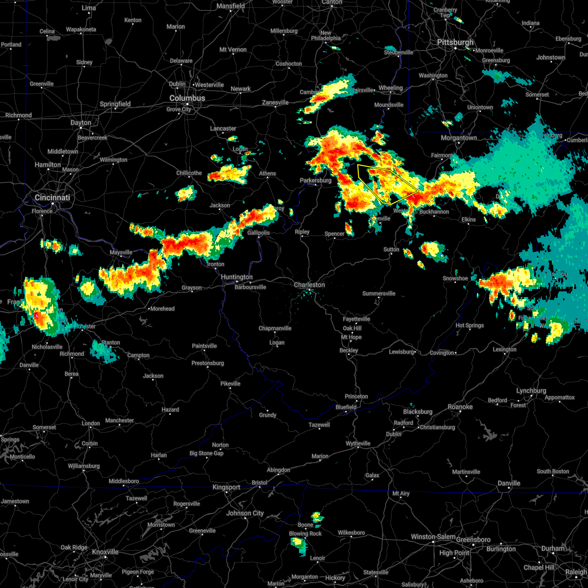 The severe thunderstorm warning for northeastern pleasants, northeastern ritchie, doddridge, northwestern lewis, southwestern tyler and southwestern harrison counties will expire at 430 pm edt, the storm which prompted the warning has weakened below severe limits. therefore, the warning will be allowed to expire. a severe thunderstorm watch remains in effect until 700 pm edt for northern, north central and northwestern west virginia. The severe thunderstorm warning for northeastern pleasants, northeastern ritchie, doddridge, northwestern lewis, southwestern tyler and southwestern harrison counties will expire at 430 pm edt, the storm which prompted the warning has weakened below severe limits. therefore, the warning will be allowed to expire. a severe thunderstorm watch remains in effect until 700 pm edt for northern, north central and northwestern west virginia.
|
| 6/13/2021 3:44 PM EDT |
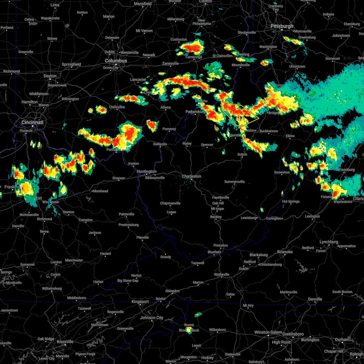 At 344 pm edt, a severe thunderstorm was located over west union, or 14 miles northeast of harrisville, moving southeast at 20 mph (radar indicated). Hazards include 60 mph wind gusts and quarter size hail. Hail damage to vehicles is expected. Expect wind damage to roofs, siding, and trees. At 344 pm edt, a severe thunderstorm was located over west union, or 14 miles northeast of harrisville, moving southeast at 20 mph (radar indicated). Hazards include 60 mph wind gusts and quarter size hail. Hail damage to vehicles is expected. Expect wind damage to roofs, siding, and trees.
|
| 9/3/2020 4:24 PM EDT |
 The severe thunderstorm warning for ritchie, northeastern wirt and east central wood counties will expire at 430 pm edt, the storm which prompted the warning has weakened below severe limits, and no longer poses an immediate threat to life or property. therefore, the warning will be allowed to expire. The severe thunderstorm warning for ritchie, northeastern wirt and east central wood counties will expire at 430 pm edt, the storm which prompted the warning has weakened below severe limits, and no longer poses an immediate threat to life or property. therefore, the warning will be allowed to expire.
|
| 9/3/2020 4:20 PM EDT |
 At 419 pm edt, a severe thunderstorm was located near north bend state park, or 8 miles west of harrisville, moving east at 45 mph (radar indicated). Hazards include 60 mph wind gusts. Expect damage to roofs, siding, and trees. Locations impacted include, harrisville, elizabeth, pennsboro, north bend state park, ellenboro, cairo, pullman, nutter farm, walker, petroleum, pike, freeport, greencastle, berea, macfarlan, highland and smithville. At 419 pm edt, a severe thunderstorm was located near north bend state park, or 8 miles west of harrisville, moving east at 45 mph (radar indicated). Hazards include 60 mph wind gusts. Expect damage to roofs, siding, and trees. Locations impacted include, harrisville, elizabeth, pennsboro, north bend state park, ellenboro, cairo, pullman, nutter farm, walker, petroleum, pike, freeport, greencastle, berea, macfarlan, highland and smithville.
|
| 9/3/2020 4:06 PM EDT |
 At 405 pm edt, a severe thunderstorm was located near mineralwells, or near elizabeth, moving east at 35 mph (radar indicated). Hazards include 60 mph wind gusts. Expect damage to roofs, siding, and trees. Locations impacted include, parkersburg, harrisville, elizabeth, pennsboro, mineralwells, north bend state park, ellenboro, cairo, pullman, nutter farm, walker, petroleum, pike, freeport, davisville, greencastle, morristown, berea, rockport and macfarlan. At 405 pm edt, a severe thunderstorm was located near mineralwells, or near elizabeth, moving east at 35 mph (radar indicated). Hazards include 60 mph wind gusts. Expect damage to roofs, siding, and trees. Locations impacted include, parkersburg, harrisville, elizabeth, pennsboro, mineralwells, north bend state park, ellenboro, cairo, pullman, nutter farm, walker, petroleum, pike, freeport, davisville, greencastle, morristown, berea, rockport and macfarlan.
|
| 9/3/2020 3:48 PM EDT |
 At 347 pm edt, a severe thunderstorm was located near mineralwells, or 8 miles south of parkersburg, moving east at 35 mph (radar indicated). Hazards include 60 mph wind gusts. expect damage to roofs, siding, and trees At 347 pm edt, a severe thunderstorm was located near mineralwells, or 8 miles south of parkersburg, moving east at 35 mph (radar indicated). Hazards include 60 mph wind gusts. expect damage to roofs, siding, and trees
|
| 7/27/2020 8:11 PM EDT |
 The severe thunderstorm warning for east central washington, pleasants, northern ritchie, western tyler and east central wood counties will expire at 815 pm edt, the storm which prompted the warning has moved out of the area. therefore, the warning will be allowed to expire. The severe thunderstorm warning for east central washington, pleasants, northern ritchie, western tyler and east central wood counties will expire at 815 pm edt, the storm which prompted the warning has moved out of the area. therefore, the warning will be allowed to expire.
|
| 7/27/2020 7:51 PM EDT |
 At 750 pm edt, a severe thunderstorm was located near st. marys, moving east at 30 mph (radar indicated). Hazards include 60 mph wind gusts. Expect damage to roofs, siding, and trees. locations impacted include, st. Marys, sistersville, belmont, newport, matamoras, friendly, willow island, maxwell, schultz, arvilla, point lookout, new matamoras, wick, mountain, hebron and highland. At 750 pm edt, a severe thunderstorm was located near st. marys, moving east at 30 mph (radar indicated). Hazards include 60 mph wind gusts. Expect damage to roofs, siding, and trees. locations impacted include, st. Marys, sistersville, belmont, newport, matamoras, friendly, willow island, maxwell, schultz, arvilla, point lookout, new matamoras, wick, mountain, hebron and highland.
|
| 7/27/2020 7:30 PM EDT |
 At 730 pm edt, a severe thunderstorm was located near williamstown, or near marietta, moving east at 30 mph (radar indicated). Hazards include 60 mph wind gusts. expect damage to roofs, siding, and trees At 730 pm edt, a severe thunderstorm was located near williamstown, or near marietta, moving east at 30 mph (radar indicated). Hazards include 60 mph wind gusts. expect damage to roofs, siding, and trees
|
| 6/10/2020 10:38 PM EDT |
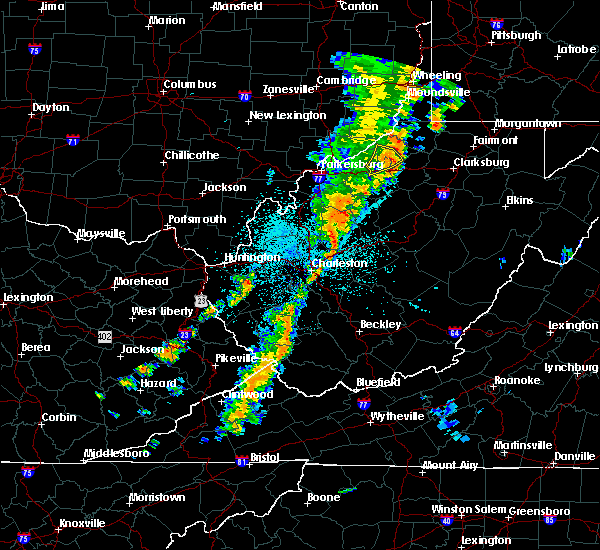 The severe thunderstorm warning for northeastern pleasants, northeastern ritchie and southwestern tyler counties will expire at 1045 pm edt, the storm which prompted the warning has weakened below severe limits, and no longer poses an immediate threat to life or property. therefore, the warning will be allowed to expire. however gusty winds are still possible with this thunderstorm. a severe thunderstorm watch remains in effect until 100 am edt for northern and northwestern west virginia. to report severe weather, contact your nearest law enforcement agency. they will relay your report to the national weather service charleston west virginia. The severe thunderstorm warning for northeastern pleasants, northeastern ritchie and southwestern tyler counties will expire at 1045 pm edt, the storm which prompted the warning has weakened below severe limits, and no longer poses an immediate threat to life or property. therefore, the warning will be allowed to expire. however gusty winds are still possible with this thunderstorm. a severe thunderstorm watch remains in effect until 100 am edt for northern and northwestern west virginia. to report severe weather, contact your nearest law enforcement agency. they will relay your report to the national weather service charleston west virginia.
|
| 6/10/2020 10:29 PM EDT |
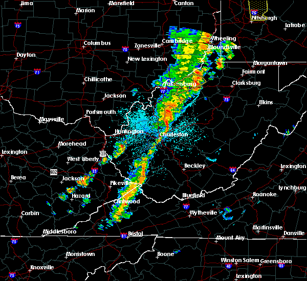 At 1029 pm edt, a severe thunderstorm was located near middlebourne, moving northeast at 40 mph (radar indicated). Hazards include 60 mph wind gusts. Expect damage to roofs, siding, and trees. Locations impacted include, pennsboro, ellenboro, alma, wick, mountain, hebron, pike and highland. At 1029 pm edt, a severe thunderstorm was located near middlebourne, moving northeast at 40 mph (radar indicated). Hazards include 60 mph wind gusts. Expect damage to roofs, siding, and trees. Locations impacted include, pennsboro, ellenboro, alma, wick, mountain, hebron, pike and highland.
|
| 6/10/2020 10:14 PM EDT | Trees downed between cairo and mound drive pennsbor in ritchie county WV, 0.6 miles N of Pennsboro, WV |
| 6/10/2020 10:13 PM EDT |
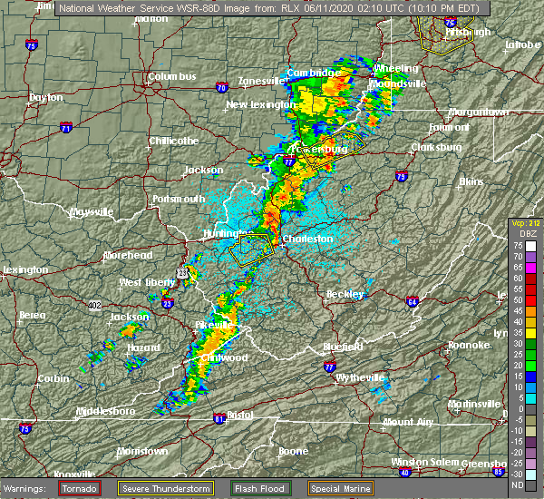 At 1011 pm edt, a severe thunderstorm was located 7 miles east of st. marys, moving northeast at 50 mph (radar and law enforcement indicated. this storm downed trees and power lines as it moved through wood county). Hazards include 60 mph wind gusts. Expect damage to roofs, siding, and trees. locations impacted include, st. Marys, pennsboro, belmont, north bend state park, ellenboro, cairo, alma, willow island, nutter farm, maxwell, petroleum, schultz, arvilla, point lookout, wick, mountain, hebron, pike and highland. At 1011 pm edt, a severe thunderstorm was located 7 miles east of st. marys, moving northeast at 50 mph (radar and law enforcement indicated. this storm downed trees and power lines as it moved through wood county). Hazards include 60 mph wind gusts. Expect damage to roofs, siding, and trees. locations impacted include, st. Marys, pennsboro, belmont, north bend state park, ellenboro, cairo, alma, willow island, nutter farm, maxwell, petroleum, schultz, arvilla, point lookout, wick, mountain, hebron, pike and highland.
|
| 6/10/2020 9:55 PM EDT |
 At 954 pm edt, a severe thunderstorm was located near belmont, or 9 miles southwest of st. marys, moving northeast at 50 mph (radar indicated). Hazards include 60 mph wind gusts. expect damage to roofs, siding, and trees At 954 pm edt, a severe thunderstorm was located near belmont, or 9 miles southwest of st. marys, moving northeast at 50 mph (radar indicated). Hazards include 60 mph wind gusts. expect damage to roofs, siding, and trees
|
| 4/9/2020 1:34 AM EDT |
 At 133 am edt, severe thunderstorms were located along a line extending from 7 miles northeast of elizabeth to near spencer, moving east at 60 mph (radar indicated). Hazards include 70 mph wind gusts and quarter size hail. Hail damage to vehicles is expected. expect considerable tree damage. wind damage is also likely to mobile homes, roofs, and outbuildings. locations impacted include, parkersburg, marietta, belpre, spencer, harrisville, st. Marys, elizabeth, grantsville, vienna, williamstown, pennsboro, belmont, mineralwells, arnoldsburg, north bend state park, boaz, lubeck, newport, north hills and ellenboro. At 133 am edt, severe thunderstorms were located along a line extending from 7 miles northeast of elizabeth to near spencer, moving east at 60 mph (radar indicated). Hazards include 70 mph wind gusts and quarter size hail. Hail damage to vehicles is expected. expect considerable tree damage. wind damage is also likely to mobile homes, roofs, and outbuildings. locations impacted include, parkersburg, marietta, belpre, spencer, harrisville, st. Marys, elizabeth, grantsville, vienna, williamstown, pennsboro, belmont, mineralwells, arnoldsburg, north bend state park, boaz, lubeck, newport, north hills and ellenboro.
|
| 4/9/2020 1:18 AM EDT |
 At 116 am edt, a severe thunderstorm was located near elizabeth, moving east at 50 mph (radar indicated). Hazards include 70 mph wind gusts and quarter size hail. Hail damage to vehicles is expected. expect considerable tree damage. wind damage is also likely to mobile homes, roofs, and outbuildings. locations impacted include, parkersburg, marietta, belpre, ripley, spencer, harrisville, st. Marys, elizabeth, grantsville, vienna, williamstown, pennsboro, belmont, sandyville, mineralwells, arnoldsburg, washington, north bend state park, lubeck and boaz. At 116 am edt, a severe thunderstorm was located near elizabeth, moving east at 50 mph (radar indicated). Hazards include 70 mph wind gusts and quarter size hail. Hail damage to vehicles is expected. expect considerable tree damage. wind damage is also likely to mobile homes, roofs, and outbuildings. locations impacted include, parkersburg, marietta, belpre, ripley, spencer, harrisville, st. Marys, elizabeth, grantsville, vienna, williamstown, pennsboro, belmont, sandyville, mineralwells, arnoldsburg, washington, north bend state park, lubeck and boaz.
|
| 4/9/2020 1:01 AM EDT |
 At 100 am edt, a severe thunderstorm was located 7 miles east of forked run state park, moving east at 65 mph (radar indicated). Hazards include 70 mph wind gusts and quarter size hail. Hail damage to vehicles is expected. expect considerable tree damage. wind damage is also likely to mobile homes, roofs, and outbuildings. locations impacted include, parkersburg, marietta, belpre, ripley, spencer, harrisville, st. Marys, elizabeth, racine, grantsville, coolville, forked run state park, vienna, ravenswood, williamstown, pennsboro, belmont, sandyville, mineralwells and arnoldsburg. At 100 am edt, a severe thunderstorm was located 7 miles east of forked run state park, moving east at 65 mph (radar indicated). Hazards include 70 mph wind gusts and quarter size hail. Hail damage to vehicles is expected. expect considerable tree damage. wind damage is also likely to mobile homes, roofs, and outbuildings. locations impacted include, parkersburg, marietta, belpre, ripley, spencer, harrisville, st. Marys, elizabeth, racine, grantsville, coolville, forked run state park, vienna, ravenswood, williamstown, pennsboro, belmont, sandyville, mineralwells and arnoldsburg.
|
| 4/9/2020 12:54 AM EDT |
 At 1253 am edt, a severe thunderstorm was located near forked run state park, moving east at 75 mph (radar indicated). Hazards include 70 mph wind gusts and quarter size hail. Hail damage to vehicles is expected. expect considerable tree damage. Wind damage is also likely to mobile homes, roofs, and outbuildings. At 1253 am edt, a severe thunderstorm was located near forked run state park, moving east at 75 mph (radar indicated). Hazards include 70 mph wind gusts and quarter size hail. Hail damage to vehicles is expected. expect considerable tree damage. Wind damage is also likely to mobile homes, roofs, and outbuildings.
|
| 4/8/2020 3:45 AM EDT |
 At 344 am edt, a severe thunderstorm was located near st. marys, moving southeast at 60 mph (radar indicated). Hazards include 60 mph wind gusts and quarter size hail. Hail damage to vehicles is expected. expect wind damage to roofs, siding, and trees. locations impacted include, harrisville, st. Marys, pennsboro, belmont, north bend state park, newport, ellenboro, willow island, maxwell, schultz, mountain, hebron, pike and highland. At 344 am edt, a severe thunderstorm was located near st. marys, moving southeast at 60 mph (radar indicated). Hazards include 60 mph wind gusts and quarter size hail. Hail damage to vehicles is expected. expect wind damage to roofs, siding, and trees. locations impacted include, harrisville, st. Marys, pennsboro, belmont, north bend state park, newport, ellenboro, willow island, maxwell, schultz, mountain, hebron, pike and highland.
|
| 4/8/2020 3:34 AM EDT |
 At 333 am edt, a severe thunderstorm was located near marietta, moving southeast at 60 mph (radar indicated). Hazards include 60 mph wind gusts and quarter size hail. Hail damage to vehicles is expected. Expect wind damage to roofs, siding, and trees. At 333 am edt, a severe thunderstorm was located near marietta, moving southeast at 60 mph (radar indicated). Hazards include 60 mph wind gusts and quarter size hail. Hail damage to vehicles is expected. Expect wind damage to roofs, siding, and trees.
|
| 4/7/2020 6:36 PM EDT | Quarter sized hail reported 0.8 miles NW of Pennsboro, WV, biggest hail stone size of a quater. nickle size hail covering the ground. |
| 4/7/2020 6:31 PM EDT |
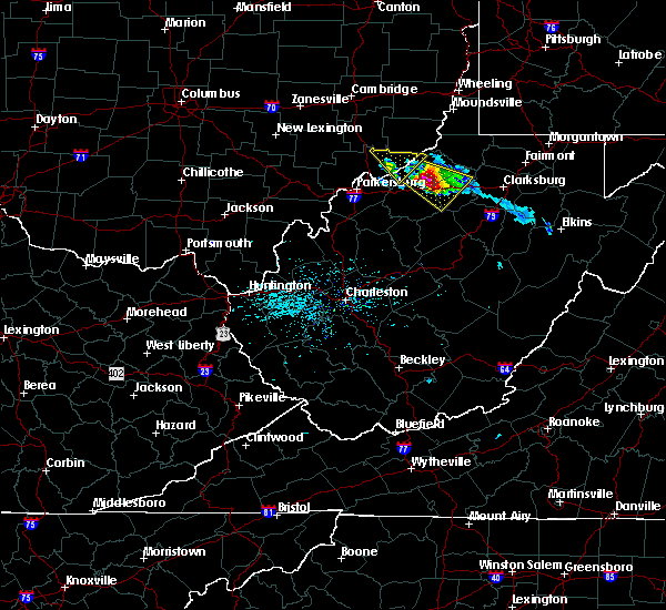 At 630 pm edt, a severe thunderstorm was located near pennsboro, or 10 miles south of middlebourne, moving southeast at 25 mph (radar indicated). Hazards include 60 mph wind gusts and half dollar size hail. Hail damage to vehicles is expected. expect wind damage to roofs, siding, and trees. Locations impacted include, pennsboro, west union, alma, greenwood, blandville, smithburg, wick, mountain, hebron, sedalia, canton, highland and center point. At 630 pm edt, a severe thunderstorm was located near pennsboro, or 10 miles south of middlebourne, moving southeast at 25 mph (radar indicated). Hazards include 60 mph wind gusts and half dollar size hail. Hail damage to vehicles is expected. expect wind damage to roofs, siding, and trees. Locations impacted include, pennsboro, west union, alma, greenwood, blandville, smithburg, wick, mountain, hebron, sedalia, canton, highland and center point.
|
| 4/7/2020 6:30 PM EDT | Half Dollar sized hail reported 6.2 miles SW of Pennsboro, WV, hail damage to roof shingles and siding on route 74 near ritchie/tyler county line. also plowing 2 to 3 inches of hail accumulation on route 74 between mountain and pen |
| 4/7/2020 6:30 PM EDT | One tree cleared from route 74 near the ritchie/tyler county lin in tyler county WV, 7.7 miles SW of Pennsboro, WV |
| 4/7/2020 6:13 PM EDT |
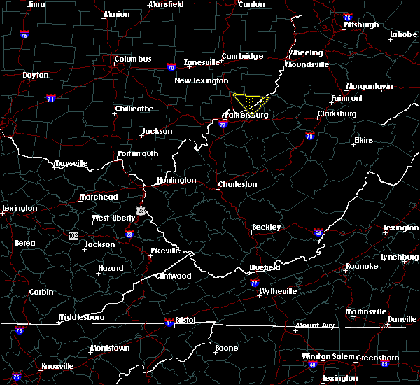 At 612 pm edt, a severe thunderstorm was located 8 miles southwest of middlebourne, moving southeast at 35 mph (radar indicated). Hazards include 60 mph wind gusts and quarter size hail. Hail damage to vehicles is expected. Expect wind damage to roofs, siding, and trees. At 612 pm edt, a severe thunderstorm was located 8 miles southwest of middlebourne, moving southeast at 35 mph (radar indicated). Hazards include 60 mph wind gusts and quarter size hail. Hail damage to vehicles is expected. Expect wind damage to roofs, siding, and trees.
|
| 1/11/2020 5:00 PM EST |
 At 500 pm est, severe thunderstorms were located along a line extending from near paden city to 7 miles southeast of middlebourne to 8 miles southeast of harrisville to 6 miles northwest of glenville to near grantsville, moving east at 55 mph (radar indicated). Hazards include 70 mph wind gusts. Expect considerable tree damage. Damage is likely to mobile homes, roofs, and outbuildings. At 500 pm est, severe thunderstorms were located along a line extending from near paden city to 7 miles southeast of middlebourne to 8 miles southeast of harrisville to 6 miles northwest of glenville to near grantsville, moving east at 55 mph (radar indicated). Hazards include 70 mph wind gusts. Expect considerable tree damage. Damage is likely to mobile homes, roofs, and outbuildings.
|
| 1/11/2020 4:52 PM EST |
 At 452 pm est, severe thunderstorms were located along a line extending from near woodsfield to near pennsboro to 10 miles east of elizabeth, moving northeast at 55 mph (radar indicated). Hazards include 60 mph wind gusts. Expect damage to roofs, siding, and trees. Locations impacted include, harrisville, middlebourne, sistersville, pennsboro, west union, north bend state park, matamoras, ellenboro, pullman, friendly, alma, greenwood, arvilla, point lookout, new matamoras, smithburg, wick, mountain, lima and hebron. At 452 pm est, severe thunderstorms were located along a line extending from near woodsfield to near pennsboro to 10 miles east of elizabeth, moving northeast at 55 mph (radar indicated). Hazards include 60 mph wind gusts. Expect damage to roofs, siding, and trees. Locations impacted include, harrisville, middlebourne, sistersville, pennsboro, west union, north bend state park, matamoras, ellenboro, pullman, friendly, alma, greenwood, arvilla, point lookout, new matamoras, smithburg, wick, mountain, lima and hebron.
|
| 1/11/2020 4:39 PM EST |
 At 438 pm est, severe thunderstorms were located along a line extending from 13 miles southeast of caldwell to near north bend state park to near elizabeth, moving northeast at 55 mph (radar indicated. a wind gust of 57 mph was reported with this line near parkersburg). Hazards include 60 mph wind gusts. expect damage to roofs, siding, and trees At 438 pm est, severe thunderstorms were located along a line extending from 13 miles southeast of caldwell to near north bend state park to near elizabeth, moving northeast at 55 mph (radar indicated. a wind gust of 57 mph was reported with this line near parkersburg). Hazards include 60 mph wind gusts. expect damage to roofs, siding, and trees
|
| 8/20/2019 8:59 PM EDT |
 At 859 pm edt, a severe thunderstorm was located 7 miles southwest of middlebourne, moving east at 30 mph (radar indicated). Hazards include 60 mph wind gusts and quarter size hail. Hail damage to vehicles is expected. Expect wind damage to roofs, siding, and trees. At 859 pm edt, a severe thunderstorm was located 7 miles southwest of middlebourne, moving east at 30 mph (radar indicated). Hazards include 60 mph wind gusts and quarter size hail. Hail damage to vehicles is expected. Expect wind damage to roofs, siding, and trees.
|
| 8/20/2019 8:59 PM EDT |
 The national weather service in charleston west virginia has issued a * severe thunderstorm warning for. east central washington county in southeastern ohio. northeastern pleasants county in northwestern west virginia. northeastern ritchie county in northwestern west virginia. Northern doddridge county in northern west virginia. The national weather service in charleston west virginia has issued a * severe thunderstorm warning for. east central washington county in southeastern ohio. northeastern pleasants county in northwestern west virginia. northeastern ritchie county in northwestern west virginia. Northern doddridge county in northern west virginia.
|
| 8/18/2019 2:58 PM EDT |
 The national weather service in charleston west virginia has issued a * severe thunderstorm warning for. northeastern pleasants county in northwestern west virginia. northeastern ritchie county in northwestern west virginia. northwestern doddridge county in northern west virginia. Central tyler county in northern west virginia. The national weather service in charleston west virginia has issued a * severe thunderstorm warning for. northeastern pleasants county in northwestern west virginia. northeastern ritchie county in northwestern west virginia. northwestern doddridge county in northern west virginia. Central tyler county in northern west virginia.
|
| 8/18/2019 2:43 PM EDT |
 At 242 pm edt, a severe thunderstorm was located near middlebourne, moving northeast at 10 mph (radar indicated). Hazards include 60 mph wind gusts and quarter size hail. Hail damage to vehicles is expected. expect wind damage to roofs, siding, and trees. Locations impacted include, middlebourne, arvilla, alma, point lookout, wick, mountain, hebron, canton and highland. At 242 pm edt, a severe thunderstorm was located near middlebourne, moving northeast at 10 mph (radar indicated). Hazards include 60 mph wind gusts and quarter size hail. Hail damage to vehicles is expected. expect wind damage to roofs, siding, and trees. Locations impacted include, middlebourne, arvilla, alma, point lookout, wick, mountain, hebron, canton and highland.
|
| 8/18/2019 2:27 PM EDT |
 At 227 pm edt, a severe thunderstorm was located 8 miles north of pennsboro, or 8 miles southwest of middlebourne, moving northeast at 10 mph (radar indicated). Hazards include 60 mph wind gusts and quarter size hail. Hail damage to vehicles is expected. Expect wind damage to roofs, siding, and trees. At 227 pm edt, a severe thunderstorm was located 8 miles north of pennsboro, or 8 miles southwest of middlebourne, moving northeast at 10 mph (radar indicated). Hazards include 60 mph wind gusts and quarter size hail. Hail damage to vehicles is expected. Expect wind damage to roofs, siding, and trees.
|
| 8/8/2019 5:57 PM EDT |
 The severe thunderstorm warning for central pleasants, ritchie, southern doddridge and northwestern gilmer counties will expire at 600 pm edt, the storm which prompted the warning has weakened below severe limits, and no longer poses an immediate threat to life or property. therefore, the warning will be allowed to expire. however gusty winds are still possible with this thunderstorm. The severe thunderstorm warning for central pleasants, ritchie, southern doddridge and northwestern gilmer counties will expire at 600 pm edt, the storm which prompted the warning has weakened below severe limits, and no longer poses an immediate threat to life or property. therefore, the warning will be allowed to expire. however gusty winds are still possible with this thunderstorm.
|
| 8/8/2019 5:45 PM EDT | Em reports numerous trees down at the intersection of davis run road and state route 74. road is blocked. time estimated from rada in ritchie county WV, 4.9 miles NNW of Pennsboro, WV |
| 8/8/2019 5:22 PM EDT |
 At 522 pm edt, a severe thunderstorm was located near north bend state park, or 7 miles southeast of st. marys, moving southeast at 40 mph (radar indicated). Hazards include 60 mph wind gusts and quarter size hail. Hail damage to vehicles is expected. Expect wind damage to roofs, siding, and trees. At 522 pm edt, a severe thunderstorm was located near north bend state park, or 7 miles southeast of st. marys, moving southeast at 40 mph (radar indicated). Hazards include 60 mph wind gusts and quarter size hail. Hail damage to vehicles is expected. Expect wind damage to roofs, siding, and trees.
|
| 8/8/2019 4:53 PM EDT |
 At 452 pm edt, a severe thunderstorm was located near pennsboro, or near harrisville, moving southeast at 30 mph (radar indicated). Hazards include 60 mph wind gusts and quarter size hail. Hail damage to vehicles is expected. expect wind damage to roofs, siding, and trees. Locations impacted include, harrisville, pennsboro, ellenboro, pullman, auburn, greenwood, pike, berea, grove and highland. At 452 pm edt, a severe thunderstorm was located near pennsboro, or near harrisville, moving southeast at 30 mph (radar indicated). Hazards include 60 mph wind gusts and quarter size hail. Hail damage to vehicles is expected. expect wind damage to roofs, siding, and trees. Locations impacted include, harrisville, pennsboro, ellenboro, pullman, auburn, greenwood, pike, berea, grove and highland.
|
| 8/8/2019 4:29 PM EDT |
 At 429 pm edt, a severe thunderstorm was located near pennsboro, or 8 miles north of harrisville, moving southeast at 30 mph (radar indicated). Hazards include 60 mph wind gusts and quarter size hail. Hail damage to vehicles is expected. Expect wind damage to roofs, siding, and trees. At 429 pm edt, a severe thunderstorm was located near pennsboro, or 8 miles north of harrisville, moving southeast at 30 mph (radar indicated). Hazards include 60 mph wind gusts and quarter size hail. Hail damage to vehicles is expected. Expect wind damage to roofs, siding, and trees.
|
| 8/8/2019 4:08 PM EDT |
 At 407 pm edt, a severe thunderstorm was located near st. marys, moving southeast at 25 mph (radar indicated). Hazards include 60 mph wind gusts and quarter size hail. Hail damage to vehicles is expected. expect wind damage to roofs, siding, and trees. locations impacted include, harrisville, st. Marys, pennsboro, belmont, newport, ellenboro, maxwell, arvilla, point lookout, wick, mountain, hebron, pike and highland. At 407 pm edt, a severe thunderstorm was located near st. marys, moving southeast at 25 mph (radar indicated). Hazards include 60 mph wind gusts and quarter size hail. Hail damage to vehicles is expected. expect wind damage to roofs, siding, and trees. locations impacted include, harrisville, st. Marys, pennsboro, belmont, newport, ellenboro, maxwell, arvilla, point lookout, wick, mountain, hebron, pike and highland.
|
| 8/8/2019 3:54 PM EDT |
 At 353 pm edt, a severe thunderstorm was located near st. marys, moving southeast at 25 mph (radar indicated). Hazards include 60 mph wind gusts and quarter size hail. Hail damage to vehicles is expected. Expect wind damage to roofs, siding, and trees. At 353 pm edt, a severe thunderstorm was located near st. marys, moving southeast at 25 mph (radar indicated). Hazards include 60 mph wind gusts and quarter size hail. Hail damage to vehicles is expected. Expect wind damage to roofs, siding, and trees.
|
| 7/17/2019 10:46 PM EDT | Tree down one half mile up stone valley roa in doddridge county WV, 5 miles WNW of Pennsboro, WV |
| 7/17/2019 9:00 PM EDT | Tree fell on a fence by oes trailer in ritchie county WV, 0.8 miles NW of Pennsboro, WV |
| 7/11/2019 8:51 PM EDT |
 The severe thunderstorm warning for southeastern pleasants, eastern ritchie, doddridge, northeastern gilmer, northwestern lewis, southern tyler and northwestern harrison counties will expire at 900 pm edt, the storm which prompted the warning has weakened below severe limits, and no longer poses an immediate threat to life or property. therefore, the warning will be allowed to expire. The severe thunderstorm warning for southeastern pleasants, eastern ritchie, doddridge, northeastern gilmer, northwestern lewis, southern tyler and northwestern harrison counties will expire at 900 pm edt, the storm which prompted the warning has weakened below severe limits, and no longer poses an immediate threat to life or property. therefore, the warning will be allowed to expire.
|
| 7/11/2019 8:30 PM EDT | Several reports of trees down. time estimated from rada in ritchie county WV, 0.6 miles N of Pennsboro, WV |
| 7/11/2019 8:18 PM EDT |
 At 818 pm edt, a severe thunderstorm was located near harrisville, moving southeast at 35 mph (radar indicated). Hazards include 60 mph wind gusts. expect damage to roofs, siding, and trees At 818 pm edt, a severe thunderstorm was located near harrisville, moving southeast at 35 mph (radar indicated). Hazards include 60 mph wind gusts. expect damage to roofs, siding, and trees
|
| 7/6/2019 9:04 PM EDT |
 At 900 pm edt, a severe thunderstorm was located over st. marys, moving east at 30 mph (radar indicated). Hazards include 60 mph wind gusts and quarter size hail. Hail damage to vehicles is expected. expect wind damage to roofs, siding, and trees. locations impacted include, st. Marys, sistersville, pennsboro, belmont, newport, matamoras, ellenboro, friendly, willow island, maxwell, schultz, arvilla, point lookout, new matamoras, wick, hebron, pike and highland. At 900 pm edt, a severe thunderstorm was located over st. marys, moving east at 30 mph (radar indicated). Hazards include 60 mph wind gusts and quarter size hail. Hail damage to vehicles is expected. expect wind damage to roofs, siding, and trees. locations impacted include, st. Marys, sistersville, pennsboro, belmont, newport, matamoras, ellenboro, friendly, willow island, maxwell, schultz, arvilla, point lookout, new matamoras, wick, hebron, pike and highland.
|
| 7/6/2019 8:38 PM EDT |
 At 838 pm edt, a severe thunderstorm was located near marietta, moving east at 35 mph (radar indicated). Hazards include 60 mph wind gusts and quarter size hail. Hail damage to vehicles is expected. Expect wind damage to roofs, siding, and trees. At 838 pm edt, a severe thunderstorm was located near marietta, moving east at 35 mph (radar indicated). Hazards include 60 mph wind gusts and quarter size hail. Hail damage to vehicles is expected. Expect wind damage to roofs, siding, and trees.
|
| 5/25/2019 1:10 PM EDT | Tree down along route 18 near intersection with route 7 in tyler county WV, 8.6 miles SW of Pennsboro, WV |
| 5/17/2019 5:22 PM EDT |
 The severe thunderstorm warning for eastern pleasants, central ritchie, western doddridge and southern tyler counties will expire at 530 pm edt, the storm which prompted the warning has weakened below severe limits, and no longer poses an immediate threat to life or property. therefore, the warning will be allowed to expire. a severe thunderstorm watch remains in effect until 1100 pm edt for northern, north central and northwestern west virginia. The severe thunderstorm warning for eastern pleasants, central ritchie, western doddridge and southern tyler counties will expire at 530 pm edt, the storm which prompted the warning has weakened below severe limits, and no longer poses an immediate threat to life or property. therefore, the warning will be allowed to expire. a severe thunderstorm watch remains in effect until 1100 pm edt for northern, north central and northwestern west virginia.
|
| 5/17/2019 5:12 PM EDT |
 At 512 pm edt, a severe thunderstorm was located near north bend state park, or near harrisville, moving east at 35 mph (radar indicated). Hazards include 60 mph wind gusts and quarter size hail. Hail damage to vehicles is expected. expect wind damage to roofs, siding, and trees. Locations impacted include, harrisville, pennsboro, west union, north bend state park, ellenboro, cairo, pullman, auburn, alma, greenwood, nutter farm, maxwell, arvilla, point lookout, wick, mountain, hebron, pike, berea and canton. At 512 pm edt, a severe thunderstorm was located near north bend state park, or near harrisville, moving east at 35 mph (radar indicated). Hazards include 60 mph wind gusts and quarter size hail. Hail damage to vehicles is expected. expect wind damage to roofs, siding, and trees. Locations impacted include, harrisville, pennsboro, west union, north bend state park, ellenboro, cairo, pullman, auburn, alma, greenwood, nutter farm, maxwell, arvilla, point lookout, wick, mountain, hebron, pike, berea and canton.
|
| 5/17/2019 4:52 PM EDT |
 The national weather service in charleston west virginia has issued a * severe thunderstorm warning for. east central washington county in southeastern ohio. pleasants county in northwestern west virginia. central ritchie county in northwestern west virginia. Western doddridge county in northern west virginia. The national weather service in charleston west virginia has issued a * severe thunderstorm warning for. east central washington county in southeastern ohio. pleasants county in northwestern west virginia. central ritchie county in northwestern west virginia. Western doddridge county in northern west virginia.
|
| 12/1/2018 11:24 PM EST |
 At 1124 pm est, a severe thunderstorm was located over pennsboro, or 7 miles northeast of harrisville, moving east at 55 mph (radar indicated). Hazards include 60 mph wind gusts and quarter size hail. Hail damage to vehicles is expected. Expect wind damage to roofs, siding, and trees. At 1124 pm est, a severe thunderstorm was located over pennsboro, or 7 miles northeast of harrisville, moving east at 55 mph (radar indicated). Hazards include 60 mph wind gusts and quarter size hail. Hail damage to vehicles is expected. Expect wind damage to roofs, siding, and trees.
|
| 12/1/2018 11:17 PM EST |
 At 1117 pm est, a severe thunderstorm was located near harrisville, moving east at 60 mph (radar indicated). Hazards include 60 mph wind gusts and quarter size hail. Hail damage to vehicles is expected. expect wind damage to roofs, siding, and trees. Locations impacted include, harrisville, pennsboro, north bend state park, ellenboro, pullman, mountain, pike and highland. At 1117 pm est, a severe thunderstorm was located near harrisville, moving east at 60 mph (radar indicated). Hazards include 60 mph wind gusts and quarter size hail. Hail damage to vehicles is expected. expect wind damage to roofs, siding, and trees. Locations impacted include, harrisville, pennsboro, north bend state park, ellenboro, pullman, mountain, pike and highland.
|
| 12/1/2018 10:57 PM EST |
 At 1056 pm est, a severe thunderstorm was located near mineralwells, or 9 miles northwest of elizabeth, moving east at 55 mph (radar indicated). Hazards include 60 mph wind gusts and quarter size hail. Hail damage to vehicles is expected. Expect wind damage to roofs, siding, and trees. At 1056 pm est, a severe thunderstorm was located near mineralwells, or 9 miles northwest of elizabeth, moving east at 55 mph (radar indicated). Hazards include 60 mph wind gusts and quarter size hail. Hail damage to vehicles is expected. Expect wind damage to roofs, siding, and trees.
|
| 7/1/2018 9:26 PM EDT |
 The severe thunderstorm warning for ritchie county will expire at 930 pm edt, the storm which prompted the warning has weakened below severe limits, and no longer poses an immediate threat to life or property. therefore, the warning will be allowed to expire. however gusty winds and heavy rain are still possible with this thunderstorm. The severe thunderstorm warning for ritchie county will expire at 930 pm edt, the storm which prompted the warning has weakened below severe limits, and no longer poses an immediate threat to life or property. therefore, the warning will be allowed to expire. however gusty winds and heavy rain are still possible with this thunderstorm.
|
| 7/1/2018 9:19 PM EDT |
 At 919 pm edt, a severe thunderstorm was located over harrisville, moving north at 10 mph (radar indicated). Hazards include 60 mph wind gusts. Expect damage to roofs, siding, and trees. Locations impacted include, harrisville, pennsboro, north bend state park, ellenboro, cairo, pullman, smithville, pike, nutter farm, highland and burnt house. At 919 pm edt, a severe thunderstorm was located over harrisville, moving north at 10 mph (radar indicated). Hazards include 60 mph wind gusts. Expect damage to roofs, siding, and trees. Locations impacted include, harrisville, pennsboro, north bend state park, ellenboro, cairo, pullman, smithville, pike, nutter farm, highland and burnt house.
|
| 7/1/2018 9:02 PM EDT |
 At 901 pm edt, a severe thunderstorm was located near harrisville, moving north at 30 mph (radar indicated). Hazards include 60 mph wind gusts and nickel size hail. expect damage to roofs, siding, and trees At 901 pm edt, a severe thunderstorm was located near harrisville, moving north at 30 mph (radar indicated). Hazards include 60 mph wind gusts and nickel size hail. expect damage to roofs, siding, and trees
|
| 7/22/2017 6:24 PM EDT |
 The severe thunderstorm warning for ritchie, northeastern wirt and southeastern wood counties will expire at 630 pm edt, the storms which prompted the warning have moved out of the area. therefore the warning will be allowed to expire. a severe thunderstorm watch remains in effect until 1000 pm edt for northern, north central and northwestern west virginia. to report severe weather, contact your nearest law enforcement agency. they will relay your report to the national weather service charleston west virginia. The severe thunderstorm warning for ritchie, northeastern wirt and southeastern wood counties will expire at 630 pm edt, the storms which prompted the warning have moved out of the area. therefore the warning will be allowed to expire. a severe thunderstorm watch remains in effect until 1000 pm edt for northern, north central and northwestern west virginia. to report severe weather, contact your nearest law enforcement agency. they will relay your report to the national weather service charleston west virginia.
|
| 7/22/2017 5:59 PM EDT |
 At 558 pm edt, severe thunderstorms were located along a line extending from near pennsboro to near elizabeth, moving southeast at 35 mph (radar indicated). Hazards include 70 mph wind gusts and quarter size hail. Hail damage to vehicles is expected. expect considerable tree damage. Wind damage is also likely to mobile homes, roofs, and outbuildings. At 558 pm edt, severe thunderstorms were located along a line extending from near pennsboro to near elizabeth, moving southeast at 35 mph (radar indicated). Hazards include 70 mph wind gusts and quarter size hail. Hail damage to vehicles is expected. expect considerable tree damage. Wind damage is also likely to mobile homes, roofs, and outbuildings.
|
| 7/22/2017 3:37 PM EDT |
 At 337 pm edt, a severe thunderstorm was located over north bend state park, or near harrisville, moving east at 30 mph (radar indicated). Hazards include 60 mph wind gusts and half dollar size hail. Hail damage to vehicles is expected. Expect wind damage to roofs, siding, and trees. At 337 pm edt, a severe thunderstorm was located over north bend state park, or near harrisville, moving east at 30 mph (radar indicated). Hazards include 60 mph wind gusts and half dollar size hail. Hail damage to vehicles is expected. Expect wind damage to roofs, siding, and trees.
|
| 7/10/2017 7:23 PM EDT |
 The severe thunderstorm warning for ritchie and southwestern doddridge counties will expire at 730 pm edt, the storm which prompted the warning has weakened below severe limits, and no longer poses an immediate threat to life or property. therefore the warning will be allowed to expire. however small hail and gusty winds are still possible with this thunderstorm. The severe thunderstorm warning for ritchie and southwestern doddridge counties will expire at 730 pm edt, the storm which prompted the warning has weakened below severe limits, and no longer poses an immediate threat to life or property. therefore the warning will be allowed to expire. however small hail and gusty winds are still possible with this thunderstorm.
|
| 7/10/2017 7:12 PM EDT |
 At 711 pm edt, a severe thunderstorm was located near harrisville, moving east at 55 mph (radar indicated). Hazards include 60 mph wind gusts and quarter size hail. Hail damage to vehicles is expected. expect wind damage to roofs, siding, and trees. locations impacted include, harrisville, pennsboro, north bend state park, ellenboro, cairo, pullman, greenwood, smithville, pike, nutter farm, berea and petroleum. This includes route 50 in west virginia between mile markers 25 and 48. At 711 pm edt, a severe thunderstorm was located near harrisville, moving east at 55 mph (radar indicated). Hazards include 60 mph wind gusts and quarter size hail. Hail damage to vehicles is expected. expect wind damage to roofs, siding, and trees. locations impacted include, harrisville, pennsboro, north bend state park, ellenboro, cairo, pullman, greenwood, smithville, pike, nutter farm, berea and petroleum. This includes route 50 in west virginia between mile markers 25 and 48.
|
| 7/10/2017 6:55 PM EDT |
 At 654 pm edt, a severe thunderstorm was located 8 miles south of belmont, or 10 miles south of st. marys, moving east at 40 mph (radar indicated). Hazards include 60 mph wind gusts and quarter size hail. Hail damage to vehicles is expected. Expect wind damage to roofs, siding, and trees. At 654 pm edt, a severe thunderstorm was located 8 miles south of belmont, or 10 miles south of st. marys, moving east at 40 mph (radar indicated). Hazards include 60 mph wind gusts and quarter size hail. Hail damage to vehicles is expected. Expect wind damage to roofs, siding, and trees.
|
| 7/10/2017 6:46 PM EDT |
 At 646 pm edt, a severe thunderstorm was located near west union, or 12 miles northeast of harrisville, moving southeast at 50 mph (radar indicated). Hazards include ping pong ball size hail and 60 mph wind gusts. People and animals outdoors will be injured. expect hail damage to roofs, siding, windows, and vehicles. expect wind damage to roofs, siding, and trees. locations impacted include, salem, pennsboro, west union, ellenboro, pullman, alma, greenwood, blandville, maxwell, avon, grove, wolf summit, new milton, arvilla, smithburg, wick, mountain, hebron, pike and center point. This includes route 50 in west virginia between mile markers 36 and 73. At 646 pm edt, a severe thunderstorm was located near west union, or 12 miles northeast of harrisville, moving southeast at 50 mph (radar indicated). Hazards include ping pong ball size hail and 60 mph wind gusts. People and animals outdoors will be injured. expect hail damage to roofs, siding, windows, and vehicles. expect wind damage to roofs, siding, and trees. locations impacted include, salem, pennsboro, west union, ellenboro, pullman, alma, greenwood, blandville, maxwell, avon, grove, wolf summit, new milton, arvilla, smithburg, wick, mountain, hebron, pike and center point. This includes route 50 in west virginia between mile markers 36 and 73.
|
| 7/10/2017 6:37 PM EDT | Large tree down along route 18 near tyler/doddridge county line. via social media... time estimated from rada in tyler county WV, 8.6 miles WSW of Pennsboro, WV |
| 7/10/2017 6:36 PM EDT |
 At 635 pm edt, a severe thunderstorm was located near pennsboro, or 9 miles north of harrisville, moving southeast at 50 mph (radar indicated). Hazards include ping pong ball size hail and 60 mph wind gusts. People and animals outdoors will be injured. expect hail damage to roofs, siding, windows, and vehicles. expect wind damage to roofs, siding, and trees. locations impacted include, st. marys, salem, pennsboro, west union, ellenboro, pullman, alma, maxwell, wolf summit, mountain, hebron, pike, center point, sedalia, highland, greenwood, blandville, avon, grove and new milton. This includes route 50 in west virginia between mile markers 37 and 73. At 635 pm edt, a severe thunderstorm was located near pennsboro, or 9 miles north of harrisville, moving southeast at 50 mph (radar indicated). Hazards include ping pong ball size hail and 60 mph wind gusts. People and animals outdoors will be injured. expect hail damage to roofs, siding, windows, and vehicles. expect wind damage to roofs, siding, and trees. locations impacted include, st. marys, salem, pennsboro, west union, ellenboro, pullman, alma, maxwell, wolf summit, mountain, hebron, pike, center point, sedalia, highland, greenwood, blandville, avon, grove and new milton. This includes route 50 in west virginia between mile markers 37 and 73.
|
| 7/10/2017 6:25 PM EDT |
 At 625 pm edt, a severe thunderstorm was located over st. marys, moving southeast at 50 mph (radar indicated). Hazards include ping pong ball size hail and 60 mph wind gusts. People and animals outdoors will be injured. expect hail damage to roofs, siding, windows, and vehicles. Expect wind damage to roofs, siding, and trees. At 625 pm edt, a severe thunderstorm was located over st. marys, moving southeast at 50 mph (radar indicated). Hazards include ping pong ball size hail and 60 mph wind gusts. People and animals outdoors will be injured. expect hail damage to roofs, siding, windows, and vehicles. Expect wind damage to roofs, siding, and trees.
|
| 7/7/2017 4:00 PM EDT | Trees down in hebron in pleasants county WV, 5.3 miles SSE of Pennsboro, WV |
| 3/1/2017 10:19 AM EST |
 At 1019 am est, severe thunderstorms were located along a line extending from pennsboro to grantsville, moving east at 55 mph (radar indicated). Hazards include 70 mph wind gusts and penny size hail. Expect considerable tree damage. damage is likely to mobile homes, roofs, and outbuildings. locations impacted include, harrisville, pennsboro, west union, north bend state park, ellenboro, cairo, pullman, auburn, greenwood, smithville, grove, newberne, smithburg, pike, coxs mills, big springs, berea, tanner, canton and highland. This includes route 50 in west virginia between mile markers 33 and 56. At 1019 am est, severe thunderstorms were located along a line extending from pennsboro to grantsville, moving east at 55 mph (radar indicated). Hazards include 70 mph wind gusts and penny size hail. Expect considerable tree damage. damage is likely to mobile homes, roofs, and outbuildings. locations impacted include, harrisville, pennsboro, west union, north bend state park, ellenboro, cairo, pullman, auburn, greenwood, smithville, grove, newberne, smithburg, pike, coxs mills, big springs, berea, tanner, canton and highland. This includes route 50 in west virginia between mile markers 33 and 56.
|
| 3/1/2017 10:01 AM EST |
 At 1001 am est, severe thunderstorms were located along a line extending from 7 miles west of north bend state park to near spencer, moving east at 55 mph (radar indicated). Hazards include 70 mph wind gusts and penny size hail. Expect considerable tree damage. Damage is likely to mobile homes, roofs, and outbuildings. At 1001 am est, severe thunderstorms were located along a line extending from 7 miles west of north bend state park to near spencer, moving east at 55 mph (radar indicated). Hazards include 70 mph wind gusts and penny size hail. Expect considerable tree damage. Damage is likely to mobile homes, roofs, and outbuildings.
|
| 7/4/2016 6:57 PM EDT |
 At 657 pm edt, a severe thunderstorm was located near west union, or 13 miles east of harrisville, moving east at 50 mph (radar indicated). Hazards include 60 mph wind gusts and quarter size hail. Hail damage to vehicles is expected. expect wind damage to roofs, siding, and trees. Locations impacted include, pennsboro, west union, pullman, grove, smithburg, new milton, sedalia, berea, greenwood, avon, blandville, canton and center point. At 657 pm edt, a severe thunderstorm was located near west union, or 13 miles east of harrisville, moving east at 50 mph (radar indicated). Hazards include 60 mph wind gusts and quarter size hail. Hail damage to vehicles is expected. expect wind damage to roofs, siding, and trees. Locations impacted include, pennsboro, west union, pullman, grove, smithburg, new milton, sedalia, berea, greenwood, avon, blandville, canton and center point.
|
| 7/4/2016 6:43 PM EDT |
 At 643 pm edt, a severe thunderstorm was located near harrisville, moving east at 50 mph (radar indicated). Hazards include 60 mph wind gusts. Expect damage to roofs. siding. And trees. At 643 pm edt, a severe thunderstorm was located near harrisville, moving east at 50 mph (radar indicated). Hazards include 60 mph wind gusts. Expect damage to roofs. siding. And trees.
|
| 7/4/2016 6:20 PM EDT |
 At 619 pm edt, severe thunderstorms were located along a line extending from near st. marys to near belmont to near mineralwells, moving east at 35 mph (radar indicated). Hazards include 60 mph wind gusts. Expect damage to roofs. siding. And trees. At 619 pm edt, severe thunderstorms were located along a line extending from near st. marys to near belmont to near mineralwells, moving east at 35 mph (radar indicated). Hazards include 60 mph wind gusts. Expect damage to roofs. siding. And trees.
|
| 6/23/2016 3:01 AM EDT |
 At 301 am edt, a severe thunderstorm was located 7 miles southwest of middlebourne, moving east at 40 mph (radar indicated). Hazards include 70 mph wind gusts and quarter size hail. Hail damage to vehicles is expected. expect considerable tree damage. wind damage is also likely to mobile homes, roofs, and outbuildings. locations impacted include, st. Marys, middlebourne, pennsboro, belmont, west union, newport, ellenboro, hebron, wick, greenwood, alma, schultz, smithburg, waverly, highland, arvilla, willow island, lima, sedalia and point lookout. At 301 am edt, a severe thunderstorm was located 7 miles southwest of middlebourne, moving east at 40 mph (radar indicated). Hazards include 70 mph wind gusts and quarter size hail. Hail damage to vehicles is expected. expect considerable tree damage. wind damage is also likely to mobile homes, roofs, and outbuildings. locations impacted include, st. Marys, middlebourne, pennsboro, belmont, west union, newport, ellenboro, hebron, wick, greenwood, alma, schultz, smithburg, waverly, highland, arvilla, willow island, lima, sedalia and point lookout.
|
| 6/23/2016 3:00 AM EDT |
 At 300 am edt, a severe thunderstorm was located near belmont, or near st. marys, moving east at 60 mph (radar indicated). Hazards include 70 mph wind gusts and quarter size hail. Hail damage to vehicles is expected. expect considerable tree damage. wind damage is also likely to mobile homes, roofs, and outbuildings. locations impacted include, harrisville, st. Marys, pennsboro, belmont, north bend state park, newport, ellenboro, cairo, pullman, schultz, hebron, waverly, highland, willow island, nutter farm, maxwell, pike, petroleum, mountain and wick. At 300 am edt, a severe thunderstorm was located near belmont, or near st. marys, moving east at 60 mph (radar indicated). Hazards include 70 mph wind gusts and quarter size hail. Hail damage to vehicles is expected. expect considerable tree damage. wind damage is also likely to mobile homes, roofs, and outbuildings. locations impacted include, harrisville, st. Marys, pennsboro, belmont, north bend state park, newport, ellenboro, cairo, pullman, schultz, hebron, waverly, highland, willow island, nutter farm, maxwell, pike, petroleum, mountain and wick.
|
| 6/23/2016 2:38 AM EDT |
 At 238 am edt, a severe thunderstorm was located near belpre, moving east at 60 mph (radar indicated). Hazards include 70 mph wind gusts and quarter size hail. Hail damage to vehicles is expected. expect considerable tree damage. Wind damage is also likely to mobile homes, roofs, and outbuildings. At 238 am edt, a severe thunderstorm was located near belpre, moving east at 60 mph (radar indicated). Hazards include 70 mph wind gusts and quarter size hail. Hail damage to vehicles is expected. expect considerable tree damage. Wind damage is also likely to mobile homes, roofs, and outbuildings.
|
| 6/23/2016 2:33 AM EDT |
 At 233 am edt, a severe thunderstorm was located 7 miles north of belmont, or 7 miles northwest of st. marys, moving east at 40 mph (radar indicated). Hazards include 70 mph wind gusts and quarter size hail. Hail damage to vehicles is expected. expect considerable tree damage. Wind damage is also likely to mobile homes, roofs, and outbuildings. At 233 am edt, a severe thunderstorm was located 7 miles north of belmont, or 7 miles northwest of st. marys, moving east at 40 mph (radar indicated). Hazards include 70 mph wind gusts and quarter size hail. Hail damage to vehicles is expected. expect considerable tree damage. Wind damage is also likely to mobile homes, roofs, and outbuildings.
|
| 6/23/2016 2:33 AM EDT |
 The national weather service in charleston west virginia has issued a * severe thunderstorm warning for. northeastern washington county in southeastern ohio. northern ritchie county in northwestern west virginia. northeastern wood county in northwestern west virginia. Pleasants county in northwestern west virginia. The national weather service in charleston west virginia has issued a * severe thunderstorm warning for. northeastern washington county in southeastern ohio. northern ritchie county in northwestern west virginia. northeastern wood county in northwestern west virginia. Pleasants county in northwestern west virginia.
|
| 4/26/2016 5:35 PM EDT |
 At 535 pm edt, a severe thunderstorm was located over harrisville, moving southeast at 25 mph (radar indicated). Hazards include 60 mph wind gusts and half dollar size hail. Hail damage to vehicles is expected. Expect wind damage to roofs, siding, and trees. At 535 pm edt, a severe thunderstorm was located over harrisville, moving southeast at 25 mph (radar indicated). Hazards include 60 mph wind gusts and half dollar size hail. Hail damage to vehicles is expected. Expect wind damage to roofs, siding, and trees.
|
| 7/14/2015 5:09 PM EDT |
 At 507 pm edt, doppler radar indicated a line of severe thunderstorms capable of producing damaging winds in excess of 60 mph. these storms were located along a line extending from 6 miles southeast of pennsboro to near grantsville to 8 miles north of spencer, moving southeast at 45 mph. locations impacted include, spencer, harrisville, glenville, elizabeth, grantsville, salem, pennsboro, west union, arnoldsburg, north bend state park, cedar creek state park, ellenboro, cairo, reedy, sand fork, pullman, auburn, coxs mills, creston and wolf summit. At 507 pm edt, doppler radar indicated a line of severe thunderstorms capable of producing damaging winds in excess of 60 mph. these storms were located along a line extending from 6 miles southeast of pennsboro to near grantsville to 8 miles north of spencer, moving southeast at 45 mph. locations impacted include, spencer, harrisville, glenville, elizabeth, grantsville, salem, pennsboro, west union, arnoldsburg, north bend state park, cedar creek state park, ellenboro, cairo, reedy, sand fork, pullman, auburn, coxs mills, creston and wolf summit.
|
| 7/14/2015 5:02 PM EDT | Tree down across rte 74 in ritchie county WV, 0.8 miles NW of Pennsboro, WV |
| 7/14/2015 4:34 PM EDT |
 At 433 pm edt, doppler radar indicated a line of severe thunderstorms capable of producing damaging winds in excess of 60 mph. these storms were located along a line extending from near belmont to mineralwells to forked run state park, and moving southeast at 45 mph. At 433 pm edt, doppler radar indicated a line of severe thunderstorms capable of producing damaging winds in excess of 60 mph. these storms were located along a line extending from near belmont to mineralwells to forked run state park, and moving southeast at 45 mph.
|
| 7/14/2015 4:21 PM EDT |
 At 420 pm edt, doppler radar indicated a line of severe thunderstorms capable of producing damaging winds in excess of 60 mph. these storms were located along a line extending from near vienna to near tuppers plains, moving southeast at 50 mph. these severe storms will be near, parkersburg, belpre, vienna, washington and lubeck around 425 pm edt. boaz around 430 pm edt. mineralwells around 435 pm edt. other locations impacted by these severe thunderstorms include harrisonville, darwin, ellenboro, davisville, rockport, walker, reedsville, newport, petroleum and north hills. At 420 pm edt, doppler radar indicated a line of severe thunderstorms capable of producing damaging winds in excess of 60 mph. these storms were located along a line extending from near vienna to near tuppers plains, moving southeast at 50 mph. these severe storms will be near, parkersburg, belpre, vienna, washington and lubeck around 425 pm edt. boaz around 430 pm edt. mineralwells around 435 pm edt. other locations impacted by these severe thunderstorms include harrisonville, darwin, ellenboro, davisville, rockport, walker, reedsville, newport, petroleum and north hills.
|
| 7/14/2015 3:52 PM EDT |
 At 352 pm edt, doppler radar indicated a line of severe thunderstorms capable of producing damaging winds in excess of 60 mph. these storms were located along a line extending from near glouster to near lake hope state park, and moving southeast at 50 mph. * severe thunderstorms will be near, belpre, tuppers plains, washington and lubeck around 420 pm edt. parkersburg, coolville, vienna and boaz around 425 pm edt. forked run state park and mineralwells around 430 pm edt. elizabeth around 445 pm edt. other locations impacted by these severe thunderstorms include harrisonville, stockport, darwin, ellenboro, davisville, bartlett, rockport, walker, reedsville and newport. At 352 pm edt, doppler radar indicated a line of severe thunderstorms capable of producing damaging winds in excess of 60 mph. these storms were located along a line extending from near glouster to near lake hope state park, and moving southeast at 50 mph. * severe thunderstorms will be near, belpre, tuppers plains, washington and lubeck around 420 pm edt. parkersburg, coolville, vienna and boaz around 425 pm edt. forked run state park and mineralwells around 430 pm edt. elizabeth around 445 pm edt. other locations impacted by these severe thunderstorms include harrisonville, stockport, darwin, ellenboro, davisville, bartlett, rockport, walker, reedsville and newport.
|
| 5/11/2015 7:45 PM EDT | At 742 pm edt, national weather service doppler radar indicated a severe thunderstorm capable of producing damaging winds in excess of 60 mph. this storm was located near harrisville, moving northeast at 40 mph. * other locations in the warning include but are not limited to pennsboro, north bend state park and west union. very heavy rain will also fall from this severe thunderstorm, and will cause water to pond on roads and quickly fill roadside ditches and small streams. a severe thunderstorm watch remains in effect until 1000 pm edt monday evening for central kentucky and southeast ohio and central west virginia. a severe thunderstorm watch also remains in effect until 100 am edt tuesday morning for central west virginia. please report hail or strong wind to the national weather service by calling toll free, 800-401-9535, when you can do so safely. you may also report severe weather by posting your report to the charleston west virginia national weather service facebook page, or by using the twitter hashtag, nwsrlx. |
| 5/11/2015 7:32 PM EDT | At 730 pm edt, national weather service doppler radar continued to indicate a line of severe thunderstorms capable of producing damaging winds in excess of 60 mph. these storms were located along a line extending from williamstown to schultz to cairo, or along a line extending from marietta to 9 miles southwest of st. marys to 8 miles southwest of harrisville, moving northeast at 45 mph. other locations in the warning include but are not limited to nutter farm, willow island, devola, belmont, north bend state park, newport, maxwell, ellenboro, pike, highland, mountain, wick, arvilla, hebron, point lookout, matamoras, new matamoras, lower salem, pennsboro and friendly this will impact the following interstates, i-77 between mile markers 1 and 8 in ohio, and between mile markers 171 and 186 in west virginia. very heavy rain will also fall from this line of severe thunderstorms, and will cause water to pond on roads and quickly fill roadside ditches and small streams. a severe thunderstorm watch remains in effect until 1000 pm edt monday evening for central kentucky and southeast ohio and central west virginia. a severe thunderstorm watch also remains in effect until 100 am edt tuesday morning for central west virginia. please report severe weather to the national weather service by calling toll free, 800-401-9535, when you can do so safely. you may also report severe weather by posting your report to the charleston west virginia national weather service facebook page, or by using the twitter hashtag, nwsrlx. |
| 5/11/2015 7:32 PM EDT | At 730 pm edt, national weather service doppler radar continued to indicate a line of severe thunderstorms capable of producing damaging winds in excess of 60 mph. these storms were located along a line extending from williamstown to schultz to cairo, or along a line extending from marietta to 9 miles southwest of st. marys to 8 miles southwest of harrisville, moving northeast at 45 mph. other locations in the warning include but are not limited to nutter farm, willow island, devola, belmont, north bend state park, newport, maxwell, ellenboro, pike, highland, mountain, wick, arvilla, hebron, point lookout, matamoras, new matamoras, lower salem, pennsboro and friendly this will impact the following interstates, i-77 between mile markers 1 and 8 in ohio, and between mile markers 171 and 186 in west virginia. very heavy rain will also fall from this line of severe thunderstorms, and will cause water to pond on roads and quickly fill roadside ditches and small streams. a severe thunderstorm watch remains in effect until 1000 pm edt monday evening for central kentucky and southeast ohio and central west virginia. a severe thunderstorm watch also remains in effect until 100 am edt tuesday morning for central west virginia. please report severe weather to the national weather service by calling toll free, 800-401-9535, when you can do so safely. you may also report severe weather by posting your report to the charleston west virginia national weather service facebook page, or by using the twitter hashtag, nwsrlx. |
| 5/11/2015 7:12 PM EDT | At 710 pm edt, national weather service doppler radar indicated a line of severe thunderstorms capable of producing damaging winds in excess of 60 mph. these storms were located along a line extending from lubeck to mineralwells to elizabeth, or along a line extending from belpre to 6 miles northwest of elizabeth to elizabeth, moving northeast at 40 mph. * other locations in the warning include but are not limited to pennsboro, north bend state park, belmont, williamstown, washington, vienna and boaz. this will impact the following interstates, i-77 between mile markers 1 and 8 in ohio, and between mile markers 168 and 186 in west virginia. very heavy rain will also fall from this line of severe thunderstorms, and will cause water to pond on roads and quickly fill roadside ditches and small streams. a severe thunderstorm watch remains in effect until 1000 pm edt monday evening for central kentucky and southeast ohio and central west virginia. a severe thunderstorm watch also remains in effect until 100 am edt tuesday morning for central west virginia. please report hail or strong wind to the national weather service by calling toll free, 800-401-9535, when you can do so safely. you may also report severe weather by posting your report to the charleston west virginia national weather service facebook page, or by using the twitter hashtag, nwsrlx. |
| 5/11/2015 7:12 PM EDT | At 710 pm edt, national weather service doppler radar indicated a line of severe thunderstorms capable of producing damaging winds in excess of 60 mph. these storms were located along a line extending from lubeck to mineralwells to elizabeth, or along a line extending from belpre to 6 miles northwest of elizabeth to elizabeth, moving northeast at 40 mph. * other locations in the warning include but are not limited to pennsboro, north bend state park, belmont, williamstown, washington, vienna and boaz. this will impact the following interstates, i-77 between mile markers 1 and 8 in ohio, and between mile markers 168 and 186 in west virginia. very heavy rain will also fall from this line of severe thunderstorms, and will cause water to pond on roads and quickly fill roadside ditches and small streams. a severe thunderstorm watch remains in effect until 1000 pm edt monday evening for central kentucky and southeast ohio and central west virginia. a severe thunderstorm watch also remains in effect until 100 am edt tuesday morning for central west virginia. please report hail or strong wind to the national weather service by calling toll free, 800-401-9535, when you can do so safely. you may also report severe weather by posting your report to the charleston west virginia national weather service facebook page, or by using the twitter hashtag, nwsrlx. |
| 4/9/2015 6:15 PM EDT | The national weather service in charleston has issued a * severe thunderstorm warning for. northern doddridge county in west virginia. northwestern harrison county in west virginia. pleasants county in west virginia. this includes the city of st. Marys. |
| 4/9/2015 4:24 PM EDT | The national weather service in charleston has issued a * severe thunderstorm warning for. doddridge county in west virginia. north central gilmer county in west virginia. harrison county in west virginia. This includes the city of clarksburg. |
| 6/3/2014 5:55 PM EDT | Trees down near bunnells run rd and cunningham run rd in ritchie county WV, 2.3 miles NNE of Pennsboro, WV |
| 7/10/2013 7:32 PM EDT | Multiple trees down along industrial d in ritchie county WV, 0.6 miles N of Pennsboro, WV |
| 1/1/0001 12:00 AM | Tree down on a power line between pennsboro and ellenboro in ritchie county WV, 2.1 miles NE of Pennsboro, WV |
Hail Maps for Pennsboro, WV
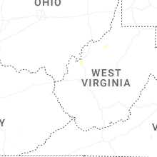


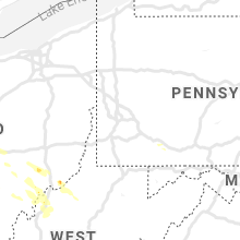


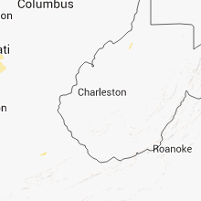


Connect with Interactive Hail Maps