

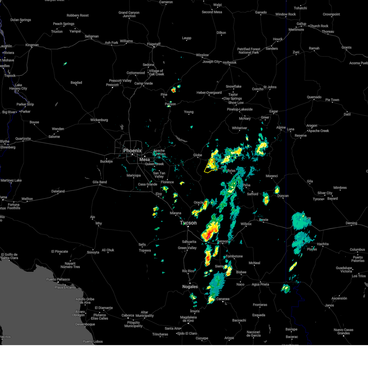
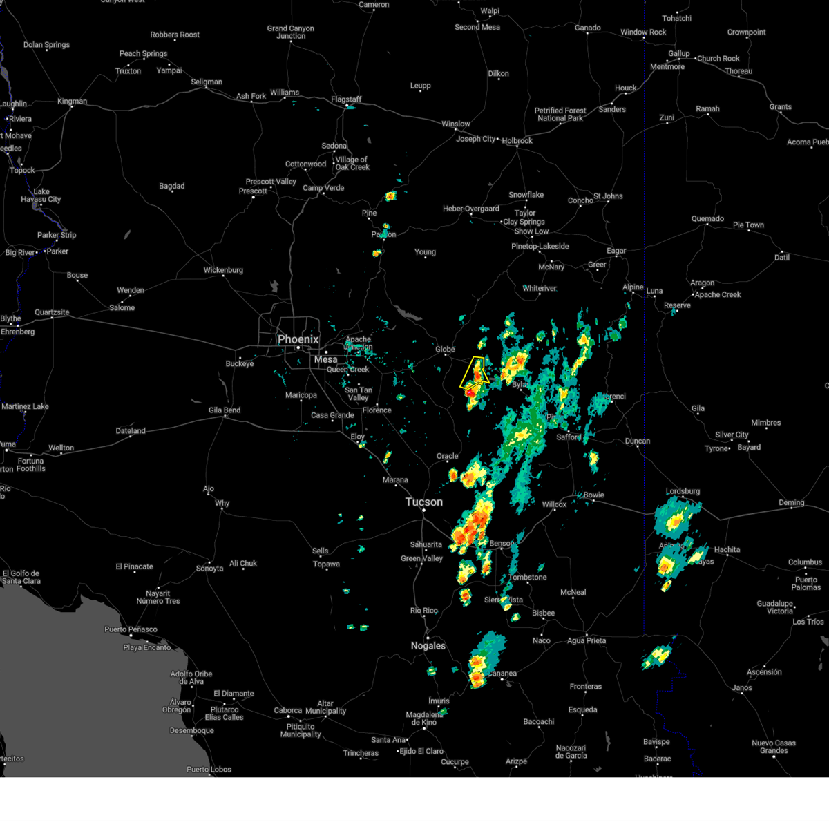
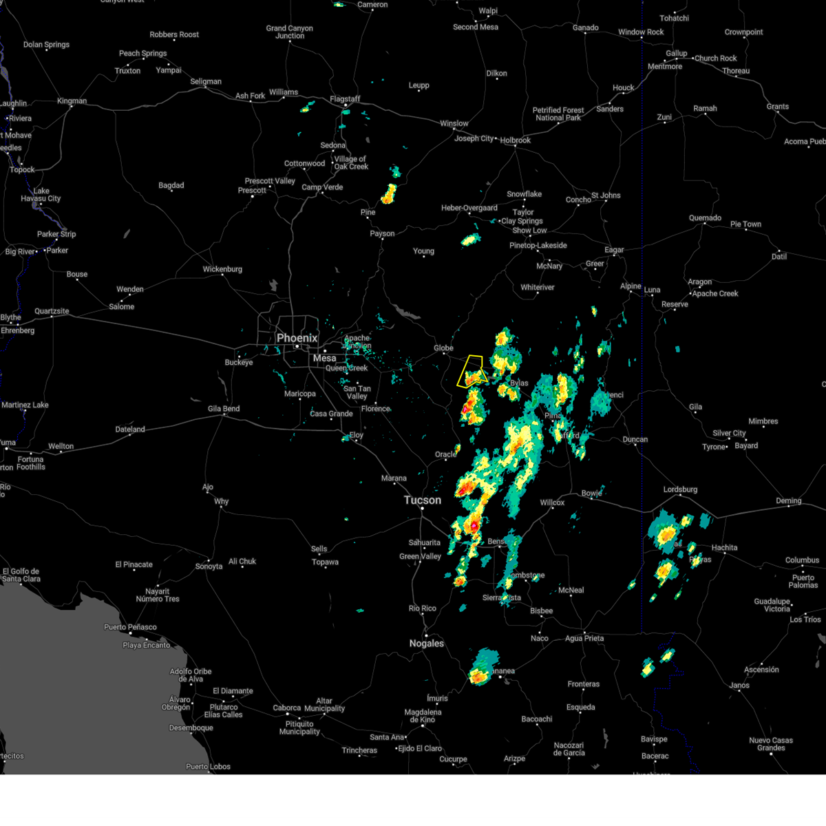
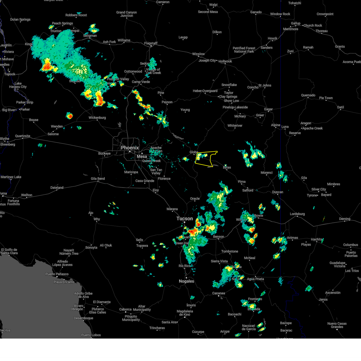
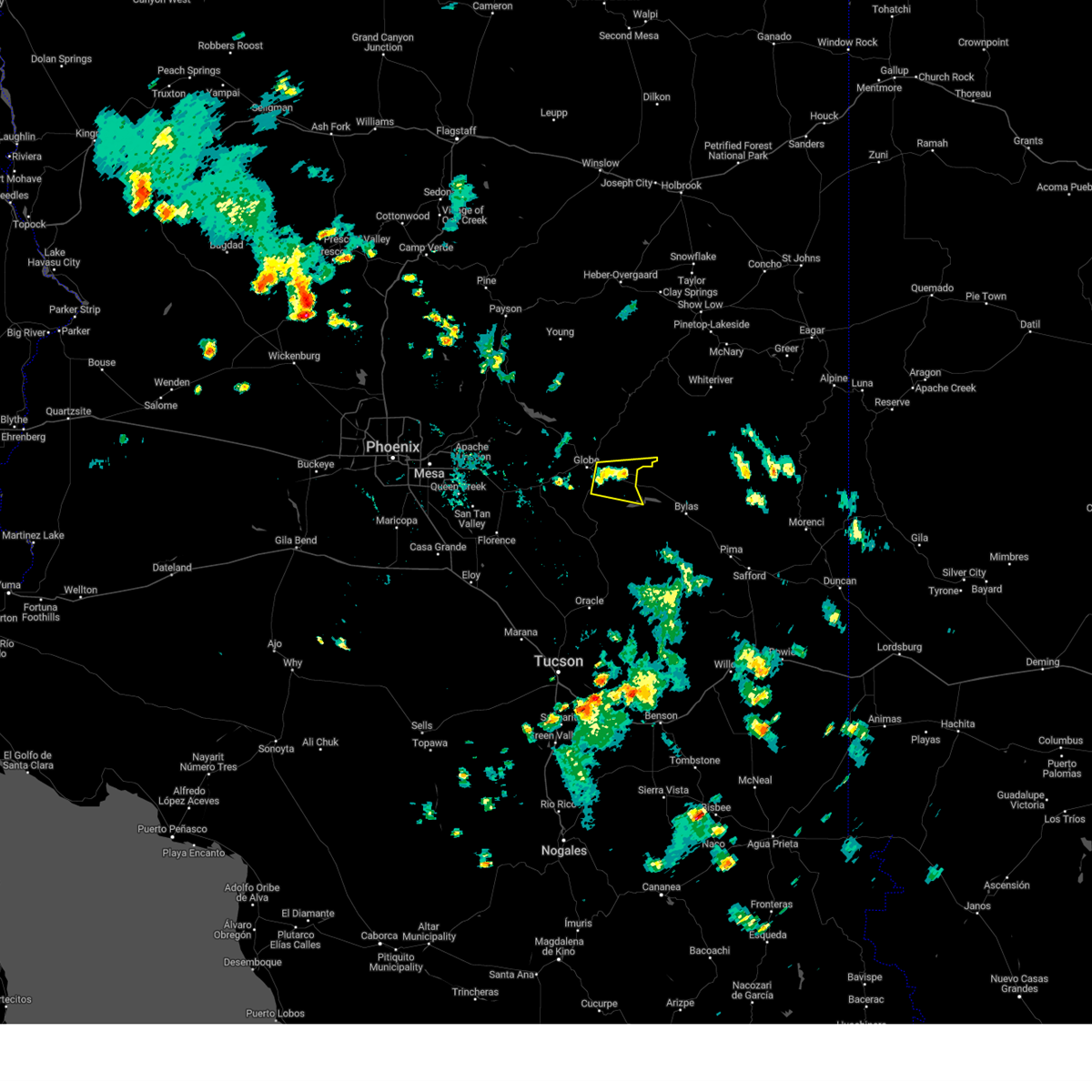
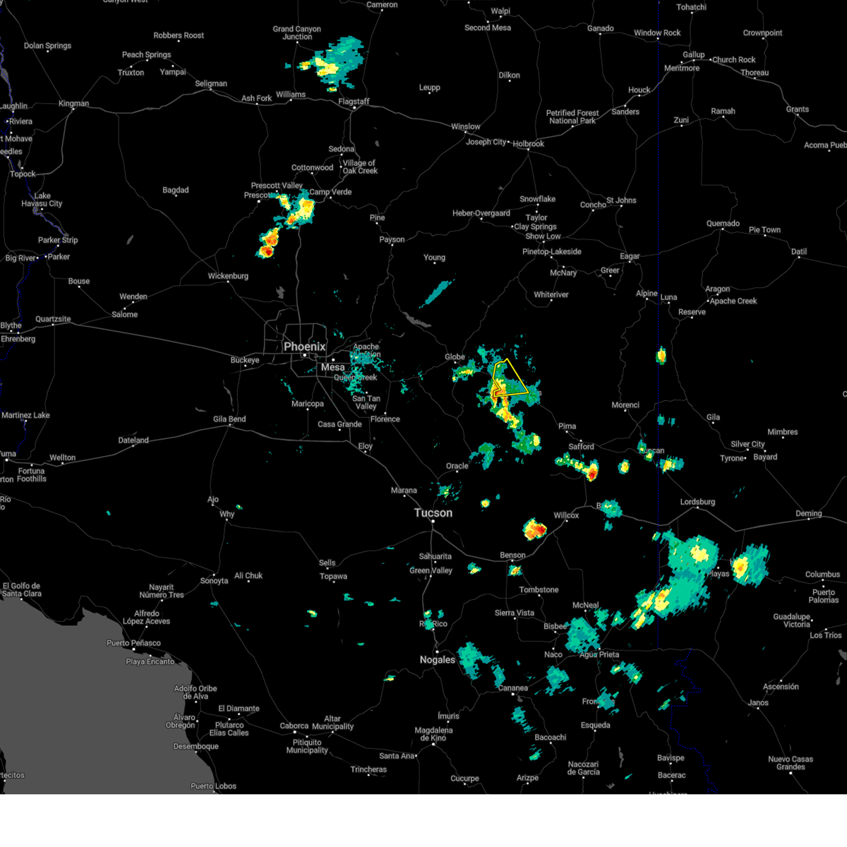
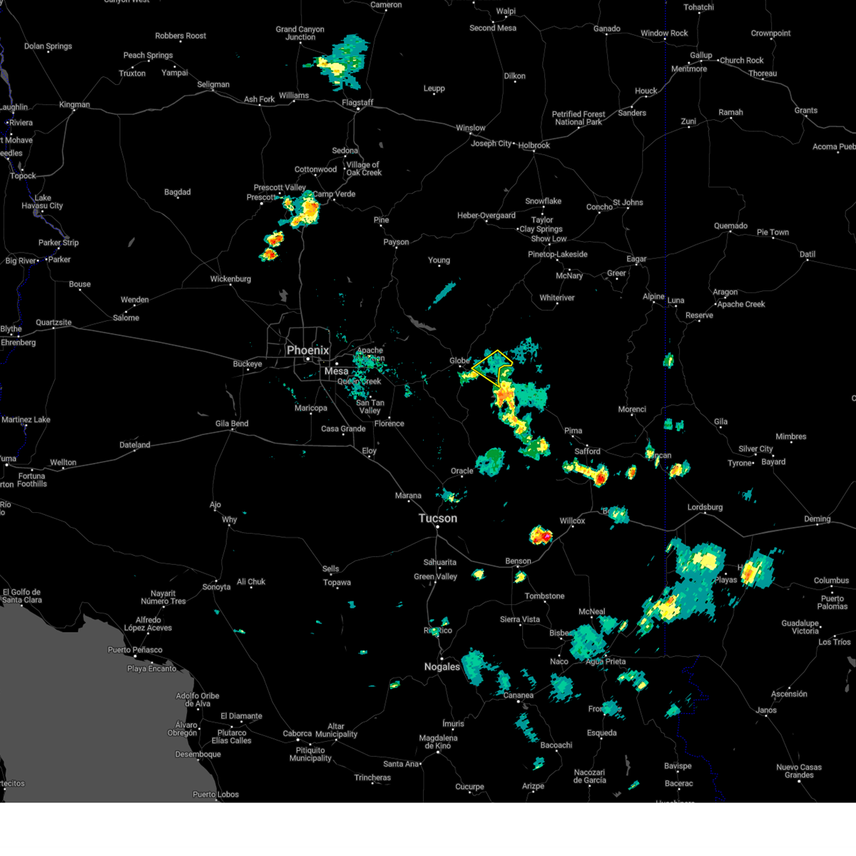
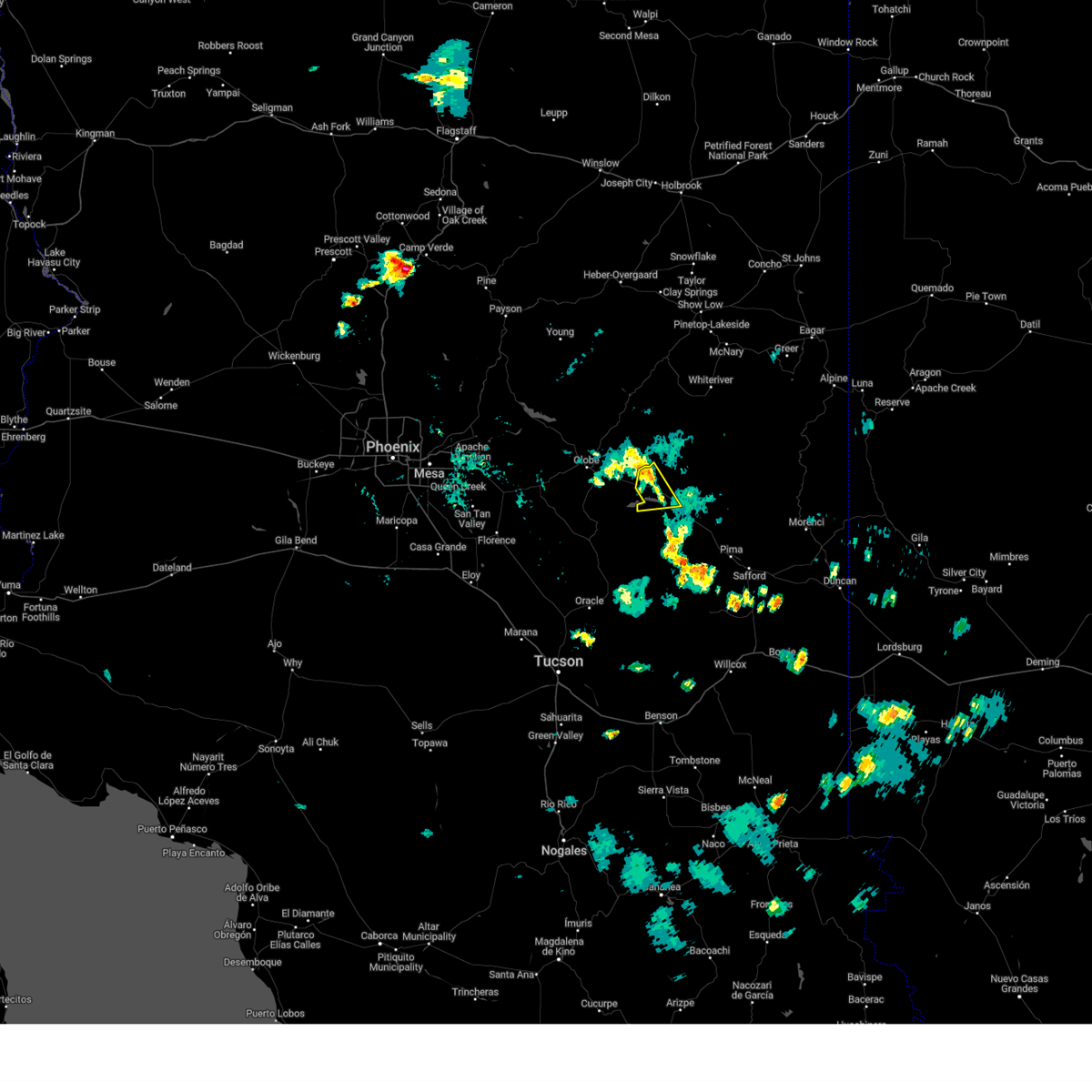
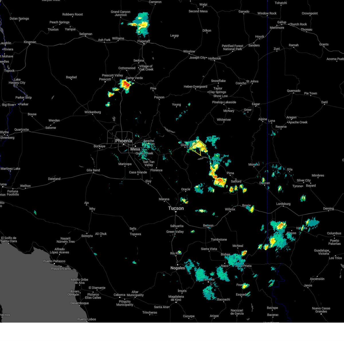
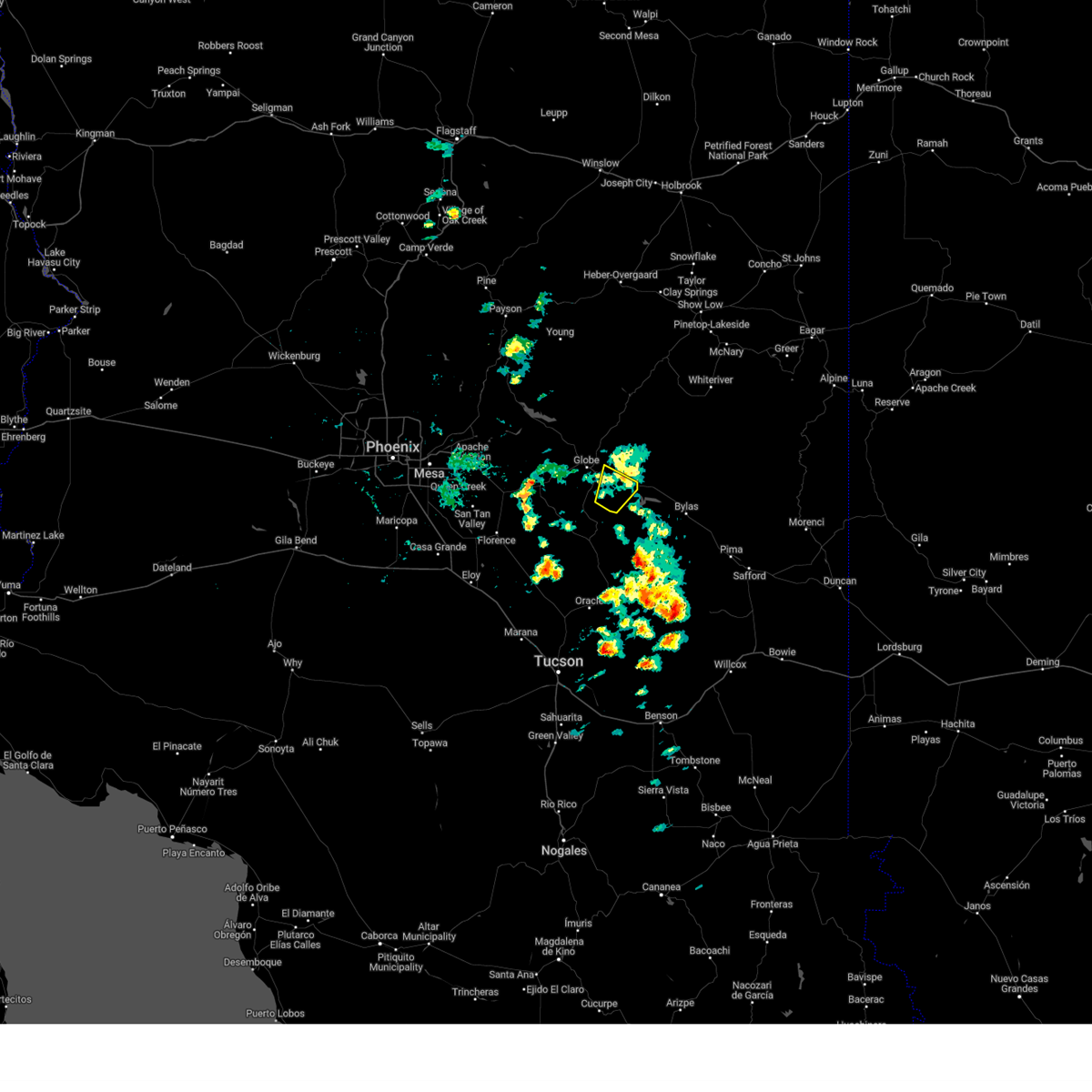
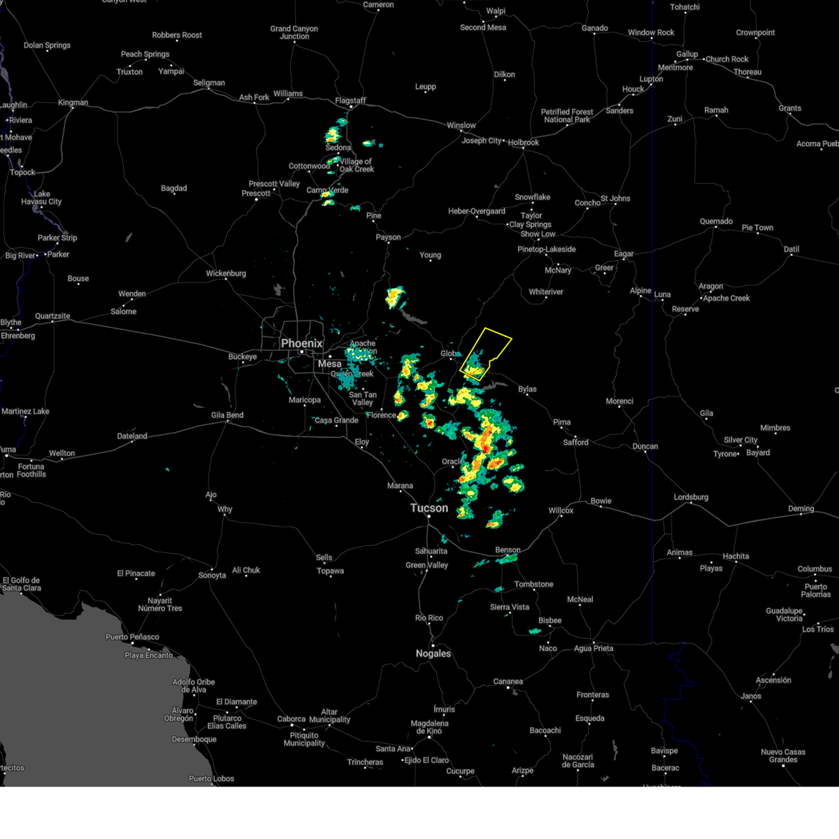
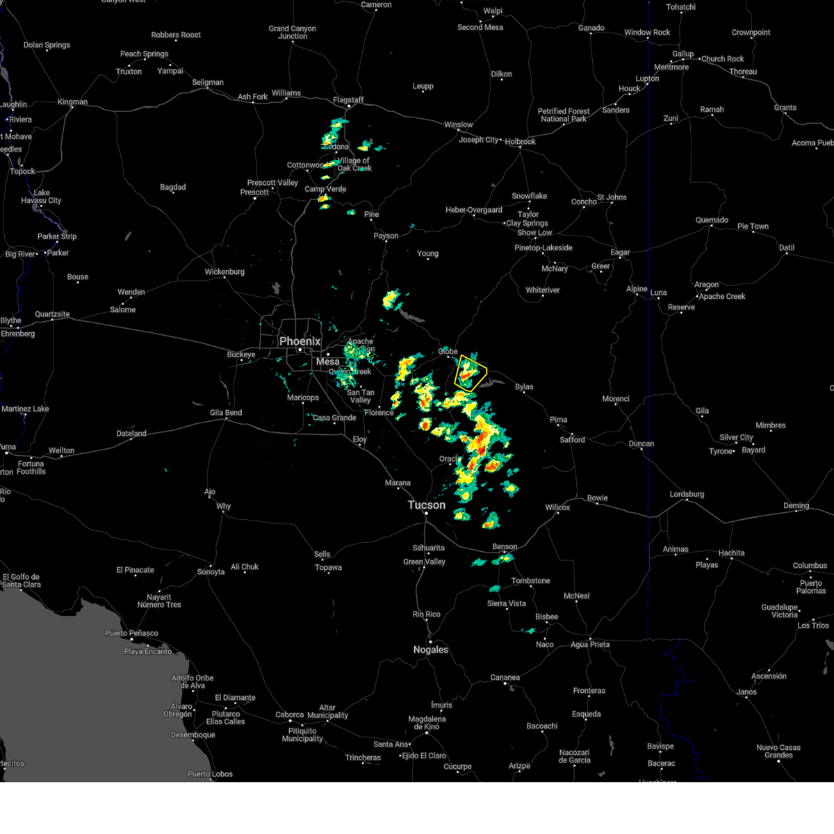
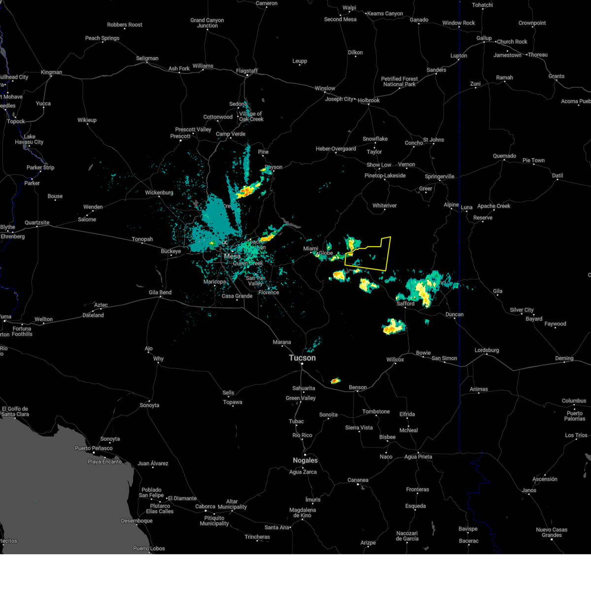
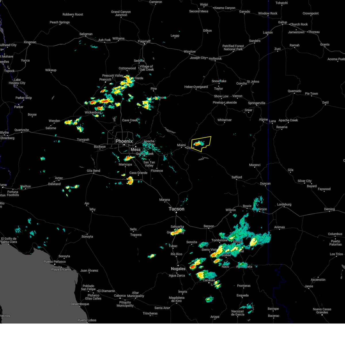
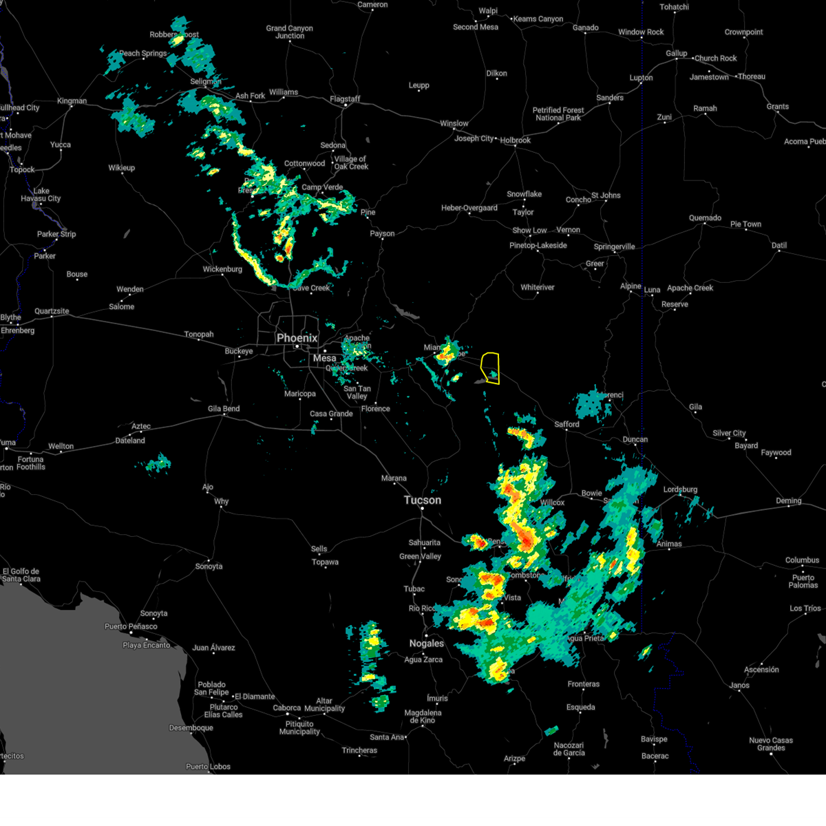
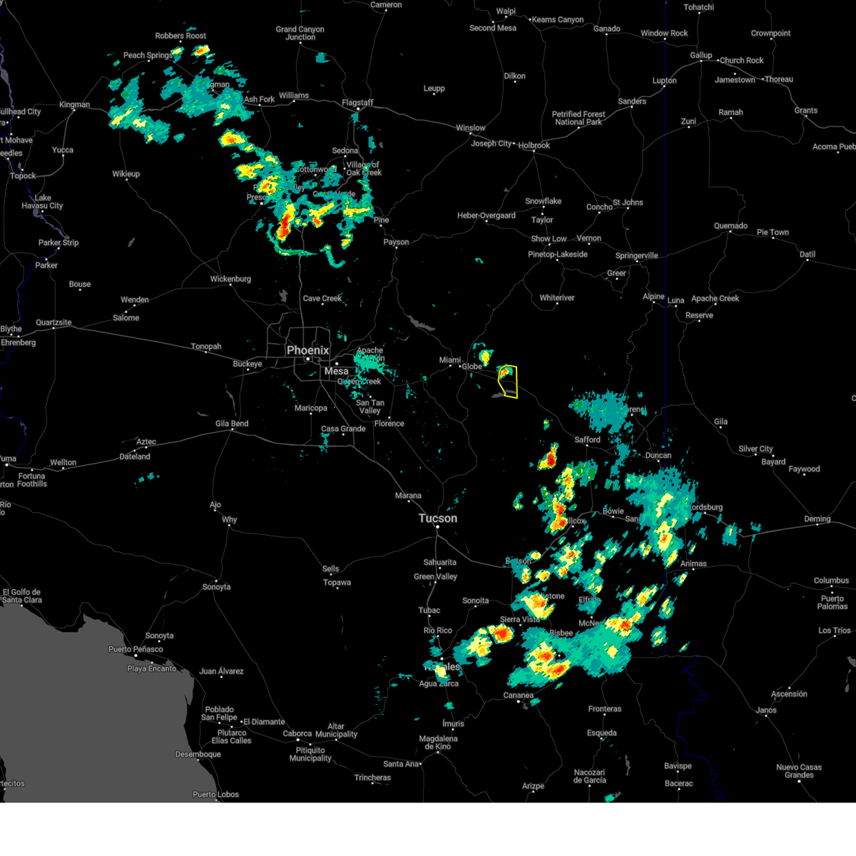
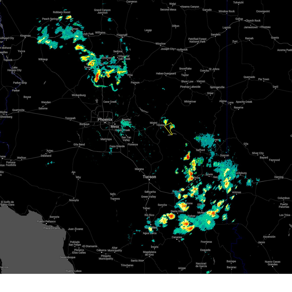
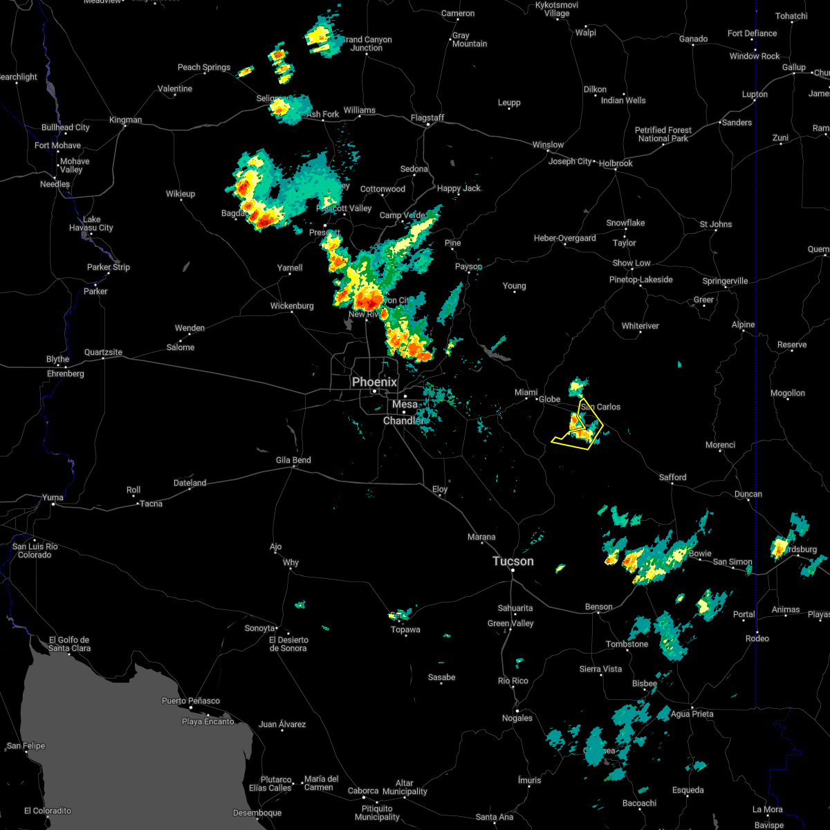
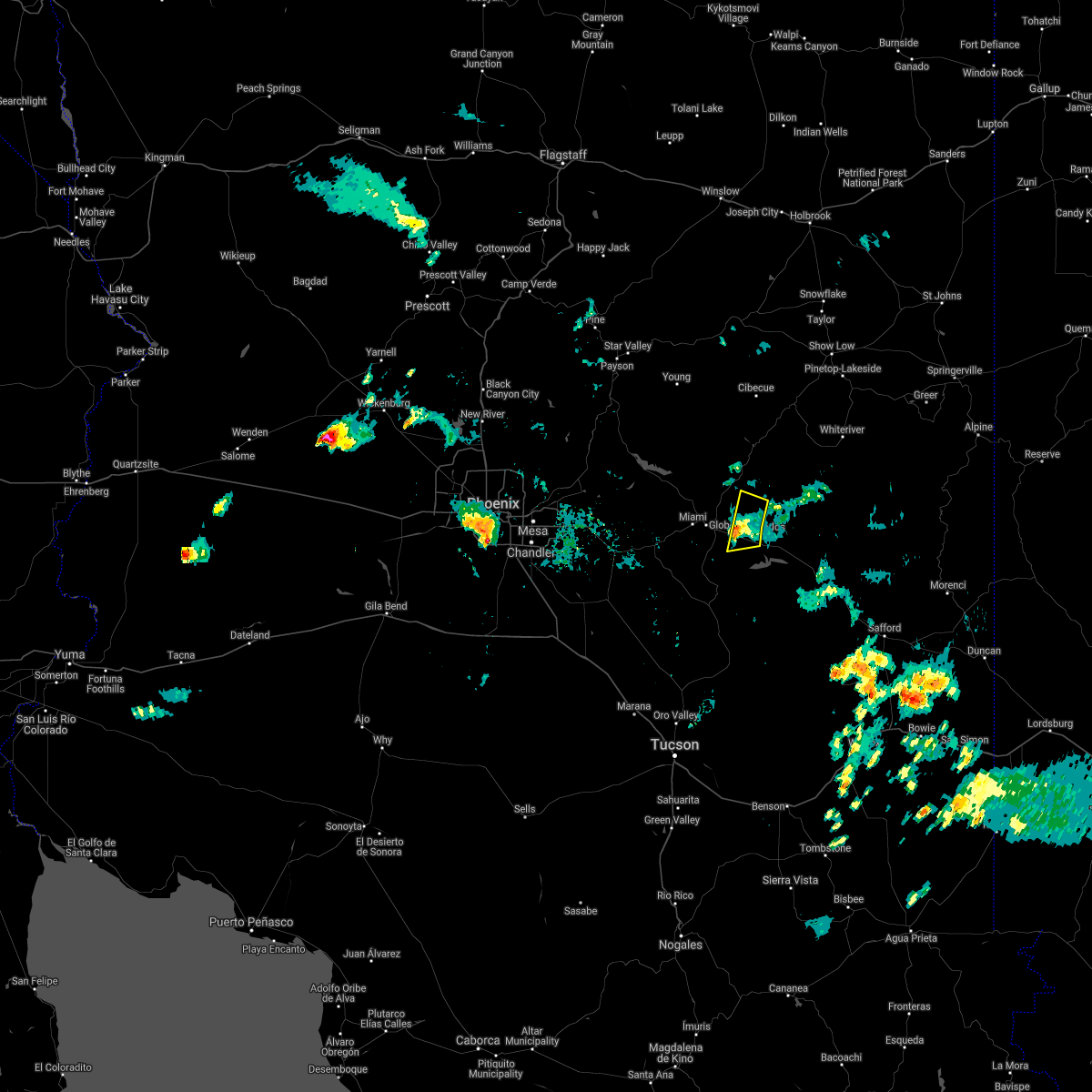
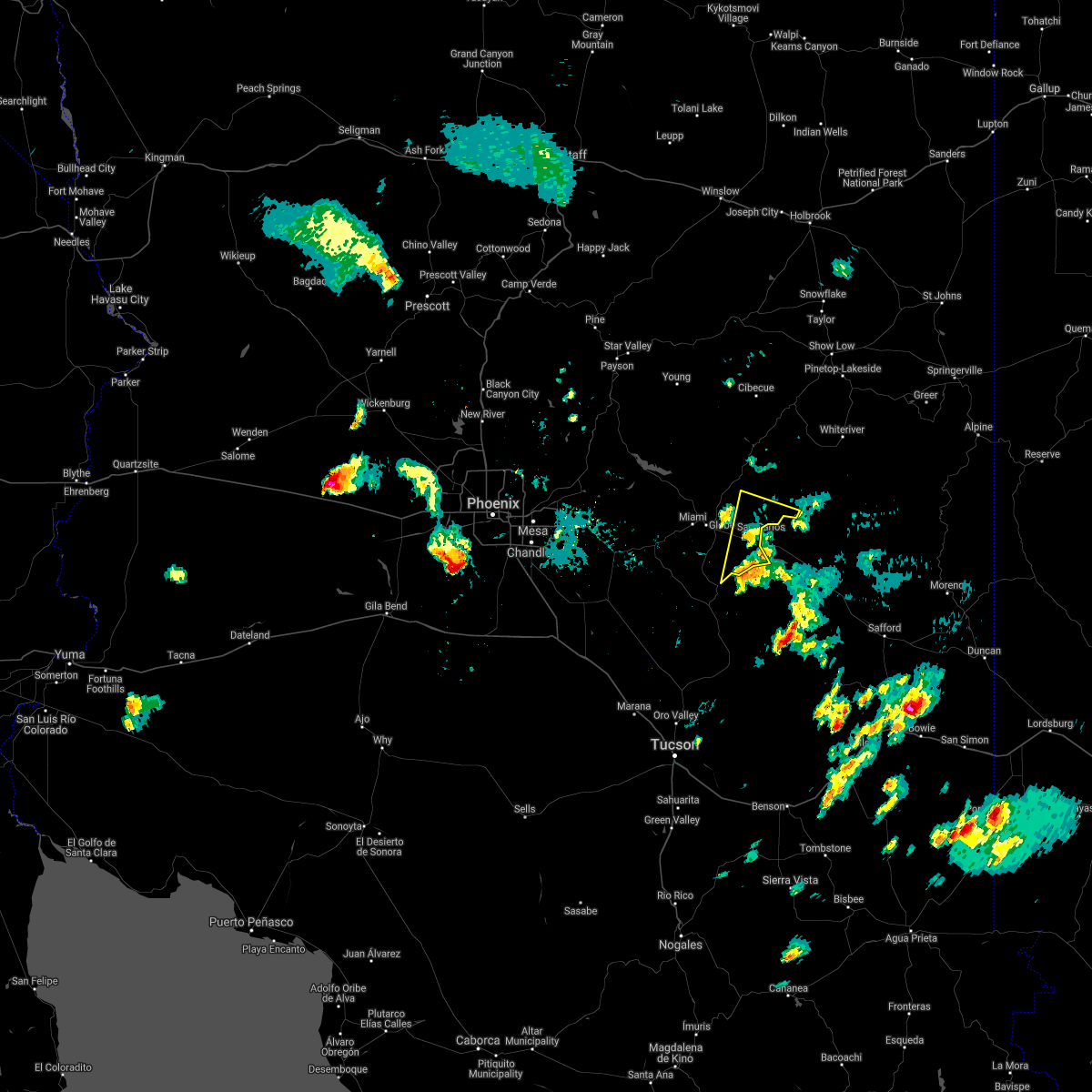
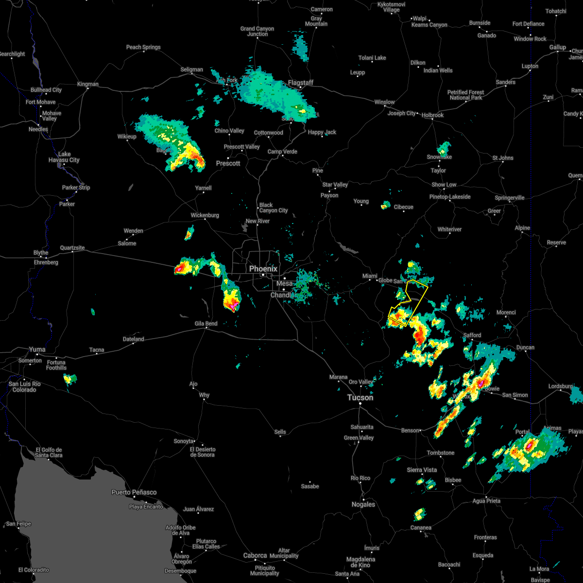
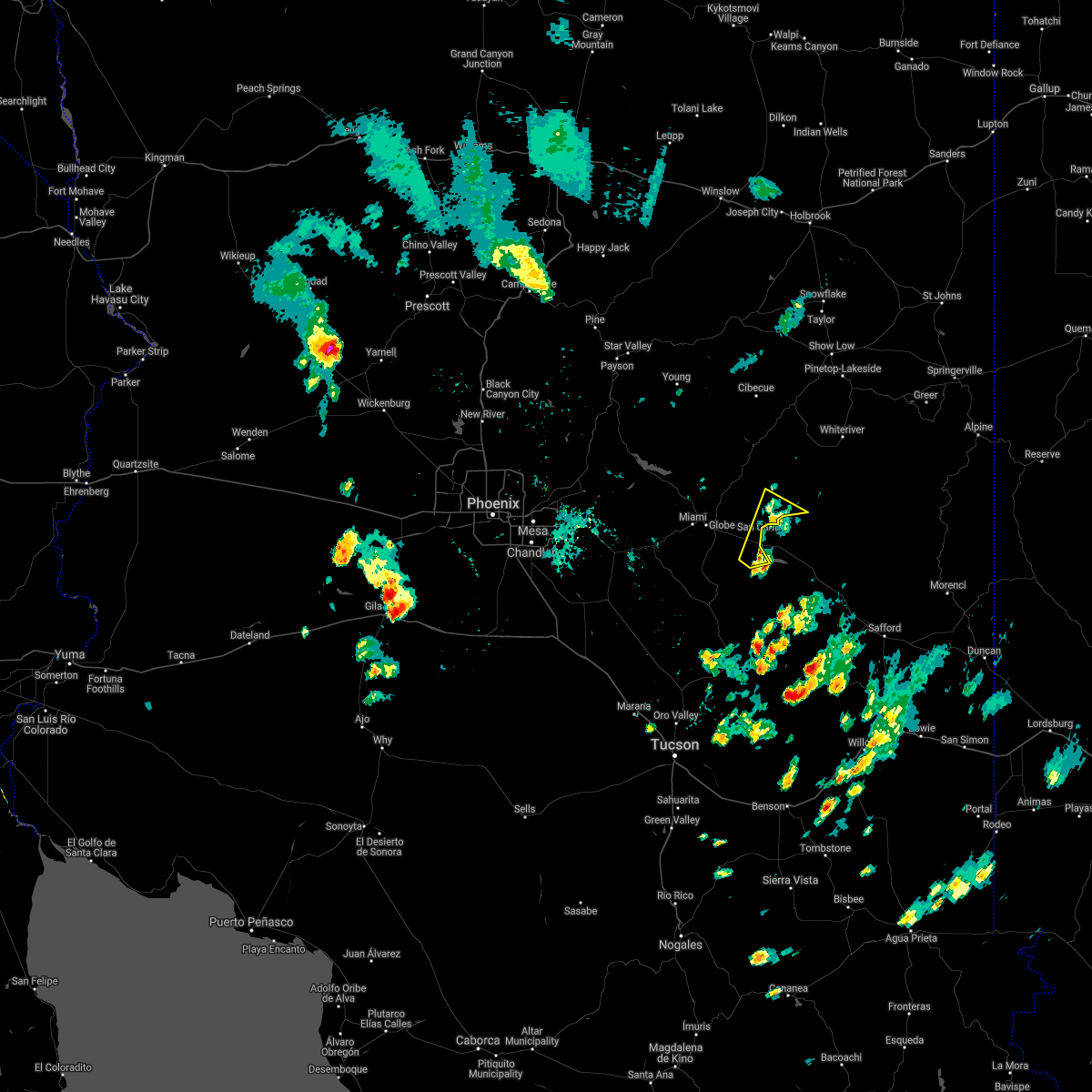
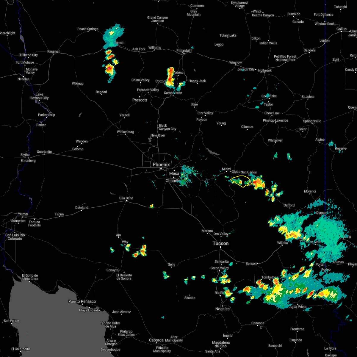
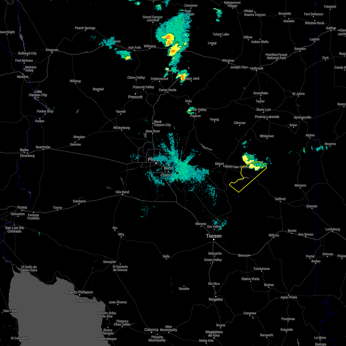
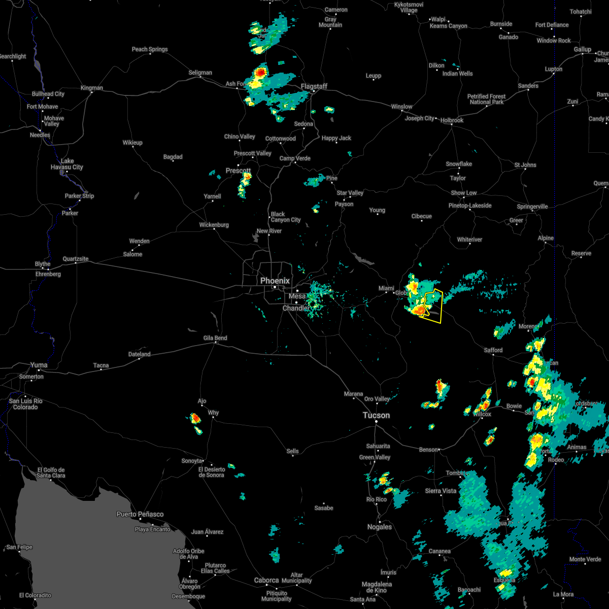
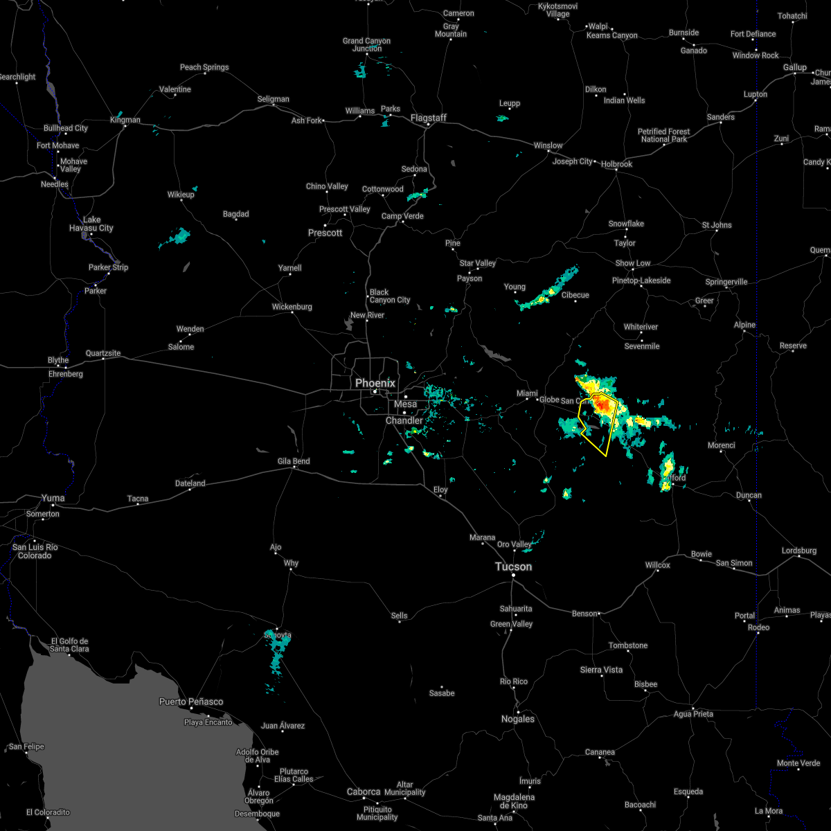
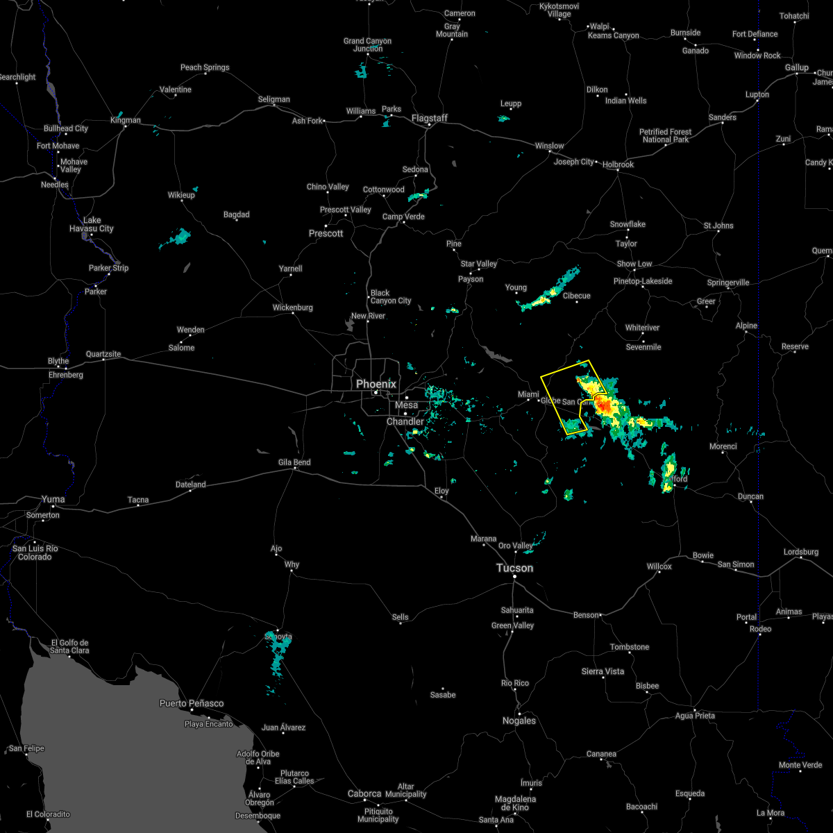
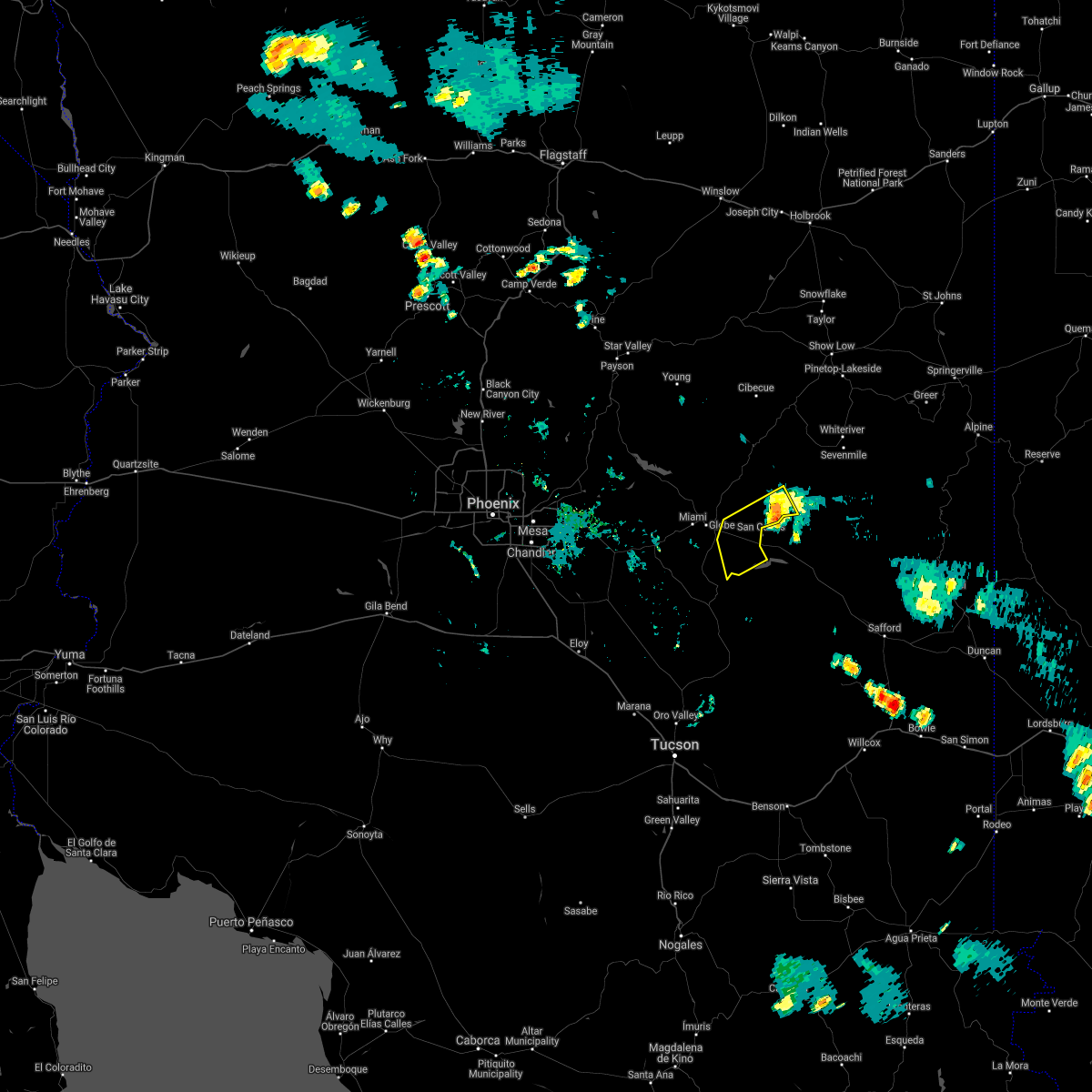
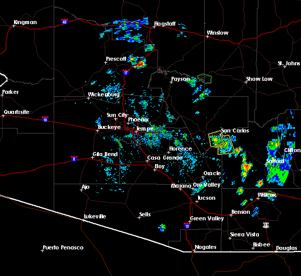
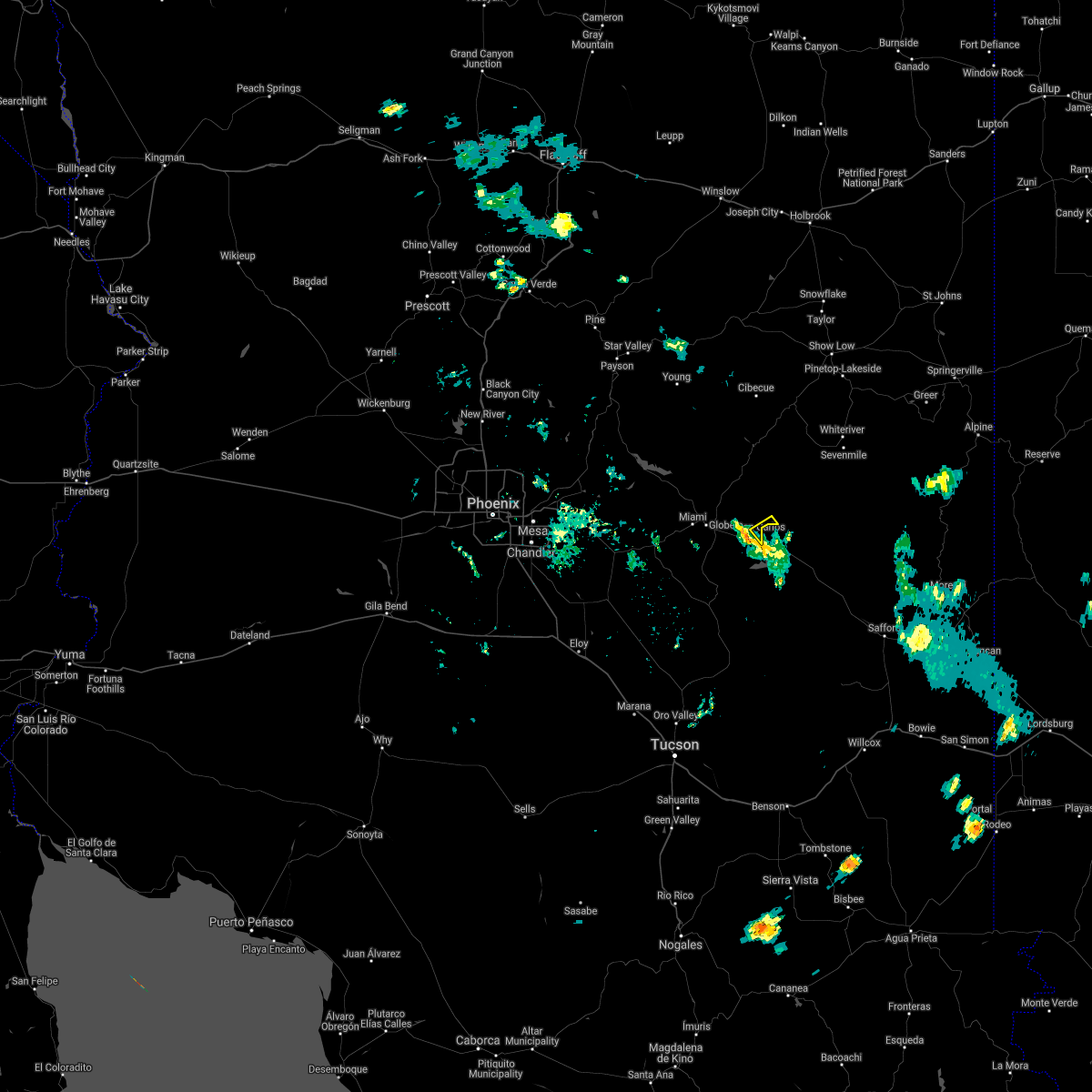
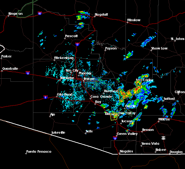
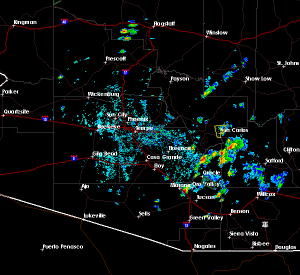
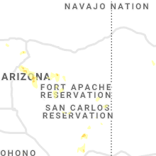
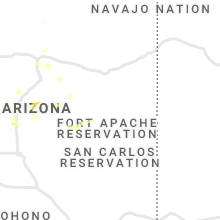
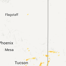
Hail Map for Peridot, AZ
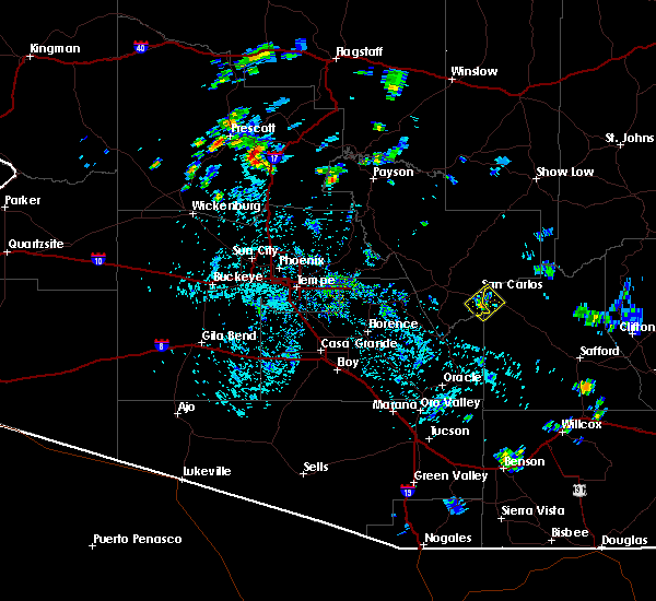
The Peridot, AZ area has had 1 report of on-the-ground hail by trained spotters, and has been under severe weather warnings 9 times during the past 12 months. Doppler radar has detected hail at or near Peridot, AZ on 34 occasions, including 4 occasions during the past year.
| Name: | Peridot, AZ |
| Where Located: | 69.5 miles SSW of Show Low, AZ |
| Map: | Google Map for Peridot, AZ |
| Population: | 1350 |
| Housing Units: | 362 |
| More Info: | Search Google for Peridot, AZ |
4
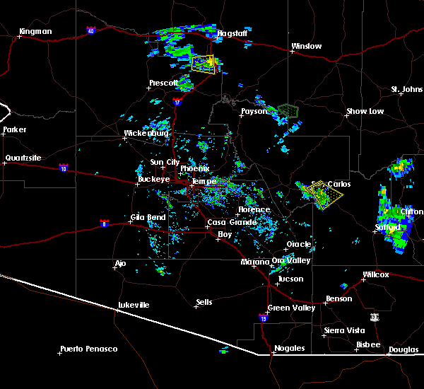
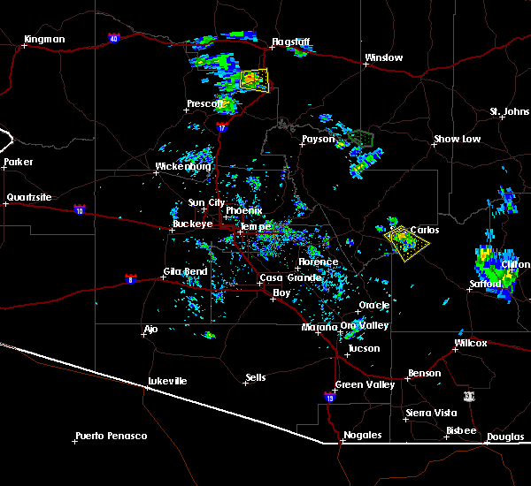
The Top Recent Hail Date for Peridot, AZ is Friday, July 26, 2024 (4th out of 34)

Hail and Wind Damage Spotted near Peridot, AZ
| Date / Time | Report Details |
|---|---|
| 8/23/2024 2:50 PM MST |
 The storm which prompted the warning has weakened below severe limits, and no longer poses an immediate threat to life or property. therefore, the warning has been allowed to expire. however, gusty winds are still possible with this thunderstorm. The storm which prompted the warning has weakened below severe limits, and no longer poses an immediate threat to life or property. therefore, the warning has been allowed to expire. however, gusty winds are still possible with this thunderstorm.
|
| 8/23/2024 2:24 PM MST |
 At 224 pm mst, a severe thunderstorm was located 7 miles south of san carlos, or 17 miles southeast of globe, moving northeast at 15 mph (radar indicated). Hazards include 60 mph wind gusts and penny size hail. Expect damage to roofs, siding, and trees. locations impacted include, san carlos and peridot. This includes az route 70 between mile markers 265 and 271. At 224 pm mst, a severe thunderstorm was located 7 miles south of san carlos, or 17 miles southeast of globe, moving northeast at 15 mph (radar indicated). Hazards include 60 mph wind gusts and penny size hail. Expect damage to roofs, siding, and trees. locations impacted include, san carlos and peridot. This includes az route 70 between mile markers 265 and 271.
|
| 8/23/2024 2:05 PM MST |
 Svrpsr the national weather service in phoenix has issued a * severe thunderstorm warning for, gila county in east central arizona, * until 245 pm mst. * at 205 pm mst, a severe thunderstorm was located 12 miles southwest of san carlos, or 13 miles northeast of christmas, moving northeast at 20 mph (radar indicated). Hazards include 60 mph wind gusts and penny size hail. expect damage to roofs, siding, and trees Svrpsr the national weather service in phoenix has issued a * severe thunderstorm warning for, gila county in east central arizona, * until 245 pm mst. * at 205 pm mst, a severe thunderstorm was located 12 miles southwest of san carlos, or 13 miles northeast of christmas, moving northeast at 20 mph (radar indicated). Hazards include 60 mph wind gusts and penny size hail. expect damage to roofs, siding, and trees
|
| 8/8/2024 4:00 PM MST |
 the severe thunderstorm warning has been cancelled and is no longer in effect the severe thunderstorm warning has been cancelled and is no longer in effect
|
| 8/8/2024 3:45 PM MST |
 Svrpsr the national weather service in phoenix has issued a * severe thunderstorm warning for, gila county in east central arizona, * until 430 pm mst. * at 345 pm mst, a severe thunderstorm was located near san carlos, or 12 miles east of globe, moving east at 5 mph (radar indicated). Hazards include 60 mph wind gusts and penny size hail. expect damage to roofs, siding, and trees Svrpsr the national weather service in phoenix has issued a * severe thunderstorm warning for, gila county in east central arizona, * until 430 pm mst. * at 345 pm mst, a severe thunderstorm was located near san carlos, or 12 miles east of globe, moving east at 5 mph (radar indicated). Hazards include 60 mph wind gusts and penny size hail. expect damage to roofs, siding, and trees
|
| 8/7/2024 4:57 PM MST |
 the severe thunderstorm warning has been cancelled and is no longer in effect the severe thunderstorm warning has been cancelled and is no longer in effect
|
| 8/7/2024 4:53 PM MST |
 the severe thunderstorm warning has been cancelled and is no longer in effect the severe thunderstorm warning has been cancelled and is no longer in effect
|
| 8/7/2024 4:29 PM MST |
 Svrtwc the national weather service in tucson has issued a * severe thunderstorm warning for, west central graham county in southeastern arizona, * until 515 pm mst. * at 429 pm mst, a severe thunderstorm was located near peridot, or 21 miles east of globe, moving south at 10 mph (radar indicated). Hazards include 60 mph wind gusts and quarter size hail. Hail damage to vehicles is expected. Expect wind damage to roofs, siding, and trees. Svrtwc the national weather service in tucson has issued a * severe thunderstorm warning for, west central graham county in southeastern arizona, * until 515 pm mst. * at 429 pm mst, a severe thunderstorm was located near peridot, or 21 miles east of globe, moving south at 10 mph (radar indicated). Hazards include 60 mph wind gusts and quarter size hail. Hail damage to vehicles is expected. Expect wind damage to roofs, siding, and trees.
|
| 8/7/2024 4:26 PM MST |
 Svrpsr the national weather service in phoenix has issued a * severe thunderstorm warning for, gila county in east central arizona, * until 515 pm mst. * at 426 pm mst, a severe thunderstorm was located near san carlos, or 18 miles east of globe, and is nearly stationary (radar indicated). Hazards include 60 mph wind gusts and nickel size hail. expect damage to roofs, siding, and trees Svrpsr the national weather service in phoenix has issued a * severe thunderstorm warning for, gila county in east central arizona, * until 515 pm mst. * at 426 pm mst, a severe thunderstorm was located near san carlos, or 18 miles east of globe, and is nearly stationary (radar indicated). Hazards include 60 mph wind gusts and nickel size hail. expect damage to roofs, siding, and trees
|
| 7/9/2024 5:27 PM MST |
 The storm which prompted the warning has moved out of the area. therefore, the warning will be allowed to expire. remember, a new severe thunderstorm warning still remains in effect for southern gila county until 6:00 pm mst!. The storm which prompted the warning has moved out of the area. therefore, the warning will be allowed to expire. remember, a new severe thunderstorm warning still remains in effect for southern gila county until 6:00 pm mst!.
|
| 7/9/2024 4:48 PM MST |
 Svrpsr the national weather service in phoenix has issued a * severe thunderstorm warning for, gila county in east central arizona, * until 530 pm mst. * at 448 pm mst, a severe thunderstorm was located 9 miles south of cutter, or 12 miles northeast of christmas, moving southeast at 10 mph (radar indicated). Hazards include 60 mph wind gusts and penny size hail. Expect damage to roofs, siding, and trees. this severe thunderstorm will remain over mainly rural areas of gila county. This includes az route 77 between mile markers 146 and 149, and between mile markers 161 and 166. Svrpsr the national weather service in phoenix has issued a * severe thunderstorm warning for, gila county in east central arizona, * until 530 pm mst. * at 448 pm mst, a severe thunderstorm was located 9 miles south of cutter, or 12 miles northeast of christmas, moving southeast at 10 mph (radar indicated). Hazards include 60 mph wind gusts and penny size hail. Expect damage to roofs, siding, and trees. this severe thunderstorm will remain over mainly rural areas of gila county. This includes az route 77 between mile markers 146 and 149, and between mile markers 161 and 166.
|
| 6/20/2024 4:18 PM MST |
 The storm which prompted the warning has moved out of the area. therefore, the warning has been allowed to expire. remember, a severe thunderstorm warning still remains in effect for portions of gila county until 430 pm mst. The storm which prompted the warning has moved out of the area. therefore, the warning has been allowed to expire. remember, a severe thunderstorm warning still remains in effect for portions of gila county until 430 pm mst.
|
| 6/20/2024 4:04 PM MST |
 Svrpsr the national weather service in phoenix has issued a * severe thunderstorm warning for, gila county in east central arizona, * until 430 pm mst. * at 404 pm mst, a severe thunderstorm was located near cutter, or 10 miles east of globe, moving northeast at 40 mph (radar indicated). Hazards include 60 mph wind gusts and penny size hail. expect damage to roofs, siding, and trees Svrpsr the national weather service in phoenix has issued a * severe thunderstorm warning for, gila county in east central arizona, * until 430 pm mst. * at 404 pm mst, a severe thunderstorm was located near cutter, or 10 miles east of globe, moving northeast at 40 mph (radar indicated). Hazards include 60 mph wind gusts and penny size hail. expect damage to roofs, siding, and trees
|
| 6/20/2024 3:51 PM MST |
 At 350 pm mst, a severe thunderstorm was located near cutter, or 10 miles southeast of globe, moving northeast at 20 mph (radar indicated). Hazards include 60 mph wind gusts and penny size hail. Expect damage to roofs, siding, and trees. locations impacted include, cutter and peridot. This includes az route 70 between mile markers 258 and 271. At 350 pm mst, a severe thunderstorm was located near cutter, or 10 miles southeast of globe, moving northeast at 20 mph (radar indicated). Hazards include 60 mph wind gusts and penny size hail. Expect damage to roofs, siding, and trees. locations impacted include, cutter and peridot. This includes az route 70 between mile markers 258 and 271.
|
| 6/20/2024 3:29 PM MST |
 Svrpsr the national weather service in phoenix has issued a * severe thunderstorm warning for, gila county in east central arizona, * until 415 pm mst. * at 328 pm mst, a severe thunderstorm was located 7 miles north of christmas, moving northeast at 20 mph (radar indicated). Hazards include 60 mph wind gusts and penny size hail. expect damage to roofs, siding, and trees Svrpsr the national weather service in phoenix has issued a * severe thunderstorm warning for, gila county in east central arizona, * until 415 pm mst. * at 328 pm mst, a severe thunderstorm was located 7 miles north of christmas, moving northeast at 20 mph (radar indicated). Hazards include 60 mph wind gusts and penny size hail. expect damage to roofs, siding, and trees
|
| 9/13/2023 7:24 AM MST |
 The severe thunderstorm warning for gila county will expire at 730 am mst, the storm which prompted the warning has weakened below severe limits, and no longer poses an immediate threat to life or property. therefore, the warning will be allowed to expire. however gusty winds and heavy rain are still possible with this thunderstorm. The severe thunderstorm warning for gila county will expire at 730 am mst, the storm which prompted the warning has weakened below severe limits, and no longer poses an immediate threat to life or property. therefore, the warning will be allowed to expire. however gusty winds and heavy rain are still possible with this thunderstorm.
|
| 9/13/2023 6:45 AM MST |
 At 645 am mst, a severe thunderstorm was located over miami, or near globe, moving east at 25 mph (radar indicated). Hazards include 60 mph wind gusts and penny size hail. expect damage to roofs, siding, and trees At 645 am mst, a severe thunderstorm was located over miami, or near globe, moving east at 25 mph (radar indicated). Hazards include 60 mph wind gusts and penny size hail. expect damage to roofs, siding, and trees
|
| 9/13/2023 1:41 AM MST |
 The severe thunderstorm warning for gila county will expire at 145 am mst, the storms which prompted the warning have moved out of the area. therefore, the warning will be allowed to expire. however gusty winds are still possible with these thunderstorms. The severe thunderstorm warning for gila county will expire at 145 am mst, the storms which prompted the warning have moved out of the area. therefore, the warning will be allowed to expire. however gusty winds are still possible with these thunderstorms.
|
| 9/13/2023 1:38 AM MST |
 At 138 am mst, a severe thunderstorm was located near san carlos, or 26 miles east of globe, moving east at 35 mph (radar indicated). Hazards include 60 mph wind gusts. Expect damage to roofs, siding, and trees. this severe thunderstorm will remain over mainly remote areas of northwestern graham county near san carlos and peridot. hail threat, radar indicated max hail size, <. 75 in wind threat, radar indicated max wind gust, 60 mph. At 138 am mst, a severe thunderstorm was located near san carlos, or 26 miles east of globe, moving east at 35 mph (radar indicated). Hazards include 60 mph wind gusts. Expect damage to roofs, siding, and trees. this severe thunderstorm will remain over mainly remote areas of northwestern graham county near san carlos and peridot. hail threat, radar indicated max hail size, <. 75 in wind threat, radar indicated max wind gust, 60 mph.
|
| 9/13/2023 1:21 AM MST |
 At 121 am mst, severe thunderstorms were located along a line extending from 8 miles southwest of hilltop to 8 miles northwest of san carlos to near cutter, moving southeast at 35 mph (radar indicated). Hazards include 60 mph wind gusts and penny size hail. Expect damage to roofs, siding, and trees. locations impacted include, globe, san carlos, cutter, central heights-midland city, hilltop, claypool, and sawmill. this includes the following highways, us highway 60 between mile markers 246 and 279. az route 70 between mile markers 253 and 269. az route 77 between mile markers 164 and 170. hail threat, radar indicated max hail size, 0. 75 in wind threat, radar indicated max wind gust, 60 mph. At 121 am mst, severe thunderstorms were located along a line extending from 8 miles southwest of hilltop to 8 miles northwest of san carlos to near cutter, moving southeast at 35 mph (radar indicated). Hazards include 60 mph wind gusts and penny size hail. Expect damage to roofs, siding, and trees. locations impacted include, globe, san carlos, cutter, central heights-midland city, hilltop, claypool, and sawmill. this includes the following highways, us highway 60 between mile markers 246 and 279. az route 70 between mile markers 253 and 269. az route 77 between mile markers 164 and 170. hail threat, radar indicated max hail size, 0. 75 in wind threat, radar indicated max wind gust, 60 mph.
|
| 9/13/2023 12:59 AM MST |
 At 1258 am mst, severe thunderstorms were located along a line extending from 15 miles north of globe to 7 miles north of central heights-midland city to claypool, moving southeast at 35 mph (radar indicated). Hazards include 60 mph wind gusts and penny size hail. expect damage to roofs, siding, and trees At 1258 am mst, severe thunderstorms were located along a line extending from 15 miles north of globe to 7 miles north of central heights-midland city to claypool, moving southeast at 35 mph (radar indicated). Hazards include 60 mph wind gusts and penny size hail. expect damage to roofs, siding, and trees
|
| 9/12/2023 3:10 PM MST |
 At 309 pm mst, a severe thunderstorm was located 8 miles northeast of cutter, or 11 miles northeast of globe, moving east at 15 mph (radar indicated). Hazards include 60 mph wind gusts and quarter size hail. Hail damage to vehicles is expected. Expect wind damage to roofs, siding, and trees. At 309 pm mst, a severe thunderstorm was located 8 miles northeast of cutter, or 11 miles northeast of globe, moving east at 15 mph (radar indicated). Hazards include 60 mph wind gusts and quarter size hail. Hail damage to vehicles is expected. Expect wind damage to roofs, siding, and trees.
|
| 7/21/2023 5:43 PM MST |
 The severe thunderstorm warning for west central graham county will expire at 545 pm mst, the storm which prompted the warning has weakened below severe limits, and no longer poses an immediate threat to life or property. therefore, the warning will be allowed to expire. The severe thunderstorm warning for west central graham county will expire at 545 pm mst, the storm which prompted the warning has weakened below severe limits, and no longer poses an immediate threat to life or property. therefore, the warning will be allowed to expire.
|
| 7/21/2023 5:00 PM MST |
 At 459 pm mst, a severe thunderstorm was located over san carlos, or 19 miles east of globe, and is nearly stationary (radar indicated). Hazards include 60 mph wind gusts and quarter size hail. Hail damage to vehicles is expected. Expect wind damage to roofs, siding, and trees. At 459 pm mst, a severe thunderstorm was located over san carlos, or 19 miles east of globe, and is nearly stationary (radar indicated). Hazards include 60 mph wind gusts and quarter size hail. Hail damage to vehicles is expected. Expect wind damage to roofs, siding, and trees.
|
| 7/21/2023 4:59 PM MST |
 At 458 pm mst, a severe thunderstorm was located over san carlos, or 17 miles east of globe, moving southwest at 10 mph (radar indicated). Hazards include 60 mph wind gusts. expect damage to roofs, siding, and trees At 458 pm mst, a severe thunderstorm was located over san carlos, or 17 miles east of globe, moving southwest at 10 mph (radar indicated). Hazards include 60 mph wind gusts. expect damage to roofs, siding, and trees
|
| 7/17/2023 7:22 PM MST |
 The severe thunderstorm warning for northwestern graham and eastern pinal counties will expire at 730 pm mst, the storm which prompted the warning has weakened below severe limits, and has exited the warned area. therefore, the warning will be allowed to expire. The severe thunderstorm warning for northwestern graham and eastern pinal counties will expire at 730 pm mst, the storm which prompted the warning has weakened below severe limits, and has exited the warned area. therefore, the warning will be allowed to expire.
|
| 7/17/2023 6:43 PM MST |
 At 643 pm mst, a severe thunderstorm was located 11 miles south of san carlos, or 21 miles northeast of christmas, moving northeast at 10 mph (radar indicated). Hazards include 60 mph wind gusts and quarter size hail. Hail damage to vehicles is expected. Expect wind damage to roofs, siding, and trees. At 643 pm mst, a severe thunderstorm was located 11 miles south of san carlos, or 21 miles northeast of christmas, moving northeast at 10 mph (radar indicated). Hazards include 60 mph wind gusts and quarter size hail. Hail damage to vehicles is expected. Expect wind damage to roofs, siding, and trees.
|
| 8/22/2022 5:08 PM MST | The severe thunderstorm warning for gila county will expire at 515 pm mst, the storm which prompted the warning across southern gila county has weakened below severe limits, and has exited the warned area. therefore, the warning will be allowed to expire. |
| 8/22/2022 4:05 PM MST | At 405 pm mst, a severe thunderstorm was located over cutter, or 9 miles east of globe, moving south at 15 mph (radar indicated). Hazards include 60 mph wind gusts and quarter size hail. Hail damage to vehicles is expected. Expect wind damage to roofs, siding, and trees. |
| 8/21/2022 6:22 PM MST | The severe thunderstorm warning for northwestern graham and eastern pinal counties will expire at 630 pm mst, the storm which prompted the warning has weakened below severe limits. therefore, the warning will be allowed to expire. however heavy rain is still possible with this thunderstorm. |
| 8/21/2022 5:50 PM MST |
 At 549 pm mst, a severe thunderstorm was located 7 miles south of san carlos, or 18 miles northeast of christmas, and is nearly stationary (radar indicated). Hazards include 60 mph wind gusts and quarter size hail. Hail damage to vehicles is expected. expect wind damage to roofs, siding, and trees. locations impacted include, san carlos and cutter. this includes az route 70 between mile markers 258 and 271. hail threat, radar indicated max hail size, 1. 00 in wind threat, radar indicated max wind gust, 60 mph. At 549 pm mst, a severe thunderstorm was located 7 miles south of san carlos, or 18 miles northeast of christmas, and is nearly stationary (radar indicated). Hazards include 60 mph wind gusts and quarter size hail. Hail damage to vehicles is expected. expect wind damage to roofs, siding, and trees. locations impacted include, san carlos and cutter. this includes az route 70 between mile markers 258 and 271. hail threat, radar indicated max hail size, 1. 00 in wind threat, radar indicated max wind gust, 60 mph.
|
| 8/21/2022 5:40 PM MST |
 At 540 pm mst, a severe thunderstorm was located near san carlos, or 18 miles southeast of globe, and is nearly stationary (radar indicated). Hazards include 60 mph wind gusts and quarter size hail. Hail damage to vehicles is expected. Expect wind damage to roofs, siding, and trees. At 540 pm mst, a severe thunderstorm was located near san carlos, or 18 miles southeast of globe, and is nearly stationary (radar indicated). Hazards include 60 mph wind gusts and quarter size hail. Hail damage to vehicles is expected. Expect wind damage to roofs, siding, and trees.
|
| 8/21/2022 5:34 PM MST |
 At 534 pm mst, a severe thunderstorm was located near san carlos, or 19 miles southeast of globe, and is nearly stationary (radar indicated). Hazards include 60 mph wind gusts and quarter size hail. Hail damage to vehicles is expected. Expect wind damage to roofs, siding, and trees. At 534 pm mst, a severe thunderstorm was located near san carlos, or 19 miles southeast of globe, and is nearly stationary (radar indicated). Hazards include 60 mph wind gusts and quarter size hail. Hail damage to vehicles is expected. Expect wind damage to roofs, siding, and trees.
|
| 8/13/2022 6:10 PM MST |
 The severe thunderstorm warning for northwestern graham county will expire at 615 pm mst, the storm which prompted the warning has weakened below severe limits. therefore, the warning will be allowed to expire. however heavy rain is still expected with this thunderstorm, and a flood advisory remains in effect until 8:30 pm mst. The severe thunderstorm warning for northwestern graham county will expire at 615 pm mst, the storm which prompted the warning has weakened below severe limits. therefore, the warning will be allowed to expire. however heavy rain is still expected with this thunderstorm, and a flood advisory remains in effect until 8:30 pm mst.
|
| 8/13/2022 5:35 PM MST |
 At 535 pm mst, a severe thunderstorm was located 10 miles east of san carlos, or 27 miles east of globe, moving northwest at 10 mph (radar indicated). Hazards include 60 mph wind gusts and penny size hail. Expect damage to roofs, siding, and trees. this severe thunderstorm will remain over mainly remote areas of northwestern graham county. hail threat, radar indicated max hail size, 0. 75 in wind threat, radar indicated max wind gust, 60 mph. At 535 pm mst, a severe thunderstorm was located 10 miles east of san carlos, or 27 miles east of globe, moving northwest at 10 mph (radar indicated). Hazards include 60 mph wind gusts and penny size hail. Expect damage to roofs, siding, and trees. this severe thunderstorm will remain over mainly remote areas of northwestern graham county. hail threat, radar indicated max hail size, 0. 75 in wind threat, radar indicated max wind gust, 60 mph.
|
| 8/12/2022 2:50 PM MST |
 At 250 pm mst, a severe thunderstorm was located 12 miles west of hilltop, or 14 miles northeast of globe, moving northwest at 5 mph (radar indicated). Hazards include 60 mph wind gusts and nickel size hail. expect damage to roofs, siding, and trees At 250 pm mst, a severe thunderstorm was located 12 miles west of hilltop, or 14 miles northeast of globe, moving northwest at 5 mph (radar indicated). Hazards include 60 mph wind gusts and nickel size hail. expect damage to roofs, siding, and trees
|
| 10/5/2021 5:53 PM MST |
 At 553 pm mst, a severe thunderstorm was located over cutter, or 10 miles east of globe, moving north at 25 mph (radar indicated). Hazards include ping pong ball size hail and 60 mph wind gusts. People and animals outdoors will be injured. expect hail damage to roofs, siding, windows, and vehicles. expect wind damage to roofs, siding, and trees. locations impacted include, san carlos. this includes az route 70 between mile markers 261 and 271. hail threat, radar indicated max hail size, 1. 50 in wind threat, radar indicated max wind gust, 60 mph. At 553 pm mst, a severe thunderstorm was located over cutter, or 10 miles east of globe, moving north at 25 mph (radar indicated). Hazards include ping pong ball size hail and 60 mph wind gusts. People and animals outdoors will be injured. expect hail damage to roofs, siding, windows, and vehicles. expect wind damage to roofs, siding, and trees. locations impacted include, san carlos. this includes az route 70 between mile markers 261 and 271. hail threat, radar indicated max hail size, 1. 50 in wind threat, radar indicated max wind gust, 60 mph.
|
| 10/5/2021 5:24 PM MST |
 At 524 pm mst, a severe thunderstorm was located 13 miles south of san carlos, or 13 miles northeast of christmas, moving north at 25 mph (radar indicated). Hazards include 60 mph wind gusts and quarter size hail. Hail damage to vehicles is expected. Expect wind damage to roofs, siding, and trees. At 524 pm mst, a severe thunderstorm was located 13 miles south of san carlos, or 13 miles northeast of christmas, moving north at 25 mph (radar indicated). Hazards include 60 mph wind gusts and quarter size hail. Hail damage to vehicles is expected. Expect wind damage to roofs, siding, and trees.
|
| 10/5/2021 5:06 PM MST |
 At 505 pm mst, a severe thunderstorm was located 9 miles north of aravaipa canyon wilderness, or 10 miles east of christmas, moving northeast at 15 mph (radar indicated). Hazards include 60 mph wind gusts and quarter size hail. Hail damage to vehicles is expected. Expect wind damage to roofs, siding, and trees. At 505 pm mst, a severe thunderstorm was located 9 miles north of aravaipa canyon wilderness, or 10 miles east of christmas, moving northeast at 15 mph (radar indicated). Hazards include 60 mph wind gusts and quarter size hail. Hail damage to vehicles is expected. Expect wind damage to roofs, siding, and trees.
|
| 10/5/2021 4:34 PM MST |
 At 434 pm mst, a severe thunderstorm was located near san carlos, or 21 miles northeast of christmas, moving northeast at 20 mph (radar indicated). Hazards include 60 mph wind gusts and quarter size hail. Hail damage to vehicles is expected. Expect wind damage to roofs, siding, and trees. At 434 pm mst, a severe thunderstorm was located near san carlos, or 21 miles northeast of christmas, moving northeast at 20 mph (radar indicated). Hazards include 60 mph wind gusts and quarter size hail. Hail damage to vehicles is expected. Expect wind damage to roofs, siding, and trees.
|
| 10/5/2021 4:18 PM MST |
 At 417 pm mst, a severe thunderstorm was located near and 8 miles southeast of san carlos, or 25 miles east of globe, moving northeast at 20 mph (radar indicated). Hazards include 60 mph wind gusts and quarter size hail. Hail damage to vehicles is expected. expect wind damage to roofs, siding, and trees. this severe thunderstorm will remain over mainly remote areas of northwestern graham county. hail threat, radar indicated max hail size, 1. 00 in wind threat, radar indicated max wind gust, 60 mph. At 417 pm mst, a severe thunderstorm was located near and 8 miles southeast of san carlos, or 25 miles east of globe, moving northeast at 20 mph (radar indicated). Hazards include 60 mph wind gusts and quarter size hail. Hail damage to vehicles is expected. expect wind damage to roofs, siding, and trees. this severe thunderstorm will remain over mainly remote areas of northwestern graham county. hail threat, radar indicated max hail size, 1. 00 in wind threat, radar indicated max wind gust, 60 mph.
|
| 8/16/2021 6:57 PM MST |
 The severe thunderstorm warning for gila county will expire at 700 pm mst, the storm which prompted the warning has weakened below severe limits, and has exited the warned area. therefore, the warning will be allowed to expire. a severe thunderstorm watch remains in effect until midnight mst for southeastern and east central arizona. The severe thunderstorm warning for gila county will expire at 700 pm mst, the storm which prompted the warning has weakened below severe limits, and has exited the warned area. therefore, the warning will be allowed to expire. a severe thunderstorm watch remains in effect until midnight mst for southeastern and east central arizona.
|
| 8/16/2021 6:55 PM MST |
 The severe thunderstorm warning for west central graham and northeastern pinal counties will expire at 700 pm mst, the storm which prompted the warning has moved out of the area. therefore, the warning will be allowed to expire. a severe thunderstorm watch remains in effect until midnight mst for southeastern arizona. The severe thunderstorm warning for west central graham and northeastern pinal counties will expire at 700 pm mst, the storm which prompted the warning has moved out of the area. therefore, the warning will be allowed to expire. a severe thunderstorm watch remains in effect until midnight mst for southeastern arizona.
|
| 8/16/2021 6:31 PM MST |
 At 631 pm mst, a severe thunderstorm was located 12 miles southeast of san carlos, or 27 miles east of globe, moving south at 10 mph (radar indicated). Hazards include 60 mph wind gusts and quarter size hail. Hail damage to vehicles is expected. expect wind damage to roofs, siding, and trees. locations impacted include, bylas, calva and san carlos reservoir. hail threat, radar indicated max hail size, 1. 00 in wind threat, radar indicated max wind gust, 60 mph. At 631 pm mst, a severe thunderstorm was located 12 miles southeast of san carlos, or 27 miles east of globe, moving south at 10 mph (radar indicated). Hazards include 60 mph wind gusts and quarter size hail. Hail damage to vehicles is expected. expect wind damage to roofs, siding, and trees. locations impacted include, bylas, calva and san carlos reservoir. hail threat, radar indicated max hail size, 1. 00 in wind threat, radar indicated max wind gust, 60 mph.
|
| 8/16/2021 6:31 PM MST |
 At 631 pm mst, a severe thunderstorm was located near san carlos, or 19 miles east of globe, moving southeast at 15 mph (radar indicated). Hazards include 60 mph wind gusts and quarter size hail. Hail damage to vehicles is expected. expect wind damage to roofs, siding, and trees. this severe thunderstorm will remain over mainly rural areas of gila county. this includes the following highways, az route 70 between mile markers 265 and 271. Az route 77 between mile markers 163 and 165. At 631 pm mst, a severe thunderstorm was located near san carlos, or 19 miles east of globe, moving southeast at 15 mph (radar indicated). Hazards include 60 mph wind gusts and quarter size hail. Hail damage to vehicles is expected. expect wind damage to roofs, siding, and trees. this severe thunderstorm will remain over mainly rural areas of gila county. this includes the following highways, az route 70 between mile markers 265 and 271. Az route 77 between mile markers 163 and 165.
|
| 8/16/2021 6:22 PM MST |
 At 622 pm mst, a severe thunderstorm was located near san carlos, or 19 miles east of globe, moving southeast at 15 mph (radar indicated). Hazards include 60 mph wind gusts and quarter size hail. Hail damage to vehicles is expected. expect wind damage to roofs, siding, and trees. locations impacted include, globe, san carlos, cutter and central heights-midland city. this includes the following highways, us highway 60 between mile markers 251 and 253. az route 70 between mile markers 253 and 271. Az route 77 between mile markers 163 and 170. At 622 pm mst, a severe thunderstorm was located near san carlos, or 19 miles east of globe, moving southeast at 15 mph (radar indicated). Hazards include 60 mph wind gusts and quarter size hail. Hail damage to vehicles is expected. expect wind damage to roofs, siding, and trees. locations impacted include, globe, san carlos, cutter and central heights-midland city. this includes the following highways, us highway 60 between mile markers 251 and 253. az route 70 between mile markers 253 and 271. Az route 77 between mile markers 163 and 170.
|
| 8/16/2021 6:14 PM MST |
 At 613 pm mst, a severe thunderstorm was located near san carlos, or 21 miles east of globe, moving southeast at 10 mph (radar indicated). Hazards include 60 mph wind gusts and quarter size hail. Hail damage to vehicles is expected. Expect wind damage to roofs, siding, and trees. At 613 pm mst, a severe thunderstorm was located near san carlos, or 21 miles east of globe, moving southeast at 10 mph (radar indicated). Hazards include 60 mph wind gusts and quarter size hail. Hail damage to vehicles is expected. Expect wind damage to roofs, siding, and trees.
|
| 8/16/2021 6:11 PM MST |
 At 611 pm mst, a severe thunderstorm was located 9 miles southeast of san carlos, or 25 miles east of globe, moving south at 10 mph (radar indicated). Hazards include 60 mph wind gusts and quarter size hail. Hail damage to vehicles is expected. Expect wind damage to roofs, siding, and trees. At 611 pm mst, a severe thunderstorm was located 9 miles southeast of san carlos, or 25 miles east of globe, moving south at 10 mph (radar indicated). Hazards include 60 mph wind gusts and quarter size hail. Hail damage to vehicles is expected. Expect wind damage to roofs, siding, and trees.
|
| 8/15/2021 8:58 PM MST |
 At 858 pm mst, severe thunderstorms were located along a line extending from 14 miles west of hilltop to near cutter to 7 miles south of san carlos, moving southwest at 25 mph (radar indicated). Hazards include 60 mph wind gusts and penny size hail. Expect damage to roofs, siding, and trees. locations impacted include, globe, san carlos, miami, cutter, central heights-midland city, claypool and hilltop. this includes the following highways, us highway 60 between mile markers 245 and 297. az route 70 between mile markers 253 and 271. az route 77 between mile markers 158 and 170. hail threat, radar indicated max hail size, 0. 75 in wind threat, radar indicated max wind gust, 60 mph. At 858 pm mst, severe thunderstorms were located along a line extending from 14 miles west of hilltop to near cutter to 7 miles south of san carlos, moving southwest at 25 mph (radar indicated). Hazards include 60 mph wind gusts and penny size hail. Expect damage to roofs, siding, and trees. locations impacted include, globe, san carlos, miami, cutter, central heights-midland city, claypool and hilltop. this includes the following highways, us highway 60 between mile markers 245 and 297. az route 70 between mile markers 253 and 271. az route 77 between mile markers 158 and 170. hail threat, radar indicated max hail size, 0. 75 in wind threat, radar indicated max wind gust, 60 mph.
|
| 8/15/2021 8:57 PM MST |
 At 857 pm mst, a severe thunderstorm was located 8 miles southeast of san carlos, or 23 miles east of globe, moving southwest at 25 mph (radar indicated). Hazards include 60 mph wind gusts. Expect damage to roofs, siding, and trees. locations impacted include, san carlos reservoir. hail threat, radar indicated max hail size, <. 75 in wind threat, radar indicated max wind gust, 60 mph. At 857 pm mst, a severe thunderstorm was located 8 miles southeast of san carlos, or 23 miles east of globe, moving southwest at 25 mph (radar indicated). Hazards include 60 mph wind gusts. Expect damage to roofs, siding, and trees. locations impacted include, san carlos reservoir. hail threat, radar indicated max hail size, <. 75 in wind threat, radar indicated max wind gust, 60 mph.
|
| 8/15/2021 8:30 PM MST |
 At 829 pm mst, a severe thunderstorm was located 13 miles east of san carlos, or 30 miles east of globe, moving southwest at 35 mph (radar indicated). Hazards include 60 mph wind gusts and penny size hail. expect damage to roofs, siding, and trees At 829 pm mst, a severe thunderstorm was located 13 miles east of san carlos, or 30 miles east of globe, moving southwest at 35 mph (radar indicated). Hazards include 60 mph wind gusts and penny size hail. expect damage to roofs, siding, and trees
|
| 8/15/2021 8:26 PM MST |
 At 826 pm mst, severe thunderstorms were located along a line extending from 11 miles north of sawmill to near hilltop to 13 miles east of san carlos, moving southwest at 30 mph (radar indicated). Hazards include 60 mph wind gusts and penny size hail. expect damage to roofs, siding, and trees At 826 pm mst, severe thunderstorms were located along a line extending from 11 miles north of sawmill to near hilltop to 13 miles east of san carlos, moving southwest at 30 mph (radar indicated). Hazards include 60 mph wind gusts and penny size hail. expect damage to roofs, siding, and trees
|
| 8/14/2021 12:10 AM MST |
 The severe thunderstorm warning for gila county will expire at 1215 am mst, the storm which prompted the warning has weakened below severe limits, and no longer poses an immediate threat to life or property. therefore, the warning will be allowed to expire. however gusty winds and heavy rain are still possible with this thunderstorm. a severe thunderstorm watch remains in effect until 300 am mst for east central arizona. The severe thunderstorm warning for gila county will expire at 1215 am mst, the storm which prompted the warning has weakened below severe limits, and no longer poses an immediate threat to life or property. therefore, the warning will be allowed to expire. however gusty winds and heavy rain are still possible with this thunderstorm. a severe thunderstorm watch remains in effect until 300 am mst for east central arizona.
|
| 8/13/2021 11:56 PM MST |
 At 1156 pm mst, a severe thunderstorm was located over cutter, or 9 miles east of globe, moving west at 35 mph (radar indicated). Hazards include 60 mph wind gusts. Expect damage to roofs, siding, and trees. locations impacted include, globe, san carlos and cutter. this includes the following highways, us highway 60 between mile markers 252 and 261. az route 70 between mile markers 253 and 271. az route 77 between mile markers 165 and 170. hail threat, radar indicated max hail size, <. 75 in wind threat, radar indicated max wind gust, 60 mph. At 1156 pm mst, a severe thunderstorm was located over cutter, or 9 miles east of globe, moving west at 35 mph (radar indicated). Hazards include 60 mph wind gusts. Expect damage to roofs, siding, and trees. locations impacted include, globe, san carlos and cutter. this includes the following highways, us highway 60 between mile markers 252 and 261. az route 70 between mile markers 253 and 271. az route 77 between mile markers 165 and 170. hail threat, radar indicated max hail size, <. 75 in wind threat, radar indicated max wind gust, 60 mph.
|
| 8/13/2021 11:31 PM MST |
 At 1131 pm mst, a severe thunderstorm was located near san carlos, or 22 miles east of globe, moving west at 35 mph (radar indicated). Hazards include 60 mph wind gusts and penny size hail. expect damage to roofs, siding, and trees At 1131 pm mst, a severe thunderstorm was located near san carlos, or 22 miles east of globe, moving west at 35 mph (radar indicated). Hazards include 60 mph wind gusts and penny size hail. expect damage to roofs, siding, and trees
|
| 8/13/2021 3:51 PM MST |
 At 350 pm mst, a severe thunderstorm was located 7 miles southwest of san carlos, or 16 miles southeast of globe, moving west at 25 mph (radar indicated). Hazards include 70 mph wind gusts and quarter size hail. Hail damage to vehicles is expected. expect considerable tree damage. wind damage is also likely to mobile homes, roofs, and outbuildings. locations impacted include, globe, san carlos and cutter. this includes the following highways, us highway 60 between mile markers 254 and 259. Az route 70 between mile markers 256 and 271. At 350 pm mst, a severe thunderstorm was located 7 miles southwest of san carlos, or 16 miles southeast of globe, moving west at 25 mph (radar indicated). Hazards include 70 mph wind gusts and quarter size hail. Hail damage to vehicles is expected. expect considerable tree damage. wind damage is also likely to mobile homes, roofs, and outbuildings. locations impacted include, globe, san carlos and cutter. this includes the following highways, us highway 60 between mile markers 254 and 259. Az route 70 between mile markers 256 and 271.
|
| 8/13/2021 3:51 PM MST |
 At 351 pm mst, a severe thunderstorm was located over san carlos, or 17 miles east of globe, moving southwest at 5 mph (radar indicated). Hazards include 60 mph wind gusts and nickel size hail. Expect damage to roofs, siding, and trees. locations impacted include, san carlos reservoir. hail threat, radar indicated max hail size, 0. 88 in wind threat, radar indicated max wind gust, 60 mph. At 351 pm mst, a severe thunderstorm was located over san carlos, or 17 miles east of globe, moving southwest at 5 mph (radar indicated). Hazards include 60 mph wind gusts and nickel size hail. Expect damage to roofs, siding, and trees. locations impacted include, san carlos reservoir. hail threat, radar indicated max hail size, 0. 88 in wind threat, radar indicated max wind gust, 60 mph.
|
| 8/13/2021 3:30 PM MST |
 At 330 pm mst, a severe thunderstorm was located over san carlos, or 18 miles east of globe, moving southwest at 10 mph (radar indicated). Hazards include 60 mph wind gusts and nickel size hail. expect damage to roofs, siding, and trees At 330 pm mst, a severe thunderstorm was located over san carlos, or 18 miles east of globe, moving southwest at 10 mph (radar indicated). Hazards include 60 mph wind gusts and nickel size hail. expect damage to roofs, siding, and trees
|
| 8/13/2021 3:30 PM MST |
 At 330 pm mst, a severe thunderstorm was located near san carlos, or 21 miles east of globe, moving southwest at 5 mph (radar indicated). Hazards include 60 mph wind gusts and nickel size hail. expect damage to roofs, siding, and trees At 330 pm mst, a severe thunderstorm was located near san carlos, or 21 miles east of globe, moving southwest at 5 mph (radar indicated). Hazards include 60 mph wind gusts and nickel size hail. expect damage to roofs, siding, and trees
|
| 7/10/2021 7:00 PM MST |
 At 659 pm mst, severe thunderstorms were located along a line extending from 7 miles southeast of apache lake to near superior to 9 miles south of globe, moving southwest at 40 mph (radar indicated). Hazards include 70 mph wind gusts and quarter size hail. Hail damage to vehicles is expected. expect considerable tree damage. Wind damage is also likely to mobile homes, roofs, and outbuildings. At 659 pm mst, severe thunderstorms were located along a line extending from 7 miles southeast of apache lake to near superior to 9 miles south of globe, moving southwest at 40 mph (radar indicated). Hazards include 70 mph wind gusts and quarter size hail. Hail damage to vehicles is expected. expect considerable tree damage. Wind damage is also likely to mobile homes, roofs, and outbuildings.
|
| 7/10/2021 6:24 PM MST |
 At 623 pm mst, severe thunderstorms were located along a line extending from 16 miles east of tonto national monument to near hilltop to 12 miles east of san carlos, moving southwest at 25 mph (radar indicated). Hazards include 60 mph wind gusts and quarter size hail. Hail damage to vehicles is expected. Expect wind damage to roofs, siding, and trees. At 623 pm mst, severe thunderstorms were located along a line extending from 16 miles east of tonto national monument to near hilltop to 12 miles east of san carlos, moving southwest at 25 mph (radar indicated). Hazards include 60 mph wind gusts and quarter size hail. Hail damage to vehicles is expected. Expect wind damage to roofs, siding, and trees.
|
| 7/9/2021 8:51 PM MST |
 The severe thunderstorm warning for west central graham county will expire at 900 pm mst, the storm which prompted the warning has weakened below severe limits, and has exited the warned area. therefore, the warning will be allowed to expire. The severe thunderstorm warning for west central graham county will expire at 900 pm mst, the storm which prompted the warning has weakened below severe limits, and has exited the warned area. therefore, the warning will be allowed to expire.
|
| 7/9/2021 8:37 PM MST |
 At 836 pm mst, severe thunderstorms were located along a line extending from near san carlos to 10 miles west of hilltop, moving west at 20 mph (radar indicated). Hazards include 60 mph wind gusts and quarter size hail. Hail damage to vehicles is expected. expect wind damage to roofs, siding, and trees. locations impacted include, san carlos, cutter and san carlos reservoir. this includes the following highways, us highway 60 between mile markers 258 and 267. Az route 70 between mile markers 259 and 271. At 836 pm mst, severe thunderstorms were located along a line extending from near san carlos to 10 miles west of hilltop, moving west at 20 mph (radar indicated). Hazards include 60 mph wind gusts and quarter size hail. Hail damage to vehicles is expected. expect wind damage to roofs, siding, and trees. locations impacted include, san carlos, cutter and san carlos reservoir. this includes the following highways, us highway 60 between mile markers 258 and 267. Az route 70 between mile markers 259 and 271.
|
| 7/9/2021 8:17 PM MST |
 At 816 pm mst, a severe thunderstorm was located 10 miles east of san carlos, or 26 miles east of globe, moving southwest at 15 mph (radar indicated). Hazards include 60 mph wind gusts and quarter size hail. Hail damage to vehicles is expected. Expect wind damage to roofs, siding, and trees. At 816 pm mst, a severe thunderstorm was located 10 miles east of san carlos, or 26 miles east of globe, moving southwest at 15 mph (radar indicated). Hazards include 60 mph wind gusts and quarter size hail. Hail damage to vehicles is expected. Expect wind damage to roofs, siding, and trees.
|
| 7/9/2021 8:15 PM MST |
 At 815 pm mst, a severe thunderstorm was located 8 miles northeast of san carlos, or 26 miles east of globe, moving southwest at 15 mph (radar indicated). Hazards include 60 mph wind gusts and nickel size hail. expect damage to roofs, siding, and trees At 815 pm mst, a severe thunderstorm was located 8 miles northeast of san carlos, or 26 miles east of globe, moving southwest at 15 mph (radar indicated). Hazards include 60 mph wind gusts and nickel size hail. expect damage to roofs, siding, and trees
|
| 8/22/2020 6:07 PM MST |
 The severe thunderstorm warning for gila county will expire at 615 pm mst, the storm which prompted the warning has weakened below severe limits, and no longer poses an immediate threat to life or property. therefore, the warning will be allowed to expire. however small hail, gusty winds and heavy rain are still possible with this thunderstorm. The severe thunderstorm warning for gila county will expire at 615 pm mst, the storm which prompted the warning has weakened below severe limits, and no longer poses an immediate threat to life or property. therefore, the warning will be allowed to expire. however small hail, gusty winds and heavy rain are still possible with this thunderstorm.
|
| 8/22/2020 6:05 PM MST |
 At 605 pm mst, a severe thunderstorm was located near san carlos, or 21 miles east of globe, moving southwest at 5 mph (radar indicated). Hazards include 60 mph wind gusts and quarter size hail. Hail damage to vehicles is expected. expect wind damage to roofs, siding, and trees. locations impacted include, san carlos reservoir. This includes route 70 between mile markers 272 and 280. At 605 pm mst, a severe thunderstorm was located near san carlos, or 21 miles east of globe, moving southwest at 5 mph (radar indicated). Hazards include 60 mph wind gusts and quarter size hail. Hail damage to vehicles is expected. expect wind damage to roofs, siding, and trees. locations impacted include, san carlos reservoir. This includes route 70 between mile markers 272 and 280.
|
| 8/22/2020 5:55 PM MST |
 At 554 pm mst, a severe thunderstorm was located near san carlos, or 21 miles east of globe, moving southwest at 20 mph (radar indicated). Hazards include 60 mph wind gusts and quarter size hail. Hail damage to vehicles is expected. Expect wind damage to roofs, siding, and trees. At 554 pm mst, a severe thunderstorm was located near san carlos, or 21 miles east of globe, moving southwest at 20 mph (radar indicated). Hazards include 60 mph wind gusts and quarter size hail. Hail damage to vehicles is expected. Expect wind damage to roofs, siding, and trees.
|
| 8/22/2020 5:55 PM MST |
 At 554 pm mst, a severe thunderstorm was located near san carlos, or 22 miles east of globe, moving southwest at 20 mph (radar indicated). Hazards include 60 mph wind gusts and quarter size hail. Hail damage to vehicles is expected. expect wind damage to roofs, siding, and trees. locations impacted include, san carlos and cutter. This includes az route 70 between mile markers 257 and 271. At 554 pm mst, a severe thunderstorm was located near san carlos, or 22 miles east of globe, moving southwest at 20 mph (radar indicated). Hazards include 60 mph wind gusts and quarter size hail. Hail damage to vehicles is expected. expect wind damage to roofs, siding, and trees. locations impacted include, san carlos and cutter. This includes az route 70 between mile markers 257 and 271.
|
| 8/22/2020 5:37 PM MST |
 The national weather service in phoenix has issued a * severe thunderstorm warning for. gila county in east central arizona. until 615 pm mst. At 537 pm mst, a severe thunderstorm was located near san carlos, or 21 miles east of globe, moving southwest at 30 mph. The national weather service in phoenix has issued a * severe thunderstorm warning for. gila county in east central arizona. until 615 pm mst. At 537 pm mst, a severe thunderstorm was located near san carlos, or 21 miles east of globe, moving southwest at 30 mph.
|
| 8/17/2020 4:38 PM MST |
 At 438 pm mst, a severe thunderstorm was located near san carlos, or 18 miles east of globe, moving southwest at 35 mph (radar indicated). Hazards include 60 mph wind gusts. expect damage to roofs, siding, and trees At 438 pm mst, a severe thunderstorm was located near san carlos, or 18 miles east of globe, moving southwest at 35 mph (radar indicated). Hazards include 60 mph wind gusts. expect damage to roofs, siding, and trees
|
| 8/1/2020 7:09 PM MST | Down electrical power lines in the town of peridot... az. impacting multiple neighborhood in graham county AZ, 1 miles NNW of Peridot, AZ |
| 8/1/2020 5:21 PM MST |
 The severe thunderstorm warning for gila county will expire at 530 pm mst, the storm which prompted the warning has weakened below severe limits, and no longer poses an immediate threat to life or property. therefore, the warning will be allowed to expire. however gusty winds are still possible with this thunderstorm. The severe thunderstorm warning for gila county will expire at 530 pm mst, the storm which prompted the warning has weakened below severe limits, and no longer poses an immediate threat to life or property. therefore, the warning will be allowed to expire. however gusty winds are still possible with this thunderstorm.
|
| 8/1/2020 5:10 PM MST |
 At 510 pm mst, a severe thunderstorm was located 7 miles southeast of cutter, or 15 miles southeast of globe, moving south at 15 mph (radar indicated). Hazards include 60 mph wind gusts and penny size hail. Expect damage to roofs, siding, and trees. locations impacted include, cutter and peridot. This includes az route 70 between mile markers 258 and 271. At 510 pm mst, a severe thunderstorm was located 7 miles southeast of cutter, or 15 miles southeast of globe, moving south at 15 mph (radar indicated). Hazards include 60 mph wind gusts and penny size hail. Expect damage to roofs, siding, and trees. locations impacted include, cutter and peridot. This includes az route 70 between mile markers 258 and 271.
|
| 8/1/2020 5:08 PM MST |
 At 508 pm mst, a severe thunderstorm was located 12 miles south of san carlos, or 20 miles east of christmas, moving south at 15 mph (radar indicated). Hazards include 60 mph wind gusts and quarter size hail. Hail damage to vehicles is expected. expect wind damage to roofs, siding, and trees. locations impacted include, san carlos reservoir. This includes route 70 between mile markers 272 and 280. At 508 pm mst, a severe thunderstorm was located 12 miles south of san carlos, or 20 miles east of christmas, moving south at 15 mph (radar indicated). Hazards include 60 mph wind gusts and quarter size hail. Hail damage to vehicles is expected. expect wind damage to roofs, siding, and trees. locations impacted include, san carlos reservoir. This includes route 70 between mile markers 272 and 280.
|
| 8/1/2020 4:49 PM MST |
 The national weather service in phoenix has issued a * severe thunderstorm warning for. gila county in east central arizona. until 530 pm mst. At 448 pm mst, a severe thunderstorm was located near san carlos, or 14 miles east of globe, moving south at 15 mph. The national weather service in phoenix has issued a * severe thunderstorm warning for. gila county in east central arizona. until 530 pm mst. At 448 pm mst, a severe thunderstorm was located near san carlos, or 14 miles east of globe, moving south at 15 mph.
|
| 8/1/2020 4:46 PM MST |
 At 446 pm mst, a severe thunderstorm was located near san carlos, or 20 miles southeast of globe, moving south at 15 mph (radar indicated). Hazards include 60 mph wind gusts and quarter size hail. Hail damage to vehicles is expected. Expect wind damage to roofs, siding, and trees. At 446 pm mst, a severe thunderstorm was located near san carlos, or 20 miles southeast of globe, moving south at 15 mph (radar indicated). Hazards include 60 mph wind gusts and quarter size hail. Hail damage to vehicles is expected. Expect wind damage to roofs, siding, and trees.
|
| 8/1/2020 4:42 PM MST |
 The severe thunderstorm warning for gila county will expire at 445 pm mst, the storm which prompted the warning has moved out of the area. therefore, the warning will be allowed to expire. however small hail, gusty winds and heavy rain are still possible with this thunderstorm. to report severe weather, contact your nearest law enforcement agency. they will relay your report to the national weather service phoenix. The severe thunderstorm warning for gila county will expire at 445 pm mst, the storm which prompted the warning has moved out of the area. therefore, the warning will be allowed to expire. however small hail, gusty winds and heavy rain are still possible with this thunderstorm. to report severe weather, contact your nearest law enforcement agency. they will relay your report to the national weather service phoenix.
|
| 8/1/2020 4:35 PM MST | Quarter sized hail reported 1.4 miles NW of Peridot, AZ, quarter size hail reported. unknown duration of hail event. |
| 8/1/2020 4:35 PM MST | Corrects previous tstm wnd dmg report from 23 wnw bylas. down electrical power lines in the town of peridot... az. impacting multiple neighborhood in graham county AZ, 1 miles NNW of Peridot, AZ |
| 8/1/2020 4:33 PM MST |
 At 433 pm mst, a severe thunderstorm was located near san carlos, or 25 miles east of globe, moving southeast at 10 mph (radar indicated). Hazards include 60 mph wind gusts and quarter size hail. Hail damage to vehicles is expected. expect wind damage to roofs, siding, and trees. Locations impacted include, san carlos. At 433 pm mst, a severe thunderstorm was located near san carlos, or 25 miles east of globe, moving southeast at 10 mph (radar indicated). Hazards include 60 mph wind gusts and quarter size hail. Hail damage to vehicles is expected. expect wind damage to roofs, siding, and trees. Locations impacted include, san carlos.
|
| 8/1/2020 4:33 PM MST |
 At 432 pm mst, a severe thunderstorm was located near san carlos, or 31 miles east of globe, moving south at 15 mph (radar indicated). Hazards include 60 mph wind gusts and quarter size hail. Hail damage to vehicles is expected. expect wind damage to roofs, siding, and trees. this severe thunderstorm will remain over mainly remote areas of west central graham county. This includes route 70 between mile markers 273 and 288. At 432 pm mst, a severe thunderstorm was located near san carlos, or 31 miles east of globe, moving south at 15 mph (radar indicated). Hazards include 60 mph wind gusts and quarter size hail. Hail damage to vehicles is expected. expect wind damage to roofs, siding, and trees. this severe thunderstorm will remain over mainly remote areas of west central graham county. This includes route 70 between mile markers 273 and 288.
|
| 8/1/2020 4:05 PM MST |
 At 405 pm mst, a severe thunderstorm was located near san carlos, or 24 miles east of globe, moving southeast at 10 mph (radar indicated). Hazards include 60 mph wind gusts and quarter size hail. Hail damage to vehicles is expected. Expect wind damage to roofs, siding, and trees. At 405 pm mst, a severe thunderstorm was located near san carlos, or 24 miles east of globe, moving southeast at 10 mph (radar indicated). Hazards include 60 mph wind gusts and quarter size hail. Hail damage to vehicles is expected. Expect wind damage to roofs, siding, and trees.
|
| 8/1/2020 4:04 PM MST |
 At 402 pm mst, a severe thunderstorm was located near san carlos, or 22 miles east of globe, moving southeast at 20 mph (radar indicated). Hazards include 60 mph wind gusts and quarter size hail. Hail damage to vehicles is expected. expect wind damage to roofs, siding, and trees. this severe thunderstorm will remain over mainly remote areas of west central graham county. This includes route 70 between mile markers 273 and 288. At 402 pm mst, a severe thunderstorm was located near san carlos, or 22 miles east of globe, moving southeast at 20 mph (radar indicated). Hazards include 60 mph wind gusts and quarter size hail. Hail damage to vehicles is expected. expect wind damage to roofs, siding, and trees. this severe thunderstorm will remain over mainly remote areas of west central graham county. This includes route 70 between mile markers 273 and 288.
|
| 7/12/2020 3:34 PM MST |
 At 334 pm mst, a severe thunderstorm was located near san carlos, or 16 miles east of globe, moving southwest at 5 mph (radar indicated). Hazards include 60 mph wind gusts and penny size hail. Expect damage to roofs, siding, and trees. locations impacted include, san carlos and san carlos reservoir. This includes az route 70 between mile markers 262 and 271. At 334 pm mst, a severe thunderstorm was located near san carlos, or 16 miles east of globe, moving southwest at 5 mph (radar indicated). Hazards include 60 mph wind gusts and penny size hail. Expect damage to roofs, siding, and trees. locations impacted include, san carlos and san carlos reservoir. This includes az route 70 between mile markers 262 and 271.
|
| 7/12/2020 3:23 PM MST |
 At 323 pm mst, a severe thunderstorm was located near san carlos, or 16 miles east of globe, moving southwest at 5 mph (radar indicated). Hazards include 60 mph wind gusts and penny size hail. expect damage to roofs, siding, and trees At 323 pm mst, a severe thunderstorm was located near san carlos, or 16 miles east of globe, moving southwest at 5 mph (radar indicated). Hazards include 60 mph wind gusts and penny size hail. expect damage to roofs, siding, and trees
|
| 8/28/2019 5:56 PM MST |
 The severe thunderstorm warning for west central graham and northeastern pinal counties will expire at 600 pm mst, the storm which prompted the warning has weakened below severe limits, and has exited the warned area. therefore, the warning will be allowed to expire. The severe thunderstorm warning for west central graham and northeastern pinal counties will expire at 600 pm mst, the storm which prompted the warning has weakened below severe limits, and has exited the warned area. therefore, the warning will be allowed to expire.
|
| 8/28/2019 5:38 PM MST |
 At 538 pm mst, a severe thunderstorm was located 12 miles south of san carlos, or 21 miles east of christmas, moving southwest at 10 mph (radar indicated). Hazards include 60 mph wind gusts and quarter size hail. Hail damage to vehicles is expected. expect wind damage to roofs, siding, and trees. locations impacted include, san carlos reservoir. This includes route 70 between mile markers 272 and 287. At 538 pm mst, a severe thunderstorm was located 12 miles south of san carlos, or 21 miles east of christmas, moving southwest at 10 mph (radar indicated). Hazards include 60 mph wind gusts and quarter size hail. Hail damage to vehicles is expected. expect wind damage to roofs, siding, and trees. locations impacted include, san carlos reservoir. This includes route 70 between mile markers 272 and 287.
|
| 8/28/2019 5:09 PM MST |
 The national weather service in tucson has issued a * severe thunderstorm warning for. west central graham county in southeastern arizona. northeastern pinal county in southeastern arizona. until 600 pm mst. At 508 pm mst, a severe thunderstorm was located 9 miles east of. The national weather service in tucson has issued a * severe thunderstorm warning for. west central graham county in southeastern arizona. northeastern pinal county in southeastern arizona. until 600 pm mst. At 508 pm mst, a severe thunderstorm was located 9 miles east of.
|
| 7/26/2019 3:43 PM MST |
 The severe thunderstorm warning for gila county will expire at 345 pm mst, the storm which prompted the warning has weakened below severe limits, and no longer poses an immediate threat to life or property. therefore, the warning will be allowed to expire. however heavy rain is still possible with this thunderstorm. The severe thunderstorm warning for gila county will expire at 345 pm mst, the storm which prompted the warning has weakened below severe limits, and no longer poses an immediate threat to life or property. therefore, the warning will be allowed to expire. however heavy rain is still possible with this thunderstorm.
|
| 7/26/2019 3:30 PM MST |
 At 330 pm mst, a severe thunderstorm was located near san carlos, or 21 miles southeast of globe, moving northeast at 5 mph (radar indicated). Hazards include 60 mph wind gusts. Expect damage to roofs, siding, and trees. locations impacted include, san carlos and san carlos reservoir. This includes az route 70 between mile markers 267 and 271. At 330 pm mst, a severe thunderstorm was located near san carlos, or 21 miles southeast of globe, moving northeast at 5 mph (radar indicated). Hazards include 60 mph wind gusts. Expect damage to roofs, siding, and trees. locations impacted include, san carlos and san carlos reservoir. This includes az route 70 between mile markers 267 and 271.
|
| 7/26/2019 3:19 PM MST |
 At 318 pm mst, a severe thunderstorm was located near san carlos, or 20 miles southwest of globe, moving northeast at 5 mph (radar indicated). Hazards include 60 mph wind gusts. expect damage to roofs, siding, and trees At 318 pm mst, a severe thunderstorm was located near san carlos, or 20 miles southwest of globe, moving northeast at 5 mph (radar indicated). Hazards include 60 mph wind gusts. expect damage to roofs, siding, and trees
|
| 7/26/2019 3:16 PM MST |
 At 315 pm mst, a severe thunderstorm was located near san carlos, or 20 miles southeast of globe, moving northeast at 5 mph (radar indicated). Hazards include 60 mph wind gusts. expect damage to roofs, siding, and trees At 315 pm mst, a severe thunderstorm was located near san carlos, or 20 miles southeast of globe, moving northeast at 5 mph (radar indicated). Hazards include 60 mph wind gusts. expect damage to roofs, siding, and trees
|
| 8/1/2018 5:57 PM MST |
 The severe thunderstorm warning for gila county will expire at 600 pm mst, the storm which prompted the warning has weakened below severe limits, and no longer poses an immediate threat to life or property. therefore, the warning will be allowed to expire. The severe thunderstorm warning for gila county will expire at 600 pm mst, the storm which prompted the warning has weakened below severe limits, and no longer poses an immediate threat to life or property. therefore, the warning will be allowed to expire.
|
| 8/1/2018 5:49 PM MST |
 At 545 pm mst, a severe thunderstorm was located over san carlos, or 16 miles east of globe, and is nearly stationary. the storm has weakened slightly and is now producing heavy rain just north of san carlos. strong winds are still possible (radar indicated). Hazards include 60 mph wind gusts. Expect damage to roofs, siding, and trees. locations impacted include, san carlos. This includes az route 70 between mile markers 263 and 271. At 545 pm mst, a severe thunderstorm was located over san carlos, or 16 miles east of globe, and is nearly stationary. the storm has weakened slightly and is now producing heavy rain just north of san carlos. strong winds are still possible (radar indicated). Hazards include 60 mph wind gusts. Expect damage to roofs, siding, and trees. locations impacted include, san carlos. This includes az route 70 between mile markers 263 and 271.
|
| 8/1/2018 5:15 PM MST |
 At 515 pm mst, a severe thunderstorm was located over san carlos, or 16 miles east of globe, and is nearly stationary (radar indicated). Hazards include 60 mph wind gusts. expect damage to roofs, siding, and trees At 515 pm mst, a severe thunderstorm was located over san carlos, or 16 miles east of globe, and is nearly stationary (radar indicated). Hazards include 60 mph wind gusts. expect damage to roofs, siding, and trees
|
| 7/21/2017 3:27 PM MST |
 The severe thunderstorm warning for gila county will expire at 330 pm mst. the severe thunderstorm which prompted the warning has weakened. therefore, the warning will be allowed to expire. Gusty winds and heavy rain continue to fall across the warning area, but the threat for severe winds and hail has diminished. The severe thunderstorm warning for gila county will expire at 330 pm mst. the severe thunderstorm which prompted the warning has weakened. therefore, the warning will be allowed to expire. Gusty winds and heavy rain continue to fall across the warning area, but the threat for severe winds and hail has diminished.
|
| 7/21/2017 3:07 PM MST |
 At 306 pm mst, a severe thunderstorm was located over san carlos, or 16 miles east of globe, moving east at 10 mph (radar indicated). Hazards include 60 mph wind gusts and penny size hail. expect damage to roofs, siding, and trees At 306 pm mst, a severe thunderstorm was located over san carlos, or 16 miles east of globe, moving east at 10 mph (radar indicated). Hazards include 60 mph wind gusts and penny size hail. expect damage to roofs, siding, and trees
|
| 7/13/2017 5:28 PM MST |
 The severe thunderstorm warning for west central graham and northeastern pinal counties will expire at 530 pm mst, the storm which prompted the warning has weakened below severe limits, and no longer poses an immediate threat to life or property. therefore the warning will be allowed to expire. however gusty winds and heavy rain are still possible with this thunderstorm and additional storms through 6 pm. The severe thunderstorm warning for west central graham and northeastern pinal counties will expire at 530 pm mst, the storm which prompted the warning has weakened below severe limits, and no longer poses an immediate threat to life or property. therefore the warning will be allowed to expire. however gusty winds and heavy rain are still possible with this thunderstorm and additional storms through 6 pm.
|
| 7/13/2017 4:42 PM MST |
 At 441 pm mst, a severe thunderstorm was located near san carlos reservoir, or 21 miles northeast of christmas, moving southwest at 10 mph (radar indicated). Hazards include 60 mph wind gusts and quarter size hail. Hail damage to vehicles is expected. Expect wind damage to roofs, siding, and trees. At 441 pm mst, a severe thunderstorm was located near san carlos reservoir, or 21 miles northeast of christmas, moving southwest at 10 mph (radar indicated). Hazards include 60 mph wind gusts and quarter size hail. Hail damage to vehicles is expected. Expect wind damage to roofs, siding, and trees.
|
| 7/13/2017 4:38 PM MST |
 At 437 pm mst, a severe thunderstorm was located near san carlos reservoir, or 20 miles southeast of globe, moving west at 10 mph (radar indicated). Hazards include 60 mph wind gusts. expect damage to roofs, siding, and trees At 437 pm mst, a severe thunderstorm was located near san carlos reservoir, or 20 miles southeast of globe, moving west at 10 mph (radar indicated). Hazards include 60 mph wind gusts. expect damage to roofs, siding, and trees
|
| 7/27/2016 3:50 PM MST |
 At 348 pm mst, doppler radar indicated a severe thunderstorm capable of producing damaging winds in excess of 60 mph. this storm was located over san carlos reservoir, or 21 miles northeast of christmas, and moving south at 25 mph. boaters are vulnerable to strong winds. * this severe thunderstorm will remain over mainly rural areas of east central gila county. At 348 pm mst, doppler radar indicated a severe thunderstorm capable of producing damaging winds in excess of 60 mph. this storm was located over san carlos reservoir, or 21 miles northeast of christmas, and moving south at 25 mph. boaters are vulnerable to strong winds. * this severe thunderstorm will remain over mainly rural areas of east central gila county.
|
| 8/7/2015 1:16 PM MST |
 At 114 pm mst, an area of severe thunderstorms capable of producing quarter size hail and damaging winds in excess of 60 mph continued in northeast pinal and northwest graham counties. the strongest severe thunderstorm was located near kearny, moving north at 5 mph. locations impacted include, hayden, winkelman, kearny, san carlos reservoir and dudleyville. At 114 pm mst, an area of severe thunderstorms capable of producing quarter size hail and damaging winds in excess of 60 mph continued in northeast pinal and northwest graham counties. the strongest severe thunderstorm was located near kearny, moving north at 5 mph. locations impacted include, hayden, winkelman, kearny, san carlos reservoir and dudleyville.
|
| 8/7/2015 1:14 PM MST | 60 mph wind gust reported at san carlos mesonet site in graham county AZ, 0.5 miles WNW of Peridot, AZ |
| 8/7/2015 12:57 PM MST |
 At 1255 pm mst, doppler radar indicated an area of severe thunderstorms capable of producing quarter size hail and damaging winds in excess of 60 mph. these storms was located near san carlos reservoir, kearny and winkelman, and moving north at 5 mph. At 1255 pm mst, doppler radar indicated an area of severe thunderstorms capable of producing quarter size hail and damaging winds in excess of 60 mph. these storms was located near san carlos reservoir, kearny and winkelman, and moving north at 5 mph.
|
| 8/7/2015 12:36 PM MST |
 The severe thunderstorm warning for central gila county will expire at 1245 pm mst, the storm which prompted the warning has weakened below severe limits and exited the warned area. therefore the warning will be allowed to expire. however gusty winds are still possible with this thunderstorm as it continues to dissipate and move to the east. The severe thunderstorm warning for central gila county will expire at 1245 pm mst, the storm which prompted the warning has weakened below severe limits and exited the warned area. therefore the warning will be allowed to expire. however gusty winds are still possible with this thunderstorm as it continues to dissipate and move to the east.
|
| 8/7/2015 12:26 PM MST |
 At 1224 pm mst, doppler radar continued to indicate a severe thunderstorm capable of producing quarter size hail and damaging winds in excess of 60 mph was was located near the community of san carlos, or 18 miles east of globe. this storm is nearly stationary but is gradually redeveloping and intensifying to the east northeast. locations impacted include, san carlos. At 1224 pm mst, doppler radar continued to indicate a severe thunderstorm capable of producing quarter size hail and damaging winds in excess of 60 mph was was located near the community of san carlos, or 18 miles east of globe. this storm is nearly stationary but is gradually redeveloping and intensifying to the east northeast. locations impacted include, san carlos.
|
| 8/7/2015 11:56 AM MST |
 At 1156 am mst, doppler radar indicated a severe thunderstorm capable of producing quarter size hail and damaging winds in excess of 60 mph. this storm was located over san carlos, or 17 miles east of globe. this storm was nearly stationary. At 1156 am mst, doppler radar indicated a severe thunderstorm capable of producing quarter size hail and damaging winds in excess of 60 mph. this storm was located over san carlos, or 17 miles east of globe. this storm was nearly stationary.
|
| 6/26/2015 5:57 PM MST | At 553 pm mst, doppler radar indicated a severe thunderstorms capable of producing damaging winds in excess of 60 mph. the strongest storms were located just east and southeast of peridot, moving south toward san carlos lake. strong damaging winds are possible. boaters on san carlos lake are vulnerable to severe wind gusts. locations impacted include, san carlos, san carlos lake, cutter and peridot. |
| 6/26/2015 5:36 PM MST | At 535 pm mst, doppler radar indicated a severe thunderstorm capable of producing damaging winds in excess of 60 mph. this storm was located near san carlos, and moving southwest at 20 mph. |
| 6/26/2015 5:34 PM MST | At 533 pm mst, doppler radar indicated a severe thunderstorm capable of producing damaging winds in excess of 60 mph. this storm was located near san carlos, and moving southwest at 20 mph. |
| 7/26/2013 11:35 AM MST | Delayed report... 3 foot diameter tree down in gila county AZ, 0.3 miles NNE of Peridot, AZ |
| 7/2/2013 7:15 PM MST | 4-6 inch diameter branches down and some shingle damage in gila county AZ, 0.5 miles WNW of Peridot, AZ |
Hail Maps for Peridot, AZ


Connect with Interactive Hail Maps