

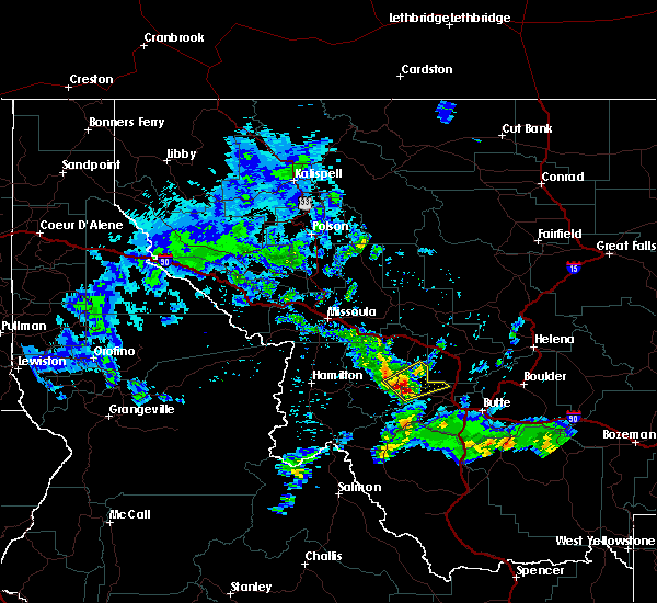
Hail Map for Philipsburg, MT
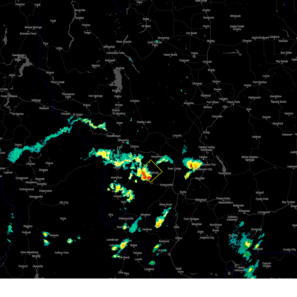
The Philipsburg, MT area has had 3 reports of on-the-ground hail by trained spotters, and has been under severe weather warnings 3 times during the past 12 months. Doppler radar has detected hail at or near Philipsburg, MT on 12 occasions, including 2 occasions during the past year.
| Name: | Philipsburg, MT |
| Where Located: | 50.1 miles SE of Missoula, MT |
| Map: | Google Map for Philipsburg, MT |
| Population: | 820 |
| Housing Units: | 547 |
| More Info: | Search Google for Philipsburg, MT |
5
The Top Recent Hail Date for Philipsburg, MT is Tuesday, September 3, 2024 (3rd out of 12)

Hail and Wind Damage Spotted near Philipsburg, MT
| Date / Time | Report Details |
|---|---|
| 9/3/2024 1:23 PM MDT |
 The storm which prompted the warning has weakened below severe limits, and has exited the warned area. therefore, the warning will be allowed to expire. The storm which prompted the warning has weakened below severe limits, and has exited the warned area. therefore, the warning will be allowed to expire.
|
| 9/3/2024 1:18 PM MDT |
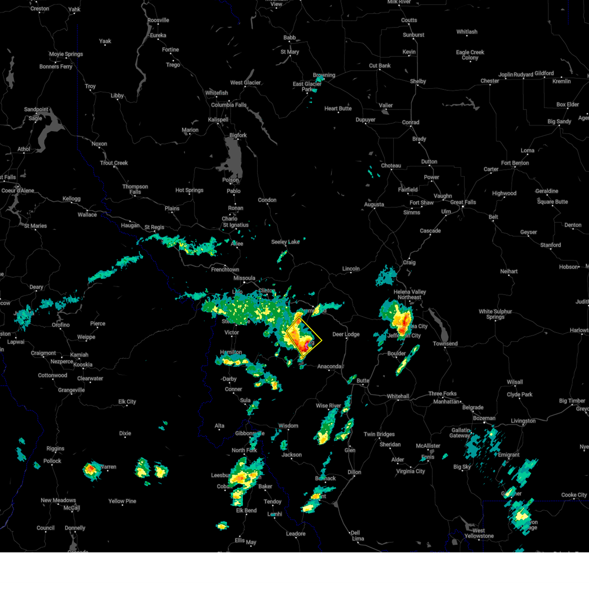 At 117 pm mdt, a severe thunderstorm was located 9 miles north of philipsburg, or 14 miles south of drummond, moving northeast at 20 mph (radar indicated). Hazards include 60 mph wind gusts and quarter size hail. Hail damage to vehicles is expected. expect wind damage to roofs, siding, and trees. Locations impacted include, philipsburg, princeton, and maxville. At 117 pm mdt, a severe thunderstorm was located 9 miles north of philipsburg, or 14 miles south of drummond, moving northeast at 20 mph (radar indicated). Hazards include 60 mph wind gusts and quarter size hail. Hail damage to vehicles is expected. expect wind damage to roofs, siding, and trees. Locations impacted include, philipsburg, princeton, and maxville.
|
| 9/3/2024 12:58 PM MDT |
 Svrmso the national weather service in missoula has issued a * severe thunderstorm warning for, east central granite county in west central montana, * until 130 pm mdt. * at 1258 pm mdt, a severe thunderstorm was located near philipsburg, or 19 miles southwest of drummond, moving northeast at 20 mph (radar indicated). Hazards include 60 mph wind gusts and quarter size hail. Hail damage to vehicles is expected. Expect wind damage to roofs, siding, and trees. Svrmso the national weather service in missoula has issued a * severe thunderstorm warning for, east central granite county in west central montana, * until 130 pm mdt. * at 1258 pm mdt, a severe thunderstorm was located near philipsburg, or 19 miles southwest of drummond, moving northeast at 20 mph (radar indicated). Hazards include 60 mph wind gusts and quarter size hail. Hail damage to vehicles is expected. Expect wind damage to roofs, siding, and trees.
|
| 7/9/2022 4:10 PM MDT |
 The severe thunderstorm warning for north central deer lodge and southeastern granite counties will expire at 415 pm mdt, the storm which prompted the warning has moved out of the area. therefore, the warning will be allowed to expire. a severe thunderstorm watch remains in effect until 1000 pm mdt for west central montana. The severe thunderstorm warning for north central deer lodge and southeastern granite counties will expire at 415 pm mdt, the storm which prompted the warning has moved out of the area. therefore, the warning will be allowed to expire. a severe thunderstorm watch remains in effect until 1000 pm mdt for west central montana.
|
| 7/9/2022 4:00 PM MDT |
 At 359 pm mdt, a severe thunderstorm was located near philipsburg, or 16 miles northwest of anaconda, moving northeast at 45 mph (radar indicated). Hazards include ping pong ball size hail and 60 mph wind gusts. People and animals outdoors will be injured. expect hail damage to roofs, siding, windows, and vehicles. expect wind damage to roofs, siding, and trees. locations impacted include, philipsburg, porters corner, princeton and georgetown. hail threat, radar indicated max hail size, 1. 50 in wind threat, radar indicated max wind gust, 60 mph. At 359 pm mdt, a severe thunderstorm was located near philipsburg, or 16 miles northwest of anaconda, moving northeast at 45 mph (radar indicated). Hazards include ping pong ball size hail and 60 mph wind gusts. People and animals outdoors will be injured. expect hail damage to roofs, siding, windows, and vehicles. expect wind damage to roofs, siding, and trees. locations impacted include, philipsburg, porters corner, princeton and georgetown. hail threat, radar indicated max hail size, 1. 50 in wind threat, radar indicated max wind gust, 60 mph.
|
| 7/9/2022 3:55 PM MDT |
 At 355 pm mdt, a severe thunderstorm was located near philipsburg, or 17 miles northwest of anaconda, moving northeast at 45 mph (radar indicated). Hazards include 60 mph wind gusts and quarter size hail. Hail damage to vehicles is expected. expect wind damage to roofs, siding, and trees. locations impacted include, philipsburg, porters corner, princeton and georgetown. hail threat, radar indicated max hail size, 1. 00 in wind threat, radar indicated max wind gust, 60 mph. At 355 pm mdt, a severe thunderstorm was located near philipsburg, or 17 miles northwest of anaconda, moving northeast at 45 mph (radar indicated). Hazards include 60 mph wind gusts and quarter size hail. Hail damage to vehicles is expected. expect wind damage to roofs, siding, and trees. locations impacted include, philipsburg, porters corner, princeton and georgetown. hail threat, radar indicated max hail size, 1. 00 in wind threat, radar indicated max wind gust, 60 mph.
|
| 7/9/2022 3:45 PM MDT |
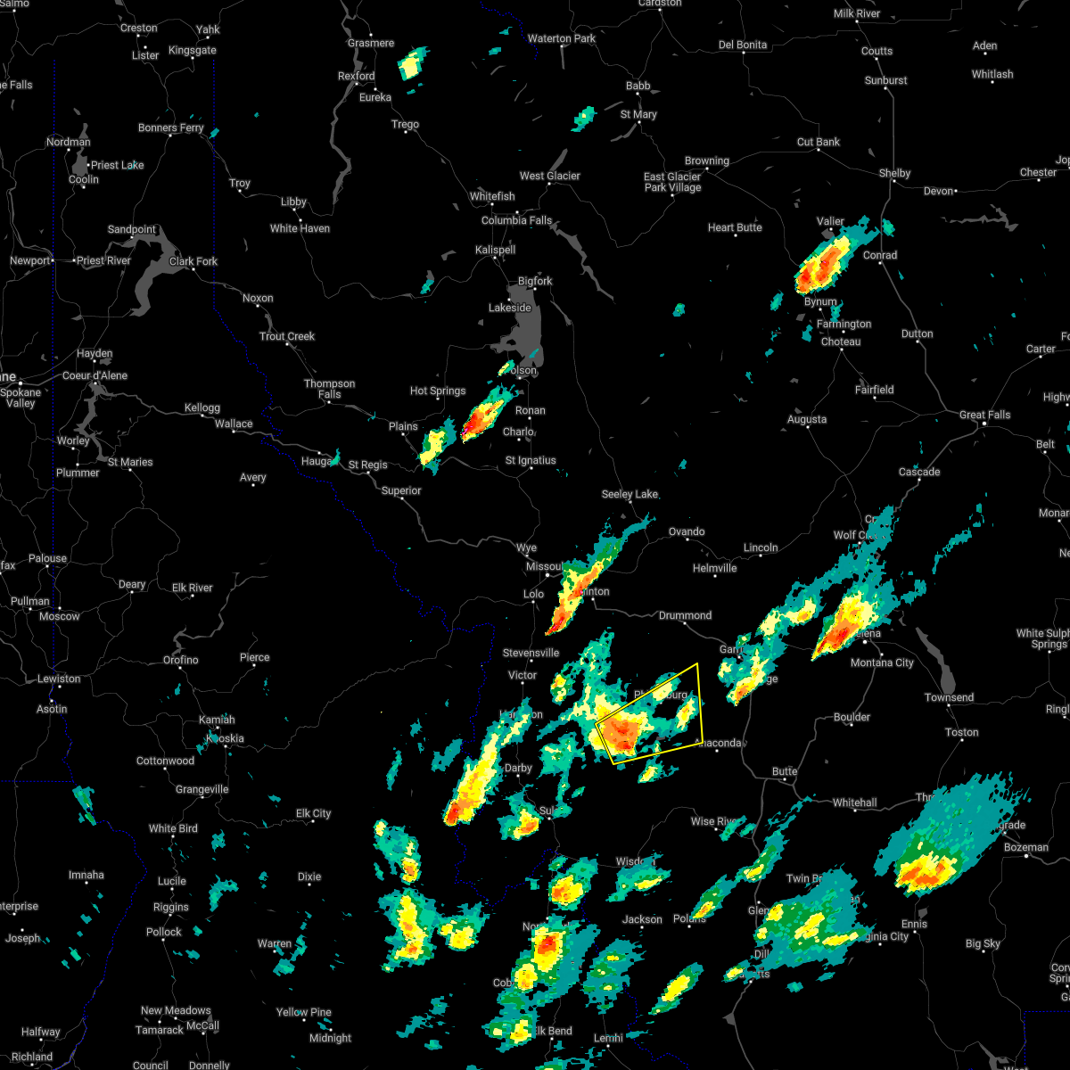 At 345 pm mdt, a severe thunderstorm was located 13 miles southwest of philipsburg, or 23 miles west of anaconda, moving northeast at 45 mph (radar indicated). Hazards include 60 mph wind gusts and quarter size hail. Hail damage to vehicles is expected. Expect wind damage to roofs, siding, and trees. At 345 pm mdt, a severe thunderstorm was located 13 miles southwest of philipsburg, or 23 miles west of anaconda, moving northeast at 45 mph (radar indicated). Hazards include 60 mph wind gusts and quarter size hail. Hail damage to vehicles is expected. Expect wind damage to roofs, siding, and trees.
|
| 5/6/2017 3:13 PM MDT |
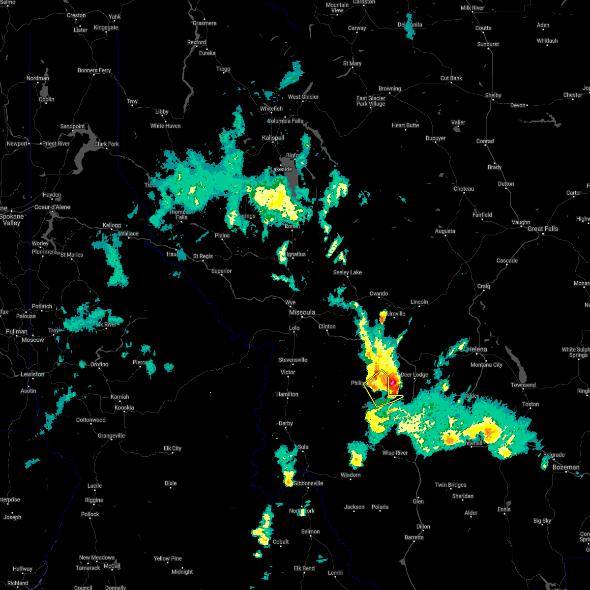 The severe thunderstorm warning for north central deer lodge and east central granite counties will expire at 315 pm mdt, the storm which prompted the warning has moved out of the area. therefore the warning will be allowed to expire. however, small hail, gusty winds, and heavy rain are still possible with this thunderstorm. The severe thunderstorm warning for north central deer lodge and east central granite counties will expire at 315 pm mdt, the storm which prompted the warning has moved out of the area. therefore the warning will be allowed to expire. however, small hail, gusty winds, and heavy rain are still possible with this thunderstorm.
|
| 5/6/2017 3:04 PM MDT |
 At 303 pm mdt, trained weather spotters reported a severe thunderstorm producing half dollar size hail and damaging winds in excess of 50 mph. this storm was located 12 miles north of west valley, or 14 miles north of anaconda, moving northeast at 40 mph. locations impacted include, philipsburg and princeton. At 303 pm mdt, trained weather spotters reported a severe thunderstorm producing half dollar size hail and damaging winds in excess of 50 mph. this storm was located 12 miles north of west valley, or 14 miles north of anaconda, moving northeast at 40 mph. locations impacted include, philipsburg and princeton.
|
| 5/6/2017 2:42 PM MDT | Half Dollar sized hail reported 9.3 miles N of Philipsburg, MT, trained spotters estimated quarter and half dollar sized hail stones. they were worried about vehicle damage. did not go outside yet to check vehicles. |
| 5/6/2017 2:42 PM MDT |
 At 241 pm mdt, doppler radar indicated a severe thunderstorm capable of producing quarter size hail and damaging winds in excess of 60 mph. this storm was located 8 miles south of philipsburg, or 16 miles west of anaconda, and moving northeast at 40 mph. At 241 pm mdt, doppler radar indicated a severe thunderstorm capable of producing quarter size hail and damaging winds in excess of 60 mph. this storm was located 8 miles south of philipsburg, or 16 miles west of anaconda, and moving northeast at 40 mph.
|
| 5/6/2017 2:37 PM MDT |
 At 237 pm mdt, doppler radar indicated a severe thunderstorm capable of producing quarter size hail and damaging winds in excess of 60 mph. this storm was located 9 miles southwest of philipsburg, or 21 miles west of anaconda, moving northeast at 35 mph. locations impacted include, philipsburg, georgetown and porters corner. At 237 pm mdt, doppler radar indicated a severe thunderstorm capable of producing quarter size hail and damaging winds in excess of 60 mph. this storm was located 9 miles southwest of philipsburg, or 21 miles west of anaconda, moving northeast at 35 mph. locations impacted include, philipsburg, georgetown and porters corner.
|
| 5/6/2017 2:22 PM MDT |
 At 221 pm mdt, doppler radar indicated a severe thunderstorm capable of producing quarter size hail, heavy rain, and damaging winds in excess of 60 mph. this storm was located 18 miles southwest of philipsburg, or 27 miles west of anaconda, and moving northeast at 35 mph. At 221 pm mdt, doppler radar indicated a severe thunderstorm capable of producing quarter size hail, heavy rain, and damaging winds in excess of 60 mph. this storm was located 18 miles southwest of philipsburg, or 27 miles west of anaconda, and moving northeast at 35 mph.
|
| 6/8/2016 9:12 PM MDT |
 At 910 pm mdt, doppler radar indicated a line of severe thunderstorms capable of producing damaging winds in excess of 60 mph. these storms were located along a line extending from 12 miles southwest of drummond to 11 miles west of deer lodge to butte, and moving northeast at 35 mph. cross winds along the i-90 corridor from drummond to butte could be severe at times, gusting to 60 mph. At 910 pm mdt, doppler radar indicated a line of severe thunderstorms capable of producing damaging winds in excess of 60 mph. these storms were located along a line extending from 12 miles southwest of drummond to 11 miles west of deer lodge to butte, and moving northeast at 35 mph. cross winds along the i-90 corridor from drummond to butte could be severe at times, gusting to 60 mph.
|
| 6/4/2012 4:07 PM MDT | Quarter sized hail reported 11.2 miles N of Philipsburg, MT, heavy rain also. |
| 6/4/2012 3:30 PM MDT | Quarter sized hail reported 9.9 miles N of Philipsburg, MT |
Hail Maps for Philipsburg, MT


Connect with Interactive Hail Maps