

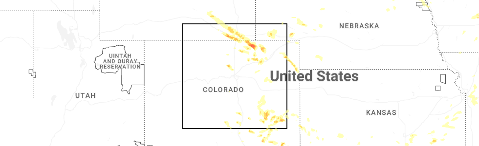
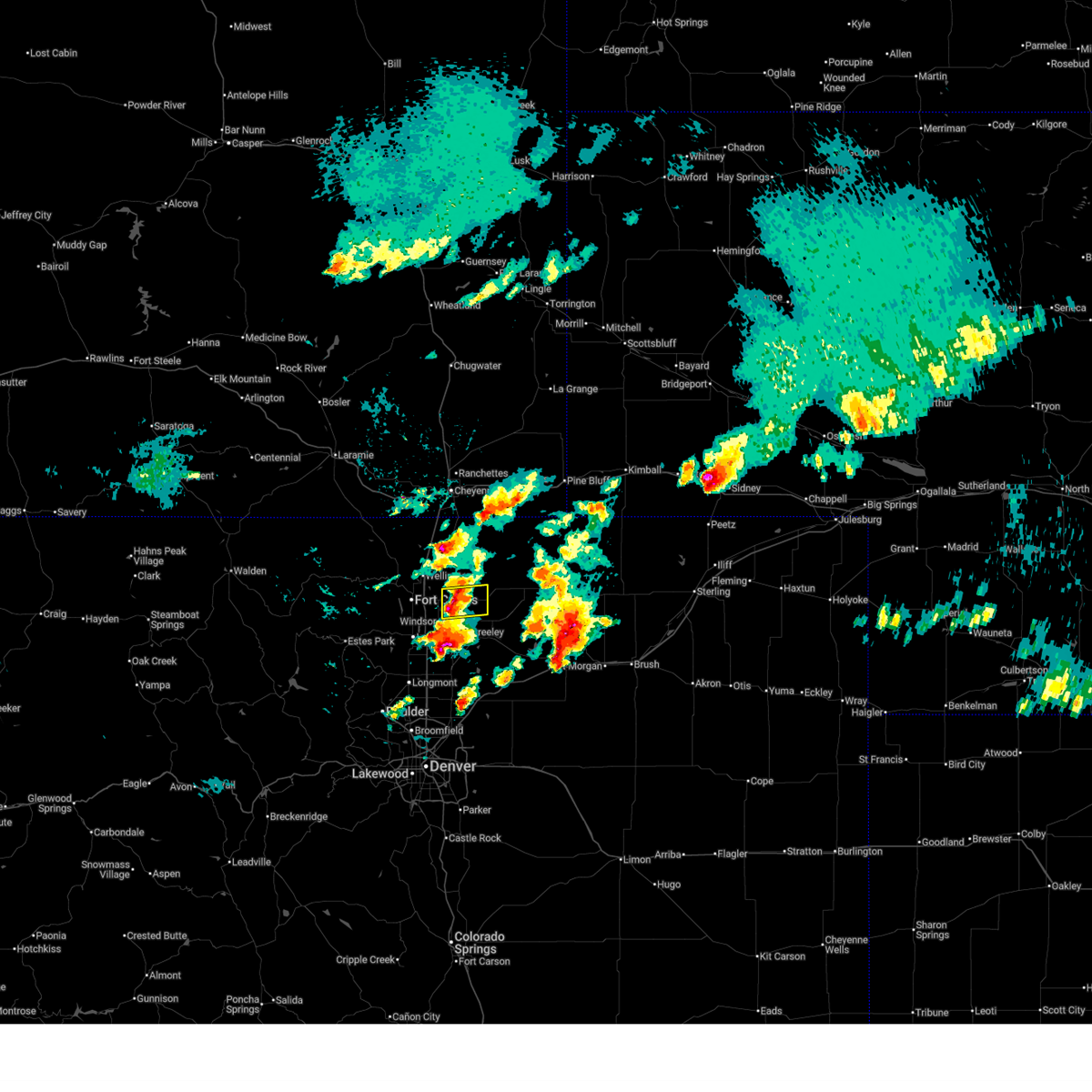
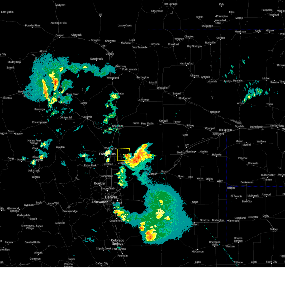
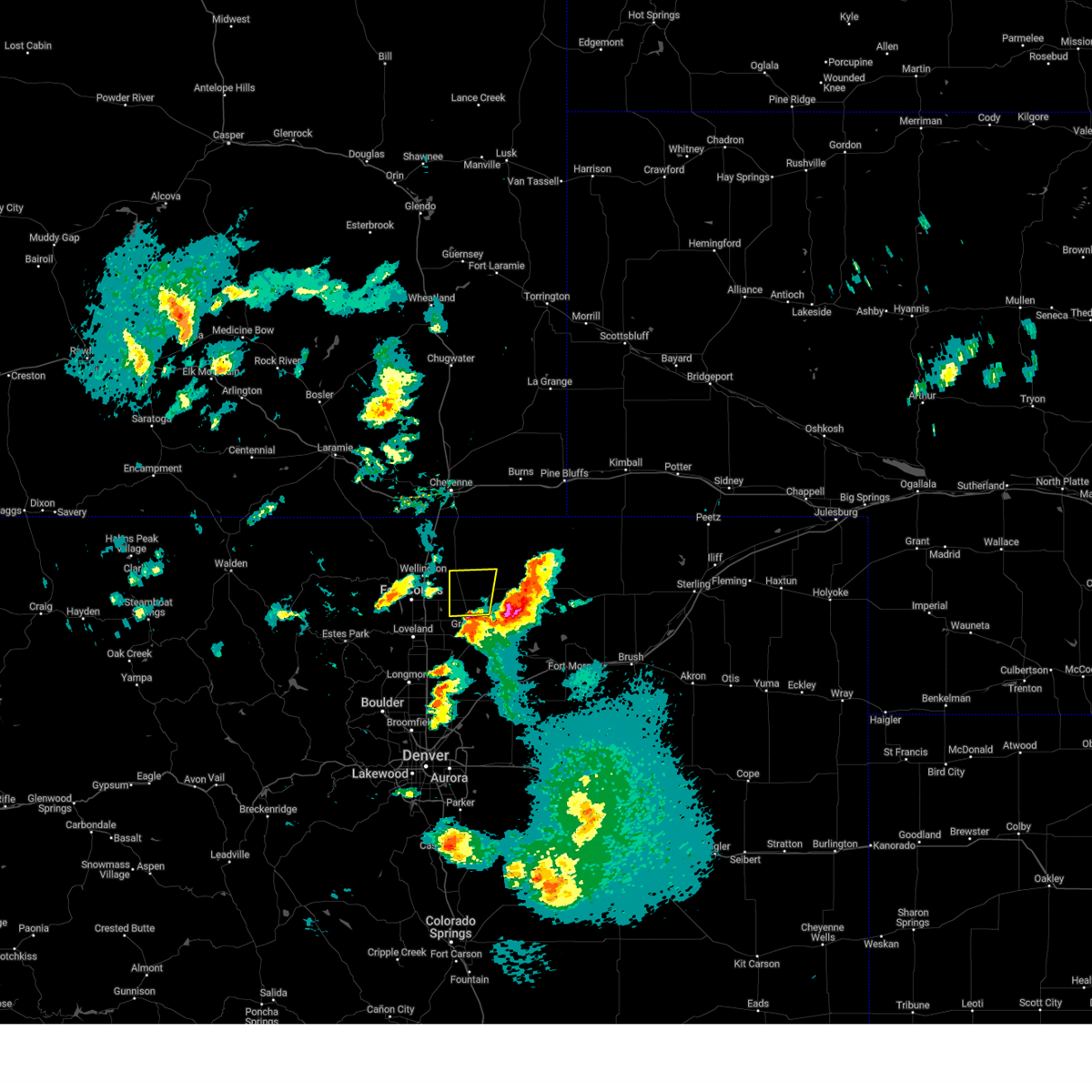
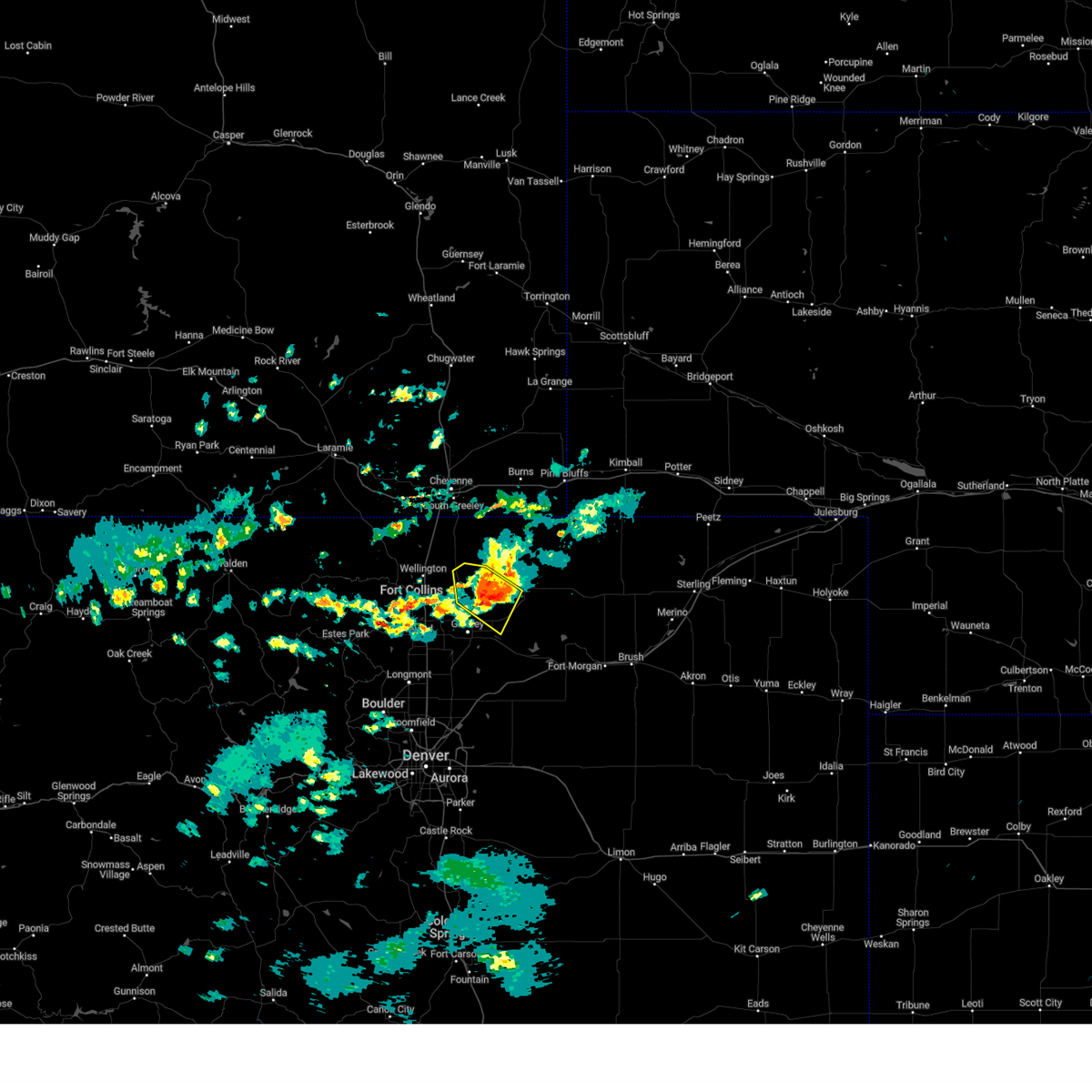
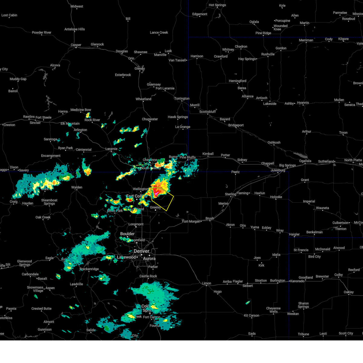
Hail Map for Pierce, CO
The Pierce, CO area has had 11 reports of on-the-ground hail by trained spotters, and has been under severe weather warnings 12 times during the past 12 months. Doppler radar has detected hail at or near Pierce, CO on 79 occasions, including 10 occasions during the past year.
| Name: | Pierce, CO |
| Where Located: | 62.9 miles NNE of Denver, CO |
| Map: | Google Map for Pierce, CO |
| Population: | 834 |
| Housing Units: | 337 |
| More Info: | Search Google for Pierce, CO |
1
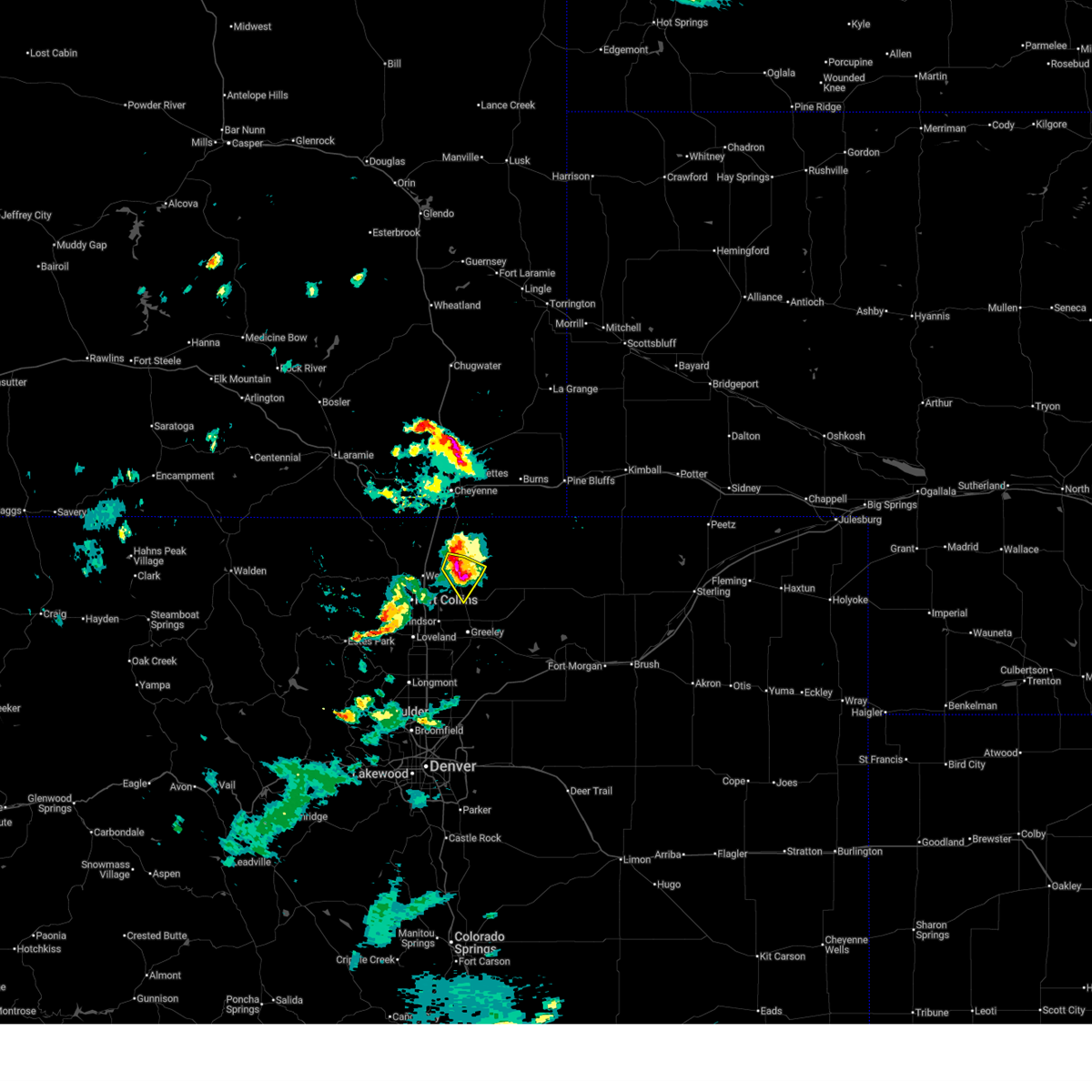
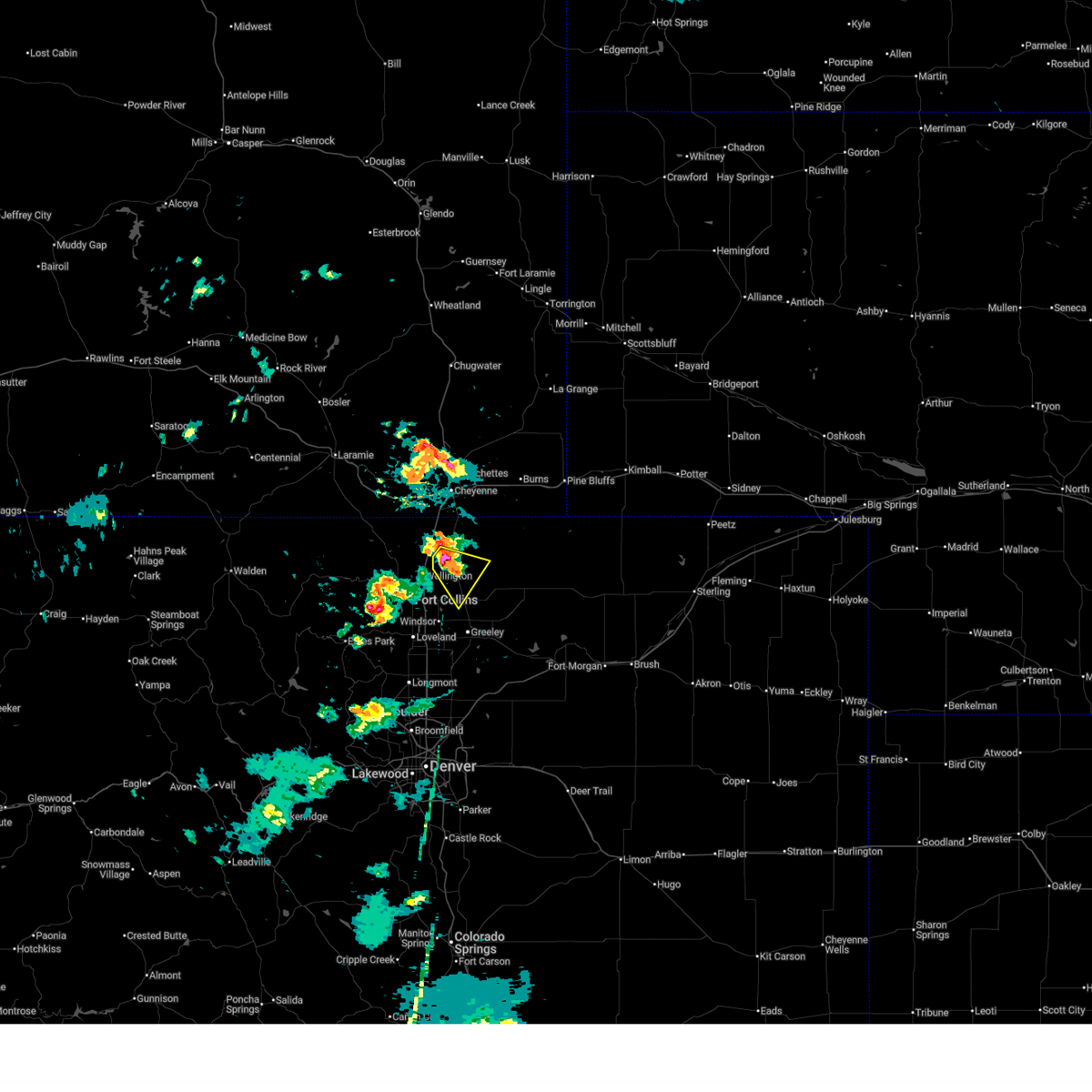
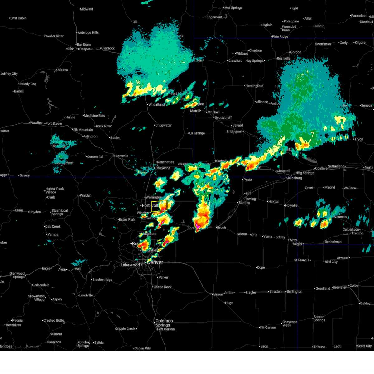
The Top Recent Hail Date for Pierce, CO is Friday, July 11, 2025 (6th out of 79)
Hail and Wind Damage Spotted near Pierce, CO
| Date / Time | Report Details |
|---|---|
| 7/11/2025 6:02 PM MDT | Svrbou the national weather service in denver has issued a * severe thunderstorm warning for, west central weld county in northeastern colorado, * until 645 pm mdt. * at 602 pm mdt, a severe thunderstorm was located over pierce, or 16 miles north of greeley, moving southeast at 20 mph (radar indicated). Hazards include half dollar size hail. damage to vehicles is expected |
| 6/29/2025 3:33 PM MDT |
 At 333 pm mdt, a severe thunderstorm was located over nunn, or 20 miles northeast of fort collins, moving southeast at 25 mph (radar indicated). Hazards include golf ball size hail and 60 mph wind gusts. People and animals outdoors will be injured. expect hail damage to roofs, siding, windows, and vehicles. expect wind damage to roofs, siding, and trees. Locations impacted include, ault, pierce and nunn. At 333 pm mdt, a severe thunderstorm was located over nunn, or 20 miles northeast of fort collins, moving southeast at 25 mph (radar indicated). Hazards include golf ball size hail and 60 mph wind gusts. People and animals outdoors will be injured. expect hail damage to roofs, siding, windows, and vehicles. expect wind damage to roofs, siding, and trees. Locations impacted include, ault, pierce and nunn.
|
| 6/29/2025 3:16 PM MDT |
 Svrbou the national weather service in denver has issued a * severe thunderstorm warning for, northwestern weld county in northeastern colorado, * until 400 pm mdt. * at 316 pm mdt, a severe thunderstorm was located 6 miles northwest of nunn, or 18 miles northeast of fort collins, moving southeast at 10 mph (radar indicated). Hazards include golf ball size hail and 60 mph wind gusts. People and animals outdoors will be injured. expect hail damage to roofs, siding, windows, and vehicles. Expect wind damage to roofs, siding, and trees. Svrbou the national weather service in denver has issued a * severe thunderstorm warning for, northwestern weld county in northeastern colorado, * until 400 pm mdt. * at 316 pm mdt, a severe thunderstorm was located 6 miles northwest of nunn, or 18 miles northeast of fort collins, moving southeast at 10 mph (radar indicated). Hazards include golf ball size hail and 60 mph wind gusts. People and animals outdoors will be injured. expect hail damage to roofs, siding, windows, and vehicles. Expect wind damage to roofs, siding, and trees.
|
| 6/17/2025 3:59 AM MDT |
 The storm which prompted the warning has moved out of the area. therefore, the warning will be allowed to expire. The storm which prompted the warning has moved out of the area. therefore, the warning will be allowed to expire.
|
| 6/17/2025 3:30 AM MDT |
 Svrbou the national weather service in denver has issued a * severe thunderstorm warning for, west central weld county in northeastern colorado, * until 400 am mdt. * at 330 am mdt, a severe thunderstorm was located over ault, or 11 miles north of greeley, moving east at 15 mph (radar indicated). Hazards include two inch hail. People and animals outdoors will be injured. Expect damage to roofs, siding, windows, and vehicles. Svrbou the national weather service in denver has issued a * severe thunderstorm warning for, west central weld county in northeastern colorado, * until 400 am mdt. * at 330 am mdt, a severe thunderstorm was located over ault, or 11 miles north of greeley, moving east at 15 mph (radar indicated). Hazards include two inch hail. People and animals outdoors will be injured. Expect damage to roofs, siding, windows, and vehicles.
|
| 6/17/2025 3:07 AM MDT |
 Svrbou the national weather service in denver has issued a * severe thunderstorm warning for, east central larimer county in north central colorado, western weld county in northeastern colorado, * until 330 am mdt. * at 307 am mdt, a severe thunderstorm was located 5 miles northwest of severance, or 9 miles northeast of fort collins, moving east at 15 mph (radar indicated). Hazards include half dollar size hail. damage to vehicles is expected Svrbou the national weather service in denver has issued a * severe thunderstorm warning for, east central larimer county in north central colorado, western weld county in northeastern colorado, * until 330 am mdt. * at 307 am mdt, a severe thunderstorm was located 5 miles northwest of severance, or 9 miles northeast of fort collins, moving east at 15 mph (radar indicated). Hazards include half dollar size hail. damage to vehicles is expected
|
| 6/17/2025 2:28 AM MDT |
 At 228 am mdt, a severe thunderstorm was located over eaton, or 9 miles north of greeley, moving east at 20 mph (radar indicated). Hazards include half dollar size hail. Damage to vehicles is expected. Locations impacted include, northern greeley, eaton, ault, pierce, lucerne and galeton. At 228 am mdt, a severe thunderstorm was located over eaton, or 9 miles north of greeley, moving east at 20 mph (radar indicated). Hazards include half dollar size hail. Damage to vehicles is expected. Locations impacted include, northern greeley, eaton, ault, pierce, lucerne and galeton.
|
| 6/17/2025 2:19 AM MDT |
 Svrbou the national weather service in denver has issued a * severe thunderstorm warning for, west central weld county in northeastern colorado, * until 245 am mdt. * at 219 am mdt, a severe thunderstorm was located over eaton, or 8 miles north of greeley, moving east at 15 mph (radar indicated). Hazards include quarter size hail. damage to vehicles is expected Svrbou the national weather service in denver has issued a * severe thunderstorm warning for, west central weld county in northeastern colorado, * until 245 am mdt. * at 219 am mdt, a severe thunderstorm was located over eaton, or 8 miles north of greeley, moving east at 15 mph (radar indicated). Hazards include quarter size hail. damage to vehicles is expected
|
| 4/24/2025 5:11 PM MDT |
 the severe thunderstorm warning has been cancelled and is no longer in effect the severe thunderstorm warning has been cancelled and is no longer in effect
|
| 4/24/2025 4:49 PM MDT |
 Svrbou the national weather service in denver has issued a * severe thunderstorm warning for, northwestern weld county in northeastern colorado, * until 530 pm mdt. * at 449 pm mdt, a severe thunderstorm was located over eaton, or 8 miles northeast of greeley, moving north at 15 mph (radar indicated). Hazards include half dollar size hail. damage to vehicles is expected Svrbou the national weather service in denver has issued a * severe thunderstorm warning for, northwestern weld county in northeastern colorado, * until 530 pm mdt. * at 449 pm mdt, a severe thunderstorm was located over eaton, or 8 miles northeast of greeley, moving north at 15 mph (radar indicated). Hazards include half dollar size hail. damage to vehicles is expected
|
| 8/7/2024 2:40 PM MDT |
 the severe thunderstorm warning has been cancelled and is no longer in effect the severe thunderstorm warning has been cancelled and is no longer in effect
|
| 8/7/2024 2:22 PM MDT |
 Svrbou the national weather service in denver colorado has issued a * severe thunderstorm warning for, west central weld county in northeastern colorado, * until 300 pm mdt. * at 221 pm mdt, a severe thunderstorm was located near pierce, or 17 miles north of greeley, moving southeast at 30 mph (radar indicated). Hazards include 60 mph wind gusts and quarter size hail. Expect damage to roofs, siding, and trees. Hail damage to vehicles is expected. Svrbou the national weather service in denver colorado has issued a * severe thunderstorm warning for, west central weld county in northeastern colorado, * until 300 pm mdt. * at 221 pm mdt, a severe thunderstorm was located near pierce, or 17 miles north of greeley, moving southeast at 30 mph (radar indicated). Hazards include 60 mph wind gusts and quarter size hail. Expect damage to roofs, siding, and trees. Hail damage to vehicles is expected.
|
| 6/20/2024 4:39 PM MDT |
 The storm which prompted the warning has weakened below severe limits, and no longer poses an immediate threat to life or property. therefore, the warning will be allowed to expire. however, small hail and gusty winds are still possible with this thunderstorm. a severe thunderstorm watch remains in effect until 700 pm mdt for northeastern colorado. The storm which prompted the warning has weakened below severe limits, and no longer poses an immediate threat to life or property. therefore, the warning will be allowed to expire. however, small hail and gusty winds are still possible with this thunderstorm. a severe thunderstorm watch remains in effect until 700 pm mdt for northeastern colorado.
|
| 6/20/2024 4:13 PM MDT |
 Svrbou the national weather service in denver colorado has issued a * severe thunderstorm warning for, northwestern weld county in northeastern colorado, * until 445 pm mdt. * at 412 pm mdt, a severe thunderstorm was located over ault, or 12 miles north of greeley, moving northeast at 20 mph (radar indicated). Hazards include 60 mph wind gusts and quarter size hail. Expect damage to roofs, siding, and trees. Hail damage to vehicles is expected. Svrbou the national weather service in denver colorado has issued a * severe thunderstorm warning for, northwestern weld county in northeastern colorado, * until 445 pm mdt. * at 412 pm mdt, a severe thunderstorm was located over ault, or 12 miles north of greeley, moving northeast at 20 mph (radar indicated). Hazards include 60 mph wind gusts and quarter size hail. Expect damage to roofs, siding, and trees. Hail damage to vehicles is expected.
|
| 6/20/2024 4:11 PM MDT |
 The tornadic thunderstorm which prompted the warning has weakened. therefore, the warning will be allowed to expire. however, hail is still possible with this thunderstorm. a severe thunderstorm watch remains in effect until 700 pm mdt for northeastern colorado. The tornadic thunderstorm which prompted the warning has weakened. therefore, the warning will be allowed to expire. however, hail is still possible with this thunderstorm. a severe thunderstorm watch remains in effect until 700 pm mdt for northeastern colorado.
|
| 6/20/2024 3:58 PM MDT |
 At 358 pm mdt, a severe thunderstorm capable of producing a tornado was located near eaton, or 8 miles north of greeley, moving northeast at 15 mph (radar indicated rotation). Hazards include tornado and quarter size hail. Flying debris will be dangerous to those caught without shelter. mobile homes will be damaged or destroyed. damage to roofs, windows, and vehicles will occur. tree damage is likely. Locations impacted include, northwestern greeley, windsor, eaton, severance, ault, pierce, nunn, purcell, and lucerne. At 358 pm mdt, a severe thunderstorm capable of producing a tornado was located near eaton, or 8 miles north of greeley, moving northeast at 15 mph (radar indicated rotation). Hazards include tornado and quarter size hail. Flying debris will be dangerous to those caught without shelter. mobile homes will be damaged or destroyed. damage to roofs, windows, and vehicles will occur. tree damage is likely. Locations impacted include, northwestern greeley, windsor, eaton, severance, ault, pierce, nunn, purcell, and lucerne.
|
| 6/20/2024 3:51 PM MDT |
 Torbou the national weather service in denver colorado has issued a * tornado warning for, west central weld county in northeastern colorado, * until 415 pm mdt. * at 351 pm mdt, a severe thunderstorm capable of producing a tornado was located near eaton, or 7 miles north of greeley, moving northeast at 15 mph (radar indicated rotation). Hazards include tornado. Flying debris will be dangerous to those caught without shelter. mobile homes will be damaged or destroyed. damage to roofs, windows, and vehicles will occur. Tree damage is likely. Torbou the national weather service in denver colorado has issued a * tornado warning for, west central weld county in northeastern colorado, * until 415 pm mdt. * at 351 pm mdt, a severe thunderstorm capable of producing a tornado was located near eaton, or 7 miles north of greeley, moving northeast at 15 mph (radar indicated rotation). Hazards include tornado. Flying debris will be dangerous to those caught without shelter. mobile homes will be damaged or destroyed. damage to roofs, windows, and vehicles will occur. Tree damage is likely.
|
| 6/8/2024 2:14 PM MDT |
 Svrbou the national weather service in denver colorado has issued a * severe thunderstorm warning for, northwestern weld county in northeastern colorado, * until 300 pm mdt. * at 214 pm mdt, severe thunderstorms were located along a line extending from 6 miles west of carpenter to 6 miles northwest of nunn, or along a line extending from 19 miles southeast of cheyenne to 18 miles northeast of fort collins, moving south at 30 mph (radar indicated). Hazards include 60 mph wind gusts and quarter size hail. Expect damage to roofs, siding, and trees. Hail damage to vehicles is expected. Svrbou the national weather service in denver colorado has issued a * severe thunderstorm warning for, northwestern weld county in northeastern colorado, * until 300 pm mdt. * at 214 pm mdt, severe thunderstorms were located along a line extending from 6 miles west of carpenter to 6 miles northwest of nunn, or along a line extending from 19 miles southeast of cheyenne to 18 miles northeast of fort collins, moving south at 30 mph (radar indicated). Hazards include 60 mph wind gusts and quarter size hail. Expect damage to roofs, siding, and trees. Hail damage to vehicles is expected.
|
| 8/3/2023 5:43 PM MDT |
 At 543 pm mdt, a severe thunderstorm was located 4 miles southwest of fort collins, moving east at 20 mph (radar indicated). Hazards include 60 mph wind gusts and quarter size hail. Expect damage to roofs, siding, and trees. hail damage to vehicles is expected. this severe thunderstorm will be near, fort collins around 555 pm mdt. loveland around 600 pm mdt. other locations in the path of this severe thunderstorm include timnath, windsor, greeley and severance. hail threat, radar indicated max hail size, 1. 00 in wind threat, radar indicated max wind gust, 60 mph. At 543 pm mdt, a severe thunderstorm was located 4 miles southwest of fort collins, moving east at 20 mph (radar indicated). Hazards include 60 mph wind gusts and quarter size hail. Expect damage to roofs, siding, and trees. hail damage to vehicles is expected. this severe thunderstorm will be near, fort collins around 555 pm mdt. loveland around 600 pm mdt. other locations in the path of this severe thunderstorm include timnath, windsor, greeley and severance. hail threat, radar indicated max hail size, 1. 00 in wind threat, radar indicated max wind gust, 60 mph.
|
| 7/15/2023 4:15 PM MDT |
 At 415 pm mdt, a severe thunderstorm was located 5 miles northwest of nunn, or 16 miles northeast of fort collins, moving southeast at 15 mph (radar indicated). Hazards include golf ball size hail and 60 mph wind gusts. Expect damage to roofs, siding, and trees. people and animals outdoors will be injured. expect hail damage to roofs, siding, windows, and vehicles. locations impacted include, wellington, severance, pierce and nunn. thunderstorm damage threat, considerable hail threat, radar indicated max hail size, 1. 75 in wind threat, radar indicated max wind gust, 60 mph. At 415 pm mdt, a severe thunderstorm was located 5 miles northwest of nunn, or 16 miles northeast of fort collins, moving southeast at 15 mph (radar indicated). Hazards include golf ball size hail and 60 mph wind gusts. Expect damage to roofs, siding, and trees. people and animals outdoors will be injured. expect hail damage to roofs, siding, windows, and vehicles. locations impacted include, wellington, severance, pierce and nunn. thunderstorm damage threat, considerable hail threat, radar indicated max hail size, 1. 75 in wind threat, radar indicated max wind gust, 60 mph.
|
| 7/15/2023 4:12 PM MDT |
 At 412 pm mdt, a severe thunderstorm was located 6 miles northwest of nunn, or 16 miles northeast of fort collins, moving southeast at 15 mph (radar indicated). Hazards include 60 mph wind gusts and half dollar size hail. Expect damage to roofs, siding, and trees. Hail damage to vehicles is expected. At 412 pm mdt, a severe thunderstorm was located 6 miles northwest of nunn, or 16 miles northeast of fort collins, moving southeast at 15 mph (radar indicated). Hazards include 60 mph wind gusts and half dollar size hail. Expect damage to roofs, siding, and trees. Hail damage to vehicles is expected.
|
| 7/15/2023 2:44 PM MDT |
 At 243 pm mdt, a severe thunderstorm was located near rockport, or 19 miles south of cheyenne, moving south at 20 mph (radar indicated). Hazards include ping pong ball size hail. People and animals outdoors will be injured. Expect damage to roofs, siding, windows, and vehicles. At 243 pm mdt, a severe thunderstorm was located near rockport, or 19 miles south of cheyenne, moving south at 20 mph (radar indicated). Hazards include ping pong ball size hail. People and animals outdoors will be injured. Expect damage to roofs, siding, windows, and vehicles.
|
| 6/21/2023 8:12 PM MDT |
 At 811 pm mdt, a severe thunderstorm was located near severance, or 11 miles east of fort collins, moving east at 20 mph (radar indicated). Hazards include ping pong ball size hail. People and animals outdoors will be injured. expect damage to roofs, siding, windows, and vehicles. this severe thunderstorm will be near, eaton, ault, pierce and nunn around 830 pm mdt. hail threat, radar indicated max hail size, 1. 50 in wind threat, radar indicated max wind gust, <50 mph. At 811 pm mdt, a severe thunderstorm was located near severance, or 11 miles east of fort collins, moving east at 20 mph (radar indicated). Hazards include ping pong ball size hail. People and animals outdoors will be injured. expect damage to roofs, siding, windows, and vehicles. this severe thunderstorm will be near, eaton, ault, pierce and nunn around 830 pm mdt. hail threat, radar indicated max hail size, 1. 50 in wind threat, radar indicated max wind gust, <50 mph.
|
| 5/27/2023 4:10 PM MDT |
 The severe thunderstorm warning for northwestern weld and east central larimer counties will expire at 415 pm mdt, the storm which prompted the warning has weakened below severe limits, and no longer poses an immediate threat to life or property. therefore, the warning will be allowed to expire. however heavy rain is still possible with this thunderstorm. a severe thunderstorm watch remains in effect until 900 pm mdt for northeastern colorado. The severe thunderstorm warning for northwestern weld and east central larimer counties will expire at 415 pm mdt, the storm which prompted the warning has weakened below severe limits, and no longer poses an immediate threat to life or property. therefore, the warning will be allowed to expire. however heavy rain is still possible with this thunderstorm. a severe thunderstorm watch remains in effect until 900 pm mdt for northeastern colorado.
|
| 5/27/2023 3:43 PM MDT |
 At 342 pm mdt, a severe thunderstorm was located 4 miles northeast of timnath, or 8 miles east of fort collins, moving northeast at 20 mph (radar indicated and spotter reported). Hazards include ping pong ball size hail and 60 mph wind gusts. Expect damage to roofs, siding, and trees. people and animals outdoors will be injured. expect hail damage to roofs, siding, windows, and vehicles. locations impacted include, ault, pierce and nunn. hail threat, radar indicated max hail size, 1. 50 in wind threat, radar indicated max wind gust, 60 mph. At 342 pm mdt, a severe thunderstorm was located 4 miles northeast of timnath, or 8 miles east of fort collins, moving northeast at 20 mph (radar indicated and spotter reported). Hazards include ping pong ball size hail and 60 mph wind gusts. Expect damage to roofs, siding, and trees. people and animals outdoors will be injured. expect hail damage to roofs, siding, windows, and vehicles. locations impacted include, ault, pierce and nunn. hail threat, radar indicated max hail size, 1. 50 in wind threat, radar indicated max wind gust, 60 mph.
|
| 5/27/2023 3:26 PM MDT |
 At 326 pm mdt, a severe thunderstorm was located near windsor, or 8 miles east of fort collins, moving northeast at 25 mph (radar indicated). Hazards include 60 mph wind gusts and half dollar size hail. Expect damage to roofs, siding, and trees. hail damage to vehicles is expected. this severe thunderstorm will be near, severance around 345 pm mdt. other locations in the path of this severe thunderstorm include eaton, ault and pierce. hail threat, radar indicated max hail size, 1. 25 in wind threat, radar indicated max wind gust, 60 mph. At 326 pm mdt, a severe thunderstorm was located near windsor, or 8 miles east of fort collins, moving northeast at 25 mph (radar indicated). Hazards include 60 mph wind gusts and half dollar size hail. Expect damage to roofs, siding, and trees. hail damage to vehicles is expected. this severe thunderstorm will be near, severance around 345 pm mdt. other locations in the path of this severe thunderstorm include eaton, ault and pierce. hail threat, radar indicated max hail size, 1. 25 in wind threat, radar indicated max wind gust, 60 mph.
|
| 5/26/2023 3:25 PM MDT |
 At 324 pm mdt, a severe thunderstorm was located 12 miles southeast of rockport, or 24 miles southeast of cheyenne, moving north at 30 mph (radar indicated). Hazards include ping pong ball size hail and 60 mph wind gusts. Expect damage to roofs, siding, and trees. people and animals outdoors will be injured. expect hail damage to roofs, siding, windows, and vehicles. locations impacted include, pierce, nunn, purcell, rockport and hereford. hail threat, radar indicated max hail size, 1. 50 in wind threat, radar indicated max wind gust, 60 mph. At 324 pm mdt, a severe thunderstorm was located 12 miles southeast of rockport, or 24 miles southeast of cheyenne, moving north at 30 mph (radar indicated). Hazards include ping pong ball size hail and 60 mph wind gusts. Expect damage to roofs, siding, and trees. people and animals outdoors will be injured. expect hail damage to roofs, siding, windows, and vehicles. locations impacted include, pierce, nunn, purcell, rockport and hereford. hail threat, radar indicated max hail size, 1. 50 in wind threat, radar indicated max wind gust, 60 mph.
|
| 5/26/2023 3:23 PM MDT |
 At 323 pm mdt, a severe thunderstorm was located over lasalle, or 5 miles south of greeley, moving north at 15 mph (radar indicated). Hazards include ping pong ball size hail. People and animals outdoors will be injured. expect damage to roofs, siding, windows, and vehicles. locations impacted include, evans, greeley, lucerne, eaton, ault and purcell. hail threat, radar indicated max hail size, 1. 50 in wind threat, radar indicated max wind gust, <50 mph. At 323 pm mdt, a severe thunderstorm was located over lasalle, or 5 miles south of greeley, moving north at 15 mph (radar indicated). Hazards include ping pong ball size hail. People and animals outdoors will be injured. expect damage to roofs, siding, windows, and vehicles. locations impacted include, evans, greeley, lucerne, eaton, ault and purcell. hail threat, radar indicated max hail size, 1. 50 in wind threat, radar indicated max wind gust, <50 mph.
|
| 5/26/2023 3:12 PM MDT |
 At 312 pm mdt, a severe thunderstorm was located 7 miles north of purcell, or 23 miles north of greeley, moving north at 30 mph (radar indicated). Hazards include quarter size hail. Hail damage to vehicles is expected. this severe thunderstorm will remain over mainly rural areas of northwestern weld county. hail threat, radar indicated max hail size, 1. 00 in wind threat, radar indicated max wind gust, 60 mph. At 312 pm mdt, a severe thunderstorm was located 7 miles north of purcell, or 23 miles north of greeley, moving north at 30 mph (radar indicated). Hazards include quarter size hail. Hail damage to vehicles is expected. this severe thunderstorm will remain over mainly rural areas of northwestern weld county. hail threat, radar indicated max hail size, 1. 00 in wind threat, radar indicated max wind gust, 60 mph.
|
| 5/26/2023 2:58 PM MDT |
 At 257 pm mdt, a severe thunderstorm was located near gilcrest, or 11 miles south of greeley, moving north at 15 mph (radar indicated). Hazards include half dollar size hail. Damage to vehicles is expected. this severe thunderstorm will be near, gilcrest around 310 pm mdt. other locations in the path of this severe thunderstorm include johnstown, milliken, lasalle, evans, greeley and lucerne. hail threat, radar indicated max hail size, 1. 25 in wind threat, radar indicated max wind gust, <50 mph. At 257 pm mdt, a severe thunderstorm was located near gilcrest, or 11 miles south of greeley, moving north at 15 mph (radar indicated). Hazards include half dollar size hail. Damage to vehicles is expected. this severe thunderstorm will be near, gilcrest around 310 pm mdt. other locations in the path of this severe thunderstorm include johnstown, milliken, lasalle, evans, greeley and lucerne. hail threat, radar indicated max hail size, 1. 25 in wind threat, radar indicated max wind gust, <50 mph.
|
| 5/9/2023 8:06 PM MDT |
 At 806 pm mdt, a severe thunderstorm was located 6 miles north of timnath, or 7 miles northeast of fort collins, moving northeast at 25 mph (radar indicated). Hazards include quarter size hail. Damage to vehicles is expected. locations impacted include, fort collins, greeley, northern loveland, windsor, wellington, eaton, severance, ault, pierce, timnath, nunn and lucerne. hail threat, radar indicated max hail size, 1. 00 in wind threat, radar indicated max wind gust, <50 mph. At 806 pm mdt, a severe thunderstorm was located 6 miles north of timnath, or 7 miles northeast of fort collins, moving northeast at 25 mph (radar indicated). Hazards include quarter size hail. Damage to vehicles is expected. locations impacted include, fort collins, greeley, northern loveland, windsor, wellington, eaton, severance, ault, pierce, timnath, nunn and lucerne. hail threat, radar indicated max hail size, 1. 00 in wind threat, radar indicated max wind gust, <50 mph.
|
| 5/9/2023 7:31 PM MDT |
 At 731 pm mdt, a severe thunderstorm was located near windsor, or 7 miles northwest of greeley, moving north at 25 mph (radar indicated). Hazards include 60 mph wind gusts and half dollar size hail. Expect damage to roofs, siding, and trees. Hail damage to vehicles is expected. At 731 pm mdt, a severe thunderstorm was located near windsor, or 7 miles northwest of greeley, moving north at 25 mph (radar indicated). Hazards include 60 mph wind gusts and half dollar size hail. Expect damage to roofs, siding, and trees. Hail damage to vehicles is expected.
|
| 7/27/2022 7:44 PM MDT | Quarter sized hail reported 3.9 miles W of Pierce, CO, falling at time of report. |
| 7/27/2022 7:37 PM MDT |
 At 737 pm mdt, a severe thunderstorm was located 4 miles northeast of wellington, or 14 miles northeast of fort collins, moving southeast at 25 mph (radar indicated). Hazards include two inch hail and 60 mph wind gusts. Expect damage to roofs, siding, and trees. people and animals outdoors will be injured. expect hail damage to roofs, siding, windows, and vehicles. Locations impacted include, pierce. At 737 pm mdt, a severe thunderstorm was located 4 miles northeast of wellington, or 14 miles northeast of fort collins, moving southeast at 25 mph (radar indicated). Hazards include two inch hail and 60 mph wind gusts. Expect damage to roofs, siding, and trees. people and animals outdoors will be injured. expect hail damage to roofs, siding, windows, and vehicles. Locations impacted include, pierce.
|
| 7/27/2022 7:27 PM MDT |
 At 727 pm mdt, a severe thunderstorm was located 6 miles north of wellington, or 17 miles north of fort collins, moving southeast at 25 mph (radar indicated). Hazards include 60 mph wind gusts and quarter size hail. Expect damage to roofs, siding, and trees. hail damage to vehicles is expected. this severe thunderstorm will be near, wellington around 735 pm mdt. other locations in the path of this severe thunderstorm include nunn and pierce. hail threat, radar indicated max hail size, 1. 00 in wind threat, radar indicated max wind gust, 60 mph. At 727 pm mdt, a severe thunderstorm was located 6 miles north of wellington, or 17 miles north of fort collins, moving southeast at 25 mph (radar indicated). Hazards include 60 mph wind gusts and quarter size hail. Expect damage to roofs, siding, and trees. hail damage to vehicles is expected. this severe thunderstorm will be near, wellington around 735 pm mdt. other locations in the path of this severe thunderstorm include nunn and pierce. hail threat, radar indicated max hail size, 1. 00 in wind threat, radar indicated max wind gust, 60 mph.
|
| 7/27/2022 5:48 PM MDT | Quarter sized hail reported 3.9 miles W of Pierce, CO, delayed report... with hail collected over an hour after the storm ended. time estimated by radar. |
| 7/27/2022 5:40 PM MDT |
 At 540 pm mdt, a severe thunderstorm was located 5 miles east of nunn, or 19 miles north of greeley, moving south at 20 mph (radar indicated). Hazards include ping pong ball size hail. People and animals outdoors will be injured. expect damage to roofs, siding, windows, and vehicles. locations impacted include, purcell, ault and eaton. hail threat, radar indicated max hail size, 1. 50 in wind threat, radar indicated max wind gust, <50 mph. At 540 pm mdt, a severe thunderstorm was located 5 miles east of nunn, or 19 miles north of greeley, moving south at 20 mph (radar indicated). Hazards include ping pong ball size hail. People and animals outdoors will be injured. expect damage to roofs, siding, windows, and vehicles. locations impacted include, purcell, ault and eaton. hail threat, radar indicated max hail size, 1. 50 in wind threat, radar indicated max wind gust, <50 mph.
|
| 7/27/2022 5:25 PM MDT |
 At 525 pm mdt, a severe thunderstorm was located 5 miles northeast of nunn, or 23 miles northeast of fort collins, moving south at 20 mph (radar indicated). Hazards include half dollar size hail. Damage to vehicles is expected. this severe thunderstorm will be near, nunn around 530 pm mdt. pierce around 545 pm mdt. other locations in the path of this severe thunderstorm include purcell, ault and eaton. hail threat, radar indicated max hail size, 1. 25 in wind threat, radar indicated max wind gust, <50 mph. At 525 pm mdt, a severe thunderstorm was located 5 miles northeast of nunn, or 23 miles northeast of fort collins, moving south at 20 mph (radar indicated). Hazards include half dollar size hail. Damage to vehicles is expected. this severe thunderstorm will be near, nunn around 530 pm mdt. pierce around 545 pm mdt. other locations in the path of this severe thunderstorm include purcell, ault and eaton. hail threat, radar indicated max hail size, 1. 25 in wind threat, radar indicated max wind gust, <50 mph.
|
| 7/30/2021 3:51 PM MDT |
 At 351 pm mdt, a severe thunderstorm was located near wellington, or 12 miles northeast of fort collins, moving southeast at 10 mph (radar indicated). Hazards include 60 mph wind gusts and quarter size hail. Expect damage to roofs, siding, and trees. hail damage to vehicles is expected. Locations impacted include, northeastern fort collins, wellington and pierce. At 351 pm mdt, a severe thunderstorm was located near wellington, or 12 miles northeast of fort collins, moving southeast at 10 mph (radar indicated). Hazards include 60 mph wind gusts and quarter size hail. Expect damage to roofs, siding, and trees. hail damage to vehicles is expected. Locations impacted include, northeastern fort collins, wellington and pierce.
|
| 7/30/2021 3:26 PM MDT |
 At 326 pm mdt, a severe thunderstorm was located 5 miles north of wellington, or 15 miles north of fort collins, moving southeast at 10 mph (radar indicated). Hazards include 60 mph wind gusts and quarter size hail. Expect damage to roofs, siding, and trees. Hail damage to vehicles is expected. At 326 pm mdt, a severe thunderstorm was located 5 miles north of wellington, or 15 miles north of fort collins, moving southeast at 10 mph (radar indicated). Hazards include 60 mph wind gusts and quarter size hail. Expect damage to roofs, siding, and trees. Hail damage to vehicles is expected.
|
| 6/7/2021 6:55 PM MDT |
 At 654 pm mdt, a severe thunderstorm was located 4 miles northwest of severance, or 8 miles east of fort collins, moving north at 15 mph. the largest hail reported with the storm so far has been one half inch (radar indicated). Hazards include 60 mph wind gusts and quarter size hail. Expect damage to roofs, siding, and trees. hail damage to vehicles is expected. Locations impacted include, eastern fort collins, northern greeley, windsor, severance, ault and timnath. At 654 pm mdt, a severe thunderstorm was located 4 miles northwest of severance, or 8 miles east of fort collins, moving north at 15 mph. the largest hail reported with the storm so far has been one half inch (radar indicated). Hazards include 60 mph wind gusts and quarter size hail. Expect damage to roofs, siding, and trees. hail damage to vehicles is expected. Locations impacted include, eastern fort collins, northern greeley, windsor, severance, ault and timnath.
|
| 6/7/2021 6:25 PM MDT |
 At 625 pm mdt, a severe thunderstorm was located over windsor, or 9 miles southeast of fort collins, moving north at 15 mph (radar indicated). Hazards include 60 mph wind gusts and quarter size hail. Expect damage to roofs, siding, and trees. Hail damage to vehicles is expected. At 625 pm mdt, a severe thunderstorm was located over windsor, or 9 miles southeast of fort collins, moving north at 15 mph (radar indicated). Hazards include 60 mph wind gusts and quarter size hail. Expect damage to roofs, siding, and trees. Hail damage to vehicles is expected.
|
| 8/4/2020 4:30 PM MDT |
 At 429 pm mdt, a severe thunderstorm was located near kersey, or 7 miles east of greeley, moving southeast at 30 mph (trained weather spotters reported hail up to two inches in diameter in eaton and northeast greeley). Hazards include two inch hail and 60 mph wind gusts. Expect damage to roofs, siding, and trees. people and animals outdoors will be injured. Expect hail damage to roofs, siding, windows, and vehicles. At 429 pm mdt, a severe thunderstorm was located near kersey, or 7 miles east of greeley, moving southeast at 30 mph (trained weather spotters reported hail up to two inches in diameter in eaton and northeast greeley). Hazards include two inch hail and 60 mph wind gusts. Expect damage to roofs, siding, and trees. people and animals outdoors will be injured. Expect hail damage to roofs, siding, windows, and vehicles.
|
| 8/4/2020 4:18 PM MDT |
 At 417 pm mdt, a severe thunderstorm was located over lucerne, or 4 miles northeast of greeley, moving southeast at 30 mph. another storm was between hardin and riverside reservoir (trained weather spotters reported golf ball size hail near ault at 401 pm). Hazards include golf ball size hail and 60 mph wind gusts. Expect damage to roofs, siding, and trees. people and animals outdoors will be injured. expect hail damage to roofs, siding, windows, and vehicles. Locations impacted include, greeley, evans, eaton, severance, ault, kersey, pierce, galeton, gill, barnesville, riverside reservoir, lucerne and roggen. At 417 pm mdt, a severe thunderstorm was located over lucerne, or 4 miles northeast of greeley, moving southeast at 30 mph. another storm was between hardin and riverside reservoir (trained weather spotters reported golf ball size hail near ault at 401 pm). Hazards include golf ball size hail and 60 mph wind gusts. Expect damage to roofs, siding, and trees. people and animals outdoors will be injured. expect hail damage to roofs, siding, windows, and vehicles. Locations impacted include, greeley, evans, eaton, severance, ault, kersey, pierce, galeton, gill, barnesville, riverside reservoir, lucerne and roggen.
|
| 8/4/2020 3:47 PM MDT |
 At 346 pm mdt, a severe thunderstorm was located near kersey, or 10 miles east of greeley, moving southeast at 30 mph. another severe storm was near pierce, moving southeast at 20 mph (radar indicated). Hazards include ping pong ball size hail and 60 mph wind gusts. Expect damage to roofs, siding, and trees. people and animals outdoors will be injured. expect hail damage to roofs, siding, windows, and vehicles. Hail may accumulate on roadways causing hazardous travel. At 346 pm mdt, a severe thunderstorm was located near kersey, or 10 miles east of greeley, moving southeast at 30 mph. another severe storm was near pierce, moving southeast at 20 mph (radar indicated). Hazards include ping pong ball size hail and 60 mph wind gusts. Expect damage to roofs, siding, and trees. people and animals outdoors will be injured. expect hail damage to roofs, siding, windows, and vehicles. Hail may accumulate on roadways causing hazardous travel.
|
| 8/4/2020 3:36 PM MDT |
 At 335 pm mdt, a severe thunderstorm was located near galeton, or 8 miles northeast of greeley, moving southeast at 25 mph. additional severe storms were just west of nunn and just north of rockport (radar indicated. the public reported 2 inch diameter hail 4 miles south of carr). Hazards include two inch hail and 60 mph wind gusts. Expect damage to roofs, siding, and trees. people and animals outdoors will be injured. expect hail damage to roofs, siding, windows, and vehicles. hail may accumulate on roadways causing hazardous travel. Locations impacted include, eaton, ault, pierce, nunn, purcell, carr, galeton, gill, rockport, briggsdale and barnesville. At 335 pm mdt, a severe thunderstorm was located near galeton, or 8 miles northeast of greeley, moving southeast at 25 mph. additional severe storms were just west of nunn and just north of rockport (radar indicated. the public reported 2 inch diameter hail 4 miles south of carr). Hazards include two inch hail and 60 mph wind gusts. Expect damage to roofs, siding, and trees. people and animals outdoors will be injured. expect hail damage to roofs, siding, windows, and vehicles. hail may accumulate on roadways causing hazardous travel. Locations impacted include, eaton, ault, pierce, nunn, purcell, carr, galeton, gill, rockport, briggsdale and barnesville.
|
| 8/4/2020 3:10 PM MDT |
 At 309 pm mdt, a severe thunderstorm was located over pierce, or 15 miles north of greeley, moving southeast at 20 mph. another severe storm was located near carr (radar indicated). Hazards include ping pong ball size hail and 60 mph wind gusts. Expect damage to roofs, siding, and trees. people and animals outdoors will be injured. expect hail damage to roofs, siding, windows, and vehicles. Hail may accumulate on roadways causing hazardous travel. At 309 pm mdt, a severe thunderstorm was located over pierce, or 15 miles north of greeley, moving southeast at 20 mph. another severe storm was located near carr (radar indicated). Hazards include ping pong ball size hail and 60 mph wind gusts. Expect damage to roofs, siding, and trees. people and animals outdoors will be injured. expect hail damage to roofs, siding, windows, and vehicles. Hail may accumulate on roadways causing hazardous travel.
|
| 7/20/2020 5:14 PM MDT |
 At 514 pm mdt, a severe thunderstorm was located near nunn, or 18 miles north of greeley, moving southeast at 25 mph (radar indicated). Hazards include ping pong ball size hail and 60 mph wind gusts. Expect damage to roofs, siding, and trees. people and animals outdoors will be injured. Expect hail damage to roofs, siding, windows, and vehicles. At 514 pm mdt, a severe thunderstorm was located near nunn, or 18 miles north of greeley, moving southeast at 25 mph (radar indicated). Hazards include ping pong ball size hail and 60 mph wind gusts. Expect damage to roofs, siding, and trees. people and animals outdoors will be injured. Expect hail damage to roofs, siding, windows, and vehicles.
|
| 7/13/2020 4:34 PM MDT |
 At 433 pm mdt, severe thunderstorms were located along a line extending from 8 miles west of carpenter to milliken, or along a line extending from 16 miles southeast of cheyenne to 8 miles southwest of greeley, moving east at 45 mph (radar indicated). Hazards include 70 mph wind gusts. up to 80 mph gust and possible landspout tornado in the rockport and grover areas of far northern weld county. Expect considerable tree damage. damage is likely to mobile homes, roofs, and outbuildings. Locations impacted include, eastern fort collins, greeley, eastern loveland, windsor, evans, johnstown, milliken, berthoud, eaton, mead, severance, lasalle, ault, kersey, gilcrest, pierce, timnath, nunn, grover and purcell. At 433 pm mdt, severe thunderstorms were located along a line extending from 8 miles west of carpenter to milliken, or along a line extending from 16 miles southeast of cheyenne to 8 miles southwest of greeley, moving east at 45 mph (radar indicated). Hazards include 70 mph wind gusts. up to 80 mph gust and possible landspout tornado in the rockport and grover areas of far northern weld county. Expect considerable tree damage. damage is likely to mobile homes, roofs, and outbuildings. Locations impacted include, eastern fort collins, greeley, eastern loveland, windsor, evans, johnstown, milliken, berthoud, eaton, mead, severance, lasalle, ault, kersey, gilcrest, pierce, timnath, nunn, grover and purcell.
|
| 7/13/2020 4:16 PM MDT |
 At 416 pm mdt, severe thunderstorms were located along a line extending from 6 miles southeast of south greeley to near berthoud, or along a line extending from 8 miles southeast of cheyenne to 18 miles south of fort collins, moving east at 45 mph (radar indicated). Hazards include 60 mph wind gusts. expect damage to roofs, siding, and trees At 416 pm mdt, severe thunderstorms were located along a line extending from 6 miles southeast of south greeley to near berthoud, or along a line extending from 8 miles southeast of cheyenne to 18 miles south of fort collins, moving east at 45 mph (radar indicated). Hazards include 60 mph wind gusts. expect damage to roofs, siding, and trees
|
| 7/13/2020 4:08 PM MDT |
 At 407 pm mdt, severe thunderstorms were located along a line extending from 5 miles east of pumpkin vine to fort collins to 4 miles south of carter lake, or along a line extending from 22 miles southeast of laramie to 21 miles northwest of greeley to 40 miles north of denver, moving east at 45 mph (radar indicated). Hazards include 60 mph wind gusts. Expect damage to roofs, siding, and trees. Locations impacted include, fort collins, greeley, loveland, windsor, evans, johnstown, wellington, milliken, berthoud, eaton, mead, severance, platteville, lyons, lasalle, ault, gilcrest, pierce, timnath and nunn. At 407 pm mdt, severe thunderstorms were located along a line extending from 5 miles east of pumpkin vine to fort collins to 4 miles south of carter lake, or along a line extending from 22 miles southeast of laramie to 21 miles northwest of greeley to 40 miles north of denver, moving east at 45 mph (radar indicated). Hazards include 60 mph wind gusts. Expect damage to roofs, siding, and trees. Locations impacted include, fort collins, greeley, loveland, windsor, evans, johnstown, wellington, milliken, berthoud, eaton, mead, severance, platteville, lyons, lasalle, ault, gilcrest, pierce, timnath and nunn.
|
| 7/13/2020 3:36 PM MDT |
 At 335 pm mdt, severe thunderstorms were located along a line extending from 11 miles south of hutton lake to 6 miles west of buckhorn mountain to near allenspark, or along a line extending from 22 miles south of laramie to 20 miles west of fort collins to 43 miles northwest of denver, moving east at 45 mph (radar indicated). Hazards include 60 mph wind gusts. expect damage to roofs, siding, and trees At 335 pm mdt, severe thunderstorms were located along a line extending from 11 miles south of hutton lake to 6 miles west of buckhorn mountain to near allenspark, or along a line extending from 22 miles south of laramie to 20 miles west of fort collins to 43 miles northwest of denver, moving east at 45 mph (radar indicated). Hazards include 60 mph wind gusts. expect damage to roofs, siding, and trees
|
| 6/6/2020 4:02 PM MDT | 1-inch tree limbs broken; shingles blown of in weld county CO, 0.6 miles SSE of Pierce, CO |
| 6/6/2020 3:56 PM MDT |
 At 355 pm mdt, severe thunderstorms were located along a line extending from 6 miles south of carr to 3 miles east of dacono to aurora to 5 miles east of greenland, or along a line extending from 21 miles northeast of fort collins to 24 miles south of greeley to 10 miles east of denver to 22 miles north of colorado springs, moving northeast at 60 mph. these are very dangerous storms (radar indicated). Hazards include 80 mph wind gusts. Flying debris will be dangerous to those caught without shelter. mobile homes will be heavily damaged. expect considerable damage to roofs, windows, and vehicles. Extensive tree damage and power outages are likely. At 355 pm mdt, severe thunderstorms were located along a line extending from 6 miles south of carr to 3 miles east of dacono to aurora to 5 miles east of greenland, or along a line extending from 21 miles northeast of fort collins to 24 miles south of greeley to 10 miles east of denver to 22 miles north of colorado springs, moving northeast at 60 mph. these are very dangerous storms (radar indicated). Hazards include 80 mph wind gusts. Flying debris will be dangerous to those caught without shelter. mobile homes will be heavily damaged. expect considerable damage to roofs, windows, and vehicles. Extensive tree damage and power outages are likely.
|
| 6/6/2020 3:46 PM MDT |
 At 342 pm mdt, severe thunderstorms were located along a line extending from 3 miles north of drake to near aspen springs to 7 miles west of elevenmile canyon reservoir, or along a line extending from 15 miles west of fort collins to 28 miles west of denver to 39 miles north of hayden pass burn scar, the storms are moving northeast at 60 mph. these are very dangerous storms (an automated weather station in lakewood recorded a peak wind gust to 70 mph at bear creek golf club in southwest lakewood). Hazards include 75 mph wind gusts. Flying debris will be dangerous to those caught without shelter. mobile homes will be heavily damaged. expect considerable damage to roofs, windows, and vehicles. extensive tree damage and power outages are likely. Locations impacted include, denver, fort collins, greeley, aurora, lakewood, thornton, arvada, westminster, centennial, boulder, longmont, loveland, broomfield, highlands ranch, castle rock, commerce city, parker, littleton, northglenn and brighton. At 342 pm mdt, severe thunderstorms were located along a line extending from 3 miles north of drake to near aspen springs to 7 miles west of elevenmile canyon reservoir, or along a line extending from 15 miles west of fort collins to 28 miles west of denver to 39 miles north of hayden pass burn scar, the storms are moving northeast at 60 mph. these are very dangerous storms (an automated weather station in lakewood recorded a peak wind gust to 70 mph at bear creek golf club in southwest lakewood). Hazards include 75 mph wind gusts. Flying debris will be dangerous to those caught without shelter. mobile homes will be heavily damaged. expect considerable damage to roofs, windows, and vehicles. extensive tree damage and power outages are likely. Locations impacted include, denver, fort collins, greeley, aurora, lakewood, thornton, arvada, westminster, centennial, boulder, longmont, loveland, broomfield, highlands ranch, castle rock, commerce city, parker, littleton, northglenn and brighton.
|
| 6/6/2020 3:03 PM MDT |
 At 303 pm mdt, severe thunderstorms were located along a line extending from 3 miles north of drake to near aspen springs to 8 miles west of elevenmile canyon reservoir, or along a line extending from 15 miles west of fort collins to 28 miles west of denver to 39 miles north of hayden pass burn scar, moving northeast at 65 mph. these are very dangerous storms (radar indicated). Hazards include 80 mph wind gusts. Flying debris will be dangerous to those caught without shelter. mobile homes will be heavily damaged. expect considerable damage to roofs, windows, and vehicles. Extensive tree damage and power outages are likely. At 303 pm mdt, severe thunderstorms were located along a line extending from 3 miles north of drake to near aspen springs to 8 miles west of elevenmile canyon reservoir, or along a line extending from 15 miles west of fort collins to 28 miles west of denver to 39 miles north of hayden pass burn scar, moving northeast at 65 mph. these are very dangerous storms (radar indicated). Hazards include 80 mph wind gusts. Flying debris will be dangerous to those caught without shelter. mobile homes will be heavily damaged. expect considerable damage to roofs, windows, and vehicles. Extensive tree damage and power outages are likely.
|
| 8/23/2019 6:17 PM MDT |
 At 616 pm mdt, a severe thunderstorm was located over purcell, or 16 miles northeast of greeley, moving east at 10 mph (trained weather spotters. a spotter in the town of ault reported nickel sized hail at about 6 pm). Hazards include 60 mph wind gusts and half dollar size hail. Expect damage to roofs, siding, and trees. hail damage to vehicles is expected. Locations impacted include, northeastern greeley, windsor, eaton, severance, ault, pierce, nunn, purcell, lucerne and hereford. At 616 pm mdt, a severe thunderstorm was located over purcell, or 16 miles northeast of greeley, moving east at 10 mph (trained weather spotters. a spotter in the town of ault reported nickel sized hail at about 6 pm). Hazards include 60 mph wind gusts and half dollar size hail. Expect damage to roofs, siding, and trees. hail damage to vehicles is expected. Locations impacted include, northeastern greeley, windsor, eaton, severance, ault, pierce, nunn, purcell, lucerne and hereford.
|
| 8/23/2019 5:47 PM MDT |
 At 546 pm mdt, a severe thunderstorm was located near pierce, or 16 miles north of greeley, moving east at 5 mph (radar indicated). Hazards include 60 mph wind gusts and half dollar size hail. Expect damage to roofs, siding, and trees. Hail damage to vehicles is expected. At 546 pm mdt, a severe thunderstorm was located near pierce, or 16 miles north of greeley, moving east at 5 mph (radar indicated). Hazards include 60 mph wind gusts and half dollar size hail. Expect damage to roofs, siding, and trees. Hail damage to vehicles is expected.
|
| 7/5/2019 9:38 PM MDT |
 At 938 pm mdt, a severe thunderstorm was located over northeastern fort collins, moving north at 25 mph (trained weather spotters). Hazards include ping pong ball size hail. People and animals outdoors will be injured. Expect damage to roofs, siding, windows, and vehicles. At 938 pm mdt, a severe thunderstorm was located over northeastern fort collins, moving north at 25 mph (trained weather spotters). Hazards include ping pong ball size hail. People and animals outdoors will be injured. Expect damage to roofs, siding, windows, and vehicles.
|
| 6/20/2019 5:19 PM MDT |
 At 518 pm mdt, a severe thunderstorm was located 6 miles southwest of nunn, or 12 miles northeast of fort collins, moving east at 35 mph (trained weather spotters). Hazards include half dollar size hail. Damage to vehicles is expected. Locations impacted include, severance, ault, pierce and nunn. At 518 pm mdt, a severe thunderstorm was located 6 miles southwest of nunn, or 12 miles northeast of fort collins, moving east at 35 mph (trained weather spotters). Hazards include half dollar size hail. Damage to vehicles is expected. Locations impacted include, severance, ault, pierce and nunn.
|
| 6/20/2019 5:01 PM MDT |
 At 500 pm mdt, a severe thunderstorm was located over eastern fort collins, moving east at 20 mph. nickel size hail was reported on the south side of fort collins at 543 pm (radar indicated). Hazards include quarter size hail. damage to vehicles is expected At 500 pm mdt, a severe thunderstorm was located over eastern fort collins, moving east at 20 mph. nickel size hail was reported on the south side of fort collins at 543 pm (radar indicated). Hazards include quarter size hail. damage to vehicles is expected
|
| 5/17/2019 2:05 PM MDT |
 At 204 pm mdt, a severe thunderstorm was located over western greeley, moving northeast at 25 mph (trained weather spotters). Hazards include half dollar size hail. damage to vehicles is expected At 204 pm mdt, a severe thunderstorm was located over western greeley, moving northeast at 25 mph (trained weather spotters). Hazards include half dollar size hail. damage to vehicles is expected
|
| 7/26/2018 8:25 PM MDT |
 At 759 pm mdt, a severe thunderstorm was located near severance, or 8 miles east of fort collins, moving southeast at 35 mph (radar indicated). Hazards include 60 mph wind gusts and quarter size hail. Expect damage to roofs, siding, and trees. Hail damage to vehicles is expected. At 759 pm mdt, a severe thunderstorm was located near severance, or 8 miles east of fort collins, moving southeast at 35 mph (radar indicated). Hazards include 60 mph wind gusts and quarter size hail. Expect damage to roofs, siding, and trees. Hail damage to vehicles is expected.
|
| 7/26/2018 8:00 PM MDT |
 The national weather service in denver colorado has issued a * severe thunderstorm warning for. west central weld county in northeastern colorado. east central larimer county in north central colorado. until 830 pm mdt. At 759 pm mdt, a severe thunderstorm was located near severance, or. The national weather service in denver colorado has issued a * severe thunderstorm warning for. west central weld county in northeastern colorado. east central larimer county in north central colorado. until 830 pm mdt. At 759 pm mdt, a severe thunderstorm was located near severance, or.
|
| 6/30/2018 4:42 PM MDT |
 The national weather service in denver colorado has issued a * severe thunderstorm warning for. northwestern weld county in northeastern colorado. until 530 pm mdt. At 441 pm mdt, a severe thunderstorm was located over eaton, or 8 miles north of greeley, moving northeast at 40 mph. The national weather service in denver colorado has issued a * severe thunderstorm warning for. northwestern weld county in northeastern colorado. until 530 pm mdt. At 441 pm mdt, a severe thunderstorm was located over eaton, or 8 miles north of greeley, moving northeast at 40 mph.
|
| 6/19/2018 5:03 PM MDT |
 At 449 pm mdt, a severe thunderstorm was located near ault, or 11 miles north of greeley, moving east at 35 mph (radar indicated). Hazards include golf ball size hail. People and animals outdoors will be injured. expect damage to roofs, siding, windows, and vehicles. locations impacted include, windsor, eaton, severance, ault, pierce, nunn, purcell, galeton, gill and lucerne. A tornado watch remains in effect until 700 pm mdt for northeastern colorado. At 449 pm mdt, a severe thunderstorm was located near ault, or 11 miles north of greeley, moving east at 35 mph (radar indicated). Hazards include golf ball size hail. People and animals outdoors will be injured. expect damage to roofs, siding, windows, and vehicles. locations impacted include, windsor, eaton, severance, ault, pierce, nunn, purcell, galeton, gill and lucerne. A tornado watch remains in effect until 700 pm mdt for northeastern colorado.
|
| 6/19/2018 4:49 PM MDT |
 At 449 pm mdt, a severe thunderstorm was located near ault, or 11 miles north of greeley, moving east at 35 mph (radar indicated). Hazards include golf ball size hail. People and animals outdoors will be injured. expect damage to roofs, siding, windows, and vehicles. locations impacted include, windsor, eaton, severance, ault, pierce, nunn, purcell, galeton, gill and lucerne. A tornado watch remains in effect until 700 pm mdt for northeastern colorado. At 449 pm mdt, a severe thunderstorm was located near ault, or 11 miles north of greeley, moving east at 35 mph (radar indicated). Hazards include golf ball size hail. People and animals outdoors will be injured. expect damage to roofs, siding, windows, and vehicles. locations impacted include, windsor, eaton, severance, ault, pierce, nunn, purcell, galeton, gill and lucerne. A tornado watch remains in effect until 700 pm mdt for northeastern colorado.
|
| 6/19/2018 4:34 PM MDT |
 At 433 pm mdt, a severe thunderstorm was located 5 miles northeast of timnath, or 6 miles northeast of fort collins, moving east at 35 mph. a second severe storm is located northeast of wellington and is also moving east at 35 mph (trained weather spotters). Hazards include golf ball size hail. People and animals outdoors will be injured. Expect damage to roofs, siding, windows, and vehicles. At 433 pm mdt, a severe thunderstorm was located 5 miles northeast of timnath, or 6 miles northeast of fort collins, moving east at 35 mph. a second severe storm is located northeast of wellington and is also moving east at 35 mph (trained weather spotters). Hazards include golf ball size hail. People and animals outdoors will be injured. Expect damage to roofs, siding, windows, and vehicles.
|
| 6/19/2018 2:55 PM MDT | Ping Pong Ball sized hail reported 1.2 miles S of Pierce, CO |
| 6/19/2018 2:43 PM MDT |
 At 243 pm mdt, a severe thunderstorm was located near nunn, or 15 miles northeast of fort collins, moving east at 20 mph (trained weather spotters). Hazards include ping pong ball size hail and 60 mph wind gusts. Expect damage to roofs, siding, and trees. people and animals outdoors will be injured. expect hail damage to roofs, siding, windows, and vehicles. Hail may accumulate on roadways causing hazardous travel. At 243 pm mdt, a severe thunderstorm was located near nunn, or 15 miles northeast of fort collins, moving east at 20 mph (trained weather spotters). Hazards include ping pong ball size hail and 60 mph wind gusts. Expect damage to roofs, siding, and trees. people and animals outdoors will be injured. expect hail damage to roofs, siding, windows, and vehicles. Hail may accumulate on roadways causing hazardous travel.
|
| 6/19/2018 2:02 PM MDT |
 At 202 pm mdt, a severe thunderstorm was located over wellington, or 11 miles north of fort collins, moving southeast at 20 mph (radar indicated). Hazards include ping pong ball size hail and 60 mph wind gusts. Expect damage to roofs, siding, and trees. people and animals outdoors will be injured. Expect hail damage to roofs, siding, windows, and vehicles. At 202 pm mdt, a severe thunderstorm was located over wellington, or 11 miles north of fort collins, moving southeast at 20 mph (radar indicated). Hazards include ping pong ball size hail and 60 mph wind gusts. Expect damage to roofs, siding, and trees. people and animals outdoors will be injured. Expect hail damage to roofs, siding, windows, and vehicles.
|
| 6/18/2018 5:56 PM MDT |
 At 555 pm mdt, a severe thunderstorm was located 4 miles southwest of fort collins, moving northeast at 30 mph (radar indicated). Hazards include quarter size hail. damage to vehicles is expected At 555 pm mdt, a severe thunderstorm was located 4 miles southwest of fort collins, moving northeast at 30 mph (radar indicated). Hazards include quarter size hail. damage to vehicles is expected
|
| 7/6/2017 3:28 PM MDT |
 At 327 pm mdt, a severe thunderstorm was located near ault, or 12 miles north of greeley, moving southeast at 10 mph (radar indicated). Hazards include 60 mph wind gusts and quarter size hail. Hail damage to vehicles is expected. Expect wind damage to roofs, siding, and trees. At 327 pm mdt, a severe thunderstorm was located near ault, or 12 miles north of greeley, moving southeast at 10 mph (radar indicated). Hazards include 60 mph wind gusts and quarter size hail. Hail damage to vehicles is expected. Expect wind damage to roofs, siding, and trees.
|
| 6/12/2017 4:00 PM MDT | Grapefruit sized hail reported 0.3 miles NW of Pierce, CO |
| 6/12/2017 3:46 PM MDT |
 At 344 pm mdt, a severe thunderstorm capable of producing a tornado was located 5 miles northwest of purcell, or 19 miles north of greeley, moving northeast at 35 mph (radar indicated rotation). Hazards include tornado and tennis ball size hail. Flying debris will be dangerous to those caught without shelter. mobile homes will be damaged or destroyed. damage to roofs, windows, and vehicles will occur. Tree damage is likely. At 344 pm mdt, a severe thunderstorm capable of producing a tornado was located 5 miles northwest of purcell, or 19 miles north of greeley, moving northeast at 35 mph (radar indicated rotation). Hazards include tornado and tennis ball size hail. Flying debris will be dangerous to those caught without shelter. mobile homes will be damaged or destroyed. damage to roofs, windows, and vehicles will occur. Tree damage is likely.
|
| 6/12/2017 3:38 PM MDT | Tennis Ball sized hail reported 5.1 miles E of Pierce, CO |
| 6/12/2017 3:26 PM MDT |
 At 325 pm mdt, a severe thunderstorm was located 4 miles southwest of pierce, or 12 miles north of greeley, moving northeast at 30 mph (radar indicated). Hazards include ping pong ball size hail. People and animals outdoors will be injured. Expect damage to roofs, siding, windows, and vehicles. At 325 pm mdt, a severe thunderstorm was located 4 miles southwest of pierce, or 12 miles north of greeley, moving northeast at 30 mph (radar indicated). Hazards include ping pong ball size hail. People and animals outdoors will be injured. Expect damage to roofs, siding, windows, and vehicles.
|
| 6/12/2017 2:51 PM MDT |
 At 248 pm mdt, a severe thunderstorm was located near timnath, or 6 miles east of fort collins, moving northeast at 25 mph (radar indicated and storm spotter reports). Hazards include up to two inch hail. People and animals outdoors will be injured. expect damage to roofs, siding, windows, and vehicles. locations impacted include, eastern fort collins, northeastern loveland, windsor, eaton, severance, ault, pierce and timnath. spotter reported 2 inch diameter hail with this storm near windsor in west central weld county. A tornado watch remains in effect until 800 pm mdt for north central and northeastern colorado. At 248 pm mdt, a severe thunderstorm was located near timnath, or 6 miles east of fort collins, moving northeast at 25 mph (radar indicated and storm spotter reports). Hazards include up to two inch hail. People and animals outdoors will be injured. expect damage to roofs, siding, windows, and vehicles. locations impacted include, eastern fort collins, northeastern loveland, windsor, eaton, severance, ault, pierce and timnath. spotter reported 2 inch diameter hail with this storm near windsor in west central weld county. A tornado watch remains in effect until 800 pm mdt for north central and northeastern colorado.
|
| 6/12/2017 2:29 PM MDT |
 At 228 pm mdt, a severe thunderstorm was located over northwestern loveland, or 8 miles south of fort collins, moving northeast at 25 mph (radar indicated). Hazards include quarter size hail. damage to vehicles is expected At 228 pm mdt, a severe thunderstorm was located over northwestern loveland, or 8 miles south of fort collins, moving northeast at 25 mph (radar indicated). Hazards include quarter size hail. damage to vehicles is expected
|
| 8/19/2016 2:54 PM MDT |
 At 254 pm mdt, a severe thunderstorm was located 7 miles southeast of wellington, or 9 miles northeast of fort collins, moving southeast at 20 mph (radar indicated). Hazards include 60 mph wind gusts and quarter size hail. Hail damage to vehicles is expected. expect wind damage to roofs, siding, and trees. Locations impacted include, eaton, severance, ault and pierce. At 254 pm mdt, a severe thunderstorm was located 7 miles southeast of wellington, or 9 miles northeast of fort collins, moving southeast at 20 mph (radar indicated). Hazards include 60 mph wind gusts and quarter size hail. Hail damage to vehicles is expected. expect wind damage to roofs, siding, and trees. Locations impacted include, eaton, severance, ault and pierce.
|
| 8/19/2016 2:37 PM MDT |
 At 237 pm mdt, a severe thunderstorm was located over wellington, or 12 miles northeast of fort collins, moving southeast at 15 mph (trained weather spotters). Hazards include 60 mph wind gusts and quarter size hail. Hail damage to vehicles is expected. Expect wind damage to roofs, siding, and trees. At 237 pm mdt, a severe thunderstorm was located over wellington, or 12 miles northeast of fort collins, moving southeast at 15 mph (trained weather spotters). Hazards include 60 mph wind gusts and quarter size hail. Hail damage to vehicles is expected. Expect wind damage to roofs, siding, and trees.
|
| 7/29/2016 10:40 PM MDT |
 The severe thunderstorm warning for west central weld county will expire at 1045 pm mdt, the storm which prompted the warning has weakened below severe limits, and no longer poses an immediate threat to life or property. therefore the warning will be allowed to expire. however small hail, gusty winds and heavy rain are still possible with this thunderstorm. The severe thunderstorm warning for west central weld county will expire at 1045 pm mdt, the storm which prompted the warning has weakened below severe limits, and no longer poses an immediate threat to life or property. therefore the warning will be allowed to expire. however small hail, gusty winds and heavy rain are still possible with this thunderstorm.
|
| 7/29/2016 10:26 PM MDT |
 At 1025 pm mdt, a severe thunderstorm was located over galeton, or 11 miles northeast of greeley, moving southeast at 20 mph. another severe thunderstorm was located ast of gill and was moving southeast at 20 mph (radar indicated). Hazards include half dollar size hail. Damage to vehicles is expected. Locations impacted include, northeastern greeley, eaton, severance, ault, kersey, pierce, purcell, gill, barnesville, lucerne and galeton. At 1025 pm mdt, a severe thunderstorm was located over galeton, or 11 miles northeast of greeley, moving southeast at 20 mph. another severe thunderstorm was located ast of gill and was moving southeast at 20 mph (radar indicated). Hazards include half dollar size hail. Damage to vehicles is expected. Locations impacted include, northeastern greeley, eaton, severance, ault, kersey, pierce, purcell, gill, barnesville, lucerne and galeton.
|
| 7/29/2016 10:06 PM MDT |
 At 1005 pm mdt, a severe thunderstorm was located over ault, or 11 miles north of greeley, moving southeast at 20 mph. another severe thunderstorm was located just east of gill and was also moving southeast at 20 mph (radar indicated). Hazards include half dollar size hail. damage to vehicles is expected At 1005 pm mdt, a severe thunderstorm was located over ault, or 11 miles north of greeley, moving southeast at 20 mph. another severe thunderstorm was located just east of gill and was also moving southeast at 20 mph (radar indicated). Hazards include half dollar size hail. damage to vehicles is expected
|
| 7/29/2016 7:35 PM MDT | Ping Pong Ball sized hail reported 0.3 miles NW of Pierce, CO |
| 7/29/2016 7:02 PM MDT |
 At 700 pm mdt, a severe thunderstorm was located near lucerne, or 7 miles northeast of greeley, moving southeast at 25 mph. another severe thunderstorm was located near pierce, and following the same path as the first severe storm (trained weather spotters). Hazards include golf ball size hail and 60 mph wind gusts. People and animals outdoors will be injured. expect hail damage to roofs, siding, windows, and vehicles. expect wind damage to roofs, siding, and trees. Locations impacted include, greeley, evans, eaton, la salle, ault, kersey, pierce, gill, lucerne and galeton. At 700 pm mdt, a severe thunderstorm was located near lucerne, or 7 miles northeast of greeley, moving southeast at 25 mph. another severe thunderstorm was located near pierce, and following the same path as the first severe storm (trained weather spotters). Hazards include golf ball size hail and 60 mph wind gusts. People and animals outdoors will be injured. expect hail damage to roofs, siding, windows, and vehicles. expect wind damage to roofs, siding, and trees. Locations impacted include, greeley, evans, eaton, la salle, ault, kersey, pierce, gill, lucerne and galeton.
|
| 7/29/2016 6:48 PM MDT |
 At 647 pm mdt, another severe thunderstorm was located near nunn, or 17 miles northeast of fort collins, moving southeast at 25 mph (trained weather spotters). Hazards include tennis ball size hail and 60 mph wind gusts. People and animals outdoors will be injured. expect hail damage to roofs, siding, windows, and vehicles. expect wind damage to roofs, siding, and trees. Locations impacted include, ault, pierce and nunn. At 647 pm mdt, another severe thunderstorm was located near nunn, or 17 miles northeast of fort collins, moving southeast at 25 mph (trained weather spotters). Hazards include tennis ball size hail and 60 mph wind gusts. People and animals outdoors will be injured. expect hail damage to roofs, siding, windows, and vehicles. expect wind damage to roofs, siding, and trees. Locations impacted include, ault, pierce and nunn.
|
| 7/29/2016 6:41 PM MDT |
 At 641 pm mdt, a severe thunderstorm was located over pierce, or 13 miles north of greeley, moving southeast at 25 mph (trained weather spotters). Hazards include tennis ball size hail and 60 mph wind gusts. People and animals outdoors will be injured. expect hail damage to roofs, siding, windows, and vehicles. Expect wind damage to roofs, siding, and trees. At 641 pm mdt, a severe thunderstorm was located over pierce, or 13 miles north of greeley, moving southeast at 25 mph (trained weather spotters). Hazards include tennis ball size hail and 60 mph wind gusts. People and animals outdoors will be injured. expect hail damage to roofs, siding, windows, and vehicles. Expect wind damage to roofs, siding, and trees.
|
| 7/29/2016 6:37 PM MDT | Golf Ball sized hail reported 3.9 miles W of Pierce, CO |
| 7/29/2016 6:20 PM MDT |
 At 619 pm mdt, a severe thunderstorm was located near nunn, or 18 miles northeast of fort collins, moving south at 20 mph (trained weather spotters). Hazards include tennis ball size hail and 60 mph wind gusts. People and animals outdoors will be injured. expect hail damage to roofs, siding, windows, and vehicles. expect wind damage to roofs, siding, and trees. Locations impacted include, ault, pierce, nunn, purcell and carr. At 619 pm mdt, a severe thunderstorm was located near nunn, or 18 miles northeast of fort collins, moving south at 20 mph (trained weather spotters). Hazards include tennis ball size hail and 60 mph wind gusts. People and animals outdoors will be injured. expect hail damage to roofs, siding, windows, and vehicles. expect wind damage to roofs, siding, and trees. Locations impacted include, ault, pierce, nunn, purcell and carr.
|
| 7/29/2016 5:57 PM MDT |
 At 556 pm mdt, a severe thunderstorm was located 7 miles northeast of nunn, or 25 miles north of greeley, moving southeast at 20 mph (trained weather spotters). Hazards include golf ball size hail and 60 mph wind gusts. People and animals outdoors will be injured. expect hail damage to roofs, siding, windows, and vehicles. Expect wind damage to roofs, siding, and trees. At 556 pm mdt, a severe thunderstorm was located 7 miles northeast of nunn, or 25 miles north of greeley, moving southeast at 20 mph (trained weather spotters). Hazards include golf ball size hail and 60 mph wind gusts. People and animals outdoors will be injured. expect hail damage to roofs, siding, windows, and vehicles. Expect wind damage to roofs, siding, and trees.
|
| 7/27/2016 5:39 PM MDT |
 The severe thunderstorm warning for northwestern weld county will expire at 545 pm mdt, the storm which prompted the warning has moved out of the area. therefore the warning will be allowed to expire. The severe thunderstorm warning for northwestern weld county will expire at 545 pm mdt, the storm which prompted the warning has moved out of the area. therefore the warning will be allowed to expire.
|
| 7/27/2016 5:38 PM MDT |
 At 538 pm mdt, a severe thunderstorm was located near galeton, or 12 miles northeast of greeley, moving southeast at 25 mph (radar indicated). Hazards include golf ball size hail and 60 mph wind gusts. People and animals outdoors will be injured. expect hail damage to roofs, siding, windows, and vehicles. Expect wind damage to roofs, siding, and trees. At 538 pm mdt, a severe thunderstorm was located near galeton, or 12 miles northeast of greeley, moving southeast at 25 mph (radar indicated). Hazards include golf ball size hail and 60 mph wind gusts. People and animals outdoors will be injured. expect hail damage to roofs, siding, windows, and vehicles. Expect wind damage to roofs, siding, and trees.
|
| 7/27/2016 5:08 PM MDT |
 At 508 pm mdt, a severe thunderstorm was located near nunn, or 20 miles northeast of fort collins, moving south at 25 mph (trained weather spotters). Hazards include golf ball size hail and 60 mph wind gusts. People and animals outdoors will be injured. expect hail damage to roofs, siding, windows, and vehicles. expect wind damage to roofs, siding, and trees. Locations impacted include, northern greeley, eaton, severance, ault, pierce, nunn, purcell, galeton and lucerne. At 508 pm mdt, a severe thunderstorm was located near nunn, or 20 miles northeast of fort collins, moving south at 25 mph (trained weather spotters). Hazards include golf ball size hail and 60 mph wind gusts. People and animals outdoors will be injured. expect hail damage to roofs, siding, windows, and vehicles. expect wind damage to roofs, siding, and trees. Locations impacted include, northern greeley, eaton, severance, ault, pierce, nunn, purcell, galeton and lucerne.
|
| 7/27/2016 4:54 PM MDT |
 At 454 pm mdt, a severe thunderstorm was located 6 miles north of nunn, or 21 miles northeast of fort collins, moving south at 25 mph (radar indicated). Hazards include two inch hail and 60 mph wind gusts. People and animals outdoors will be injured. expect hail damage to roofs, siding, windows, and vehicles. Expect wind damage to roofs, siding, and trees. At 454 pm mdt, a severe thunderstorm was located 6 miles north of nunn, or 21 miles northeast of fort collins, moving south at 25 mph (radar indicated). Hazards include two inch hail and 60 mph wind gusts. People and animals outdoors will be injured. expect hail damage to roofs, siding, windows, and vehicles. Expect wind damage to roofs, siding, and trees.
|
| 7/18/2016 5:40 PM MDT | The severe thunderstorm warning for northwestern weld county will expire at 545 pm mdt, the storm which prompted the warning has weakened below severe limits, and no longer poses an immediate threat to life or property. therefore the warning will be allowed to expire. however heavy rain is still possible with this thunderstorm. |
| 7/18/2016 5:34 PM MDT |
 At 534 pm mdt, a severe thunderstorm was located 7 miles northwest of briggsdale, or 28 miles northeast of greeley, moving east at 10 mph (radar indicated). Hazards include 60 mph wind gusts and half dollar size hail. Hail damage to vehicles is expected. expect wind damage to roofs, siding, and trees. Locations impacted include, pierce and purcell. At 534 pm mdt, a severe thunderstorm was located 7 miles northwest of briggsdale, or 28 miles northeast of greeley, moving east at 10 mph (radar indicated). Hazards include 60 mph wind gusts and half dollar size hail. Hail damage to vehicles is expected. expect wind damage to roofs, siding, and trees. Locations impacted include, pierce and purcell.
|
| 7/18/2016 5:02 PM MDT |
 At 502 pm mdt, a severe thunderstorm was located over greeley, moving north at 25 mph (radar indicated). Hazards include 60 mph wind gusts and half dollar size hail. Hail damage to vehicles is expected. Expect wind damage to roofs, siding, and trees. At 502 pm mdt, a severe thunderstorm was located over greeley, moving north at 25 mph (radar indicated). Hazards include 60 mph wind gusts and half dollar size hail. Hail damage to vehicles is expected. Expect wind damage to roofs, siding, and trees.
|
| 6/29/2016 3:04 PM MDT |
 At 302 pm mdt, a severe thunderstorm was located over grover, or 35 miles southeast of cheyenne, moving east at 30 mph (radar indicated). Hazards include ping pong ball size hail and 60 mph wind gusts. People and animals outdoors will be injured. expect hail damage to roofs, siding, windows, and vehicles. expect wind damage to roofs, siding, and trees. Locations impacted include, northern greeley, windsor, eaton, severance, ault, pierce, nunn, grover, purcell, pawnee buttes, lucerne, briggsdale, galeton, hereford and keota. At 302 pm mdt, a severe thunderstorm was located over grover, or 35 miles southeast of cheyenne, moving east at 30 mph (radar indicated). Hazards include ping pong ball size hail and 60 mph wind gusts. People and animals outdoors will be injured. expect hail damage to roofs, siding, windows, and vehicles. expect wind damage to roofs, siding, and trees. Locations impacted include, northern greeley, windsor, eaton, severance, ault, pierce, nunn, grover, purcell, pawnee buttes, lucerne, briggsdale, galeton, hereford and keota.
|
| 6/29/2016 2:53 PM MDT |
 At 252 pm mdt, a severe thunderstorm was located near grover, or 32 miles southeast of cheyenne, moving east at 35 mph (radar indicated). Hazards include 60 mph wind gusts and quarter size hail. Hail damage to vehicles is expected. Expect wind damage to roofs, siding, and trees. At 252 pm mdt, a severe thunderstorm was located near grover, or 32 miles southeast of cheyenne, moving east at 35 mph (radar indicated). Hazards include 60 mph wind gusts and quarter size hail. Hail damage to vehicles is expected. Expect wind damage to roofs, siding, and trees.
|
| 6/6/2016 5:07 PM MDT |
 The severe thunderstorm warning for west central weld county will expire at 515 pm mdt, the storm which prompted the warning has weakened below severe limits, and no longer pose an immediate threat to life or property. therefore the warning will be allowed to expire. however small hail, gusty winds and heavy rain are still possible with this thunderstorm. The severe thunderstorm warning for west central weld county will expire at 515 pm mdt, the storm which prompted the warning has weakened below severe limits, and no longer pose an immediate threat to life or property. therefore the warning will be allowed to expire. however small hail, gusty winds and heavy rain are still possible with this thunderstorm.
|
| 6/6/2016 4:29 PM MDT |
 At 429 pm mdt, a severe thunderstorm was located 5 miles northwest of severance, or 9 miles east of fort collins, moving southeast at 10 mph (radar indicated). Hazards include ping pong ball size hail. People and animals outdoors will be injured. Expect damage to roofs, siding, windows, and vehicles. At 429 pm mdt, a severe thunderstorm was located 5 miles northwest of severance, or 9 miles east of fort collins, moving southeast at 10 mph (radar indicated). Hazards include ping pong ball size hail. People and animals outdoors will be injured. Expect damage to roofs, siding, windows, and vehicles.
|
| 6/25/2015 9:10 PM MDT | 3/4 inch hail and 0.50 inches of rain in weld county CO, 13.7 miles WSW of Pierce, CO |
| 6/25/2015 9:09 PM MDT |
 At 909 pm mdt, a severe thunderstorm was located 6 miles southwest of carr, or 19 miles north of fort collins, moving south at 30 mph (radar indicated). Hazards include ping pong ball size hail and 60 mph wind gusts. People and animals outdoors will be injured. expect hail damage to roofs, siding, windows and vehicles. Expect wind damage to roofs, siding and trees. At 909 pm mdt, a severe thunderstorm was located 6 miles southwest of carr, or 19 miles north of fort collins, moving south at 30 mph (radar indicated). Hazards include ping pong ball size hail and 60 mph wind gusts. People and animals outdoors will be injured. expect hail damage to roofs, siding, windows and vehicles. Expect wind damage to roofs, siding and trees.
|
| 6/16/2015 4:40 PM MDT |
 The severe thunderstorm warning for east central larimer and west central weld counties will expire at 445 pm mdt, the storm which prompted the warning has weakened below severe limits, and no longer poses an immediate threat to life or property. therefore the warning will be allowed to expire. however, hail and gusty winds are still possible with this thunderstorm. a severe thunderstorm watch remains in effect until 1000 pm mdt for northeastern colorado. The severe thunderstorm warning for east central larimer and west central weld counties will expire at 445 pm mdt, the storm which prompted the warning has weakened below severe limits, and no longer poses an immediate threat to life or property. therefore the warning will be allowed to expire. however, hail and gusty winds are still possible with this thunderstorm. a severe thunderstorm watch remains in effect until 1000 pm mdt for northeastern colorado.
|
| 6/16/2015 4:19 PM MDT |
 At 418 pm mdt, a severe thunderstorm was located near wellington, or 8 miles north of fort collins, moving southeast at 20 mph (radar indicated). Hazards include half dollar size hail and 60 mph wind gusts. Hail damage to vehicles is expected. expect wind damage to roofs, siding and trees. Locations impacted include, fort collins, northeastern loveland, windsor, wellington, severance, ault, pierce, timnath and teds place. At 418 pm mdt, a severe thunderstorm was located near wellington, or 8 miles north of fort collins, moving southeast at 20 mph (radar indicated). Hazards include half dollar size hail and 60 mph wind gusts. Hail damage to vehicles is expected. expect wind damage to roofs, siding and trees. Locations impacted include, fort collins, northeastern loveland, windsor, wellington, severance, ault, pierce, timnath and teds place.
|
| 6/16/2015 4:00 PM MDT |
 At 359 pm mdt, a severe thunderstorm was located near teds place, or 11 miles north of fort collins, moving southeast at 25 mph (radar indicated). Hazards include 60 mph wind gusts and half dollar size hail. Hail damage to vehicles is expected. Expect wind damage to roofs, siding and trees. At 359 pm mdt, a severe thunderstorm was located near teds place, or 11 miles north of fort collins, moving southeast at 25 mph (radar indicated). Hazards include 60 mph wind gusts and half dollar size hail. Hail damage to vehicles is expected. Expect wind damage to roofs, siding and trees.
|
| 6/3/2015 8:22 PM MDT | At 822 pm mdt, a severe thunderstorm was located over rockport, or 16 miles south of cheyenne, moving north at 35 mph (radar indicated). Hazards include quarter size hail and 60 mph wind gusts. Hail damage to vehicles is expected. expect wind damage to roofs, siding and trees. locations impacted include, pierce, nunn, carr, purcell and rockport. A tornado watch remains in effect until 900 pm mdt for northeastern colorado. |
| 6/3/2015 8:09 PM MDT | At 809 pm mdt, a severe thunderstorm was located 4 miles south of rockport, or 20 miles south of cheyenne, moving north at 40 mph (radar indicated). Hazards include quarter size hail and 60 mph wind gusts. Hail damage to vehicles is expected. expect wind damage to roofs, siding and trees. locations impacted include, pierce, nunn, carr, purcell and rockport. A tornado watch remains in effect until 900 pm mdt for northeastern colorado. |
| 6/3/2015 7:58 PM MDT | At 758 pm mdt, a severe thunderstorm was located 11 miles north of purcell, or 26 miles southeast of cheyenne, moving northeast at 45 mph (radar indicated). Hazards include 60 mph wind gusts and quarter size hail. Hail damage to vehicles is expected. Expect wind damage to roofs, siding and trees. |
| 6/3/2015 7:18 PM MDT | At 718 pm mdt, a severe thunderstorm was located over loveland, or 8 miles south of fort collins, moving north at 35 mph (radar indicated). Hazards include ping pong ball size hail and 60 mph wind gusts. People and animals outdoors will be injured. expect hail damage to roofs, siding, windows and vehicles. Expect wind damage to roofs, siding and trees. |
| 6/27/2014 2:44 PM MDT | Quarter sized hail reported 0.3 miles NW of Pierce, CO |
| 8/3/2013 3:20 PM MDT | Golf Ball sized hail reported 1.9 miles E of Pierce, CO |
| 6/7/2012 9:35 PM MDT | Golf Ball sized hail reported 0.3 miles NW of Pierce, CO |
| 1/1/0001 12:00 AM | Quarter sized hail reported 3.5 miles ESE of Pierce, CO |
| 1/1/0001 12:00 AM | 4.5 inch diameter tree limbs down. 1.75 inches rain. no hai in weld county CO, 3.9 miles W of Pierce, CO |
Hail Maps for Pierce, CO
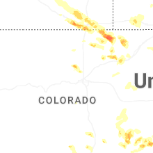
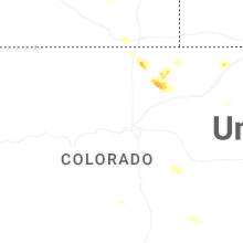
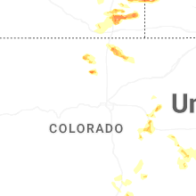

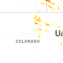
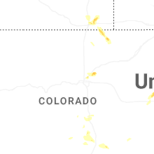
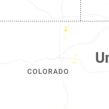
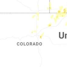


Connect with Interactive Hail Maps