

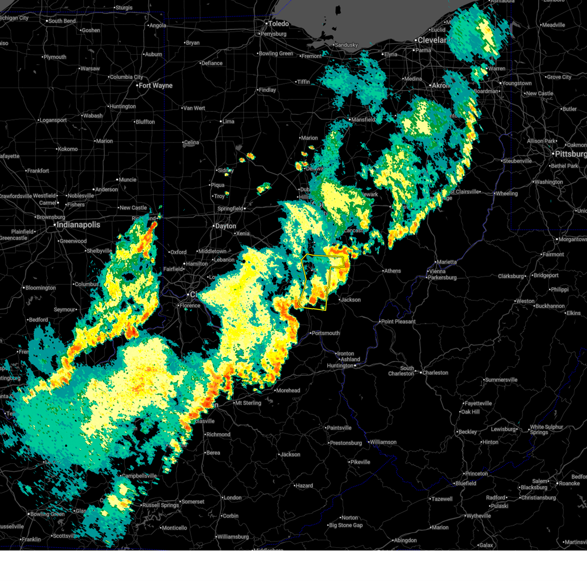
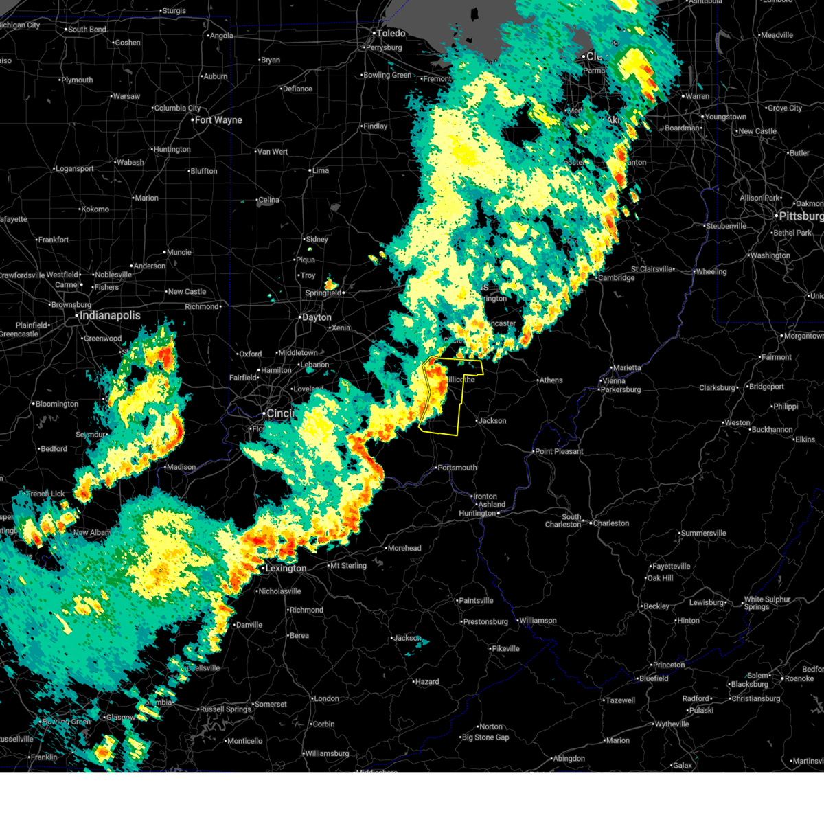
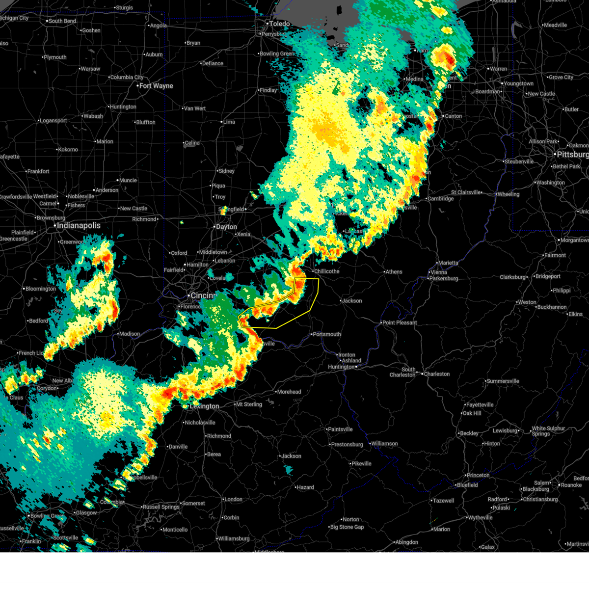
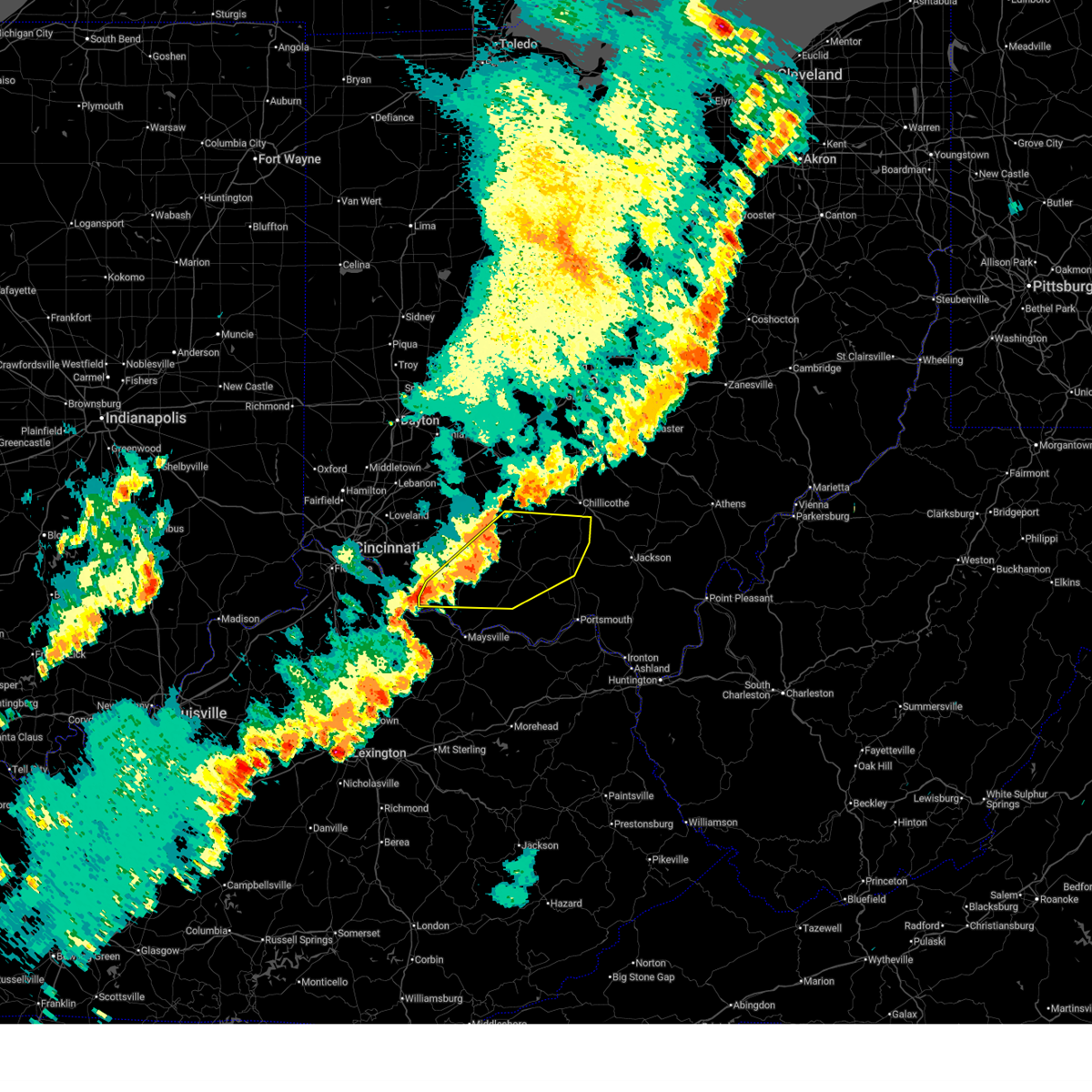
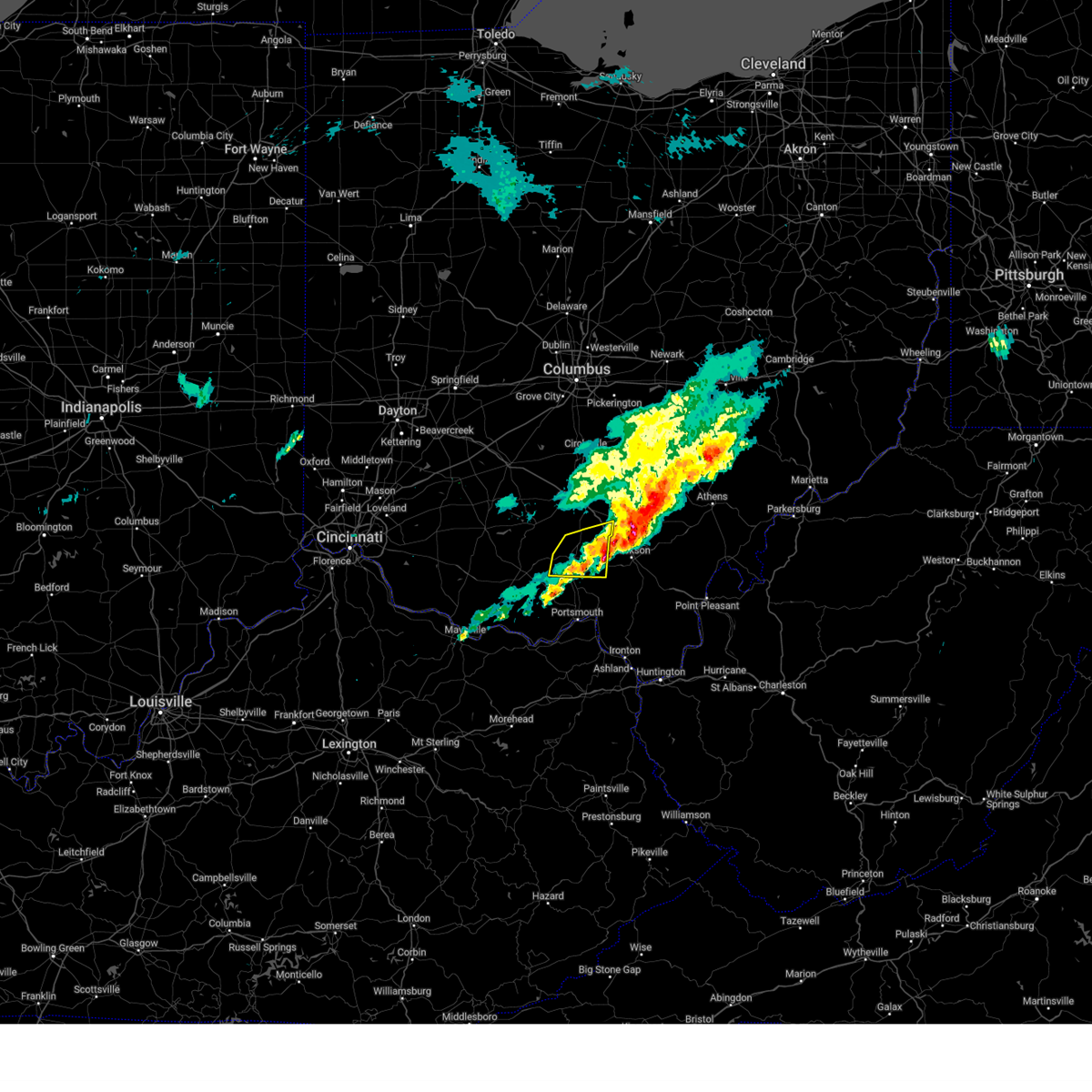
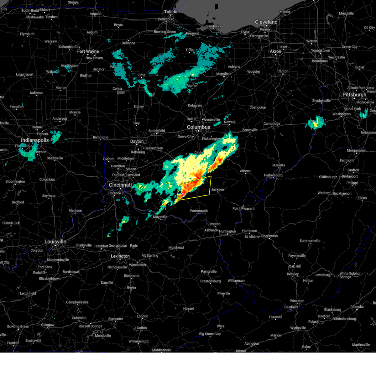
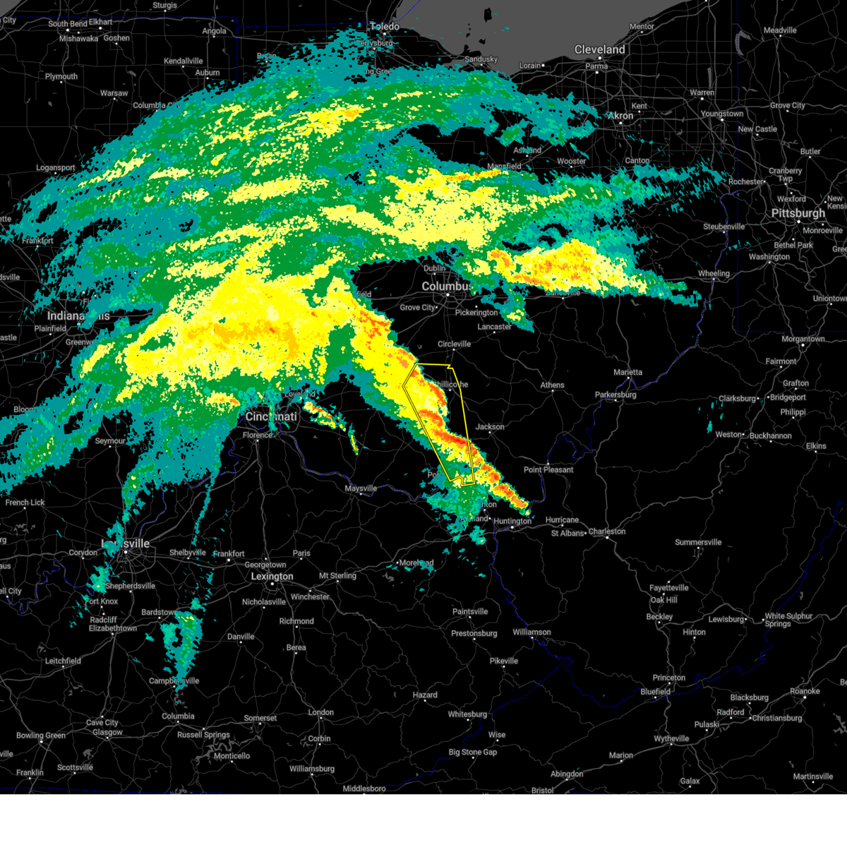
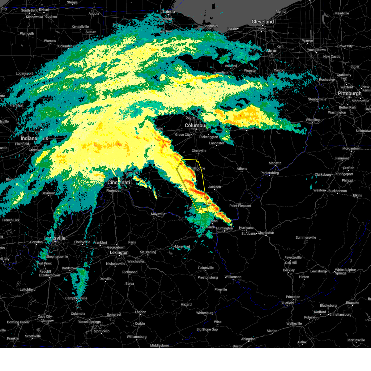
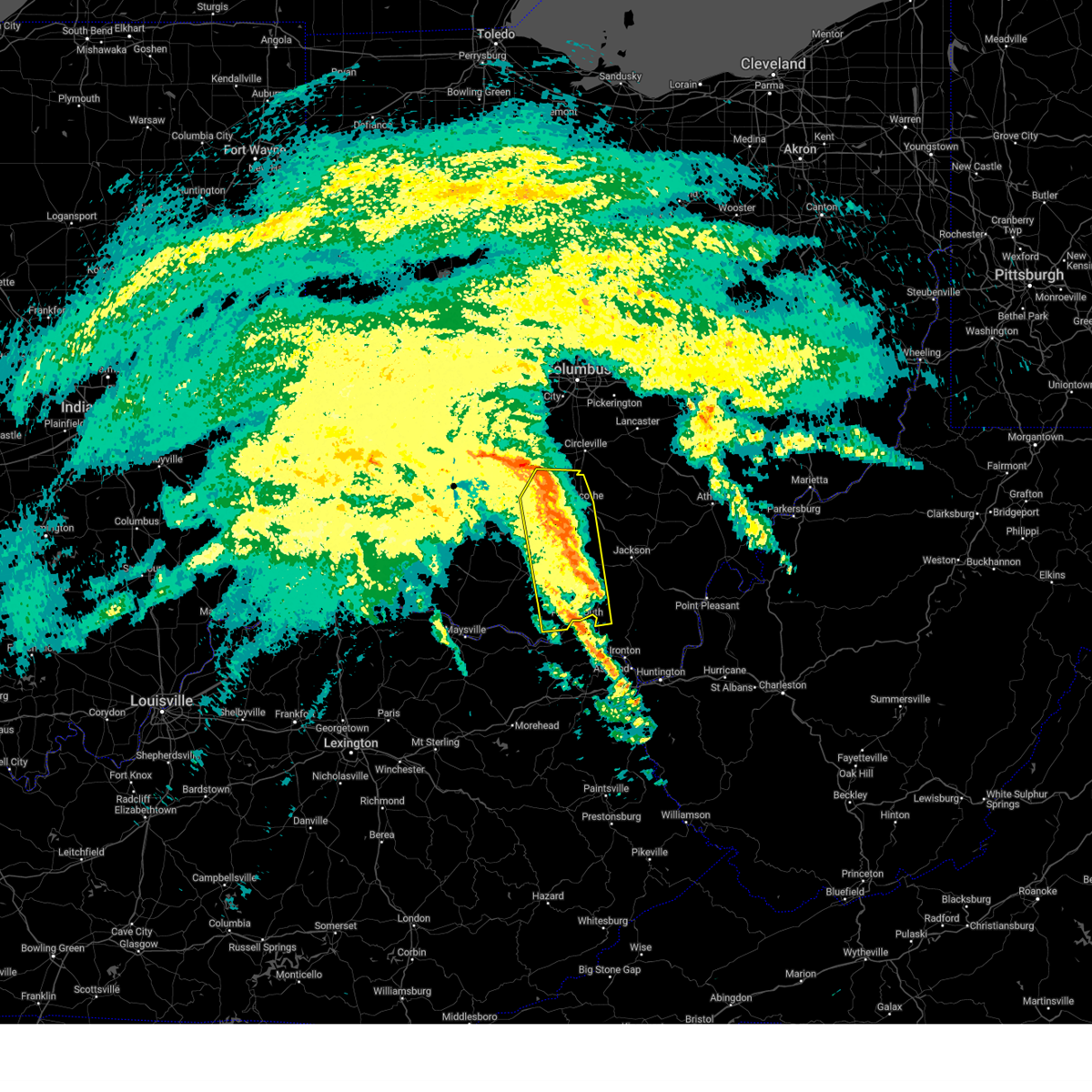
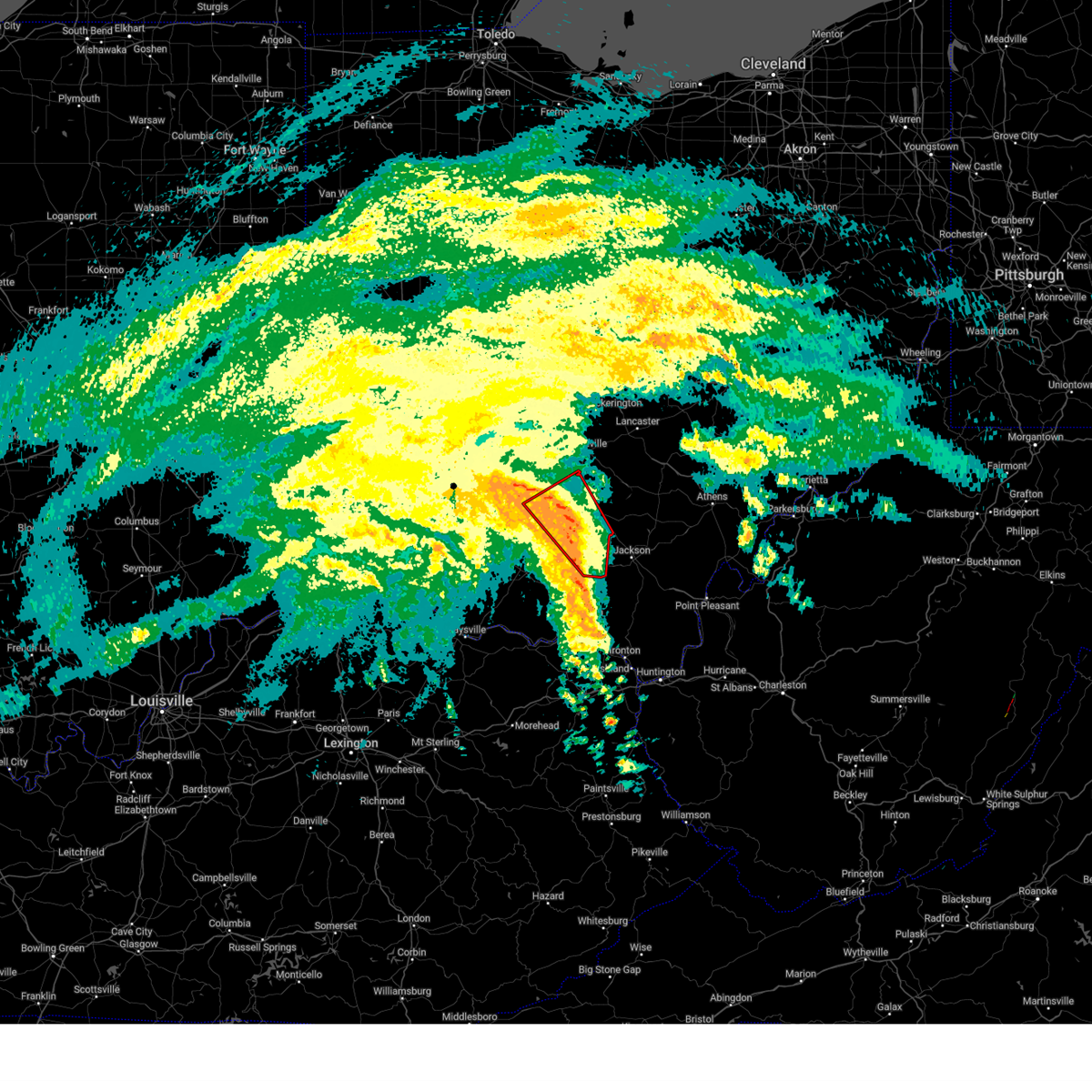
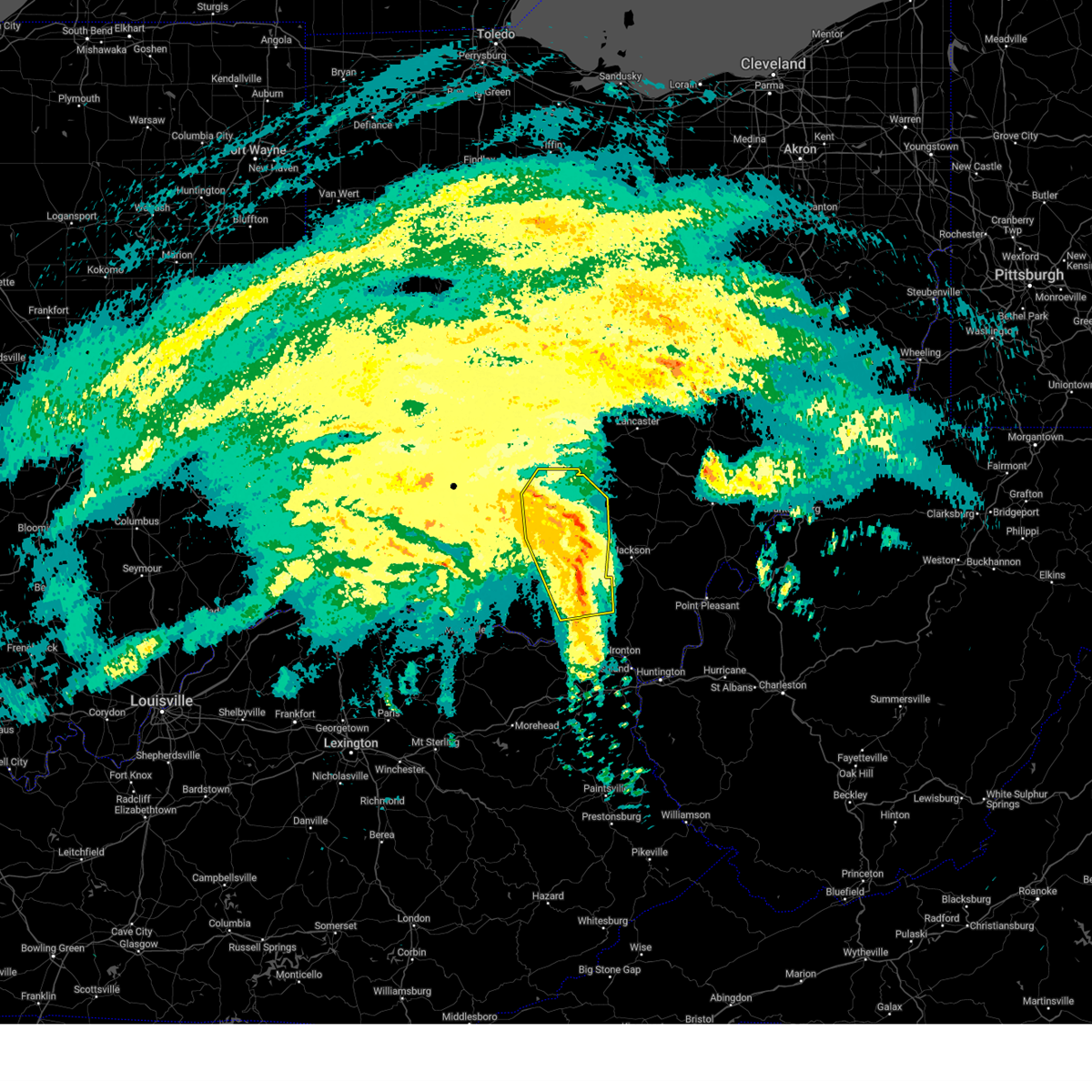
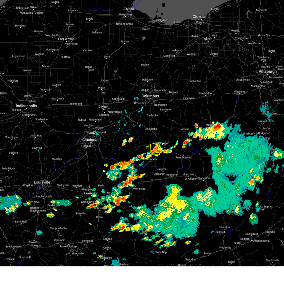
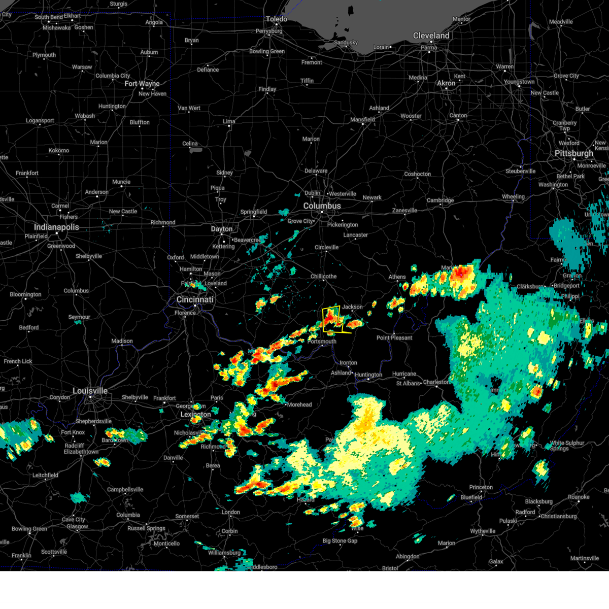
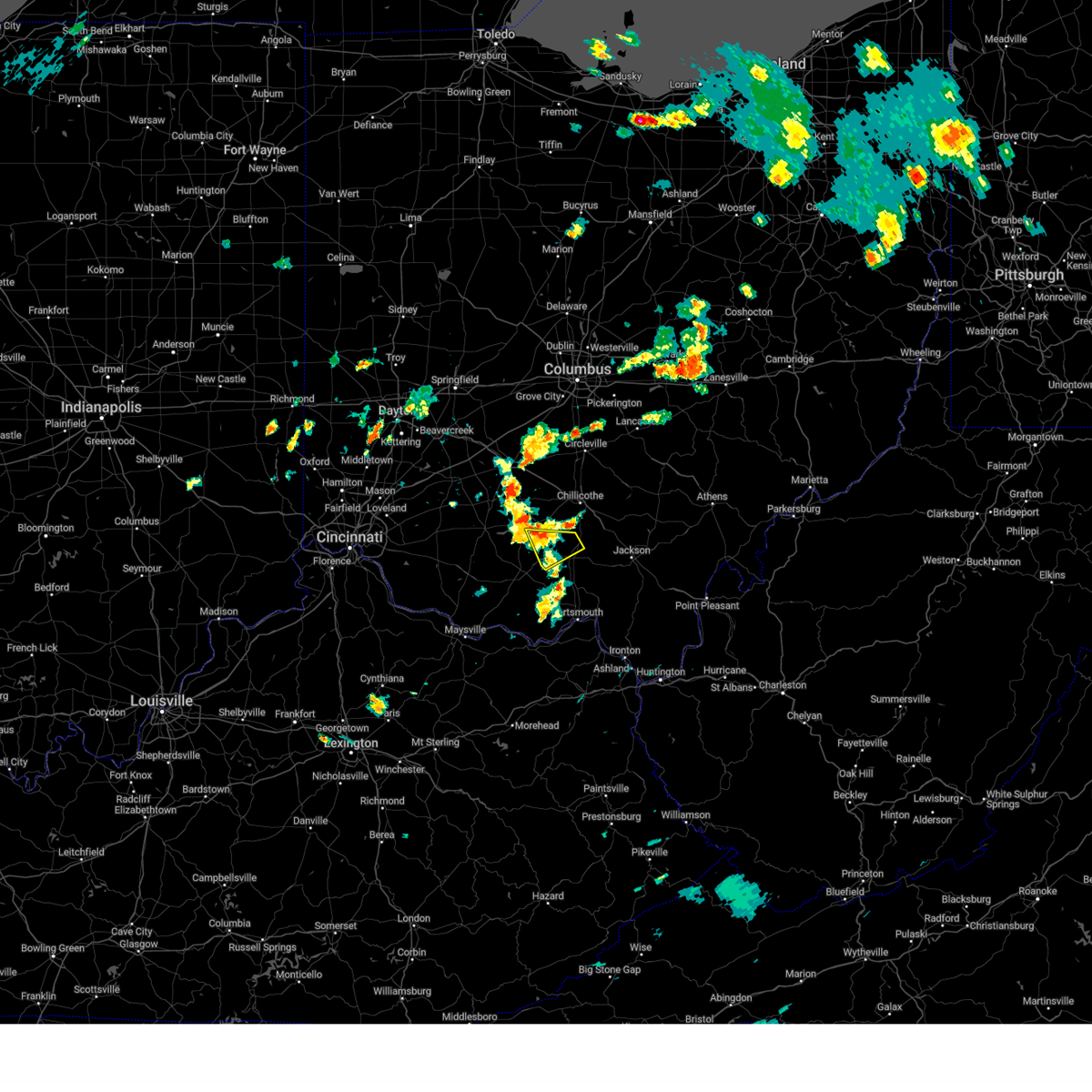
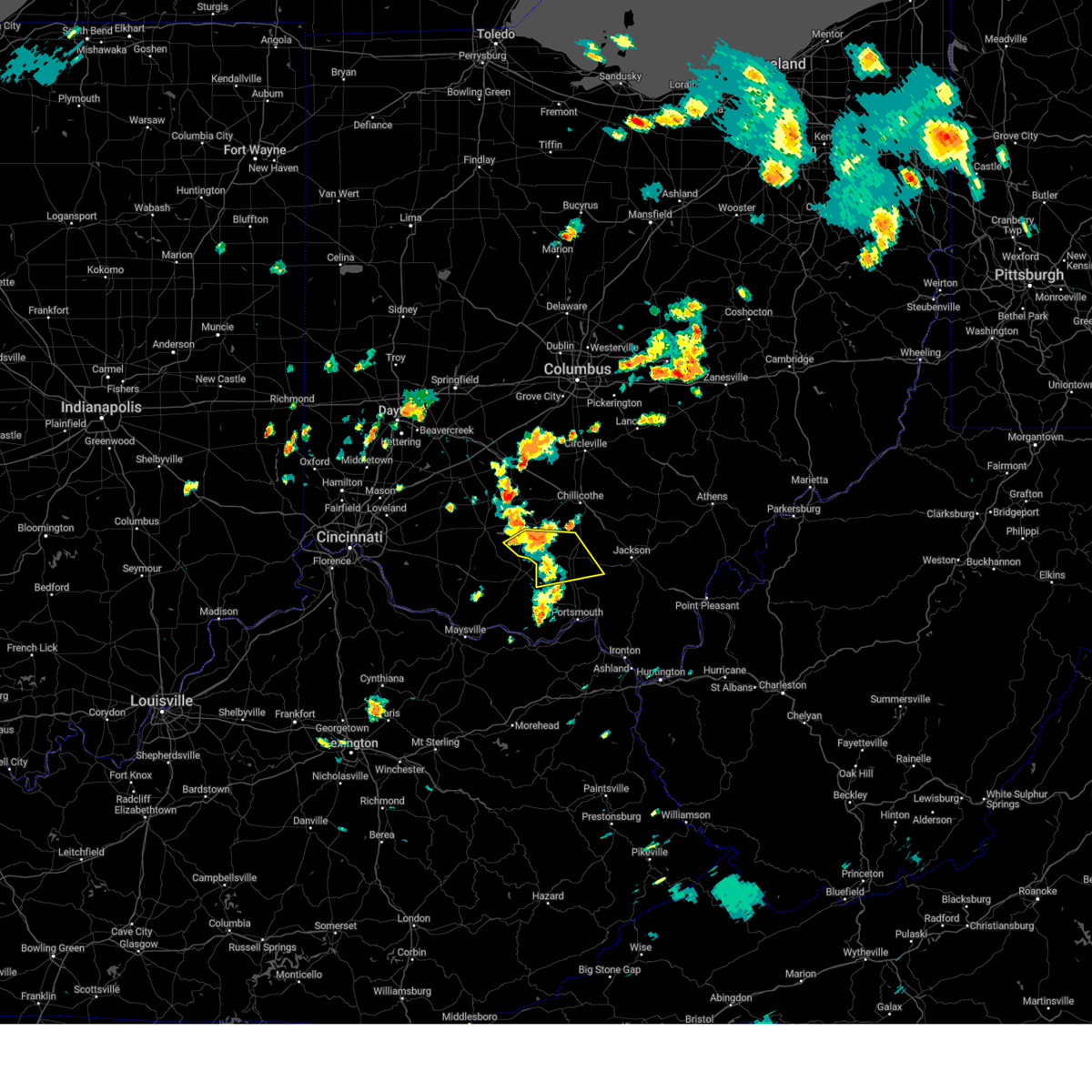
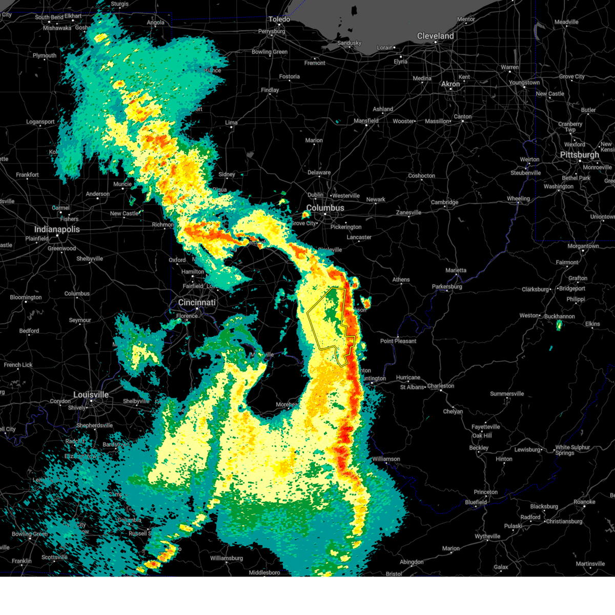
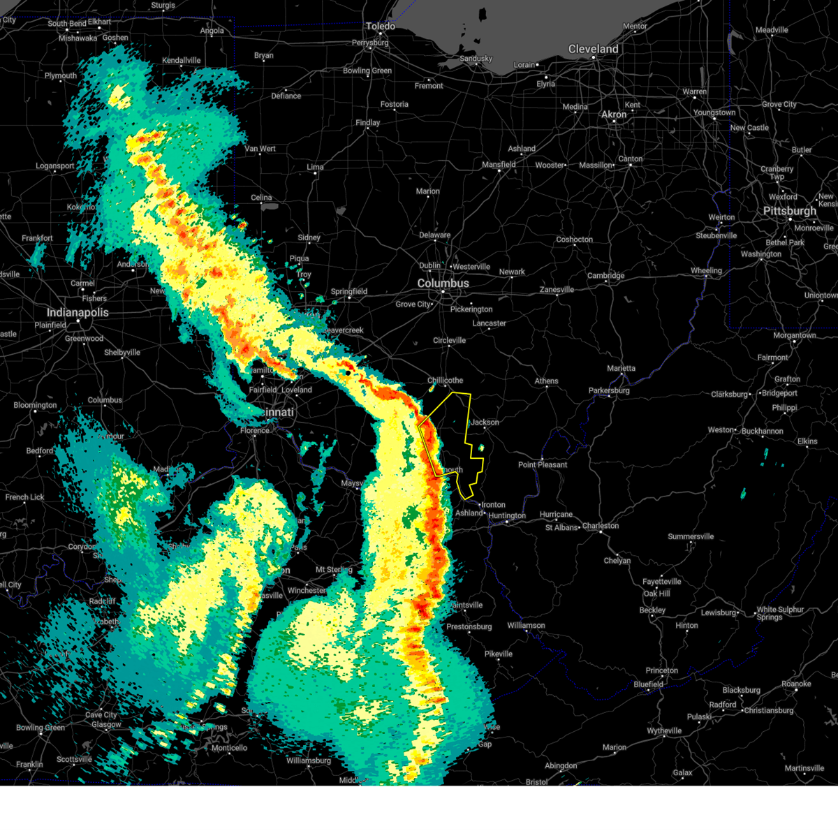
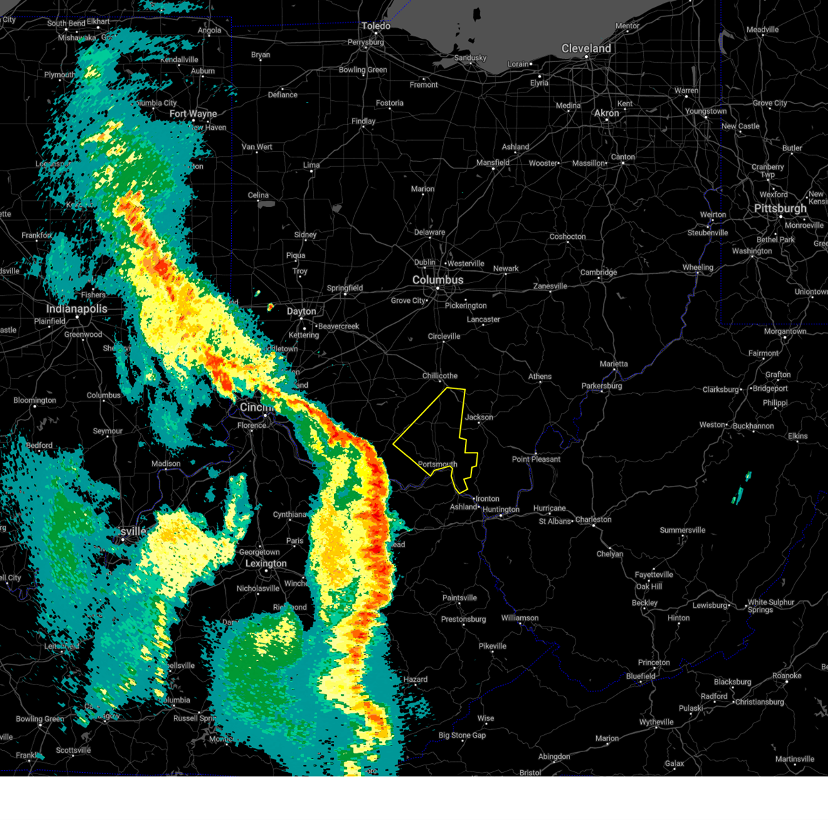
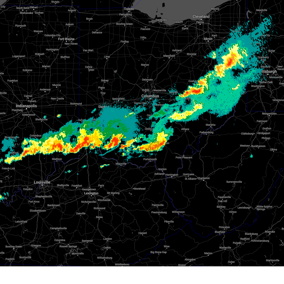
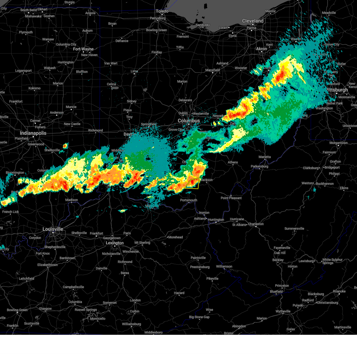
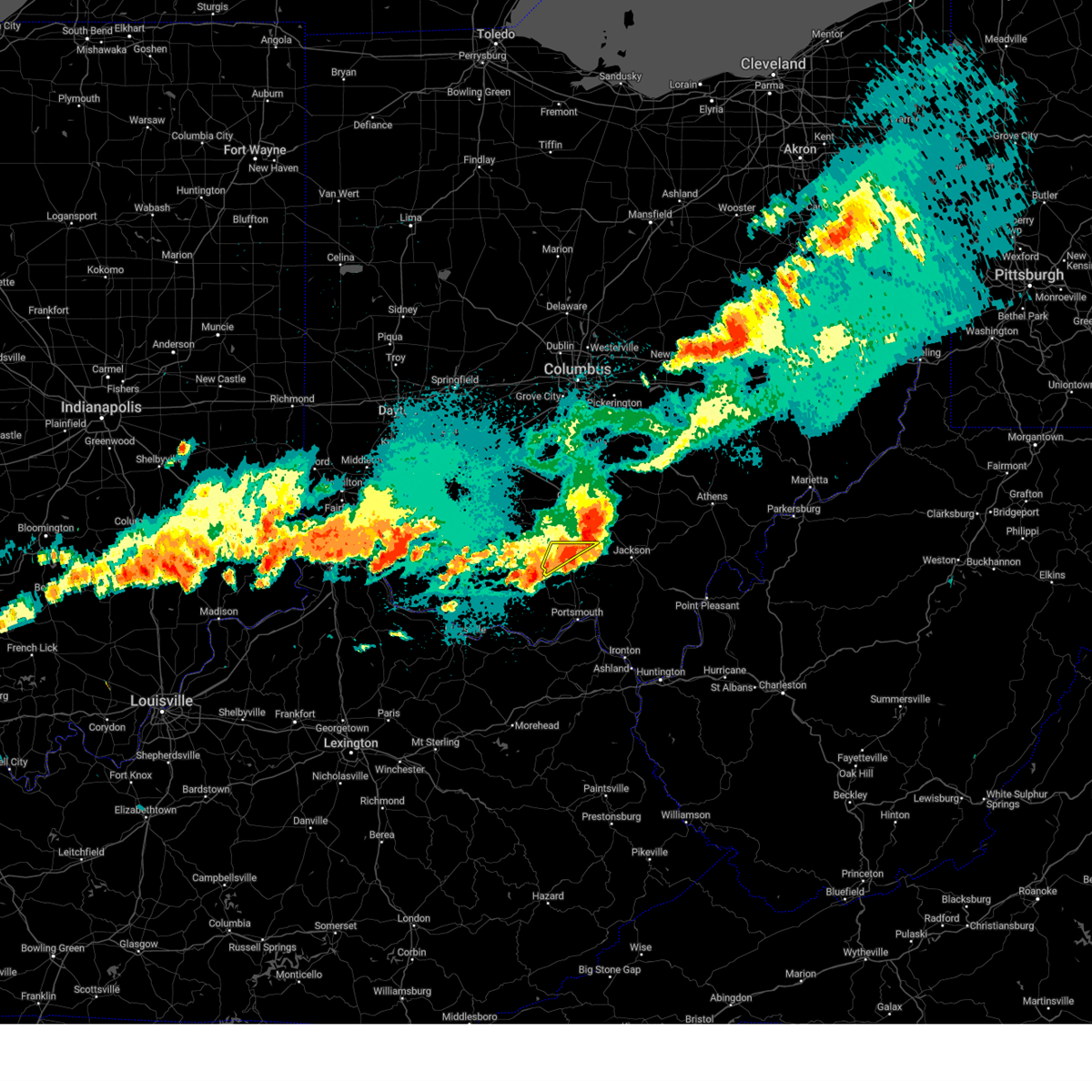
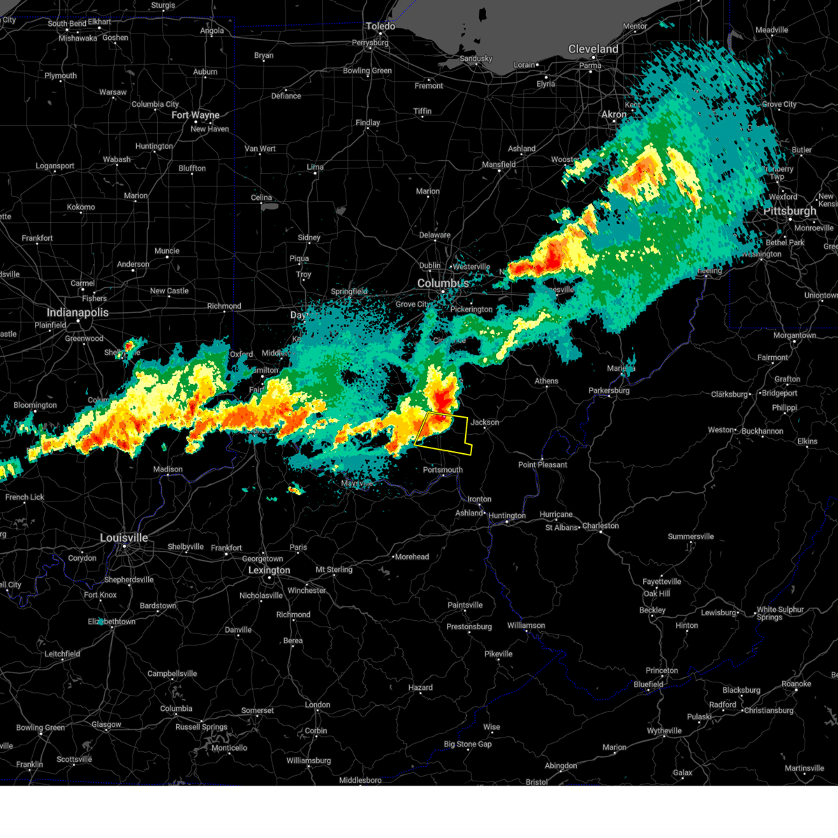
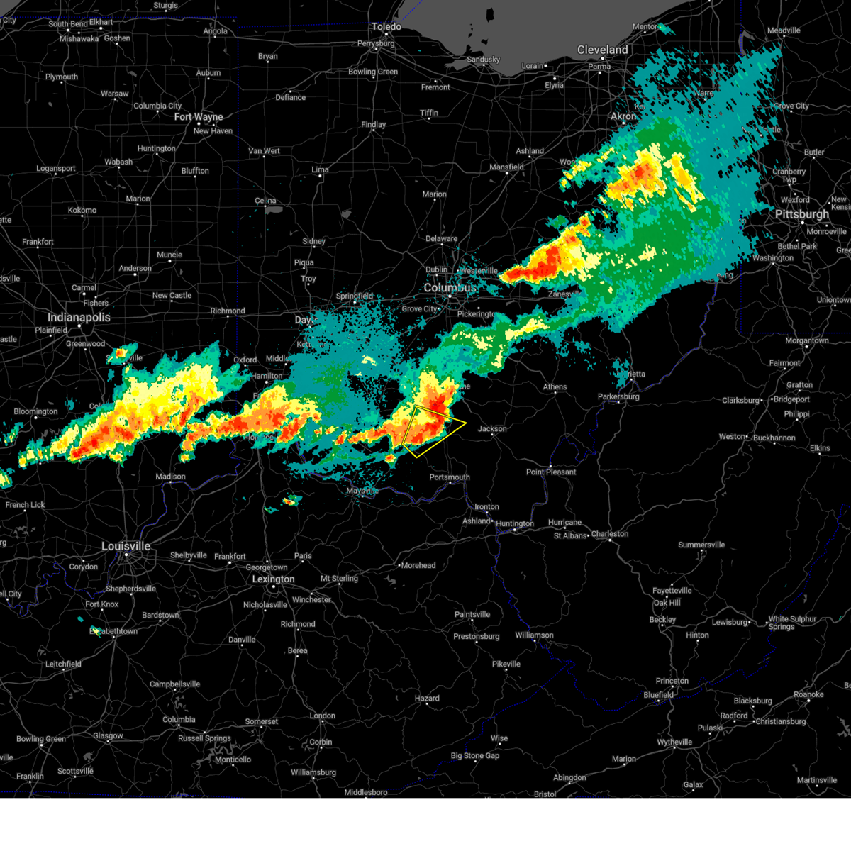
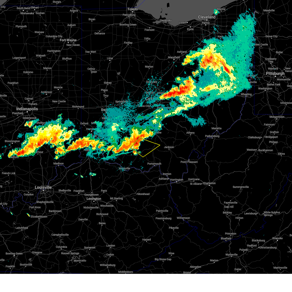
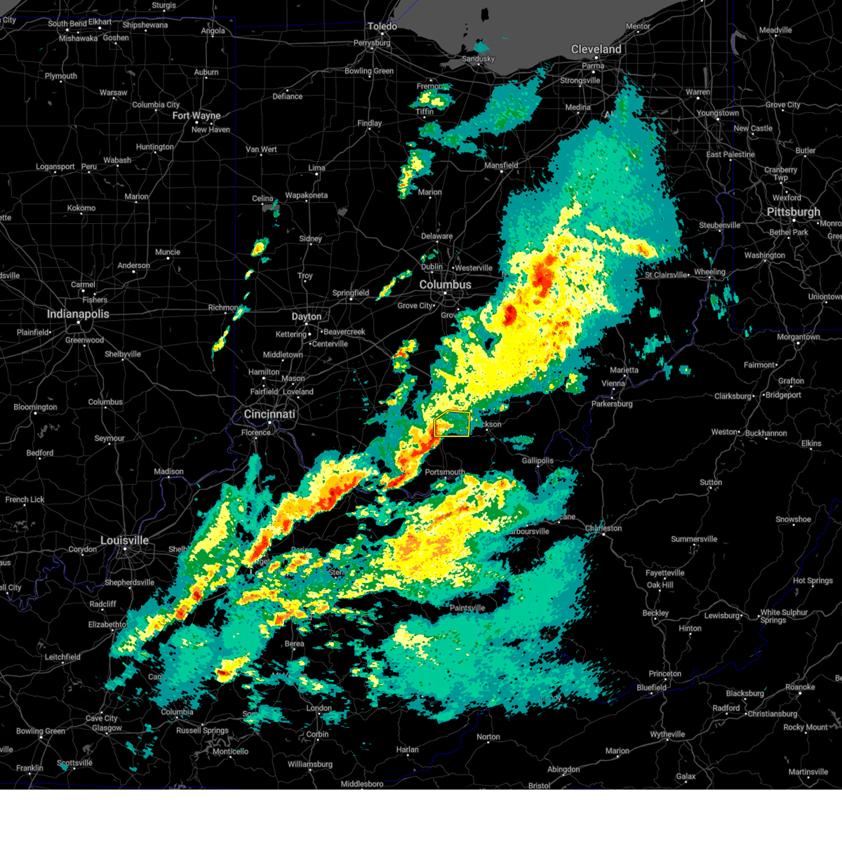
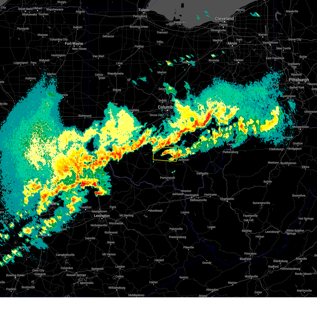
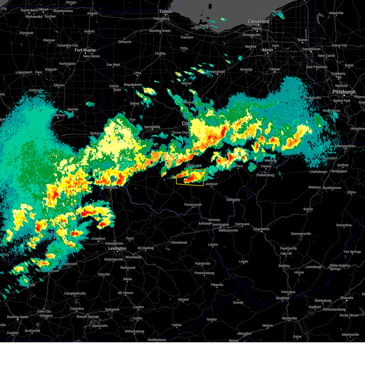
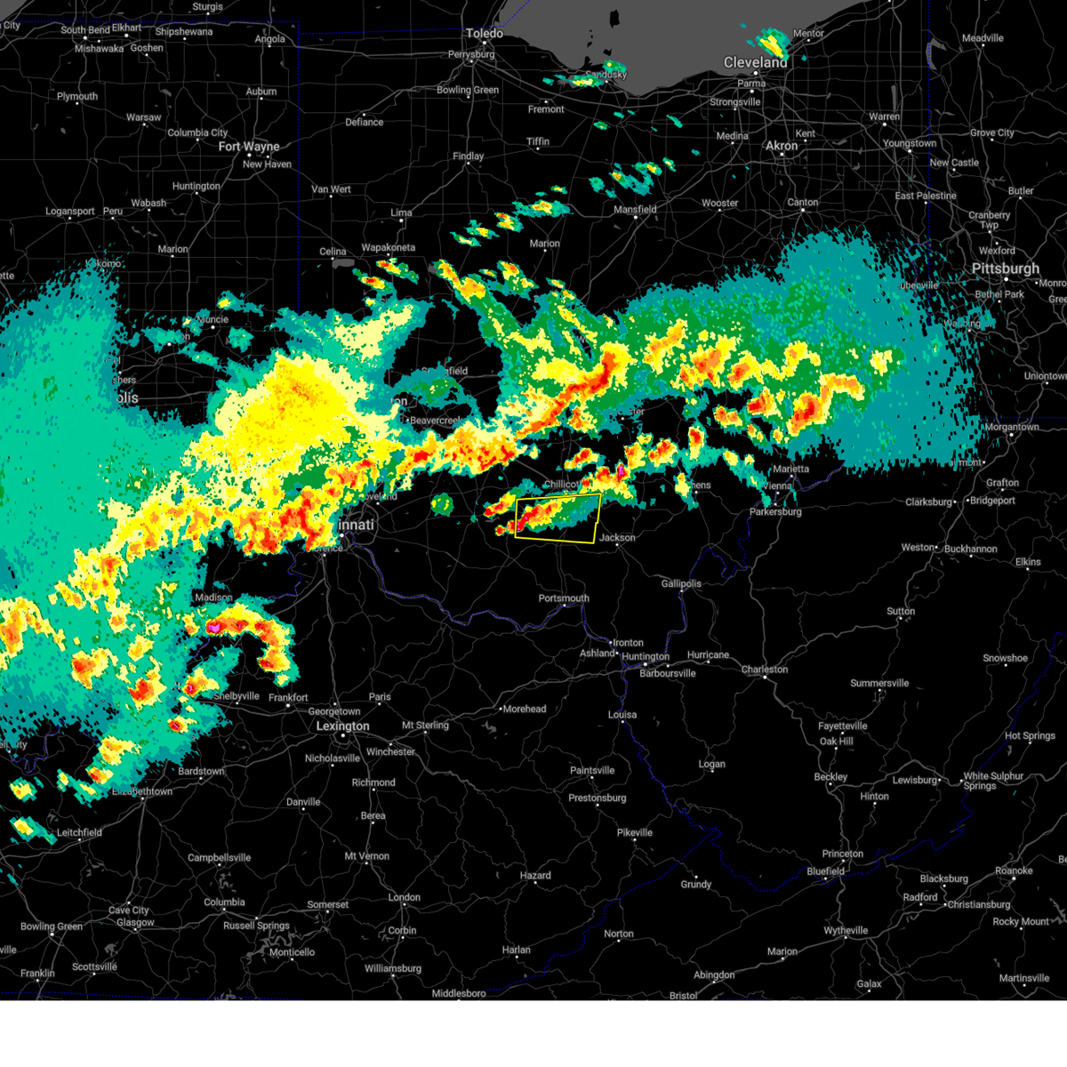
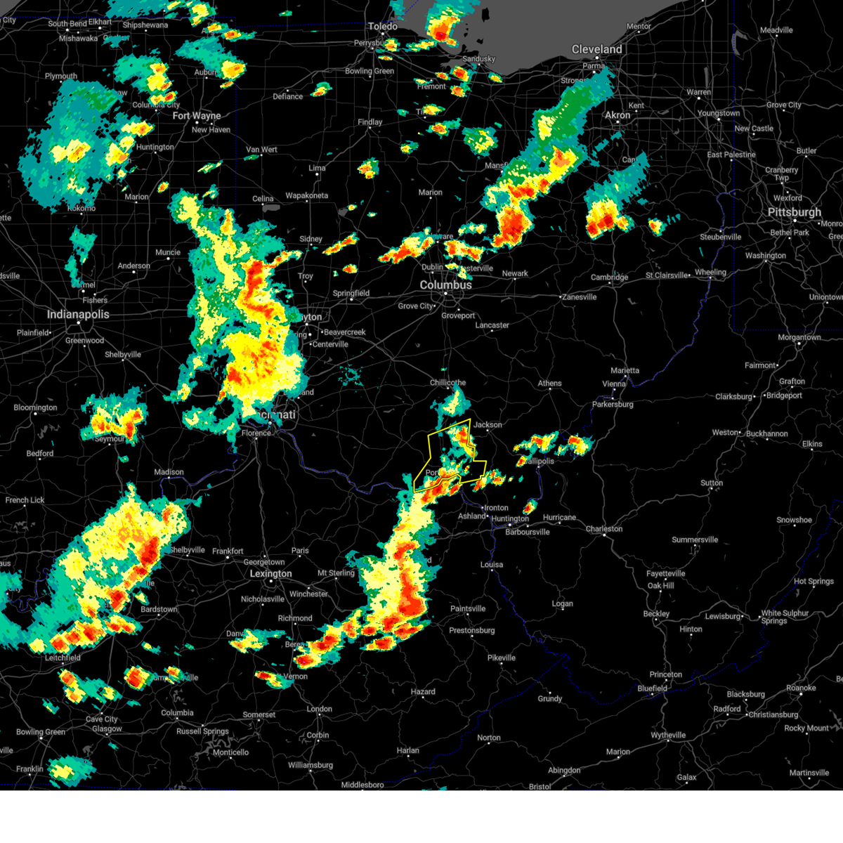
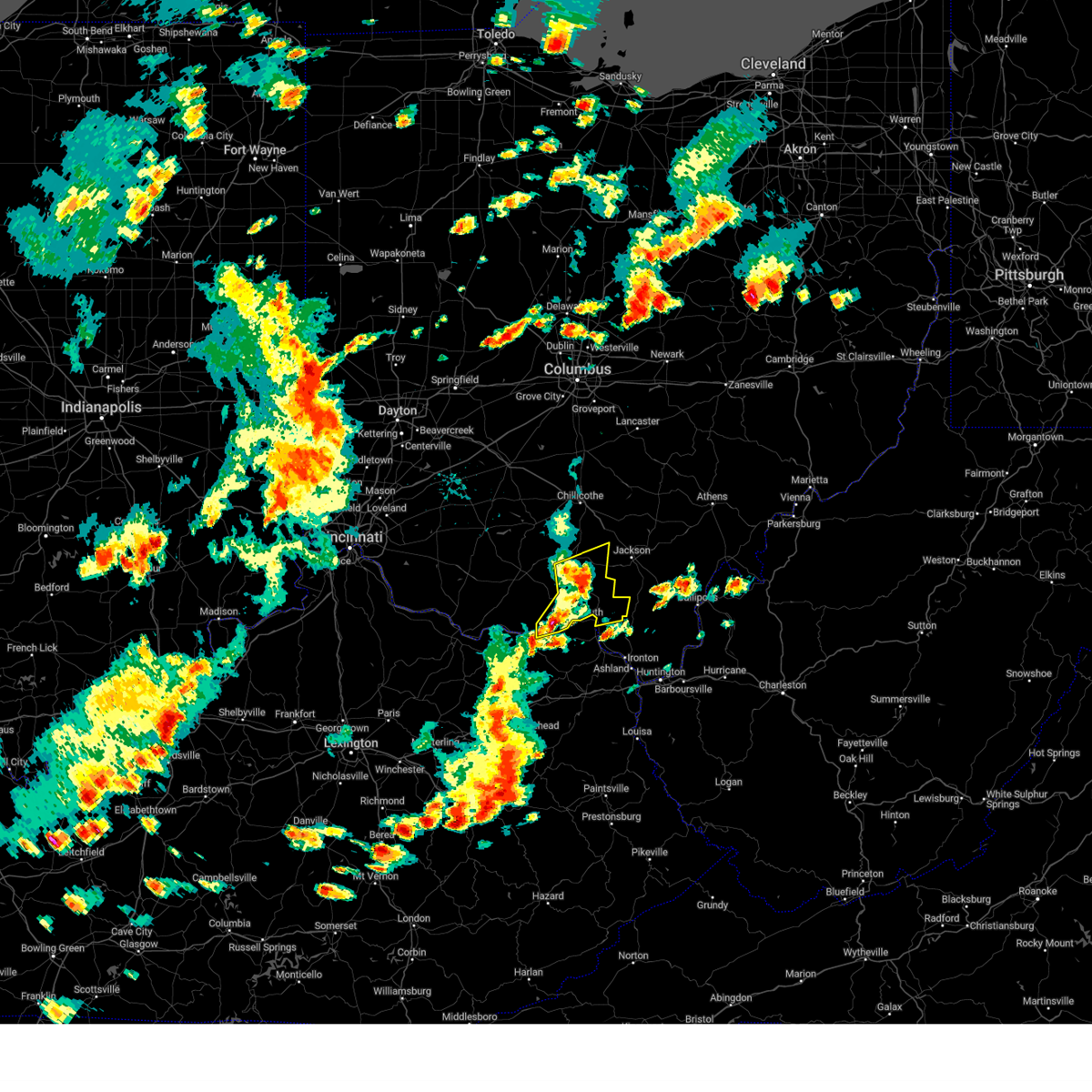
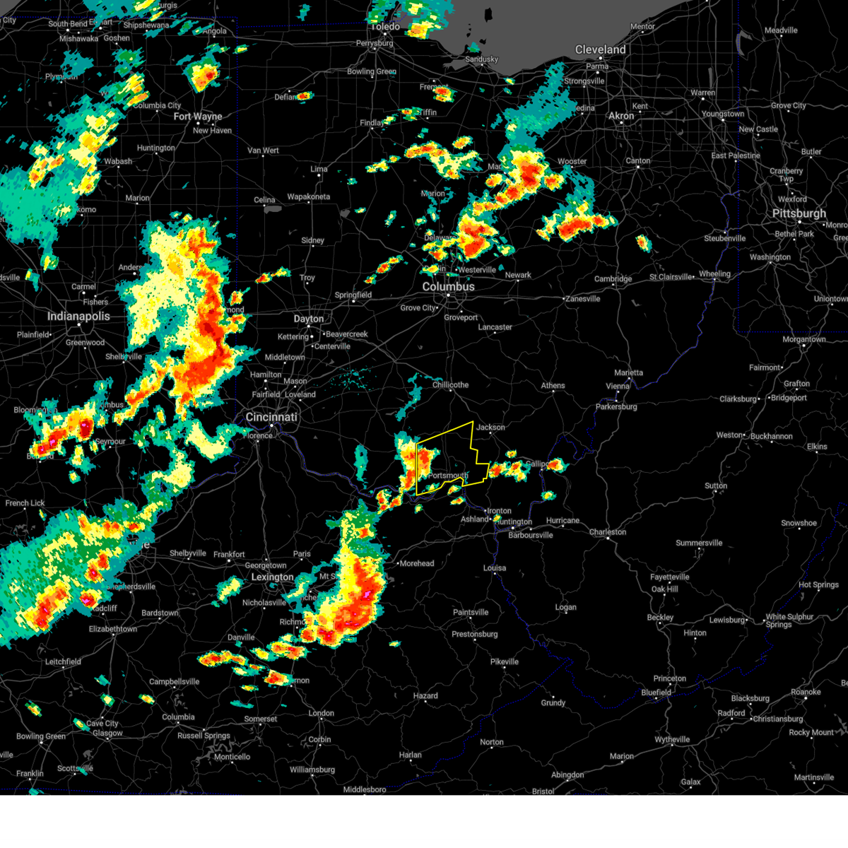
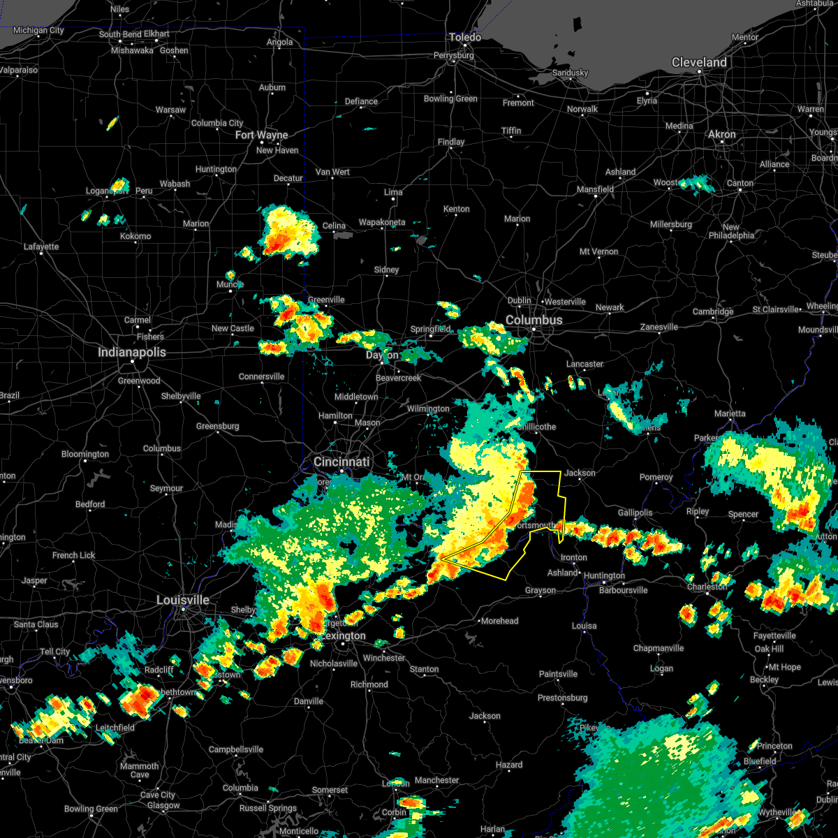
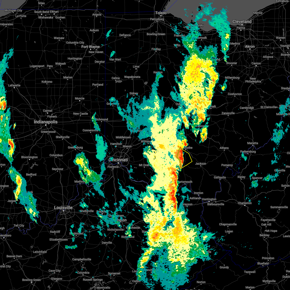
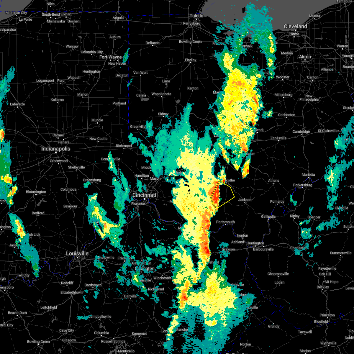
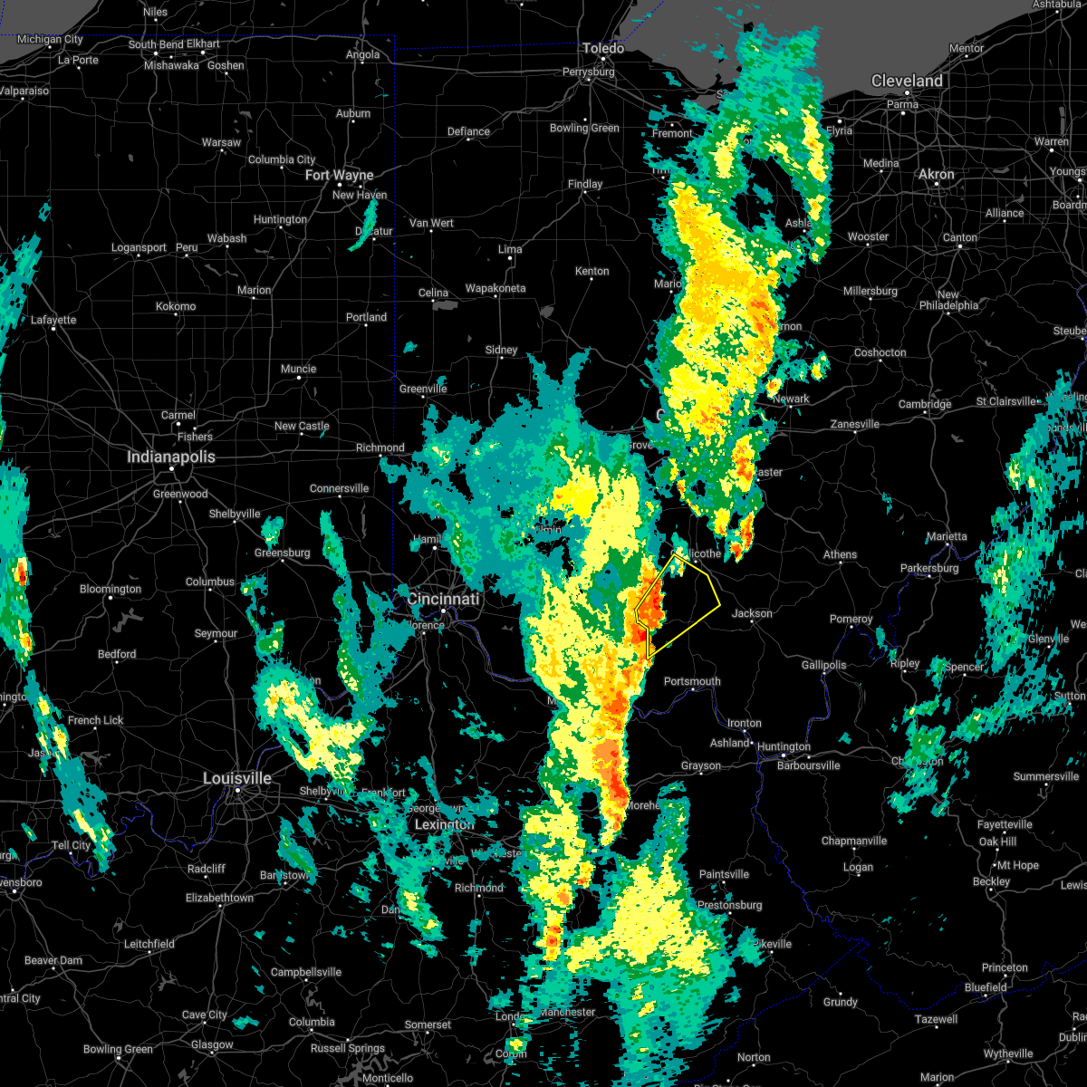
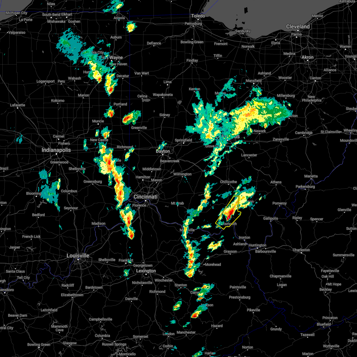
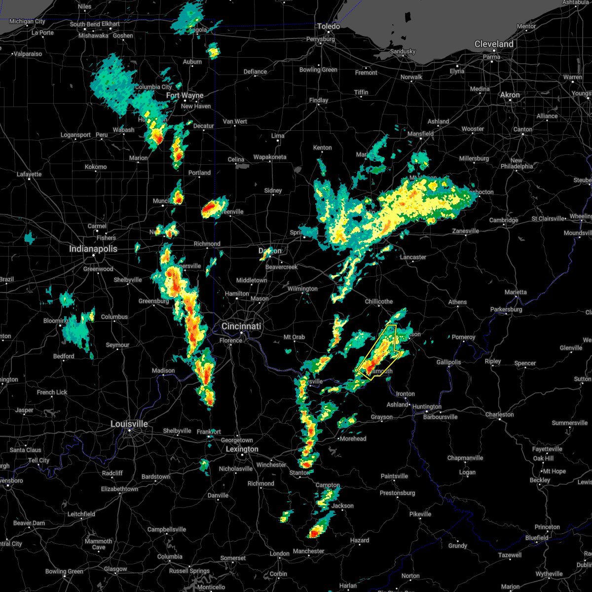
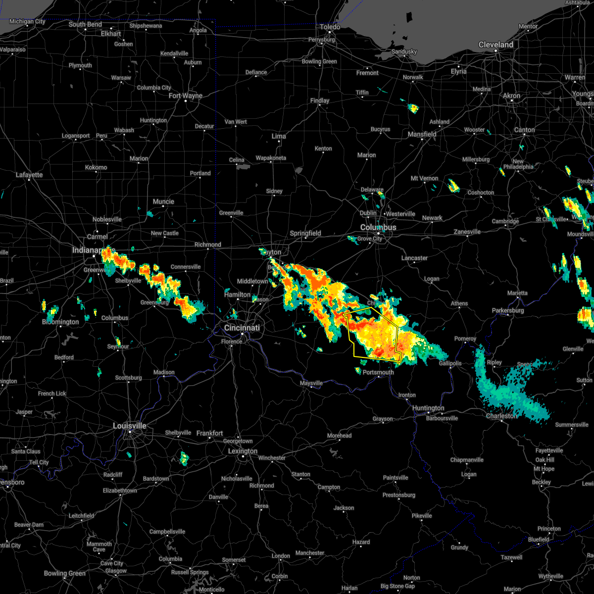
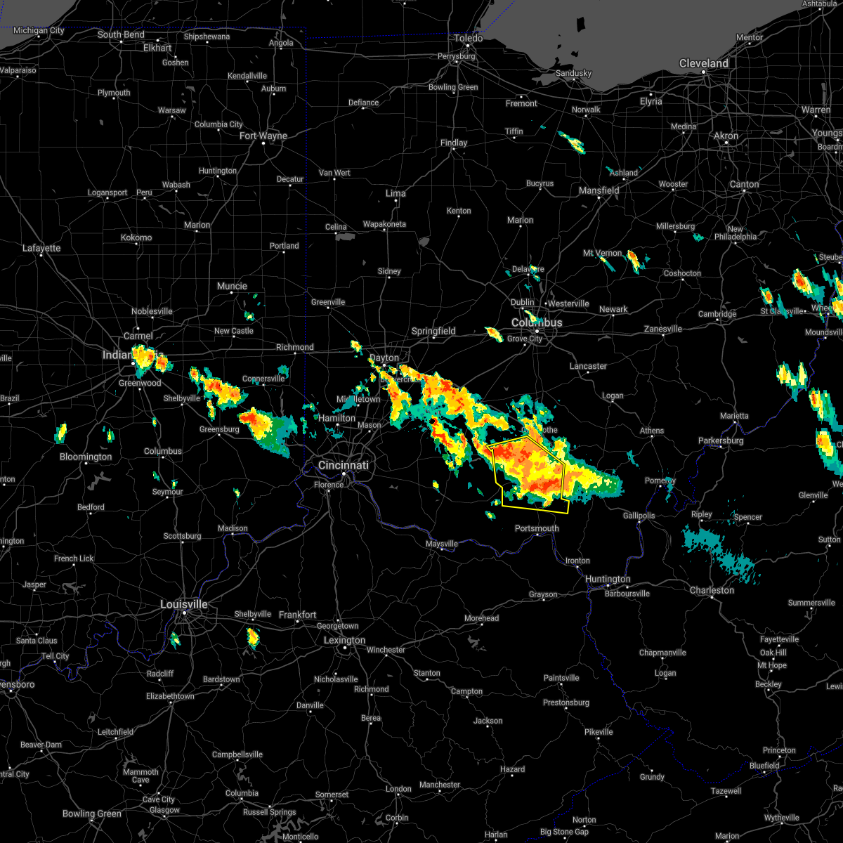
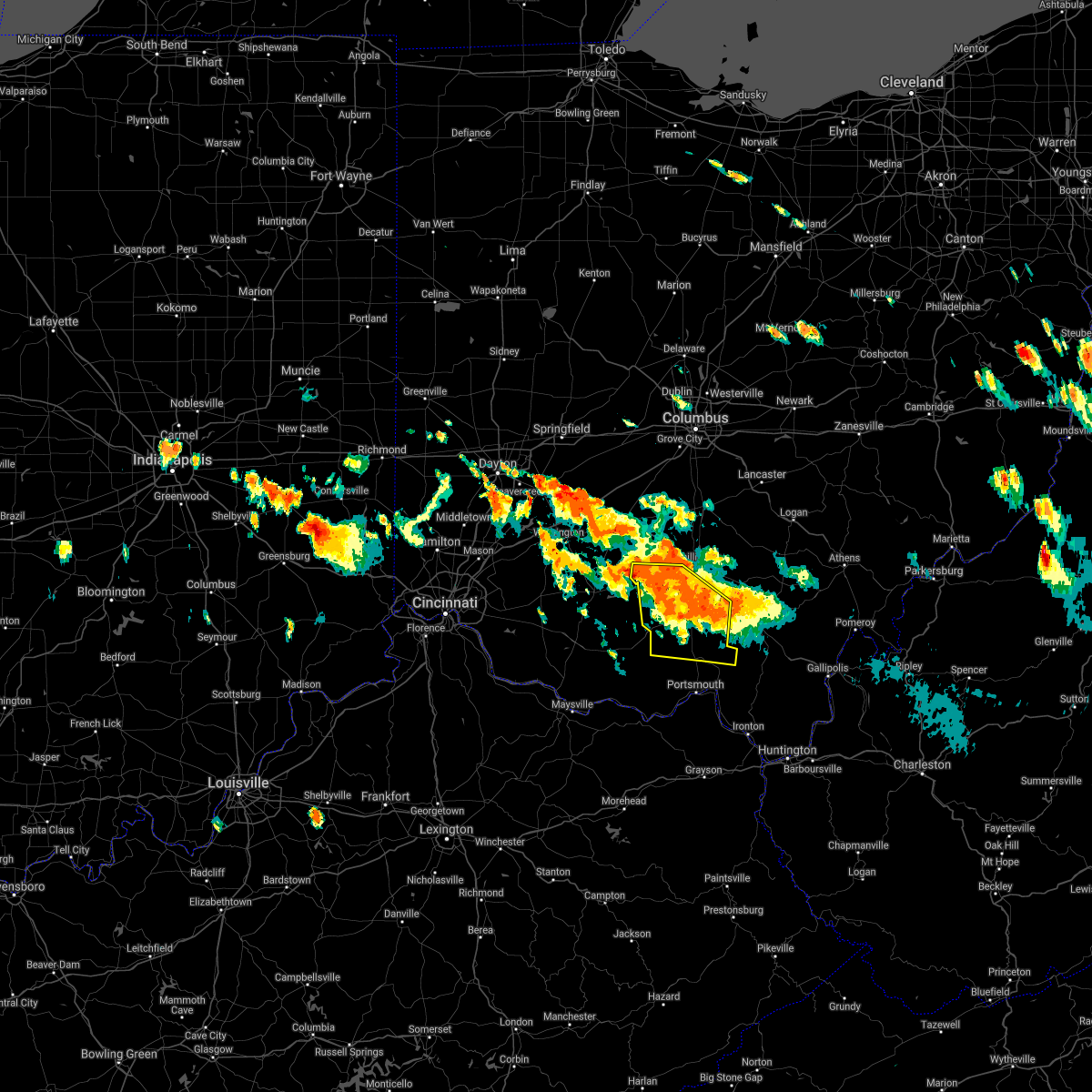
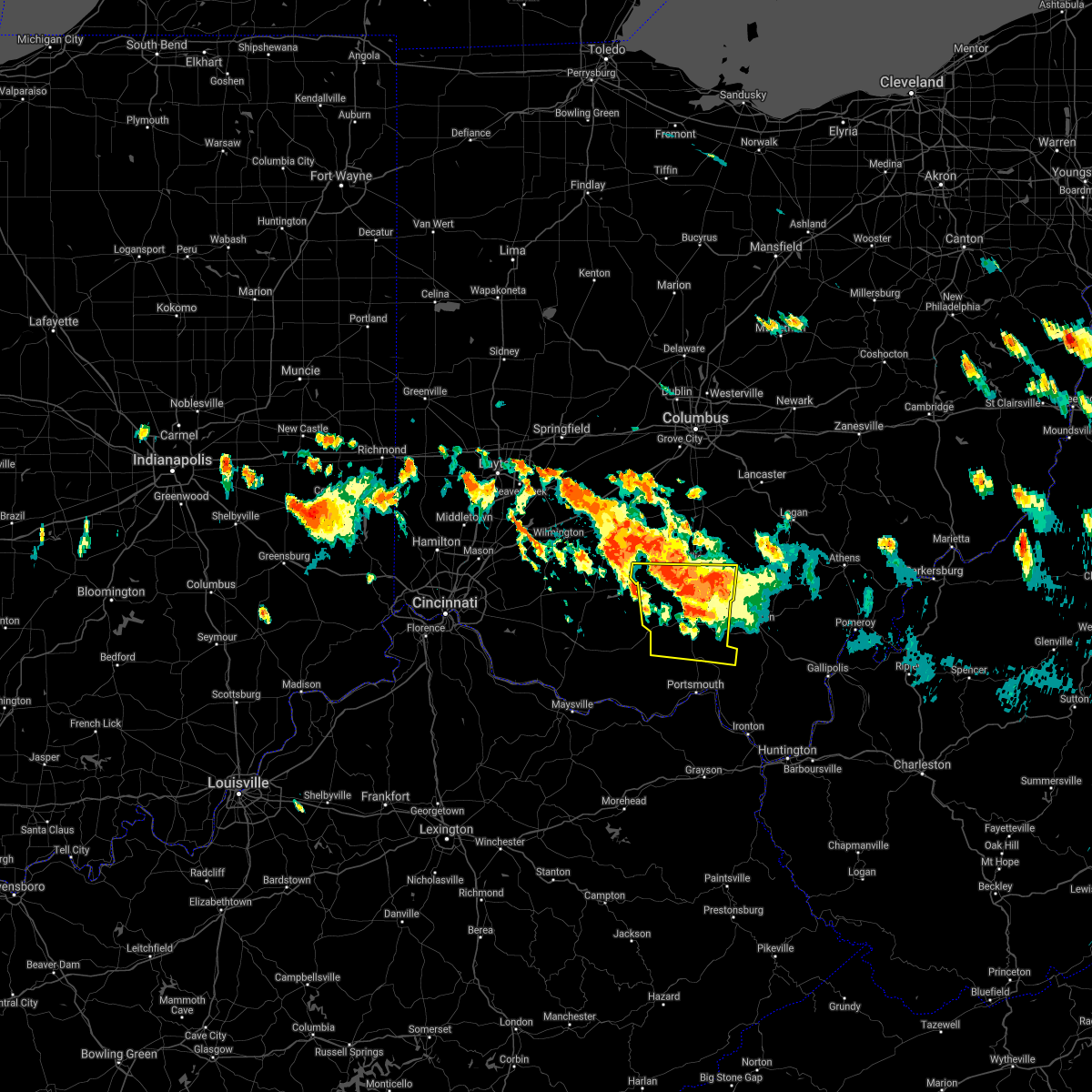
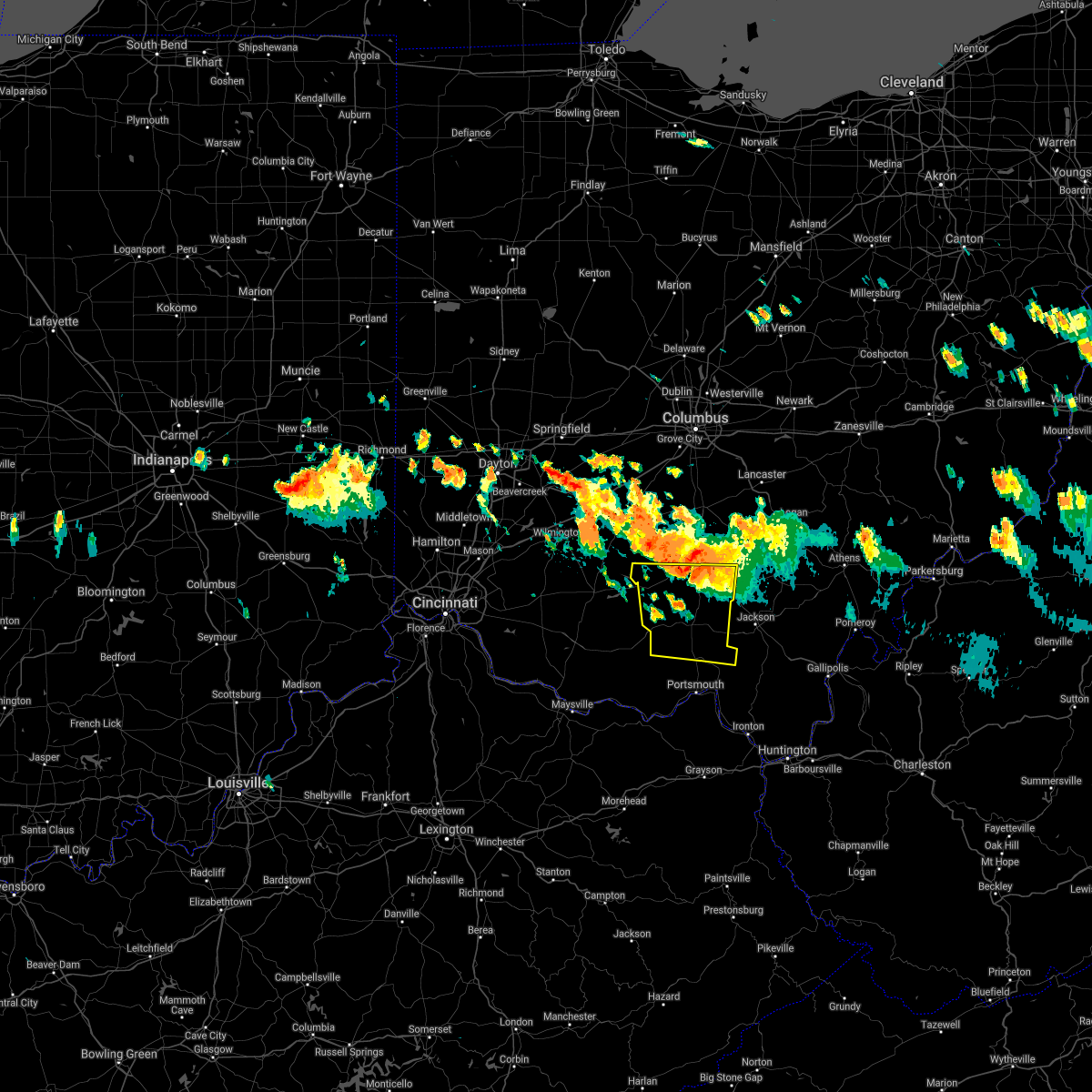
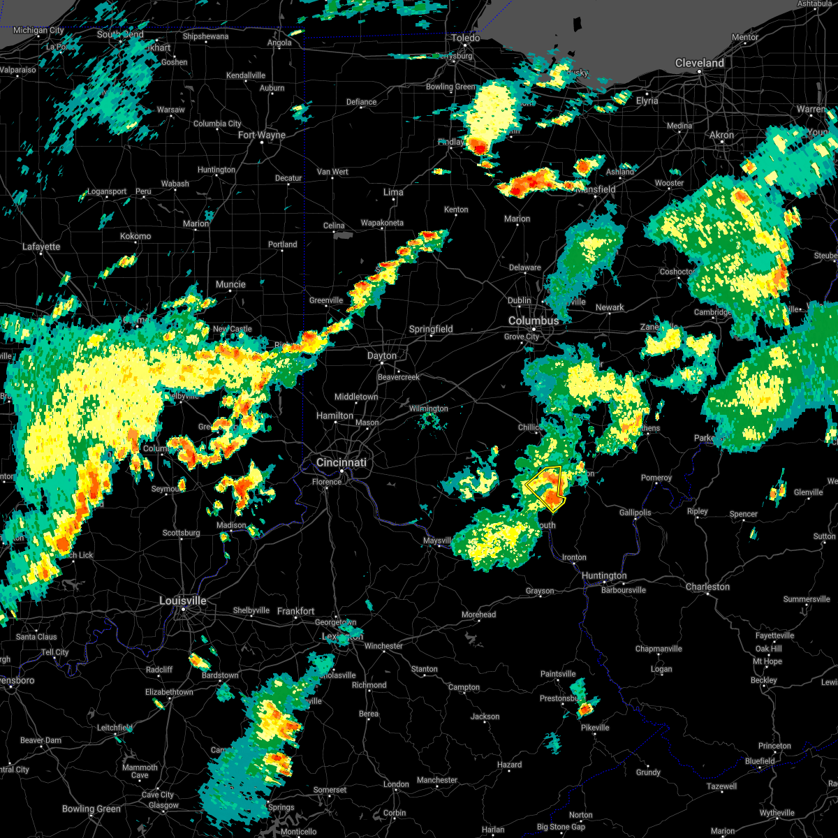
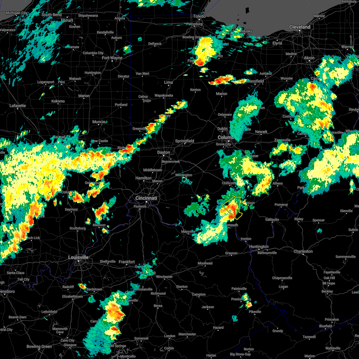
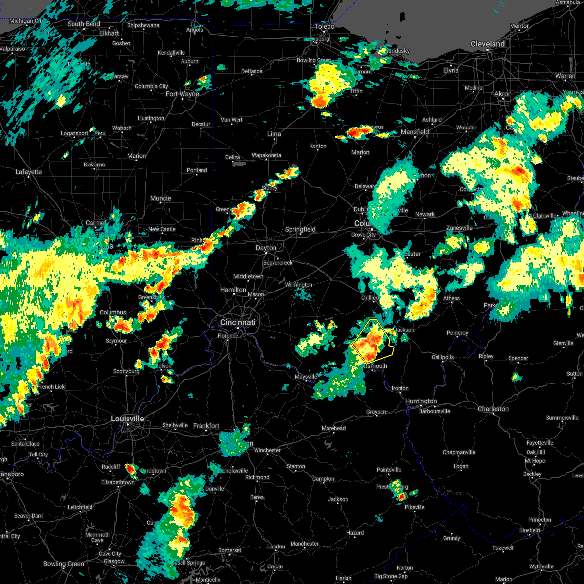
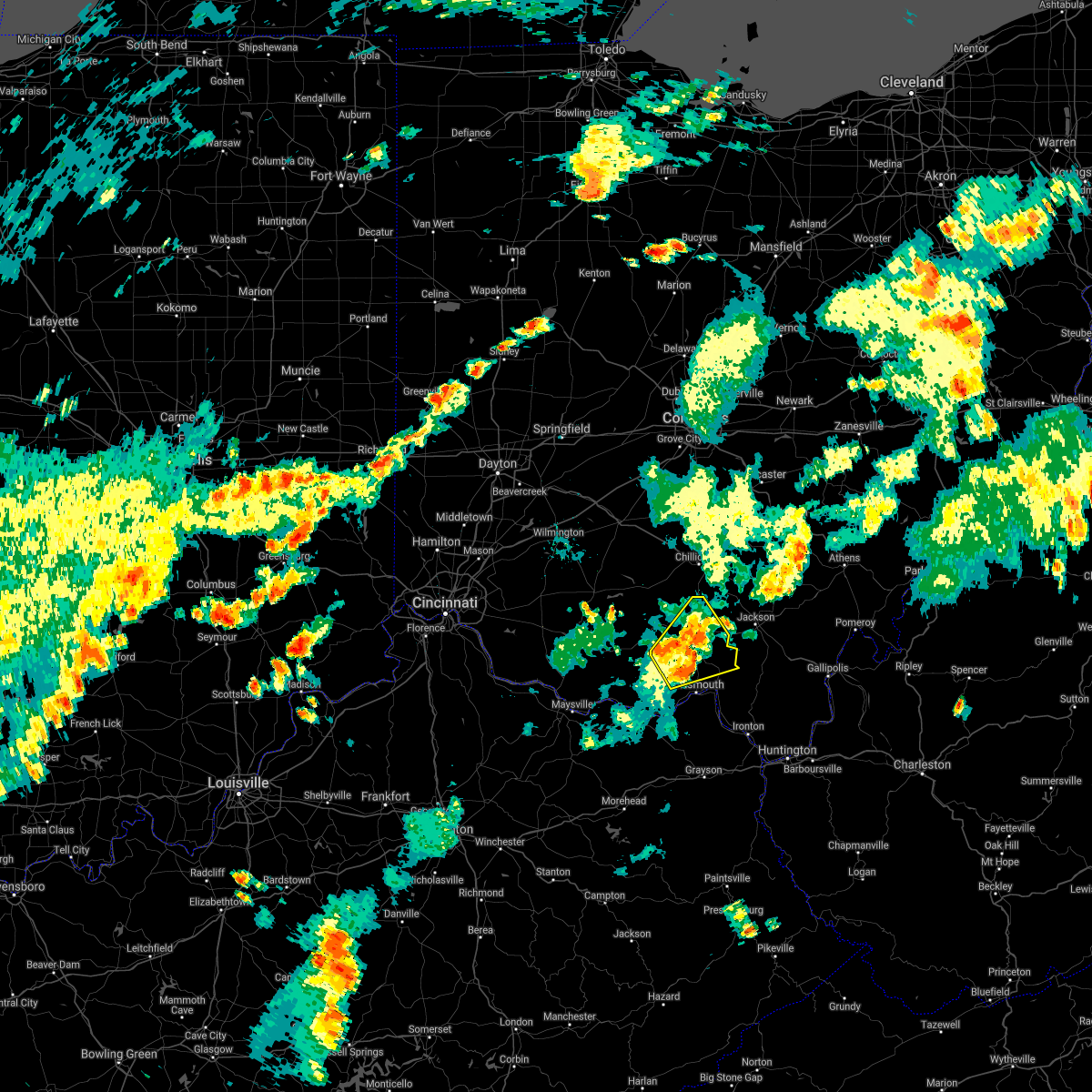
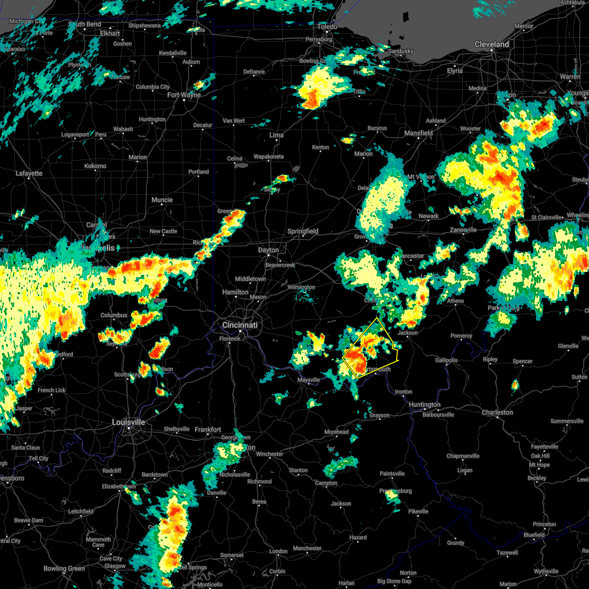
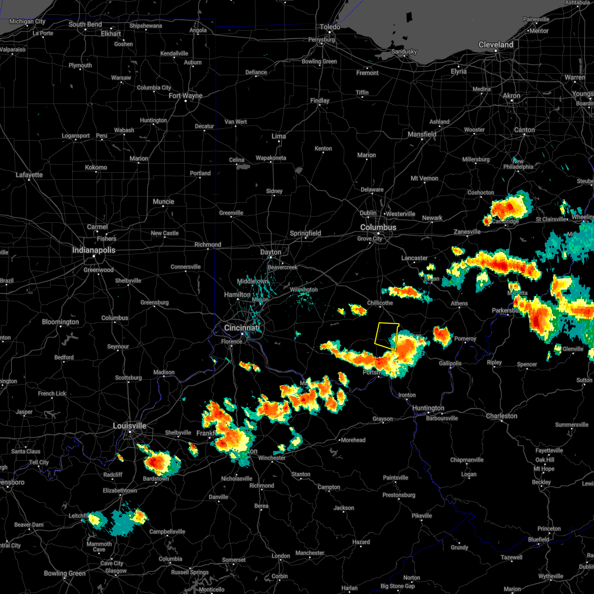
Hail Map for Piketon, OH
The Piketon, OH area has had 3 reports of on-the-ground hail by trained spotters, and has been under severe weather warnings 35 times during the past 12 months. Doppler radar has detected hail at or near Piketon, OH on 36 occasions, including 2 occasions during the past year.
| Name: | Piketon, OH |
| Where Located: | 62.2 miles S of Columbus, OH |
| Map: | Google Map for Piketon, OH |
| Population: | 2181 |
| Housing Units: | 908 |
| More Info: | Search Google for Piketon, OH |
0
The Top Recent Hail Date for Piketon, OH is Saturday, September 21, 2024 (23rd out of 36)

Hail and Wind Damage Spotted near Piketon, OH
| Date / Time | Report Details |
|---|---|
| 6/18/2025 10:22 PM EDT |
 The storm which prompted the warning has moved out of the area. therefore, the warning will be allowed to expire. an additional severe thunderstorm warning remains in effect for hocking county until 11 pm. a severe thunderstorm watch remains in effect until 1100 pm edt for south central ohio. please report previous wind damage or hail to the national weather service by going to our website at weather.gov/iln and submitting your report via social media. The storm which prompted the warning has moved out of the area. therefore, the warning will be allowed to expire. an additional severe thunderstorm warning remains in effect for hocking county until 11 pm. a severe thunderstorm watch remains in effect until 1100 pm edt for south central ohio. please report previous wind damage or hail to the national weather service by going to our website at weather.gov/iln and submitting your report via social media.
|
| 6/18/2025 9:55 PM EDT |
 At 954 pm edt, a severe thunderstorm was located near chillicothe, moving northeast at 50 mph (radar indicated). Hazards include 60 mph wind gusts. Expect damage to trees and power lines. Locations impacted include, chillicothe, waverly, piketon, kingston, north folk village, londonderry, beaver, adelphi, stockdale, pike county airport, andersonville, mooresville, omega, givens, south bloomingville, richmond dale, massieville, linn, hallsville, and lake white. At 954 pm edt, a severe thunderstorm was located near chillicothe, moving northeast at 50 mph (radar indicated). Hazards include 60 mph wind gusts. Expect damage to trees and power lines. Locations impacted include, chillicothe, waverly, piketon, kingston, north folk village, londonderry, beaver, adelphi, stockdale, pike county airport, andersonville, mooresville, omega, givens, south bloomingville, richmond dale, massieville, linn, hallsville, and lake white.
|
| 6/18/2025 9:41 PM EDT |
 At 941 pm edt, severe thunderstorms were located along a line extending from pike lake to peebles, moving east at 50 mph (radar indicated). Hazards include 60 mph wind gusts. Expect damage to trees and power lines. Locations impacted include, georgetown, waverly, west union, piketon, peebles, winchester, seaman, pike lake, kincaid springs, emerald, decatur, russellville, rarden, cherry fork, wakefield, pike county airport, dunkinsville, may hill, locust grove, and mount joy. At 941 pm edt, severe thunderstorms were located along a line extending from pike lake to peebles, moving east at 50 mph (radar indicated). Hazards include 60 mph wind gusts. Expect damage to trees and power lines. Locations impacted include, georgetown, waverly, west union, piketon, peebles, winchester, seaman, pike lake, kincaid springs, emerald, decatur, russellville, rarden, cherry fork, wakefield, pike county airport, dunkinsville, may hill, locust grove, and mount joy.
|
| 6/18/2025 9:41 PM EDT |
 the severe thunderstorm warning has been cancelled and is no longer in effect the severe thunderstorm warning has been cancelled and is no longer in effect
|
| 6/18/2025 9:40 PM EDT |
 Svriln the national weather service in wilmington has issued a * severe thunderstorm warning for, southwestern hocking county in central ohio, eastern pike county in south central ohio, ross county in south central ohio, * until 1030 pm edt. * at 940 pm edt, a severe thunderstorm was located near pike lake, moving east at 50 mph (radar indicated). Hazards include 60 mph wind gusts. expect damage to trees and power lines Svriln the national weather service in wilmington has issued a * severe thunderstorm warning for, southwestern hocking county in central ohio, eastern pike county in south central ohio, ross county in south central ohio, * until 1030 pm edt. * at 940 pm edt, a severe thunderstorm was located near pike lake, moving east at 50 mph (radar indicated). Hazards include 60 mph wind gusts. expect damage to trees and power lines
|
| 6/18/2025 9:24 PM EDT | At 924 pm edt, severe thunderstorms were located along a line extending from near cynthiana to 8 miles southwest of winchester, moving east at 50 mph (radar indicated). Hazards include 60 mph wind gusts. Expect damage to trees and power lines. Locations impacted include, georgetown, waverly, west union, piketon, peebles, winchester, marshall, sardinia, seaman, bainbridge, belfast, highland holiday, pike lake, kincaid springs, rocky fork point, cynthiana, emerald, decatur, russellville, and hamersville. |
| 6/18/2025 9:07 PM EDT |
 Svriln the national weather service in wilmington has issued a * severe thunderstorm warning for, central brown county in southwestern ohio, adams county in south central ohio, pike county in south central ohio, southern highland county in south central ohio, northwestern scioto county in south central ohio, southwestern ross county in south central ohio, * until 1000 pm edt. * at 907 pm edt, severe thunderstorms were located along a line extending from hillsboro to higginsport, moving east at 45 mph (radar indicated). Hazards include 60 mph wind gusts. expect damage to trees and power lines Svriln the national weather service in wilmington has issued a * severe thunderstorm warning for, central brown county in southwestern ohio, adams county in south central ohio, pike county in south central ohio, southern highland county in south central ohio, northwestern scioto county in south central ohio, southwestern ross county in south central ohio, * until 1000 pm edt. * at 907 pm edt, severe thunderstorms were located along a line extending from hillsboro to higginsport, moving east at 45 mph (radar indicated). Hazards include 60 mph wind gusts. expect damage to trees and power lines
|
| 4/19/2025 6:25 PM EDT |
 The storm which prompted the warning has moved out of the area. therefore, the warning will be allowed to expire. please report previous wind damage or hail to the national weather service by going to our website at weather.gov/iln and submitting your report via social media. The storm which prompted the warning has moved out of the area. therefore, the warning will be allowed to expire. please report previous wind damage or hail to the national weather service by going to our website at weather.gov/iln and submitting your report via social media.
|
| 4/19/2025 6:12 PM EDT |
 The storm which prompted the warning has moved out of the area. therefore, the warning will be allowed to expire. please report previous wind damage or hail to the national weather service by going to our website at weather.gov/iln and submitting your report via social media. remember, a severe thunderstorm warning still remains in effect for eastern pike county and far southeastern ross county until 630 pm edt. The storm which prompted the warning has moved out of the area. therefore, the warning will be allowed to expire. please report previous wind damage or hail to the national weather service by going to our website at weather.gov/iln and submitting your report via social media. remember, a severe thunderstorm warning still remains in effect for eastern pike county and far southeastern ross county until 630 pm edt.
|
| 4/19/2025 6:11 PM EDT |
 Svriln the national weather service in wilmington has issued a * severe thunderstorm warning for, pike county in south central ohio, southeastern ross county in south central ohio, * until 630 pm edt. * at 610 pm edt, a severe thunderstorm was located over piketon, moving east at 55 mph (radar indicated). Hazards include 60 mph wind gusts and quarter size hail. Minor hail damage to vehicles is possible. Expect wind damage to trees and power lines. Svriln the national weather service in wilmington has issued a * severe thunderstorm warning for, pike county in south central ohio, southeastern ross county in south central ohio, * until 630 pm edt. * at 610 pm edt, a severe thunderstorm was located over piketon, moving east at 55 mph (radar indicated). Hazards include 60 mph wind gusts and quarter size hail. Minor hail damage to vehicles is possible. Expect wind damage to trees and power lines.
|
| 4/19/2025 6:07 PM EDT |
 the severe thunderstorm warning has been cancelled and is no longer in effect the severe thunderstorm warning has been cancelled and is no longer in effect
|
| 4/19/2025 6:07 PM EDT |
 At 605 pm edt, a severe thunderstorm was located over waverly, moving east at 60 mph (radar indicated). Hazards include 60 mph wind gusts and quarter size hail. Minor hail damage to vehicles is possible. expect wind damage to trees and power lines. Locations impacted include, pike county airport, pike lake, elm grove, omega, buchanan, givens, ladd, piketon, londonderry, waverly, richmond dale, linn, beaver, lake white, scioto trail state park, idaho, and germany. At 605 pm edt, a severe thunderstorm was located over waverly, moving east at 60 mph (radar indicated). Hazards include 60 mph wind gusts and quarter size hail. Minor hail damage to vehicles is possible. expect wind damage to trees and power lines. Locations impacted include, pike county airport, pike lake, elm grove, omega, buchanan, givens, ladd, piketon, londonderry, waverly, richmond dale, linn, beaver, lake white, scioto trail state park, idaho, and germany.
|
| 4/19/2025 5:52 PM EDT |
 the severe thunderstorm warning has been cancelled and is no longer in effect the severe thunderstorm warning has been cancelled and is no longer in effect
|
| 4/19/2025 5:52 PM EDT |
 At 552 pm edt, a severe thunderstorm was located over kincaid springs, moving east at 60 mph (radar indicated). Hazards include 60 mph wind gusts and quarter size hail. Minor hail damage to vehicles is possible. expect wind damage to trees and power lines. Locations impacted include, poplar grove, pike county airport, pike lake, elm grove, kincaid springs, omega, locust grove, buchanan, summithill, givens, ladd, piketon, londonderry, waverly, richmond dale, linn, beaver, lake white, smoky corners, and scioto trail state park. At 552 pm edt, a severe thunderstorm was located over kincaid springs, moving east at 60 mph (radar indicated). Hazards include 60 mph wind gusts and quarter size hail. Minor hail damage to vehicles is possible. expect wind damage to trees and power lines. Locations impacted include, poplar grove, pike county airport, pike lake, elm grove, kincaid springs, omega, locust grove, buchanan, summithill, givens, ladd, piketon, londonderry, waverly, richmond dale, linn, beaver, lake white, smoky corners, and scioto trail state park.
|
| 4/19/2025 5:35 PM EDT |
 Svriln the national weather service in wilmington has issued a * severe thunderstorm warning for, northern adams county in south central ohio, pike county in south central ohio, southeastern highland county in south central ohio, northwestern scioto county in south central ohio, southeastern ross county in south central ohio, * until 615 pm edt. * at 535 pm edt, a severe thunderstorm was located over belfast, moving east at 60 mph (radar indicated). Hazards include ping pong ball size hail and 60 mph wind gusts. People and animals outdoors will be injured. expect hail damage to roofs, siding, windows, and vehicles. Expect wind damage to trees and power lines. Svriln the national weather service in wilmington has issued a * severe thunderstorm warning for, northern adams county in south central ohio, pike county in south central ohio, southeastern highland county in south central ohio, northwestern scioto county in south central ohio, southeastern ross county in south central ohio, * until 615 pm edt. * at 535 pm edt, a severe thunderstorm was located over belfast, moving east at 60 mph (radar indicated). Hazards include ping pong ball size hail and 60 mph wind gusts. People and animals outdoors will be injured. expect hail damage to roofs, siding, windows, and vehicles. Expect wind damage to trees and power lines.
|
| 4/3/2025 2:49 AM EDT | At 249 am edt, a severe thunderstorm was located 7 miles west of jackson, moving northeast at 60 mph (radar indicated). Hazards include 60 mph wind gusts. Expect damage to trees and power lines. Locations impacted include, head of grassy, rosemount, pike county airport, clarktown, saint paul, minford, vanceburg, new boston, kinniconick, omega, givens, friendship, mcdermott, charters, camp dix, lucasville, petersville, stricklett, beaver, and rexton. |
| 4/3/2025 2:35 AM EDT | At 235 am edt, a severe thunderstorm was located over piketon, moving east at 65 mph (radar indicated). Hazards include 60 mph wind gusts. Expect damage to trees and power lines. Locations impacted include, rosemount, clarktown, saint paul, vanceburg, kinniconick, ribolt, givens, charters, camp dix, rome, lucasville, petersville, stricklett, mount joy, rexton, lake white, franklin furnace, foxport, lombardsville, and stockdale. |
| 4/3/2025 2:24 AM EDT | the severe thunderstorm warning has been cancelled and is no longer in effect |
| 4/3/2025 2:24 AM EDT | At 224 am edt, a severe thunderstorm was located 8 miles south of kincaid springs, moving east at 65 mph (radar indicated). Hazards include 60 mph wind gusts. Expect damage to trees and power lines. Locations impacted include, rosemount, clarktown, saint paul, vanceburg, kinniconick, locust grove, ribolt, givens, charters, camp dix, rome, lucasville, petersville, stricklett, mount joy, rexton, lake white, franklin furnace, foxport, and lombardsville. |
| 4/3/2025 2:09 AM EDT | Svriln the national weather service in wilmington has issued a * severe thunderstorm warning for, lewis county in northeastern kentucky, adams county in south central ohio, pike county in south central ohio, southeastern highland county in south central ohio, scioto county in south central ohio, southeastern ross county in south central ohio, * until 315 am edt. * at 209 am edt, a severe thunderstorm was located near seaman, moving east at 65 mph (radar indicated). Hazards include 60 mph wind gusts. expect damage to trees and power lines |
| 9/27/2024 6:34 PM EDT |
 The severe thunderstorm warning has expired and has been replaced with a new severe thunderstorm warning which is in effect until 715 pm. please report previous wind damage or hail to the national weather service by going to our website at weather.gov/iln and submitting your report via social media. remember, a severe thunderstorm warning still remains in effect until 715 pm. The severe thunderstorm warning has expired and has been replaced with a new severe thunderstorm warning which is in effect until 715 pm. please report previous wind damage or hail to the national weather service by going to our website at weather.gov/iln and submitting your report via social media. remember, a severe thunderstorm warning still remains in effect until 715 pm.
|
| 9/27/2024 6:30 PM EDT |
 Svriln the national weather service in wilmington has issued a * severe thunderstorm warning for, northeastern pike county in south central ohio, ross county in south central ohio, * until 715 pm edt. * at 630 pm edt, a severe thunderstorm was located near waverly, moving north at 35 mph (radar indicated). Hazards include 60 mph wind gusts. expect damage to trees and power lines Svriln the national weather service in wilmington has issued a * severe thunderstorm warning for, northeastern pike county in south central ohio, ross county in south central ohio, * until 715 pm edt. * at 630 pm edt, a severe thunderstorm was located near waverly, moving north at 35 mph (radar indicated). Hazards include 60 mph wind gusts. expect damage to trees and power lines
|
| 9/27/2024 6:21 PM EDT |
 the severe thunderstorm warning has been cancelled and is no longer in effect the severe thunderstorm warning has been cancelled and is no longer in effect
|
| 9/27/2024 6:21 PM EDT |
 At 620 pm edt, a severe thunderstorm was located near new holland, moving north at 45 mph (radar indicated). Hazards include 60 mph wind gusts. Expect damage to trees and power lines. Locations impacted include, chillicothe, portsmouth, wheelersburg, waverly, new boston, piketon, bainbridge, rosemount, clarktown, pike lake, lucasville, sciotodale, north folk village, frankfort, clarksburg, south salem, wakefield, pike county airport, minford, and austin. At 620 pm edt, a severe thunderstorm was located near new holland, moving north at 45 mph (radar indicated). Hazards include 60 mph wind gusts. Expect damage to trees and power lines. Locations impacted include, chillicothe, portsmouth, wheelersburg, waverly, new boston, piketon, bainbridge, rosemount, clarktown, pike lake, lucasville, sciotodale, north folk village, frankfort, clarksburg, south salem, wakefield, pike county airport, minford, and austin.
|
| 9/27/2024 5:28 PM EDT |
 Svriln the national weather service in wilmington has issued a * severe thunderstorm warning for, northeastern adams county in south central ohio, pike county in south central ohio, scioto county in south central ohio, ross county in south central ohio, * until 630 pm edt. * at 527 pm edt, a severe thunderstorm was located near lucasville, moving north at 45 mph (radar indicated). Hazards include 60 mph wind gusts. expect damage to trees and power lines Svriln the national weather service in wilmington has issued a * severe thunderstorm warning for, northeastern adams county in south central ohio, pike county in south central ohio, scioto county in south central ohio, ross county in south central ohio, * until 630 pm edt. * at 527 pm edt, a severe thunderstorm was located near lucasville, moving north at 45 mph (radar indicated). Hazards include 60 mph wind gusts. expect damage to trees and power lines
|
| 9/27/2024 5:00 PM EDT |
 The tornado threat has diminished and the tornado warning has been cancelled. however, damaging winds remain likely and a severe thunderstorm warning remains in effect for the area. please report previous tornadoes, wind damage or hail to the national weather service by going to our website at weather.gov/iln and submitting your report via social media. remember, a severe thunderstorm warning still remains in effect until 530 pm. The tornado threat has diminished and the tornado warning has been cancelled. however, damaging winds remain likely and a severe thunderstorm warning remains in effect for the area. please report previous tornadoes, wind damage or hail to the national weather service by going to our website at weather.gov/iln and submitting your report via social media. remember, a severe thunderstorm warning still remains in effect until 530 pm.
|
| 9/27/2024 4:42 PM EDT |
 The severe thunderstorm warning will be allowed to expire, but another severe thunderstorm warning has been issued for the same areas as gusty winds and heavy rain are still possible with this thunderstorm. please report previous wind damage or hail to the national weather service by going to our website at weather.gov/iln and submitting your report via social media. remember, a severe thunderstorm warning still remains in effect for portions of scioto, pike, and ross counties. The severe thunderstorm warning will be allowed to expire, but another severe thunderstorm warning has been issued for the same areas as gusty winds and heavy rain are still possible with this thunderstorm. please report previous wind damage or hail to the national weather service by going to our website at weather.gov/iln and submitting your report via social media. remember, a severe thunderstorm warning still remains in effect for portions of scioto, pike, and ross counties.
|
| 9/27/2024 4:42 PM EDT |
 Svriln the national weather service in wilmington has issued a * severe thunderstorm warning for, pike county in south central ohio, northern scioto county in south central ohio, ross county in south central ohio, * until 530 pm edt. * at 442 pm edt, a severe thunderstorm was located near piketon, moving north at 45 mph (radar indicated). Hazards include 70 mph wind gusts. Expect considerable tree damage. Damage is likely to mobile homes, roofs, and outbuildings. Svriln the national weather service in wilmington has issued a * severe thunderstorm warning for, pike county in south central ohio, northern scioto county in south central ohio, ross county in south central ohio, * until 530 pm edt. * at 442 pm edt, a severe thunderstorm was located near piketon, moving north at 45 mph (radar indicated). Hazards include 70 mph wind gusts. Expect considerable tree damage. Damage is likely to mobile homes, roofs, and outbuildings.
|
| 9/27/2024 4:26 PM EDT |
 At 425 pm edt, a severe thunderstorm was located over waverly, moving northwest at 30 mph (radar indicated). Hazards include 70 mph wind gusts. Expect considerable tree damage. damage is likely to mobile homes, roofs, and outbuildings. Locations impacted include, chillicothe, waverly, piketon, kingston, pike lake, north folk village, londonderry, beaver, south salem, wakefield, pike county airport, mooresville, omega, givens, knockemstiff, massieville, lake white, bourneville, stockdale, and andersonville. At 425 pm edt, a severe thunderstorm was located over waverly, moving northwest at 30 mph (radar indicated). Hazards include 70 mph wind gusts. Expect considerable tree damage. damage is likely to mobile homes, roofs, and outbuildings. Locations impacted include, chillicothe, waverly, piketon, kingston, pike lake, north folk village, londonderry, beaver, south salem, wakefield, pike county airport, mooresville, omega, givens, knockemstiff, massieville, lake white, bourneville, stockdale, and andersonville.
|
| 9/27/2024 4:26 PM EDT |
 Toriln the national weather service in wilmington has issued a * tornado warning for, eastern pike county in south central ohio, central ross county in south central ohio, * until 500 pm edt. * at 426 pm edt, a severe thunderstorm capable of producing a tornado was located near waverly, moving northwest at 35 mph (radar indicated rotation). Hazards include tornado. Flying debris will be dangerous to those caught without shelter. mobile homes will be damaged or destroyed. damage to roofs, windows, and vehicles will occur. Tree damage is likely. Toriln the national weather service in wilmington has issued a * tornado warning for, eastern pike county in south central ohio, central ross county in south central ohio, * until 500 pm edt. * at 426 pm edt, a severe thunderstorm capable of producing a tornado was located near waverly, moving northwest at 35 mph (radar indicated rotation). Hazards include tornado. Flying debris will be dangerous to those caught without shelter. mobile homes will be damaged or destroyed. damage to roofs, windows, and vehicles will occur. Tree damage is likely.
|
| 9/27/2024 4:26 PM EDT |
 the severe thunderstorm warning has been cancelled and is no longer in effect the severe thunderstorm warning has been cancelled and is no longer in effect
|
| 9/27/2024 3:57 PM EDT |
 Svriln the national weather service in wilmington has issued a * severe thunderstorm warning for, pike county in south central ohio, northeastern scioto county in south central ohio, ross county in south central ohio, * until 445 pm edt. * at 357 pm edt, a severe thunderstorm was located 9 miles north of south webster, moving northwest at 30 mph (radar indicated). Hazards include 70 mph wind gusts. Expect considerable tree damage. Damage is likely to mobile homes, roofs, and outbuildings. Svriln the national weather service in wilmington has issued a * severe thunderstorm warning for, pike county in south central ohio, northeastern scioto county in south central ohio, ross county in south central ohio, * until 445 pm edt. * at 357 pm edt, a severe thunderstorm was located 9 miles north of south webster, moving northwest at 30 mph (radar indicated). Hazards include 70 mph wind gusts. Expect considerable tree damage. Damage is likely to mobile homes, roofs, and outbuildings.
|
| 9/27/2024 3:13 PM EDT |
 Svriln the national weather service in wilmington has issued a * severe thunderstorm warning for, pike county in south central ohio, scioto county in south central ohio, southeastern ross county in south central ohio, * until 400 pm edt. * at 312 pm edt, a severe thunderstorm was located 7 miles north of lake vesuvius, moving northwest at 30 mph (radar indicated). Hazards include 70 mph wind gusts. Expect considerable tree damage. Damage is likely to mobile homes, roofs, and outbuildings. Svriln the national weather service in wilmington has issued a * severe thunderstorm warning for, pike county in south central ohio, scioto county in south central ohio, southeastern ross county in south central ohio, * until 400 pm edt. * at 312 pm edt, a severe thunderstorm was located 7 miles north of lake vesuvius, moving northwest at 30 mph (radar indicated). Hazards include 70 mph wind gusts. Expect considerable tree damage. Damage is likely to mobile homes, roofs, and outbuildings.
|
| 8/31/2024 3:51 PM EDT |
 At 350 pm edt, a severe thunderstorm was located 10 miles southeast of piketon, moving east at 15 mph (radar indicated). Hazards include 60 mph wind gusts and nickel size hail. Expect damage to trees and power lines. Locations impacted include, piketon, lucasville, beaver, givens, stockdale, minford, germany, and state route 335 at state route 776. At 350 pm edt, a severe thunderstorm was located 10 miles southeast of piketon, moving east at 15 mph (radar indicated). Hazards include 60 mph wind gusts and nickel size hail. Expect damage to trees and power lines. Locations impacted include, piketon, lucasville, beaver, givens, stockdale, minford, germany, and state route 335 at state route 776.
|
| 8/31/2024 3:40 PM EDT |
 Svriln the national weather service in wilmington has issued a * severe thunderstorm warning for, southeastern pike county in south central ohio, northeastern scioto county in south central ohio, * until 415 pm edt. * at 340 pm edt, a severe thunderstorm was located 7 miles southeast of piketon, moving east at 15 mph (radar indicated). Hazards include 60 mph wind gusts and nickel size hail. expect damage to trees and power lines Svriln the national weather service in wilmington has issued a * severe thunderstorm warning for, southeastern pike county in south central ohio, northeastern scioto county in south central ohio, * until 415 pm edt. * at 340 pm edt, a severe thunderstorm was located 7 miles southeast of piketon, moving east at 15 mph (radar indicated). Hazards include 60 mph wind gusts and nickel size hail. expect damage to trees and power lines
|
| 6/17/2024 3:39 PM EDT |
 At 338 pm edt, a severe thunderstorm was located near kincaid springs, moving northeast at 15 mph (radar indicated). Hazards include 60 mph wind gusts. Expect damage to trees and power lines. Locations impacted include, waverly, pike lake, kincaid springs, elm grove, lake white, idaho, and buchanan. At 338 pm edt, a severe thunderstorm was located near kincaid springs, moving northeast at 15 mph (radar indicated). Hazards include 60 mph wind gusts. Expect damage to trees and power lines. Locations impacted include, waverly, pike lake, kincaid springs, elm grove, lake white, idaho, and buchanan.
|
| 6/17/2024 3:39 PM EDT |
 the severe thunderstorm warning has been cancelled and is no longer in effect the severe thunderstorm warning has been cancelled and is no longer in effect
|
| 6/17/2024 3:29 PM EDT |
 At 328 pm edt, a severe thunderstorm was located near kincaid springs, moving northeast at 15 mph (radar indicated). Hazards include 60 mph wind gusts. Expect damage to trees and power lines. Locations impacted include, waverly, piketon, pike lake, kincaid springs, cynthiana, rarden, sinking spring, wakefield, poplar grove, elm grove, buchanan, givens, ladd, mount joy, lake white, germany, idaho, bear creek, and stockdale. At 328 pm edt, a severe thunderstorm was located near kincaid springs, moving northeast at 15 mph (radar indicated). Hazards include 60 mph wind gusts. Expect damage to trees and power lines. Locations impacted include, waverly, piketon, pike lake, kincaid springs, cynthiana, rarden, sinking spring, wakefield, poplar grove, elm grove, buchanan, givens, ladd, mount joy, lake white, germany, idaho, bear creek, and stockdale.
|
| 6/17/2024 3:29 PM EDT |
 the severe thunderstorm warning has been cancelled and is no longer in effect the severe thunderstorm warning has been cancelled and is no longer in effect
|
| 6/17/2024 3:12 PM EDT |
 Svriln the national weather service in wilmington has issued a * severe thunderstorm warning for, northeastern adams county in south central ohio, pike county in south central ohio, southeastern highland county in south central ohio, northwestern scioto county in south central ohio, * until 345 pm edt. * at 311 pm edt, a severe thunderstorm was located near kincaid springs, moving northeast at 15 mph (radar indicated). Hazards include 60 mph wind gusts. expect damage to trees and power lines Svriln the national weather service in wilmington has issued a * severe thunderstorm warning for, northeastern adams county in south central ohio, pike county in south central ohio, southeastern highland county in south central ohio, northwestern scioto county in south central ohio, * until 345 pm edt. * at 311 pm edt, a severe thunderstorm was located near kincaid springs, moving northeast at 15 mph (radar indicated). Hazards include 60 mph wind gusts. expect damage to trees and power lines
|
| 5/26/2024 3:28 PM EDT |
 The storms which prompted the warning have moved out of the area. therefore, the warning will be allowed to expire. however, gusty winds are still possible with these thunderstorms. a severe thunderstorm watch remains in effect until 800 pm edt for south central ohio. please report previous wind damage or hail to the national weather service by going to our website at weather.gov/iln and submitting your report via social media. The storms which prompted the warning have moved out of the area. therefore, the warning will be allowed to expire. however, gusty winds are still possible with these thunderstorms. a severe thunderstorm watch remains in effect until 800 pm edt for south central ohio. please report previous wind damage or hail to the national weather service by going to our website at weather.gov/iln and submitting your report via social media.
|
| 5/26/2024 3:02 PM EDT | Numerous trees down throughout the count in pike county OH, 0.7 miles SSE of Piketon, OH |
| 5/26/2024 2:57 PM EDT |
 At 257 pm edt, severe thunderstorms were located along a line extending from near pike lake to piketon to near rosemount, moving northeast at 40 mph (radar indicated). Hazards include 60 mph wind gusts and penny size hail. Expect damage to trees and power lines. Locations impacted include, portsmouth, wheelersburg, waverly, new boston, piketon, south webster, rosemount, clarktown, lucasville, franklin furnace, sciotodale, londonderry, beaver, wakefield, pike county airport, minford, omega, givens, mcdermott, and bear creek. At 257 pm edt, severe thunderstorms were located along a line extending from near pike lake to piketon to near rosemount, moving northeast at 40 mph (radar indicated). Hazards include 60 mph wind gusts and penny size hail. Expect damage to trees and power lines. Locations impacted include, portsmouth, wheelersburg, waverly, new boston, piketon, south webster, rosemount, clarktown, lucasville, franklin furnace, sciotodale, londonderry, beaver, wakefield, pike county airport, minford, omega, givens, mcdermott, and bear creek.
|
| 5/26/2024 2:57 PM EDT |
 the severe thunderstorm warning has been cancelled and is no longer in effect the severe thunderstorm warning has been cancelled and is no longer in effect
|
| 5/26/2024 2:19 PM EDT |
 Svriln the national weather service in wilmington has issued a * severe thunderstorm warning for, east central adams county in south central ohio, pike county in south central ohio, scioto county in south central ohio, southeastern ross county in south central ohio, * until 330 pm edt. * at 219 pm edt, severe thunderstorms were located along a line extending from winchester to near west union to 6 miles east of tollesboro, moving northeast at 45 mph (radar indicated). Hazards include 60 mph wind gusts and penny size hail. expect damage to trees and power lines Svriln the national weather service in wilmington has issued a * severe thunderstorm warning for, east central adams county in south central ohio, pike county in south central ohio, scioto county in south central ohio, southeastern ross county in south central ohio, * until 330 pm edt. * at 219 pm edt, severe thunderstorms were located along a line extending from winchester to near west union to 6 miles east of tollesboro, moving northeast at 45 mph (radar indicated). Hazards include 60 mph wind gusts and penny size hail. expect damage to trees and power lines
|
| 5/8/2024 12:39 AM EDT |
 The storm which prompted the warning has weakened below severe limits and no longer poses an immediate threat to life or property. therefore, the warning will be allowed to expire. a tornado watch remains in effect until 200 am edt for south central ohio. please report previous wind damage or hail to the national weather service by going to our website at weather.gov/iln and submitting your report via social media. The storm which prompted the warning has weakened below severe limits and no longer poses an immediate threat to life or property. therefore, the warning will be allowed to expire. a tornado watch remains in effect until 200 am edt for south central ohio. please report previous wind damage or hail to the national weather service by going to our website at weather.gov/iln and submitting your report via social media.
|
| 5/8/2024 12:33 AM EDT |
 the severe thunderstorm warning has been cancelled and is no longer in effect the severe thunderstorm warning has been cancelled and is no longer in effect
|
| 5/8/2024 12:33 AM EDT |
 At 1232 am edt, a severe thunderstorm was located 7 miles northwest of jackson, moving east at 40 mph (radar indicated). Hazards include 60 mph wind gusts and penny size hail. Expect damage to trees and power lines. Locations impacted include, piketon, beaver, wakefield, givens, stockdale, linn, and germany. At 1232 am edt, a severe thunderstorm was located 7 miles northwest of jackson, moving east at 40 mph (radar indicated). Hazards include 60 mph wind gusts and penny size hail. Expect damage to trees and power lines. Locations impacted include, piketon, beaver, wakefield, givens, stockdale, linn, and germany.
|
| 5/8/2024 12:25 AM EDT |
 The severe thunderstorm which prompted the warning has moved out of the warned area. therefore, the warning will be allowed to expire. however, a severe thunderstorm warning still exists for portions of central and eastern pike county. a tornado watch remains in effect until 200 am edt for south central ohio. please report previous wind damage or hail to the national weather service by going to our website at weather.gov/iln and submitting your report via social media. remember, a severe thunderstorm warning still remains in effect for central and eastern pike county, along with northern scioto county. The severe thunderstorm which prompted the warning has moved out of the warned area. therefore, the warning will be allowed to expire. however, a severe thunderstorm warning still exists for portions of central and eastern pike county. a tornado watch remains in effect until 200 am edt for south central ohio. please report previous wind damage or hail to the national weather service by going to our website at weather.gov/iln and submitting your report via social media. remember, a severe thunderstorm warning still remains in effect for central and eastern pike county, along with northern scioto county.
|
| 5/8/2024 12:21 AM EDT |
 At 1220 am edt, a severe thunderstorm was located near piketon, moving east at 35 mph (radar indicated). Hazards include 60 mph wind gusts and penny size hail. Expect damage to trees and power lines. Locations impacted include, waverly, piketon, elm grove, ladd, lake white, and idaho. At 1220 am edt, a severe thunderstorm was located near piketon, moving east at 35 mph (radar indicated). Hazards include 60 mph wind gusts and penny size hail. Expect damage to trees and power lines. Locations impacted include, waverly, piketon, elm grove, ladd, lake white, and idaho.
|
| 5/8/2024 12:21 AM EDT |
 the severe thunderstorm warning has been cancelled and is no longer in effect the severe thunderstorm warning has been cancelled and is no longer in effect
|
| 5/8/2024 12:11 AM EDT |
 Svriln the national weather service in wilmington has issued a * severe thunderstorm warning for, pike county in south central ohio, northern scioto county in south central ohio, * until 1245 am edt. * at 1211 am edt, a severe thunderstorm was located near piketon, moving east at 40 mph (radar indicated). Hazards include 60 mph wind gusts and penny size hail. expect damage to trees and power lines Svriln the national weather service in wilmington has issued a * severe thunderstorm warning for, pike county in south central ohio, northern scioto county in south central ohio, * until 1245 am edt. * at 1211 am edt, a severe thunderstorm was located near piketon, moving east at 40 mph (radar indicated). Hazards include 60 mph wind gusts and penny size hail. expect damage to trees and power lines
|
| 5/8/2024 12:06 AM EDT |
 At 1205 am edt, a severe thunderstorm was located over kincaid springs, moving east at 35 mph (radar indicated). Hazards include 60 mph wind gusts and penny size hail. Expect damage to trees and power lines. Locations impacted include, waverly, piketon, bainbridge, pike lake, kincaid springs, rarden, poplar grove, elm grove, locust grove, buchanan, ladd, lake white, smoky corners, and idaho. At 1205 am edt, a severe thunderstorm was located over kincaid springs, moving east at 35 mph (radar indicated). Hazards include 60 mph wind gusts and penny size hail. Expect damage to trees and power lines. Locations impacted include, waverly, piketon, bainbridge, pike lake, kincaid springs, rarden, poplar grove, elm grove, locust grove, buchanan, ladd, lake white, smoky corners, and idaho.
|
| 5/8/2024 12:06 AM EDT |
 the severe thunderstorm warning has been cancelled and is no longer in effect the severe thunderstorm warning has been cancelled and is no longer in effect
|
| 5/7/2024 11:49 PM EDT |
 Svriln the national weather service in wilmington has issued a * severe thunderstorm warning for, northeastern adams county in south central ohio, pike county in south central ohio, southeastern highland county in south central ohio, northwestern scioto county in south central ohio, southwestern ross county in south central ohio, * until 1230 am edt. * at 1149 pm edt, a severe thunderstorm was located near marshall, moving east at 35 mph (radar indicated). Hazards include 60 mph wind gusts and penny size hail. expect damage to trees and power lines Svriln the national weather service in wilmington has issued a * severe thunderstorm warning for, northeastern adams county in south central ohio, pike county in south central ohio, southeastern highland county in south central ohio, northwestern scioto county in south central ohio, southwestern ross county in south central ohio, * until 1230 am edt. * at 1149 pm edt, a severe thunderstorm was located near marshall, moving east at 35 mph (radar indicated). Hazards include 60 mph wind gusts and penny size hail. expect damage to trees and power lines
|
| 4/2/2024 8:26 PM EDT |
 Svriln the national weather service in wilmington has issued a * severe thunderstorm warning for, northeastern pike county in south central ohio, * until 900 pm edt. * at 826 pm edt, a severe thunderstorm was located over piketon, moving east at 55 mph (radar indicated). Hazards include 60 mph wind gusts and penny size hail. expect damage to trees and power lines Svriln the national weather service in wilmington has issued a * severe thunderstorm warning for, northeastern pike county in south central ohio, * until 900 pm edt. * at 826 pm edt, a severe thunderstorm was located over piketon, moving east at 55 mph (radar indicated). Hazards include 60 mph wind gusts and penny size hail. expect damage to trees and power lines
|
| 3/14/2024 11:26 PM EDT |
 The storm which prompted the warning has moved out of the area. therefore, the warning will be allowed to expire. a tornado watch remains in effect until midnight edt for south central ohio. a tornado watch also remains in effect until 400 am edt for south central ohio. please report previous wind damage or hail to the national weather service by going to our website at weather.gov/iln and submitting your report via social media. The storm which prompted the warning has moved out of the area. therefore, the warning will be allowed to expire. a tornado watch remains in effect until midnight edt for south central ohio. a tornado watch also remains in effect until 400 am edt for south central ohio. please report previous wind damage or hail to the national weather service by going to our website at weather.gov/iln and submitting your report via social media.
|
| 3/14/2024 11:08 PM EDT |
 At 1108 pm edt, a severe thunderstorm was located near waverly, moving east at 45 mph (radar indicated). Hazards include 60 mph wind gusts and quarter size hail. Minor hail damage to vehicles is possible. expect wind damage to trees and power lines. Locations impacted include, waverly, piketon, bainbridge, pike lake, kincaid springs, londonderry, bourneville, pike county airport, omega, buchanan, summithill, knockemstiff, richmond dale, massieville, linn, lake white, scioto trail state park, and idaho. At 1108 pm edt, a severe thunderstorm was located near waverly, moving east at 45 mph (radar indicated). Hazards include 60 mph wind gusts and quarter size hail. Minor hail damage to vehicles is possible. expect wind damage to trees and power lines. Locations impacted include, waverly, piketon, bainbridge, pike lake, kincaid springs, londonderry, bourneville, pike county airport, omega, buchanan, summithill, knockemstiff, richmond dale, massieville, linn, lake white, scioto trail state park, and idaho.
|
| 3/14/2024 10:51 PM EDT |
 Svriln the national weather service in wilmington has issued a * severe thunderstorm warning for, northern pike county in south central ohio, southern ross county in south central ohio, * until 1130 pm edt. * at 1051 pm edt, a severe thunderstorm was located near pike lake, moving east at 35 mph (radar indicated). Hazards include 60 mph wind gusts and quarter size hail. Minor hail damage to vehicles is possible. Expect wind damage to trees and power lines. Svriln the national weather service in wilmington has issued a * severe thunderstorm warning for, northern pike county in south central ohio, southern ross county in south central ohio, * until 1130 pm edt. * at 1051 pm edt, a severe thunderstorm was located near pike lake, moving east at 35 mph (radar indicated). Hazards include 60 mph wind gusts and quarter size hail. Minor hail damage to vehicles is possible. Expect wind damage to trees and power lines.
|
| 7/18/2023 6:16 PM EDT | Trees reported down near jasper on state route 104. time estimated from rada in pike county OH, 3 miles ENE of Piketon, OH |
| 7/2/2023 6:09 PM EDT |
 The severe thunderstorm warning for southeastern pike and scioto counties will expire at 615 pm edt, the storm which prompted the warning has weakened below severe limits, and no longer poses an immediate threat to life or property. therefore, the warning will be allowed to expire. however gusty winds and heavy rain are still possible with this thunderstorm. a severe thunderstorm watch remains in effect until 900 pm edt for northeastern kentucky, and southwestern ohio. please report previous wind damage or hail to the national weather service by going to our website at weather.gov/iln and submitting your report via social media. The severe thunderstorm warning for southeastern pike and scioto counties will expire at 615 pm edt, the storm which prompted the warning has weakened below severe limits, and no longer poses an immediate threat to life or property. therefore, the warning will be allowed to expire. however gusty winds and heavy rain are still possible with this thunderstorm. a severe thunderstorm watch remains in effect until 900 pm edt for northeastern kentucky, and southwestern ohio. please report previous wind damage or hail to the national weather service by going to our website at weather.gov/iln and submitting your report via social media.
|
| 7/2/2023 5:57 PM EDT |
 At 557 pm edt, a severe thunderstorm was located near clarktown, moving east at 30 mph (radar indicated). Hazards include 60 mph wind gusts and penny size hail. Expect damage to trees and power lines. locations impacted include, portsmouth, wheelersburg, new boston, piketon, south webster, rosemount, clarktown, lucasville, sciotodale, beaver, wakefield, minford, sciotoville, givens, friendship, mcdermott, bear creek, lombardsville, stockdale and west portsmouth. hail threat, radar indicated max hail size, 0. 75 in wind threat, radar indicated max wind gust, 60 mph. At 557 pm edt, a severe thunderstorm was located near clarktown, moving east at 30 mph (radar indicated). Hazards include 60 mph wind gusts and penny size hail. Expect damage to trees and power lines. locations impacted include, portsmouth, wheelersburg, new boston, piketon, south webster, rosemount, clarktown, lucasville, sciotodale, beaver, wakefield, minford, sciotoville, givens, friendship, mcdermott, bear creek, lombardsville, stockdale and west portsmouth. hail threat, radar indicated max hail size, 0. 75 in wind threat, radar indicated max wind gust, 60 mph.
|
| 7/2/2023 5:35 PM EDT |
 At 535 pm edt, a severe thunderstorm was located 7 miles west of lucasville, moving east at 35 mph (radar indicated). Hazards include 60 mph wind gusts and penny size hail. expect damage to trees and power lines At 535 pm edt, a severe thunderstorm was located 7 miles west of lucasville, moving east at 35 mph (radar indicated). Hazards include 60 mph wind gusts and penny size hail. expect damage to trees and power lines
|
| 2/27/2023 3:47 PM EST |
 At 347 pm est, a severe thunderstorm capable of producing a tornado was located over peebles, moving northeast at 50 mph (radar indicated rotation). Hazards include tornado and quarter size hail. Flying debris will be dangerous to those caught without shelter. mobile homes will be damaged or destroyed. damage to roofs, windows, and vehicles will occur. Tree damage is likely. At 347 pm est, a severe thunderstorm capable of producing a tornado was located over peebles, moving northeast at 50 mph (radar indicated rotation). Hazards include tornado and quarter size hail. Flying debris will be dangerous to those caught without shelter. mobile homes will be damaged or destroyed. damage to roofs, windows, and vehicles will occur. Tree damage is likely.
|
| 7/6/2022 4:36 PM EDT |
 At 436 pm edt, severe thunderstorms were located along a line extending from near piketon to near lucasville to 7 miles east of foxport, moving east at 45 mph (radar indicated). Hazards include 60 mph wind gusts. Expect damage to trees and power lines. locations impacted include, portsmouth, wheelersburg, new boston, piketon, vanceburg, rosemount, clarktown, camp dix, tollesboro, rome, lucasville, sciotodale, beaver, otway, wakefield, saint paul, minford, kinniconick, sciotoville and rectorville. hail threat, radar indicated max hail size, <. 75 in wind threat, radar indicated max wind gust, 60 mph. At 436 pm edt, severe thunderstorms were located along a line extending from near piketon to near lucasville to 7 miles east of foxport, moving east at 45 mph (radar indicated). Hazards include 60 mph wind gusts. Expect damage to trees and power lines. locations impacted include, portsmouth, wheelersburg, new boston, piketon, vanceburg, rosemount, clarktown, camp dix, tollesboro, rome, lucasville, sciotodale, beaver, otway, wakefield, saint paul, minford, kinniconick, sciotoville and rectorville. hail threat, radar indicated max hail size, <. 75 in wind threat, radar indicated max wind gust, 60 mph.
|
| 7/6/2022 4:19 PM EDT |
 At 419 pm edt, severe thunderstorms were located along a line extending from near kincaid springs to 10 miles east of peebles to near tollesboro, moving east at 55 mph (radar indicated). Hazards include 60 mph wind gusts. Expect damage to trees and power lines. locations impacted include, portsmouth, maysville, wheelersburg, west union, new boston, piketon, manchester, vanceburg, rosemount, clarktown, camp dix, rome, lucasville, kincaid springs, tollesboro, sciotodale, blue creek, beaver, rarden and otway. hail threat, radar indicated max hail size, <. 75 in wind threat, radar indicated max wind gust, 60 mph. At 419 pm edt, severe thunderstorms were located along a line extending from near kincaid springs to 10 miles east of peebles to near tollesboro, moving east at 55 mph (radar indicated). Hazards include 60 mph wind gusts. Expect damage to trees and power lines. locations impacted include, portsmouth, maysville, wheelersburg, west union, new boston, piketon, manchester, vanceburg, rosemount, clarktown, camp dix, rome, lucasville, kincaid springs, tollesboro, sciotodale, blue creek, beaver, rarden and otway. hail threat, radar indicated max hail size, <. 75 in wind threat, radar indicated max wind gust, 60 mph.
|
| 7/6/2022 3:53 PM EDT |
 At 353 pm edt, severe thunderstorms were located along a line extending from near marshall to near seaman to near ripley, moving east at 40 mph (radar indicated). Hazards include 60 mph wind gusts. expect damage to trees and power lines At 353 pm edt, severe thunderstorms were located along a line extending from near marshall to near seaman to near ripley, moving east at 40 mph (radar indicated). Hazards include 60 mph wind gusts. expect damage to trees and power lines
|
| 6/13/2022 7:20 PM EDT | Roof ripped off a trailer. time estimated from rada in pike county OH, 8 miles ESE of Piketon, OH |
| 6/8/2022 8:05 PM EDT |
 At 805 pm edt, a severe thunderstorm was located near clarktown, moving east at 50 mph (radar indicated). Hazards include 60 mph wind gusts. Expect damage to trees and power lines. locations impacted include, portsmouth, wheelersburg, waverly, new boston, piketon, south webster, rosemount, clarktown, lucasville, sciotodale, beaver, wakefield, stockdale, minford, west portsmouth, state route 335 at state route 776, givens, portsmouth regional airport, lyra and linn. hail threat, radar indicated max hail size, <. 75 in wind threat, radar indicated max wind gust, 60 mph. At 805 pm edt, a severe thunderstorm was located near clarktown, moving east at 50 mph (radar indicated). Hazards include 60 mph wind gusts. Expect damage to trees and power lines. locations impacted include, portsmouth, wheelersburg, waverly, new boston, piketon, south webster, rosemount, clarktown, lucasville, sciotodale, beaver, wakefield, stockdale, minford, west portsmouth, state route 335 at state route 776, givens, portsmouth regional airport, lyra and linn. hail threat, radar indicated max hail size, <. 75 in wind threat, radar indicated max wind gust, 60 mph.
|
| 6/8/2022 7:56 PM EDT |
 At 756 pm edt, a severe thunderstorm was located over lucasville, moving east at 50 mph (radar indicated). Hazards include 60 mph wind gusts. Expect damage to trees and power lines. locations impacted include, portsmouth, wheelersburg, waverly, new boston, piketon, south webster, rosemount, clarktown, lucasville, sciotodale, beaver, otway, wakefield, minford, givens, mcdermott, mount joy, bear creek, lake white and lombardsville. hail threat, radar indicated max hail size, <. 75 in wind threat, radar indicated max wind gust, 60 mph. At 756 pm edt, a severe thunderstorm was located over lucasville, moving east at 50 mph (radar indicated). Hazards include 60 mph wind gusts. Expect damage to trees and power lines. locations impacted include, portsmouth, wheelersburg, waverly, new boston, piketon, south webster, rosemount, clarktown, lucasville, sciotodale, beaver, otway, wakefield, minford, givens, mcdermott, mount joy, bear creek, lake white and lombardsville. hail threat, radar indicated max hail size, <. 75 in wind threat, radar indicated max wind gust, 60 mph.
|
| 6/8/2022 7:46 PM EDT |
 At 746 pm edt, a severe thunderstorm was located 9 miles northwest of lucasville, moving east at 50 mph (radar indicated). Hazards include 60 mph wind gusts. Expect damage to trees and power lines. Locations impacted include, portsmouth, wheelersburg, waverly, new boston, piketon, south webster, rosemount, clarktown, lucasville, sciotodale, beaver, rarden, otway, wakefield, minford, givens, mcdermott, mount joy, bear creek and cedar mills. At 746 pm edt, a severe thunderstorm was located 9 miles northwest of lucasville, moving east at 50 mph (radar indicated). Hazards include 60 mph wind gusts. Expect damage to trees and power lines. Locations impacted include, portsmouth, wheelersburg, waverly, new boston, piketon, south webster, rosemount, clarktown, lucasville, sciotodale, beaver, rarden, otway, wakefield, minford, givens, mcdermott, mount joy, bear creek and cedar mills.
|
| 6/8/2022 7:28 PM EDT |
 At 728 pm edt, a severe thunderstorm was located over peebles, moving east at 50 mph (radar indicated). Hazards include 60 mph wind gusts. expect damage to trees and power lines At 728 pm edt, a severe thunderstorm was located over peebles, moving east at 50 mph (radar indicated). Hazards include 60 mph wind gusts. expect damage to trees and power lines
|
| 5/26/2022 7:38 PM EDT |
 The severe thunderstorm warning for eastern pike and south central ross counties will expire at 745 pm edt, the storm which prompted the warning has weakened below severe limits, and has exited the warned area. therefore, the warning will be allowed to expire. however gusty winds and heavy rain are still possible with this thunderstorm. please report previous wind damage or hail to the national weather service by going to our website at weather.gov/iln and submitting your report via social media. The severe thunderstorm warning for eastern pike and south central ross counties will expire at 745 pm edt, the storm which prompted the warning has weakened below severe limits, and has exited the warned area. therefore, the warning will be allowed to expire. however gusty winds and heavy rain are still possible with this thunderstorm. please report previous wind damage or hail to the national weather service by going to our website at weather.gov/iln and submitting your report via social media.
|
| 5/26/2022 7:25 PM EDT | Trees down through the area in pike county OH, 0.7 miles SSE of Piketon, OH |
| 5/26/2022 7:23 PM EDT |
 At 723 pm edt, a severe thunderstorm was located near waverly, moving northeast at 45 mph (radar indicated). Hazards include 60 mph wind gusts. Expect damage to trees and power lines. Locations impacted include, chillicothe, waverly, piketon, summithill, knockemstiff, pike county airport, massieville, lake white, omega and scioto trail state park. At 723 pm edt, a severe thunderstorm was located near waverly, moving northeast at 45 mph (radar indicated). Hazards include 60 mph wind gusts. Expect damage to trees and power lines. Locations impacted include, chillicothe, waverly, piketon, summithill, knockemstiff, pike county airport, massieville, lake white, omega and scioto trail state park.
|
| 5/26/2022 7:10 PM EDT |
 At 710 pm edt, a severe thunderstorm was located near pike lake, moving northeast at 40 mph (radar indicated). Hazards include 60 mph wind gusts and penny size hail. Expect damage to trees and power lines. Locations impacted include, chillicothe, waverly, piketon, pike lake, bourneville, pike county airport, elm grove, omega, buchanan, summithill, knockemstiff, ladd, massieville, lake white, scioto trail state park and idaho. At 710 pm edt, a severe thunderstorm was located near pike lake, moving northeast at 40 mph (radar indicated). Hazards include 60 mph wind gusts and penny size hail. Expect damage to trees and power lines. Locations impacted include, chillicothe, waverly, piketon, pike lake, bourneville, pike county airport, elm grove, omega, buchanan, summithill, knockemstiff, ladd, massieville, lake white, scioto trail state park and idaho.
|
| 5/26/2022 6:58 PM EDT |
 At 657 pm edt, a severe thunderstorm was located 7 miles east of peebles, moving northeast at 40 mph (radar indicated). Hazards include 60 mph wind gusts and penny size hail. expect damage to trees and power lines At 657 pm edt, a severe thunderstorm was located 7 miles east of peebles, moving northeast at 40 mph (radar indicated). Hazards include 60 mph wind gusts and penny size hail. expect damage to trees and power lines
|
| 3/23/2022 2:09 PM EDT |
 At 208 pm edt, a severe thunderstorm was located near lucasville, moving northeast at 50 mph (radar indicated). Hazards include golf ball size hail and 60 mph wind gusts. People and animals outdoors will be injured. expect hail damage to roofs, siding, windows, and vehicles. expect wind damage to trees and power lines. locations impacted include, portsmouth, new boston, piketon, rosemount, clarktown, lucasville, beaver, wakefield, lombardsville, stockdale, minford, west portsmouth, state route 335 at state route 776, givens, mcdermott, portsmouth regional airport, bear creek, linn and germany. thunderstorm damage threat, considerable hail threat, radar indicated max hail size, 1. 75 in wind threat, radar indicated max wind gust, 60 mph. At 208 pm edt, a severe thunderstorm was located near lucasville, moving northeast at 50 mph (radar indicated). Hazards include golf ball size hail and 60 mph wind gusts. People and animals outdoors will be injured. expect hail damage to roofs, siding, windows, and vehicles. expect wind damage to trees and power lines. locations impacted include, portsmouth, new boston, piketon, rosemount, clarktown, lucasville, beaver, wakefield, lombardsville, stockdale, minford, west portsmouth, state route 335 at state route 776, givens, mcdermott, portsmouth regional airport, bear creek, linn and germany. thunderstorm damage threat, considerable hail threat, radar indicated max hail size, 1. 75 in wind threat, radar indicated max wind gust, 60 mph.
|
| 3/23/2022 2:03 PM EDT |
 At 203 pm edt, a severe thunderstorm was located over lucasville, moving northeast at 55 mph (radar indicated). Hazards include 60 mph wind gusts and penny size hail. expect damage to trees and power lines At 203 pm edt, a severe thunderstorm was located over lucasville, moving northeast at 55 mph (radar indicated). Hazards include 60 mph wind gusts and penny size hail. expect damage to trees and power lines
|
| 7/29/2021 6:55 PM EDT |
 The severe thunderstorm warning for pike, northern scioto and southwestern ross counties will expire at 700 pm edt, the storm which prompted the warning has weakened below severe limits, and no longer poses an immediate threat to life or property. therefore, the warning will be allowed to expire. a severe thunderstorm watch remains in effect until 1000 pm edt for southwestern ohio. please report previous wind damage or hail to the national weather service by going to our website at weather.gov/iln and submitting your report via social media. The severe thunderstorm warning for pike, northern scioto and southwestern ross counties will expire at 700 pm edt, the storm which prompted the warning has weakened below severe limits, and no longer poses an immediate threat to life or property. therefore, the warning will be allowed to expire. a severe thunderstorm watch remains in effect until 1000 pm edt for southwestern ohio. please report previous wind damage or hail to the national weather service by going to our website at weather.gov/iln and submitting your report via social media.
|
| 7/29/2021 6:43 PM EDT |
 At 642 pm edt, a severe thunderstorm was located near piketon. another severe thunderstorm was located 5 miles southwest of bourneville. these storms are moving southeast at 30 mph (radar indicated). Hazards include 60 mph wind gusts and quarter size hail. Minor hail damage to vehicles is possible. expect wind damage to trees and power lines. Locations impacted include, waverly, piketon, bainbridge, pike lake, kincaid springs, lucasville, beaver, rarden, wakefield, pike county airport, omega, givens, knockemstiff, mount joy, bear creek, lake white, bourneville, poplar grove, stockdale and elm grove. At 642 pm edt, a severe thunderstorm was located near piketon. another severe thunderstorm was located 5 miles southwest of bourneville. these storms are moving southeast at 30 mph (radar indicated). Hazards include 60 mph wind gusts and quarter size hail. Minor hail damage to vehicles is possible. expect wind damage to trees and power lines. Locations impacted include, waverly, piketon, bainbridge, pike lake, kincaid springs, lucasville, beaver, rarden, wakefield, pike county airport, omega, givens, knockemstiff, mount joy, bear creek, lake white, bourneville, poplar grove, stockdale and elm grove.
|
| 7/29/2021 6:28 PM EDT |
 At 628 pm edt, a severe thunderstorm was located near piketon, moving southeast at 35 mph (radar indicated). Hazards include 60 mph wind gusts and quarter size hail. Minor hail damage to vehicles is possible. expect wind damage to trees and power lines. Locations impacted include, waverly, piketon, bainbridge, pike lake, kincaid springs, lucasville, beaver, south salem, rarden, wakefield, pike county airport, omega, givens, knockemstiff, mount joy, bear creek, lake white, bourneville, poplar grove and stockdale. At 628 pm edt, a severe thunderstorm was located near piketon, moving southeast at 35 mph (radar indicated). Hazards include 60 mph wind gusts and quarter size hail. Minor hail damage to vehicles is possible. expect wind damage to trees and power lines. Locations impacted include, waverly, piketon, bainbridge, pike lake, kincaid springs, lucasville, beaver, south salem, rarden, wakefield, pike county airport, omega, givens, knockemstiff, mount joy, bear creek, lake white, bourneville, poplar grove and stockdale.
|
| 7/29/2021 6:11 PM EDT |
 At 611 pm edt, a severe thunderstorm was located over waverly, moving southeast at 35 mph (radar indicated). Hazards include 60 mph wind gusts and quarter size hail. Minor hail damage to vehicles is possible. expect wind damage to trees and power lines. Locations impacted include, chillicothe, waverly, piketon, bainbridge, pike lake, kincaid springs, lucasville, londonderry, beaver, south salem, rarden, wakefield, pike county airport, mooresville, omega, givens, knockemstiff, mount joy, bear creek and massieville. At 611 pm edt, a severe thunderstorm was located over waverly, moving southeast at 35 mph (radar indicated). Hazards include 60 mph wind gusts and quarter size hail. Minor hail damage to vehicles is possible. expect wind damage to trees and power lines. Locations impacted include, chillicothe, waverly, piketon, bainbridge, pike lake, kincaid springs, lucasville, londonderry, beaver, south salem, rarden, wakefield, pike county airport, mooresville, omega, givens, knockemstiff, mount joy, bear creek and massieville.
|
| 7/29/2021 5:58 PM EDT |
 At 557 pm edt, a severe thunderstorm was located near chillicothe, moving southeast at 35 mph (radar indicated). Hazards include 70 mph wind gusts and quarter size hail. Minor hail damage to vehicles is possible. expect considerable tree damage. Wind damage is also likely to mobile homes, roofs, and outbuildings. At 557 pm edt, a severe thunderstorm was located near chillicothe, moving southeast at 35 mph (radar indicated). Hazards include 70 mph wind gusts and quarter size hail. Minor hail damage to vehicles is possible. expect considerable tree damage. Wind damage is also likely to mobile homes, roofs, and outbuildings.
|
| 7/16/2021 6:04 PM EDT |
 At 604 pm edt, a severe thunderstorm was located 7 miles northwest of jackson, moving northeast at 50 mph (radar indicated). Hazards include 60 mph wind gusts. Expect damage to trees and power lines. Locations impacted include, piketon, beaver, givens, stockdale, linn, germany, state route 335 at state route 776 and minford. At 604 pm edt, a severe thunderstorm was located 7 miles northwest of jackson, moving northeast at 50 mph (radar indicated). Hazards include 60 mph wind gusts. Expect damage to trees and power lines. Locations impacted include, piketon, beaver, givens, stockdale, linn, germany, state route 335 at state route 776 and minford.
|
| 7/16/2021 5:55 PM EDT |
 At 554 pm edt, a severe thunderstorm was located 9 miles east of piketon, moving northeast at 50 mph (radar indicated). Hazards include 60 mph wind gusts. expect damage to trees and power lines At 554 pm edt, a severe thunderstorm was located 9 miles east of piketon, moving northeast at 50 mph (radar indicated). Hazards include 60 mph wind gusts. expect damage to trees and power lines
|
| 7/16/2021 5:48 PM EDT |
 At 548 pm edt, a severe thunderstorm was located near lucasville, moving northeast at 40 mph (radar indicated). Hazards include 60 mph wind gusts. Expect damage to trees and power lines. Locations impacted include, waverly, piketon, clarktown, lucasville, beaver, wakefield, stockdale, minford, state route 335 at state route 776, givens, mcdermott, ladd, mount joy, bear creek, lake white and germany. At 548 pm edt, a severe thunderstorm was located near lucasville, moving northeast at 40 mph (radar indicated). Hazards include 60 mph wind gusts. Expect damage to trees and power lines. Locations impacted include, waverly, piketon, clarktown, lucasville, beaver, wakefield, stockdale, minford, state route 335 at state route 776, givens, mcdermott, ladd, mount joy, bear creek, lake white and germany.
|
| 7/16/2021 5:40 PM EDT |
 At 540 pm edt, a severe thunderstorm was located near lucasville, moving northeast at 40 mph (radar indicated). Hazards include 60 mph wind gusts. Expect damage to trees and power lines. Locations impacted include, waverly, piketon, clarktown, lucasville, rosemount, beaver, rarden, otway, wakefield, lombardsville, stockdale, minford, state route 335 at state route 776, givens, mcdermott, ladd, portsmouth regional airport, mount joy, bear creek and lake white. At 540 pm edt, a severe thunderstorm was located near lucasville, moving northeast at 40 mph (radar indicated). Hazards include 60 mph wind gusts. Expect damage to trees and power lines. Locations impacted include, waverly, piketon, clarktown, lucasville, rosemount, beaver, rarden, otway, wakefield, lombardsville, stockdale, minford, state route 335 at state route 776, givens, mcdermott, ladd, portsmouth regional airport, mount joy, bear creek and lake white.
|
| 7/16/2021 5:30 PM EDT |
 At 530 pm edt, a severe thunderstorm was located near lucasville, moving northeast at 40 mph (radar indicated). Hazards include 60 mph wind gusts. expect damage to trees and power lines At 530 pm edt, a severe thunderstorm was located near lucasville, moving northeast at 40 mph (radar indicated). Hazards include 60 mph wind gusts. expect damage to trees and power lines
|
| 6/13/2021 3:53 PM EDT |
 At 352 pm edt, a severe thunderstorm was located near jackson, moving east at 25 mph. trees were knocked down near waverly by the severe thunderstorm (law enforcement). Hazards include 60 mph wind gusts. Expect damage to trees and power lines. Locations impacted include, waverly, piketon, beaver, givens, pike county airport, linn, omega and germany. At 352 pm edt, a severe thunderstorm was located near jackson, moving east at 25 mph. trees were knocked down near waverly by the severe thunderstorm (law enforcement). Hazards include 60 mph wind gusts. Expect damage to trees and power lines. Locations impacted include, waverly, piketon, beaver, givens, pike county airport, linn, omega and germany.
|
| 6/13/2021 3:36 PM EDT |
 At 335 pm edt, a severe thunderstorm was located 9 miles east of waverly, moving east at 25 mph (radar indicated). Hazards include 60 mph wind gusts. Expect damage to trees and power lines. Locations impacted include, waverly, piketon, beaver, givens, pike county airport, linn, omega and germany. At 335 pm edt, a severe thunderstorm was located 9 miles east of waverly, moving east at 25 mph (radar indicated). Hazards include 60 mph wind gusts. Expect damage to trees and power lines. Locations impacted include, waverly, piketon, beaver, givens, pike county airport, linn, omega and germany.
|
| 6/13/2021 3:16 PM EDT |
 At 316 pm edt, a severe thunderstorm was located over waverly, moving east at 25 mph (radar indicated). Hazards include 60 mph wind gusts. expect damage to trees and power lines At 316 pm edt, a severe thunderstorm was located over waverly, moving east at 25 mph (radar indicated). Hazards include 60 mph wind gusts. expect damage to trees and power lines
|
| 11/15/2020 12:32 PM EST |
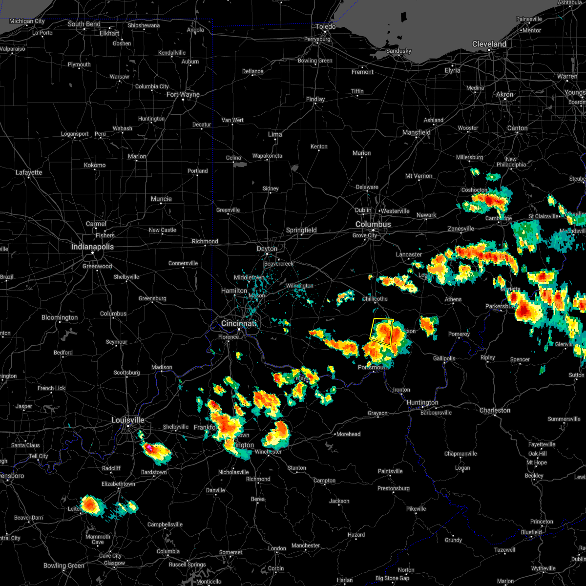
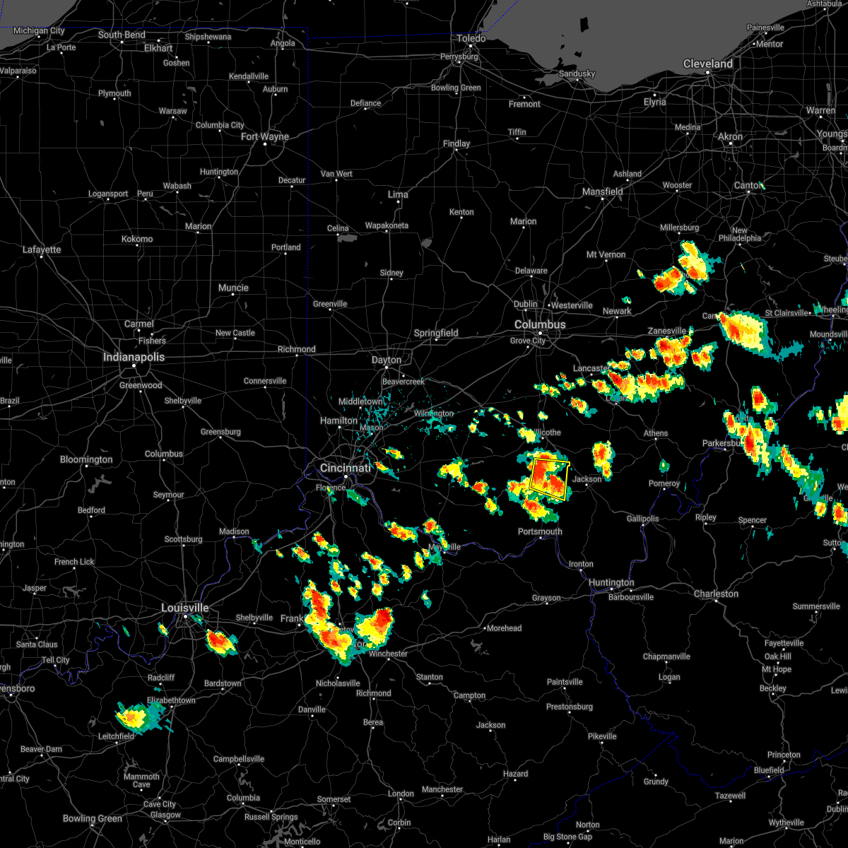
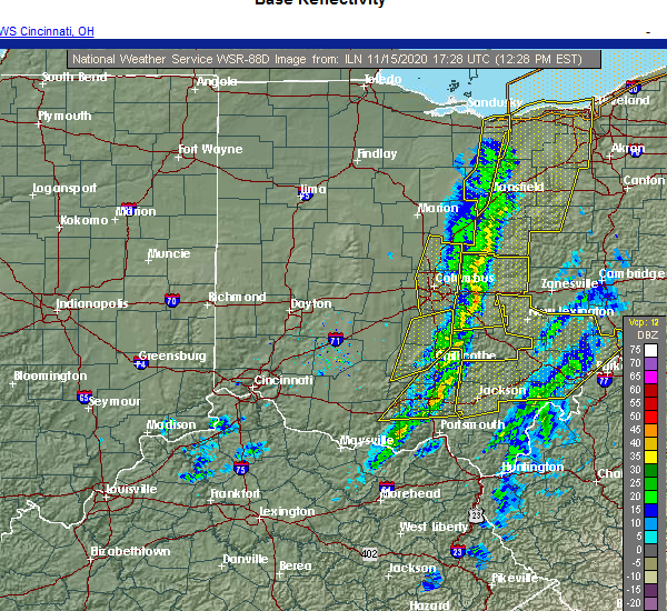 At 1232 pm est, severe thunderstorms were located along a line extending from 8 miles southwest of hocking hills state park to near piketon, moving east at 60 mph (radar indicated). Hazards include 60 mph wind gusts. Expect damage to trees and power lines. Locations impacted include, chillicothe, waverly, piketon, londonderry, beaver, adelphi, rarden, wakefield, pike county airport, mooresville, omega, givens, mount joy, bear creek, massieville, lake white, stockdale, elm grove, buchanan and state route 335 at state route 776. At 1232 pm est, severe thunderstorms were located along a line extending from 8 miles southwest of hocking hills state park to near piketon, moving east at 60 mph (radar indicated). Hazards include 60 mph wind gusts. Expect damage to trees and power lines. Locations impacted include, chillicothe, waverly, piketon, londonderry, beaver, adelphi, rarden, wakefield, pike county airport, mooresville, omega, givens, mount joy, bear creek, massieville, lake white, stockdale, elm grove, buchanan and state route 335 at state route 776.
|
| 11/15/2020 12:12 PM EST |
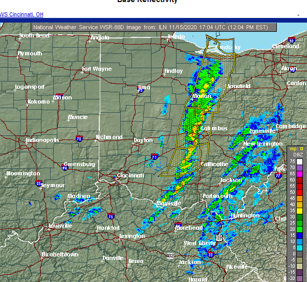 At 1211 pm est, severe thunderstorms were located along a line extending from near north folk village to near peebles, moving east at 60 mph (radar indicated). Hazards include 60 mph wind gusts. expect damage to trees and power lines At 1211 pm est, severe thunderstorms were located along a line extending from near north folk village to near peebles, moving east at 60 mph (radar indicated). Hazards include 60 mph wind gusts. expect damage to trees and power lines
|
| 7/22/2020 3:29 PM EDT | Multiple small trees down across mccorkle r in pike county OH, 2.5 miles NNW of Piketon, OH |
| 6/21/2020 5:52 PM EDT |
 The severe thunderstorm warning for pike and southwestern ross counties will expire at 600 pm edt, the storm which prompted the warning has weakened below severe limits, and no longer poses an immediate threat to life or property. therefore, the warning will be allowed to expire. please report previous wind damage or hail to the national weather service by going to our website at weather.gov/iln and submitting your report via social media. The severe thunderstorm warning for pike and southwestern ross counties will expire at 600 pm edt, the storm which prompted the warning has weakened below severe limits, and no longer poses an immediate threat to life or property. therefore, the warning will be allowed to expire. please report previous wind damage or hail to the national weather service by going to our website at weather.gov/iln and submitting your report via social media.
|
| 6/21/2020 5:45 PM EDT |
 At 544 pm edt, a severe thunderstorm was located near pike lake, moving northeast at 15 mph (law enforcement reported a few trees blown down across western pike county). Hazards include 60 mph wind gusts. Expect damage to trees and power lines. Locations impacted include, waverly, piketon, bainbridge, pike lake, kincaid springs, cynthiana, beaver, wakefield, bourneville, pike county airport, elm grove, lattaville, omega, buchanan, givens, summithill, knockemstiff, ladd, lake white and idaho. At 544 pm edt, a severe thunderstorm was located near pike lake, moving northeast at 15 mph (law enforcement reported a few trees blown down across western pike county). Hazards include 60 mph wind gusts. Expect damage to trees and power lines. Locations impacted include, waverly, piketon, bainbridge, pike lake, kincaid springs, cynthiana, beaver, wakefield, bourneville, pike county airport, elm grove, lattaville, omega, buchanan, givens, summithill, knockemstiff, ladd, lake white and idaho.
|
| 6/21/2020 5:17 PM EDT |
 At 517 pm edt, a severe thunderstorm was located near kincaid springs, moving northeast at 30 mph (radar indicated). Hazards include 60 mph wind gusts. expect damage to trees and power lines At 517 pm edt, a severe thunderstorm was located near kincaid springs, moving northeast at 30 mph (radar indicated). Hazards include 60 mph wind gusts. expect damage to trees and power lines
|
| 6/10/2020 7:15 PM EDT |
 At 714 pm edt, severe thunderstorms were located along a line extending from near thornport to near bremen to 6 miles northwest of wellston, moving northeast at 30 mph (radar indicated). Hazards include 60 mph wind gusts. Expect damage to trees and power lines. Locations impacted include, logan, nelsonville, piketon, hocking hills state park, hide-a-way hills, starr, amanda, londonderry, laurelville, murray city, beaver, sugar grove, adelphi, tarlton, us route 22 at state route 159, ilesboro, haydenville, omega, givens and south bloomingville. At 714 pm edt, severe thunderstorms were located along a line extending from near thornport to near bremen to 6 miles northwest of wellston, moving northeast at 30 mph (radar indicated). Hazards include 60 mph wind gusts. Expect damage to trees and power lines. Locations impacted include, logan, nelsonville, piketon, hocking hills state park, hide-a-way hills, starr, amanda, londonderry, laurelville, murray city, beaver, sugar grove, adelphi, tarlton, us route 22 at state route 159, ilesboro, haydenville, omega, givens and south bloomingville.
|
| 6/10/2020 7:06 PM EDT |
 At 706 pm edt, severe thunderstorms were located along a line extending from pleasantville to near shawnee to 9 miles northwest of wellston, moving east at 60 mph (trained weather spotters). Hazards include 70 mph wind gusts. Expect considerable tree damage. damage is likely to mobile homes, roofs, and outbuildings. Locations impacted include, chillicothe, logan, waverly, nelsonville, piketon, kingston, hide-a-way hills, hocking hills state park, starr, amanda, londonderry, stoutsville, laurelville, murray city, beaver, sugar grove, adelphi, tarlton, east ringgold and us route 22 at state route 159. At 706 pm edt, severe thunderstorms were located along a line extending from pleasantville to near shawnee to 9 miles northwest of wellston, moving east at 60 mph (trained weather spotters). Hazards include 70 mph wind gusts. Expect considerable tree damage. damage is likely to mobile homes, roofs, and outbuildings. Locations impacted include, chillicothe, logan, waverly, nelsonville, piketon, kingston, hide-a-way hills, hocking hills state park, starr, amanda, londonderry, stoutsville, laurelville, murray city, beaver, sugar grove, adelphi, tarlton, east ringgold and us route 22 at state route 159.
|
| 6/10/2020 6:52 PM EDT |
 At 651 pm edt, severe thunderstorms were located along a line extending from 7 miles south of canal winchester to 8 miles north of hocking hills state park to near waverly, moving east at 60 mph (radar indicated). Hazards include 70 mph wind gusts. Expect considerable tree damage. damage is likely to mobile homes, roofs, and outbuildings. Locations impacted include, chillicothe, circleville, logan, waverly, nelsonville, piketon, south bloomfield, kingston, hide-a-way hills, logan elm village, hocking hills state park, pike lake, north folk village, starr, fox, amanda, londonderry, stoutsville, laurelville and murray city. At 651 pm edt, severe thunderstorms were located along a line extending from 7 miles south of canal winchester to 8 miles north of hocking hills state park to near waverly, moving east at 60 mph (radar indicated). Hazards include 70 mph wind gusts. Expect considerable tree damage. damage is likely to mobile homes, roofs, and outbuildings. Locations impacted include, chillicothe, circleville, logan, waverly, nelsonville, piketon, south bloomfield, kingston, hide-a-way hills, logan elm village, hocking hills state park, pike lake, north folk village, starr, fox, amanda, londonderry, stoutsville, laurelville and murray city.
|
| 6/10/2020 6:38 PM EDT | Numerous trees down along 772. time estimated from rada in pike county OH, 11.5 miles ENE of Piketon, OH |
| 6/10/2020 6:35 PM EDT |
 At 635 pm edt, severe thunderstorms were located along a line extending from near south bloomfield to near kingston to 6 miles south of kincaid springs, moving east at 60 mph (radar indicated). Hazards include 70 mph wind gusts. Expect considerable tree damage. Damage is likely to mobile homes, roofs, and outbuildings. At 635 pm edt, severe thunderstorms were located along a line extending from near south bloomfield to near kingston to 6 miles south of kincaid springs, moving east at 60 mph (radar indicated). Hazards include 70 mph wind gusts. Expect considerable tree damage. Damage is likely to mobile homes, roofs, and outbuildings.
|
| 6/10/2020 6:27 PM EDT |
 At 627 pm edt, severe thunderstorms were located along a line extending from near mount sterling to near williamsport, moving northeast at 70 mph (radar indicated). Hazards include 70 mph wind gusts. Expect considerable tree damage. damage is likely to mobile homes, roofs, and outbuildings. Locations impacted include, chillicothe, circleville, greenfield, waverly, piketon, south bloomfield, kingston, marshall, williamsport, bainbridge, new holland, logan elm village, pike lake, kincaid springs, cynthiana, north folk village, good hope, frankfort, fox and clarksburg. At 627 pm edt, severe thunderstorms were located along a line extending from near mount sterling to near williamsport, moving northeast at 70 mph (radar indicated). Hazards include 70 mph wind gusts. Expect considerable tree damage. damage is likely to mobile homes, roofs, and outbuildings. Locations impacted include, chillicothe, circleville, greenfield, waverly, piketon, south bloomfield, kingston, marshall, williamsport, bainbridge, new holland, logan elm village, pike lake, kincaid springs, cynthiana, north folk village, good hope, frankfort, fox and clarksburg.
|
| 6/10/2020 6:14 PM EDT |
 At 614 pm edt, severe thunderstorms were located along a line extending from near bloomingburg to 6 miles north of bainbridge, moving northeast at 60 mph (radar indicated). Hazards include 70 mph wind gusts. Expect considerable tree damage. damage is likely to mobile homes, roofs, and outbuildings. Locations impacted include, chillicothe, washington court house, circleville, greenfield, waverly, piketon, south bloomfield, leesburg, kingston, marshall, williamsport, bloomingburg, bainbridge, new holland, highland holiday, logan elm village, pike lake, kincaid springs, rocky fork point and cynthiana. At 614 pm edt, severe thunderstorms were located along a line extending from near bloomingburg to 6 miles north of bainbridge, moving northeast at 60 mph (radar indicated). Hazards include 70 mph wind gusts. Expect considerable tree damage. damage is likely to mobile homes, roofs, and outbuildings. Locations impacted include, chillicothe, washington court house, circleville, greenfield, waverly, piketon, south bloomfield, leesburg, kingston, marshall, williamsport, bloomingburg, bainbridge, new holland, highland holiday, logan elm village, pike lake, kincaid springs, rocky fork point and cynthiana.
|
| 6/10/2020 5:58 PM EDT |
 At 557 pm edt, severe thunderstorms were located along a line extending from near leesburg to near marshall, moving northeast at 60 mph (radar indicated). Hazards include 70 mph wind gusts. Expect considerable tree damage. Damage is likely to mobile homes, roofs, and outbuildings. At 557 pm edt, severe thunderstorms were located along a line extending from near leesburg to near marshall, moving northeast at 60 mph (radar indicated). Hazards include 70 mph wind gusts. Expect considerable tree damage. Damage is likely to mobile homes, roofs, and outbuildings.
|
| 4/9/2020 12:07 AM EDT |
 The severe thunderstorm warning for northern pike and ross counties will expire at 1215 am edt, the storm which prompted the warning has moved out of the area. therefore, the warning will be allowed to expire. however gusty winds are still possible with this thunderstorm. a tornado watch remains in effect until 200 am edt for central and southwestern ohio. please report previous wind damage or hail to the national weather service by going to our website at weather.gov/iln and submitting your report via social media. The severe thunderstorm warning for northern pike and ross counties will expire at 1215 am edt, the storm which prompted the warning has moved out of the area. therefore, the warning will be allowed to expire. however gusty winds are still possible with this thunderstorm. a tornado watch remains in effect until 200 am edt for central and southwestern ohio. please report previous wind damage or hail to the national weather service by going to our website at weather.gov/iln and submitting your report via social media.
|
| 4/8/2020 11:39 PM EDT |
 At 1139 pm edt, a severe thunderstorm was located over pike lake, moving northeast at 30 mph (radar indicated). Hazards include 60 mph wind gusts and quarter size hail. Minor hail damage to vehicles is possible. expect wind damage to trees and power lines. locations impacted include, chillicothe, greenfield, waverly, piketon, kingston, bainbridge, pike lake, kincaid springs, cynthiana, north folk village, frankfort, londonderry, laurelville, clarksburg, adelphi, south salem, pike county airport, mooresville, austin and omega. A tornado watch remains in effect until 200 am edt for central and southwestern ohio. At 1139 pm edt, a severe thunderstorm was located over pike lake, moving northeast at 30 mph (radar indicated). Hazards include 60 mph wind gusts and quarter size hail. Minor hail damage to vehicles is possible. expect wind damage to trees and power lines. locations impacted include, chillicothe, greenfield, waverly, piketon, kingston, bainbridge, pike lake, kincaid springs, cynthiana, north folk village, frankfort, londonderry, laurelville, clarksburg, adelphi, south salem, pike county airport, mooresville, austin and omega. A tornado watch remains in effect until 200 am edt for central and southwestern ohio.
|
| 4/8/2020 11:37 PM EDT |
 At 1136 pm edt, severe thunderstorms were located along a line extending from kincaid springs to tollesboro, moving east at 85 mph (radar indicated). Hazards include 70 mph wind gusts and nickel size hail. Expect considerable tree damage. damage is likely to mobile homes, roofs, and outbuildings. locations impacted include, portsmouth, wheelersburg, new boston, piketon, vanceburg, south webster, rosemount, clarktown, camp dix, lucasville, franklin furnace, head of grassy, sciotodale, blue creek, beaver, rarden, otway, saint paul, kinniconick and locust grove. A tornado watch remains in effect until 200 am edt for northeastern kentucky, and southwestern ohio. At 1136 pm edt, severe thunderstorms were located along a line extending from kincaid springs to tollesboro, moving east at 85 mph (radar indicated). Hazards include 70 mph wind gusts and nickel size hail. Expect considerable tree damage. damage is likely to mobile homes, roofs, and outbuildings. locations impacted include, portsmouth, wheelersburg, new boston, piketon, vanceburg, south webster, rosemount, clarktown, camp dix, lucasville, franklin furnace, head of grassy, sciotodale, blue creek, beaver, rarden, otway, saint paul, kinniconick and locust grove. A tornado watch remains in effect until 200 am edt for northeastern kentucky, and southwestern ohio.
|
| 4/8/2020 11:23 PM EDT |
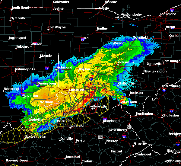 At 1123 pm edt, severe thunderstorms were located along a line extending from marshall to near washington, moving east at 65 mph (radar indicated). Hazards include 70 mph wind gusts and nickel size hail. Expect considerable tree damage. Damage is likely to mobile homes, roofs, and outbuildings. At 1123 pm edt, severe thunderstorms were located along a line extending from marshall to near washington, moving east at 65 mph (radar indicated). Hazards include 70 mph wind gusts and nickel size hail. Expect considerable tree damage. Damage is likely to mobile homes, roofs, and outbuildings.
|
| 4/8/2020 11:13 PM EDT |
 At 1113 pm edt, a severe thunderstorm was located near cynthiana, moving east at 25 mph (radar indicated). Hazards include 60 mph wind gusts and quarter size hail. Minor hail damage to vehicles is possible. Expect wind damage to trees and power lines. At 1113 pm edt, a severe thunderstorm was located near cynthiana, moving east at 25 mph (radar indicated). Hazards include 60 mph wind gusts and quarter size hail. Minor hail damage to vehicles is possible. Expect wind damage to trees and power lines.
|
| 1/11/2020 2:32 PM EST |
 At 231 pm est, severe thunderstorms were located along a line extending from near pike lake to near vanceburg, moving northeast at 55 mph (radar indicated). Hazards include 60 mph wind gusts. Expect damage to trees and power lines. Locations impacted include, piketon, vanceburg, head of grassy, pike lake, camp dix, rarden, otway, saint paul, friendship, mcdermott, mount joy, bear creek, rexton, lake white, lombardsville, buena vista in scioto county, firebrick, elm grove, west portsmouth and harris. At 231 pm est, severe thunderstorms were located along a line extending from near pike lake to near vanceburg, moving northeast at 55 mph (radar indicated). Hazards include 60 mph wind gusts. Expect damage to trees and power lines. Locations impacted include, piketon, vanceburg, head of grassy, pike lake, camp dix, rarden, otway, saint paul, friendship, mcdermott, mount joy, bear creek, rexton, lake white, lombardsville, buena vista in scioto county, firebrick, elm grove, west portsmouth and harris.
|
| 1/11/2020 2:32 PM EST |
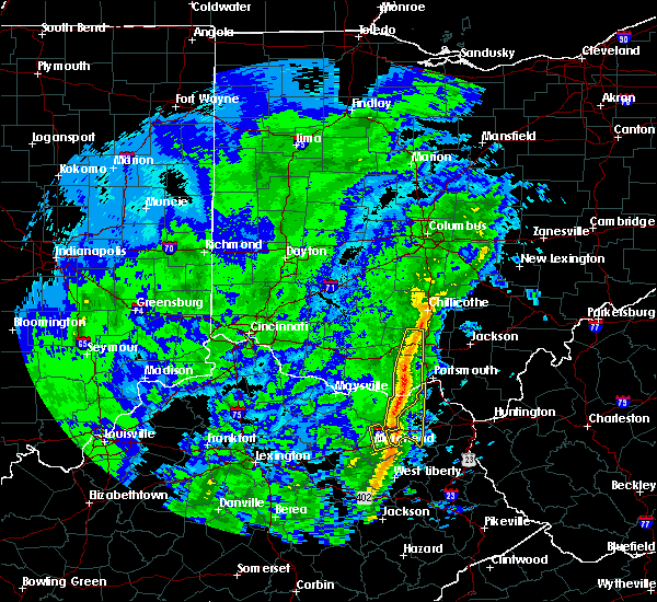 At 231 pm est, severe thunderstorms were located along a line extending from near pike lake to near vanceburg, moving northeast at 55 mph (radar indicated). Hazards include 60 mph wind gusts. Expect damage to trees and power lines. Locations impacted include, piketon, vanceburg, head of grassy, pike lake, camp dix, rarden, otway, saint paul, friendship, mcdermott, mount joy, bear creek, rexton, lake white, lombardsville, buena vista in scioto county, firebrick, elm grove, west portsmouth and harris. At 231 pm est, severe thunderstorms were located along a line extending from near pike lake to near vanceburg, moving northeast at 55 mph (radar indicated). Hazards include 60 mph wind gusts. Expect damage to trees and power lines. Locations impacted include, piketon, vanceburg, head of grassy, pike lake, camp dix, rarden, otway, saint paul, friendship, mcdermott, mount joy, bear creek, rexton, lake white, lombardsville, buena vista in scioto county, firebrick, elm grove, west portsmouth and harris.
|
| 1/11/2020 2:21 PM EST |
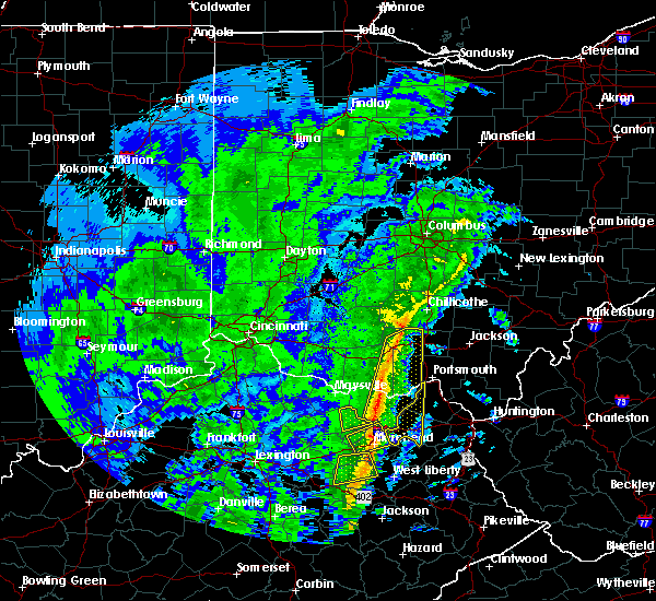 At 221 pm est, severe thunderstorms were located along a line extending from near kincaid springs to 6 miles east of tollesboro, moving east at 55 mph (radar indicated). Hazards include 60 mph wind gusts. Expect damage to trees and power lines. Locations impacted include, piketon, vanceburg, head of grassy, pike lake, kincaid springs, camp dix, rome, blue creek, rarden, otway, saint paul, kinniconick, friendship, mcdermott, charters, petersville, stricklett, mount joy, bear creek and rexton. At 221 pm est, severe thunderstorms were located along a line extending from near kincaid springs to 6 miles east of tollesboro, moving east at 55 mph (radar indicated). Hazards include 60 mph wind gusts. Expect damage to trees and power lines. Locations impacted include, piketon, vanceburg, head of grassy, pike lake, kincaid springs, camp dix, rome, blue creek, rarden, otway, saint paul, kinniconick, friendship, mcdermott, charters, petersville, stricklett, mount joy, bear creek and rexton.
|
| 1/11/2020 2:11 PM EST |
 At 211 pm est, severe thunderstorms were located along a line extending from 6 miles southwest of kincaid springs to foxport, moving northeast at 55 mph (radar indicated). Hazards include 60 mph wind gusts. Expect damage to trees and power lines. Locations impacted include, west union, piketon, peebles, vanceburg, camp dix, rome, head of grassy, pike lake, kincaid springs, tollesboro, blue creek, rarden, sinking spring, otway, concord, saint paul, kinniconick, locust grove, ribolt and charters. At 211 pm est, severe thunderstorms were located along a line extending from 6 miles southwest of kincaid springs to foxport, moving northeast at 55 mph (radar indicated). Hazards include 60 mph wind gusts. Expect damage to trees and power lines. Locations impacted include, west union, piketon, peebles, vanceburg, camp dix, rome, head of grassy, pike lake, kincaid springs, tollesboro, blue creek, rarden, sinking spring, otway, concord, saint paul, kinniconick, locust grove, ribolt and charters.
|
| 1/11/2020 2:01 PM EST |
 At 200 pm est, severe thunderstorms were located along a line extending from near manchester to near flemingsburg, moving northeast at 55 mph (radar indicated. a wind gust of 63 mph was recently observed at fleming-mason airport). Hazards include 60 mph wind gusts. expect damage to trees and power lines At 200 pm est, severe thunderstorms were located along a line extending from near manchester to near flemingsburg, moving northeast at 55 mph (radar indicated. a wind gust of 63 mph was recently observed at fleming-mason airport). Hazards include 60 mph wind gusts. expect damage to trees and power lines
|
| 9/1/2019 3:53 PM EDT |
 The tornado warning for southeastern pike and northeastern scioto counties will expire at 400 pm edt, the storm which prompted the warning has weakened below severe limits, and no longer appears capable of producing a tornado. therefore, the warning will be allowed to expire. small hail and very heavy rainfall remain possible with this thunderstorm. please report previous tornadoes, wind damage or hail to the national weather service by going to our website at weather.gov/iln and submitting your report via social media. The tornado warning for southeastern pike and northeastern scioto counties will expire at 400 pm edt, the storm which prompted the warning has weakened below severe limits, and no longer appears capable of producing a tornado. therefore, the warning will be allowed to expire. small hail and very heavy rainfall remain possible with this thunderstorm. please report previous tornadoes, wind damage or hail to the national weather service by going to our website at weather.gov/iln and submitting your report via social media.
|
| 9/1/2019 3:40 PM EDT |
 At 339 pm edt, a severe thunderstorm capable of producing a tornado was located 4 miles north of lucasville, moving east at 25 mph (radar indicated rotation). Hazards include tornado and quarter size hail. Flying debris will be dangerous to those caught without shelter. mobile homes will be damaged or destroyed. damage to roofs, windows, and vehicles will occur. tree damage is likely. Locations impacted include, piketon, lucasville, beaver, givens, wakefield, stockdale, germany, state route 335 at state route 776 and minford. At 339 pm edt, a severe thunderstorm capable of producing a tornado was located 4 miles north of lucasville, moving east at 25 mph (radar indicated rotation). Hazards include tornado and quarter size hail. Flying debris will be dangerous to those caught without shelter. mobile homes will be damaged or destroyed. damage to roofs, windows, and vehicles will occur. tree damage is likely. Locations impacted include, piketon, lucasville, beaver, givens, wakefield, stockdale, germany, state route 335 at state route 776 and minford.
|
| 9/1/2019 3:35 PM EDT |
 At 335 pm edt, a severe thunderstorm capable of producing a tornado was located near lucasville, moving east at 25 mph (radar indicated rotation). Hazards include tornado. Flying debris will be dangerous to those caught without shelter. mobile homes will be damaged or destroyed. damage to roofs, windows, and vehicles will occur. Tree damage is likely. At 335 pm edt, a severe thunderstorm capable of producing a tornado was located near lucasville, moving east at 25 mph (radar indicated rotation). Hazards include tornado. Flying debris will be dangerous to those caught without shelter. mobile homes will be damaged or destroyed. damage to roofs, windows, and vehicles will occur. Tree damage is likely.
|
| 6/24/2019 6:22 PM EDT | Several large trees were knocked down west of jaspe in pike county OH, 3.5 miles ENE of Piketon, OH |
| 6/24/2019 6:20 PM EDT |
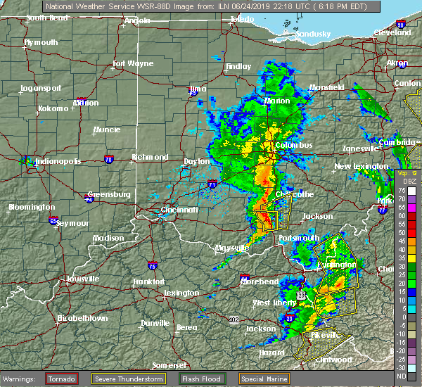 At 619 pm edt, a severe thunderstorm was located near piketon, moving northeast at 45 mph (radar indicated). Hazards include 60 mph wind gusts. Expect damage to trees and power lines. Locations impacted include, waverly, piketon, pike lake, wakefield, bear creek, lake white, idaho and buchanan. At 619 pm edt, a severe thunderstorm was located near piketon, moving northeast at 45 mph (radar indicated). Hazards include 60 mph wind gusts. Expect damage to trees and power lines. Locations impacted include, waverly, piketon, pike lake, wakefield, bear creek, lake white, idaho and buchanan.
|
| 6/24/2019 6:11 PM EDT | Numerous trees were knocked down on long fork roa in pike county OH, 5.8 miles ENE of Piketon, OH |
| 6/24/2019 6:08 PM EDT | A tree was knocked down onto a house east of lytha in pike county OH, 12.4 miles ESE of Piketon, OH |
| 6/24/2019 6:07 PM EDT |
 At 605 pm edt, a severe thunderstorm was located over kincaid springs, moving northeast at 45 mph (radar indicated). Hazards include 60 mph wind gusts. Expect damage to trees and power lines. Locations impacted include, waverly, piketon, pike lake, kincaid springs, rarden, wakefield, poplar grove, elm grove, buchanan, ladd, mount joy, bear creek, lake white and idaho. At 605 pm edt, a severe thunderstorm was located over kincaid springs, moving northeast at 45 mph (radar indicated). Hazards include 60 mph wind gusts. Expect damage to trees and power lines. Locations impacted include, waverly, piketon, pike lake, kincaid springs, rarden, wakefield, poplar grove, elm grove, buchanan, ladd, mount joy, bear creek, lake white and idaho.
|
| 6/24/2019 5:52 PM EDT |
 At 552 pm edt, a severe thunderstorm was located near peebles, moving northeast at 45 mph (radar indicated). Hazards include 60 mph wind gusts. expect damage to trees and power lines At 552 pm edt, a severe thunderstorm was located near peebles, moving northeast at 45 mph (radar indicated). Hazards include 60 mph wind gusts. expect damage to trees and power lines
|
| 6/24/2019 3:12 PM EDT |
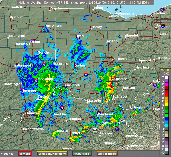 At 312 pm edt, a severe thunderstorm was located near waverly, moving northeast at 45 mph (radar indicated). Hazards include 60 mph wind gusts. Expect damage to trees and power lines. Locations impacted include, chillicothe, waverly, piketon, londonderry, beaver, wakefield, stockdale, pike county airport, omega, givens, richmond dale, massieville, linn, lake white, scioto trail state park and germany. At 312 pm edt, a severe thunderstorm was located near waverly, moving northeast at 45 mph (radar indicated). Hazards include 60 mph wind gusts. Expect damage to trees and power lines. Locations impacted include, chillicothe, waverly, piketon, londonderry, beaver, wakefield, stockdale, pike county airport, omega, givens, richmond dale, massieville, linn, lake white, scioto trail state park and germany.
|
| 6/24/2019 3:02 PM EDT |
 At 301 pm edt, a severe thunderstorm was located near lake white, moving northeast at 45 mph (radar indicated). Hazards include 60 mph wind gusts. Expect damage to trees and power lines. Locations impacted include, waverly, piketon, pike lake, omega, lucasville, londonderry, beaver, wakefield, pike county airport, chillicothe, givens, knockemstiff, bear creek, massieville, lake white, bourneville, stockdale, elm grove and buchanan. At 301 pm edt, a severe thunderstorm was located near lake white, moving northeast at 45 mph (radar indicated). Hazards include 60 mph wind gusts. Expect damage to trees and power lines. Locations impacted include, waverly, piketon, pike lake, omega, lucasville, londonderry, beaver, wakefield, pike county airport, chillicothe, givens, knockemstiff, bear creek, massieville, lake white, bourneville, stockdale, elm grove and buchanan.
|
| 6/24/2019 2:51 PM EDT |
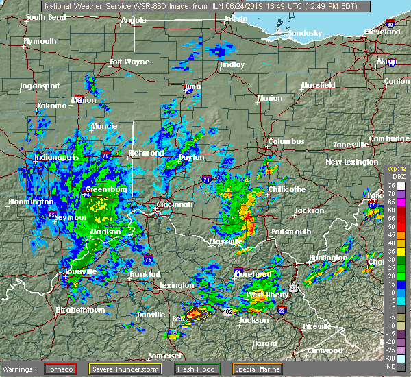 At 251 pm edt, a severe thunderstorm was located near kincaid springs, moving northeast at 45 mph (radar indicated). Hazards include 60 mph wind gusts. expect damage to trees and power lines At 251 pm edt, a severe thunderstorm was located near kincaid springs, moving northeast at 45 mph (radar indicated). Hazards include 60 mph wind gusts. expect damage to trees and power lines
|
| 6/17/2019 10:27 PM EDT |
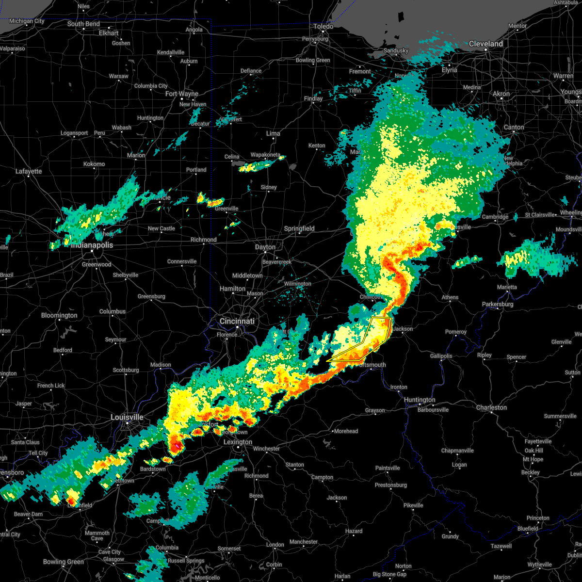 The severe thunderstorm warning for east central adams, eastern pike, northwestern scioto and southern ross counties will expire at 1030 pm edt, the storms which prompted the warning have weakened below severe limits, and no longer pose an immediate threat to life or property. therefore, the warning will be allowed to expire. however heavy rain is still possible with these thunderstorms. please report previous wind damage or hail to the national weather service by going to our website at weather.gov/iln and submitting your report via social media. The severe thunderstorm warning for east central adams, eastern pike, northwestern scioto and southern ross counties will expire at 1030 pm edt, the storms which prompted the warning have weakened below severe limits, and no longer pose an immediate threat to life or property. therefore, the warning will be allowed to expire. however heavy rain is still possible with these thunderstorms. please report previous wind damage or hail to the national weather service by going to our website at weather.gov/iln and submitting your report via social media.
|
| 6/17/2019 10:20 PM EDT |
 At 1020 pm edt, severe thunderstorms were located along a line extending from near waverly to 9 miles southwest of lucasville, moving east at 30 mph (radar indicated). Hazards include 60 mph wind gusts. Expect damage to trees and power lines. Locations impacted include, waverly, piketon, lucasville, beaver, otway, wakefield, lombardsville, pike county airport, wamsley, omega, givens, bear creek, linn, cedar mills, germany and stockdale. At 1020 pm edt, severe thunderstorms were located along a line extending from near waverly to 9 miles southwest of lucasville, moving east at 30 mph (radar indicated). Hazards include 60 mph wind gusts. Expect damage to trees and power lines. Locations impacted include, waverly, piketon, lucasville, beaver, otway, wakefield, lombardsville, pike county airport, wamsley, omega, givens, bear creek, linn, cedar mills, germany and stockdale.
|
| 6/17/2019 10:08 PM EDT | Tree downed in the 5000 block of state rte 104. time estimated based on rada in pike county OH, 4.1 miles NE of Piketon, OH |
| 6/17/2019 10:05 PM EDT |
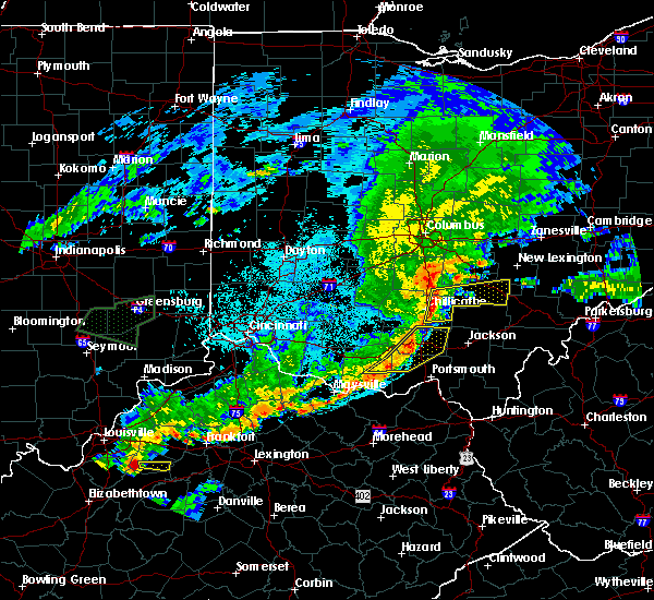 At 1005 pm edt, severe thunderstorms were located along a line extending from near chillicothe to 10 miles east of peebles, moving east at 35 mph (radar indicated). Hazards include 60 mph wind gusts. Expect damage to trees and power lines. Locations impacted include, waverly, piketon, lucasville, beaver, rarden, otway, wakefield, lombardsville, pike county airport, elm grove, wamsley, omega, givens, ladd, mount joy, bear creek, linn, cedar mills, lake white and idaho. At 1005 pm edt, severe thunderstorms were located along a line extending from near chillicothe to 10 miles east of peebles, moving east at 35 mph (radar indicated). Hazards include 60 mph wind gusts. Expect damage to trees and power lines. Locations impacted include, waverly, piketon, lucasville, beaver, rarden, otway, wakefield, lombardsville, pike county airport, elm grove, wamsley, omega, givens, ladd, mount joy, bear creek, linn, cedar mills, lake white and idaho.
|
| 6/17/2019 9:43 PM EDT |
 At 943 pm edt, severe thunderstorms were located along a line extending from near bainbridge to near west union, moving east at 35 mph (radar indicated). Hazards include 60 mph wind gusts. expect damage to trees and power lines At 943 pm edt, severe thunderstorms were located along a line extending from near bainbridge to near west union, moving east at 35 mph (radar indicated). Hazards include 60 mph wind gusts. expect damage to trees and power lines
|
| 4/14/2019 4:13 PM EDT |
 At 413 pm edt, severe thunderstorms were located along a line extending from laurelville to piketon, moving northeast at 40 mph (radar indicated). Hazards include 60 mph wind gusts and penny size hail. expect damage to trees and power lines At 413 pm edt, severe thunderstorms were located along a line extending from laurelville to piketon, moving northeast at 40 mph (radar indicated). Hazards include 60 mph wind gusts and penny size hail. expect damage to trees and power lines
|
| 7/2/2018 6:36 PM EDT |
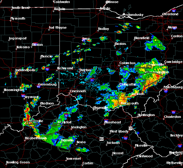 At 635 pm edt, a severe thunderstorm was located 7 miles southeast of piketon, moving east at 20 mph (emergency management. large tree down across roadway as state route 139 at rosemount hill road). Hazards include 60 mph wind gusts. Expect damage to trees and power lines. Locations impacted include, piketon, south webster, clarktown, lucasville, rosemount, beaver, stockdale, minford, state route 335 at state route 776, givens, portsmouth regional airport, linn and germany. At 635 pm edt, a severe thunderstorm was located 7 miles southeast of piketon, moving east at 20 mph (emergency management. large tree down across roadway as state route 139 at rosemount hill road). Hazards include 60 mph wind gusts. Expect damage to trees and power lines. Locations impacted include, piketon, south webster, clarktown, lucasville, rosemount, beaver, stockdale, minford, state route 335 at state route 776, givens, portsmouth regional airport, linn and germany.
|
| 7/2/2018 5:59 PM EDT |
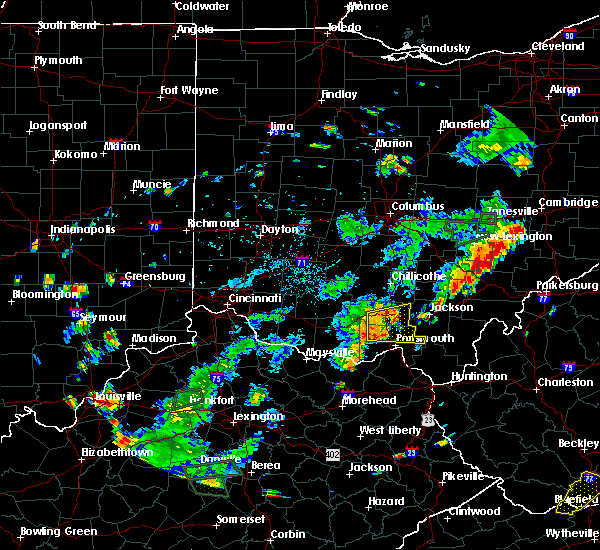 At 558 pm edt, a severe thunderstorm was located 9 miles southwest of piketon, moving east at 20 mph (radar indicated). Hazards include 60 mph wind gusts. expect damage to trees and power lines At 558 pm edt, a severe thunderstorm was located 9 miles southwest of piketon, moving east at 20 mph (radar indicated). Hazards include 60 mph wind gusts. expect damage to trees and power lines
|
| 7/7/2017 7:28 PM EDT | Tree fell on power line in pike county OH, 3.7 miles NNE of Piketon, OH |
| 7/7/2017 7:28 PM EDT | Tree fell on power line in pike county OH, 3.7 miles NNE of Piketon, OH |
| 7/7/2017 7:28 PM EDT |
 At 727 pm edt, severe thunderstorms were located along a line extending from 8 miles southeast of chillicothe to 6 miles west of lucasville to 8 miles east of west union, moving east at 45 mph (radar indicated). Hazards include 60 mph wind gusts and penny size hail. Expect damage to trees and power lines. Locations impacted include, portsmouth, waverly, new boston, piketon, peebles, winchester, seaman, rosemount, clarktown, pike lake, lucasville, blue creek, londonderry, beaver, rarden, otway, wakefield, pike county airport, minford and dunkinsville. At 727 pm edt, severe thunderstorms were located along a line extending from 8 miles southeast of chillicothe to 6 miles west of lucasville to 8 miles east of west union, moving east at 45 mph (radar indicated). Hazards include 60 mph wind gusts and penny size hail. Expect damage to trees and power lines. Locations impacted include, portsmouth, waverly, new boston, piketon, peebles, winchester, seaman, rosemount, clarktown, pike lake, lucasville, blue creek, londonderry, beaver, rarden, otway, wakefield, pike county airport, minford and dunkinsville.
|
| 7/7/2017 7:25 PM EDT | Tree down near good shepherd rd and us 23 in pike county OH, 6.4 miles NNE of Piketon, OH |
| 7/7/2017 7:15 PM EDT | Large tree down across sr 104 between jasper and lake white in pike county OH, 2.3 miles SE of Piketon, OH |
| 7/7/2017 7:11 PM EDT |
 At 710 pm edt, severe thunderstorms were located along a line extending from near north folk village to near peebles to near seaman, moving east at 45 mph (radar indicated). Hazards include 70 mph wind gusts and nickel size hail. Expect considerable tree damage. Damage is likely to mobile homes, roofs, and outbuildings. At 710 pm edt, severe thunderstorms were located along a line extending from near north folk village to near peebles to near seaman, moving east at 45 mph (radar indicated). Hazards include 70 mph wind gusts and nickel size hail. Expect considerable tree damage. Damage is likely to mobile homes, roofs, and outbuildings.
|
| 5/27/2017 6:16 PM EDT | A few trees were reported down on power line in pike county OH, 4.8 miles ENE of Piketon, OH |
| 5/27/2017 6:15 PM EDT | Quarter sized hail reported 3.5 miles ENE of Piketon, OH |
| 5/27/2017 6:13 PM EDT |
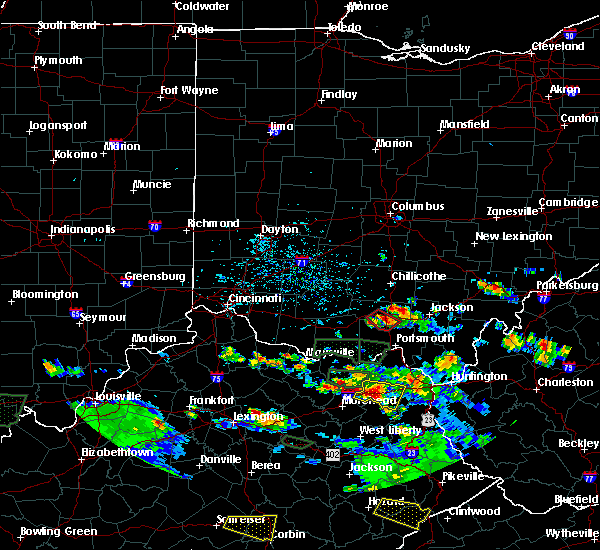 At 613 pm edt, a severe thunderstorm capable of producing a tornado was located near piketon, moving southeast at 10 mph (radar indicated rotation). Hazards include tornado and quarter size hail. Flying debris will be dangerous to those caught without shelter. mobile homes will be damaged or destroyed. damage to roofs, windows, and vehicles will occur. Tree damage is likely. At 613 pm edt, a severe thunderstorm capable of producing a tornado was located near piketon, moving southeast at 10 mph (radar indicated rotation). Hazards include tornado and quarter size hail. Flying debris will be dangerous to those caught without shelter. mobile homes will be damaged or destroyed. damage to roofs, windows, and vehicles will occur. Tree damage is likely.
|
| 5/19/2017 6:12 PM EDT |
 The severe thunderstorm warning for southwestern fairfield, northeastern adams, southeastern pickaway, western pike, southeastern highland and ross counties will expire at 615 pm edt, the storms which prompted the warning have moved out of the area. therefore, the warning will be allowed to expire. a severe thunderstorm watch remains in effect until 1100 pm edt for central and southwestern ohio. please report previous wind damage or hail to the national weather service by going to our website at weather.gov/iln and submitting your report via social media. The severe thunderstorm warning for southwestern fairfield, northeastern adams, southeastern pickaway, western pike, southeastern highland and ross counties will expire at 615 pm edt, the storms which prompted the warning have moved out of the area. therefore, the warning will be allowed to expire. a severe thunderstorm watch remains in effect until 1100 pm edt for central and southwestern ohio. please report previous wind damage or hail to the national weather service by going to our website at weather.gov/iln and submitting your report via social media.
|
| 5/19/2017 6:05 PM EDT |
 At 605 pm edt, severe thunderstorms were located along a line extending from near williamsport to 6 miles south of marshall, moving east at 35 mph (radar indicated). Hazards include 60 mph wind gusts. Expect damage to roofs, siding, and trees. Locations impacted include, chillicothe, circleville, waverly, piketon, kingston, bainbridge, pike lake, kincaid springs, logan elm village, cynthiana, north folk village, frankfort, fox, amanda, stoutsville, tarlton, sinking spring, east ringgold, may hill and knockemstiff. At 605 pm edt, severe thunderstorms were located along a line extending from near williamsport to 6 miles south of marshall, moving east at 35 mph (radar indicated). Hazards include 60 mph wind gusts. Expect damage to roofs, siding, and trees. Locations impacted include, chillicothe, circleville, waverly, piketon, kingston, bainbridge, pike lake, kincaid springs, logan elm village, cynthiana, north folk village, frankfort, fox, amanda, stoutsville, tarlton, sinking spring, east ringgold, may hill and knockemstiff.
|
| 5/19/2017 5:59 PM EDT |
 At 559 pm edt, severe thunderstorms were located along a line extending from williamsport to near belfast, moving east at 35 mph (radar indicated). Hazards include 60 mph wind gusts. Expect damage to roofs, siding, and trees. Locations impacted include, chillicothe, circleville, waverly, piketon, kingston, marshall, williamsport, bainbridge, pike lake, kincaid springs, logan elm village, cynthiana, north folk village, frankfort, fox, amanda, stoutsville, clarksburg, tarlton and south salem. At 559 pm edt, severe thunderstorms were located along a line extending from williamsport to near belfast, moving east at 35 mph (radar indicated). Hazards include 60 mph wind gusts. Expect damage to roofs, siding, and trees. Locations impacted include, chillicothe, circleville, waverly, piketon, kingston, marshall, williamsport, bainbridge, pike lake, kincaid springs, logan elm village, cynthiana, north folk village, frankfort, fox, amanda, stoutsville, clarksburg, tarlton and south salem.
|
| 5/19/2017 5:50 PM EDT |
 At 549 pm edt, severe thunderstorms were located along a line extending from near new holland to belfast, moving east at 35 mph (radar indicated). Hazards include 60 mph wind gusts. expect damage to roofs, siding, and trees At 549 pm edt, severe thunderstorms were located along a line extending from near new holland to belfast, moving east at 35 mph (radar indicated). Hazards include 60 mph wind gusts. expect damage to roofs, siding, and trees
|
| 4/5/2017 8:42 PM EDT |
 The severe thunderstorm warning for northeastern adams. pike. southeastern highland. northwestern scioto and southeastern ross counties will expire at 845 pm edt. the storm which prompted the warning has weakened below severe limits, and no longer poses an immediate threat to life or property. therefore, the warning will be allowed to expire. However gusty. The severe thunderstorm warning for northeastern adams. pike. southeastern highland. northwestern scioto and southeastern ross counties will expire at 845 pm edt. the storm which prompted the warning has weakened below severe limits, and no longer poses an immediate threat to life or property. therefore, the warning will be allowed to expire. However gusty.
|
| 4/5/2017 8:17 PM EDT |
 At 816 pm edt, a severe thunderstorm was located near kincaid springs, moving northeast at 45 mph (radar indicated). Hazards include 60 mph wind gusts and quarter size hail. Hail damage to vehicles is expected. expect wind damage to roofs, siding, and trees. Locations impacted include, waverly, piketon, peebles, pike lake, kincaid springs, cynthiana, beaver, rarden, sinking spring, wakefield, pike county airport, dunkinsville, mooresville, omega, locust grove, givens, mount joy, bear creek, massieville and lake white. At 816 pm edt, a severe thunderstorm was located near kincaid springs, moving northeast at 45 mph (radar indicated). Hazards include 60 mph wind gusts and quarter size hail. Hail damage to vehicles is expected. expect wind damage to roofs, siding, and trees. Locations impacted include, waverly, piketon, peebles, pike lake, kincaid springs, cynthiana, beaver, rarden, sinking spring, wakefield, pike county airport, dunkinsville, mooresville, omega, locust grove, givens, mount joy, bear creek, massieville and lake white.
|
| 4/5/2017 7:55 PM EDT |
 At 755 pm edt, a severe thunderstorm was located over seaman, moving northeast at 45 mph (radar indicated). Hazards include 60 mph wind gusts and quarter size hail. Hail damage to vehicles is expected. Expect wind damage to roofs, siding, and trees. At 755 pm edt, a severe thunderstorm was located over seaman, moving northeast at 45 mph (radar indicated). Hazards include 60 mph wind gusts and quarter size hail. Hail damage to vehicles is expected. Expect wind damage to roofs, siding, and trees.
|
| 3/1/2017 8:18 AM EST |
 At 818 am est, severe thunderstorms were located along a line extending from near kingston to near piketon, moving east at 65 mph (radar indicated). Hazards include 70 mph wind gusts. Expect considerable tree damage. damage is likely to mobile homes, roofs, and outbuildings. locations impacted include, chillicothe, waverly, piketon, north folk village, londonderry, beaver, pike county airport, elm grove, mooresville, omega, buchanan, givens, summithill, richmond dale, massieville, linn, hallsville, lake white, scioto trail state park and idaho. A tornado watch remains in effect until 1100 am est for central and southwestern ohio. At 818 am est, severe thunderstorms were located along a line extending from near kingston to near piketon, moving east at 65 mph (radar indicated). Hazards include 70 mph wind gusts. Expect considerable tree damage. damage is likely to mobile homes, roofs, and outbuildings. locations impacted include, chillicothe, waverly, piketon, north folk village, londonderry, beaver, pike county airport, elm grove, mooresville, omega, buchanan, givens, summithill, richmond dale, massieville, linn, hallsville, lake white, scioto trail state park and idaho. A tornado watch remains in effect until 1100 am est for central and southwestern ohio.
|
| 3/1/2017 8:09 AM EST |
 At 808 am est, severe thunderstorms were located along a line extending from near chillicothe to near kincaid springs, moving east at 65 mph (radar indicated). Hazards include 70 mph wind gusts. Expect considerable tree damage. damage is likely to mobile homes, roofs, and outbuildings. locations impacted include, chillicothe, waverly, piketon, pike lake, kincaid springs, north folk village, londonderry, beaver, pike county airport, mooresville, omega, givens, knockemstiff, massieville, lake white, bourneville, poplar grove, elm grove, buchanan and summithill. A tornado watch remains in effect until 1100 am est for central and southwestern ohio. At 808 am est, severe thunderstorms were located along a line extending from near chillicothe to near kincaid springs, moving east at 65 mph (radar indicated). Hazards include 70 mph wind gusts. Expect considerable tree damage. damage is likely to mobile homes, roofs, and outbuildings. locations impacted include, chillicothe, waverly, piketon, pike lake, kincaid springs, north folk village, londonderry, beaver, pike county airport, mooresville, omega, givens, knockemstiff, massieville, lake white, bourneville, poplar grove, elm grove, buchanan and summithill. A tornado watch remains in effect until 1100 am est for central and southwestern ohio.
|
| 3/1/2017 7:56 AM EST |
 At 756 am est, severe thunderstorms were located along a line extending from 9 miles west of north folk village to 7 miles southeast of marshall, moving east at 75 mph (radar indicated). Hazards include 70 mph wind gusts. Expect considerable tree damage. damage is likely to mobile homes, roofs, and outbuildings. locations impacted include, chillicothe, waverly, piketon, marshall, bainbridge, pike lake, kincaid springs, cynthiana, north folk village, frankfort, londonderry, beaver, south salem, sinking spring, pike county airport, mooresville, omega, givens, knockemstiff and massieville. A tornado watch remains in effect until 1100 am est for central and southwestern ohio. At 756 am est, severe thunderstorms were located along a line extending from 9 miles west of north folk village to 7 miles southeast of marshall, moving east at 75 mph (radar indicated). Hazards include 70 mph wind gusts. Expect considerable tree damage. damage is likely to mobile homes, roofs, and outbuildings. locations impacted include, chillicothe, waverly, piketon, marshall, bainbridge, pike lake, kincaid springs, cynthiana, north folk village, frankfort, londonderry, beaver, south salem, sinking spring, pike county airport, mooresville, omega, givens, knockemstiff and massieville. A tornado watch remains in effect until 1100 am est for central and southwestern ohio.
|
| 3/1/2017 7:43 AM EST |
 At 743 am est, severe thunderstorms were located along a line extending from near lynchburg to near mount orab, moving east at 70 mph (radar indicated). Hazards include 60 mph wind gusts. expect damage to roofs, siding, and trees At 743 am est, severe thunderstorms were located along a line extending from near lynchburg to near mount orab, moving east at 70 mph (radar indicated). Hazards include 60 mph wind gusts. expect damage to roofs, siding, and trees
|
| 2/24/2017 11:45 PM EST |
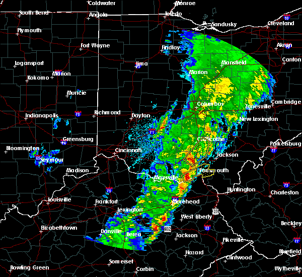 At 1145 pm est, a severe thunderstorm was located near piketon, moving northeast at 65 mph (radar indicated). Hazards include 60 mph wind gusts. expect damage to roofs, siding, and trees At 1145 pm est, a severe thunderstorm was located near piketon, moving northeast at 65 mph (radar indicated). Hazards include 60 mph wind gusts. expect damage to roofs, siding, and trees
|
| 2/24/2017 11:38 PM EST |
 At 1138 pm est, severe thunderstorms were located along a line extending from near kincaid springs to 11 miles east of peebles to 11 miles west of lucasville, moving northeast at 55 mph (radar indicated). Hazards include 60 mph wind gusts. Expect damage to roofs, siding, and trees. Locations impacted include, waverly, piketon, pike lake, lucasville, rarden, otway, wakefield, lombardsville, poplar grove, elm grove, buchanan, givens, mcdermott, ladd, mount joy, bear creek, lake white, germany and idaho. At 1138 pm est, severe thunderstorms were located along a line extending from near kincaid springs to 11 miles east of peebles to 11 miles west of lucasville, moving northeast at 55 mph (radar indicated). Hazards include 60 mph wind gusts. Expect damage to roofs, siding, and trees. Locations impacted include, waverly, piketon, pike lake, lucasville, rarden, otway, wakefield, lombardsville, poplar grove, elm grove, buchanan, givens, mcdermott, ladd, mount joy, bear creek, lake white, germany and idaho.
|
| 2/24/2017 11:22 PM EST |
 At 1121 pm est, severe thunderstorms were located along a line extending from near seaman to 8 miles east of west union to rome, moving northeast at 55 mph (radar indicated). Hazards include 60 mph wind gusts. expect damage to roofs, siding, and trees At 1121 pm est, severe thunderstorms were located along a line extending from near seaman to 8 miles east of west union to rome, moving northeast at 55 mph (radar indicated). Hazards include 60 mph wind gusts. expect damage to roofs, siding, and trees
|
| 9/30/2016 8:48 AM EDT |
 At 848 am edt, a severe thunderstorm was located near waverly, moving northwest at 55 mph (radar indicated). Hazards include quarter size hail. damage to vehicles is expected At 848 am edt, a severe thunderstorm was located near waverly, moving northwest at 55 mph (radar indicated). Hazards include quarter size hail. damage to vehicles is expected
|
| 8/17/2016 1:21 PM EDT |
 The severe thunderstorm warning for central pike county will expire at 130 pm edt, the storm which prompted the warning has moved out of the area. therefore the warning will be allowed to expire. please report previous wind damage or hail to the national weather service by going to our website at weather.gov/iln and submitting your report via social media. remember, a severe thunderstorm warning still remains in effect for eastern pike county until 2 pm edt. The severe thunderstorm warning for central pike county will expire at 130 pm edt, the storm which prompted the warning has moved out of the area. therefore the warning will be allowed to expire. please report previous wind damage or hail to the national weather service by going to our website at weather.gov/iln and submitting your report via social media. remember, a severe thunderstorm warning still remains in effect for eastern pike county until 2 pm edt.
|
| 8/17/2016 1:11 PM EDT |
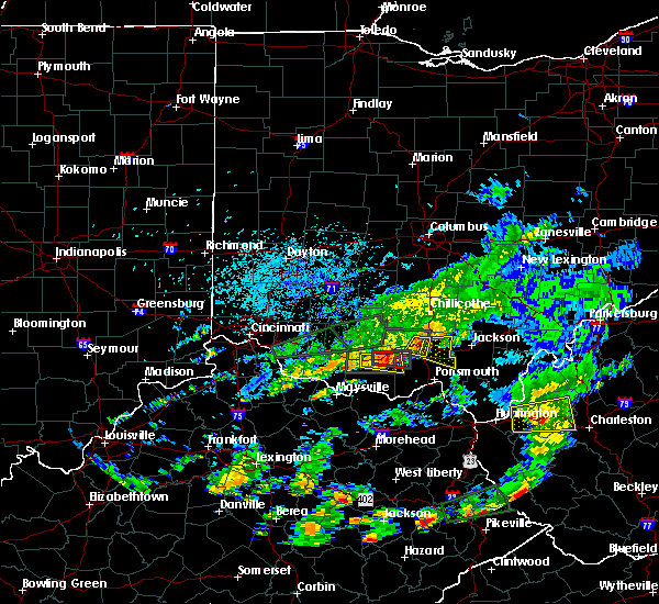 At 110 pm edt, a severe thunderstorm was located near piketon, moving east at 20 mph (radar indicated). Hazards include 70 mph wind gusts. Expect considerable tree damage. damage is likely to mobile homes, roofs, and outbuildings. Locations impacted include, waverly city, piketon, lake white, wakefield and elm grove. At 110 pm edt, a severe thunderstorm was located near piketon, moving east at 20 mph (radar indicated). Hazards include 70 mph wind gusts. Expect considerable tree damage. damage is likely to mobile homes, roofs, and outbuildings. Locations impacted include, waverly city, piketon, lake white, wakefield and elm grove.
|
| 8/17/2016 1:05 PM EDT |
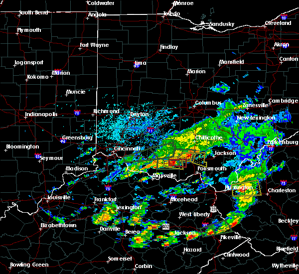 At 105 pm edt, a severe thunderstorm was located near piketon, moving east at 20 mph (radar indicated). Hazards include 60 mph wind gusts. Expect damage to roofs. siding. And trees. At 105 pm edt, a severe thunderstorm was located near piketon, moving east at 20 mph (radar indicated). Hazards include 60 mph wind gusts. Expect damage to roofs. siding. And trees.
|
| 8/17/2016 12:45 PM EDT |
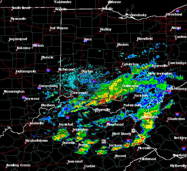 At 1245 pm edt, a severe thunderstorm was located near kincaid springs, moving east at 20 mph (radar indicated). Hazards include 60 mph wind gusts. Expect damage to roofs. siding. and trees. Locations impacted include, waverly city, piketon, idaho, ladd, wakefield, lake white and elm grove. At 1245 pm edt, a severe thunderstorm was located near kincaid springs, moving east at 20 mph (radar indicated). Hazards include 60 mph wind gusts. Expect damage to roofs. siding. and trees. Locations impacted include, waverly city, piketon, idaho, ladd, wakefield, lake white and elm grove.
|
| 8/17/2016 12:40 PM EDT |
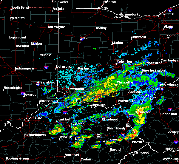 At 1240 pm edt, a severe thunderstorm was located near kincaid springs, moving east at 20 mph (radar indicated). Hazards include 60 mph wind gusts. Expect damage to roofs. siding. And trees. At 1240 pm edt, a severe thunderstorm was located near kincaid springs, moving east at 20 mph (radar indicated). Hazards include 60 mph wind gusts. Expect damage to roofs. siding. And trees.
|
| 7/25/2016 6:07 PM EDT |
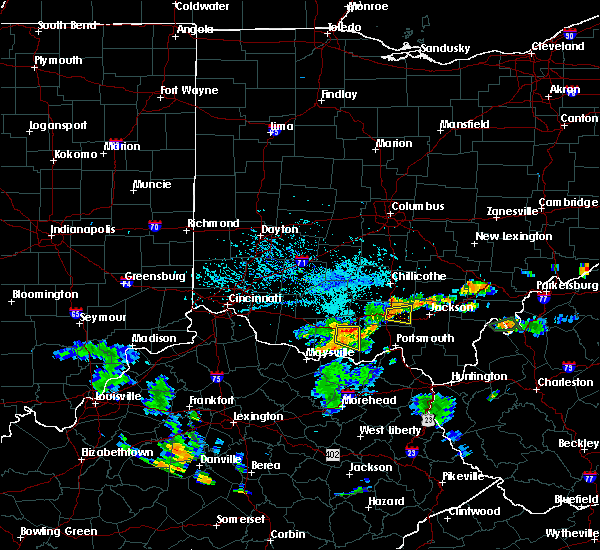 At 607 pm edt, a severe thunderstorm was located near piketon, moving east at 40 mph (radar indicated). Hazards include 60 mph wind gusts. Expect damage to roofs. siding. and trees. Locations impacted include, waverly city, piketon, beaver, givens, germany and linn. At 607 pm edt, a severe thunderstorm was located near piketon, moving east at 40 mph (radar indicated). Hazards include 60 mph wind gusts. Expect damage to roofs. siding. and trees. Locations impacted include, waverly city, piketon, beaver, givens, germany and linn.
|
| 7/25/2016 5:57 PM EDT |
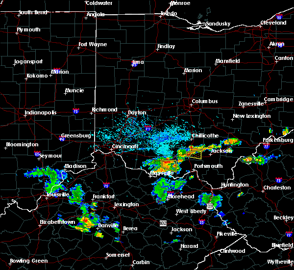 At 557 pm edt, a severe thunderstorm was located over piketon, moving east at 40 mph (radar indicated). Hazards include 60 mph wind gusts. Expect damage to roofs. siding. And trees. At 557 pm edt, a severe thunderstorm was located over piketon, moving east at 40 mph (radar indicated). Hazards include 60 mph wind gusts. Expect damage to roofs. siding. And trees.
|
| 6/23/2016 4:09 AM EDT |
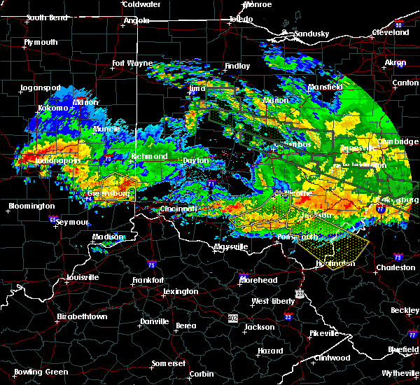 The severe thunderstorm warning for southeastern ross, pike, northeastern adams and southeastern highland counties will expire at 415 am edt, the storms which prompted the warning have weakened below severe limits, and no longer pose an immediate threat to life or property. therefore the warning will be allowed to expire. however gusty winds are still possible with these thunderstorms. a tornado watch remains in effect until 500 am edt for southwestern ohio. please report previous wind damage or hail to the national weather service by going to our website at weather.gov/iln and submitting your report via social media. The severe thunderstorm warning for southeastern ross, pike, northeastern adams and southeastern highland counties will expire at 415 am edt, the storms which prompted the warning have weakened below severe limits, and no longer pose an immediate threat to life or property. therefore the warning will be allowed to expire. however gusty winds are still possible with these thunderstorms. a tornado watch remains in effect until 500 am edt for southwestern ohio. please report previous wind damage or hail to the national weather service by going to our website at weather.gov/iln and submitting your report via social media.
|
| 6/23/2016 3:58 AM EDT |
 At 358 am edt, severe thunderstorms were located along a line extending from 9 miles southeast of kingston to waverly city to near peebles, moving southeast at 75 mph (radar indicated). Hazards include 60 mph wind gusts. Expect damage to roofs. siding. and trees. locations impacted include, chillicothe, waverly, waverly city, piketon, north fork village, belfast, kincaid springs, north folk village, pike lake, londonderry, sinking spring, knockemstiff, scioto trail state park, mooresville, richmond dale, lake white, massieville, pike county airport, may hill and idaho. A tornado watch remains in effect until 500 am edt for southwestern ohio. At 358 am edt, severe thunderstorms were located along a line extending from 9 miles southeast of kingston to waverly city to near peebles, moving southeast at 75 mph (radar indicated). Hazards include 60 mph wind gusts. Expect damage to roofs. siding. and trees. locations impacted include, chillicothe, waverly, waverly city, piketon, north fork village, belfast, kincaid springs, north folk village, pike lake, londonderry, sinking spring, knockemstiff, scioto trail state park, mooresville, richmond dale, lake white, massieville, pike county airport, may hill and idaho. A tornado watch remains in effect until 500 am edt for southwestern ohio.
|
| 6/23/2016 3:49 AM EDT |
 At 349 am edt, severe thunderstorms were located along a line extending from near kingston to near bainbridge to belfast, moving east at 85 mph (radar indicated). Hazards include 70 mph wind gusts. Expect considerable tree damage. damage is likely to mobile homes, roofs, and outbuildings. locations impacted include, chillicothe, hillsboro, waverly, waverly city, piketon, marshall, bainbridge, north fork village, belfast, kincaid springs, north folk village, cynthiana, pike lake, new market, frankfort, londonderry, sinking spring, danville in highland county, andersonville and knockemstiff. A tornado watch remains in effect until 500 am edt for southwestern ohio. At 349 am edt, severe thunderstorms were located along a line extending from near kingston to near bainbridge to belfast, moving east at 85 mph (radar indicated). Hazards include 70 mph wind gusts. Expect considerable tree damage. damage is likely to mobile homes, roofs, and outbuildings. locations impacted include, chillicothe, hillsboro, waverly, waverly city, piketon, marshall, bainbridge, north fork village, belfast, kincaid springs, north folk village, cynthiana, pike lake, new market, frankfort, londonderry, sinking spring, danville in highland county, andersonville and knockemstiff. A tornado watch remains in effect until 500 am edt for southwestern ohio.
|
| 6/23/2016 3:39 AM EDT |
 At 339 am edt, severe thunderstorms were located along a line extending from 9 miles northwest of north folk village to 6 miles north of marshall to near lynchburg, moving southeast at 75 mph (radar indicated). Hazards include 70 mph wind gusts. Expect considerable tree damage. damage is likely to mobile homes, roofs, and outbuildings. locations impacted include, chillicothe, hillsboro, greenfield, waverly, waverly city, piketon, lynchburg, leesburg, marshall, bainbridge, north fork village, pike lake, belfast, kincaid springs, north folk village, cynthiana, russell, new market, frankfort and londonderry. A tornado watch remains in effect until 500 am edt for central and southwestern ohio. At 339 am edt, severe thunderstorms were located along a line extending from 9 miles northwest of north folk village to 6 miles north of marshall to near lynchburg, moving southeast at 75 mph (radar indicated). Hazards include 70 mph wind gusts. Expect considerable tree damage. damage is likely to mobile homes, roofs, and outbuildings. locations impacted include, chillicothe, hillsboro, greenfield, waverly, waverly city, piketon, lynchburg, leesburg, marshall, bainbridge, north fork village, pike lake, belfast, kincaid springs, north folk village, cynthiana, russell, new market, frankfort and londonderry. A tornado watch remains in effect until 500 am edt for central and southwestern ohio.
|
| 6/23/2016 3:25 AM EDT |
 At 324 am edt, severe thunderstorms were located along a line extending from near washington court house to near new vienna to near morrow, moving southeast at 75 mph (radar indicated). Hazards include 70 mph wind gusts. Expect considerable tree damage. Damage is likely to mobile homes, roofs, and outbuildings. At 324 am edt, severe thunderstorms were located along a line extending from near washington court house to near new vienna to near morrow, moving southeast at 75 mph (radar indicated). Hazards include 70 mph wind gusts. Expect considerable tree damage. Damage is likely to mobile homes, roofs, and outbuildings.
|
| 5/10/2016 4:06 PM EDT |
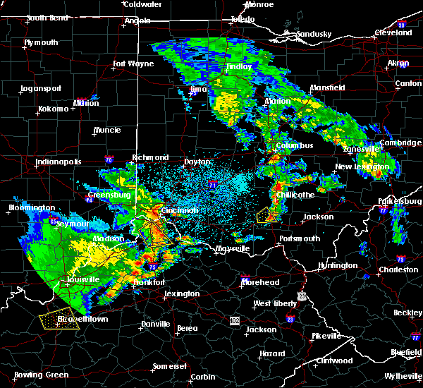 The severe thunderstorm warning for south central ross and central pike counties will expire at 415 pm edt, the storm which prompted the warning has weakened below severe limits, and no longer pose an immediate threat to life or property. therefore the warning will be allowed to expire. a severe thunderstorm watch remains in effect until 800 pm edt for southwestern ohio. please report previous wind damage or hail to the national weather service by going to our website at weather.gov/iln and submitting your report via social media. The severe thunderstorm warning for south central ross and central pike counties will expire at 415 pm edt, the storm which prompted the warning has weakened below severe limits, and no longer pose an immediate threat to life or property. therefore the warning will be allowed to expire. a severe thunderstorm watch remains in effect until 800 pm edt for southwestern ohio. please report previous wind damage or hail to the national weather service by going to our website at weather.gov/iln and submitting your report via social media.
|
| 5/10/2016 3:50 PM EDT |
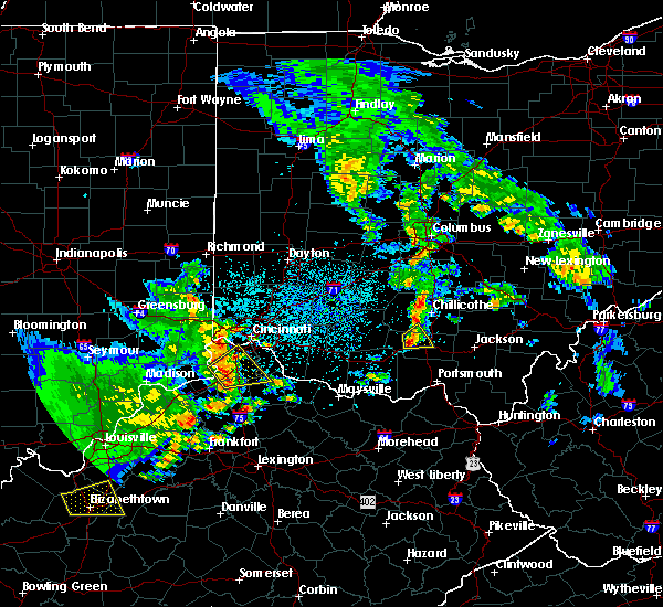 At 350 pm edt, a severe thunderstorm was located near pike lake, moving east at 30 mph (radar indicated). Hazards include quarter size hail. Damage to vehicles is expected. Locations impacted include, waverly city, piketon, pike lake, idaho, buchanan, summithill, lake white and elm grove. At 350 pm edt, a severe thunderstorm was located near pike lake, moving east at 30 mph (radar indicated). Hazards include quarter size hail. Damage to vehicles is expected. Locations impacted include, waverly city, piketon, pike lake, idaho, buchanan, summithill, lake white and elm grove.
|
| 5/10/2016 3:40 PM EDT |
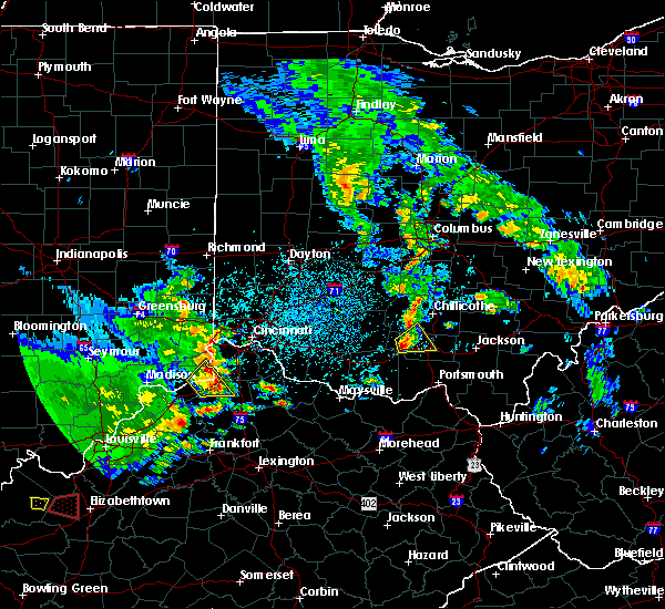 At 340 pm edt, a severe thunderstorm was located over kincaid springs, moving east at 25 mph (radar indicated). Hazards include quarter size hail. damage to vehicles is expected At 340 pm edt, a severe thunderstorm was located over kincaid springs, moving east at 25 mph (radar indicated). Hazards include quarter size hail. damage to vehicles is expected
|
| 4/26/2016 6:11 PM EDT |
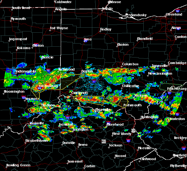 At 611 pm edt, a severe thunderstorm was located 7 miles southeast of kincaid springs, moving southeast at 30 mph (radar indicated). Hazards include 60 mph wind gusts and quarter size hail. Hail damage to vehicles is expected. Expect wind damage to roofs, siding, and trees. At 611 pm edt, a severe thunderstorm was located 7 miles southeast of kincaid springs, moving southeast at 30 mph (radar indicated). Hazards include 60 mph wind gusts and quarter size hail. Hail damage to vehicles is expected. Expect wind damage to roofs, siding, and trees.
|
| 4/26/2016 6:01 PM EDT |
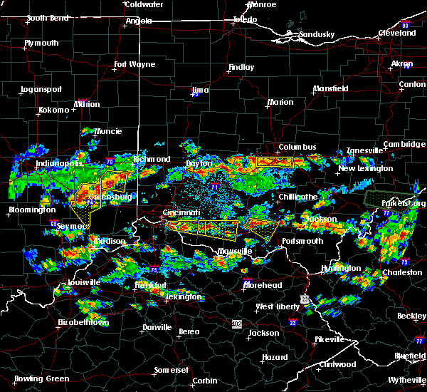 At 600 pm edt, a severe thunderstorm was located near kincaid springs, moving southeast at 30 mph (radar indicated). Hazards include 60 mph wind gusts and quarter size hail. Hail damage to vehicles is expected. expect wind damage to roofs, siding, and trees. Locations impacted include, piketon, kincaid springs, rarden, sinking spring, idaho, ladd, wakefield, mount joy, bear creek, poplar grove, elm grove and smoky corners. At 600 pm edt, a severe thunderstorm was located near kincaid springs, moving southeast at 30 mph (radar indicated). Hazards include 60 mph wind gusts and quarter size hail. Hail damage to vehicles is expected. expect wind damage to roofs, siding, and trees. Locations impacted include, piketon, kincaid springs, rarden, sinking spring, idaho, ladd, wakefield, mount joy, bear creek, poplar grove, elm grove and smoky corners.
|
| 4/26/2016 5:45 PM EDT |
 At 545 pm edt, a severe thunderstorm was located near marshall, moving southeast at 30 mph (radar indicated). Hazards include 60 mph wind gusts and quarter size hail. Hail damage to vehicles is expected. Expect wind damage to roofs, siding, and trees. At 545 pm edt, a severe thunderstorm was located near marshall, moving southeast at 30 mph (radar indicated). Hazards include 60 mph wind gusts and quarter size hail. Hail damage to vehicles is expected. Expect wind damage to roofs, siding, and trees.
|
| 7/18/2015 9:45 PM EDT |
 At 945 pm edt, radar indicated that the severe thunderstorm had weakened. this storm was located near waverly city, moving southeast at 30 mph. storm hazards include, winds to 60 mph, frequent cloud to ground lightning, very heavy rain which may cause minor flooding, locations impacted include, waverly, waverly city, piketon, beaver, linn, givens, omega, germany and pike county airport. At 945 pm edt, radar indicated that the severe thunderstorm had weakened. this storm was located near waverly city, moving southeast at 30 mph. storm hazards include, winds to 60 mph, frequent cloud to ground lightning, very heavy rain which may cause minor flooding, locations impacted include, waverly, waverly city, piketon, beaver, linn, givens, omega, germany and pike county airport.
|
| 7/18/2015 9:36 PM EDT |
 At 936 pm edt, radar indicated that the severe thunderstorm had strengthened. this storm was located over waverly city, moving southeast at 30 mph. storm hazards include, damaging winds to 70 mph, frequent cloud to ground lightning, very heavy rain which may cause minor flooding, locations impacted include, waverly, waverly city, piketon, beaver, linn, givens, omega, lake white, germany, pike county airport and scioto trail state park. At 936 pm edt, radar indicated that the severe thunderstorm had strengthened. this storm was located over waverly city, moving southeast at 30 mph. storm hazards include, damaging winds to 70 mph, frequent cloud to ground lightning, very heavy rain which may cause minor flooding, locations impacted include, waverly, waverly city, piketon, beaver, linn, givens, omega, lake white, germany, pike county airport and scioto trail state park.
|
| 7/18/2015 9:24 PM EDT |
 At 924 pm edt, radar indicated a severe thunderstorm located near waverly city, moving southeast at 30 mph. storm hazards include, winds to 60 mph,. At 924 pm edt, radar indicated a severe thunderstorm located near waverly city, moving southeast at 30 mph. storm hazards include, winds to 60 mph,.
|
| 7/14/2015 4:27 PM EDT |
 At 426 pm edt, radar indicated a severe thunderstorm located near piketon, moving southeast at 35 mph. storm hazards include, winds to 60 mph, penny size hail,. At 426 pm edt, radar indicated a severe thunderstorm located near piketon, moving southeast at 35 mph. storm hazards include, winds to 60 mph, penny size hail,.
|
| 7/14/2015 4:18 PM EDT |
 At 418 pm edt, radar indicated severe thunderstorms located along a line extending from 9 miles east of wellston to 6 miles east of waverly, moving southeast at 60 mph. storm hazards include, winds to 60 mph, quarter size hail, locations impacted include, waverly, waverly city, piketon, kincaid springs, pike lake, beaver, idaho, wakefield, buchanan, omega, poplar grove, ladd, linn, givens, lake white, germany, elm grove and stockdale. At 418 pm edt, radar indicated severe thunderstorms located along a line extending from 9 miles east of wellston to 6 miles east of waverly, moving southeast at 60 mph. storm hazards include, winds to 60 mph, quarter size hail, locations impacted include, waverly, waverly city, piketon, kincaid springs, pike lake, beaver, idaho, wakefield, buchanan, omega, poplar grove, ladd, linn, givens, lake white, germany, elm grove and stockdale.
|
| 7/14/2015 3:47 PM EDT |
 At 346 pm edt, radar indicated severe thunderstorms located along a line extending from near chillicothe to near greenfield, moving southeast at 60 mph. storm hazards include, winds to 60 mph, quarter size hail,. At 346 pm edt, radar indicated severe thunderstorms located along a line extending from near chillicothe to near greenfield, moving southeast at 60 mph. storm hazards include, winds to 60 mph, quarter size hail,.
|
| 7/13/2015 2:39 PM EDT |
 At 239 pm edt, radar indicated severe thunderstorms located along a line extending from near concord to 11 miles west of rosemount to 8 miles northwest of south webster, moving southeast at 45 mph. storm hazards include, winds to 60 mph, penny size hail, locations impacted include, west union, piketon, manchester, lucasville, blue creek, rarden, rome, otway, wakefield, dunkinsville, turkey creek lake, ladd, bentonville, cedar mills, mount joy, lombardsville, state route 348 at state route 125, bear creek, wamsley and mcdermott. At 239 pm edt, radar indicated severe thunderstorms located along a line extending from near concord to 11 miles west of rosemount to 8 miles northwest of south webster, moving southeast at 45 mph. storm hazards include, winds to 60 mph, penny size hail, locations impacted include, west union, piketon, manchester, lucasville, blue creek, rarden, rome, otway, wakefield, dunkinsville, turkey creek lake, ladd, bentonville, cedar mills, mount joy, lombardsville, state route 348 at state route 125, bear creek, wamsley and mcdermott.
|
| 7/13/2015 1:50 PM EDT |
 At 150 pm edt, radar indicated severe thunderstorms located along a line extending from near sardinia to near hillsboro to near bainbridge, moving southeast at 45 mph. storm hazards include, winds to 60 mph, penny size hail,. At 150 pm edt, radar indicated severe thunderstorms located along a line extending from near sardinia to near hillsboro to near bainbridge, moving southeast at 45 mph. storm hazards include, winds to 60 mph, penny size hail,.
|
| 6/26/2015 5:01 PM EDT | At 458 pm edt, radar indicated a severe thunderstorm capable of producing a tornado located near givens, moving southeast at 25 mph. in addition to the tornado, this storm is capable of producing quarter sized hail, destructive straight line winds and very heavy rain. locations impacted include, lucasville. in addition, germany, beaver, state route 335 at state route 776 and stockdale are near the path of this storm. |
| 6/26/2015 4:58 PM EDT | At 455 pm edt, radar indicated a severe thunderstorm located near givens, moving east at 20 mph. storm hazards include, winds to 60 mph, quarter size hail, frequent cloud to ground lightning, very heavy rain which may cause minor flooding, * the severe thunderstorm will affect mainly rural areas of eastern pike and northern scioto counties, including germany, linn, state route 335 at state route 776, stockdale, beaver, minford and portsmouth regional airport. |
| 6/26/2015 4:46 PM EDT | At 444 pm edt, radar indicated a severe thunderstorm capable of producing a tornado located near piketon, moving southeast at 25 mph. in addition to the tornado, this storm is capable of producing destructive straight line winds and very heavy rain. locations impacted include, piketon and lucasville. in addition, bear creek, wakefield, givens, germany, beaver, state route 335 at state route 776 and stockdale are near the path of this storm. |
| 6/26/2015 4:44 PM EDT | At 441 pm edt, radar continued to indicate a severe thunderstorm located near piketon, moving east at 30 mph. storm hazards include, winds to 60 mph, quarter size hail, frequent cloud to ground lightning, very heavy rain which may cause minor flooding, this storm will affect mainly rural areas of northern scioto and pike counties, including givens, germany, linn, state route 335 at state route 776, beaver, stockdale and minford. |
| 6/26/2015 4:35 PM EDT | At 431 pm edt, radar continued to indicate a severe thunderstorm located near lake white, moving east at 30 mph. numerous reports of down trees in highland county. storm hazards include, winds to 60 mph, quarter size hail, frequent cloud to ground lightning, very heavy rain which may cause minor flooding, locations impacted include, waverly and piketon. in addition, scioto trail state park, wakefield, pike county airport, mooresville, omega, givens, londonderry and germany are near the path of this storm. |
| 6/26/2015 4:29 PM EDT | At 426 pm edt, radar indicated a severe thunderstorm capable of producing a tornado located near idaho, moving southeast at 20 mph. in addition to the tornado, this storm is capable of producing large hail, destructive straight line winds and very heavy rain. |
| 6/26/2015 4:15 PM EDT | At 412 pm edt, radar indicated a severe thunderstorm located near pike lake, moving east at 30 mph. storm hazards include, damaging winds to 70 mph, half dollar size hail,. |
| 6/23/2015 3:23 PM EDT |
 At 322 pm edt, radar continued to indicate a severe thunderstorm located near omega, moving southeast at 25 mph. storm hazards include, winds to 60 mph, quarter size hail, this storm will affect mainly rural areas of northeastern pike county, including givens, linn and beaver. At 322 pm edt, radar continued to indicate a severe thunderstorm located near omega, moving southeast at 25 mph. storm hazards include, winds to 60 mph, quarter size hail, this storm will affect mainly rural areas of northeastern pike county, including givens, linn and beaver.
|
| 6/23/2015 3:16 PM EDT |
 At 314 pm edt, radar indicated a severe thunderstorm located near pike county airport, moving southeast at 30 mph. storm hazards include, winds to 60 mph, quarter size hail, * the severe thunderstorm will affect mainly rural areas of northeastern pike and southeastern ross counties, including omega, givens, richmond dale, linn and beaver. At 314 pm edt, radar indicated a severe thunderstorm located near pike county airport, moving southeast at 30 mph. storm hazards include, winds to 60 mph, quarter size hail, * the severe thunderstorm will affect mainly rural areas of northeastern pike and southeastern ross counties, including omega, givens, richmond dale, linn and beaver.
|
| 6/17/2015 7:24 PM EDT |
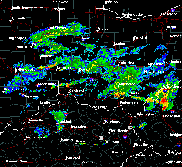 At 723 pm edt, radar indicated that the severe thunderstorm had weakened. this storm was located near beaver, moving east at 40 mph. storm hazards include, winds to 60 mph, this storm will affect mainly rural areas of southeastern pike county, including beaver. At 723 pm edt, radar indicated that the severe thunderstorm had weakened. this storm was located near beaver, moving east at 40 mph. storm hazards include, winds to 60 mph, this storm will affect mainly rural areas of southeastern pike county, including beaver.
|
| 6/17/2015 7:13 PM EDT |
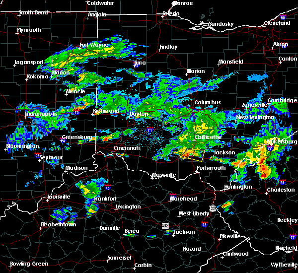 At 712 pm edt, radar continued to indicate a severe thunderstorm located near piketon, moving east at 30 mph. storm hazards include, damaging winds to 70 mph, this storm will affect mainly rural areas of eastern pike county, including omega, givens, germany, linn, stockdale and beaver. At 712 pm edt, radar continued to indicate a severe thunderstorm located near piketon, moving east at 30 mph. storm hazards include, damaging winds to 70 mph, this storm will affect mainly rural areas of eastern pike county, including omega, givens, germany, linn, stockdale and beaver.
|
| 6/17/2015 7:04 PM EDT |
 At 702 pm edt, radar continued to indicate a severe thunderstorm located near idaho, moving east at 30 mph. storm hazards include, winds to 60 mph, locations impacted include, waverly and piketon. in addition, lake white, pike county airport, omega, givens, germany, linn, stockdale and beaver are near the path of this storm. At 702 pm edt, radar continued to indicate a severe thunderstorm located near idaho, moving east at 30 mph. storm hazards include, winds to 60 mph, locations impacted include, waverly and piketon. in addition, lake white, pike county airport, omega, givens, germany, linn, stockdale and beaver are near the path of this storm.
|
| 6/17/2015 6:53 PM EDT |
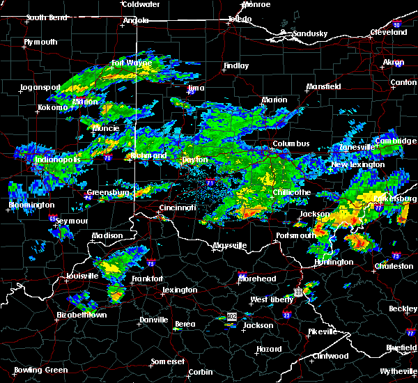 At 651 pm edt, radar indicated a severe thunderstorm located near kincaid springs, moving east at 30 mph. storm hazards include, winds to 65 mph,. At 651 pm edt, radar indicated a severe thunderstorm located near kincaid springs, moving east at 30 mph. storm hazards include, winds to 65 mph,.
|
| 5/26/2015 9:02 PM EDT | At 901 pm edt, radar continued to indicate a severe thunderstorm located near waverly, moving northeast at 40 mph. storm hazards include, winds to 60 mph, quarter size hail, this storm will affect mainly rural areas of eastern ross and northeastern pike counties, including omega, linn, pike county airport, scioto trail state park, massieville, richmond dale, londonderry and mooresville. |
| 5/26/2015 8:46 PM EDT | At 845 pm edt, radar indicated a severe thunderstorm located near wakefield, moving northeast at 40 mph. storm hazards include, winds to 60 mph, quarter size hail,. |
| 5/11/2015 5:35 PM EDT | At 532 pm edt, radar continued to indicate a severe thunderstorm located near bear creek, moving northeast at 65 mph. storm hazards include, winds to 60 mph, quarter size hail, locations impacted include, piketon and waverly. in addition, lake white, givens and linn are near the path of this storm. , 1.00in. |
| 5/11/2015 5:25 PM EDT | At 522 pm edt, radar continued to indicate a severe thunderstorm located near otway, moving northeast at 65 mph. storm hazards include, winds to 60 mph, ping pong ball size hail, locations impacted include, piketon and waverly. in addition, bear creek, elm grove, idaho, wakefield, buchanan, lake white, givens and linn are near the path of this storm. , 1.50in. |
| 5/11/2015 5:03 PM EDT | At 501 pm edt, radar indicated severe thunderstorms along a line extending from west union to peebles. these storms are moving northeast at 40 mph. storm hazards include, winds to 60 mph, half dollar size hail,. |
| 4/9/2015 3:57 PM EDT | The severe thunderstorm warning for southeastern ross and pike counties will expire at 400 pm edt. the storm has weakened below severe limits. therefore the severe thunderstorm warning will be allowed to expire. small hail and gusty winds are still possible with this storm. Please report previous wind damage or hail to the national weather. |
| 4/9/2015 3:42 PM EDT | A severe thunderstorm warning remains in effect until 400 pm edt for southeastern ross and pike counties. at 339 pm edt. radar continued to indicate a severe thunderstorm located near idaho. and another severe thunderstorm 3 miles northeast of waverly. These storms are moving to the northeast at 50 mph. |
| 4/9/2015 3:32 PM EDT | A severe thunderstorm warning remains in effect until 400 pm edt for southeastern ross and pike counties. at 329 pm edt. radar continued to indicate a severe thunderstorm located near kincaid springs. and another severe thunderstorm near lake white. these storms are moving northeast at 50 mph. Storm hazards include. |
| 4/9/2015 3:28 PM EDT | Quarter sized hail reported 7.8 miles E of Piketon, OH, time estimated from radar. |
| 4/9/2015 3:27 PM EDT | The national weather service in wilmington has issued a * severe thunderstorm warning for. northwestern scioto county in southwest ohio. southeastern ross county in southwest ohio. pike county in southwest ohio. Northeastern adams county in southwest ohio. |
| 4/8/2015 12:06 PM EDT | The national weather service in wilmington has issued a * severe thunderstorm warning for. scioto county in southwest ohio. eastern ross county in southwest ohio. eastern pike county in southwest ohio. Southeastern pickaway county in central ohio. |
| 4/8/2015 12:06 PM EDT | The national weather service in wilmington has issued a * severe thunderstorm warning for. scioto county in southwest ohio. eastern ross county in southwest ohio. eastern pike county in southwest ohio. Southeastern pickaway county in central ohio. |
| 4/8/2015 11:52 AM EDT | One large tree and wires down across sunfish creek road about 1 mile west of sr 104. time estimated from rada in pike county OH, 5.3 miles ENE of Piketon, OH |
| 12/24/2014 4:36 PM EST | 1 tree down on piketon road. time estimated from rada in pike county OH, 1.5 miles ESE of Piketon, OH |
| 6/3/2014 6:18 PM EDT | One large tree downed near tipton lane. time estimated from rada in pike county OH, 2.5 miles WNW of Piketon, OH |
| 12/22/2013 12:45 AM EST | Trees down on lines on shyville rd in pike county OH, 1.4 miles N of Piketon, OH |
| 12/22/2013 12:40 AM EST | Trees down. corrected dat in pike county OH, 8 miles ESE of Piketon, OH |
| 12/21/2013 12:40 AM EST | Trees down in pike county OH, 8 miles ESE of Piketon, OH |
| 7/10/2013 5:10 PM EDT | Tree down across beavers ridge road in pike county OH, 10.5 miles E of Piketon, OH |
| 6/29/2012 5:42 PM EDT | Numerous trees down in pike county OH, 8 miles ESE of Piketon, OH |
| 5/1/2012 7:45 PM EDT | Several trees down in pike county OH, 5.7 miles NE of Piketon, OH |
| 1/1/0001 12:00 AM | Tree down in 6000 block of green ridge rd. time estimated from rada in pike county OH, 10.3 miles ESE of Piketon, OH |
| 1/1/0001 12:00 AM | Tree down on wakefield-mound r in pike county OH, 5.6 miles N of Piketon, OH |
| 1/1/0001 12:00 AM | Half Dollar sized hail reported 0.7 miles SSE of Piketon, OH |
| 1/1/0001 12:00 AM | 15 pine trees snapped off and uprooted at big beaver creek golf club in pike county OH, 0.8 miles W of Piketon, OH |
| 1/1/0001 12:00 AM | Several outbuildings blown over in piketon. also scattered trees down around pike count in pike county OH, 0.7 miles SSE of Piketon, OH |
| 1/1/0001 12:00 AM | 10 trees down and shingles off roof in pike county OH, 1.4 miles NNW of Piketon, OH |
| 1/1/0001 12:00 AM | Power lines down on big run road just east of sr 2 in pike county OH, 5.6 miles N of Piketon, OH |
| 1/1/0001 12:00 AM | House trailer being towed blown over in pike county OH, 3.5 miles N of Piketon, OH |
| 1/1/0001 12:00 AM | Multiple trees down in pike county OH, 0.7 miles SSE of Piketon, OH |
Hail Maps for Piketon, OH


Connect with Interactive Hail Maps