

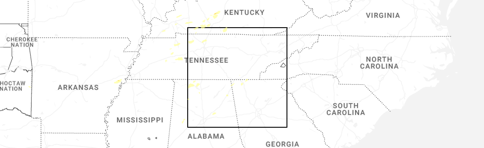
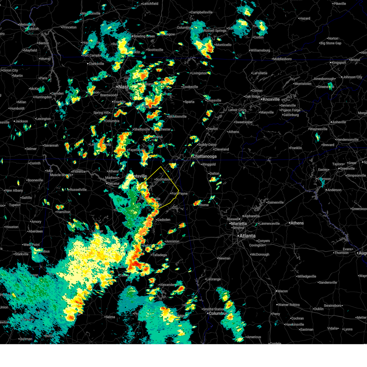
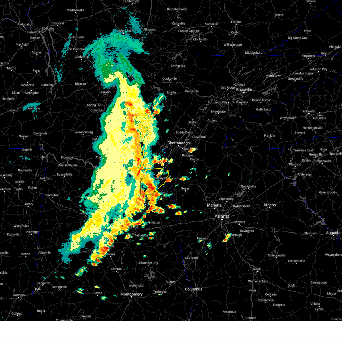
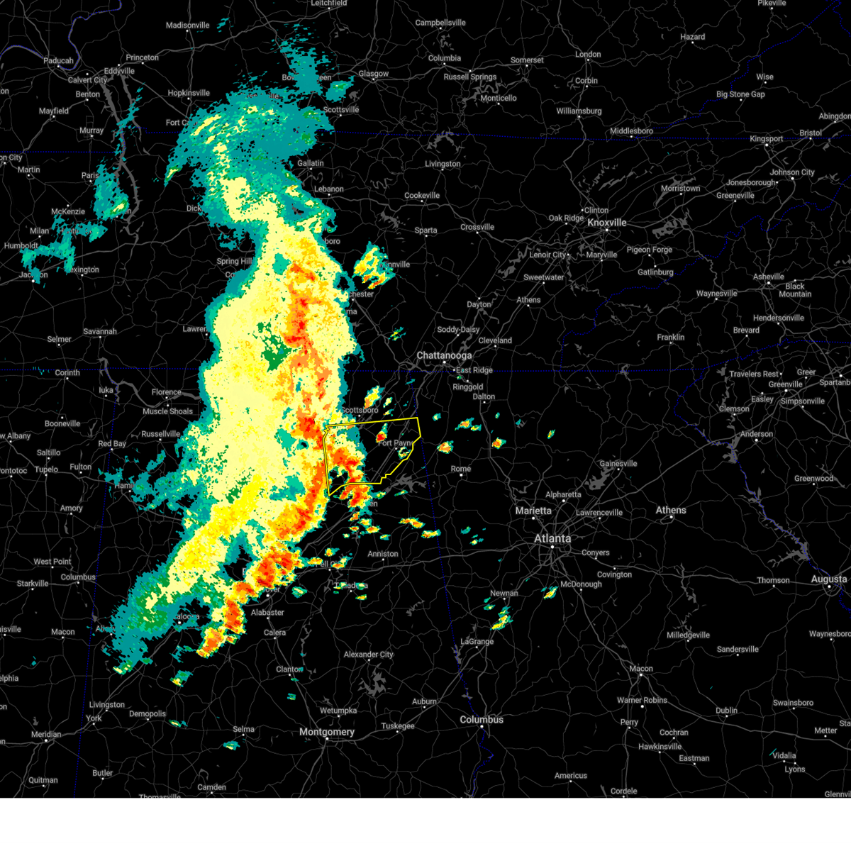
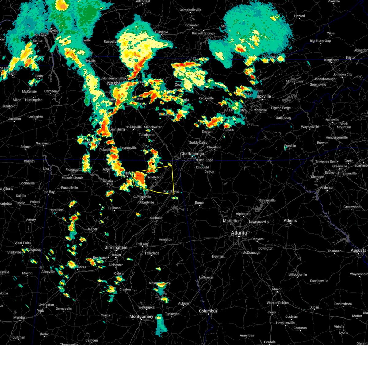
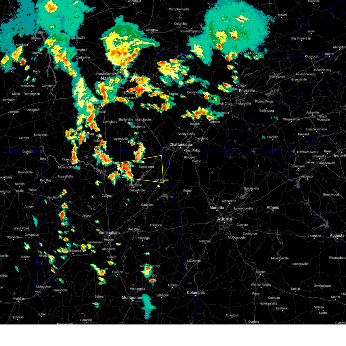
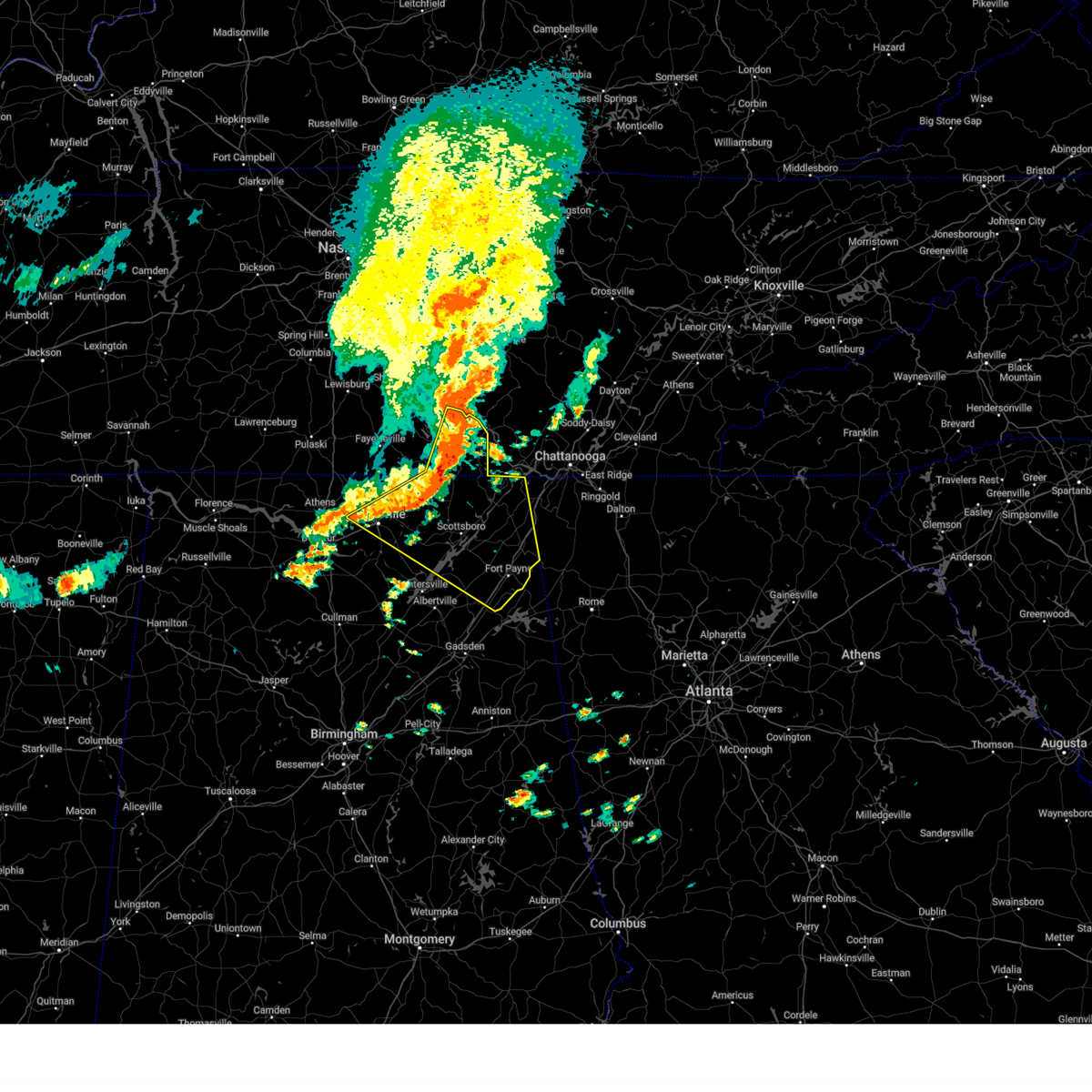
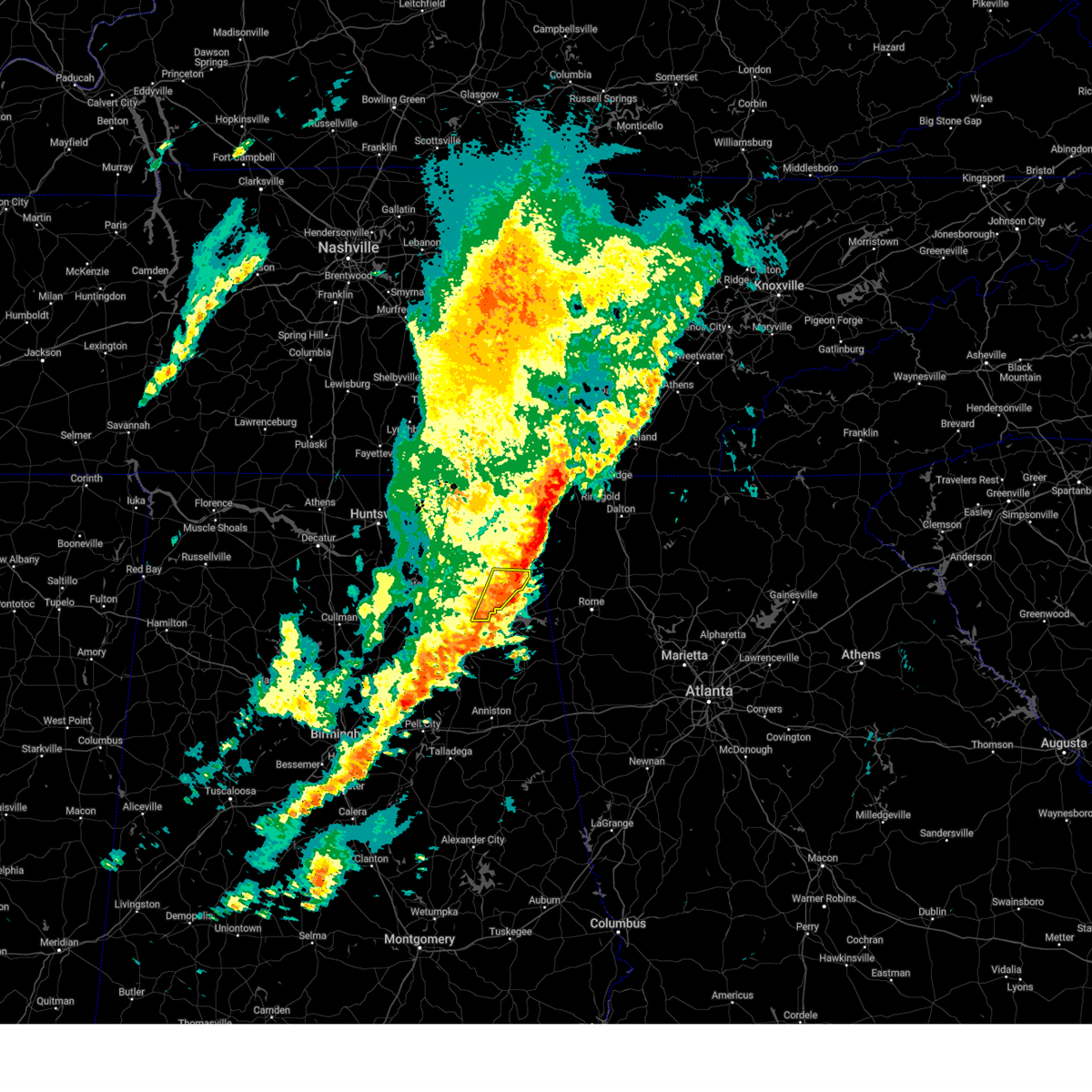
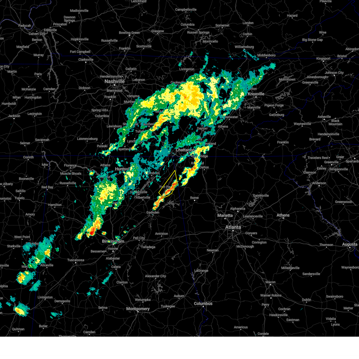
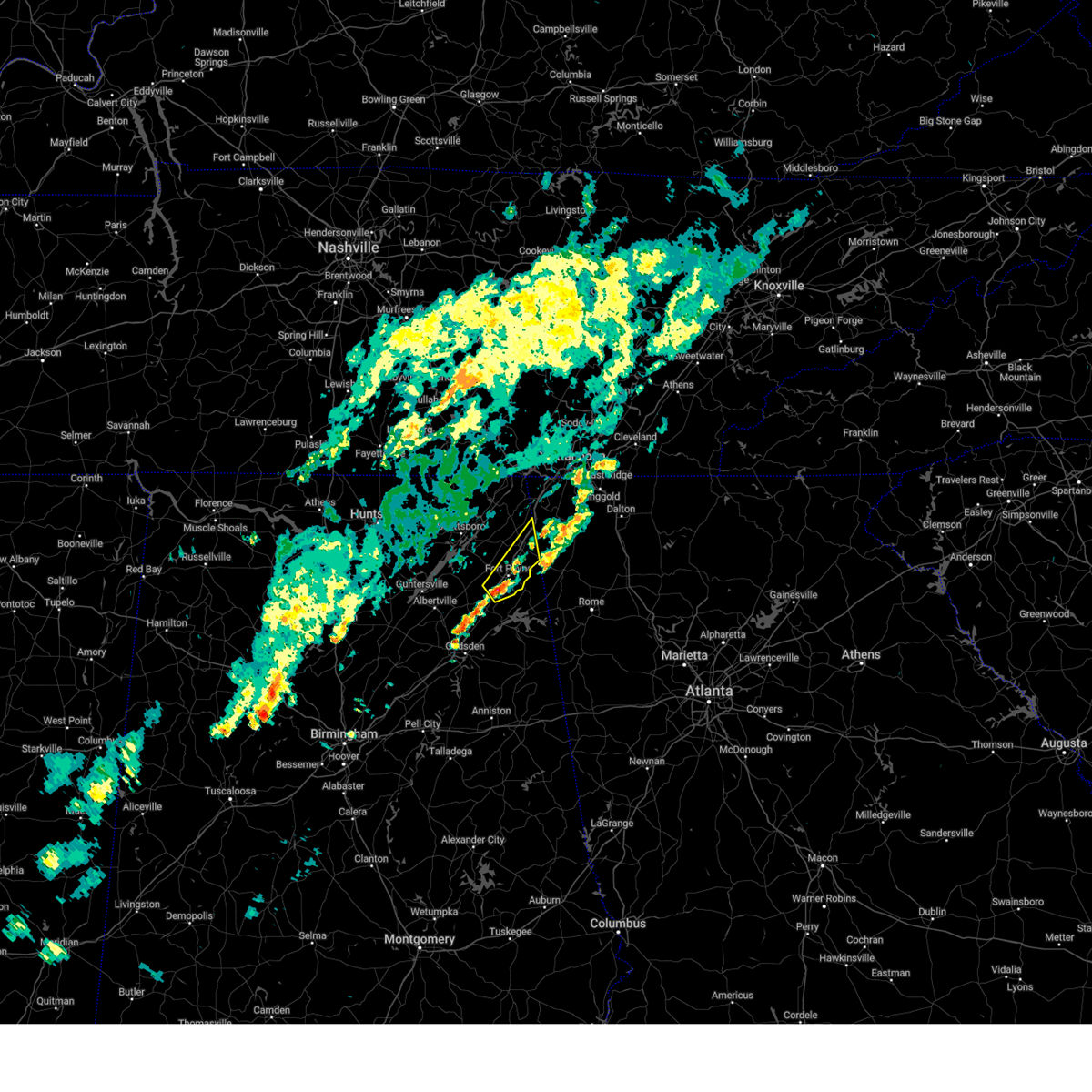
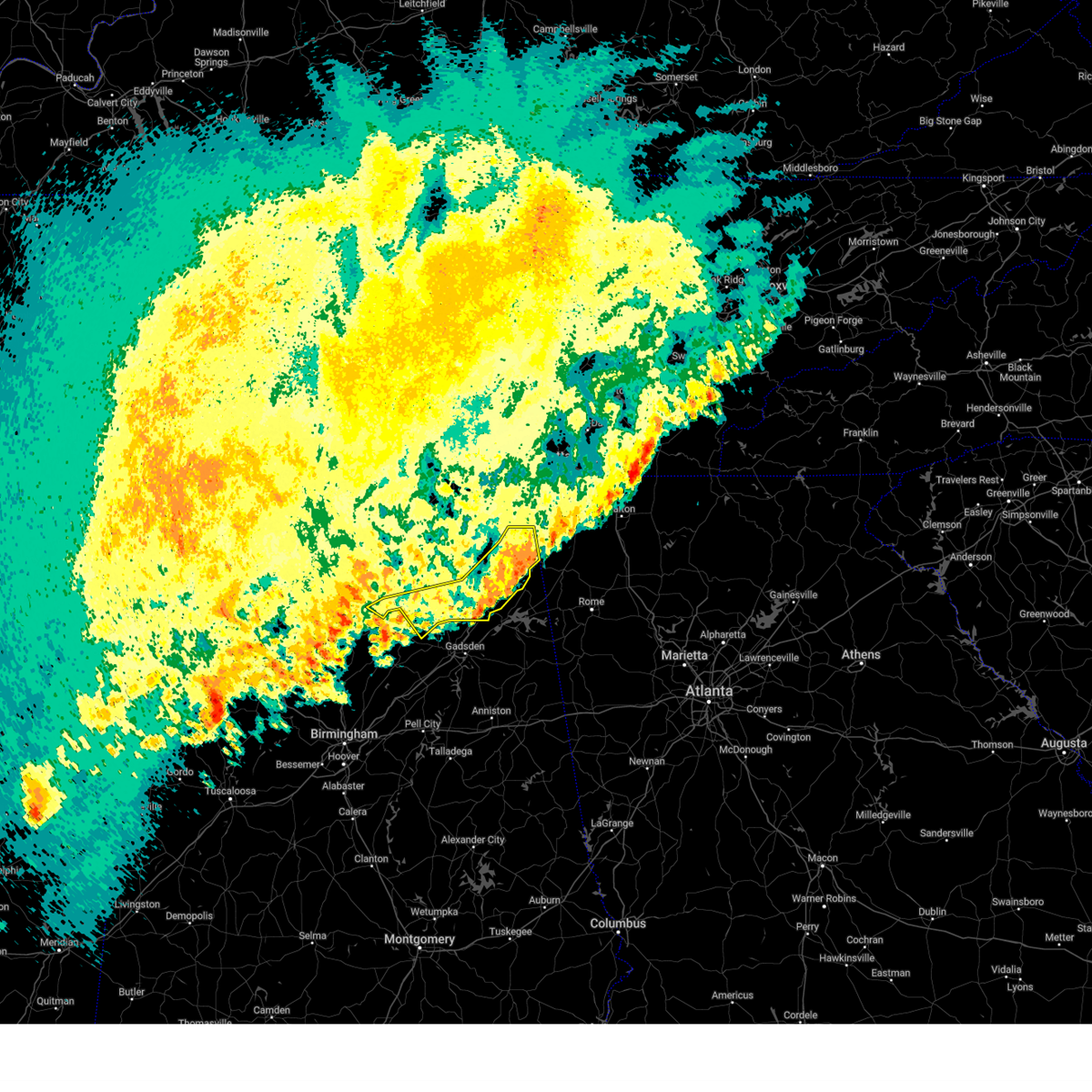
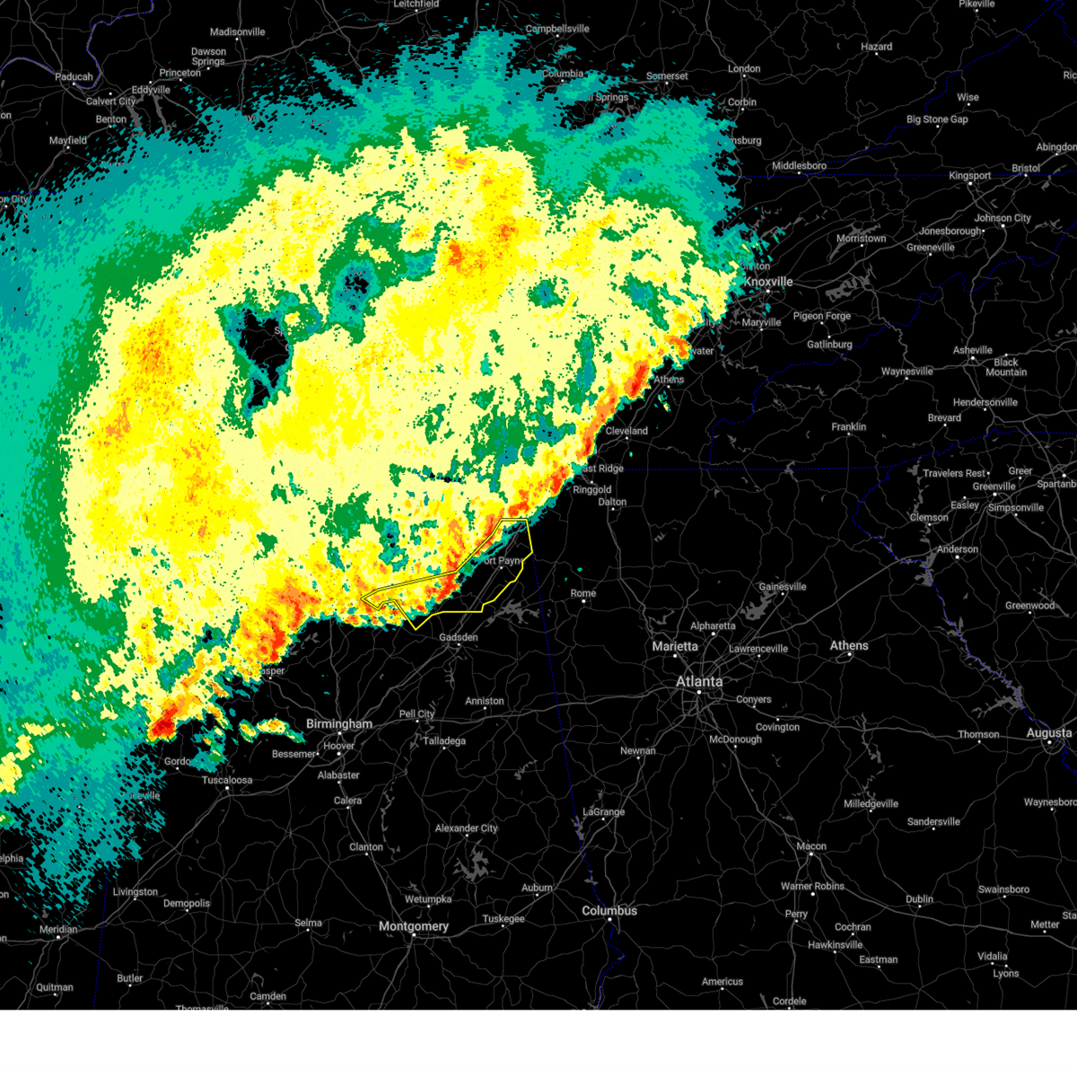
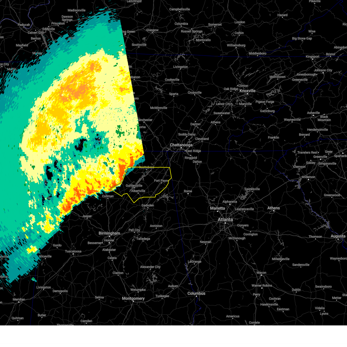
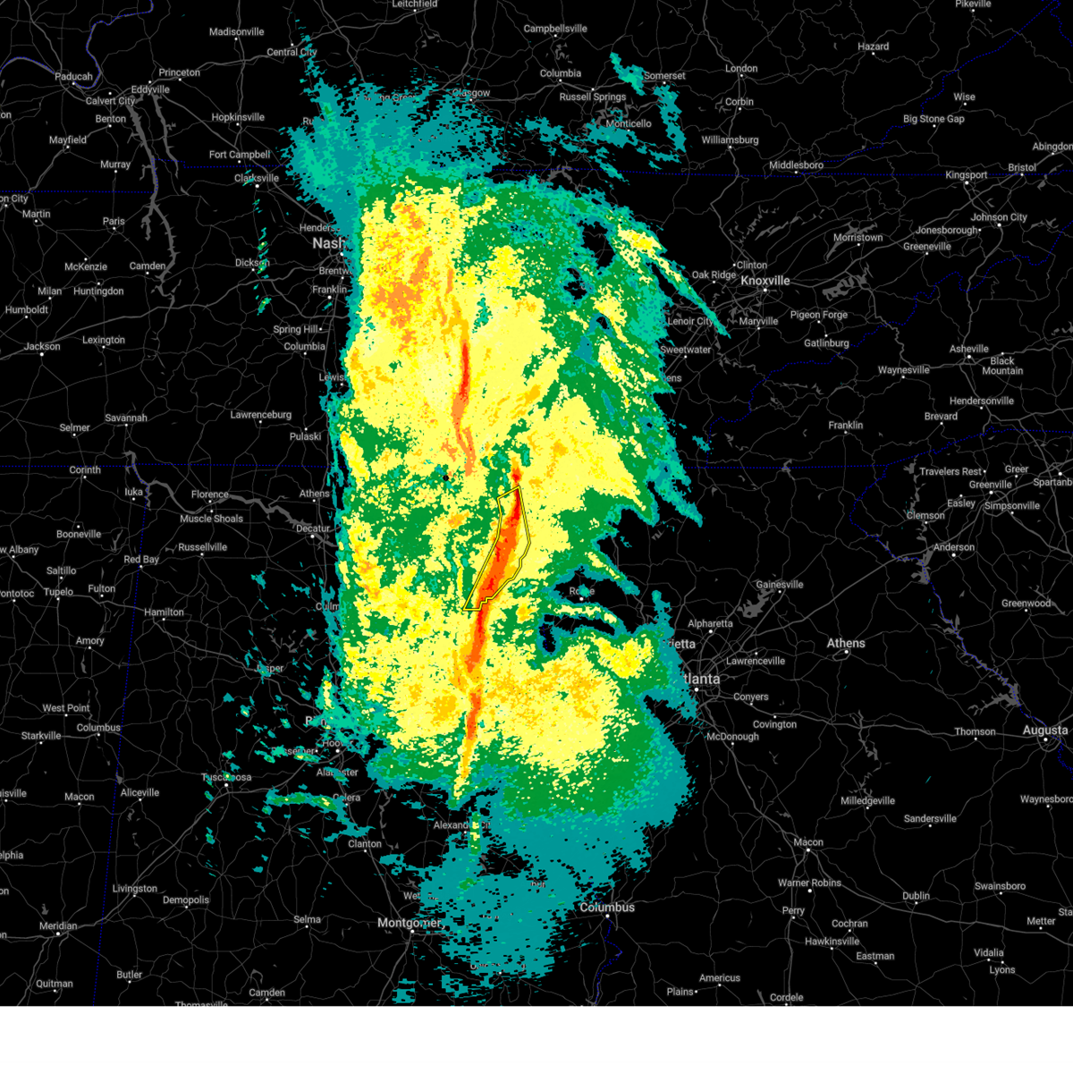
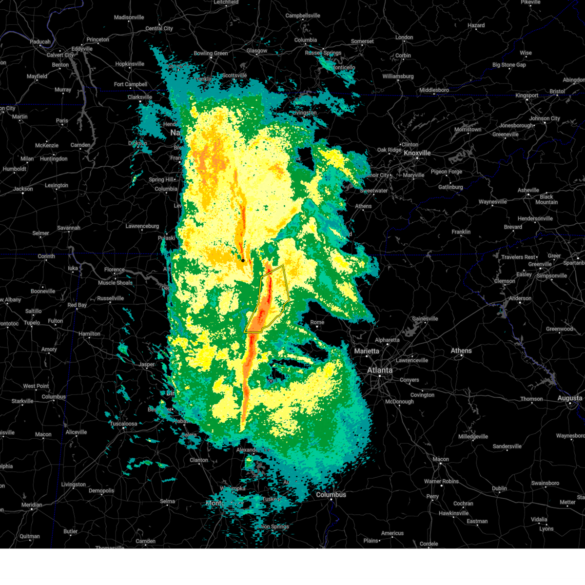
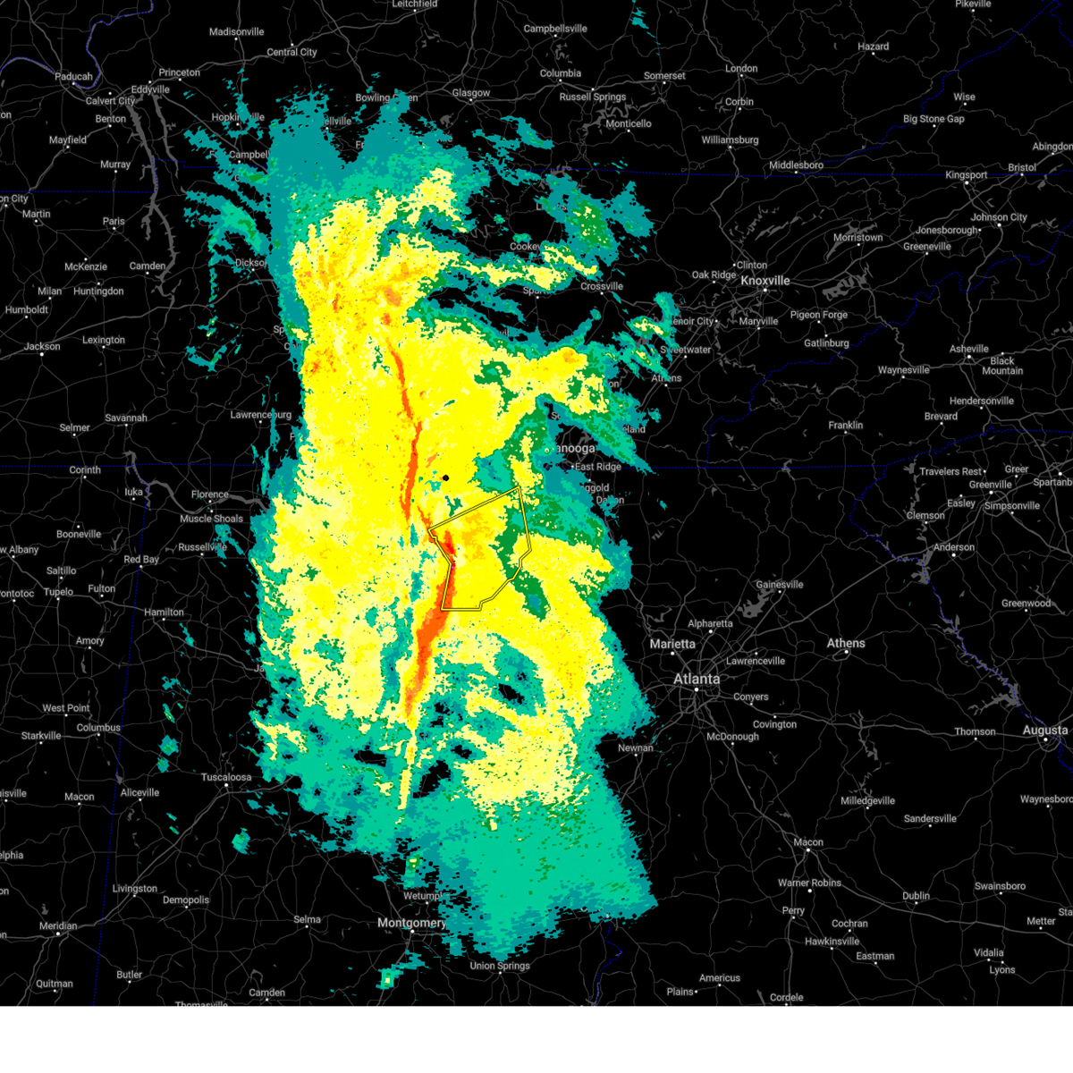
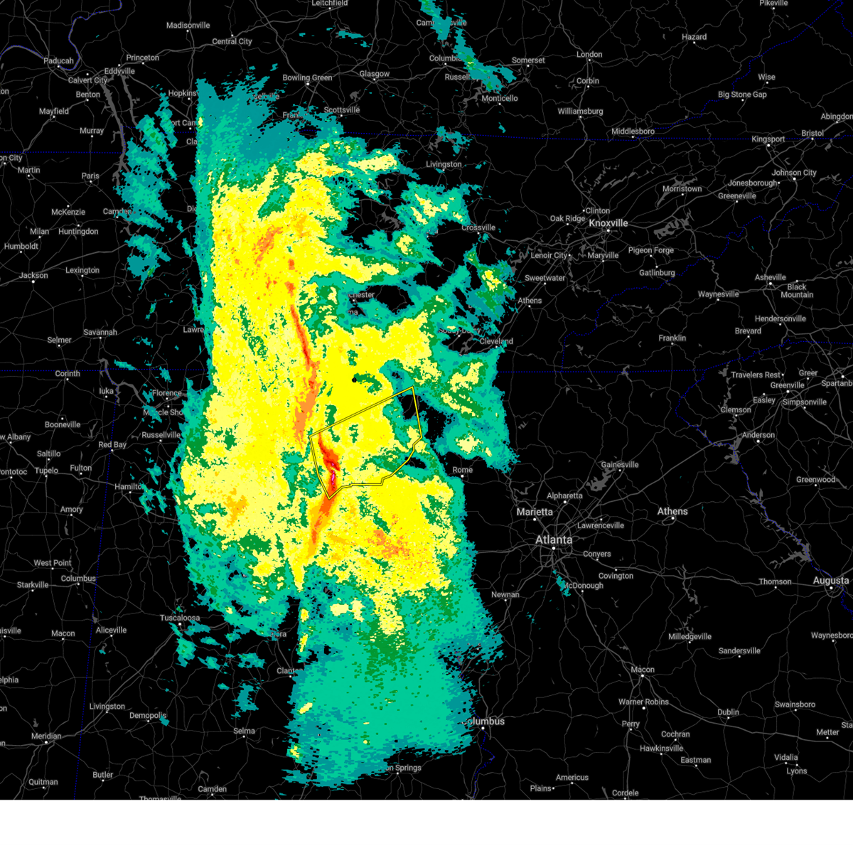
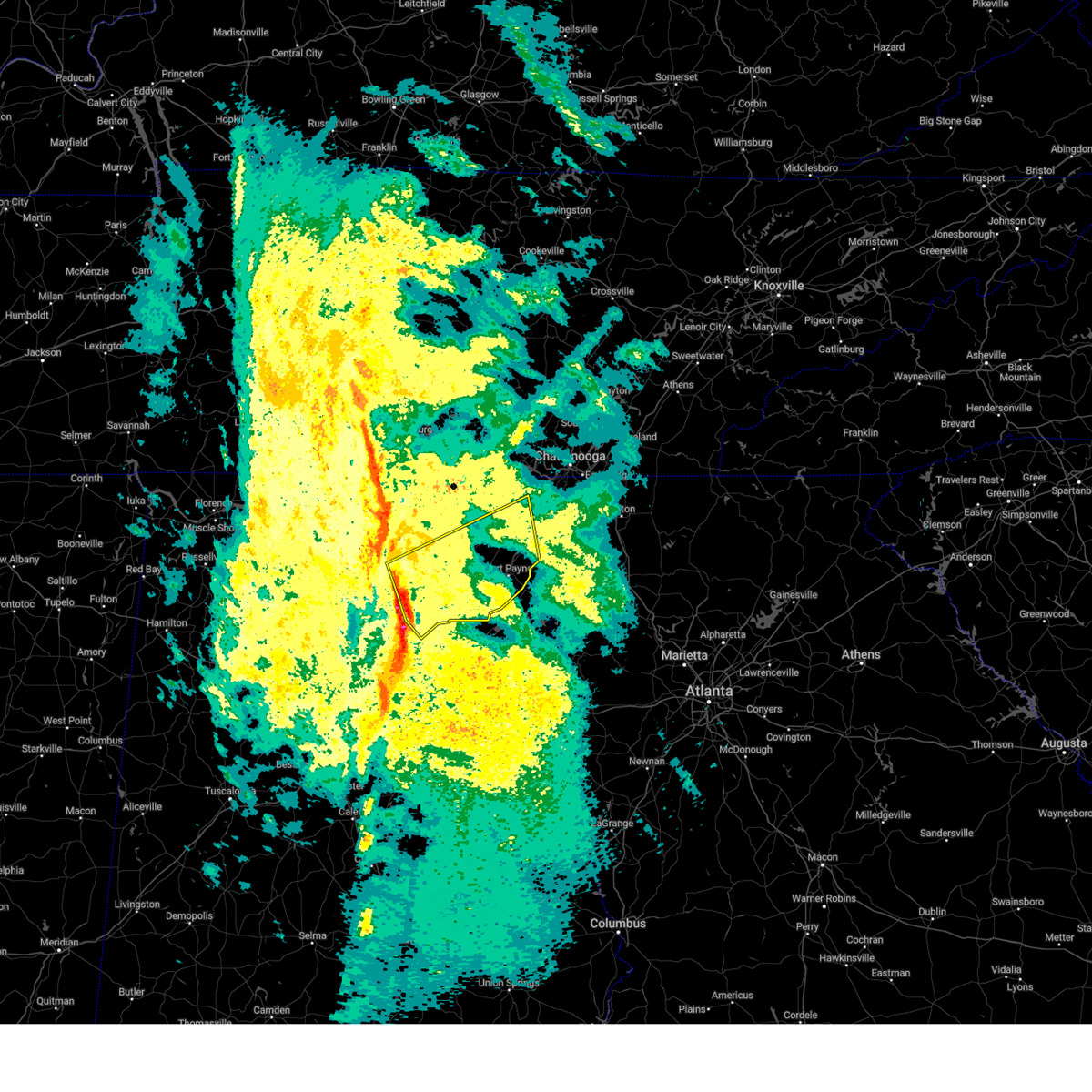
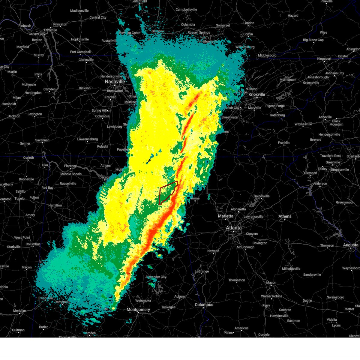
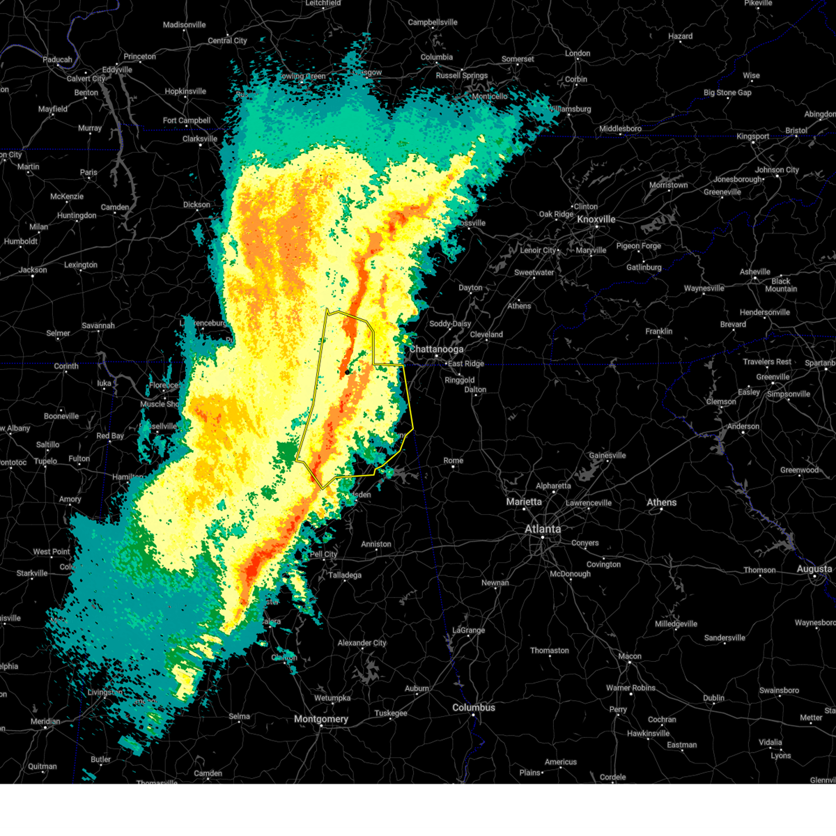
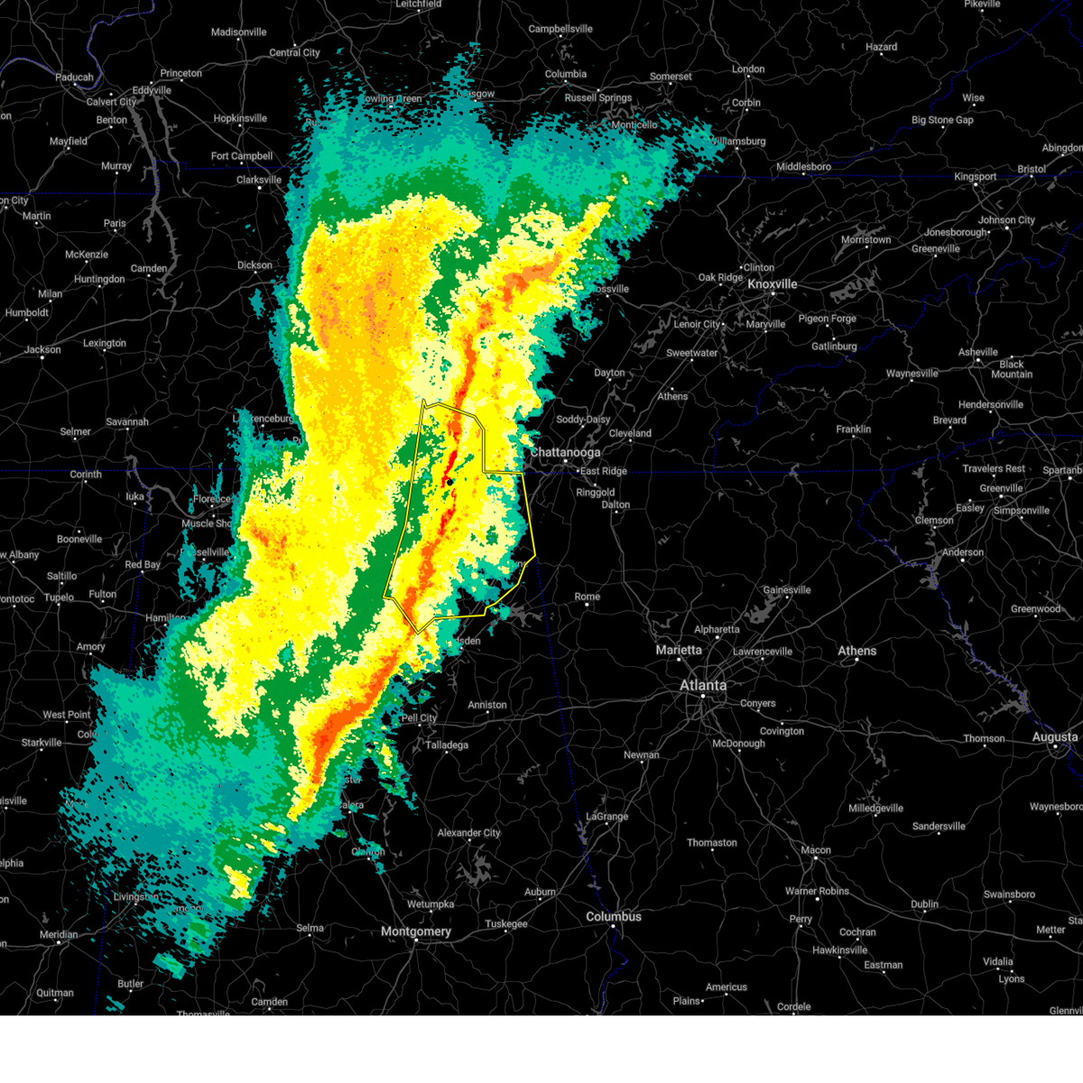
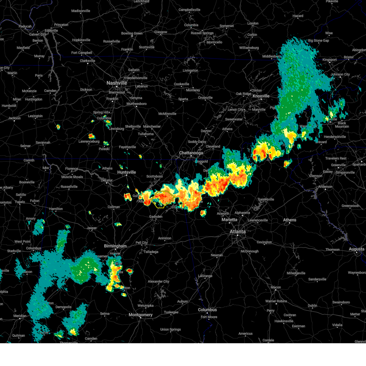
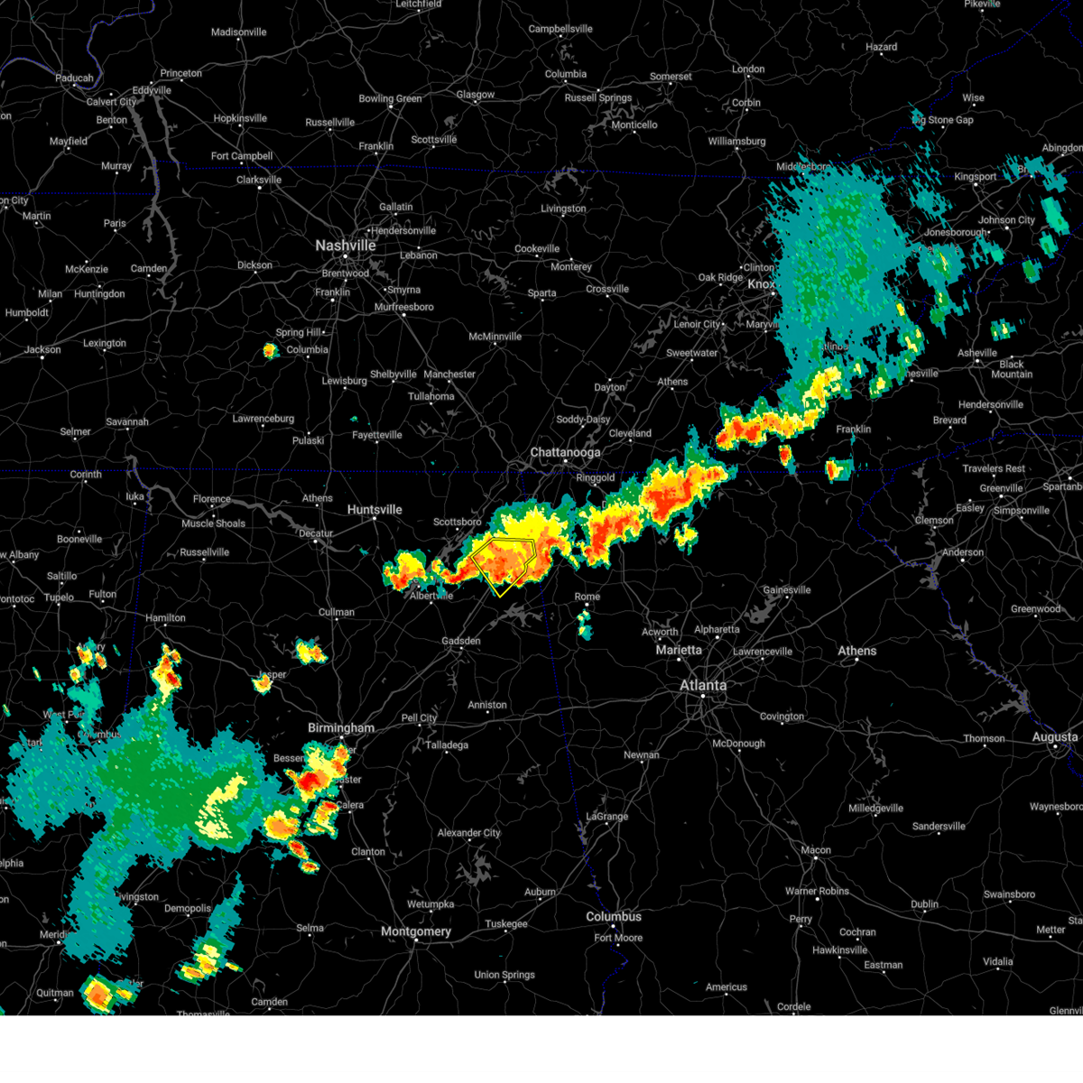
Hail Map for Pine Ridge, AL
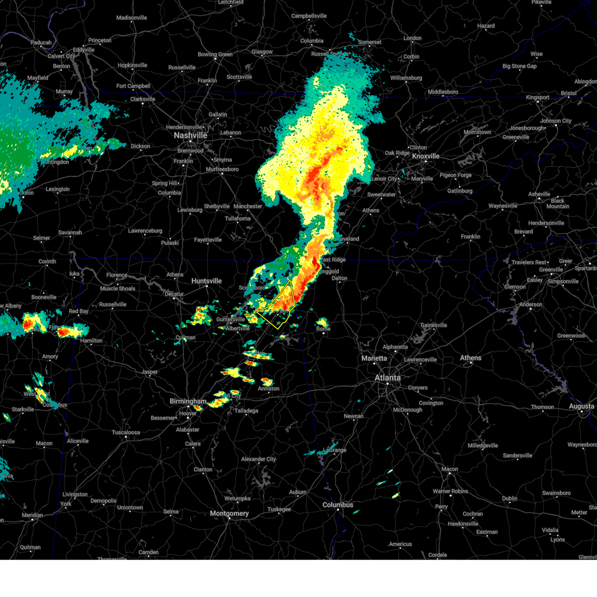
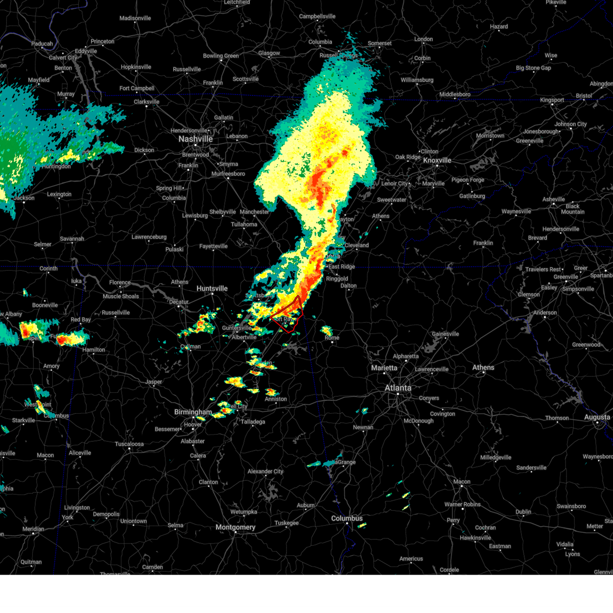
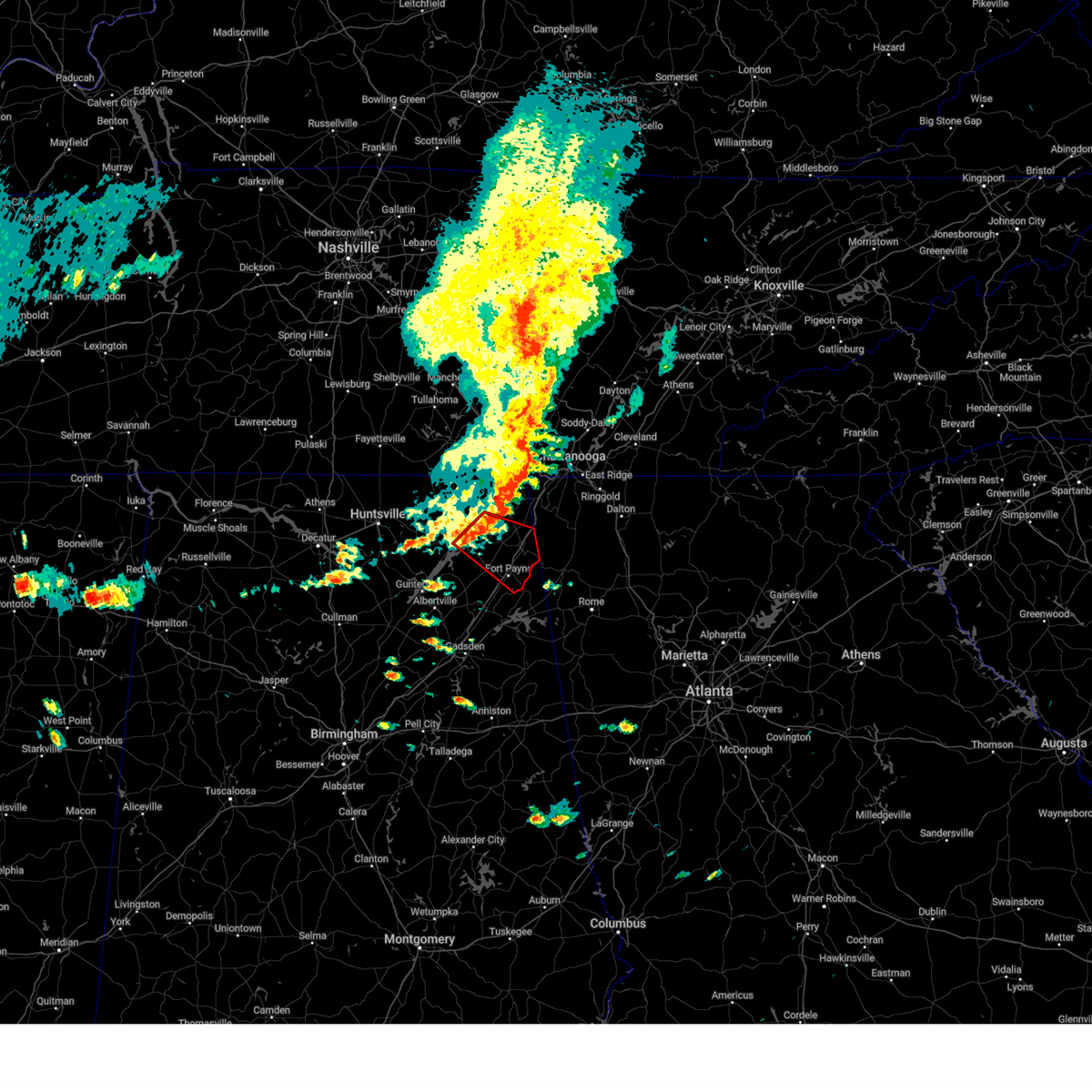
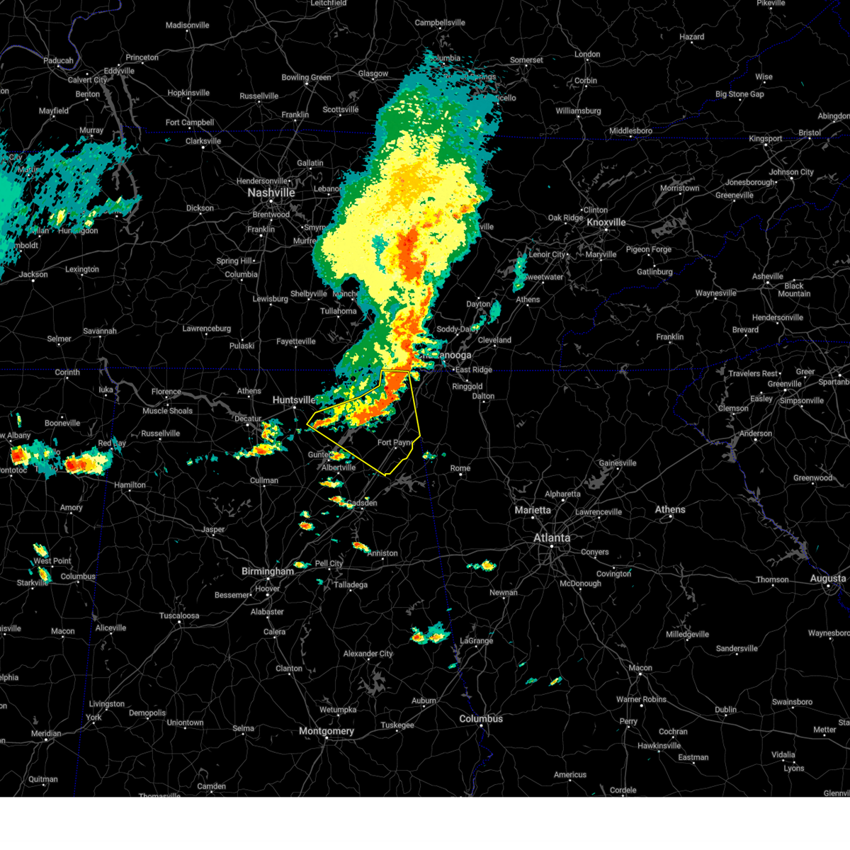
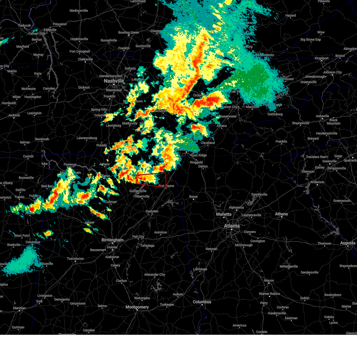
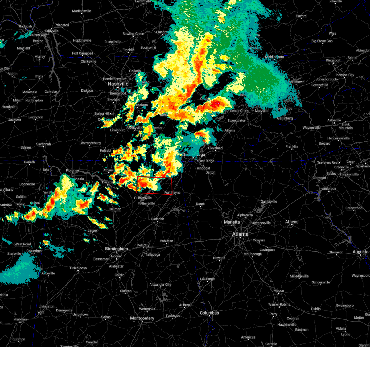
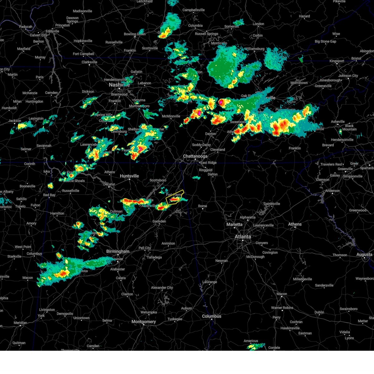
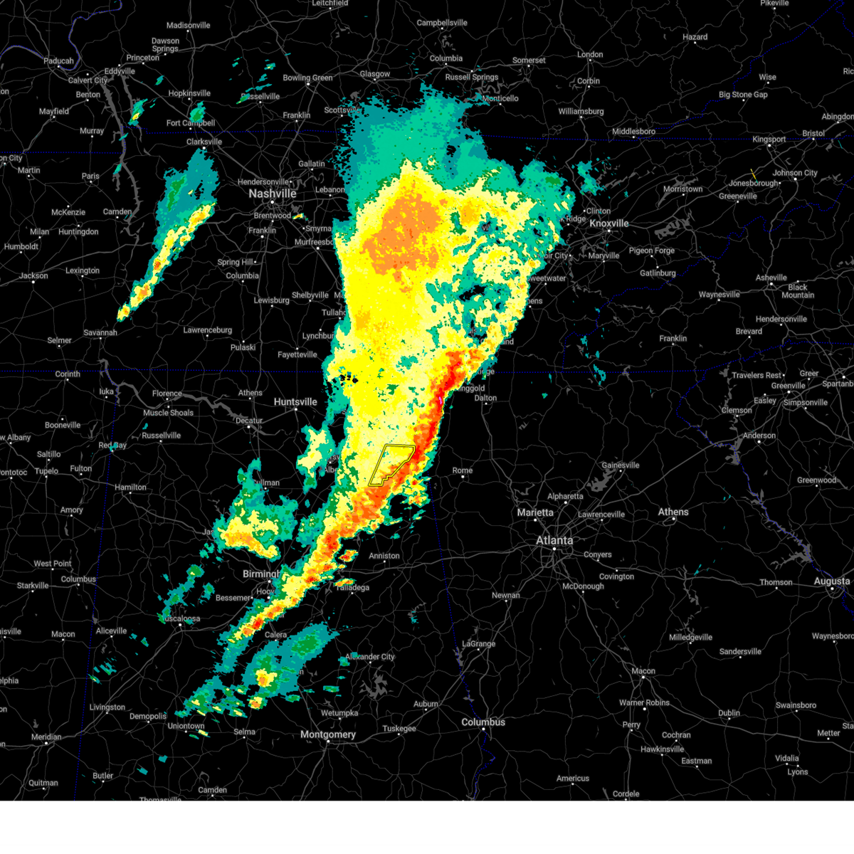
The Pine Ridge, AL area has had 0 reports of on-the-ground hail by trained spotters, and has been under severe weather warnings 106 times during the past 12 months. Doppler radar has detected hail at or near Pine Ridge, AL on 47 occasions, including 4 occasions during the past year.
| Name: | Pine Ridge, AL |
| Where Located: | 48.9 miles SSW of Chattanooga, TN |
| Map: | Google Map for Pine Ridge, AL |
| Population: | 282 |
| Housing Units: | 121 |
| More Info: | Search Google for Pine Ridge, AL |
1
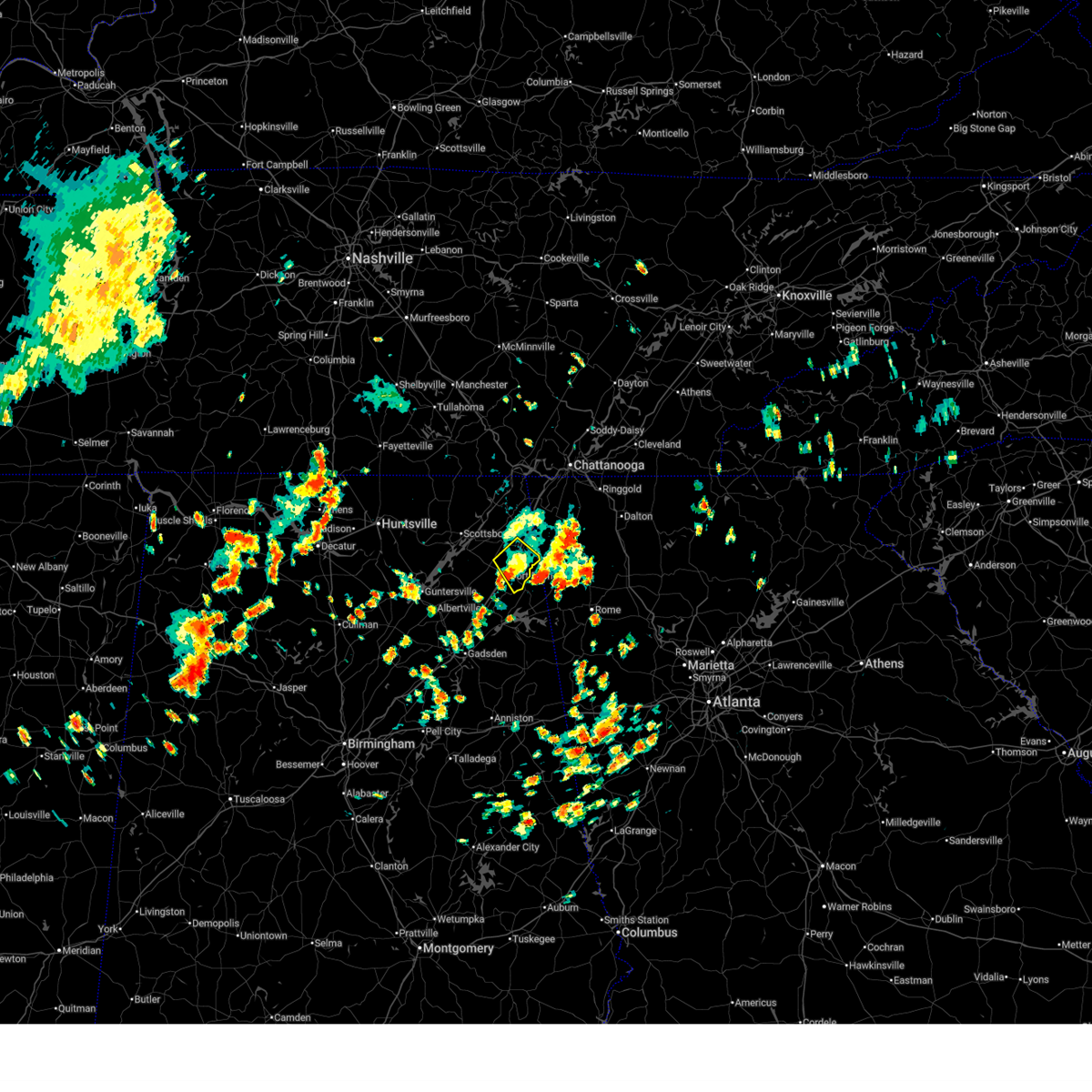
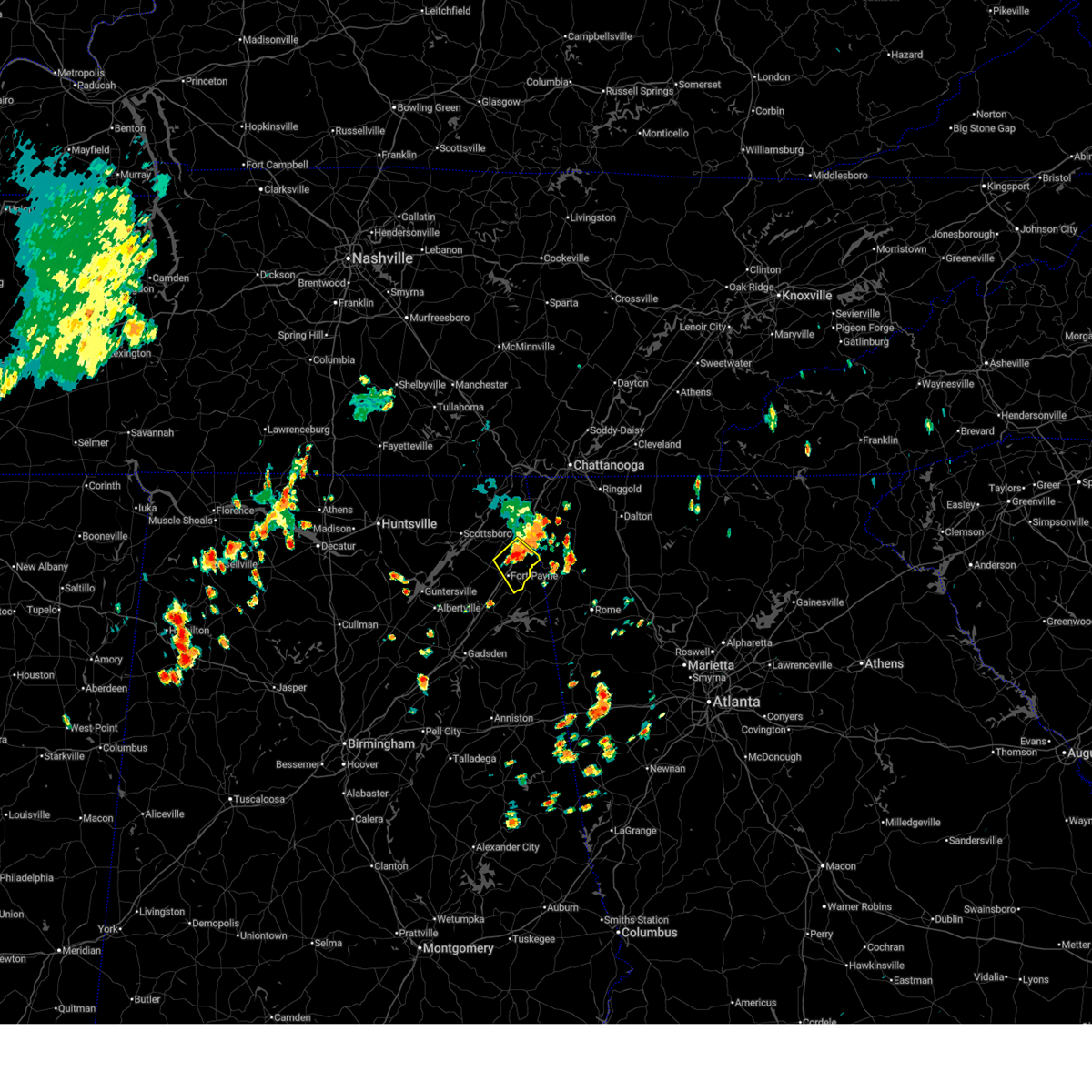
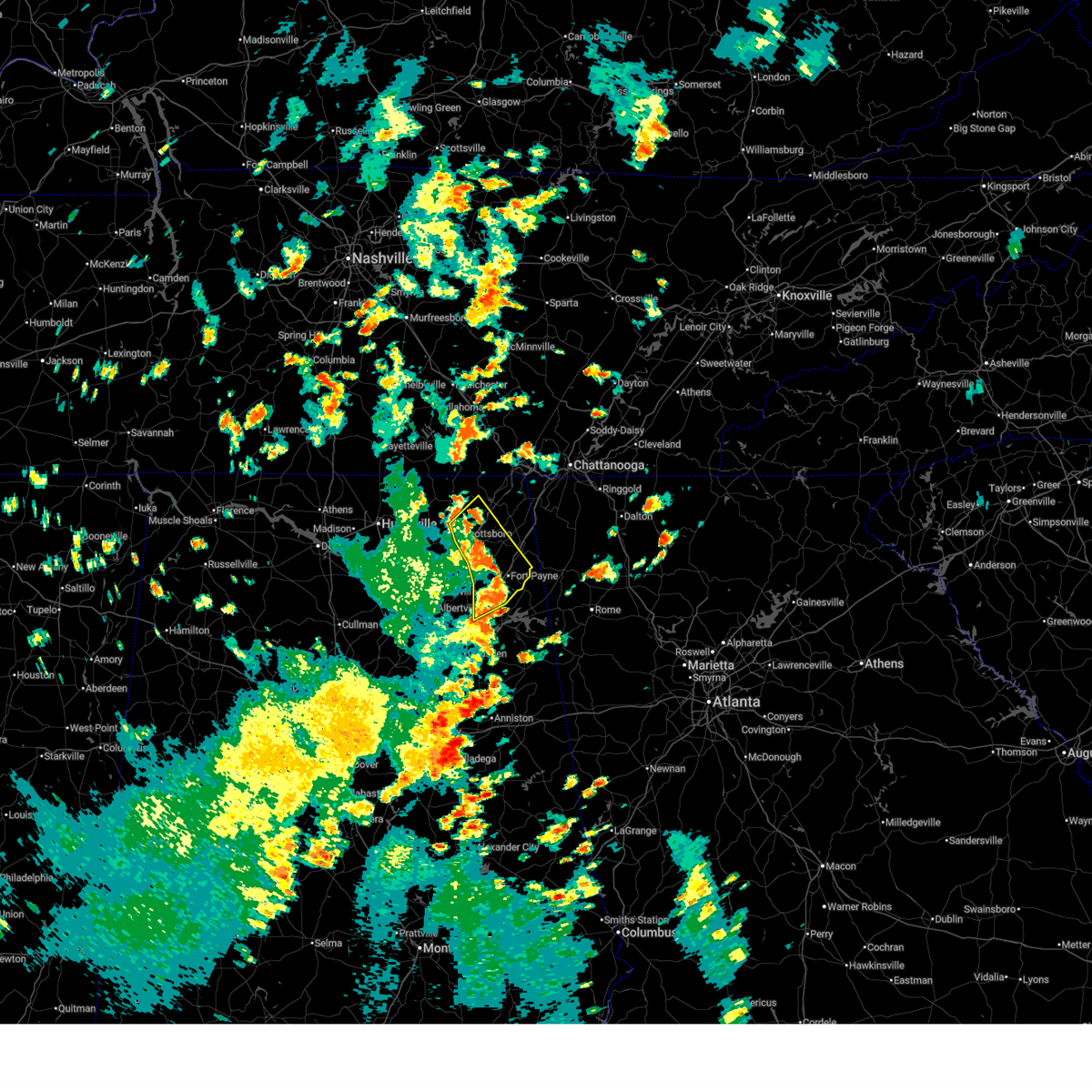
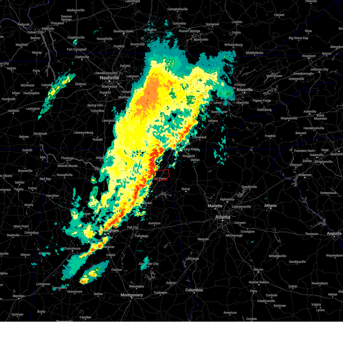
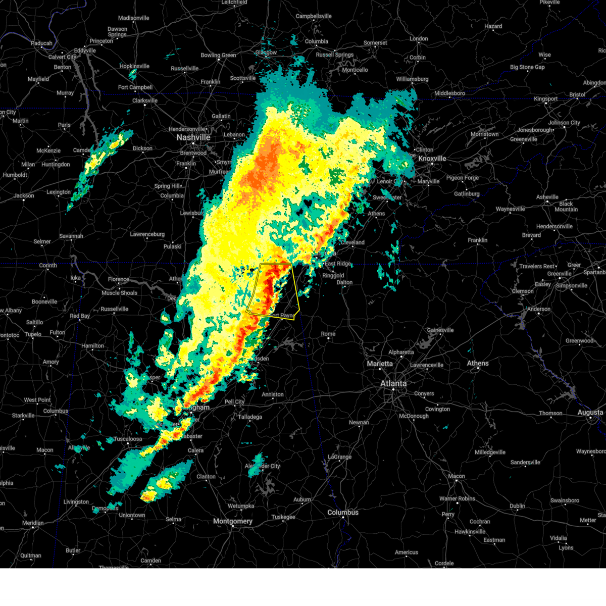
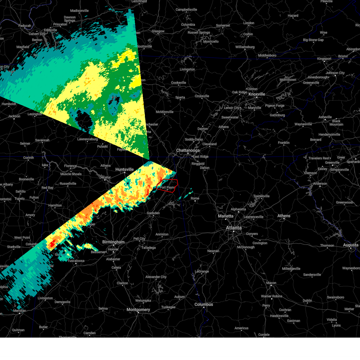
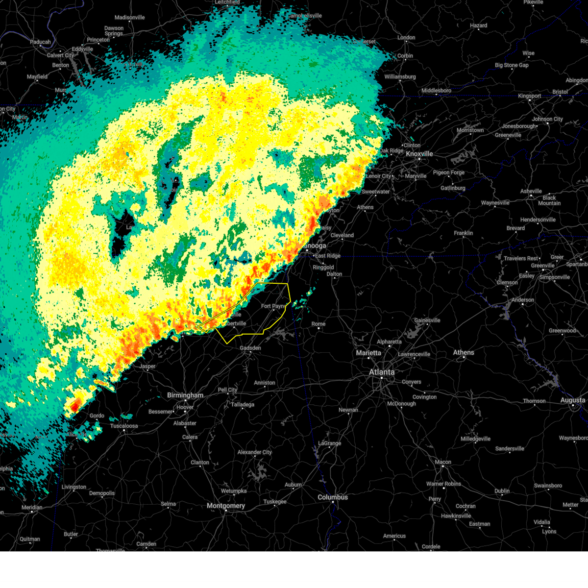
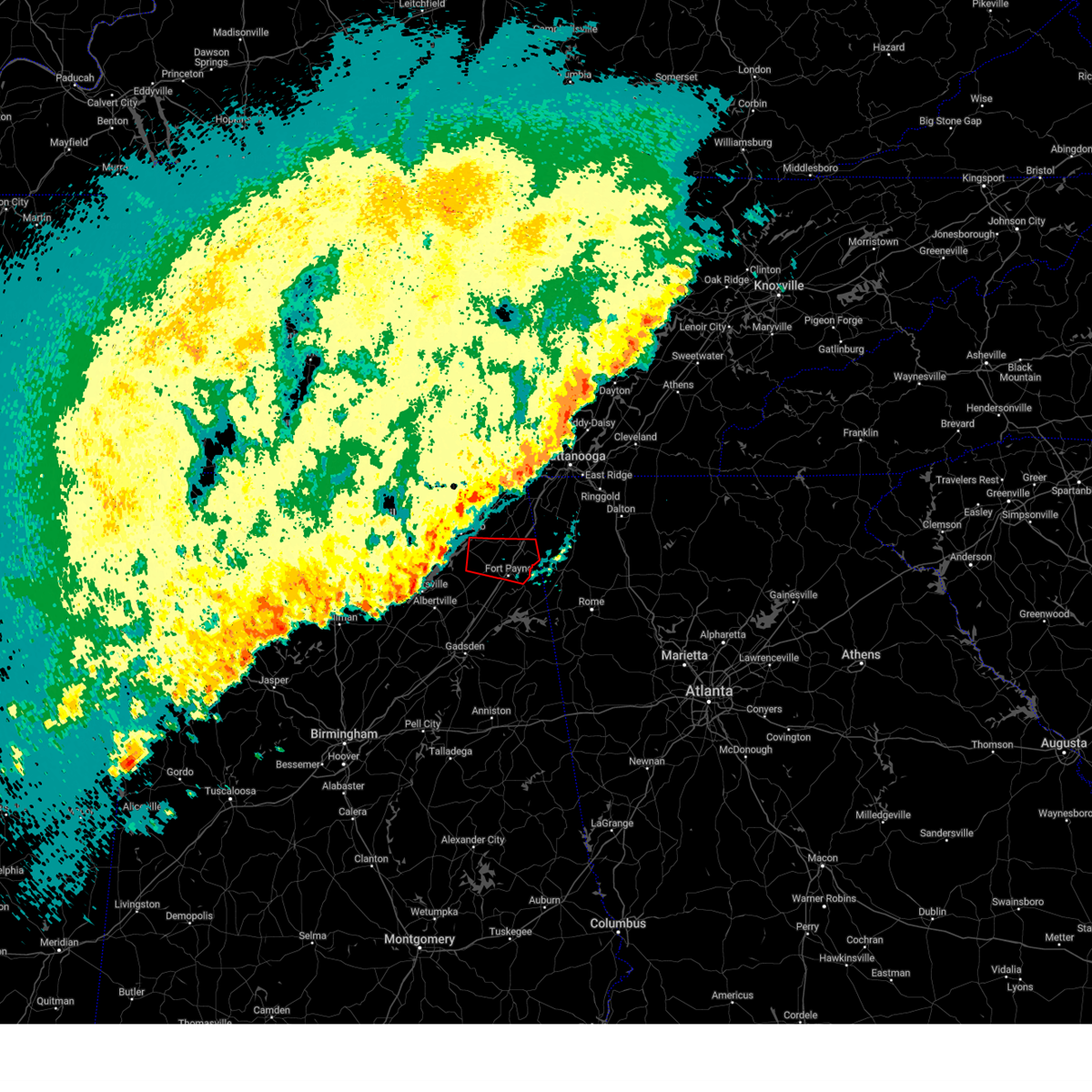
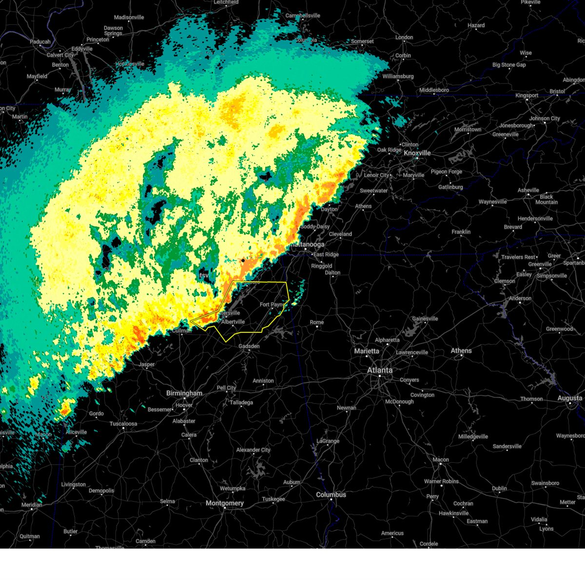
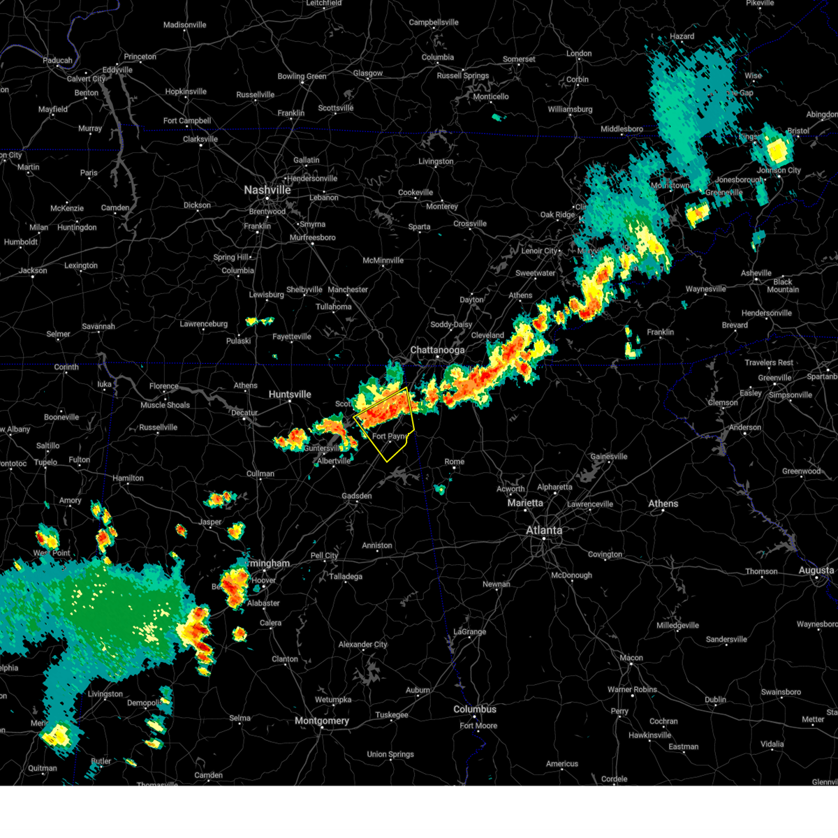
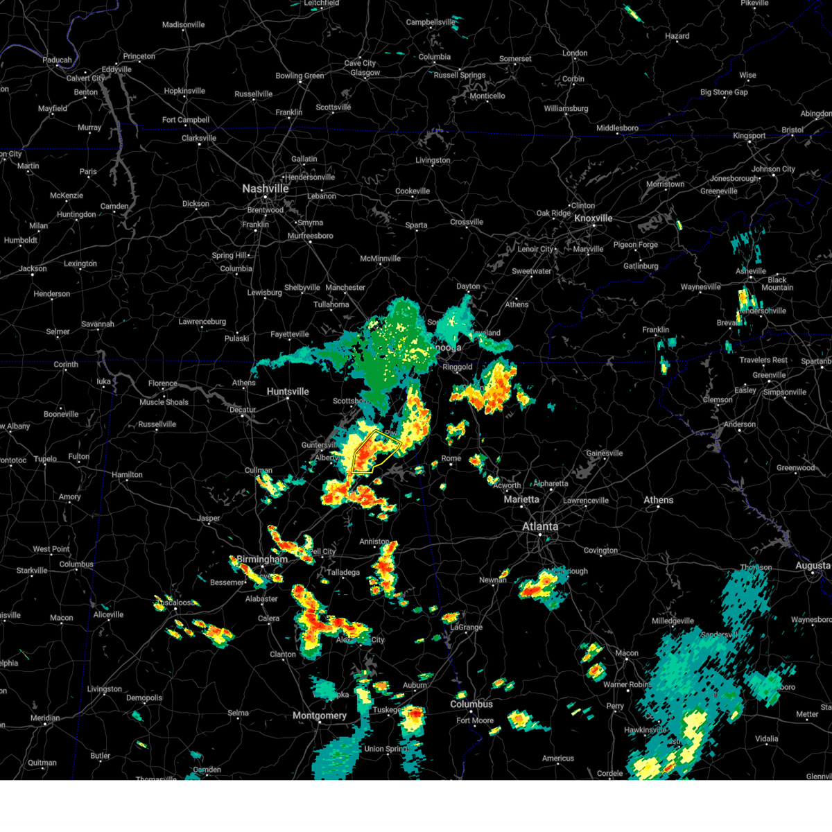
The Top Recent Hail Date for Pine Ridge, AL is Wednesday, June 18, 2025 (12th out of 47)
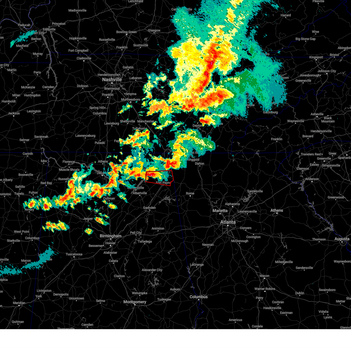
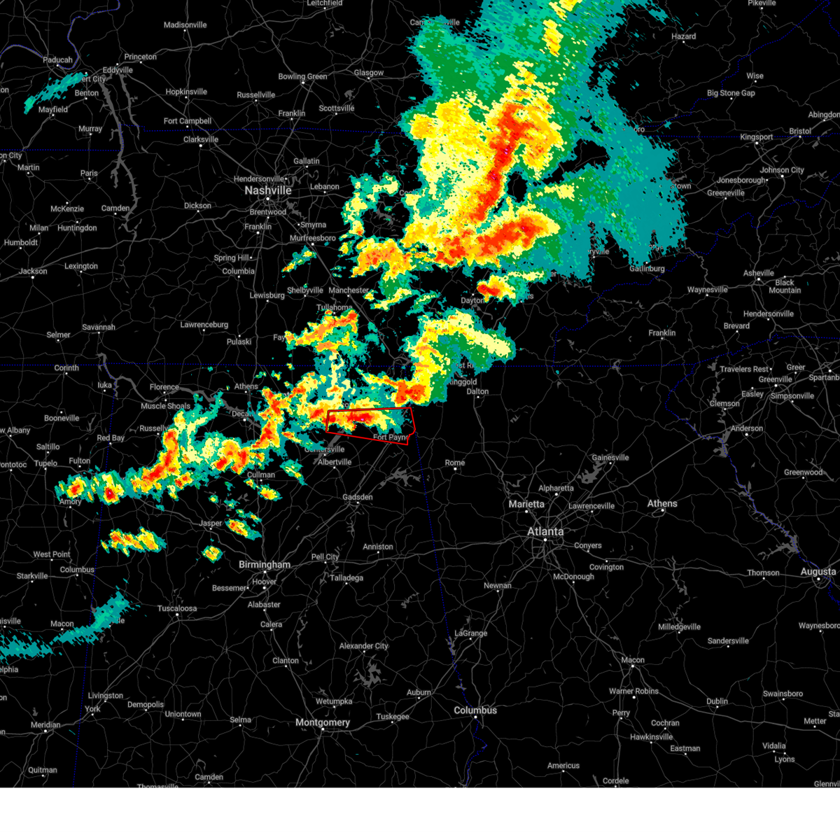
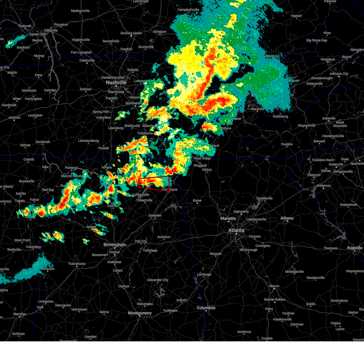
Hail and Wind Damage Spotted near Pine Ridge, AL
| Date / Time | Report Details |
|---|---|
| 6/29/2025 11:23 AM CDT |
 the severe thunderstorm warning has been cancelled and is no longer in effect the severe thunderstorm warning has been cancelled and is no longer in effect
|
| 6/29/2025 10:50 AM CDT |
 Svrhun the national weather service in huntsville alabama has issued a * severe thunderstorm warning for, east central dekalb county in northeastern alabama, * until 1145 am cdt. * at 1050 am cdt, a severe thunderstorm was located near fort payne, moving southeast at 10 mph (radar indicated). Hazards include 60 mph wind gusts and quarter size hail. Hail damage to vehicles is expected. Expect wind damage to roofs, siding, and trees. Svrhun the national weather service in huntsville alabama has issued a * severe thunderstorm warning for, east central dekalb county in northeastern alabama, * until 1145 am cdt. * at 1050 am cdt, a severe thunderstorm was located near fort payne, moving southeast at 10 mph (radar indicated). Hazards include 60 mph wind gusts and quarter size hail. Hail damage to vehicles is expected. Expect wind damage to roofs, siding, and trees.
|
| 6/17/2025 3:18 PM CDT |
 the severe thunderstorm warning has been cancelled and is no longer in effect the severe thunderstorm warning has been cancelled and is no longer in effect
|
| 6/17/2025 3:06 PM CDT |
 the severe thunderstorm warning has been cancelled and is no longer in effect the severe thunderstorm warning has been cancelled and is no longer in effect
|
| 6/17/2025 3:06 PM CDT |
 At 306 pm cdt, a severe thunderstorm was located over sylvania, or near rainsville, moving northeast at 35 mph (radar indicated). Hazards include 60 mph wind gusts and penny size hail. Expect damage to roofs, siding, and trees. Locations impacted include, scottsboro, fort payne, rainsville, henagar, sylvania, fyffe, hollywood, powell, section, and pisgah. At 306 pm cdt, a severe thunderstorm was located over sylvania, or near rainsville, moving northeast at 35 mph (radar indicated). Hazards include 60 mph wind gusts and penny size hail. Expect damage to roofs, siding, and trees. Locations impacted include, scottsboro, fort payne, rainsville, henagar, sylvania, fyffe, hollywood, powell, section, and pisgah.
|
| 6/17/2025 2:51 PM CDT |
 At 250 pm cdt, a severe thunderstorm was located near geraldine, or 13 miles west of rainsville, moving northeast at 25 mph (radar indicated). Hazards include 60 mph wind gusts and penny size hail. Expect damage to roofs, siding, and trees. Locations impacted include, scottsboro, fort payne, rainsville, henagar, crossville, sylvania, fyffe, hollywood, powell, and geraldine. At 250 pm cdt, a severe thunderstorm was located near geraldine, or 13 miles west of rainsville, moving northeast at 25 mph (radar indicated). Hazards include 60 mph wind gusts and penny size hail. Expect damage to roofs, siding, and trees. Locations impacted include, scottsboro, fort payne, rainsville, henagar, crossville, sylvania, fyffe, hollywood, powell, and geraldine.
|
| 6/17/2025 2:36 PM CDT |
 Svrhun the national weather service in huntsville alabama has issued a * severe thunderstorm warning for, northeastern marshall county in northeastern alabama, southeastern jackson county in northeastern alabama, dekalb county in northeastern alabama, * until 330 pm cdt. * at 235 pm cdt, a severe thunderstorm was located 7 miles east of guntersville, moving northeast at 25 mph (radar indicated). Hazards include 60 mph wind gusts. expect damage to roofs, siding, and trees Svrhun the national weather service in huntsville alabama has issued a * severe thunderstorm warning for, northeastern marshall county in northeastern alabama, southeastern jackson county in northeastern alabama, dekalb county in northeastern alabama, * until 330 pm cdt. * at 235 pm cdt, a severe thunderstorm was located 7 miles east of guntersville, moving northeast at 25 mph (radar indicated). Hazards include 60 mph wind gusts. expect damage to roofs, siding, and trees
|
| 6/13/2025 5:47 PM CDT |
 the severe thunderstorm warning has been cancelled and is no longer in effect the severe thunderstorm warning has been cancelled and is no longer in effect
|
| 6/13/2025 5:33 PM CDT |
 the severe thunderstorm warning has been cancelled and is no longer in effect the severe thunderstorm warning has been cancelled and is no longer in effect
|
| 6/13/2025 5:33 PM CDT |
 At 533 pm cdt, a severe thunderstorm was located over powell, or over rainsville, moving northeast at 20 mph (radar indicated). Hazards include 60 mph wind gusts and penny size hail. Expect damage to roofs, siding, and trees. Locations impacted include, scottsboro, fort payne, rainsville, henagar, sylvania, fyffe, hollywood, powell, geraldine, and section. At 533 pm cdt, a severe thunderstorm was located over powell, or over rainsville, moving northeast at 20 mph (radar indicated). Hazards include 60 mph wind gusts and penny size hail. Expect damage to roofs, siding, and trees. Locations impacted include, scottsboro, fort payne, rainsville, henagar, sylvania, fyffe, hollywood, powell, geraldine, and section.
|
| 6/13/2025 5:19 PM CDT |
 Svrhun the national weather service in huntsville alabama has issued a * severe thunderstorm warning for, northeastern marshall county in northeastern alabama, central jackson county in northeastern alabama, dekalb county in northeastern alabama, * until 615 pm cdt. * at 519 pm cdt, a severe thunderstorm was located near powell, or 7 miles west of rainsville, moving northeast at 20 mph (radar indicated). Hazards include 60 mph wind gusts and penny size hail. expect damage to roofs, siding, and trees Svrhun the national weather service in huntsville alabama has issued a * severe thunderstorm warning for, northeastern marshall county in northeastern alabama, central jackson county in northeastern alabama, dekalb county in northeastern alabama, * until 615 pm cdt. * at 519 pm cdt, a severe thunderstorm was located near powell, or 7 miles west of rainsville, moving northeast at 20 mph (radar indicated). Hazards include 60 mph wind gusts and penny size hail. expect damage to roofs, siding, and trees
|
| 6/7/2025 3:03 PM CDT |
 At 303 pm cdt, a severe thunderstorm was located near geraldine, or 10 miles southwest of rainsville, moving east at 50 mph (radar indicated). Hazards include 60 mph wind gusts. Expect damage to roofs, siding, and trees. Locations impacted include, scottsboro, fort payne, rainsville, henagar, crossville, sylvania, fyffe, powell, geraldine, and section. At 303 pm cdt, a severe thunderstorm was located near geraldine, or 10 miles southwest of rainsville, moving east at 50 mph (radar indicated). Hazards include 60 mph wind gusts. Expect damage to roofs, siding, and trees. Locations impacted include, scottsboro, fort payne, rainsville, henagar, crossville, sylvania, fyffe, powell, geraldine, and section.
|
| 6/7/2025 3:03 PM CDT |
 the severe thunderstorm warning has been cancelled and is no longer in effect the severe thunderstorm warning has been cancelled and is no longer in effect
|
| 6/7/2025 2:40 PM CDT |
 Svrhun the national weather service in huntsville alabama has issued a * severe thunderstorm warning for, eastern marshall county in northeastern alabama, southwestern jackson county in northeastern alabama, dekalb county in northeastern alabama, * until 345 pm cdt. * at 239 pm cdt, a severe thunderstorm was located over guntersville, moving east at 50 mph (radar indicated). Hazards include 60 mph wind gusts. expect damage to roofs, siding, and trees Svrhun the national weather service in huntsville alabama has issued a * severe thunderstorm warning for, eastern marshall county in northeastern alabama, southwestern jackson county in northeastern alabama, dekalb county in northeastern alabama, * until 345 pm cdt. * at 239 pm cdt, a severe thunderstorm was located over guntersville, moving east at 50 mph (radar indicated). Hazards include 60 mph wind gusts. expect damage to roofs, siding, and trees
|
| 6/6/2025 3:23 PM CDT |
 At 322 pm cdt, a severe thunderstorm was located 7 miles west of scottsboro, moving east at 35 mph (radar indicated). Hazards include 60 mph wind gusts and quarter size hail. Hail damage to vehicles is expected. expect wind damage to roofs, siding, and trees. Locations impacted include, scottsboro, fort payne, rainsville, henagar, stevenson, sylvania, owens cross roads, fyffe, hollywood, and powell. At 322 pm cdt, a severe thunderstorm was located 7 miles west of scottsboro, moving east at 35 mph (radar indicated). Hazards include 60 mph wind gusts and quarter size hail. Hail damage to vehicles is expected. expect wind damage to roofs, siding, and trees. Locations impacted include, scottsboro, fort payne, rainsville, henagar, stevenson, sylvania, owens cross roads, fyffe, hollywood, and powell.
|
| 6/6/2025 3:10 PM CDT |
 Svrhun the national weather service in huntsville alabama has issued a * severe thunderstorm warning for, northeastern marshall county in northeastern alabama, jackson county in northeastern alabama, southeastern madison county in north central alabama, central dekalb county in northeastern alabama, * until 415 pm cdt. * at 310 pm cdt, a severe thunderstorm was located near woodville, or 14 miles west of scottsboro, moving east at 35 mph (radar indicated). Hazards include 60 mph wind gusts. expect damage to roofs, siding, and trees Svrhun the national weather service in huntsville alabama has issued a * severe thunderstorm warning for, northeastern marshall county in northeastern alabama, jackson county in northeastern alabama, southeastern madison county in north central alabama, central dekalb county in northeastern alabama, * until 415 pm cdt. * at 310 pm cdt, a severe thunderstorm was located near woodville, or 14 miles west of scottsboro, moving east at 35 mph (radar indicated). Hazards include 60 mph wind gusts. expect damage to roofs, siding, and trees
|
| 5/25/2025 5:40 PM CDT | The storms which prompted the warning have weakened below severe limits, and no longer pose an immediate threat to life or property. therefore, the warning will be allowed to expire. a severe thunderstorm watch remains in effect until 1100 pm cdt for northeastern alabama. |
| 5/25/2025 5:37 PM CDT | At 537 pm cdt, severe thunderstorms were located along a line extending from near chickamauga to near trion to near fort payne, moving southeast at 35 mph (radar indicated). Hazards include 60 mph wind gusts and quarter size hail. Hail damage to vehicles is expected. expect wind damage to roofs, siding, and trees. Locations impacted include, pine ridge, fort payne, mentone, dog town, collbran, adamsburg, desoto state park, valley head, little river canyon np, and hammondville. |
| 5/25/2025 5:32 PM CDT | At 532 pm cdt, severe thunderstorms were located along a line extending from near chickamauga to 8 miles west of trion to fort payne, moving southeast at 35 mph (radar indicated). Hazards include 60 mph wind gusts and quarter size hail. Hail damage to vehicles is expected. expect wind damage to roofs, siding, and trees. Locations impacted include, fort payne, dog town, collbran, guest, little river canyon np, hammondville, pine ridge, mentone, adamsburg, and desoto state park. |
| 5/25/2025 5:28 PM CDT |
 the severe thunderstorm warning has been cancelled and is no longer in effect the severe thunderstorm warning has been cancelled and is no longer in effect
|
| 5/25/2025 5:28 PM CDT |
 At 527 pm cdt, severe thunderstorms were located along a line extending from near chickamauga to 10 miles northwest of trion to near fort payne, moving southeast at 35 mph (radar indicated). Hazards include 60 mph wind gusts and quarter size hail. Hail damage to vehicles is expected. expect wind damage to roofs, siding, and trees. Locations impacted include, fyffe, fort payne, dog town, collbran, guest, sulpher springs, little river canyon np, hammondville, lebanon, and pine ridge. At 527 pm cdt, severe thunderstorms were located along a line extending from near chickamauga to 10 miles northwest of trion to near fort payne, moving southeast at 35 mph (radar indicated). Hazards include 60 mph wind gusts and quarter size hail. Hail damage to vehicles is expected. expect wind damage to roofs, siding, and trees. Locations impacted include, fyffe, fort payne, dog town, collbran, guest, sulpher springs, little river canyon np, hammondville, lebanon, and pine ridge.
|
| 5/25/2025 5:25 PM CDT |
 The tornado threat has diminished and the tornado warning has been cancelled. however, large hail and damaging winds remain likely and a severe thunderstorm warning remains in effect for the area. a severe thunderstorm watch remains in effect until 1100 pm cdt for northeastern alabama. The tornado threat has diminished and the tornado warning has been cancelled. however, large hail and damaging winds remain likely and a severe thunderstorm warning remains in effect for the area. a severe thunderstorm watch remains in effect until 1100 pm cdt for northeastern alabama.
|
| 5/25/2025 5:20 PM CDT |
 At 520 pm cdt, a severe thunderstorm capable of producing a tornado was located 11 miles northwest of summerville, moving southeast at 40 mph (radar indicated rotation). Hazards include tornado. Flying debris will be dangerous to those caught without shelter. mobile homes will be damaged or destroyed. damage to roofs, windows, and vehicles will occur. tree damage is likely. Locations impacted include, pine ridge, fort payne, mentone, sulpher springs, adamsburg, rainsville, desoto state park, valley head, little river canyon np, and hammondville. At 520 pm cdt, a severe thunderstorm capable of producing a tornado was located 11 miles northwest of summerville, moving southeast at 40 mph (radar indicated rotation). Hazards include tornado. Flying debris will be dangerous to those caught without shelter. mobile homes will be damaged or destroyed. damage to roofs, windows, and vehicles will occur. tree damage is likely. Locations impacted include, pine ridge, fort payne, mentone, sulpher springs, adamsburg, rainsville, desoto state park, valley head, little river canyon np, and hammondville.
|
| 5/25/2025 5:12 PM CDT | Svrhun the national weather service in huntsville alabama has issued a * severe thunderstorm warning for, central jackson county in northeastern alabama, dekalb county in northeastern alabama, * until 545 pm cdt. * at 511 pm cdt, a line of severe thunderstorms were located along a line extending from near trenton to near ider to powell, moving southeast at 35 mph (radar indicated). Hazards include 60 mph wind gusts and quarter size hail. Hail damage to vehicles is expected. Expect wind damage to roofs, siding, and trees. |
| 5/25/2025 5:08 PM CDT | the tornado warning has been cancelled and is no longer in effect |
| 5/25/2025 5:08 PM CDT | At 507 pm cdt, a severe thunderstorm capable of producing a tornado was located near henagar, or 12 miles north of fort payne, moving southeast at 40 mph (radar indicated rotation). Hazards include tornado. Flying debris will be dangerous to those caught without shelter. mobile homes will be damaged or destroyed. damage to roofs, windows, and vehicles will occur. tree damage is likely. This tornadic thunderstorm will remain over mainly rural areas of northeastern dekalb county, including the following locations, pine ridge, mentone, sulpher springs, adamsburg, desoto state park, valley head, little river canyon np, and hammondville. |
| 5/25/2025 5:06 PM CDT | the severe thunderstorm warning has been cancelled and is no longer in effect |
| 5/25/2025 5:06 PM CDT | At 504 pm cdt, a severe thunderstorm was located 7 miles northwest of lookout mountain, or 10 miles east of jasper, moving east at 45 mph (emergency management). Hazards include 70 mph wind gusts and ping pong ball size hail. trees reported down in the skyline and scottsboro area from emergency management officials. People and animals outdoors will be injured. expect hail damage to roofs, siding, windows, and vehicles. expect considerable tree damage. wind damage is also likely to mobile homes, roofs, and outbuildings. Locations impacted include, fyffe, fort payne, higdon, ider, little river canyon np, bridgeport, pine ridge, pisgah, rosalie, and rainsville. |
| 5/25/2025 5:02 PM CDT |
 At 502 pm cdt, a severe thunderstorm capable of producing a tornado was located over henagar, or 12 miles northeast of rainsville, moving southeast at 40 mph (radar indicated rotation). Hazards include tornado. Flying debris will be dangerous to those caught without shelter. mobile homes will be damaged or destroyed. damage to roofs, windows, and vehicles will occur. tree damage is likely. this dangerous storm will be near, henagar and ider around 505 pm cdt. Other locations impacted by this tornadic thunderstorm include dutton, pine ridge, mentone, rosalie, sulpher springs, adamsburg, desoto state park, valley head, little river canyon np, and hammondville. At 502 pm cdt, a severe thunderstorm capable of producing a tornado was located over henagar, or 12 miles northeast of rainsville, moving southeast at 40 mph (radar indicated rotation). Hazards include tornado. Flying debris will be dangerous to those caught without shelter. mobile homes will be damaged or destroyed. damage to roofs, windows, and vehicles will occur. tree damage is likely. this dangerous storm will be near, henagar and ider around 505 pm cdt. Other locations impacted by this tornadic thunderstorm include dutton, pine ridge, mentone, rosalie, sulpher springs, adamsburg, desoto state park, valley head, little river canyon np, and hammondville.
|
| 5/25/2025 4:59 PM CDT |
 At 459 pm cdt, a severe thunderstorm capable of producing a tornado was located near henagar, or 12 miles north of rainsville, moving southeast at 40 mph (radar indicated rotation). Hazards include tornado. Flying debris will be dangerous to those caught without shelter. mobile homes will be damaged or destroyed. damage to roofs, windows, and vehicles will occur. tree damage is likely. this dangerous storm will be near, henagar and ider around 505 pm cdt. Other locations impacted by this tornadic thunderstorm include dutton, pine ridge, martintown, mentone, rosalie, sulpher springs, adamsburg, desoto state park, valley head, and little river canyon np. At 459 pm cdt, a severe thunderstorm capable of producing a tornado was located near henagar, or 12 miles north of rainsville, moving southeast at 40 mph (radar indicated rotation). Hazards include tornado. Flying debris will be dangerous to those caught without shelter. mobile homes will be damaged or destroyed. damage to roofs, windows, and vehicles will occur. tree damage is likely. this dangerous storm will be near, henagar and ider around 505 pm cdt. Other locations impacted by this tornadic thunderstorm include dutton, pine ridge, martintown, mentone, rosalie, sulpher springs, adamsburg, desoto state park, valley head, and little river canyon np.
|
| 5/25/2025 4:58 PM CDT |
 At 458 pm cdt, a severe thunderstorm was located near jasper, moving east at 45 mph (radar indicated). Hazards include 70 mph wind gusts and ping pong ball size hail. People and animals outdoors will be injured. expect hail damage to roofs, siding, windows, and vehicles. expect considerable tree damage. wind damage is also likely to mobile homes, roofs, and outbuildings. Locations impacted include, fyffe, fort payne, lim rock, higdon, ider, little river canyon np, bridgeport, pine ridge, pisgah, and rosalie. At 458 pm cdt, a severe thunderstorm was located near jasper, moving east at 45 mph (radar indicated). Hazards include 70 mph wind gusts and ping pong ball size hail. People and animals outdoors will be injured. expect hail damage to roofs, siding, windows, and vehicles. expect considerable tree damage. wind damage is also likely to mobile homes, roofs, and outbuildings. Locations impacted include, fyffe, fort payne, lim rock, higdon, ider, little river canyon np, bridgeport, pine ridge, pisgah, and rosalie.
|
| 5/25/2025 4:55 PM CDT |
 At 455 pm cdt, a severe thunderstorm was located over jasper, moving east at 45 mph (radar indicated). Hazards include 70 mph wind gusts and ping pong ball size hail. People and animals outdoors will be injured. expect hail damage to roofs, siding, windows, and vehicles. expect considerable tree damage. wind damage is also likely to mobile homes, roofs, and outbuildings. Locations impacted include, fyffe, fort payne, lim rock, higdon, ider, little river canyon np, bridgeport, pine ridge, pisgah, and rosalie. At 455 pm cdt, a severe thunderstorm was located over jasper, moving east at 45 mph (radar indicated). Hazards include 70 mph wind gusts and ping pong ball size hail. People and animals outdoors will be injured. expect hail damage to roofs, siding, windows, and vehicles. expect considerable tree damage. wind damage is also likely to mobile homes, roofs, and outbuildings. Locations impacted include, fyffe, fort payne, lim rock, higdon, ider, little river canyon np, bridgeport, pine ridge, pisgah, and rosalie.
|
| 5/25/2025 4:54 PM CDT |
 At 454 pm cdt, a severe thunderstorm was located over jasper, moving east at 45 mph (radar indicated). Hazards include 70 mph wind gusts and ping pong ball size hail. People and animals outdoors will be injured. expect hail damage to roofs, siding, windows, and vehicles. expect considerable tree damage. wind damage is also likely to mobile homes, roofs, and outbuildings. Locations impacted include, lim rock, ider, bridgeport, pine ridge, pisgah, rosalie, desoto state park, henagar, dutton, and paint rock. At 454 pm cdt, a severe thunderstorm was located over jasper, moving east at 45 mph (radar indicated). Hazards include 70 mph wind gusts and ping pong ball size hail. People and animals outdoors will be injured. expect hail damage to roofs, siding, windows, and vehicles. expect considerable tree damage. wind damage is also likely to mobile homes, roofs, and outbuildings. Locations impacted include, lim rock, ider, bridgeport, pine ridge, pisgah, rosalie, desoto state park, henagar, dutton, and paint rock.
|
| 5/25/2025 4:52 PM CDT | the severe thunderstorm warning has been cancelled and is no longer in effect |
| 5/25/2025 4:52 PM CDT | At 452 pm cdt, a severe thunderstorm was located over jasper, moving east at 45 mph (radar indicated). Hazards include 70 mph wind gusts. Expect considerable tree damage. damage is likely to mobile homes, roofs, and outbuildings. Locations impacted include, lim rock, ider, bridgeport, pine ridge, pisgah, rosalie, desoto state park, henagar, dutton, and paint rock. |
| 5/25/2025 4:48 PM CDT | At 448 pm cdt, a severe thunderstorm was located over kimball, or over jasper, moving east at 45 mph (radar indicated). Hazards include 60 mph wind gusts. Expect damage to roofs, siding, and trees. Locations impacted include, lim rock, ider, bridgeport, pine ridge, pisgah, rosalie, desoto state park, henagar, dutton, and paint rock. |
| 5/25/2025 4:46 PM CDT | Torhun the national weather service in huntsville alabama has issued a * tornado warning for, central jackson county in northeastern alabama, northeastern dekalb county in northeastern alabama, * until 530 pm cdt. * at 446 pm cdt, a severe thunderstorm capable of producing a tornado was located over hollywood, or 8 miles northeast of scottsboro, moving southeast at 40 mph (radar indicated rotation). Hazards include tornado. Flying debris will be dangerous to those caught without shelter. mobile homes will be damaged or destroyed. damage to roofs, windows, and vehicles will occur. tree damage is likely. this dangerous storm will be near, pisgah around 450 pm cdt. henagar around 455 pm cdt. ider around 500 pm cdt. Other locations impacted by this tornadic thunderstorm include dutton, pine ridge, martintown, mentone, rosalie, sulpher springs, adamsburg, fackler, desoto state park, and valley head. |
| 5/25/2025 4:42 PM CDT | At 442 pm cdt, a severe thunderstorm was located near kimball, or near jasper, moving east at 45 mph (radar indicated). Hazards include 60 mph wind gusts. Expect damage to roofs, siding, and trees. Locations impacted include, lim rock, ider, bridgeport, pine ridge, pisgah, rosalie, desoto state park, henagar, dutton, and paint rock. |
| 5/25/2025 4:22 PM CDT |
 Svrhun the national weather service in huntsville alabama has issued a * severe thunderstorm warning for, northeastern marshall county in northeastern alabama, jackson county in northeastern alabama, central madison county in north central alabama, dekalb county in northeastern alabama, franklin county in middle tennessee, * until 530 pm cdt. * at 422 pm cdt, a severe thunderstorm was located near cowan, or 8 miles southeast of winchester, moving east at 45 mph (radar indicated). Hazards include 65 mph wind gusts. expect damage to roofs, siding, and trees Svrhun the national weather service in huntsville alabama has issued a * severe thunderstorm warning for, northeastern marshall county in northeastern alabama, jackson county in northeastern alabama, central madison county in north central alabama, dekalb county in northeastern alabama, franklin county in middle tennessee, * until 530 pm cdt. * at 422 pm cdt, a severe thunderstorm was located near cowan, or 8 miles southeast of winchester, moving east at 45 mph (radar indicated). Hazards include 65 mph wind gusts. expect damage to roofs, siding, and trees
|
| 5/20/2025 9:59 PM CDT |
 the tornado warning has been cancelled and is no longer in effect the tornado warning has been cancelled and is no longer in effect
|
| 5/20/2025 9:50 PM CDT |
 At 950 pm cdt, a severe thunderstorm capable of producing a tornado was located over sand rock, or 10 miles northwest of centre, moving east at 45 mph (radar indicated rotation). Hazards include tornado and quarter size hail. Flying debris will be dangerous to those caught without shelter. mobile homes will be damaged or destroyed. damage to roofs, windows, and vehicles will occur. tree damage is likely. Locations impacted include, fyffe, fort payne, dog town, collbran, guest, little river canyon np, skirum, lebanon, pine ridge, and arona. At 950 pm cdt, a severe thunderstorm capable of producing a tornado was located over sand rock, or 10 miles northwest of centre, moving east at 45 mph (radar indicated rotation). Hazards include tornado and quarter size hail. Flying debris will be dangerous to those caught without shelter. mobile homes will be damaged or destroyed. damage to roofs, windows, and vehicles will occur. tree damage is likely. Locations impacted include, fyffe, fort payne, dog town, collbran, guest, little river canyon np, skirum, lebanon, pine ridge, and arona.
|
| 5/20/2025 9:46 PM CDT |
 Torhun the national weather service in huntsville alabama has issued a * tornado warning for, southern dekalb county in northeastern alabama, * until 1030 pm cdt. * at 946 pm cdt, a severe thunderstorm capable of producing a tornado was located near sand rock, or 12 miles northwest of centre, moving east at 50 mph (radar indicated rotation). Hazards include tornado. Flying debris will be dangerous to those caught without shelter. mobile homes will be damaged or destroyed. damage to roofs, windows, and vehicles will occur. tree damage is likely. This tornadic thunderstorm will remain over mainly rural areas of southern dekalb county, including the following locations, dog town, collbran, guest, little river canyon np, skirum, lebanon, pine ridge, arona, kilpatrick, and adamsburg. Torhun the national weather service in huntsville alabama has issued a * tornado warning for, southern dekalb county in northeastern alabama, * until 1030 pm cdt. * at 946 pm cdt, a severe thunderstorm capable of producing a tornado was located near sand rock, or 12 miles northwest of centre, moving east at 50 mph (radar indicated rotation). Hazards include tornado. Flying debris will be dangerous to those caught without shelter. mobile homes will be damaged or destroyed. damage to roofs, windows, and vehicles will occur. tree damage is likely. This tornadic thunderstorm will remain over mainly rural areas of southern dekalb county, including the following locations, dog town, collbran, guest, little river canyon np, skirum, lebanon, pine ridge, arona, kilpatrick, and adamsburg.
|
| 5/20/2025 9:15 PM CDT |
 At 914 pm cdt, a confirmed tornado was located near henagar, or 7 miles north of fort payne, moving east at 35 mph (law enforcement confirmed at least tornado between sylvania and henagar). Hazards include damaging tornado and half dollar size hail. Flying debris will be dangerous to those caught without shelter. mobile homes will be damaged or destroyed. damage to roofs, windows, and vehicles will occur. tree damage is likely. this tornado will be near, fort payne around 920 pm cdt. Other locations impacted by this tornadic thunderstorm include dutton, desoto state park, valley head, mentone, hammondville, and pine ridge. At 914 pm cdt, a confirmed tornado was located near henagar, or 7 miles north of fort payne, moving east at 35 mph (law enforcement confirmed at least tornado between sylvania and henagar). Hazards include damaging tornado and half dollar size hail. Flying debris will be dangerous to those caught without shelter. mobile homes will be damaged or destroyed. damage to roofs, windows, and vehicles will occur. tree damage is likely. this tornado will be near, fort payne around 920 pm cdt. Other locations impacted by this tornadic thunderstorm include dutton, desoto state park, valley head, mentone, hammondville, and pine ridge.
|
| 5/20/2025 8:50 PM CDT |
 At 850 pm cdt, a confirmed tornado was located over section, or 7 miles northwest of rainsville, moving east at 35 mph (broadcast media confirmed tornado). Hazards include damaging tornado and half dollar size hail. Flying debris will be dangerous to those caught without shelter. mobile homes will be damaged or destroyed. damage to roofs, windows, and vehicles will occur. tree damage is likely. this tornado will be near, sylvania, powell, and rainsville around 855 pm cdt. henagar around 900 pm cdt. fort payne around 910 pm cdt. Other locations impacted by this tornadic thunderstorm include dutton, langston, mentone, desoto state park, valley head, hammondville, and pine ridge. At 850 pm cdt, a confirmed tornado was located over section, or 7 miles northwest of rainsville, moving east at 35 mph (broadcast media confirmed tornado). Hazards include damaging tornado and half dollar size hail. Flying debris will be dangerous to those caught without shelter. mobile homes will be damaged or destroyed. damage to roofs, windows, and vehicles will occur. tree damage is likely. this tornado will be near, sylvania, powell, and rainsville around 855 pm cdt. henagar around 900 pm cdt. fort payne around 910 pm cdt. Other locations impacted by this tornadic thunderstorm include dutton, langston, mentone, desoto state park, valley head, hammondville, and pine ridge.
|
| 5/20/2025 8:50 PM CDT |
 the tornado warning has been cancelled and is no longer in effect the tornado warning has been cancelled and is no longer in effect
|
| 5/20/2025 8:41 PM CDT |
 Torhun the national weather service in huntsville alabama has issued a * tornado warning for, northeastern marshall county in northeastern alabama, southern jackson county in northeastern alabama, central dekalb county in northeastern alabama, * until 930 pm cdt. * at 841 pm cdt, a confirmed tornado was located over section, or near scottsboro, moving east at 35 mph (broadcast media confirmed tornado). Hazards include damaging tornado and half dollar size hail. Flying debris will be dangerous to those caught without shelter. mobile homes will be damaged or destroyed. damage to roofs, windows, and vehicles will occur. tree damage is likely. the tornado will be near, scottsboro, powell, and section around 845 pm cdt. sylvania and rainsville around 850 pm cdt. henagar around 900 pm cdt. fort payne around 910 pm cdt. Other locations impacted by this tornadic thunderstorm include dutton, langston, mentone, desoto state park, valley head, hammondville, lim rock, and pine ridge. Torhun the national weather service in huntsville alabama has issued a * tornado warning for, northeastern marshall county in northeastern alabama, southern jackson county in northeastern alabama, central dekalb county in northeastern alabama, * until 930 pm cdt. * at 841 pm cdt, a confirmed tornado was located over section, or near scottsboro, moving east at 35 mph (broadcast media confirmed tornado). Hazards include damaging tornado and half dollar size hail. Flying debris will be dangerous to those caught without shelter. mobile homes will be damaged or destroyed. damage to roofs, windows, and vehicles will occur. tree damage is likely. the tornado will be near, scottsboro, powell, and section around 845 pm cdt. sylvania and rainsville around 850 pm cdt. henagar around 900 pm cdt. fort payne around 910 pm cdt. Other locations impacted by this tornadic thunderstorm include dutton, langston, mentone, desoto state park, valley head, hammondville, lim rock, and pine ridge.
|
| 5/20/2025 8:22 PM CDT |
 At 822 pm cdt, a confirmed tornado was located over section, or 7 miles southeast of scottsboro, moving east at 35 mph (emergency management confirmed tornado). Hazards include damaging tornado and golf ball size hail. Flying debris will be dangerous to those caught without shelter. mobile homes will be damaged or destroyed. damage to roofs, windows, and vehicles will occur. tree damage is likely. this tornado will be near, rainsville, henagar, sylvania, and powell around 830 pm cdt. Other locations impacted by this tornadic thunderstorm include dutton, langston, paint rock, and pine ridge. At 822 pm cdt, a confirmed tornado was located over section, or 7 miles southeast of scottsboro, moving east at 35 mph (emergency management confirmed tornado). Hazards include damaging tornado and golf ball size hail. Flying debris will be dangerous to those caught without shelter. mobile homes will be damaged or destroyed. damage to roofs, windows, and vehicles will occur. tree damage is likely. this tornado will be near, rainsville, henagar, sylvania, and powell around 830 pm cdt. Other locations impacted by this tornadic thunderstorm include dutton, langston, paint rock, and pine ridge.
|
| 5/20/2025 8:02 PM CDT |
 the tornado warning has been cancelled and is no longer in effect the tornado warning has been cancelled and is no longer in effect
|
| 5/20/2025 8:02 PM CDT |
 At 801 pm cdt, a confirmed tornado was located near grant, or 9 miles southwest of scottsboro, moving east at 40 mph (emergency management confirmed tornado). Hazards include damaging tornado and ping pong ball size hail. Flying debris will be dangerous to those caught without shelter. mobile homes will be damaged or destroyed. damage to roofs, windows, and vehicles will occur. tree damage is likely. this tornado will be near, scottsboro around 805 pm cdt. section around 810 pm cdt. powell around 820 pm cdt. sylvania around 825 pm cdt. henagar and rainsville around 830 pm cdt. Other locations impacted by this tornadic thunderstorm include dutton, langston, paint rock, and pine ridge. At 801 pm cdt, a confirmed tornado was located near grant, or 9 miles southwest of scottsboro, moving east at 40 mph (emergency management confirmed tornado). Hazards include damaging tornado and ping pong ball size hail. Flying debris will be dangerous to those caught without shelter. mobile homes will be damaged or destroyed. damage to roofs, windows, and vehicles will occur. tree damage is likely. this tornado will be near, scottsboro around 805 pm cdt. section around 810 pm cdt. powell around 820 pm cdt. sylvania around 825 pm cdt. henagar and rainsville around 830 pm cdt. Other locations impacted by this tornadic thunderstorm include dutton, langston, paint rock, and pine ridge.
|
| 5/20/2025 7:54 PM CDT |
 Torhun the national weather service in huntsville alabama has issued a * tornado warning for, northeastern marshall county in northeastern alabama, southern jackson county in northeastern alabama, southeastern madison county in north central alabama, central dekalb county in northeastern alabama, * until 845 pm cdt. * at 753 pm cdt, a severe thunderstorm capable of producing a tornado was located near woodville, or 15 miles north of guntersville, moving east at 35 mph (radar indicated rotation). Hazards include tornado and golf ball size hail. Flying debris will be dangerous to those caught without shelter. mobile homes will be damaged or destroyed. damage to roofs, windows, and vehicles will occur. tree damage is likely. this dangerous storm will be near, woodville and grant around 800 pm cdt. scottsboro around 810 pm cdt. section around 815 pm cdt. powell around 825 pm cdt. sylvania around 830 pm cdt. henagar and rainsville around 835 pm cdt. Other locations impacted by this tornadic thunderstorm include dutton, paint rock, langston, lim rock, rosalie, pleasant groves, garth, larkinsville, and pine ridge. Torhun the national weather service in huntsville alabama has issued a * tornado warning for, northeastern marshall county in northeastern alabama, southern jackson county in northeastern alabama, southeastern madison county in north central alabama, central dekalb county in northeastern alabama, * until 845 pm cdt. * at 753 pm cdt, a severe thunderstorm capable of producing a tornado was located near woodville, or 15 miles north of guntersville, moving east at 35 mph (radar indicated rotation). Hazards include tornado and golf ball size hail. Flying debris will be dangerous to those caught without shelter. mobile homes will be damaged or destroyed. damage to roofs, windows, and vehicles will occur. tree damage is likely. this dangerous storm will be near, woodville and grant around 800 pm cdt. scottsboro around 810 pm cdt. section around 815 pm cdt. powell around 825 pm cdt. sylvania around 830 pm cdt. henagar and rainsville around 835 pm cdt. Other locations impacted by this tornadic thunderstorm include dutton, paint rock, langston, lim rock, rosalie, pleasant groves, garth, larkinsville, and pine ridge.
|
| 5/8/2025 7:02 PM CDT |
 Svrhun the national weather service in huntsville alabama has issued a * severe thunderstorm warning for, southeastern dekalb county in northeastern alabama, * until 745 pm cdt. * at 702 pm cdt, a severe thunderstorm was located near fort payne, moving east at 15 mph (radar indicated). Hazards include 60 mph wind gusts and quarter size hail. Hail damage to vehicles is expected. Expect wind damage to roofs, siding, and trees. Svrhun the national weather service in huntsville alabama has issued a * severe thunderstorm warning for, southeastern dekalb county in northeastern alabama, * until 745 pm cdt. * at 702 pm cdt, a severe thunderstorm was located near fort payne, moving east at 15 mph (radar indicated). Hazards include 60 mph wind gusts and quarter size hail. Hail damage to vehicles is expected. Expect wind damage to roofs, siding, and trees.
|
| 5/3/2025 4:33 PM CDT |
 the severe thunderstorm warning has been cancelled and is no longer in effect the severe thunderstorm warning has been cancelled and is no longer in effect
|
| 5/3/2025 4:21 PM CDT |
 At 420 pm cdt, a severe thunderstorm was located near little river canyon national preserve, moving east at 40 mph (radar indicated). Hazards include 60 mph wind gusts. Expect damage to roofs, siding, and trees. Locations impacted include, lebanon, pine ridge, fort payne, dog town, collbran, adamsburg, desoto state park, little river canyon np, and rainsville. At 420 pm cdt, a severe thunderstorm was located near little river canyon national preserve, moving east at 40 mph (radar indicated). Hazards include 60 mph wind gusts. Expect damage to roofs, siding, and trees. Locations impacted include, lebanon, pine ridge, fort payne, dog town, collbran, adamsburg, desoto state park, little river canyon np, and rainsville.
|
| 5/3/2025 4:04 PM CDT |
 Svrhun the national weather service in huntsville alabama has issued a * severe thunderstorm warning for, southern dekalb county in northeastern alabama, * until 445 pm cdt. * at 404 pm cdt, a severe thunderstorm was located near geraldine, or 11 miles southwest of rainsville, moving east at 40 mph (radar indicated). Hazards include 60 mph wind gusts. expect damage to roofs, siding, and trees Svrhun the national weather service in huntsville alabama has issued a * severe thunderstorm warning for, southern dekalb county in northeastern alabama, * until 445 pm cdt. * at 404 pm cdt, a severe thunderstorm was located near geraldine, or 11 miles southwest of rainsville, moving east at 40 mph (radar indicated). Hazards include 60 mph wind gusts. expect damage to roofs, siding, and trees
|
| 5/3/2025 3:59 PM CDT |
 Torhun the national weather service in huntsville alabama has issued a * tornado warning for, east central dekalb county in northeastern alabama, * until 445 pm cdt. * at 359 pm cdt, a severe thunderstorm capable of producing a tornado was located near sylvania, or near fort payne, moving east at 40 mph (radar indicated rotation). Hazards include tornado. Flying debris will be dangerous to those caught without shelter. mobile homes will be damaged or destroyed. damage to roofs, windows, and vehicles will occur. tree damage is likely. this dangerous storm will be near, fort payne around 405 pm cdt. Other locations impacted by this tornadic thunderstorm include desoto state park, valley head, mentone, hammondville, and pine ridge. Torhun the national weather service in huntsville alabama has issued a * tornado warning for, east central dekalb county in northeastern alabama, * until 445 pm cdt. * at 359 pm cdt, a severe thunderstorm capable of producing a tornado was located near sylvania, or near fort payne, moving east at 40 mph (radar indicated rotation). Hazards include tornado. Flying debris will be dangerous to those caught without shelter. mobile homes will be damaged or destroyed. damage to roofs, windows, and vehicles will occur. tree damage is likely. this dangerous storm will be near, fort payne around 405 pm cdt. Other locations impacted by this tornadic thunderstorm include desoto state park, valley head, mentone, hammondville, and pine ridge.
|
| 5/3/2025 3:57 PM CDT |
 At 357 pm cdt, severe thunderstorms were located along a line extending from near bridgeport to near ider to near rainsville, moving east at 40 mph (radar indicated). Hazards include 60 mph wind gusts. Expect damage to roofs, siding, and trees. Locations impacted include, fort payne, higdon, ider, bridgeport, pisgah, rosalie, rainsville, desoto state park, henagar, and sylvania. At 357 pm cdt, severe thunderstorms were located along a line extending from near bridgeport to near ider to near rainsville, moving east at 40 mph (radar indicated). Hazards include 60 mph wind gusts. Expect damage to roofs, siding, and trees. Locations impacted include, fort payne, higdon, ider, bridgeport, pisgah, rosalie, rainsville, desoto state park, henagar, and sylvania.
|
| 5/3/2025 3:51 PM CDT | Svrhun the national weather service in huntsville alabama has issued a * severe thunderstorm warning for, central jackson county in northeastern alabama, northern dekalb county in northeastern alabama, * until 430 pm cdt. * at 350 pm cdt, severe thunderstorms were located along a line extending from near bridgeport to near pisgah to powell, moving east at 35 mph (radar indicated). Hazards include 60 mph wind gusts. expect damage to roofs, siding, and trees |
| 5/2/2025 6:06 PM CDT | the severe thunderstorm warning has been cancelled and is no longer in effect |
| 5/2/2025 5:41 PM CDT | Svrhun the national weather service in huntsville alabama has issued a * severe thunderstorm warning for, dekalb county in northeastern alabama, * until 645 pm cdt. * at 541 pm cdt, a severe thunderstorm was located near fyffe, or 7 miles south of rainsville, moving east at 30 mph (radar indicated). Hazards include 60 mph wind gusts and quarter size hail. Hail damage to vehicles is expected. Expect wind damage to roofs, siding, and trees. |
| 5/2/2025 4:46 PM CDT | Svrhun the national weather service in huntsville alabama has issued a * severe thunderstorm warning for, eastern marshall county in northeastern alabama, south central jackson county in northeastern alabama, dekalb county in northeastern alabama, * until 545 pm cdt. * at 446 pm cdt, a severe thunderstorm was located near grant, or 10 miles northeast of guntersville, moving east at 45 mph (radar indicated). Hazards include 60 mph wind gusts and quarter size hail. Hail damage to vehicles is expected. Expect wind damage to roofs, siding, and trees. |
| 4/21/2025 4:16 PM CDT |
 the severe thunderstorm warning has been cancelled and is no longer in effect the severe thunderstorm warning has been cancelled and is no longer in effect
|
| 4/21/2025 3:57 PM CDT |
 Svrhun the national weather service in huntsville alabama has issued a * severe thunderstorm warning for, southeastern dekalb county in northeastern alabama, * until 500 pm cdt. * at 356 pm cdt, a severe thunderstorm was located near fort payne, moving northeast at 20 mph (radar indicated). Hazards include 60 mph wind gusts and quarter size hail. Hail damage to vehicles is expected. Expect wind damage to roofs, siding, and trees. Svrhun the national weather service in huntsville alabama has issued a * severe thunderstorm warning for, southeastern dekalb county in northeastern alabama, * until 500 pm cdt. * at 356 pm cdt, a severe thunderstorm was located near fort payne, moving northeast at 20 mph (radar indicated). Hazards include 60 mph wind gusts and quarter size hail. Hail damage to vehicles is expected. Expect wind damage to roofs, siding, and trees.
|
| 4/6/2025 2:54 AM CDT |
 The storms which prompted the warning have moved out of the area. therefore, the warning will be allowed to expire. a tornado watch remains in effect until 500 am cdt for north central and northeastern alabama. The storms which prompted the warning have moved out of the area. therefore, the warning will be allowed to expire. a tornado watch remains in effect until 500 am cdt for north central and northeastern alabama.
|
| 4/6/2025 2:27 AM CDT |
 At 227 am cdt, severe thunderstorms were located along a line extending from near ider to near fyffe to near albertville, moving east at 20 mph (radar indicated). Hazards include 60 mph wind gusts. Expect damage to roofs, siding, and trees. Locations impacted include, fyffe, fort payne, high point, ider, little river canyon np, skirum, pine ridge, painter, rainsville, and joppa. At 227 am cdt, severe thunderstorms were located along a line extending from near ider to near fyffe to near albertville, moving east at 20 mph (radar indicated). Hazards include 60 mph wind gusts. Expect damage to roofs, siding, and trees. Locations impacted include, fyffe, fort payne, high point, ider, little river canyon np, skirum, pine ridge, painter, rainsville, and joppa.
|
| 4/6/2025 2:27 AM CDT |
 the severe thunderstorm warning has been cancelled and is no longer in effect the severe thunderstorm warning has been cancelled and is no longer in effect
|
| 4/6/2025 2:19 AM CDT |
 the tornado warning has been cancelled and is no longer in effect the tornado warning has been cancelled and is no longer in effect
|
| 4/6/2025 2:11 AM CDT |
 At 210 am cdt, a severe thunderstorm capable of producing a tornado was located over sylvania, or over rainsville, moving east at 30 mph (radar indicated rotation). Hazards include tornado. Flying debris will be dangerous to those caught without shelter. mobile homes will be damaged or destroyed. damage to roofs, windows, and vehicles will occur. tree damage is likely. this dangerous storm will be near, fort payne, rainsville, and sylvania around 215 am cdt. Other locations impacted by this tornadic thunderstorm include pine ridge, desoto state park, valley head, mentone, hammondville, and little river canyon np. At 210 am cdt, a severe thunderstorm capable of producing a tornado was located over sylvania, or over rainsville, moving east at 30 mph (radar indicated rotation). Hazards include tornado. Flying debris will be dangerous to those caught without shelter. mobile homes will be damaged or destroyed. damage to roofs, windows, and vehicles will occur. tree damage is likely. this dangerous storm will be near, fort payne, rainsville, and sylvania around 215 am cdt. Other locations impacted by this tornadic thunderstorm include pine ridge, desoto state park, valley head, mentone, hammondville, and little river canyon np.
|
| 4/6/2025 2:11 AM CDT |
 the tornado warning has been cancelled and is no longer in effect the tornado warning has been cancelled and is no longer in effect
|
| 4/6/2025 2:07 AM CDT |
 Svrhun the national weather service in huntsville alabama has issued a * severe thunderstorm warning for, marshall county in northeastern alabama, southeastern jackson county in northeastern alabama, dekalb county in northeastern alabama, northeastern cullman county in north central alabama, * until 300 am cdt. * at 207 am cdt, severe thunderstorms were located along a line extending from near henagar to near geraldine to near strawberry, moving east at 20 mph (radar indicated). Hazards include 60 mph wind gusts. expect damage to roofs, siding, and trees Svrhun the national weather service in huntsville alabama has issued a * severe thunderstorm warning for, marshall county in northeastern alabama, southeastern jackson county in northeastern alabama, dekalb county in northeastern alabama, northeastern cullman county in north central alabama, * until 300 am cdt. * at 207 am cdt, severe thunderstorms were located along a line extending from near henagar to near geraldine to near strawberry, moving east at 20 mph (radar indicated). Hazards include 60 mph wind gusts. expect damage to roofs, siding, and trees
|
| 4/6/2025 2:01 AM CDT |
 Torhun the national weather service in huntsville alabama has issued a * tornado warning for, south central jackson county in northeastern alabama, central dekalb county in northeastern alabama, * until 245 am cdt. * at 201 am cdt, a severe thunderstorm capable of producing a tornado was located over powell, or near rainsville, moving east at 40 mph (radar indicated rotation). Hazards include tornado. Flying debris will be dangerous to those caught without shelter. mobile homes will be damaged or destroyed. damage to roofs, windows, and vehicles will occur. tree damage is likely. this dangerous storm will be near, sylvania, powell, and rainsville around 205 am cdt. fort payne around 210 am cdt. Other locations impacted by this tornadic thunderstorm include dutton, pine ridge, mentone, desoto state park, valley head, hammondville, and little river canyon np. Torhun the national weather service in huntsville alabama has issued a * tornado warning for, south central jackson county in northeastern alabama, central dekalb county in northeastern alabama, * until 245 am cdt. * at 201 am cdt, a severe thunderstorm capable of producing a tornado was located over powell, or near rainsville, moving east at 40 mph (radar indicated rotation). Hazards include tornado. Flying debris will be dangerous to those caught without shelter. mobile homes will be damaged or destroyed. damage to roofs, windows, and vehicles will occur. tree damage is likely. this dangerous storm will be near, sylvania, powell, and rainsville around 205 am cdt. fort payne around 210 am cdt. Other locations impacted by this tornadic thunderstorm include dutton, pine ridge, mentone, desoto state park, valley head, hammondville, and little river canyon np.
|
| 4/6/2025 1:46 AM CDT |
 the severe thunderstorm warning has been cancelled and is no longer in effect the severe thunderstorm warning has been cancelled and is no longer in effect
|
| 4/6/2025 1:46 AM CDT |
 At 145 am cdt, severe thunderstorms were located along a line extending from scottsboro to 7 miles southeast of grant to 6 miles southwest of guntersville, moving east at 40 mph (radar indicated). Hazards include 60 mph wind gusts. Expect damage to roofs, siding, and trees. Locations impacted include, high point, lim rock, ider, pine ridge, pisgah, rosalie, painter, joppa, desoto state park, and crossville. At 145 am cdt, severe thunderstorms were located along a line extending from scottsboro to 7 miles southeast of grant to 6 miles southwest of guntersville, moving east at 40 mph (radar indicated). Hazards include 60 mph wind gusts. Expect damage to roofs, siding, and trees. Locations impacted include, high point, lim rock, ider, pine ridge, pisgah, rosalie, painter, joppa, desoto state park, and crossville.
|
| 4/6/2025 1:23 AM CDT |
 Svrhun the national weather service in huntsville alabama has issued a * severe thunderstorm warning for, marshall county in northeastern alabama, southern jackson county in northeastern alabama, southeastern madison county in north central alabama, dekalb county in northeastern alabama, northeastern cullman county in north central alabama, southeastern morgan county in north central alabama, * until 215 am cdt. * at 122 am cdt, severe thunderstorms were located along a line extending from near gurley to 6 miles east of morgan city to 9 miles west of arab, moving east at 40 mph (radar indicated). Hazards include 60 mph wind gusts. expect damage to roofs, siding, and trees Svrhun the national weather service in huntsville alabama has issued a * severe thunderstorm warning for, marshall county in northeastern alabama, southern jackson county in northeastern alabama, southeastern madison county in north central alabama, dekalb county in northeastern alabama, northeastern cullman county in north central alabama, southeastern morgan county in north central alabama, * until 215 am cdt. * at 122 am cdt, severe thunderstorms were located along a line extending from near gurley to 6 miles east of morgan city to 9 miles west of arab, moving east at 40 mph (radar indicated). Hazards include 60 mph wind gusts. expect damage to roofs, siding, and trees
|
| 3/4/2025 10:55 PM CST |
 The storms which prompted the warning have moved out of the area. therefore, the warning will be allowed to expire. a severe thunderstorm watch remains in effect until 300 am cst for northeastern alabama. The storms which prompted the warning have moved out of the area. therefore, the warning will be allowed to expire. a severe thunderstorm watch remains in effect until 300 am cst for northeastern alabama.
|
| 3/4/2025 10:28 PM CST |
 The storms which prompted the warning have moved out of the area. therefore, the warning will be allowed to expire. however, gusty winds are still possible with these thunderstorms. a severe thunderstorm watch remains in effect until 300 am cst for northeastern alabama. remember, a severe thunderstorm warning still remains in effect for portions of jackson and dekalb counties until 11:00 pm. The storms which prompted the warning have moved out of the area. therefore, the warning will be allowed to expire. however, gusty winds are still possible with these thunderstorms. a severe thunderstorm watch remains in effect until 300 am cst for northeastern alabama. remember, a severe thunderstorm warning still remains in effect for portions of jackson and dekalb counties until 11:00 pm.
|
| 3/4/2025 10:27 PM CST |
 Svrhun the national weather service in huntsville alabama has issued a * severe thunderstorm warning for, east central jackson county in northeastern alabama, eastern dekalb county in northeastern alabama, * until 1100 pm cst. * at 1027 pm cst, severe thunderstorms were located along a line extending from near ider to cherokee rock village, moving northeast at 50 mph (radar indicated). Hazards include 60 mph wind gusts. expect damage to roofs, siding, and trees Svrhun the national weather service in huntsville alabama has issued a * severe thunderstorm warning for, east central jackson county in northeastern alabama, eastern dekalb county in northeastern alabama, * until 1100 pm cst. * at 1027 pm cst, severe thunderstorms were located along a line extending from near ider to cherokee rock village, moving northeast at 50 mph (radar indicated). Hazards include 60 mph wind gusts. expect damage to roofs, siding, and trees
|
| 3/4/2025 10:16 PM CST |
 At 1016 pm cst, severe thunderstorms were located along a line extending from near henagar to near fort payne to western weiss lake, moving east at 50 mph (radar indicated). Hazards include 60 mph wind gusts. Expect damage to roofs, siding, and trees. Locations impacted include, fyffe, fort payne, higdon, ider, little river canyon np, skirum, pine ridge, pisgah, rosalie, and rainsville. At 1016 pm cst, severe thunderstorms were located along a line extending from near henagar to near fort payne to western weiss lake, moving east at 50 mph (radar indicated). Hazards include 60 mph wind gusts. Expect damage to roofs, siding, and trees. Locations impacted include, fyffe, fort payne, higdon, ider, little river canyon np, skirum, pine ridge, pisgah, rosalie, and rainsville.
|
| 3/4/2025 9:57 PM CST |
 At 956 pm cst, severe thunderstorms were located along a line extending from near section to near geraldine to near reece city, moving east at 50 mph (radar indicated). Hazards include 60 mph wind gusts and penny size hail. Expect damage to roofs, siding, and trees. Locations impacted include, fyffe, fort payne, higdon, ider, little river canyon np, skirum, pine ridge, pisgah, rosalie, and painter. At 956 pm cst, severe thunderstorms were located along a line extending from near section to near geraldine to near reece city, moving east at 50 mph (radar indicated). Hazards include 60 mph wind gusts and penny size hail. Expect damage to roofs, siding, and trees. Locations impacted include, fyffe, fort payne, higdon, ider, little river canyon np, skirum, pine ridge, pisgah, rosalie, and painter.
|
| 3/4/2025 9:57 PM CST |
 the severe thunderstorm warning has been cancelled and is no longer in effect the severe thunderstorm warning has been cancelled and is no longer in effect
|
| 3/4/2025 9:34 PM CST |
 At 932 pm cst, severe thunderstorms were located along a line extending from 7 miles west of grant to near albertville to altoona, moving east at 50 mph (radar indicated. at 9:30 pm ema reported pea sized hail with this storm in douglas al). Hazards include 60 mph wind gusts and penny size hail. Expect damage to roofs, siding, and trees. Locations impacted include, high point, ider, pine ridge, pisgah, rosalie, painter, desoto state park, crossville, henagar, and rabbit town. At 932 pm cst, severe thunderstorms were located along a line extending from 7 miles west of grant to near albertville to altoona, moving east at 50 mph (radar indicated. at 9:30 pm ema reported pea sized hail with this storm in douglas al). Hazards include 60 mph wind gusts and penny size hail. Expect damage to roofs, siding, and trees. Locations impacted include, high point, ider, pine ridge, pisgah, rosalie, painter, desoto state park, crossville, henagar, and rabbit town.
|
| 3/4/2025 9:26 PM CST |
 Svrhun the national weather service in huntsville alabama has issued a * severe thunderstorm warning for, marshall county in northeastern alabama, southern jackson county in northeastern alabama, southeastern madison county in north central alabama, dekalb county in northeastern alabama, * until 1030 pm cst. * at 926 pm cst, severe thunderstorms were located along a line extending from 8 miles east of morgan city to 6 miles northeast of mclarty to near altoona, moving east at 50 mph (radar indicated). Hazards include 60 mph wind gusts. expect damage to roofs, siding, and trees Svrhun the national weather service in huntsville alabama has issued a * severe thunderstorm warning for, marshall county in northeastern alabama, southern jackson county in northeastern alabama, southeastern madison county in north central alabama, dekalb county in northeastern alabama, * until 1030 pm cst. * at 926 pm cst, severe thunderstorms were located along a line extending from 8 miles east of morgan city to 6 miles northeast of mclarty to near altoona, moving east at 50 mph (radar indicated). Hazards include 60 mph wind gusts. expect damage to roofs, siding, and trees
|
| 2/16/2025 1:54 AM CST |
 the tornado warning has been cancelled and is no longer in effect the tornado warning has been cancelled and is no longer in effect
|
| 2/16/2025 1:35 AM CST |
 At 135 am cst, a severe thunderstorm capable of producing a tornado was located near fort payne, moving northeast at 75 mph (radar indicated rotation). Hazards include tornado and quarter size hail. Flying debris will be dangerous to those caught without shelter. mobile homes will be damaged or destroyed. damage to roofs, windows, and vehicles will occur. tree damage is likely. Locations impacted include, fort payne, rainsville, valley head, hammondville, mentone, pine ridge, dog town, collbran, guest, and little river canyon np. At 135 am cst, a severe thunderstorm capable of producing a tornado was located near fort payne, moving northeast at 75 mph (radar indicated rotation). Hazards include tornado and quarter size hail. Flying debris will be dangerous to those caught without shelter. mobile homes will be damaged or destroyed. damage to roofs, windows, and vehicles will occur. tree damage is likely. Locations impacted include, fort payne, rainsville, valley head, hammondville, mentone, pine ridge, dog town, collbran, guest, and little river canyon np.
|
| 2/16/2025 1:30 AM CST |
 the severe thunderstorm warning has been cancelled and is no longer in effect the severe thunderstorm warning has been cancelled and is no longer in effect
|
| 2/16/2025 1:30 AM CST |
 At 130 am cst, severe thunderstorms were located along a line extending from 8 miles northwest of pikeville to near lookout mountain to near fort payne to near neely henry lake, moving east at 75 mph (radar indicated). Hazards include 60 mph wind gusts and penny size hail. Expect damage to roofs, siding, and trees. Locations impacted include, scottsboro, fort payne, rainsville, bridgeport, henagar, stevenson, crossville, sylvania, fyffe, and hollywood. At 130 am cst, severe thunderstorms were located along a line extending from 8 miles northwest of pikeville to near lookout mountain to near fort payne to near neely henry lake, moving east at 75 mph (radar indicated). Hazards include 60 mph wind gusts and penny size hail. Expect damage to roofs, siding, and trees. Locations impacted include, scottsboro, fort payne, rainsville, bridgeport, henagar, stevenson, crossville, sylvania, fyffe, and hollywood.
|
| 2/16/2025 1:25 AM CST | Torhun the national weather service in huntsville alabama has issued a * tornado warning for, dekalb county in northeastern alabama, * until 215 am cst. * at 124 am cst, a severe thunderstorm capable of producing a tornado was located over crossville, or 9 miles northeast of boaz, moving east at 70 mph. this storm has a history of producing damage in the mount hebron area of southern marshall county (radar indicated rotation). Hazards include tornado and quarter size hail. Flying debris will be dangerous to those caught without shelter. mobile homes will be damaged or destroyed. damage to roofs, windows, and vehicles will occur. tree damage is likely. This tornadic thunderstorm will remain over mainly rural areas of dekalb county, including the following locations, lakeview, dog town, hopewell, collbran, guest, little river canyon np, skirum, pine ridge, lebanon, and mentone. |
| 2/16/2025 1:17 AM CST |
 the severe thunderstorm warning has been cancelled and is no longer in effect the severe thunderstorm warning has been cancelled and is no longer in effect
|
| 2/16/2025 1:17 AM CST |
 At 117 am cst, severe thunderstorms were located along a line extending from 10 miles southeast of mcminnville to bridgeport to near fyffe to near ashville, moving east at 75 mph (radar indicated). Hazards include 70 mph wind gusts and quarter size hail. Hail damage to vehicles is expected. expect considerable tree damage. wind damage is also likely to mobile homes, roofs, and outbuildings. Locations impacted include, albertville, scottsboro, fort payne, boaz, guntersville, rainsville, bridgeport, henagar, stevenson, and crossville. At 117 am cst, severe thunderstorms were located along a line extending from 10 miles southeast of mcminnville to bridgeport to near fyffe to near ashville, moving east at 75 mph (radar indicated). Hazards include 70 mph wind gusts and quarter size hail. Hail damage to vehicles is expected. expect considerable tree damage. wind damage is also likely to mobile homes, roofs, and outbuildings. Locations impacted include, albertville, scottsboro, fort payne, boaz, guntersville, rainsville, bridgeport, henagar, stevenson, and crossville.
|
| 2/16/2025 1:04 AM CST |
 At 103 am cst, severe thunderstorms were located along a line extending from 9 miles southwest of mcminnville to 7 miles northeast of skyline to 6 miles south of grant to near dallas, moving east at 70 mph. multiple areas of rotation are present within this line. this line of storms has a history of producing confirmed winds of 65-75 mph (radar indicated). Hazards include 70 mph wind gusts and quarter size hail. Hail damage to vehicles is expected. expect considerable tree damage. wind damage is also likely to mobile homes, roofs, and outbuildings. Locations impacted include, albertville, scottsboro, fort payne, boaz, winchester, guntersville, arab, rainsville, bridgeport, and decherd. At 103 am cst, severe thunderstorms were located along a line extending from 9 miles southwest of mcminnville to 7 miles northeast of skyline to 6 miles south of grant to near dallas, moving east at 70 mph. multiple areas of rotation are present within this line. this line of storms has a history of producing confirmed winds of 65-75 mph (radar indicated). Hazards include 70 mph wind gusts and quarter size hail. Hail damage to vehicles is expected. expect considerable tree damage. wind damage is also likely to mobile homes, roofs, and outbuildings. Locations impacted include, albertville, scottsboro, fort payne, boaz, winchester, guntersville, arab, rainsville, bridgeport, and decherd.
|
| 2/16/2025 1:04 AM CST |
 the severe thunderstorm warning has been cancelled and is no longer in effect the severe thunderstorm warning has been cancelled and is no longer in effect
|
| 2/16/2025 12:45 AM CST |
 Svrhun the national weather service in huntsville alabama has issued a * severe thunderstorm warning for, marshall county in northeastern alabama, jackson county in northeastern alabama, madison county in north central alabama, dekalb county in northeastern alabama, cullman county in north central alabama, southeastern morgan county in north central alabama, moore county in middle tennessee, eastern lincoln county in middle tennessee, franklin county in middle tennessee, * until 145 am cst. * at 1243 am cst, severe thunderstorms were located along a line extending from 11 miles northwest of manchester to near new market to near morgan city to near arkadelphia, moving east at 75 mph. multiple areas of rotation are present within this line. this line of storms has a history of producing confirmed winds of 65-75 mph (radar indicated). Hazards include 70 mph wind gusts and quarter size hail. Hail damage to vehicles is expected. expect considerable tree damage. Wind damage is also likely to mobile homes, roofs, and outbuildings. Svrhun the national weather service in huntsville alabama has issued a * severe thunderstorm warning for, marshall county in northeastern alabama, jackson county in northeastern alabama, madison county in north central alabama, dekalb county in northeastern alabama, cullman county in north central alabama, southeastern morgan county in north central alabama, moore county in middle tennessee, eastern lincoln county in middle tennessee, franklin county in middle tennessee, * until 145 am cst. * at 1243 am cst, severe thunderstorms were located along a line extending from 11 miles northwest of manchester to near new market to near morgan city to near arkadelphia, moving east at 75 mph. multiple areas of rotation are present within this line. this line of storms has a history of producing confirmed winds of 65-75 mph (radar indicated). Hazards include 70 mph wind gusts and quarter size hail. Hail damage to vehicles is expected. expect considerable tree damage. Wind damage is also likely to mobile homes, roofs, and outbuildings.
|
| 8/17/2024 4:14 PM CDT |
 the severe thunderstorm warning has been cancelled and is no longer in effect the severe thunderstorm warning has been cancelled and is no longer in effect
|
| 8/17/2024 4:05 PM CDT | At 405 pm cdt, severe thunderstorms were located along a line extending from 7 miles northeast of fort payne to near tabor road, moving east at 35 mph (radar indicated). Hazards include 60 mph wind gusts. Expect damage to roofs, siding, and trees. Locations impacted include, fort payne, rainsville, henagar, crossville, sylvania, fyffe, valley head, hammondville, mentone, and pine ridge. |
| 8/17/2024 3:56 PM CDT |
 Svrhun the national weather service in huntsville alabama has issued a * severe thunderstorm warning for, southeastern dekalb county in northeastern alabama, * until 430 pm cdt. * at 356 pm cdt, severe thunderstorms were located along a line extending from near fort payne to near crossville, moving east at 30 mph (radar indicated). Hazards include 60 mph wind gusts. expect damage to roofs, siding, and trees Svrhun the national weather service in huntsville alabama has issued a * severe thunderstorm warning for, southeastern dekalb county in northeastern alabama, * until 430 pm cdt. * at 356 pm cdt, severe thunderstorms were located along a line extending from near fort payne to near crossville, moving east at 30 mph (radar indicated). Hazards include 60 mph wind gusts. expect damage to roofs, siding, and trees
|
| 8/16/2024 6:30 PM CDT |
 The storm which prompted the warning has weakened below severe limits, and no longer poses an immediate threat to life or property. therefore, the warning has been allowed to expire. however, gusty winds and heavy rain are still possible with this thunderstorm. The storm which prompted the warning has weakened below severe limits, and no longer poses an immediate threat to life or property. therefore, the warning has been allowed to expire. however, gusty winds and heavy rain are still possible with this thunderstorm.
|
| 8/16/2024 5:59 PM CDT |
 Svrhun the national weather service in huntsville alabama has issued a * severe thunderstorm warning for, southern dekalb county in northeastern alabama, * until 630 pm cdt. * at 559 pm cdt, a severe thunderstorm was located over geraldine, or 11 miles southwest of rainsville, moving southeast at 20 mph (radar indicated). Hazards include 60 mph wind gusts. expect damage to roofs, siding, and trees Svrhun the national weather service in huntsville alabama has issued a * severe thunderstorm warning for, southern dekalb county in northeastern alabama, * until 630 pm cdt. * at 559 pm cdt, a severe thunderstorm was located over geraldine, or 11 miles southwest of rainsville, moving southeast at 20 mph (radar indicated). Hazards include 60 mph wind gusts. expect damage to roofs, siding, and trees
|
| 8/16/2024 5:56 PM CDT |
 The storm which prompted the warning has weakened below severe limits, and has exited the warned area. therefore, the warning will be allowed to expire. however, gusty winds are still possible with this thunderstorm. The storm which prompted the warning has weakened below severe limits, and has exited the warned area. therefore, the warning will be allowed to expire. however, gusty winds are still possible with this thunderstorm.
|
| 8/16/2024 5:49 PM CDT |
 At 549 pm cdt, a severe thunderstorm was located near summerville, moving east at 25 mph (radar indicated). Hazards include 60 mph wind gusts and penny size hail. Expect damage to roofs, siding, and trees. Locations impacted include, fort payne, rainsville, henagar, sylvania, powell, valley head, hammondville, mentone, pine ridge, and dog town. At 549 pm cdt, a severe thunderstorm was located near summerville, moving east at 25 mph (radar indicated). Hazards include 60 mph wind gusts and penny size hail. Expect damage to roofs, siding, and trees. Locations impacted include, fort payne, rainsville, henagar, sylvania, powell, valley head, hammondville, mentone, pine ridge, and dog town.
|
| 8/16/2024 5:37 PM CDT | the severe thunderstorm warning has been cancelled and is no longer in effect |
| 8/16/2024 5:37 PM CDT | At 536 pm cdt, a severe thunderstorm was located 9 miles west of summerville, moving southeast at 30 mph (radar indicated). Hazards include 60 mph wind gusts and penny size hail. Expect damage to roofs, siding, and trees. Locations impacted include, fort payne, rainsville, henagar, sylvania, powell, ider, valley head, hammondville, mentone, and pine ridge. |
| 8/16/2024 5:14 PM CDT |
 Svrhun the national weather service in huntsville alabama has issued a * severe thunderstorm warning for, southeastern jackson county in northeastern alabama, eastern dekalb county in northeastern alabama, * until 600 pm cdt. * at 514 pm cdt, a severe thunderstorm was located near henagar, or 10 miles north of fort payne, moving east at 25 mph (radar indicated). Hazards include 60 mph wind gusts and penny size hail. expect damage to roofs, siding, and trees Svrhun the national weather service in huntsville alabama has issued a * severe thunderstorm warning for, southeastern jackson county in northeastern alabama, eastern dekalb county in northeastern alabama, * until 600 pm cdt. * at 514 pm cdt, a severe thunderstorm was located near henagar, or 10 miles north of fort payne, moving east at 25 mph (radar indicated). Hazards include 60 mph wind gusts and penny size hail. expect damage to roofs, siding, and trees
|
| 7/29/2024 5:37 PM CDT |
 At 536 pm cdt, severe thunderstorms were located along a line extending from crossville to near little river falls to 7 miles northwest of summerville, moving east at 25 mph (radar indicated). Hazards include 60 mph wind gusts. Expect damage to roofs, siding, and trees. Locations impacted include, fort payne, rainsville, crossville, fyffe, geraldine, pine ridge, dog town, collbran, guest, and little river canyon np. At 536 pm cdt, severe thunderstorms were located along a line extending from crossville to near little river falls to 7 miles northwest of summerville, moving east at 25 mph (radar indicated). Hazards include 60 mph wind gusts. Expect damage to roofs, siding, and trees. Locations impacted include, fort payne, rainsville, crossville, fyffe, geraldine, pine ridge, dog town, collbran, guest, and little river canyon np.
|
| 7/29/2024 5:30 PM CDT |
 the severe thunderstorm warning has been cancelled and is no longer in effect the severe thunderstorm warning has been cancelled and is no longer in effect
|
| 7/29/2024 5:30 PM CDT |
 At 530 pm cdt, severe thunderstorms were located along a line extending from crossville to near fort payne to 9 miles northwest of summerville, moving southeast at 30 mph (radar indicated). Hazards include 60 mph wind gusts. Expect damage to roofs, siding, and trees. Locations impacted include, fort payne, rainsville, crossville, fyffe, geraldine, valley head, hammondville, mentone, pine ridge, and lakeview. At 530 pm cdt, severe thunderstorms were located along a line extending from crossville to near fort payne to 9 miles northwest of summerville, moving southeast at 30 mph (radar indicated). Hazards include 60 mph wind gusts. Expect damage to roofs, siding, and trees. Locations impacted include, fort payne, rainsville, crossville, fyffe, geraldine, valley head, hammondville, mentone, pine ridge, and lakeview.
|
| 7/29/2024 5:09 PM CDT |
 Svrhun the national weather service in huntsville alabama has issued a * severe thunderstorm warning for, eastern marshall county in northeastern alabama, central jackson county in northeastern alabama, dekalb county in northeastern alabama, * until 600 pm cdt. * at 508 pm cdt, severe thunderstorms were located along a line extending from 6 miles northeast of grant to near pisgah to near trenton, moving east at 25 mph (radar indicated). Hazards include 60 mph wind gusts. expect damage to roofs, siding, and trees Svrhun the national weather service in huntsville alabama has issued a * severe thunderstorm warning for, eastern marshall county in northeastern alabama, central jackson county in northeastern alabama, dekalb county in northeastern alabama, * until 600 pm cdt. * at 508 pm cdt, severe thunderstorms were located along a line extending from 6 miles northeast of grant to near pisgah to near trenton, moving east at 25 mph (radar indicated). Hazards include 60 mph wind gusts. expect damage to roofs, siding, and trees
|
| 7/17/2024 4:05 PM CDT | Svrhun the national weather service in huntsville alabama has issued a * severe thunderstorm warning for, southeastern jackson county in northeastern alabama, central dekalb county in northeastern alabama, * until 415 pm cdt. * at 404 pm cdt, a severe thunderstorm was located over section, or near scottsboro, moving east at 25 mph (radar indicated). Hazards include 60 mph wind gusts and quarter size hail. Hail damage to vehicles is expected. Expect wind damage to roofs, siding, and trees. |
| 6/30/2024 1:06 PM CDT |
 At 105 pm cdt, a severe thunderstorm was located near grant, or 11 miles northeast of guntersville, moving southeast at 20 mph. this storm is producing frequent lightning and heavy rainfall (radar indicated). Hazards include 60 mph wind gusts. Expect damage to roofs, siding, and trees. Locations impacted include, albertville, scottsboro, fort payne, boaz, guntersville, rainsville, crossville, fyffe, powell, and grant. At 105 pm cdt, a severe thunderstorm was located near grant, or 11 miles northeast of guntersville, moving southeast at 20 mph. this storm is producing frequent lightning and heavy rainfall (radar indicated). Hazards include 60 mph wind gusts. Expect damage to roofs, siding, and trees. Locations impacted include, albertville, scottsboro, fort payne, boaz, guntersville, rainsville, crossville, fyffe, powell, and grant.
|
| 6/30/2024 1:06 PM CDT |
 the severe thunderstorm warning has been cancelled and is no longer in effect the severe thunderstorm warning has been cancelled and is no longer in effect
|
| 6/30/2024 12:49 PM CDT |
 Svrhun the national weather service in huntsville alabama has issued a * severe thunderstorm warning for, eastern marshall county in northeastern alabama, southwestern jackson county in northeastern alabama, southeastern madison county in north central alabama, southwestern dekalb county in northeastern alabama, * until 145 pm cdt. * at 1248 pm cdt, a severe thunderstorm was located near grant, or 12 miles southwest of scottsboro, moving southeast at 20 mph. there is frequent lightning and heavy rainfall occurring with this storm (radar indicated). Hazards include 60 mph wind gusts. expect damage to roofs, siding, and trees Svrhun the national weather service in huntsville alabama has issued a * severe thunderstorm warning for, eastern marshall county in northeastern alabama, southwestern jackson county in northeastern alabama, southeastern madison county in north central alabama, southwestern dekalb county in northeastern alabama, * until 145 pm cdt. * at 1248 pm cdt, a severe thunderstorm was located near grant, or 12 miles southwest of scottsboro, moving southeast at 20 mph. there is frequent lightning and heavy rainfall occurring with this storm (radar indicated). Hazards include 60 mph wind gusts. expect damage to roofs, siding, and trees
|
| 5/27/2024 4:40 AM CDT |
 The storms which prompted the warning have weakened below severe limits, and have exited the warned area. therefore, the warning will be allowed to expire. however, small hail is still possible with these thunderstorms. a tornado watch remains in effect until 800 am cdt for north central and northeastern alabama. The storms which prompted the warning have weakened below severe limits, and have exited the warned area. therefore, the warning will be allowed to expire. however, small hail is still possible with these thunderstorms. a tornado watch remains in effect until 800 am cdt for north central and northeastern alabama.
|
| 5/27/2024 4:29 AM CDT |
 At 428 am cdt, severe thunderstorms were located along a line extending from 6 miles east of trion to near aurora to near holly pond, moving east at 60 mph. emergency managers continue to report multiple trees down and pea size hail with these storms (emergency management). Hazards include 60 mph wind gusts and penny size hail. Expect damage to roofs, siding, and trees. Locations impacted include, albertville, cullman, fort payne, boaz, guntersville, arab, rainsville, hanceville, henagar, and good hope. At 428 am cdt, severe thunderstorms were located along a line extending from 6 miles east of trion to near aurora to near holly pond, moving east at 60 mph. emergency managers continue to report multiple trees down and pea size hail with these storms (emergency management). Hazards include 60 mph wind gusts and penny size hail. Expect damage to roofs, siding, and trees. Locations impacted include, albertville, cullman, fort payne, boaz, guntersville, arab, rainsville, hanceville, henagar, and good hope.
|
| 5/27/2024 4:13 AM CDT |
 The storms which prompted the warning have moved out of the area. therefore, the warning will be allowed to expire. a tornado watch remains in effect until 800 am cdt for north central and northeastern alabama. remember, a severe thunderstorm warning still remains in effect for cullman, marshall, and dekalb counties until 445 am. The storms which prompted the warning have moved out of the area. therefore, the warning will be allowed to expire. a tornado watch remains in effect until 800 am cdt for north central and northeastern alabama. remember, a severe thunderstorm warning still remains in effect for cullman, marshall, and dekalb counties until 445 am.
|
| 5/27/2024 4:12 AM CDT |
 Svrhun the national weather service in huntsville alabama has issued a * severe thunderstorm warning for, central marshall county in northeastern alabama, dekalb county in northeastern alabama, cullman county in north central alabama, * until 445 am cdt. * at 411 am cdt, a line of severe thunderstorms were extending from 10 miles northwest of summerville to near snead to near cullman, moving east at 60 mph. emergency management has reported multiple trees down, power outages, and small hail associated with these storms (emergency management). Hazards include 60 mph wind gusts and penny size hail. expect damage to roofs, siding, and trees Svrhun the national weather service in huntsville alabama has issued a * severe thunderstorm warning for, central marshall county in northeastern alabama, dekalb county in northeastern alabama, cullman county in north central alabama, * until 445 am cdt. * at 411 am cdt, a line of severe thunderstorms were extending from 10 miles northwest of summerville to near snead to near cullman, moving east at 60 mph. emergency management has reported multiple trees down, power outages, and small hail associated with these storms (emergency management). Hazards include 60 mph wind gusts and penny size hail. expect damage to roofs, siding, and trees
|
| 5/27/2024 3:41 AM CDT |
 Svrhun the national weather service in huntsville alabama has issued a * severe thunderstorm warning for, central jackson county in northeastern alabama, dekalb county in northeastern alabama, * until 415 am cdt. * at 340 am cdt, severe thunderstorms were located along a line extending from 6 miles southwest of section to 8 miles east of ider, moving southeast at 45 mph. there have been multiple reports of trees and powerlines down associated with this line of storms (public). Hazards include 60 mph wind gusts and penny size hail. expect damage to roofs, siding, and trees Svrhun the national weather service in huntsville alabama has issued a * severe thunderstorm warning for, central jackson county in northeastern alabama, dekalb county in northeastern alabama, * until 415 am cdt. * at 340 am cdt, severe thunderstorms were located along a line extending from 6 miles southwest of section to 8 miles east of ider, moving southeast at 45 mph. there have been multiple reports of trees and powerlines down associated with this line of storms (public). Hazards include 60 mph wind gusts and penny size hail. expect damage to roofs, siding, and trees
|
| 5/9/2024 8:30 AM CDT |
 The storm which prompted the warning has moved out of the area. therefore, the warning will be allowed to expire. a tornado watch remains in effect until 1000 am cdt for north central and northeastern alabama. remember, a severe thunderstorm warning still remains in effect for portions of dekalb and marshall county. remember, a tornado warning still remains in effect for jackson and dekalb county. The storm which prompted the warning has moved out of the area. therefore, the warning will be allowed to expire. a tornado watch remains in effect until 1000 am cdt for north central and northeastern alabama. remember, a severe thunderstorm warning still remains in effect for portions of dekalb and marshall county. remember, a tornado warning still remains in effect for jackson and dekalb county.
|
| 5/9/2024 8:11 AM CDT |
 At 810 am cdt, a severe thunderstorm was located near guntersville, moving east at 60 mph (emergency management). Hazards include 60 mph wind gusts and quarter size hail. Hail damage to vehicles is expected. expect wind damage to roofs, siding, and trees. Locations impacted include, albertville, cullman, scottsboro, fort payne, boaz, guntersville, arab, rainsville, hanceville, and henagar. At 810 am cdt, a severe thunderstorm was located near guntersville, moving east at 60 mph (emergency management). Hazards include 60 mph wind gusts and quarter size hail. Hail damage to vehicles is expected. expect wind damage to roofs, siding, and trees. Locations impacted include, albertville, cullman, scottsboro, fort payne, boaz, guntersville, arab, rainsville, hanceville, and henagar.
|
| 5/9/2024 8:08 AM CDT |
 Torhun the national weather service in huntsville alabama has issued a * tornado warning for, southeastern jackson county in northeastern alabama, east central dekalb county in northeastern alabama, * until 845 am cdt. * at 807 am cdt, a severe thunderstorm capable of producing a tornado was located near powell, or near rainsville, moving east at 50 mph (radar indicated rotation). Hazards include tornado and quarter size hail. Flying debris will be dangerous to those caught without shelter. mobile homes will be damaged or destroyed. damage to roofs, windows, and vehicles will occur. tree damage is likely. this dangerous storm will be near, rainsville, henagar, and sylvania around 815 am cdt. fort payne around 820 am cdt. Other locations impacted by this tornadic thunderstorm include dutton, mentone, desoto state park, valley head, hammondville, langston, pine ridge, and little river canyon np. Torhun the national weather service in huntsville alabama has issued a * tornado warning for, southeastern jackson county in northeastern alabama, east central dekalb county in northeastern alabama, * until 845 am cdt. * at 807 am cdt, a severe thunderstorm capable of producing a tornado was located near powell, or near rainsville, moving east at 50 mph (radar indicated rotation). Hazards include tornado and quarter size hail. Flying debris will be dangerous to those caught without shelter. mobile homes will be damaged or destroyed. damage to roofs, windows, and vehicles will occur. tree damage is likely. this dangerous storm will be near, rainsville, henagar, and sylvania around 815 am cdt. fort payne around 820 am cdt. Other locations impacted by this tornadic thunderstorm include dutton, mentone, desoto state park, valley head, hammondville, langston, pine ridge, and little river canyon np.
|
| 5/9/2024 8:04 AM CDT |
 Svrhun the national weather service in huntsville alabama has issued a * severe thunderstorm warning for, marshall county in northeastern alabama, southern jackson county in northeastern alabama, dekalb county in northeastern alabama, central cullman county in north central alabama, southeastern morgan county in north central alabama, * until 830 am cdt. * at 804 am cdt, a severe thunderstorm was located over strawberry, or near arab, moving east at 60 mph (radar indicated). Hazards include 60 mph wind gusts and quarter size hail. Hail damage to vehicles is expected. Expect wind damage to roofs, siding, and trees. Svrhun the national weather service in huntsville alabama has issued a * severe thunderstorm warning for, marshall county in northeastern alabama, southern jackson county in northeastern alabama, dekalb county in northeastern alabama, central cullman county in north central alabama, southeastern morgan county in north central alabama, * until 830 am cdt. * at 804 am cdt, a severe thunderstorm was located over strawberry, or near arab, moving east at 60 mph (radar indicated). Hazards include 60 mph wind gusts and quarter size hail. Hail damage to vehicles is expected. Expect wind damage to roofs, siding, and trees.
|
| 3/15/2024 7:26 AM CDT |
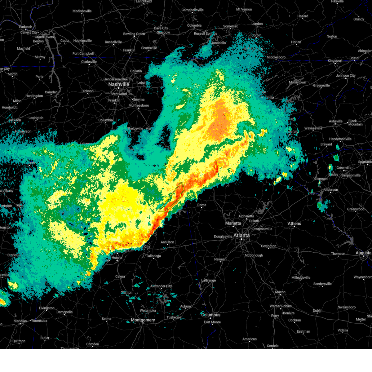 The storms which prompted the warning have moved out of the area. therefore, the warning will be allowed to expire. The storms which prompted the warning have moved out of the area. therefore, the warning will be allowed to expire.
|
| 3/15/2024 7:17 AM CDT |
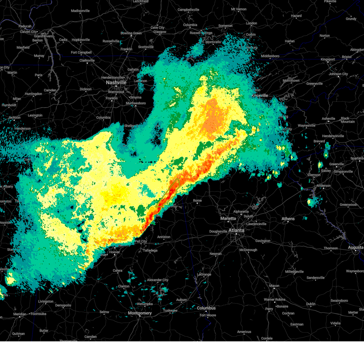 At 716 am cdt, severe thunderstorms were located along a line extending from 10 miles northeast of fort payne to near tabor road, moving east at 35 mph (radar indicated). Hazards include 60 mph wind gusts. Expect damage to roofs, siding, and trees. Locations impacted include, fort payne, valley head, hammondville, mentone, pine ridge, lebanon, dog town, collbran, adamsburg, and desoto state park. At 716 am cdt, severe thunderstorms were located along a line extending from 10 miles northeast of fort payne to near tabor road, moving east at 35 mph (radar indicated). Hazards include 60 mph wind gusts. Expect damage to roofs, siding, and trees. Locations impacted include, fort payne, valley head, hammondville, mentone, pine ridge, lebanon, dog town, collbran, adamsburg, and desoto state park.
|
| 3/15/2024 7:10 AM CDT |
 The storm which prompted the warning has weakened below severe limits, and no longer appears capable of producing a tornado. therefore, the warning will be allowed to expire. however, gusty winds are still possible with this thunderstorm. a severe thunderstorm watch remains in effect until 1000 am cdt for northeastern alabama. remember, a severe thunderstorm warning still remains in effect for dekalb county until 730 am. The storm which prompted the warning has weakened below severe limits, and no longer appears capable of producing a tornado. therefore, the warning will be allowed to expire. however, gusty winds are still possible with this thunderstorm. a severe thunderstorm watch remains in effect until 1000 am cdt for northeastern alabama. remember, a severe thunderstorm warning still remains in effect for dekalb county until 730 am.
|
| 3/15/2024 7:02 AM CDT |
 At 702 am cdt, a severe thunderstorm capable of producing a tornado was located near fyffe, or near rainsville, moving east at 40 mph (radar indicated rotation). Hazards include tornado. Flying debris will be dangerous to those caught without shelter. mobile homes will be damaged or destroyed. damage to roofs, windows, and vehicles will occur. tree damage is likely. this dangerous storm will be near, fort payne around 710 am cdt. Other locations impacted by this tornadic thunderstorm include pine ridge, lebanon, dog town, collbran, guest, adamsburg, peeks corner, desoto state park, and little river canyon np. At 702 am cdt, a severe thunderstorm capable of producing a tornado was located near fyffe, or near rainsville, moving east at 40 mph (radar indicated rotation). Hazards include tornado. Flying debris will be dangerous to those caught without shelter. mobile homes will be damaged or destroyed. damage to roofs, windows, and vehicles will occur. tree damage is likely. this dangerous storm will be near, fort payne around 710 am cdt. Other locations impacted by this tornadic thunderstorm include pine ridge, lebanon, dog town, collbran, guest, adamsburg, peeks corner, desoto state park, and little river canyon np.
|
| 3/15/2024 6:52 AM CDT |
 Torhun the national weather service in huntsville alabama has issued a * tornado warning for, southern dekalb county in northeastern alabama, * until 715 am cdt. * at 652 am cdt, a severe thunderstorm capable of producing a tornado was located near fyffe, or 8 miles southwest of rainsville, moving east at 40 mph (radar indicated rotation). Hazards include tornado. Flying debris will be dangerous to those caught without shelter. mobile homes will be damaged or destroyed. damage to roofs, windows, and vehicles will occur. tree damage is likely. this dangerous storm will be near, rainsville and fyffe around 655 am cdt. fort payne around 705 am cdt. Other locations impacted by this tornadic thunderstorm include pine ridge, lebanon, lakeview, dog town, collbran, guest, adamsburg, peeks corner, desoto state park, and chigger hill. Torhun the national weather service in huntsville alabama has issued a * tornado warning for, southern dekalb county in northeastern alabama, * until 715 am cdt. * at 652 am cdt, a severe thunderstorm capable of producing a tornado was located near fyffe, or 8 miles southwest of rainsville, moving east at 40 mph (radar indicated rotation). Hazards include tornado. Flying debris will be dangerous to those caught without shelter. mobile homes will be damaged or destroyed. damage to roofs, windows, and vehicles will occur. tree damage is likely. this dangerous storm will be near, rainsville and fyffe around 655 am cdt. fort payne around 705 am cdt. Other locations impacted by this tornadic thunderstorm include pine ridge, lebanon, lakeview, dog town, collbran, guest, adamsburg, peeks corner, desoto state park, and chigger hill.
|
| 3/15/2024 6:46 AM CDT |
 At 645 am cdt, severe thunderstorms were located along a line extending from near powell to near altoona, moving east at 55 mph. there are several broad areas of rotation along this line and rapid tornado formation may occur. tornado warnings may be needed (radar indicated). Hazards include 60 mph wind gusts. Expect damage to roofs, siding, and trees. Locations impacted include, albertville, scottsboro, fort payne, boaz, guntersville, rainsville, crossville, sylvania, fyffe, and powell. At 645 am cdt, severe thunderstorms were located along a line extending from near powell to near altoona, moving east at 55 mph. there are several broad areas of rotation along this line and rapid tornado formation may occur. tornado warnings may be needed (radar indicated). Hazards include 60 mph wind gusts. Expect damage to roofs, siding, and trees. Locations impacted include, albertville, scottsboro, fort payne, boaz, guntersville, rainsville, crossville, sylvania, fyffe, and powell.
|
| 3/15/2024 6:26 AM CDT |
 At 625 am cdt, severe thunderstorms were located along a line extending from grant to near nectar, moving east at 45 mph. several trees down have been reported in harselle and falkville (radar indicated). Hazards include 60 mph wind gusts. Expect damage to roofs, siding, and trees. Locations impacted include, albertville, scottsboro, fort payne, boaz, guntersville, rainsville, crossville, sylvania, fyffe, and powell. At 625 am cdt, severe thunderstorms were located along a line extending from grant to near nectar, moving east at 45 mph. several trees down have been reported in harselle and falkville (radar indicated). Hazards include 60 mph wind gusts. Expect damage to roofs, siding, and trees. Locations impacted include, albertville, scottsboro, fort payne, boaz, guntersville, rainsville, crossville, sylvania, fyffe, and powell.
|
| 3/15/2024 6:26 AM CDT |
 the severe thunderstorm warning has been cancelled and is no longer in effect the severe thunderstorm warning has been cancelled and is no longer in effect
|
| 3/15/2024 6:07 AM CDT |
 Svrhun the national weather service in huntsville alabama has issued a * severe thunderstorm warning for, marshall county in northeastern alabama, southwestern jackson county in northeastern alabama, southeastern madison county in north central alabama, southwestern dekalb county in northeastern alabama, central cullman county in north central alabama, southeastern morgan county in north central alabama, * until 700 am cdt. * at 607 am cdt, severe thunderstorms were located along a line extending from near owens cross roads to dodge city, moving east at 45 mph (radar indicated). Hazards include 60 mph wind gusts. expect damage to roofs, siding, and trees Svrhun the national weather service in huntsville alabama has issued a * severe thunderstorm warning for, marshall county in northeastern alabama, southwestern jackson county in northeastern alabama, southeastern madison county in north central alabama, southwestern dekalb county in northeastern alabama, central cullman county in north central alabama, southeastern morgan county in north central alabama, * until 700 am cdt. * at 607 am cdt, severe thunderstorms were located along a line extending from near owens cross roads to dodge city, moving east at 45 mph (radar indicated). Hazards include 60 mph wind gusts. expect damage to roofs, siding, and trees
|
| 8/27/2023 6:12 PM CDT |
 At 611 pm cdt, a severe thunderstorm was located over rainsville, and is nearly stationary (radar indicated). Hazards include 60 mph wind gusts. expect damage to roofs, siding, and trees At 611 pm cdt, a severe thunderstorm was located over rainsville, and is nearly stationary (radar indicated). Hazards include 60 mph wind gusts. expect damage to roofs, siding, and trees
|
| 8/12/2023 3:12 PM CDT |
 The severe thunderstorm warning for southeastern jackson and northeastern dekalb counties will expire at 315 pm cdt, the storms which prompted the warning have weakened below severe limits, and have exited the warned area. therefore, the warning will be allowed to expire. however gusty winds are still possible with these thunderstorms. a severe thunderstorm watch remains in effect until 600 pm cdt for north central and northeastern alabama. The severe thunderstorm warning for southeastern jackson and northeastern dekalb counties will expire at 315 pm cdt, the storms which prompted the warning have weakened below severe limits, and have exited the warned area. therefore, the warning will be allowed to expire. however gusty winds are still possible with these thunderstorms. a severe thunderstorm watch remains in effect until 600 pm cdt for north central and northeastern alabama.
|
| 8/12/2023 2:52 PM CDT |
 At 251 pm cdt, severe thunderstorms were located along a line extending from near ider to henagar to near powell, moving southeast at 30 mph (radar indicated). Hazards include 60 mph wind gusts. Expect damage to roofs, siding, and trees. locations impacted include, fort payne, rainsville, henagar, sylvania, fyffe, powell, section, ider, pisgah and valley head. hail threat, radar indicated max hail size, <. 75 in wind threat, radar indicated max wind gust, 60 mph. At 251 pm cdt, severe thunderstorms were located along a line extending from near ider to henagar to near powell, moving southeast at 30 mph (radar indicated). Hazards include 60 mph wind gusts. Expect damage to roofs, siding, and trees. locations impacted include, fort payne, rainsville, henagar, sylvania, fyffe, powell, section, ider, pisgah and valley head. hail threat, radar indicated max hail size, <. 75 in wind threat, radar indicated max wind gust, 60 mph.
|
| 8/12/2023 2:39 PM CDT |
 At 238 pm cdt, severe thunderstorms were located along a line extending from near ider to near powell to near section, moving east at 35 mph (radar indicated). Hazards include 60 mph wind gusts. Expect damage to roofs, siding, and trees. locations impacted include, scottsboro, fort payne, rainsville, henagar, stevenson, sylvania, fyffe, hollywood, powell and section. hail threat, radar indicated max hail size, <. 75 in wind threat, radar indicated max wind gust, 60 mph. At 238 pm cdt, severe thunderstorms were located along a line extending from near ider to near powell to near section, moving east at 35 mph (radar indicated). Hazards include 60 mph wind gusts. Expect damage to roofs, siding, and trees. locations impacted include, scottsboro, fort payne, rainsville, henagar, stevenson, sylvania, fyffe, hollywood, powell and section. hail threat, radar indicated max hail size, <. 75 in wind threat, radar indicated max wind gust, 60 mph.
|
| 8/12/2023 2:28 PM CDT |
 At 227 pm cdt, severe thunderstorms were located along a line extending from near bridgeport to hollywood to scottsboro, moving southeast at 30 mph (radar indicated). Hazards include 60 mph wind gusts. expect damage to roofs, siding, and trees At 227 pm cdt, severe thunderstorms were located along a line extending from near bridgeport to hollywood to scottsboro, moving southeast at 30 mph (radar indicated). Hazards include 60 mph wind gusts. expect damage to roofs, siding, and trees
|
| 8/7/2023 3:39 PM CDT |
 The severe thunderstorm warning for southeastern marshall and southern dekalb counties will expire at 345 pm cdt, the storm which prompted the warning has moved out of the area. therefore, the warning will be allowed to expire. a tornado warning was issued to replace the severe thunderstorm warning given the circulation that developed over southern dekalb county. a severe thunderstorm watch remains in effect until 700 pm cdt for north central and northeastern alabama. The severe thunderstorm warning for southeastern marshall and southern dekalb counties will expire at 345 pm cdt, the storm which prompted the warning has moved out of the area. therefore, the warning will be allowed to expire. a tornado warning was issued to replace the severe thunderstorm warning given the circulation that developed over southern dekalb county. a severe thunderstorm watch remains in effect until 700 pm cdt for north central and northeastern alabama.
|
| 8/7/2023 3:31 PM CDT |
 At 330 pm cdt, a severe thunderstorm capable of producing a tornado was located 7 miles north of sand rock, or 8 miles southwest of fort payne, moving east at 50 mph (radar indicated rotation). Hazards include tornado. Flying debris will be dangerous to those caught without shelter. mobile homes will be damaged or destroyed. damage to roofs, windows, and vehicles will occur. tree damage is likely. This tornadic thunderstorm will remain over mainly rural areas of southeastern dekalb county, including the following locations, lebanon, pine ridge, dog town, guest, collbran, adamsburg, peeks corner, desoto state park, little river canyon np and mentone. At 330 pm cdt, a severe thunderstorm capable of producing a tornado was located 7 miles north of sand rock, or 8 miles southwest of fort payne, moving east at 50 mph (radar indicated rotation). Hazards include tornado. Flying debris will be dangerous to those caught without shelter. mobile homes will be damaged or destroyed. damage to roofs, windows, and vehicles will occur. tree damage is likely. This tornadic thunderstorm will remain over mainly rural areas of southeastern dekalb county, including the following locations, lebanon, pine ridge, dog town, guest, collbran, adamsburg, peeks corner, desoto state park, little river canyon np and mentone.
|
| 8/7/2023 3:17 PM CDT |
 At 316 pm cdt, a severe thunderstorm was located over geraldine, or 11 miles northeast of boaz, moving east at 55 mph (radar indicated). Hazards include 60 mph wind gusts. expect damage to roofs, siding, and trees At 316 pm cdt, a severe thunderstorm was located over geraldine, or 11 miles northeast of boaz, moving east at 55 mph (radar indicated). Hazards include 60 mph wind gusts. expect damage to roofs, siding, and trees
|
| 8/6/2023 4:08 PM CDT |
 The severe thunderstorm warning for northeastern marshall, jackson and southwestern dekalb counties will expire at 415 pm cdt, the storms which prompted the warning have weakened below severe limits, and no longer pose an immediate threat to life or property. therefore, the warning will be allowed to expire. however gusty winds are still possible with these thunderstorms. a severe thunderstorm watch remains in effect until 800 pm cdt for northeastern alabama, and middle tennessee. The severe thunderstorm warning for northeastern marshall, jackson and southwestern dekalb counties will expire at 415 pm cdt, the storms which prompted the warning have weakened below severe limits, and no longer pose an immediate threat to life or property. therefore, the warning will be allowed to expire. however gusty winds are still possible with these thunderstorms. a severe thunderstorm watch remains in effect until 800 pm cdt for northeastern alabama, and middle tennessee.
|
| 8/6/2023 3:59 PM CDT |
 At 358 pm cdt, severe thunderstorms were located along a line extending from 7 miles east of new market to near scottsboro to near geraldine, moving east at 45 mph (radar indicated). Hazards include 60 mph wind gusts. Expect damage to roofs, siding, and trees. locations impacted include, albertville, scottsboro, boaz, rainsville, stevenson, crossville, sylvania, fyffe, hollywood and powell. hail threat, radar indicated max hail size, <. 75 in wind threat, radar indicated max wind gust, 60 mph. At 358 pm cdt, severe thunderstorms were located along a line extending from 7 miles east of new market to near scottsboro to near geraldine, moving east at 45 mph (radar indicated). Hazards include 60 mph wind gusts. Expect damage to roofs, siding, and trees. locations impacted include, albertville, scottsboro, boaz, rainsville, stevenson, crossville, sylvania, fyffe, hollywood and powell. hail threat, radar indicated max hail size, <. 75 in wind threat, radar indicated max wind gust, 60 mph.
|
| 8/6/2023 3:46 PM CDT |
 At 345 pm cdt, severe thunderstorms were located along a line extending from huntsville to near woodville to near guntersville, moving east at 45 mph (radar indicated). Hazards include 60 mph wind gusts. Expect damage to roofs, siding, and trees. locations impacted include, huntsville, albertville, scottsboro, boaz, guntersville, arab, rainsville, moores mill and meridianville. hail threat, radar indicated max hail size, <. 75 in wind threat, radar indicated max wind gust, 60 mph. At 345 pm cdt, severe thunderstorms were located along a line extending from huntsville to near woodville to near guntersville, moving east at 45 mph (radar indicated). Hazards include 60 mph wind gusts. Expect damage to roofs, siding, and trees. locations impacted include, huntsville, albertville, scottsboro, boaz, guntersville, arab, rainsville, moores mill and meridianville. hail threat, radar indicated max hail size, <. 75 in wind threat, radar indicated max wind gust, 60 mph.
|
| 8/6/2023 3:28 PM CDT |
 At 327 pm cdt, severe thunderstorms were located along a line extending from near madison to near gurley to arab, moving east at 40 mph (radar indicated. this storm has a history of producing widespread wind damage and is also producing frequent lightning. move indoors if outside!). Hazards include 60 mph wind gusts and penny size hail. expect damage to roofs, siding, and trees At 327 pm cdt, severe thunderstorms were located along a line extending from near madison to near gurley to arab, moving east at 40 mph (radar indicated. this storm has a history of producing widespread wind damage and is also producing frequent lightning. move indoors if outside!). Hazards include 60 mph wind gusts and penny size hail. expect damage to roofs, siding, and trees
|
| 8/6/2023 1:21 PM CDT |
 At 120 pm cdt, a severe thunderstorm was located over fort payne, moving east at 25 mph (radar indicated). Hazards include 60 mph wind gusts and nickel size hail. expect damage to roofs, siding, and trees At 120 pm cdt, a severe thunderstorm was located over fort payne, moving east at 25 mph (radar indicated). Hazards include 60 mph wind gusts and nickel size hail. expect damage to roofs, siding, and trees
|
| 7/20/2023 4:40 PM CDT |
 At 440 pm cdt, a severe thunderstorm was located over fyffe, or 7 miles southwest of rainsville, moving south at 25 mph (radar indicated). Hazards include 60 mph wind gusts and quarter size hail. Hail damage to vehicles is expected. Expect wind damage to roofs, siding, and trees. At 440 pm cdt, a severe thunderstorm was located over fyffe, or 7 miles southwest of rainsville, moving south at 25 mph (radar indicated). Hazards include 60 mph wind gusts and quarter size hail. Hail damage to vehicles is expected. Expect wind damage to roofs, siding, and trees.
|
| 7/3/2023 3:27 PM CDT |
 At 327 pm cdt, a severe thunderstorm was located over crossville, or 8 miles northeast of boaz, moving east at 15 mph (radar indicated). Hazards include 60 mph wind gusts and quarter size hail. Hail damage to vehicles is expected. expect wind damage to roofs, siding, and trees. locations impacted include, albertville, fort payne, boaz, crossville, geraldine, pine ridge, lakeview, mcville, hopewell and dog town. hail threat, radar indicated max hail size, 1. 00 in wind threat, radar indicated max wind gust, 60 mph. At 327 pm cdt, a severe thunderstorm was located over crossville, or 8 miles northeast of boaz, moving east at 15 mph (radar indicated). Hazards include 60 mph wind gusts and quarter size hail. Hail damage to vehicles is expected. expect wind damage to roofs, siding, and trees. locations impacted include, albertville, fort payne, boaz, crossville, geraldine, pine ridge, lakeview, mcville, hopewell and dog town. hail threat, radar indicated max hail size, 1. 00 in wind threat, radar indicated max wind gust, 60 mph.
|
| 7/3/2023 3:15 PM CDT |
 At 315 pm cdt, a severe thunderstorm was located near albertville, moving east at 20 mph (radar indicated). Hazards include 60 mph wind gusts and quarter size hail. Hail damage to vehicles is expected. Expect wind damage to roofs, siding, and trees. At 315 pm cdt, a severe thunderstorm was located near albertville, moving east at 20 mph (radar indicated). Hazards include 60 mph wind gusts and quarter size hail. Hail damage to vehicles is expected. Expect wind damage to roofs, siding, and trees.
|
| 7/2/2023 3:55 PM CDT |
 The severe thunderstorm warning for east central marshall and dekalb counties will expire at 400 pm cdt, the storms which prompted the warning have weakened. therefore, the warning will be allowed to expire. however, small hail and gusty winds are still possible with these thunderstorms. a severe thunderstorm watch remains in effect until 800 pm cdt for north central and northeastern alabama. The severe thunderstorm warning for east central marshall and dekalb counties will expire at 400 pm cdt, the storms which prompted the warning have weakened. therefore, the warning will be allowed to expire. however, small hail and gusty winds are still possible with these thunderstorms. a severe thunderstorm watch remains in effect until 800 pm cdt for north central and northeastern alabama.
|
| 7/2/2023 3:43 PM CDT |
 At 342 pm cdt, severe thunderstorms were located along a line extending from 7 miles southeast of ider to fort payne to near crossville, moving southeast at 25 mph (at 342 pm cdt, public reported at least quarter size hail north of fyffe). Hazards include 60 mph wind gusts and quarter size hail. Hail damage to vehicles is expected. expect wind damage to roofs, siding, and trees. locations impacted include, albertville, fort payne, boaz, guntersville, rainsville, henagar, crossville, sylvania, fyffe and powell. hail threat, radar indicated max hail size, 1. 00 in wind threat, radar indicated max wind gust, 60 mph. At 342 pm cdt, severe thunderstorms were located along a line extending from 7 miles southeast of ider to fort payne to near crossville, moving southeast at 25 mph (at 342 pm cdt, public reported at least quarter size hail north of fyffe). Hazards include 60 mph wind gusts and quarter size hail. Hail damage to vehicles is expected. expect wind damage to roofs, siding, and trees. locations impacted include, albertville, fort payne, boaz, guntersville, rainsville, henagar, crossville, sylvania, fyffe and powell. hail threat, radar indicated max hail size, 1. 00 in wind threat, radar indicated max wind gust, 60 mph.
|
| 7/2/2023 3:35 PM CDT |
 At 335 pm cdt, severe thunderstorms were located along a line extending from near ider to near fort payne to near geraldine, moving southeast at 25 mph (radar indicated). Hazards include 60 mph wind gusts and quarter size hail. Hail damage to vehicles is expected. expect wind damage to roofs, siding, and trees. locations impacted include, albertville, fort payne, boaz, guntersville, rainsville, henagar, crossville, sylvania, fyffe and powell. hail threat, radar indicated max hail size, 1. 00 in wind threat, radar indicated max wind gust, 60 mph. At 335 pm cdt, severe thunderstorms were located along a line extending from near ider to near fort payne to near geraldine, moving southeast at 25 mph (radar indicated). Hazards include 60 mph wind gusts and quarter size hail. Hail damage to vehicles is expected. expect wind damage to roofs, siding, and trees. locations impacted include, albertville, fort payne, boaz, guntersville, rainsville, henagar, crossville, sylvania, fyffe and powell. hail threat, radar indicated max hail size, 1. 00 in wind threat, radar indicated max wind gust, 60 mph.
|
| 7/2/2023 3:19 PM CDT |
 At 319 pm cdt, severe thunderstorms were located along a line extending from ider to sylvania to 8 miles west of geraldine, moving southeast at 25 mph (radar indicated). Hazards include 60 mph wind gusts and quarter size hail. Hail damage to vehicles is expected. Expect wind damage to roofs, siding, and trees. At 319 pm cdt, severe thunderstorms were located along a line extending from ider to sylvania to 8 miles west of geraldine, moving southeast at 25 mph (radar indicated). Hazards include 60 mph wind gusts and quarter size hail. Hail damage to vehicles is expected. Expect wind damage to roofs, siding, and trees.
|
| 3/25/2023 1:08 AM CDT |
 At 108 am cdt, a tornado producing storm was located over grant, or 11 miles north of guntersville, moving east at 60 mph (radar confirmed tornado). Hazards include damaging tornado. Flying debris will be dangerous to those caught without shelter. mobile homes will be damaged or destroyed. damage to roofs, windows, and vehicles will occur. tree damage is likely. this tornadic storm will be near, section around 125 am cdt. fyffe and powell around 130 am cdt. rainsville and sylvania around 135 am cdt. fort payne and henagar around 140 am cdt. Other locations impacted by this tornadic thunderstorm include dutton, pine ridge, langston, rosalie, columbus city and hammondville. At 108 am cdt, a tornado producing storm was located over grant, or 11 miles north of guntersville, moving east at 60 mph (radar confirmed tornado). Hazards include damaging tornado. Flying debris will be dangerous to those caught without shelter. mobile homes will be damaged or destroyed. damage to roofs, windows, and vehicles will occur. tree damage is likely. this tornadic storm will be near, section around 125 am cdt. fyffe and powell around 130 am cdt. rainsville and sylvania around 135 am cdt. fort payne and henagar around 140 am cdt. Other locations impacted by this tornadic thunderstorm include dutton, pine ridge, langston, rosalie, columbus city and hammondville.
|
| 3/25/2023 1:06 AM CDT |
 At 106 am cdt, severe thunderstorms were located along a line extending from near grant to 6 miles west of guntersville, moving east at 60 mph (radar indicated). Hazards include 60 mph wind gusts. expect damage to roofs, siding, and trees At 106 am cdt, severe thunderstorms were located along a line extending from near grant to 6 miles west of guntersville, moving east at 60 mph (radar indicated). Hazards include 60 mph wind gusts. expect damage to roofs, siding, and trees
|
| 3/3/2023 1:06 PM CST |
 At 105 pm cst, severe thunderstorms were located along a line extending from near signal mountain to near ider, moving northeast at 60 mph (radar indicated). Hazards include 70 mph wind gusts. Expect considerable tree damage. damage is likely to mobile homes, roofs, and outbuildings. locations impacted include, fort payne, rainsville, valley head, hammondville, mentone, pine ridge, dog town, collbran, sulpher springs and little river canyon np. thunderstorm damage threat, considerable hail threat, radar indicated max hail size, <. 75 in wind threat, radar indicated max wind gust, 70 mph. At 105 pm cst, severe thunderstorms were located along a line extending from near signal mountain to near ider, moving northeast at 60 mph (radar indicated). Hazards include 70 mph wind gusts. Expect considerable tree damage. damage is likely to mobile homes, roofs, and outbuildings. locations impacted include, fort payne, rainsville, valley head, hammondville, mentone, pine ridge, dog town, collbran, sulpher springs and little river canyon np. thunderstorm damage threat, considerable hail threat, radar indicated max hail size, <. 75 in wind threat, radar indicated max wind gust, 70 mph.
|
| 3/3/2023 12:53 PM CST |
 At 1252 pm cst, severe thunderstorms were located along a line extending from near kimball to near henagar, moving northeast at 60 mph (radar indicated). Hazards include 70 mph wind gusts. Expect considerable tree damage. damage is likely to mobile homes, roofs, and outbuildings. locations impacted include, fort payne, rainsville, henagar, crossville, sylvania, fyffe, powell, geraldine, ider and pisgah. thunderstorm damage threat, considerable hail threat, radar indicated max hail size, <. 75 in wind threat, radar indicated max wind gust, 70 mph. At 1252 pm cst, severe thunderstorms were located along a line extending from near kimball to near henagar, moving northeast at 60 mph (radar indicated). Hazards include 70 mph wind gusts. Expect considerable tree damage. damage is likely to mobile homes, roofs, and outbuildings. locations impacted include, fort payne, rainsville, henagar, crossville, sylvania, fyffe, powell, geraldine, ider and pisgah. thunderstorm damage threat, considerable hail threat, radar indicated max hail size, <. 75 in wind threat, radar indicated max wind gust, 70 mph.
|
| 3/3/2023 12:37 PM CST |
 At 1237 pm cst, severe thunderstorms were located along a line extending from near stevenson to near section, moving northeast at 60 mph (radar indicated). Hazards include 70 mph wind gusts. Expect considerable tree damage. damage is likely to mobile homes, roofs, and outbuildings. locations impacted include, albertville, scottsboro, fort payne, boaz, rainsville, henagar, stevenson, crossville, sylvania and fyffe. thunderstorm damage threat, considerable hail threat, radar indicated max hail size, <. 75 in wind threat, radar indicated max wind gust, 70 mph. At 1237 pm cst, severe thunderstorms were located along a line extending from near stevenson to near section, moving northeast at 60 mph (radar indicated). Hazards include 70 mph wind gusts. Expect considerable tree damage. damage is likely to mobile homes, roofs, and outbuildings. locations impacted include, albertville, scottsboro, fort payne, boaz, rainsville, henagar, stevenson, crossville, sylvania and fyffe. thunderstorm damage threat, considerable hail threat, radar indicated max hail size, <. 75 in wind threat, radar indicated max wind gust, 70 mph.
|
| 3/3/2023 12:14 PM CST |
 At 1214 pm cst, severe thunderstorms were located along a line extending from near skyline to near guntersville, moving northeast at 60 mph (radar indicated). Hazards include 70 mph wind gusts. Expect considerable tree damage. Damage is likely to mobile homes, roofs, and outbuildings. At 1214 pm cst, severe thunderstorms were located along a line extending from near skyline to near guntersville, moving northeast at 60 mph (radar indicated). Hazards include 70 mph wind gusts. Expect considerable tree damage. Damage is likely to mobile homes, roofs, and outbuildings.
|
| 7/29/2022 7:32 PM CDT |
 At 732 pm cdt, a severe thunderstorm was located over fort payne, moving northeast at 10 mph (radar indicated). Hazards include 60 mph wind gusts and penny size hail. Expect damage to roofs, siding, and trees. locations impacted include, fort payne, rainsville, valley head, hammondville, pine ridge, adamsburg, desoto state park and little river canyon np. hail threat, radar indicated max hail size, 0. 75 in wind threat, radar indicated max wind gust, 60 mph. At 732 pm cdt, a severe thunderstorm was located over fort payne, moving northeast at 10 mph (radar indicated). Hazards include 60 mph wind gusts and penny size hail. Expect damage to roofs, siding, and trees. locations impacted include, fort payne, rainsville, valley head, hammondville, pine ridge, adamsburg, desoto state park and little river canyon np. hail threat, radar indicated max hail size, 0. 75 in wind threat, radar indicated max wind gust, 60 mph.
|
| 7/29/2022 7:16 PM CDT |
 At 716 pm cdt, a severe thunderstorm was located near fort payne, moving northeast at 10 mph (radar indicated). Hazards include 60 mph wind gusts and penny size hail. expect damage to roofs, siding, and trees At 716 pm cdt, a severe thunderstorm was located near fort payne, moving northeast at 10 mph (radar indicated). Hazards include 60 mph wind gusts and penny size hail. expect damage to roofs, siding, and trees
|
| 4/6/2022 5:53 PM CDT |
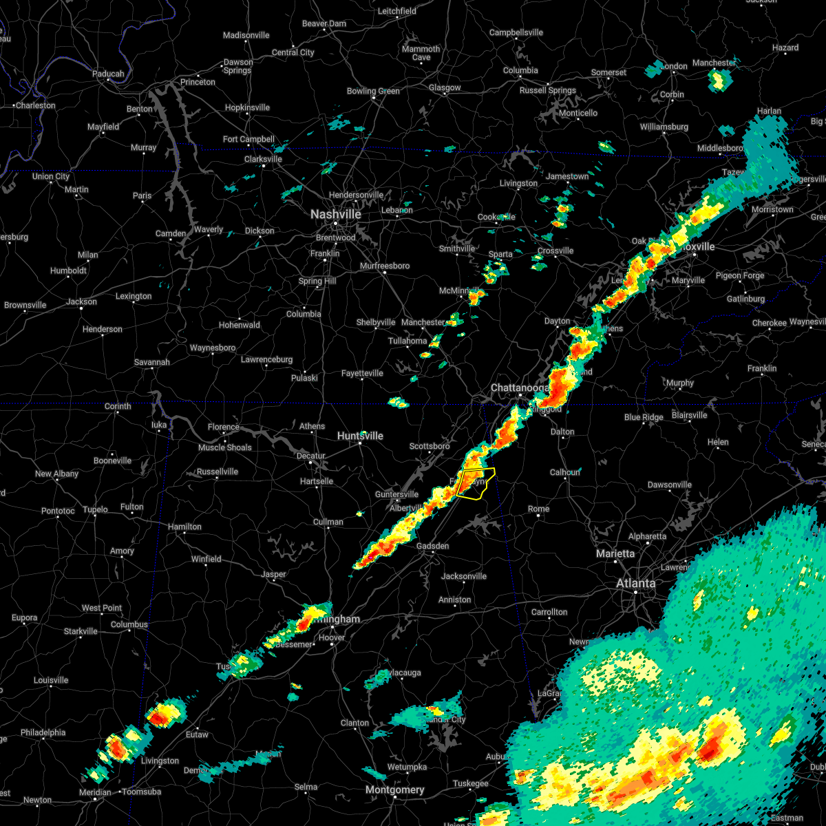 At 553 pm cdt, a severe thunderstorm was located over fort payne, moving east at 30 mph (radar indicated). Hazards include 60 mph wind gusts and quarter size hail. Hail damage to vehicles is expected. expect wind damage to roofs, siding, and trees. locations impacted include, fort payne, sylvania, valley head, hammondville, mentone, pine ridge, adamsburg, desoto state park and little river canyon np. hail threat, radar indicated max hail size, 1. 00 in wind threat, radar indicated max wind gust, 60 mph. At 553 pm cdt, a severe thunderstorm was located over fort payne, moving east at 30 mph (radar indicated). Hazards include 60 mph wind gusts and quarter size hail. Hail damage to vehicles is expected. expect wind damage to roofs, siding, and trees. locations impacted include, fort payne, sylvania, valley head, hammondville, mentone, pine ridge, adamsburg, desoto state park and little river canyon np. hail threat, radar indicated max hail size, 1. 00 in wind threat, radar indicated max wind gust, 60 mph.
|
| 4/6/2022 5:39 PM CDT |
 At 539 pm cdt, a severe thunderstorm was located over fyffe, or near rainsville, moving east at 35 mph (radar indicated). Hazards include 60 mph wind gusts and quarter size hail. Hail damage to vehicles is expected. expect wind damage to roofs, siding, and trees. locations impacted include, fort payne, rainsville, sylvania, fyffe, powell, valley head, hammondville, mentone, pine ridge and guest. hail threat, radar indicated max hail size, 1. 00 in wind threat, radar indicated max wind gust, 60 mph. At 539 pm cdt, a severe thunderstorm was located over fyffe, or near rainsville, moving east at 35 mph (radar indicated). Hazards include 60 mph wind gusts and quarter size hail. Hail damage to vehicles is expected. expect wind damage to roofs, siding, and trees. locations impacted include, fort payne, rainsville, sylvania, fyffe, powell, valley head, hammondville, mentone, pine ridge and guest. hail threat, radar indicated max hail size, 1. 00 in wind threat, radar indicated max wind gust, 60 mph.
|
| 4/6/2022 5:26 PM CDT |
 At 526 pm cdt, a severe thunderstorm was located near geraldine, or 10 miles southwest of rainsville, moving east at 35 mph (radar indicated). Hazards include 60 mph wind gusts and quarter size hail. Hail damage to vehicles is expected. Expect wind damage to roofs, siding, and trees. At 526 pm cdt, a severe thunderstorm was located near geraldine, or 10 miles southwest of rainsville, moving east at 35 mph (radar indicated). Hazards include 60 mph wind gusts and quarter size hail. Hail damage to vehicles is expected. Expect wind damage to roofs, siding, and trees.
|
| 7/11/2021 6:08 PM CDT |
 At 608 pm cdt, a severe thunderstorm was located near crossville, or 13 miles east of boaz, moving north at 25 mph (radar indicated). Hazards include 60 mph wind gusts. expect damage to roofs, siding, and trees At 608 pm cdt, a severe thunderstorm was located near crossville, or 13 miles east of boaz, moving north at 25 mph (radar indicated). Hazards include 60 mph wind gusts. expect damage to roofs, siding, and trees
|
| 5/6/2021 8:08 PM CDT |
 The severe thunderstorm warning for dekalb county will expire at 815 pm cdt, the storms which prompted the warning are moving out of the area. therefore, the warning will be allowed to expire. The severe thunderstorm warning for dekalb county will expire at 815 pm cdt, the storms which prompted the warning are moving out of the area. therefore, the warning will be allowed to expire.
|
| 5/6/2021 7:56 PM CDT |
 At 755 pm cdt, strong winds were located along a line extending from 6 miles south of trenton to near tabor road to near steele, moving east at 45 mph. tree damage and power outages have been reported (emergency management). Hazards include 60 mph wind gusts. Expect damage to roofs, siding, and trees. Locations impacted include, fort payne, rainsville, henagar, crossville, sylvania, fyffe, ider, valley head, hammondville and mentone. At 755 pm cdt, strong winds were located along a line extending from 6 miles south of trenton to near tabor road to near steele, moving east at 45 mph. tree damage and power outages have been reported (emergency management). Hazards include 60 mph wind gusts. Expect damage to roofs, siding, and trees. Locations impacted include, fort payne, rainsville, henagar, crossville, sylvania, fyffe, ider, valley head, hammondville and mentone.
|
| 5/6/2021 7:34 PM CDT |
 At 733 pm cdt, severe thunderstorms were located along a line extending from stevenson to 6 miles east of guntersville to near cleveland, moving east at 45 mph (emergency management and doppler radar). Hazards include 60 mph wind gusts. Expect damage to roofs, siding, and trees. Locations impacted include, albertville, scottsboro, fort payne, boaz, guntersville, rainsville, bridgeport, henagar, stevenson and crossville. At 733 pm cdt, severe thunderstorms were located along a line extending from stevenson to 6 miles east of guntersville to near cleveland, moving east at 45 mph (emergency management and doppler radar). Hazards include 60 mph wind gusts. Expect damage to roofs, siding, and trees. Locations impacted include, albertville, scottsboro, fort payne, boaz, guntersville, rainsville, bridgeport, henagar, stevenson and crossville.
|
| 5/6/2021 7:13 PM CDT |
 At 711 pm cdt, severe thunderstorms were located along a line extending from 8 miles north of skyline to 8 miles east of morgan city to near good hope, moving east at 55 mph (emergency management and doppler radar). Hazards include 60 mph wind gusts. expect damage to roofs, siding, and trees At 711 pm cdt, severe thunderstorms were located along a line extending from 8 miles north of skyline to 8 miles east of morgan city to near good hope, moving east at 55 mph (emergency management and doppler radar). Hazards include 60 mph wind gusts. expect damage to roofs, siding, and trees
|
| 4/24/2021 5:37 PM CDT |
 At 536 pm cdt, a severe thunderstorm was located over fort payne, moving east at 50 mph (radar indicated). Hazards include 60 mph wind gusts and quarter size hail. Hail damage to vehicles is expected. expect wind damage to roofs, siding, and trees. Locations impacted include, fort payne, rainsville, valley head, mentone, pine ridge, dog town, collbran, adamsburg, desoto state park and little river canyon np. At 536 pm cdt, a severe thunderstorm was located over fort payne, moving east at 50 mph (radar indicated). Hazards include 60 mph wind gusts and quarter size hail. Hail damage to vehicles is expected. expect wind damage to roofs, siding, and trees. Locations impacted include, fort payne, rainsville, valley head, mentone, pine ridge, dog town, collbran, adamsburg, desoto state park and little river canyon np.
|
| 4/24/2021 5:27 PM CDT |
 At 526 pm cdt, a severe thunderstorm was located near fyffe, or 7 miles south of rainsville, moving east at 50 mph (radar indicated). Hazards include 60 mph wind gusts and half dollar size hail. Hail damage to vehicles is expected. Expect wind damage to roofs, siding, and trees. At 526 pm cdt, a severe thunderstorm was located near fyffe, or 7 miles south of rainsville, moving east at 50 mph (radar indicated). Hazards include 60 mph wind gusts and half dollar size hail. Hail damage to vehicles is expected. Expect wind damage to roofs, siding, and trees.
|
| 4/24/2021 5:21 PM CDT |
 At 521 pm cdt, a severe thunderstorm was located near geraldine, or 9 miles southwest of rainsville, moving east at 45 mph (radar indicated). Hazards include ping pong ball size hail and 60 mph wind gusts. People and animals outdoors will be injured. expect hail damage to roofs, siding, windows, and vehicles. expect wind damage to roofs, siding, and trees. Locations impacted include, fort payne, rainsville, crossville, sylvania, fyffe, geraldine, pine ridge, lakeview, dog town and collbran. At 521 pm cdt, a severe thunderstorm was located near geraldine, or 9 miles southwest of rainsville, moving east at 45 mph (radar indicated). Hazards include ping pong ball size hail and 60 mph wind gusts. People and animals outdoors will be injured. expect hail damage to roofs, siding, windows, and vehicles. expect wind damage to roofs, siding, and trees. Locations impacted include, fort payne, rainsville, crossville, sylvania, fyffe, geraldine, pine ridge, lakeview, dog town and collbran.
|
| 4/24/2021 5:05 PM CDT |
 At 504 pm cdt, a severe thunderstorm was located near albertville, moving east at 45 mph (radar indicated). Hazards include ping pong ball size hail and 60 mph wind gusts. People and animals outdoors will be injured. expect hail damage to roofs, siding, windows, and vehicles. Expect wind damage to roofs, siding, and trees. At 504 pm cdt, a severe thunderstorm was located near albertville, moving east at 45 mph (radar indicated). Hazards include ping pong ball size hail and 60 mph wind gusts. People and animals outdoors will be injured. expect hail damage to roofs, siding, windows, and vehicles. Expect wind damage to roofs, siding, and trees.
|
| 3/25/2021 9:35 PM CDT |
 At 934 pm cdt, a severe thunderstorm was located 9 miles north of little river falls, or 9 miles northeast of fort payne, moving northeast at 80 mph (public). Hazards include 60 mph wind gusts and quarter size hail. Hail damage to vehicles is expected. expect wind damage to roofs, siding, and trees. Locations impacted include, fort payne, valley head, hammondville, mentone, pine ridge, sulpher springs, adamsburg, desoto state park and little river canyon np. At 934 pm cdt, a severe thunderstorm was located 9 miles north of little river falls, or 9 miles northeast of fort payne, moving northeast at 80 mph (public). Hazards include 60 mph wind gusts and quarter size hail. Hail damage to vehicles is expected. expect wind damage to roofs, siding, and trees. Locations impacted include, fort payne, valley head, hammondville, mentone, pine ridge, sulpher springs, adamsburg, desoto state park and little river canyon np.
|
| 3/25/2021 9:26 PM CDT |
 At 926 pm cdt, a severe thunderstorm was located over fort payne, moving northeast at 80 mph (public). Hazards include 60 mph wind gusts and quarter size hail. Hail damage to vehicles is expected. Expect wind damage to roofs, siding, and trees. At 926 pm cdt, a severe thunderstorm was located over fort payne, moving northeast at 80 mph (public). Hazards include 60 mph wind gusts and quarter size hail. Hail damage to vehicles is expected. Expect wind damage to roofs, siding, and trees.
|
| 3/25/2021 9:16 PM CDT |
 At 915 pm cdt, a severe thunderstorm was located near crossville, or 13 miles east of boaz, moving northeast at 85 mph (public). Hazards include 60 mph wind gusts and quarter size hail. Hail damage to vehicles is expected. expect wind damage to roofs, siding, and trees. Locations impacted include, fort payne, rainsville, crossville, sylvania, fyffe, geraldine, pine ridge, lakeview, dog town and collbran. At 915 pm cdt, a severe thunderstorm was located near crossville, or 13 miles east of boaz, moving northeast at 85 mph (public). Hazards include 60 mph wind gusts and quarter size hail. Hail damage to vehicles is expected. expect wind damage to roofs, siding, and trees. Locations impacted include, fort payne, rainsville, crossville, sylvania, fyffe, geraldine, pine ridge, lakeview, dog town and collbran.
|
| 3/25/2021 9:00 PM CDT |
 At 859 pm cdt, a severe thunderstorm was located over walnut grove, or 10 miles southwest of boaz, moving northeast at 90 mph (radar indicated). Hazards include 60 mph wind gusts and half dollar size hail. Hail damage to vehicles is expected. Expect wind damage to roofs, siding, and trees. At 859 pm cdt, a severe thunderstorm was located over walnut grove, or 10 miles southwest of boaz, moving northeast at 90 mph (radar indicated). Hazards include 60 mph wind gusts and half dollar size hail. Hail damage to vehicles is expected. Expect wind damage to roofs, siding, and trees.
|
| 3/25/2021 9:46 AM CDT |
 At 945 am cdt, severe thunderstorms were located along a line extending from near henagar to near sylvania to near fort payne to 6 miles southeast of fyffe, moving east at 40 mph (radar indicated). Hazards include 60 mph wind gusts and quarter size hail. Hail damage to vehicles is expected. expect wind damage to roofs, siding, and trees. Locations impacted include, fort payne, rainsville, henagar, sylvania, fyffe, ider, valley head, hammondville, mentone and pine ridge. At 945 am cdt, severe thunderstorms were located along a line extending from near henagar to near sylvania to near fort payne to 6 miles southeast of fyffe, moving east at 40 mph (radar indicated). Hazards include 60 mph wind gusts and quarter size hail. Hail damage to vehicles is expected. expect wind damage to roofs, siding, and trees. Locations impacted include, fort payne, rainsville, henagar, sylvania, fyffe, ider, valley head, hammondville, mentone and pine ridge.
|
| 3/25/2021 9:33 AM CDT |
 At 933 am cdt, severe thunderstorms were located along a line extending from near sylvania to near fyffe to near geraldine to near crossville, moving east at 50 mph (radar indicated). Hazards include 60 mph wind gusts and quarter size hail. Hail damage to vehicles is expected. expect wind damage to roofs, siding, and trees. Locations impacted include, scottsboro, fort payne, rainsville, henagar, crossville, sylvania, fyffe, powell, geraldine and section. At 933 am cdt, severe thunderstorms were located along a line extending from near sylvania to near fyffe to near geraldine to near crossville, moving east at 50 mph (radar indicated). Hazards include 60 mph wind gusts and quarter size hail. Hail damage to vehicles is expected. expect wind damage to roofs, siding, and trees. Locations impacted include, scottsboro, fort payne, rainsville, henagar, crossville, sylvania, fyffe, powell, geraldine and section.
|
| 3/25/2021 9:13 AM CDT |
 At 913 am cdt, severe thunderstorms were located along a line extending from 7 miles southwest of section to 8 miles southeast of grant to near guntersville to near albertville, moving east at 40 mph (radar indicated). Hazards include 60 mph wind gusts and quarter size hail. Hail damage to vehicles is expected. Expect wind damage to roofs, siding, and trees. At 913 am cdt, severe thunderstorms were located along a line extending from 7 miles southwest of section to 8 miles southeast of grant to near guntersville to near albertville, moving east at 40 mph (radar indicated). Hazards include 60 mph wind gusts and quarter size hail. Hail damage to vehicles is expected. Expect wind damage to roofs, siding, and trees.
|
| 8/27/2020 4:36 PM CDT |
 The severe thunderstorm warning for south central jackson and central dekalb counties will expire at 445 pm cdt, the storm which prompted the warning has weakened below severe limits, and no longer poses an immediate threat to life or property. therefore, the warning will be allowed to expire. The severe thunderstorm warning for south central jackson and central dekalb counties will expire at 445 pm cdt, the storm which prompted the warning has weakened below severe limits, and no longer poses an immediate threat to life or property. therefore, the warning will be allowed to expire.
|
| 8/27/2020 4:18 PM CDT |
 At 418 pm cdt, a severe thunderstorm was located over fyffe, or near rainsville, moving north at 20 mph (radar indicated). Hazards include 60 mph wind gusts and quarter size hail. Hail damage to vehicles is expected. Expect wind damage to roofs, siding, and trees. At 418 pm cdt, a severe thunderstorm was located over fyffe, or near rainsville, moving north at 20 mph (radar indicated). Hazards include 60 mph wind gusts and quarter size hail. Hail damage to vehicles is expected. Expect wind damage to roofs, siding, and trees.
|
| 8/19/2020 1:17 PM CDT |
 At 117 pm cdt, a severe thunderstorm was located over sylvania, or near rainsville, and is nearly stationary (radar indicated). Hazards include 60 mph wind gusts and nickel size hail. expect damage to roofs, siding, and trees At 117 pm cdt, a severe thunderstorm was located over sylvania, or near rainsville, and is nearly stationary (radar indicated). Hazards include 60 mph wind gusts and nickel size hail. expect damage to roofs, siding, and trees
|
| 7/21/2020 6:22 PM CDT |
 The severe thunderstorm warning for south central dekalb county will expire at 630 pm cdt, the storm which prompted the warning has weakened below severe limits, and no longer poses an immediate threat to life or property. therefore, the warning will be allowed to expire. however heavy rain is still possible with this thunderstorm. The severe thunderstorm warning for south central dekalb county will expire at 630 pm cdt, the storm which prompted the warning has weakened below severe limits, and no longer poses an immediate threat to life or property. therefore, the warning will be allowed to expire. however heavy rain is still possible with this thunderstorm.
|
| 7/21/2020 5:56 PM CDT |
 At 555 pm cdt, a severe thunderstorm was located near fyffe, or 9 miles south of rainsville, moving northeast at 15 mph (radar indicated). Hazards include 60 mph wind gusts and quarter size hail. Hail damage to vehicles is expected. Expect wind damage to roofs, siding, and trees. At 555 pm cdt, a severe thunderstorm was located near fyffe, or 9 miles south of rainsville, moving northeast at 15 mph (radar indicated). Hazards include 60 mph wind gusts and quarter size hail. Hail damage to vehicles is expected. Expect wind damage to roofs, siding, and trees.
|
| 5/4/2020 10:56 PM CDT |
 The severe thunderstorm warning for eastern dekalb county will expire at 1100 pm cdt, the storms which prompted the warning are moving out of the area. therefore, the warning will be allowed to expire. however gusty winds are still possible with these thunderstorms. a severe thunderstorm watch remains in effect until midnight cdt for northeastern alabama, and middle tennessee. The severe thunderstorm warning for eastern dekalb county will expire at 1100 pm cdt, the storms which prompted the warning are moving out of the area. therefore, the warning will be allowed to expire. however gusty winds are still possible with these thunderstorms. a severe thunderstorm watch remains in effect until midnight cdt for northeastern alabama, and middle tennessee.
|
| 5/4/2020 10:45 PM CDT |
 At 1044 pm cdt, severe thunderstorms were located along a line extending from 8 miles southeast of ider to fort payne, moving southeast at 55 mph (radar indicated). Hazards include 60 mph wind gusts. Expect damage to roofs, siding, and trees. Locations impacted include, fort payne, rainsville, henagar, sylvania, ider, valley head, hammondville, mentone, pine ridge and sulpher springs. At 1044 pm cdt, severe thunderstorms were located along a line extending from 8 miles southeast of ider to fort payne, moving southeast at 55 mph (radar indicated). Hazards include 60 mph wind gusts. Expect damage to roofs, siding, and trees. Locations impacted include, fort payne, rainsville, henagar, sylvania, ider, valley head, hammondville, mentone, pine ridge and sulpher springs.
|
| 5/4/2020 10:26 PM CDT |
 At 1025 pm cdt, severe thunderstorms were located along a line extending from 7 miles southeast of stevenson to near pisgah, moving southeast at 55 mph. this storm has a history of producing wind damage (radar indicated). Hazards include 60 mph wind gusts. expect damage to roofs, siding, and trees At 1025 pm cdt, severe thunderstorms were located along a line extending from 7 miles southeast of stevenson to near pisgah, moving southeast at 55 mph. this storm has a history of producing wind damage (radar indicated). Hazards include 60 mph wind gusts. expect damage to roofs, siding, and trees
|
| 4/12/2020 10:08 PM CDT |
 At 1007 pm cdt, severe thunderstorms were located along a line extending from trenton to 8 miles northeast of fort payne to near sardis city, moving east at 55 mph (radar indicated). Hazards include 60 mph wind gusts. Expect damage to roofs, siding, and trees. Locations impacted include, fort payne, rainsville, crossville, valley head, hammondville, mentone, pine ridge, dog town, collbran and little river canyon np. At 1007 pm cdt, severe thunderstorms were located along a line extending from trenton to 8 miles northeast of fort payne to near sardis city, moving east at 55 mph (radar indicated). Hazards include 60 mph wind gusts. Expect damage to roofs, siding, and trees. Locations impacted include, fort payne, rainsville, crossville, valley head, hammondville, mentone, pine ridge, dog town, collbran and little river canyon np.
|
| 4/12/2020 9:59 PM CDT |
 The national weather service in huntsville alabama has issued a * severe thunderstorm warning for. eastern jackson county in northeastern alabama. southeastern marshall county in northeastern alabama. dekalb county in northeastern alabama. Until 1030 pm cdt. The national weather service in huntsville alabama has issued a * severe thunderstorm warning for. eastern jackson county in northeastern alabama. southeastern marshall county in northeastern alabama. dekalb county in northeastern alabama. Until 1030 pm cdt.
|
| 4/12/2020 6:52 PM CDT |
 The tornado warning for southwestern dekalb county will expire at 700 pm cdt, the storm which prompted the warning has weakened below severe limits, and no longer appears capable of producing a tornado. therefore, the warning will be allowed to expire. a tornado watch remains in effect until 1000 pm cdt for north central and northeastern alabama. The tornado warning for southwestern dekalb county will expire at 700 pm cdt, the storm which prompted the warning has weakened below severe limits, and no longer appears capable of producing a tornado. therefore, the warning will be allowed to expire. a tornado watch remains in effect until 1000 pm cdt for north central and northeastern alabama.
|
| 4/12/2020 6:32 PM CDT |
 At 631 pm cdt, a confirmed tornado was located over crossville, or 9 miles northeast of boaz, moving northeast at 45 mph. damage has been reported with this storm (radar confirmed tornado). Hazards include damaging tornado. Flying debris will be dangerous to those caught without shelter. mobile homes will be damaged or destroyed. damage to roofs, windows, and vehicles will occur. tree damage is likely. Locations impacted include, fort payne, rainsville, crossville, fyffe, geraldine, pine ridge, lakeview, dog town, collbran and guest. At 631 pm cdt, a confirmed tornado was located over crossville, or 9 miles northeast of boaz, moving northeast at 45 mph. damage has been reported with this storm (radar confirmed tornado). Hazards include damaging tornado. Flying debris will be dangerous to those caught without shelter. mobile homes will be damaged or destroyed. damage to roofs, windows, and vehicles will occur. tree damage is likely. Locations impacted include, fort payne, rainsville, crossville, fyffe, geraldine, pine ridge, lakeview, dog town, collbran and guest.
|
| 4/12/2020 6:24 PM CDT |
 At 624 pm cdt, a tornado producing storm was located over boaz, moving northeast at 40 mph (radar confirmed tornado). Hazards include damaging tornado. Flying debris will be dangerous to those caught without shelter. mobile homes will be damaged or destroyed. damage to roofs, windows, and vehicles will occur. Tree damage is likely. At 624 pm cdt, a tornado producing storm was located over boaz, moving northeast at 40 mph (radar confirmed tornado). Hazards include damaging tornado. Flying debris will be dangerous to those caught without shelter. mobile homes will be damaged or destroyed. damage to roofs, windows, and vehicles will occur. Tree damage is likely.
|
| 3/24/2020 8:49 PM CDT |
 At 849 pm cdt, a severe thunderstorm capable of producing a tornado was located over fort payne, moving east at 35 mph (weather spotters reported a funnel cloud). Hazards include tornado. Flying debris will be dangerous to those caught without shelter. mobile homes will be damaged or destroyed. damage to roofs, windows, and vehicles will occur. tree damage is likely. Locations impacted include, fort payne, rainsville, valley head, hammondville, mentone, pine ridge, adamsburg, desoto state park and little river canyon np. At 849 pm cdt, a severe thunderstorm capable of producing a tornado was located over fort payne, moving east at 35 mph (weather spotters reported a funnel cloud). Hazards include tornado. Flying debris will be dangerous to those caught without shelter. mobile homes will be damaged or destroyed. damage to roofs, windows, and vehicles will occur. tree damage is likely. Locations impacted include, fort payne, rainsville, valley head, hammondville, mentone, pine ridge, adamsburg, desoto state park and little river canyon np.
|
| 3/24/2020 8:37 PM CDT |
 At 836 pm cdt, a severe thunderstorm capable of producing a tornado was located over rainsville, moving east at 40 mph (weather spotters reported a funnel cloud). Hazards include tornado. Flying debris will be dangerous to those caught without shelter. mobile homes will be damaged or destroyed. damage to roofs, windows, and vehicles will occur. tree damage is likely. Locations impacted include, fort payne, rainsville, sylvania, fyffe, powell, valley head, hammondville, mentone, pine ridge and lakeview. At 836 pm cdt, a severe thunderstorm capable of producing a tornado was located over rainsville, moving east at 40 mph (weather spotters reported a funnel cloud). Hazards include tornado. Flying debris will be dangerous to those caught without shelter. mobile homes will be damaged or destroyed. damage to roofs, windows, and vehicles will occur. tree damage is likely. Locations impacted include, fort payne, rainsville, sylvania, fyffe, powell, valley head, hammondville, mentone, pine ridge and lakeview.
|
| 3/24/2020 8:32 PM CDT |
 At 831 pm cdt, a severe thunderstorm capable of producing a tornado was located over fyffe, or near rainsville, moving east at 40 mph (radar indicated rotation). Hazards include tornado. Flying debris will be dangerous to those caught without shelter. mobile homes will be damaged or destroyed. damage to roofs, windows, and vehicles will occur. Tree damage is likely. At 831 pm cdt, a severe thunderstorm capable of producing a tornado was located over fyffe, or near rainsville, moving east at 40 mph (radar indicated rotation). Hazards include tornado. Flying debris will be dangerous to those caught without shelter. mobile homes will be damaged or destroyed. damage to roofs, windows, and vehicles will occur. Tree damage is likely.
|
| 1/11/2020 2:27 PM CST |
 The severe thunderstorm warning for jackson and dekalb counties will expire at 230 pm cst, the storms which prompted the warning have moved out of the area. therefore, the warning will be allowed to expire. The severe thunderstorm warning for jackson and dekalb counties will expire at 230 pm cst, the storms which prompted the warning have moved out of the area. therefore, the warning will be allowed to expire.
|
| 1/11/2020 2:23 PM CST |
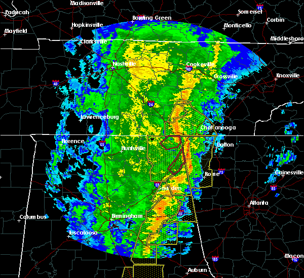 The tornado warning for southeastern dekalb county will expire at 230 pm cst, the storm which prompted the warning has moved out of the area. therefore, the warning will be allowed to expire. a tornado watch remains in effect until 800 pm cst for northeastern alabama. The tornado warning for southeastern dekalb county will expire at 230 pm cst, the storm which prompted the warning has moved out of the area. therefore, the warning will be allowed to expire. a tornado watch remains in effect until 800 pm cst for northeastern alabama.
|
| 1/11/2020 2:10 PM CST |
 At 210 pm cst, a severe thunderstorm capable of producing a tornado was located over little river falls, or over little river canyon national preserve, moving northeast at 60 mph (radar indicated rotation). Hazards include tornado. Flying debris will be dangerous to those caught without shelter. mobile homes will be damaged or destroyed. damage to roofs, windows, and vehicles will occur. Tree damage is likely. At 210 pm cst, a severe thunderstorm capable of producing a tornado was located over little river falls, or over little river canyon national preserve, moving northeast at 60 mph (radar indicated rotation). Hazards include tornado. Flying debris will be dangerous to those caught without shelter. mobile homes will be damaged or destroyed. damage to roofs, windows, and vehicles will occur. Tree damage is likely.
|
| 1/11/2020 2:01 PM CST |
 At 200 pm cst, severe thunderstorms were located along a line extending from 10 miles west of south pittsburg to cherokee rock village, moving northeast at 65 mph (radar indicated). Hazards include 60 mph wind gusts. Expect damage to roofs, siding, and trees. Locations impacted include, scottsboro, fort payne, rainsville, bridgeport, henagar, stevenson, crossville, sylvania, fyffe and hollywood. At 200 pm cst, severe thunderstorms were located along a line extending from 10 miles west of south pittsburg to cherokee rock village, moving northeast at 65 mph (radar indicated). Hazards include 60 mph wind gusts. Expect damage to roofs, siding, and trees. Locations impacted include, scottsboro, fort payne, rainsville, bridgeport, henagar, stevenson, crossville, sylvania, fyffe and hollywood.
|
| 1/11/2020 1:28 PM CST |
 At 127 pm cst, severe thunderstorms were located along a line extending from near new market to near aurora, moving east at 45 mph (radar indicated). Hazards include 70 mph wind gusts. Expect considerable tree damage. Damage is likely to mobile homes, roofs, and outbuildings. At 127 pm cst, severe thunderstorms were located along a line extending from near new market to near aurora, moving east at 45 mph (radar indicated). Hazards include 70 mph wind gusts. Expect considerable tree damage. Damage is likely to mobile homes, roofs, and outbuildings.
|
| 12/16/2019 9:34 PM CST |
 At 934 pm cst, a severe thunderstorm was located near fyffe, or 9 miles southwest of rainsville, moving northeast at 50 mph (radar indicated). Hazards include 60 mph wind gusts. expect damage to roofs, siding, and trees At 934 pm cst, a severe thunderstorm was located near fyffe, or 9 miles southwest of rainsville, moving northeast at 50 mph (radar indicated). Hazards include 60 mph wind gusts. expect damage to roofs, siding, and trees
|
| 7/13/2019 3:43 PM CDT |
 The severe thunderstorm warning for east central dekalb county will expire at 345 pm cdt, the storm which prompted the warning has weakened below severe limits, and no longer poses an immediate threat to life or property. therefore, the warning will be allowed to expire. however gusty winds of 30 to 40 mph and heavy rain are still possible with this thunderstorm across eastern dekalb county. The severe thunderstorm warning for east central dekalb county will expire at 345 pm cdt, the storm which prompted the warning has weakened below severe limits, and no longer poses an immediate threat to life or property. therefore, the warning will be allowed to expire. however gusty winds of 30 to 40 mph and heavy rain are still possible with this thunderstorm across eastern dekalb county.
|
| 7/13/2019 3:08 PM CDT |
 At 308 pm cdt, a severe thunderstorm was located near rainsville, moving northeast at 15 mph (radar indicated). Hazards include 60 to 70 mph wind gusts. expect damage to roofs, siding, and trees At 308 pm cdt, a severe thunderstorm was located near rainsville, moving northeast at 15 mph (radar indicated). Hazards include 60 to 70 mph wind gusts. expect damage to roofs, siding, and trees
|
| 6/21/2019 11:15 PM CDT |
 At 1114 pm cdt, severe thunderstorms were located along a line extending from near trion to near albertville, moving southeast at 40 mph. several downed trees and power lines have been reported with this line of storms (radar indicated). Hazards include 60 mph wind gusts. Expect damage to roofs, siding, and trees. Locations impacted include, fort payne, rainsville, henagar, crossville, sylvania, fyffe, powell, geraldine, valley head and hammondville. At 1114 pm cdt, severe thunderstorms were located along a line extending from near trion to near albertville, moving southeast at 40 mph. several downed trees and power lines have been reported with this line of storms (radar indicated). Hazards include 60 mph wind gusts. Expect damage to roofs, siding, and trees. Locations impacted include, fort payne, rainsville, henagar, crossville, sylvania, fyffe, powell, geraldine, valley head and hammondville.
|
| 6/21/2019 10:53 PM CDT |
 At 1052 pm cdt, severe thunderstorms were located along a line extending from 6 miles east of ider to 6 miles northwest of guntersville, moving southeast at 40 mph (radar indicated). Hazards include 60 mph wind gusts. expect damage to roofs, siding, and trees At 1052 pm cdt, severe thunderstorms were located along a line extending from 6 miles east of ider to 6 miles northwest of guntersville, moving southeast at 40 mph (radar indicated). Hazards include 60 mph wind gusts. expect damage to roofs, siding, and trees
|
| 6/21/2019 10:39 PM CDT |
 At 1018 pm cdt, severe thunderstorms were located along a line extending from near trenton to hollywood to near woodville, moving southeast at 55 mph (radar indicated). Hazards include 60 mph wind gusts. expect damage to roofs, siding, and trees At 1018 pm cdt, severe thunderstorms were located along a line extending from near trenton to hollywood to near woodville, moving southeast at 55 mph (radar indicated). Hazards include 60 mph wind gusts. expect damage to roofs, siding, and trees
|
| 6/21/2019 10:19 PM CDT |
 At 1018 pm cdt, severe thunderstorms were located along a line extending from near trenton to hollywood to near woodville, moving southeast at 55 mph (radar indicated). Hazards include 60 mph wind gusts. expect damage to roofs, siding, and trees At 1018 pm cdt, severe thunderstorms were located along a line extending from near trenton to hollywood to near woodville, moving southeast at 55 mph (radar indicated). Hazards include 60 mph wind gusts. expect damage to roofs, siding, and trees
|
| 6/20/2019 4:08 AM CDT |
 At 408 am cdt, severe thunderstorms were located along a line extending from tullahoma to near little river canyon national preserve, moving northeast at 60 mph (radar indicated). Hazards include 60 mph wind gusts. expect damage to roofs, siding, and trees At 408 am cdt, severe thunderstorms were located along a line extending from tullahoma to near little river canyon national preserve, moving northeast at 60 mph (radar indicated). Hazards include 60 mph wind gusts. expect damage to roofs, siding, and trees
|
| 6/20/2019 3:49 AM CDT |
 At 348 am cdt, severe thunderstorms were located along a line extending from 6 miles southeast of huntland to near aurora, moving northeast at 40 mph (radar indicated). Hazards include 60 mph wind gusts. Expect damage to roofs, siding, and trees. Locations impacted include, albertville, scottsboro, fort payne, boaz, guntersville, rainsville, moores mill, meridianville, hazel green and henagar. At 348 am cdt, severe thunderstorms were located along a line extending from 6 miles southeast of huntland to near aurora, moving northeast at 40 mph (radar indicated). Hazards include 60 mph wind gusts. Expect damage to roofs, siding, and trees. Locations impacted include, albertville, scottsboro, fort payne, boaz, guntersville, rainsville, moores mill, meridianville, hazel green and henagar.
|
| 6/20/2019 3:21 AM CDT |
 At 320 am cdt, severe thunderstorms were located along a line extending from near new market to near oneonta, moving east at 45 mph (radar indicated). Hazards include 60 mph wind gusts. expect damage to roofs, siding, and trees At 320 am cdt, severe thunderstorms were located along a line extending from near new market to near oneonta, moving east at 45 mph (radar indicated). Hazards include 60 mph wind gusts. expect damage to roofs, siding, and trees
|
| 6/12/2019 5:26 PM CDT |
 The severe thunderstorm warning for central dekalb county will expire at 530 pm cdt, the storm which prompted the warning has weakened below severe limits, and no longer poses an immediate threat to life or property. therefore, the warning will be allowed to expire. however small hail and heavy rain are still possible with this thunderstorm. The severe thunderstorm warning for central dekalb county will expire at 530 pm cdt, the storm which prompted the warning has weakened below severe limits, and no longer poses an immediate threat to life or property. therefore, the warning will be allowed to expire. however small hail and heavy rain are still possible with this thunderstorm.
|
| 6/12/2019 5:12 PM CDT |
 At 512 pm cdt, a severe thunderstorm was located near fyffe, or near rainsville, moving east at 10 mph (radar indicated). Hazards include 60 mph wind gusts and quarter size hail. Hail damage to vehicles is expected. expect wind damage to roofs, siding, and trees. Locations impacted include, fort payne, rainsville, pine ridge, collbran, guest and peeks corner. At 512 pm cdt, a severe thunderstorm was located near fyffe, or near rainsville, moving east at 10 mph (radar indicated). Hazards include 60 mph wind gusts and quarter size hail. Hail damage to vehicles is expected. expect wind damage to roofs, siding, and trees. Locations impacted include, fort payne, rainsville, pine ridge, collbran, guest and peeks corner.
|
| 6/12/2019 4:59 PM CDT |
 At 459 pm cdt, a severe thunderstorm was located over fyffe, or near rainsville, moving east at 10 mph (radar indicated). Hazards include 60 mph wind gusts and quarter size hail. Hail damage to vehicles is expected. Expect wind damage to roofs, siding, and trees. At 459 pm cdt, a severe thunderstorm was located over fyffe, or near rainsville, moving east at 10 mph (radar indicated). Hazards include 60 mph wind gusts and quarter size hail. Hail damage to vehicles is expected. Expect wind damage to roofs, siding, and trees.
|
| 5/9/2019 2:10 PM CDT |
 A severe thunderstorm warning remains in effect until 245 pm cdt for southeastern jackson and eastern dekalb counties. at 209 pm cdt, severe thunderstorms were located along a line extending from near pisgah to near little river falls, moving northeast at 45 mph. hazard. 60 mph wind gusts. A severe thunderstorm warning remains in effect until 245 pm cdt for southeastern jackson and eastern dekalb counties. at 209 pm cdt, severe thunderstorms were located along a line extending from near pisgah to near little river falls, moving northeast at 45 mph. hazard. 60 mph wind gusts.
|
| 5/9/2019 2:07 PM CDT |
 The tornado warning for central dekalb county will expire at 215 pm cdt. the tornado threat has diminished and the tornado warning has been cancelled. however, damaging winds remain possible and a severe thunderstorm warning remains in effect for the area. To report severe weather, contact your nearest law enforcement. The tornado warning for central dekalb county will expire at 215 pm cdt. the tornado threat has diminished and the tornado warning has been cancelled. however, damaging winds remain possible and a severe thunderstorm warning remains in effect for the area. To report severe weather, contact your nearest law enforcement.
|
| 5/9/2019 1:55 PM CDT |
 A tornado warning remains in effect until 215 pm cdt for central dekalb county. at 155 pm cdt, a severe thunderstorm capable of producing a tornado was located near fyffe, or near rainsville, moving northeast at 40 mph. hazard. Tornado. A tornado warning remains in effect until 215 pm cdt for central dekalb county. at 155 pm cdt, a severe thunderstorm capable of producing a tornado was located near fyffe, or near rainsville, moving northeast at 40 mph. hazard. Tornado.
|
| 5/9/2019 1:46 PM CDT |
 The national weather service in huntsville alabama has issued a * severe thunderstorm warning for. southeastern jackson county in northeastern alabama. dekalb county in northeastern alabama. until 245 pm cdt. At 145 pm cdt, severe thunderstorms were located along a line. The national weather service in huntsville alabama has issued a * severe thunderstorm warning for. southeastern jackson county in northeastern alabama. dekalb county in northeastern alabama. until 245 pm cdt. At 145 pm cdt, severe thunderstorms were located along a line.
|
| 5/9/2019 1:37 PM CDT |
 The national weather service in huntsville alabama has issued a * tornado warning for. southern dekalb county in northeastern alabama. until 215 pm cdt. At 137 pm cdt, a severe thunderstorm capable of producing a tornado was located near geraldine, or 10 miles northeast of albertville,. The national weather service in huntsville alabama has issued a * tornado warning for. southern dekalb county in northeastern alabama. until 215 pm cdt. At 137 pm cdt, a severe thunderstorm capable of producing a tornado was located near geraldine, or 10 miles northeast of albertville,.
|
| 4/14/2019 7:10 AM CDT |
 The severe thunderstorm warning for east central jackson and eastern dekalb counties will expire at 715 am cdt, the storms which prompted the warning have weakened below severe limits, and have exited the warned area. therefore, the warning will be allowed to expire. a tornado watch remains in effect until 900 am cdt for northeastern alabama. to report severe weather, contact your nearest law enforcement agency. they will relay your report to the national weather service huntsville alabama. The severe thunderstorm warning for east central jackson and eastern dekalb counties will expire at 715 am cdt, the storms which prompted the warning have weakened below severe limits, and have exited the warned area. therefore, the warning will be allowed to expire. a tornado watch remains in effect until 900 am cdt for northeastern alabama. to report severe weather, contact your nearest law enforcement agency. they will relay your report to the national weather service huntsville alabama.
|
| 4/14/2019 6:50 AM CDT |
 At 650 am cdt, severe thunderstorms were located along a line extending from near ider to near sylvania to near sand rock, moving east at 25 mph (radar indicated). Hazards include 60 mph wind gusts. Expect damage to roofs, siding, and trees. locations impacted include, fort payne, rainsville, henagar, sylvania, ider, valley head, hammondville, mentone, pine ridge and dog town. A tornado watch remains in effect until 900 am cdt for northeastern alabama. At 650 am cdt, severe thunderstorms were located along a line extending from near ider to near sylvania to near sand rock, moving east at 25 mph (radar indicated). Hazards include 60 mph wind gusts. Expect damage to roofs, siding, and trees. locations impacted include, fort payne, rainsville, henagar, sylvania, ider, valley head, hammondville, mentone, pine ridge and dog town. A tornado watch remains in effect until 900 am cdt for northeastern alabama.
|
| 4/14/2019 6:37 AM CDT |
 At 636 am cdt, severe thunderstorms were located along a line extending from near pisgah to near rainsville to near tabor road, moving east at 25 mph (radar indicated). Hazards include 60 mph wind gusts. expect damage to roofs, siding, and trees At 636 am cdt, severe thunderstorms were located along a line extending from near pisgah to near rainsville to near tabor road, moving east at 25 mph (radar indicated). Hazards include 60 mph wind gusts. expect damage to roofs, siding, and trees
|
| 8/17/2018 7:28 PM CDT |
 At 728 pm cdt, severe thunderstorms were located along a line extending from near ider to near henagar to near fort payne, moving northeast at 30 mph (radar indicated). Hazards include 60 mph wind gusts. expect damage to roofs, siding, and trees At 728 pm cdt, severe thunderstorms were located along a line extending from near ider to near henagar to near fort payne, moving northeast at 30 mph (radar indicated). Hazards include 60 mph wind gusts. expect damage to roofs, siding, and trees
|
| 6/28/2018 1:05 PM CDT |
 At 104 pm cdt, severe thunderstorms were located along a line extending from near henagar to near grant to near priceville, moving south at 30 mph (radar indicated). Hazards include 70 mph wind gusts and penny size hail. Expect considerable tree damage. Damage is likely to mobile homes, roofs, and outbuildings. At 104 pm cdt, severe thunderstorms were located along a line extending from near henagar to near grant to near priceville, moving south at 30 mph (radar indicated). Hazards include 70 mph wind gusts and penny size hail. Expect considerable tree damage. Damage is likely to mobile homes, roofs, and outbuildings.
|
| 6/28/2018 12:48 PM CDT |
 At 1248 pm cdt, a severe thunderstorm was located near ider, or 14 miles south of trenton, moving southeast at 35 mph (radar indicated). Hazards include 60 mph wind gusts. Expect damage to roofs, siding, and trees. Locations impacted include, scottsboro, fort payne, rainsville, bridgeport, henagar, stevenson, sylvania, fyffe, hollywood and powell. At 1248 pm cdt, a severe thunderstorm was located near ider, or 14 miles south of trenton, moving southeast at 35 mph (radar indicated). Hazards include 60 mph wind gusts. Expect damage to roofs, siding, and trees. Locations impacted include, scottsboro, fort payne, rainsville, bridgeport, henagar, stevenson, sylvania, fyffe, hollywood and powell.
|
| 6/28/2018 12:25 PM CDT |
 At 1225 pm cdt, a severe thunderstorm was located 7 miles south of bridgeport, moving southeast at 35 mph (radar indicated). Hazards include 60 mph wind gusts and penny size hail. expect damage to roofs, siding, and trees At 1225 pm cdt, a severe thunderstorm was located 7 miles south of bridgeport, moving southeast at 35 mph (radar indicated). Hazards include 60 mph wind gusts and penny size hail. expect damage to roofs, siding, and trees
|
| 4/4/2018 12:05 AM CDT |
 The severe thunderstorm warning for eastern jackson and dekalb counties will expire at 1215 am cdt, the storms which prompted the warning have moved out of the area. therefore the warning will be allowed to expire. a severe thunderstorm watch remains in effect until 100 am cdt for northeastern alabama, and middle tennessee. The severe thunderstorm warning for eastern jackson and dekalb counties will expire at 1215 am cdt, the storms which prompted the warning have moved out of the area. therefore the warning will be allowed to expire. a severe thunderstorm watch remains in effect until 100 am cdt for northeastern alabama, and middle tennessee.
|
| 4/3/2018 11:57 PM CDT |
 At 1156 pm cdt, severe thunderstorms were located along a line extending from near bridgeport to near sand rock, moving east at 45 mph (emergency management. at 1142 pm cdt, jackson county emergency management reported trees down across county road 1 in paint rock. this line of storms has a history of producing wind damage across north alabama). Hazards include 60 mph wind gusts. Expect damage to roofs, siding, and trees. Locations impacted include, fort payne, rainsville, bridgeport, little river canyon national preserve, henagar, stevenson, sylvania, fyffe and powell. At 1156 pm cdt, severe thunderstorms were located along a line extending from near bridgeport to near sand rock, moving east at 45 mph (emergency management. at 1142 pm cdt, jackson county emergency management reported trees down across county road 1 in paint rock. this line of storms has a history of producing wind damage across north alabama). Hazards include 60 mph wind gusts. Expect damage to roofs, siding, and trees. Locations impacted include, fort payne, rainsville, bridgeport, little river canyon national preserve, henagar, stevenson, sylvania, fyffe and powell.
|
| 4/3/2018 11:48 PM CDT |
 At 1145 pm cdt, severe thunderstorms were located along a line extending from near russell cave national monument to near crossville, moving east at 50 mph (emergency management. at 1142 pm cdt, jackson county emergency management reported trees down across county road 1 in paint rock. this line of storms has a history of producing wind damage across north alabama). Hazards include 60 mph wind gusts. Expect damage to roofs, siding, and trees. Locations impacted include, scottsboro, fort payne, rainsville, bridgeport, little river canyon national preserve, henagar, stevenson, crossville and sylvania. At 1145 pm cdt, severe thunderstorms were located along a line extending from near russell cave national monument to near crossville, moving east at 50 mph (emergency management. at 1142 pm cdt, jackson county emergency management reported trees down across county road 1 in paint rock. this line of storms has a history of producing wind damage across north alabama). Hazards include 60 mph wind gusts. Expect damage to roofs, siding, and trees. Locations impacted include, scottsboro, fort payne, rainsville, bridgeport, little river canyon national preserve, henagar, stevenson, crossville and sylvania.
|
| 4/3/2018 11:29 PM CDT |
 At 1127 pm cdt, severe thunderstorms were located along a line extending from near hytop to near boaz, moving east at 45 mph (emergency management. at 1125 pm cdt, emergency managers reported widespread power outages across scottsboro and guntersville. this line also has a history of producing widespread wind damage elsewhere across north alabama). Hazards include 60 mph wind gusts. expect damage to roofs, siding, and trees At 1127 pm cdt, severe thunderstorms were located along a line extending from near hytop to near boaz, moving east at 45 mph (emergency management. at 1125 pm cdt, emergency managers reported widespread power outages across scottsboro and guntersville. this line also has a history of producing widespread wind damage elsewhere across north alabama). Hazards include 60 mph wind gusts. expect damage to roofs, siding, and trees
|
| 3/1/2018 7:37 AM CST |
 At 737 am cst, severe thunderstorms were located along a line extending from 9 miles southeast of ider to fort payne to near crossville, moving east at 30 mph (radar indicated). Hazards include 60 mph wind gusts. Expect damage to roofs, siding, and trees. Locations impacted include, fort payne, little river canyon national preserve, crossville, little river falls, valley head, hammondville, mentone, pine ridge, dog town and collbran. At 737 am cst, severe thunderstorms were located along a line extending from 9 miles southeast of ider to fort payne to near crossville, moving east at 30 mph (radar indicated). Hazards include 60 mph wind gusts. Expect damage to roofs, siding, and trees. Locations impacted include, fort payne, little river canyon national preserve, crossville, little river falls, valley head, hammondville, mentone, pine ridge, dog town and collbran.
|
| 3/1/2018 7:23 AM CST |
 At 723 am cst, a severe thunderstorm was located near fyffe, or 7 miles south of rainsville, moving east at 50 mph (radar indicated). Hazards include 60 mph wind gusts. expect damage to roofs, siding, and trees At 723 am cst, a severe thunderstorm was located near fyffe, or 7 miles south of rainsville, moving east at 50 mph (radar indicated). Hazards include 60 mph wind gusts. expect damage to roofs, siding, and trees
|
| 3/1/2018 7:11 AM CST |
 The severe thunderstorm warning for southeastern jackson, east central marshall and dekalb counties will expire at 715 am cst, the storms which prompted the warning have weakened below severe limits, and no longer pose an immediate threat to life or property. therefore the warning will be allowed to expire. however gusty winds are still possible with these thunderstorms. The severe thunderstorm warning for southeastern jackson, east central marshall and dekalb counties will expire at 715 am cst, the storms which prompted the warning have weakened below severe limits, and no longer pose an immediate threat to life or property. therefore the warning will be allowed to expire. however gusty winds are still possible with these thunderstorms.
|
| 3/1/2018 6:40 AM CST |
 At 639 am cst, severe thunderstorms were located along a line extending from trenton to 7 miles northeast of guntersville, moving east at 30 mph (radar indicated). Hazards include 60 mph wind gusts. expect damage to roofs, siding, and trees At 639 am cst, severe thunderstorms were located along a line extending from trenton to 7 miles northeast of guntersville, moving east at 30 mph (radar indicated). Hazards include 60 mph wind gusts. expect damage to roofs, siding, and trees
|
| 7/6/2017 12:16 PM CDT |
 At 1213 pm cdt, a severe thunderstorm was located near henagar, or 7 miles north of fort payne, moving east at 30 mph. damaging winds have been reported in the fyffe area (radar indicated). Hazards include 60 mph wind gusts. Expect damage to roofs, siding, and trees. Locations impacted include, fort payne, rainsville, henagar, sylvania, fyffe, powell, valley head, hammondville, mentone and pine ridge. At 1213 pm cdt, a severe thunderstorm was located near henagar, or 7 miles north of fort payne, moving east at 30 mph. damaging winds have been reported in the fyffe area (radar indicated). Hazards include 60 mph wind gusts. Expect damage to roofs, siding, and trees. Locations impacted include, fort payne, rainsville, henagar, sylvania, fyffe, powell, valley head, hammondville, mentone and pine ridge.
|
| 7/6/2017 11:52 AM CDT |
 At 1152 am cdt, a severe thunderstorm was located over rainsville, moving east at 30 mph (radar indicated). Hazards include 60 mph wind gusts. expect damage to roofs, siding, and trees At 1152 am cdt, a severe thunderstorm was located over rainsville, moving east at 30 mph (radar indicated). Hazards include 60 mph wind gusts. expect damage to roofs, siding, and trees
|
| 7/5/2017 3:53 PM CDT |
 The severe thunderstorm warning for southeastern dekalb county will expire at 400 pm cdt, the storm which prompted the warning has weakened below severe limits, and no longer poses an immediate threat to life or property. therefore the warning will be allowed to expire. however gusty winds and lightning are still possible with this thunderstorm. The severe thunderstorm warning for southeastern dekalb county will expire at 400 pm cdt, the storm which prompted the warning has weakened below severe limits, and no longer poses an immediate threat to life or property. therefore the warning will be allowed to expire. however gusty winds and lightning are still possible with this thunderstorm.
|
| 7/5/2017 3:42 PM CDT |
 At 341 pm cdt, a severe thunderstorm was located near collinsville, or 8 miles southwest of fort payne, moving northeast at 25 mph (radar indicated). Hazards include 60 mph wind gusts. Expect damage to roofs, siding, and trees. Locations impacted include, fort payne, rainsville, little river canyon national preserve, collinsville, pine ridge, collbran, dog town, little river canyon np, lebanon and adamsburg. At 341 pm cdt, a severe thunderstorm was located near collinsville, or 8 miles southwest of fort payne, moving northeast at 25 mph (radar indicated). Hazards include 60 mph wind gusts. Expect damage to roofs, siding, and trees. Locations impacted include, fort payne, rainsville, little river canyon national preserve, collinsville, pine ridge, collbran, dog town, little river canyon np, lebanon and adamsburg.
|
| 7/5/2017 3:29 PM CDT |
 At 329 pm cdt, a severe thunderstorm was located over collinsville, or 13 miles southwest of fort payne, moving northeast at 25 mph (radar indicated). Hazards include 60 mph wind gusts. expect damage to roofs, siding, and trees At 329 pm cdt, a severe thunderstorm was located over collinsville, or 13 miles southwest of fort payne, moving northeast at 25 mph (radar indicated). Hazards include 60 mph wind gusts. expect damage to roofs, siding, and trees
|
| 6/15/2017 3:03 PM CDT |
 At 302 pm cdt, severe thunderstorms were located along a line extending from 7 miles northeast of ider to near sylvania to near geraldine, moving southeast at 20 mph (radar indicated). Hazards include 60 mph wind gusts. Expect damage to roofs, siding, and trees. Locations impacted include, fort payne, rainsville, little river canyon national preserve, henagar, collinsville, crossville, sylvania, fyffe, powell and geraldine. At 302 pm cdt, severe thunderstorms were located along a line extending from 7 miles northeast of ider to near sylvania to near geraldine, moving southeast at 20 mph (radar indicated). Hazards include 60 mph wind gusts. Expect damage to roofs, siding, and trees. Locations impacted include, fort payne, rainsville, little river canyon national preserve, henagar, collinsville, crossville, sylvania, fyffe, powell and geraldine.
|
| 6/15/2017 2:49 PM CDT |
 At 247 pm cdt, severe thunderstorms were located along a line extending from 7 miles south of bridgeport to near sylvania to 8 miles northwest of geraldine, moving southeast at 40 mph (radar indicated). Hazards include 60 mph wind gusts. expect damage to roofs, siding, and trees At 247 pm cdt, severe thunderstorms were located along a line extending from 7 miles south of bridgeport to near sylvania to 8 miles northwest of geraldine, moving southeast at 40 mph (radar indicated). Hazards include 60 mph wind gusts. expect damage to roofs, siding, and trees
|
| 5/28/2017 3:15 AM CDT |
 At 315 am cdt, severe thunderstorms were located along a line extending from 8 miles southeast of ider to cherokee rock village, moving east at 50 mph (radar indicated). Hazards include 60 to 70 mph wind gusts and penny size hail. Expect considerable tree damage. Damage is likely to mobile homes, roofs, and outbuildings. At 315 am cdt, severe thunderstorms were located along a line extending from 8 miles southeast of ider to cherokee rock village, moving east at 50 mph (radar indicated). Hazards include 60 to 70 mph wind gusts and penny size hail. Expect considerable tree damage. Damage is likely to mobile homes, roofs, and outbuildings.
|
| 5/28/2017 2:44 AM CDT |
 At 243 am cdt, severe thunderstorms were located along a line extending from near grant to cleveland, moving east at 60 mph (radar indicated). Hazards include 60 to 70 mph wind gusts and penny size hail. Expect considerable tree damage. Damage is likely to mobile homes, roofs, and outbuildings. At 243 am cdt, severe thunderstorms were located along a line extending from near grant to cleveland, moving east at 60 mph (radar indicated). Hazards include 60 to 70 mph wind gusts and penny size hail. Expect considerable tree damage. Damage is likely to mobile homes, roofs, and outbuildings.
|
| 5/28/2017 1:41 AM CDT |
 The severe thunderstorm warning for east central dekalb county will expire at 145 am cdt, the storm which prompted the warning has weakened below severe limits, and no longer poses an immediate threat to life or property. therefore the warning will be allowed to expire. however gusty winds are still possible with this thunderstorm. a severe thunderstorm watch remains in effect until 500 am cdt for northeastern alabama, and middle tennessee. The severe thunderstorm warning for east central dekalb county will expire at 145 am cdt, the storm which prompted the warning has weakened below severe limits, and no longer poses an immediate threat to life or property. therefore the warning will be allowed to expire. however gusty winds are still possible with this thunderstorm. a severe thunderstorm watch remains in effect until 500 am cdt for northeastern alabama, and middle tennessee.
|
| 5/28/2017 1:29 AM CDT |
 At 128 am cdt, a severe thunderstorm was located over sylvania, or near rainsville, moving east at 30 mph (radar indicated). Hazards include 60 mph wind gusts and penny size hail. Expect damage to roofs, siding, and trees. Locations impacted include, fort payne, rainsville, henagar, sylvania, powell, valley head, hammondville, mentone, pine ridge and shiloh. At 128 am cdt, a severe thunderstorm was located over sylvania, or near rainsville, moving east at 30 mph (radar indicated). Hazards include 60 mph wind gusts and penny size hail. Expect damage to roofs, siding, and trees. Locations impacted include, fort payne, rainsville, henagar, sylvania, powell, valley head, hammondville, mentone, pine ridge and shiloh.
|
| 5/28/2017 1:15 AM CDT |
 At 115 am cdt, a severe thunderstorm was located over powell, or near rainsville, moving east at 30 mph (radar indicated). Hazards include 60 mph wind gusts and penny size hail. expect damage to roofs, siding, and trees At 115 am cdt, a severe thunderstorm was located over powell, or near rainsville, moving east at 30 mph (radar indicated). Hazards include 60 mph wind gusts and penny size hail. expect damage to roofs, siding, and trees
|
| 5/20/2017 6:11 PM CDT |
 At 611 pm cdt, a severe thunderstorm was located near fort payne, moving northwest at 25 mph (radar indicated). Hazards include 60 mph wind gusts. Expect damage to roofs, siding, and trees. Locations impacted include, fort payne, rainsville, henagar, sylvania, fyffe, powell, ider, valley head, hammondville and mentone. At 611 pm cdt, a severe thunderstorm was located near fort payne, moving northwest at 25 mph (radar indicated). Hazards include 60 mph wind gusts. Expect damage to roofs, siding, and trees. Locations impacted include, fort payne, rainsville, henagar, sylvania, fyffe, powell, ider, valley head, hammondville and mentone.
|
| 5/20/2017 6:01 PM CDT |
 At 600 pm cdt, a severe thunderstorm was located over fort payne, moving northwest at 25 mph (radar indicated). Hazards include 60 mph wind gusts. expect damage to roofs, siding, and trees At 600 pm cdt, a severe thunderstorm was located over fort payne, moving northwest at 25 mph (radar indicated). Hazards include 60 mph wind gusts. expect damage to roofs, siding, and trees
|
| 4/30/2017 3:58 PM CDT |
 The severe thunderstorm warning for jackson, dekalb and franklin counties will expire at 400 pm cdt, the storms which prompted the warning have weakened below severe limits, and no longer pose an immediate threat to life or property. therefore the warning will be allowed to expire. however, gusty winds are still possible with these thunderstorms. a tornado watch remains in effect until 700 pm cdt for northeastern alabama, and middle tennessee. The severe thunderstorm warning for jackson, dekalb and franklin counties will expire at 400 pm cdt, the storms which prompted the warning have weakened below severe limits, and no longer pose an immediate threat to life or property. therefore the warning will be allowed to expire. however, gusty winds are still possible with these thunderstorms. a tornado watch remains in effect until 700 pm cdt for northeastern alabama, and middle tennessee.
|
| 4/30/2017 3:58 PM CDT |
 The severe thunderstorm warning for jackson. dekalb and franklin counties will expire at 400 pm cdt. the storms which prompted the warning have weakened below severe limits, and no longer pose an immediate threat to life or property. therefore the warning will be allowed to expire. However, gusty winds are still possible with these thunderstorms. The severe thunderstorm warning for jackson. dekalb and franklin counties will expire at 400 pm cdt. the storms which prompted the warning have weakened below severe limits, and no longer pose an immediate threat to life or property. therefore the warning will be allowed to expire. However, gusty winds are still possible with these thunderstorms.
|
| 4/30/2017 3:49 PM CDT |
 At 349 pm cdt, severe thunderstorms were located along a line extending from near estill springs to near collinsville, moving east at 40 mph (radar indicated). Hazards include 60 mph wind gusts. Expect damage to roofs, siding, and trees. locations impacted include, scottsboro, fort payne, winchester, rainsville, bridgeport, little river canyon national preserve, decherd, henagar, estill springs and stevenson. A tornado watch remains in effect until 700 pm cdt for north central and northeastern alabama, and middle tennessee. At 349 pm cdt, severe thunderstorms were located along a line extending from near estill springs to near collinsville, moving east at 40 mph (radar indicated). Hazards include 60 mph wind gusts. Expect damage to roofs, siding, and trees. locations impacted include, scottsboro, fort payne, winchester, rainsville, bridgeport, little river canyon national preserve, decherd, henagar, estill springs and stevenson. A tornado watch remains in effect until 700 pm cdt for north central and northeastern alabama, and middle tennessee.
|
| 4/30/2017 3:33 PM CDT |
 At 333 pm cdt, severe thunderstorms were located along a line extending from 7 miles north of tullahoma to near crossville, moving northeast at 55 mph (radar indicated). Hazards include 60 mph wind gusts. Expect damage to roofs, siding, and trees. locations impacted include, scottsboro, fort payne, boaz, winchester, rainsville, bridgeport, little river canyon national preserve, decherd, henagar and estill springs. A tornado watch remains in effect until 700 pm cdt for north central and northeastern alabama, and middle tennessee. At 333 pm cdt, severe thunderstorms were located along a line extending from 7 miles north of tullahoma to near crossville, moving northeast at 55 mph (radar indicated). Hazards include 60 mph wind gusts. Expect damage to roofs, siding, and trees. locations impacted include, scottsboro, fort payne, boaz, winchester, rainsville, bridgeport, little river canyon national preserve, decherd, henagar and estill springs. A tornado watch remains in effect until 700 pm cdt for north central and northeastern alabama, and middle tennessee.
|
| 4/30/2017 3:17 PM CDT |
 At 317 pm cdt, severe thunderstorms were located along a line extending from lynchburg to albertville, moving northeast at 40 mph (radar indicated). Hazards include 60 mph wind gusts. Expect damage to roofs, siding, and trees. locations impacted include, albertville, scottsboro, fort payne, boaz, winchester, guntersville, fayetteville, rainsville, bridgeport and lynchburg. A tornado watch remains in effect until 700 pm cdt for north central and northeastern alabama, and middle tennessee. At 317 pm cdt, severe thunderstorms were located along a line extending from lynchburg to albertville, moving northeast at 40 mph (radar indicated). Hazards include 60 mph wind gusts. Expect damage to roofs, siding, and trees. locations impacted include, albertville, scottsboro, fort payne, boaz, winchester, guntersville, fayetteville, rainsville, bridgeport and lynchburg. A tornado watch remains in effect until 700 pm cdt for north central and northeastern alabama, and middle tennessee.
|
| 4/30/2017 2:54 PM CDT |
 At 252 pm cdt, severe thunderstorms were located along a line extending from near petersburg to near altoona, moving northeast at 55 mph (radar indicated). Hazards include 60 mph wind gusts. expect damage to roofs, siding, and trees At 252 pm cdt, severe thunderstorms were located along a line extending from near petersburg to near altoona, moving northeast at 55 mph (radar indicated). Hazards include 60 mph wind gusts. expect damage to roofs, siding, and trees
|
| 3/27/2017 7:18 PM CDT |
 At 717 pm cdt, a severe thunderstorm was located over fort payne, moving northeast at 40 mph. trees and power lines were reported downed with this storm earlier in collinsville (radar indicated). Hazards include 60 mph wind gusts and quarter size hail. Hail damage to vehicles is expected. expect wind damage to roofs, siding, and trees. Locations impacted include, fort payne, little river canyon national preserve, little river falls, valley head, hammondville, pine ridge, little river canyon np, adamsburg and desoto state park. At 717 pm cdt, a severe thunderstorm was located over fort payne, moving northeast at 40 mph. trees and power lines were reported downed with this storm earlier in collinsville (radar indicated). Hazards include 60 mph wind gusts and quarter size hail. Hail damage to vehicles is expected. expect wind damage to roofs, siding, and trees. Locations impacted include, fort payne, little river canyon national preserve, little river falls, valley head, hammondville, pine ridge, little river canyon np, adamsburg and desoto state park.
|
| 3/27/2017 7:07 PM CDT |
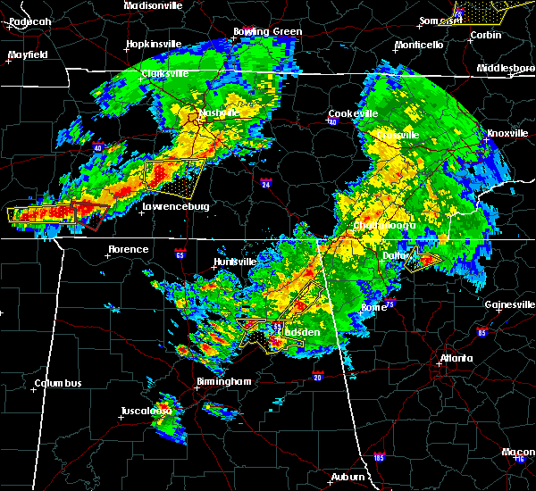 At 707 pm cdt, a severe thunderstorm was located 7 miles north of sand rock, or 7 miles south of fort payne, moving northeast at 40 mph (radar indicated). Hazards include 60 mph wind gusts and quarter size hail. Hail damage to vehicles is expected. expect wind damage to roofs, siding, and trees. Locations impacted include, fort payne, little river canyon national preserve, little river falls, valley head, hammondville, pine ridge, collbran, dog town, little river canyon np and lebanon. At 707 pm cdt, a severe thunderstorm was located 7 miles north of sand rock, or 7 miles south of fort payne, moving northeast at 40 mph (radar indicated). Hazards include 60 mph wind gusts and quarter size hail. Hail damage to vehicles is expected. expect wind damage to roofs, siding, and trees. Locations impacted include, fort payne, little river canyon national preserve, little river falls, valley head, hammondville, pine ridge, collbran, dog town, little river canyon np and lebanon.
|
| 3/27/2017 6:47 PM CDT |
 At 647 pm cdt, a severe thunderstorm was located over tabor road, or 13 miles west of centre, moving northeast at 40 mph (radar indicated). Hazards include 60 mph wind gusts and quarter size hail. Hail damage to vehicles is expected. Expect wind damage to roofs, siding, and trees. At 647 pm cdt, a severe thunderstorm was located over tabor road, or 13 miles west of centre, moving northeast at 40 mph (radar indicated). Hazards include 60 mph wind gusts and quarter size hail. Hail damage to vehicles is expected. Expect wind damage to roofs, siding, and trees.
|
| 3/10/2017 1:39 AM CST |
 At 138 am cst, severe thunderstorms were located along a line extending from 9 miles northwest of plainville to near boaz, moving east at 45 mph (radar indicated). Hazards include 60 mph wind gusts and quarter size hail. Hail damage to vehicles is expected. expect wind damage to roofs, siding, and trees. Locations impacted include, albertville, fort payne, boaz, guntersville, arab, rainsville, little river canyon national preserve, henagar, collinsville and crossville. At 138 am cst, severe thunderstorms were located along a line extending from 9 miles northwest of plainville to near boaz, moving east at 45 mph (radar indicated). Hazards include 60 mph wind gusts and quarter size hail. Hail damage to vehicles is expected. expect wind damage to roofs, siding, and trees. Locations impacted include, albertville, fort payne, boaz, guntersville, arab, rainsville, little river canyon national preserve, henagar, collinsville and crossville.
|
| 3/10/2017 1:29 AM CST |
 At 128 am cst, severe thunderstorms were located along a line extending from near trion to near albertville, moving east at 45 mph (radar indicated). Hazards include 60 mph wind gusts and quarter size hail. Hail damage to vehicles is expected. expect wind damage to roofs, siding, and trees. Locations impacted include, albertville, scottsboro, fort payne, boaz, guntersville, arab, rainsville, little river canyon national preserve, henagar and collinsville. At 128 am cst, severe thunderstorms were located along a line extending from near trion to near albertville, moving east at 45 mph (radar indicated). Hazards include 60 mph wind gusts and quarter size hail. Hail damage to vehicles is expected. expect wind damage to roofs, siding, and trees. Locations impacted include, albertville, scottsboro, fort payne, boaz, guntersville, arab, rainsville, little river canyon national preserve, henagar and collinsville.
|
| 3/10/2017 1:14 AM CST |
 At 114 am cst, severe thunderstorms were located along a line extending from 10 miles northwest of trion to near arab, moving east at 65 mph (radar indicated). Hazards include 60 mph wind gusts and quarter size hail. Hail damage to vehicles is expected. Expect wind damage to roofs, siding, and trees. At 114 am cst, severe thunderstorms were located along a line extending from 10 miles northwest of trion to near arab, moving east at 65 mph (radar indicated). Hazards include 60 mph wind gusts and quarter size hail. Hail damage to vehicles is expected. Expect wind damage to roofs, siding, and trees.
|
| 3/10/2017 12:27 AM CST |
 At 1227 am cst, severe thunderstorms were located along a line extending from near sewanee to triana, moving southeast at 40 mph (radar indicated). Hazards include 60 mph wind gusts and quarter size hail. Hail damage to vehicles is expected. Expect wind damage to roofs, siding, and trees. At 1227 am cst, severe thunderstorms were located along a line extending from near sewanee to triana, moving southeast at 40 mph (radar indicated). Hazards include 60 mph wind gusts and quarter size hail. Hail damage to vehicles is expected. Expect wind damage to roofs, siding, and trees.
|
| 3/1/2017 3:20 PM CST |
 The severe thunderstorm warning for south central jackson and central dekalb counties will expire at 330 pm cst, the storm which prompted the warning has moved out of the area. therefore, the warning will be allowed to expire. however heavy rain is still possible with this thunderstorm. a tornado watch remains in effect until 600 pm cst for north central and northeastern alabama. The severe thunderstorm warning for south central jackson and central dekalb counties will expire at 330 pm cst, the storm which prompted the warning has moved out of the area. therefore, the warning will be allowed to expire. however heavy rain is still possible with this thunderstorm. a tornado watch remains in effect until 600 pm cst for north central and northeastern alabama.
|
| 3/1/2017 2:55 PM CST |
 At 250 pm cst, a severe thunderstorm was located over fyffe, or near rainsville, moving east at 60 mph (emergency management. this storm produced damaging winds and golf ball size hail earlier in northern marshall county, north of the guntersville area). Hazards include ping pong ball size hail and 60 mph wind gusts. People and animals outdoors will be injured. expect hail damage to roofs, siding, windows, and vehicles. expect wind damage to roofs, siding, and trees. locations impacted include, fort payne, rainsville, little river canyon national preserve, henagar, sylvania, fyffe, powell, geraldine, section and little river falls. A tornado watch remains in effect until 600 pm cst for north central and northeastern alabama. At 250 pm cst, a severe thunderstorm was located over fyffe, or near rainsville, moving east at 60 mph (emergency management. this storm produced damaging winds and golf ball size hail earlier in northern marshall county, north of the guntersville area). Hazards include ping pong ball size hail and 60 mph wind gusts. People and animals outdoors will be injured. expect hail damage to roofs, siding, windows, and vehicles. expect wind damage to roofs, siding, and trees. locations impacted include, fort payne, rainsville, little river canyon national preserve, henagar, sylvania, fyffe, powell, geraldine, section and little river falls. A tornado watch remains in effect until 600 pm cst for north central and northeastern alabama.
|
| 3/1/2017 2:40 PM CST |
 At 238 pm cst, a severe thunderstorm was located 8 miles southeast of grant, or 11 miles northeast of guntersville, moving east at 60 mph (emergency management. at 230 pm, golf ball size hail was repoted in northeastern marshall county). Hazards include ping pong ball size hail and 60 mph wind gusts. People and animals outdoors will be injured. expect hail damage to roofs, siding, windows, and vehicles. Expect wind damage to roofs, siding, and trees. At 238 pm cst, a severe thunderstorm was located 8 miles southeast of grant, or 11 miles northeast of guntersville, moving east at 60 mph (emergency management. at 230 pm, golf ball size hail was repoted in northeastern marshall county). Hazards include ping pong ball size hail and 60 mph wind gusts. People and animals outdoors will be injured. expect hail damage to roofs, siding, windows, and vehicles. Expect wind damage to roofs, siding, and trees.
|
| 6/15/2016 7:34 PM CDT |
 At 733 pm cdt, a severe thunderstorm was located near little river canyon national preserve, moving southeast at 30 mph (radar indicated). Hazards include 60 mph wind gusts. Expect damage to roofs. siding. and trees. Locations impacted include, albertville, fort payne, boaz, guntersville, rainsville, little river canyon national preserve, henagar, collinsville, crossville and sylvania. At 733 pm cdt, a severe thunderstorm was located near little river canyon national preserve, moving southeast at 30 mph (radar indicated). Hazards include 60 mph wind gusts. Expect damage to roofs. siding. and trees. Locations impacted include, albertville, fort payne, boaz, guntersville, rainsville, little river canyon national preserve, henagar, collinsville, crossville and sylvania.
|
| 6/15/2016 7:26 PM CDT |
 At 725 pm cdt, a severe thunderstorm was located over fort payne, moving southeast at 30 mph (radar indicated). Hazards include 60 mph wind gusts. Expect damage to roofs. siding. and trees. Locations impacted include, albertville, fort payne, boaz, guntersville, rainsville, little river canyon national preserve, henagar, collinsville, crossville and sylvania. At 725 pm cdt, a severe thunderstorm was located over fort payne, moving southeast at 30 mph (radar indicated). Hazards include 60 mph wind gusts. Expect damage to roofs. siding. and trees. Locations impacted include, albertville, fort payne, boaz, guntersville, rainsville, little river canyon national preserve, henagar, collinsville, crossville and sylvania.
|
| 6/15/2016 7:11 PM CDT |
 At 710 pm cdt, a severe thunderstorm was located over sylvania, or over rainsville, moving southeast at 30 mph (radar indicated). Hazards include 60 mph wind gusts. Expect damage to roofs. siding. And trees. At 710 pm cdt, a severe thunderstorm was located over sylvania, or over rainsville, moving southeast at 30 mph (radar indicated). Hazards include 60 mph wind gusts. Expect damage to roofs. siding. And trees.
|
| 7/14/2015 8:12 PM CDT | The severe thunderstorm warning for southern dekalb county will expire at 815 pm cdt, the storms which prompted the warning have moved out of the area. therefore the warning will be allowed to expire. |
| 7/14/2015 8:02 PM CDT |
 At 802 pm cdt, severe thunderstorms were located along a line extending from near fort payne to near collinsville to near tabor road, moving east at 40 mph (trained weather spotters). Hazards include 60 mph wind gusts. Expect damage to roofs. siding and trees. Locations impacted include, fort payne, rainsville, little river canyon national preserve, collinsville, crossville, little river falls, valley head, pine ridge, skirum and kilpatrick. At 802 pm cdt, severe thunderstorms were located along a line extending from near fort payne to near collinsville to near tabor road, moving east at 40 mph (trained weather spotters). Hazards include 60 mph wind gusts. Expect damage to roofs. siding and trees. Locations impacted include, fort payne, rainsville, little river canyon national preserve, collinsville, crossville, little river falls, valley head, pine ridge, skirum and kilpatrick.
|
| 7/14/2015 7:47 PM CDT |
 At 747 pm cdt, severe thunderstorms were located along a line extending from near fyffe to near crossville to near sardis city, moving southeast at 40 mph (trained weather spotters). Hazards include 60 mph wind gusts. Expect damage to roofs. siding and trees. Locations impacted include, albertville, fort payne, boaz, rainsville, little river canyon national preserve, henagar, collinsville, crossville, sylvania and fyffe. At 747 pm cdt, severe thunderstorms were located along a line extending from near fyffe to near crossville to near sardis city, moving southeast at 40 mph (trained weather spotters). Hazards include 60 mph wind gusts. Expect damage to roofs. siding and trees. Locations impacted include, albertville, fort payne, boaz, rainsville, little river canyon national preserve, henagar, collinsville, crossville, sylvania and fyffe.
|
| 7/14/2015 7:36 PM CDT |
 At 735 pm cdt, severe thunderstorms were located along a line extending from near powell to geraldine to near albertville, moving east at 40 mph (radar indicated). Hazards include 60 mph wind gusts. Expect damage to roofs. Siding and trees. At 735 pm cdt, severe thunderstorms were located along a line extending from near powell to geraldine to near albertville, moving east at 40 mph (radar indicated). Hazards include 60 mph wind gusts. Expect damage to roofs. Siding and trees.
|
| 7/14/2015 7:01 PM CDT |
 At 700 pm cdt, a severe thunderstorm was located near fort payne, moving south at 20 mph (radar indicated). Hazards include 60 mph wind gusts. Expect damage to roofs. siding and trees. Locations impacted include, fort payne, rainsville, little river canyon national preserve, sylvania, fyffe, powell, little river falls, valley head, hammondville and mentone. At 700 pm cdt, a severe thunderstorm was located near fort payne, moving south at 20 mph (radar indicated). Hazards include 60 mph wind gusts. Expect damage to roofs. siding and trees. Locations impacted include, fort payne, rainsville, little river canyon national preserve, sylvania, fyffe, powell, little river falls, valley head, hammondville and mentone.
|
| 7/14/2015 6:38 PM CDT |
 At 637 pm cdt, a severe thunderstorm was located near henagar, or 10 miles north of fort payne, moving south at 20 mph (radar indicated). Hazards include 60 mph wind gusts. Expect damage to roofs. Siding and trees. At 637 pm cdt, a severe thunderstorm was located near henagar, or 10 miles north of fort payne, moving south at 20 mph (radar indicated). Hazards include 60 mph wind gusts. Expect damage to roofs. Siding and trees.
|
| 6/26/2015 4:09 PM CDT | At 408 pm cdt, a severe thunderstorm was located near sylvania, or near rainsville, moving northeast at 5 mph (radar indicated). Hazards include 60 mph wind gusts and quarter size hail. Hail damage to vehicles is expected. expect wind damage to roofs, siding and trees. Locations impacted include, fort payne, rainsville, henagar, sylvania, little river falls, valley head, hammondville, pine ridge, desoto state park and little river canyon np. |
| 6/26/2015 3:48 PM CDT | At 348 pm cdt, a severe thunderstorm was located near fort payne, moving northeast at 10 mph (radar indicated). Hazards include 60 mph wind gusts and quarter size hail. Hail damage to vehicles is expected. Expect wind damage to roofs, siding and trees. |
| 6/26/2015 3:00 PM CDT | At 300 pm cdt, a severe thunderstorm was located near fort payne, moving northeast at 10 mph (radar indicated). Hazards include 60 mph wind gusts and quarter size hail. Hail damage to vehicles is expected. Expect wind damage to roofs, siding and trees. |
| 6/10/2015 3:46 PM CDT |
 At 346 pm cdt, a severe thunderstorm was located over rainsville, and is nearly stationary. at 340 pm, a trained spotter reported pea sized hail and strong winds in rainsville (radar indicated). Hazards include 60 mph wind gusts and penny size hail. Expect damage to roofs. siding and trees. Locations impacted include, fort payne, rainsville, henagar, sylvania, fyffe, powell, section, ider, dutton and pine ridge. At 346 pm cdt, a severe thunderstorm was located over rainsville, and is nearly stationary. at 340 pm, a trained spotter reported pea sized hail and strong winds in rainsville (radar indicated). Hazards include 60 mph wind gusts and penny size hail. Expect damage to roofs. siding and trees. Locations impacted include, fort payne, rainsville, henagar, sylvania, fyffe, powell, section, ider, dutton and pine ridge.
|
| 6/10/2015 3:32 PM CDT |
 At 332 pm cdt, a severe thunderstorm was located over rainsville, and is nearly stationary (radar indicated). Hazards include 60 mph wind gusts and nickel size hail. Expect damage to roofs. Siding and trees. At 332 pm cdt, a severe thunderstorm was located over rainsville, and is nearly stationary (radar indicated). Hazards include 60 mph wind gusts and nickel size hail. Expect damage to roofs. Siding and trees.
|
| 4/22/2015 7:25 PM CDT | The severe thunderstorm warning for southeastern dekalb county will expire at 730 pm cdt, the storm which prompted the warning has weakened below severe limits, and no longer pose an immediate threat to life or property. therefore the warning will be allowed to expire. however heavy rain is still possible with this thunderstorm. |
| 4/22/2015 7:17 PM CDT | At 715 pm cdt, a severe thunderstorm was located between fort payne and geraldine, moving east at 40 mph (trained weather spotters). Hazards include 60 mph wind gusts and quarter size hail. quarter size hail has been reported in rainsville. Hail damage to vehicles is expected. expect wind damage to roofs, siding and trees. locations impacted include, fort payne, rainsville, little river canyon national preserve, fyffe, little river falls, pine ridge, shiloh, little river canyon np, lebanon and peeks corner. 1. 00in. |
| 4/22/2015 7:01 PM CDT | At 700 pm cdt, a severe thunderstorm was located over rainsville, moving east at 40 mph (radar indicated). Hazards include 60 mph wind gusts and quarter size hail. Hail damage to vehicles is expected. expect wind damage to roofs, siding and trees. locations impacted include, fort payne, rainsville, little river canyon national preserve, sylvania, fyffe, powell, little river falls, valley head, hammondville and pine ridge. 1. 00in. |
| 4/22/2015 6:45 PM CDT | At 645 pm cdt, a severe thunderstorm was located near fyffe, or 7 miles west of rainsville, moving east at 40 mph (radar indicated). Hazards include 60 mph wind gusts and quarter size hail. Hail damage to vehicles is expected. Expect wind damage to roofs, siding and trees. |
| 4/20/2015 3:27 AM CDT | At 325 am cdt, severe thunderstorms were located along a line extending from near trenton to near collinsville, moving east at 45 mph (radar indicated). Hazards include 60 mph wind gusts. Expect damage to roofs. siding and trees. these severe storms will be near, little river canyon national preserve around 440 am edt. other locations impacted by these severe thunderstorms include skirum, peeks corner, pine ridge, lathamville, hammondville, desoto state park, lebanon, shiloh, dog town and valley head. 75in. |
| 4/20/2015 3:16 AM CDT | At 315 am cdt, severe thunderstorms were located along a line extending from near bridgeport to near collinsville, moving east at 55 mph (radar indicated). Hazards include 60 mph wind gusts. Expect damage to roofs. siding and trees. these severe storms will be near, little river canyon national preserve around 430 am edt. other locations impacted by these severe thunderstorms include skirum, lakeview, hammondville, fabius, kilpatrick, lebanon, shiloh, valley head, bass and higdon. 75in. |
| 4/20/2015 2:54 AM CDT | At 253 am cdt, severe thunderstorms were located along a line extending from near stevenson to 9 miles northwest of geraldine, moving east at 50 mph (radar indicated). Hazards include 60 mph wind gusts. Expect damage to roofs. siding and trees. severe thunderstorms will be near, stevenson around 300 am cdt. bridgeport around 305 am cdt. powell around 310 am cdt. rainsville around 315 am cdt. fort payne and little river canyon national preserve around 325 am cdt. other locations impacted by these severe thunderstorms include skirum, lakeview, hammondville, fabius, kilpatrick, lebanon, shiloh, valley head, bass and higdon. 75in. |
| 4/3/2015 9:53 PM CDT | The severe thunderstorm warning for southeastern dekalb county will expire at 1000 pm cdt. the storms which prompted the warning have moved out of the area. Therefore the warning will be allowed to expire. |
| 4/3/2015 9:43 PM CDT | A severe thunderstorm warning remains in effect until 1000 pm cdt for southeastern dekalb county. at 943 pm cdt. severe thunderstorms were located along a line extending from 8 miles northwest of summerville to 7 miles southeast of fyffe. moving east at 45 mph. hazard. 70 mph wind gusts and quarter size hail. |
| 4/3/2015 9:36 PM CDT | A severe thunderstorm warning remains in effect until 1000 pm cdt for dekalb county. at 935 pm cdt. severe thunderstorms were located along a line extending from 10 miles southeast of ider to near fyffe. moving east at 45 mph. hazard. 70 mph wind gusts and quarter size hail. |
| 4/3/2015 9:26 PM CDT | The national weather service in huntsville has issued a * severe thunderstorm warning for. dekalb county in northeastern alabama. until 1000 pm cdt * at 926 pm cdt. severe thunderstorms were located along a line extending from near henagar to near geraldine. Moving east at 45. |
| 4/3/2015 9:15 PM CDT | A severe thunderstorm warning remains in effect until 930 pm cdt for southern dekalb. south central jackson and northeastern marshall counties. at 914 pm cdt. severe thunderstorms were located along a line extending from near henagar to near guntersville. Moving east at 55 mph. |
| 4/3/2015 8:54 PM CDT | The national weather service in huntsville has issued a * severe thunderstorm warning for. southeastern madison county in north central alabama. southern dekalb county in northeastern alabama. southwestern jackson county in northeastern alabama. Northeastern marshall county in northeastern alabama. |
| 3/31/2015 9:40 PM CDT | The severe thunderstorm warning for southeastern dekalb county will expire at 945 pm cdt. the storm which prompted the warning is moving out of dekalb county. therefore the warning will be allowed to expire. However small hail is still possible with several thunderstorms across the county. |
| 3/31/2015 9:21 PM CDT | A severe thunderstorm warning remains in effect until 945 pm cdt for southeastern dekalb county. at 921 pm cdt. doppler radar indicated a severe thunderstorm capable of producing quarter size hail and damaging winds in excess of 60 mph. this storm was located over fort payne. Moving southeast at 25 mph. |
| 3/31/2015 9:04 PM CDT | The national weather service in huntsville has issued a * severe thunderstorm warning for. central dekalb county in northeastern alabama. until 945 pm cdt * at 904 pm cdt. Doppler radar indicated a severe thunderstorm capable of producing quarter size hail and damaging winds in excess. |
| 3/31/2015 8:54 PM CDT | The severe thunderstorm warning for central dekalb county will expire at 900 pm cdt. the storm which prompted the warning has moved out of the area. therefore the warning will be allowed to expire. a significant weather advisory has been issued on the storm as it exits dekalb county. Winds up to 40 mph and nickel size hail are still possible. |
| 3/31/2015 8:43 PM CDT | A severe thunderstorm warning remains in effect until 900 pm cdt for central dekalb county. at 842 pm cdt. doppler radar indicated a severe thunderstorm capable of producing half dollar size hail and damaging winds in excess of 60 mph. this storm was located near fyffe. or near rainsville. Moving southeast at 25 mph. |
| 3/31/2015 8:07 PM CDT | The national weather service in huntsville has issued a * severe thunderstorm warning for. southwestern dekalb county in northeastern alabama. south central jackson county in northeastern alabama. until 900 pm cdt * at 807 pm cdt. Doppler radar indicated a severe thunderstorm. |
| 1/1/0001 12:00 AM | Trees down on county road 88 at pine ridge. timing based on rada in dekalb county AL, 1.6 miles NNE of Pine Ridge, AL |
Hail Maps for Pine Ridge, AL


Connect with Interactive Hail Maps