

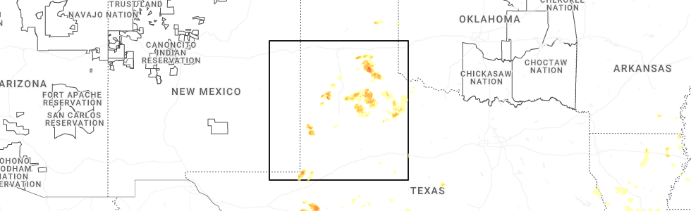
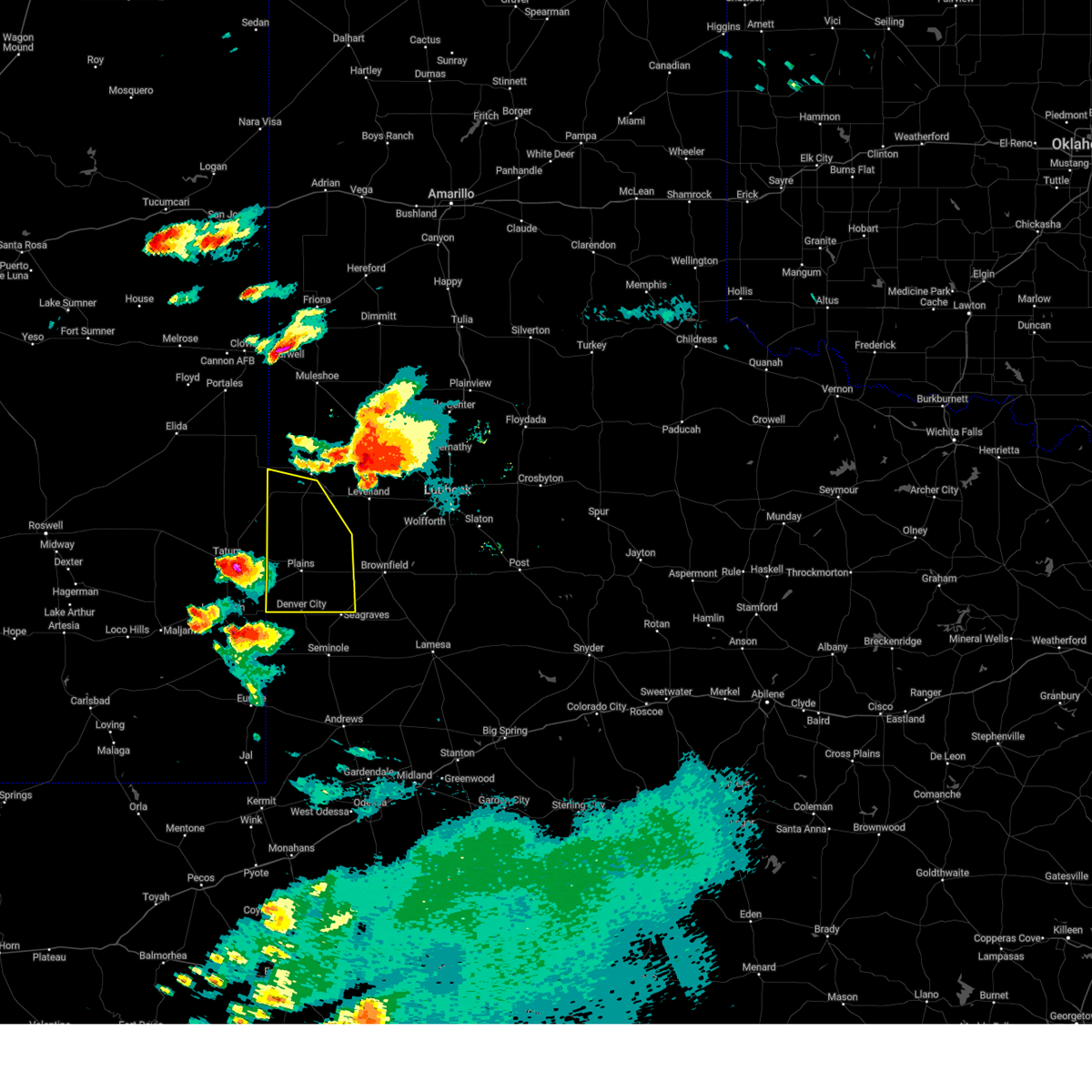
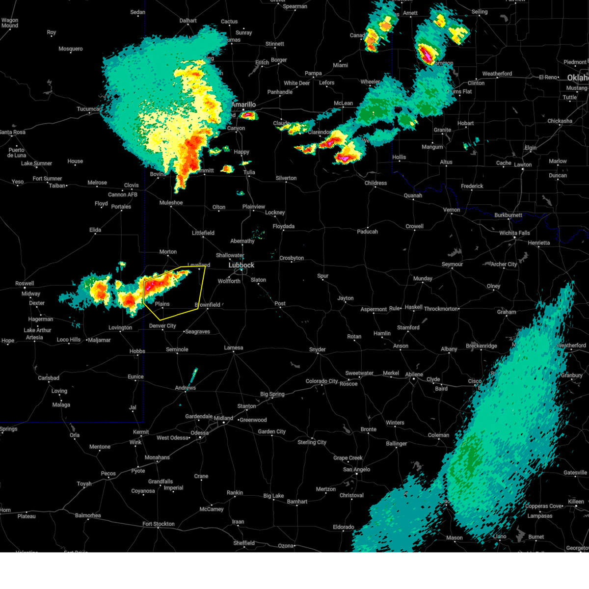
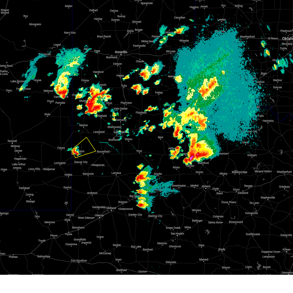
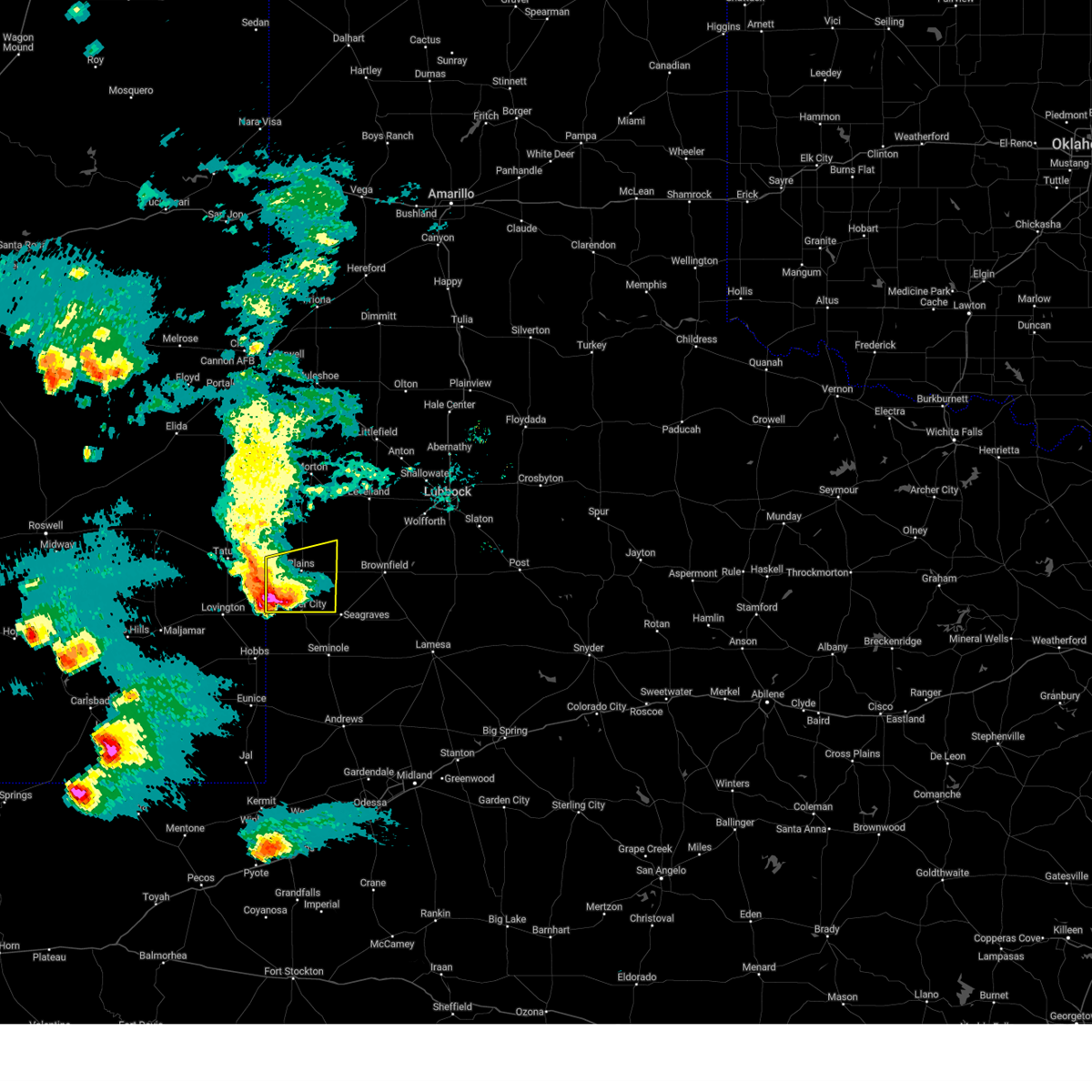
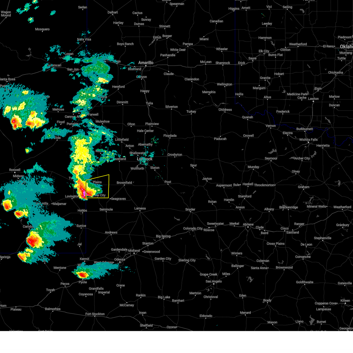
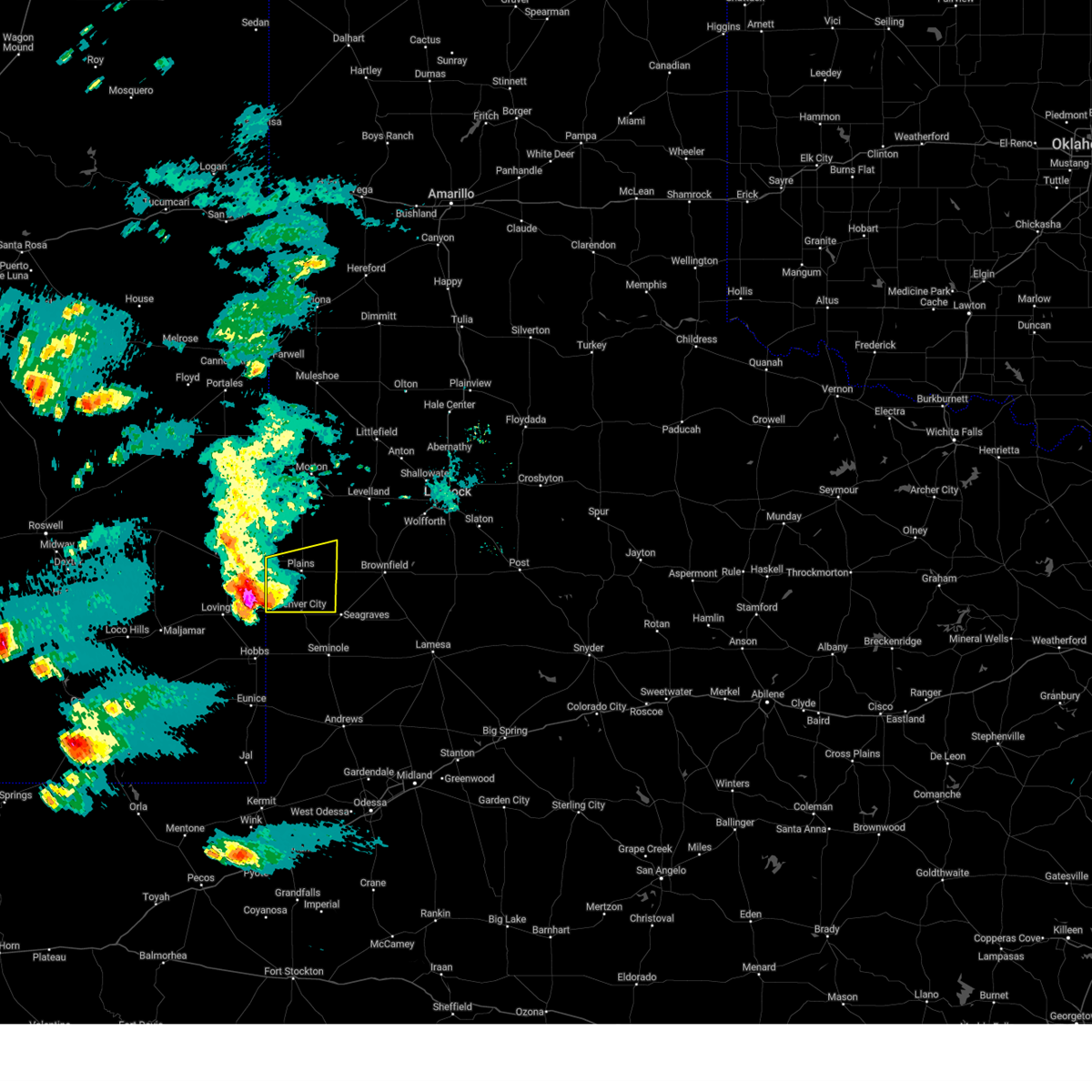
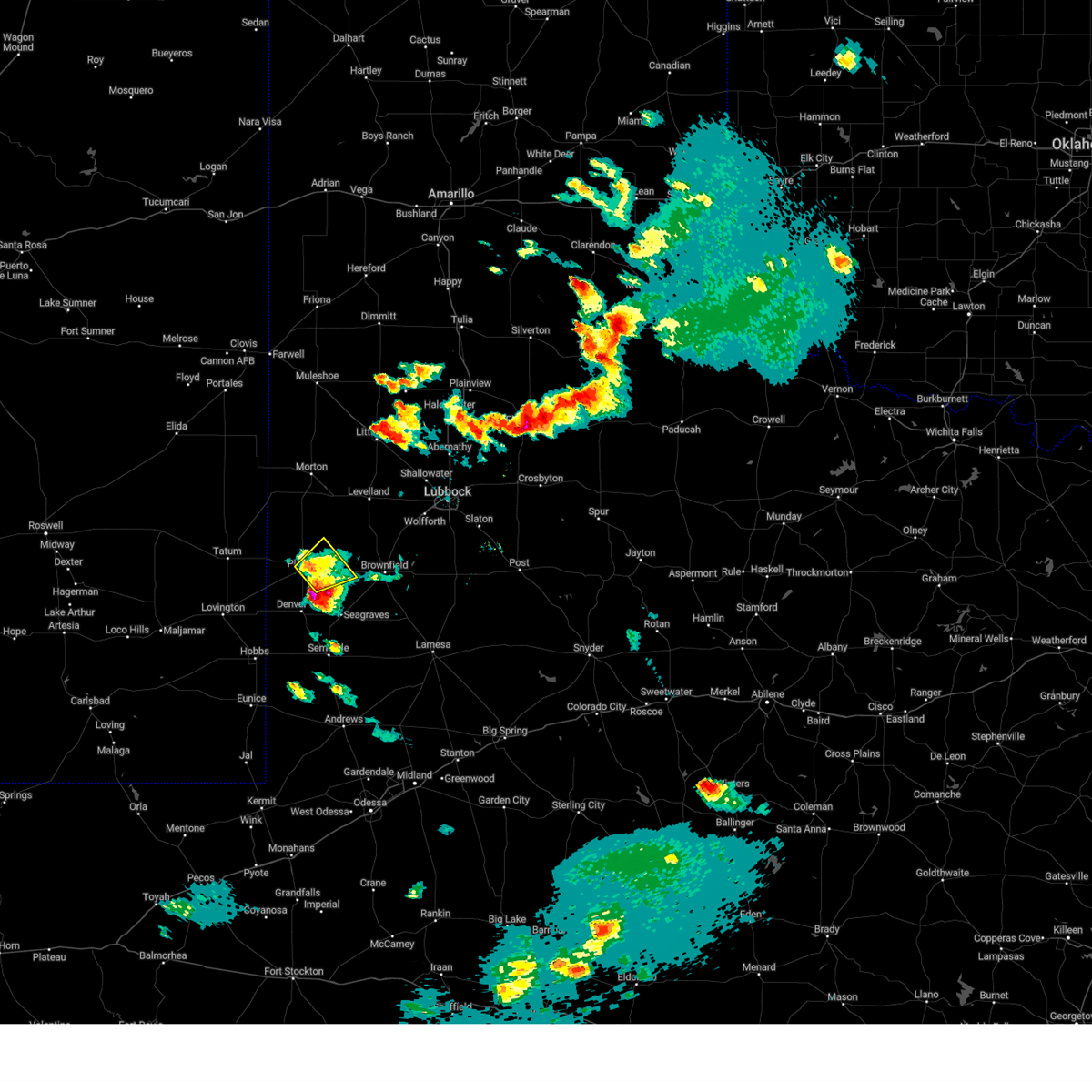
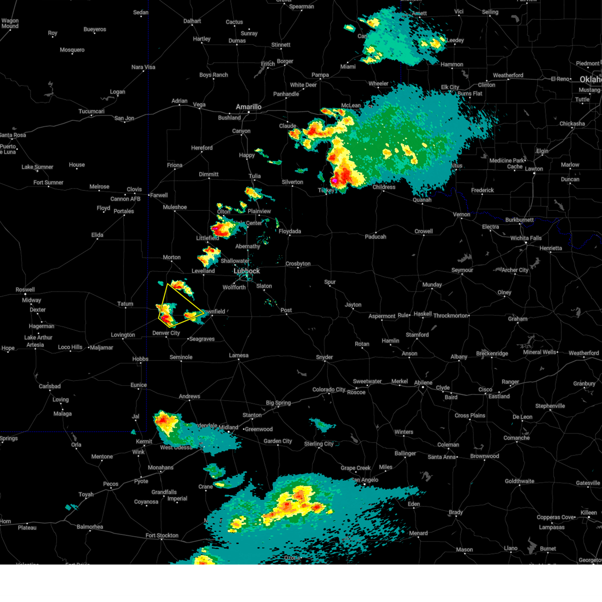
Hail Map for Plains, TX
The Plains, TX area has had 19 reports of on-the-ground hail by trained spotters, and has been under severe weather warnings 28 times during the past 12 months. Doppler radar has detected hail at or near Plains, TX on 72 occasions, including 6 occasions during the past year.
| Name: | Plains, TX |
| Where Located: | 62.6 miles WSW of Lubbock, TX |
| Map: | Google Map for Plains, TX |
| Population: | 1481 |
| Housing Units: | 588 |
| More Info: | Search Google for Plains, TX |
2
The Top Recent Hail Date for Plains, TX is Tuesday, April 22, 2025 (5th out of 72)
Hail and Wind Damage Spotted near Plains, TX
| Date / Time | Report Details |
|---|---|
| 6/13/2025 9:52 PM CDT |
 At 951 pm cdt, severe thunderstorms were located along a line extending from 11 miles southwest of slide to denver city, moving southeast at 35 mph (radar indicated). Hazards include 70 mph wind gusts. Expect considerable tree damage. damage is likely to mobile homes, roofs, and outbuildings. Locations impacted include, brownfield, denver city, tahoka, plains, o'donnell, locketville, new moore, tokio, meadow, new home, and wellman. At 951 pm cdt, severe thunderstorms were located along a line extending from 11 miles southwest of slide to denver city, moving southeast at 35 mph (radar indicated). Hazards include 70 mph wind gusts. Expect considerable tree damage. damage is likely to mobile homes, roofs, and outbuildings. Locations impacted include, brownfield, denver city, tahoka, plains, o'donnell, locketville, new moore, tokio, meadow, new home, and wellman.
|
| 6/13/2025 9:52 PM CDT |
 the severe thunderstorm warning has been cancelled and is no longer in effect the severe thunderstorm warning has been cancelled and is no longer in effect
|
| 6/13/2025 9:35 PM CDT |
 At 935 pm cdt, severe thunderstorms were located along a line extending from 7 miles southwest of reese center to 4 miles south of locketville to 8 miles west of denver city, moving southeast at 40 mph (radar indicated). Hazards include 70 mph wind gusts. Expect considerable tree damage. damage is likely to mobile homes, roofs, and outbuildings. Locations impacted include, lubbock, brownfield, denver city, tahoka, plains, wolfforth, o'donnell, new moore, tokio, locketville, slide, meadow, wilson, smyer, ropesville, new home, and wellman. At 935 pm cdt, severe thunderstorms were located along a line extending from 7 miles southwest of reese center to 4 miles south of locketville to 8 miles west of denver city, moving southeast at 40 mph (radar indicated). Hazards include 70 mph wind gusts. Expect considerable tree damage. damage is likely to mobile homes, roofs, and outbuildings. Locations impacted include, lubbock, brownfield, denver city, tahoka, plains, wolfforth, o'donnell, new moore, tokio, locketville, slide, meadow, wilson, smyer, ropesville, new home, and wellman.
|
| 6/13/2025 9:15 PM CDT |
 Svrlub the national weather service in lubbock texas has issued a * severe thunderstorm warning for, southwestern lubbock county in northwestern texas, lynn county in northwestern texas, terry county in northwestern texas, southeastern hockley county in northwestern texas, yoakum county in northwestern texas, * until 1015 pm cdt. * at 915 pm cdt, severe thunderstorms were located along a line extending from 6 miles southeast of whitharral to 5 miles southeast of sundown to 15 miles southeast of mcdonald, moving southeast at 40 mph (radar indicated). Hazards include 70 mph wind gusts. Expect considerable tree damage. Damage is likely to mobile homes, roofs, and outbuildings. Svrlub the national weather service in lubbock texas has issued a * severe thunderstorm warning for, southwestern lubbock county in northwestern texas, lynn county in northwestern texas, terry county in northwestern texas, southeastern hockley county in northwestern texas, yoakum county in northwestern texas, * until 1015 pm cdt. * at 915 pm cdt, severe thunderstorms were located along a line extending from 6 miles southeast of whitharral to 5 miles southeast of sundown to 15 miles southeast of mcdonald, moving southeast at 40 mph (radar indicated). Hazards include 70 mph wind gusts. Expect considerable tree damage. Damage is likely to mobile homes, roofs, and outbuildings.
|
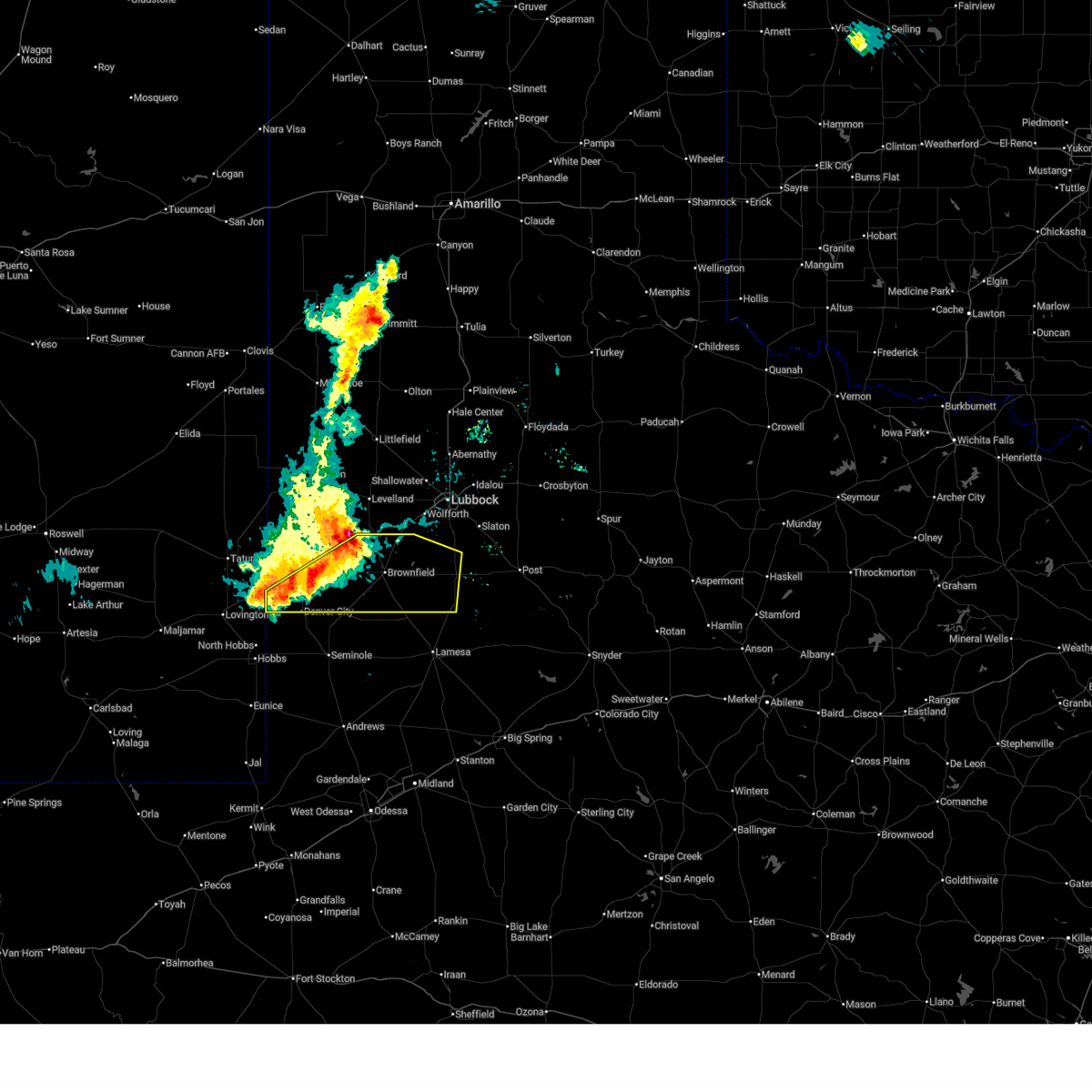
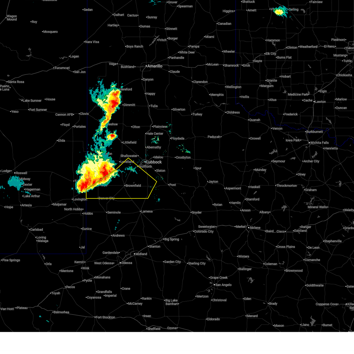
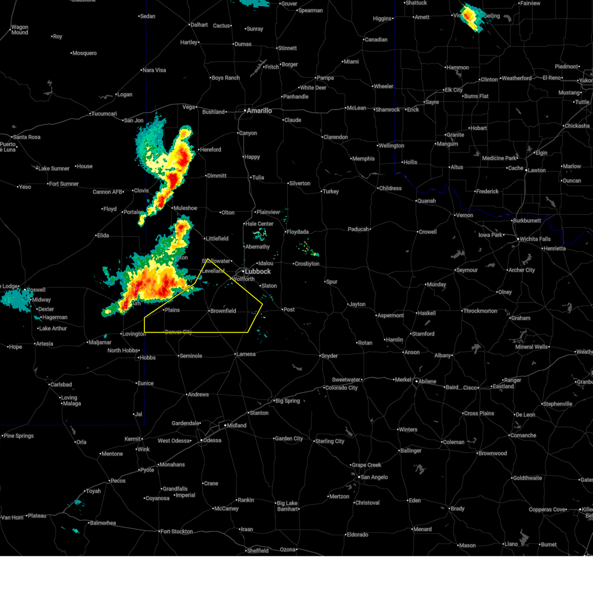
| 6/13/2025 9:07 PM CDT | Storm damage reported in yoakum county TX, 2.9 miles SSE of Plains, TX |
| 6/5/2025 6:58 PM CDT | At 658 pm cdt, a severe thunderstorm was located 12 miles south of bledsoe, or 19 miles northwest of plains, moving northeast at 45 mph (radar indicated). Hazards include 70 mph wind gusts and ping pong ball size hail. People and animals outdoors will be injured. expect hail damage to roofs, siding, windows, and vehicles. expect considerable tree damage. wind damage is also likely to mobile homes, roofs, and outbuildings. Locations impacted include, denver city, plains, bronco, lehman, tokio, and bledsoe. |
| 6/5/2025 6:44 PM CDT |
 Svrlub the national weather service in lubbock texas has issued a * severe thunderstorm warning for, cochran county in northwestern texas, western terry county in northwestern texas, southwestern hockley county in northwestern texas, yoakum county in northwestern texas, * until 745 pm cdt. * at 644 pm cdt, a severe thunderstorm was located 5 miles northwest of bronco, or 12 miles east of tatum, moving northeast at 50 mph (radar indicated). Hazards include 70 mph wind gusts and quarter size hail. Hail damage to vehicles is expected. expect considerable tree damage. Wind damage is also likely to mobile homes, roofs, and outbuildings. Svrlub the national weather service in lubbock texas has issued a * severe thunderstorm warning for, cochran county in northwestern texas, western terry county in northwestern texas, southwestern hockley county in northwestern texas, yoakum county in northwestern texas, * until 745 pm cdt. * at 644 pm cdt, a severe thunderstorm was located 5 miles northwest of bronco, or 12 miles east of tatum, moving northeast at 50 mph (radar indicated). Hazards include 70 mph wind gusts and quarter size hail. Hail damage to vehicles is expected. expect considerable tree damage. Wind damage is also likely to mobile homes, roofs, and outbuildings.
|
| 5/26/2025 9:37 PM CDT | At 936 pm cdt, severe thunderstorms were located along a line extending from 9 miles northwest of tokio to 5 miles southeast of plains to 10 miles north of denver city, moving southeast at 35 mph (radar indicated). Hazards include 60 mph wind gusts and half dollar size hail. Hail damage to vehicles is expected. expect wind damage to roofs, siding, and trees. Locations impacted include, plains and tokio. |
| 5/26/2025 9:37 PM CDT | the severe thunderstorm warning has been cancelled and is no longer in effect |
| 5/26/2025 9:34 PM CDT | At 934 pm cdt, a severe thunderstorm capable of producing a tornado was located 5 miles east of plains, moving southeast at 30 mph (radar indicated rotation). Hazards include tornado and half dollar size hail. Flying debris will be dangerous to those caught without shelter. mobile homes will be damaged or destroyed. damage to roofs, windows, and vehicles will occur. tree damage is likely. This tornadic thunderstorm will remain over mainly rural areas of west central terry and eastern yoakum counties. |
| 5/26/2025 9:30 PM CDT | Yoakum so reports power outages in plains due to thunderstorm wind in yoakum county TX, 0.2 miles E of Plains, TX |
| 5/26/2025 9:27 PM CDT |
 At 927 pm cdt, severe thunderstorms were located along a line extending from 8 miles southwest of sundown to 9 miles northeast of plains to 4 miles south of bronco, moving southeast at 30 mph (radar indicated). Hazards include 60 mph wind gusts and half dollar size hail. Hail damage to vehicles is expected. expect wind damage to roofs, siding, and trees. Locations impacted include, plains, sundown, and tokio. At 927 pm cdt, severe thunderstorms were located along a line extending from 8 miles southwest of sundown to 9 miles northeast of plains to 4 miles south of bronco, moving southeast at 30 mph (radar indicated). Hazards include 60 mph wind gusts and half dollar size hail. Hail damage to vehicles is expected. expect wind damage to roofs, siding, and trees. Locations impacted include, plains, sundown, and tokio.
|
| 5/26/2025 9:26 PM CDT |
 Torlub the national weather service in lubbock texas has issued a * tornado warning for, west central terry county in northwestern texas, eastern yoakum county in northwestern texas, * until 1000 pm cdt. * at 926 pm cdt, a severe thunderstorm capable of producing a tornado was located near plains, moving southeast at 30 mph (radar indicated rotation). Hazards include tornado and half dollar size hail. Flying debris will be dangerous to those caught without shelter. mobile homes will be damaged or destroyed. damage to roofs, windows, and vehicles will occur. tree damage is likely. This dangerous storm will be near, plains around 930 pm cdt. Torlub the national weather service in lubbock texas has issued a * tornado warning for, west central terry county in northwestern texas, eastern yoakum county in northwestern texas, * until 1000 pm cdt. * at 926 pm cdt, a severe thunderstorm capable of producing a tornado was located near plains, moving southeast at 30 mph (radar indicated rotation). Hazards include tornado and half dollar size hail. Flying debris will be dangerous to those caught without shelter. mobile homes will be damaged or destroyed. damage to roofs, windows, and vehicles will occur. tree damage is likely. This dangerous storm will be near, plains around 930 pm cdt.
|
| 5/26/2025 9:17 PM CDT |
 At 916 pm cdt, severe thunderstorms were located along a line extending from 5 miles north of sundown to 10 miles north of plains to near bronco, moving southeast at 35 mph (radar indicated). Hazards include 60 mph wind gusts and quarter size hail. Hail damage to vehicles is expected. expect wind damage to roofs, siding, and trees. Locations impacted include, levelland, plains, sundown, bronco, tokio, whiteface, and opdyke west. At 916 pm cdt, severe thunderstorms were located along a line extending from 5 miles north of sundown to 10 miles north of plains to near bronco, moving southeast at 35 mph (radar indicated). Hazards include 60 mph wind gusts and quarter size hail. Hail damage to vehicles is expected. expect wind damage to roofs, siding, and trees. Locations impacted include, levelland, plains, sundown, bronco, tokio, whiteface, and opdyke west.
|
| 5/26/2025 9:13 PM CDT |
 At 913 pm cdt, severe thunderstorms were located along a line extending from 6 miles northwest of sundown to 10 miles north of plains to 3 miles west of bronco, moving southeast at 20 mph (radar indicated). Hazards include 60 mph wind gusts and quarter size hail. Hail damage to vehicles is expected. expect wind damage to roofs, siding, and trees. Locations impacted include, levelland, plains, sundown, bronco, tokio, whiteface, and opdyke west. At 913 pm cdt, severe thunderstorms were located along a line extending from 6 miles northwest of sundown to 10 miles north of plains to 3 miles west of bronco, moving southeast at 20 mph (radar indicated). Hazards include 60 mph wind gusts and quarter size hail. Hail damage to vehicles is expected. expect wind damage to roofs, siding, and trees. Locations impacted include, levelland, plains, sundown, bronco, tokio, whiteface, and opdyke west.
|
| 5/26/2025 9:01 PM CDT |
 At 901 pm cdt, severe thunderstorms were located along a line extending from 7 miles north of sundown to 12 miles north of plains to near bronco, moving southeast at 20 mph (radar indicated). Hazards include 60 mph wind gusts and half dollar size hail. Hail damage to vehicles is expected. expect wind damage to roofs, siding, and trees. Locations impacted include, levelland, plains, sundown, bronco, tokio, whiteface, and opdyke west. At 901 pm cdt, severe thunderstorms were located along a line extending from 7 miles north of sundown to 12 miles north of plains to near bronco, moving southeast at 20 mph (radar indicated). Hazards include 60 mph wind gusts and half dollar size hail. Hail damage to vehicles is expected. expect wind damage to roofs, siding, and trees. Locations impacted include, levelland, plains, sundown, bronco, tokio, whiteface, and opdyke west.
|
| 5/26/2025 8:47 PM CDT |
 At 846 pm cdt, severe thunderstorms were located along a line extending from 9 miles southeast of lehman to 15 miles north of plains to 8 miles north of bronco, moving southeast at 35 mph (radar indicated). Hazards include 60 mph wind gusts and half dollar size hail. Hail damage to vehicles is expected. expect wind damage to roofs, siding, and trees. Locations impacted include, levelland, plains, sundown, bronco, tokio, whiteface, and opdyke west. At 846 pm cdt, severe thunderstorms were located along a line extending from 9 miles southeast of lehman to 15 miles north of plains to 8 miles north of bronco, moving southeast at 35 mph (radar indicated). Hazards include 60 mph wind gusts and half dollar size hail. Hail damage to vehicles is expected. expect wind damage to roofs, siding, and trees. Locations impacted include, levelland, plains, sundown, bronco, tokio, whiteface, and opdyke west.
|
| 5/26/2025 8:39 PM CDT |
 Svrlub the national weather service in lubbock texas has issued a * severe thunderstorm warning for, southern cochran county in northwestern texas, northwestern terry county in northwestern texas, southwestern hockley county in northwestern texas, yoakum county in northwestern texas, * until 945 pm cdt. * at 839 pm cdt, severe thunderstorms were located along a line extending from 8 miles southeast of lehman to 15 miles north of plains to 9 miles north of bronco, moving southeast at 35 mph (radar indicated). Hazards include 60 mph wind gusts and quarter size hail. Hail damage to vehicles is expected. Expect wind damage to roofs, siding, and trees. Svrlub the national weather service in lubbock texas has issued a * severe thunderstorm warning for, southern cochran county in northwestern texas, northwestern terry county in northwestern texas, southwestern hockley county in northwestern texas, yoakum county in northwestern texas, * until 945 pm cdt. * at 839 pm cdt, severe thunderstorms were located along a line extending from 8 miles southeast of lehman to 15 miles north of plains to 9 miles north of bronco, moving southeast at 35 mph (radar indicated). Hazards include 60 mph wind gusts and quarter size hail. Hail damage to vehicles is expected. Expect wind damage to roofs, siding, and trees.
|
| 5/25/2025 7:41 PM CDT |
 the severe thunderstorm warning has been cancelled and is no longer in effect the severe thunderstorm warning has been cancelled and is no longer in effect
|
| 5/25/2025 7:35 PM CDT | At 735 pm cdt, a severe thunderstorm was located 5 miles north of plains, moving northeast at 25 mph (radar indicated). Hazards include 60 mph wind gusts and quarter size hail. Hail damage to vehicles is expected. expect wind damage to roofs, siding, and trees. Locations impacted include, plains. |
| 5/25/2025 7:22 PM CDT | At 721 pm cdt, a severe thunderstorm was located 4 miles northwest of plains, moving northeast at 20 mph (radar indicated). Hazards include 60 mph wind gusts and quarter size hail. Hail damage to vehicles is expected. expect wind damage to roofs, siding, and trees. Locations impacted include, plains. |
| 5/25/2025 7:14 PM CDT |
 Svrlub the national weather service in lubbock texas has issued a * severe thunderstorm warning for, southeastern cochran county in northwestern texas, northwestern terry county in northwestern texas, southwestern hockley county in northwestern texas, northern yoakum county in northwestern texas, * until 815 pm cdt. * at 714 pm cdt, a severe thunderstorm was located 6 miles southeast of bronco, or 6 miles west of plains, moving northeast at 20 mph (radar indicated). Hazards include 60 mph wind gusts and quarter size hail. Hail damage to vehicles is expected. Expect wind damage to roofs, siding, and trees. Svrlub the national weather service in lubbock texas has issued a * severe thunderstorm warning for, southeastern cochran county in northwestern texas, northwestern terry county in northwestern texas, southwestern hockley county in northwestern texas, northern yoakum county in northwestern texas, * until 815 pm cdt. * at 714 pm cdt, a severe thunderstorm was located 6 miles southeast of bronco, or 6 miles west of plains, moving northeast at 20 mph (radar indicated). Hazards include 60 mph wind gusts and quarter size hail. Hail damage to vehicles is expected. Expect wind damage to roofs, siding, and trees.
|
| 5/4/2025 6:50 PM CDT | Ping Pong Ball sized hail reported 10.3 miles N of Plains, TX |
| 5/4/2025 6:16 PM CDT |
 At 615 pm cdt, a severe thunderstorm was located 4 miles northwest of denver city, moving east at 25 mph (radar indicated). Hazards include ping pong ball size hail and 60 mph wind gusts. People and animals outdoors will be injured. expect hail damage to roofs, siding, windows, and vehicles. expect wind damage to roofs, siding, and trees. Locations impacted include, denver city, plains, and bronco. At 615 pm cdt, a severe thunderstorm was located 4 miles northwest of denver city, moving east at 25 mph (radar indicated). Hazards include ping pong ball size hail and 60 mph wind gusts. People and animals outdoors will be injured. expect hail damage to roofs, siding, windows, and vehicles. expect wind damage to roofs, siding, and trees. Locations impacted include, denver city, plains, and bronco.
|
| 5/4/2025 6:04 PM CDT |
 At 604 pm cdt, a severe thunderstorm was located 6 miles northwest of denver city, moving east at 25 mph (radar indicated). Hazards include ping pong ball size hail and 60 mph wind gusts. People and animals outdoors will be injured. expect hail damage to roofs, siding, windows, and vehicles. expect wind damage to roofs, siding, and trees. Locations impacted include, denver city, plains, and bronco. At 604 pm cdt, a severe thunderstorm was located 6 miles northwest of denver city, moving east at 25 mph (radar indicated). Hazards include ping pong ball size hail and 60 mph wind gusts. People and animals outdoors will be injured. expect hail damage to roofs, siding, windows, and vehicles. expect wind damage to roofs, siding, and trees. Locations impacted include, denver city, plains, and bronco.
|
| 5/4/2025 5:50 PM CDT |
 Svrlub the national weather service in lubbock texas has issued a * severe thunderstorm warning for, yoakum county in northwestern texas, * until 630 pm cdt. * at 549 pm cdt, a severe thunderstorm was located 11 miles west of denver city, moving east at 25 mph (radar indicated). Hazards include ping pong ball size hail and 60 mph wind gusts. People and animals outdoors will be injured. expect hail damage to roofs, siding, windows, and vehicles. Expect wind damage to roofs, siding, and trees. Svrlub the national weather service in lubbock texas has issued a * severe thunderstorm warning for, yoakum county in northwestern texas, * until 630 pm cdt. * at 549 pm cdt, a severe thunderstorm was located 11 miles west of denver city, moving east at 25 mph (radar indicated). Hazards include ping pong ball size hail and 60 mph wind gusts. People and animals outdoors will be injured. expect hail damage to roofs, siding, windows, and vehicles. Expect wind damage to roofs, siding, and trees.
|
| 4/22/2025 8:35 PM CDT | Hen Egg sized hail reported 8.9 miles NNW of Plains, TX, report via spotter network. |
| 4/22/2025 8:19 PM CDT |
 the severe thunderstorm warning has been cancelled and is no longer in effect the severe thunderstorm warning has been cancelled and is no longer in effect
|
| 4/22/2025 7:58 PM CDT |
 Svrlub the national weather service in lubbock texas has issued a * severe thunderstorm warning for, west central terry county in northwestern texas, northeastern yoakum county in northwestern texas, * until 900 pm cdt. * at 757 pm cdt, a severe thunderstorm was located 5 miles east of plains, moving northeast at 5 mph (radar indicated). Hazards include ping pong ball size hail and 60 mph wind gusts. People and animals outdoors will be injured. expect hail damage to roofs, siding, windows, and vehicles. Expect wind damage to roofs, siding, and trees. Svrlub the national weather service in lubbock texas has issued a * severe thunderstorm warning for, west central terry county in northwestern texas, northeastern yoakum county in northwestern texas, * until 900 pm cdt. * at 757 pm cdt, a severe thunderstorm was located 5 miles east of plains, moving northeast at 5 mph (radar indicated). Hazards include ping pong ball size hail and 60 mph wind gusts. People and animals outdoors will be injured. expect hail damage to roofs, siding, windows, and vehicles. Expect wind damage to roofs, siding, and trees.
|
| 4/22/2025 7:38 PM CDT | Ping Pong Ball sized hail reported 0.2 miles E of Plains, TX, relayed via local media. |
| 4/22/2025 7:38 PM CDT |
 At 738 pm cdt, a severe thunderstorm was located 11 miles northwest of tokio, or 14 miles northeast of plains, moving northeast at 20 mph (trained weather spotters). Hazards include golf ball size hail and 60 mph wind gusts. People and animals outdoors will be injured. expect hail damage to roofs, siding, windows, and vehicles. expect wind damage to roofs, siding, and trees. Locations impacted include, plains. At 738 pm cdt, a severe thunderstorm was located 11 miles northwest of tokio, or 14 miles northeast of plains, moving northeast at 20 mph (trained weather spotters). Hazards include golf ball size hail and 60 mph wind gusts. People and animals outdoors will be injured. expect hail damage to roofs, siding, windows, and vehicles. expect wind damage to roofs, siding, and trees. Locations impacted include, plains.
|
| 4/22/2025 7:19 PM CDT |
 At 718 pm cdt, a severe thunderstorm was located 7 miles northeast of plains, moving northeast at 20 mph (broadcast media). Hazards include golf ball size hail and 60 mph wind gusts. People and animals outdoors will be injured. expect hail damage to roofs, siding, windows, and vehicles. expect wind damage to roofs, siding, and trees. Locations impacted include, plains. At 718 pm cdt, a severe thunderstorm was located 7 miles northeast of plains, moving northeast at 20 mph (broadcast media). Hazards include golf ball size hail and 60 mph wind gusts. People and animals outdoors will be injured. expect hail damage to roofs, siding, windows, and vehicles. expect wind damage to roofs, siding, and trees. Locations impacted include, plains.
|
| 4/22/2025 7:13 PM CDT | Golf Ball sized hail reported 0.2 miles E of Plains, TX, public report relayed through local media. |
| 4/22/2025 7:01 PM CDT |
 Svrlub the national weather service in lubbock texas has issued a * severe thunderstorm warning for, south central cochran county in northwestern texas, west central terry county in northwestern texas, northeastern yoakum county in northwestern texas, * until 800 pm cdt. * at 701 pm cdt, a severe thunderstorm was located over plains, moving northeast at 20 mph (radar indicated). Hazards include 60 mph wind gusts and quarter size hail. Hail damage to vehicles is expected. Expect wind damage to roofs, siding, and trees. Svrlub the national weather service in lubbock texas has issued a * severe thunderstorm warning for, south central cochran county in northwestern texas, west central terry county in northwestern texas, northeastern yoakum county in northwestern texas, * until 800 pm cdt. * at 701 pm cdt, a severe thunderstorm was located over plains, moving northeast at 20 mph (radar indicated). Hazards include 60 mph wind gusts and quarter size hail. Hail damage to vehicles is expected. Expect wind damage to roofs, siding, and trees.
|
| 8/14/2024 7:37 PM CDT | Storm damage reported in yoakum county TX, 0.2 miles E of Plains, TX |
| 5/31/2024 11:42 PM CDT |
 The storms which prompted the warning have weakened below severe limits, and no longer pose an immediate threat to life or property. therefore, the warning will be allowed to expire. however, gusty winds and heavy rain are still possible with these thunderstorms. a severe thunderstorm watch remains in effect until 300 am cdt for northwestern texas. The storms which prompted the warning have weakened below severe limits, and no longer pose an immediate threat to life or property. therefore, the warning will be allowed to expire. however, gusty winds and heavy rain are still possible with these thunderstorms. a severe thunderstorm watch remains in effect until 300 am cdt for northwestern texas.
|
| 5/31/2024 11:33 PM CDT |
 At 1133 pm cdt, severe thunderstorms were located along a line extending from 4 miles north of welch to 4 miles east of denver city, moving southeast at 25 mph (radar indicated). Hazards include 70 mph wind gusts and quarter size hail. Hail damage to vehicles is expected. expect considerable tree damage. wind damage is also likely to mobile homes, roofs, and outbuildings. Locations impacted include, brownfield, denver city, plains, tokio, and wellman. At 1133 pm cdt, severe thunderstorms were located along a line extending from 4 miles north of welch to 4 miles east of denver city, moving southeast at 25 mph (radar indicated). Hazards include 70 mph wind gusts and quarter size hail. Hail damage to vehicles is expected. expect considerable tree damage. wind damage is also likely to mobile homes, roofs, and outbuildings. Locations impacted include, brownfield, denver city, plains, tokio, and wellman.
|
| 5/31/2024 11:21 PM CDT |
 At 1120 pm cdt, severe thunderstorms were located along a line extending from 7 miles northwest of welch to 5 miles east of denver city, moving south at 25 mph (west texas mesonet station in brownfield reported a wind gust to 64 mph). Hazards include 70 mph wind gusts and quarter size hail. Hail damage to vehicles is expected. expect considerable tree damage. wind damage is also likely to mobile homes, roofs, and outbuildings. Locations impacted include, brownfield, denver city, plains, tokio, and wellman. At 1120 pm cdt, severe thunderstorms were located along a line extending from 7 miles northwest of welch to 5 miles east of denver city, moving south at 25 mph (west texas mesonet station in brownfield reported a wind gust to 64 mph). Hazards include 70 mph wind gusts and quarter size hail. Hail damage to vehicles is expected. expect considerable tree damage. wind damage is also likely to mobile homes, roofs, and outbuildings. Locations impacted include, brownfield, denver city, plains, tokio, and wellman.
|
| 5/31/2024 11:00 PM CDT |
 the severe thunderstorm warning has been cancelled and is no longer in effect the severe thunderstorm warning has been cancelled and is no longer in effect
|
| 5/31/2024 11:00 PM CDT |
 At 1059 pm cdt, severe thunderstorms were located along a line extending from brownfield to 9 miles southeast of plains, moving southeast at 30 mph (radar indicated). Hazards include 70 mph wind gusts and quarter size hail. Hail damage to vehicles is expected. expect considerable tree damage. wind damage is also likely to mobile homes, roofs, and outbuildings. Locations impacted include, brownfield, denver city, plains, tokio, and wellman. At 1059 pm cdt, severe thunderstorms were located along a line extending from brownfield to 9 miles southeast of plains, moving southeast at 30 mph (radar indicated). Hazards include 70 mph wind gusts and quarter size hail. Hail damage to vehicles is expected. expect considerable tree damage. wind damage is also likely to mobile homes, roofs, and outbuildings. Locations impacted include, brownfield, denver city, plains, tokio, and wellman.
|
| 5/31/2024 10:43 PM CDT |
 Svrlub the national weather service in lubbock texas has issued a * severe thunderstorm warning for, southwestern lynn county in northwestern texas, southeastern cochran county in northwestern texas, terry county in northwestern texas, southwestern hockley county in northwestern texas, eastern yoakum county in northwestern texas, * until 1145 pm cdt. * at 1043 pm cdt, severe thunderstorms were located along a line extending from 6 miles southeast of locketville to plains, moving south at 30 mph (radar indicated). Hazards include 70 mph wind gusts and quarter size hail. Hail damage to vehicles is expected. expect considerable tree damage. Wind damage is also likely to mobile homes, roofs, and outbuildings. Svrlub the national weather service in lubbock texas has issued a * severe thunderstorm warning for, southwestern lynn county in northwestern texas, southeastern cochran county in northwestern texas, terry county in northwestern texas, southwestern hockley county in northwestern texas, eastern yoakum county in northwestern texas, * until 1145 pm cdt. * at 1043 pm cdt, severe thunderstorms were located along a line extending from 6 miles southeast of locketville to plains, moving south at 30 mph (radar indicated). Hazards include 70 mph wind gusts and quarter size hail. Hail damage to vehicles is expected. expect considerable tree damage. Wind damage is also likely to mobile homes, roofs, and outbuildings.
|
| 5/30/2024 8:43 PM CDT |
 At 843 pm cdt, a severe thunderstorm was located 5 miles east of plains, moving southeast at 15 mph (radar indicated). Hazards include golf ball size hail and 60 mph wind gusts. People and animals outdoors will be injured. expect hail damage to roofs, siding, windows, and vehicles. expect wind damage to roofs, siding, and trees. Locations impacted include, denver city, plains, tokio, and wellman. At 843 pm cdt, a severe thunderstorm was located 5 miles east of plains, moving southeast at 15 mph (radar indicated). Hazards include golf ball size hail and 60 mph wind gusts. People and animals outdoors will be injured. expect hail damage to roofs, siding, windows, and vehicles. expect wind damage to roofs, siding, and trees. Locations impacted include, denver city, plains, tokio, and wellman.
|
| 5/30/2024 8:37 PM CDT |
 Svrlub the national weather service in lubbock texas has issued a * severe thunderstorm warning for, southwestern terry county in northwestern texas, southeastern yoakum county in northwestern texas, * until 930 pm cdt. * at 837 pm cdt, a severe thunderstorm was located near plains, moving southeast at 15 mph (radar indicated). Hazards include ping pong ball size hail and 60 mph wind gusts. People and animals outdoors will be injured. expect hail damage to roofs, siding, windows, and vehicles. Expect wind damage to roofs, siding, and trees. Svrlub the national weather service in lubbock texas has issued a * severe thunderstorm warning for, southwestern terry county in northwestern texas, southeastern yoakum county in northwestern texas, * until 930 pm cdt. * at 837 pm cdt, a severe thunderstorm was located near plains, moving southeast at 15 mph (radar indicated). Hazards include ping pong ball size hail and 60 mph wind gusts. People and animals outdoors will be injured. expect hail damage to roofs, siding, windows, and vehicles. Expect wind damage to roofs, siding, and trees.
|
| 5/30/2024 8:24 PM CDT |
 The storm which prompted the warning has weakened below severe limits, and no longer poses an immediate threat to life or property. therefore, the warning will be allowed to expire. however, small hail, gusty winds and heavy rain are still possible with this thunderstorm. a severe thunderstorm watch remains in effect until 1000 pm cdt for northwestern texas. to report severe weather, contact your nearest law enforcement agency. they will relay your report to the national weather service lubbock texas. The storm which prompted the warning has weakened below severe limits, and no longer poses an immediate threat to life or property. therefore, the warning will be allowed to expire. however, small hail, gusty winds and heavy rain are still possible with this thunderstorm. a severe thunderstorm watch remains in effect until 1000 pm cdt for northwestern texas. to report severe weather, contact your nearest law enforcement agency. they will relay your report to the national weather service lubbock texas.
|
| 5/30/2024 8:21 PM CDT |
 At 821 pm cdt, a severe thunderstorm was located 6 miles northeast of plains, moving southeast at 10 mph (radar indicated). Hazards include 60 mph wind gusts and quarter size hail. Hail damage to vehicles is expected. expect wind damage to roofs, siding, and trees. Locations impacted include, plains. At 821 pm cdt, a severe thunderstorm was located 6 miles northeast of plains, moving southeast at 10 mph (radar indicated). Hazards include 60 mph wind gusts and quarter size hail. Hail damage to vehicles is expected. expect wind damage to roofs, siding, and trees. Locations impacted include, plains.
|
| 5/30/2024 8:15 PM CDT |
 At 815 pm cdt, a severe thunderstorm was located 7 miles northeast of plains, moving southeast at 15 mph (radar indicated). Hazards include 60 mph wind gusts and half dollar size hail. Hail damage to vehicles is expected. expect wind damage to roofs, siding, and trees. Locations impacted include, plains. At 815 pm cdt, a severe thunderstorm was located 7 miles northeast of plains, moving southeast at 15 mph (radar indicated). Hazards include 60 mph wind gusts and half dollar size hail. Hail damage to vehicles is expected. expect wind damage to roofs, siding, and trees. Locations impacted include, plains.
|
| 5/30/2024 8:10 PM CDT |
 At 810 pm cdt, a severe thunderstorm was located 6 miles northeast of plains, moving southeast at 20 mph (radar indicated). Hazards include ping pong ball size hail and 60 mph wind gusts. People and animals outdoors will be injured. expect hail damage to roofs, siding, windows, and vehicles. expect wind damage to roofs, siding, and trees. Locations impacted include, plains. At 810 pm cdt, a severe thunderstorm was located 6 miles northeast of plains, moving southeast at 20 mph (radar indicated). Hazards include ping pong ball size hail and 60 mph wind gusts. People and animals outdoors will be injured. expect hail damage to roofs, siding, windows, and vehicles. expect wind damage to roofs, siding, and trees. Locations impacted include, plains.
|
| 5/30/2024 8:01 PM CDT |
 At 801 pm cdt, a severe thunderstorm was located 4 miles northeast of plains, moving southeast at 30 mph (radar indicated). Hazards include two inch hail and 60 mph wind gusts. People and animals outdoors will be injured. expect hail damage to roofs, siding, windows, and vehicles. expect wind damage to roofs, siding, and trees. Locations impacted include, plains. At 801 pm cdt, a severe thunderstorm was located 4 miles northeast of plains, moving southeast at 30 mph (radar indicated). Hazards include two inch hail and 60 mph wind gusts. People and animals outdoors will be injured. expect hail damage to roofs, siding, windows, and vehicles. expect wind damage to roofs, siding, and trees. Locations impacted include, plains.
|
| 5/30/2024 7:52 PM CDT |
 Svrlub the national weather service in lubbock texas has issued a * severe thunderstorm warning for, southeastern cochran county in northwestern texas, northwestern terry county in northwestern texas, southwestern hockley county in northwestern texas, yoakum county in northwestern texas, * until 830 pm cdt. * at 751 pm cdt, a severe thunderstorm was located 9 miles north of plains, moving southeast at 30 mph. another thunderstorm was located near plains and was nearly stationary (radar indicated). Hazards include two inch hail and 60 mph wind gusts. People and animals outdoors will be injured. expect hail damage to roofs, siding, windows, and vehicles. Expect wind damage to roofs, siding, and trees. Svrlub the national weather service in lubbock texas has issued a * severe thunderstorm warning for, southeastern cochran county in northwestern texas, northwestern terry county in northwestern texas, southwestern hockley county in northwestern texas, yoakum county in northwestern texas, * until 830 pm cdt. * at 751 pm cdt, a severe thunderstorm was located 9 miles north of plains, moving southeast at 30 mph. another thunderstorm was located near plains and was nearly stationary (radar indicated). Hazards include two inch hail and 60 mph wind gusts. People and animals outdoors will be injured. expect hail damage to roofs, siding, windows, and vehicles. Expect wind damage to roofs, siding, and trees.
|
| 5/30/2024 6:01 PM CDT | Tea Cup sized hail reported 11 miles N of Plains, TX, photo via social media. |
| 5/30/2024 5:49 PM CDT | Hen Egg sized hail reported 11 miles N of Plains, TX, falling on highway 214. |
| 5/30/2024 5:40 PM CDT |
 At 539 pm cdt, a severe thunderstorm was located 8 miles northwest of denver city, moving southeast at 10 mph (radar indicated). Hazards include tennis ball size hail and 60 mph wind gusts. People and animals outdoors will be injured. expect hail damage to roofs, siding, windows, and vehicles. expect wind damage to roofs, siding, and trees. Locations impacted include, denver city and plains. At 539 pm cdt, a severe thunderstorm was located 8 miles northwest of denver city, moving southeast at 10 mph (radar indicated). Hazards include tennis ball size hail and 60 mph wind gusts. People and animals outdoors will be injured. expect hail damage to roofs, siding, windows, and vehicles. expect wind damage to roofs, siding, and trees. Locations impacted include, denver city and plains.
|
| 5/30/2024 5:32 PM CDT |
 At 532 pm cdt, a severe thunderstorm was located 9 miles northwest of denver city, moving northeast at 10 mph (radar indicated). Hazards include tennis ball size hail and 60 mph wind gusts. People and animals outdoors will be injured. expect hail damage to roofs, siding, windows, and vehicles. expect wind damage to roofs, siding, and trees. Locations impacted include, denver city and plains. At 532 pm cdt, a severe thunderstorm was located 9 miles northwest of denver city, moving northeast at 10 mph (radar indicated). Hazards include tennis ball size hail and 60 mph wind gusts. People and animals outdoors will be injured. expect hail damage to roofs, siding, windows, and vehicles. expect wind damage to roofs, siding, and trees. Locations impacted include, denver city and plains.
|
| 5/30/2024 5:25 PM CDT |
 At 524 pm cdt, a severe thunderstorm was located 8 miles southwest of plains, moving northeast at 10 mph (radar indicated). Hazards include two inch hail and 60 mph wind gusts. People and animals outdoors will be injured. expect hail damage to roofs, siding, windows, and vehicles. expect wind damage to roofs, siding, and trees. Locations impacted include, denver city and plains. At 524 pm cdt, a severe thunderstorm was located 8 miles southwest of plains, moving northeast at 10 mph (radar indicated). Hazards include two inch hail and 60 mph wind gusts. People and animals outdoors will be injured. expect hail damage to roofs, siding, windows, and vehicles. expect wind damage to roofs, siding, and trees. Locations impacted include, denver city and plains.
|
| 5/30/2024 5:11 PM CDT |
 At 510 pm cdt, a severe thunderstorm was located 9 miles northwest of denver city, moving northeast at 10 mph (radar indicated). Hazards include golf ball size hail and 60 mph wind gusts. People and animals outdoors will be injured. expect hail damage to roofs, siding, windows, and vehicles. expect wind damage to roofs, siding, and trees. Locations impacted include, denver city and plains. At 510 pm cdt, a severe thunderstorm was located 9 miles northwest of denver city, moving northeast at 10 mph (radar indicated). Hazards include golf ball size hail and 60 mph wind gusts. People and animals outdoors will be injured. expect hail damage to roofs, siding, windows, and vehicles. expect wind damage to roofs, siding, and trees. Locations impacted include, denver city and plains.
|
| 5/30/2024 4:58 PM CDT |
 Svrlub the national weather service in lubbock texas has issued a * severe thunderstorm warning for, yoakum county in northwestern texas, * until 600 pm cdt. * at 457 pm cdt, a severe thunderstorm was located 10 miles northwest of denver city, moving northeast at 10 mph (radar indicated). Hazards include ping pong ball size hail and 60 mph wind gusts. People and animals outdoors will be injured. expect hail damage to roofs, siding, windows, and vehicles. Expect wind damage to roofs, siding, and trees. Svrlub the national weather service in lubbock texas has issued a * severe thunderstorm warning for, yoakum county in northwestern texas, * until 600 pm cdt. * at 457 pm cdt, a severe thunderstorm was located 10 miles northwest of denver city, moving northeast at 10 mph (radar indicated). Hazards include ping pong ball size hail and 60 mph wind gusts. People and animals outdoors will be injured. expect hail damage to roofs, siding, windows, and vehicles. Expect wind damage to roofs, siding, and trees.
|
| 5/16/2024 4:59 PM CDT |
 At 459 pm cdt, severe thunderstorms were located along a line extending from pep to 6 miles west of tokio, moving east at 30 mph (radar indicated). Hazards include 60 mph wind gusts. Expect damage to roofs, siding, and trees. Locations impacted include, levelland, morton, plains, sundown, tokio, pep, lehman, and whiteface. At 459 pm cdt, severe thunderstorms were located along a line extending from pep to 6 miles west of tokio, moving east at 30 mph (radar indicated). Hazards include 60 mph wind gusts. Expect damage to roofs, siding, and trees. Locations impacted include, levelland, morton, plains, sundown, tokio, pep, lehman, and whiteface.
|
| 5/16/2024 4:42 PM CDT |
 Svrlub the national weather service in lubbock texas has issued a * severe thunderstorm warning for, cochran county in northwestern texas, northwestern terry county in northwestern texas, western hockley county in northwestern texas, yoakum county in northwestern texas, * until 515 pm cdt. * at 441 pm cdt, severe thunderstorms were located along a line extending from 4 miles northeast of morton to 4 miles south of plains, moving northeast at 30 mph (west texas mesonet). Hazards include 70 mph wind gusts and penny size hail. Expect considerable tree damage. Damage is likely to mobile homes, roofs, and outbuildings. Svrlub the national weather service in lubbock texas has issued a * severe thunderstorm warning for, cochran county in northwestern texas, northwestern terry county in northwestern texas, western hockley county in northwestern texas, yoakum county in northwestern texas, * until 515 pm cdt. * at 441 pm cdt, severe thunderstorms were located along a line extending from 4 miles northeast of morton to 4 miles south of plains, moving northeast at 30 mph (west texas mesonet). Hazards include 70 mph wind gusts and penny size hail. Expect considerable tree damage. Damage is likely to mobile homes, roofs, and outbuildings.
|
| 5/16/2024 4:35 PM CDT | West texas mesonet. also gusted to 59 mph from 4:36 to 4:37 p in yoakum county TX, 2.9 miles SSE of Plains, TX |
| 10/2/2023 7:41 PM CDT |
 At 741 pm cdt, a severe thunderstorm was located 7 miles southwest of tokio, or 8 miles southeast of plains, moving northeast at 25 mph (radar indicated). Hazards include 60 mph wind gusts and quarter size hail. Hail damage to vehicles is expected. expect wind damage to roofs, siding, and trees. locations impacted include, plains and tokio. hail threat, radar indicated max hail size, 1. 00 in wind threat, radar indicated max wind gust, 60 mph. At 741 pm cdt, a severe thunderstorm was located 7 miles southwest of tokio, or 8 miles southeast of plains, moving northeast at 25 mph (radar indicated). Hazards include 60 mph wind gusts and quarter size hail. Hail damage to vehicles is expected. expect wind damage to roofs, siding, and trees. locations impacted include, plains and tokio. hail threat, radar indicated max hail size, 1. 00 in wind threat, radar indicated max wind gust, 60 mph.
|
| 10/2/2023 7:25 PM CDT |
 At 725 pm cdt, a severe thunderstorm was located 8 miles northeast of plains, moving northeast at 25 mph (radar indicated). Hazards include 60 mph wind gusts and quarter size hail. Hail damage to vehicles is expected. expect wind damage to roofs, siding, and trees. locations impacted include, denver city, plains, and tokio. hail threat, radar indicated max hail size, 1. 00 in wind threat, radar indicated max wind gust, 60 mph. At 725 pm cdt, a severe thunderstorm was located 8 miles northeast of plains, moving northeast at 25 mph (radar indicated). Hazards include 60 mph wind gusts and quarter size hail. Hail damage to vehicles is expected. expect wind damage to roofs, siding, and trees. locations impacted include, denver city, plains, and tokio. hail threat, radar indicated max hail size, 1. 00 in wind threat, radar indicated max wind gust, 60 mph.
|
| 10/2/2023 6:57 PM CDT |
 At 656 pm cdt, a severe thunderstorm was located 5 miles south of plains, moving northeast at 25 mph (radar indicated). Hazards include 60 mph wind gusts and quarter size hail. Hail damage to vehicles is expected. Expect wind damage to roofs, siding, and trees. At 656 pm cdt, a severe thunderstorm was located 5 miles south of plains, moving northeast at 25 mph (radar indicated). Hazards include 60 mph wind gusts and quarter size hail. Hail damage to vehicles is expected. Expect wind damage to roofs, siding, and trees.
|
| 10/2/2023 6:29 PM CDT |
 At 628 pm cdt, a severe thunderstorm was located 8 miles west of plains, moving northeast at 25 mph (radar indicated). Hazards include 70 mph wind gusts and quarter size hail. Hail damage to vehicles is expected. expect considerable tree damage. wind damage is also likely to mobile homes, roofs, and outbuildings. locations impacted include, denver city, plains, and bronco. thunderstorm damage threat, considerable hail threat, radar indicated max hail size, 1. 00 in wind threat, radar indicated max wind gust, 70 mph. At 628 pm cdt, a severe thunderstorm was located 8 miles west of plains, moving northeast at 25 mph (radar indicated). Hazards include 70 mph wind gusts and quarter size hail. Hail damage to vehicles is expected. expect considerable tree damage. wind damage is also likely to mobile homes, roofs, and outbuildings. locations impacted include, denver city, plains, and bronco. thunderstorm damage threat, considerable hail threat, radar indicated max hail size, 1. 00 in wind threat, radar indicated max wind gust, 70 mph.
|
| 10/2/2023 5:54 PM CDT |
 At 554 pm cdt, a severe thunderstorm was located 10 miles southeast of mcdonald, or 11 miles northeast of lovington, moving northeast at 30 mph (radar indicated). Hazards include 70 mph wind gusts and quarter size hail. Hail damage to vehicles is expected. expect considerable tree damage. Wind damage is also likely to mobile homes, roofs, and outbuildings. At 554 pm cdt, a severe thunderstorm was located 10 miles southeast of mcdonald, or 11 miles northeast of lovington, moving northeast at 30 mph (radar indicated). Hazards include 70 mph wind gusts and quarter size hail. Hail damage to vehicles is expected. expect considerable tree damage. Wind damage is also likely to mobile homes, roofs, and outbuildings.
|
| 9/11/2023 4:49 PM CDT |
 At 449 pm cdt, a severe thunderstorm was located 5 miles north of plains, moving southeast at 20 mph (radar indicated). Hazards include 60 mph wind gusts and quarter size hail. Hail damage to vehicles is expected. Expect wind damage to roofs, siding, and trees. At 449 pm cdt, a severe thunderstorm was located 5 miles north of plains, moving southeast at 20 mph (radar indicated). Hazards include 60 mph wind gusts and quarter size hail. Hail damage to vehicles is expected. Expect wind damage to roofs, siding, and trees.
|
| 7/7/2023 6:17 PM CDT |
 At 616 pm cdt, severe thunderstorms were located along a line extending from 3 miles northeast of anton to sundown to 4 miles southwest of plains, moving east at 40 mph (radar indicated). Hazards include 70 mph wind gusts. Expect considerable tree damage. damage is likely to mobile homes, roofs, and outbuildings. locations impacted include, levelland, denver city, abernathy, morton, plains, shallowater, sundown, anton, bronco, tokio, locketville, whitharral, pep, lehman, reese center, smyer, whiteface and opdyke west. thunderstorm damage threat, considerable hail threat, radar indicated max hail size, <. 75 in wind threat, radar indicated max wind gust, 70 mph. At 616 pm cdt, severe thunderstorms were located along a line extending from 3 miles northeast of anton to sundown to 4 miles southwest of plains, moving east at 40 mph (radar indicated). Hazards include 70 mph wind gusts. Expect considerable tree damage. damage is likely to mobile homes, roofs, and outbuildings. locations impacted include, levelland, denver city, abernathy, morton, plains, shallowater, sundown, anton, bronco, tokio, locketville, whitharral, pep, lehman, reese center, smyer, whiteface and opdyke west. thunderstorm damage threat, considerable hail threat, radar indicated max hail size, <. 75 in wind threat, radar indicated max wind gust, 70 mph.
|
| 7/7/2023 6:11 PM CDT |
 At 611 pm cdt, severe thunderstorms were located along a line extending from near anton to sundown to 5 miles southwest of plains, moving east at 40 mph (radar indicated). Hazards include 70 mph wind gusts. Expect considerable tree damage. damage is likely to mobile homes, roofs, and outbuildings. locations impacted include, levelland, denver city, abernathy, morton, plains, shallowater, sundown, anton, bronco, tokio, locketville, whitharral, pep, lehman, reese center, smyer, whiteface and opdyke west. thunderstorm damage threat, considerable hail threat, radar indicated max hail size, <. 75 in wind threat, radar indicated max wind gust, 70 mph. At 611 pm cdt, severe thunderstorms were located along a line extending from near anton to sundown to 5 miles southwest of plains, moving east at 40 mph (radar indicated). Hazards include 70 mph wind gusts. Expect considerable tree damage. damage is likely to mobile homes, roofs, and outbuildings. locations impacted include, levelland, denver city, abernathy, morton, plains, shallowater, sundown, anton, bronco, tokio, locketville, whitharral, pep, lehman, reese center, smyer, whiteface and opdyke west. thunderstorm damage threat, considerable hail threat, radar indicated max hail size, <. 75 in wind threat, radar indicated max wind gust, 70 mph.
|
| 7/7/2023 5:54 PM CDT |
 At 554 pm cdt, severe thunderstorms were located along a line extending from 4 miles south of littlefield to 10 miles west of sundown to 7 miles south of bronco, moving east at 40 mph (radar indicated). Hazards include 70 mph wind gusts. Expect considerable tree damage. Damage is likely to mobile homes, roofs, and outbuildings. At 554 pm cdt, severe thunderstorms were located along a line extending from 4 miles south of littlefield to 10 miles west of sundown to 7 miles south of bronco, moving east at 40 mph (radar indicated). Hazards include 70 mph wind gusts. Expect considerable tree damage. Damage is likely to mobile homes, roofs, and outbuildings.
|
| 6/2/2023 2:29 PM CDT |
 At 229 pm cdt, a severe thunderstorm was located 5 miles northeast of plains, moving northeast at 25 mph (radar indicated). Hazards include 60 mph wind gusts and quarter size hail. Hail damage to vehicles is expected. expect wind damage to roofs, siding, and trees. Locations impacted include, plains. At 229 pm cdt, a severe thunderstorm was located 5 miles northeast of plains, moving northeast at 25 mph (radar indicated). Hazards include 60 mph wind gusts and quarter size hail. Hail damage to vehicles is expected. expect wind damage to roofs, siding, and trees. Locations impacted include, plains.
|
| 6/2/2023 2:22 PM CDT |
 At 221 pm cdt, a severe thunderstorm was located over plains, moving northeast at 15 mph (radar indicated). Hazards include 60 mph wind gusts and quarter size hail. Hail damage to vehicles is expected. expect wind damage to roofs, siding, and trees. locations impacted include, plains. hail threat, radar indicated max hail size, 1. 00 in wind threat, radar indicated max wind gust, 60 mph. At 221 pm cdt, a severe thunderstorm was located over plains, moving northeast at 15 mph (radar indicated). Hazards include 60 mph wind gusts and quarter size hail. Hail damage to vehicles is expected. expect wind damage to roofs, siding, and trees. locations impacted include, plains. hail threat, radar indicated max hail size, 1. 00 in wind threat, radar indicated max wind gust, 60 mph.
|
| 6/2/2023 2:10 PM CDT |
 At 209 pm cdt, a severe thunderstorm was located over plains, moving northeast at 25 mph (radar indicated). Hazards include 60 mph wind gusts and quarter size hail. Hail damage to vehicles is expected. expect wind damage to roofs, siding, and trees. locations impacted include, plains. hail threat, radar indicated max hail size, 1. 00 in wind threat, radar indicated max wind gust, 60 mph. At 209 pm cdt, a severe thunderstorm was located over plains, moving northeast at 25 mph (radar indicated). Hazards include 60 mph wind gusts and quarter size hail. Hail damage to vehicles is expected. expect wind damage to roofs, siding, and trees. locations impacted include, plains. hail threat, radar indicated max hail size, 1. 00 in wind threat, radar indicated max wind gust, 60 mph.
|
| 6/2/2023 2:09 PM CDT |
 At 208 pm cdt, a severe thunderstorm was located over plains, moving northeast at 25 mph (radar indicated). Hazards include 60 mph wind gusts and quarter size hail. Hail damage to vehicles is expected. Expect wind damage to roofs, siding, and trees. At 208 pm cdt, a severe thunderstorm was located over plains, moving northeast at 25 mph (radar indicated). Hazards include 60 mph wind gusts and quarter size hail. Hail damage to vehicles is expected. Expect wind damage to roofs, siding, and trees.
|
| 6/2/2023 2:05 PM CDT |
 At 205 pm cdt, a severe thunderstorm was located over plains, moving northeast at 25 mph (radar indicated). Hazards include 60 mph wind gusts and half dollar size hail. Hail damage to vehicles is expected. expect wind damage to roofs, siding, and trees. locations impacted include, plains. hail threat, radar indicated max hail size, 1. 25 in wind threat, radar indicated max wind gust, 60 mph. At 205 pm cdt, a severe thunderstorm was located over plains, moving northeast at 25 mph (radar indicated). Hazards include 60 mph wind gusts and half dollar size hail. Hail damage to vehicles is expected. expect wind damage to roofs, siding, and trees. locations impacted include, plains. hail threat, radar indicated max hail size, 1. 25 in wind threat, radar indicated max wind gust, 60 mph.
|
| 6/2/2023 1:56 PM CDT |
 At 156 pm cdt, a severe thunderstorm was located near plains, moving northeast at 25 mph (radar indicated). Hazards include golf ball size hail and 60 mph wind gusts. People and animals outdoors will be injured. expect hail damage to roofs, siding, windows, and vehicles. expect wind damage to roofs, siding, and trees. Locations impacted include, plains. At 156 pm cdt, a severe thunderstorm was located near plains, moving northeast at 25 mph (radar indicated). Hazards include golf ball size hail and 60 mph wind gusts. People and animals outdoors will be injured. expect hail damage to roofs, siding, windows, and vehicles. expect wind damage to roofs, siding, and trees. Locations impacted include, plains.
|
| 6/2/2023 1:47 PM CDT |
 At 146 pm cdt, a severe thunderstorm was located 7 miles southwest of plains, moving northeast at 20 mph (radar indicated). Hazards include golf ball size hail and 60 mph wind gusts. People and animals outdoors will be injured. expect hail damage to roofs, siding, windows, and vehicles. expect wind damage to roofs, siding, and trees. Locations impacted include, denver city and plains. At 146 pm cdt, a severe thunderstorm was located 7 miles southwest of plains, moving northeast at 20 mph (radar indicated). Hazards include golf ball size hail and 60 mph wind gusts. People and animals outdoors will be injured. expect hail damage to roofs, siding, windows, and vehicles. expect wind damage to roofs, siding, and trees. Locations impacted include, denver city and plains.
|
| 6/2/2023 1:33 PM CDT |
 At 133 pm cdt, a severe thunderstorm was located 9 miles northwest of denver city, moving northeast at 25 mph (radar indicated). Hazards include golf ball size hail and 60 mph wind gusts. People and animals outdoors will be injured. expect hail damage to roofs, siding, windows, and vehicles. expect wind damage to roofs, siding, and trees. Locations impacted include, denver city and plains. At 133 pm cdt, a severe thunderstorm was located 9 miles northwest of denver city, moving northeast at 25 mph (radar indicated). Hazards include golf ball size hail and 60 mph wind gusts. People and animals outdoors will be injured. expect hail damage to roofs, siding, windows, and vehicles. expect wind damage to roofs, siding, and trees. Locations impacted include, denver city and plains.
|
| 6/2/2023 1:19 PM CDT |
 At 119 pm cdt, a severe thunderstorm was located 9 miles northwest of denver city, moving northeast at 25 mph (radar indicated). Hazards include golf ball size hail and 60 mph wind gusts. People and animals outdoors will be injured. expect hail damage to roofs, siding, windows, and vehicles. Expect wind damage to roofs, siding, and trees. At 119 pm cdt, a severe thunderstorm was located 9 miles northwest of denver city, moving northeast at 25 mph (radar indicated). Hazards include golf ball size hail and 60 mph wind gusts. People and animals outdoors will be injured. expect hail damage to roofs, siding, windows, and vehicles. Expect wind damage to roofs, siding, and trees.
|
| 5/31/2023 7:01 PM CDT |
 At 701 pm cdt, a severe thunderstorm was located 6 miles east of plains, moving northeast at 25 mph (radar indicated). Hazards include 60 mph wind gusts and quarter size hail. Hail damage to vehicles is expected. Expect wind damage to roofs, siding, and trees. At 701 pm cdt, a severe thunderstorm was located 6 miles east of plains, moving northeast at 25 mph (radar indicated). Hazards include 60 mph wind gusts and quarter size hail. Hail damage to vehicles is expected. Expect wind damage to roofs, siding, and trees.
|
| 5/28/2023 7:06 PM CDT |
 At 704 pm cdt, a severe thunderstorm was located over denver city, moving southeast at 30 mph. this is a destructive storm for denver city (radar indicated. at 658 pm an 80 mph wind gust was reported 7 miles west-northwest of denver city). Hazards include 80 mph wind gusts and golf ball size hail. Flying debris will be dangerous to those caught without shelter. mobile homes will be heavily damaged. expect considerable damage to roofs, windows, and vehicles. extensive tree damage and power outages are likely. locations impacted include, denver city and plains. thunderstorm damage threat, destructive hail threat, radar indicated max hail size, 1. 75 in wind threat, observed max wind gust, 80 mph. At 704 pm cdt, a severe thunderstorm was located over denver city, moving southeast at 30 mph. this is a destructive storm for denver city (radar indicated. at 658 pm an 80 mph wind gust was reported 7 miles west-northwest of denver city). Hazards include 80 mph wind gusts and golf ball size hail. Flying debris will be dangerous to those caught without shelter. mobile homes will be heavily damaged. expect considerable damage to roofs, windows, and vehicles. extensive tree damage and power outages are likely. locations impacted include, denver city and plains. thunderstorm damage threat, destructive hail threat, radar indicated max hail size, 1. 75 in wind threat, observed max wind gust, 80 mph.
|
| 5/28/2023 6:54 PM CDT |
 At 653 pm cdt, a severe thunderstorm was located 7 miles northwest of denver city, moving southeast at 25 mph (radar indicated). Hazards include golf ball size hail and 60 mph wind gusts. People and animals outdoors will be injured. expect hail damage to roofs, siding, windows, and vehicles. Expect wind damage to roofs, siding, and trees. At 653 pm cdt, a severe thunderstorm was located 7 miles northwest of denver city, moving southeast at 25 mph (radar indicated). Hazards include golf ball size hail and 60 mph wind gusts. People and animals outdoors will be injured. expect hail damage to roofs, siding, windows, and vehicles. Expect wind damage to roofs, siding, and trees.
|
| 5/27/2023 9:08 PM CDT |
 At 907 pm cdt, a severe thunderstorm was located 4 miles southeast of plains, moving southeast at 15 mph (law enforcement. at 855 pm cdt quarter sized hail was reported in plains). Hazards include 60 mph wind gusts and half dollar size hail. Hail damage to vehicles is expected. expect wind damage to roofs, siding, and trees. locations impacted include, plains and tokio. hail threat, observed max hail size, 1. 25 in wind threat, radar indicated max wind gust, 60 mph. At 907 pm cdt, a severe thunderstorm was located 4 miles southeast of plains, moving southeast at 15 mph (law enforcement. at 855 pm cdt quarter sized hail was reported in plains). Hazards include 60 mph wind gusts and half dollar size hail. Hail damage to vehicles is expected. expect wind damage to roofs, siding, and trees. locations impacted include, plains and tokio. hail threat, observed max hail size, 1. 25 in wind threat, radar indicated max wind gust, 60 mph.
|
| 5/27/2023 8:58 PM CDT |
 At 857 pm cdt, a severe thunderstorm was located over plains, moving southeast at 15 mph (radar indicated). Hazards include 60 mph wind gusts and half dollar size hail. Hail damage to vehicles is expected. Expect wind damage to roofs, siding, and trees. At 857 pm cdt, a severe thunderstorm was located over plains, moving southeast at 15 mph (radar indicated). Hazards include 60 mph wind gusts and half dollar size hail. Hail damage to vehicles is expected. Expect wind damage to roofs, siding, and trees.
|
| 5/27/2023 8:55 PM CDT | Quarter sized hail reported 0.2 miles E of Plains, TX |
| 5/27/2023 8:31 PM CDT |
 At 830 pm cdt, a severe thunderstorm was located 5 miles northwest of plains, moving southeast at 15 mph (radar indicated). Hazards include 60 mph wind gusts and half dollar size hail. Hail damage to vehicles is expected. expect wind damage to roofs, siding, and trees. locations impacted include, plains. hail threat, radar indicated max hail size, 1. 25 in wind threat, radar indicated max wind gust, 60 mph. At 830 pm cdt, a severe thunderstorm was located 5 miles northwest of plains, moving southeast at 15 mph (radar indicated). Hazards include 60 mph wind gusts and half dollar size hail. Hail damage to vehicles is expected. expect wind damage to roofs, siding, and trees. locations impacted include, plains. hail threat, radar indicated max hail size, 1. 25 in wind threat, radar indicated max wind gust, 60 mph.
|
| 5/27/2023 8:15 PM CDT |
 At 814 pm cdt, a severe thunderstorm was located 7 miles northeast of bronco, or 9 miles northwest of plains, moving east at 15 mph (radar indicated). Hazards include 60 mph wind gusts and half dollar size hail. Hail damage to vehicles is expected. Expect wind damage to roofs, siding, and trees. At 814 pm cdt, a severe thunderstorm was located 7 miles northeast of bronco, or 9 miles northwest of plains, moving east at 15 mph (radar indicated). Hazards include 60 mph wind gusts and half dollar size hail. Hail damage to vehicles is expected. Expect wind damage to roofs, siding, and trees.
|
| 5/25/2023 3:10 AM CDT |
 At 309 am cdt, a severe thunderstorm was located 4 miles southeast of plains, moving southeast at 30 mph (radar indicated). Hazards include 70 mph wind gusts and ping pong ball size hail. People and animals outdoors will be injured. expect hail damage to roofs, siding, windows, and vehicles. expect considerable tree damage. wind damage is also likely to mobile homes, roofs, and outbuildings. locations impacted include, plains. thunderstorm damage threat, considerable hail threat, radar indicated max hail size, 1. 50 in wind threat, radar indicated max wind gust, 70 mph. At 309 am cdt, a severe thunderstorm was located 4 miles southeast of plains, moving southeast at 30 mph (radar indicated). Hazards include 70 mph wind gusts and ping pong ball size hail. People and animals outdoors will be injured. expect hail damage to roofs, siding, windows, and vehicles. expect considerable tree damage. wind damage is also likely to mobile homes, roofs, and outbuildings. locations impacted include, plains. thunderstorm damage threat, considerable hail threat, radar indicated max hail size, 1. 50 in wind threat, radar indicated max wind gust, 70 mph.
|
| 5/25/2023 3:05 AM CDT | Quarter sized hail reported 0.2 miles E of Plains, TX, large quantities of accumulating hail up to quarter size. |
| 5/25/2023 2:57 AM CDT |
 At 257 am cdt, a severe thunderstorm was located 6 miles northwest of plains, moving southeast at 25 mph (radar indicated). Hazards include 70 mph wind gusts and ping pong ball size hail. People and animals outdoors will be injured. expect hail damage to roofs, siding, windows, and vehicles. expect considerable tree damage. wind damage is also likely to mobile homes, roofs, and outbuildings. locations impacted include, plains. thunderstorm damage threat, considerable hail threat, radar indicated max hail size, 1. 50 in wind threat, radar indicated max wind gust, 70 mph. At 257 am cdt, a severe thunderstorm was located 6 miles northwest of plains, moving southeast at 25 mph (radar indicated). Hazards include 70 mph wind gusts and ping pong ball size hail. People and animals outdoors will be injured. expect hail damage to roofs, siding, windows, and vehicles. expect considerable tree damage. wind damage is also likely to mobile homes, roofs, and outbuildings. locations impacted include, plains. thunderstorm damage threat, considerable hail threat, radar indicated max hail size, 1. 50 in wind threat, radar indicated max wind gust, 70 mph.
|
| 5/25/2023 2:36 AM CDT |
 At 236 am cdt, a severe thunderstorm was located 6 miles north of bronco, or 15 miles northwest of plains, moving southeast at 25 mph (radar indicated). Hazards include 70 mph wind gusts and ping pong ball size hail. People and animals outdoors will be injured. expect hail damage to roofs, siding, windows, and vehicles. expect considerable tree damage. Wind damage is also likely to mobile homes, roofs, and outbuildings. At 236 am cdt, a severe thunderstorm was located 6 miles north of bronco, or 15 miles northwest of plains, moving southeast at 25 mph (radar indicated). Hazards include 70 mph wind gusts and ping pong ball size hail. People and animals outdoors will be injured. expect hail damage to roofs, siding, windows, and vehicles. expect considerable tree damage. Wind damage is also likely to mobile homes, roofs, and outbuildings.
|
| 5/25/2023 12:23 AM CDT |
 At 1223 am cdt, a severe thunderstorm was located 14 miles south of lehman, or 15 miles north of plains, moving south at 20 mph (radar indicated). Hazards include ping pong ball size hail and 60 mph wind gusts. People and animals outdoors will be injured. expect hail damage to roofs, siding, windows, and vehicles. Expect wind damage to roofs, siding, and trees. At 1223 am cdt, a severe thunderstorm was located 14 miles south of lehman, or 15 miles north of plains, moving south at 20 mph (radar indicated). Hazards include ping pong ball size hail and 60 mph wind gusts. People and animals outdoors will be injured. expect hail damage to roofs, siding, windows, and vehicles. Expect wind damage to roofs, siding, and trees.
|
| 5/19/2023 7:54 PM CDT |
 At 754 pm cdt, a severe thunderstorm was located 7 miles northwest of tokio, or 8 miles northeast of plains, moving southeast at 30 mph (radar indicated). Hazards include 60 mph wind gusts and quarter size hail. Hail damage to vehicles is expected. expect wind damage to roofs, siding, and trees. locations impacted include, plains and tokio. hail threat, radar indicated max hail size, 1. 00 in wind threat, radar indicated max wind gust, 60 mph. At 754 pm cdt, a severe thunderstorm was located 7 miles northwest of tokio, or 8 miles northeast of plains, moving southeast at 30 mph (radar indicated). Hazards include 60 mph wind gusts and quarter size hail. Hail damage to vehicles is expected. expect wind damage to roofs, siding, and trees. locations impacted include, plains and tokio. hail threat, radar indicated max hail size, 1. 00 in wind threat, radar indicated max wind gust, 60 mph.
|
| 5/19/2023 7:43 PM CDT |
 At 742 pm cdt, a severe thunderstorm was located 9 miles northeast of plains, moving southeast at 30 mph (radar indicated). Hazards include 60 mph wind gusts and half dollar size hail. Hail damage to vehicles is expected. expect wind damage to roofs, siding, and trees. locations impacted include, plains and tokio. hail threat, radar indicated max hail size, 1. 25 in wind threat, radar indicated max wind gust, 60 mph. At 742 pm cdt, a severe thunderstorm was located 9 miles northeast of plains, moving southeast at 30 mph (radar indicated). Hazards include 60 mph wind gusts and half dollar size hail. Hail damage to vehicles is expected. expect wind damage to roofs, siding, and trees. locations impacted include, plains and tokio. hail threat, radar indicated max hail size, 1. 25 in wind threat, radar indicated max wind gust, 60 mph.
|
| 5/19/2023 7:33 PM CDT |
 At 733 pm cdt, a severe thunderstorm was located 9 miles north of plains, moving southeast at 30 mph (radar indicated). Hazards include 70 mph wind gusts and ping pong ball size hail. People and animals outdoors will be injured. expect hail damage to roofs, siding, windows, and vehicles. expect considerable tree damage. Wind damage is also likely to mobile homes, roofs, and outbuildings. At 733 pm cdt, a severe thunderstorm was located 9 miles north of plains, moving southeast at 30 mph (radar indicated). Hazards include 70 mph wind gusts and ping pong ball size hail. People and animals outdoors will be injured. expect hail damage to roofs, siding, windows, and vehicles. expect considerable tree damage. Wind damage is also likely to mobile homes, roofs, and outbuildings.
|
| 5/2/2023 7:43 PM CDT |
 At 743 pm cdt, severe thunderstorms were located along a line extending from 5 miles south of bledsoe to 11 miles southwest of sundown to 9 miles southeast of tokio, moving northeast at 30 mph (radar indicated). Hazards include 60 mph wind gusts and quarter size hail. Hail damage to vehicles is expected. expect wind damage to roofs, siding, and trees. locations impacted include, brownfield, plains, sundown, lehman, tokio, and wellman. hail threat, radar indicated max hail size, 1. 00 in wind threat, radar indicated max wind gust, 60 mph. At 743 pm cdt, severe thunderstorms were located along a line extending from 5 miles south of bledsoe to 11 miles southwest of sundown to 9 miles southeast of tokio, moving northeast at 30 mph (radar indicated). Hazards include 60 mph wind gusts and quarter size hail. Hail damage to vehicles is expected. expect wind damage to roofs, siding, and trees. locations impacted include, brownfield, plains, sundown, lehman, tokio, and wellman. hail threat, radar indicated max hail size, 1. 00 in wind threat, radar indicated max wind gust, 60 mph.
|
| 5/2/2023 7:28 PM CDT |
 At 728 pm cdt, severe thunderstorms were located along a line extending from 11 miles south of bledsoe to 7 miles northeast of plains to 5 miles north of seagraves airport, moving northeast at 30 mph (radar indicated). Hazards include 60 mph wind gusts and quarter size hail. Hail damage to vehicles is expected. expect wind damage to roofs, siding, and trees. locations impacted include, brownfield, denver city, plains, sundown, tokio, lehman, and wellman. hail threat, radar indicated max hail size, 1. 00 in wind threat, radar indicated max wind gust, 60 mph. At 728 pm cdt, severe thunderstorms were located along a line extending from 11 miles south of bledsoe to 7 miles northeast of plains to 5 miles north of seagraves airport, moving northeast at 30 mph (radar indicated). Hazards include 60 mph wind gusts and quarter size hail. Hail damage to vehicles is expected. expect wind damage to roofs, siding, and trees. locations impacted include, brownfield, denver city, plains, sundown, tokio, lehman, and wellman. hail threat, radar indicated max hail size, 1. 00 in wind threat, radar indicated max wind gust, 60 mph.
|
| 5/2/2023 7:20 PM CDT |
 At 719 pm cdt, severe thunderstorms were located along a line extending from 12 miles northwest of bronco to 3 miles northeast of plains to 3 miles north of seagraves, moving northeast at 30 mph (radar indicated). Hazards include 60 mph wind gusts and quarter size hail. Hail damage to vehicles is expected. expect wind damage to roofs, siding, and trees. locations impacted include, brownfield, denver city, plains, sundown, bronco, tokio, lehman, and wellman. hail threat, radar indicated max hail size, 1. 00 in wind threat, radar indicated max wind gust, 60 mph. At 719 pm cdt, severe thunderstorms were located along a line extending from 12 miles northwest of bronco to 3 miles northeast of plains to 3 miles north of seagraves, moving northeast at 30 mph (radar indicated). Hazards include 60 mph wind gusts and quarter size hail. Hail damage to vehicles is expected. expect wind damage to roofs, siding, and trees. locations impacted include, brownfield, denver city, plains, sundown, bronco, tokio, lehman, and wellman. hail threat, radar indicated max hail size, 1. 00 in wind threat, radar indicated max wind gust, 60 mph.
|
| 5/2/2023 7:05 PM CDT |
 At 705 pm cdt, severe thunderstorms were located along a line extending from 8 miles northeast of tatum to near plains to 4 miles west of seagraves, moving northeast at 30 mph (radar indicated). Hazards include 60 mph wind gusts and quarter size hail. Hail damage to vehicles is expected. Expect wind damage to roofs, siding, and trees. At 705 pm cdt, severe thunderstorms were located along a line extending from 8 miles northeast of tatum to near plains to 4 miles west of seagraves, moving northeast at 30 mph (radar indicated). Hazards include 60 mph wind gusts and quarter size hail. Hail damage to vehicles is expected. Expect wind damage to roofs, siding, and trees.
|
| 6/3/2022 11:25 PM CDT |
 At 1125 pm cdt, a severe thunderstorm was located 8 miles north of plains, moving southeast at 40 mph (radar indicated). Hazards include 60 mph wind gusts and quarter size hail. Hail damage to vehicles is expected. Expect wind damage to roofs, siding, and trees. At 1125 pm cdt, a severe thunderstorm was located 8 miles north of plains, moving southeast at 40 mph (radar indicated). Hazards include 60 mph wind gusts and quarter size hail. Hail damage to vehicles is expected. Expect wind damage to roofs, siding, and trees.
|
| 6/3/2022 12:07 AM CDT |
 At 1206 am cdt, a severe thunderstorm was located 9 miles northwest of plains, moving east at 30 mph (radar indicated). Hazards include 60 mph wind gusts and nickel size hail. expect damage to roofs, siding, and trees At 1206 am cdt, a severe thunderstorm was located 9 miles northwest of plains, moving east at 30 mph (radar indicated). Hazards include 60 mph wind gusts and nickel size hail. expect damage to roofs, siding, and trees
|
| 5/24/2022 4:38 PM CDT |
 At 438 pm cdt, a severe thunderstorm was located over plains, moving east at 25 mph (radar indicated). Hazards include 60 mph wind gusts and quarter size hail. Hail damage to vehicles is expected. expect wind damage to roofs, siding, and trees. locations impacted include, plains. hail threat, radar indicated max hail size, 1. 00 in wind threat, radar indicated max wind gust, 60 mph. At 438 pm cdt, a severe thunderstorm was located over plains, moving east at 25 mph (radar indicated). Hazards include 60 mph wind gusts and quarter size hail. Hail damage to vehicles is expected. expect wind damage to roofs, siding, and trees. locations impacted include, plains. hail threat, radar indicated max hail size, 1. 00 in wind threat, radar indicated max wind gust, 60 mph.
|
| 5/24/2022 4:25 PM CDT |
 At 424 pm cdt, a severe thunderstorm was located 6 miles west of plains, moving east at 25 mph (radar indicated). Hazards include 60 mph wind gusts and quarter size hail. Hail damage to vehicles is expected. Expect wind damage to roofs, siding, and trees. At 424 pm cdt, a severe thunderstorm was located 6 miles west of plains, moving east at 25 mph (radar indicated). Hazards include 60 mph wind gusts and quarter size hail. Hail damage to vehicles is expected. Expect wind damage to roofs, siding, and trees.
|
| 5/10/2022 8:47 PM CDT |
 At 847 pm cdt, a severe thunderstorm was located 8 miles southwest of tokio, or 8 miles southeast of plains, moving northeast at 25 mph (radar indicated). Hazards include 60 mph wind gusts. Expect damage to roofs, siding, and trees. locations impacted include, denver city and plains. hail threat, radar indicated max hail size, <. 75 in wind threat, radar indicated max wind gust, 60 mph. At 847 pm cdt, a severe thunderstorm was located 8 miles southwest of tokio, or 8 miles southeast of plains, moving northeast at 25 mph (radar indicated). Hazards include 60 mph wind gusts. Expect damage to roofs, siding, and trees. locations impacted include, denver city and plains. hail threat, radar indicated max hail size, <. 75 in wind threat, radar indicated max wind gust, 60 mph.
|
| 5/10/2022 8:11 PM CDT |
 At 810 pm cdt, a severe thunderstorm was located 6 miles northwest of denver city, moving northeast at 25 mph. at 759 pm, a wind gust to 62 mph was measured by the west texas mesonet near denver city (mesonet wind gust). Hazards include 60 mph wind gusts and quarter size hail. Hail damage to vehicles is expected. Expect wind damage to roofs, siding, and trees. At 810 pm cdt, a severe thunderstorm was located 6 miles northwest of denver city, moving northeast at 25 mph. at 759 pm, a wind gust to 62 mph was measured by the west texas mesonet near denver city (mesonet wind gust). Hazards include 60 mph wind gusts and quarter size hail. Hail damage to vehicles is expected. Expect wind damage to roofs, siding, and trees.
|
| 5/10/2022 7:31 PM CDT |
 At 731 pm cdt, severe thunderstorms were located along a line extending from 10 miles north of plains to 5 miles west of denver city, moving northeast at 30 mph (radar indicated). Hazards include 70 mph wind gusts and quarter size hail. Hail damage to vehicles is expected. expect considerable tree damage. wind damage is also likely to mobile homes, roofs, and outbuildings. locations impacted include, denver city, plains and bronco. thunderstorm damage threat, considerable hail threat, radar indicated max hail size, 1. 00 in wind threat, radar indicated max wind gust, 70 mph. At 731 pm cdt, severe thunderstorms were located along a line extending from 10 miles north of plains to 5 miles west of denver city, moving northeast at 30 mph (radar indicated). Hazards include 70 mph wind gusts and quarter size hail. Hail damage to vehicles is expected. expect considerable tree damage. wind damage is also likely to mobile homes, roofs, and outbuildings. locations impacted include, denver city, plains and bronco. thunderstorm damage threat, considerable hail threat, radar indicated max hail size, 1. 00 in wind threat, radar indicated max wind gust, 70 mph.
|
| 5/10/2022 7:13 PM CDT |
 At 712 pm cdt, severe thunderstorms were located along a line extending from bronco to 12 miles west of denver city, moving northeast at 25 mph (radar indicated). Hazards include 60 mph wind gusts and quarter size hail. Hail damage to vehicles is expected. Expect wind damage to roofs, siding, and trees. At 712 pm cdt, severe thunderstorms were located along a line extending from bronco to 12 miles west of denver city, moving northeast at 25 mph (radar indicated). Hazards include 60 mph wind gusts and quarter size hail. Hail damage to vehicles is expected. Expect wind damage to roofs, siding, and trees.
|
| 5/10/2022 4:42 PM CDT |
 The severe thunderstorm warning for southeastern cochran and northern yoakum counties will expire at 445 pm cdt, the storm which prompted the warning has weakened below severe limits, and no longer poses an immediate threat to life or property. therefore, the warning will be allowed to expire. a severe thunderstorm watch remains in effect until 1100 pm cdt for northwestern texas. The severe thunderstorm warning for southeastern cochran and northern yoakum counties will expire at 445 pm cdt, the storm which prompted the warning has weakened below severe limits, and no longer poses an immediate threat to life or property. therefore, the warning will be allowed to expire. a severe thunderstorm watch remains in effect until 1100 pm cdt for northwestern texas.
|
| 5/10/2022 4:27 PM CDT |
 At 427 pm cdt, a severe thunderstorm was located 6 miles southeast of bronco, or 7 miles west of plains, moving north at 20 mph (radar indicated). Hazards include 60 mph wind gusts. Expect damage to roofs, siding, and trees. locations impacted include, plains and bronco. hail threat, radar indicated max hail size, <. 75 in wind threat, radar indicated max wind gust, 60 mph. At 427 pm cdt, a severe thunderstorm was located 6 miles southeast of bronco, or 7 miles west of plains, moving north at 20 mph (radar indicated). Hazards include 60 mph wind gusts. Expect damage to roofs, siding, and trees. locations impacted include, plains and bronco. hail threat, radar indicated max hail size, <. 75 in wind threat, radar indicated max wind gust, 60 mph.
|
| 5/10/2022 4:14 PM CDT |
 At 414 pm cdt, a severe thunderstorm was located 9 miles southwest of plains, moving north at 20 mph (radar indicated). Hazards include 60 mph wind gusts and quarter size hail. Hail damage to vehicles is expected. expect wind damage to roofs, siding, and trees. locations impacted include, plains and bronco. hail threat, radar indicated max hail size, 1. 00 in wind threat, radar indicated max wind gust, 60 mph. At 414 pm cdt, a severe thunderstorm was located 9 miles southwest of plains, moving north at 20 mph (radar indicated). Hazards include 60 mph wind gusts and quarter size hail. Hail damage to vehicles is expected. expect wind damage to roofs, siding, and trees. locations impacted include, plains and bronco. hail threat, radar indicated max hail size, 1. 00 in wind threat, radar indicated max wind gust, 60 mph.
|
| 5/10/2022 3:48 PM CDT |
 At 347 pm cdt, a severe thunderstorm was located 8 miles west of denver city, moving north at 25 mph (radar indicated). Hazards include 70 mph wind gusts and ping pong ball size hail. People and animals outdoors will be injured. expect hail damage to roofs, siding, windows, and vehicles. expect considerable tree damage. wind damage is also likely to mobile homes, roofs, and outbuildings. locations impacted include, denver city, plains and bronco. thunderstorm damage threat, considerable hail threat, radar indicated max hail size, 1. 50 in wind threat, radar indicated max wind gust, 70 mph. At 347 pm cdt, a severe thunderstorm was located 8 miles west of denver city, moving north at 25 mph (radar indicated). Hazards include 70 mph wind gusts and ping pong ball size hail. People and animals outdoors will be injured. expect hail damage to roofs, siding, windows, and vehicles. expect considerable tree damage. wind damage is also likely to mobile homes, roofs, and outbuildings. locations impacted include, denver city, plains and bronco. thunderstorm damage threat, considerable hail threat, radar indicated max hail size, 1. 50 in wind threat, radar indicated max wind gust, 70 mph.
|
| 5/10/2022 3:38 PM CDT |
 At 338 pm cdt, a severe thunderstorm was located 11 miles west of denver city, moving north at 20 mph (radar indicated). Hazards include 60 mph wind gusts and quarter size hail. Hail damage to vehicles is expected. Expect wind damage to roofs, siding, and trees. At 338 pm cdt, a severe thunderstorm was located 11 miles west of denver city, moving north at 20 mph (radar indicated). Hazards include 60 mph wind gusts and quarter size hail. Hail damage to vehicles is expected. Expect wind damage to roofs, siding, and trees.
|
| 5/1/2022 6:06 PM CDT |
 At 606 pm cdt, a severe thunderstorm was located 6 miles northeast of denver city, moving east at 30 mph (radar indicated). Hazards include tennis ball size hail and 60 mph wind gusts. People and animals outdoors will be injured. expect hail damage to roofs, siding, windows, and vehicles. expect wind damage to roofs, siding, and trees. Locations impacted include, denver city and plains. At 606 pm cdt, a severe thunderstorm was located 6 miles northeast of denver city, moving east at 30 mph (radar indicated). Hazards include tennis ball size hail and 60 mph wind gusts. People and animals outdoors will be injured. expect hail damage to roofs, siding, windows, and vehicles. expect wind damage to roofs, siding, and trees. Locations impacted include, denver city and plains.
|
| 5/1/2022 5:53 PM CDT |
 At 552 pm cdt, a severe thunderstorm was located over denver city, moving east at 30 mph. this is a destructive storm for denver city and surrounding areas (trained weather spotters). Hazards include baseball size hail and 60 mph wind gusts. People and animals outdoors will be severely injured. expect shattered windows, extensive damage to roofs, siding, and vehicles. Locations impacted include, denver city and plains. At 552 pm cdt, a severe thunderstorm was located over denver city, moving east at 30 mph. this is a destructive storm for denver city and surrounding areas (trained weather spotters). Hazards include baseball size hail and 60 mph wind gusts. People and animals outdoors will be severely injured. expect shattered windows, extensive damage to roofs, siding, and vehicles. Locations impacted include, denver city and plains.
|
| 5/1/2022 5:46 PM CDT |
 At 545 pm cdt, a severe thunderstorm was located 4 miles northwest of denver city, moving east at 15 mph (radar indicated). Hazards include golf ball size hail and 60 mph wind gusts. People and animals outdoors will be injured. expect hail damage to roofs, siding, windows, and vehicles. expect wind damage to roofs, siding, and trees. Locations impacted include, denver city and plains. At 545 pm cdt, a severe thunderstorm was located 4 miles northwest of denver city, moving east at 15 mph (radar indicated). Hazards include golf ball size hail and 60 mph wind gusts. People and animals outdoors will be injured. expect hail damage to roofs, siding, windows, and vehicles. expect wind damage to roofs, siding, and trees. Locations impacted include, denver city and plains.
|
| 5/1/2022 5:25 PM CDT |
 At 524 pm cdt, a severe thunderstorm was located 8 miles west of denver city, moving east at 30 mph (radar indicated). Hazards include golf ball size hail and 60 mph wind gusts. People and animals outdoors will be injured. expect hail damage to roofs, siding, windows, and vehicles. Expect wind damage to roofs, siding, and trees. At 524 pm cdt, a severe thunderstorm was located 8 miles west of denver city, moving east at 30 mph (radar indicated). Hazards include golf ball size hail and 60 mph wind gusts. People and animals outdoors will be injured. expect hail damage to roofs, siding, windows, and vehicles. Expect wind damage to roofs, siding, and trees.
|
| 5/1/2022 5:14 PM CDT |
 At 514 pm cdt, a severe thunderstorm was located 11 miles northwest of denver city, moving northeast at 20 mph (radar indicated). Hazards include ping pong ball size hail and 60 mph wind gusts. People and animals outdoors will be injured. expect hail damage to roofs, siding, windows, and vehicles. expect wind damage to roofs, siding, and trees. locations impacted include, denver city, plains and bronco. hail threat, radar indicated max hail size, 1. 50 in wind threat, radar indicated max wind gust, 60 mph. At 514 pm cdt, a severe thunderstorm was located 11 miles northwest of denver city, moving northeast at 20 mph (radar indicated). Hazards include ping pong ball size hail and 60 mph wind gusts. People and animals outdoors will be injured. expect hail damage to roofs, siding, windows, and vehicles. expect wind damage to roofs, siding, and trees. locations impacted include, denver city, plains and bronco. hail threat, radar indicated max hail size, 1. 50 in wind threat, radar indicated max wind gust, 60 mph.
|
| 5/1/2022 4:56 PM CDT |
 At 456 pm cdt, a severe thunderstorm was located 13 miles west of denver city, moving northeast at 25 mph (radar indicated). Hazards include golf ball size hail and 60 mph wind gusts. People and animals outdoors will be injured. expect hail damage to roofs, siding, windows, and vehicles. Expect wind damage to roofs, siding, and trees. At 456 pm cdt, a severe thunderstorm was located 13 miles west of denver city, moving northeast at 25 mph (radar indicated). Hazards include golf ball size hail and 60 mph wind gusts. People and animals outdoors will be injured. expect hail damage to roofs, siding, windows, and vehicles. Expect wind damage to roofs, siding, and trees.
|
| 5/1/2022 4:45 PM CDT | Golf Ball sized hail reported 12 miles W of Plains, TX |
| 8/21/2021 5:26 PM CDT |
 At 525 pm cdt, a severe thunderstorm was located over plains, moving east at 10 mph (radar indicated). Hazards include 60 mph wind gusts and penny size hail. Expect damage to roofs, siding, and trees. locations impacted include, plains and tokio. hail threat, radar indicated max hail size, 0. 75 in wind threat, radar indicated max wind gust, 60 mph. At 525 pm cdt, a severe thunderstorm was located over plains, moving east at 10 mph (radar indicated). Hazards include 60 mph wind gusts and penny size hail. Expect damage to roofs, siding, and trees. locations impacted include, plains and tokio. hail threat, radar indicated max hail size, 0. 75 in wind threat, radar indicated max wind gust, 60 mph.
|
| 8/21/2021 5:07 PM CDT |
 At 506 pm cdt, a severe thunderstorm was located over plains, moving east at 15 mph (radar indicated). Hazards include 60 mph wind gusts and quarter size hail. Hail damage to vehicles is expected. Expect wind damage to roofs, siding, and trees. At 506 pm cdt, a severe thunderstorm was located over plains, moving east at 15 mph (radar indicated). Hazards include 60 mph wind gusts and quarter size hail. Hail damage to vehicles is expected. Expect wind damage to roofs, siding, and trees.
|
| 7/11/2021 1:44 PM CDT |
 At 144 pm cdt, a severe thunderstorm was located 10 miles southwest of plains, moving southeast at 25 mph (radar indicated). Hazards include 70 mph wind gusts and half dollar size hail. Hail damage to vehicles is expected. expect considerable tree damage. wind damage is also likely to mobile homes, roofs, and outbuildings. Locations impacted include, plains and bronco. At 144 pm cdt, a severe thunderstorm was located 10 miles southwest of plains, moving southeast at 25 mph (radar indicated). Hazards include 70 mph wind gusts and half dollar size hail. Hail damage to vehicles is expected. expect considerable tree damage. wind damage is also likely to mobile homes, roofs, and outbuildings. Locations impacted include, plains and bronco.
|
| 7/11/2021 1:29 PM CDT |
 At 128 pm cdt, a severe thunderstorm was located 6 miles south of bronco, or 12 miles west of plains, moving southeast at 25 mph (radar indicated). Hazards include 70 mph wind gusts and half dollar size hail. Hail damage to vehicles is expected. expect considerable tree damage. wind damage is also likely to mobile homes, roofs, and outbuildings. Locations impacted include, denver city, plains and bronco. At 128 pm cdt, a severe thunderstorm was located 6 miles south of bronco, or 12 miles west of plains, moving southeast at 25 mph (radar indicated). Hazards include 70 mph wind gusts and half dollar size hail. Hail damage to vehicles is expected. expect considerable tree damage. wind damage is also likely to mobile homes, roofs, and outbuildings. Locations impacted include, denver city, plains and bronco.
|
| 7/11/2021 1:14 PM CDT |
 At 113 pm cdt, a severe thunderstorm was located 4 miles west of bronco, or 11 miles east of tatum, moving southeast at 25 mph (radar indicated). Hazards include 70 mph wind gusts and half dollar size hail. Hail damage to vehicles is expected. expect considerable tree damage. Wind damage is also likely to mobile homes, roofs, and outbuildings. At 113 pm cdt, a severe thunderstorm was located 4 miles west of bronco, or 11 miles east of tatum, moving southeast at 25 mph (radar indicated). Hazards include 70 mph wind gusts and half dollar size hail. Hail damage to vehicles is expected. expect considerable tree damage. Wind damage is also likely to mobile homes, roofs, and outbuildings.
|
| 6/26/2021 5:18 PM CDT |
 At 517 pm cdt, a severe thunderstorm was located 6 miles southeast of plains, moving east at 10 mph (radar indicated. at 507 pm, nickel size hail was reported in plains). Hazards include ping pong ball size hail and 60 mph wind gusts. People and animals outdoors will be injured. expect hail damage to roofs, siding, windows, and vehicles. expect wind damage to roofs, siding, and trees. Locations impacted include, plains. At 517 pm cdt, a severe thunderstorm was located 6 miles southeast of plains, moving east at 10 mph (radar indicated. at 507 pm, nickel size hail was reported in plains). Hazards include ping pong ball size hail and 60 mph wind gusts. People and animals outdoors will be injured. expect hail damage to roofs, siding, windows, and vehicles. expect wind damage to roofs, siding, and trees. Locations impacted include, plains.
|
| 6/26/2021 5:09 PM CDT |
 At 508 pm cdt, a severe thunderstorm was located 4 miles southeast of plains, moving east at 10 mph (radar indicated. at 507 pm, nickel size hail was reported in plains). Hazards include 60 mph wind gusts and half dollar size hail. Hail damage to vehicles is expected. expect wind damage to roofs, siding, and trees. Locations impacted include, plains. At 508 pm cdt, a severe thunderstorm was located 4 miles southeast of plains, moving east at 10 mph (radar indicated. at 507 pm, nickel size hail was reported in plains). Hazards include 60 mph wind gusts and half dollar size hail. Hail damage to vehicles is expected. expect wind damage to roofs, siding, and trees. Locations impacted include, plains.
|
| 6/26/2021 4:59 PM CDT |
 At 451 pm cdt, a severe thunderstorm was located over plains, moving northeast at 5 mph (radar indicated). Hazards include 60 mph wind gusts and half dollar size hail. Hail damage to vehicles is expected. expect wind damage to roofs, siding, and trees. Locations impacted include, plains. At 451 pm cdt, a severe thunderstorm was located over plains, moving northeast at 5 mph (radar indicated). Hazards include 60 mph wind gusts and half dollar size hail. Hail damage to vehicles is expected. expect wind damage to roofs, siding, and trees. Locations impacted include, plains.
|
| 6/26/2021 4:52 PM CDT |
 At 451 pm cdt, a severe thunderstorm was located over plains, moving northeast at 5 mph (radar indicated). Hazards include 60 mph wind gusts and half dollar size hail. Hail damage to vehicles is expected. expect wind damage to roofs, siding, and trees. Locations impacted include, plains. At 451 pm cdt, a severe thunderstorm was located over plains, moving northeast at 5 mph (radar indicated). Hazards include 60 mph wind gusts and half dollar size hail. Hail damage to vehicles is expected. expect wind damage to roofs, siding, and trees. Locations impacted include, plains.
|
| 6/26/2021 4:35 PM CDT |
 At 434 pm cdt, a severe thunderstorm was located over plains, and is nearly stationary (radar indicated). Hazards include 60 mph wind gusts and quarter size hail. Hail damage to vehicles is expected. Expect wind damage to roofs, siding, and trees. At 434 pm cdt, a severe thunderstorm was located over plains, and is nearly stationary (radar indicated). Hazards include 60 mph wind gusts and quarter size hail. Hail damage to vehicles is expected. Expect wind damage to roofs, siding, and trees.
|
| 6/2/2021 10:37 PM CDT |
 At 1036 pm cdt, severe thunderstorms were located along a line extending from 7 miles south of anton to 8 miles southeast of levelland to 5 miles northwest of brownfield, moving east at 35 mph. a texas tech university west texas mesonet measured a wind gust to 64 mph near levelland at 1029 pm cdt (texas tech university west texas mesonet). Hazards include 60 mph wind gusts. Expect damage to roofs, siding, and trees. Locations impacted include, lubbock, levelland, brownfield, abernathy, plains, wolfforth, shallowater, idalou, sundown, anton, tokio, lubbock south plains mall, locketville, slide, woodrow, reese center, lubbock international airport, texas tech university, whitharral and downtown lubbock. At 1036 pm cdt, severe thunderstorms were located along a line extending from 7 miles south of anton to 8 miles southeast of levelland to 5 miles northwest of brownfield, moving east at 35 mph. a texas tech university west texas mesonet measured a wind gust to 64 mph near levelland at 1029 pm cdt (texas tech university west texas mesonet). Hazards include 60 mph wind gusts. Expect damage to roofs, siding, and trees. Locations impacted include, lubbock, levelland, brownfield, abernathy, plains, wolfforth, shallowater, idalou, sundown, anton, tokio, lubbock south plains mall, locketville, slide, woodrow, reese center, lubbock international airport, texas tech university, whitharral and downtown lubbock.
|
| 6/2/2021 10:32 PM CDT |
 At 1032 pm cdt, severe thunderstorms were located along a line extending from 7 miles east of whitharral to 7 miles southeast of levelland to 6 miles northwest of brownfield, moving east at 35 mph (radar indicated). Hazards include 60 mph wind gusts. Expect damage to roofs, siding, and trees. Locations impacted include, lubbock, levelland, brownfield, abernathy, plains, wolfforth, shallowater, idalou, sundown, anton, tokio, lubbock south plains mall, locketville, slide, woodrow, reese center, lubbock international airport, texas tech university, whitharral and downtown lubbock. At 1032 pm cdt, severe thunderstorms were located along a line extending from 7 miles east of whitharral to 7 miles southeast of levelland to 6 miles northwest of brownfield, moving east at 35 mph (radar indicated). Hazards include 60 mph wind gusts. Expect damage to roofs, siding, and trees. Locations impacted include, lubbock, levelland, brownfield, abernathy, plains, wolfforth, shallowater, idalou, sundown, anton, tokio, lubbock south plains mall, locketville, slide, woodrow, reese center, lubbock international airport, texas tech university, whitharral and downtown lubbock.
|
| 6/2/2021 10:14 PM CDT |
 At 1014 pm cdt, severe thunderstorms were located along a line extending from 3 miles southwest of whitharral to 5 miles northeast of sundown to 3 miles northeast of tokio, moving east at 35 mph (radar indicated). Hazards include 60 mph wind gusts. expect damage to roofs, siding, and trees At 1014 pm cdt, severe thunderstorms were located along a line extending from 3 miles southwest of whitharral to 5 miles northeast of sundown to 3 miles northeast of tokio, moving east at 35 mph (radar indicated). Hazards include 60 mph wind gusts. expect damage to roofs, siding, and trees
|
| 5/28/2021 9:39 PM CDT |
 At 938 pm cdt, severe thunderstorms were located along a line extending from 3 miles southeast of sudan to near anton to 8 miles east of levelland to 9 miles north of tokio to 8 miles northwest of seagraves to 4 miles south of denver city, moving east at 35 mph. a wind gust to 58 mph was reported at 920 pm at the plains mesonet site (radar indicated). Hazards include 60 mph wind gusts and penny size hail. Expect damage to roofs, siding, and trees. Locations impacted include, levelland, littlefield, denver city, plains, sundown, anton, amherst, fieldton, spade, tokio, locketville, whitharral, smyer and opdyke west. At 938 pm cdt, severe thunderstorms were located along a line extending from 3 miles southeast of sudan to near anton to 8 miles east of levelland to 9 miles north of tokio to 8 miles northwest of seagraves to 4 miles south of denver city, moving east at 35 mph. a wind gust to 58 mph was reported at 920 pm at the plains mesonet site (radar indicated). Hazards include 60 mph wind gusts and penny size hail. Expect damage to roofs, siding, and trees. Locations impacted include, levelland, littlefield, denver city, plains, sundown, anton, amherst, fieldton, spade, tokio, locketville, whitharral, smyer and opdyke west.
|
| 5/28/2021 9:32 PM CDT |
 At 931 pm cdt, severe thunderstorms were located along a line extending from 8 miles northeast of amherst to 5 miles north of levelland to 10 miles northeast of plains to 8 miles west of denver city, moving southeast at 25 mph. a wind gust to 58 mph was reported at 920 pm at the plains mesonet station (radar indicated). Hazards include 60 mph wind gusts and penny size hail. Expect damage to roofs, siding, and trees. Locations impacted include, levelland, littlefield, denver city, plains, sundown, anton, sudan, amherst, bronco, fieldton, spade, tokio, locketville, whitharral, pep, smyer, whiteface and opdyke west. At 931 pm cdt, severe thunderstorms were located along a line extending from 8 miles northeast of amherst to 5 miles north of levelland to 10 miles northeast of plains to 8 miles west of denver city, moving southeast at 25 mph. a wind gust to 58 mph was reported at 920 pm at the plains mesonet station (radar indicated). Hazards include 60 mph wind gusts and penny size hail. Expect damage to roofs, siding, and trees. Locations impacted include, levelland, littlefield, denver city, plains, sundown, anton, sudan, amherst, bronco, fieldton, spade, tokio, locketville, whitharral, pep, smyer, whiteface and opdyke west.
|
| 5/28/2021 9:25 PM CDT |
 At 922 pm cdt, severe thunderstorms were located along a line extending from 6 miles south of earth to 4 miles southwest of whitharral to 14 miles northeast of bronco to 5 miles south of plains to 10 miles west of denver city, moving southeast at 35 mph. the latest radar data suggest a decrease in storm rotation across yoakum county thus decreasing the tornado threat. further north, winds appear to be weakening in the storm arc across lamb and hockley counties (radar indicated). Hazards include 60 mph wind gusts and quarter size hail. Hail damage to vehicles is expected. expect wind damage to roofs, siding, and trees. Locations impacted include, levelland, littlefield, denver city, plains, sundown, anton, sudan, amherst, needmore, bronco, fieldton, spade, tokio, locketville, whitharral, bula, pep, smyer, whiteface and opdyke west. At 922 pm cdt, severe thunderstorms were located along a line extending from 6 miles south of earth to 4 miles southwest of whitharral to 14 miles northeast of bronco to 5 miles south of plains to 10 miles west of denver city, moving southeast at 35 mph. the latest radar data suggest a decrease in storm rotation across yoakum county thus decreasing the tornado threat. further north, winds appear to be weakening in the storm arc across lamb and hockley counties (radar indicated). Hazards include 60 mph wind gusts and quarter size hail. Hail damage to vehicles is expected. expect wind damage to roofs, siding, and trees. Locations impacted include, levelland, littlefield, denver city, plains, sundown, anton, sudan, amherst, needmore, bronco, fieldton, spade, tokio, locketville, whitharral, bula, pep, smyer, whiteface and opdyke west.
|
| 5/28/2021 9:20 PM CDT | Storm damage reported in yoakum county TX, 2.9 miles SSE of Plains, TX |
| 5/28/2021 9:15 PM CDT |
 At 915 pm cdt, severe thunderstorms were located along a line extending from 4 miles southwest of earth to 6 miles west of whitharral to 13 miles northeast of bronco to 4 miles southwest of plains to 13 miles west of denver city, moving southeast at 35 mph. a number of small scale rotation signatures are being observed with the line across central yoakum county. tornado formation remains possible in this area (radar indicated). Hazards include 60 mph wind gusts and quarter size hail. Hail damage to vehicles is expected. expect wind damage to roofs, siding, and trees. Locations impacted include, levelland, littlefield, muleshoe, denver city, morton, plains, sundown, anton, sudan, amherst, needmore, fieldton, spade, tokio, locketville, bronco, enochs, whitharral, muleshoe wildlife refuge and bula. At 915 pm cdt, severe thunderstorms were located along a line extending from 4 miles southwest of earth to 6 miles west of whitharral to 13 miles northeast of bronco to 4 miles southwest of plains to 13 miles west of denver city, moving southeast at 35 mph. a number of small scale rotation signatures are being observed with the line across central yoakum county. tornado formation remains possible in this area (radar indicated). Hazards include 60 mph wind gusts and quarter size hail. Hail damage to vehicles is expected. expect wind damage to roofs, siding, and trees. Locations impacted include, levelland, littlefield, muleshoe, denver city, morton, plains, sundown, anton, sudan, amherst, needmore, fieldton, spade, tokio, locketville, bronco, enochs, whitharral, muleshoe wildlife refuge and bula.
|
| 5/28/2021 9:03 PM CDT |
 At 903 pm cdt, severe thunderstorms were located along a line extending from 7 miles west of earth to 3 miles east of pep to 13 miles south of bledsoe to 11 miles south of bronco, moving southeast at 30 mph. an area of low level rotation is located about 15 miles northwest of plains and tornado formation remains possible across northwestern yoakum county (radar indicated). Hazards include 70 mph wind gusts and quarter size hail. Hail damage to vehicles is expected. expect considerable tree damage. wind damage is also likely to mobile homes, roofs, and outbuildings. Locations impacted include, levelland, littlefield, muleshoe, denver city, morton, plains, sundown, anton, sudan, amherst, needmore, fieldton, spade, tokio, bledsoe, locketville, maple, bronco, progress and enochs. At 903 pm cdt, severe thunderstorms were located along a line extending from 7 miles west of earth to 3 miles east of pep to 13 miles south of bledsoe to 11 miles south of bronco, moving southeast at 30 mph. an area of low level rotation is located about 15 miles northwest of plains and tornado formation remains possible across northwestern yoakum county (radar indicated). Hazards include 70 mph wind gusts and quarter size hail. Hail damage to vehicles is expected. expect considerable tree damage. wind damage is also likely to mobile homes, roofs, and outbuildings. Locations impacted include, levelland, littlefield, muleshoe, denver city, morton, plains, sundown, anton, sudan, amherst, needmore, fieldton, spade, tokio, bledsoe, locketville, maple, bronco, progress and enochs.
|
| 5/28/2021 8:54 PM CDT |
 At 854 pm cdt, severe thunderstorms were located along a line extending from 5 miles northeast of muleshoe to 3 miles southeast of bula to 11 miles south of bledsoe to 9 miles southeast of mcdonald, moving southeast at 25 mph (radar indicated). Hazards include 70 mph wind gusts and quarter size hail. Hail damage to vehicles is expected. expect considerable tree damage. Wind damage is also likely to mobile homes, roofs, and outbuildings. At 854 pm cdt, severe thunderstorms were located along a line extending from 5 miles northeast of muleshoe to 3 miles southeast of bula to 11 miles south of bledsoe to 9 miles southeast of mcdonald, moving southeast at 25 mph (radar indicated). Hazards include 70 mph wind gusts and quarter size hail. Hail damage to vehicles is expected. expect considerable tree damage. Wind damage is also likely to mobile homes, roofs, and outbuildings.
|
| 5/15/2021 8:40 PM CDT |
 At 835 pm cdt, severe thunderstorms were located along a line extending from 6 miles west of littlefield to 6 miles west of whitharral to 9 miles west of reese center to 7 miles north of brownfield to 4 miles east of seagraves airport, moving east at 20 mph. a swath of enhanced winds just north of opdyke west will continue to move east into central hockley county (emergency management reported 1" sized hail in levelland). Hazards include 70 mph wind gusts and half dollar size hail. Hail damage to vehicles is expected. expect considerable tree damage. wind damage is also likely to mobile homes, roofs, and outbuildings. Locations impacted include, lubbock, levelland, brownfield, littlefield, slaton, denver city, abernathy, tahoka, plains, wolfforth, shallowater, idalou, sundown, anton, ransom canyon, cotton center, new moore, spade, tokio and lubbock south plains mall. At 835 pm cdt, severe thunderstorms were located along a line extending from 6 miles west of littlefield to 6 miles west of whitharral to 9 miles west of reese center to 7 miles north of brownfield to 4 miles east of seagraves airport, moving east at 20 mph. a swath of enhanced winds just north of opdyke west will continue to move east into central hockley county (emergency management reported 1" sized hail in levelland). Hazards include 70 mph wind gusts and half dollar size hail. Hail damage to vehicles is expected. expect considerable tree damage. wind damage is also likely to mobile homes, roofs, and outbuildings. Locations impacted include, lubbock, levelland, brownfield, littlefield, slaton, denver city, abernathy, tahoka, plains, wolfforth, shallowater, idalou, sundown, anton, ransom canyon, cotton center, new moore, spade, tokio and lubbock south plains mall.
|
| 5/15/2021 8:30 PM CDT |
 At 827 pm cdt, severe thunderstorms were located along a line extending from 6 miles northeast of pep to 9 miles west of whitharral to 7 miles east of levelland to 7 miles north of brownfield to seagraves airport, moving east at 20 mph (emergency management reported 1" sized hail in levelland). Hazards include 70 mph wind gusts and half dollar size hail. Hail damage to vehicles is expected. expect considerable tree damage. wind damage is also likely to mobile homes, roofs, and outbuildings. Locations impacted include, lubbock, levelland, brownfield, littlefield, slaton, denver city, abernathy, tahoka, plains, wolfforth, shallowater, idalou, sundown, anton, ransom canyon, cotton center, new moore, spade, tokio and lubbock south plains mall. At 827 pm cdt, severe thunderstorms were located along a line extending from 6 miles northeast of pep to 9 miles west of whitharral to 7 miles east of levelland to 7 miles north of brownfield to seagraves airport, moving east at 20 mph (emergency management reported 1" sized hail in levelland). Hazards include 70 mph wind gusts and half dollar size hail. Hail damage to vehicles is expected. expect considerable tree damage. wind damage is also likely to mobile homes, roofs, and outbuildings. Locations impacted include, lubbock, levelland, brownfield, littlefield, slaton, denver city, abernathy, tahoka, plains, wolfforth, shallowater, idalou, sundown, anton, ransom canyon, cotton center, new moore, spade, tokio and lubbock south plains mall.
|
| 5/15/2021 8:24 PM CDT |
 At 823 pm cdt, severe thunderstorms were located along a line extending from 6 miles northeast of pep to 9 miles west of whitharral to 6 miles east of levelland to 7 miles north of brownfield to seagraves airport, moving east at 20 mph (radar indicated). Hazards include 70 mph wind gusts and half dollar size hail. Hail damage to vehicles is expected. expect considerable tree damage. Wind damage is also likely to mobile homes, roofs, and outbuildings. At 823 pm cdt, severe thunderstorms were located along a line extending from 6 miles northeast of pep to 9 miles west of whitharral to 6 miles east of levelland to 7 miles north of brownfield to seagraves airport, moving east at 20 mph (radar indicated). Hazards include 70 mph wind gusts and half dollar size hail. Hail damage to vehicles is expected. expect considerable tree damage. Wind damage is also likely to mobile homes, roofs, and outbuildings.
|
| 5/15/2021 7:51 PM CDT |
 At 751 pm cdt, severe thunderstorms were located along a line extending from near progress to lehman to near denver city, moving east at 30 mph (radar indicated). Hazards include golf ball size hail and 70 mph wind gusts. People and animals outdoors will be injured. expect hail damage to roofs, siding, windows, and vehicles. expect considerable tree damage. wind damage is also likely to mobile homes, roofs, and outbuildings. Locations impacted include, morton, plains, needmore, bronco, bledsoe, muleshoe wildlife refuge, bula, enochs, lehman, maple and whiteface. At 751 pm cdt, severe thunderstorms were located along a line extending from near progress to lehman to near denver city, moving east at 30 mph (radar indicated). Hazards include golf ball size hail and 70 mph wind gusts. People and animals outdoors will be injured. expect hail damage to roofs, siding, windows, and vehicles. expect considerable tree damage. wind damage is also likely to mobile homes, roofs, and outbuildings. Locations impacted include, morton, plains, needmore, bronco, bledsoe, muleshoe wildlife refuge, bula, enochs, lehman, maple and whiteface.
|
| 5/15/2021 7:21 PM CDT |
 At 721 pm cdt, severe thunderstorms were located along a line extending from near west camp to near bledsoe to 10 miles west of denver city, moving east at 30 mph (radar indicated). Hazards include ping pong ball size hail and 60 mph wind gusts. People and animals outdoors will be injured. expect hail damage to roofs, siding, windows, and vehicles. expect wind damage to roofs, siding, and trees. Locations impacted include, muleshoe, morton, plains, needmore, bronco, progress, bledsoe, enochs, west camp, muleshoe wildlife refuge, bula, lehman, maple and whiteface. At 721 pm cdt, severe thunderstorms were located along a line extending from near west camp to near bledsoe to 10 miles west of denver city, moving east at 30 mph (radar indicated). Hazards include ping pong ball size hail and 60 mph wind gusts. People and animals outdoors will be injured. expect hail damage to roofs, siding, windows, and vehicles. expect wind damage to roofs, siding, and trees. Locations impacted include, muleshoe, morton, plains, needmore, bronco, progress, bledsoe, enochs, west camp, muleshoe wildlife refuge, bula, lehman, maple and whiteface.
|
| 5/15/2021 7:04 PM CDT |
 At 703 pm cdt, severe thunderstorms were located along a line extending from 7 miles north of arch to 8 miles southwest of bledsoe to 9 miles north of humble city, moving east at 30 mph (radar indicated). Hazards include 60 mph wind gusts and quarter size hail. Hail damage to vehicles is expected. Expect wind damage to roofs, siding, and trees. At 703 pm cdt, severe thunderstorms were located along a line extending from 7 miles north of arch to 8 miles southwest of bledsoe to 9 miles north of humble city, moving east at 30 mph (radar indicated). Hazards include 60 mph wind gusts and quarter size hail. Hail damage to vehicles is expected. Expect wind damage to roofs, siding, and trees.
|
| 5/7/2021 8:40 PM CDT |
 The severe thunderstorm warning for lubbock, northwestern lynn, southeastern cochran, southwestern floyd, terry, southern hockley, southeastern hale and yoakum counties will expire at 845 pm cdt, the storms which prompted the warning have weakened below severe limits, and no longer pose an immediate threat to life or property. therefore, the warning will be allowed to expire. however gusty winds, in excess of 50 mph, are still possible with these thunderstorms. The severe thunderstorm warning for lubbock, northwestern lynn, southeastern cochran, southwestern floyd, terry, southern hockley, southeastern hale and yoakum counties will expire at 845 pm cdt, the storms which prompted the warning have weakened below severe limits, and no longer pose an immediate threat to life or property. therefore, the warning will be allowed to expire. however gusty winds, in excess of 50 mph, are still possible with these thunderstorms.
|
| 5/7/2021 8:26 PM CDT |
 At 825 pm cdt, severe thunderstorms were located along a line extending from 6 miles southwest of petersburg to 5 miles northeast of seagraves airport, moving southeast at 35 mph (radar indicated). Hazards include 60 mph wind gusts. Expect damage to roofs, siding, and trees. Locations impacted include, lubbock, brownfield, denver city, abernathy, plains, wolfforth, shallowater, idalou, petersburg, tokio, locketville, slide, woodrow, reese center, lubbock international airport, texas tech university, new deal and meadow. At 825 pm cdt, severe thunderstorms were located along a line extending from 6 miles southwest of petersburg to 5 miles northeast of seagraves airport, moving southeast at 35 mph (radar indicated). Hazards include 60 mph wind gusts. Expect damage to roofs, siding, and trees. Locations impacted include, lubbock, brownfield, denver city, abernathy, plains, wolfforth, shallowater, idalou, petersburg, tokio, locketville, slide, woodrow, reese center, lubbock international airport, texas tech university, new deal and meadow.
|
| 5/7/2021 8:13 PM CDT |
 At 811 pm cdt, severe thunderstorms were located along a line extending from 3 miles northeast of abernathy to 6 miles north of seagraves airport, moving east at 35 mph (radar indicated. at 8 pm a 73 mph wind gust was measured by the levelland west texas mesonet located 4 miles south of town). Hazards include 70 mph wind gusts. Expect considerable tree damage. damage is likely to mobile homes, roofs, and outbuildings. Locations impacted include, lubbock, levelland, brownfield, denver city, abernathy, plains, wolfforth, shallowater, idalou, sundown, petersburg, anton, tokio, locketville, slide, woodrow, reese center, lubbock international airport and texas tech university. At 811 pm cdt, severe thunderstorms were located along a line extending from 3 miles northeast of abernathy to 6 miles north of seagraves airport, moving east at 35 mph (radar indicated. at 8 pm a 73 mph wind gust was measured by the levelland west texas mesonet located 4 miles south of town). Hazards include 70 mph wind gusts. Expect considerable tree damage. damage is likely to mobile homes, roofs, and outbuildings. Locations impacted include, lubbock, levelland, brownfield, denver city, abernathy, plains, wolfforth, shallowater, idalou, sundown, petersburg, anton, tokio, locketville, slide, woodrow, reese center, lubbock international airport and texas tech university.
|
| 5/7/2021 7:46 PM CDT |
 At 745 pm cdt, severe thunderstorms were located along a line extending from near spade to 6 miles south of plains, moving southeast at 35 mph (radar indicated). Hazards include 60 mph wind gusts. expect damage to roofs, siding, and trees At 745 pm cdt, severe thunderstorms were located along a line extending from near spade to 6 miles south of plains, moving southeast at 35 mph (radar indicated). Hazards include 60 mph wind gusts. expect damage to roofs, siding, and trees
|
| 5/7/2021 7:40 PM CDT | Storm damage reported in yoakum county TX, 2.9 miles SSE of Plains, TX |
| 5/7/2021 7:38 PM CDT |
 At 737 pm cdt, a severe thunderstorm was located 8 miles northeast of plains, moving east at 35 mph. additional thunderstorms capable of producing severe wind gusts extend through levelland and littlefield (radar indicated). Hazards include 60 mph wind gusts. Expect damage to roofs, siding, and trees. Locations impacted include, levelland, brownfield, littlefield, plains, sundown, anton, bronco, spade, tokio, locketville, whitharral, meadow, smyer, whiteface, ropesville and opdyke west. At 737 pm cdt, a severe thunderstorm was located 8 miles northeast of plains, moving east at 35 mph. additional thunderstorms capable of producing severe wind gusts extend through levelland and littlefield (radar indicated). Hazards include 60 mph wind gusts. Expect damage to roofs, siding, and trees. Locations impacted include, levelland, brownfield, littlefield, plains, sundown, anton, bronco, spade, tokio, locketville, whitharral, meadow, smyer, whiteface, ropesville and opdyke west.
|
| 5/7/2021 7:22 PM CDT |
 At 720 pm cdt, a severe thunderstorm was located 7 miles northeast of bronco, or 11 miles northwest of plains, moving east at 30 mph. additional thunderstorms capable of producing severe wind gusts stretched from olton to littlefield to whiteface, and were moving east at 30 mph (radar indicated). Hazards include 70 mph wind gusts and nickel size hail. Expect considerable tree damage. damage is likely to mobile homes, roofs, and outbuildings. Locations impacted include, levelland, brownfield, littlefield, olton, plains, sundown, anton, amherst, bronco, fieldton, spade, tokio, locketville, whitharral, pep, lehman, meadow, smyer, whiteface and ropesville. At 720 pm cdt, a severe thunderstorm was located 7 miles northeast of bronco, or 11 miles northwest of plains, moving east at 30 mph. additional thunderstorms capable of producing severe wind gusts stretched from olton to littlefield to whiteface, and were moving east at 30 mph (radar indicated). Hazards include 70 mph wind gusts and nickel size hail. Expect considerable tree damage. damage is likely to mobile homes, roofs, and outbuildings. Locations impacted include, levelland, brownfield, littlefield, olton, plains, sundown, anton, amherst, bronco, fieldton, spade, tokio, locketville, whitharral, pep, lehman, meadow, smyer, whiteface and ropesville.
|
| 5/7/2021 7:04 PM CDT |
 At 703 pm cdt, severe thunderstorms were located along a line extending from earth to 6 miles southeast of bronco, moving east at 30 mph (radar indicated. at 635 pm, the muleshoe west texas mesonet measured a 68 mph wind gust). Hazards include 70 mph wind gusts and penny size hail. Expect considerable tree damage. damage is likely to mobile homes, roofs, and outbuildings. Locations impacted include, levelland, brownfield, littlefield, olton, morton, plains, earth, sundown, anton, sudan, amherst, needmore, fieldton, spade, tokio, bledsoe, locketville, maple, bronco and enochs. At 703 pm cdt, severe thunderstorms were located along a line extending from earth to 6 miles southeast of bronco, moving east at 30 mph (radar indicated. at 635 pm, the muleshoe west texas mesonet measured a 68 mph wind gust). Hazards include 70 mph wind gusts and penny size hail. Expect considerable tree damage. damage is likely to mobile homes, roofs, and outbuildings. Locations impacted include, levelland, brownfield, littlefield, olton, morton, plains, earth, sundown, anton, sudan, amherst, needmore, fieldton, spade, tokio, bledsoe, locketville, maple, bronco and enochs.
|
| 5/7/2021 6:43 PM CDT |
 At 643 pm cdt, severe thunderstorms were located along a line extending from 4 miles east of muleshoe to 6 miles northeast of bronco, moving east at 35 mph (radar indicated). Hazards include 70 mph wind gusts and penny size hail. Expect considerable tree damage. Damage is likely to mobile homes, roofs, and outbuildings. At 643 pm cdt, severe thunderstorms were located along a line extending from 4 miles east of muleshoe to 6 miles northeast of bronco, moving east at 35 mph (radar indicated). Hazards include 70 mph wind gusts and penny size hail. Expect considerable tree damage. Damage is likely to mobile homes, roofs, and outbuildings.
|
| 5/3/2021 5:02 PM CDT | Golf Ball sized hail reported 12.6 miles W of Plains, TX, report from tokio co-op gin. |
| 5/3/2021 4:34 PM CDT | Golf Ball sized hail reported 0.7 miles NNE of Plains, TX |
| 5/3/2021 4:28 PM CDT |
 At 427 pm cdt, a severe thunderstorm was located over plains, moving east at 20 mph (radar indicated). Hazards include golf ball size hail and 60 mph wind gusts. People and animals outdoors will be injured. expect hail damage to roofs, siding, windows, and vehicles. expect wind damage to roofs, siding, and trees. Locations impacted include, plains. At 427 pm cdt, a severe thunderstorm was located over plains, moving east at 20 mph (radar indicated). Hazards include golf ball size hail and 60 mph wind gusts. People and animals outdoors will be injured. expect hail damage to roofs, siding, windows, and vehicles. expect wind damage to roofs, siding, and trees. Locations impacted include, plains.
|
| 5/3/2021 4:24 PM CDT | Ping Pong Ball sized hail reported 3.9 miles ENE of Plains, TX, report from yoakum county coop gin. |
| 5/3/2021 4:18 PM CDT |
 At 418 pm cdt, a severe thunderstorm was located 5 miles southwest of plains, moving east at 20 mph (radar indicated). Hazards include golf ball size hail and 60 mph wind gusts. People and animals outdoors will be injured. expect hail damage to roofs, siding, windows, and vehicles. expect wind damage to roofs, siding, and trees. Locations impacted include, plains and bronco. At 418 pm cdt, a severe thunderstorm was located 5 miles southwest of plains, moving east at 20 mph (radar indicated). Hazards include golf ball size hail and 60 mph wind gusts. People and animals outdoors will be injured. expect hail damage to roofs, siding, windows, and vehicles. expect wind damage to roofs, siding, and trees. Locations impacted include, plains and bronco.
|
| 5/3/2021 4:14 PM CDT |
 At 413 pm cdt, a severe thunderstorm was located 7 miles southwest of plains, moving east at 25 mph (radar indicated). Hazards include golf ball size hail and 60 mph wind gusts. People and animals outdoors will be injured. expect hail damage to roofs, siding, windows, and vehicles. expect wind damage to roofs, siding, and trees. Locations impacted include, plains and bronco. At 413 pm cdt, a severe thunderstorm was located 7 miles southwest of plains, moving east at 25 mph (radar indicated). Hazards include golf ball size hail and 60 mph wind gusts. People and animals outdoors will be injured. expect hail damage to roofs, siding, windows, and vehicles. expect wind damage to roofs, siding, and trees. Locations impacted include, plains and bronco.
|
| 5/3/2021 3:59 PM CDT |
 At 359 pm cdt, a severe thunderstorm was located 8 miles south of bronco, or 14 miles west of plains, moving east at 20 mph (radar indicated). Hazards include 60 mph wind gusts and quarter size hail. Hail damage to vehicles is expected. Expect wind damage to roofs, siding, and trees. At 359 pm cdt, a severe thunderstorm was located 8 miles south of bronco, or 14 miles west of plains, moving east at 20 mph (radar indicated). Hazards include 60 mph wind gusts and quarter size hail. Hail damage to vehicles is expected. Expect wind damage to roofs, siding, and trees.
|
| 9/28/2019 7:43 PM CDT |
 At 743 pm cdt, a severe thunderstorm was located 10 miles south of bronco, or 12 miles southwest of plains, moving northeast at 45 mph (radar indicated). Hazards include 60 mph wind gusts and quarter size hail. Hail damage to vehicles is expected. expect wind damage to roofs, siding, and trees. Locations impacted include, denver city, plains and bronco. At 743 pm cdt, a severe thunderstorm was located 10 miles south of bronco, or 12 miles southwest of plains, moving northeast at 45 mph (radar indicated). Hazards include 60 mph wind gusts and quarter size hail. Hail damage to vehicles is expected. expect wind damage to roofs, siding, and trees. Locations impacted include, denver city, plains and bronco.
|
| 9/28/2019 7:32 PM CDT |
 At 731 pm cdt, a severe thunderstorm was located 14 miles west of denver city, moving northeast at 45 mph (radar indicated). Hazards include 60 mph wind gusts and quarter size hail. Hail damage to vehicles is expected. Expect wind damage to roofs, siding, and trees. At 731 pm cdt, a severe thunderstorm was located 14 miles west of denver city, moving northeast at 45 mph (radar indicated). Hazards include 60 mph wind gusts and quarter size hail. Hail damage to vehicles is expected. Expect wind damage to roofs, siding, and trees.
|
| 7/3/2019 8:56 PM CDT |
 At 856 pm cdt, severe thunderstorms were located along a line extending from 4 miles southwest of tokio to denver city, moving east at 25 mph (radar indicated). Hazards include 70 mph wind gusts and quarter size hail. Hail damage to vehicles is expected. expect considerable tree damage. wind damage is also likely to mobile homes, roofs, and outbuildings. Locations impacted include, denver city, plains, tokio and wellman. At 856 pm cdt, severe thunderstorms were located along a line extending from 4 miles southwest of tokio to denver city, moving east at 25 mph (radar indicated). Hazards include 70 mph wind gusts and quarter size hail. Hail damage to vehicles is expected. expect considerable tree damage. wind damage is also likely to mobile homes, roofs, and outbuildings. Locations impacted include, denver city, plains, tokio and wellman.
|
| 7/3/2019 8:32 PM CDT |
 At 831 pm cdt, severe thunderstorms were located along a line extending from plains to 8 miles west of denver city, moving east at 20 mph. a second severe thunderstorm was located 15 miles northeast of plains, moving south at 15 mph (radar indicated. at 825 pm, the west texas mesonet site 3 miles north of plains reported a wind gust to 70 mph). Hazards include 70 mph wind gusts and quarter size hail. Hail damage to vehicles is expected. expect considerable tree damage. wind damage is also likely to mobile homes, roofs, and outbuildings. Locations impacted include, denver city, plains, tokio and wellman. At 831 pm cdt, severe thunderstorms were located along a line extending from plains to 8 miles west of denver city, moving east at 20 mph. a second severe thunderstorm was located 15 miles northeast of plains, moving south at 15 mph (radar indicated. at 825 pm, the west texas mesonet site 3 miles north of plains reported a wind gust to 70 mph). Hazards include 70 mph wind gusts and quarter size hail. Hail damage to vehicles is expected. expect considerable tree damage. wind damage is also likely to mobile homes, roofs, and outbuildings. Locations impacted include, denver city, plains, tokio and wellman.
|
| 7/3/2019 8:25 PM CDT | Measured by the ttu west texas mesonet in yoakum county TX, 2.9 miles SSE of Plains, TX |
| 7/3/2019 8:23 PM CDT |
 At 823 pm cdt, severe thunderstorms were located along a line extending from 3 miles north of plains to 10 miles west of denver city, moving east at 20 mph (radar indicated). Hazards include 60 mph wind gusts and quarter size hail. Hail damage to vehicles is expected. Expect wind damage to roofs, siding, and trees. At 823 pm cdt, severe thunderstorms were located along a line extending from 3 miles north of plains to 10 miles west of denver city, moving east at 20 mph (radar indicated). Hazards include 60 mph wind gusts and quarter size hail. Hail damage to vehicles is expected. Expect wind damage to roofs, siding, and trees.
|
| 6/18/2019 3:08 AM CDT |
 At 307 am cdt, a severe thunderstorm was located 9 miles northeast of denver city, moving east at 30 mph (radar indicated). Hazards include golf ball size hail and 60 mph wind gusts. People and animals outdoors will be injured. expect hail damage to roofs, siding, windows, and vehicles. expect wind damage to roofs, siding, and trees. Locations impacted include, tokio and wellman. At 307 am cdt, a severe thunderstorm was located 9 miles northeast of denver city, moving east at 30 mph (radar indicated). Hazards include golf ball size hail and 60 mph wind gusts. People and animals outdoors will be injured. expect hail damage to roofs, siding, windows, and vehicles. expect wind damage to roofs, siding, and trees. Locations impacted include, tokio and wellman.
|
| 6/18/2019 2:42 AM CDT |
 At 240 am cdt, a severe thunderstorm was located 9 miles northwest of denver city, moving east at 30 mph. a second severe thunderstorm had recently developed about 5 miles east of plains, also moving east at 30 mph (radar indicated). Hazards include golf ball size hail and 60 mph wind gusts. People and animals outdoors will be injured. expect hail damage to roofs, siding, windows, and vehicles. expect wind damage to roofs, siding, and trees. Locations impacted include, denver city, plains, bronco, tokio and wellman. At 240 am cdt, a severe thunderstorm was located 9 miles northwest of denver city, moving east at 30 mph. a second severe thunderstorm had recently developed about 5 miles east of plains, also moving east at 30 mph (radar indicated). Hazards include golf ball size hail and 60 mph wind gusts. People and animals outdoors will be injured. expect hail damage to roofs, siding, windows, and vehicles. expect wind damage to roofs, siding, and trees. Locations impacted include, denver city, plains, bronco, tokio and wellman.
|
| 6/18/2019 2:18 AM CDT |
 At 218 am cdt, a severe thunderstorm was located 9 miles southwest of bronco, or 15 miles southeast of tatum, moving east at 30 mph (radar indicated). Hazards include golf ball size hail and 60 mph wind gusts. People and animals outdoors will be injured. expect hail damage to roofs, siding, windows, and vehicles. Expect wind damage to roofs, siding, and trees. At 218 am cdt, a severe thunderstorm was located 9 miles southwest of bronco, or 15 miles southeast of tatum, moving east at 30 mph (radar indicated). Hazards include golf ball size hail and 60 mph wind gusts. People and animals outdoors will be injured. expect hail damage to roofs, siding, windows, and vehicles. Expect wind damage to roofs, siding, and trees.
|
| 6/17/2019 9:26 PM CDT |
 At 926 pm cdt, a severe thunderstorm was located 5 miles northeast of denver city, moving northeast at 15 mph (radar indicated). Hazards include 60 mph wind gusts and half dollar size hail. Hail damage to vehicles is expected. Expect wind damage to roofs, siding, and trees. At 926 pm cdt, a severe thunderstorm was located 5 miles northeast of denver city, moving northeast at 15 mph (radar indicated). Hazards include 60 mph wind gusts and half dollar size hail. Hail damage to vehicles is expected. Expect wind damage to roofs, siding, and trees.
|
| 5/25/2019 4:57 PM CDT |
 At 457 pm cdt, a severe thunderstorm was located 6 miles east of bronco, or 7 miles northwest of plains, moving northeast at 30 mph (radar indicated). Hazards include 60 mph wind gusts and quarter size hail. Hail damage to vehicles is expected. expect wind damage to roofs, siding, and trees. Locations impacted include, plains, lehman and whiteface. At 457 pm cdt, a severe thunderstorm was located 6 miles east of bronco, or 7 miles northwest of plains, moving northeast at 30 mph (radar indicated). Hazards include 60 mph wind gusts and quarter size hail. Hail damage to vehicles is expected. expect wind damage to roofs, siding, and trees. Locations impacted include, plains, lehman and whiteface.
|
| 5/25/2019 4:55 PM CDT | Measured by the plains west texas mesonet in yoakum county TX, 2.9 miles SSE of Plains, TX |
| 5/25/2019 4:50 PM CDT | Large tree down in plains blocking a roadway. time of damage estimate in yoakum county TX, 0.2 miles E of Plains, TX |
| 5/25/2019 4:50 PM CDT | Measured by the plains west texas mesonet in yoakum county TX, 2.8 miles S of Plains, TX |
| 5/25/2019 4:47 PM CDT |
 At 436 pm cdt, a severe thunderstorm was located 7 miles northwest of denver city, moving north at 45 mph (radar indicated). Hazards include 70 mph wind gusts and ping pong ball size hail. People and animals outdoors will be injured. expect hail damage to roofs, siding, windows, and vehicles. expect considerable tree damage. wind damage is also likely to mobile homes, roofs, and outbuildings. Locations impacted include, denver city, plains, lehman and whiteface. At 436 pm cdt, a severe thunderstorm was located 7 miles northwest of denver city, moving north at 45 mph (radar indicated). Hazards include 70 mph wind gusts and ping pong ball size hail. People and animals outdoors will be injured. expect hail damage to roofs, siding, windows, and vehicles. expect considerable tree damage. wind damage is also likely to mobile homes, roofs, and outbuildings. Locations impacted include, denver city, plains, lehman and whiteface.
|
| 5/25/2019 4:36 PM CDT |
 At 436 pm cdt, a severe thunderstorm was located 7 miles northwest of denver city, moving north at 45 mph (radar indicated). Hazards include 70 mph wind gusts and ping pong ball size hail. People and animals outdoors will be injured. expect hail damage to roofs, siding, windows, and vehicles. expect considerable tree damage. wind damage is also likely to mobile homes, roofs, and outbuildings. Locations impacted include, denver city, plains, lehman and whiteface. At 436 pm cdt, a severe thunderstorm was located 7 miles northwest of denver city, moving north at 45 mph (radar indicated). Hazards include 70 mph wind gusts and ping pong ball size hail. People and animals outdoors will be injured. expect hail damage to roofs, siding, windows, and vehicles. expect considerable tree damage. wind damage is also likely to mobile homes, roofs, and outbuildings. Locations impacted include, denver city, plains, lehman and whiteface.
|
| 5/25/2019 4:20 PM CDT |
 At 420 pm cdt, a severe thunderstorm was located 10 miles southwest of denver city, moving north at 60 mph. this is a very dangerous storm (radar indicated). Hazards include 80 mph wind gusts and tennis ball size hail. Flying debris will be dangerous to those caught without shelter. mobile homes will be heavily damaged. expect considerable damage to roofs, windows, and vehicles. Extensive tree damage and power outages are likely. At 420 pm cdt, a severe thunderstorm was located 10 miles southwest of denver city, moving north at 60 mph. this is a very dangerous storm (radar indicated). Hazards include 80 mph wind gusts and tennis ball size hail. Flying debris will be dangerous to those caught without shelter. mobile homes will be heavily damaged. expect considerable damage to roofs, windows, and vehicles. Extensive tree damage and power outages are likely.
|
| 5/24/2019 12:11 AM CDT |
 At 1211 am cdt, a severe thunderstorm was located 5 miles east of bronco, or 7 miles northwest of plains, moving northeast at 40 mph (radar indicated). Hazards include 60 mph wind gusts and quarter size hail. Hail damage to vehicles is expected. expect wind damage to roofs, siding, and trees. Locations impacted include, plains and bronco. At 1211 am cdt, a severe thunderstorm was located 5 miles east of bronco, or 7 miles northwest of plains, moving northeast at 40 mph (radar indicated). Hazards include 60 mph wind gusts and quarter size hail. Hail damage to vehicles is expected. expect wind damage to roofs, siding, and trees. Locations impacted include, plains and bronco.
|
| 5/23/2019 11:58 PM CDT |
 At 1158 pm cdt, a severe thunderstorm was located 6 miles south of bronco, or 14 miles west of plains, moving northeast at 35 mph (radar indicated). Hazards include 60 mph wind gusts and quarter size hail. Hail damage to vehicles is expected. Expect wind damage to roofs, siding, and trees. At 1158 pm cdt, a severe thunderstorm was located 6 miles south of bronco, or 14 miles west of plains, moving northeast at 35 mph (radar indicated). Hazards include 60 mph wind gusts and quarter size hail. Hail damage to vehicles is expected. Expect wind damage to roofs, siding, and trees.
|
| 5/23/2019 4:34 PM CDT |
 At 434 pm cdt, a severe thunderstorm was located 9 miles southeast of plains, moving northeast at 45 mph (radar indicated). Hazards include 60 mph wind gusts and half dollar size hail. Hail damage to vehicles is expected. expect wind damage to roofs, siding, and trees. Locations impacted include, denver city, plains and tokio. At 434 pm cdt, a severe thunderstorm was located 9 miles southeast of plains, moving northeast at 45 mph (radar indicated). Hazards include 60 mph wind gusts and half dollar size hail. Hail damage to vehicles is expected. expect wind damage to roofs, siding, and trees. Locations impacted include, denver city, plains and tokio.
|
| 5/23/2019 4:28 PM CDT |
 At 427 pm cdt, a severe thunderstorm was located 8 miles northeast of denver city, moving northeast at 40 mph (radar indicated. at 415 pm public reported quarter size hail in denver city). Hazards include 60 mph wind gusts and half dollar size hail. Hail damage to vehicles is expected. expect wind damage to roofs, siding, and trees. Locations impacted include, denver city, plains and tokio. At 427 pm cdt, a severe thunderstorm was located 8 miles northeast of denver city, moving northeast at 40 mph (radar indicated. at 415 pm public reported quarter size hail in denver city). Hazards include 60 mph wind gusts and half dollar size hail. Hail damage to vehicles is expected. expect wind damage to roofs, siding, and trees. Locations impacted include, denver city, plains and tokio.
|
| 5/23/2019 4:18 PM CDT |
 At 418 pm cdt, a severe thunderstorm was located 8 miles southeast of plains, moving northeast at 45 mph (radar indicated). Hazards include 60 mph wind gusts and half dollar size hail. Hail damage to vehicles is expected. expect wind damage to roofs, siding, and trees. Locations impacted include, denver city, plains and tokio. At 418 pm cdt, a severe thunderstorm was located 8 miles southeast of plains, moving northeast at 45 mph (radar indicated). Hazards include 60 mph wind gusts and half dollar size hail. Hail damage to vehicles is expected. expect wind damage to roofs, siding, and trees. Locations impacted include, denver city, plains and tokio.
|
| 5/23/2019 4:09 PM CDT |
 The national weather service in lubbock texas has issued a * severe thunderstorm warning for. northwestern terry county in northwestern texas. yoakum county in northwestern texas. until 445 pm cdt. At 408 pm cdt, a severe thunderstorm was located near denver city,. The national weather service in lubbock texas has issued a * severe thunderstorm warning for. northwestern terry county in northwestern texas. yoakum county in northwestern texas. until 445 pm cdt. At 408 pm cdt, a severe thunderstorm was located near denver city,.
|
| 5/3/2019 5:06 PM CDT |
 The severe thunderstorm warning for northern yoakum county will expire at 515 pm cdt, the storm which prompted the warning has weakened below severe limits, and no longer poses an immediate threat to life or property. therefore, the warning will be allowed to expire. however small hail, gusty winds and heavy rain are still possible with this thunderstorm. a severe thunderstorm watch remains in effect until 1100 pm cdt for northwestern texas. The severe thunderstorm warning for northern yoakum county will expire at 515 pm cdt, the storm which prompted the warning has weakened below severe limits, and no longer poses an immediate threat to life or property. therefore, the warning will be allowed to expire. however small hail, gusty winds and heavy rain are still possible with this thunderstorm. a severe thunderstorm watch remains in effect until 1100 pm cdt for northwestern texas.
|
| 5/3/2019 4:56 PM CDT |
 At 455 pm cdt, a severe thunderstorm was located 11 miles north of plains, moving east at 20 mph (radar indicated). Hazards include 60 mph wind gusts and quarter size hail. Hail damage to vehicles is expected. expect wind damage to roofs, siding, and trees. Locations impacted include, mainly rural portions of northern yoakum county, including highway 214. At 455 pm cdt, a severe thunderstorm was located 11 miles north of plains, moving east at 20 mph (radar indicated). Hazards include 60 mph wind gusts and quarter size hail. Hail damage to vehicles is expected. expect wind damage to roofs, siding, and trees. Locations impacted include, mainly rural portions of northern yoakum county, including highway 214.
|
| 5/3/2019 4:33 PM CDT |
 At 432 pm cdt, a severe thunderstorm was located 5 miles northeast of bronco, or 10 miles northwest of plains, moving southeast at 15 mph (radar indicated). Hazards include 60 mph wind gusts and quarter size hail. Hail damage to vehicles is expected. expect wind damage to roofs, siding, and trees. Locations impacted include, plains and bronco. At 432 pm cdt, a severe thunderstorm was located 5 miles northeast of bronco, or 10 miles northwest of plains, moving southeast at 15 mph (radar indicated). Hazards include 60 mph wind gusts and quarter size hail. Hail damage to vehicles is expected. expect wind damage to roofs, siding, and trees. Locations impacted include, plains and bronco.
|
| 5/3/2019 4:21 PM CDT |
 At 420 pm cdt, a severe thunderstorm was located 5 miles north of bronco, or 13 miles northwest of plains, moving east at 15 mph (radar indicated). Hazards include ping pong ball size hail and 60 mph wind gusts. People and animals outdoors will be injured. expect hail damage to roofs, siding, windows, and vehicles. Expect wind damage to roofs, siding, and trees. At 420 pm cdt, a severe thunderstorm was located 5 miles north of bronco, or 13 miles northwest of plains, moving east at 15 mph (radar indicated). Hazards include ping pong ball size hail and 60 mph wind gusts. People and animals outdoors will be injured. expect hail damage to roofs, siding, windows, and vehicles. Expect wind damage to roofs, siding, and trees.
|
| 3/12/2019 9:06 PM CDT |
 At 905 pm cdt, a severe thunderstorm was located 8 miles southwest of plains, moving northeast at 40 mph (radar indicated). Hazards include 60 mph wind gusts and quarter size hail. Hail damage to vehicles is expected. expect wind damage to roofs, siding, and trees. locations impacted include, denver city, plains and bronco. A tornado watch remains in effect until 1100 pm cdt for northwestern texas. At 905 pm cdt, a severe thunderstorm was located 8 miles southwest of plains, moving northeast at 40 mph (radar indicated). Hazards include 60 mph wind gusts and quarter size hail. Hail damage to vehicles is expected. expect wind damage to roofs, siding, and trees. locations impacted include, denver city, plains and bronco. A tornado watch remains in effect until 1100 pm cdt for northwestern texas.
|
| 3/12/2019 8:46 PM CDT |
 At 845 pm cdt, a severe thunderstorm was located 12 miles northeast of humble city, or 14 miles east of lovington, moving northeast at 40 mph (radar indicated). Hazards include 70 mph wind gusts and quarter size hail. Hail damage to vehicles is expected. expect considerable tree damage. Wind damage is also likely to mobile homes, roofs, and outbuildings. At 845 pm cdt, a severe thunderstorm was located 12 miles northeast of humble city, or 14 miles east of lovington, moving northeast at 40 mph (radar indicated). Hazards include 70 mph wind gusts and quarter size hail. Hail damage to vehicles is expected. expect considerable tree damage. Wind damage is also likely to mobile homes, roofs, and outbuildings.
|
| 10/4/2018 4:17 PM CDT |
 At 415 pm cdt, a severe thunderstorm was located over plains, moving northeast at 15 mph (radar indicated. at 405 pm a wind gust of 71 mph was reported at the texas tech west texas mesonet site located 3 miles north of plains). Hazards include 70 mph wind gusts and quarter size hail. Hail damage to vehicles is expected. expect considerable tree damage. wind damage is also likely to mobile homes, roofs, and outbuildings. Locations impacted include, plains. At 415 pm cdt, a severe thunderstorm was located over plains, moving northeast at 15 mph (radar indicated. at 405 pm a wind gust of 71 mph was reported at the texas tech west texas mesonet site located 3 miles north of plains). Hazards include 70 mph wind gusts and quarter size hail. Hail damage to vehicles is expected. expect considerable tree damage. wind damage is also likely to mobile homes, roofs, and outbuildings. Locations impacted include, plains.
|
| 10/4/2018 4:11 PM CDT |
 At 411 pm cdt, a severe thunderstorm was located over plains, moving northeast at 15 mph (radar indicated). Hazards include 60 mph wind gusts and quarter size hail. Hail damage to vehicles is expected. Expect wind damage to roofs, siding, and trees. At 411 pm cdt, a severe thunderstorm was located over plains, moving northeast at 15 mph (radar indicated). Hazards include 60 mph wind gusts and quarter size hail. Hail damage to vehicles is expected. Expect wind damage to roofs, siding, and trees.
|
| 10/4/2018 4:05 PM CDT | Storm damage reported in yoakum county TX, 2.9 miles SSE of Plains, TX |
| 10/4/2018 3:51 PM CDT |
 A severe thunderstorm warning remains in effect until 415 pm cdt for central yoakum county. at 351 pm cdt, a severe thunderstorm was located 6 miles west of plains, moving northeast at 25 mph. hazard. 60 mph wind gusts and quarter size hail. source. Radar indicated. A severe thunderstorm warning remains in effect until 415 pm cdt for central yoakum county. at 351 pm cdt, a severe thunderstorm was located 6 miles west of plains, moving northeast at 25 mph. hazard. 60 mph wind gusts and quarter size hail. source. Radar indicated.
|
| 10/4/2018 3:37 PM CDT |
 At 337 pm cdt, a severe thunderstorm was located 7 miles south of bronco, or 12 miles west of plains, moving northeast at 15 mph (radar indicated). Hazards include 60 mph wind gusts and quarter size hail. Hail damage to vehicles is expected. Expect wind damage to roofs, siding, and trees. At 337 pm cdt, a severe thunderstorm was located 7 miles south of bronco, or 12 miles west of plains, moving northeast at 15 mph (radar indicated). Hazards include 60 mph wind gusts and quarter size hail. Hail damage to vehicles is expected. Expect wind damage to roofs, siding, and trees.
|
| 7/4/2017 9:42 PM CDT |
 At 941 pm cdt, severe thunderstorms were located along a line extending from near idalou to near slide to 6 miles southwest of brownfield to near denver city, moving southeast at 30 mph (radar indicated). Hazards include 60 mph wind gusts and penny size hail. expect damage to roofs, siding, and trees At 941 pm cdt, severe thunderstorms were located along a line extending from near idalou to near slide to 6 miles southwest of brownfield to near denver city, moving southeast at 30 mph (radar indicated). Hazards include 60 mph wind gusts and penny size hail. expect damage to roofs, siding, and trees
|
| 7/4/2017 9:25 PM CDT |
 At 923 pm cdt, severe thunderstorms were located along a line extending from near aiken to near lubbock international airport to wolfforth to 9 miles northwest of brownfield to near bronco, moving south at 35 mph. the west texas mesonet station at aiken reported 67 mph at 910 pm (radar indicated). Hazards include 70 mph wind gusts. Expect considerable tree damage. damage is likely to mobile homes, roofs, and outbuildings. Locations impacted include, lubbock, plainview, levelland, brownfield, slaton, tulia, floydada, abernathy, hale center, plains, silverton, wolfforth, shallowater, idalou, ralls, lockney, sundown, petersburg, lorenzo and ransom canyon. At 923 pm cdt, severe thunderstorms were located along a line extending from near aiken to near lubbock international airport to wolfforth to 9 miles northwest of brownfield to near bronco, moving south at 35 mph. the west texas mesonet station at aiken reported 67 mph at 910 pm (radar indicated). Hazards include 70 mph wind gusts. Expect considerable tree damage. damage is likely to mobile homes, roofs, and outbuildings. Locations impacted include, lubbock, plainview, levelland, brownfield, slaton, tulia, floydada, abernathy, hale center, plains, silverton, wolfforth, shallowater, idalou, ralls, lockney, sundown, petersburg, lorenzo and ransom canyon.
|
| 7/4/2017 9:13 PM CDT |
 At 910 pm cdt, severe thunderstorms were located along a line extending from 7 miles south of claytonville to 7 miles southeast of abernathy to near reese center to 6 miles southwest of locketville to near bronco, moving southeast at 40 mph. the west texas mesonet station at sundown reported a wind gust to 64 mph and the station at levelland reported 58 mph, both at 905 pm. these are very dangerous storms (radar indicated). Hazards include 80 mph wind gusts. Flying debris will be dangerous to those caught without shelter. mobile homes will be heavily damaged. expect considerable damage to roofs, windows, and vehicles. extensive tree damage and power outages are likely. Locations impacted include, lubbock, plainview, levelland, brownfield, slaton, tulia, floydada, abernathy, hale center, plains, silverton, wolfforth, shallowater, idalou, ralls, lockney, sundown, petersburg, lorenzo and anton. At 910 pm cdt, severe thunderstorms were located along a line extending from 7 miles south of claytonville to 7 miles southeast of abernathy to near reese center to 6 miles southwest of locketville to near bronco, moving southeast at 40 mph. the west texas mesonet station at sundown reported a wind gust to 64 mph and the station at levelland reported 58 mph, both at 905 pm. these are very dangerous storms (radar indicated). Hazards include 80 mph wind gusts. Flying debris will be dangerous to those caught without shelter. mobile homes will be heavily damaged. expect considerable damage to roofs, windows, and vehicles. extensive tree damage and power outages are likely. Locations impacted include, lubbock, plainview, levelland, brownfield, slaton, tulia, floydada, abernathy, hale center, plains, silverton, wolfforth, shallowater, idalou, ralls, lockney, sundown, petersburg, lorenzo and anton.
|
| 7/4/2017 8:59 PM CDT |
 At 858 pm cdt, severe thunderstorms were located along a line extending from near claytonville to abernathy to near shallowater to sundown to 11 miles north of bronco, moving southeast at 40 mph. these are very dangerous storms (radar indicated). Hazards include 80 mph wind gusts. Flying debris will be dangerous to those caught without shelter. mobile homes will be heavily damaged. expect considerable damage to roofs, windows, and vehicles. Extensive tree damage and power outages are likely. At 858 pm cdt, severe thunderstorms were located along a line extending from near claytonville to abernathy to near shallowater to sundown to 11 miles north of bronco, moving southeast at 40 mph. these are very dangerous storms (radar indicated). Hazards include 80 mph wind gusts. Flying debris will be dangerous to those caught without shelter. mobile homes will be heavily damaged. expect considerable damage to roofs, windows, and vehicles. Extensive tree damage and power outages are likely.
|
| 7/1/2017 1:46 AM CDT |
 At 146 am cdt, a severe thunderstorm was located 8 miles southeast of plains, moving southeast at 30 mph. this storm produced quarter sized hail in plains (radar indicated). Hazards include 60 mph wind gusts and quarter size hail. Hail damage to vehicles is expected. expect wind damage to roofs, siding, and trees. Locations impacted include, plains. At 146 am cdt, a severe thunderstorm was located 8 miles southeast of plains, moving southeast at 30 mph. this storm produced quarter sized hail in plains (radar indicated). Hazards include 60 mph wind gusts and quarter size hail. Hail damage to vehicles is expected. expect wind damage to roofs, siding, and trees. Locations impacted include, plains.
|
| 7/1/2017 1:25 AM CDT |
 At 124 am cdt, a severe thunderstorm was located over plains, moving southeast at 30 mph (radar indicated). Hazards include 60 mph wind gusts and quarter size hail. Hail damage to vehicles is expected. Expect wind damage to roofs, siding, and trees. At 124 am cdt, a severe thunderstorm was located over plains, moving southeast at 30 mph (radar indicated). Hazards include 60 mph wind gusts and quarter size hail. Hail damage to vehicles is expected. Expect wind damage to roofs, siding, and trees.
|
| 7/1/2017 12:35 AM CDT | Quarter sized hail reported 0.2 miles E of Plains, TX |
| 4/12/2017 2:18 PM CDT |
 At 216 pm cdt, a severe thunderstorm was located near denver city, moving northeast at 25 mph. 1" size hail was reported at the sun-cot gin 10 miles west of denver city (radar indicated). Hazards include 60 mph wind gusts and quarter size hail. Hail damage to vehicles is expected. expect wind damage to roofs, siding, and trees. Locations impacted include, denver city and plains. At 216 pm cdt, a severe thunderstorm was located near denver city, moving northeast at 25 mph. 1" size hail was reported at the sun-cot gin 10 miles west of denver city (radar indicated). Hazards include 60 mph wind gusts and quarter size hail. Hail damage to vehicles is expected. expect wind damage to roofs, siding, and trees. Locations impacted include, denver city and plains.
|
| 4/12/2017 2:02 PM CDT |
 At 202 pm cdt, a severe thunderstorm was located near higginbotham, or 8 miles west of denver city, moving northeast at 25 mph (radar indicated). Hazards include 60 mph wind gusts and quarter size hail. Hail damage to vehicles is expected. Expect wind damage to roofs, siding, and trees. At 202 pm cdt, a severe thunderstorm was located near higginbotham, or 8 miles west of denver city, moving northeast at 25 mph (radar indicated). Hazards include 60 mph wind gusts and quarter size hail. Hail damage to vehicles is expected. Expect wind damage to roofs, siding, and trees.
|
| 1/1/2017 8:18 PM CST |
 At 817 pm cst, severe thunderstorms were located along a line extending from 6 miles southeast of lehman to 11 miles north of plains to 8 miles south of tokio, moving northeast at 45 mph. an area of low level circulation was located about 10 miles southwest of sundown (radar indicated). Hazards include 70 mph wind gusts. Expect considerable tree damage. Damage is likely to mobile homes, roofs, and outbuildings. At 817 pm cst, severe thunderstorms were located along a line extending from 6 miles southeast of lehman to 11 miles north of plains to 8 miles south of tokio, moving northeast at 45 mph. an area of low level circulation was located about 10 miles southwest of sundown (radar indicated). Hazards include 70 mph wind gusts. Expect considerable tree damage. Damage is likely to mobile homes, roofs, and outbuildings.
|
| 1/1/2017 8:08 PM CST |
 At 806 pm cst, severe thunderstorms were located along a line extending from 8 miles south of lehman to near bronco to 7 miles east of denver city, moving northeast at 45 mph. a wind gust to 64 mph was reported at denver city at 755 pm (radar indicated). Hazards include 70 mph wind gusts. brief gustnadoes are possible along the initial wind shift line. Expect considerable tree damage. damage is likely to mobile homes, roofs, and outbuildings. Locations impacted include, denver city, plains, bronco and whiteface. At 806 pm cst, severe thunderstorms were located along a line extending from 8 miles south of lehman to near bronco to 7 miles east of denver city, moving northeast at 45 mph. a wind gust to 64 mph was reported at denver city at 755 pm (radar indicated). Hazards include 70 mph wind gusts. brief gustnadoes are possible along the initial wind shift line. Expect considerable tree damage. damage is likely to mobile homes, roofs, and outbuildings. Locations impacted include, denver city, plains, bronco and whiteface.
|
| 1/1/2017 7:55 PM CST |
 At 754 pm cst, a severe thunderstorm was located near plains, moving northeast at 55 mph (radar indicated and confirmed via a gust to 58 mph at plains). Hazards include 60 mph wind gusts. expect damage to roofs, siding, and trees At 754 pm cst, a severe thunderstorm was located near plains, moving northeast at 55 mph (radar indicated and confirmed via a gust to 58 mph at plains). Hazards include 60 mph wind gusts. expect damage to roofs, siding, and trees
|
| 7/10/2016 7:54 PM CDT |
 The severe thunderstorm warning for central yoakum county will expire at 800 pm cdt, the storm which prompted the warning has weakened below severe limits, and no longer pose an immediate threat to life or property. therefore the warning will be allowed to expire. however gusty winds are still possible with this thunderstorm. The severe thunderstorm warning for central yoakum county will expire at 800 pm cdt, the storm which prompted the warning has weakened below severe limits, and no longer pose an immediate threat to life or property. therefore the warning will be allowed to expire. however gusty winds are still possible with this thunderstorm.
|
| 7/10/2016 7:43 PM CDT |
 At 741 pm cdt, a severe thunderstorm was located near plains, and is nearly stationary. the west texas mesonet station north of plains has reported wind gusts between 62 and 67 mph from 715 pm through 735 pm. the greatest threat of winds from this collapsing storm will exist to the south of the main core (radar indicated). Hazards include 70 mph wind gusts and penny size hail. Expect considerable tree damage. damage is likely to mobile homes, roofs and outbuildings. Locations impacted include, plains. At 741 pm cdt, a severe thunderstorm was located near plains, and is nearly stationary. the west texas mesonet station north of plains has reported wind gusts between 62 and 67 mph from 715 pm through 735 pm. the greatest threat of winds from this collapsing storm will exist to the south of the main core (radar indicated). Hazards include 70 mph wind gusts and penny size hail. Expect considerable tree damage. damage is likely to mobile homes, roofs and outbuildings. Locations impacted include, plains.
|
| 7/10/2016 7:35 PM CDT | West texas mesonet in yoakum county TX, 2.9 miles SSE of Plains, TX |
| 7/10/2016 7:33 PM CDT |
 At 731 pm cdt, a severe thunderstorm was located near plains, and is nearly stationary. wind gusts at the mesonet station north of plains have remained between 60 and 67 mph from 715 pm until 725 pm. these winds will affect the city of plains (radar indicated). Hazards include 70 mph wind gusts and quarter size hail. Hail damage to vehicles is expected. expect considerable tree damage. wind damage is also likely to mobile homes, roofs and outbuildings. Locations impacted include, plains. At 731 pm cdt, a severe thunderstorm was located near plains, and is nearly stationary. wind gusts at the mesonet station north of plains have remained between 60 and 67 mph from 715 pm until 725 pm. these winds will affect the city of plains (radar indicated). Hazards include 70 mph wind gusts and quarter size hail. Hail damage to vehicles is expected. expect considerable tree damage. wind damage is also likely to mobile homes, roofs and outbuildings. Locations impacted include, plains.
|
| 7/10/2016 7:25 PM CDT | West texas mesonet in yoakum county TX, 2.9 miles SSE of Plains, TX |
| 7/10/2016 7:23 PM CDT |
 At 723 pm cdt, a severe thunderstorm was located near plains, and is nearly stationary. a 67 mph wind gust was reported at the west texas mesonet site north of plains (radar indicated). Hazards include 70 mph wind gusts and quarter size hail. Hail damage to vehicles is expected. expect considerable tree damage. Wind damage is also likely to mobile homes, roofs and outbuildings. At 723 pm cdt, a severe thunderstorm was located near plains, and is nearly stationary. a 67 mph wind gust was reported at the west texas mesonet site north of plains (radar indicated). Hazards include 70 mph wind gusts and quarter size hail. Hail damage to vehicles is expected. expect considerable tree damage. Wind damage is also likely to mobile homes, roofs and outbuildings.
|
| 7/10/2016 7:15 PM CDT | West texas mesonet in yoakum county TX, 2.9 miles SSE of Plains, TX |
| 5/29/2016 8:40 PM CDT | Storm damage reported in yoakum county TX, 2.9 miles SSE of Plains, TX |
| 6/12/2015 5:03 PM CDT |
 At 502 pm cdt, a severe thunderstorm was located over sundown, or 11 miles southwest of levelland, and is nearly stationary (radar indicated). Hazards include tennis ball size hail and 70 mph wind gusts. People and animals outdoors will be injured. expect hail damage to roofs, siding, windows and vehicles. expect considerable tree damage. wind damage is also likely to mobile homes, roofs and outbuildings. locations impacted include, denver city. A tornado watch remains in effect until 1000 pm cdt for northwestern texas. At 502 pm cdt, a severe thunderstorm was located over sundown, or 11 miles southwest of levelland, and is nearly stationary (radar indicated). Hazards include tennis ball size hail and 70 mph wind gusts. People and animals outdoors will be injured. expect hail damage to roofs, siding, windows and vehicles. expect considerable tree damage. wind damage is also likely to mobile homes, roofs and outbuildings. locations impacted include, denver city. A tornado watch remains in effect until 1000 pm cdt for northwestern texas.
|
| 6/12/2015 4:51 PM CDT |
 At 443 pm cdt, a severe thunderstorm was located near plains, moving east at 25 mph (radar indicated). Hazards include tennis ball size hail and 70 mph wind gusts. People and animals outdoors will be injured. expect hail damage to roofs, siding, windows and vehicles. expect considerable tree damage. Wind damage is also likely to mobile homes, roofs and outbuildings. At 443 pm cdt, a severe thunderstorm was located near plains, moving east at 25 mph (radar indicated). Hazards include tennis ball size hail and 70 mph wind gusts. People and animals outdoors will be injured. expect hail damage to roofs, siding, windows and vehicles. expect considerable tree damage. Wind damage is also likely to mobile homes, roofs and outbuildings.
|
| 6/12/2015 4:43 PM CDT |
 At 443 pm cdt, a severe thunderstorm was located near plains, moving east at 25 mph (radar indicated). Hazards include tennis ball size hail and 70 mph wind gusts. People and animals outdoors will be injured. expect hail damage to roofs, siding, windows and vehicles. expect considerable tree damage. Wind damage is also likely to mobile homes, roofs and outbuildings. At 443 pm cdt, a severe thunderstorm was located near plains, moving east at 25 mph (radar indicated). Hazards include tennis ball size hail and 70 mph wind gusts. People and animals outdoors will be injured. expect hail damage to roofs, siding, windows and vehicles. expect considerable tree damage. Wind damage is also likely to mobile homes, roofs and outbuildings.
|
| 6/12/2015 4:31 PM CDT |
 At 431 pm cdt, a severe thunderstorm was located 7 miles southwest of plains, moving east at 12 mph (radar indicated). Hazards include tennis ball size hail and 70 mph wind gusts. People and animals outdoors will be injured. expect hail damage to roofs, siding, windows and vehicles. expect considerable tree damage. wind damage is also likely to mobile homes, roofs and outbuildings. locations impacted include, denver city and plains. A tornado watch remains in effect until 1000 pm cdt for northwestern texas. At 431 pm cdt, a severe thunderstorm was located 7 miles southwest of plains, moving east at 12 mph (radar indicated). Hazards include tennis ball size hail and 70 mph wind gusts. People and animals outdoors will be injured. expect hail damage to roofs, siding, windows and vehicles. expect considerable tree damage. wind damage is also likely to mobile homes, roofs and outbuildings. locations impacted include, denver city and plains. A tornado watch remains in effect until 1000 pm cdt for northwestern texas.
|
| 6/12/2015 4:20 PM CDT |
 At 420 pm cdt, a severe thunderstorm was located 9 miles south of bronco, or 10 miles southwest of plains, moving east at 12 mph (radar indicated). Hazards include two inch hail and 70 mph wind gusts. People and animals outdoors will be injured. expect hail damage to roofs, siding, windows and vehicles. expect considerable tree damage. wind damage is also likely to mobile homes, roofs and outbuildings. locations impacted include, denver city and plains. A tornado watch remains in effect until 1000 pm cdt for northwestern texas. At 420 pm cdt, a severe thunderstorm was located 9 miles south of bronco, or 10 miles southwest of plains, moving east at 12 mph (radar indicated). Hazards include two inch hail and 70 mph wind gusts. People and animals outdoors will be injured. expect hail damage to roofs, siding, windows and vehicles. expect considerable tree damage. wind damage is also likely to mobile homes, roofs and outbuildings. locations impacted include, denver city and plains. A tornado watch remains in effect until 1000 pm cdt for northwestern texas.
|
| 6/12/2015 4:15 PM CDT |
 At 414 pm cdt, a severe thunderstorm was located 8 miles south of bronco, or 11 miles west of plains, moving east at 12 mph (radar indicated). Hazards include two inch hail and 70 mph wind gusts. People and animals outdoors will be injured. expect hail damage to roofs, siding, windows and vehicles. expect considerable tree damage. Wind damage is also likely to mobile homes, roofs and outbuildings. At 414 pm cdt, a severe thunderstorm was located 8 miles south of bronco, or 11 miles west of plains, moving east at 12 mph (radar indicated). Hazards include two inch hail and 70 mph wind gusts. People and animals outdoors will be injured. expect hail damage to roofs, siding, windows and vehicles. expect considerable tree damage. Wind damage is also likely to mobile homes, roofs and outbuildings.
|
| 6/12/2015 4:06 PM CDT | Tennis Ball sized hail reported 8.3 miles E of Plains, TX |
| 6/12/2015 3:59 PM CDT |
 At 359 pm cdt, a severe thunderstorm was located 7 miles south of bronco, or 10 miles west of plains, moving east at 10 mph. this is a very dangerous storm (radar indicated). Hazards include baseball size hail and 70 mph wind gusts. People and animals outdoors will be severely injured. expect shattered windows, extensive damage to roofs, siding and vehicles. locations impacted include, plains. A tornado watch remains in effect until 1000 pm cdt for northwestern texas. At 359 pm cdt, a severe thunderstorm was located 7 miles south of bronco, or 10 miles west of plains, moving east at 10 mph. this is a very dangerous storm (radar indicated). Hazards include baseball size hail and 70 mph wind gusts. People and animals outdoors will be severely injured. expect shattered windows, extensive damage to roofs, siding and vehicles. locations impacted include, plains. A tornado watch remains in effect until 1000 pm cdt for northwestern texas.
|
| 6/12/2015 3:49 PM CDT |
 At 349 pm cdt, doppler radar indicated a severe thunderstorm capable of producing large damaging hail up to two inches in diameter and destructive winds in excess of 70 mph. this storm was located 7 miles south of bronco, or 12 miles west of plains, and moving east at 10 mph. At 349 pm cdt, doppler radar indicated a severe thunderstorm capable of producing large damaging hail up to two inches in diameter and destructive winds in excess of 70 mph. this storm was located 7 miles south of bronco, or 12 miles west of plains, and moving east at 10 mph.
|
| 5/29/2015 9:45 PM CDT | At 945 pm cdt, severe thunderstorms were located along a line extending from 9 miles southeast of morton to 9 miles northeast of plains to 6 miles north of higginbotham, moving southeast at 20 mph (radar indicated). Hazards include quarter size hail and 60 mph wind gusts. Hail damage to vehicles is expected. expect wind damage to roofs, siding and trees. Locations impacted include, levelland, brownfield, denver city, morton, plains, sundown, anton, whitharral, bledsoe, lehman, locketville, pep, tokio, bronco, meadow, smyer, whiteface, ropesville, wellman and opdyke west. |
| 5/29/2015 9:12 PM CDT | At 910 pm cdt, severe thunderstorms were located along a line extending from 8 miles southeast of bledsoe to near bronco to 6 miles south of lovington, moving southeast at 25 mph. portions of this line have had a history of producing tornadoes and large hail (radar indicated). Hazards include 60 mph wind gusts and quarter size hail. Hail damage to vehicles is expected. Expect wind damage to roofs, siding and trees. |
| 5/27/2015 9:30 PM CDT | At 929 pm cdt, a severe thunderstorm was located 8 miles southwest of tokio, or 8 miles southeast of plains, moving northeast at 25 mph (radar indicated). Hazards include 60 mph wind gusts and quarter size hail. Hail damage to vehicles is expected. Expect wind damage to roofs, siding and trees. |
| 5/27/2015 9:15 PM CDT | At 914 pm cdt, a severe thunderstorm was located near denver city, moving northeast at 30 mph (radar indicated). Hazards include golf ball size hail and 60 mph wind gusts. People and animals outdoors will be injured. expect hail damage to roofs, siding, windows and vehicles. expect wind damage to roofs, siding and trees. Locations impacted include, denver city and plains. |
| 5/27/2015 8:45 PM CDT | At 843 pm cdt, a severe thunderstorm was located over higginbotham, or 9 miles southwest of denver city, moving northeast at 35 mph (radar indicated. at 821 pm 2 inch diameter hail was reported in hobbs with this storm). Hazards include two inch hail and 60 mph wind gusts. People and animals outdoors will be injured. expect hail damage to roofs, siding, windows and vehicles. Expect wind damage to roofs, siding and trees. |
| 6/7/2014 9:00 PM CDT | Hen Egg sized hail reported 0.2 miles E of Plains, TX |
| 6/21/2013 8:35 PM CDT | Quarter sized hail reported 13 miles ESE of Plains, TX, estimated by trained spotter |
| 6/5/2013 10:05 PM CDT | Storm damage reported in yoakum county TX, 2.8 miles S of Plains, TX |
| 6/5/2013 9:50 PM CDT | Storm damage reported in yoakum county TX, 2.8 miles S of Plains, TX |
| 6/12/2012 8:25 PM CDT | Quarter sized hail reported 6.9 miles S of Plains, TX |
| 6/12/2012 8:00 PM CDT | Quarter sized hail reported 10.3 miles ESE of Plains, TX, hail covered the yard |
| 4/11/2012 8:31 PM CDT | Golf Ball sized hail reported 13 miles ESE of Plains, TX |
| 1/1/0001 12:00 AM | Measured by west tx mesone in yoakum county TX, 2.8 miles S of Plains, TX |
Hail Maps for Plains, TX


Connect with Interactive Hail Maps