

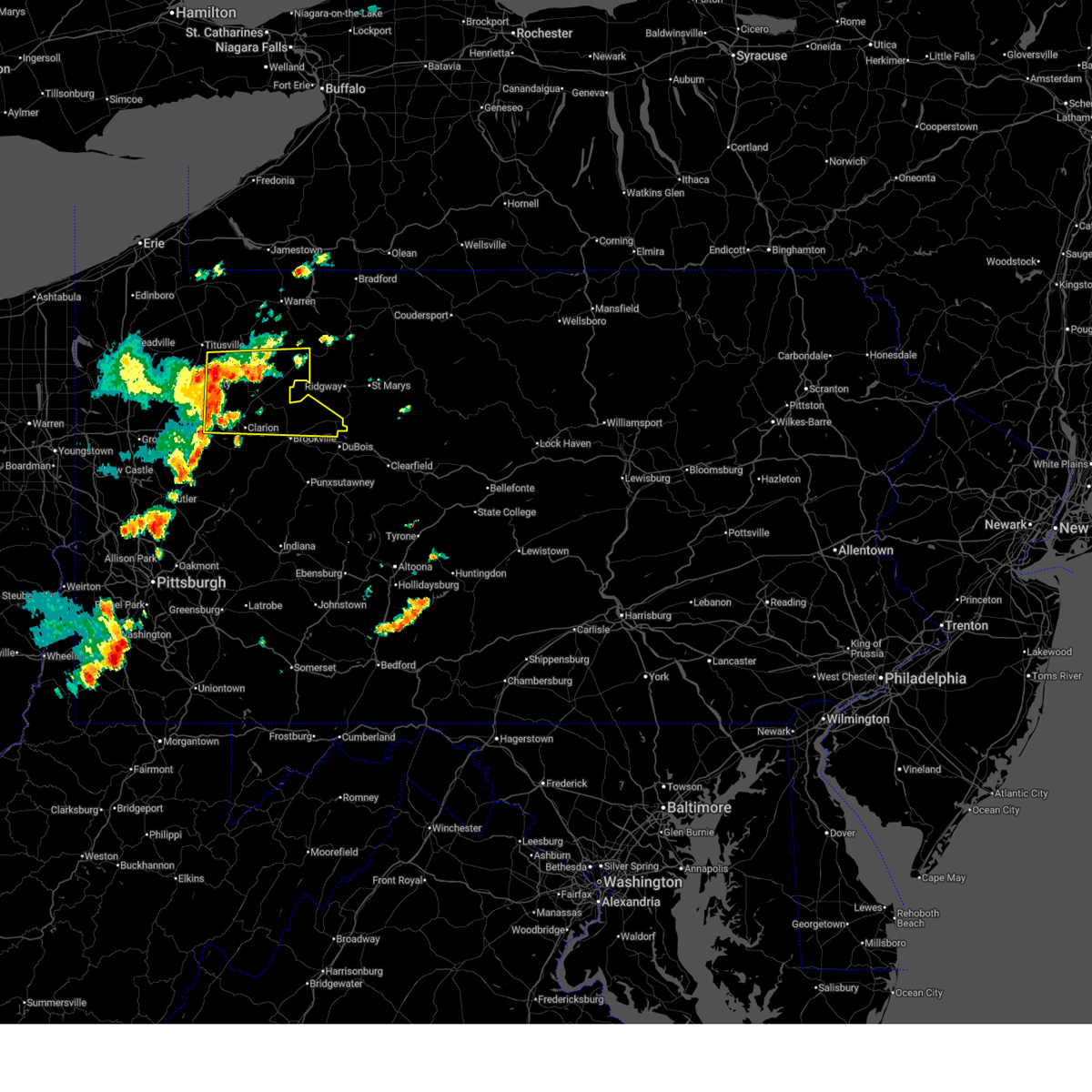
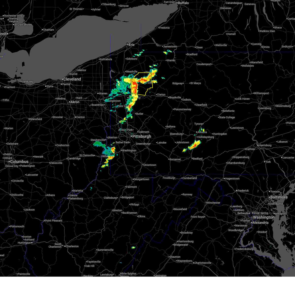
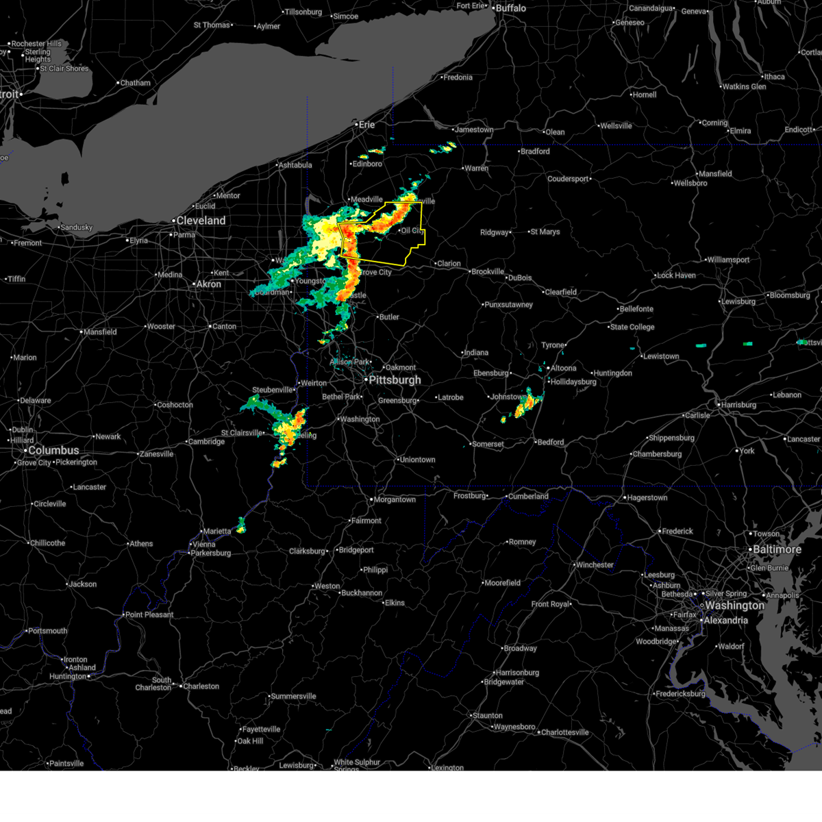
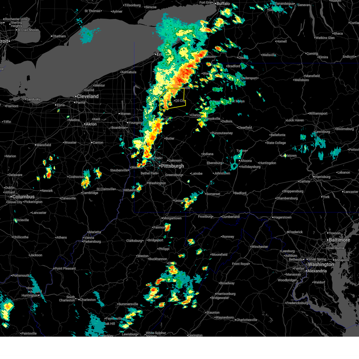
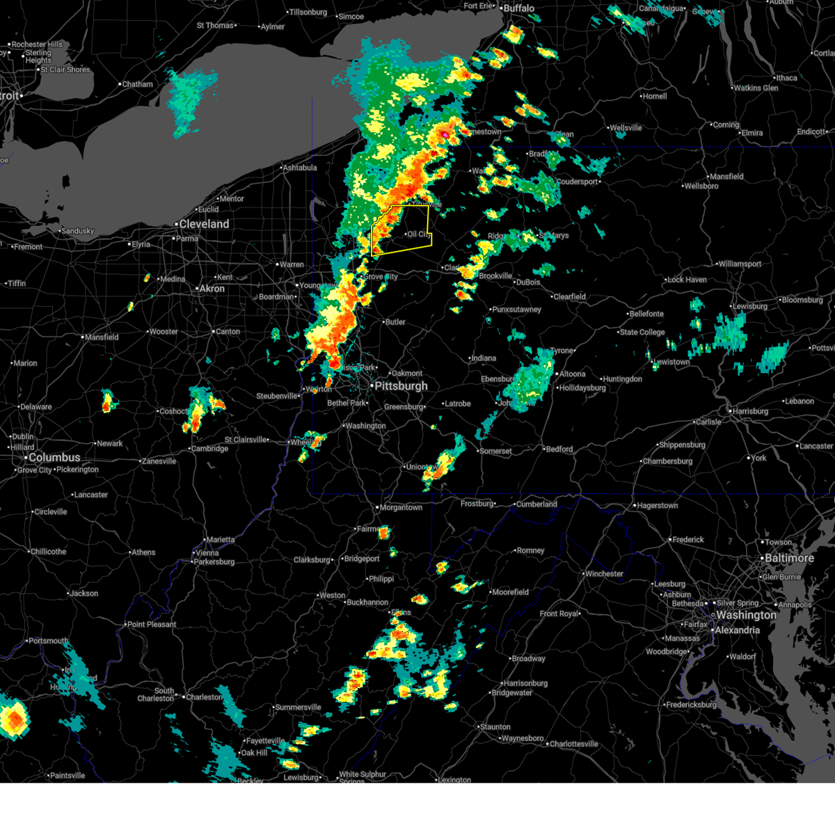
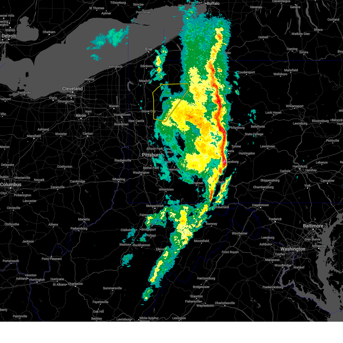
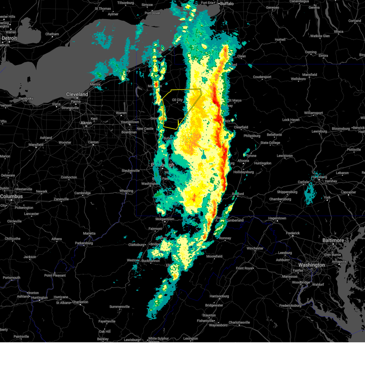
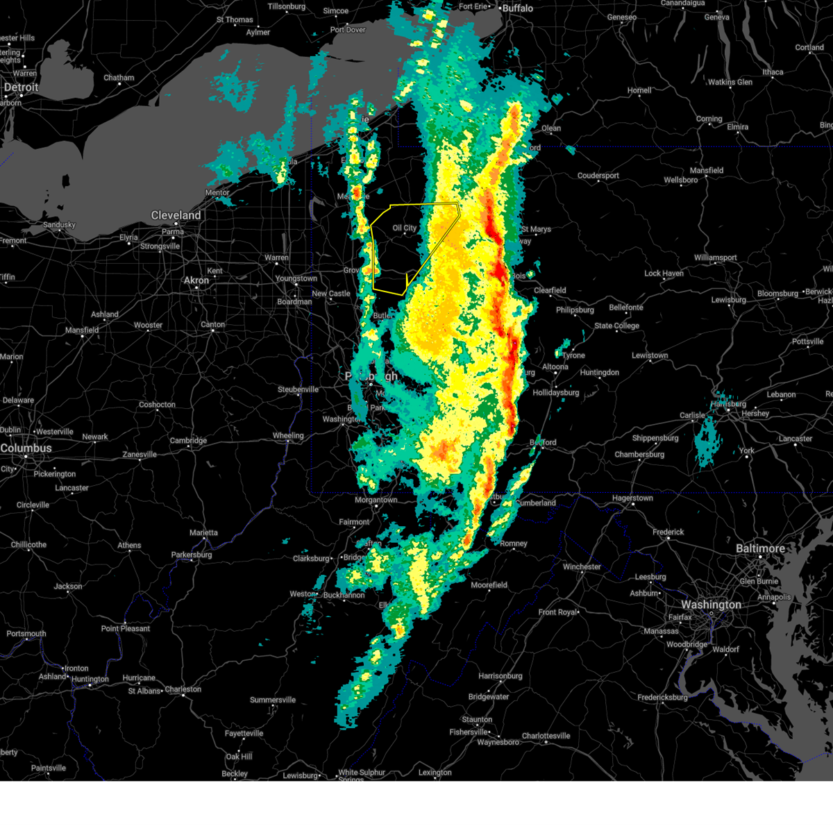
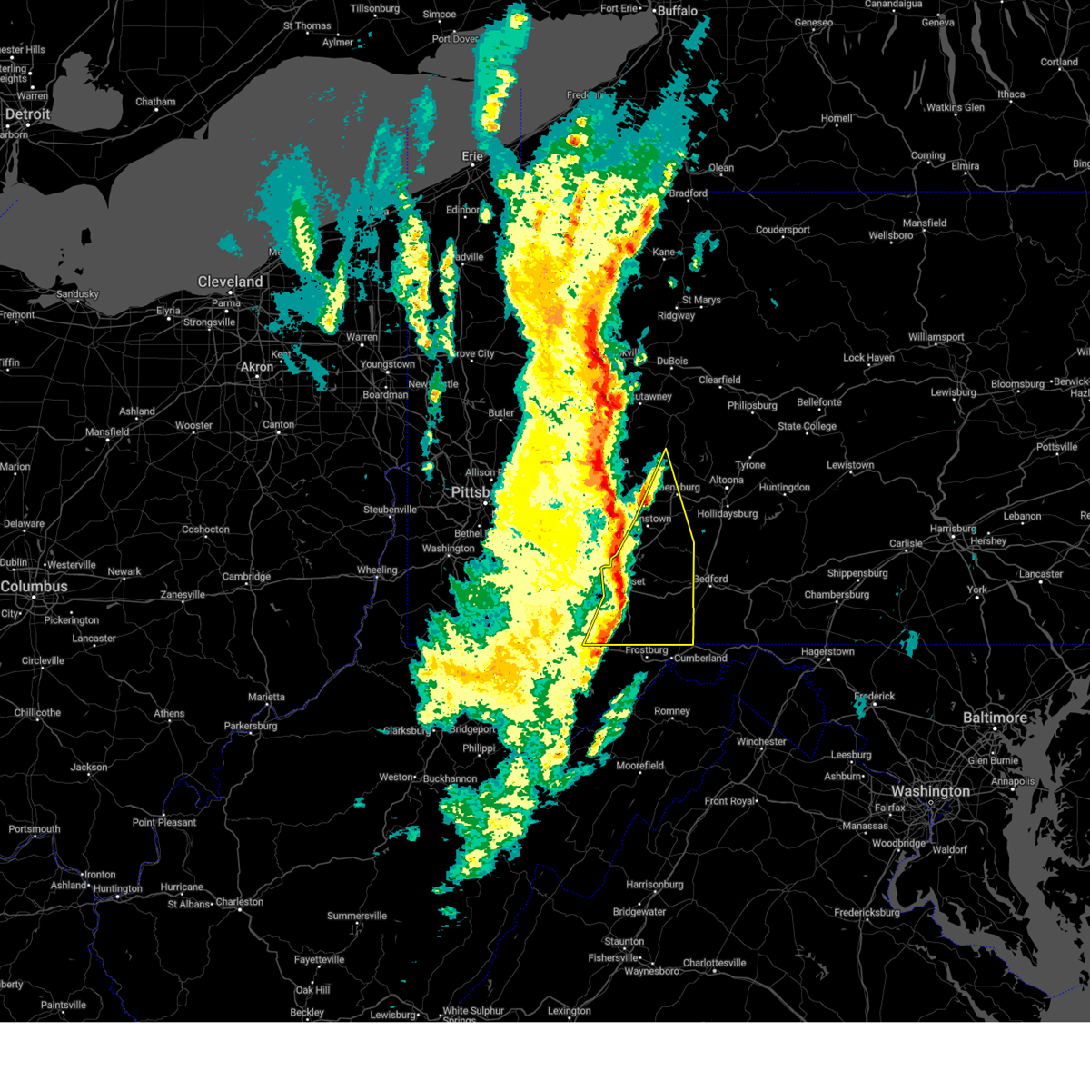
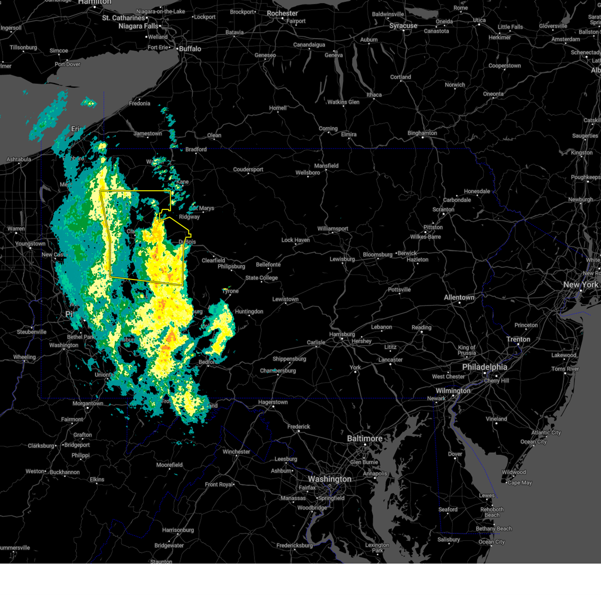
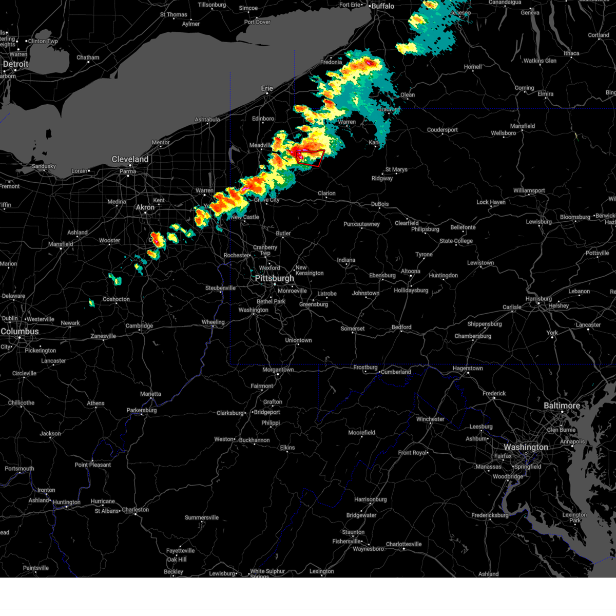
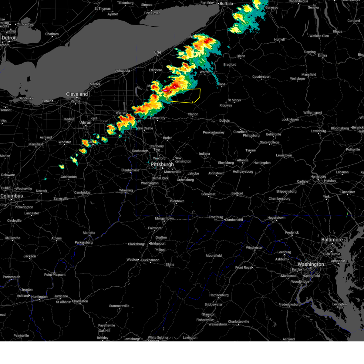
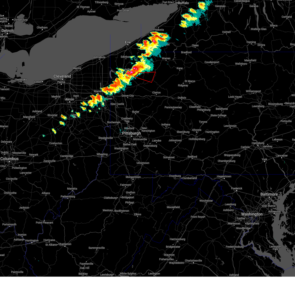
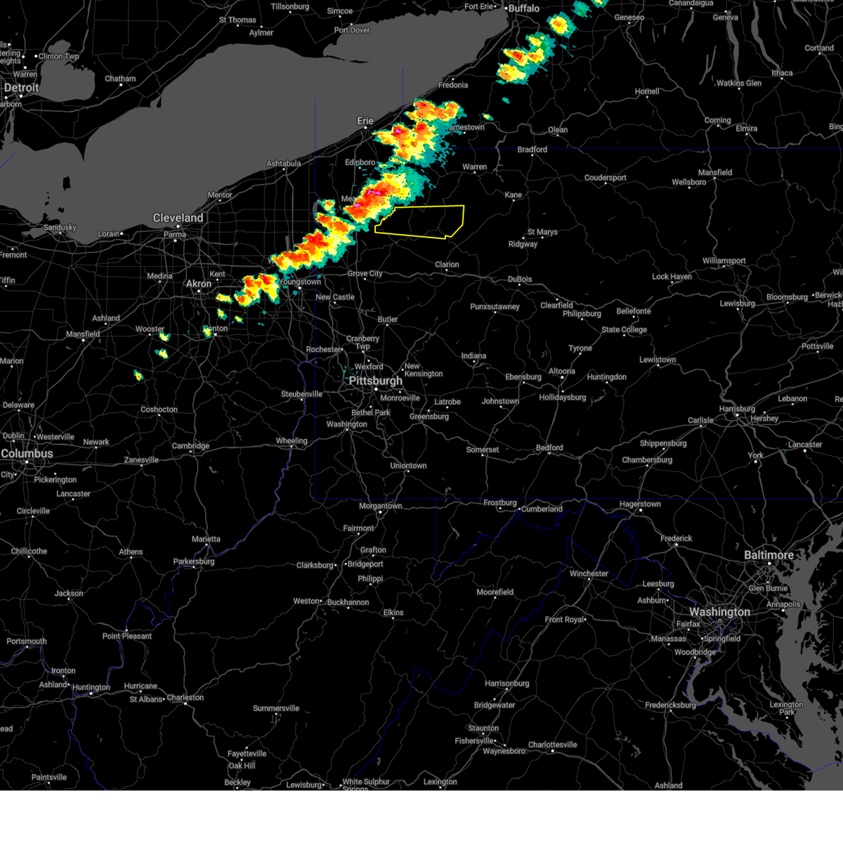
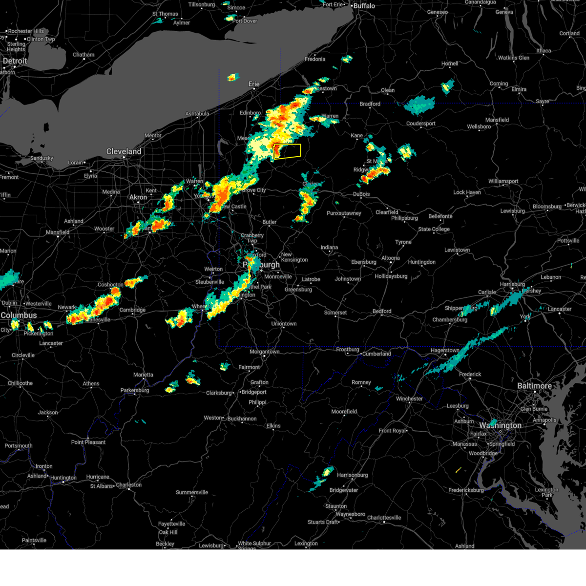
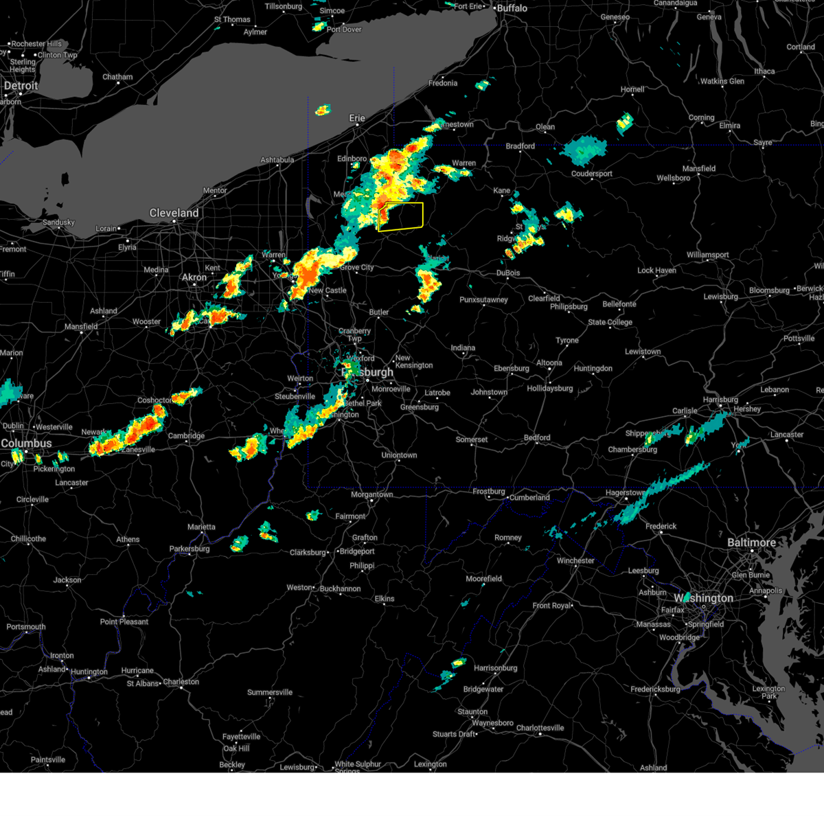
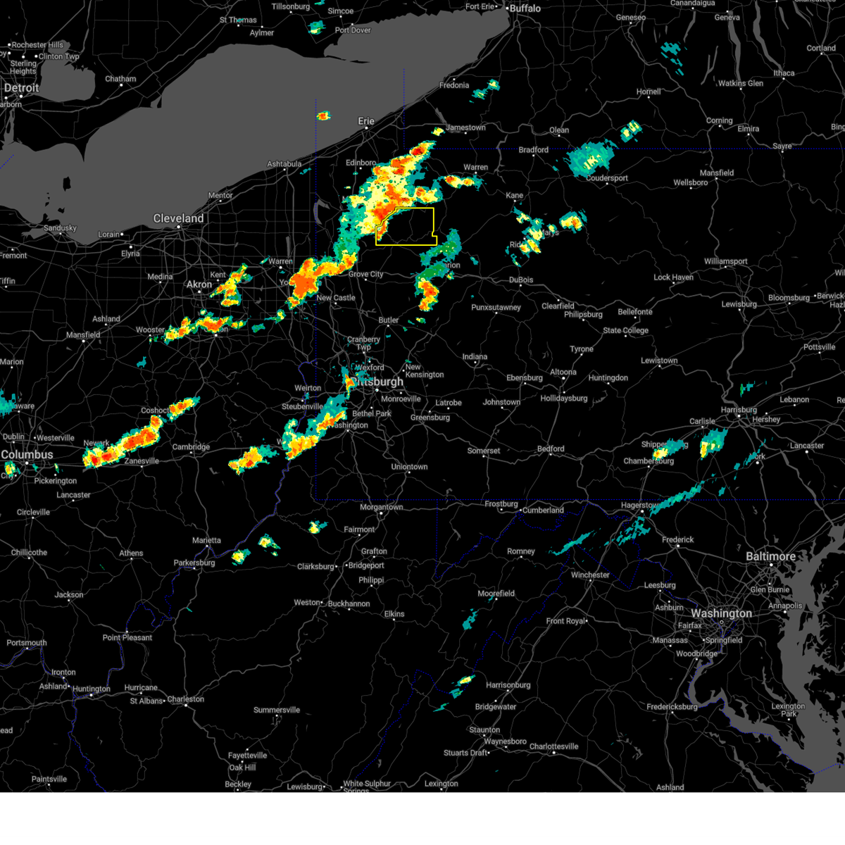
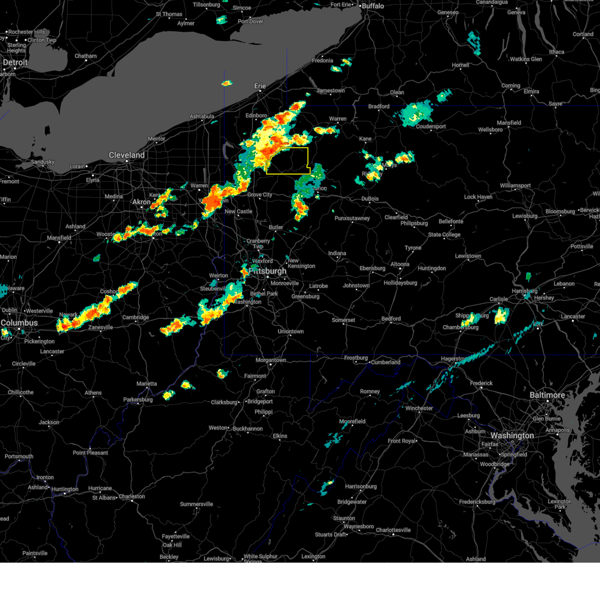
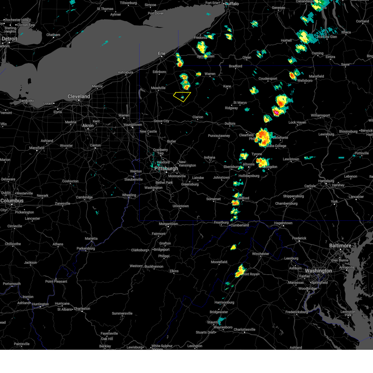
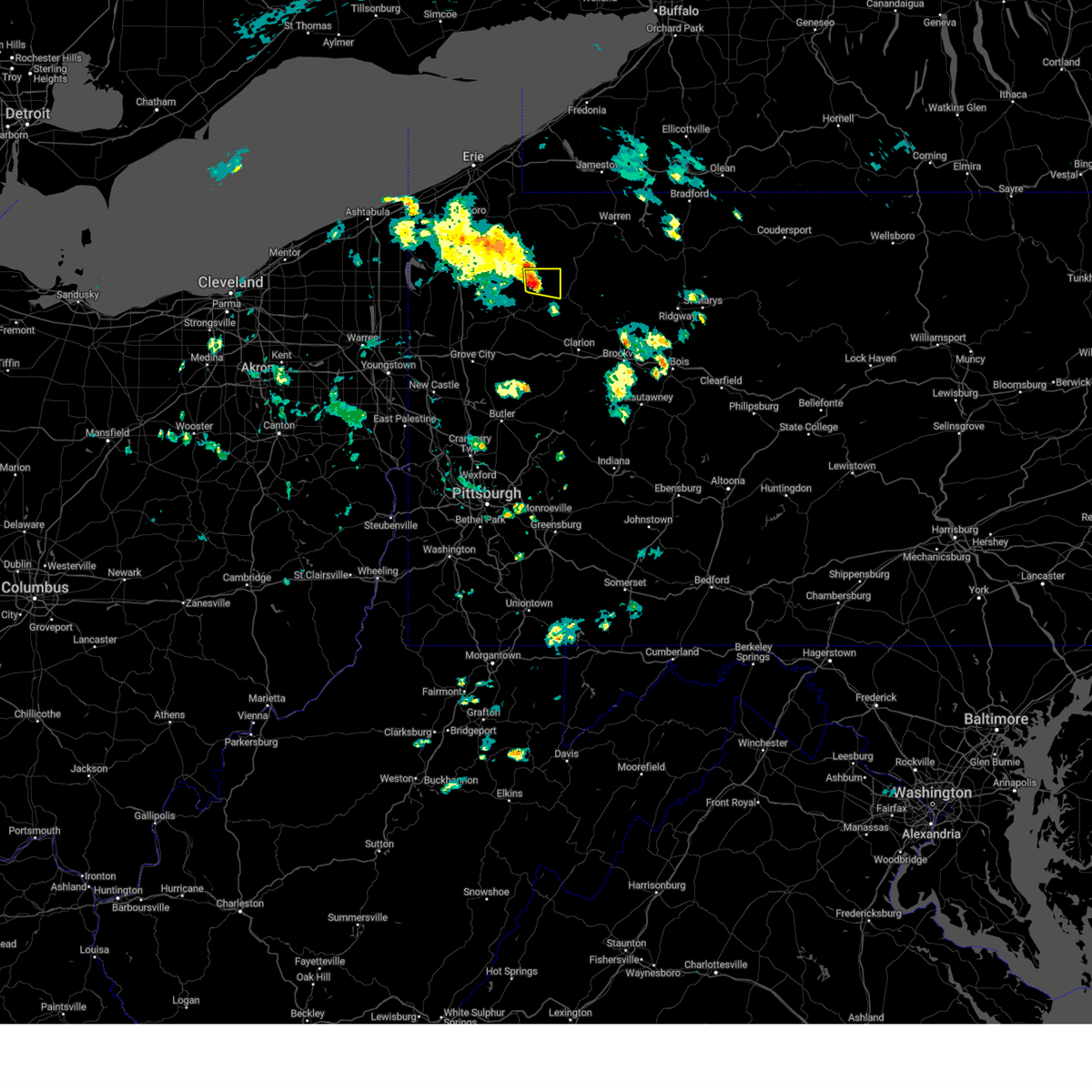
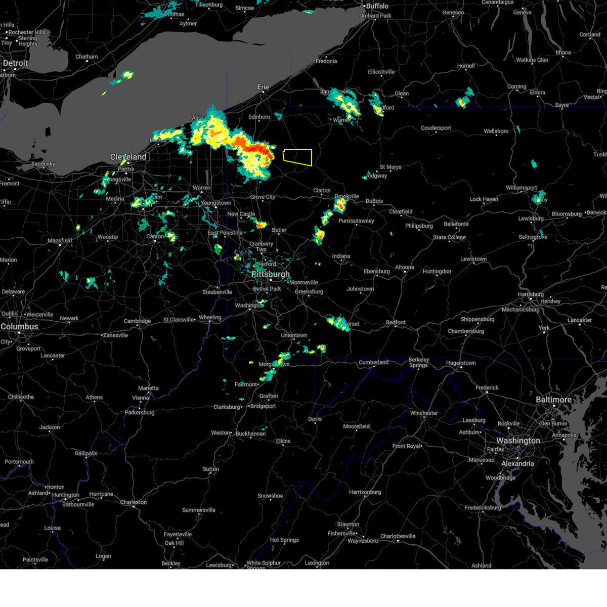
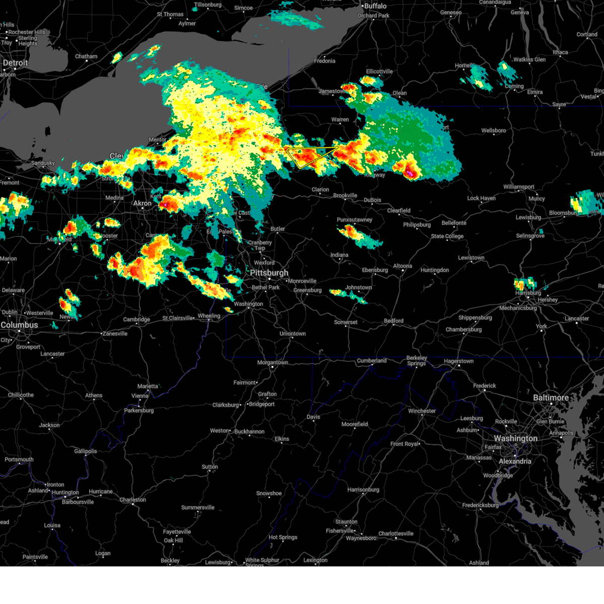
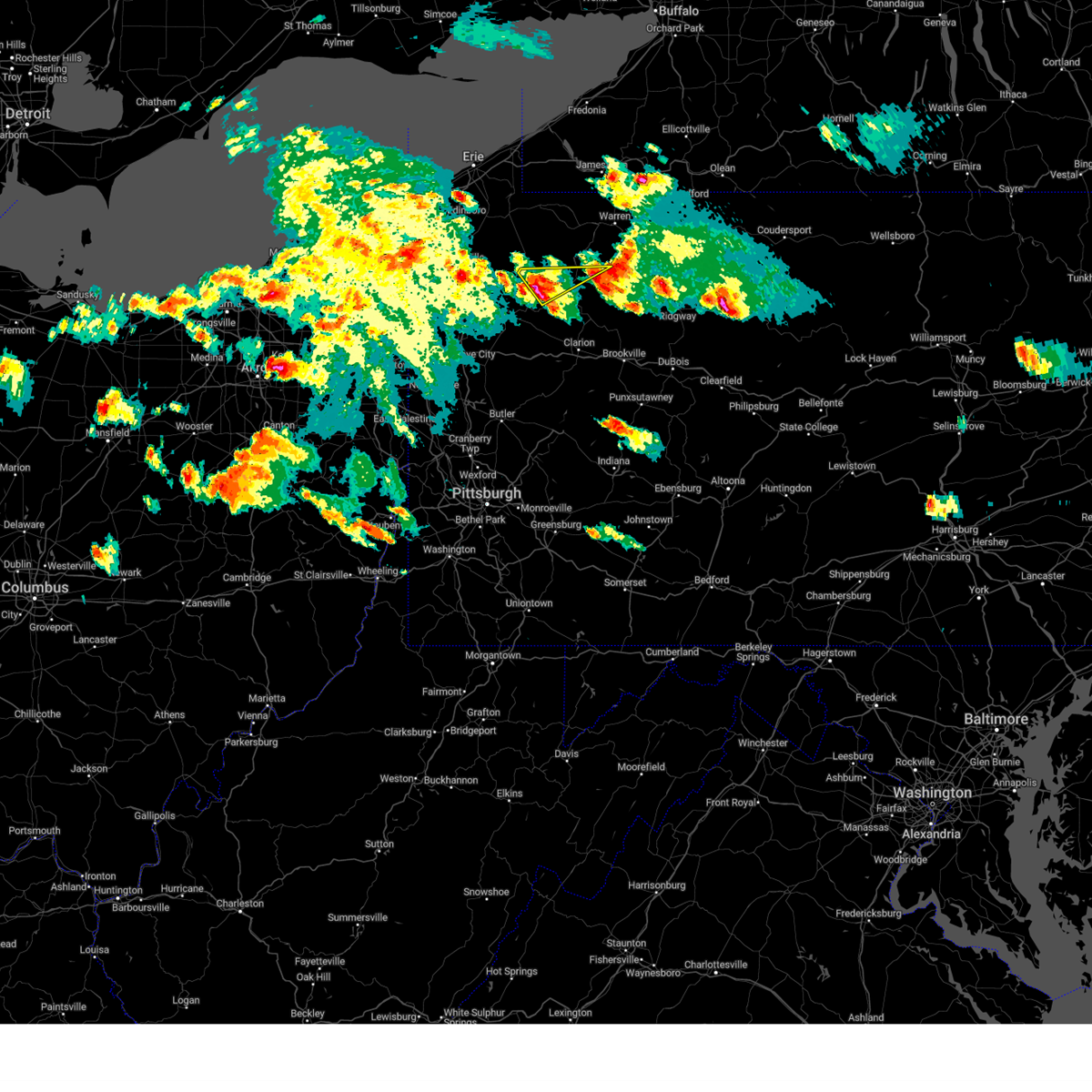
Hail Map for Pleasantville, PA
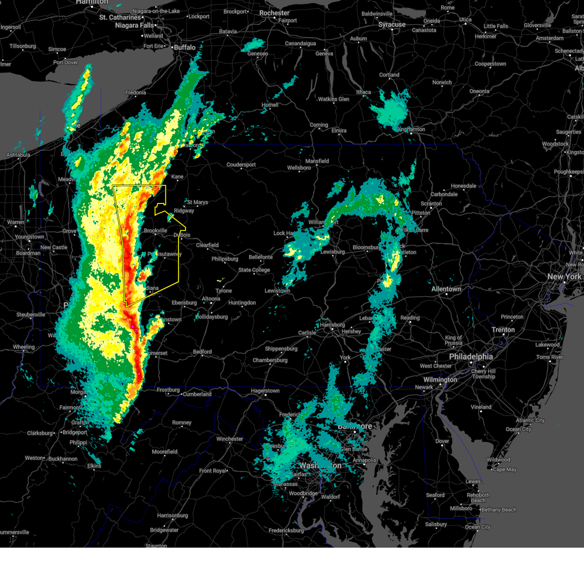
The Pleasantville, PA area has had 3 reports of on-the-ground hail by trained spotters, and has been under severe weather warnings 64 times during the past 12 months. Doppler radar has detected hail at or near Pleasantville, PA on 45 occasions, including 3 occasions during the past year.
| Name: | Pleasantville, PA |
| Where Located: | 82.8 miles NNE of Pittsburgh, PA |
| Map: | Google Map for Pleasantville, PA |
| Population: | 892 |
| Housing Units: | 387 |
| More Info: | Search Google for Pleasantville, PA |
5
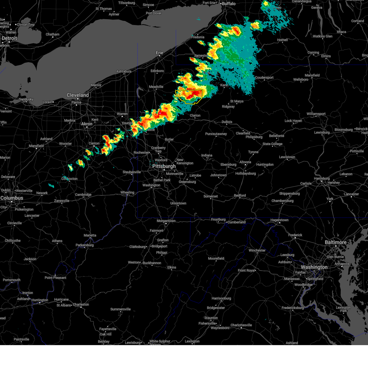
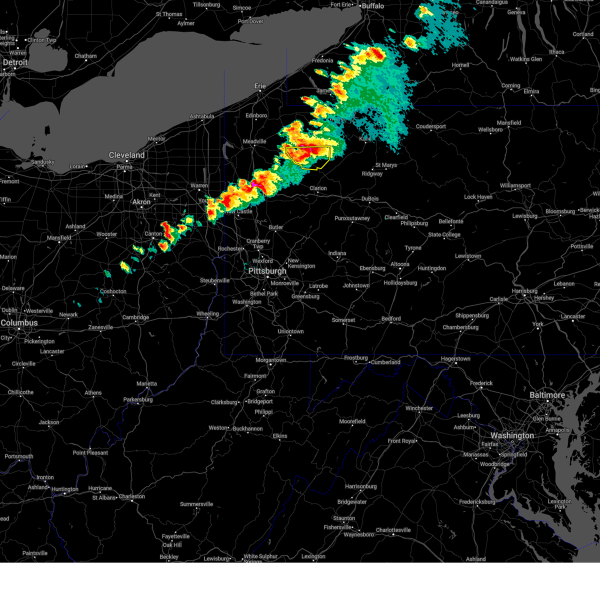
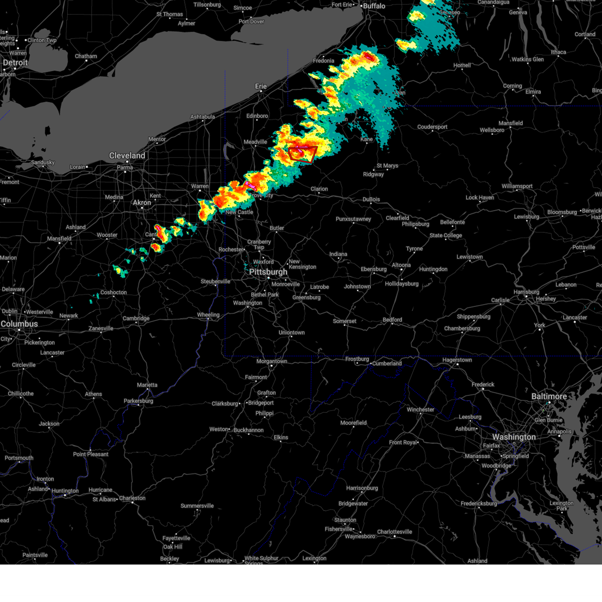
The Top Recent Hail Date for Pleasantville, PA is Sunday, October 6, 2024 (1st out of 45)

Hail and Wind Damage Spotted near Pleasantville, PA
| Date / Time | Report Details |
|---|---|
| 6/28/2025 12:08 PM EDT |
 At 1208 pm edt, severe thunderstorms were located along a line from near tionesta to over knox, or along a line from 14 miles northeast of oil city to over knox, moving east at 45 mph (law enforcement reported wind damage across venango county). Hazards include 60 mph wind gusts. Expect damage to roofs, siding, and trees. Locations impacted include, clarion, brookville, marienville, knox, brockway, tionesta, strattanville, shippenville, corsica, sigel, pleasantville, leeper, fisher, kellettville, fryburg, west hickory, cook forest state park, clarington, starr and clear creek state park. At 1208 pm edt, severe thunderstorms were located along a line from near tionesta to over knox, or along a line from 14 miles northeast of oil city to over knox, moving east at 45 mph (law enforcement reported wind damage across venango county). Hazards include 60 mph wind gusts. Expect damage to roofs, siding, and trees. Locations impacted include, clarion, brookville, marienville, knox, brockway, tionesta, strattanville, shippenville, corsica, sigel, pleasantville, leeper, fisher, kellettville, fryburg, west hickory, cook forest state park, clarington, starr and clear creek state park.
|
| 6/28/2025 12:05 PM EDT |
 Svrpbz the national weather service in pittsburgh has issued a * severe thunderstorm warning for, forest county in northwestern pennsylvania, eastern venango county in northwestern pennsylvania, northern clarion county in west central pennsylvania, northern jefferson pa county in west central pennsylvania, * until 100 pm edt. * at 1205 pm edt, severe thunderstorms were located along a line from near tionesta to near knox, or along a line from 12 miles northeast of oil city to near knox, moving east at 45 mph (radar indicated). Hazards include 60 mph wind gusts. expect damage to roofs, siding, and trees Svrpbz the national weather service in pittsburgh has issued a * severe thunderstorm warning for, forest county in northwestern pennsylvania, eastern venango county in northwestern pennsylvania, northern clarion county in west central pennsylvania, northern jefferson pa county in west central pennsylvania, * until 100 pm edt. * at 1205 pm edt, severe thunderstorms were located along a line from near tionesta to near knox, or along a line from 12 miles northeast of oil city to near knox, moving east at 45 mph (radar indicated). Hazards include 60 mph wind gusts. expect damage to roofs, siding, and trees
|
| 6/28/2025 11:45 AM EDT |
 At 1145 am edt, severe thunderstorms were located along a line from near sugarcreek to 9 miles south of franklin, or along a line from 6 miles northwest of franklin to 9 miles south of franklin, moving east at 40 mph (law enforcement reported trees and wires down in mercer county). Hazards include 60 mph wind gusts. Expect damage to roofs, siding, and trees. Locations impacted include, oil city, franklin, sugarcreek, hasson heights, seneca, polk, rouseville, cooperstown, kennerdell, woodland heights, pleasantville, utica, cranberry township and oil creek state park. At 1145 am edt, severe thunderstorms were located along a line from near sugarcreek to 9 miles south of franklin, or along a line from 6 miles northwest of franklin to 9 miles south of franklin, moving east at 40 mph (law enforcement reported trees and wires down in mercer county). Hazards include 60 mph wind gusts. Expect damage to roofs, siding, and trees. Locations impacted include, oil city, franklin, sugarcreek, hasson heights, seneca, polk, rouseville, cooperstown, kennerdell, woodland heights, pleasantville, utica, cranberry township and oil creek state park.
|
| 6/28/2025 11:45 AM EDT |
 the severe thunderstorm warning has been cancelled and is no longer in effect the severe thunderstorm warning has been cancelled and is no longer in effect
|
| 6/28/2025 11:27 AM EDT |
 Svrpbz the national weather service in pittsburgh has issued a * severe thunderstorm warning for, northeastern mercer county in northwestern pennsylvania, venango county in northwestern pennsylvania, * until 1215 pm edt. * at 1127 am edt, severe thunderstorms were located along a line from 15 miles east of greenville to 9 miles north of grove city, or along a line from 15 miles northwest of franklin to 9 miles north of grove city, moving east at 40 mph (law enforcement reported). Hazards include 60 mph wind gusts. expect damage to roofs, siding, and trees Svrpbz the national weather service in pittsburgh has issued a * severe thunderstorm warning for, northeastern mercer county in northwestern pennsylvania, venango county in northwestern pennsylvania, * until 1215 pm edt. * at 1127 am edt, severe thunderstorms were located along a line from 15 miles east of greenville to 9 miles north of grove city, or along a line from 15 miles northwest of franklin to 9 miles north of grove city, moving east at 40 mph (law enforcement reported). Hazards include 60 mph wind gusts. expect damage to roofs, siding, and trees
|
| 6/27/2025 4:36 PM EDT |
 The storms which prompted the warning have weakened below severe limits, and no longer pose an immediate threat to life or property. therefore, the warning will be allowed to expire. however, gusty winds and heavy rain are still possible with these thunderstorms. The storms which prompted the warning have weakened below severe limits, and no longer pose an immediate threat to life or property. therefore, the warning will be allowed to expire. however, gusty winds and heavy rain are still possible with these thunderstorms.
|
| 6/27/2025 4:24 PM EDT |
 the severe thunderstorm warning has been cancelled and is no longer in effect the severe thunderstorm warning has been cancelled and is no longer in effect
|
| 6/27/2025 4:24 PM EDT |
 At 424 pm edt, severe thunderstorms were located along a line from 16 miles northwest of tionesta to near sugarcreek, or along a line from 20 miles north of oil city to over franklin, moving east at 25 mph (radar indicated). Hazards include 60 mph wind gusts. Expect damage to roofs, siding, and trees. Locations impacted include, oil city, franklin, sugarcreek, hasson heights, seneca, polk, rouseville, cooperstown, woodland heights, pleasantville, utica, oil creek state park and cranberry township. At 424 pm edt, severe thunderstorms were located along a line from 16 miles northwest of tionesta to near sugarcreek, or along a line from 20 miles north of oil city to over franklin, moving east at 25 mph (radar indicated). Hazards include 60 mph wind gusts. Expect damage to roofs, siding, and trees. Locations impacted include, oil city, franklin, sugarcreek, hasson heights, seneca, polk, rouseville, cooperstown, woodland heights, pleasantville, utica, oil creek state park and cranberry township.
|
| 6/27/2025 3:59 PM EDT |
 Svrpbz the national weather service in pittsburgh has issued a * severe thunderstorm warning for, northeastern mercer county in northwestern pennsylvania, venango county in northwestern pennsylvania, * until 445 pm edt. * at 359 pm edt, severe thunderstorms were located along a line from 15 miles north of sugarcreek to 8 miles west of franklin, or along a line from 16 miles north of oil city to 8 miles west of franklin, moving east at 25 mph (radar indicated). Hazards include 60 mph wind gusts. expect damage to roofs, siding, and trees Svrpbz the national weather service in pittsburgh has issued a * severe thunderstorm warning for, northeastern mercer county in northwestern pennsylvania, venango county in northwestern pennsylvania, * until 445 pm edt. * at 359 pm edt, severe thunderstorms were located along a line from 15 miles north of sugarcreek to 8 miles west of franklin, or along a line from 16 miles north of oil city to 8 miles west of franklin, moving east at 25 mph (radar indicated). Hazards include 60 mph wind gusts. expect damage to roofs, siding, and trees
|
| 6/19/2025 6:44 PM EDT | Svrctp the national weather service in state college pa has issued a * severe thunderstorm warning for, northern bedford county in south central pennsylvania, southern blair county in central pennsylvania, * until 715 pm edt. * at 643 pm edt, severe thunderstorms were located along a line extending from duncansville to central city, moving east at 45 mph (radar indicated). Hazards include 60 mph wind gusts. expect damage to roofs, siding, and trees |
| 6/18/2025 11:59 PM EDT |
 The storms which prompted the warning have moved out of a portion of the area. a new severe thunderstorm warning has been issued for this line of storms to the east. The storms which prompted the warning have moved out of a portion of the area. a new severe thunderstorm warning has been issued for this line of storms to the east.
|
| 6/18/2025 11:58 PM EDT | Power line down on otto roa in venango county PA, 108.5 miles SSE of Pleasantville, PA |
| 6/18/2025 11:57 PM EDT |
 Svrpbz the national weather service in pittsburgh has issued a * severe thunderstorm warning for, forest county in northwestern pennsylvania, eastern venango county in northwestern pennsylvania, northeastern allegheny county in southwestern pennsylvania, northern westmoreland county in southwestern pennsylvania, armstrong county in west central pennsylvania, eastern butler county in west central pennsylvania, clarion county in west central pennsylvania, indiana county in west central pennsylvania, jefferson pa county in west central pennsylvania, * until 115 am edt. * at 1157 pm edt, severe thunderstorms were located along a line from near tionesta to over penn hills, or along a line from 16 miles northeast of oil city to over penn hills, moving east at 30 mph (law enforcement reported trees and wires down with this line of storms). Hazards include 60 mph wind gusts. expect damage to roofs, siding, and trees Svrpbz the national weather service in pittsburgh has issued a * severe thunderstorm warning for, forest county in northwestern pennsylvania, eastern venango county in northwestern pennsylvania, northeastern allegheny county in southwestern pennsylvania, northern westmoreland county in southwestern pennsylvania, armstrong county in west central pennsylvania, eastern butler county in west central pennsylvania, clarion county in west central pennsylvania, indiana county in west central pennsylvania, jefferson pa county in west central pennsylvania, * until 115 am edt. * at 1157 pm edt, severe thunderstorms were located along a line from near tionesta to over penn hills, or along a line from 16 miles northeast of oil city to over penn hills, moving east at 30 mph (law enforcement reported trees and wires down with this line of storms). Hazards include 60 mph wind gusts. expect damage to roofs, siding, and trees
|
| 6/18/2025 11:42 PM EDT |
 the severe thunderstorm warning has been cancelled and is no longer in effect the severe thunderstorm warning has been cancelled and is no longer in effect
|
| 6/18/2025 11:42 PM EDT |
 At 1142 pm edt, severe thunderstorms were located along a line from over tionesta to over monongahela, or along a line from 11 miles east of oil city to 5 miles southeast of gastonville, moving east at 45 mph (law enforcement reported trees down with this line of storms). Hazards include 60 mph wind gusts. Expect damage to roofs, siding, and trees. Locations impacted include, pittsburgh, penn hills, mount lebanon, bethel park, ross township, mccandless township, monroeville, mcmurray, mckeesport, butler, franklin park, oil city, jeannette, canonsburg, franklin, clarion, vandergrift, kittanning, apollo and knox. At 1142 pm edt, severe thunderstorms were located along a line from over tionesta to over monongahela, or along a line from 11 miles east of oil city to 5 miles southeast of gastonville, moving east at 45 mph (law enforcement reported trees down with this line of storms). Hazards include 60 mph wind gusts. Expect damage to roofs, siding, and trees. Locations impacted include, pittsburgh, penn hills, mount lebanon, bethel park, ross township, mccandless township, monroeville, mcmurray, mckeesport, butler, franklin park, oil city, jeannette, canonsburg, franklin, clarion, vandergrift, kittanning, apollo and knox.
|
| 6/18/2025 11:29 PM EDT |
 the severe thunderstorm warning has been cancelled and is no longer in effect the severe thunderstorm warning has been cancelled and is no longer in effect
|
| 6/18/2025 11:29 PM EDT |
 At 1129 pm edt, severe thunderstorms were located along a line from near oil city to near canonsburg, moving east at 45 mph (law enforcement reported trees down with this line of storms). Hazards include 60 mph wind gusts. Expect damage to roofs, siding, and trees. Locations impacted include, pittsburgh, penn hills, mount lebanon, bethel park, ross township, mccandless township, monroeville, cranberry, moon township, new castle, mcmurray, mckeesport, butler, washington, franklin park, oil city, jeannette, aliquippa, canonsburg and grove city. At 1129 pm edt, severe thunderstorms were located along a line from near oil city to near canonsburg, moving east at 45 mph (law enforcement reported trees down with this line of storms). Hazards include 60 mph wind gusts. Expect damage to roofs, siding, and trees. Locations impacted include, pittsburgh, penn hills, mount lebanon, bethel park, ross township, mccandless township, monroeville, cranberry, moon township, new castle, mcmurray, mckeesport, butler, washington, franklin park, oil city, jeannette, aliquippa, canonsburg and grove city.
|
| 6/18/2025 11:16 PM EDT |
 At 1116 pm edt, severe thunderstorms were located along a line from near sugarcreek to over wolfdale, or along a line from 6 miles north of franklin to near washington, moving east at 45 mph (law enforcement reported trees down with this line of storms). Hazards include 60 mph wind gusts. Expect damage to roofs, siding, and trees. Locations impacted include, pittsburgh, penn hills, mount lebanon, bethel park, ross township, mccandless township, monroeville, cranberry, moon township, new castle, mcmurray, weirton, mckeesport, steubenville, butler, franklin park, oil city, jeannette, aliquippa and canonsburg. At 1116 pm edt, severe thunderstorms were located along a line from near sugarcreek to over wolfdale, or along a line from 6 miles north of franklin to near washington, moving east at 45 mph (law enforcement reported trees down with this line of storms). Hazards include 60 mph wind gusts. Expect damage to roofs, siding, and trees. Locations impacted include, pittsburgh, penn hills, mount lebanon, bethel park, ross township, mccandless township, monroeville, cranberry, moon township, new castle, mcmurray, weirton, mckeesport, steubenville, butler, franklin park, oil city, jeannette, aliquippa and canonsburg.
|
| 6/18/2025 11:16 PM EDT |
 the severe thunderstorm warning has been cancelled and is no longer in effect the severe thunderstorm warning has been cancelled and is no longer in effect
|
| 6/18/2025 10:54 PM EDT |
 Svrpbz the national weather service in pittsburgh has issued a * severe thunderstorm warning for, eastern columbiana county in east central ohio, eastern jefferson oh county in east central ohio, western forest county in northwestern pennsylvania, mercer county in northwestern pennsylvania, venango county in northwestern pennsylvania, allegheny county in southwestern pennsylvania, northern washington county in southwestern pennsylvania, northwestern westmoreland county in southwestern pennsylvania, western armstrong county in west central pennsylvania, butler county in west central pennsylvania, clarion county in west central pennsylvania, beaver county in western pennsylvania, lawrence county in western pennsylvania, brooke county in northern west virginia, hancock county in northern west virginia, * until midnight edt. * at 1054 pm edt, severe thunderstorms were located along a line from 11 miles northeast of greenville to near west liberty, or along a line from 18 miles west of franklin to near west liberty, moving east at 45 mph (law enforcement reported trees were reported down with this line of storms). Hazards include 60 mph wind gusts. expect damage to roofs, siding, and trees Svrpbz the national weather service in pittsburgh has issued a * severe thunderstorm warning for, eastern columbiana county in east central ohio, eastern jefferson oh county in east central ohio, western forest county in northwestern pennsylvania, mercer county in northwestern pennsylvania, venango county in northwestern pennsylvania, allegheny county in southwestern pennsylvania, northern washington county in southwestern pennsylvania, northwestern westmoreland county in southwestern pennsylvania, western armstrong county in west central pennsylvania, butler county in west central pennsylvania, clarion county in west central pennsylvania, beaver county in western pennsylvania, lawrence county in western pennsylvania, brooke county in northern west virginia, hancock county in northern west virginia, * until midnight edt. * at 1054 pm edt, severe thunderstorms were located along a line from 11 miles northeast of greenville to near west liberty, or along a line from 18 miles west of franklin to near west liberty, moving east at 45 mph (law enforcement reported trees were reported down with this line of storms). Hazards include 60 mph wind gusts. expect damage to roofs, siding, and trees
|
| 6/9/2025 4:26 PM EDT | The storm which prompted the warning has moved out of the area. therefore, the warning will be allowed to expire. to report severe weather, contact your nearest law enforcement agency. they will send your report to the national weather service office. a severe thunderstorm watch remains in effect until 1000 pm edt monday for a portion of northwest pennsylvania. |
| 6/9/2025 4:10 PM EDT |
 At 410 pm edt, a severe thunderstorm was located 8 miles northwest of tionesta, or 11 miles northeast of oil city, moving northeast at 35 mph (radar indicated). Hazards include 60 mph wind gusts and quarter size hail. Hail damage to vehicles is expected. expect wind damage to roofs, siding, and trees. Locations impacted include, pleasantville, west hickory and east hickory. At 410 pm edt, a severe thunderstorm was located 8 miles northwest of tionesta, or 11 miles northeast of oil city, moving northeast at 35 mph (radar indicated). Hazards include 60 mph wind gusts and quarter size hail. Hail damage to vehicles is expected. expect wind damage to roofs, siding, and trees. Locations impacted include, pleasantville, west hickory and east hickory.
|
| 6/9/2025 4:02 PM EDT |
 Svrpbz the national weather service in pittsburgh has issued a * severe thunderstorm warning for, northwestern forest county in northwestern pennsylvania, northeastern venango county in northwestern pennsylvania, * until 430 pm edt. * at 402 pm edt, a severe thunderstorm was located 7 miles northeast of oil city, moving northeast at 35 mph (radar indicated). Hazards include 60 mph wind gusts and quarter size hail. Hail damage to vehicles is expected. Expect wind damage to roofs, siding, and trees. Svrpbz the national weather service in pittsburgh has issued a * severe thunderstorm warning for, northwestern forest county in northwestern pennsylvania, northeastern venango county in northwestern pennsylvania, * until 430 pm edt. * at 402 pm edt, a severe thunderstorm was located 7 miles northeast of oil city, moving northeast at 35 mph (radar indicated). Hazards include 60 mph wind gusts and quarter size hail. Hail damage to vehicles is expected. Expect wind damage to roofs, siding, and trees.
|
| 5/2/2025 5:30 PM EDT | The storms which prompted the warning have weakened below severe limits, and no longer pose an immediate threat to life or property. therefore, the warning has been allowed to expire. however, gusty winds and heavy rain are still possible with these thunderstorms. to report severe weather, contact your nearest law enforcement agency. they will send your report to the national weather service office. |
| 5/2/2025 5:18 PM EDT | At 518 pm edt, severe thunderstorms were located along a line from 7 miles north of tionesta to 5 miles southeast of tionesta, or along a line from 18 miles northwest of marienville to 15 miles west of marienville, moving east at 50 mph (radar indicated). Hazards include 60 mph wind gusts and small hail. Expect damage to roofs, siding, and trees. Locations impacted include, oil city, sugarcreek, tionesta, hasson heights, rouseville, woodland heights, pleasantville, west hickory, fryburg, kellettville, leeper, starr, east hickory, oil creek state park and cook forest state park. |
| 5/2/2025 4:45 PM EDT | Svrpbz the national weather service in pittsburgh has issued a * severe thunderstorm warning for, western forest county in northwestern pennsylvania, northern venango county in northwestern pennsylvania, northeastern clarion county in west central pennsylvania, * until 530 pm edt. * at 445 pm edt, severe thunderstorms were located along a line from 14 miles northwest of sugarcreek to near franklin, or along a line from 16 miles north of franklin to near franklin, moving east at 50 mph (radar indicated). Hazards include 60 mph wind gusts and small hail. expect damage to roofs, siding, and trees |
| 4/29/2025 5:31 PM EDT |
 The storms which prompted the warning have moved out of the area. therefore, the warning has been allowed to expire. however, gusty winds are still possible with these thunderstorms. a severe thunderstorm watch remains in effect until 1000 pm edt for western, northwestern and west central pennsylvania. remember, a severe thunderstorm warning still remains in effect for venango, clarion, and forest counties. The storms which prompted the warning have moved out of the area. therefore, the warning has been allowed to expire. however, gusty winds are still possible with these thunderstorms. a severe thunderstorm watch remains in effect until 1000 pm edt for western, northwestern and west central pennsylvania. remember, a severe thunderstorm warning still remains in effect for venango, clarion, and forest counties.
|
| 4/29/2025 5:05 PM EDT |
 At 505 pm edt, severe thunderstorms were located along a line extending from 7 miles southeast of grand valley to 7 miles northeast of grove city, moving east at 45 mph (radar indicated). Hazards include 60 mph wind gusts. Expect damage to trees and power lines, resulting in some power outages. Locations impacted include, new castle, oil city, grove city, franklin, ellwood city, sugarcreek, new wilmington, oakwood, new castle northwest, tionesta, big beaver, new beaver, hasson heights, ellport, bessemer, seneca, plain grove township, wampum, south new castle, and emlenton. At 505 pm edt, severe thunderstorms were located along a line extending from 7 miles southeast of grand valley to 7 miles northeast of grove city, moving east at 45 mph (radar indicated). Hazards include 60 mph wind gusts. Expect damage to trees and power lines, resulting in some power outages. Locations impacted include, new castle, oil city, grove city, franklin, ellwood city, sugarcreek, new wilmington, oakwood, new castle northwest, tionesta, big beaver, new beaver, hasson heights, ellport, bessemer, seneca, plain grove township, wampum, south new castle, and emlenton.
|
| 4/29/2025 4:34 PM EDT | Svrpbz the national weather service in pittsburgh has issued a * severe thunderstorm warning for, southeastern mercer county in northwestern pennsylvania, venango county in northwestern pennsylvania, lawrence county in western pennsylvania, northwestern armstrong county in west central pennsylvania, western forest county in northwestern pennsylvania, * until 530 pm edt. * at 434 pm edt, severe thunderstorms were located along a line extending from 8 miles north of sugarcreek to near new wilmington, moving east at 45 mph (radar indicated). Hazards include 60 mph wind gusts. expect damage to trees and power lines, resulting in some power outages |
| 4/19/2025 6:44 PM EDT |
 At 644 pm edt, a severe thunderstorm was located over ogletown, moving east at 70 mph (radar indicated). Hazards include 60 mph wind gusts and penny size hail. Expect damage to roofs, siding, and trees. locations impacted include, blue knob state park, salix-beauty line park, osterburg, martinsburg, spring hill, new enterprise, windber, roaring spring, scalp level, ski gap, woodbury, and dunlo. This includes interstate 99 from mile markers 6 to 27. At 644 pm edt, a severe thunderstorm was located over ogletown, moving east at 70 mph (radar indicated). Hazards include 60 mph wind gusts and penny size hail. Expect damage to roofs, siding, and trees. locations impacted include, blue knob state park, salix-beauty line park, osterburg, martinsburg, spring hill, new enterprise, windber, roaring spring, scalp level, ski gap, woodbury, and dunlo. This includes interstate 99 from mile markers 6 to 27.
|
| 4/19/2025 6:27 PM EDT |
 Svrctp the national weather service in state college pa has issued a * severe thunderstorm warning for, northern bedford county in south central pennsylvania, southwestern blair county in central pennsylvania, southwestern cambria county in central pennsylvania, northeastern somerset county in south central pennsylvania, * until 715 pm edt. * at 627 pm edt, a severe thunderstorm was located over boswell, moving east at 70 mph (radar indicated). Hazards include 60 mph wind gusts and penny size hail. expect damage to roofs, siding, and trees Svrctp the national weather service in state college pa has issued a * severe thunderstorm warning for, northern bedford county in south central pennsylvania, southwestern blair county in central pennsylvania, southwestern cambria county in central pennsylvania, northeastern somerset county in south central pennsylvania, * until 715 pm edt. * at 627 pm edt, a severe thunderstorm was located over boswell, moving east at 70 mph (radar indicated). Hazards include 60 mph wind gusts and penny size hail. expect damage to roofs, siding, and trees
|
| 3/16/2025 2:18 PM EDT |
 the severe thunderstorm warning has been cancelled and is no longer in effect the severe thunderstorm warning has been cancelled and is no longer in effect
|
| 3/16/2025 2:05 PM EDT |
 At 205 pm edt, severe thunderstorms were located along a line from 47 miles north of sugarcreek to 10 miles north of shanor-northvue, or along a line from 49 miles north of oil city to 13 miles north of butler, moving northeast at 60 mph (radar indicated). Hazards include 60 mph wind gusts. Expect damage to roofs, siding, and trees. locations impacted include, oil city, franklin, knox, sugarcreek, tionesta, hasson heights, seneca, parker, polk, emlenton, bruin, rouseville, clintonville, cooperstown, st. Petersburg, eau claire, kennerdell, barkeyville, woodland heights and pleasantville. At 205 pm edt, severe thunderstorms were located along a line from 47 miles north of sugarcreek to 10 miles north of shanor-northvue, or along a line from 49 miles north of oil city to 13 miles north of butler, moving northeast at 60 mph (radar indicated). Hazards include 60 mph wind gusts. Expect damage to roofs, siding, and trees. locations impacted include, oil city, franklin, knox, sugarcreek, tionesta, hasson heights, seneca, parker, polk, emlenton, bruin, rouseville, clintonville, cooperstown, st. Petersburg, eau claire, kennerdell, barkeyville, woodland heights and pleasantville.
|
| 3/16/2025 2:05 PM EDT |
 the severe thunderstorm warning has been cancelled and is no longer in effect the severe thunderstorm warning has been cancelled and is no longer in effect
|
| 3/16/2025 1:53 PM EDT |
 Svrpbz the national weather service in pittsburgh has issued a * severe thunderstorm warning for, western forest county in northwestern pennsylvania, eastern mercer county in northwestern pennsylvania, venango county in northwestern pennsylvania, northwestern armstrong county in west central pennsylvania, northern butler county in west central pennsylvania, northwestern clarion county in west central pennsylvania, * until 245 pm edt. * at 153 pm edt, severe thunderstorms were located along a line from 39 miles north of sugarcreek to 6 miles northwest of meridian, or along a line from 42 miles north of franklin to 8 miles west of butler, moving northeast at 60 mph (radar indicated). Hazards include 60 mph wind gusts. expect damage to roofs, siding, and trees Svrpbz the national weather service in pittsburgh has issued a * severe thunderstorm warning for, western forest county in northwestern pennsylvania, eastern mercer county in northwestern pennsylvania, venango county in northwestern pennsylvania, northwestern armstrong county in west central pennsylvania, northern butler county in west central pennsylvania, northwestern clarion county in west central pennsylvania, * until 245 pm edt. * at 153 pm edt, severe thunderstorms were located along a line from 39 miles north of sugarcreek to 6 miles northwest of meridian, or along a line from 42 miles north of franklin to 8 miles west of butler, moving northeast at 60 mph (radar indicated). Hazards include 60 mph wind gusts. expect damage to roofs, siding, and trees
|
| 3/16/2025 1:47 PM EDT |
 Svrctp the national weather service in state college pa has issued a * severe thunderstorm warning for, bedford county in south central pennsylvania, blair county in central pennsylvania, cambria county in central pennsylvania, southwestern centre county in central pennsylvania, clearfield county in central pennsylvania, eastern elk county in north central pennsylvania, eastern somerset county in south central pennsylvania, * until 230 pm edt. * at 147 pm edt, severe thunderstorms were located along a line extending from near portland mills to near punxsutawney to near friedens, moving northeast at 80 mph (trained weather spotters). Hazards include 60 mph wind gusts and penny size hail. expect damage to roofs, siding, and trees Svrctp the national weather service in state college pa has issued a * severe thunderstorm warning for, bedford county in south central pennsylvania, blair county in central pennsylvania, cambria county in central pennsylvania, southwestern centre county in central pennsylvania, clearfield county in central pennsylvania, eastern elk county in north central pennsylvania, eastern somerset county in south central pennsylvania, * until 230 pm edt. * at 147 pm edt, severe thunderstorms were located along a line extending from near portland mills to near punxsutawney to near friedens, moving northeast at 80 mph (trained weather spotters). Hazards include 60 mph wind gusts and penny size hail. expect damage to roofs, siding, and trees
|
| 3/16/2025 1:31 PM EDT |
 At 130 pm edt, severe thunderstorms were located along a line extending from blairsville to somerset to near grantsville, moving northeast at 55 mph (trained weather spotters). Hazards include 60 mph wind gusts and penny size hail. Expect damage to roofs, siding, and trees. locations impacted include, acosta, salix-beauty line park, mundys corner, northern cambria, belmont, johnstown, elim, central city, buffalo mills, friedens, salisbury, and casselman. This includes the pennsylvania turnpike from mile markers 100 to 138. At 130 pm edt, severe thunderstorms were located along a line extending from blairsville to somerset to near grantsville, moving northeast at 55 mph (trained weather spotters). Hazards include 60 mph wind gusts and penny size hail. Expect damage to roofs, siding, and trees. locations impacted include, acosta, salix-beauty line park, mundys corner, northern cambria, belmont, johnstown, elim, central city, buffalo mills, friedens, salisbury, and casselman. This includes the pennsylvania turnpike from mile markers 100 to 138.
|
| 3/16/2025 1:21 PM EDT |
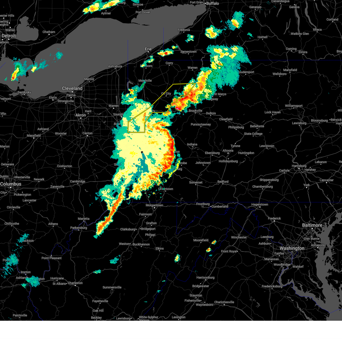
 Svrpbz the national weather service in pittsburgh has issued a * severe thunderstorm warning for, forest county in northwestern pennsylvania, northeastern venango county in northwestern pennsylvania, southeastern armstrong county in west central pennsylvania, clarion county in west central pennsylvania, indiana county in west central pennsylvania, jefferson pa county in west central pennsylvania, * until 215 pm edt. * at 121 pm edt, severe thunderstorms were located along a line from near clarion to 10 miles east of kittanning, moving northeast at 55 mph (radar indicated). Hazards include 70 mph wind gusts and half dollar size hail. Hail damage to vehicles is expected. expect considerable tree damage. wind damage is also likely to mobile homes, roofs, and outbuildings. this severe thunderstorm will be near, clarion, new bethlehem and knox around 125 pm edt. brookville around 140 pm edt. marienville and punxsutawney around 145 pm edt. reynoldsville around 155 pm edt. brockway around 205 pm edt. Other locations impacted by the severe thunderstorm include limestone, hawthorn, rural valley, distant, shippenville, atwood, dayton, mahoning creek lake, strattanville and smicksburg. Svrpbz the national weather service in pittsburgh has issued a * severe thunderstorm warning for, forest county in northwestern pennsylvania, northeastern venango county in northwestern pennsylvania, southeastern armstrong county in west central pennsylvania, clarion county in west central pennsylvania, indiana county in west central pennsylvania, jefferson pa county in west central pennsylvania, * until 215 pm edt. * at 121 pm edt, severe thunderstorms were located along a line from near clarion to 10 miles east of kittanning, moving northeast at 55 mph (radar indicated). Hazards include 70 mph wind gusts and half dollar size hail. Hail damage to vehicles is expected. expect considerable tree damage. wind damage is also likely to mobile homes, roofs, and outbuildings. this severe thunderstorm will be near, clarion, new bethlehem and knox around 125 pm edt. brookville around 140 pm edt. marienville and punxsutawney around 145 pm edt. reynoldsville around 155 pm edt. brockway around 205 pm edt. Other locations impacted by the severe thunderstorm include limestone, hawthorn, rural valley, distant, shippenville, atwood, dayton, mahoning creek lake, strattanville and smicksburg.
|
| 3/16/2025 1:14 PM EDT |
 At 113 pm edt, severe thunderstorms were located along a line extending from greensburg to near seven springs to friendsville, moving northeast at 55 mph (radar indicated). Hazards include 60 mph wind gusts. Expect damage to roofs, siding, and trees. locations impacted include, acosta, salix-beauty line park, mundys corner, northern cambria, belmont, johnstown, elim, central city, buffalo mills, seven springs, friedens, and salisbury. This includes the pennsylvania turnpike from mile markers 100 to 138. At 113 pm edt, severe thunderstorms were located along a line extending from greensburg to near seven springs to friendsville, moving northeast at 55 mph (radar indicated). Hazards include 60 mph wind gusts. Expect damage to roofs, siding, and trees. locations impacted include, acosta, salix-beauty line park, mundys corner, northern cambria, belmont, johnstown, elim, central city, buffalo mills, seven springs, friedens, and salisbury. This includes the pennsylvania turnpike from mile markers 100 to 138.
|
| 3/16/2025 12:59 PM EDT |
 Svrctp the national weather service in state college pa has issued a * severe thunderstorm warning for, western bedford county in south central pennsylvania, western cambria county in central pennsylvania, somerset county in south central pennsylvania, * until 200 pm edt. * at 1257 pm edt, severe thunderstorms were located along a line extending from west newton to uniontown to kingwood, moving northeast at 55 mph (radar indicated). Hazards include 60 mph wind gusts. expect damage to roofs, siding, and trees Svrctp the national weather service in state college pa has issued a * severe thunderstorm warning for, western bedford county in south central pennsylvania, western cambria county in central pennsylvania, somerset county in south central pennsylvania, * until 200 pm edt. * at 1257 pm edt, severe thunderstorms were located along a line extending from west newton to uniontown to kingwood, moving northeast at 55 mph (radar indicated). Hazards include 60 mph wind gusts. expect damage to roofs, siding, and trees
|
| 11/20/2024 5:38 PM EST |
 At 538 pm est, severe thunderstorms were located along a line from 13 miles north of tionesta to 10 miles east of kittanning, or along a line from 22 miles northeast of oil city to 10 miles east of kittanning, moving east at 40 mph (radar indicated). Hazards include 60 mph wind gusts. Expect damage to roofs, siding, and trees. Locations impacted include, punxsutawney, clarion, kittanning, brookville, marienville, knox, rimersburg, reynoldsville, brockway, new bethlehem, tionesta, sykesville, falls creek, rural valley, sligo, big run, dayton, strattanville, summerville and limestone. At 538 pm est, severe thunderstorms were located along a line from 13 miles north of tionesta to 10 miles east of kittanning, or along a line from 22 miles northeast of oil city to 10 miles east of kittanning, moving east at 40 mph (radar indicated). Hazards include 60 mph wind gusts. Expect damage to roofs, siding, and trees. Locations impacted include, punxsutawney, clarion, kittanning, brookville, marienville, knox, rimersburg, reynoldsville, brockway, new bethlehem, tionesta, sykesville, falls creek, rural valley, sligo, big run, dayton, strattanville, summerville and limestone.
|
| 11/20/2024 5:20 PM EST |
 Svrpbz the national weather service in pittsburgh has issued a * severe thunderstorm warning for, forest county in northwestern pennsylvania, eastern venango county in northwestern pennsylvania, central armstrong county in west central pennsylvania, clarion county in west central pennsylvania, northeastern indiana county in west central pennsylvania, jefferson pa county in west central pennsylvania, * until 615 pm est. * at 520 pm est, severe thunderstorms were located along a line from 17 miles north of oil city to near ford city, or along a line from 17 miles north of oil city to near kittanning, moving east at 40 mph (radar indicated). Hazards include 60 mph wind gusts. expect damage to roofs, siding, and trees Svrpbz the national weather service in pittsburgh has issued a * severe thunderstorm warning for, forest county in northwestern pennsylvania, eastern venango county in northwestern pennsylvania, central armstrong county in west central pennsylvania, clarion county in west central pennsylvania, northeastern indiana county in west central pennsylvania, jefferson pa county in west central pennsylvania, * until 615 pm est. * at 520 pm est, severe thunderstorms were located along a line from 17 miles north of oil city to near ford city, or along a line from 17 miles north of oil city to near kittanning, moving east at 40 mph (radar indicated). Hazards include 60 mph wind gusts. expect damage to roofs, siding, and trees
|
| 10/6/2024 6:26 PM EDT |
 The severe thunderstorm warning that was previously in effect has been reissued for forest county and is in effect until 715 pm edt. please refer to that bulletin for the latest severe weather information. to report severe weather, contact your nearest law enforcement agency. they will send your report to the national weather service office. a severe thunderstorm watch remains in effect until 1100 pm edt sunday for a portion of northwest pennsylvania. The severe thunderstorm warning that was previously in effect has been reissued for forest county and is in effect until 715 pm edt. please refer to that bulletin for the latest severe weather information. to report severe weather, contact your nearest law enforcement agency. they will send your report to the national weather service office. a severe thunderstorm watch remains in effect until 1100 pm edt sunday for a portion of northwest pennsylvania.
|
| 10/6/2024 6:17 PM EDT |
 At 617 pm edt, severe thunderstorms were located along a line from 12 miles northwest of marienville to 6 miles southwest of tionesta, or along a line from 12 miles northwest of marienville to 8 miles east of oil city, moving east at 45 mph (law enforcement reported. tree damage across northern venango county). Hazards include 70 mph wind gusts and quarter size hail. Hail damage to vehicles is expected. expect considerable tree damage. wind damage is also likely to mobile homes, roofs, and outbuildings. Locations impacted include, tionesta, pleasantville, west hickory, kellettville, east hickory, starr and oil creek state park. At 617 pm edt, severe thunderstorms were located along a line from 12 miles northwest of marienville to 6 miles southwest of tionesta, or along a line from 12 miles northwest of marienville to 8 miles east of oil city, moving east at 45 mph (law enforcement reported. tree damage across northern venango county). Hazards include 70 mph wind gusts and quarter size hail. Hail damage to vehicles is expected. expect considerable tree damage. wind damage is also likely to mobile homes, roofs, and outbuildings. Locations impacted include, tionesta, pleasantville, west hickory, kellettville, east hickory, starr and oil creek state park.
|
| 10/6/2024 6:15 PM EDT |
 The tornado warning that was previously in effect has been reissued for venango and forest counties and is in effect until 645 pm edt. please refer to that bulletin for the latest severe weather information. to report severe weather, contact your nearest law enforcement agency. they will send your report to the national weather service office. a severe thunderstorm watch remains in effect until 1100 pm edt sunday for a portion of northwest pennsylvania. The tornado warning that was previously in effect has been reissued for venango and forest counties and is in effect until 645 pm edt. please refer to that bulletin for the latest severe weather information. to report severe weather, contact your nearest law enforcement agency. they will send your report to the national weather service office. a severe thunderstorm watch remains in effect until 1100 pm edt sunday for a portion of northwest pennsylvania.
|
| 10/6/2024 6:14 PM EDT |
 Torpbz the national weather service in pittsburgh has issued a * tornado warning for, northwestern forest county in northwestern pennsylvania, northeastern venango county in northwestern pennsylvania, * until 645 pm edt. * at 614 pm edt, a severe thunderstorm capable of producing a tornado was located 7 miles northwest of tionesta, or 14 miles northeast of oil city, moving east at 40 mph (radar indicated rotation). Hazards include tornado and half dollar size hail. Flying debris will be dangerous to those caught without shelter. mobile homes will be damaged or destroyed. damage to roofs, windows and vehicles will occur. Tree damage is likely. Torpbz the national weather service in pittsburgh has issued a * tornado warning for, northwestern forest county in northwestern pennsylvania, northeastern venango county in northwestern pennsylvania, * until 645 pm edt. * at 614 pm edt, a severe thunderstorm capable of producing a tornado was located 7 miles northwest of tionesta, or 14 miles northeast of oil city, moving east at 40 mph (radar indicated rotation). Hazards include tornado and half dollar size hail. Flying debris will be dangerous to those caught without shelter. mobile homes will be damaged or destroyed. damage to roofs, windows and vehicles will occur. Tree damage is likely.
|
| 10/6/2024 6:08 PM EDT |
 At 608 pm edt, a severe thunderstorm capable of producing a tornado was located 11 miles northeast of oil city, moving east at 40 mph (radar indicated rotation). Hazards include tornado and half dollar size hail. Flying debris will be dangerous to those caught without shelter. mobile homes will be damaged or destroyed. damage to roofs, windows and vehicles will occur. tree damage is likely. Locations impacted include, pleasantville and oil creek state park. At 608 pm edt, a severe thunderstorm capable of producing a tornado was located 11 miles northeast of oil city, moving east at 40 mph (radar indicated rotation). Hazards include tornado and half dollar size hail. Flying debris will be dangerous to those caught without shelter. mobile homes will be damaged or destroyed. damage to roofs, windows and vehicles will occur. tree damage is likely. Locations impacted include, pleasantville and oil creek state park.
|
| 10/6/2024 6:06 PM EDT |
 At 606 pm edt, severe thunderstorms were located along a line from 11 miles north of tionesta to near oil city, or along a line from 19 miles northwest of marienville to near oil city, moving east at 45 mph (law enforcement reported tree damage across northern venango county). Hazards include 70 mph wind gusts and quarter size hail. Hail damage to vehicles is expected. expect considerable tree damage. wind damage is also likely to mobile homes, roofs, and outbuildings. Locations impacted include, oil city, sugarcreek, tionesta, hasson heights, rouseville, pleasantville, west hickory, kellettville, east hickory, oil creek state park and starr. At 606 pm edt, severe thunderstorms were located along a line from 11 miles north of tionesta to near oil city, or along a line from 19 miles northwest of marienville to near oil city, moving east at 45 mph (law enforcement reported tree damage across northern venango county). Hazards include 70 mph wind gusts and quarter size hail. Hail damage to vehicles is expected. expect considerable tree damage. wind damage is also likely to mobile homes, roofs, and outbuildings. Locations impacted include, oil city, sugarcreek, tionesta, hasson heights, rouseville, pleasantville, west hickory, kellettville, east hickory, oil creek state park and starr.
|
| 10/6/2024 6:00 PM EDT |
 At 600 pm edt, a severe thunderstorm capable of producing a tornado was located 8 miles north of oil city, moving east at 40 mph (radar indicated rotation). Hazards include tornado and half dollar size hail. Flying debris will be dangerous to those caught without shelter. mobile homes will be damaged or destroyed. damage to roofs, windows and vehicles will occur. tree damage is likely. Locations impacted include, pleasantville and oil creek state park. At 600 pm edt, a severe thunderstorm capable of producing a tornado was located 8 miles north of oil city, moving east at 40 mph (radar indicated rotation). Hazards include tornado and half dollar size hail. Flying debris will be dangerous to those caught without shelter. mobile homes will be damaged or destroyed. damage to roofs, windows and vehicles will occur. tree damage is likely. Locations impacted include, pleasantville and oil creek state park.
|
| 10/6/2024 5:58 PM EDT |
 At 558 pm edt, severe thunderstorms were located along a line from 13 miles north of tionesta to near sugarcreek, or along a line from 20 miles northeast of oil city to 7 miles northwest of oil city, moving east at 45 mph (radar indicated). Hazards include 70 mph wind gusts and quarter size hail. Hail damage to vehicles is expected. expect considerable tree damage. wind damage is also likely to mobile homes, roofs, and outbuildings. Locations impacted include, oil city, sugarcreek, tionesta, hasson heights, rouseville, cooperstown, pleasantville, west hickory, kellettville, oil creek state park, east hickory and starr. At 558 pm edt, severe thunderstorms were located along a line from 13 miles north of tionesta to near sugarcreek, or along a line from 20 miles northeast of oil city to 7 miles northwest of oil city, moving east at 45 mph (radar indicated). Hazards include 70 mph wind gusts and quarter size hail. Hail damage to vehicles is expected. expect considerable tree damage. wind damage is also likely to mobile homes, roofs, and outbuildings. Locations impacted include, oil city, sugarcreek, tionesta, hasson heights, rouseville, cooperstown, pleasantville, west hickory, kellettville, oil creek state park, east hickory and starr.
|
| 10/6/2024 5:55 PM EDT |
 At 555 pm edt, a severe thunderstorm capable of producing a tornado was located 9 miles north of sugarcreek, or 10 miles northwest of oil city, moving east at 40 mph (radar indicated rotation). Hazards include tornado and quarter size hail. Flying debris will be dangerous to those caught without shelter. mobile homes will be damaged or destroyed. damage to roofs, windows and vehicles will occur. tree damage is likely. Locations impacted include, pleasantville and oil creek state park. At 555 pm edt, a severe thunderstorm capable of producing a tornado was located 9 miles north of sugarcreek, or 10 miles northwest of oil city, moving east at 40 mph (radar indicated rotation). Hazards include tornado and quarter size hail. Flying debris will be dangerous to those caught without shelter. mobile homes will be damaged or destroyed. damage to roofs, windows and vehicles will occur. tree damage is likely. Locations impacted include, pleasantville and oil creek state park.
|
| 10/6/2024 5:46 PM EDT |
 Torpbz the national weather service in pittsburgh has issued a * tornado warning for, northwestern forest county in northwestern pennsylvania, northern venango county in northwestern pennsylvania, * until 615 pm edt. * at 546 pm edt, a severe thunderstorm capable of producing a tornado was located 11 miles north of sugarcreek, or 14 miles north of franklin, moving east at 45 mph (radar indicated rotation). Hazards include tornado and quarter size hail. Flying debris will be dangerous to those caught without shelter. mobile homes will be damaged or destroyed. damage to roofs, windows and vehicles will occur. Tree damage is likely. Torpbz the national weather service in pittsburgh has issued a * tornado warning for, northwestern forest county in northwestern pennsylvania, northern venango county in northwestern pennsylvania, * until 615 pm edt. * at 546 pm edt, a severe thunderstorm capable of producing a tornado was located 11 miles north of sugarcreek, or 14 miles north of franklin, moving east at 45 mph (radar indicated rotation). Hazards include tornado and quarter size hail. Flying debris will be dangerous to those caught without shelter. mobile homes will be damaged or destroyed. damage to roofs, windows and vehicles will occur. Tree damage is likely.
|
| 10/6/2024 5:40 PM EDT |
 Svrpbz the national weather service in pittsburgh has issued a * severe thunderstorm warning for, northwestern forest county in northwestern pennsylvania, northern venango county in northwestern pennsylvania, * until 630 pm edt. * at 540 pm edt, severe thunderstorms were located along a line from 19 miles north of sugarcreek to 15 miles northwest of franklin, or along a line from 20 miles north of oil city to 15 miles northwest of franklin, moving east at 45 mph (radar indicated). Hazards include 70 mph wind gusts and quarter size hail. Hail damage to vehicles is expected. expect considerable tree damage. Wind damage is also likely to mobile homes, roofs, and outbuildings. Svrpbz the national weather service in pittsburgh has issued a * severe thunderstorm warning for, northwestern forest county in northwestern pennsylvania, northern venango county in northwestern pennsylvania, * until 630 pm edt. * at 540 pm edt, severe thunderstorms were located along a line from 19 miles north of sugarcreek to 15 miles northwest of franklin, or along a line from 20 miles north of oil city to 15 miles northwest of franklin, moving east at 45 mph (radar indicated). Hazards include 70 mph wind gusts and quarter size hail. Hail damage to vehicles is expected. expect considerable tree damage. Wind damage is also likely to mobile homes, roofs, and outbuildings.
|
| 8/6/2024 6:06 PM EDT |
 At 606 pm edt, severe thunderstorms were located along a line extending from 8 miles south of guys mills to 12 miles southwest of franklin to grove city, moving east at 50 mph (radar indicated). Hazards include 60 mph wind gusts and penny size hail. Expect damage to trees and power lines, resulting in some power outages. Locations impacted include, hermitage, oil city, grove city, franklin, greenville, sugarcreek, new wilmington, mercer, hasson heights, stoneboro, seneca, harrisville, parker, polk, sandy lake, clark, emlenton, rouseville, clintonville, and fredonia. At 606 pm edt, severe thunderstorms were located along a line extending from 8 miles south of guys mills to 12 miles southwest of franklin to grove city, moving east at 50 mph (radar indicated). Hazards include 60 mph wind gusts and penny size hail. Expect damage to trees and power lines, resulting in some power outages. Locations impacted include, hermitage, oil city, grove city, franklin, greenville, sugarcreek, new wilmington, mercer, hasson heights, stoneboro, seneca, harrisville, parker, polk, sandy lake, clark, emlenton, rouseville, clintonville, and fredonia.
|
| 8/6/2024 5:48 PM EDT |
 Svrpbz the national weather service in pittsburgh has issued a * severe thunderstorm warning for, mercer county in northwestern pennsylvania, venango county in northwestern pennsylvania, northeastern lawrence county in western pennsylvania, northeastern butler county in west central pennsylvania, northwestern armstrong county in west central pennsylvania, northwestern clarion county in west central pennsylvania, * until 630 pm edt. * at 547 pm edt, severe thunderstorms were located along a line extending from atlantic to near hermitage to near new wilmington, moving east at 50 mph (radar indicated). Hazards include 60 mph wind gusts and penny size hail. expect damage to trees and power lines, resulting in some power outages Svrpbz the national weather service in pittsburgh has issued a * severe thunderstorm warning for, mercer county in northwestern pennsylvania, venango county in northwestern pennsylvania, northeastern lawrence county in western pennsylvania, northeastern butler county in west central pennsylvania, northwestern armstrong county in west central pennsylvania, northwestern clarion county in west central pennsylvania, * until 630 pm edt. * at 547 pm edt, severe thunderstorms were located along a line extending from atlantic to near hermitage to near new wilmington, moving east at 50 mph (radar indicated). Hazards include 60 mph wind gusts and penny size hail. expect damage to trees and power lines, resulting in some power outages
|
| 7/24/2024 5:19 PM EDT |
 the severe thunderstorm warning has been cancelled and is no longer in effect the severe thunderstorm warning has been cancelled and is no longer in effect
|
| 7/24/2024 5:10 PM EDT |
 At 509 pm edt, a severe thunderstorm was located over titusville, or 14 miles north of oil city, moving east at 30 mph (radar indicated). Hazards include 60 mph wind gusts. Expect damage to trees and power lines, resulting in some power outages. Locations impacted include, pleasantville and oil creek state park. At 509 pm edt, a severe thunderstorm was located over titusville, or 14 miles north of oil city, moving east at 30 mph (radar indicated). Hazards include 60 mph wind gusts. Expect damage to trees and power lines, resulting in some power outages. Locations impacted include, pleasantville and oil creek state park.
|
| 7/24/2024 5:00 PM EDT |
 At 459 pm edt, a severe thunderstorm was located near titusville, or 13 miles north of oil city, moving east at 30 mph (radar indicated). Hazards include 60 mph wind gusts. Expect damage to trees and power lines, resulting in some power outages. Locations impacted include, pleasantville and oil creek state park. At 459 pm edt, a severe thunderstorm was located near titusville, or 13 miles north of oil city, moving east at 30 mph (radar indicated). Hazards include 60 mph wind gusts. Expect damage to trees and power lines, resulting in some power outages. Locations impacted include, pleasantville and oil creek state park.
|
| 7/24/2024 4:53 PM EDT |
 At 453 pm edt, a severe thunderstorm was located 7 miles west of titusville, or 13 miles northwest of oil city, moving east at 30 mph (radar indicated). Hazards include 60 mph wind gusts. Expect damage to trees and power lines, resulting in some power outages. Locations impacted include, sugarcreek, hasson heights, rouseville, cooperstown, pleasantville, and oil creek state park. At 453 pm edt, a severe thunderstorm was located 7 miles west of titusville, or 13 miles northwest of oil city, moving east at 30 mph (radar indicated). Hazards include 60 mph wind gusts. Expect damage to trees and power lines, resulting in some power outages. Locations impacted include, sugarcreek, hasson heights, rouseville, cooperstown, pleasantville, and oil creek state park.
|
| 7/24/2024 4:45 PM EDT |
 the severe thunderstorm warning has been cancelled and is no longer in effect the severe thunderstorm warning has been cancelled and is no longer in effect
|
| 7/24/2024 4:45 PM EDT |
 At 444 pm edt, a severe thunderstorm was located near guys mills, or 13 miles north of franklin, moving east at 30 mph (radar indicated). Hazards include 60 mph wind gusts. Expect damage to trees and power lines, resulting in some power outages. Locations impacted include, oil city, franklin, sugarcreek, hasson heights, seneca, rouseville, cooperstown, woodland heights, pleasantville, utica, and oil creek state park. At 444 pm edt, a severe thunderstorm was located near guys mills, or 13 miles north of franklin, moving east at 30 mph (radar indicated). Hazards include 60 mph wind gusts. Expect damage to trees and power lines, resulting in some power outages. Locations impacted include, oil city, franklin, sugarcreek, hasson heights, seneca, rouseville, cooperstown, woodland heights, pleasantville, utica, and oil creek state park.
|
| 7/24/2024 4:42 PM EDT |
 Svrpbz the national weather service in pittsburgh has issued a * severe thunderstorm warning for, eastern mercer county in northwestern pennsylvania, northern venango county in northwestern pennsylvania, * until 530 pm edt. * at 442 pm edt, a severe thunderstorm was located near guys mills, or 12 miles north of franklin, moving east at 30 mph (radar indicated). Hazards include 60 mph wind gusts. expect damage to trees and power lines, resulting in some power outages Svrpbz the national weather service in pittsburgh has issued a * severe thunderstorm warning for, eastern mercer county in northwestern pennsylvania, northern venango county in northwestern pennsylvania, * until 530 pm edt. * at 442 pm edt, a severe thunderstorm was located near guys mills, or 12 miles north of franklin, moving east at 30 mph (radar indicated). Hazards include 60 mph wind gusts. expect damage to trees and power lines, resulting in some power outages
|
| 7/10/2024 2:45 PM EDT |
 the severe thunderstorm warning has been cancelled and is no longer in effect the severe thunderstorm warning has been cancelled and is no longer in effect
|
| 7/10/2024 2:38 PM EDT |
 At 238 pm edt, a severe thunderstorm was located over titusville, or 12 miles north of oil city, moving northeast at 35 mph (radar indicated). Hazards include 60 mph wind gusts. Expect damage to trees and power lines, resulting in some power outages. Locations impacted include, pleasantville and oil creek state park. At 238 pm edt, a severe thunderstorm was located over titusville, or 12 miles north of oil city, moving northeast at 35 mph (radar indicated). Hazards include 60 mph wind gusts. Expect damage to trees and power lines, resulting in some power outages. Locations impacted include, pleasantville and oil creek state park.
|
| 7/10/2024 2:33 PM EDT |
 Svrpbz the national weather service in pittsburgh has issued a * severe thunderstorm warning for, north central venango county in northwestern pennsylvania, * until 300 pm edt. * at 233 pm edt, a severe thunderstorm was located near titusville, or 10 miles north of oil city, moving northeast at 45 mph (radar indicated). Hazards include 60 mph wind gusts. expect damage to trees and power lines, resulting in some power outages Svrpbz the national weather service in pittsburgh has issued a * severe thunderstorm warning for, north central venango county in northwestern pennsylvania, * until 300 pm edt. * at 233 pm edt, a severe thunderstorm was located near titusville, or 10 miles north of oil city, moving northeast at 45 mph (radar indicated). Hazards include 60 mph wind gusts. expect damage to trees and power lines, resulting in some power outages
|
| 6/26/2024 2:20 PM EDT | Tree down blocking the roadwa in warren county PA, 4.9 miles SSW of Pleasantville, PA |
| 5/26/2024 8:54 PM EDT |
 Svrctp the national weather service in state college pa has issued a * severe thunderstorm warning for, bedford county in south central pennsylvania, southwestern blair county in central pennsylvania, cambria county in central pennsylvania, western fulton county in south central pennsylvania, eastern somerset county in south central pennsylvania, * until 945 pm edt. * at 850 pm edt, severe thunderstorms were located along a line extending from near ligonier to somerset to frostburg to near meyersdale to lonaconing to near keyser, moving northeast at 50 mph (radar indicated). Hazards include 60 mph wind gusts. expect damage to roofs, siding, and trees Svrctp the national weather service in state college pa has issued a * severe thunderstorm warning for, bedford county in south central pennsylvania, southwestern blair county in central pennsylvania, cambria county in central pennsylvania, western fulton county in south central pennsylvania, eastern somerset county in south central pennsylvania, * until 945 pm edt. * at 850 pm edt, severe thunderstorms were located along a line extending from near ligonier to somerset to frostburg to near meyersdale to lonaconing to near keyser, moving northeast at 50 mph (radar indicated). Hazards include 60 mph wind gusts. expect damage to roofs, siding, and trees
|
| 5/8/2024 3:41 AM EDT |
 Svrctp the national weather service in state college pa has issued a * severe thunderstorm warning for, northwestern bedford county in south central pennsylvania, blair county in central pennsylvania, * until 430 am edt. * at 341 am edt, a severe thunderstorm was located over lilly, moving east at 50 mph (radar indicated). Hazards include 60 mph wind gusts. expect damage to roofs, siding, and trees Svrctp the national weather service in state college pa has issued a * severe thunderstorm warning for, northwestern bedford county in south central pennsylvania, blair county in central pennsylvania, * until 430 am edt. * at 341 am edt, a severe thunderstorm was located over lilly, moving east at 50 mph (radar indicated). Hazards include 60 mph wind gusts. expect damage to roofs, siding, and trees
|
| 4/14/2024 5:07 PM EDT |
 At 506 pm edt, severe thunderstorms were located along a line extending from 7 miles northeast of tionesta to near sharpsville, moving east at 60 mph (radar indicated). Hazards include 60 mph wind gusts and half dollar size hail. Minor hail damage to vehicles is possible. expect wind damage to trees and power lines, resulting in some power outages. Locations impacted include, hermitage, sharon, oil city, grove city, franklin, clarion, sharpsville, knox, greenville, sugarcreek, farrell, tionesta, mercer, hasson heights, stoneboro, seneca, west middlesex, polk, sandy lake, and clark. At 506 pm edt, severe thunderstorms were located along a line extending from 7 miles northeast of tionesta to near sharpsville, moving east at 60 mph (radar indicated). Hazards include 60 mph wind gusts and half dollar size hail. Minor hail damage to vehicles is possible. expect wind damage to trees and power lines, resulting in some power outages. Locations impacted include, hermitage, sharon, oil city, grove city, franklin, clarion, sharpsville, knox, greenville, sugarcreek, farrell, tionesta, mercer, hasson heights, stoneboro, seneca, west middlesex, polk, sandy lake, and clark.
|
| 4/14/2024 4:55 PM EDT |
 Svrpbz the national weather service in pittsburgh has issued a * severe thunderstorm warning for, mercer county in northwestern pennsylvania, venango county in northwestern pennsylvania, northwestern armstrong county in west central pennsylvania, northern clarion county in west central pennsylvania, western forest county in northwestern pennsylvania, * until 545 pm edt. * at 455 pm edt, severe thunderstorms were located along a line extending from 9 miles north of tionesta to 6 miles southeast of kinsman, moving southeast at 35 mph (radar indicated). Hazards include 60 mph wind gusts and quarter size hail. Minor hail damage to vehicles is possible. Expect wind damage to trees and power lines, resulting in some power outages. Svrpbz the national weather service in pittsburgh has issued a * severe thunderstorm warning for, mercer county in northwestern pennsylvania, venango county in northwestern pennsylvania, northwestern armstrong county in west central pennsylvania, northern clarion county in west central pennsylvania, western forest county in northwestern pennsylvania, * until 545 pm edt. * at 455 pm edt, severe thunderstorms were located along a line extending from 9 miles north of tionesta to 6 miles southeast of kinsman, moving southeast at 35 mph (radar indicated). Hazards include 60 mph wind gusts and quarter size hail. Minor hail damage to vehicles is possible. Expect wind damage to trees and power lines, resulting in some power outages.
|
| 8/25/2023 1:56 AM EDT |
 The severe thunderstorm warning for southeastern mercer, venango, northeastern lawrence, northern butler, northwestern jefferson, northwestern armstrong, clarion and forest counties will expire at 200 am edt, the storms which prompted the warning have moved out of the area. therefore, the warning will be allowed to expire. a severe thunderstorm watch remains in effect until 300 am edt for western and northwestern pennsylvania. The severe thunderstorm warning for southeastern mercer, venango, northeastern lawrence, northern butler, northwestern jefferson, northwestern armstrong, clarion and forest counties will expire at 200 am edt, the storms which prompted the warning have moved out of the area. therefore, the warning will be allowed to expire. a severe thunderstorm watch remains in effect until 300 am edt for western and northwestern pennsylvania.
|
| 8/25/2023 1:11 AM EDT |
 At 111 am edt, severe thunderstorms were located along a line extending from 7 miles southeast of guys mills to near grove city to near new castle, moving east at 55 mph (radar indicated). Hazards include 60 mph wind gusts. expect damage to trees and power lines, resulting in some power outages At 111 am edt, severe thunderstorms were located along a line extending from 7 miles southeast of guys mills to near grove city to near new castle, moving east at 55 mph (radar indicated). Hazards include 60 mph wind gusts. expect damage to trees and power lines, resulting in some power outages
|
| 8/15/2023 7:50 PM EDT |
 At 749 pm edt, a severe thunderstorm was located near enterprise, or 9 miles northeast of oil city, moving east at 20 mph (radar indicated). Hazards include 60 mph wind gusts and nickel size hail. Expect damage to trees and power lines, resulting in some power outages. locations impacted include, pleasantville. hail threat, radar indicated max hail size, 0. 88 in wind threat, radar indicated max wind gust, 60 mph. At 749 pm edt, a severe thunderstorm was located near enterprise, or 9 miles northeast of oil city, moving east at 20 mph (radar indicated). Hazards include 60 mph wind gusts and nickel size hail. Expect damage to trees and power lines, resulting in some power outages. locations impacted include, pleasantville. hail threat, radar indicated max hail size, 0. 88 in wind threat, radar indicated max wind gust, 60 mph.
|
| 8/15/2023 7:33 PM EDT |
 At 733 pm edt, a severe thunderstorm was located near titusville, or 7 miles north of oil city, moving east at 20 mph (radar indicated). Hazards include 60 mph wind gusts and nickel size hail. Expect damage to trees and power lines, resulting in some power outages. locations impacted include, pleasantville and oil creek state park. hail threat, radar indicated max hail size, 0. 88 in wind threat, radar indicated max wind gust, 60 mph. At 733 pm edt, a severe thunderstorm was located near titusville, or 7 miles north of oil city, moving east at 20 mph (radar indicated). Hazards include 60 mph wind gusts and nickel size hail. Expect damage to trees and power lines, resulting in some power outages. locations impacted include, pleasantville and oil creek state park. hail threat, radar indicated max hail size, 0. 88 in wind threat, radar indicated max wind gust, 60 mph.
|
| 8/15/2023 7:23 PM EDT |
 At 722 pm edt, a severe thunderstorm was located near titusville, or 9 miles north of oil city, moving east at 20 mph (radar indicated). Hazards include 60 mph wind gusts and nickel size hail. expect damage to trees and power lines, resulting in some power outages At 722 pm edt, a severe thunderstorm was located near titusville, or 9 miles north of oil city, moving east at 20 mph (radar indicated). Hazards include 60 mph wind gusts and nickel size hail. expect damage to trees and power lines, resulting in some power outages
|
| 8/12/2023 4:10 PM EDT |
 The severe thunderstorm warning for northeastern venango and northwestern forest counties will expire at 415 pm edt, the storm which prompted the warning has weakened below severe limits, and no longer poses an immediate threat to life or property. therefore, the warning will be allowed to expire. however, small hail, gusty winds and heavy rain are still possible with this thunderstorm. a tornado watch remains in effect until 900 pm edt for northwestern pennsylvania. The severe thunderstorm warning for northeastern venango and northwestern forest counties will expire at 415 pm edt, the storm which prompted the warning has weakened below severe limits, and no longer poses an immediate threat to life or property. therefore, the warning will be allowed to expire. however, small hail, gusty winds and heavy rain are still possible with this thunderstorm. a tornado watch remains in effect until 900 pm edt for northwestern pennsylvania.
|
| 8/12/2023 4:00 PM EDT |
 At 400 pm edt, a severe thunderstorm was located near enterprise, or 10 miles northeast of oil city, moving northeast at 50 mph (radar indicated). Hazards include golf ball size hail and 60 mph wind gusts. People and animals outdoors will be injured. expect hail damage to roofs, siding, windows, and vehicles. expect wind damage to trees and power lines, resulting in some power outages. Locations impacted include, pleasantville, west hickory, east hickory, and oil creek state park. At 400 pm edt, a severe thunderstorm was located near enterprise, or 10 miles northeast of oil city, moving northeast at 50 mph (radar indicated). Hazards include golf ball size hail and 60 mph wind gusts. People and animals outdoors will be injured. expect hail damage to roofs, siding, windows, and vehicles. expect wind damage to trees and power lines, resulting in some power outages. Locations impacted include, pleasantville, west hickory, east hickory, and oil creek state park.
|
| 8/12/2023 3:54 PM EDT |
 At 354 pm edt, a severe thunderstorm was located near oil city, moving northeast at 20 mph (radar indicated). Hazards include golf ball size hail and 60 mph wind gusts. People and animals outdoors will be injured. expect hail damage to roofs, siding, windows, and vehicles. expect wind damage to trees and power lines, resulting in some power outages. Locations impacted include, oil city, sugarcreek, hasson heights, rouseville, woodland heights, pleasantville, west hickory, oil creek state park, and east hickory. At 354 pm edt, a severe thunderstorm was located near oil city, moving northeast at 20 mph (radar indicated). Hazards include golf ball size hail and 60 mph wind gusts. People and animals outdoors will be injured. expect hail damage to roofs, siding, windows, and vehicles. expect wind damage to trees and power lines, resulting in some power outages. Locations impacted include, oil city, sugarcreek, hasson heights, rouseville, woodland heights, pleasantville, west hickory, oil creek state park, and east hickory.
|
| 8/12/2023 3:43 PM EDT |
 At 343 pm edt, a severe thunderstorm was located near sugarcreek, or near oil city, moving east at 25 mph (radar indicated). Hazards include 60 mph wind gusts and half dollar size hail. Minor hail damage to vehicles is possible. expect wind damage to trees and power lines, resulting in some power outages. Locations impacted include, oil city, sugarcreek, hasson heights, rouseville, woodland heights, pleasantville, west hickory, oil creek state park, and east hickory. At 343 pm edt, a severe thunderstorm was located near sugarcreek, or near oil city, moving east at 25 mph (radar indicated). Hazards include 60 mph wind gusts and half dollar size hail. Minor hail damage to vehicles is possible. expect wind damage to trees and power lines, resulting in some power outages. Locations impacted include, oil city, sugarcreek, hasson heights, rouseville, woodland heights, pleasantville, west hickory, oil creek state park, and east hickory.
|
| 8/12/2023 3:36 PM EDT |
 At 336 pm edt, a severe thunderstorm was located near sugarcreek, or near oil city, moving northeast at 50 mph (radar indicated). Hazards include 60 mph wind gusts and quarter size hail. Minor hail damage to vehicles is possible. Expect wind damage to trees and power lines, resulting in some power outages. At 336 pm edt, a severe thunderstorm was located near sugarcreek, or near oil city, moving northeast at 50 mph (radar indicated). Hazards include 60 mph wind gusts and quarter size hail. Minor hail damage to vehicles is possible. Expect wind damage to trees and power lines, resulting in some power outages.
|
| 7/26/2023 9:05 PM EDT |
 The severe thunderstorm warning for venango and western forest counties will expire at 915 pm edt, the storm which prompted the warning has weakened below severe limits, and has exited the warned area. therefore, the warning will be allowed to expire. however small hail, gusty winds and heavy rain are still possible with this thunderstorm. The severe thunderstorm warning for venango and western forest counties will expire at 915 pm edt, the storm which prompted the warning has weakened below severe limits, and has exited the warned area. therefore, the warning will be allowed to expire. however small hail, gusty winds and heavy rain are still possible with this thunderstorm.
|
| 7/26/2023 8:50 PM EDT |
 At 850 pm edt, a severe thunderstorm was located near oil city, moving northeast at 45 mph (radar indicated). Hazards include 60 mph wind gusts and quarter size hail. Minor hail damage to vehicles is possible. expect wind damage to trees and power lines, resulting in some power outages. locations impacted include, oil city, franklin, sugarcreek, hasson heights, seneca, polk, rouseville, cooperstown, woodland heights, pleasantville, utica, oil creek state park, and cranberry township. hail threat, radar indicated max hail size, 1. 00 in wind threat, radar indicated max wind gust, 60 mph. At 850 pm edt, a severe thunderstorm was located near oil city, moving northeast at 45 mph (radar indicated). Hazards include 60 mph wind gusts and quarter size hail. Minor hail damage to vehicles is possible. expect wind damage to trees and power lines, resulting in some power outages. locations impacted include, oil city, franklin, sugarcreek, hasson heights, seneca, polk, rouseville, cooperstown, woodland heights, pleasantville, utica, oil creek state park, and cranberry township. hail threat, radar indicated max hail size, 1. 00 in wind threat, radar indicated max wind gust, 60 mph.
|
| 7/26/2023 8:41 PM EDT |
 At 841 pm edt, a severe thunderstorm was located over oil city, moving east at 35 mph (radar indicated). Hazards include 60 mph wind gusts and quarter size hail. Minor hail damage to vehicles is possible. expect wind damage to trees and power lines, resulting in some power outages. locations impacted include, oil city, franklin, sugarcreek, hasson heights, seneca, polk, rouseville, cooperstown, woodland heights, pleasantville, utica, oil creek state park, and cranberry township. hail threat, radar indicated max hail size, 1. 00 in wind threat, radar indicated max wind gust, 60 mph. At 841 pm edt, a severe thunderstorm was located over oil city, moving east at 35 mph (radar indicated). Hazards include 60 mph wind gusts and quarter size hail. Minor hail damage to vehicles is possible. expect wind damage to trees and power lines, resulting in some power outages. locations impacted include, oil city, franklin, sugarcreek, hasson heights, seneca, polk, rouseville, cooperstown, woodland heights, pleasantville, utica, oil creek state park, and cranberry township. hail threat, radar indicated max hail size, 1. 00 in wind threat, radar indicated max wind gust, 60 mph.
|
| 7/26/2023 8:33 PM EDT |
 At 833 pm edt, a severe thunderstorm was located over sugarcreek, or near franklin, moving east at 40 mph (radar indicated). Hazards include 60 mph wind gusts and quarter size hail. Minor hail damage to vehicles is possible. expect wind damage to trees and power lines, resulting in some power outages. locations impacted include, oil city, franklin, sugarcreek, hasson heights, seneca, polk, rouseville, cooperstown, woodland heights, pleasantville, utica, oil creek state park, and cranberry township. hail threat, radar indicated max hail size, 1. 00 in wind threat, radar indicated max wind gust, 60 mph. At 833 pm edt, a severe thunderstorm was located over sugarcreek, or near franklin, moving east at 40 mph (radar indicated). Hazards include 60 mph wind gusts and quarter size hail. Minor hail damage to vehicles is possible. expect wind damage to trees and power lines, resulting in some power outages. locations impacted include, oil city, franklin, sugarcreek, hasson heights, seneca, polk, rouseville, cooperstown, woodland heights, pleasantville, utica, oil creek state park, and cranberry township. hail threat, radar indicated max hail size, 1. 00 in wind threat, radar indicated max wind gust, 60 mph.
|
| 7/26/2023 8:26 PM EDT |
 At 826 pm edt, a severe thunderstorm was located near sugarcreek, or near franklin, moving east at 45 mph (radar indicated). Hazards include 60 mph wind gusts and quarter size hail. Minor hail damage to vehicles is possible. Expect wind damage to trees and power lines, resulting in some power outages. At 826 pm edt, a severe thunderstorm was located near sugarcreek, or near franklin, moving east at 45 mph (radar indicated). Hazards include 60 mph wind gusts and quarter size hail. Minor hail damage to vehicles is possible. Expect wind damage to trees and power lines, resulting in some power outages.
|
| 7/20/2023 8:27 PM EDT |
 The severe thunderstorm warning for mercer, venango, lawrence, northern butler, northern jefferson, northwestern armstrong, clarion and forest counties will expire at 830 pm edt, the storms which prompted the warning have moved out of portions of the area. therefore, the warning will be allowed to expire. a new warning covers the new threat. a severe thunderstorm watch remains in effect until 300 am edt for east central ohio, and western, northwestern and west central pennsylvania. The severe thunderstorm warning for mercer, venango, lawrence, northern butler, northern jefferson, northwestern armstrong, clarion and forest counties will expire at 830 pm edt, the storms which prompted the warning have moved out of portions of the area. therefore, the warning will be allowed to expire. a new warning covers the new threat. a severe thunderstorm watch remains in effect until 300 am edt for east central ohio, and western, northwestern and west central pennsylvania.
|
| 7/20/2023 8:02 PM EDT |
 At 801 pm edt, severe thunderstorms were located along a line extending from near james city to 8 miles north of knox to near new wilmington, moving east at 60 mph (law enforcement reported trees down in mercer county). Hazards include 70 mph wind gusts and quarter size hail. Minor hail damage to vehicles is possible. trees snapped and uprooted. power outages can be expected. locations impacted include, new castle, hermitage, sharon, butler, oil city, grove city, franklin, clarion, sharpsville, brookville, marienville, knox, rimersburg, ellwood city, homeacre-lyndora, greenville, sugarcreek, farrell, shanor-northvue, and meridian. thunderstorm damage threat, considerable hail threat, radar indicated max hail size, 1. 00 in wind threat, radar indicated max wind gust, 70 mph. At 801 pm edt, severe thunderstorms were located along a line extending from near james city to 8 miles north of knox to near new wilmington, moving east at 60 mph (law enforcement reported trees down in mercer county). Hazards include 70 mph wind gusts and quarter size hail. Minor hail damage to vehicles is possible. trees snapped and uprooted. power outages can be expected. locations impacted include, new castle, hermitage, sharon, butler, oil city, grove city, franklin, clarion, sharpsville, brookville, marienville, knox, rimersburg, ellwood city, homeacre-lyndora, greenville, sugarcreek, farrell, shanor-northvue, and meridian. thunderstorm damage threat, considerable hail threat, radar indicated max hail size, 1. 00 in wind threat, radar indicated max wind gust, 70 mph.
|
| 7/20/2023 7:56 PM EDT |
 At 755 pm edt, severe thunderstorms were located along a line extending from near sheffield to 6 miles southeast of oil city to near farrell, moving east at 60 mph (radar indicated). Hazards include 70 mph wind gusts and quarter size hail. Minor hail damage to vehicles is possible. trees snapped and uprooted. power outages can be expected. locations impacted include, new castle, hermitage, sharon, butler, oil city, grove city, franklin, clarion, sharpsville, brookville, marienville, knox, rimersburg, ellwood city, homeacre-lyndora, greenville, sugarcreek, farrell, shanor-northvue, and meridian. thunderstorm damage threat, considerable hail threat, radar indicated max hail size, 1. 00 in wind threat, radar indicated max wind gust, 70 mph. At 755 pm edt, severe thunderstorms were located along a line extending from near sheffield to 6 miles southeast of oil city to near farrell, moving east at 60 mph (radar indicated). Hazards include 70 mph wind gusts and quarter size hail. Minor hail damage to vehicles is possible. trees snapped and uprooted. power outages can be expected. locations impacted include, new castle, hermitage, sharon, butler, oil city, grove city, franklin, clarion, sharpsville, brookville, marienville, knox, rimersburg, ellwood city, homeacre-lyndora, greenville, sugarcreek, farrell, shanor-northvue, and meridian. thunderstorm damage threat, considerable hail threat, radar indicated max hail size, 1. 00 in wind threat, radar indicated max wind gust, 70 mph.
|
| 7/20/2023 7:42 PM EDT |
 The severe thunderstorm warning for mercer, venango, lawrence, northwestern butler and western forest counties will expire at 745 pm edt, the warning will be allowed to expire, however a new warning is in effect. gusty winds and large hail are still possible with these thunderstorms. a severe thunderstorm watch remains in effect until 300 am edt for east central ohio, and western, northwestern and west central pennsylvania. remember, a severe thunderstorm warning still remains in effect for northwest pennsylvania. The severe thunderstorm warning for mercer, venango, lawrence, northwestern butler and western forest counties will expire at 745 pm edt, the warning will be allowed to expire, however a new warning is in effect. gusty winds and large hail are still possible with these thunderstorms. a severe thunderstorm watch remains in effect until 300 am edt for east central ohio, and western, northwestern and west central pennsylvania. remember, a severe thunderstorm warning still remains in effect for northwest pennsylvania.
|
| 7/20/2023 7:40 PM EDT |
 At 740 pm edt, severe thunderstorms were located along a line extending from near chapman state park to sugarcreek to vienna center, moving east at 60 mph (radar indicated). Hazards include 60 mph wind gusts and quarter size hail. Minor hail damage to vehicles is possible. Expect wind damage to trees and power lines, resulting in some power outages. At 740 pm edt, severe thunderstorms were located along a line extending from near chapman state park to sugarcreek to vienna center, moving east at 60 mph (radar indicated). Hazards include 60 mph wind gusts and quarter size hail. Minor hail damage to vehicles is possible. Expect wind damage to trees and power lines, resulting in some power outages.
|
| 7/20/2023 7:27 PM EDT |
 At 726 pm edt, severe thunderstorms were located along a line extending from near riceville to 10 miles south of guys mills to near canfield, moving east at 45 mph (radar indicated). Hazards include 60 mph wind gusts and half dollar size hail. Minor hail damage to vehicles is possible. expect wind damage to trees and power lines, resulting in some power outages. locations impacted include, new castle, hermitage, sharon, oil city, grove city, franklin, sharpsville, greenville, sugarcreek, farrell, slippery rock, new wilmington, oakwood, new castle northwest, tionesta, mercer, new beaver, pulaski, hasson heights, and bessemer. hail threat, radar indicated max hail size, 1. 25 in wind threat, radar indicated max wind gust, 60 mph. At 726 pm edt, severe thunderstorms were located along a line extending from near riceville to 10 miles south of guys mills to near canfield, moving east at 45 mph (radar indicated). Hazards include 60 mph wind gusts and half dollar size hail. Minor hail damage to vehicles is possible. expect wind damage to trees and power lines, resulting in some power outages. locations impacted include, new castle, hermitage, sharon, oil city, grove city, franklin, sharpsville, greenville, sugarcreek, farrell, slippery rock, new wilmington, oakwood, new castle northwest, tionesta, mercer, new beaver, pulaski, hasson heights, and bessemer. hail threat, radar indicated max hail size, 1. 25 in wind threat, radar indicated max wind gust, 60 mph.
|
| 7/20/2023 7:25 PM EDT |
 At 725 pm edt, severe thunderstorms were located along a line extending from near riceville to 10 miles south of guys mills to near canfield, moving southeast at 45 mph (radar indicated). Hazards include 60 mph wind gusts and penny size hail. Expect damage to trees and power lines, resulting in some power outages. locations impacted include, new castle, hermitage, sharon, oil city, grove city, franklin, sharpsville, greenville, sugarcreek, farrell, slippery rock, new wilmington, oakwood, new castle northwest, tionesta, mercer, new beaver, pulaski, hasson heights, and bessemer. hail threat, radar indicated max hail size, 0. 75 in wind threat, radar indicated max wind gust, 60 mph. At 725 pm edt, severe thunderstorms were located along a line extending from near riceville to 10 miles south of guys mills to near canfield, moving southeast at 45 mph (radar indicated). Hazards include 60 mph wind gusts and penny size hail. Expect damage to trees and power lines, resulting in some power outages. locations impacted include, new castle, hermitage, sharon, oil city, grove city, franklin, sharpsville, greenville, sugarcreek, farrell, slippery rock, new wilmington, oakwood, new castle northwest, tionesta, mercer, new beaver, pulaski, hasson heights, and bessemer. hail threat, radar indicated max hail size, 0. 75 in wind threat, radar indicated max wind gust, 60 mph.
|
| 7/20/2023 7:04 PM EDT |
 At 704 pm edt, severe thunderstorms were located along a line extending from near waterford to near harmonsburg to near garrettsville, moving southeast at 45 mph (radar indicated). Hazards include 60 mph wind gusts and quarter size hail. Minor hail damage to vehicles is possible. expect wind damage to trees and power lines, resulting in some power outages. locations impacted include, new castle, hermitage, sharon, oil city, grove city, franklin, sharpsville, greenville, sugarcreek, farrell, slippery rock, new wilmington, oakwood, new castle northwest, tionesta, mercer, new beaver, pulaski, hasson heights, and bessemer. hail threat, radar indicated max hail size, 1. 00 in wind threat, radar indicated max wind gust, 60 mph. At 704 pm edt, severe thunderstorms were located along a line extending from near waterford to near harmonsburg to near garrettsville, moving southeast at 45 mph (radar indicated). Hazards include 60 mph wind gusts and quarter size hail. Minor hail damage to vehicles is possible. expect wind damage to trees and power lines, resulting in some power outages. locations impacted include, new castle, hermitage, sharon, oil city, grove city, franklin, sharpsville, greenville, sugarcreek, farrell, slippery rock, new wilmington, oakwood, new castle northwest, tionesta, mercer, new beaver, pulaski, hasson heights, and bessemer. hail threat, radar indicated max hail size, 1. 00 in wind threat, radar indicated max wind gust, 60 mph.
|
| 7/20/2023 6:51 PM EDT |
 At 650 pm edt, severe thunderstorms were located along a line extending from near erie to 7 miles north of harmonsburg to near garrettsville, moving southeast at 45 mph (radar indicated). Hazards include 60 mph wind gusts and penny size hail. expect damage to trees and power lines, resulting in some power outages At 650 pm edt, severe thunderstorms were located along a line extending from near erie to 7 miles north of harmonsburg to near garrettsville, moving southeast at 45 mph (radar indicated). Hazards include 60 mph wind gusts and penny size hail. expect damage to trees and power lines, resulting in some power outages
|
| 4/5/2023 10:37 PM EDT |
 The severe thunderstorm warning for western bedford, southwestern blair, south central cambria and eastern somerset counties will expire at 1045 pm edt, the storms which prompted the warning have weakened below severe limits, and have exited the warned area. therefore, the warning will be allowed to expire. however, gusty winds are still possible with these thunderstorms. The severe thunderstorm warning for western bedford, southwestern blair, south central cambria and eastern somerset counties will expire at 1045 pm edt, the storms which prompted the warning have weakened below severe limits, and have exited the warned area. therefore, the warning will be allowed to expire. however, gusty winds are still possible with these thunderstorms.
|
| 4/5/2023 10:18 PM EDT |
 At 1018 pm edt, severe thunderstorms were located along a line extending from lilly to near central city to near la vale, moving east at 45 mph (radar indicated). Hazards include 60 mph wind gusts. Expect damage to roofs, siding, and trees. locations impacted include, bedford, portage, claysburg, osterburg, central city, beaverdale-lloydell, buffalo mills, dunlo, st. clairsville, lake gordon, blue knob state park and cessna. this includes the following interstates, the pennsylvania turnpike from mile markers 123 to 151. interstate 99 from mile markers 0 to 15. hail threat, radar indicated max hail size, <. 75 in wind threat, radar indicated max wind gust, 60 mph. At 1018 pm edt, severe thunderstorms were located along a line extending from lilly to near central city to near la vale, moving east at 45 mph (radar indicated). Hazards include 60 mph wind gusts. Expect damage to roofs, siding, and trees. locations impacted include, bedford, portage, claysburg, osterburg, central city, beaverdale-lloydell, buffalo mills, dunlo, st. clairsville, lake gordon, blue knob state park and cessna. this includes the following interstates, the pennsylvania turnpike from mile markers 123 to 151. interstate 99 from mile markers 0 to 15. hail threat, radar indicated max hail size, <. 75 in wind threat, radar indicated max wind gust, 60 mph.
|
| 4/5/2023 10:09 PM EDT |
 At 1009 pm edt, severe thunderstorms were located along a line extending from portage to central city to near meyersdale, moving east at 55 mph (radar indicated). Hazards include 60 mph wind gusts. Expect damage to roofs, siding, and trees. locations impacted include, johnstown, windber, bedford, belmont, portage, geistown, meyersdale, berlin, claysburg, friedens, vinco and osterburg. this includes the following interstates, the pennsylvania turnpike from mile markers 114 to 151. interstate 99 from mile markers 0 to 15. hail threat, radar indicated max hail size, <. 75 in wind threat, radar indicated max wind gust, 60 mph. At 1009 pm edt, severe thunderstorms were located along a line extending from portage to central city to near meyersdale, moving east at 55 mph (radar indicated). Hazards include 60 mph wind gusts. Expect damage to roofs, siding, and trees. locations impacted include, johnstown, windber, bedford, belmont, portage, geistown, meyersdale, berlin, claysburg, friedens, vinco and osterburg. this includes the following interstates, the pennsylvania turnpike from mile markers 114 to 151. interstate 99 from mile markers 0 to 15. hail threat, radar indicated max hail size, <. 75 in wind threat, radar indicated max wind gust, 60 mph.
|
| 4/5/2023 9:57 PM EDT |
 At 957 pm edt, a severe thunderstorm was located over friedens, moving east at 45 mph (radar indicated). Hazards include 60 mph wind gusts. expect damage to roofs, siding, and trees At 957 pm edt, a severe thunderstorm was located over friedens, moving east at 45 mph (radar indicated). Hazards include 60 mph wind gusts. expect damage to roofs, siding, and trees
|
| 4/1/2023 2:00 PM EDT | Tree down across the roa in warren county PA, 4 miles SW of Pleasantville, PA |
| 4/1/2023 1:59 PM EDT |
 At 158 pm edt, severe thunderstorms were located along a line extending from oil city to plum, moving east at 65 mph (radar indicated). Hazards include 60 mph wind gusts. expect damage to trees and power lines, resulting in some power outages At 158 pm edt, severe thunderstorms were located along a line extending from oil city to plum, moving east at 65 mph (radar indicated). Hazards include 60 mph wind gusts. expect damage to trees and power lines, resulting in some power outages
|
| 4/1/2023 1:34 PM EDT |
 At 134 pm edt, severe thunderstorms were located along a line extending from 10 miles southeast of atlantic to sewickley, moving east at 65 mph (radar indicated). Hazards include 60 mph wind gusts. expect damage to trees and power lines, resulting in some power outages At 134 pm edt, severe thunderstorms were located along a line extending from 10 miles southeast of atlantic to sewickley, moving east at 65 mph (radar indicated). Hazards include 60 mph wind gusts. expect damage to trees and power lines, resulting in some power outages
|
| 3/25/2023 3:52 PM EDT |
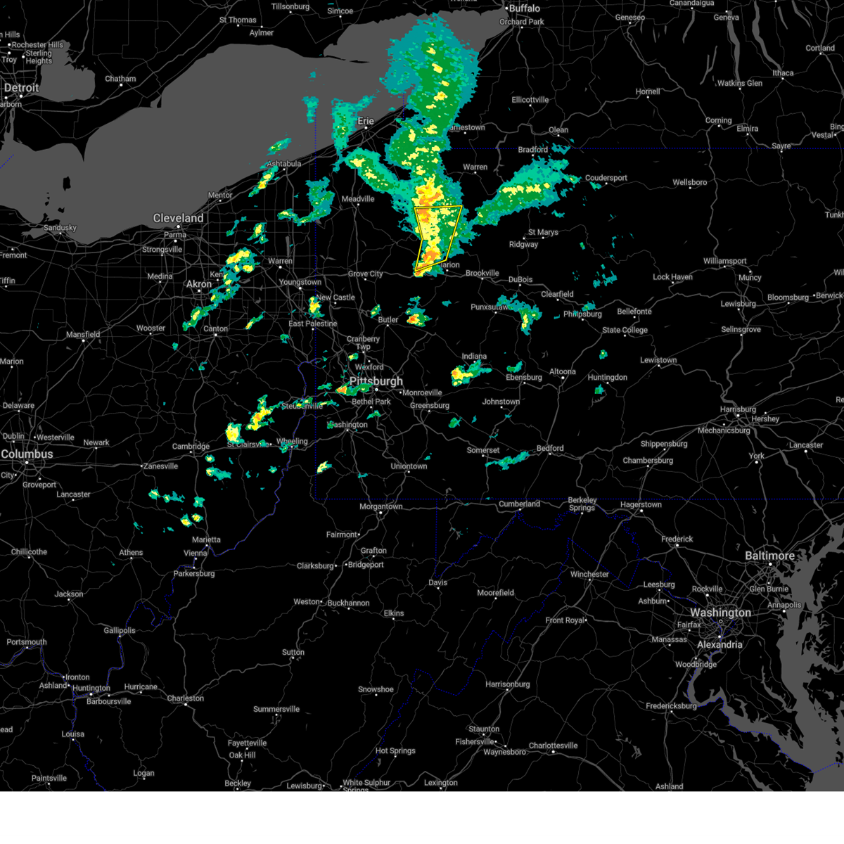 At 352 pm edt, severe thunderstorms were located along a line extending from near titusville to 12 miles west of knox, moving east at 45 mph (law enforcement). Hazards include 60 mph wind gusts. Expect damage to trees and power lines, resulting in some power outages. locations impacted include, tionesta, pleasantville, fryburg, west hickory, east hickory, and starr. hail threat, radar indicated max hail size, <. 75 in wind threat, radar indicated max wind gust, 60 mph. At 352 pm edt, severe thunderstorms were located along a line extending from near titusville to 12 miles west of knox, moving east at 45 mph (law enforcement). Hazards include 60 mph wind gusts. Expect damage to trees and power lines, resulting in some power outages. locations impacted include, tionesta, pleasantville, fryburg, west hickory, east hickory, and starr. hail threat, radar indicated max hail size, <. 75 in wind threat, radar indicated max wind gust, 60 mph.
|
| 3/25/2023 3:47 PM EDT |
 At 347 pm edt, severe thunderstorms were located along a line extending from 6 miles southwest of titusville to 14 miles west of knox, moving east at 45 mph (law enforcement). Hazards include 60 mph wind gusts. Expect damage to trees and power lines, resulting in some power outages. locations impacted include, oil city, tionesta, hasson heights, seneca, rouseville, woodland heights, pleasantville, fryburg, west hickory, starr, east hickory, and cranberry township. hail threat, radar indicated max hail size, <. 75 in wind threat, radar indicated max wind gust, 60 mph. At 347 pm edt, severe thunderstorms were located along a line extending from 6 miles southwest of titusville to 14 miles west of knox, moving east at 45 mph (law enforcement). Hazards include 60 mph wind gusts. Expect damage to trees and power lines, resulting in some power outages. locations impacted include, oil city, tionesta, hasson heights, seneca, rouseville, woodland heights, pleasantville, fryburg, west hickory, starr, east hickory, and cranberry township. hail threat, radar indicated max hail size, <. 75 in wind threat, radar indicated max wind gust, 60 mph.
|
| 3/25/2023 3:38 PM EDT |
 At 338 pm edt, severe thunderstorms were located along a line extending from 6 miles north of sugarcreek to 10 miles northeast of slippery rock, moving east at 45 mph (law enforcement). Hazards include 60 mph wind gusts. Expect damage to trees and power lines, resulting in some power outages. locations impacted include, oil city, franklin, sugarcreek, tionesta, hasson heights, seneca, rouseville, clintonville, cooperstown, kennerdell, woodland heights, and pleasantville. hail threat, radar indicated max hail size, <. 75 in wind threat, radar indicated max wind gust, 60 mph. At 338 pm edt, severe thunderstorms were located along a line extending from 6 miles north of sugarcreek to 10 miles northeast of slippery rock, moving east at 45 mph (law enforcement). Hazards include 60 mph wind gusts. Expect damage to trees and power lines, resulting in some power outages. locations impacted include, oil city, franklin, sugarcreek, tionesta, hasson heights, seneca, rouseville, clintonville, cooperstown, kennerdell, woodland heights, and pleasantville. hail threat, radar indicated max hail size, <. 75 in wind threat, radar indicated max wind gust, 60 mph.
|
| 3/25/2023 3:25 PM EDT |
 At 325 pm edt, severe thunderstorms were located along a line extending from 7 miles northwest of sugarcreek to near slippery rock, moving east at 40 mph (radar indicated). Hazards include 60 mph wind gusts. expect damage to trees and power lines, resulting in some power outages At 325 pm edt, severe thunderstorms were located along a line extending from 7 miles northwest of sugarcreek to near slippery rock, moving east at 40 mph (radar indicated). Hazards include 60 mph wind gusts. expect damage to trees and power lines, resulting in some power outages
|
| 8/4/2022 1:57 PM EDT | Tree down at the intersection of sr36 and dory carson roa in forest county PA, 104.7 miles SSE of Pleasantville, PA |
| 7/25/2022 1:24 AM EDT |
 At 124 am edt, a severe thunderstorm was located near oil city, moving east at 25 mph (radar indicated). Hazards include 60 mph wind gusts. expect damage to trees and power lines, resulting in some power outages At 124 am edt, a severe thunderstorm was located near oil city, moving east at 25 mph (radar indicated). Hazards include 60 mph wind gusts. expect damage to trees and power lines, resulting in some power outages
|
| 7/24/2022 7:16 PM EDT |
 At 716 pm edt, a severe thunderstorm was located 7 miles south of franklin, moving east at 40 mph (radar indicated). Hazards include 60 mph wind gusts. Expect damage to trees and power lines, resulting in some power outages. locations impacted include, oil city, franklin, sugarcreek, tionesta, hasson heights, seneca, polk, rouseville, clintonville, kennerdell, woodland heights, and pleasantville. hail threat, radar indicated max hail size, <. 75 in wind threat, radar indicated max wind gust, 60 mph. At 716 pm edt, a severe thunderstorm was located 7 miles south of franklin, moving east at 40 mph (radar indicated). Hazards include 60 mph wind gusts. Expect damage to trees and power lines, resulting in some power outages. locations impacted include, oil city, franklin, sugarcreek, tionesta, hasson heights, seneca, polk, rouseville, clintonville, kennerdell, woodland heights, and pleasantville. hail threat, radar indicated max hail size, <. 75 in wind threat, radar indicated max wind gust, 60 mph.
|
| 7/24/2022 7:07 PM EDT |
 At 707 pm edt, a severe thunderstorm was located 10 miles southwest of franklin, moving east at 40 mph (radar indicated). Hazards include 60 mph wind gusts. expect damage to trees and power lines, resulting in some power outages At 707 pm edt, a severe thunderstorm was located 10 miles southwest of franklin, moving east at 40 mph (radar indicated). Hazards include 60 mph wind gusts. expect damage to trees and power lines, resulting in some power outages
|
| 7/24/2022 4:49 PM EDT |
 At 449 pm edt, a severe thunderstorm was located near tionesta, or 9 miles northeast of oil city, moving northeast at 35 mph (radar indicated). Hazards include 60 mph wind gusts and quarter size hail. Minor hail damage to vehicles is possible. Expect wind damage to trees and power lines, resulting in some power outages. At 449 pm edt, a severe thunderstorm was located near tionesta, or 9 miles northeast of oil city, moving northeast at 35 mph (radar indicated). Hazards include 60 mph wind gusts and quarter size hail. Minor hail damage to vehicles is possible. Expect wind damage to trees and power lines, resulting in some power outages.
|
| 7/24/2022 4:42 PM EDT |
 At 442 pm edt, a severe thunderstorm was located near enterprise, or 10 miles northeast of oil city, moving northeast at 35 mph (radar indicated). Hazards include 60 mph wind gusts and quarter size hail. Minor hail damage to vehicles is possible. expect wind damage to trees and power lines, resulting in some power outages. locations impacted include, oil city, sugarcreek, hasson heights, seneca, rouseville, woodland heights, pleasantville, and oil creek state park. hail threat, radar indicated max hail size, 1. 00 in wind threat, radar indicated max wind gust, 60 mph. At 442 pm edt, a severe thunderstorm was located near enterprise, or 10 miles northeast of oil city, moving northeast at 35 mph (radar indicated). Hazards include 60 mph wind gusts and quarter size hail. Minor hail damage to vehicles is possible. expect wind damage to trees and power lines, resulting in some power outages. locations impacted include, oil city, sugarcreek, hasson heights, seneca, rouseville, woodland heights, pleasantville, and oil creek state park. hail threat, radar indicated max hail size, 1. 00 in wind threat, radar indicated max wind gust, 60 mph.
|
| 7/24/2022 4:28 PM EDT |
 At 428 pm edt, a severe thunderstorm was located near oil city, moving northeast at 35 mph (radar indicated). Hazards include 60 mph wind gusts and quarter size hail. Minor hail damage to vehicles is possible. expect wind damage to trees and power lines, resulting in some power outages. locations impacted include, oil city, franklin, sugarcreek, hasson heights, seneca, rouseville, cooperstown, woodland heights, pleasantville, and oil creek state park. hail threat, radar indicated max hail size, 1. 00 in wind threat, radar indicated max wind gust, 60 mph. At 428 pm edt, a severe thunderstorm was located near oil city, moving northeast at 35 mph (radar indicated). Hazards include 60 mph wind gusts and quarter size hail. Minor hail damage to vehicles is possible. expect wind damage to trees and power lines, resulting in some power outages. locations impacted include, oil city, franklin, sugarcreek, hasson heights, seneca, rouseville, cooperstown, woodland heights, pleasantville, and oil creek state park. hail threat, radar indicated max hail size, 1. 00 in wind threat, radar indicated max wind gust, 60 mph.
|
| 7/24/2022 4:10 PM EDT |
 At 410 pm edt, a severe thunderstorm was located near franklin, moving northeast at 35 mph (radar indicated). Hazards include 60 mph wind gusts and quarter size hail. Minor hail damage to vehicles is possible. Expect wind damage to trees and power lines, resulting in some power outages. At 410 pm edt, a severe thunderstorm was located near franklin, moving northeast at 35 mph (radar indicated). Hazards include 60 mph wind gusts and quarter size hail. Minor hail damage to vehicles is possible. Expect wind damage to trees and power lines, resulting in some power outages.
|
| 7/24/2022 1:40 PM EDT |
 The severe thunderstorm warning for venango, northwestern clarion and northwestern forest counties will expire at 145 pm edt, the storm which prompted the warning has weakened below severe limits, and no longer poses an immediate threat to life or property. therefore, the warning will be allowed to expire. however, gusty winds and heavy rain are still possible with this thunderstorm. The severe thunderstorm warning for venango, northwestern clarion and northwestern forest counties will expire at 145 pm edt, the storm which prompted the warning has weakened below severe limits, and no longer poses an immediate threat to life or property. therefore, the warning will be allowed to expire. however, gusty winds and heavy rain are still possible with this thunderstorm.
|
| 7/24/2022 1:31 PM EDT |
 At 130 pm edt, a severe thunderstorm was located near franklin, moving east at 30 mph (radar indicated). Hazards include 60 mph wind gusts and penny size hail. Expect damage to trees and power lines, resulting in some power outages. locations impacted include, oil city, franklin, sugarcreek, tionesta, hasson heights, seneca, polk, rouseville, cooperstown, kennerdell, woodland heights, and pleasantville. hail threat, radar indicated max hail size, 0. 75 in wind threat, radar indicated max wind gust, 60 mph. At 130 pm edt, a severe thunderstorm was located near franklin, moving east at 30 mph (radar indicated). Hazards include 60 mph wind gusts and penny size hail. Expect damage to trees and power lines, resulting in some power outages. locations impacted include, oil city, franklin, sugarcreek, tionesta, hasson heights, seneca, polk, rouseville, cooperstown, kennerdell, woodland heights, and pleasantville. hail threat, radar indicated max hail size, 0. 75 in wind threat, radar indicated max wind gust, 60 mph.
|
| 7/24/2022 1:09 PM EDT |
 At 109 pm edt, a severe thunderstorm was located 8 miles southwest of franklin, moving east at 25 mph (radar indicated). Hazards include 60 mph wind gusts and half dollar size hail. Minor hail damage to vehicles is possible. expect wind damage to trees and power lines, resulting in some power outages. locations impacted include, oil city, franklin, sugarcreek, tionesta, hasson heights, stoneboro, seneca, polk, sandy lake, rouseville, cooperstown, and kennerdell. hail threat, radar indicated max hail size, 1. 25 in wind threat, radar indicated max wind gust, 60 mph. At 109 pm edt, a severe thunderstorm was located 8 miles southwest of franklin, moving east at 25 mph (radar indicated). Hazards include 60 mph wind gusts and half dollar size hail. Minor hail damage to vehicles is possible. expect wind damage to trees and power lines, resulting in some power outages. locations impacted include, oil city, franklin, sugarcreek, tionesta, hasson heights, stoneboro, seneca, polk, sandy lake, rouseville, cooperstown, and kennerdell. hail threat, radar indicated max hail size, 1. 25 in wind threat, radar indicated max wind gust, 60 mph.
|
| 7/24/2022 1:00 PM EDT |
 At 100 pm edt, a severe thunderstorm was located near franklin, moving east at 25 mph (radar indicated). Hazards include 60 mph wind gusts and penny size hail. expect damage to trees and power lines, resulting in some power outages At 100 pm edt, a severe thunderstorm was located near franklin, moving east at 25 mph (radar indicated). Hazards include 60 mph wind gusts and penny size hail. expect damage to trees and power lines, resulting in some power outages
|
| 6/22/2022 7:16 PM EDT |
 At 716 pm edt, a severe thunderstorm was located over bedford, moving southeast at 40 mph (radar indicated). Hazards include 60 mph wind gusts and nickel size hail. Expect damage to roofs, siding, and trees. locations impacted include, bedford, roaring spring, new enterprise, martinsburg, everett, claysburg, osterburg, st. clairsville, blue knob state park, queen, cessna and ski gap. this includes the following interstates, the pennsylvania turnpike between mile markers 132 and 151, and near mile marker 153. interstate 99 from mile markers 0 to 23. hail threat, radar indicated max hail size, 0. 88 in wind threat, radar indicated max wind gust, 60 mph. At 716 pm edt, a severe thunderstorm was located over bedford, moving southeast at 40 mph (radar indicated). Hazards include 60 mph wind gusts and nickel size hail. Expect damage to roofs, siding, and trees. locations impacted include, bedford, roaring spring, new enterprise, martinsburg, everett, claysburg, osterburg, st. clairsville, blue knob state park, queen, cessna and ski gap. this includes the following interstates, the pennsylvania turnpike between mile markers 132 and 151, and near mile marker 153. interstate 99 from mile markers 0 to 23. hail threat, radar indicated max hail size, 0. 88 in wind threat, radar indicated max wind gust, 60 mph.
|
| 6/22/2022 6:45 PM EDT |
 At 645 pm edt, a severe thunderstorm was located over ogletown, moving southeast at 40 mph (radar indicated). Hazards include 60 mph wind gusts and quarter size hail. Hail damage to vehicles is expected. Expect wind damage to roofs, siding, and trees. At 645 pm edt, a severe thunderstorm was located over ogletown, moving southeast at 40 mph (radar indicated). Hazards include 60 mph wind gusts and quarter size hail. Hail damage to vehicles is expected. Expect wind damage to roofs, siding, and trees.
|
| 6/16/2022 4:23 PM EDT |
 At 423 pm edt, a severe thunderstorm was located near oil city, moving east at 45 mph (radar indicated). Hazards include golf ball size hail and 60 mph wind gusts. People and animals outdoors will be injured. expect hail damage to roofs, siding, windows, and vehicles. expect wind damage to trees and power lines, resulting in some power outages. locations impacted include, oil city, marienville, tionesta, hasson heights, seneca, rouseville, woodland heights, pleasantville, kellettville, west hickory, starr, and east hickory. thunderstorm damage threat, considerable hail threat, radar indicated max hail size, 1. 75 in wind threat, radar indicated max wind gust, 60 mph. At 423 pm edt, a severe thunderstorm was located near oil city, moving east at 45 mph (radar indicated). Hazards include golf ball size hail and 60 mph wind gusts. People and animals outdoors will be injured. expect hail damage to roofs, siding, windows, and vehicles. expect wind damage to trees and power lines, resulting in some power outages. locations impacted include, oil city, marienville, tionesta, hasson heights, seneca, rouseville, woodland heights, pleasantville, kellettville, west hickory, starr, and east hickory. thunderstorm damage threat, considerable hail threat, radar indicated max hail size, 1. 75 in wind threat, radar indicated max wind gust, 60 mph.
|
| 6/16/2022 4:13 PM EDT |
 At 413 pm edt, a severe thunderstorm was located over sugarcreek, or near oil city, moving east at 45 mph (radar indicated). Hazards include 60 mph wind gusts and quarter size hail. Minor hail damage to vehicles is possible. expect wind damage to trees and power lines, resulting in some power outages. locations impacted include, oil city, franklin, marienville, sugarcreek, tionesta, hasson heights, seneca, rouseville, cooperstown, woodland heights, pleasantville, and kellettville. hail threat, radar indicated max hail size, 1. 00 in wind threat, radar indicated max wind gust, 60 mph. At 413 pm edt, a severe thunderstorm was located over sugarcreek, or near oil city, moving east at 45 mph (radar indicated). Hazards include 60 mph wind gusts and quarter size hail. Minor hail damage to vehicles is possible. expect wind damage to trees and power lines, resulting in some power outages. locations impacted include, oil city, franklin, marienville, sugarcreek, tionesta, hasson heights, seneca, rouseville, cooperstown, woodland heights, pleasantville, and kellettville. hail threat, radar indicated max hail size, 1. 00 in wind threat, radar indicated max wind gust, 60 mph.
|
| 6/16/2022 3:55 PM EDT |
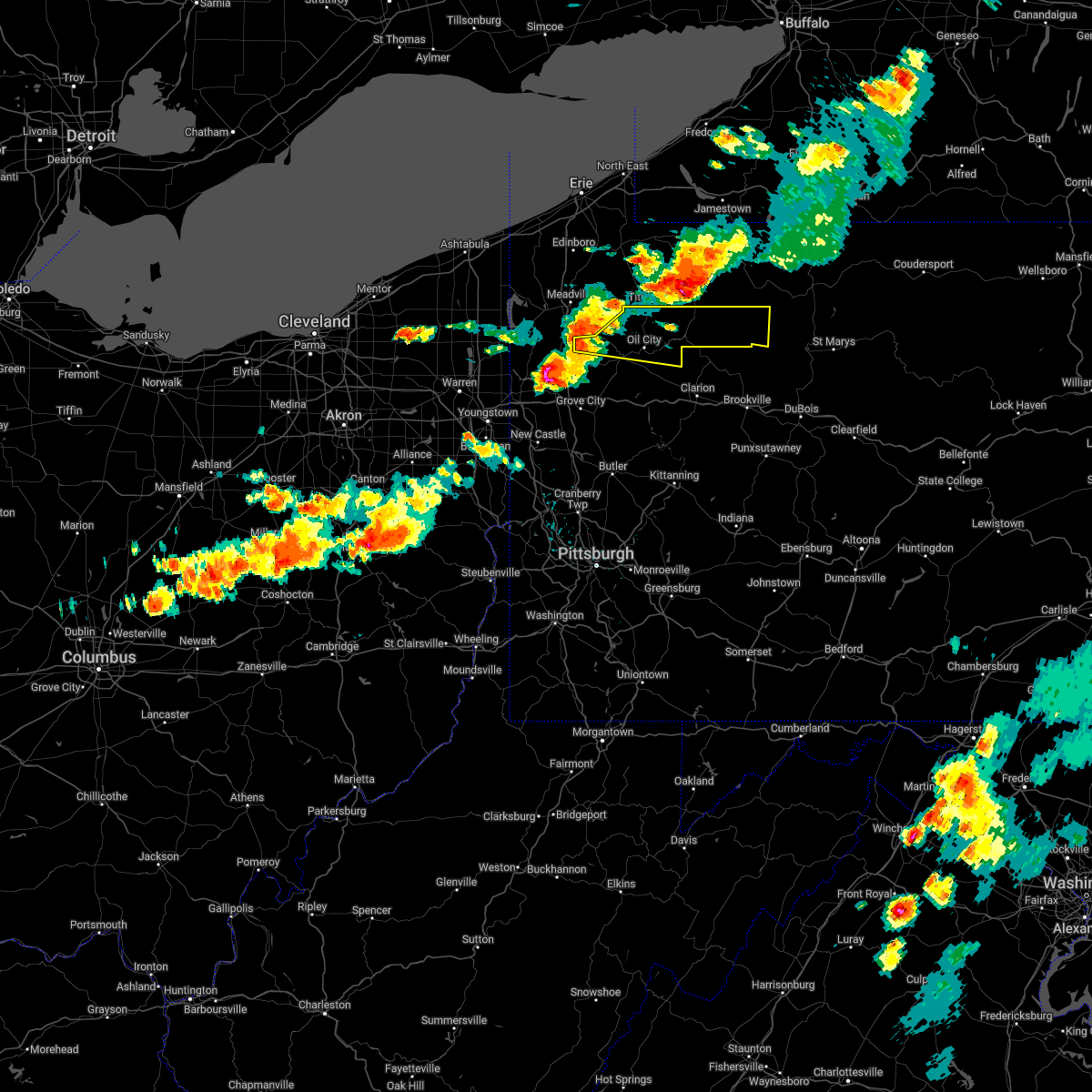 At 355 pm edt, a severe thunderstorm was located 10 miles northwest of franklin, moving east at 45 mph (radar indicated). Hazards include 60 mph wind gusts and quarter size hail. Minor hail damage to vehicles is possible. Expect wind damage to trees and power lines, resulting in some power outages. At 355 pm edt, a severe thunderstorm was located 10 miles northwest of franklin, moving east at 45 mph (radar indicated). Hazards include 60 mph wind gusts and quarter size hail. Minor hail damage to vehicles is possible. Expect wind damage to trees and power lines, resulting in some power outages.
|
| 6/1/2022 5:59 PM EDT |
 At 559 pm edt, a severe thunderstorm was located 7 miles southwest of titusville, or 10 miles northwest of oil city, moving east at 15 mph (radar indicated). Hazards include 60 mph wind gusts and quarter size hail. Minor hail damage to vehicles is possible. expect wind damage to trees and power lines, resulting in some power outages. Locations impacted include, oil city, sugarcreek, hasson heights, rouseville, woodland heights, pleasantville, and oil creek state park. At 559 pm edt, a severe thunderstorm was located 7 miles southwest of titusville, or 10 miles northwest of oil city, moving east at 15 mph (radar indicated). Hazards include 60 mph wind gusts and quarter size hail. Minor hail damage to vehicles is possible. expect wind damage to trees and power lines, resulting in some power outages. Locations impacted include, oil city, sugarcreek, hasson heights, rouseville, woodland heights, pleasantville, and oil creek state park.
|
| 6/1/2022 5:48 PM EDT |
 At 548 pm edt, a severe thunderstorm was located 7 miles southeast of guys mills, or 12 miles northwest of oil city, moving east at 15 mph (radar indicated). Hazards include 60 mph wind gusts and quarter size hail. Minor hail damage to vehicles is possible. Expect wind damage to trees and power lines, resulting in some power outages. At 548 pm edt, a severe thunderstorm was located 7 miles southeast of guys mills, or 12 miles northwest of oil city, moving east at 15 mph (radar indicated). Hazards include 60 mph wind gusts and quarter size hail. Minor hail damage to vehicles is possible. Expect wind damage to trees and power lines, resulting in some power outages.
|
| 5/21/2022 8:42 PM EDT |
 The severe thunderstorm warning for venango. northeastern butler. northwestern armstrong and western clarion counties will expire at 845 pm edt. the storms which prompted the warning have weakened below severe limits, and no longer pose an immediate threat to life or property. Therefore, the warning will be allowed to expire. The severe thunderstorm warning for venango. northeastern butler. northwestern armstrong and western clarion counties will expire at 845 pm edt. the storms which prompted the warning have weakened below severe limits, and no longer pose an immediate threat to life or property. Therefore, the warning will be allowed to expire.
|
| 5/21/2022 8:21 PM EDT |
 At 821 pm edt, severe thunderstorms were located along a line extending from 6 miles northwest of sugarcreek to 10 miles east of grove city, moving northeast at 45 mph (radar indicated). Hazards include 60 mph wind gusts and quarter size hail. Minor hail damage to vehicles is possible. Expect wind damage to trees and power lines, resulting in some power outages. At 821 pm edt, severe thunderstorms were located along a line extending from 6 miles northwest of sugarcreek to 10 miles east of grove city, moving northeast at 45 mph (radar indicated). Hazards include 60 mph wind gusts and quarter size hail. Minor hail damage to vehicles is possible. Expect wind damage to trees and power lines, resulting in some power outages.
|
| 5/20/2022 10:56 AM EDT |
 At 1055 am edt, severe thunderstorms were located along a line extending from jerome to near central city to berlin to meyersdale, moving northeast at 60 mph (radar indicated). Hazards include 60 mph wind gusts. expect damage to roofs, siding, and trees At 1055 am edt, severe thunderstorms were located along a line extending from jerome to near central city to berlin to meyersdale, moving northeast at 60 mph (radar indicated). Hazards include 60 mph wind gusts. expect damage to roofs, siding, and trees
|
| 5/1/2022 8:56 PM EDT |
 The severe thunderstorm warning for northeastern mercer and northern venango counties will expire at 900 pm edt, the storm which prompted the warning has weakened; therefore, the warning will be allowed to expire. however gusty winds are still possible with this thunderstorm. The severe thunderstorm warning for northeastern mercer and northern venango counties will expire at 900 pm edt, the storm which prompted the warning has weakened; therefore, the warning will be allowed to expire. however gusty winds are still possible with this thunderstorm.
|
| 5/1/2022 8:27 PM EDT |
 At 827 pm edt, a severe thunderstorm was located 9 miles northwest of franklin, moving northeast at 35 mph (radar indicated). Hazards include 60 mph wind gusts and quarter size hail. Minor hail damage to vehicles is possible. expect wind damage to trees and power lines, resulting in some power outages. locations impacted include, oil city, franklin, sugarcreek, hasson heights, polk, sandy lake, rouseville, cooperstown, pleasantville, utica, new lebanon, and maurice k goddard state park. hail threat, observed max hail size, 1. 00 in wind threat, radar indicated max wind gust, 60 mph. At 827 pm edt, a severe thunderstorm was located 9 miles northwest of franklin, moving northeast at 35 mph (radar indicated). Hazards include 60 mph wind gusts and quarter size hail. Minor hail damage to vehicles is possible. expect wind damage to trees and power lines, resulting in some power outages. locations impacted include, oil city, franklin, sugarcreek, hasson heights, polk, sandy lake, rouseville, cooperstown, pleasantville, utica, new lebanon, and maurice k goddard state park. hail threat, observed max hail size, 1. 00 in wind threat, radar indicated max wind gust, 60 mph.
|
| 5/1/2022 8:14 PM EDT |
 At 814 pm edt, a severe thunderstorm was located 13 miles east of greenville, or 14 miles west of franklin, moving northeast at 35 mph (radar indicated). Hazards include 60 mph wind gusts and quarter size hail. Minor hail damage to vehicles is possible. Expect wind damage to trees and power lines, resulting in some power outages. At 814 pm edt, a severe thunderstorm was located 13 miles east of greenville, or 14 miles west of franklin, moving northeast at 35 mph (radar indicated). Hazards include 60 mph wind gusts and quarter size hail. Minor hail damage to vehicles is possible. Expect wind damage to trees and power lines, resulting in some power outages.
|
| 3/7/2022 5:27 PM EST |
 At 527 pm est, severe thunderstorms were located along a line extending from prince gallitzin state park to ogletown to meyersdale, moving east at 60 mph (trained weather spotters). Hazards include 60 mph wind gusts. expect damage to roofs, siding, and trees At 527 pm est, severe thunderstorms were located along a line extending from prince gallitzin state park to ogletown to meyersdale, moving east at 60 mph (trained weather spotters). Hazards include 60 mph wind gusts. expect damage to roofs, siding, and trees
|
| 9/13/2021 5:33 PM EDT |
 At 532 pm edt, a severe thunderstorm was located 7 miles south of guys mills, or 10 miles northwest of franklin, moving east at 35 mph (radar indicated). Hazards include 60 mph wind gusts and quarter size hail. Minor hail damage to vehicles is possible. Expect wind damage to trees and power lines, resulting in some power outages. At 532 pm edt, a severe thunderstorm was located 7 miles south of guys mills, or 10 miles northwest of franklin, moving east at 35 mph (radar indicated). Hazards include 60 mph wind gusts and quarter size hail. Minor hail damage to vehicles is possible. Expect wind damage to trees and power lines, resulting in some power outages.
|
| 8/29/2021 1:50 PM EDT |
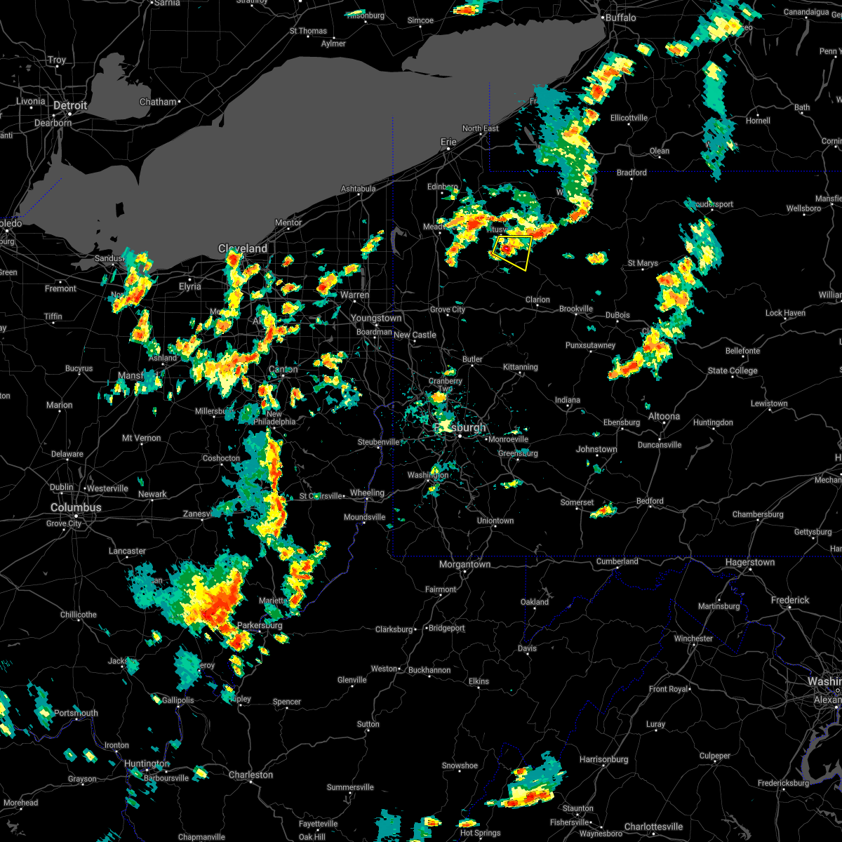 At 150 pm edt, a severe thunderstorm was located near enterprise, or 8 miles northeast of oil city, moving east at 10 mph (radar indicated). Hazards include 60 mph wind gusts. Expect damage to trees and power lines, resulting in some power outages. locations impacted include, pleasantville and oil creek state park. hail threat, radar indicated max hail size, <. 75 in wind threat, radar indicated max wind gust, 60 mph. At 150 pm edt, a severe thunderstorm was located near enterprise, or 8 miles northeast of oil city, moving east at 10 mph (radar indicated). Hazards include 60 mph wind gusts. Expect damage to trees and power lines, resulting in some power outages. locations impacted include, pleasantville and oil creek state park. hail threat, radar indicated max hail size, <. 75 in wind threat, radar indicated max wind gust, 60 mph.
|
| 8/29/2021 1:45 PM EDT |
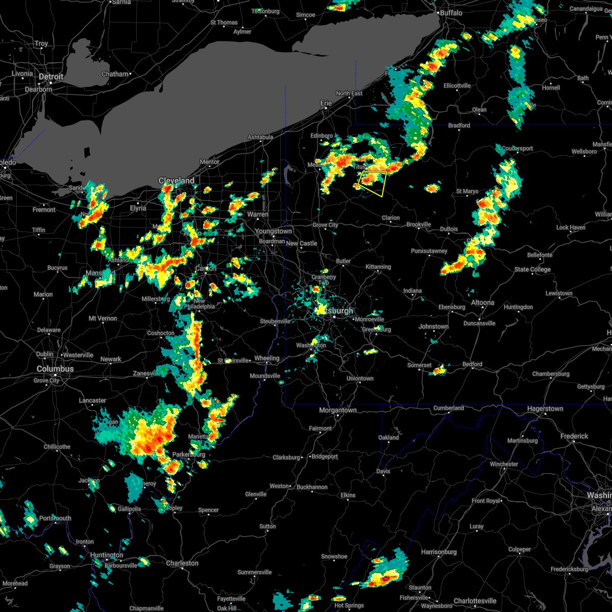 At 145 pm edt, a severe thunderstorm was located near titusville, or 8 miles northeast of oil city, moving east at 10 mph (radar indicated). Hazards include 60 mph wind gusts. expect damage to trees and power lines, resulting in some power outages At 145 pm edt, a severe thunderstorm was located near titusville, or 8 miles northeast of oil city, moving east at 10 mph (radar indicated). Hazards include 60 mph wind gusts. expect damage to trees and power lines, resulting in some power outages
|
| 8/18/2021 11:03 AM EDT |
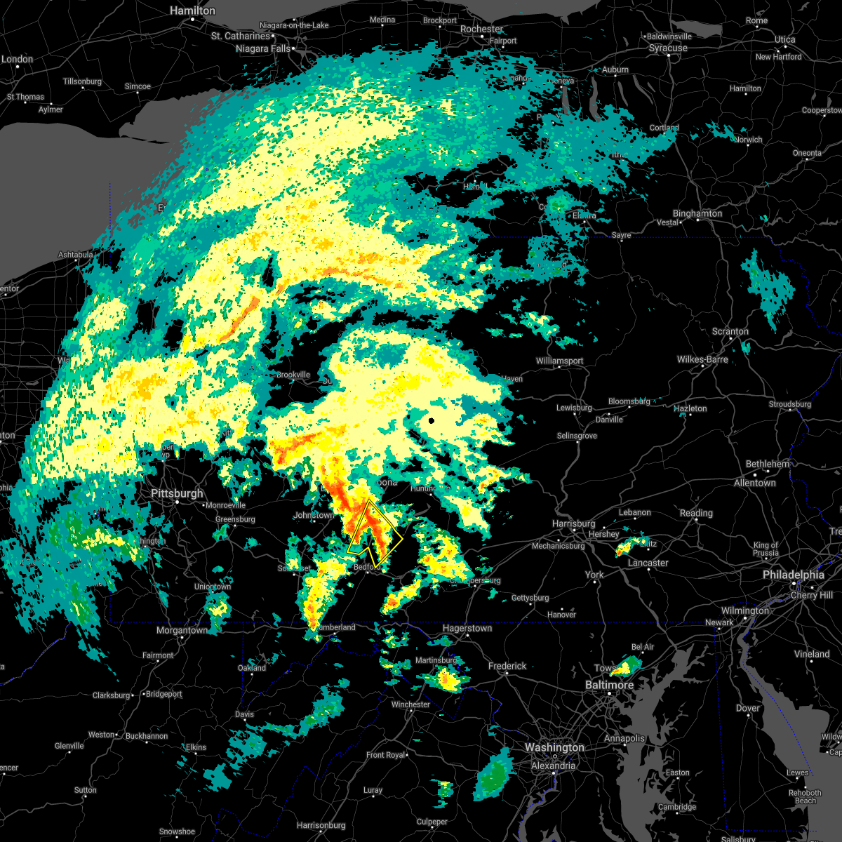 At 1102 am edt, a severe thunderstorm was located over royer, moving northeast at 40 mph (radar indicated). Hazards include 60 mph wind gusts. Expect damage to roofs, siding, and trees. locations impacted include, roaring spring, new enterprise, martinsburg, claysburg, osterburg, blue knob state park, queen, ski gap, east freedom, saxton, woodbury, newry, blue knob ski resort and altoona-blair county airport. This includes interstate 99 from mile markers 9 to 25. At 1102 am edt, a severe thunderstorm was located over royer, moving northeast at 40 mph (radar indicated). Hazards include 60 mph wind gusts. Expect damage to roofs, siding, and trees. locations impacted include, roaring spring, new enterprise, martinsburg, claysburg, osterburg, blue knob state park, queen, ski gap, east freedom, saxton, woodbury, newry, blue knob ski resort and altoona-blair county airport. This includes interstate 99 from mile markers 9 to 25.
|
| 8/18/2021 10:32 AM EDT |
 At 1031 am edt, a severe thunderstorm was located over cessna, moving northeast at 40 mph (radar indicated). Hazards include 60 mph wind gusts. expect damage to roofs, siding, and trees At 1031 am edt, a severe thunderstorm was located over cessna, moving northeast at 40 mph (radar indicated). Hazards include 60 mph wind gusts. expect damage to roofs, siding, and trees
|
| 8/12/2021 5:05 PM EDT |
 At 505 pm edt, a severe thunderstorm was located 7 miles northeast of sugarcreek, or 7 miles north of oil city, moving east at 30 mph (radar indicated). Hazards include 60 mph wind gusts. Expect damage to trees and power lines, resulting in some power outages. locations impacted include, oil city, sugarcreek, tionesta, hasson heights, rouseville, cooperstown, pleasantville, west hickory, oil creek state park, starr, and east hickory. hail threat, radar indicated max hail size, <. 75 in wind threat, radar indicated max wind gust, 60 mph. At 505 pm edt, a severe thunderstorm was located 7 miles northeast of sugarcreek, or 7 miles north of oil city, moving east at 30 mph (radar indicated). Hazards include 60 mph wind gusts. Expect damage to trees and power lines, resulting in some power outages. locations impacted include, oil city, sugarcreek, tionesta, hasson heights, rouseville, cooperstown, pleasantville, west hickory, oil creek state park, starr, and east hickory. hail threat, radar indicated max hail size, <. 75 in wind threat, radar indicated max wind gust, 60 mph.
|
| 8/12/2021 4:56 PM EDT |
 At 456 pm edt, a severe thunderstorm was located near sugarcreek, or 9 miles north of franklin, moving east at 30 mph (radar indicated). Hazards include 60 mph wind gusts. expect damage to trees and power lines, resulting in some power outages At 456 pm edt, a severe thunderstorm was located near sugarcreek, or 9 miles north of franklin, moving east at 30 mph (radar indicated). Hazards include 60 mph wind gusts. expect damage to trees and power lines, resulting in some power outages
|
| 7/20/2021 7:42 PM EDT |
 At 741 pm edt, a severe thunderstorm was located 7 miles southwest of tionesta, or 8 miles east of oil city, moving southeast at 25 mph (radar). Hazards include wind gusts to 60 mph and quarter-size hail. Minor hail damage to vehicles is possible. expect wind damage to trees and power lines, resulting in some power outages. Locations impacted include, oil city, knox, sugarcreek, tionesta, hasson heights, seneca, rouseville, shippenville, woodland heights, pleasantville, fryburg, leeper,. At 741 pm edt, a severe thunderstorm was located 7 miles southwest of tionesta, or 8 miles east of oil city, moving southeast at 25 mph (radar). Hazards include wind gusts to 60 mph and quarter-size hail. Minor hail damage to vehicles is possible. expect wind damage to trees and power lines, resulting in some power outages. Locations impacted include, oil city, knox, sugarcreek, tionesta, hasson heights, seneca, rouseville, shippenville, woodland heights, pleasantville, fryburg, leeper,.
|
| 7/20/2021 7:35 PM EDT | Numerous trees down in venango county PA, 109.7 miles SSE of Pleasantville, PA |
| 7/20/2021 7:33 PM EDT |
 At 733 pm edt, a severe thunderstorm was located near oil city, moving southeast at 25 mph (radar). Hazards include wind gusts to 60 mph and quarter-size hail. Minor hail damage to vehicles is possible. Expect wind damage to trees and power lines, resulting in some power outages. At 733 pm edt, a severe thunderstorm was located near oil city, moving southeast at 25 mph (radar). Hazards include wind gusts to 60 mph and quarter-size hail. Minor hail damage to vehicles is possible. Expect wind damage to trees and power lines, resulting in some power outages.
|
| 7/13/2021 5:53 PM EDT |
 At 552 pm edt, a severe thunderstorm was located near central city, moving northeast at 30 mph (radar indicated). Hazards include 60 mph wind gusts. Expect damage to roofs, siding, and trees. locations impacted include, osterburg, central city, st. clairsville, ogletown, indian lake, schellsburg, shanksville, new paris, new baltimore and flight 93 national memorial. this includes the following interstates, the pennsylvania turnpike from mile markers 124 to 137. Interstate 99 from mile markers 4 to 10. At 552 pm edt, a severe thunderstorm was located near central city, moving northeast at 30 mph (radar indicated). Hazards include 60 mph wind gusts. Expect damage to roofs, siding, and trees. locations impacted include, osterburg, central city, st. clairsville, ogletown, indian lake, schellsburg, shanksville, new paris, new baltimore and flight 93 national memorial. this includes the following interstates, the pennsylvania turnpike from mile markers 124 to 137. Interstate 99 from mile markers 4 to 10.
|
| 7/13/2021 5:42 PM EDT |
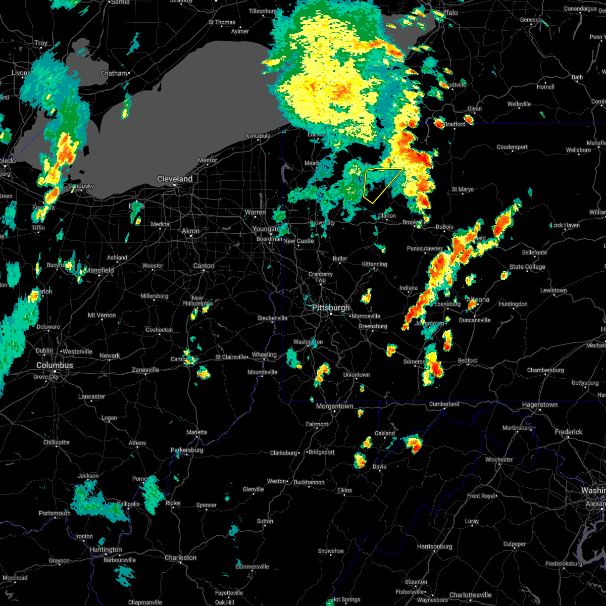 The severe thunderstorm warning for northeastern venango and northwestern forest counties will expire at 545 pm edt, the storm which prompted the warning has moved out of the area. therefore, the warning will be allowed to expire. a severe thunderstorm watch remains in effect until 1100 pm edt for northwestern pennsylvania. remember, a severe thunderstorm warning still remains in effect for eastern forest county until 6 pm. The severe thunderstorm warning for northeastern venango and northwestern forest counties will expire at 545 pm edt, the storm which prompted the warning has moved out of the area. therefore, the warning will be allowed to expire. a severe thunderstorm watch remains in effect until 1100 pm edt for northwestern pennsylvania. remember, a severe thunderstorm warning still remains in effect for eastern forest county until 6 pm.
|
| 7/13/2021 5:38 PM EDT |
 At 538 pm edt, a severe thunderstorm was located near berlin, moving northeast at 30 mph (radar indicated). Hazards include 60 mph wind gusts. expect damage to roofs, siding, and trees At 538 pm edt, a severe thunderstorm was located near berlin, moving northeast at 30 mph (radar indicated). Hazards include 60 mph wind gusts. expect damage to roofs, siding, and trees
|
| 7/13/2021 5:29 PM EDT |
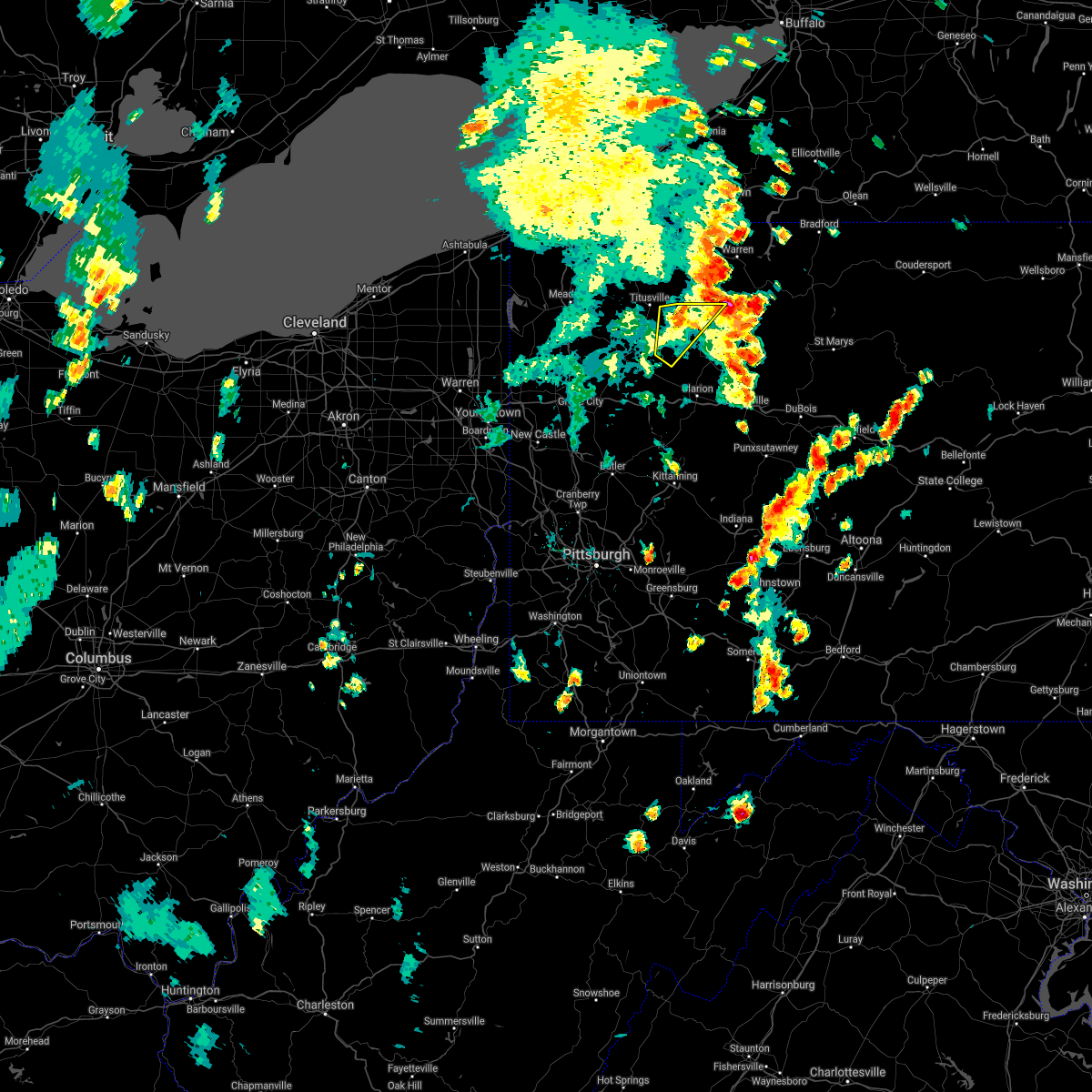 At 528 pm edt, a severe thunderstorm was located near tionesta, or 15 miles northwest of marienville, moving northeast at 40 mph (radar). Hazards include wind gusts to 60 mph. Expect damage to trees and power lines, resulting in some power outages. Locations impacted include, tionesta, pleasantville, west hickory, east hickory, starr,. At 528 pm edt, a severe thunderstorm was located near tionesta, or 15 miles northwest of marienville, moving northeast at 40 mph (radar). Hazards include wind gusts to 60 mph. Expect damage to trees and power lines, resulting in some power outages. Locations impacted include, tionesta, pleasantville, west hickory, east hickory, starr,.
|
| 7/13/2021 5:00 PM EDT |
 At 459 pm edt, a severe thunderstorm was located near oil city, moving northeast at 40 mph (radar). Hazards include wind gusts to 60 mph. expect damage to trees and power lines, resulting in some power outages At 459 pm edt, a severe thunderstorm was located near oil city, moving northeast at 40 mph (radar). Hazards include wind gusts to 60 mph. expect damage to trees and power lines, resulting in some power outages
|
| 7/13/2021 4:05 PM EDT |
 At 405 pm edt, a severe thunderstorm was located near sugarcreek, or near franklin, moving northeast at 40 mph (radar). Hazards include wind gusts to 60 mph. expect damage to trees and power lines, resulting in some power outages At 405 pm edt, a severe thunderstorm was located near sugarcreek, or near franklin, moving northeast at 40 mph (radar). Hazards include wind gusts to 60 mph. expect damage to trees and power lines, resulting in some power outages
|
| 7/11/2021 6:03 PM EDT |
 At 602 pm edt, severe thunderstorms were located along a line extending from near blandburg to near ski gap to near central city to near meyersdale, moving east at 30 mph (radar indicated). Hazards include 60 mph wind gusts. expect damage to roofs, siding, and trees At 602 pm edt, severe thunderstorms were located along a line extending from near blandburg to near ski gap to near central city to near meyersdale, moving east at 30 mph (radar indicated). Hazards include 60 mph wind gusts. expect damage to roofs, siding, and trees
|
| 7/7/2021 4:54 PM EDT |
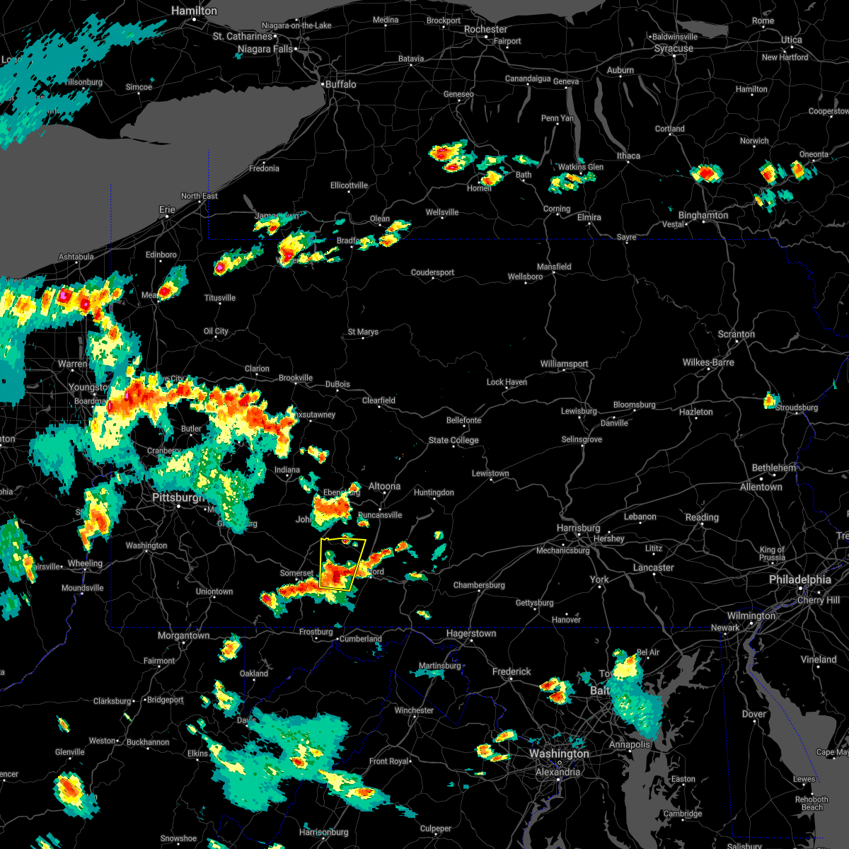 At 454 pm edt, a severe thunderstorm was located near central city, moving north at 20 mph (radar indicated). Hazards include 60 mph wind gusts and quarter size hail. Hail damage to vehicles is expected. expect wind damage to roofs, siding, and trees. this severe thunderstorm will be near, central city around 510 pm edt. ogletown around 530 pm edt. windber, scalp level and paint around 540 pm edt. other locations impacted by this severe thunderstorm include schellsburg, new baltimore, indian lake, new paris and flight 93 national memorial. This includes the pennsylvania turnpike from mile markers 121 to 137. At 454 pm edt, a severe thunderstorm was located near central city, moving north at 20 mph (radar indicated). Hazards include 60 mph wind gusts and quarter size hail. Hail damage to vehicles is expected. expect wind damage to roofs, siding, and trees. this severe thunderstorm will be near, central city around 510 pm edt. ogletown around 530 pm edt. windber, scalp level and paint around 540 pm edt. other locations impacted by this severe thunderstorm include schellsburg, new baltimore, indian lake, new paris and flight 93 national memorial. This includes the pennsylvania turnpike from mile markers 121 to 137.
|
| 6/21/2021 2:55 PM EDT | Multiple trees down along tidioute enterprise r in warren county PA, 3.7 miles SSW of Pleasantville, PA |
| 6/21/2021 2:45 PM EDT |
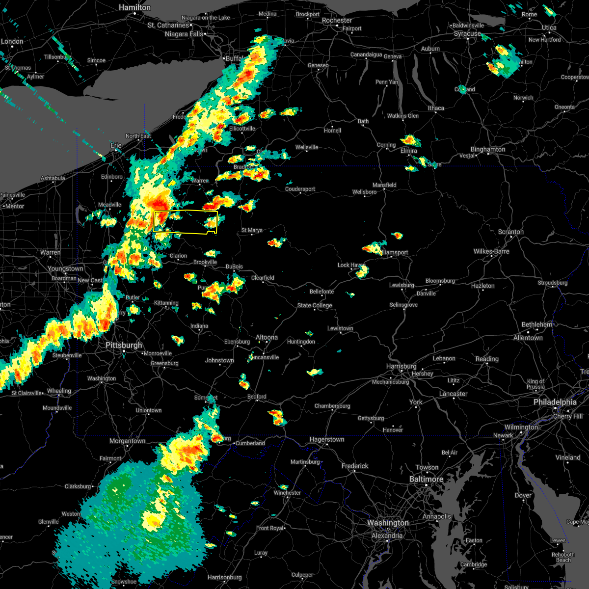 At 245 pm edt, a severe thunderstorm was located over enterprise, or 12 miles northeast of oil city, moving east at 55 mph (radar). Hazards include wind gusts to 60 mph. expect damage to trees and power lines, resulting in some power outages At 245 pm edt, a severe thunderstorm was located over enterprise, or 12 miles northeast of oil city, moving east at 55 mph (radar). Hazards include wind gusts to 60 mph. expect damage to trees and power lines, resulting in some power outages
|
| 6/21/2021 2:31 PM EDT |
 At 231 pm edt, a severe thunderstorm was located near oil city, moving east at 55 mph (radar). Hazards include wind gusts to 60 mph. Expect damage to trees and power lines, resulting in some power outages. Locations impacted include, oil city, franklin, sugarcreek, hasson heights, seneca, rouseville, cooperstown, woodland heights, pleasantville, utica, oil creek state park,. At 231 pm edt, a severe thunderstorm was located near oil city, moving east at 55 mph (radar). Hazards include wind gusts to 60 mph. Expect damage to trees and power lines, resulting in some power outages. Locations impacted include, oil city, franklin, sugarcreek, hasson heights, seneca, rouseville, cooperstown, woodland heights, pleasantville, utica, oil creek state park,.
|
| 6/21/2021 2:15 PM EDT |
 At 213 pm edt, a severe thunderstorm was located 8 miles south of guys mills, or 11 miles southeast of meadville, moving east at 55 mph (radar). Hazards include wind gusts to 60 mph. expect damage to trees and power lines, resulting in some power outages At 213 pm edt, a severe thunderstorm was located 8 miles south of guys mills, or 11 miles southeast of meadville, moving east at 55 mph (radar). Hazards include wind gusts to 60 mph. expect damage to trees and power lines, resulting in some power outages
|
| 11/15/2020 4:23 PM EST |
 At 423 pm est, severe thunderstorms were located along a line extending from near dunlo to near central city to near berlin to 6 miles north of accident, moving east at 55 mph (radar indicated). Hazards include 60 mph wind gusts. expect damage to trees, roofs, and siding At 423 pm est, severe thunderstorms were located along a line extending from near dunlo to near central city to near berlin to 6 miles north of accident, moving east at 55 mph (radar indicated). Hazards include 60 mph wind gusts. expect damage to trees, roofs, and siding
|
| 11/15/2020 3:21 PM EST |
 The severe thunderstorm warning for eastern venango, eastern butler, northwestern armstrong, western clarion and northwestern forest counties will expire at 330 pm est, the storms which prompted the warning have moved out of the area. therefore, the warning will be allowed to expire. however gusty winds are still possible with these thunderstorms. a severe thunderstorm watch remains in effect until 400 pm est for northwestern and west central pennsylvania. a severe thunderstorm watch also remains in effect until 600 pm est for northwestern and west central pennsylvania. remember, a severe thunderstorm warning still remains in effect for forest, clarion, armstrong until 400 pm est. The severe thunderstorm warning for eastern venango, eastern butler, northwestern armstrong, western clarion and northwestern forest counties will expire at 330 pm est, the storms which prompted the warning have moved out of the area. therefore, the warning will be allowed to expire. however gusty winds are still possible with these thunderstorms. a severe thunderstorm watch remains in effect until 400 pm est for northwestern and west central pennsylvania. a severe thunderstorm watch also remains in effect until 600 pm est for northwestern and west central pennsylvania. remember, a severe thunderstorm warning still remains in effect for forest, clarion, armstrong until 400 pm est.
|
| 11/15/2020 3:11 PM EST |
 At 311 pm est, severe thunderstorms were located along a line extending from near enterprise to near sarver, moving east at 45 mph (law enforcement). Hazards include wind gusts to 60 mph. Expect damage to trees and power lines, resulting in some power outages. Locations impacted include, butler, oil city, kittanning, knox, rimersburg, homeacre-lyndora, sugarcreek, ford city, meadowood, oak hills, sarver, west kittanning, this includes interstate 80 in pennsylvania between mile markers 38 and 58. At 311 pm est, severe thunderstorms were located along a line extending from near enterprise to near sarver, moving east at 45 mph (law enforcement). Hazards include wind gusts to 60 mph. Expect damage to trees and power lines, resulting in some power outages. Locations impacted include, butler, oil city, kittanning, knox, rimersburg, homeacre-lyndora, sugarcreek, ford city, meadowood, oak hills, sarver, west kittanning, this includes interstate 80 in pennsylvania between mile markers 38 and 58.
|
| 11/15/2020 2:53 PM EST |
 At 253 pm est, severe thunderstorms were located along a line extending from 6 miles southwest of titusville to 6 miles south of oak hills, moving east at 45 mph (law enforcement). Hazards include wind gusts to 60 mph. Expect damage to trees and power lines, resulting in some power outages. locations impacted include, butler, oil city, grove city, franklin, kittanning, knox, rimersburg, homeacre-lyndora, sugarcreek, shanor-northvue, meridian, zelienople, this includes the following highways, interstate 79 in pennsylvania between mile markers 86 and 109. Interstate 80 in pennsylvania between mile markers 22 and 58. At 253 pm est, severe thunderstorms were located along a line extending from 6 miles southwest of titusville to 6 miles south of oak hills, moving east at 45 mph (law enforcement). Hazards include wind gusts to 60 mph. Expect damage to trees and power lines, resulting in some power outages. locations impacted include, butler, oil city, grove city, franklin, kittanning, knox, rimersburg, homeacre-lyndora, sugarcreek, shanor-northvue, meridian, zelienople, this includes the following highways, interstate 79 in pennsylvania between mile markers 86 and 109. Interstate 80 in pennsylvania between mile markers 22 and 58.
|
| 11/15/2020 2:40 PM EST |
 At 239 pm est, severe thunderstorms were located along a line extending from 7 miles northwest of sugarcreek to mars, moving east at 45 mph (law enforcement). Hazards include wind gusts to 60 mph. expect damage to trees and power lines, resulting in some power outages At 239 pm est, severe thunderstorms were located along a line extending from 7 miles northwest of sugarcreek to mars, moving east at 45 mph (law enforcement). Hazards include wind gusts to 60 mph. expect damage to trees and power lines, resulting in some power outages
|
| 8/28/2020 1:29 PM EDT |
 At 127 pm edt, severe thunderstorms were located along a line extending from near huntingdon to dudley to near ogletown, moving east at 45 mph (radar indicated). Hazards include 60 mph wind gusts and penny size hail. expect damage to trees, roofs, and siding At 127 pm edt, severe thunderstorms were located along a line extending from near huntingdon to dudley to near ogletown, moving east at 45 mph (radar indicated). Hazards include 60 mph wind gusts and penny size hail. expect damage to trees, roofs, and siding
|
| 8/28/2020 12:46 PM EDT |
 At 1244 pm edt, severe thunderstorms were located along a line extending from near prince gallitzin state park to cresson to near st. michael to near westmont, moving east at 15 mph (radar indicated). Hazards include 60 mph wind gusts and penny size hail. expect damage to trees, roofs, and siding At 1244 pm edt, severe thunderstorms were located along a line extending from near prince gallitzin state park to cresson to near st. michael to near westmont, moving east at 15 mph (radar indicated). Hazards include 60 mph wind gusts and penny size hail. expect damage to trees, roofs, and siding
|
| 8/27/2020 7:09 PM EDT |
 At 709 pm edt, severe thunderstorms were located along a line extending from near osterburg to near central city to 7 miles northeast of seven springs, moving southeast at 40 mph (radar indicated). Hazards include 60 mph wind gusts and quarter size hail. Hail damage to vehicles is expected. Expect wind damage to trees, roofs, and siding. At 709 pm edt, severe thunderstorms were located along a line extending from near osterburg to near central city to 7 miles northeast of seven springs, moving southeast at 40 mph (radar indicated). Hazards include 60 mph wind gusts and quarter size hail. Hail damage to vehicles is expected. Expect wind damage to trees, roofs, and siding.
|
| 7/21/2020 3:18 PM EDT |
 At 317 pm edt, severe thunderstorms were located along a line extending from near queen to seven springs, moving southeast at 40 mph (radar indicated). Hazards include 60 mph wind gusts and quarter size hail. Hail damage to vehicles is expected. Expect wind damage to trees, roofs, and siding. At 317 pm edt, severe thunderstorms were located along a line extending from near queen to seven springs, moving southeast at 40 mph (radar indicated). Hazards include 60 mph wind gusts and quarter size hail. Hail damage to vehicles is expected. Expect wind damage to trees, roofs, and siding.
|
| 6/10/2020 10:38 PM EDT |
 At 1038 pm edt, severe thunderstorms were located along a line extending from near guys mills to 9 miles south of oil city to rimersburg, moving northeast at 55 mph (radar). Hazards include wind gusts to 60 mph. Expect damage to trees and power lines, resulting in some power outages. Locations impacted include, oil city, franklin, sugarcreek, hasson heights, seneca, polk, emlenton, rouseville, cooperstown, kennerdell, woodland heights, pleasantville,. At 1038 pm edt, severe thunderstorms were located along a line extending from near guys mills to 9 miles south of oil city to rimersburg, moving northeast at 55 mph (radar). Hazards include wind gusts to 60 mph. Expect damage to trees and power lines, resulting in some power outages. Locations impacted include, oil city, franklin, sugarcreek, hasson heights, seneca, polk, emlenton, rouseville, cooperstown, kennerdell, woodland heights, pleasantville,.
|
| 6/10/2020 10:23 PM EDT |
 At 1023 pm edt, severe thunderstorms were located along a line extending from 9 miles south of meadville to 11 miles east of grove city to 11 miles east of shanor-northvue, moving northeast at 55 mph (radar). Hazards include wind gusts to 60 mph and quarter-size hail. Minor hail damage to vehicles is possible. Expect wind damage to trees and power lines, resulting in some power outages. At 1023 pm edt, severe thunderstorms were located along a line extending from 9 miles south of meadville to 11 miles east of grove city to 11 miles east of shanor-northvue, moving northeast at 55 mph (radar). Hazards include wind gusts to 60 mph and quarter-size hail. Minor hail damage to vehicles is possible. Expect wind damage to trees and power lines, resulting in some power outages.
|
| 6/4/2020 7:33 PM EDT |
 At 732 pm edt, severe thunderstorms were located along a line extending from bellwood to near lake gordon, moving east at 50 mph (radar indicated). Hazards include 70 mph wind gusts and quarter size hail. Hail damage to vehicles is expected. expect considerable tree damage. Wind damage is also likely to mobile homes, roofs, and outbuildings. At 732 pm edt, severe thunderstorms were located along a line extending from bellwood to near lake gordon, moving east at 50 mph (radar indicated). Hazards include 70 mph wind gusts and quarter size hail. Hail damage to vehicles is expected. expect considerable tree damage. Wind damage is also likely to mobile homes, roofs, and outbuildings.
|
| 6/3/2020 8:43 AM EDT |
 At 843 am edt, a severe thunderstorm was located near tionesta, or 14 miles north of clarion, moving east at 60 mph (radar). Hazards include wind gusts to 70 mph and half dollar-size hail. Minor hail damage to vehicles is possible. trees snapped and uprooted. power outages can be expected. Locations impacted include, tionesta, pleasantville, fryburg, leeper, starr, cook forest state park,. At 843 am edt, a severe thunderstorm was located near tionesta, or 14 miles north of clarion, moving east at 60 mph (radar). Hazards include wind gusts to 70 mph and half dollar-size hail. Minor hail damage to vehicles is possible. trees snapped and uprooted. power outages can be expected. Locations impacted include, tionesta, pleasantville, fryburg, leeper, starr, cook forest state park,.
|
| 6/3/2020 8:26 AM EDT |
 At 824 am edt, a severe thunderstorm was located near oil city, moving east at 60 mph (radar). Hazards include wind gusts to 60 mph and quarter-size hail. Minor hail damage to vehicles is possible. Expect wind damage to trees and power lines, resulting in some power outages. At 824 am edt, a severe thunderstorm was located near oil city, moving east at 60 mph (radar). Hazards include wind gusts to 60 mph and quarter-size hail. Minor hail damage to vehicles is possible. Expect wind damage to trees and power lines, resulting in some power outages.
|
| 4/8/2020 2:26 AM EDT |
 At 226 am edt, severe thunderstorms were located along a line extending from 6 miles northwest of doylesburg to 6 miles west of bedford, moving east at 75 mph (radar indicated). Hazards include 60 mph wind gusts and quarter size hail. Hail damage to vehicles is expected. Expect wind damage to trees, roofs, and siding. At 226 am edt, severe thunderstorms were located along a line extending from 6 miles northwest of doylesburg to 6 miles west of bedford, moving east at 75 mph (radar indicated). Hazards include 60 mph wind gusts and quarter size hail. Hail damage to vehicles is expected. Expect wind damage to trees, roofs, and siding.
|
| 4/7/2020 11:51 PM EDT |
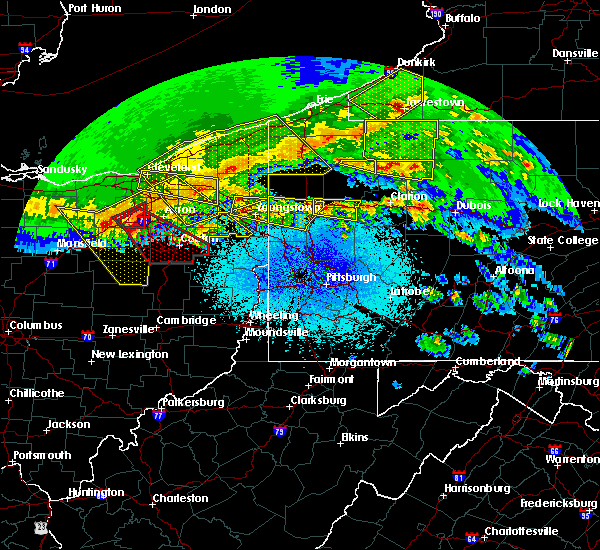 The severe thunderstorm warning for northeastern venango and western forest counties will expire at midnight edt, the storm that prompted the warning has weakened below severe limits and no longer poses an immediate threat to life and property. therefore, the warning will be allowed to expire. however small hail and gusty winds are still possible with this thunderstorm. a severe thunderstorm watch remains in effect until 600 am edt for northwestern pennsylvania. The severe thunderstorm warning for northeastern venango and western forest counties will expire at midnight edt, the storm that prompted the warning has weakened below severe limits and no longer poses an immediate threat to life and property. therefore, the warning will be allowed to expire. however small hail and gusty winds are still possible with this thunderstorm. a severe thunderstorm watch remains in effect until 600 am edt for northwestern pennsylvania.
|
| 4/7/2020 11:31 PM EDT |
 At 1131 pm edt, a severe thunderstorm was located over titusville, or 12 miles north of oil city, moving east at 45 mph (radar). Hazards include wind gusts to 60 mph. expect damage to trees and power lines, resulting in some power outages At 1131 pm edt, a severe thunderstorm was located over titusville, or 12 miles north of oil city, moving east at 45 mph (radar). Hazards include wind gusts to 60 mph. expect damage to trees and power lines, resulting in some power outages
|
| 3/20/2020 1:32 PM EDT |
 At 132 pm edt, a severe thunderstorm was located over oil city, moving east at 55 mph (radar). Hazards include wind gusts to 60 mph. Expect damage to trees and power lines, resulting in some power outages. Locations impacted include, oil city, franklin, marienville, sugarcreek, tionesta, enterprise, hasson heights, seneca, rouseville, woodland heights, pleasantville, fryburg,. At 132 pm edt, a severe thunderstorm was located over oil city, moving east at 55 mph (radar). Hazards include wind gusts to 60 mph. Expect damage to trees and power lines, resulting in some power outages. Locations impacted include, oil city, franklin, marienville, sugarcreek, tionesta, enterprise, hasson heights, seneca, rouseville, woodland heights, pleasantville, fryburg,.
|
| 3/20/2020 1:25 PM EDT |
 At 125 pm edt, a severe thunderstorm was located over sugarcreek, or over franklin, moving east at 55 mph (radar). Hazards include wind gusts to 60 mph. expect damage to trees and power lines, resulting in some power outages At 125 pm edt, a severe thunderstorm was located over sugarcreek, or over franklin, moving east at 55 mph (radar). Hazards include wind gusts to 60 mph. expect damage to trees and power lines, resulting in some power outages
|
| 8/17/2019 3:53 PM EDT |
 At 327 pm edt, a severe thunderstorm was located 7 miles south of guys mills, or 11 miles southeast of meadville, moving east at 30 mph (radar). Hazards include wind gusts to 60 mph and quarter-size hail. Minor hail damage to vehicles is possible. Expect wind damage to trees and power lines, resulting in some power outages. At 327 pm edt, a severe thunderstorm was located 7 miles south of guys mills, or 11 miles southeast of meadville, moving east at 30 mph (radar). Hazards include wind gusts to 60 mph and quarter-size hail. Minor hail damage to vehicles is possible. Expect wind damage to trees and power lines, resulting in some power outages.
|
| 8/17/2019 3:41 PM EDT |
 A severe thunderstorm warning remains in effect until 415 pm edt for northern venango county. at 341 pm edt, a severe thunderstorm was located near sugarcreek, or near franklin, moving east at 25 mph. hazard. wind gusts to 60 mph and quarter-size hail. source. Radar. A severe thunderstorm warning remains in effect until 415 pm edt for northern venango county. at 341 pm edt, a severe thunderstorm was located near sugarcreek, or near franklin, moving east at 25 mph. hazard. wind gusts to 60 mph and quarter-size hail. source. Radar.
|
| 8/17/2019 3:27 PM EDT |
 The national weather service in pittsburgh has issued a * severe thunderstorm warning for. northern venango county in northwestern pennsylvania. until 415 pm edt. At 327 pm edt, a severe thunderstorm was located 7 miles south of guys mills, or 11 miles southeast of meadville, moving east at 30. The national weather service in pittsburgh has issued a * severe thunderstorm warning for. northern venango county in northwestern pennsylvania. until 415 pm edt. At 327 pm edt, a severe thunderstorm was located 7 miles south of guys mills, or 11 miles southeast of meadville, moving east at 30.
|
| 7/21/2019 8:43 PM EDT |
 At 843 pm edt, a severe thunderstorm was located near bedford, moving northeast at 20 mph (radar indicated). Hazards include 60 mph wind gusts and nickel size hail. expect damage to trees, roofs, and siding At 843 pm edt, a severe thunderstorm was located near bedford, moving northeast at 20 mph (radar indicated). Hazards include 60 mph wind gusts and nickel size hail. expect damage to trees, roofs, and siding
|
| 7/19/2019 8:23 PM EDT |
 At 823 pm edt, a severe thunderstorm was located near oil city, moving southeast at 15 mph (radar). Hazards include wind gusts to 60 mph. Expect damage to trees and power lines, resulting in some power outages. Locations impacted include, oil city, sugarcreek, hasson heights, rouseville, pleasantville, oil creek state park,. At 823 pm edt, a severe thunderstorm was located near oil city, moving southeast at 15 mph (radar). Hazards include wind gusts to 60 mph. Expect damage to trees and power lines, resulting in some power outages. Locations impacted include, oil city, sugarcreek, hasson heights, rouseville, pleasantville, oil creek state park,.
|
| 7/19/2019 8:17 PM EDT |
 At 809 pm edt, a severe thunderstorm was located near titusville, or 7 miles north of oil city, moving southeast at 15 mph (radar). Hazards include wind gusts to 60 mph and small hail. Expect damage to trees and power lines, resulting in some power outages. Locations impacted include, oil city, sugarcreek, hasson heights, rouseville, pleasantville, oil creek state park,. At 809 pm edt, a severe thunderstorm was located near titusville, or 7 miles north of oil city, moving southeast at 15 mph (radar). Hazards include wind gusts to 60 mph and small hail. Expect damage to trees and power lines, resulting in some power outages. Locations impacted include, oil city, sugarcreek, hasson heights, rouseville, pleasantville, oil creek state park,.
|
| 7/19/2019 8:10 PM EDT |
 At 809 pm edt, a severe thunderstorm was located near titusville, or 7 miles north of oil city, moving southeast at 15 mph (radar). Hazards include wind gusts to 60 mph and small hail. Expect damage to trees and power lines, resulting in some power outages. Locations impacted include, oil city, sugarcreek, hasson heights, rouseville, pleasantville, oil creek state park,. At 809 pm edt, a severe thunderstorm was located near titusville, or 7 miles north of oil city, moving southeast at 15 mph (radar). Hazards include wind gusts to 60 mph and small hail. Expect damage to trees and power lines, resulting in some power outages. Locations impacted include, oil city, sugarcreek, hasson heights, rouseville, pleasantville, oil creek state park,.
|
| 7/19/2019 8:00 PM EDT |
 At 759 pm edt, a severe thunderstorm was located near titusville, or 10 miles northwest of oil city, moving southeast at 15 mph (radar). Hazards include wind gusts to 60 mph. expect damage to trees and power lines, resulting in some power outages At 759 pm edt, a severe thunderstorm was located near titusville, or 10 miles northwest of oil city, moving southeast at 15 mph (radar). Hazards include wind gusts to 60 mph. expect damage to trees and power lines, resulting in some power outages
|
| 7/19/2019 7:49 PM EDT |
 At 748 pm edt, a severe thunderstorm was located near titusville, or 8 miles north of oil city, moving southeast at 20 mph (radar). Hazards include wind gusts to 60 mph and small hail. Expect damage to trees and power lines, resulting in some power outages. Locations impacted include, sugarcreek, rouseville, pleasantville, oil creek state park,. At 748 pm edt, a severe thunderstorm was located near titusville, or 8 miles north of oil city, moving southeast at 20 mph (radar). Hazards include wind gusts to 60 mph and small hail. Expect damage to trees and power lines, resulting in some power outages. Locations impacted include, sugarcreek, rouseville, pleasantville, oil creek state park,.
|
| 7/19/2019 7:36 PM EDT |
 At 736 pm edt, a severe thunderstorm was located 7 miles west of titusville, or 12 miles northwest of oil city, moving southeast at 20 mph (radar). Hazards include wind gusts to 60 mph and small hail. expect damage to trees and power lines, resulting in some power outages At 736 pm edt, a severe thunderstorm was located 7 miles west of titusville, or 12 miles northwest of oil city, moving southeast at 20 mph (radar). Hazards include wind gusts to 60 mph and small hail. expect damage to trees and power lines, resulting in some power outages
|
| 7/2/2019 4:18 PM EDT |
 At 418 pm edt, severe thunderstorms were located along a line extending from east conemaugh to westmont, moving southeast at 25 mph (radar indicated). Hazards include 60 mph wind gusts. expect damage to trees, roofs, and siding At 418 pm edt, severe thunderstorms were located along a line extending from east conemaugh to westmont, moving southeast at 25 mph (radar indicated). Hazards include 60 mph wind gusts. expect damage to trees, roofs, and siding
|
| 5/29/2019 4:06 PM EDT |
 At 405 pm edt, a severe thunderstorm was located near osterburg, moving east at 40 mph (radar indicated). Hazards include 60 mph wind gusts and quarter size hail. Hail damage to vehicles is expected. Expect wind damage to trees, roofs, and siding. At 405 pm edt, a severe thunderstorm was located near osterburg, moving east at 40 mph (radar indicated). Hazards include 60 mph wind gusts and quarter size hail. Hail damage to vehicles is expected. Expect wind damage to trees, roofs, and siding.
|
| 5/28/2019 10:50 PM EDT |
 At 1050 pm edt, a severe thunderstorm was located over ogletown, moving east at 55 mph (radar indicated). Hazards include 60 mph wind gusts. expect damage to trees, roofs, and siding At 1050 pm edt, a severe thunderstorm was located over ogletown, moving east at 55 mph (radar indicated). Hazards include 60 mph wind gusts. expect damage to trees, roofs, and siding
|
| 5/25/2019 6:58 PM EDT |
 At 658 pm edt, severe thunderstorms were located along a line extending from near tionesta to 10 miles southeast of greenville, moving east at 40 mph (radar). Hazards include wind gusts to 60 mph and quarter-size hail. Minor hail damage to vehicles is possible. Expect wind damage to trees and power lines, resulting in some power outages. At 658 pm edt, severe thunderstorms were located along a line extending from near tionesta to 10 miles southeast of greenville, moving east at 40 mph (radar). Hazards include wind gusts to 60 mph and quarter-size hail. Minor hail damage to vehicles is possible. Expect wind damage to trees and power lines, resulting in some power outages.
|
| 5/25/2019 6:37 PM EDT |
 At 637 pm edt, a severe thunderstorm was located near titusville, or 8 miles north of oil city, moving northeast at 30 mph (radar). Hazards include wind gusts to 60 mph and quarter-size hail. Minor hail damage to vehicles is possible. Expect wind damage to trees and power lines, resulting in some power outages. At 637 pm edt, a severe thunderstorm was located near titusville, or 8 miles north of oil city, moving northeast at 30 mph (radar). Hazards include wind gusts to 60 mph and quarter-size hail. Minor hail damage to vehicles is possible. Expect wind damage to trees and power lines, resulting in some power outages.
|
| 5/23/2019 9:47 PM EDT |
 At 946 pm edt, a severe thunderstorm was located over cessna, moving southeast at 50 mph (radar indicated). Hazards include 60 mph wind gusts and dime size hail. Expect wind damage to trees, roofs, and siding. locations impacted include, bedford, clearville, everett, st. Clairsville, cessna and new paris. At 946 pm edt, a severe thunderstorm was located over cessna, moving southeast at 50 mph (radar indicated). Hazards include 60 mph wind gusts and dime size hail. Expect wind damage to trees, roofs, and siding. locations impacted include, bedford, clearville, everett, st. Clairsville, cessna and new paris.
|
| 5/23/2019 9:30 PM EDT |
 At 929 pm edt, a severe thunderstorm was located near osterburg, moving southeast at 45 mph (radar indicated). Hazards include 60 mph wind gusts and quarter size hail. Hail damage to vehicles is expected. Expect wind damage to trees, roofs, and siding. At 929 pm edt, a severe thunderstorm was located near osterburg, moving southeast at 45 mph (radar indicated). Hazards include 60 mph wind gusts and quarter size hail. Hail damage to vehicles is expected. Expect wind damage to trees, roofs, and siding.
|
| 4/14/2019 10:52 PM EDT |
 At 1051 pm edt, severe thunderstorms were located along a line extending from near houtzdale to near ski gap to near bedford, moving northeast at 60 mph (radar indicated). Hazards include 60 mph wind gusts and penny size hail. Expect damage to roofs, siding, and trees. locations impacted include, altoona, hollidaysburg, tyrone, bedford, breezewood, roaring spring, clearville, new enterprise, martinsburg, lakemont, everett, bellwood, claysburg, duncansville, osterburg, tipton, buffalo mills, crystal springs, blandburg and st. clairsville. this includes the following interstates, interstate 70 from mile markers 147 to 164. the pennsylvania turnpike from mile markers 136 to 163. interstate 99 from mile markers 0 to 49. A tornado watch remains in effect until 300 am edt for south central and central pennsylvania. At 1051 pm edt, severe thunderstorms were located along a line extending from near houtzdale to near ski gap to near bedford, moving northeast at 60 mph (radar indicated). Hazards include 60 mph wind gusts and penny size hail. Expect damage to roofs, siding, and trees. locations impacted include, altoona, hollidaysburg, tyrone, bedford, breezewood, roaring spring, clearville, new enterprise, martinsburg, lakemont, everett, bellwood, claysburg, duncansville, osterburg, tipton, buffalo mills, crystal springs, blandburg and st. clairsville. this includes the following interstates, interstate 70 from mile markers 147 to 164. the pennsylvania turnpike from mile markers 136 to 163. interstate 99 from mile markers 0 to 49. A tornado watch remains in effect until 300 am edt for south central and central pennsylvania.
|
| 4/14/2019 10:17 PM EDT |
 At 1017 pm edt, severe thunderstorms were located along a line extending from belsano to friedens to near frostburg, moving northeast at 60 mph (radar indicated). Hazards include 60 mph wind gusts and penny size hail. expect damage to roofs, siding, and trees At 1017 pm edt, severe thunderstorms were located along a line extending from belsano to friedens to near frostburg, moving northeast at 60 mph (radar indicated). Hazards include 60 mph wind gusts and penny size hail. expect damage to roofs, siding, and trees
|
| 4/14/2019 7:53 PM EDT |
 At 752 pm edt, a severe thunderstorm capable of producing a tornado was located near titusville, or 9 miles north of oil city, moving northeast at 60 mph (radar indicated rotation). Hazards include tornado. Flying debris will be dangerous to those caught without shelter. mobile homes will be damaged or destroyed. damage to roofs, windows, and vehicles will occur. tree damage is likely. Locations impacted include, hasson heights, rouseville, pleasantville, oil creek state park,. At 752 pm edt, a severe thunderstorm capable of producing a tornado was located near titusville, or 9 miles north of oil city, moving northeast at 60 mph (radar indicated rotation). Hazards include tornado. Flying debris will be dangerous to those caught without shelter. mobile homes will be damaged or destroyed. damage to roofs, windows, and vehicles will occur. tree damage is likely. Locations impacted include, hasson heights, rouseville, pleasantville, oil creek state park,.
|
| 4/14/2019 7:48 PM EDT |
 At 747 pm edt, a severe thunderstorm capable of producing a tornado was located north of oil city, moving northeast at 50 mph (radar indicated rotation). Hazards include tornado. Flying debris will be dangerous to those caught without shelter. mobile homes will be damaged or destroyed. damage to roofs, windows, and vehicles will occur. tree damage is likely. This tornadic thunderstorm will remain over mainly rural areas of northeastern venango county, including the following locations, rouseville, hasson heights, oil creek state park, woodland heights and pleasantville. At 747 pm edt, a severe thunderstorm capable of producing a tornado was located north of oil city, moving northeast at 50 mph (radar indicated rotation). Hazards include tornado. Flying debris will be dangerous to those caught without shelter. mobile homes will be damaged or destroyed. damage to roofs, windows, and vehicles will occur. tree damage is likely. This tornadic thunderstorm will remain over mainly rural areas of northeastern venango county, including the following locations, rouseville, hasson heights, oil creek state park, woodland heights and pleasantville.
|
| 4/14/2019 7:41 PM EDT |
 At 741 pm edt, a severe thunderstorm capable of producing a tornado was located near franklin, moving northeast at 55 mph (radar indicated rotation). Hazards include tornado. Flying debris will be dangerous to those caught without shelter. mobile homes will be damaged or destroyed. damage to roofs, windows, and vehicles will occur. tree damage is likely. this dangerous storm will be near, oil city around 745 pm edt. Other locations impacted by this tornadic thunderstorm include cooperstown, rouseville, hasson heights, oil creek state park, woodland heights and pleasantville. At 741 pm edt, a severe thunderstorm capable of producing a tornado was located near franklin, moving northeast at 55 mph (radar indicated rotation). Hazards include tornado. Flying debris will be dangerous to those caught without shelter. mobile homes will be damaged or destroyed. damage to roofs, windows, and vehicles will occur. tree damage is likely. this dangerous storm will be near, oil city around 745 pm edt. Other locations impacted by this tornadic thunderstorm include cooperstown, rouseville, hasson heights, oil creek state park, woodland heights and pleasantville.
|
| 4/14/2019 7:34 PM EDT |
 At 734 pm edt, a severe thunderstorm capable of producing a tornado was located near sugarcreek, or near franklin, moving northeast at 50 mph (radar indicated rotation). Hazards include tornado. Flying debris will be dangerous to those caught without shelter. mobile homes will be damaged or destroyed. damage to roofs, windows, and vehicles will occur. tree damage is likely. this dangerous storm will be near, franklin around 740 pm edt. oil city around 750 pm edt. other locations impacted by this tornadic thunderstorm include cooperstown, hasson heights, oil creek state park, pleasantville, polk, rouseville, utica and woodland heights. Please report severe weather by calling 412-262-1988, posting to the nws pittsburgh facebook page, or using twitter @nwspittsburgh. At 734 pm edt, a severe thunderstorm capable of producing a tornado was located near sugarcreek, or near franklin, moving northeast at 50 mph (radar indicated rotation). Hazards include tornado. Flying debris will be dangerous to those caught without shelter. mobile homes will be damaged or destroyed. damage to roofs, windows, and vehicles will occur. tree damage is likely. this dangerous storm will be near, franklin around 740 pm edt. oil city around 750 pm edt. other locations impacted by this tornadic thunderstorm include cooperstown, hasson heights, oil creek state park, pleasantville, polk, rouseville, utica and woodland heights. Please report severe weather by calling 412-262-1988, posting to the nws pittsburgh facebook page, or using twitter @nwspittsburgh.
|
| 10/2/2018 4:33 PM EDT |
 At 433 pm edt, a severe thunderstorm was located near enterprise, or 18 miles northeast of oil city, moving east at 40 mph (radar). Hazards include wind gusts to 60 mph. expect damage to trees and power lines, resulting in some power outages At 433 pm edt, a severe thunderstorm was located near enterprise, or 18 miles northeast of oil city, moving east at 40 mph (radar). Hazards include wind gusts to 60 mph. expect damage to trees and power lines, resulting in some power outages
|
| 10/2/2018 4:28 PM EDT |
 At 427 pm edt, a confirmed tornado was located over titusville moving east at 35 mph (weather spotters confirmed tornado). Hazards include damaging tornado. Flying debris will be dangerous to those caught without shelter. mobile homes will be damaged or destroyed. damage to roofs, windows, and vehicles will occur. tree damage is likely. Locations impacted include, pleasantville,. At 427 pm edt, a confirmed tornado was located over titusville moving east at 35 mph (weather spotters confirmed tornado). Hazards include damaging tornado. Flying debris will be dangerous to those caught without shelter. mobile homes will be damaged or destroyed. damage to roofs, windows, and vehicles will occur. tree damage is likely. Locations impacted include, pleasantville,.
|
| 10/2/2018 4:19 PM EDT |
 At 419 pm edt, a confirmed tornado was located over titusville, or 14 miles north of oil city, moving east at 35 mph (weather spotters confirmed tornado in titusville). Hazards include damaging tornado. Flying debris will be dangerous to those caught without shelter. mobile homes will be damaged or destroyed. damage to roofs, windows, and vehicles will occur. tree damage is likely. Locations impacted include, pleasantville,. At 419 pm edt, a confirmed tornado was located over titusville, or 14 miles north of oil city, moving east at 35 mph (weather spotters confirmed tornado in titusville). Hazards include damaging tornado. Flying debris will be dangerous to those caught without shelter. mobile homes will be damaged or destroyed. damage to roofs, windows, and vehicles will occur. tree damage is likely. Locations impacted include, pleasantville,.
|
| 10/2/2018 4:12 PM EDT |
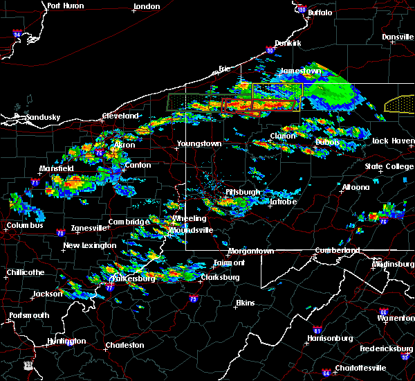 At 411 pm edt, a severe thunderstorm having a history of producing a tornado was located near titusville, or 15 miles north of oil city, moving east at 35 mph (radar indicated rotation). Hazards include tornado. Flying debris will be dangerous to those caught without shelter. mobile homes will be damaged or destroyed. damage to roofs, windows, and vehicles will occur. tree damage is likely. this tornadic thunderstorm will remain over mainly rural areas of northeastern venango county, including the following locations, pleasantville. Please report severe weather by calling 412-262-1988, posting to the nws pittsburgh facebook page, or using twitter @nwspittsburgh. At 411 pm edt, a severe thunderstorm having a history of producing a tornado was located near titusville, or 15 miles north of oil city, moving east at 35 mph (radar indicated rotation). Hazards include tornado. Flying debris will be dangerous to those caught without shelter. mobile homes will be damaged or destroyed. damage to roofs, windows, and vehicles will occur. tree damage is likely. this tornadic thunderstorm will remain over mainly rural areas of northeastern venango county, including the following locations, pleasantville. Please report severe weather by calling 412-262-1988, posting to the nws pittsburgh facebook page, or using twitter @nwspittsburgh.
|
| 8/29/2018 6:02 PM EDT |
 At 602 pm edt, severe thunderstorms were located along a line extending from near titusville to near oil city, moving east at 35 mph (radar). Hazards include wind gusts to 60 mph. damage to trees and power lines At 602 pm edt, severe thunderstorms were located along a line extending from near titusville to near oil city, moving east at 35 mph (radar). Hazards include wind gusts to 60 mph. damage to trees and power lines
|
| 6/18/2018 9:31 PM EDT |
 At 930 pm edt, severe thunderstorms were located along a line extending from 6 miles east of tionesta to near marienville, moving southeast at 30 mph (radar). Hazards include wind gusts to 60 mph. Expect damage to trees and power lines, resulting in some power outages. Locations impacted include, marienville, brockway, tionesta, pleasantville, kellettville, west hickory, leeper, clarington, clear creek state park, cook forest state park, starr, east hickory,. At 930 pm edt, severe thunderstorms were located along a line extending from 6 miles east of tionesta to near marienville, moving southeast at 30 mph (radar). Hazards include wind gusts to 60 mph. Expect damage to trees and power lines, resulting in some power outages. Locations impacted include, marienville, brockway, tionesta, pleasantville, kellettville, west hickory, leeper, clarington, clear creek state park, cook forest state park, starr, east hickory,.
|
| 6/18/2018 9:00 PM EDT |
 At 859 pm edt, severe thunderstorms were located along a line extending from near enterprise to 6 miles northeast of marienville, moving southeast at 35 mph (radar). Hazards include wind gusts to 60 mph. expect damage to trees and power lines, resulting in some power outages At 859 pm edt, severe thunderstorms were located along a line extending from near enterprise to 6 miles northeast of marienville, moving southeast at 35 mph (radar). Hazards include wind gusts to 60 mph. expect damage to trees and power lines, resulting in some power outages
|
| 6/18/2018 8:51 PM EDT |
 At 850 pm edt, severe thunderstorms were located along a line extending from ludlow to 6 miles northeast of marienville to near titusville, moving southeast at 35 mph (radar). Hazards include wind gusts to 60 mph. Expect damage to trees and power lines, resulting in some power outages. Locations impacted include, marienville, tionesta, pleasantville, kellettville, west hickory, starr, east hickory,. At 850 pm edt, severe thunderstorms were located along a line extending from ludlow to 6 miles northeast of marienville to near titusville, moving southeast at 35 mph (radar). Hazards include wind gusts to 60 mph. Expect damage to trees and power lines, resulting in some power outages. Locations impacted include, marienville, tionesta, pleasantville, kellettville, west hickory, starr, east hickory,.
|
| 6/18/2018 8:20 PM EDT |
 At 819 pm edt, severe thunderstorms were located along a line extending from near warren to 8 miles southwest of chapman state park to 6 miles northwest of titusville, moving southeast at 50 mph (radar). Hazards include wind gusts to 60 mph. expect damage to trees and power lines, resulting in some power outages At 819 pm edt, severe thunderstorms were located along a line extending from near warren to 8 miles southwest of chapman state park to 6 miles northwest of titusville, moving southeast at 50 mph (radar). Hazards include wind gusts to 60 mph. expect damage to trees and power lines, resulting in some power outages
|
| 5/13/2018 6:00 PM EDT |
 At 600 pm edt, severe thunderstorms were located along a line extending from ogletown to 6 miles southwest of central city to near new centerville, moving southeast at 30 mph (radar indicated). Hazards include 60 mph wind gusts and quarter size hail. Hail damage to vehicles is possible. Expect wind damage to trees and power lines. At 600 pm edt, severe thunderstorms were located along a line extending from ogletown to 6 miles southwest of central city to near new centerville, moving southeast at 30 mph (radar indicated). Hazards include 60 mph wind gusts and quarter size hail. Hail damage to vehicles is possible. Expect wind damage to trees and power lines.
|
| 5/12/2018 6:21 PM EDT |
 At 621 pm edt, a severe thunderstorm was located near jerome, moving east at 50 mph (radar indicated). Hazards include 60 mph wind gusts and quarter size hail. Hail damage to vehicles is possible. Expect wind damage to trees and power lines. At 621 pm edt, a severe thunderstorm was located near jerome, moving east at 50 mph (radar indicated). Hazards include 60 mph wind gusts and quarter size hail. Hail damage to vehicles is possible. Expect wind damage to trees and power lines.
|
| 5/12/2018 4:19 PM EDT |
 At 419 pm edt, a severe thunderstorm was located near ligonier, moving east at 45 mph (radar indicated). Hazards include 60 mph wind gusts and quarter size hail. Expect wind damage to trees and power lines. Hail damage to vehicles is possible. At 419 pm edt, a severe thunderstorm was located near ligonier, moving east at 45 mph (radar indicated). Hazards include 60 mph wind gusts and quarter size hail. Expect wind damage to trees and power lines. Hail damage to vehicles is possible.
|
| 5/12/2018 3:57 PM EDT |
 At 356 pm edt, a severe thunderstorm was located near blue knob state park, moving east at 45 mph. another strong storm was located west of belmont, also moving east at 45 mph (radar indicated). Hazards include 60 mph wind gusts and quarter size hail. Hail damage to vehicles is possible. expect wind damage to trees and power lines. Locations impacted include, belmont, johnstown, westmont, windber, portage, salix-beauty line park, osterburg, roaring spring, scalp level and ski gap. At 356 pm edt, a severe thunderstorm was located near blue knob state park, moving east at 45 mph. another strong storm was located west of belmont, also moving east at 45 mph (radar indicated). Hazards include 60 mph wind gusts and quarter size hail. Hail damage to vehicles is possible. expect wind damage to trees and power lines. Locations impacted include, belmont, johnstown, westmont, windber, portage, salix-beauty line park, osterburg, roaring spring, scalp level and ski gap.
|
| 5/12/2018 3:23 PM EDT |
 At 323 pm edt, a severe thunderstorm was located 8 miles west of westmont, moving east at 40 mph (radar indicated). Hazards include 60 mph wind gusts and quarter size hail. Hail damage to vehicles is possible. Expect wind damage to trees and power lines. At 323 pm edt, a severe thunderstorm was located 8 miles west of westmont, moving east at 40 mph (radar indicated). Hazards include 60 mph wind gusts and quarter size hail. Hail damage to vehicles is possible. Expect wind damage to trees and power lines.
|
| 5/4/2018 4:30 PM EDT |
 At 430 pm edt, showers and thunderstorms were located along a line extending from near enterprise to oil city to near franklin, moving east at 65 mph (radar). Hazards include wind gusts to 60 mph. Expect damage to trees and power lines, resulting in some power outages. Locations impacted include, oil city, franklin, marienville, sugarcreek, tionesta, hasson heights, seneca, polk, rouseville, cooperstown, woodland heights, pleasantville,. At 430 pm edt, showers and thunderstorms were located along a line extending from near enterprise to oil city to near franklin, moving east at 65 mph (radar). Hazards include wind gusts to 60 mph. Expect damage to trees and power lines, resulting in some power outages. Locations impacted include, oil city, franklin, marienville, sugarcreek, tionesta, hasson heights, seneca, polk, rouseville, cooperstown, woodland heights, pleasantville,.
|
| 5/4/2018 4:25 PM EDT | Trees down in venango county PA, 109.7 miles SSE of Pleasantville, PA |
| 5/4/2018 4:10 PM EDT |
 At 409 pm edt, severe thunderstorms were located along a line extending from 8 miles southeast of guys mills to 6 miles west of sugarcreek to 10 miles northwest of grove city, moving east at 50 mph (radar). Hazards include wind gusts to 60 mph. expect damage to trees and power lines, resulting in some power outages At 409 pm edt, severe thunderstorms were located along a line extending from 8 miles southeast of guys mills to 6 miles west of sugarcreek to 10 miles northwest of grove city, moving east at 50 mph (radar). Hazards include wind gusts to 60 mph. expect damage to trees and power lines, resulting in some power outages
|
| 1/12/2018 6:05 PM EST |
 At 605 pm est, severe thunderstorms were located along a line extending from near tyrone to altoona to roaring spring to near blue knob state park, moving northeast at 35 mph (radar indicated). Hazards include 60 mph wind gusts. expect damage to trees and power lines At 605 pm est, severe thunderstorms were located along a line extending from near tyrone to altoona to roaring spring to near blue knob state park, moving northeast at 35 mph (radar indicated). Hazards include 60 mph wind gusts. expect damage to trees and power lines
|
| 11/5/2017 7:51 PM EST |
 At 750 pm est, severe thunderstorms were located along a line extending from near enterprise to 8 miles northeast of shanor-northvue, moving east at 50 mph (radar). Hazards include 60 mph wind gusts. Expect damage to trees and power lines, resulting in some power outages. Locations impacted include, oil city, franklin, clarion, knox, rimersburg, sugarcreek, new bethlehem, tionesta, hasson heights, seneca, east brady, parker, this includes interstate 80 in pennsylvania between mile markers 33 and 72. At 750 pm est, severe thunderstorms were located along a line extending from near enterprise to 8 miles northeast of shanor-northvue, moving east at 50 mph (radar). Hazards include 60 mph wind gusts. Expect damage to trees and power lines, resulting in some power outages. Locations impacted include, oil city, franklin, clarion, knox, rimersburg, sugarcreek, new bethlehem, tionesta, hasson heights, seneca, east brady, parker, this includes interstate 80 in pennsylvania between mile markers 33 and 72.
|
| 11/5/2017 7:45 PM EST | Trees down near intersection of route 27 and colorado roa in warren county PA, 6.2 miles SSW of Pleasantville, PA |
| 11/5/2017 7:26 PM EST |
 At 726 pm est, severe thunderstorms were located along a line extending from near guys mills to 7 miles west of slippery rock, moving east at 50 mph (radar). Hazards include 60 mph wind gusts. expect damage to trees and power lines, resulting in some power outages At 726 pm est, severe thunderstorms were located along a line extending from near guys mills to 7 miles west of slippery rock, moving east at 50 mph (radar). Hazards include 60 mph wind gusts. expect damage to trees and power lines, resulting in some power outages
|
| 8/22/2017 5:46 PM EDT |
 At 546 pm edt, severe thunderstorms were located along a line extending from near prince gallitzin state park to near berlin, moving east at 45 mph (radar indicated). Hazards include 60 mph wind gusts. expect damage to trees and power lines At 546 pm edt, severe thunderstorms were located along a line extending from near prince gallitzin state park to near berlin, moving east at 45 mph (radar indicated). Hazards include 60 mph wind gusts. expect damage to trees and power lines
|
| 8/19/2017 6:18 PM EDT |
 At 618 pm edt, severe thunderstorms were located along a line extending from near ogletown to 6 miles east of berlin to near ursina, moving east at 40 mph (radar indicated). Hazards include 60 mph wind gusts and nickel size hail. Expect damage to trees and power lines. severe thunderstorms will be near, queen, blue knob state park, osterburg and st. clairsville around 630 pm edt. buffalo mills and new enterprise around 640 pm edt. bedford around 650 pm edt. clearville and coaldale around 700 pm edt. other locations impacted by these severe thunderstorms include schellsburg, rainsburg, woodbury, hopewell, saxton, defiance, hyndman, new paris, manns choice and ellerslie. this includes the following interstates, interstate 70 from mile markers 147 to 149. the pennsylvania turnpike from mile markers 131 to 162. Interstate 99 from mile markers 0 to 14. At 618 pm edt, severe thunderstorms were located along a line extending from near ogletown to 6 miles east of berlin to near ursina, moving east at 40 mph (radar indicated). Hazards include 60 mph wind gusts and nickel size hail. Expect damage to trees and power lines. severe thunderstorms will be near, queen, blue knob state park, osterburg and st. clairsville around 630 pm edt. buffalo mills and new enterprise around 640 pm edt. bedford around 650 pm edt. clearville and coaldale around 700 pm edt. other locations impacted by these severe thunderstorms include schellsburg, rainsburg, woodbury, hopewell, saxton, defiance, hyndman, new paris, manns choice and ellerslie. this includes the following interstates, interstate 70 from mile markers 147 to 149. the pennsylvania turnpike from mile markers 131 to 162. Interstate 99 from mile markers 0 to 14.
|
| 6/18/2017 3:31 PM EDT |
 At 331 pm edt, severe thunderstorms were located along a line extending from near titusville to near oil city to 8 miles east of grove city, moving east at 50 mph (radar). Hazards include 60 mph wind gusts. Expect damage to trees and power lines, resulting in some power outages. Locations impacted include, oil city, grove city, franklin, clarion, knox, sugarcreek, tionesta, hasson heights, seneca, polk, sandy lake, emlenton, this includes interstate 80 in pennsylvania between mile markers 21 and 63, and between mile markers 65 and 66. At 331 pm edt, severe thunderstorms were located along a line extending from near titusville to near oil city to 8 miles east of grove city, moving east at 50 mph (radar). Hazards include 60 mph wind gusts. Expect damage to trees and power lines, resulting in some power outages. Locations impacted include, oil city, grove city, franklin, clarion, knox, sugarcreek, tionesta, hasson heights, seneca, polk, sandy lake, emlenton, this includes interstate 80 in pennsylvania between mile markers 21 and 63, and between mile markers 65 and 66.
|
| 6/18/2017 3:14 PM EDT |
 At 314 pm edt, severe thunderstorms were located along a line extending from 9 miles south of guys mills to 6 miles west of sugarcreek to near grove city, moving east at 50 mph (radar). Hazards include 60 mph wind gusts. expect damage to trees and power lines, resulting in some power outages At 314 pm edt, severe thunderstorms were located along a line extending from 9 miles south of guys mills to 6 miles west of sugarcreek to near grove city, moving east at 50 mph (radar). Hazards include 60 mph wind gusts. expect damage to trees and power lines, resulting in some power outages
|
| 5/1/2017 5:21 PM EDT |
 At 521 pm edt, severe thunderstorms were located along a line extending from 6 miles northwest of blandburg to 6 miles east of friedens, moving northeast at 40 mph (radar indicated). Hazards include 60 mph wind gusts. expect damage to roofs, siding, and trees At 521 pm edt, severe thunderstorms were located along a line extending from 6 miles northwest of blandburg to 6 miles east of friedens, moving northeast at 40 mph (radar indicated). Hazards include 60 mph wind gusts. expect damage to roofs, siding, and trees
|
| 5/1/2017 3:10 PM EDT |
 At 309 pm edt, severe thunderstorms were located along a line extending from near enterprise to near knox, moving east at 45 mph (public). Hazards include 60 mph wind gusts. expect damage to trees and power lines, resulting in some power outages At 309 pm edt, severe thunderstorms were located along a line extending from near enterprise to near knox, moving east at 45 mph (public). Hazards include 60 mph wind gusts. expect damage to trees and power lines, resulting in some power outages
|
| 5/1/2017 3:05 PM EDT |
 At 304 pm edt, severe thunderstorms were located along a line extending from grand valley to 7 miles northwest of knox, moving east at 50 mph (radar). Hazards include 60 mph wind gusts. Expect damage to trees and power lines, resulting in some power outages. locations impacted include, oil city, clarion, knox, sugarcreek, tionesta, hasson heights, seneca, emlenton, rouseville, shippenville, st. petersburg, woodland heights, this includes interstate 80 in pennsylvania between mile markers 45 and 62. A tornado watch remains in effect until 700 pm edt for northwestern and west central pennsylvania. At 304 pm edt, severe thunderstorms were located along a line extending from grand valley to 7 miles northwest of knox, moving east at 50 mph (radar). Hazards include 60 mph wind gusts. Expect damage to trees and power lines, resulting in some power outages. locations impacted include, oil city, clarion, knox, sugarcreek, tionesta, hasson heights, seneca, emlenton, rouseville, shippenville, st. petersburg, woodland heights, this includes interstate 80 in pennsylvania between mile markers 45 and 62. A tornado watch remains in effect until 700 pm edt for northwestern and west central pennsylvania.
|
| 5/1/2017 2:54 PM EDT |
 At 253 pm edt, severe thunderstorms were located along a line extending from near titusville to 11 miles south of franklin, moving east at 50 mph (radar). Hazards include 60 mph wind gusts. Expect damage to trees and power lines, resulting in some power outages. locations impacted include, oil city, franklin, clarion, knox, sugarcreek, tionesta, hasson heights, seneca, emlenton, rouseville, clintonville, shippenville, this includes interstate 80 in pennsylvania between mile markers 36 and 62. A tornado watch remains in effect until 700 pm edt for northwestern and west central pennsylvania. At 253 pm edt, severe thunderstorms were located along a line extending from near titusville to 11 miles south of franklin, moving east at 50 mph (radar). Hazards include 60 mph wind gusts. Expect damage to trees and power lines, resulting in some power outages. locations impacted include, oil city, franklin, clarion, knox, sugarcreek, tionesta, hasson heights, seneca, emlenton, rouseville, clintonville, shippenville, this includes interstate 80 in pennsylvania between mile markers 36 and 62. A tornado watch remains in effect until 700 pm edt for northwestern and west central pennsylvania.
|
| 5/1/2017 2:26 PM EDT |
 At 226 pm edt, severe thunderstorms were located along a line extending from near meadville to 6 miles southwest of grove city, moving east at 50 mph (radar). Hazards include 60 mph wind gusts. expect damage to trees and power lines, resulting in some power outages At 226 pm edt, severe thunderstorms were located along a line extending from near meadville to 6 miles southwest of grove city, moving east at 50 mph (radar). Hazards include 60 mph wind gusts. expect damage to trees and power lines, resulting in some power outages
|
| 4/20/2017 9:26 PM EDT |
 The severe thunderstorm warning for northeastern venango, northeastern clarion and forest counties will expire at 930 pm edt, the storm that prompted the warning has weakened below severe limits and no longer pose an immediate threat to life and property. therefore, the warning will be allowed to expire. The severe thunderstorm warning for northeastern venango, northeastern clarion and forest counties will expire at 930 pm edt, the storm that prompted the warning has weakened below severe limits and no longer pose an immediate threat to life and property. therefore, the warning will be allowed to expire.
|
| 4/20/2017 9:11 PM EDT |
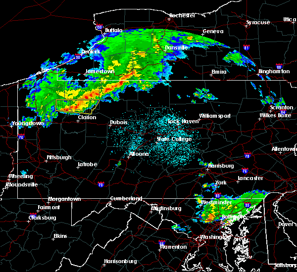 At 911 pm edt, a severe thunderstorm was located 8 miles east of tionesta, or 8 miles west of marienville, moving east at 40 mph (radar). Hazards include 60 mph wind gusts and quarter-size hail. Hail damage to vehicles is expected. expect wind damage to trees and power lines, resulting in some power outages. Locations impacted include, oil city, marienville, sugarcreek, tionesta, hasson heights, rouseville, woodland heights, pleasantville, kellettville, west hickory, leeper, starr,. At 911 pm edt, a severe thunderstorm was located 8 miles east of tionesta, or 8 miles west of marienville, moving east at 40 mph (radar). Hazards include 60 mph wind gusts and quarter-size hail. Hail damage to vehicles is expected. expect wind damage to trees and power lines, resulting in some power outages. Locations impacted include, oil city, marienville, sugarcreek, tionesta, hasson heights, rouseville, woodland heights, pleasantville, kellettville, west hickory, leeper, starr,.
|
| 4/20/2017 8:55 PM EDT |
 At 855 pm edt, a severe thunderstorm was located over tionesta, or 15 miles east of oil city, moving east at 45 mph (radar). Hazards include 60 mph wind gusts and quarter-size hail. Hail damage to vehicles is expected. expect wind damage to trees and power lines, resulting in some power outages. Locations impacted include, oil city, marienville, sugarcreek, tionesta, hasson heights, rouseville, woodland heights, pleasantville, kellettville, west hickory, leeper, starr,. At 855 pm edt, a severe thunderstorm was located over tionesta, or 15 miles east of oil city, moving east at 45 mph (radar). Hazards include 60 mph wind gusts and quarter-size hail. Hail damage to vehicles is expected. expect wind damage to trees and power lines, resulting in some power outages. Locations impacted include, oil city, marienville, sugarcreek, tionesta, hasson heights, rouseville, woodland heights, pleasantville, kellettville, west hickory, leeper, starr,.
|
| 4/20/2017 8:40 PM EDT |
 At 840 pm edt, a severe thunderstorm was located near oil city, moving east at 45 mph (radar). Hazards include 60 mph wind gusts and quarter-size hail. Hail damage to vehicles is expected. Expect wind damage to trees and power lines, resulting in some power outages. At 840 pm edt, a severe thunderstorm was located near oil city, moving east at 45 mph (radar). Hazards include 60 mph wind gusts and quarter-size hail. Hail damage to vehicles is expected. Expect wind damage to trees and power lines, resulting in some power outages.
|
| 2/12/2017 8:52 PM EST |
 At 851 pm est, severe thunderstorms were located along a line extending from royer to near farmington, moving east at 80 mph (radar indicated). Hazards include 60 mph wind gusts. Expect damage to roofs, siding, and trees. locations impacted include, bedford, somerset, lake gordon, osterburg, martinsburg, everett, new enterprise, central city, buffalo mills, cessna, ursina, roaring spring, inglesmith, meyersdale, royer, berlin, queen, clearville, st. Clairsville and claysburg. At 851 pm est, severe thunderstorms were located along a line extending from royer to near farmington, moving east at 80 mph (radar indicated). Hazards include 60 mph wind gusts. Expect damage to roofs, siding, and trees. locations impacted include, bedford, somerset, lake gordon, osterburg, martinsburg, everett, new enterprise, central city, buffalo mills, cessna, ursina, roaring spring, inglesmith, meyersdale, royer, berlin, queen, clearville, st. Clairsville and claysburg.
|
| 2/12/2017 8:11 PM EST |
 At 810 pm est, severe thunderstorms were located along a line extending from near belsano to near cameron, moving east-southeast at 45 mph (radar indicated). Hazards include 60 mph wind gusts. expect damage to roofs, siding, and trees At 810 pm est, severe thunderstorms were located along a line extending from near belsano to near cameron, moving east-southeast at 45 mph (radar indicated). Hazards include 60 mph wind gusts. expect damage to roofs, siding, and trees
|
| 9/10/2016 8:16 PM EDT |
 At 815 pm edt, severe thunderstorms were located along a line extending from 8 miles southwest of titusville to oil city to 10 miles south of franklin, moving east at 55 mph (radar indicated). Hazards include 60 mph wind gusts. Expect damage to trees and power lines. resulting in some power outages. locations impacted include, oil city, franklin, sugarcreek, hasson heights, seneca, polk, emlenton, rouseville, clintonville, cooperstown, kennerdell, barkeyville, woodland heights, pleasantville, utica, oil creek state park and cranberry. this includes interstate 80 in pennsylvania between mile markers 28 and 41, and between mile markers 45 and 49. Please report severe weather by calling 4 1 2, 2 6 2, 1 9 8 8, posting to the nws pittsburgh facebook page, or using twitter @nwspittsburgh. At 815 pm edt, severe thunderstorms were located along a line extending from 8 miles southwest of titusville to oil city to 10 miles south of franklin, moving east at 55 mph (radar indicated). Hazards include 60 mph wind gusts. Expect damage to trees and power lines. resulting in some power outages. locations impacted include, oil city, franklin, sugarcreek, hasson heights, seneca, polk, emlenton, rouseville, clintonville, cooperstown, kennerdell, barkeyville, woodland heights, pleasantville, utica, oil creek state park and cranberry. this includes interstate 80 in pennsylvania between mile markers 28 and 41, and between mile markers 45 and 49. Please report severe weather by calling 4 1 2, 2 6 2, 1 9 8 8, posting to the nws pittsburgh facebook page, or using twitter @nwspittsburgh.
|
| 9/10/2016 7:51 PM EDT |
 At 751 pm edt, severe thunderstorms were located along a line extending from 10 miles southeast of atlantic to 12 miles southwest of sugarcreek to 6 miles west of grove city, moving east at 55 mph (radar indicated). Hazards include 60 mph wind gusts. Expect damage to trees and power lines. Resulting in some power outages. At 751 pm edt, severe thunderstorms were located along a line extending from 10 miles southeast of atlantic to 12 miles southwest of sugarcreek to 6 miles west of grove city, moving east at 55 mph (radar indicated). Hazards include 60 mph wind gusts. Expect damage to trees and power lines. Resulting in some power outages.
|
| 8/25/2016 7:01 PM EDT |
 At 700 pm edt, a severe thunderstorm was located near titusville, or 10 miles north of oil city, moving east at 25 mph (radar indicated). Hazards include 60 mph wind gusts. Expect damage to trees and power lines. resulting in some power outages. locations impacted include, hasson heights, rouseville, pleasantville and oil creek state park. Please report severe weather by calling 4 1 2, 2 6 2, 1 9 8 8, posting to the nws pittsburgh facebook page, or using twitter @nwspittsburgh. At 700 pm edt, a severe thunderstorm was located near titusville, or 10 miles north of oil city, moving east at 25 mph (radar indicated). Hazards include 60 mph wind gusts. Expect damage to trees and power lines. resulting in some power outages. locations impacted include, hasson heights, rouseville, pleasantville and oil creek state park. Please report severe weather by calling 4 1 2, 2 6 2, 1 9 8 8, posting to the nws pittsburgh facebook page, or using twitter @nwspittsburgh.
|
| 8/25/2016 6:38 PM EDT |
 At 637 pm edt, a severe thunderstorm was located over guys mills, or 11 miles east of meadville, moving east at 30 mph (radar indicated). Hazards include 60 mph wind gusts. Expect damage to trees and power lines. Resulting in some power outages. At 637 pm edt, a severe thunderstorm was located over guys mills, or 11 miles east of meadville, moving east at 30 mph (radar indicated). Hazards include 60 mph wind gusts. Expect damage to trees and power lines. Resulting in some power outages.
|
| 8/16/2016 8:33 PM EDT |
 At 833 pm edt, severe thunderstorms were located along a line extending from new enterprise to near clearville to near ridgeley, moving east at 50 mph (radar indicated). Hazards include 60 mph wind gusts. Expect damage to roofs. siding. and trees. locations impacted include, breezewood, bedford, buffalo mills, st. Clairsville, new enterprise, cessna, clearville, inglesmith, lake gordon, everett, osterburg, pleasantville, hyndman, saxton, new paris, hopewell, rainsburg, ellerslie, manns choice and defiance. At 833 pm edt, severe thunderstorms were located along a line extending from new enterprise to near clearville to near ridgeley, moving east at 50 mph (radar indicated). Hazards include 60 mph wind gusts. Expect damage to roofs. siding. and trees. locations impacted include, breezewood, bedford, buffalo mills, st. Clairsville, new enterprise, cessna, clearville, inglesmith, lake gordon, everett, osterburg, pleasantville, hyndman, saxton, new paris, hopewell, rainsburg, ellerslie, manns choice and defiance.
|
| 8/16/2016 8:04 PM EDT |
 At 804 pm edt, severe thunderstorms were located along a line extending from near central city to berlin to near bittinger, moving east at 50 mph (radar indicated). Hazards include 60 mph wind gusts. Expect damage to roofs. siding. And trees. At 804 pm edt, severe thunderstorms were located along a line extending from near central city to berlin to near bittinger, moving east at 50 mph (radar indicated). Hazards include 60 mph wind gusts. Expect damage to roofs. siding. And trees.
|
| 6/16/2016 4:02 PM EDT |
 At 400 pm edt, a severe thunderstorm was located near cessna, moving east at 25 mph (radar indicated). Hazards include 60 mph wind gusts. Expect damage to roofs. siding. and trees. locations impacted include, bedford, st. Clairsville, everett, cessna, osterburg, pleasantville, manns choice, schellsburg and new paris. At 400 pm edt, a severe thunderstorm was located near cessna, moving east at 25 mph (radar indicated). Hazards include 60 mph wind gusts. Expect damage to roofs. siding. and trees. locations impacted include, bedford, st. Clairsville, everett, cessna, osterburg, pleasantville, manns choice, schellsburg and new paris.
|
| 6/16/2016 3:43 PM EDT |
 At 342 pm edt, a severe thunderstorm was located near central city, moving southeast at 20 mph (radar indicated). Hazards include 60 mph wind gusts. Expect damage to roofs. siding. And trees. At 342 pm edt, a severe thunderstorm was located near central city, moving southeast at 20 mph (radar indicated). Hazards include 60 mph wind gusts. Expect damage to roofs. siding. And trees.
|
| 6/5/2016 5:23 PM EDT |
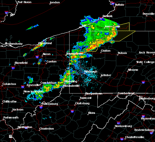 The severe thunderstorm warning for northeastern venango county will expire at 530 pm edt, the storm which prompted the warning has moved out of the area. therefore, the warning will be allowed to expire. a severe thunderstorm watch remains in effect until 900 pm edt for northwestern pennsylvania. The severe thunderstorm warning for northeastern venango county will expire at 530 pm edt, the storm which prompted the warning has moved out of the area. therefore, the warning will be allowed to expire. a severe thunderstorm watch remains in effect until 900 pm edt for northwestern pennsylvania.
|
| 6/5/2016 5:19 PM EDT |
 At 519 pm edt, a severe thunderstorm was located near enterprise, or 11 miles northeast of oil city, moving east at 35 mph (radar indicated). Hazards include 60 mph wind gusts and quarter size hail. Hail damage to vehicles is expected. expect wind damage to trees and power lines, resulting in some power outages. locations impacted include, pleasantville and oil creek state park. Please report severe weather by calling 4 1 2, 2 6 2, 1 9 8 8, posting to the nws pittsburgh facebook page, or using twitter @nwspittsburgh. At 519 pm edt, a severe thunderstorm was located near enterprise, or 11 miles northeast of oil city, moving east at 35 mph (radar indicated). Hazards include 60 mph wind gusts and quarter size hail. Hail damage to vehicles is expected. expect wind damage to trees and power lines, resulting in some power outages. locations impacted include, pleasantville and oil creek state park. Please report severe weather by calling 4 1 2, 2 6 2, 1 9 8 8, posting to the nws pittsburgh facebook page, or using twitter @nwspittsburgh.
|
| 6/5/2016 4:42 PM EDT |
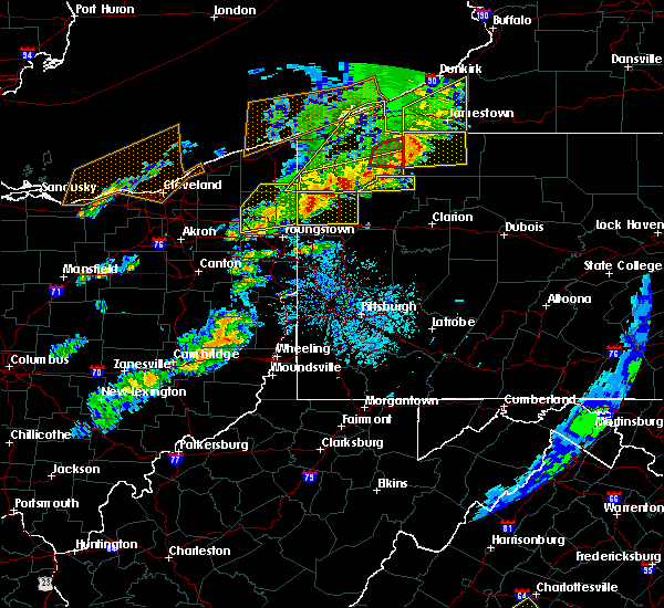 At 442 pm edt, a severe thunderstorm was located near guys mills, or 8 miles southeast of meadville, moving east at 40 mph (radar indicated). Hazards include 60 mph wind gusts and quarter size hail. Hail damage to vehicles is expected. Expect wind damage to trees and power lines, resulting in some power outages. At 442 pm edt, a severe thunderstorm was located near guys mills, or 8 miles southeast of meadville, moving east at 40 mph (radar indicated). Hazards include 60 mph wind gusts and quarter size hail. Hail damage to vehicles is expected. Expect wind damage to trees and power lines, resulting in some power outages.
|
| 7/19/2015 7:10 PM EDT |
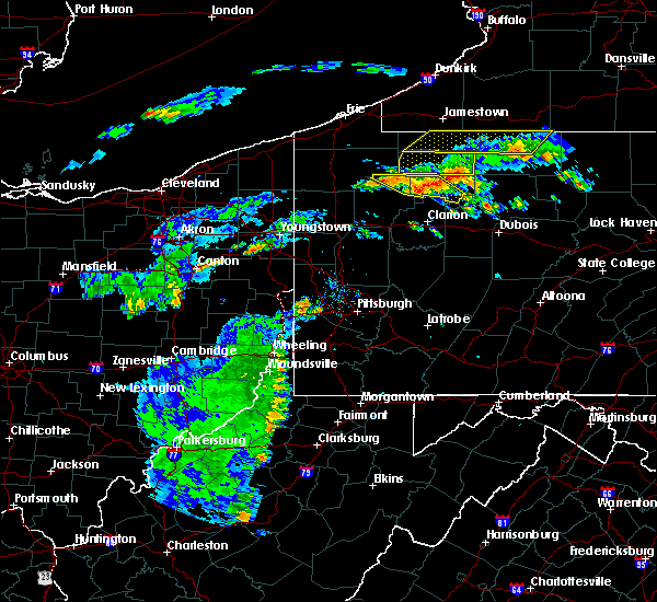 At 709 pm edt, severe thunderstorms were located along a line extending from near enterprise to 6 miles east of tionesta, moving east at 40 mph (radar). Hazards include 60 mph wind gusts. expect damage to trees and some power outages locations impacted include, marienville, tionesta, pleasantville, kellettville, west hickory, east hickory, starr and oil creek state park At 709 pm edt, severe thunderstorms were located along a line extending from near enterprise to 6 miles east of tionesta, moving east at 40 mph (radar). Hazards include 60 mph wind gusts. expect damage to trees and some power outages locations impacted include, marienville, tionesta, pleasantville, kellettville, west hickory, east hickory, starr and oil creek state park
|
| 7/19/2015 7:07 PM EDT | Multiple trees and power lines down in northern venango county near pleasantville in venango county PA, 0.3 miles NNE of Pleasantville, PA |
| 7/19/2015 7:02 PM EDT |
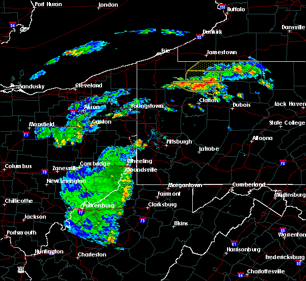 At 701 pm edt, severe thunderstorms were located along a line extending from near titusville to near tionesta, moving southeast at 20 mph (radar indicated). Hazards include 60 mph wind gusts and quarter size hail. wind damage to trees and some power outages At 701 pm edt, severe thunderstorms were located along a line extending from near titusville to near tionesta, moving southeast at 20 mph (radar indicated). Hazards include 60 mph wind gusts and quarter size hail. wind damage to trees and some power outages
|
| 7/19/2015 6:49 PM EDT | Multiple trees and power lines down in northern venango county near cherrytree and pleasantville in venango county PA, 0.3 miles NNE of Pleasantville, PA |
| 6/12/2015 7:52 PM EDT |
 At 752 pm edt, doppler radar indicated a line of severe thunderstorms capable of producing damaging winds around 60 mph. these storms were located along a line extending from near ligonier to near seven springs to near chalkhill, and moving east at 40 mph. At 752 pm edt, doppler radar indicated a line of severe thunderstorms capable of producing damaging winds around 60 mph. these storms were located along a line extending from near ligonier to near seven springs to near chalkhill, and moving east at 40 mph.
|
| 6/12/2015 5:00 PM EDT | Trees dow in venango county PA, 0.3 miles NNE of Pleasantville, PA |
| 5/11/2015 9:11 PM EDT | Multiple trees down in venango county PA, 0.3 miles NNE of Pleasantville, PA |
| 5/11/2015 9:02 PM EDT | At 901 pm edt, severe thunderstorms were located along a line extending from 8 miles southwest of titusville to 7 miles east of oil city to near knox, moving east at 50 mph (radar indicated). Hazards include 60 mph wind gusts. Expect damage to roofs. siding and trees. locations impacted include, oil city, franklin, marienville, knox, sugarcreek, tionesta, hasson heights, seneca, polk, emlenton, rouseville, shippenville, cooperstown, kennerdell, woodland heights, pleasantville, utica, leeper, kellettville and fryburg. 75in. |
| 5/11/2015 8:45 PM EDT | At 845 pm edt, severe thunderstorms were located along a line extending from 6 miles northwest of sugarcreek to near knox, moving northeast at 45 mph (radar indicated). Hazards include 60 mph wind gusts. Expect damage to roofs. Siding and trees. |
| 6/18/2014 7:20 PM EDT | Golf Ball sized hail reported 109.7 miles SSE of Pleasantville, PA |
| 6/18/2014 7:18 PM EDT | Multiple trees down in venango county PA, 0.3 miles NNE of Pleasantville, PA |
| 9/22/2012 6:55 PM EDT | Multiple trees down in venango county PA, 0.3 miles NNE of Pleasantville, PA |
| 5/29/2012 12:25 PM EDT | Quarter sized hail reported 110.1 miles SSE of Pleasantville, PA |
| 1/1/0001 12:00 AM | Trees down on 3rd st and cemetery rd in venango county PA, 0.3 miles NNE of Pleasantville, PA |
| 1/1/0001 12:00 AM | Trees down on 3rd st and cemetery r in venango county PA, 0.3 miles NNE of Pleasantville, PA |
| 1/1/0001 12:00 AM | Quarter sized hail reported 4.6 miles E of Pleasantville, PA |
Hail Maps for Pleasantville, PA


Connect with Interactive Hail Maps