

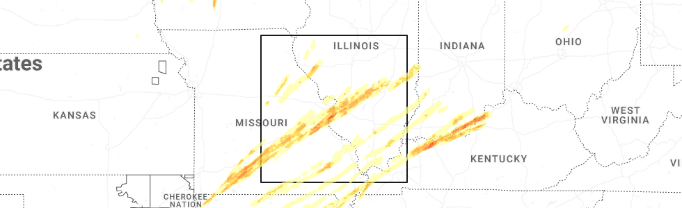
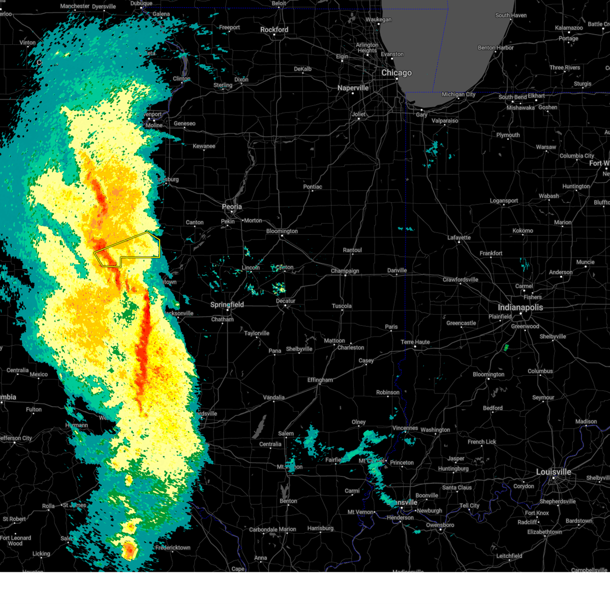
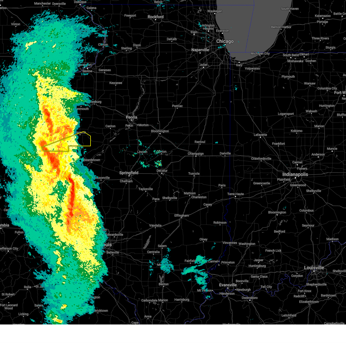
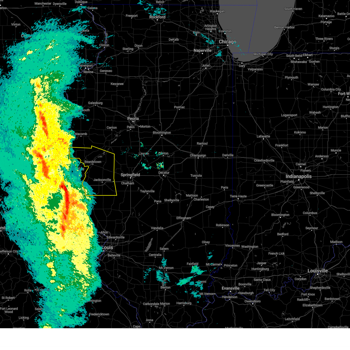
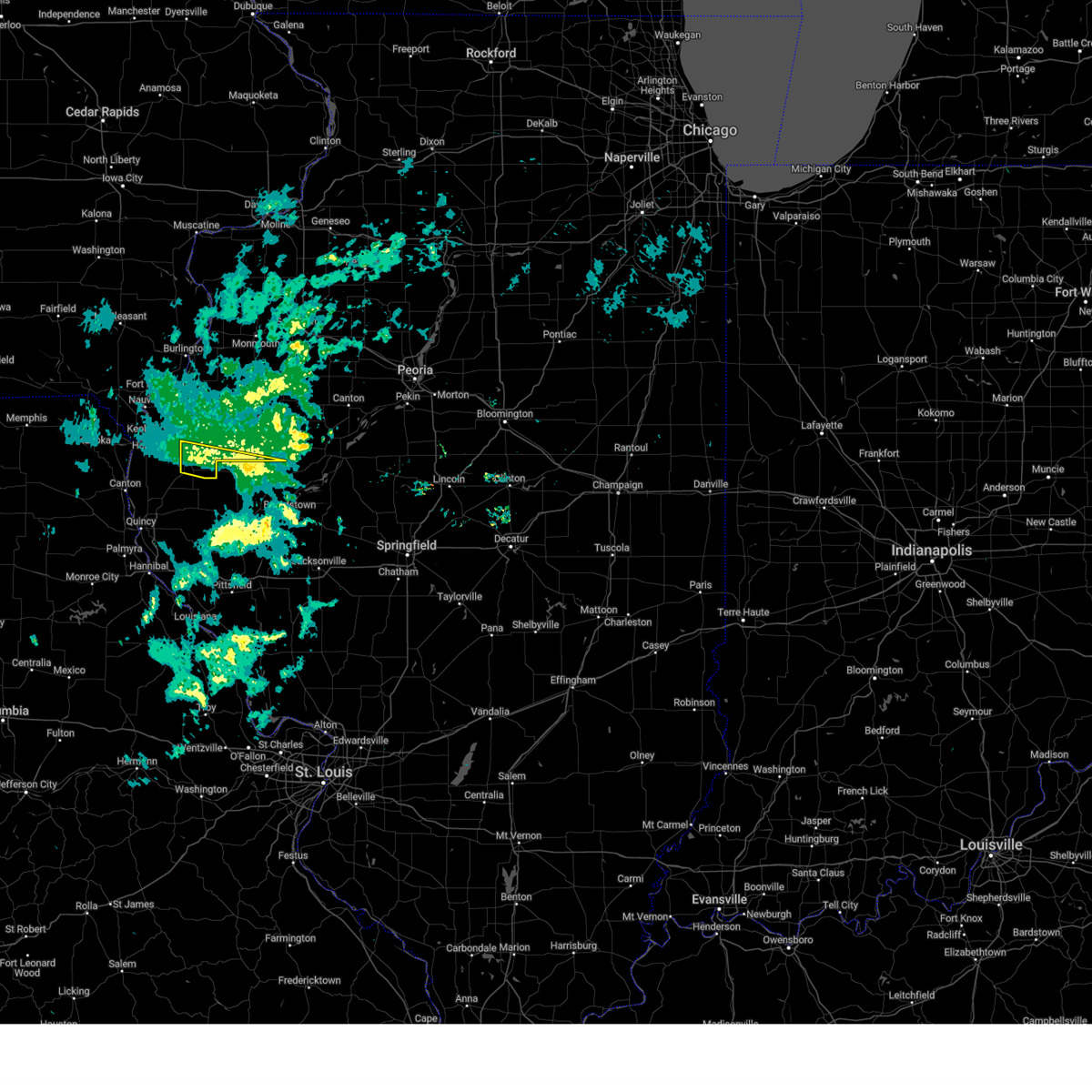
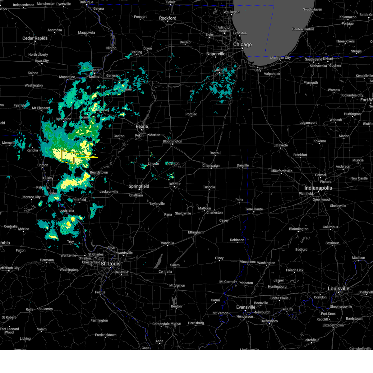
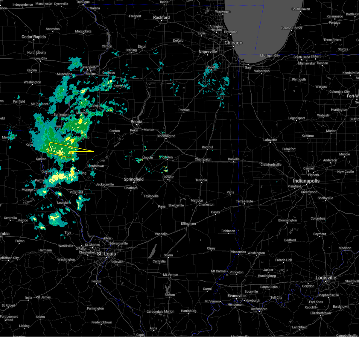
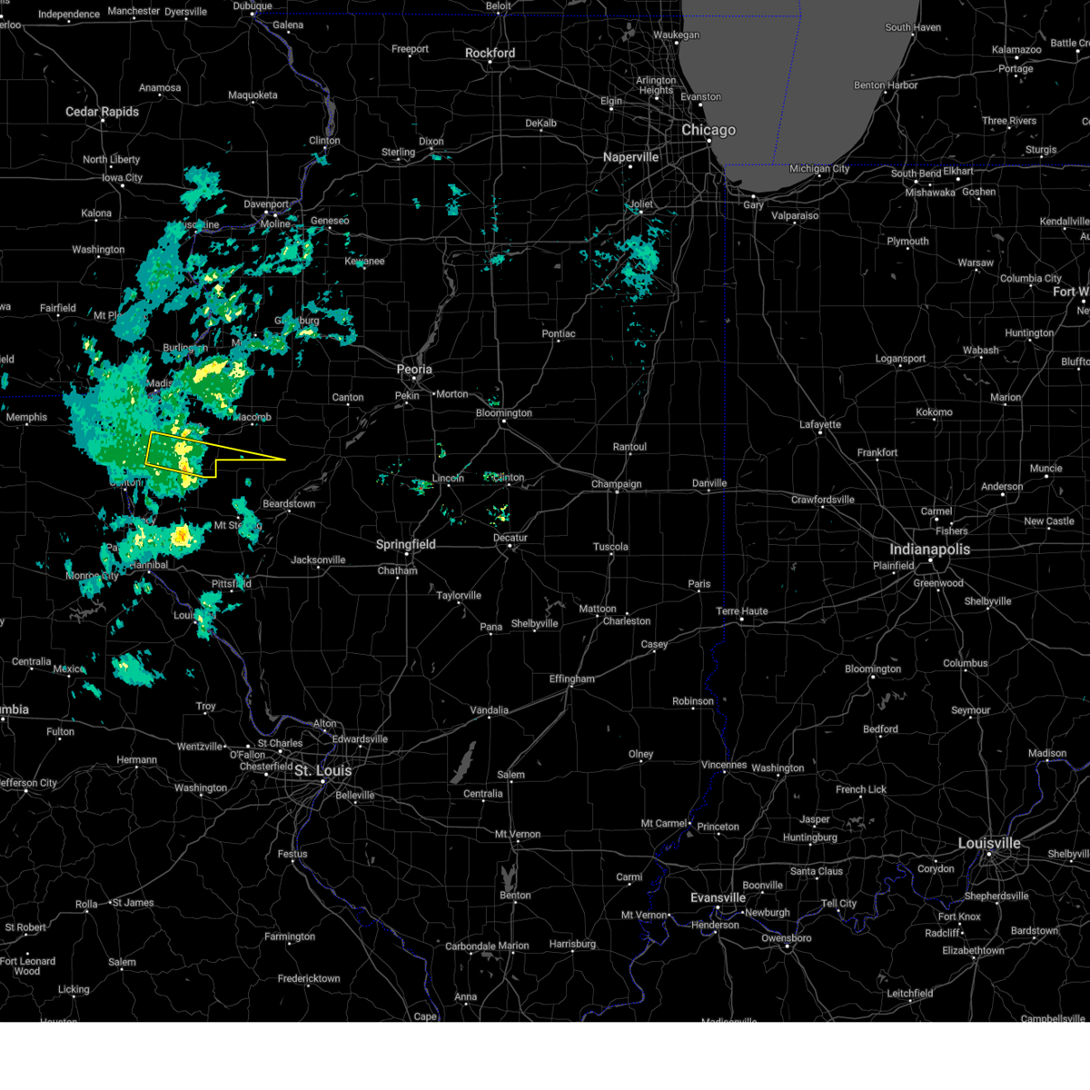
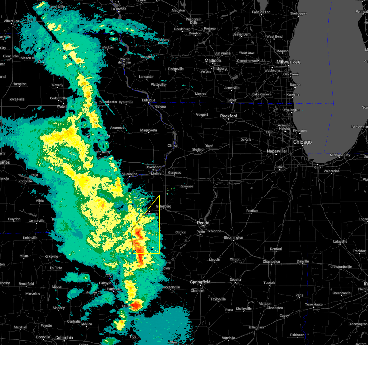
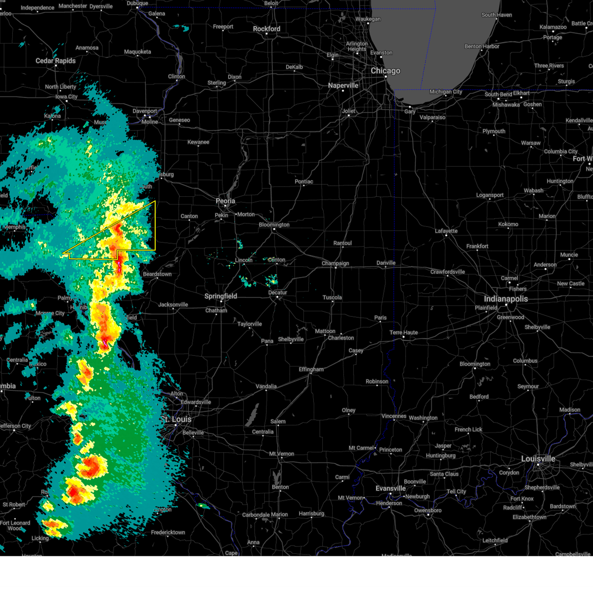
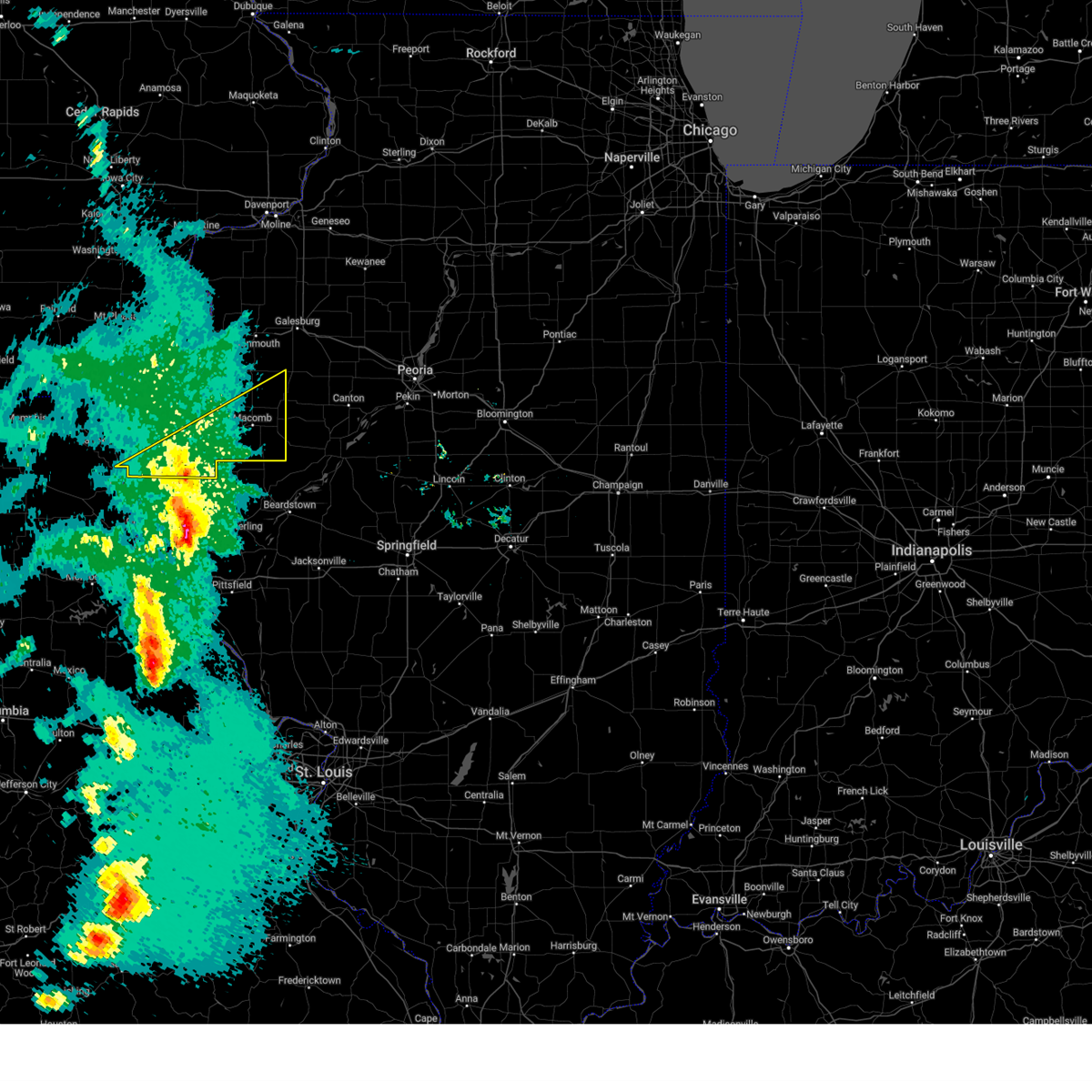
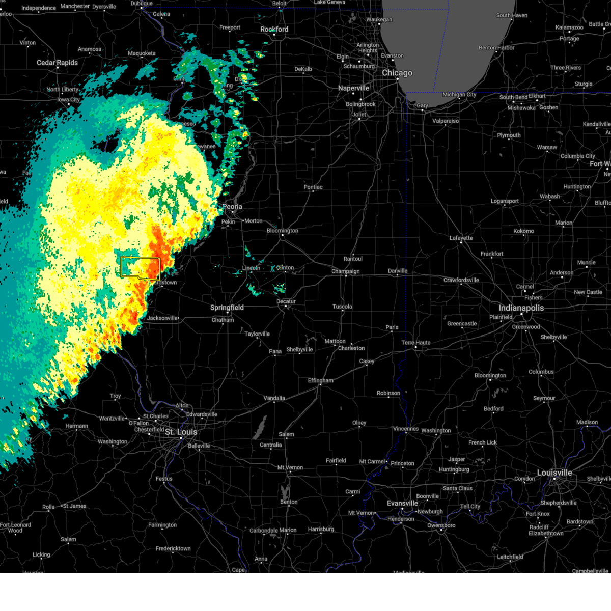
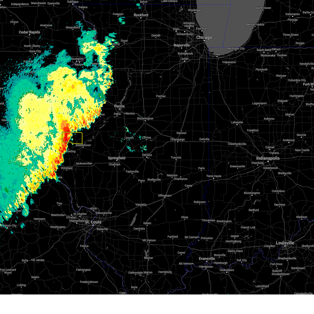
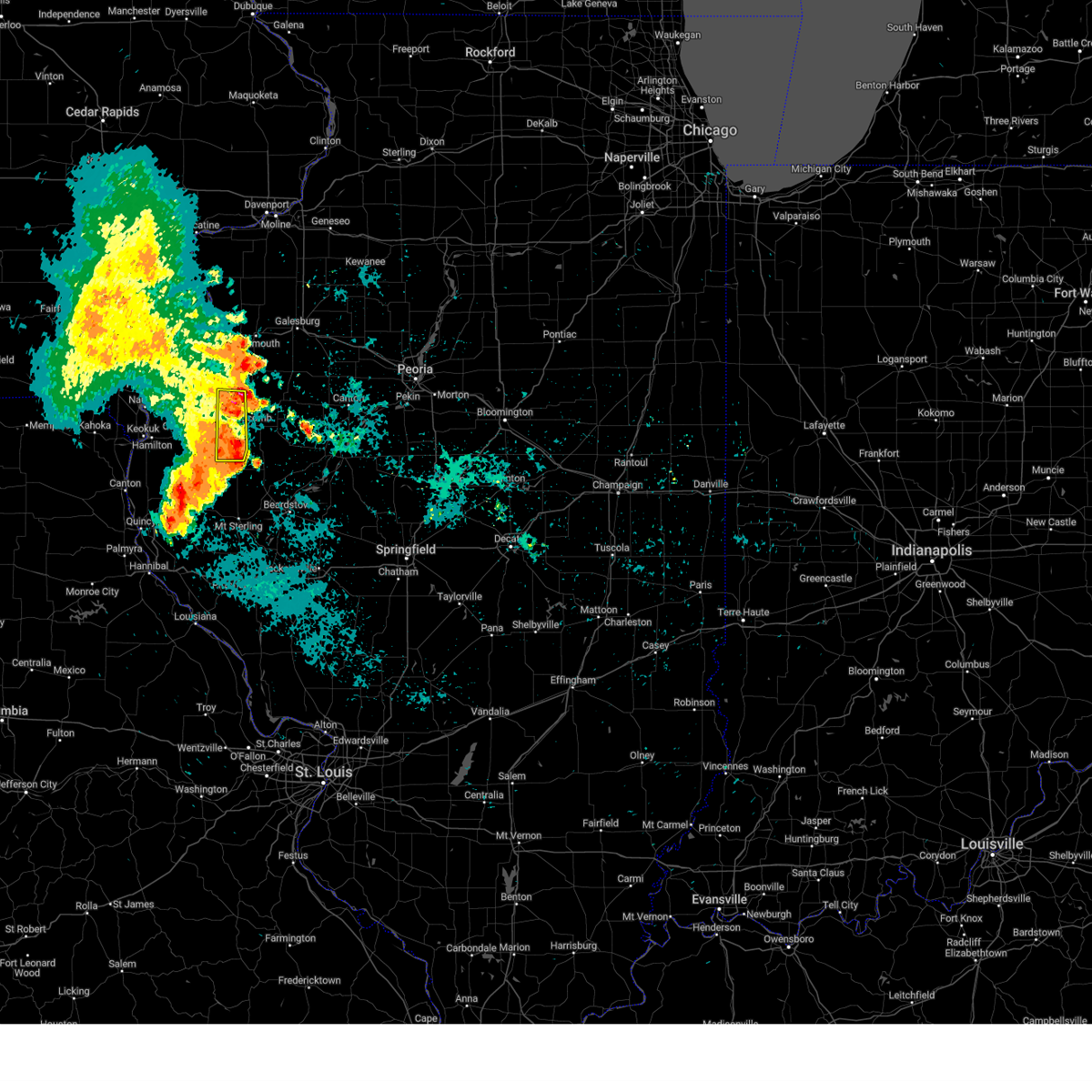
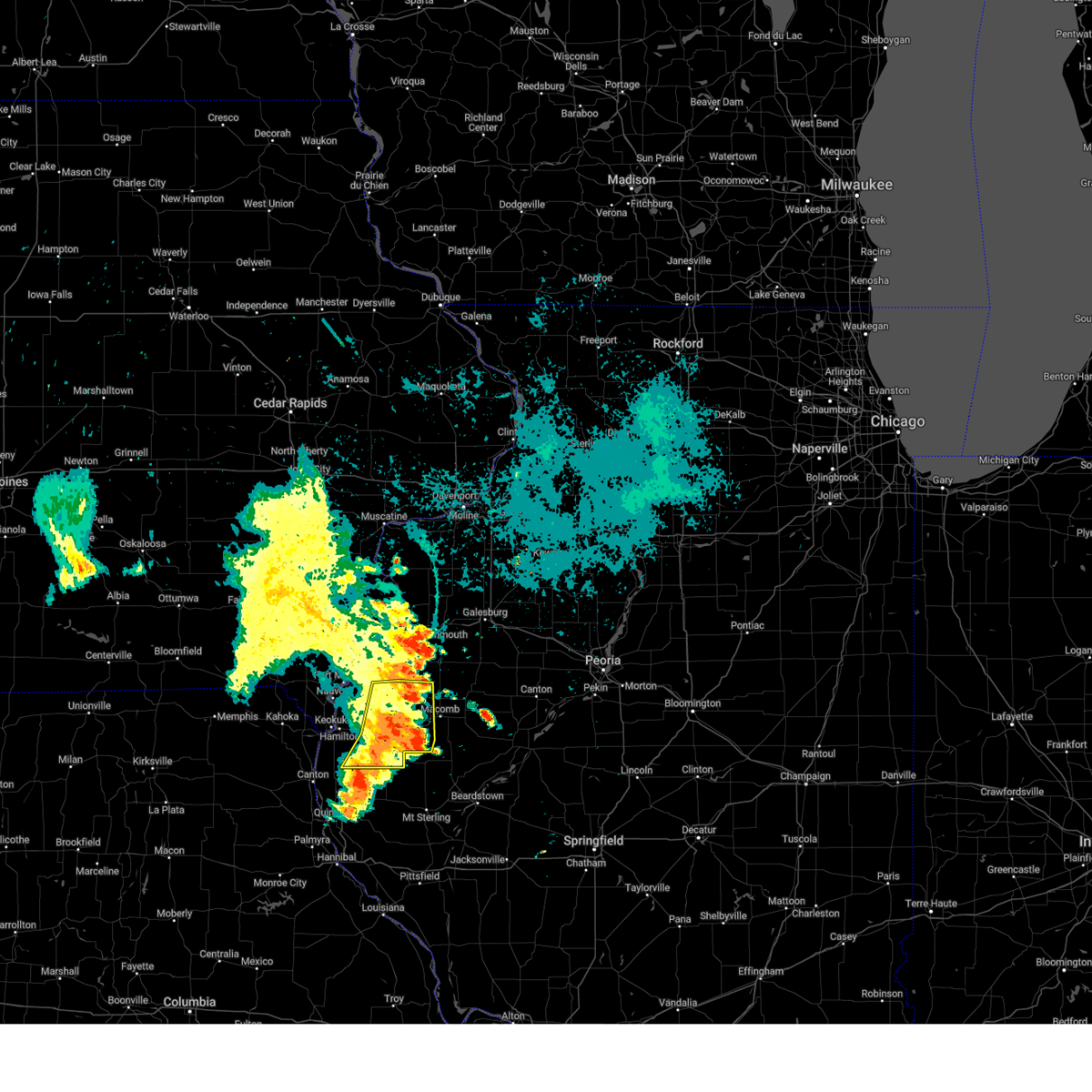
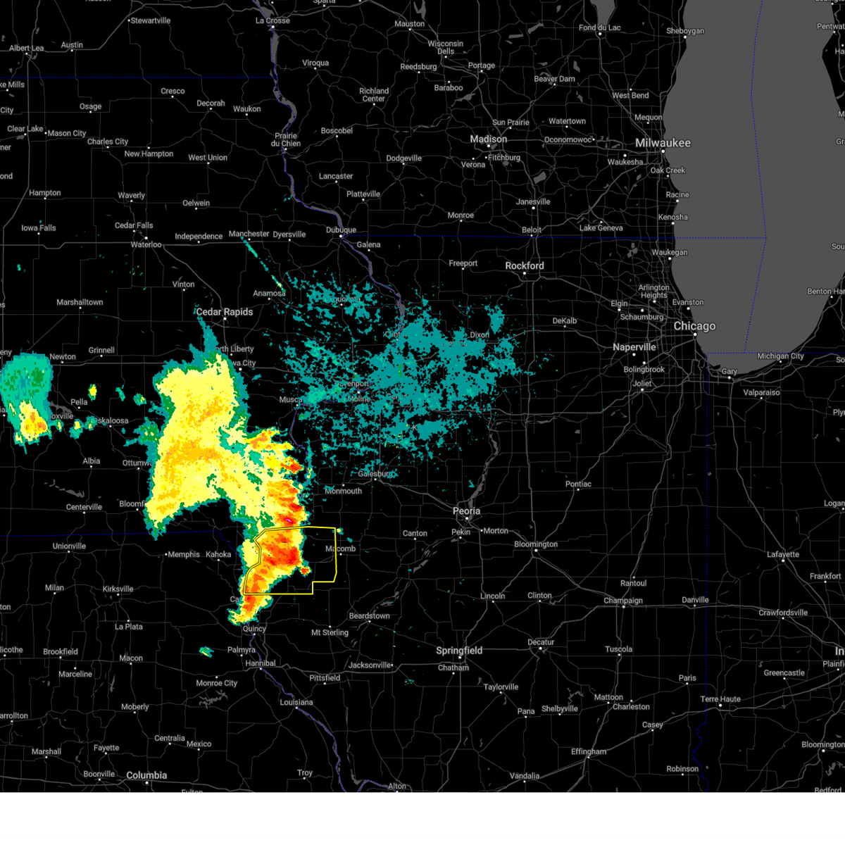
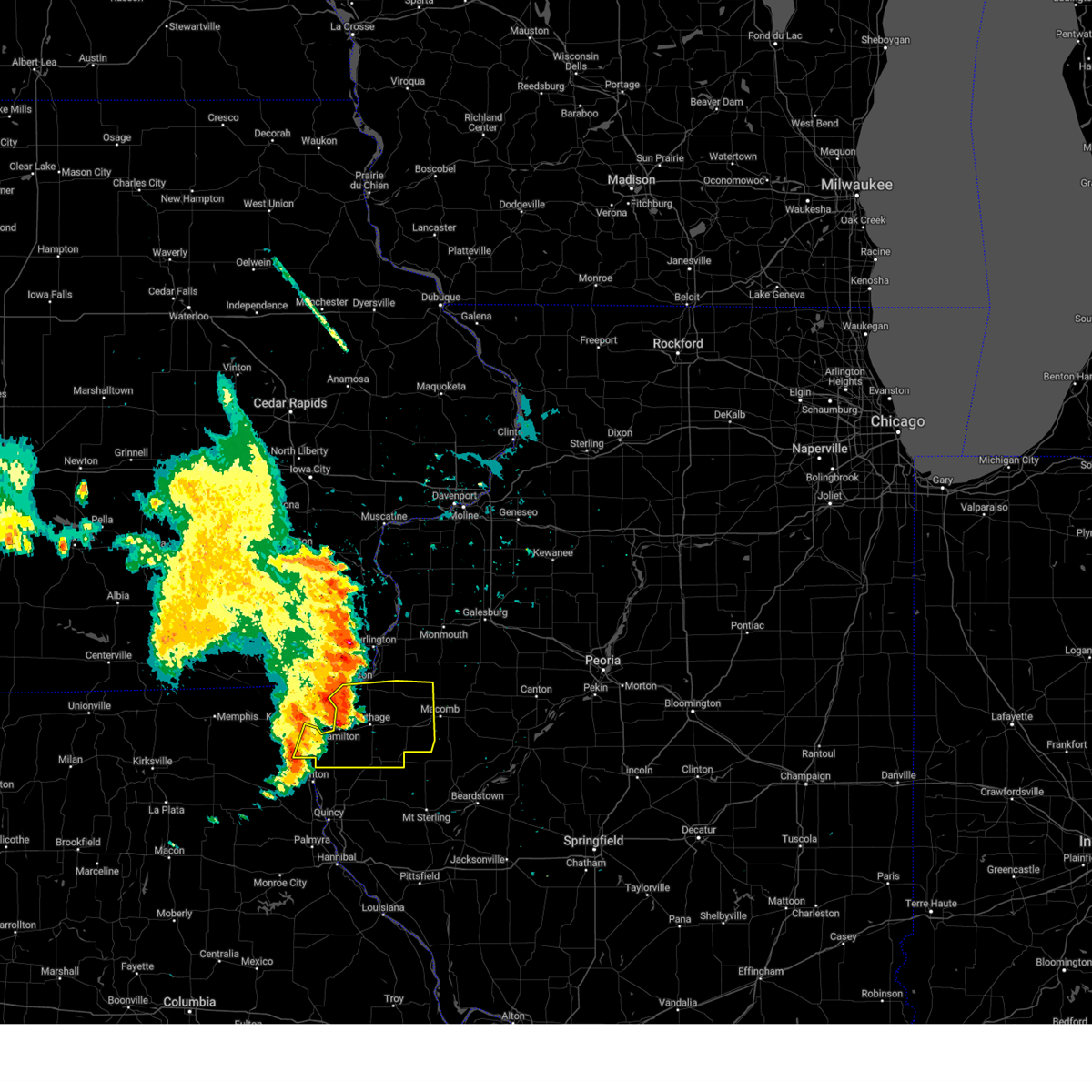
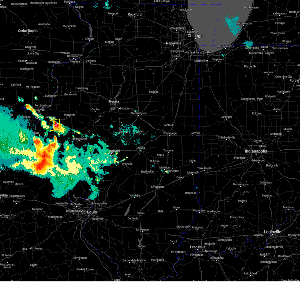
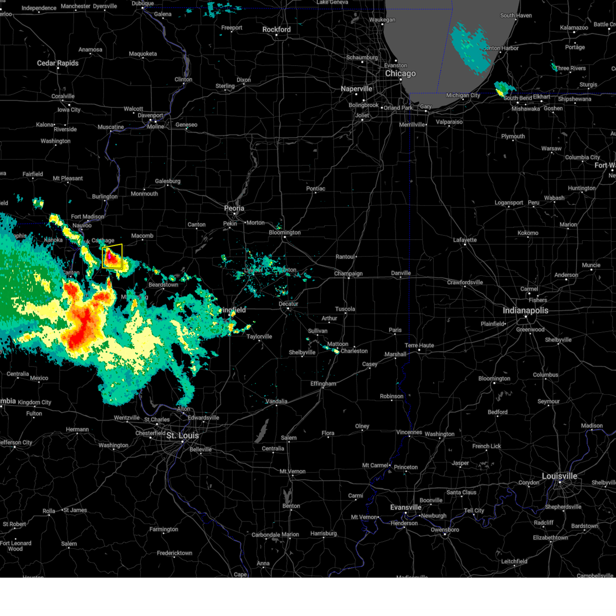
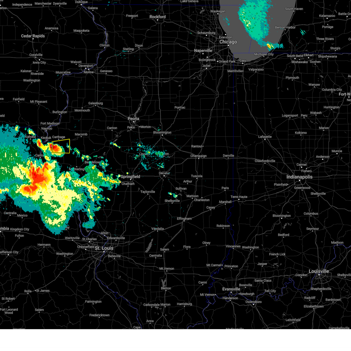
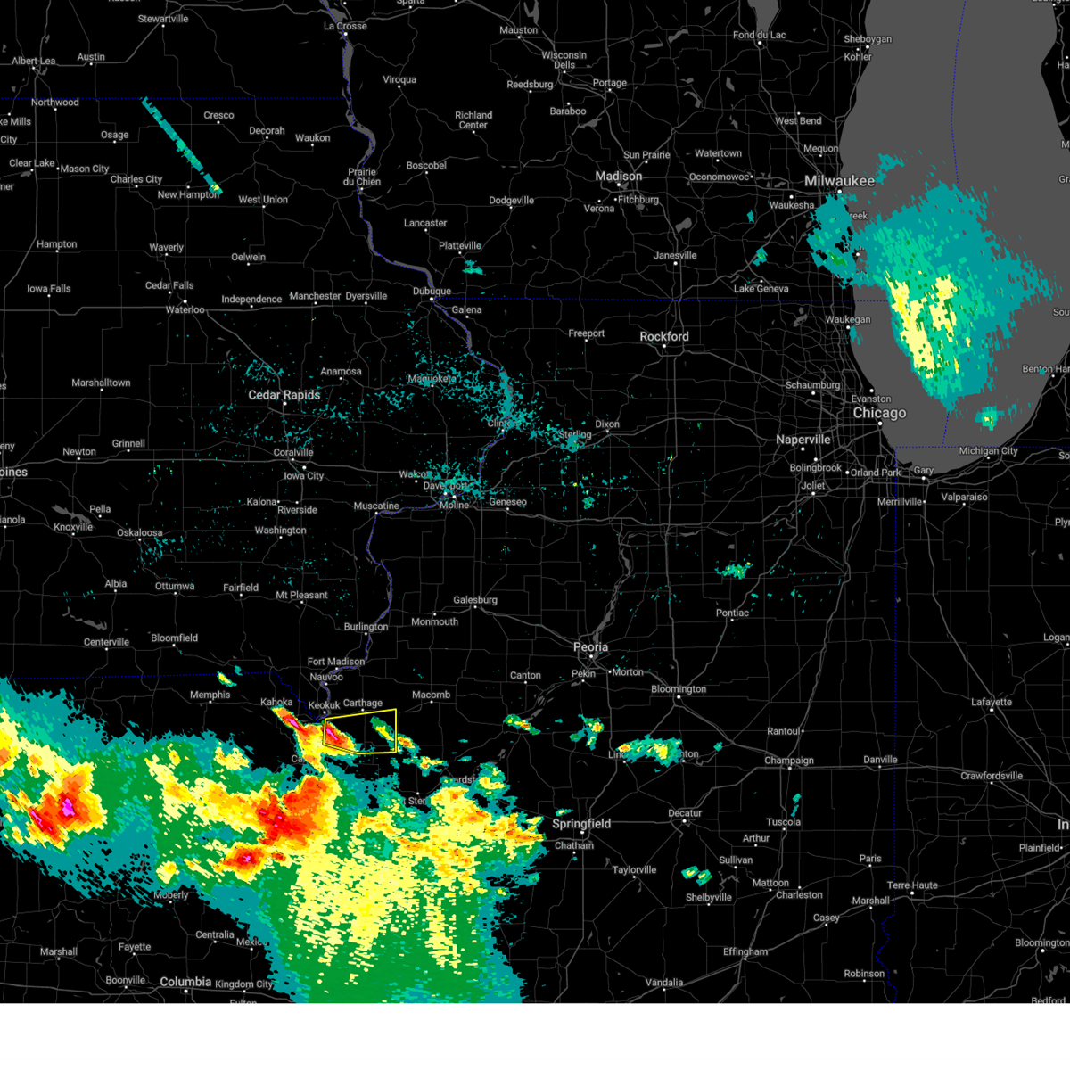
Hail Map for Plymouth, IL
The Plymouth, IL area has had 10 reports of on-the-ground hail by trained spotters, and has been under severe weather warnings 43 times during the past 12 months. Doppler radar has detected hail at or near Plymouth, IL on 53 occasions, including 2 occasions during the past year.
| Name: | Plymouth, IL |
| Where Located: | 43.3 miles ESE of Kahoka, MO |
| Map: | Google Map for Plymouth, IL |
| Population: | 505 |
| Housing Units: | 248 |
| More Info: | Search Google for Plymouth, IL |
0
The Top Recent Hail Date for Plymouth, IL is Friday, March 14, 2025 (26th out of 53)
Hail and Wind Damage Spotted near Plymouth, IL
| Date / Time | Report Details |
|---|---|
| 4/20/2025 7:24 PM CDT | At 724 pm cdt, severe thunderstorms were located along a line extending from near bentley to camden, moving northeast at 45 mph (radar indicated). Hazards include 60 mph wind gusts and penny size hail. Expect damage to roofs, siding, and trees. Locations impacted include, pennington point, augusta, western illinois university, adair, tennessee, colchester, plymouth, doddsville, fandon, bentley, industry, mcdonough county 4-h grounds, denver, hancock county fairgrounds, colmar, macomb, argyle lake state park, bowen, and bardolph. |
| 4/20/2025 7:18 PM CDT |
 At 718 pm cdt, severe thunderstorms were located along a line extending from near bentley to near huntsville, moving northeast at 50 mph (radar indicated). Hazards include 60 mph wind gusts and penny size hail. Expect damage to roofs, siding, and trees. Locations impacted include, pennington point, augusta, western illinois university, adair, bowen, tennessee, colchester, plymouth, doddsville, fandon, bentley, basco, industry, mcdonough county 4-h grounds, denver, hancock county fairgrounds, colmar, macomb, argyle lake state park, and bardolph. At 718 pm cdt, severe thunderstorms were located along a line extending from near bentley to near huntsville, moving northeast at 50 mph (radar indicated). Hazards include 60 mph wind gusts and penny size hail. Expect damage to roofs, siding, and trees. Locations impacted include, pennington point, augusta, western illinois university, adair, bowen, tennessee, colchester, plymouth, doddsville, fandon, bentley, basco, industry, mcdonough county 4-h grounds, denver, hancock county fairgrounds, colmar, macomb, argyle lake state park, and bardolph.
|
| 4/20/2025 7:15 PM CDT |
 At 715 pm cdt, severe thunderstorms were located along a line extending from near basco to near la prairie, moving northeast at 50 mph (radar indicated). Hazards include 60 mph wind gusts and penny size hail. Expect damage to roofs, siding, and trees. Locations impacted include, pennington point, augusta, western illinois university, adair, bowen, tennessee, colchester, plymouth, doddsville, fandon, stillwell, bentley, basco, industry, mcdonough county 4-h grounds, denver, west point, hancock county fairgrounds, colmar, and macomb. At 715 pm cdt, severe thunderstorms were located along a line extending from near basco to near la prairie, moving northeast at 50 mph (radar indicated). Hazards include 60 mph wind gusts and penny size hail. Expect damage to roofs, siding, and trees. Locations impacted include, pennington point, augusta, western illinois university, adair, bowen, tennessee, colchester, plymouth, doddsville, fandon, stillwell, bentley, basco, industry, mcdonough county 4-h grounds, denver, west point, hancock county fairgrounds, colmar, and macomb.
|
| 4/20/2025 7:14 PM CDT | At 713 pm cdt, severe thunderstorms were located along a line extending from carthage to 6 miles west of meredosia to near hardin, moving northeast at 55 mph (broadcast media. broadcast media reported extensive tree damage across southern adams county around 6:55 pm). Hazards include 70 mph wind gusts and penny size hail. Expect considerable tree damage. damage is likely to mobile homes, roofs, and outbuildings. locations impacted include, franklin, bluffs, vermont, huntsville, alexander, beardstown, glasgow, ray, snicarte, bath, arenzville, nortonville, murrayville, astoria, lynnville, meredosia, jacksonville municipal airport, woodson, naples, and kilbourne. This includes interstate 72 between mile markers 43 and 79. |
| 4/20/2025 7:00 PM CDT |
 Svrdvn the national weather service in the quad cities has issued a * severe thunderstorm warning for, southern hancock county in west central illinois, southern mcdonough county in west central illinois, * until 800 pm cdt. * at 659 pm cdt, severe thunderstorms were located along a line extending from tioga to near camp point, moving northeast at 50 mph (radar indicated). Hazards include 60 mph wind gusts and penny size hail. expect damage to roofs, siding, and trees Svrdvn the national weather service in the quad cities has issued a * severe thunderstorm warning for, southern hancock county in west central illinois, southern mcdonough county in west central illinois, * until 800 pm cdt. * at 659 pm cdt, severe thunderstorms were located along a line extending from tioga to near camp point, moving northeast at 50 mph (radar indicated). Hazards include 60 mph wind gusts and penny size hail. expect damage to roofs, siding, and trees
|
| 4/20/2025 6:45 PM CDT |
 Svrilx the national weather service in lincoln has issued a * severe thunderstorm warning for, scott county in west central illinois, southwestern fulton county in west central illinois, cass county in west central illinois, schuyler county in west central illinois, southwestern mason county in central illinois, morgan county in west central illinois, * until 730 pm cdt. * at 644 pm cdt, severe thunderstorms were located along a line extending from near canton to near atlas to moscow mills, moving northeast at 55 mph (radar indicated). Hazards include 70 mph wind gusts and penny size hail. Expect considerable tree damage. Damage is likely to mobile homes, roofs, and outbuildings. Svrilx the national weather service in lincoln has issued a * severe thunderstorm warning for, scott county in west central illinois, southwestern fulton county in west central illinois, cass county in west central illinois, schuyler county in west central illinois, southwestern mason county in central illinois, morgan county in west central illinois, * until 730 pm cdt. * at 644 pm cdt, severe thunderstorms were located along a line extending from near canton to near atlas to moscow mills, moving northeast at 55 mph (radar indicated). Hazards include 70 mph wind gusts and penny size hail. Expect considerable tree damage. Damage is likely to mobile homes, roofs, and outbuildings.
|
| 3/21/2025 8:56 PM CDT |
 The severe thunderstorm which prompted the warning has moved out of the warned area. therefore, the warning will be allowed to expire. The severe thunderstorm which prompted the warning has moved out of the warned area. therefore, the warning will be allowed to expire.
|
| 3/21/2025 8:44 PM CDT |
 At 844 pm cdt, a severe thunderstorm was located over doddsville, or 11 miles northwest of rushville, moving east at 40 mph (radar indicated). Hazards include 60 mph wind gusts. Expect damage to roofs, siding, and trees. Locations impacted include, augusta, bowen, plymouth, doddsville, denver, hancock county fairgrounds, and bentley. At 844 pm cdt, a severe thunderstorm was located over doddsville, or 11 miles northwest of rushville, moving east at 40 mph (radar indicated). Hazards include 60 mph wind gusts. Expect damage to roofs, siding, and trees. Locations impacted include, augusta, bowen, plymouth, doddsville, denver, hancock county fairgrounds, and bentley.
|
| 3/21/2025 8:28 PM CDT |
 At 826 pm cdt, a severe thunderstorm was located over plymouth, or 14 miles southeast of carthage, moving east at 40 mph (radar indicated). Hazards include 60 mph wind gusts. Expect damage to roofs, siding, and trees. Locations impacted include, augusta, bowen, sutter, plymouth, elvaston, doddsville, denver, west point, hancock county fairgrounds, bentley, basco, and hamilton. At 826 pm cdt, a severe thunderstorm was located over plymouth, or 14 miles southeast of carthage, moving east at 40 mph (radar indicated). Hazards include 60 mph wind gusts. Expect damage to roofs, siding, and trees. Locations impacted include, augusta, bowen, sutter, plymouth, elvaston, doddsville, denver, west point, hancock county fairgrounds, bentley, basco, and hamilton.
|
| 3/21/2025 8:13 PM CDT |
 Svrdvn the national weather service in the quad cities has issued a * severe thunderstorm warning for, southeastern hancock county in west central illinois, southwestern mcdonough county in west central illinois, * until 900 pm cdt. * at 811 pm cdt, a severe thunderstorm was located over bentley, or near carthage, moving east at 40 mph (radar indicated). Hazards include 60 mph wind gusts. expect damage to roofs, siding, and trees Svrdvn the national weather service in the quad cities has issued a * severe thunderstorm warning for, southeastern hancock county in west central illinois, southwestern mcdonough county in west central illinois, * until 900 pm cdt. * at 811 pm cdt, a severe thunderstorm was located over bentley, or near carthage, moving east at 40 mph (radar indicated). Hazards include 60 mph wind gusts. expect damage to roofs, siding, and trees
|
| 3/14/2025 8:37 PM CDT |
 Svrdvn the national weather service in the quad cities has issued a * severe thunderstorm warning for, northeastern hancock county in west central illinois, southeastern henderson county in west central illinois, warren county in west central illinois, mcdonough county in west central illinois, southeastern mercer county in northwestern illinois, * until 915 pm cdt. * at 836 pm cdt, severe thunderstorms were located along a line extending from blandinsville to near weinberg king state park, moving northeast at 60 mph. a trained spotter reported a 81 mph wind gust 4 miles northeast of blandinsville 831 pm. these are destructive storms for mcdonough and warren counties (radar indicated). Hazards include 80 mph wind gusts and penny size hail. Flying debris will be dangerous to those caught without shelter. mobile homes will be heavily damaged. expect considerable damage to roofs, windows, and vehicles. Extensive tree damage and power outages are likely. Svrdvn the national weather service in the quad cities has issued a * severe thunderstorm warning for, northeastern hancock county in west central illinois, southeastern henderson county in west central illinois, warren county in west central illinois, mcdonough county in west central illinois, southeastern mercer county in northwestern illinois, * until 915 pm cdt. * at 836 pm cdt, severe thunderstorms were located along a line extending from blandinsville to near weinberg king state park, moving northeast at 60 mph. a trained spotter reported a 81 mph wind gust 4 miles northeast of blandinsville 831 pm. these are destructive storms for mcdonough and warren counties (radar indicated). Hazards include 80 mph wind gusts and penny size hail. Flying debris will be dangerous to those caught without shelter. mobile homes will be heavily damaged. expect considerable damage to roofs, windows, and vehicles. Extensive tree damage and power outages are likely.
|
| 3/14/2025 8:28 PM CDT |
 At 827 pm cdt, severe thunderstorms were located along a line extending from near tennessee to huntsville, moving northeast at 60 mph (radar indicated). Hazards include 70 mph wind gusts. Expect considerable tree damage. damage is likely to mobile homes, roofs, and outbuildings. Locations impacted include, macomb, sciota, argyle lake state park, tennessee, colchester, fandon, colmar, blandinsville, spring lake, good hope, mcdonough county 4-h grounds, western illinois university, macomb municipal airport, youngstown, bardolph, walnut grove, scottsburg, bushnell, little swan lake, prairie city and prairie city airport. At 827 pm cdt, severe thunderstorms were located along a line extending from near tennessee to huntsville, moving northeast at 60 mph (radar indicated). Hazards include 70 mph wind gusts. Expect considerable tree damage. damage is likely to mobile homes, roofs, and outbuildings. Locations impacted include, macomb, sciota, argyle lake state park, tennessee, colchester, fandon, colmar, blandinsville, spring lake, good hope, mcdonough county 4-h grounds, western illinois university, macomb municipal airport, youngstown, bardolph, walnut grove, scottsburg, bushnell, little swan lake, prairie city and prairie city airport.
|
| 3/14/2025 8:07 PM CDT |
 Svrdvn the national weather service in the quad cities has issued a * severe thunderstorm warning for, southern hancock county in west central illinois, southeastern warren county in west central illinois, mcdonough county in west central illinois, southern clark county in northeastern missouri, * until 900 pm cdt. * at 807 pm cdt, severe thunderstorms were located along a line extending from near bowen to near liberty, moving northeast at 65 mph (radar indicated). Hazards include 70 mph wind gusts. Expect considerable tree damage. damage is likely to mobile homes, roofs, and outbuildings. severe thunderstorms will be near, denver, bowen, and augusta around 810 pm cdt. hancock county fairgrounds and plymouth around 815 pm cdt. tennessee and colmar around 820 pm cdt. argyle lake state park, colchester, and fandon around 825 pm cdt. Other locations in the path of these severe thunderstorms include macomb, sciota, blandinsville, spring lake, macomb municipal airport, good hope, mcdonough county 4-h grounds, western illinois university, industry, scottsburg, youngstown, pennington point, bushnell, bardolph, walnut grove and little swan lake. Svrdvn the national weather service in the quad cities has issued a * severe thunderstorm warning for, southern hancock county in west central illinois, southeastern warren county in west central illinois, mcdonough county in west central illinois, southern clark county in northeastern missouri, * until 900 pm cdt. * at 807 pm cdt, severe thunderstorms were located along a line extending from near bowen to near liberty, moving northeast at 65 mph (radar indicated). Hazards include 70 mph wind gusts. Expect considerable tree damage. damage is likely to mobile homes, roofs, and outbuildings. severe thunderstorms will be near, denver, bowen, and augusta around 810 pm cdt. hancock county fairgrounds and plymouth around 815 pm cdt. tennessee and colmar around 820 pm cdt. argyle lake state park, colchester, and fandon around 825 pm cdt. Other locations in the path of these severe thunderstorms include macomb, sciota, blandinsville, spring lake, macomb municipal airport, good hope, mcdonough county 4-h grounds, western illinois university, industry, scottsburg, youngstown, pennington point, bushnell, bardolph, walnut grove and little swan lake.
|
| 10/31/2024 12:29 AM CDT |
 The storms which prompted the warning have weakened below severe limits, and no longer pose an immediate threat to life or property. therefore, the warning will be allowed to expire. however, gusty winds are still possible with these thunderstorms. to report severe weather, contact your nearest law enforcement agency. they will relay your report to the national weather service lincoln. The storms which prompted the warning have weakened below severe limits, and no longer pose an immediate threat to life or property. therefore, the warning will be allowed to expire. however, gusty winds are still possible with these thunderstorms. to report severe weather, contact your nearest law enforcement agency. they will relay your report to the national weather service lincoln.
|
| 10/31/2024 12:12 AM CDT |
 At 1212 am cdt, severe thunderstorms were located along a line extending from near fandon to 7 miles northeast of clayton, moving northeast at 50 mph (radar indicated). Hazards include 70 mph wind gusts. Expect considerable tree damage. damage is likely to mobile homes, roofs, and outbuildings. Locations impacted include, rushville, littleton, huntsville, camden, ray, and weinberg king state park. At 1212 am cdt, severe thunderstorms were located along a line extending from near fandon to 7 miles northeast of clayton, moving northeast at 50 mph (radar indicated). Hazards include 70 mph wind gusts. Expect considerable tree damage. damage is likely to mobile homes, roofs, and outbuildings. Locations impacted include, rushville, littleton, huntsville, camden, ray, and weinberg king state park.
|
| 10/31/2024 12:08 AM CDT |
 the severe thunderstorm warning has been cancelled and is no longer in effect the severe thunderstorm warning has been cancelled and is no longer in effect
|
| 10/31/2024 12:08 AM CDT |
 At 1207 am cdt, a severe thunderstorm was located near doddsville, or 13 miles northwest of rushville, moving east at 55 mph (trained weather spotters. at 1143 pm, an 81 mph wind gust was reported at the quincy airport). Hazards include 70 mph wind gusts. Expect considerable tree damage. damage is likely to mobile homes, roofs, and outbuildings. Locations impacted include, industry and plymouth. At 1207 am cdt, a severe thunderstorm was located near doddsville, or 13 miles northwest of rushville, moving east at 55 mph (trained weather spotters. at 1143 pm, an 81 mph wind gust was reported at the quincy airport). Hazards include 70 mph wind gusts. Expect considerable tree damage. damage is likely to mobile homes, roofs, and outbuildings. Locations impacted include, industry and plymouth.
|
| 10/31/2024 12:02 AM CDT |
 At 1202 am cdt, severe thunderstorms were located along a line extending from near augusta to clayton, moving northeast at 60 mph (radar indicated). Hazards include 70 mph wind gusts. Expect considerable tree damage. damage is likely to mobile homes, roofs, and outbuildings. Locations impacted include, rushville, littleton, huntsville, camden, ray, and weinberg king state park. At 1202 am cdt, severe thunderstorms were located along a line extending from near augusta to clayton, moving northeast at 60 mph (radar indicated). Hazards include 70 mph wind gusts. Expect considerable tree damage. damage is likely to mobile homes, roofs, and outbuildings. Locations impacted include, rushville, littleton, huntsville, camden, ray, and weinberg king state park.
|
| 10/31/2024 12:01 AM CDT |
 At 1200 am cdt, a severe thunderstorm was located over weinberg king state park, or 18 miles southeast of carthage, moving east at 55 mph (trained weather spotters. at 1143 pm, an 81 mph wind gust was reported at the quincy airport). Hazards include 70 mph wind gusts. Expect considerable tree damage. damage is likely to mobile homes, roofs, and outbuildings. Locations impacted include, augusta, bowen, industry, plymouth, doddsville, and hancock county fairgrounds. At 1200 am cdt, a severe thunderstorm was located over weinberg king state park, or 18 miles southeast of carthage, moving east at 55 mph (trained weather spotters. at 1143 pm, an 81 mph wind gust was reported at the quincy airport). Hazards include 70 mph wind gusts. Expect considerable tree damage. damage is likely to mobile homes, roofs, and outbuildings. Locations impacted include, augusta, bowen, industry, plymouth, doddsville, and hancock county fairgrounds.
|
| 10/30/2024 11:56 PM CDT |
 At 1156 pm cdt, a severe thunderstorm was located over hancock county fairgrounds, or 16 miles southeast of carthage, moving east at 60 mph (trained weather spotters. at 1143 pm, an 81 mph wind gust was reported at the quincy airport). Hazards include 70 mph wind gusts. Expect considerable tree damage. damage is likely to mobile homes, roofs, and outbuildings. Locations impacted include, augusta, bowen, industry, west point, plymouth, denver, doddsville, and hancock county fairgrounds. At 1156 pm cdt, a severe thunderstorm was located over hancock county fairgrounds, or 16 miles southeast of carthage, moving east at 60 mph (trained weather spotters. at 1143 pm, an 81 mph wind gust was reported at the quincy airport). Hazards include 70 mph wind gusts. Expect considerable tree damage. damage is likely to mobile homes, roofs, and outbuildings. Locations impacted include, augusta, bowen, industry, west point, plymouth, denver, doddsville, and hancock county fairgrounds.
|
| 10/30/2024 11:52 PM CDT |
 Svrilx the national weather service in lincoln has issued a * severe thunderstorm warning for, schuyler county in west central illinois, * until 1230 am cdt. * at 1152 pm cdt, severe thunderstorms were located along a line extending from carthage to near camp point, moving northeast at 65 mph (trained weather spotters. at 1143 pm, an 81 mph wind gust was reported at the quincy airport). Hazards include 70 mph wind gusts. Expect considerable tree damage. Damage is likely to mobile homes, roofs, and outbuildings. Svrilx the national weather service in lincoln has issued a * severe thunderstorm warning for, schuyler county in west central illinois, * until 1230 am cdt. * at 1152 pm cdt, severe thunderstorms were located along a line extending from carthage to near camp point, moving northeast at 65 mph (trained weather spotters. at 1143 pm, an 81 mph wind gust was reported at the quincy airport). Hazards include 70 mph wind gusts. Expect considerable tree damage. Damage is likely to mobile homes, roofs, and outbuildings.
|
| 10/30/2024 11:50 PM CDT |
 Svrdvn the national weather service in the quad cities has issued a * severe thunderstorm warning for, southeastern hancock county in west central illinois, southern mcdonough county in west central illinois, * until 1230 am cdt. * at 1149 pm cdt, a severe thunderstorm was located over bowen, or 14 miles south of carthage, moving east at 60 mph (radar indicated). Hazards include 60 mph wind gusts. expect damage to roofs, siding, and trees Svrdvn the national weather service in the quad cities has issued a * severe thunderstorm warning for, southeastern hancock county in west central illinois, southern mcdonough county in west central illinois, * until 1230 am cdt. * at 1149 pm cdt, a severe thunderstorm was located over bowen, or 14 miles south of carthage, moving east at 60 mph (radar indicated). Hazards include 60 mph wind gusts. expect damage to roofs, siding, and trees
|
| 7/31/2024 6:27 AM CDT |
 The storms which prompted the warning have moved out of the area. therefore, the warning will be allowed to expire. however, gusty winds and heavy rain are still possible with these thunderstorms. a severe thunderstorm watch remains in effect until 900 am cdt for west central illinois. The storms which prompted the warning have moved out of the area. therefore, the warning will be allowed to expire. however, gusty winds and heavy rain are still possible with these thunderstorms. a severe thunderstorm watch remains in effect until 900 am cdt for west central illinois.
|
| 7/31/2024 6:23 AM CDT |
 At 622 am cdt, severe thunderstorms were located along a line extending from prairie city to near augusta to near quincy regional airport, moving east at 50 mph (radar indicated). Hazards include 60 mph wind gusts and nickel size hail. Expect damage to roofs, siding, and trees. locations impacted include, canton, rushville, lewistown, farmington, cuba, astoria, avon, vermont, st. David, fairview, ipava, london mills, littleton, browning, table grove, dunfermline, bernadotte, smithfield, bryant, and norris. At 622 am cdt, severe thunderstorms were located along a line extending from prairie city to near augusta to near quincy regional airport, moving east at 50 mph (radar indicated). Hazards include 60 mph wind gusts and nickel size hail. Expect damage to roofs, siding, and trees. locations impacted include, canton, rushville, lewistown, farmington, cuba, astoria, avon, vermont, st. David, fairview, ipava, london mills, littleton, browning, table grove, dunfermline, bernadotte, smithfield, bryant, and norris.
|
| 7/31/2024 6:19 AM CDT |
 the severe thunderstorm warning has been cancelled and is no longer in effect the severe thunderstorm warning has been cancelled and is no longer in effect
|
| 7/31/2024 6:19 AM CDT |
 At 619 am cdt, severe thunderstorms were located along a line extending from scottsburg to near huntsville, moving east at 45 mph (radar indicated). Hazards include 60 mph wind gusts. Expect damage to roofs, siding, and trees. Locations impacted include, macomb, bushnell, colchester, blandinsville, augusta, bowen, industry, good hope, prairie city, bardolph, tennessee, sciota, western illinois university, fandon, little swan lake, new philadelphia, colmar, adair, walnut grove, and plymouth. At 619 am cdt, severe thunderstorms were located along a line extending from scottsburg to near huntsville, moving east at 45 mph (radar indicated). Hazards include 60 mph wind gusts. Expect damage to roofs, siding, and trees. Locations impacted include, macomb, bushnell, colchester, blandinsville, augusta, bowen, industry, good hope, prairie city, bardolph, tennessee, sciota, western illinois university, fandon, little swan lake, new philadelphia, colmar, adair, walnut grove, and plymouth.
|
| 7/31/2024 6:11 AM CDT |
 At 610 am cdt, severe thunderstorms were located along a line extending from good hope to la prairie, moving east at 45 mph (radar indicated). Hazards include 60 mph wind gusts. Expect damage to roofs, siding, and trees. Locations impacted include, macomb, carthage, bushnell, hamilton, warsaw, colchester, la harpe, roseville, stronghurst, blandinsville, augusta, bowen, industry, good hope, prairie city, carman, terre haute, bardolph, west point, and ferris. At 610 am cdt, severe thunderstorms were located along a line extending from good hope to la prairie, moving east at 45 mph (radar indicated). Hazards include 60 mph wind gusts. Expect damage to roofs, siding, and trees. Locations impacted include, macomb, carthage, bushnell, hamilton, warsaw, colchester, la harpe, roseville, stronghurst, blandinsville, augusta, bowen, industry, good hope, prairie city, carman, terre haute, bardolph, west point, and ferris.
|
| 7/31/2024 6:11 AM CDT |
 the severe thunderstorm warning has been cancelled and is no longer in effect the severe thunderstorm warning has been cancelled and is no longer in effect
|
| 7/31/2024 6:05 AM CDT |
 Svrilx the national weather service in lincoln has issued a * severe thunderstorm warning for, fulton county in west central illinois, schuyler county in west central illinois, * until 700 am cdt. * at 604 am cdt, severe thunderstorms were located along a line extending from near good hope to near la grange, moving east at 45 mph (radar indicated). Hazards include 60 mph wind gusts and nickel size hail. expect damage to roofs, siding, and trees Svrilx the national weather service in lincoln has issued a * severe thunderstorm warning for, fulton county in west central illinois, schuyler county in west central illinois, * until 700 am cdt. * at 604 am cdt, severe thunderstorms were located along a line extending from near good hope to near la grange, moving east at 45 mph (radar indicated). Hazards include 60 mph wind gusts and nickel size hail. expect damage to roofs, siding, and trees
|
| 7/31/2024 5:53 AM CDT |
 At 553 am cdt, severe thunderstorms were located along a line extending from near la harpe to near stillwell, moving east at 45 mph (radar indicated). Hazards include 60 mph wind gusts. Expect damage to roofs, siding, and trees. Locations impacted include, burlington, macomb, keokuk, carthage, nauvoo, bushnell, hamilton, warsaw, colchester, la harpe, roseville, dallas city, stronghurst, blandinsville, augusta, bowen, industry, good hope, prairie city, and carman. At 553 am cdt, severe thunderstorms were located along a line extending from near la harpe to near stillwell, moving east at 45 mph (radar indicated). Hazards include 60 mph wind gusts. Expect damage to roofs, siding, and trees. Locations impacted include, burlington, macomb, keokuk, carthage, nauvoo, bushnell, hamilton, warsaw, colchester, la harpe, roseville, dallas city, stronghurst, blandinsville, augusta, bowen, industry, good hope, prairie city, and carman.
|
| 7/31/2024 5:40 AM CDT |
 At 540 am cdt, severe thunderstorms were located along a line extending from lomax to near sutter, moving east at 45 mph (trained weather spotters). Hazards include 60 mph wind gusts. Expect damage to roofs, siding, and trees. Locations impacted include, burlington, macomb, fort madison, keokuk, carthage, nauvoo, bushnell, hamilton, warsaw, colchester, la harpe, roseville, dallas city, montrose, stronghurst, blandinsville, wayland, bowen, industry, and good hope. At 540 am cdt, severe thunderstorms were located along a line extending from lomax to near sutter, moving east at 45 mph (trained weather spotters). Hazards include 60 mph wind gusts. Expect damage to roofs, siding, and trees. Locations impacted include, burlington, macomb, fort madison, keokuk, carthage, nauvoo, bushnell, hamilton, warsaw, colchester, la harpe, roseville, dallas city, montrose, stronghurst, blandinsville, wayland, bowen, industry, and good hope.
|
| 7/31/2024 5:38 AM CDT |
 At 538 am cdt, severe thunderstorms were located along a line extending from lomax to near sutter, moving east at 45 mph (radar indicated). Hazards include 60 mph wind gusts. Expect damage to roofs, siding, and trees. Locations impacted include, burlington, macomb, fort madison, keokuk, carthage, nauvoo, bushnell, hamilton, warsaw, colchester, la harpe, roseville, dallas city, montrose, stronghurst, blandinsville, wayland, bowen, industry, and good hope. At 538 am cdt, severe thunderstorms were located along a line extending from lomax to near sutter, moving east at 45 mph (radar indicated). Hazards include 60 mph wind gusts. Expect damage to roofs, siding, and trees. Locations impacted include, burlington, macomb, fort madison, keokuk, carthage, nauvoo, bushnell, hamilton, warsaw, colchester, la harpe, roseville, dallas city, montrose, stronghurst, blandinsville, wayland, bowen, industry, and good hope.
|
| 7/31/2024 5:28 AM CDT |
 Svrdvn the national weather service in the quad cities has issued a * severe thunderstorm warning for, hancock county in west central illinois, southern henderson county in west central illinois, southern warren county in west central illinois, mcdonough county in west central illinois, southwestern des moines county in southeastern iowa, central lee county in southeastern iowa, southeastern clark county in northeastern missouri, * until 630 am cdt. * at 527 am cdt, severe thunderstorms were located along a line extending from near wever to gregory landing, moving east at 45 mph (trained weather spotters. at 514 am cdt, a 67 mph wind gust was measured by a personal weather station just northwest of houghton). Hazards include 60 mph wind gusts. expect damage to roofs, siding, and trees Svrdvn the national weather service in the quad cities has issued a * severe thunderstorm warning for, hancock county in west central illinois, southern henderson county in west central illinois, southern warren county in west central illinois, mcdonough county in west central illinois, southwestern des moines county in southeastern iowa, central lee county in southeastern iowa, southeastern clark county in northeastern missouri, * until 630 am cdt. * at 527 am cdt, severe thunderstorms were located along a line extending from near wever to gregory landing, moving east at 45 mph (trained weather spotters. at 514 am cdt, a 67 mph wind gust was measured by a personal weather station just northwest of houghton). Hazards include 60 mph wind gusts. expect damage to roofs, siding, and trees
|
| 7/30/2024 6:35 AM CDT |
 At 634 am cdt, severe thunderstorms were located along a line extending from abingdon to near rushville, moving east at 45 mph (trained weather spotters). Hazards include 60 mph wind gusts. Expect damage to roofs, siding, and trees. Locations impacted include, macomb, bushnell, roseville, avon, industry, good hope, prairie city, bardolph, western illinois university, adair, fandon, little swan lake, new philadelphia, walnut grove, greenbush, pennington point, macomb municipal airport, scottsburg, warren county fairgrounds, and swan creek. At 634 am cdt, severe thunderstorms were located along a line extending from abingdon to near rushville, moving east at 45 mph (trained weather spotters). Hazards include 60 mph wind gusts. Expect damage to roofs, siding, and trees. Locations impacted include, macomb, bushnell, roseville, avon, industry, good hope, prairie city, bardolph, western illinois university, adair, fandon, little swan lake, new philadelphia, walnut grove, greenbush, pennington point, macomb municipal airport, scottsburg, warren county fairgrounds, and swan creek.
|
| 7/30/2024 6:20 AM CDT |
 the severe thunderstorm warning has been cancelled and is no longer in effect the severe thunderstorm warning has been cancelled and is no longer in effect
|
| 7/30/2024 6:20 AM CDT |
 At 620 am cdt, severe thunderstorms were located along a line extending from ormonde to near camden, moving east at 45 mph (radar indicated). Hazards include 60 mph wind gusts. Expect damage to roofs, siding, and trees. Locations impacted include, macomb, bushnell, colchester, roseville, avon, kirkwood, blandinsville, industry, good hope, prairie city, bardolph, tennessee, sciota, western illinois university, fandon, little swan lake, new philadelphia, colmar, adair, and walnut grove. At 620 am cdt, severe thunderstorms were located along a line extending from ormonde to near camden, moving east at 45 mph (radar indicated). Hazards include 60 mph wind gusts. Expect damage to roofs, siding, and trees. Locations impacted include, macomb, bushnell, colchester, roseville, avon, kirkwood, blandinsville, industry, good hope, prairie city, bardolph, tennessee, sciota, western illinois university, fandon, little swan lake, new philadelphia, colmar, adair, and walnut grove.
|
| 7/30/2024 6:19 AM CDT |
 the severe thunderstorm warning has been cancelled and is no longer in effect the severe thunderstorm warning has been cancelled and is no longer in effect
|
| 7/30/2024 6:19 AM CDT |
 At 619 am cdt, a severe thunderstorm was located near industry, or 9 miles south of macomb, moving east at 55 mph (radar indicated). Hazards include 60 mph wind gusts. Expect damage to roofs, siding, and trees. Locations impacted include, macomb, colchester, blandinsville, tennessee, sciota, fandon, colmar, plymouth, spring lake, and argyle lake state park. At 619 am cdt, a severe thunderstorm was located near industry, or 9 miles south of macomb, moving east at 55 mph (radar indicated). Hazards include 60 mph wind gusts. Expect damage to roofs, siding, and trees. Locations impacted include, macomb, colchester, blandinsville, tennessee, sciota, fandon, colmar, plymouth, spring lake, and argyle lake state park.
|
| 7/30/2024 6:10 AM CDT |
 At 610 am cdt, a severe thunderstorm was located over fandon, or 9 miles southwest of macomb, moving east at 55 mph (radar indicated). Hazards include 60 mph wind gusts. Expect damage to roofs, siding, and trees. Locations impacted include, macomb, carthage, colchester, la harpe, blandinsville, augusta, bowen, west point, ferris, tennessee, sciota, fandon, burnside, colmar, disco, plymouth, denver, fountain green, basco, and bentley. At 610 am cdt, a severe thunderstorm was located over fandon, or 9 miles southwest of macomb, moving east at 55 mph (radar indicated). Hazards include 60 mph wind gusts. Expect damage to roofs, siding, and trees. Locations impacted include, macomb, carthage, colchester, la harpe, blandinsville, augusta, bowen, west point, ferris, tennessee, sciota, fandon, burnside, colmar, disco, plymouth, denver, fountain green, basco, and bentley.
|
| 7/30/2024 6:07 AM CDT |
 Svrdvn the national weather service in the quad cities has issued a * severe thunderstorm warning for, southeastern henderson county in west central illinois, southern warren county in west central illinois, mcdonough county in west central illinois, * until 700 am cdt. * at 607 am cdt, severe thunderstorms were located along a line extending from near kirkwood to near huntsville, moving east at 45 mph (radar indicated). Hazards include 60 mph wind gusts. expect damage to roofs, siding, and trees Svrdvn the national weather service in the quad cities has issued a * severe thunderstorm warning for, southeastern henderson county in west central illinois, southern warren county in west central illinois, mcdonough county in west central illinois, * until 700 am cdt. * at 607 am cdt, severe thunderstorms were located along a line extending from near kirkwood to near huntsville, moving east at 45 mph (radar indicated). Hazards include 60 mph wind gusts. expect damage to roofs, siding, and trees
|
| 7/30/2024 5:56 AM CDT |
 the severe thunderstorm warning has been cancelled and is no longer in effect the severe thunderstorm warning has been cancelled and is no longer in effect
|
| 7/30/2024 5:56 AM CDT |
 At 556 am cdt, a severe thunderstorm was located over webster, or near carthage, moving east at 55 mph (radar indicated). Hazards include 60 mph wind gusts. Expect damage to roofs, siding, and trees. Locations impacted include, macomb, keokuk, carthage, nauvoo, hamilton, warsaw, colchester, la harpe, dallas city, blandinsville, augusta, bowen, west point, ferris, tennessee, sciota, colusa, adrian, fandon, and burnside. At 556 am cdt, a severe thunderstorm was located over webster, or near carthage, moving east at 55 mph (radar indicated). Hazards include 60 mph wind gusts. Expect damage to roofs, siding, and trees. Locations impacted include, macomb, keokuk, carthage, nauvoo, hamilton, warsaw, colchester, la harpe, dallas city, blandinsville, augusta, bowen, west point, ferris, tennessee, sciota, colusa, adrian, fandon, and burnside.
|
| 7/30/2024 5:41 AM CDT |
 Svrdvn the national weather service in the quad cities has issued a * severe thunderstorm warning for, hancock county in west central illinois, western mcdonough county in west central illinois, southeastern clark county in northeastern missouri, * until 630 am cdt. * at 541 am cdt, a severe thunderstorm was located near adrian, or near nauvoo, moving east at 50 mph (radar indicated). Hazards include 60 mph wind gusts. expect damage to roofs, siding, and trees Svrdvn the national weather service in the quad cities has issued a * severe thunderstorm warning for, hancock county in west central illinois, western mcdonough county in west central illinois, southeastern clark county in northeastern missouri, * until 630 am cdt. * at 541 am cdt, a severe thunderstorm was located near adrian, or near nauvoo, moving east at 50 mph (radar indicated). Hazards include 60 mph wind gusts. expect damage to roofs, siding, and trees
|
| 7/2/2024 9:37 PM CDT |
 At 937 pm cdt, a severe thunderstorm was located over colmar, or 13 miles southwest of macomb, moving east at 40 mph (radar indicated). Hazards include 60 mph wind gusts. Expect damage to roofs, siding, and trees. This severe thunderstorm will remain over mainly rural areas of southeastern hancock county, including the following locations, denver, hancock county fairgrounds, bentley, and plymouth. At 937 pm cdt, a severe thunderstorm was located over colmar, or 13 miles southwest of macomb, moving east at 40 mph (radar indicated). Hazards include 60 mph wind gusts. Expect damage to roofs, siding, and trees. This severe thunderstorm will remain over mainly rural areas of southeastern hancock county, including the following locations, denver, hancock county fairgrounds, bentley, and plymouth.
|
| 7/2/2024 9:22 PM CDT |
 At 922 pm cdt, a severe thunderstorm was located near denver, or 8 miles southeast of carthage, moving east at 50 mph (radar indicated). Hazards include 60 mph wind gusts. Expect damage to roofs, siding, and trees. This severe storm will be near, augusta, plymouth, and hancock county fairgrounds around 930 pm cdt. At 922 pm cdt, a severe thunderstorm was located near denver, or 8 miles southeast of carthage, moving east at 50 mph (radar indicated). Hazards include 60 mph wind gusts. Expect damage to roofs, siding, and trees. This severe storm will be near, augusta, plymouth, and hancock county fairgrounds around 930 pm cdt.
|
| 7/2/2024 9:22 PM CDT |
 the severe thunderstorm warning has been cancelled and is no longer in effect the severe thunderstorm warning has been cancelled and is no longer in effect
|
| 7/2/2024 9:13 PM CDT |
 At 913 pm cdt, a severe thunderstorm was located over basco, or near carthage, moving east at 60 mph (radar indicated). Hazards include 60 mph wind gusts. Expect damage to roofs, siding, and trees. Locations impacted include, augusta, bowen, plymouth, denver and hancock county fairgrounds. At 913 pm cdt, a severe thunderstorm was located over basco, or near carthage, moving east at 60 mph (radar indicated). Hazards include 60 mph wind gusts. Expect damage to roofs, siding, and trees. Locations impacted include, augusta, bowen, plymouth, denver and hancock county fairgrounds.
|
| 7/2/2024 8:55 PM CDT |
 Svrdvn the national weather service in the quad cities has issued a * severe thunderstorm warning for, southern hancock county in west central illinois, south central lee county in southeastern iowa, southeastern clark county in northeastern missouri, * until 945 pm cdt. * at 855 pm cdt, a severe thunderstorm was located over gregory landing, or 7 miles southwest of keokuk, moving east at 40 mph (radar indicated). Hazards include 60 mph wind gusts. Expect damage to roofs, siding, and trees. this severe thunderstorm will be near, keokuk, hamilton, warsaw, alexandria, sutter, and tioga around 900 pm cdt. elvaston and basco around 905 pm cdt. west point, bentley, and stillwell around 910 pm cdt. carthage and denver around 915 pm cdt. Other locations in the path of this severe thunderstorm include bowen, augusta, plymouth and hancock county fairgrounds. Svrdvn the national weather service in the quad cities has issued a * severe thunderstorm warning for, southern hancock county in west central illinois, south central lee county in southeastern iowa, southeastern clark county in northeastern missouri, * until 945 pm cdt. * at 855 pm cdt, a severe thunderstorm was located over gregory landing, or 7 miles southwest of keokuk, moving east at 40 mph (radar indicated). Hazards include 60 mph wind gusts. Expect damage to roofs, siding, and trees. this severe thunderstorm will be near, keokuk, hamilton, warsaw, alexandria, sutter, and tioga around 900 pm cdt. elvaston and basco around 905 pm cdt. west point, bentley, and stillwell around 910 pm cdt. carthage and denver around 915 pm cdt. Other locations in the path of this severe thunderstorm include bowen, augusta, plymouth and hancock county fairgrounds.
|
| 6/13/2024 6:16 PM CDT |
 Svrilx the national weather service in lincoln has issued a * severe thunderstorm warning for, fulton county in west central illinois, southern knox county in west central illinois, schuyler county in west central illinois, western mason county in central illinois, southwestern peoria county in central illinois, * until 700 pm cdt. * at 615 pm cdt, severe thunderstorms were located along a line extending from near st. augustine to near augusta, moving east at 45 mph (radar indicated). Hazards include 60 mph wind gusts and quarter size hail. Hail damage to vehicles is expected. expect wind damage to roofs, siding, and trees. severe thunderstorms will be near, avon and st. augustine around 620 pm cdt. london mills around 625 pm cdt. littleton around 630 pm cdt. fairview around 635 pm cdt. other locations in the path of these severe thunderstorms include rushville, farmington, cuba, vermont, ipava, canton, astoria, lewistown, trivoli, st. David and browning. Svrilx the national weather service in lincoln has issued a * severe thunderstorm warning for, fulton county in west central illinois, southern knox county in west central illinois, schuyler county in west central illinois, western mason county in central illinois, southwestern peoria county in central illinois, * until 700 pm cdt. * at 615 pm cdt, severe thunderstorms were located along a line extending from near st. augustine to near augusta, moving east at 45 mph (radar indicated). Hazards include 60 mph wind gusts and quarter size hail. Hail damage to vehicles is expected. expect wind damage to roofs, siding, and trees. severe thunderstorms will be near, avon and st. augustine around 620 pm cdt. london mills around 625 pm cdt. littleton around 630 pm cdt. fairview around 635 pm cdt. other locations in the path of these severe thunderstorms include rushville, farmington, cuba, vermont, ipava, canton, astoria, lewistown, trivoli, st. David and browning.
|
| 6/13/2024 6:11 PM CDT |
 The storm which prompted the warning has moved out of the area. therefore, the warning will be allowed to expire. a severe thunderstorm watch remains in effect until 1000 pm cdt for west central illinois, southeastern iowa, and northeastern missouri. The storm which prompted the warning has moved out of the area. therefore, the warning will be allowed to expire. a severe thunderstorm watch remains in effect until 1000 pm cdt for west central illinois, southeastern iowa, and northeastern missouri.
|
| 6/13/2024 5:42 PM CDT |
 At 541 pm cdt, a severe thunderstorm was located over hamilton, or near keokuk, moving southeast at 50 mph (trained weather spotters). Hazards include 70 mph wind gusts and quarter size hail. Hail damage to vehicles is expected. expect considerable tree damage. wind damage is also likely to mobile homes, roofs, and outbuildings. locations impacted include, fort madison, keokuk, carthage, kahoka, nauvoo, hamilton, warsaw, west point, donnellson, montrose, augusta, wayland, bowen, alexandria, ferris, franklin, st. paul, colusa, niota, and st. Francisville. At 541 pm cdt, a severe thunderstorm was located over hamilton, or near keokuk, moving southeast at 50 mph (trained weather spotters). Hazards include 70 mph wind gusts and quarter size hail. Hail damage to vehicles is expected. expect considerable tree damage. wind damage is also likely to mobile homes, roofs, and outbuildings. locations impacted include, fort madison, keokuk, carthage, kahoka, nauvoo, hamilton, warsaw, west point, donnellson, montrose, augusta, wayland, bowen, alexandria, ferris, franklin, st. paul, colusa, niota, and st. Francisville.
|
| 6/13/2024 5:28 PM CDT |
 Svrdvn the national weather service in the quad cities has issued a * severe thunderstorm warning for, hancock county in west central illinois, southeastern van buren county in southeastern iowa, lee county in southeastern iowa, central clark county in northeastern missouri, * until 615 pm cdt. * at 527 pm cdt, a severe thunderstorm was located over alexandria, or 7 miles southwest of keokuk, moving southeast at 45 mph (radar indicated). Hazards include 60 mph wind gusts and quarter size hail. Hail damage to vehicles is expected. Expect wind damage to roofs, siding, and trees. Svrdvn the national weather service in the quad cities has issued a * severe thunderstorm warning for, hancock county in west central illinois, southeastern van buren county in southeastern iowa, lee county in southeastern iowa, central clark county in northeastern missouri, * until 615 pm cdt. * at 527 pm cdt, a severe thunderstorm was located over alexandria, or 7 miles southwest of keokuk, moving southeast at 45 mph (radar indicated). Hazards include 60 mph wind gusts and quarter size hail. Hail damage to vehicles is expected. Expect wind damage to roofs, siding, and trees.
|
| 5/24/2024 11:44 AM CDT |
 At 1144 am cdt, a severe thunderstorm capable of producing a tornado was located over bentley, or near carthage, moving east at 35 mph (radar indicated rotation). Hazards include tornado. Flying debris will be dangerous to those caught without shelter. mobile homes will be damaged or destroyed. damage to roofs, windows, and vehicles will occur. tree damage is likely. This dangerous storm will be near, plymouth around 1150 am cdt. At 1144 am cdt, a severe thunderstorm capable of producing a tornado was located over bentley, or near carthage, moving east at 35 mph (radar indicated rotation). Hazards include tornado. Flying debris will be dangerous to those caught without shelter. mobile homes will be damaged or destroyed. damage to roofs, windows, and vehicles will occur. tree damage is likely. This dangerous storm will be near, plymouth around 1150 am cdt.
|
| 5/24/2024 11:37 AM CDT |
 Tordvn the national weather service in the quad cities has issued a * tornado warning for, southeastern hancock county in west central illinois, southwestern mcdonough county in west central illinois, * until 1215 pm cdt. * at 1137 am cdt, a severe thunderstorm capable of producing a tornado was located over basco, or near carthage, moving east at 35 mph (radar indicated rotation). Hazards include tornado. Flying debris will be dangerous to those caught without shelter. mobile homes will be damaged or destroyed. damage to roofs, windows, and vehicles will occur. tree damage is likely. This dangerous storm will be near, plymouth and denver around 1145 am cdt. Tordvn the national weather service in the quad cities has issued a * tornado warning for, southeastern hancock county in west central illinois, southwestern mcdonough county in west central illinois, * until 1215 pm cdt. * at 1137 am cdt, a severe thunderstorm capable of producing a tornado was located over basco, or near carthage, moving east at 35 mph (radar indicated rotation). Hazards include tornado. Flying debris will be dangerous to those caught without shelter. mobile homes will be damaged or destroyed. damage to roofs, windows, and vehicles will occur. tree damage is likely. This dangerous storm will be near, plymouth and denver around 1145 am cdt.
|
| 4/16/2024 8:25 PM CDT |
 the severe thunderstorm warning has been cancelled and is no longer in effect the severe thunderstorm warning has been cancelled and is no longer in effect
|
| 4/16/2024 8:16 PM CDT |
 the severe thunderstorm warning has been cancelled and is no longer in effect the severe thunderstorm warning has been cancelled and is no longer in effect
|
| 4/16/2024 8:16 PM CDT |
 At 815 pm cdt, a severe thunderstorm was located near weinberg king state park, or 16 miles southwest of macomb, moving northeast at 35 mph (radar indicated). Hazards include 60 mph wind gusts. Expect damage to roofs, siding, and trees. Locations impacted include, macomb, colchester, industry, tennessee, western illinois university, fandon, colmar, plymouth, mcdonough county 4-h grounds, doddsville, argyle lake state park, and spring lake. At 815 pm cdt, a severe thunderstorm was located near weinberg king state park, or 16 miles southwest of macomb, moving northeast at 35 mph (radar indicated). Hazards include 60 mph wind gusts. Expect damage to roofs, siding, and trees. Locations impacted include, macomb, colchester, industry, tennessee, western illinois university, fandon, colmar, plymouth, mcdonough county 4-h grounds, doddsville, argyle lake state park, and spring lake.
|
| 4/16/2024 8:08 PM CDT |
 At 808 pm cdt, a severe thunderstorm was located over weinberg king state park, or 17 miles southeast of carthage, moving northeast at 30 mph (radar indicated). Hazards include 60 mph wind gusts. Expect damage to roofs, siding, and trees. Locations impacted include, macomb, colchester, augusta, industry, tennessee, western illinois university, fandon, colmar, plymouth, doddsville, mcdonough county 4-h grounds, hancock county fairgrounds, argyle lake state park, and spring lake. At 808 pm cdt, a severe thunderstorm was located over weinberg king state park, or 17 miles southeast of carthage, moving northeast at 30 mph (radar indicated). Hazards include 60 mph wind gusts. Expect damage to roofs, siding, and trees. Locations impacted include, macomb, colchester, augusta, industry, tennessee, western illinois university, fandon, colmar, plymouth, doddsville, mcdonough county 4-h grounds, hancock county fairgrounds, argyle lake state park, and spring lake.
|
| 4/16/2024 8:04 PM CDT |
 Svrilx the national weather service in lincoln has issued a * severe thunderstorm warning for, northwestern schuyler county in west central illinois, * until 845 pm cdt. * at 803 pm cdt, a severe thunderstorm was located over augusta, or 17 miles southeast of carthage, moving northeast at 35 mph (radar indicated). Hazards include 60 mph wind gusts and penny size hail. Expect damage to roofs, siding, and trees. This severe thunderstorm will remain over mainly rural areas of northwestern schuyler county, including the following locations, weinberg king state park and huntsville. Svrilx the national weather service in lincoln has issued a * severe thunderstorm warning for, northwestern schuyler county in west central illinois, * until 845 pm cdt. * at 803 pm cdt, a severe thunderstorm was located over augusta, or 17 miles southeast of carthage, moving northeast at 35 mph (radar indicated). Hazards include 60 mph wind gusts and penny size hail. Expect damage to roofs, siding, and trees. This severe thunderstorm will remain over mainly rural areas of northwestern schuyler county, including the following locations, weinberg king state park and huntsville.
|
| 4/16/2024 8:01 PM CDT |
 Svrdvn the national weather service in the quad cities has issued a * severe thunderstorm warning for, southeastern hancock county in west central illinois, southern mcdonough county in west central illinois, * until 845 pm cdt. * at 801 pm cdt, a severe thunderstorm was located over hancock county fairgrounds, or 18 miles southeast of carthage, moving northeast at 35 mph (radar indicated). Hazards include 60 mph wind gusts. expect damage to roofs, siding, and trees Svrdvn the national weather service in the quad cities has issued a * severe thunderstorm warning for, southeastern hancock county in west central illinois, southern mcdonough county in west central illinois, * until 845 pm cdt. * at 801 pm cdt, a severe thunderstorm was located over hancock county fairgrounds, or 18 miles southeast of carthage, moving northeast at 35 mph (radar indicated). Hazards include 60 mph wind gusts. expect damage to roofs, siding, and trees
|
| 4/16/2024 2:15 PM CDT |
 the severe thunderstorm warning has been cancelled and is no longer in effect the severe thunderstorm warning has been cancelled and is no longer in effect
|
| 4/16/2024 2:11 PM CDT |
 At 211 pm cdt, severe thunderstorms were located along a line extending from disco to blandinsville to tennessee, moving northeast at 65 mph (radar indicated). Hazards include 60 mph wind gusts and quarter size hail. Hail damage to vehicles is expected. expect wind damage to roofs, siding, and trees. Locations impacted include, macomb, colchester, la harpe, blandinsville, good hope, prairie city, tennessee, sciota, western illinois university, disco, colmar, walnut grove, plymouth, fountain green, macomb municipal airport, scottsburg, spring lake, prairie city airport, mcdonough county 4-h grounds, and argyle lake state park. At 211 pm cdt, severe thunderstorms were located along a line extending from disco to blandinsville to tennessee, moving northeast at 65 mph (radar indicated). Hazards include 60 mph wind gusts and quarter size hail. Hail damage to vehicles is expected. expect wind damage to roofs, siding, and trees. Locations impacted include, macomb, colchester, la harpe, blandinsville, good hope, prairie city, tennessee, sciota, western illinois university, disco, colmar, walnut grove, plymouth, fountain green, macomb municipal airport, scottsburg, spring lake, prairie city airport, mcdonough county 4-h grounds, and argyle lake state park.
|
| 4/16/2024 2:01 PM CDT |
 At 201 pm cdt, severe thunderstorms were located along a line extending from burnside to near webster to plymouth, moving northeast at 60 mph (radar indicated). Hazards include 60 mph wind gusts and quarter size hail. Hail damage to vehicles is expected. expect wind damage to roofs, siding, and trees. Locations impacted include, macomb, carthage, colchester, la harpe, blandinsville, good hope, prairie city, ferris, tennessee, sciota, western illinois university, burnside, colmar, disco, walnut grove, plymouth, fountain green, elvaston, bentley, and macomb municipal airport. At 201 pm cdt, severe thunderstorms were located along a line extending from burnside to near webster to plymouth, moving northeast at 60 mph (radar indicated). Hazards include 60 mph wind gusts and quarter size hail. Hail damage to vehicles is expected. expect wind damage to roofs, siding, and trees. Locations impacted include, macomb, carthage, colchester, la harpe, blandinsville, good hope, prairie city, ferris, tennessee, sciota, western illinois university, burnside, colmar, disco, walnut grove, plymouth, fountain green, elvaston, bentley, and macomb municipal airport.
|
| 4/16/2024 1:46 PM CDT |
 At 146 pm cdt, severe thunderstorms were located along a line extending from elvaston to bowen, moving northeast at 65 mph (radar indicated). Hazards include 60 mph wind gusts and quarter size hail. Hail damage to vehicles is expected. expect wind damage to roofs, siding, and trees. Locations impacted include, macomb, carthage, colchester, la harpe, blandinsville, bowen, good hope, prairie city, west point, ferris, tennessee, sciota, western illinois university, burnside, colmar, disco, walnut grove, plymouth, denver, and fountain green. At 146 pm cdt, severe thunderstorms were located along a line extending from elvaston to bowen, moving northeast at 65 mph (radar indicated). Hazards include 60 mph wind gusts and quarter size hail. Hail damage to vehicles is expected. expect wind damage to roofs, siding, and trees. Locations impacted include, macomb, carthage, colchester, la harpe, blandinsville, bowen, good hope, prairie city, west point, ferris, tennessee, sciota, western illinois university, burnside, colmar, disco, walnut grove, plymouth, denver, and fountain green.
|
| 4/16/2024 1:38 PM CDT |
 Svrdvn the national weather service in the quad cities has issued a * severe thunderstorm warning for, hancock county in west central illinois, northwestern mcdonough county in west central illinois, * until 230 pm cdt. * at 138 pm cdt, severe thunderstorms were located along a line extending from near sutter to woodville, moving northeast at 65 mph (radar indicated). Hazards include 60 mph wind gusts and quarter size hail. Hail damage to vehicles is expected. Expect wind damage to roofs, siding, and trees. Svrdvn the national weather service in the quad cities has issued a * severe thunderstorm warning for, hancock county in west central illinois, northwestern mcdonough county in west central illinois, * until 230 pm cdt. * at 138 pm cdt, severe thunderstorms were located along a line extending from near sutter to woodville, moving northeast at 65 mph (radar indicated). Hazards include 60 mph wind gusts and quarter size hail. Hail damage to vehicles is expected. Expect wind damage to roofs, siding, and trees.
|
| 3/14/2024 3:42 AM CDT |
 The storm which prompted the warning has weakened below severe limits, and no longer poses an immediate threat to life or property. therefore, the warning will be allowed to expire. however, gusty winds are still possible with this thunderstorm. a severe thunderstorm watch remains in effect until 600 am cdt for west central illinois, southeastern iowa, and northeastern missouri. The storm which prompted the warning has weakened below severe limits, and no longer poses an immediate threat to life or property. therefore, the warning will be allowed to expire. however, gusty winds are still possible with this thunderstorm. a severe thunderstorm watch remains in effect until 600 am cdt for west central illinois, southeastern iowa, and northeastern missouri.
|
| 3/14/2024 3:32 AM CDT |
 At 332 am cdt, a severe thunderstorm was located over bowen, or 14 miles south of carthage, moving east at 50 mph (radar indicated). Hazards include 60 mph wind gusts. Expect damage to roofs, siding, and trees. Locations impacted include, fort madison, keokuk, carthage, nauvoo, hamilton, warsaw, la harpe, dallas city, montrose, augusta, bowen, west point, ferris, colusa, adrian, burnside, disco, plymouth, denver, and fountain green. At 332 am cdt, a severe thunderstorm was located over bowen, or 14 miles south of carthage, moving east at 50 mph (radar indicated). Hazards include 60 mph wind gusts. Expect damage to roofs, siding, and trees. Locations impacted include, fort madison, keokuk, carthage, nauvoo, hamilton, warsaw, la harpe, dallas city, montrose, augusta, bowen, west point, ferris, colusa, adrian, burnside, disco, plymouth, denver, and fountain green.
|
| 3/14/2024 3:32 AM CDT |
 the severe thunderstorm warning has been cancelled and is no longer in effect the severe thunderstorm warning has been cancelled and is no longer in effect
|
| 3/14/2024 3:22 AM CDT |
 At 322 am cdt, a severe thunderstorm was located over woodville, or 15 miles south of carthage, moving east at 50 mph (radar indicated). Hazards include 70 mph wind gusts. Expect considerable tree damage. damage is likely to mobile homes, roofs, and outbuildings. Locations impacted include, fort madison, keokuk, carthage, nauvoo, hamilton, warsaw, la harpe, dallas city, montrose, augusta, wayland, bowen, west point, alexandria, ferris, colusa, adrian, new boston, burnside, and disco. At 322 am cdt, a severe thunderstorm was located over woodville, or 15 miles south of carthage, moving east at 50 mph (radar indicated). Hazards include 70 mph wind gusts. Expect considerable tree damage. damage is likely to mobile homes, roofs, and outbuildings. Locations impacted include, fort madison, keokuk, carthage, nauvoo, hamilton, warsaw, la harpe, dallas city, montrose, augusta, wayland, bowen, west point, alexandria, ferris, colusa, adrian, new boston, burnside, and disco.
|
| 3/14/2024 3:10 AM CDT |
 At 310 am cdt, a severe thunderstorm was located over lima, or 7 miles northeast of canton, moving east at 50 mph (radar indicated). Hazards include 70 mph wind gusts. Expect considerable tree damage. damage is likely to mobile homes, roofs, and outbuildings. locations impacted include, fort madison, keokuk, carthage, kahoka, nauvoo, hamilton, warsaw, la harpe, dallas city, montrose, augusta, wayland, bowen, west point, alexandria, ferris, colusa, disco, st. Francisville, and adrian. At 310 am cdt, a severe thunderstorm was located over lima, or 7 miles northeast of canton, moving east at 50 mph (radar indicated). Hazards include 70 mph wind gusts. Expect considerable tree damage. damage is likely to mobile homes, roofs, and outbuildings. locations impacted include, fort madison, keokuk, carthage, kahoka, nauvoo, hamilton, warsaw, la harpe, dallas city, montrose, augusta, wayland, bowen, west point, alexandria, ferris, colusa, disco, st. Francisville, and adrian.
|
| 3/14/2024 3:00 AM CDT |
 the severe thunderstorm warning has been cancelled and is no longer in effect the severe thunderstorm warning has been cancelled and is no longer in effect
|
| 3/14/2024 3:00 AM CDT |
 At 259 am cdt, a severe thunderstorm was located near canton, moving east at 50 mph (radar indicated). Hazards include 60 mph wind gusts. Expect damage to roofs, siding, and trees. Locations impacted include, fort madison, keokuk, carthage, kahoka, nauvoo, hamilton, warsaw, la harpe, dallas city, montrose, augusta, wayland, bowen, wyaconda, west point, alexandria, ferris, luray, colusa, and disco. At 259 am cdt, a severe thunderstorm was located near canton, moving east at 50 mph (radar indicated). Hazards include 60 mph wind gusts. Expect damage to roofs, siding, and trees. Locations impacted include, fort madison, keokuk, carthage, kahoka, nauvoo, hamilton, warsaw, la harpe, dallas city, montrose, augusta, wayland, bowen, wyaconda, west point, alexandria, ferris, luray, colusa, and disco.
|
| 3/14/2024 2:44 AM CDT |
 Svrdvn the national weather service in the quad cities has issued a * severe thunderstorm warning for, hancock county in west central illinois, southwestern lee county in southeastern iowa, southeastern scotland county in northeastern missouri, clark county in northeastern missouri, * until 345 am cdt. * at 243 am cdt, a line of severe thunderstorms were located near la belle, or 17 miles east of edina, moving east at 50 mph (radar indicated). Hazards include 60 mph wind gusts. expect damage to roofs, siding, and trees Svrdvn the national weather service in the quad cities has issued a * severe thunderstorm warning for, hancock county in west central illinois, southwestern lee county in southeastern iowa, southeastern scotland county in northeastern missouri, clark county in northeastern missouri, * until 345 am cdt. * at 243 am cdt, a line of severe thunderstorms were located near la belle, or 17 miles east of edina, moving east at 50 mph (radar indicated). Hazards include 60 mph wind gusts. expect damage to roofs, siding, and trees
|
| 8/12/2023 1:41 AM CDT |
 The severe thunderstorm warning for southeastern hancock county will expire at 145 am cdt, the storm which prompted the warning has weakened below severe limits, and no longer poses an immediate threat to life or property. therefore, the warning will be allowed to expire. however small hail is still possible with this thunderstorm. The severe thunderstorm warning for southeastern hancock county will expire at 145 am cdt, the storm which prompted the warning has weakened below severe limits, and no longer poses an immediate threat to life or property. therefore, the warning will be allowed to expire. however small hail is still possible with this thunderstorm.
|
| 8/12/2023 1:32 AM CDT |
 At 132 am cdt, a severe thunderstorm was located near denver, or 9 miles southeast of carthage, moving east at 35 mph (radar indicated). Hazards include quarter size hail. Damage to vehicles is expected. locations impacted include, augusta, bowen, plymouth, denver, bentley and hancock county fairgrounds. hail threat, radar indicated max hail size, 1. 00 in wind threat, radar indicated max wind gust, <50 mph. At 132 am cdt, a severe thunderstorm was located near denver, or 9 miles southeast of carthage, moving east at 35 mph (radar indicated). Hazards include quarter size hail. Damage to vehicles is expected. locations impacted include, augusta, bowen, plymouth, denver, bentley and hancock county fairgrounds. hail threat, radar indicated max hail size, 1. 00 in wind threat, radar indicated max wind gust, <50 mph.
|
| 8/12/2023 1:19 AM CDT |
 At 119 am cdt, a severe thunderstorm was located over basco, or 8 miles south of carthage, moving east at 35 mph (radar indicated). Hazards include half dollar size hail. Damage to vehicles is expected. locations impacted include, augusta, bowen, west point, plymouth, denver, basco, bentley, hancock county fairgrounds and stillwell. hail threat, radar indicated max hail size, 1. 25 in wind threat, radar indicated max wind gust, <50 mph. At 119 am cdt, a severe thunderstorm was located over basco, or 8 miles south of carthage, moving east at 35 mph (radar indicated). Hazards include half dollar size hail. Damage to vehicles is expected. locations impacted include, augusta, bowen, west point, plymouth, denver, basco, bentley, hancock county fairgrounds and stillwell. hail threat, radar indicated max hail size, 1. 25 in wind threat, radar indicated max wind gust, <50 mph.
|
| 8/12/2023 1:07 AM CDT |
 At 107 am cdt, a severe thunderstorm was located over sutter, or 8 miles southeast of keokuk, moving east at 35 mph (radar indicated). Hazards include quarter size hail. damage to vehicles is expected At 107 am cdt, a severe thunderstorm was located over sutter, or 8 miles southeast of keokuk, moving east at 35 mph (radar indicated). Hazards include quarter size hail. damage to vehicles is expected
|
| 7/5/2023 1:56 PM CDT |
 At 156 pm cdt, a severe thunderstorm was located over mcdonough county 4-h grounds, or over macomb, moving northeast at 35 mph (radar indicated). Hazards include 60 mph wind gusts and penny size hail. Expect damage to roofs, siding, and trees. locations impacted include, macomb, colchester, good hope, bardolph, tennessee, sciota, western illinois university, adair, fandon, colmar, plymouth, pennington point, macomb municipal airport, spring lake, mcdonough county 4-h grounds and argyle lake state park. hail threat, radar indicated max hail size, 0. 75 in wind threat, radar indicated max wind gust, 60 mph. At 156 pm cdt, a severe thunderstorm was located over mcdonough county 4-h grounds, or over macomb, moving northeast at 35 mph (radar indicated). Hazards include 60 mph wind gusts and penny size hail. Expect damage to roofs, siding, and trees. locations impacted include, macomb, colchester, good hope, bardolph, tennessee, sciota, western illinois university, adair, fandon, colmar, plymouth, pennington point, macomb municipal airport, spring lake, mcdonough county 4-h grounds and argyle lake state park. hail threat, radar indicated max hail size, 0. 75 in wind threat, radar indicated max wind gust, 60 mph.
|
| 7/5/2023 1:44 PM CDT |
 At 144 pm cdt, a severe thunderstorm was located near fandon, or near macomb, moving east at 40 mph (radar indicated). Hazards include 60 mph wind gusts and nickel size hail. Expect damage to roofs, siding, and trees. locations impacted include, macomb, colchester, good hope, bardolph, tennessee, sciota, western illinois university, adair, fandon, colmar, plymouth, pennington point, macomb municipal airport, spring lake, mcdonough county 4-h grounds and argyle lake state park. hail threat, radar indicated max hail size, 0. 88 in wind threat, radar indicated max wind gust, 60 mph. At 144 pm cdt, a severe thunderstorm was located near fandon, or near macomb, moving east at 40 mph (radar indicated). Hazards include 60 mph wind gusts and nickel size hail. Expect damage to roofs, siding, and trees. locations impacted include, macomb, colchester, good hope, bardolph, tennessee, sciota, western illinois university, adair, fandon, colmar, plymouth, pennington point, macomb municipal airport, spring lake, mcdonough county 4-h grounds and argyle lake state park. hail threat, radar indicated max hail size, 0. 88 in wind threat, radar indicated max wind gust, 60 mph.
|
| 7/5/2023 1:36 PM CDT |
 At 136 pm cdt, a severe thunderstorm was located over colmar, or 12 miles southwest of macomb, moving northeast at 20 mph (radar indicated). Hazards include 60 mph wind gusts and nickel size hail. expect damage to roofs, siding, and trees At 136 pm cdt, a severe thunderstorm was located over colmar, or 12 miles southwest of macomb, moving northeast at 20 mph (radar indicated). Hazards include 60 mph wind gusts and nickel size hail. expect damage to roofs, siding, and trees
|
| 6/30/2023 10:31 AM CDT |
 At 1030 am cdt, a severe thunderstorm was located over colmar, or 13 miles southwest of macomb, moving east at 55 mph (radar indicated). Hazards include 60 mph wind gusts and quarter size hail. Hail damage to vehicles is expected. expect wind damage to roofs, siding, and trees. this severe storm will be near, fandon and argyle lake state park around 1035 am cdt. other locations in the path of this severe thunderstorm include industry, doddsville, adair and pennington point. hail threat, radar indicated max hail size, 1. 00 in wind threat, radar indicated max wind gust, 60 mph. At 1030 am cdt, a severe thunderstorm was located over colmar, or 13 miles southwest of macomb, moving east at 55 mph (radar indicated). Hazards include 60 mph wind gusts and quarter size hail. Hail damage to vehicles is expected. expect wind damage to roofs, siding, and trees. this severe storm will be near, fandon and argyle lake state park around 1035 am cdt. other locations in the path of this severe thunderstorm include industry, doddsville, adair and pennington point. hail threat, radar indicated max hail size, 1. 00 in wind threat, radar indicated max wind gust, 60 mph.
|
| 6/30/2023 10:16 AM CDT |
 At 1015 am cdt, a severe thunderstorm was located over bentley, or near carthage, moving east at 50 mph (radar indicated). Hazards include 60 mph wind gusts and quarter size hail. Hail damage to vehicles is expected. expect wind damage to roofs, siding, and trees. this severe thunderstorm will be near, augusta and hancock county fairgrounds around 1025 am cdt. colmar and plymouth around 1030 am cdt. fandon around 1035 am cdt. other locations in the path of this severe thunderstorm include industry and doddsville. hail threat, radar indicated max hail size, 1. 00 in wind threat, radar indicated max wind gust, 60 mph. At 1015 am cdt, a severe thunderstorm was located over bentley, or near carthage, moving east at 50 mph (radar indicated). Hazards include 60 mph wind gusts and quarter size hail. Hail damage to vehicles is expected. expect wind damage to roofs, siding, and trees. this severe thunderstorm will be near, augusta and hancock county fairgrounds around 1025 am cdt. colmar and plymouth around 1030 am cdt. fandon around 1035 am cdt. other locations in the path of this severe thunderstorm include industry and doddsville. hail threat, radar indicated max hail size, 1. 00 in wind threat, radar indicated max wind gust, 60 mph.
|
| 6/29/2023 11:42 AM CDT |
 The severe thunderstorm warning for eastern hancock, southeastern henderson, warren and mcdonough counties will expire at 1145 am cdt, the storms which prompted the warning have moved out of the area. therefore, the warning will be allowed to expire. however gusty winds are still possible with these thunderstorms. a severe thunderstorm watch remains in effect until 100 pm cdt for west central illinois, and southeastern iowa. The severe thunderstorm warning for eastern hancock, southeastern henderson, warren and mcdonough counties will expire at 1145 am cdt, the storms which prompted the warning have moved out of the area. therefore, the warning will be allowed to expire. however gusty winds are still possible with these thunderstorms. a severe thunderstorm watch remains in effect until 100 pm cdt for west central illinois, and southeastern iowa.
|
| 6/29/2023 11:29 AM CDT |
 At 1129 am cdt, severe thunderstorms were located along a line extending from near little york to near marietta to near ray, moving east at 55 mph. these are destructive storms (trained weather spotters). Hazards include 80 mph wind gusts and quarter size hail. Flying debris will be dangerous to those caught without shelter. mobile homes will be heavily damaged. expect considerable damage to roofs, windows, and vehicles. extensive tree damage and power outages are likely. Locations impacted include, coldbrook. At 1129 am cdt, severe thunderstorms were located along a line extending from near little york to near marietta to near ray, moving east at 55 mph. these are destructive storms (trained weather spotters). Hazards include 80 mph wind gusts and quarter size hail. Flying debris will be dangerous to those caught without shelter. mobile homes will be heavily damaged. expect considerable damage to roofs, windows, and vehicles. extensive tree damage and power outages are likely. Locations impacted include, coldbrook.
|
| 6/29/2023 11:23 AM CDT |
 At 1123 am cdt, severe thunderstorms were located along a line extending from near vermont to near rushville, moving east at 50 mph (radar indicated). Hazards include 60 mph wind gusts and quarter size hail. Hail damage to vehicles is expected. expect wind damage to roofs, siding, and trees. locations impacted include, astoria and browning. hail threat, radar indicated max hail size, 1. 00 in wind threat, radar indicated max wind gust, 60 mph. At 1123 am cdt, severe thunderstorms were located along a line extending from near vermont to near rushville, moving east at 50 mph (radar indicated). Hazards include 60 mph wind gusts and quarter size hail. Hail damage to vehicles is expected. expect wind damage to roofs, siding, and trees. locations impacted include, astoria and browning. hail threat, radar indicated max hail size, 1. 00 in wind threat, radar indicated max wind gust, 60 mph.
|
| 6/29/2023 11:14 AM CDT |
 At 1113 am cdt, severe thunderstorms were located along a line extending from near oquawka to macomb municipal airport to near huntsville, moving east at 55 mph. these are destructive storms along a line from monmouth through macomb illinois (trained weather spotters). Hazards include 80 mph wind gusts and quarter size hail. Flying debris will be dangerous to those caught without shelter. mobile homes will be heavily damaged. expect considerable damage to roofs, windows, and vehicles. extensive tree damage and power outages are likely. these severe storms will be near, good hope, bardolph, walnut grove, scottsburg and macomb municipal airport around 1120 am cdt. Other locations in the path of these severe thunderstorms include bushnell, industry, new philadelphia, prairie city airport, kirkwood, prairie city, monmouth, lake warren, eleanor, monmouth municipal airport, coldbrook and gerlaw. At 1113 am cdt, severe thunderstorms were located along a line extending from near oquawka to macomb municipal airport to near huntsville, moving east at 55 mph. these are destructive storms along a line from monmouth through macomb illinois (trained weather spotters). Hazards include 80 mph wind gusts and quarter size hail. Flying debris will be dangerous to those caught without shelter. mobile homes will be heavily damaged. expect considerable damage to roofs, windows, and vehicles. extensive tree damage and power outages are likely. these severe storms will be near, good hope, bardolph, walnut grove, scottsburg and macomb municipal airport around 1120 am cdt. Other locations in the path of these severe thunderstorms include bushnell, industry, new philadelphia, prairie city airport, kirkwood, prairie city, monmouth, lake warren, eleanor, monmouth municipal airport, coldbrook and gerlaw.
|
| 6/29/2023 11:04 AM CDT |
 At 1102 am cdt, severe thunderstorms were located along a line extending from prairie grove to near blandinsville to la prairie, moving east at 55 mph. these are destructive storms for macomb, roseville, and stronghurst (trained weather spotters). Hazards include 80 mph wind gusts and quarter size hail. Flying debris will be dangerous to those caught without shelter. mobile homes will be heavily damaged. expect considerable damage to roofs, windows, and vehicles. extensive tree damage and power outages are likely. these severe storms will be near, colchester, blandinsville, tennessee and argyle lake state park around 1105 am cdt. Other locations in the path of these severe thunderstorms include sciota, western illinois university, spring lake, mcdonough county 4-h grounds, lone tree, macomb, good hope, gladstone, macomb municipal airport, biggsville, bardolph, walnut grove, scottsburg, bushnell, industry, prairie city, new philadelphia, prairie city airport, doddsville, kirkwood, eleanor, monmouth, lake warren, monmouth municipal airport, coldbrook, gerlaw and cameron. At 1102 am cdt, severe thunderstorms were located along a line extending from prairie grove to near blandinsville to la prairie, moving east at 55 mph. these are destructive storms for macomb, roseville, and stronghurst (trained weather spotters). Hazards include 80 mph wind gusts and quarter size hail. Flying debris will be dangerous to those caught without shelter. mobile homes will be heavily damaged. expect considerable damage to roofs, windows, and vehicles. extensive tree damage and power outages are likely. these severe storms will be near, colchester, blandinsville, tennessee and argyle lake state park around 1105 am cdt. Other locations in the path of these severe thunderstorms include sciota, western illinois university, spring lake, mcdonough county 4-h grounds, lone tree, macomb, good hope, gladstone, macomb municipal airport, biggsville, bardolph, walnut grove, scottsburg, bushnell, industry, prairie city, new philadelphia, prairie city airport, doddsville, kirkwood, eleanor, monmouth, lake warren, monmouth municipal airport, coldbrook, gerlaw and cameron.
|
| 6/29/2023 10:58 AM CDT |
 At 1057 am cdt, a severe thunderstorm was located near augusta, or 17 miles northwest of rushville, moving east at 70 mph (radar indicated). Hazards include 60 mph wind gusts and quarter size hail. Hail damage to vehicles is expected. expect wind damage to roofs, siding, and trees. this severe thunderstorm will be near, rushville and littleton around 1110 am cdt. other locations in the path of this severe thunderstorm include astoria, vermont and browning. hail threat, radar indicated max hail size, 1. 00 in wind threat, radar indicated max wind gust, 60 mph. At 1057 am cdt, a severe thunderstorm was located near augusta, or 17 miles northwest of rushville, moving east at 70 mph (radar indicated). Hazards include 60 mph wind gusts and quarter size hail. Hail damage to vehicles is expected. expect wind damage to roofs, siding, and trees. this severe thunderstorm will be near, rushville and littleton around 1110 am cdt. other locations in the path of this severe thunderstorm include astoria, vermont and browning. hail threat, radar indicated max hail size, 1. 00 in wind threat, radar indicated max wind gust, 60 mph.
|
| 6/29/2023 10:46 AM CDT |
 At 1045 am cdt, severe thunderstorms were located along a line extending from stephenson park to carthage to near mendon, moving east at 55 mph. these are destructive storms for carthage and moving into macomb illinois (trained weather spotters). Hazards include 80 mph wind gusts and quarter size hail. Flying debris will be dangerous to those caught without shelter. mobile homes will be heavily damaged. expect considerable damage to roofs, windows, and vehicles. extensive tree damage and power outages are likely. severe thunderstorms will be near, carthage, ferris, burnside, adrian and bentley around 1050 am cdt. fountain green, webster, welter recreation area and augusta around 1055 am cdt. west burlington, blandinsville, bowen, tennessee, iowa army ammunition plant, beaverdale and des moines county fairgrounds around 1100 am cdt. burlington, colchester, augusta, gulf port, starr`s cave park and preserve, argyle lake state park, hancock county fairgrounds, carthage lake and burlington regional airport around 1105 am cdt. Other locations in the path of these severe thunderstorms include macomb, good hope, sciota, western illinois university, spring lake, mcdonough county 4-h grounds, lone tree, gladstone, scottsburg, macomb municipal airport, bushnell, biggsville, bardolph, new philadelphia, walnut grove, doddsville, kirkwood, industry, prairie city and prairie city airport. At 1045 am cdt, severe thunderstorms were located along a line extending from stephenson park to carthage to near mendon, moving east at 55 mph. these are destructive storms for carthage and moving into macomb illinois (trained weather spotters). Hazards include 80 mph wind gusts and quarter size hail. Flying debris will be dangerous to those caught without shelter. mobile homes will be heavily damaged. expect considerable damage to roofs, windows, and vehicles. extensive tree damage and power outages are likely. severe thunderstorms will be near, carthage, ferris, burnside, adrian and bentley around 1050 am cdt. fountain green, webster, welter recreation area and augusta around 1055 am cdt. west burlington, blandinsville, bowen, tennessee, iowa army ammunition plant, beaverdale and des moines county fairgrounds around 1100 am cdt. burlington, colchester, augusta, gulf port, starr`s cave park and preserve, argyle lake state park, hancock county fairgrounds, carthage lake and burlington regional airport around 1105 am cdt. Other locations in the path of these severe thunderstorms include macomb, good hope, sciota, western illinois university, spring lake, mcdonough county 4-h grounds, lone tree, gladstone, scottsburg, macomb municipal airport, bushnell, biggsville, bardolph, new philadelphia, walnut grove, doddsville, kirkwood, industry, prairie city and prairie city airport.
|
| 6/29/2023 10:39 AM CDT |
 At 1038 am cdt, severe thunderstorms were located along a line extending from lomax to bentley to near la grange, moving east at 70 mph. these are destructive storms for keokuk and heading into carthage (trained weather spotters large tree limbs snapped and power poles down ). Hazards include 80 mph wind gusts and quarter size hail. Flying debris will be dangerous to those caught without shelter. mobile homes will be heavily damaged. expect considerable damage to roofs, windows, and vehicles. extensive tree damage and power outages are likely. Locations impacted include, fort madison, keokuk, carthage, kahoka, nauvoo, hamilton, warsaw, la harpe, west point, dallas city, donnellson, montrose, augusta, wayland, bowen, bonaparte, wyaconda, alexandria, ferris and franklin. At 1038 am cdt, severe thunderstorms were located along a line extending from lomax to bentley to near la grange, moving east at 70 mph. these are destructive storms for keokuk and heading into carthage (trained weather spotters large tree limbs snapped and power poles down ). Hazards include 80 mph wind gusts and quarter size hail. Flying debris will be dangerous to those caught without shelter. mobile homes will be heavily damaged. expect considerable damage to roofs, windows, and vehicles. extensive tree damage and power outages are likely. Locations impacted include, fort madison, keokuk, carthage, kahoka, nauvoo, hamilton, warsaw, la harpe, west point, dallas city, donnellson, montrose, augusta, wayland, bowen, bonaparte, wyaconda, alexandria, ferris and franklin.
|
| 6/29/2023 10:33 AM CDT |
 At 1032 am cdt, severe thunderstorms were located along a line extending from near dallas city to basco to near maywood, moving east at 70 mph. trained spotter reported 70 to 80 mph winds in keokuk (trained weather spotters reported 70 to 80 mph winds in keokuk). Hazards include 70 mph wind gusts and quarter size hail. Hail damage to vehicles is expected. expect considerable tree damage. wind damage is also likely to mobile homes, roofs, and outbuildings. Locations impacted include, fort madison, keokuk, carthage, kahoka, nauvoo, hamilton, warsaw, la harpe, west point, dallas city, donnellson, montrose, augusta, wayland, bowen, bonaparte, wyaconda, alexandria, ferris and franklin. At 1032 am cdt, severe thunderstorms were located along a line extending from near dallas city to basco to near maywood, moving east at 70 mph. trained spotter reported 70 to 80 mph winds in keokuk (trained weather spotters reported 70 to 80 mph winds in keokuk). Hazards include 70 mph wind gusts and quarter size hail. Hail damage to vehicles is expected. expect considerable tree damage. wind damage is also likely to mobile homes, roofs, and outbuildings. Locations impacted include, fort madison, keokuk, carthage, kahoka, nauvoo, hamilton, warsaw, la harpe, west point, dallas city, donnellson, montrose, augusta, wayland, bowen, bonaparte, wyaconda, alexandria, ferris and franklin.
|
| 6/29/2023 10:28 AM CDT |
 At 1027 am cdt, severe thunderstorms were located along a line extending from near niota to near elvaston to near ewing, moving east at 70 mph (radar indicated). Hazards include 70 mph wind gusts and quarter size hail. Hail damage to vehicles is expected. expect considerable tree damage. wind damage is also likely to mobile homes, roofs, and outbuildings. Locations impacted include, carthage, dallas city, denver, pontoosuc, basco, bentley, wever, la harpe, disco, webster and plymouth. At 1027 am cdt, severe thunderstorms were located along a line extending from near niota to near elvaston to near ewing, moving east at 70 mph (radar indicated). Hazards include 70 mph wind gusts and quarter size hail. Hail damage to vehicles is expected. expect considerable tree damage. wind damage is also likely to mobile homes, roofs, and outbuildings. Locations impacted include, carthage, dallas city, denver, pontoosuc, basco, bentley, wever, la harpe, disco, webster and plymouth.
|
| 6/29/2023 10:09 AM CDT |
 At 1009 am cdt, severe thunderstorms were located along a line extending from shimek state forest to antioch to plevna, moving east at 70 mph (radar indicated). Hazards include 70 mph wind gusts and quarter size hail. Hail damage to vehicles is expected. expect considerable tree damage. wind damage is also likely to mobile homes, roofs, and outbuildings. these severe storms will be near, donnellson, wayland, franklin, new boston, winchester, lee county fairgrounds, gregory landing, charleston, st. patrick and primrose around 1015 am cdt. nauvoo, warsaw, west point, montrose, alexandria, wilson lake, pollmiller park, nauvoo state park and bluff park around 1020 am cdt. fort madison, hamilton, niota, denmark, fort madison municipal arpt, sutter, sawyer, tioga and augusta around 1025 am cdt. Other locations in the path of these severe thunderstorms include dallas city, west point, colusa, elvaston, pontoosuc, basco, wever, stillwell, carthage, bowen, denver, bentley, la harpe, disco, augusta, plymouth and hancock county fairgrounds. At 1009 am cdt, severe thunderstorms were located along a line extending from shimek state forest to antioch to plevna, moving east at 70 mph (radar indicated). Hazards include 70 mph wind gusts and quarter size hail. Hail damage to vehicles is expected. expect considerable tree damage. wind damage is also likely to mobile homes, roofs, and outbuildings. these severe storms will be near, donnellson, wayland, franklin, new boston, winchester, lee county fairgrounds, gregory landing, charleston, st. patrick and primrose around 1015 am cdt. nauvoo, warsaw, west point, montrose, alexandria, wilson lake, pollmiller park, nauvoo state park and bluff park around 1020 am cdt. fort madison, hamilton, niota, denmark, fort madison municipal arpt, sutter, sawyer, tioga and augusta around 1025 am cdt. Other locations in the path of these severe thunderstorms include dallas city, west point, colusa, elvaston, pontoosuc, basco, wever, stillwell, carthage, bowen, denver, bentley, la harpe, disco, augusta, plymouth and hancock county fairgrounds.
|
| 6/29/2023 10:08 AM CDT |
 At 1008 am cdt, severe thunderstorms were located along a line extending from shimek state forest to antioch to plevna, moving east at 70 mph (radar indicated). Hazards include 70 mph wind gusts and quarter size hail. Hail damage to vehicles is expected. expect considerable tree damage. wind damage is also likely to mobile homes, roofs, and outbuildings. severe thunderstorms will be near, donnellson, wayland, franklin, new boston, winchester, wilson lake, lee county fairgrounds, gregory landing, charleston and st. patrick around 1015 am cdt. keokuk, nauvoo, warsaw, west point, alexandria, pollmiller park, chatfield park and nauvoo state park around 1020 am cdt. fort madison, hamilton, niota, denmark, fort madison municipal arpt, sawyer, sutter, augusta and welter recreation area around 1025 am cdt. other locations in the path of these severe thunderstorms include dallas city, west point, colusa, elvaston, pontoosuc, basco, wever, carthage, disco, denver, bentley, la harpe, plymouth and webster. thunderstorm damage threat, considerable hail threat, radar indicated max hail size, 1. 00 in wind threat, radar indicated max wind gust, 70 mph. At 1008 am cdt, severe thunderstorms were located along a line extending from shimek state forest to antioch to plevna, moving east at 70 mph (radar indicated). Hazards include 70 mph wind gusts and quarter size hail. Hail damage to vehicles is expected. expect considerable tree damage. wind damage is also likely to mobile homes, roofs, and outbuildings. severe thunderstorms will be near, donnellson, wayland, franklin, new boston, winchester, wilson lake, lee county fairgrounds, gregory landing, charleston and st. patrick around 1015 am cdt. keokuk, nauvoo, warsaw, west point, alexandria, pollmiller park, chatfield park and nauvoo state park around 1020 am cdt. fort madison, hamilton, niota, denmark, fort madison municipal arpt, sawyer, sutter, augusta and welter recreation area around 1025 am cdt. other locations in the path of these severe thunderstorms include dallas city, west point, colusa, elvaston, pontoosuc, basco, wever, carthage, disco, denver, bentley, la harpe, plymouth and webster. thunderstorm damage threat, considerable hail threat, radar indicated max hail size, 1. 00 in wind threat, radar indicated max wind gust, 70 mph.
|
| 5/7/2023 9:06 PM CDT |
 The severe thunderstorm warning for southeastern hancock and southern mcdonough counties will expire at 915 pm cdt, the storms which prompted the warning have weakened and moved out of the warned area. therefore, the warning will be allowed to expire. however small hail and heavy rain are still possible with these thunderstorms. a severe thunderstorm watch remains in effect until midnight cdt for west central illinois. to report severe weather, contact your nearest law enforcement agency. they will relay your report to the national weather service the quad cities. The severe thunderstorm warning for southeastern hancock and southern mcdonough counties will expire at 915 pm cdt, the storms which prompted the warning have weakened and moved out of the warned area. therefore, the warning will be allowed to expire. however small hail and heavy rain are still possible with these thunderstorms. a severe thunderstorm watch remains in effect until midnight cdt for west central illinois. to report severe weather, contact your nearest law enforcement agency. they will relay your report to the national weather service the quad cities.
|
| 5/7/2023 8:54 PM CDT |
 At 854 pm cdt, severe thunderstorms were located along a line extending from bernadotte to near loraine, moving south at 35 mph (radar indicated). Hazards include 60 mph wind gusts and quarter size hail. Hail damage to vehicles is expected. expect wind damage to roofs, siding, and trees. locations impacted include, augusta, bowen, industry, west point, adair, fandon, colmar, plymouth, denver, pennington point, doddsville, stillwell and hancock county fairgrounds. hail threat, radar indicated max hail size, 1. 00 in wind threat, radar indicated max wind gust, 60 mph. At 854 pm cdt, severe thunderstorms were located along a line extending from bernadotte to near loraine, moving south at 35 mph (radar indicated). Hazards include 60 mph wind gusts and quarter size hail. Hail damage to vehicles is expected. expect wind damage to roofs, siding, and trees. locations impacted include, augusta, bowen, industry, west point, adair, fandon, colmar, plymouth, denver, pennington point, doddsville, stillwell and hancock county fairgrounds. hail threat, radar indicated max hail size, 1. 00 in wind threat, radar indicated max wind gust, 60 mph.
|
| 5/7/2023 8:52 PM CDT |
 At 852 pm cdt, severe thunderstorms were located along a line extending from near bernadotte to near loraine, moving south at 25 mph (radar indicated). Hazards include 60 mph wind gusts and quarter size hail. Hail damage to vehicles is expected. expect wind damage to roofs, siding, and trees. these severe thunderstorms will remain over mainly rural areas of southeastern hancock and southern mcdonough counties, including the following locations, pennington point, doddsville, denver, hancock county fairgrounds, stillwell and plymouth. hail threat, radar indicated max hail size, 1. 00 in wind threat, radar indicated max wind gust, 60 mph. At 852 pm cdt, severe thunderstorms were located along a line extending from near bernadotte to near loraine, moving south at 25 mph (radar indicated). Hazards include 60 mph wind gusts and quarter size hail. Hail damage to vehicles is expected. expect wind damage to roofs, siding, and trees. these severe thunderstorms will remain over mainly rural areas of southeastern hancock and southern mcdonough counties, including the following locations, pennington point, doddsville, denver, hancock county fairgrounds, stillwell and plymouth. hail threat, radar indicated max hail size, 1. 00 in wind threat, radar indicated max wind gust, 60 mph.
|
| 5/7/2023 8:49 PM CDT |
 At 849 pm cdt, severe thunderstorms were located along a line extending from near bernadotte to near loraine, moving south at 35 mph (radar indicated). Hazards include 60 mph wind gusts and quarter size hail. Hail damage to vehicles is expected. expect wind damage to roofs, siding, and trees. these severe thunderstorms will remain over mainly rural areas of southeastern hancock and southern mcdonough counties, including the following locations, pennington point, plymouth, doddsville, denver, hancock county fairgrounds, stillwell, sutter and bentley. hail threat, radar indicated max hail size, 1. 00 in wind threat, radar indicated max wind gust, 60 mph. At 849 pm cdt, severe thunderstorms were located along a line extending from near bernadotte to near loraine, moving south at 35 mph (radar indicated). Hazards include 60 mph wind gusts and quarter size hail. Hail damage to vehicles is expected. expect wind damage to roofs, siding, and trees. these severe thunderstorms will remain over mainly rural areas of southeastern hancock and southern mcdonough counties, including the following locations, pennington point, plymouth, doddsville, denver, hancock county fairgrounds, stillwell, sutter and bentley. hail threat, radar indicated max hail size, 1. 00 in wind threat, radar indicated max wind gust, 60 mph.
|
| 5/7/2023 8:42 PM CDT |
 At 841 pm cdt, severe thunderstorms were located along a line extending from near smithfield to near loraine, moving south at 35 mph (radar indicated). Hazards include 60 mph wind gusts and quarter size hail. Hail damage to vehicles is expected. expect wind damage to roofs, siding, and trees. severe thunderstorms will be near, stillwell around 845 pm cdt. hail threat, radar indicated max hail size, 1. 00 in wind threat, radar indicated max wind gust, 60 mph. At 841 pm cdt, severe thunderstorms were located along a line extending from near smithfield to near loraine, moving south at 35 mph (radar indicated). Hazards include 60 mph wind gusts and quarter size hail. Hail damage to vehicles is expected. expect wind damage to roofs, siding, and trees. severe thunderstorms will be near, stillwell around 845 pm cdt. hail threat, radar indicated max hail size, 1. 00 in wind threat, radar indicated max wind gust, 60 mph.
|
| 5/7/2023 8:32 PM CDT |
 At 832 pm cdt, severe thunderstorms were located along a line extending from near norris to near tioga, moving east at 35 mph (radar indicated). Hazards include 70 mph wind gusts and quarter size hail. Hail damage to vehicles is expected. expect considerable tree damage. wind damage is also likely to mobile homes, roofs, and outbuildings. locations impacted include, macomb, carthage, bushnell, hamilton, colchester, augusta, bowen, industry, good hope, prairie city, bardolph, west point, tennessee, sciota, western illinois university, fandon, new philadelphia, colmar, adair and plymouth. thunderstorm damage threat, considerable hail threat, radar indicated max hail size, 1. 00 in wind threat, radar indicated max wind gust, 70 mph. At 832 pm cdt, severe thunderstorms were located along a line extending from near norris to near tioga, moving east at 35 mph (radar indicated). Hazards include 70 mph wind gusts and quarter size hail. Hail damage to vehicles is expected. expect considerable tree damage. wind damage is also likely to mobile homes, roofs, and outbuildings. locations impacted include, macomb, carthage, bushnell, hamilton, colchester, augusta, bowen, industry, good hope, prairie city, bardolph, west point, tennessee, sciota, western illinois university, fandon, new philadelphia, colmar, adair and plymouth. thunderstorm damage threat, considerable hail threat, radar indicated max hail size, 1. 00 in wind threat, radar indicated max wind gust, 70 mph.
|
| 5/7/2023 8:25 PM CDT |
 At 825 pm cdt, severe thunderstorms were located along a line extending from near norris to sutter, moving east at 35 mph (radar indicated). Hazards include 70 mph wind gusts and quarter size hail. Hail damage to vehicles is expected. expect considerable tree damage. wind damage is also likely to mobile homes, roofs, and outbuildings. locations impacted include, macomb, carthage, bushnell, hamilton, colchester, la harpe, roseville, dallas city, stronghurst, blandinsville, augusta, bowen, industry, good hope, prairie city, carman, terre haute, bardolph, west point and ferris. thunderstorm damage threat, considerable hail threat, radar indicated max hail size, 1. 00 in wind threat, radar indicated max wind gust, 70 mph. At 825 pm cdt, severe thunderstorms were located along a line extending from near norris to sutter, moving east at 35 mph (radar indicated). Hazards include 70 mph wind gusts and quarter size hail. Hail damage to vehicles is expected. expect considerable tree damage. wind damage is also likely to mobile homes, roofs, and outbuildings. locations impacted include, macomb, carthage, bushnell, hamilton, colchester, la harpe, roseville, dallas city, stronghurst, blandinsville, augusta, bowen, industry, good hope, prairie city, carman, terre haute, bardolph, west point and ferris. thunderstorm damage threat, considerable hail threat, radar indicated max hail size, 1. 00 in wind threat, radar indicated max wind gust, 70 mph.
|
| 5/7/2023 8:16 PM CDT |
 At 816 pm cdt, severe thunderstorms were located along a line extending from near norris to near gregory landing, moving east at 35 mph (radar indicated). Hazards include 70 mph wind gusts and quarter size hail. Hail damage to vehicles is expected. expect considerable tree damage. wind damage is also likely to mobile homes, roofs, and outbuildings. locations impacted include, macomb, fort madison, keokuk, carthage, nauvoo, bushnell, hamilton, warsaw, colchester, la harpe, roseville, dallas city, donnellson, montrose, stronghurst, blandinsville, augusta, wayland, bowen and industry. thunderstorm damage threat, considerable hail threat, radar indicated max hail size, 1. 00 in wind threat, radar indicated max wind gust, 70 mph. At 816 pm cdt, severe thunderstorms were located along a line extending from near norris to near gregory landing, moving east at 35 mph (radar indicated). Hazards include 70 mph wind gusts and quarter size hail. Hail damage to vehicles is expected. expect considerable tree damage. wind damage is also likely to mobile homes, roofs, and outbuildings. locations impacted include, macomb, fort madison, keokuk, carthage, nauvoo, bushnell, hamilton, warsaw, colchester, la harpe, roseville, dallas city, donnellson, montrose, stronghurst, blandinsville, augusta, wayland, bowen and industry. thunderstorm damage threat, considerable hail threat, radar indicated max hail size, 1. 00 in wind threat, radar indicated max wind gust, 70 mph.
|
| 5/7/2023 8:10 PM CDT |
 At 809 pm cdt, severe thunderstorms were located along a line extending from middle grove to near gregory landing, moving southeast at 35 mph (radar indicated). Hazards include 60 mph wind gusts and quarter size hail. Hail damage to vehicles is expected. expect wind damage to roofs, siding, and trees. locations impacted include, macomb, fort madison, keokuk, carthage, nauvoo, bushnell, hamilton, warsaw, colchester, la harpe, roseville, dallas city, donnellson, montrose, stronghurst, blandinsville, augusta, wayland, bowen and industry. hail threat, radar indicated max hail size, 1. 00 in wind threat, radar indicated max wind gust, 60 mph. At 809 pm cdt, severe thunderstorms were located along a line extending from middle grove to near gregory landing, moving southeast at 35 mph (radar indicated). Hazards include 60 mph wind gusts and quarter size hail. Hail damage to vehicles is expected. expect wind damage to roofs, siding, and trees. locations impacted include, macomb, fort madison, keokuk, carthage, nauvoo, bushnell, hamilton, warsaw, colchester, la harpe, roseville, dallas city, donnellson, montrose, stronghurst, blandinsville, augusta, wayland, bowen and industry. hail threat, radar indicated max hail size, 1. 00 in wind threat, radar indicated max wind gust, 60 mph.
|
| 5/7/2023 8:05 PM CDT |
 At 805 pm cdt, severe thunderstorms were located along a line extending from near middle grove to near alexandria, moving southeast at 35 mph (radar indicated). Hazards include 70 mph wind gusts and quarter size hail. Hail damage to vehicles is expected. expect considerable tree damage. wind damage is also likely to mobile homes, roofs, and outbuildings. locations impacted include, burlington, macomb, fort madison, keokuk, monmouth, carthage, nauvoo, bushnell, hamilton, warsaw, colchester, la harpe, roseville, west point, dallas city, donnellson, montrose, stronghurst, kirkwood and blandinsville. thunderstorm damage threat, considerable hail threat, radar indicated max hail size, 1. 00 in wind threat, radar indicated max wind gust, 70 mph. At 805 pm cdt, severe thunderstorms were located along a line extending from near middle grove to near alexandria, moving southeast at 35 mph (radar indicated). Hazards include 70 mph wind gusts and quarter size hail. Hail damage to vehicles is expected. expect considerable tree damage. wind damage is also likely to mobile homes, roofs, and outbuildings. locations impacted include, burlington, macomb, fort madison, keokuk, monmouth, carthage, nauvoo, bushnell, hamilton, warsaw, colchester, la harpe, roseville, west point, dallas city, donnellson, montrose, stronghurst, kirkwood and blandinsville. thunderstorm damage threat, considerable hail threat, radar indicated max hail size, 1. 00 in wind threat, radar indicated max wind gust, 70 mph.
|
| 5/7/2023 7:58 PM CDT |
 At 758 pm cdt, severe thunderstorms were located along a line extending from near maquon to near wayland, moving southeast at 35 mph (radar indicated). Hazards include 70 mph wind gusts and quarter size hail. Hail damage to vehicles is expected. expect considerable tree damage. wind damage is also likely to mobile homes, roofs, and outbuildings. locations impacted include, burlington, macomb, fort madison, keokuk, monmouth, carthage, nauvoo, bushnell, west burlington, hamilton, warsaw, colchester, la harpe, roseville, west point, dallas city, donnellson, montrose, stronghurst and kirkwood. thunderstorm damage threat, considerable hail threat, radar indicated max hail size, 1. 00 in wind threat, radar indicated max wind gust, 70 mph. At 758 pm cdt, severe thunderstorms were located along a line extending from near maquon to near wayland, moving southeast at 35 mph (radar indicated). Hazards include 70 mph wind gusts and quarter size hail. Hail damage to vehicles is expected. expect considerable tree damage. wind damage is also likely to mobile homes, roofs, and outbuildings. locations impacted include, burlington, macomb, fort madison, keokuk, monmouth, carthage, nauvoo, bushnell, west burlington, hamilton, warsaw, colchester, la harpe, roseville, west point, dallas city, donnellson, montrose, stronghurst and kirkwood. thunderstorm damage threat, considerable hail threat, radar indicated max hail size, 1. 00 in wind threat, radar indicated max wind gust, 70 mph.
|
| 5/7/2023 7:49 PM CDT |
 At 749 pm cdt, severe thunderstorms were located along a line extending from near maquon to wayland, moving southeast at 35 mph (radar indicated). Hazards include 70 mph wind gusts and quarter size hail. Hail damage to vehicles is expected. expect considerable tree damage. Wind damage is also likely to mobile homes, roofs, and outbuildings. At 749 pm cdt, severe thunderstorms were located along a line extending from near maquon to wayland, moving southeast at 35 mph (radar indicated). Hazards include 70 mph wind gusts and quarter size hail. Hail damage to vehicles is expected. expect considerable tree damage. Wind damage is also likely to mobile homes, roofs, and outbuildings.
|
| 4/20/2023 3:00 PM CDT | Golf Ball sized hail reported 9.6 miles NW of Plymouth, IL, golf ball size hail at il 99 and il 101 intersection. |
| 4/20/2023 2:55 PM CDT |
 At 255 pm cdt, a severe thunderstorm was located near fandon, or 11 miles south of macomb, moving northeast at 55 mph (radar indicated). Hazards include ping pong ball size hail and 60 mph wind gusts. People and animals outdoors will be injured. expect hail damage to roofs, siding, windows, and vehicles. expect wind damage to roofs, siding, and trees. this severe storm will be near, industry around 305 pm cdt. Other locations in the path of this severe thunderstorm include bardolph, adair, pennington point and new philadelphia. At 255 pm cdt, a severe thunderstorm was located near fandon, or 11 miles south of macomb, moving northeast at 55 mph (radar indicated). Hazards include ping pong ball size hail and 60 mph wind gusts. People and animals outdoors will be injured. expect hail damage to roofs, siding, windows, and vehicles. expect wind damage to roofs, siding, and trees. this severe storm will be near, industry around 305 pm cdt. Other locations in the path of this severe thunderstorm include bardolph, adair, pennington point and new philadelphia.
|
| 4/20/2023 2:54 PM CDT |
 At 253 pm cdt, a severe thunderstorm was located 7 miles southeast of colmar, or 15 miles northwest of rushville, moving northeast at 50 mph (radar indicated). Hazards include two inch hail and 60 mph wind gusts. People and animals outdoors will be injured. expect hail damage to roofs, siding, windows, and vehicles. expect wind damage to roofs, siding, and trees. Locations impacted include, huntsville and weinberg king state park. At 253 pm cdt, a severe thunderstorm was located 7 miles southeast of colmar, or 15 miles northwest of rushville, moving northeast at 50 mph (radar indicated). Hazards include two inch hail and 60 mph wind gusts. People and animals outdoors will be injured. expect hail damage to roofs, siding, windows, and vehicles. expect wind damage to roofs, siding, and trees. Locations impacted include, huntsville and weinberg king state park.
|
| 4/20/2023 2:50 PM CDT |
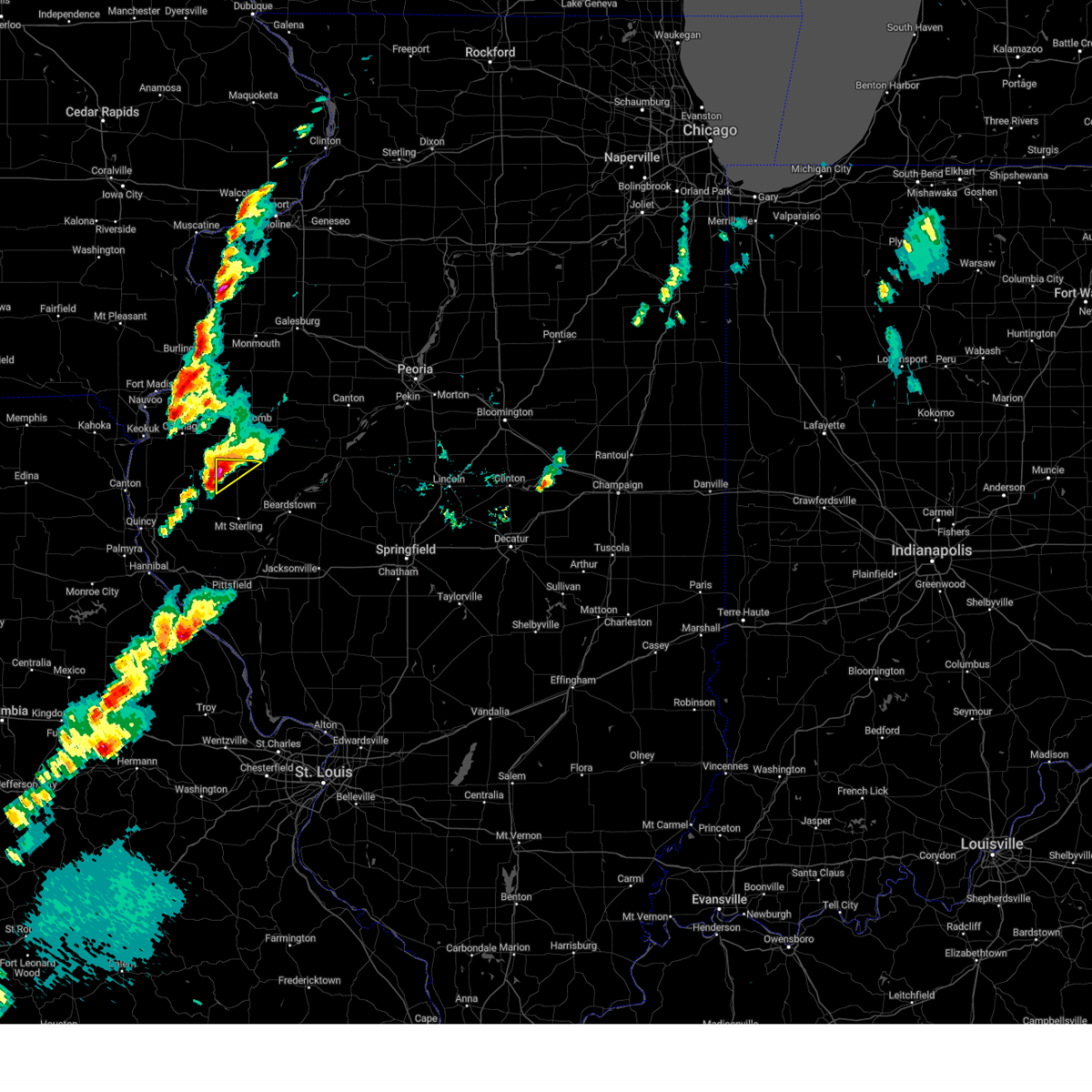 At 249 pm cdt, a severe thunderstorm was located near augusta, or 17 miles northwest of rushville, moving northeast at 55 mph (radar indicated). Hazards include ping pong ball size hail and 60 mph wind gusts. People and animals outdoors will be injured. expect hail damage to roofs, siding, windows, and vehicles. expect wind damage to roofs, siding, and trees. Locations impacted include, huntsville and weinberg king state park. At 249 pm cdt, a severe thunderstorm was located near augusta, or 17 miles northwest of rushville, moving northeast at 55 mph (radar indicated). Hazards include ping pong ball size hail and 60 mph wind gusts. People and animals outdoors will be injured. expect hail damage to roofs, siding, windows, and vehicles. expect wind damage to roofs, siding, and trees. Locations impacted include, huntsville and weinberg king state park.
|
| 4/20/2023 2:46 PM CDT |
 At 246 pm cdt, a severe thunderstorm was located over weinberg king state park, or 17 miles southeast of carthage, moving northeast at 50 mph (radar indicated). Hazards include ping pong ball size hail and 60 mph wind gusts. People and animals outdoors will be injured. expect hail damage to roofs, siding, windows, and vehicles. expect wind damage to roofs, siding, and trees. this severe storm will be near, colmar around 250 pm cdt. other locations in the path of this severe thunderstorm include colchester, tennessee, fandon, doddsville, argyle lake state park, industry, mcdonough county 4-h grounds, macomb, western illinois university, pennington point, macomb municipal airport, spring lake, bardolph, adair, bushnell and new philadelphia. hail threat, radar indicated max hail size, 1. 50 in wind threat, radar indicated max wind gust, 60 mph. At 246 pm cdt, a severe thunderstorm was located over weinberg king state park, or 17 miles southeast of carthage, moving northeast at 50 mph (radar indicated). Hazards include ping pong ball size hail and 60 mph wind gusts. People and animals outdoors will be injured. expect hail damage to roofs, siding, windows, and vehicles. expect wind damage to roofs, siding, and trees. this severe storm will be near, colmar around 250 pm cdt. other locations in the path of this severe thunderstorm include colchester, tennessee, fandon, doddsville, argyle lake state park, industry, mcdonough county 4-h grounds, macomb, western illinois university, pennington point, macomb municipal airport, spring lake, bardolph, adair, bushnell and new philadelphia. hail threat, radar indicated max hail size, 1. 50 in wind threat, radar indicated max wind gust, 60 mph.
|
| 4/20/2023 2:43 PM CDT |
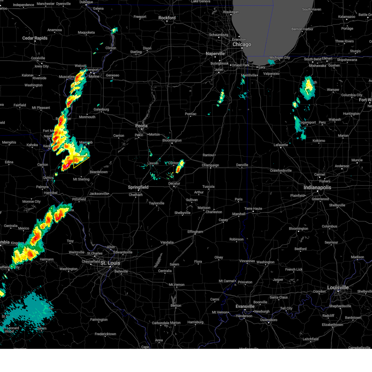 At 242 pm cdt, a severe thunderstorm was located over augusta, or 16 miles southeast of carthage, moving northeast at 50 mph (radar indicated). Hazards include ping pong ball size hail and 60 mph wind gusts. People and animals outdoors will be injured. expect hail damage to roofs, siding, windows, and vehicles. expect wind damage to roofs, siding, and trees. this severe thunderstorm will remain over mainly rural areas of northwestern schuyler county, including the following locations, weinberg king state park and huntsville. hail threat, radar indicated max hail size, 1. 50 in wind threat, radar indicated max wind gust, 60 mph. At 242 pm cdt, a severe thunderstorm was located over augusta, or 16 miles southeast of carthage, moving northeast at 50 mph (radar indicated). Hazards include ping pong ball size hail and 60 mph wind gusts. People and animals outdoors will be injured. expect hail damage to roofs, siding, windows, and vehicles. expect wind damage to roofs, siding, and trees. this severe thunderstorm will remain over mainly rural areas of northwestern schuyler county, including the following locations, weinberg king state park and huntsville. hail threat, radar indicated max hail size, 1. 50 in wind threat, radar indicated max wind gust, 60 mph.
|
| 4/20/2023 2:39 PM CDT |
 At 239 pm cdt, a severe thunderstorm was located over weinberg king state park, or 17 miles southeast of carthage, moving northeast at 55 mph (radar indicated). Hazards include ping pong ball size hail and 60 mph wind gusts. People and animals outdoors will be injured. expect hail damage to roofs, siding, windows, and vehicles. expect wind damage to roofs, siding, and trees. this severe storm will be near, fandon around 250 pm cdt. doddsville around 255 pm cdt. other locations in the path of this severe thunderstorm include industry, bardolph, adair, pennington point and new philadelphia. hail threat, radar indicated max hail size, 1. 50 in wind threat, radar indicated max wind gust, 60 mph. At 239 pm cdt, a severe thunderstorm was located over weinberg king state park, or 17 miles southeast of carthage, moving northeast at 55 mph (radar indicated). Hazards include ping pong ball size hail and 60 mph wind gusts. People and animals outdoors will be injured. expect hail damage to roofs, siding, windows, and vehicles. expect wind damage to roofs, siding, and trees. this severe storm will be near, fandon around 250 pm cdt. doddsville around 255 pm cdt. other locations in the path of this severe thunderstorm include industry, bardolph, adair, pennington point and new philadelphia. hail threat, radar indicated max hail size, 1. 50 in wind threat, radar indicated max wind gust, 60 mph.
|
| 4/20/2023 2:38 PM CDT |
 At 238 pm cdt, a severe thunderstorm was located over augusta, or 16 miles southeast of carthage, moving northeast at 50 mph (radar indicated). Hazards include 60 mph wind gusts and quarter size hail. Hail damage to vehicles is expected. expect wind damage to roofs, siding, and trees. locations impacted include, littleton, huntsville, camden, weinberg king state park and doddsville. hail threat, radar indicated max hail size, 1. 00 in wind threat, radar indicated max wind gust, 60 mph. At 238 pm cdt, a severe thunderstorm was located over augusta, or 16 miles southeast of carthage, moving northeast at 50 mph (radar indicated). Hazards include 60 mph wind gusts and quarter size hail. Hail damage to vehicles is expected. expect wind damage to roofs, siding, and trees. locations impacted include, littleton, huntsville, camden, weinberg king state park and doddsville. hail threat, radar indicated max hail size, 1. 00 in wind threat, radar indicated max wind gust, 60 mph.
|
| 4/20/2023 2:37 PM CDT |
 At 236 pm cdt, a severe thunderstorm was located over augusta, or 17 miles southeast of carthage, moving northeast at 55 mph (radar indicated). Hazards include 60 mph wind gusts and quarter size hail. Hail damage to vehicles is expected. expect wind damage to roofs, siding, and trees. this severe storm will be near, colmar and plymouth around 245 pm cdt. fandon around 250 pm cdt. other locations in the path of this severe thunderstorm include doddsville, industry, adair, pennington point, bardolph and new philadelphia. hail threat, radar indicated max hail size, 1. 00 in wind threat, radar indicated max wind gust, 60 mph. At 236 pm cdt, a severe thunderstorm was located over augusta, or 17 miles southeast of carthage, moving northeast at 55 mph (radar indicated). Hazards include 60 mph wind gusts and quarter size hail. Hail damage to vehicles is expected. expect wind damage to roofs, siding, and trees. this severe storm will be near, colmar and plymouth around 245 pm cdt. fandon around 250 pm cdt. other locations in the path of this severe thunderstorm include doddsville, industry, adair, pennington point, bardolph and new philadelphia. hail threat, radar indicated max hail size, 1. 00 in wind threat, radar indicated max wind gust, 60 mph.
|
| 4/20/2023 2:32 PM CDT |
 At 232 pm cdt, a severe thunderstorm was located over chatton, or 17 miles south of carthage, moving northeast at 45 mph. a second severe storm was located near bentley (radar indicated). Hazards include 60 mph wind gusts and quarter size hail. Hail damage to vehicles is expected. expect wind damage to roofs, siding, and trees. this severe storm will be near, denver around 235 pm cdt. augusta and hancock county fairgrounds around 240 pm cdt. other locations in the path of this severe thunderstorm include plymouth, colmar, colchester, tennessee, fandon, argyle lake state park, macomb, western illinois university, mcdonough county 4-h grounds, spring lake and macomb municipal airport. hail threat, radar indicated max hail size, 1. 00 in wind threat, radar indicated max wind gust, 60 mph. At 232 pm cdt, a severe thunderstorm was located over chatton, or 17 miles south of carthage, moving northeast at 45 mph. a second severe storm was located near bentley (radar indicated). Hazards include 60 mph wind gusts and quarter size hail. Hail damage to vehicles is expected. expect wind damage to roofs, siding, and trees. this severe storm will be near, denver around 235 pm cdt. augusta and hancock county fairgrounds around 240 pm cdt. other locations in the path of this severe thunderstorm include plymouth, colmar, colchester, tennessee, fandon, argyle lake state park, macomb, western illinois university, mcdonough county 4-h grounds, spring lake and macomb municipal airport. hail threat, radar indicated max hail size, 1. 00 in wind threat, radar indicated max wind gust, 60 mph.
|
| 4/20/2023 2:23 PM CDT |
 At 222 pm cdt, a severe thunderstorm was located over woodville, or 14 miles south of carthage, moving northeast at 55 mph. a second severe thunderstorm was located near warsaw also moving northeast (radar indicated). Hazards include 60 mph wind gusts and half dollar size hail. Hail damage to vehicles is expected. expect wind damage to roofs, siding, and trees. this severe storm will be near, augusta, plymouth and hancock county fairgrounds around 235 pm cdt. other locations in the path of this severe thunderstorm include colmar, tennessee, fandon, colchester, argyle lake state park, macomb, industry, western illinois university, mcdonough county 4-h grounds, spring lake, bardolph, adair, pennington point, macomb municipal airport, bushnell and new philadelphia. hail threat, observed max hail size, 1. 25 in wind threat, radar indicated max wind gust, 60 mph. At 222 pm cdt, a severe thunderstorm was located over woodville, or 14 miles south of carthage, moving northeast at 55 mph. a second severe thunderstorm was located near warsaw also moving northeast (radar indicated). Hazards include 60 mph wind gusts and half dollar size hail. Hail damage to vehicles is expected. expect wind damage to roofs, siding, and trees. this severe storm will be near, augusta, plymouth and hancock county fairgrounds around 235 pm cdt. other locations in the path of this severe thunderstorm include colmar, tennessee, fandon, colchester, argyle lake state park, macomb, industry, western illinois university, mcdonough county 4-h grounds, spring lake, bardolph, adair, pennington point, macomb municipal airport, bushnell and new philadelphia. hail threat, observed max hail size, 1. 25 in wind threat, radar indicated max wind gust, 60 mph.
|
| 4/20/2023 2:19 PM CDT |
 At 218 pm cdt, a severe thunderstorm was located near golden, or 11 miles north of quincy regional airport, moving northeast at 60 mph (radar indicated). Hazards include 60 mph wind gusts and quarter size hail. Hail damage to vehicles is expected. expect wind damage to roofs, siding, and trees. this severe thunderstorm will remain over mainly rural areas of northwestern schuyler county, including the following locations, camden, huntsville, doddsville and weinberg king state park. hail threat, radar indicated max hail size, 1. 00 in wind threat, radar indicated max wind gust, 60 mph. At 218 pm cdt, a severe thunderstorm was located near golden, or 11 miles north of quincy regional airport, moving northeast at 60 mph (radar indicated). Hazards include 60 mph wind gusts and quarter size hail. Hail damage to vehicles is expected. expect wind damage to roofs, siding, and trees. this severe thunderstorm will remain over mainly rural areas of northwestern schuyler county, including the following locations, camden, huntsville, doddsville and weinberg king state park. hail threat, radar indicated max hail size, 1. 00 in wind threat, radar indicated max wind gust, 60 mph.
|
| 4/20/2023 2:15 PM CDT |
 At 215 pm cdt, a severe thunderstorm was located over loraine, or 14 miles east of canton, moving northeast at 55 mph (radar indicated). Hazards include ping pong ball size hail and 60 mph wind gusts. People and animals outdoors will be injured. expect hail damage to roofs, siding, windows, and vehicles. expect wind damage to roofs, siding, and trees. this severe thunderstorm will be near, stillwell around 220 pm cdt. west point around 225 pm cdt. bowen and denver around 230 pm cdt. augusta and hancock county fairgrounds around 235 pm cdt. other locations in the path of this severe thunderstorm include colmar, plymouth, tennessee, colchester, fandon, argyle lake state park, doddsville, macomb, industry, western illinois university, mcdonough county 4-h grounds and spring lake. hail threat, observed max hail size, 1. 50 in wind threat, radar indicated max wind gust, 60 mph. At 215 pm cdt, a severe thunderstorm was located over loraine, or 14 miles east of canton, moving northeast at 55 mph (radar indicated). Hazards include ping pong ball size hail and 60 mph wind gusts. People and animals outdoors will be injured. expect hail damage to roofs, siding, windows, and vehicles. expect wind damage to roofs, siding, and trees. this severe thunderstorm will be near, stillwell around 220 pm cdt. west point around 225 pm cdt. bowen and denver around 230 pm cdt. augusta and hancock county fairgrounds around 235 pm cdt. other locations in the path of this severe thunderstorm include colmar, plymouth, tennessee, colchester, fandon, argyle lake state park, doddsville, macomb, industry, western illinois university, mcdonough county 4-h grounds and spring lake. hail threat, observed max hail size, 1. 50 in wind threat, radar indicated max wind gust, 60 mph.
|
| 4/15/2023 6:04 PM CDT |
 At 604 pm cdt, a severe thunderstorm was located over carthage, moving northeast at 25 mph (radar indicated). Hazards include 60 mph wind gusts and quarter size hail. Hail damage to vehicles is expected. expect wind damage to roofs, siding, and trees. locations impacted include, burnside, webster, fountain green and la harpe. hail threat, radar indicated max hail size, 1. 00 in wind threat, radar indicated max wind gust, 60 mph. At 604 pm cdt, a severe thunderstorm was located over carthage, moving northeast at 25 mph (radar indicated). Hazards include 60 mph wind gusts and quarter size hail. Hail damage to vehicles is expected. expect wind damage to roofs, siding, and trees. locations impacted include, burnside, webster, fountain green and la harpe. hail threat, radar indicated max hail size, 1. 00 in wind threat, radar indicated max wind gust, 60 mph.
|
| 4/15/2023 5:53 PM CDT |
 At 553 pm cdt, a severe thunderstorm was located over basco, or near carthage, moving northeast at 25 mph (radar indicated). Hazards include 60 mph wind gusts and quarter size hail. Hail damage to vehicles is expected. expect wind damage to roofs, siding, and trees. this severe storm will be near, bentley around 600 pm cdt. other locations in the path of this severe thunderstorm include carthage, ferris, burnside, webster and fountain green. hail threat, radar indicated max hail size, 1. 00 in wind threat, radar indicated max wind gust, 60 mph. At 553 pm cdt, a severe thunderstorm was located over basco, or near carthage, moving northeast at 25 mph (radar indicated). Hazards include 60 mph wind gusts and quarter size hail. Hail damage to vehicles is expected. expect wind damage to roofs, siding, and trees. this severe storm will be near, bentley around 600 pm cdt. other locations in the path of this severe thunderstorm include carthage, ferris, burnside, webster and fountain green. hail threat, radar indicated max hail size, 1. 00 in wind threat, radar indicated max wind gust, 60 mph.
|
| 4/15/2023 5:41 PM CDT |
 At 541 pm cdt, a severe thunderstorm was located near basco, or 9 miles southeast of keokuk, moving northeast at 25 mph (radar indicated). Hazards include 60 mph wind gusts and quarter size hail. Hail damage to vehicles is expected. expect wind damage to roofs, siding, and trees. this severe thunderstorm will be near, west point around 545 pm cdt. elvaston and basco around 550 pm cdt. denver around 555 pm cdt. bentley around 600 pm cdt. other locations in the path of this severe thunderstorm include carthage, ferris, burnside, webster and fountain green. hail threat, radar indicated max hail size, 1. 00 in wind threat, radar indicated max wind gust, 60 mph. At 541 pm cdt, a severe thunderstorm was located near basco, or 9 miles southeast of keokuk, moving northeast at 25 mph (radar indicated). Hazards include 60 mph wind gusts and quarter size hail. Hail damage to vehicles is expected. expect wind damage to roofs, siding, and trees. this severe thunderstorm will be near, west point around 545 pm cdt. elvaston and basco around 550 pm cdt. denver around 555 pm cdt. bentley around 600 pm cdt. other locations in the path of this severe thunderstorm include carthage, ferris, burnside, webster and fountain green. hail threat, radar indicated max hail size, 1. 00 in wind threat, radar indicated max wind gust, 60 mph.
|
| 4/5/2023 4:20 AM CDT |
 The severe thunderstorm warning for eastern hancock and southwestern mcdonough counties will expire at 430 am cdt, the storm which prompted the warning has weakened below severe limits, and no longer poses an immediate threat to life or property. therefore, the warning will be allowed to expire. however gusty winds are still possible with this thunderstorm. a severe thunderstorm watch remains in effect until 1100 am cdt for west central illinois. to report severe weather, contact your nearest law enforcement agency. they will relay your report to the national weather service the quad cities. The severe thunderstorm warning for eastern hancock and southwestern mcdonough counties will expire at 430 am cdt, the storm which prompted the warning has weakened below severe limits, and no longer poses an immediate threat to life or property. therefore, the warning will be allowed to expire. however gusty winds are still possible with this thunderstorm. a severe thunderstorm watch remains in effect until 1100 am cdt for west central illinois. to report severe weather, contact your nearest law enforcement agency. they will relay your report to the national weather service the quad cities.
|
| 4/5/2023 4:15 AM CDT |
 At 415 am cdt, a severe thunderstorm was located near webster, or near carthage, moving northeast at 55 mph (radar indicated). Hazards include 60 mph wind gusts and quarter size hail. Hail damage to vehicles is expected. expect wind damage to roofs, siding, and trees. Locations impacted include, fountain green, la harpe and tennessee. At 415 am cdt, a severe thunderstorm was located near webster, or near carthage, moving northeast at 55 mph (radar indicated). Hazards include 60 mph wind gusts and quarter size hail. Hail damage to vehicles is expected. expect wind damage to roofs, siding, and trees. Locations impacted include, fountain green, la harpe and tennessee.
|
| 4/5/2023 3:57 AM CDT |
 At 357 am cdt, a severe thunderstorm was located over sutter, or 10 miles southeast of keokuk, moving northeast at 55 mph (radar indicated). Hazards include 60 mph wind gusts and quarter size hail. Hail damage to vehicles is expected. expect wind damage to roofs, siding, and trees. this severe storm will be near, west point and stillwell around 400 am cdt. Other locations in the path of this severe thunderstorm include denver, elvaston, basco, carthage, ferris, bentley, burnside, fountain green, webster, la harpe and tennessee. At 357 am cdt, a severe thunderstorm was located over sutter, or 10 miles southeast of keokuk, moving northeast at 55 mph (radar indicated). Hazards include 60 mph wind gusts and quarter size hail. Hail damage to vehicles is expected. expect wind damage to roofs, siding, and trees. this severe storm will be near, west point and stillwell around 400 am cdt. Other locations in the path of this severe thunderstorm include denver, elvaston, basco, carthage, ferris, bentley, burnside, fountain green, webster, la harpe and tennessee.
|
| 4/5/2023 3:42 AM CDT |
 At 342 am cdt, a severe thunderstorm was located over meyer, or over canton, moving northeast at 55 mph (radar indicated). Hazards include 60 mph wind gusts and quarter size hail. Hail damage to vehicles is expected. expect wind damage to roofs, siding, and trees. this severe thunderstorm will be near, tioga and gregory landing around 350 am cdt. sutter around 355 am cdt. west point and stillwell around 400 am cdt. Other locations in the path of this severe thunderstorm include denver, elvaston, basco, carthage, ferris, bentley, burnside, fountain green, webster, la harpe and tennessee. At 342 am cdt, a severe thunderstorm was located over meyer, or over canton, moving northeast at 55 mph (radar indicated). Hazards include 60 mph wind gusts and quarter size hail. Hail damage to vehicles is expected. expect wind damage to roofs, siding, and trees. this severe thunderstorm will be near, tioga and gregory landing around 350 am cdt. sutter around 355 am cdt. west point and stillwell around 400 am cdt. Other locations in the path of this severe thunderstorm include denver, elvaston, basco, carthage, ferris, bentley, burnside, fountain green, webster, la harpe and tennessee.
|
| 4/4/2023 6:45 PM CDT |
 At 645 pm cdt, a severe thunderstorm was located over fandon, or 8 miles southwest of macomb, moving northeast at 40 mph (radar indicated). Hazards include ping pong ball size hail and 60 mph wind gusts. People and animals outdoors will be injured. expect hail damage to roofs, siding, windows, and vehicles. expect wind damage to roofs, siding, and trees. this severe storm will be near, western illinois university and mcdonough county 4-h grounds around 655 pm cdt. Other locations in the path of this severe thunderstorm include macomb and spring lake. At 645 pm cdt, a severe thunderstorm was located over fandon, or 8 miles southwest of macomb, moving northeast at 40 mph (radar indicated). Hazards include ping pong ball size hail and 60 mph wind gusts. People and animals outdoors will be injured. expect hail damage to roofs, siding, windows, and vehicles. expect wind damage to roofs, siding, and trees. this severe storm will be near, western illinois university and mcdonough county 4-h grounds around 655 pm cdt. Other locations in the path of this severe thunderstorm include macomb and spring lake.
|
| 4/4/2023 6:36 PM CDT |
 At 636 pm cdt, a severe thunderstorm was located over plymouth, or 12 miles southeast of carthage, moving northeast at 45 mph (radar indicated). Hazards include 60 mph wind gusts and half dollar size hail. Hail damage to vehicles is expected. expect wind damage to roofs, siding, and trees. this severe storm will be near, colmar around 640 pm cdt. Other locations in the path of this severe thunderstorm include colchester, tennessee, fandon, argyle lake state park, mcdonough county 4-h grounds, macomb, western illinois university and spring lake. At 636 pm cdt, a severe thunderstorm was located over plymouth, or 12 miles southeast of carthage, moving northeast at 45 mph (radar indicated). Hazards include 60 mph wind gusts and half dollar size hail. Hail damage to vehicles is expected. expect wind damage to roofs, siding, and trees. this severe storm will be near, colmar around 640 pm cdt. Other locations in the path of this severe thunderstorm include colchester, tennessee, fandon, argyle lake state park, mcdonough county 4-h grounds, macomb, western illinois university and spring lake.
|
| 4/4/2023 6:25 PM CDT |
 At 625 pm cdt, a severe thunderstorm was located over bowen, or 14 miles south of carthage, moving northeast at 45 mph (radar indicated). Hazards include 60 mph wind gusts and quarter size hail. Hail damage to vehicles is expected. expect wind damage to roofs, siding, and trees. this severe thunderstorm will be near, augusta and hancock county fairgrounds around 630 pm cdt. plymouth around 640 pm cdt. colmar around 645 pm cdt. Other locations in the path of this severe thunderstorm include tennessee, fandon, colchester, argyle lake state park, macomb, western illinois university, spring lake and mcdonough county 4-h grounds. At 625 pm cdt, a severe thunderstorm was located over bowen, or 14 miles south of carthage, moving northeast at 45 mph (radar indicated). Hazards include 60 mph wind gusts and quarter size hail. Hail damage to vehicles is expected. expect wind damage to roofs, siding, and trees. this severe thunderstorm will be near, augusta and hancock county fairgrounds around 630 pm cdt. plymouth around 640 pm cdt. colmar around 645 pm cdt. Other locations in the path of this severe thunderstorm include tennessee, fandon, colchester, argyle lake state park, macomb, western illinois university, spring lake and mcdonough county 4-h grounds.
|
| 4/4/2023 6:18 PM CDT |
 At 618 pm cdt, a severe thunderstorm was located over denver, or 7 miles south of carthage, moving northeast at 45 mph (radar indicated). Hazards include 60 mph wind gusts and quarter size hail. Hail damage to vehicles is expected. expect wind damage to roofs, siding, and trees. this severe storm will be near, plymouth around 625 pm cdt. other locations in the path of this severe thunderstorm include colmar, fountain green, webster, colchester, tennessee, argyle lake state park, blandinsville, macomb, western illinois university, spring lake and macomb municipal airport. hail threat, radar indicated max hail size, 1. 00 in wind threat, radar indicated max wind gust, 60 mph. At 618 pm cdt, a severe thunderstorm was located over denver, or 7 miles south of carthage, moving northeast at 45 mph (radar indicated). Hazards include 60 mph wind gusts and quarter size hail. Hail damage to vehicles is expected. expect wind damage to roofs, siding, and trees. this severe storm will be near, plymouth around 625 pm cdt. other locations in the path of this severe thunderstorm include colmar, fountain green, webster, colchester, tennessee, argyle lake state park, blandinsville, macomb, western illinois university, spring lake and macomb municipal airport. hail threat, radar indicated max hail size, 1. 00 in wind threat, radar indicated max wind gust, 60 mph.
|
| 4/4/2023 6:08 PM CDT |
 At 607 pm cdt, a severe thunderstorm was located over west point, or 10 miles south of carthage, moving northeast at 50 mph (radar indicated). Hazards include ping pong ball size hail and 60 mph wind gusts. People and animals outdoors will be injured. expect hail damage to roofs, siding, windows, and vehicles. expect wind damage to roofs, siding, and trees. this severe storm will be near, bentley around 615 pm cdt. Other locations in the path of this severe thunderstorm include carthage, burnside, fountain green, webster and blandinsville. At 607 pm cdt, a severe thunderstorm was located over west point, or 10 miles south of carthage, moving northeast at 50 mph (radar indicated). Hazards include ping pong ball size hail and 60 mph wind gusts. People and animals outdoors will be injured. expect hail damage to roofs, siding, windows, and vehicles. expect wind damage to roofs, siding, and trees. this severe storm will be near, bentley around 615 pm cdt. Other locations in the path of this severe thunderstorm include carthage, burnside, fountain green, webster and blandinsville.
|
| 4/4/2023 5:59 PM CDT |
 At 558 pm cdt, a severe thunderstorm was located near west point, or 11 miles southwest of carthage, moving northeast at 55 mph (radar indicated). Hazards include ping pong ball size hail and 60 mph wind gusts. People and animals outdoors will be injured. expect hail damage to roofs, siding, windows, and vehicles. expect wind damage to roofs, siding, and trees. this severe storm will be near, denver around 605 pm cdt. other locations in the path of this severe thunderstorm include carthage, bentley, ferris, burnside, adrian, fountain green, webster and blandinsville. hail threat, observed max hail size, 1. 50 in wind threat, radar indicated max wind gust, 60 mph. At 558 pm cdt, a severe thunderstorm was located near west point, or 11 miles southwest of carthage, moving northeast at 55 mph (radar indicated). Hazards include ping pong ball size hail and 60 mph wind gusts. People and animals outdoors will be injured. expect hail damage to roofs, siding, windows, and vehicles. expect wind damage to roofs, siding, and trees. this severe storm will be near, denver around 605 pm cdt. other locations in the path of this severe thunderstorm include carthage, bentley, ferris, burnside, adrian, fountain green, webster and blandinsville. hail threat, observed max hail size, 1. 50 in wind threat, radar indicated max wind gust, 60 mph.
|
| 4/4/2023 5:46 PM CDT |
 At 545 pm cdt, a severe thunderstorm was located over tioga, or 11 miles south of keokuk, moving northeast at 50 mph (radar indicated). Hazards include 60 mph wind gusts and half dollar size hail. Hail damage to vehicles is expected. expect wind damage to roofs, siding, and trees. this severe thunderstorm will be near, west point and stillwell around 555 pm cdt. denver, elvaston and basco around 600 pm cdt. carthage, ferris and bentley around 605 pm cdt. other locations in the path of this severe thunderstorm include burnside, webster, fountain green, blandinsville, argyle lake state park and spring lake. hail threat, observed max hail size, 1. 25 in wind threat, radar indicated max wind gust, 60 mph. At 545 pm cdt, a severe thunderstorm was located over tioga, or 11 miles south of keokuk, moving northeast at 50 mph (radar indicated). Hazards include 60 mph wind gusts and half dollar size hail. Hail damage to vehicles is expected. expect wind damage to roofs, siding, and trees. this severe thunderstorm will be near, west point and stillwell around 555 pm cdt. denver, elvaston and basco around 600 pm cdt. carthage, ferris and bentley around 605 pm cdt. other locations in the path of this severe thunderstorm include burnside, webster, fountain green, blandinsville, argyle lake state park and spring lake. hail threat, observed max hail size, 1. 25 in wind threat, radar indicated max wind gust, 60 mph.
|
| 8/29/2022 5:36 PM CDT |
 The severe thunderstorm warning for southeastern hancock and southwestern mcdonough counties will expire at 545 pm cdt, the storm which prompted the warning has weakened below severe limits, and no longer poses an immediate threat to life or property. therefore, the warning will be allowed to expire. a severe thunderstorm watch remains in effect until 1000 pm cdt for west central illinois. The severe thunderstorm warning for southeastern hancock and southwestern mcdonough counties will expire at 545 pm cdt, the storm which prompted the warning has weakened below severe limits, and no longer poses an immediate threat to life or property. therefore, the warning will be allowed to expire. a severe thunderstorm watch remains in effect until 1000 pm cdt for west central illinois.
|
| 8/29/2022 5:23 PM CDT |
 At 522 pm cdt, a severe thunderstorm was located over bentley, or near carthage, moving southeast at 15 mph (radar indicated). Hazards include 60 mph wind gusts and quarter size hail. Hail damage to vehicles is expected. expect wind damage to roofs, siding, and trees. locations impacted include, denver, bowen, augusta, plymouth and hancock county fairgrounds. hail threat, radar indicated max hail size, 1. 00 in wind threat, radar indicated max wind gust, 60 mph. At 522 pm cdt, a severe thunderstorm was located over bentley, or near carthage, moving southeast at 15 mph (radar indicated). Hazards include 60 mph wind gusts and quarter size hail. Hail damage to vehicles is expected. expect wind damage to roofs, siding, and trees. locations impacted include, denver, bowen, augusta, plymouth and hancock county fairgrounds. hail threat, radar indicated max hail size, 1. 00 in wind threat, radar indicated max wind gust, 60 mph.
|
| 8/29/2022 5:04 PM CDT |
 At 504 pm cdt, a severe thunderstorm was located over carthage, moving southeast at 15 mph (radar indicated). Hazards include 60 mph wind gusts and quarter size hail. Hail damage to vehicles is expected. expect wind damage to roofs, siding, and trees. this severe thunderstorm will be near, bentley around 520 pm cdt. other locations in the path of this severe thunderstorm include denver, augusta, bowen, plymouth and hancock county fairgrounds. hail threat, radar indicated max hail size, 1. 00 in wind threat, radar indicated max wind gust, 60 mph. At 504 pm cdt, a severe thunderstorm was located over carthage, moving southeast at 15 mph (radar indicated). Hazards include 60 mph wind gusts and quarter size hail. Hail damage to vehicles is expected. expect wind damage to roofs, siding, and trees. this severe thunderstorm will be near, bentley around 520 pm cdt. other locations in the path of this severe thunderstorm include denver, augusta, bowen, plymouth and hancock county fairgrounds. hail threat, radar indicated max hail size, 1. 00 in wind threat, radar indicated max wind gust, 60 mph.
|
| 7/5/2022 11:18 PM CDT |
 At 1118 pm cdt, severe thunderstorms were located along a line extending from near galesburg airport to near bentley, moving east at 60 mph (radar indicated). Hazards include 60 mph wind gusts. Expect damage to roofs, siding, and trees. locations impacted include, macomb, monmouth, carthage, bushnell, colchester, la harpe, roseville, blandinsville, industry, good hope, prairie city, bardolph, north henderson, raritan, tennessee, sciota, western illinois university, fandon, little swan lake and new philadelphia. hail threat, radar indicated max hail size, <. 75 in wind threat, radar indicated max wind gust, 60 mph. At 1118 pm cdt, severe thunderstorms were located along a line extending from near galesburg airport to near bentley, moving east at 60 mph (radar indicated). Hazards include 60 mph wind gusts. Expect damage to roofs, siding, and trees. locations impacted include, macomb, monmouth, carthage, bushnell, colchester, la harpe, roseville, blandinsville, industry, good hope, prairie city, bardolph, north henderson, raritan, tennessee, sciota, western illinois university, fandon, little swan lake and new philadelphia. hail threat, radar indicated max hail size, <. 75 in wind threat, radar indicated max wind gust, 60 mph.
|
| 7/5/2022 11:09 PM CDT |
 At 1108 pm cdt, severe thunderstorms were located along a line extending from near coldbrook to near carthage, moving southeast at 60 mph (radar indicated). Hazards include 60 mph wind gusts. Expect damage to roofs, siding, and trees. locations impacted include, macomb, monmouth, carthage, nauvoo, bushnell, burgess, colchester, la harpe, roseville, viola, dallas city, stronghurst, matherville, kirkwood, blandinsville, sherrard, industry, good hope, prairie city and little york. hail threat, radar indicated max hail size, <. 75 in wind threat, radar indicated max wind gust, 60 mph. At 1108 pm cdt, severe thunderstorms were located along a line extending from near coldbrook to near carthage, moving southeast at 60 mph (radar indicated). Hazards include 60 mph wind gusts. Expect damage to roofs, siding, and trees. locations impacted include, macomb, monmouth, carthage, nauvoo, bushnell, burgess, colchester, la harpe, roseville, viola, dallas city, stronghurst, matherville, kirkwood, blandinsville, sherrard, industry, good hope, prairie city and little york. hail threat, radar indicated max hail size, <. 75 in wind threat, radar indicated max wind gust, 60 mph.
|
| 7/5/2022 11:07 PM CDT |
 The severe thunderstorm warning for southern hancock, south central lee and southern clark counties will expire at 1115 pm cdt, the storms which prompted the warning have moved out of the area. therefore, the warning will be allowed to expire. however gusty winds are still possible with these thunderstorms. the gust front with severe winds has pushed southeast of the warning. The severe thunderstorm warning for southern hancock, south central lee and southern clark counties will expire at 1115 pm cdt, the storms which prompted the warning have moved out of the area. therefore, the warning will be allowed to expire. however gusty winds are still possible with these thunderstorms. the gust front with severe winds has pushed southeast of the warning.
|
| 7/5/2022 11:03 PM CDT |
 At 1103 pm cdt, severe thunderstorms were located along a line extending from near hamilton to near ewing to clarence, moving southeast at 60 mph (radar indicated). Hazards include 60 mph wind gusts. Expect damage to roofs, siding, and trees. locations impacted include, keokuk, hamilton, warsaw, montrose, augusta, wayland, bowen, west point, alexandria, st. francisville, winchester, plymouth, denver, elvaston, basco, bentley, keokuk airport, gregory landing, tioga and stillwell. hail threat, radar indicated max hail size, <. 75 in wind threat, radar indicated max wind gust, 60 mph. At 1103 pm cdt, severe thunderstorms were located along a line extending from near hamilton to near ewing to clarence, moving southeast at 60 mph (radar indicated). Hazards include 60 mph wind gusts. Expect damage to roofs, siding, and trees. locations impacted include, keokuk, hamilton, warsaw, montrose, augusta, wayland, bowen, west point, alexandria, st. francisville, winchester, plymouth, denver, elvaston, basco, bentley, keokuk airport, gregory landing, tioga and stillwell. hail threat, radar indicated max hail size, <. 75 in wind threat, radar indicated max wind gust, 60 mph.
|
| 7/5/2022 10:56 PM CDT |
 At 1056 pm cdt, severe thunderstorms were located along a line extending from alexis to adrian, moving south at 35 mph (radar indicated). Hazards include 60 mph wind gusts. Expect damage to roofs, siding, and trees. locations impacted include, burlington, macomb, fort madison, monmouth, aledo, carthage, oquawka, nauvoo, bushnell, west burlington, burgess, colchester, la harpe, roseville, viola, dallas city, stronghurst, millersburg, matherville and kirkwood. hail threat, radar indicated max hail size, <. 75 in wind threat, radar indicated max wind gust, 60 mph. At 1056 pm cdt, severe thunderstorms were located along a line extending from alexis to adrian, moving south at 35 mph (radar indicated). Hazards include 60 mph wind gusts. Expect damage to roofs, siding, and trees. locations impacted include, burlington, macomb, fort madison, monmouth, aledo, carthage, oquawka, nauvoo, bushnell, west burlington, burgess, colchester, la harpe, roseville, viola, dallas city, stronghurst, millersburg, matherville and kirkwood. hail threat, radar indicated max hail size, <. 75 in wind threat, radar indicated max wind gust, 60 mph.
|
| 7/5/2022 10:49 PM CDT |
 At 1049 pm cdt, severe thunderstorms were located along a line extending from near montrose to near la belle to 7 miles east of atlanta, moving southeast at 60 mph (radar indicated). Hazards include 60 mph wind gusts. expect damage to roofs, siding, and trees At 1049 pm cdt, severe thunderstorms were located along a line extending from near montrose to near la belle to 7 miles east of atlanta, moving southeast at 60 mph (radar indicated). Hazards include 60 mph wind gusts. expect damage to roofs, siding, and trees
|
| 7/5/2022 10:31 PM CDT |
 At 1031 pm cdt, severe thunderstorms were located along a line extending from gingle corners to denmark, moving southeast at 60 mph (radar indicated). Hazards include 60 mph wind gusts. expect damage to roofs, siding, and trees At 1031 pm cdt, severe thunderstorms were located along a line extending from gingle corners to denmark, moving southeast at 60 mph (radar indicated). Hazards include 60 mph wind gusts. expect damage to roofs, siding, and trees
|
| 5/31/2022 10:00 PM CDT |
 At 959 pm cdt, a severe thunderstorm capable of producing a tornado was located over plymouth, or 15 miles southeast of carthage, moving east at 30 mph (radar indicated rotation). Hazards include tornado. Flying debris will be dangerous to those caught without shelter. mobile homes will be damaged or destroyed. damage to roofs, windows, and vehicles will occur. tree damage is likely. this dangerous storm will be near, fandon around 1015 pm cdt. Other locations in the path of this tornadic thunderstorm include doddsville. At 959 pm cdt, a severe thunderstorm capable of producing a tornado was located over plymouth, or 15 miles southeast of carthage, moving east at 30 mph (radar indicated rotation). Hazards include tornado. Flying debris will be dangerous to those caught without shelter. mobile homes will be damaged or destroyed. damage to roofs, windows, and vehicles will occur. tree damage is likely. this dangerous storm will be near, fandon around 1015 pm cdt. Other locations in the path of this tornadic thunderstorm include doddsville.
|
| 5/25/2022 6:59 PM CDT |
 At 659 pm cdt, severe thunderstorms were located along a line extending from webster to pennington point, moving north at 40 mph (radar indicated). Hazards include 60 mph wind gusts. Expect damage to roofs, siding, and trees. locations impacted include, western illinois university, macomb, blandinsville, bardolph, new philadelphia, macomb municipal airport, la harpe, good hope, disco, scottsburg, bushnell, prairie city, walnut grove and prairie city airport. hail threat, radar indicated max hail size, <. 75 in wind threat, radar indicated max wind gust, 60 mph. At 659 pm cdt, severe thunderstorms were located along a line extending from webster to pennington point, moving north at 40 mph (radar indicated). Hazards include 60 mph wind gusts. Expect damage to roofs, siding, and trees. locations impacted include, western illinois university, macomb, blandinsville, bardolph, new philadelphia, macomb municipal airport, la harpe, good hope, disco, scottsburg, bushnell, prairie city, walnut grove and prairie city airport. hail threat, radar indicated max hail size, <. 75 in wind threat, radar indicated max wind gust, 60 mph.
|
| 5/25/2022 6:57 PM CDT |
 At 657 pm cdt, severe thunderstorms were located along a line extending from near webster to near adair, moving north at 40 mph (radar indicated). Hazards include 60 mph wind gusts. Expect damage to roofs, siding, and trees. severe thunderstorms will be near, blandinsville, bardolph and new philadelphia around 710 pm cdt. bushnell, la harpe, disco and scottsburg around 715 pm cdt. other locations in the path of these severe thunderstorms include walnut grove, prairie city airport and prairie city. hail threat, radar indicated max hail size, <. 75 in wind threat, radar indicated max wind gust, 60 mph. At 657 pm cdt, severe thunderstorms were located along a line extending from near webster to near adair, moving north at 40 mph (radar indicated). Hazards include 60 mph wind gusts. Expect damage to roofs, siding, and trees. severe thunderstorms will be near, blandinsville, bardolph and new philadelphia around 710 pm cdt. bushnell, la harpe, disco and scottsburg around 715 pm cdt. other locations in the path of these severe thunderstorms include walnut grove, prairie city airport and prairie city. hail threat, radar indicated max hail size, <. 75 in wind threat, radar indicated max wind gust, 60 mph.
|
| 5/25/2022 6:32 PM CDT |
 At 631 pm cdt, severe thunderstorms were located along a line extending from bowen to rushville, moving north at 45 mph (radar indicated). Hazards include 60 mph wind gusts. Expect damage to roofs, siding, and trees. severe thunderstorms will be near, augusta, bowen, west point and denver around 635 pm cdt. basco and bentley around 640 pm cdt. carthage and doddsville around 645 pm cdt. industry, ferris and webster around 650 pm cdt. Other locations in the path of these severe thunderstorms include burnside, adrian, fountain green, pennington point, la harpe, adair, mcdonough county 4-h grounds, macomb, dallas city, bardolph, disco, western illinois university, new philadelphia, macomb municipal airport, spring lake, bushnell, good hope and scottsburg. At 631 pm cdt, severe thunderstorms were located along a line extending from bowen to rushville, moving north at 45 mph (radar indicated). Hazards include 60 mph wind gusts. Expect damage to roofs, siding, and trees. severe thunderstorms will be near, augusta, bowen, west point and denver around 635 pm cdt. basco and bentley around 640 pm cdt. carthage and doddsville around 645 pm cdt. industry, ferris and webster around 650 pm cdt. Other locations in the path of these severe thunderstorms include burnside, adrian, fountain green, pennington point, la harpe, adair, mcdonough county 4-h grounds, macomb, dallas city, bardolph, disco, western illinois university, new philadelphia, macomb municipal airport, spring lake, bushnell, good hope and scottsburg.
|
| 12/15/2021 9:21 PM CST |
 At 921 pm cst, severe thunderstorms were located along a line extending from near eliza to near west point, moving east at 50 mph (trained weather spotters. a 58 mph wind gust was measured at the keokuk airport at 906 pm). Hazards include 70 mph wind gusts. Expect considerable tree damage. damage is likely to mobile homes, roofs, and outbuildings. Locations impacted include, burlington, fort madison, keokuk, carthage, oquawka, nauvoo, west burlington, hamilton, warsaw, mediapolis, la harpe, dallas city, danville, stronghurst, bowen, middletown, carman, gladstone, terre haute and west point. At 921 pm cst, severe thunderstorms were located along a line extending from near eliza to near west point, moving east at 50 mph (trained weather spotters. a 58 mph wind gust was measured at the keokuk airport at 906 pm). Hazards include 70 mph wind gusts. Expect considerable tree damage. damage is likely to mobile homes, roofs, and outbuildings. Locations impacted include, burlington, fort madison, keokuk, carthage, oquawka, nauvoo, west burlington, hamilton, warsaw, mediapolis, la harpe, dallas city, danville, stronghurst, bowen, middletown, carman, gladstone, terre haute and west point.
|
| 12/15/2021 9:09 PM CST |
 At 908 pm cst, severe thunderstorms were located along a line extending from near grandview to near warsaw, moving east at 50 mph (trained weather spotters). Hazards include 70 mph wind gusts. a 60 mph gust was recorded mount pleasant. Expect considerable tree damage. damage is likely to mobile homes, roofs, and outbuildings. Locations impacted include, burlington, fort madison, keokuk, carthage, oquawka, nauvoo, west burlington, hamilton, warsaw, mediapolis, la harpe, dallas city, danville, stronghurst, bowen, middletown, carman, gladstone, terre haute and west point. At 908 pm cst, severe thunderstorms were located along a line extending from near grandview to near warsaw, moving east at 50 mph (trained weather spotters). Hazards include 70 mph wind gusts. a 60 mph gust was recorded mount pleasant. Expect considerable tree damage. damage is likely to mobile homes, roofs, and outbuildings. Locations impacted include, burlington, fort madison, keokuk, carthage, oquawka, nauvoo, west burlington, hamilton, warsaw, mediapolis, la harpe, dallas city, danville, stronghurst, bowen, middletown, carman, gladstone, terre haute and west point.
|
| 12/15/2021 8:53 PM CST |
 At 853 pm cst, severe thunderstorms were located along a line extending from near cotter to 9 miles southwest of wayland, moving east at 50 mph (radar indicated). Hazards include 70 mph wind gusts. Expect considerable tree damage. Damage is likely to mobile homes, roofs, and outbuildings. At 853 pm cst, severe thunderstorms were located along a line extending from near cotter to 9 miles southwest of wayland, moving east at 50 mph (radar indicated). Hazards include 70 mph wind gusts. Expect considerable tree damage. Damage is likely to mobile homes, roofs, and outbuildings.
|
| 7/9/2021 8:39 PM CDT |
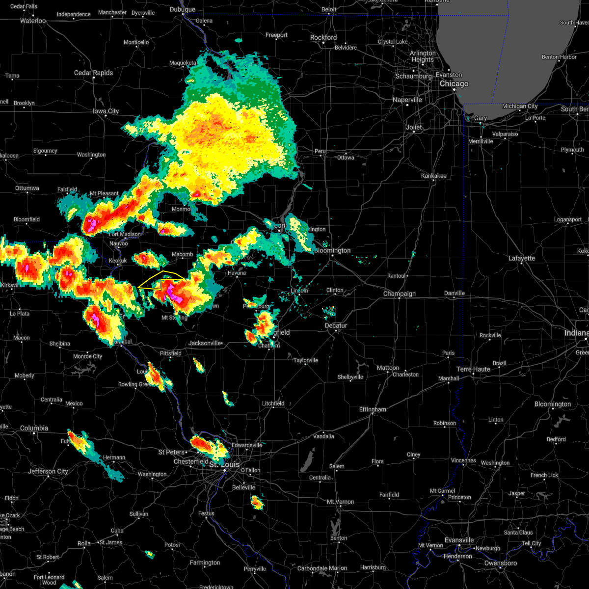 The severe thunderstorm warning for southeastern hancock and southwestern mcdonough counties will expire at 845 pm cdt, the storm which prompted the warning has moved out of the area. therefore, the warning will be allowed to expire. however heavy rain is still possible with this thunderstorm. a severe thunderstorm watch remains in effect until midnight cdt for west central illinois. to report severe weather, contact your nearest law enforcement agency. they will relay your report to the national weather service the quad cities. The severe thunderstorm warning for southeastern hancock and southwestern mcdonough counties will expire at 845 pm cdt, the storm which prompted the warning has moved out of the area. therefore, the warning will be allowed to expire. however heavy rain is still possible with this thunderstorm. a severe thunderstorm watch remains in effect until midnight cdt for west central illinois. to report severe weather, contact your nearest law enforcement agency. they will relay your report to the national weather service the quad cities.
|
| 7/9/2021 8:35 PM CDT |
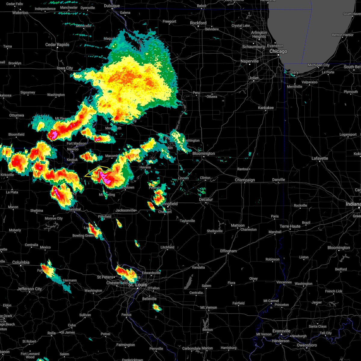 At 835 pm cdt, a severe thunderstorm was located near augusta, or 18 miles west of rushville, moving south at 30 mph (trained weather spotters). Hazards include golf ball size hail and 60 mph wind gusts. People and animals outdoors will be injured. expect hail damage to roofs, siding, windows, and vehicles. expect wind damage to roofs, siding, and trees. Locations impacted include, augusta, bowen, colmar, plymouth, doddsville and hancock county fairgrounds. At 835 pm cdt, a severe thunderstorm was located near augusta, or 18 miles west of rushville, moving south at 30 mph (trained weather spotters). Hazards include golf ball size hail and 60 mph wind gusts. People and animals outdoors will be injured. expect hail damage to roofs, siding, windows, and vehicles. expect wind damage to roofs, siding, and trees. Locations impacted include, augusta, bowen, colmar, plymouth, doddsville and hancock county fairgrounds.
|
| 7/9/2021 8:28 PM CDT |
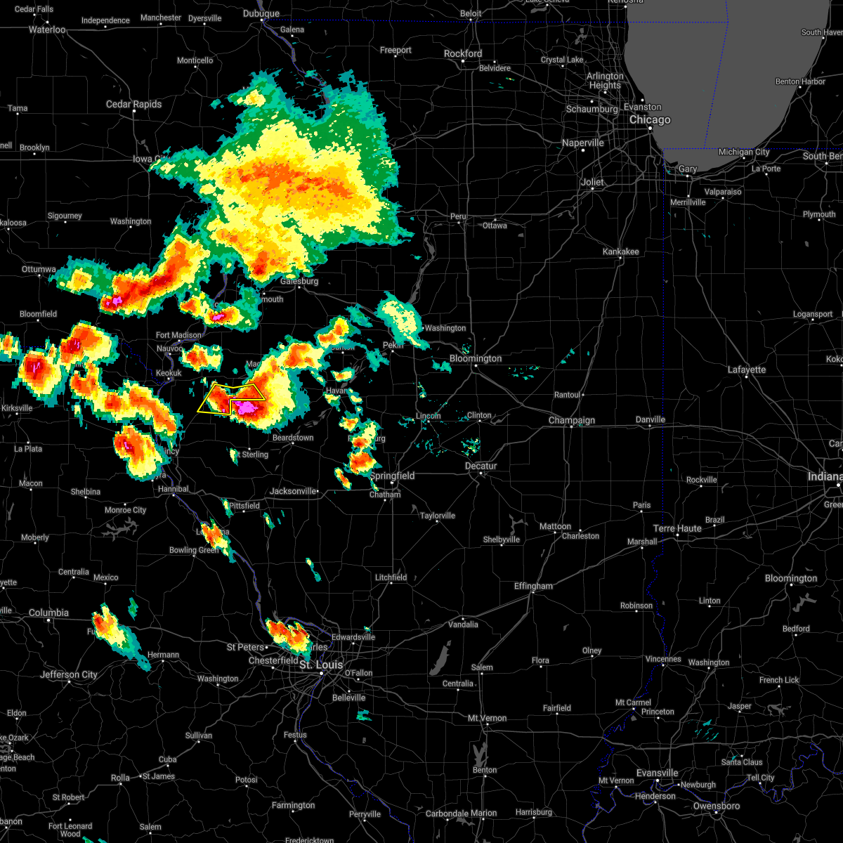 At 828 pm cdt, a severe thunderstorm was located over augusta, or 17 miles southeast of carthage, moving south at 30 mph (trained weather spotters). Hazards include golf ball size hail and 60 mph wind gusts. People and animals outdoors will be injured. expect hail damage to roofs, siding, windows, and vehicles. expect wind damage to roofs, siding, and trees. Locations impacted include, augusta, bowen, colmar, plymouth, denver, doddsville and hancock county fairgrounds. At 828 pm cdt, a severe thunderstorm was located over augusta, or 17 miles southeast of carthage, moving south at 30 mph (trained weather spotters). Hazards include golf ball size hail and 60 mph wind gusts. People and animals outdoors will be injured. expect hail damage to roofs, siding, windows, and vehicles. expect wind damage to roofs, siding, and trees. Locations impacted include, augusta, bowen, colmar, plymouth, denver, doddsville and hancock county fairgrounds.
|
| 7/9/2021 8:20 PM CDT | Branches down...estimated 6 inches in diamete in hancock county IL, 0.1 miles ENE of Plymouth, IL |
| 7/9/2021 8:20 PM CDT | Golf Ball sized hail reported 0.1 miles ENE of Plymouth, IL, quarter to golf ball size hail. |
| 7/9/2021 8:20 PM CDT |
 At 820 pm cdt, a severe thunderstorm was located 7 miles south of fandon, or 14 miles northwest of rushville, moving southeast at 45 mph (trained weather spotters). Hazards include tennis ball size hail and 60 mph wind gusts. People and animals outdoors will be injured. expect hail damage to roofs, siding, windows, and vehicles. expect wind damage to roofs, siding, and trees. Locations impacted include, colchester, augusta, bowen, industry, tennessee, fandon, colmar, plymouth, denver, bentley, pennington point, doddsville and hancock county fairgrounds. At 820 pm cdt, a severe thunderstorm was located 7 miles south of fandon, or 14 miles northwest of rushville, moving southeast at 45 mph (trained weather spotters). Hazards include tennis ball size hail and 60 mph wind gusts. People and animals outdoors will be injured. expect hail damage to roofs, siding, windows, and vehicles. expect wind damage to roofs, siding, and trees. Locations impacted include, colchester, augusta, bowen, industry, tennessee, fandon, colmar, plymouth, denver, bentley, pennington point, doddsville and hancock county fairgrounds.
|
| 7/9/2021 8:17 PM CDT |
 At 816 pm cdt, a severe thunderstorm was located near colmar, or 13 miles southwest of macomb, moving southeast at 45 mph (trained weather spotters). Hazards include tennis ball size hail and 60 mph wind gusts. People and animals outdoors will be injured. expect hail damage to roofs, siding, windows, and vehicles. expect wind damage to roofs, siding, and trees. Locations impacted include, macomb, bushnell, colchester, augusta, bowen, industry, good hope, prairie city, bardolph, tennessee, western illinois university, fandon, new philadelphia, colmar, adair, plymouth, denver, bentley, macomb municipal airport and prairie city airport. At 816 pm cdt, a severe thunderstorm was located near colmar, or 13 miles southwest of macomb, moving southeast at 45 mph (trained weather spotters). Hazards include tennis ball size hail and 60 mph wind gusts. People and animals outdoors will be injured. expect hail damage to roofs, siding, windows, and vehicles. expect wind damage to roofs, siding, and trees. Locations impacted include, macomb, bushnell, colchester, augusta, bowen, industry, good hope, prairie city, bardolph, tennessee, western illinois university, fandon, new philadelphia, colmar, adair, plymouth, denver, bentley, macomb municipal airport and prairie city airport.
|
| 7/9/2021 8:16 PM CDT | Tennis Ball sized hail reported 0.6 miles S of Plymouth, IL, golf ball to tennis ball size hail. |
| 7/9/2021 8:08 PM CDT |
 At 808 pm cdt, a severe thunderstorm was located over colmar, or 12 miles southwest of macomb, moving southeast at 45 mph (trained weather spotters). Hazards include tennis ball size hail and 60 mph wind gusts. People and animals outdoors will be injured. expect hail damage to roofs, siding, windows, and vehicles. expect wind damage to roofs, siding, and trees. Locations impacted include, macomb, bushnell, colchester, blandinsville, augusta, bowen, industry, good hope, prairie city, bardolph, tennessee, sciota, western illinois university, fandon, new philadelphia, colmar, adair, walnut grove, plymouth and denver. At 808 pm cdt, a severe thunderstorm was located over colmar, or 12 miles southwest of macomb, moving southeast at 45 mph (trained weather spotters). Hazards include tennis ball size hail and 60 mph wind gusts. People and animals outdoors will be injured. expect hail damage to roofs, siding, windows, and vehicles. expect wind damage to roofs, siding, and trees. Locations impacted include, macomb, bushnell, colchester, blandinsville, augusta, bowen, industry, good hope, prairie city, bardolph, tennessee, sciota, western illinois university, fandon, new philadelphia, colmar, adair, walnut grove, plymouth and denver.
|
| 7/9/2021 8:03 PM CDT |
 At 803 pm cdt, a severe thunderstorm was located near tennessee, or 11 miles east of carthage, moving southeast at 30 mph (trained weather spotters). Hazards include golf ball size hail and 60 mph wind gusts. People and animals outdoors will be injured. expect hail damage to roofs, siding, windows, and vehicles. expect wind damage to roofs, siding, and trees. Locations impacted include, macomb, carthage, bushnell, colchester, blandinsville, augusta, bowen, industry, good hope, prairie city, bardolph, west point, tennessee, sciota, western illinois university, fandon, little swan lake, new philadelphia, colmar and adair. At 803 pm cdt, a severe thunderstorm was located near tennessee, or 11 miles east of carthage, moving southeast at 30 mph (trained weather spotters). Hazards include golf ball size hail and 60 mph wind gusts. People and animals outdoors will be injured. expect hail damage to roofs, siding, windows, and vehicles. expect wind damage to roofs, siding, and trees. Locations impacted include, macomb, carthage, bushnell, colchester, blandinsville, augusta, bowen, industry, good hope, prairie city, bardolph, west point, tennessee, sciota, western illinois university, fandon, little swan lake, new philadelphia, colmar and adair.
|
| 7/9/2021 7:47 PM CDT |
 At 747 pm cdt, a severe thunderstorm was located near la harpe, or 10 miles northeast of carthage, moving southeast at 45 mph (trained weather spotters). Hazards include golf ball size hail and 60 mph wind gusts. People and animals outdoors will be injured. expect hail damage to roofs, siding, windows, and vehicles. expect wind damage to roofs, siding, and trees. Locations impacted include, colchester, tennessee, colmar and fandon. At 747 pm cdt, a severe thunderstorm was located near la harpe, or 10 miles northeast of carthage, moving southeast at 45 mph (trained weather spotters). Hazards include golf ball size hail and 60 mph wind gusts. People and animals outdoors will be injured. expect hail damage to roofs, siding, windows, and vehicles. expect wind damage to roofs, siding, and trees. Locations impacted include, colchester, tennessee, colmar and fandon.
|
| 7/9/2021 7:39 PM CDT |
 At 739 pm cdt, a severe thunderstorm was located near disco, or 12 miles northeast of carthage, moving southeast at 45 mph (radar indicated). Hazards include tennis ball size hail and 60 mph wind gusts. People and animals outdoors will be injured. expect hail damage to roofs, siding, windows, and vehicles. expect wind damage to roofs, siding, and trees. this severe thunderstorm will be near, blandinsville around 745 pm cdt. Other locations in the path of this severe thunderstorm include colchester, tennessee, colmar and fandon. At 739 pm cdt, a severe thunderstorm was located near disco, or 12 miles northeast of carthage, moving southeast at 45 mph (radar indicated). Hazards include tennis ball size hail and 60 mph wind gusts. People and animals outdoors will be injured. expect hail damage to roofs, siding, windows, and vehicles. expect wind damage to roofs, siding, and trees. this severe thunderstorm will be near, blandinsville around 745 pm cdt. Other locations in the path of this severe thunderstorm include colchester, tennessee, colmar and fandon.
|
| 6/25/2021 12:33 AM CDT |
 At 1232 am cdt, severe thunderstorms were located along a line extending from near nauvoo to near carthage to near golden to 9 miles northeast of frankford to near curryville, moving east at 45 mph (radar indicated). Hazards include 60 mph wind gusts. expect damage to roofs, siding, and trees At 1232 am cdt, severe thunderstorms were located along a line extending from near nauvoo to near carthage to near golden to 9 miles northeast of frankford to near curryville, moving east at 45 mph (radar indicated). Hazards include 60 mph wind gusts. expect damage to roofs, siding, and trees
|
| 4/7/2021 7:13 PM CDT |
 The severe thunderstorm warning for northeastern hancock and western mcdonough counties will expire at 715 pm cdt, the storms which prompted the warning have weakened below severe limits, and no longer pose an immediate threat to life or property. therefore, the warning will be allowed to expire. however gusty winds are still possible with these thunderstorms. The severe thunderstorm warning for northeastern hancock and western mcdonough counties will expire at 715 pm cdt, the storms which prompted the warning have weakened below severe limits, and no longer pose an immediate threat to life or property. therefore, the warning will be allowed to expire. however gusty winds are still possible with these thunderstorms.
|
| 4/7/2021 7:06 PM CDT |
 At 706 pm cdt, severe thunderstorms were located along a line extending from near carman to near blandinsville, moving north at 45 mph (radar indicated). Hazards include 60 mph wind gusts. Expect damage to roofs, siding, and trees. Locations impacted include, carthage, la harpe, dallas city, blandinsville, ferris, colusa, adrian, burnside, disco, colmar, plymouth, fountain green, pontoosuc and webster. At 706 pm cdt, severe thunderstorms were located along a line extending from near carman to near blandinsville, moving north at 45 mph (radar indicated). Hazards include 60 mph wind gusts. Expect damage to roofs, siding, and trees. Locations impacted include, carthage, la harpe, dallas city, blandinsville, ferris, colusa, adrian, burnside, disco, colmar, plymouth, fountain green, pontoosuc and webster.
|
| 4/7/2021 7:00 PM CDT |
 At 659 pm cdt, severe thunderstorms were located along a line extending from near la harpe to 7 miles southwest of littleton, moving north at 75 mph (radar indicated). Hazards include 60 mph wind gusts and penny size hail. Expect damage to roofs, siding, and trees. Locations impacted include, rushville, littleton, huntsville, camden, ray and weinberg king state park. At 659 pm cdt, severe thunderstorms were located along a line extending from near la harpe to 7 miles southwest of littleton, moving north at 75 mph (radar indicated). Hazards include 60 mph wind gusts and penny size hail. Expect damage to roofs, siding, and trees. Locations impacted include, rushville, littleton, huntsville, camden, ray and weinberg king state park.
|
| 4/7/2021 6:55 PM CDT |
 At 655 pm cdt, severe thunderstorms were located along a line extending from dallas city to near tennessee, moving north at 45 mph (radar indicated). Hazards include 60 mph wind gusts. Expect damage to roofs, siding, and trees. Locations impacted include, fort madison, carthage, la harpe, dallas city, blandinsville, augusta, bowen, west point, ferris, colusa, adrian, burnside, disco, niota, colmar, plymouth, denver, fountain green, elvaston and pontoosuc. At 655 pm cdt, severe thunderstorms were located along a line extending from dallas city to near tennessee, moving north at 45 mph (radar indicated). Hazards include 60 mph wind gusts. Expect damage to roofs, siding, and trees. Locations impacted include, fort madison, carthage, la harpe, dallas city, blandinsville, augusta, bowen, west point, ferris, colusa, adrian, burnside, disco, niota, colmar, plymouth, denver, fountain green, elvaston and pontoosuc.
|
| 4/7/2021 6:44 PM CDT |
 At 644 pm cdt, severe thunderstorms were located along a line extending from near adrian to near augusta, moving north at 50 mph (radar indicated). Hazards include 60 mph wind gusts. Expect damage to roofs, siding, and trees. Locations impacted include, fort madison, keokuk, carthage, hamilton, warsaw, la harpe, dallas city, blandinsville, augusta, bowen, west point, ferris, colusa, adrian, burnside, niota, colmar, disco, plymouth and denver. At 644 pm cdt, severe thunderstorms were located along a line extending from near adrian to near augusta, moving north at 50 mph (radar indicated). Hazards include 60 mph wind gusts. Expect damage to roofs, siding, and trees. Locations impacted include, fort madison, keokuk, carthage, hamilton, warsaw, la harpe, dallas city, blandinsville, augusta, bowen, west point, ferris, colusa, adrian, burnside, niota, colmar, disco, plymouth and denver.
|
| 4/7/2021 6:34 PM CDT |
 At 633 pm cdt, severe thunderstorms were located along a line extending from west point to near beverly, moving east at 30 mph (radar indicated). Hazards include 60 mph wind gusts and penny size hail. expect damage to roofs, siding, and trees At 633 pm cdt, severe thunderstorms were located along a line extending from west point to near beverly, moving east at 30 mph (radar indicated). Hazards include 60 mph wind gusts and penny size hail. expect damage to roofs, siding, and trees
|
| 4/7/2021 6:28 PM CDT |
 At 628 pm cdt, severe thunderstorms were located along a line extending from near hamilton to near clayton, moving north at 45 mph (radar indicated). Hazards include 60 mph wind gusts. expect damage to roofs, siding, and trees At 628 pm cdt, severe thunderstorms were located along a line extending from near hamilton to near clayton, moving north at 45 mph (radar indicated). Hazards include 60 mph wind gusts. expect damage to roofs, siding, and trees
|
| 11/10/2020 1:58 PM CST |
 At 158 pm cst, severe thunderstorms were located along a line extending from near raritan to near sciota to near augusta, moving northeast at 45 mph (radar indicated). Hazards include 60 mph wind gusts and penny size hail. Expect damage to roofs, siding, and trees. Locations impacted include, macomb, bushnell, colchester, la harpe, blandinsville, augusta, industry, good hope, prairie city, bardolph, tennessee, sciota, western illinois university, fandon, new philadelphia, colmar, adair, walnut grove, plymouth and fountain green. At 158 pm cst, severe thunderstorms were located along a line extending from near raritan to near sciota to near augusta, moving northeast at 45 mph (radar indicated). Hazards include 60 mph wind gusts and penny size hail. Expect damage to roofs, siding, and trees. Locations impacted include, macomb, bushnell, colchester, la harpe, blandinsville, augusta, industry, good hope, prairie city, bardolph, tennessee, sciota, western illinois university, fandon, new philadelphia, colmar, adair, walnut grove, plymouth and fountain green.
|
| 11/10/2020 1:44 PM CST |
 At 144 pm cst, severe thunderstorms were located along a line extending from near disco to 7 miles east of burnside to near bowen, moving northeast at 55 mph (radar indicated). Hazards include 60 mph wind gusts and penny size hail. Expect damage to roofs, siding, and trees. Locations impacted include, macomb, carthage, bushnell, colchester, la harpe, dallas city, blandinsville, augusta, bowen, industry, good hope, prairie city, bardolph, west point, ferris, tennessee, sciota, colusa, western illinois university and adrian. At 144 pm cst, severe thunderstorms were located along a line extending from near disco to 7 miles east of burnside to near bowen, moving northeast at 55 mph (radar indicated). Hazards include 60 mph wind gusts and penny size hail. Expect damage to roofs, siding, and trees. Locations impacted include, macomb, carthage, bushnell, colchester, la harpe, dallas city, blandinsville, augusta, bowen, industry, good hope, prairie city, bardolph, west point, ferris, tennessee, sciota, colusa, western illinois university and adrian.
|
| 11/10/2020 1:33 PM CST |
 At 132 pm cst, severe thunderstorms were located along a line extending from near dallas city to near ferris to near west point, moving northeast at 55 mph (radar indicated). Hazards include 60 mph wind gusts and quarter size hail. Hail damage to vehicles is expected. expect wind damage to roofs, siding, and trees. Locations impacted include, macomb, carthage, bushnell, colchester, la harpe, dallas city, blandinsville, augusta, bowen, industry, good hope, prairie city, bardolph, west point, ferris, tennessee, sciota, colusa, western illinois university and adrian. At 132 pm cst, severe thunderstorms were located along a line extending from near dallas city to near ferris to near west point, moving northeast at 55 mph (radar indicated). Hazards include 60 mph wind gusts and quarter size hail. Hail damage to vehicles is expected. expect wind damage to roofs, siding, and trees. Locations impacted include, macomb, carthage, bushnell, colchester, la harpe, dallas city, blandinsville, augusta, bowen, industry, good hope, prairie city, bardolph, west point, ferris, tennessee, sciota, colusa, western illinois university and adrian.
|
| 11/10/2020 1:29 PM CST |
 At 129 pm cst, severe thunderstorms were located along a line extending from dallas city to adrian to near west point, moving east at 45 mph (radar indicated). Hazards include 60 mph wind gusts and quarter size hail. Hail damage to vehicles is expected. Expect wind damage to roofs, siding, and trees. At 129 pm cst, severe thunderstorms were located along a line extending from dallas city to adrian to near west point, moving east at 45 mph (radar indicated). Hazards include 60 mph wind gusts and quarter size hail. Hail damage to vehicles is expected. Expect wind damage to roofs, siding, and trees.
|
| 6/22/2020 5:06 PM CDT |
 The severe thunderstorm warning for hancock county will expire at 515 pm cdt, the storms which prompted the warning have weakened below severe limits, and no longer pose an immediate threat to life or property. therefore, the warning will be allowed to expire. however small hail, gusty winds and heavy rain are still possible with the thunderstorms over the southeastern portion of hancock county. The severe thunderstorm warning for hancock county will expire at 515 pm cdt, the storms which prompted the warning have weakened below severe limits, and no longer pose an immediate threat to life or property. therefore, the warning will be allowed to expire. however small hail, gusty winds and heavy rain are still possible with the thunderstorms over the southeastern portion of hancock county.
|
| 6/22/2020 4:46 PM CDT |
 At 445 pm cdt, severe thunderstorms were located along a line extending from dallas city to near colusa to near ferris, moving east at 35 mph. additional thunderstorms are rapidly strengthening from near west point to north of plymouth (radar indicated). Hazards include 60 mph wind gusts and penny size hail. Expect damage to roofs, siding, and trees. Locations impacted include, carthage, la harpe, dallas city, augusta, bowen, west point, ferris, colusa, adrian, burnside, disco, plymouth, denver, fountain green, elvaston, pontoosuc, basco, bentley, tioga and stillwell. At 445 pm cdt, severe thunderstorms were located along a line extending from dallas city to near colusa to near ferris, moving east at 35 mph. additional thunderstorms are rapidly strengthening from near west point to north of plymouth (radar indicated). Hazards include 60 mph wind gusts and penny size hail. Expect damage to roofs, siding, and trees. Locations impacted include, carthage, la harpe, dallas city, augusta, bowen, west point, ferris, colusa, adrian, burnside, disco, plymouth, denver, fountain green, elvaston, pontoosuc, basco, bentley, tioga and stillwell.
|
| 6/22/2020 4:32 PM CDT |
 At 432 pm cdt, severe thunderstorms were located along a line extending from near denmark to near nauvoo to keokuk, moving east at 30 mph (trained weather spotters). Hazards include 60 mph wind gusts and penny size hail. Expect damage to roofs, siding, and trees. Locations impacted include, fort madison, keokuk, carthage, nauvoo, hamilton, warsaw, la harpe, dallas city, montrose, augusta, bowen, west point, ferris, franklin, colusa, adrian, new boston, burnside, niota and disco. At 432 pm cdt, severe thunderstorms were located along a line extending from near denmark to near nauvoo to keokuk, moving east at 30 mph (trained weather spotters). Hazards include 60 mph wind gusts and penny size hail. Expect damage to roofs, siding, and trees. Locations impacted include, fort madison, keokuk, carthage, nauvoo, hamilton, warsaw, la harpe, dallas city, montrose, augusta, bowen, west point, ferris, franklin, colusa, adrian, new boston, burnside, niota and disco.
|
| 6/22/2020 4:24 PM CDT |
 At 424 pm cdt, severe thunderstorms were located along a line extending from near west point to montrose to 8 miles south of kahoka, moving east at 30 mph (trained weather spotters). Hazards include 60 mph wind gusts and penny size hail. Expect damage to roofs, siding, and trees. Locations impacted include, fort madison, keokuk, carthage, kahoka, nauvoo, hamilton, warsaw, la harpe, dallas city, donnellson, montrose, augusta, wayland, bowen, wyaconda, west point, alexandria, ferris, franklin and luray. At 424 pm cdt, severe thunderstorms were located along a line extending from near west point to montrose to 8 miles south of kahoka, moving east at 30 mph (trained weather spotters). Hazards include 60 mph wind gusts and penny size hail. Expect damage to roofs, siding, and trees. Locations impacted include, fort madison, keokuk, carthage, kahoka, nauvoo, hamilton, warsaw, la harpe, dallas city, donnellson, montrose, augusta, wayland, bowen, wyaconda, west point, alexandria, ferris, franklin and luray.
|
| 6/22/2020 4:17 PM CDT |
 At 416 pm cdt, severe thunderstorms were located along a line extending from near west point to near new boston to 7 miles southeast of wyaconda, moving east at 40 mph (radar indicated). Hazards include 60 mph wind gusts and penny size hail. Expect damage to roofs, siding, and trees. Locations impacted include, fort madison, keokuk, carthage, kahoka, nauvoo, hamilton, warsaw, la harpe, dallas city, donnellson, montrose, augusta, wayland, bowen, wyaconda, west point, alexandria, ferris, franklin and luray. At 416 pm cdt, severe thunderstorms were located along a line extending from near west point to near new boston to 7 miles southeast of wyaconda, moving east at 40 mph (radar indicated). Hazards include 60 mph wind gusts and penny size hail. Expect damage to roofs, siding, and trees. Locations impacted include, fort madison, keokuk, carthage, kahoka, nauvoo, hamilton, warsaw, la harpe, dallas city, donnellson, montrose, augusta, wayland, bowen, wyaconda, west point, alexandria, ferris, franklin and luray.
|
| 6/22/2020 4:12 PM CDT |
 At 412 pm cdt, severe thunderstorms were located along a line extending from pilot grove to near st. francisville to near colony, moving east at 30 mph (radar indicated). Hazards include 60 mph wind gusts and quarter size hail. Hail damage to vehicles is expected. Expect wind damage to roofs, siding, and trees. At 412 pm cdt, severe thunderstorms were located along a line extending from pilot grove to near st. francisville to near colony, moving east at 30 mph (radar indicated). Hazards include 60 mph wind gusts and quarter size hail. Hail damage to vehicles is expected. Expect wind damage to roofs, siding, and trees.
|
| 5/24/2020 5:49 PM CDT |
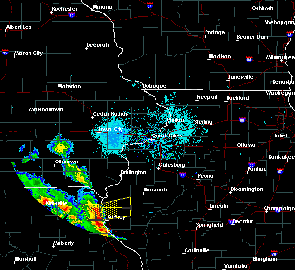 At 549 pm cdt, a severe thunderstorm was located over canton, moving east at 35 mph (radar indicated). Hazards include 60 mph wind gusts and quarter size hail. Hail damage to vehicles is expected. Expect wind damage to roofs, siding, and trees. At 549 pm cdt, a severe thunderstorm was located over canton, moving east at 35 mph (radar indicated). Hazards include 60 mph wind gusts and quarter size hail. Hail damage to vehicles is expected. Expect wind damage to roofs, siding, and trees.
|
| 4/8/2020 4:20 PM CDT |
 At 420 pm cdt, a severe thunderstorm was located over augusta, or 15 miles southeast of carthage, moving east at 45 mph (radar indicated). Hazards include 60 mph wind gusts and quarter size hail. Hail damage to vehicles is expected. expect wind damage to roofs, siding, and trees. Locations impacted include, augusta, plymouth and hancock county fairgrounds. At 420 pm cdt, a severe thunderstorm was located over augusta, or 15 miles southeast of carthage, moving east at 45 mph (radar indicated). Hazards include 60 mph wind gusts and quarter size hail. Hail damage to vehicles is expected. expect wind damage to roofs, siding, and trees. Locations impacted include, augusta, plymouth and hancock county fairgrounds.
|
| 4/8/2020 4:10 PM CDT |
 At 409 pm cdt, a severe thunderstorm was located near bowen, or 9 miles southeast of carthage, moving east at 45 mph (radar indicated). Hazards include 60 mph wind gusts and quarter size hail. Hail damage to vehicles is expected. expect wind damage to roofs, siding, and trees. Locations impacted include, augusta, bowen, west point, plymouth, denver, bentley, hancock county fairgrounds and stillwell. At 409 pm cdt, a severe thunderstorm was located near bowen, or 9 miles southeast of carthage, moving east at 45 mph (radar indicated). Hazards include 60 mph wind gusts and quarter size hail. Hail damage to vehicles is expected. expect wind damage to roofs, siding, and trees. Locations impacted include, augusta, bowen, west point, plymouth, denver, bentley, hancock county fairgrounds and stillwell.
|
| 4/8/2020 3:58 PM CDT |
 At 357 pm cdt, a severe thunderstorm was located near west point, or 8 miles southwest of carthage, moving east at 50 mph (radar indicated). Hazards include 60 mph wind gusts and quarter size hail. Hail damage to vehicles is expected. expect wind damage to roofs, siding, and trees. Locations impacted include, carthage, augusta, bowen, west point, plymouth, denver, elvaston, basco, bentley, sutter, hancock county fairgrounds and stillwell. At 357 pm cdt, a severe thunderstorm was located near west point, or 8 miles southwest of carthage, moving east at 50 mph (radar indicated). Hazards include 60 mph wind gusts and quarter size hail. Hail damage to vehicles is expected. expect wind damage to roofs, siding, and trees. Locations impacted include, carthage, augusta, bowen, west point, plymouth, denver, elvaston, basco, bentley, sutter, hancock county fairgrounds and stillwell.
|
| 4/8/2020 3:41 PM CDT |
 At 341 pm cdt, a severe thunderstorm was located over alexandria, or near keokuk, moving east at 50 mph (radar indicated). Hazards include 60 mph wind gusts and half dollar size hail. Hail damage to vehicles is expected. Expect wind damage to roofs, siding, and trees. At 341 pm cdt, a severe thunderstorm was located over alexandria, or near keokuk, moving east at 50 mph (radar indicated). Hazards include 60 mph wind gusts and half dollar size hail. Hail damage to vehicles is expected. Expect wind damage to roofs, siding, and trees.
|
| 11/26/2019 10:56 PM CST |
 At 1056 pm cst, a severe thunderstorm was located over tennessee, or 10 miles west of macomb, moving northeast at 40 mph (radar indicated). Hazards include 60 mph wind gusts. Expect damage to roofs, siding, and trees. Locations impacted include, macomb, colchester, la harpe, blandinsville, augusta, bowen, industry, good hope, bardolph, tennessee, sciota, western illinois university, fandon, colmar, disco, plymouth, denver, fountain green, bentley and macomb municipal airport. At 1056 pm cst, a severe thunderstorm was located over tennessee, or 10 miles west of macomb, moving northeast at 40 mph (radar indicated). Hazards include 60 mph wind gusts. Expect damage to roofs, siding, and trees. Locations impacted include, macomb, colchester, la harpe, blandinsville, augusta, bowen, industry, good hope, bardolph, tennessee, sciota, western illinois university, fandon, colmar, disco, plymouth, denver, fountain green, bentley and macomb municipal airport.
|
| 11/26/2019 10:45 PM CST |
 At 1045 pm cst, a severe thunderstorm was located near colmar, or 8 miles southeast of carthage, moving northeast at 35 mph (radar indicated). Hazards include 60 mph wind gusts. expect damage to roofs, siding, and trees At 1045 pm cst, a severe thunderstorm was located near colmar, or 8 miles southeast of carthage, moving northeast at 35 mph (radar indicated). Hazards include 60 mph wind gusts. expect damage to roofs, siding, and trees
|
| 9/27/2019 8:54 PM CDT |
 At 853 pm cdt, a severe thunderstorm was located near augusta, or 17 miles southeast of carthage, moving east at 40 mph (trained weather spotters). Hazards include quarter size hail. Damage to vehicles is expected. Locations impacted include, augusta, bowen, plymouth and hancock county fairgrounds. At 853 pm cdt, a severe thunderstorm was located near augusta, or 17 miles southeast of carthage, moving east at 40 mph (trained weather spotters). Hazards include quarter size hail. Damage to vehicles is expected. Locations impacted include, augusta, bowen, plymouth and hancock county fairgrounds.
|
| 9/27/2019 8:50 PM CDT |
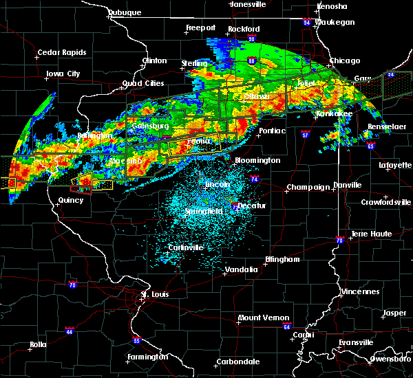 At 850 pm cdt, a severe thunderstorm was located over augusta, or 16 miles southeast of carthage, moving east at 40 mph (radar indicated). Hazards include ping pong ball size hail and 60 mph wind gusts. People and animals outdoors will be injured. expect hail damage to roofs, siding, windows, and vehicles. expect wind damage to roofs, siding, and trees. Locations impacted include, augusta, bowen, plymouth and hancock county fairgrounds. At 850 pm cdt, a severe thunderstorm was located over augusta, or 16 miles southeast of carthage, moving east at 40 mph (radar indicated). Hazards include ping pong ball size hail and 60 mph wind gusts. People and animals outdoors will be injured. expect hail damage to roofs, siding, windows, and vehicles. expect wind damage to roofs, siding, and trees. Locations impacted include, augusta, bowen, plymouth and hancock county fairgrounds.
|
| 9/27/2019 8:47 PM CDT |
 At 847 pm cdt, a severe thunderstorm was located over augusta, or 15 miles southeast of carthage, moving east at 40 mph (radar indicated). Hazards include ping pong ball size hail and 60 mph wind gusts. People and animals outdoors will be injured. expect hail damage to roofs, siding, windows, and vehicles. expect wind damage to roofs, siding, and trees. Locations impacted include, augusta, bowen, plymouth, denver and hancock county fairgrounds. At 847 pm cdt, a severe thunderstorm was located over augusta, or 15 miles southeast of carthage, moving east at 40 mph (radar indicated). Hazards include ping pong ball size hail and 60 mph wind gusts. People and animals outdoors will be injured. expect hail damage to roofs, siding, windows, and vehicles. expect wind damage to roofs, siding, and trees. Locations impacted include, augusta, bowen, plymouth, denver and hancock county fairgrounds.
|
| 9/27/2019 8:41 PM CDT |
 At 841 pm cdt, a severe thunderstorm was located over bowen, or 14 miles southeast of carthage, moving east at 40 mph (radar indicated). Hazards include ping pong ball size hail. People and animals outdoors will be injured. Expect damage to roofs, siding, windows, and vehicles. At 841 pm cdt, a severe thunderstorm was located over bowen, or 14 miles southeast of carthage, moving east at 40 mph (radar indicated). Hazards include ping pong ball size hail. People and animals outdoors will be injured. Expect damage to roofs, siding, windows, and vehicles.
|
| 9/27/2019 7:44 PM CDT |
 At 743 pm cdt, severe thunderstorms were located along a line extending from near prairie city to near macomb to near west point, moving east at 50 mph (radar indicated). Hazards include 60 mph wind gusts and quarter size hail. Hail damage to vehicles is expected. expect wind damage to roofs, siding, and trees. Locations impacted include, macomb, carthage, bushnell, colchester, blandinsville, augusta, bowen, industry, good hope, prairie city, bardolph, west point, ferris, tennessee, sciota, western illinois university, fandon, little swan lake, new philadelphia and burnside. At 743 pm cdt, severe thunderstorms were located along a line extending from near prairie city to near macomb to near west point, moving east at 50 mph (radar indicated). Hazards include 60 mph wind gusts and quarter size hail. Hail damage to vehicles is expected. expect wind damage to roofs, siding, and trees. Locations impacted include, macomb, carthage, bushnell, colchester, blandinsville, augusta, bowen, industry, good hope, prairie city, bardolph, west point, ferris, tennessee, sciota, western illinois university, fandon, little swan lake, new philadelphia and burnside.
|
| 9/27/2019 7:34 PM CDT |
 At 734 pm cdt, severe thunderstorms were located along a line extending from near raritan to tennessee to near west point, moving east at 30 mph (radar indicated). Hazards include 60 mph wind gusts and quarter size hail. Hail damage to vehicles is expected. expect wind damage to roofs, siding, and trees. Locations impacted include, macomb, carthage, bushnell, colchester, la harpe, blandinsville, augusta, bowen, industry, good hope, prairie city, bardolph, west point, ferris, tennessee, sciota, western illinois university, fandon, little swan lake and new philadelphia. At 734 pm cdt, severe thunderstorms were located along a line extending from near raritan to tennessee to near west point, moving east at 30 mph (radar indicated). Hazards include 60 mph wind gusts and quarter size hail. Hail damage to vehicles is expected. expect wind damage to roofs, siding, and trees. Locations impacted include, macomb, carthage, bushnell, colchester, la harpe, blandinsville, augusta, bowen, industry, good hope, prairie city, bardolph, west point, ferris, tennessee, sciota, western illinois university, fandon, little swan lake and new philadelphia.
|
| 9/27/2019 7:24 PM CDT |
 At 724 pm cdt, severe thunderstorms were located along a line extending from near la harpe to near colmar to 8 miles north of mendon, moving east at 35 mph (radar indicated). Hazards include 60 mph wind gusts and nickel size hail. expect damage to roofs, siding, and trees At 724 pm cdt, severe thunderstorms were located along a line extending from near la harpe to near colmar to 8 miles north of mendon, moving east at 35 mph (radar indicated). Hazards include 60 mph wind gusts and nickel size hail. expect damage to roofs, siding, and trees
|
| 8/20/2019 8:58 AM CDT |
 The severe thunderstorm warning for northeastern hancock, southeastern henderson, southern warren and mcdonough counties will expire at 900 am cdt, the severe winds along the leading edge of the storms is moving out of the warned area. therefore, the warning will be allowed to expire. however gusty winds and torrential rain will persist over the next hour as the thunderstorms continuing moving across the area. a severe thunderstorm watch remains in effect until 300 pm cdt for west central illinois. The severe thunderstorm warning for northeastern hancock, southeastern henderson, southern warren and mcdonough counties will expire at 900 am cdt, the severe winds along the leading edge of the storms is moving out of the warned area. therefore, the warning will be allowed to expire. however gusty winds and torrential rain will persist over the next hour as the thunderstorms continuing moving across the area. a severe thunderstorm watch remains in effect until 300 pm cdt for west central illinois.
|
| 8/20/2019 8:46 AM CDT |
 A severe thunderstorm warning remains in effect until 930 am cdt for fulton. stark. knox. schuyler and peoria counties. at 846 am cdt, severe thunderstorms were located along a line extending from andover to near abingdon to near bowen, moving east at 55 mph. hazard. 60 mph wind gusts and quarter size hail. A severe thunderstorm warning remains in effect until 930 am cdt for fulton. stark. knox. schuyler and peoria counties. at 846 am cdt, severe thunderstorms were located along a line extending from andover to near abingdon to near bowen, moving east at 55 mph. hazard. 60 mph wind gusts and quarter size hail.
|
| 8/20/2019 8:46 AM CDT |
 At 757 am cdt, severe thunderstorms were located along a line extending from near oquawka to near niota to near st. francisville, moving east at 55 mph (radar indicated). Hazards include 60 mph wind gusts. expect damage to roofs, siding, and trees At 757 am cdt, severe thunderstorms were located along a line extending from near oquawka to near niota to near st. francisville, moving east at 55 mph (radar indicated). Hazards include 60 mph wind gusts. expect damage to roofs, siding, and trees
|
| 8/20/2019 8:28 AM CDT |
 At 828 am cdt, severe thunderstorms were located along a line extending from near monmouth to blandinsville to near carthage, moving east at 55 mph (radar indicated). Hazards include 60 mph wind gusts. Expect damage to roofs, siding, and trees. Locations impacted include, macomb, keokuk, carthage, bushnell, hamilton, colchester, la harpe, roseville, dallas city, stronghurst, avon, kirkwood, blandinsville, industry, good hope, prairie city, carman, biggsville, gladstone and terre haute. At 828 am cdt, severe thunderstorms were located along a line extending from near monmouth to blandinsville to near carthage, moving east at 55 mph (radar indicated). Hazards include 60 mph wind gusts. Expect damage to roofs, siding, and trees. Locations impacted include, macomb, keokuk, carthage, bushnell, hamilton, colchester, la harpe, roseville, dallas city, stronghurst, avon, kirkwood, blandinsville, industry, good hope, prairie city, carman, biggsville, gladstone and terre haute.
|
| 8/20/2019 8:20 AM CDT |
 At 819 am cdt, severe thunderstorms were located along a line extending from andalusia to kirkwood to near warsaw, moving east at 55 mph (radar indicated). Hazards include 60 mph wind gusts and quarter size hail. Hail damage to vehicles is expected. Expect wind damage to roofs, siding, and trees. At 819 am cdt, severe thunderstorms were located along a line extending from andalusia to kirkwood to near warsaw, moving east at 55 mph (radar indicated). Hazards include 60 mph wind gusts and quarter size hail. Hail damage to vehicles is expected. Expect wind damage to roofs, siding, and trees.
|
| 8/20/2019 8:16 AM CDT |
 At 816 am cdt, severe thunderstorms were located along a line extending from near kirkwood to disco to hamilton, moving east southeast at 55 mph (radar indicated). Hazards include 60 mph wind gusts. Expect damage to roofs, siding, and trees. Locations impacted include, burlington, macomb, fort madison, keokuk, carthage, nauvoo, bushnell, west burlington, hamilton, colchester, la harpe, roseville, dallas city, montrose, stronghurst, avon, kirkwood, blandinsville, industry and good hope. At 816 am cdt, severe thunderstorms were located along a line extending from near kirkwood to disco to hamilton, moving east southeast at 55 mph (radar indicated). Hazards include 60 mph wind gusts. Expect damage to roofs, siding, and trees. Locations impacted include, burlington, macomb, fort madison, keokuk, carthage, nauvoo, bushnell, west burlington, hamilton, colchester, la harpe, roseville, dallas city, montrose, stronghurst, avon, kirkwood, blandinsville, industry and good hope.
|
| 8/20/2019 8:16 AM CDT |
 At 757 am cdt, severe thunderstorms were located along a line extending from near oquawka to near niota to near st. francisville, moving east at 55 mph (radar indicated). Hazards include 60 mph wind gusts. expect damage to roofs, siding, and trees At 757 am cdt, severe thunderstorms were located along a line extending from near oquawka to near niota to near st. francisville, moving east at 55 mph (radar indicated). Hazards include 60 mph wind gusts. expect damage to roofs, siding, and trees
|
| 8/20/2019 8:08 AM CDT |
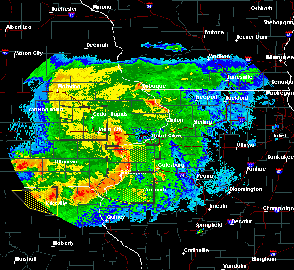 At 757 am cdt, severe thunderstorms were located along a line extending from near oquawka to near niota to near st. francisville, moving east at 55 mph (radar indicated). Hazards include 60 mph wind gusts. expect damage to roofs, siding, and trees At 757 am cdt, severe thunderstorms were located along a line extending from near oquawka to near niota to near st. francisville, moving east at 55 mph (radar indicated). Hazards include 60 mph wind gusts. expect damage to roofs, siding, and trees
|
| 8/20/2019 7:58 AM CDT |
 The national weather service in the quad cities has issued a * severe thunderstorm warning for. hancock county in west central illinois. henderson county in west central illinois. warren county in west central illinois. Mcdonough county in west central illinois. The national weather service in the quad cities has issued a * severe thunderstorm warning for. hancock county in west central illinois. henderson county in west central illinois. warren county in west central illinois. Mcdonough county in west central illinois.
|
| 7/17/2019 4:41 PM CDT |
 The severe thunderstorm warning for fulton and schuyler counties will expire at 445 pm cdt, the storms which prompted the warning have weakened below severe limits, and no longer pose an immediate threat to life or property. therefore, the warning will be allowed to expire. however gusty winds are still possible with these thunderstorms. a severe thunderstorm watch remains in effect until 900 pm cdt for central and west central illinois. The severe thunderstorm warning for fulton and schuyler counties will expire at 445 pm cdt, the storms which prompted the warning have weakened below severe limits, and no longer pose an immediate threat to life or property. therefore, the warning will be allowed to expire. however gusty winds are still possible with these thunderstorms. a severe thunderstorm watch remains in effect until 900 pm cdt for central and west central illinois.
|
| 7/17/2019 4:15 PM CDT |
 At 415 pm cdt, severe thunderstorms were located along a line extending from near bushnell to near rushville to near atlas, moving southeast at 40 mph (radar indicated). Hazards include 60 mph wind gusts and quarter size hail. Hail damage to vehicles is expected. expect wind damage to roofs, siding, and trees. locations impacted include, beardstown, rushville, lewistown, cuba, astoria, avon, vermont, st. David, ipava, littleton, browning, table grove, dunfermline, bernadotte, smithfield, bryant, frederick, huntsville, marietta and ellisville. At 415 pm cdt, severe thunderstorms were located along a line extending from near bushnell to near rushville to near atlas, moving southeast at 40 mph (radar indicated). Hazards include 60 mph wind gusts and quarter size hail. Hail damage to vehicles is expected. expect wind damage to roofs, siding, and trees. locations impacted include, beardstown, rushville, lewistown, cuba, astoria, avon, vermont, st. David, ipava, littleton, browning, table grove, dunfermline, bernadotte, smithfield, bryant, frederick, huntsville, marietta and ellisville.
|
| 7/17/2019 4:08 PM CDT |
 At 408 pm cdt, severe thunderstorms were located along a line extending from near roseville to near bardolph to littleton, moving east at 40 mph (radar indicated). Hazards include 60 mph wind gusts. Expect damage to roofs, siding, and trees. Locations impacted include, macomb, bushnell, colchester, la harpe, stronghurst, avon, blandinsville, industry, good hope, prairie city, terre haute, bardolph, raritan, tennessee, sciota, western illinois university, fandon, little swan lake, new philadelphia and colmar. At 408 pm cdt, severe thunderstorms were located along a line extending from near roseville to near bardolph to littleton, moving east at 40 mph (radar indicated). Hazards include 60 mph wind gusts. Expect damage to roofs, siding, and trees. Locations impacted include, macomb, bushnell, colchester, la harpe, stronghurst, avon, blandinsville, industry, good hope, prairie city, terre haute, bardolph, raritan, tennessee, sciota, western illinois university, fandon, little swan lake, new philadelphia and colmar.
|
| 7/17/2019 3:46 PM CDT |
 At 346 pm cdt, severe thunderstorms were located along a line extending from raritan to near fandon to golden, moving east at 45 mph (radar indicated). Hazards include 60 mph wind gusts. Expect damage to roofs, siding, and trees. Locations impacted include, macomb, carthage, bushnell, colchester, la harpe, stronghurst, avon, blandinsville, augusta, bowen, industry, good hope, prairie city, carman, terre haute, bardolph, west point, raritan, tennessee and sciota. At 346 pm cdt, severe thunderstorms were located along a line extending from raritan to near fandon to golden, moving east at 45 mph (radar indicated). Hazards include 60 mph wind gusts. Expect damage to roofs, siding, and trees. Locations impacted include, macomb, carthage, bushnell, colchester, la harpe, stronghurst, avon, blandinsville, augusta, bowen, industry, good hope, prairie city, carman, terre haute, bardolph, west point, raritan, tennessee and sciota.
|
| 7/17/2019 3:32 PM CDT |
 At 332 pm cdt, severe thunderstorms were located along a line extending from near biggsville to near colmar to near quincy, moving southeast at 45 mph (radar indicated). Hazards include 60 mph wind gusts and quarter size hail. Hail damage to vehicles is expected. Expect wind damage to roofs, siding, and trees. At 332 pm cdt, severe thunderstorms were located along a line extending from near biggsville to near colmar to near quincy, moving southeast at 45 mph (radar indicated). Hazards include 60 mph wind gusts and quarter size hail. Hail damage to vehicles is expected. Expect wind damage to roofs, siding, and trees.
|
| 7/17/2019 3:27 PM CDT |
 At 326 pm cdt, severe thunderstorms were located along a line extending from near carman to near carthage to 6 miles east of canton, moving east at 45 mph (radar indicated. trained spotters have reported 50 to 60 mph winds with these storms). Hazards include 60 mph wind gusts and penny size hail. expect damage to roofs, siding, and trees At 326 pm cdt, severe thunderstorms were located along a line extending from near carman to near carthage to 6 miles east of canton, moving east at 45 mph (radar indicated. trained spotters have reported 50 to 60 mph winds with these storms). Hazards include 60 mph wind gusts and penny size hail. expect damage to roofs, siding, and trees
|
| 6/30/2019 8:12 PM CDT |
 The severe thunderstorm warning for hancock, southeastern henderson, warren, mcdonough, eastern van buren, western lee and clark counties will expire at 815 pm cdt, the outflow boundary which prompted the warning has weakened below severe limits, and no longer poses an immediate threat to life or property. therefore, the warning will be allowed to expire. however gusty winds of 30 to 40 mph are still possible with this outflow boundary as it moves across clark, southern hancock and southern mcdonough counties. a severe thunderstorm watch remains in effect until 900 pm cdt for west central illinois. The severe thunderstorm warning for hancock, southeastern henderson, warren, mcdonough, eastern van buren, western lee and clark counties will expire at 815 pm cdt, the outflow boundary which prompted the warning has weakened below severe limits, and no longer poses an immediate threat to life or property. therefore, the warning will be allowed to expire. however gusty winds of 30 to 40 mph are still possible with this outflow boundary as it moves across clark, southern hancock and southern mcdonough counties. a severe thunderstorm watch remains in effect until 900 pm cdt for west central illinois.
|
| 6/30/2019 8:02 PM CDT |
 At 801 pm cdt, an outflow boundary with severe winds to 60 mph extended along a line extending from near prairie city to adrian to near bonaparte, moving south at 45 mph (radar indicated). Hazards include 60 mph wind gusts. Expect damage to roofs, siding, and trees. Locations impacted include, macomb, fort madison, keokuk, monmouth, carthage, kahoka, nauvoo, bushnell, hamilton, warsaw, colchester, la harpe, roseville, donnellson, montrose, blandinsville, augusta, wayland, bowen and industry. At 801 pm cdt, an outflow boundary with severe winds to 60 mph extended along a line extending from near prairie city to adrian to near bonaparte, moving south at 45 mph (radar indicated). Hazards include 60 mph wind gusts. Expect damage to roofs, siding, and trees. Locations impacted include, macomb, fort madison, keokuk, monmouth, carthage, kahoka, nauvoo, bushnell, hamilton, warsaw, colchester, la harpe, roseville, donnellson, montrose, blandinsville, augusta, wayland, bowen and industry.
|
| 6/30/2019 7:55 PM CDT |
 At 753 pm cdt, outflow boundary with severe winds was located along a line extending from london mills to near colusa to near salem, moving south at 45 mph. thunderstorms behind the outflow boundary will be capable of severe winds to 60 mph (radar indicated). Hazards include 60 mph wind gusts. Expect damage to roofs, siding, and trees. Locations impacted include, burlington, macomb, fort madison, keokuk, fairfield, monmouth, mount pleasant, washington, carthage, kahoka, oquawka, nauvoo, bushnell, west burlington, hamilton, new london, warsaw, mediapolis, colchester and la harpe. At 753 pm cdt, outflow boundary with severe winds was located along a line extending from london mills to near colusa to near salem, moving south at 45 mph. thunderstorms behind the outflow boundary will be capable of severe winds to 60 mph (radar indicated). Hazards include 60 mph wind gusts. Expect damage to roofs, siding, and trees. Locations impacted include, burlington, macomb, fort madison, keokuk, fairfield, monmouth, mount pleasant, washington, carthage, kahoka, oquawka, nauvoo, bushnell, west burlington, hamilton, new london, warsaw, mediapolis, colchester and la harpe.
|
| 6/30/2019 7:45 PM CDT |
 At 744 pm cdt, severe thunderstorms were located along a line extending from abingdon to stronghurst to rome, moving east at 45 mph (radar indicated. a 58 mph wind gust was measured at the burlington airport). Hazards include 60 mph wind gusts. Expect damage to roofs, siding, and trees. Locations impacted include, burlington, macomb, fort madison, keokuk, fairfield, monmouth, mount pleasant, washington, aledo, carthage, kahoka, wapello, columbus junction, oquawka, nauvoo, bushnell, west burlington, hamilton, burgess and new london. At 744 pm cdt, severe thunderstorms were located along a line extending from abingdon to stronghurst to rome, moving east at 45 mph (radar indicated. a 58 mph wind gust was measured at the burlington airport). Hazards include 60 mph wind gusts. Expect damage to roofs, siding, and trees. Locations impacted include, burlington, macomb, fort madison, keokuk, fairfield, monmouth, mount pleasant, washington, aledo, carthage, kahoka, wapello, columbus junction, oquawka, nauvoo, bushnell, west burlington, hamilton, burgess and new london.
|
| 6/30/2019 7:32 PM CDT |
 At 732 pm cdt, severe thunderstorms were located along a line extending from near galesburg to near gladstone to near lockridge, moving south at 45 mph (radar indicated). Hazards include 60 mph wind gusts. expect damage to roofs, siding, and trees At 732 pm cdt, severe thunderstorms were located along a line extending from near galesburg to near gladstone to near lockridge, moving south at 45 mph (radar indicated). Hazards include 60 mph wind gusts. expect damage to roofs, siding, and trees
|
| 6/28/2019 1:44 PM CDT |
 At 143 pm cdt, severe thunderstorms were located along a line extending from near bardolph to near industry to near fandon, moving southeast at 35 mph (radar indicated). Hazards include 60 mph wind gusts and quarter size hail. Hail damage to vehicles is expected. expect wind damage to roofs, siding, and trees. locations impacted include, macomb, bushnell, colchester, industry, good hope, bardolph, tennessee, western illinois university, adair, fandon, new philadelphia, colmar, plymouth, pennington point, macomb municipal airport, doddsville, scottsburg, spring lake, mcdonough county 4-h grounds and argyle lake state park. If you are at city of macomb you should seek safe shelter immediately!. At 143 pm cdt, severe thunderstorms were located along a line extending from near bardolph to near industry to near fandon, moving southeast at 35 mph (radar indicated). Hazards include 60 mph wind gusts and quarter size hail. Hail damage to vehicles is expected. expect wind damage to roofs, siding, and trees. locations impacted include, macomb, bushnell, colchester, industry, good hope, bardolph, tennessee, western illinois university, adair, fandon, new philadelphia, colmar, plymouth, pennington point, macomb municipal airport, doddsville, scottsburg, spring lake, mcdonough county 4-h grounds and argyle lake state park. If you are at city of macomb you should seek safe shelter immediately!.
|
| 6/28/2019 1:32 PM CDT |
 At 115 pm cdt, severe thunderstorms were located along a line extending from near stronghurst to 6 miles southwest of blandinsville to near warsaw, moving east southeast at 25 mph (radar indicated). Hazards include 60 mph wind gusts and quarter size hail. Hail damage to vehicles is expected. expect wind damage to roofs, siding, and trees. locations impacted include, macomb, keokuk, carthage, bushnell, hamilton, warsaw, colchester, la harpe, roseville, stronghurst, avon, blandinsville, augusta, bowen, industry, good hope, prairie city, terre haute, bardolph and west point. those attending heritage days in macomb are in the path of these storms and should prepare for imminent dangerous weather conditions. Seek shelter now!. At 115 pm cdt, severe thunderstorms were located along a line extending from near stronghurst to 6 miles southwest of blandinsville to near warsaw, moving east southeast at 25 mph (radar indicated). Hazards include 60 mph wind gusts and quarter size hail. Hail damage to vehicles is expected. expect wind damage to roofs, siding, and trees. locations impacted include, macomb, keokuk, carthage, bushnell, hamilton, warsaw, colchester, la harpe, roseville, stronghurst, avon, blandinsville, augusta, bowen, industry, good hope, prairie city, terre haute, bardolph and west point. those attending heritage days in macomb are in the path of these storms and should prepare for imminent dangerous weather conditions. Seek shelter now!.
|
| 6/28/2019 1:17 PM CDT |
 At 115 pm cdt, severe thunderstorms were located along a line extending from near stronghurst to 6 miles southwest of blandinsville to near warsaw, moving east southeast at 25 mph (radar indicated). Hazards include 60 mph wind gusts and quarter size hail. Hail damage to vehicles is expected. expect wind damage to roofs, siding, and trees. locations impacted include, macomb, keokuk, carthage, bushnell, hamilton, warsaw, colchester, la harpe, roseville, stronghurst, avon, blandinsville, augusta, bowen, industry, good hope, prairie city, terre haute, bardolph and west point. those attending heritage days in macomb are in the path of these storms and should prepare for imminent dangerous weather conditions. Seek shelter now!. At 115 pm cdt, severe thunderstorms were located along a line extending from near stronghurst to 6 miles southwest of blandinsville to near warsaw, moving east southeast at 25 mph (radar indicated). Hazards include 60 mph wind gusts and quarter size hail. Hail damage to vehicles is expected. expect wind damage to roofs, siding, and trees. locations impacted include, macomb, keokuk, carthage, bushnell, hamilton, warsaw, colchester, la harpe, roseville, stronghurst, avon, blandinsville, augusta, bowen, industry, good hope, prairie city, terre haute, bardolph and west point. those attending heritage days in macomb are in the path of these storms and should prepare for imminent dangerous weather conditions. Seek shelter now!.
|
| 6/28/2019 1:05 PM CDT |
 At 104 pm cdt, severe thunderstorms were located along a line extending from near stronghurst to la harpe to near carthage, moving southeast at 35 mph (radar indicated). Hazards include 60 mph wind gusts and quarter size hail. Hail damage to vehicles is expected. Expect wind damage to roofs, siding, and trees. At 104 pm cdt, severe thunderstorms were located along a line extending from near stronghurst to la harpe to near carthage, moving southeast at 35 mph (radar indicated). Hazards include 60 mph wind gusts and quarter size hail. Hail damage to vehicles is expected. Expect wind damage to roofs, siding, and trees.
|
| 6/25/2019 8:43 PM CDT |
 A severe thunderstorm warning remains in effect until 900 pm cdt for mcdonough county. at 842 pm cdt, severe thunderstorms were located along a line extending from bushnell to near industry to 6 miles southwest of littleton, moving east at 55 mph. hazard. 70 mph wind gusts and quarter size hail. A severe thunderstorm warning remains in effect until 900 pm cdt for mcdonough county. at 842 pm cdt, severe thunderstorms were located along a line extending from bushnell to near industry to 6 miles southwest of littleton, moving east at 55 mph. hazard. 70 mph wind gusts and quarter size hail.
|
| 6/25/2019 8:43 PM CDT |
 At 820 pm cdt, severe thunderstorms were located along a line extending from near sciota to near colmar to near mendon, moving southeast at 45 mph (radar indicated). Hazards include 60 mph wind gusts and quarter size hail. Hail damage to vehicles is expected. Expect wind damage to roofs, siding, and trees. At 820 pm cdt, severe thunderstorms were located along a line extending from near sciota to near colmar to near mendon, moving southeast at 45 mph (radar indicated). Hazards include 60 mph wind gusts and quarter size hail. Hail damage to vehicles is expected. Expect wind damage to roofs, siding, and trees.
|
| 6/25/2019 8:37 PM CDT |
 At 837 pm cdt, severe thunderstorms were located along a line extending from near good hope to near fandon to near augusta, moving east at 55 mph. this is also directly impacting the city of macomb (trained weather spotters). Hazards include 70 mph wind gusts and quarter size hail. Hail damage to vehicles is expected. expect considerable tree damage. wind damage is also likely to mobile homes, roofs, and outbuildings. Locations impacted include, macomb, bushnell, colchester, blandinsville, augusta, bowen, industry, good hope, prairie city, bardolph, tennessee, sciota, western illinois university, fandon, new philadelphia, colmar, adair, walnut grove, plymouth and fountain green. At 837 pm cdt, severe thunderstorms were located along a line extending from near good hope to near fandon to near augusta, moving east at 55 mph. this is also directly impacting the city of macomb (trained weather spotters). Hazards include 70 mph wind gusts and quarter size hail. Hail damage to vehicles is expected. expect considerable tree damage. wind damage is also likely to mobile homes, roofs, and outbuildings. Locations impacted include, macomb, bushnell, colchester, blandinsville, augusta, bowen, industry, good hope, prairie city, bardolph, tennessee, sciota, western illinois university, fandon, new philadelphia, colmar, adair, walnut grove, plymouth and fountain green.
|
| 6/25/2019 8:30 PM CDT |
 At 830 pm cdt, severe thunderstorms were located along a line extending from sciota to near augusta to near camp point, moving southeast at 50 mph (trained weather spotters). Hazards include 70 mph wind gusts and quarter size hail. Hail damage to vehicles is expected. expect considerable tree damage. wind damage is also likely to mobile homes, roofs, and outbuildings. Locations impacted include, macomb, bushnell, colchester, blandinsville, augusta, bowen, industry, good hope, prairie city, bardolph, tennessee, sciota, western illinois university, fandon, new philadelphia, colmar, adair, walnut grove, plymouth and fountain green. At 830 pm cdt, severe thunderstorms were located along a line extending from sciota to near augusta to near camp point, moving southeast at 50 mph (trained weather spotters). Hazards include 70 mph wind gusts and quarter size hail. Hail damage to vehicles is expected. expect considerable tree damage. wind damage is also likely to mobile homes, roofs, and outbuildings. Locations impacted include, macomb, bushnell, colchester, blandinsville, augusta, bowen, industry, good hope, prairie city, bardolph, tennessee, sciota, western illinois university, fandon, new philadelphia, colmar, adair, walnut grove, plymouth and fountain green.
|
| 6/25/2019 8:26 PM CDT |
 At 825 pm cdt, severe thunderstorms were located along a line extending from sciota to near colmar to near mendon, moving southeast at 55 mph (trained weather spotters). Hazards include 70 mph wind gusts and quarter size hail. Hail damage to vehicles is expected. expect considerable tree damage. wind damage is also likely to mobile homes, roofs, and outbuildings. Locations impacted include, macomb, bushnell, colchester, blandinsville, augusta, bowen, industry, good hope, prairie city, bardolph, tennessee, sciota, western illinois university, fandon, new philadelphia, colmar, adair, walnut grove, plymouth and fountain green. At 825 pm cdt, severe thunderstorms were located along a line extending from sciota to near colmar to near mendon, moving southeast at 55 mph (trained weather spotters). Hazards include 70 mph wind gusts and quarter size hail. Hail damage to vehicles is expected. expect considerable tree damage. wind damage is also likely to mobile homes, roofs, and outbuildings. Locations impacted include, macomb, bushnell, colchester, blandinsville, augusta, bowen, industry, good hope, prairie city, bardolph, tennessee, sciota, western illinois university, fandon, new philadelphia, colmar, adair, walnut grove, plymouth and fountain green.
|
| 6/25/2019 8:21 PM CDT |
 At 821 pm cdt, severe thunderstorms were located along a line extending from near blandinsville to 6 miles west of colmar to near mendon, moving southeast at 55 mph (trained weather spotters). Hazards include 70 mph wind gusts and quarter size hail. Hail damage to vehicles is expected. expect considerable tree damage. wind damage is also likely to mobile homes, roofs, and outbuildings. Locations impacted include, macomb, bushnell, colchester, blandinsville, augusta, bowen, industry, good hope, prairie city, bardolph, tennessee, sciota, western illinois university, fandon, new philadelphia, colmar, adair, walnut grove, plymouth and fountain green. At 821 pm cdt, severe thunderstorms were located along a line extending from near blandinsville to 6 miles west of colmar to near mendon, moving southeast at 55 mph (trained weather spotters). Hazards include 70 mph wind gusts and quarter size hail. Hail damage to vehicles is expected. expect considerable tree damage. wind damage is also likely to mobile homes, roofs, and outbuildings. Locations impacted include, macomb, bushnell, colchester, blandinsville, augusta, bowen, industry, good hope, prairie city, bardolph, tennessee, sciota, western illinois university, fandon, new philadelphia, colmar, adair, walnut grove, plymouth and fountain green.
|
| 6/25/2019 8:20 PM CDT |
 At 820 pm cdt, severe thunderstorms were located along a line extending from near sciota to near colmar to near mendon, moving southeast at 45 mph (radar indicated). Hazards include 60 mph wind gusts and quarter size hail. Hail damage to vehicles is expected. Expect wind damage to roofs, siding, and trees. At 820 pm cdt, severe thunderstorms were located along a line extending from near sciota to near colmar to near mendon, moving southeast at 45 mph (radar indicated). Hazards include 60 mph wind gusts and quarter size hail. Hail damage to vehicles is expected. Expect wind damage to roofs, siding, and trees.
|
| 6/25/2019 8:11 PM CDT |
 At 811 pm cdt, severe thunderstorms were located along a line extending from la harpe to near west point to 7 miles northwest of mendon, moving southeast at 55 mph (trained weather spotters). Hazards include 70 mph wind gusts and quarter size hail. Hail damage to vehicles is expected. expect considerable tree damage. wind damage is also likely to mobile homes, roofs, and outbuildings. Locations impacted include, macomb, bushnell, colchester, blandinsville, augusta, bowen, industry, good hope, prairie city, bardolph, tennessee, sciota, western illinois university, fandon, new philadelphia, colmar, adair, walnut grove, plymouth and fountain green. At 811 pm cdt, severe thunderstorms were located along a line extending from la harpe to near west point to 7 miles northwest of mendon, moving southeast at 55 mph (trained weather spotters). Hazards include 70 mph wind gusts and quarter size hail. Hail damage to vehicles is expected. expect considerable tree damage. wind damage is also likely to mobile homes, roofs, and outbuildings. Locations impacted include, macomb, bushnell, colchester, blandinsville, augusta, bowen, industry, good hope, prairie city, bardolph, tennessee, sciota, western illinois university, fandon, new philadelphia, colmar, adair, walnut grove, plymouth and fountain green.
|
| 6/25/2019 8:07 PM CDT |
 At 807 pm cdt, severe thunderstorms were located along a line extending from near disco to near west point to near canton, moving southeast at 50 mph (trained weather spotters). Hazards include 70 mph wind gusts and quarter size hail. Hail damage to vehicles is expected. expect considerable tree damage. wind damage is also likely to mobile homes, roofs, and outbuildings. Locations impacted include, macomb, bushnell, colchester, blandinsville, augusta, bowen, industry, good hope, prairie city, bardolph, tennessee, sciota, western illinois university, fandon, new philadelphia, colmar, adair, walnut grove, plymouth and fountain green. At 807 pm cdt, severe thunderstorms were located along a line extending from near disco to near west point to near canton, moving southeast at 50 mph (trained weather spotters). Hazards include 70 mph wind gusts and quarter size hail. Hail damage to vehicles is expected. expect considerable tree damage. wind damage is also likely to mobile homes, roofs, and outbuildings. Locations impacted include, macomb, bushnell, colchester, blandinsville, augusta, bowen, industry, good hope, prairie city, bardolph, tennessee, sciota, western illinois university, fandon, new philadelphia, colmar, adair, walnut grove, plymouth and fountain green.
|
| 6/25/2019 7:56 PM CDT |
 The national weather service in the quad cities has issued a * severe thunderstorm warning for. southeastern hancock county in west central illinois. mcdonough county in west central illinois. until 900 pm cdt. At 756 pm cdt, severe thunderstorms were located along a line. The national weather service in the quad cities has issued a * severe thunderstorm warning for. southeastern hancock county in west central illinois. mcdonough county in west central illinois. until 900 pm cdt. At 756 pm cdt, severe thunderstorms were located along a line.
|
| 6/25/2019 7:48 PM CDT |
 At 748 pm cdt, a severe thunderstorm was located over fandon, or 9 miles southwest of macomb, moving east at 35 mph (radar indicated). Hazards include 60 mph wind gusts and quarter size hail. Hail damage to vehicles is expected. expect wind damage to roofs, siding, and trees. Locations impacted include, macomb, colchester, industry, tennessee, adair, fandon, colmar, plymouth and pennington point. At 748 pm cdt, a severe thunderstorm was located over fandon, or 9 miles southwest of macomb, moving east at 35 mph (radar indicated). Hazards include 60 mph wind gusts and quarter size hail. Hail damage to vehicles is expected. expect wind damage to roofs, siding, and trees. Locations impacted include, macomb, colchester, industry, tennessee, adair, fandon, colmar, plymouth and pennington point.
|
| 6/25/2019 7:42 PM CDT |
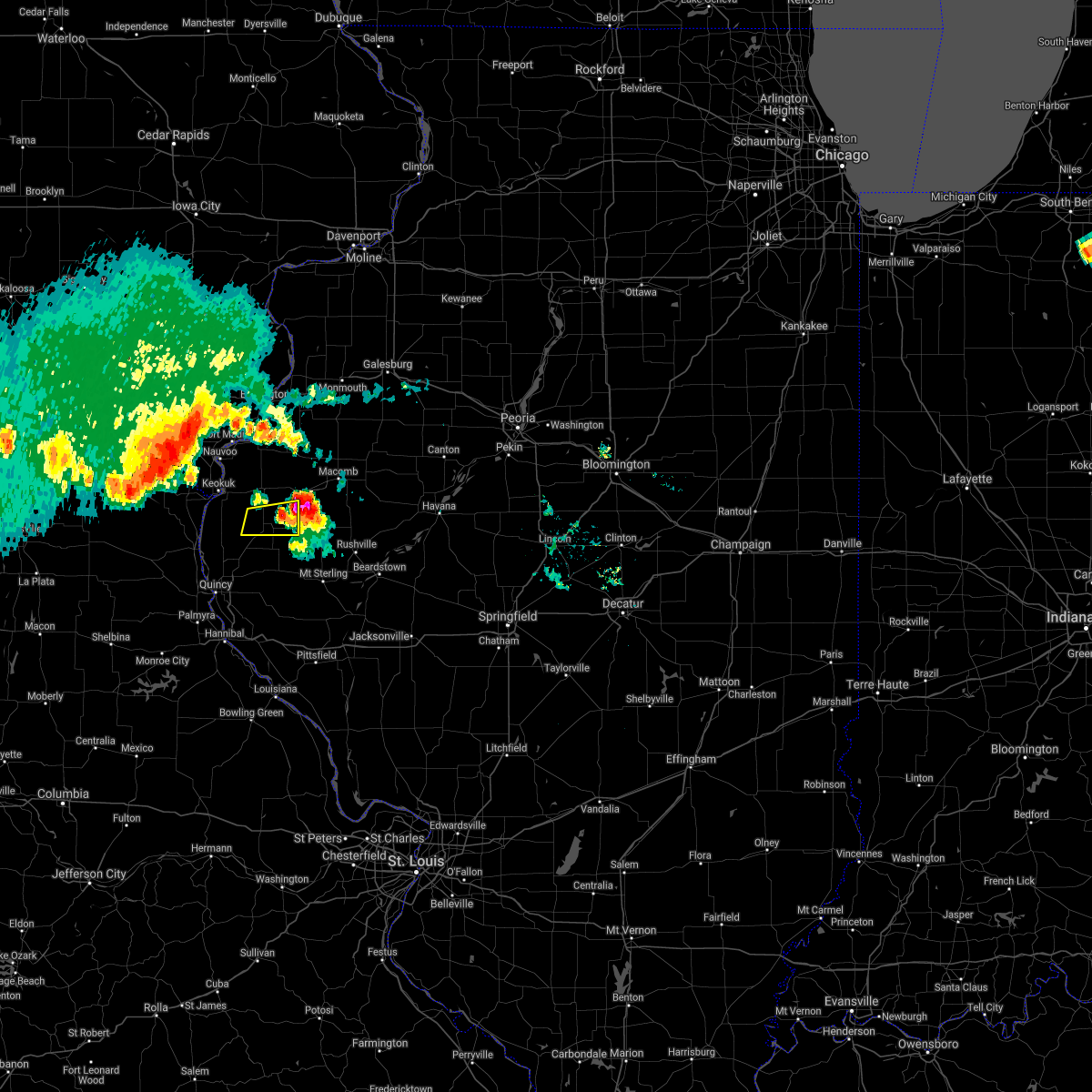 The severe thunderstorm warning for southeastern hancock county will expire at 745 pm cdt, the storm which prompted the warning has moved out of the area. therefore, the warning will be allowed to expire. a severe thunderstorm watch remains in effect until midnight cdt for west central illinois. to report severe weather, contact your nearest law enforcement agency. they will relay your report to the national weather service the quad cities. remember, a severe thunderstorm warning still remains in effect for much of hancock county for damaging winds moving in from lee county. The severe thunderstorm warning for southeastern hancock county will expire at 745 pm cdt, the storm which prompted the warning has moved out of the area. therefore, the warning will be allowed to expire. a severe thunderstorm watch remains in effect until midnight cdt for west central illinois. to report severe weather, contact your nearest law enforcement agency. they will relay your report to the national weather service the quad cities. remember, a severe thunderstorm warning still remains in effect for much of hancock county for damaging winds moving in from lee county.
|
| 6/25/2019 7:39 PM CDT |
 At 739 pm cdt, a severe thunderstorm was located near fandon, or 11 miles southwest of macomb, moving east at 40 mph (radar indicated). Hazards include golf ball size hail and 60 mph wind gusts. People and animals outdoors will be injured. expect hail damage to roofs, siding, windows, and vehicles. expect wind damage to roofs, siding, and trees. Locations impacted include, macomb, colchester, industry, tennessee, adair, fandon, colmar, plymouth and pennington point. At 739 pm cdt, a severe thunderstorm was located near fandon, or 11 miles southwest of macomb, moving east at 40 mph (radar indicated). Hazards include golf ball size hail and 60 mph wind gusts. People and animals outdoors will be injured. expect hail damage to roofs, siding, windows, and vehicles. expect wind damage to roofs, siding, and trees. Locations impacted include, macomb, colchester, industry, tennessee, adair, fandon, colmar, plymouth and pennington point.
|
| 6/25/2019 7:32 PM CDT |
 At 728 pm cdt, a severe thunderstorm was located over colmar, or 12 miles southeast of carthage, moving east at 40 mph (law enforcement). Hazards include golf ball size hail and 60 mph wind gusts. People and animals outdoors will be injured. expect hail damage to roofs, siding, windows, and vehicles. expect wind damage to roofs, siding, and trees. Locations impacted include, macomb, colchester, industry, tennessee, adair, fandon, colmar, plymouth and pennington point. At 728 pm cdt, a severe thunderstorm was located over colmar, or 12 miles southeast of carthage, moving east at 40 mph (law enforcement). Hazards include golf ball size hail and 60 mph wind gusts. People and animals outdoors will be injured. expect hail damage to roofs, siding, windows, and vehicles. expect wind damage to roofs, siding, and trees. Locations impacted include, macomb, colchester, industry, tennessee, adair, fandon, colmar, plymouth and pennington point.
|
| 6/25/2019 7:22 PM CDT |
 At 721 pm cdt, a severe thunderstorm was located near augusta, or 10 miles southeast of carthage, moving east at 40 mph (law enforcement). Hazards include golf ball size hail. People and animals outdoors will be injured. Expect damage to roofs, siding, windows, and vehicles. At 721 pm cdt, a severe thunderstorm was located near augusta, or 10 miles southeast of carthage, moving east at 40 mph (law enforcement). Hazards include golf ball size hail. People and animals outdoors will be injured. Expect damage to roofs, siding, windows, and vehicles.
|
| 6/25/2019 7:18 PM CDT |
 At 718 pm cdt, a severe thunderstorm was located over bowen, or 11 miles southeast of carthage, moving east at 30 mph (law enforcement). Hazards include golf ball size hail and 60 mph wind gusts. People and animals outdoors will be injured. expect hail damage to roofs, siding, windows, and vehicles. expect wind damage to roofs, siding, and trees. Locations impacted include, augusta, bowen, west point, plymouth, denver, hancock county fairgrounds and stillwell. At 718 pm cdt, a severe thunderstorm was located over bowen, or 11 miles southeast of carthage, moving east at 30 mph (law enforcement). Hazards include golf ball size hail and 60 mph wind gusts. People and animals outdoors will be injured. expect hail damage to roofs, siding, windows, and vehicles. expect wind damage to roofs, siding, and trees. Locations impacted include, augusta, bowen, west point, plymouth, denver, hancock county fairgrounds and stillwell.
|
| 6/25/2019 7:08 PM CDT |
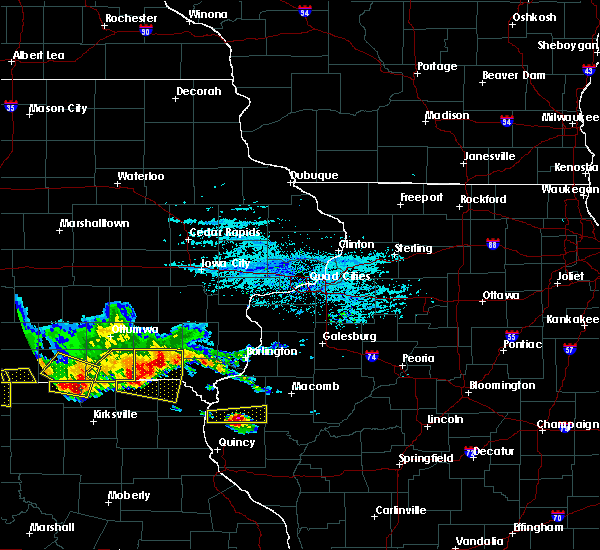 At 708 pm cdt, a severe thunderstorm was located over west point, or 12 miles south of carthage, moving east at 25 mph (radar indicated). Hazards include 60 mph wind gusts and half dollar size hail. Hail damage to vehicles is expected. expect wind damage to roofs, siding, and trees. Locations impacted include, augusta, bowen, west point, plymouth, denver, basco, bentley, tioga, sutter, hancock county fairgrounds and stillwell. At 708 pm cdt, a severe thunderstorm was located over west point, or 12 miles south of carthage, moving east at 25 mph (radar indicated). Hazards include 60 mph wind gusts and half dollar size hail. Hail damage to vehicles is expected. expect wind damage to roofs, siding, and trees. Locations impacted include, augusta, bowen, west point, plymouth, denver, basco, bentley, tioga, sutter, hancock county fairgrounds and stillwell.
|
| 6/25/2019 7:03 PM CDT |
 At 658 pm cdt, a severe thunderstorm was located 7 miles west of west point, or 13 miles northeast of canton, moving east at 30 mph (radar indicated). Hazards include 60 mph wind gusts and quarter size hail. Hail damage to vehicles is expected. expect wind damage to roofs, siding, and trees. Locations impacted include, augusta, bowen, west point, plymouth, denver, basco, bentley, tioga, sutter, hancock county fairgrounds and stillwell. At 658 pm cdt, a severe thunderstorm was located 7 miles west of west point, or 13 miles northeast of canton, moving east at 30 mph (radar indicated). Hazards include 60 mph wind gusts and quarter size hail. Hail damage to vehicles is expected. expect wind damage to roofs, siding, and trees. Locations impacted include, augusta, bowen, west point, plymouth, denver, basco, bentley, tioga, sutter, hancock county fairgrounds and stillwell.
|
| 6/25/2019 6:58 PM CDT |
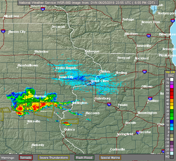 At 650 pm cdt, a severe thunderstorm was located 8 miles south of warsaw, or 9 miles northeast of canton, moving east at 30 mph (radar indicated). Hazards include 60 mph wind gusts and quarter size hail. Hail damage to vehicles is expected. Expect wind damage to roofs, siding, and trees. At 650 pm cdt, a severe thunderstorm was located 8 miles south of warsaw, or 9 miles northeast of canton, moving east at 30 mph (radar indicated). Hazards include 60 mph wind gusts and quarter size hail. Hail damage to vehicles is expected. Expect wind damage to roofs, siding, and trees.
|
| 6/25/2019 6:51 PM CDT |
 At 650 pm cdt, a severe thunderstorm was located 8 miles south of warsaw, or 9 miles northeast of canton, moving east at 30 mph (radar indicated). Hazards include 60 mph wind gusts and quarter size hail. Hail damage to vehicles is expected. Expect wind damage to roofs, siding, and trees. At 650 pm cdt, a severe thunderstorm was located 8 miles south of warsaw, or 9 miles northeast of canton, moving east at 30 mph (radar indicated). Hazards include 60 mph wind gusts and quarter size hail. Hail damage to vehicles is expected. Expect wind damage to roofs, siding, and trees.
|
| 6/1/2019 5:50 PM CDT |
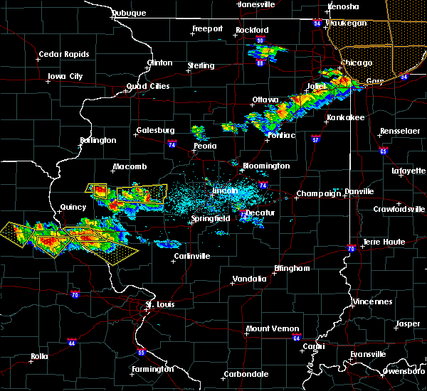 The severe thunderstorm warning for southeastern hancock and southwestern mcdonough counties will expire at 600 pm cdt, the storm which prompted the warning has weakened below severe limits, and has exited the warned area. therefore, the warning will be allowed to expire. to report severe weather, contact your nearest law enforcement agency. they will relay your report to the national weather service the quad cities. The severe thunderstorm warning for southeastern hancock and southwestern mcdonough counties will expire at 600 pm cdt, the storm which prompted the warning has weakened below severe limits, and has exited the warned area. therefore, the warning will be allowed to expire. to report severe weather, contact your nearest law enforcement agency. they will relay your report to the national weather service the quad cities.
|
| 6/1/2019 5:45 PM CDT |
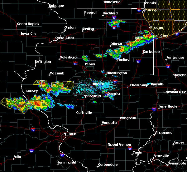 At 545 pm cdt, a severe thunderstorm was located over augusta, or 17 miles southeast of carthage, moving east at 25 mph (trained weather spotters). Hazards include quarter size hail. Damage to vehicles is expected. Locations impacted include, augusta, plymouth and hancock county fairgrounds. At 545 pm cdt, a severe thunderstorm was located over augusta, or 17 miles southeast of carthage, moving east at 25 mph (trained weather spotters). Hazards include quarter size hail. Damage to vehicles is expected. Locations impacted include, augusta, plymouth and hancock county fairgrounds.
|
| 6/1/2019 5:41 PM CDT |
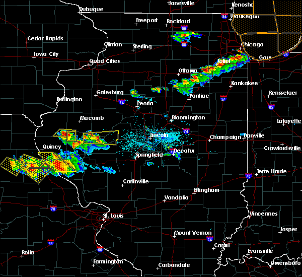 At 541 pm cdt, a severe thunderstorm was located near augusta, or 17 miles southeast of carthage, moving east at 35 mph (radar indicated). Hazards include 60 mph wind gusts and half dollar size hail. Hail damage to vehicles is expected. expect wind damage to roofs, siding, and trees. Locations impacted include, huntsville, camden and weinberg king state park. At 541 pm cdt, a severe thunderstorm was located near augusta, or 17 miles southeast of carthage, moving east at 35 mph (radar indicated). Hazards include 60 mph wind gusts and half dollar size hail. Hail damage to vehicles is expected. expect wind damage to roofs, siding, and trees. Locations impacted include, huntsville, camden and weinberg king state park.
|
| 6/1/2019 5:37 PM CDT |
 At 536 pm cdt, a severe thunderstorm was located over augusta, or 14 miles southeast of carthage, moving east at 25 mph (radar indicated). Hazards include ping pong ball size hail and 60 mph wind gusts. People and animals outdoors will be injured. expect hail damage to roofs, siding, windows, and vehicles. expect wind damage to roofs, siding, and trees. Locations impacted include, augusta, bowen, plymouth and hancock county fairgrounds. At 536 pm cdt, a severe thunderstorm was located over augusta, or 14 miles southeast of carthage, moving east at 25 mph (radar indicated). Hazards include ping pong ball size hail and 60 mph wind gusts. People and animals outdoors will be injured. expect hail damage to roofs, siding, windows, and vehicles. expect wind damage to roofs, siding, and trees. Locations impacted include, augusta, bowen, plymouth and hancock county fairgrounds.
|
| 6/1/2019 5:31 PM CDT |
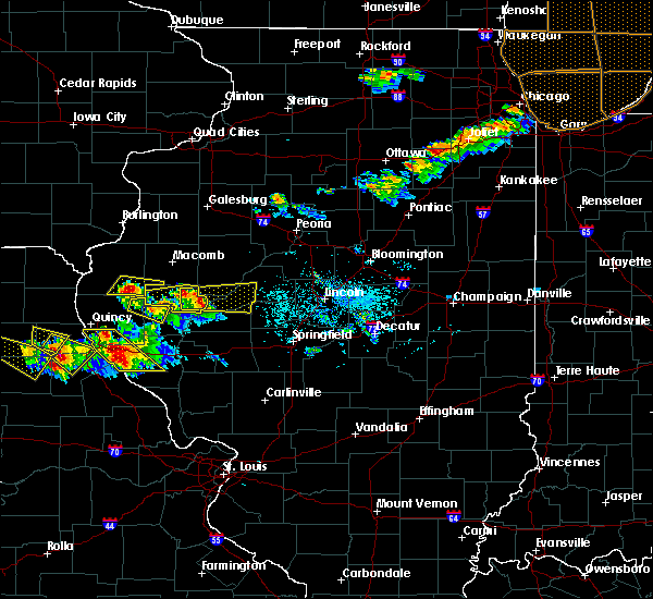 At 531 pm cdt, a severe thunderstorm was located over bowen, or 13 miles southeast of carthage, moving east at 25 mph (radar indicated). Hazards include 60 mph wind gusts and quarter size hail. Hail damage to vehicles is expected. expect wind damage to roofs, siding, and trees. Locations impacted include, augusta, bowen, plymouth, denver, hancock county fairgrounds and stillwell. At 531 pm cdt, a severe thunderstorm was located over bowen, or 13 miles southeast of carthage, moving east at 25 mph (radar indicated). Hazards include 60 mph wind gusts and quarter size hail. Hail damage to vehicles is expected. expect wind damage to roofs, siding, and trees. Locations impacted include, augusta, bowen, plymouth, denver, hancock county fairgrounds and stillwell.
|
| 6/1/2019 5:30 PM CDT |
 At 530 pm cdt, a severe thunderstorm was located near augusta, or 16 miles southeast of carthage, moving east at 35 mph (radar indicated). Hazards include 60 mph wind gusts and quarter size hail. Hail damage to vehicles is expected. Expect wind damage to roofs, siding, and trees. At 530 pm cdt, a severe thunderstorm was located near augusta, or 16 miles southeast of carthage, moving east at 35 mph (radar indicated). Hazards include 60 mph wind gusts and quarter size hail. Hail damage to vehicles is expected. Expect wind damage to roofs, siding, and trees.
|
| 6/1/2019 5:26 PM CDT |
 At 526 pm cdt, a severe thunderstorm was located over bowen, or 12 miles south of carthage, moving east at 25 mph (radar indicated). Hazards include 60 mph wind gusts and quarter size hail. Hail damage to vehicles is expected. Expect wind damage to roofs, siding, and trees. At 526 pm cdt, a severe thunderstorm was located over bowen, or 12 miles south of carthage, moving east at 25 mph (radar indicated). Hazards include 60 mph wind gusts and quarter size hail. Hail damage to vehicles is expected. Expect wind damage to roofs, siding, and trees.
|
| 5/29/2019 7:47 PM CDT |
 At 747 pm cdt, severe thunderstorms were located along a line extending from near west point to colmar, moving northeast at 20 mph (radar indicated). Hazards include 60 mph wind gusts and quarter size hail. Hail damage to vehicles is expected. expect wind damage to roofs, siding, and trees. Locations impacted include, carthage, colchester, augusta, bowen, west point, tennessee, colmar, plymouth, denver, elvaston, basco, bentley, stillwell, hancock county fairgrounds and argyle lake state park. At 747 pm cdt, severe thunderstorms were located along a line extending from near west point to colmar, moving northeast at 20 mph (radar indicated). Hazards include 60 mph wind gusts and quarter size hail. Hail damage to vehicles is expected. expect wind damage to roofs, siding, and trees. Locations impacted include, carthage, colchester, augusta, bowen, west point, tennessee, colmar, plymouth, denver, elvaston, basco, bentley, stillwell, hancock county fairgrounds and argyle lake state park.
|
| 5/29/2019 7:39 PM CDT |
 At 736 pm cdt, severe thunderstorms were located along a line extending from west point to near augusta, moving north at 20 mph (radar indicated. there was a public report of quarter size hail 2 miles west of augusta with this storm). Hazards include 60 mph wind gusts and quarter size hail. Hail damage to vehicles is expected. expect wind damage to roofs, siding, and trees. Locations impacted include, carthage, colchester, augusta, bowen, west point, tennessee, colmar, plymouth, denver, elvaston, basco, bentley, stillwell, hancock county fairgrounds and argyle lake state park. At 736 pm cdt, severe thunderstorms were located along a line extending from west point to near augusta, moving north at 20 mph (radar indicated. there was a public report of quarter size hail 2 miles west of augusta with this storm). Hazards include 60 mph wind gusts and quarter size hail. Hail damage to vehicles is expected. expect wind damage to roofs, siding, and trees. Locations impacted include, carthage, colchester, augusta, bowen, west point, tennessee, colmar, plymouth, denver, elvaston, basco, bentley, stillwell, hancock county fairgrounds and argyle lake state park.
|
| 5/29/2019 7:19 PM CDT |
 At 719 pm cdt, severe thunderstorms were located along a line extending from near west point to augusta, moving northeast at 20 mph (radar indicated). Hazards include 60 mph wind gusts and quarter size hail. Hail damage to vehicles is expected. Expect wind damage to roofs, siding, and trees. At 719 pm cdt, severe thunderstorms were located along a line extending from near west point to augusta, moving northeast at 20 mph (radar indicated). Hazards include 60 mph wind gusts and quarter size hail. Hail damage to vehicles is expected. Expect wind damage to roofs, siding, and trees.
|
| 5/28/2019 7:54 PM CDT |
 At 754 pm cdt, severe thunderstorms were located along a line extending from 6 miles north of monmouth to near prairie city to near industry, moving east at 45 mph (radar indicated). Hazards include 70 mph wind gusts and quarter size hail. Hail damage to vehicles is expected. expect considerable tree damage. wind damage is also likely to mobile homes, roofs, and outbuildings. Locations impacted include, macomb, monmouth, bushnell, colchester, industry, good hope, prairie city, little york, bardolph, western illinois university, fandon, little swan lake, new philadelphia, colmar, adair, walnut grove, greenbush, coldbrook, berwick and gerlaw. At 754 pm cdt, severe thunderstorms were located along a line extending from 6 miles north of monmouth to near prairie city to near industry, moving east at 45 mph (radar indicated). Hazards include 70 mph wind gusts and quarter size hail. Hail damage to vehicles is expected. expect considerable tree damage. wind damage is also likely to mobile homes, roofs, and outbuildings. Locations impacted include, macomb, monmouth, bushnell, colchester, industry, good hope, prairie city, little york, bardolph, western illinois university, fandon, little swan lake, new philadelphia, colmar, adair, walnut grove, greenbush, coldbrook, berwick and gerlaw.
|
| 5/28/2019 7:48 PM CDT |
 At 747 pm cdt, severe thunderstorms were located along a line extending from little york to near little swan lake to near fandon, moving east at 50 mph (radar indicated). Hazards include 70 mph wind gusts and quarter size hail. Hail damage to vehicles is expected. expect considerable tree damage. wind damage is also likely to mobile homes, roofs, and outbuildings. Locations impacted include, macomb, monmouth, bushnell, colchester, roseville, kirkwood, industry, good hope, prairie city, little york, bardolph, tennessee, sciota, western illinois university, fandon, little swan lake, new philadelphia, colmar, adair and alexis. At 747 pm cdt, severe thunderstorms were located along a line extending from little york to near little swan lake to near fandon, moving east at 50 mph (radar indicated). Hazards include 70 mph wind gusts and quarter size hail. Hail damage to vehicles is expected. expect considerable tree damage. wind damage is also likely to mobile homes, roofs, and outbuildings. Locations impacted include, macomb, monmouth, bushnell, colchester, roseville, kirkwood, industry, good hope, prairie city, little york, bardolph, tennessee, sciota, western illinois university, fandon, little swan lake, new philadelphia, colmar, adair and alexis.
|
| 5/28/2019 7:41 PM CDT |
 At 741 pm cdt, severe thunderstorms were located along a line extending from little york to near roseville to near colmar, moving east at 45 mph (radar indicated). Hazards include 70 mph wind gusts and quarter size hail. Hail damage to vehicles is expected. expect considerable tree damage. wind damage is also likely to mobile homes, roofs, and outbuildings. Locations impacted include, macomb, monmouth, bushnell, colchester, roseville, kirkwood, industry, good hope, prairie city, little york, bardolph, tennessee, sciota, western illinois university, fandon, little swan lake, new philadelphia, colmar, adair and alexis. At 741 pm cdt, severe thunderstorms were located along a line extending from little york to near roseville to near colmar, moving east at 45 mph (radar indicated). Hazards include 70 mph wind gusts and quarter size hail. Hail damage to vehicles is expected. expect considerable tree damage. wind damage is also likely to mobile homes, roofs, and outbuildings. Locations impacted include, macomb, monmouth, bushnell, colchester, roseville, kirkwood, industry, good hope, prairie city, little york, bardolph, tennessee, sciota, western illinois university, fandon, little swan lake, new philadelphia, colmar, adair and alexis.
|
| 5/28/2019 7:30 PM CDT |
 At 730 pm cdt, severe thunderstorms were located along a line extending from near rozetta to near stronghurst to near colmar, moving east at 50 mph (trained weather spotters and the burlington airport). Hazards include 70 mph wind gusts and quarter size hail. Hail damage to vehicles is expected. expect considerable tree damage. Wind damage is also likely to mobile homes, roofs, and outbuildings. At 730 pm cdt, severe thunderstorms were located along a line extending from near rozetta to near stronghurst to near colmar, moving east at 50 mph (trained weather spotters and the burlington airport). Hazards include 70 mph wind gusts and quarter size hail. Hail damage to vehicles is expected. expect considerable tree damage. Wind damage is also likely to mobile homes, roofs, and outbuildings.
|
| 5/25/2019 10:04 PM CDT |
 At 1003 pm cdt, a severe thunderstorm was located near industry, or 12 miles southeast of macomb, moving east at 35 mph (radar indicated). Hazards include 60 mph wind gusts and quarter size hail. Hail damage to vehicles is expected. expect wind damage to roofs, siding, and trees. Locations impacted include, macomb, bushnell, colchester, blandinsville, industry, good hope, prairie city, bardolph, tennessee, sciota, western illinois university, adair, fandon, new philadelphia, colmar, plymouth, pennington point, macomb municipal airport, doddsville and scottsburg. At 1003 pm cdt, a severe thunderstorm was located near industry, or 12 miles southeast of macomb, moving east at 35 mph (radar indicated). Hazards include 60 mph wind gusts and quarter size hail. Hail damage to vehicles is expected. expect wind damage to roofs, siding, and trees. Locations impacted include, macomb, bushnell, colchester, blandinsville, industry, good hope, prairie city, bardolph, tennessee, sciota, western illinois university, adair, fandon, new philadelphia, colmar, plymouth, pennington point, macomb municipal airport, doddsville and scottsburg.
|
| 5/25/2019 9:53 PM CDT |
 At 950 pm cdt, a severe thunderstorm was located near fandon, or 11 miles south of macomb, moving east at 65 mph (law enforcement. at 935 pm cdt a 59 mph wind gust was reported at plymouth by the fire department). Hazards include 60 mph wind gusts and quarter size hail. Hail damage to vehicles is expected. expect wind damage to roofs, siding, and trees. Locations impacted include, macomb, bushnell, colchester, blandinsville, augusta, bowen, industry, good hope, prairie city, bardolph, tennessee, sciota, western illinois university, fandon, new philadelphia, colmar, adair, plymouth, fountain green and macomb municipal airport. At 950 pm cdt, a severe thunderstorm was located near fandon, or 11 miles south of macomb, moving east at 65 mph (law enforcement. at 935 pm cdt a 59 mph wind gust was reported at plymouth by the fire department). Hazards include 60 mph wind gusts and quarter size hail. Hail damage to vehicles is expected. expect wind damage to roofs, siding, and trees. Locations impacted include, macomb, bushnell, colchester, blandinsville, augusta, bowen, industry, good hope, prairie city, bardolph, tennessee, sciota, western illinois university, fandon, new philadelphia, colmar, adair, plymouth, fountain green and macomb municipal airport.
|
| 5/25/2019 9:52 PM CDT | Storm damage reported in hancock county IL, 0.1 miles ENE of Plymouth, IL |
| 5/25/2019 9:25 PM CDT |
 At 924 pm cdt, a severe thunderstorm was located near carthage, moving east at 35 mph (radar indicated). Hazards include 60 mph wind gusts and quarter size hail. Hail damage to vehicles is expected. Expect wind damage to roofs, siding, and trees. At 924 pm cdt, a severe thunderstorm was located near carthage, moving east at 35 mph (radar indicated). Hazards include 60 mph wind gusts and quarter size hail. Hail damage to vehicles is expected. Expect wind damage to roofs, siding, and trees.
|
| 5/25/2019 9:17 PM CDT |
 At 917 pm cdt, a severe thunderstorm was located near west point, or 13 miles southeast of keokuk, moving east at 30 mph (radar indicated). Hazards include 60 mph wind gusts and quarter size hail. Hail damage to vehicles is expected. expect wind damage to roofs, siding, and trees. Locations impacted include, carthage, hamilton, augusta, bowen, west point, ferris, burnside, adrian, plymouth, denver, fountain green, elvaston, basco, bentley, tioga, sutter, stillwell, webster and hancock county fairgrounds. At 917 pm cdt, a severe thunderstorm was located near west point, or 13 miles southeast of keokuk, moving east at 30 mph (radar indicated). Hazards include 60 mph wind gusts and quarter size hail. Hail damage to vehicles is expected. expect wind damage to roofs, siding, and trees. Locations impacted include, carthage, hamilton, augusta, bowen, west point, ferris, burnside, adrian, plymouth, denver, fountain green, elvaston, basco, bentley, tioga, sutter, stillwell, webster and hancock county fairgrounds.
|
| 5/25/2019 9:01 PM CDT |
 At 857 pm cdt, a severe thunderstorm was located 7 miles south of warsaw, or 8 miles north of canton, moving east at 40 mph (radar indicated. at 849 pm cdt, quarter sized hail was reported 2 miles north northwest of st. patrick). Hazards include 60 mph wind gusts and quarter size hail. Hail damage to vehicles is expected. expect wind damage to roofs, siding, and trees. Locations impacted include, keokuk, carthage, hamilton, warsaw, augusta, wayland, bowen, west point, alexandria, ferris, burnside, adrian, winchester, plymouth, denver, fountain green, elvaston, basco, bentley and keokuk airport. At 857 pm cdt, a severe thunderstorm was located 7 miles south of warsaw, or 8 miles north of canton, moving east at 40 mph (radar indicated. at 849 pm cdt, quarter sized hail was reported 2 miles north northwest of st. patrick). Hazards include 60 mph wind gusts and quarter size hail. Hail damage to vehicles is expected. expect wind damage to roofs, siding, and trees. Locations impacted include, keokuk, carthage, hamilton, warsaw, augusta, wayland, bowen, west point, alexandria, ferris, burnside, adrian, winchester, plymouth, denver, fountain green, elvaston, basco, bentley and keokuk airport.
|
| 5/25/2019 8:35 PM CDT |
 At 835 pm cdt, a severe thunderstorm was located 8 miles southwest of wayland, or 9 miles south of kahoka, moving east at 55 mph (radar indicated). Hazards include 60 mph wind gusts and quarter size hail. Hail damage to vehicles is expected. expect wind damage to roofs, siding, and trees. Locations impacted include, keokuk, carthage, kahoka, hamilton, warsaw, augusta, wayland, bowen, west point, alexandria, ferris, burnside, adrian, winchester, plymouth, denver, fountain green, elvaston, basco and bentley. At 835 pm cdt, a severe thunderstorm was located 8 miles southwest of wayland, or 9 miles south of kahoka, moving east at 55 mph (radar indicated). Hazards include 60 mph wind gusts and quarter size hail. Hail damage to vehicles is expected. expect wind damage to roofs, siding, and trees. Locations impacted include, keokuk, carthage, kahoka, hamilton, warsaw, augusta, wayland, bowen, west point, alexandria, ferris, burnside, adrian, winchester, plymouth, denver, fountain green, elvaston, basco and bentley.
|
| 5/25/2019 8:24 PM CDT |
 At 823 pm cdt, a severe thunderstorm was located 7 miles east of colony, or 11 miles southwest of kahoka, moving east at 45 mph (radar indicated). Hazards include 60 mph wind gusts and quarter size hail. Hail damage to vehicles is expected. Expect wind damage to roofs, siding, and trees. At 823 pm cdt, a severe thunderstorm was located 7 miles east of colony, or 11 miles southwest of kahoka, moving east at 45 mph (radar indicated). Hazards include 60 mph wind gusts and quarter size hail. Hail damage to vehicles is expected. Expect wind damage to roofs, siding, and trees.
|
| 5/25/2019 8:24 PM CDT |
 The national weather service in the quad cities has issued a * severe thunderstorm warning for. hancock county in west central illinois. south central lee county in southeastern iowa. southern clark county in northeastern missouri. Until 930 pm cdt. The national weather service in the quad cities has issued a * severe thunderstorm warning for. hancock county in west central illinois. south central lee county in southeastern iowa. southern clark county in northeastern missouri. Until 930 pm cdt.
|
| 5/24/2019 12:13 PM CDT |
 At 1213 pm cdt, a severe thunderstorm was located over fandon, or 9 miles southwest of macomb, moving east at 35 mph (radar indicated). Hazards include 60 mph wind gusts and penny size hail. expect damage to roofs, siding, and trees At 1213 pm cdt, a severe thunderstorm was located over fandon, or 9 miles southwest of macomb, moving east at 35 mph (radar indicated). Hazards include 60 mph wind gusts and penny size hail. expect damage to roofs, siding, and trees
|
| 5/24/2019 12:01 PM CDT |
 At 1201 pm cdt, a severe thunderstorm capable of producing a tornado was located over colmar, or 11 miles southeast of carthage, moving northeast at 40 mph (radar indicated rotation). Hazards include tornado. Flying debris will be dangerous to those caught without shelter. mobile homes will be damaged or destroyed. damage to roofs, windows, and vehicles will occur. tree damage is likely. this dangerous storm will be near, tennessee around 1210 pm cdt. colchester and fandon around 1215 pm cdt. Other locations impacted by this tornadic thunderstorm include webster, fountain green and plymouth. At 1201 pm cdt, a severe thunderstorm capable of producing a tornado was located over colmar, or 11 miles southeast of carthage, moving northeast at 40 mph (radar indicated rotation). Hazards include tornado. Flying debris will be dangerous to those caught without shelter. mobile homes will be damaged or destroyed. damage to roofs, windows, and vehicles will occur. tree damage is likely. this dangerous storm will be near, tennessee around 1210 pm cdt. colchester and fandon around 1215 pm cdt. Other locations impacted by this tornadic thunderstorm include webster, fountain green and plymouth.
|
| 5/24/2019 11:55 AM CDT |
 At 1150 am cdt, a severe thunderstorm capable of producing a tornado was located near carthage, moving northeast at 40 mph (radar indicated rotation). Hazards include tornado. Flying debris will be dangerous to those caught without shelter. mobile homes will be damaged or destroyed. damage to roofs, windows, and vehicles will occur. tree damage is likely. this dangerous storm will be near, colmar around 1200 pm cdt. colchester, tennessee and fandon around 1210 pm cdt. Other locations impacted by this tornadic thunderstorm include webster, denver, bentley, fountain green and plymouth. At 1150 am cdt, a severe thunderstorm capable of producing a tornado was located near carthage, moving northeast at 40 mph (radar indicated rotation). Hazards include tornado. Flying debris will be dangerous to those caught without shelter. mobile homes will be damaged or destroyed. damage to roofs, windows, and vehicles will occur. tree damage is likely. this dangerous storm will be near, colmar around 1200 pm cdt. colchester, tennessee and fandon around 1210 pm cdt. Other locations impacted by this tornadic thunderstorm include webster, denver, bentley, fountain green and plymouth.
|
| 5/24/2019 11:50 AM CDT |
 At 1150 am cdt, a severe thunderstorm capable of producing a tornado was located near carthage, moving northeast at 40 mph (radar indicated rotation). Hazards include tornado. Flying debris will be dangerous to those caught without shelter. mobile homes will be damaged or destroyed. damage to roofs, windows, and vehicles will occur. tree damage is likely. this dangerous storm will be near, colmar around 1200 pm cdt. colchester, tennessee and fandon around 1210 pm cdt. Other locations impacted by this tornadic thunderstorm include webster, denver, bentley, fountain green and plymouth. At 1150 am cdt, a severe thunderstorm capable of producing a tornado was located near carthage, moving northeast at 40 mph (radar indicated rotation). Hazards include tornado. Flying debris will be dangerous to those caught without shelter. mobile homes will be damaged or destroyed. damage to roofs, windows, and vehicles will occur. tree damage is likely. this dangerous storm will be near, colmar around 1200 pm cdt. colchester, tennessee and fandon around 1210 pm cdt. Other locations impacted by this tornadic thunderstorm include webster, denver, bentley, fountain green and plymouth.
|
| 5/24/2019 11:45 AM CDT |
 At 1144 am cdt, a severe thunderstorm capable of producing a tornado was located near west point, or 7 miles south of carthage, moving northeast at 40 mph (radar indicated rotation). Hazards include tornado. Flying debris will be dangerous to those caught without shelter. mobile homes will be damaged or destroyed. damage to roofs, windows, and vehicles will occur. tree damage is likely. this dangerous storm will be near, colmar around 1205 pm cdt. tennessee and fandon around 1210 pm cdt. colchester around 1215 pm cdt. Other locations impacted by this tornadic thunderstorm include webster, denver, bentley, fountain green, basco and plymouth. At 1144 am cdt, a severe thunderstorm capable of producing a tornado was located near west point, or 7 miles south of carthage, moving northeast at 40 mph (radar indicated rotation). Hazards include tornado. Flying debris will be dangerous to those caught without shelter. mobile homes will be damaged or destroyed. damage to roofs, windows, and vehicles will occur. tree damage is likely. this dangerous storm will be near, colmar around 1205 pm cdt. tennessee and fandon around 1210 pm cdt. colchester around 1215 pm cdt. Other locations impacted by this tornadic thunderstorm include webster, denver, bentley, fountain green, basco and plymouth.
|
| 5/22/2019 9:02 PM CDT |
 At 902 pm cdt, a severe thunderstorm was located near fandon, or 11 miles south of macomb, moving east at 60 mph (radar indicated). Hazards include 60 mph wind gusts and quarter size hail. Hail damage to vehicles is expected. expect wind damage to roofs, siding, and trees. Locations impacted include, industry, adair, fandon, colmar, plymouth, pennington point and doddsville. At 902 pm cdt, a severe thunderstorm was located near fandon, or 11 miles south of macomb, moving east at 60 mph (radar indicated). Hazards include 60 mph wind gusts and quarter size hail. Hail damage to vehicles is expected. expect wind damage to roofs, siding, and trees. Locations impacted include, industry, adair, fandon, colmar, plymouth, pennington point and doddsville.
|
| 5/22/2019 8:58 PM CDT |
 At 858 pm cdt, a severe thunderstorm was located near bowen, or 10 miles southeast of carthage, moving east at 25 mph (radar indicated). Hazards include 60 mph wind gusts and half dollar size hail. Hail damage to vehicles is expected. expect wind damage to roofs, siding, and trees. Locations impacted include, augusta, bowen, plymouth and hancock county fairgrounds. At 858 pm cdt, a severe thunderstorm was located near bowen, or 10 miles southeast of carthage, moving east at 25 mph (radar indicated). Hazards include 60 mph wind gusts and half dollar size hail. Hail damage to vehicles is expected. expect wind damage to roofs, siding, and trees. Locations impacted include, augusta, bowen, plymouth and hancock county fairgrounds.
|
| 5/22/2019 8:56 PM CDT |
 At 856 pm cdt, a severe thunderstorm was located over colmar, or 14 miles southwest of macomb, moving east at 60 mph (radar indicated). Hazards include 60 mph wind gusts and quarter size hail. Hail damage to vehicles is expected. Expect wind damage to roofs, siding, and trees. At 856 pm cdt, a severe thunderstorm was located over colmar, or 14 miles southwest of macomb, moving east at 60 mph (radar indicated). Hazards include 60 mph wind gusts and quarter size hail. Hail damage to vehicles is expected. Expect wind damage to roofs, siding, and trees.
|
| 5/22/2019 8:44 PM CDT |
 At 844 pm cdt, a severe thunderstorm was located over west point, or 10 miles south of carthage, moving east at 25 mph (radar indicated). Hazards include 60 mph wind gusts and half dollar size hail. Hail damage to vehicles is expected. Expect wind damage to roofs, siding, and trees. At 844 pm cdt, a severe thunderstorm was located over west point, or 10 miles south of carthage, moving east at 25 mph (radar indicated). Hazards include 60 mph wind gusts and half dollar size hail. Hail damage to vehicles is expected. Expect wind damage to roofs, siding, and trees.
|
| 5/22/2019 8:34 PM CDT |
 At 834 pm cdt, a severe thunderstorm capable of producing a tornado was located near west point, or 14 miles south of carthage, moving east at 50 mph (radar indicated rotation). Hazards include tornado and golf ball size hail. Flying debris will be dangerous to those caught without shelter. mobile homes will be damaged or destroyed. damage to roofs, windows, and vehicles will occur. tree damage is likely. this dangerous storm will be near, augusta and bowen around 845 pm cdt. Other locations impacted by this tornadic thunderstorm include sutter, plymouth, denver, hancock county fairgrounds, stillwell, bentley and basco. At 834 pm cdt, a severe thunderstorm capable of producing a tornado was located near west point, or 14 miles south of carthage, moving east at 50 mph (radar indicated rotation). Hazards include tornado and golf ball size hail. Flying debris will be dangerous to those caught without shelter. mobile homes will be damaged or destroyed. damage to roofs, windows, and vehicles will occur. tree damage is likely. this dangerous storm will be near, augusta and bowen around 845 pm cdt. Other locations impacted by this tornadic thunderstorm include sutter, plymouth, denver, hancock county fairgrounds, stillwell, bentley and basco.
|
| 5/22/2019 8:25 PM CDT |
 At 825 pm cdt, a severe thunderstorm capable of producing a tornado was located near west point, or 7 miles south of carthage, moving east at 50 mph. a second storm producing a tornado was located over lima. a tornado was confirmed with this storm. this storm is expected to enter hancock county near stillwell (radar indicated rotation). Hazards include tornado and tennis ball size hail. Flying debris will be dangerous to those caught without shelter. mobile homes will be damaged or destroyed. damage to roofs, windows, and vehicles will occur. tree damage is likely. this dangerous storm will be near, bowen around 830 pm cdt. augusta around 835 pm cdt. Other locations impacted by this tornadic thunderstorm include tioga, sutter, plymouth, denver, hancock county fairgrounds, stillwell, bentley and basco. At 825 pm cdt, a severe thunderstorm capable of producing a tornado was located near west point, or 7 miles south of carthage, moving east at 50 mph. a second storm producing a tornado was located over lima. a tornado was confirmed with this storm. this storm is expected to enter hancock county near stillwell (radar indicated rotation). Hazards include tornado and tennis ball size hail. Flying debris will be dangerous to those caught without shelter. mobile homes will be damaged or destroyed. damage to roofs, windows, and vehicles will occur. tree damage is likely. this dangerous storm will be near, bowen around 830 pm cdt. augusta around 835 pm cdt. Other locations impacted by this tornadic thunderstorm include tioga, sutter, plymouth, denver, hancock county fairgrounds, stillwell, bentley and basco.
|
| 5/22/2019 8:18 PM CDT |
 At 817 pm cdt, a severe thunderstorm capable of producing a tornado was located near west point, or 11 miles southeast of keokuk, moving east at 45 mph. a second storm producing a tornado was located over canton, missouri. a tornado was confirmed with this storm. this storm is expected to enter hancock county near stillwell (radar indicated rotation). Hazards include tornado and half dollar size hail. Flying debris will be dangerous to those caught without shelter. mobile homes will be damaged or destroyed. damage to roofs, windows, and vehicles will occur. tree damage is likely. this dangerous storm will be near, west point around 825 pm cdt. bowen around 830 pm cdt. augusta around 840 pm cdt. Other locations impacted by this tornadic thunderstorm include tioga, sutter, plymouth, denver, hancock county fairgrounds, stillwell, bentley and basco. At 817 pm cdt, a severe thunderstorm capable of producing a tornado was located near west point, or 11 miles southeast of keokuk, moving east at 45 mph. a second storm producing a tornado was located over canton, missouri. a tornado was confirmed with this storm. this storm is expected to enter hancock county near stillwell (radar indicated rotation). Hazards include tornado and half dollar size hail. Flying debris will be dangerous to those caught without shelter. mobile homes will be damaged or destroyed. damage to roofs, windows, and vehicles will occur. tree damage is likely. this dangerous storm will be near, west point around 825 pm cdt. bowen around 830 pm cdt. augusta around 840 pm cdt. Other locations impacted by this tornadic thunderstorm include tioga, sutter, plymouth, denver, hancock county fairgrounds, stillwell, bentley and basco.
|
| 5/22/2019 8:06 PM CDT |
 At 806 pm cdt, a severe thunderstorm capable of producing a tornado was located near warsaw, or 10 miles northeast of canton, moving east at 45 mph (radar indicated rotation). Hazards include tornado and half dollar size hail. Flying debris will be dangerous to those caught without shelter. mobile homes will be damaged or destroyed. damage to roofs, windows, and vehicles will occur. tree damage is likely. this dangerous storm will be near, west point around 820 pm cdt. carthage and bowen around 830 pm cdt. augusta around 840 pm cdt. Other locations impacted by this tornadic thunderstorm include tioga, sutter, plymouth, denver, hancock county fairgrounds, stillwell, bentley and basco. At 806 pm cdt, a severe thunderstorm capable of producing a tornado was located near warsaw, or 10 miles northeast of canton, moving east at 45 mph (radar indicated rotation). Hazards include tornado and half dollar size hail. Flying debris will be dangerous to those caught without shelter. mobile homes will be damaged or destroyed. damage to roofs, windows, and vehicles will occur. tree damage is likely. this dangerous storm will be near, west point around 820 pm cdt. carthage and bowen around 830 pm cdt. augusta around 840 pm cdt. Other locations impacted by this tornadic thunderstorm include tioga, sutter, plymouth, denver, hancock county fairgrounds, stillwell, bentley and basco.
|
| 5/22/2019 8:01 PM CDT |
 At 801 pm cdt, a severe thunderstorm capable of producing a tornado was located 7 miles north of canton, moving east at 45 mph (radar indicated rotation). Hazards include tornado and half dollar size hail. Flying debris will be dangerous to those caught without shelter. mobile homes will be damaged or destroyed. damage to roofs, windows, and vehicles will occur. tree damage is likely. this dangerous storm will be near, west point around 820 pm cdt. carthage and bowen around 830 pm cdt. augusta around 840 pm cdt. Other locations impacted by this tornadic thunderstorm include gregory landing, tioga, sutter, plymouth, denver, hancock county fairgrounds, stillwell, bentley and basco. At 801 pm cdt, a severe thunderstorm capable of producing a tornado was located 7 miles north of canton, moving east at 45 mph (radar indicated rotation). Hazards include tornado and half dollar size hail. Flying debris will be dangerous to those caught without shelter. mobile homes will be damaged or destroyed. damage to roofs, windows, and vehicles will occur. tree damage is likely. this dangerous storm will be near, west point around 820 pm cdt. carthage and bowen around 830 pm cdt. augusta around 840 pm cdt. Other locations impacted by this tornadic thunderstorm include gregory landing, tioga, sutter, plymouth, denver, hancock county fairgrounds, stillwell, bentley and basco.
|
| 5/22/2019 7:54 PM CDT |
 At 754 pm cdt, a severe thunderstorm capable of producing a tornado was located near canton, moving east at 50 mph (radar indicated rotation). Hazards include tornado. Flying debris will be dangerous to those caught without shelter. mobile homes will be damaged or destroyed. damage to roofs, windows, and vehicles will occur. tree damage is likely. this dangerous storm will be near, west point around 820 pm cdt. carthage and bowen around 825 pm cdt. augusta around 835 pm cdt. Other locations impacted by this tornadic thunderstorm include gregory landing, tioga, sutter, plymouth, denver, hancock county fairgrounds, stillwell, bentley and basco. At 754 pm cdt, a severe thunderstorm capable of producing a tornado was located near canton, moving east at 50 mph (radar indicated rotation). Hazards include tornado. Flying debris will be dangerous to those caught without shelter. mobile homes will be damaged or destroyed. damage to roofs, windows, and vehicles will occur. tree damage is likely. this dangerous storm will be near, west point around 820 pm cdt. carthage and bowen around 825 pm cdt. augusta around 835 pm cdt. Other locations impacted by this tornadic thunderstorm include gregory landing, tioga, sutter, plymouth, denver, hancock county fairgrounds, stillwell, bentley and basco.
|
| 5/22/2019 7:46 PM CDT |
 At 746 pm cdt, severe thunderstorms were located along a line extending from alexandria to 7 miles west of canton, moving northeast at 40 mph (radar indicated). Hazards include 60 mph wind gusts and quarter size hail. Hail damage to vehicles is expected. Expect wind damage to roofs, siding, and trees. At 746 pm cdt, severe thunderstorms were located along a line extending from alexandria to 7 miles west of canton, moving northeast at 40 mph (radar indicated). Hazards include 60 mph wind gusts and quarter size hail. Hail damage to vehicles is expected. Expect wind damage to roofs, siding, and trees.
|
| 5/22/2019 7:46 PM CDT |
 The national weather service in the quad cities has issued a * severe thunderstorm warning for. hancock county in west central illinois. southwestern lee county in southeastern iowa. southeastern clark county in northeastern missouri. Until 830 pm cdt. The national weather service in the quad cities has issued a * severe thunderstorm warning for. hancock county in west central illinois. southwestern lee county in southeastern iowa. southeastern clark county in northeastern missouri. Until 830 pm cdt.
|
| 12/1/2018 2:58 PM CST |
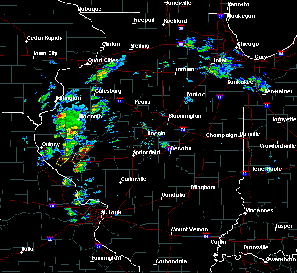 At 258 pm cst, a severe thunderstorm was located 8 miles west of littleton, or 14 miles northwest of rushville, moving northeast at 30 mph (radar indicated). Hazards include 60 mph wind gusts and quarter size hail. Hail damage to vehicles is expected. Expect wind damage to roofs, siding, and trees. At 258 pm cst, a severe thunderstorm was located 8 miles west of littleton, or 14 miles northwest of rushville, moving northeast at 30 mph (radar indicated). Hazards include 60 mph wind gusts and quarter size hail. Hail damage to vehicles is expected. Expect wind damage to roofs, siding, and trees.
|
| 12/1/2018 2:50 PM CST |
 At 249 pm cst, a severe thunderstorm was located 7 miles east of augusta, or 14 miles west of rushville, moving northeast at 30 mph (radar indicated). Hazards include 60 mph wind gusts and quarter size hail. Hail damage to vehicles is expected. expect wind damage to roofs, siding, and trees. locations impacted include, huntsville, camden and weinberg king state park. A tornado watch remains in effect until 700 pm cst for west central illinois. At 249 pm cst, a severe thunderstorm was located 7 miles east of augusta, or 14 miles west of rushville, moving northeast at 30 mph (radar indicated). Hazards include 60 mph wind gusts and quarter size hail. Hail damage to vehicles is expected. expect wind damage to roofs, siding, and trees. locations impacted include, huntsville, camden and weinberg king state park. A tornado watch remains in effect until 700 pm cst for west central illinois.
|
| 12/1/2018 2:21 PM CST |
 At 220 pm cst, a severe thunderstorm was located over clayton, or 14 miles east of quincy regional airport, moving northeast at 30 mph (radar indicated). Hazards include 60 mph wind gusts and quarter size hail. Hail damage to vehicles is expected. Expect wind damage to roofs, siding, and trees. At 220 pm cst, a severe thunderstorm was located over clayton, or 14 miles east of quincy regional airport, moving northeast at 30 mph (radar indicated). Hazards include 60 mph wind gusts and quarter size hail. Hail damage to vehicles is expected. Expect wind damage to roofs, siding, and trees.
|
| 8/28/2018 9:01 PM CDT |
 At 850 pm cdt, severe thunderstorms were located along a line extending from near mediapolis to 7 miles north of canton, moving east at 40 mph (radar indicated). Hazards include 60 mph wind gusts and penny size hail. expect damage to roofs, siding, and trees At 850 pm cdt, severe thunderstorms were located along a line extending from near mediapolis to 7 miles north of canton, moving east at 40 mph (radar indicated). Hazards include 60 mph wind gusts and penny size hail. expect damage to roofs, siding, and trees
|
| 8/28/2018 8:50 PM CDT |
 At 850 pm cdt, severe thunderstorms were located along a line extending from near mediapolis to 7 miles north of canton, moving east at 40 mph (radar indicated). Hazards include 60 mph wind gusts and penny size hail. expect damage to roofs, siding, and trees At 850 pm cdt, severe thunderstorms were located along a line extending from near mediapolis to 7 miles north of canton, moving east at 40 mph (radar indicated). Hazards include 60 mph wind gusts and penny size hail. expect damage to roofs, siding, and trees
|
| 6/28/2018 3:33 PM CDT |
 At 305 pm cdt, severe thunderstorms were located along a line extending from near la harpe to near bowen to near mendon, moving east at 50 mph (radar indicated). Hazards include 70 mph wind gusts. Expect considerable tree damage. Damage is likely to mobile homes, roofs, and outbuildings. At 305 pm cdt, severe thunderstorms were located along a line extending from near la harpe to near bowen to near mendon, moving east at 50 mph (radar indicated). Hazards include 70 mph wind gusts. Expect considerable tree damage. Damage is likely to mobile homes, roofs, and outbuildings.
|
| 6/28/2018 3:21 PM CDT |
 At 319 pm cdt, severe thunderstorms were located along a line extending from near roseville to near macomb to 6 miles southeast of colmar, moving east at 50 mph (radar indicated). Hazards include 60 mph wind gusts. Expect damage to roofs, siding, and trees. Locations impacted include, macomb, bushnell, colchester, stronghurst, blandinsville, industry, good hope, prairie city, bardolph, raritan, tennessee, sciota, western illinois university, fandon, new philadelphia, colmar, adair, walnut grove, plymouth and macomb municipal airport. At 319 pm cdt, severe thunderstorms were located along a line extending from near roseville to near macomb to 6 miles southeast of colmar, moving east at 50 mph (radar indicated). Hazards include 60 mph wind gusts. Expect damage to roofs, siding, and trees. Locations impacted include, macomb, bushnell, colchester, stronghurst, blandinsville, industry, good hope, prairie city, bardolph, raritan, tennessee, sciota, western illinois university, fandon, new philadelphia, colmar, adair, walnut grove, plymouth and macomb municipal airport.
|
| 6/28/2018 3:08 PM CDT |
 At 308 pm cdt, severe thunderstorms were located along a line extending from near blandinsville to near bowen, moving east at 45 mph (radar indicated). Hazards include 60 mph wind gusts and penny size hail. expect damage to roofs, siding, and trees At 308 pm cdt, severe thunderstorms were located along a line extending from near blandinsville to near bowen, moving east at 45 mph (radar indicated). Hazards include 60 mph wind gusts and penny size hail. expect damage to roofs, siding, and trees
|
| 6/28/2018 3:06 PM CDT |
 At 305 pm cdt, severe thunderstorms were located along a line extending from near la harpe to near bowen to near mendon, moving east at 50 mph (radar indicated). Hazards include 70 mph wind gusts. Expect considerable tree damage. Damage is likely to mobile homes, roofs, and outbuildings. At 305 pm cdt, severe thunderstorms were located along a line extending from near la harpe to near bowen to near mendon, moving east at 50 mph (radar indicated). Hazards include 70 mph wind gusts. Expect considerable tree damage. Damage is likely to mobile homes, roofs, and outbuildings.
|
| 6/28/2018 2:53 PM CDT |
 At 253 pm cdt, severe thunderstorms were located along a line extending from gulf port to disco to near mendon, moving east at 50 mph (radar indicated). Hazards include 60 mph wind gusts. Expect damage to roofs, siding, and trees. Locations impacted include, burlington, fort madison, keokuk, carthage, nauvoo, west burlington, hamilton, warsaw, la harpe, dallas city, danville, montrose, stronghurst, bowen, middletown, carman, terre haute, west point, ferris and gulf port. At 253 pm cdt, severe thunderstorms were located along a line extending from gulf port to disco to near mendon, moving east at 50 mph (radar indicated). Hazards include 60 mph wind gusts. Expect damage to roofs, siding, and trees. Locations impacted include, burlington, fort madison, keokuk, carthage, nauvoo, west burlington, hamilton, warsaw, la harpe, dallas city, danville, montrose, stronghurst, bowen, middletown, carman, terre haute, west point, ferris and gulf port.
|
| 6/28/2018 2:29 PM CDT |
 At 227 pm cdt, severe thunderstorms were located along a line extending from near lowell to near wayland to near colony, moving southeast at 50 mph (radar indicated). Hazards include 60 mph wind gusts and penny size hail. expect damage to roofs, siding, and trees At 227 pm cdt, severe thunderstorms were located along a line extending from near lowell to near wayland to near colony, moving southeast at 50 mph (radar indicated). Hazards include 60 mph wind gusts and penny size hail. expect damage to roofs, siding, and trees
|
| 6/14/2018 1:24 PM CDT |
 At 124 pm cdt, a severe thunderstorm was located near carthage, moving southeast at 50 mph (radar indicated). Hazards include 60 mph wind gusts and quarter size hail. Hail damage to vehicles is expected. expect wind damage to roofs, siding, and trees. Locations impacted include, keokuk, carthage, hamilton, warsaw, dallas city, augusta, bowen, west point, ferris, colusa, adrian, burnside, plymouth, denver, fountain green, elvaston, basco, bentley, tioga and sutter. At 124 pm cdt, a severe thunderstorm was located near carthage, moving southeast at 50 mph (radar indicated). Hazards include 60 mph wind gusts and quarter size hail. Hail damage to vehicles is expected. expect wind damage to roofs, siding, and trees. Locations impacted include, keokuk, carthage, hamilton, warsaw, dallas city, augusta, bowen, west point, ferris, colusa, adrian, burnside, plymouth, denver, fountain green, elvaston, basco, bentley, tioga and sutter.
|
| 6/14/2018 1:16 PM CDT |
 At 116 pm cdt, a severe thunderstorm was located near hamilton, or near keokuk, moving southeast at 45 mph (radar indicated). Hazards include 60 mph wind gusts and quarter size hail. Hail damage to vehicles is expected. expect wind damage to roofs, siding, and trees. Locations impacted include, fort madison, keokuk, carthage, nauvoo, hamilton, warsaw, dallas city, augusta, bowen, west point, ferris, colusa, adrian, burnside, niota, plymouth, denver, fountain green, elvaston and pontoosuc. At 116 pm cdt, a severe thunderstorm was located near hamilton, or near keokuk, moving southeast at 45 mph (radar indicated). Hazards include 60 mph wind gusts and quarter size hail. Hail damage to vehicles is expected. expect wind damage to roofs, siding, and trees. Locations impacted include, fort madison, keokuk, carthage, nauvoo, hamilton, warsaw, dallas city, augusta, bowen, west point, ferris, colusa, adrian, burnside, niota, plymouth, denver, fountain green, elvaston and pontoosuc.
|
| 6/14/2018 1:06 PM CDT |
 At 106 pm cdt, a severe thunderstorm was located near keokuk, moving southeast at 55 mph (trained weather spotters). Hazards include 60 mph wind gusts and quarter size hail. Hail damage to vehicles is expected. expect wind damage to roofs, siding, and trees. Locations impacted include, fort madison, keokuk, carthage, nauvoo, hamilton, warsaw, dallas city, augusta, bowen, west point, ferris, colusa, adrian, burnside, niota, plymouth, denver, fountain green, elvaston and pontoosuc. At 106 pm cdt, a severe thunderstorm was located near keokuk, moving southeast at 55 mph (trained weather spotters). Hazards include 60 mph wind gusts and quarter size hail. Hail damage to vehicles is expected. expect wind damage to roofs, siding, and trees. Locations impacted include, fort madison, keokuk, carthage, nauvoo, hamilton, warsaw, dallas city, augusta, bowen, west point, ferris, colusa, adrian, burnside, niota, plymouth, denver, fountain green, elvaston and pontoosuc.
|
| 6/14/2018 1:03 PM CDT |
 At 102 pm cdt, a severe thunderstorm was located over montrose, or near nauvoo, moving southeast at 45 mph (trained weather spotters). Hazards include 60 mph wind gusts and quarter size hail. Hail damage to vehicles is expected. Expect wind damage to roofs, siding, and trees. At 102 pm cdt, a severe thunderstorm was located over montrose, or near nauvoo, moving southeast at 45 mph (trained weather spotters). Hazards include 60 mph wind gusts and quarter size hail. Hail damage to vehicles is expected. Expect wind damage to roofs, siding, and trees.
|
| 6/9/2018 11:20 AM CDT | Numerous trees reported down throughout cit in schuyler county IL, 8.9 miles WNW of Plymouth, IL |
| 5/26/2018 5:02 PM CDT |
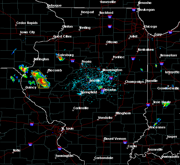 At 501 pm cdt, a severe thunderstorm was located 1 miles east of augusta, or 17 miles west of rushville, moving south at 10 mph (trained weather spotters). Hazards include 60 mph wind gusts and quarter size hail. Hail damage to vehicles is expected. expect wind damage to roofs, siding, and trees. Locations impacted include, huntsville, camden and weinberg king state park. At 501 pm cdt, a severe thunderstorm was located 1 miles east of augusta, or 17 miles west of rushville, moving south at 10 mph (trained weather spotters). Hazards include 60 mph wind gusts and quarter size hail. Hail damage to vehicles is expected. expect wind damage to roofs, siding, and trees. Locations impacted include, huntsville, camden and weinberg king state park.
|
| 5/26/2018 5:00 PM CDT |
 At 458 pm cdt, a severe thunderstorm was located over augusta, or 15 miles southeast of carthage, and is nearly stationary (radar indicated). Hazards include 60 mph wind gusts and quarter size hail. Hail damage to vehicles is expected. expect wind damage to roofs, siding, and trees. Locations impacted include, carthage, augusta, ferris, tennessee, colmar, plymouth, fountain green, bentley, webster and hancock county fairgrounds. At 458 pm cdt, a severe thunderstorm was located over augusta, or 15 miles southeast of carthage, and is nearly stationary (radar indicated). Hazards include 60 mph wind gusts and quarter size hail. Hail damage to vehicles is expected. expect wind damage to roofs, siding, and trees. Locations impacted include, carthage, augusta, ferris, tennessee, colmar, plymouth, fountain green, bentley, webster and hancock county fairgrounds.
|
| 5/26/2018 4:42 PM CDT |
 At 441 pm cdt, a severe thunderstorm was located near colmar, or 12 miles southeast of carthage, and is nearly stationary (trained weather spotters). Hazards include 60 mph wind gusts and quarter size hail. Hail damage to vehicles is expected. Expect wind damage to roofs, siding, and trees. At 441 pm cdt, a severe thunderstorm was located near colmar, or 12 miles southeast of carthage, and is nearly stationary (trained weather spotters). Hazards include 60 mph wind gusts and quarter size hail. Hail damage to vehicles is expected. Expect wind damage to roofs, siding, and trees.
|
| 5/26/2018 4:40 PM CDT |
 At 438 pm cdt, a severe thunderstorm was located 1 miles west of camden, with another severe thunderstorm 7 miles northwest of huntsville in western schuyler county. the thunderstorms were moving to the southeast at 10 mph (radar indicated). Hazards include 60 mph wind gusts and quarter size hail. Hail damage to vehicles is expected. expect wind damage to roofs, siding, and trees. Locations impacted include, huntsville, camden and weinberg king state park. At 438 pm cdt, a severe thunderstorm was located 1 miles west of camden, with another severe thunderstorm 7 miles northwest of huntsville in western schuyler county. the thunderstorms were moving to the southeast at 10 mph (radar indicated). Hazards include 60 mph wind gusts and quarter size hail. Hail damage to vehicles is expected. expect wind damage to roofs, siding, and trees. Locations impacted include, huntsville, camden and weinberg king state park.
|
| 5/26/2018 4:32 PM CDT | Quarter sized hail reported 4.2 miles SSE of Plymouth, IL, penny to quarter sized hail covering the road. |
| 5/26/2018 4:27 PM CDT |
 At 426 pm cdt, a severe thunderstorm was located near colmar, or 12 miles southeast of carthage, and is nearly stationary (radar indicated). Hazards include 60 mph wind gusts and quarter size hail. Hail damage to vehicles is expected. expect wind damage to roofs, siding, and trees. Locations impacted include, carthage, augusta, tennessee, fandon, colmar, plymouth, fountain green, webster and hancock county fairgrounds. At 426 pm cdt, a severe thunderstorm was located near colmar, or 12 miles southeast of carthage, and is nearly stationary (radar indicated). Hazards include 60 mph wind gusts and quarter size hail. Hail damage to vehicles is expected. expect wind damage to roofs, siding, and trees. Locations impacted include, carthage, augusta, tennessee, fandon, colmar, plymouth, fountain green, webster and hancock county fairgrounds.
|
| 5/26/2018 4:25 PM CDT | Quarter sized hail reported 0.7 miles E of Plymouth, IL, delayed report. |
| 5/26/2018 4:25 PM CDT | Quarter sized hail reported 1.2 miles E of Plymouth, IL, quarter size hail 0.5 miles west of plymouth. |
| 5/26/2018 4:23 PM CDT | Quarter sized hail reported 4.1 miles S of Plymouth, IL, pea to quarter size hail for 3 to 5 minutes. |
| 5/26/2018 4:22 PM CDT |
 At 421 pm cdt, a severe thunderstorm was located over augusta, or 16 miles southeast of carthage, moving southeast at 10 mph (radar indicated). Hazards include 60 mph wind gusts and quarter size hail. Hail damage to vehicles is expected. Expect wind damage to roofs, siding, and trees. At 421 pm cdt, a severe thunderstorm was located over augusta, or 16 miles southeast of carthage, moving southeast at 10 mph (radar indicated). Hazards include 60 mph wind gusts and quarter size hail. Hail damage to vehicles is expected. Expect wind damage to roofs, siding, and trees.
|
| 5/26/2018 4:13 PM CDT |
 At 412 pm cdt, a severe thunderstorm was located 7 miles northwest of colmar, or 7 miles east of carthage, moving southeast at 5 mph (radar indicated). Hazards include 60 mph wind gusts and quarter size hail. Hail damage to vehicles is expected. expect wind damage to roofs, siding, and trees. Locations impacted include, carthage, augusta, tennessee, fandon, colmar, plymouth, fountain green, webster and hancock county fairgrounds. At 412 pm cdt, a severe thunderstorm was located 7 miles northwest of colmar, or 7 miles east of carthage, moving southeast at 5 mph (radar indicated). Hazards include 60 mph wind gusts and quarter size hail. Hail damage to vehicles is expected. expect wind damage to roofs, siding, and trees. Locations impacted include, carthage, augusta, tennessee, fandon, colmar, plymouth, fountain green, webster and hancock county fairgrounds.
|
| 5/26/2018 3:59 PM CDT |
 At 358 pm cdt, a severe thunderstorm was located near carthage, moving southeast at 10 mph (radar indicated). Hazards include quarter size hail. damage to vehicles is expected At 358 pm cdt, a severe thunderstorm was located near carthage, moving southeast at 10 mph (radar indicated). Hazards include quarter size hail. damage to vehicles is expected
|
| 10/14/2017 8:34 PM CDT |
 At 834 pm cdt, severe thunderstorms were located along a line extending from near roseville to 6 miles north of good hope to near tennessee, moving east at 60 mph (radar indicated). Hazards include 60 mph wind gusts. Expect damage to roofs, siding, and trees. locations impacted include, macomb, carthage, bushnell, colchester, roseville, avon, blandinsville, industry, good hope, prairie city, bardolph, raritan, tennessee, sciota, western illinois university, fandon, little swan lake, new philadelphia, colmar and adair. A tornado watch remains in effect until 100 am cdt for west central illinois. At 834 pm cdt, severe thunderstorms were located along a line extending from near roseville to 6 miles north of good hope to near tennessee, moving east at 60 mph (radar indicated). Hazards include 60 mph wind gusts. Expect damage to roofs, siding, and trees. locations impacted include, macomb, carthage, bushnell, colchester, roseville, avon, blandinsville, industry, good hope, prairie city, bardolph, raritan, tennessee, sciota, western illinois university, fandon, little swan lake, new philadelphia, colmar and adair. A tornado watch remains in effect until 100 am cdt for west central illinois.
|
| 10/14/2017 8:23 PM CDT |
 At 823 pm cdt, severe thunderstorms were located along a line extending from near stronghurst to near blandinsville to near colmar, moving east at 60 mph (radar indicated). Hazards include 60 mph wind gusts and quarter size hail. Hail damage to vehicles is expected. expect wind damage to roofs, siding, and trees. locations impacted include, macomb, carthage, bushnell, colchester, la harpe, roseville, avon, blandinsville, industry, good hope, prairie city, terre haute, bardolph, raritan, tennessee, sciota, western illinois university, fandon, little swan lake and new philadelphia. A tornado watch remains in effect until 100 am cdt for west central illinois. At 823 pm cdt, severe thunderstorms were located along a line extending from near stronghurst to near blandinsville to near colmar, moving east at 60 mph (radar indicated). Hazards include 60 mph wind gusts and quarter size hail. Hail damage to vehicles is expected. expect wind damage to roofs, siding, and trees. locations impacted include, macomb, carthage, bushnell, colchester, la harpe, roseville, avon, blandinsville, industry, good hope, prairie city, terre haute, bardolph, raritan, tennessee, sciota, western illinois university, fandon, little swan lake and new philadelphia. A tornado watch remains in effect until 100 am cdt for west central illinois.
|
| 10/14/2017 8:16 PM CDT |
 At 816 pm cdt, severe thunderstorms were located along a line extending from terre haute to la harpe to near bowen, moving east at 60 mph (radar indicated). Hazards include 60 mph wind gusts and quarter size hail. Hail damage to vehicles is expected. expect wind damage to roofs, siding, and trees. locations impacted include, macomb, carthage, bushnell, colchester, la harpe, roseville, dallas city, avon, blandinsville, augusta, bowen, industry, good hope, prairie city, terre haute, bardolph, west point, ferris, raritan and tennessee. A tornado watch remains in effect until 100 am cdt for west central illinois, and southeastern iowa. At 816 pm cdt, severe thunderstorms were located along a line extending from terre haute to la harpe to near bowen, moving east at 60 mph (radar indicated). Hazards include 60 mph wind gusts and quarter size hail. Hail damage to vehicles is expected. expect wind damage to roofs, siding, and trees. locations impacted include, macomb, carthage, bushnell, colchester, la harpe, roseville, dallas city, avon, blandinsville, augusta, bowen, industry, good hope, prairie city, terre haute, bardolph, west point, ferris, raritan and tennessee. A tornado watch remains in effect until 100 am cdt for west central illinois, and southeastern iowa.
|
| 10/14/2017 8:09 PM CDT |
 At 809 pm cdt, severe thunderstorms were located along a line extending from near dallas city to near west point, moving east at 60 mph (radar indicated). Hazards include 60 mph wind gusts and quarter size hail. Hail damage to vehicles is expected. expect wind damage to roofs, siding, and trees. locations impacted include, macomb, fort madison, keokuk, carthage, nauvoo, bushnell, hamilton, warsaw, colchester, la harpe, roseville, dallas city, avon, blandinsville, augusta, bowen, industry, good hope, prairie city and terre haute. A tornado watch remains in effect until 100 am cdt for west central illinois, southeastern iowa, and northeastern missouri. At 809 pm cdt, severe thunderstorms were located along a line extending from near dallas city to near west point, moving east at 60 mph (radar indicated). Hazards include 60 mph wind gusts and quarter size hail. Hail damage to vehicles is expected. expect wind damage to roofs, siding, and trees. locations impacted include, macomb, fort madison, keokuk, carthage, nauvoo, bushnell, hamilton, warsaw, colchester, la harpe, roseville, dallas city, avon, blandinsville, augusta, bowen, industry, good hope, prairie city and terre haute. A tornado watch remains in effect until 100 am cdt for west central illinois, southeastern iowa, and northeastern missouri.
|
| 10/14/2017 7:58 PM CDT |
 At 758 pm cdt, severe thunderstorms were located along a line extending from niota to 8 miles south of warsaw, moving east at 60 mph (radar indicated). Hazards include 60 mph wind gusts and quarter size hail. Hail damage to vehicles is expected. Expect wind damage to roofs, siding, and trees. At 758 pm cdt, severe thunderstorms were located along a line extending from niota to 8 miles south of warsaw, moving east at 60 mph (radar indicated). Hazards include 60 mph wind gusts and quarter size hail. Hail damage to vehicles is expected. Expect wind damage to roofs, siding, and trees.
|
| 10/14/2017 6:52 PM CDT |
 The tornado warning for northwestern schuyler county will expire at 700 pm cdt, the storm which prompted the warning has weakened below severe limits, and no longer appears capable of producing a tornado. therefore the warning will be allowed to expire. however small hail and gusty winds are still possible with this thunderstorm. a tornado watch remains in effect until 100 am cdt for west central illinois. The tornado warning for northwestern schuyler county will expire at 700 pm cdt, the storm which prompted the warning has weakened below severe limits, and no longer appears capable of producing a tornado. therefore the warning will be allowed to expire. however small hail and gusty winds are still possible with this thunderstorm. a tornado watch remains in effect until 100 am cdt for west central illinois.
|
| 10/14/2017 6:46 PM CDT |
 At 632 pm cdt, a severe thunderstorm capable of producing a tornado was located over augusta, or 15 miles southeast of carthage, moving east at 55 mph (radar indicated rotation). Hazards include tornado and quarter size hail. Flying debris will be dangerous to those caught without shelter. mobile homes will be damaged or destroyed. damage to roofs, windows, and vehicles will occur. tree damage is likely. this dangerous storm will be near, littleton around 650 pm cdt. Other locations impacted by this tornadic thunderstorm include huntsville, ray and weinberg king state park. At 632 pm cdt, a severe thunderstorm capable of producing a tornado was located over augusta, or 15 miles southeast of carthage, moving east at 55 mph (radar indicated rotation). Hazards include tornado and quarter size hail. Flying debris will be dangerous to those caught without shelter. mobile homes will be damaged or destroyed. damage to roofs, windows, and vehicles will occur. tree damage is likely. this dangerous storm will be near, littleton around 650 pm cdt. Other locations impacted by this tornadic thunderstorm include huntsville, ray and weinberg king state park.
|
| 10/14/2017 6:37 PM CDT |
 At 637 pm cdt, a severe thunderstorm capable of producing a tornado was located near augusta, or 18 miles northwest of rushville, moving east at 55 mph (radar indicated rotation). Hazards include tornado and half dollar size hail. Flying debris will be dangerous to those caught without shelter. mobile homes will be damaged or destroyed. damage to roofs, windows, and vehicles will occur. tree damage is likely. This tornadic thunderstorm will remain over mainly rural areas of southeastern hancock county, including the following locations: hancock county fairgrounds and plymouth. At 637 pm cdt, a severe thunderstorm capable of producing a tornado was located near augusta, or 18 miles northwest of rushville, moving east at 55 mph (radar indicated rotation). Hazards include tornado and half dollar size hail. Flying debris will be dangerous to those caught without shelter. mobile homes will be damaged or destroyed. damage to roofs, windows, and vehicles will occur. tree damage is likely. This tornadic thunderstorm will remain over mainly rural areas of southeastern hancock county, including the following locations: hancock county fairgrounds and plymouth.
|
| 10/14/2017 6:33 PM CDT |
 At 632 pm cdt, a severe thunderstorm capable of producing a tornado was located over augusta, or 15 miles southeast of carthage, moving east at 55 mph (radar indicated rotation). Hazards include tornado and quarter size hail. Flying debris will be dangerous to those caught without shelter. mobile homes will be damaged or destroyed. damage to roofs, windows, and vehicles will occur. tree damage is likely. this dangerous storm will be near, littleton around 650 pm cdt. Other locations impacted by this tornadic thunderstorm include huntsville, ray and weinberg king state park. At 632 pm cdt, a severe thunderstorm capable of producing a tornado was located over augusta, or 15 miles southeast of carthage, moving east at 55 mph (radar indicated rotation). Hazards include tornado and quarter size hail. Flying debris will be dangerous to those caught without shelter. mobile homes will be damaged or destroyed. damage to roofs, windows, and vehicles will occur. tree damage is likely. this dangerous storm will be near, littleton around 650 pm cdt. Other locations impacted by this tornadic thunderstorm include huntsville, ray and weinberg king state park.
|
| 10/14/2017 6:30 PM CDT |
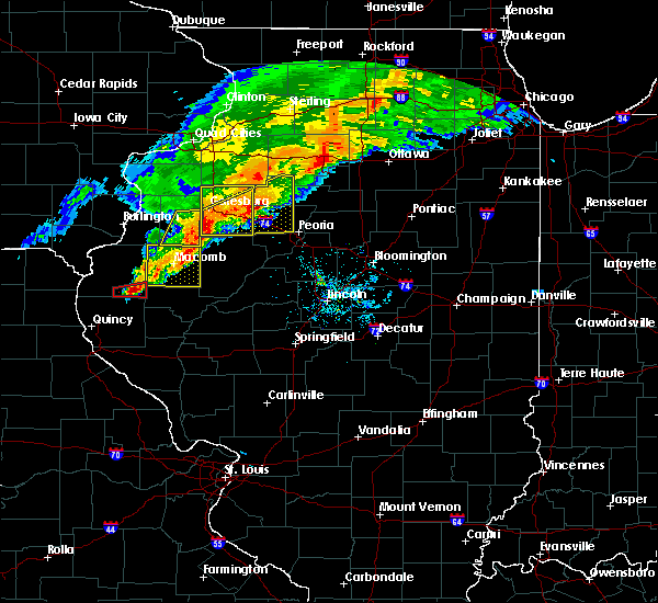 At 630 pm cdt, a severe thunderstorm capable of producing a tornado was located over augusta, or 15 miles southeast of carthage, moving east at 55 mph (radar indicated rotation). Hazards include tornado and half dollar size hail. Flying debris will be dangerous to those caught without shelter. mobile homes will be damaged or destroyed. damage to roofs, windows, and vehicles will occur. tree damage is likely. This tornadic thunderstorm will remain over mainly rural areas of southeastern hancock county, including the following locations: hancock county fairgrounds, stillwell, plymouth and denver. At 630 pm cdt, a severe thunderstorm capable of producing a tornado was located over augusta, or 15 miles southeast of carthage, moving east at 55 mph (radar indicated rotation). Hazards include tornado and half dollar size hail. Flying debris will be dangerous to those caught without shelter. mobile homes will be damaged or destroyed. damage to roofs, windows, and vehicles will occur. tree damage is likely. This tornadic thunderstorm will remain over mainly rural areas of southeastern hancock county, including the following locations: hancock county fairgrounds, stillwell, plymouth and denver.
|
| 10/14/2017 6:25 PM CDT |
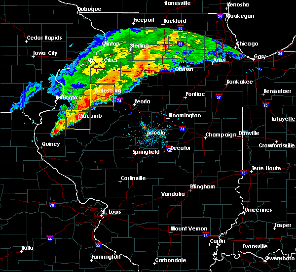 At 625 pm cdt, a severe thunderstorm capable of producing a tornado was located over bowen, or 14 miles south of carthage, moving east at 60 mph (radar indicated rotation). Hazards include tornado. Flying debris will be dangerous to those caught without shelter. mobile homes will be damaged or destroyed. damage to roofs, windows, and vehicles will occur. tree damage is likely. this dangerous storm will be near, augusta around 630 pm cdt. Other locations impacted by this tornadic thunderstorm include hancock county fairgrounds, stillwell, plymouth and denver. At 625 pm cdt, a severe thunderstorm capable of producing a tornado was located over bowen, or 14 miles south of carthage, moving east at 60 mph (radar indicated rotation). Hazards include tornado. Flying debris will be dangerous to those caught without shelter. mobile homes will be damaged or destroyed. damage to roofs, windows, and vehicles will occur. tree damage is likely. this dangerous storm will be near, augusta around 630 pm cdt. Other locations impacted by this tornadic thunderstorm include hancock county fairgrounds, stillwell, plymouth and denver.
|
| 10/14/2017 6:19 PM CDT |
 At 619 pm cdt, severe thunderstorms were located along a line extending from near galesburg to macomb to near colmar, moving east at 65 mph (radar indicated). Hazards include 60 mph wind gusts and nickel size hail. Expect damage to roofs, siding, and trees. locations impacted include, macomb, bushnell, colchester, blandinsville, industry, good hope, prairie city, bardolph, tennessee, sciota, western illinois university, adair, fandon, new philadelphia, colmar, walnut grove, plymouth, pennington point, macomb municipal airport and scottsburg. If you are at western illinois campus and stadium you should seek safe shelter immediately! a tornado watch remains in effect until 100 am cdt for west central illinois. At 619 pm cdt, severe thunderstorms were located along a line extending from near galesburg to macomb to near colmar, moving east at 65 mph (radar indicated). Hazards include 60 mph wind gusts and nickel size hail. Expect damage to roofs, siding, and trees. locations impacted include, macomb, bushnell, colchester, blandinsville, industry, good hope, prairie city, bardolph, tennessee, sciota, western illinois university, adair, fandon, new philadelphia, colmar, walnut grove, plymouth, pennington point, macomb municipal airport and scottsburg. If you are at western illinois campus and stadium you should seek safe shelter immediately! a tornado watch remains in effect until 100 am cdt for west central illinois.
|
| 10/14/2017 5:51 PM CDT |
 At 550 pm cdt, severe thunderstorms were located along a line extending from near dallas city to near carthage to 7 miles northeast of canton, moving east at 55 mph (radar indicated). Hazards include 60 mph wind gusts and quarter size hail. Hail damage to vehicles is expected. Expect wind damage to roofs, siding, and trees. At 550 pm cdt, severe thunderstorms were located along a line extending from near dallas city to near carthage to 7 miles northeast of canton, moving east at 55 mph (radar indicated). Hazards include 60 mph wind gusts and quarter size hail. Hail damage to vehicles is expected. Expect wind damage to roofs, siding, and trees.
|
| 10/14/2017 5:43 PM CDT |
 At 543 pm cdt, a severe thunderstorm was located near ferris, or near carthage, moving east at 65 mph (law enforcement). Hazards include 60 mph wind gusts. Expect damage to roofs, siding, and trees. locations impacted include, fort madison, keokuk, carthage, kahoka, nauvoo, hamilton, warsaw, la harpe, dallas city, montrose, augusta, wayland, bowen, west point, alexandria, ferris, colusa, niota, disco and st. francisville. A tornado watch remains in effect until 100 am cdt for west central illinois, southeastern iowa, and northeastern missouri. At 543 pm cdt, a severe thunderstorm was located near ferris, or near carthage, moving east at 65 mph (law enforcement). Hazards include 60 mph wind gusts. Expect damage to roofs, siding, and trees. locations impacted include, fort madison, keokuk, carthage, kahoka, nauvoo, hamilton, warsaw, la harpe, dallas city, montrose, augusta, wayland, bowen, west point, alexandria, ferris, colusa, niota, disco and st. francisville. A tornado watch remains in effect until 100 am cdt for west central illinois, southeastern iowa, and northeastern missouri.
|
| 10/14/2017 5:42 PM CDT |
 At 542 pm cdt, a severe thunderstorm capable of producing a tornado was located near hamilton, or near keokuk, moving east at 55 mph (radar indicated rotation). Hazards include tornado. Flying debris will be dangerous to those caught without shelter. mobile homes will be damaged or destroyed. damage to roofs, windows, and vehicles will occur. tree damage is likely. this dangerous storm will be near, ferris and adrian around 550 pm cdt. carthage and burnside around 555 pm cdt. Other locations impacted by this tornadic thunderstorm include keokuk airport, plymouth, elvaston, bentley, summitville, basco, mooar, webster, fountain green and chatfield park. At 542 pm cdt, a severe thunderstorm capable of producing a tornado was located near hamilton, or near keokuk, moving east at 55 mph (radar indicated rotation). Hazards include tornado. Flying debris will be dangerous to those caught without shelter. mobile homes will be damaged or destroyed. damage to roofs, windows, and vehicles will occur. tree damage is likely. this dangerous storm will be near, ferris and adrian around 550 pm cdt. carthage and burnside around 555 pm cdt. Other locations impacted by this tornadic thunderstorm include keokuk airport, plymouth, elvaston, bentley, summitville, basco, mooar, webster, fountain green and chatfield park.
|
| 10/14/2017 5:31 PM CDT |
 At 531 pm cdt, a severe thunderstorm capable of producing a tornado was located near wayland, or near keokuk, moving east at 55 mph (radar indicated rotation). Hazards include tornado. Flying debris will be dangerous to those caught without shelter. mobile homes will be damaged or destroyed. damage to roofs, windows, and vehicles will occur. tree damage is likely. this dangerous storm will be near, warsaw around 535 pm cdt. keokuk and hamilton around 540 pm cdt. ferris and adrian around 550 pm cdt. carthage and burnside around 555 pm cdt. Other locations impacted by this tornadic thunderstorm include keokuk airport, plymouth, elvaston, bentley, summitville, basco, mooar, webster, vincennes and fountain green. At 531 pm cdt, a severe thunderstorm capable of producing a tornado was located near wayland, or near keokuk, moving east at 55 mph (radar indicated rotation). Hazards include tornado. Flying debris will be dangerous to those caught without shelter. mobile homes will be damaged or destroyed. damage to roofs, windows, and vehicles will occur. tree damage is likely. this dangerous storm will be near, warsaw around 535 pm cdt. keokuk and hamilton around 540 pm cdt. ferris and adrian around 550 pm cdt. carthage and burnside around 555 pm cdt. Other locations impacted by this tornadic thunderstorm include keokuk airport, plymouth, elvaston, bentley, summitville, basco, mooar, webster, vincennes and fountain green.
|
| 10/14/2017 5:17 PM CDT |
 At 517 pm cdt, a severe thunderstorm was located near kahoka, moving east at 70 mph (law enforcement). Hazards include 60 mph wind gusts. expect damage to roofs, siding, and trees At 517 pm cdt, a severe thunderstorm was located near kahoka, moving east at 70 mph (law enforcement). Hazards include 60 mph wind gusts. expect damage to roofs, siding, and trees
|
| 8/10/2017 6:42 PM CDT |
 At 641 pm cdt, severe thunderstorms were located along a line extending from near little swan lake to tennessee to near west point, moving southeast at 35 mph (trained weather spotters). Hazards include 60 mph wind gusts and nickel size hail. Expect damage to roofs, siding, and trees. Locations impacted include, macomb, carthage, bushnell, hamilton, warsaw, colchester, avon, blandinsville, augusta, bowen, industry, good hope, prairie city, bardolph, west point, tennessee, sciota, western illinois university, fandon and little swan lake. At 641 pm cdt, severe thunderstorms were located along a line extending from near little swan lake to tennessee to near west point, moving southeast at 35 mph (trained weather spotters). Hazards include 60 mph wind gusts and nickel size hail. Expect damage to roofs, siding, and trees. Locations impacted include, macomb, carthage, bushnell, hamilton, warsaw, colchester, avon, blandinsville, augusta, bowen, industry, good hope, prairie city, bardolph, west point, tennessee, sciota, western illinois university, fandon and little swan lake.
|
| 8/10/2017 6:32 PM CDT |
 At 631 pm cdt, severe thunderstorms were located along a line extending from near roseville to near west point, moving southeast at 35 mph (trained weather spotters reported wind damage in nauvoo around 602 pm). Hazards include 60 mph wind gusts and nickel size hail. Expect damage to roofs, siding, and trees. Locations impacted include, macomb, keokuk, carthage, bushnell, hamilton, warsaw, colchester, la harpe, stronghurst, avon, blandinsville, augusta, bowen, industry, good hope, prairie city, terre haute, bardolph, west point and ferris. At 631 pm cdt, severe thunderstorms were located along a line extending from near roseville to near west point, moving southeast at 35 mph (trained weather spotters reported wind damage in nauvoo around 602 pm). Hazards include 60 mph wind gusts and nickel size hail. Expect damage to roofs, siding, and trees. Locations impacted include, macomb, keokuk, carthage, bushnell, hamilton, warsaw, colchester, la harpe, stronghurst, avon, blandinsville, augusta, bowen, industry, good hope, prairie city, terre haute, bardolph, west point and ferris.
|
| 8/10/2017 6:08 PM CDT |
 At 607 pm cdt, severe thunderstorms were located along a line extending from stronghurst to hamilton, moving southeast at 40 mph (radar indicated). Hazards include 60 mph wind gusts and nickel size hail. Expect damage to roofs, siding, and trees. Locations impacted include, macomb, fort madison, keokuk, carthage, nauvoo, bushnell, hamilton, warsaw, colchester, la harpe, dallas city, stronghurst, avon, blandinsville, augusta, bowen, industry, good hope, prairie city and carman. At 607 pm cdt, severe thunderstorms were located along a line extending from stronghurst to hamilton, moving southeast at 40 mph (radar indicated). Hazards include 60 mph wind gusts and nickel size hail. Expect damage to roofs, siding, and trees. Locations impacted include, macomb, fort madison, keokuk, carthage, nauvoo, bushnell, hamilton, warsaw, colchester, la harpe, dallas city, stronghurst, avon, blandinsville, augusta, bowen, industry, good hope, prairie city and carman.
|
| 8/10/2017 6:04 PM CDT |
 At 604 pm cdt, severe thunderstorms were located along a line extending from stronghurst to hamilton, moving southeast at 40 mph (radar indicated). Hazards include 60 mph wind gusts and nickel size hail. expect damage to roofs, siding, and trees At 604 pm cdt, severe thunderstorms were located along a line extending from stronghurst to hamilton, moving southeast at 40 mph (radar indicated). Hazards include 60 mph wind gusts and nickel size hail. expect damage to roofs, siding, and trees
|
| 6/28/2017 5:39 PM CDT |
 The severe thunderstorm warning for central hancock, southwestern mcdonough and southwestern lee counties will expire at 1045 pm cdt, the storm which prompted the warning has weakened below severe limits, and no longer poses an immediate threat to life or property. therefore the warning will be allowed to expire. however gusty winds are still possible with this thunderstorm. a tornado watch remains in effect until midnight cdt for southeastern iowa, and northeastern missouri. The severe thunderstorm warning for central hancock, southwestern mcdonough and southwestern lee counties will expire at 1045 pm cdt, the storm which prompted the warning has weakened below severe limits, and no longer poses an immediate threat to life or property. therefore the warning will be allowed to expire. however gusty winds are still possible with this thunderstorm. a tornado watch remains in effect until midnight cdt for southeastern iowa, and northeastern missouri.
|
| 6/28/2017 5:28 PM CDT |
 At 1026 pm cdt, a severe thunderstorm was located near hamilton, or near keokuk, moving east at 45 mph (radar indicated). Hazards include 60 mph wind gusts. Expect damage to roofs, siding, and trees. locations impacted include, keokuk, carthage, hamilton, warsaw, colchester, west point, ferris, tennessee, burnside, colmar, adrian, plymouth, denver, fountain green, elvaston, basco, bentley, keokuk airport, galland and sandusky. A tornado watch remains in effect until midnight cdt for southeastern iowa, and northeastern missouri. At 1026 pm cdt, a severe thunderstorm was located near hamilton, or near keokuk, moving east at 45 mph (radar indicated). Hazards include 60 mph wind gusts. Expect damage to roofs, siding, and trees. locations impacted include, keokuk, carthage, hamilton, warsaw, colchester, west point, ferris, tennessee, burnside, colmar, adrian, plymouth, denver, fountain green, elvaston, basco, bentley, keokuk airport, galland and sandusky. A tornado watch remains in effect until midnight cdt for southeastern iowa, and northeastern missouri.
|
| 6/28/2017 5:13 PM CDT |
 At 1013 pm cdt, a severe thunderstorm was located over alexandria, or near keokuk, moving east at 50 mph (radar indicated). Hazards include 60 mph wind gusts. Expect damage to roofs, siding, and trees. locations impacted include, keokuk, carthage, hamilton, warsaw, colchester, wayland, west point, alexandria, ferris, tennessee, burnside, colmar, st. francisville, adrian, winchester, plymouth, denver, fountain green, elvaston and basco. A tornado watch remains in effect until midnight cdt for southeastern iowa, and northeastern missouri. At 1013 pm cdt, a severe thunderstorm was located over alexandria, or near keokuk, moving east at 50 mph (radar indicated). Hazards include 60 mph wind gusts. Expect damage to roofs, siding, and trees. locations impacted include, keokuk, carthage, hamilton, warsaw, colchester, wayland, west point, alexandria, ferris, tennessee, burnside, colmar, st. francisville, adrian, winchester, plymouth, denver, fountain green, elvaston and basco. A tornado watch remains in effect until midnight cdt for southeastern iowa, and northeastern missouri.
|
| 6/28/2017 5:03 PM CDT |
 At 1003 pm cdt, a severe thunderstorm was located over wayland, or near kahoka, moving east at 50 mph (radar indicated). Hazards include 60 mph wind gusts. expect damage to roofs, siding, and trees At 1003 pm cdt, a severe thunderstorm was located over wayland, or near kahoka, moving east at 50 mph (radar indicated). Hazards include 60 mph wind gusts. expect damage to roofs, siding, and trees
|
| 5/26/2017 12:05 PM CDT |
 At 1204 pm cdt, a severe thunderstorm was located over fandon, or 10 miles southwest of macomb, moving east at 55 mph (radar indicated). Hazards include 60 mph wind gusts and quarter size hail. Hail damage to vehicles is expected. expect wind damage to roofs, siding, and trees. Locations impacted include, macomb, bushnell, colchester, industry, bardolph, western illinois university, adair, fandon, new philadelphia, colmar, pennington point, doddsville and mcdonough county 4-h grounds. At 1204 pm cdt, a severe thunderstorm was located over fandon, or 10 miles southwest of macomb, moving east at 55 mph (radar indicated). Hazards include 60 mph wind gusts and quarter size hail. Hail damage to vehicles is expected. expect wind damage to roofs, siding, and trees. Locations impacted include, macomb, bushnell, colchester, industry, bardolph, western illinois university, adair, fandon, new philadelphia, colmar, pennington point, doddsville and mcdonough county 4-h grounds.
|
| 5/26/2017 12:02 PM CDT |
 At 1202 pm cdt, a severe thunderstorm was located near colmar, or 12 miles southwest of macomb, moving east at 55 mph (radar indicated). Hazards include 60 mph wind gusts and quarter size hail. Hail damage to vehicles is expected. expect wind damage to roofs, siding, and trees. Locations impacted include, macomb, bushnell, colchester, industry, bardolph, tennessee, western illinois university, adair, fandon, new philadelphia, colmar, plymouth, pennington point, macomb municipal airport, doddsville, mcdonough county 4-h grounds and argyle lake state park. At 1202 pm cdt, a severe thunderstorm was located near colmar, or 12 miles southwest of macomb, moving east at 55 mph (radar indicated). Hazards include 60 mph wind gusts and quarter size hail. Hail damage to vehicles is expected. expect wind damage to roofs, siding, and trees. Locations impacted include, macomb, bushnell, colchester, industry, bardolph, tennessee, western illinois university, adair, fandon, new philadelphia, colmar, plymouth, pennington point, macomb municipal airport, doddsville, mcdonough county 4-h grounds and argyle lake state park.
|
| 5/26/2017 11:55 AM CDT |
 At 1154 am cdt, a severe thunderstorm was located near augusta, or 12 miles southeast of carthage, moving east at 40 mph (radar indicated). Hazards include 60 mph wind gusts and quarter size hail. Hail damage to vehicles is expected. Expect wind damage to roofs, siding, and trees. At 1154 am cdt, a severe thunderstorm was located near augusta, or 12 miles southeast of carthage, moving east at 40 mph (radar indicated). Hazards include 60 mph wind gusts and quarter size hail. Hail damage to vehicles is expected. Expect wind damage to roofs, siding, and trees.
|
| 3/6/2017 11:12 PM CST |
 At 1109 pm cst, severe thunderstorms were located along a line extending from abingdon to 7 miles west of griggsville, moving east at 60 mph (radar indicated). Hazards include 70 mph wind gusts and quarter size hail. Hail damage to vehicles is expected. expect considerable tree damage. wind damage is also likely to mobile homes, roofs, and outbuildings. locations impacted include, galesburg, canton, beardstown, rushville, lewistown, abingdon, knoxville, farmington, elmwood, princeville, wyoming, cuba, toulon, hanna city, astoria, trivoli, osceola, brimfield, wataga and avon. this includes interstate 74 between mile markers 35 and 82. A tornado watch remains in effect until 400 am cst for central, north central and west central illinois. At 1109 pm cst, severe thunderstorms were located along a line extending from abingdon to 7 miles west of griggsville, moving east at 60 mph (radar indicated). Hazards include 70 mph wind gusts and quarter size hail. Hail damage to vehicles is expected. expect considerable tree damage. wind damage is also likely to mobile homes, roofs, and outbuildings. locations impacted include, galesburg, canton, beardstown, rushville, lewistown, abingdon, knoxville, farmington, elmwood, princeville, wyoming, cuba, toulon, hanna city, astoria, trivoli, osceola, brimfield, wataga and avon. this includes interstate 74 between mile markers 35 and 82. A tornado watch remains in effect until 400 am cst for central, north central and west central illinois.
|
| 3/6/2017 10:58 PM CST |
 At 1058 pm cst, severe thunderstorms were located along a line extending from north henderson to near clayton, moving northeast at 60 mph (radar indicated). Hazards include 70 mph wind gusts and quarter size hail. Hail damage to vehicles is expected. expect considerable tree damage. Wind damage is also likely to mobile homes, roofs, and outbuildings. At 1058 pm cst, severe thunderstorms were located along a line extending from north henderson to near clayton, moving northeast at 60 mph (radar indicated). Hazards include 70 mph wind gusts and quarter size hail. Hail damage to vehicles is expected. expect considerable tree damage. Wind damage is also likely to mobile homes, roofs, and outbuildings.
|
| 3/6/2017 10:49 PM CST |
 At 1049 pm cst, severe thunderstorms were located along a line extending from near kirkwood to near beverly, moving northeast at 60 mph (radar indicated). Hazards include 70 mph wind gusts and quarter size hail. Hail damage to vehicles is expected. expect considerable tree damage. wind damage is also likely to mobile homes, roofs, and outbuildings. locations impacted include, galesburg, canton, rushville, lewistown, abingdon, knoxville, farmington, elmwood, princeville, wyoming, cuba, toulon, hanna city, astoria, trivoli, osceola, brimfield, wataga, avon and bradford. this includes interstate 74 between mile markers 34 and 82. A tornado watch remains in effect until 400 am cst for central, north central and west central illinois. At 1049 pm cst, severe thunderstorms were located along a line extending from near kirkwood to near beverly, moving northeast at 60 mph (radar indicated). Hazards include 70 mph wind gusts and quarter size hail. Hail damage to vehicles is expected. expect considerable tree damage. wind damage is also likely to mobile homes, roofs, and outbuildings. locations impacted include, galesburg, canton, rushville, lewistown, abingdon, knoxville, farmington, elmwood, princeville, wyoming, cuba, toulon, hanna city, astoria, trivoli, osceola, brimfield, wataga, avon and bradford. this includes interstate 74 between mile markers 34 and 82. A tornado watch remains in effect until 400 am cst for central, north central and west central illinois.
|
| 3/6/2017 10:32 PM CST |
 At 1031 pm cst, severe thunderstorms were located along a line extending from near rock island to near stronghurst to near palmyra, moving northeast at 65 mph (radar indicated). Hazards include 70 mph wind gusts and quarter size hail. Hail damage to vehicles is expected. expect considerable tree damage. Wind damage is also likely to mobile homes, roofs, and outbuildings. At 1031 pm cst, severe thunderstorms were located along a line extending from near rock island to near stronghurst to near palmyra, moving northeast at 65 mph (radar indicated). Hazards include 70 mph wind gusts and quarter size hail. Hail damage to vehicles is expected. expect considerable tree damage. Wind damage is also likely to mobile homes, roofs, and outbuildings.
|
| 3/6/2017 10:13 PM CST |
 At 1012 pm cst, severe thunderstorms were located along a line extending from near keithsburg to near denmark to 6 miles northwest of canton, moving east at 60 mph (trained weather spotters. this line of storms has a history of producing damaging winds). Hazards include 70 mph wind gusts. Expect considerable tree damage. Damage is likely to mobile homes, roofs, and outbuildings. At 1012 pm cst, severe thunderstorms were located along a line extending from near keithsburg to near denmark to 6 miles northwest of canton, moving east at 60 mph (trained weather spotters. this line of storms has a history of producing damaging winds). Hazards include 70 mph wind gusts. Expect considerable tree damage. Damage is likely to mobile homes, roofs, and outbuildings.
|
| 7/24/2016 8:59 PM CDT |
 At 859 pm cdt, severe thunderstorms were located along a line extending from raritan to near fandon, moving east at 30 mph (radar indicated). Hazards include 60 mph wind gusts. Expect damage to trees. Locations impacted include, macomb, bushnell, colchester, la harpe, roseville, stronghurst, avon, blandinsville, industry, good hope, prairie city, terre haute, bardolph, raritan, tennessee, sciota, colmar, western illinois university, new philadelphia and adair. At 859 pm cdt, severe thunderstorms were located along a line extending from raritan to near fandon, moving east at 30 mph (radar indicated). Hazards include 60 mph wind gusts. Expect damage to trees. Locations impacted include, macomb, bushnell, colchester, la harpe, roseville, stronghurst, avon, blandinsville, industry, good hope, prairie city, terre haute, bardolph, raritan, tennessee, sciota, colmar, western illinois university, new philadelphia and adair.
|
| 7/24/2016 8:44 PM CDT |
 At 843 pm cdt, severe thunderstorms were located along a line extending from terre haute to near augusta, moving east at 30 mph (radar indicated). Hazards include 60 mph wind gusts. Expect damage to trees. Locations impacted include, macomb, bushnell, colchester, la harpe, roseville, stronghurst, avon, blandinsville, industry, good hope, prairie city, terre haute, bardolph, raritan, tennessee, sciota, colmar, western illinois university, new philadelphia and adair. At 843 pm cdt, severe thunderstorms were located along a line extending from terre haute to near augusta, moving east at 30 mph (radar indicated). Hazards include 60 mph wind gusts. Expect damage to trees. Locations impacted include, macomb, bushnell, colchester, la harpe, roseville, stronghurst, avon, blandinsville, industry, good hope, prairie city, terre haute, bardolph, raritan, tennessee, sciota, colmar, western illinois university, new philadelphia and adair.
|
| 7/24/2016 8:32 PM CDT |
 At 831 pm cdt, severe thunderstorms were located along a line extending from near denmark to 7 miles east of burnside, moving east at 25 mph (radar indicated). Hazards include 60 mph wind gusts. Expect damage to roofs. siding. And trees. At 831 pm cdt, severe thunderstorms were located along a line extending from near denmark to 7 miles east of burnside, moving east at 25 mph (radar indicated). Hazards include 60 mph wind gusts. Expect damage to roofs. siding. And trees.
|
| 7/19/2016 6:23 PM CDT |
 At 623 pm cdt, severe thunderstorms were located along a line extending from near industry to rushville to 7 miles east of mount sterling, moving east at 45 mph (radar indicated). Hazards include 60 mph wind gusts. Expect damage to roofs. siding. and trees. Locations impacted include, rushville, littleton, huntsville, camden, ripley, weinberg king state park, doddsville and ray. At 623 pm cdt, severe thunderstorms were located along a line extending from near industry to rushville to 7 miles east of mount sterling, moving east at 45 mph (radar indicated). Hazards include 60 mph wind gusts. Expect damage to roofs. siding. and trees. Locations impacted include, rushville, littleton, huntsville, camden, ripley, weinberg king state park, doddsville and ray.
|
| 7/19/2016 5:58 PM CDT |
 At 558 pm cdt, severe thunderstorms were located along a line extending from augusta to 6 miles east of golden to near clayton, moving east at 45 mph (radar indicated). Hazards include 60 mph wind gusts. Expect damage to roofs. siding. And trees. At 558 pm cdt, severe thunderstorms were located along a line extending from augusta to 6 miles east of golden to near clayton, moving east at 45 mph (radar indicated). Hazards include 60 mph wind gusts. Expect damage to roofs. siding. And trees.
|
| 7/13/2016 3:20 PM CDT |
 At 319 pm cdt, a severe thunderstorm was located near fandon, or 8 miles south of macomb, moving northeast at 30 mph (radar indicated). Hazards include 60 mph wind gusts. Expect damage to roofs. siding. and trees. this severe storm will be near, industry around 325 pm cdt. macomb around 330 pm cdt. adair around 340 pm cdt. bardolph and new philadelphia around 345 pm cdt. Other locations impacted by this severe thunderstorm include pennington point and plymouth. At 319 pm cdt, a severe thunderstorm was located near fandon, or 8 miles south of macomb, moving northeast at 30 mph (radar indicated). Hazards include 60 mph wind gusts. Expect damage to roofs. siding. and trees. this severe storm will be near, industry around 325 pm cdt. macomb around 330 pm cdt. adair around 340 pm cdt. bardolph and new philadelphia around 345 pm cdt. Other locations impacted by this severe thunderstorm include pennington point and plymouth.
|
| 7/13/2016 3:00 PM CDT |
 At 300 pm cdt, a severe thunderstorm was located over augusta, or 16 miles southeast of carthage, moving northeast at 50 mph (radar indicated). Hazards include 60 mph wind gusts. Expect damage to roofs. siding. and trees. this severe storm will be near, colmar around 310 pm cdt. fandon around 315 pm cdt. industry around 325 pm cdt. macomb around 330 pm cdt. bardolph and adair around 335 pm cdt. bushnell and new philadelphia around 340 pm cdt. Other locations impacted by this severe thunderstorm include doddsville, hancock county fairgrounds, plymouth and pennington point. At 300 pm cdt, a severe thunderstorm was located over augusta, or 16 miles southeast of carthage, moving northeast at 50 mph (radar indicated). Hazards include 60 mph wind gusts. Expect damage to roofs. siding. and trees. this severe storm will be near, colmar around 310 pm cdt. fandon around 315 pm cdt. industry around 325 pm cdt. macomb around 330 pm cdt. bardolph and adair around 335 pm cdt. bushnell and new philadelphia around 340 pm cdt. Other locations impacted by this severe thunderstorm include doddsville, hancock county fairgrounds, plymouth and pennington point.
|
| 7/13/2016 2:50 PM CDT |
 At 250 pm cdt, a severe thunderstorm was located over golden, or 20 miles south of carthage, moving northeast at 80 mph (radar indicated). Hazards include 60 mph wind gusts. Expect damage to roofs. siding. And trees. At 250 pm cdt, a severe thunderstorm was located over golden, or 20 miles south of carthage, moving northeast at 80 mph (radar indicated). Hazards include 60 mph wind gusts. Expect damage to roofs. siding. And trees.
|
| 3/15/2016 5:29 PM CDT |
 At 528 pm cdt, a severe thunderstorm was located over west point, or 10 miles southwest of carthage, moving northeast at 40 mph. a tornado warning remains in effect for a large portion of hancock county from a storm in northeast missouri (radar indicated). Hazards include quarter size hail. Damage to vehicles is expected. locations impacted include, carthage, augusta, bowen, west point, ferris, burnside, plymouth, denver, elvaston, basco, bentley, webster, hancock county fairgrounds, tioga, stillwell and sutter. A tornado watch remains in effect until 900 pm cdt for west central illinois. At 528 pm cdt, a severe thunderstorm was located over west point, or 10 miles southwest of carthage, moving northeast at 40 mph. a tornado warning remains in effect for a large portion of hancock county from a storm in northeast missouri (radar indicated). Hazards include quarter size hail. Damage to vehicles is expected. locations impacted include, carthage, augusta, bowen, west point, ferris, burnside, plymouth, denver, elvaston, basco, bentley, webster, hancock county fairgrounds, tioga, stillwell and sutter. A tornado watch remains in effect until 900 pm cdt for west central illinois.
|
| 3/15/2016 5:21 PM CDT |
 At 521 pm cdt, a severe thunderstorm was located near west point, or 12 miles southwest of carthage, moving northeast at 45 mph (radar indicated). Hazards include quarter size hail. Damage to vehicles is expected. locations impacted include, carthage, augusta, bowen, west point, ferris, burnside, plymouth, denver, elvaston, basco, bentley, webster, hancock county fairgrounds, tioga, stillwell and sutter. A tornado watch remains in effect until 900 pm cdt for west central illinois. At 521 pm cdt, a severe thunderstorm was located near west point, or 12 miles southwest of carthage, moving northeast at 45 mph (radar indicated). Hazards include quarter size hail. Damage to vehicles is expected. locations impacted include, carthage, augusta, bowen, west point, ferris, burnside, plymouth, denver, elvaston, basco, bentley, webster, hancock county fairgrounds, tioga, stillwell and sutter. A tornado watch remains in effect until 900 pm cdt for west central illinois.
|
| 3/15/2016 5:11 PM CDT |
 At 511 pm cdt, a severe thunderstorm was located 9 miles northwest of mendon, or 9 miles northeast of canton, moving northeast at 40 mph (radar indicated). Hazards include half dollar size hail. Damage to vehicles is expected. locations impacted include, carthage, augusta, bowen, west point, ferris, burnside, plymouth, denver, elvaston, basco, bentley, webster, hancock county fairgrounds, tioga, stillwell and sutter. A tornado watch remains in effect until 900 pm cdt for west central illinois. At 511 pm cdt, a severe thunderstorm was located 9 miles northwest of mendon, or 9 miles northeast of canton, moving northeast at 40 mph (radar indicated). Hazards include half dollar size hail. Damage to vehicles is expected. locations impacted include, carthage, augusta, bowen, west point, ferris, burnside, plymouth, denver, elvaston, basco, bentley, webster, hancock county fairgrounds, tioga, stillwell and sutter. A tornado watch remains in effect until 900 pm cdt for west central illinois.
|
| 3/15/2016 5:03 PM CDT |
 At 502 pm cdt, a severe thunderstorm was located near canton, moving northeast at 45 mph (radar indicated). Hazards include ping pong ball size hail. People and animals outdoors will be injured. expect damage to roofs, siding, windows, and vehicles. locations impacted include, carthage, augusta, bowen, west point, ferris, burnside, plymouth, denver, elvaston, basco, bentley, webster, hancock county fairgrounds, tioga, stillwell and sutter. A tornado watch remains in effect until 900 pm cdt for west central illinois. At 502 pm cdt, a severe thunderstorm was located near canton, moving northeast at 45 mph (radar indicated). Hazards include ping pong ball size hail. People and animals outdoors will be injured. expect damage to roofs, siding, windows, and vehicles. locations impacted include, carthage, augusta, bowen, west point, ferris, burnside, plymouth, denver, elvaston, basco, bentley, webster, hancock county fairgrounds, tioga, stillwell and sutter. A tornado watch remains in effect until 900 pm cdt for west central illinois.
|
| 3/15/2016 4:56 PM CDT |
 At 456 pm cdt, a severe thunderstorm was located near canton, moving northeast at 45 mph (radar indicated). Hazards include ping pong ball size hail. People and animals outdoors will be injured. Expect damage to roofs, siding, windows, and vehicles. At 456 pm cdt, a severe thunderstorm was located near canton, moving northeast at 45 mph (radar indicated). Hazards include ping pong ball size hail. People and animals outdoors will be injured. Expect damage to roofs, siding, windows, and vehicles.
|
| 11/11/2015 6:03 PM CST |
 At 602 pm cst, severe thunderstorms were located along a line extending from near millersburg to near burgess to western illinois university, moving northeast at 60 mph (radar indicated). Hazards include 60 mph wind gusts. Expect damage to roofs. siding and trees. locations impacted include, macomb, monmouth, aledo, bushnell, burgess, colchester, la harpe, roseville, viola, stronghurst, matherville, kirkwood, blandinsville, industry, joy, good hope, prairie city, little york, biggsville and rozetta. A tornado watch remains in effect until 900 pm cst for northwestern illinois. At 602 pm cst, severe thunderstorms were located along a line extending from near millersburg to near burgess to western illinois university, moving northeast at 60 mph (radar indicated). Hazards include 60 mph wind gusts. Expect damage to roofs. siding and trees. locations impacted include, macomb, monmouth, aledo, bushnell, burgess, colchester, la harpe, roseville, viola, stronghurst, matherville, kirkwood, blandinsville, industry, joy, good hope, prairie city, little york, biggsville and rozetta. A tornado watch remains in effect until 900 pm cst for northwestern illinois.
|
| 11/11/2015 5:48 PM CST |
 At 548 pm cst, severe thunderstorms were located along a line extending from new boston to near rozetta to near colmar, moving northeast at 60 mph (radar indicated). Hazards include 60 mph wind gusts. Expect damage to roofs. siding and trees. locations impacted include, macomb, monmouth, aledo, oquawka, bushnell, burgess, colchester, la harpe, roseville, viola, stronghurst, matherville, kirkwood, new boston, blandinsville, keithsburg, augusta, industry, joy and good hope. A tornado watch remains in effect until 900 pm cst for northwestern illinois and southeastern iowa. At 548 pm cst, severe thunderstorms were located along a line extending from new boston to near rozetta to near colmar, moving northeast at 60 mph (radar indicated). Hazards include 60 mph wind gusts. Expect damage to roofs. siding and trees. locations impacted include, macomb, monmouth, aledo, oquawka, bushnell, burgess, colchester, la harpe, roseville, viola, stronghurst, matherville, kirkwood, new boston, blandinsville, keithsburg, augusta, industry, joy and good hope. A tornado watch remains in effect until 900 pm cst for northwestern illinois and southeastern iowa.
|
| 11/11/2015 5:28 PM CST |
 At 527 pm cst, severe thunderstorms were located along a line extending from near mount union to near west burlington to near west point, moving northeast at 60 mph (radar indicated). Hazards include 60 mph wind gusts. Expect damage to roofs. Siding and trees. At 527 pm cst, severe thunderstorms were located along a line extending from near mount union to near west burlington to near west point, moving northeast at 60 mph (radar indicated). Hazards include 60 mph wind gusts. Expect damage to roofs. Siding and trees.
|
| 7/11/2015 5:33 PM CDT |
 At 532 pm cdt, a severe thunderstorm was located near colmar, or 11 miles southeast of carthage, moving southeast at 50 mph (radar indicated). Hazards include 60 mph wind gusts. Expect damage to roofs. siding and trees. Locations impacted include, macomb, carthage, hamilton, colchester, blandinsville, augusta, bowen, industry, ferris, tennessee, colmar, western illinois university, colusa, adrian, fandon, burnside, plymouth, denver, fountain green and elvaston. At 532 pm cdt, a severe thunderstorm was located near colmar, or 11 miles southeast of carthage, moving southeast at 50 mph (radar indicated). Hazards include 60 mph wind gusts. Expect damage to roofs. siding and trees. Locations impacted include, macomb, carthage, hamilton, colchester, blandinsville, augusta, bowen, industry, ferris, tennessee, colmar, western illinois university, colusa, adrian, fandon, burnside, plymouth, denver, fountain green and elvaston.
|
| 7/11/2015 5:17 PM CDT |
 At 517 pm cdt, a severe thunderstorm was located over carthage, moving southeast at 25 mph (radar indicated). Hazards include 60 mph wind gusts. Expect damage to roofs. siding and trees. Locations impacted include, macomb, carthage, hamilton, colchester, blandinsville, augusta, bowen, industry, ferris, tennessee, colmar, western illinois university, colusa, adrian, fandon, burnside, plymouth, denver, fountain green and elvaston. At 517 pm cdt, a severe thunderstorm was located over carthage, moving southeast at 25 mph (radar indicated). Hazards include 60 mph wind gusts. Expect damage to roofs. siding and trees. Locations impacted include, macomb, carthage, hamilton, colchester, blandinsville, augusta, bowen, industry, ferris, tennessee, colmar, western illinois university, colusa, adrian, fandon, burnside, plymouth, denver, fountain green and elvaston.
|
| 7/11/2015 5:14 PM CDT |
 At 513 pm cdt, a severe thunderstorm was located over carthage, moving east at 30 mph (radar indicated). Hazards include 60 mph wind gusts. Expect damage to roofs. siding and trees. Locations impacted include, macomb, carthage, hamilton, colchester, blandinsville, augusta, bowen, industry, ferris, tennessee, colmar, western illinois university, colusa, adrian, fandon, burnside, plymouth, denver, fountain green and elvaston. At 513 pm cdt, a severe thunderstorm was located over carthage, moving east at 30 mph (radar indicated). Hazards include 60 mph wind gusts. Expect damage to roofs. siding and trees. Locations impacted include, macomb, carthage, hamilton, colchester, blandinsville, augusta, bowen, industry, ferris, tennessee, colmar, western illinois university, colusa, adrian, fandon, burnside, plymouth, denver, fountain green and elvaston.
|
| 7/11/2015 5:10 PM CDT |
 At 509 pm cdt, a severe thunderstorm was located over carthage, moving east at 35 mph (radar indicated). Hazards include 60 mph wind gusts and quarter size hail. Hail damage to vehicles is expected. expect wind damage to roofs, siding and trees. Locations impacted include, macomb, carthage, hamilton, colchester, blandinsville, augusta, bowen, industry, ferris, tennessee, colmar, western illinois university, colusa, adrian, fandon, burnside, plymouth, denver, fountain green and elvaston. At 509 pm cdt, a severe thunderstorm was located over carthage, moving east at 35 mph (radar indicated). Hazards include 60 mph wind gusts and quarter size hail. Hail damage to vehicles is expected. expect wind damage to roofs, siding and trees. Locations impacted include, macomb, carthage, hamilton, colchester, blandinsville, augusta, bowen, industry, ferris, tennessee, colmar, western illinois university, colusa, adrian, fandon, burnside, plymouth, denver, fountain green and elvaston.
|
| 7/11/2015 5:03 PM CDT |
 At 502 pm cdt, a severe thunderstorm was located over carthage, moving east at 35 mph (radar indicated). Hazards include 60 mph wind gusts and quarter size hail. Hail damage to vehicles is expected. expect wind damage to roofs, siding and trees. Locations impacted include, macomb, carthage, hamilton, colchester, la harpe, blandinsville, augusta, bowen, industry, ferris, tennessee, colmar, western illinois university, colusa, adrian, fandon, burnside, plymouth, denver and fountain green. At 502 pm cdt, a severe thunderstorm was located over carthage, moving east at 35 mph (radar indicated). Hazards include 60 mph wind gusts and quarter size hail. Hail damage to vehicles is expected. expect wind damage to roofs, siding and trees. Locations impacted include, macomb, carthage, hamilton, colchester, la harpe, blandinsville, augusta, bowen, industry, ferris, tennessee, colmar, western illinois university, colusa, adrian, fandon, burnside, plymouth, denver and fountain green.
|
| 7/11/2015 4:56 PM CDT |
 At 456 pm cdt, a severe thunderstorm was located near ferris, or 7 miles northeast of keokuk, moving east at 40 mph (radar indicated). Hazards include 60 mph wind gusts and quarter size hail. Hail damage to vehicles is expected. expect wind damage to roofs, siding and trees. Locations impacted include, macomb, carthage, hamilton, colchester, la harpe, blandinsville, augusta, bowen, industry, ferris, tennessee, colmar, western illinois university, colusa, adrian, fandon, burnside, niota, plymouth and denver. At 456 pm cdt, a severe thunderstorm was located near ferris, or 7 miles northeast of keokuk, moving east at 40 mph (radar indicated). Hazards include 60 mph wind gusts and quarter size hail. Hail damage to vehicles is expected. expect wind damage to roofs, siding and trees. Locations impacted include, macomb, carthage, hamilton, colchester, la harpe, blandinsville, augusta, bowen, industry, ferris, tennessee, colmar, western illinois university, colusa, adrian, fandon, burnside, niota, plymouth and denver.
|
| 7/11/2015 4:47 PM CDT |
 At 447 pm cdt, a severe thunderstorm was located near ferris, or near carthage, moving southeast at 50 mph (radar indicated). Hazards include 60 mph wind gusts and quarter size hail. Hail damage to vehicles is expected. Expect wind damage to roofs, siding and trees. At 447 pm cdt, a severe thunderstorm was located near ferris, or near carthage, moving southeast at 50 mph (radar indicated). Hazards include 60 mph wind gusts and quarter size hail. Hail damage to vehicles is expected. Expect wind damage to roofs, siding and trees.
|
| 6/29/2015 6:17 PM CDT |
 At 617 pm cdt, a severe thunderstorm was located near burnside, or 7 miles northeast of carthage, moving south at 20 mph (radar indicated). Hazards include quarter size hail. Damage to vehicles is expected. Locations impacted include, augusta, bowen, plymouth, fountain green and webster. At 617 pm cdt, a severe thunderstorm was located near burnside, or 7 miles northeast of carthage, moving south at 20 mph (radar indicated). Hazards include quarter size hail. Damage to vehicles is expected. Locations impacted include, augusta, bowen, plymouth, fountain green and webster.
|
| 6/29/2015 6:05 PM CDT |
 At 605 pm cdt, a severe thunderstorm was located near burnside, or 8 miles northeast of carthage, moving south at 20 mph (radar indicated). Hazards include quarter size hail. damage to vehicles is expected At 605 pm cdt, a severe thunderstorm was located near burnside, or 8 miles northeast of carthage, moving south at 20 mph (radar indicated). Hazards include quarter size hail. damage to vehicles is expected
|
| 6/20/2015 8:24 PM CDT |
 At 824 pm cdt, severe thunderstorms were located along a line extending from near tennessee to 6 miles northwest of west point, moving southeast at 30 mph (radar indicated). Hazards include 70 mph wind gusts. Expect considerable tree damage. damage is likely to mobile homes, roofs and outbuildings. locations impacted include, carthage, colchester, augusta, bowen, industry, west point, ferris, tennessee, colmar, fandon, plymouth, denver, elvaston, basco, bentley, doddsville, pennington point, tioga, stillwell and sutter. A tornado watch remains in effect until 1100 pm cdt for west central illinois and northeastern missouri. At 824 pm cdt, severe thunderstorms were located along a line extending from near tennessee to 6 miles northwest of west point, moving southeast at 30 mph (radar indicated). Hazards include 70 mph wind gusts. Expect considerable tree damage. damage is likely to mobile homes, roofs and outbuildings. locations impacted include, carthage, colchester, augusta, bowen, industry, west point, ferris, tennessee, colmar, fandon, plymouth, denver, elvaston, basco, bentley, doddsville, pennington point, tioga, stillwell and sutter. A tornado watch remains in effect until 1100 pm cdt for west central illinois and northeastern missouri.
|
| 6/20/2015 8:10 PM CDT |
 At 810 pm cdt, severe thunderstorms were located along a line extending from near tennessee to hamilton, moving southeast at 30 mph (radar indicated). Hazards include 70 mph wind gusts. Expect considerable tree damage. Damage is likely to mobile homes, roofs and outbuildings. At 810 pm cdt, severe thunderstorms were located along a line extending from near tennessee to hamilton, moving southeast at 30 mph (radar indicated). Hazards include 70 mph wind gusts. Expect considerable tree damage. Damage is likely to mobile homes, roofs and outbuildings.
|
| 6/8/2015 2:19 PM CDT |
 At 219 pm cdt, a severe thunderstorm was located over burnside, or near carthage, moving east at 25 mph (radar indicated). Hazards include 60 mph wind gusts and quarter size hail. Hail damage to vehicles is expected. Expect wind damage to roofs, siding and trees. At 219 pm cdt, a severe thunderstorm was located over burnside, or near carthage, moving east at 25 mph (radar indicated). Hazards include 60 mph wind gusts and quarter size hail. Hail damage to vehicles is expected. Expect wind damage to roofs, siding and trees.
|
| 6/7/2015 7:43 PM CDT | The severe thunderstorm warning for southeastern hancock and southern mcdonough counties will expire at 745 pm cdt, the storm which prompted the warning has weakened and exited the warned area. therefore the warning will be allowed to expire. however heavy rain is still possible with this thunderstorm. a severe thunderstorm watch remains in effect until 800 pm cdt for west central illinois. a severe thunderstorm watch also remains in effect until 900 pm cdt for west central illinois. |
| 6/7/2015 7:31 PM CDT | At 731 pm cdt, a severe thunderstorm was located near colmar, or 15 miles southwest of macomb, moving east at 50 mph (radar indicated). Hazards include 60 mph wind gusts. Expect damage to roofs. siding and trees. Locations impacted include, augusta, bowen, industry, west point, fandon, adair, colmar, plymouth, denver, doddsville, stillwell and pennington point. |
| 6/7/2015 7:24 PM CDT | At 724 pm cdt, a severe thunderstorm was located near augusta, or 11 miles southeast of carthage, moving east at 50 mph (radar indicated). Hazards include 60 mph wind gusts and quarter size hail. Hail damage to vehicles is expected. expect wind damage to roofs, siding and trees. Locations impacted include, macomb, colchester, augusta, bowen, industry, west point, tennessee, adair, colmar, fandon, plymouth, denver, basco, bentley, doddsville, pennington point, tioga, stillwell and sutter. |
| 6/7/2015 7:17 PM CDT | At 717 pm cdt, a severe thunderstorm was located near bowen, or 7 miles southeast of carthage, moving east at 60 mph (radar indicated). Hazards include 60 mph wind gusts and quarter size hail. Hail damage to vehicles is expected. expect wind damage to roofs, siding and trees. Locations impacted include, macomb, carthage, hamilton, warsaw, colchester, augusta, bowen, industry, west point, tennessee, adair, colmar, fandon, plymouth, denver, elvaston, basco, bentley, doddsville and pennington point. |
| 6/7/2015 7:09 PM CDT | At 709 pm cdt, a severe thunderstorm was located near west point, or 7 miles southwest of carthage, moving east at 60 mph (radar indicated). Hazards include 60 mph wind gusts and quarter size hail. Hail damage to vehicles is expected. expect wind damage to roofs, siding and trees. Locations impacted include, macomb, keokuk, carthage, hamilton, warsaw, colchester, augusta, bowen, industry, west point, alexandria, tennessee, colmar, adair, fandon, western illinois university, winchester, plymouth, denver and elvaston. |
| 6/7/2015 7:09 PM CDT | At 709 pm cdt, a severe thunderstorm was located near west point, or 7 miles southwest of carthage, moving east at 60 mph (radar indicated). Hazards include 60 mph wind gusts and quarter size hail. Hail damage to vehicles is expected. expect wind damage to roofs, siding and trees. Locations impacted include, macomb, keokuk, carthage, hamilton, warsaw, colchester, augusta, bowen, industry, west point, alexandria, tennessee, colmar, adair, fandon, western illinois university, winchester, plymouth, denver and elvaston. |
| 6/7/2015 7:00 PM CDT | At 700 pm cdt, a severe thunderstorm was located near alexandria, or 8 miles southwest of keokuk, moving east at 45 mph (radar indicated). Hazards include 60 mph wind gusts and quarter size hail. Hail damage to vehicles is expected. expect wind damage to roofs, siding and trees. Locations impacted include, macomb, keokuk, carthage, hamilton, warsaw, colchester, augusta, wayland, bowen, industry, west point, alexandria, tennessee, colmar, adair, fandon, western illinois university, winchester, plymouth and denver. |
| 6/7/2015 7:00 PM CDT | At 700 pm cdt, a severe thunderstorm was located near alexandria, or 8 miles southwest of keokuk, moving east at 45 mph (radar indicated). Hazards include 60 mph wind gusts and quarter size hail. Hail damage to vehicles is expected. expect wind damage to roofs, siding and trees. Locations impacted include, macomb, keokuk, carthage, hamilton, warsaw, colchester, augusta, wayland, bowen, industry, west point, alexandria, tennessee, colmar, adair, fandon, western illinois university, winchester, plymouth and denver. |
| 6/7/2015 6:58 PM CDT | The severe thunderstorm warning for warren, eastern hancock, mcdonough and henderson counties will expire at 700 pm cdt, the storm which prompted the warning has weakened below severe limits and exited the warned area. therefore the warning will be allowed to expire. however heavy rain is still possible with this thunderstorm. a severe thunderstorm watch remains in effect until 800 pm cdt for west central illinois. a severe thunderstorm watch also remains in effect until 900 pm cdt for west central illinois and southeastern iowa. remember, a severe thunderstorm warning still remains in effect for southern mcdonough county through 745 pm. |
| 6/7/2015 6:50 PM CDT | At 649 pm cdt, a severe thunderstorm was located near wayland, or 8 miles southeast of kahoka, moving east at 45 mph (radar indicated). Hazards include 60 mph wind gusts. Expect damage to roofs. Siding and trees. |
| 6/7/2015 6:50 PM CDT | At 649 pm cdt, a severe thunderstorm was located near wayland, or 8 miles southeast of kahoka, moving east at 45 mph (radar indicated). Hazards include 60 mph wind gusts. Expect damage to roofs. Siding and trees. |
| 6/7/2015 6:45 PM CDT | At 645 pm cdt, a severe thunderstorm was located near roseville, or 13 miles south of monmouth, moving east at 45 mph (trained weather spotters). Hazards include 60 mph wind gusts. Expect damage to roofs. siding and trees. this severe storm will be near, prairie city around 655 pm cdt. other locations impacted by this severe thunderstorm include coldbrook, lone tree, prairie city airport, doddsville, olena, fountain green, greenbush, walnut grove, argyle lake state park and media. People attending sodbuster days should seek safe shelter immediately!. |
| 6/7/2015 6:38 PM CDT | At 638 pm cdt, a severe thunderstorm was located near roseville, or 13 miles south of monmouth, moving east at 40 mph (trained weather spotters). Hazards include 60 mph wind gusts. Expect damage to roofs. siding and trees. this severe storm will be near, little swan lake around 655 pm cdt. prairie city around 700 pm cdt. other locations impacted by this severe thunderstorm include coldbrook, lone tree, prairie city airport, doddsville, olena, fountain green, greenbush, walnut grove, argyle lake state park and media. People attending sodbuster days should seek safe shelter immediately!. |
| 6/7/2015 6:25 PM CDT | At 625 pm cdt, a severe thunderstorm was located over stronghurst, or 13 miles southeast of burlington, moving east at 40 mph (trained weather spotters). Hazards include 60 mph wind gusts. Expect damage to roofs. Siding and trees. |
| 4/9/2015 5:27 PM CDT | The national weather service in the quad cities has issued a * severe thunderstorm warning for. eastern hancock county in west central illinois. mcdonough county in west central illinois. until 615 pm cdt * at 522 pm cdt. A severe thunderstorm was located 7 miles west of. |
| 4/9/2015 5:17 PM CDT | A severe thunderstorm warning remains in effect for southeastern hancock county until 530 pm cdt. at 515 pm cdt. a severe thunderstorm was located 7 miles north of bowen. and moving northeast at 55 mph. hazard. ping pong ball size hail and 60 mph wind gusts. source. Trained weather spotters. |
| 4/9/2015 5:12 PM CDT | A severe thunderstorm warning remains in effect for southeastern hancock county until 530 pm cdt. at 509 pm cdt. a severe thunderstorm was located near west point. and moving northeast at 55 mph. hazard. ping pong ball size hail and 60 mph wind gusts. source. Radar indicated. |
| 4/9/2015 4:51 PM CDT | The national weather service in the quad cities has issued a * severe thunderstorm warning for. hancock county in west central illinois. until 530 pm cdt * at 449 pm cdt. a severe thunderstorm was located 6 miles east of canton. And moving northeast at 40 mph. |
| 4/17/2013 3:45 PM CDT | Half Dollar sized hail reported 5.4 miles WNW of Plymouth, IL |
| 1/1/0001 12:00 AM | Numerous trees and power lines down. time of damage estimate in hancock county IL, 0.1 miles ENE of Plymouth, IL |
| 1/1/0001 12:00 AM | Golf Ball sized hail reported 5.9 miles NW of Plymouth, IL |
| 1/1/0001 12:00 AM | Golf Ball sized hail reported 5.6 miles N of Plymouth, IL, golf ball sized hail reported at weinberg-king state park. |
Hail Maps for Plymouth, IL


Connect with Interactive Hail Maps